Category Archives: Events and Ceremonies

Photos and stories from events and ceremonies within London

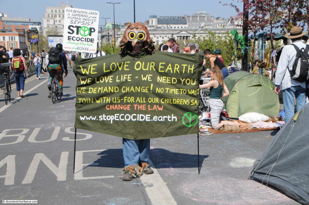
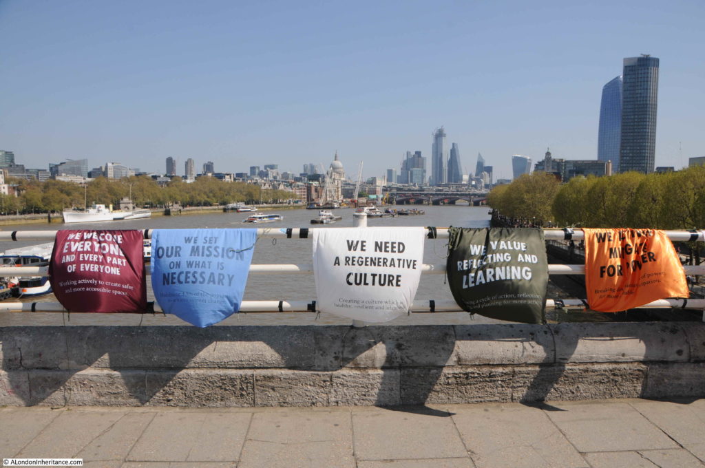
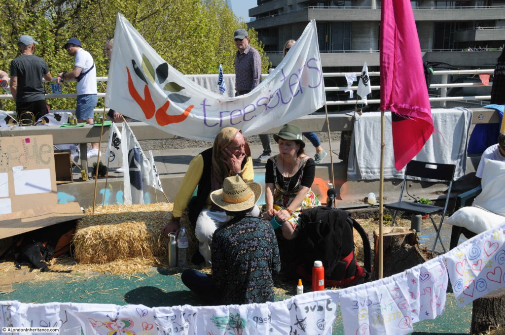
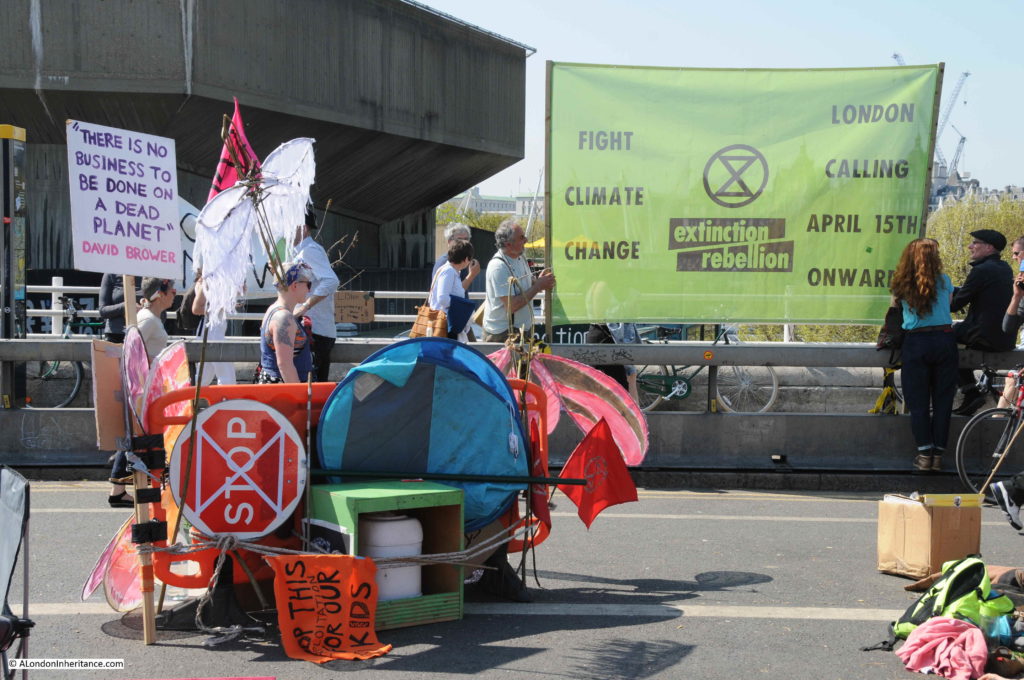
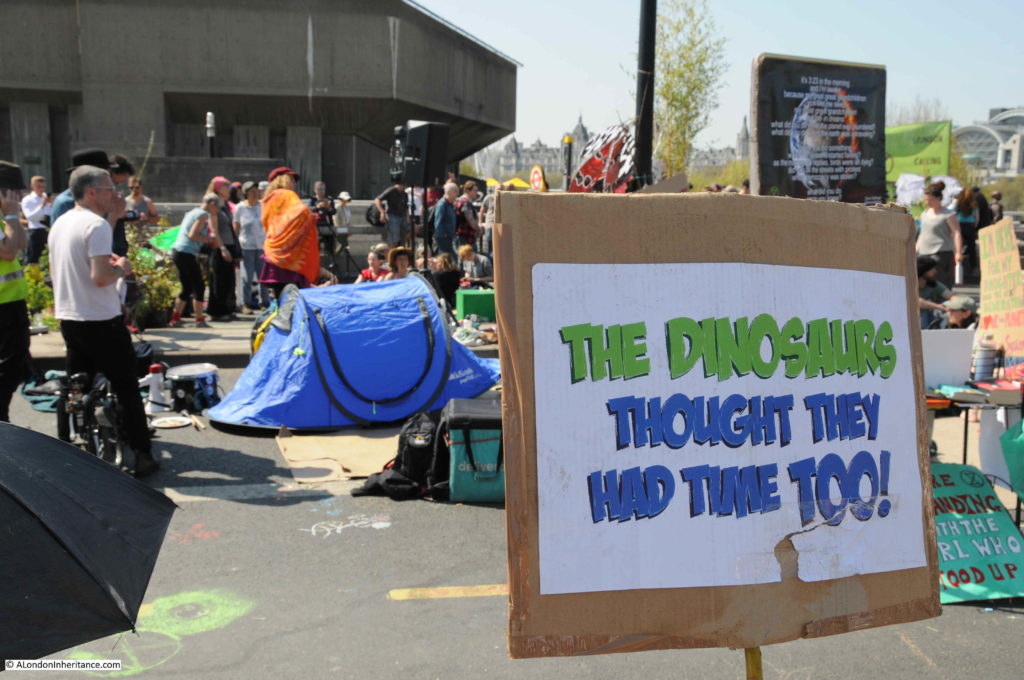
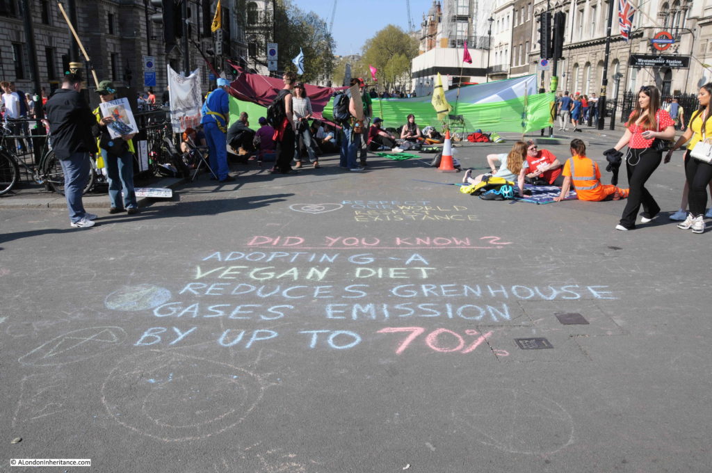
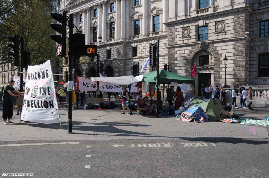
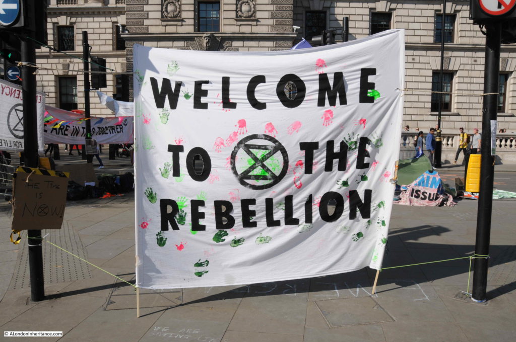
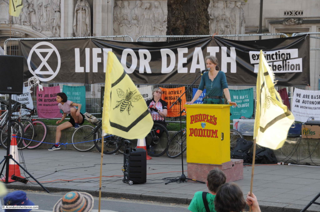
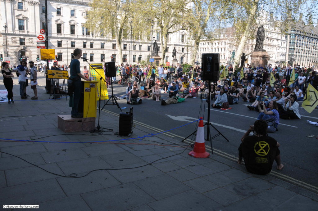
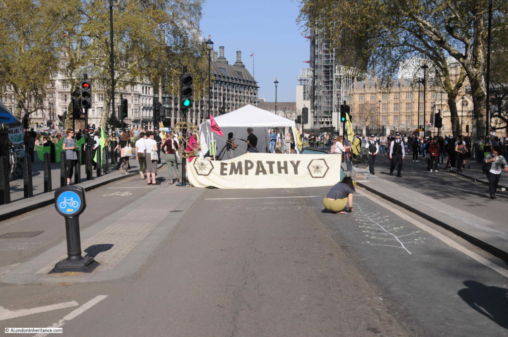
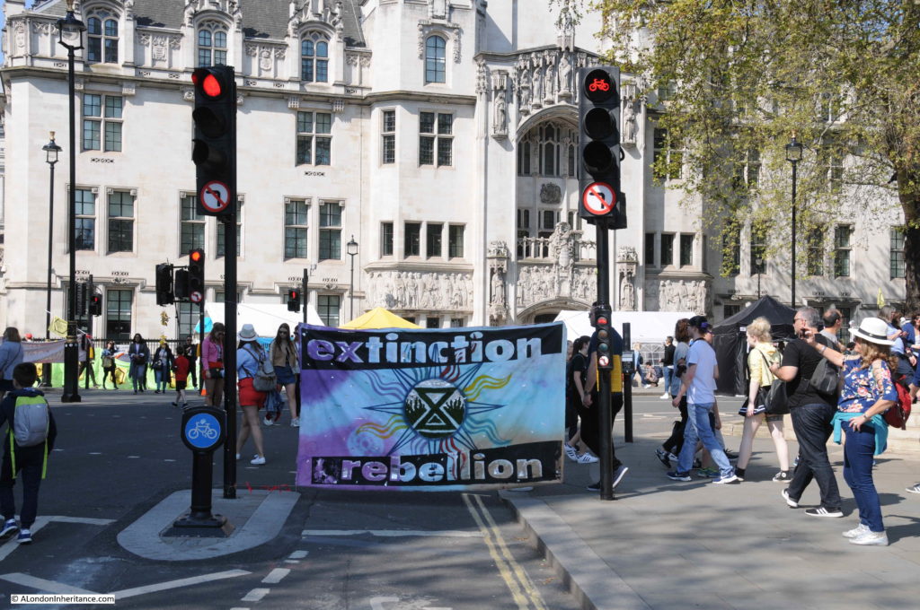
London Protests – Extinction Rebellion

I take a lot of photos of London. As well as photos for the blog, I also take photos of buildings, street scenes, the river, views from the top of buildings, protests and demonstrations, and indeed as many events as I can fit in with work and other commitments. Probably far too many photos, however I have realised a number of things whilst working through my father’s photos.

I wish he had taken far more, there are so many other places that I would love to have seen how they looked after the war and in the following decades. The constraints of photographic film limited the number of photos that it was affordable to take.

It is also the ordinary scene that I find interesting. Not the carefully crafted photo, but photos which show normal, day to day events, street scenes, buildings etc.

Last Sunday’s post was an example. I started photographing London in the late 1970s and the photos of the South Bank in 1980 were just ordinary photos of an ordinary London day – however for me, they tell part of the story of how London continues to develop and change. Both physically, but also in the way London is used by people. I also wish I had taken more photos, but until the arrival of digital photography I was also limited by the cost of film and developing (and time).

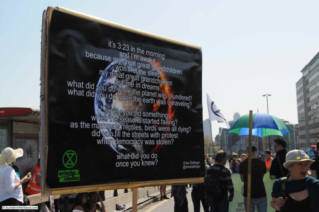
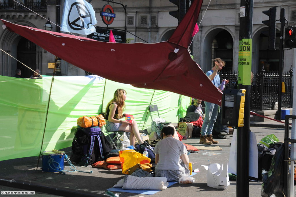
On the same day as my walk along the South Bank, the Extinction Rebellion protests were underway, and as usual, I photographed the event, as I have with many other different protests and demonstrations over the years.

Whenever I photograph London, I try to take an impartial view. Whether a protest, or new buildings – it is the ongoing life and development of London that I find fascinating.

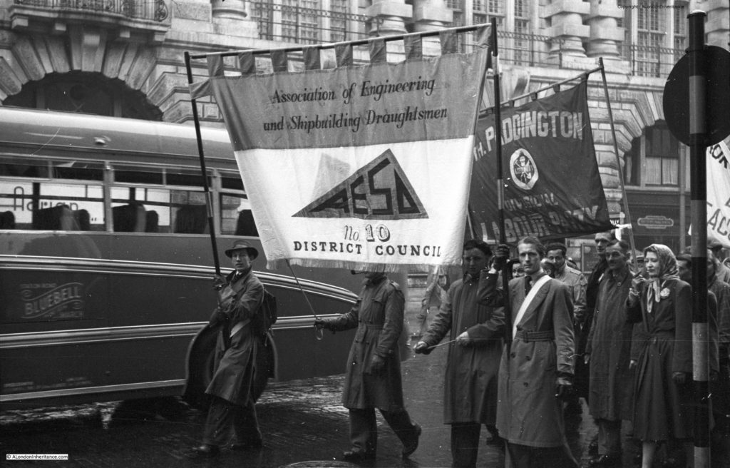
My father’s first photos of protests were taken in 1953, when the Association of Engineering and Shipbuilding Draughtsman marched through Oxford Circus:

London Protests

London is obviously a magnet for protests and demonstrations. The capital of the country, seat of government, assured media visibility for anything that happens in London, these and many other factors play a role in why many of these take place in London.

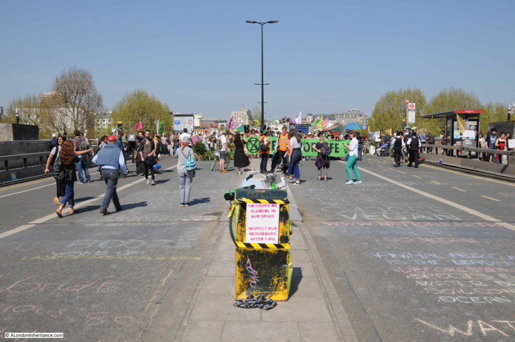
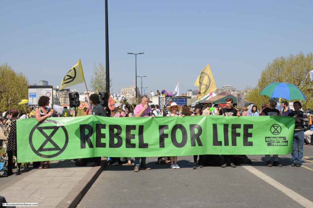
I have photographed many over the years, and to start, here is a view of the Extinction Rebellion protests in London, photographed on Saturday 20th April 2019.

Waterloo Bridge

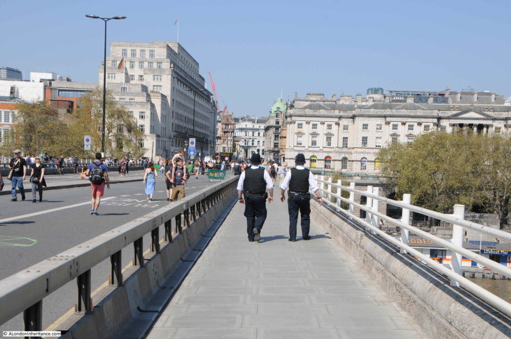
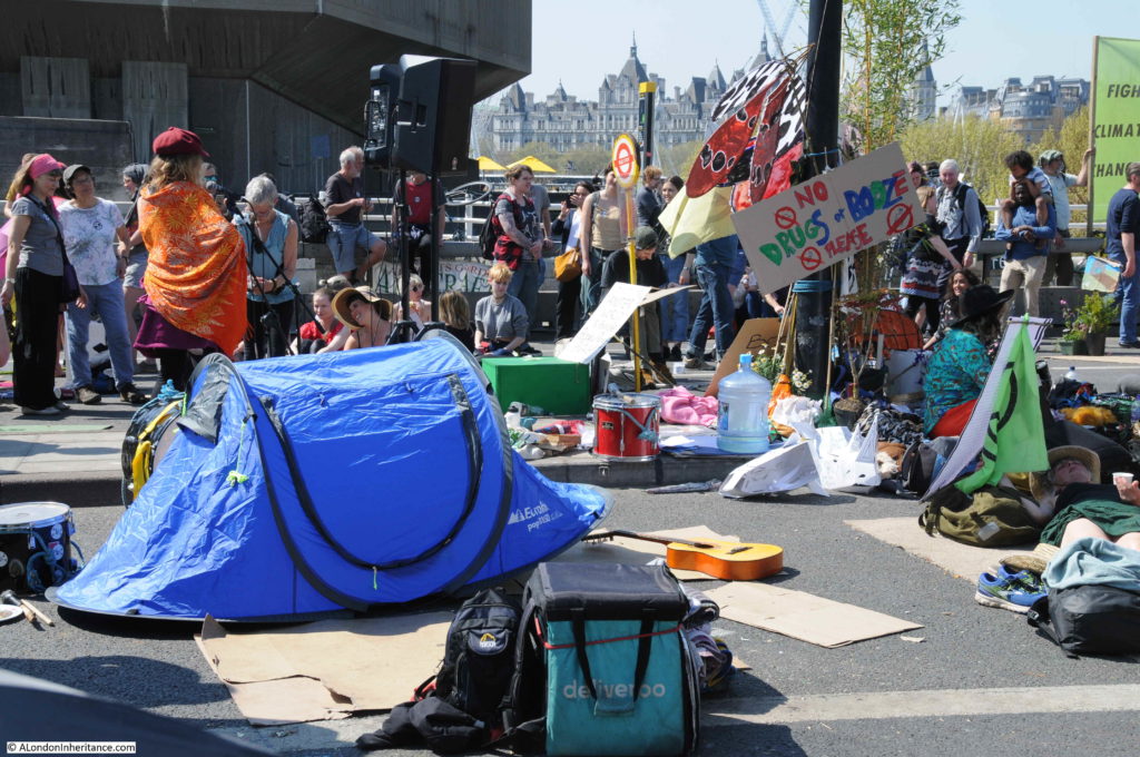
Waterloo Bridge was blocked and had been closed off to traffic for a number of days:

London Protests

London Protests

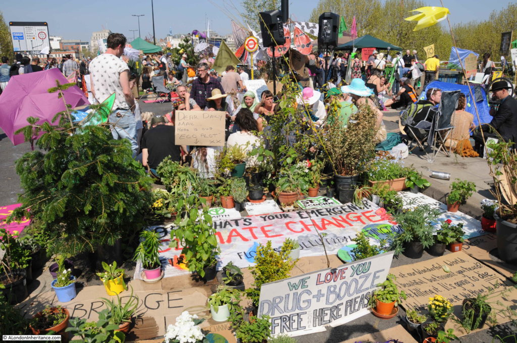
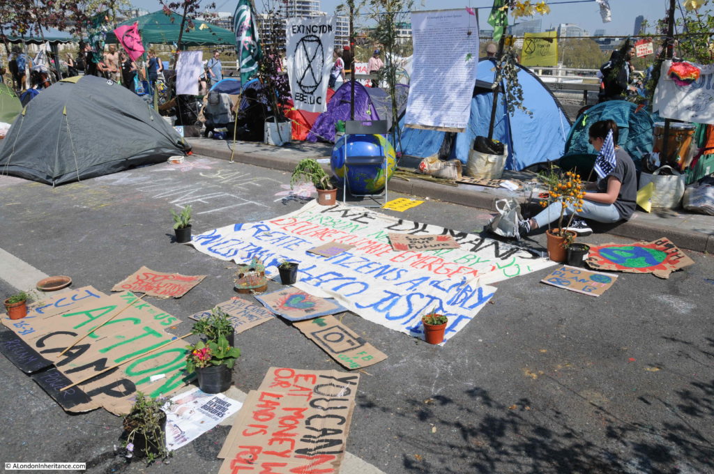
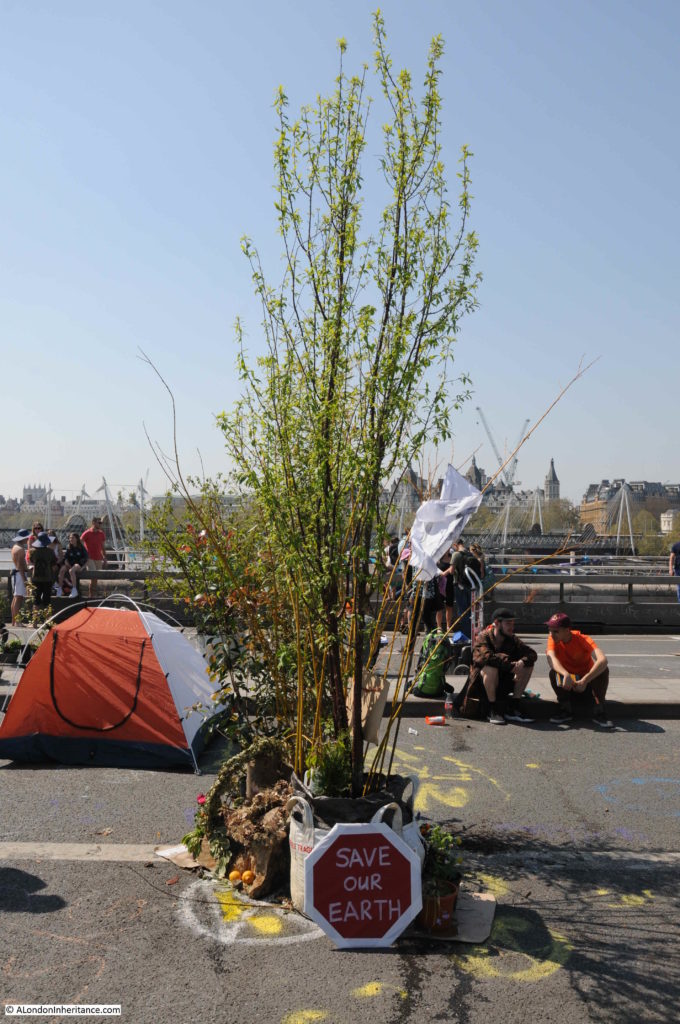
The camps of people across the bridge included large numbers of plants.

London Protests

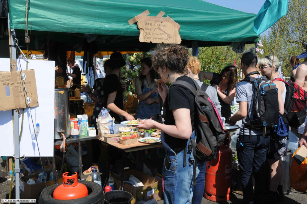
Catering:

London Protests

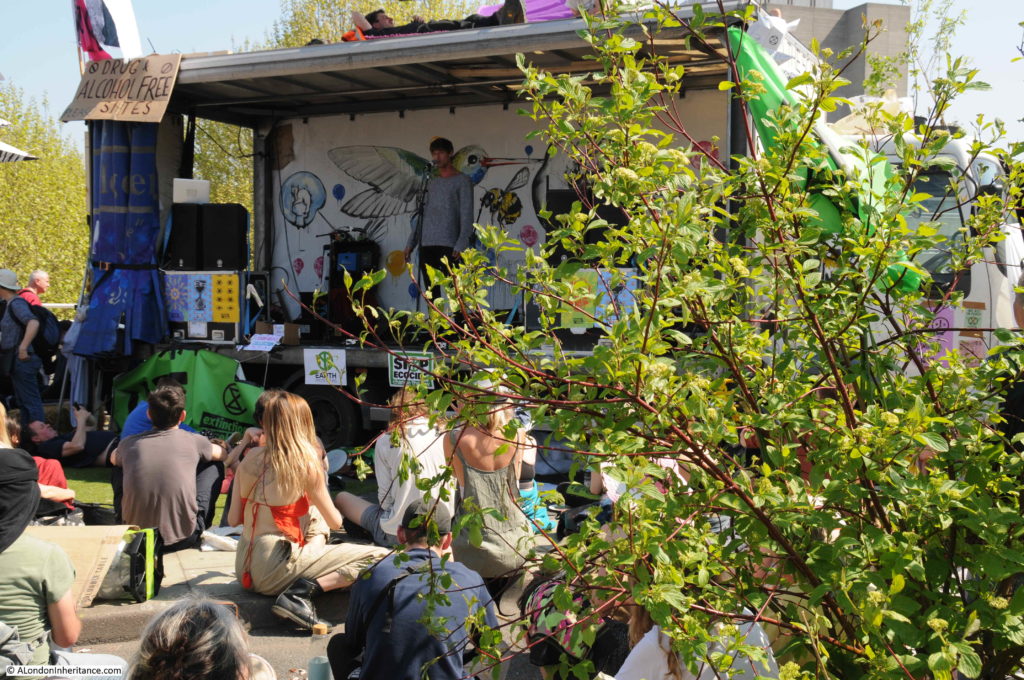
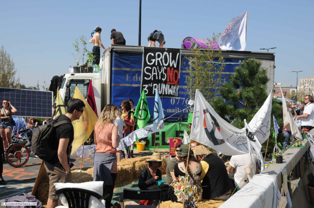
Lorry used as a performance stage:

London Protests

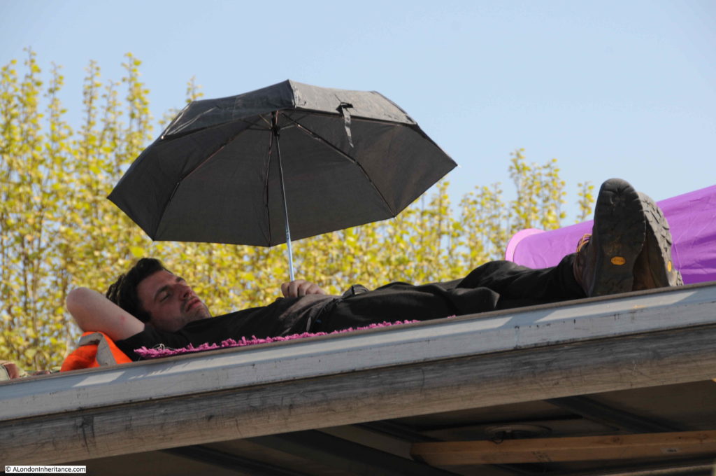
On top of the lorry:

London Protests

London Protests

Campaigning:

London Protests

Slogans on the side of the bridge:

London Protests

Meetings:

London Protests

London Protests

London Protests

On the Saturday the protest was lightly policed, this would soon change when the bridge was cleared.

London Protests

London Protests

London Protests

Compelling slogans:

London Protests

London Protests

Parliament Square

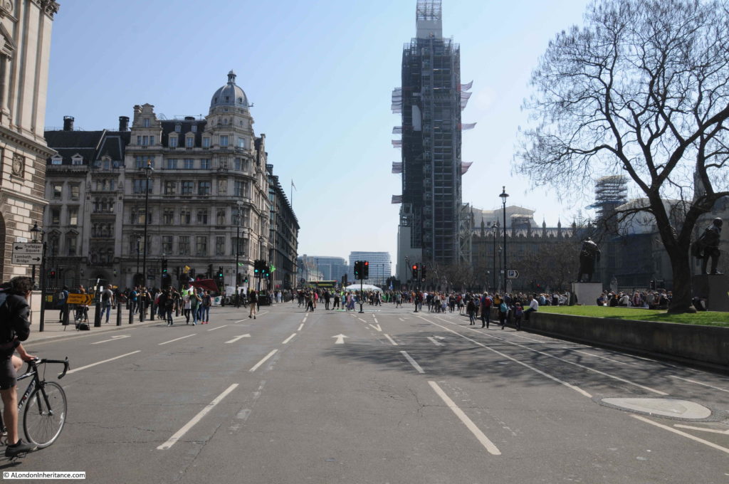
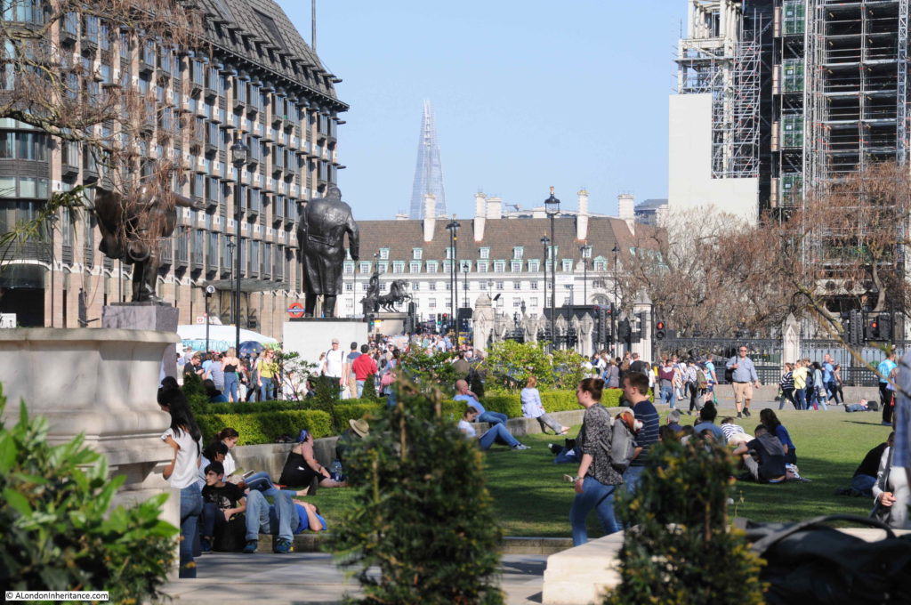
Up until recently the area around the Houses of Parliament were the scenes of pro and anti Brexit demonstrations with the world’s media occupying College Green. With the delay to October the media and demonstrators have left – almost certainly to return at some point later this year. For now, Parliament Square was also closed to traffic, with the Extinction Rebellion protesters occupying many parts of the square. It is perhaps not a surprise how much better the streets of London are without traffic.

London Protests

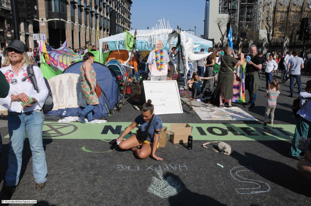
David Attenborough was a feature of the Parliament Square protests:

London Protests

As with Waterloo Bridge, the roads around Parliament Square were covered in chalked slogans and campaigning:

London Protests

London Protests

London Protests

Very relaxed scenes across the square:

London Protests

The People’s Podium:

London Protests

London Protests

In Broad Sanctuary, alongside Westminster Abbey:

London Protests

London Protests

Between Parliament Street and Square:

London Protests

There were other protests at Marble Arch and Oxford Circus – I ran out of time to get to these as I was also exploring some locations in the City for a future blog post.

Whether or not you agree with the method, the message was important, and as ever, London takes on the role of providing a stage for these events.

alondoninheritance.com

5 Years Of A London Inheritance

I started the blog “A London Inheritance” five years ago, at the end of February 2014. I really did not think I would get this far, or be able to keep up the rate of a post a week (which I know is a very low rate compared to some bloggers).

The original aim of the blog was to track down all the locations of my father’s photos, and also to provide a kick for me to get out and explore more of this wonderful city. I hope I am still true to that original aim, and I feel that I have explored and learnt so much during the last 5 years. Getting out and walking really is the best way to discover London.

I still have very many photos where I need to track down the location, new places to visit, themes for walks – I just need to find the time.

Can I also offer my thanks to everyone who reads my posts, subscribes, comments and e-mails. I apologise for being so dreadfully bad at responding to these. When I finish one blog post it is a panic to get the next completed in time. Work and other activities take time, and I am very aware that many of my posts are too wordy and need a bit of a rewrite, so I apologise for inflicting these on you.

I was not sure what to write about to mark five years, so what follows is a bit of a brain dump on the past year, what fascinates me about the process, photography, and some thoughts for the future.

The Most Read Post

My most read post of the year is one that I wrote the previous year.

In August 2017 I wrote about St. James Gardens. I had photographed the area shortly before the site was closed ready for the archaeological excavation in preparation for the extension of Euston Station for HS2.

This post was popular at the time and consistently ranks high for viewers. Occasionally there is a very high peak of viewers which usually happens when there is news of a discovery at the excavation.

In January it was announced that the grave of Captain Matthew Flinders had been discovered in St. James Gardens.  Flinders was the first European to circumnavigate Australia in HMS Investigator, demonstrating that Australia was a single continent.

The following graph shows my site states for the days around the announcement of Flinders discovery. The peak day of the announcement was Friday, January 25th and the blog received several thousand views, the majority all going to the page on St. James Gardens that I had written about in August 2017.

London Inheritance

The excavations at St. James Gardens and the changes around Euston are, rightly, of considerable interest. I have e-mailed questions to HS2, but get the same response that, judging from comments on the blog, everyone else gets – a very standard response with answers only to very basic questions.

I can understand why, the scale of the work is considerable and must be handled in a sensitive and considerate manner, but I do suspect it would help with the public perception of the work around Euston if more regular detail on the excavations was made available.

The preparation for HS2 also highlights the rate and scale of change. Just within the last couple of years a whole area of streets have been cordoned off and will soon become part of a much enlarged Euston station. I returned to the site earlier this year, and plan to make an annual visit to photograph the changes as HS2 and the new Euston station gradually complete.

London Ghosts

By ghosts, I do not mean the traditional definition, rather the traces that are left behind by the millions of people who have lived, worked, or just passed through London. Not necessarily those who are famous and have blue plaques or other memorials, rather finding a trace of someone who had a very personal connection with the city.

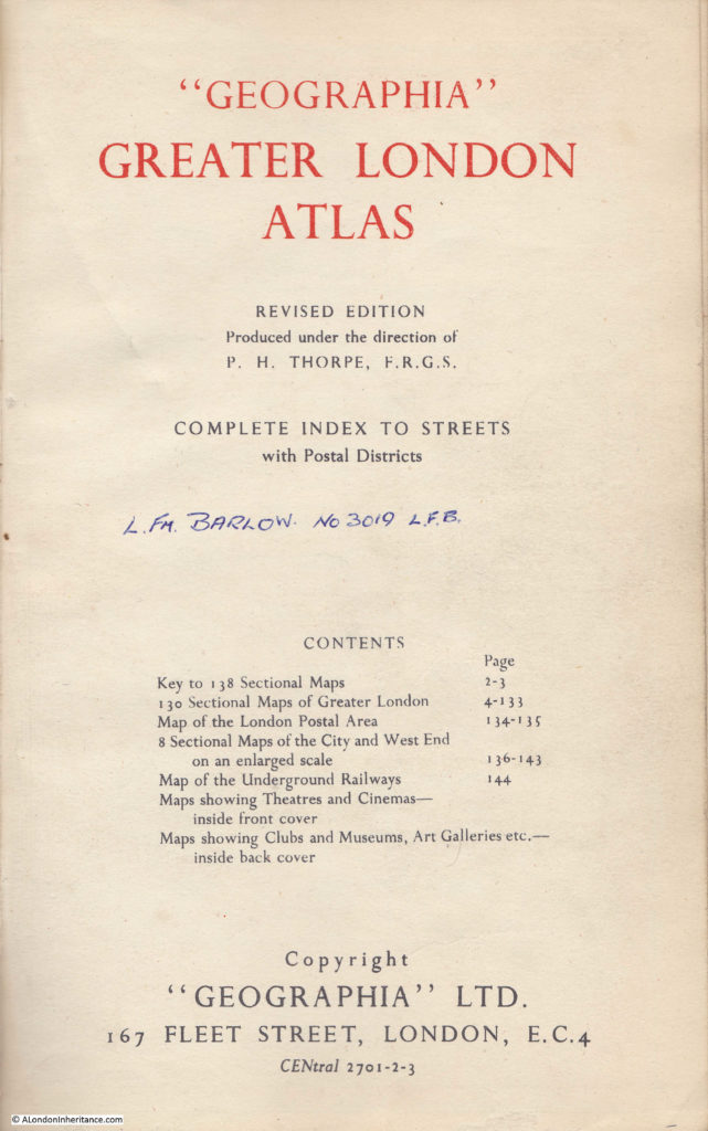
I love London books and these often provide a link. One of my favourites I found in a copy of the “Geographia” Greater London Atlas. I am not sure of the exact date, but this version was published towards the end of the 1950s or very early 1960s.

On the title page is the name of the owner – Leading Fireman Barlow, No. 3019 of the London Fire Brigade.

London Inheritance

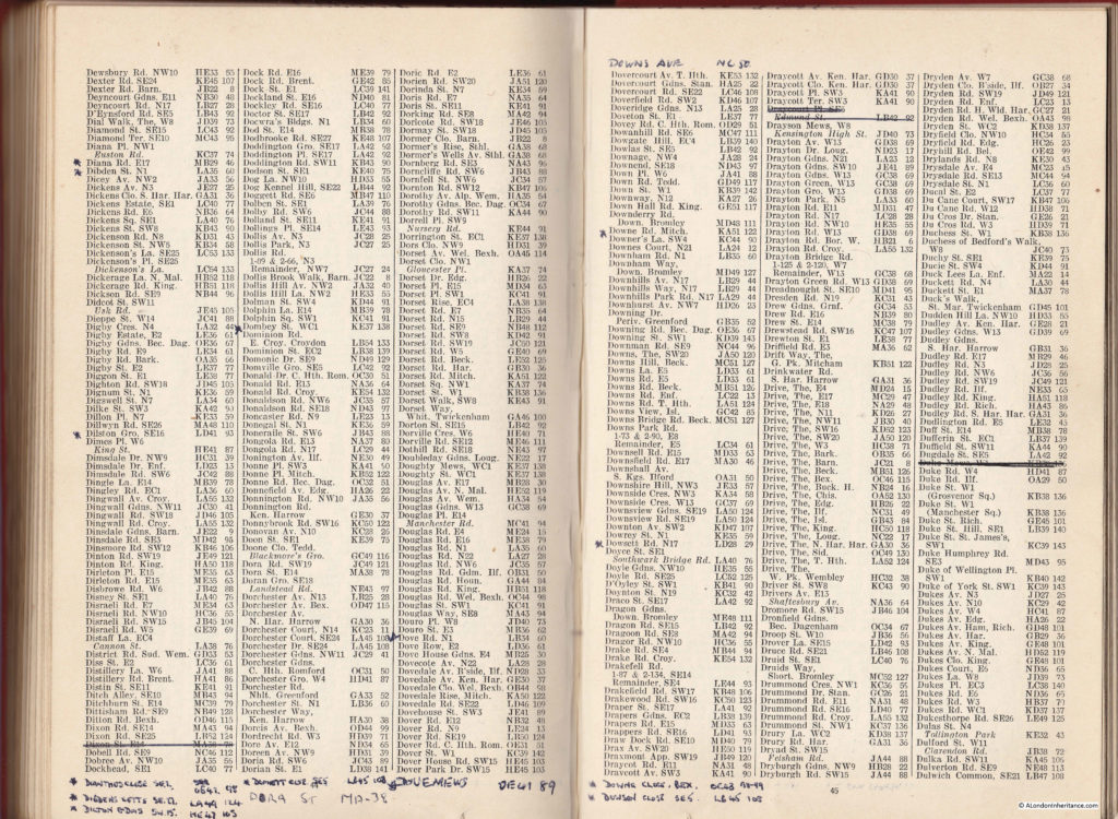
The atlas itself is fascinating enough, lots of lovely pages of colourful maps, but the street index tells the story of how a London Fireman must have kept up to date with street changes across London – long before the days of Satnavs, Google Maps and the IT that is now deployed to a fire engine.

In every single page of the street index, streets have been neatly crossed out, and new names and references have been written at the bottom of each page.

London Inheritance

What it appears that Leading Fireman Barlow was doing was keeping his atlas up to date as streets disappeared and new streets were built across the city. This was a time of considerable change with post war rebuilding gathering pace.

A couple of examples. In the above pages, at lower left, Dixon Street E14 has been crossed out. Looking in the atlas, Dixon Street is one of a cluster of streets in Limehouse, just to the north east of the Regent’s Canal Dock.

London Inheritance

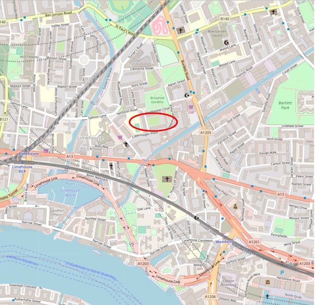
This area was considerably rebuilt in the late 1950s and 1960s with the loss of many of the streets that once covered Limehouse. The following map shows the area today with the original position of Dixon Street marked.

London Inheritance

Map  © OpenStreetMap contributors. 

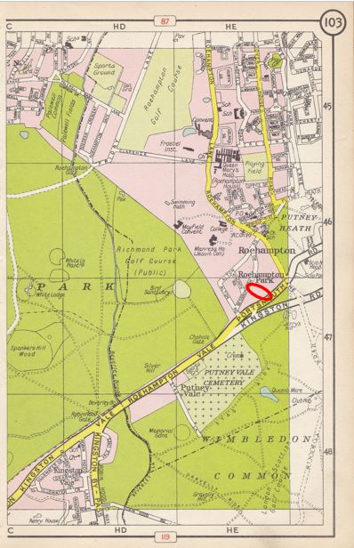
As well as the loss of streets, Leading Fireman Barlow had to keep up with new streets. At the bottom of the same index page is a reference to Dilton Gardens, SW15, HE47, 103. The last number is the page number and the preceding number is the grid reference within the page.

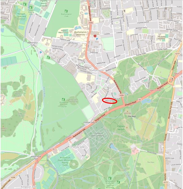
Turning to page 103 and we are now in south west London, just to the east of Richmond Park. I have marked the location of the new street with a red oval.

London Inheritance

The map of the area today with Dilton Gardens ringed. The map today shows the large area of infill between the boundaries of the park and Roehampton Lane which has been built since the publication of the atlas.

London Inheritance

Map  © OpenStreetMap contributors. 

What surprised me was the range of updates, covering the entire area of the atlas. Leading Fireman Barlow was interested in the whole of Greater London, not just his local fire station. I also wonder from where he got the information? Was this official London Fire Brigade policy to provide updates to staff and did they keep their own atlases up to date? This was at a time when a fireman would have needed to navigate the streets of London using their local knowledge or with paper maps.

Leading Fireman Barlow was very conscientious in updating the atlas and I would love to know why and how.

I found a very different trace of a Londoner in a book I purchased a couple of years ago in a second hand bookshop in Lichfield.

This book, “Achievement – A Short History of the LCC” was published in 1965.

London Inheritance

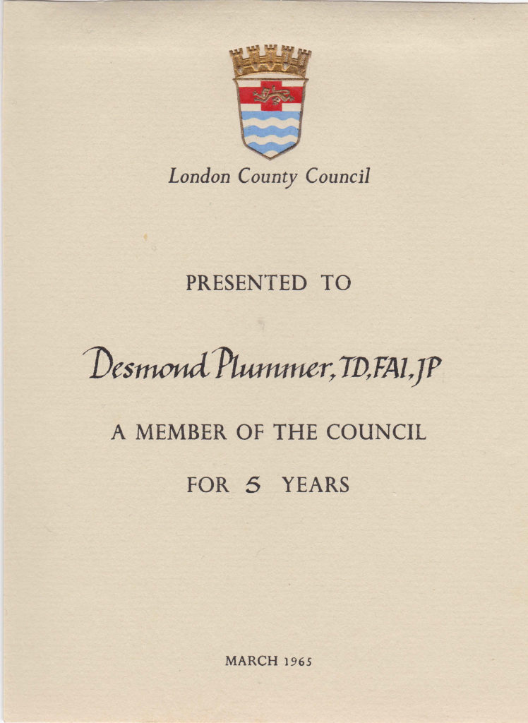
The book itself is a fascinating read on the London County Council, mainly focused on the years 1939 to 1964, however what turned the book from a printed copy of information, into something with a specific history was the presentation slip on the inside of the book.

London Inheritance

Desmond Plummer was the Conservative Councillor for St. Marylebone to the London County Council from 1960 until 1965. The date is relevant as March 1965 was the last month of the London County Council as the Greater London Council (GLC) took over from the 1st April 1965.

After the formation of the GLC, Plummer was elected leader of the Conservative opposition and became leader in 1967 when the Conservatives won a majority on the GLC. He would continue as leader of the GLC until 1973.

Plummer was a firm believer in the need to upgrade London streets to support the growing levels of traffic, and during his time as Leader, the Westway was built between Marylebone and Acton. He was also in favour of the London Motorway Box scheme, which would have seen the construction of a 30-mile-long, eight-lanes-wide elevated inner ring road (very similar to the schemes published in the “The City of London – A Record Of Destruction And Survival” in 1951). Thankfully, this did not get built.

He died in October 2009 at the age of 95. I do wonder how the book presented to him in the last month of the London County Council came to be in a bookshop in Lichfield?

London Photography

My blog is based on photographs. Tracking down the location of my father’s photos from the late 1940s onward has been a constant theme for the blog.

I started taking photos when as children we were taken on walks through London. My very first camera was a Kodak Instamatic. It used a 126 film cartridge which made it very easy to use as the cartridge slotted directly into the back of the camera. The format of the negatives and the printed photos was square rather than the rectangular output of traditional 35mm film.

The camera only had two light settings, bright and shady, so getting perfect photos back from being developed at Boots was a bit hit and miss. This simplicity did ensure the camera was ideal for a very young beginner.

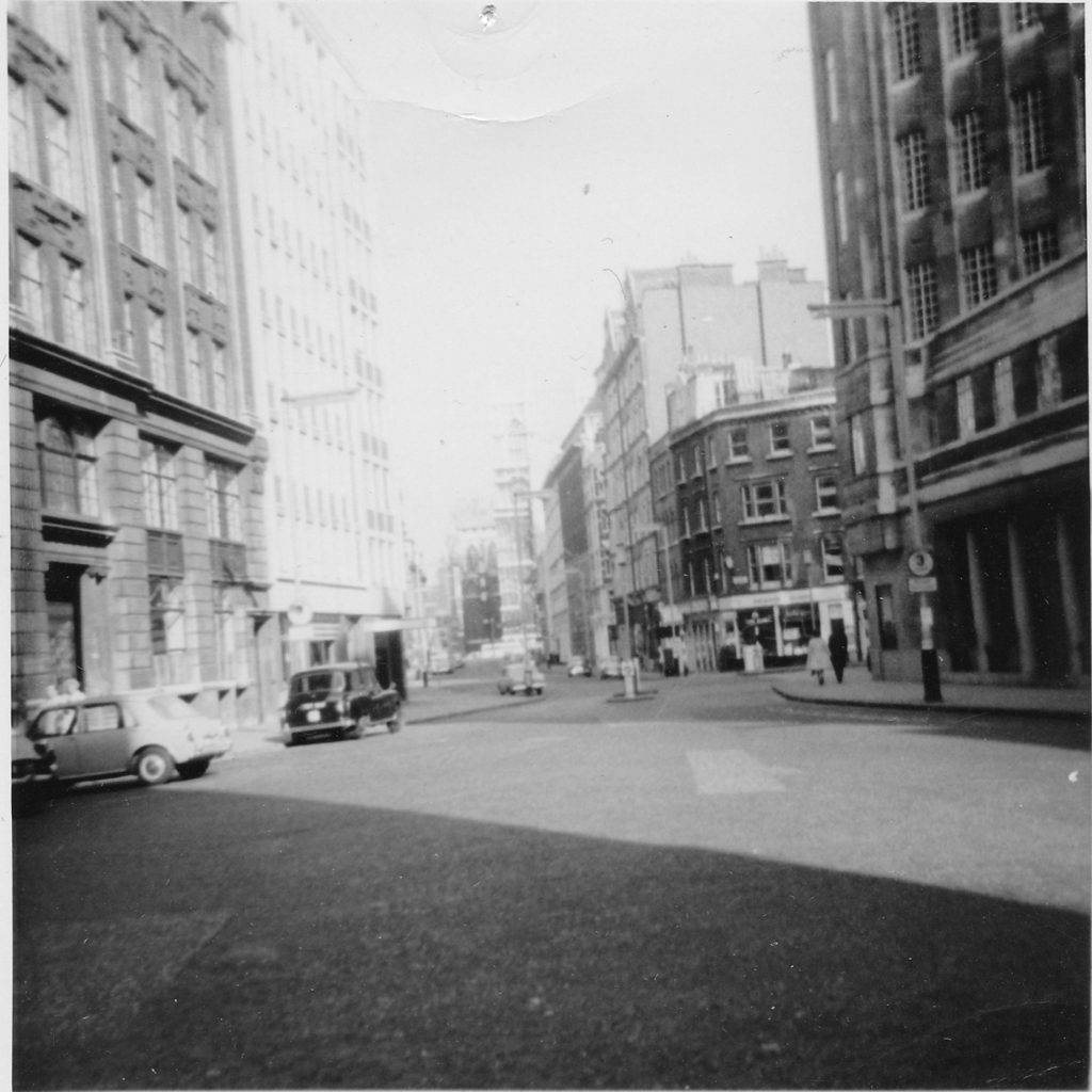
I recently found some of my early London photos taken with the Kodak Instamatic in an old shoe box, so here is a sample of my first London photos taken in either 1971 or 1972.

This photo was taken in Broadway, looking down Tothill Street towards Westminster Abbey, which can just be seen at the end of the street.

London Inheritance

The large building on the right is the London Underground head office at 55 Broadway.

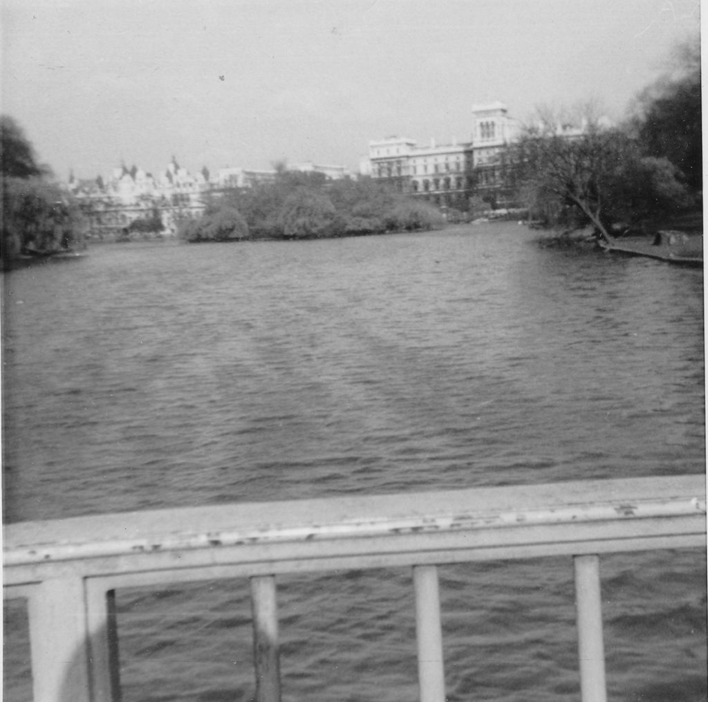
The following photo was taken on the bridge over the lake in St. James Park looking east towards the Government offices along Horse Guards Road.

London Inheritance

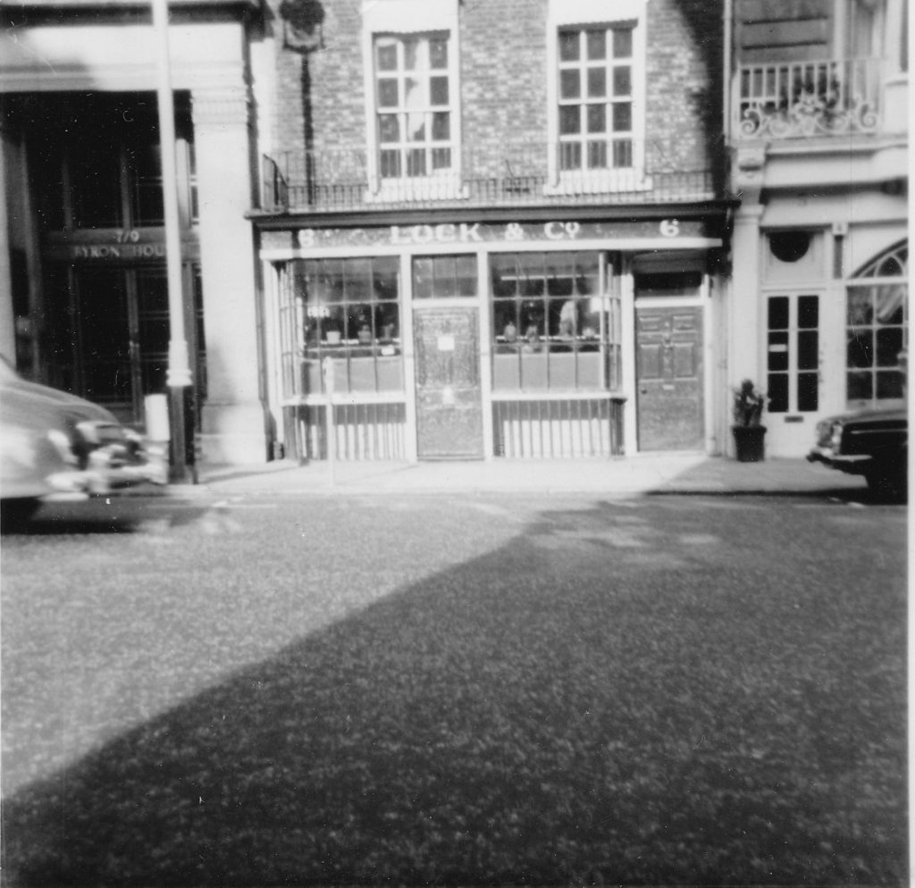
The following photo is the hat shop of Lock & Co at 6 St. James’s Street. London Inheritance

It is some 48 years since I took the photo of Lock’s, however this is a trivial amount of time since the shop was first established at 6 St. James’s Street in 1765. The shop looks almost identical today.

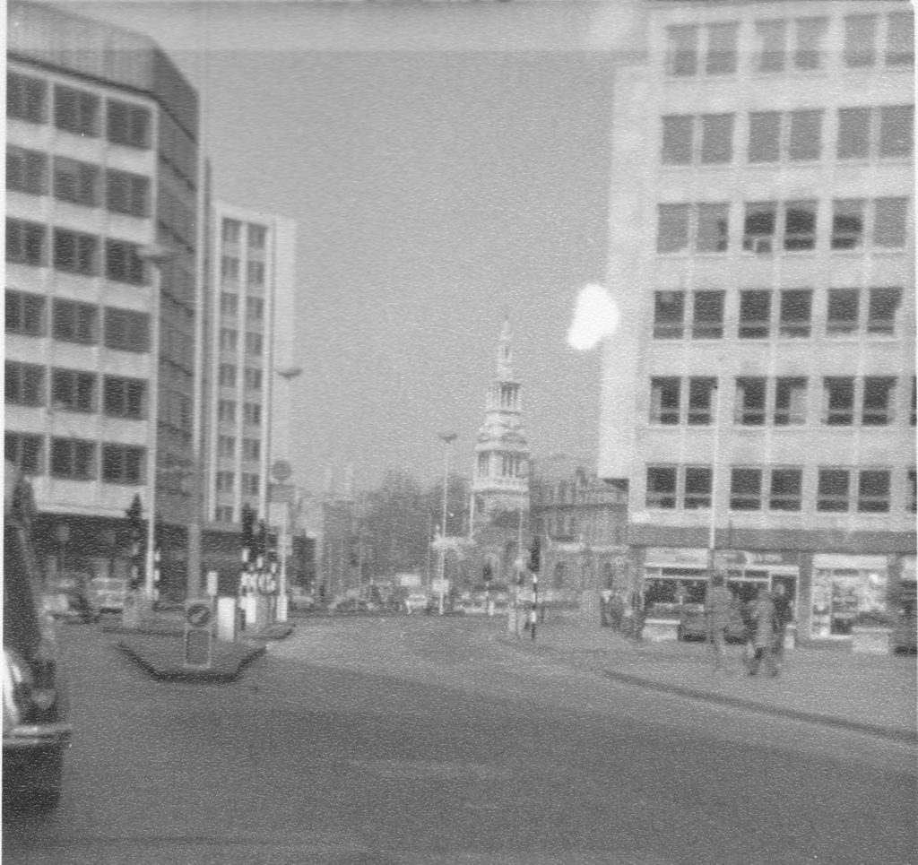
The following photo was taken in Cheapside, at the junction with New Change. The church is Christchurch Greyfriars.

London Inheritance

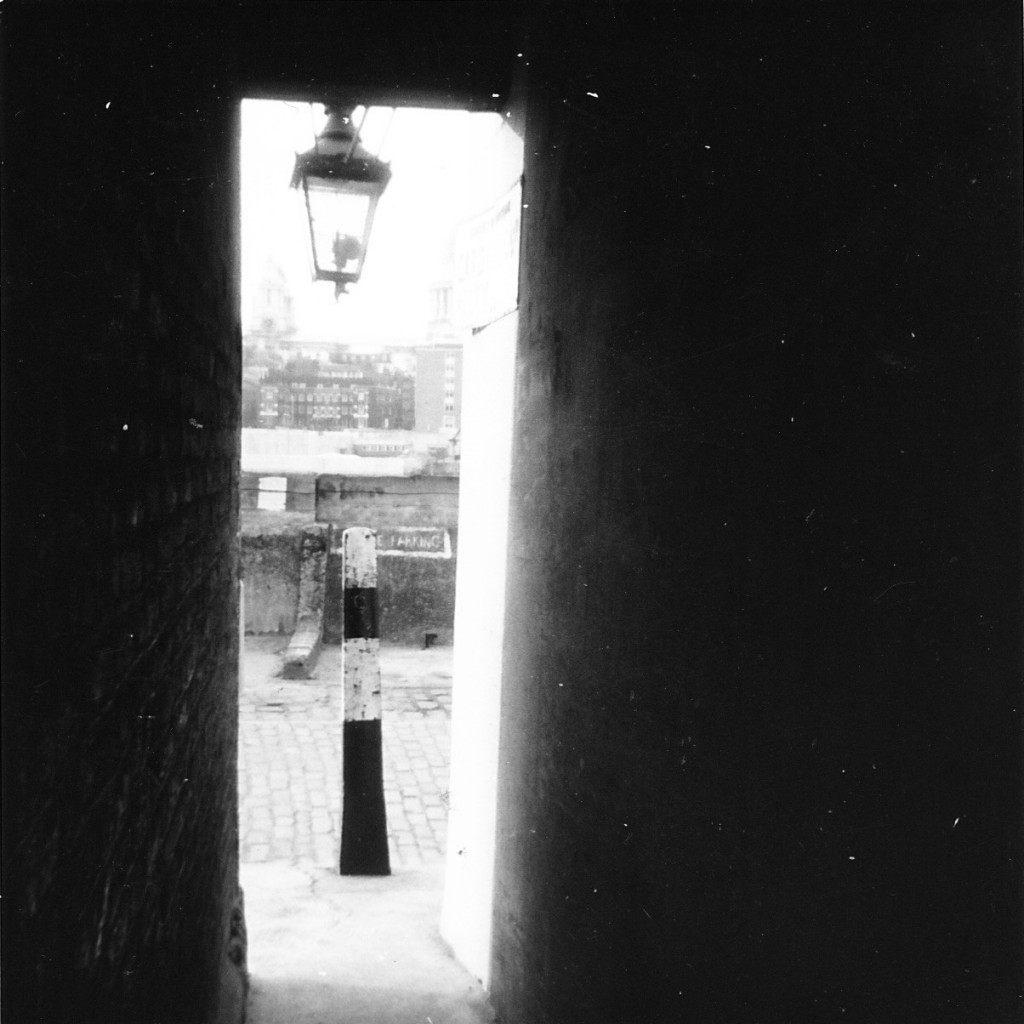
The view from within Cardinal Cap Alley, Bankside, looking across to St. Paul’s Cathedral.

London Inheritance

The alley is gated now, but in the early 1970s, Bankside was an area to explore and had not seen any of the development that would so change this stretch of the river.

I took these photos around 48 years ago. I still have them as they were developed and printed out and these photos have been in a shoe box of photos for the last four decades. Digital photography has opened a whole new world in capability and volume of photos, however I do wonder how many of the amateur photos taken today will still be around in 50 years time.

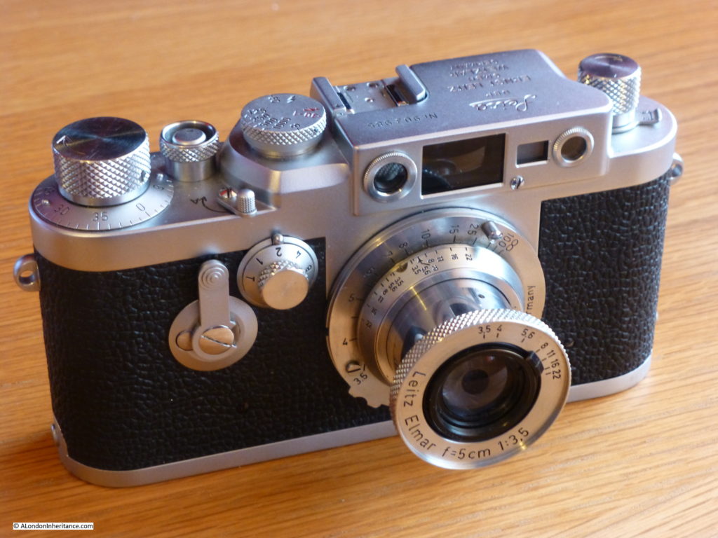
I last used film for photography about 18 years ago, however one of my planned projects for the coming year is to get back into the use of film. This is my father’s Leica IIIG camera.

London Inheritance

He purchased the camera body in 1957 so it is not the camera used for the majority of the early black & white photos I have published, however the lens is much earlier and was fitted to the Leica IIIc that my father used for his early photos.

I have had the camera serviced as the shutter was sticking, and I have brought some Ilford black & white film so I am ready for some film photography of London. I just need to learn how to use the camera and a separate hand held light meter to set up the correct exposure settings on the camera.

Hopefully later this year you will see some 2019 black & white film photos of London on the blog.

A Year Of Posts

I have been to some really interesting places during the year and discovered how much London has changed, but also in many places, they look much the same.

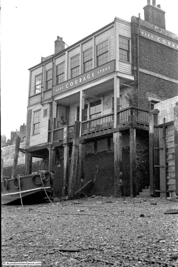
In December I wrote about the Angel. A brilliant pub on the south bank of the river in Rotherhithe. My father had photographed the pub from the foreshore of the river in 1951.

London Inheritance

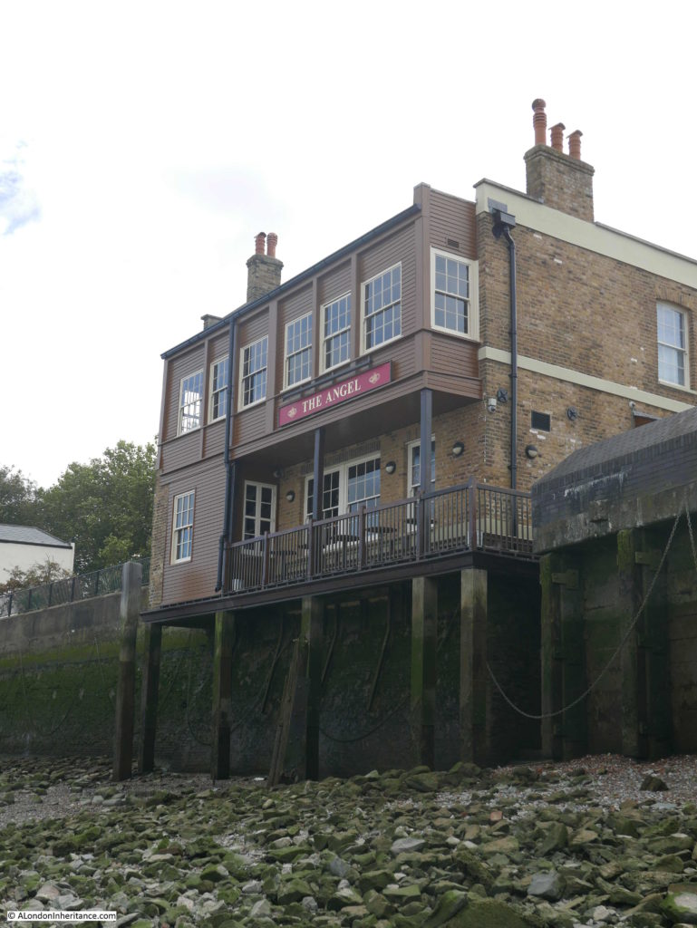
Sixty seven years later I was standing in the same position taking a photo of the same pub. The surroundings have changed dramatically, however the pub is much the same.

London Inheritance

Like all London pubs, the Angel has had to adapt to survive and now serves a very different set of customers to when my father took the photo. By chance, from the same year there is a Daily Mirror article written in October 1951 by a journalist who was taken to various locations along the working river by a “merchant skipper”. One of these locations was the Angel, Rotherhithe. He writes of the experience:

“The Angel, Rotherhithe, where the skipper has to meet this mate of his is full of watermen when we arrive. One stocky waterman called Jim – a tough looking character with a grey stubble of a beard – is telling a story indignantly: “So I’m in my boat having a clean-up he is saying, w’en along comes this toff in a boat wearin’ a pair of flippin knickers and a flippen cap. ‘E is trainin some girls ‘ow to sail. Trainin’ em, Jim repeats darkly.

So ‘e comes smack-bang into my boat. O’ course, I could’t even talk to ‘im proper since there were ladies present. ‘get away from my boat, you unsophisticated chucker’ I shouts, ‘E looks up and says: ‘My man’ ‘e says, ‘do you know ‘oo I am?’

‘You might be flippen Joe Louis I says gettin’ really aggravated. But you don’t look like ‘im. An’ unless you push off from my boat this instant, I shall flippin’ well come down and knock your flippin’ ‘ead off – fancy cap an’ all.”

I am sure there was some journalistic embellishment, but an interesting tale from when the customers of the Angel were those who worked on the river and the surrounding warehouses and industries.

Last August we went to the Netherlands. We had lived there for 5 years from 1989 and wanted to revisit places and friends. My father had also cycled round the country in 1952 with some friends he had made during National Service, and as usual took his camera with him. I had not scanned these negatives when we lived in the country, so this was also an opportunity to visit the places he had photographed.

I am fascinated by how places can be connected. Cities do not stand in isolation. London has a road and rail network radiating out across the country and a river flows through the city. There are also networks of power, religion, monarchy and finance which have shaped the City and Country. Trading routes, flows of people from within the country and to and from the world have also established networks of connections.

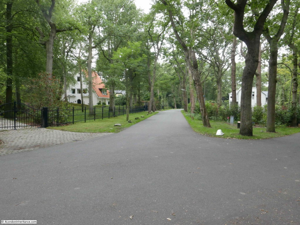
There are also very unique points of connection. A single event that happened at a specific point in time, and I found one in a wooded suburb of the Hague, when I went to Wassenaar to find the launch location of the first V2 rocket to hit London.

London Inheritance

And a week later on the anniversary of the launch, I went to the site in Chiswick where the rocket landed. At each location there is a small memorial pillar that records the date and the event.

London Inheritance

Two places, 205 miles apart which will forever have a tragic connection.

The Oosterbeek War Cemetery was one of the many locations that my father visited in the Netherlands. He went to many of the locations associated with Operation Market Garden, the battle made famous in the book and film ‘A Bridge Too Far’. Not a surprising set of locations to visit given he had grown up during the war, had just finished National Service and these events were only 8 years previous.

The Oosterbeek War Cemetery really brings home the huge loss of life and the very young age of so many who died. The majority of those killed on the Allied side of the battle were British and Polish forces and I found a number of the graves that my father photographed in 1952 and for the blog post was able to find some of the stories behind those buried here.

London Inheritance

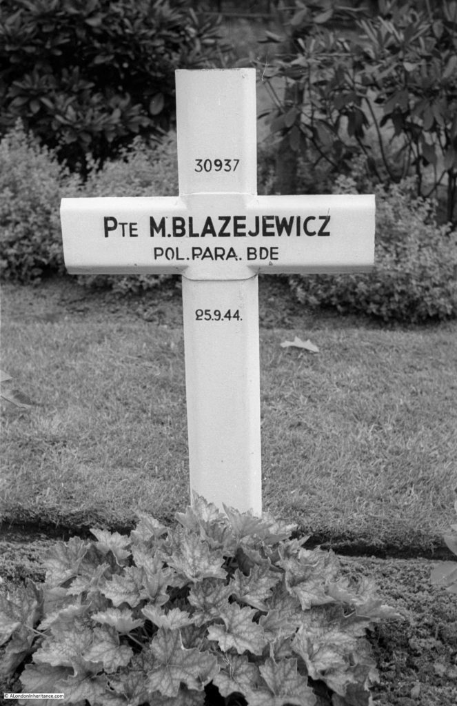
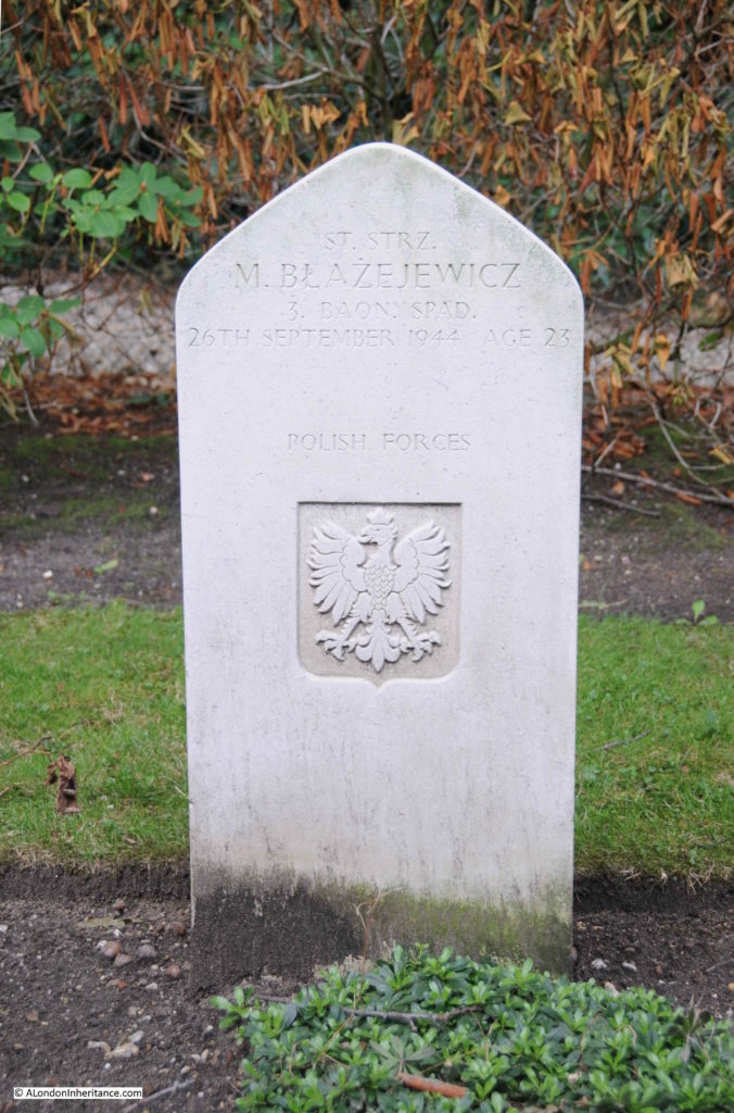
The photos above and below show the temporary marker in 1952 and the permanent stone marker in 2018 on the grave of Mieczyslaw Blazejewicz. A rank of Starszy Strzelec (this seems to translate to a Senior Private or Lance Corporal) in the 3rd Parachute Battalion of the 1st Polish Independent Parachute Brigade. He was born on the 24th November 1920 at Lancut, a town in south eastern Poland.

He was killed whilst trying to cross the River Rhine to get to Oosterbeek on the 26th September 1944. As with many of those killed whilst trying the cross the river, his body would drift downstream and be later recovered from the river at Rhenen on the 9th October. He was 23, just two months short of his 24th birthday.

London Inheritance

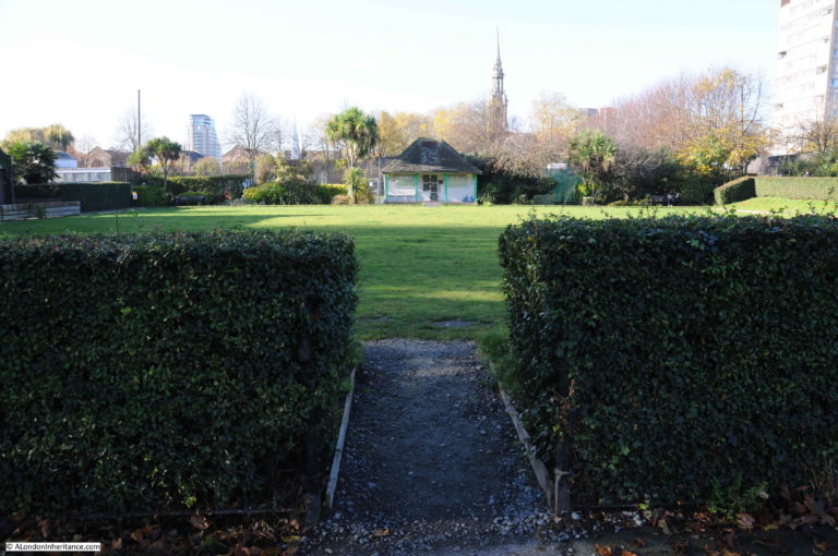
One of the posts I found personally most interesting was about the King Edward VII Memorial Park in Shadwell. I have walked along the river at the side of the park many times and occasionally through the park, but decided to explore the park in more detail.

I found a partially derelict pavilion and the flat grass of a bowling green, both of which had once been for the Shadwell Bowls Club.

London Inheritance

I was initially going to write about the park as I found it, but the more I researched, the more I found. A fascinating history of an area once crowded with streets, houses, pubs, industry, and a fish market that was a potential rival to Billingsgate.

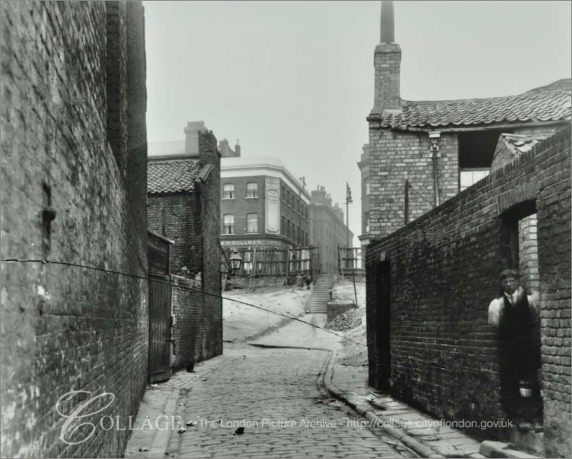
I also found a collection of photos on the London Metropolitan Archives, Collage site and was able to trace the locations of where the photos were taken.

This photo is looking up towards the High Street (the Highway) along Broad Bridge. The building on the left is the Oil Works and residential houses are on the right. Note the steps leading up to the High Street, confirming that the height difference between the Highway and the main body of the park has always been a feature of the area, and is visible today with the terrace and steps leading down to the main body of the park.

London Inheritance

Image credit: London Metropolitan Archives, City of London: catalogue ref: SC_PHL_01_381_A361.

Again, another way in which the ghosts of those who have lived and worked in London return, hidden within books, maps, photographs and the physical traces we can find when out walking.

To finish, can I again thank you for reading the blog, subscribing, following, commenting and e-mailing and putting up with my random travels around London and further afield.

I am now off to try to learn how to use a sixty year old film camera.

alondoninheritance.com

Trafalgar Square, New Year’s Eve, 1981

In my last post of the year, I revisit an earlier New Year’s Eve celebration in London, but can I firstly wish you all a very Happy New Year for 2018 and thank you for reading my posts and your feedback over the past year – it is so very much appreciated.

New Year’s Eve in London has become a very organised event. Large areas of central London are closed, tickets must be purchased, and sell out very quickly, security will, understandably, be very tight. This is all very different to my first experiences of New Year’s Eve in London. In the late 1970s and 1980s we would occasionally spend the evening out and about, wandering the streets, pubs, clubs of the West End and celebrating midnight with thousands of people in Trafalgar Square.

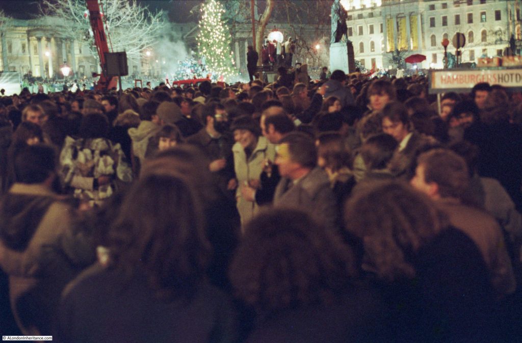
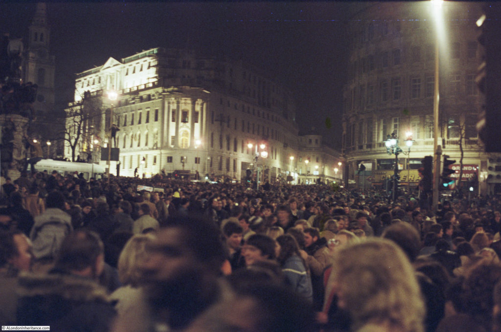
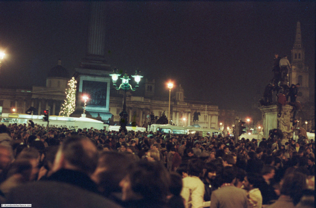
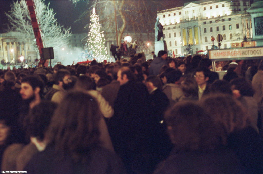
One year I took my camera with me and recently I found some of the negatives. Many had camera shake a I was trying to take hand held photos at night and using a film camera. I still have to find some of the other negatives of photos taken whilst walking the streets, however here is a set of photos taken in the crowd in Trafalgar Square on New Year’s Eve, 1981.

New Year's Eve

Trafalgar Square was then the centre of New Year’s Eve celebrations until the focus moved to the Embankment with the firework displays along the Thames.

My memory of these nights in London are probably influenced by the passage of time and alcohol on the night (the reason why I only risked taking my camera along on one New Year’s Eve), however I remember the very large crowds that assembled in Trafalgar Square ready for midnight and so many people walking the streets before and after midnight, usually with bottle or cans in hand.

New Year's Eve

This was only 36 years ago, but it feels like a different world. If you compare these photos with those of the crowds in London tonight there is one very big difference – in 1981 there was not a single mobile phone in sight. Tonight the glow of mobile phone screens taking photos of the fireworks, selfies etc. will be seen across the crowds.

There was also minimal security, I do not remember seeing many police around and those that were visible would not be armed.

I do not remember any road closures (although the roads around Trafalgar Square probably were closed), however there was hardly any traffic. I do remember the freedom to wander the streets into the early hours and the alcohol induced friendliness of everyone on the streets – probably one of the few times Londoners will talk to so many strangers.

There was also a need to be careful – as when any such large crowd assembles there were rowdy elements, those who had been drinking too much and for too long, and crime such as pickpocketing – but at the age I was then it was all a big adventure.

New Year's Eve

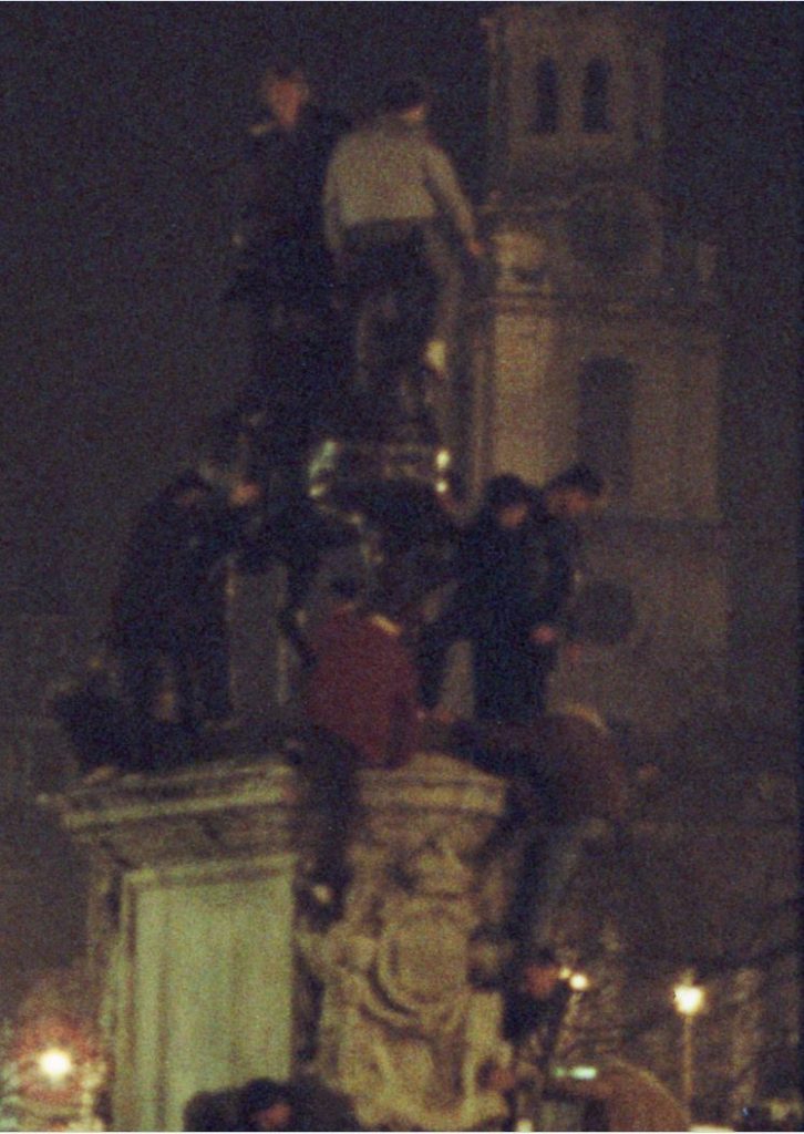
Some detail from the above photo – if it could be climbed then it would be climbed:

New Year's Eve

The only organised facilities that I remember were some first aid facilities around the base of Nelson’s Column:

New Year's Eve

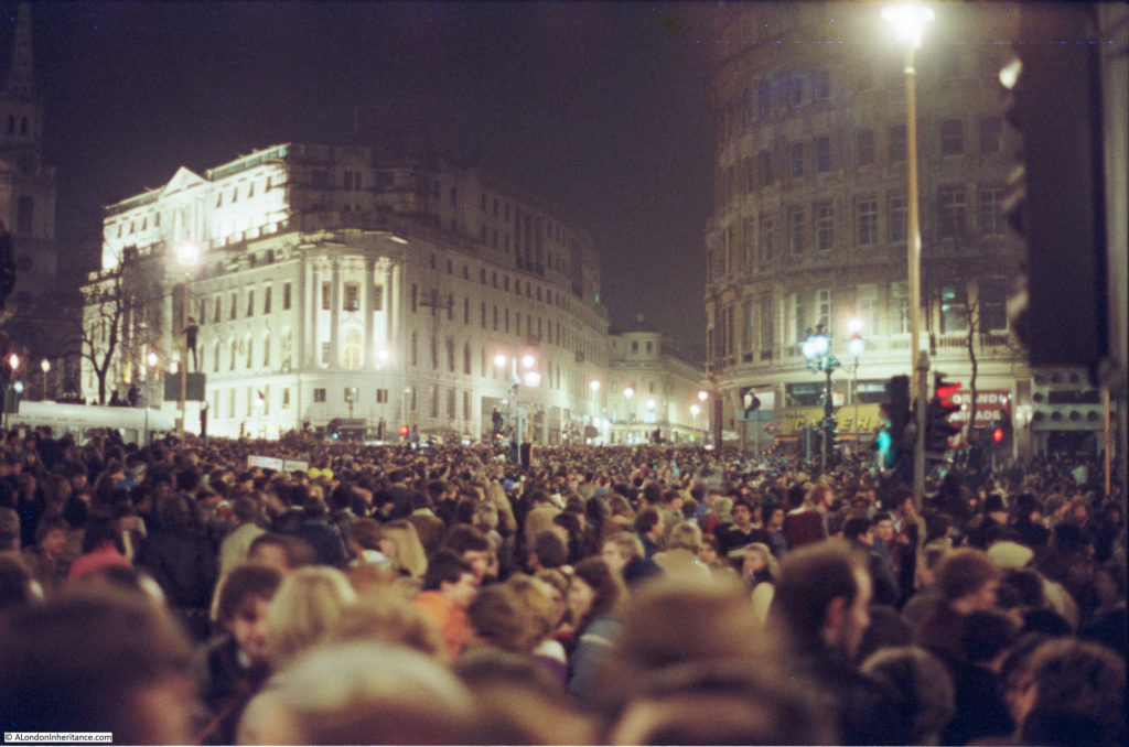
I have no idea how many people there were in Trafalgar Square, however you had to get there well before midnight to get in the centre of the square. Crowds would stretch along all the roads leading into Trafalgar Square. In the following photo the sea of heads can be seen stretching off into the Strand.

New Year's Eve

I am not sure what time we got home that night, but after midnight, celebrations continued for many hours in the streets across the West End.

New Year's Eve

New Year’s Eve in Trafalgar Square could not compete with the massive firework display along the river tonight, however I suspect that the New Year’s Eve fireworks are aimed just as much for TV viewers around the world as they are for those standing along the Embankment, as London competes with other global cities.

With the now ubiquitous mobile phone, they will also probably be one of the most photographed large events in London.

alondoninheritance.com

The London Harness Horse Parade 2017

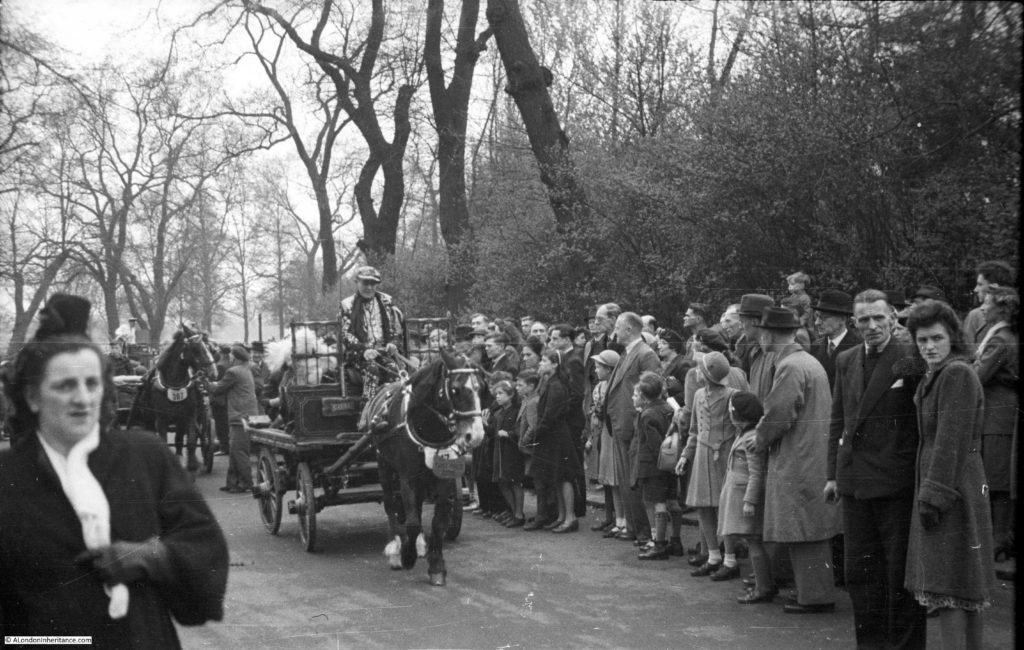
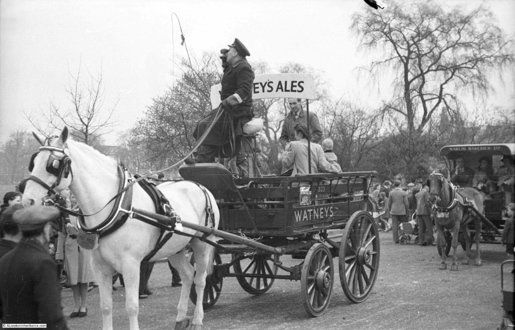
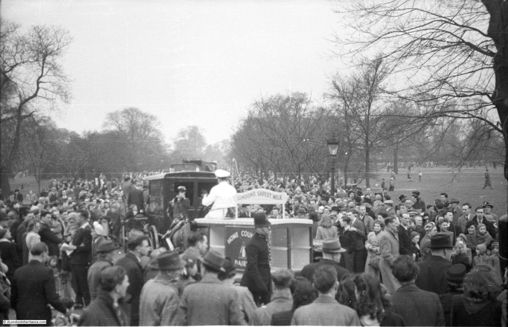
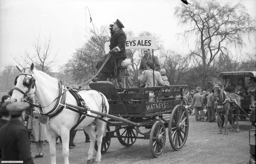
Back in January I published a post on the London Cart Horse Parade showing some of the photos my father took of the event in Regent’s Park in 1949. A couple of photos from the post are shown below:

London Harness Horse Parade

They show the vehicles that in 1949 were still probably in use across London transporting people and all manner of goods essential for the functioning of the city.

London Harness Horse Parade

The original London Cart Horse Parade was founded in 1885 with the aim of improving the conditions of the thousands of horses that carried both goods and people along the streets of London. It was held on Whit Monday, starting in Battersea Park before moving to Regent’s Park.

The London Van Horse Parade ran from 1904 with the same objectives, but was held on an Easter Monday.

These parades must have had a considerable impact on the surrounding streets as there were hundreds of entries (the largest Van Horse Parade has 1,259 animals in the parade in 1914). After the presentation of prizes at the Cart Horse Parade, the procession would leave Regent’s Park and proceed along Albany Street, Portland Place, Oxford Street, Tottenham Court Road, Euston Road and to King’s Cross.

From 1950 the numbers of entries to the parades started to decline. Rapid growth in the use of cars, vans and lorries meant that the need for horse driven transport was in sharp decline and in 1966 the two parades joined to become the London Harness Horse Parade, continuing to be held on Easter Monday in Regent’s Park.

In 1995 the parade moved to Battersea Park, but in 2006 the costs and health and safety requirements of operating such a parade in central London meant that it was no longer possible to run the parade in Battersea Park and it moved out of London.

The London Harness Horse Parade continues to be held on Easter Monday, but now at the South of England Showground at Ardingly in  West Sussex.

My aim with this blog is to track down the locations of my father’s post war photos. For the photos he took of the parade in Regent’s Park, the nearest I could get was to visit the parade in its current location, so this Easter Monday I traveled out to Ardingly to see if the London Harness Horse Parade resembled the photos taken by my father in 1949.

A showground in West Sussex is very different to Regent’s Park, however the aims of the current parade are still the same as when the parade was first held in 1885. To encourage and demonstrate the welfare of the horses, maintenance of the harness and vehicles and the standards of the driver.

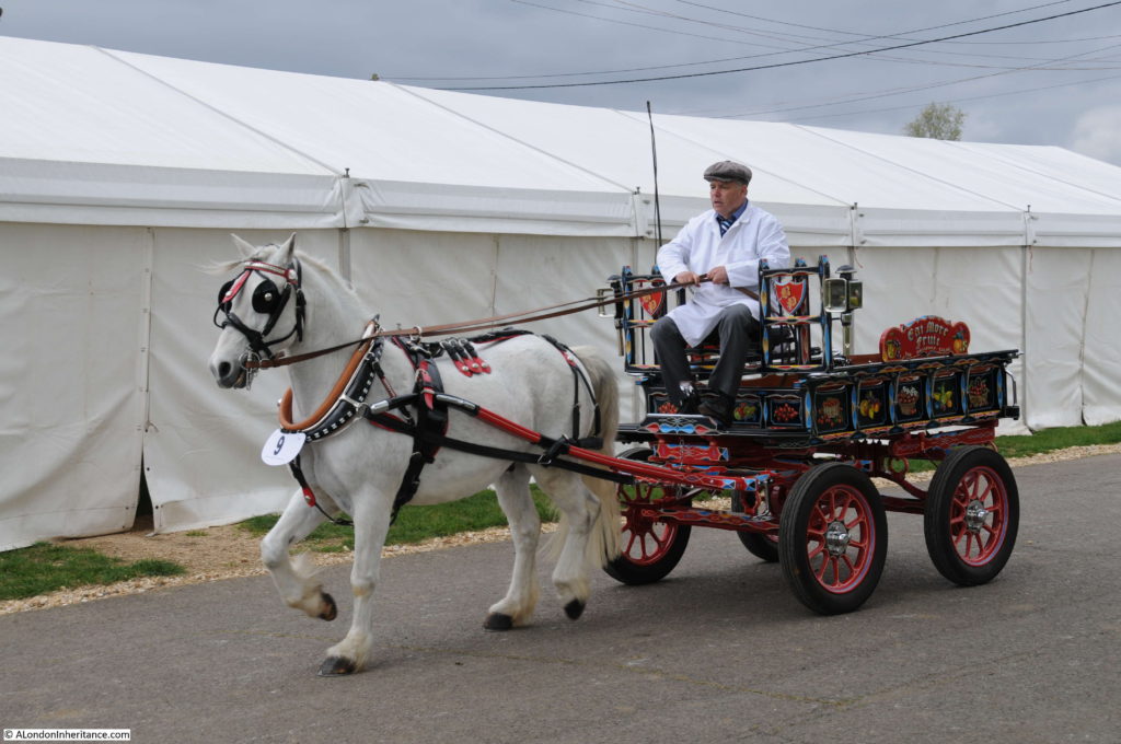
The parade is a window on a way of life that has long since departed from London. Entries now come from the counties surrounding London, but many of the vehicles are originals that would have once worked the city’s streets, carrying all manner of goods and passengers.

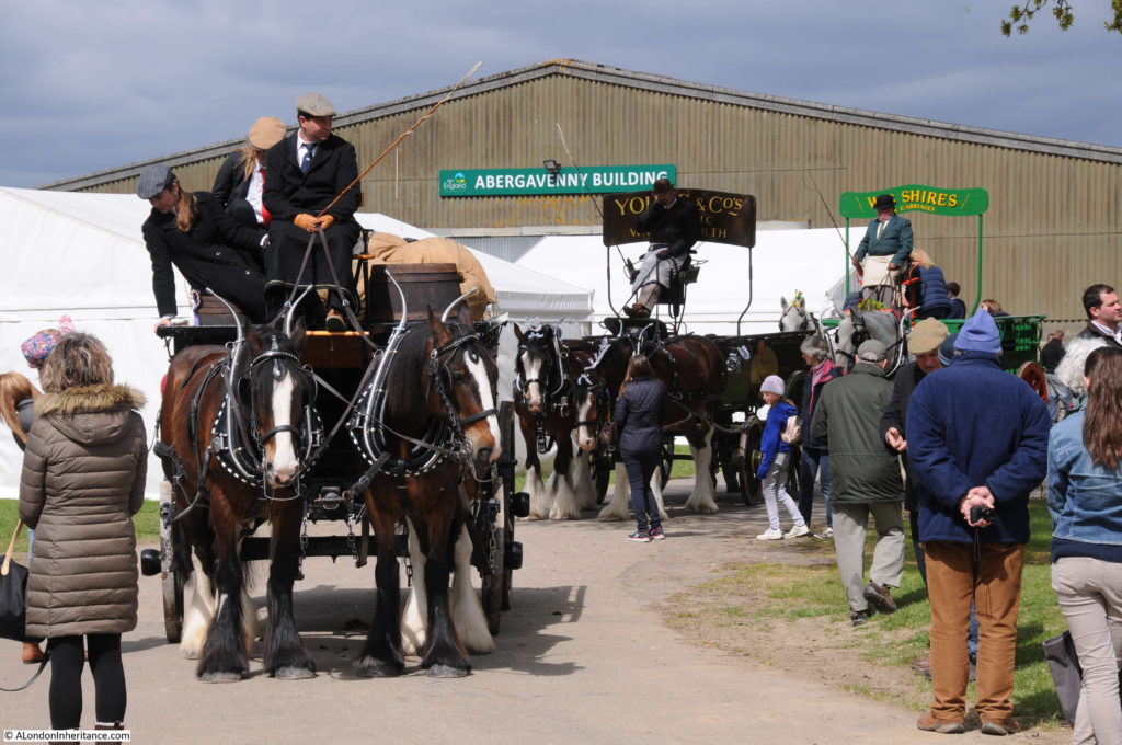
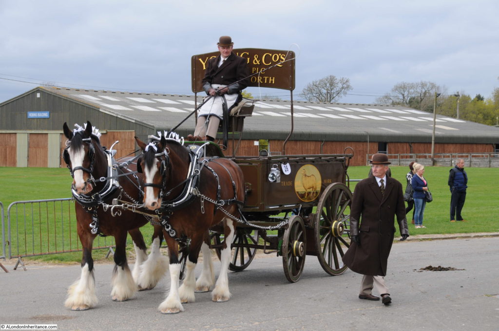
The parade lining up to start:

London Harness Horse Parade

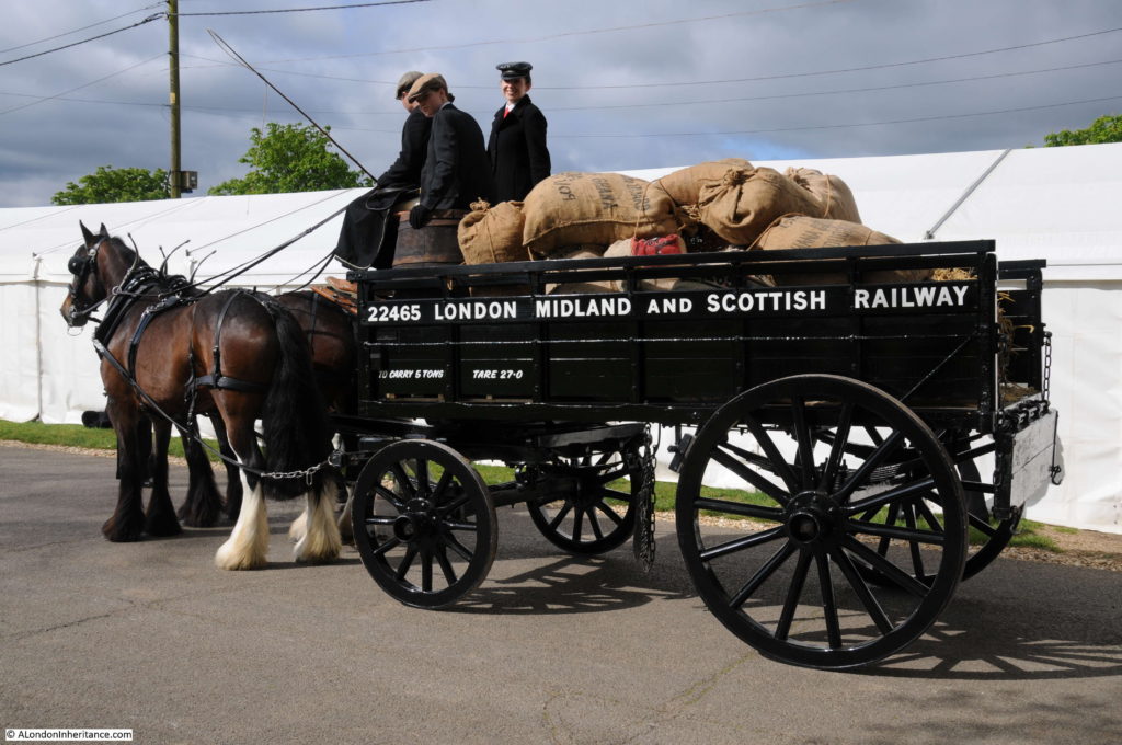
This is a five ton open van pulled by two Shire Horses and was used to carry goods to and from the stations of the London, Midland and Scottish Railway across London:

London Harness Horse Parade

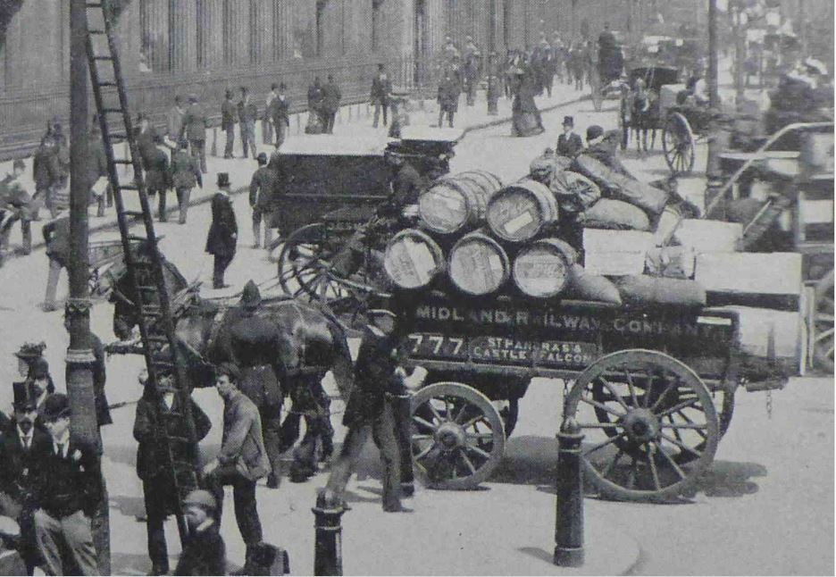
The following photo is from the book “The Queen’s London” published in 1896. It shows an identical open van in front of the Bank of England transporting goods for the Midland Railway Company. The historical accuracy of the 2017 vehicle is such that a chain is hanging down underneath the van in both photos (I only realised this after the event when I was comparing photos otherwise I would have asked what the chain was for).

London Harness Horse Parade

The range of entries highlight the specialist vehicles that once transported goods along the streets. This is a 1920 Milk Float:

London Harness Horse Parade

As part of the event, each horse is checked by a vet, continuing the aims set out for the parade in 1885 that the welfare of the horses is to be encouraged. The parade is not competitive, there is no winner, rather all those that achieve the required standard receive a rosette.

London Harness Horse Parade

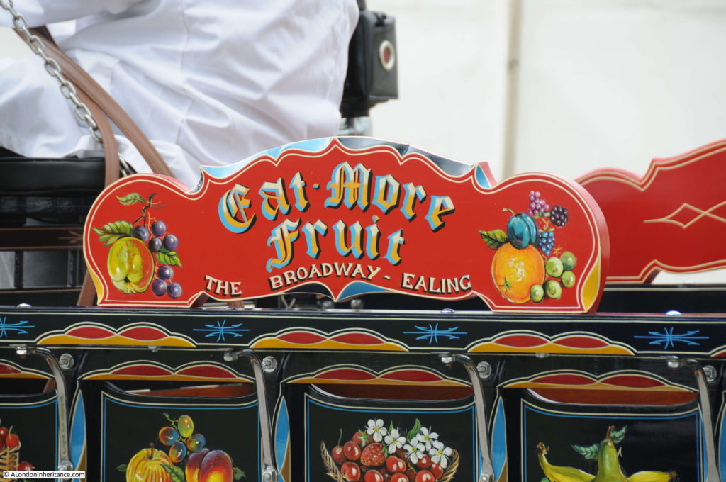
As well as the condition of the horses, the vehicles are also judged and are immaculately preserved and maintained.

London Harness Horse Parade

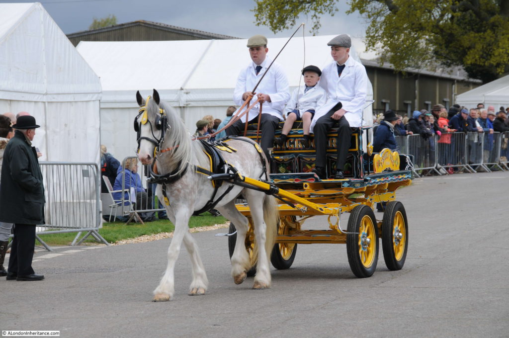
A standard design known as a “London Trolley”:

London Harness Horse Parade

Running down to one of the judging areas:London Harness Horse Parade

Many of the vehicles are from the 1920s and 30s highlighting that it was not just in the 19th century that horse-drawn transport was used across London, it was still a means of transport well into the 20th century.

London Harness Horse Parade

Immaculate paint work:

London Harness Horse Parade

All ages participate in the parade:

London Harness Horse Parade

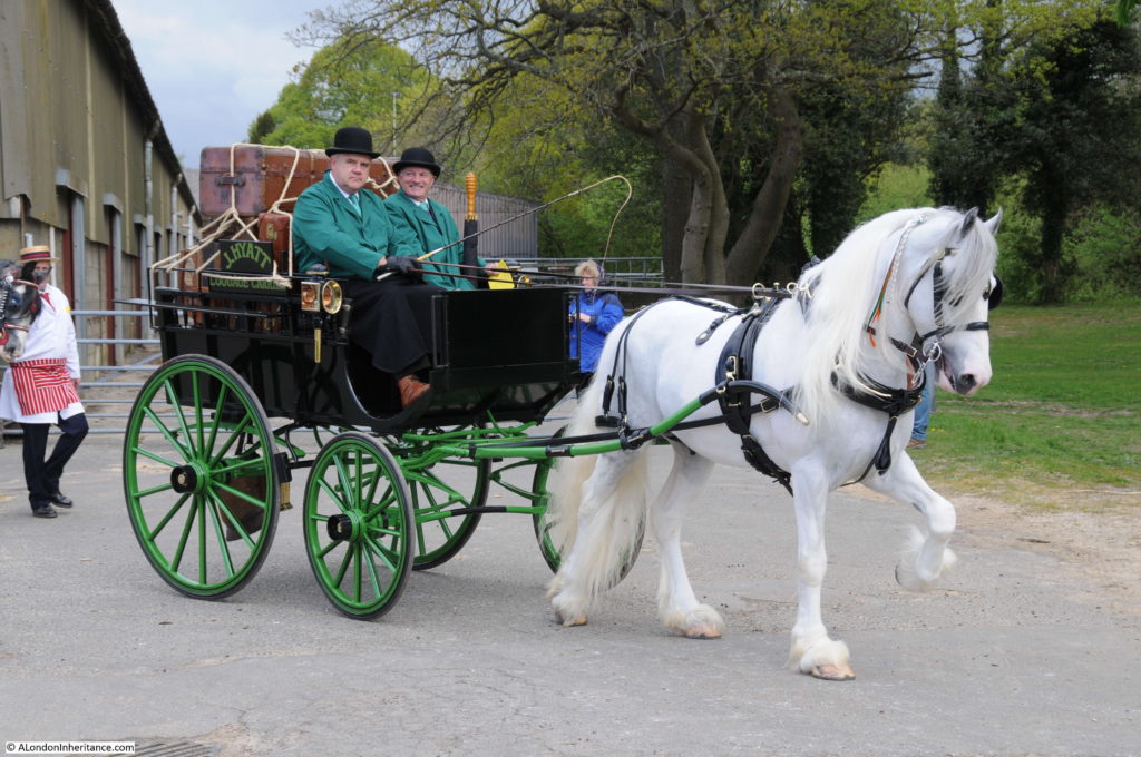
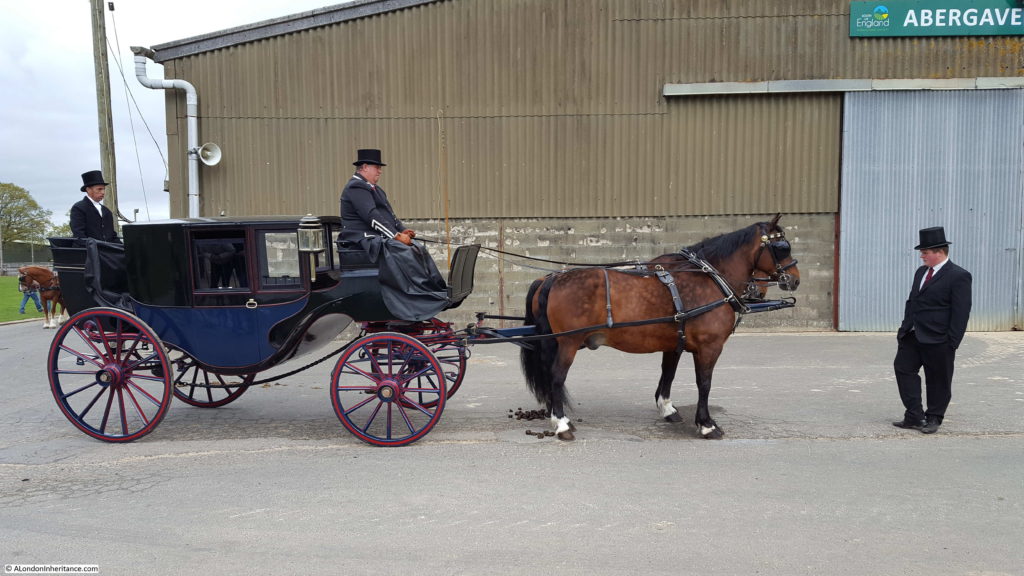
For those who could afford it, this is the type of vehicle that would have carried your luggage to the station:

London Harness Horse Parade

And you would have traveled in the following carriage:

London Harness Horse Parade

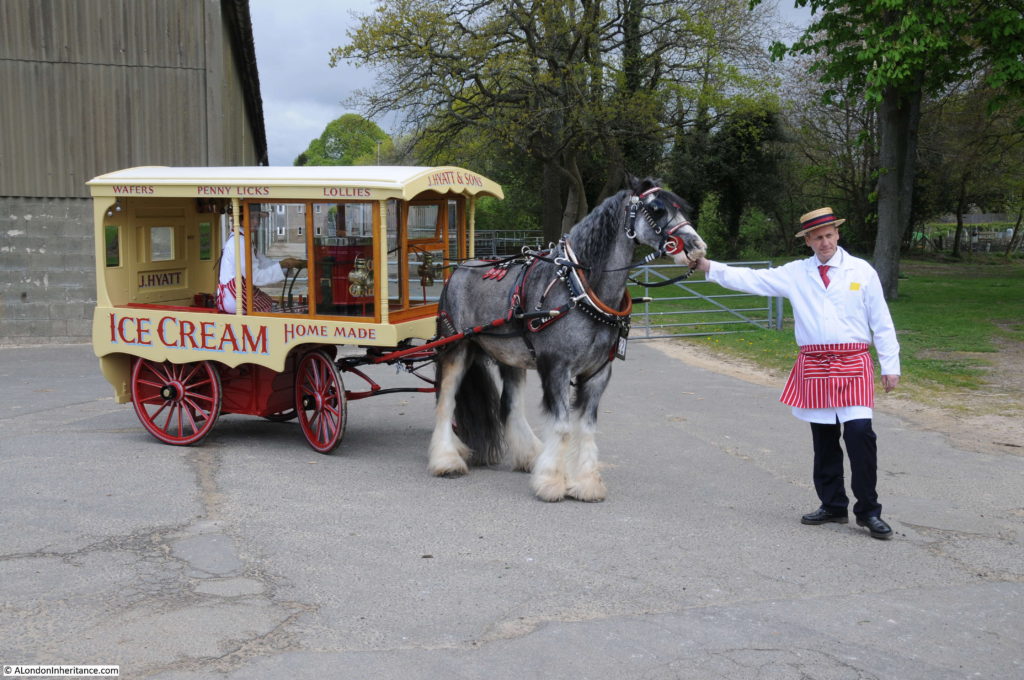
A 1920 Ice Cream Cart:

London Harness Horse Parade

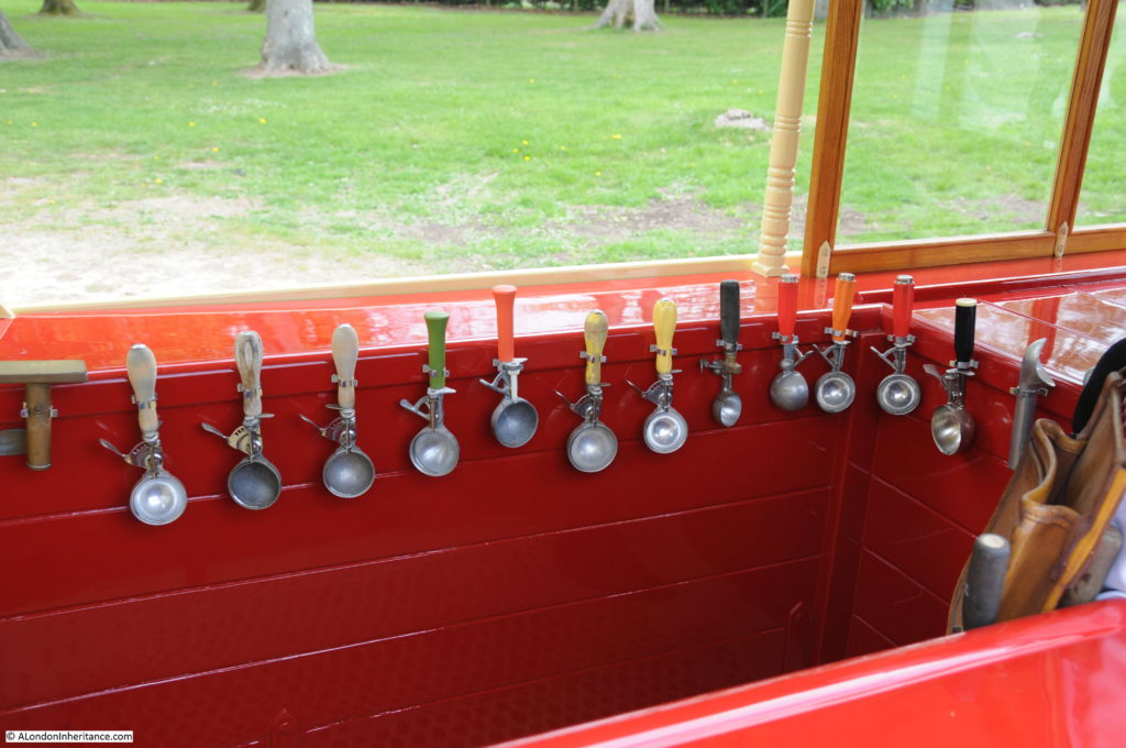
Brilliantly restored, including a selection of vintage ice cream scoops:

London Harness Horse Parade

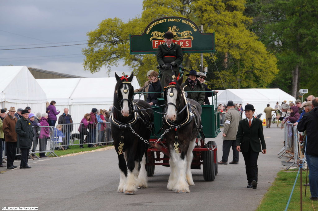
Horse drawn delivery drays transporting barrels of beer would once have been a common sight across London:

London Harness Horse Parade

The Young & Co delivery dray was built-in Chelsea and dates from 1924:London Harness Horse Parade

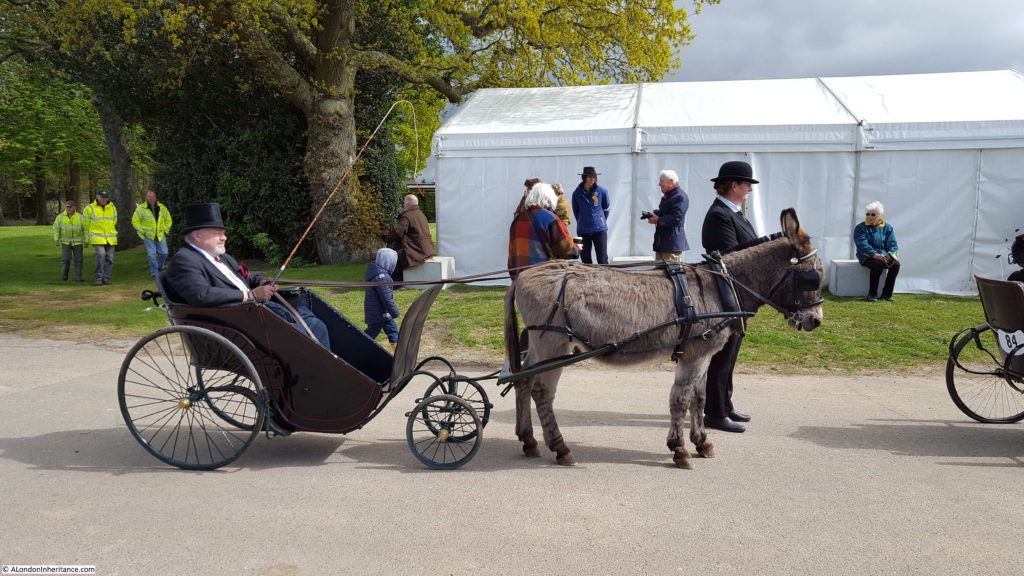
A Victorian Invalid Carriage from 1890:

London Harness Horse Parade

The London Harness Horse Parade is now much smaller than the parades once held in Regent’s and Battersea Parks. In 1926 there were 864 vehicles entered in the Easter Monday parade, today there were around 100 entries to the 2017 parade.

It is though really good to see that the parade is still running every year and true to its original purpose of improving the conditions and treatment of London’s cart horses. Also, a place to see a historically accurate display of the vehicles that were once essential in nearly all aspects of the life of the city.

alondoninheritance.com

The London Cart Horse Parade

A rather short post this week, work and trying to find the time to get to some East London locations has delayed my planned post for today, however I hope these photos of an annual parade that was once held in London will be of interest.

During the past week, pollution levels in London have been very high. The thousands of cars, taxis, buses, lorries etc. that keep the city supplied and moving but congest the city’s streets, contributing to the smog that hangs across the city when there is no wind to blow it to the east. In previous centuries, it was the horse that was essential to the functioning of the city. Transporting goods and people from one end of the city to the other.

I have seen a range of different figures for how many horses were on the streets of the London, with numbers of around 300,000 in the year 1900.

Treatment of horses was very variable and dependent on the owner. Horses needed to earn their keep and when they could not, through age or illness they were of little use to their owner.

There were a number of initiatives in the 19th Century to try to improve the conditions of the city’s horses, one of which was the Cart Horse Parade, established in 1885 with the aim of encouraging the owners of horses to take pride in their animals and to show to their peers and the public in a formal annual parade.

The first Cart Horse Parades took place on Whit Monday in Battersea Park. A second annual parade, the Van Horse Parade started in 1904 and took place on Easter Monday.

The Cart Horse Parade moved to Regent’s Park in 1888.

The two parades continued to run as separate parades, however with the declining numbers of working horses across the city, the two parades merged into a single Easter Monday parade in 1966.

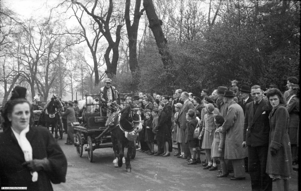
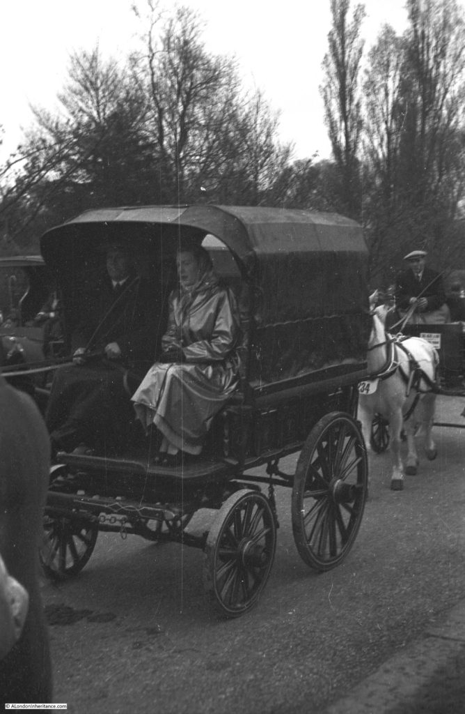
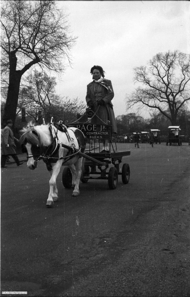
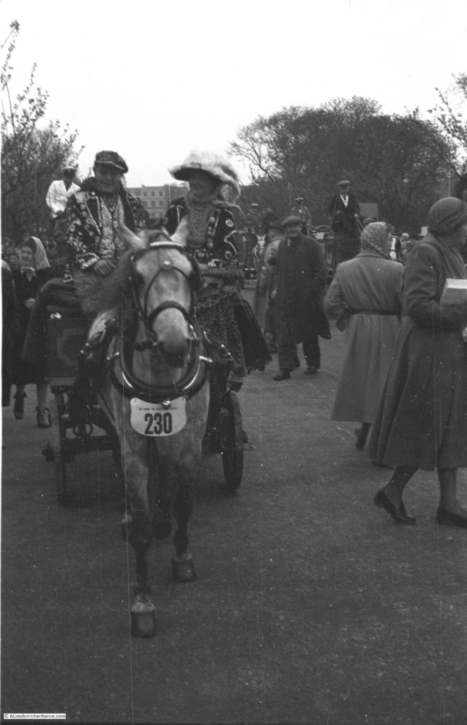
My father must have known the parade well as he lived a short distance from Regent’s Park and one year took a series of photos of the event. These specific photos were not dated, however from the photos on the same strips of negative I am sure the year was 1949. Judging by the crowds, this was a popular event.

London Harness Horse Parade 1

London Harness Horse Parade 2

London Harness Horse Parade 3

London Harness Horse Parade 5

London Harness Horse Parade 6

London Harness Horse Parade 7

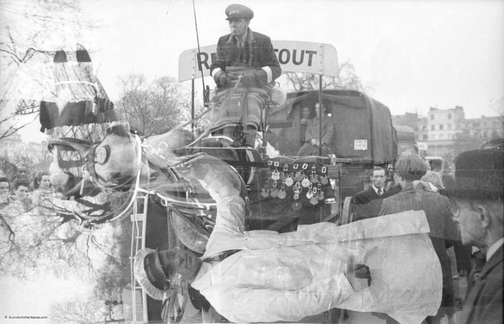
As a final photo, the following shows one of the problems with film cameras. When I scanned the following photo I thought there were two negatives stuck together, however it is an example of where the film did not wind on correctly between taking two photos leaving them both on the same individual negative. There are a number in the collection where this has happened – very frustrating.

London Harness Horse Parade 4

The combined parades have now moved out of London, but are still held on Easter Monday as the London Harness Horse Parade with the next parade being on the 17th April 2017 at the South of England Centre at Ardingly in West Sussex.

Details of the next parade can be found on the website of the London Harness Horse Parade.

alondoninheritance.com

London Christmas Lights – 1978 and 2016

Before I start this week’s post, which also falls on Christmas Day, can I wish you a very Happy Christmas, and thank you for reading and subscribing to my blog. I am almost at the end of Year 3 and have lots more to write about which I hope you will find of interest.

For a Christmas Day post, a comparison of London Christmas Lights from the rather gloomy late 1970s with those in 2016.

In 1954 Regent Street was the first of the central London shopping streets to have Christmas lights, Oxford Street followed five years later in 1959. There were a number of years in the 1970s when Oxford Street did not have any Christmas lights due to the recession of the middle years of the decade and the general financial climate, however they restarted again in 1978 with the unusual option of having laser lights shining up and down the street. I assume it was thought that these would be a rather novel form of lighting and much cheaper than large light decorations run across the street.

To mark the return of Christmas lights to Oxford Street and to record what was hopefully an impressive display, I took my first decent camera up to Oxford Street (a Canon AE1 recently purchased on HP – Hire Purchase before the days of Credit Cards) and without a tripod I attempted some photos using Kodak Kodacolor 400 film, faster than my normal film in the hope that I would not suffer too much with camera shake.

Arriving at Oxford Street as it got dark, the lasers did not really meet with expectations. A number of laser systems were mounted a various places along Oxford Street with a beam of light from each running the length of the street. There were not enough lights and a thin beam of blue, red or green light did not seem to have any relevance to Christmas. It was all rather strange and I can understand why it has not been repeated since.

Oxford Street in the mid 1970s was generally much darker than it is now. Shops did not have the same level of Christmas displays and window lights that they have today.

The following photos are a sample I took in 1978 and then for comparison I went for walk one evening in December 2016 to look at the lights across the main shopping streets of central London today. The 1978 photos also show some of the retail brands that have since disappeared.

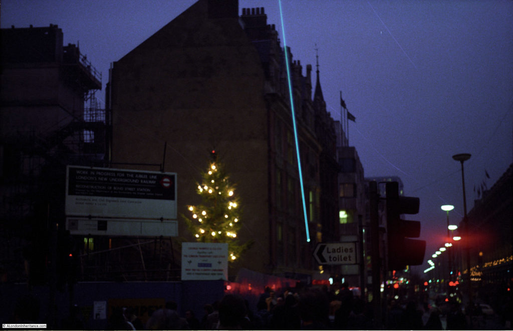
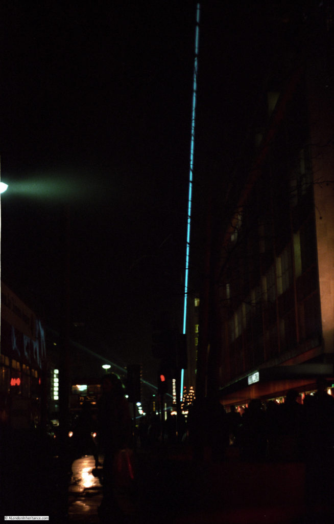
One of the Oxford Street lasers. The Christmas tree is on the construction site for the new Bond Street station and the Jubilee Line. The large sign on the left reads “Work in progress for the Jubilee Line – Reconstruction of Bond Street Station”.

London Christmas Lights

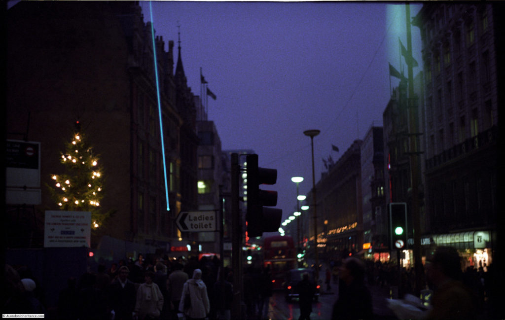
Looking up Oxford Street towards Marble Arch. Selfridges has a row of lights just above street level. A Take 6 store is on the right.

London Christmas Lights

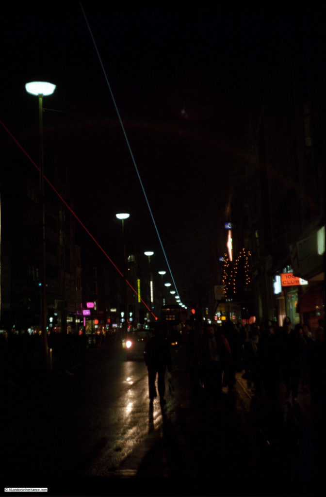
Blue and red lasers. The sign of the 100 Club is on the right – fortunately still there today.

London Christmas Lights

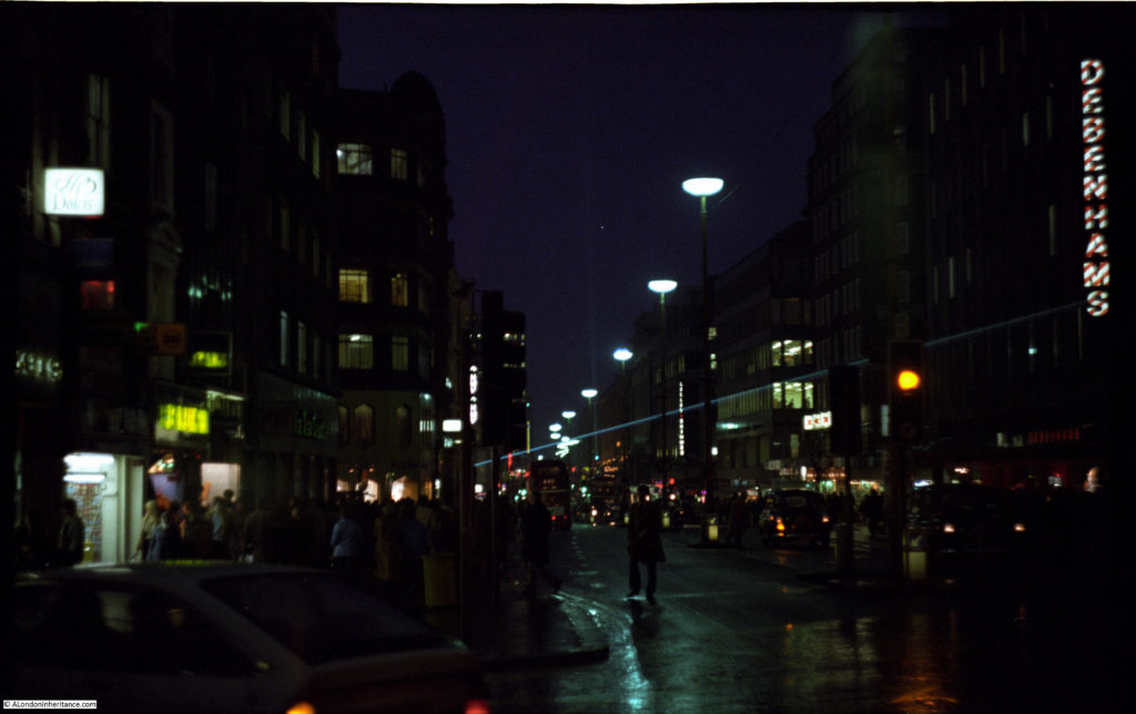
Blue laser running down the street. Debenhams on the right, Dolcis shoe shop on the left.

London Christmas Lights

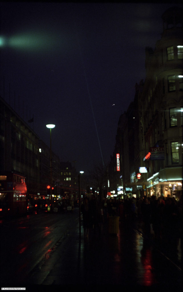
A rather faint laser shines down a gloomy 1970s Oxford Street. The vertical lights are advertising the now defunct shoe shop Saxone.

London Christmas Lights

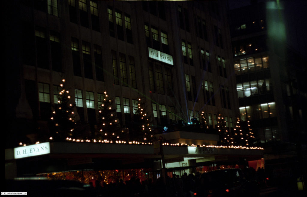
Christmas trees along D.H. Evans, with a fan of blue and green lasers from just above the main entrance to the store. The D.H. Evans store disappeared in 2001 when it was re-branded as the House of Fraser.

London Christmas Lights

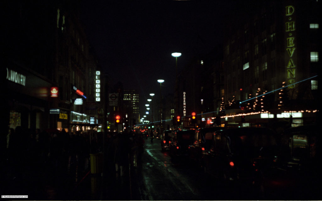
Woolworth’s on the left, D.H,. Evans on the right. Just beneath the Berlitz sign (language school) is a sign for the Lady at Lord John fashion chain (click on the photo to enlarge) – one of the many high street brands that have disappeared in the last 40 years.

London Christmas Lights

The best place to see the lasers seemed to be from directly underneath when they were at their brightest.

London Christmas Lights

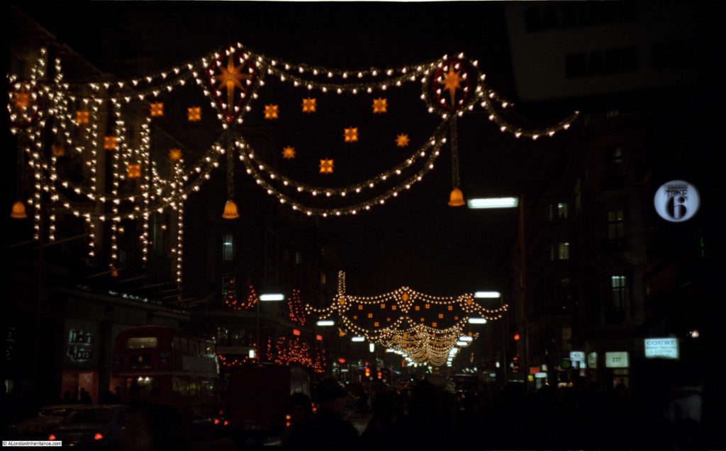
Regent Street kept to their more traditional Christmas lighting with displays running across the street and were more impressive than those at Oxford Street. Looking down Regent Street with a Take 6 store on the right.

London Christmas Lights

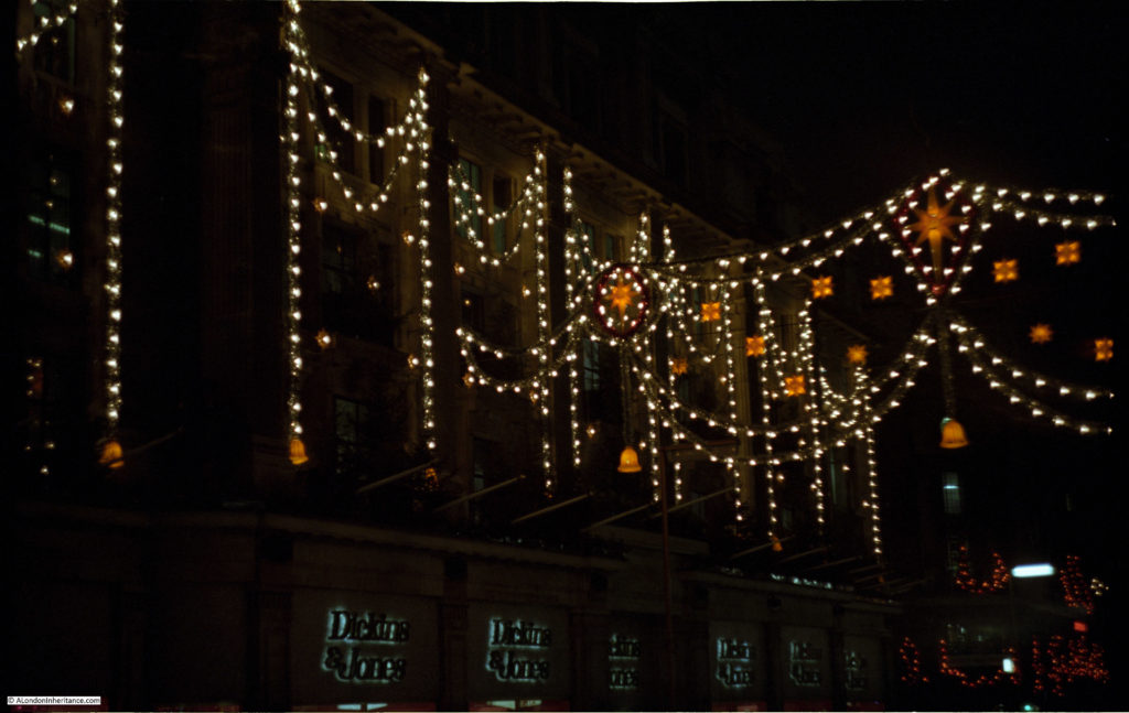
Dickens and Jones.

London Christmas Lights

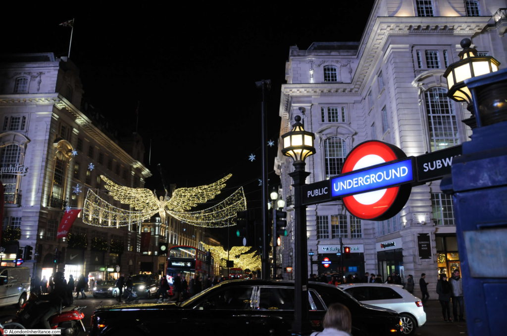
So how does 1970s London compare with the Christmas lights of 2016? In the week before Christmas, I took a walk one evening starting at Monmouth Street, through Seven Dials and up to Oxford Street, then down Regent Street to Piccadilly Circus.

Starting in Monmouth Street with lights across the street and in the trees.

London Christmas Lights

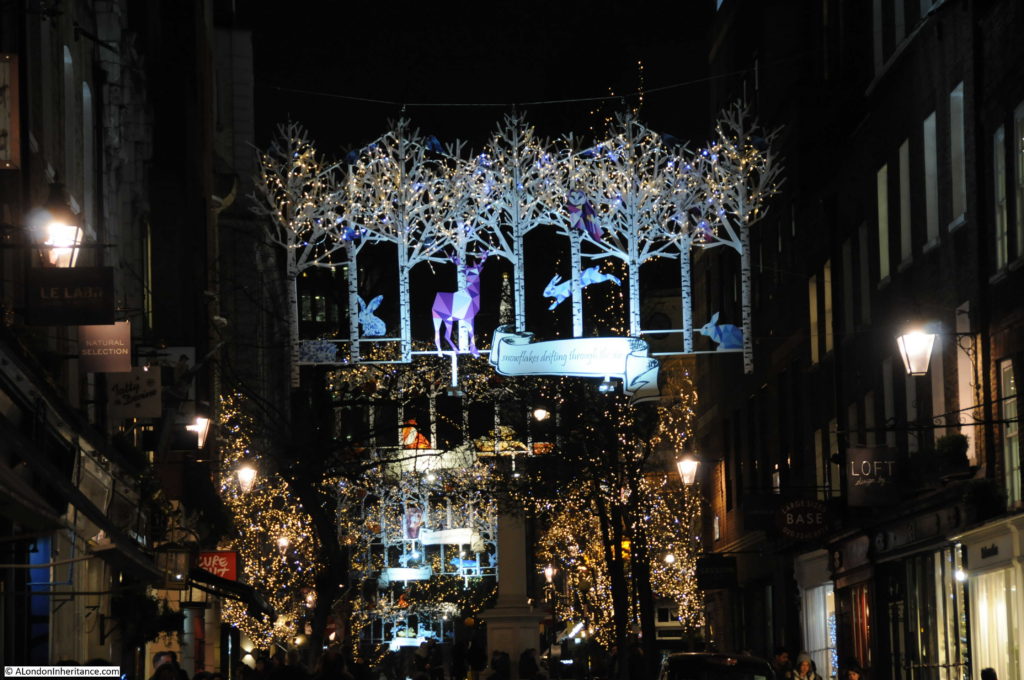
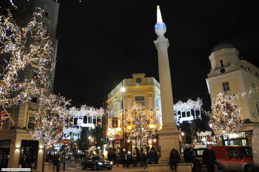
Seven Dials looking very festive.

London Christmas Lights

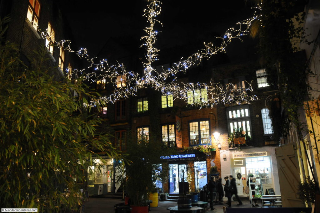
Neal’s Yard just off the northern leg of Monmouth Street.

London Christmas Lights

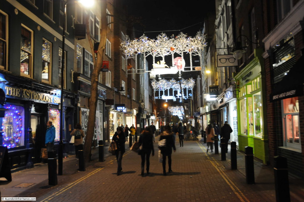
View down Monmouth Street.

London Christmas Lights

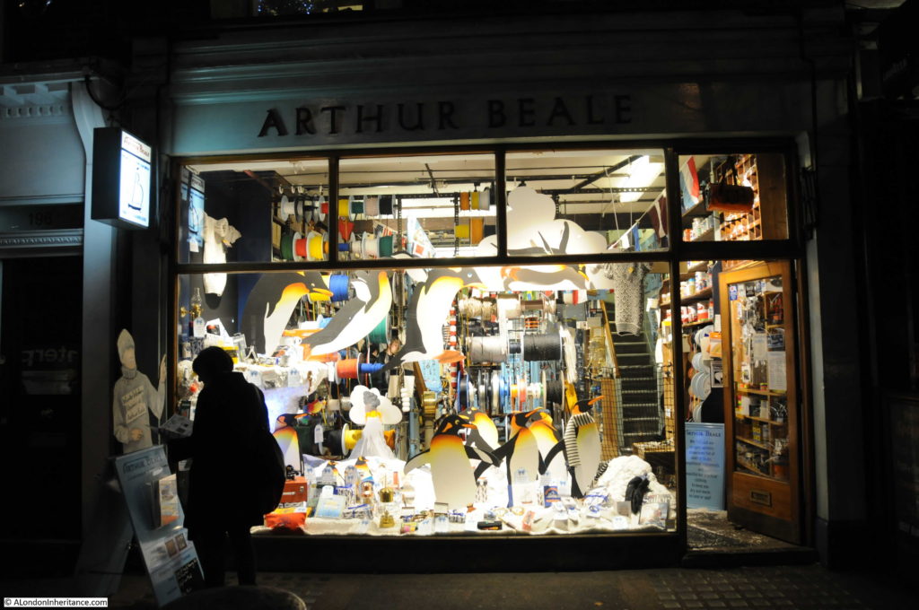
Penguins decorating the front of Arthur Beale, London’s Yacht Chandler on Shaftesbury Avenue.

London Christmas Lights

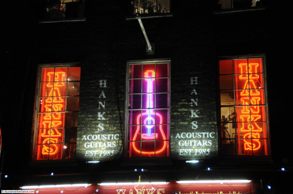
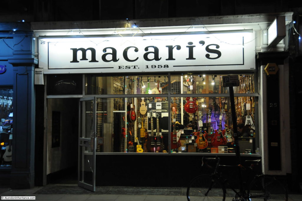
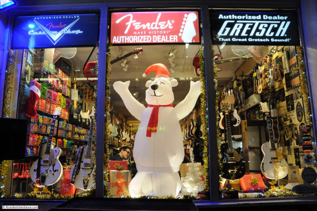
From Shaftesbury Avenue, it was along St. Giles High Street and into Denmark Street. Not known for Christmas lights, although the music shops look good after dark.

London Christmas Lights

London Christmas Lights

Regent Sound Studios with their take on Christmas window decorations.

London Christmas Lights

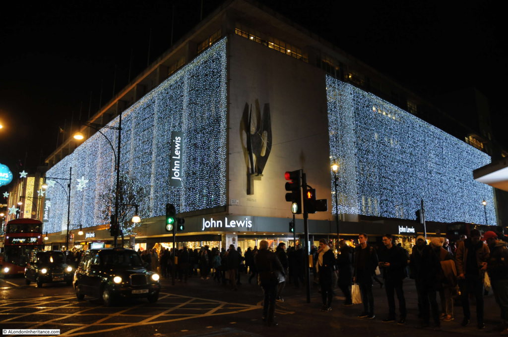
Up now into Oxford Street and the lights of John Lewis.

London Christmas Lights

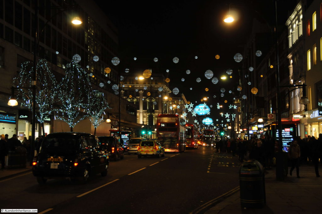
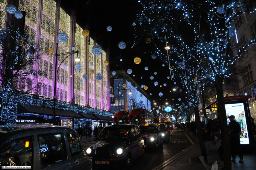
Oxford Street’s 2016 Christmas lights.

London Christmas Lights

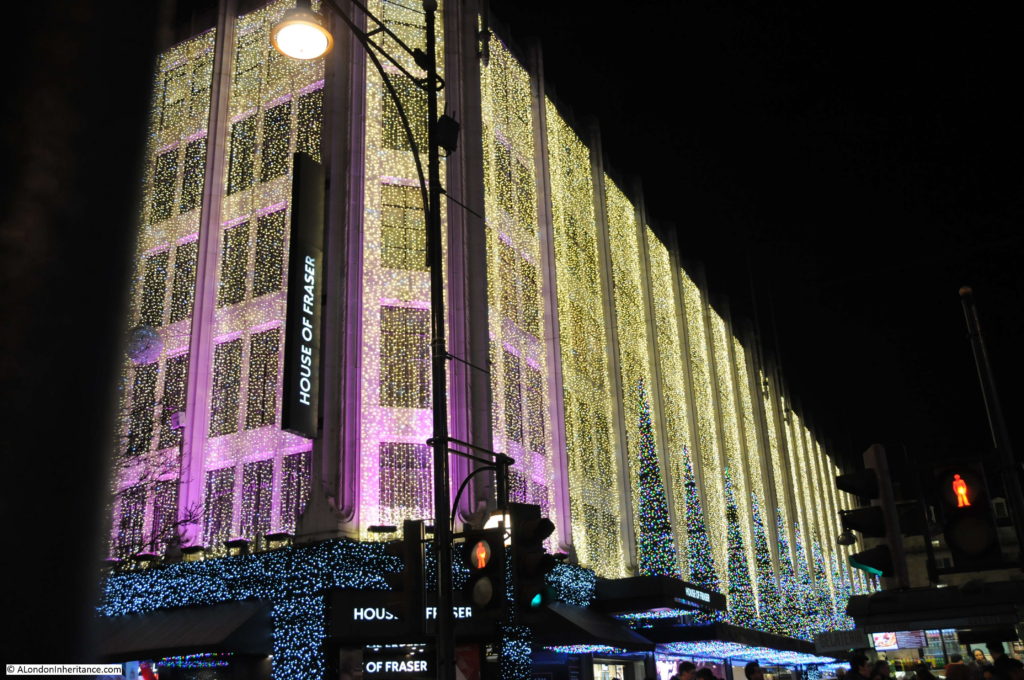
House of Fraser.

London Christmas Lights

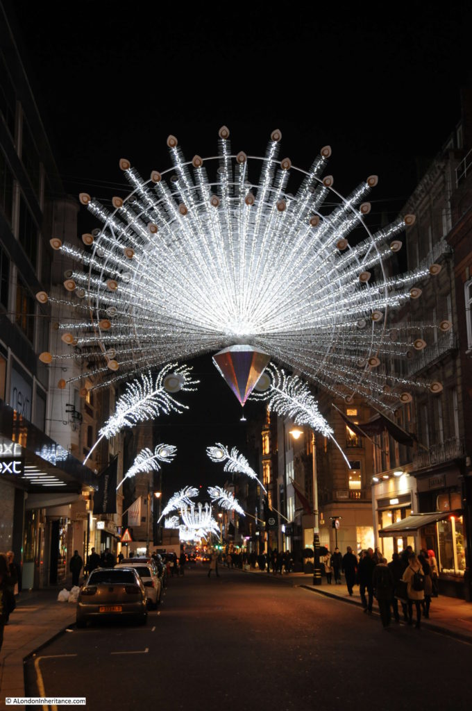
Looking down New Bond Street from Oxford Street.

London Christmas Lights

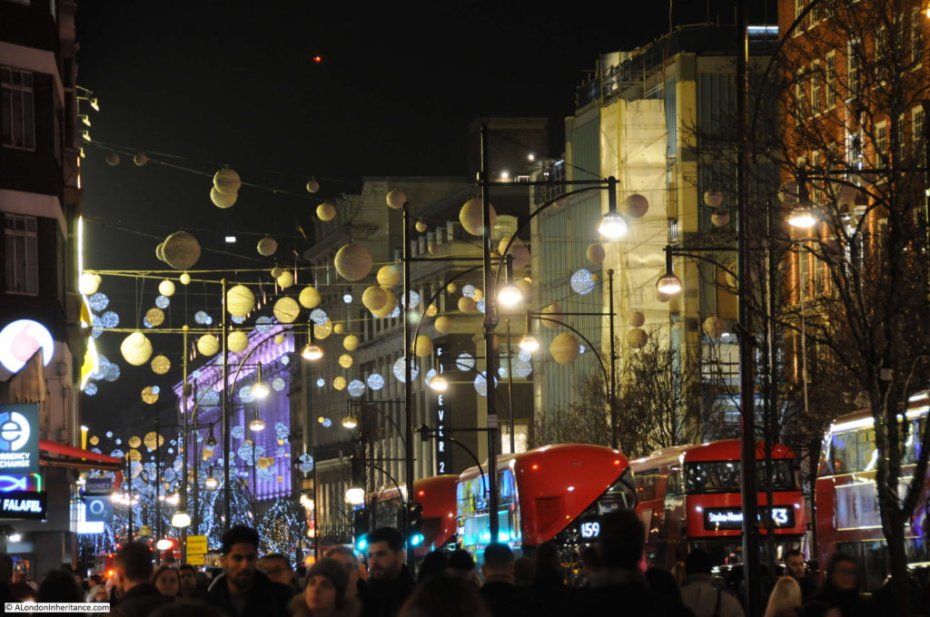
Oxford Street at Christmas. Pavements crowded with people and the street at times seems more like a car park for buses……

London Christmas Lights

…..and taxis.

London Christmas Lights

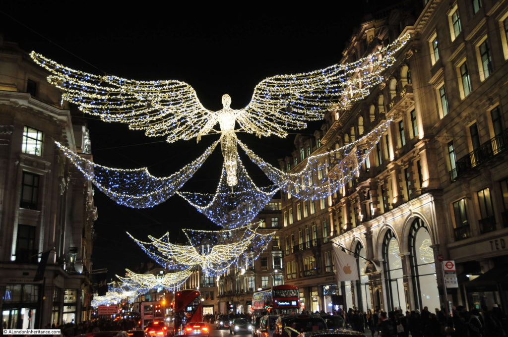
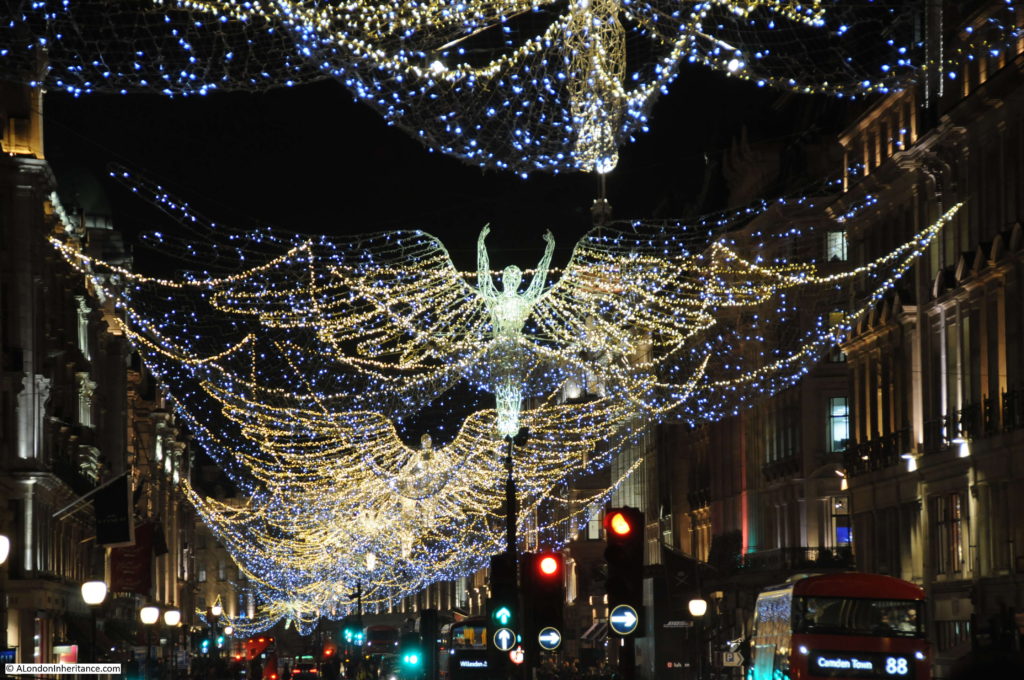
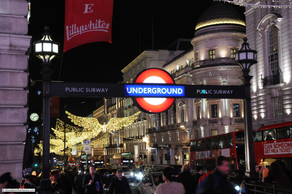
Back down into Regent Street who in most of the years I can remember since 1978 have more ambitious street lights than Oxford Street.

London Christmas Lights

The length of Regent Street looking down towards Piccadilly Circus.

London Christmas Lights

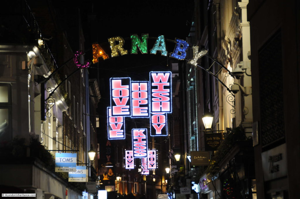
Carnaby Street from Regent Street with their own interpretation of Christmas lights.

London Christmas Lights

Lights continue down the southern end of Regent Street towards Waterloo Place.

London Christmas Lights

London Christmas Lights

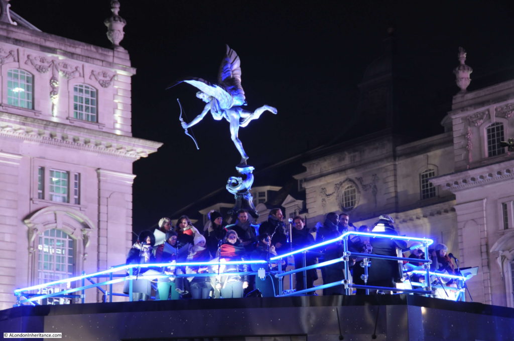
An elevated platform had been built around the Shaftesbury Memorial Fountain – or Eros as it is more commonly known. A choir huddled together against the cold and breeze of a December evening but sounding beautiful above the noise of traffic.

London Christmas Lights

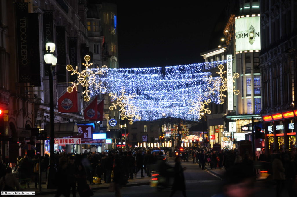
View from Piccadilly Circus towards Leicester Square.

London Christmas Lights

My photos from 1978 probably do the lasers a slight injustice due to my lack of photographic experience at the time and the equipment in use, however London after dark at Christmas is now much brighter than it was in the 1970s. The crowds and traffic do seem much the same in the weeks running up to Christmas, but as ever I will take any excuse for a walk around London.

Thanks again for reading, and a very Happy Christmas.

alondoninheritance.com

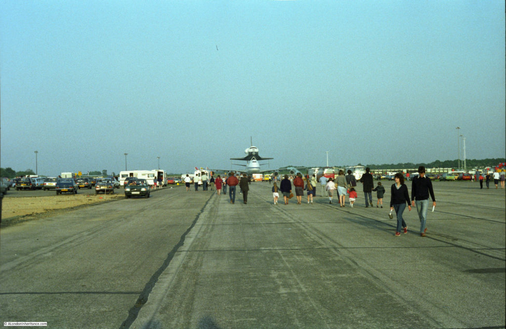
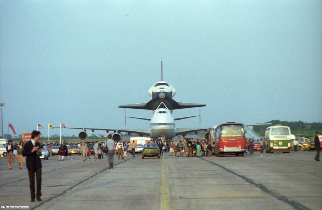
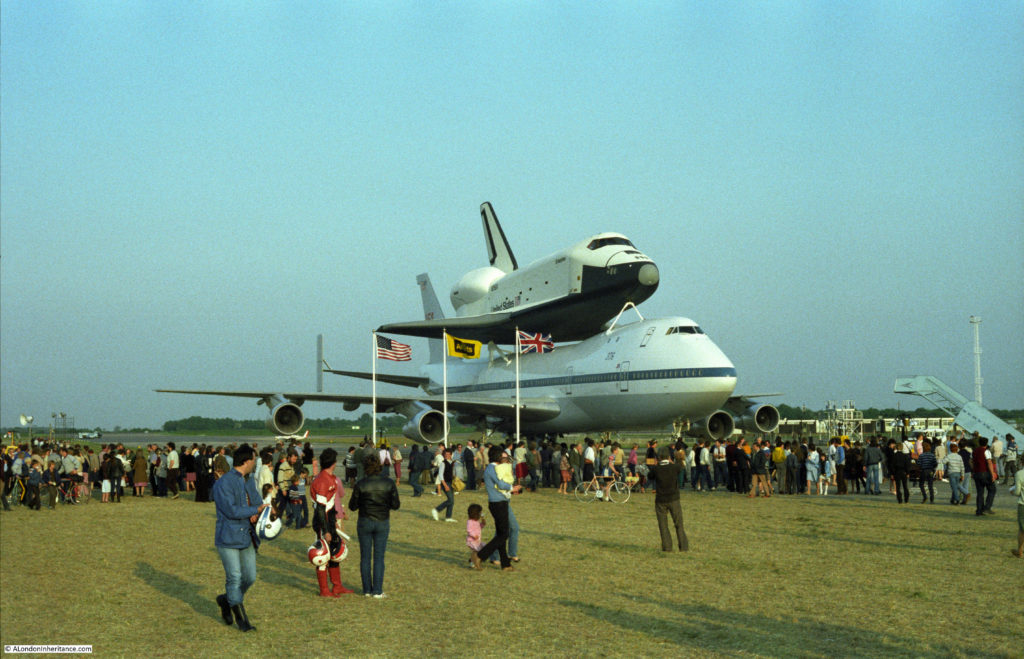
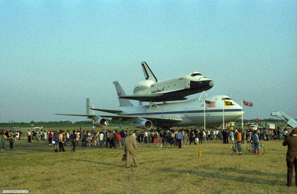
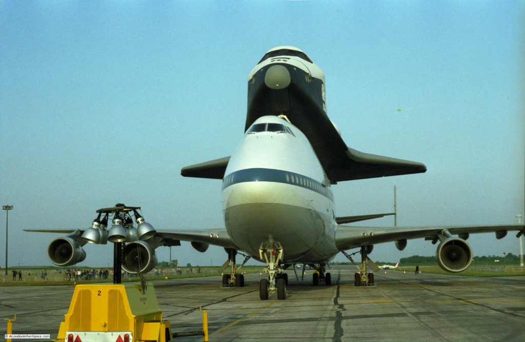
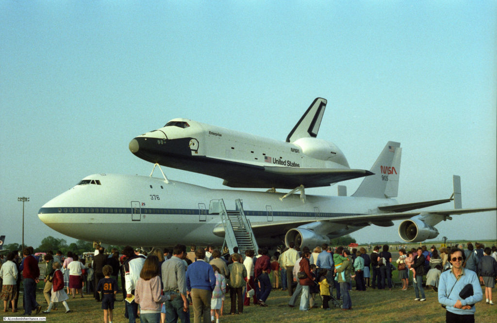
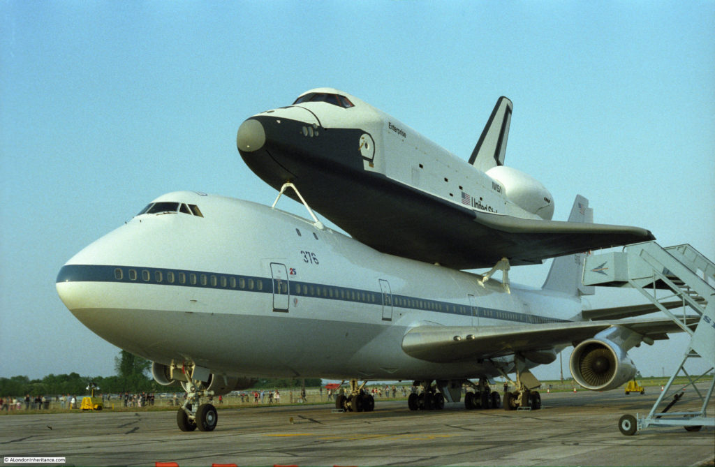
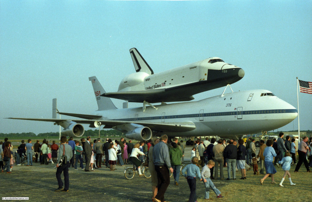
The Space Shuttle At Stansted Airport

I have recently been scanning some of my old negatives from the early 1980s. The Lord Mayor’s Show post from a couple of weeks ago included some of these photos, and this week’s post covers a rather more unusual event when in 1983 the Space Shuttle Enterprise landed at Stansted Airport – or London Stansted Airport to use the current full name and provide the hopefully not too tenuous link to the theme of the blog.

The first orbital flight of the Space Shuttle took place in April 1981 and in 1983 the Space Shuttle fleet was increasing the number of flights with four taking place that year. There was considerable interest in this new method of reaching space and in 1983 the Space Shuttle Enterprise made a visit to the Paris Airshow, also landing in the UK and Germany.

The Enterprise did not launch to space. It was the first of the Space Shuttles (named after the space ship from the Star Trek TV series), completed in 1977 and used to test the piggy back method of transport on a Boeing 747 and also for drop tests to evaluate how the design would fly and land.

The Enterprise arrived at Stansted Airport on Sunday 5th June 1983. Stansted was then a small airport with relatively few flights. Approval was granted the following year for the first phase of the significant developments that have seen the airport reach the capacity it has today, so back in 1983 it was still quiet and an ideal location to host the Space Shuttle’s visit.

The arrival was a major event with significant numbers of people turning up to try and see this unusual combination of aircraft land. There was major congestion on the majority of roads in the Stansted area. For some reason I cannot remember now, I could not get to Stansted for the Sunday, but did manage to visit on one of the evenings the following week.

I was working in Lambeth at the time so it was a dash up to Stansted after work on a lovely sunny evening which I do remember very well. It seemed a very casual event. Compared to today, hardly any security of any sort.

Drive up to the airfield, park on the grass and take a walk around – I doubt this would happen today.

I cannot remember which day it was, or the time but it must have been late evening judging by the length of the shadows (which is rather depressing to write on a dark December evening).

There is a BBC report on the Space Shuttle visit and the 25th anniversary which can be found here. The report contains some excellent film of the landing of the Shuttle / 747 combination at Stansted.

A sample of my photos from that June evening in 1983:

space-shuttle-at-stansted-7

space-shuttle-at-stansted-4

space-shuttle-at-stansted-8

space-shuttle-at-stansted-9

space-shuttle-at-stansted-3

space-shuttle-at-stansted-6

space-shuttle-at-stansted-5

space-shuttle-at-stansted-1

I did not get to see the Space Shuttle leave Stansted, but did catch a glimpse of the flight over London, although unfortunately I did not have my camera with me.

After the visit to the UK, France and Germany the Space Shuttle Enterprise returned to the US where it was used for test purposes, then a period in storage and then on display with the Smithsonian Institute.

Space Shuttle Enterprise is now on display at the Intrepid Sea, Air and Space Museum in New York along with a British Airways Concorde – another form of flight which seemed technologically very advanced at the time, having started the first supersonic passenger flights just a few years earlier in 1976 and in some respects would go on to have a parallel history to the Space Shuttle.

alondoninheritance.com

The Lord Mayor’s Show In The Early 1980s

The annual Lord Mayor’s Show took to the streets of the City yesterday. I did not visit this year’s event, but have been many times over the years, and I first started taking photos of the Lord Mayor’s Show in 1981.

For this week’s post, I have scanned a sample of photos from the Lord Mayor’s Show between 1981 and 1983. Rather than the main route of the procession, I always went to the streets where the procession assembled in the couple of hours before the start. It was here that you could talk to, and get some more interesting photos of those involved.

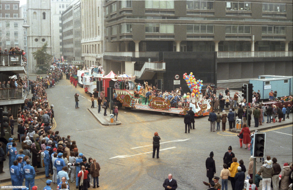
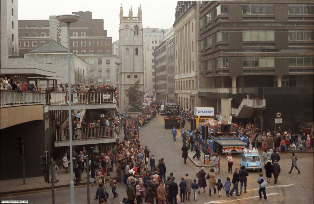
As well as the participants in the Lord Mayor’s Show during the early 1980s, these photos also show the area around London Wall as it was before the major rebuilding of the last couple of decades that has resulted in a significant change to the streets.

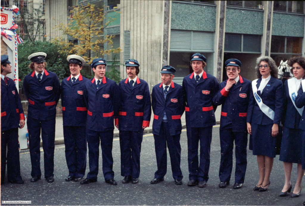
So, to start with, here are some uniformed Unigate milkmen:lord-mayors-show-1

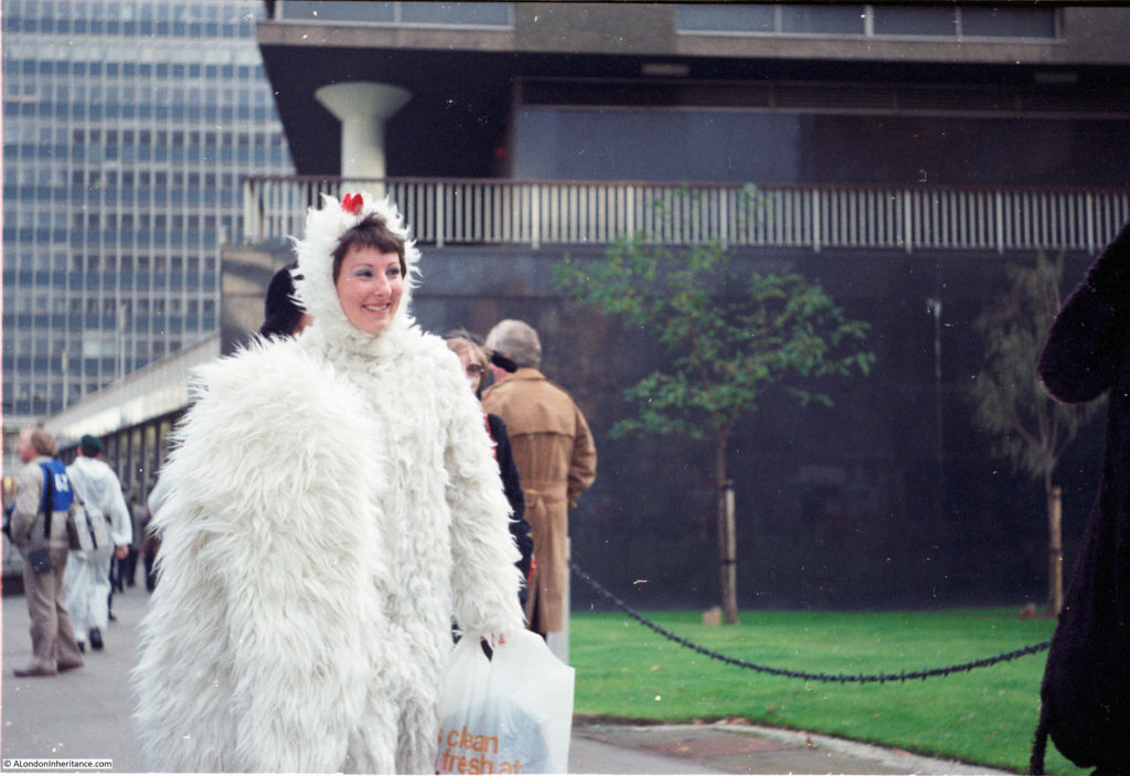
Only at the Lord Mayor’s Show could you spend your day in (I think) a chicken costume:

lord-mayors-show-2

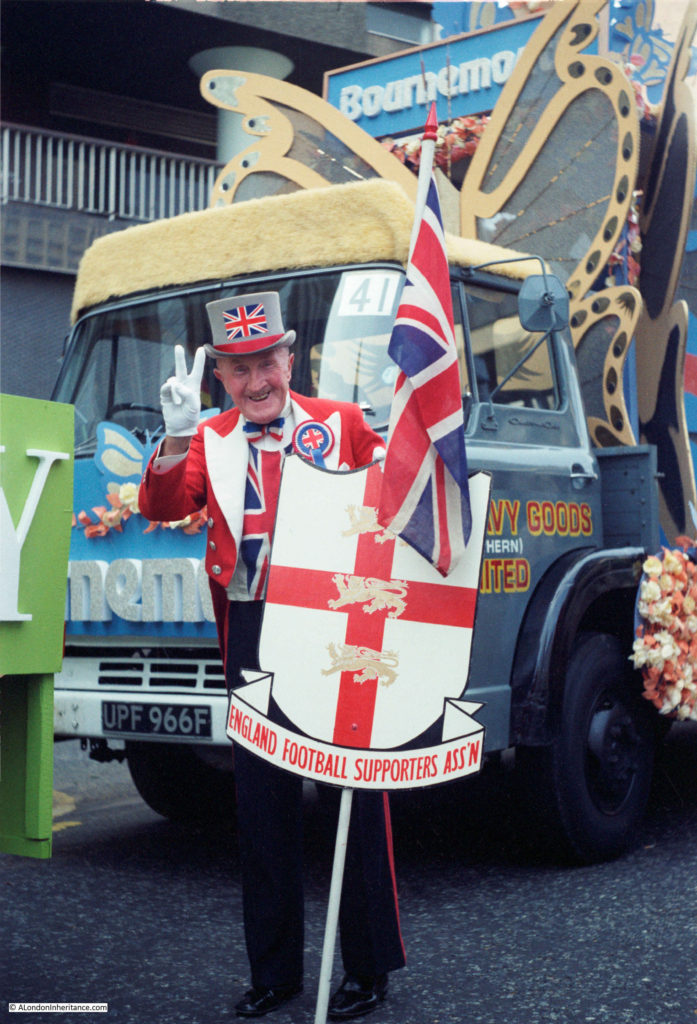
I remember this character from the 1970s and 80s, but cannot recall his name:

lord-mayors-show-3

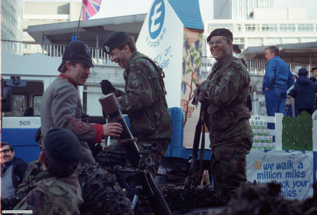
The military have always played a significant role in the Lord Mayor’s Show:

lord-mayors-show-4

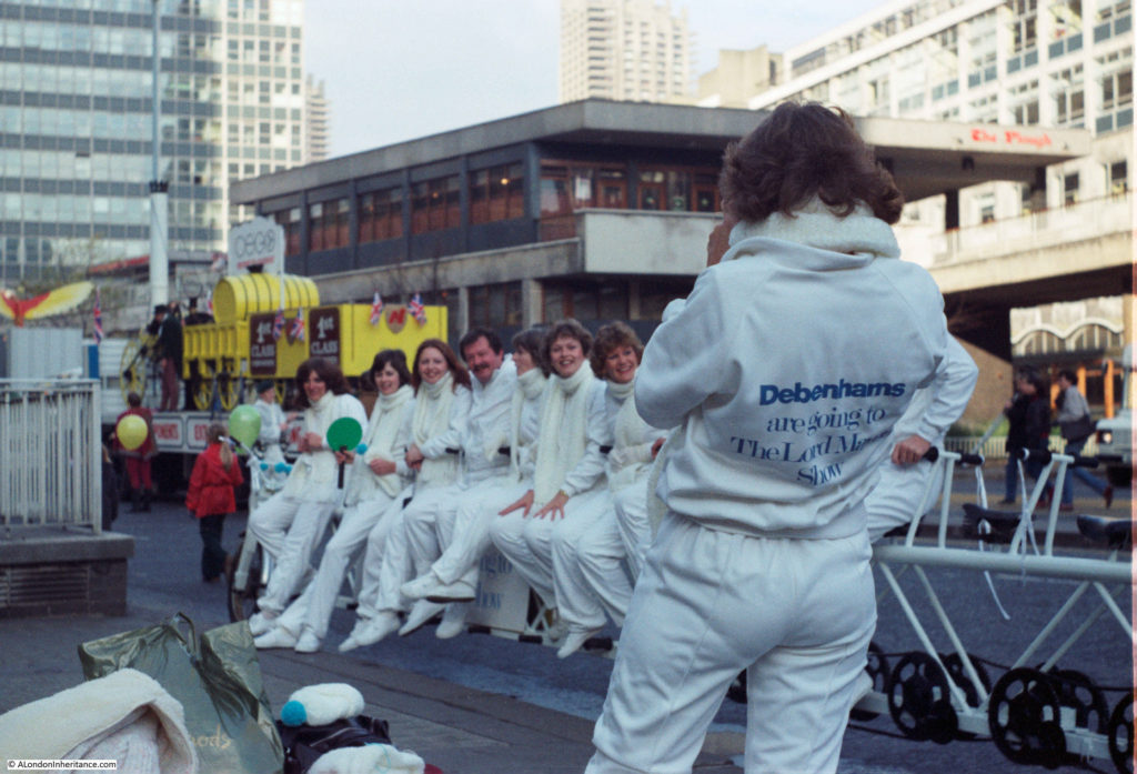
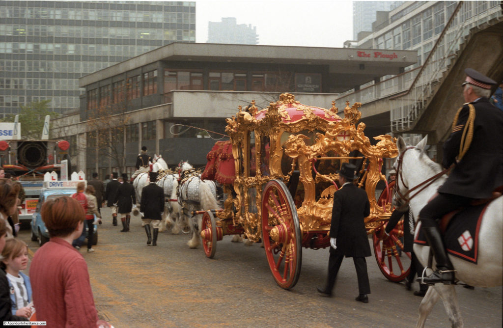
I had forgotten all about this pub until I scanned this photo. In the background is the Plough pub on St Alphage High Walk. It was demolished in 2006 as part of the reconstruction of the area.  In the foreground is the Debenhams float, which I think is a bike they will all be cycling along the procession.

lord-mayors-show-5

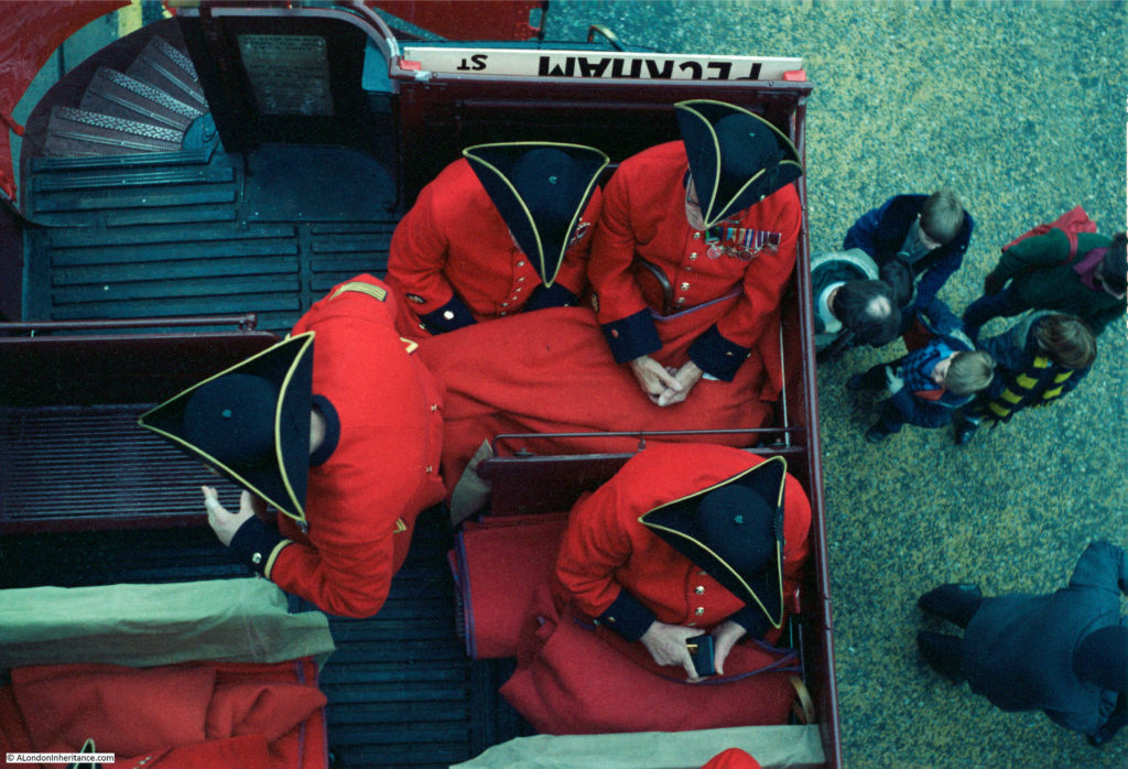
Chelsea pensioners from above:

lord-mayors-show-6

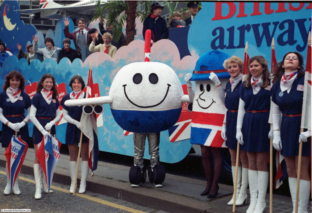
The British Airways float:

lord-mayors-show-7

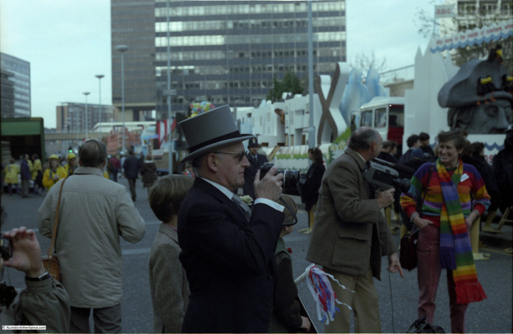
I took this photo of the man in the centre, however look at the man to his right. he is carrying a cine camera. These photos are only around 35 years old, but this was the technology of the time – there is not a mobile phone in sight.

lord-mayors-show-8

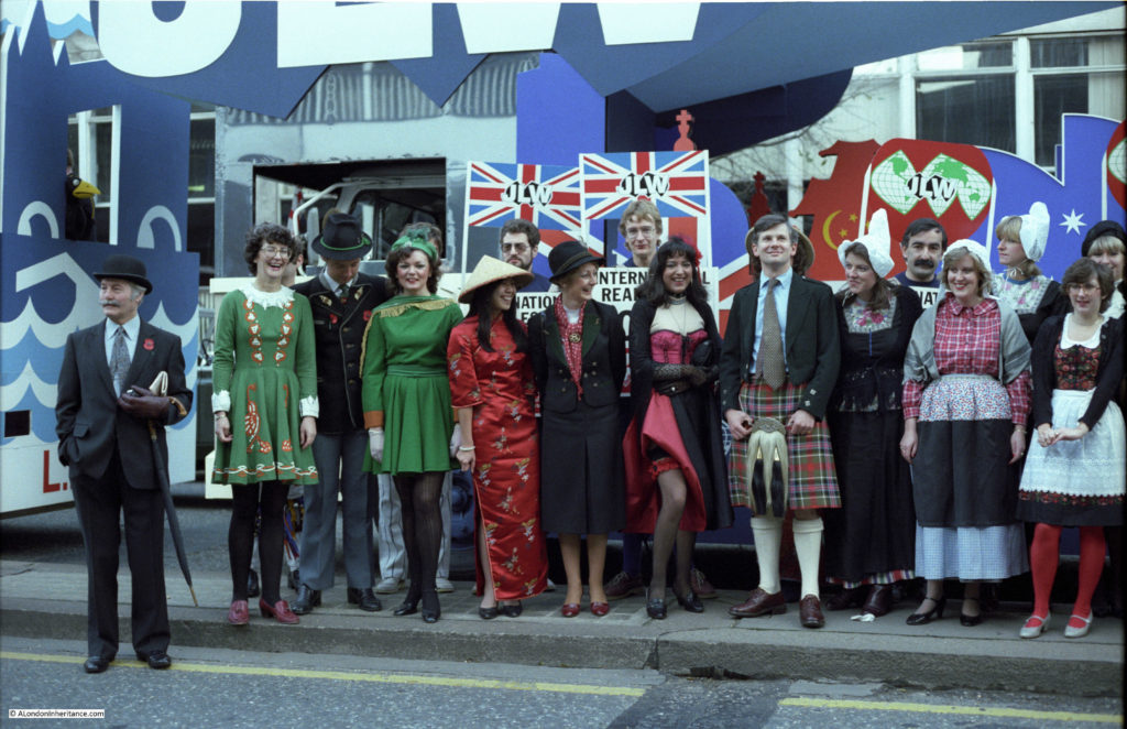
Cannot remember who “JLW” were:

lord-mayors-show-9

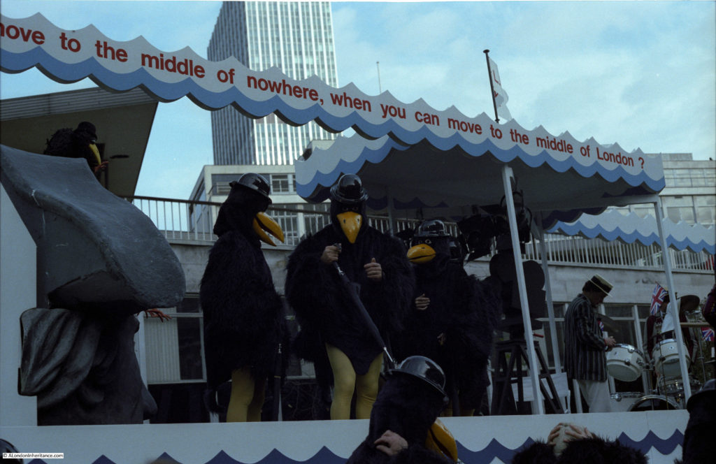
“Why move to the middle of nowhere, when you can move to the middle of London?”

lord-mayors-show-10

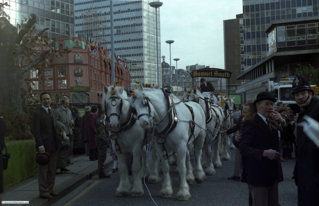
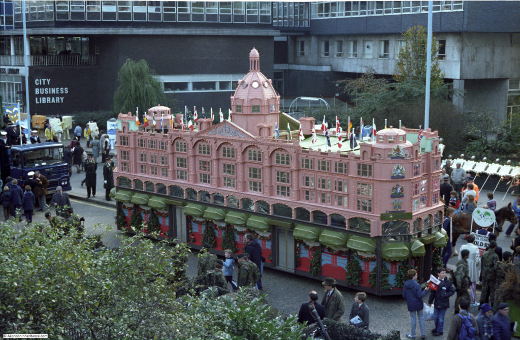
The brewer Samuel Smith with the Harrods float on the left:

lord-mayors-show-11

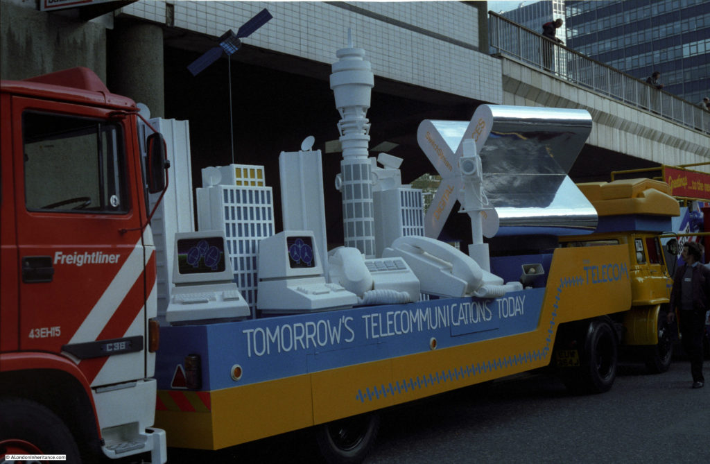
British Telecom float. Very early computer terminals, but not a mobile phone in sight. How technology would change over the coming 35 years.

lord-mayors-show-12

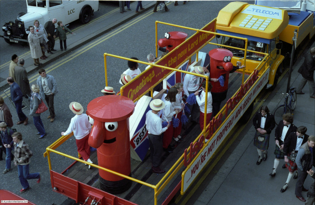
Post Office float – advertising down the side to “Use the postcode – you’re not properly addressed without it”.

lord-mayors-show-13

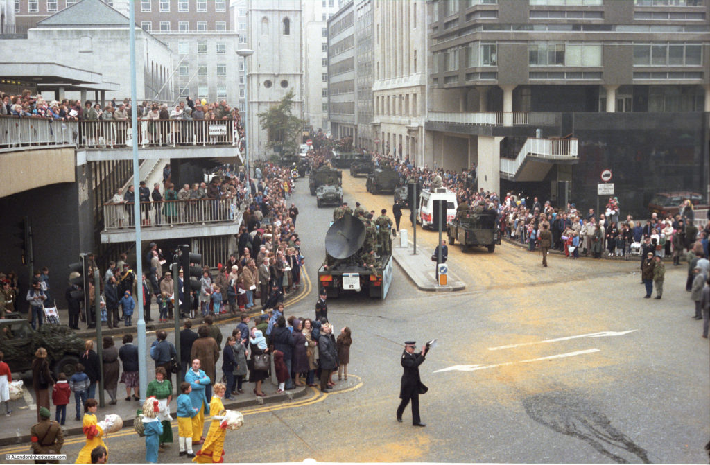
The following few photos were taken from the footbridge that ran across London Wall from the southern to the northern sides of Wood Street. The church tower is that of St. Alban. This area has been completely rebuilt. Whilst the church tower remains, the exit of the southern part of Wood Street into London Wall is now a single lane. The surrounding buildings, the foot bridge and the elevated walkways have all disappeared and the 18 floor office block, 125 London Wall now sits across this junction.

lord-mayors-show-14

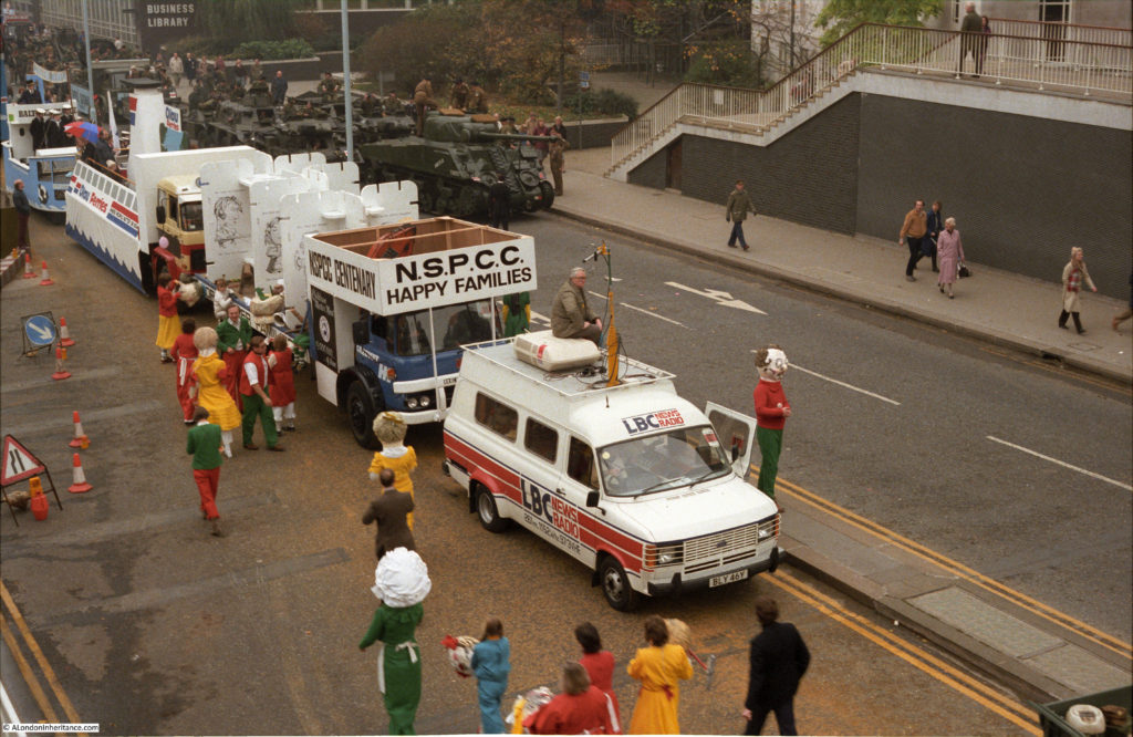
LBC radio van:

lord-mayors-show-15

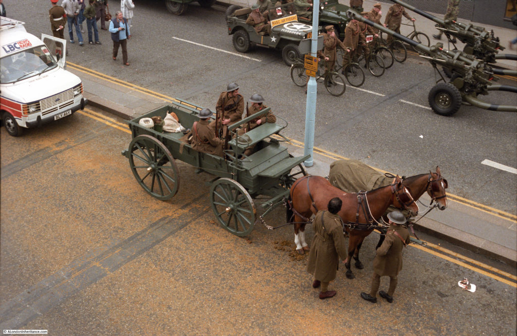
Vintage army uniforms and equipment:

lord-mayors-show-16

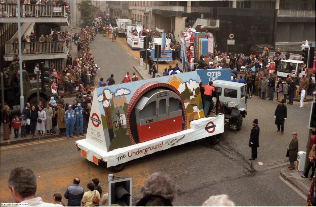
The Underground, advertising the capital investment that had recently resulted in the Heathrow extension of the Piccadilly line:

lord-mayors-show-17

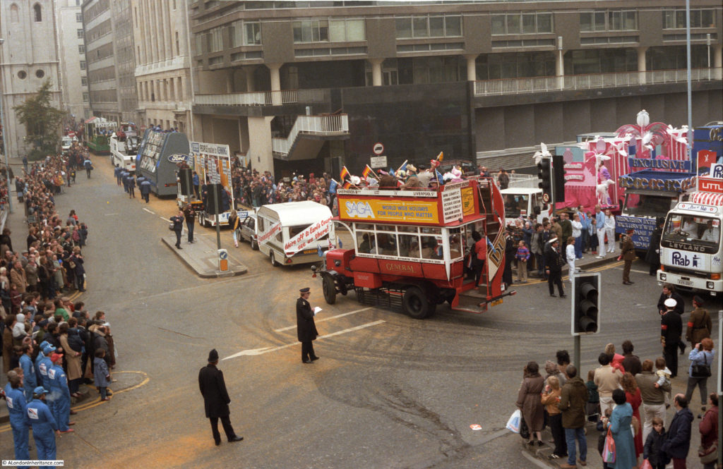
SAGA – “world-wide holidays for people who matter”:

lord-mayors-show-18

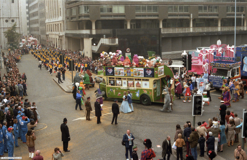
This bus appears to be an entry by, or sponsored by Disney:

lord-mayors-show-19

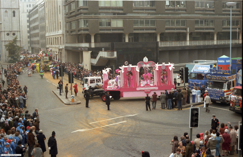
“Give me Bournemouth anytime” – the rather exotic entry that must be by the Bournemouth Tourist Board:

lord-mayors-show-20

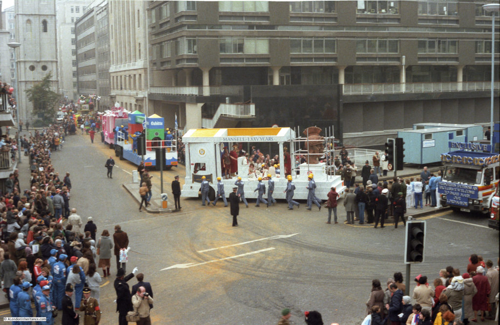
Float entry by the construction company Mansell advertising 75 years of the company’s existence. This would not last for too much longer as Mansell was purchased by Balfour Beatty in 2003 and the name was phased out in 2014.

lord-mayors-show-21

British Telecom, when a large handset attached to a landline was the latest in technology:

lord-mayors-show-22

Not sure what this float was:

lord-mayors-show-23

A better view looking from the north edge of London Wall down Wood Street showing the stairs that ran up to the foot bridge and the pedestrianised walkways:

lord-mayors-show-24

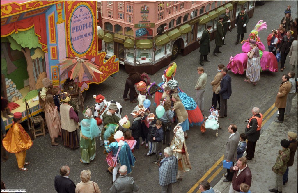
Floats from Selfridges and Harrods:

lord-mayors-show-25

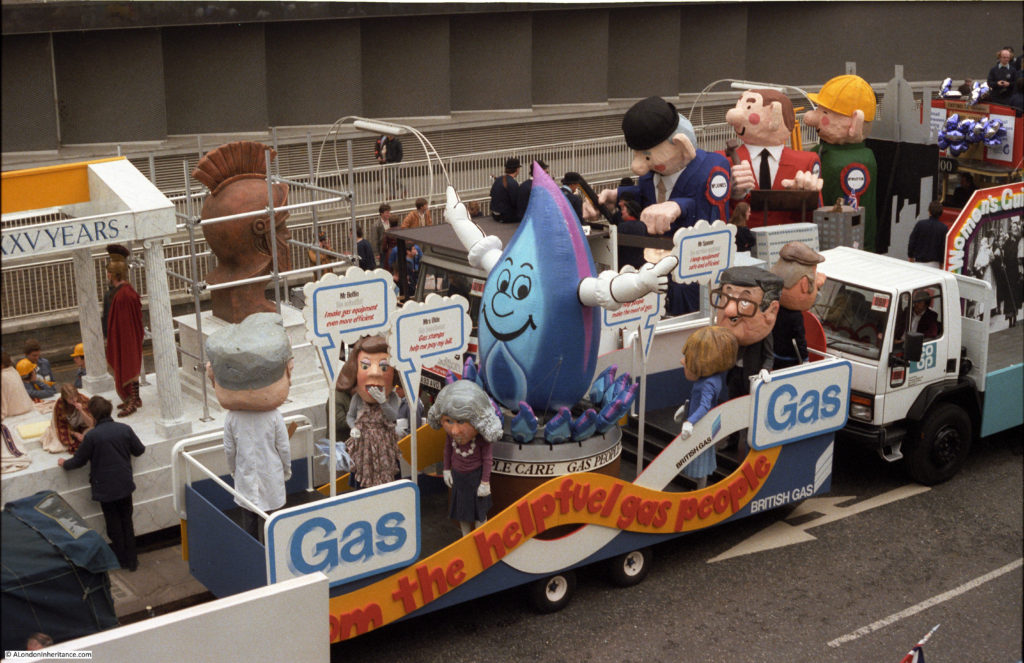
British Gas:

lord-mayors-show-26

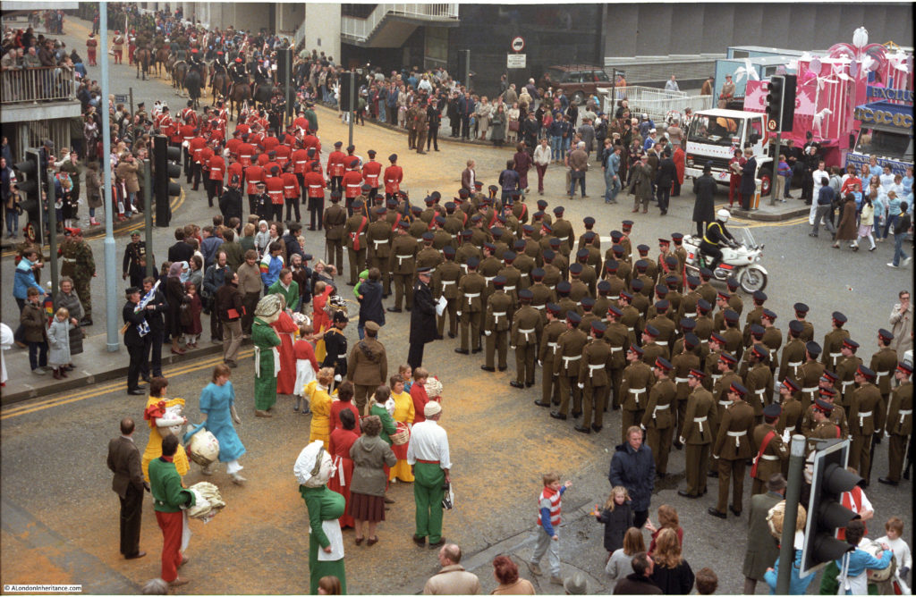
The military wait the start of the procession:

lord-mayors-show-27

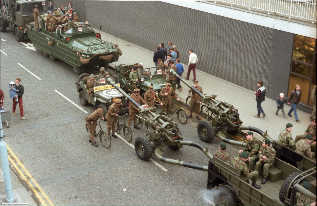
Military equipment:

lord-mayors-show-28

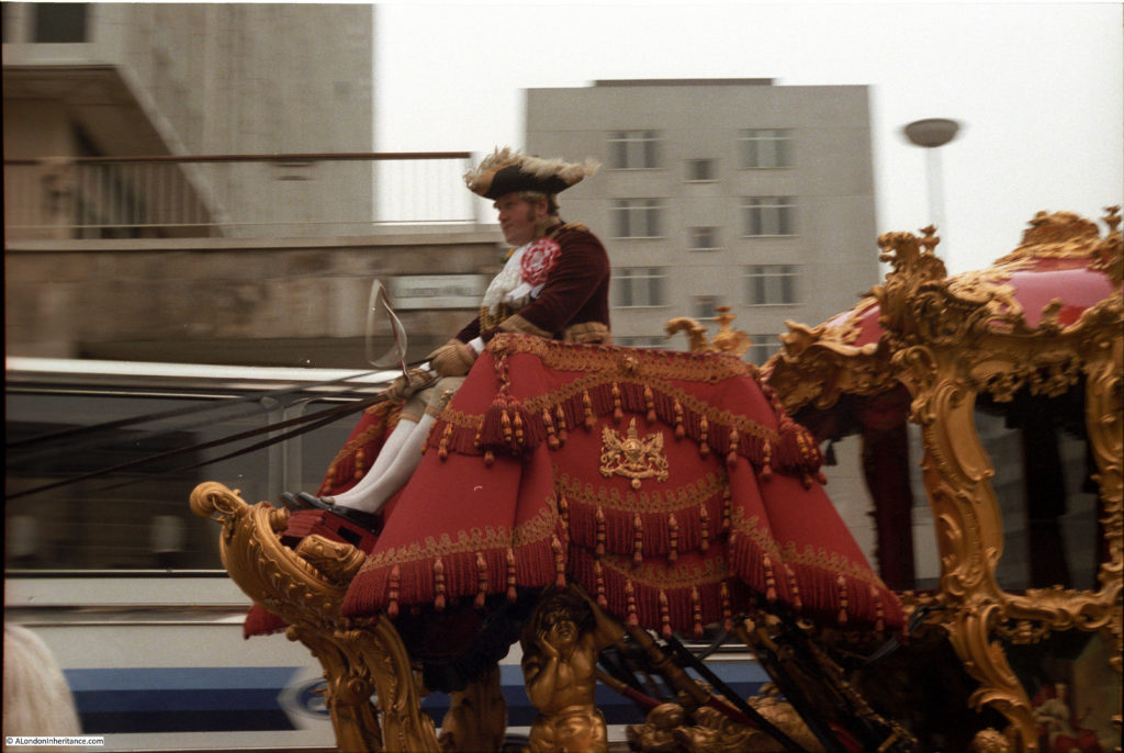
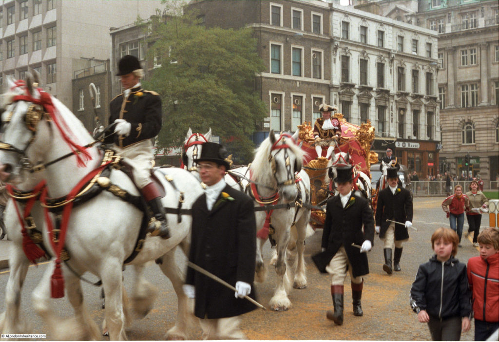
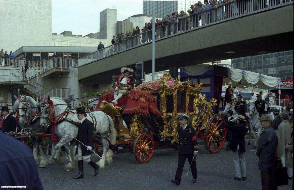
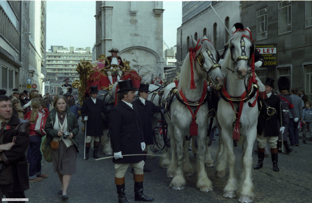
The Lord Mayor’s Coach:

lord-mayors-show-29

Passing The Plough pub on London Wall:

lord-mayors-show-30

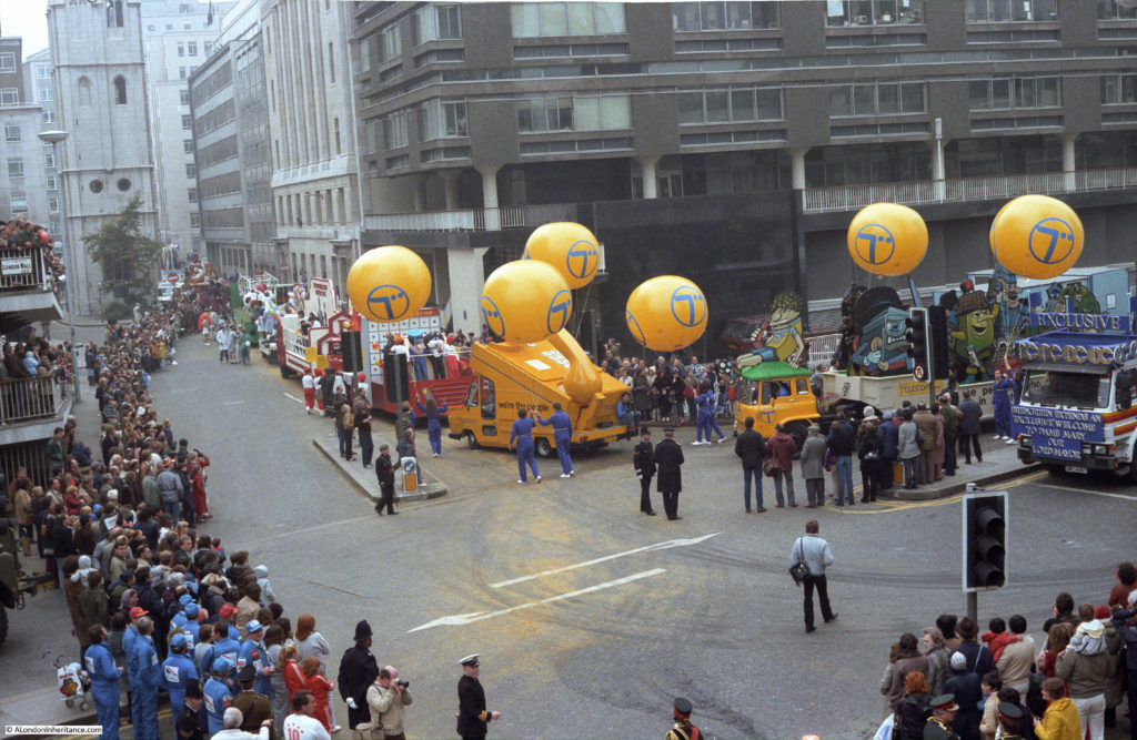
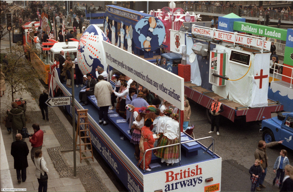
British Airways, City & Guilds College and Cubitts the builders:

lord-mayors-show-31

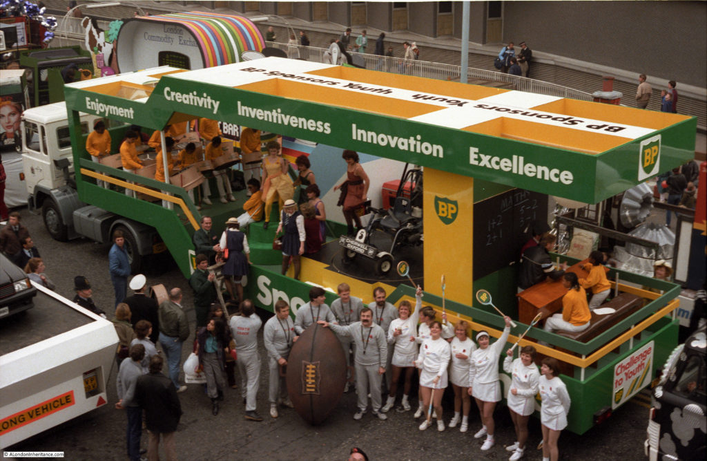
In perhaps a reverse of the many other changes in the last 35 years, the Lord Mayor’s Show appeared to be much more commercial than it is today. Companies such as Selfridges, Harrods, British Airways, British Telecom and as shown below, BP, along with many others all had floats in the procession. An interesting change in focus.

lord-mayors-show-32

The Lord Mayor’s Coach:

lord-mayors-show-33

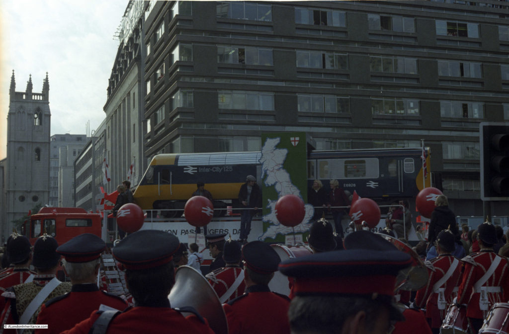
British Rail and the InterCity 125 train that had been introduced during the previous few years:

lord-mayors-show-34

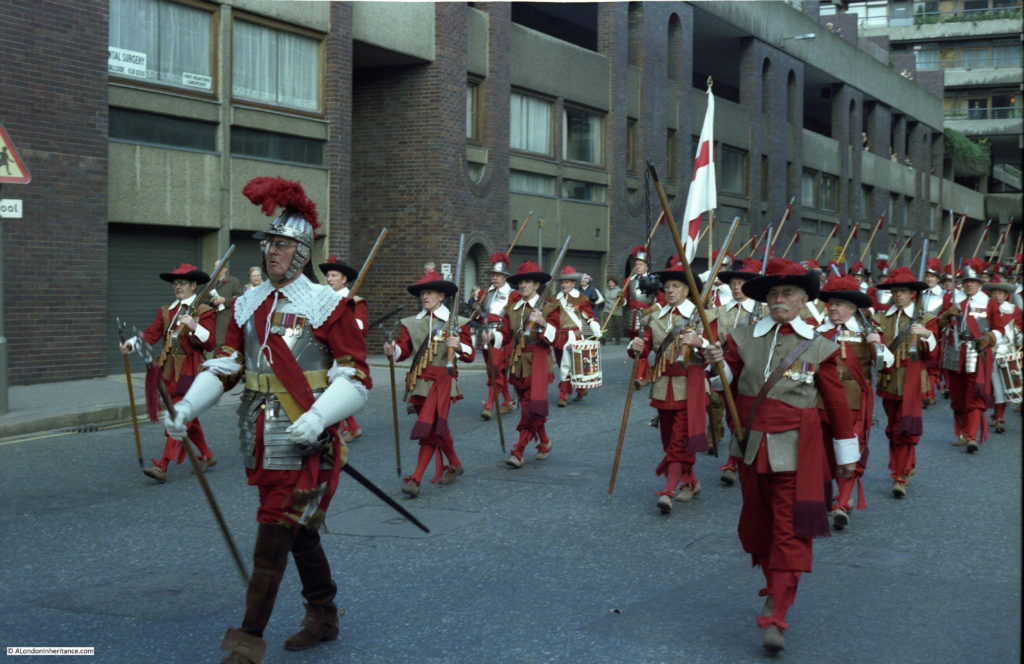
The Company of Pikemen and Musketeers of the Honourable Artillery Company have long been a feature of the Lord Mayor’s Show. Here marching down the northern part of Wood Street from Fore Street towards London Wall:

lord-mayors-show-35

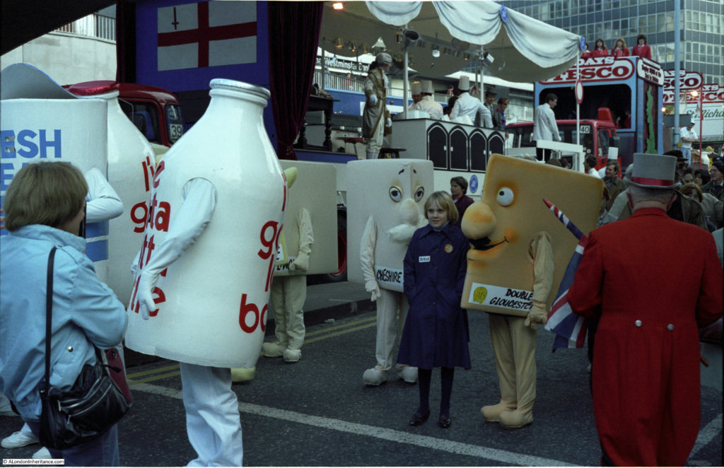
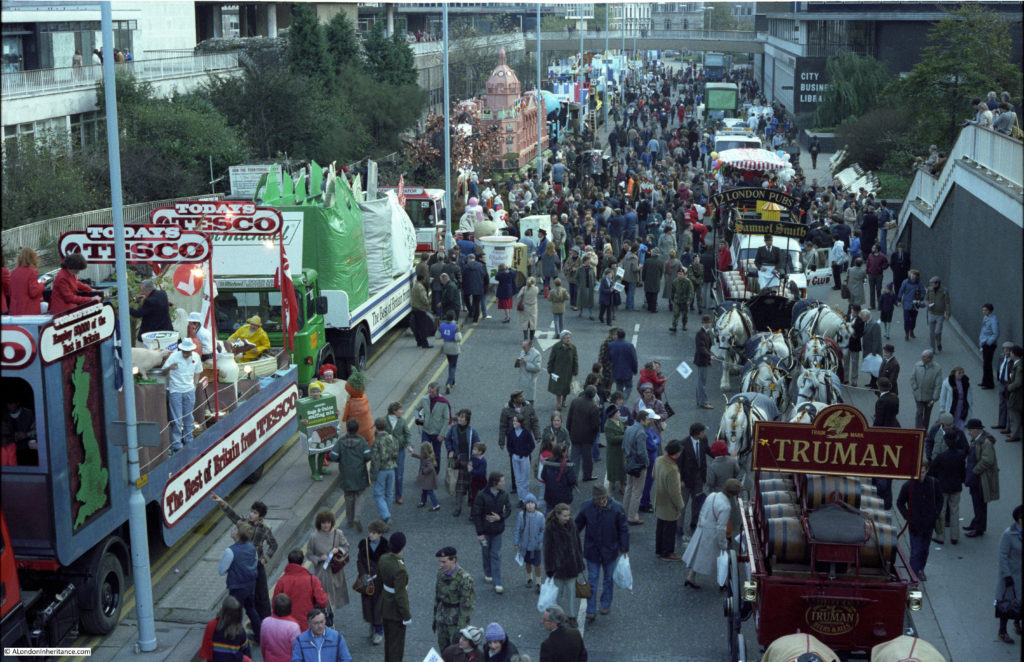
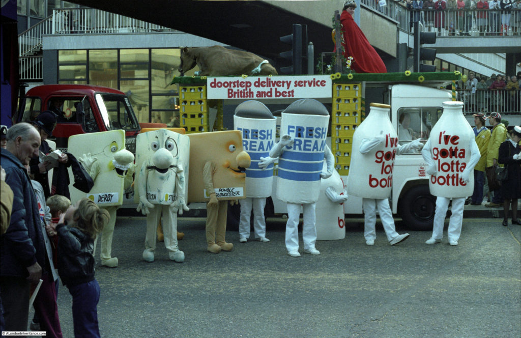
Milk and cheese deliveries to the door. Tesco float in the background:

lord-mayors-show-36

Lord Mayor’s coach again:

lord-mayors-show-37

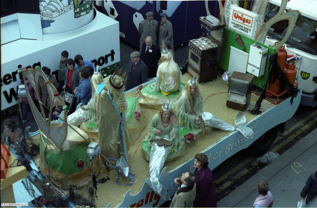
The latest gas appliances from Unigas:

lord-mayors-show-38

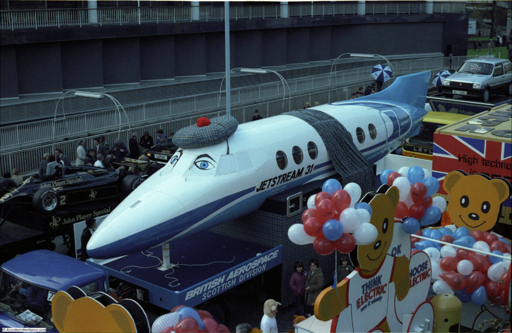
British Aerospace and the Jetstream 31 which first flew in 1980:

lord-mayors-show-39

View along London Wall:

lord-mayors-show-40

Harrods float:

lord-mayors-show-41

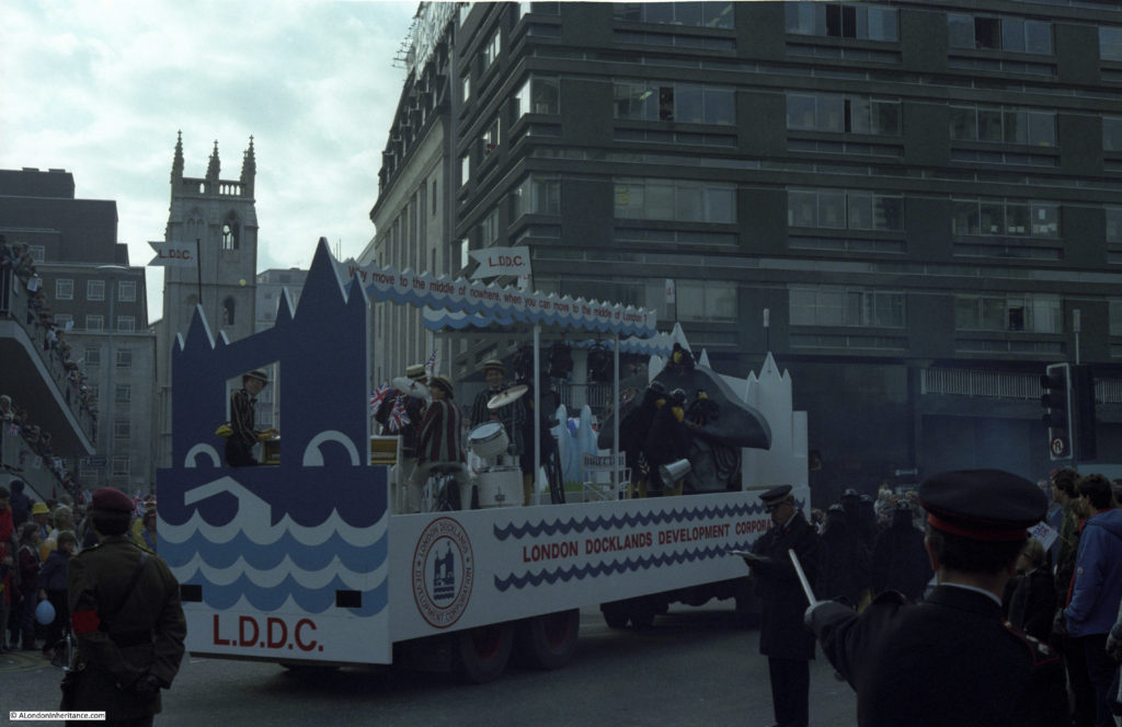
London Docklands Development Corporation float. Created in 1981 at around the same time as these photos. The work of the L.D.D.C. would have a significant impact on the area of London east of Tower Bridge and down to the Isle of Dogs:

lord-mayors-show-42

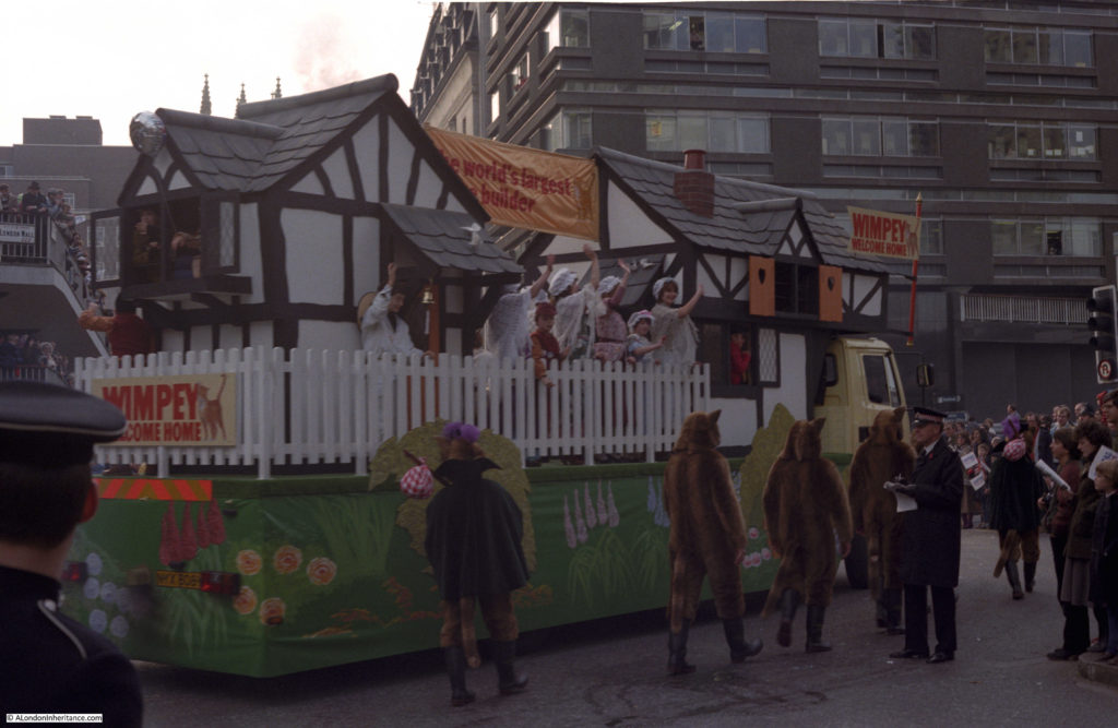
Wimpey, from the days when mock Tudor architecture was the aspiration for a new home owner:

lord-mayors-show-43

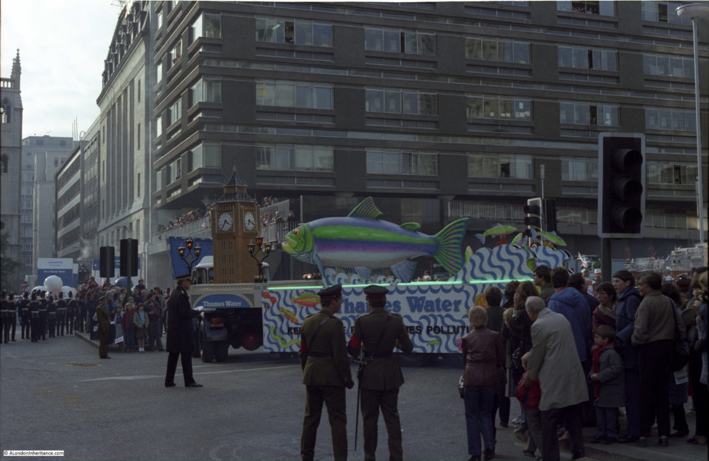
Thames Water:

lord-mayors-show-44

The Lord Mayor’s Coach in Wood Street by the tower of the church of St. Alban:

lord-mayors-show-45

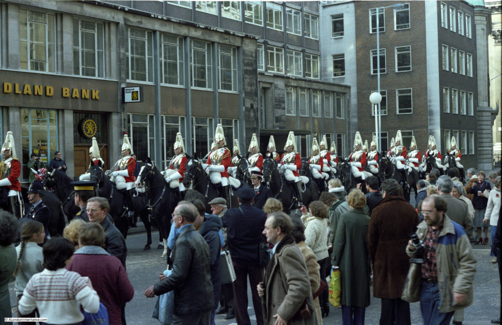
The Household Cavalry:

lord-mayors-show-46

“Doorstep delivery service, British and best”:

lord-mayors-show-47

It is a number of years since I last saw the above photos, and looking at them now the things that strike me most are the changes along London Wall, and the large number of private companies that once participated in the Lord Mayor’s Show. The procession seems rather different today.

London Wall at the time was the post war development of a heavily damaged area and consisted of plenty of rather unattractive office tower blocks, but looking at the photos now, including the junction of Wood Street and London Wall I feel strangely nostalgic for this area as it was. London Wall does not feel as much an open space as it did, with the building of 125 London Wall blocking the view along the length of the street.

alondoninheritance.com

The Exhibition Of Architecture – The Final Chapter

My last post on the Exhibition of Architecture was rather long and there were still a number of things I wanted to include on the subject, so here is my very final post on the Festival of Britain.

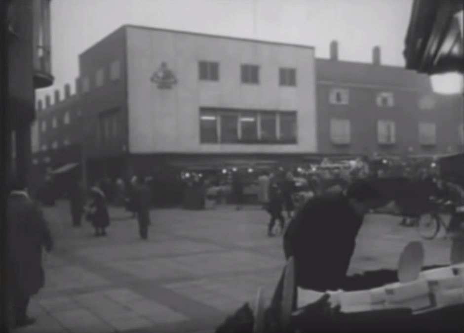
Firstly, a couple of stills from a children’s film made in 1956. The film is “One Wish Too Many” and many of the external shots were filmed in and around the Lansbury estate. The film tells the story of a boy who finds a magic marble with rather unpredictable results.

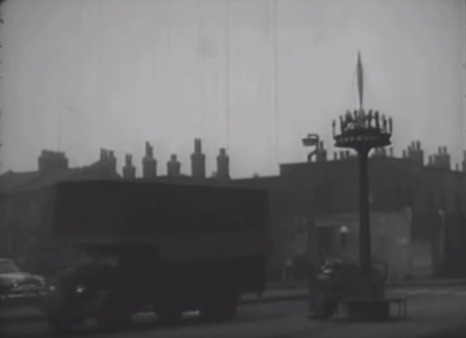
The film can be found here. In my last post I mentioned the pole mounted scene of people around a model of the Skylon. This appears in the film and a still showing the pole is below:

Lansbury Estate 54

The Chrisp Street market also features in the film:

Lansbury Estate 55

One Wish Too Many is a fascinating film to watch for a glimpse of the area as it was 60 years ago, and to see how life in Poplar was portrayed in film.

As well as the Exhibition of Architecture at Lansbury, the Council of Architecture advising the organisers of the Festival of Britain recommended that there be an award for “contributions to civic or landscape design, including any buildings, groups of buildings or improvement to the urban or rural scene“.

The idea of an award was approved and entries were invited. There were challenges with getting a sufficient number of entries as building work had to have been started by the end of the war with completion in time for the award judging and the Festival of Britain. The initial end date for entries of September 1950 was extended to March 1951 to provide additional time.

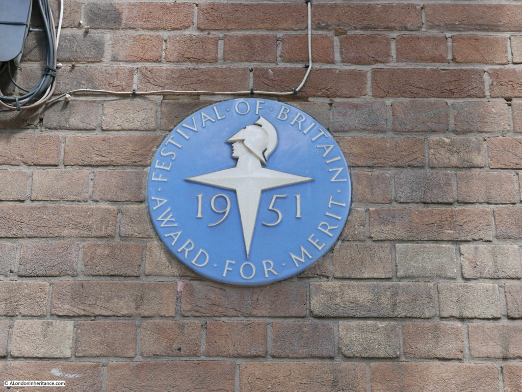
Winners of the award would receive a plaque with the festival symbol. There are a number of these that can still be seen today, one being at White City Underground Station. The plaque at the station is shown in the photo below. The plaques were made by Poole Pottery and consisted of a matt blue slip covering the base of the plaque with the festival symbol, festival year and lettering around the edge of the plaque raised, and painted white.

Lansbury Estate 34

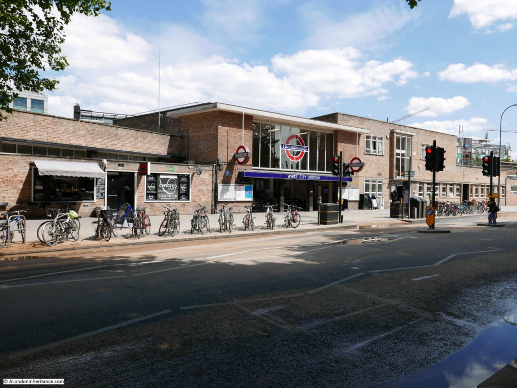
White City station was designed by A.D. McGill and Kenneth J.H. Seymour for Thomas Bilbow of London Transport. This station served the nearby White City Stadium and therefore had to manage large crowds. The station had extended platforms and a separate “rush hall” providing additional space into and out of the station when there was an event on at White City Stadium. Additional space to the right of the main entrance provided accommodation and working space for train crews.

White City Station as it is today. The festival plaque is just to the left of the main entrance.

Lansbury Estate 33

There were 19 winners of the festival award. As well as White City, other London winners included:

  • in Pimlico, Chaucer House, Coleridge House, Shelley House and Pepys House with the hot water accumulator fed from Battersea Power Station
  • the Somerfield Estate in Dalston
  • Newbury Park Bus Station
  • Heath Park Estate, Dagenham

Winners outside of London included an Old People’s Home in Glasgow and a School in Stevenage. It would be an interesting exercise to track down the 19 winners and see if the buildings are still there along with their plaques and how their 1951 design has survived over the past 65 years.

Back in Poplar, it is always interesting to walk an area – there is always much to find.

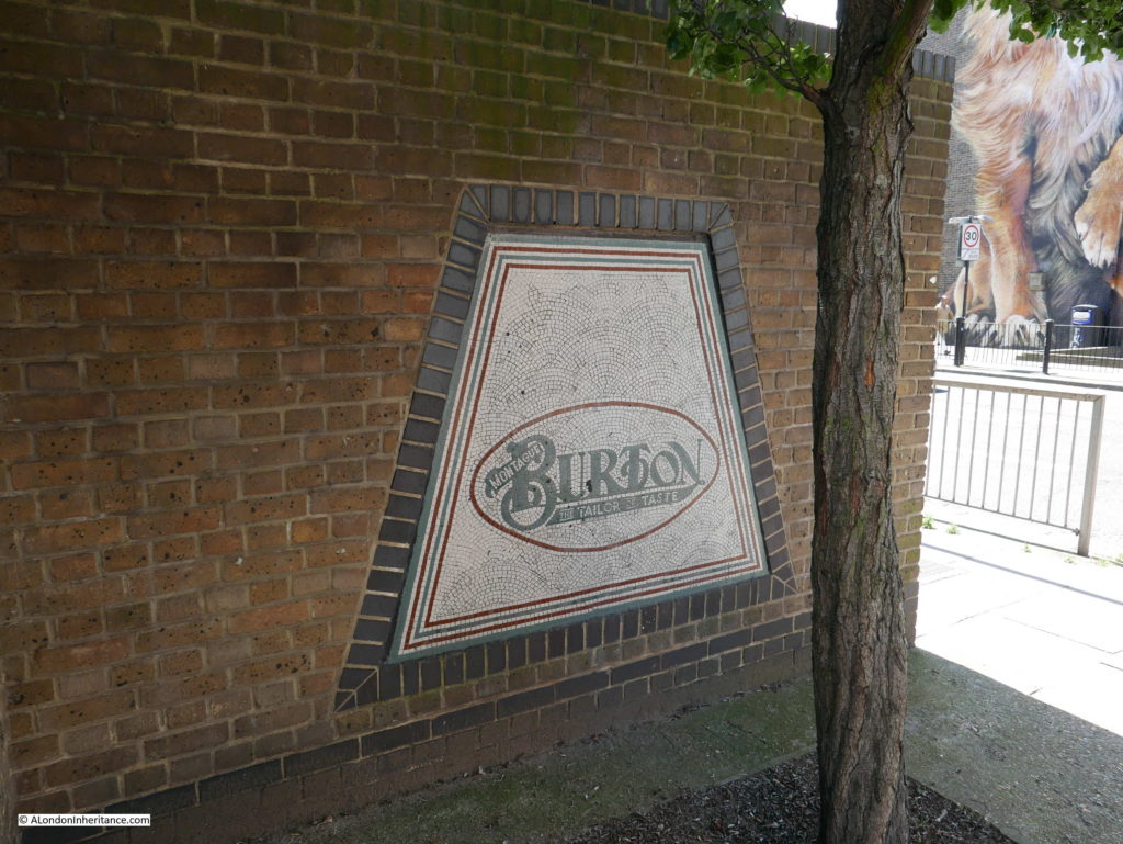
At the junction of Chrisp Street and Susannah Street there is the mosaic from the entrance of a branch of “Burton – the Tailor of Taste” that was originally at this location.

Lansbury Estate 56

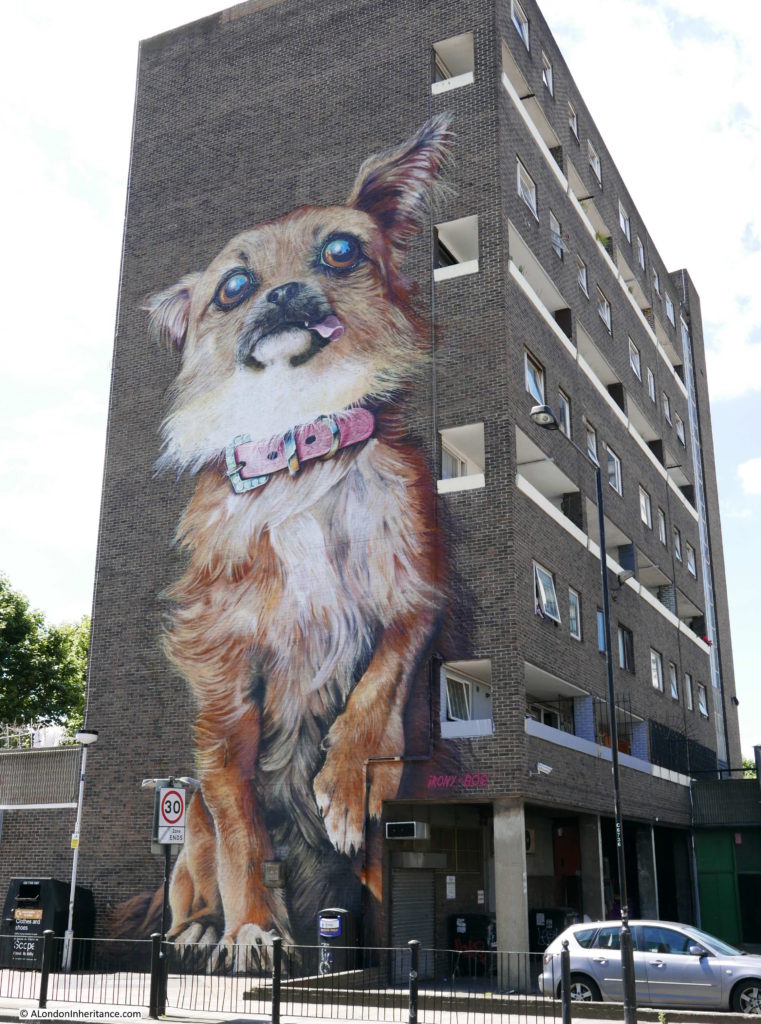
Almost directly across Chrisp Street from the above mosaic is this giant mural created in 2014 by the street artists Irony and Boe on one of the 1960s buildings between the market and the East India Dock Road. A giant chihuahua welcoming drivers heading into London.

Lansbury Estate 57

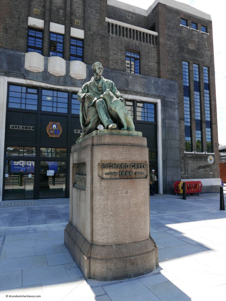
On the opposite side of the East India Dock Road to Chrisp Street is this statue to Richard Green.

Green owned a shipyard in Blackwall. He support the Poplar Hospital, a Sailors Home, he founded the Merchant Service training ship, HMS Worcester and was active in forming the Royal Naval Reserve. He died in 1863, the year 1866 on the plinth refers to the year in which the statue was erected on this spot.

Lansbury Estate 58

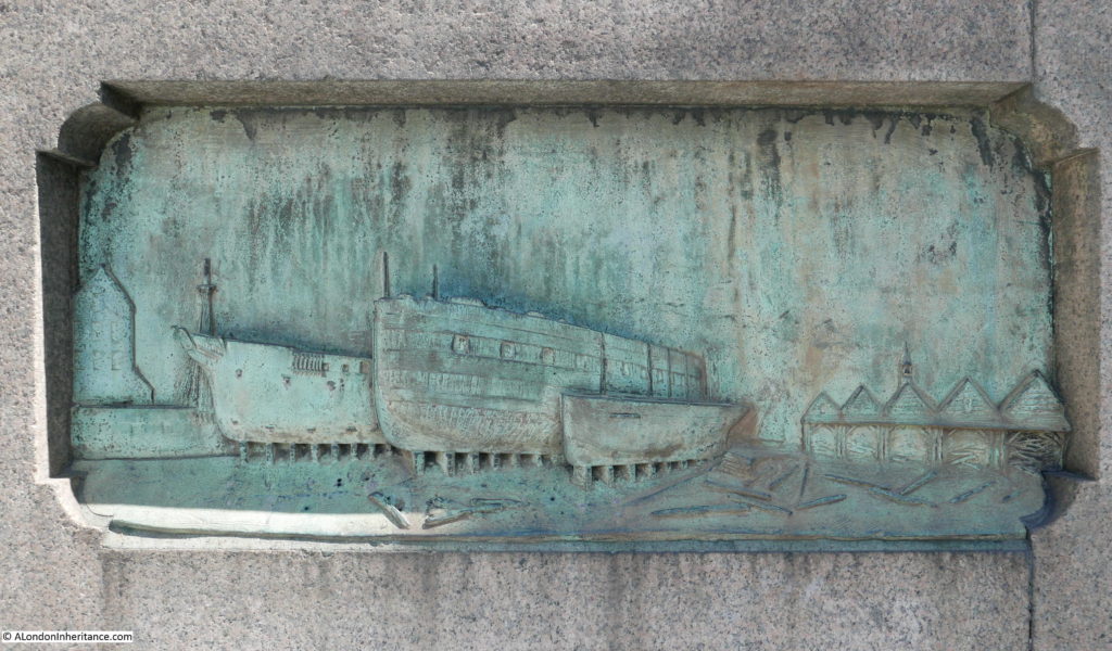
What caught my eye with this statue are that on either side of the plinth are some carvings of ships associated with Richard Green. On the western facing side of the plinth is a frigate under construction for the Spanish Government at Green’s yard.

Lansbury Estate 59

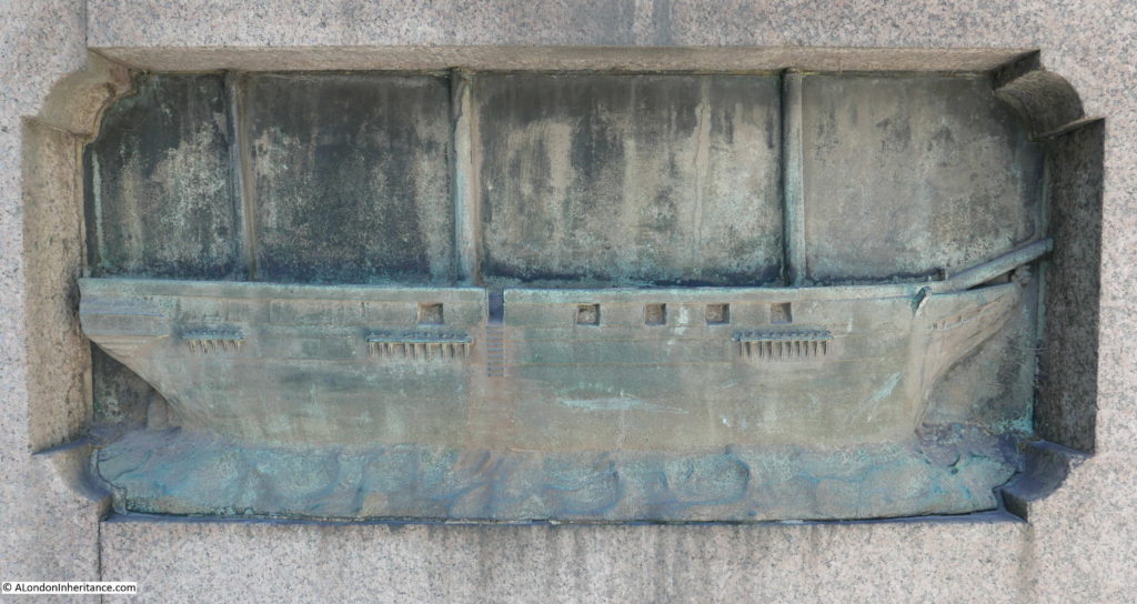
And on the east facing side of the plinth is the first ship sent from Green’s Blackwell boatyard to China.

Lansbury Estate 60

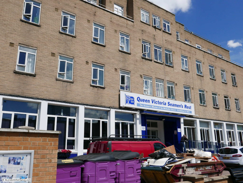
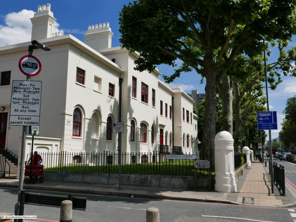
Further along East India Dock Road, on the Lansbury side are two buildings that were on the original Lansbury guidebook map (see my previous post). The first is the Queen Victoria Seamen’s Rest – marked number 9 on the map. Originally established as the Seamen’s Mission of the Methodist Church in 1843 with buildings in the adjacent Jeremiah Street, the present buildings facing onto the East India Dock Road are the 1950’s extension to the original buildings. Still in operation and providing support and accommodation to ex-seamen, ex-servicemen and others in need of accommodation.

Lansbury Estate 61

Next along are the buildings marked as number 11 on the map. At the time they were Board of Trade Offices but are now flats. The cream coloured paint, fine weather and style gives the buildings an appearance of colonial architecture.

Lansbury Estate 62

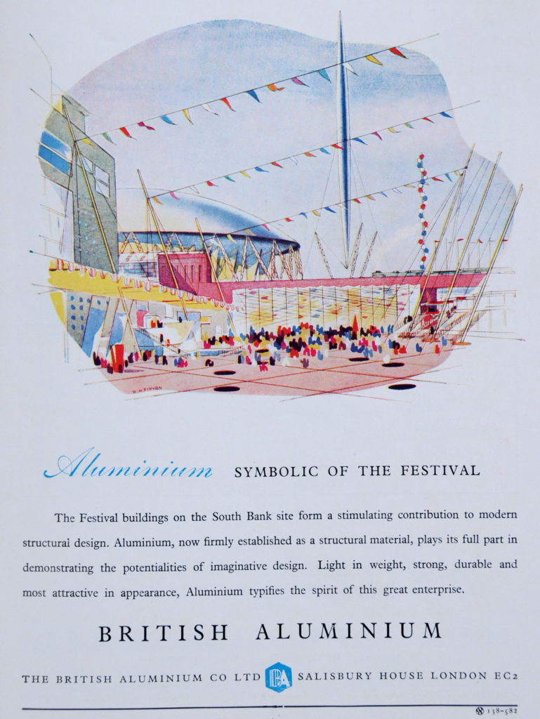
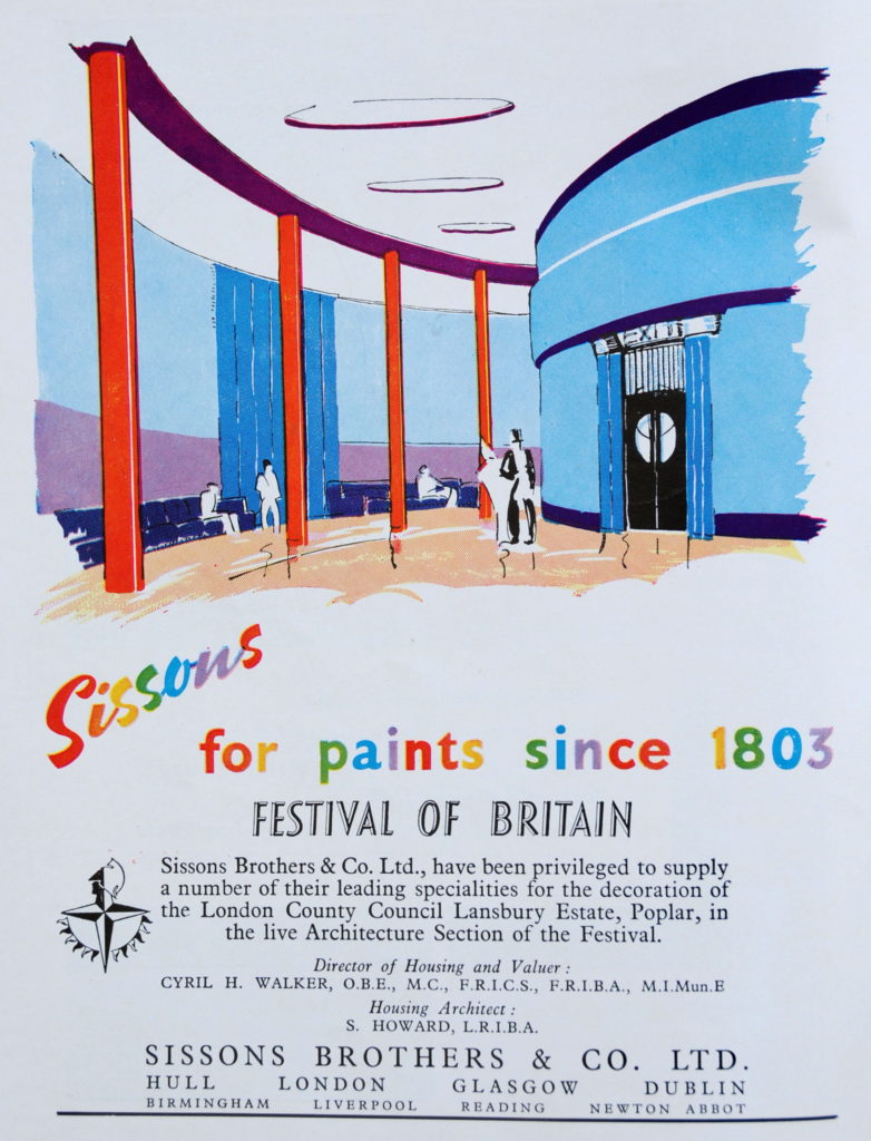
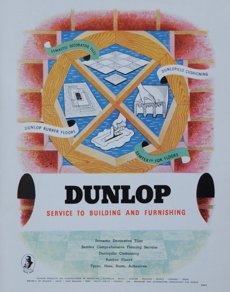
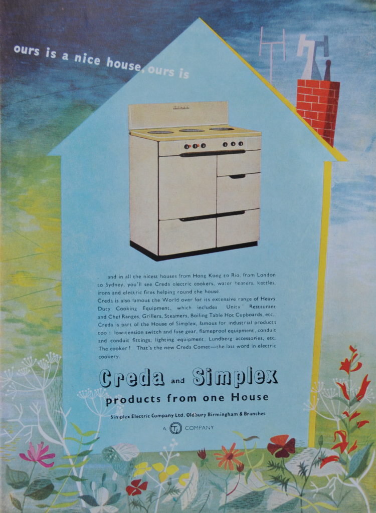
As with the other Festival of Britain guide books, the one for the Exhibition of Architecture has a fascinating selection of adverts related to the subject of the exhibition.

I find these interesting for a number of reasons – the subject of the advert, the company, the advertising style and the use of colour. Here are a selection from the guide.

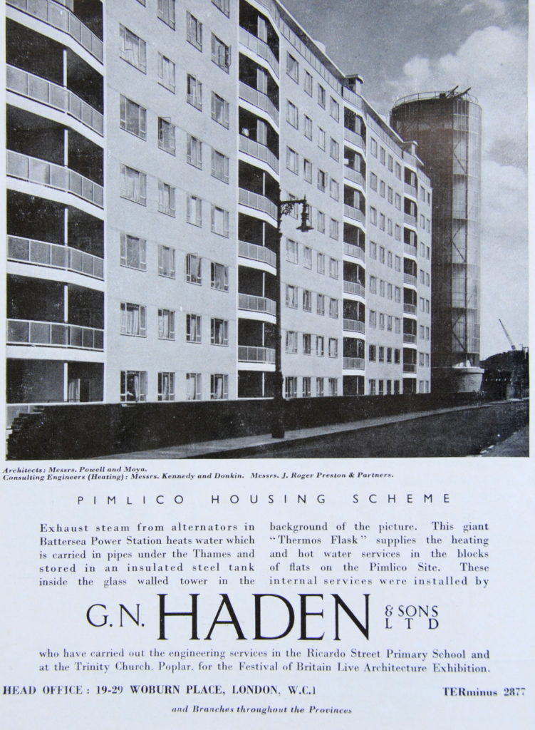
The first is for the company G.N. Haden, a firm of electrical and mechanical engineers who worked on a couple of the Lansbury sites, however the advert is for the district heating system in Pimlico that used hot water from Batterea Power Station. G.N. Haden went through a number of mergers until eventually becoming part of Balfour Beatty.

Lansbury Estate 38

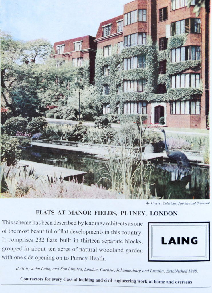
The Manor Fields private estate in Putney, built by Laing. The estate still looks much the same today.

Lansbury Estate 41

The Dome of Discovery on the South Bank was the largest aluminium building in the world at the time of the festival. British Aluminium was the country’s largest producer and as the process of producing aluminium consumed large amounts of electricity, plants would make use of new hydro-electric and nuclear products over the coming years, however global over production and higher production costs in the UK caused continual problems and the company was purchased and split over time between a number of global producers and private equity. None of the original production plants remain.

Lansbury Estate 40

Sissons – Hull based paint manufacturers. Cannot find too much about them, however I believe they were finally integrated into Akzo-Nobel and all the Hull based manufacturing operations closed.

Lansbury Estate 39

Dunlop – probably better known for the company’s tyre production, Dunlop was a major British multi-national, however lack of innovation with tyre products allowed competitors to gain market share with new products. Production and quality issues, debts from failed global partnerships resulted in a common story for British industry during the final decades of the 20th century of company break-up, ongoing selling through a number of owners and closure of plants and parts of the business. How different it must have seemed in 1951.

Lansbury Estate 37

Creda and Simplex, both at the time owned by the conglomerate TI (Tube Investments).

TI went through a range of difficulties resulting in the sale of individual businesses and brands. Creda was still operating as a brand, but is now integrated into Hotpoint. The advert features the Creda Comet “the last word in electric cookery”.

Lansbury Estate 36

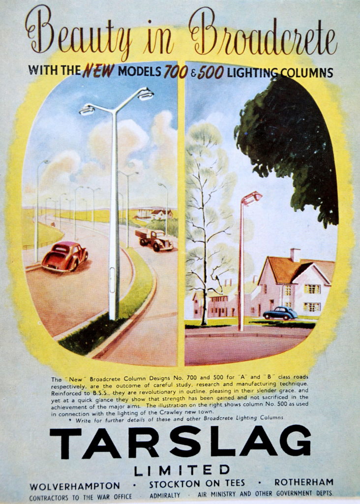
Broadcrete lighting columns made by Tarslag who as the name implies were mainly a road surfacing company. Soon after this advert appeared, Tarslag sold the designs of the Broadcrete lighting columns to Concrete Utilities – an established company already producing concrete lamp posts and the Broadcrete designs soon stopped production so I suspect they are now rather rare. Concrete Utilities, now known as CU Phosco continues as a UK manufacturer of lighting equipment, however now producing metal products rather than concrete. Much of the street lighting across London is manufactured by CU Phosco.

Tarslag was eventually purchased by Tarmac.

Lansbury Estate 47

I am not sure whether the Tarslag Broadcrete lamp-post is a fitting conclusion to my series of posts on the Festival of Britain, but it does highlight how the optimistic view of the future presented during the festival would change dramatically over the coming decades.

I realise I have only been able to scratch the surface of this subject, not just about the Festival, but also how the Festival reflected the country as it was at the start of the 1950s – both London and the country have changed dramatically in the 65 years since.

There are many excellent books on the Festival of Britain – see the end of this previous post for a list.

Thank you for putting up with my interest in the Festival of Britain, starting next week, a completely different series of posts.

alondoninheritance.com

The Lansbury Exhibition Of Architecture

The Lansbury Exhibition of Architecture is the final stop on my exploration of the 1951 Festival of Britain.

My apologies, but this is rather a long post, however the story of the Exhibition of Architecture held at the Lansbury Estate in Poplar is a fascinating subject, and as usual, I feel I am only scratching the surface, although I hope you will find this of interest.

For the majority of this post, I will take a walk around the Lansbury Estate, but first some background.

The London Docks, industry and density of population meant that much of the east end of London was a prime target during the last war with large areas in need of urgent reconstruction by the late 1940s.

On the 29th May 1946, the London County Council applied to the Minister of Town and Country Planning for 1,945 acres of Stepney and Poplar to be declared an area of comprehensive development under the 1947 Town and Country Planning Act.

Of the total request, 1,312 acres were declared to be an area of Comprehensive Development which meant that development of the area could now be planned and implemented as an integrated project with zoning of space and allocation to specific functions such as shops, housing, schools etc.

The plans to redevelop the area were based on the 1943 County of London Plan which attempted to address many of the problems caused by the random and sprawling growth of London such as:

  • Traffic congestion
  • Large areas of depressed housing
  • Inadequate and badly distributed open spaces
  • Intermingling of industry with housing

The plans acknowledged that despite the way the city had grown, strong, local communities had developed and it was important that these were retained during future development.

Eleven new neighbourhoods were planned for the Stepney and Poplar area of comprehensive development, each would be developed as if it were a small town with the appropriate local facilities of schools, shops, churches and public space.

An Exhibition of Architecture was planned for the Festival of Britain and in 1948 the Council for Architecture, Town Planning and Building Research proposed that one of the neighbourhoods to be developed in Stepney and Poplar would be an ideal site to demonstrate the latest approach to town planning, architecture and building.

A neighbourhood in Poplar was chosen. Named “Lansbury” after George Lansbury who had a long association with Poplar, as the Poplar member for the Board of Guardians of the Poor, on the Poplar Borough Council, the first Labour Mayor in 1919 and until his death in 1940 he was the Labour MP for one of the Poplar divisions.

The Lansbury Exhibition of Architecture would show how town planning and scientific building principles would provide a better environment in which to live and work, and how this would be applied to the redevelopment of London and the new towns planned across the country.

The following Aerofilms photo from 1951 shows Poplar looking west towards the City. The East India Dock Road runs from middle left of the photo. Along the lower part of the photo, running from left to right is the old railway that ran from Poplar Station (located where All Saints is now), north through Bow and Old Ford stations. The DLR now occupies this route.

I have outlined in red the borders of the Exhibition of Architecture. Much of the site was still being developed by the time of the Festival of Britain, however the construction of some buildings was brought forward and a special exhibition area was constructed specifically for the festival.
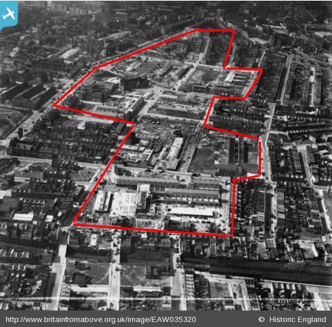
EAW035320

The following map is from the Lansbury Exhibition of Architecture Guide. Turn this by 90 degrees to the right to match the layout of the photo above. The red arrows on the map show the recommended route for the visitor to walk around the exhibition and the map shows the type of buildings either constructed, in the process of construction, or planned for the future in order to show Lansbury as a single, integrated neighbourhood.
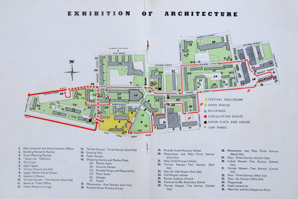
Lansbury Estate 35

The map gives the impression that at the time of the exhibition this was a fully finished site. Completion of many of the buildings had been rushed through ready for the start of the exhibition, however work on many others was still in progress and the exhibition site would not really reach a state of completion until the closure of the exhibition. A criticism at the time was that the route around the site was hard to follow with lack of clear sign posting and white direction lines on the ground not always being clear.

To explore the Exhibition of Architecture, I took my copy of the guide and via the DLR arrived at All Saints station ready to walk the same route as the Festival route in 1951.

My tour of the site started in the road to the left of the yellow block which included features 1 to 5. This was the Exhibition Enclosure, and was the first point on the tour – built specifically for the festival and hosting pavilions that would highlight the approaches now being used for town planning and building.

The Exhibition Enclosure included a Building Research Pavilion, a Town Planning Pavilion, a weather station (to show the relationship between changing weather conditions and building materials), along with one of the new types of crane that would soon be seen across London as reconstruction continued apace.

The Exhibition also included a “Gremlin Grange” in the Building Research Pavilion that highlighted what goes wrong when scientific building principles are not employed, such as:

  • Structural cracks and leaning walls – due to bad foundation design
  • External plaster coming off – because the mix contained too much cement
  • Damp rising up the walls – because there is no damp course
  • Leaning chimney stacks – often the result of chemical action on mortar joints
  • Fireplaces smoking – owing to bad design of chimney and flue
  • Tank leaking – because it lacks protection against frost
  • Cracks in walls – because poorly designed foundations have subsided
  • Bad artificial lighting – causing discomfort and eyestrain

The intention was to show that through the use of new design principles and building materials, the buildings across Lansbury would not suffer these gremlins.

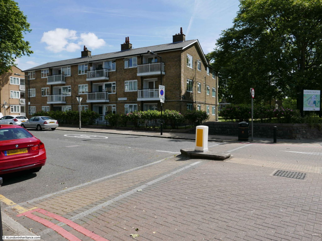
The following photo is from the corner of Saracen Street and the East India Dock Road looking across to the area that was the Exhibition Enclosure. Buildings in line with the architectural style of the rest of Lansbury were built on the site following the closure of the festival.
Lansbury Estate 1

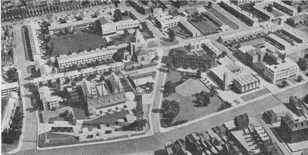
A model of the area shows the Exhibition Enclosure in the lower left of the following photo:
Lansbury Estate 49

I then walked to the open space marked as point 6 on the map – and centre right in the above photo.
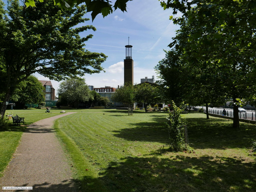
Lansbury Estate 2

Point 6 is an area of open space in front of the new Trinity Congregational Church. Before the redevelopment of Stepney and Poplar there was a combined total of 42 acres of open space which averaged out at 0.4 acres per 1,000 people. The County of London plan proposed an increase to a standard of 3.6 acres per 1,000 people and across the Stepney and Poplar development area, an increase from 42 to 267 acres of open space was planned. We will see as we walk around the Exhbition of Architecture route how open space has been used across the development of Lansbury.

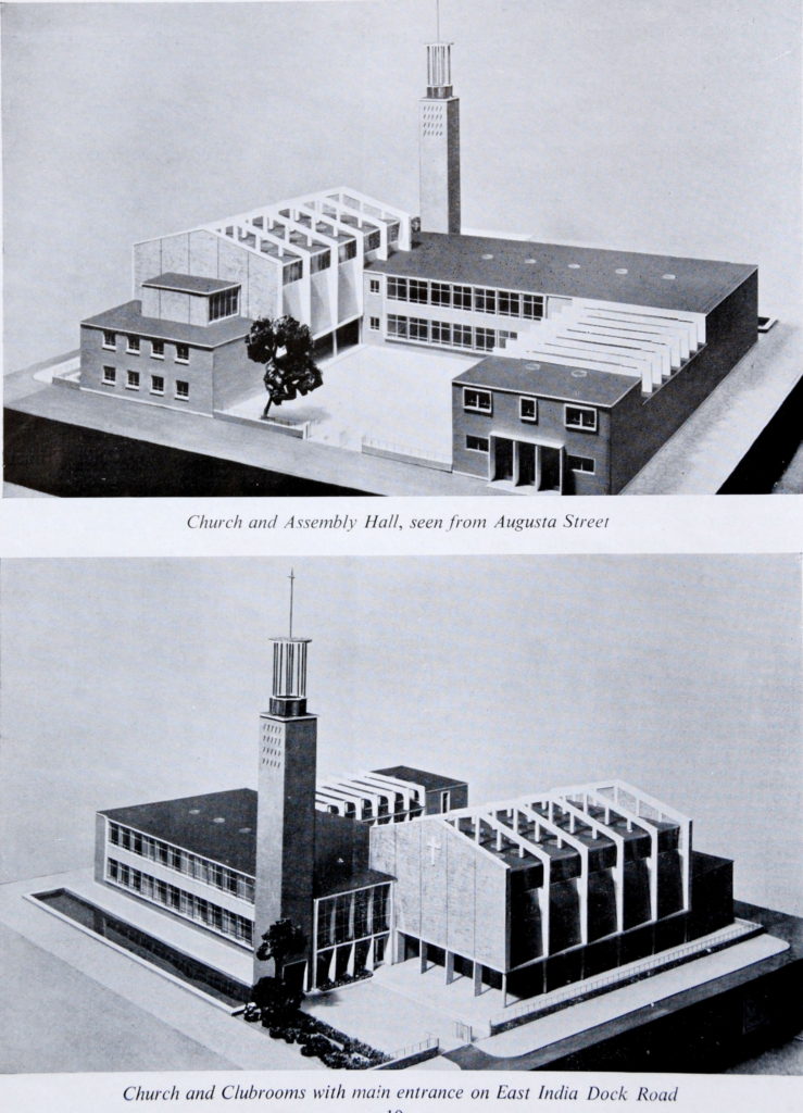
At the far end, we can see the tower of Trinity Congregational Church (point 7 on the map). Built on the site of an earlier church that was destroyed by bombing, the new church was designed by the architects Cecil C. Handisyde and D. Rogers Stark. The main structure of the church is of reinforced concrete with London brick covering the exterior of the tower.

The church today looks almost identical to the original architectural models:
Lansbury Estate 42

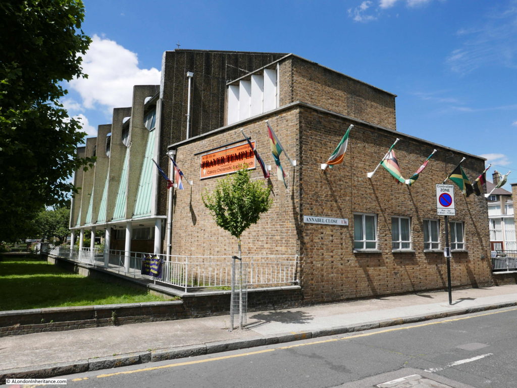
Rear view of the church from Annabel Close – the only change to the model of the church is from a double to a single row of windows on the building at the rear.
Lansbury Estate 3

The church was originally a Methodist Church, but is now a Calvary Charismatic Baptist Church.

The photo below shows the side view of the church buildings, again almost identical to the original model. The brick facing and large areas of glass are typical of post war designs used for public buildings.
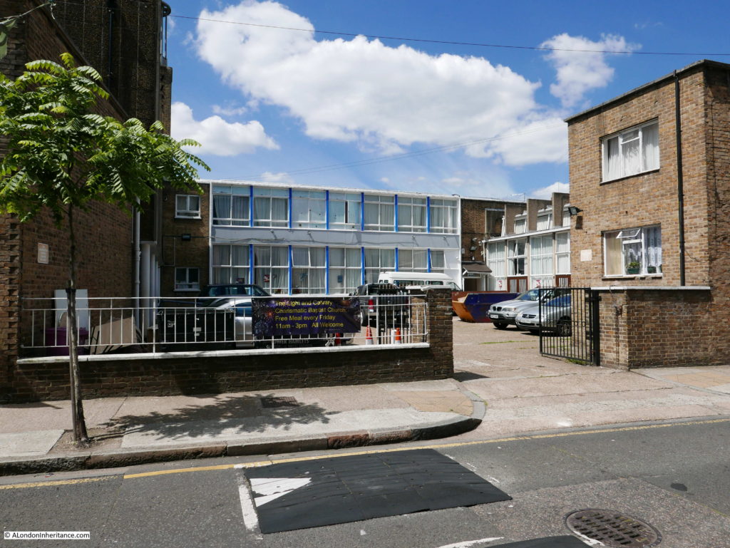
Lansbury Estate 50

Back to the recommended route for the Lansbury Exhibition of Architecture and after walking round the church, we can cross Annabel Close and walk into the playground marked 34 on the map.

The playground as it is today:
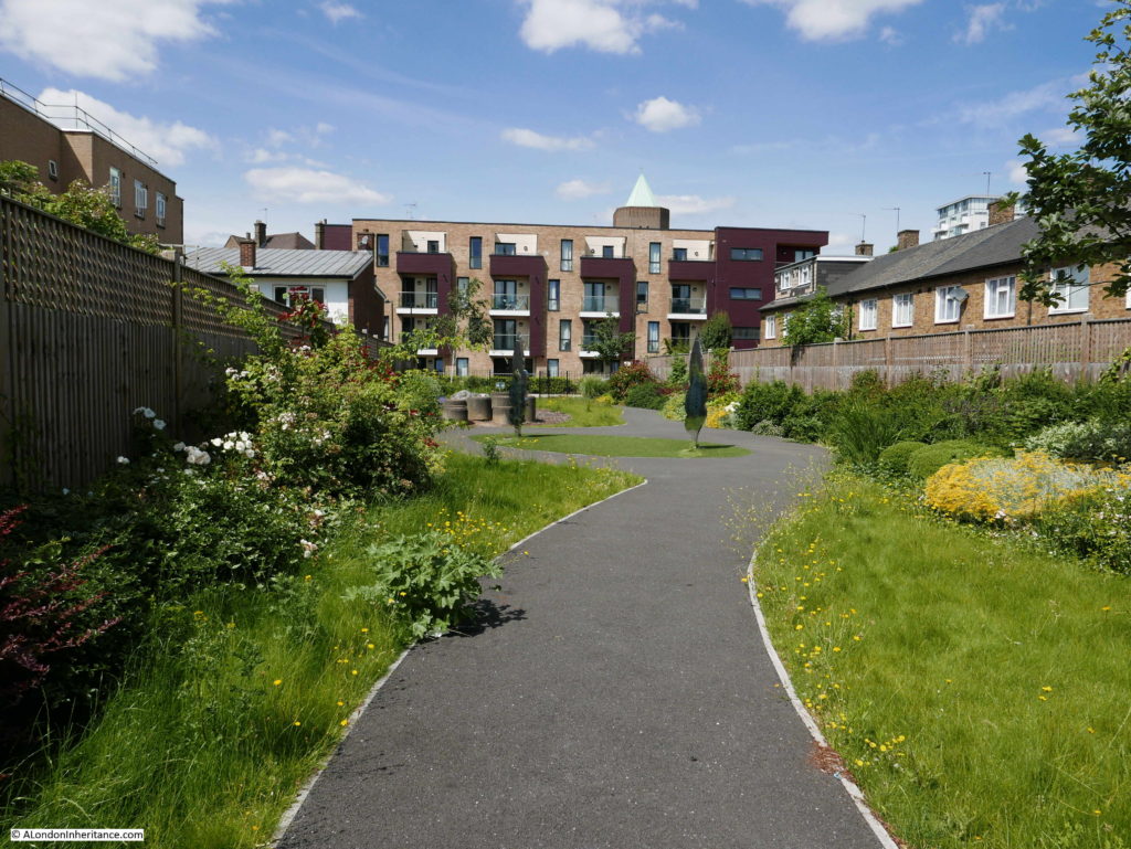
Lansbury Estate 5

Playgrounds were an important part of the open space policy and at the time of the Exhibition of Architecture were planned to include children’s playground rides and sandpits.

In the centre of the old playground are two highly reflective memorials to the Festival of Britain and George Lansbury. The memorial to George Lansbury is shown below and provides an overview of his work in politics, the pacifist movement, efforts to improve the lives of the poor, equal rights and votes for women, along with his long marriage to his wife Elisabeth and their 12 children (one of his grandchildren is the actress Angela Lansbury).
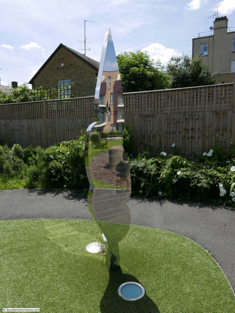
Lansbury Estate 4

Walking out of the old playground area, past the parking area for cars and into Duff Street and it is here that we first encounter the new homes built as part of the redevelopment of the area.

The following photo is looking up Duff Street towards Grundy Street with the two storey, terrace houses marked at point 10 on the map.
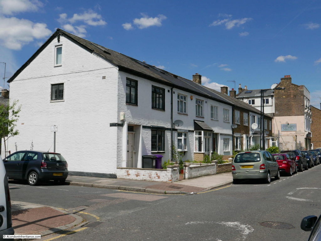
Lansbury Estate 6

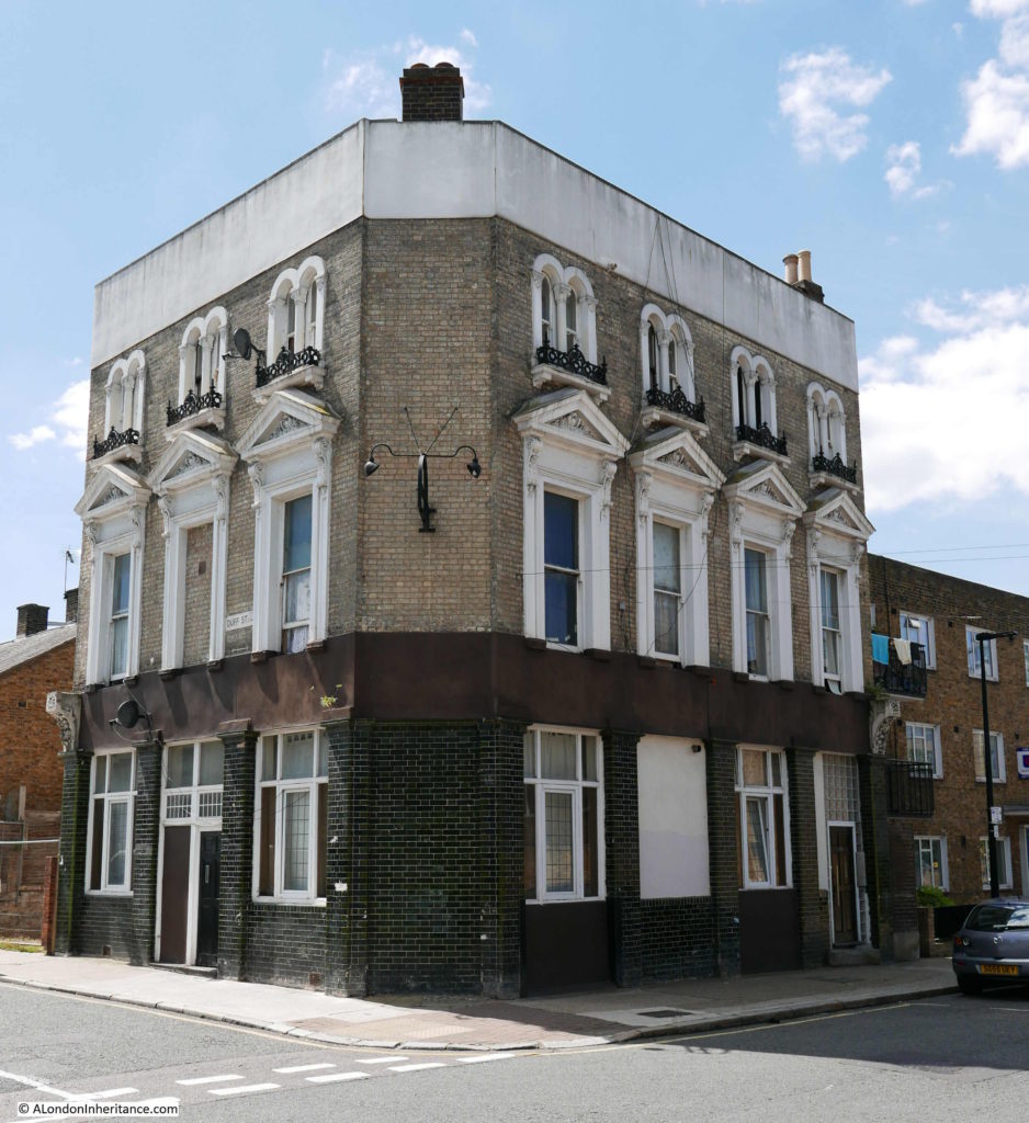
Although almost the whole area of Lansbury is post-war new build, there are some buildings that remain from the pre-war period. On the map is a building at the end of Duff Street marked as number 12 – Public House (existing). The side of the pub can be seen in the above photo and the full view from Grundy Street is shown in the photo below:
Lansbury Estate 7

The pub was built in 1868 as the African Tavern, but changed name to the African Queen in the 1990s. The faded name board for African Queen can still be seen on the edge of the pub from Duff Street.  The pub closed in 2002.

Standing in Grundy Street we can see at each end two of the main features of Lansbury, to the west the Roman Catholic Church:
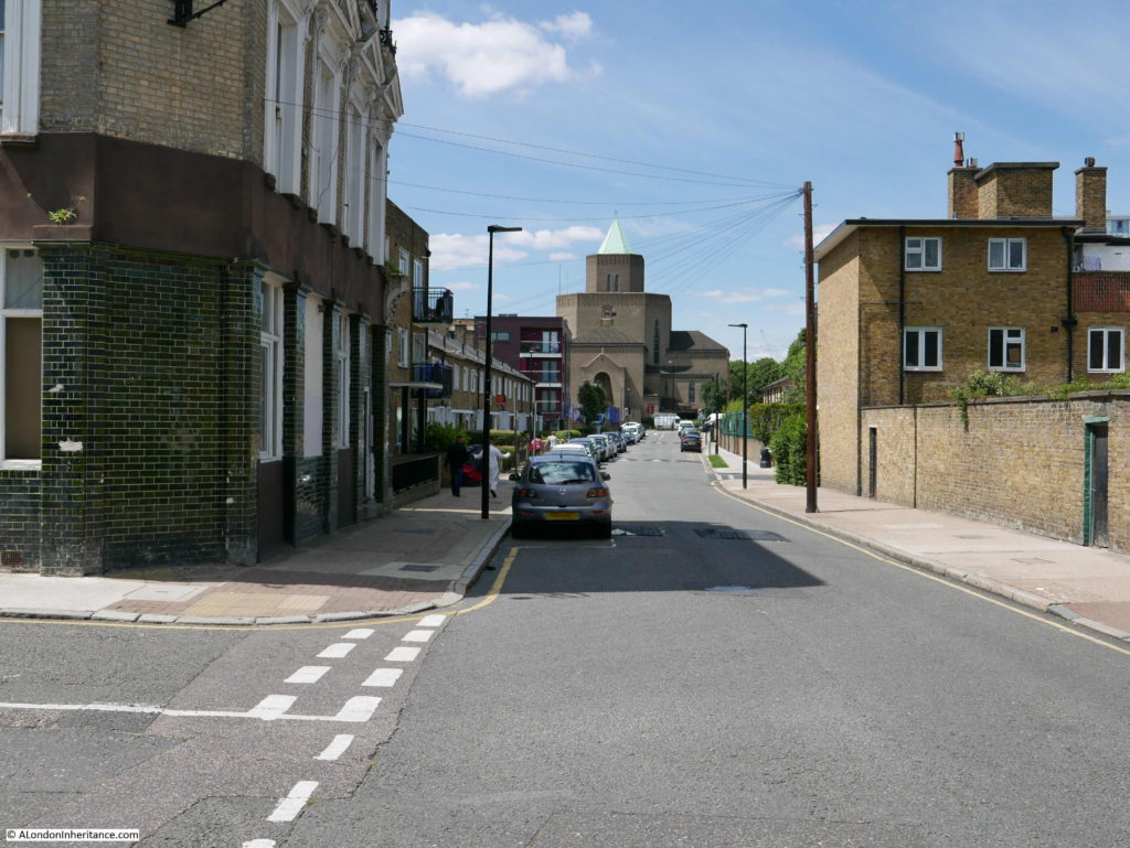
Lansbury Estate 31

And to the east, the tower at Chrisp Street Market:
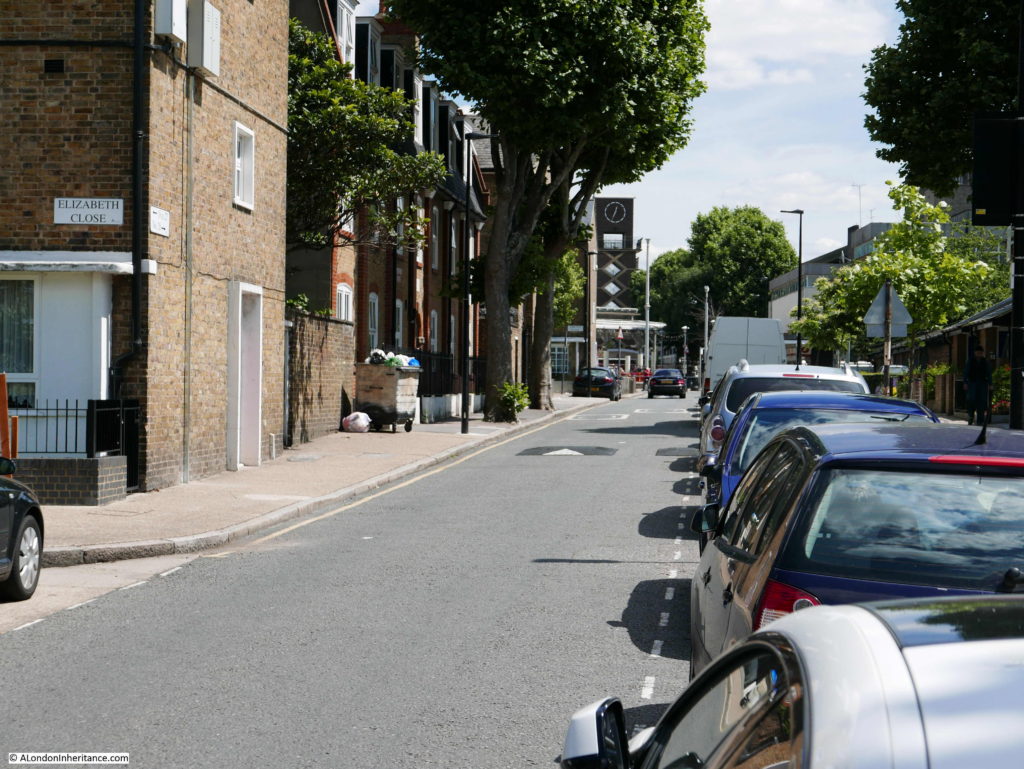
Lansbury Estate 32

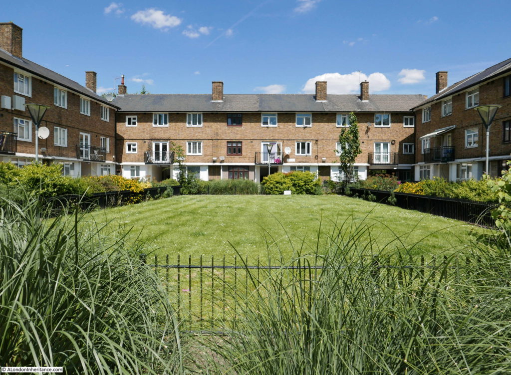
Continuing along the route from the exhibition along Grundy Street and these are the three storey terrace houses marked at point 13 opposite Duff Street. Again, the use of a large area of open space that opens out to the street, with the houses constructed on three sides results in a very different environment when compared with the high density housing that originally occupied the area.
Lansbury Estate 8

Walking along Grundy Street and here is the second set of three storey, terrace houses, also marked as point 13 on the map. This is Chilcot Close.
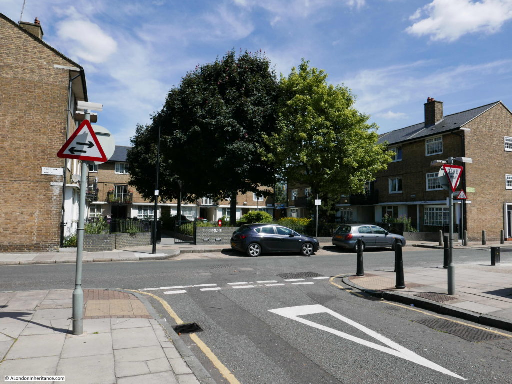
Lansbury Estate 9

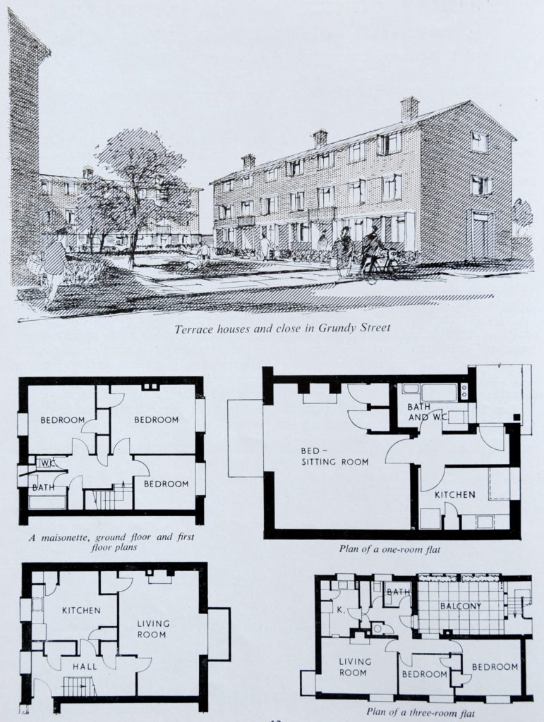
The drawings for Chilcot Close were featured in the guide to the Exhibition of Architecture and show the buildings and central open space to be almost the same today. The drawings also show the floor plans of the mix of different types of accommodation in these terrace houses with a maisonette, one room and three room flats.
Lansbury Estate 43

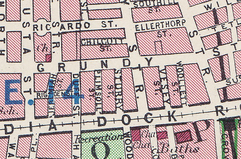
Chilcot Close is an interesting example of where building names have retained the names of lost streets. The map extract below is from the 1940 Bartholomew Greater London Atlas and shows Grundy Street running along the centre of the map. Just above the letter N in Grundy is Chilcott Street. The street was lost in the post war rebuilding with the two sets of three storey houses now occupying this space, however the name of the street (less a T) has been kept as Chilcot Close. The fact that a street extended into this block of land shows the original density of building as houses would have run along Grundy Street and also all round Chilcott Street.
Lansbury Estate 51

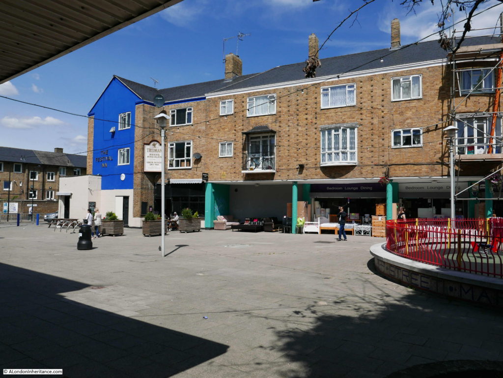
Continuing to the end of Grundy Street, we come to the junction with Kerbey Street and it is here, at point 15 on the map that we find the Festival Inn. Thankfully still a working pub, as well as the name, the pub retains a link with the Festival of Britain by the use of the festival’s symbol by Abram Games on one side of the pub sign.
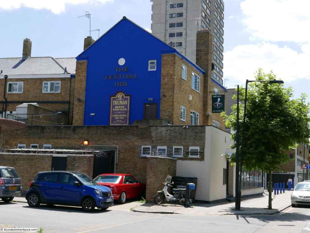
Lansbury Estate 10

The Festival Inn is on the edge of the Shopping Centre and Chrisp Street Market (point 16 on the map) which was core to developing the Lansbury community and to replace the original Chrisp Street market.

The Festival Inn replaced two nearby pubs, the Grundy Arms and the Enterprise. Although the pub sign still uses the festival symbol, there was originally a free standing pub sign consisting of a pole with at the top the model of a group of Londoners dancing around the Skylon – the Festival and London equivalent of a maypole. Unfortunately this has not survived.

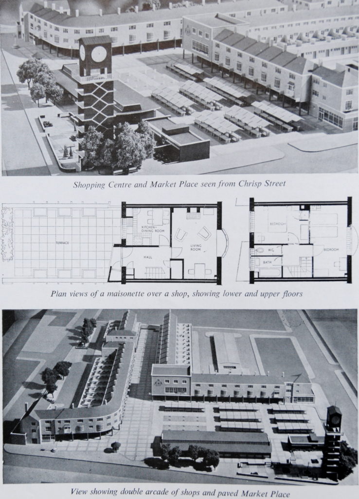
Photos of the model of the shopping and market area are shown below. The area consisted of:

  • a large pedestrian area with space for the stalls of street traders along with permanent covered stalls allocated to traders in meat and fish
  • terraces of lock up shops running alongside the market and along a branch heading up to Cordelia Street
  • above the lock up shops were maisonettes, mainly two bedroom, but some three bedroom

The buildings lining the market are of London brick with reinforced concrete beams running along the top of the shops to support the maisonettes above.

At the edge of the market is a clock tower with steps running up the inside of the tower to a viewing gallery at the top. As well as photos of the model, the floor plans of the maisonettes can be seen below.
Lansbury Estate 44

View from within the market showing the pub at the left and the shops with the maisonettes above. This is the part of the market in the lower left corner of the photo above.
Lansbury Estate 11

The photo below shows the branch of the shopping centre / market looking down towards Cordelia Street. Again, still almost identical to the original model shown in the photos above.

This layout, with pedestrianised walkways between rows of shops with accommodation above would be the format for new town shopping centres and town centre redevelopment for decades to come.
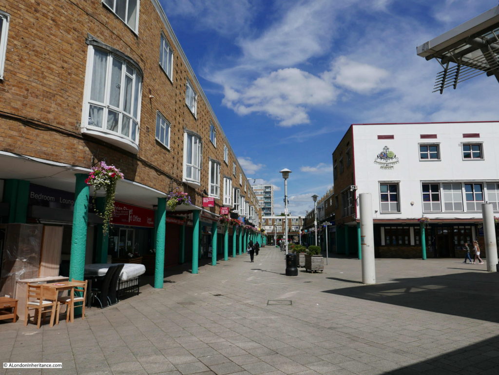
Lansbury Estate 12

View looking to the north east corner of the market / shopping centre.
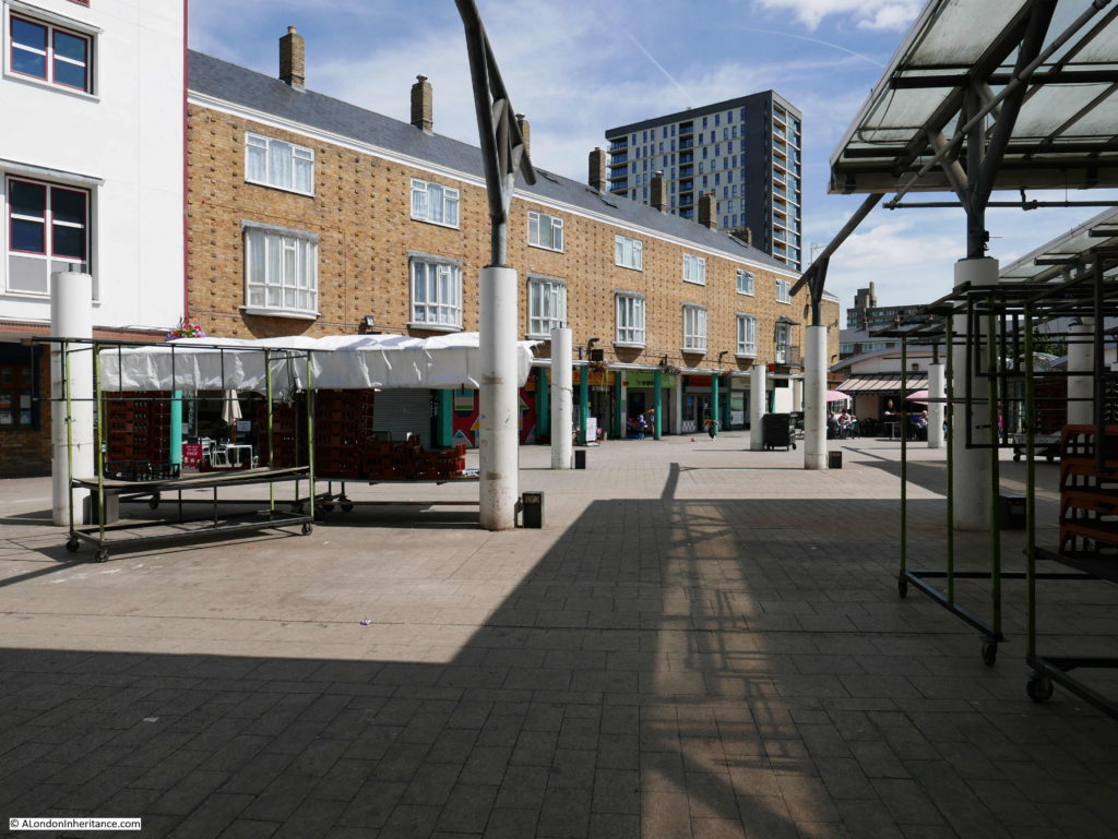
Lansbury Estate 13

The Chrisp Street Market replaced an earlier street market. Pre-war, Chrisp Street Market was the largest across Poplar and Stepney with 285 licensed stalls on the busiest day, the next largest was Middlesex Street Market with 262 licensed stalls. These were figures from 1939.

There were many other street markets across Poplar and Stepney and the following table shows the markets with pre and post war stall numbers. Interesting that for the majority of street markets they were smaller in 1951 than they had been in 1939 – reflecting the loss of housing and therefore population.

Stepney 1939 1951
Solebay Street 26 8
Burdett Road 60 36
Hessel Street 29 29
Burslem Street 16 9
Watney Street 200 150
White Horse Road 150 42
Salmon Lane 18 9
Wentworth Street 68 68
Goulston Street 100 148
Old Castle Street 40 60
Middlesex Street 262 262
New Goulston Street 30 42
Poplar
Chrisp Street 285 189
Devons road 39 12

The following photo shows part of the original Chrisp Street market:
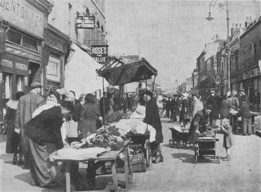
Lansbury Estate 48

At the corner of the market, alongside Chrisp Street is the clock tower built as a key feature of the market. Running up the centre of the tower are two interlocking staircases built of reinforced concrete leading up to the viewing gallery and clock mechanism. The two staircases only met at the top and bottom of the tower so that those walking up would use one staircase and those walking down would use the second – a clever design to avoid congestion on the stairs.
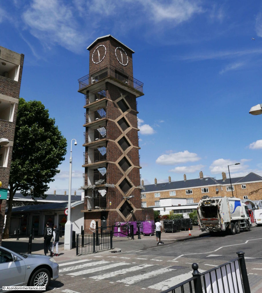
Lansbury Estate 14

At the opposite corner of the market place to the clock tower, along Chrisp Street, is one of the new pubs, shown as point 15 on the map, built as part of the redevelopment.
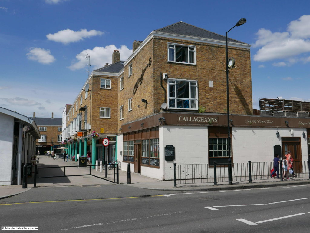
Lansbury Estate 15

To continue the recommended route from the exhibition, walk back through the market and along Market Place and cut through to Ricardo Street.

Ricardo Street is lined along the south side with four storey maisonettes (point number 17 on the map). A mix of two to four bedroom maisonettes each with a living room, garden and clothes drying area with two storeys per maisonette. The upper level is reached along the balcony on the third floor that runs the length of the terrace.
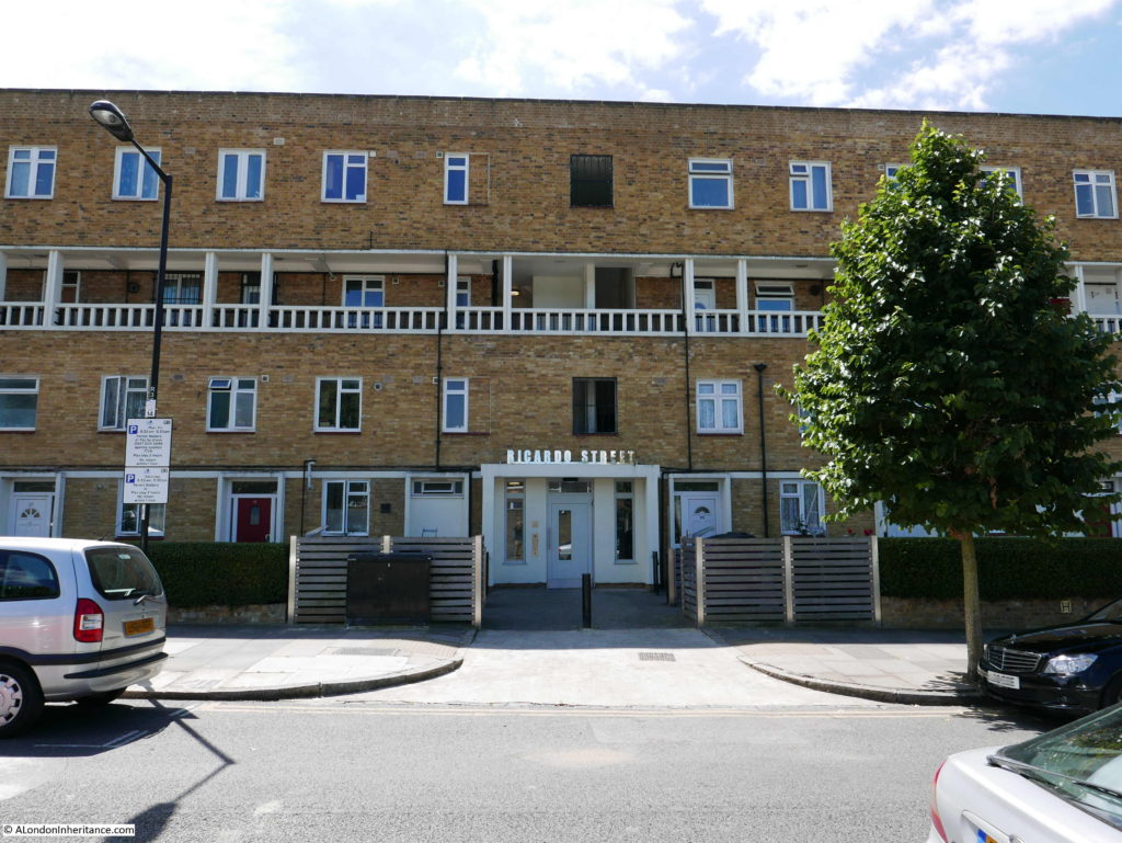
Lansbury Estate 16

At the end of Ricardo Street, turn south into Bygrove Street and these three storey blocks line the street which comprise two storey maisonettes with a flat above on the top floor (number 20 on the map).
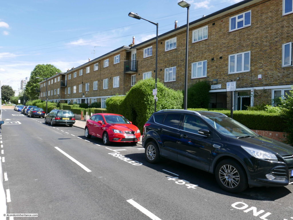
Lansbury Estate 17

The construction of these four and three storey buildings was to the same standard and consisted of foundations of mass concrete with piling where required, external walls of load bearing brick with London brick on the exterior facing. Fire resistant construction between individual flats and maisonettes along with sound insulation – all aimed at improving the safety and living standards of those who would be living in Lansbury.

Roofing was in Welsh Slate and windows were metal in wooden frames.

At the end of Bygrove Street we are back into Grundy Street and in position 22 on the map there is a row of 2 storey terrace houses.
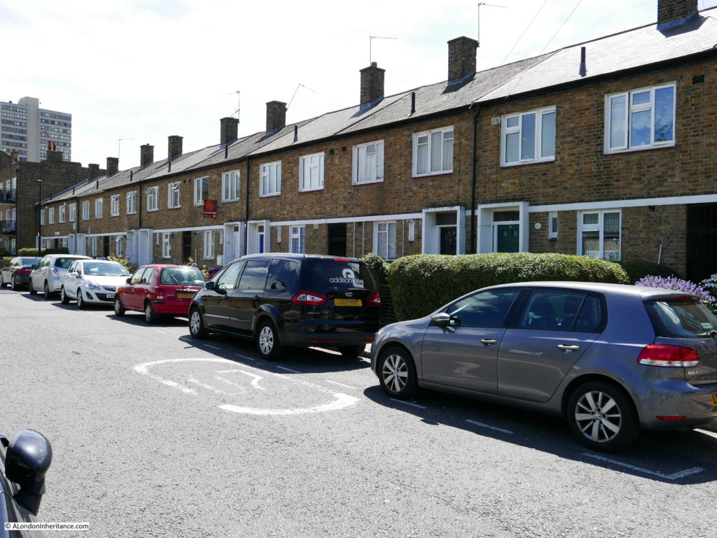
Lansbury Estate 18

At the end of Grundy Street is the large Roman Catholic Church that was under construction at the time of the Festival of Britain. Replacing an earlier church, the new church had seating for 700 people as at the time, Poplar had a large Roman Catholic population and in the years immediately after the opening of the church, attendance would often reach 1,000 people.

The architect of the church was A. Gilbert Scott. The overall shape of the church was based on a Greek cross, and exterior of the building was faced with stone coloured bricks with the roof being covered in Lombardic styles tiles – a very different style to the rest of Lansbury and to the Trinity Church, which along with the central position of the church within the Lansbury estate made the church a key landmark within and from the outside of the estate.
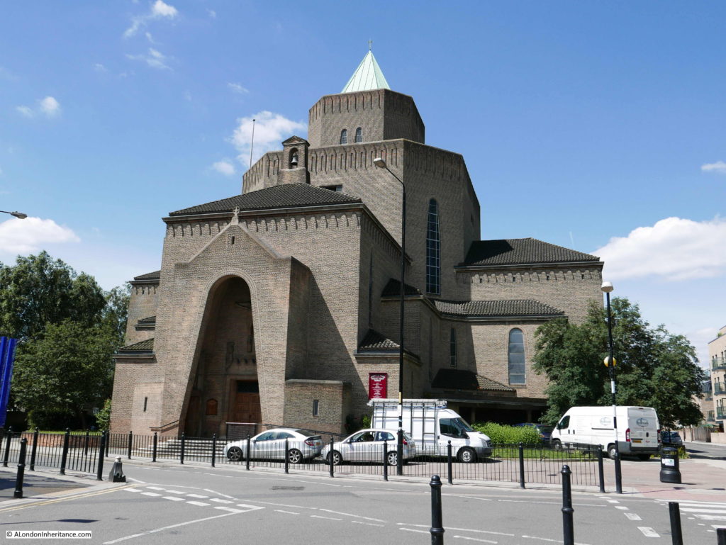
Lansbury Estate 19

Now walk past the church and into Canton Street and in position 27 on the map are more two storey terrace houses. The opposite side of the road has buildings of recent construction which I will return to later.
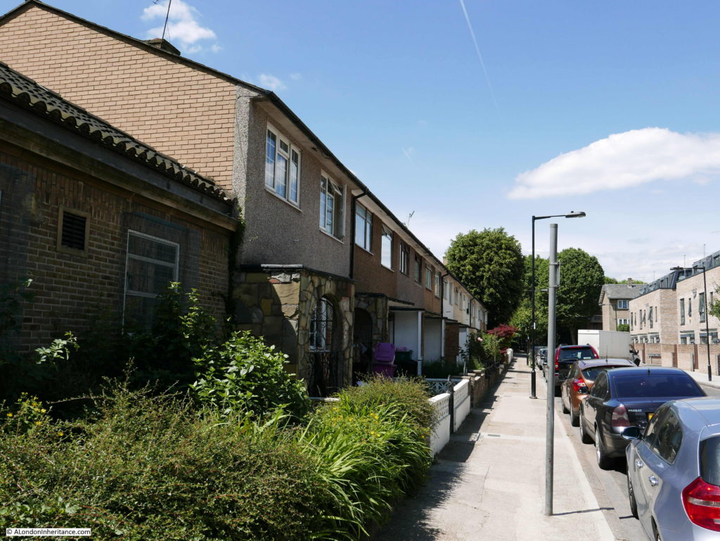
Lansbury Estate 20

Follow the map and cut through into Pekin Street and there are more two storey houses, but of a different design. Point 30 on the map and described as “linked houses”. Not exactly terrace, rather semi-detached houses linked together by a smaller, two storey build.
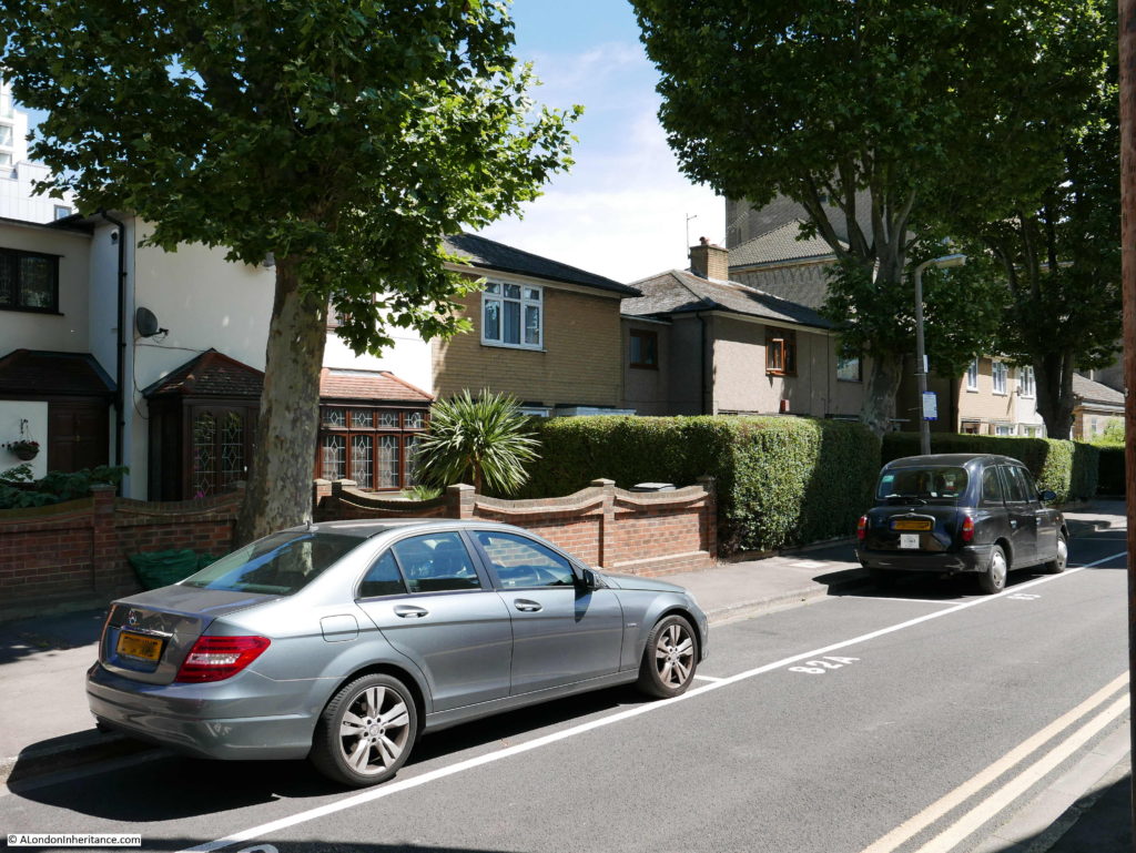
Lansbury Estate 21

Now at the junction of Pekin Street and Saracen Street we can look across to the three storey flats marked as 32 on the map.
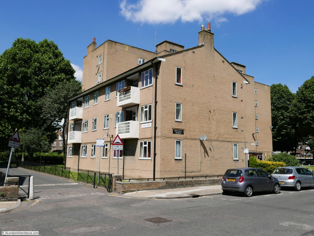
Lansbury Estate 22

Following the map and walking past these flats, a large, green space with mature trees (almost certainly planted at the time of construction) opens out. As can be seen from the photos, there is a good amount of open space, trees, hedges and grass across the Lansbury estate, with the level of green on the exhibition map showing the planners intention that there should be plenty of open space, gardens and grass across the estate.
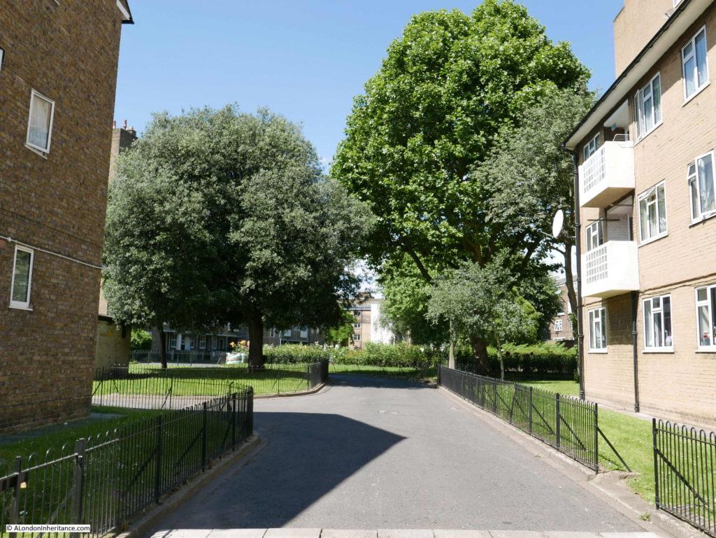
Lansbury Estate 23

Having reached the open space we can see the tallest buildings constructed as part of the original development, the six storey flats shown at point 33 in the map.

The architect for these flats was Sidney Howard of the Housing and Valuation Department of the London County Council.

The six storey flats have lifts and each flat was equipped with a solid smokeless fuel fire and back boiler in the living room or bed-sitting room. This combination provided hot water to the bathroom, hand-basin and the kitchen sink.  The flats had a hot water tank in the linen cupboard providing an immediate supply of hot water. Electric power points were installed in each room.
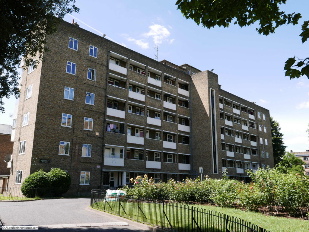
Lansbury Estate 24

The recommended walk then passes through to Canton Street with the main exit and the bus departure point which was located at point 36. This has since been built over with later flats with a slightly different style but following the overall format of the estate.
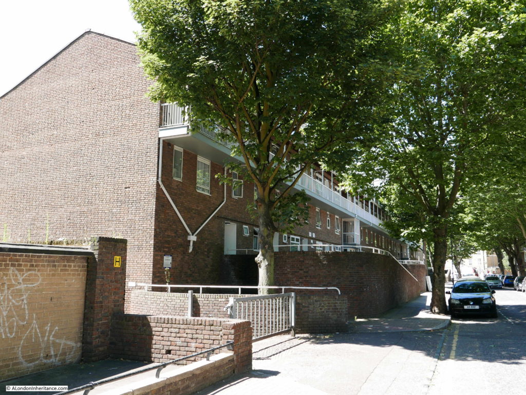
Lansbury Estate 25

Rather than walk back to the Exhibition Pavilion as suggested by the recommended route, I decided to take a walk along some of the other streets in the Lansbury estate which were not on the exhibition’s recommended route.

This is the northern section of Saracen Street and shows the three storey buildings marked 28 on the map. These builds provided maisonettes and flats.
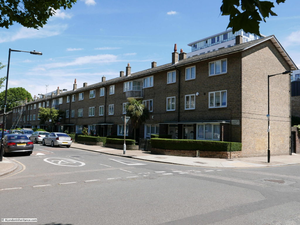
Lansbury Estate 26

At the end of Saracen Street is the junction with Hind Grove. This is the view looking back down Saracen Street and shows the proximity of this area of Poplar with the towers of the Canary Wharf development.
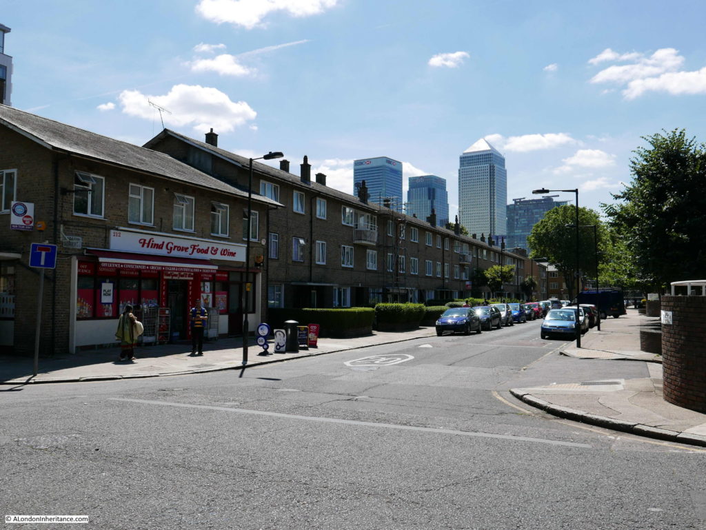
Lansbury Estate 27

The building on the corner is now the Hind Grove Food and Wine store but was originally a pub marked as number 15 on the map at the junction of Hind Grove and Saracen Street.
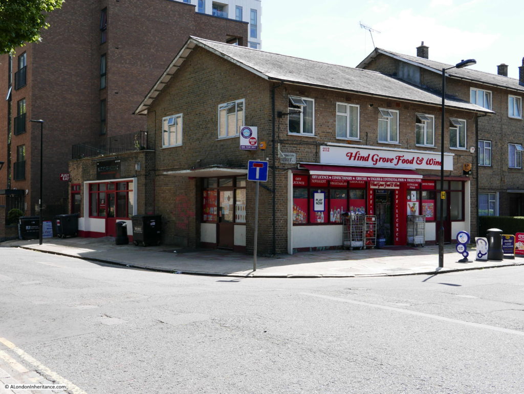
Lansbury Estate 28

This is the drawing of the pub from the exhibition guide (the caption references Hind Street, however in the 1940 Bartholomew map and on today’s maps the street is called Hind Grove).
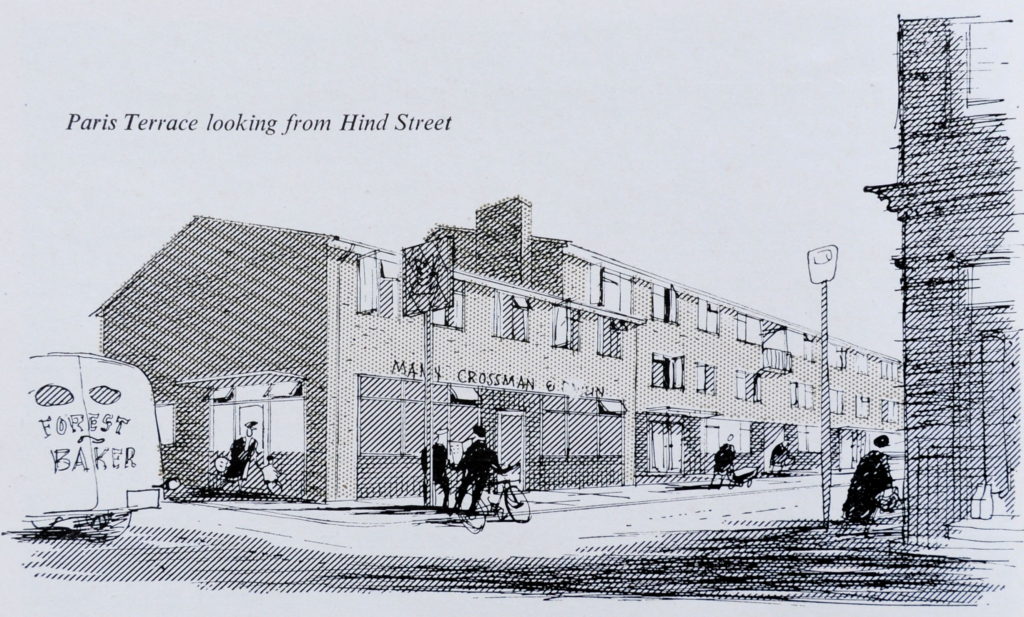
Lansbury Estate 45

Follow Hind Grove along and this is now the view. In the exhibition map, the buildings marked at number 26 were on this site. This was originally the Cardinal Griffen Secondary School. a large school built as part of the overall development of the Lansbury estate.
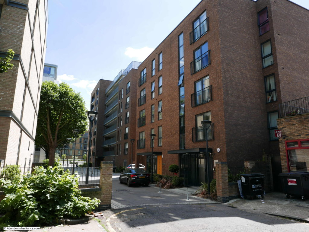
Lansbury Estate 29

The Cardinal Griffen Secondary School was designed for the Archdiocese of Westminster and the London County Council by David Stokes, to accommodate 450 children aged between eleven and fifteen.

The school consisted of a gym, assembly hall, dining room, staff room, medical room, general class rooms and specialised classrooms for crafts and sciences. The school was constructed of a reinforced concrete frame and brick walls with large areas of glass to provide lots of natural light to the classrooms. Load bearing walls were kept to the outside of the structure thereby giving the freedom for future reconfiguration of the internal space of the school without the need for major building works.

The following extract from the exhibition guide shows the school  with the playing fields running along the edge of Canton Street.
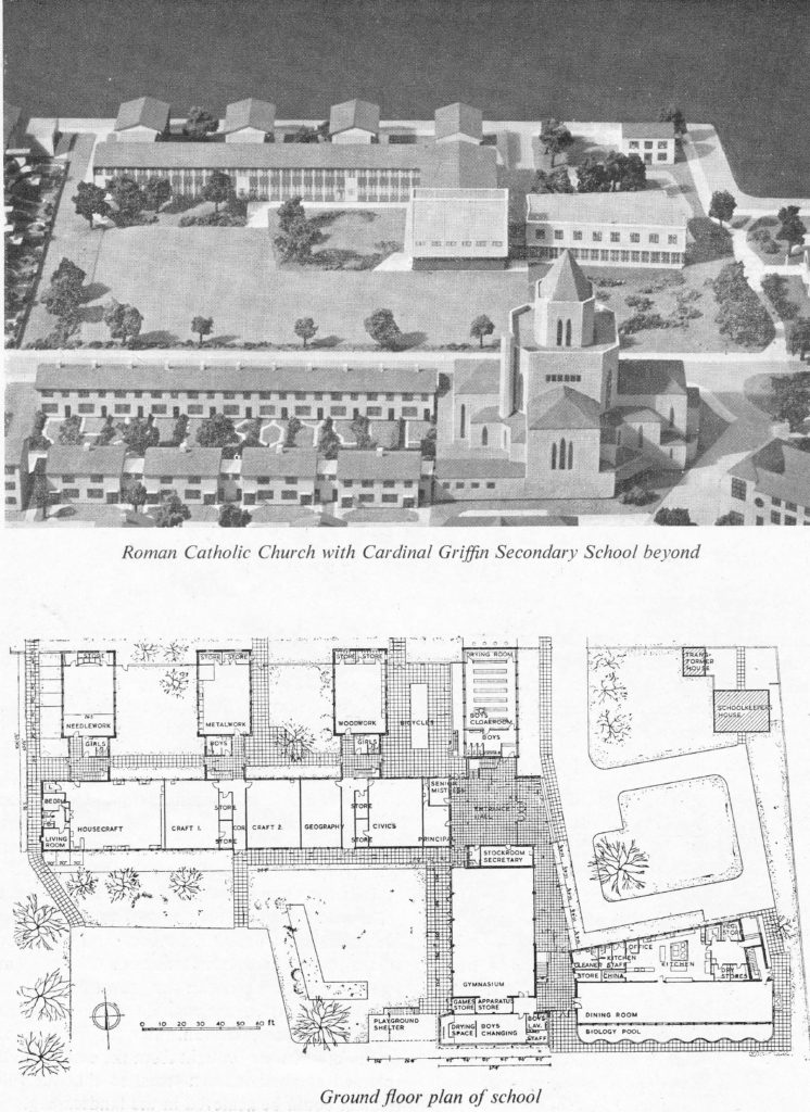
Lansbury Estate 52

The school was renamed as the Blessed John Roche Catholic School in 1991 and closed in 2005 with new housing built on the site of the school and across the playing fields. This included the new building facing onto Canton Street mentioned earlier.

One school that is still here is the original Ricardo Street Primary School – now named the Lansbury Lawrence Primary School. Named after George Lansbury and Susan Lawrence, a Labour MP and member of the local council in Poplar at the time when George Lansbury was challenging central government by refusing to set a rate due to the unfairness of charging the poor.

The entrance to the Lansbury Lawrence Primary School on Cordelia Street is shown in the photo below. Designed by the architects Yorke, Rosenberg and Mardell, construction of the school consisted of a steel framework faced with concrete slabs along with London bricks. Large areas of glass provided plenty of natural lighting to the school as can be seen in the photo.
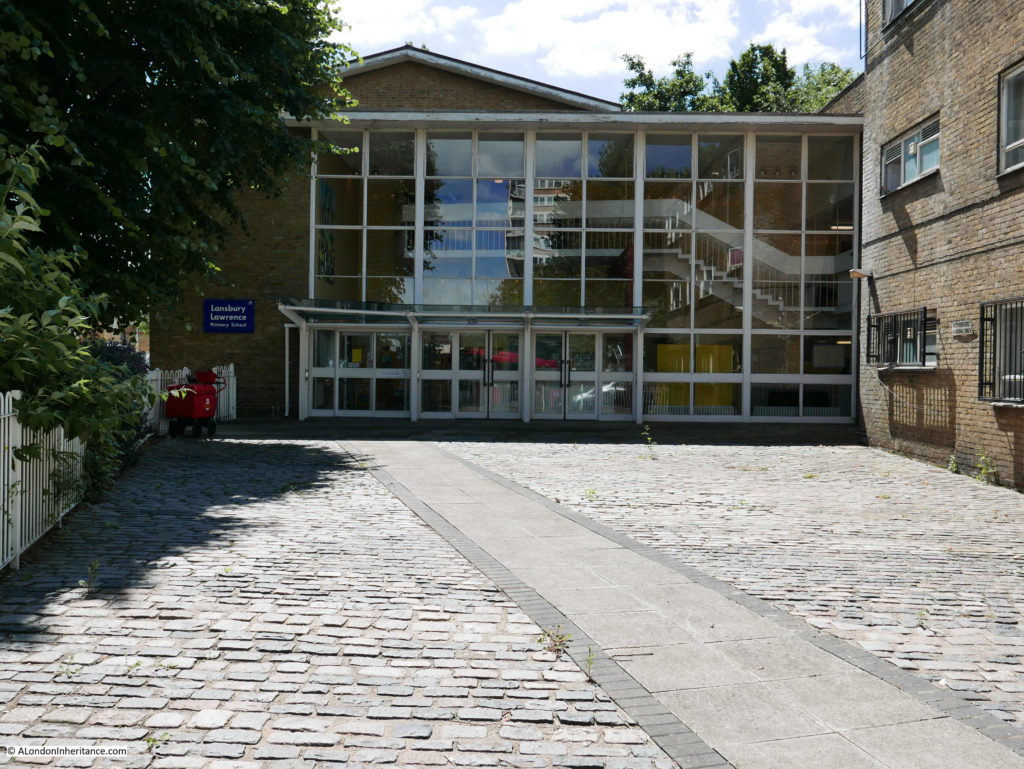
Lansbury Estate 30

The original model of the school is shown in the following photo and shows the long row of classrooms with large windows providing plenty of natural light. The entrance to the school shown in my photo above is in the top right corner of the model.
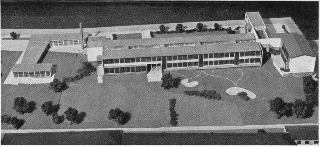
Lansbury Estate 53

That was the end of my walk around the Lansbury Exhibition of Architecture site, but what was the outcome of the exhibition?

When the Lansbury Exhibition of Architecture was being planned, expected visitor numbers were in the order of 10,000 to 25,000 a day, however by the time the exhibition closed the average daily attendance at the exhibition pavilions was 580. This low attendance should really have been anticipated:

  • there was very limited advertising for the exhibition and it had a low key opening
  • travel out to Lansbury was not that easy with a boat journey followed by buses being provided by the exhibition organisors
  • it was a specialist exhibition, probably only of interest to those in the architectural and building professions and the limited numbers within the population with an interest in architecture and the future of towns and cities
  • the Exhibition of Architecture in Poplar, could not compete with the excitement of the rather more central locations of the main festival site on the South Bank and the Pleasure Gardens at Battersea

The impact of the Lansbury development was also unpopular with many of the existing residents. A large number of people needed to be moved to allow for rebuilding to take place. By November 1950, 533 people had been relocated, however the London County Council policy was that people would be relocated to the next available accommodation. This meant that the original population of the Lansbury site could be scattered across London. This was made worse when the new Lansbury buildings were ready for occupation as priority was not given to original residents, rather Lansbury became part of the overall LCC pool of housing with residents being matched to accommodation based on availability and need.

The general view of the architecture at Lansbury was that it was “worthy but dull”. Whilst the estate consisted of buildings ranging from two storey houses up to six storey flats, the overall design was much the same and the use of the same coloured brick for the external finish to the majority of the buildings resulted in a lack of architectural diversity across Lansbury – this can still be seen walking the estate today, as shown in my photos.
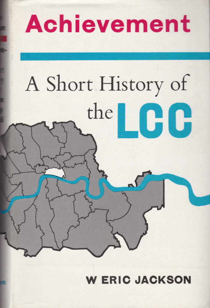
Following closure of the Exhibition of Architecture, Lansbury became just another of the many London County Council development sites, with construction of the wider site continuing for the following decades, filling in the area between the Market and the East India Dock Road, building north to the Limehouse Cut and west to Burdett Road.

The area was also hit badly during the 1970s and 80s by the closure of the London Docks. Unemployment and a growing backlog of maintenance work across the estate contributed to an environment where drug dealing and crime took hold across the estate. The Poplar Housing and Regeneration Community Association (Poplar harca) was established in the mid 1990’s and a considerable amount of work has taken place since to repair and refurbish the existing housing stock, build new housing, address unemployment issues etc.

Many of the principles on show at Lansbury, such as the use of mainly low-rise housing and green space was used in the new towns that were being built across the country and walking through the market / shopping centre at Chrisp Street will show similarities with shopping centres at new towns such as Harlow.

As with the majority of London, time does not stand still for Lansbury and today the Chrisp Street market area is threatened with a range of new developments.

A much shorter post in the next couple of days will include some final information about Lansbury.

alondoninheritance.com