Category Archives: London Buildings

Mornington Crescent and the Corn Laws

Mornington Crescent and the Corn Laws – two totally unconnected subjects, but there is a tentative connection to the Corn Laws not far from Mornington Crescent underground station which I will get to at the end of today’s post.

The name Mornington Crescent may bring little recognition, apart from a Camden station on the Northern Line, or the name may be instantly familiar from the BBC radio comedy “I’m Sorry I Haven’t A Clue” where it is the name of an invented game which requires the naming of a random set of locations to finally get to Mornington Crescent.

The entrance to Mornington Crescent station on Hampstead Road:

Mornington Crescent Station

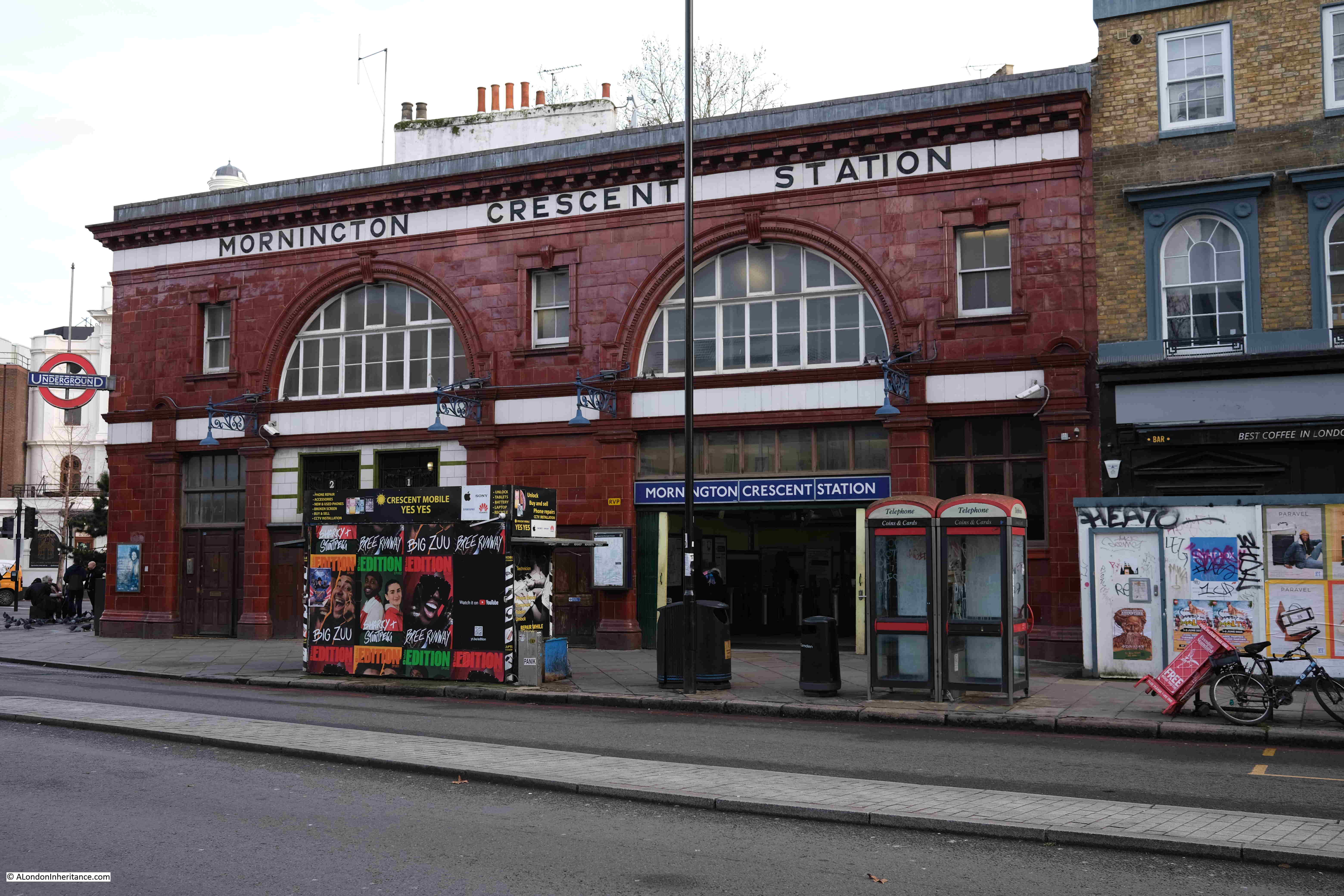
Mornington Crescent station was built as part of the Charing Cross, Euston and Hampstead Railway, and opened on the 22nd of June 1907. The station is one of Leslie Green’s distinctive station designs with the exterior walls covered in red oxblood faience tiles. The station is now on the Northern Line.

The station takes its name from the nearby street of the same name, a street that was once prominent, but is now hidden away behind a rather glorious 1920s factory.

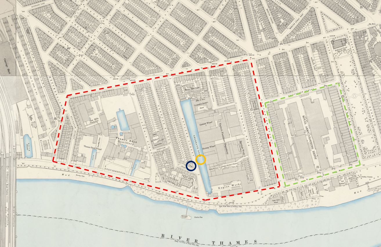
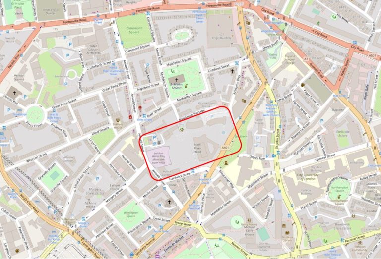
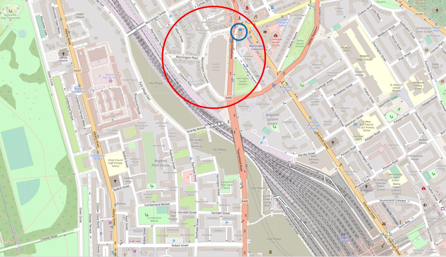
The location of the station is shown by the blue circle in the following map, and the larger red circle shows the area covered in this week’s blog (Map © OpenStreetMap contributors):

Map of Mornington Crescent

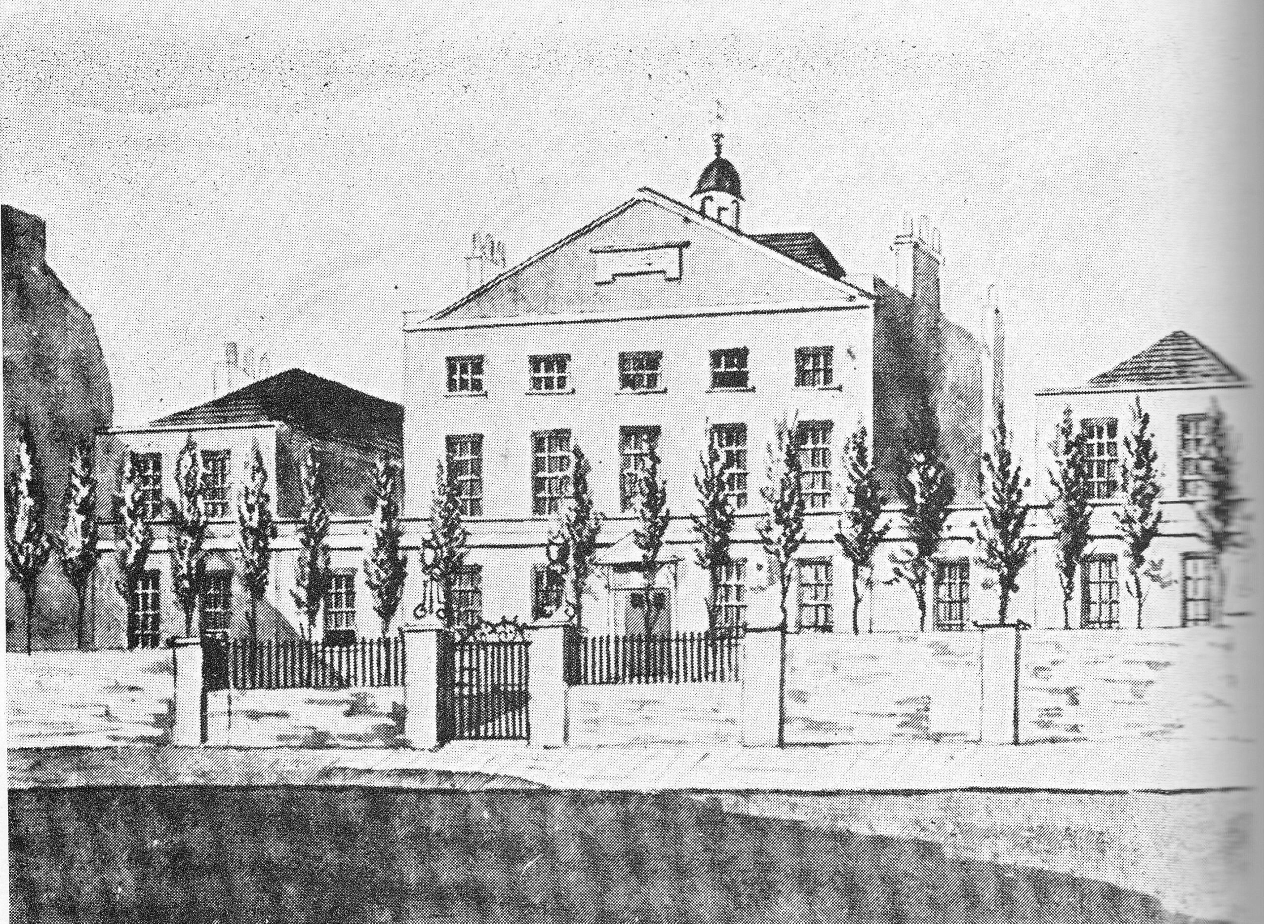
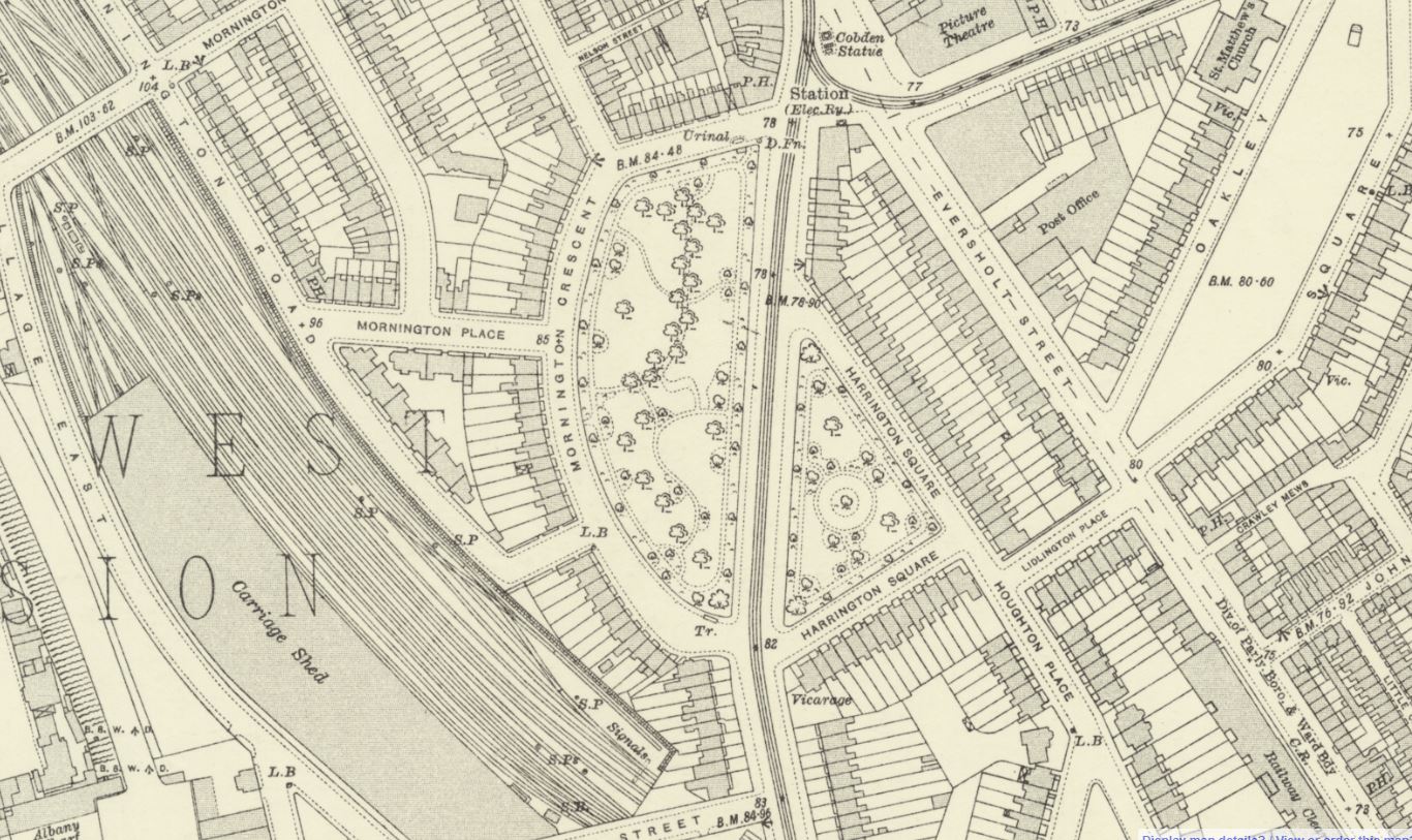
Mornington Crescent (the street, not the station) is the curved, crescent shaped street that starts to the left of the station, curves around a large grey block and then rejoins Hampstead Road. The following extract from the 1894 Ordnance Survey map shows the area in the late 19th century, with Mornington Crescent then looking onto a garden, the larger part to the left of Hampstead Road and a small part to the right (‘Reproduced with the permission of the National Library of Scotland“).:

Map of Mornington Crescent

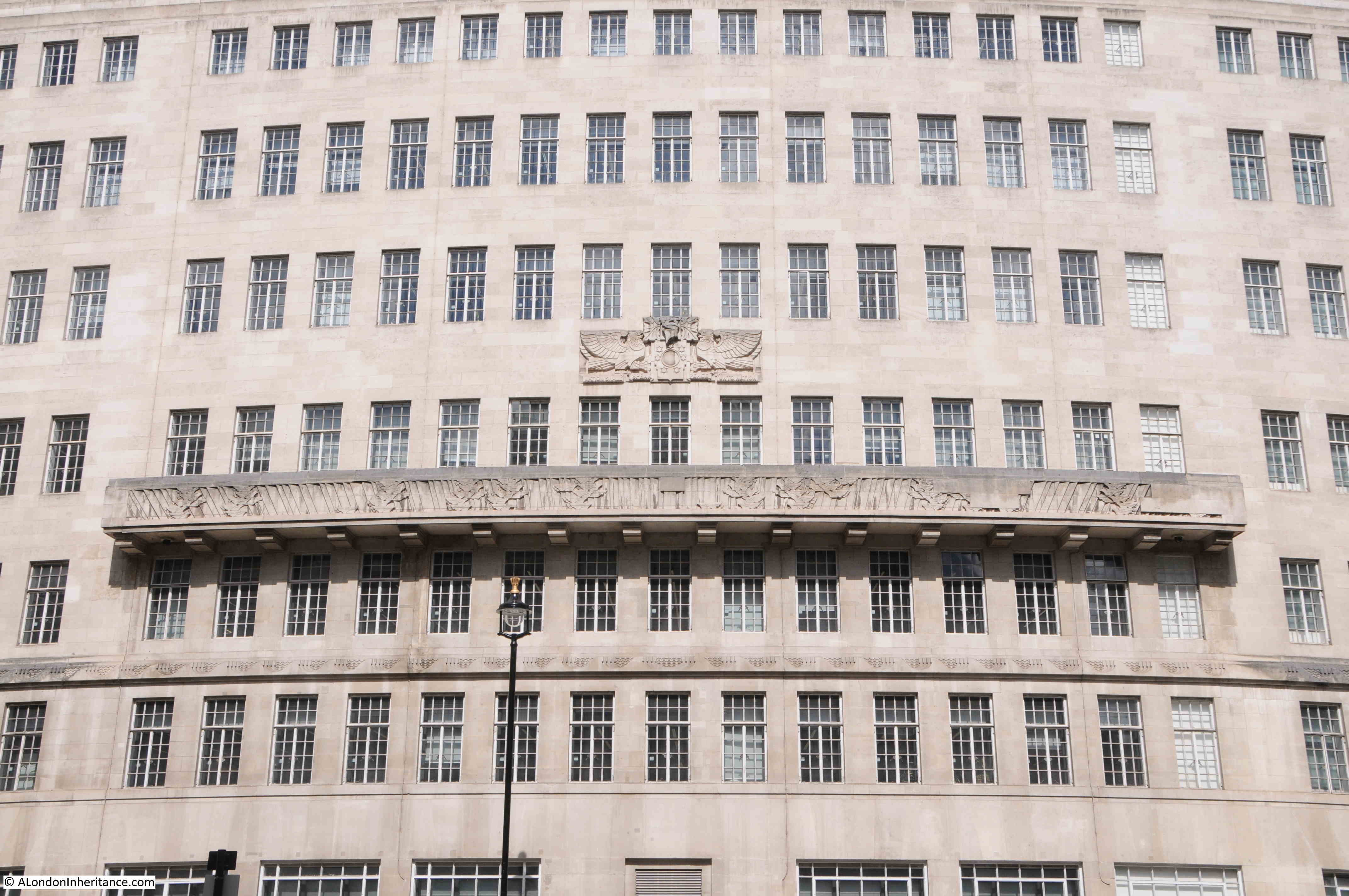
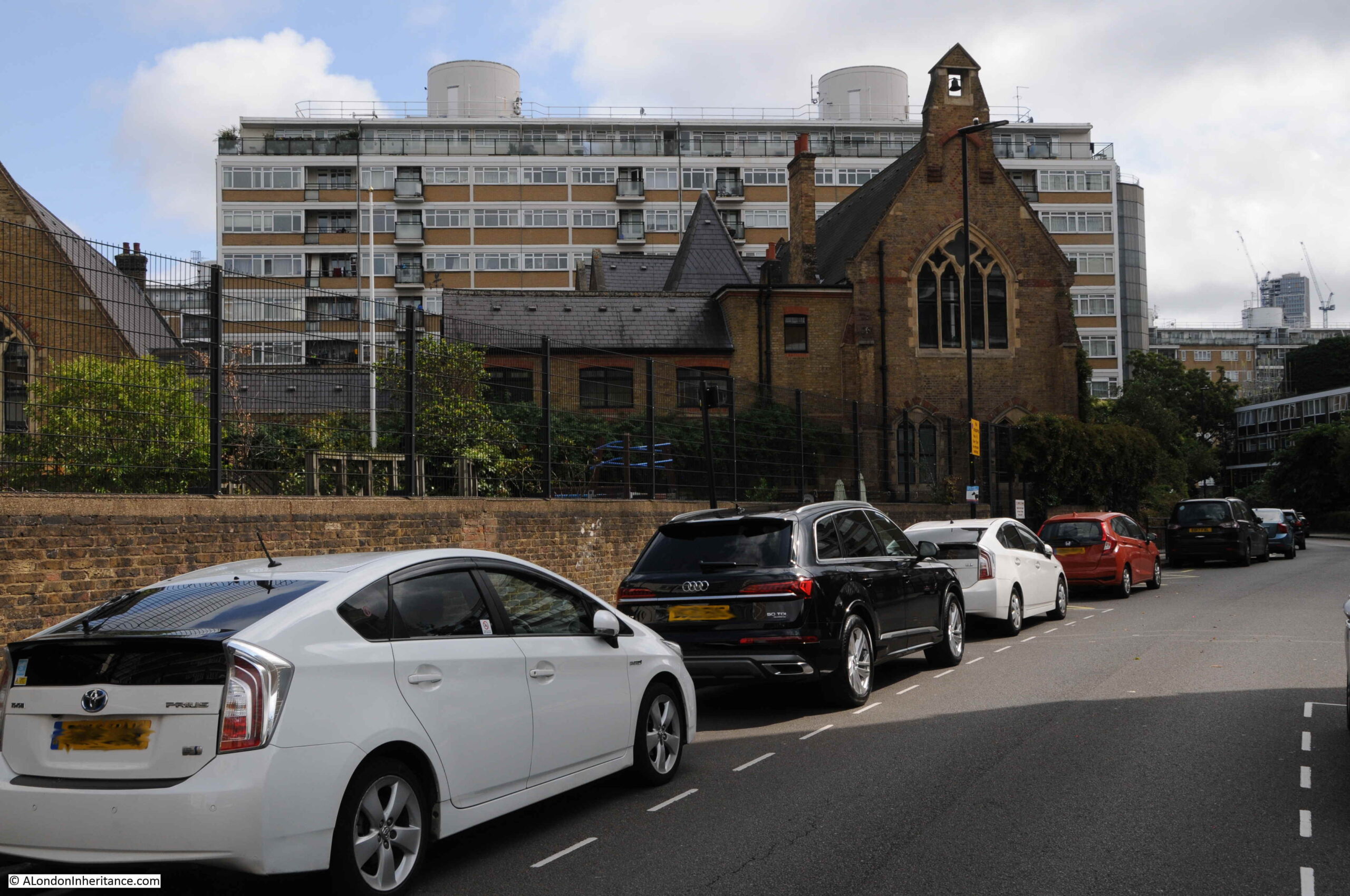
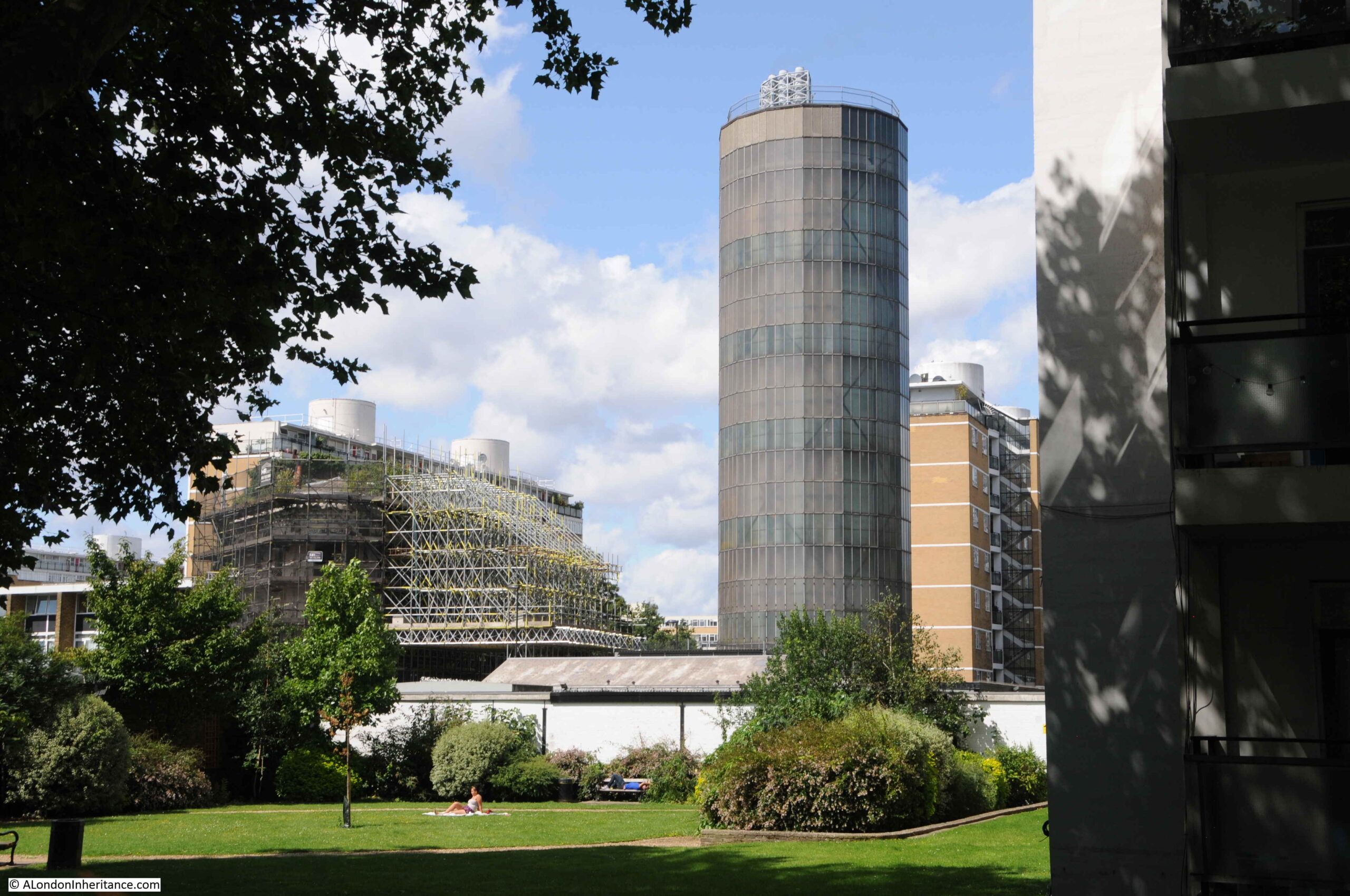
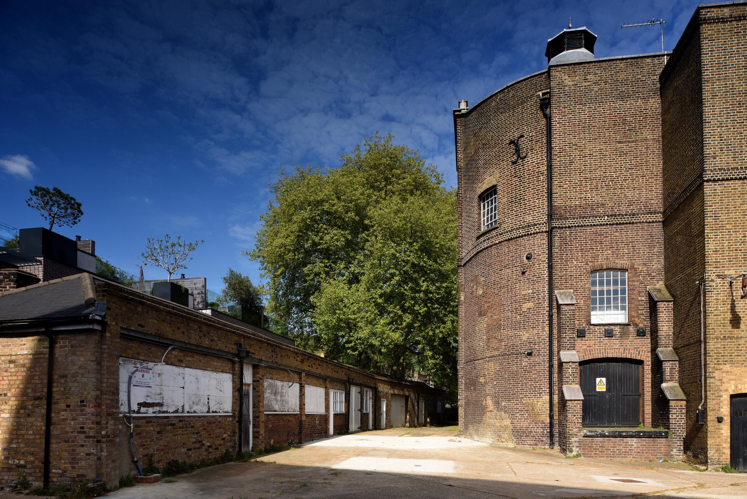
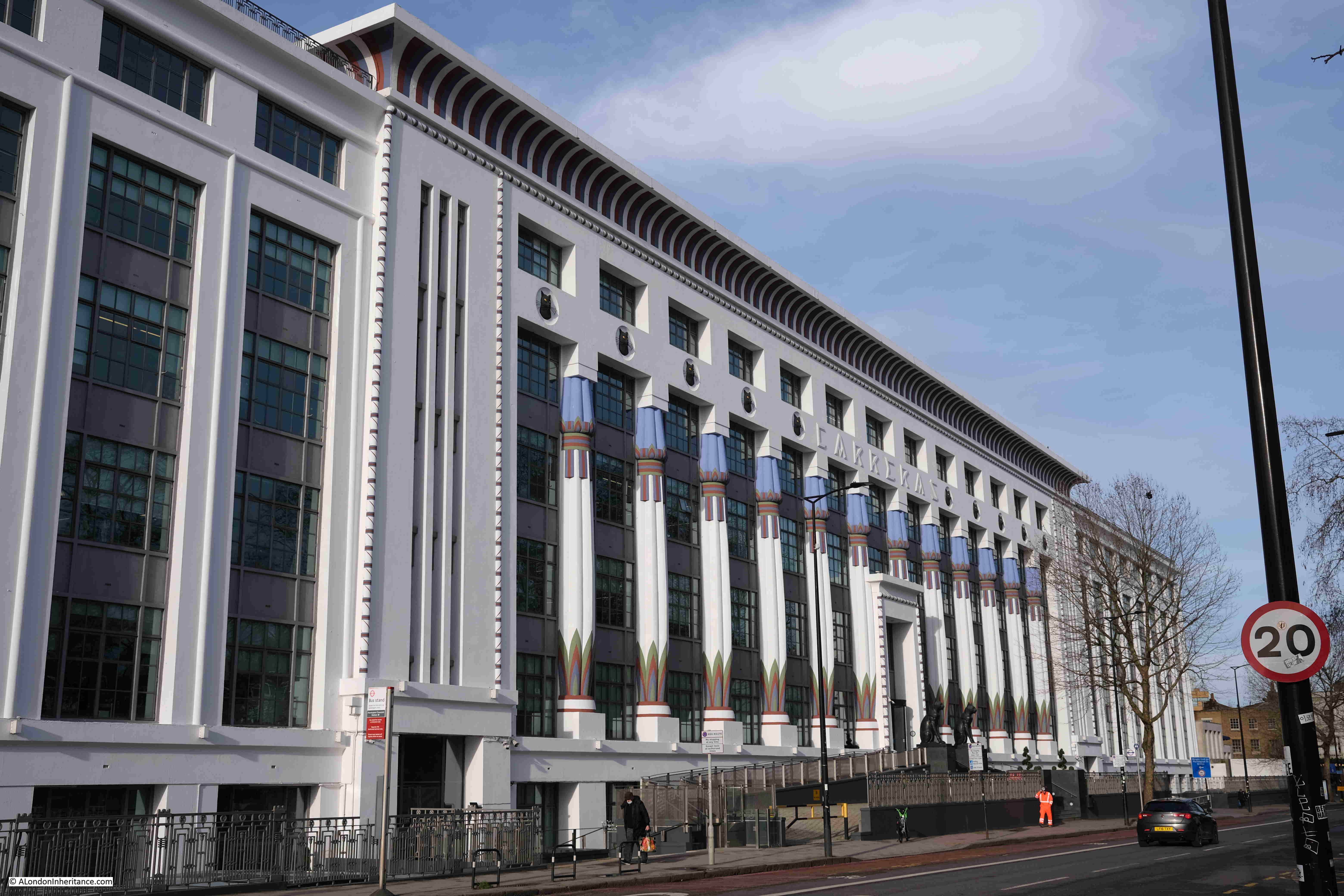
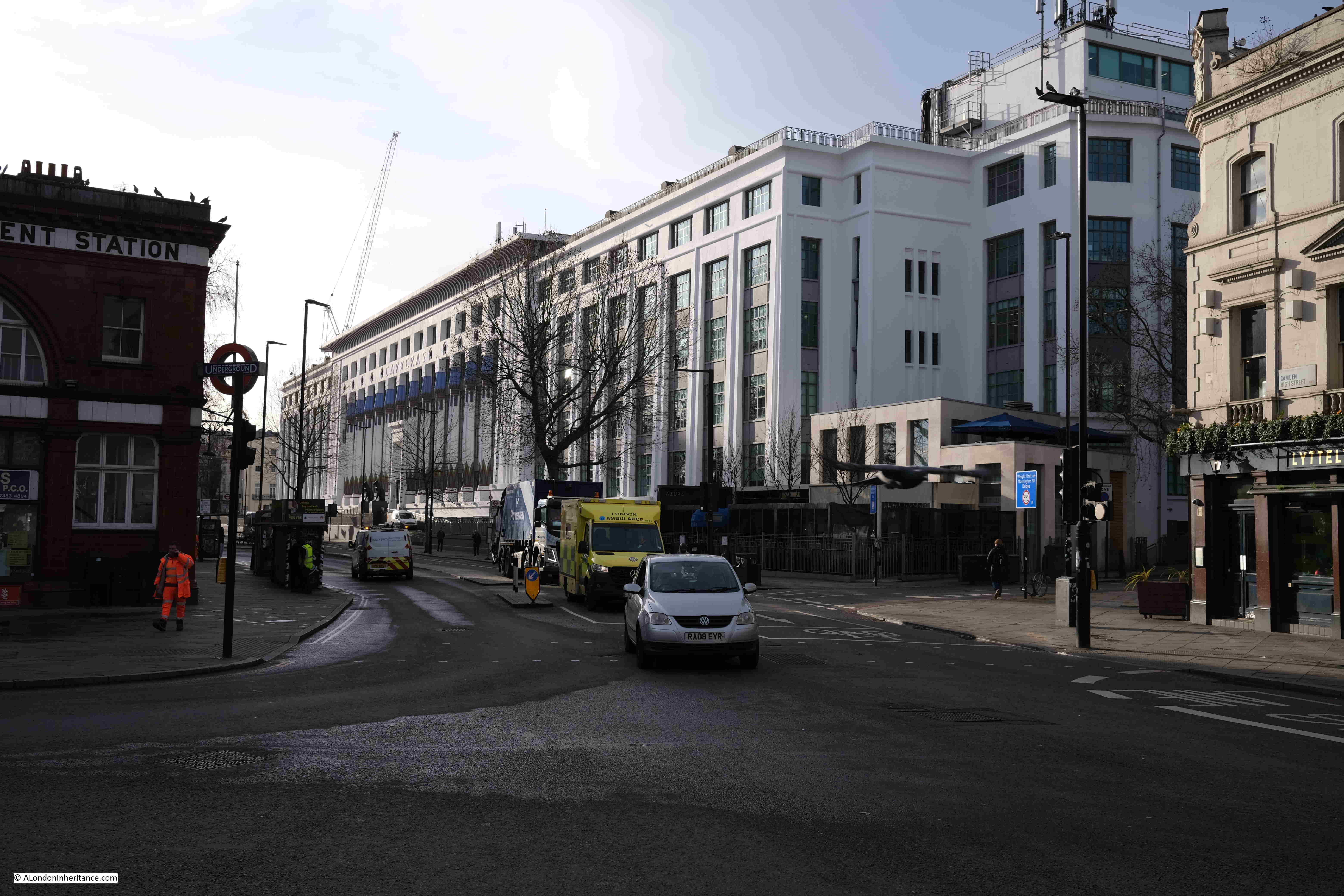
The large grey block in the map of the area today, and which now occupies the area where the garden was located is the wonderful old Carreras cigarette factory, now offices:

Carreras Cigarette Factory Camden

The Carreras brand dates from the early 19th century when the Spanish nobleman Don José Carreras Ferrer started trading cigars in London. The business expanded into other forms of tobacco such as snuff and cigarettes, and became a significant business during the late 19th century.

What really drove the brand’s expansion, and the opening of the Mornington Crescent factory was the transformation of Carreras to a public company in 1903, when a Mr. W. J. Yapp (who had taken over the company from the Carreras family) and Bernhard Baron (of Jewish descent, who was born in what is now Belarus on the Russian border, who had moved to the United States and then to London), became directors of the company.

Whilst in New York, Bernhard Baron had invented a machine that could manufacture cigarettes at a faster rate than existing machines, and in London the Carreras company was the only one that took on the new machines, other tobacco companies preferring to stay with their existing means of production, or machines over which they held monopolies.

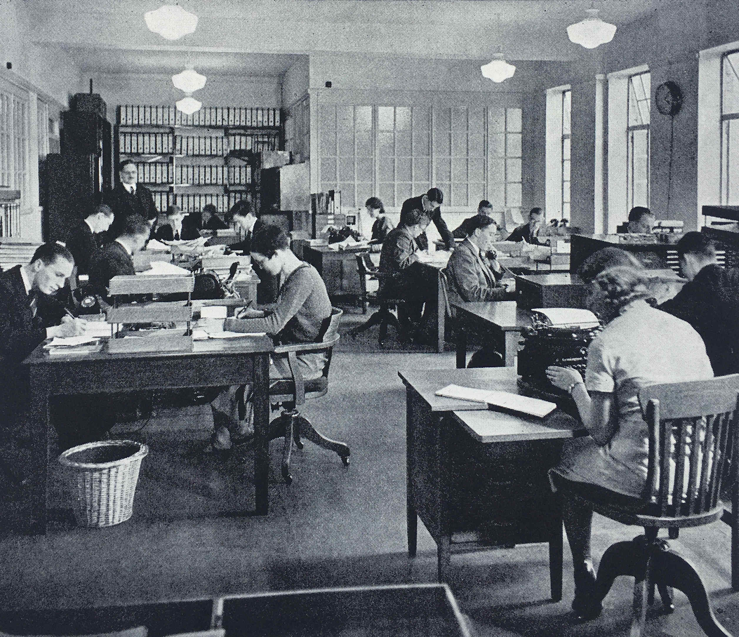
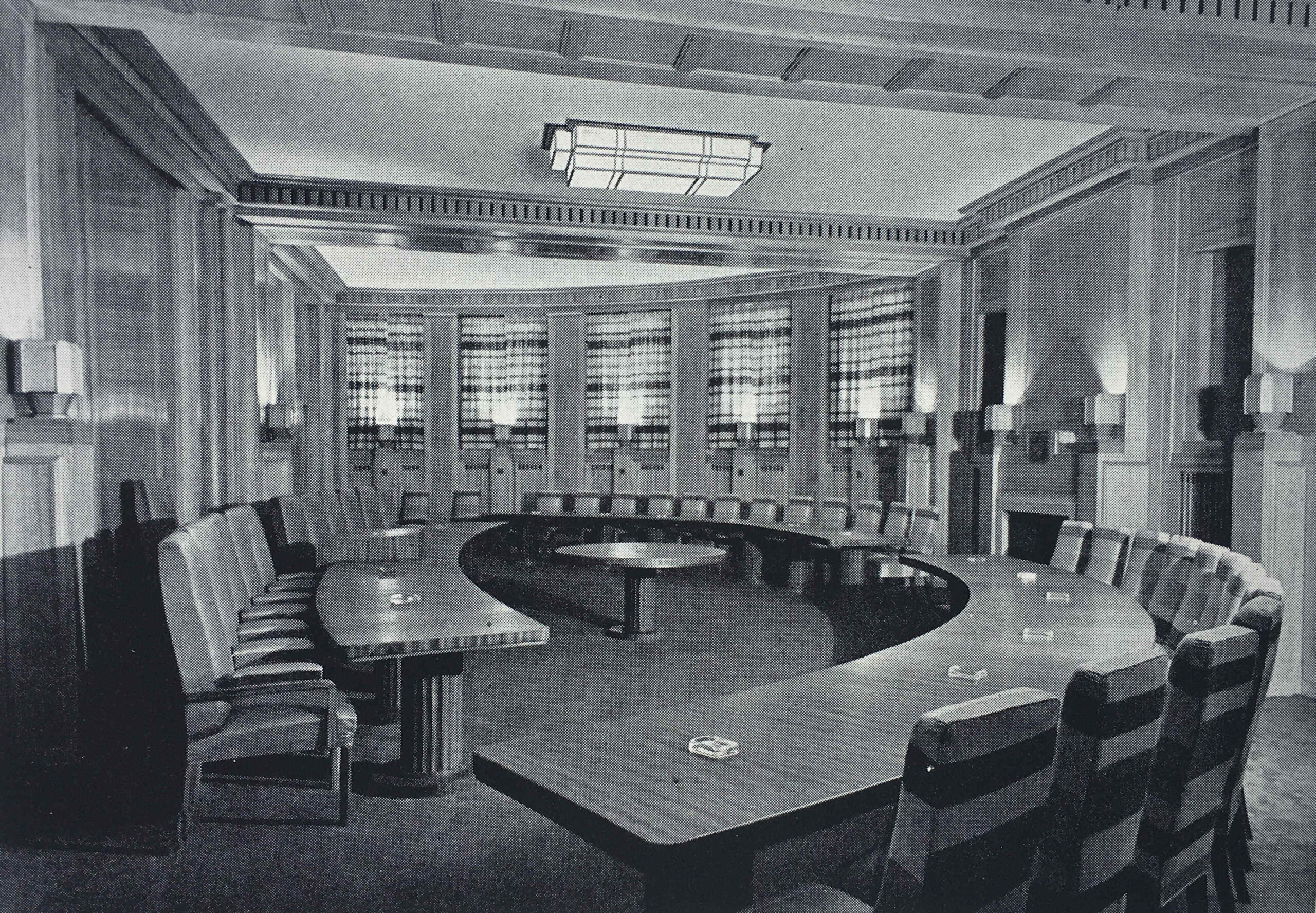
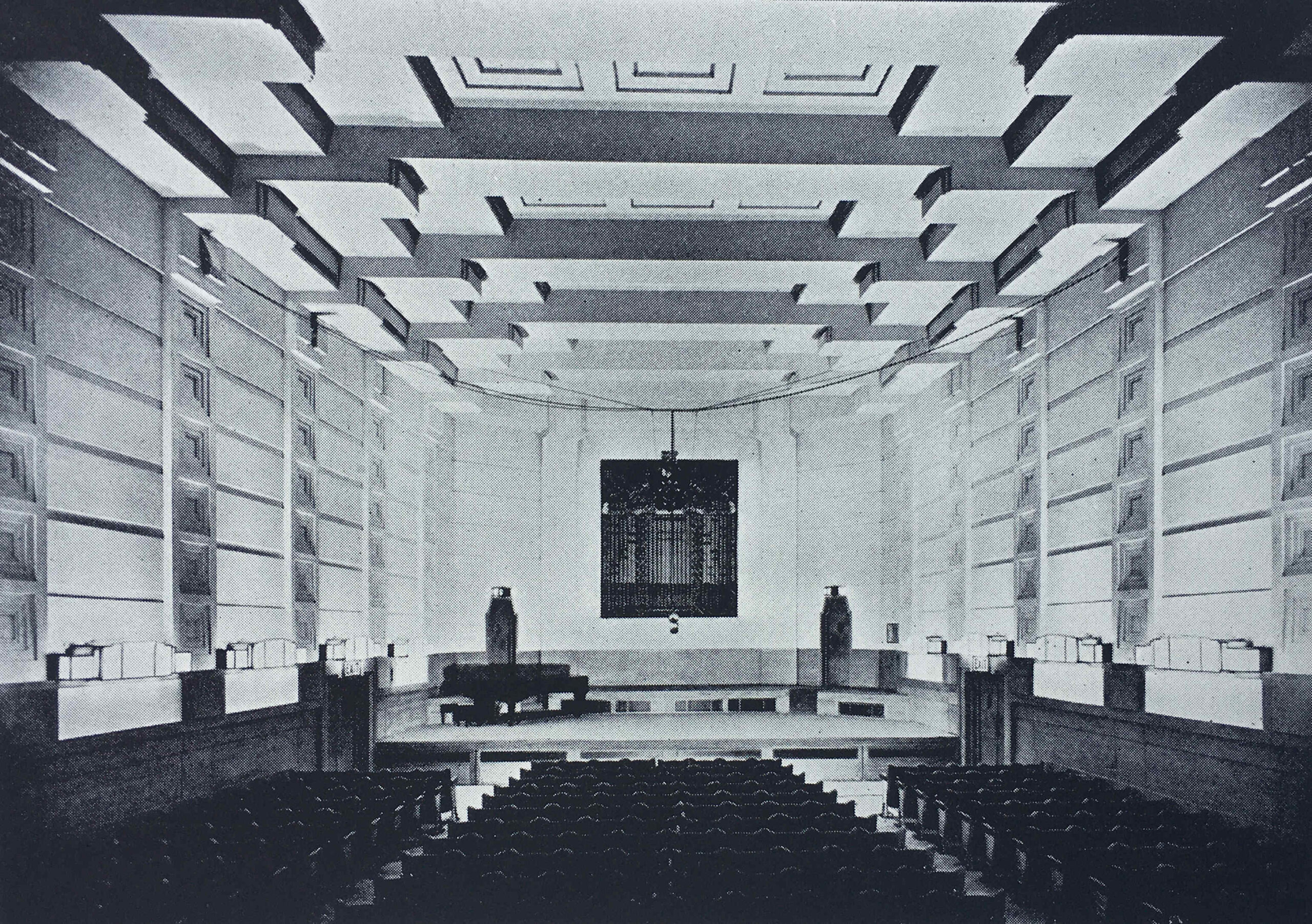
By the start of the 1920s, Baron was Chairman of the company and wanted to create a large, modern factory, which would enhance the brand’s reputation for the purity and quality of their cigarettes, and provide a good working environment for the company’s employees.

The result was the new factory on the old gardens between Mornington Crescent and Hampstead Road.

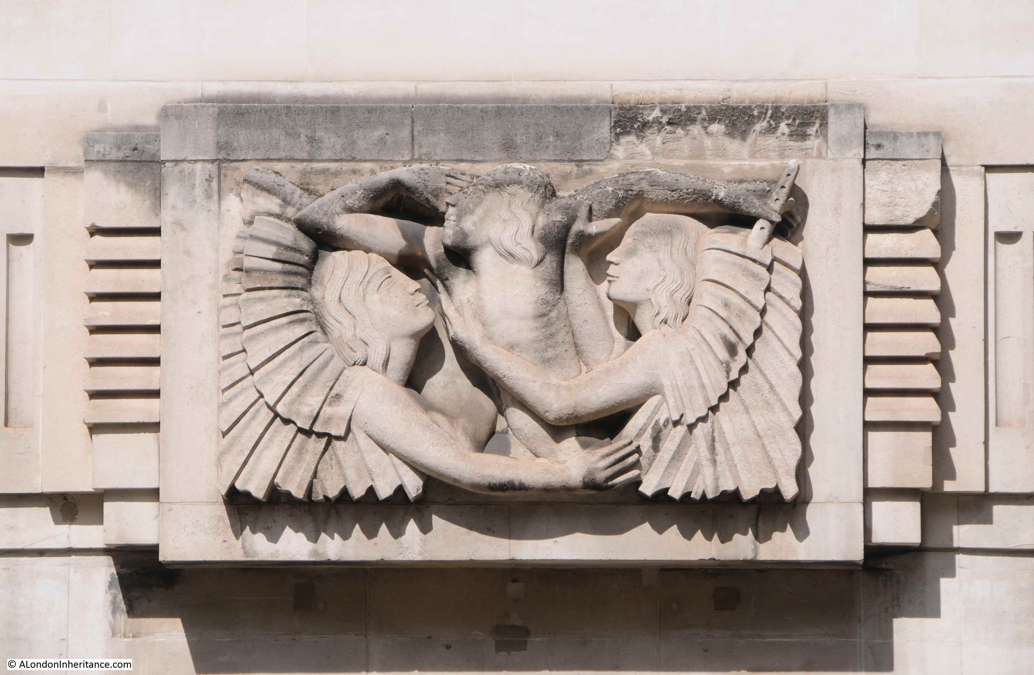
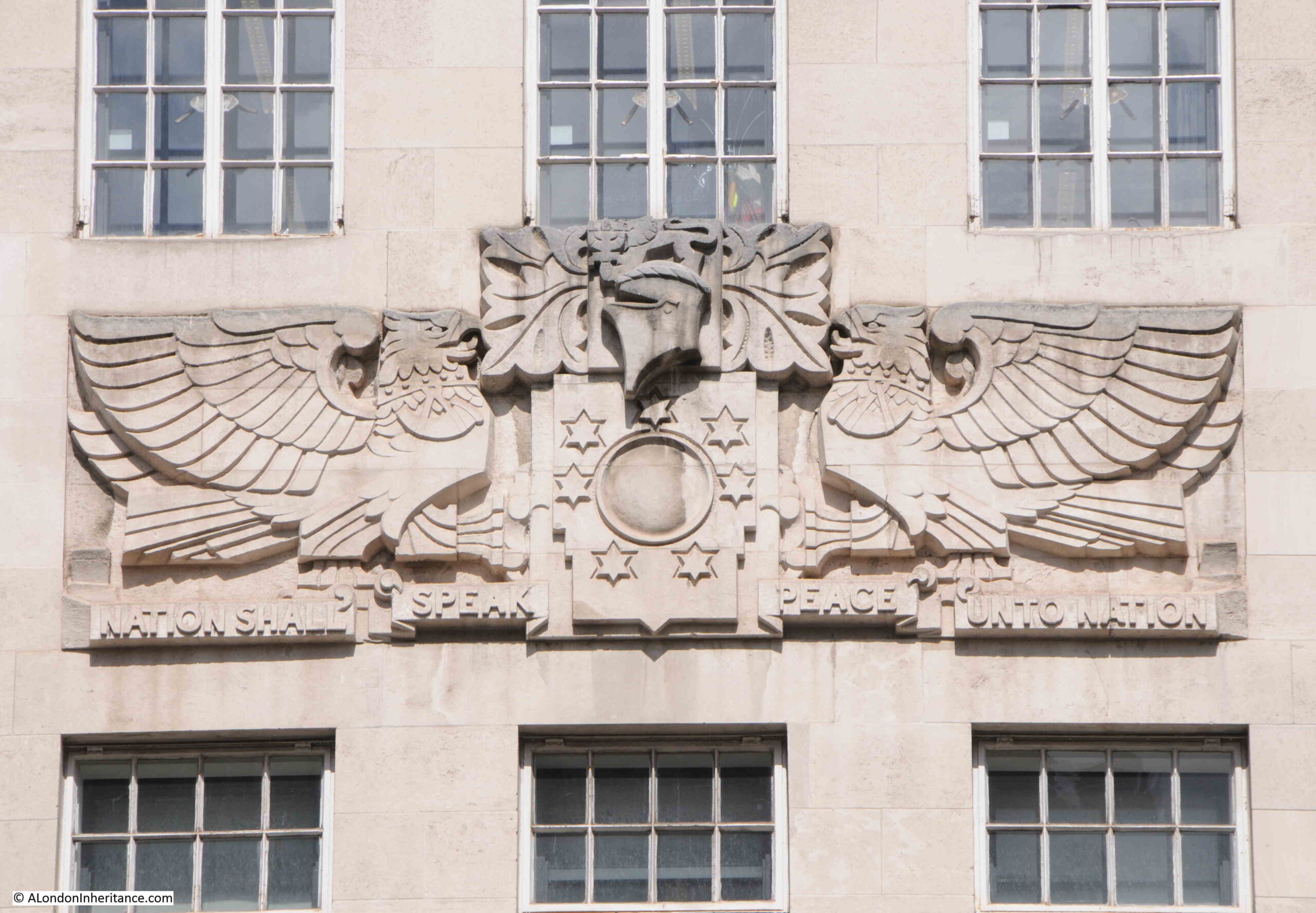
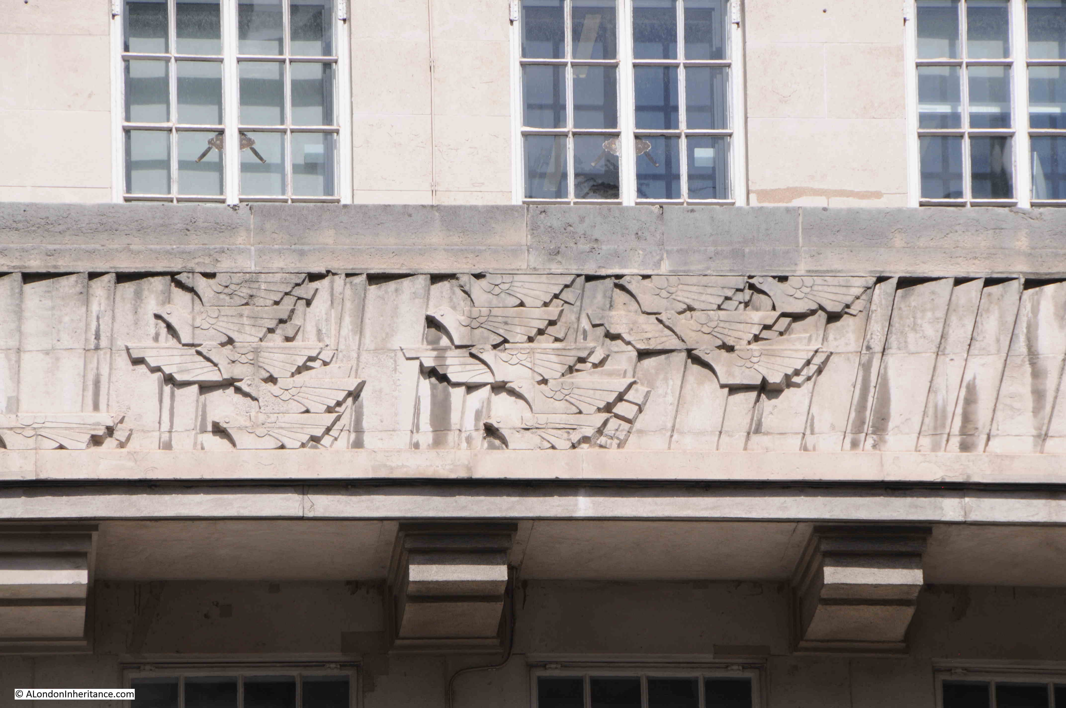
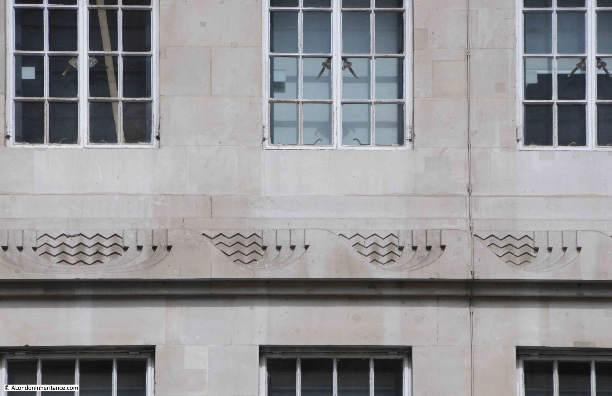
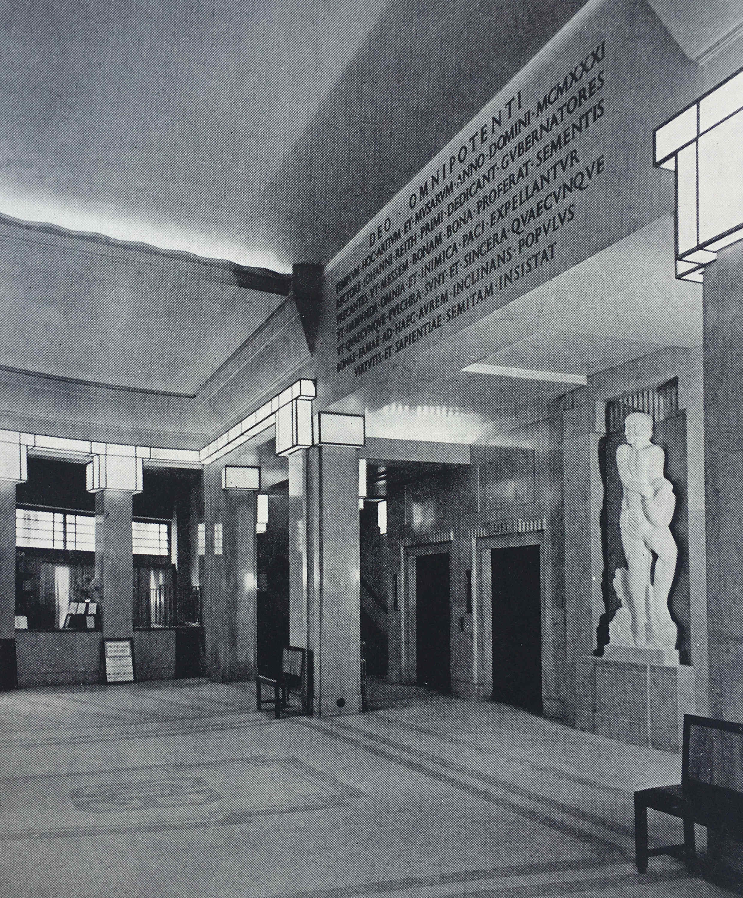
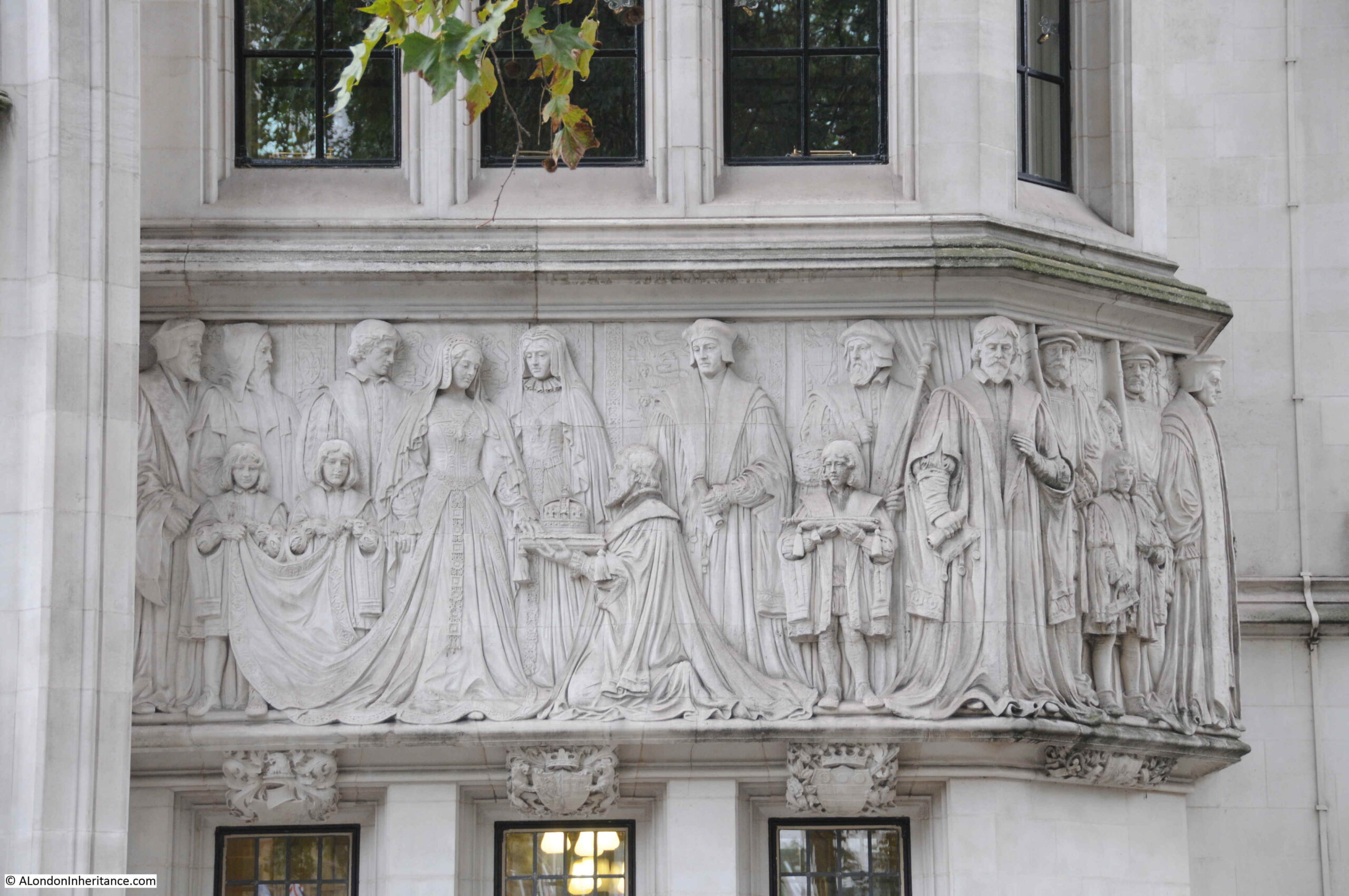
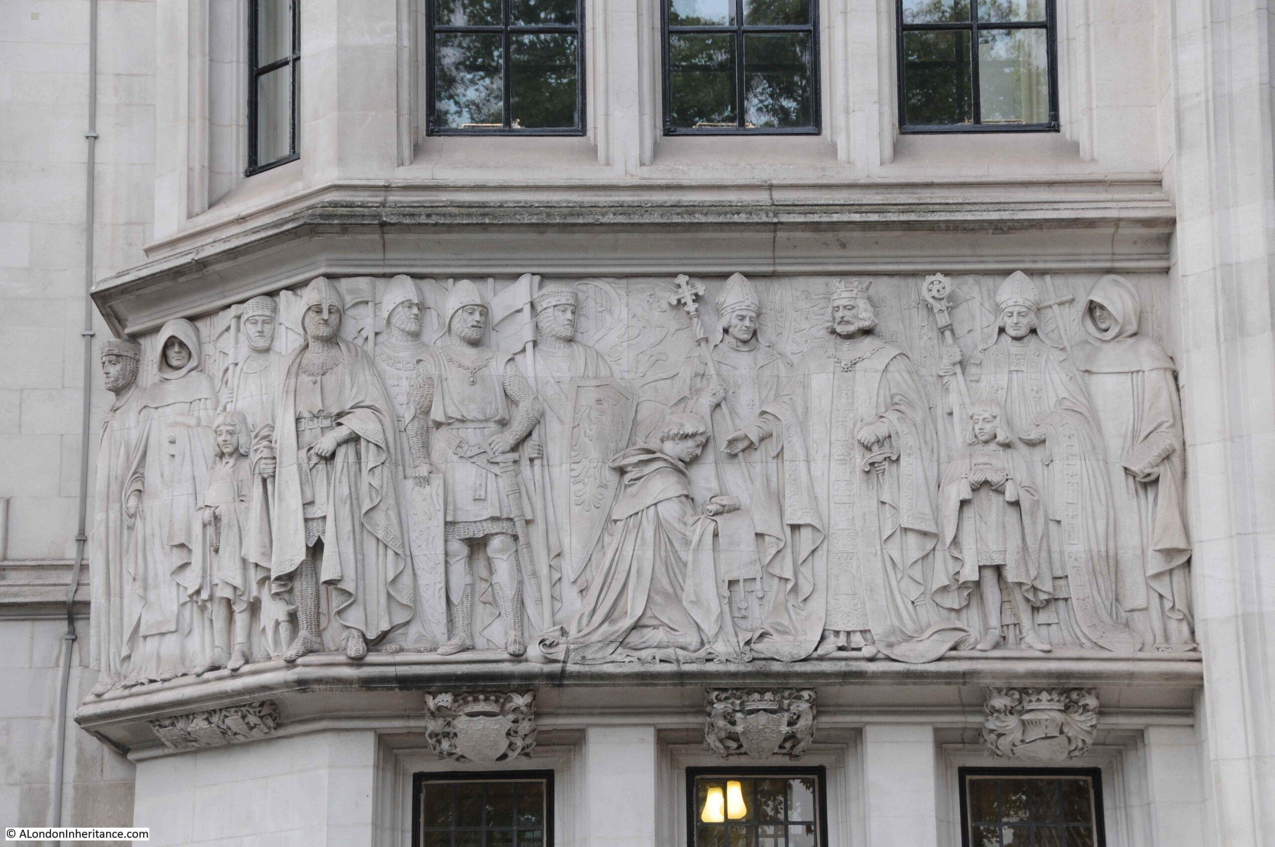
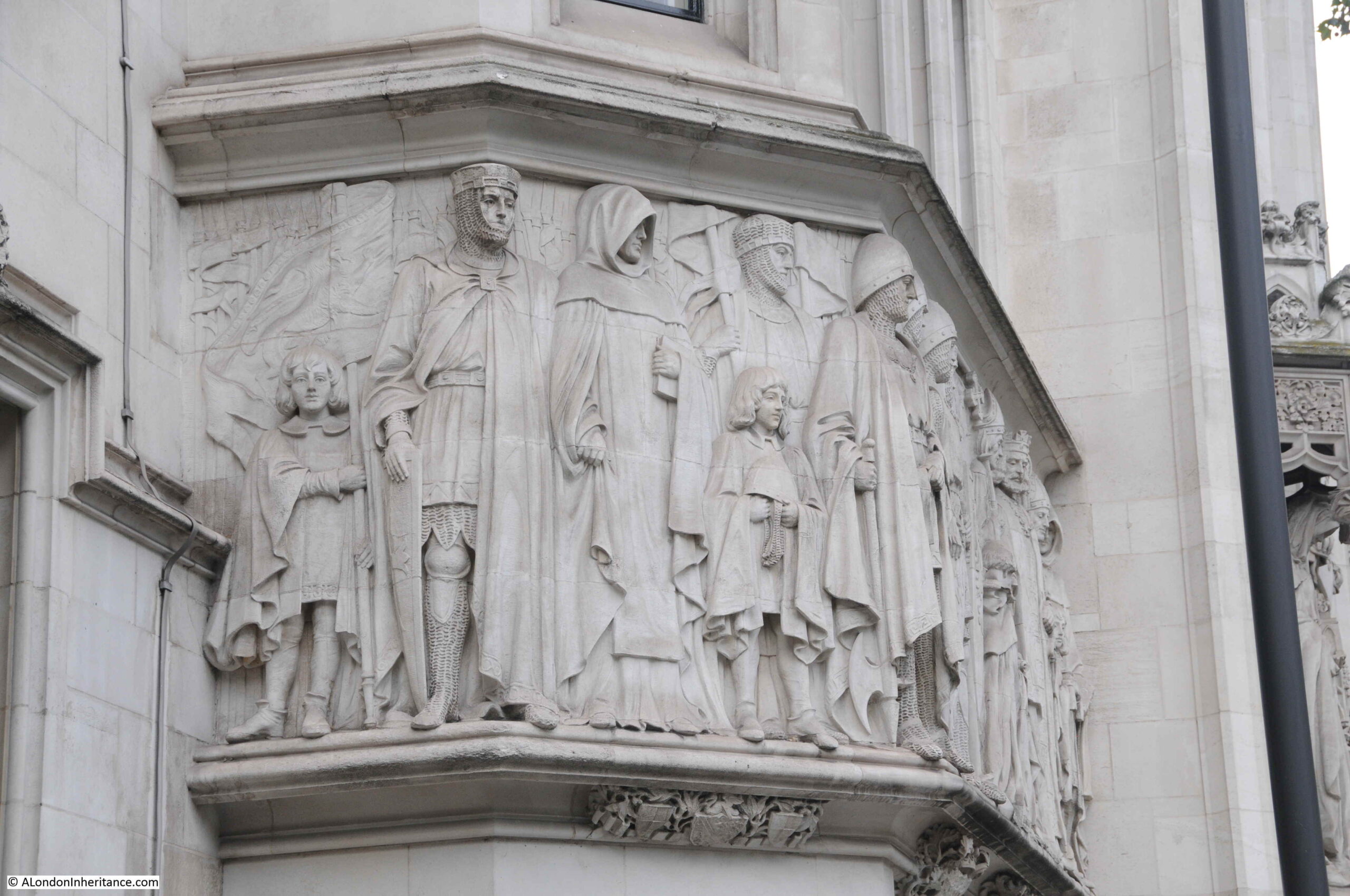
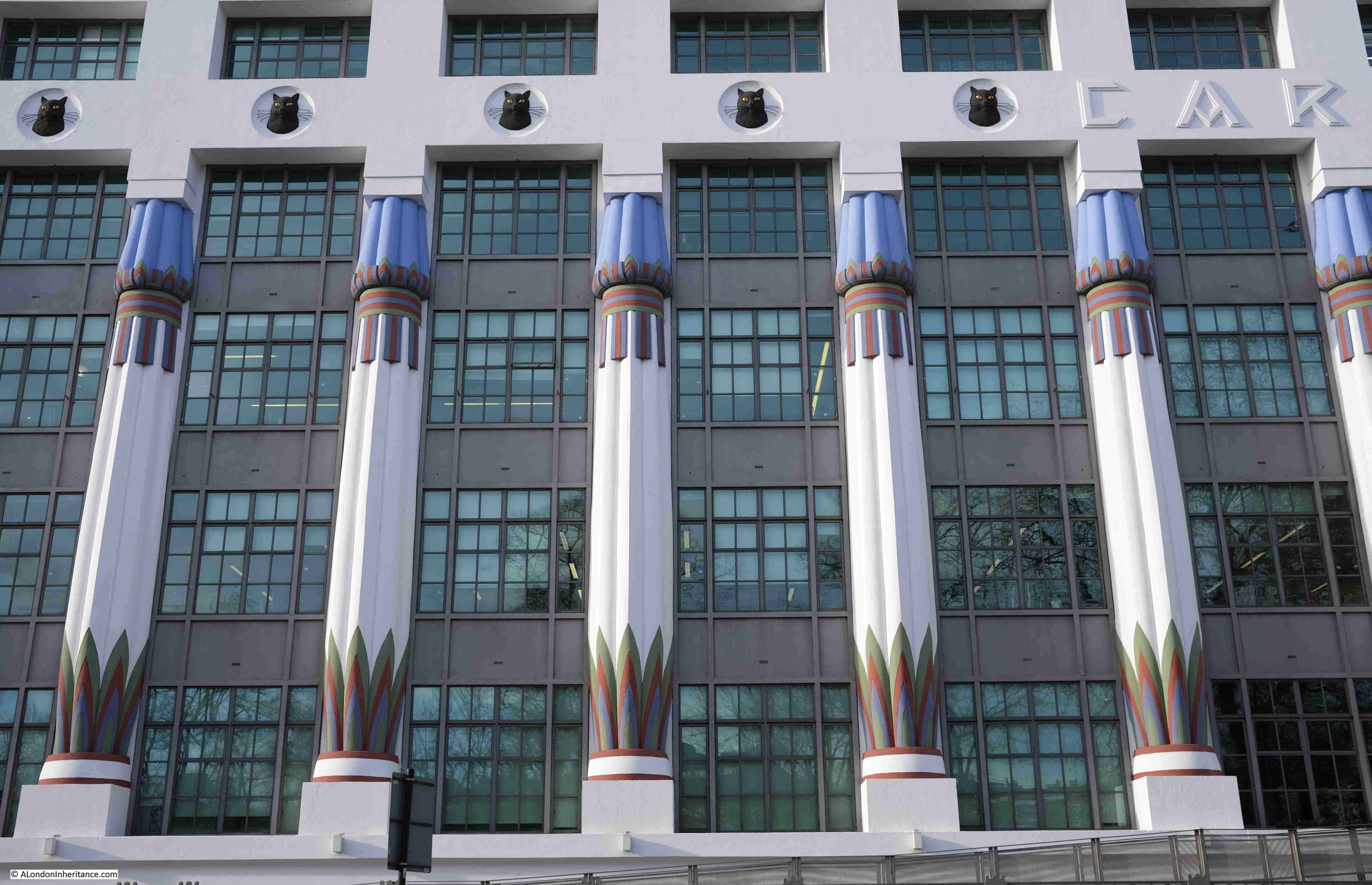
Designed by the architectural practice of Marcus Evelyn Collins and Owen Hyman Collins, along with Arthur George Porri who acted as a consultant, the design of the building was inspired by the archeological finds in Egypt during the 1920s, with the tomb of the Egyptian pharaoh Tutankhamun being discovered in 1922.

Carreras Cigarette Factory Camden

The building was one of the first (and I believe the largest at the time) building to use pre-stressed concrete, and also to be fitted with air conditioning and dust extraction equipment.

The innovative construction of the building, and the technologies used to maintain the internal environment were mentioned in all the major news reports that covered the opening of the building on the 3rd of November 1928:

“Carreras new factory at Camden Town, which was opened by Mr. Bernhard Baron, the chairman of the company, constitutes not only the largest reinforced concrete building under one roof in Great Britain, but also that rare thing – the realisation of one man’s dream.

Mr. Baron is a practical idealist. He set out to make cigarettes, he wanted them made in the best way, and in the best conditions. He wanted the people who made them to be happy in their work, it has all come true.

The opening ceremony was as impressive in its simplicity as the new building is in its efficiency and design. Mr. Baron performed it himself, not so much as chairman of the company, but as the father of the three thousand employees who have helped him to achieve success. He said, at the luncheon, that he felt it a great honour to have opened the factory, and that he wanted his employees about him at that moment to share his pleasure. That was why he decided on a simple ceremony, a family celebration, as it were, of the culmination of one stage of his life’s work.

Carreras new building embodies all that is best in factory design. It is well lit, and well ventilated and as healthy as it is possible to make it.

Most important of all, it has been fitted with an air conditioning plant which is the only one of its kind in the British tobacco industry, and which ensures a consistently ideal atmosphere for the manufacture of the perfect cigarette. The air which enters the building is first washed clean with water. It is then adjusted to the required temperature and humidity. Outside, London may be shivering or sweltering, damp or dusty. Inside, every day is a fine day; all weather is fair weather. It is well known that the English climate is the best in the world for the manufacture of tobacco; it can now be said that Carreras climate is the best in England.

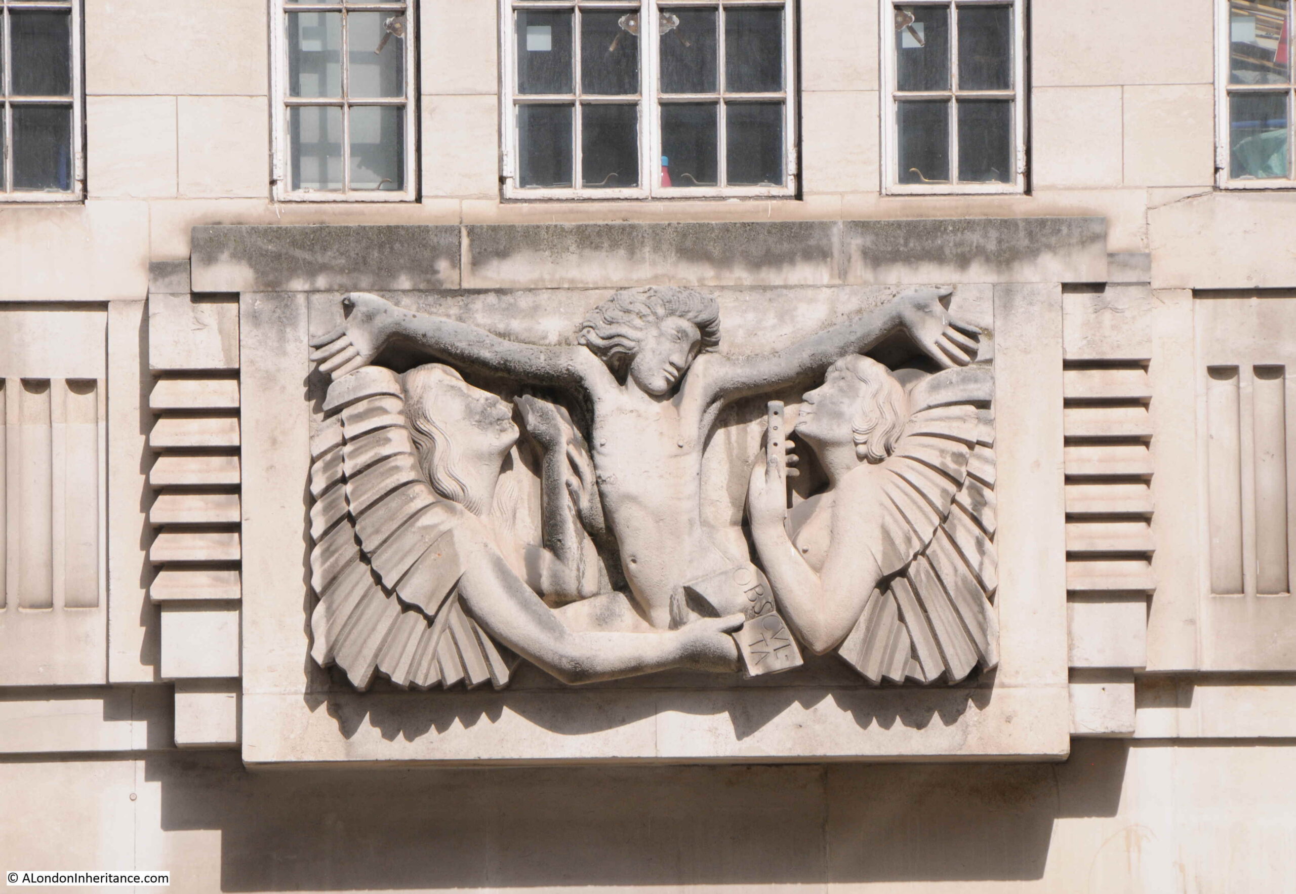
The façade of the building, which stretches five hundred and fifty feet along Hampstead Road, is something fresh in London architecture – a conventionalised copy of the Temple of Bubastis, the cat headed goddess of Ancient Egypt.”

I have read several modern references to the opening of the building which include that the Hampstead Road was covered in sand, there were chariot races and Verdi’s opera Aida was performed, however I cannot find these mentioned in any of the news reports from the time that covered the opening of the building. As seen in the above report, the “opening ceremony was as impressive in its simplicity as the new building is in its efficiency and design“.

The opening of the factory was seen as an improvement to the area, although it had resulted in the loss of the open space between Mornington Crescent and Hampstead Road, as newspapers reported that “When the move to save the London squares was first begun, Mornington Crescent was cited as one of London’s losses. It had been acquired by Mr. Bernhard Baron as the site of his new factory. I doubt whether had it been saved we Londoners would have gained anything. Now when you come out of the Tube station, the eyesore of that dirty bit of green, backed by decaying Victorian basement houses is no more. Instead, there is the finest factory in London, an architectural triumph for Mr. Marcus Collins, the culmination of a life’s work for Mr. Baron and a model workplace for his 3,500 employees.”

The Mornington Crescent factory remained in operation until 1959 when Carreras merged with Rothmans, and cigarette production was moved to a factory in the new town of Basildon in Essex.

The building was sold and in 1961 it became office space, with the name of Greater London House, and all the Egyptian decoration was either removed or boxed in.

This would remain the fate of the building until the late 1990s when a new owner refurbished the building and restored the Egyptian decoration that we see today, as close as possible to the original design.

In the following photo of the main entrance to the building, two black cats can be seen on either side of the steps:

Carreras Cigarette Factory Camden

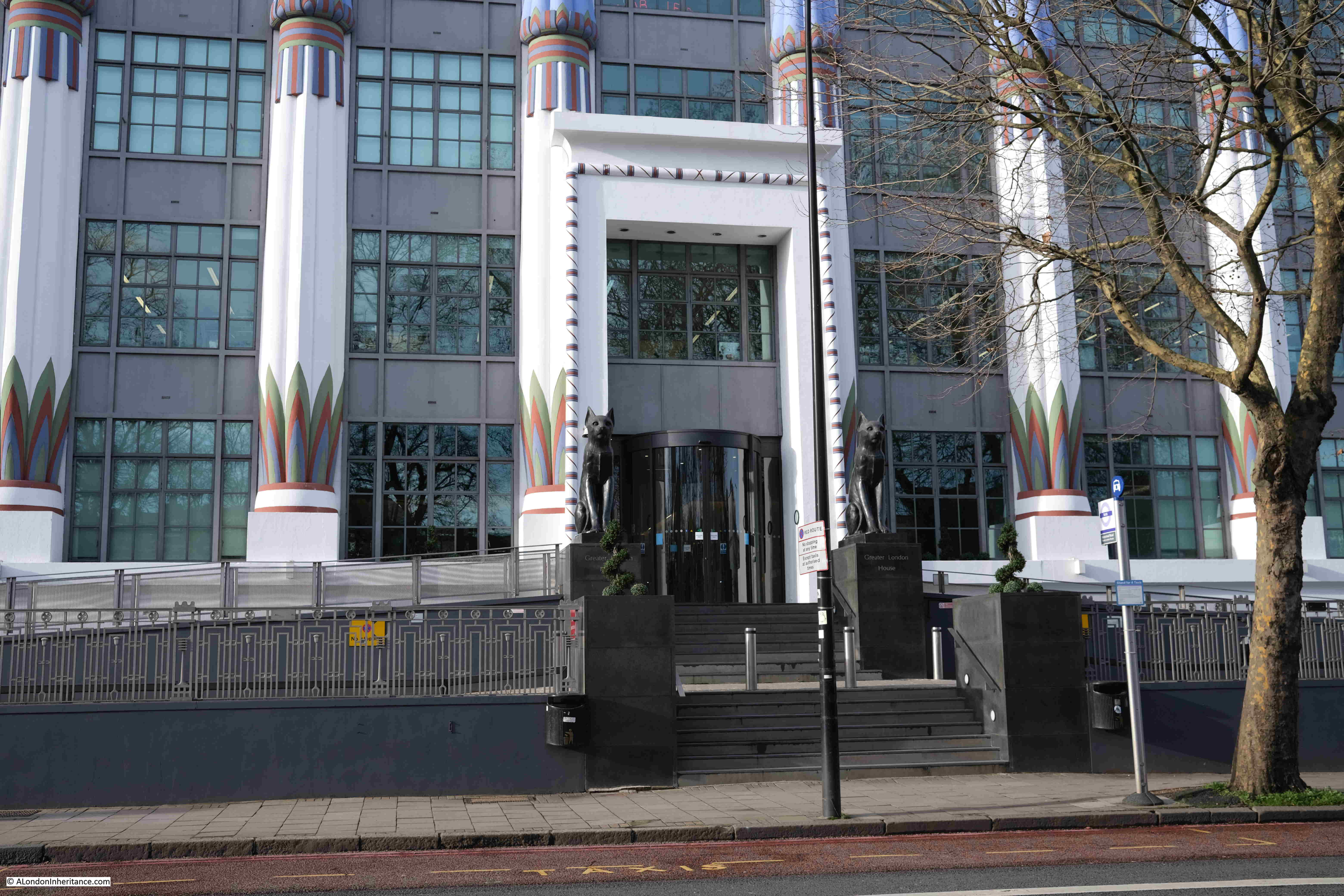
These are not the original cats as following the closure of the factory in 1959, one was transferred to the new factory in Basildon whilst the other was shipped to a Carreras factory in Jamaica.

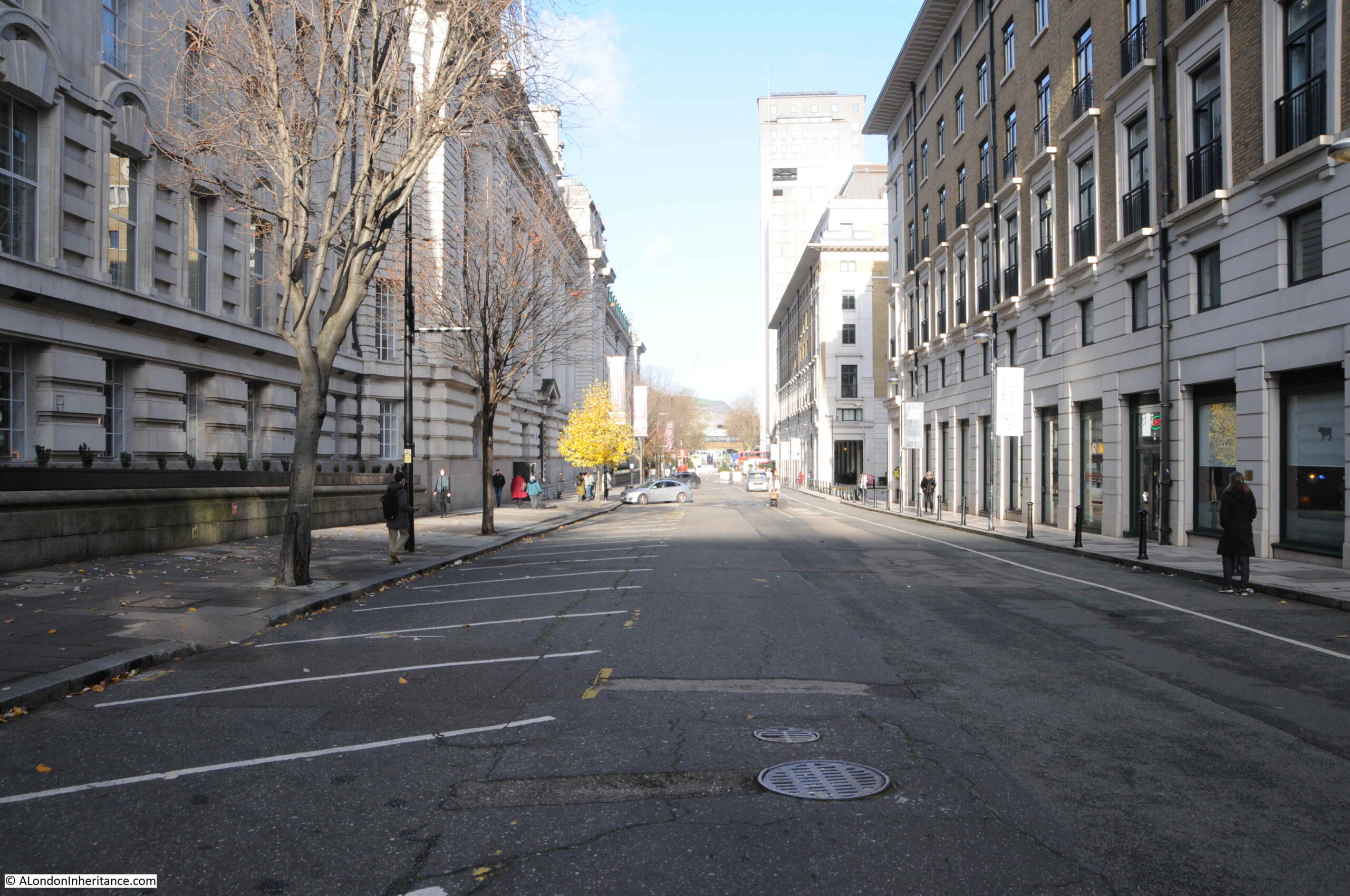
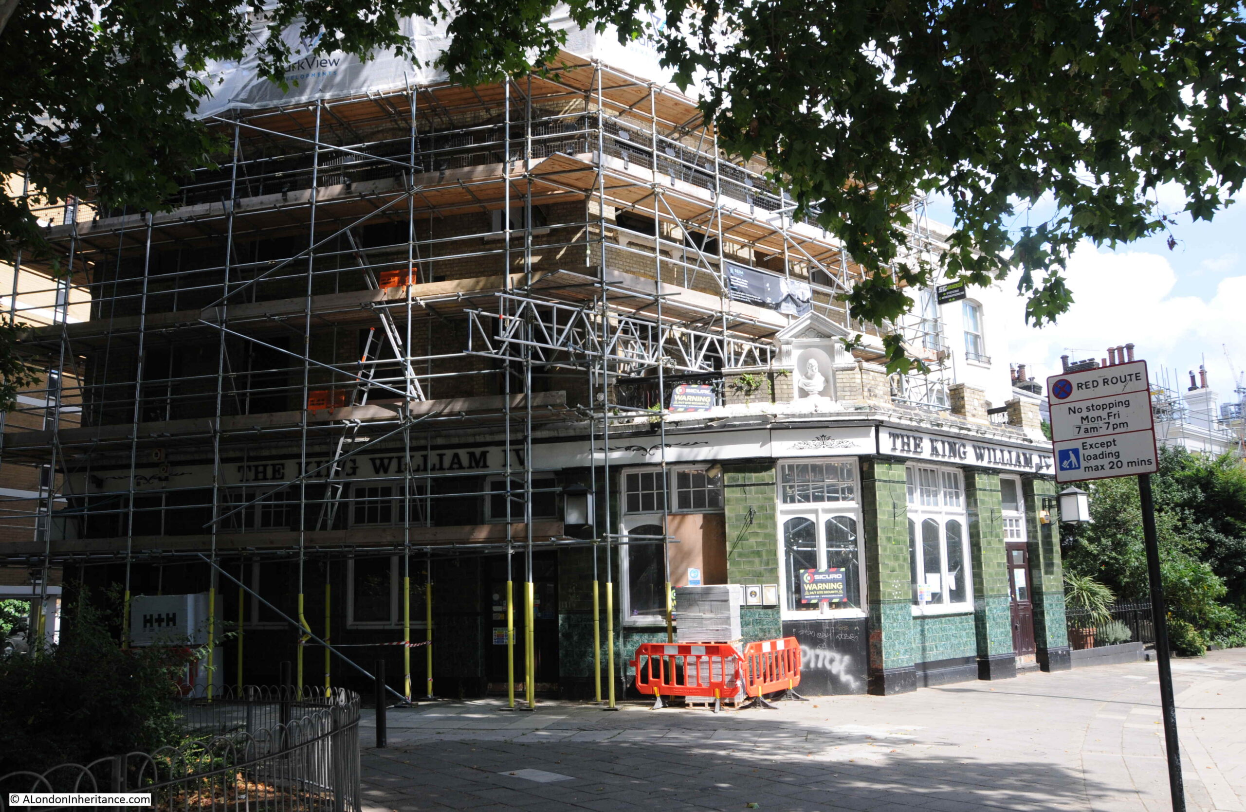
After walking north along Hampstead Road, through the works for HS2, the restoration of the Carerras building has retained some wonderful 1920s architecture to this part of Camden, however it has almost completely hidden Mornington Crescent, and a walk along this street is my next destination, starting from the northern end, opposite the underground station, where the Lyttleton Arms now stands:

Lyttleton Arms Camden

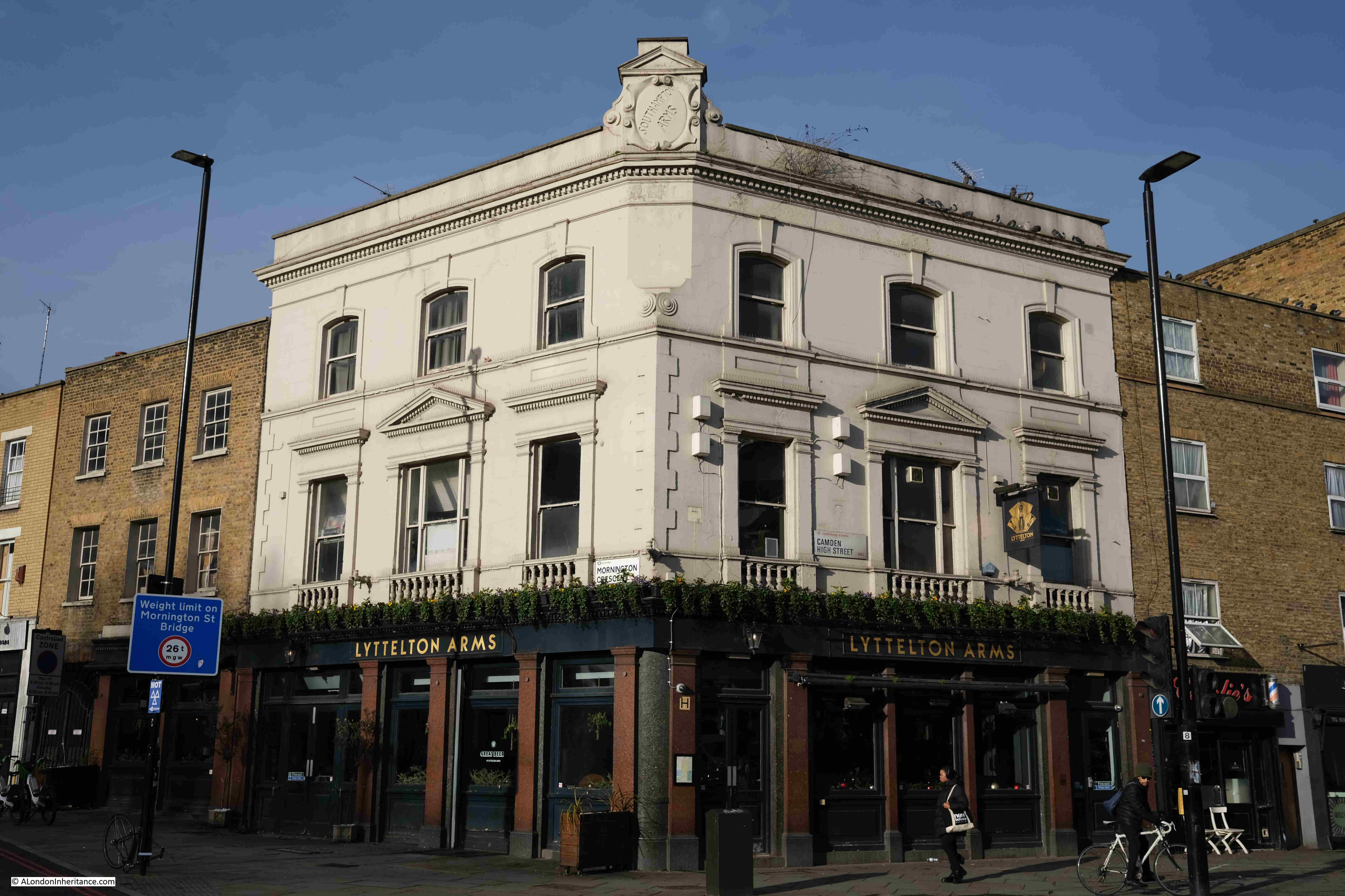
If you look closely at the top corner of the building, you will see the original name of the pub as the Southampton Arms. The pub was renamed the Lyttleton Arms in honour of the jazz musician and radio presenter, Humphrey Lyttleton, who was also the long running host of the radio panel game I’m Sorry I Haven’t a Clue from 1972 until his death in 2008, the show that included the game Mornington Crescent.

During the 1920s, the same decade that the Carerras factory was built, the Southampton Arms, as the pub was called, was one of the centres of conflicts between the gangs who tried to control race course betting, including the Clerkenwell Sabini Brothers and Camden’s George Sage.

The following report from the St. Pancras Gazette on the 6th of October 1922 illustrates one of the incidents:

“RACING MEN’S FEUDS – At Marylebone on Tuesday, Alfred White, Joseph Sabini, George West, Simon Nyberg, Paul Boffa, and Thomas Mack made their eighth appearance on the charges of shooting George Sage and Frederick Gilbert with intent to murder, at Mornington-crescent, Camden Town, on August 19, having loaded revolvers on their possession with intent to endanger life, and riotously assembling.

Helen Sage, wife of one of the prosecutors, said she was talking to her husband outside the Southampton Arms at Camden Town when several taxicabs drove up and a number of men alighted. She then heard a shot, but could not say who fired, as it was dark. The witness admitted that she told the police that West and White fired the shots, but now declared that this statement was untrue.”

Strange that Helen Sage, who was presumably the wife of the shot George Sage declared that her statement was untrue. Possibly some witness tampering or gangs not giving evidence against each other, preferring their own form of justice.

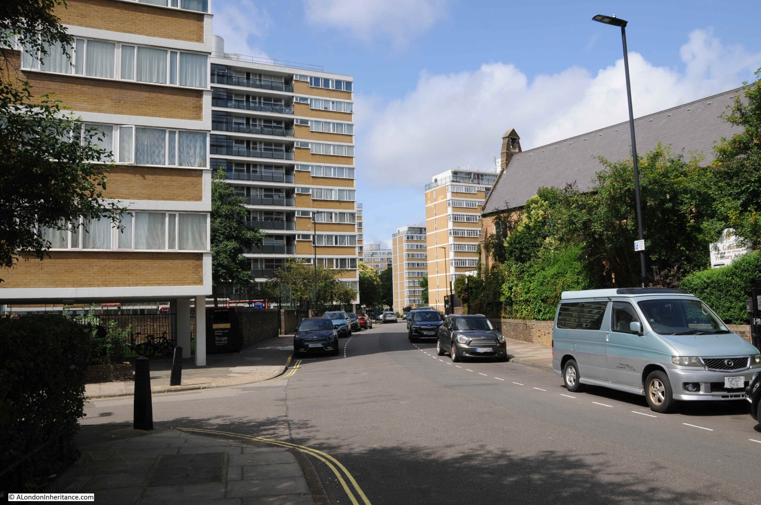
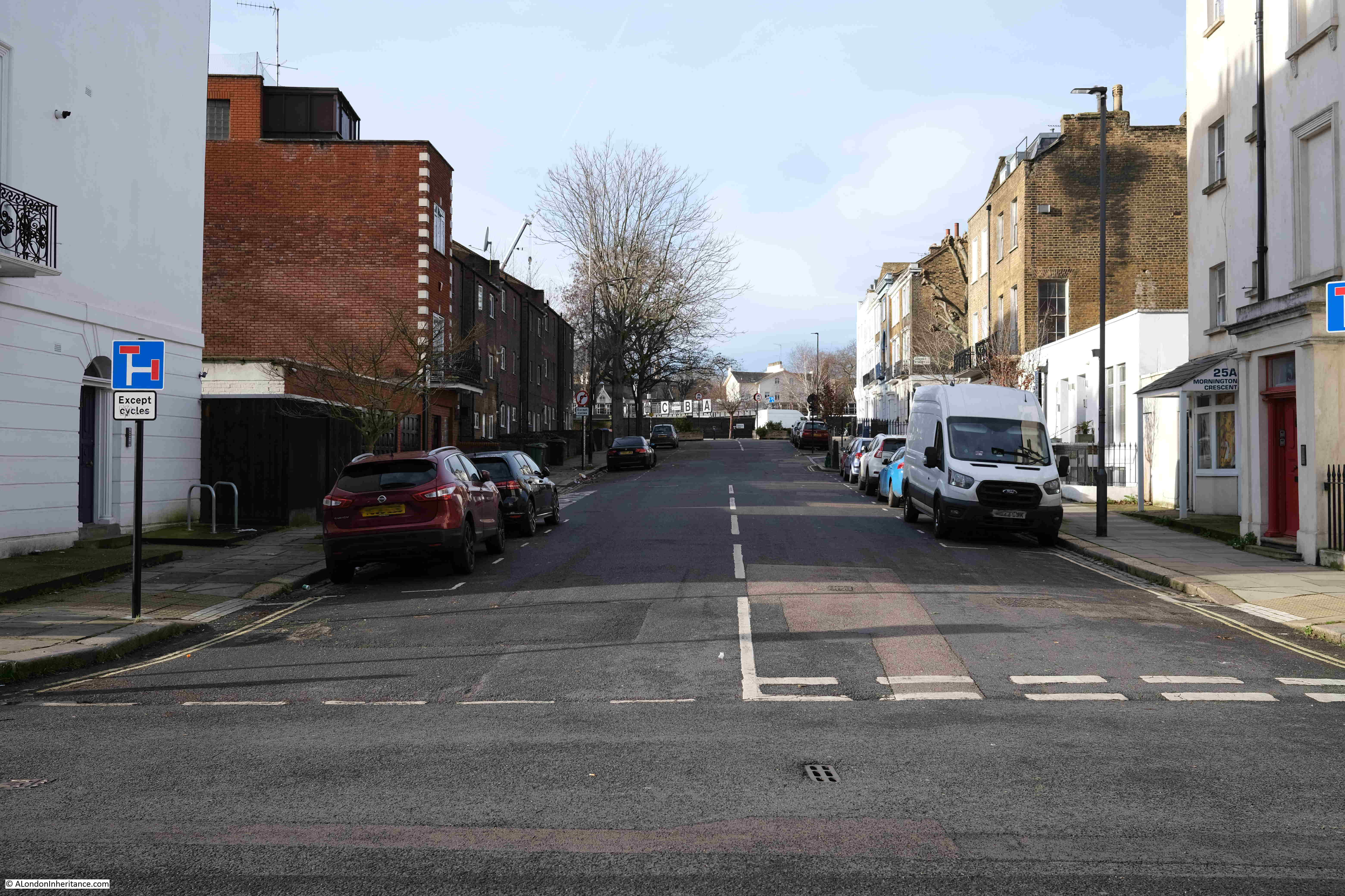
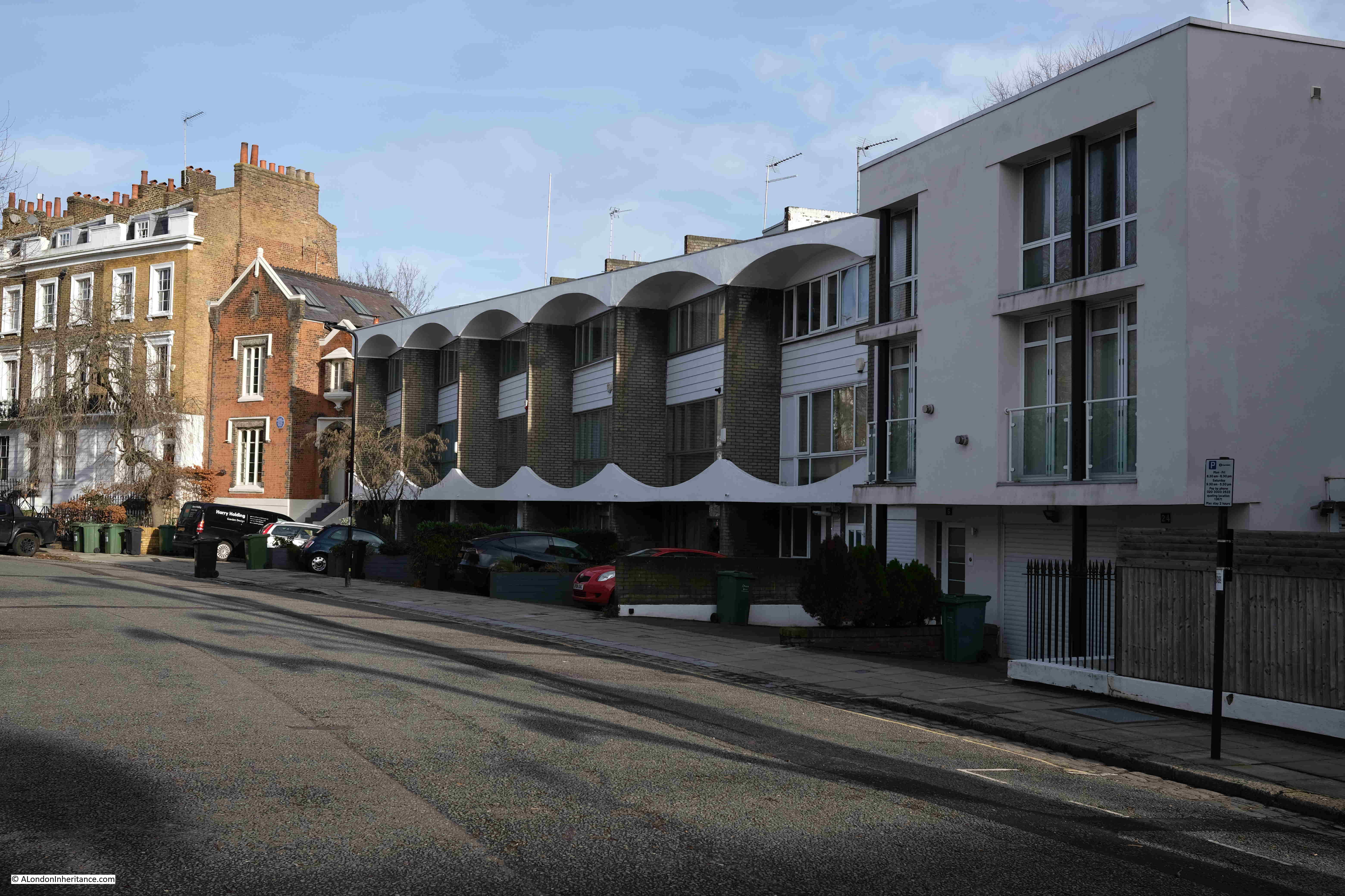
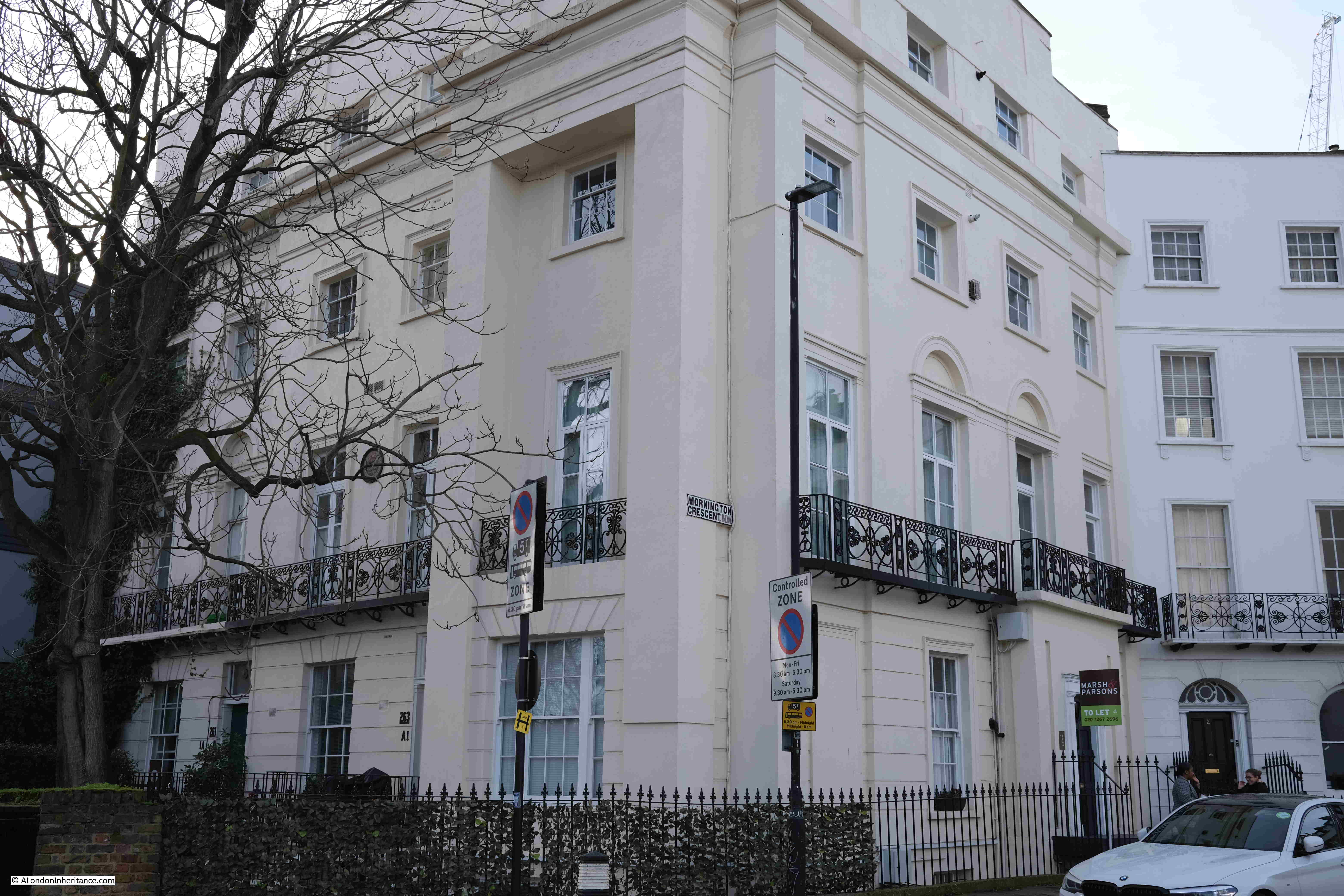
The first section of Mornington Crescent (from the north) is not part of the original, and this will become clear with the architectural style as we walk along the crescent. These later houses are smaller and less impressive than the original part of the crescent:

Mornington Crescent

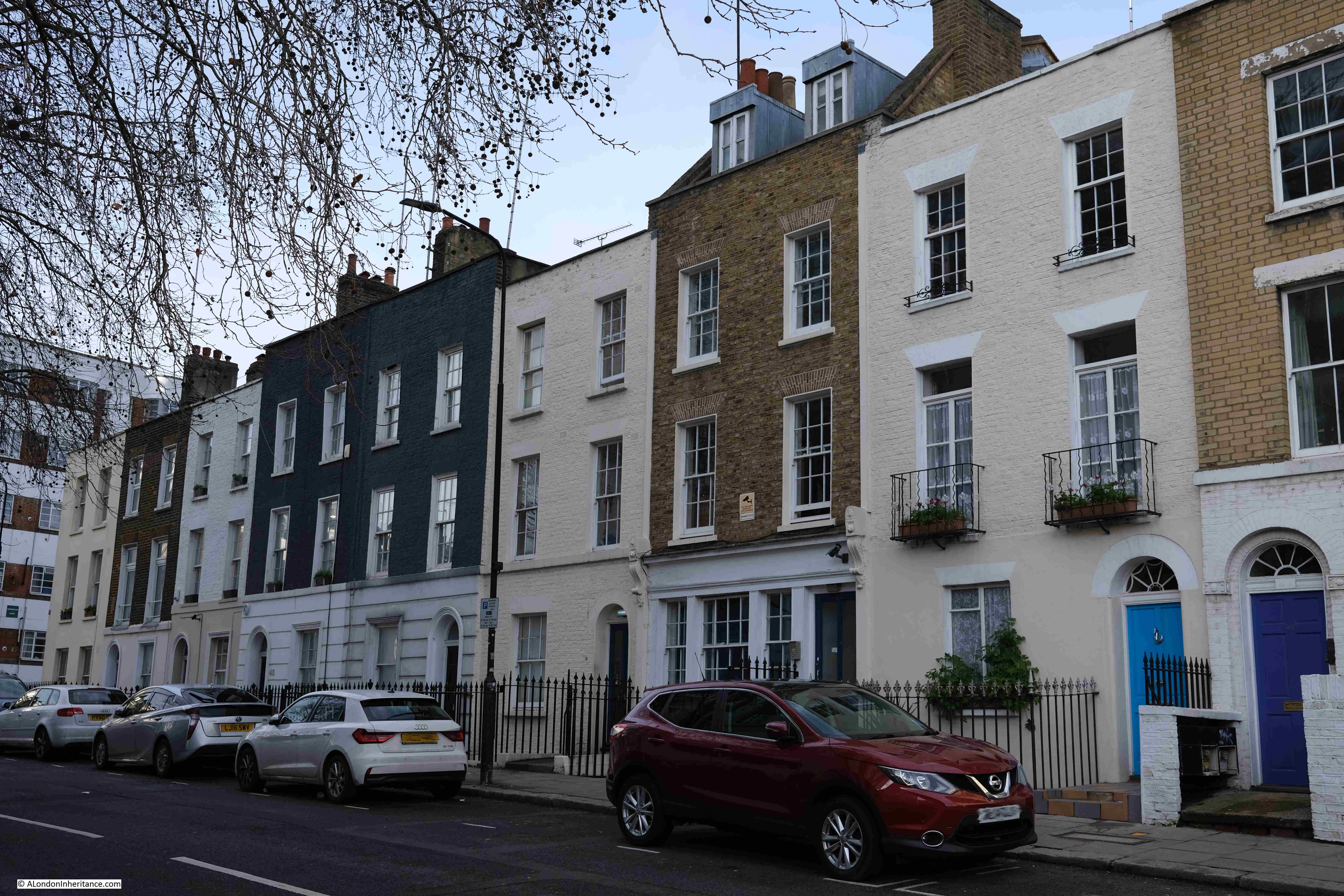
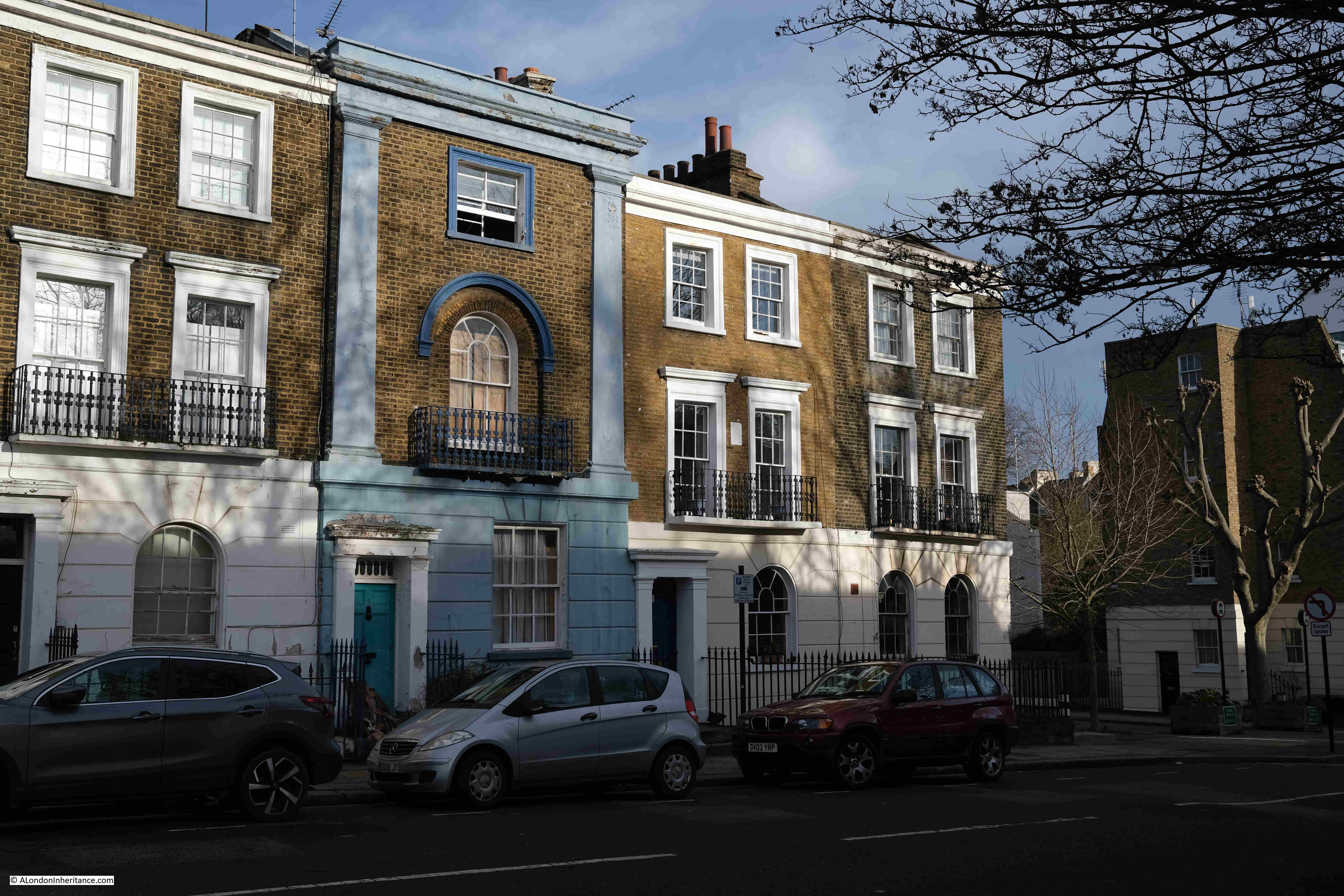
And after crossing the junction with Arlington Road, we can now see the original terrace of buildings from when Mornington Crescent was laid out:

Mornington Crescent

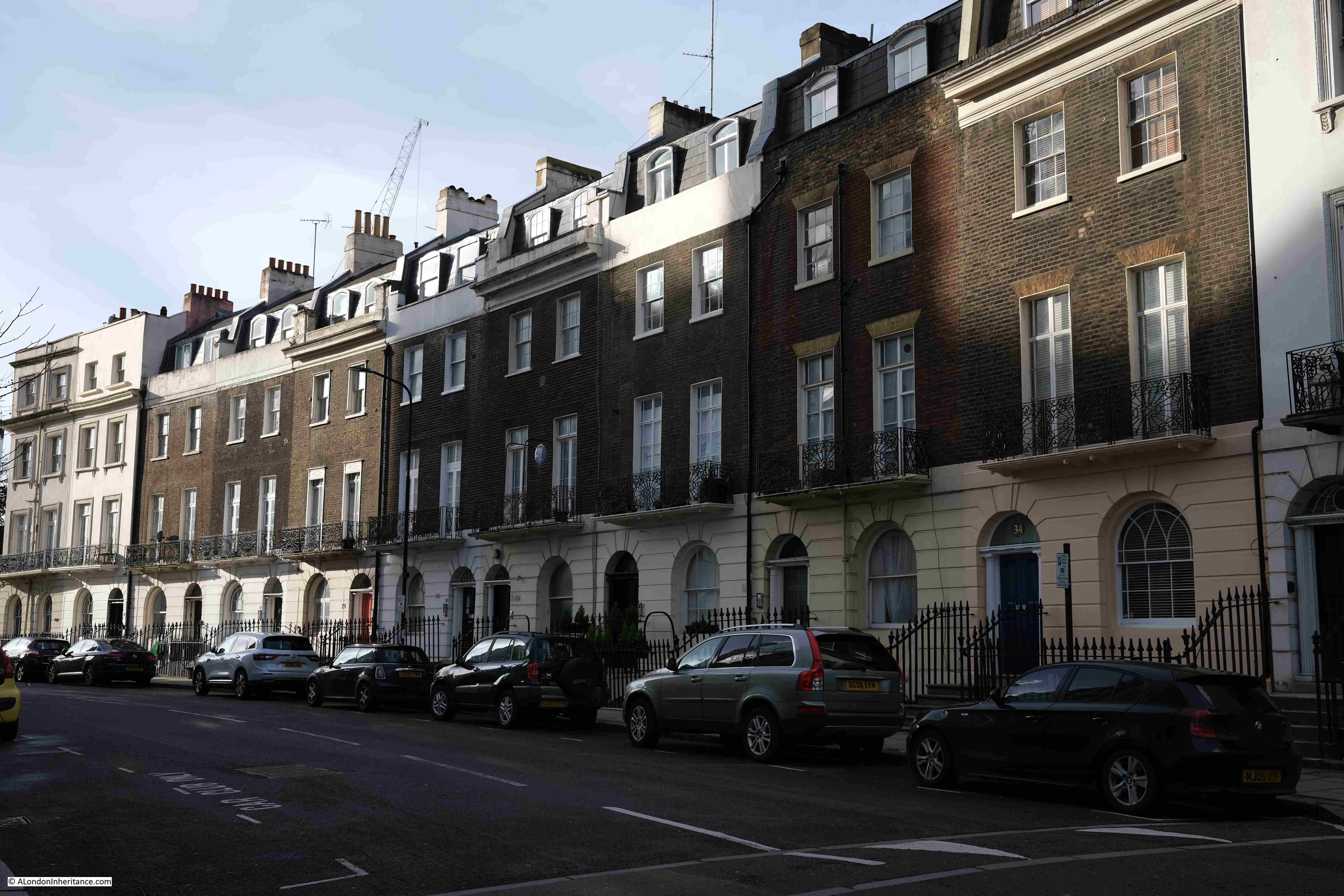
In the middle of the above terrace there is a blue plaque, to Spencer Frederick Gore, the painter, who lived in the building between 1909 and 1912.

Mornington Crescent

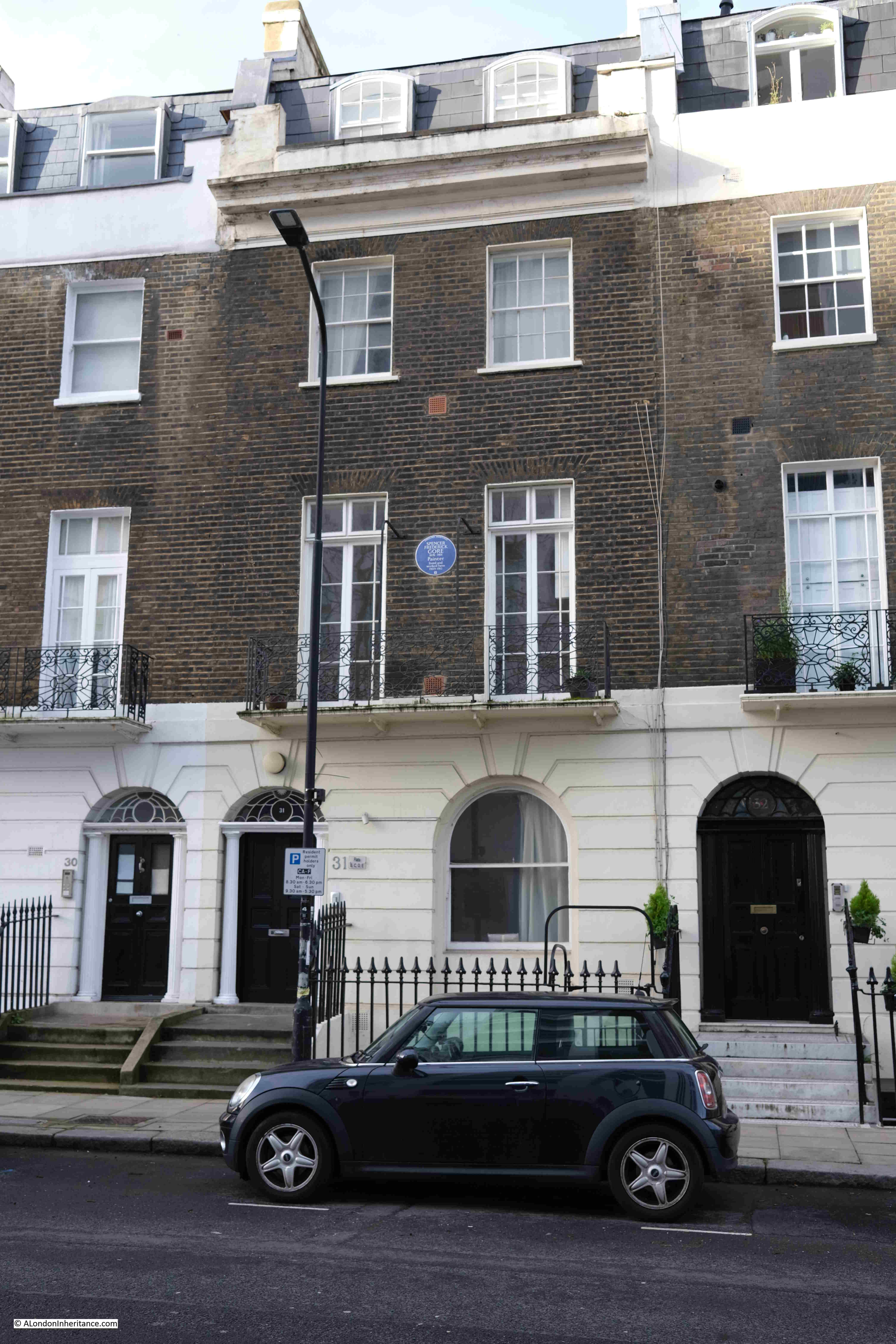
Gore painted the view from his house across the gardens and the view along Mornington Crescent. The Tate have one of his paintings of the gardens online here.

The following view is of the continuation of the terrace houses along Mornington Crescent, at the junction with Mornington Place:

Mornington Crescent

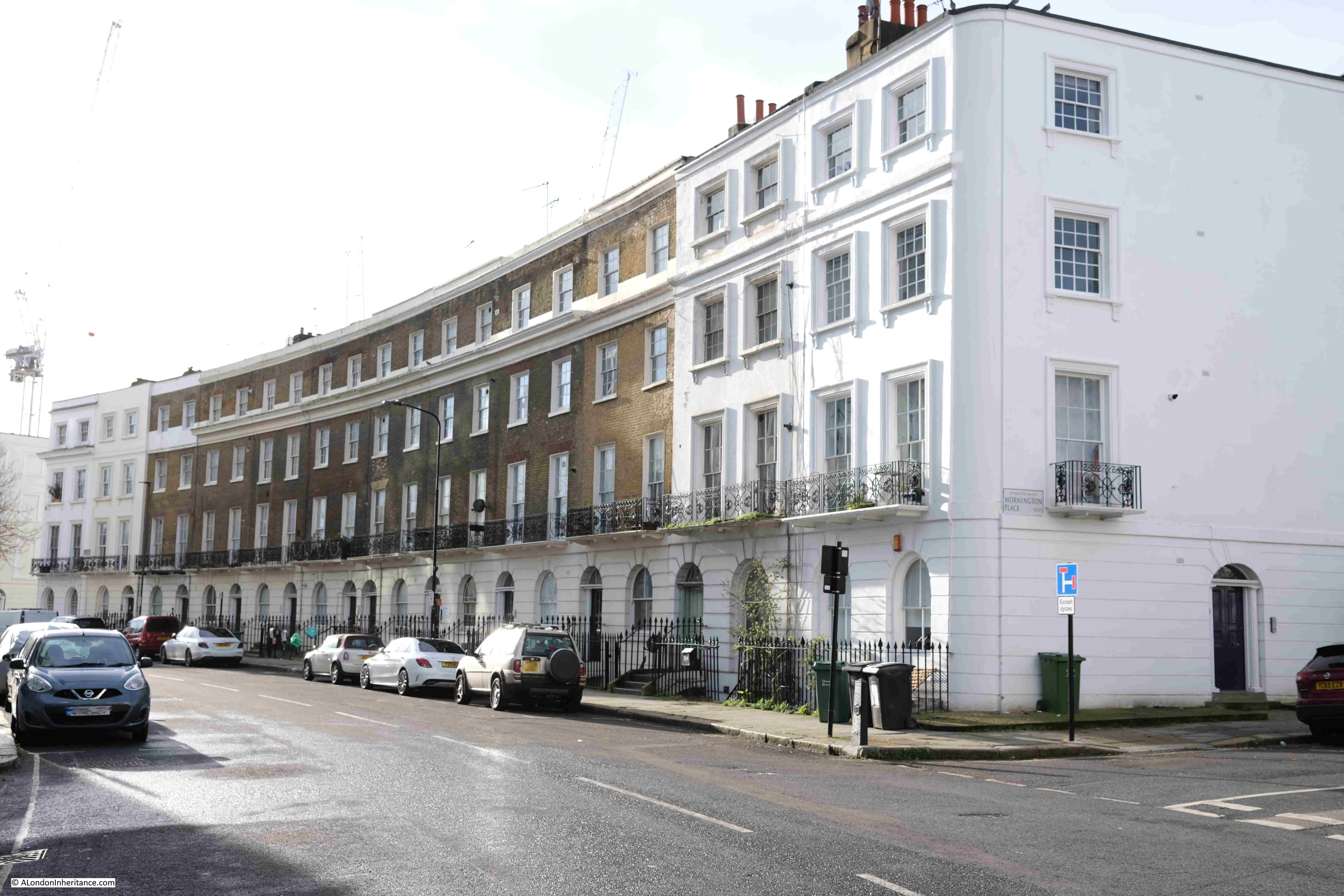
Construction of Mornington Crescent started in the early 1820s and was not complete until the 1830s. It is named after Richard Colley Wellesley, the Earl of Mornington and Governor-General of India. He was also the eldest brother of the Duke of Wellington, so was from an influential family.

Mornington Place heads up to the rail tracks to and from Euston Station:

Mornington Place

The street was built around the same time as Mornington Crescent and comprises smaller three storey terrace houses, although with some interesting architectural differences:

Mornington Place

At the end of the street, we can look over the brick wall and see the rail tracks, with HS2 works continuing on the far side:

Euston railway tracks

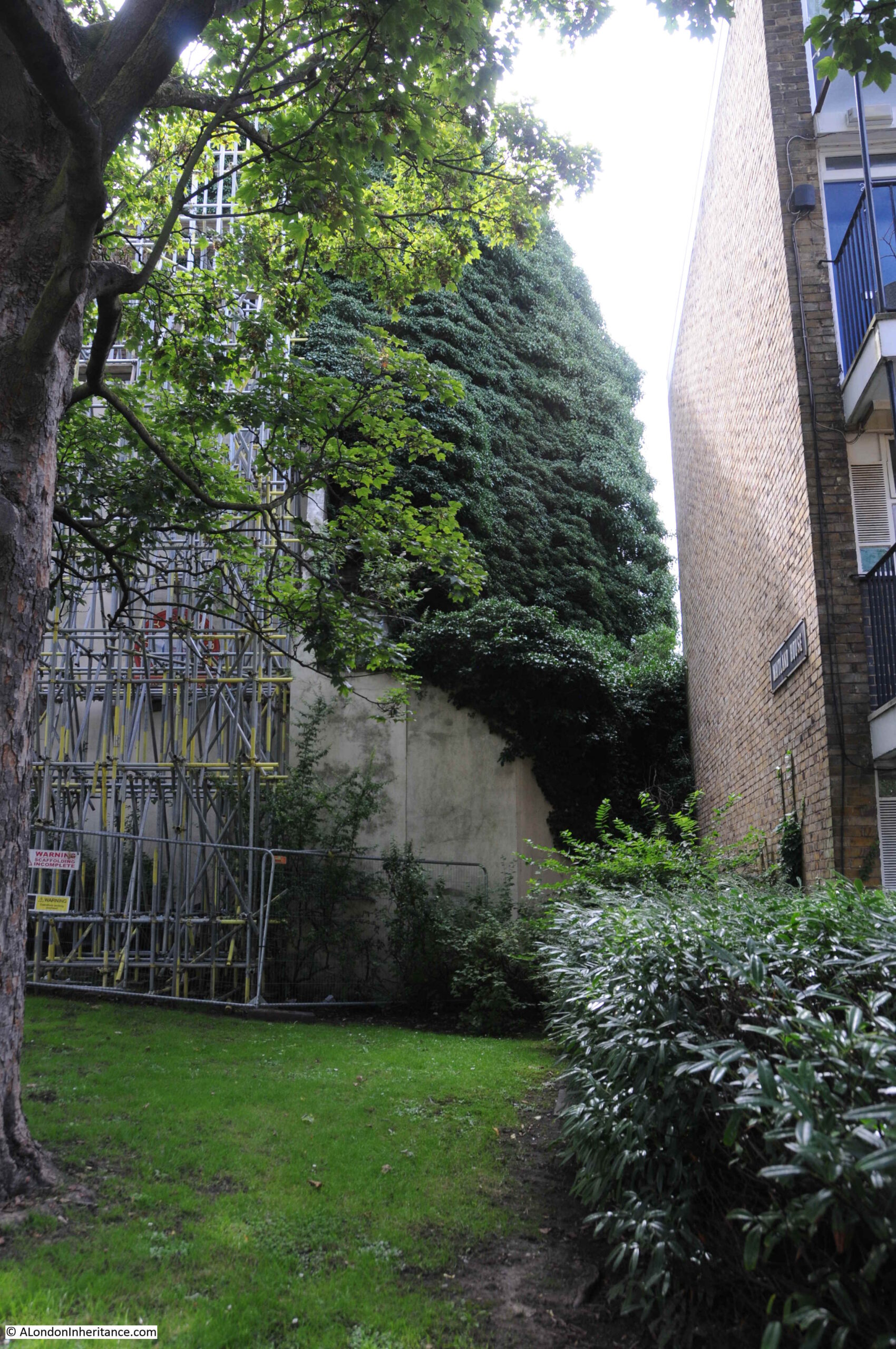
Looking back down Mornington Place towards the old Carreras factory – originally this view would have had the gardens at the end, through which Hampstead Road would have been seen:

Carreras Cigarette Factory Camden

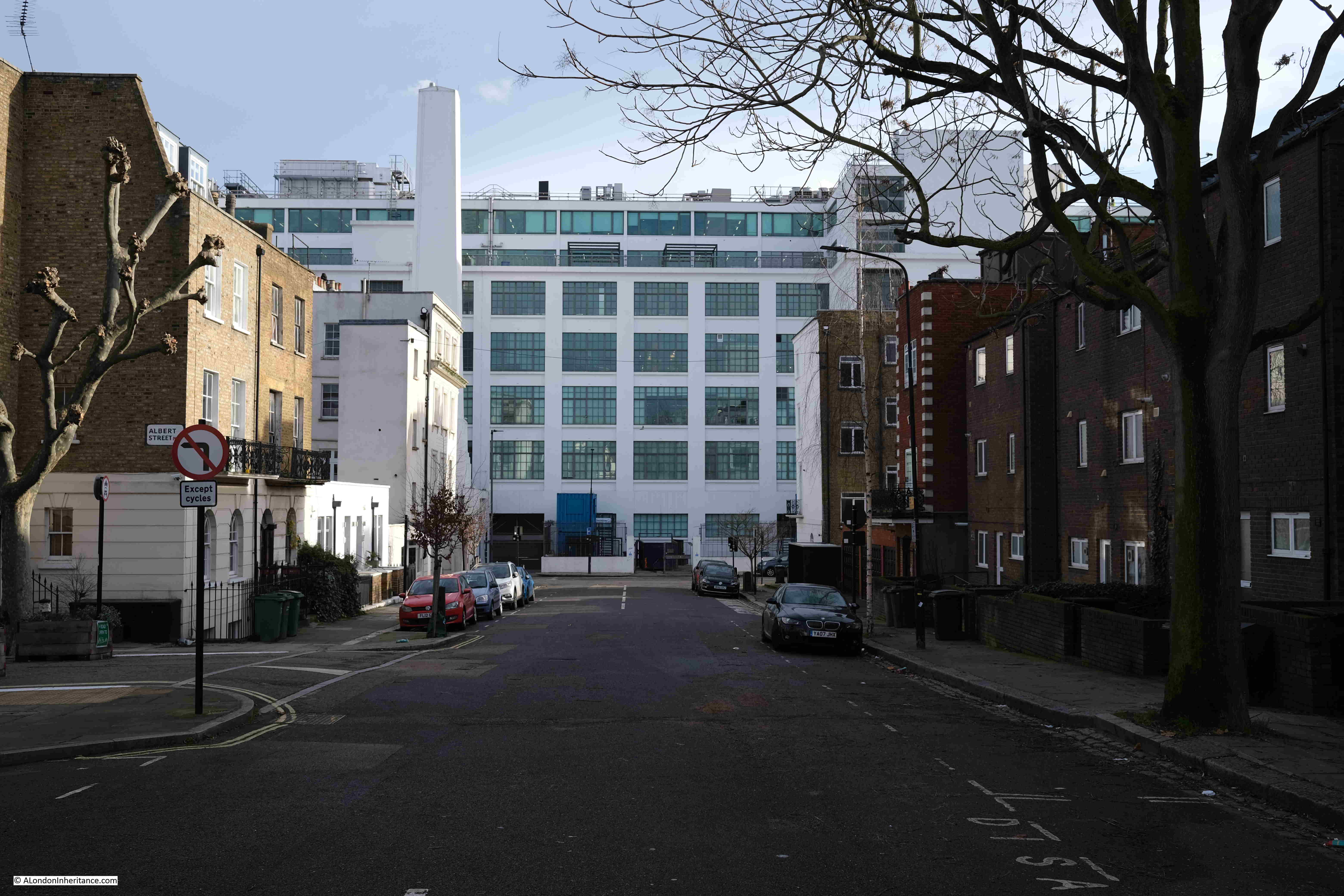
Albert Street is a turning off Mornington Place, a terrace of new buildings occupies a space which on the 1894 OS map appears to have been an open space with a larger building set back from the road.

Albert Street Camden

There is a smaller brick building between the modern terrace and the large brick terrace of houses. This is Tudor Lodge:

Tudor Lodge Camden

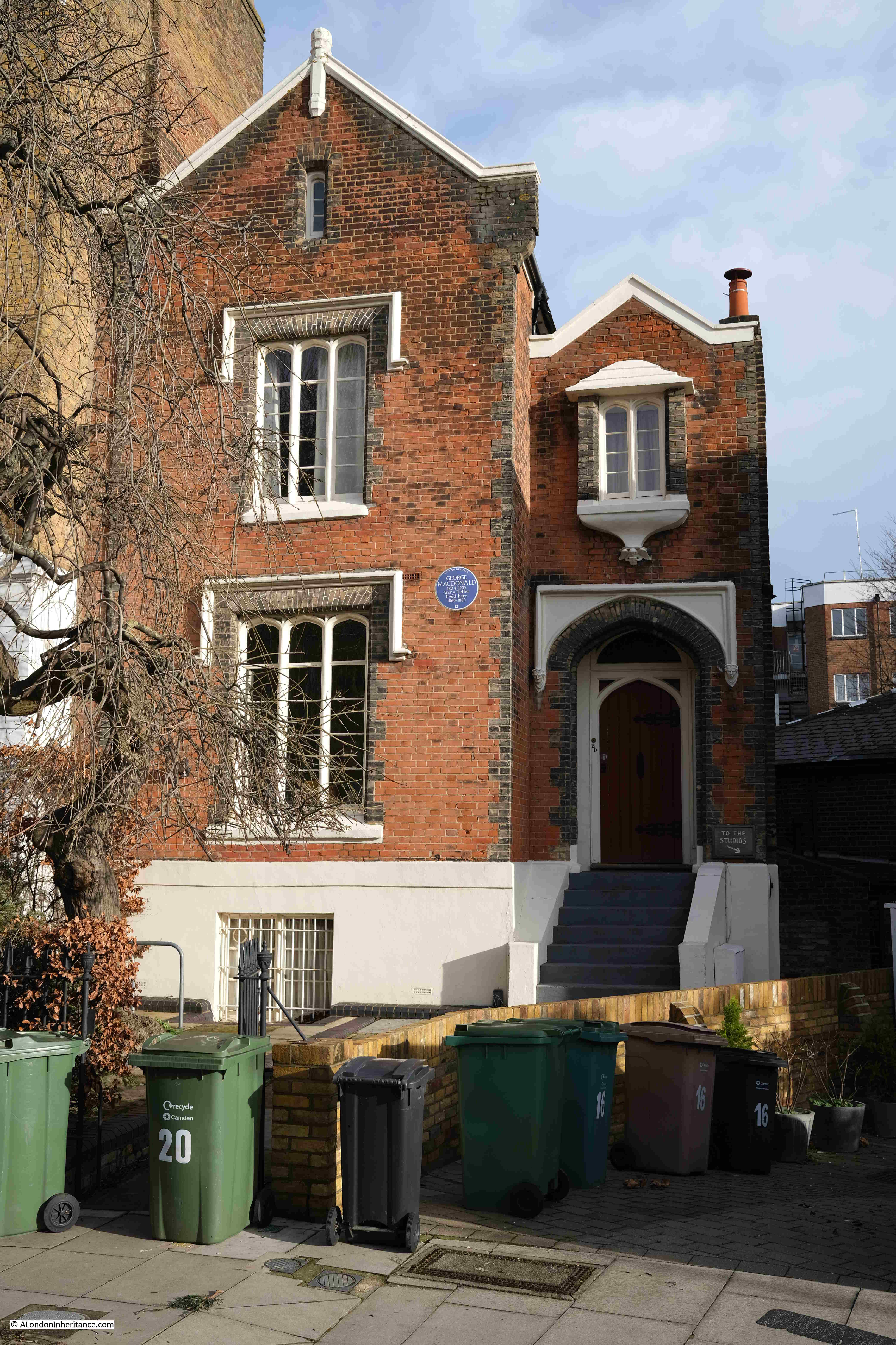
Tudor Lodge is Grade II listed. It was built between 1843 and 1844 for the painter Charles Lucy, and believed to be to his own design. The plaque on the building though is to George Macdonald, Story Teller, who lived in the building between 1860 and 1863. An interesting building in a street of mainly 19th century terrace houses.

Rather than walk along Albert Street, I returned to Mornington Crescent and the rear of the Carreras factory, where there is a chimney:

Carreras Cigarette Factory Camden

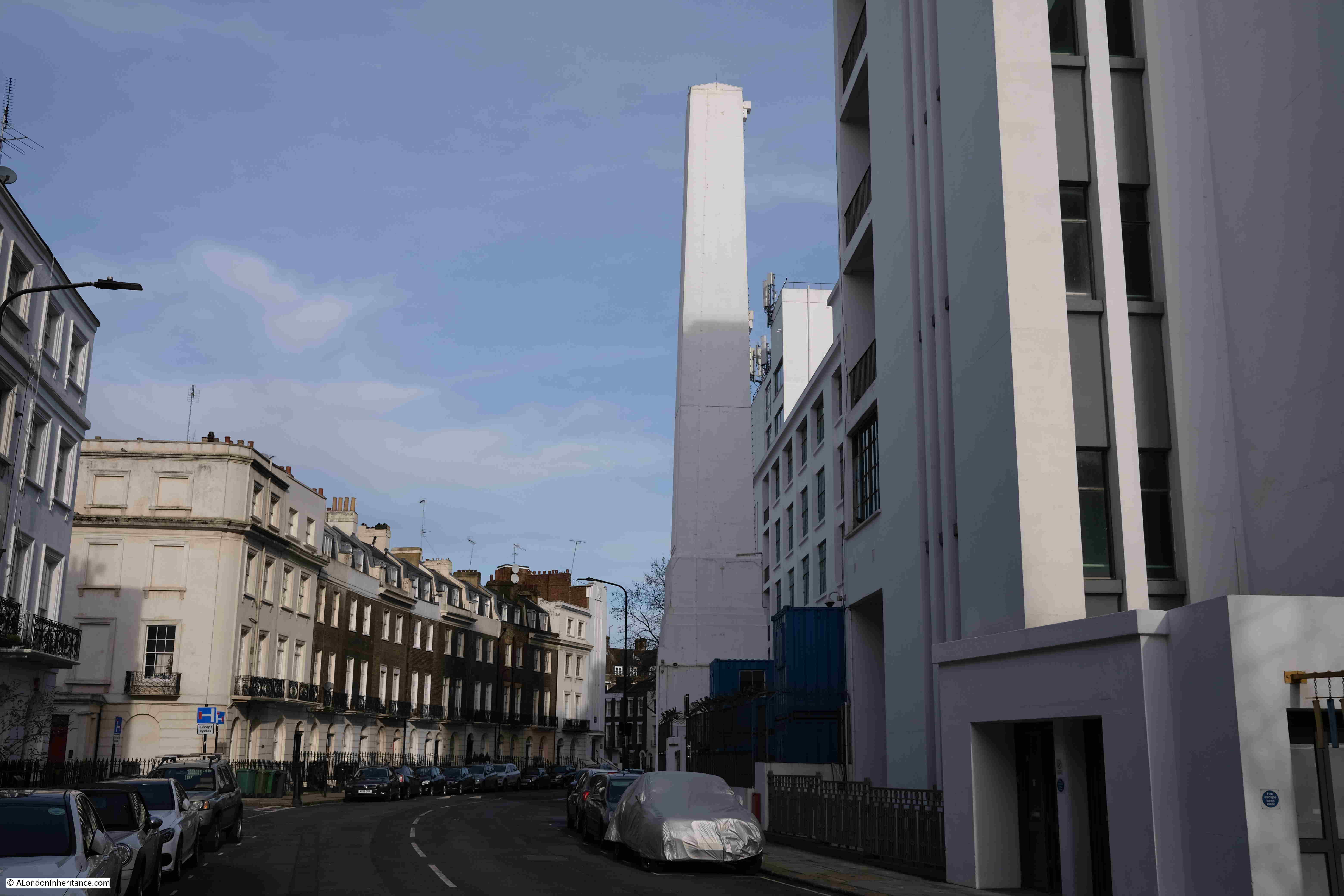
I have not been able to confirm whether or not the chimney is original, however rather than being the more common round chimney it seems to have the appearance of an obelisk, similar to Cleopatra’s Needle on the Embankment, so if original, the chimney continues the Egyptian design theme of the building.

Almost at the end of Mornington Crescent now, and the final row of terrace houses before reaching the Hampstead Road. The following photo gives an indication of the changes to the outlook of the houses when the Carreras factory was built. Rather than looking out on the gardens and across to Hampstead Road, they now had the view of the rear of the large factory.

Carreras Cigarette Factory Camden

By the time the factory was built, many of the houses were almost 100 years old, and their condition was not that good, many were subdivided into flats. Their condition would deteriorate further during the 20th century, there was some bomb damage along the terrace in the Second World War and it has only been in the last few decades that many of the houses have been restored.

In this final terrace of Mornington Crescent there is another blue plaque, to another artist, this to Walter Sickert, recorded as a painter and etcher:

Mornington Crescent

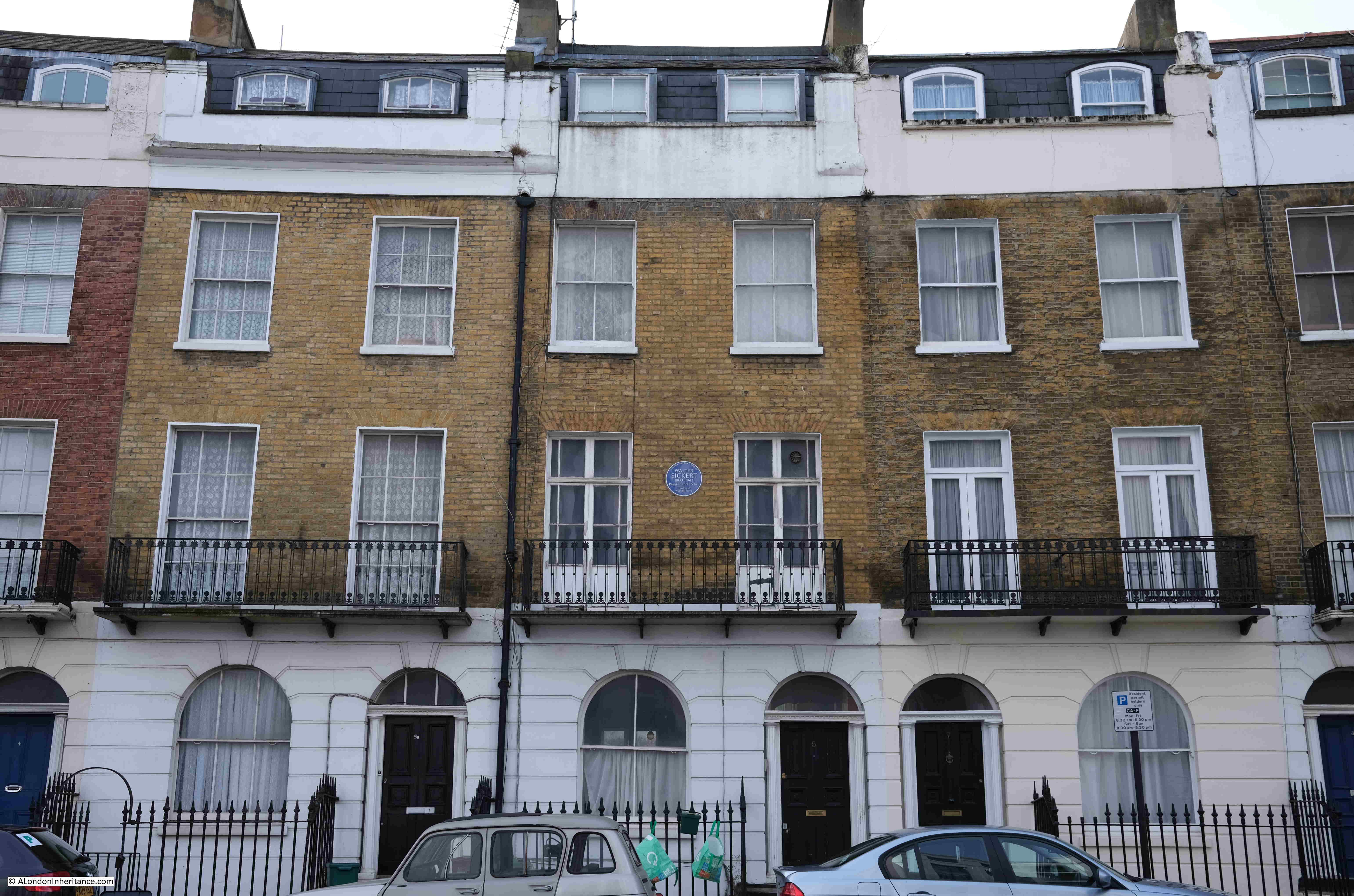
Sickert was at the core of the Camden Town Group of artists, a short lived group of artists who gathered mainly between 1911 and 1913.

The building at the southern end of Mornington Crescent, which has a Hampstead Road address is of a much more impressive design, presumably as it was at a more prominent position. Just seen on the wall behind the tree is another plaque:

Mornington Crescent

This plaque is to the artist George Cruikshank, who lived in the building from 1850 until his death in 1878.

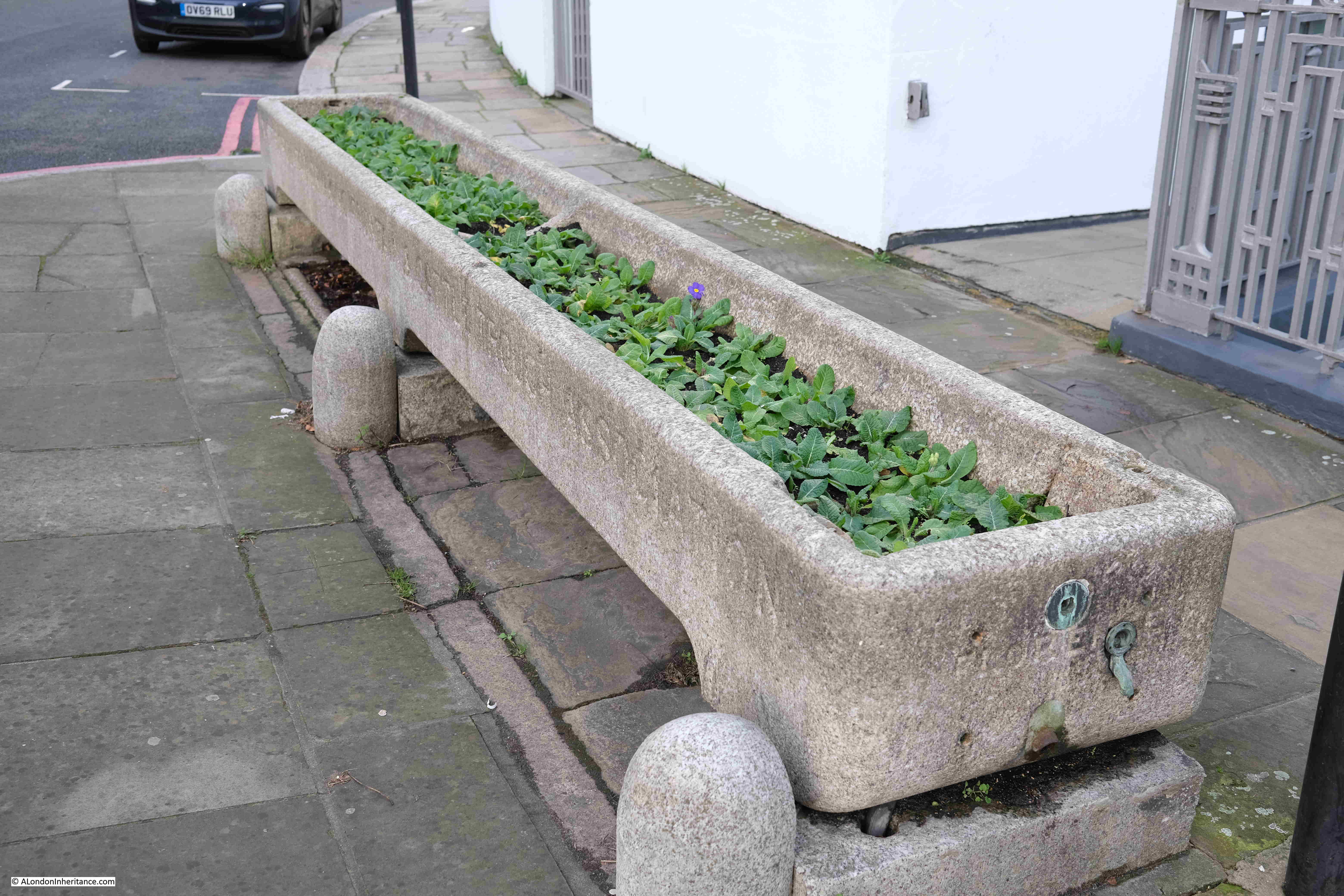
On the opposite side of the street to the house in the above photo is a water trough for horses. I took a photo, but was not intending to include the photo in today’s post:

Drinking Trough Mornington Crescent

Until i found the following photo in the Imperial War Museum collection showing a horse and cart of the London, Midland and Scottish Railway pausing to drink at the trough, with Mornington Crescent in the background of the photo:

Horse and cart at Mornington Crescent
VAN GIRL: HORSE AND CART DELIVERIES FOR THE LONDON, MIDLAND AND SCOTTISH RAILWAY, LONDON, ENGLAND, 1943 (D 16833) After collecting another load from the depot, Lilian Carpenter (left) and Vera Perkins pause in Mornington Crescent to allow Snowball the horse to drink from a trough. Copyright: © IWM. Original Source: http://www.iwm.org.uk/collections/item/object/205200501

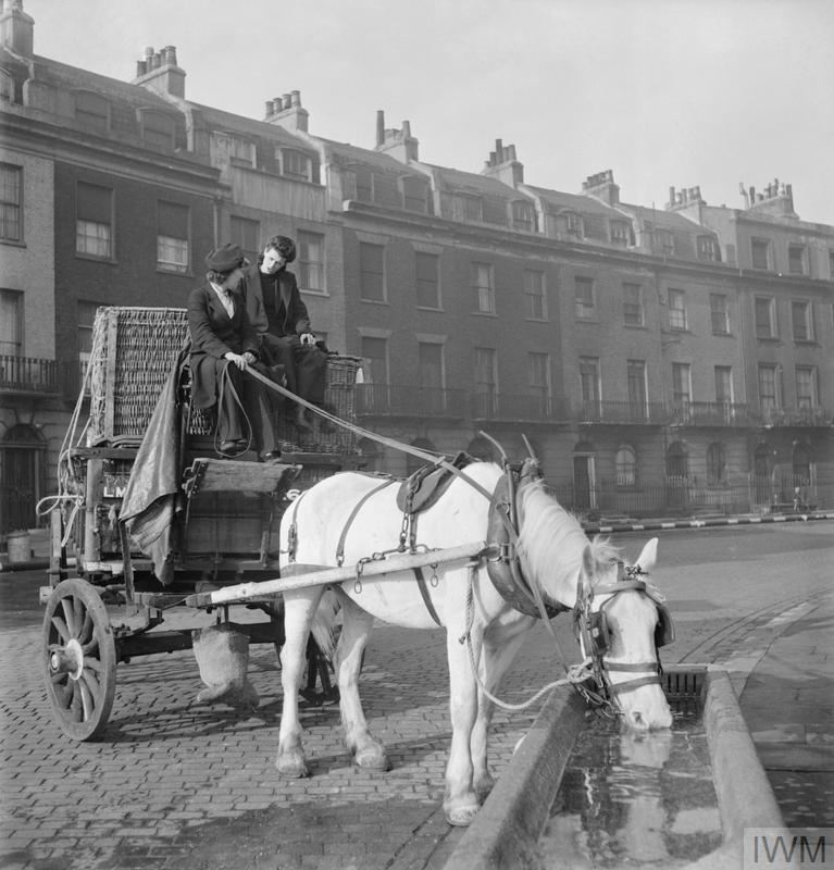
Pleased I found the photo, but rather frustrating as if I had found it before visiting I could have taken a similar view, however it does give a good impression of Mornington Crescent in 1943.

Returning to the space opposite the underground station, we can look south and get a view of the overall size of the Carreras factory, a building that occupied the site of the gardens between the crescent and Hampstead Road.

Carreras Cigarette Factory Camden

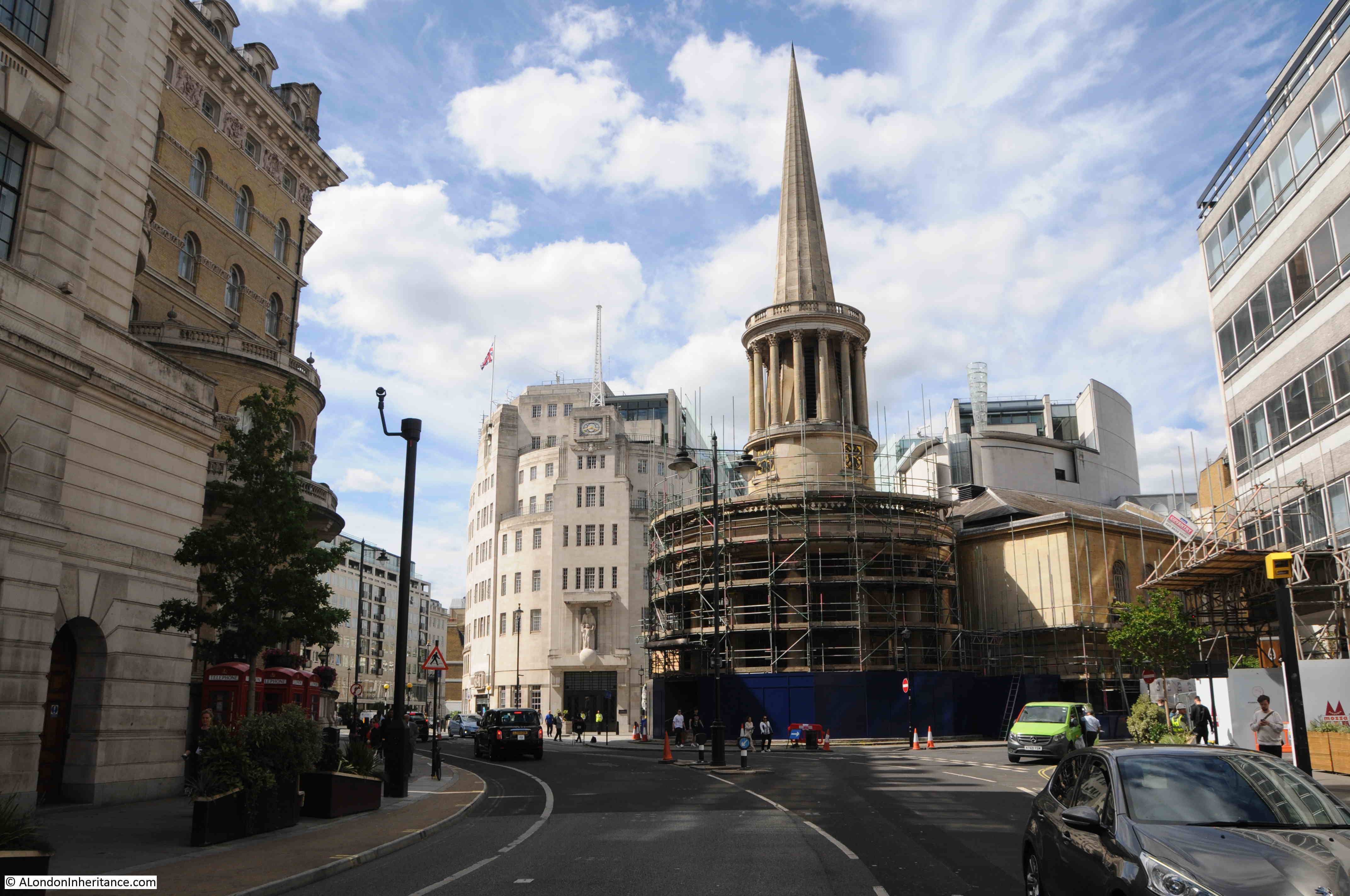
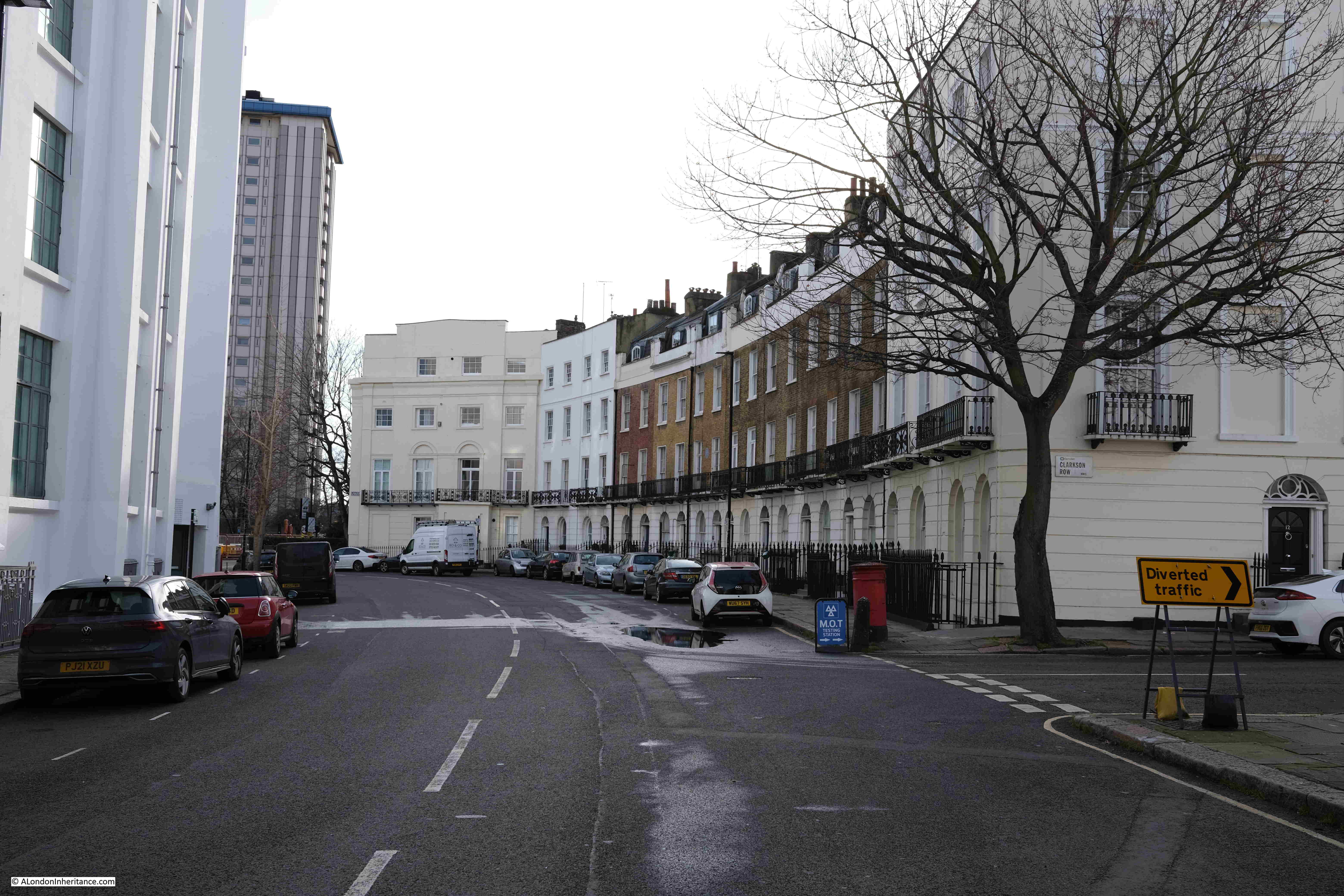
The space just to the north of Mornington Crescent underground station is the junction of Hampstead Road and Camden High Street, along with Crowndale Road and Eversholt Street.

To the east of the underground station at the road junction is the club / music venue Koko:

KoKo Camden

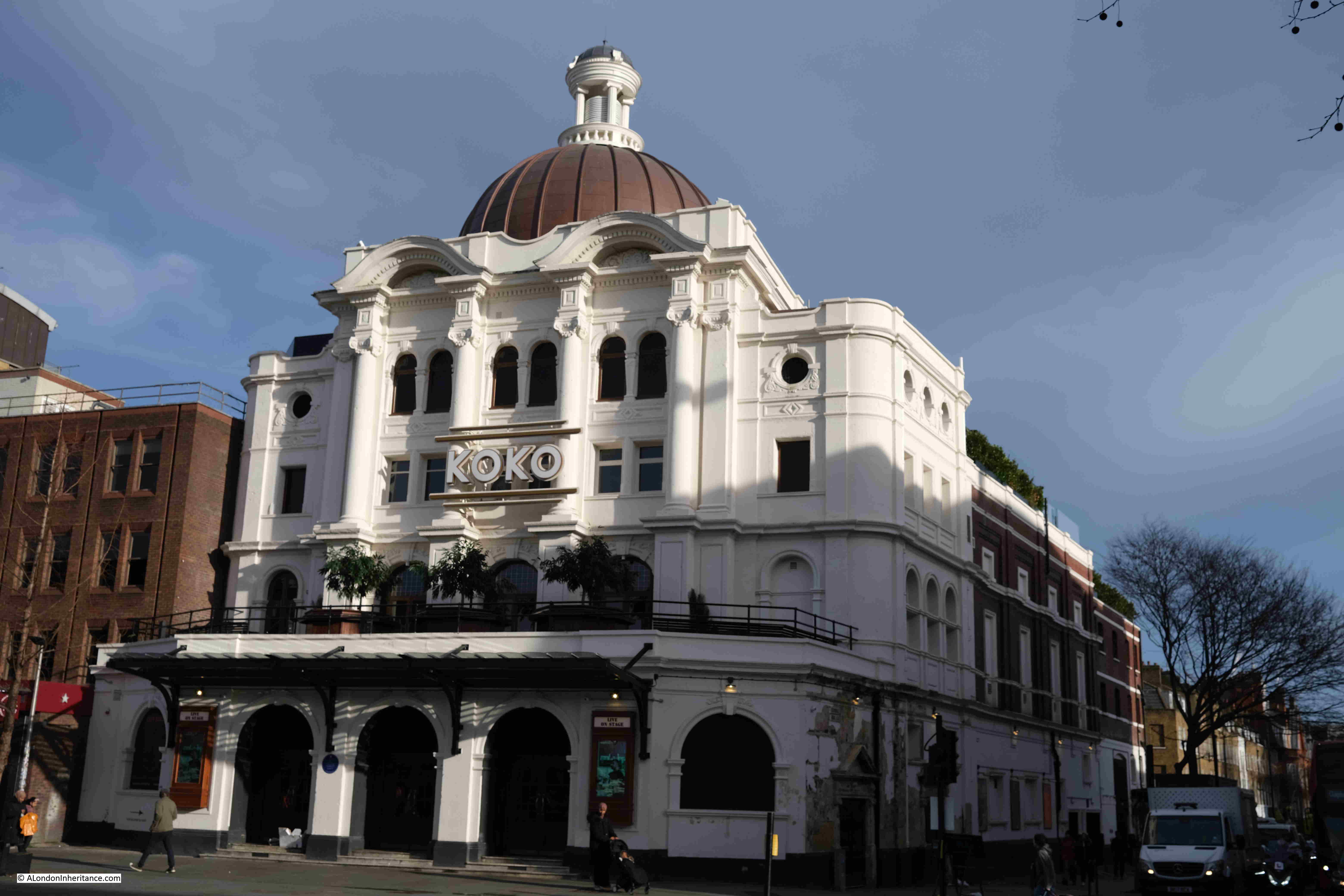
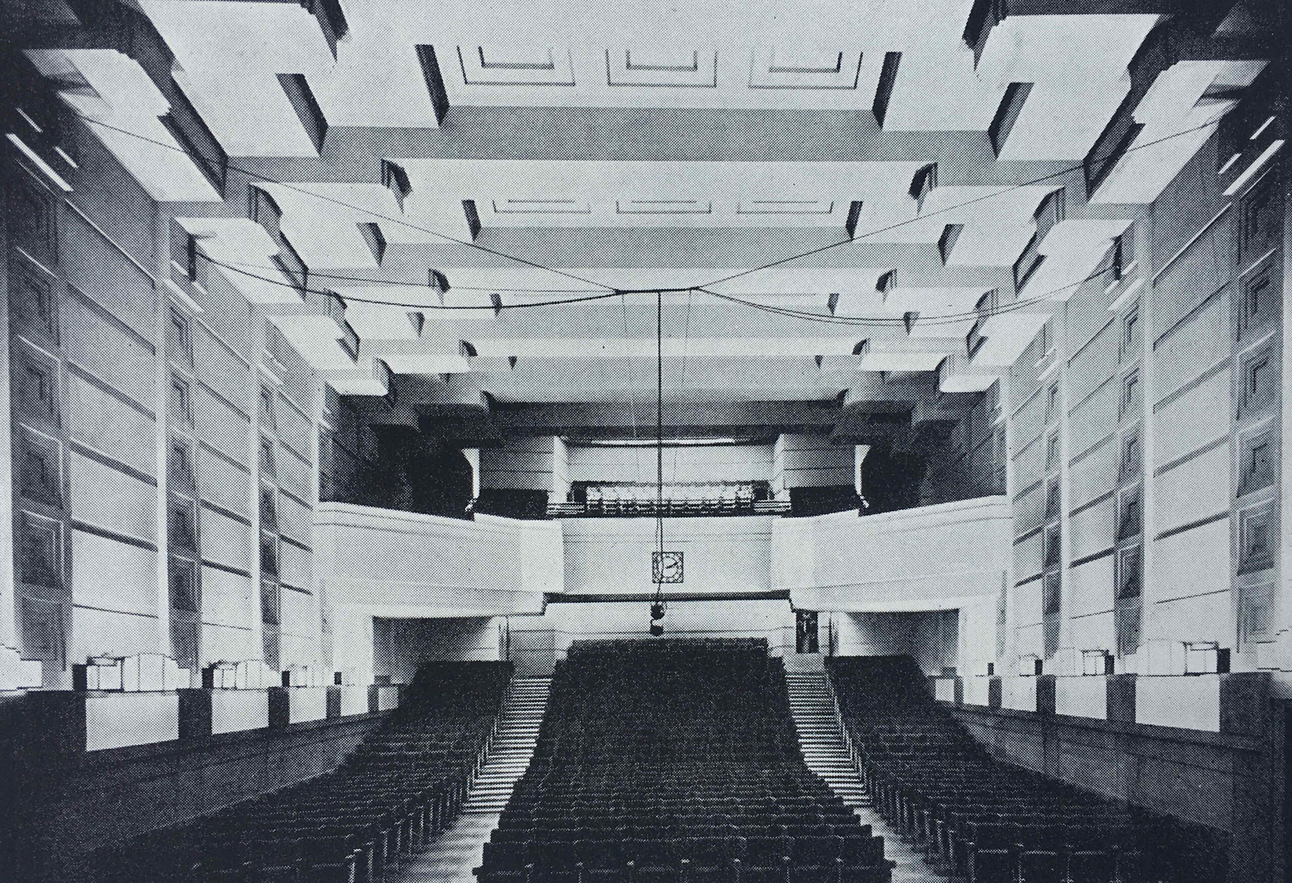
Originally the Camden Theatre when built in 1900, it then had a series of owners as both a theatre and a cinema, until 1945 when it was taken over by the BBC and used as a theatre to record radio programmes, including the Goon Show, with the very last Goon Show being recorded in the theatre on the 30th April 1972.

The BBC left in 1972, and from 1977 the building has been a live music venue, firstly as the Music Machine, then the Camden Palace and now Koko.

The building has hosted very many acts in its long history, including the Rolling Stones and the Faces, with my most recent visit to the Damned in February 2018 (and whilst researching the post I found a review of the Damned concert here).

The title of this post is Mornington Crescent and the Corn Laws, and it is only now that I can get to the final part of that title. In the open space opposite the underground station is a statue:

Richard Cobden statue

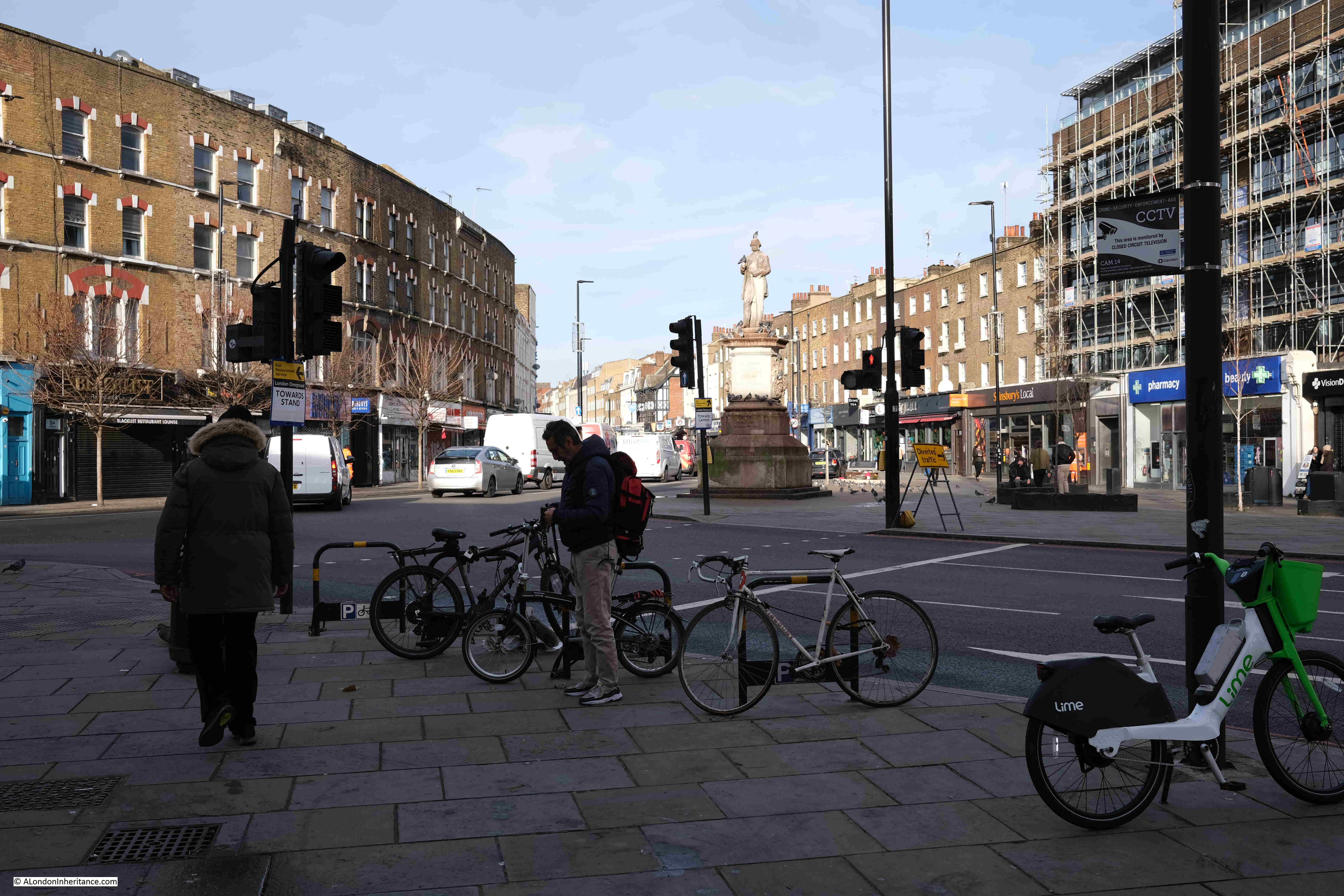
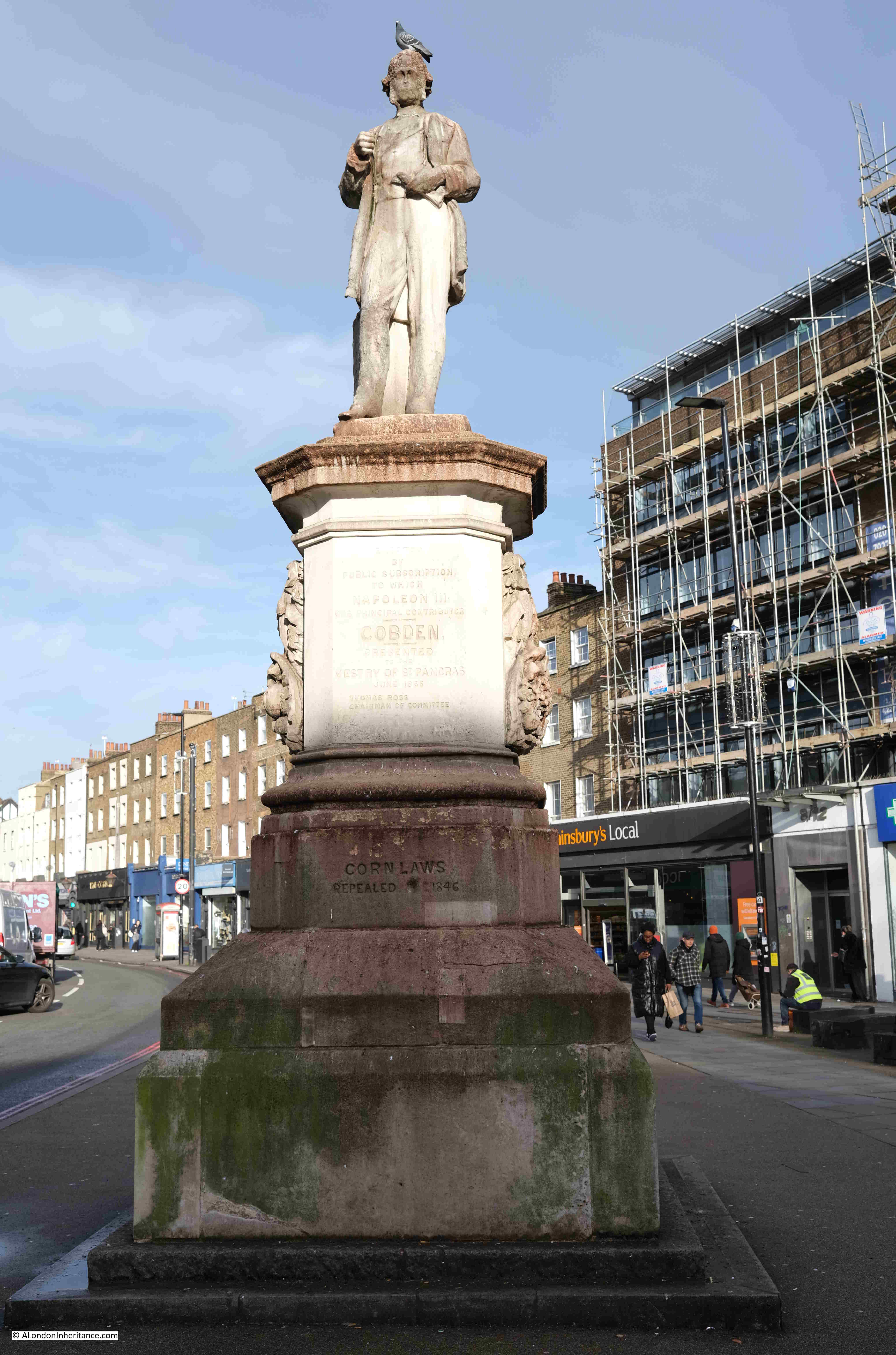
The statue is of Richard Cobden and was erected in 1868. Cobden did not have any direct relationship with Camden, however it was an impressive location for a statue, and it was put up due to the residents of Camden’s appreciation of Cobden’s work in the repeal of the Corn Laws.

Richard Cobden Statue

The Corn Laws were a set of laws implemented in 1815 by the Tory Prime Minister Lord Liverpool due to the difficult economic environment the country was in following the wars of the late 18th and early 19th century.

The Corn Laws imposed tariffs on imported grains and resulted in an increase in the price of grain, and products made using grain. These price increases made the Corn Laws very unpopular with the majority of the population, although large agricultural land owners were in favour as they made a higher profit from grain grown on their lands.

The Corn Laws were finally repealed by the  Conservative Prime Minister Robert Peel in 1846, and they reflect a tension between free trade and tariffs on imports that can still be seen in politics today.

Richard Cobden was born on the 3rd of June, 1804 in a farmhouse in Dinford, near Midhurst in Sussex. His only time in London appears to have been after his father died, when Cobden was still young, and his was taken under the guardianship of his uncle who was a warehouseman in London.

Not long after he became a Commercial Traveler, and then started his own business which was based in Manchester, which seems to have been his base for the rest of his commercial success.

During his time in Manchester Cobden was part of the Anti-Corn Law League and was known as one of the leagues most active promoters.

The Clerkenwell News and London Times on the 1st of July 1868 recorded the unveiling of the statue:

“The Cobden memorial statue which has just been erected at the entrance to Camden Town was inaugurated on Saturday. Although this recognition of the services of the great Free Trade leader may have been looked upon in some quarters as merely local, the gathering together of some eight to ten thousand people to do honour to his memory cannot be regarded in any other light than that of a national ovation.

The committee had arranged that the statue of the late Richard Cobden at the entrance to Camden Town – with the exception, perhaps, of Trafalgar Square, one of the finest sites in London – should be unveiled on Saturday, that day being understood to be the appropriate one of the anniversary of the repeal of the Corn Laws, and the event was so popular that the surrounding neighbourhood was gaily decorated with flags for the occasion. The windows and balconies of Millbrook House, the residence of Mr. Claremont, facing the statue, had been placed at the disposal of Mrs. Cobden and her friends, including her three daughters.

A special platform had been created in front of the pedestal, covered with crimson cloth, and in the enclosure in front the band of the North Middlesex Rifles were stationed, and performed whilst the company assembled.

The report then covers at some length, all the speeches made which told the story of Cobden’s life and his actions in the repeal of the Corn Laws. There were many thousands present to witness the event, and at the end; “after the vast assembly had dispersed Mrs. Cobden, accompanied by Mr. Claremont, the churchwardens, and other friends, walked round the statue and expressed her high gratification at the fidelity of the likeness.”

The statue was the work of the sculptors W. and T. Willis of Euston Road, and is now Grade II listed.

I suspect if you turn right out of the entrance to Mornington Crescent underground station, you will be surprised to know that the space in front of you was compared to Trafalgar Square as one of the finest sites in London.

It always fascinates me how much history there is at almost any place in London, and Mornington Crescent is no exception. Whether the arrival of the underground, the architecture of the Carreras factory, race course gangs at the pub, historic streets, entertainment venues and radio shows and the statue of a free trade advocate – all within a short walk of Mornington Crescent.

alondoninheritance.com

BBC Broadcasting House

This year, the BBC is celebrating 100 years of broadcasting, having started in 1922 with a limited programme of music, drama and talks. There is another BBC anniversary this year, as it is 90 years since Broadcasting House on Langham Street / Portland Place opened as the first building in the country, purpose built for the new medium of broadcasting.

I have a copy of the book the BBC published in 1932 to celebrate the opening of the new building, so I thought I would take a look at the building and some of the many photos from the original book, which show leading edge broadcasting design and technology from 1932.

Walk north along Regent Street from Oxford Circus, into Langham Place, and this is the first view of Broadcasting House, just behind the distinctive tower and spire of All Souls:

Broadcasting House

When the BBC first started broadcasting, the BBC’s premises were at Savoy Hill, however with the rapidly growing popularity of broadcasting along with equally fast technical development, it was soon clear that a new building was needed, ideally a building custom designed for broadcasting.

The site of Broadcasting House was initially to be developed as what were described as “high-class residential flats”, however the location was perfect for the BBC. It offered a central London location, close to multiple transport links, and with just enough space to construct a new building.

The owners of the site agreed to build the BBC’s new centre and offered a long lease, however the BBC purchased the site before the building opened.

The site was of some size, but was strangely shaped, with a long curved section along Portland Place. The building was limited in height as there were a couple of nearby buildings that had their right to light protected under the custom of “ancient lights”.

The architect of the building was Lieut-Col G. Val-Myer FRIBA, who was supported by the BBC’s Civil Engineer, M.T. Tutsbery.

Broadcasting and the functions of the BBC dictated some challenging requirements. Despite being called Broadcasting House, the building would house a considerable number of people working on the administrative functions of the BBC. These would all require naturally lit space.

A wide range of studios were also needed, of very different size and function, from small studios for one or two people, up to concert hall size. These studios needed to be sound proofed both from the noise of the street, and internally generated noise.

A creative design solution met these competing requirements. Broadcasting House was constructed as a building within a building. A central core was constructed of brick, avoiding as much as possible the use of steel girders and stanchions which would have transmitted sound. The studios were located within this central core, and they were separated where possible by quiet rooms such as the library.

The outer core of the building housed office space, so these rooms had natural light and acted as an additional level of sound proofing between street and studios, with the inner brick core providing internal sound proofing.

The external design of the building had some distinctive features. Looking above the main entrance, and one of the aerial masts stands above a clock:

Broadcasting House

The main entrance at bottom left:

Broadcasting House

Eric Gill was responsible for the sculpture decorating the building. The BBC requested that the works would feature Shakespeare’s Ariel as the BBC considered this would represent the “invisible spirit of the air, the personification of broadcasting”.

The sculpture above the entrance shows Prospero, Ariel’s master, sending him out into the world. Gill created the work in situ during the winter of 1931 / 1932. Before being uncovered and revealed to the public, the Governors of the BBC inspected the work and considered that, Ariel’s “appendage” was too large for public decency and a reduction of a couple of inches was made.

Eric Gill was also responsible for some of the sculpture on 55 Broadway – London Underground’s Head Office.

To the right of the above photo is the considerable extension that has been added to the original Broadcasting House.

Walking along Portland Place, and we see the curved façade of the buildings, with the rows of windows providing natural light to the offices behind:

Broadcasting House

To the lower right of the above photo is Eric Gill’s “Ariel hearing Celestial Music”:

Broadcasting House

Much of the building is faced with plain stone, with identical, regularly space windows, however there are some key features along the centre of the façade:

Broadcasting House

At the top are the Coat of Arms of the BBC. The circle in the centre represents the world, to show the breadth of the BBC’s coverage. Running along the bottom of the sculpture is the BBC’s motto “Nation shall speak peace unto nation”:

Broadcasting House

Below the arms is a long balcony decorated with birds of the air:

Broadcasting House

And below the balcony are “wave” symbols:

Broadcasting House

On the northern end of the façade is another work by Eric Gill, representing Ariel between Wisdom and Gaiety:

Broadcasting House

Looking back towards Langham Place with Broadcasting House on the left:

Broadcasting House

A large extension has been added to Broadcasting House. This was done to help consolidate many of the different BBC London activities into a single building, with the move of BBC World Service from Bush House into the new extension, along with many of the functions that were in Television Centre such as News, when the BBC left Television Centre.

Looking to the east of Broadcasting House, and we can see the original building to the left, with the new building to the right and at the far end:

Broadcasting House

The BBC’s 1932 book celebrating the opening of the building is full of photos of the new building, internally and externally, and shows what was considered leading edge design for the new medium of broadcasting in 1932.

At the start of the book is a map showing the location of Broadcasting House, with an emphasis on the closeness of the building to a range of travel options. This was important not just for those who worked full time in the building, but for the many people who would visit the building for a short time to participate in one of the many concerts, talks and plays that were broadcast.

Broadcasting House

An aerial photo shows Broadcasting House, just completed, and gleaming white among the surrounding dirty buildings of the city:

Broadcasting House

The book includes a rather unusual photo, looking north from the roof towards Hampstead. The photo was taken using an infra-red camera, which at the time improved the level of detail at a distance, and had the effect of showing green objects such as trees as dazzling-white:

Broadcasting House

The clock and mast which are still visible today. On the balcony, to the left of the clock is a loud speaker which was used to broadcast the sound of Big Ben, imitating the natural strength of the bell.

Broadcasting House

The following diagram shows the internal core of the building with the outer offices removed. The diagram shows how much had been crammed into the space available, as well as the positioning of quiet rooms between the studios:

Broadcasting House

The book covered all aspects of the new building, including the technical infrastructure that enabled broadcasting. The following photo is the Control Room and apparatus is described as being “battleship grey with stainless steel fittings”:

Broadcasting House

Two of the amplifier bays, one with a cover removed showing the valves that were critical to this type of equipment, long before transistors had been invented:

Broadcasting House

One of the issues with being in London was the polluted air with still plenty of smoke in the atmosphere. Broadcasting House featured state of the art air conditioning equipment, which included outside air being passed through a spray of water to remove particles in the air, as shown in the following photo:

Broadcasting House

The book also includes plans of each floor, the following plan of the seventh floor being an example, with the studios located in the central core:

Broadcasting House

The BBC provided tours for journalists in May 1932, and papers of the time were full of glowing articles about the new building. The following is from the London Correspondent of the Dundee Courier, who wrote an article titled “The Palace of Broadcast – A peep into new home of the BBC”:

“When the British Broadcasting Corporation decided to build themselves a new home they did the job thoroughly.

After a tour of Broadcasting House in Portland Place my mind was in a whirl of gigantic boilers, pictures of the most modern studios, miles of corridors, hundreds of lights, and a thousand and one other things.

The tour reflected the BBC’s thoroughness and started in the basement, which is three floors below street level, and finished eight floors above.

The people who matter in broadcasting said ‘we must have no noise from the outside in our studios’ therefore, each studio, which has no communication with the outside world apart from the door, has its own exclusive current of air for ventilation and heat so that no sound is carried through from one room to another.

The experts have taken sound well in hand, and controlled its unruly antics. The studio for ‘talks’ has been made so dead that there are no reverberations at all. If you speak in the studio your voice sounds like a voice heard in a dream. It is most eerie.

The furnishing is definitely 1932, and about this studio for discussions there is a make-yourself-at-home atmosphere.

Soft beige carpets cover the floors. The walls and the ceilings are delicate shades of beige, with a touch of orange and cream stripes around the walls. Below a mirror which stretches across one side of the room there is a jade green vase containing huge flowers.

The chapel studio is of great beauty. The cream walls are lit by pillars of light. Two tall columns painted green reach the ceiling, which is of blue with silver stars and signs of the Zodiac.

Next to each studio, of which there are 22, there is a little listening room. There is a window through which the performers can be seen. Here an announcer can make announcements without the artists being able to hear him, and he can check the quality of the transmissions.

The ‘effects’ room is above. here it is all very scientific. In the centre is a large table that swivels round. It is divided into sections, each of which is covered in a different substance to give different sounds when it is rapped or hard objects dropped upon it.

The equipment of this room also includes a pall full of lumps of bricks and a tank of water, and to mention a humble sheet of iron for thunder.

Then there are a series of records for crowd noises, angry, and jolly, English or foreign. Others give cries of babies and every form of animal.

All those cheery messages about depressions of Iceland and anticyclones together with news, emanate from a very chic little studio of which the walls are matted silver. Light is thrown upon the subject from a large globe at the end of a long telescope-like stand.

Such is the ‘Radio Village’. There are dressing rooms, waiting rooms, artists’ foyers, refreshment lounge, libraries and, to complete it all, a small black cat who wanders about at will, and not at all impressed with the dignity of the surroundings.”

Photos from the book show the “make-yourself-at-home atmosphere” described in the article, for example Studio 8B used for Debates and Discussions:

Broadcasting House

Studio 6E – Gramophone Effects, with plenty of turn-tables to play records of effects:

Broadcasting House

The Music Library, which the book claimed to be the largest in the world, with every kind of music from manuscript parts of Bach cantatas to the latest comic songs:

Broadcasting House

The Office of the Director of Programmes:

Broadcasting House

One of the interesting aspects of studio design in the early 1930s is that the studios were made to replicate the place where the production would take place. Studio 3E for Religious Services had the appearance of a religious building, however this could be changed for secular broadcasts when the vase of flowers (as shown in the photo) were used to replace the cross used for religious broadcasts:

Broadcasting House

Studio 3B for Talks looks like a domestic setting. There were no windows behind those curtains.

Broadcasting House

The interior design of Broadcasting House was led by Raymond McGrath, an Australian born architect who led a team of young designers. They were given a degree of freedom with their designs, which resulted in a curious mix of homely and modernist features.

The studios are very different today, and in the past 90 years the function of broadcasting has taken over from the designs of 1932.

The Chairman’s Office:

Broadcasting House

Broadcasting House opened when the autocratic Sir John Reith was Director General. It was Reith who defined the BBC’s purpose as being to “inform, educate, entertain”. It was probably with some fear that employees would be summoned to the Director-General’s Office:

Broadcasting House

The majority of the photos in the book show empty studios and equipment rooms. Very new, and no people to be seen. The only photos with people are of some of the offices of Broadcasting House, such as the following photo of the Accounts Office.

Broadcasting House

Note in the photo the windows facing out. To the left would have been a corridor, then the brick wall of the inner core with the studios to avoid sound transmission from outside or from the internal offices.

The entrance hall from Portland Place, with staff lifts to the right and the Artists’ Foyer behind the pillar at the far end:

Broadcasting House

The Latin inscription on the right reads “This Temple of Arts and Muses is dedicated to Almighty God by the first Governors of Broadcasting in the year 1931, Sir John Reith being Director General. It is their prayer that good seed sown may bring forth a good harvest, that all things hostile to peace or purity may be banished from this house, and that the people, inclining their ear to whatsoever things are beautiful and honest and of good report, may tread the path of wisdom and uprightness.”

The Council Chamber:

Broadcasting House

The Lower Ground floor provided access to the concert hall, from where concerts with a live audience would be broadcast. View towards the platform:

Broadcasting House

View towards the rear of the Concert Hall:

Broadcasting House

The Concert Hall is now known as the BBC Radio Theatre.

All the studios, along with other rooms involved with the broadcast process, were in the central core of the building, so they did not have windows and there was no natural light. The designs for these rooms attempted to address this with decoration, and in the following photo is Listening Hall 1, where a seascape had been added on the wall at which those listening would have been facing:

Broadcasting House

And in Listening Hall 2, gold and silver foil had been put on the walls to simulate the effect of sunlight:

Broadcasting House

Broadcasting House was built long before the days of electronically created sound effects. These were usually prerecorded on records as seen in one of the earlier photos, or involved making noises with physical objects.

Some sound effects needed a different approach such as the creation of an echo, or the impression that the sound was created in a large space rather than a small, sound proofed studion.

To provide echo effects, Broadcasting House had the Echo Room, where sound from a studio were played in the room which had reflective, resonant walls to bounce the sound, which was picked up by a microphone at the end of the room:

Broadcasting House

Broadcasting House was a leading edge facility at the time of construction for the new medium of broadcasting. It was however designed to meet John Reith’s view of the BBC, and the studios were designed for talks and discussions (nearly always by men), and for broadcasts of plays and concerts.

In the previous building at Savoy Hill it was common for those arriving to give a broadcast talk to be offered cigars, brandy and whisky before broadcasting – operating almost like a Gentleman’s Club.

News would become an increasing feature of the BBC, with the use of external agencies to provide news before the BBC developed their own internal news gathering capability.

As well as broadcasting to the country, broadcasting to the world would become an integral part of the BBC’s mandate, beginning with what was called the Empire Service, then the World Service.

The first broadcast specifically to the “Empire” was made from Broadcasting House on the 19th of December 1932, with John Reith speaking an introduction to the broadcast.

The BBC’s Centenary celebrations seem to have a different focus to 1972 when they celebrated 50 years.

In 2022 the focus seems to be more of the present day relevance of the BBC, with the breadth and depth of services provided. I suspect this is down to perceived threats to the BBC’s charter and the licence fee.

In 1972, the focus was more on the historical, showing the BBC almost as the official recorder of the great events of the previous 50 years.

The BBC produced a double album in 1972 containing excerpts from key broadcasts of the Corporation’s first 50 years. I was given a copy at the time, a strange present given the age I was in 1972, but one I appreciate now for the historical context.

Broadcasting House

The double album opened up and inside there is a listing of all the broadcasts on the records.

Side 1 covers from 1922 to 1932, so pre Broadcasting House. Included are music from the Savoy Orpheans and the Savoy Havana Band, a recording of the opening of Tutankhamun’s tomb, a news item from the 1926 General Strike, and the first Royal Christmas Message broadcast on Christmas Day in 1932.

Side 2 covers the six years from 1933 to 1939, when many of the recordings would have come from Broadcasting House. Along with recordings of musical items, the slow build up to war can be seen, from a 1934 speech by the Nazi Joseph Goebbels to Prime Minister Chamberlain’s announcement of the outbreak of war on the 3rd of September 1939.

Broadcasting House

Side 3 covers the Second World War, from the fall of France in 1940 to the final surrender of Japan in 1945.

Side 4 covers the period from 1946 to 1972 and includes an FA Cup Final, Oxford – Cambridge Boat Race, a Royal Wedding, Coronation and Funeral, shows such as the Archers, Goons and Twenty Questions. The First Man in Space, assasination of President Kennedy and England’s 1966 World Cup victory.

The final track on side 4 is appropriately the funeral of Lord Reith in 1971, who was instrumental in building up the BBC and was Director-General when Broadcasting House was planned and built.

Broadcasting House

The BBC does have some pages on their website on the 100 years, which can be found here.

Broadcasting House comes from a simpler time, when the BBC was virtually the only form of mass electronic media, with only newspapers for competition.

Today, the broadcaster has no end of competition, from multiple broadcasters, online services and streaming providers. Shifts from linear broadcasting to time shifting and on demand programming.

The BBC suffers accusations of bias from almost every part of the political spectrum. It seems to tie itself in knots in trying to tread carefully and appear impartial around contentious subjects.

The licence fee is indeed an anachronistic way to fund the organisation, but a fair alternative that provides sufficient funding for the organisation has yet to be proposed.

The BBC has made some huge mistakes over the years, but still has a global reputation for independence, and is a prime example of the country’s soft power.

After 90 years, it is brilliant that Broadcasting House is still part of the country’s broadcasting fabric, and with the BBC it must be an example of where the phrase “you never know what you’ve got, till its gone” strongly applies.

alondoninheritance.com

Cripplegate Ward: Lady Eleanor Holles School and Cripplegate

I am fascinated by the journey that books take over the years. I have a copy of a book titled “Cripplegate Ward” by Sir John James Baddeley, published in 1921.

Baddeley was the Lord Mayor of London between 1921 and 1922, and on the inside cover of the book is pasted a square of paper detailing Baddeley’s presentation of this copy of the book to his sister Emma Louisa Baddeley:

Cripplegate Ward

As it is roughly 100 years since Baddeley gave the book to his sister, I thought it would be a good time to revisit Cripplegate Ward, using the book as a guide.

Baddeley describes Cripplegate as the second largest ward in the City (Farringdon Without being the larger), covering an area of 63 acres, nearly a tenth of the whole City. In the last census (1911) before Badderley’s book was printed, the ward had a population of 36,793, the majority of whom were employed in the various warehouses and factories that could be found across the ward.

Cripplegate was / is divided into Cripplegate Within and Without to describe those parts of the ward that were in the City side of the old Roman wall, and the area on the outside of the wall. That demarcation makes very little difference today, but would have been important when the wall was still a feature of the landscape.

Whilst I have written about Cripplegate in a number of previous posts, what I also find fascinating is gradually peeling back the layers of the history of a place, and finding more detail than I have already covered, so for today’s post I want to explore two places within Cripplegate ward that I have not written about before. The first is:

Lady Eleanor Holles School

There is an elevated walkway underneath Gilbert House within the Barbican estate. The walkway is lined by a number of round, concrete pillars that support the building above, and on one of these pillars is the following plaque:

Lady Eleanor Holles' School

The plaque records the foundation in 1711 of the Lady Eleanor Holles School near the site of the plaque. The plaque is on the pillar arrowed in the following photo, which shows the location and view out to the central area of water in the Barbican:

Lady Eleanor Holles' School

Cripplegate Ward by Baddeley, along with an article on the history of the school in the City Press on the 24th of July 1869 both provide some background into the Lady Eleanor Holles School.

Lady Eleanor Holles died in 1708, and in her will asked that her executor, a Mrs Anne Watson, dispose of her estate “to such pious purposes as her executor might think best”. Her estate consisted of land and a number of properties which produced an income of £62 and 3 shillings a year.

There was already a boys school in Redcross Street, Cripplegate, and Mrs Anne Watson arranged that the properties from Eleanor Holles will were committed to a body of trustees, and the funds used for the creation of a girls school, consisting of “a schoolmistress and the education of fifty poor girls”, and to be known as “the Lady Holles’ Charity School”.

There is no record as to why Anne Watson chose the poor of Cripplegate to be the beneficiary of the Eleanor Hollis will, however Anne Watson appears to have been deeply interested in promoting education for the poor as in her own will she left £500 for a charity school.

Around the start of the 18th century, there were concerns regarding the lack of education for children of the poor, and what this meant for the promotion of “Christian principles”.

According to the City Press, the school “undoubtedly owes its origin to that general movement in favour of the religious education of the poor in the principles of Protestantism which took place in the latter stages of the seventeenth century”. Baddeley also adds that a document in possession of the treasurer of the school and written in 1709 states that “It is evident to common observation that the growth of vice and debauchery is greatly owing to the gross ignorance of the principles of the Christian religion, and Christian virtues can grow from no other root than Christian principles”.

The original school used rooms leased from the boys school, which was located towards the northern end of Redcross Street. In 1831 the enlargement of the school was proposed, and a new school for the girls was built at the southern end of Redcross Street.

I have circled the location of this school (marked as School Girls) on the 1894 Ordnance Survey map below (‘Reproduced with the permission of the National Library of Scotland“):

Lady Eleanor Holles' School

The school was located where Fore Street turned into Redcross Street. I have marked the location on a map of the area today (© OpenStreetMap contributors):

Lady Eleanor Holles' School

The plaque photographed earlier in the post is on the walkway under Gilbert House (arrowed in the map above), and the red rectangle shows the location of the school which would have been facing onto Redcross Street, which ran from just above the left of the church, past the school and into what are now the buildings of the Barbican.

The school went through a number of enlargements during the 19th century, and the final build of the early 1860s created a school with a capacity for 300 girls and 100 infants, residence for the school mistresses and a board room for the governors.

In the mid 19th century, the school seems to have been doing financially rather well, as in an 1868 survey of the “Thirty Three City of London Endowed Schools for Primary Instruction for Boys and Girls”, Lady Eleanor Holles school was identified as having the largest endowment, with an annual income of £1,377.

As with many charity schools throughout London, the Lady Eleanor Holles School had the sculptured figure of one of the scholars mounted on the front of the building. The following image of the figure, showing the collar, cap and clothes that would have been worn by the girls comes from Baddeley’s book on Cripplegate Ward:

Lady Eleanor Holles' School

The girls were instructed in the practice of the Christian religion. They were taught to spell, read and sew.

Although the school could support a large number of girls and infants, towards the end of the 19th century the majority of pupils were coming from outside the parish of St Giles, Cripplegate. This was down to the reduction in the number of dwelling houses in the area as more factories and warehouses were constructed.

The school was also in competition with the new schools created by the London Schools Board, which were being funded through the rates and parliamentary grants, rather than through charity donations and fees.

The future of the school was decided by the London County County who were looking for a site to construct a large, new fire station.

The LCC offered the trustees of the Lady Eleanor Holles School a sum of £30,000 for the land and buildings. The school trustees accepted, and moved to a new location in Mare Street, Hackney.

The reason for a new fire station in Redcross Street can be seen in this article from Lloyds Weekly Newspaper on the 4th of December 1898:

“Hitherto Watling-street has been the chief City fire station, and the proposed change would be of great advantage, as the warehouses in the vicinity of Wood-street are filled, as a rule, with the most combustible materials. On the northern side the station would be of very great utility to the over-crowded districts of St. Luke’s and Shoreditch, where most houses are old and the danger of fire considerable.”

I have written about the Redcross Street fire station in a previous post, as it was a central feature in one of my father’s post war photos of the area now occupied by the Barbican and Golden Lane estates. The post can be found here, and covers the story of the fire station during the blitz, Redcross Street, and the surrounding area.

What I did not have time to cover in the earlier post was the history of the school, so in the following photo, St Giles is the church which is still a central feature in the Barbican. Redcross Street fire station is the large building on the left, and the rest of the area shows the devastation of bombing, mainly on the night of the 29th December, 1940.

Lady Eleanor Holles' School

So, part of the area now occupied by the central water feature in the Barbican was once the site of the Redcross Street fire station, and before that, was the site of the Lady Eleanor Holles School for Girls.

The school, and fire station were once located in the centre of the lake in the following photo, just behind the tall grasses on the left. The walkway with the pillar and the plaque is in the background, underneath Gilbert House:

Lady Eleanor Holles' School

The above photo also shows how Gilbert House is supported by a relatively few number of slender pillars.

The Lady Eleanor Holles school remained at Mare Street, Hackney until the mid 1930s, when for similar reasons to the challenges of the late 19th century (industrialisation of the area, competition with many other local schools), the school decided to relocate out of central London and moved to a temporary location in Teddington, whilst a new school building was constructed at Hanworth Road, Hampton.

The Lady Eleanor Holles school continues to be based in Hampton and is rated as one of the leading independent girls schools in the country.

A very different location, but maintains the name of Lady Eleanor Holles, who left sufficient money through her property, to establish the original girls school in Redcross Street in 1711.

My second location for this week’s post on Cripplegate Ward is the feature that would give the ward its name:

Cripplegate

Wood Street runs from Gresham Street, across London Wall, finishing with a short stretch where it turns into Fore Street. Just before the junction with Fore Street, Roman House can be found on the right, and on the side of this building is the following plaque:

Cripplegate Ward

Cripplegate was the original northern gate to the Roman fort which occupied the north west corner of the old Roman City. The fort was discovered during post war excavations by Professor W.F. Grimes, and the location and size of the fort is shown by the blue rectangle in the following map of the wall from one of the plaques showing the route of the wall. The location of the gate is shown by the red arrow.

Cripplegate Ward

The plaque is on the right of the following photo of the northern section of Wood Street, the gate would have been across the street, to the left of the plaque.

Cripplegate Ward

The gate is shown in the modified 1633 version of the early Agas map of London, the red circle in the following map surrounds the gate. The orange circle surrounds St Giles, Cripplegate, and Redcross Street, the site of the school and fire station is on the left and Whitecross Street on the right:

Cripplegate Ward

The name of the gate has long been the subject of speculation. A news article from 1904 reads:

“The origin of the name of Cripplegate, in which stands the church of St Giles, has long puzzled the minds of antiquaries. Ben Johnson averred that the street took its name from a crippled philanthropist, but Stow says the name was derived from the thronging of cripples which frequented it for begging purposes. It seems however, now to be decided that the name comes from ‘Crepel-gate’ a covered way in the fortifications. There is still a strong belief prevailing, however, that when the body of St. Edmund was brought from Bury to save it from the Danes, crippled persons by the wayside were cured of their afflictions as the body passed, and that the church of St Giles, the patron saint of cripples, was erected in commemoration of the miracle.”

Baddeley, in his book on Cripplegate Ward provides more:

“The etymology must be sought elsewhere. Cripple-gate was a postern gate leading to the Barbican, while this watch-tower in advance of the City walls was fortified. The road between the postern and the burghkenning (Barbican) ran necessarily between two low walls – most likely of earth – which formed what in fortification would be described as a covered way. The name in Anglo-Saxon would be ‘Crepel’, ‘Cryfele’ or ‘Crypele’, a den or passage under ground, a barrow, and geat, a gate, street or way.”

The book “The Ward of Cripplegate in the City of London”, (1985) by Caroline Gordon and Wilfred Dewhirst also refers to the Anglo-Saxon Crepel, or covered way as the source of the name taken on by the gate, and that Crepel was still used in written references to the gate in the late 20th century. The authors do though dismiss the story of St Edmund as a story that can “hardly be taken seriously”.

Baddeley provides some excerpts from City records to illustrate the history of the gate. In 1297 is was ordered that “Crepelgate should be kept by the Wards of Crepelgate, Chepe and Bassieshawe”, and “At the Gate of Crepelgate, there were to be found at night, from the same Ward Within eight men, well armed; and from the Ward of Bassieshaw six men, well armed; and from the Ward of Colmannestrete, six men, well armed and Robert Cook and John le Little were chosen to keep the keys of the gate aforesaid.”

The gate required regular repair, and in “1490, Sir Edward Shaa, who had been Alderman of the Ward from 1473 to 1485 bequeathed five hundred marks for the purpose of repairing the Gate”.

The gate was well kept and guarded during the Wars of the Roses during the second half of the 15th century. This was the last time that the City wall was strengthened, and the brick work that was added to the City Wall can be still be seen in the stretch of wall by St Alphage, a very short distance to the east of the old location of the Cripplegate.

As with other City gates, it was used as a processional route, with Elizabeth I apparently using the gate as her access to the City on her journey from Hatfield to London after the death of her sister, Mary I on the 17th November 1558.

The gate was also used to display the bodies of those who had been executed as a warning to those passing through the gate.

Cripplegate as it appeared in 1760 looking north from the City side of the gate, within Wood Street:

Cripplegate Ward

The above print from Baddeley’s book is dated 1760, although it may have been a view of the gate some years earlier, as by 1760 the gate was being described as in a poor condition. The carriageway through the gate was relatively narrow, and London had been expanding considerably to the north of the old gates and Roman wall which by the mid 18th century were no longer effective or needed as a defensive structure to protect the City of London.

Tolls were taken at the gate, but these were insufficient to keep up with the costs of repair, so in early 1760, the decision was taken to demolish the gate.

The City Lands Committee advertised for tenders to demolish and remove a number of the old gates, including Cripplegate, Aldersgate and Moorgate.

A Mr. Benjamin Blackden bought Cripplegate for £91 – buying the gate ensured demolition, and allowed the person buying the gate to keep a considerable quantity of building material.

The same Benjamin Blackden also paid £91 for Aldersgate and £166 for Moorgate.

On the 2nd of September 1760 newspapers were reporting that “Tuesday, the workmen began to erect scaffold at Cripplegate for pulling down that Gate.”

By the 31st of December, 1760, the Kentish Weekly Post was reporting that “Aldgate is quite pulled down, and Cripplegate is about two thirds down; and Moorgate, Aldersgate and Bishopsgate are to be pulled down forthwith.”

Demolition of the gate was completed in early 1761, and Wood Street then provided open access from the City to the northward expansion of London.

Lady Eleanor Holles School and Cripplegate are two lost features of Cripplegate Ward. Both very different, and in different periods of the Ward’s long history.

They have both left their mark in that the school is still functioning today, although in west London rather than the centre of the city, and Cripplegate, one of the City’s gates within the Roman Walls, that appears to have been named after an Anglo-Saxon word for a defensive, covered way, has left its name to one of the City’s most interesting wards.

alondoninheritance.com

The South Bank Shot Tower and Riverside Buildings

I have written a number of posts about the South Bank, and the transformation of the area from industrial and terrace housing, via the Festival of Britain, to the place we see today with the Jubilee Gardens and Royal Festival Hall. The majority of my father’s photos of the area were taken in the streets of the South Bank, however there is one that was taken from across the river featuring the Shot Tower, and part of the Thames foreshore between Waterloo Bridge and the site of the Festival Hall.

1947 view of the Shot Tower and South Bank

The above photo was taken on Saturday 23rd August 1947, and shows the Shot Tower, and the buildings along the river. The approach to Waterloo Bridge can just be seen on the left of the photo, and on the right would today be part of the Royal Festival Hall.

The same view in 2022 (although a bit too much of the Royal Festival Hall):

View of the South Bank

The Shot Tower was just behind and to the left of the yellow stairs seen in the centre of the above photo.

The South Bank today, and the Shot Tower would have been just to the right and further back from the yellow concrete stairs, and the edge of the Queen Elizabeth Hall:

Location of the Shot Tower

The purpose of the Shot Tower, and the process which gave its name to the tower, was the manufacture of lead shot for shotguns.

The Shot Tower was built in 1826 for Thomas Maltby & Company, and in 1839 was taken over by Walker, Parker & Company, who would continue to operate at the site until closure in 1949.

The Shot Tower was designed by David Riddal Roper and stands 163 feet from ground level to the top gallery. A spiral staircase within the tower provided access to two galleries, one half way up from where molten lead was dropped to produce small lead shot, and a gallery at the top of the tower which was used for large lead shot.

It was a considerable brick construction, with 3 foot thick walls at the base of the tower, tapering to 18 inches at the top.

There were a number of shot towers across London, including one on the other side of Waterloo Bridge which I will show later in the post. There was also one in Edmonton and a film was made using the Edmonton tower to show how lead shot was made within the tower.

The film can be found here on the British Pathe site, and shows the process which would have taken place within the South Bank Shot Tower.

The Shot Tower survived the demolition of all the other buildings on the South Bank as part of the clearance for the Festival of Britain, and was included as part of the festival.

It was finally demolished in 1962, clearing the site for the construction of the Queen Elizabeth Hall. A real shame that it was not preserved and space made for it in the design of the new hall. It would have been a fitting reminder of the industrial history of the South Bank.

The Shot Tower survived and was included in the Festival of Britain as it was considered a well known landmark, and as with the lion on the top of the Lion Brewery, there was public concern that such a landmark would be demolished.

The festival organising committee wanted vertical features on the South Bank to draw attention to the site (the Skylon was the primary feature, designed specifically for the festival) and they also wanted the festival to demonstrate Britain’s scientific and technical achievements and advanced British manufacturing, as the country faced the economically difficult post war years and was in desperate need of foreign trade and currency.

The answer was to save the tower, and include it as part of the displays. The very top of the tower was removed and a new structure installed that consisted of a large lamp, emulating a light house, and a large radio dish antenna mounted on an anti-aircraft gun carriage.

The following photo shows the Shot Tower with the additions to the top of the tower for the Festival of Britain:

Shot Tower with radio dish and lighthouse

The intention with the radio dish at the top of the tower was described in the Festival of Britain Guide Book, as: “The radio beacon is above the lighthouse optic. The most obvious part of it is a large reflector which beams a signal to the moon. This is part of the radio telescope and is connected with the display in the Dome of Discovery by underground cable. In the Dome visitors can transmit signals to the moon and actually see them reflected back to the earth after about two and a half seconds”.

The display was in the Outer Space section of the Dome of Discovery, and the use of an anti-aircraft gun carriage at the top of the tower on which the radio dish was mounted, was to enable the dish to move to follow the moon in the sky.

The above description of the intended use of the radio dish is from the official festival guide, and the majority of books on the Festival of Britain repeat this planned use, however it seems that a different use for the dish had to be found after the technically advanced parts for such as radio transmitter / receiver were not available in time.

The Illustrated London News on the 21st April 1951 (not long before the opening of the festival on the 3rd of May 1951) records the new use of the radio dish: “There is to be no moon radar telescope on the top of the 200-ft shot tower on the South Bank: instead , visitors will see radio ‘noises’ or atmospherics from outer space on a television screen.” I assume the guide book had already been printed when the change was made.

The display on a TV of radio noise from sources such as the sun was probably far less visibly dramatic than the radio dish on the top of the old Shot Tower, but it did follow one of the Festival’s aims of showing scientific and technical advancements, just not in such a dramatic way as bouncing a radio signal off the moon.

Mounting an anti-aircraft gun carriage at the top of the tower was not without its dangers as this report from the Evening Telegraph on the 26th of October 1950 describes: “GUN CRASHES INSIDE SHOT TOWER – The gun mounting of a 3.7 A.A. gun being hoisted to the top of the Shot Tower at the Festival of Britain site fell 120 feet inside the tower to-day.

A 20-year-old soldier, Edward Bradley, was taken to St Thomas’s Hospital with slight bruises.

The mounting which weighs about five tons was being placed at the top of the Shot Tower. The gun is to carry a radar set which will send pulsations to the moon during the Festival.

Mr. Morrison told the Commons yesterday the equipment would cost £25,000 and would help in the development of radar astronomy.

Gunner Bradley was half-way up the staircase inside the tower, guiding the load, when he was struck by a falling plank. The gun mounting landed squarely in the centre of the tower and broke through the concrete floor to a depth of a foot.

Also inside the tower at the time were Captain Elliott, in charge of the operation, and a sergeant. The sergeant said ‘We heard a noise as if there was something amiss and we baled out of the tower as quickly as possible'”.

Underneath the radio dish was the “lighthouse” which was in operation from dusk until the evening closure of the festival. It was an electrically operated light (described as “of the most modern all-electric design”) with a lamp of three thousand watts, with a second lamp available should the main fail. The glass of the lighthouse optics which focused the light was made by Chance Brothers, the company that had made the glass for the original Crystal Palace in 1851.

The beam from the lighthouse could be seen up to 45 miles away from the South Bank site.

The following postcard showed the Shot Tower at Night. The lighthouse is the lit section at the very top of the tower, not the beam of light shining down from the tower.

Shot Tower at night

There were discussions on how to decorate the brick tower. Aluminum was suggested (the material was used for the Dome of Discovery and the Skylon), but was deemed too expensive. Cellophane was also suggested but considered a very poor choice. In the end, it was left as the original brick

The two vertical features of the South Bank, Festival of Britain – the Shot Tower, and much taller (300 feet from ground to tip) Skylon:

Skylon

As well as the Shot Tower, a brick building at the base of the tower was retained and used for a small exhibit showing the development of the South Bank site, as well as some control equipment for the radio system at the top of the tower.

A walkway from this building led into the Shot Tower where visitors could look up and see the top of tower, and below a kaleidoscope of changing London scenes was shown.

The following page from the Festival of Britain, South Bank Guide Book shows the Shot Tower and the recommended route:

The Guide Book also included a rather good colour advert from the construction engineers who had completed the work to extend the steelwork at the top of the Shot Tower for the lantern and for supporting the anti-aircraft gun and radio dish:

The following postcard shows the base of the Shot Tower and the adjacent brick building which provided the access route to the tower during the festival:

Shot Tower

My father took the following photo at the base of the Shot Tower:

Base of the Shot Tower

Time to return to my father’s original photo and look at the other buildings facing onto the river:

View of the South Bank in 1947

From left to right:

On the far left edge of the photo is the approach road to Waterloo Bridge. Behind the red arrow pointing to the approach road is one of only two buildings that have survived from the photo, the building is now part of King’s College, London.

To the right is a travelling crane and Canterbury Dock that were part of Grellier’s Wharf.

The name Grellier’s Wharf came from Peter Paul Grellier, who opened a stone and marble business at the site between Belvedere Road and the Thames. Auctions were held at the site of imported stone and marble, for example, on the 20th July 1843, there was an auction of “a very large importation of very fine marble, consisting of statuary, black, black and gold, vein, dove and bardilla. This importation is recommended to the attention of the trade, as being of a very superior description”.

Canterbury Dock was a small inlet of the river into the site. The name Canterbury came from the Archbishop of Canterbury who was a major landowner in the area (and is also why many of the streets with housing developed in the area between Belvedere Road and Waterloo Station in the 19th century were named after Archbishops of Canterbury).

Slightly to the right, in the background can be seen a small part of the main entrance to Waterloo Station, the second building that remains from the 1947 photo.

The buildings of the lead works are next with the Shot Tower behind.

To the right of the Shot Tower, along the buildings facing the river, there is one with the name “Embankment Fellowship Centre” along the top of the building. An enlargement from the original photo is below:

Embankment Fellowship Centre

The Embankment Fellowship Centre was a charitable organisation with an aim of helping unemployed ex-servicemen who had fallen into poverty. Established in 1932 by Mrs. Gwen Huggins the wife of the Adjutant of Chelsea Hospital. She decided to do something to help the ex-servicemen she saw sleeping rough in London, and along the Thames Embankment.

Originally known as H10, and changing name to Embankment Fellowship Centre in 1933, the following article from The Sketch on the 30th of August, 1939 provides a good summary of the organisation’s approach and what took place on the south bank:

“The EMBANKMENT FELLOWSHIP CENTRE provides a constructive solution to the unemployment problem where it affects its most difficult victim, the middle-aged ex-Service man from the Navy, Army, R.A.F., or Mercantile Marine. The Centre does not cater for the vagrant, the work-shy, or the waster, but can claim that every man helped has been reduced by sheer misfortune and no fault of his own to the lowest ebb of poverty.

Painters, doctors, miners, schoolmasters, chauffer’s, stockbrokers, plasterers, mechanics and clerks are all among those who have been assisted. The credentials of all applicants who must be over forty-five, are carefully examined before admission to the Centre, where they are housed, fed and re-clothed and maintained for a period averaging 47 days per case. When a man reaches the Centre he has usually been through a bad period of stress, so the first task is to ‘recondition’ him. To that end he is surrounded by an atmousphere of cheerfulness, comfort and companionship. In the daytime he has occupational work, and every evening he has something to look forward to – a lecture, a show by an amateur dramatic society, a game of darts or billiards, or a film.

Meanwhile officials endeavour to find suitable employment for him; and since many applicants belong to overcrowded or depressed trades, the Fellowship Centre undertakes free training in its own workshops for employment in which middle-age is only a slight handicap, such as valeting, housework, cookery, carpentry, boot and shoe repairs, and so on.

Last year employment was found for 549 men, at an average age of 53 years. The total could have been larger had the premises been capable of accommodating more men. During the past four years some 2000 men have been found employment at an average age exceeding 50 years. Included in the Centre is the Ward of Hope, where a period of free convalescence is provided, following discharge from hospital for homeless and friendless men.

The Council are trying to solve the problem of expansion. They are also trying to raise capital for maintaining a country home, to be modelled on Chelsea Hospital, where veterans of good record with no pension and past the working age can be housed.

Subscriptions to this excellent cause to be sent to Major R.M. Lloyd, Appeal Director, the Embankment Fellowship Centre, 59 Belvedere Road, S.E.1.”

The Embankment Fellowship Centre made a film in 1939 telling the story of a middle aged man named Smith, who lost his job, and could not get another because of his age. Things went downhill quickly with the family possessions being repossessed until he was recommended to the centre. With the centre’s help, he found a new job, and the last scene of the film is Smith and his wife agreeing to donate his recent pay rise to the Embankment Fellowship Centre.

The film “Smith” can be watched here.

The centre on the South Bank was closed not long after my father took the photo, and Hansard records a question in Parliament about the closure, when on the 23rd September 1948, Commander Noble “asked the Minister of Health why the Embankment Fellowship Centre, Lambeth, which provides accommodation for ex-Service men, has just been given notice to quit by 1st December”

Mr. Bevan answered “I understand that this and other notices are occasioned by a London County Council scheme for the redevelopment of the area of the South Bank in which this centre lies.”

The redevelopment of the South Bank would lead to the Royal Festival Hall and the Festival of Britain.

The Embankment Fellowship Centre relocated, and in 2007 changed name to  ‘Veterans Aid’, and is still in operation.

Veterans Aid have their main London centre at ” New Belvedere House”, which is rather nice as hopefully the intention was to name the building after the original location at 59 Belvedere Road on the South Bank.

On the right edge of the 1947 photo is part of the Lion brewery. It would be demolished to make way for the Royal Festival Hall which would be built on the land to the right of the Shot Tower.

The South Bank Shot Tower was not the only shot tower along the south bank of the river. The following postcard is a view from the top of the Shot Tower, looking towards the City of London:

View from the Shot Tower

Between the two chimneys is a much wider tower, with a dome shaped top. This was also a shot tower, and was older than the one on the South Bank.

Built around 1789, it was described as “a new structure, which cost near six thousand pounds, but cannot be considered as an object ornamental to the River Thames”. It was 150 feet high, and in 1826 the top part was destroyed by fire, which was not surprising given the activity carried out within the tower.

The lead works which included this second shot tower were also owned for a period by Walker, Parker & Company, the same company that owned the South Bank Shot Tower. They left the works in 1845 to concentrate on their South Bank site. The site was advertised in the Morning Chronicle on the 9th October 1845 as: “EXTENSIVE LEAD WORKS, Shot Tower, Wharf, Dwelling-house, and Buildings, Commercial-road, Waterloo-bridge. To be LET on LEASE for twenty one years, from Michaelmas next, when possession will be given in one or two lettings, all those capital and spacious PREMISES, with Wharf, extending about 120 feet next the river Thames, with the lead works, shot tower, and buildings lately occupied by Messrs.’ Walker and Co. Also a counting house, extensive stabling and premises, lately occupied by Mr. Sherwood”.

By the time of the above photo, the large advertising sign on the side of the shot tower was advertising that the works were “Lane, Sons & Co Limited. Lead and Shot Works”.

The street name in the advert is given as Commercial Road. This was a short lived name for the street which is now Upper Ground.

The shot tower was demolished in 1937 after having been out of use for several years. Today, the IBM offices (in the photo below) occupy the site of this second shot tower and lead works:

It is such a shame that the South Bank Shot Tower could not have been included in revised plans for the Queen Elizabeth Hall, and could today be seen between the Queen Elizabeth and Royal Festival Halls.

A reminder of the industrial history of the area, and adding some historical complexity to the buildings we see today, lining the side of the river.

alondoninheritance.com

County Hall and a Roman Boat

Today, the River Thames runs between embankments on the north and south sides of the river, embankments built over the last 160 years, and were still being completed in the 1980s. For centuries the river had an extended foreshore which would shift with the tides, and particularly on the south bank, large areas of wet, marshy land.

One stretch of the embankment, built during the first decades of the 20th century, is the stretch in front of County Hall, the purpose built home of the London County Council, then the Greater London Council, and now home to hotels and tourist attractions.

County Hall photographed from Westminster Bridge:

County Hall from Westminster Bridge

The London County Council was formed in 1889 to replace the Metropolitan Board of Works and to gradually take on powers covering Education, Health Services, Drainage and Sanitation, Regulation and Licensing of a whole range of activities, dangerous materials, weights and measures, street Improvements – there was hardly an aspect of living in London that would not be touched by the LCC.

The problem with having all this responsibility was that the LCC also needed the space for all the elected officials and the hundreds of staff who would deliver the services.

The LCC initially had an office at Spring Gardens, near Trafalgar Square, the old home of the Metropolitan Board of Works, but quickly started looking for a new location as staff began to be scattered across the city.

A wide range of locations were suggested, but they were either too small, too expensive or too close to the Palace of Westminster – the London County Council wanted to be seen as a completely separate authority to the national government, but still wanted a prominent location, suitable for the governance of London.

The LCC already had a Works Department which occupied a small part of a site on the South Bank, to the side of Westminster Bridge.

The new St Thomas’ Hospital on the other side of Westminster Bridge had already started the improvement of the Lambeth side of the river, which included the creation of a large formal embankment.

The land across Westminster Bridge Road from the hospital provided a sufficient area for the LCC with space to grow. It was in a prominent position, directly facing onto the river, and importantly was on the opposite side of the river to the Palace of Westminster so was close to, but separate from the national government.

As the site was being acquired, attention turned to the design of the new building, and a competition was organised to invite designs for the new home of the LCC.

There were some incredibly fancy and ornate designs submitted, however the winning design was one of relative simplicity by the 29 year old architect Ralph Knott.

Construction of County Hall began in January 1909 with the construction of a coffer dam in the river, which allowed the new river wall to be built, reclaiming an area of land from the river. Work then began on excavation of the ground, ready for laying a concrete raft on which County Hall would be built.

Work was sufficiently advanced, that by 1912 the laying of the foundation stone could take place, and to commemorate the event, a booklet was published, providing some history of the construction of County Hall up to 1912, along with some plans and photographs of the original river frontage, and an important find during digging ready for the construction of the concrete raft.

County Hall foundation stone

County Hall would be built on a 6.5 acre site, and to achieve this area, a significant part of the foreshore and river needed to be reclaimed. In total two and a half acres of the river were reclaimed and a new river wall constructed to hold back the Thames.

A new river wall had been part of the construction of St Thomas’ Hospital, and the alignment of this wall would be continued with the construction of County Hall.

588 feet of new river wall was constructed. the most difficult part being where the wall would come up against Westminster Bridge. The piers of Westminster Bridge had been built on timber piles, and the foundations of the river wall would go a further 6 feet deeper than those of the bridge, so careful construction was needed to avoid damage to the bridge. This included steel piles driven around the foundations of the bridge to provide some protection from the excavations of the river wall.

Construction of the wall started in January 1909 and was completed in September 1910 at a total cost of £58,000.

The booklet includes the following diagram which shows the outline of County Hall, the alignment of the new river wall, and within the outline of County Hall, the original buildings on the site and the alignment of the old river wall, showing just how much was reclaimed from the river.

County Hall

The site was occupied by businesses such as Cross and Blackwell with a jam and pickle factory, and the engineering firm of Peter Brotherhood who had their radial engine factory on the site. Their radial engine was an innovative machine used to power the Royal Navy’s torpedoes, as well as being a source of power for other machines including fans, and dynamos for the generation of electricity.

The booklet also includes the following photo of the site from Westminster Bridge. I suspect the embankment wall now runs roughly where the photographer was standing.

County Hall original river frontage

If you look at the edge of the photo on the right, there are a large flight of stairs leading down to the river, and at the top of the stairs can just be seen part of a pub. The pub had one side facing onto Westminster Bridge Road, and the other facing a small square and the river stairs. With limited research time, I have been unable to find the name of the pub, and it is not mentioned in the County Hall booklet.

This is the view of County Hall today, the photographer for the above photo was probably standing a bit closer to the river wall than I am, but everything in the following photo was built on reclaimed land.

County Hall

The new river wall and embankment was a significant construction, and before work on this could start, a timber dam had to be built to hold back the Thames from the construction site. The dam consisted of a wall of tongue and groove timber piles, which had to be driven through four feet of mud, then eleven feet of ballast (sand, gravel etc.) before reaching London Clay, then driven further into the clay to provide a firm fixing.

This was needed as the dam would have to hold back a significant wall of water, as the tidal range could be over 20 feet, so the dam had to hold back sometimes no water (at very low tides) and at very high tides, a wall of over 20 feet of water pressing on the dam.

The embankment wall was a very substantial construction, reaching down over 35 feet below the original Trinity high water mark. Between the river wall and County Hall, a new public walkway was constructed, and under the walkway there were large vaults within the open space between the walkway and the concrete raft at the base.

The following drawing shows the construction of the wall and embankment:

County Hall Embankment Wall

Behind the wall, a large area was excavated. Due to the marshy, damp nature of the ground a concrete raft was needed across the whole area on which County Hall would be built. It was during the excavation to build that raft that a significant discovery was made of the remains of a Roman boat, seen in the following photo as discovered:

County Hall Roman Boat

The booklet provides a description of how the boat was found:

“The discovery was primarily due to Mr. F.L. Dove, the present chairman of the Establishment Committee. While inspecting in January 1910, with Mr. R.C. Norman, the then Chairman of the Committee, the excavation for the concrete raft, he noticed a dark curved line in the face of the excavation immediately above the virgin soil, and some distance beneath the silt and the Thames mud. The workmen engaged suggested that it was a sunken barge, but Mr. Dove realised from its position that it must be of considerable antiquity, and accordingly requested the Council’s official architect to have the soil carefully removed from above.”

Mr. Dove was right about the considerable antiquity of the find. When excavated, it was found to be a Roman boat, constructed out of carved oak. It was lying 19 feet, 6 inches below high water, and 21 feet 6 inches below the nearby Belvedere Road.

The size of the boat was about 38 feet in length, and 18 feet across.

Within the boat were found four bronze coins, in date ranging from A.D. 268 to 296, portions of leather footwear studded with iron nails, and a quantity of pottery. There were signs that the boat had been damaged as several rounded stones were found, one of which was embedded in the wood, and there was indication that some of the upper parts of the boat had been burnt.

After excavation, the boat was offered to the Trustees of the London Museum, who accepted, and the boat was removed from site, with the following photo showing the transport of the boat from the excavation site. It is within a wooden frame to provide some protection.

Roman Boat

The boat was put on display in Stafford House, then the home of the London Museum. (Stafford House is now Lancaster House, in St. James, a short walk from Green Park station).

The following photo shows the boat on display:

Roman Boat

I contacted the Museum of London to see if parts of the boat were available to view, and was told a sorry story of the limitations of preservation techniques for much of the 20th century.

The boat was found beneath the silt and Thames mud in an area of damp ground. This created an oxygen free environment which preserved the boat’s timber.

As soon as the boat was exposed, it started to dry out, and over the year the timbers cracked and disintegrated. Museum of London staff tried to patch up with fillers, but this was long before the chemical means of conservation that we have today were available.

When the Museum of London moved to its current site on London Wall, only a small section was displayed, and this was removed from display when the gallery was refurbished in the mid-1990s.

Some key features of the boat such as joints and main timbers have been preserved as well as they can be after so many years, and are stored in the Museum of London’s remote storage facility, so not available for public display.

The Museum of London did donate some of the fragments to the Shipwreck Museum in Hasting, so I got in contact with them to find out what remained.

I had a reply from the former City of London archaeologist, Peter Marsden, who advised that much of what was preserved at Lancaster House was modern plaster of paris painted black. He also confirmed that only some ribs and a few bits of the planks survive, and are no longer on display.

Peter Marsden has written some fascinating books on Ships of the Port of London. They are very hard to find, however the English Heritage Archaeology Data Service has the book “Ships of the Port of London, First to eleventh centuries AD” available to download as a PDF from here. It is a fascinating read which includes many more discoveries in the Port of London as well as the County Hall Roman boat.

The age of the boat seems to be around 300 AD which is confirmed by the coins discovered in the boat all being earlier, and Peter Marsden managed to get a tree ring date of around 300 AD from one of the planks.

It is difficult to confirm exactly why the boat was lost on the future site of County Hall. There was much speculation at the time, including in the County Hall booklet, that the boat had been lost during battles in AD 297. The burning on parts of the wood written about in the booklet has not been confirmed, and the stones could have been ballast.

It seems more likely that the boat may have been damaged, or simply lost on what was the marshy Thames foreshore and land of the south bank. Away from the City of London, the boat was left to rot, gradually being covered by the preserving mud and silt of the river until discovery in 1910.

There is another feature on the plan of the new County Hall that suggests the boat could have been on the edge of the Thames foreshore.

On the opposite side of County Hall to the river is a street called Belvedere Road. This was originally called Narrow Wall. The first written references to the name Narrow Wall date back to the fifteenth century, and it could be much older. The name refers to a form of earthen wall or walkway, possibly built to prevent the river coming too far in land, and as a means of walking along the edge of the river.

In the following extract from John Rocque’s 1746 map of London, Westminster Bridge is at the lower left corner, and slightly further to the right, Narrow Wall can be seen running north.

Narrow Wall

Although straightened out and widened, Belvedere Road follows the approximate route of Narrow Wall.

If Narrow Wall was built along a line that formed a boundary between river and the land, then the Roman boat was close to this and would have been in the shallow part of the reed beds that probably formed the foreshore.

I have annotated the original plan from the booklet with some of the key features, including the location of the Roman boat:

County Hall

The following view is looking along Belvedere Road / Narrow Wall, with County Hall to the left:

Belvedere Road

The following photo is a view of the entrance to County Hall from Belvedere Road. The Roman boat was found just behind the doors to the left:

County Hall

There is a curious link between the finding of the Roman boat and the laying of the foundation stone commemorated by the booklet.

The foundation stone was laid on Saturday the 9th of March 1912 by King George V. Underneath the foundation station was a bronze box, the purpose of which was described in newspaper reports of the ceremony:

“Depositing a ‘find’ for some archaeologist of the future, the King and Queen watching the foundation stone of the new London County Hall being lowered into position. Before the stone was lowered into position and declared by the King to be well and truly laid, his Majesty closed a bronze box containing certain current coins and documents recording the proceeding, and caused it to be placed in a receptacle in the stone. Perhaps at some dim future day, when London ‘is one with Nineveh and Tyre’ this box and its contents will come to light beneath the spade of an excavator, burrowing amid the ruins of a forgotten civilisation.”

So having been the site of excavation of a Roman boat, the hope was that the bronze box would form an archeological discovery in some distant future.

I assume the bronze box is still there, below the foundation stone, in the north-east lobby adjacent to the old Council Chamber.

Construction of County Hall continued slowly. It was a large building requiring large numbers of workmen and materials.

The coal and dock strikes of 1912 and building workers strike of 1914 delayed construction. Work continued during the First World War, however war demands such as on the rail network caused problems with the transport of granite from Cornwall to London.

As parts of the building became useable, they were taken over by rapidly growing Government departments such as the Ministry of Munitions and Ministry of Food, who were able to prioritorise their needs over the LCC due to the demands of war.

By the end of September 1919, the LCC were able to retake possession of the building, and work on completion continued quickly, with over one thousand men working on the site by March 1921.

The building was soon substantially complete, was gradually being taken over by an ever expanding LCC staff, and was officially opened in July 1922.

The London County Council continued until the 1st April 1965. The London Government Act of 1963 restructured how London was governed, and this led to the Greater London Council (GLC) which took over from the LCC.

The GLC lasted to the 31st of March, 1986 when it was abolished by the 1985 Local Government Act, primarily down to conflict between the Labour held GLC and the Conservative government of Margaret Thatcher across the river.

The building was sold to the Shirayama Shokusan Corporation, a private Japanese company, for £60 million. and in the following years it would be converted to a hotel and the ground floor facing the embankment walkway hosts tourist destinations such as Shrek’s World of Adventure, a Sealife Centre and the ticket offices for the London Eye.

County Hall is Grade II listed, and the original Council Chamber of the LCC has been preserved, and is now available to hire and is used as a theatre.

The architect Ralph Knott worked on County Hall for most of his career. He had been called up into the Royal Air Force during the First World War where he was responsible for the design of airfield buildings, but he still kept in touch with County Hall construction. He returned to the County Hall project after the war to see the main building through to completion.

He was still working on plans for extension of the building late in his career, which were not finished at the time of his death at the young age of 50 on the 25th of January 1929.

County Hall is a fitting tribute to Ralph Knott. A relatively simple, but grand and imposing building facing onto the river, suitable for an institution that was to have so much impact on the 20th century development of London. A building of contrasting design to the Palace of Westminster on the opposite bank of the river.

Sad that the Roman boat has been substantially lost. Preservation of organic remains that have been in waterlogged soil for centuries is difficult, but thankfully now much better, as seen for example, with the preservation of the Mary Rose in Portsmouth.

I hope that no readers comment that the bronze box beneath the foundation stone has been removed. It would be great that it is still there for archaeologists in the distant future to dig up.

alondoninheritance.com

Dr John Leake’s General Lying-In Hospital and Leake Street

On the South Bank, where York Road meets the large junction with Westminster Bridge Road, and just south of Waterloo Station, there is a building that today stands out among the surrounding new hotels. This is the General Lying-In Hospital, an institution founded in 1765 by Dr John Leake.

Dr John Leake

The building we see today was constructed in 1830, after the death of Dr John Leake, however it is here because he was instrumental in founding the first dedicated maternity hospital, which originally was a very short distance away on Westminster Bridge Road.

John Leake was born on the 8th June 1729 at Ainstable in Cumberland. There is not that much written evidence of his early life, however he went to Bishop Auckland Grammar School, and became a Doctor of Medicine at Rheims at the age of thirty four, and was admitted to the College of Physicians three year later.

In the mid 18th century, the requirements for entry to the medical profession were rather basic. The ideal candidate was a “cultured and highly educated gentleman”, who only needed an adequate knowledge of medicine. One could become a Doctor via an apprenticeship, and a physician would need only one year’s training in medicine, although up to 1812, the College of Physicians required only six months hospital practice.

There is no record as to how Dr John Leake became interested in child birth, but on Wednesday the 7th of August 1765, he was calling together a meeting of the sponsors of the new hospital at Appleby’s Tavern in Parliament Street.

The new hospital was to be called the Westminster New Lying-In Hospital, and at the meeting Leake reported that sufficient funds had been received to purchase a plot of land for the new hospital, on Westminster Bridge Road, probably today under the railway bridge leading into Waterloo Station.

Dr John Leake:

Dr John Leake

The new hospital was to be for “the Relief of those Child-bearing Women who are the wives of poor Industrious Tradesmen or distressed House-keepers, and who either from unavoidable Misfortunes of the Expenses of maintaining large Families are reduced to real Want. Also for the Reception and Immediate Relief of indigent Soldiers and Sailors Wives, the former in particular being very numerous in and about the City of Westminster”.

The first stone of the new hospital was laid on the 15th August 1765 during a Governors visit to the building site. A view of the hospital when complete:

Dr John Leake

The location of the original hospital is shown in the following extract from Smith’s New Plan of London from 1816:

Dr John Leake

In 1766, there were problems with cash flow and raising sufficient funds to complete the hospital. As well as subscriptions from individuals, events were planned, including a benefit play. The play appears to have taken place at Covent Garden on Boxing Day, 1766, when £114 was raised. There had also been an earlier benefit play at Drury Lane Theatre.

Dr John Leake must have been very busy during the 1760s. As well as the challenge of funding and building the new hospital, he was also a practicing doctor as well as training and lecturing. An advert in the papers of 1767 provides a view of how his lectures were carried out:

“On Monday the 5th October next, at seven in the Evening, will begin, A Course of Lectures on the THEORY and PRACTICE of MIDWIFERY, and the Diseases of Women and Children, in which the true principles of that Science will be distinctly laid down and the several Operations clearly demonstrated, by an artificial representation of each difficult Labour, upon Machines of a new Construction, exactly resembling Women and Children.

By John Leake M.D. Member of the Royal College of Physicians, London and Physician Man-Midwife to the Westminster New Lying-In Hospital. Where the Students for their more expeditious and effectual Improvement, will be admitted to attend as Pupils.”

The title “Physician Man-Midwife” for John Leake came into force on the 2nd June 1767 when he was unanimously elected to the position, as the first medical appointment for the new hospital.

Whilst the earlier statement about who would be admitted to the hospital implies quite an open policy, it did require an introduction from a subscriber and a standard letter had been prepared where a subscriber would request a named person to be admitted as a patient and was “an Object worthy of Charity”.

Governors would have to approve an introduction, and as in the mid 18th century anti-natal care was almost non-existent, Governors would only admit a patient in their last month of pregnancy.

Between the 20th April 1767 and 20th April 1769, the hospital had delivered 218 babies, three of which had been still born. The hospital had an infant death rate of 90 per 1,000 births, and a maternal mortality of 4.7 per 1,000 births. Very much higher than today, but believed to be considerably better than giving birth outside of such an institution.

The hospital would only allow women entry in the last month of their pregnancy. This resulted in over ten percent of women who had been approved to give birth in the hospital, not attending as they had delivered at home, prior to the last month. There is no record of the results of such home births.

An ongoing problem for the hospital came from the Parish in which the hospital was located. At the time, the Parish would become responsible for children where the mothers could not support them, and on the 6th December 1769, Lambeth Parish made a complaint to the hospital about ten children born in the hospital who had become chargeable to the parish.

It even appears that some mothers were claiming their babies had been born in the hospital to get the support from the parish, as the parish were checking names with the hospital to confirm they had been a patient.

Dr John Leake died in 1792, and newspapers on the 16th August carried a rather simple notice of his death: “Yesterday died, in Parliament Street, Dr John Leake, Physician to the Westminster Lying-In Hospital, of which he was the founder, and the author of several useful publications”.

It was a rather underwhelming tribute given his achievements, the main one being instrumental in setting up the hospital.

After John Leake’s death, there were a number of months when the hospital went through an unsettled period. People competed for positions within the Governors and for medical appointments in the hospital, and new management started to change some of the hospital’s processes, however by mid 1793, the hospital had settled down into a new phase of running without the key founder.

A critical issue for the hospital for the following few decades seems to have been having sufficient funds to maintain operations, with regular appeals for donations and subscribers.

A report at the start of 1827 provides an indication of the number of patients both within the hospital, and being seen as out-patients:

Dr John Leake

By the early 1820s, there was a need to find a new location for the hospital. The existing site had a complex set of leases with different owners, which each had to be renewed at different times. The old building was also becoming unsuitable given advances in midwifery and maintaining hygiene within a hospital environment.

After some searching, a site was found, that would become the site of the hospital we see today. To help with funding, more subscribers were needed, and the search for subscribers sheds some light on how they were involved with the selection of patients “That is future Subscribers of Twenty Guineas at one payment be allowed to recommend yearly two in-patients and two out-patients and one for advice”. Ten guinea subscribers could only recommend one patient for each of the categories.

The move to the new hospital seems to have taken place in 1828, however the hospital has the date 1830 on the far right of the façade in the photo below. This seems to be when the Common Seal was affixed to the lease for the land which had been given by the Archbishop of Canterbury. By this time, Westminster had also been dropped from the name of the hospital and it became simply the General Lying-In Hospital.

Dr John Leake

Care during pregnancy during the first half of the 19th century was almost non-existent. Recognition of complications during pregnancy was very limited unless such complications were catastrophic. Standards of hygiene were poor in many of the Lying-In Hospitals. Many of the approaches to complications were horrendous and carried out without anesthetic. The mortality rate for Caesarian section was dreadful. Of the fifty-two operations carried out in 1838, only thirteen women survived.

The General Lying-In Hospital published numbers of deliveries and maternal deaths for the years 1855 to 1875, as shown in the following table:

Dr John Leake

The figures recorded by the hospital do not state whether a delivery was a single child, or whether a delivery covered twins where these were born.

Assuming each delivery is a single child per mother, then the average death rate of mothers was fifteen per thousand. For comparison, I checked the World Bank statistics for Great Britain, and today the mortality figure is seven per 100,000 live births. A phenomenal improvement since the first half of the 19th century.

Many of the problems with child birth in the first half of the nineteenth century were not just through medical complications, but were caused by the level of poverty that was effecting so many of London residents at the time. Malnutrition and rickets resulted in a disproportionate size of fetal head and that of the pelvis. This resulted in many cases of difficult delivery.

The rates of child mortality were also high, and whilst the working population was most effected due to poor diet, housing conditions, poverty etc. child death also affected all levels of society and could influence history.

When King William IV died in 1837, he had no legitimate heirs. His wife, Adelaide of Saxe-Meiningen had suffered the death of five children. Three, including twin boys were stillborn and two died within six months of birth. Perhaps because of these deaths, Queen Adelaide was a sponsor of the General Lying-In Hospital, contributing £10 per annum to the charity.

As William therefore had no legitimate heirs, the crown would pass to Victoria, who would reign from 1837 to 1901 and stamp her name on two thirds of the 19th century, a significant period of the industrial revolution, and when the basics of the modern world were formed.

Above the main entrance to the hospital is an inscription – “Licensed for the public reception of pregnant women pursuant to an Act of Parliament passed in the thirteenth year of the reign of King George the Third”.

This act, passed in 1773, long before the new hospital building was constructed, attempted to address the problem with local parishes objecting to taking on the expense of illegitimate babies, by making the Governors of such hospitals apply for a licence to continue. The hospital could therefore claim that it was operating legally under an Act of Parliament.

Dr John Leake

The issue of unmarried mothers had long been troubling for the hospital and in 1774 the Governors decided to exclude unmarried mothers from the hospital, however to moderate this decision, the Governors retained the ability to admit unmarried mothers at their discretion.

The second half of the 19th century did see considerable improvement in the practice of midwifery, hygiene, and general medical practice, and at the start of the 20th century we can get a remarkable glimpse into the life of the hospital.

When researching this post, I found a series of photographs of staff at the hospital in 1908, held by the Wellcome Collection. Fortunately these can be used under a Creative Commons licence.

General Lying-In Hospital Nurses

General Lying In Hospital, York Road, Lambeth: nurse sitting with baby in incubator. Photograph, 1908.. Attribution-NonCommercial 4.0 International (CC BY-NC 4.0)

The nurse in the above photo is shown in a second photo in a far more relaxed pose, holding one of the babies in her care. It is a wonderful photo from 1908:

General Lying-In Hospital Nurses

General Lying In Hospital, York Road, Lambeth: nurse sitting holding baby. Photograph, 1908.. Credit: Wellcome CollectionPublic Domain Mark

The General Lying-In Hospital had run training sessions, which included work at the hospital, since Dr John Leake had originally founded the hospital and the following photo from 1908 shows the Labour Ward Nursing Staff and Pupil Midwives:

General Lying-in hospital Nurses

General Lying In Hospital, York Road, Lambeth: labour ward staff and students. Photograph, 1908.. Credit: Wellcome CollectionPublic Domain Mark

A larger group of hospital staff:

General Lying-In Hospital Nurses

General Lying In Hospital, York Road, Lambeth: hospital staff. Photograph, 1908.. Credit: Wellcome CollectionPublic Domain Mark

As well as the hospital staff in the above photo, look at the central window in the rear of the photo, and there are a couple of faces looking at what is happening on their neighbouring building:

Dr John Leake

A smaller group photo:

Generl Lying-In Hospital Nurses

General Lying In Hospital, York Road, Lambeth: group of nurses. Photograph, 1908.. Credit: Wellcome CollectionPublic Domain Mark

In a similiar way to the faces in the window in the earlier photo, look to the right edge of the above photo and there is someone sneaking a look at what is going on.

Weighing a baby:

Dr John Leake

General Lying In Hospital, York Road, Lambeth: nurses weighing a baby. Photograph, 1908.. Credit: Wellcome CollectionPublic Domain Mark

Another smaller group photo, this time of the senior staff of the hospital. The woman on the right of the photo is the same nurse / midwife as in the first two photos.

Dr John Leake

General Lying In Hospital, York Road, Lambeth: senior staff. Photograph, 1908.. Credit: Wellcome CollectionPublic Domain Mark

Unfortunately there is only one photo that records the name of those in the photo. This is Nurse Woodyer (note the scissors tucked into the belt):

Dr John Leake

General Lying In Hospital, York Road, Lambeth: nurse Woodyer. Photograph, 1908.. Credit: Wellcome CollectionPublic Domain Mark

By the time of the above photos, the treatment of patients had improved considerably. This included the use of anesthetic. There had been much clerical objection to the use of pain relief during labour – no doubt from those who did not have to suffer such pain, however the use of anesthetic during child birth gained popularity after Queen Victoria used chloroform for births in 1853 and 1857.

There were still challenges, for example in 1877, the hospital was suffering high mortality rates of 1 in 19. The cause was believed to be overcrowding, dirty linen and poor ventilation. Recommendations to address these problems included moving the toilets outside of the main building, replacing sacking which had been used on the base of bedsteads with iron battens, more space between patients and improved ventilation.

Despite the challenging issues in 1877, the 19th century saw gradual improvements in care, as the following table of the maternal death rate shows;

Dr John Leake

As had been the practice of the hospital since founding, there was a continual training programme and in 1907, the numbers trained covered 33 Midwives, 83 Maternity Nurses, and in the district for house calls, 16 Maternity Nurses had been trained.

The procedure whereby subscribers could recommend patients had been in force since the opening of the hospital and lasted a remarkably long time. It was only in 1922 that the Governing Committee decide to abolish the use of the procedure, however probably to keep subscribers financial support, they still had a route where they could apply to the Lady Almoner of the hospital if they had a patient they wanted to recommend.

The hospital did try to run an open access approach, however as seems to have been the problem since opening – funds were always tight and additional support was always wanted.

In the early decades of the 20th century, the General Lying-In Hospital had been expanding. There was a Post-Certificate School in Camberwell for advanced training, and the hospital had opened up a unit at St. Albans, and it was the St. Albans operation which grew in use from 1940 when 50 patients a month were being transferred from York Road to St. Albans due to the dangers of bombing.

The end of the General Lying-In Hospital in its charitable form came with the National Health Service Act of 1946, when the hospital became part of the NHS in July 1948. The hospital was no longer dependent on subscribers and charitable donations, and the Board of Governors was disbanded.

The Ministry of Health had arranged for the General Lying-In Hospital to come under the Board of Governors of St Thomas’s Hospital, and an indication of the future loss of independence came in 1949 when the hospital was informed that it would become part of the Obstetric and Gynecological Department of St Thomas’s Hospital.

St Thomas’s was also the site where all new high-tech diagnostic equipment would be housed, so the long term future of the General Lying-In Hospital was starting to look rather limited.

in the mid 1960s there were three local hospital’s with facilities for child birth. Lambeth and St Thomas’s as well as the General Lying-In Hospital. The late 1960s also saw a reduction in the number of births and the number of children born per mother was also decreasing. Changing social attitudes, increased use of contraception and the introduction of the contraceptive pill in 1961, initially for married women, but generally available for all from 1967 resulted in the viability of three hospitals for child birth being questioned.

The end of the General Lying-In Hospital came in 1971 when the hospital closed, and services moved to St Thomas’s.

Today, the building is part of the adjacent Premier Inn, and although there is a Premier Inn sign on the side of the building, there is no plaque or sign commemorating the founder of the hospital – Dr John Leake.

To find Dr John Leake’s name we must walk a short distance from the General Lying-In Hospital.

I have circled the location of the hospital in the following extract from the 1895 Ordnance Survey Map (‘Reproduced with the permission of the National Library of Scotland’.

Leake Street

I have also marked the start and end points of York Street with two red arrows. Part of the street passes under the rail tracks leading into Waterloo Station.

By the time of the 1951 Ordnance Survey Map, the name had changed from York Street to Leake Street, again highlighted by the red arrows in the following map (‘Reproduced with the permission of the National Library of Scotland’:

Leake Street

The name change was due to early 20th century attempts to reduce the number of duplicate street names across the city, as reported on the 28th September 1920 in the Westminster Gazette: “There are five streets within a radius of 1.5 miles from Piccadilly Circus all named York-street. It has been decided to re-name York-street, Lambeth, Leake-street in honour of Dr John Leake, who was largely instrumental in founding the general lying-in hospital in the street”.

So Dr John Leake finally had his name close to the pioneering hospital that he founded back in 1765. The street can still be found today, although most of the street passes under the tracks of Waterloo Station as shown in the following map, with the red circle showing the location of the old hospital building (Map © OpenStreetMap contributors):

Leake Street

I went to take a look at the street named after Dr John Leake, and this is where this is a post of two very different halves:

Leake Street

To find Leake Street walk past the hospital, and past the adjacent Premier Inn, then an office block until you find a street heading towards the arches beneath Waterloo Station. Unfortunately there are no street name signs to confirm that this is Leake Street, however this is the current view of the street from York Road:

Leake Street

The first part of the street has a somewhat derelict feel, and this is an indication of what is to come:

Leake Street

The entrance to Leake Street Arches where Leake Street runs underneath Waterloo Station. At least here we can find Leake’s name, although I doubt very much whether many of those who pass this way realise the association of the name and hospital.

Leake Street

Looking down Leake Street Arches:

Leake Street Arches

Almost every available space is covered in graffiti.

Leake Street Graffiti

This dates back to May 2008 when the artist Banksy, along with 29 other street artists decorated much of the tunnel with graffiti.

Up untill then, Leake Street had been a rather gloomy, disused road. The arches on either side were generally used for storage, including a rather unusual use as an oil company kept core samples retrieved during drilling in a couple of the arches.

The Leake Street Arches are today a bit of an institution, with bars occupying many of the arches that lead off from the main tunnel.

Leake Street Graffiti

As well as the side walls, the brick roof of the tunnel has been used as a canvas:

Leake Street Graffiti

A riot of colour:

Leake Street Graffiti
Leake Street Arches

Graffiti is not static and is continually being refreshed. During my walk through the tunnel a couple of weeks ago, an area of wall had been prepared for a new work, and paint cans were ready on the floor:

Leake Street Arches

New works are not just painted in isolation, they frequently have a film crew ready to record the process.

Leake Street Arches

A glimpse inside one of the side arches that is not in use shows the size of the space and the wonderful brick work that makes up the arches and tunnel that support the station platforms and tracks above:

Leake Street Arches

Almost every surface has been painted:

Leake Street
Leake Street

Graffiti changes regularly and is actively encouraged throughout the tunnels of Leake Street.

Leake Street
Leake Street

Walls, ceiling and occasional parts of the floor are covered in graffiti:

Leake Street Arches

At the far end, there are steps up to Station Approach Road which runs alongside Waterloo Station, or follow the walkway on the left, under Station Approach to get to Lower Marsh. The road curves to the right as shown in the following photo to a fenced off dead end.

Leake Street Arches

Looking back along Leake Street Arches:

Leake Street Arches

Apart from the sign for Leake Street Arches at the entrance to the tunnel, there is no further mention of the name, and no reference as to the source of the name. The web site for the tunnel and arches. Leake Street Arches, makes no reference to the source of the name, focusing instead on the cultural, entertainment, food and drink venues within the tunnel.

I have no idea what Dr John Leake would have thought if he could see the only place on the South Bank where his name can be seen. What would be good is if Premier Inn could add a plague to the building.

As well as the tunnel and arches, I am sure Dr John Leake would be fascinated by how much the care of women during pregnancy and childbirth has developed, how the mortality rate for mothers and babies has reduced to levels perhaps unimaginable during the mid 18th century, and that care is now available to all via the NHS without any need for subscribers recommendations.

As well as old newspapers, I have used a fascinating book to research this post. In 1977 Professor Philip Rhodes published “Dr John Leake’s Hospital”. Just under 400 pages of detailed history of the hospital, Leake, social conditions across London and attitudes to pregnancy and child birth, as well as the development of this specialised area of care.

Professor Philip Rhodes was on the consultant obstetric staff at the General Lying-In Hospital, eventually becoming Dean of the Medical School and Governor of St Thomas’s Hospital.

His book is a fascinating history of an aspect of London life, and an institution where over 150,000 people where born from 1767 to 1971 – all thanks to Dr John Leake.

alondoninheritance.com

Middlesex Guildhall, City of London School and White Swan Pub

One of the brilliant things with writing the blog posts is the feedback from readers in the comments section. Readers frequently provide additional information, or clarify questions that I had not been able to answer, and last week’s post was no exception.

The reason I could not find any further UK census information or references to the later life of Llewellyn Wooderson is that it appears that he emigrated to New Zealand. The answer to the age difference between Henry Wooderson and his wife Sarah in the 1881 census appears to be an error in Henry’s year of birth, in addition to the spelling of Leicester Square as Lester Square – you cannot always believe everything in census data and need to double check with multiple sources where possible. There was also some feedback on the Toronto, Canada birth of their son.

I had taken the 2021 photo of the old shop not that long ago, and Cards Galore, the shop that now occupies that of L&R Wooderson is reported to have closed. If so, a sad casualty of the lack of office workers in the City.

My thanks for the feedback to last week’s post, and indeed, feedback to all posts.

Now to the subject of this week’s post. Two rather lovely London buildings, and an update on another city pub at risk.

Middlesex Guildhall

The Royal Aquarium was the subject of one of last year’s posts, and to illustrate the location of the building, I included the following map. To the right was another building, marked as “Guildhall”, circled in red in the map below:

Middlesex Guildhall

Middlesex Guildhall is a rather impressive building, facing onto Parliament Square. Once the home of Middlesex County Council and Quarter Sessions, the building is now home to the Supreme Court.

The inclusion of Middlesex in the name refers to the old County of Middlesex that once included much of London, dating from a time when the country was split into counties, rather than many of the City and Metropolitan Boroughs and administrative divisions that we have today, for example Greater London, which took over much of the County of Middlesex following the London Government Act 1963, although London had already been chipping away at the boundaries of counties such as Middlesex and Essex for some time.

The site of the Middlesex Guildhall was the site of Westminster Abbey’s Sanctuary Tower and Old Belfry. The name sanctuary refers to the expectation that fugitives could claim sanctuary from pursuers if they could make it into the building. The name can still be found today as I will show later in the post.

An old court house had existed on the site during the 19th century, however in 1889 this was replaced by the first Middlesex Guildhall, however this was too small for both the administrative and legal functions carried out in the building, and the building that we see today was built between 1906 and 1913. This was the building in the early 1920s:

Middlesex Guildhall

And 100 years later the building remains exactly the same, although now cleaned, and the trees in the foreground have grown:

Middlesex Guildhall

The architect was James Gibson, who designed a late Gothic style building, faced with Portland Stone, although with a steel frame which helped take on much of the load bearing functions and supported features such as the tower which rises from the centre of the façade facing onto Parliament Square.

Gibson’s other work in London included West Ham Technical College, completed in 1895.

Some of the very distinctive features of the building are the sculpture by Henry Charles Fehr, which can be found across the building. Fehr was also responsible for some of the carving on the wood seating and panels in the Court Rooms. The Middlesex Guildhall would be considered the peak of his career.

The following photo shows the cluster of sculpture above the main entrance to the building:

Middlesex Guildhall

This shows Henry III (on the left), granting a charter to the Abbey of Westminster. Above are the arms of the County of Middlesex (the three Seaxes, or swords, with the crown above), and below is what looks to be a view of Westminster Hall:

Middlesex Guildhall

There is more on either side of the main entrance, including Lady Jane Grey being offered the crown by her father-in-law, the Duke of Northumberland:

Middlesex Guildhall

And King John with the Barons at Runnymede:

Middlesex Guildhall

Fehr’s work is finely carved and very detailed:

Middlesex Guildhall

The building was designed with courts of law for the administration of justice, and this role has continued to this day as the building is now home to the Supreme Court. Figures holding the symbols of Justice:

Middlesex Guildhall

The courtrooms within the Middlesex Guildhall have seen many trials over the years. Some of the more unusual were possibly the court martial of spies during the First World War. For example from the Evening Telegraph on the 14th July 1915:

“TWO GERMANS ARRESTED ON CHARGE OF BEING SPIES, On His Majesty’s Fleet – The authorities announce the arrest of two alleged German spies. Their trial will take place by Court Martial on Friday next at Middlesex Guildhall. The whole proceedings will be held in camera.

They will be charged with collecting and attempting to communicate with the enemy, information about His Majesty’s Fleet.”

The above trial followed an earlier trial of the alleged spy Robert Rosenthal which was the subject of some publicity at the time as the London Daily News reported on the 7th July 1915:

“TRIAL OF ROSENTHAL. Proceedings in Camera at Middlesex Guildhall – The trial of the alleged spy, Robert Rosenthal, began before a general court martial at Middlesex Guildhall yesterday. He is accused of coming to this country for the purpose of obtaining information both of a naval and military character.

Originally it was announced that part of the evidence would be taken in public, but at the last moment it was decided that the whole trial should take place in camera.

Prisoner was defended by Mr. Frampton. A large crowd assembled outside Middlesex Guildhall to witness the arrival of the members of the court. None of the public was allowed in the building. The entrance to the court where the trial was conducted was guarded by soldiers, and inside Rosenthal was placed between soldiers with fixed bayonets.”

Robert Rosenthal was a German, born in Magdeburg in 1892. At the age of around 16, he went to sea, and spent time in America where he presumably learnt, or improved his American accent as in 1914 he was in England using the assumed name of Harry Berger and travelling as an American.

He travelled between England and the continent a couple of times without any problems, but on his final trip in May 1915 he was arrested as he tried to board a ship.

His arrest was down to a strange error in the direction of post. He would travel back to Copenhagen as travel to Germany was not possible, and when in Copenhagen he had posted a letter to Germany, detailing his plans. This letter was accidently put into a mail bag heading to England, which was opened on arrival by the postal censorship authorities, revealing his identity and travel plans.

The court martial at Middlesex Guildhall found Rosenthal guilty and he was sentenced to death as a spy. Rather than the typical execution by firing squad, Rosenthal was hanged at Wandsworth prison just 8 days after the trial, on the 15th July 1925.

Whilst the Middlesex Guildhall today does not see any court martials, as the home of the Supreme Court, the building will now often see the ultimate determination of justice. Probably the most high profile recent cases have been the challenges to the Brexit vote and the process of leaving the European Union a few years ago.

As well as the historic and legal sculpture, there are also a number of cultural references, including the following reclining figure with an artist’s palette and brushes.

Middlesex Guildhall

A walk to the rear of the Middlesex Guildhall will be rewarding. The name of the street, Little Sanctuary, recalls what was here when Westminster Abbey allowed privilege of sanctuary to law-breakers who took refuge in its north west precincts.

Middlesex Guildhall

More of Henry Charles Fehr’s ornate sculpture can be found:

Middlesex Guildhall

And then there is a rather different entrance:

Middlesex Guildhall

The stone gateway surround is all that remains of Bridewell or Tothill Fields prison which originally stood roughly where Westminster Cathedral is today, set back from Victoria Street.

The plaque above the door reads:

“Here are ….. Sorts of Work for the Poor of this Parish of St Margaret’s Westminster. As also the County according to Law and for Such as will Beg and Live Idle in this City and Liberty of Westminster. Anno 1665.”

A sign adjacent to the door explains how the gateway arrived at the Middlesex Guildhall:

Middlesex Guildhall

The Middlesex Guildhall is Grade II* listed, however this did not stop some significant internal change when the building was reconfigured to be ready to function as the Supreme Court.

The three Court Rooms, with the main court room originally being the Council Chamber for Middlesex Council, were planned to have much of their wooded seating, paneling and decoration removed and many of the internal rooms reconfigured for their new purpose.

Save Britain’s Heritage campaigned for the changes to be abandoned, however although they had the support of many in the arts and architecture communities, judges and MPs, Westminster Council approved the plans, and on appeal it was decided that it was in the national interest to have a Supreme Court and for the court to be located in Middlesex Guildhall, and that these national interests over-rode listed buildings law.

The original plans had included the removal of the arms of Middlesex from above the main entrance doors, however, as the photograph shows earlier in the post, the arms remain as a reminder of the original function of the building.

The second building for this week’s post is the:

Old City of London School

Viewed from across the River Thames, just to the west of Blackfriars Bridge, and between the cranes of the works for the Thames Tideway Tunnel is the building that was home to the City of London School.

City of London School

The origins of the school date back to around 1442, when John Carpenter, a former Town Clerk of the City left a property for the education of four choristers at the Guildhall Chapel.

In the early 19th century, the City of London decided to review the provision of education in the City, including that provided to the Guildhall Choristers, and in 1883 decided to found a school for the “religious and virtuous education of boys, and for instructing them in the higher branches of literature and in all other useful learning”.

The result was the first City of London School which was built on the site of Honey Lane Market, north of Cheapside. This market was not far from the site of last week’s post on the corner of Wood Lane and Cheapside, see the same map from the post showing the location of Honey Lane Market:

City of London School

The Honey Lane Market school opened in 1837, however by 1878 the school was becoming far too crowded, and the decision was taken that a new site and larger school was needed. The school was described as “affording educational facilities, to, on an average, upwards of 600 boys at one time. The sons of people residing in, and within a few miles of the City of London, and engaged in commercial, professional or trading pursuits, at moderate cost, and without removing them from the care or control of their parents”.

The original school on the site of Honey Lane Market:

City of London School

Source: Wikimedia Commons – Engraving by J. Woods of the City of London School in Milk Street. Original steel engraving drawn by Hablot Browne (1815-1882) after a sketch by Robert Garland (1808-1863). This was published in The History of London Illustrated by Views in London and Westminster (1838)

By coincidence, Henry Charles Fehr, who was responsible for the sculpture on the Middlesex Guildhall, had been a pupil at the City of London School on the Honey Lane Market site.

A site alongside the recently constructed Victoria Embankment was chosen, and in December 1882, the new school was opened by the Prince of Wales.

The new school would support up to 700 children and was intended to provide a level of education that would “lead to Universities for those who seek it”.

The new school photographed at the end of the 19th century, about 15 years after opening:

City of London School

To the rear of the building facing the Victoria Embankment were a number of additional school buildings along with a large playground and gym. Below ground there was a rifle range.

In 1937 for the centenary of the school, a biology lab was opened along with “one of the finest swimming pools in London”. In 1956 a Junior School was added to the site and two years later new Science rooms were added.

View of the school from Blackfriars Bridge, partly hidden by the Thames Tideway Tunnel works where a new intercept junction is being built, so that flow from the city sewer system can be intercepted and fed into the new tunnel. A new public space will be created when the work has completed.

City of London School

In the above photo, it looks as if the new river wall to the new space is being installed. Taking a closer look at this I was fascinated to see that the words “Bazalgette Embankment, Tunnel 48m Below”. Brilliant to see that the creator of the Embankment is being remembered, along with the latest engineering project at the site, with the depth of the tunnel far below.

Detail on the new river wall:

City of London School

A side view of the old City of London School shows the different materials used, with stone facing to the front of the building and much cheaper brick to the sides:

City of London School

The school on the Embankment would continue in use until 1986, when a new school was built, a short distance along the river, on a large site between Queen Victoria Street and the river. Part being constructed over Upper Thames Street.

The front of the building from the Victoria Embankment:

City of London School

If you look at the above photo, just below the parapet that lines the base of the roof, you will see four statues which reflect the educational focus of the school in literature, poetry and science with Shakespeare, Bacon, Milton and Newton being represented, however one of these has a strange spelling:

City of London School

Look at the statue to the left, and the spelling of the name on the plinth is Shakspeare, missing out the “e” between the k and s, as in the normal spelling of Shakespeare.

I know there have been alternative spellings of Shakespeare’s name, however the version with the “e” seems to have been the standard for many years.

Was it a simple spelling mistake? Did one letter need to be dropped so the longer name would fit across the plinth? or is there some other reason? I would love to know.

Following the move of the school in 1986, the building was refurbished and is currently occupied by the asset management company J.P. Morgan.

The Middlesex Guildhall and the City of London School have found new uses, and appear safe for the time being from any further redevelopment, however for my final building of this week’s post, there is a pub that may be at risk:

The White Swan – Fetter Lane

I photographed and wrote about the Swan in Fetter Lane last July when I went on a walk to find all the pubs of the City of London.

White Swan

Plans have recently been approved for the redevelopment of 100-108 Fetter Lane, however these plans include two options for the pub:

Option A is for a new office building, but with the White Swan Pub relocated and “reimagined in an enhanced manner”.

Option B is for flexible office space, a pedestrian route, gardens and the White Swan retained as part of an extension of new commercial space.

Source: Buildington

Option A, where the pub appears to be demolished, and a new pub built in the dreaded words of “reimagined in an enhanced manner” sound rather ominous.

White Swan

Just three buildings out of the thousands that can be found across London, and representative of the change that always has, and will continue to take place across the city’s streets. I do hope though, that the White Swan survives. A fine example of a 1950’s brick built, London pub.

alondoninheritance.com

Churchill Gardens and Battersea Power Station

If you travel along Grosvenor Road, the road that runs along the Thames embankment in Pimlico, opposite Battersea Power Station, you may catch a glimpse of a tall, round tower between the blocks of flats that form the Churchill Gardens estate.

It looks rather out of place. An industrial construction within an area dedicated for residential housing. It is now 70 years old, and is the remains of an innovative solution to make use of waste heat from Battersea Power Station to warm the homes of those living on the opposite bank.

Churchill Gardens

The tower is the most visible part of a highly complex system, that took hot water from Battersea Power Station, pumped it under the Thames through specially constructed pipes, stored water in the tower, then distributed it across both the Churchill Gardens and Dolphin Square estates for heating and hot water.

The system is described in considerable detail in a book published in 1951 for the Festival of Britain by the Association of Consulting Engineers. A large book that celebrates the work of civil engineering and construction across a wide range of projects.

The introductory paragraph to the section on the Churchill Gardens project provides an excellent description:

“In the ancient City of Westminster, almost within the shadow of the Houses of Parliament, so severely damaged by German bombers in 1942, great blocks of new flats are rising to meet the needs of London’s teeming millions, thousands of whom are still living in bomb-shattered houses built a century ago.

It is perhaps indicative of Britain’s will to survive and to surmount her economic troubles, that this great new housing estate, together with, it is expected an existing group of flats – probably the largest in Europe – is to have complete space heating and water heating by means of a district heating plan, thus banishing the dust and drudgery of the open coal fire, and the nuisance caused by the delivery and removal of fuel and ash for each block of flats. This plant is unique in two respects: it’s the first public heat supply in London, and it is also London’s first district heating plant wherein the heat is the byproduct of electricity generation. By this means the thermal efficiency of electric generating stations may be raised from its present figure of 25 per cent, to a figure approaching 75 per cent, for stations generating both electricity and heat.”

The section in the book is titled “District Heating Scheme, Pimlico Housing Estate and Dolphin Square”, as at the time the book was put together, the estate had not yet been given the name of Churchill Gardens.

The book includes diagrams and photos of the project.

In the following diagram, we can see Battersea Power Station at lower left, pipes leading under the river to the Churchill Gardens estate which is bounded by Lupus Street, Claverton Street, Grosvenor Road, and Westmoreland Terrace on the western boundary (now an extension of Lupus Street).

Churchill Gardens District Heating System

In the lower centre of the estate is the tower, labelled as the “Hot Water Accumulator”. Dolphin Square, which also received hot water from the scheme is to the right.

The pipes under the Thames were installed in a pre-existing Metropolitan Water Board tunnel, and they consisted of 12 inch bore pipes for feeding water from Battersea and pipes for the return of water. They were insulated by being covered in 2 inches of compressed cork.

The water sent from Battersea Power Station was up to a maximum of 200 degrees Fahrenheit (93 degrees Celsius) and was stored in the tower, or to use its correct name, the “Hot Water Accumulator” before being distributed across the estate.

Hot water was fed directly to radiators for heating and to a calorifier for hot tap water (a calorifier is basically a coil of pipe inside a tank of water allowing heat to be transferred between the two, so water from the mains supply was delivered at the tap, rather than water from the power station).

The purpose of the tower was to store a sufficient supply of hot water to balance demand, for example when there was higher demand than could be provided immediately through the pipes under the river.

Water temperature was regulated by the injection of the cooler return water to the hot water as by the time water had been used to heat the estate and it was being pumped back to Battersea, it was 70 degrees Fahrenheit cooler then originally sent.

The following diagram shows the supply chain from power station to flats:

District Heating System

The hot water accumulator tower, along with the rest of the heating system was constructed at the same time as the rest of the Churchill Gardens estate:

Churchill Gardens

The system had a number of safeguards built in as the Ministry of Health required assurance that the system would prevent the release of water at 200 degrees onto anyone who was working on the system. This included measures such as automatic stop valves which would operate when a fall in pressure was detected.

The outer surface of the tower consists of a steel framework with translucent glass panels.

Within the tower was the accumulator vessel which was 126 feet in height, and 29 feet in diameter. Constructed of mild steel plates and with a 3 inch layer of cork to provide insulation.

Hot Water Accumulator Tower

The project would save a considerable amount of coal, with the text in the book calculating a total of 10,000 tons of coal saved each year by taking the waste hot water from Battersea Power Station.

The amount of heat supplied to the individual flats across the estate was not measured, and a standard charge was applied to all residents for the service. For other buildings, the charge was based on the surface area of the installed radiators.

The hot water accumulator tower, and the first blocks of flats on the estate on the day of the official opening in 1951:

Hot Water Accumulator Tower

The following map shows the area today, with the Churchill Gardens estate within the red box, Dolphin Square with the blue box, and the hot water accumulator tower marked by the orange circle. Battersea Power Station is across the river marked by the light blue box (Map © OpenStreetMap contributors).

Churchill Gardens

I went for a walk through the Churchill Gardens estate to find the accumulator tower and to take a look at the estate. Starting at the eastern side of the estate, I walked through the road that runs through the centre of the estate – Churchill Garden Road.

This is the view looking into the estate from Claverton Street:

Churchill Gardens

Map of the estate at the entrance from Claverton Street:

Churchill Gardens

Along with an early speed limit sign:

Churchill Gardens

The A.G. Dawtry. Town Clerk mentioned on the speed limit sign was Sir Alan Dawtry, who was town clerk, then chief executive of Westminster City Council from 1956 to 1977. He lived for 61 years in the nearby Dolphin Square complex and was instrumental in saving the building when in the 1960s the company that owned Dolphin Square was going through financial problems, and there was a risk that the buildings would be sold off and converted to a hotel.

The above sign probably dates from the later part of the 1950s, as the estate was being completed.

Pre-war, the area occupied by the Churchill Gardens estate had consisted of industrial buildings and terrace houses. Bomb damage during the war, and the slum conditions of the housing meant that the area was ideal for redevelopment.

The 1943 County of London plan had proposed the development of large, well planned estates, and at the end of the war, Westminster City Council launched a competition for the design of a new estate.

The competition was won by Philip Powell and Hidalgo Moya, who were also responsible for the design of the Skylon for the Festival of Britain, the Queen Elizabeth Conference Centre in Westminster and the Museum of London building at London Wall.

The winning design by Powell and Moya included buildings with a variety of heights, consisting of eleven storey blocks to three and four storey houses and maisonettes. This was intended to break up any monotony across the estate, and to attract a broad cross section of residents.

Gardens and playgrounds would be provided between the buildings, and to address the urgent need for post war housing, the estate was designed to accommodate a high density of 200 people per acre, which was the maximum allowed at the time.

The first part of the estate that we reach from Claverton Street was the last finished. Built in the early 1960s, this part of the estate makes more use of glass than the rest of the estate:

Churchill Gardens

One of these 1960 to 1962 blocks crosses Churchill Garden Road, almost creating the impression of a gateway to the rest of the estate:

Churchill Gardens

Looking along Churchill Garden Road, we can see the main blocks of flats:

Churchill Gardens

The road curves as it runs through the estate, so the main blocks of flats do not form a continuous wall along the road. They are also aligned north – south so as to maximise the amount of day light that would fall on their main east – west facing windows.

The blocks that were built during the first phase of construction, from 1946 up to 1951 have large, glazed stairways protruding from the sides of the blocks. Later blocks would have galleries running along the length of the blocks.

Churchill Gardens

Well kept gardens between the blocks:

Churchill Gardens

Shelley House with a glimpse of the hot water accumulator tower to the right:

Churchill Gardens

In the above photo, a blue plaque can be seen on the wall.

Shelley House was one of the first four blocks completed by 1950 and the blue plaque is a Festival of Britain Award for Merit granted to these first blocks. These four blocks (Chaucer House, Coleridge House, Shelley House and Keats House) along with Gilbert House and Sullivan House on the western edge of estate, and the accumulator tower are also Grade II listed, and indeed the whole estate has been designated as a conservation area.

The Festival of Britain Award for Merit:

Festival of Britain

Looking back along Churchill Garden Road, and the block on the left has another plaque:

Churchill Gardens

This plaque marks the official opening of the estate on the 24th July 1951 when the first phase of the estate, including the hot water accumulator tower, had been completed:

Churchill Gardens

In the 1951 book by the Association of Consulting Engineers, the estate was called the “Pimlico Housing Estate”, as the estate had not yet been given an official name. A newspaper article in the Westminster and Pimlico News dated the 23rd March 1951 provides the sources of the name:

“It was disclosed at Westminster Council meeting that the name ‘Churchill Gardens’ was the brainwave of Housing Committee chairman, Councilor Miss Paton Walsh.

Mrs. Winston Churchill has agreed to perform the opening ceremony of the estate and of the district heating undertaking on Thursday, July 19.

Miss Paton Walsh pointed out that Mr. Churchill had many connections with Westminster in that he had lived and worked there and he was also their first honorary freeman of the city.”

The official opening covered the first phase of the estate and construction would continue into the 1960s. The 1950s were a difficult time for construction as there were so many competing demands for workers and materials as post war reconstruction gathered pace. This was also having an impact on Churchill Gardens as this article from the 3rd of August, 1951 edition of the Westminster and Pimlico News reported:

“Heartbreaking – It will be heartbreaking for home-seekers if flats at Churchill Gardens are held up while huge Government buildings started in the city are favoured and supplied with all the steel they need.

Sir Harold Webbe, Westminster’s MP attended the opening of Churchill Gardens. He is fully acquainted with the position. If there is a grave delay in the building of these flats he will undoubtedly use his influence in an effort to get things moving.”

Although the streets and houses that Churchill Gardens replaced had suffered bomb damage, with many regarded as slums, they were still occupied, and people were only moved when building had reached their part of the future estate. In 1959, contractors were preparing for demolition of the houses on the eastern edge of the estate ready for construction of the blocks that would be built in the early 1960s, however as the Westminster and Pimlico News reported on the 31st July 1959, there could still be delays:

“Demolition of houses in Claverton Street and Ranelagh Road, Pimlico on the site of Section IV of Churchill Gardens housing estate depends on rehousing the families still there.

Ald. C.P. Russell, chairman of the housing committee, said this at the Westminster Council meeting in a reply to a question put by Cllr. O.M. Boyd.

If rehousing proceeded at the anticipated rate, he expected demolition to start in the sprint of 1960.”

Another plaque from A.G. Dawtry. Town Clerk, this time banning Hawkers, Canvassers and Street Musicians, along with cycling on paths, throwing stones or other missiles, and that exercising dogs on the paths and lawns is not allowed.

Churchill Gardens

It is at this point in the estate that we meet the hot water accumulator tower:

Hot Water Accumulator Tower

At the base of the accumulator tower are buildings that house equipment for the heating system.

The supply of hot water from Battersea Power Station ended in 1983, when the final generators at the power station closed.

The system supplying heat to Churchill Gardens was then converted to what we would now call as District Heat and Power system. In the buildings at the base of the accumulator tower are boilers along with heat and electricity generating systems which produce heat for distribution across the estate, along with electricity which is fed into the National Grid, which provides revenue to help subsidise the costs of the system.

A poor view through the fence into the equipment rooms at the base of the tower, along with a graphic of the tower on the glass:

Churchill Gardens

The range of the system has extended from the original 1951 installation. As well as Churchill Gardens, the system now provides heating for Abbots Manor, Russell House and Lillington Gardens, with 5km of underground pipes serving 3,250 homes along with schools and commercial premises.

Another view of the equipment rooms, with the brick base of the hot water accumulator tower in the right:

Churchill Gardens

When you get up close, you can see that the tower is built within a deep pit, the following photo shows part of the side walls to this pit:

Belgrave Dock

These walls look as if they have some age, older than the Churchill Gardens estate, and their original purpose is rather surprising.

Before the war, there was a considerable amount of industry in the area now occupied by the Churchill Gardens estate. A distillery, saw mills, engine works and a furniture stores. There were also a number of wharves and docks, including one long dock called Belgrave Dock. This can be seen in the following extract from the 1894 Ordnance Survey Map (‘Reproduced with the permission of the National Library of Scotland’:

Churchill Gardens

In the map, I have outlined the area occupied by Churchill Gardens in red and Dolphin Square in green. Note the difference in street layout between the area to the south of Lupus Street and the area to the north, which still remains much the same.

In the centre of the map is a long stretch of water – this is Belgrave Dock. I have marked the location of the hot water accumulator tower with the orange circle, and you can see that it stands in the middle of the dock.

The brick walls that can be seen in the pit next to the tower are the original surviving walls of Belgrave Dock. Rather amazing that these reminders of the areas industrial past survive.

Belgrave Dock seems to date from the early 19th century. The first written reference I can find is from the 26th February 1832 when the London News reported on a number of accidents during some of the very thick fogs that were covering parts of London at the time. As well as the Belgrave Dock, the report mentions the Grosvenor Canal, which was just to the left of the railway tracks on the left of the above map:

“FATAL ACCIDENTS DURING THE LATE FOG – Between eight and nine o’clock on Friday evening, a police constable discovered a woman in the Grosvenor-canal, Pimlico, quite dead: with assistance he got the body out, and conveyed it to the station-house, in Elizabeth street. The body was owned yesterday, and proved to be Mrs. Ann Hart, aged 72 years, residing in St George’s-row, near the wooden-bridge, Pimlico. There is no doubt that the poor old woman had, during the intense fog, walked into the Canal, which is very dangerous from its unguarded state, as she had her clogs on and a basket in her hand when found. She had merely gone out on an errand.

On Friday morning, john Dillon, a police-constable of the B. division, discovered the bodies of two men at the entrance of Belgrave Dock. They proved to be the bodies of Mr. Wilson, of No. 22, Prince-street, Lambeth, a wadding manufacturer, and his son-in-law, Mr. York; who it is supposed walked into the water during the fog.

The place is in a most dangerous state, particularly in foggy weather; and the only wonder is, that more accidents have not occurred. The place belongs to the Marquis of Westminster; and it is to be hoped that his Lordship will give immediate orders to have the evil remedied. We have heard that another female was brought out of the Canal yesterday morning.”

The report provides an impression of what the area was like in the early 19th century, and I like the address for poor Ann Hart as “near the wooden-bridge, Pimlico”.

Walking down the side road to the tower, and this is the view of the tower from the south:

Accumulator Tower

In the above photo, and in the photo below there is a large building completely covered in scaffolding, including scaffolding stretching across the road, presumably to provide some buttressing support to the building.

Balmoral Castle

Buried underneath the scaffolding is a closed pub – the Balmoral Castle. A painted sign can just be seen on the side of the pub.

Balmoral Castle

The Balmoral Castle dates from the mid 19th century and was part of the original development of the area. It can be seen in the 1894 Ordnance Survey extract above under the dark blue circle.

The pub seems to have been the focus for a number of sporting clubs, with the Metropolitan Cabdrivers Rowing Regatta and Mechanics’ United Rowing Club, along with the Pimlico Athletic Club all using the Balmoral Castle as their meeting place.

It was retained during the development of Churchill Gardens as the intention was to include community facilities for the residents. The pub closed in 2004, and the scaffolding was erected in 2014.

There have been plans to redevelop the area occupied by the pub and nearby Darwin House, but these do seem to be progressing rather slowly. In the meantime, part of the pub also seems to be supported by an incredible growth of what looks from a distance like a form of ivy.

Balmoral Castle

Continuing along Churchill Garden Road, and we can see blocks built during later phases. These do not have the multiple external stairs, but have galleries along each floor.

Churchill Gardens

There are design features such as concrete canopies over the entrances to the blocks:

Churchill Gardens

As well as the Balmoral Castle pub, a school was retained during the construction of the estate. This is St. Gabriel’s Church of England Primary School.

Churchill Gardens

The block of flats behind the school has the distinctive white rendered, rooftop drums for water tanks and lift equipment found on the top of the blocks across the estate.

At the end of Churchill Garden Road, I reached the western end of Lupus Street which forms the western boundary of the estate. The following photo is looking back through the estate:

Churchill Gardens

We then walked along Grosvenor Road, along the Thames for another view of the hot water accumulator tower, with the scaffolding surrounding the Balmoral Castle to the left:

Accumulator Tower

Part of the Churchill Gardens estate faces directly onto Grosvenor Road, however there are some original buildings that have survived:

King William IV

One of which was another pub that has recently closed and is now being redeveloped. This was the King William IV, originally from the mid 19th century and rebuilt in 1880:

King William IV

The future of the old pub seems to be some form of housing. The Health and Safety Executive Notification of Construction Project taped to one of the windows states that the address is now “Travel Joy Hostels Ltd” and the project will consist of 6 new apartments being designed and built, an extra floor added, and a basement to be constructed to the rear.

The old doors to the pub, with a gutted interior behind:

King William IV

A short distance along Grosvenor Road is Dolphin Square. This large estate was also provided with heating from the original Battersea Power Station / Churchill Gardens system:

Dolphin Square

My original reason for exploring Churchill Gardens was to find the hot water accumulator tower, and there was one final part of the original system that I had to visit, and this was Battersea Power Station, which supplied the waste hot water across the river to heat the estate.

Battersea Power Station seen from across the river:

Battersea Power Station

I also wanted to see how development of the old power station and the surrounding area was progressing. In the above photo, the large, glass apartment block that now sits between the power station and railway bridge can be seen on the right.

In the following photo, the additional building on top, and to the side of the power station can be seen:

Battersea Power Station

Crossing the river on Chelsea Bridge, and the apparently random jumble of towers that are spreading along the side of the Thames in Vauxhall can be seen:

Vauxhall

Battersea Power Station closed in 1983, and for many years the building was empty, roofless and derelict. After many false starts, much of the old building has been redeveloped. This included the complete reconstruction of the chimneys as the originals were structurally unsafe.

One of the chimneys is planned to included the Battersea Power Station Chimney Lift, which will lift visitors to the top of the tower to get a view from above. It is planned to open in 2022.

The redevelopment of the area follows the standard plan for any London developments – glass and steel apartments above, restaurants, cafes, shops and entertainment venues at ground level.

Alongside one of the new apartment blocks, restaurants, bars and a cinema have been built into the arches that line the railway viaduct:

Battersea Power Station

From the Battersea side of the river, we can look across the river to the blocks of Churchill Gardens, and the hot water accumulator tower that was once supplied by the power station:

Battersea Power Station

The new apartment block on the right closes in on the power station. There are restaurants on the ground floor and a small area of landscaping up to the river:

Battersea Power Station

Looking between the power station and apartment building. A similar glass and steel building has yet to be built on the opposite side of the power station as the area links up with the tower blocks currently being built along Vauxhall.

Battersea Power Station

The area behind and to the east of the power station is still blocked off for construction work, so there is not that much to see, apart from the area in front and around the new apartment building.

On a sunny Sunday, the cafes and restaurants seemed to be doing reasonably well.

The district heating system for the Churchill Gardens estate was the first of its type in London, and probably in the country. There have been a number of systems built since, the latest is the Bunhill 2 Energy Centre, built at the location of the long closed City Road underground station. Rather than waste heat from a power station, Bunhill 2 is unusual in that it takes heat from the Northern line tunnels below.

Bunhill 2 is an addition to the existing Bunhill energy centre built in 2012, which makes use of the more traditional gas powered engine to produce heat and generate electricity. The energy centre is open during this years Open House London event.

That was a rather long post, so thank you if you made it this far.

As usual there is so much to explore and discover. I find the combination of the hot water accumulator tower, built into the old Belgrave Dock, with the original side walls fascinating – relics of two very different industrial activities in Pimlico.

Churchill Gardens does have its problems, but is an estate that shows what can be done to provide housing with innovative design, well chosen materials, and importantly continuous maintenance of the buildings and landscape.

It was a fascinating walk.

alondoninheritance.com

Quentin Blake Centre for Illustration and New River Head

House of Illustration is a small arts and education charity dedicated to the art of illustration – an art form that can be found on almost every aspect of modern life. Originally based in King’s Cross, the charity is moving to a very historic location and transforming into the Quentin Blake Centre for Illustration.

Quentin Blake has been one of the most prolific and high profile illustrators of the 20th and early 21st centuries, with his work across many forms of illustration, including illustrating the works of the author Roald Dahl.

The new location for the Quentin Blake Centre for Illustration will be at New River Head in north Clerkenwell / Islington, the site of the reservoir that terminated the first man made river bringing supplies of water to the city of London in the early 17th century.

Having been empty for many years, the base of the early 18th century windmill, the engine house and coal store at New River Head will be sensitively transformed over the coming year into the new centre. This transformation will ensure that these buildings are preserved and after being hidden away for so many years, will be given a new life hosting one of London’s small, but so important charities and exhibition spaces. The centre will also eventually be the home for Quentin Blake’s archive.

So why is this the subject of this week’s blog post? A while ago, a colleague from the Clerkenwell and Islington Guide (CIGA) Course was offered the opportunity to visit the site and create a walk that would illustrate how water has been key to the area’s development, and to visit the interior of the windmill and coal stores and the exterior of the engine house before work begins to create the new centre. 

Offered the opportunity to be involved, it took about a second to say yes, and for one week only there is a series of walks exploring the Fluid History of Islington, which, with the support of the Quentin Blake Centre for Illustration, includes access to the base of the early 18th century windmill, the coal stores and around the outside of the engine house at New River Head. I will be guiding on some of these walks, and colleagues from CIGA will be guiding the rest.

This is a unique opportunity to explore how water has influenced the development of the area, see these historic buildings up close, and learn about their future use.

The full set of walks are available to book here

As an introduction to the walk, the following illustration is the proposed plan of the new Quentin Blake Centre for Illustration.

Quentin Blake Centre for Illustration

Credit: Quentin Blake Centre for Illustration, Tim Ronalds Architects

In the above plan, the round building to the lower left is the base of the early windmill. I took the following photo of the building on a recent visit:

Quentin Blake Centre for Illustration

The large building to the right is the old engine house. The interior will not be open for the visit as it is currently difficult to navigate, however we will walk around the outside of the building and talk about the part the engine house played in the development of New River Head and London’s water supply, along with the future of the site.

Quentin Blake Centre for Illustration

Credit: New River Head © Justin Piperger

The old coal store forms the longer building to the right, and will be open during the visit:

Quentin Blake Centre for Illustration

As can be seen from the following illustration, when transformed to a new exhibition area, the fabric of the building will retain its industrial heritage:

Quentin Blake Centre for Illustration

Credit: Quentin Blake Centre for Illustration, Tim Ronalds Architects, Prospective Gallery

The location for the new Quentin Blake Centre for Illustration is at a place that played a key part in the supply of clean water for London’s growing population for a considerable period of time.

The New River and reservoirs at New River Head were the first serious attempt at bringing significant volumes of water into London from a distance, and avoiding the need to draw water from the Thames, which by the end of the 16th century was not exactly a healthy source of drinking water.

The New River dates to the start of the 17th century, a time when there was a desperate need for supplies of clean water to a rapidly expanding city. Numerous schemes were being proposed, and the build of the New River tells the story of how the City of London, Parliament, the Crown and private enterprise all tried to gain an advantage and ownership of significant new infrastructural services, the power they would have over the city, and the expected profits.

The New River proposal was for a man-made channel, bringing water in from springs around Ware in Hertfordshire (Amwell and Chadwell springs) to the city. A location was needed outside the city where water from the New River could be stored, treated and then distributed to consumers across the city.

The site chosen, called New River Head, was located between what is now Rosebery Avenue and Amwell Street. The red rectangle on the following map shows the area occupied by New River Head (Map © OpenStreetMap contributors).

Quentin Blake Centre for Illustration

The story of the New River dates back to 1602 when a former army officer from Bath, Edmund Colthurst who had served in Ireland, proposed a scheme to bring in water from Hertfordshire springs to a site to the north of the city.

As a reward for his military service, he was granted letters patent from King James I, to construct a channel, six feet wide, to bring water from Hertfordshire to the city.

Colthurst’s was not the only scheme for supplying water to the city. There were a number of other private companies, and the City of London Corporation was looking at similar schemes to bring in water from the River Lea and Hertfordshire springs.

Whilst Colthurst’s project was underway, the City of London petitioned parliament, requesting that the City be granted the rights to the water sources and for the construction of a channel to bring the water to the city.

In 1606 the City of London was successful when parliament granted the City access rights to the Hertfordshire water, a decision which effectively destroyed Colthurst’s scheme, which collapsed after the construction of 3 miles of the river channel.

It was an interesting situation, as Colthurst had the support of the King, through the letters patent he had been granted, whilst the City of London had the support of parliament.

The City of London took a few years deciding what to do with the water rights granted by parliament, and in 1609 granted these rights to a wealthy City Goldsmith, Hugh Myddelton. He was a member of the Goldsmiths Company, an MP (for Denbigh in Wales), and one of his brothers, Thomas Myddelton was a City alderman and would later become Lord Mayor of the City of London, so Myddelton probably had all the right connections, which Colthurst lacked.

Colthurst obviously could see how he had been outflanked by the City, so agreed to join the new scheme, and was granted shares in the project. Colthurst joining the City of London’s scheme thereby uniting the rights granted by James I and parliament.

Work commenced on the New River in 1609, but swiftly ran into problems with owners of land through which the New River would pass, objecting to the work, and the loss of land. A number of land owners petitioned Parliament to repeal the original acts which had granted the rights to the City, however when James I dissolved Parliament in 1611, the scheme was given three years to complete construction and find a way to overcome land owners objections, as Parliament would not be recalled until 1614.

There were originally 36 shares in the New River Company. Myddleton had decided to enlist the support of James I to address the land owners objections, and created an additional 36 new shares and granted these to James I who would effectively own half the company.

in return, James I granted the New River Company the right to build on his land, he covered half the costs, and Royal support influenced the other land owners along the route, removing their objections, as any further attempts to hinder the work would result in the king’s “high displeasure”.

The New River was completed in 1613. It was a significant engineering achievement. Although the straight line distance between the springs around Ware and New River Head was around 20 miles, the actual route was just over 40 miles, as the route followed the 100 foot height contour to provide a smooth flow of water, resulting in only an 18 foot drop from source to end.

The New River Head location was chosen for a number of reasons. A location north of the city was needed to act as a holding location, from where multiple streams of water could then be distributed through pipes across the wider city.

The location sat on London Clay, rather than the free draining gravel found further south in Clerkenwell, and it was also a high point, with roughly a 31 meter drop down to the River Thames, thereby allowing gravity to transport water down towards consumers in the city.

The site already had a number of ponds, confirming the suitability of the land to hold water.

By the end of the 17th century, London had been expanding to the west and developement was taking place around the area now called Soho, including Soho Square.

The challenge the New Rver Company had with supplying water to London’s expanding population was down to having sufficient volumes of water available, and with maintaining water pressure.

The City of London was much lower than New River Head, and water pressure was generally good, however further to the west of the city, the land was higher, and the difference in height between places such as Soho and New River Head was insufficient to provide a good supply to new developments.

This is when the windmill appeared. The New River Company built a new reservoir at Claremont Square, towards Pentonville Road. This new reservoir provided extra storage capacity, and was also higher than New River Head, thereby able to deliver water at greater pressure.

A method was needed to pump water to the new reservoir and the method chosen was a windmill. This was in operation by 1709, but was never very efficient and the top of the windmill was severely damaged by a storm in 1720. Newspaper reports of the storm refer to “the upper part, quite to the brickwork, was blown of the Windmill at New River Head”

The storm also damaged large numbers of ships anchored in the Thames, and: “The Horse-Ferry boat, that passed to and fro from Greenwich to the Isle of Dogs was lost and is not yet found, and the Storm was so violent as to lay the Isle of Dogs under Water by the beating of Water over the Banks”

The following print shows the windmill in the 1740s with the sails and top section missing after the storm  (© The Trustees of the British Museum):

Quentin Blake Centre for Illustration

By 1775, the top of the windmill appears to have been castellated. The first engine house is in operation to the left. The engine house replaced the windmill and later horse power by providing the power for the pumps.  (© The Trustees of the British Museum):

Quentin Blake Centre for Illustration

The following print from 1752 shows the New River Head complex with the remains of the windmill after the 1720 storms  (© The Trustees of the British Museum).

New River Head

To the lower left of the windmill is a small building that would have housed the horse-gin, used between the storm and the installation of the steam engine to power the pumps, pumping water to the reservoir which can be seen in the lower part of the view.

If you look closely between the reservoir and the windmill, you can see what appears to be a couple of pipes running between the windmill and a building on the edge of the reservoir from where water is pouring into the reservoir.

Although now reduced to just the base, it is remarkable that part of the windmill has survived over 300 years, and it is the base of the windmill that we will see inside during the walk.

After the storm, a “horse gin” was employed which consisted of a small building adjacent to the windmill that provided room for a horse to walk in a circle whilst harnessed to a wheel. The rotation of the wheel was transferred to the pumps to provide the power to move water from New River Head to the higher reservoir.

Later in the 18th century, this was replaced by a steam engine. Whilst we will not be able to go into the engine house, we will walk alongside to explore the history of the building:

Quentin Blake Centre for Illustration

Credit: New River Head © Justin Piperger

Behind the engine house is a coal store used to store the fuel for the steam engines in the engine house. The following photo shows the coal store buildings on the left, with a storage area marked with dimensions on the right:

New River Head

Some photos of the interior of the engine house:

New River Head
New River Head
New River Head
New River Head
New River Head

New River Head would continue to play a part in the supply of water into the 20th century.

Reservoirs eventually built at Stoke Newington were of the size needed for London’s ever growing population, and the New River would come to terminate at these reservoirs rather than continuing on to New River Head.

The central Round Pond was drained in 1913. The remaining filter beds had disappeared by 1946, and New River Head became the head offices of the Metropolitan Water Board, along with supporting functions including a large laboratory building.

New River Head continues to be a key part of London’s water supply with one of the shafts to the London Ring Main on the site. The shaft is one of the 12 main pump out shafts across the ring main where water is taken out and distributed locally.

New River Head appeared in a 1748 print with astronomical drawings describing an eclipse of the sun. New River Head is at the bottom of the print, then fields and with the City in the distance  (© The Trustees of the British Museum).

New River Head

One of the two characters at bottom right is using a telescope, presumably to observe the eclipse which took place on the 14th July 1748.

The above print is the type of find that sends me searching for something that is not really related to the subject of the post, however as New River Head is in the view, there is a tenuous link.

The 1748 eclipse was an event well publicised in advance, and numerous papers published recommendations on how to view the eclipse, which sound very similar to what we would do today (apart from the candle).

1. Make a pin-hole in a piece of paper, and look through it at the eclipse. Or,

2. Hold a piece of glass so long over the flame of a candle, till it is equally blackened; and then the eclipse may be viewed through it, either with the naked eye, or through a telescope. Or,

3. Let the sun’s rays through a small hole into a darkened room, and so view the picture of the eclipse, upon a wall, or upon paper. Or,

4. Transmit the image of the sun through a telescope, either inverted, as usual on a circle of paper or pasteboard.

In London the eclipse would start at four minutes past nine in the morning and end at ten minutes past twelve. The eclipse was partly visible, however for much of the time it was obscured due to what were described as “flying clouds”.

I can guarantee that there will not be an eclipse at New River Head during the week of the walks, however the walks will provide a unique opportunity to view some of the buildings that contributed to the development of London’s water supply, learn about their future use, and to hear how water has influenced the development of Islington.

The walks can be booked here.

alondoninheritance.com

The Angel, Islington and Plackett’s Common

Even if you have not visited the area, or travelled to the underground station with the same name, you probably recognise the name of the Angel, Islington.

This is probably down to the game of Monopoly, where The Angel, Islington can be purchased for £100, and is one of the light blue board positions, along with Euston Road and Pentonville Road.

Monopoly is probably why the name Angel is nearly always followed by Islington. Unlike the majority of other places on the Monopoly board, the Angel, Islington is not a street, and when you buy a hotel for the location in the game, you are bringing some historic reality to the game.

The original Monopoly game was a US invention, and its migration to the UK happened when the board game makers John Waddington licensed the game for UK sale. The game required UK locations, and the story is that the Managing Director of the company, Victor Watson, along with his secretary, Marjory Phillips, visited the capital looking for locations for the game. Dependent on different Internet sources (always a dangerous thing), they either met, or had lunch at the Angel, and decided it would be a good location and name for inclusion in their new game.

The Angel, Islington had been a key London landmark and meeting place long before its appearance on the Monopoly board.

It appeared in the 1896 book “The Queen’s London”, published as a pictorial and descriptive record of London in the 59th year of the reign of Queen Victoria.

In the book, the Angel, Islington is described as:

“Trams and omnibuses give an invaluable gratuitous advertisement to the inns at certain points on their route; and one of the hostelries best known in all London – by name at least – from this cause is the Angel. For here trams start and stop, and innumerable omnibuses converge and diverge. The Angel occupies a commanding position at the corner of the High Street, Islington, and of Pentonville Road, leading to King’s Cross, while it faces the end of the City Road, Goswell Road, and St. John’s Street Road. It is no wonder, therefore that the pavement in front of it should be always thronged.”

The photo from the 1896 Queen’s London showing the Angel, Islington:

Angel Islington

The text from the Queen’s London sums up why the Angel, Islington became such a well known location – its position at the junction of four important London Roads.

In the following map, I have circled the location of the Angel (Map © OpenStreetMap contributors):

Angel Islington

To the left is Pentonville Road, opened in 1756 as the eastern section of the New Road. It took its current name in 1857 after the Pentonville Estate which had been built on land around the road.

To the right is the City Road, completed in 1761, to continue the New Road on towards east London. These streets formed an 18th century “North Circular” allowing traffic to pass around the City, and to reach the best street for entering the City. One of these was Goswell Road which in the map above branches off to the south from City Road.

To the south is St John Street which led to the City and provided a direct route to Smithfield Market.

To the north, Islington High Street now forms the A1, indicating the street’s importance as the start of a key route to the north of the country.

The Angel, Islington was therefore located where drovers and farmers bringing their sheep and cattle to Smithfield Market would stop off before making the final journey. Where those heading north or south would stop before continuing their journey. Where those travelling around the City would stop, as the junction was a key meeting point, a place where people could relatively easily travel to and meet others from across both London and the rest of the country.

The area has long been associated with livestock. Local cattle farms as well as the fields around Islington providing stopping off points to feed and fatten cattle on their way to Smithfield Market. The Royal Agricultural Hall, built a short distance away in 1862 continued this tradition.

Long before the construction of Pentonville Road / New Road / City Road, the Angel had been a key stopping point. In the following extract from Rocque’s map of 1746, I have circled the location of the Angel, at the junction where the road that would become the start of City Road, with the branch of what is now Goswell Road, meet the street that continues south to Smithfield.

Angel Islington

Looking towards the upper half of the map, we can see how three key streets converged just before the Angel, which also contributed to the location’s importance.

The Angel, and the buildings lining the road up to Islington Green, Upper and Lower Streets are surrounded by the fields that were used for livestock and for the temporary provision of grazing prior to completing their journey to Smithfield Market.

The building seen in the photo from the Queen’s London was originally built in 1819, however by the time of the 1896 photo it had been heavily modified over the years and was known as the Angel Hotel. It was demolished to make way for a new version of the Angel, built by the owners of the site, Truman, Hanbury, Buxton & Co. – the London brewery company.

The 1903 building (again, modified a number of times over the years) is the building that we see on the site today:

Angel Islington

The location of the Angel has long been the site for an inn or tavern. Some of the first references are to an inn on the site towards the end of the 16th century, when the property on the site was called Sheepcote.

The name Angel for the inn appears around 1614. There is a Wikipedia reference as to the origin of the name, however I cannot find any written references, either to confirm the Wikipedia suggestion, or to offer an alternative. When researching these posts, I prefer to have at least two different written sources, so for the purposes of the post I cannot find the source.

The excellent “Streets with a Story – The Book of Islington” by Eric A. Willats does state that early in the 17th century, the Angel had a sign of the Angel of the Annunciation, with wings outstretched, however the sign only aligns with the name, and does not identify the source.

The inn was a staging post for travelers from and to the city, and it was a good place to spend a night before entering the city. There are numerous 18th century newspaper articles about thefts and muggings across the fields, paths and roads between Islington and the built edge of the city, so after dark it was not a safe place to travel, and the Angel Hotel was the perfect place to stay until the following morning.

The following print shows the Angel as it appeared in 1808  (© The Trustees of the British Museum):

Angel Islington

The view is from what is now Islington High Street. The singe storey buildings to the left of the picture are stables that were on land owned by the Angel, located where Pentonville Road now runs, and extending across the street to the opposite side of the Angel.

The following print shows the view from the Angel, looking down the City Road. Goswell Road is the road branching off to the right  (© The Trustees of the British Museum):

Goswell Road

The print mentions the Blue Coat Boy public house. This is the building on the left of the print.

The print is also a perfect example of how easy it is to go off on a tangent with London’s history. The text at the bottom of the above print mentions Jack Plackett’s Common as the space where the obelisk now stands, (to the right of the print) at the junction of City Road and Goswell Road.

I suspect that Jack Plackett was John Plackett who was executed on City Road in 1762. A newspaper report of the time reads: “Yesterday the report was made to his Majesty at St. James’s, by Sir William Morton, Knight, Recorder of this City, of the Six Capital Convicts in Newgate, when John Plackett, for robbing Mr. Jacob Faye, was ordered, for Execution on Wednesday next, near the Turnpike-House, on the New Road from Islington to Old-Street”.

John Plackett was a career criminal who had already served seven years transportation for house robbery. At the end of this sentence, he returned to England and continued to commit a series of robberies between Islington and London.

The crime that led to his execution happened on the 10th June 1762, after he had spent the day drinking in a pub in Wapping. He left the pub around midnight and met the Norwegian merchant Jacob Faye (also written as Fayne).

Faye was trying to find his lodgings in Shadwell, however because of his poor English he could not explain where he wanted to go, or get any directions. Plackett met him and indicated that he should follow. Faye assumed he was taking him to Shadwell.

They walked for a lengthy time, and ended in the fields around Islington. It was here that Plackett hit Faye on the head from behind. Faye collapsed to the ground and after a while awoke to find that Plackett had stolen all his clothes and possessions, including his pocket book and money.

A reward was offered, and Plackett was quickly found, still in possession of Faye’s shirt. He was sentenced to be hung, and was executed on the 28th July 1762, on City Road, close to where he had committed his crime in the fields of Islington.

Although the obelisk has gone, there is still a landmark where City and Goswell Roads divide and at the point where Jack Plackett’s Common was located.

A short walk down City Road from the Angel, and this is the view where the roads divide:

City Road

A clock tower is now at the space once occupied by the obelisk – the area identified as Jack Plackett’s Common in the print.

Apparently, the obelisk was replaced by a clock tower, which in turn was replaced early in the 20th century by the clock tower we see today.

City Road

Around the base of the clock tower are the words from the third verse of the nursery rhyme “Pop goes the weasel”, as the City Road in the rhyme passes to the left of the clock tower:

Up and down the City road,
In and out the Eagle,
That’s the way the money goes,
Pop goes the weasel

The clock tower was made by the St Johns Square, Clerkenwell firm of J. Smith & Sons, and they donated the clock to replace the previous version. It was originally clockwork, and the company retained responsibility for maintaining and winding the clock. It is now electric.

It was somewhere on the space that stretches south from the clock tower that John Plackett was executed for the crime he had committed in the surrounding fields.

The view looking back towards the Angel, from where City and Goswell Roads divide, shows how both the height of the land, and the corner location contributed to the Angel being in such a prominent position for those travelling the roads in and out of the City of London:

Angel Islington

Although many of the 18th century newspaper references to the area around the Angel often refer to crime, there are the occasional reports that bring to life the people that once walked these streets. A report from the 5th January 1793:

“Saturday, a cutler, in the City road, undertook for a wager of five shillings, to hold by the spokes of a carriage wheel, while it was turned round for a given distance. A Hackney Coach was in consequence procured, and he placed himself on the outside of the wheel, holding the spokes with his knees and hands, and in this position continued from the Angel at Islington, to the turnpike, the coachman driving for the most part of the way with great velocity. At the turnpike he leaped from the wheel while in motion, and when the horses were in a smart canter, resumed his station on his return, eating with much composure, an orange”.

Throughout the 19th and early 20th centuries, there are many adverts for staff, adverts for auctions taking place at the Angel, and also references to the many meetings that would take place, many with an agricultural theme, continuing the Angel’s long term association with those bringing their livestock to Smithfield Market, and also those visiting the nearby Royal Agricultural Hall. For example, in December 1900, there was a meeting of the Cotswold Sheep Society, who held their annual general meeting in the Angel Hotel.

The Angel was also a stopping place for coach and mail services. The following print dated 1828, shows the Royal Mails at the Angel Inn, Islington, on the night of his majesty’s birthday  (© The Trustees of the British Museum):

Angel Islington

The destinations listed on the side of the coaches are Holyhead, Manchester and Liverpool, illustrating the routes that would be taken by those passing the Angel.

Lettering on the side of the building reads “Angel Inn Tavern and Hotel for Gentlemen and Families”.

The Angel would change significantly in 1921, when the lower three floors of the building were converted into a Lyons’ Café, with a Grill in the basement, Café on the ground floor, and cafeteria on the first floor.

The Lyons’ Café lasted until 1959, with the site then being sold to the London County Council.

The Angel had long been at an important road junction, with an ever increasing volume of traffic moving through the junction in front of the building. In 1932, Harold Clunn in The Face of London was describing the junction as “the busiest traffic centre of north London”.

The road junction was the reason for the London County Council’s purchase of the Angel site. There had long been proposals for ways in which the junction could be improved, however in the 1960s and early 1970s, a rather large roundabout was proposed as the solution for the amount of traffic using the junction, and the traffic bypassing the junction and using residential streets as alternative routes.

In January 1973, Mr. George Cunningham, the MP for Islington, South-West asked a parliamentary question about the plans for the junction and whether the Greater London Council or the national Government would be funding the costs.

Cunningham describes “The proposal at the Angel is for an enormous roundabout, the central island of which will be an acre or perhaps 1.1 acres in area. It will be surrounded by a relatively narrow carriageway of 20 yards—relatively narrow, that is, in relation to the central island”

There was strong opposition to the loss of the Angel, and such a large roundabout taking so much space, and in 1975 the GLC started researching less ambitious options for the junction. There was an updated proposal in 1979, however with political changes, proposals for the junction disappeared and the junction remained as we see it today.

The Angel, along with the Angel side of Islington High Street is now part of the Angel Conservation Area. In 1979 it was sold by the GLC to the New River Company, which by then was a property company and a subsidiary of London Merchant Securities. The building was refurbished and opened as offices and a bank on the ground floor. It now appears to be owned by an offshore property company.

The western side of Islington High Street, with the Angel at the southern end has an interesting range of buildings, that tell part of the story of the evolution of this part of Islington.

Angel Islington

In the above photo, the old Angel Hotel is on the far left. To the right is a Wetherspoons pub called the Angel. This is on land that was part of the original Angel Inn.

The narrow building with the tower is the remains of the Angel Cinema, built in 1911, the building was the narrow entrance foyer to the cinema, which led back to a large auditorium on land behind the buildings that face onto Islington High Street.

The building to the right dates from 1891, then the large brick building, along with the much smaller three story building on the right edge of the photo mark the site of another old inn, serving the people passing along these roads. This was the Peacock Inn that lasted from 1564 to 1962.

The large brick building was the final version of the Peacock and dates from 1931. The small building on the right is all that survives of the terrace that formed the 1700 version of the Peacock.

This was a fascinating walk around a very small area, and as usual there is so much to discover. Opposite the location of the clock tower was the original entrance to Angel underground station, which I covered in an earlier post.

The Angel is still a well known landmark, as it was well before the game of Monopoly brought the name to the attention of those who had never been to the area.

When exploring London, it is always interesting to find long lost places and place names, that tell some of the history of London life, and discovering Jack (or John) Plackett’s Common was a perfect example.

alondoninheritance.com