Category Archives: London Buildings

Carlton House Terrace

For today’s post, I am in Carlton House Terrace. It is one of my favourite types of post as I am looking for a place that has been demolished, the site has changed significantly, however I can still find part of a building that helps to confirm the location.

The following photo was taken by my father in 1949, and shows a house in some form of courtyard, with some steps to a street on the right.

Carlton House Terrace

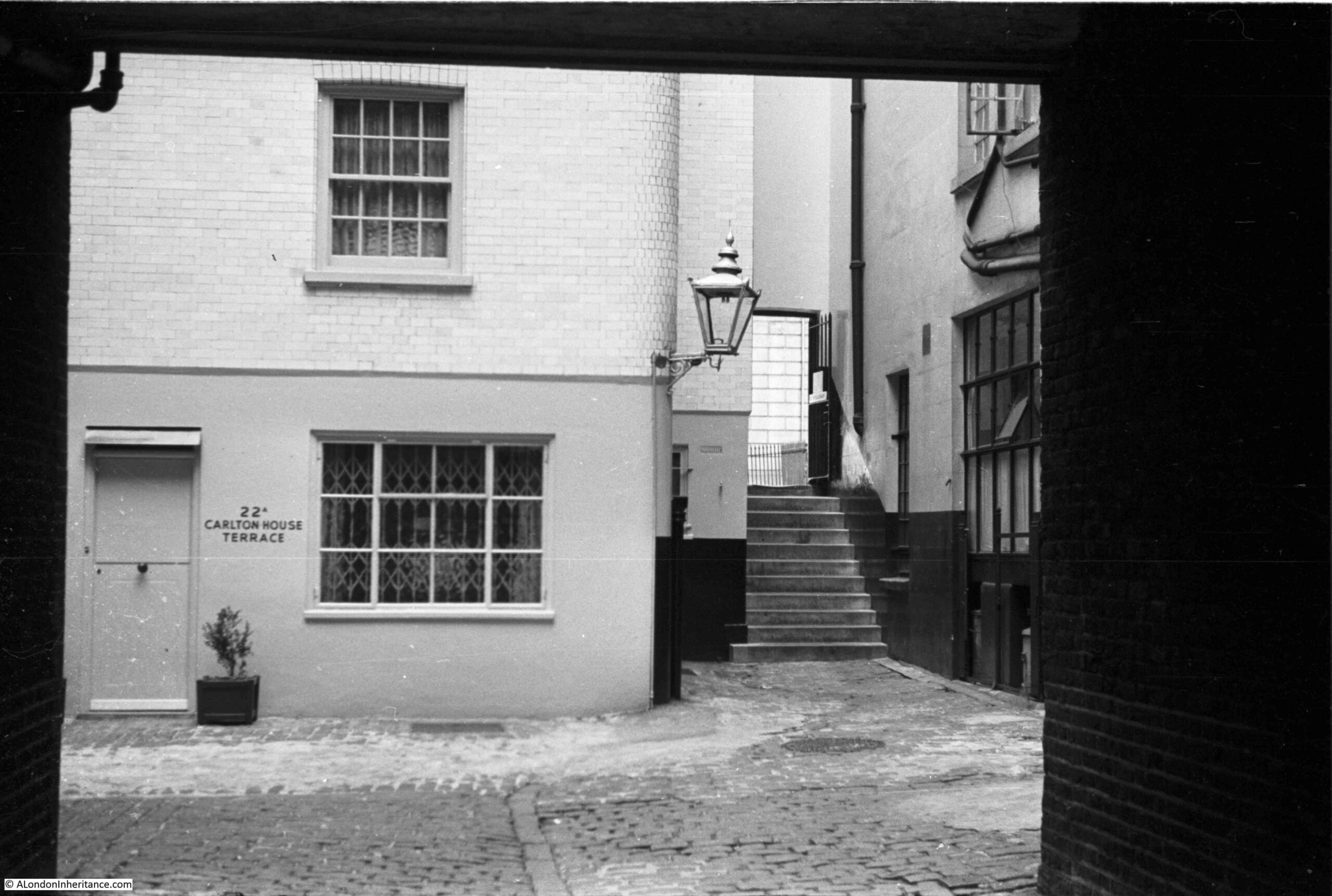
The location should be easy to find as the house has the address 22A Carlton House Terrace next to the door. The photo appears to have been taken from underneath some form of archway.

As well as finding the location of the above photo, I took a walk through the area to the north of Carlton House Terrace to explore the stairs and streets which few people seem to walk.

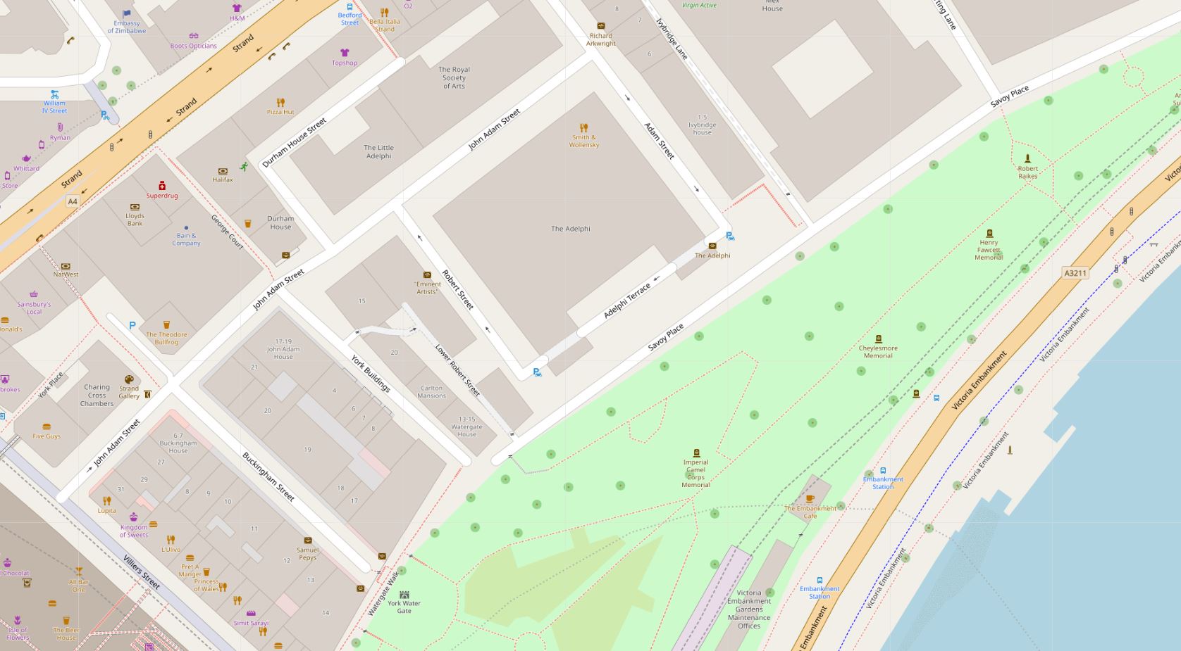
The following map shows my route, starting at S, where Carlton House Terrace meets Waterloo Place, and ending at E, on Pall Mall. Also on the map, the arrow shows the location of the photo (start of the arrow) pointing in the direction of the stairs through to the wall seen in the background of the stairs in the 1949 photo. Although there is a very different building on the site today, I will explain how I found the location in the rest of the post  (Map © OpenStreetMap contributors).

Carlton House Terrace

This is the view along Carlton House Terrace from the junction with Waterloo Place. The street is a dead end with no exit for vehicles.

Carlton House Terrace

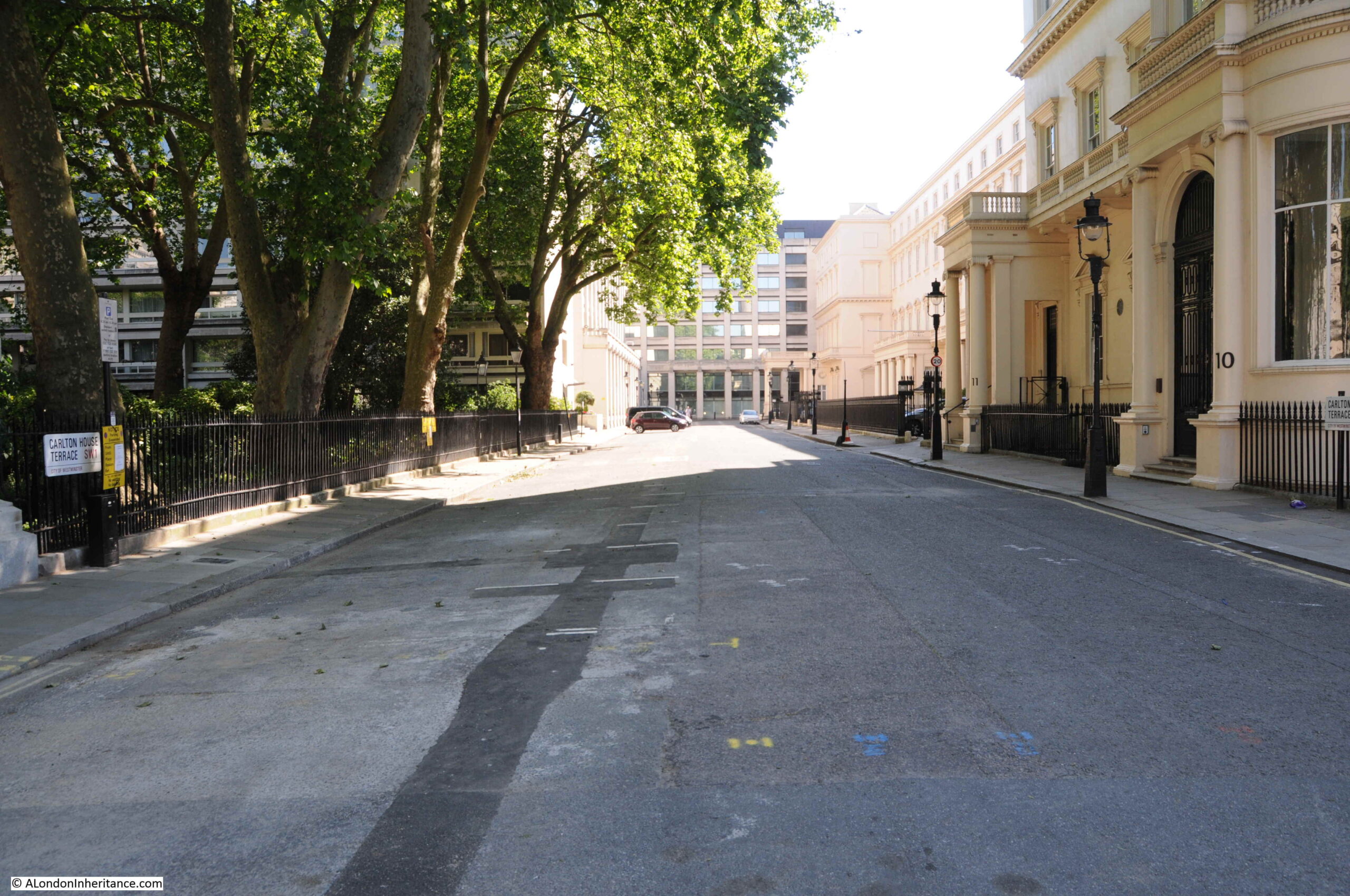
On the right of the above photo are the houses that were originally part of the plan by the architect John Nash to enhance the background to St James’s Park as the other side of the houses face onto The Mall, with the park on the other side.

Although part of the plans developed by Nash, much of the terrace seems to have been heavily influenced by architect Decimus Burton. The terrace was constructed in 1831.

Carlton House Terrace consists of a run of terrace houses, divided by the stairs that lead down from the end of Waterloo Place down to The Mall. The houses provide an impressive background to the northern edge of The Mall, however it is in Carlton House Terrace that we find the front of the buildings with their entrances and forecourts, and facades whilst not as impressive as on The Mall, still with considerable grandeur.

Carlton House Terrace

The round plaque in the above photo records that William Gladstone, the Liberal politician and Prime Minister lived in the house.

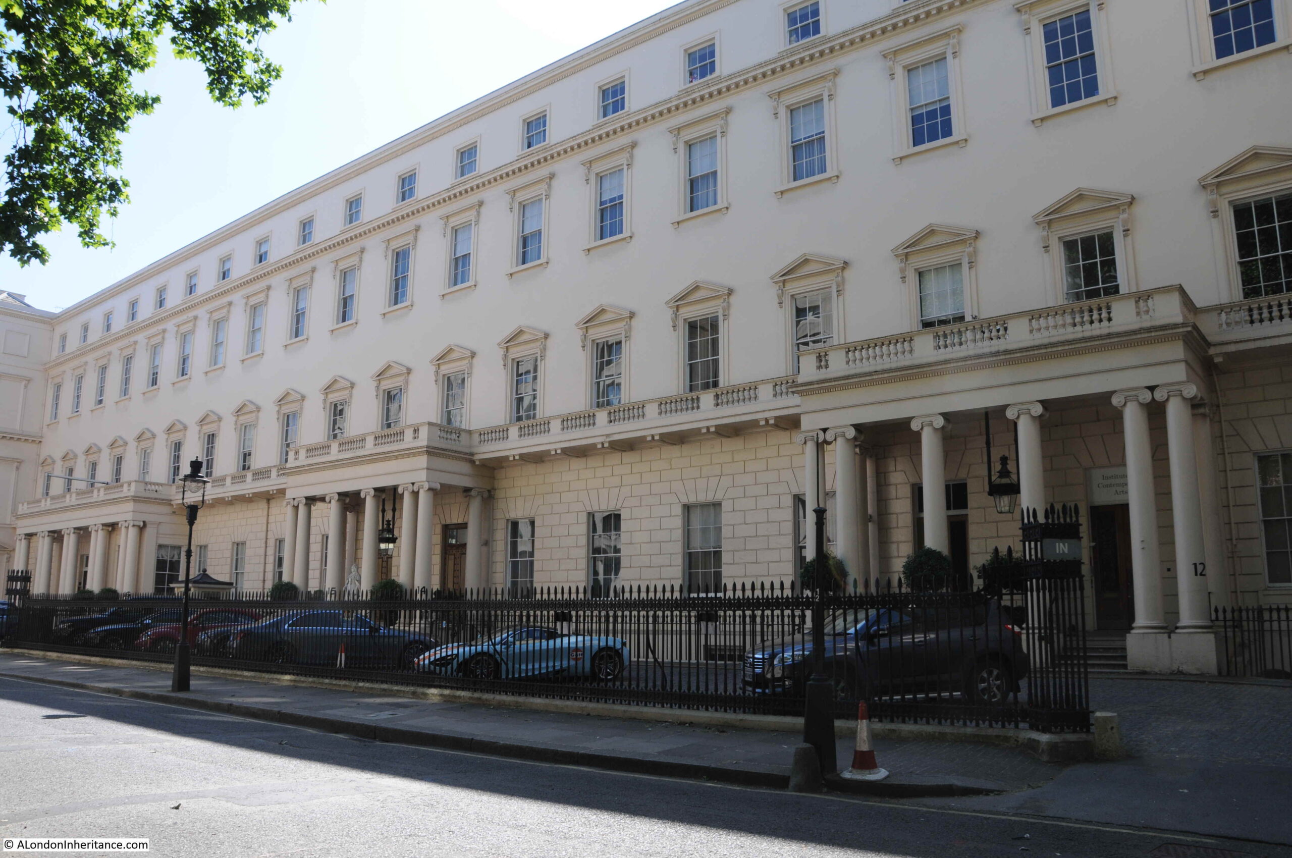
The view along the southern edge of Carlton House Terrace. The rear of these buildings face onto The Mall:

Carlton House Terrace

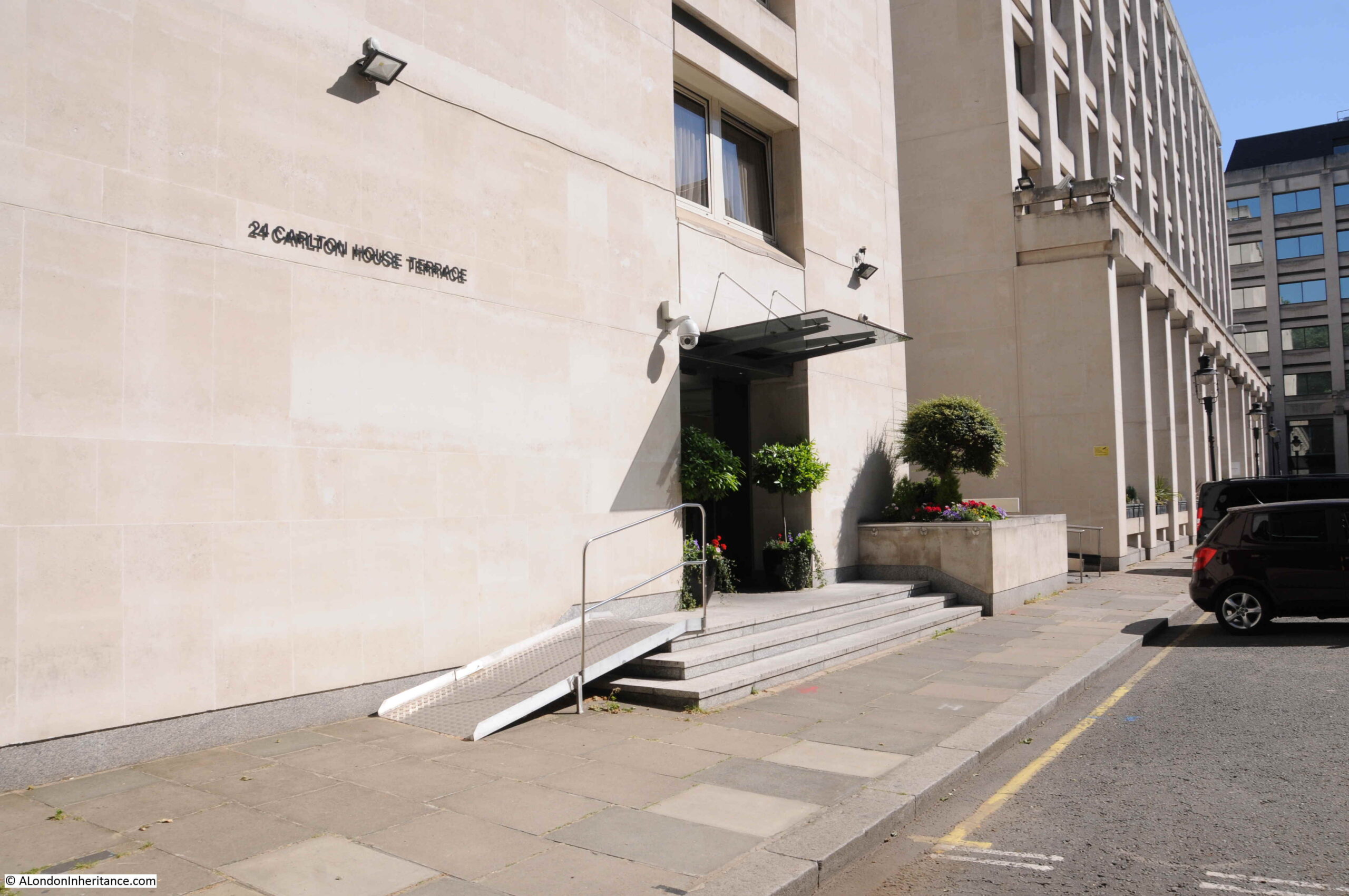
On the opposite side of the street is a relatively modern development. The number on the first building – 24 Carlton House Terrace – shows that the building is close to the 22A in my father’s photo.

Carlton House Terrace

A wider view of the northern side of Carlton House Terrace.

Carlton House Terrace

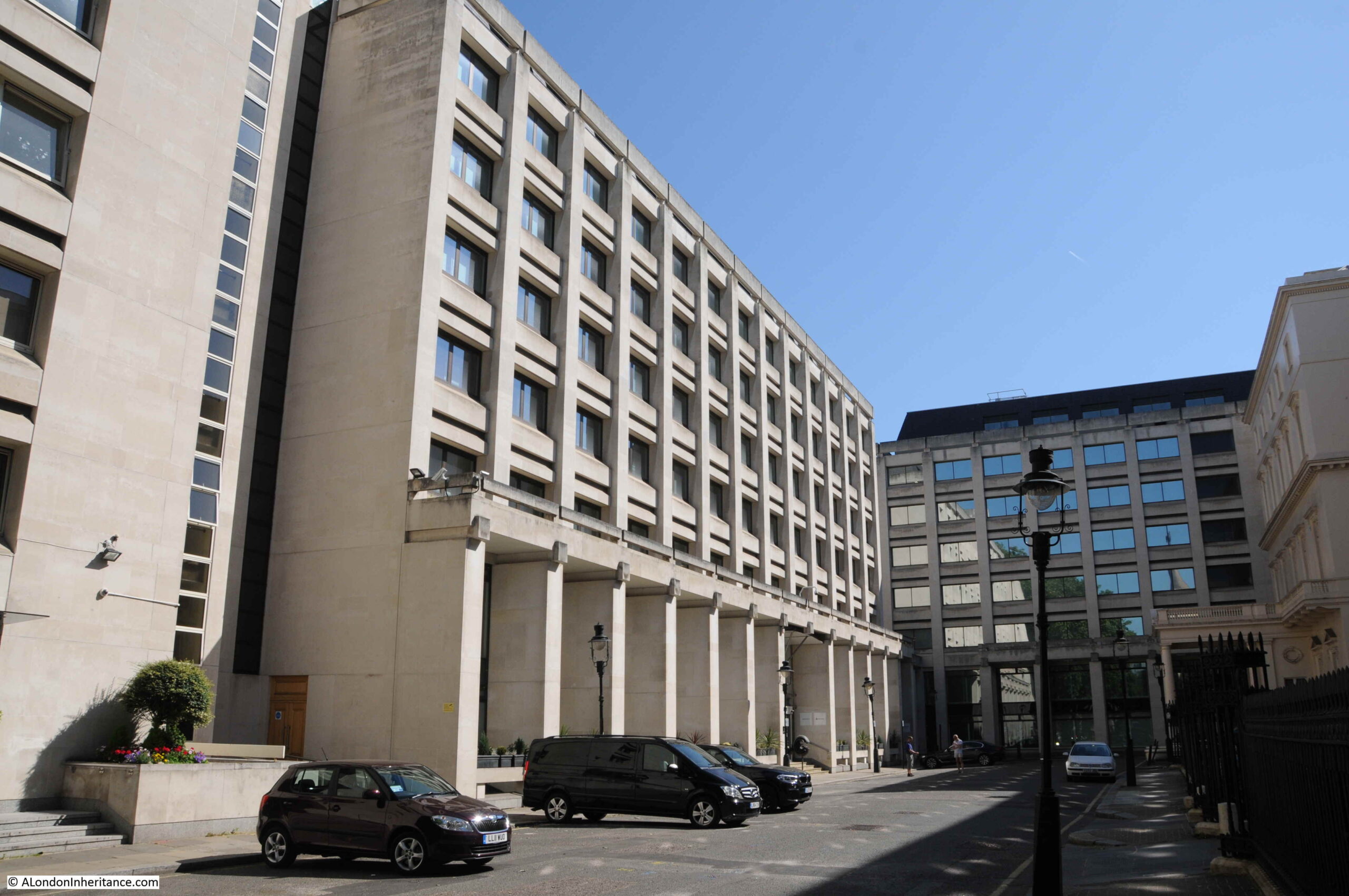
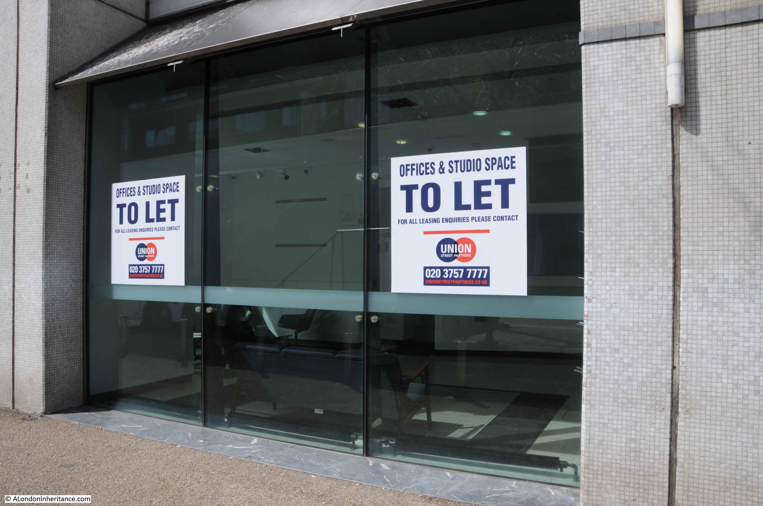
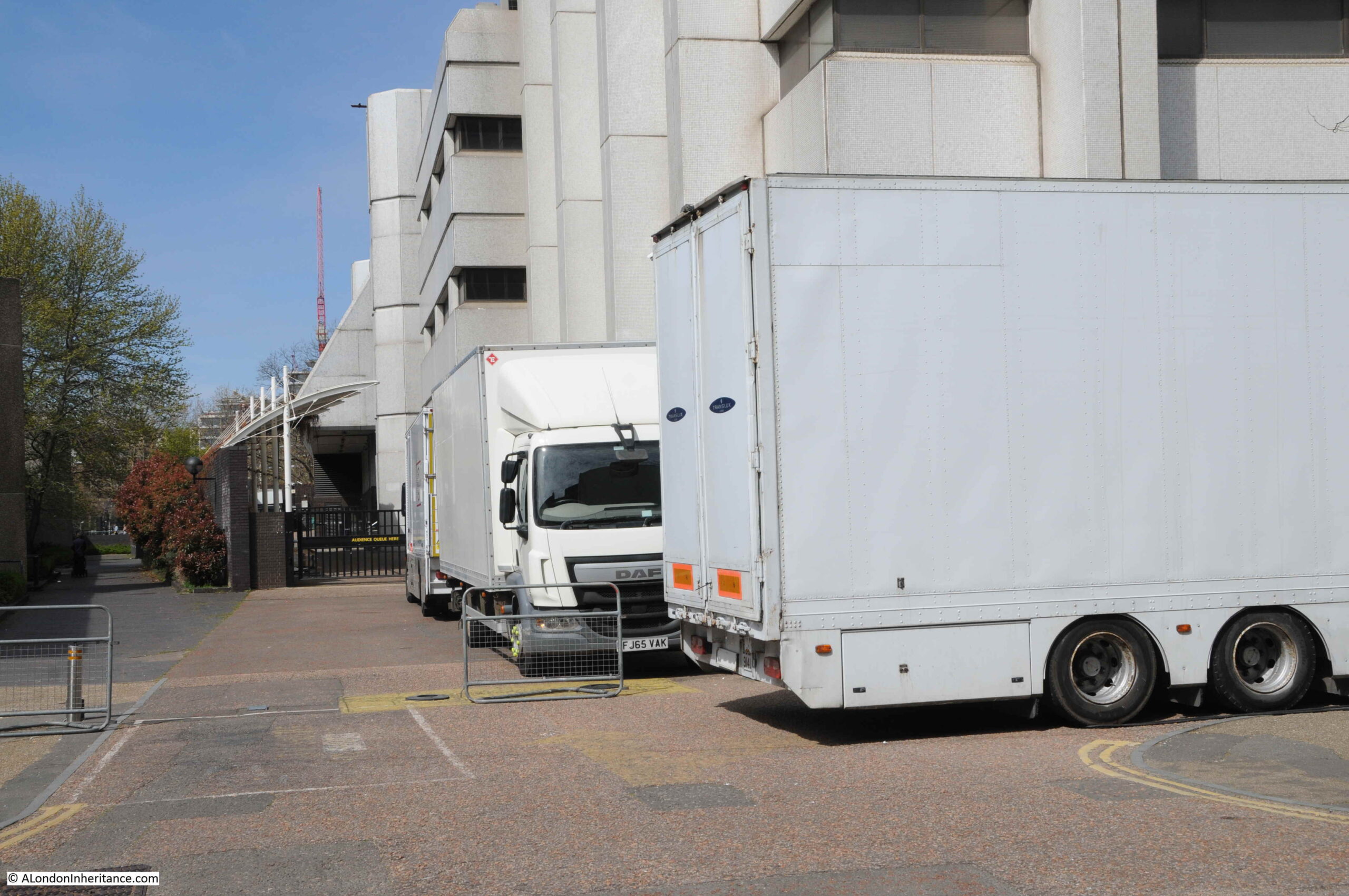
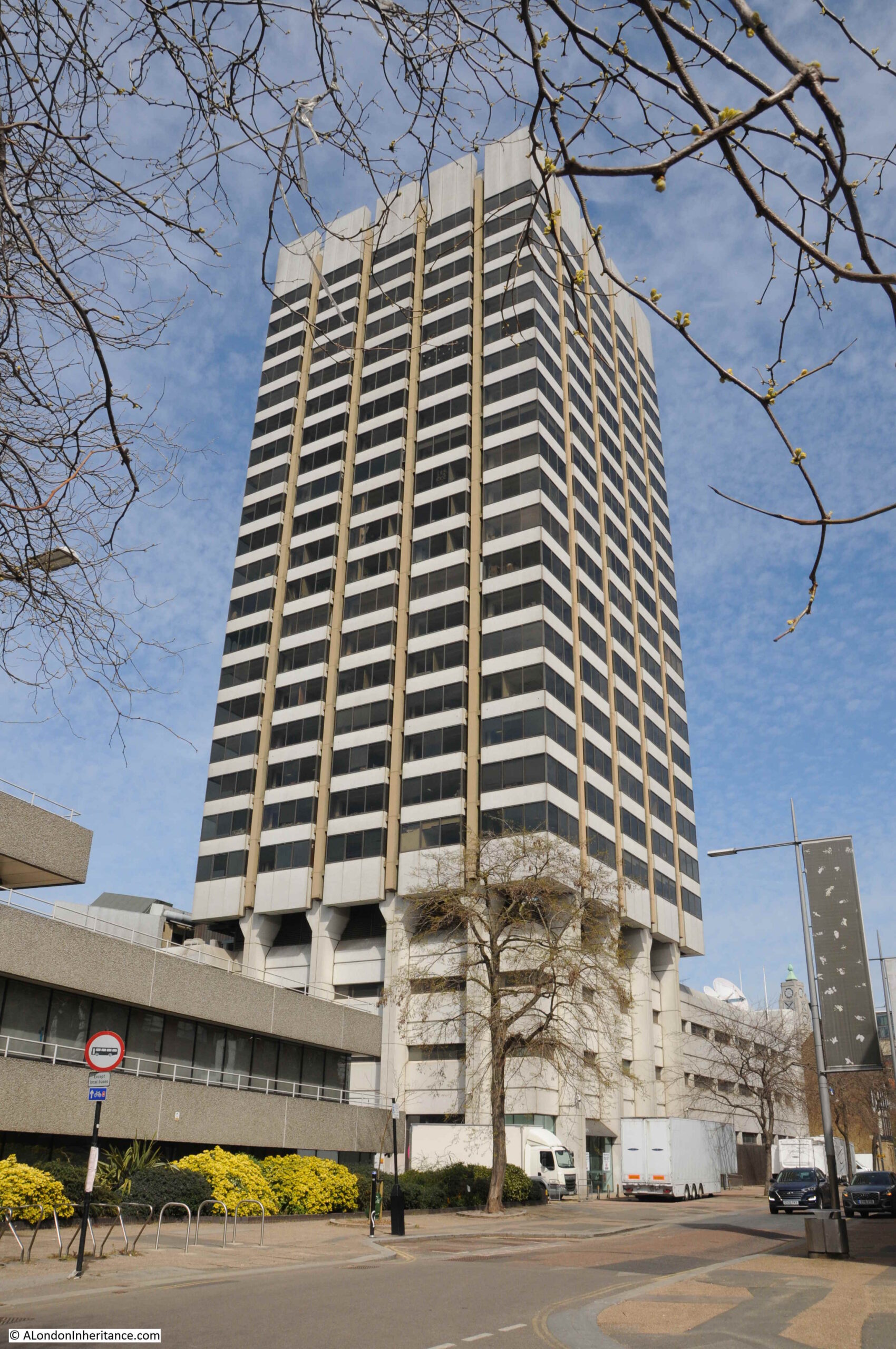
The large building on the left dates from the 1970s and is the former head office of the mining company Anglo American. It is this building that is on the site of my father’s photo.

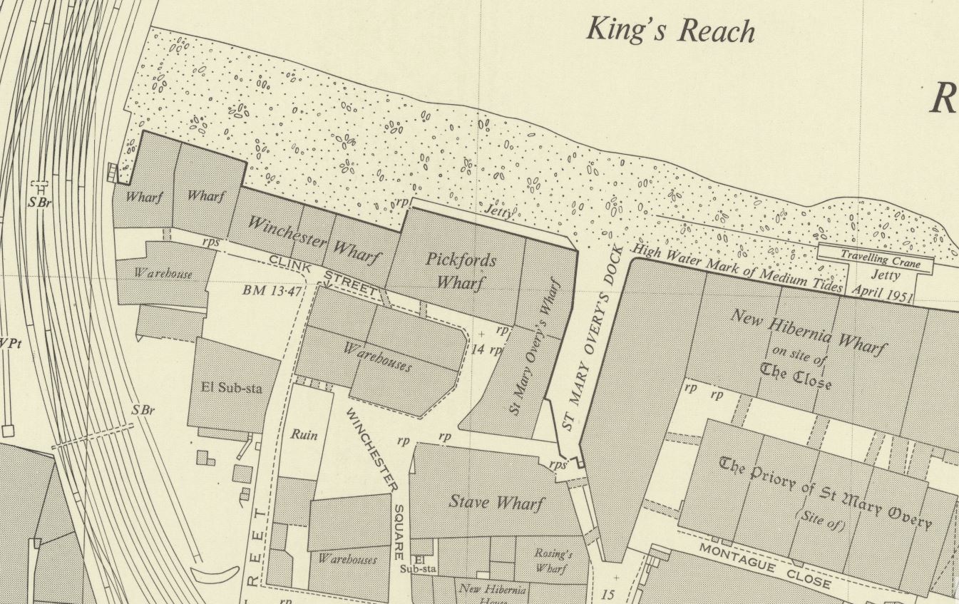
To identify the location, I turned to the 1951 revision of the Ordnance Survey map as this was only two years after my father’s photo.

In the following photo I have marked the position from where the photo was taken with the red dot (‘Reproduced with the permission of the National Library of Scotland’).

Carlton House Terrace

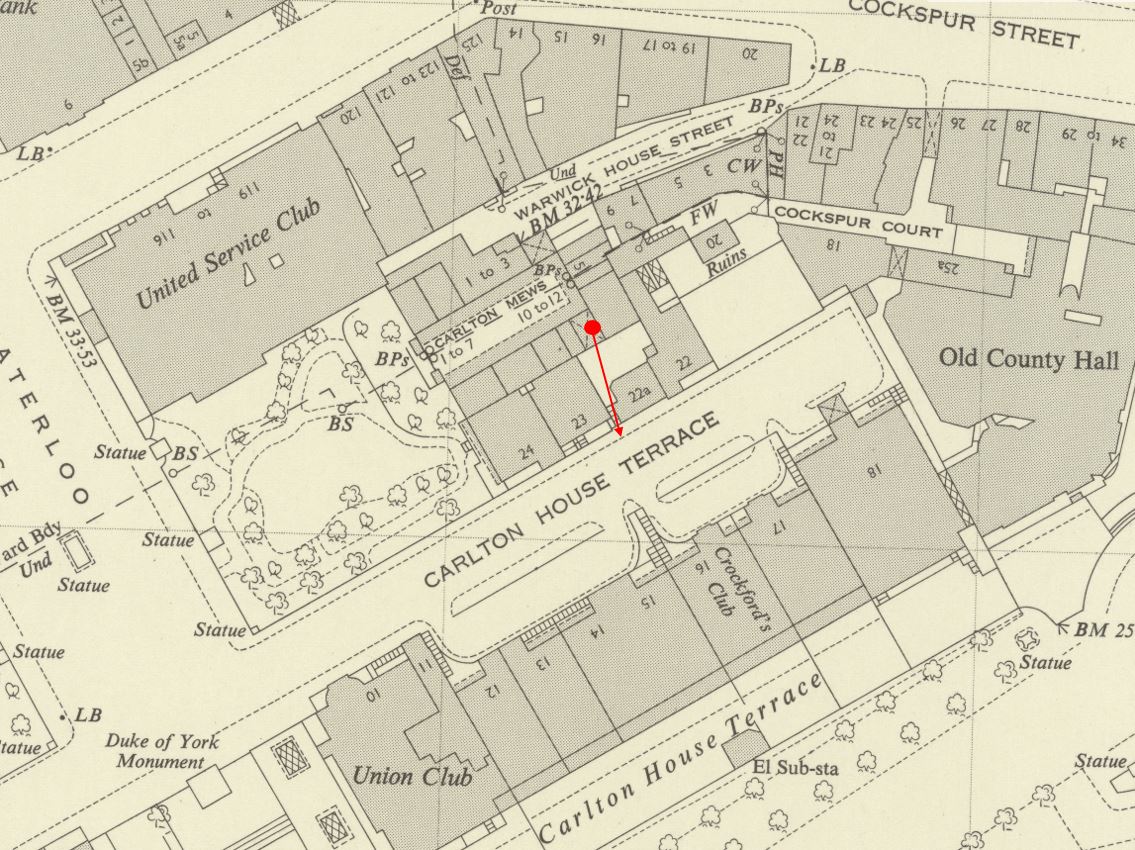
The red dot is under a feature which has an X arcros the dark grey for a building. The use of X is to show a building which has a walk / roadway through at ground level, and the buildings continue above. This explains the dark walls of such a feature on either side and above the immediate location of the 1949 photo.

Following the arrow across the open courtyard, and on the left of number 22A is the symbol for a set of stairs, exactly as seen in my father’s photo.

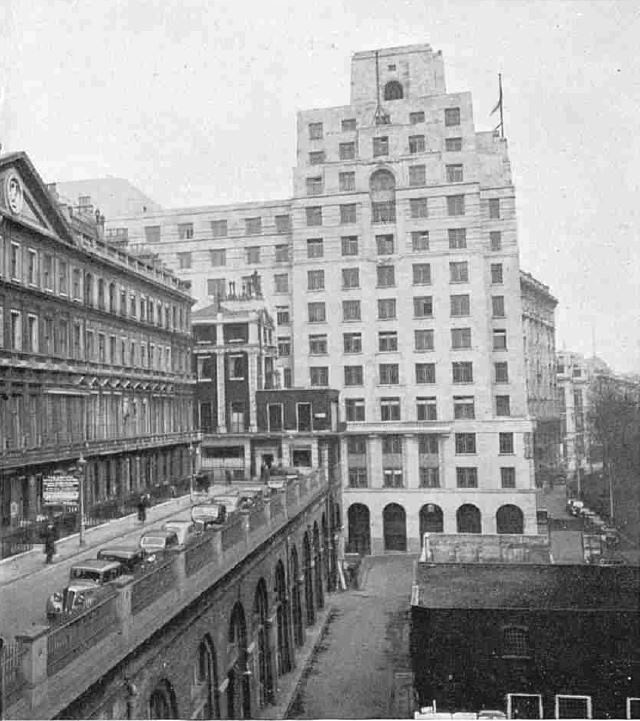
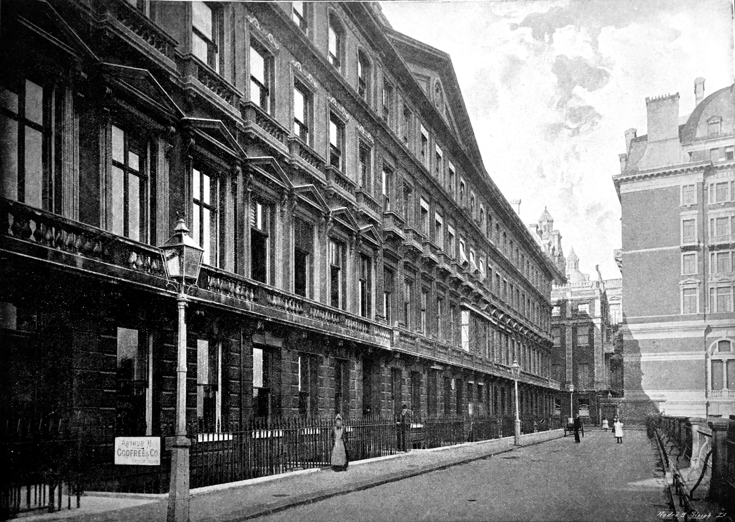
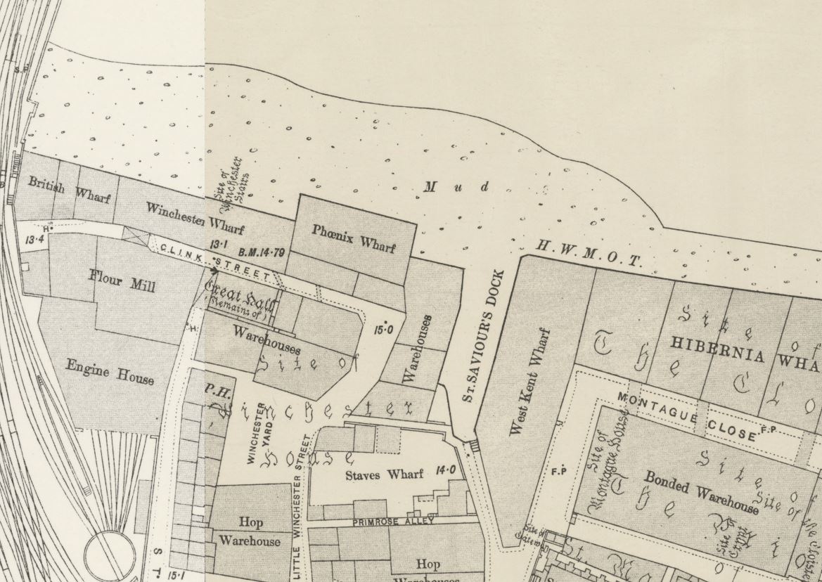
As usual, there is so much to discover in these maps. To the right of the above map is a building labelled “Old County Hall”. If we go back further to the 1895 Ordnance Survey map, we can see the same building labelled London County Council Office (‘Reproduced with the permission of the National Library of Scotland’).

Carlton House Terrace

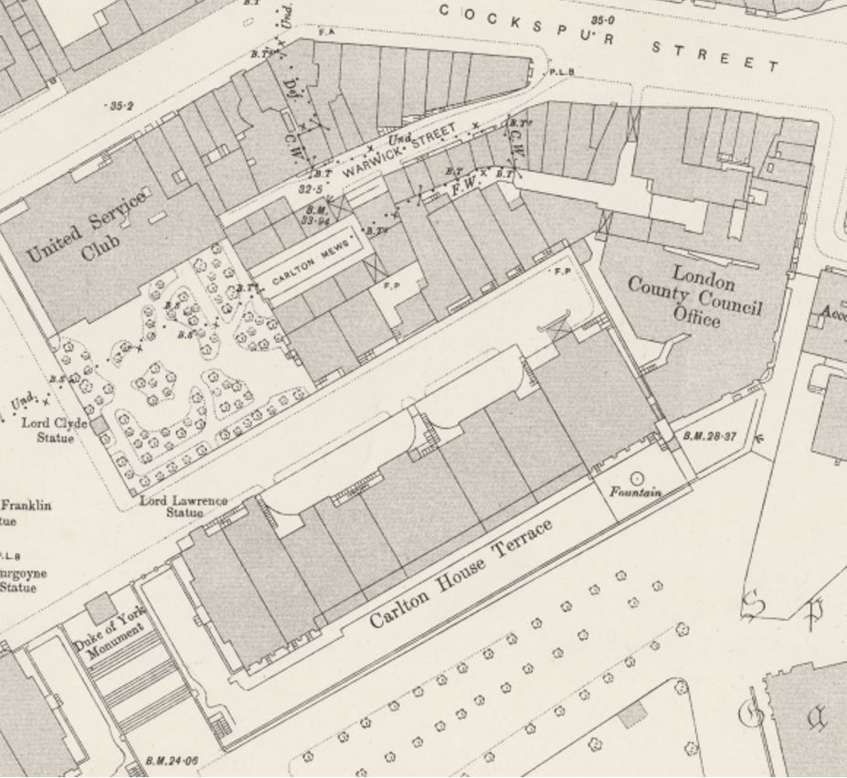
This was the first offices of the London County Coucil after it was formed in 1889, and prior to the move to County Hall on the Southbank in 1922. Prior to the London County Council, the building was occupied by the Metropolitan Board of Works, which the London County Council replaced.

The above 1895 map also shows the same features as the 1951 map, providing confirmation of the same features in my father’s photo.

if you look at the above two maps, the arrow in the first map is pointing to the houses on the south side of Carlton House Terrace, and there is a curving feature to the edge of the forecourt in the centre of the terrace.

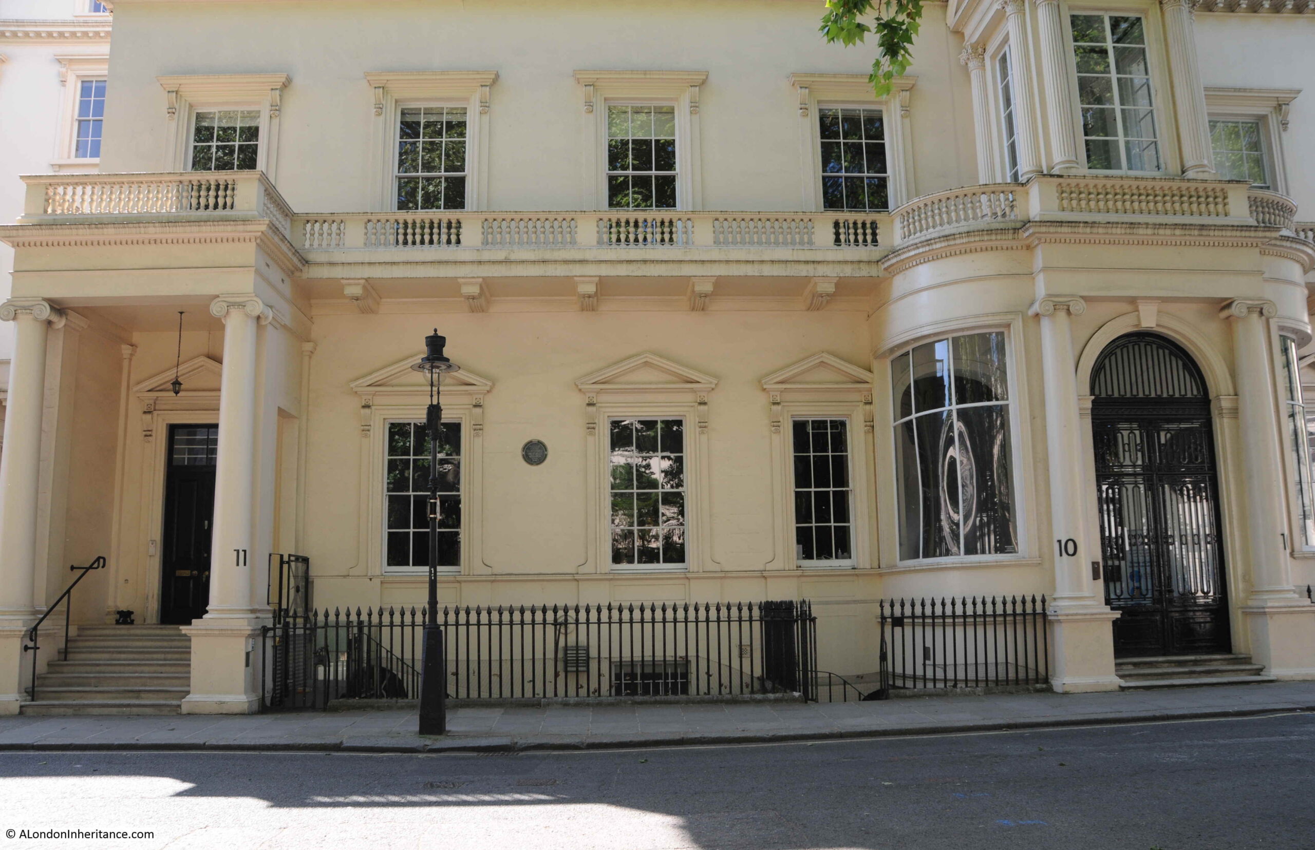
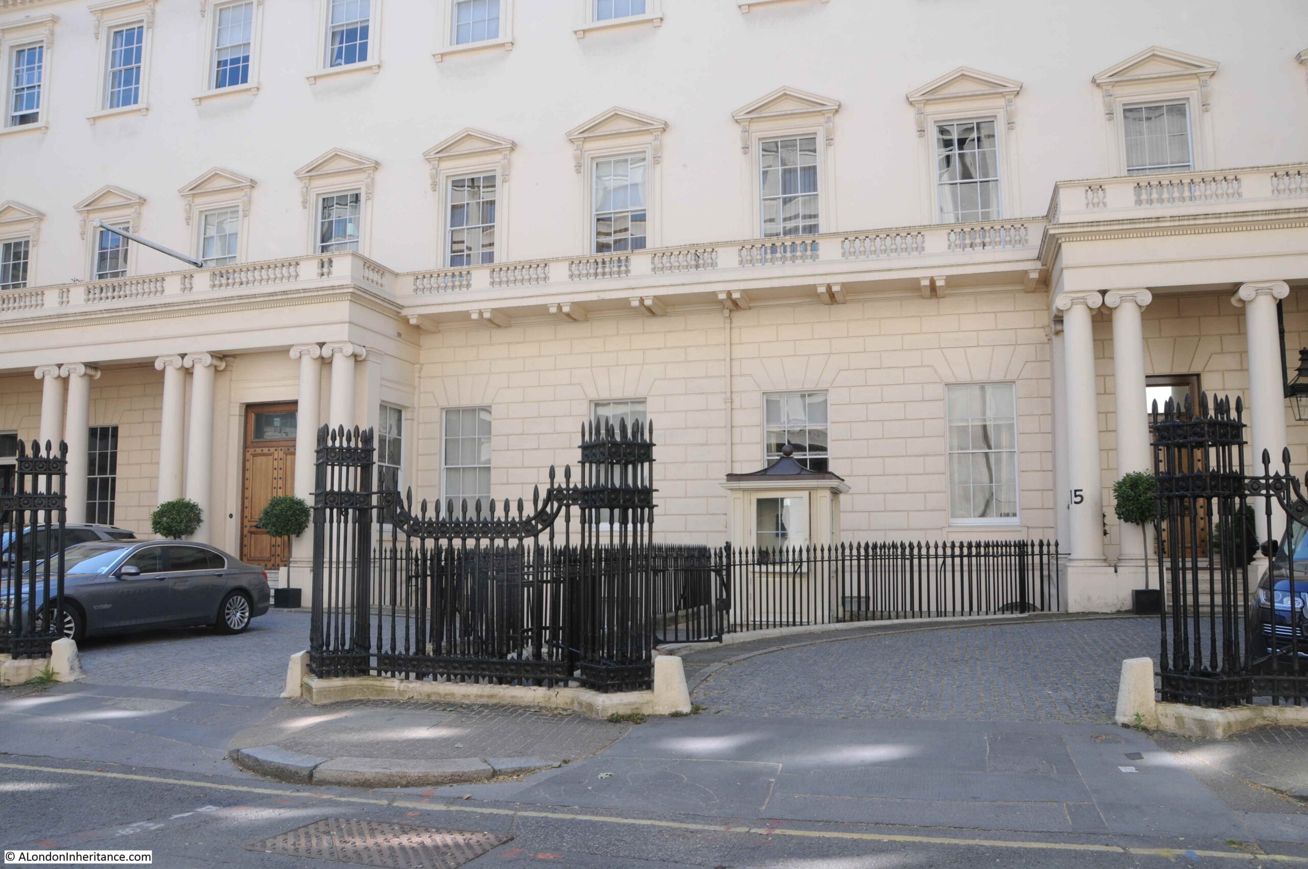
The same feature can be found today, with the railings curving from street to building:

Carlton House Terrace

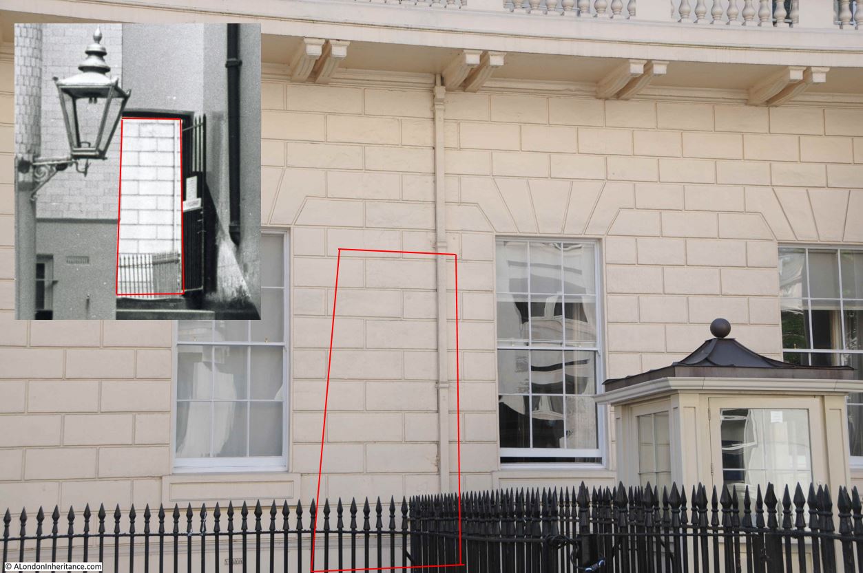
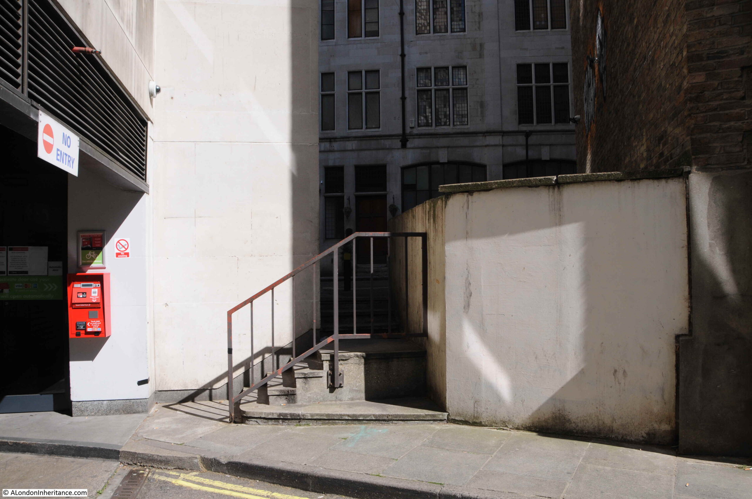
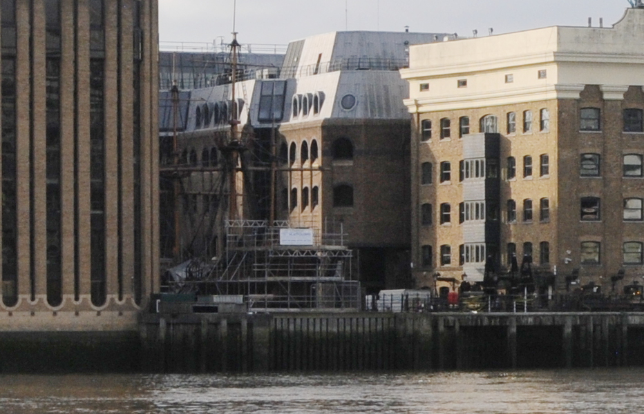
My father’s photo is looking towards some stairs which lead up to Carlton House Terrace, and through the gap above the stairs we can see part of the wall of a building.

To the left of the hut in the above photo is a drain pipe, and this can also be seen above the stairs. In the following photo, I have outlined the area of wall in red and included an extract from the 1951 photo to show the same area of wall.

Carlton House Terrace

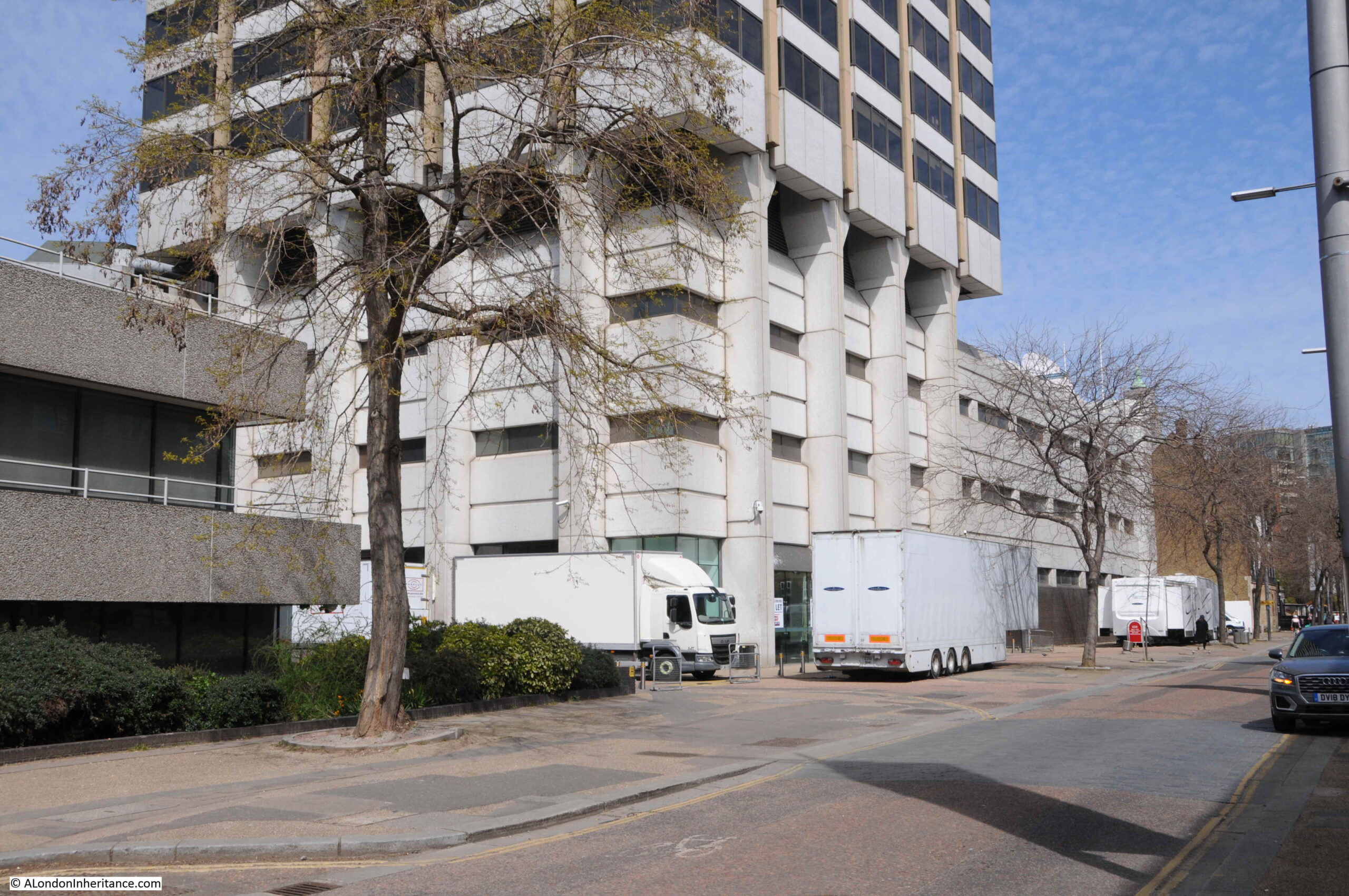
The following photo is from the south side of Carlton House Terrace, in front of the building in the above photo, looking across to the location of the stairs in my father’s photo. If I have worked out the exact location correctly, the stairs were just behind the car in the middle of the photo.

Carlton House Terrace

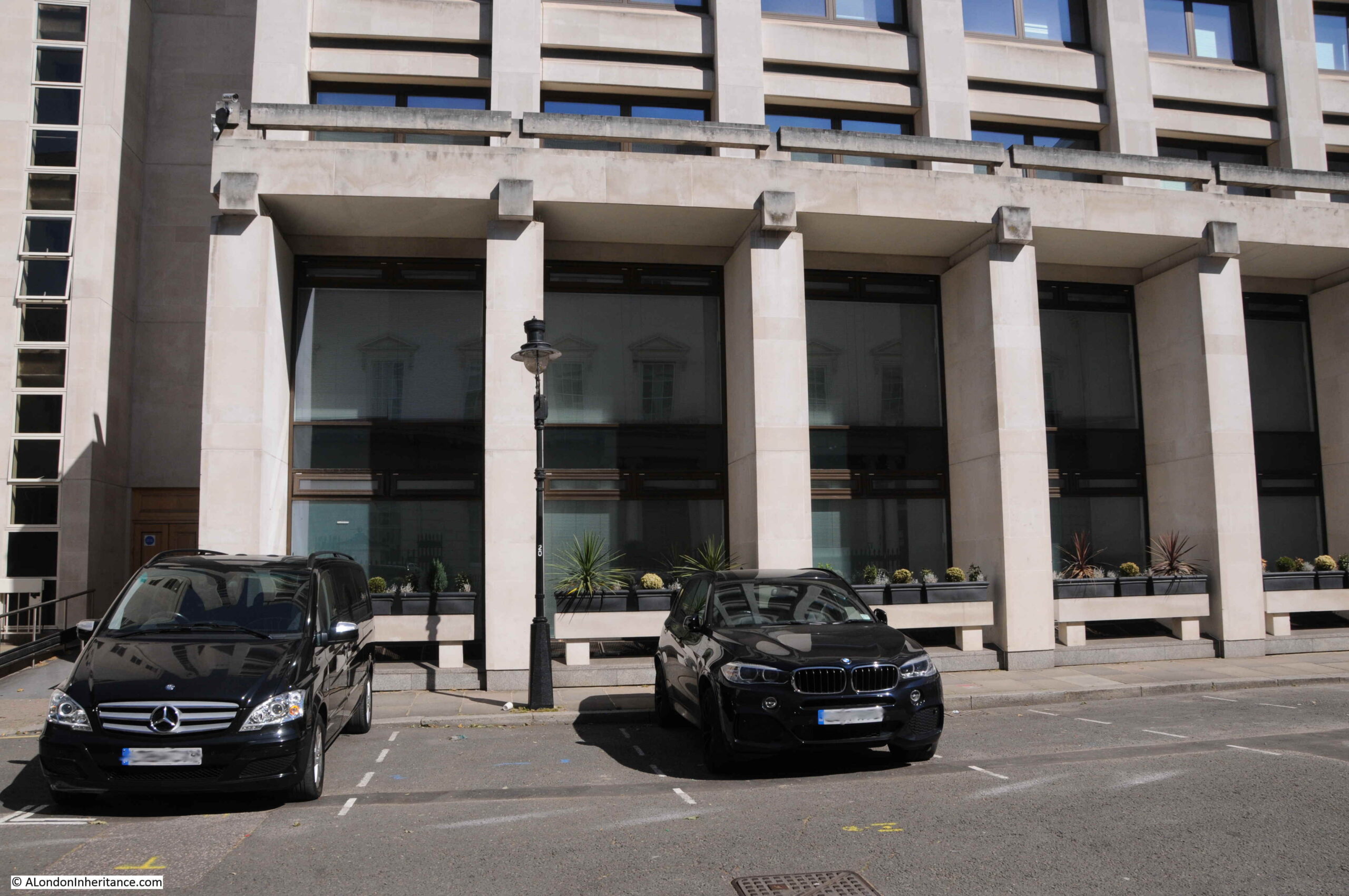
The above building was built during the 1970s. I cannot find when the buildings, courtyard and stairs in my father’s photo were demolished, however I suspect they were part of the demolitions to free up space for the building which now covers much of the northern side of this stretch of Carlton House Terrace, and occupy a large area of space back to Warwick House Street.

The following photo is from the eastern end of Carlton House Terrace, looking back to the junction with Waterloo Place and the stairs down to The Mall. The Duke of York’s Column (dating from 1834) which marks the stairs to the Mall and the split between the two sections of the terrace can be seen in the distance.

Carlton House Terrace

The street and terrace are named after Carlton House, which occupied much of the space now occupied by Waterloo Place. Carlton House had a considerable area of gardens which covered the space where today we can find the two sections of the terrace, on either side of the Duke of York’s Column.

I will save the story of the house and the rest of the terrace for another post, as my walk explored a couple of the streets to the north, between the terrace and Cockspur Street / Pall Mall (see map at start of the post).

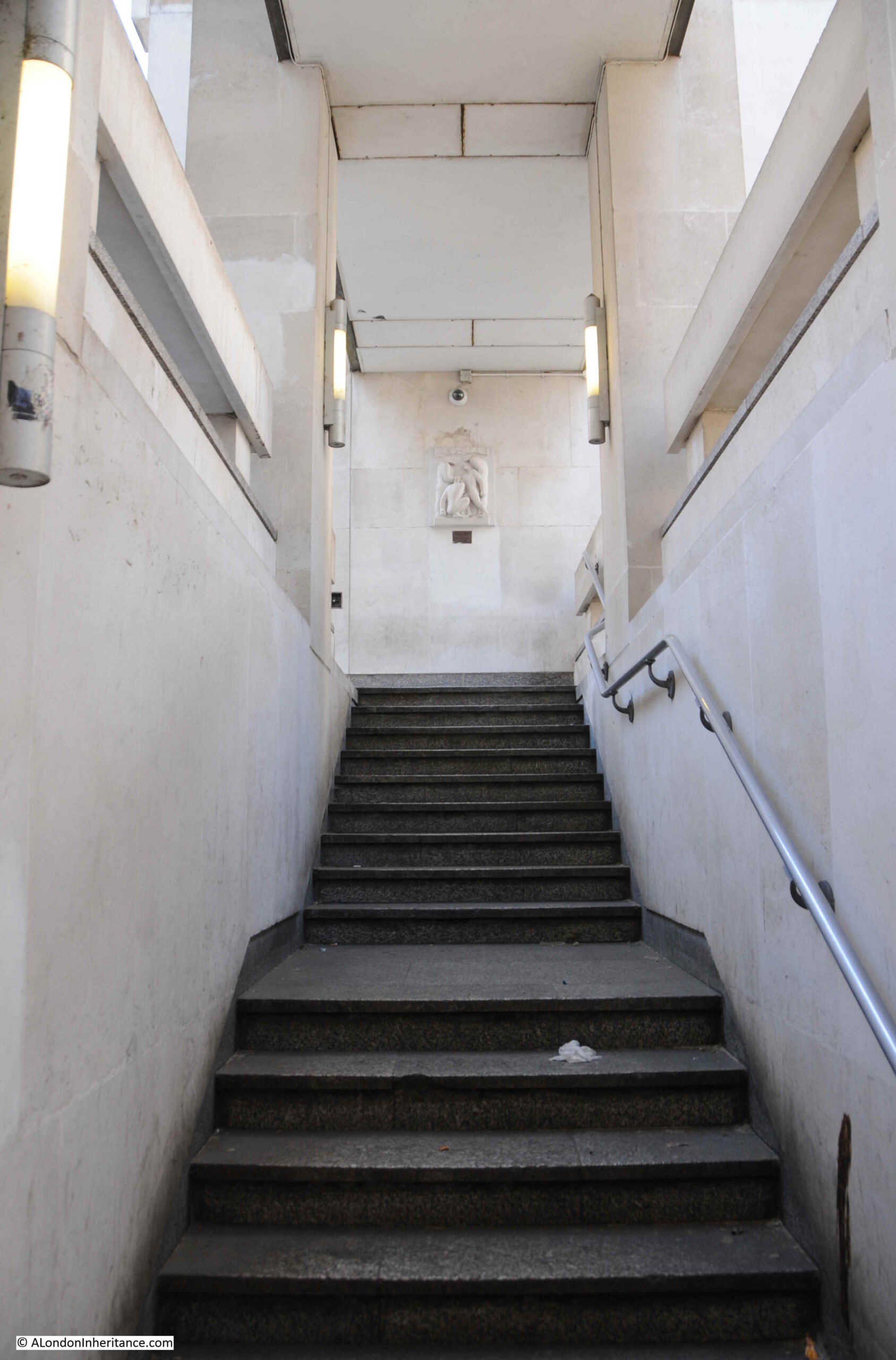
Although Carlton House Terrace is a dead end for traffic, there is an exit for pedestrians, with some stairs at the far north eastern corner of the terrace.

Carlton House Terrace

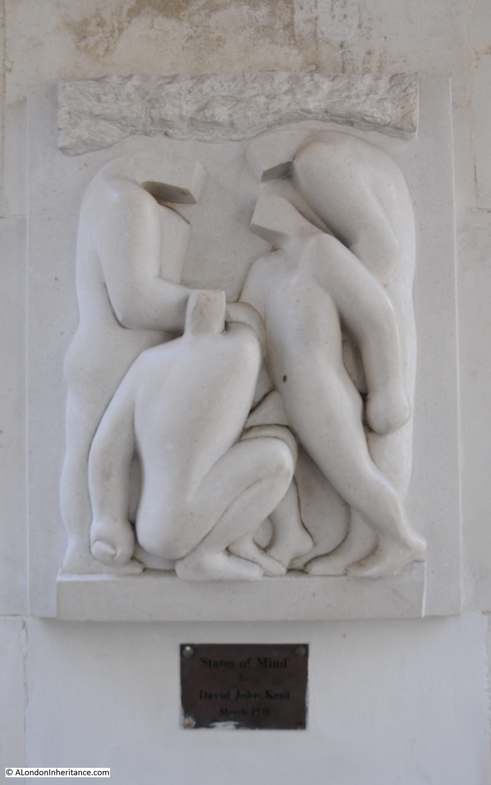
Looking back up the stairs, and there is an artwork by the sculptor David John Kent titled “States of Mind” at the top of the stairs:

Carlton House Terrace

Close up view of “States of Mind”:

Carlton House Terrace

The stairs take us into a short street called Cockspur Court that leads from Spring Gardens. Cockspur Court is a dead end, and its only function seems to be to provide a service access to the surrounding buildings.

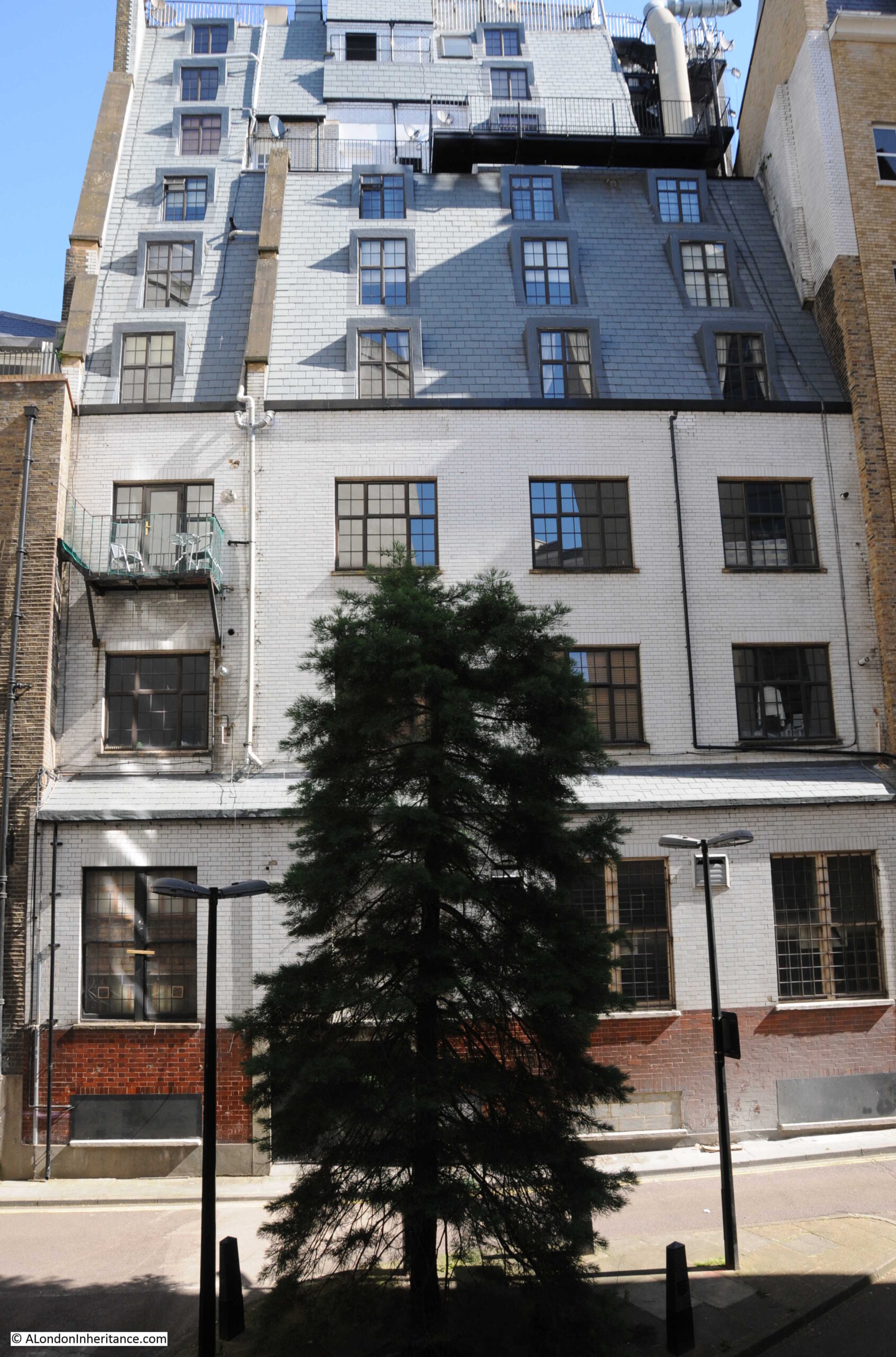
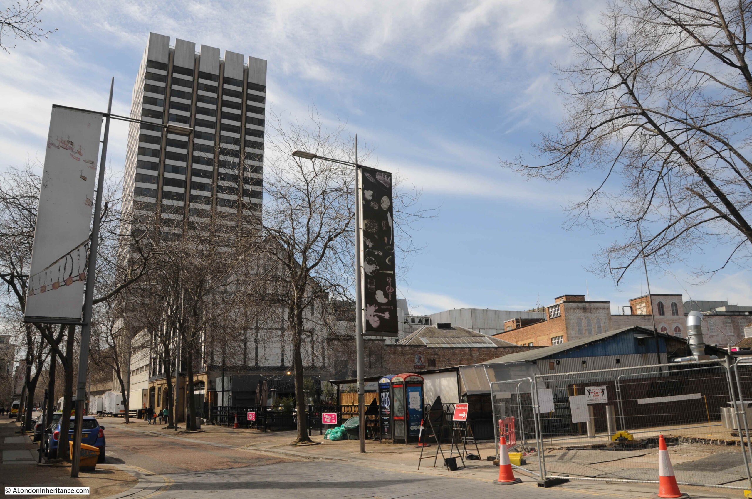
In the centre of Cockspur Court appears to be the loneliest tree in London. No other trees within view, and a tree that must spend much of its time in shade due to the height of the surrounding buildings.

Cockspur Court

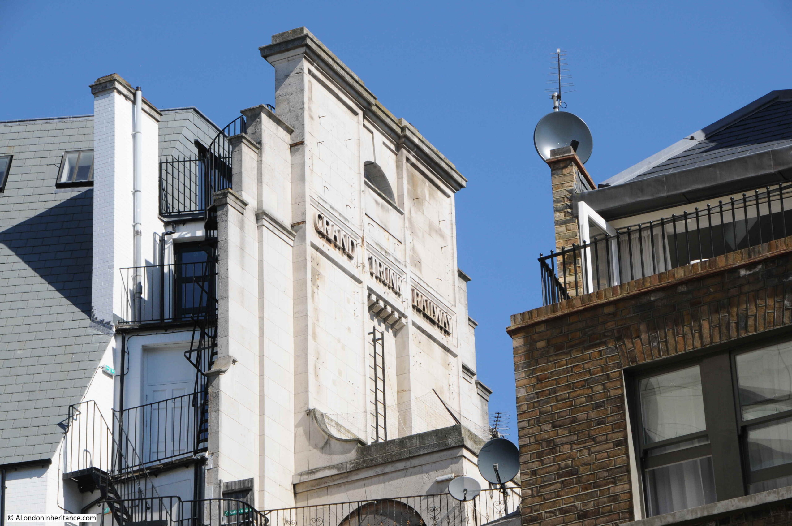
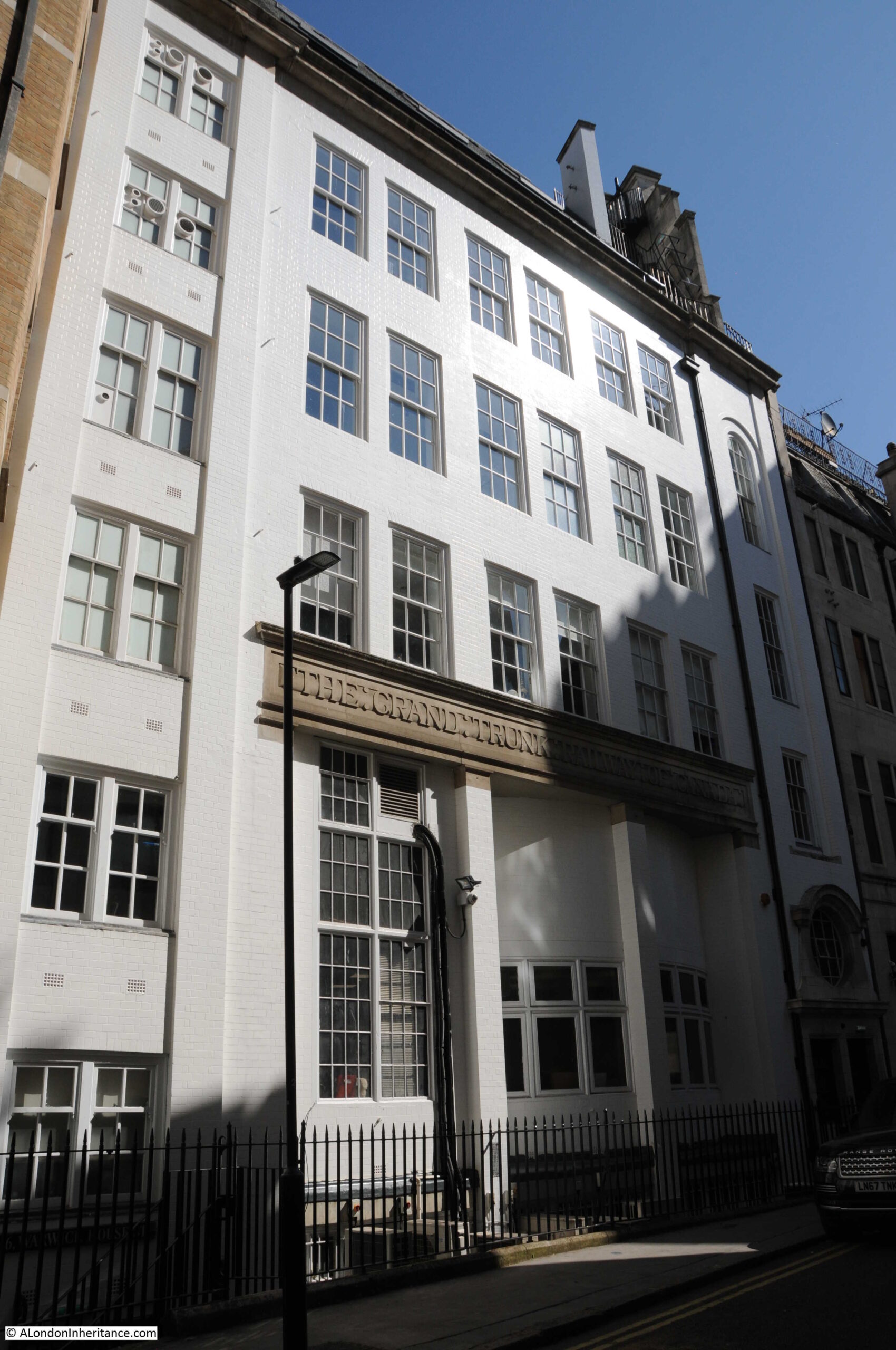
Looking across the court, and a building on the far side has the words “Grand Trunk Railway” displayed.

Cockspur Court

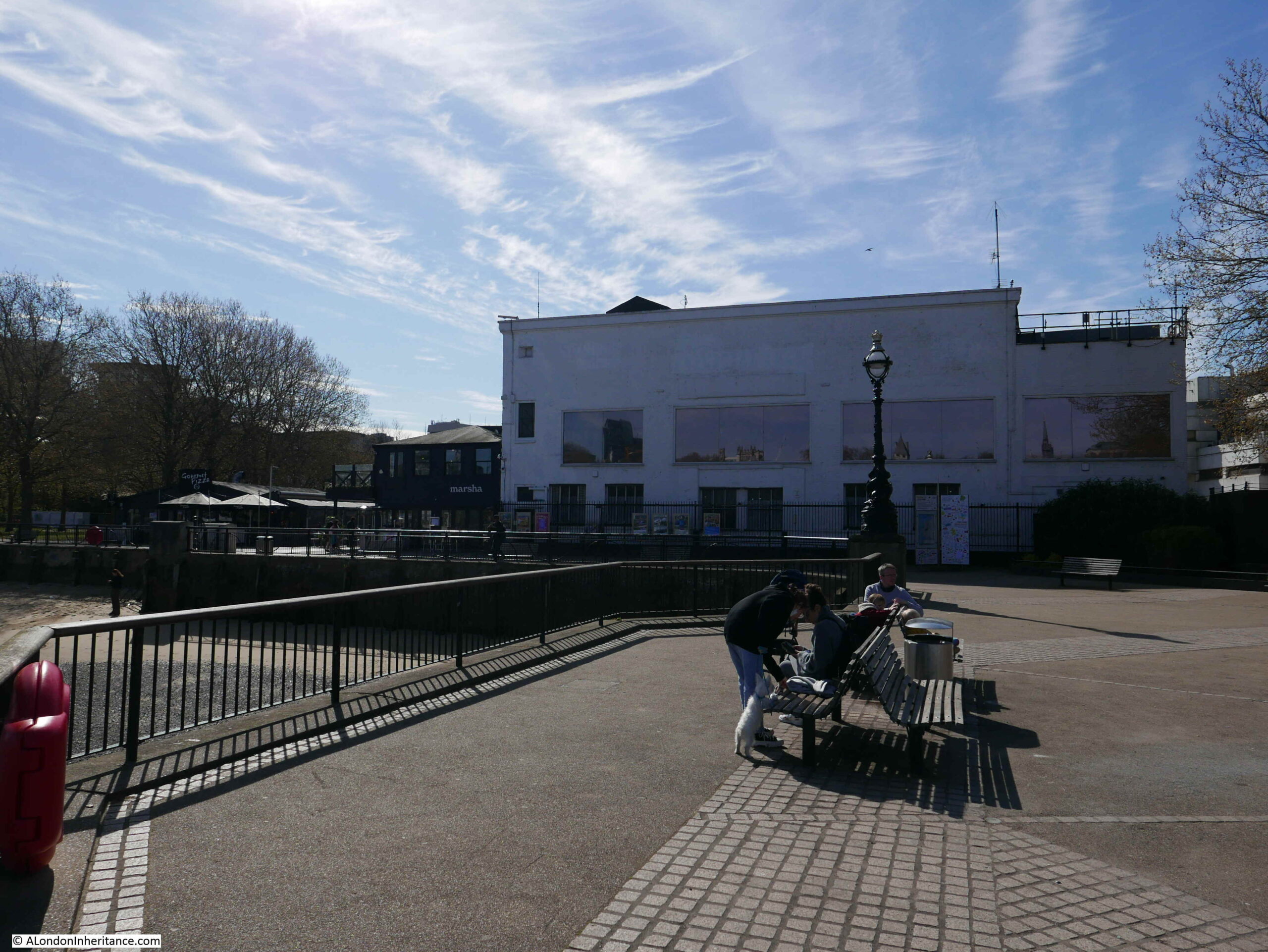
The following photo was taken towards the end of Cockspur Court, looking back towards Spring Gardens, again showing the lonely tree. The stairs down from Carlton House Terrace are behind the tree, and the large building behind the tree, and also running over Cockspur Court is the British Council Building, much of which occupies the space where the first London County Council building was located.

Cockspur Court

Although a dead end for vehicles, at the end of Cockspur Court, there is another set of steps:

Cockspur Court

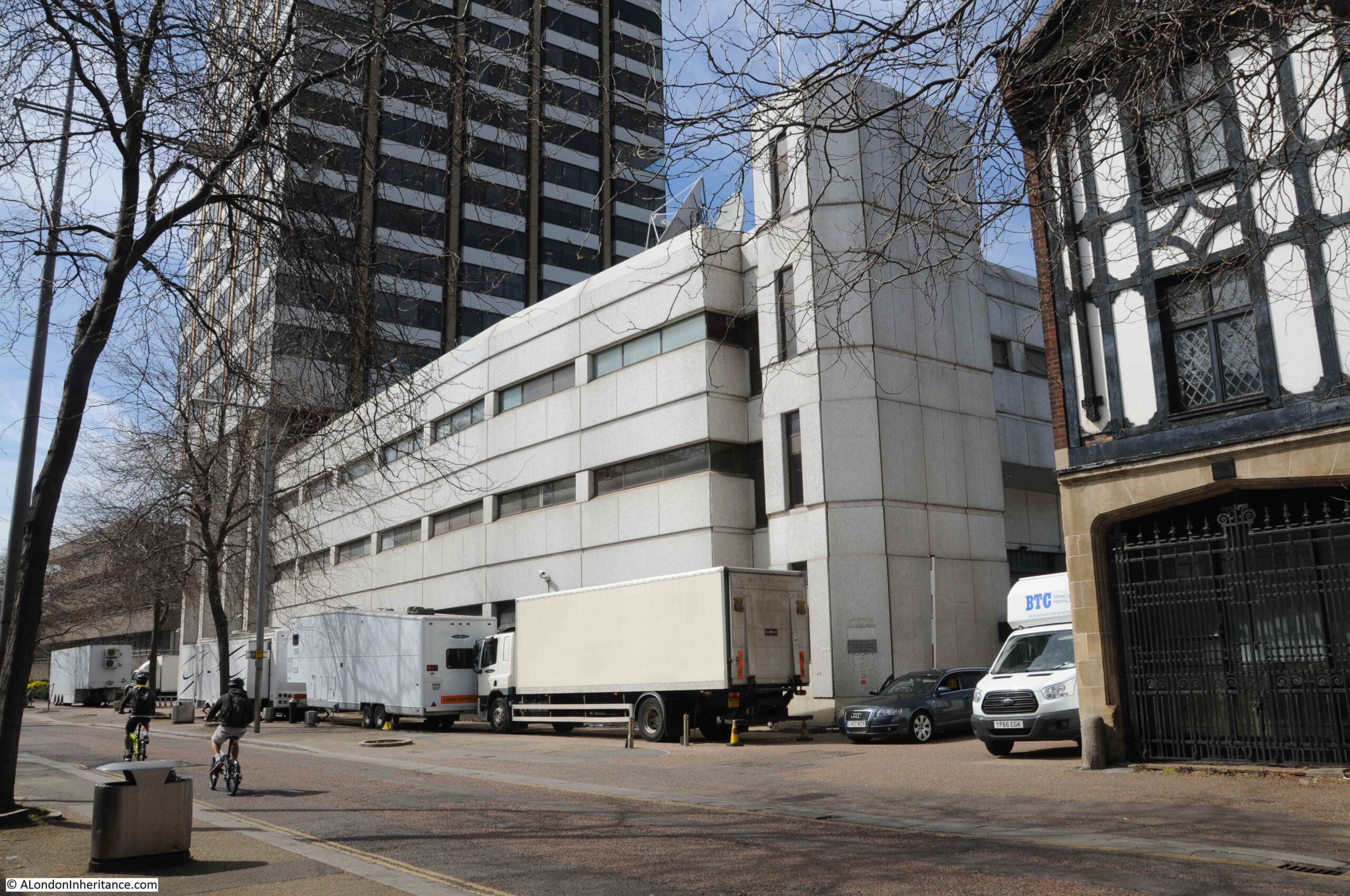
Walking up these steps, and between two buildings:

Warwick House Street

Which leads into Warwick House Street:

Warwick House Street

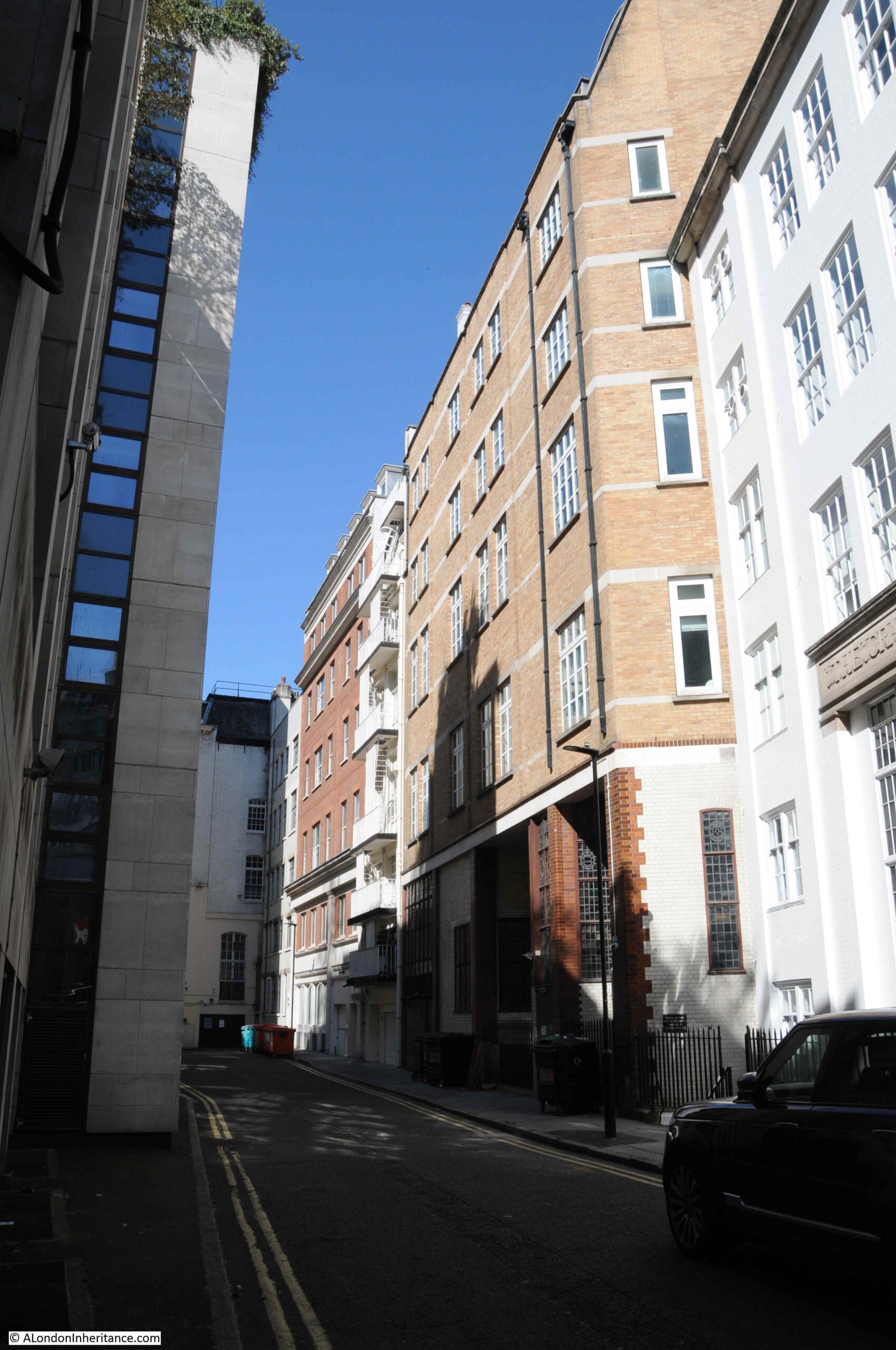
Despite appearing to be just a service road for the buildings on either side, Warwick House Street is actually a very old street, which predates Carlton House Terrace, and survives from the time of Car;ton House and the extensive gardens just to the south.

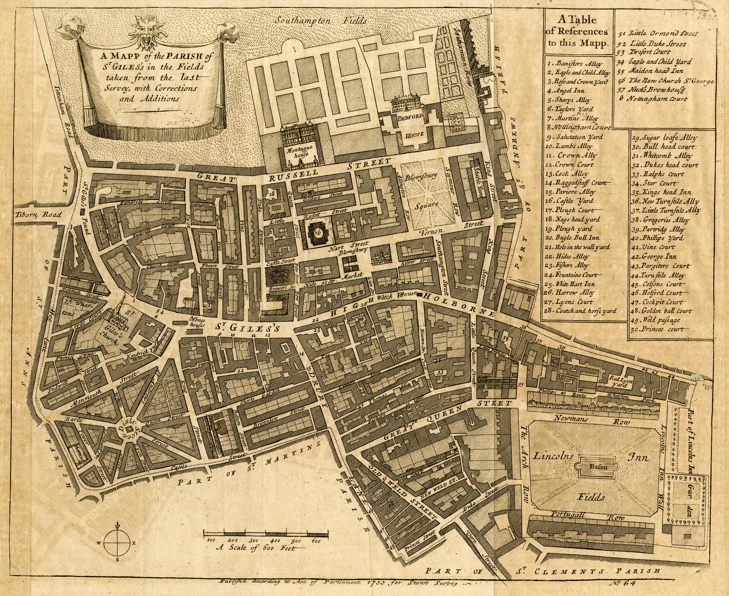
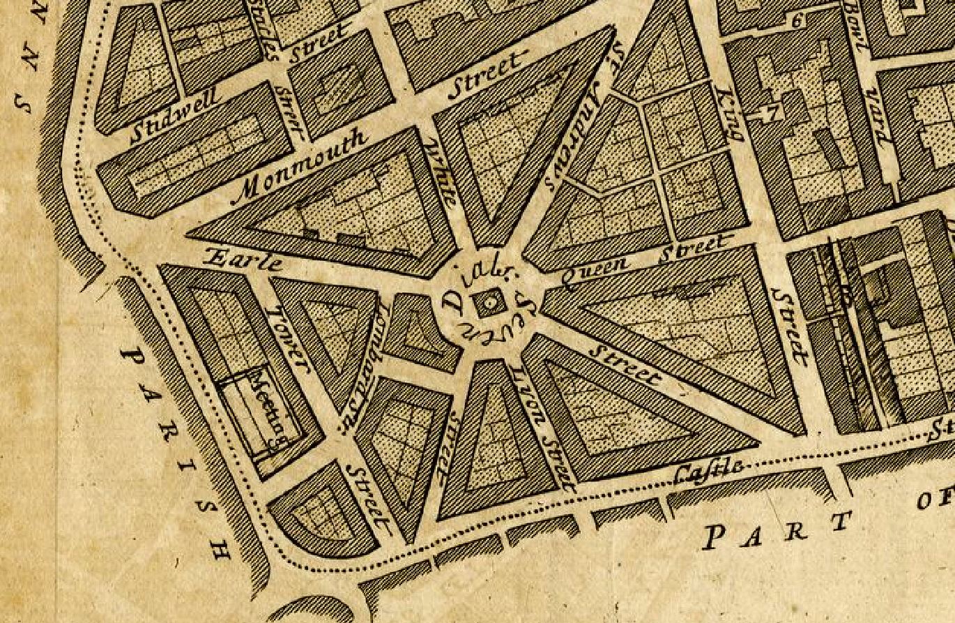
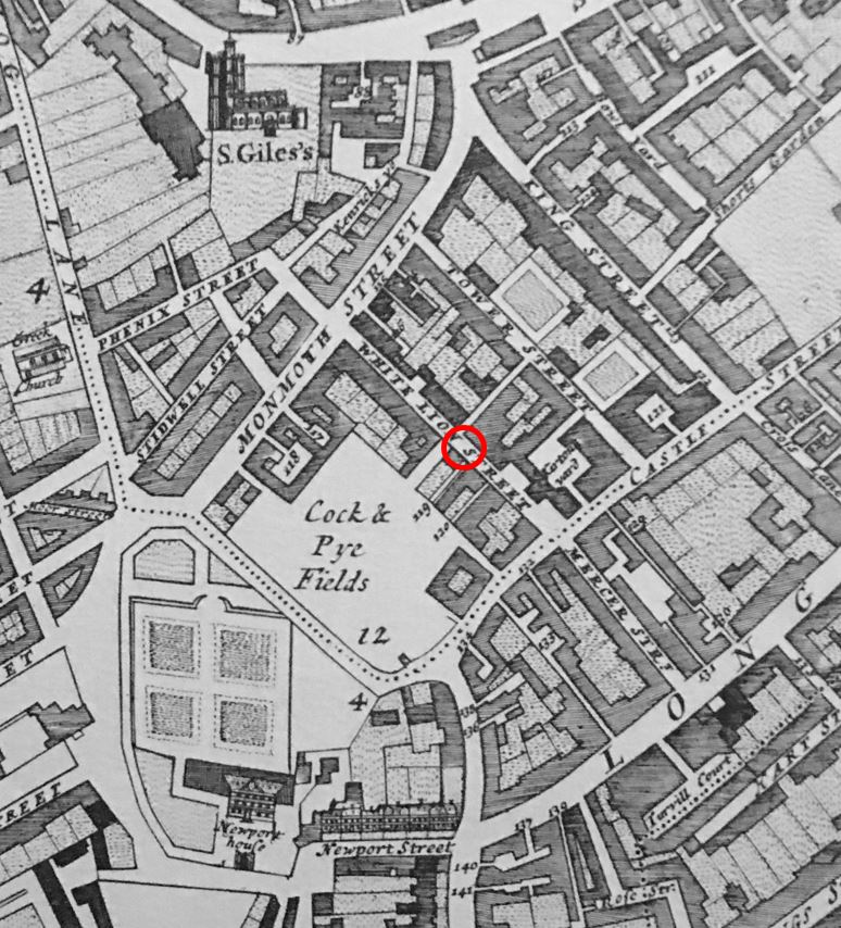
In the following extract from Rocque’s map of London from 1746, I have ringed Warwick Street, now Warwick House Street:

Warwick House Street

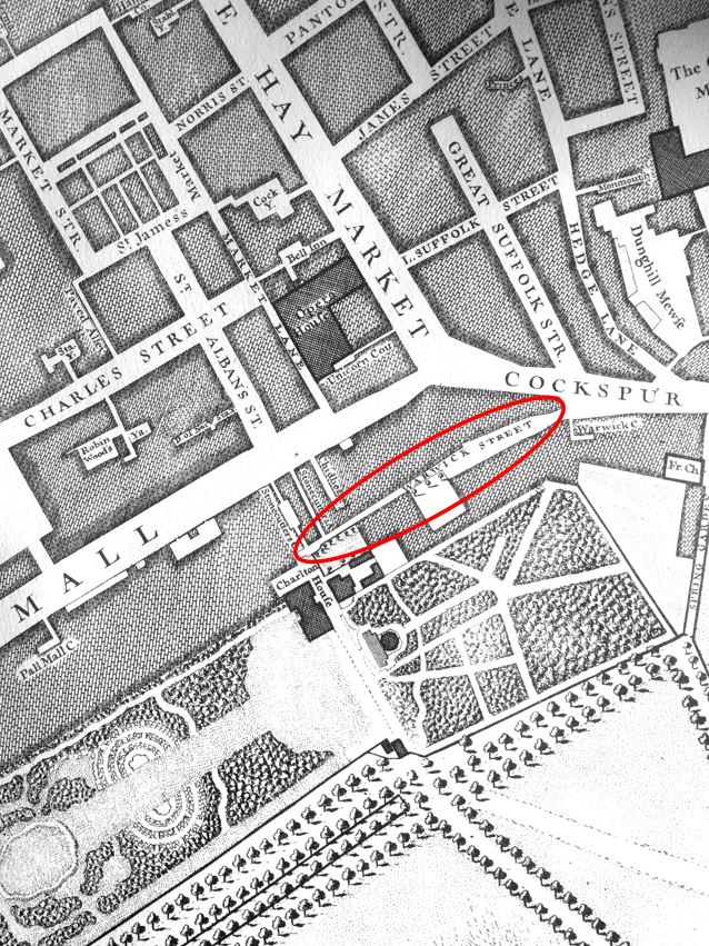
Referring back to the maps earlier in the post, it can be seen that the street follows the same route as the much earlier Warwick Street, apart from a slight change at the final junction with Cockspur Street.

In the 1747 map above, large gardens can be seen to the south. Carlton House Terrace now occupies this space.

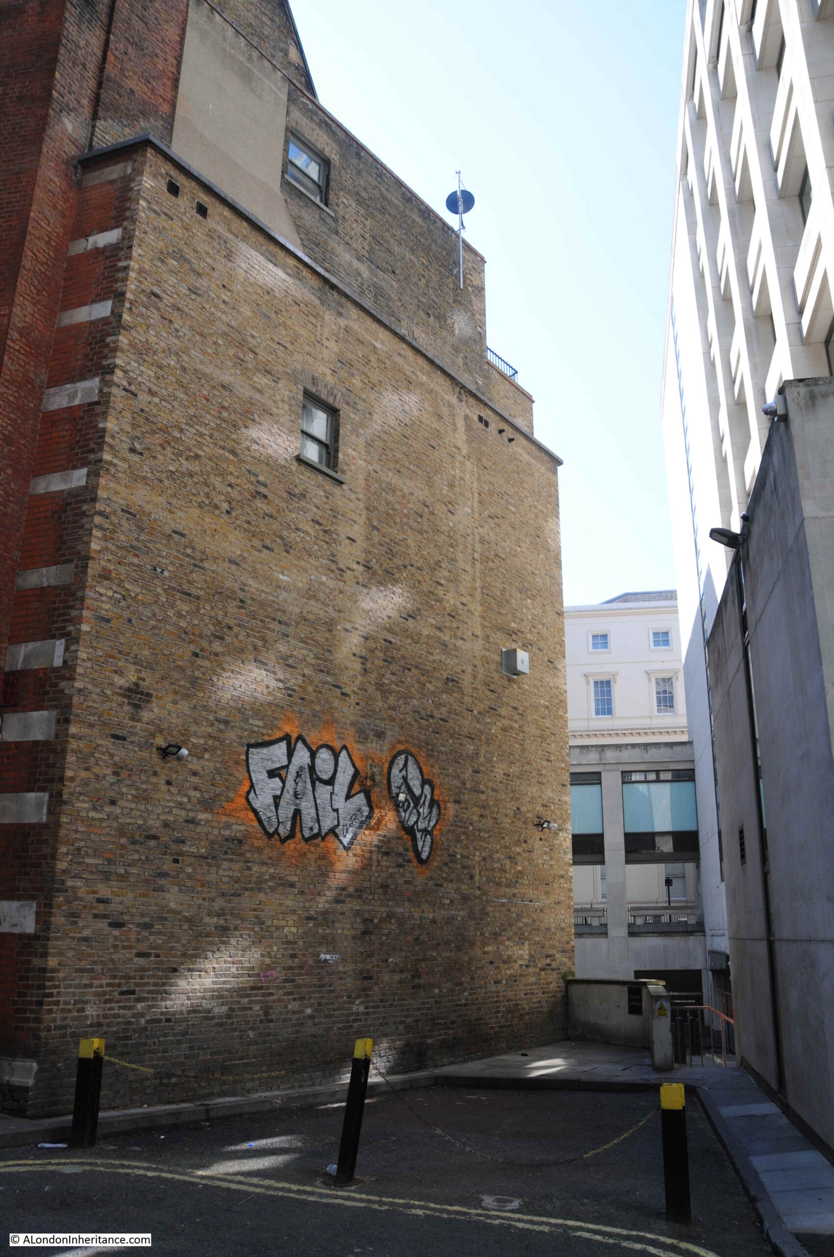
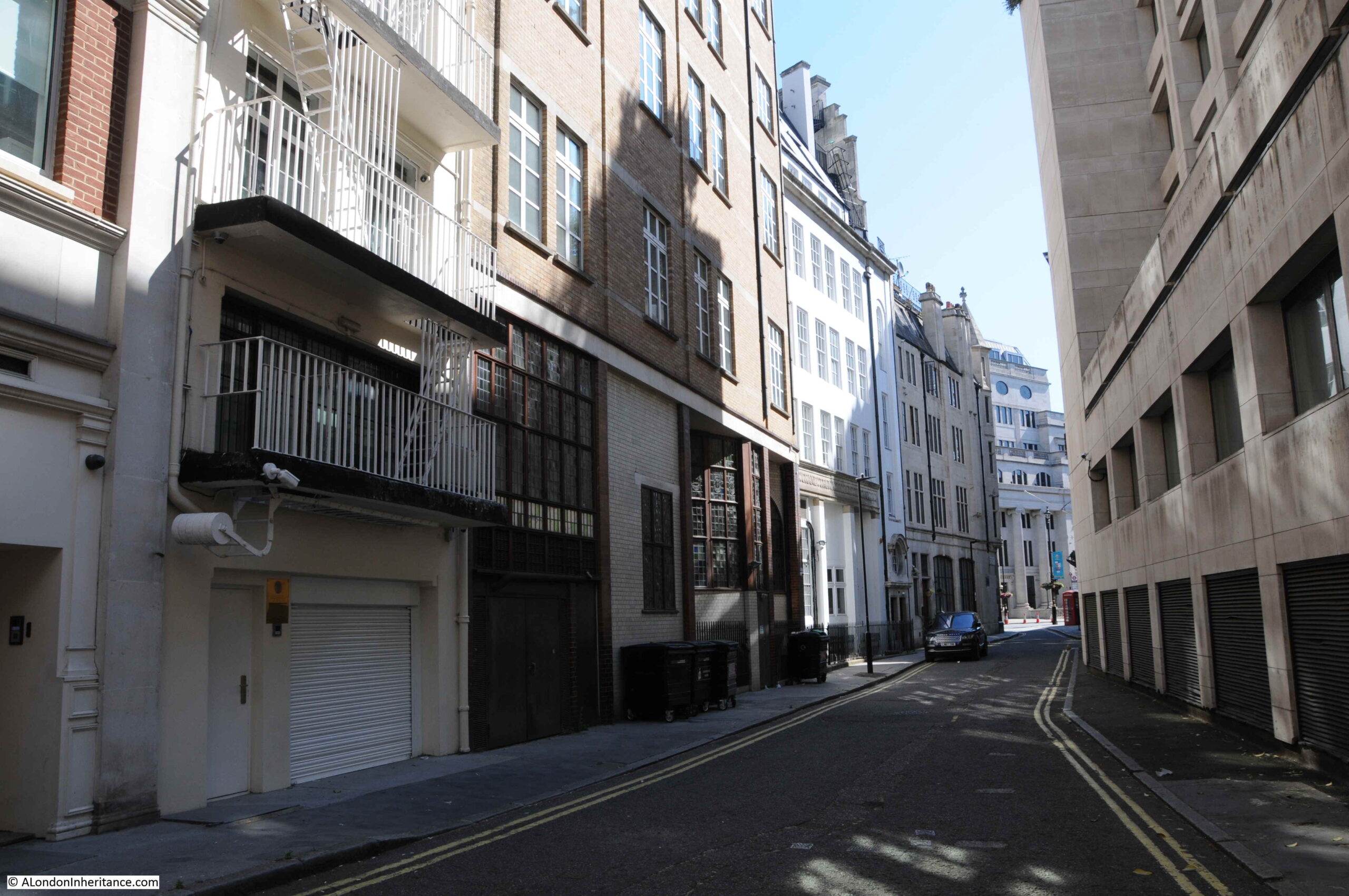
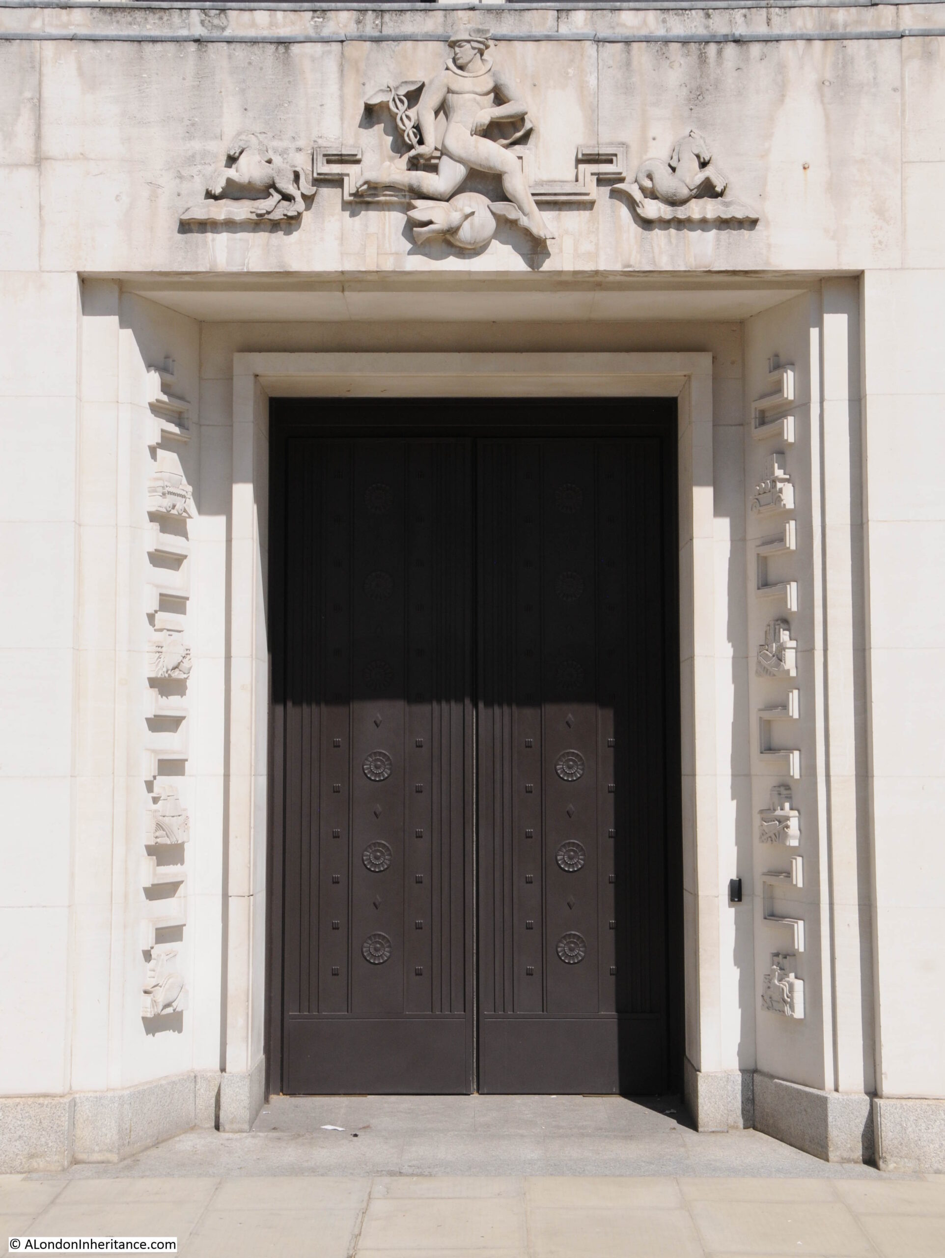
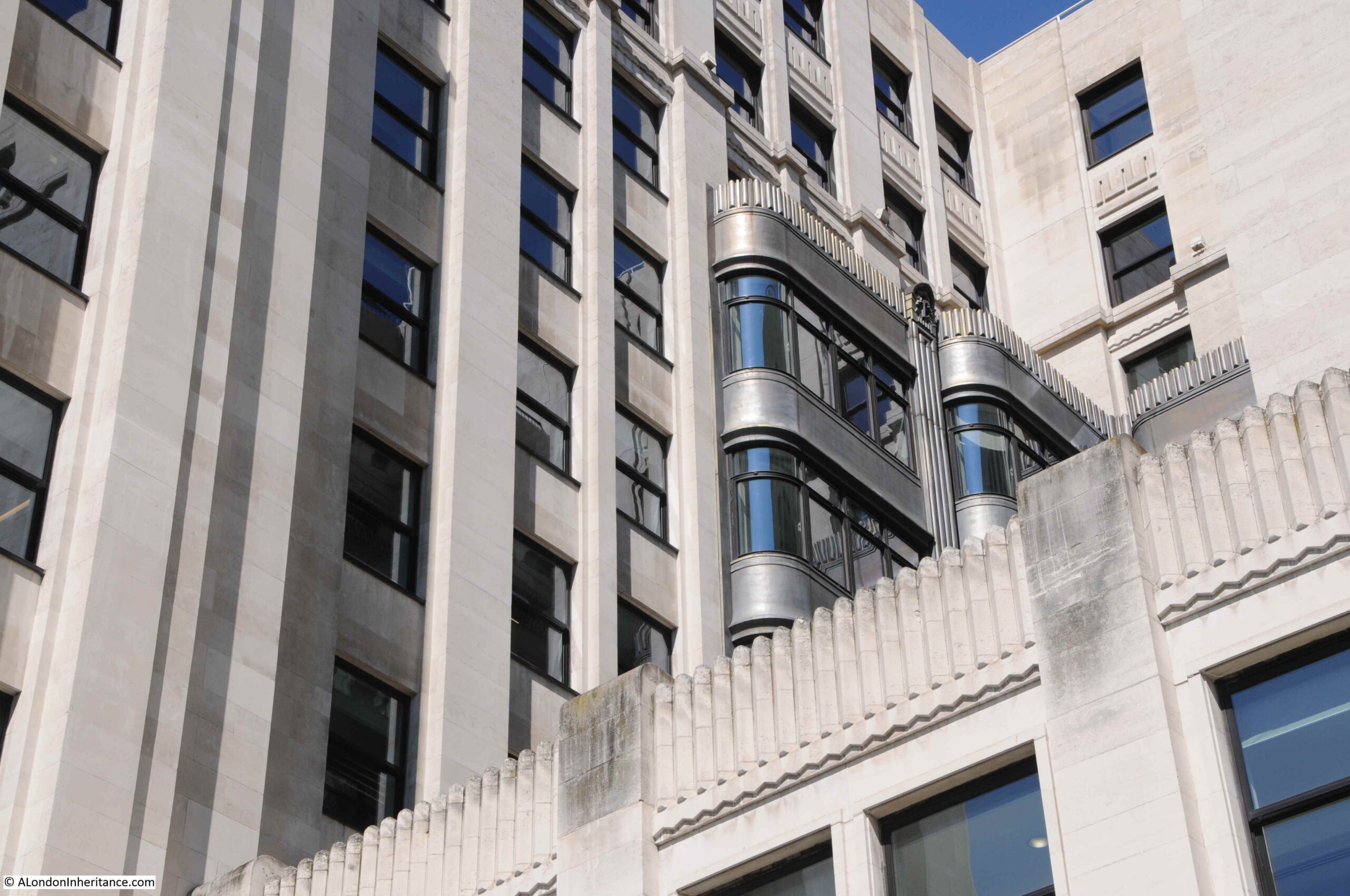
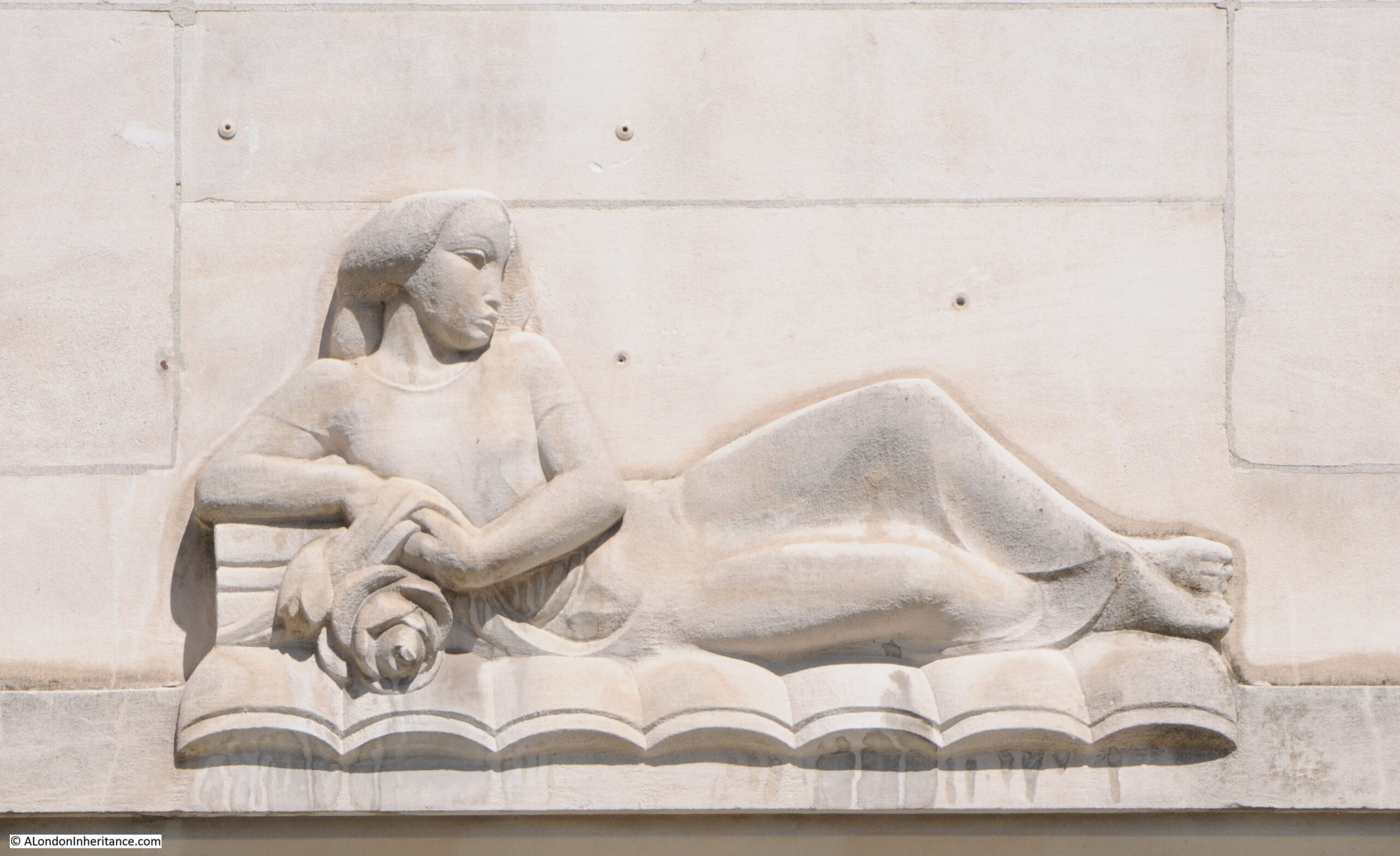
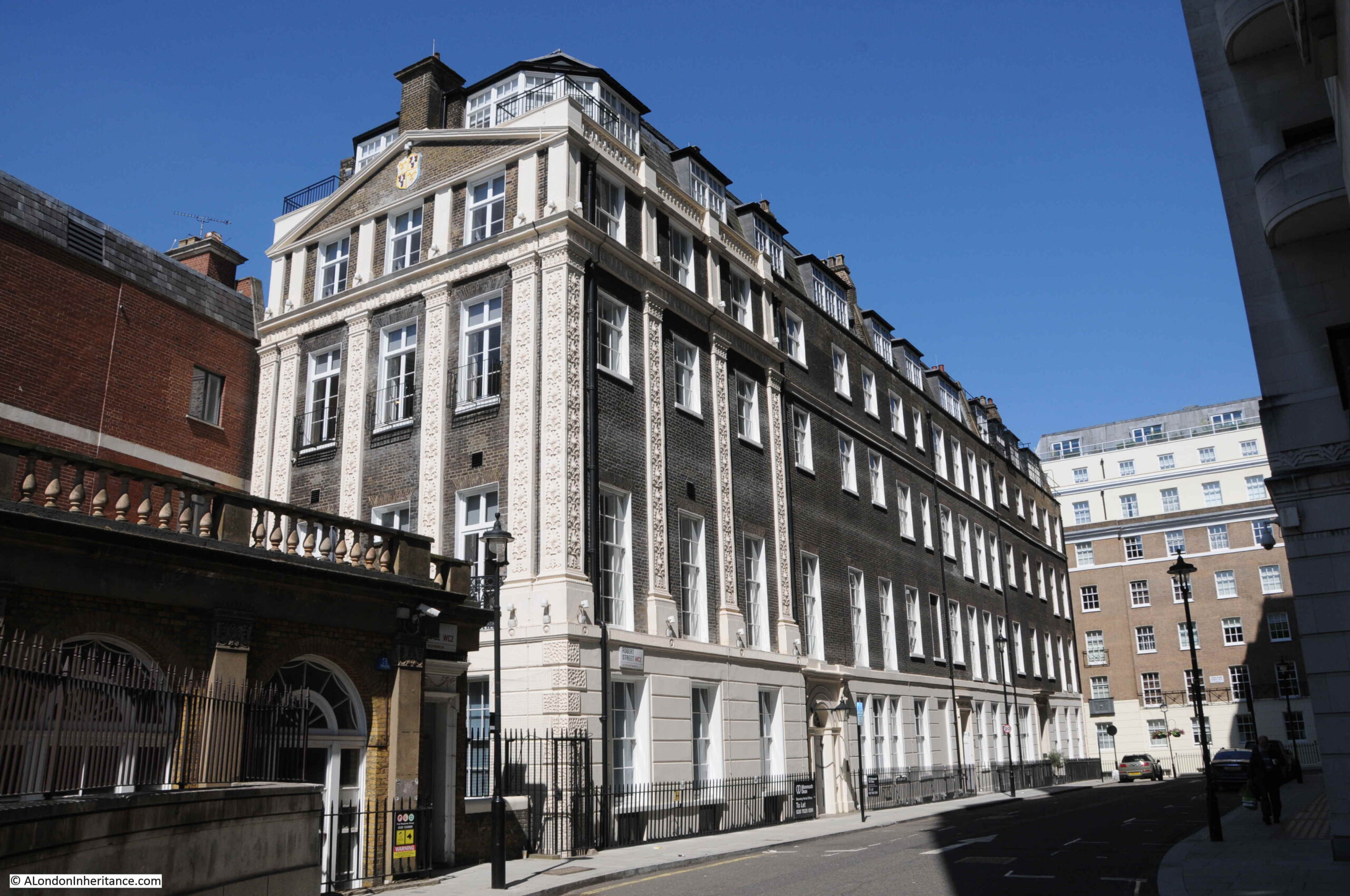
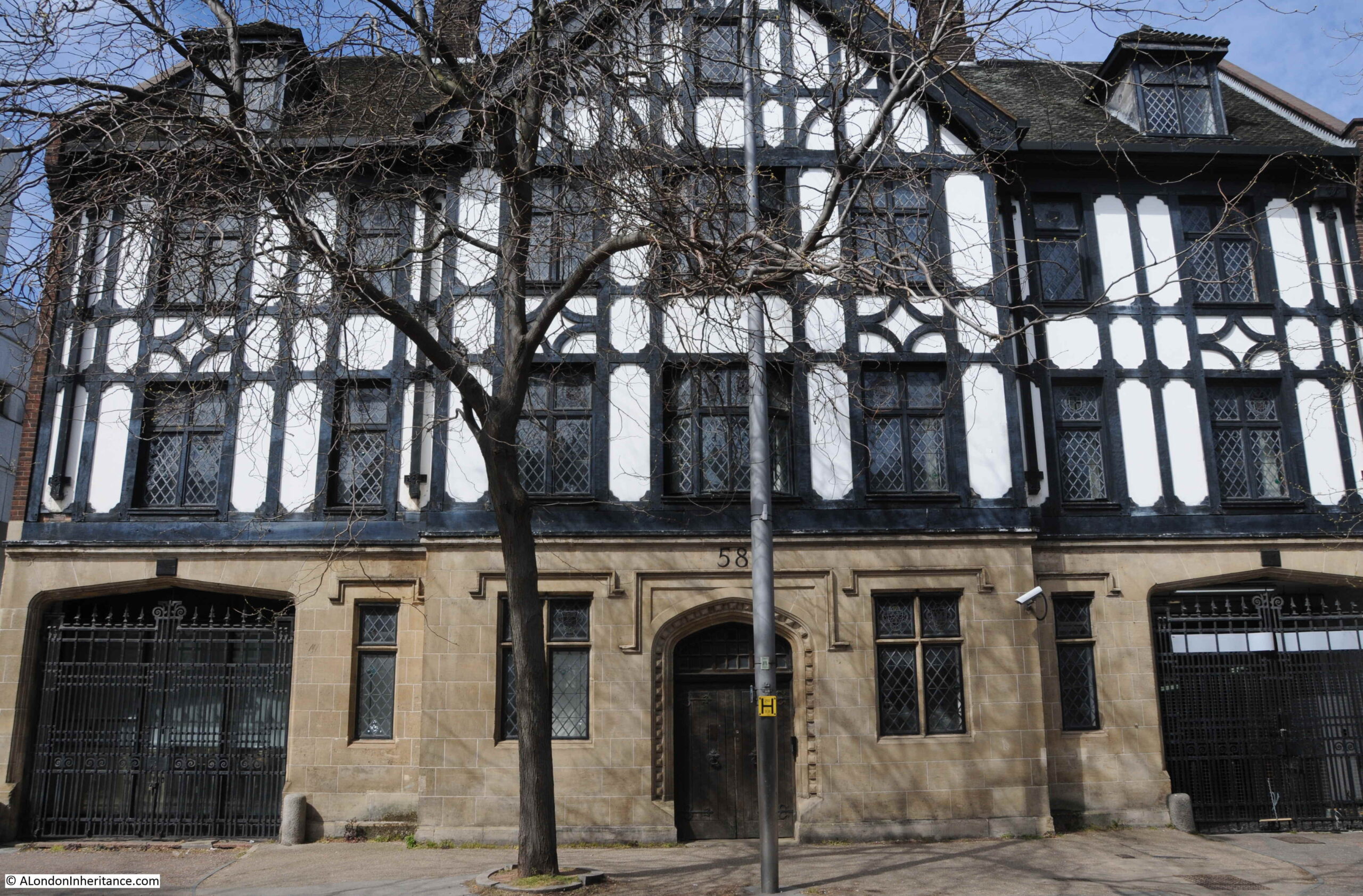
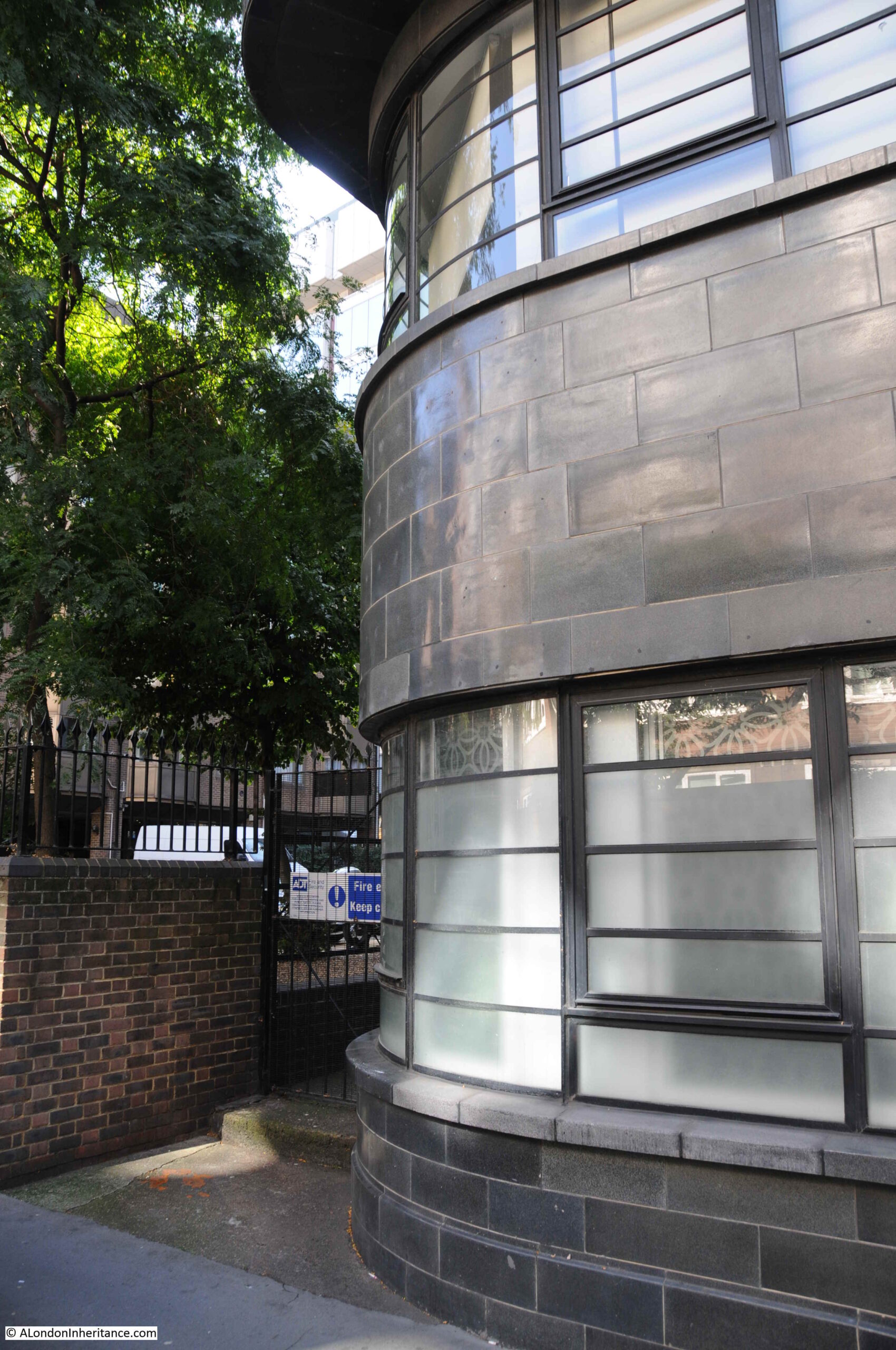
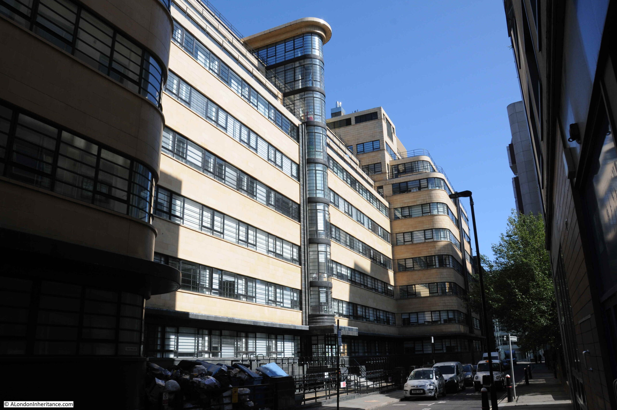
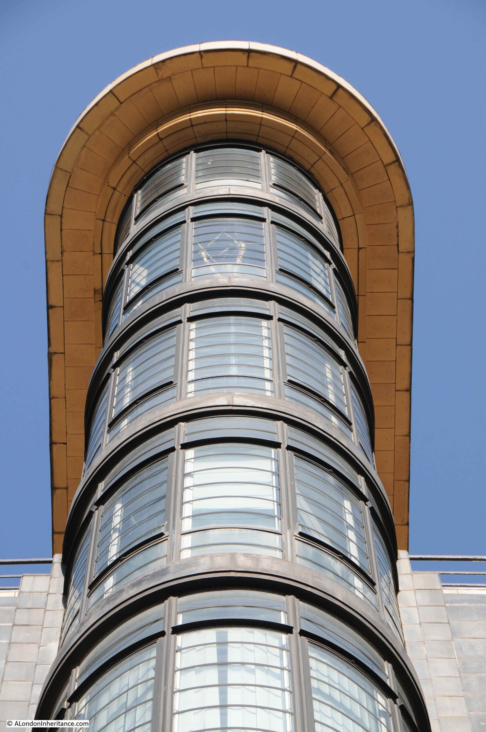
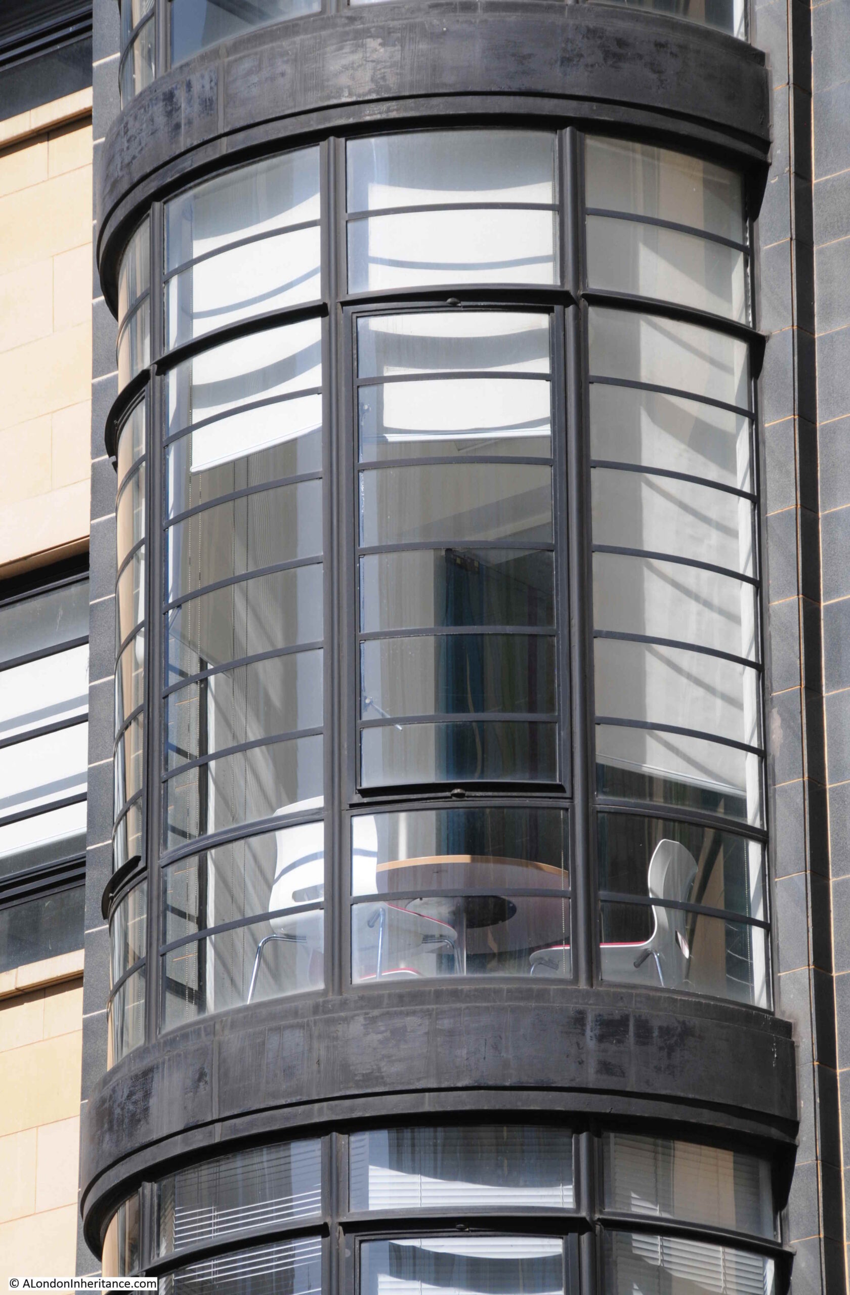
Warwick House Street consists of the backs of buildings that face onto other streets. To the north is Cockspur Street and Pall Mall, and there are a number of interesting buildings that have their backs on Warwick House Street, for example, this interesting mix of materials and shapes:

Warwick House Street

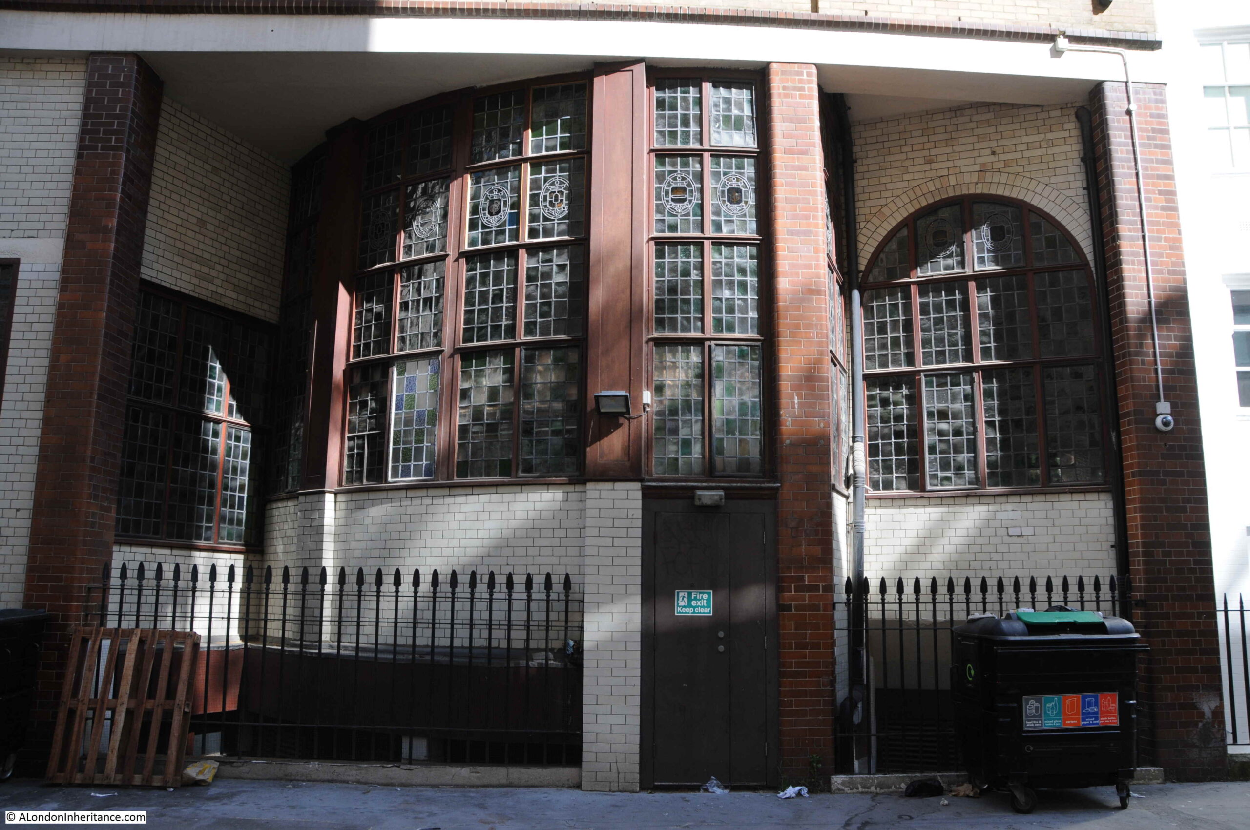
And on the same building that had “Grand Trunk Railway” displayed at the top, has “The Grand Trunk Railways of Canada” inscribed above the ground floor of the rear of the building:

Warwick House Street

Looking back along the street towards Cockspur Street and Trafalgar Square along a street that was here in 1746:

Warwick House Street

To take a look at the front of these buildings, I walked round to Cockspur Street.

The Brazilian Embassy occupies the buildings which has the ground floor with a mix of materials and shapes:

Brazilian Embassy

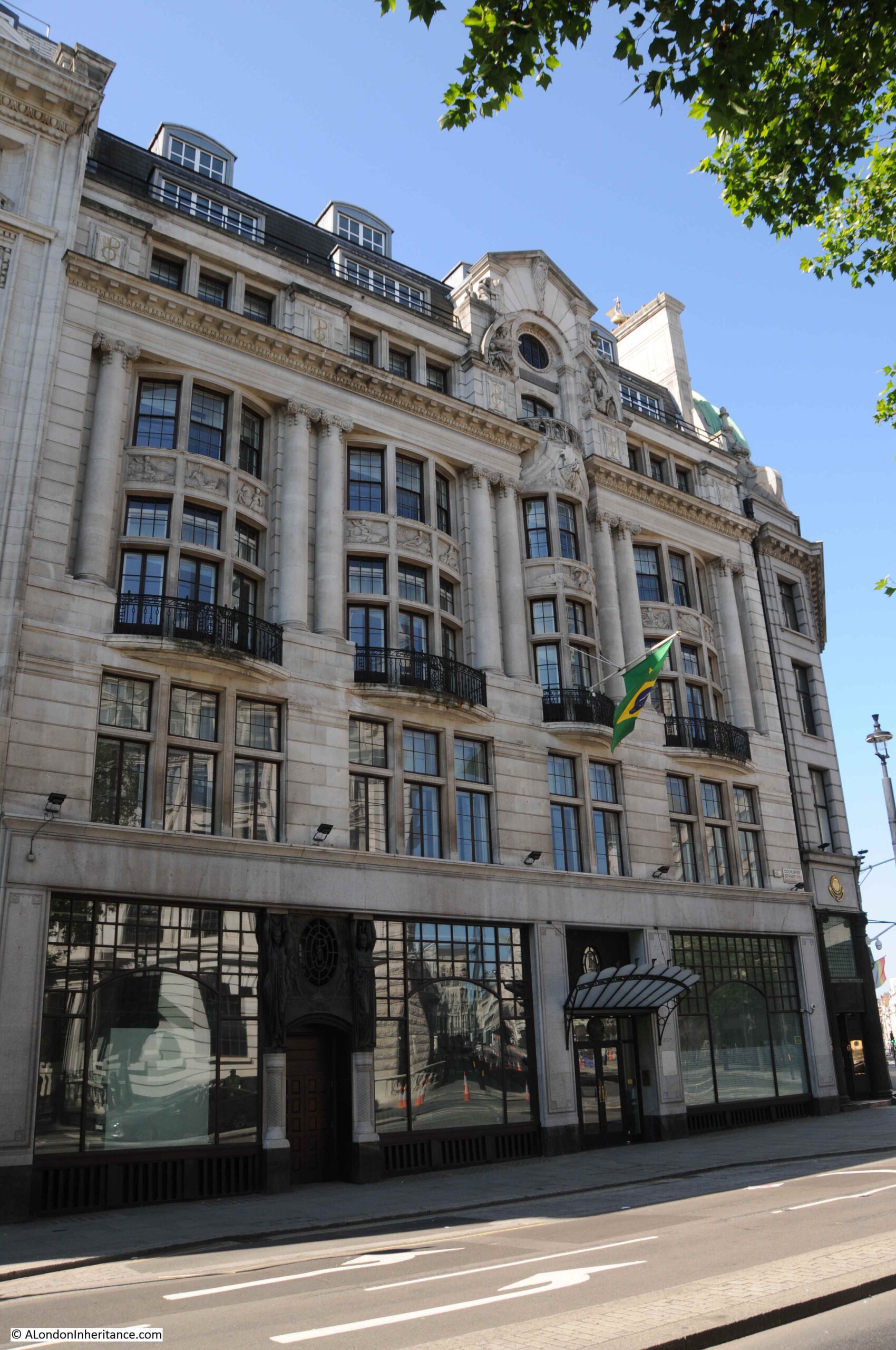
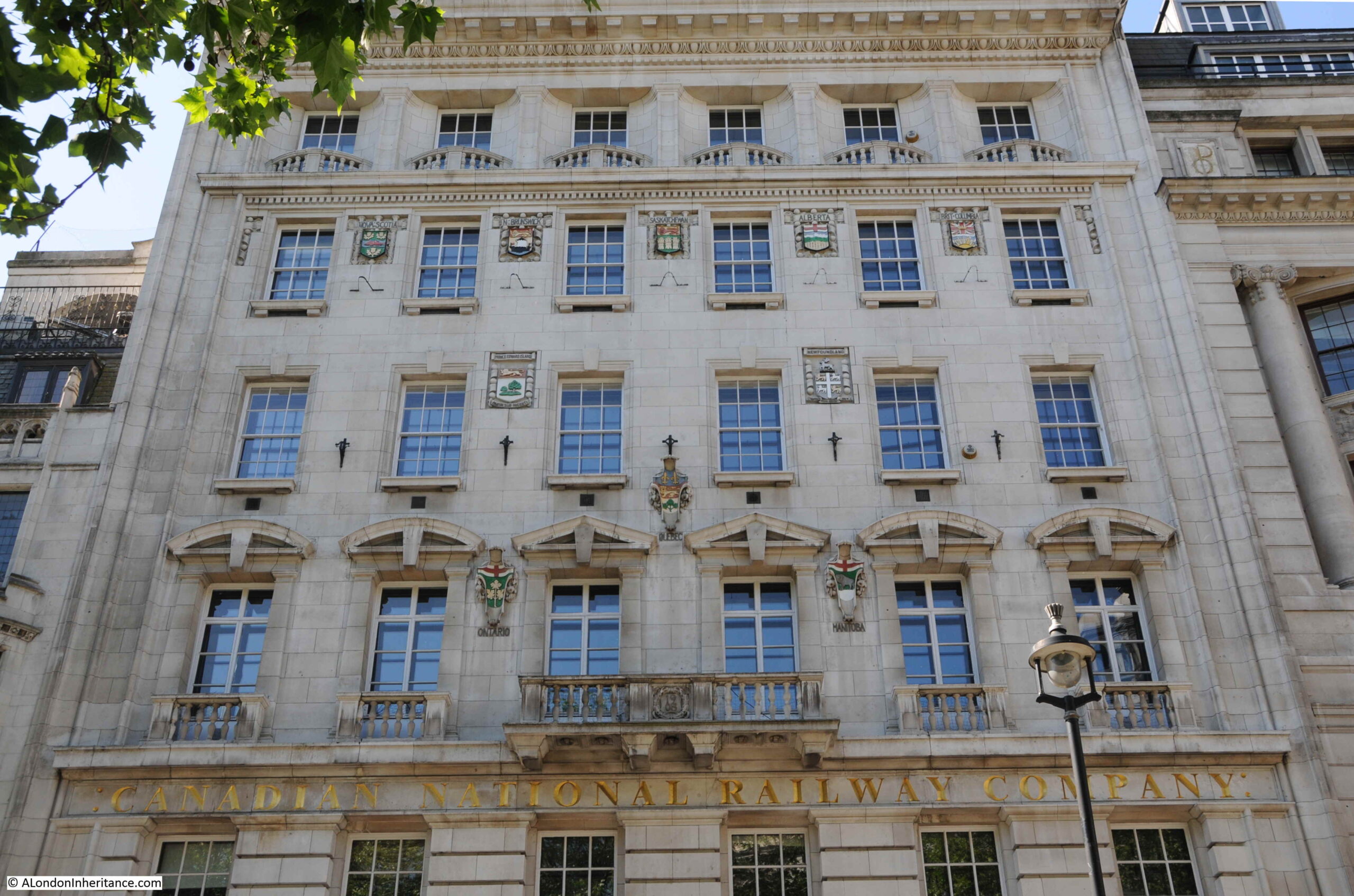
And the building with the railway references also has one on the front with the “Canadian National Railway Company”, the company that the “Trunk Railways” became part of. It is now the London Visitor Centre, and if I remember rightly, in the 1980s was the US Visitor Centre.

Canadian National Railway Company

Confirming the building’s Canadian heritage, between the windows of the upper floors are the coats of arms of the provinces and territories of Canada:

Canadian National Railway Company

I am pleased I found the location of the photo at the top of the post. Buildings and a view that have long been lost, however it is always good to find the exact location, and some remaining part of the view.

The sides streets are very close to Trafalgar Square, but are very quiet, mainly as they are basically service roads to the buildings on either side, but finding one that has been here since at least 1746 shows that whilst major houses and gardens come and go, and spaces are significantly reconfigured, in London, it is always possible to find traces of the past.

alondoninheritance.com

Embankment Gardens Art Exhibition and the Adelphi

The Victoria Embankment Gardens has often been the location for an open air art exhibition, and a couple of the photos in my father’s collection show the 1952 exhibition:

Embankment Gardens Open Air Art Exhibition

This could have been a difficult photo to locate, however the feature in the background made it easy to find the exact place. This is the same scene on a very sunny June day in 2021:

Embankment Gardens

The first exhibition appears to have been in 1948, as an article in the Sphere on the 23rd May 1953 describes that year’s exhibition as the sixth annual open air exhibition of contemporary art. The article also states that the exhibitions were sponsored by the London County Council, and that “On all days except the final day the pictures are for sale”, which seems rather strange, not also to sell them on the final day of the exhibition.

Exhibitions also seem to have been during part of the month of May, which would explain the coats worn by those in the photo, although that could really be any summer’s day given typical British weather.

The little girl in the photo looks to be around five or six. She would now be around 75 and the only one from the photo still alive.

The Illustrated London News on the 12th May 1962 describes that year’s exhibition as opening on the 30th April and running to the 12th May, with 700 paintings on display from both amateur and professional artists.

There is some British Pathe film of the 1949 exhibition which can be seen here, where “Our Roving Camera Reports”.

The monument behind the exhibition which enabled the location to be found, is to Henry Fawcett, the rather remarkable blind MP who championed the cause of women’s suffrage. His interests in the cause led him to meet Elizabeth Garrett who rejected his proposal of marriage in order to concentrate on becoming a doctor. He went on to marry Elizabeth’s younger sister, Millicent Garrett.

A statue of Millicent Garret Fawcett was unveiled in Parliament Square in 2018 with the words from one of her speeches “Courage calls to courage everywhere”.

The wall behind the monument is part of one of the air vents to the cut and cover underground Circle and District lines, a short distance below the surface.

The monument to Henry Fawcett:

Embankment Gardens

A wider view of Embankment Gardens, with the monument on the left.

Embankment Gardens

The gardens are looking very green with plenty of plants and trees, which would cause a problem trying to recreate the following photo of the art exhibition:

Embankment Gardens Art exhibition

My father took the above picture from the Adelphi Terrace, overlooking the gardens. The art exhibition is running along the pathway through the gardens, and shows how far to the right the exhibition ran, as the edge of the Fawcett monument can just be seen on the very left edge of the photo. The Thames and Waterloo Bridge can be seen in the background.

Adelphi Terrace, from where the above photo was taken is shown in the following photo:

Adelphi Terrace

I walked up and down the terrace looking over the wall to the gardens below, trying to recreate my father’s photo, however the trees and bushes have grown considerably since 1952, and the best I could get was the following photo:

Embankment Gardens

There is a small bit of wall visible in the gardens in the centre of the photo. This is not the monument or wall in the 1952 photo, rather a nearby fish pond, a short distance from where the art exhibition was held, and the nearest I could get to recreating the photo.

The Adelphi Terrace is in front of the Adelphi building, and raises the street around the Adelphi up above Savoy Place which runs at ground level between the Adelphi building and Embankment Gardens.

The following photo was taken from Savoy Place looking up at the terrace and the rather magnificent Adelphi building, and shows the height of the terrace:

Adelphi

The main entrance to the Adelphi building is on John Adam Street, and the building consists of two outer wings which extend over the terrace as shown in the above photo, with the core of the building between and behind the two wings, up to John Adam Street.

The Adelphi building is in the centre of the following map, which also shows the Victoria Embankment Gardens and the Henry Fawcett memorial to the right of the gardens (Map © OpenStreetMap contributors).

Adelphi

I thought I had a photo of the Adelphi from across the river, but I cannot find it. I did find a photo I took a few years ago which shows the three wings of the Adelphi as the building on the left of the photo.

Adelphi

From this distance the building does not look that impressive. It is only when you walk around the building that its unique decorative features can be seen.

The Adelphi was built between 1936 and 1938, by architect Stanley Hamp of the partnership Colcutt and Hamp.

Of standard steel frame and reinforced concrete construction, what makes the building rather special is the large amount of architectural decoration and design that follow the art deco approach.

In the photo of the building from Savoy Place, two large allegorical relief figures can be seen on the two wings that extend over the terrace. There are four of these (the other two are on the other corners of the wings). These represent Dawn, Contemplation, Inspiration and Night, with Contemplation and Night being seen in the above photo.

The following photo shows a detailed view of “Night” by the sculptor Donald Gilbert.

Adelphi

The following photo shows “Dawn” by Bainbridge Copnall, with architectural decoration extending above the sculpture to fill in part of the curved corner of one of the wings.

Adelphi

There is detail across the building. The following photo shows a side entrance on Robert Street. Note also that where the building faces towards the river, Portland stone is used, with brick used for the other facades, but retaining Portland stone for the ground floor and architectural detailing.

Adelphi

The sides of the building have small decorative panels between the brick pillars:

Adelphi

And carved coats of arms of UK cities between the ground and first floors. Three of these can be seen in the above photo, and in close up, the arms of Sheffield, Derby and Birmingham can be seen below:

Adelphi

Another view of Adelphi Terrace, which was constructed in part due to the 1930s expectation of the rise of the car as a means transport within the city, as well as replicating the original terrace:

Adelphi Terrace

Construction of the Adelphi in the 1930s required the demolition of an historic estate.

The original Adelphi estate was the work of Robert Adams and his three brothers, John, James and William. The name Adelphi comes from the Greek word adelphós, meaning brothers.

In the mid 18th century, the area now occupied by the Adelphi had been a rather run down area called Durham Yard, which had been the location of Durham House. At the time, the Embankment Gardens had not been built, so the space now occupied by the Adelphi was then facing on to the foreshore to the Thames. The damp conditions and flooding at high tide meant that this was not a good area to build the type of quality houses intended by Adams.

The plan developed, mainly by Robert Adams, was to build the houses and streets on a series of arches, which increased in height as the land descended from the Strand down to the river.

This was how the terrace came into being as the end of the estate overlooking what was then the edge of the River Thames. The following print from 1795 shows the terrace as it appeared soon after construction  (© The Trustees of the British Museum):

Adelphi Terrace

However the Adelphi Terrace in the above print is not in the same position as the Adelphi Terrace we can walk along today. In the above print, the block of buildings on the right were demolished to make way for the Adelphi building (not the building at the far end as we shall see).

In preparation for the construction of the Adelphi building, the whole of the block of houses that occupied the area, included the arches and space underneath the houses, was demolished all the way back to John Adam Street. As part of the build of the Adelphi, construction was pushed forward up to Savoy Place, so the terrace is now forward of the terrace in the above print.

The following photo from just before demolition in 1936 shows the Adelphi Terrace on the left, with the block of houses which would also soon be demolished. In the background is the recently completed Shell Mex House (1932) with Savoy Place running to the lower right of Shell Mex House.

Adelphi Terrace

With the construction of the new Adelphi building and terrace, the terrace was pushed forward to also run up against Savoy Place, in line with Shell Mex House, so the area in the lower right of the above photo is now under the terrace.

Another view of Adelphi terrace around 1897 before the construction of Shell Mex House:

Adelphi Terrace

If you look to the left of the second lamp post in the above photo, you can just see a round plaque. This was a medallion of the Royal Society of Arts recording the fact that the actor David Garrick had lived in the house. It was in one of the back rooms of the house that the actor died in 1779.

The large building on the right on part of the site now occupied by Shell Mex House was the Hotel Cecil.

And if you had been living in one of the houses in the terrace, this would have been your view as you looked along the river to the east, with the corner of Hotel Cecil on the left, and the first Waterloo Bridge crossing the river.

View from Adelphi Terrace

At the time of the above photo, the Adelphi was described as “one of the finest places to live in all London, as well as for pleasantness of situation as for convenience. The noise of the Embankment is sufficiently far away, and the hooters and sirens on the river suggest that sense of freedom and open space which goes with ports and their kinship with the sea. All too uncommon in London, late at night, the loudest noise is often the wind in the trees which move the lights of silent shipping“. Not from an early 20th century Estate Agents description, the quote is from the book Wonderful London.

Continuing a walk around the Adelphi building, and more door surround decoration:

Adelphi

Looking back between the wings of the building, we can see bow windows extending outward, with metallic decoration:

Adelphi

More decorative carvings:

Adelphi

Balconies:

Adelphi

The main entrance to the Adelphi on John Adam Street:

Adelphi

What is confusing is if you look above the doors, is the address John Street, however if you look to the lower right, is the full name John Adam Street.

John Street seems to have been the original name, as it is used on the 1895 Ordnance Survey map, and by the time of the 1951 revision, the current full name John Adam Street is used. I suspect the name change was when the Adelphi was built in the 1930s.

Having had a walk around the Adelphi building, time for a look at what remains of Robert Adam’s original estate. This is the view along Robert Street, with a fine terrace of buildings lining the side of the street. The end of the building on the left would have originally faced onto the original terrace, and is the same building at the far end of the terrace as in the 1795 print.

Robert Street

The scheme proposed by the Adams was highly ambitious. The land was sloping down to the river, and indeed consisted of part of the foreshore. The area would often flood at times of high tide.

Rather than building houses down along a sloping plot of land towards the river, with the resulting problems of damp and flooding, the plan consisted of building brick arches with the houses building on the platform created above.

The space within the arches would be sold or leased, and this approach would create a considerable improvement to the embankment of the Thames.

The following print from 1784 shows the completed estate with houses built above the arches which provided storage space easily accessible from the river  (© The Trustees of the British Museum).

Adelphi

The plan and construction was ambitious, and the financial side of the project was rather risky, as a lease on the land was only signed a year after construction had begun in 1768, and parliamentary approval to build the new embankment along the river was not granted until 1771.

Costs for the project were so high that the money had run out by 1773 when much of the estate had yet to be completed. To raise additional finance, a method common in the 18th century was used whereby a lottery with 4,370 tickets selling for £50 each raised enough to complete the estate. Prizes for lottery winners included some of the houses on the estate as well as storage space in the arches below.

The following plaque on the terrace in Robert Street identifies some of those who have lived in the houses:

Robert Street

View of the terrace in Robert Street from the junction with John Adam Street:

Robert Street

Strange that with street renaming, John Street changed to John Adam Street, however Robert Street kept the original name without a rename to the full Robert Adam.

The houses were highly decorated including Adam fireplaces. Many of the first floor ceilings were also painted by either the Swiss artist Angelica Kauffman or Giovanni Battista Cipriani from Florence.

Walking to the north of the Adelphi, along John Adam Street, and we find this building which was clearly not built as one of the terrace houses:

Royal Society

A plaque on the front identifies the building as the home of the Royal Society for the encouragement of arts, manufactures and commerce, which was founded in a coffee house in Covent Garden, and then moved to this building by Robert and James Adam in 1774. The building is still their home.

Royal Society

During the 1930s demolition ready for the construction of the Adelphi, demolition reached to the southern side of John Adam Street, so the street and home of the Royal Society are part of the original build, and the basement of the Royal Society building retains some of the brick arches built to raise the area above the sloping land.

In the 19th century, the arches and vaults below the houses had become somewhat different to what had been intended. The Sketch in 1903 includes the following description “The houses were built on deep arches that rivalled the Catacombs of Paris and these, at one time, were a great thieves kitchen, a tramps paradise, or doss house, that defied Watchmen and Bow Street Runners, and their successors the modern Peelers”.

There is probably some journalistic exaggeration in the above quote, however the following print from the mid 19th century does show a rather dark and gloomy place, underneath the Adam’s terrace houses  (© The Trustees of the British Museum):

Adelphi vaults

Looking along John Adam Street to the junction with Adam Street and we can see how the Adam’s plan included focal point houses at the end of the streets, and the type of decoration used.

The building in the background is Shell Mex House. When researching this post and after taking the above photo, I found the following print which shows the Royal Society building on the left, and the same building as in the photo, at the end of the street  (© The Trustees of the British Museum).

John Adam Street

I should have found the above print before visiting the site as I would then have taken the photo slightly further back to include the Royal Society building. If you stand in the street today, ignore the new Adelphi to the right, and Shell Mex House, the view does look much the same as in 1795.

The following photo is looking up Adam Street. The junction with the Strand is further along the street to the left, with an original house at the end of the terrace with a curved extension to the smaller width of the street. Adam Street was cut through to the Strand as part of Adam’s construction of the Adelphi.

Adam Street

The house behind the white car has a GLC Blue Plaque stating that the 18th century industrialist and inventor Sir Richard Arkwright lived in the house, with English Heritage’s background to the plaque stating that Arwright lived some of the final years of his life here in Adam Street before his death in 1792.

Looking above the houses in the above photo, there is an unusual sight hidden within the dense building of this area south of the Strand. A brick chimney with some robust steelwork providing support from Shell Mex House.

Chimney by Shell Mex House

The type of brick chimney seen in the above photo was once relatively common across London, but now is an unusual sight. No idea of the chimney’s purpose, whether it was or maybe still is, part of the Shell Mex House heating system.

That was rather a detour from my father’s original photo of the open air art exhibition in the Victoria Embankment Gardens, but that is why I started the blog, as a means of getting out to find the location of a photo and discovering a wider area.

There is more to the story of the Adam’s brothers and the surrounding area, including the creation of the Embankment Gardens, Shell Mex House, and Lower Robert Street which still routes under part of the estate. The old river stairs that would have entered the river roughly along where Savoy Place is today, and some of the lost streets down to the river – hopefully all subjects for future posts.

And returning to the original photo, I wonder if the little girl in the photo can today remember walking in the gardens and alongside the art exhibition?

alondoninheritance.com

St Paul’s Cathedral – 1977 and 2021

I was looking through some of my old negative scans and found four photos of St Paul’s Cathedral dating from 1977. Nothing special about the photos, and the cathedral is one of the buildings in the City that has not changed, however they did highlight how much dirt the cathedral had accumulated, and in comparison, how clean it looks today.

The following photo shows the view of the cathedral from the junction of Cannon Street and New Change in 1977:

St Paul's Cathedral

The following photo shows the same view, forty four years later in 2021::

St Paul's Cathedral

St Paul’s Cathedral has had a number of extensive cleaning and restoration projects over the years, however the state of the cathedral in 1977 was probably not what those who worked on the mid 1960s cleaning project would have expected.

At the end of the 1960s cleaning, it was expected that with recent clean air legislation, and the City of London being designated a smokeless zone the cathedral would remain clean and there was a possibility that in “250 years time, St Paul’s Cathedral will look as Sir Christopher Wren would have liked to have seen it”.

The above quote and the following still is from a fascinating BBC programme from 1965, when “Tonight” had a lengthy feature on the cleaning of St Paul’s Cathedral. The full programme can be watched here, and also highlights the 1960s approach to health and safety (as illustrated in the still below) as well as the rather basic method of cleaning employed. At times the wind lifted the sheets preventing cleaning water from falling to the streets, resulting in some very annoyed City Police Officers who threatened those cleaning the cathedral with a summons if they did not stop work as water was blowing as far as Cannon Street.

Cleaning St Paul's Cathedral

There is also a 1962 British Pathe film of the 1960s cleaning project here, which shows how jets of water and wire brushes were used to scrub the soot from the surface of the building, which in some areas was in layers over one inch thick.

Only 11 years after completion of the mid 1960s clean, the cathedral was again looking rather dirty.

St Paul's Cathedral

The above photo is the south facing side of the cathedral in 1977 and the photo below is the same view in 2021:

St Paul's Cathedral

In my 1977 photos, the cathedral appears cleaner towards the top, and dirtier towards the bottom of the building. Although central London was a much cleaner place than it had been for many centuries, vehicles were emitting far more pollutants than they do now, and pollution would still be blowing in from the surrounding area.

It is hard to appreciate just how dirty London was up until the late 1960s. Coal burning in homes, offices and factories along with electricity power stations, and industries producing gas from coal all contributed to a significant smog of pollution and dirt.

The 1960s cleaning of the cathedral had to deal with dirt that was over an inch thick in places, and we can get an idea of the impact of this amount of dirt from a Parliamentary question asked on the 06 April 1955 by Mr. George Isaacs, MP for Southwark, when he states that based on measuring equipment installed next to Bankside Power Station, and at the Town Hall in Walworth Road, they found that over a year, the “deposit recorded at that time was the equivalent to 235 tons to the square mile on Bankside and a mile away in Walworth Road the deposit was 60 tons to the square mile”.

In the written question, he states that it is necessary to live in the area to really know what the impact of this level of pollution to everyday life means, which he describes as: “Our people have grit in their eyes and grit in their food; there is grit underfoot and grit in the laundry on washing day. I know that what I say has happened. There are the large blocks of the Peabody Buildings less than 150 yards from the station. The only place there for women to dry their laundry is on the roof. They put their laundry on the roof, and the grit comes down. Father comes home to tea, and mother goes upstairs to take in the washing, and when she comes down father knows all about it because she is not in a good humour if she finds that she has to do her laundry all over again. I can say with some justification that this is a nuisance not only physically but in the way it upsets amenities and family life in the area”.

The following graph shows how the level of pollution in London, measured by Suspended Particulate Matter (measured in micrograms per cubic metre), has changed over time (source: What the history of London’s air pollution can tell us about the future of today’s growing megacities by Hannah Ritchie, using data from Foquet (2011) –  Creative Commons BY license):

St Paul's Cathedral

Whether these figures could have been accurately measured going back to 1700 is an interesting question, however the key point of the graph is the overall shape, and the rapid decrease in the second half of the twentieth century, confirming that the air is London is now much cleaner than it has been for many centuries.

The cathedral featured in classroom material produced by the National Society for Clean Air. A chart was produced which included a before and after the recent cleaning view of St Paul’s Cathedral. The chart also included a picture of a boy and girl in clean country air, as well as devices such as smokeless domestic heating equipment. Rather scarily, the chart also included drawings of the sections of the lungs of those living in the city and in the countryside, showing the damage that was being done to the lungs of city dwellers.

School education continues, with the Mayor of London now producing toolkits for schools focusing on air pollution and the dangers of high levels of Nitrogen Dioxide, which particularly affects children, and those with breathing difficulties.

Whilst the clogging grit and smoke that quickly blackened London’s buildings may no longer be a problem, invisible gases such as Nitrogen Dioxide, and very small particulate matter are now the main problem.

Another view of the south facing side of the cathedral in 1977:

St Paul's Cathedral

The same view today of a much cleaner building:

St Paul's Cathedral

The most recent full clean of St Paul’s Cathedral completed in 2011 ready for the 300th anniversary of the cathedral.

This had been a 14 year project which cleaned both the interior and exterior of the building. There were some controversial methods used to clean the cathedral, including a latex paste that was applied to the interior stone, which absorbed the layer of dirt and allowed this to be pulled away with the latex layer.

New methods have frequently been used for cleaning the building. In 1903, an American method of stone cleaning where a blast of pitsand was blown at the cathedral walls through a tube at a pressure of 30lb to the square inch, to try and remove the soot and dirt that was ingrained on the Portland stone of the building.

The main west facing entrance to the cathedral in 1977, photographed from Ludgate Hill.

St Paul's Cathedral

The same view today:

St Paul's Cathedral

My early memories of walking through the City are of a grey and dirty place, although it is also difficult to be sure how real some of these memories are. What is certain is that the buildings of the City are now much cleaner. The air in many places is better, but there are still many places where pollution levels are too high, generally close to busy roads as London today does not have the same polluting industries as it did.

Hopefully George Isaacs, MP for Southwark would be happy with the change, as well as Sir Christopher Wren who would now recognise the cathedral as it was when it was built.

alondoninheritance.com

Three Future Demolitions and Re-developments

The streets of London always have, and always will change. Buildings can disappear almost overnight and be replaced by a very different structure.

I try and photograph buildings and places before any demolition. This can be a challenge given the rate of change, however for today’s post, there are three places I want to focus on which will probably be very different in the years to come.

The three locations are shown in the following map  (Map © OpenStreetMap contributors):

Three Future Demolitions

The London Studios / London Weekend Television

Look across the river from the Embankment by Temple Underground Station, and this is the view:

London Studios

The tall tower was originally known as Kent House, a 24 story tower block, and the most visible part of the old studio complex which also includes a significant area of land around the base of the tower, including the low rise buildings which can just be seen to the left of the tower, above the tree line.

Kent House, and the low rise buildings were until 2018, ITV’s London Studios, also known as the Southbank Television Studios. It was here that ITV made Good Morning Britain, Loose Women, Ant and Dec’s Saturday Night Takeaway, the Jonathan Ross Show, along with a considerable number of shows for other channels, such as the Graham Norton Show and Have I Got News For You for the BBC. If you have watched ITV prior to 2018, chances are that you would have seen a programme filmed here on the south bank of the river.

The following photo shows the view of Kent House from Waterloo Bridge. The National Theatre is the building to the right.

London Studios

ITV were intending to return to the south bank studios after refurbishment and development, however they made the decision to leave and sell the site, with their programmes such as Good Morning Britain now filmed at the old BBC Television Centre in White City.

The story of Kent House and the associated studio buildings dates back to the early 1970s when there were two independent television stations serving London. Thames Television operated from Monday to Friday, and from Friday evening to six on Monday mornings, London Weekend Television (LWT) would broadcast.

When LWT started broadcasting in 1968, they only had temporary studios in Wembley, and were in urgent need for custom built studios, which was even more important with the transition from black and white to colour TV.

LWT identified a block of land near the National Theatre on the south bank and proceeded to build the new studio complex, including Kent House. These opened in 1972 and became the hub for all LWT production. The benefit of a new build was that they became the most technically advanced colour TV studios in Europe at the time of opening.

The studio complex faces onto the walkway along the south bank of the river. The tower is at the rear of the complex, facing onto the street Upper Ground, with low rise buildings facing onto the river.

ITV Studios

Studio buildings extend to the left of the above photo, with the block in the following photo up against the cafes, restaurants and shops at Gabriel’s Wharf which is further to the left.

ITV Studios

The whole site will soon look very different.

ITV sold the studio complex in 2019, including Kent House, to the Japanese real estate company, Mitsubishi Estate, and plans have now been submitted for redevelopment.

Kent House and the entire studio complex will be demolished, and replaced by a 26 storey office building to the rear (Kent House has 24 floors), two lower rise blocks of 13 and 6 storeys facing on to the river.

What is a surprise is that the majority of the complex will be office space, with a capacity for up to 4,000 workers. Based on what normally happens to sites in such a prime location is conversion to apartment blocks, as is happening around the Shell Centre tower further west along the south bank. Whether the plan continues to be for offices after the work at home impact of the pandemic will be interesting to see.

The proposal also includes plans for some form of open space, the obligatory restaurants and some form of cultural space.

The view from Upper Ground:

Gabriel's Wharf

The cafes, restaurants and shops at Gabriel’s Wharf are to the right of the two telephone boxes. Behind them are the low rise studio buildings.

Plans for the redevelopment of the area are still at an early stage, however Mitsubishi’s partner CO-RE are currently listing a 2026 date for completion of the project.

The following photo shows part of one of the old warehouses / offices at 58 Upper Ground, now part of the studio scenery stores.

Gabriel's Wharf

To the left of 58 Upper Ground is the early 1970s studio complex at the base of Kent House:

Southbank Studios

The mock Tudor building is one of the few survivors from before post war redevelopment of the area.

Gabriel's Wharf

ITV left the site in 2018, however the site still offers temporary office and studio space:

Kent House

To the lower left of the Kent House tower, the studio complex can be seen at the rear. This is the western boundary of the studio complex. In the distance can just be seen the half roof of a covered walkway. This was where the audience attending a show would queue for entry. When I worked on the Southbank, it was common to see a long queue of people here in the late afternoon.

Kent House

As shown in the above photo, there are frequently lorries parked around the base of the tower and studio area when the studios are in use.

The Southbank Conservation Area Statement prepared for Lambeth Council Planning states “The ITV tower is reasonably attractive but the lower buildings are of little architectural interest and the entrance forecourt is almost cluttered with waiting vehicles and delivery lorries”.

Personally, I think that this is a danger when looking at something only from a conservation perspective. The lorries at the base do add clutter to the scene, however they are there only because this is a working studio complex, which has added a diversity of activity and a busyness to Upper Ground.

The loss of a diverse range of activities when areas are transformed to a mix of expensive apartments, offices, hotels and chain restaurants, cafes and take-ways can really destroy an area.

Diversity of activity is essential in keeping a city alive.

The following photo shows the base of the tower and the lower levels of the studio complex. I love the way the tower looks as if it has been slotted over the lower levels, with the legs of the tower reaching down along the sides to the ground.

Kent House

A full view of the Kent House tower from Upper Ground:

Kent House

The next site is still on the south of the river, close to London Bridge Station and Tooley Street is:

Colechurch House

Colechurch House is a late 1960s office block on a relatively narrow strip of land between Tooley Street and Duke Street Hill. The main office building is lifted above ground level, and includes a walkway which provides access to the taxi waiting area for the station and London Bridge Street.

Colechurch House

Colechurch House was designed by architect E G Chandler for the City of London. It was named after Peter de Colechurch who was responsible for the first stone London Bridge, the building of which was started in 1176 and completed in 1209.

The building and the freehold of the land is owned by Bridge House Estates, and on the 14th October, the City of London Corporation as Trustee of Bridge House Estates released a press statement that property owner CIT had purchased a lease of the building, and would be bringing forward proposals for redevelopment.

Colechurch House

CIT’s proposals for the complete redevelopment of the site include replacing Colechurch House with a new office building ranging in height from 12 to 22 storeys, with the lowest height part of the building being at the London Bridge / Borough High Street end of the street. The highest part of the building was originally planned to be 32 storeys, however following a consultation process this has now been reduced to 22.

The new office block will be lifted off the street, with the area at ground level being public open space called the Park, which will be divided into a number of areas – Bridge Gate Square, Old London Bridge Park and St Olaf Square.

View of Colechurch House from the elevated walkway. The entrance to the office block is where the two lights can be seen.

Colechurch House

The planning application was submitted at the end of 2020, a number of issues with the application were raised in a letter dated the 1st March 2021. Consideration of these and a final decision is still to be confirmed, however I expect the demolition and rebuild will go ahead within the next couple of years.

Across the river to Fleet Street now, to find the site of a much larger redevelopment:

Fleet Street and Salisbury Court

This is probably the larger of the three developments covered in this post, and it covers a significant frontage onto Fleet Street and to the rear within a block bounded by Salisbury Court and Whitefriars Street.

The redevelopment is for a new area which has been dubbed the “Justice Quarter” as it will include a number of new buildings that will house functions related to the law.

The following map shows the area to be redeveloped, and the new functions that will be located in the development  (Map © OpenStreetMap contributors).

Justice Quarter

1 – New City of London Law Courts

2 – New headquarter building for the City of London Police

3 – Public space covering an area slightly larger than the current Salisbury Square

4 – New commercial / office space with, you may have guessed, space for restaurants, bars or cafes on the ground floor

The following photos walk through the area, starting from Salisbury Square, which is the green space within rectangle 3 in the above map.

This is the view across the square.

Salisbury Square

The building in the background is Fleetbank House, built between 1970 and 1975, a large building that has a lower section to the right, and also runs down Whitefriars Street, which is behind the building.

The obelisk in the centre of the square is a memorial to Robert Waithman, Lord Mayor of the City between 1823 and 1824. The memorial states that it was erected by his friends and fellow citizens.

To the right of the above photo, is the following brick building, 1 Salisbury Square:

Salisbury Square

The road to the right is Salisbury Court, running up to Fleet Street at the top.

Both Fleetbank House and 1 Salisbury Court have been granted a certificate of immunity by Historic England. This certificate states that the Secretary of State does not intend to list the buildings for a specific period of time – in the case of these buildings, up to July 2025.

If I have understood the proposals correctly, 1 Salisbury Square will be demolished and the area occupied will become part of the larger public space of Salisbury Square.

The following photo is a wider view across the square:

Salisbury Square

I am always amused by developers now and future impressions of proposed developments. If you look halfway down this page on the Salisbury Square Development website, there is a now and future picture where you can scroll between the two.

The now part of the photo was taken on a relatively grey day, with people milling about, or hurrying across the square. The proposed computer generated picture, shows the square at dusk, subtle lighting lights up the trees and the ground floor area of the new public space and there is not a cloud to be seen in the sky. Buildings frequently look their best with this form of lighting.

This type of comparison is all too common with the proposals for any new development.

A row of bollards line Salisbury Square:

Salisbury Square

Walking along Salisbury Court, up to Fleet Street. A relatively narrow street, the edge of 1 Salisbury Court is to the left of the photo:

Salisbury Court

8 Salisbury Court – again if I have understood the proposals correctly, this building will also be demolished, and the land become part of the new public space.

Salisbury Court

To the right of number 8, is a large brick building that covers number 2 to 7 Salisbury Court. This is Greenwood House.

Salisbury Court

The blue plaque states that the first number of the Sunday Times was edited at 4 Salisbury Court by Henry White on October 20th 1822.

The building dates from 1878, and was designed by the architect Alexander Peebles.

Between the ground and first floors, the building has some rather ornate terracotta carvings, and the land or building may have once belonged to the Vintners Company, as their arms with the three tuns can be seen on the wall between first floor windows.

Salisbury Court

2 to 7 Salisbury Court are Grade II listed, however a City of London notice cable tied to the iron railings outside the building state that a number of changes will be made:

i) Part demolition of 2-7 Salisbury Court Grade II listed;

ii) remodelling at roof level;

iii) formation of new facade to south elevation, and part new facade to west elevation;

iv) replacement fenestration;

v) new plant; and

v) associated internal alterations.

The two “v” bullets are directly from the notice, the final should I suspect be a vi.

Always hard to decode exactly what these planning notices mean, but I suspect it will be a new façade to replace the joining wall where number 8 has been demolished. Possible demolition of the internal structure of the building, with the wall facing Salisbury Court retained as a façade. A new roof and changes to the windows.

So some dramatic changes.

The view looking down Salisbury Court from the junction with Fleet Street:

Salisbury Court

On the corner of Salisbury Court and Fleet Street is 80 to 81 Fleet Street. A large corner building that was until recently a Barclays Bank. The building was originally, up to 1930, the home of the Daily Chronicle.

Fleet Street

This corner building will also be demolished, and will form, along with the entire block along Fleet Street as shown in the above photo, the new City of London Law Courts.

The centre block in the following photo is Chronicle House, covering 72-78 Fleet Street. The building dates from 1924 and was designed and built by Hebert, Ellis & Clarke.

Fleet Street

The building takes its name from being home to the newspaper, the News Chronicle. The building has also been granted immunity from listing by Historic England and the Secretary of State.

The following block is on the corner of Fleet Street and Whitefriars Street, and will also be demolished to become part of the Law Courts complex.

Fleet Street

Walking down Whitefriars Street, and the following building is the Hack and Hop pub:

Hack and Hop

The Hack and Hop was originally the Coach and Horses, a pub that dates back to the mid 19th century. The earliest record I can find of the pub is a newspaper mention in the Morning Advertiser on the 25th November 1850, where there was an advert for a regular Monday evening meeting where a penny subscription would be collected for the London Copper-Plate Printers Benevolent Fund – a reminder of the long history of the area with the printing trade.

Hack and Hop

The buildings along this part of Whitefriars Street, including the Hack and Hop pub will be demolished and replaced by the new headquarters building for the City of London Police.

The new building will bring together police functions from a couple of existing buildings which have already been sold – Wood Street and Snow Hill police stations. The new building will have ten floors above ground with space for 1,000 police officers and civilian staff, with three levels below ground for specialist functions and parking.

Continuing on down Whitefriars Street, and we see the other side of Fleetbank House:

Whitefriars Street

Fleetbank House will be demolished and replaced with a new office / commercial building, which is described as having a “lively frontage”. I suspect this means cafes, bars and restaurants.

The view looking up Whitefriars Street, with the grey walls of Fleetbank House.

Whitefriars Street

The end of Fleetbank House in the above photo marks the southern limit of the new re-development of Whietfriars Street. The work to create the so called Justice Quarter will be one of the most significant developments along Fleet Street for a very long time.

The area off Fleet Street has a considerable amount of history which will require a dedicated post. Hanging Sword Alley passes through the space from Whitefriars Street to Salisbury Court. There is a memorial to journalist T.P. O’Connor along Fleet Street. Bradbury and Evans, one of Dickens publishers were located here. The Fleet water conduit was here until the Great Fire in 1666.

The whole block has a long association with the journalism and the publishing industry, which ended in 2009 when the French Press Agency left 72-78 Fleet Street (Chronicle House).

It is hard to avoid getting into a discussion about the good or bad points of any new development, and I have tried to avoid this in the above post, focusing instead on recording what may well disappear in the coming years.

There is much to consider regarding any change. The buildings lost, the new buildings, what the change brings to the overall area, architecture, impact on wider views, jobs, diversity of activity etc. etc.

There is also the issue of what then happens to the buildings where functions will move from. For example, one of the City of London courts that will move into the new Fleet Street building is the City of London Magistrates Court on the corner of Queen Victoria Street and Walbrook, shown in the following two photos:

London Magistrates Court

A building in a very prime location.

Development often leads to further development as functions, businesses etc. shuffle their way around the City.

Three possible future demolitions and re-developments that will have a significant impact on their local area of London.

Further reading on these can be found at:

City of London Salisbury Square Development web site

City of London Consultation briefing for the Salisbury Square development

Save Britain’s Heritage petition to stop the demolition of 72 – 81 Fleet Street

Colechurch House development web site

Article with artist’s impression of new Colechurch House development

Article with artist’s impression of development on south bank replacing Kent House and Studios

alondoninheritance.com

The Minories – History and Architecture

I have been to the Minories in a previous post when I explored the lost Church of Saint Trinity, or Holy Trinity in the Minories, and when I went to find the pulpit from the church which is now at All Saints’ Church, East Meon in Hampshire.

I wanted to return to explore the street, the abbey after which the street is named, and one of the most architecturally interesting buildings in the city.

The following photo is from Aldgate High Street at the northern end of the Minories, looking down the street.

The above photo shows what looks like an ordinary London street. Lined by commercial buildings, fast food stores, and the obligatory towers rising in the distance; the Minories has a far more interesting history than the above view suggests.

The following ward map from 1755 shows the Minories running down from Whitechapel, just outside the City wall.

In the above map, the area of land between the city wall and the Minories was once part of the ditch that ran alongside part of the walls. Look across the map at the top of the Minories, and running to the top left is another reminder of the ditch, the street Houndsditch, the last part of the name can be seen.

Being outside the City walls, the area may have been the site of a Roman cemetery, and in 1853 a large Roman Sarcophagus with a lead coffin was found near Trinity Church, just to the right of the street.

In the map the street is called The Minories, however today “The” has been dropped and the street name signs now name the street just Minories (I am continuing to use “the” in the post as I suspect it helps the text to flow”.

The name derives from the sisterhood of the “Sorores Minores” of the Order of St. Clare. The sisters of the order were known as Minoresses and the book “A History of the Minories, London”, published in 1922 and written by Edward Murray Tomlinson, once Vicar of Holy Trinity Minories, provides some background as to the origins of the order:

“The Order of the Sorores Minores, to which the abbey of the Minores in London belonged, was founded by St Clara of Assisi in Italy, and claimed Palm Sunday, March 18th 1212, as the date of its origin”.

The Order’s arrival in London, and establishing an abbey outside of the City walls dates back to 1293. It appears that the first members of the Order in the Minories came from another of the Order’s establishments just outside Paris.

The land occupied by the 13th century Order can be seen in the following map, enclosed by the red lines to the right of the street (Map © OpenStreetMap contributors).

The land supported a Church, Refectory, Guest House, Friars Hall, and along the right hand wall, a Cemetary and Gardens.

The Order received a number of endowments, and rents on properties that had come into their possession, and by 1524 they were receiving £171 per annum.

The lists of rents received in 1524 provide an interesting view of the costs of renting in different parts of the city. The following table lists the rents received from Hosyer Lane (now Hosier Lane in West Smithfield).

The majority of documentation that survives from the Order are mainly those relating to endowments, rents received, legal and religious documents. There is very little that provides any information on day to day life in the Minories. The only time we have a view of the number of sisters who were part of the Order, is at the very end of the Order, when on November 30th 1538, the Abbey buildings and land in the Minories were surrendered to Henry VIII.

The Abbess of the Order probably realised what was happening to the religious establishments in the country, and that by surrendering to the King, the members of the Order would be able to receive a pension, and it is the pension list that provides the only view of the numbers within the Order.

In 1538 there was an Abbess (Elizabeth Salvage) who would receive a pension of £40, along with 24 sisters, ranging in age from 24 to 76, and each receiving a pension of between £1 6s 8d and £3 6s 8d.

There were six lay sisters who do not appear to have received a pension – the name of one of the lay sisters was Julyan Heron the Ideote, indicative of how even religious establishments treated people who probably had learning difficulties.

It appears that the King granted the land and buildings to the Bishop of Bath and Wells, and many of the original Abbey buildings were still standing in 1797, when a large fire destroyed many of the remaining buildings of the Abbey. The last religious building on the site was the church of Holy Trinity, which closed as a church at the end of the 19th century, but the church survived as a parish hall until the Second World War when the building suffered severe bomb damage. A wall did remain until final clearance of the area in the late 1950s.

The remaining abbey buildings of the Minories in 1796:

As well as the name of the street, Minories, a side street also recalls the order. The street in the following photo is St Clare Street, after the Order of St. Clare. It runs through the land of the old abbey, and at the end of the street was the church of Holy Trinity.

The pub on the corner of the Minories and St Clare Street is The Three Lords. The current pub building dates from around 1890, however a pub with the same name has been on the site for much longer. The earliest newspaper reference I could find to The Three Lords dates to the 11th January 1819 when the Evening Mail reported on the arrest of a man for robbery. He was formerly a respectable man with carriage and servants, one of whom in 1819 kept the Three Lords and a pot from the pub was found in the room of the alleged thief.

Walk along the Minories today, and apart from the street name, there is nothing to suggest that this was once the site of the Abbey. The street is mainly lined with buildings from the first half of the 20th century.

With a mix of different architectural styles and construction materials.

Towards the southern end of the Minories is one of the most architectually fascinating buildings in the city. This is Ibex House:

Ibex House was built between 1933 and 1937 and was designed as a “Modernistic” style office block by the architects Fuller, Hall and Foulsham.

it is Grade II listed and the Historic England listing provides the following description: “Continuous horizontal window bands, with metal glazing bars. Vertical emphasis in centre of each facade in form of curved glazing (in main block) and black faience strips”

“faience” was not a word I had heard before, and the best definition I could find seems to be as a glazed ceramic. Black faience is used for the ground floor and vertical bands, with buff faience used for the horizontal bands on the floors above ground.

The ground floor, facing onto the Minories consists of the main entrance, sandwich bar and a pub, the Peacock:

The Peacock is a good example of the way developers have integrated a business that was demolished to make way for a new building, in that new building.

A pub with the same name had been at the same location since at least the mid 18th century. It was demolished to make way for the Ibex building, and a new version was built as part of the development.

An 1823 sale advert for the Peacock provides a good view of the internal facilities of the original pub, from the Morning Advertiser on the 19th May 1823:

“That old-established Free Public House and Liquor Shop, the PEACOCK, the corner of Haydon-street, Minories, in the City of London, comprising five good sleeping rooms, club room, bar, tap, kitchen, and parlour, and good cellar, held on lease for 18 1/4 years, at the low rent of £45 per annum.”

Newspaper reports that mention the Peacock include the full range of incidents that would be found at any city pub over the last couple of hundred years – thefts, the landlord being fined for allowing drunkenness, betting, sports (boxing seems to have been popular at the Peacock, etc.) however one advert shows how pubs were used as contact points, and tells the story of one individual travelling through London in 1820. From the Public Ledger and Daily Advertiser on the 29th May 1820:

“WANTED, by a PERSON who is 30 years of age, and who has been upwards of three years in the West Indies, a SITUATION to go to any part Abroad, as CLERK in a Store or Warehouse, or in any way he may be able to make himself useful. Address (post paid) for A.B. to be left at the Peacock, in the Minories”.

It would be fascinating to know “A.B’s” story, did he get another job, and where he went to next.

On the southern corner of Ibex House is a rather splendid sandwich bar, all glass and chrome:

The main entrance to the building looks almost as if you are entering a cinema, rather than an office building:

During the first couple of decades, occupants of Ibex House illustrate the wide variety of different businesses that were based in a single London office block, including:

  • Shell Tankers Ltd – 1957
  • Johnston Brothers (agricultural contractors) – 1952
  • Associated Lead Manufacturers Ltd – 1950
  • Vermoutiers Ltd (producers of “Vamour”, sweet or dry Vermouth) – 1948
  • The Royal Alfred Aged Seamen’s Institution – 1948
  • Ashwood Timber Industries – 1947
  • The Air Ministry department which dealt with family allowances and RAF pay – 1940
  • Cookson’s – the Lead Paint People – 1939
  • Temple Publicity Services – 1938

The Associated Lead Manufacturers advertised “Uncle Toby’s Regiment of Lead” as their special lead alloy was used widely in the manufacture of toy soldiers. It would not be till 1966 that lead was banned as a material for the production of toys due to the damage that lead could cause to the health of a person.

The front of Ibex House is impressive, but we need to walk down the two side streets to see many of the impressive details of the building. Ibex House is designed in the shape of an H, with wide blocks facing to the Minories, and at the very rear of the building, with a slightly thinner block joining the two wider.

Walking along Haydon Street we can see the northern aspect of the building (Haydon Street was also the southern boundary of the Abbey of the Order of St Clare / the Minories).

The central glazed column contains small rooms on each floor level. There are few sharp corners on the building, mainly on the very upper floors, with curves being the predominant feature.

Looking back up towards the Minories:

The stepped and curved floors and railing on the upper floors give the impression of being on an ocean liner, rather than a city office block:

Curved walls feature across the building, including the corners of the ground floor which are tucked away at the end of the street:

Portsoken Street provides the southern boundary of the building:

Detail of the projecting canopy roof at the very top of the central, glazed column:

With a small room at each floor level:

The design detail includes curved windows in the glazed column that open on a central hinge:

Larger room at the top of the glazed column – a perfect location for an office with a view:

As well as the main entrance on the Minories, each side street also has an equally impressive central door into the building:

Ibex House is a very special building.

The view back up the Minories from near the southern end of the street:

The sisterhood of the “Sorores Minores” of the Order of St. Clare have left very little to tell us about life in their Abbey, and there are no physical remains of their buildings to be found, just the street names Minories and St Clare Street. Just one of the many religious establishments that were a major part of life in the city from the 12th century onwards.

So although we cannot see anything of the abbey, the Minories does give us the architectural splendor of Ibex House to admire as a brilliant example of 1930s design.

alondoninheritance.com

Winchester Palace and the Great Hall, Clink Street

Clink Street in Southwark is close to Southwark Cathedral and Borough Market, and the street is part of the busy walk along the south of the river. Converted warehouses line the river side of Clink Street, but on one part of the southern side of the street, a remarkable survivor, the Great Hall of Winchester Palace can be seen; the Southwark residence of the Bishops of Winchester.

Winchester Palace

The following map extract shows the location – the green rectangle towards the middle, top of the map is the part of the palace that can be seen alongside Clink Street (Map © OpenStreetMap contributors).

Winchester Palace

The first evidence of a palace for the Bishops of Winchester dates back to the 12th century, with an eastern boundary wall, and some building of stone construction.

The 13th century saw the expansion of the palace estate with some major construction work. This work included a number of two storey blocks, a hall, chapel and courtyard. Work also included improvements to the wharf along the River Thames.

The 13th century also included the surfaced road that would become Clink Street, with the name Clink Street being in use by the start of the 17th century.

One of the earliest references to Winchester House (as it was also known) comes from the life of St. Thomas à Becket by William FitzStephen, who wrote that Archbishop Thomas received hospitality at the house of the Bishops of Winchester before making his final journey to Canterbury where he would meet his death.

The Bishops needed a London residence, not just for their religious duties. At the time there was not that much separation between religion and government, and the Bishops of Winchester also frequently held some of the great Offices of State.

The Palace was also frequently used for entertaining, and hosted events for the rich and powerful of the land. For example, in 1424 the wedding feast of James, King of Scotland, and Joan, daughter of the Earl of Somerset was held at the palace.

The palace appears to have been in possesion of the Bishops of Winchester through to the mid 17th century, when it was turned into a prison for Royalists during the Civil War. In 1649 it was sold for £4,380 to a Thomas Walker of Camberwell, but after the restoration of the monarchy, the palace estate was returned to the Bishops of Winchester.

It was during the 1640s that a parliamentary survey of the palace was carried out, and around 1647 the artist Wenceslaus Hollar completed a drawing of the Palace, or Winchester House, the words Palace and House are frequently used in reference to the Bishops of Winchester residence  (Prints in this post are ©Trustees of the British Museum):

Winchester Palace

Hollar’s drawing shows an extensive range of buildings alongside the river. The Great Hall is to the right, with the rest of the buildings housing accommodation blocks, storage, kitchens, a chapel and stables. There were also extensive grounds to the palace.

The text below the above print provides some detail about Winchester House: “Winchester House founded in the year 1107 by William Gifford Bishop of Winchester as a Town dwelling for himself and successors on a piece of ground rented of the Priors of Bermondsey and which was situated at a small distance from the fine convent of St Mary Overy on Bankside Southwark. It was much enlarged by Succeeding prelates particularly Bishop Gardiner, in the reign of Mary and covered with its gardens &c. three acres and a half of ground”.

The small drawing at the bottom of the print shows the Great Hall, and it is the remains of this building that we can see alongside Clink Street today.

Although the palace was restored to the Bishops of Winchester on the restoration of Charles II, it was not really used again as their London residence. They now also had a property in Chelsea, provided to them by a 1661 Act of Parliament. Perhaps the location of their palace was not as pleasant for the bishops due to the growing population, the location of industry, entertainments and markets that were not allowed in the City of London, displaced to the south side of the river, and around the bishops palace.

The buildings of the palace were now let out to a large number of tenants and sub-tenants.

The bishops cannot have been too morally fussy in previous centuries, as the local area of Southwark and Bankside had a history of prostitution long before the Bishops left their palace in the 17th century, and they had a role in the governance, and profited from the brothels or “stews” that were found in the area. These had been banned in the City of London, so their south bank location, close to London Bridge was an ideal place to relocate.

The bishops let out buildings to be used as brothels and were also responsible for managing the “Ordinances Touching the Government of the Stewholders in Southwark under the Direction of the Bishop of Winchester” set out in the 15th century.

These ordinances dictate 36 specific rules and the fines associated with breaking these rules, for example:

  • Number 6: Owners of a stew (stewholder) could not lend a sex worker more then 6s 8d (this was done to prevent a stewholder from having too much control over a sex worker)
  • Number 9: a sex worker who paid the rent of 14d must be allowed to come and go at will. The owner of the stew must not interfere
  • Number 15: a fine of 40s if a stewholder’s wife solicited at a stew

Perhaps the most serious was for any sex worker who established a relationship with their procurer or what we would now call a pimp. For this they would be fined, they would also suffer a dunking on the cucking stool, possible imprisonment, and would also be banished from the borough.

Stewholders were also banned from selling food, drink and fuel from their premises.

The Bishops of Winchester profited from the rents from the buildings occupied by the stews and from the fines generated by any transgression of the rules. They were also expected to ensure the rules were adhered to, and manage law and order in the area.

The association of the Southwark stews with the Bishops of Winchester was such that the sex-workers in the stews became known as Winchester Birds or Winchester Geese.

The Bishops of Winchester probably made a considerable sum from the rents and fines, and it would be interesting to know if as supposedly religious men, they had a moral conflict with making money from women involved in sex work.

If they did feel any moral responsibility, it did not extend to the treatment of these women after death who were buried in unhallowed burial grounds, many at the nearby Cross Bones burial ground, today on the corner of Redcross Way and Union Street.

The Southwark stews were closed in 1546 when Henry VIII banned them.

During the late 17th and 18th centuries, the land occupied by Winchester Palace was further broken up and sold. Warehouses and docks now occupied the area as trade along the river expanded, and walls that remained from some of the old palace buildings were included in the new structures that grew up along the river and Clink Street.

As was common in the 19th century, in 1814 a large fire destroyed a number of buildings in Clink Street, but whilst the fire appears to have destroyed later building, it did reveal part of the old Great Hall of Winchester Palace, and the following print from 1828 shows the remains of the Great Hall exposed after the fire, looking very much the same as they appear today.

Winchester Palace

The following photo shows again the west wall of the Great Hall and Clink Street alongside. The three openings that look to be windows were doors from the first floor of the Great Hall to the kitchens on the other side. The space below was occupied by an undercroft or cellar.

Winchester Palace

A small part of the southern wall of the Great Hall remains, up against the west wall. A ground floor door below with a first floor doorway above:

Winchester Palace

In the years after the 1814 fire, warehouse space along this part of river was in short supply, so it would not be long until a new warehouse was constructed over the site of the Great Hall, however, the approach of minimising costs by including any existing stone or brick structures into a new build continued, and the west wall and rose window of the Great Hall were included in the new warehouses.

There was some damage to warehouses in the area during the last war, however this does not appear to include the two warehouses that had been built either side of the west wall. In 1943 a Mr. Sidney Toy, of the Surrey Archaeological Society removed the brickwork on the seperating wall on the 3rd and 4th floor of the warehouses, and found the rose window, still showing blackened markings from the 1814 fire and with parts missing, and used in other parts of the structure.

There have been a number of early excavations of the palace, such as a 1962 excavation on the site where a new warehouse was planned. The major excavation of the site of Winchester Palace took place during 1983 and 1984. These excavations revealed a considerable amount of evidence of the original palace, including parts of the eastern range of the early 13th century building which were found under the current location of the Cafe Nero, on the corner of Palace House.

The following photo shows the other side of the west wall. The majority of the wall has been covered over by a glass frame that appears to be part of the new building to the right. The edge of a Pret coffee shop can be seen to the right.

Winchester Palace

In the above view we can again see the three doors that led through to the kitchens that would have occupied this space.

The following print from 1815 shows the same side of the wall as in the above photo. The print was a year after the 1814 fire.

Winchester Palace

Behind the wall we can see the tower of St Mary Overy (today Southwark Cathedral), and on the left is London Bridge. The text at the bottom of the print provides some details as to the size of the Great Hall:

  • Total length of the Hall from East to West within the Walls, 108 feet, 5 inches
  • Width of the Hall within, 30 feet 3 inches
  • Thickness of the Wall, 3 ft, 6 inches
  • Diameter of the Circular Window, 12 feet
  • Each side of the Triangular Compartments (of the window) 2 feet 8 inches

The following print is dated 1812, so before the fire of 1814.

Winchester Palace

The print shows the south view of the Palace of the Bishops of Winchester. It is not clear whether it is a view of the Great Hall, however it does show the state of the buildings just over 150 years after the Bishops of Winchester had left their palace, and the buildings had been sold and let to multiple new owners and tenants.

It is interesting to compare the above view, with the following view of the same building on the right of the above print. This print is dated 1800, so just 12 years before the above print.

Winchester Palace

Given the age of the west wall of the Great Hall, and the amount of rebuilding over the centuries, it is a remarkable survivor from the original Winchester Palace.

The following map extract is from a map of the Parish of St. Saviours Southwark by Richard Blome (late 17th century but published by John Stow in 1720). Clink Street is in the centre of the map, and the location of the Great Hall is under the word Street.

Winchester Palace

There is no mention of the palace that was once of considerable importance, so perhaps by the time of the above map, it was just another part of the buildings that lined the streets of the area. The white space in the centre of the block bordered by Clink Street and Stony Street is probably one of the old courtyards of the palace, possibly the space in front of the buildings in the above two prints from 1800 and 1812.

The palace occupied a far larger area than the remains of the Great Hall we see today. The Museum of London Archaeology Service published a richly detailed report in 2006 (Monograph 31) covering the history of the palace and focusing on the excavations of 1984 and 1985 and the finds discovered under the new and redeveloped buildings that occupy so much of this area.

The wall of the Great Hall has survived for so long because it was included in the structure of later buildings. This is how a number of other very old structures have survived in London, for example the Roman and Medieval bastions at Cripplegate and much of the Roman wall.

When we rebuild today, the approach seems to be a complete demolition of the previous building, including all the foundations and basements. It is interesting to consider how much 20th and early 21st century architecture will remain to be discovered in whatever form London takes in the future.

When the weather improves, and we can go out walking, sit outside the Pret with a tea and sandwich, in what was the kitchen of the Great Hall, and imagine the feasts that were prepared here and taken through the doors into the hall.

alondoninheritance.com

The National Theatre – Denys Lasdun’s theatre on the Southbank

In 1979 I photographed the recently opened National Theatre on the Southbank:

National Theatre

In 2020 I photographed the same building again:

National Theatre

Before getting into the history of the building, the two photos highlight an issue I have with the Southbank – trees.

The trees along the Southbank illustrate a really difficult problem with landscaping public space. When walking along the Southbank, the trees add considerably to the environment. Providing shade, colour, breaking up and adding texture to an open space, as well as their environmental benefits.

However from an architectural perspective, I am not sure they are in the right place.

The National Theatre building has always been a rather controversial design. In 1988 the Prince of Wales described the theatre as “a clever way of building a nuclear power station in the middle of London without anyone objecting”, which is a rather good description.

Personally I really like the building. Close up, with the textured concrete, the external stairways and the diagonal columns that stretch out to support the lower cantilevered terrace. The building also looks good at night:

National Theatre

When the large glass windows to the lower floors, and the external stairways stand out well:

National Theatre

However it is only from a distance that the building can be really appreciated.

It was constructed on land next to the River Thames as part of the post war plan for cultural development of the Southbank, and it is from across the river that the overall design of the building can be fully seen.

Compare my two photos and standing on the north bank in 1979, we can see the complete façade of the building, the full width of the stacked terraces and the two rectangular concrete towers that rise above the building. In 2020 the trees obscure the majority of the tiered terraces.

The architect of the National Theatre building, Sir Denys Lasdun, probably designed the river facing façade expecting this view of the building to be seen from across the river, and the trees that have been planted along the Southbank obscure this view – as shown in my 2020 photo.

I am not against trees in a city environment. Far more are needed in London. They considerably improve the walking experience, they improve the environment, they cut down the wind tunnel effect produced by the clustering of tall buildings. I am just not sure that the trees along the Southbank are in the right place, in respect to the architecturally important buildings that line this part of the river.

We can see the same issue a short distance further west, where trees also obscure views of the Queen Elizabeth Hall complex to the left, and the Royal Festival Hall to the right.

National Theatre

The Royal Festival Hall also has a problem with the development around the Shell Centre tower, where the tower is the only remaining part of the original office complex. The earlier 9 storey office blocks surrounding the tower have been demolished, to be replaced by much taller blocks which dominate the view of the Royal Festival Hall from the east.

National Theatre

The National Theatre has a fascinating history.

Ideas for a National Theatre started in the mid 19th century, however first plans for a National Theatre would come fifty years later in 1903 when the actor and director Harvey Granville Barker published plans for a National Theatre.

Fund raising and campaigns continued through the first decades of the 20th century, however it would need the post war consensus that something good should come out of the war, along with the availability of space on a bomb damaged Southbank to turn almost one hundred years of ideas and campaigning into a physical building.

The 1943 County of London Plan proposed a radical development of the Southbank, with Government Offices, a Youth Centre, and in the centre, a Theatre.

National Theatre

The Festival of Britain went on to occupy the site and the Royal Festival Hall remained as the only permanent building from the festival. The Festival of Britain did not include a National Theatre.

In 1949 a National Theatre Bill committed £1M of central government funding towards the project, but the project would have to wait until 1961 when the London County Council committed to the rest of the funding for the theatre.

The Royal Institute of British Architects (RIBA) appointed a panel of architectural experts to evaluate proposals for the building’s design, and after a shortened evaluation process, Denys Lasdun was appointed as the architect for the National Theatre.

Denys Lasdun’s career started in the 1930s, but was interrupted during the Second World War by a period in the Royal Engineers.

Restarting his career after the war, his early work included east London developments such as Sulkin House and Keeling House (see this detailed exploration of these two buildings on the Municipal Dreams site).

In the early 1960s his work included the Royal College of Physicians in Regent’s Park, and the University of East Anglia campus, which included rather novel pyramidal shaped student halls.

The initial plans for the National Theatre included not just the Theatre, but also an Opera House. Land was made available for these by the LCC, between County Hall and Hungerford Bridge. The land that had been occupied by the Dome of Discovery during the Festival of Britain.

Lasdun created a model of his proposed National Theatre and Opera House in the original location. I photographed a photo of the model from a magazine a number of years ago (hence the poor quality). In the model below, the National Theatre is on the right and the Opera House is on the left. The ghostly form of the Shell Centre tower hovers in the background. The site today is occupied by the Jubilee Gardens (see this post for the story of the gardens).

National Theatre

The two buildings almost mirror each other, and the designs are very similar to that of the National Theatre we see today, with terraces running along the length of the buildings and the large concrete towers above.

They almost look like two cruise ships in dock alongside the river.

Going back to my comments earlier on trees, Lasdun’s model includes trees along the river side of the buildings, so it must have been part of his original thinking, however I wonder if he considered the visual impact these would have after years of growth on the visibility of his design from across the river?

The designs for the two buildings were highly regarded, however late 1960s budgetary constraints scaled back the project to just the National Theatre, along with a location change to a site immediately to the east of Waterloo Bridge.

Construction began in 1969.

Work during the 1970s was relatively slow due to a number of strikes, shortage of workers and the 1973 oil crisis.  There were also funding problems, with the cost of the project going significantly over the initial budget. There had already been many design changes to address budgetary issues, for example, the terraces which run along the river facing side of the building were originally to have run around all sides of the buildings. Terraces on all but the river façade were dropped to save costs.

Additional funding was provided by the Arts Council and Government during the 1970s. In March 1975, Hugh Jenkins the Minister for the Arts made the following statement in Parliament in support of the National Theatre, in reply to a question “Our attitude to the arts has changed. We no longer take the view that only that which pays can and should be done. We now say that we must do it the best way it can be done. We must do it even if it is expensive because the theatre is as necessary to urban civilisation as an art gallery, a library, or a museum”.

As well as the National Theatre, the Government also had another costly project in view, the extension of the Royal Opera House in Covent Garden. With the planned move of the market to Nine Elms the Arts Council had already purchased the land, however Hugh Jenkins was not in a position to confirm any future plans or funding for the Royal Opera House.

Construction of the National Theatre was complicated not just with the building, but by the three theatres that were within the overall structure. These were planned to make use of the latest technological advances, which again caused delays and cost overruns.

The three theatres were:

  • The Olivier. Named after Laurence Olivier, the first artistic director of the theatre. Seating 1160 in two main stepped tiers, linked by intermediate tiers
  • The Lyttelton. Named after Oliver Lyttelton, the first chairman of the National Theatre. Seating 890 across two levels
  • The Cottesloe. Named after Lord Cottesloe, the Chaiman of the Southbank Theatre Board. Seating between 200 and 400, dependent on the layout of stage and seating. The name of this theatre has since changed to the Dorfman, after Lloyd Dorfman, who donated £10 million towards the National Theatre Future redevelopment.

Each theatre had its own machinery to move scenery and equipment across the theatre, elevators to raise up to the stage floor, lighting and lighting control systems, sound systems and stage management systems. The Olivier also had an 11.5 metre drum revolving stage as part of the theatre’s construction.

The aim was to make each theatre as flexible as possible so as to support a wide range of future productions.

Attention to detail was not limited to the technically advanced theatres. Although the concrete construction of the building could appear to be a simple and cheap construction method, in reality great care was taken with the shuttering into which the concrete was poured. The wood used was sawn Douglas Fir, with a six-inch module being used for most parts of the building. This gives the building the appearance of being constructed from the concrete equivalent of wooden planks.

The Queen officially opened the National Theatre on the 25th October 1976, and the three individual theatres gradually opened between 1976 and 1977 as they were completed.

In five years time, the National Theatre will be celebrating 50 years since being opened by the Queen. The theatre has been redeveloped and upgraded during the past decades and still continues to serve the purpose first proposed in the mid 19th century.

Sir Denys Lasdun was knighted in 1976. He would continue with his architectural practice, with projects including the European Investment Bank in Luxembourg. He died in 2001.

I will leave the last word on the National Theatre to the architect Denys Lasdun who, when the theatre opened in 1976, said “Nothing takes priority over the atmosphere and the dramatic space created by the building. Although we’ve opened the theatre, it’s not the end but the beginning of something, from my point of view. The nature and the quality of something won’t be known for a couple of years; it depends on the directors and what they create within the new space”.

The building does indeed create an atmospheric and dramatic space.

Before closing the post, going back to the original 1979 photo, there is a mystery structure which I just cannot remember anything about. To the left of the National Theatre, on space which is now occupied by the IBM building, there is a strange, apparently circular structure which appears to spiral into or out of the ground.

I have enlarged this feature in the photo below:

National Theatre

Any suggestions would be most welcome.

alondoninheritance.com

Pickfords Wharf and the original Seven Dials Pillar

Pickfords Wharf and the original Seven Dials Pillar. A strange title for this week’s post about two subjects. The only relationship they have is one with London. The original Seven Dials pillar is a follow-up to my post on Seven Dials a couple of week’s ago, and Pickfords Wharf is the subject of the following photo that I took from London Bridge in 1979.

Pickfords Wharf

The same view of Pickfords Wharf from London Bridge, forty one years later, in 2020:

Pickfords Wharf

Much of the south bank of the river between London Bridge and Southwark Bridge is unrecognisable compared to the late 1970s. Some of the outer walls of some buildings have survived, but as can be seen with Pickfords Wharf, where they have, they have been subject to very substantial rebuild.

In my 1979 photo, there are two named buildings on the site. Pickfords Wharf and Cole & Carey.

Pickfords Wharf was originally Phoenix Wharf and comprised four warehouses that had been built and modified at different times over the life of the complex. The original riverside warehouse was built in 1864, however, as can be seen in the 1978 photo, the front of the building does have very different architectural styles, with the section to the right almost looking like an early example of facadism, where the ornate columns and facade have been retained on a modified building behind.

Some of the warehouses of Pickfords Wharf were on the other side of Clink Street to the rear of the building seen in the photo, and included parts of the walls of the original Winchester Palace.

Originally built by wharfingers (an owner or operator of a wharf) Fitch & Cozens, with the wharf being named Phoenix Wharf. The Pickfords name came in 1897 when Pickfords & Co purchased the site and renamed the wharf.

Although the wharf still carries the Pickfords name today, the company only owned the building for twenty four years as Hay’s Wharf Ltd. took over the site in 1921.

Pickfords Wharf was used for the storage of a wide variety of different products over the years. The 1954 edition of the Commercial Motor publication “London Wharves and Docks” has the following details for Pickfords Wharf:

  • Cargo dealt with: General canned goods, sugar
  • Cargo specially catered for: General
  • Maximum cranage: 60 cwt
  • Storage space: 400,000 cubic feet
  • Customs facilities: Sufferance and Warehousing privileges
  • Parking facilities: Yes
  • Nature of berth: Quay
  • Maximum length of ship accommodated: 150 feet
  • Depth at High Water: 17 feet

The building to the left of Pickfords Wharf with the Cole & Carey sign was St. Mary Overy’s Wharf. Originally built in 1882 for a George Doo, for use as a granary.

He would only use the building for eight years as in 1890, Cole & Carey, listed as general wharfingers would take over the building. It was purchased by the company behind Hay’s Wharf in 1948 to add to their adjacent Pickfords Wharf building.

Cole & Carey were still operating at the wharf when the 1954 edition of the Commercial Motor guide was published and the details for the wharf are recorded as:

  • Cargo dealt with: General canned goods, dried fruit
  • Cargo specially catered for: Canned goods
  • Maximum cranage: 25 cwt
  • Storage space: 380,000 cubic feet
  • Customs facilities: Sufferance and Warehousing privileges
  • Parking facilities: Yes
  • Nature of berth: Quay
  • Maximum length of ship accommodated: 60 feet
  • Depth at High Water: 17 feet

Cole & Carey had the benefit that their warehouse was alongside the river and also had a small inlet, St Mary Overy’s Dock alongside.

Both warehouses ceased to be used from the late 1960s, and they were left to slowly decay. There was a fire at the Cole & Carey building in 1979, not long before I took the photo, and the exposed metal frames of the roof, a result of the fire, can be seen.

The Cole & Carey building (St Mary Overy’s Wharf), and the core of Pickfords Wharf were demolished towards the end of 1983. Pickfords Wharf was substantially rebuilt to leave the building we see today, St Mary Overy’s Wharf was not rebuilt.

A wider view of the south bank of the river, east of Southwark Bridge, with Pickfords Wharf in the centre:

Pickfords Wharf

One of the 1950s editions of the Ordnance Survey map shows Pickfords Wharf with St Mary Overy’s Wharf alongside, with St Mary Overy’s Dock. Note the walkways constructed over Clink Street to the warehouses on the southern side of Clink Street which were part of the same warehouse complex (maps ‘Reproduced with the permission of the National Library of Scotland’).

Pickfords Wharf

The 1894 edition of the Ordnance Survey Map shows the building with its original name of Phoenix Wharf. St Mary Overy’s Wharf is labelled as a Warehouse and is alongside, but is yet to be extended out, and to be integrated with the jetty running along the river facing side of both buildings.

Pickfords Wharf

In 1894, the inlet alongside the warehouse appears to have been named St Saviour’s Dock. I need to research further, however perhaps the name was changed to avoid confusion with the St Saviour’s Dock to the east of Tower Bridge in Bermondsey.

The inlet that was St Mary Overy’s Dock is still there, but is now semi-closed off from the river and the space is used as a dock for the Golden Hinde, the early 1970s replica of the ship that Sir Francis Drake used to circumnavigate the world between 1577 and 1580.

The masts of the ship can just be seen in the following photo:

Pickfords Wharf

The replica Golden Hinde had a remarkable couple of decades sailing, including a circumnavigation of the world and a number of crossings of the Atlantic.

The following photo is of the bow of the Golden Hind, the eastern side of Pickfords Wharf, and some of the new buildings, built to resemble warehouses.

Pickfords Wharf

This is a fascinating area that needs a more detailed post. Winchester Palace could be found here, and the short distance between London and Southwark Bridges form a key part of Southwark’s history.

That will be for a future post, as for today’s post I also wanted to follow-up on my post of a couple of week’s ago on Seven Dials, as I went to find the:

Original Seven Dials Pillar

A couple of week’s ago I wrote about Seven Dials, and the pillar that now stands at the junction of the seven streets. The current pillar is a recent replica, as the original had been removed around 1773 as it had become the focal point for so called undesirables and the Paving Commissioners ordered the removal of the pillar to prevent this nuisance.

The remains of the demolished pillar were stored at the home of the architect James Paine, at Sayes Court, Addlestone.

In 1822, the demolished pillar was re-erected at Weybridge, Surrey, and last week I was in the area so a short diversion took me to the place where the original, 1694, Seven Dials pillar can still be seen today:

Pickfords Wharf

The pillar stands appropriately on Monument Green, alongside the street that leads to Thames Street, which leads down to as you have probably guessed, the River Thames.

Pickfords Wharf

An information panel provides some history of the original location of the pillar (note the map of Seven Dials), and the reason for its relocation to a green in Weybridge, which was to commemorate local resident “Her Royal Highness The Most Excellent and Illustrious Frederica Charlotte Ulrica Catherina Duchess of York” who lived in the parish for upwards of thirty years, and died on the 6th of August 1820.

Pickfords Wharf

Panels added to the base of the pillar also explain why the pillar was erected in Weybridge:

Pickfords Wharf

The Duchess of York came to be living in Weybridge as her marriage to Prince Frederick, Duke of York was not a long term success and there were no children which as is often the case with royal marriages, having children appears to have been the main reason for the marriage. They separated towards the end of the 1790s, and the Duchess moved to Oatlands in Weybridge, a house owned by the Duke of York.

Pickfords Wharf

Frederica Charlotte Ulrica Catherina, Duchess of York and Albany  by A. Gabrielli, after Edward Francis Cunningham (Calze) stipple engraving, published 1792 NPG D8581 © National Portrait Gallery, London

One of the panels at the base of the pillar implies that she must have been charitable to the poor of the parish as “Ye poor suppress the mournful sigh, her spirit is with Christ on high”.

Pickfords Wharf

When plans were being developed for the renovation of Seven Dials in the 1980s, which included the return of a pillar at the junction of the seven streets, attempts were made to move the original pillar back from Weybridge, however the local council were against the move and refused to allow the pillar to leave.

Frederica Charlotte Ulrica Catherina Duchess Of York, a Prussian Princess who married a British Prince, is buried in St James Church, Weybridge, and still commemorated 200 years after her death by a pillar that was originally erected in the late 17th century development of Seven Dials by Thomas Neale.

Pickfords Wharf and the original Seven Dials pillar – two very different subjects for today’s post, but share some similarities in that they have both survived an amount of demolition, and they are now serving very different purposes to those which were intended at the time of their creation.

alondoninheritance.com

St John’s Gate, Clerkenwell – A Brief Introduction

Walk the side streets of Clerkenwell between Smithfield and Clerkenwell Road, and you will come across a rather ornate gate, standing over a narrow walkway between St John’s Lane and St John’s Square. This is St John’s Gate:

St John's Gate

The reason for the Gate’s existence in Clerkenwell goes back to the founding of a hospital in Jerusalem around the year 1080.

Jerusalem has long been a pilgrimage destination, and in the 11th century a number of Benedictine monks founded the Order of St John and established a hospital to care for the sick of all faiths, and for pilgrims after the long and arduous journey. The work of the Order within a hospital led to them being called Hospitallers. Threats from Muslim forces to retake Jerusalem resulted in the Hospitallers taking on a military role, along with the continuing provision of a hospital and care for the sick.

The Hospitallers expanded across Europe, and their presence in England starts in the early decades of the 12th century with some small grants of land, leading to the foundation of the Priory of the Order of St John of Jerusalem in 1144 when 10 acres of land was granted to Jordan de Bricet in Clerkenwell.

From the construction of a church between 1144 and 1160, the Priory grew to become powerful and wealthy. The ten acres of land was divided into an Inner and Outer Precinct with important buildings such as the Priory Church, the Prior’s Hall and the Great Hall within the Inner Precinct. The Outer Precinct included the houses of the knights of the Order, tenements for servants and workers, gardens along with the buildings needed to maintain an almost self sufficient operation.

The priory flourished until the 16th century, when Henry VIII’s efforts to divorce Catherine of Aragon and marry Anne Boleyn led to the king declaring himself as the Supreme Head of the Church of England, followed by the Dissolution of the Monasteries, when the Crown took control of the buildings, lands and income of religious establishments across the country.

The Clerkenwell priory was taken by the Crown, some officials of the priory were allowed to retain their houses, others were sold or granted to favourites of the king, and the buildings and land of the priory began the process of being broken-up, sold, demolished and rebuilt, that has resulted in this area of Clerkenwell that we see today.

The outline of the priory site can still be seen in the pattern of streets bordering the area.

St John’s Street formed the eastern boundary, Turnmill Street the western boundary, with Cowcross Street in the south and Aylesbury Street / Clerkenwell Green forming the north boundary. I have marked these on the map extract below, including the division of the inner and outer precincts  (Map © OpenStreetMap contributors):

St John's Gate

St John’s Lane formed the main approach to the inner precinct from the south, and the blue rectangle in the wall of the inner precinct is St John’s Gate.

There may have been some form of a gate at the southern entrance to St John’s Lane (shown by the lower blue rectangle). Research and excavations by the Museum of London Archaeology Service found mentions of tenements and possible evidence of a timber gatehouse (MoLAS Monograph 20 – Excavations at the priory of the Order of the Hospital of St John of Jerusalem).

The River Fleet, roughly along the alignment of Farringdon Road was at the western boundary of the site, and St John’s Street which ran up to Islington and was one of the main northern routes out of the City of London formed the eastern boundary.

At the time of the founding of the priory, the area was still mainly countryside, marshy land, springs and streams. The priory almost certainly had its own water supply, with a small tributary of the River Fleet, the Little Torrent rising at the south west corner of the Inner Precinct and flowing through the Outer Precinct to the Fleet.

The original boundaries of the Priory stand out more in William Morgan’s 1682 Map of London which show the area before Clerkenwell Road cut through:

St John's Gate

St John’s Gate can be seen at the end of St John’s Lane, with the Inner Precinct of St John’s Priory above. This is the area that now forms St John’s Square. Just above the number 12 on the map, to the left of St John’s Lane can be seen one of the large houses and gardens that once lined the street leading up to the gate.

I wrote about Albion Place a few weeks ago. This street runs from St John’s Lane through what was the Outer Precinct.

The Dissolution of the Monasteries marked the end of the Order of the Hospital of St John of Jerusalem (apart from a very brief resurrection during the reign of the Catholic Queen Mary I between 1553 and 1558). The original Order continues to this day, headquartered in Rome.

From the 12th century, the original Order had been shifting through southern Europe as military success and loss forced a change. After the loss of Jerusalem, they moved to Acre, then through Cyprus, Rhodes, Malta and finally Rome.

The last prior of the Order in Clerkenwell was William Weston. He appears to have been in favour with Henry VIII for cooperating with the handover of the Clerkenwell priory and was awarded a significant pension of £1,000 a year, however apparently he died on the day that the priory was taken by the Crown.

Over the following centuries, the Gate was used for a number of different purposes.

After the dissolution, the Inner Precinct appears to have been occupied by the Crown’s Office of Tents and Revels, with the rooms of the Gate being occupied by Crown officers.

The building began an association with the printing trade in the 1670s when a printing press was established in the Gate. Matthew Poole wrote a significant commentary on the bible whilst living in the Gate in the late 1660s and 1670s.

Richard Hogarth, the father the artist, opened Hogarth’s Coffee House in the Gate at the start of the 18th century. His unique selling point for the coffee house was that it was a place for gentlemen to meet and converse in Latin. It continued as a coffee house through the 1720s, but under different ownership and later became part of a tavern – the Jerusalem Tavern.

By 1730, one Edward Cave was living at St John’s Gate and it was from here that he established the Gentleman’s Magazine.

The Gentleman’s Magazine used an image of the Gate on its title page, and Edward Cave went so far as to use the image of the gate on the side of his coach, rather than a coat of arms:

St John's Gate

Photograph by MichaelMaggs; original author “SYLVANUS URBAN, Gent”., Public domain, via Wikimedia Commons

Dr Johnson had a small room in the Gate during the publication of the magazine to which he was a contributor whilst also working on one of the best known early editions of the English Dictionary.

Cave died in 1754 and the Gentleman’s Magazine ended publication from St John’s Gate in 1781.

Throughout the rest of the 18th and first half of the 19th century, the Gate went through a number of different uses including being used for storage and providing space for a parish watch house.

By the 1840s, St John’s Gate was in a serious state of repair, and was considered a dangerous structure, and the new Metropolitan Buildings Act enabled an order to be served on the owners of the gate that it had to be either repaired or demolished.

An appeal was made for funds to restore the Gate, but this met with limited success. The City Press of March 16th 1861 reported that: “In 1851 the gate was threatened with total ruin. Repairs were essential to keep it standing. Mr W. Petit-Griffith proposed a subscription for its restoration. This unfortunately he failed to effect; yet with the aid of a few lovers of antiquity, he was able to strengthen the defective portion of the structure, and avert the ruin which seemed inevitable”.

During the mid 19th century, the history of the Gate seems to have attracted a number of societies who would use the large room directly above the arch. The St John’s Gate Debating Society met regularly at the Gate, although in newspaper reports of their meetings there seems to have been more “toasting” than debating. The Gate was also used by the imaginatively named “Friday Knights” as a meeting place – it does seem to have attracted a number of Victorian societies attempting to recreate a link with the medieval foundations of the Order.

The main change to the recent history of St John’s Gate was during the later part of the 19th century when it became the home for a modern version of the Order of St John.

The Victorian workplace was a highly dangerous place and accidents were common, with limited protection for workers and only extremely basic healthcare.

William Montagu, the 7th Duke of Manchester, Sir John Furley and Sir Edmund Lechmere identified a need for an organisation that would provide medical support for workers. They formed the modern Order of St John, and it was granted a royal charter by Queen Victoria to become a Royal Order of Chivalry.

Edmund Lechmere purchased St John’s Gate to be used as the headquarters of the new order, and an extensive series of renovations were carried out.

In 1877, the Order formed the St John Ambulance Organisation, who provided training and first aid equipment. This led to the founding of the St John Ambulance Brigade as a volunteer organisation, trained and equipped to provide medical support.

As well as restoring the main gate, the late 19th century restorations included the construction of a new building, in a similar style and joined to the gate, along the eastern edge of St John’s Lane.

In the following photo, the Gate is to the left, and the new extension to the Gate is visible, with a large door at ground level, sized to take ambulances of the St John Ambulance Brigade.

St John's Gate

Returning to the Gate, and there are a number of shields above the arch:

St John's Gate

These are, from left to right:

  • the arms of Henry VII who was the King at the time the Gate was built
  • the arms of Edward VII, the 1st Grand Prior of the modern order
  • the arms of Queen Victoria, the 1st sovereign head of the modern order
  • the arms of Prince Albert, Duke of Clarence, Edward’s son
  • the arms of Thomas Docwra who was responsible for the rebuild / construction of the Gate in 1504

Walking through the arch in the Gate, and there is a plaque on the wall which gives some additional detail on the history of St John’s Gate:

St John's Gate

The plaque refers to the original gatehouse being burnt down by Wat Tyler during the Peasants Revolt. There is now some doubt as to whether there was much destruction at the Priory during the Peasants Revolt, however the Prior at the time did come to a sticky end.

The Prior was Sir Robert Hale (also written as Hales), known as Hob the Robber for his collection of the Poll Tax through his role as Lord High Treasurer. The unfairness of the Poll Tax, where the tax was the same for any individual regardless of their ability to pay, provoked the Peasants Revolt in 1381.

Looking for Hale, the rebels camped on nearby Clerkenwell Green and possibly ransacked part of the priory. Hale had taken refuge in the Tower of London along with the Archbishop of Canterbury, Simon Sudbury. They were found in the tower by the rebels, carried out to Tower Hill and beheaded.

Walking through the arch, up to Clerkenwell Road and we can view St John’s Gate from the north:

St John's Gate

The Gate would have once presented a more imposing appearance with a taller archway.

Over the centuries, the road has been heightened by around three feet. Evidence for this can be seen in two doors on either side of the northern side of the gate (in the side towers so not visible in the above photo).

The doorway on the eastern side appears to be much smaller or part buried in the ground:

St John's Gate

The doorway on the opposite side is full height:

St John's Gate

The full height doorway was rebuilt in 1866 with the door on the opposite side left in its half buried position.

Photos and prints of St John’s Gate show how the Gate and surroundings, have changed over the years. The following photo is from the late 19th century publication “The Queen’s London” and shows the southern face of the Gate from St John’s Lane.

St John's Gate

Another photo of the Gate, dated 1885, and looking through towards Clerkenwell Road.

St John's Gate

Image credit: London Metropolitan Archives, City of London: catalogue ref: p5369514

Underneath the name sign W.C. Gay are the words Wines and Spirits, indicating the type of business that occupied the Gate during the 19th century.

The south face of the Gate in 1829 (©Trustees of the British Museum):

St John's Gate

All these photos and prints show the archway through the Gate being open for traffic. Today, bollards prevent any traffic passing through, with the route being for pedestrians only. The gate was closed for traffic due to the narrow width and low height of the arch sides, as well as the potential for damage to the Gate from the vibrations caused by traffic passing through.

The following drawing dates from 1720, and again shows the south side of the Gate, facing St John’s Lane (©Trustees of the British Museum):

St John's Gate

The 1504 rebuild of the Gate by Thomas Docwra had included crenellations, or battlements along the top of the gate, however as shown in the drawing above, by 1720 these had been removed and a more traditional sloping roof had been installed, presumably to provide the room at the top of the Gate with additional height and roof space.

The sign above the arch reads “Old Jerusalem Tavern – R. Comberbatch”, from the days when a tavern occupied the Gate.

The following print is one of the earliest views of St John’s Gate. After Wenceslaus Hollar, the print is from the mid 17th century, and shows how impressive the Gate must have been before the construction of the buildings of St John’s Lane and Square which would later crowd around the gate.

St John's Gate

Credit: Gate of the Hospital of the Knights of St. John of Jerusalem, Clerkenwell, London, surrounded by thatched domestic buildings. Engraving after W. Hollar. Credit: Wellcome CollectionAttribution 4.0 International (CC BY 4.0)

The following print, also after Hollar and from the mid 17th century, show some of the surviving buildings of the Priory:St John's Gate

Credit: Hospital of the Knights of St. John of Jerusalem, Clerkenwell, London. Engraving after W. Hollar. Credit: Wellcome CollectionAttribution 4.0 International (CC BY 4.0)

The views are looking from the south east of the Gate and as well as the gate, show the (top right) remains of the western front of the chapel of the House of Hospitallers of St John of Jerusalem, and (lower illustration), the main House of Hospitallers of St. John of Jerusalem.

The print gives a very good impression of how impressive the buildings of the Priory must have been.

As mentioned earlier in the post, one of the activities that took place within the Gate was a coffee house, with Richard Hogarth being the first proprietor of such an establishment, and the following print shows a coffee-room in St John’s Gate:

St John's Gate

Image credit: London Metropolitan Archives, City of London: catalogue ref: SC_PZ_FI_01_091

Although an early 16th century reconstruction, St John’s Gate is still a tangible link with the medieval priory that once occupied 10 acres of land in Clerkenwell. We can still follow the boundaries of the Priory in the streets of Clerkenwell and see where the inner and Outer Precincts were located.

St John’s Square is home to the Priory Church of the Order. A post war rebuild following wartime destruction of the earlier church, however below the church is a crypt with some evidence going back to the 12th century.

St John’s Gate is still home to the modern Order of St John, and the St John Ambulance Brigade which continue their work to this day, and, and during the current pandemic, the organisation has taken on its biggest mobilisation during peacetime.

There is a museum in St John’s Gate and tours are given of the building. Although closed at the moment, St John’s Gate is well worth a visit to discover an intriguing part of London’s history.

alondoninheritance.com

Seven Dials and Monmouth Street

The following photo shows a brick terrace house, advertising a saddler and harness maker, but in a rather poor condition. We are in Monmouth Street in Seven Dials and the photo was taken by my father in 1984.

Seven Dials

Thirty six years later and the building is in a far better condition, with the advertising signage restored.

Seven Dials

I was going to try and be clever and title the post “Seven things about Seven Dials”, but as I dug into the history of the area there are far more than just seven things of interest.

The sign is advertising the business of B. Flegg, a Saddler and Harness Maker, established in 1847.

B. Flegg was a William Flegg and the building in Monmouth Street was not his only premises. I suspect this may have been his central London sales room, where he would sell everything needed for the thousands of horses that kept London moving in the 19th century.

William Flegg’s main location seems to have been on the Old Kent Road in south London where he occupied numbers 585, 586 and 592. Adverts in the South London Chronicle stated that he had “Stable utensils of every description. Whips and all kinds of horse clothing always on hand. A waggonette to let, to hold four or six persons”.

It could be that saddler and harness maker was a family trade and that the family were from south London. As well as William Flegg there was an H. Flegg, also a saddler and harness maker, who had premises at 7 Deptford Bridge, but had to move to 2 Church Street, Deptford in 1880 due to rebuilding of the bridge over the Deptford Creek.

Flegg is not that common a name so I suspect that H. and William Flegg were related.

The final references to the name Flegg as a saddler are in 1905, when a George Flegg, aged 40 and a saddler of 654 Woolwich Road, Charlton was found drunk in Woolwich Road and fined two shilling and six pence, or three days if he did not pay the fine.

Monmouth Street is the street leading off to the south from the central Seven Dials junction, just to the east of Charing Cross Road and south of Shaftesbury Avenue. The seven streets radiating out from the central junction form a distinctive pattern on the map (Map © OpenStreetMap contributors):

Seven Dials

The layout of the streets around Seven Dials has not changed for a very long time. The 1895 Ordnance Survey map shows the same distinctive layout (‘Reproduced with the permission of the National Library of Scotland’):

Seven Dials

Going back to a 1755 map of the Parish of St Giles’s in the Fields, and the same distinctive layout is in the lower left corner:

Seven Dials

Detail of Seven Dials from the above map:

Seven Dials

Comparison of the maps tells us a number of things about Seven Dials. Firstly the streets radiating out from the central junction have changed names over the years:

Seven Dials

In 1755 the street name stayed the same as the street crossed the central junction, however by 1895 the names had been changed slightly to give each branch a distinctive name, so St. Andrew’s Street became Little and Great St. Andrew Street.

By 2020, the 1755 approach of extending the same street name across the junction had been put back in place, and a new set of names given.

When William Flegg was in Monmouth Street, he would have known the street as Little St. Andrew Street.

The maps also tell us something about the pillar in the centre of the junction. The 1755 map shows the pillar, however by 1895 the pillar had gone, and there was a Urinal in the junction. By 2020 the pillar was back in place.

I will come on to this later, however for now, lets take a walk along the southern section of Monmouth Street.

The terrace of houses with William Flegg’s premises in the centre:

Seven Dials

Looking up Monmouth Street from the southern end of the street:

Seven Dials

Buildings along the western side of Monmouth Street:

Seven Dials

The rather magnificent Two Brewers pub, Monmouth Street:

Seven Dials

The streets around Seven Dials are now full of clothing and jewelry shops, restaurants and cafes. Mainly small, one off shops rather than the large chain shops that can be found across much of London.

We can also walk through the street in 1895 and look at the businesses that occupied the houses by using the 1895 Post Office Directory.

Seven Dials

We can see William Flegg occupying numbers 16, 17 and 18, so not just the single house with the sign on the wall. The numbers are different to today’s numbering as this was when this branch of Monmouth Street was Little St. Andrew Street.

The directory has a few abbreviations of which I have not yet found the meaning such as the “size ma” for George Oliver at number 11 and “rms” for John Thomas Blake at number 20.

This was a street of small manufacturers and traders, trading in everything from bread and meat to birds and fishing rods.

At the top of the southern branch of Monmouth Street is the Seven Dials junction, where the seven streets come together:

Seven Dials

The streets running around the central Seven Dials junction were built during the later part of the 17th and early 18th centuries. Thomas Neale obtained the lease for the land in 1693. Prior to this, the area was already built-up, but with Cock and Pye Fields occupying the space where part of Earlham and Monmouth Streets now run.

In the following extract from William Morgan’s 1682 map of the city of London, I have marked the location of the central Seven Dials junction with a red circle.

Seven Dials

There is only a single street that remains to this day. White Lion Street can be seen running through the red circle. This would stay White Lion Street when the central junction and seven streets where completed. Today White Lion Street is Mercer Street.

Note also that the street that would become Shaftesbury Avenue was Monmoth Street in 1682.

The central feature of the junction of the seven streets in Thomas Neale ‘s plans was a pillar.

The British Museum has a copy of the original drawing of the pillar designed by Edward Pierce (©Trustees of the British Museum):

Seven Dials

The text at the bottom of the drawing states “A Stone Pillar with Sun Dyals to which are directed 7 streets in St Giles’s Parish commonly called the Seven Dyals, formerly a Laystall”.

The word Laystall can refer to a place where rubbish or dung is deposited. It can also refer to a place where cattle are kept. This might be related to the location of the sun dial being at the entrance to Cock and Pye Fields in the 1682 Morgan map.

The 1895 Ordnanace Survey map shows the central junction without the pillar. It had been removed over 100 years earlier as it had become the focal point for so called undesirables and in 1773 the Paving Commissioners ordered the removal to prevent this nuisance.

The pillar eventually turned up in Weybridge, where the pillar, without sun dials, can be seen today at the junction of Monument Hill and Monument Green.

By the 1980s, the majority of Seven Dials was derelict, and there were plans for the demolition of the majority of buildings in the area. Restoration plans were proposed by the Seven Dials Monument Charity and fortunately this approach was supported, otherwise we would see a very different Seven Dials today.

There were efforts to bring the original pillar back from Weybridge, however the local council refused.

Architect A.D.Mason designed a new pillar based on the original design by Edward Pierce, which included making measurements of the original pillar in Weybridge. The new pillar and sun dials were unveiled on the 29th of June, 1989.

The new pillar would become the focal point for the restoration work of the streets surrounding the pillar, and the work has been a considerable success with the area packed with people in more normal times.

Looking down the southern branch of Monmouth Street from the central junction:

Seven Dials

The Crown pub facing the central junction, between the northern branch of Monmouth Street and Short’s Gardens.

Seven Dials

A plaque on the pub shows how the solar time shown by the pillar can be converted to Greenwich Mean Time:

Seven Dials

The new central pillar:

Seven Dials

The Cambridge Theatre (opened on the 4th September 1930), between Earlham and Mercer Streets:

Seven Dials

The Crown pub, then Short’s Gardens, then Earlham Street:

Seven Dials

During the first decades of the 1700s, the new area of Seven Dials quickly become a reference point for news reports and a sample of reports between the years 1723 and 1749 tells us much about life in these brand new streets:

21st March 1723: There is just finished by Mr John Noble, living near Seven Dials, an Organ, which by using bellows only, without the help of an Organist, sounds several Tunes to Perfection.

6th February 1725: One Murphy, a Centinel in the 2nd Regiment of Guards, was on Saturday last seized near the Seven Dials, on Suspicion of being concerned in the robbing of the Chester Mail. One of the Chester Bags (out of which letters were stolen) having been found near a hedge, was brought to the General Post-Office yesterday morning.

1st November 1729: Late last night one Welch, who buys and sells old Cloths, was set upon by two Street-Robbers at the Corner of St Andrew’s-Street, near the Seven Dials, who took from him in Cloths and Money to the value of seven pounds and upwards.

There was a pillory at the Seven Dials in the early decades of the 18th century, and the risks of being sentenced to the Pillory can be seen from the following newspaper report:

22nd June 1732: Last night, the Coroner’s Inquest upon the body of John Waller, who stood in the Pillory at the Seven Dials in the Parish of St. Giles’s in the Fields last Tuesday, and brought in the Verdict wilful murder with unlawful weapons.

Later in 1732, the person who had killed John Waller was included in a list of those sentenced to death, but the report does not provide any background as to why he was murdered:

14th September 1732: Richard Griffith, for being concerned in the Death of Waller who was killed in the Pillory at Seven Dials.

24th November 1733: Last Saturday Mr Rambert, a Coal Merchant in Tower Street, near the Seven Dials, received an Incendiary Letter threatening to set his House on Fire, and kill him, if he did not leave twelve Guinieas in a certain place mentioned in the letter, which was written in French. That night Mr Rambert left twelve Half-pence in the Place, and at about One in the morning, some Neighbours who watched to see the consequence, observed four fellows pass by, when one of them took up the half pence and walked off with the imaginary prize. We hear nothing however of their being pursued.

Strangely, 16 years later, there is a report of someone being arrested for writing incendiary letters:

24th November 1749: On Saturday night, one Franks, a shoemaker, was taken at a house near Seven Dials, on the Oaths of his Accomplices, for writing Incendiary Letters to several persons, in order to extort Money thereby.

People living in the streets leading off from the Seven Dials pillar could be very wealthy:

15th October 1741: On Saturday last died at his House in Earl-street, near the Seven Dials, Mr. Philips, a Distiller, said to have died worth 30,000 pounds, and on Thursday Morning his Corpse was carried out of Town, in order to be interred near his deceased relations, about three miles from Nottingham.

29th November 1744: The same day, Hannah Moses, otherwise Samuel, the Widow of one of the three Jews who were hanged about three sessions ago, was committed by the same Gentleman to New-prison, and her accomplice, Benjamin David Woolf, to Newgate, for stealing out of the shop of Mr John Barber, a Silversmith, at the Seven Dials, an Ingot of Silver.

19th May 1749: A few days since a Sailor went into a Chandler’s Shop in Earl-street, near the Seven Dials, to ask for a Lodging; but the man telling him there was none to let, he asked for a Halfpenny-worth of Tobacco, which as the Shop-keeper was serving, he drew his Hanger, cut him down behind the Counter, and made off; and yesterday the unfortunate man died of the wounds he received.

25th August 1749: Two Sawyers belonging to Mr Neale’s Yard in King’s-Street, Seven Dials, quarreled and fought, and one of them, by a fall, fractured his skull and died immediately, and the other being carried before a Magistrate, was by him committed o New-prison, Clerkenwell.

By the late 19th century, many of the streets around Seven Dials were crowded, with many poor occupants. Gustave Dore drew the entrance to Monmouth Street from Seven Dials. People crowd the street, shops and basements with shoes for sale line the side of the street and children play in street, blocking the path of a carriage (©Trustees of the British Museum).

Seven Dials

George Cruikshank had earlier produced a drawing around 1836 as an illustration to Charles Dickens’s Sketches by Boz. The drawing shows two women being urged to fight in front of a gin palace in Seven Dials (©Trustees of the British Museum):

Seven Dials

Despite the impression created by Gustave Dore, Charles Booth’s poverty map of London, between 1898 and 1899 shows most of the streets around Seven Dials as “Fairly comfortable. Good ordinary earnings”, although the dark blue along Queen Street is classed as “Very poor, casual. Chronic want”.

Seven Dials

The following photo from the 1897 publication “The Queen’s London” shows a street leading up to the Seven Dials junction. The photo gives a different impression of the area to that of Gustave Dore’s drawing.

Seven Dials

By the 1970s, the area was very much in decline. The streets were all open to traffic, there was no central pillar and cars would pass across the central junction between streets. Some of the space in the streets was used for purposes that seem very strange when looking at the area today.

In 1974, a Texaco petrol station occupied the space between Earlham and Monmouth Streets. This is the space to the right of my earlier photo looking down the southern branch of Monmouth Street from the central junction,

Seven Dials

Image credit: London Metropolitan Archives, City of London: catalogue ref: SC_PHL_01_152_74_21025

There is much to discover in the streets that lead off from the central junction of Seven Dials. I have only covered the southern branch of Monmouth Street and a general history of area. It would take a very much longer post to cover the whole area.

There are a couple of houses in the southern section of Mercer Street that I want to show. They are a pair of late 17th century terrace houses that date from the original construction of Seven Dials. This is number 27 Mercer Street:

Seven Dials

And number 25. Both are Grade II listed.

Seven Dials

The view looking up Mercer Street towards the pillar from the junction with Shelton Street:

Seven Dials

During the summer and autumn period, many of the streets have been closed, providing more space for pedestrians and the cafes in the area.

Seven Dials is usually very busy. Tourists, visitors to London, those visiting the theatres and restaurants of the West End add to those who live and work in the area.

in the run-up to Christmas, the streets around Seven Dials are crowded, and a couple of years ago I photographed a Saturday evening around Seven Dials. Here are three examples.

Looking up Monmouth Street towards the central junction:

Seven Dials

Around the central pillar:

Seven Dials

Crowds and the Cambridge Theatre:

Seven Dials

Many of the buildings of Seven Dials have been redeveloped, and the original pillar is now to be found in Weybridge, but the general layout is still the same, and some of the original buildings survive.

I suspect that Thomas Neale would be rather pleased that his Seven Dials development is still here 300 years later.

alondoninheritance.com