Category Archives: London Churches

St Stephen Walbrook

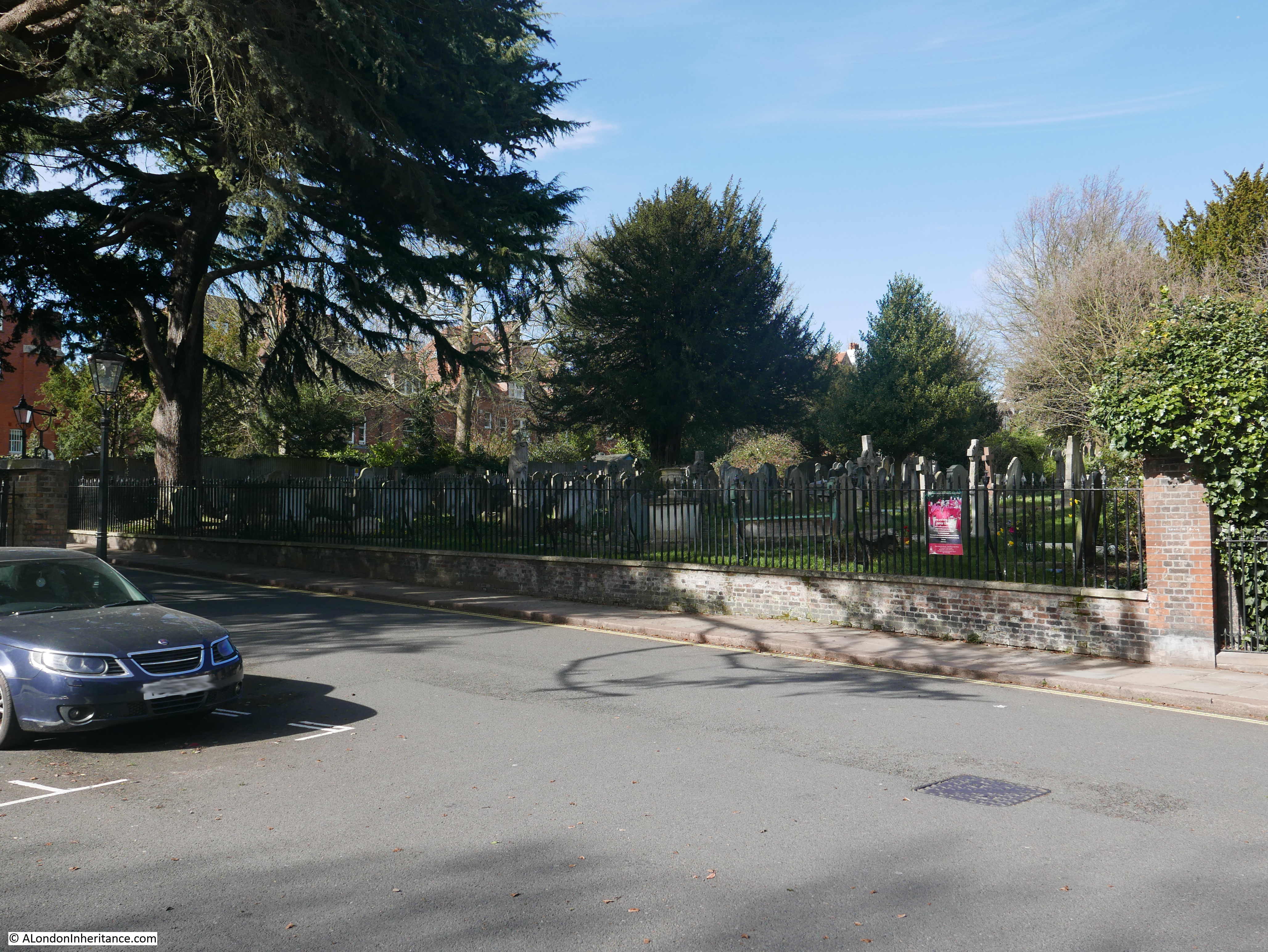
I was in the City earlier this month and had a couple of free hours in the afternoon, so I headed to the church of St Stephen Walbrook, a church I have not been inside for a number of years.

The church is located just south of the Bank junction of Poultry, Princess Street, Threadneedle Street, Cornhill and King William Street. Located just behind the Mansion House, the church includes the name of one of the City’s lost rivers, and faces onto a street with the same name, Walbrook.

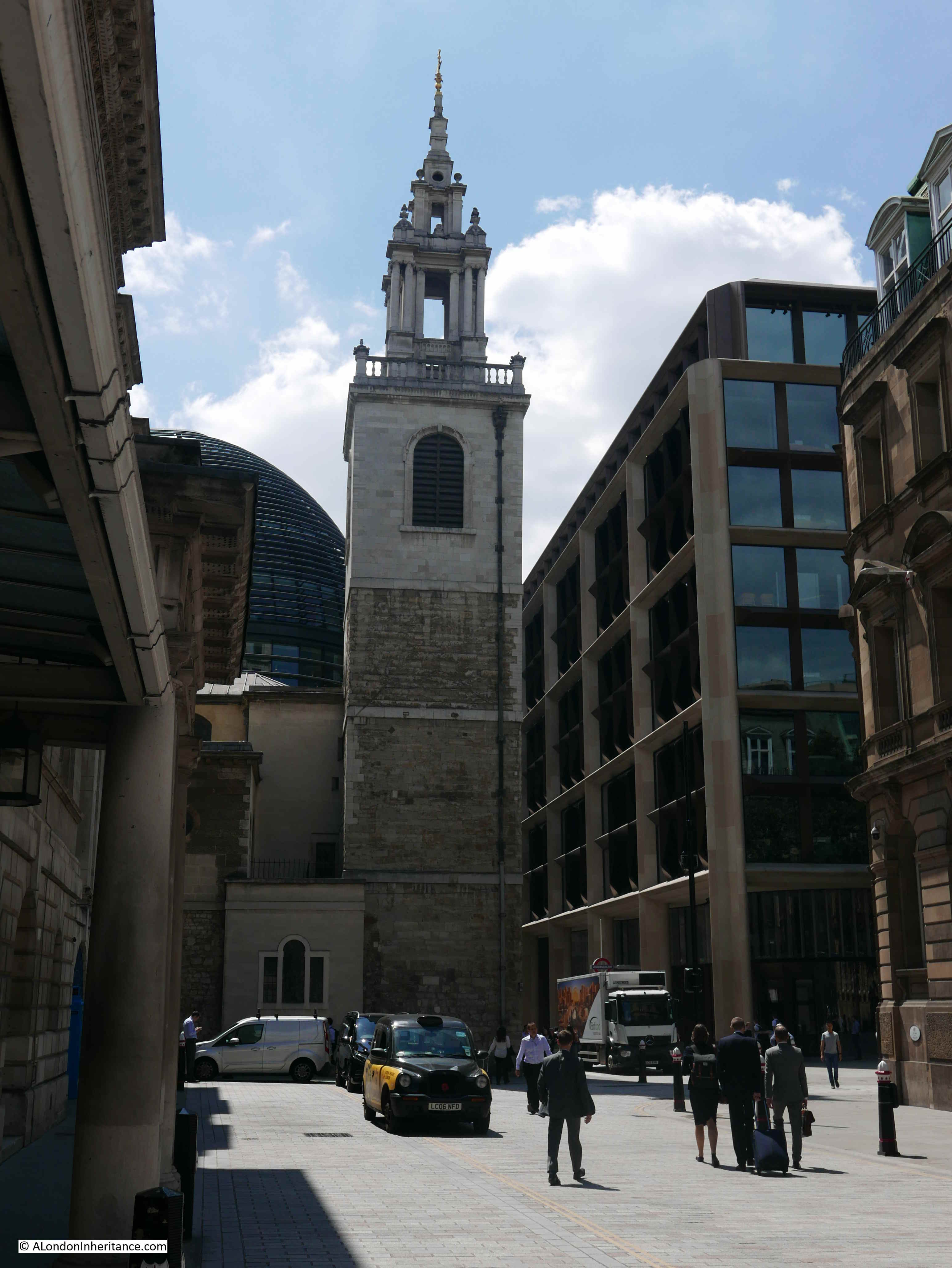
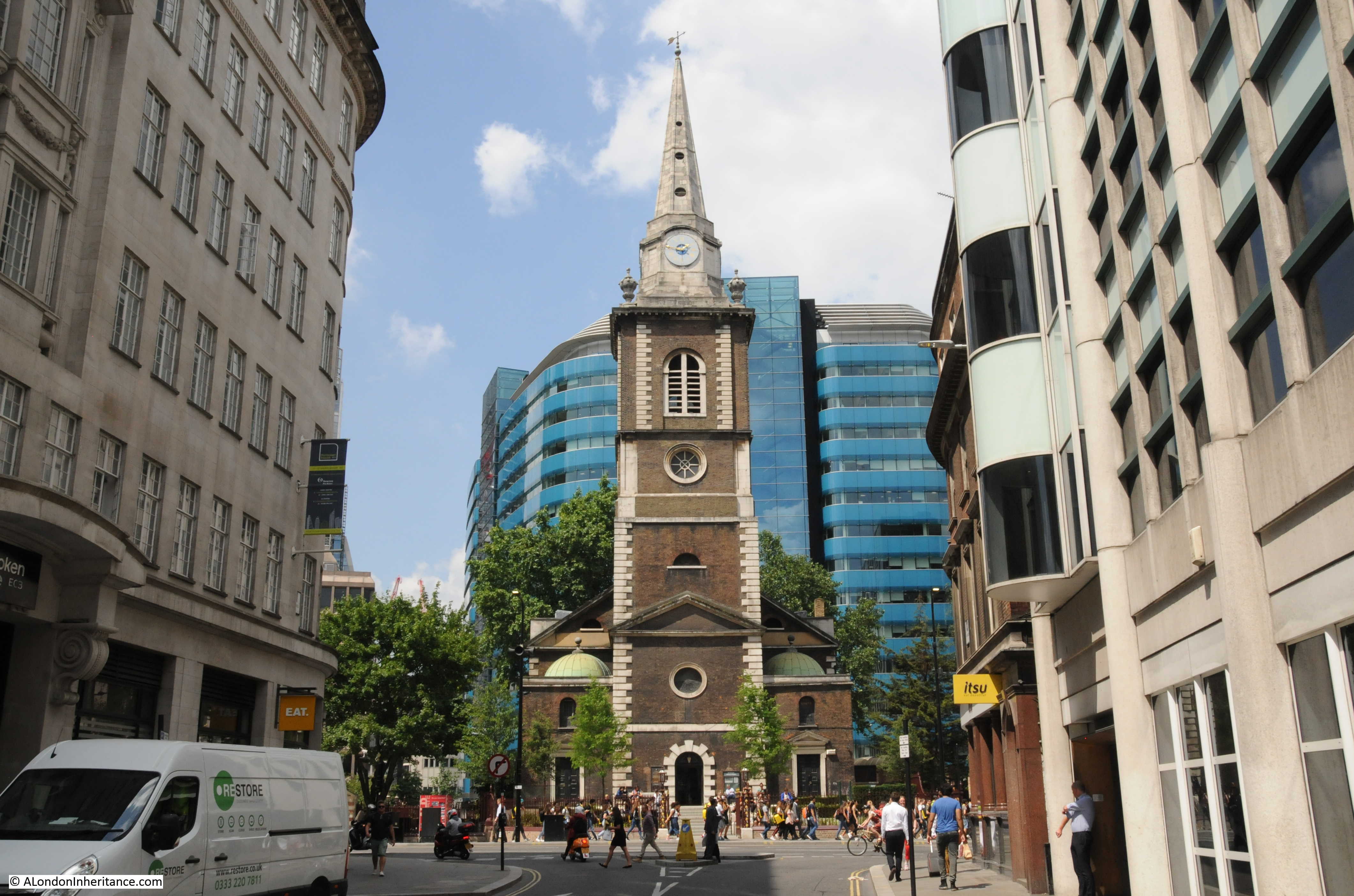
Walking down from the Bank junction, this is the view of the tower of St Stephen Walbrook:

St Stephen Walbrook

St Stephen Walbrook has a long history, however the church is not on its original site.

The River Walbrook originally ran slightly to the west of the street, and it was on the western side of the River Walbrook that the first church was established. Foundations of the original church were found during excavation of the site that today is occupied by the offices of Bloomberg, also the original location of the Roman Temple to Mithras.

According to Walter Thornbury writing in Old and New London, “Eudo, Steward of the Household to King Henry I (1100- 1135) gave the church of St Stephen, which stood on the west side of Walbrook, to the Monastery of St John at Colchester.”

The church probably dates from around the 11th century, but is probably older.

There is very little written evidence of this first church, however in the History of the Ward of Walbrook of the City of London (1904), J.G. White states:

“It possessed a Steeple with Bells and Belfry, as, from an inventory made, it appears that at the time of building the new Church, three bells, with their wheels, &c., were removed from the old building, and fixed in the new Steeple; also that it contained a belfry is evident from the fact that there is in the Coroner’s Roll for 1278 an entry, that on the 1st May in that year information was given that on the previous Sunday, about mid-day, William Clarke ascended the belfry to look for a pigeon’s nest, and in climbing from beam to beam he missed his hold and fell, dying as soon as he came to the ground. There was also a Chancel, there being in the year 1300 an Inquisition taken to enquire who was liable to repair the watercourse of the Walbrook over against the Chancel Wall of the Church.”

Around 1428, this original location of the church, and its associated graveyard was considered too small to support the parish, so a new location was required.

A plot of land was given by Robert Chicheley, a member of The Worshipful Company of Grocers, on the opposite side of Walbrook street, roughly 20 metres to the east of the original location, and the new church was built between 1429 and 1439.

This church would last just under 240 years as the church of St Stephen Walbrook would be one of those destroyed in the Great Fire of 1666.

Rebuilding commenced in December 1672, with Wren as the architect. St Stephen Walbrook was probably his local church as at the time he was living in Walbrook.

It was a difficult location for the new church as houses were built up against the church, including the area around where the tower would be built.

The area north of the church, now the site of the Mansion House was originally occupied by a market in fish and flesh know as the Stocks Market. Part of the original design for completion of St Stephen Walbrook was a colonnaded replacement for the pre-fire Stocks Market, which would have extended north from the church, This did not get built.

The church was ready to use in 1679, although the tower appears to have been completed later.

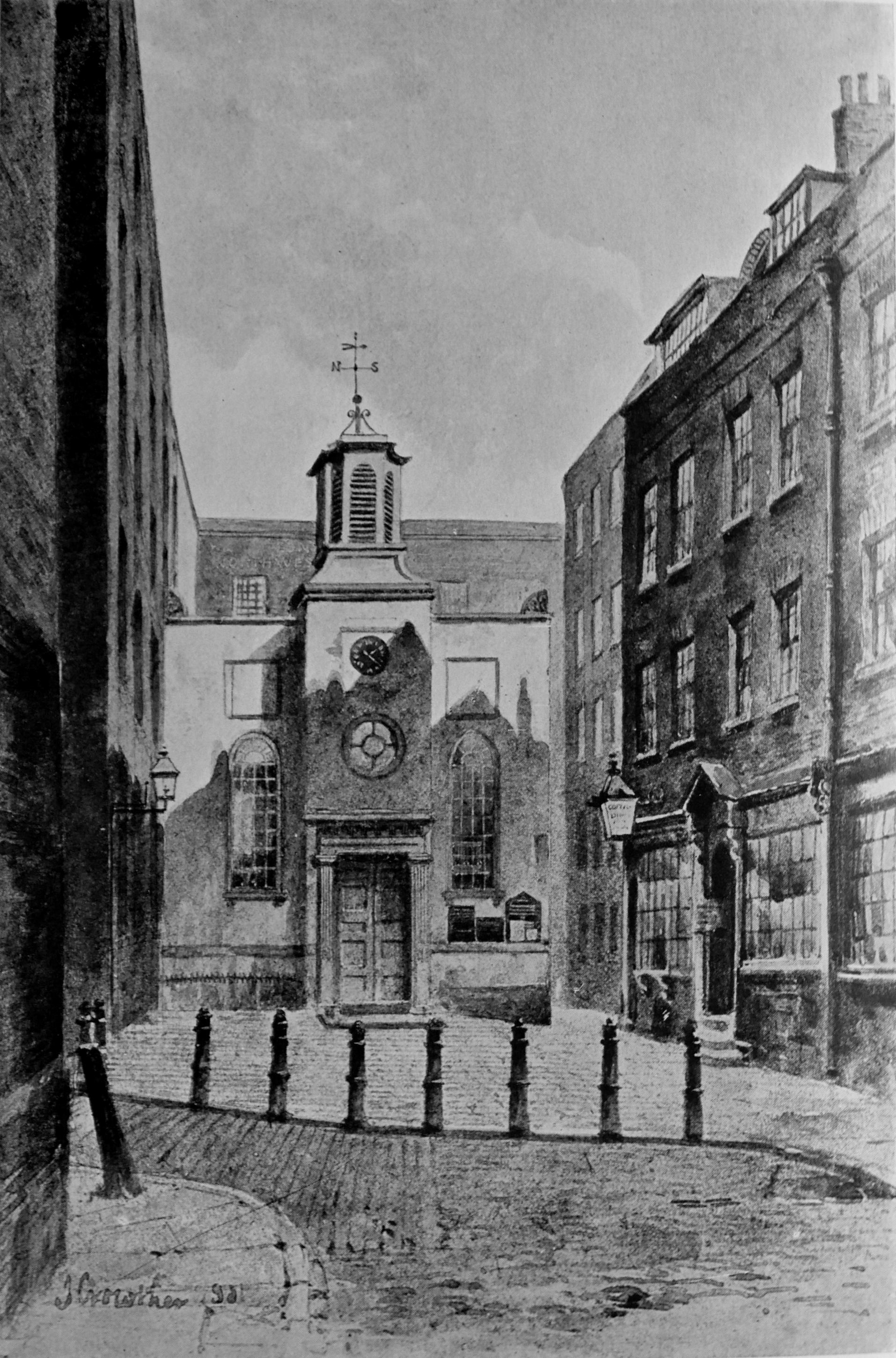
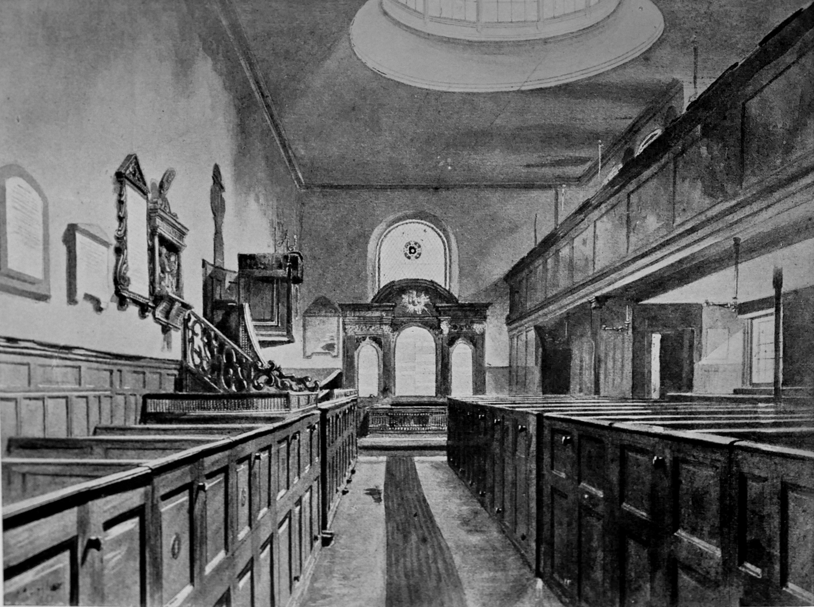
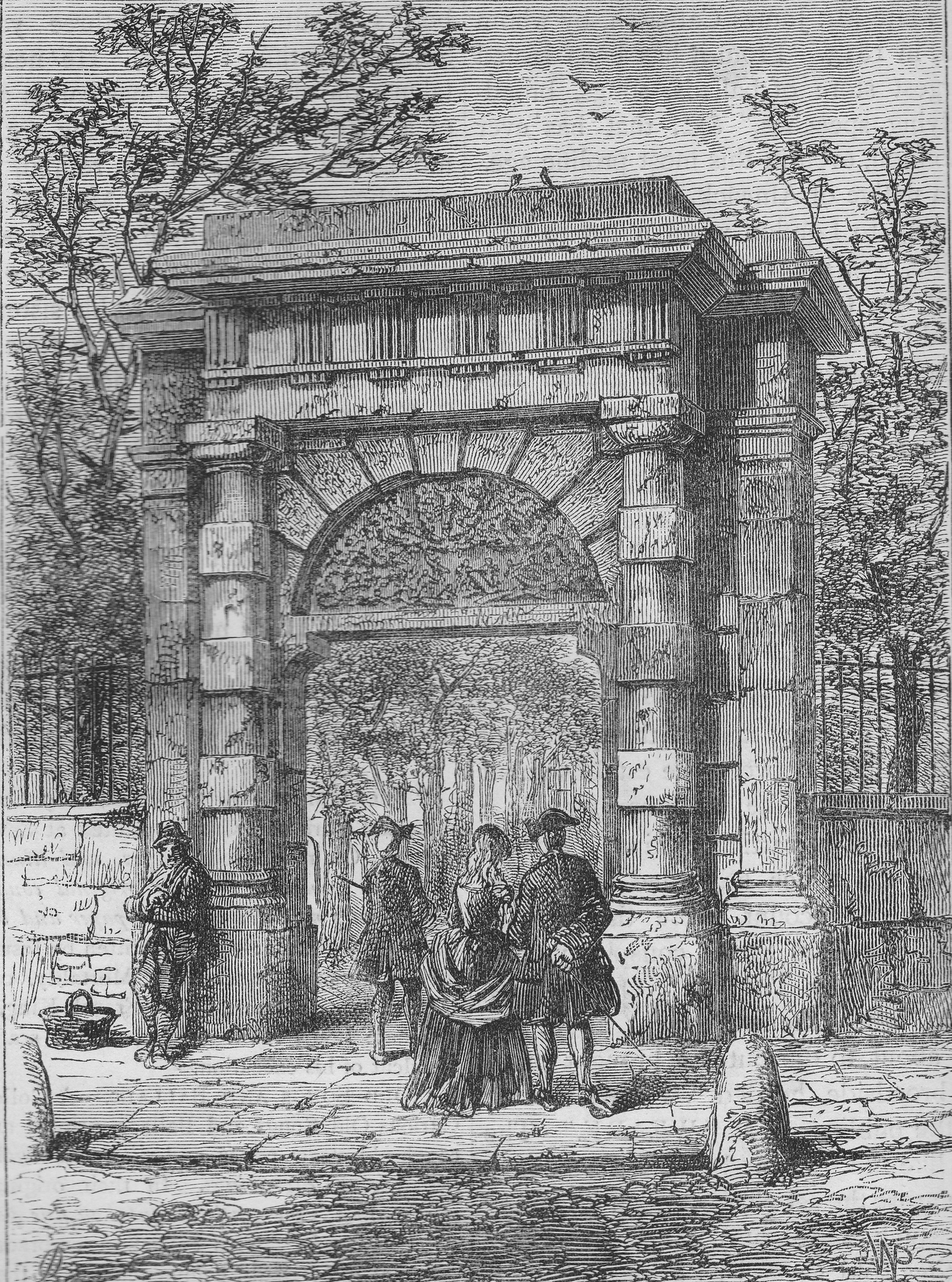
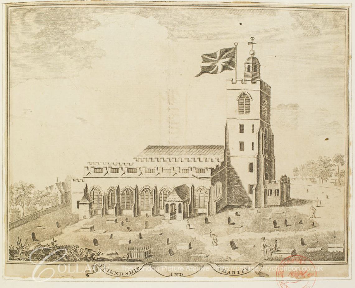
The following print from Old and New London shows the church soon after completion. The print also highlights the houses that clustered immediately around the tower.

St Stephen Walbrook

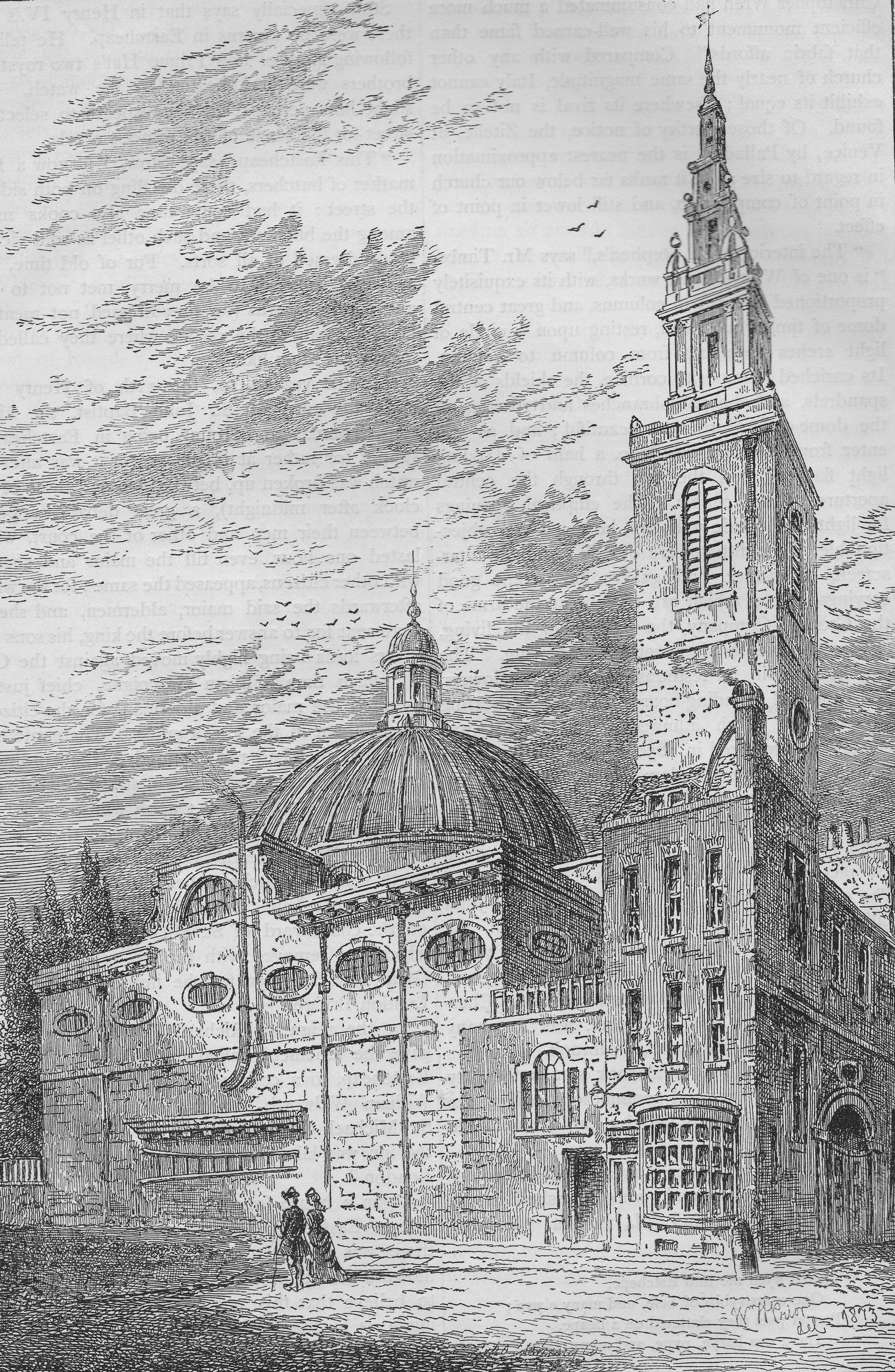
The above drawing from Old and New London is dated 1700, however I suspect this is wrong. The drawing shows the spire on top of the tower, however the spire was not added until 1713-1715.

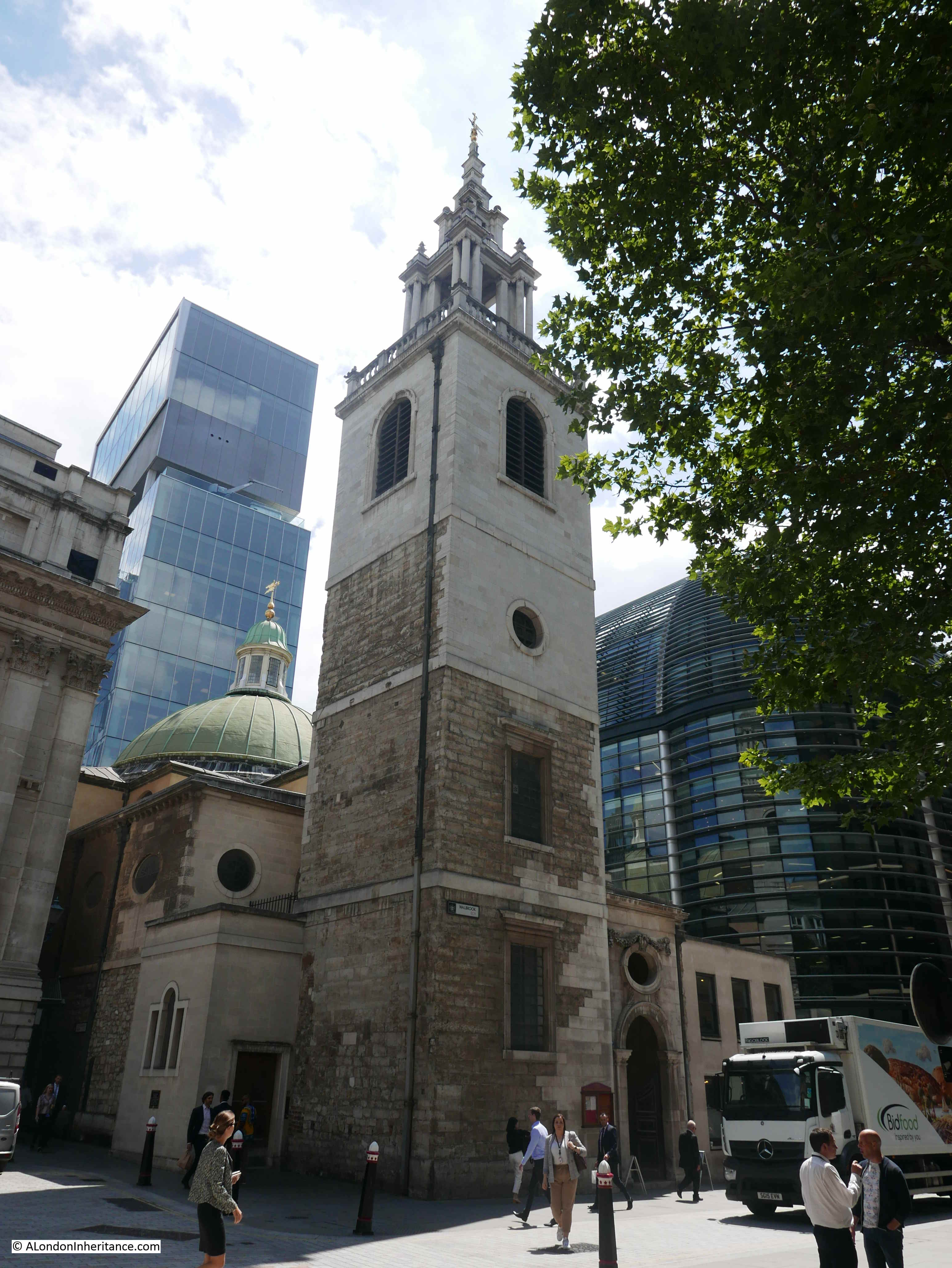
Remove the houses in front of the church, and as the following photo demonstrates, the appearance of the church is much the same today. It was not possible to replicate the above drawing as the Mansion House presses in to the left of the church, occupying the space that was the Stocks Market.

St Stephen Walbrook

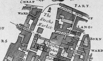
The following extract from a 1720 Ward map shows the church of St Stephen Walbrook, with the Stocks Market occupying the land to the north.

St Stephen Walbrook

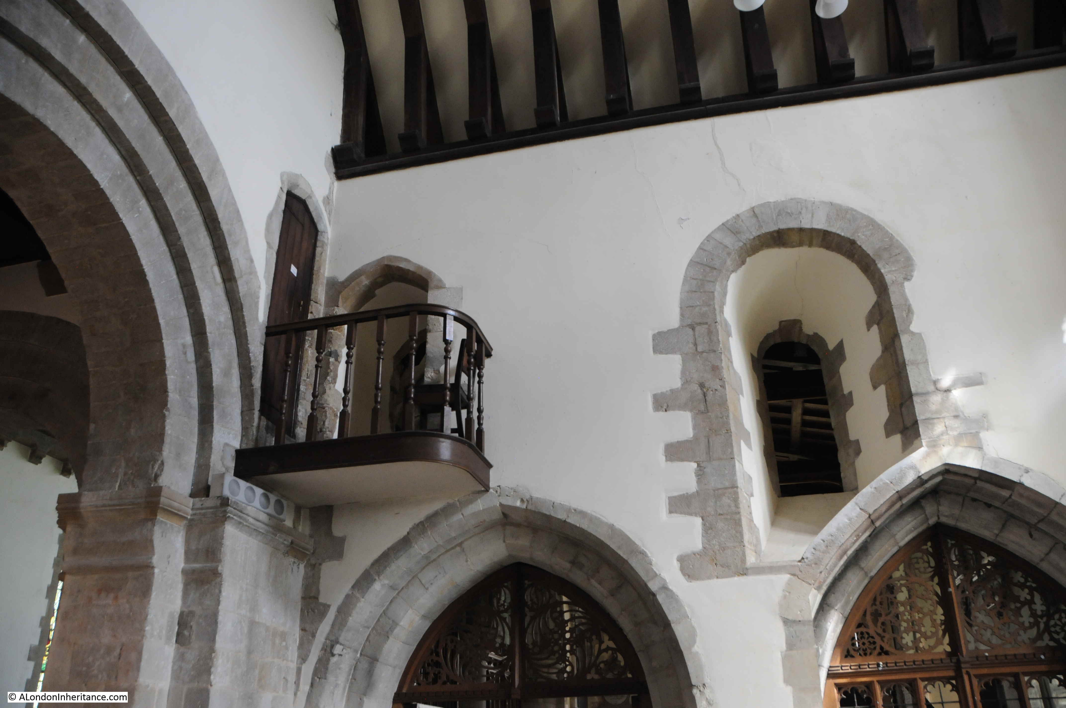
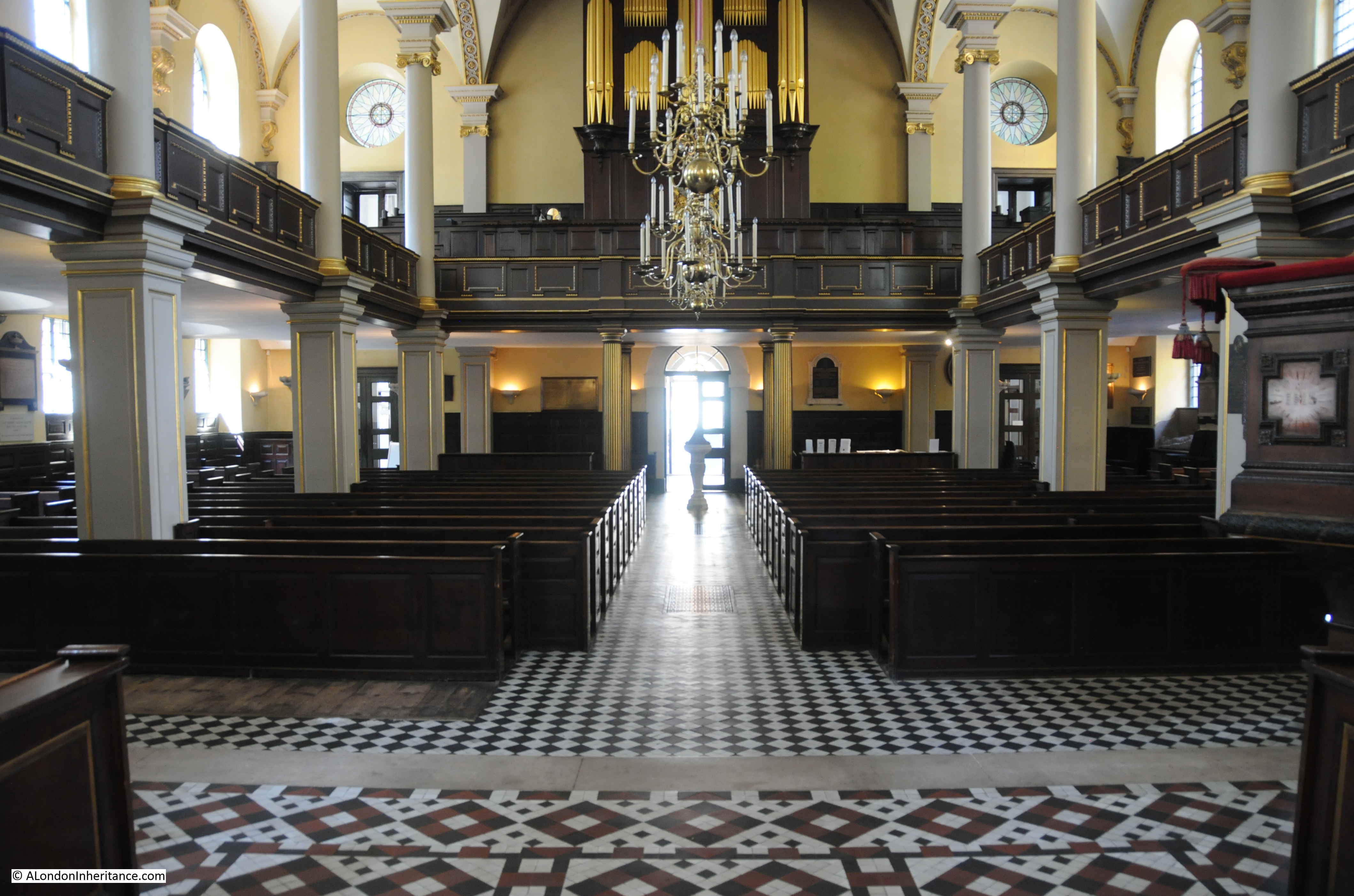
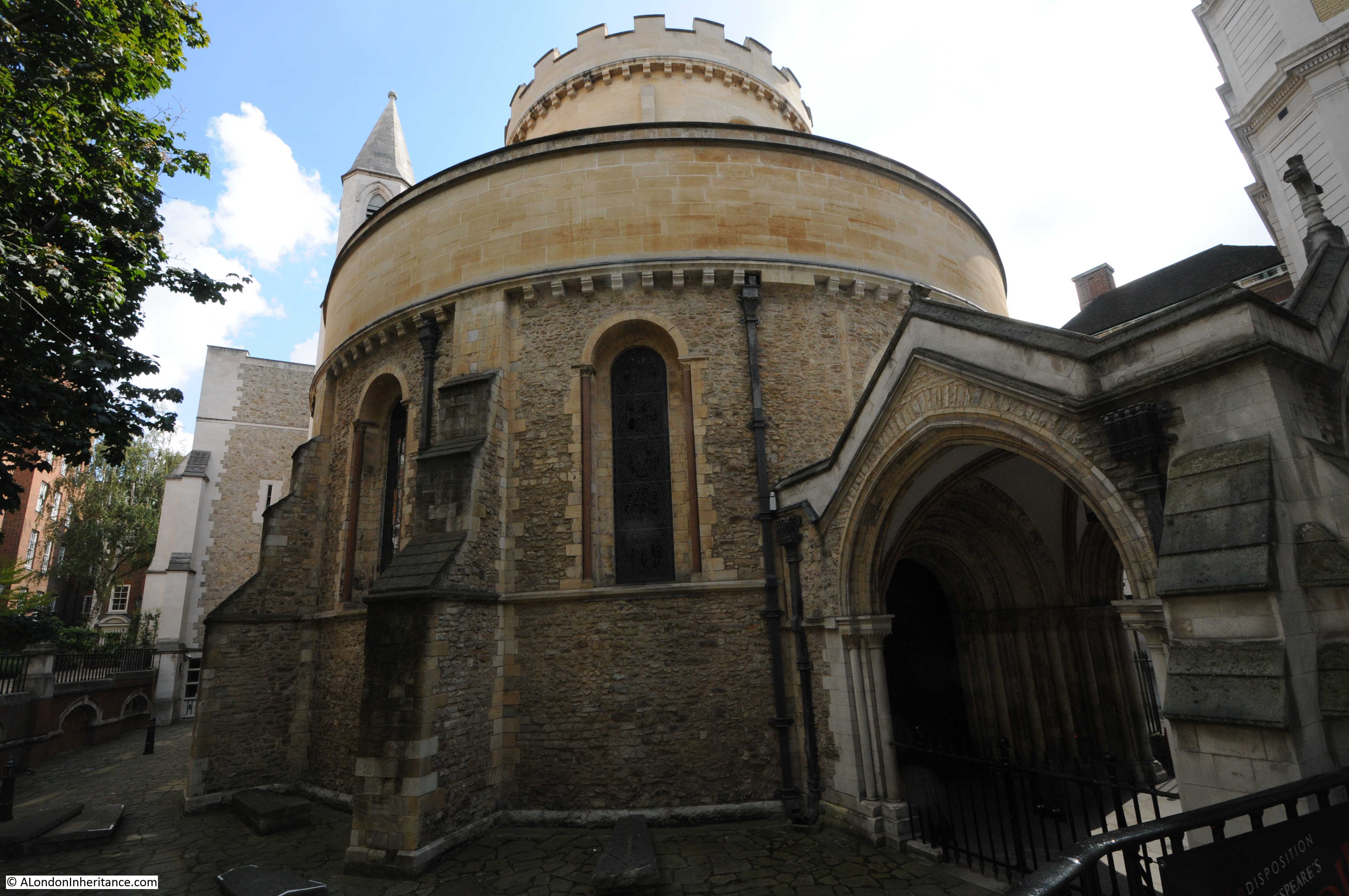
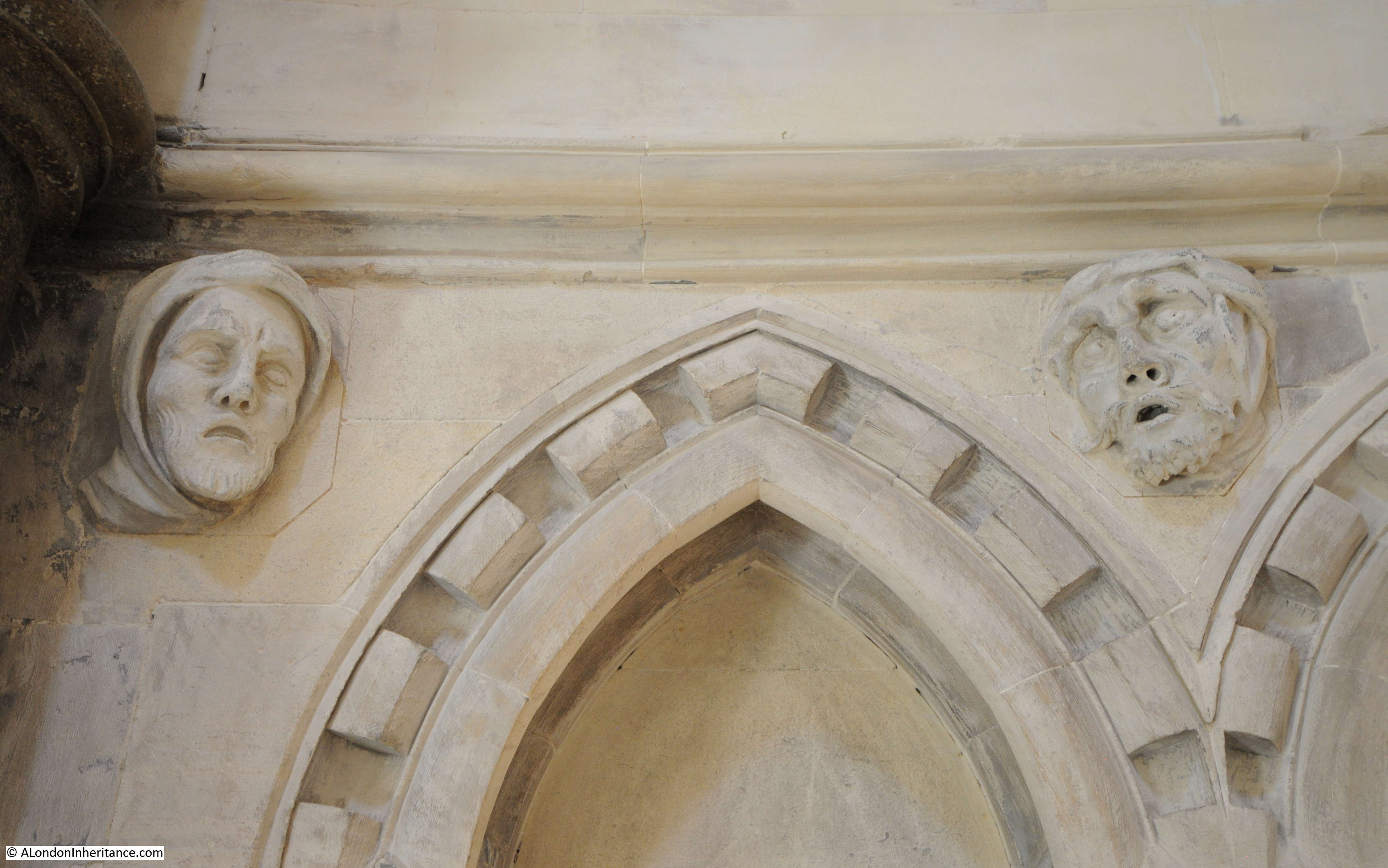
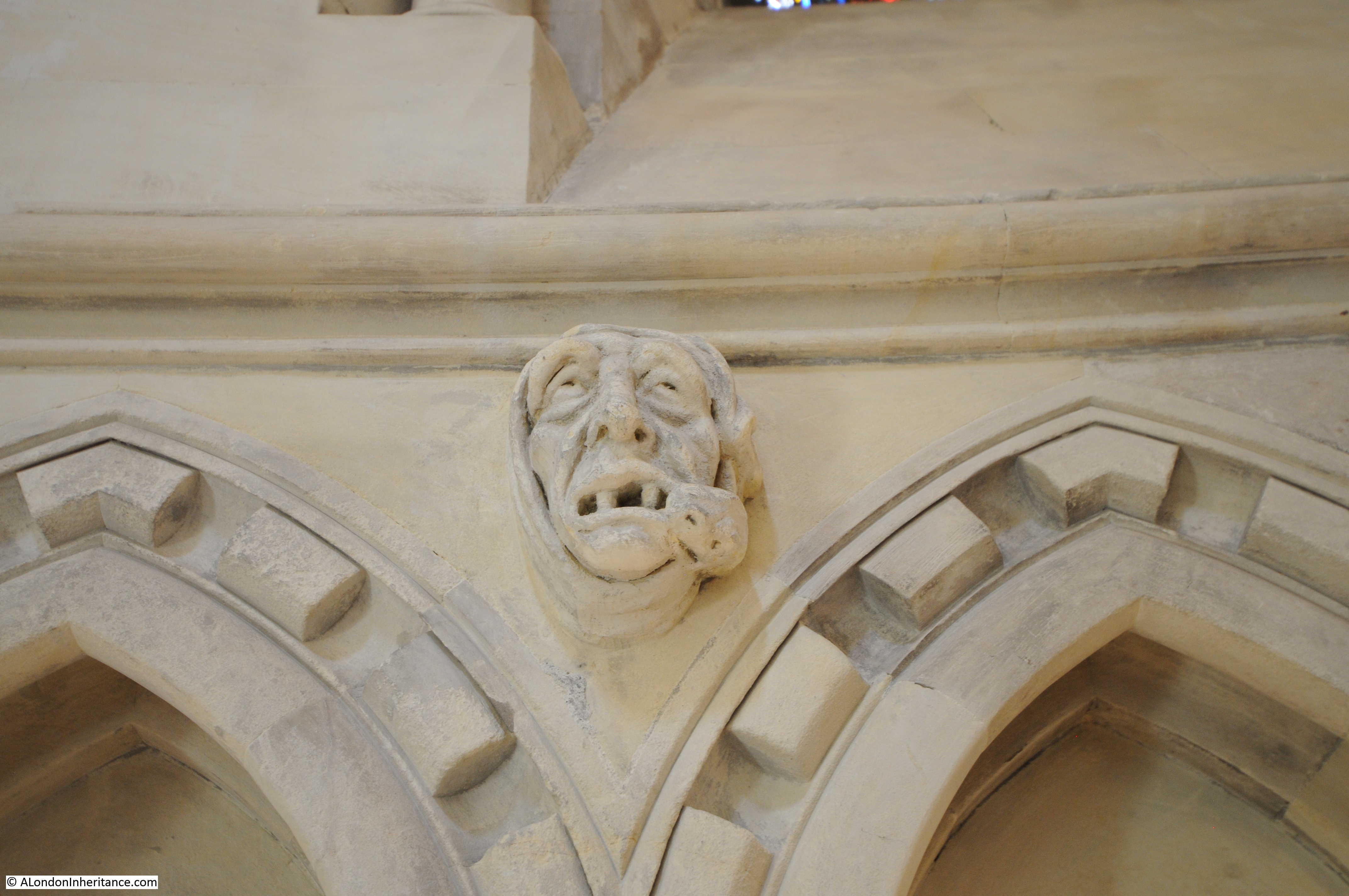
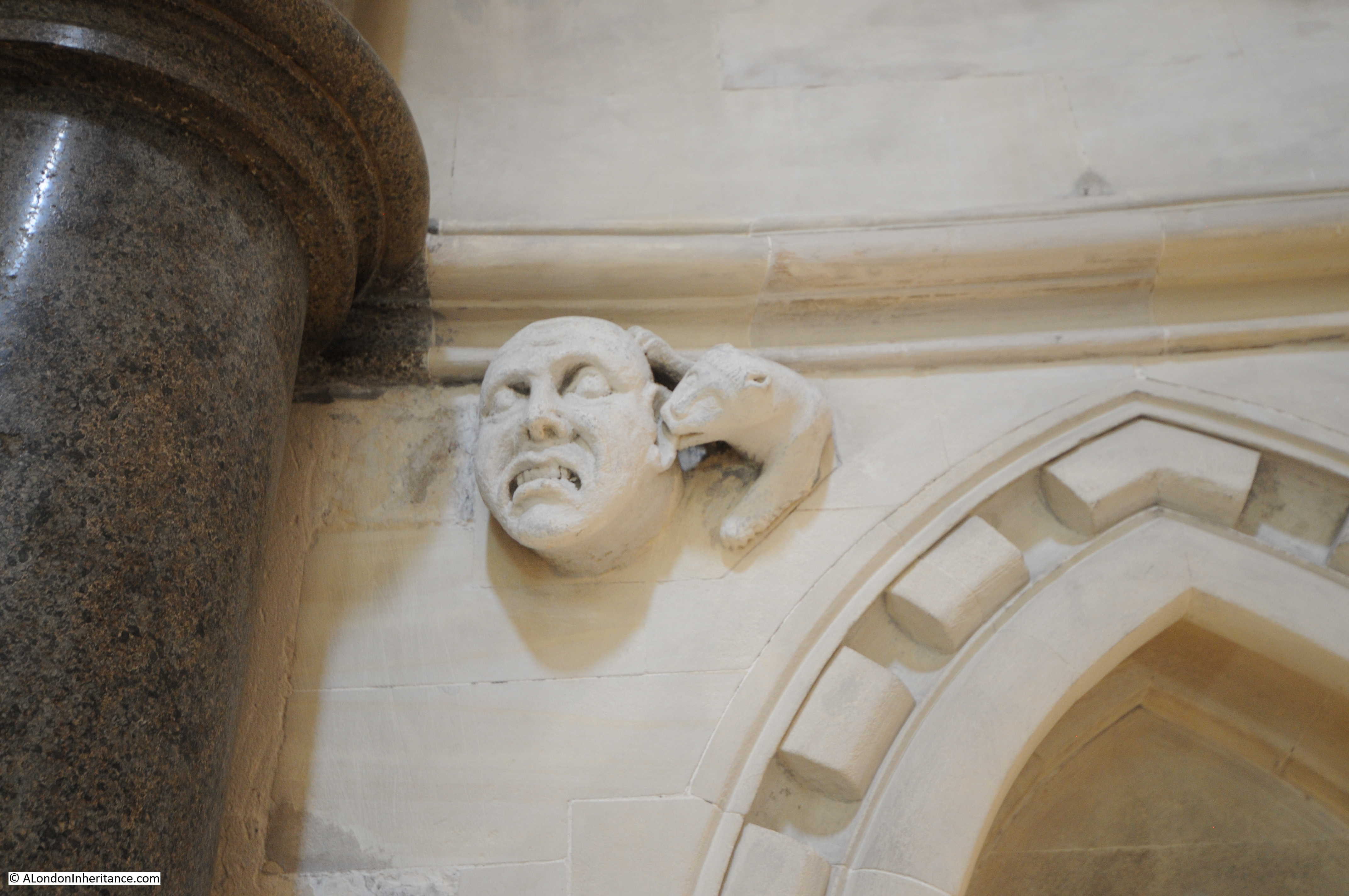
Time for a look inside the church. A set of steps rise up from street level to the interior of the church.

St Stephen Walbrook

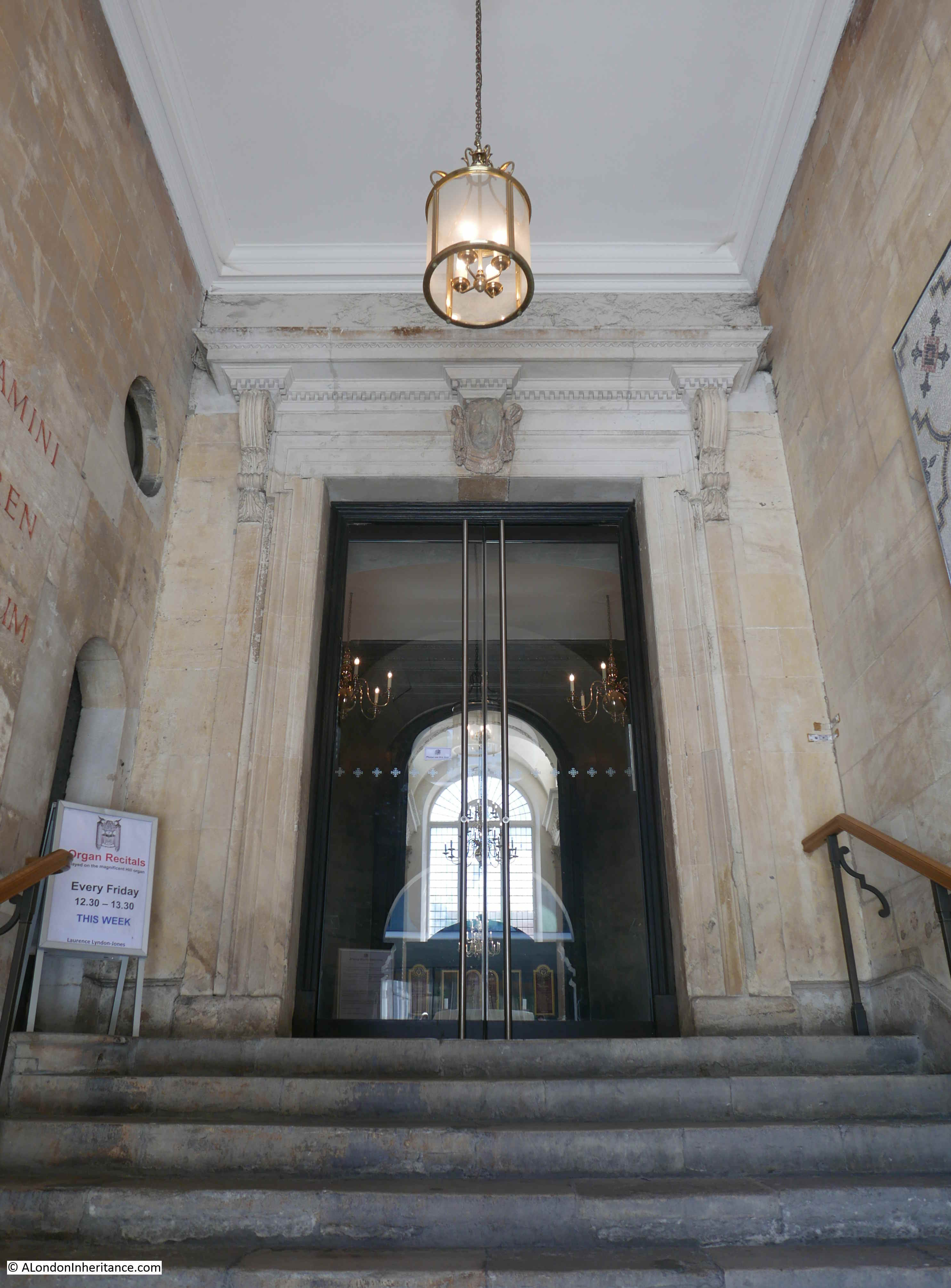
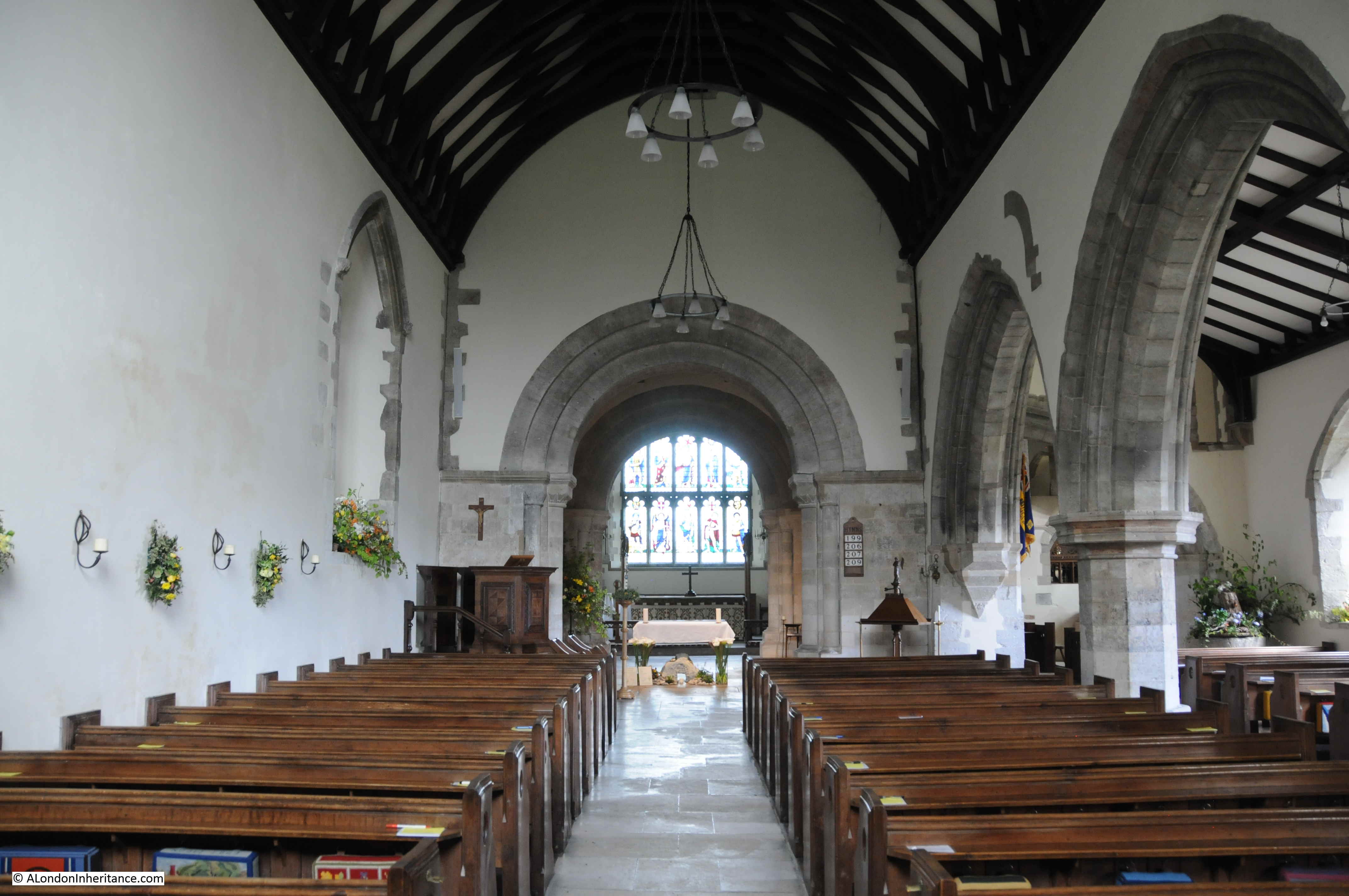
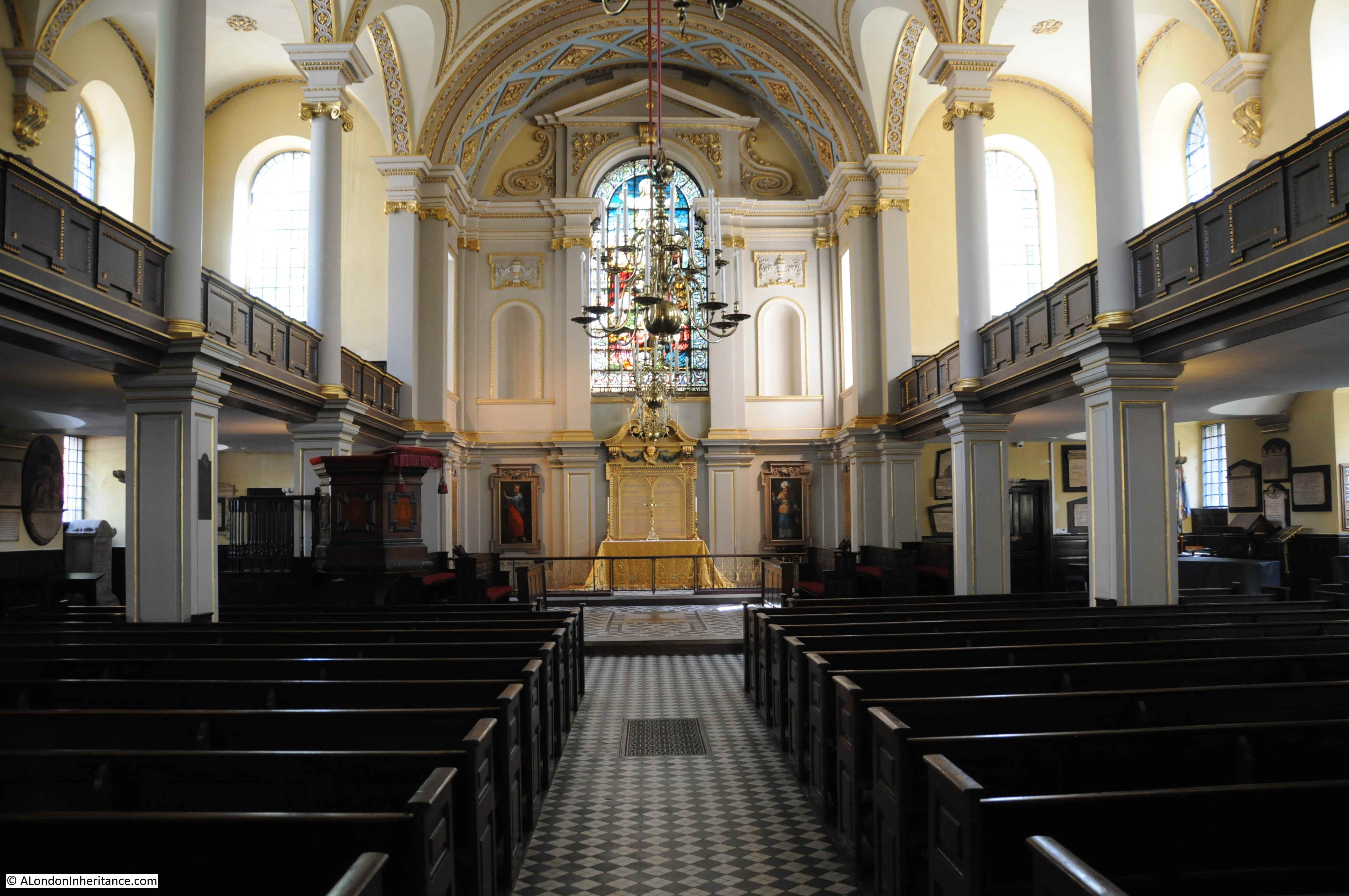
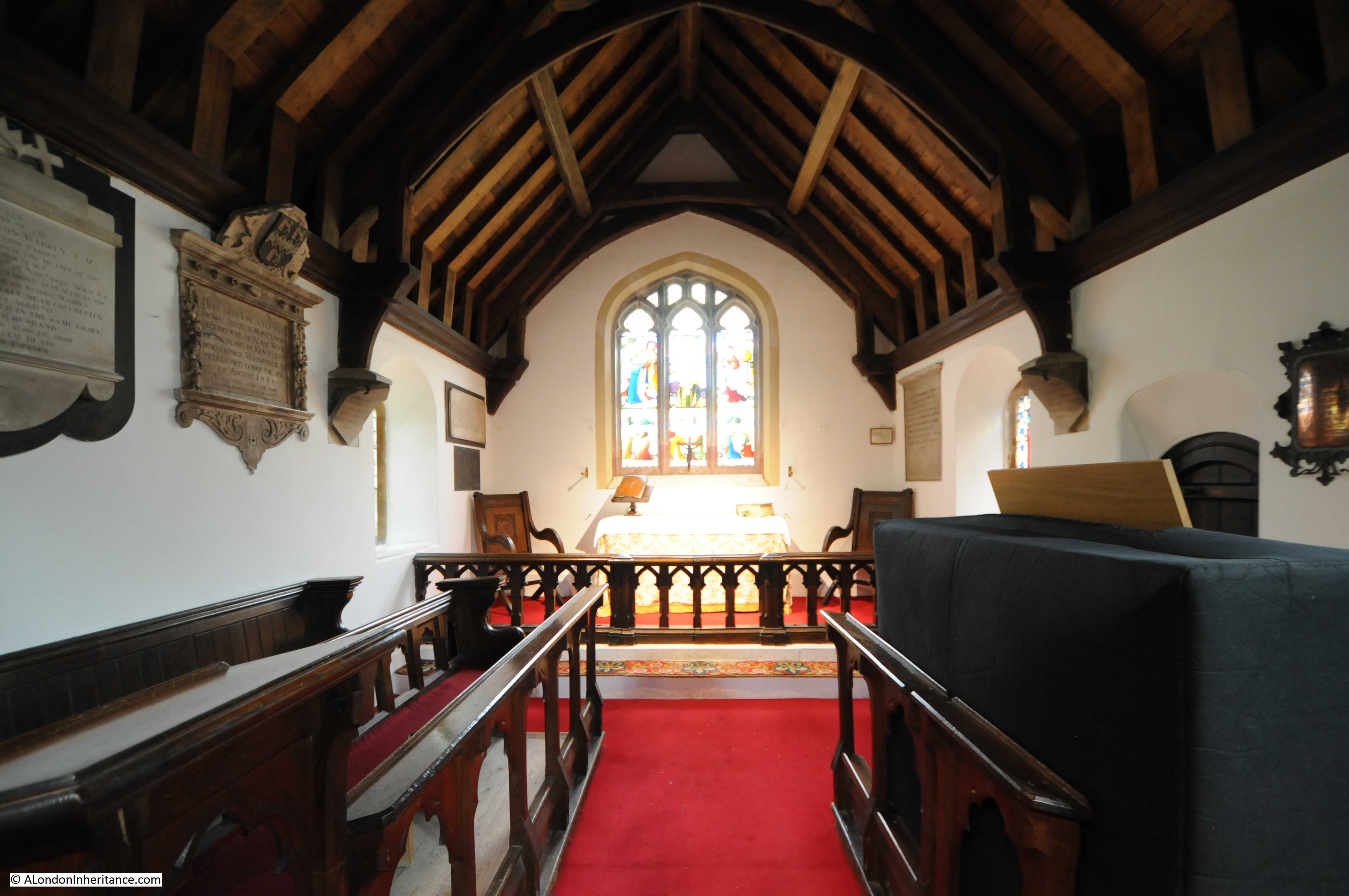
The interior of St Stephen Walbrook from the entrance:

St Stephen Walbrook

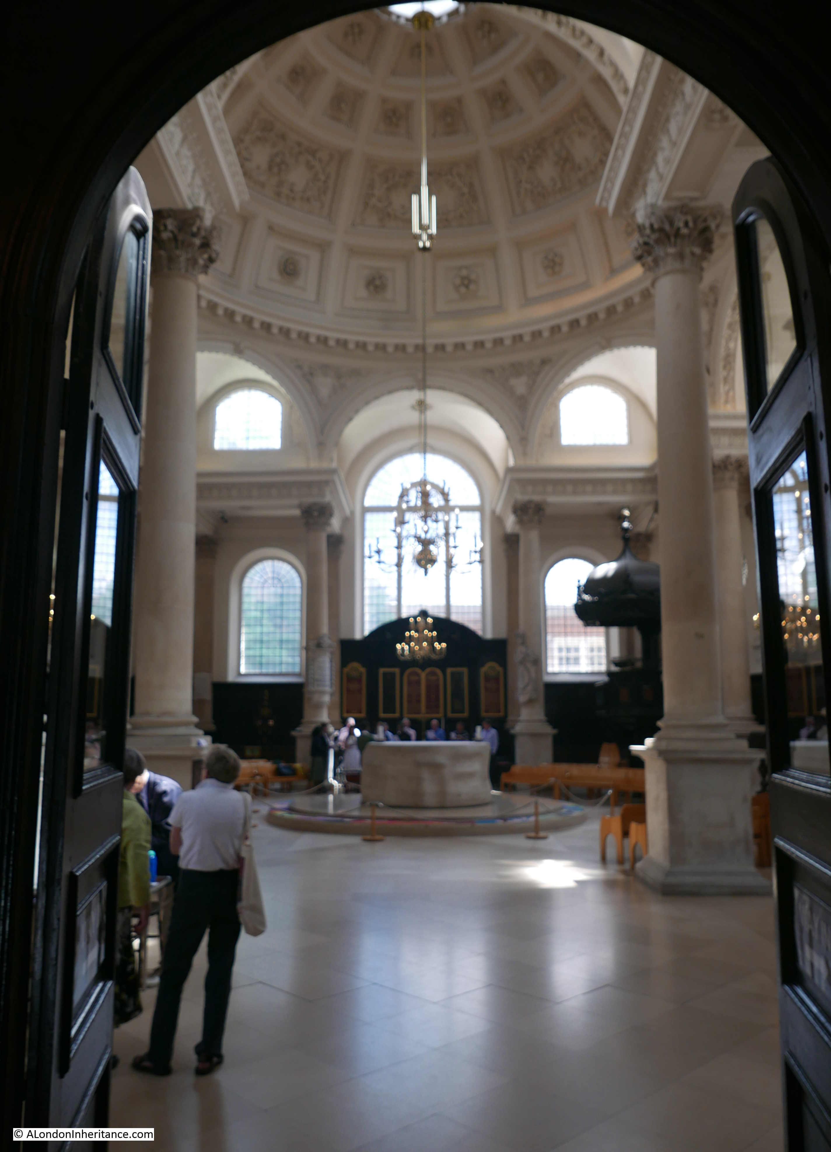
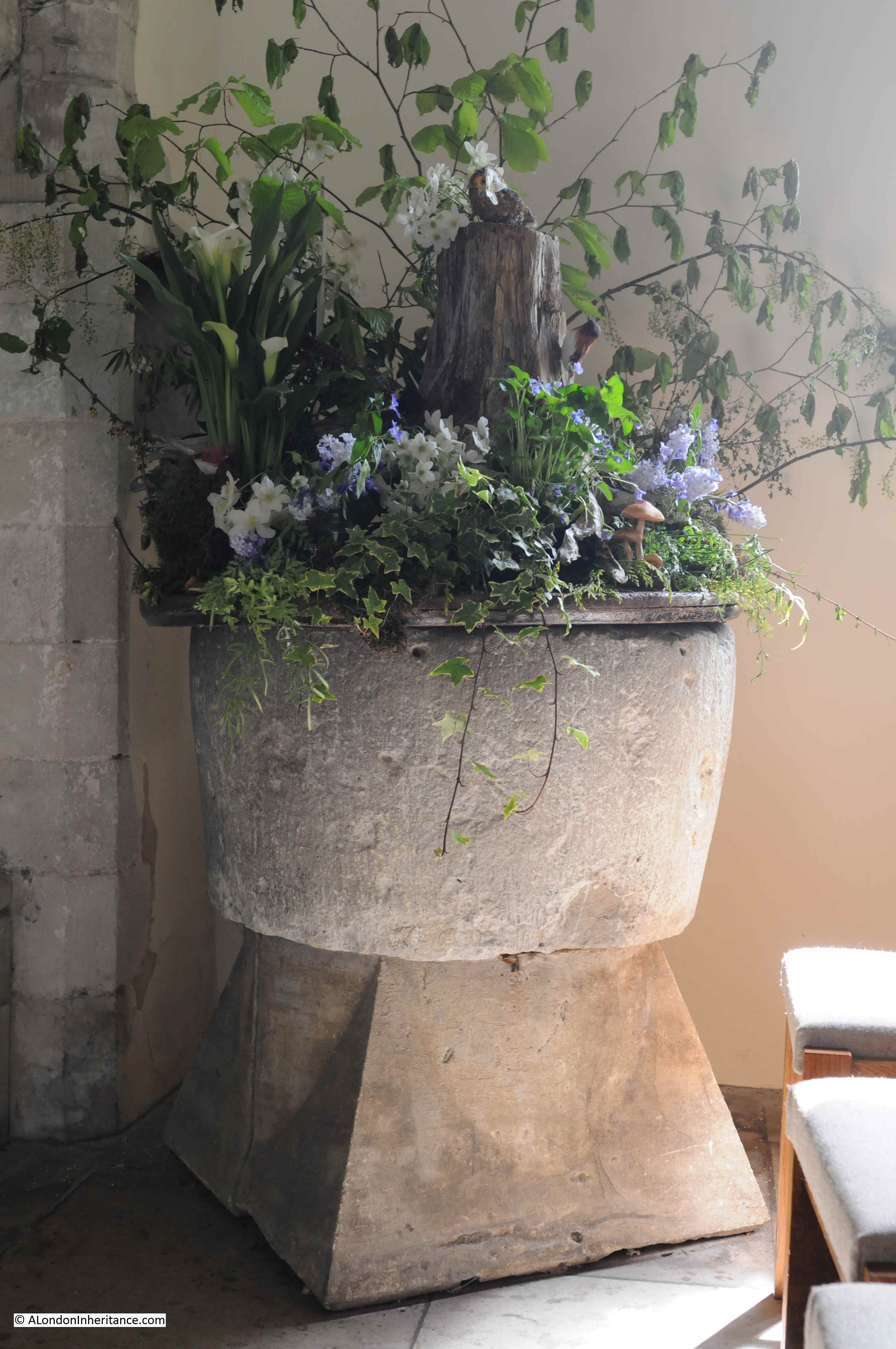
The interior has an unusual layout for a City church. The wooden reredos is at the far end of the church where the altar would traditionally have been located, however following restoration work carried out between 1978 and 1987, the traditional altar was replaced by a central circular altar carved from Travertine by Henry Moore.

St Stephen Walbrook

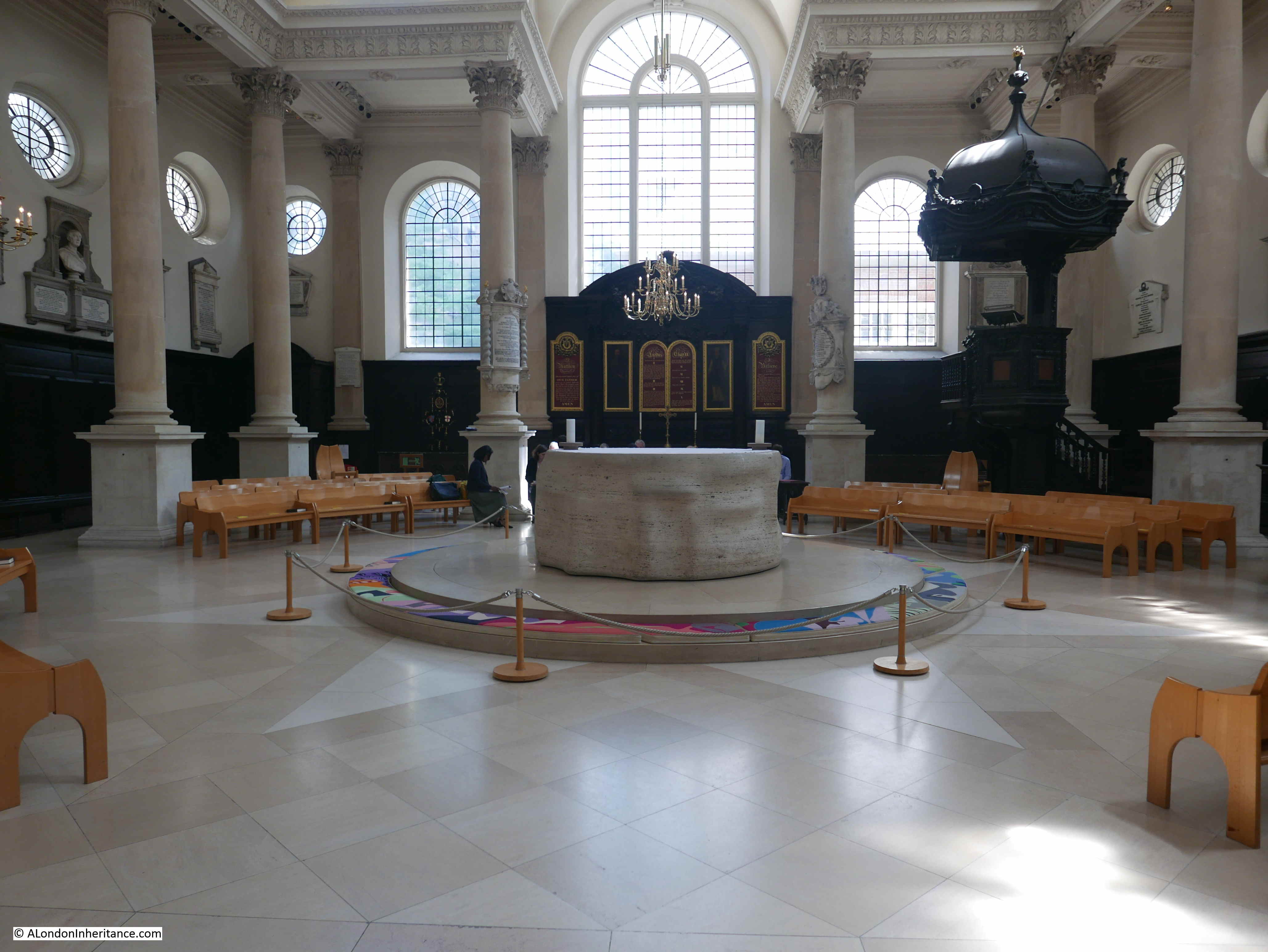
The new altar and additional restoration work throughout the church was commissioned and supported by the fund-raising efforts of Lord Peter Palumbo who was Churchwarden from 1953 to 2003.

Restoration work at the time was essential as the church was suffering from subsidence, possibly due to the long-term impact of the River Walbrook.

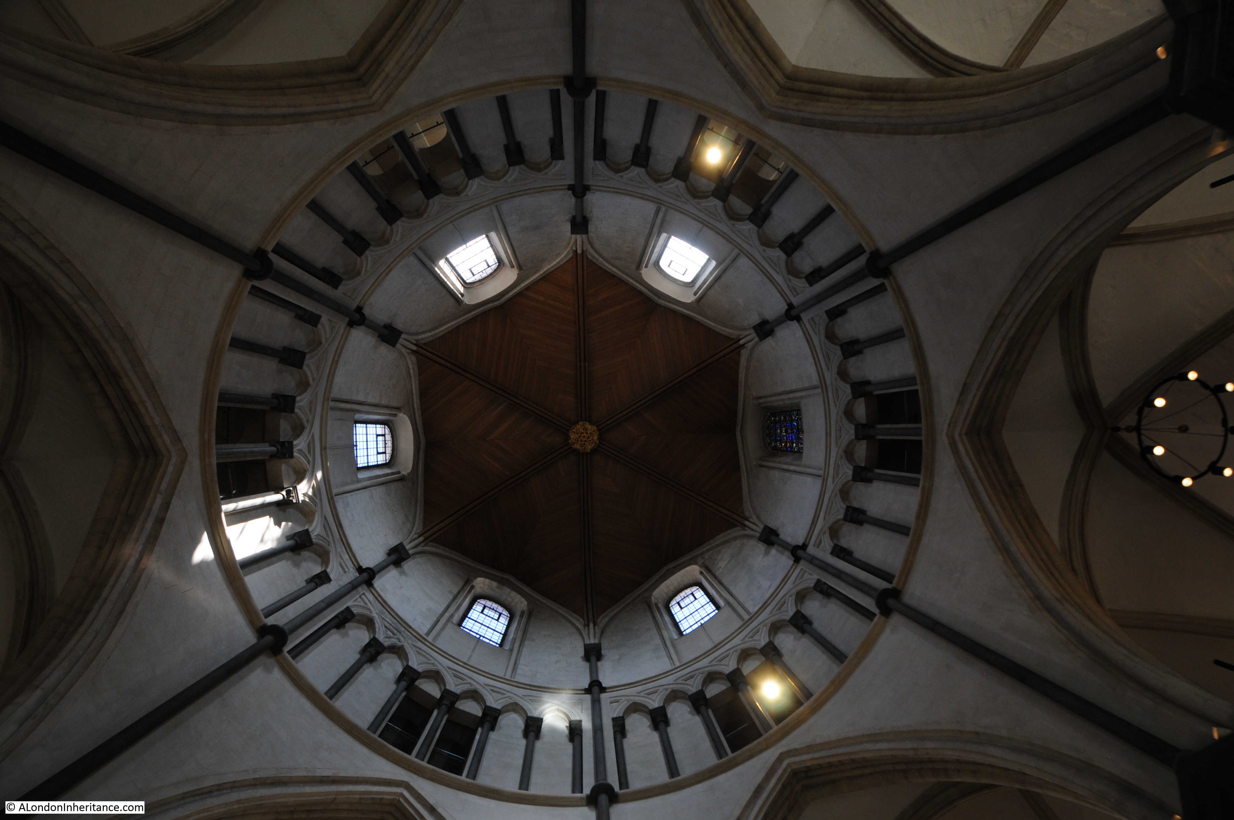
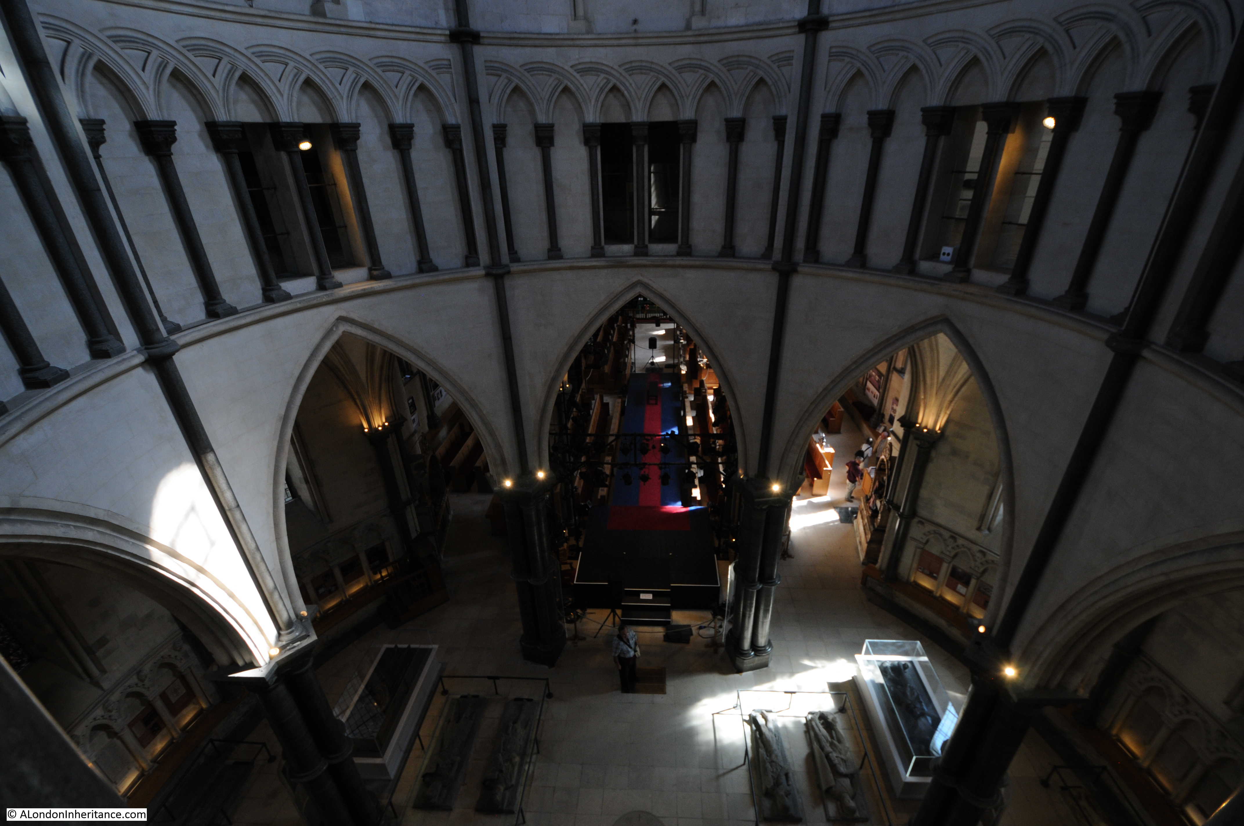
The location of the altar does prevent an ideal photograph of one of the main features of Wren’s designs – the large dome located above the central square of the church.

St Stephen Walbrook

Multiple references refer to the dome as being Wren’s practice for the dome of St Paul’s Cathedral, however whilst the overall shape is similar, a dome with lantern on top, the size and construction method is very different.

Whilst the dome of St Paul’s has the inner false dome, with the layer of supports between inner and outer dome to transfer the load of the large stone lantern through to the body of the cathedral, the dome of St Stephen is a much more straightforward construction, however that does not detract anything from the beauty of a magnificent dome, designed in the 17th century on a City parish church.

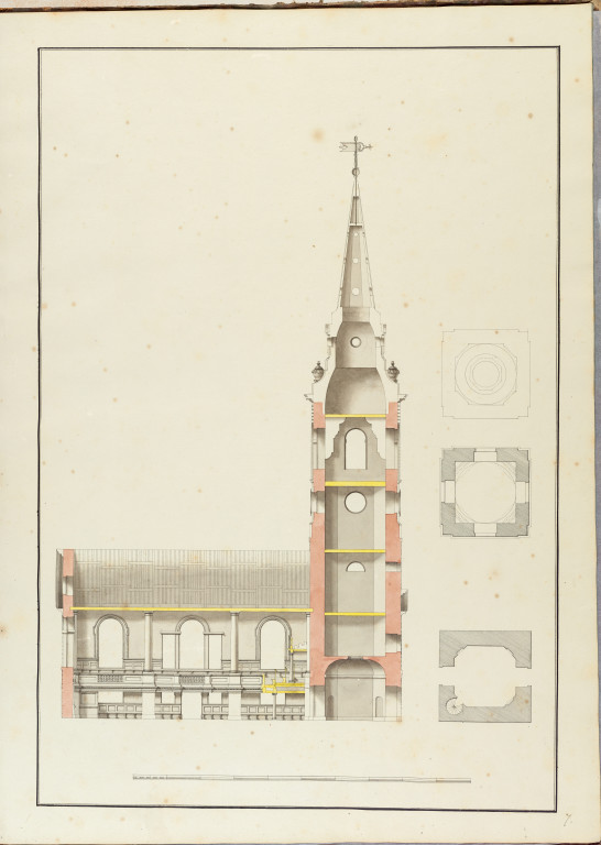
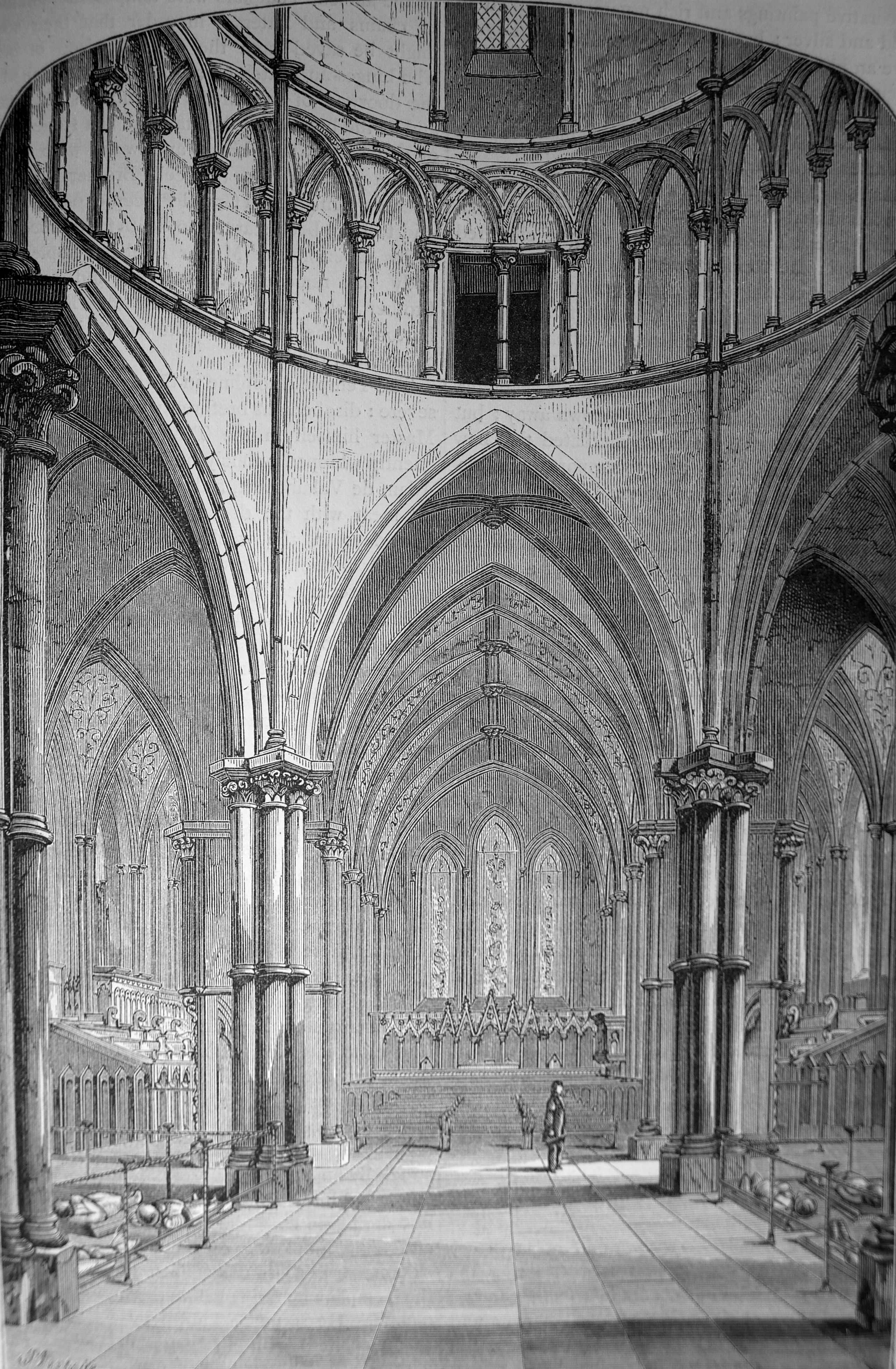
The following drawing from 1770 shows a view of the interior of the church, with below a cut away diagram of the dome’s construction and a floor plan of the church.

St Stephen Walbrook

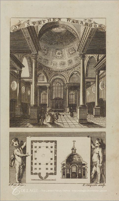
The interior of the church also shows another of Wren’s innovations. Rather than the weight of the dome being carried on a large pier at each corner, there are three slender columns at each corner. These have the effect of opening out the corners, rather than these spaces being occupied by a large load bearing pillar.

Note in the floor plan above that the tower is missing. The tower was added after the church had opened, and perhaps Wren’s idea was to have a rectangular church with no tower, where the dome rising above the church would have been the dominating feature.

When the exterior of the church is viewed today, the dome of the church is somewhat hidden to the rear with the tower dominating – perhaps not Wren’s original intention.

Whilst many writers praised St Stephen Walbrook as one of Wren’s best City churches, there were other views, for example in Curiosities of London (1867), John Timbs writes:

“This church, unquestionably elegant, has been overpraised. The rich dome is considered by John Carter to be Wren’s attempt to ‘set up a dome, a comparative imitation (though on a diminutive scale) of the Pantheon at Rome, and which, no doubt, was a kind of probationary trial previous to his gigantic operation of fixing one on his octangular superstructure in the centre of the new St Paul’s’. Mr J. Gwilt says of St Stephen’s ‘Compared with any other church of nearly the same magnitude, Italy cannot exhibit its equal, elsewhere its rival is not to be found. Of those worthy notice, the Zitelle at Venice (by Palladio), is the present approximation in regard to size, but it ranks far below our church in point of composition, and still lower in point of effect.’

Again, had its materials and volume been as durable and as extensive as those of St Paul’s Cathedral, Sir Christopher Wren had consummated (in St Stephen’s) a much more efficient monument to his well-earned fame than this fabric affords.”

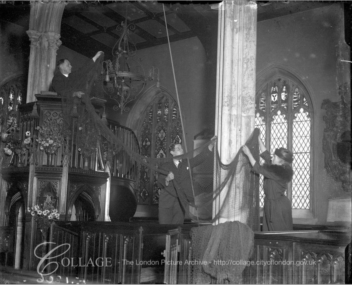
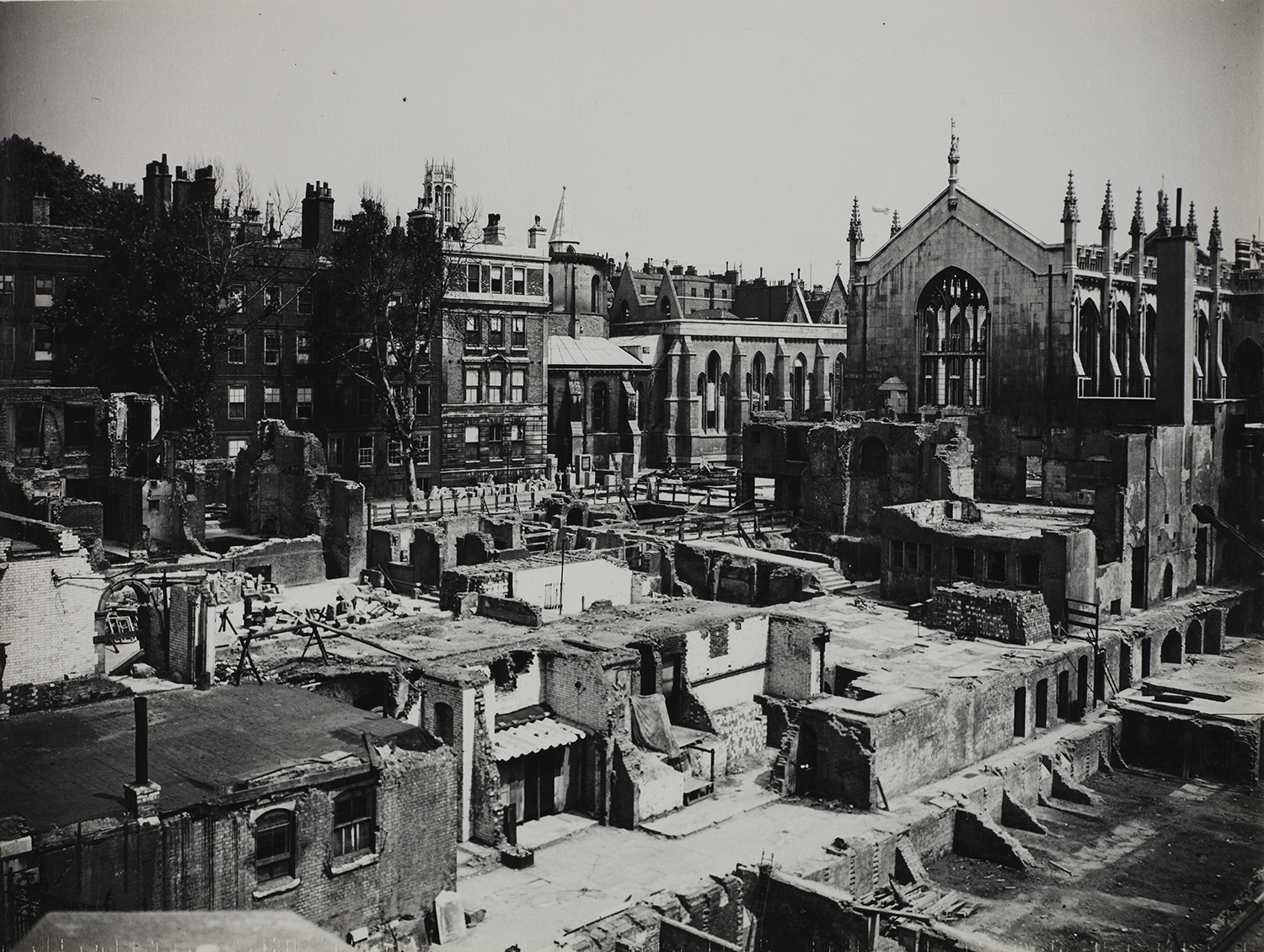
The church suffered significant damage during the war. the following photo shows the interior of the church with parts of the dome collapsed onto the floor of the church.

St Stephen Walbrook

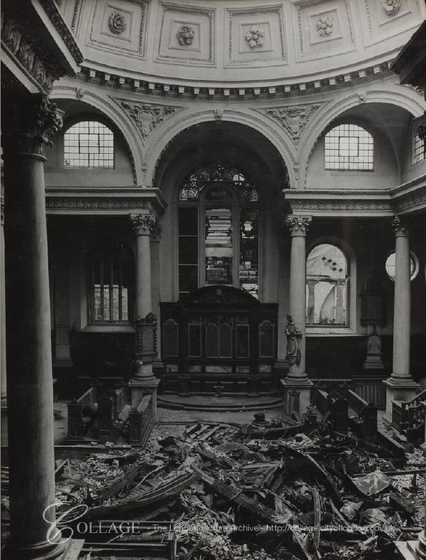
Image credit: London Metropolitan Archives, City of London: catalogue ref: M0019488CL

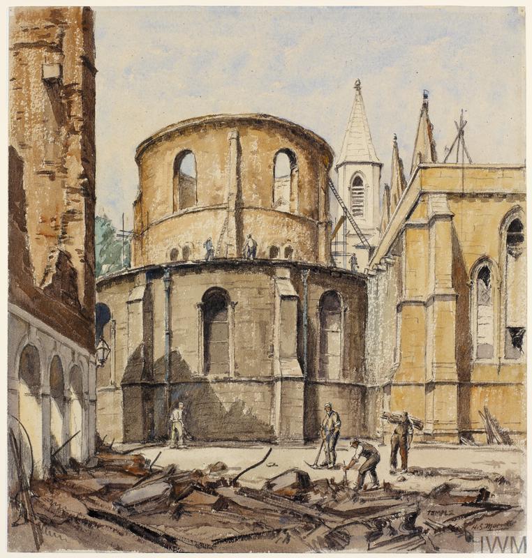
A view of the damage to the dome can be seen in the following drawing by Dennis Flanders in June 1941.

St Stephen Walbrook

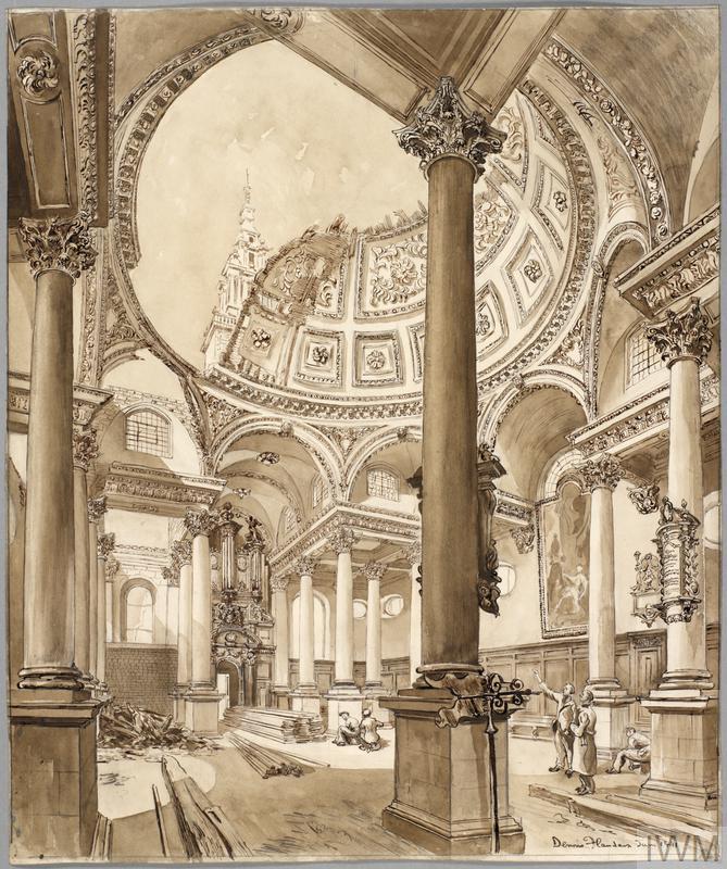
Copyright: © IWM. Original Source: http://www.iwm.org.uk/collections/item/object/9354

Dennis Flanders was a freelance artists who recorded bomb damage to London. He sold some of his work to the War Artists Advisory Committee, including the drawing of St Stephen’s.

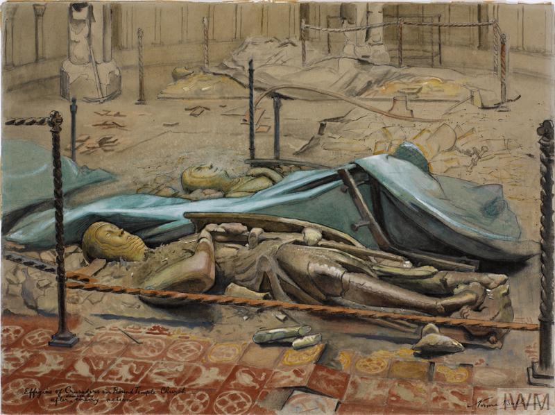
Another drawing purchased by the War Artists Advisory Committee was the following by Ian Strang, dated 1945.

St Stephen Walbrook

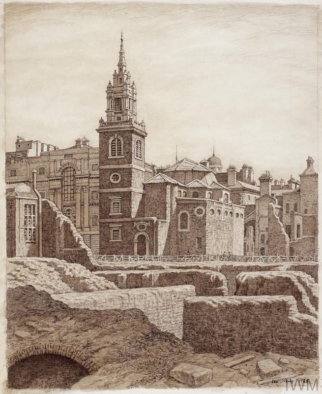
Copyright: © IWM. Original Source: http://www.iwm.org.uk/collections/item/object/25791

Note the temporary wooden cover in the place of the dome.

In the foreground are the foundations of the bombed buildings that occupied the space now occupied by the Bloomberg building. Excavation in the space during 1954 would reveal the Roman Temple of Mithras.

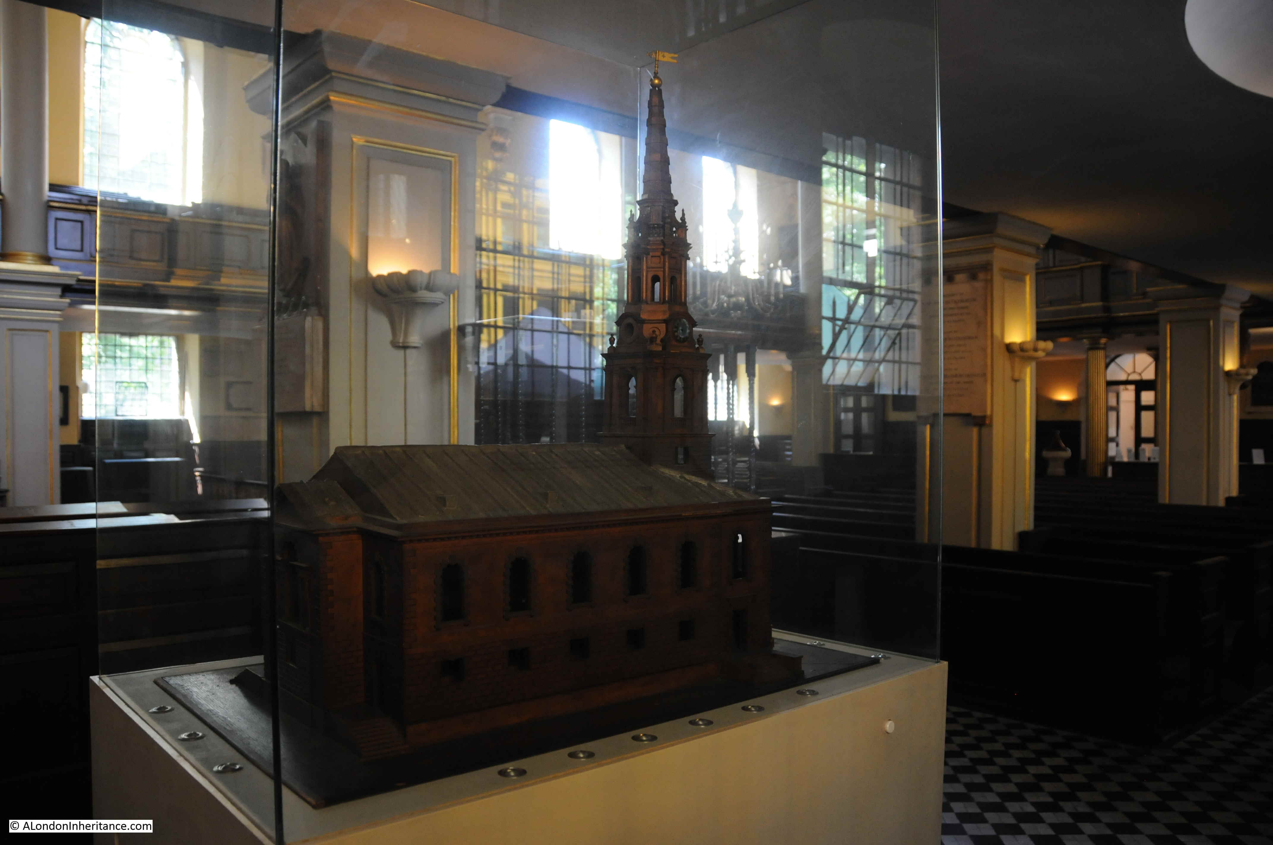
There is a wonderful model of the church to be seen inside the church:

St Stephen Walbrook

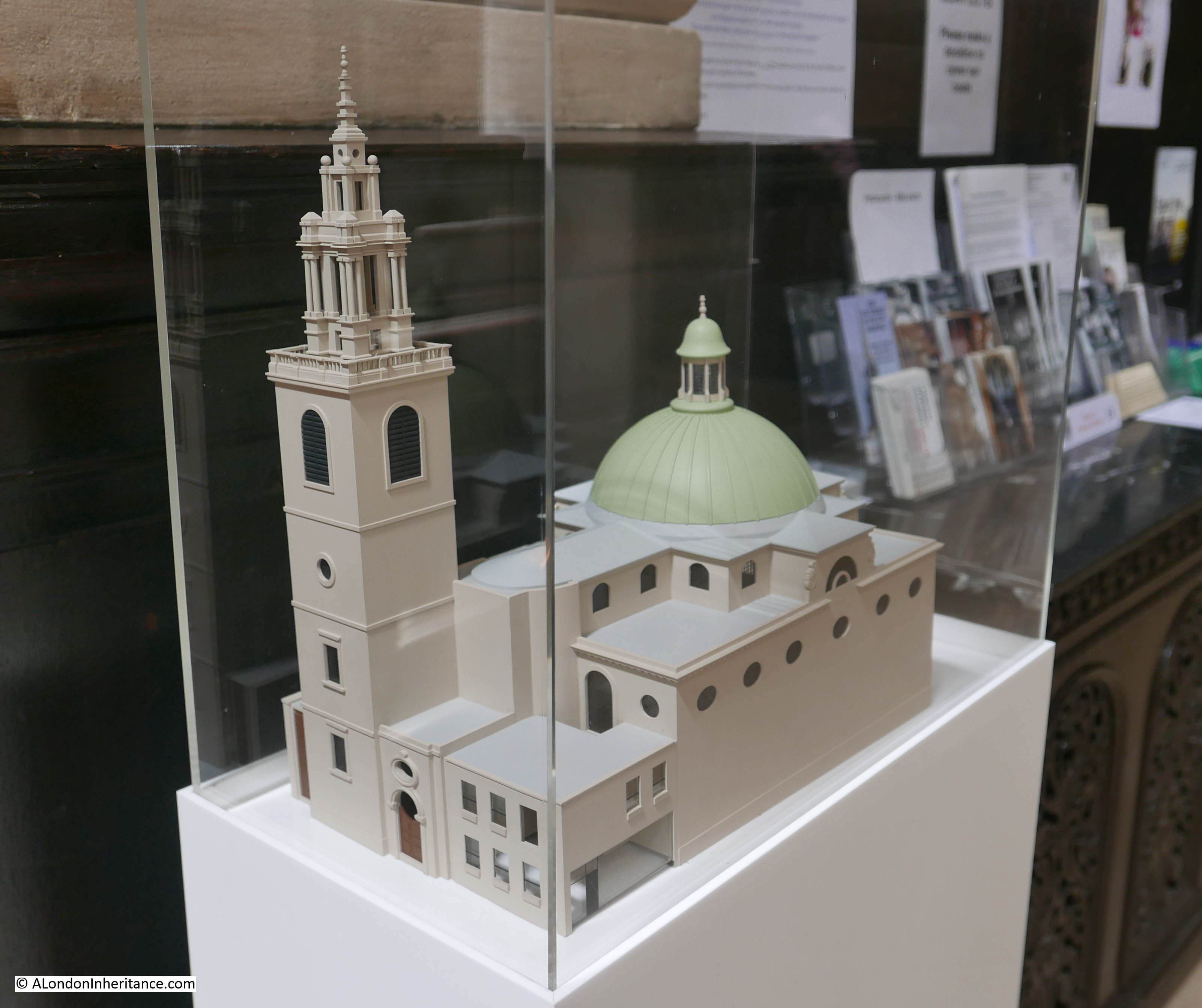
The model allows the overall design of the church to be appreciated, not easy when viewed from outside.

Looking at the model, the tower and buildings along the front of the church do look separate to the main body of the church (the smaller building to the right of the row on the front is a Starbucks).

Remove the tower and the buildings along the front and the church would be of rectangular design with a magnificent dome dominating the view of the church – perhaps Wren’s original intention.

The spire on top of the church is very similar to two other City churches, St Michael Paternoster Royal and St James Garlickhithe, which is shown in the following photo taken by my father in 1953.

St Stephen Walbrook

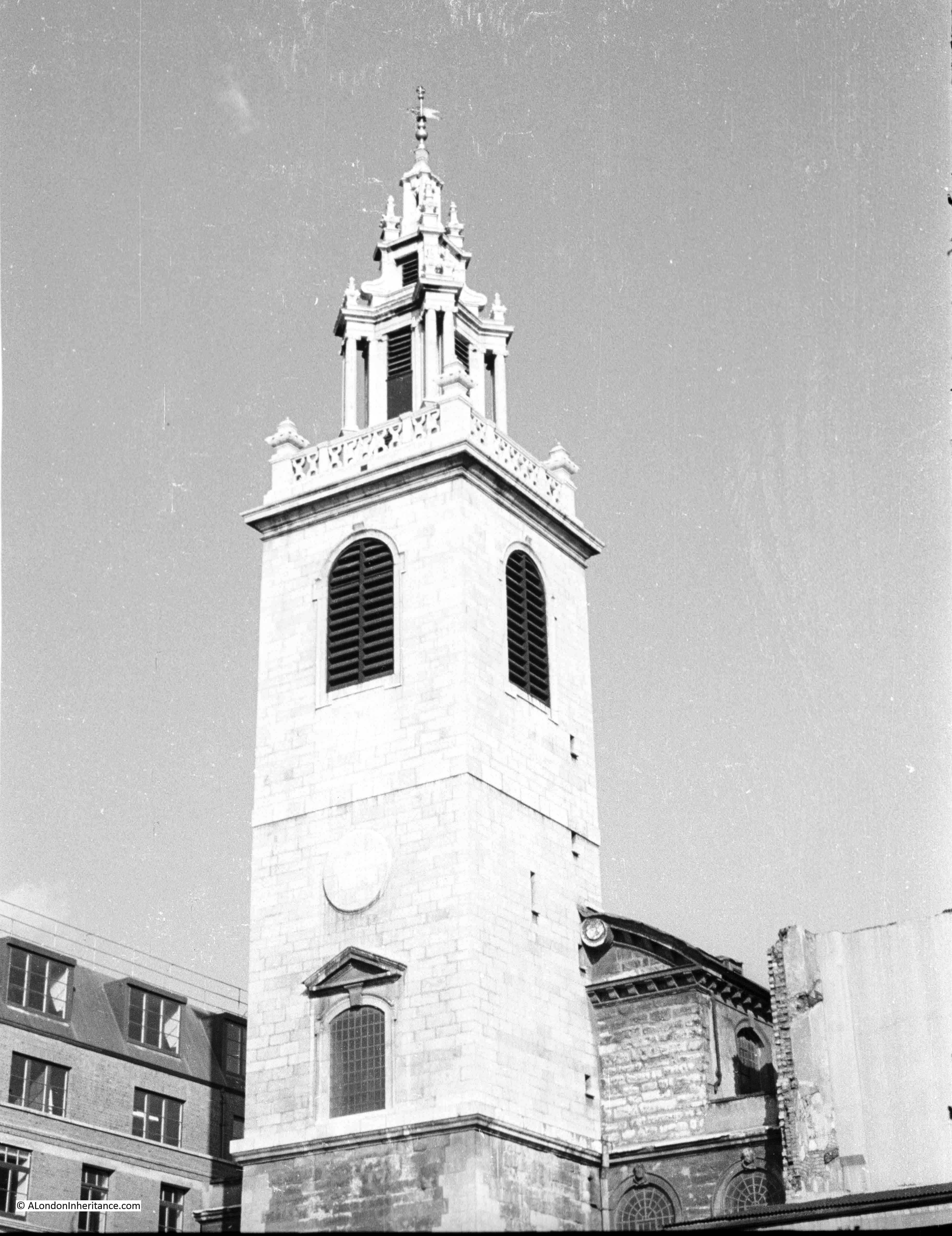
The spire was added to St Stephen Walbrook between 1713 and 1715, and the spires to the other two churches were added in the same period. They are possibly to a design by Hawksmoor.

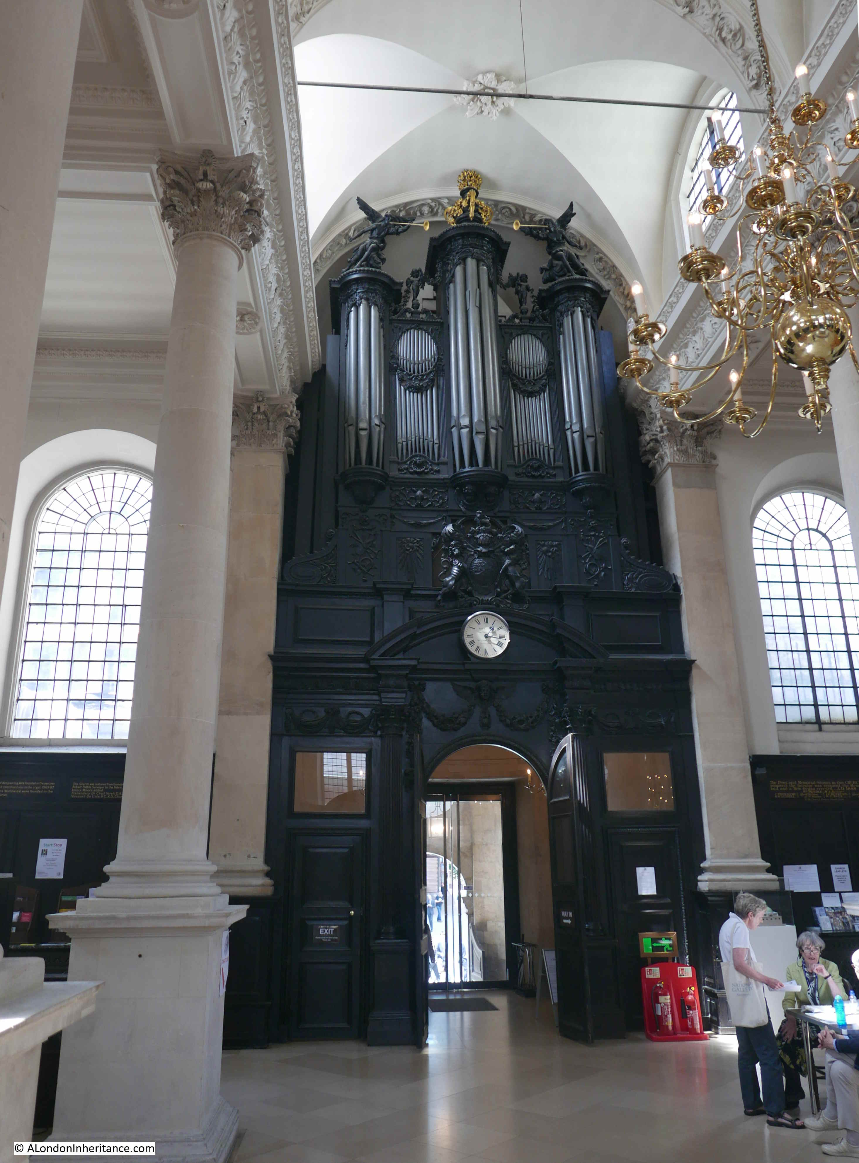
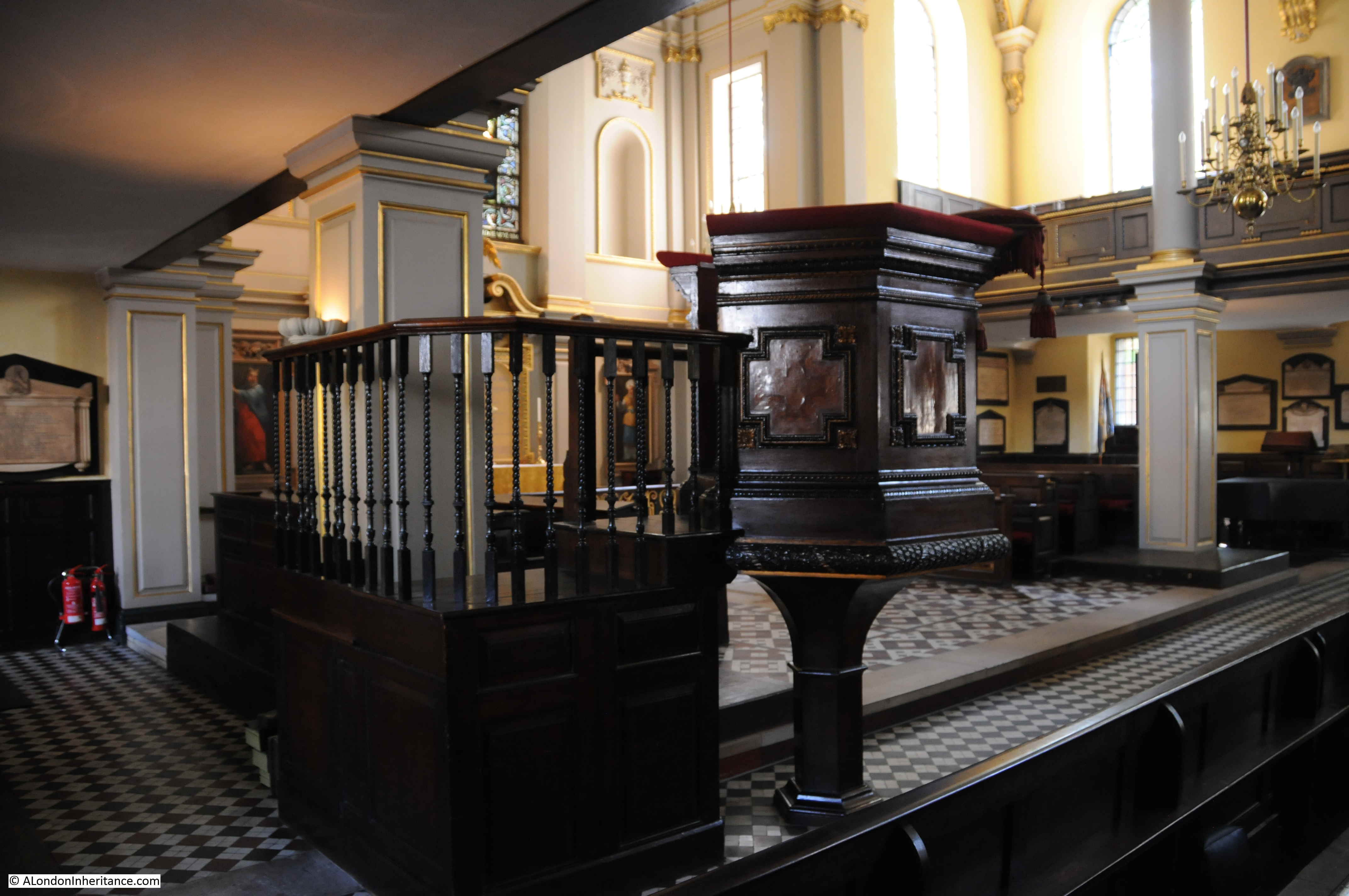
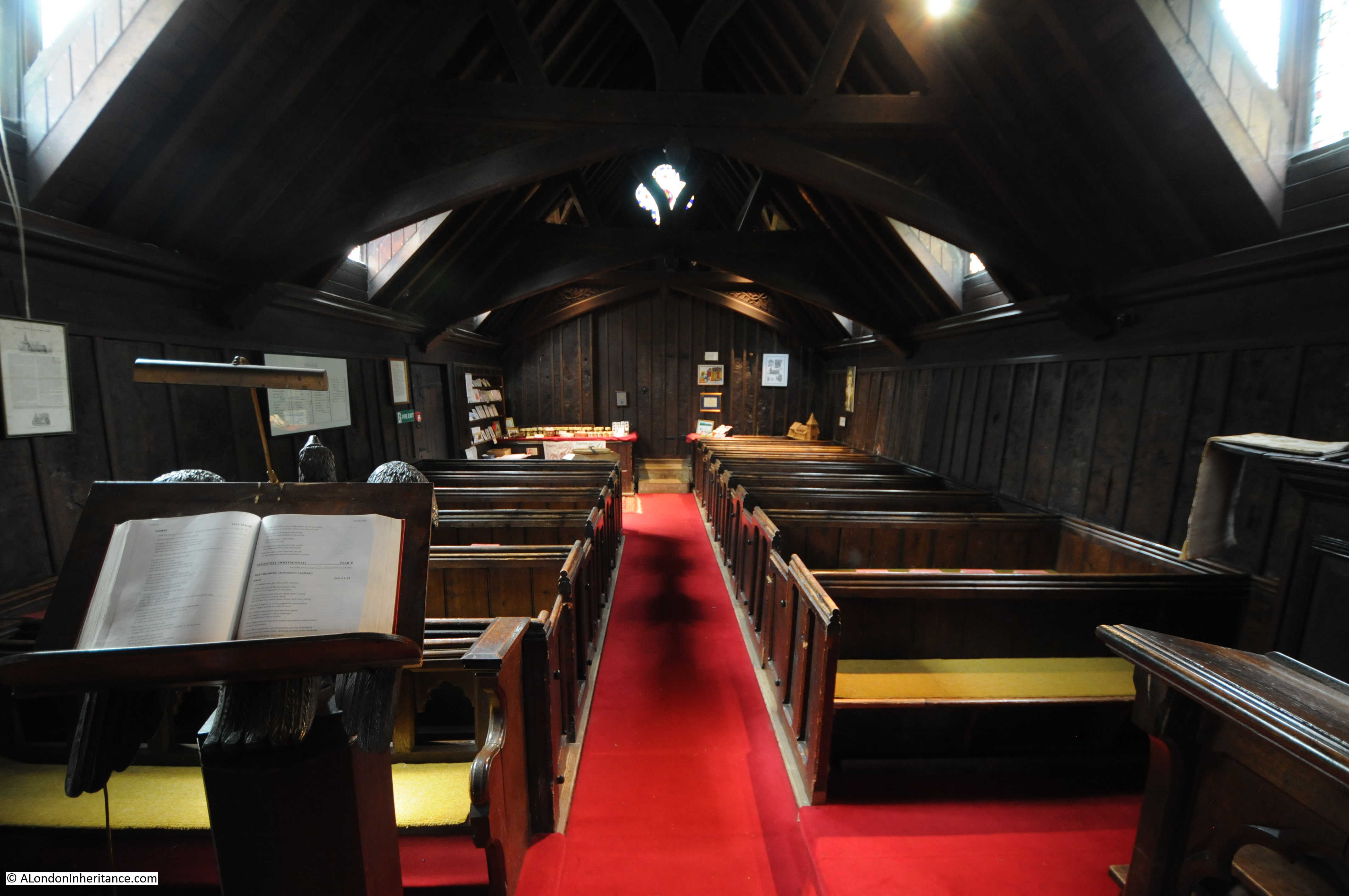
Looking back towards the entrance to the church with a rather magnificent organ case above the door. This dates from 1765.

St Stephen Walbrook

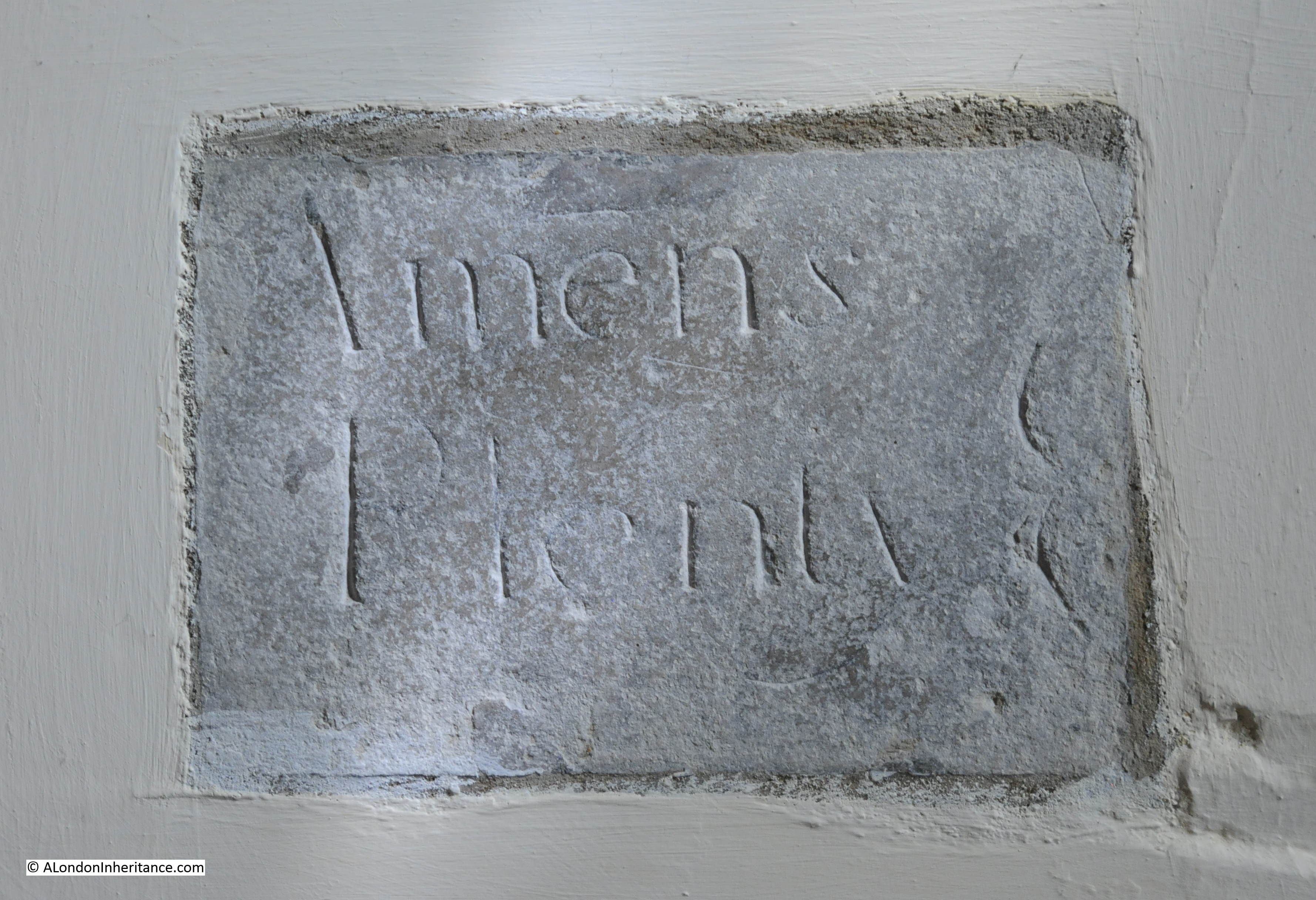
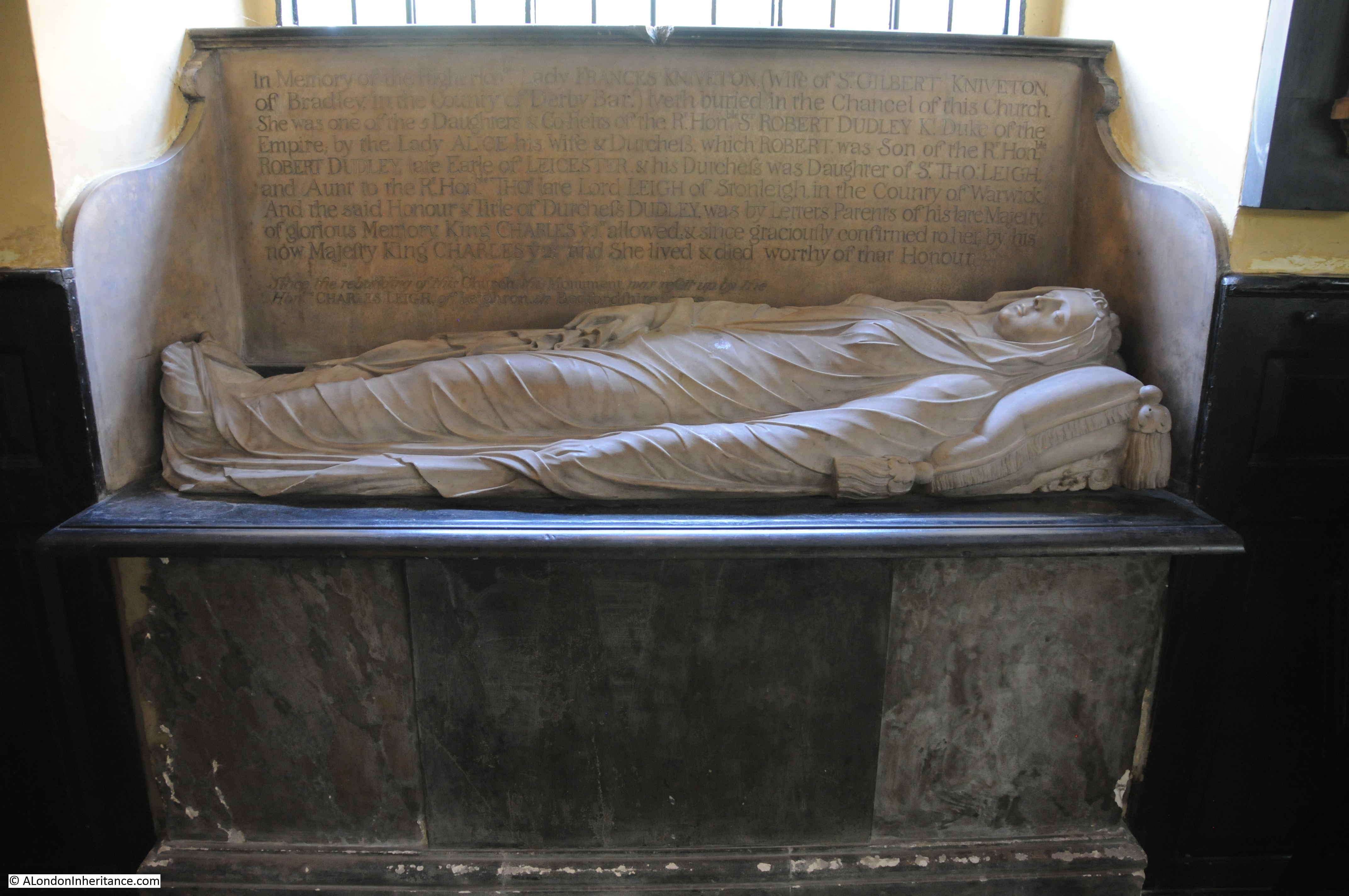
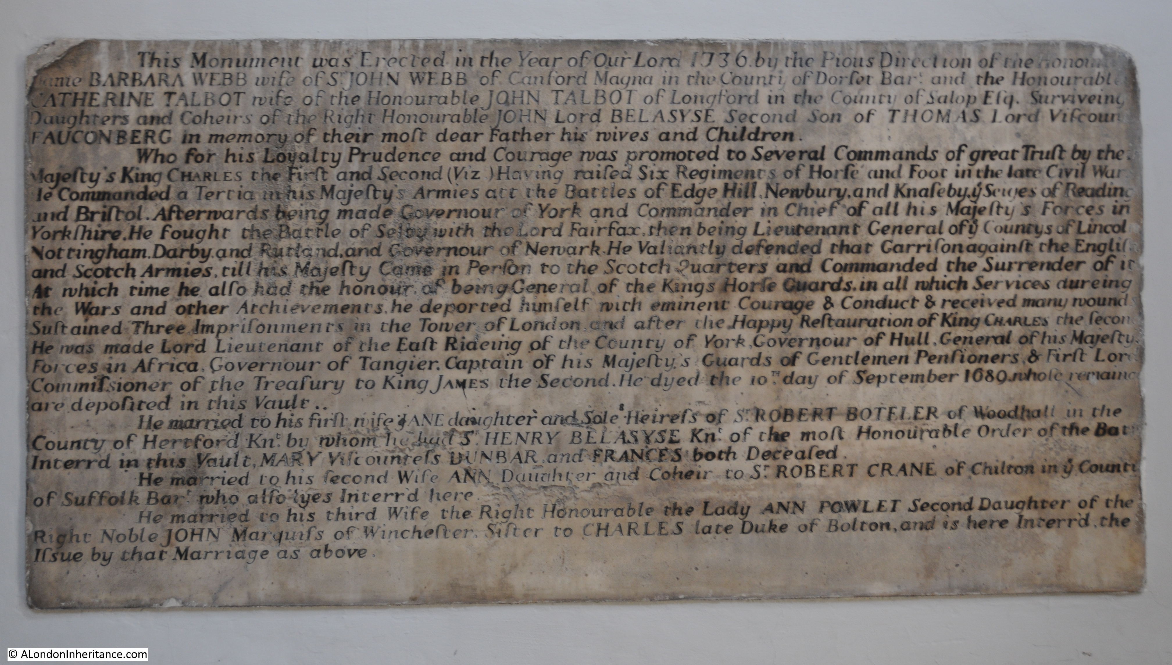
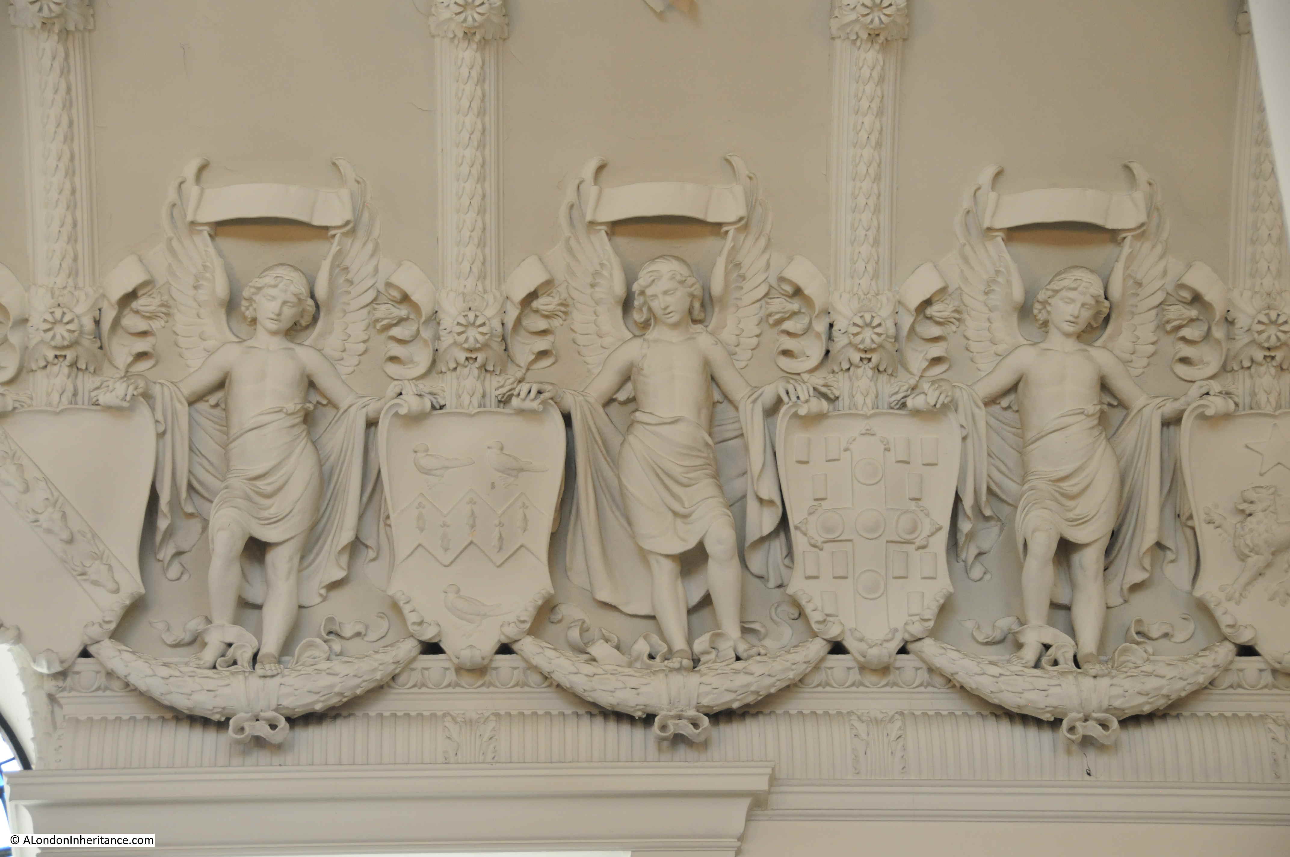
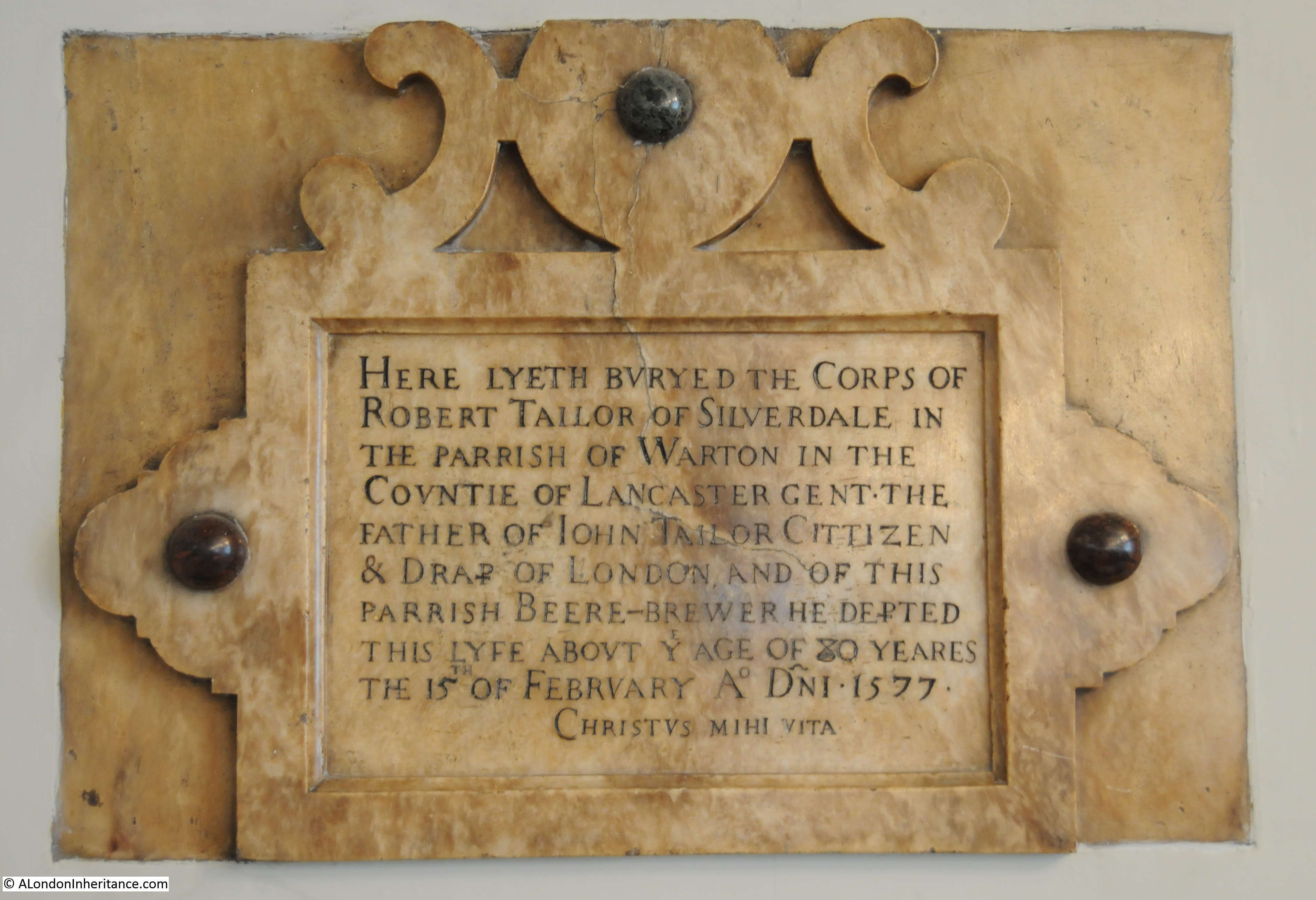
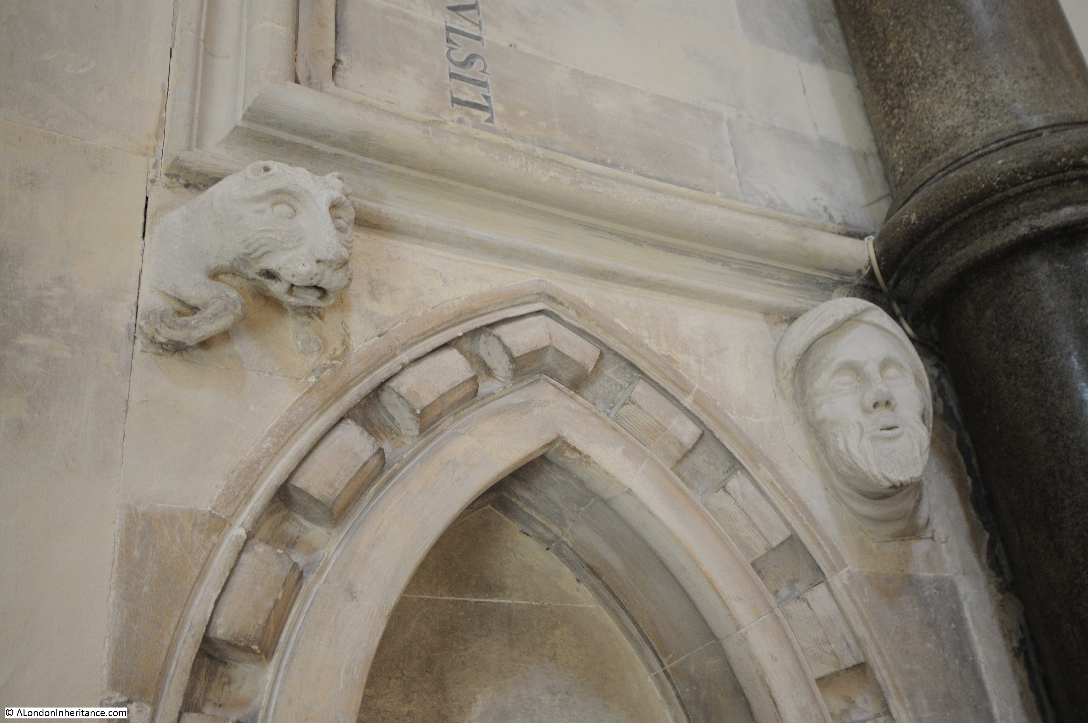
There are a number of monuments on the walls of the church, including the following to Samuel Moyer dated 1716:

St Stephen Walbrook

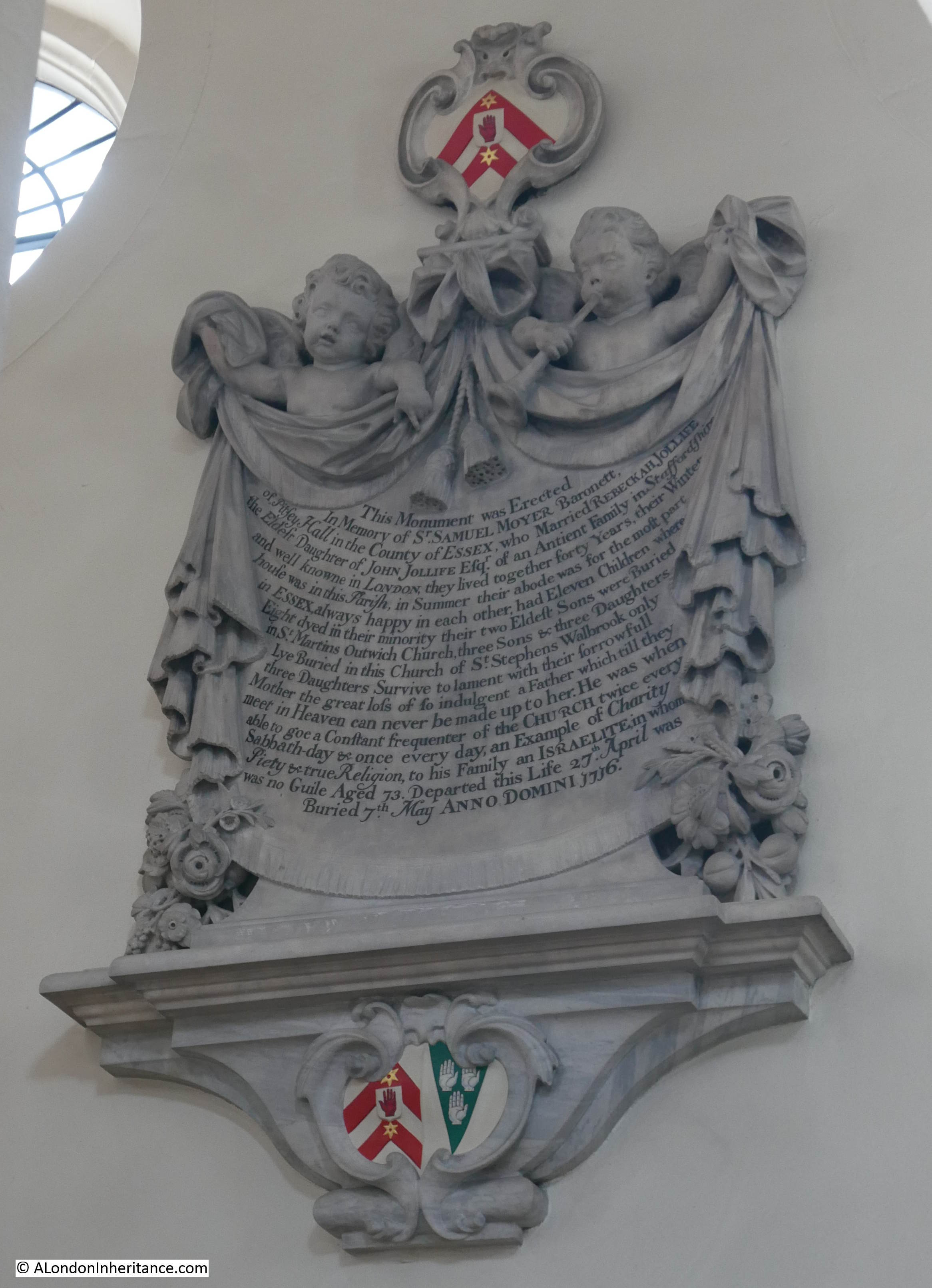
Many of these tablets provide an insight into the dreadful child mortality rates of earlier centuries, even for those who were affluent.

The tablet states that Samuel Moyer was a Baronet. He must have had money as the tablet states the family spent the summer at their home at Pitsey Hall in Essex and the winters in the parish of St Stephen Walbrook.

A Baronet, who could afford homes in Essex and London still suffered numerous child deaths, Of their eleven children, eight died in their minority, with only three daughters surviving to “lament with their sorrowful mother, the great loss of so indulgent a father”.

It was not just the high rates of child mortality, but also what this level of child-birth did to women. The risks to women during childbirth were very high, and for Rebeckah Jollife, Moyer’s wife, surviving eleven must have been traumatic.

Also, with eleven births, for a significant period of her life, Rebeckah must have been in a state of almost continuous pregnancy.

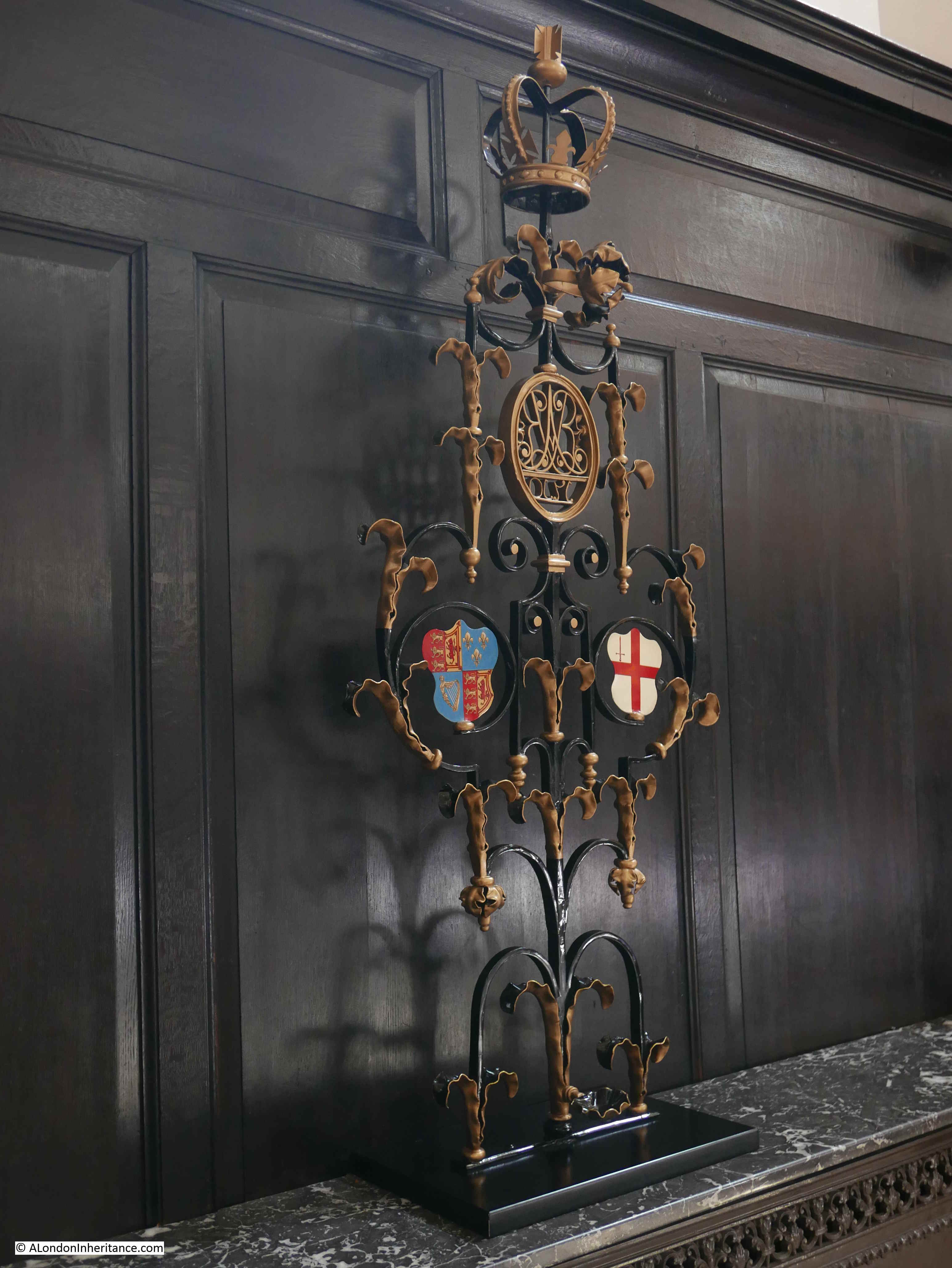
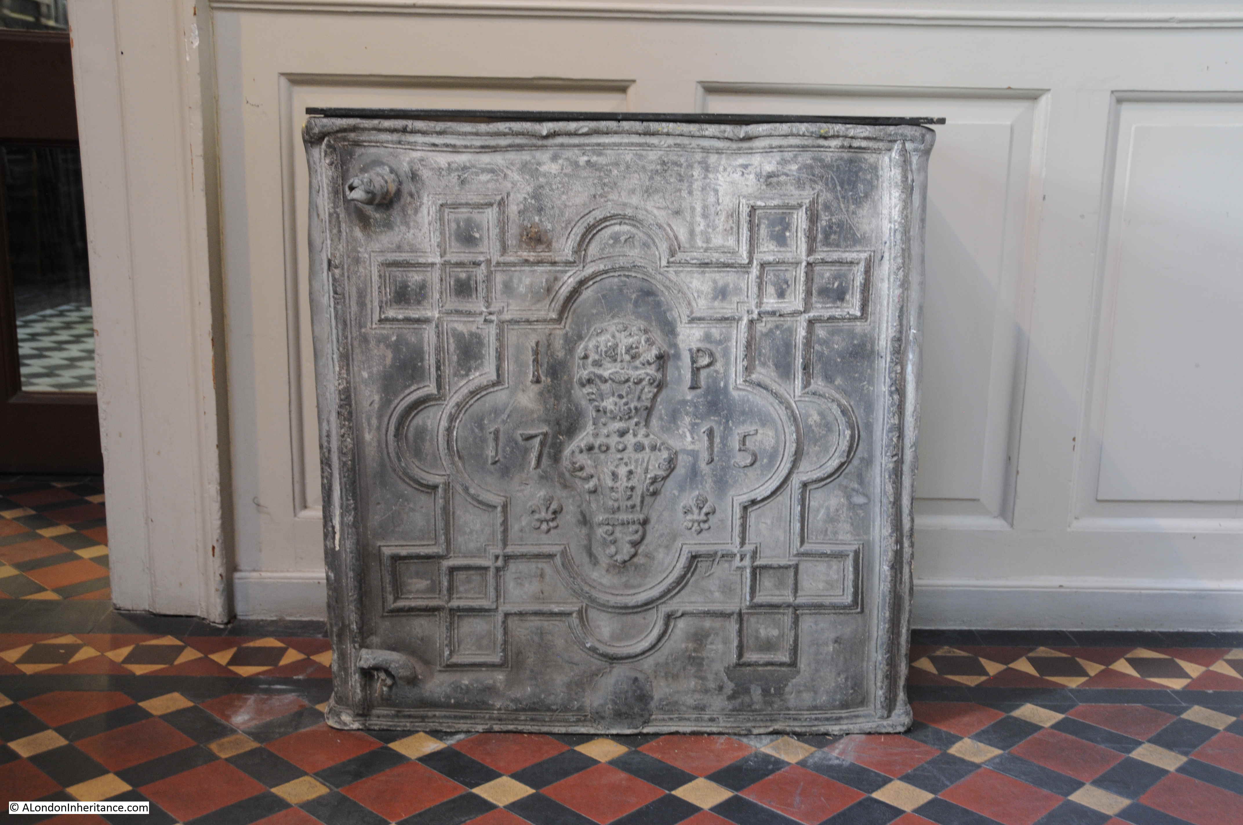
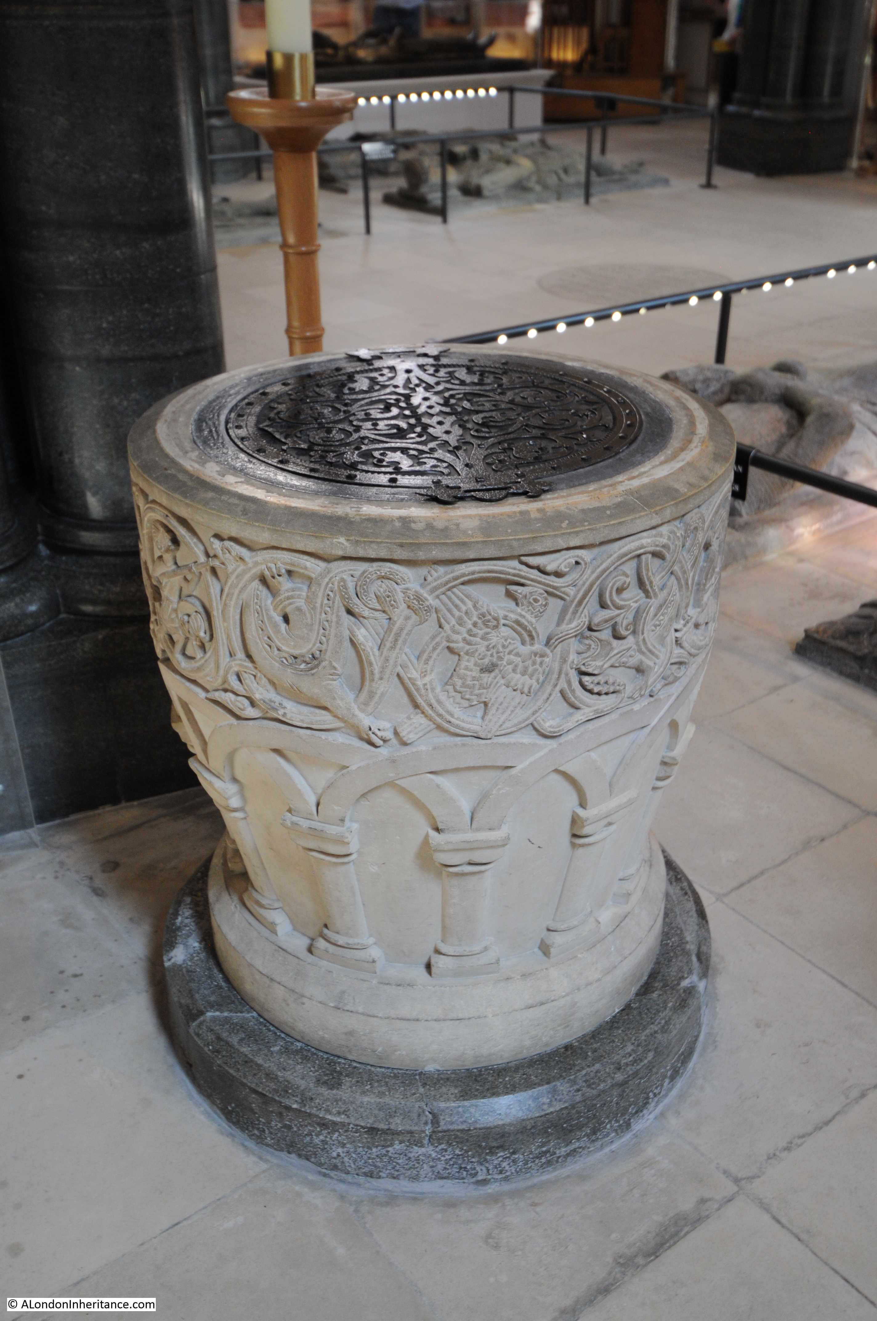
St Stephen Walbrook also has a rather nice sword rest dating from 1710. This apparently came from the church of St Ethelburga.

St Stephen Walbrook

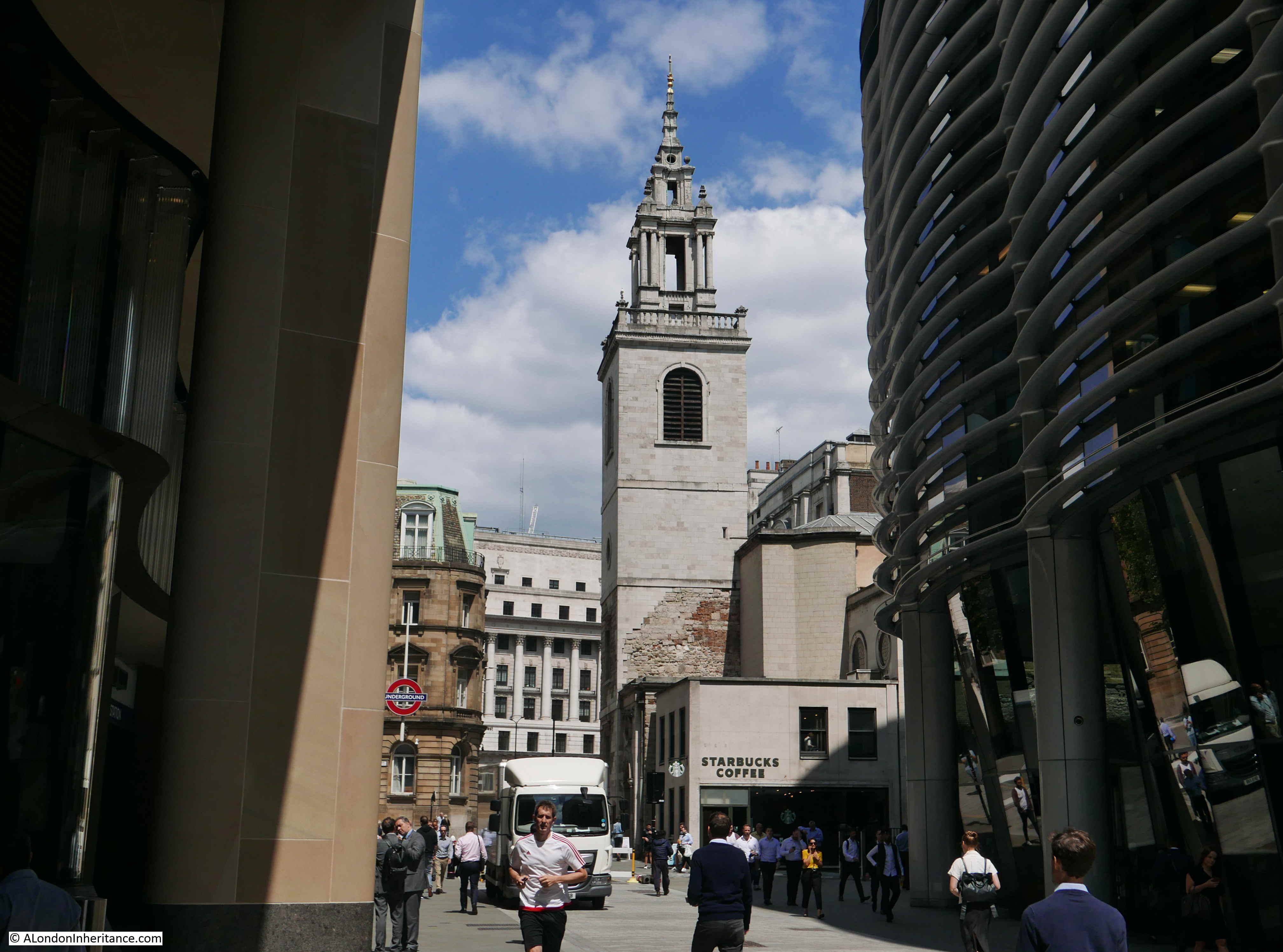
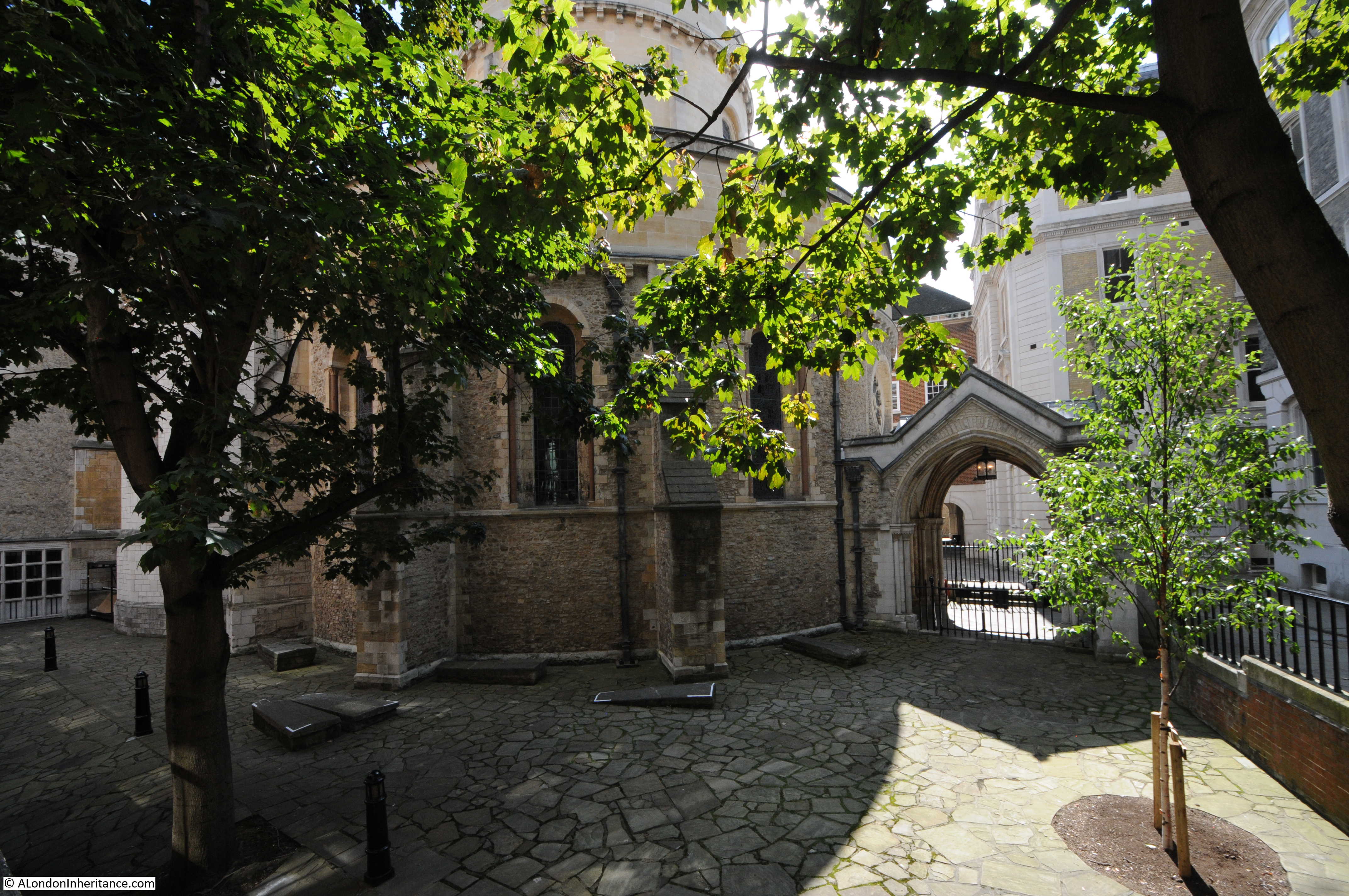
Back outside the church and this is the view of St Stephen Walbrook from the south.

St Stephen Walbrook

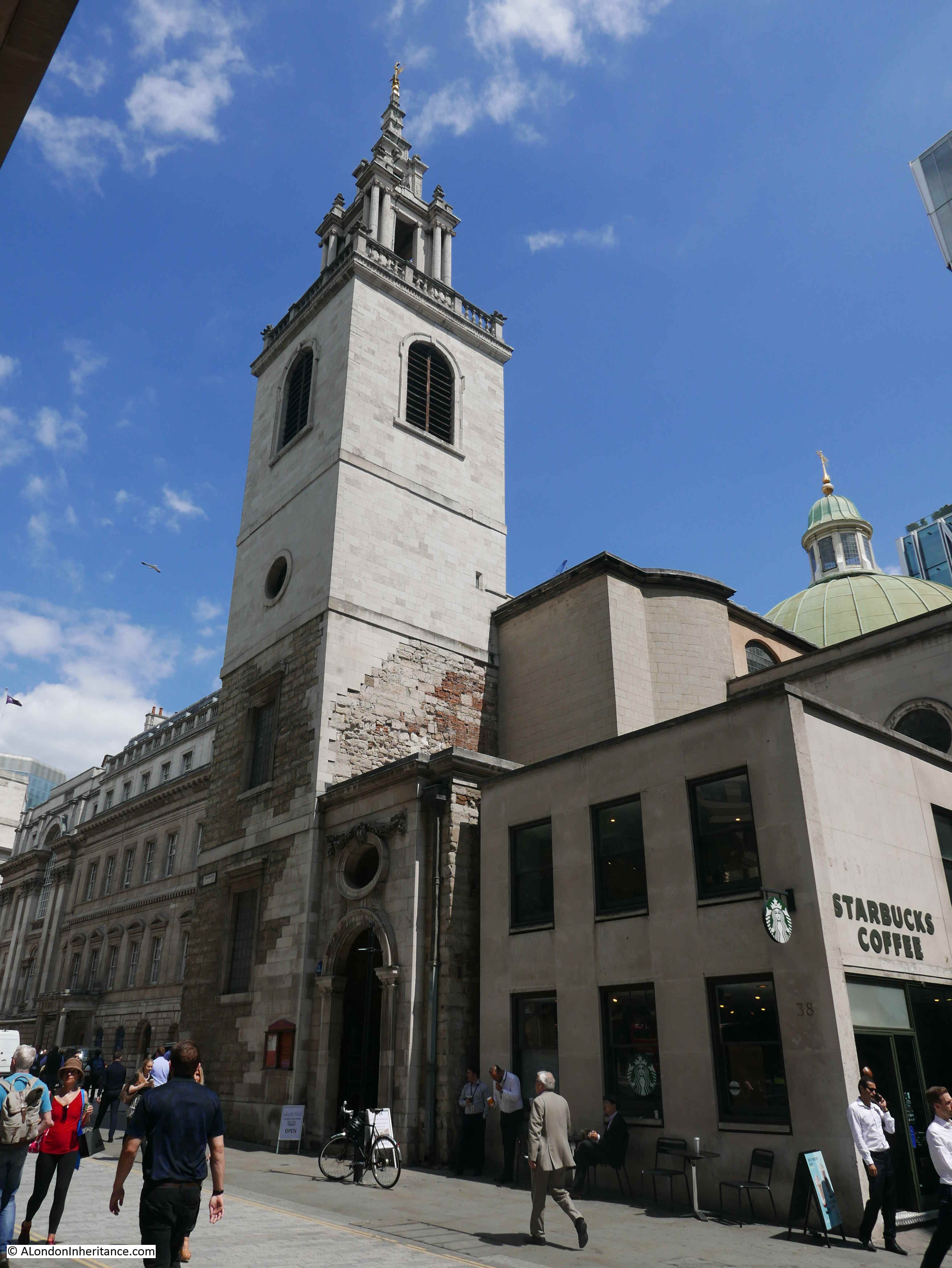
Today, a Starbuck’s occupies the corner space between tower and body of the church.

The dome of the church and lantern is just visible from the street.

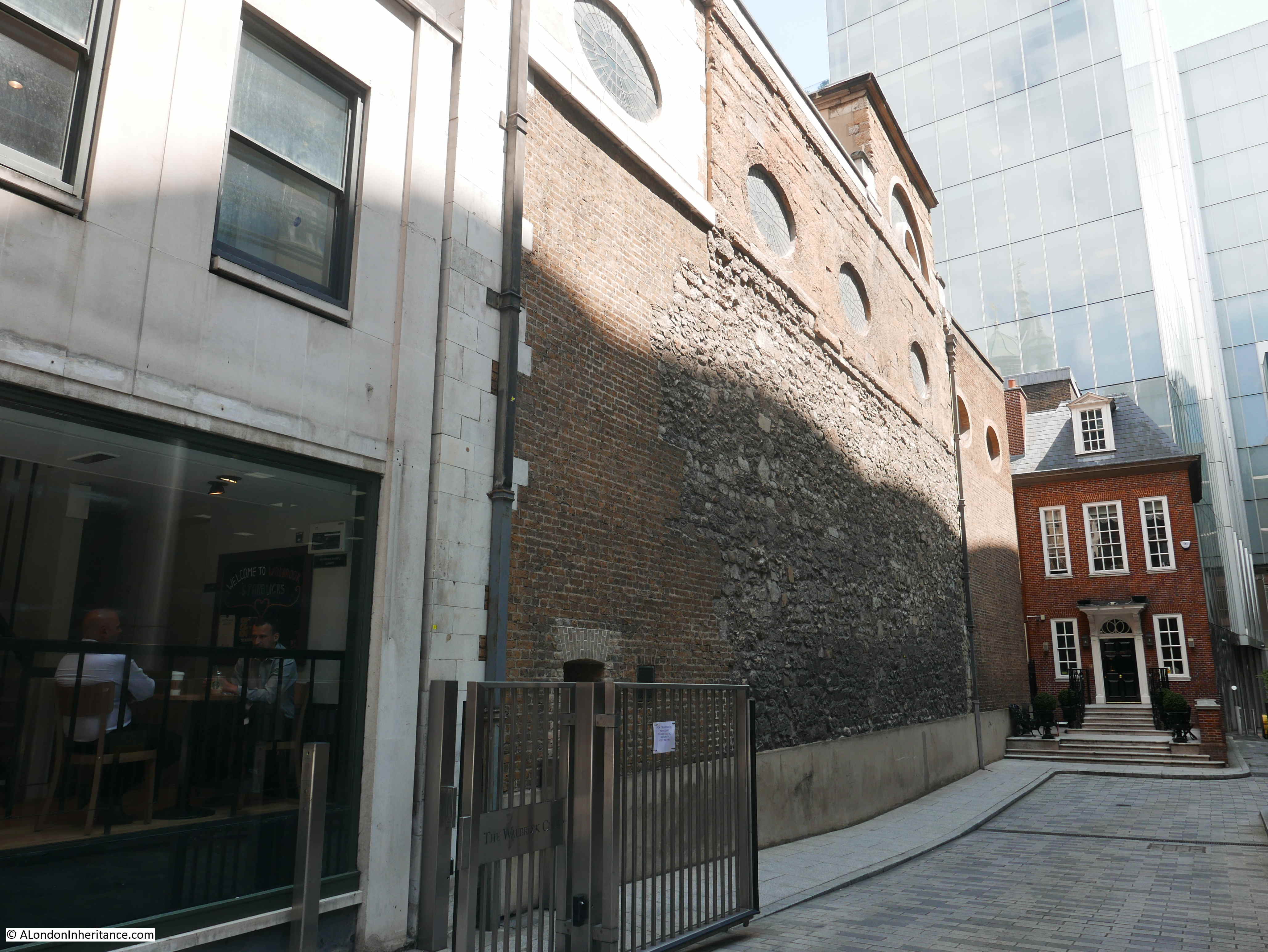
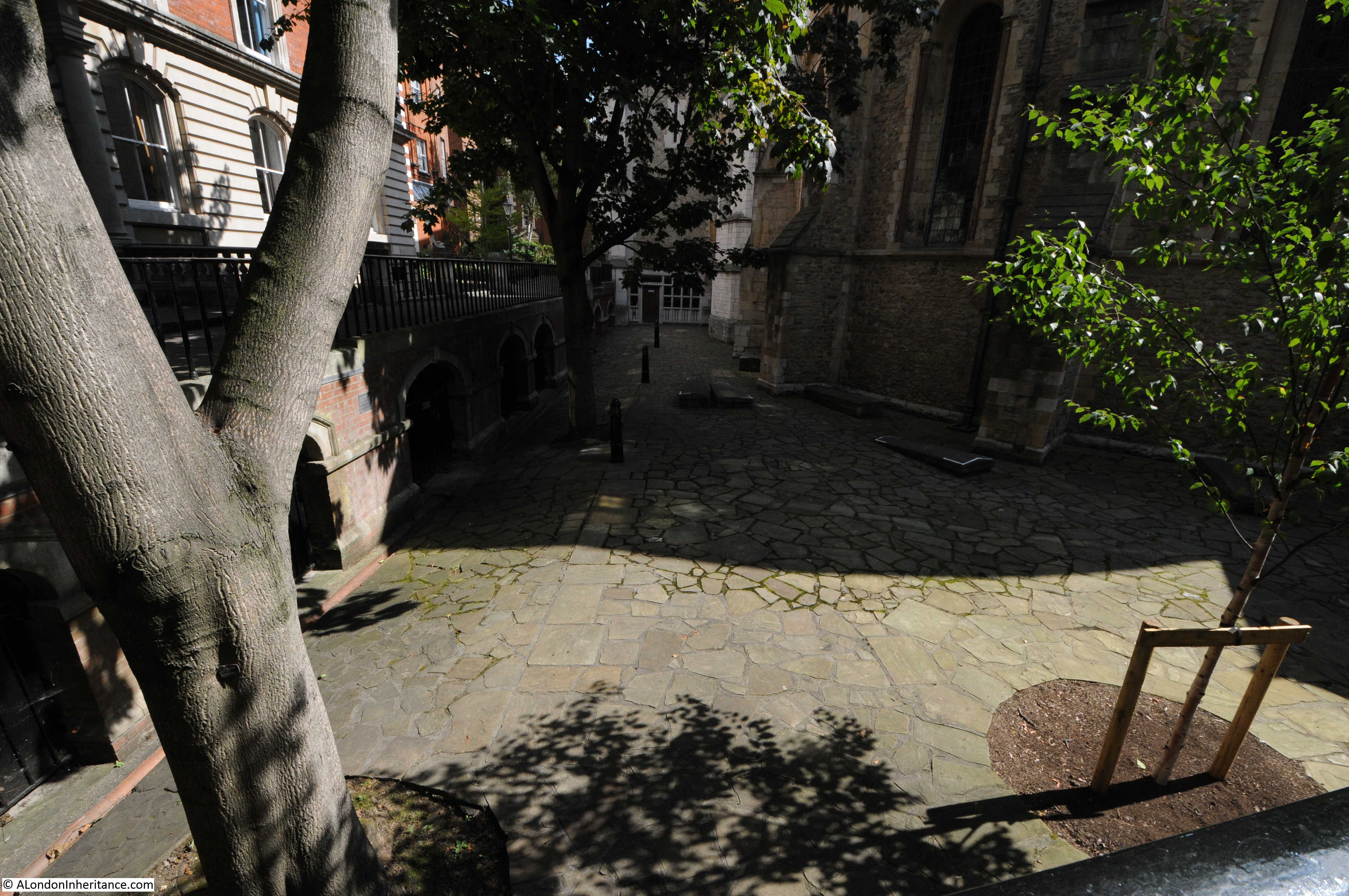
The side view of the church shows the rough building materials used in the construction of the church – probably because other buildings were up against the side of the church so there was no need for expensive stone dressing to the side walls.
St Stephen Walbrook

Close up view of the dome and lantern:

St Stephen Walbrook

A longer view looking along Walbrook from the south. The Bloomberg building is on the left:

St Stephen Walbrook

This is such a fascinating area. In the above photo, the River Walbrook once ran roughly from where I am standing to take the photo, up and parallel to the existing street. The original church was on the left, prior to moving across the street and the river. The Roman Temple of Mithras is under the Bloomberg building on my left.

St Stephen Walbrook still dominates the northern part of the street, however if you walk along the street, look behind the tower and admire Wren’s dome.

alondoninheritance.com

A City Relic In Deepest Hampshire

Do you ever wonder what happened to the contents of all the City churches that have disappeared over the centuries? Probably not, however this rather obscure interest took me recently from the Minories in the east of the City to a small village in deepest Hampshire.

The Minories is currently the name of a street leading from Tower Hill to Aldgate High Street. The name derives from the sisterhood of the “Sorores Minores” of the Order of St. Clare. The sisters of the order were known as Minoresses and their religious house as the Minories, and it was one of these houses or abbey that occupied the area to the east of the street currently known as Minories.

The abbey had an associated church, and following the dissolution, the church became the parish church  and was known as the Church of Saint Trinity, or Holy Trinity in the Minories. It is the later name that was most commonly associated with the church.

Holy Trinity was located at the end of a street leading from the Minories. The street is currently called St. Clare Street  (taking its name from the religious order).

The book “A History of the Minories” written by a vicar of the church and published in 1922 provides a fascinating history of the abbey and the church. It also includes a drawing of the church at the end of the side street leading from the Minories.

Minories

This is the same view today. The church was at the end of the street, with the front of the church just in front of the building that terminates the end of the street.

Minories

The 1895 Ordnance Survey map shows the location of the church, in the centre of the following map extract, at the end of what was then Church Street (now St. Clare Street).

Minories

Credit: ‘Reproduced with the permission of the National Library of Scotland’ 

A map of the same area today. I have marked where the church was located by a red rectangle  (© OpenStreetMap contributors) .

Minories

You will see on the 1895 map that there is a public house on the southern corner where Church Street meets the Minories. The building is still a pub – The Three Lords:

Minories

The current pub building dates from around 1890, however a pub with the same name has been on the site for much longer. The earliest newspaper reference I could find to The Three Lords dates to the 11th January 1819 when the Evening Mail reported on the arrest of a man for robbery. He was formerly a respectable man with carriage and servants, one of whom in 1819 kept the Three Lords and a pot from the pub was found in the room of the alleged thief.

The view from the far end of St. Clare Street looking back towards the Minories. The street is still cobbled.

Minories

Holy Trinity church was closed in 1899. One of the closures of City churches under the Union of Benefices Act of 1860 where churches were closed and their parish amalgamated with another parish (St. Botolph’s Aldgate for Holy Trinity).

Closure of churches was a very controversial act for the Vicars of the churches involved along with their parishioners. There is an interesting letter in the London Evening Standard on the 30th May 1893 from the Vicar of Holy Trinity. The letter addresses errors about the history of the church in an earlier article, and demonstrates the passion resulting from the way in which the closure was managed. It is a long letter, but provides some fascinating insight into a small parish at the end of the 19th century. It also demonstrates the interest of a parish vicar in their church. Frequently the image of the Vicar is of a remote character, mainly interested in the income that could be generated from the role.

The letter reads:

“HOLY TRINITY CHURCH, MINORIES – Under the above title an article has gone round the papers purporting to give particulars of my church and its past history, some extracts of which appeared in your Morning and Evening Editions of the 25th instant. Will you permit me, then, to say that none of the statements in that article are correct.

In the first place, the name of my church is not ‘St. Mary in the Minories’ but  Holy Trinity, Minories. Secondly, the mummified head which we have could not be that of the Duke of Norfolk, as the writer states, for that nobleman never had anything to do with the abbey or the church that I am aware of; but it may be the head of the Duke of Suffolk, to whom the abbey was given for a residence, by Royal letters patent, in the reign of Edward VI, and who, whilst resident there, was beheaded for attempting to place his daughter, Lady Jane Grey, upon the throne. The head was found in 1853 in one of the vaults, in a box of oaken sawdust, which, acting as an antiseptic, has marvelously preserved the skin of the face.

(The book “A History of the Minories” includes a rather gruesome photo of the mummified head)

Thirdly, the writer says that ‘the ancient Priory of Holy Trinity was founded by Matilda, Queen of Henry I, in 1108 whereas we know that the abbey (not priory) and its church was built in 1293 by Queen Blanche, widow of Henry le Gros, King of Navarre, who afterwards married Edmund, Earl of Lancaster. The arms of the Queen, with those of the Earl of Lancaster, are now in our vestry.

Fourthly, the writer states that on ‘the dissolution of monasteries by Henry VIII, the priory and its precincts were given to Thomas Audley, Lord Chancellor of England, who after pulling down the church, made the place his residence until his death in the year 1554’. These mistakes are even worse than the former ones, for Henry VIII gave the abbey to the Bishop of Bath and Wells (Dr. John Clerk) for a place of residence, where he died and was buried in the vaults of our church, though afterwards his body was, for some cause, removed to Aldgate Church. This was the man, who took to the Pope of Rome a copy of King Henry’s book against Luther, which led to that Sovereign receiving the title of ‘Defender of the Faith’, still used, though with a very different meaning.

The church was not pulled down on the dissolution of the abbey, but remained until 1706, when, being in a very dilapidated state, it was taken down and rebuilt from the ground with the exception of the north wall, upon which the chief monuments are placed.

Then the writer says that the parishioners of St. Katherine Cree, in 1622, obtained leave of Charles I to rebuild the priory church with the assistance of Lord Mayor Barkham.

From this it is quite evident that the writer of the article has mixed up our church and the abbey with another church and some priory. What in the world could see the parishioners of St. Katherine Cree have to do with Holy Trinity, Minories? Also, as the church was not rebuilt until 1706, Lord Mayor Barkham certainly did not assist to rebuild it in 1622, but Sir William Pritchard, who was Lord Mayor in 1683, purchased the abbey, and resided in it during his mayoralty, calling it, I believe, the Mansion House.

May I add that I was at first greatly opposed to the amalgamation of Holy Trinity, Minories, with St. Botolph Aldgate, and wrote a little history of the church in order to raise funds for its restoration, when the Charity Commissioners came down upon us and confiscated the church property devoted by the churchwardens to the maintenance of public worship, leaving them only thirteen pounds a year to pay the salaries of organist, pew-opener, bell-ringer, fire insurance, repairs, gas, coals, water, &c. ? Also they seized funds for giving every Christmas all the widows living in the parish five shillings, accompanied with coal and bread tickets.

This unrighteous impoverishment of the church led me to consent to the amalgamation scheme now about to take place, but I shall leave my parish and people with much regret.

I am, Sir, your obedient servant, Samuel Kinns, Vicar.”

I walked down St. Clare Street, to where the street takes a sharp right turn. In the following photo, the front of the church was just behind the gates, roughly in line with the red bin on the left.

Minories

Nearly all the buildings at this end of the street are relatively recent.

Holy Trinity, Minories closed as a church at the end of the 19th century, but the church survived as a parish hall until the Second World War when the building suffered severe bomb damage. A wall did remain until final clearance of the area in the late 1950s.

Taking the sharp right turn on St. Clare Street, in front of where the church was located, and there is one remaining building, an old warehouse that would have probably been around at the same time as the church.

Minories

Finally, getting to the theme of the post, does anything remain of the church?

The following drawing of the interior of the church from the book “A History Of The Minories London”, shows a pulpit on the left, where the rows of pews end.

Minories

The pulpit can still be seen today, but in a very different location to the Minories.

The church was closed in 1899, and in 1906 the pulpit from Holy Trinity, Minories was presented to All Saints’ Church, East Meon in Hampshire.

East Meon is a village in Hampshire, to the west of Petersfield in the South Downs. It is close to the source of the River Meon. In the following map extract, the location of the village is indicated by the red circle.  (Maps © OpenStreetMap contributors) 

Minories

Zooming in further and the following extract shows the village in the centre of the map, the River Meon flowing through the village, which is surrounded by countryside.

Minories

A couple of weeks ago, I headed out to East Meon to find Holy Trinity’s pulpit.

East Meon is best reached either via the A3, turning off near Petersfield, or from the A32 at West Meon. The final few miles of travel along either of these routes is along country lanes with very little traffic and the rolling hills of the South Downs on either side.

In the centre of the village is a finger post showing the nearest villages and towns and also signposting the village shop, school, village hall and car park.

Minories

The River Meon flows through the centre of the village.

Minories

The first view of All Saints’ Church, East Meon from the centre of the village. The church has a rather dramatic location, on raised ground overlooking the village, and with the towering Park Hill rising directly behind the church.

Minories

A closer view of the church.

Minories

The church was built between the years 1080 and 1150. Although with later renovations, repairs and changes, the layout of the church is the same cross-shaped design as when originally built. A central tower dominates over a nave, chancel and transepts which lead off either side from the base of the tower.

Major restoration was carried out during the early 20th century, and as part of this restoration, the Holy Trinity pulpit arrived in East Meon.

The main entrance porch to the church provides a superb view looking back over the village of East Meon.

Minories

On entering the church, the pulpit comes into view.

Minories

A close up view of the original Holy Trinity pulpit. At first sight, perhaps not very impressive, but it dates from 1706 and spent almost 200 years serving the parishioners of the Minories in the City.

Minories

This is the pulpit from which Edward Murray Tomlinson, the author of the book I have on my desk – A History of the Minories London – would have preached from during his time as a Vicar of Holy Trinity.

A brass plate on the door of the pulpit confirms the origin, and provides some background as to how the pulpit found its way from the Minories to East Meon.

Minories

The Rev. Edmund Murray Tomlinson who presented the pulpit to the church must have noticed a considerable difference between his 12 years as Vicar of Holy Trinity, Minories and his following 12 years as Vicar of East Meon.

The pulpit arrived at a time when the East Meon church was undergoing considerable renovation. The East Hampshire Chronicle on the 3rd November 1906 reported that the church had just reopened for public worship and that restoration had cost £1,130.

Restoration included major works such as the lowering of the floor to the original Norman level to reveal the “dignity of the massive Norman arches”. The article also references the arrival of the pulpit from Holy Trinity, Minories to confirm the facts given on the brass plate.

The interior of the church is fascinating, not just the architecture, but also the decoration and furniture of the church.

The church provides a home for the East Meon Millenium Embroidery. Started in 2002 and completed in 2008, the embroidery provides a wonderful snapshot of the village, created by local people. Unfortunately, no matter where I stood, I could not take a photo without a reflection in the glass.

Minories

Windows and Easter decorations:Minories

There is a strange stone set into one of the interior walls of the church. the words “Amens Plenty” inscribed.

Minories

The church guidebook provides an interesting local legend about the stone. It was lifted from the floor of the church in 1869 and underneath the stone was found the remains of four men. They were buried vertically which added to the mystery. The local legend is that they were four Parliamentary soldiers killed in the village before the Battle of Cheriton on the 29th March 1644. Cheriton is about 12 km to the north west of East Meon.

An interesting feature of the central tower is that access to the tower is via stairs up along the wall in one of the transepts, with a small balcony and doorway at the top of the stairs providing access to the tower.

Minories

Some very large capitals on the crossing arches that support the tower.

Minories

View along the central nave of the church with the Holy Trinity pulpit on the left at the end of the pews.

Minories

The church has two fonts. The first is a very plain stone font of unknown date. As with the Holy Trinity pulpit, churches seem to accumulate from other religious buildings and this font came from the ruined chapel of St. Nicholas near Westbury House in East Meon. Although being of unknown date, it looks very old.

Minories

The second font is much more ornate and has a more identifiable history. This is the Tournai font:

Minories

The font derives its name from the location of manufacture – Tournai in Belgium. It was delivered to the church in East Meon around the year 1150, and probably was a gift from Henry of Blois, the Bishop of Winchester. The fact that East Meon has such a font illustrates the importance of the church and village in the 12th century. There is another Tournai font in Winchester Cathedral.

Minories

The font is highly decorated, although this was rather difficult to photograph in the strong light streaming through the windows. Two sides of the font tell the story of Adam and Eve whilst the other two faces and the top of the font are covered in symbolic designs.

The following photo shows the west side of the font. The pillars are holding up the flat earth above which some rather strange monsters or dragons are carved.

Minories

The east side of the font relates part of the story of Adam and Eve. Rather difficult to see in the following photo, however the structure on the right is a representation of the Gates to Paradise. There is a figure to the left holding a large sword. The figure also has wings and is a representation of an angle who has expelled Adam and Eve from Paradise. Adam and Eve are to the left of the angel and are both trying to hold their fig leaves in place.

Minories

The font is a remarkable example of 12th century craftsmanship.

In the outside wall of the church, there are some gorgeous doors:

Minories

Minories

The central tower of the church. The spire dates from 1230 when the final additions were made to the church including the Lady Chapel and the south aisle.

Minories

Detail from the top of the tower. Wavy carving around the clock, open windows and along the wall of the tower.

Minories

The rear view of the church shown below includes the original chancel on the right, with the 1230 Lady Chapel on the left.

Minories

The straight line distance between the location of Holy Trinity, Minories and East Meon is not that far, only 88km, or 55 miles, but they are very different places and that difference must have been even more apparent in the 19th and early 20th centuries when the Vicar and Pulpit moved from the Minories to East Meon.

A modern day comparison of living in a village such as East Meon with living in the city is the difference in public transport. The bus stop timetable highlights the limited bus service to take residents to the nearest town.

Minories

Although the City still has a remarkable number of churches, so many have been lost over the years, from the Great Fire, the wave of late 19th century closures that included Holy Trinity, the Blitz and other occasional closures and parish amalgamation.

Church contents would have been lost through fire and bomb damage, but there must still have been a considerable amount sold or relocated to another church. The 1706 Holy Trinity pulpit is one item that can still be found, and continues to serve the same function as its makers intended over three hundred years ago.

alondoninheritance.com

St John at Hampstead and George du Maurier

Last Saturday was a windy, sunny spring day in London, so what better than to spend an hour exploring the cemetery of St John at Hampstead.

The reason for this specific cemetery was to find a rather unusual grave that my father had photographed in 1949. This is the grave of George du Maurier.

St John at Hampstead

The same view 70 years later in 2019:

St John at Hampstead

The grave today does not appear as well looked after as in 1949. There was some space surrounding the grave in 1949, however today there are many more graves alongside. The tree on the left has been cut down and today only the stump survives. One of the significant differences which I find in many of my father’s photos is the number of cars in the street. In 1949 streets were generally free of parked cars, in 2019 there are very few streets without parked cars, or lots of passing traffic.

George du Maurier, or to give him his full name, George Louis Palmella Busson du Maurier, was born in Paris on the 6th March 1834 and died on the 8th October 1896.

His grandparents on his father’s side were French and according to an 1886 newspaper account, emigrated to England during the “Reign of Terror” during the French Revolution. Later accounts state that his grandfather was a glassblower and left France to avoid fraud charges, adding the du Maurier name to give the impression of a French aristocratic background.

His father returned to Paris and it was there that George was born. He spent much of his childhood in France until the family returned to London and George started as a student at the Birkbeck Laboratory of Chemistry.

The Hampstead and Highgate Express on the 24th July 1886, in their series on well known residents features George du Maurier and explains that whilst his father wanted him to become a chemist, including going to the expense of setting up his own private laboratory, George was more interested in the arts and “humorous draughtsmanship“.

After the death of his father, he gave up chemistry and went to Paris to study art. He later returned to London, after spending an additional three years in Germany and Belgium and started in his career as a draughtsman, producing drawings for publications. Punch was the publication that became most associated with his work, and he produced drawings for Punch for twenty five years.

George du Maurier photographed in 1889 (© National Portrait Gallery, London)

St John at Hampstead

The article in the Hampstead and Highgate Express described his work: “Over a period of nearly twenty five years he has contributed to ‘Punch’ an almost endless series of drawings illustrative of the manners and customs of English society. Some of its phenomena, the shams, affectations, meannesses and frivolities peculiar to its salons and garden parties, and some other scenes of fashionable life, are treated by the artist with the most biting satire. But a great deal belonging to English life and society, especially its venial weaknesses, is treated by the artist from the humorists’ standpoint, namely that of light satire and good humour. In an appreciation of beauty and grace as seen in his numerous presentments of women and children, and in his general design of his pictures, Mr du Maurier excels all preceding English pictorial humourists. In the ‘Punch’ contributions he has not only shown power as a graceful and refined artist, but in his drawings for that amusing periodical there are touches of wit, humour, satire, subtle observation, and poetic suggestiveness which are indisputably the work of a man of genius.”

A couple of examples of George du Maurier’s work for Punch are shown below (both ©Trustees of the British Museum).

The following drawing is an illustration for Punch, dated the 18 October 1880. It is described as “What our Artist has to put up with, a man talking and touching the shoulder of another, both standing before a group of three pictures, other figures examining other pictures on the surrounding walls”.

St John at Hampstead

The following drawing is dated the 12th January 1878 and is a study of two female figures sitting in a carriage on the Metropolitan Railway.

St John at Hampstead

He also produced numerous sketches for his own amusement, including many self portraits. This one on paper, stamped with his home address in Hampstead shows George du Maurier exclaiming ‘Hooray!’ at the arrival of the post with his dog dancing nearby.

St John at Hampstead

George du Maurier married Emma Wightwick, who he had met whilst in Germany. They had five children. One of his children was the actor Sir Gerald du Maurier, who was the father of the authors Daphne du Maurier and Angela du Maurier.

In his later years, George du Maurier turned to writing and produced three novels between 1889 and 1897- Peter IbbetsonTrilby, and The Martian.  Trilby was a significant best seller with the Victorian story of a fallen woman with a good heart.

George du Maurier was 62 when he died of heart failure. He had lived at two locations in Hampstead during his life, but had moved around a number of times and at the time of his death was living at Oxford Square, near Hyde Park.

His funeral at St John at Hampstead was a significant event, attended by many dignitaries of the day, authors and the staff of Punch magazine.

The memorial at his grave is unusual, and I cannot find any references as to why the design was chosen.

I am also unsure why my father chose to photograph du Maurier’s grave given the number of famous names buried at St John at Hampstead. My father was also a draughtsman, professionally for the St. Pancras Borough Council Electricity and Public Lighting Department, then the London Electricity Board, but also was interested in drawing many other subjects and it may have been this interest in an earlier draughtsman that prompted the choice of grave to visit and photograph.

George du Maurier’s grave is in the “Additional Burial Ground” just across the road from the church of St John at Hampstead and the original graveyard. The extension opened in 1812. This is the view of the additional burial ground from Church Row. The church is on the left, just behind the car. George du Maurier’s grave is up against the railings, just behind the poster.

St John at Hampstead

Another view of George du Maurier’s grave. Underneath the name and dates of birth and death is written “A little trust that when we die, we reap our sowing and so – good bye“.

St John at Hampstead

The monument above the grave is to Geoirge du Maurier, however there are panels inset to the front and sides that record the children of George and Emma du Maurier.

Here, their eldest son, Lieutenant Colonel Guy Louis Busson du Maurier is recorded as being killed in action on March 10th 1915 at Alston House, near Kemmel in Flanders.

St John at Hampstead

Marie Louise Busson du Maurier, their youngest daughter.

St John at Hampstead

Gerald Hubert Edward Busson du Maurier, their youngest son.

St John at Hampstead

There are numerous fascinating graves in the cemetery of St John at Hampstead. Walking around is a history lesson of the past couple of centuries.

The following grave and monument was not there when my father took the photo at the top of this post. It is immediately to the left (when looking from the road) of George du Maurier’s grave and is the grave of Hugh Gaitskell, the  leader of the Labour Party from 1955 to 1963, along with his wife, Dora.

St John at Hampstead

Adjacent to the grave of Hugh Gaitskell are plaques to the Hampstead resident, comedian and satirist Peter Cook and his wife Lin.

St John at Hampstead

Strangely Wikipedia states that Peter Cook’s ashes were buried in an unmarked grave so either the plaques are in the wrong place, or Wikipedia is wrong. – I suspect the later.

There was one specific grave that I was interested to find, and after some searching I found the grave of Sir Walter Besant.

St John at Hampstead

Sir Walter Besant was born in Portsmouth in 1836 and died in Hampstead in 1901. His life almost matching the reign of Queen Victoria.

He was a prolific author of both novels and factual books. Two of his more famous novels, “Children of Gibeon” and “All Sorts and Conditions of Men” dealt with the living and social conditions of east London and the relationship between east and west London. The later book helped with the establishment of the People’s Palace in east London by John Beaumont. The book included the planning and build of a Palace of Delight to provide education, concerts, picture galleries, reading rooms etc. free to the people of east London. The name used in the book was part taken by the People’s Palace, and the book brought funding and support to the People’s Palace.

For many of his books, he worked with the author James Rice and the two men went walking across London to gather background for their books. James Rice died in 1882 and in the preface to “All Sorts and Conditions of Men”, Besant wrote: “The many wanderings, therefore, which I undertook last summer in Stepney, Whitechapel, Poplar, St. George’s-in-the-East, Limehouse, Bow, Stratford, Shadwell and all that great and marvelous unknown country we call East London, were undertaken, for the first time for ten years, alone. They would have been undertaken in great sadness had one foreseen the end. In one of these wanderings I had the happiness to discover Rotherhithe, which I afterwards explored with carefulness; in another, I lit upon a certain Haven of Rest for aged sea captains, among whom I found Captain Sorensen; in others I found many wonderful things, and conversed with many wonderful people”.

I suspect that during the 19th century there were quite a few authors wandering the streets of east London.

In a review of one of Besant’s book, the London Evening Standard wrote in 1901 a paragraph that is just as true today:

“It is commonly said that half the world is ignorant of how the other half lives. That is more than true of London, for its vastness limits the social outlook of its inhabitants to the narrow groove of their daily work. How little do most people know of the occupations, or even names, of their immediate neighbours. Sir Walter Besant however is well acquainted with the region he is describing and his details are always equally graphic and correct.”

Sir Walter Besant spent six years abroad when he was a Senior Professor of Mathematics at the Royal College in Mauritius. He was Secretary of the Palestine Exploration Fund. Besant was also instrumental in the founding of the Society of Authors and became the first Chair of the society. During his time with the society he was active in furthering the cause of copyright for an author’s work.

Sir Walter Besant, looking very Victorian in 1896 (photo © National Portrait Gallery, London)

St John at Hampstead

The reason why I wanted to find Besant’s grave was that I have many of his historical and topographical books on London. They are comprehensive studies of a specific period in time and of a region of the city. Full of early photos, drawings and maps. This is my copy of Besant’s London books published by A&C Black.

St John at Hampstead

The London Evening Standard on the 11th June 1901 carried a comprehensive obituary of Besant.

It records that “When the People’s Palace was opened by Queen Victoria, the obligation which London and the nation owed to Mr. Besant was publicly recognised, and in 1895 the honour of Knighthood was bestowed upon him, amid universal approval.”

He was married to Mary Foster-Barham, and the obituary illustrates how male and female children were treated differently. The obituary records that when he died, his two sons, Philip and Geoffrey were both at the Front (South Africa). The former being a Captain in the 4th Battalion Royal Warwickshire Regiment, the latter a trooper in the Imperial Yeomanry. Of his daughters, the only mention is that one unnamed daughter was with Walter Besant at the time of his death.

It was fascinating to find the grave of an author that has provided me with a Victorian view of the history of London.

It was a pleasure to walk round and explore the “Additional Burial Ground” of St John at Hampstead on a sunny spring day.

St John at Hampstead

The cemetery is at the exactly right place between being wild and too manicured. Last autumn’s leaves still cover the ground, moss covers many of the graves and narrow paths provide walkways across the cemetery. The houses of Hampstead close in on the cemetery boundaries.

St John at Hampstead

This stunning Magnolia tree will look magnificent in a couple of weeks (providing the flowers have not been blown away with the recent gales).

St John at Hampstead

There are so many graves that tell an interesting and often tragic story of 19th and early 20th century life. This is the grave of Arthur Llewelyn Davies who died in 1907 and his wife Sylvia Jocelyn who both died at the same age of 44 (although in different years).

St John at Hampstead

Perhaps the only good thing about their relatively young deaths is that they would not have to suffer the deaths of their eldest son George who was killed in action at the age of 22 on the 15th March 1915, and the death of their fourth son Michael who drowned whilst bathing at Oxford where he was an undergraduate at the age of 20.

Inscriptions also record how individuals (or their families) wanted to be remembered. This is the grave of George Atherton Aitken – The Very Mirror Of A Pubic Servant.

St John at Hampstead

After visiting the additional cemetery, I walked across the road to visit the church of St John at Hampstead and the original cemetery.

St John at Hampstead

References to a chapel on the site date back to the 14th century. The core of the current church was consecrated in 1747 with the spire being added in the 1780s. The church was expanded during the middle of the 19th century to support the growing population of Hampstead. During the rest of the 19th century there would be improvements (such as gas lighting), decoration and minor changes. The church was given a lighter colour decoration in 1958 to replace the dark Victorian interior.

The interior of St John at Hampstead today:

St John at Hampstead

The original cemetery around the church has a number of fascinating graves of those who have made their mark over the centuries.

Close to the church is the grave of John Harrison.

St John at Hampstead

The inscription provides a summary of Harrison’s work;

“In memory of Mr John Harrison , late of Red Lion Square, London. Inventor of the Time-Keeper for ascertaining the Longitude at Sea.

He was born at Foulby, in the County of York, and was the Son of a Builder at that Place, who brought him up to the same profession.

Before he attained the Age of 21, he without any Instruction employed himself in cleaning and repairing Clocks and Watches and made a few of the former chiefly of Wood. At the age of 25 he employed he Whole Time in Chronological Improvements. He was the Inventor of the Gridiron Pendulum and the Method of preventing the Effect of Heat and Cold upon Time keepers by Two Bars of different Metals fixed together. He introduced the Secondary Spring to keep them going while winding up and was the Inventor of most (or all) of the Improvements in Clocks and Watches during his Time.

In the year 1735 his first Time keeper was sent to Lisbon, and in 1764 his then much Improved fourth Time keeper, having been sent to Barbados the Commissioners of Longitude certified that it had determined the Longitude within one Third of Half a Degree of a Great Circle having erred not more than 40 Seconds in Time.

After near Sixty years close Application to the above Pursuits, he departed this Life on the 24th Day of March 1776, Aged 83.

Mrs Elizabeth Harrison Wife of the above Mr John Harrison departed this life March 5th 1777, Aged 72.”

Despite the success of the trial with the fourth time keeper (model H4), Harrison had problems with the Board of Longitude which had been set up to oversee the trials and a financial award for the accurate measurement of Longitude under the Longitude Act. The Commissioners on the Board of Longitude did not feel that sufficient trials had been carried out, and they initially offered part of the award (£10,000) with a further £10,000 if Harrison’s time keeper could be replicated by other manufacturers. This would have required the design details of Harrison’s time keeper to be published freely for other manufacturers to use.

Harrison did eventually get a substantial financial award from Parliament, with the support of the King.

The grave of an artistic Hampstead resident can be found up against the boundary wall of the cemetery. This is the grave of the artist John Constable.

St John at Hampstead

Constable was a frequent visitor to Hampstead and lived for many years in the area, including in a house in Well Walk between the years 1827 until 1834. It was from the drawing room of the house in Well Walk that he painted a number of views across to the centre of the City.

An example being the following view with St. Paul’s Cathedral in the centre distance. An inscription on the rear of the painting reads: “Hampstead. Drawing Room 12 o’clock noon Sept.1830” (Image ©Trustees of the British Museum)

St John at Hampstead

The hilly nature of Hampstead is visible in the graveyard, as the land descends from the high point of 135m at Whitestone Pond down towards the River Thames.

St John at Hampstead

The graveyard is also managed in such a way that whilst it is not too wild, it is not manicured and a plaque at the entrance provides information on the range of wildlife that can be found.

St John at Hampstead

Towards the south east corner of the graveyard, just across Frognal Way, there is a rather large construction site.

St John at Hampstead

I believe this was 22 Frognal Way, which was occupied by a modernist house built to the design of Kentish Town architect Philip Pank. The house was commissioned by Harold Cooper and built in 1978. Cooper was the founder of the Lee Cooper jeans brand. After his death in 2008, the house became derelict and although there were attempts to get the house listed and restored, planning permission appears to have been given for demolition and construction of a new house.

The new building will be low profile consisting of a single story as viewed from street level, however as can be seen by the size of the excavation in the above photo, the new building will have considerable basement space.

Some of these building sites where basements are constructed for residential homes appear more like a Crossrail construction site. I suspect I know what the neighbours think about having such a large excavation on their doorstep.

The church of St John at Hampstead, the original and additional graveyards, are a fascinating place to explore, and if you have a couple of hours spare on a sunny day, there is no better place to learn about the residents of this area of north London.

alondoninheritance.com

St Giles In The Fields

St Giles has always been a distinctive area. Not in the West End, not part of the expensive streets of Bloomsbury to the north, ignored by those shopping on Oxford Street and bypassed by New Oxford Street and Charing Cross Road. My memories of St Giles from the late 1970s and 1980s are that it always had a slightly edgy atmosphere when visiting in the evening, drinking in the local pubs and the late night bars and music venues.

I had been intending to write a post about St Giles as an area, however working away this last week and the sheer breadth and depth of the history of St Giles swiftly stopped this attempt, so for today’s post I will focus on the church of St Giles in the Fields, a church that has been central to the history of the area for hundreds of years, located to the west of the parish, at the junction of St Giles High Street, Denmark Street and Earnshaw Street.

I visited last June, a gorgeous summer day in London, which seems a long time ago whilst writing this on a grey January day.

The view on leaving Tottenham Court Road Underground Station immediately shows how the area is changing. The space between New Oxford Street, Charing Cross Road and Denmark Street is a major building site. The original site of Foyles disappeared a few years ago.

I walk down Charing Cross Road, along Denmark Street to find St Giles in the Fields:

St Giles in the Fields

St Giles in the Fields was on the main route that led from Holborn up along what became Oxford Street to Tyburn. The following extract from John Rocque’s 1746 map shows St Giles in the Fields in the lower left corner (unfortunately the corner of the page in my copy of the map, so does not show the area around the church).

St Giles in the Fields

The wide street labelled “Broad St Giles’s” connected Holborn on the right with Oxford Street on the left. The significance of the street as a main route was relegated with the construction of New Oxford Street which cut across the streets between St Giles and Great Russell Street to the north. The construction of New Oxford Street was planned as a continuation of Oxford Street and to help with traffic congestion along St Giles. The area north of St Giles consisted of densely packed buildings, courts and alleys and was known as one of London’s notorious Rookeries.

The following map of the area today shows St Giles in the Fields in the lower centre of the map, with Denmark Street continuing to the left towards Charing Cross Road and Earnshaw Street continuing up to New Oxford Street.

St Giles in the Fields

It was late morning when I arrived and stalls in the churchyard facing St Giles High Street were setting up ready to provide food and drink to workers and visitors.

St Giles in the Fields

The origins of the church date back to the founding of a leper hospital in 1101 by Queen Matilda, when the site of the church was the hospital chapel. With the dissolution in the 16th century, the chapel became the parish church for the small village that had grown up around the original hospital.

St Giles grew into an affluent area and contributions from many of the parish’s wealthy residents allowed the chapel to be replaced by a new church in the 17th century. Edward Walford in Old and New London describes this church as being a “red brick structure, commissioned by Laud, whilst Bishop of London in 1623”.

The church of St Giles in the Fields as it appeared in 1718:

St Giles in the Fields

This 17th century church was in a very poor state 100 years later, and was demolished to make way for the present church which was built between 1730 and 1734.  Edward Walford describes the new church as “a large and stately edifice, built entirety of Portland stone, and is vaulted beneath. The steeple, which rises to a height of about 160 feet, consists of a rustic pedestal, supporting a range of Doric pilasters; whilst above the clock is an octangular tower, with three-quarter Ionic columns, supporting a balustrade with vases, on which stands the spire., which is also octangular and belted. The interior of the church is bold and effective, the roof is supported by rows of Ionic pillars of Portland stone, and the semicircular-headed windows are mostly filled with coloured glass”.

St Giles in the Fields faces to the west and the main entrance to the church is off Flitcroft Street, a narrow street that leads down from Denmark Street.

The following photo is from the entrance to the church looking down Flitcroft Street, a view that still retains the mix of architectural styles and narrow streets that once typified the majority of streets in St Giles.

St Giles in the Fields

The brick building between Flitcroft Street and the corner of the churchyard has an interesting history. The tall green doors on the side of the building facing the street may provide a clue, as does the name of the building on the brick apex:

St Giles in the Fields

As the wording states, the building was Elms Lesters Painting Rooms & Stores and was used for painting the scenic backdrops used in West End theatres, hence the tall green doors to allow these backdrops to be removed from the building for transport to the theatre.

The main entrance to the church and the associated gateway is from Flitcroft Street which, given the narrowness of the street and St Giles High Street running along the northern boundary of the church, could be considered a strange location.

St Giles in the Fields

Edward Walford again helps with understanding why the gateway is here “The gate at the entrance of the churchyard which dates from the days of Charles II, is much admired. It is adorned with a bas-relief of the Day of Judgement. It formerly stood on the north side of the churchyard, but in 1865, being unsafe, it was taken down and carefully re-erected opposite the western entrance, where it will command a prominent position towards the new street that is destined sooner or later to be opened from Tottenham Court Road to St Martin’s Lane”.

The bas-relief can still be seen on the arch above the entrance on the side of the gate facing the street. The reference to the new street was to one of the many plans in the 19th century for new streets to be constructed across London to create major through routes, rather than the mix of large streets separated by large blocks of much smaller streets and alleys. The new street referenced by Walford was not built, otherwise Flitcroft Street would look very different today.

Old and New London included a print of the gate in its original position:

St Giles in the Fields

Edward Walford’s 19th century description of the church is still relevant today:

St Giles in the Fields

There are many monuments within the church, but one of the most interesting is up against the side of the church, with a detailed and well preserved figure of a recumbent woman with an inscription on the stone at the rear of the figure.

St Giles in the Fields

The monument is in memory of Lady Frances Kniveton. She was one of the five daughters of Sir Robert Dudley and his wife Lady Alice. Sir Robert Dudley is an interesting character, however his later treatment of Lady Alice demonstrates that the title of “Right Honourable” is not always appropriate. The illegitimate son of Sir Robert Dudley, the 1st Earl of Leicester, he was an explorer, in the days when the majority of exploration seemed to involve capturing Spanish ships.

He tried to prove that he was the legitimate son of the 1st Earl of Leicester, however the majority of evidence that he produced was not convincing and a judgement handed down in 1605 refused to accept that he was the legitimate son.

Soon after he left the country, heading to Italy with his first cousin once removed, Elizabeth Southwell. They settled in Florence, converted to Catholicism, married and Dudley went on to have 13 children with Elizabeth, in addition to the 5 he left in England with Alice.

Lady Alice was made a Duchess in her own right by Charles 1st. She lived in St Giles and contributed significantly to the church.

The text at the bottom of the inscription explains why the monument was saved from the original church and installed in the 18th century church. Old and New London explains: “This monument was preserved when the church was rebuilt, as a piece of parochial gratitude to one whose benefactions to the parish in which she resided had been both frequent and liberal. Among other matters, she had contributed very largely to the interior decoration of the church, but had the mortification of seeing her gifts condemned as Popish, cast out of the sacred ediface, and sold by order of the hypocritical Puritans.”

There are two pulpits in the church, the traditional church pulpit:

St Giles in the Fields

Along with a pulpit that came from the West Street Chapel, John Wesley’s first Methodist chapel in London’s West End (West Street is between Shaftesbury Avenue and Upper St. Martin’ Lane).

St Giles in the Fields

The inscription on the front of the pulpit informs that John and Charles Wesley preached regularly from the pulpit between 1743 and 1791.

There is a rather magnificent model of the church, within the church:

St Giles in the Fields

The model was made by Henry Flitcroft, the architect of the church, to demonstrate to parishioners and those funding the construction of the new church, what his design would like like when completed.

The architect’s name also explains the origin of the name of the small street to the west of the church where the main entrance is found – Flitcroft Street.

View looking towards the entrance of the church:

St Giles in the Fields

There are numerous monuments around the church. Members of the East India Company, solicitors from Lincolns Inn Fields, and one of the latest, dating from 1996 is to Cecilius Calvert, the first proprietor of Maryland:

St Giles in the Fields

Cecil Calvert was the Second Lord Baltimore (hence the name of the city in Maryland). He had been to the Americas once in 1628 with his father to the newly established colony in Newfoundland, however the colony failed and Cecil returned to England with his father.

The charter for Maryland was granted by Charles 1st to Cecil, however he would never visit his colony. It was overseen by his brother Leonard and later by his son Charles.

The above monument dates from 1996, the following is from 1677:

St Giles in the Fields

This records the donation of £50 to the church wardens of St Giles in the Fields by Robert Bertie with the intention that the interest from the £50 would be used to buy bread for the poor of the parish “for ever” commencing on the 1st January 1677.

Robert Bertie was the son of another Robert Bertie, the Earl of Lindsey who was Lord Great Chamberlain at the time of the English Civil War. Robert Bertie was a Royalist supporter and General in Chief of the Royalist forces at the Battle of Edgehill. He disagreed on the military tactics for the battle with the much younger and inexperienced Prince Rupert who led the cavalry forces. Charles 1st eventually supported Prince Rupert’s strategy, Robert Bertie resigned his position and went to fight with his own supporters. he was badly wounded and died soon after the battle.

The Civil War and Battle of Edgehill features in another monument. the following erected in 1736 by the family of John Belasyse, 1st Baron Belasyse.

St Giles in the Fields

John Belasyse also fought at the Battle of Edgehill, which he survived, along with many of the following battles and sieges of the Civil War. He went underground during the “Commonwealth of England” and following the restoration, Charles II gave Belasyse many senior appointments and positions of power.

An unusual plaque for the interior of a church is the blue plaque for George Odger:

St Giles in the Fields

George Odger lived nearby at 18 St Giles High Street. He was a 19th century trade union leader, active in the London Trades Council and later the Trades Union Congress. The blue plaque was installed on the house in the 1950s and moved to the church when the house was demolished in the 1970s.

18th century lead cistern:

St Giles in the Fields

Another donation of £50 for the purchase of bread for the poor:

St Giles in the Fields

Heading back outside the church, turning left from the main entrance takes you round to the large graveyard to the south of St Giles in the Fields.St Giles in the Fields

View over the graveyard, which as with the majority of city churches, has been cleared of gravestones.

St Giles in the Fields

The rear of St Giles in the Fields somewhat obscured by trees.

St Giles in the Fields

St Giles in the Fields now looks on an area that will change beyond recognition over the coming years. Change has already started and the arrival of Crossrail at Tottenham Court Road will accelerate that change.

These are some of the new developments around St Giles:

St Giles in the Fields

St Giles in the Fields

St Giles in the Fields

I suspect this relic, just outside the church, from not that many years ago, will not last long in the new St Giles:

St Giles in the Fields

Again, a very brief look at the history of one building, only touching on a few points from a very long history.

St Giles has a fascinating history which I will explore further in the future, but walking around the streets today feels very different to when I started going out in London.

alondoninheritance.com

Fountain House And St Gabriel Fenchurch

A brief post this week as I have been short of time, however a post that covers two aspects of London that fascinate me. The first is about London’s buildings, the considerable range of different architectural styles over the centuries, how these change, how some buildings survive, the degree of rapid change – Fountain House in Fenchurch Street is a good example.

The second aspect are the traces of London’s history that can still be found in a rapidly changing City, and for this, St Gabriel, Fenchurch is an example.

Fountain House, Fenchurch Street

I came across Fountain House whilst walking along Fenchurch Street. There is nothing special about the building, however the design of Fountain House is from a specific period. It is the type of building that I expect will soon disappear and be replaced by a much taller glass and steel tower, making full use of the space not occupied by the relatively thin tower.

This is the view approaching Fountain House from the east, along Fenchurch Street:

Fountain House

Fountain House was constructed between 1954 and 1958 to a design by W.H.Rogers and Sir Howard Robertson (Consulting). It was the first London building constructed to the tower and podium formula where a large podium occupies the full area of the plot of land, with a much small central space occupied by a tower block.

The lower podium block is occupied by a central entrance foyer and around the street level of the podium there is space for a range of retail units.

The corners of the podium are almost triangular in shape to fit within the surrounding streets. As the central tower only occupies a small percentage of the overall plot of land, today’s developers would no doubt consider this to be wasted space and a modern replacement would see a glass and steel tower occupying the full width and depth of the land available.

This is the view of the corner of the podium, which faces to the east. The clock makes a good central feature to the corner of the building.

Fountain House

A walk down Mincing Lane provides a view of the width of the tower to the street, only three bays wide.

Fountain House

The Pevsner guide describes Fountain House as:

“The first office tower in London to repeat the motif of Gordon Bunshaft’s Lever House, New York (1952), that is a low horizontal block with a tall tower above, here set end-on to the street. With its podium curving to the street and lower return wing along Cullum Street, the composition is tentative compared with later versions of the formula.”

The Lever House in New York, referred to by Pevsner is shown in the photo below. The same concept of podium and tower that would be repeated a couple of years after Lever House was built in 1952 in the City of London with Fountain House.

Fountain House

Source: Wikimedia Commons

In the late 1950s, Fountain House must have appeared to be the latest architectural style transferring from New York – the City of London rising from the destruction of the war.

Fountain House in the final stages of completion in 1957:

Fountain House

Image credit: London Metropolitan Archives, City of London: catalogue ref: SC_PHL_01_010_57_3038

The central entrance to Fountain House:

Fountain House

The two pillars can be seen in the 1957 photo, however I suspect the canopy was a later addition.

A look into the entrance foyer reveals what looks to be a refurbished interior:

Fountain House

The corner of the podium on the western edge of Fountain House:

Fountain House

Always on the look out for plaques attached to buildings, I found the following fixed to Fountain House along the side of the building facing onto Fen Court. The plaque from December 1964 marks the boundary of the site with the implication that the land belongs to the Clothworkers Company (who have their Hall just to the south of Fountain House).

Fountain House

The Clothworkers Company do indeed still own the freehold to Fountain House.

So what is the future for Fountain House?

This first example of podium and tower architecture in the City of London may not be around for too much longer. A development agreement is in place between the Clothworkers Company and the tenant of the building for a major redevelopment of the site. Fountain House will be replaced by a new block which occupies the whole site and makes use of the empty space above the podium, not occupied by the tower. The new building looks to be very much like any other glass and steel tower to be found across the City.

The tenant can commence development from 2017, so I suspect this will happen when the financial case for a new office block makes sense to the tenant.

A shame as I rather like Fountain House.

St Gabriel Fenchurch

The following photo is the view looking east along Fenchurch Street. Fountain House is the building on the left.

Fountain House

Look to the right of the photo and there is a blue plaque.

This records that the church of St Gabriel Fenchurch stood in the roadway opposite, so would have been in the centre of the photo above.

Fountain House

St Gabriel Fenchurch was one of the many City churches destroyed in the Great Fire of 1666 and not rebuilt.

I have not been able to find too much about the church. There are no prints of the church in my books on London churches and history or online (that I could find).

There is a brief description of the church in “London churches before the Great Fire” by Wilberforce Jenkinson published in 1917:

“The church of S. Gabriel, Fenchurch Street, formerly stood in the middle of the street, and was built not later than the fourteenth century. Before 1517 it was known as S. Mary’s and some time ‘All Saints’. Possibly there was a triple dedication. Corruptly it went by the name of Fen Church and gave a name to the street. The district may have been marshy, for the brook, the Langbourne, went through it, and Langbourne Ward is still in evidence. The first rector was John Payne. 1321. The church was a small one, but was enlarged in 1631. In the Return made in 1636 the income of the rectory, including the house, was stated to be £131.

This house, with the garden and graveyard, was the gift of H. Legges. R.Cook, who was rector during the Civil War, was ejected for his loyalty in 1642, but was reinstated at the Restoration.

The church figured in the City decorations on the day of King James I’s coronation entertainment. Ben Jonson described it in 1603:

At Fen-Church the scene presented itself in a square and flat upright, like to the side of a Citie; the top thereof, above the Vent and Crest adorned with houses, towres and steeples in prospective.”

Stowe in his Survey of London has but a single sentence for the church: “In the midst of this streete standeth a small parish Church called S. Gabriel Fenchurch, corruptly Fan church.”

Much the same description is given in the 1771 edition of Chamberlain’s Survey of London, so all the descriptions of St Gabriel’s provide a consistent view of the church.

The Collage archive at the London Metropolitan Archives has a map which shows the location of the church in the centre of Fenchurch Street. The strange thing about this map is that Collage dates the map as c1800 which is 134 years after the church was destroyed in the Great Fire.

Fountain House

Image credit: London Metropolitan Archives, City of London: catalogue ref: k1264238

The map shows the position of the church, and also the burial ground of St Gabriel, part of which can still be found today.

Fen Court is shown on the map leading from Fenchurch Street to the burial ground. I mentioned Fen Court earlier in the post, and it still runs from Fenchurch Street along the eastern edge of Fountain House, to where the remains of the burial ground can be found.

Fountain House

Although St Gabriel Fenchurch was not rebuilt after the fire, the burial ground continued in use. A plaque records what happened:

Fountain House

The text is not that clear so is reproduced below:

“This churchyard was attached to the church of St Gabriel Fenchurch which was destroyed in the Great Fire of 1666. The parish was united with that of St Margaret Pattens in 1670 and was included in that of St Edmund Lombard Street in 1954.  The churchyard was paved and planted by some of the owners and occupiers of the adjoining buildings in 1960.”

The text illustrates how churchyards and burial grounds from churches not rebuilt would be taken up by other local churches. This contributed significantly to the long term survival of these patches of land in a City ever hungry for additional growth space.

The remaining graves appear to be from the 18th and 19th century. Nothing from the time of St Gabriel which is not a surprise, and I suspect burials ended in the 19th century as happened across the majority of City burial grounds and churchyards as after centuries of taking the dead of the City of London, they were over full and a serious health hazard to an expanding City.

Fountain House

A rather ornately carved grave remains:

Fountain House

Which appears to have been built in 1762 by Anne Cotesworth as a burying place for herself as she was born in the parish and her nearest relations were buried in the next vault.

Fountain House

The remains of the burial ground of St Gabriel Fenchurch are immediately behind Fountain House. Hopefully this reminder of a long lost church will not be impacted by any redevelopment.

Fountain House is a reminder of how architectural styles change so quickly across London. Once the first example of a new design imported from New York. Sixty years later, and it may well be disappearing in the next few years – and London continues to evolve.

alondoninheritance.com

St Botolph Without Aldgate

The subject of this week’s blog was easy to find, however I found the specific location from where my father took the following photo through one single building remaining in an otherwise completely changed street scene. The church tower in the centre of the photo is that of St Botolph without Aldgate. The  church tower is distinctive and easy to recognise, although the very top of the spire is missing, probably through bomb damage.

There are no other obvious locations in the photo to identify from where my father took the photo. There looks to be a bomb site between the church and the road.

St Botolph without Aldgate

I walked all the surrounding streets trying to find the location of the photo. The search was not helped by the amount of new building obscuring the view to the church, however when I walked down Dukes Place towards the junction with Creechurch Lane and Bevis Marks I saw one building that looked familiar.

If you look to the left of the above photo, there is a tall building. Look to the left of the photo below and the same building is remarkably still there – a lone survivor from the pre-war buildings in these streets.

St Botolph without Aldgate

Although the ground floor is very different, the floors above have the same architectural features in both photos. The building today is NMB House, however if the building is the same as described in the Pevsner guide to the City of London, it was Creechurch House.

NMB House is at 17 Bevis Marks, and the Pevsner Guide states:

“Nos. 17-18, Creechurch House: smart warehouse facing Creechurch Lane, by Lewis Solomon & Son, 1935, with metal faced floors between stone mullions.”

Pevsner states that the building included number 18. It looks as if the building has been reduced in width, with the space where number 18 once stood, now being occupied by a new building with only number 17 remaining from the original.

The following photo shows the building with Creechurch Lane running to the right,

St Botolph without Aldgate

This is a wider view, and my father took the original photo from just in front of the bus stop. Compared to the original street, post war widening and straightening can be clearly seen in the view today.

St Botolph without Aldgate

Walking down Dukes Place towards St Botolphs without Aldgate, the church becomes visible and at the rear of the church are trees, much as in my father’s original photo.

St Botolph without Aldgate

A much better view of the church can be found by walking a short distance down Minories, the street directly opposite the church.

St Botolph without Aldgate

As with many old City churches, the first written records that mention St Botolph without Aldgate date back to the 12th century, although an earlier Saxon church was probably on the site as evidence of 10th or 11th century burials have been found in the crypt.

The church was originally attached to the Priory of the Holy Trinity. It was rebuilt just before the dissolution of the monasteries during Henry VIII’s reign and restored in 1621. St Botolph without Aldgate was declared unsafe and demolished in 1739, making way for construction of the church we see today.

The church before demolition was recorded in a number of prints, including the following  dated 1739:

St Botolph without Aldgate

The rebuilt St Botolph without Aldgate was designed by George Dance the Elder and built between 1741 and 1744. George Dance was the surveyor for the City of London and the designation ‘Elder’ is to separate this George Dance from his son, also George Dance who was also an architect for the City.

The new church was aligned so that the entrance to the church and the tower above faced directly to the Minories.

The following drawing by George Dance the Elder shows the church looking exactly the same as it does today:

St Botolph without Aldgate

“George Dance the Elder, StBotolph, Aldgate, London, c.1740s: (1-9) Plans, elevations, sections & detail of ceiling © Sir John Soane’s Museum, London”

The dedication of the church, St Botolph without Aldgate is firstly to St Botolph, who established a monastery somewhere in East Anglia in the 7th century. St Botolph died around the year 680. The addition of “without Aldgate” is to reference the location of the church as being outside the City walls.

There are a number of other St Botolph churches on the edges of the City, St Botolph without Bishopsgate, St Botolph without Aldersgate, and there was a St Botolph Billingsgate, destroyed in the Great Fire and not rebuilt.

I have found a couple of possible sources for the association of St Botolph with these churches on the edge of the City. The first is that in the 10th century, King Edgar had the remains of St Botolph divided and sent to locations through London. They passed through the City gates and the churches alongside the gates through which the remains passed were named after the saint.

The other reference associates the City gates with St Botolph being the patron saint of wayfarers, who would use the City gates as their entrance to and from the City.

Both of these sound plausible, and I find it fascinating that the names of churches on the edge of the City refer to both the original Roman wall and possible events from the 10th century.

A traveler arriving at the City gate near St Botolph without Aldgate would find a very different view today with the office towers of the City rising behind the church.

St Botolph without Aldgate

There is an open space on the City side of the church, however buildings run up close to the church to the north and east:

St Botolph without Aldgate

Another of the plans drawn by George Dance showing a section through the church:

St Botolph without Aldgate

“George Dance the Elder, StBotolph, Aldgate, London, c.1740s: (1-9) Plans, elevations, sections & detail of ceiling © Sir John Soane’s Museum, London”

On entering the church there is a record of all the parish priests of the church. The first line almost appears apologetic for the lack of records remaining from before the 12th century “The parish priests of Aldgate are known only from AD 1108”

St Botolph without Aldgate

Also in the entrance to the church is this splendid momument to Robert Dow, who died in May 1612 at the age of 90 – a rather good age for the 17th century.

St Botolph without Aldgate

Robert Dow was a Master of the Merchant Taylors and during his life gave away a substantial sum to various charitable establishments. The value of his donations and those receiving the money are listed on his monument.

I am not sure what the symbolism of the hands covering the skull means – it gives the impression that he had a hold over death (as his 90 years possibly demonstrated), or perhaps representing his own skull in death.

Another monument is to Thomas, Lord Darcy who was beheaded on Tower Hill for treason in 1537 during the reign of Henry VIII.

St Botolph without Aldgate

The view on entering the church:

St Botolph without Aldgate

The interior of St Botolph without Aldgate retains the original galleries and Tuscan columns, however much of the decoration is from a redecoration of the church carried out between 1888 and 1895 by J.F. Bentley who added some remarkable decorative plaster work to the ceiling of the church:

St Botolph without Aldgate

Close up of the ceiling decoration:

St Botolph without Aldgate

I find it fascinating to discover the stories behind the monuments in the City churches. In St Botolph without Aldgate there is a monument to Willian Symington, who died on the 22nd March 1831. The monument records that he constructed the Charlotte Dundas, the first steamboat fitted for practical use, also that he died “in want”.

St Botolph without Aldgate

William Symington was Scottish, having been born in the small village of Leadhills. He studied engineering at Edinburgh University and worked in Wanlockhead where his brother George was building steam engines to James Watt’s design.

William Symington was always interested in whether a steam engine could power a boat. The problem was not just the mechanism to propel the boat, but also how a steam engine could be installed in a wooden boat, without the boat catching fire.

He tried a number of experiments with limited success, problems such as the paddle wheel disintegrating preventing a fully successful trial.

From 1800 Symington continued his work under the patronage of Thomas, Lord Dundas, who had an interest in the Forth and Clyde Canal.

A first trial of a steam boat on the River Carron ended in failure. The second trial was with a new boat named the Charlotte Dundas after Lord Dundas’ daughter. This successful trial included the Charlotte Dundas towing two barges over a distance of 18.5 miles.

Although the trial was a success, there were concerns with the damage that the wash from a steamboat would do to the banks of a river or canal. Symington had also received an order from the Duke of Bridgewater for steam boats on the Bridgewater Canal, however this was cancelled when the Duke died.

As opportunities for Symington’s steamboats collapsed, he moved to the management of a colliery, however this ended in a legal case following which Symington was a rather poor man.

So far, all his time had been spent in Scotland. The London connection starts in 1829, when Symington, in poor health and in debt, moved with his wife to London to live with his daughter and her husband. He would die just two years later and be buried in the churchyard of St Botolph without Aldgate.

William Symingtons steamboat, the Charlotte Dundas:

St Botolph without Aldgate

His reputation was somewhat restored during the later half of the 19th century, and the monument in the church was installed in 1903.

Symington was possibly the subject of some skulduggery. Reading newspaper reports and letters after his death reveal stories such as the following from a Robert Bowie who wrote to the Shipping and Mercantile Gazette on the 5th May 1838:

To the editor of the Shipping and Mercantile Gazette:

Sir, Having observed the paragraph in your journal and in others to the effect that the American Government had granted £24,000 to the heirs of Robert Fulton, the ‘original founder’ of steam navigation. I beg leave to say that, whatever may have been Mr Fulton’s merit in introducing steam navigation to America, he had no right to the title of being its original founder, as he was but a copyist, and obtained, as will be seen by the following documents, the knowledge which enabled him to effect his purpose from William Symington, the first who propelled vessels by the power of steam.

Mr. Symington forms another instance for the page of history, of national ingratitude and neglect; and it is assuredly no great proof of the superiority of this country to America, that instead of rewarding him who conferred an inestimable benefit, his very petition for an investigation of his claims in parliament, was not allowed to be presented.

Fulton’s heirs have not been the only parties who have reaped the rewards of Mr. Symington’s labours. Even at home rewards were bestowed on Henry Bell, who barefacedly used Mr. Symington’s plans, and carried, it is recorded, the model of the first steam boat to Fulton in America. Henry Bell was frequently on board of Mr. Symington’s boats, and was often seen investigating the Charlotte Dundas after she was laid up near Glasgow; and it is a strange and rather suspicious circumstance that the model of a steam boat left by the late Lord Dundas and Mr. Symington in the Royal Institution, disappeared unaccountably from that building; and thus the ‘Fulton Steam Frigate’ as described in the first volume of Blackwood’s Magazine, was, with the exception of her warlike apparatus, a facsimile of Mr. Symington’s Boat.”

No idea if there is any truth in Mr Bowie’s allegations, but an interesting story of possible 19th century industrial espionage.

William Symington’s monument was installed in 1903. There are much older memorials in the church including the following from 1577 recording that “Here lyeth the corps of Robert Tailor”.

St Botolph without Aldgate

The windows of the church have stained glass recording Lord Mayors of the City of London and their Livery Companies:

St Botolph without AldgateSt Botolph without Aldgate

St Botolph without Aldgate

The beautifully carved wooden panel in the following photo dates from the early 18th century (it was restored in 1971). The panel came from the church of St Mary Matfelon, Whitechapel when the church was destroyed by bombing on the 27th December 1940.

St Botolph without Aldgate

An 18th century sword rest:

St Botolph without Aldgate

St Botolph without Aldgate is a fascinating City church with a long history, which I have covered all too briefly in this post.

I was really pleased to find the location in Bevis Marks from where my father took his photo. The one remaining building in the area provided the key landmark to locate the viewpoint – amazing that this one building has survived the considerable redevelopment of the area over the last 60 years.

alondoninheritance.com

Blake Hall Central Line Station And Greensted Church

Blake Hall Central Line Station and Greensted Church are a rather strange combination of subjects for a single post, however I hope the reason for combining these locations becomes clear.

Blake Hall Central Line Station

If you look at the following extract from a 1963 London Underground map, you can see the red of the Central Line extending at the top right corner from Epping, through North Weald and Blake Hall to Ongar.

This route out to rural Essex did not start as the Central Line. Built as a single track extension from Loughton to Ongar by the Eastern Counties Railway in 1865. This extension provided a direct route from Ongar, through Epping and Loughton, and then to central London, with fourteen trains a day making the full journey out to Ongar. The name of Blake Hall is after a country house with the same name, and as evidence of the very rural nature of the station’s location, the Blake Hall house is well over a mile away from the station. There appears to have been very little justification for a station at Blake Hall, however it may have been a requirement of the Blake Hall land owner, and a small goods yard for the distribution of coal and the collection of agricultural produce for delivery from the surrounding farms to the centre of London, probably also supported the provision of a station.

The extension of the Central Line, which had been delayed by the war, reached Loughton in 1948, with the original steam trains then continuing from Loughton on to Ongar. The route from Loughton to Epping was electrified in 1949, extending the Central Line further, and rather than leave the short route from Epping to Ongar under separate control, it was transferred to the London Transport Executive, but continuing to run steam trains.

In the 1950s, the line between Epping and Ongar was upgraded with a limited form of electrification allowing electric passenger trains to run, however goods trains continued to be powered by steam.

Due to its rural location, Blake Hall was the least used station on the London Underground network. The goods yard was closed in 1966 as the transport of goods moved from rail to road, and Sunday passenger services also ended in the same year.

Blake Hall continued as a stop on the Ongar extension of the Central Line, but was never going to attract the numbers of passengers which could justify keeping the station open.  Closure of the station was announced in 1981 and at the end of the October 1981 the last Central Line train stopped at Blake Hall and the station was closed on the 31st October 1981.

In August 1981 I took a trip out to Blake Hall to take a few photos of the station before closure, and last weekend I made another visit to see how the station had changed in the intervening 37 years.

At the Ongar end of Blake Hall station, there is a road bridge taking Blake Hall Road over the railway track. The bridge provides an excellent viewing point to see the station building, platform and track. This was my view of Blake Hall station in 1981:

Greensted Church

The same view in May 2018 (although at a slightly different angle as I had to move to a different point on the bridge as tree growth has completely obscured the view from the original position).

Greensted Church

The station buildings are now a private house. The platform is not the original platform. The original platform was demolished soon after closure, however the current platform was built in 2013 by the owner of the old station buildings. The new platform is much shorter in length than the original.

Another of my 1981 photos of Blake Hall station. I could not repeat this view today as trees have grown to completely obscure this view.

Greensted Church

In 1981 I also took some photos of the station entrance:

Greensted Church

Another view of the station entrance showing London Transport posters, advertising season tickets, and transport options to get to the Royal Tournament at Earls Court and Heathrow Airport.

Greensted Church

The old station building has been converted to a private home and the station approach road from Blake Hall Road is blocked by gates, so I could not get any photos of what the original station entrance looks like today.

This was the view in 1981 from the other side of the road bridge showing the track heading towards Ongar:

Greensted Church

The photo below shows the same view today. Note the additional rails in the above 1981 photo which provided the electrical supply to the trains.

Greensted Church

Although Blake Hall Station closed in 1981, the Epping to Ongar extension of the Central Line continued in operation until the 30th September 1994 when the line closed. Continuing losses and the lack of any future development in the area that would boost passenger numbers could not justify keeping the line in operation.

Soon after closure the line was purchased by a private company, with the intention of restarting train operation, however the failure to launch passenger trains led to the formation of the Epping Ongar Railway Volunteer Society who worked with the owner of the track and stations to restore the line between Ongar and North Weald to a point where diesel and steam trains could start running.

The Epping Ongar Railway Volunteer Society now run a weekend service on the line during the spring and summer months, and quite by chance whilst I was taking the photo of the station from the bridge, I could hear the unmistakable sound of a steam train in the distance, and a few minutes later I was treated to the sight of a steam train running again alongside Blake Hall Station.

Greensted Church

Heading towards Ongar:

Greensted Church

I did take photos in the 1980s of all the other stations between Epping and Ongar and the Central Line trains on this short extension, however I have only found the Blake Hall negatives – the challenges with a maximum of 36 photos on a single cassette of film. Hopefully I will find and scan my film of the rest of this small bit of the Central Line in rural Essex.

Full details of the train services now running between Ongar and North Weald can be found on the website of the Epping Ongar Railway.

The following map extract from OpenStreetMap shows the location of Blake Hall station (the orange circle) and how remote the station was from any major settlement. Blake Hall, the source of the name of the station is shown at the location of the red circle – it is some distance away. The route of the railway can be seen as the green line running left to right, to Chipping Ongar.

Greensted Church

The nearest village to the station is Greensted, and this is the location of my next stop, marked by the blue circle:

Greensted Church

Greensted Church is about one mile from Blake Hall station. When scanning my father’s photographs there were a few photos of the church that he took in 1953. There are no other local photos on the same strips of negatives, so I have no idea why he was here, did he travel out by the Central Line or on his bike.

Greensted Church is rather special, it is the only wooden church to have survived from before the Norman conquest, with the wooden walls of the nave dating from around 1060 – the oldest wooden Church in the world.

This is my father’s photo of the church in 1953:

Greensted Church

My photo from May 2018 is shown below. Greensted Church is identical in the two photos, as you would expect as the 65 years between the two photos is nothing compared to the 958 years that the nave of the church has been here in Greensted.

Greensted Church

There may have been a church on the site as early as the 6th or 7th century, however the Greensted Church of today developed in stages over the years.

In the photo above, the original Saxon nave of the church is the section to the right of the tower. The wooden logs forming the main part of the wall have been dated to around 1060. The logs were shortened and a lower brick wall added when decay in the logs was found during restoration of the church in 1848. The porch and windows in the roof are Victorian and the tiled roof is Tudor.

The chancel to the right of the nave, behind the tree has Norman origins, but is now mainly Tudor side wall and Victorian end wall.

In the photo below, the Tudor door, window and brickwork can be seen, with the remains of Norman flint walls on either side of the lower part of the wall. There are also, possibly, a couple of Roman tiles at the top of the flint on the left.

Greensted Church

There is no fixed date for the tower, it may be 17th century, or possibly earlier. One of the bells in the tower has the date 1618.

One of my father’s 1953 photos show the original logs of the side walls rather well:

Greensted Church

To construct the nave of the church, 54 oak logs were split lengthwise with the flat side on the interior of the church. Tongues of wood fixed into grooves running down the side of the logs were used to hold them together and seal gaps between adjacent logs.

The same view today:

Greensted Church

A view of the southern wall of the nave with the wooden logs. originally these would have extended into the ground and met a thatched roof at the top.

Greensted Church

The fenced grave in the above photo is thought to be a 12th century Crusaders grave.

The following photos show the interior of Greensted Church. The interior was much darker than the photos suggest. I was using a handheld camera so to avoid camera shake, I increased the ISO setting which has the effect of brightening the scene.

The following photo is from just inside the entrance porch, looking along the nave to the chancel at the end of the church. The flat side of the log walls can be seen running the length of the nave.

Greensted Church

The chancel:

Greensted Church

The view down the nave from the edge of the chancel gives a good idea of the wooden nave. Prior to the Tudor roof and Victorian windows, the nave would have been much darker,

Greensted Church

On the northern side of the church interior can be seen this strange, small piece of glass covering a hole through one of the logs:

Greensted Church

This is the other side of the hole – looking in from the outside of the church with one of the roof windows on the southern side of the church visible.

Greensted Church

The small window has been called a lepers squint – a small window in the side of a medieval church through which lepers could watch a church service, however this is very unlikely given the size of the hole and the very limited view of the church that it provides. It may well have been just a small window, or possibly a hole through which holy water could have been passed to a small font placed on the shelf cut into the wooden log. The shape of the hole in the log and the flat shelf makes this later use more likely.

The view from the rear of the graveyard of Greensted Church over the Essex countryside:

Greensted Church

The old Blake Hall Central Line Station is only a mile from Greensted Church so the trip out to Essex provided the perfect opportunity to visit the site of one of my earlier photos when the Central Line was still running out to this part of rural Essex, and the location of one of my father’s earlier photos. Two very different locations, but they are in their own way, fascinating landmarks on the Essex landscape.

alondoninheritance.com

St. Dunstan And All Saints, Stepney

For this week’s post, I am returning to my project to track down all the sites listed as at risk, in the 1973 Architects’ Journal issue on East London. You can find my first post explaining the thoughts behind the 1973 publication and the changes that were taking place across East London here.

I had a day off work on a freezing cold day in February, and tracked down the locations in Bethnal Green and Stepney. When I started working on a post, it was looking like a very long post, and the last week has been a very busy work week, so I will cover the full walk in a future post, and today explore the church of St. Dunstan and All Saints, Stepney.

The following is an extract from the 1973 Architects’ Journal map covering Bethnal Green and Stepney. The church is number 46, in the lower right corner of the map and is listed as “Medieval church of St. Dunstan’s – original parish church of Stepney”.

St. Dunstan and all Saints

To find the church, I had walked along Mile End Road, then walked through Stepney Green (number 47 in the above map) and along to Stepney High Street where St. Dunstan and All Saints can be found within a large graveyard, although today there are not that many graves to be seen.

Approaching the church from the north:

St. Dunstan and all Saints

The church of St. Dunstan And All Saints is a very old church. A church was rebuilt on the site (implying there was an earlier church here) in the 10th century and later dedicated to St. Dunstan, the 10th century Bishop of London. Until the chapel that gave Whitechapel its name was built in the 13th century, it was the only church that served the whole of the parish of Stepney.

I have read a number of different interpretations of how and when the church received its dedication, they are generally slightly different, however one common theme seems to be as follows. The dedication to St. Dunstan was possibly made by the end of the 13th century and the full dedication to St. Dunstan and All Saints was made in 1952, apparently in recognition that the original dedication may have been to All Saints prior to St. Dunstan.

The church was rebuilt in the 15th century, and as with many other churches, was subject to changes in the Victorian period which included re-facing the exterior walls of the church.

Above the main entrance door are two carvings which both represent connections with the church.

St. Dunstan and all Saints

On the right is a carving of the devil and some tongs. This refers to a story about St. Dunstan pulling the nose of the devil with some red hot tongs. This was one of the noses illustrated by George Cruikshank in 1834 in his Chapter on Noses. The illustration of St. Dunstan and the devil is at lower right:

St. Dunstan and all Saints

The carving on the left is of a ship and refers to the long association of the church with the sea and sailors. An information panel at the entrance to the church refers to the church being the mother church of the East End, and also being known as the Church of the High Seas. Many of the prints showing the church over the centuries show a very large flag, the red ensign, flying from the top of the tower (the flag flown by British passenger and merchant ships) and the church allowed the registration of those born at sea into the parish of Stepney.

The location of the church is interesting. In the following map from 1720, the church is shown in the middle of the map, surrounded by open fields.

St. Dunstan and all Saints

Mile End is to the north and to the south are the first streets that make up Limehouse and Shadwell. I have read some sources that claim the church initially start as a small chapel on a track between the Bishops Hall (just to the north of Mile End) and the river, however I can find no firm evidence to back this up. The origin of the large graveyard can be seen in the area surrounding the church and bounded by streets.

Early street and place names are always fascinating. Look to the right of the church and you will find “Rogues Well” and a Rogues Well Lane”. It would be interesting to know the origins of these names

In 1746 John Rocque was still showing the area as rural. The church is to the left, unfortunately on the edge of a page so I could not cover the same area as the 1720 map.

St. Dunstan and all Saints

In the 26 years between the two maps, Rogues Well has changed name to Rhodes Well, although I wonder if the name had really changed and in making one of the maps, the name was heard or recorded incorrectly – I have always wondered how mapmakers identified the names of places and streets outside of the central City. There would not have been any street signs and names must have been written down based on recording the names given by the local population.

In Rocque’s map there is also what looks like a small stream leading off from the field at the end of Rhodes Well and heading to the right. Possibly one of the many small springs, wells and streams that disappeared underneath the dense streets and buildings that would soon follow.

In the 100 years after Roque’s map, the fields surrounding the church of St, Dunstan would disappear, however the church has kept its large graveyard which we can see covering the same area as shown in the two 18th century maps.

Burials ended in the main graveyard in 1854 and a small extension was used for a further two years. The graveyard became a public garden in 1886 after the majority of the gravestones had been cleared.

An article in the Tower Hamlets Independent and East London Advertiser on the 19th October 1901 gives an indication of the number of burials there must have been in the graveyard as in 1625, 2,978 people died of plague, with a further 6,583 in 1665 within the parish of Stepney. A good many would presumably have been buried within the graveyard as well as the thousands of Stepney residents over the centuries.

The interior of the church is magnificent and surprisingly bright given that it was such a dull day outside.

St. Dunstan and all Saints

There was a major fire at the church in October 1901. The same newspaper article mentioned above started with the headlines “A Stepney Disaster – Parish Church Burnt Down – immense Damage”, however in a letter on the same page, the rector of St. Dunstan’s tried to correct some of the stories about the damage, whilst also appealing for funds:

“The Rector’s Appeal – So many are interested in this ancient church, that I am sure you will allow me to state exactly what happened. The church is not burnt down; the energy of commander Wells and the efforts of our excellent fire brigade have saved us from that, though the fire, the origin of which is unknown, had obtained a strong hold before it was discovered.

Our loss briefly is that the roof of the chancel and nave, the organ and vestries and Chapter House and their contents.

Of this our beautiful fifteenth century roof, and seventeenth century organ front and the old prints in the vestry are irreplaceable.

But the plates and requisites are intact, while the tower and the whole of the interior, i.e. walls with monuments, seats etc, are practically unhurt.

I see it said that we are insured for £11,000, and that this will cover all the damage. The first statement is true; I wish the second were, for while £11,000 would more than cover all damage, much of that sum is unavailable, e.g. insurance on the tower, seats, plate etc. , and I am already learning that there are many expenses which insurance cannot cover.

A considerable sum, possibly some £2,000 will be required over and above the insurance. Such a demand comes at a terribly awkward time.

Less than two years ago £5,000 was spent on the church and only a month ago we commenced the completion of our second church, St. Faith’s for which £1,800 is still required.

The ordinary expenses of such a parish as this, with its population of 24,000 in the heart of the East End, always taxes our resources to the very utmost.

I can, therefore, confidently appeal to the generosity of the public not to allow this fresh and unexpected burden to weigh down those who already have their hands full, and their pockets empty. I am, sir, yours faithfully, Arthur Dalton, Rector of Stepney.”

Luckily the funds were raised and the church restored:

St. Dunstan and all Saints

St. Dunstan’s survived the blitz, although there was serious damage to the surrounding area, given the proximity of the church to the river and docks.

Housing was urgently needed and towards the end of the war a number of prefab homes were built on some of the bombed land surrounding the church:

St. Dunstan and all Saints

Prints from the 18th century show the size of the church, that it appears to have had a lantern at the top of the tower, and a really large flag.

St. Dunstan and all Saints

Image credit: London Metropolitan Archives, City of London: catalogue ref: 23832

And in this invitation to a service in 1746, the flag looks to have grown:

St. Dunstan and all Saints

Image credit: London Metropolitan Archives, City of London: catalogue ref: 19444

The invitation is to a service at the church to meet the Stewards of the Stepney Feast, and after the service to accompany them to the Feast Room near the church.

The Stepney Feast appears to have been a society, comprised of members from the maritime trades who collected money to “apprentice out orphans, and the children of the poor, to marine trades”.

Note the limitation on servants at the very bottom of the invitation – charity would only extend so far.

The connection between the church and the sea can be seen in the following photo from 1924. Preparations are being made for Harvest Festival and this included the hanging of fishing nets in the church.

St. Dunstan and all Saints

Image credit: London Metropolitan Archives, City of London: catalogue ref: 302170

Inside the church today are a range of memorials, including these from the 17th century:

St. Dunstan and all Saints

St. Dunstan and all Saints

St. Dunstan and all Saints

The first memorial above is to a Mariner and the trade given in the following memorial is Rope Maker. If you return to the 1720 map, you will see to the left of the church “Rope Grounds”. These would have been lengths of land needed to stretch out ropes during their manufacturer.

St. Dunstan and all Saints

In the 1746 map, there is a track shown across the graveyard to the south east corner. This track is still in place today to provide the southern exit from the church. Trees form the boundary to the track, it must look magnificent when they are in full leave on a sunny day.

St. Dunstan and all Saints

There is so much to find when walking these streets and on exiting the graveyard to the south, I found these rather lovely houses immediately opposite.

St. Dunstan and all Saints

They are an example of the many houses built by the Worshipful Company of Mercers. The plaque at the top records the original build date of 1691 and the lower plaque records that they were rebuilt in 1856.

St. Dunstan and all Saints

As I was standing in front of the houses taking the above photos, one of the residents left his house to walk to the road. He turned to talk to me, I was worried he was about to complain about me standing in front of his house, taking photos. Instead he smiled and said “lovely houses aren’t they” before hurrying on.

I can only agree, but I wonder if he realised that these were some of the first houses to be built around the church and that this little row of houses (before the 1856 rebuild) would be shown on the 1720 map:

St. Dunstan and all Saints

I will complete my Stepney walk, tracking down the sites listed in the 1973 Architects’ Journal, in a later post – but for now I am pleased to have explored one of East London’s oldest churches.

alondoninheritance.com

All Hallows Staining And Star Alley

If you are in the vicinity of Fenchurch Street and head down Mark Lane, a short distance along you will see a church tower standing alone, surrounded by modern buildings that are significantly taller than this relic of a much earlier time. This is all that remains of the church of All Hallows Staining.

My father photographed the church tower in 1948:

All Hallows Staining

Seventy years later in 2018 I took the following photo of the tower of All Hallows Staining:

All Hallows Staining

Both photos were taken from Dunster Court, the street that runs from Mark Lane to Mincing Lane, running past the Clothworkers Hall.

The exterior of the tower is much the same in both photos, however since 1948 the windows and entrance arches have been in filled with glass and wooden doors, and there is a roof to the top of the tower.

The 1948 photo gives the impression that as with many City churches, this was all that remained following wartime bombing, however for All Hallows Staining, this was not the case as by the start of the last war, All Hallows Staining had already been reduced to just the tower for some years.

The immediate area of the church does show though, the level of general debris that could be found across the post war City.

In front of the tower in the 1948 photo is a large wooden cross. After the war a temporary church was set up adjacent to the tower to provide a temporary place of worship following the destruction of the nearby St. Olave in Hart Street.

This is the view of the tower from Mark Lane. This space was once occupied by the body of the church.

All Hallows Staining

A wider view from Dunster Court showing how the surrounding buildings now tower over the remains of All Hallows Staining.

All Hallows Staining

The building on the left of the above photo is the hall of the Clothworkers’ Company. The Hall was severely damaged during the war, and was in the gap on the extreme left of the 1948 photo. The Clothworkers’ lost a significant amount of historic items including the loss of their library.

The Clothworkers’ Company have taken on the maintenance of the tower and crypt of All Hallows Staining. The arms of the Clothworkers’ can be found on the pillars between the old churchyard and Dunster Court.

All Hallows Staining

The tower of All Hallows Staining is very different to the majority of the City churches which typically have a steeple or spire and conform to the style introduced by Wren during the post Great Fire rebuild of the City churches.

This difference in style indicates the age of the church and that it is a survivor from before the Great Fire of 1666.

Writing in his book “London”, George Cunningham describes All Hallows Staining as “one of the earliest London churches to be built of stone – possibly the very first – and if so it must have dated from very early times. The church is first mentioned in 1335, and the tower dates from about a century later. Although the church escaped the Fire in 1666, it fell down in 1671; rebuilt 1673. but removed except for the tower in 1870.”

The information plaque in frount of the church attributes the collapse of the main body of the church to the weakening of the foundations due to the large number of burials in the churchyard.

In the Pevsner guide to the City of London, All Hallows Staining is described “Pulled down in 1870 except for the humble and much-restored medieval tower. The church is recorded by the late 12th century. The tower’s lowest stage may be of this date, though the earliest firmly datable feature is the early cinquefoiled two-light west window. The northwest stair turret, late 14th or 15th century seems formerly to have extended to a vanished top stage.”

Writing in “London Churches Before The Great Fire”, (1917) Wilberforce Jenkinson describes All Hallows Staining:

“Of All Hallows Staining, Stow writes:

‘commonly called Stane Church (as may be supposed) for a difference from other Churches, which of old were builded of timber’,

but the explanation is not very satisfactory. He says of a street called Stayning Lane that it was so called of Painter Stainers dwelling there, and that the small Church of St. Mary Stayning took its name from the Lane. Mr. Kingsford, Stow’s latest editor, thinks the name is explained by a reference to the ancient ‘parochia de Stanenetha’ (Stonehithe). Stow adds that most of the ‘fayre monuments of the dead were pulled downe and swept away and that the Churchwardens accounts shewed 12 shillings for brooms’. At the present time all that is left of this church, viz. the square stone tower and part of the churchyard, can be seen from Star Court, Mark Lane.

It would appear that the church was built before 1291. According to the London Register, which commenced in 1306, the first rector was Edward Camel, who died in 1329. The church was not burnt in the Great Fire, although the flames approached very nearly, but not long after the main part of the church fell suddenly. It was rebuilt (in part) at the beginning of the eighteenth century. Portions of the old church remained, for a drawing by West engraved by Toms in 1736, shows the old tower and a portion of the church having a Gothic style window of the decorated period.”

The drawing mentioned by Jenkinson by West and engraved by Toms is shown below:

All Hallows Staining

The drawing shows a rustic view of the church with a rather empty churchyard. The enlarged, rounded corner of the church tower (which presumably enclosed spiral stairs leading up to the roof of the tower) is still to be seen and means that we can locate the position of the artist who was in the south west corner of the churchyard. The main body of the church is heading east from the tower towards Mark Lane.

The text at bottom right of the drawing also states the source of Stayning to be from Stone Church to distinguish the church from other wooden churches. The text also records that “John Costyn who died so long ago as 1244 left 100 quarter of Charcoal yearly to ye Poor of the Parish for ever.” Looking around at the buildings in the vicinity of All Hallows Stayning, I doubt there is anyone in need of Charcoal today.

Ten years after the above drawing of the church was completed, John Rocque published his map of London and the following extract shows the area, with the church shown just below the centre of the map:

All Hallows Staining

The map shows Fenchurch Street running west to east with Mincing Lane and Mark Lane running to the south. Just below Fenchurch Street and up against Mark Lane can be seen the church with the churchyard to the rear.

Star Alley is seen running alongside the churchyard before taking a sharp right turn at the end of the churchyard up to Fenchurch Street.

Between the churchyard and Mincing Lane is the Clothworkers Hall and Dunsters Court.

The area is still much the same. Star Alley continues to run alongside the old churchyard and takes a sharp turn up to Fenchurch Street. The Clothworkers’ Hall is still to be found along with Dunster Court to the south of the hall (the ‘s’ at the end of Dunsters appears to have been dropped).

The entrance gates to Dunster Court from Mincing Lane:

All Hallows Staining

The following view is of the north west corner of the tower showing the 14th or 15th century stair turret as described in the Pevsner guide.

All Hallows Staining

The photo was taken in Star Alley at the point where the alley makes a 90 degree bend towards Fenchurch Street.

From this point, a solitary grave can be seen in all that remains of the churchyard:

All Hallows Staining

The grave is from the 1790s (I could not make out the last digit) and is of John Barker, his wife Margaret and their son Robert.

It is always worthwhile looking at surrounding buildings. On walking into Star Alley from Mark Lane, I found the two tiles shown in the following photo stuck to the wall bordering Star Alley. No idea of what they mean, for how long or why they are there, but the tiles appear to be about the construction industry that is so much a part of the City.

All Hallows Staining

Star Alley runs alongside the old churchyard, and at the end of the churchyard it makes a 90 degree bend where it then runs through the surroundings buildings to Fenchurch Street. It is good to see that the exact alignment of Star Alley as shown in Rocque’s 1746 map has been retained.

All Hallows Staining

It is remarkable that the tower of All Hallows Staining has survived for so long without a functioning church. The tower, churchyard, Star Alley, Dunster Court and the Clothworkers’ Hall form a small City landscape that is the same as mapped in 1746 and may date back to around 1456 when the Shearmen (the predecessors of the Clothworkers’ Company) purchased the land in Mincing Lane.

alondoninheritance.com

The Temple Church

I had not been in the Temple Church for over 45 years. It is a place I have wanted to visit again, however until this summer, I had not made the effort to turn off Fleet Street and walk down the alley when the church was open.

The time of my last visit was as a small child, on one of the many London walks with our parents. My memories of the church are of a dark, mysterious interior – a black and white vision of the church. memories probably distorted by a child’s view and the passage of time.

Finally, this year, on a glorious summer day (good to remember just after the shortest day of the year), I did turn off Fleet Street and walk down the short alley to the Temple Church to see if it was the same as the vague memories of my only other visit.

The entrance to the alley that leads to the church is through a stone archway that occupies one half of the ground floor of a four storey building. On leaving the archway and entering the open alley we are in a place that is very different from the noise and traffic of Fleet Street, just a short distance behind:

Temple Church

The initial view of the round tower, probably the most distinctive feature of the church:

Temple Church

All that remains of the churchyard on the northern side of the church:

Temple Church

The round tower:

Temple Church

The Temple Church was built by the Knights Templar in the 12th century and the round tower was consecrated by Heraclius, the Patriarch of Jerusalem in 1185. The design of the round tower was intended to resemble the Church of the Holy Sepulchre in Jerusalem.

The chancel was added in 1240.

The Temple Church is a Royal Peculiar, this is a church that belongs directly to the monarch, rather than belonging to a diocese as with a parish church. The lead member of clergy in the Temple Church is called the Master of the Temple, a reference to the head of the order of the Knights Templar.

Despite the 12th century origin of the church, it has undergone so much “restoration” over the centuries, including major 19th century works, that there is a very little of the original church left. The Temple Church was also very badly damaged during the last war which required considerable restoration and rebuilding work.

Writing in The Bombed Buildings of Britain (the Architectural Press) in 1942, John Summerson stated “The Temple Church is a building which has suffered such dreadful ‘restoration’ that hardly one visible stone of it can be certified as older than the first half of the 19th century”.

The church did escape the Great Fire in 1666, but soon after in 1682, according to “The New View of London” by Edward Hutton, published in 1708 the Temple Church was “beautified, and the curious wainscot screen set up. The south-west part was, in the year 1695, new built with stone. In the year 1706 the church was wholly new whitewashed, gilt, and painted within, and the pillars of the round tower wainscoted with a new battlement and buttresses on the south side, and other parts of the outside were well repaired.”

More repairs were carried out in 1737 to the north and eastern sides of the church and in 1811 more general repairs were made.

More extensive repairs were carried out in 1825 to the south side of the church and the lower part of the round tower and the earlier wainscoting was removed. Further repairs and restoration began in 1845 to remove much of the earlier “beautification” and included the lowering of the pavement back to its original level. The whitewashing was also been removed.

19th century repairs including refacing much of Temple Church using Bath stone.

One of the few parts of the Temple Church which does appear to be part of the early build of the church is the magnificent western doorway to the round tower. The difference in colour shows the difference between original and Victorian restoration – the lighter coloured three outer pillars on each side are Victorian, the inner columns are original.

Temple Church

Walking out of the alley, into the large open area at the southern side of the church provides a good view of the round tower:

Temple Church

And of the whole southern facade of the church which includes the day to day entrance into the building:

Temple Church

This southern view of the church was not always so open, and highlights the last time the church suffered major damage and later restoration. There is a stone plaque among the paving slabs recording the loss of the Lamb Building that had been built in 1667 and was destroyed in 1941:

Temple Church

The Lamb Building as it was in the 1920s is shown in the photo below. A wonderful building, damaged to the point where it could not be rebuilt. The photo also highlights how close buildings were constructed up again the Temple Church.

Temple Church

The following photo is looking across from Middle Temple and shows the Temple Church in the centre between the large hall on the right and the buildings on the left. Both the Temple Church and the hall have lost their roofs and have been reduced to shells of buildings with only their outer walls remaining.

Temple Church

(Photo used with permission from London Metropolitan Archives, City of London. Catalogue reference M0019522CL)

The problem I find when researching these posts is that I almost always find related interesting topics to read more about. For the Temple Church, I was looking in the Imperial War Museum archives and found a couple of paintings of the Temple Church made by artists working under the War Artists Advisory Committee (WAAC).

The WAAC was formed in 1939 and led by the National Gallery Director, Kenneth Clark. The aim was to create an artistic record of the war, and during the course of the conflict over 400 artists had worked on the project, creating around 6,000 works of art.

I plan to write a future post on the War Artists Advisory Committee – it is a fascinating body of work and portrays a different aspect of the war across London to the photographic record.

The first picture (© IWM (Art.IWM ART LD 1510) is by Henry Samuel Merritt and shows the badly damaged round tower and workers clearing rubble from around the building:

Temple Church

The second picture (© IWM (Art.IWM ART LD 4899) by Norma Bull shows the stone effigies of knights on the floor of the round tower. The remains of the damage caused by the bombing and fires can be seen including the broken metal railings around the effigies and cracked and broken tiling:

Temple Church

These pictures illustrate the level of post war rebuilding that was needed to restore the church to the standard we see today.

Having walked around the outside of the church it was time to take a look inside and see if the church resembled my black and white memories of the church from my first visit.

Walking through the door revealed a very different church, bright, colourful and showing the incredible amount of effort that went into restoring the church from the wartime shell.

This is the view looking along the chancel:

Temple Church

From the opposite side of the chancel:

Temple Church

On the floor of the round tower are the effigies of knights that I remember from my first visit and probably most captured a childhood imagination:

Temple Church

The effigies are of knights from the 12th and 13th centuries, some are identified, other are not, and are labelled as “Effigy of a Knight”:

Temple Church

The effigies suffered significant damage in 1941. The roof of the round tower collapsed onto the floor below and fires consumed all the woodwork in the church. As with the rest of the church, the effigies also required significant post war restoration.

Some of the effigies are named, although most of the reference books I have read covering the Temple Church refer to the naming as “said to be” so I suspect that due to the centuries that have passed, the periodic restoration and rebuilding of and within the church, we cannot really be sure that the effigies are named correctly.

These two are both identified as William Marshall, the 13th century first and second Earl’s of Pembroke:

Temple Church

The first Earl of Pembroke worked between King John and the Barons during the negotiations that ended with the Magna Carta. His son, the second Earl of Pembroke was one of the Surety Barons at Runnymede. They were both buried under the round tower.

The rebuilt roof of the round tower:Temple Church

Standing by the interior side of the western door, this is the view down the length of the church, through the round tower and the chancel:

Temple Church

The following 1870 drawing from a similar viewpoint to the above photo shows that the post war rebuilding was faithful to the building as it was before the war:

Temple Church

There are a number of carved heads in the triangular spaces (spandrels) either side of the top of the arches around  the edge of the round tower.

Temple Church

There are differing opinions as to whether any of these are original or later recreations. Simon Bradley and Nikolaus Pevsner writing in “London: The City Churches” state that the heads were renewed by Robert Smirke during one of the 19th century restorations.

Temple Church

Whatever their actual age, they do recreate typical medieval grotesques, caricaturing people, animals and mythical beasts.

Temple Church

Including combinations of people and animals with this rather painful looking biting of an ear.

Temple Church

The font is not that old, dating from around 1840:

Temple Church

This is the tomb of Edmund Plowden:

Temple Church

Plowden was born in 1519 and was a notable English Lawyer. As well as through the legal profession, his connection with the Temple Church was his role as Treasurer of the Temple Church from 1561 to 1570. He died in 1585 and following his directions, he was buried in the Temple Church.

The tip of the nose on the following figure on the side of Plowden’s monument indicates many years of rubbing by visitors to the church:

Temple Church

The post war rebuild of the Temple Church was significant, but was mainly completed by the mid 1950s, with stained glass being completed towards the end of the decade.

There is a carved record of the rededication of the church in 1954 in the Chancel:

Temple Church

Three of the stained glass windows at the eastern end of the chancel. These windows were made by Carl Edwards between 1957 and 1958. The summer sunshine really highlighted the colour and the delicate and intricate nature of these windows:

Temple Church

There is a door at the base of the round tower with steps that lead up to the triforium which runs around the circumference of the round tower.

Temple Church

The view from the round tower triforium, looking through the three arches that lead into the chancel:

Temple Church

Whilst there is very little left of the original church, and the building has been through so many restorations and rebuilds, perhaps the key point is that whilst the fabric has changed, Temple Church maintains the original layout, which includes the important and rare round tower. The Temple Church also provides a tangible link with the Knights Templar (who have been the subject of some fantasy writing and theories over the years), along with the Magna Carta and the legal profession of the surrounding Inner and Middle Temple.

I found the Temple Church to be very different to my distant memories of the place. Far from having a dark, black and white interior, the church is bright, colourful and fascinating.

alondoninheritance.com