Category Archives: London Streets

The Great Fire in Cripplegate

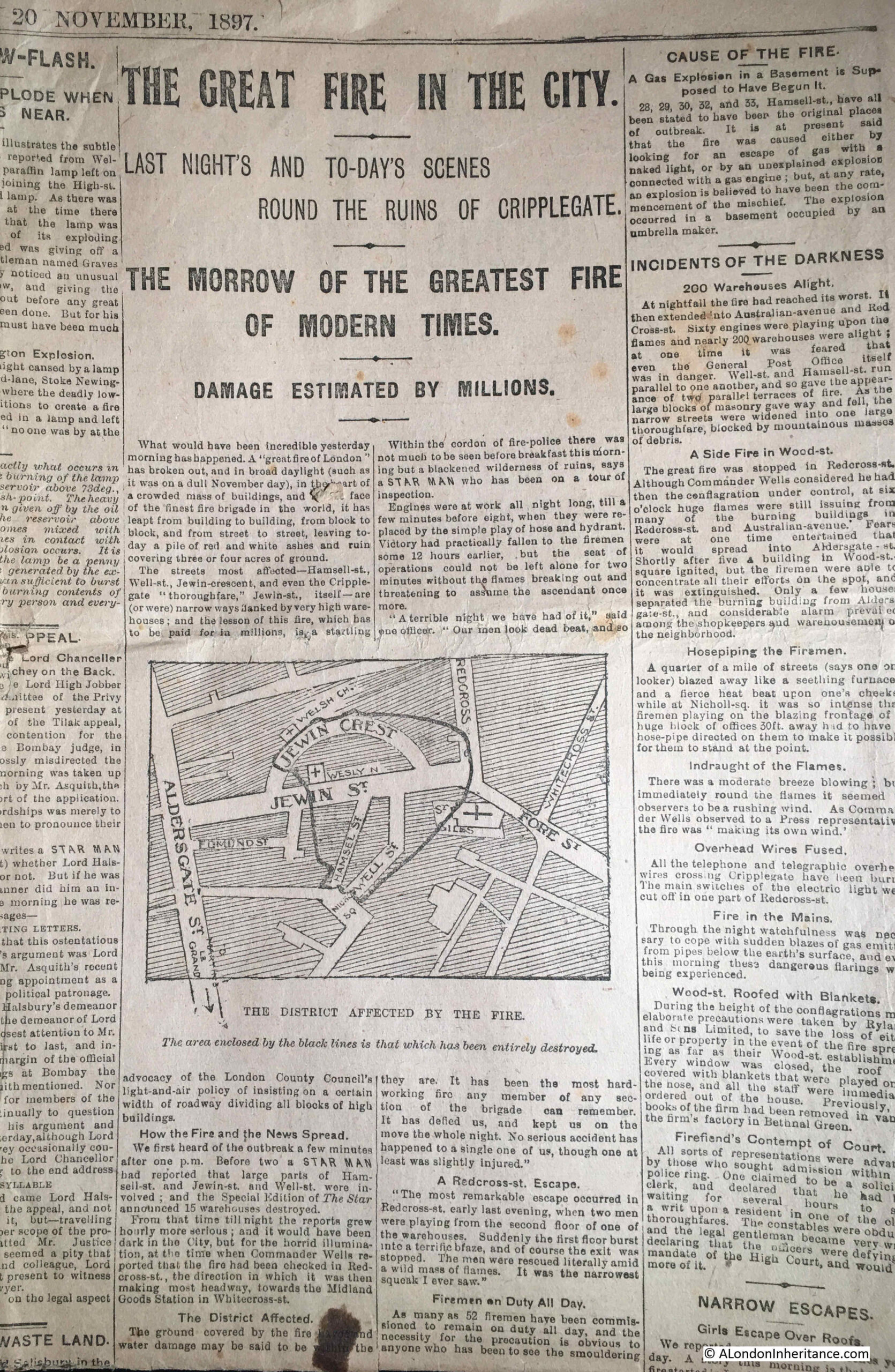
Fires have been a risk within London for centuries. Streets full of houses, side by side with warehouses full of inflammable goods, industrial premises, and until recently, a lack of comprehensive measures to prevent fire. The 1666 Great Fire of London is the most famous, however there were many others. I have written about the 1861 Great Fire at London Bridge, and today I want to feature another fire, the 1897 Great Fire in Cripplegate.

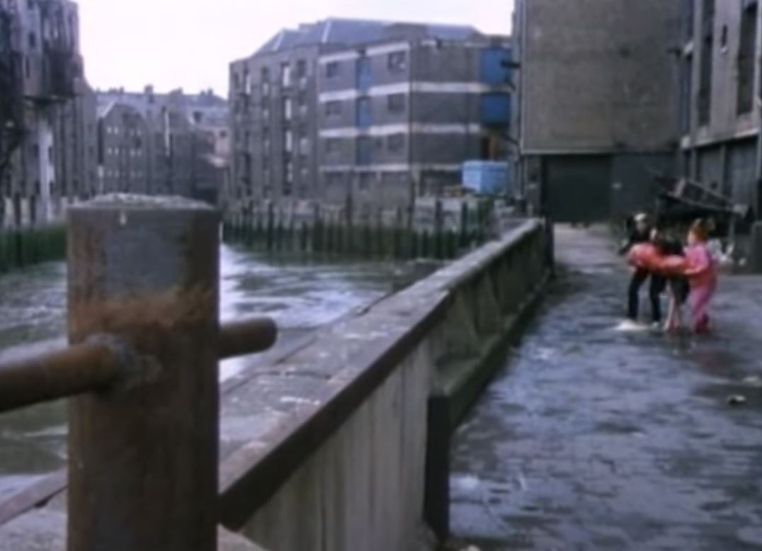
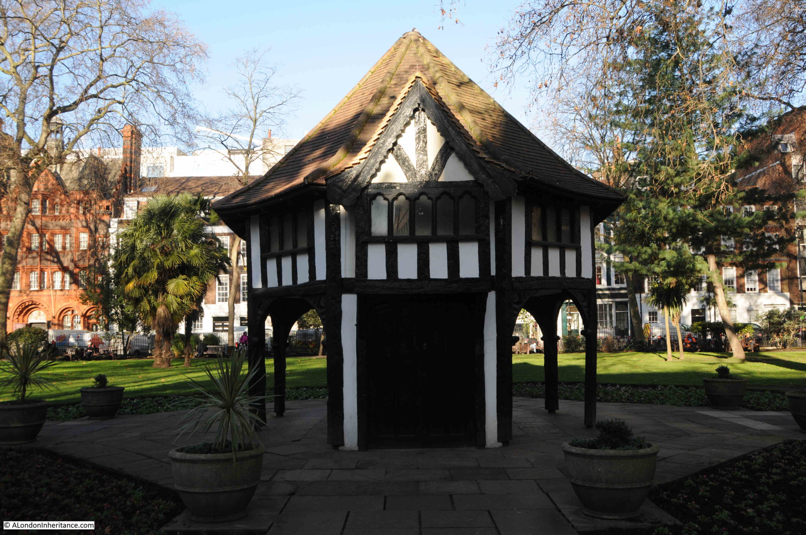
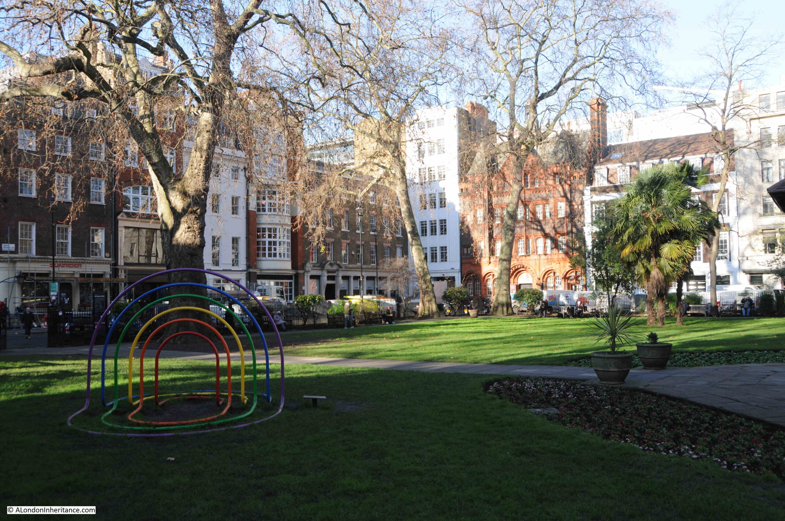
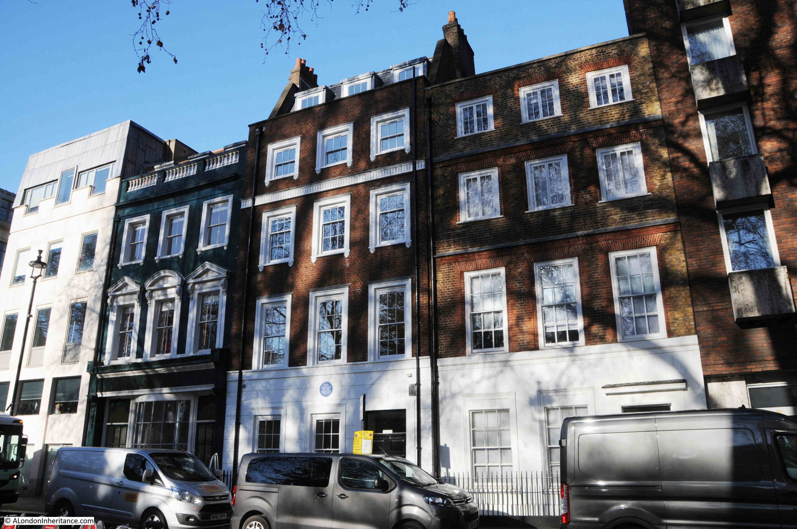
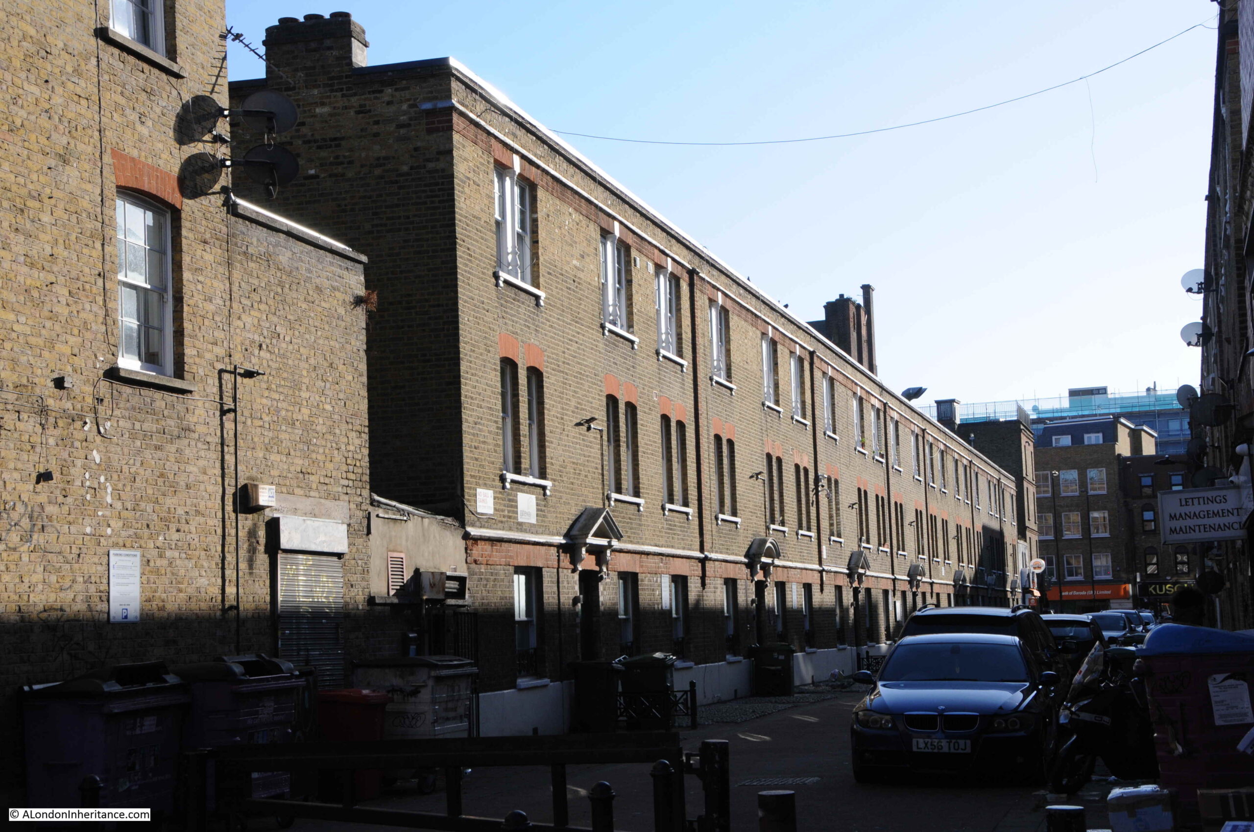
I have touched on the fire in previous blogs in an area I have covered a number of times as my father took many post-war photos of the area where the Barbican and Golden Lane estates are located, and it is fascinating being able to peel back the many layers of history of a specific area.

For today’s post, I am really grateful to a reader, who came on one of my walks and then sent me a number of newspapers and special editions, printed at the time of the fire to provide a record.

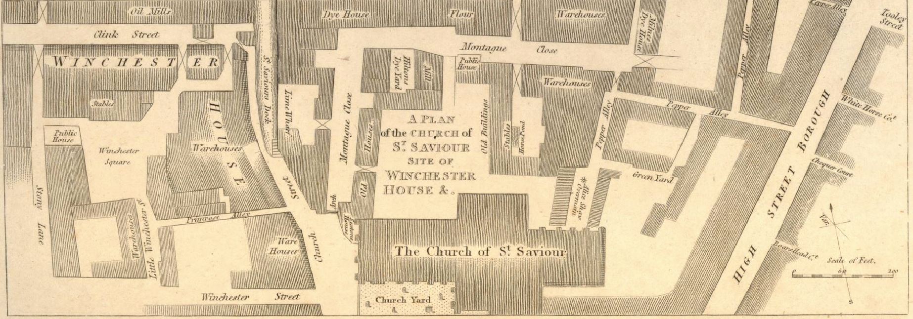
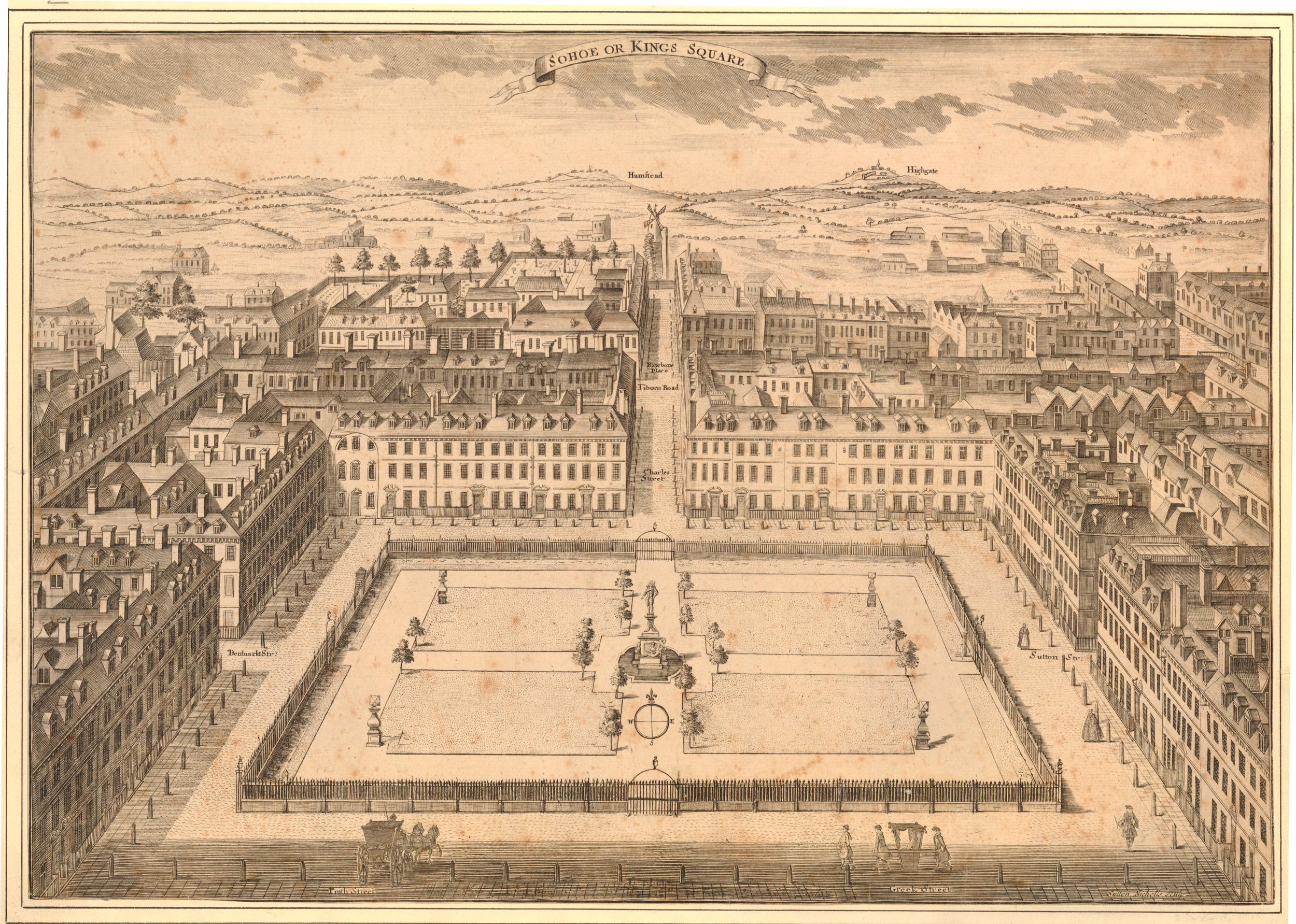
The cover of the City Press “Record of the Great Fire in Cripplegate”:

Great Fire in Cripplegate

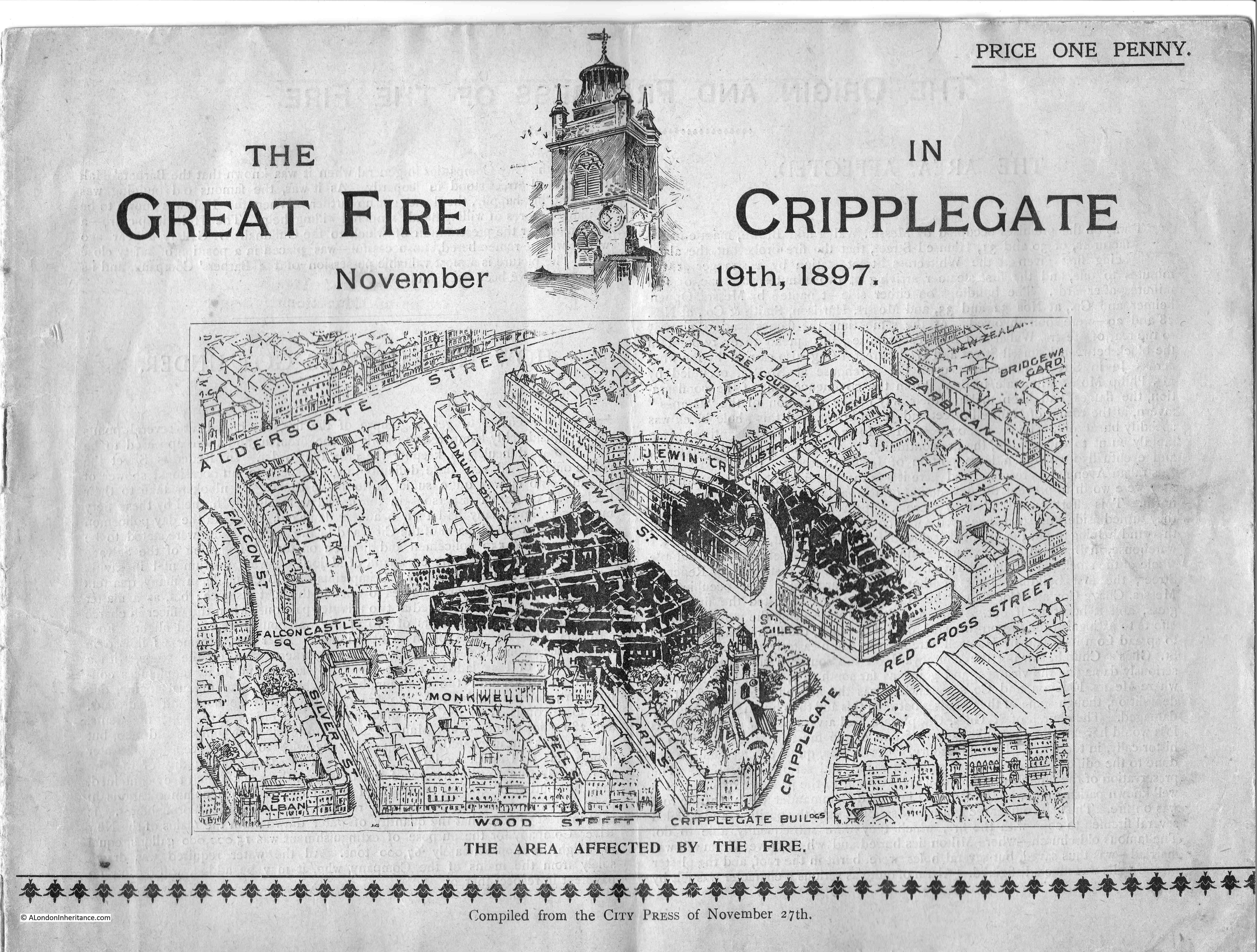
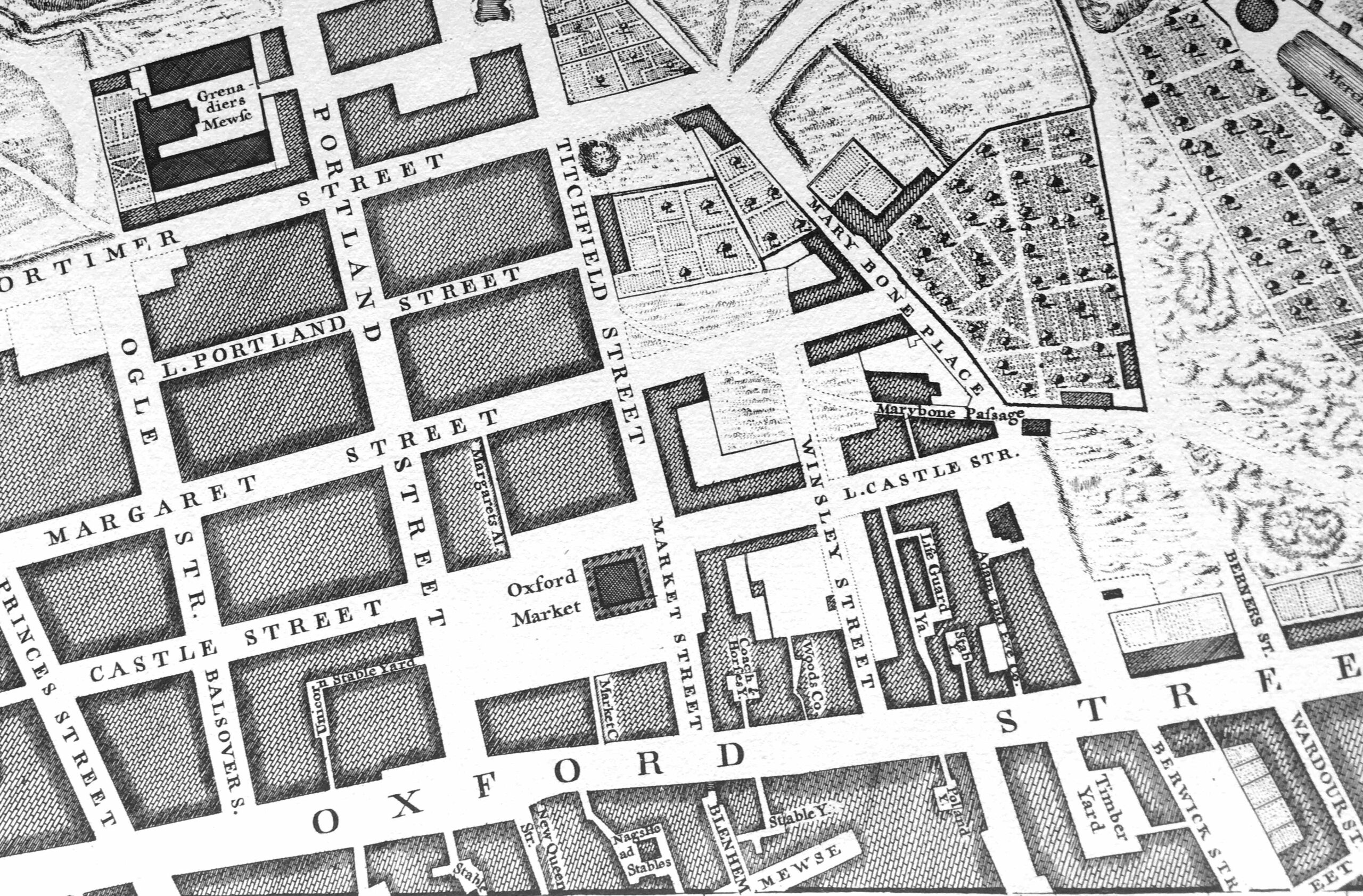
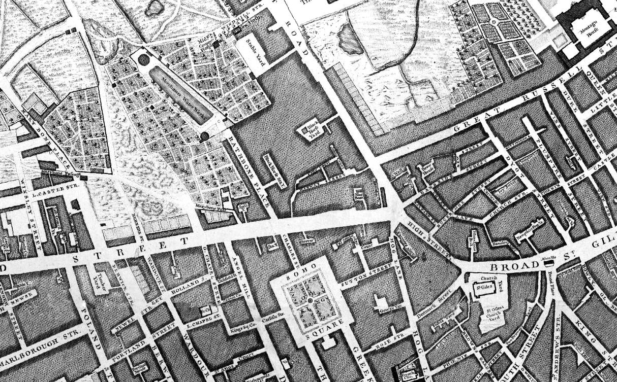
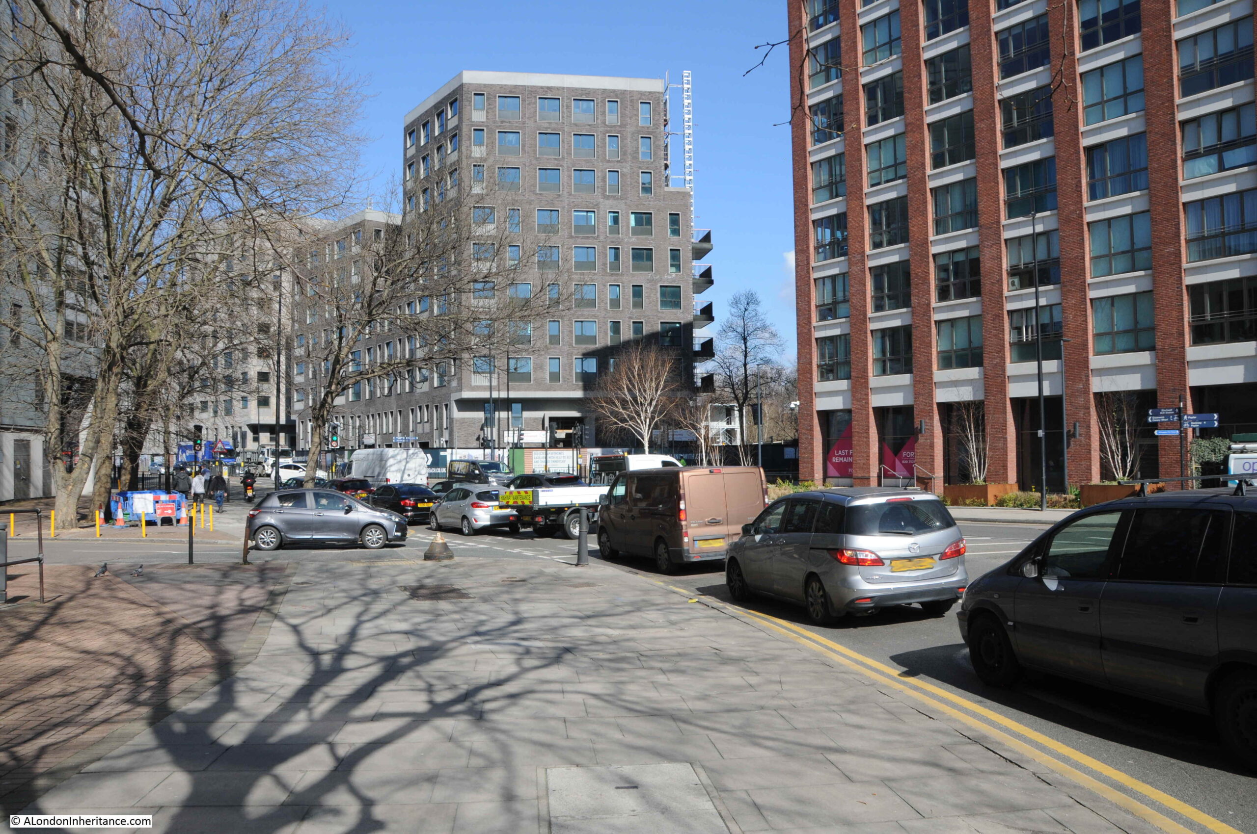
The cover of the booklet includes a map of the area affected, showing the buildings damaged by the fire in black. The map shows an area of busy streets with lots of housing, warehouses and industrial premises. This is so very different to the area today, which is now covered by the Barbican estate.

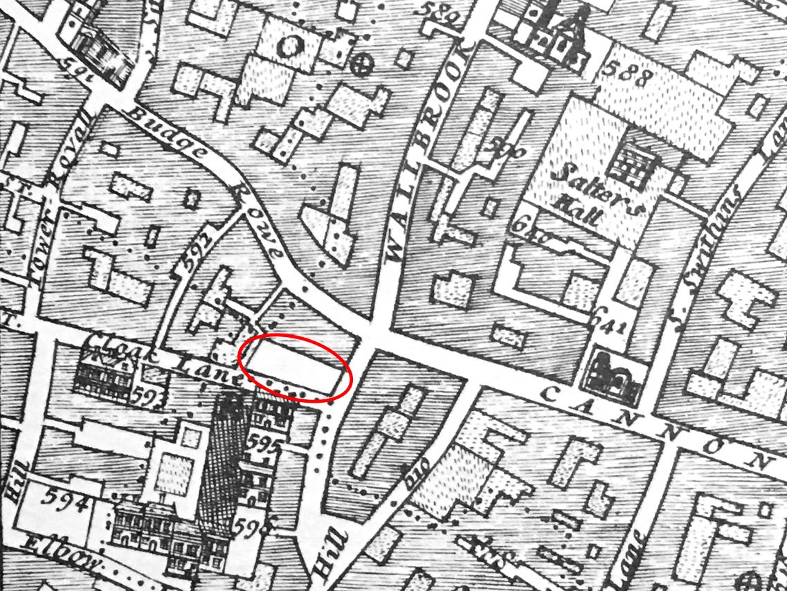
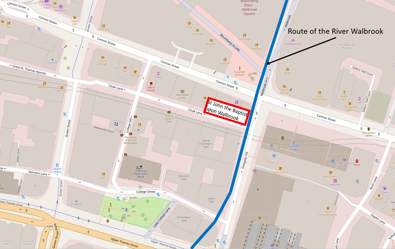
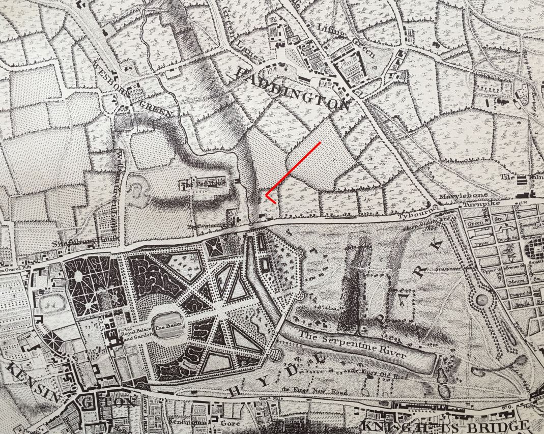
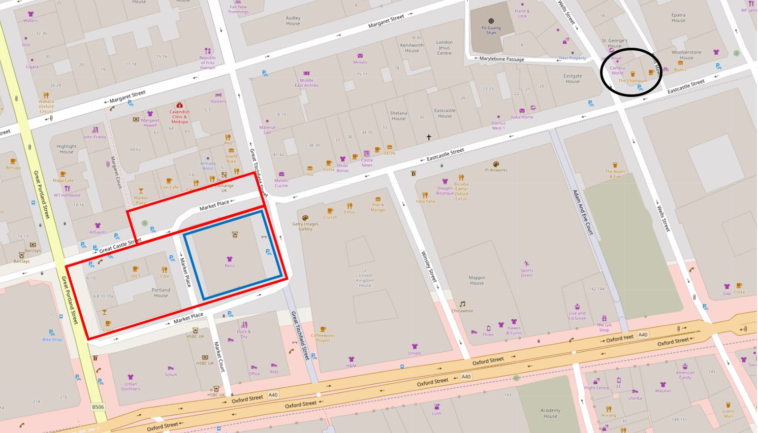
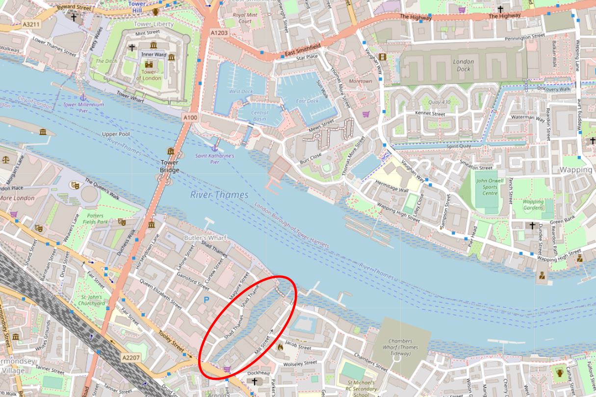
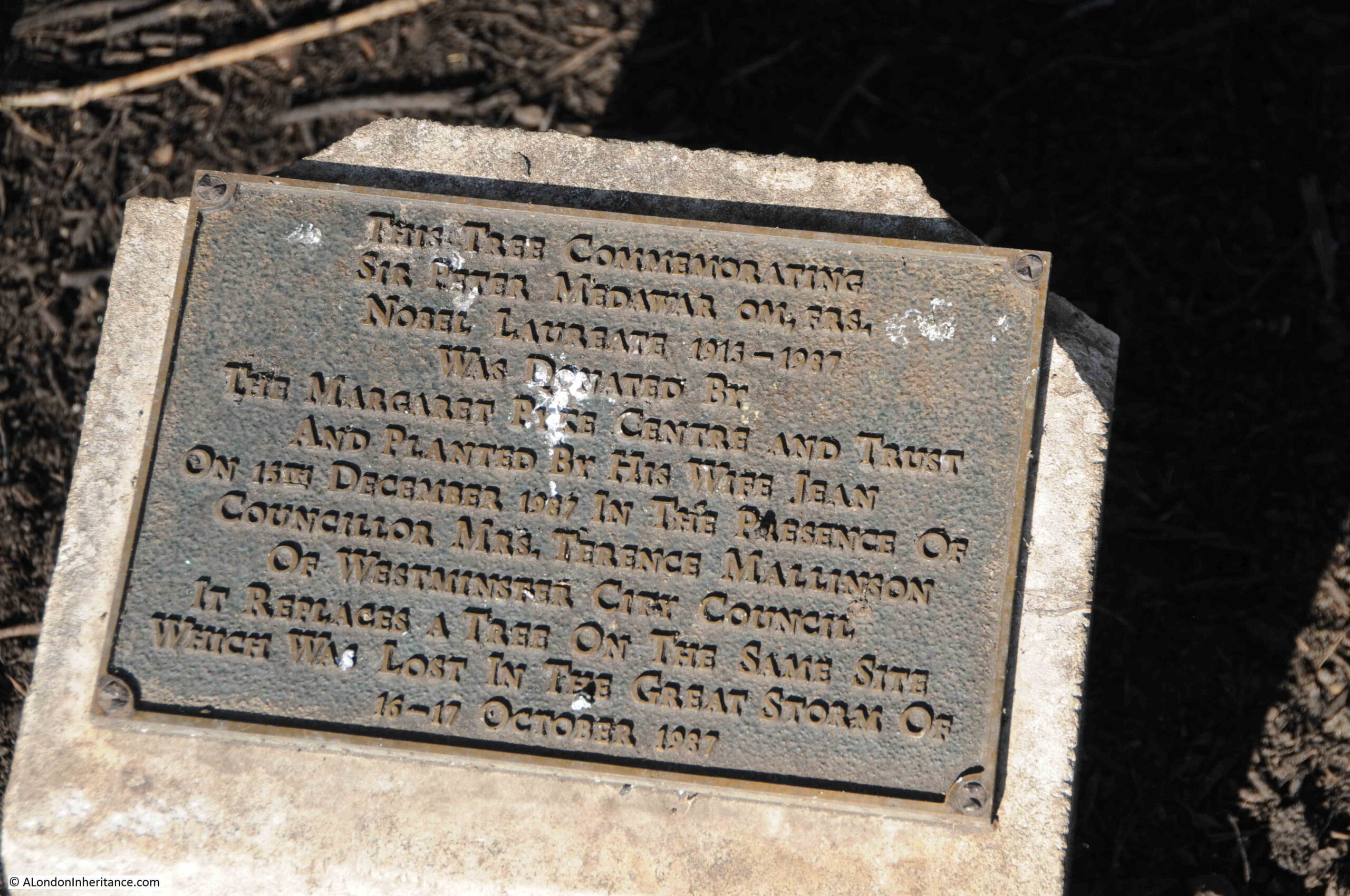
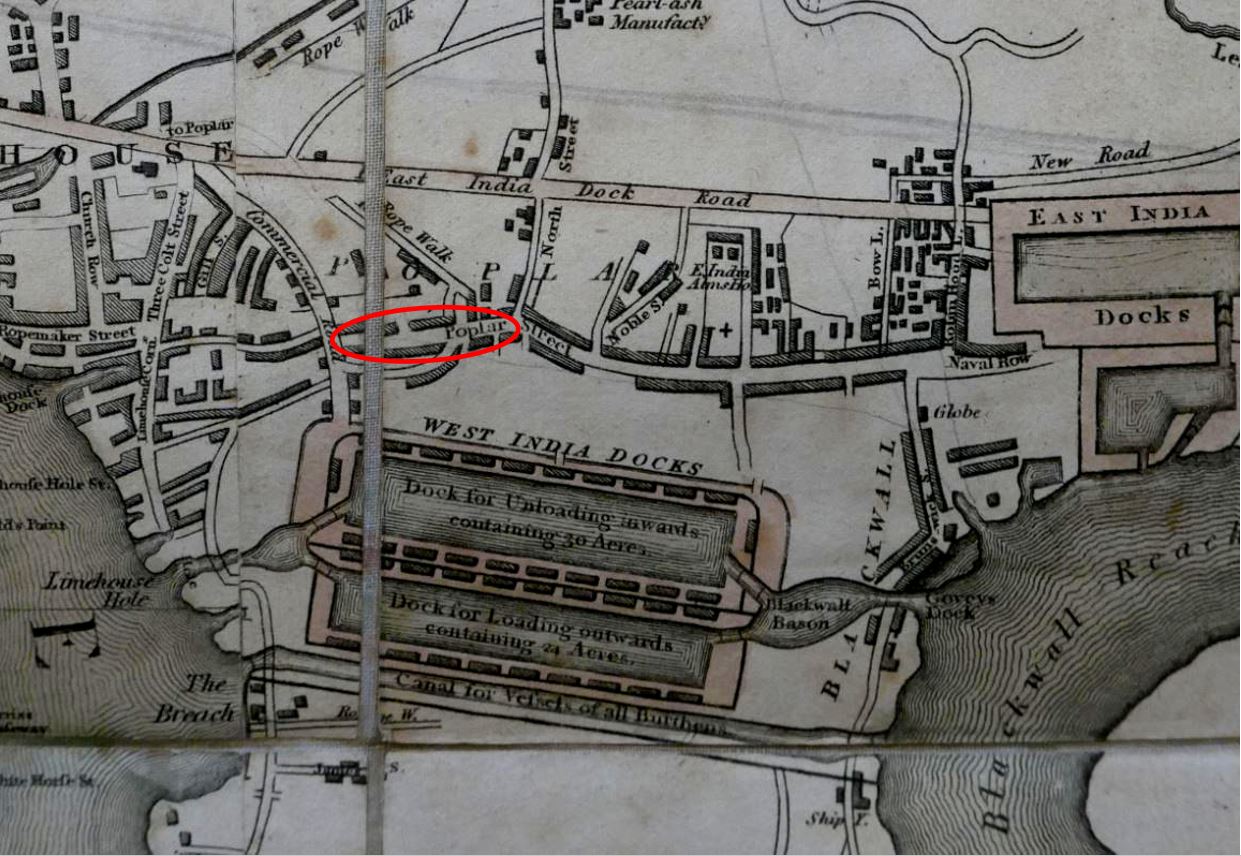
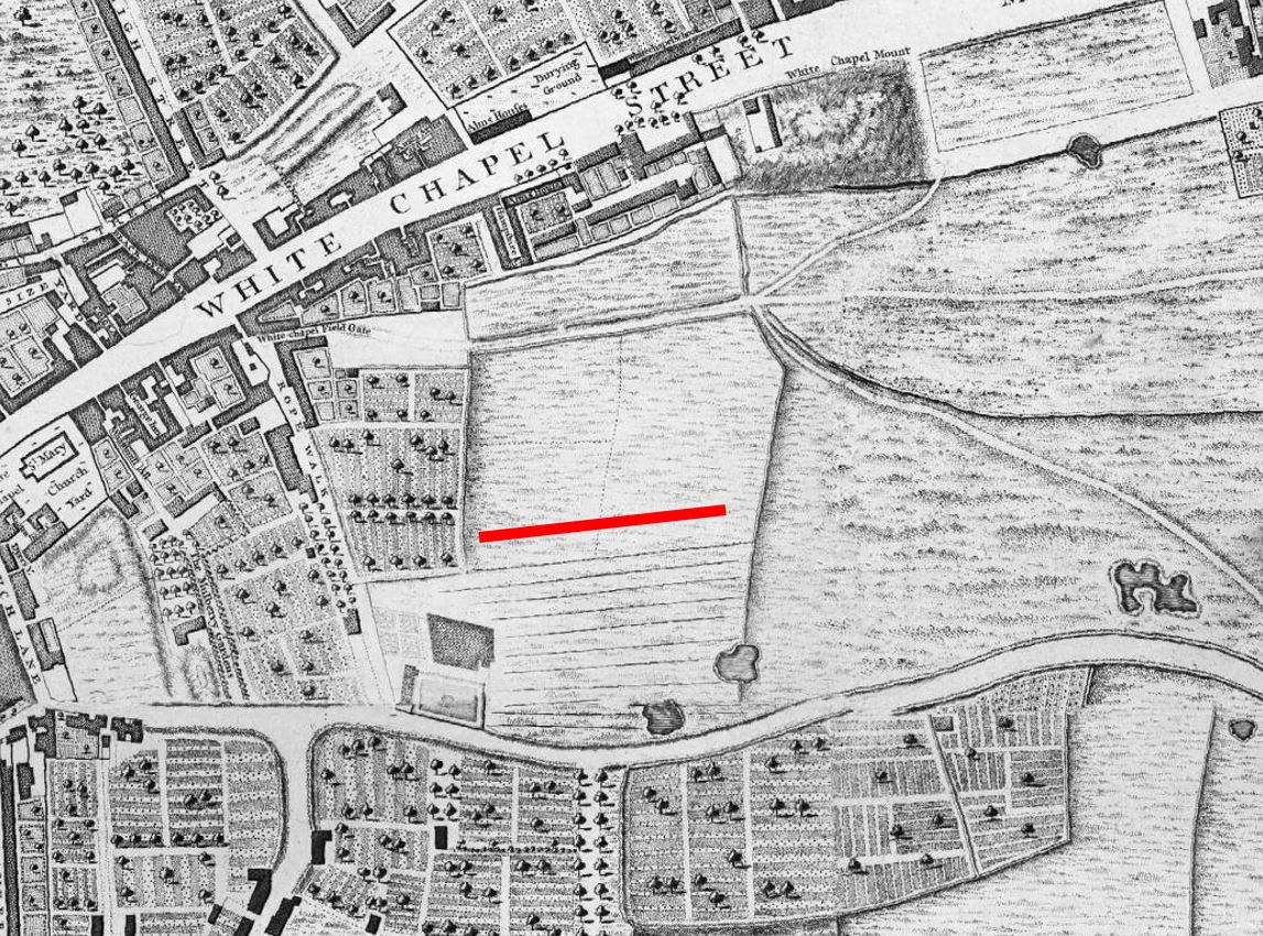
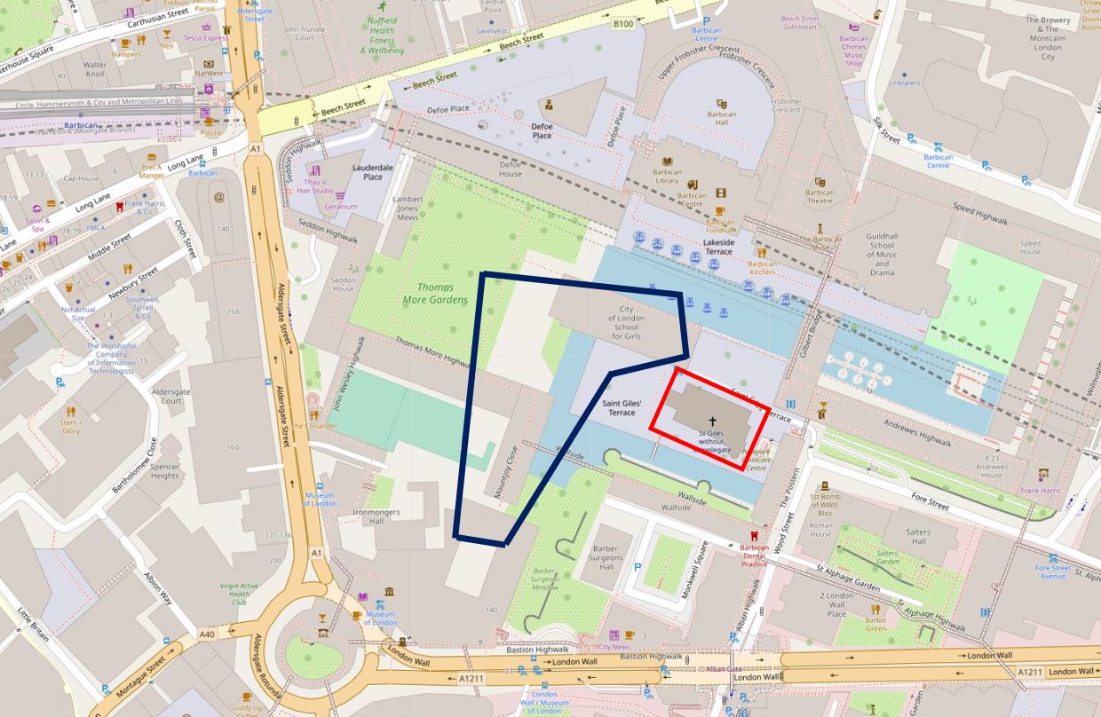
I have marked out the area of the Great Fire in Cripplegate within the dark blue lines in the following map. The church of St Giles Cripplegate (also shown in the above map) is within the red rectangle  (© OpenStreetMap contributors).

Map of the Great Fire in Cripplegate

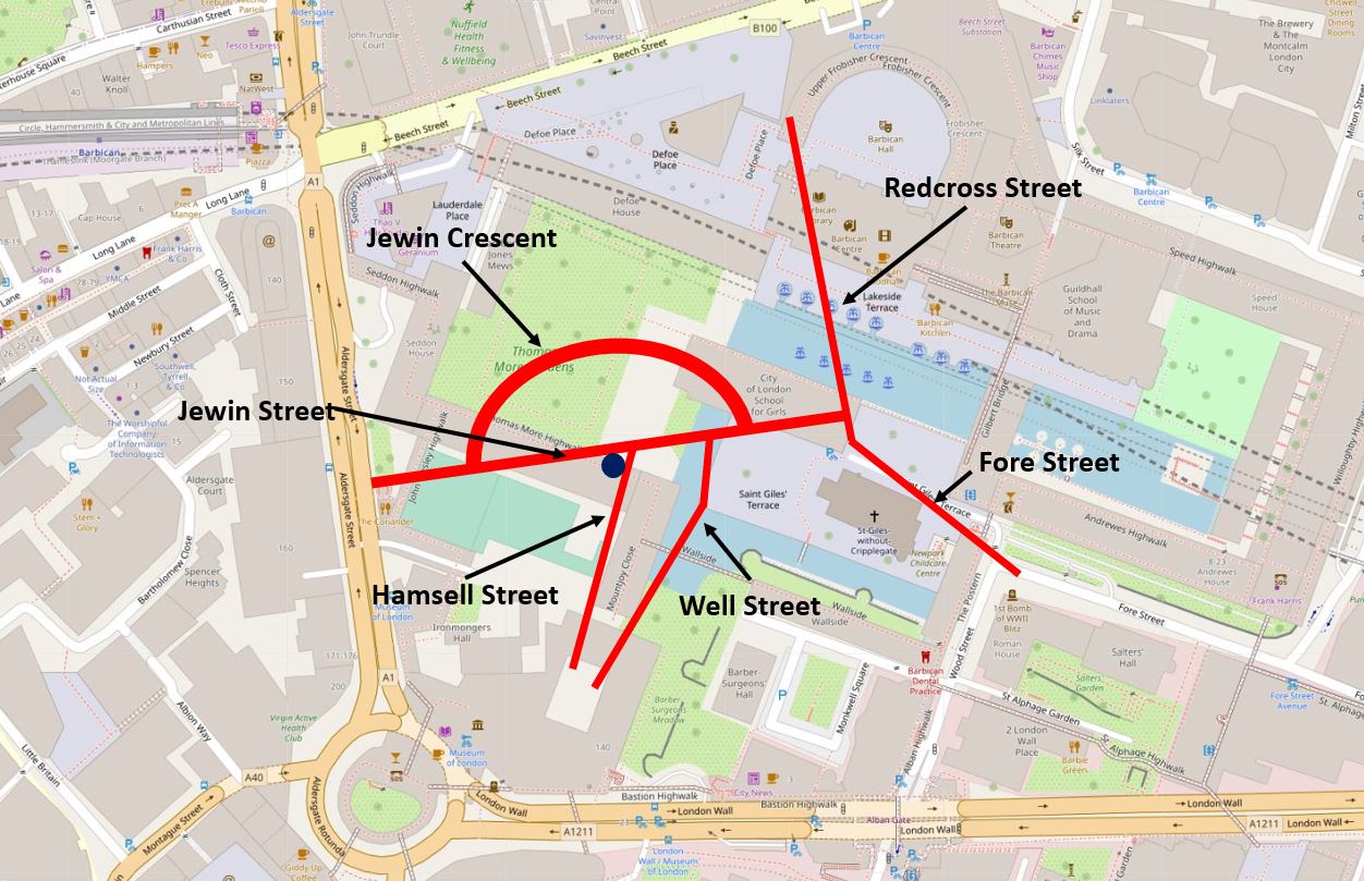
The fire started in the premises of Waller and Brown at numbers 30 and 31 Hamsell Street, just before one in the afternoon. They were described as mantle manufactures, so presumably manufactured parts of, if not all of the components used in a gas lamp.

The report of the start of the fire states that most of the factory hands were out in the streets as it was lunch time, so perhaps someone had left a naked flame near some inflammable material as they went for lunch.

The fire spread quickly, with the buildings on either side of Waller and Brown’s building, soon being alight.

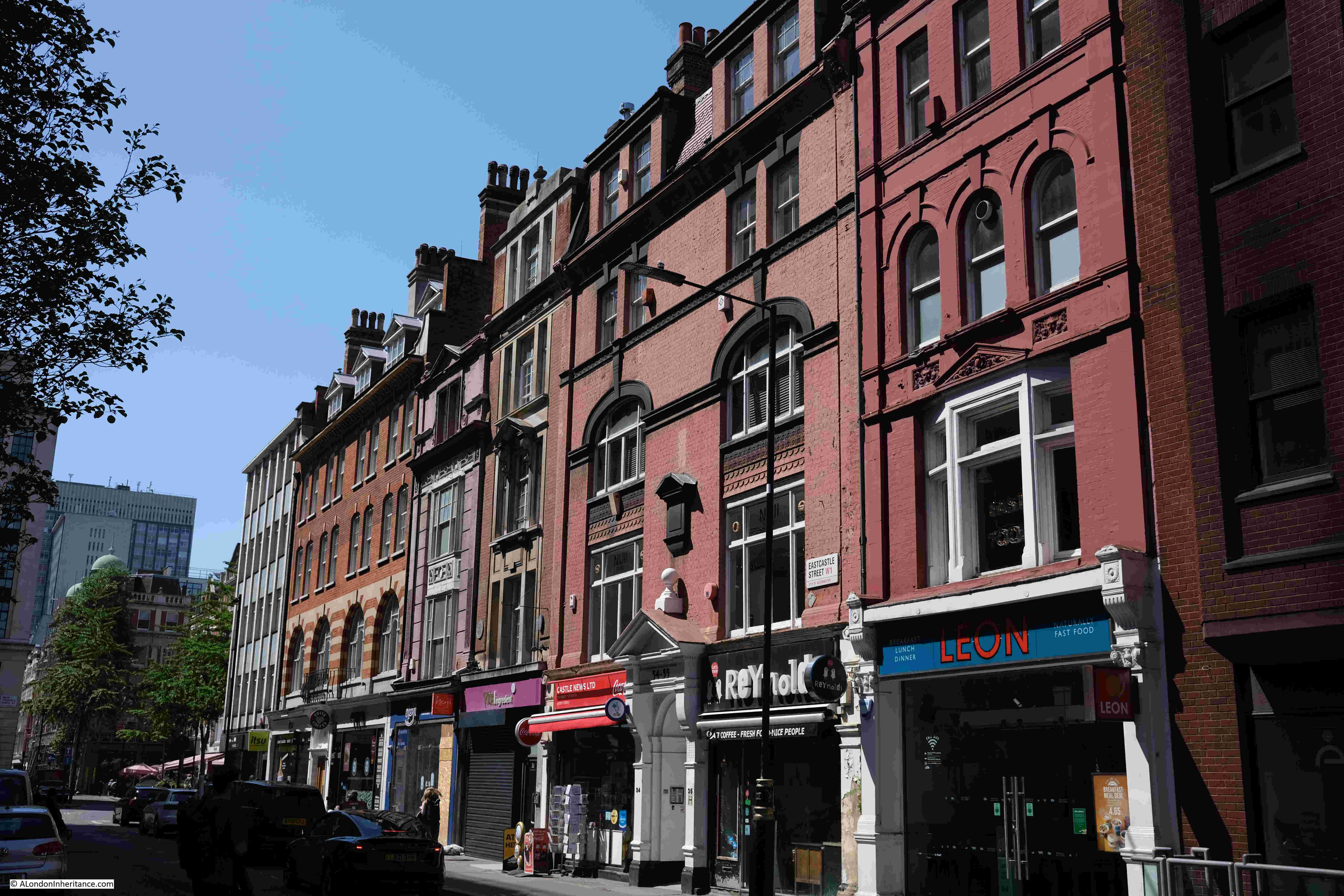
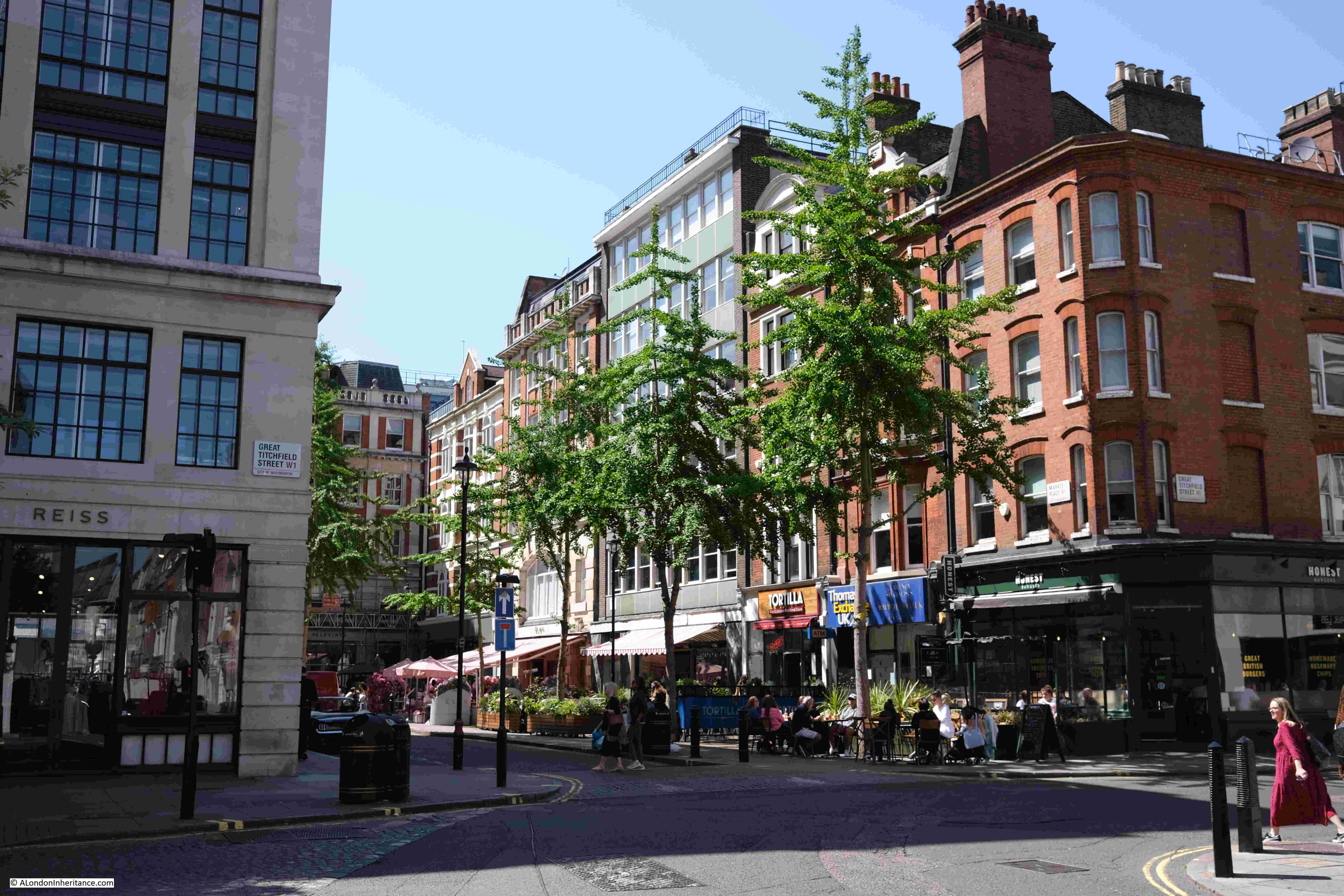
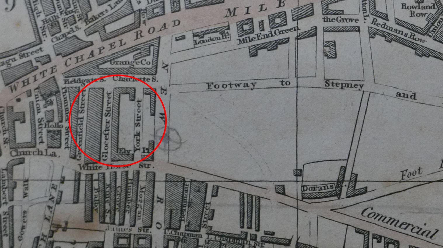
The report of the Great Fire in Cripplegate, and the photos which follow, mention lots of streets affected by the fire. Streets that had stood for centuries, but were lost under the Barbican development. I have plotted these streets in the following map, and marked the location of Waller and Brown’s building, the start of the fire, with a dark blue circle  (© OpenStreetMap contributors):

Map of the Great Fire in Cripplegate

The fire brigade were quickly onsite, with the nearest station being in Whitecross Street (which was just to the right of Redcross Street in the above map).

The fire spread very quickly as most of the buildings were warehouses full of highly inflammable goods, and the account of the fire describes warehouses being burnt to the ground very quickly.

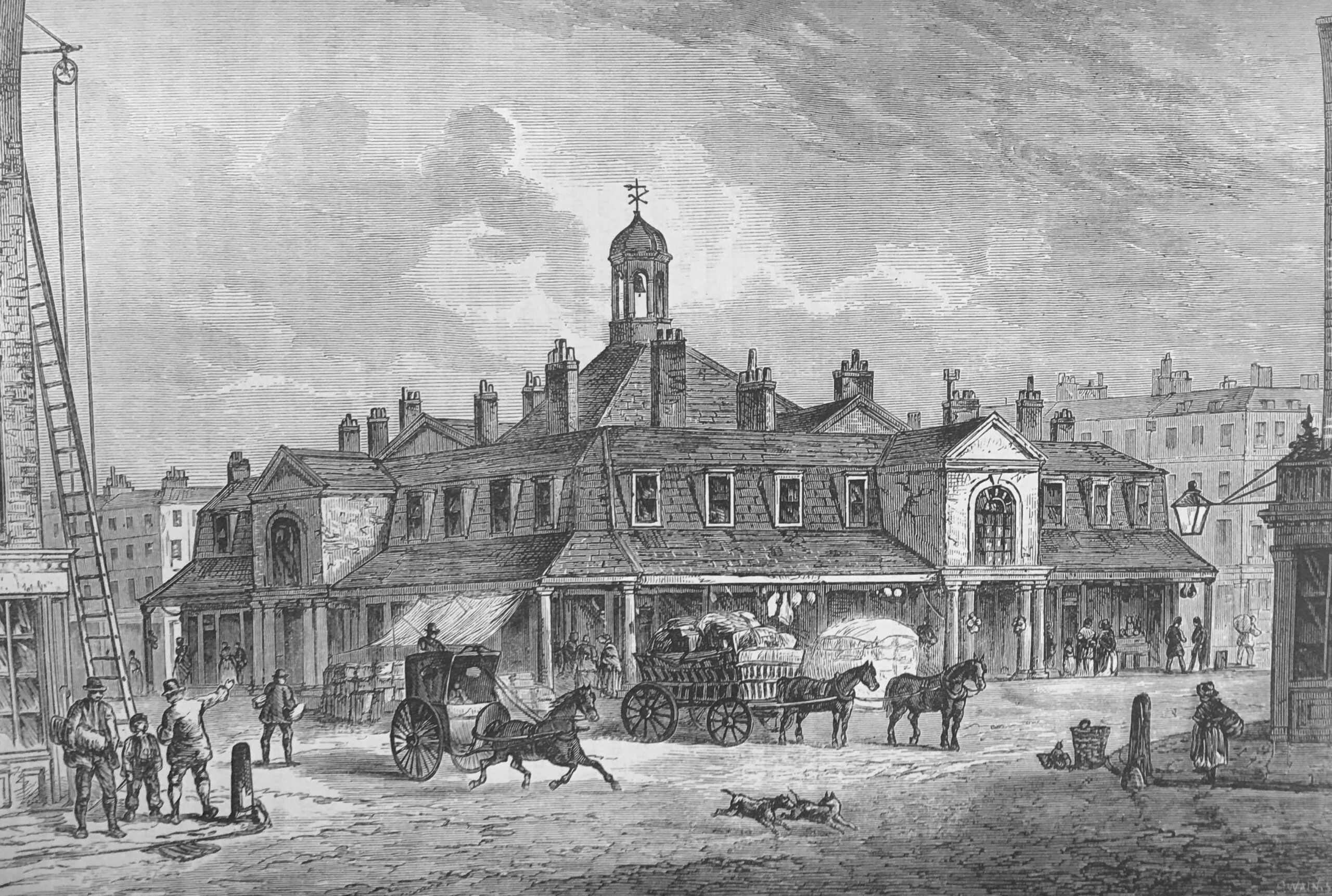
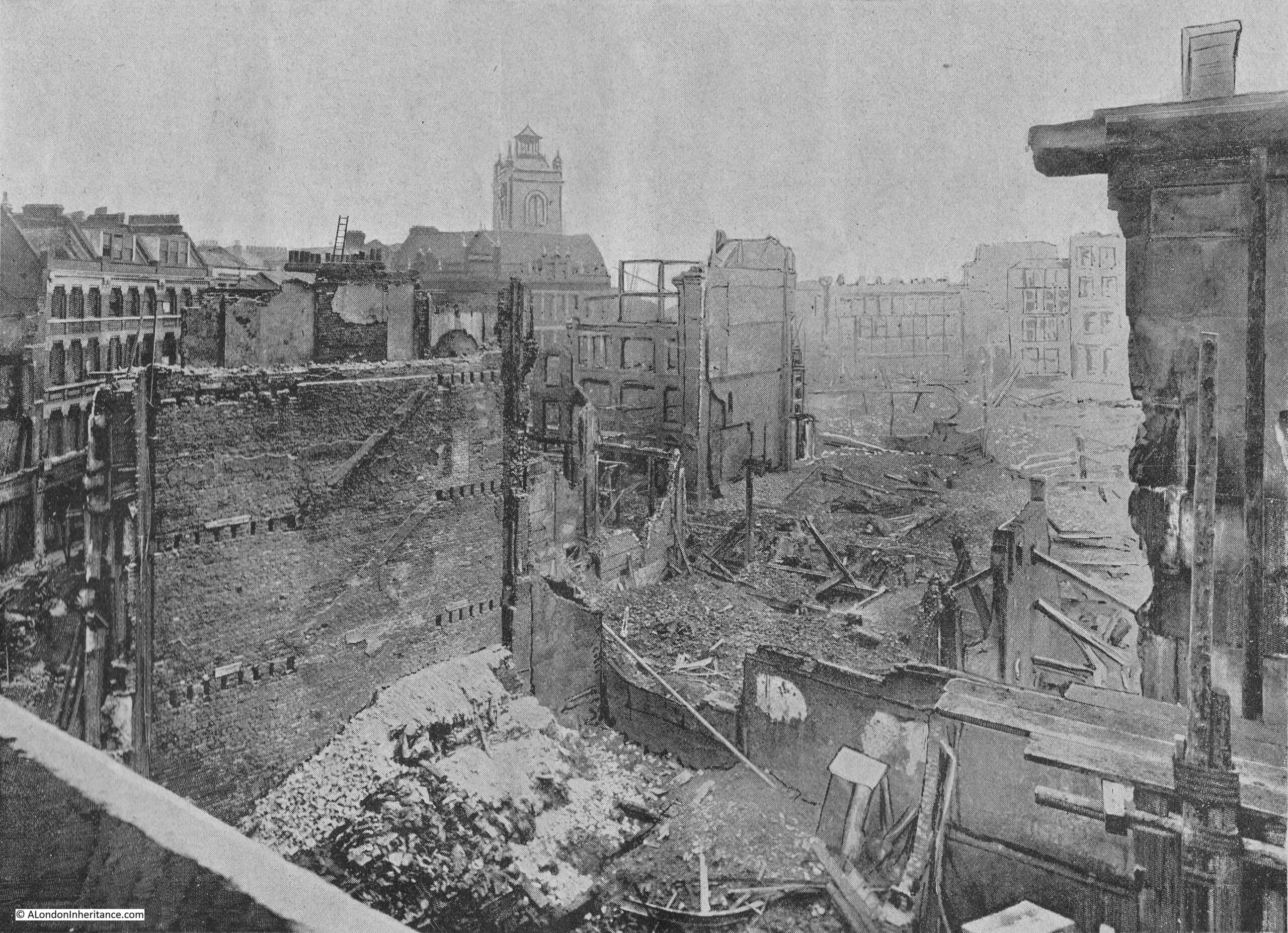
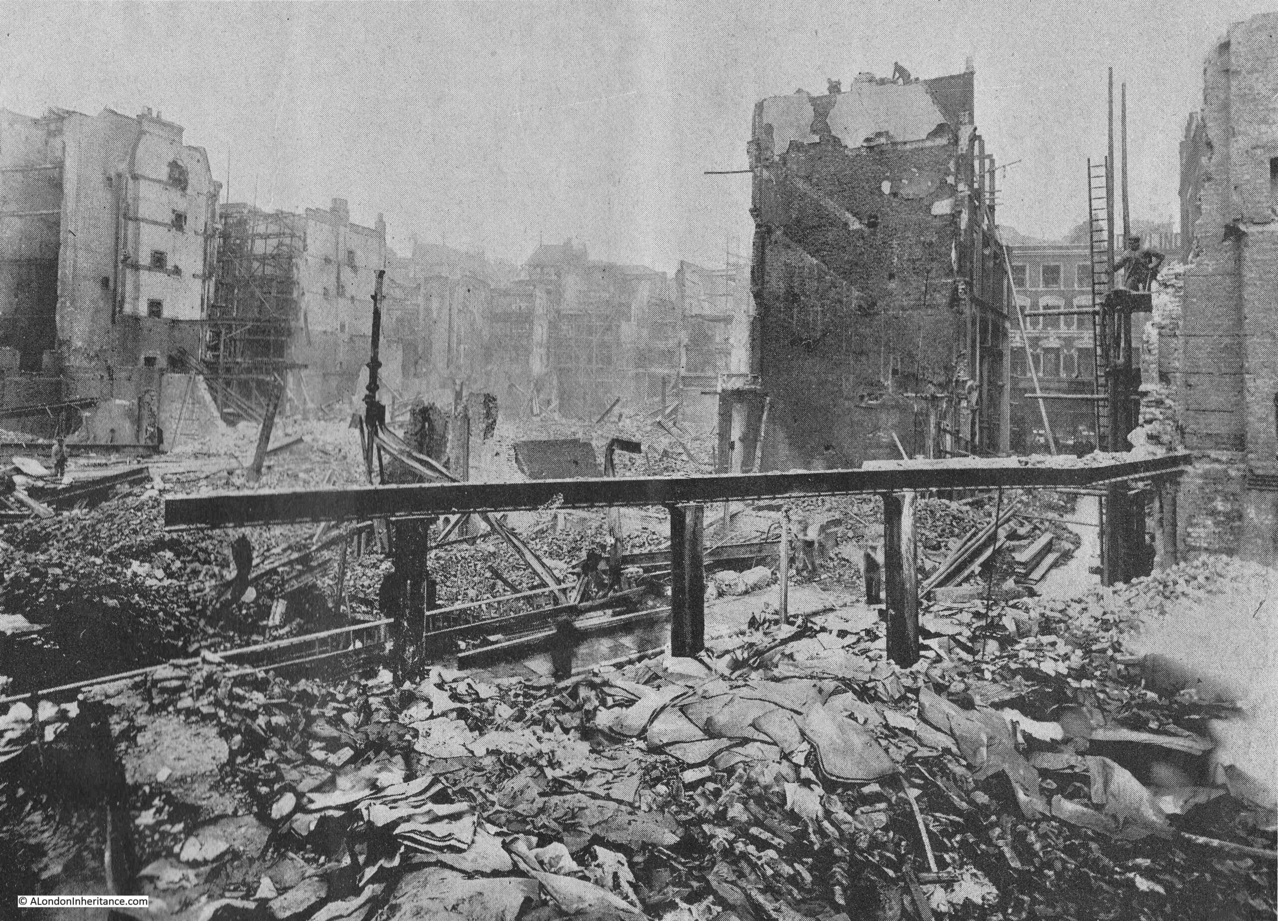
The following photo shows the view from the top of the ruins in Jewin Crescent, looking towards the tower of St Giles Cripplegate:

Great Fire in Cripplegate

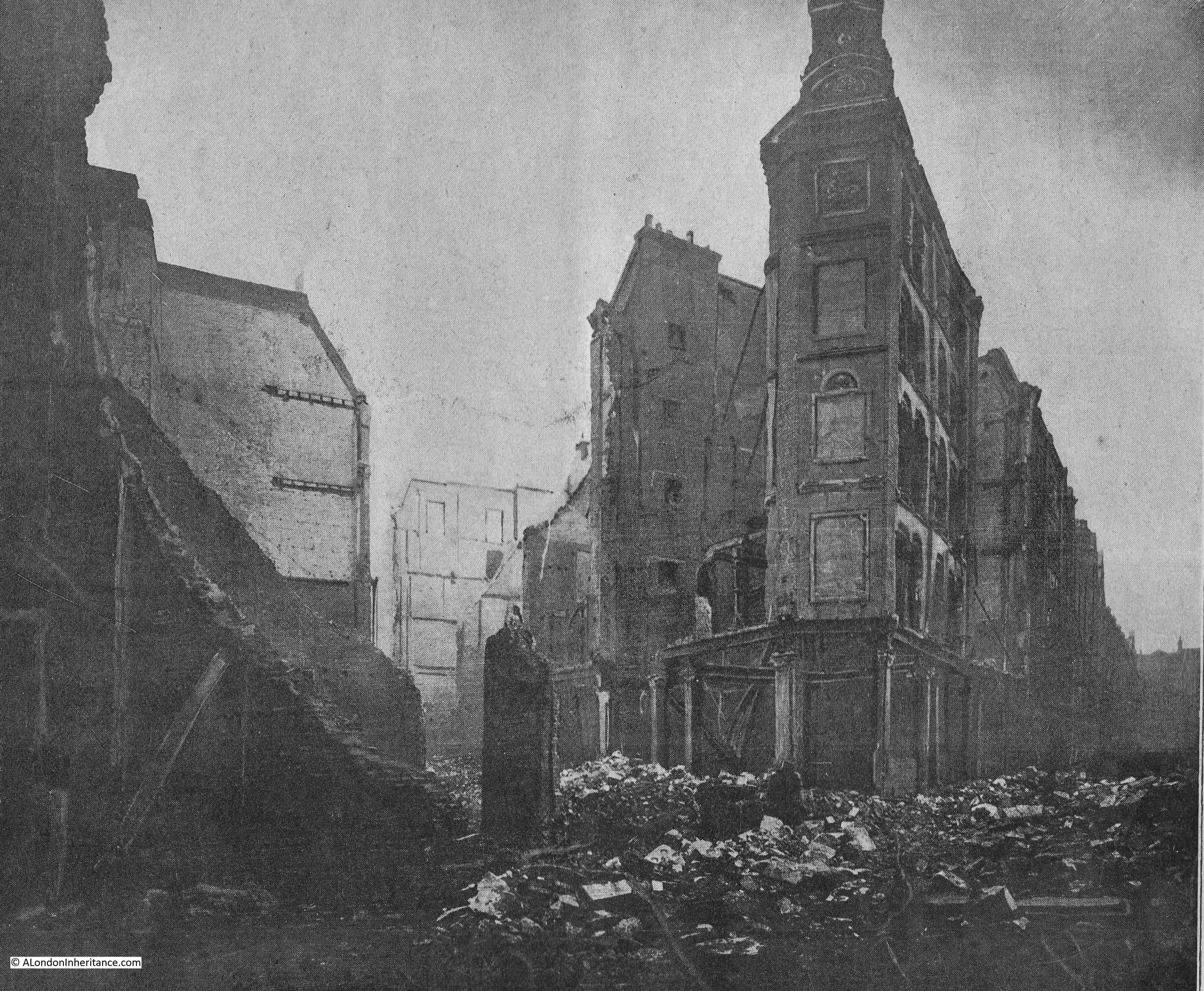
The following two photos are part of a two page spread which shows the devastated area between Hamsell Street and Well Street, looking south. Well Street to the left:

Great Fire in Cripplegate

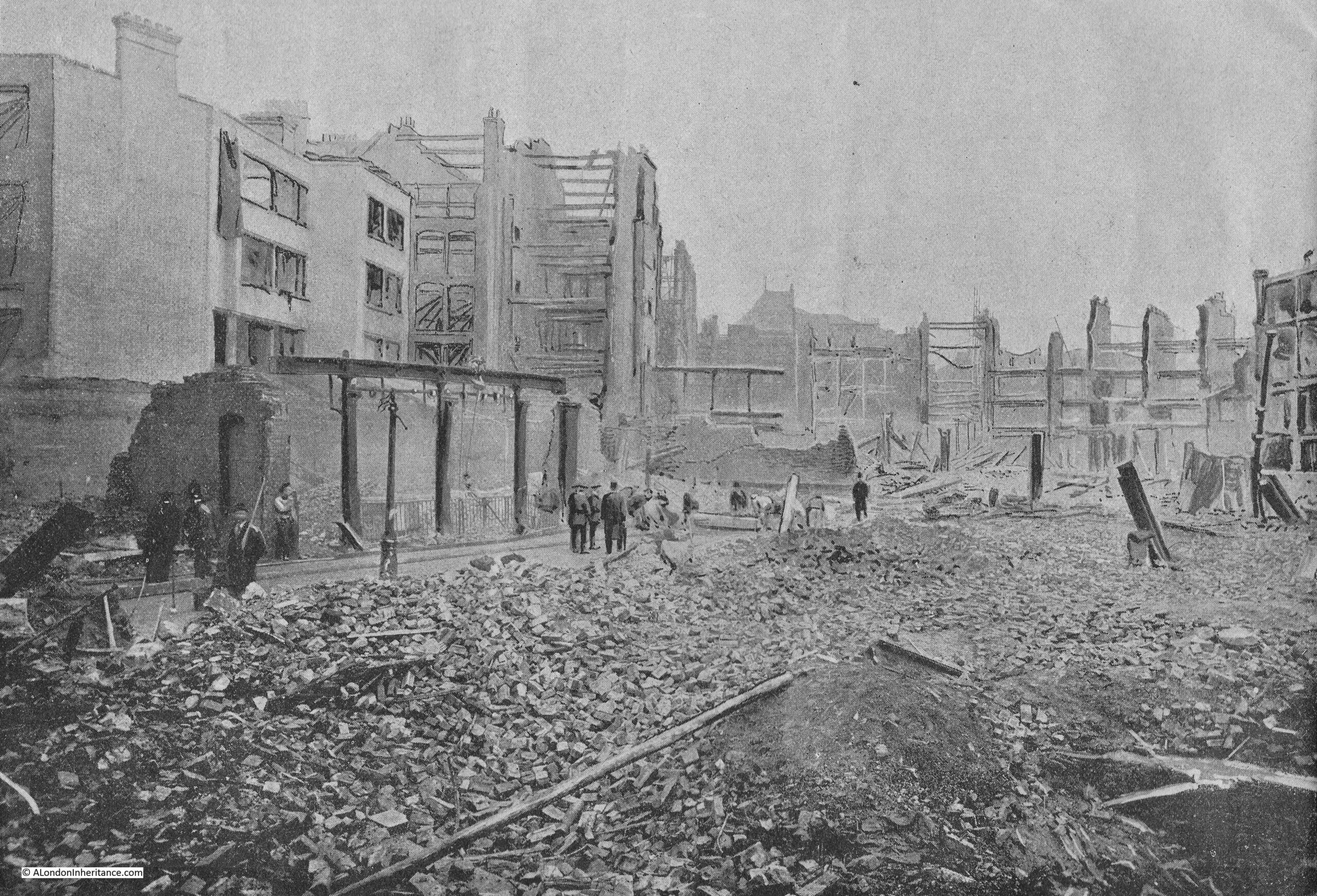
And Hamsell Street to the right:

Great Fire in Cripplegate

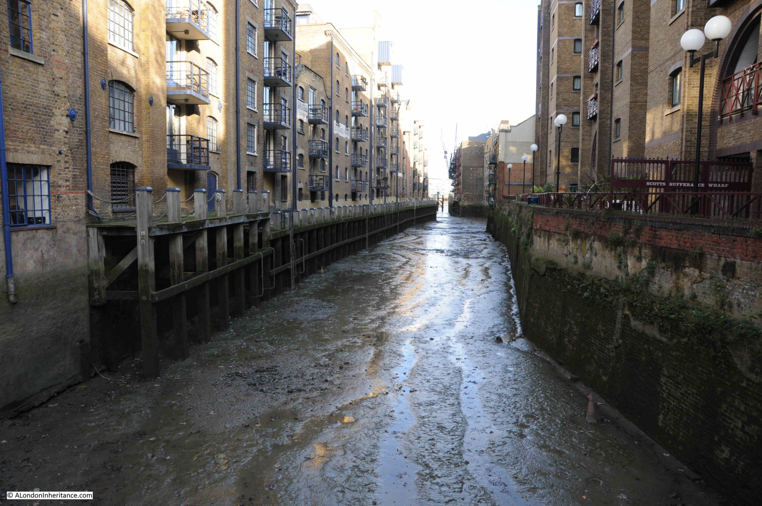
Redcross Street seems to have formed a natural fire break. This was a major street in the area and one of the wider streets in Cripplegate unlike the rest of the streets that would be devastated by the fire.

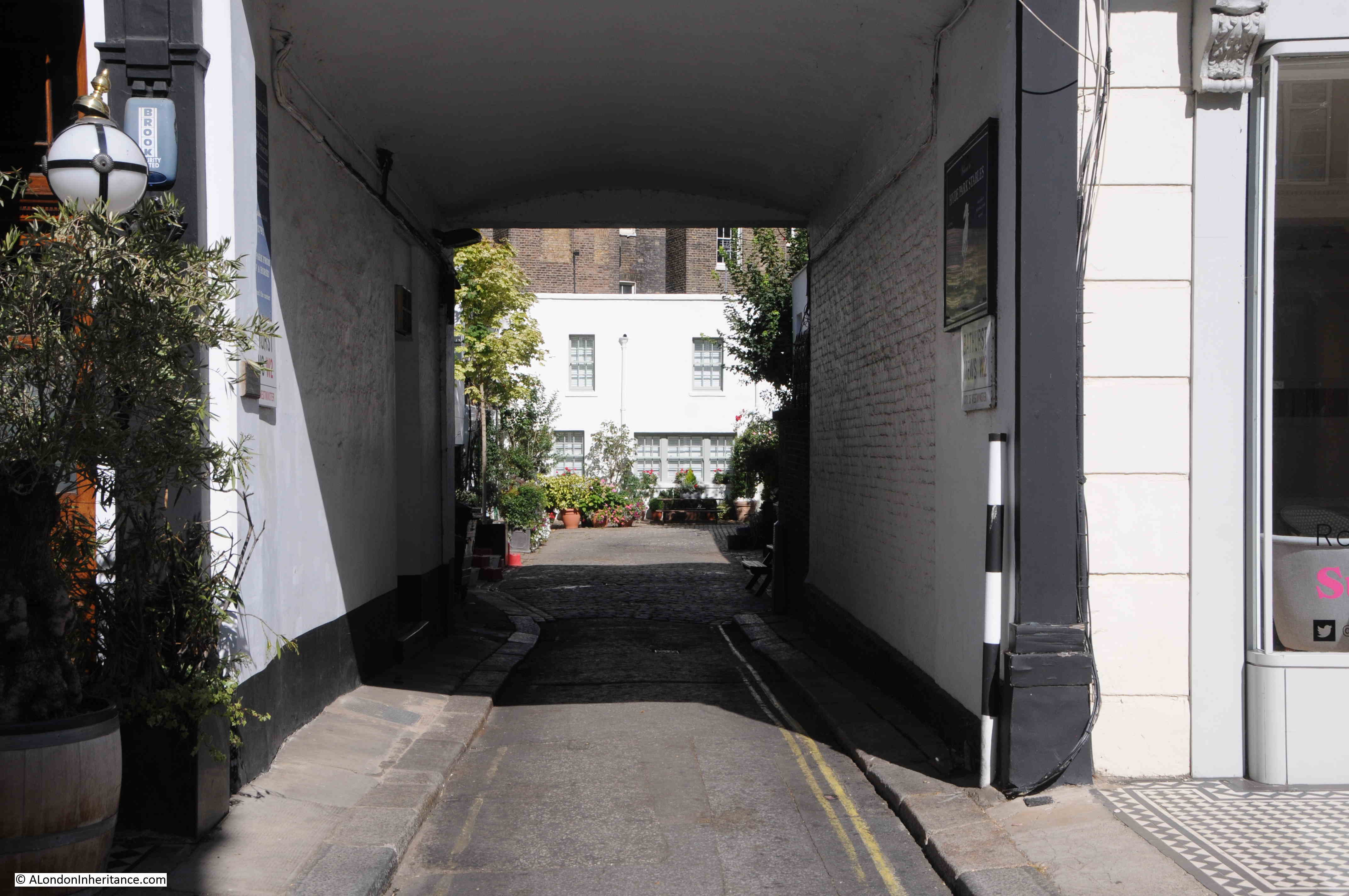
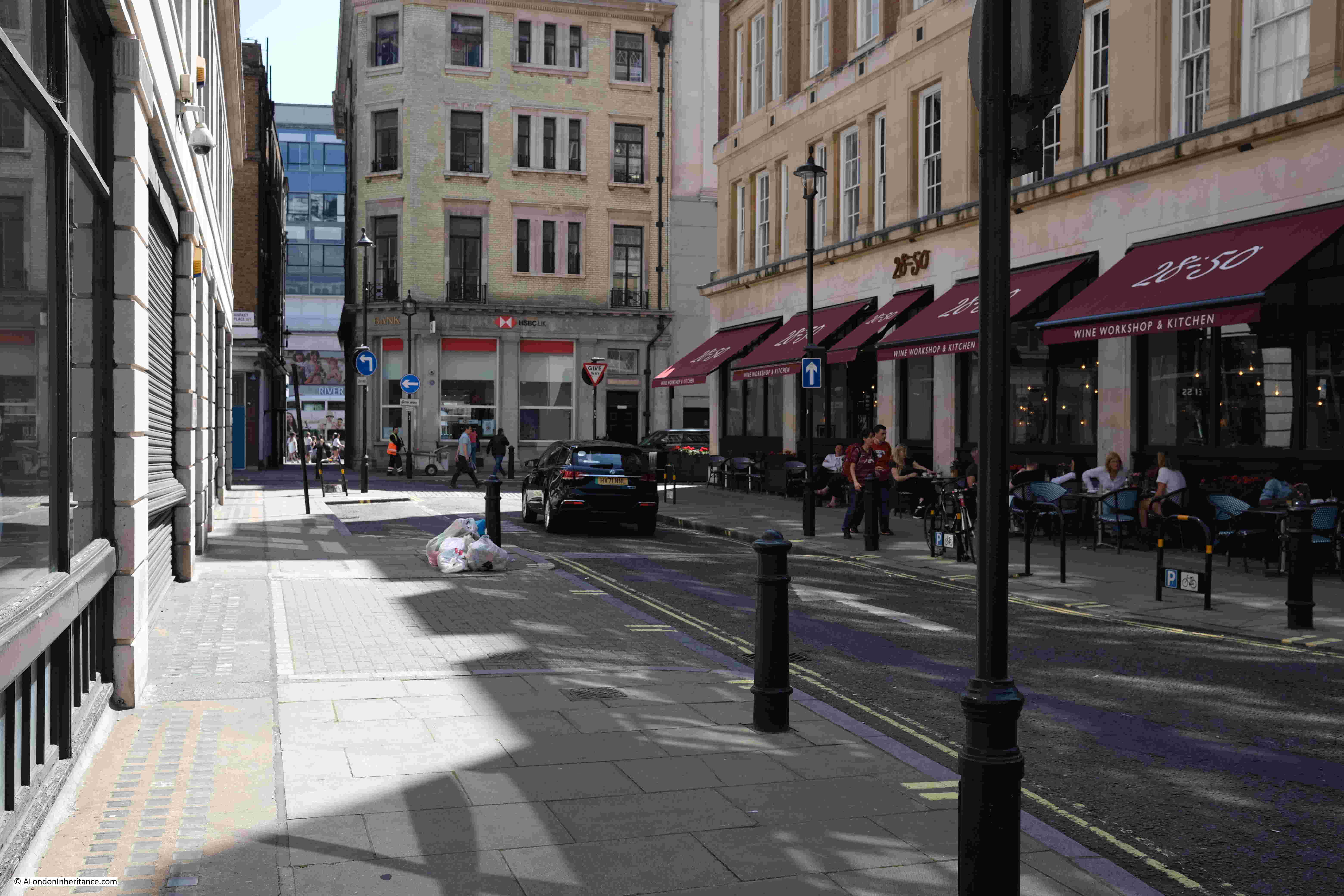
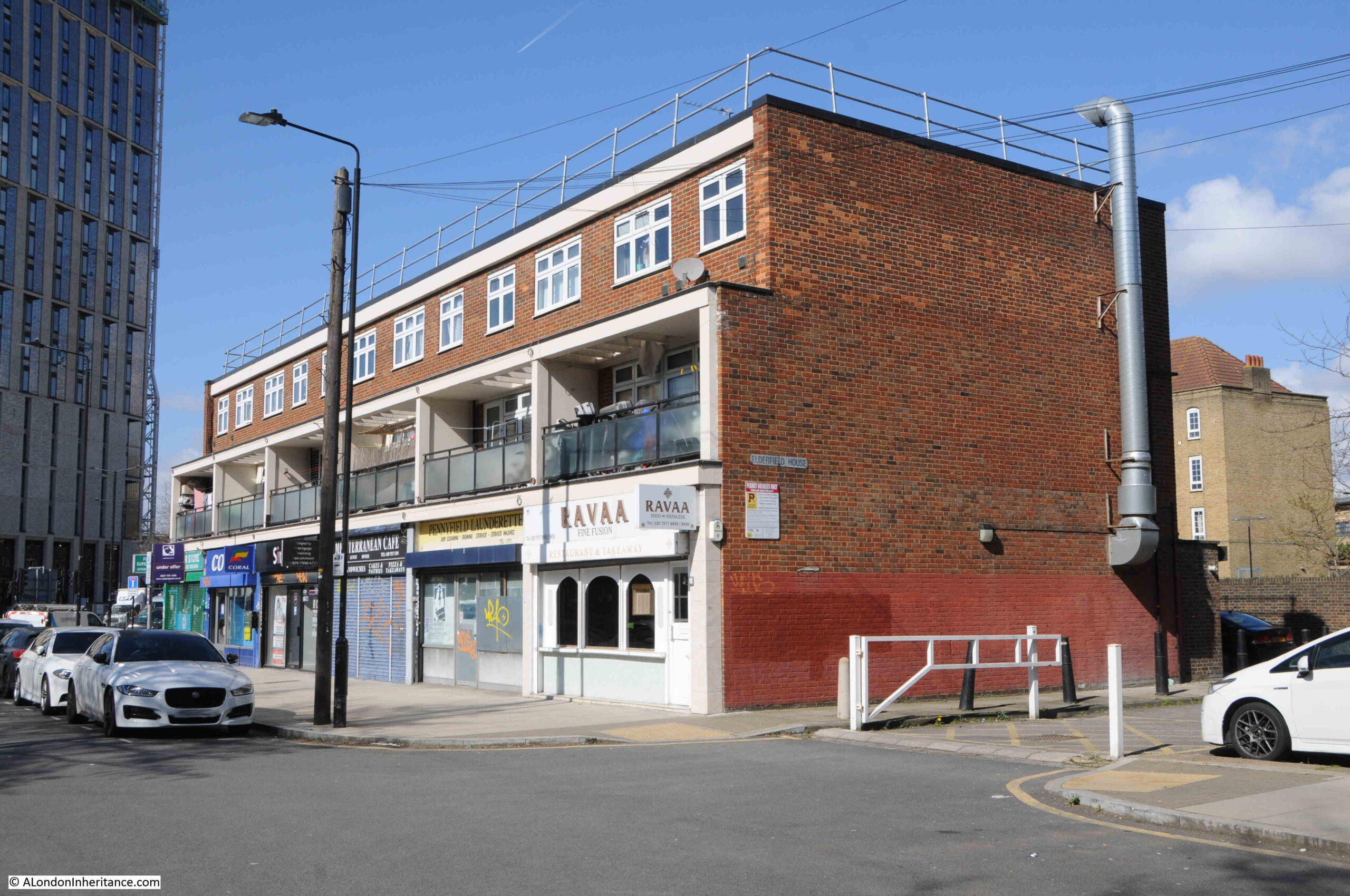
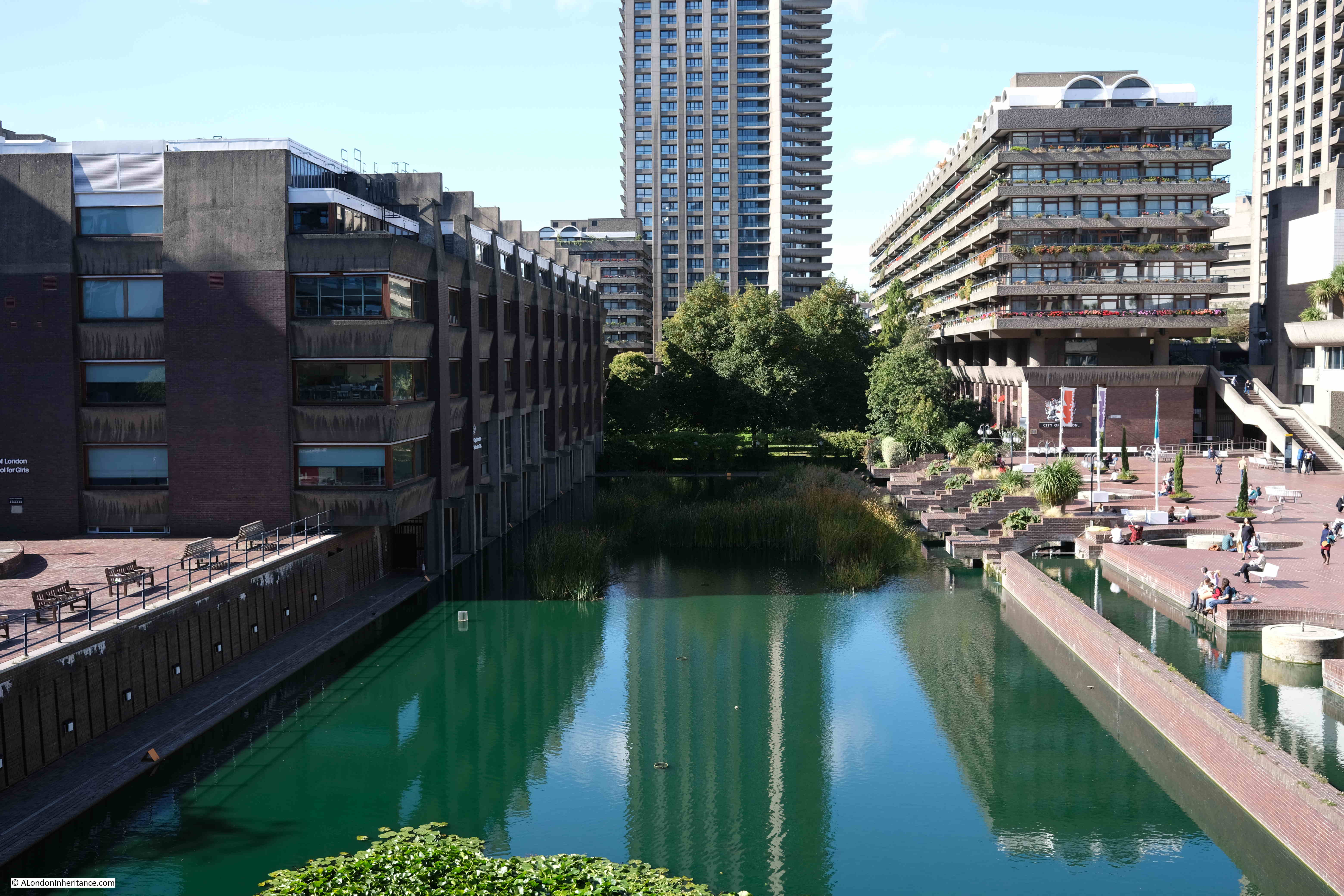
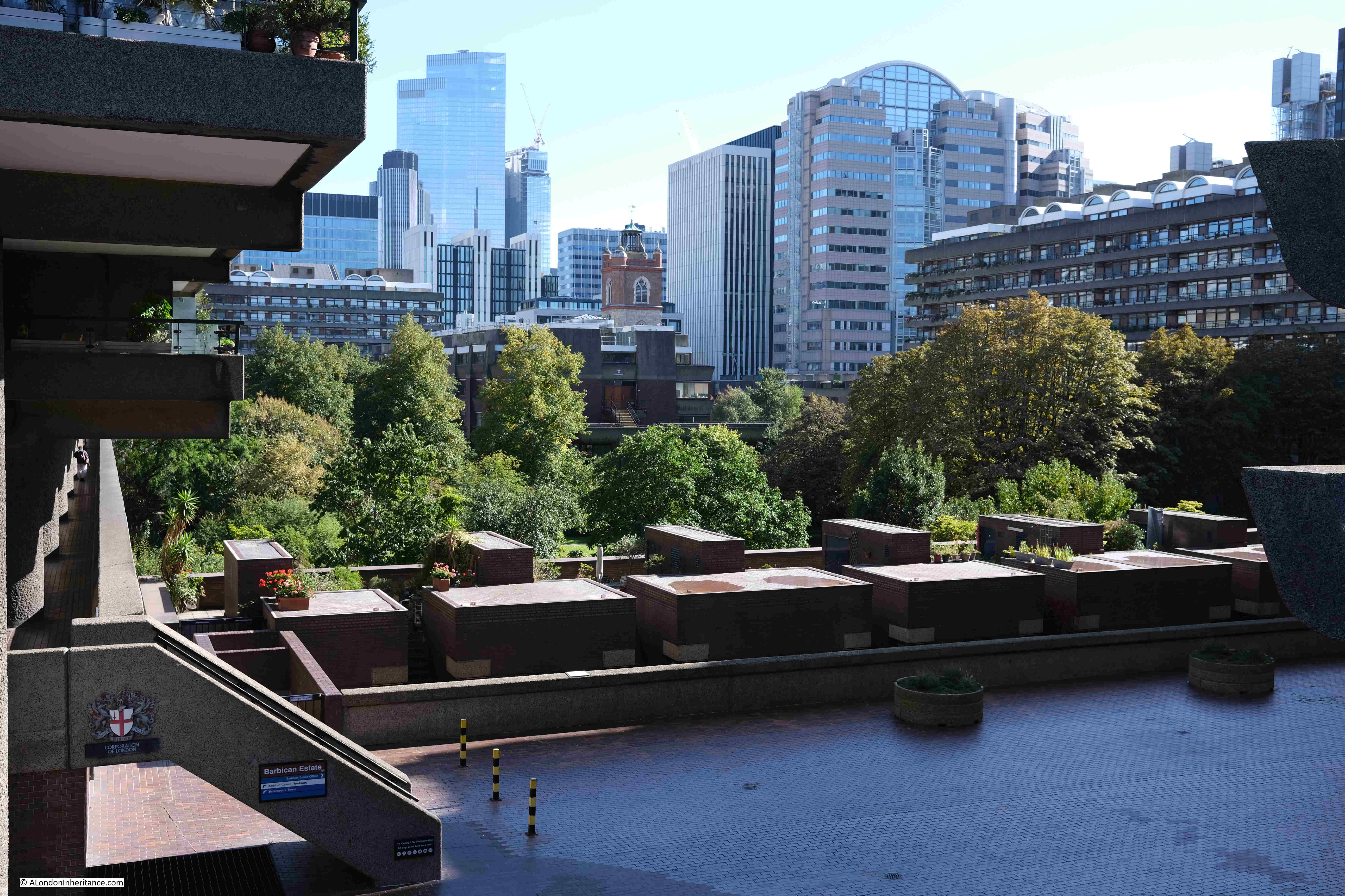
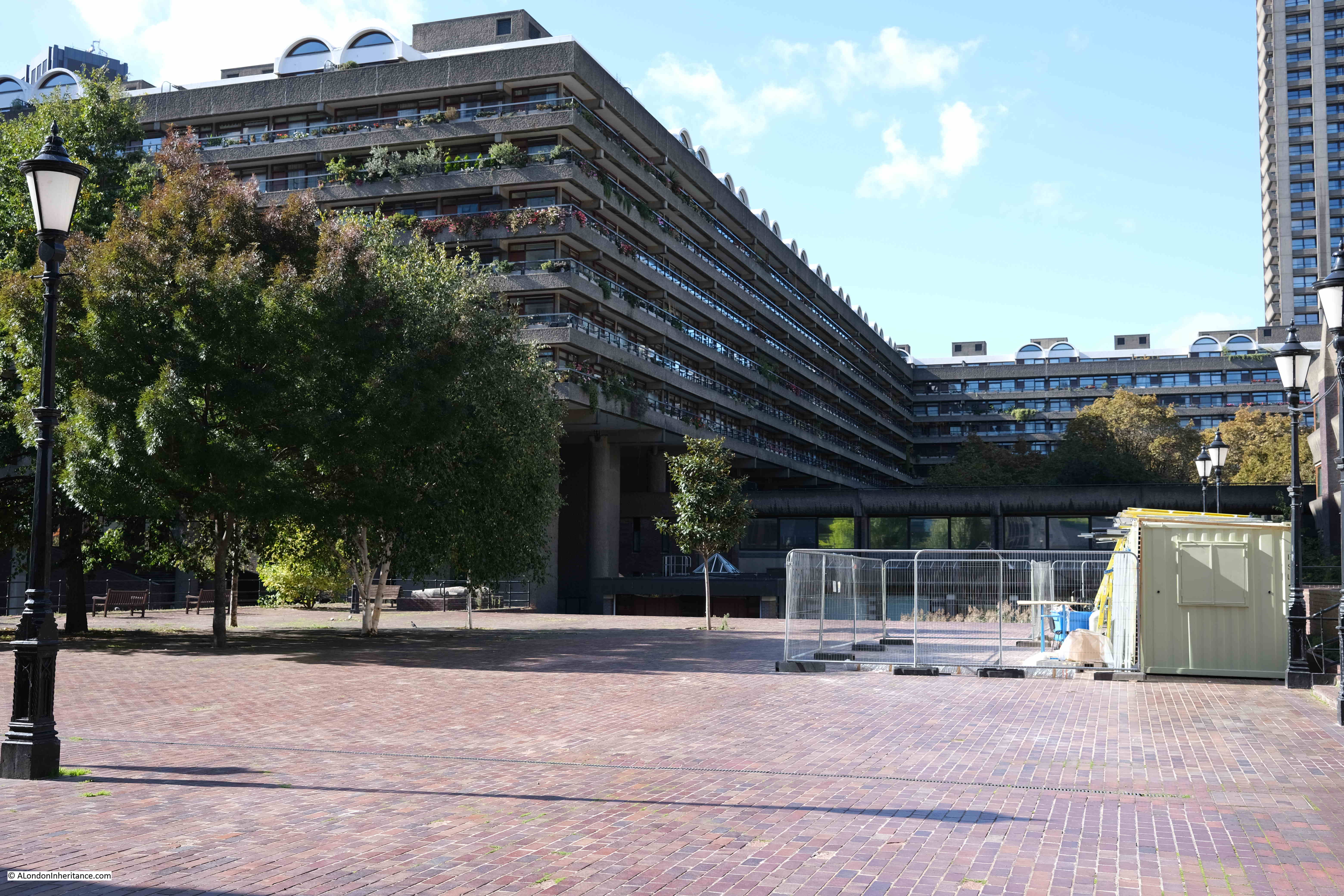
The following photo was taken from the walkway underneath Gilbert House in the Barbican. Redcross Street ran left to right, from the corner of the building on the left (City of London School for Girls), across the water feature, and continuing underneath the buildings on the right. The fire started a short distance along the City of London School for Girls.

View of the Barbican from Gilbert House

The following two photos show the destruction along Jewin Crescent.

Great Fire in Cripplegate

Jewin Crescent started at where the City of London School for Girls in now located, ran along what is now the Thomas Moore Residents Garden, and rejoined Jewin Street under what is now Thomas Moore House (see map earlier in the post).

The following photo is looking across the residents garden, where Jewin Crescent occupied much of the space.

View of Thomas Moore Residents Gardens

As the fire occurred during the early afternoon of a working day, there were very many people in the area and large crowds soon gathered which were a problem for the firemen attempting to get to the streets on fire and at risk.

Police and firemen tried to keep the crowd in order, but with difficulties. The report states that this was much easier in Redcross Street due to the large number of showers of burning embers that would blow across the streets. There were several cases of people in the crowd being badly burned by these, and that “many had damaged headgear”.

By the end of the day, police were being brought in from all across the City, and by the evening there were estimated to be a combined force of 500 firemen and police officers both fighting the fire and managing the crowds.

There were complaints about delays in getting sufficient fire appliances to the scene, however the first two appliances arrived just after one in the afternoon, only minutes after the alarm had been raised, four more arrived eight minutes later and within 30 minutes there were 19 steamers (steam driven pumps) at the scene of the fire.

The following photo on the left is looking down Well Street from Jewin Street . A bit hard to see, but on the left edge of the photo there is a sign for “Cup of Tea 2d”. This was the site of the Cripplegate Restaurant at number 12 Well Street. The building on the right of the left hand photo is that of the Bespoke Tailoring Company.

Great Fire in Cripplegate

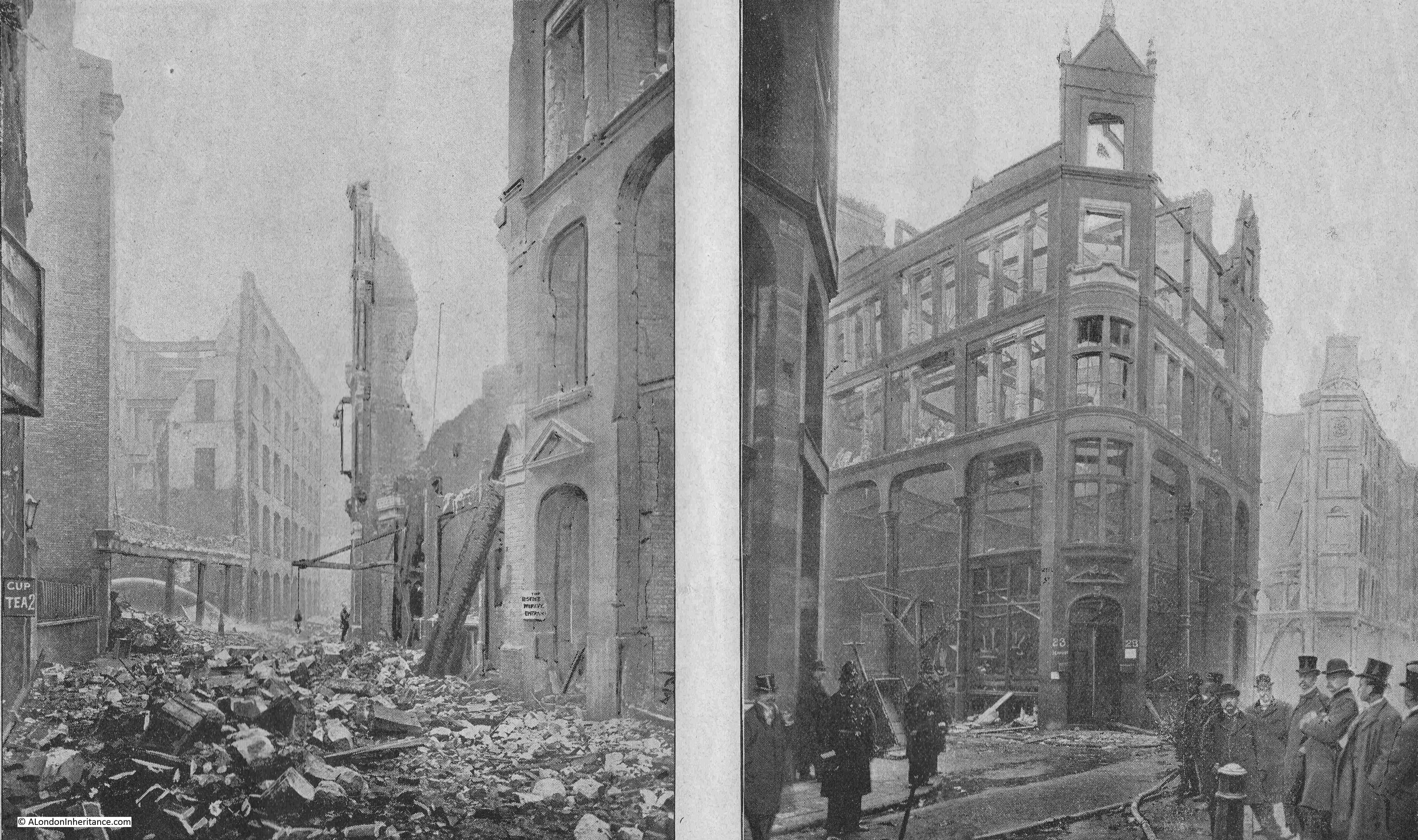
The above photo on the right shows the corner of Well Street and was occupied by London Hanover Stationers, as well as the Bespoke Tailoring Company – again, all buildings which would have had large quantities of inflammable materials.

The photo on the left in the following pair was taken from the western end of Jewin Crescent looking east. This was the edge of the devastated area. The building on the right of the left hand photo was that of Mr. M. Jacob, importer of straw goods. the building suffered considerable damage and again highlights that the area was one in which a small fire could spread very quickly due to the large amount of flammable materials.

Great Fire in Cripplegate

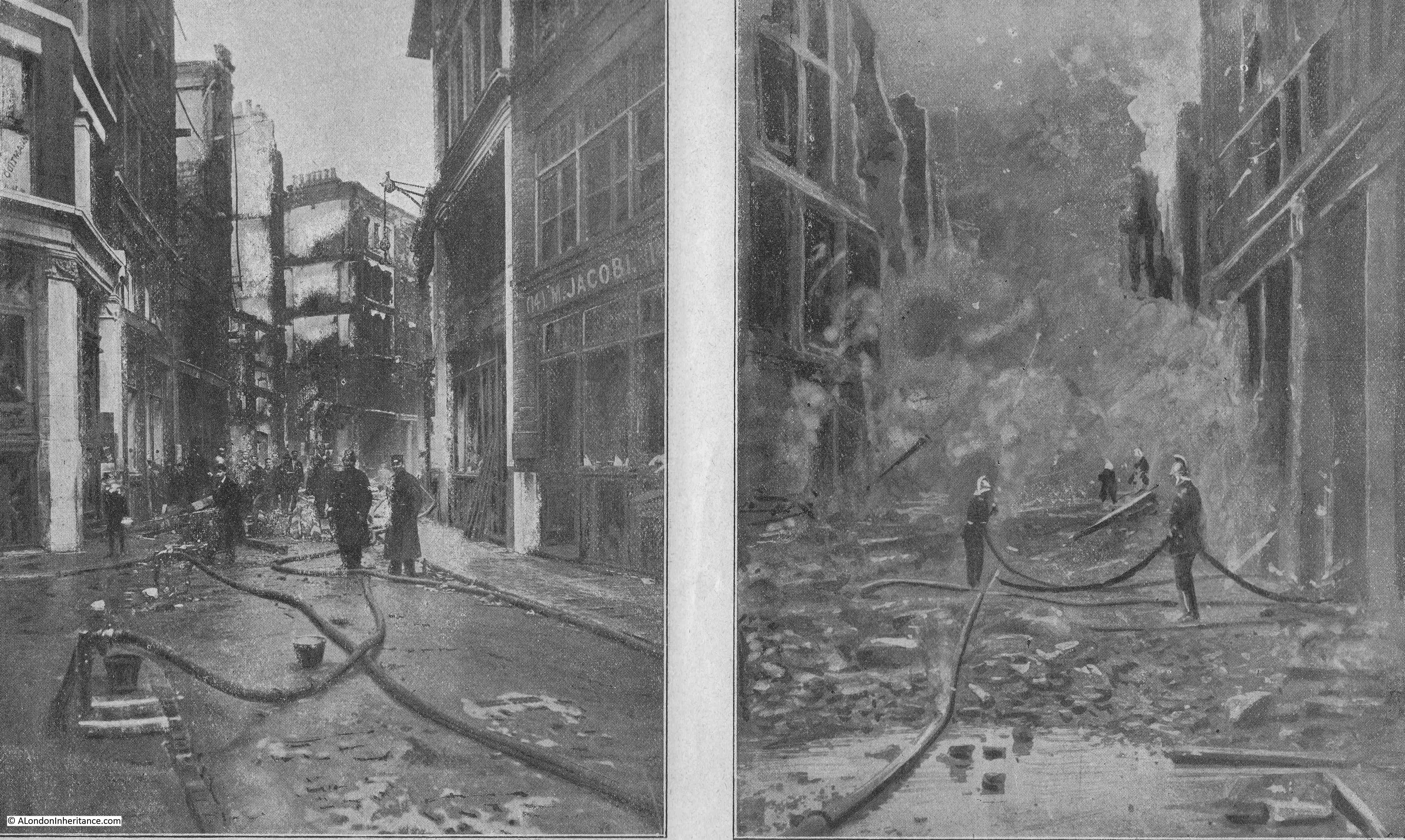
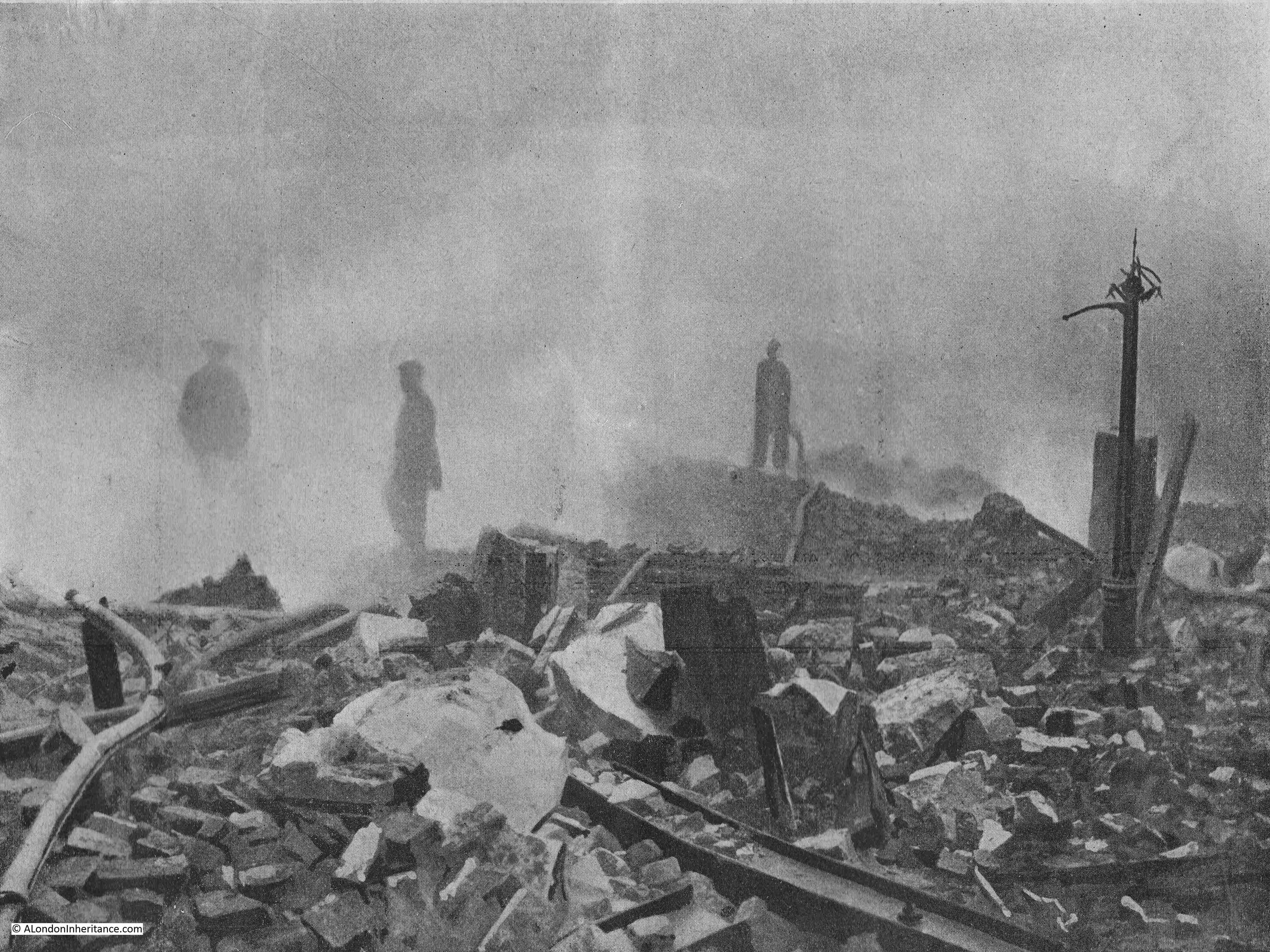
The photo on the right was taken on the Sunday after the fire and shows firemen continuing to damp down the ruins, with clouds of smoke and steam still rising.

The report into the fire mentions that the astonishing rate at which the fire spread was due to “the nature of the buildings, the stock they contained, the distribution of enclosed courts, numerous communications in party walls and the narrowness and relative positions of the thoroughfares”.

So although many of the buildings appear separate, with a wall between the neighbouring building, many walls between buildings had been knocked through, allowing the fire to spread without the firebreak of brick walls between buildings. There were also holes in the floors between floors, these were called well holes, and allowed the movement of materials between floors,

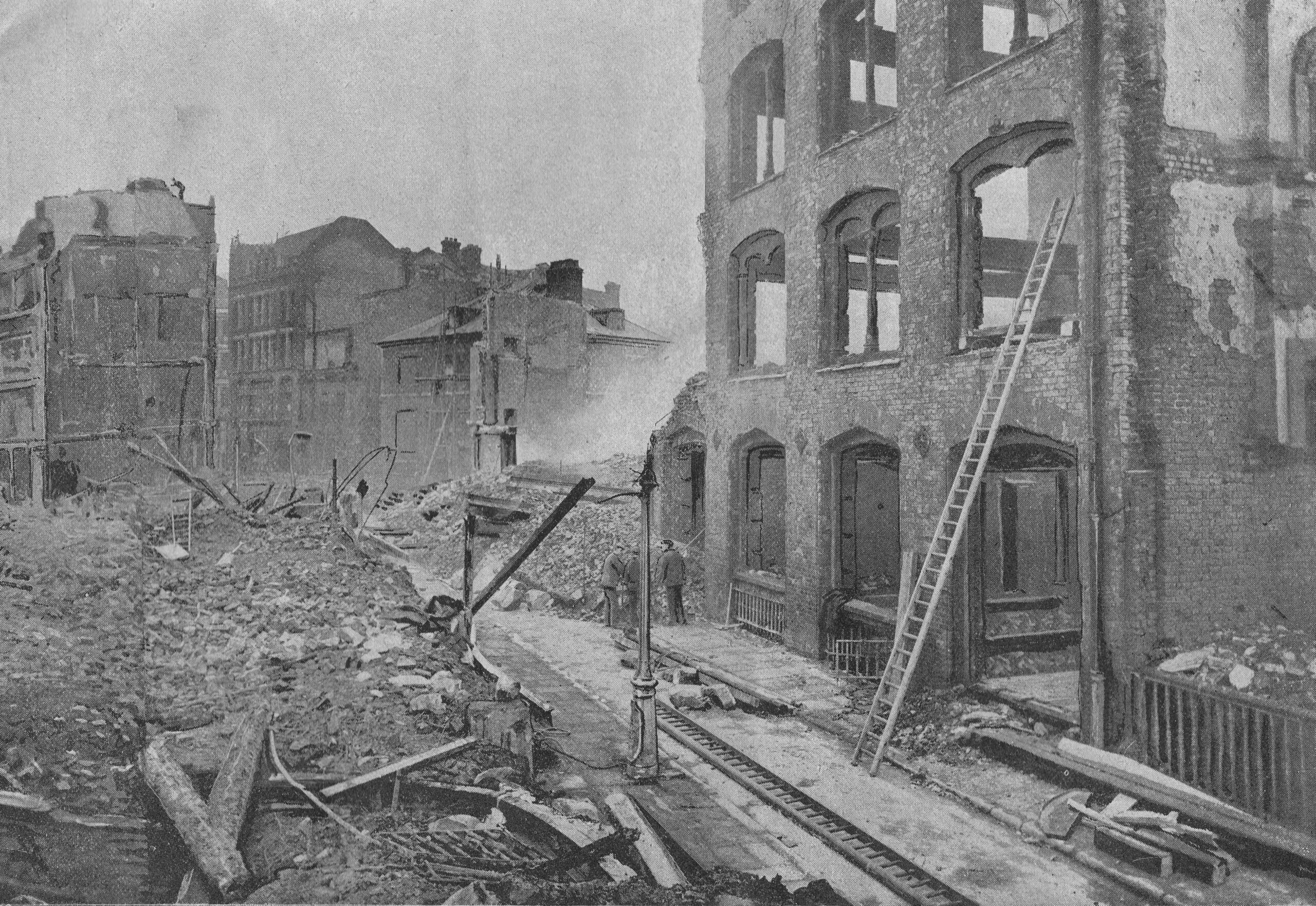
The following two photos are looking along Jewin Street. The photo on the left looking towards Aldersgate Street, and on the right, looking east from Aldersgate Street.

Great Fire in Cripplegate

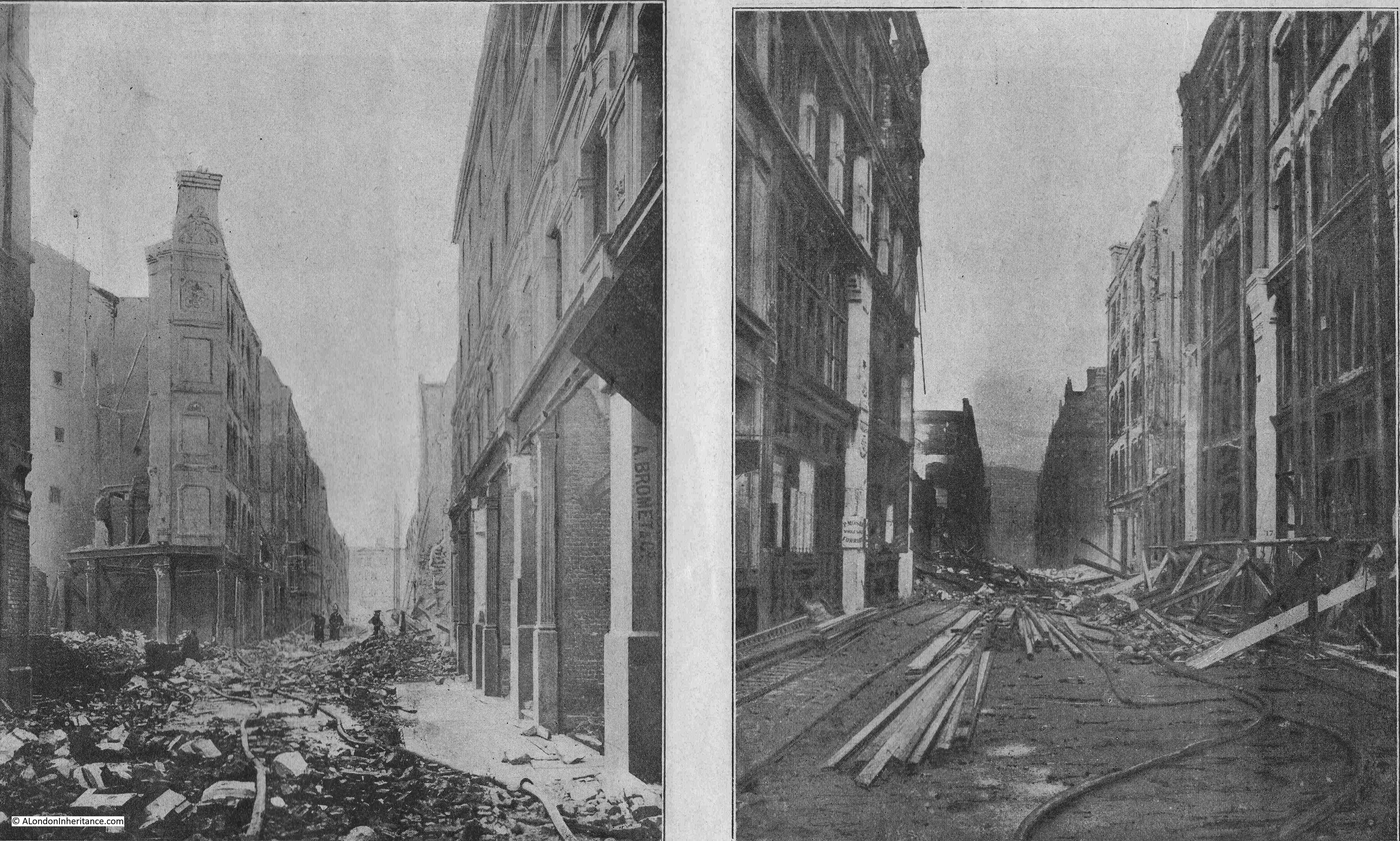
In the photo on the left, the ruins of the Grapes Tavern can be seen on the left, and on the right of the left-hand photo are the premises of A. Bromet & Co, wholesale jewelers and C.W. Faulkner & Co. Publishers and Colour Printers.

The buildings in the right-hand photo were occupied by agents, who specialised in the import and export of goods, provision of raw materials to the businesses in the area, along with the sale of finished goods.

The following photo is the view across Well Street to Jewin Street, and looks similar to many of the photos of wartime damage in the same area. The photo was taken shortly after the fire, when many of the buildings had been demolished due to the dangerous state in which the fire left them.

Great Fire in Cripplegate

The following photo is looking west from near the tower of St Giles church. Jewin Street ran from the left, then under Thomas Moore House which is the building on the left. Well Street ran right to left, from Jewin Street, roughly at the end of the paved floor in the lower part of the photo:

View of the Barbican

The following photo shows the corner of Hamsell and Jewin Streets and shows a closer view of the Grapes Tavern on the ground floor of the corner building.

Great Fire in Cripplegate

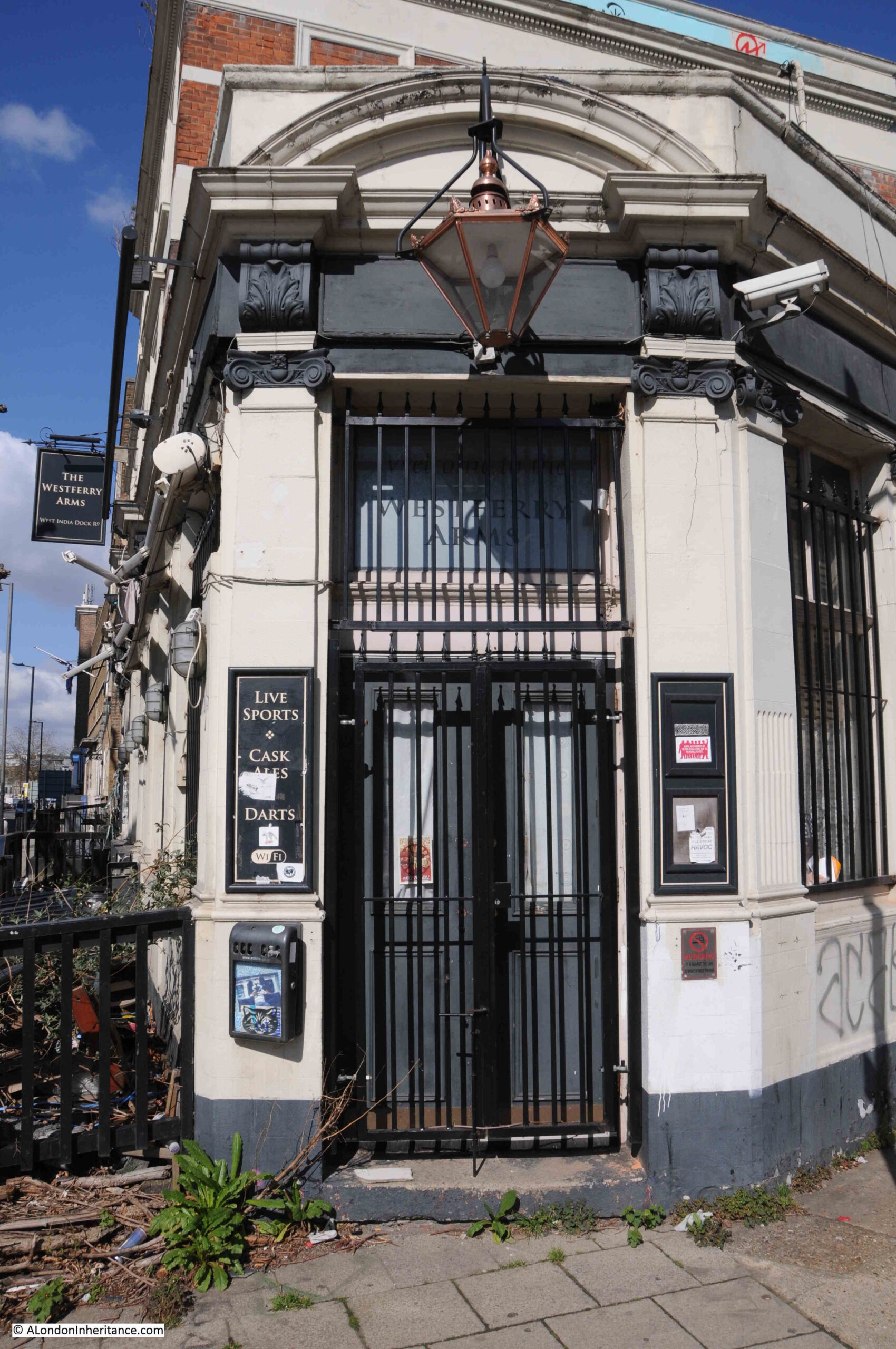
The Grapes Tavern seems to have dated from the early 19th century. The first mention of the pub I can find dates from 1818 when it was called the Bunch of Grapes. It appears to have been rebuilt after the fire, and was finally lost when the area was bombed at the end of 1940.

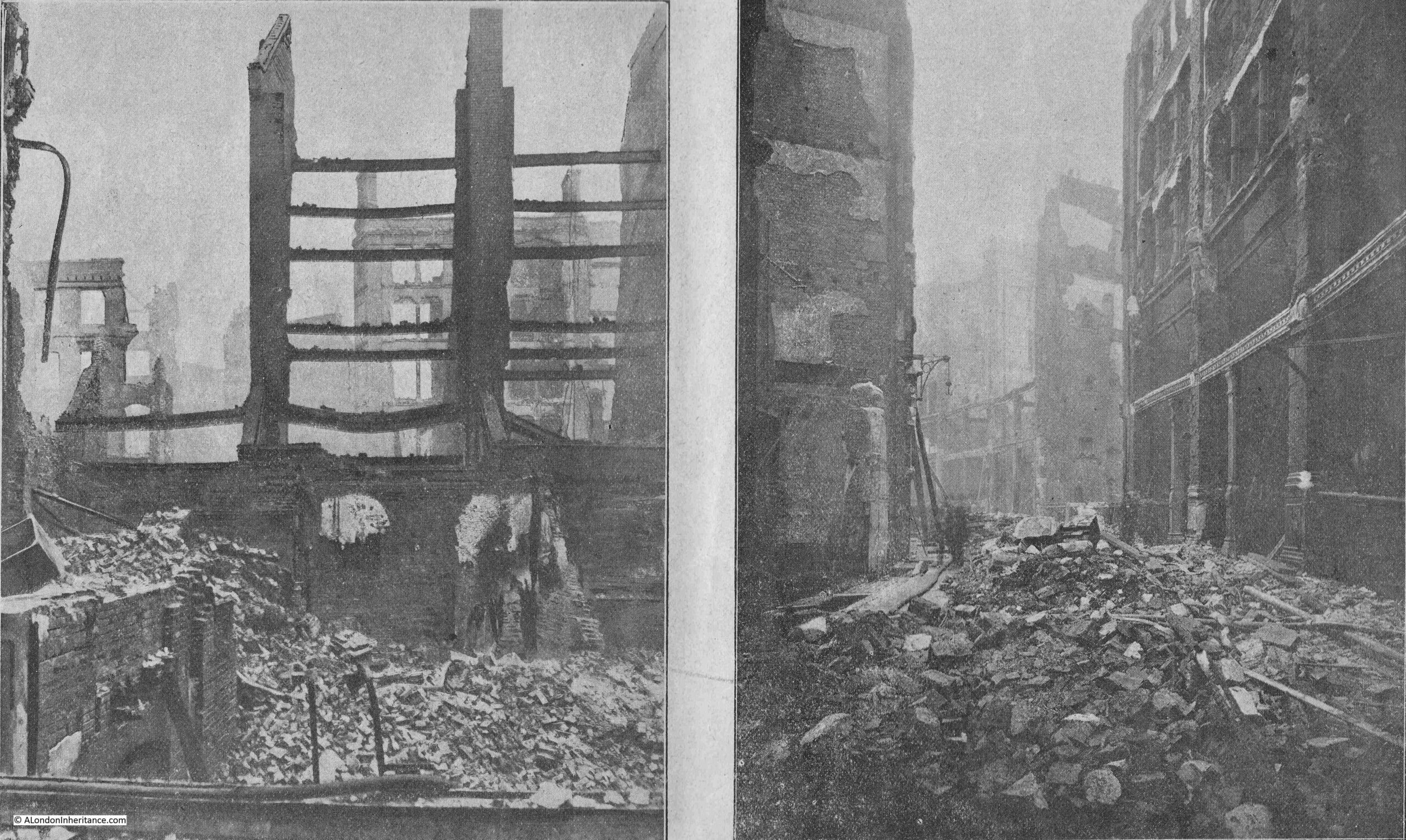
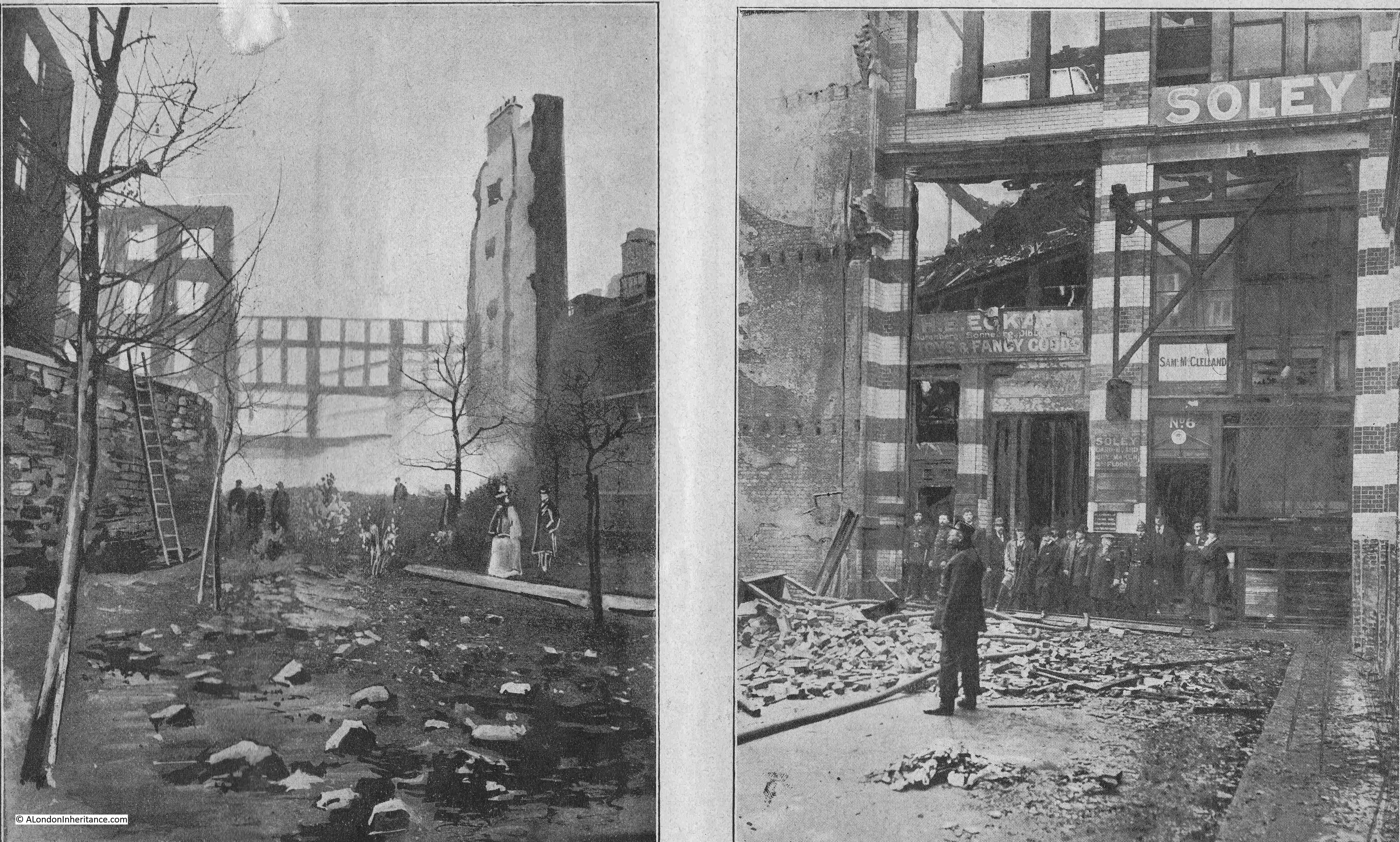
The following photo from the report was titled “The Ruins of Hamsell Street”, and mentions that the remains of the lamp-post on the right was opposite the warehouse of Beardsworth and Cryer, manufacturers, which was totally burnt out, again a photo that looks as if it was of the bombed City.

Great Fire in Cripplegate

In the right hand photo of the following pair, the name Soley refers to Mr. George Soley who was a fancy box manufacturer:

Great Fire in Cripplegate

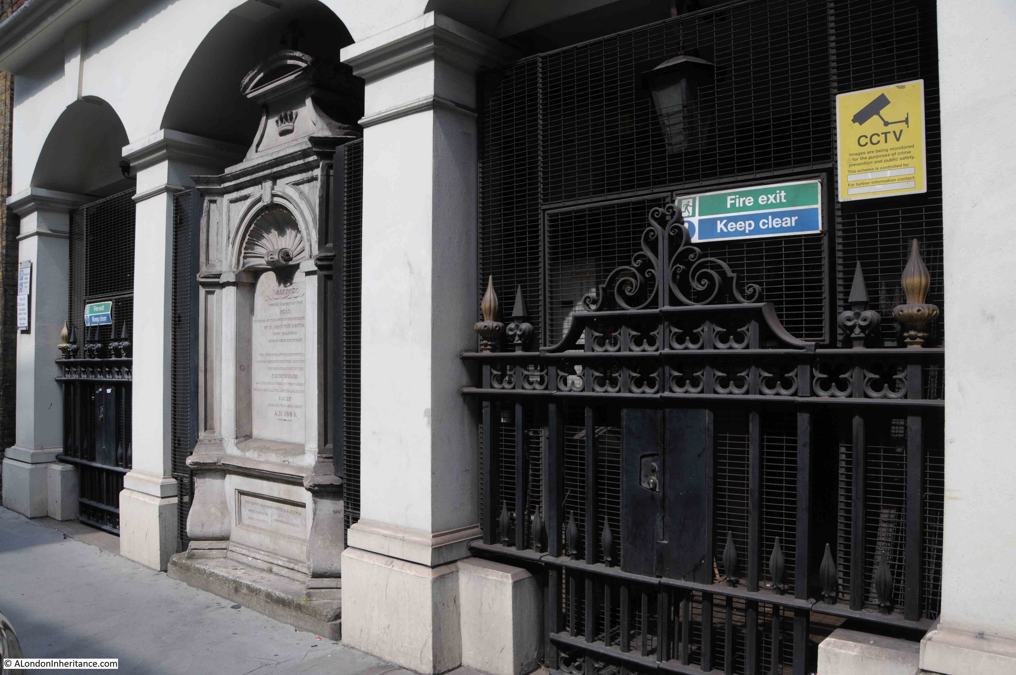
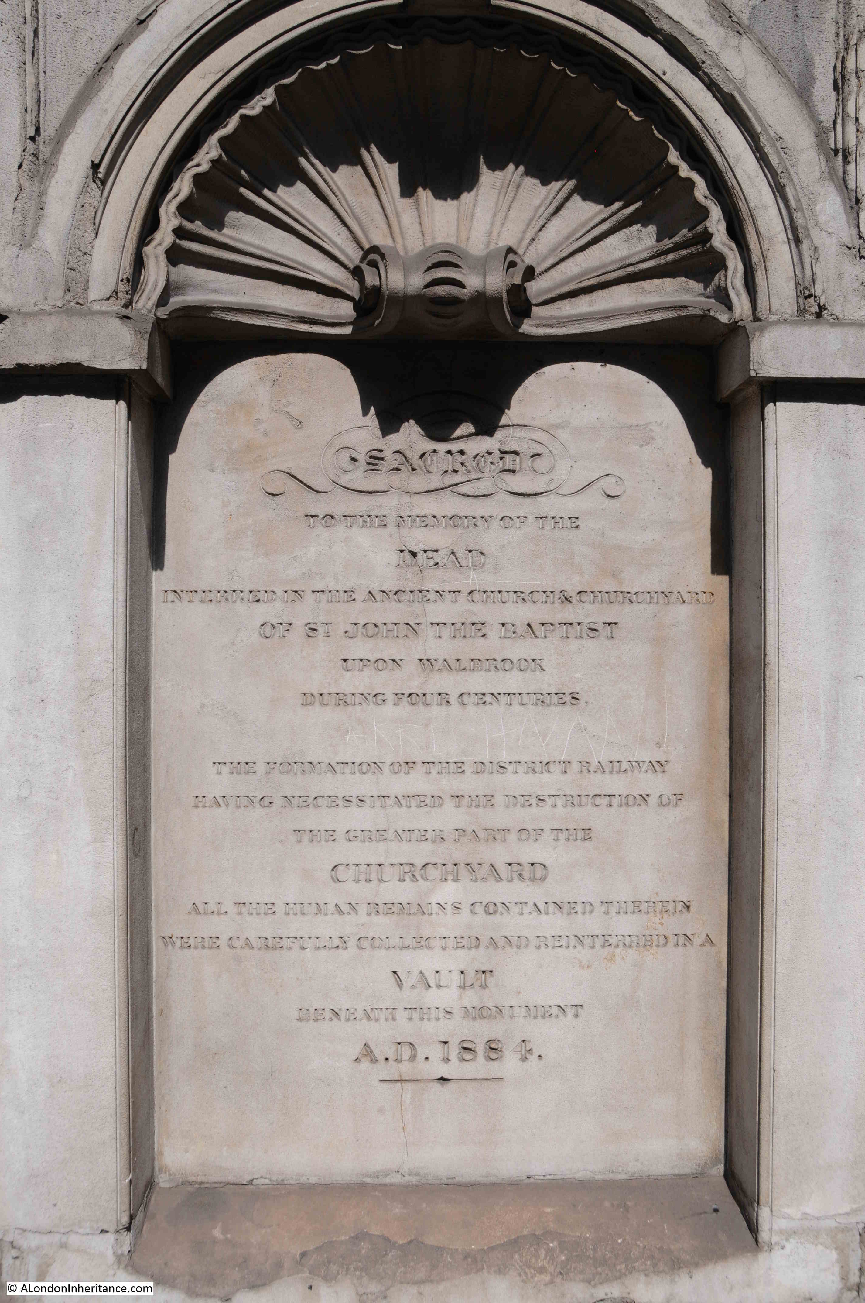
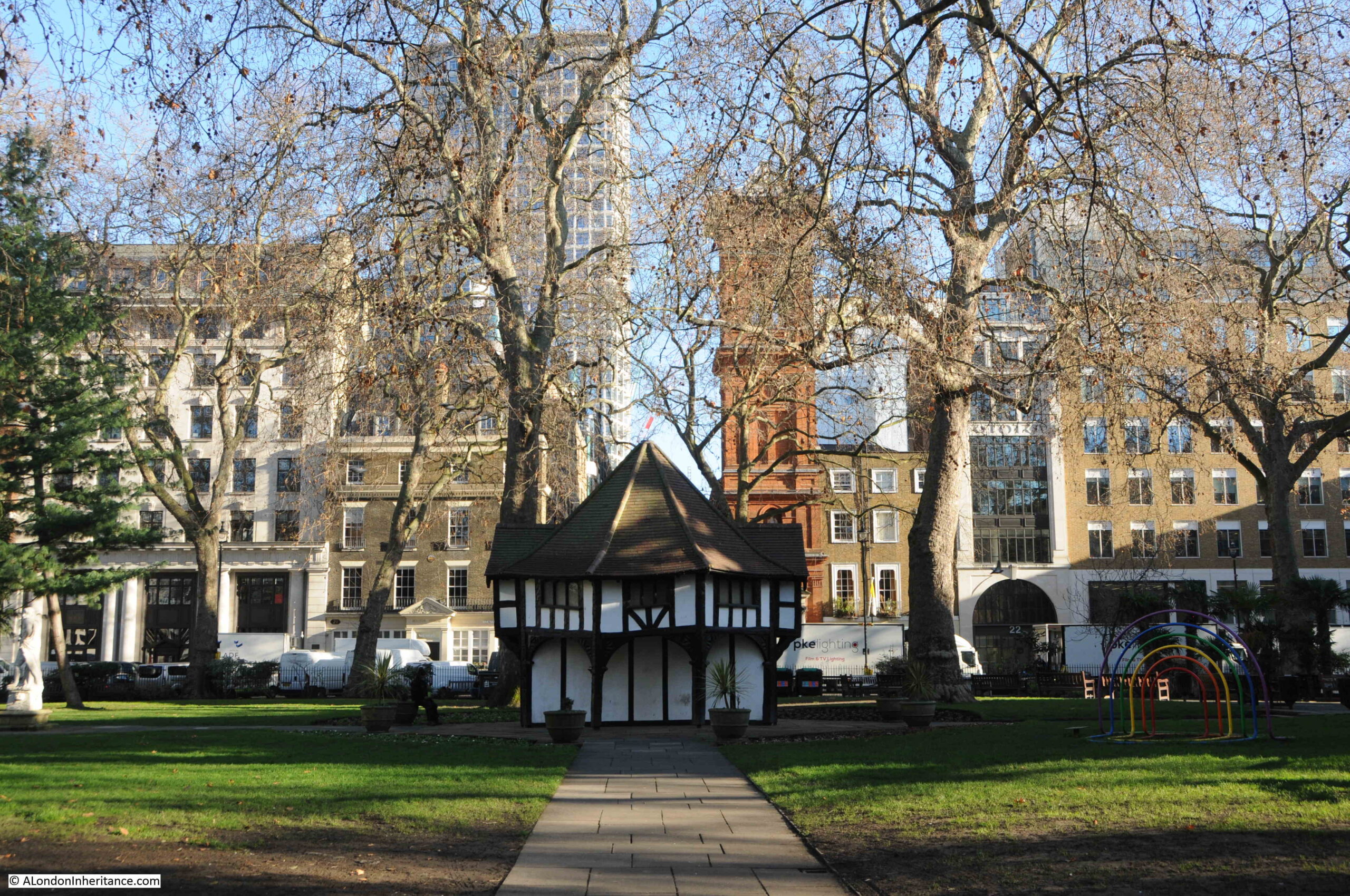
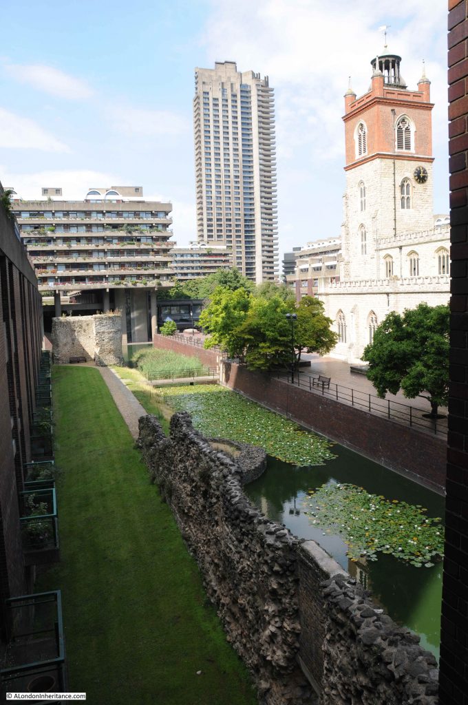
The photo on the left of the above pair was taken from St Giles Churchyard and is looking west. on the left is the medieval bastion that can still be seen today.

In the following photo, the bastion can be seen on the left. St Giles Church is on the right, and the old churchyard once surrounded the church, went beyond the bastion then ran onwards to the left.

View of Barbican bastion

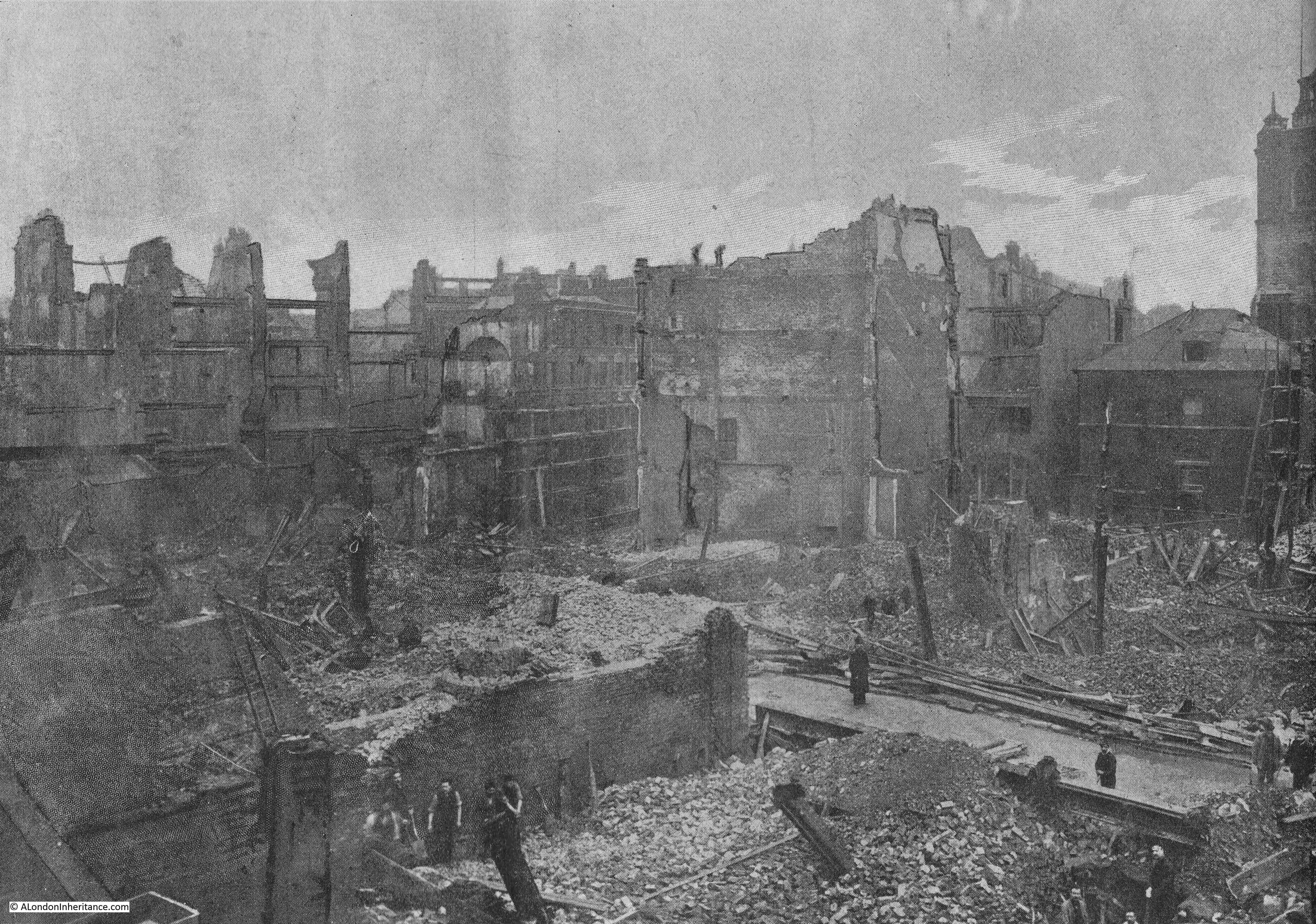
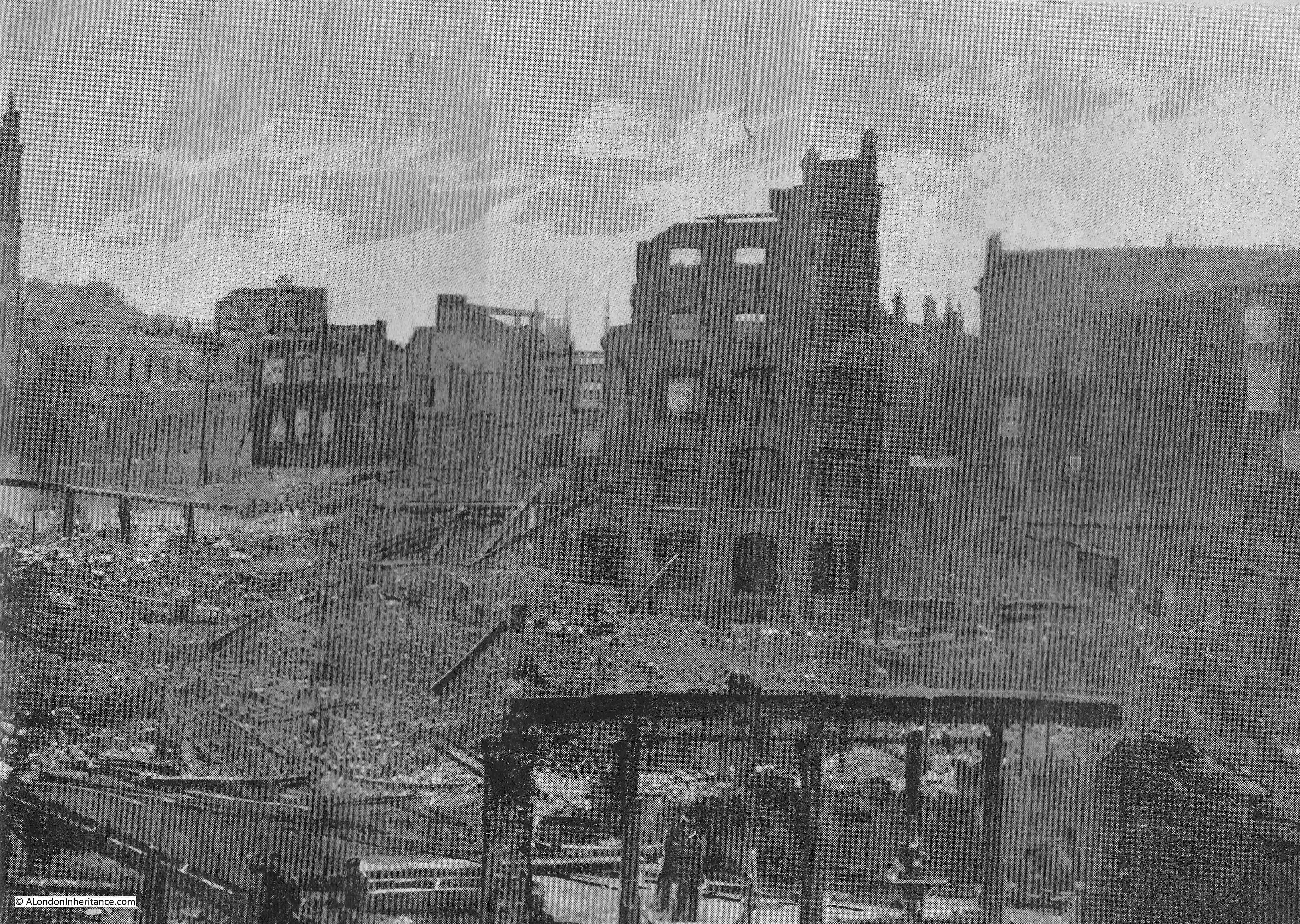
The following two photos make up a two page spread, showing the area of Hamsell and Well Streets, with St Giles in the centre of the photo (split across the two pages).

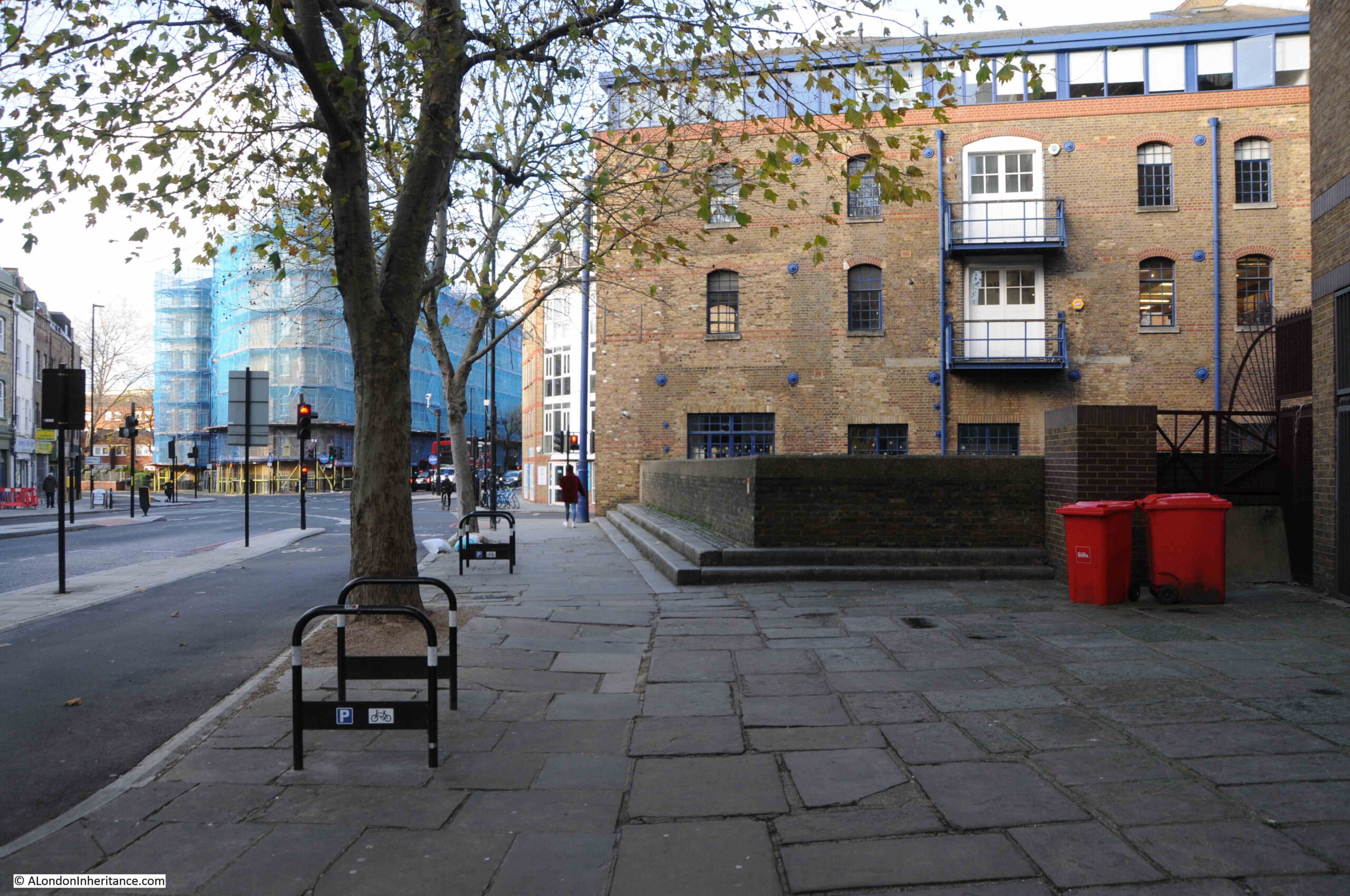
In the first photo, Hamsell Street is the street in the foreground. On the right of the photo is a lower building compared to the ruins of the others in the view. This was the rectory of St Giles Cripplegate, and stood on what is today the paved area to the west of the church tower (see photo of that view today, above).

Great Fire in Cripplegate

The second part of the two page spread looking to the right of the church:

Great Fire in Cripplegate

Remarkably, there were few casualties and no deaths from the Great Fire in Cripplegate.

Some workers had narrow escapes, including having to scramble over roofs to reach buildings that were not yet on fire. A few firemen were injured, included a burn from falling cinders, and being cut by glass.

The Times newspaper started an appeal for funds to help workers who had lost their jobs as a result of the fire. The paper commented that “the most grievous feature of the calamity will depend upon the numbers of industrious people who will be deprived of work at the commencement of the winter season, and many of whom, as being skilled in a special industry which for a time will be almost entirely suspended, will find it difficult or impossible to find work elsewhere.”

The “Star’s” reporting on Saturday 20th November 1897 was very typical of newspaper reports of the fire – The Greatest Fire of Modern Times, Damage Estimated By Millions:

The Great Fire in the City

The fire was of such significance that an inquest was held in the following weeks. The inquest was opened on the morning of Monday the 6th of December 1897 in the Old Council Chamber of the Guildhall.

A jury was assembled from the wards of Aldersgate, Farringdon Within and Cripplegate. The following photo shows the assembled jury, looking very much a late 19th century jury that you would expect.

Great Fire in Cripplegate Jury

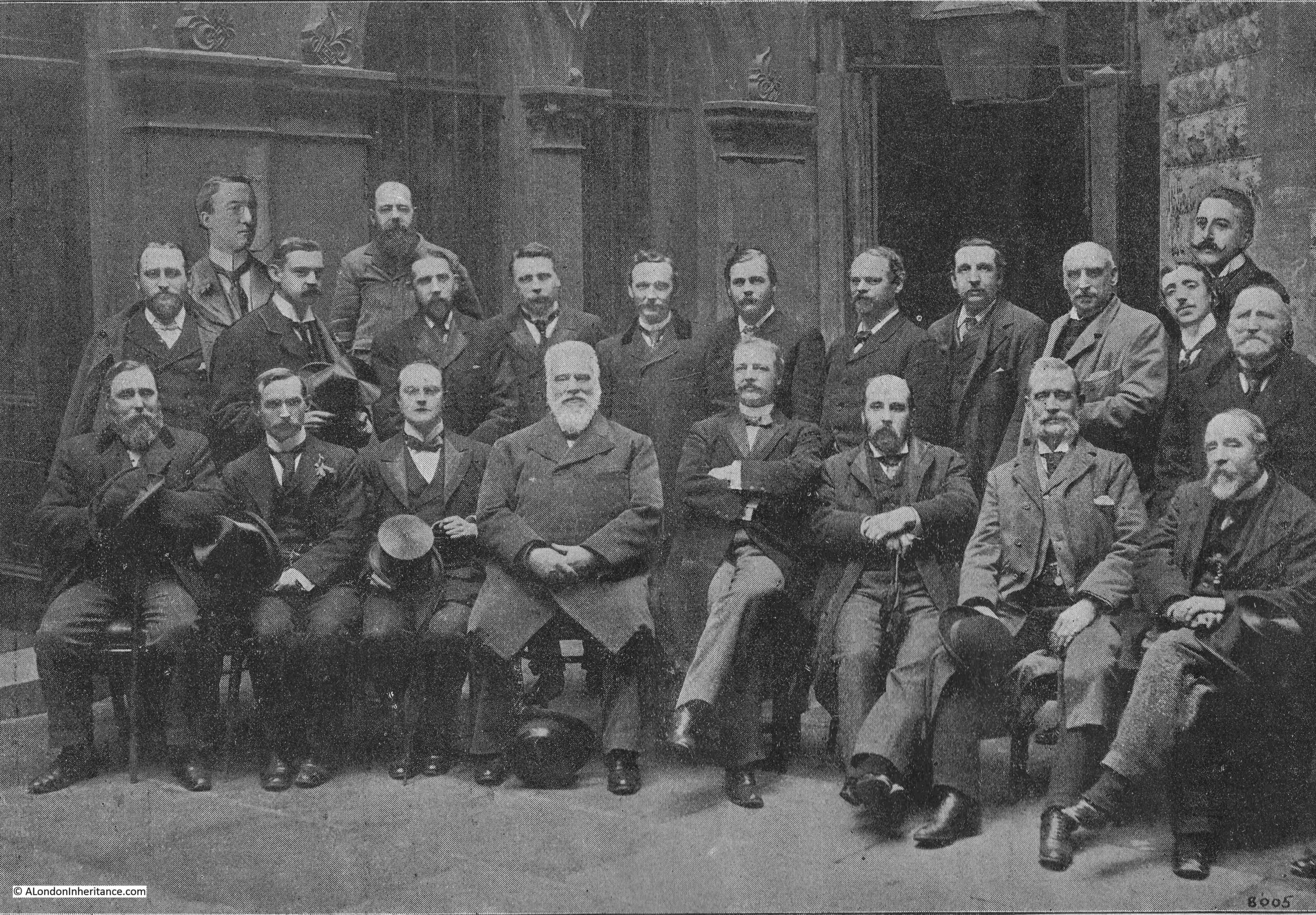
The jury was asked to provide their view on 11 specific questions relating to the fire, and in order to help them make their decisions, a large number of people were called to provide evidence. This included the owner of the business in which the fire started, a number of members of staff working within the building, the architects of the building, the District Surveyor of the northern district of the City, Professor Boverton Redwood, an analytical and consulting chemist to the Corporation of London, and members of the Fire brigade and of the New River Company.

I have written about the New River Company in a number of previous posts, and it was their water supply through the streets of Cripplegate that was essential in being able to fight the fire. It was estimated that 15 million gallons of water was drawn from the mains of the New River Company by the Fire Brigade during the battle to control the fire.

The questions asked of the jury, and their verdicts are as follows:

  1. Where did the fire originate? – The fire originated on the first floor of No. 13 Well Street E.C. in the occupation of Messrs. Waller and Brown.
  2. At what time? – At from a quarter to one to ten minutes to one on Friday November 19th
  3. What was the cause of the fire? – The ignition of a stack of goods near the well-hole on the first floor (a well hole was a hole in the structure of the building between floors)
  4. Was it from spontaneous combustion? – No
  5. Was it from a gas explosion? – No
  6. Was it accidently fire? – No
  7. Was it wilfully fired, and if so, by whom? – Yes, by some person or persons unknown (This was decided by sixteen to six of the Jurymen)
  8. Was there any delay on the part of the Brigade in arriving at the scene of the disaster? – There was no delay after reception of the call
  9. Were the appliances and steamers and the coal and water supply sufficient? – With regard to the appliances at the fire, yes; as regards steamers at the fire, yes; as regards the coal, no; as regards the water, yes
  10. What was the cause of the rapid spread and development of the fire? – The style and construction of the buildings, the narrowness of the streets, the late call and the further delay of fourteen minutes from the time of receiving the call to the first steamer to work
  11. Have you any general suggestion or recommendation to make as to the reconstruction of the buildings destroyed? – We recommend that this area should be so reconstructed as to have greater regard to the safety of the adjacent property, and that all new buildings of the warehouse class, match-board lining should be prohibited for walls and ceilings and that all ceilings should be plastered and covered with fire-resisting materials

So the jury found that the fire had been started on purpose, but could not identify who had started the fire, although this was not the unanimous conclusion of the jury.

The report included a number of recommendations for how the area should be rebuilt after the devastation of the fire:

Rebuilding Cripplegate

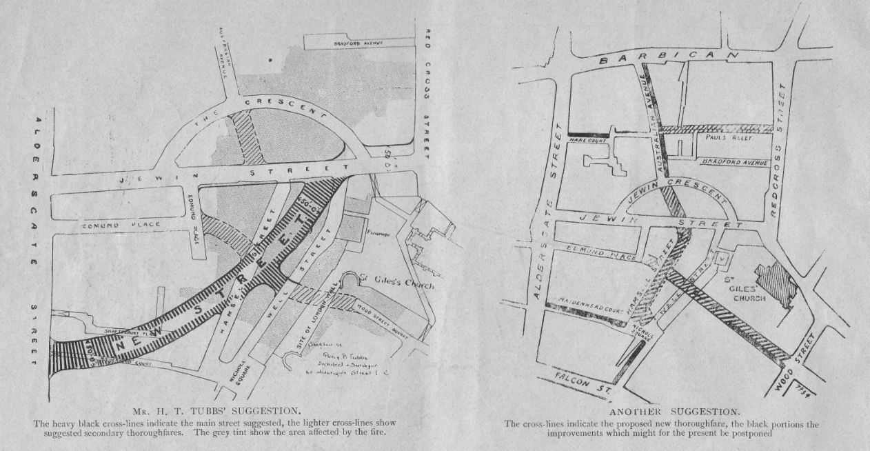
Recommendations included widening existing streets and building wider new streets. One recommendation included widening and extending Jewin Street all the way to Smithfield.

Rebuilding Cripplegate

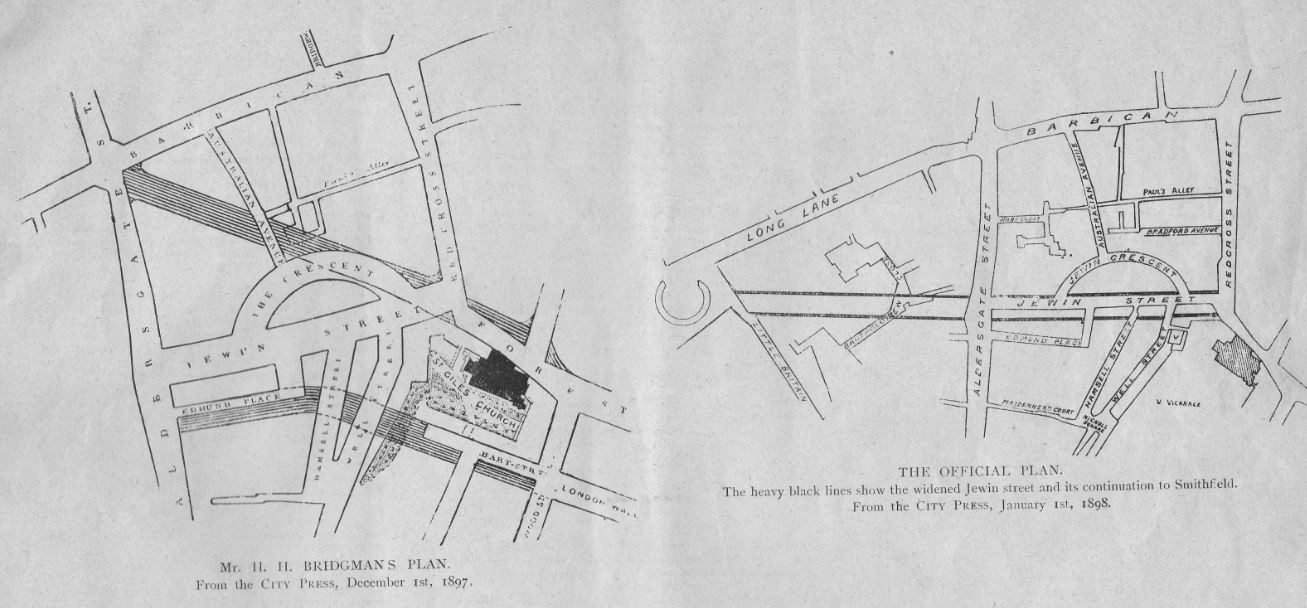
However in late 19th century London, the commercial imperative was key, and the area was rebuilt to the existing street plan, and again lined with warehouses and other commercial premises.

In a similar commercial vein, the City Press publication included several pages of adverts where advertisers made use of the fire to show the benefits of their products and services.

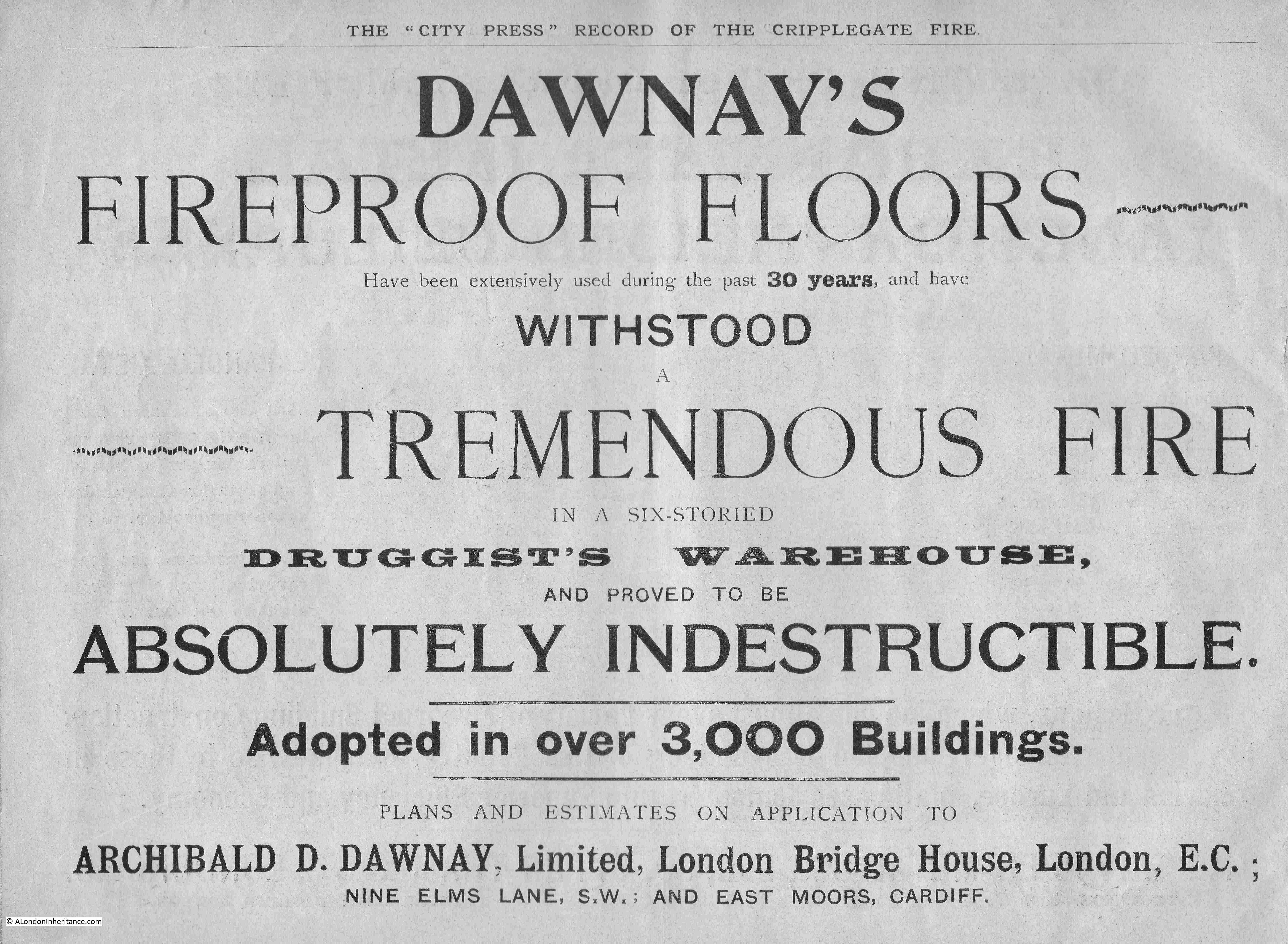
Dawney’s Fireproof Floors apparently withstood the tremendous fire and proved to be absolutely indestructible in a six storied druggist’s warehouse:

Advert

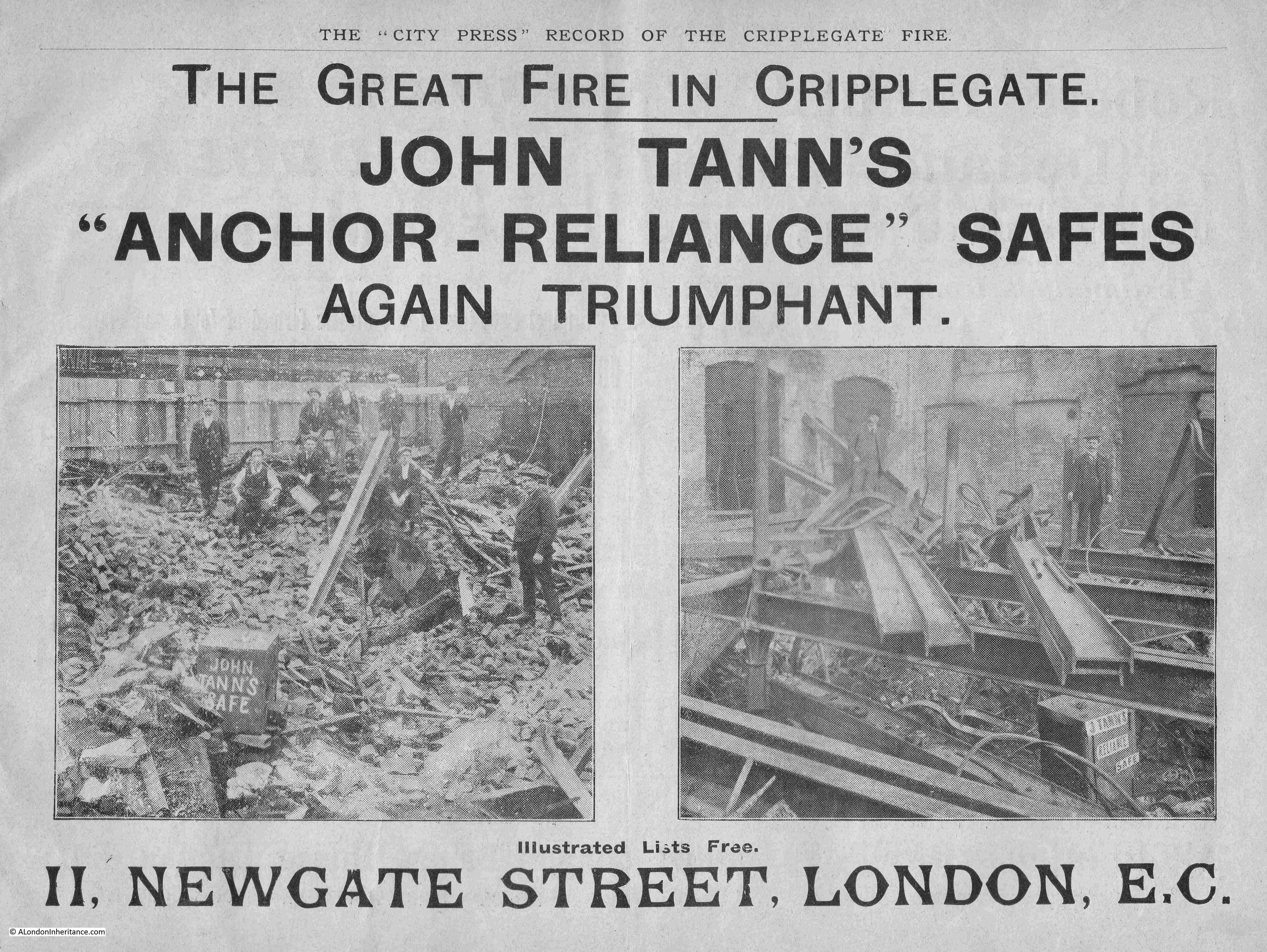
John Tann’s “Anchor-Reliance” Safes were again triumphant during the fire, and their advert included a couple of photos with their safes shown in the ruins of the buildings in which they were once housed.

Advert

If they are related, the Tann family seem to have had two seperate companies selling safes, with Robert Tann’s “Defiance” safes collecting some testimonials from the Great Fire.

Advert

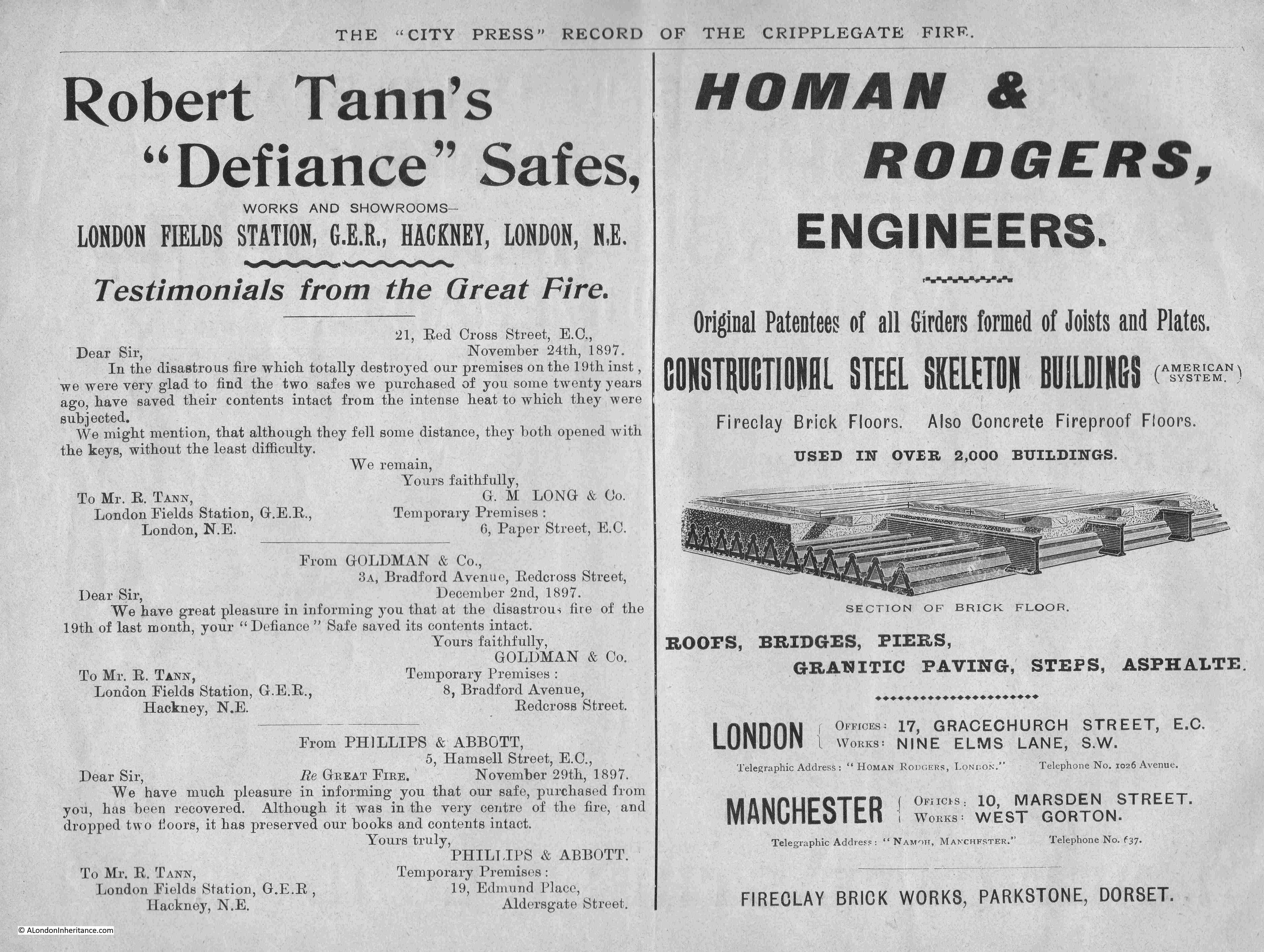
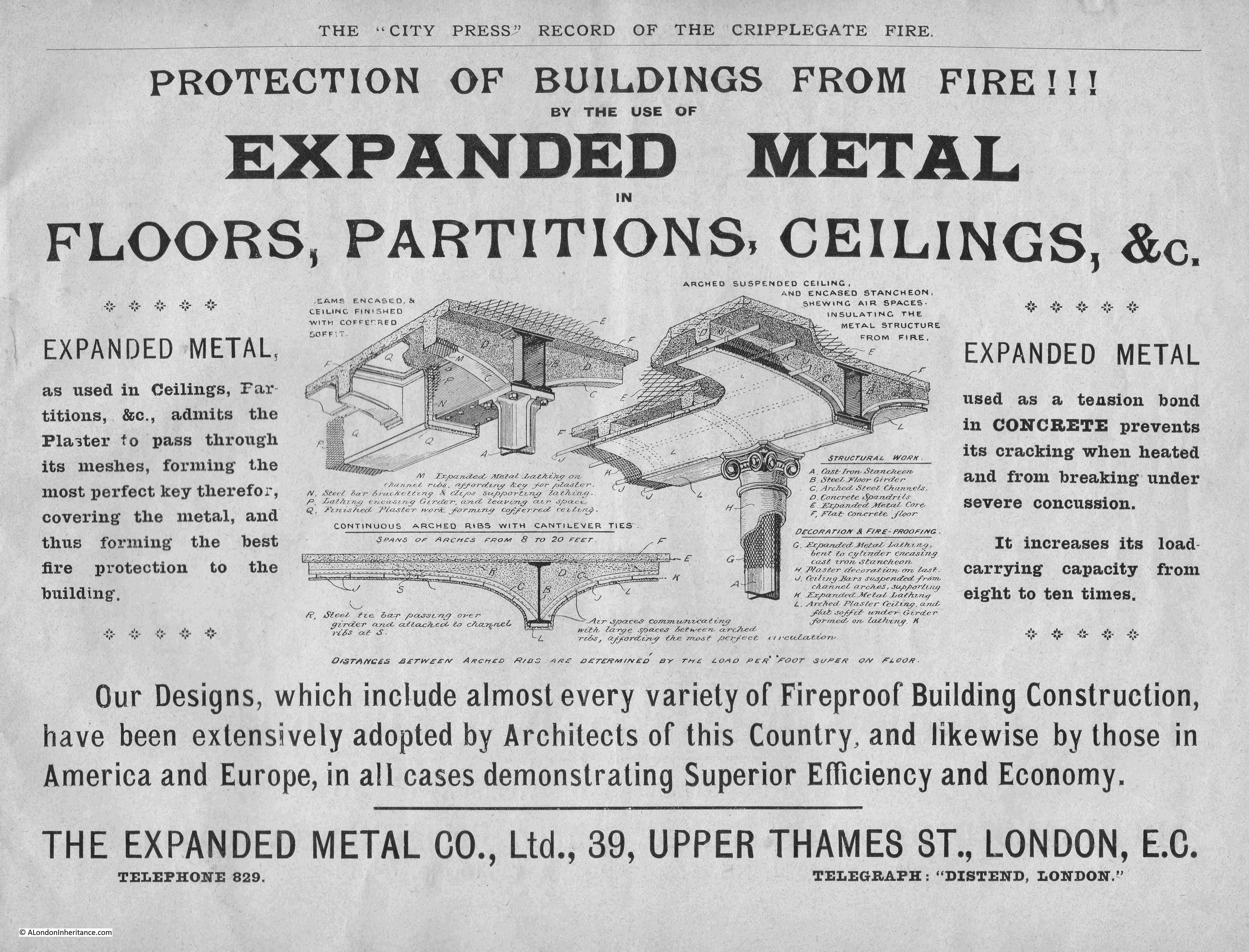
The advert on the right in the above pair, and the following advert show the growing use of steel and expanded metal in the construction of buildings. There were no claims as to their products use in Clerkenwell, so these adverts were showing how buildings could be built to have prevent the spread of fire. The following Expanded metal Company also advertised the use of expanded metal as a tension bond in concrete.

Steel would become the dominant structural material in buildings over the coming decades and is used in all new City buildings today.

Advert

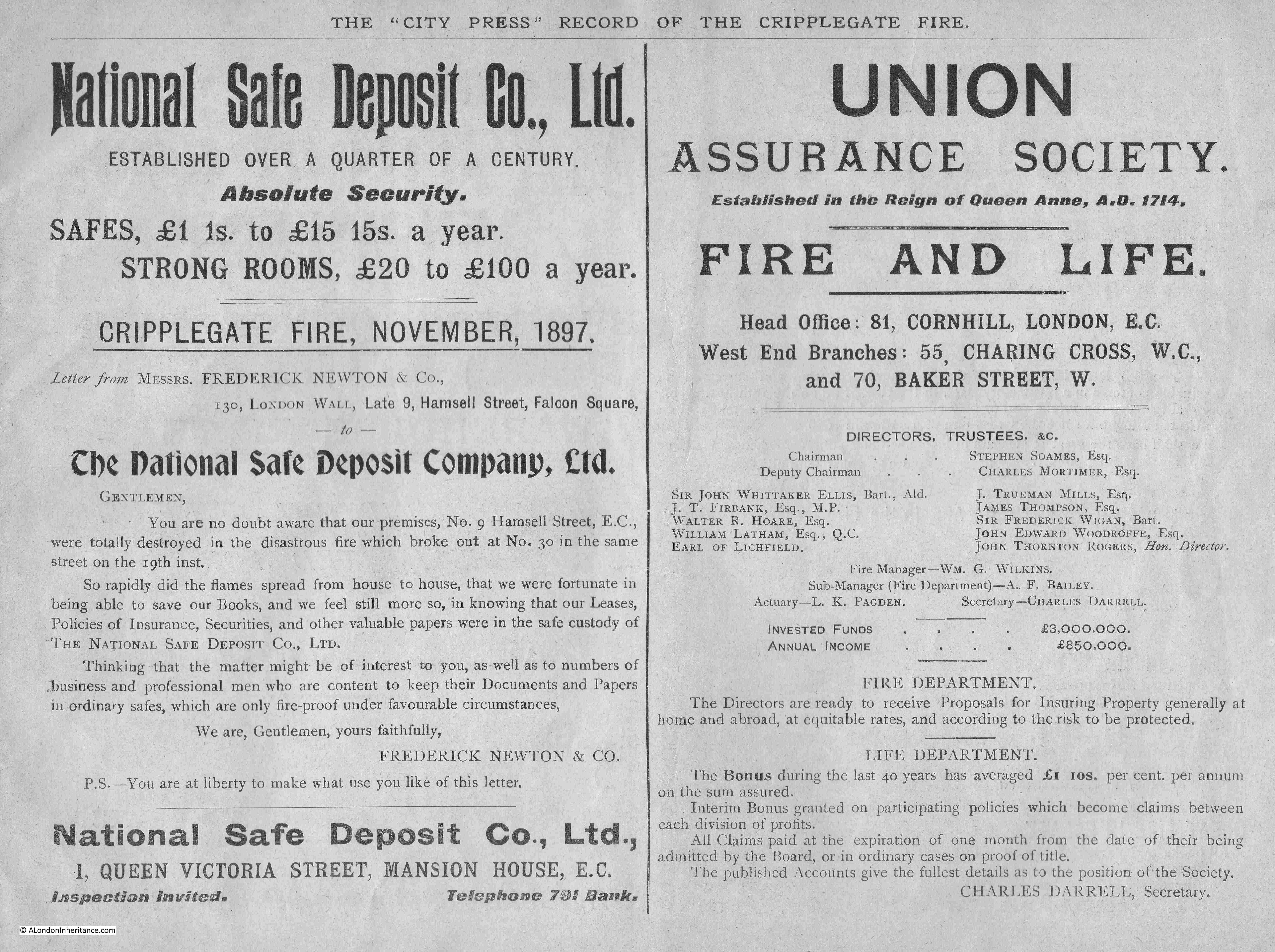
Another two companies looking to capitalise on the fire were the National Safe Deposit Company, who included a letter from Frederick Newton & Co who had lost their building in the fire, but were relieved that all their key documents were held by the National Safe Deposit Company, along with the Union Assurance Society who provided insurance for Fire and Life:

Advert

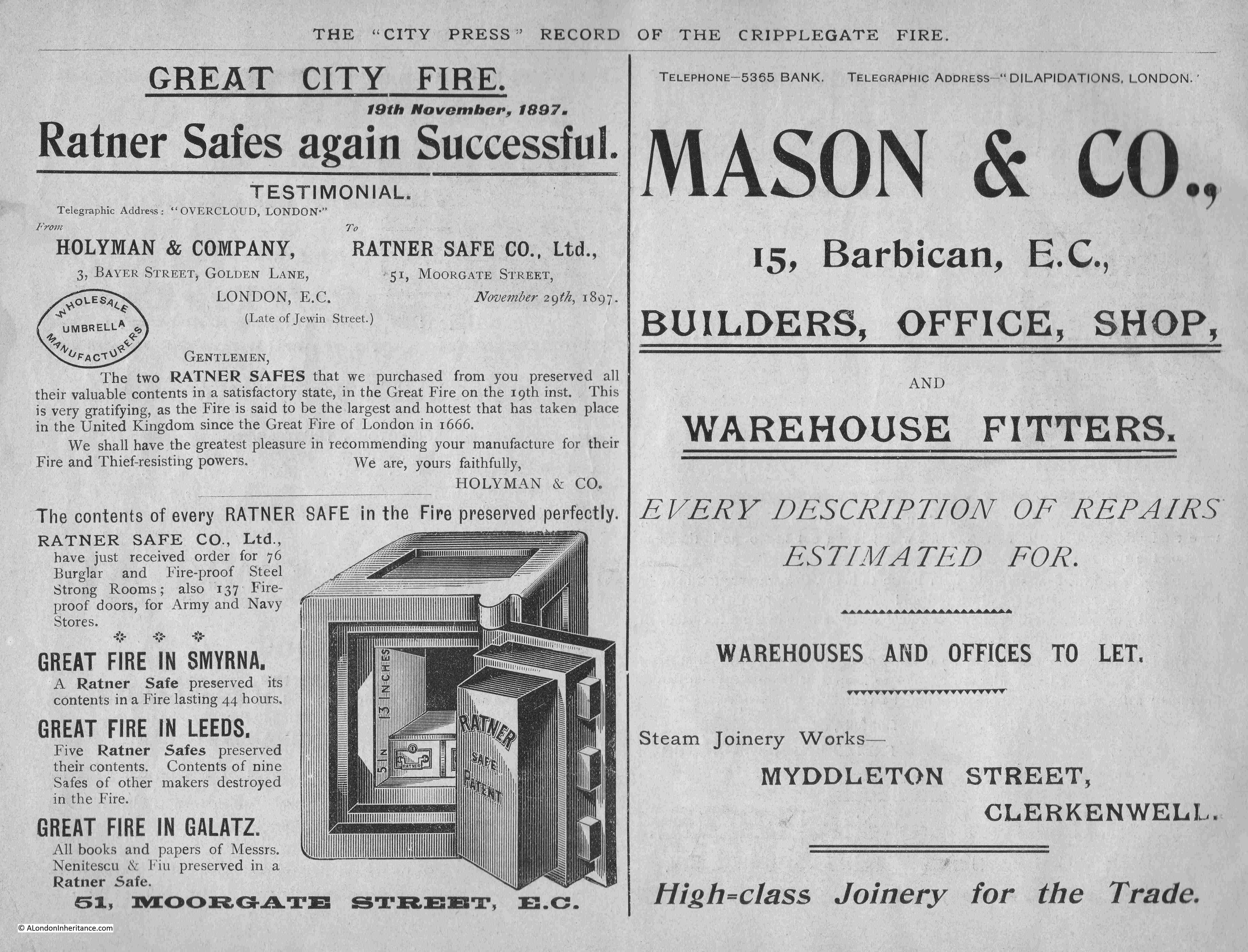
Another safe company – Ratner Safe Co. Ltd, who included a letter from Holyman & Co who had two Ratner Safes, which preserved all their papers during the fire. Mason & Co who had their “Steam Joinery Works” in Myddleton Street, Clerkenwell, were advertising “High-class joinery for the trade” and were ready for “every description of repair”.

Advert

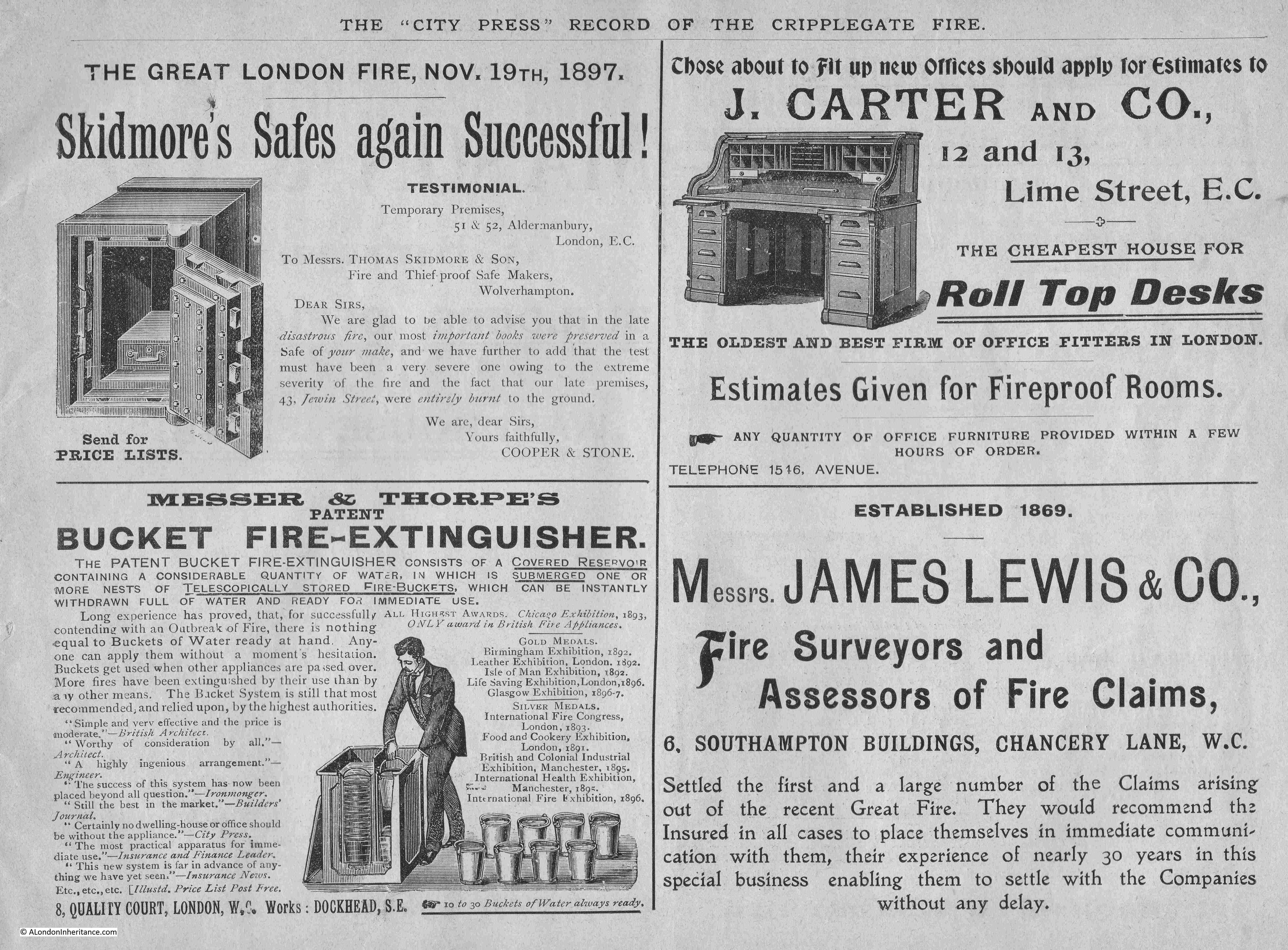
More successful safes, a bucket fire-extinquisher, office fitters and a Fire Surveyor and Assessor Claims:

Advert

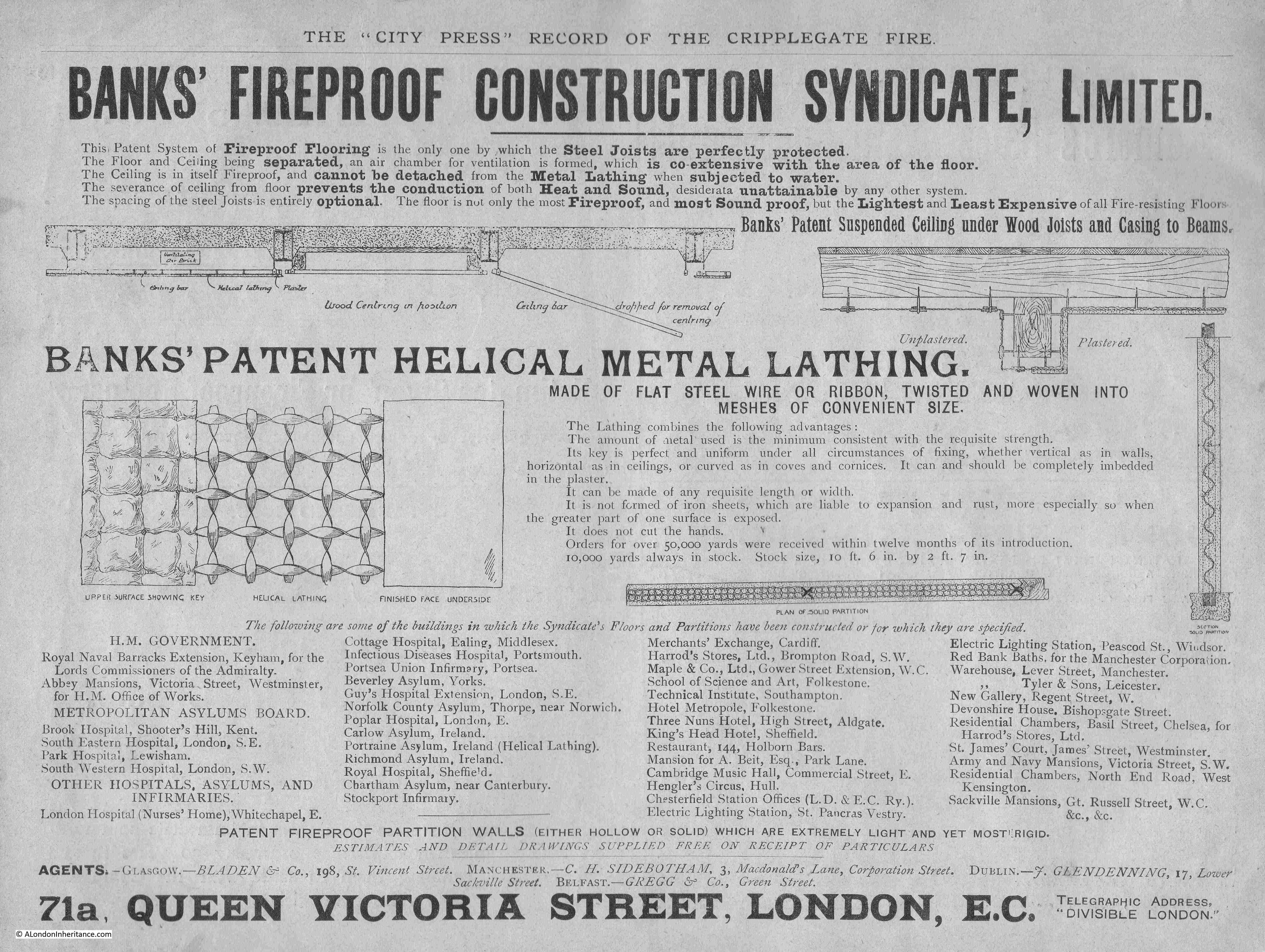
Another advert for the use of metal in construction, with fireproof flooring, the use of steel joists and “metal lathing” which was advertised for use in floors, ceiling and partitions:

Advert

The area of the Great Fire in Cripplegate was rebuilt quickly, with the new buildings continuing the commercial and industrial use at the time of the fire.

A new fire station was built soon after the Great Fire, in Redcross Street.

The justification for the new fire station in Redcross Street can be seen in this article from Lloyds Weekly Newspaper on the 4th of December 1898, which shows that the warehouses were full of the same type of materials as during the 1897 fire:

“Hitherto Watling-street has been the chief City fire station, and the proposed change would be of great advantage, as the warehouses in the vicinity of Wood-street are filled, as a rule, with the most combustible materials. On the northern side the station would be of very great utility to the over-crowded districts of St. Luke’s and Shoreditch, where most houses are old and the danger of fire considerable.”

In a little over 40 years after the Great Fire in Cripplegate, the area would be devastated again during one of the most damaging raids of the Second World War, when on the night of the 29th December 1940, fires created by incendiary bombs caused fires that would again lay waste to the warehouses and commercial buildings of Cripplegate.

The Barbican would be the post-war answer to “executive” housing in the City of London, and would erase the streets and street names of centuries.

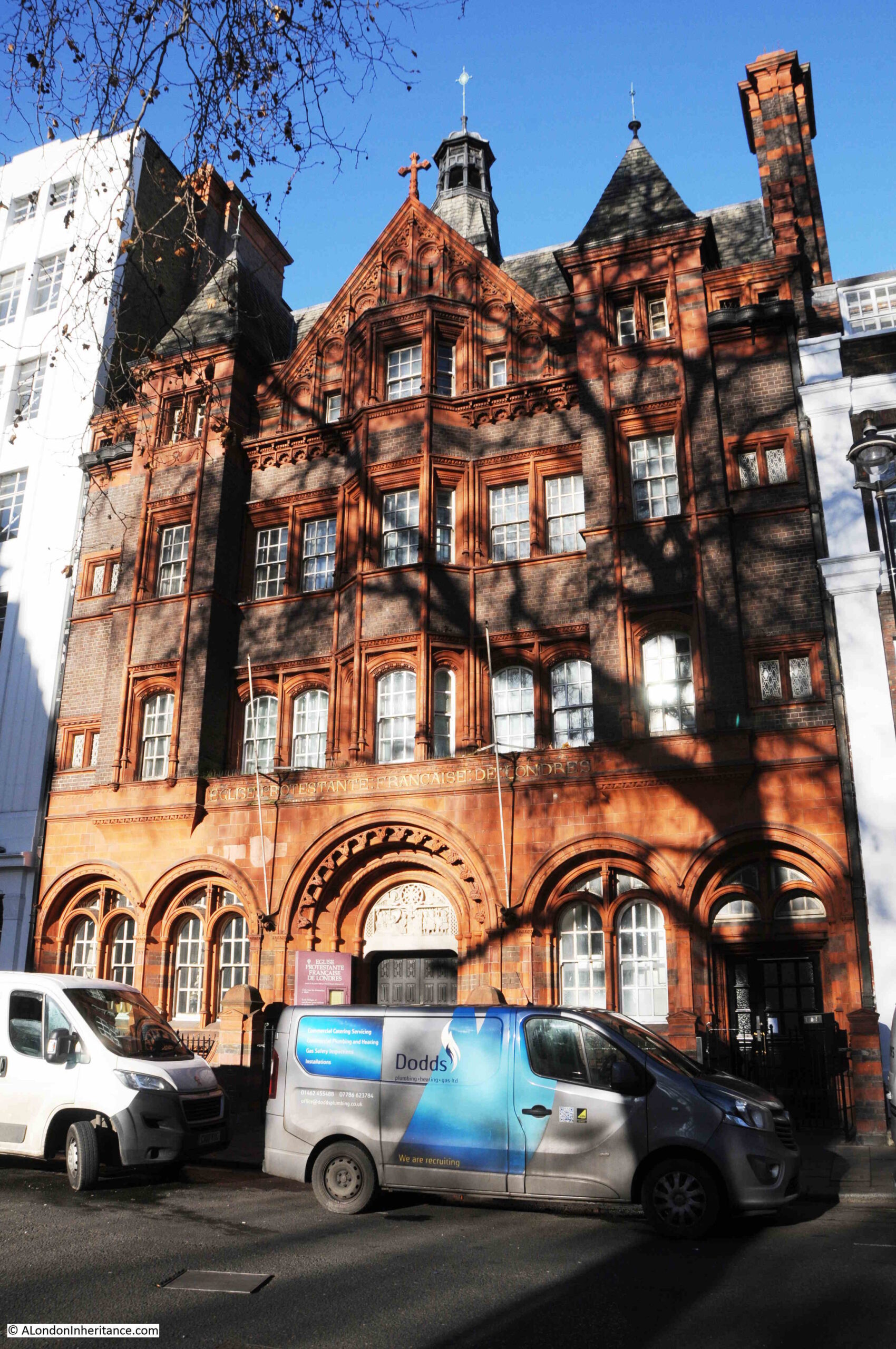
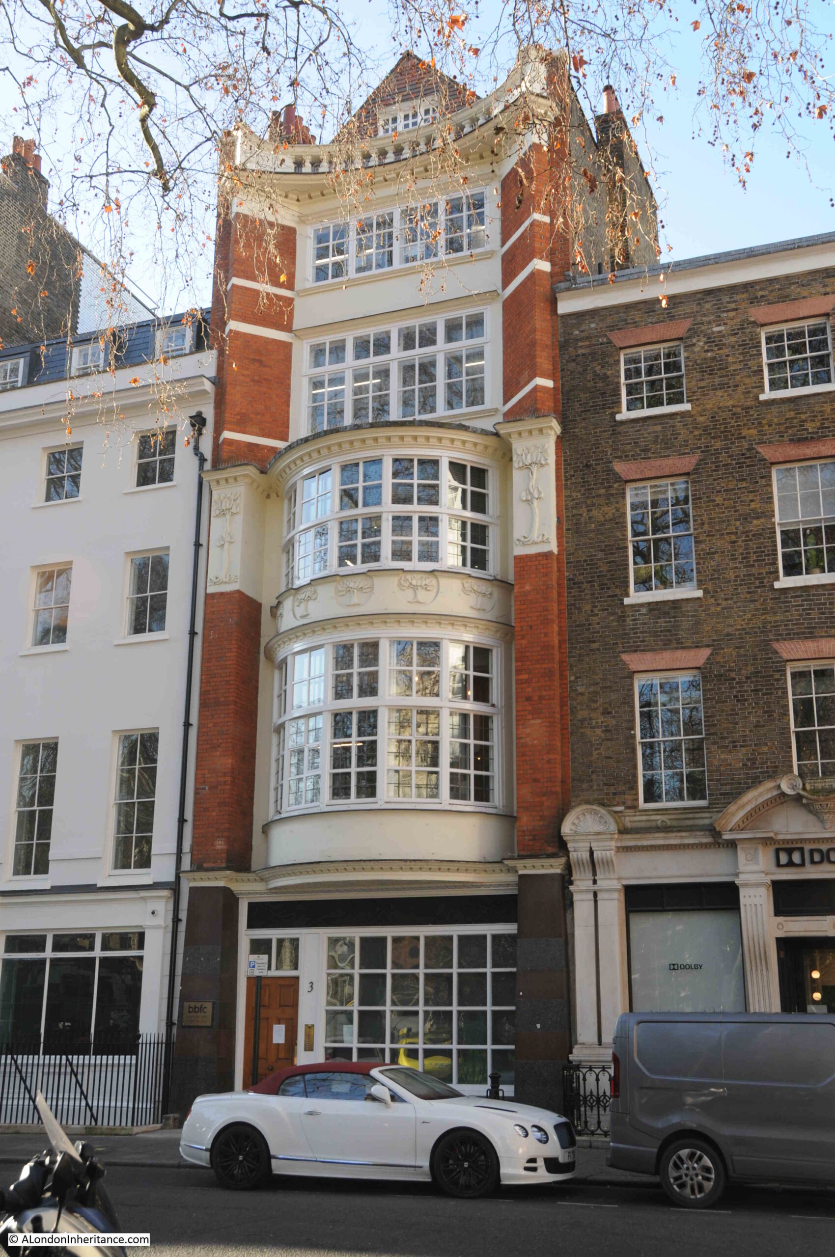
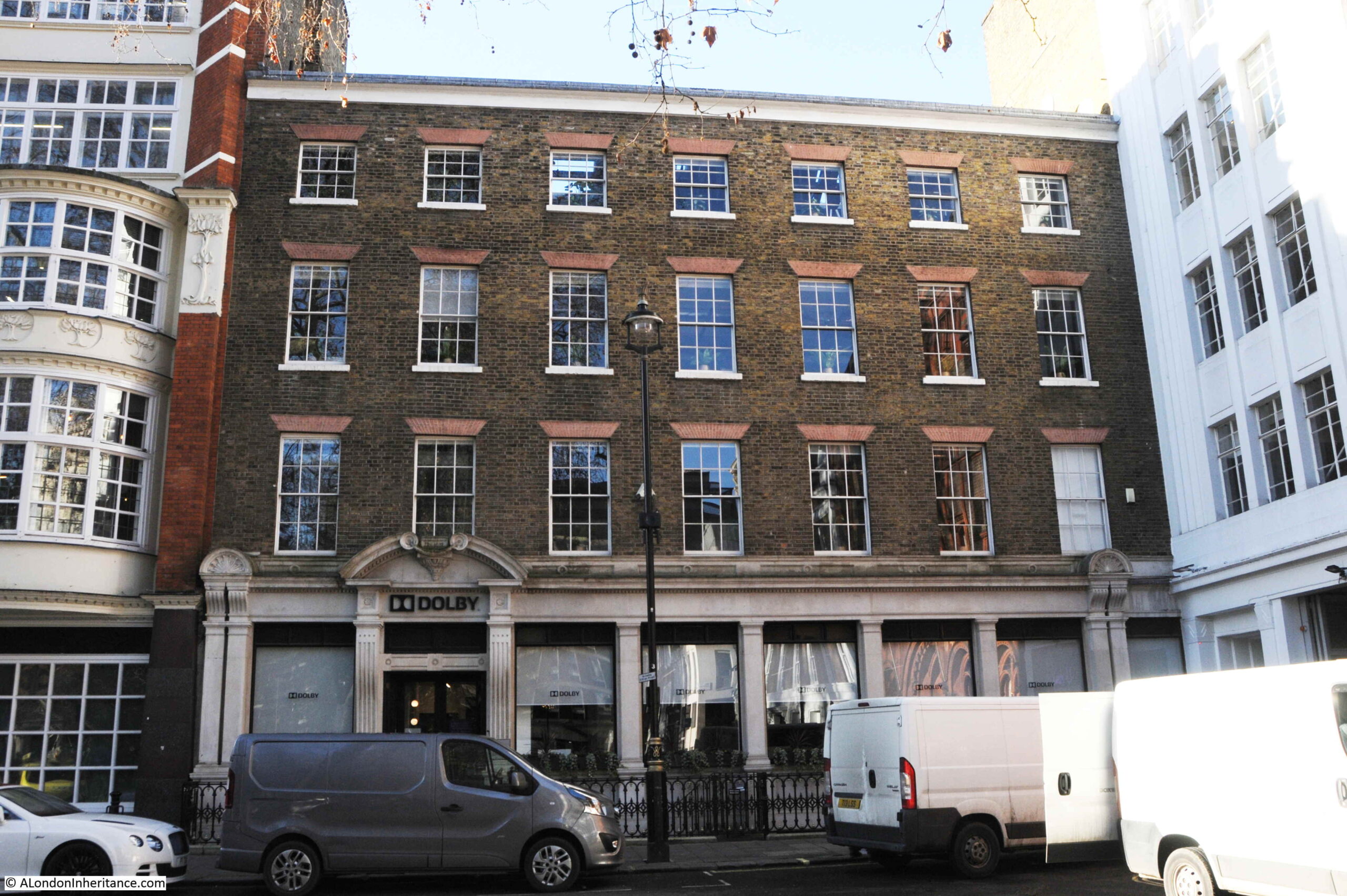
I have written a number of posts, which include my father’s post war photos, covering the streets mentioned in this post, and the land occupied by the Barbican Estate. A selection of these posts:

alondoninheritance.com

G. J. Chapman, Penton Street and Chapel Market

My Wapping walk next Saturday is sold out. There are some places remaining on walks in Wapping, the Barbican, Southbank and Bankside later in October. Click here for details and booking for my final walks of 2022.

Many of London’s streets have lost much of their local character over the last few decades. Many long term trends have contributed to this. The spread of global brands, online shopping, local population change, quick profits through a conversion of a building to flats, architectural styles etc.

An example can be found in Penton Street, a turn off from Pentonville Road, just to the west of the Angel, where, in 1985, at number 10 Penton Street could be found the shop of G.J. Chapman:

Penton Street

The same view, 37 years later, in September 2022:

Penton Street

Chapman’s was a very different shop. Whilst there were plenty of general hardware stores, also shops that stocked gardening supplies, they did not usually have so much stock on display outside the shop. I cannot find exactly when Chapman’s closed, I do remember it was still open in the mid 1990s, but after that it became one of the ongoing changes that are so easily missed.

I assume that the building has become flats, with two front doors, mirroring the doors in the original shop. The white paint has been cleaned from the brickwork, and it is not clear how much of the original wooden surround to the shop front remains.

The space behind the BA Concorde advert on the left in 1985 is now occupied by a new block of flats.

Penton Street was one of the first streets built as part of the Pentonville development. The name comes from the owner of the estate on which the development was built, Henry Penton, the MP for Winchester. The addition of the French “ville” to Penton’s name may have been to give an upmarket feel to the estate, which was helped by the rural setting at the time of the original development, with much of the land to the north still consisting of fields.

Penton Street seems roughly aligned with a lane that ran through fields along what is now Amwell Street to the south, then up to Copenhagen Fields, although only a small part of the original lane, along Penton Street retains the original route.

The first terraces along Penton Street were built in the 1770s, and the area between Penton Street and the Angel was fully developed by the end of the 18th century.

The southern end of Penton Street joins Pentonville Road, opened in 1756 as the continuation of the New Road, an 18th century north circular around the north of the city, providing access to the docks, and for drovers driving sheep and cattle to market in Smithfield, whilst avoiding the crowded City streets.

The northern end of the street joins Barnsbury Road which continues north. It is a relatively short street and can be walked in a matter of minutes.

On the corner of Penton Street and Pentonville Road is the Lexington. A pub on the ground floor and music venue on the first floor. It was originally built in 1875 and was named the Belvedere, replacing an earlier pub on the site, with the same name, and dating from the development of Penton Street.

The Lexington today:

Penton Street

Penton Street seems to have been developed as a residential street, with terrace housing, however commercial premises and shops gradually took over parts of the houses, and there has been considerable redevelopment so even when the façade facing onto the street looks original, a glance behind will show a later rebuild, as can be seen in the example in the following photo where later brickwork forms the side wall to an earlier front wall:

Penton Street

Further along Penton Street is another large pub, the Chapel Bar. Again, another pub that has had a recent name change. It was originally the Queen’s Arms, and seems to date from around 1848 which is the year of the first newspaper mention that I can find:

Penton Street

The clown, Joseph Grimaldi, lived in Penton Street at what is now number 44 between 1799 and 1800, although I could not find any plaque on the building. There is a plaque on number 28 recording that the building was the London headquarters of the African National Congress between 1978 and 1994:

Penton Street

Although G.J. Chapman’s shop has gone, if we turn off Penton Street into Chapel Market, we find a street market, and a shop with a similar stock to Chapman’s, but without the impressive display of goods for sale on the street. Chapel Market Building & D.I.Y:

Chapel Market

Originally Chapel Street, the street was developed soon after Penton Street and was lined with terrace houses by the 1790s. The street would stay residential for the first half of the 19th century, but would take on a much more commercial character from the 1850s onwards. This was probably down to the rapidly growing local population, and the commercial opportunities that such a population offered.

The ground floors of the large terrace houses were converted into shops which were extended over an original small front yard to bring the shop up to the edge of the street.

As well as shops, the street became the hub for a street market. The market may predate the arrival of shops in the 1850s, but again it was from 1850 onwards that the street became the venue for a large street market.

The mid 19th century also saw the large terrace houses turn into multi-occupancy houses and there were contemporary reports of much poverty and squalor in the street.

Over the years, the street has also seen many of the original terrace houses demolished and replaced with office blocks and large shops.

The following photo sums up the changes to Chapel Market, with stalls of the street market in the foreground, terrace houses to the right, with ground floor shops extended over the original yard to the street, and much later buildings on the left which replaced the original terrace houses:

Chapel Market

Both the market and the shops now offer a very wide mix of goods and services from fast food, to fruit and veg, fishmongers, supermarkets, cafes, pharmacies, opticians, florists etc. with the stalls in the market changing during the week.

Chapel Market

The name change from Chapel Street to Chapel Market came in 1936 to recognise the size and importance of the market.

The name chapel does not refer to any local chapel. There appears to have been an intention around 1770 to build a chapel of ease around Chapel Market and Penton Street, however a chapel was built much further to the west along Pentonville Road, but the name stuck with the intended original location near Chapel Street, now Chapel Market.

Chapel Market

The market was open all day and all evening during the second half of the 19th century. An article in the Clerkenwell News in September 1870 reports on the raging of a “fever” in the area and the precautions that the local Parish Vestry were trying to implement. This included more frequent removal of refuse from Chapel Market and the application of disinfect along the gullies of the street.

The problem was that the market was seldom closed before midnight, so the best that the Vestry could do was to ensure that the street was swept and refuse removed by seven of the following morning, ready for the market to open again.

Chapel Market

Chapel Market was the site of the first branch of Sainsbury’s in 1882 following on from their original shop in Drury Lane. The Sainsbury’s archive has a number of photos of the original shop, and Chapel Market in the late 19th century, and can be viewed here.

Marks and Spencer would also arrive in 1930. They now have a Food Hall on the street, and Sainsbury’s have moved to a much larger store, close by in Liverpool Road.

Today, the market sells things that in the 19th century would have been considered science fiction:

Chapel Market

The entrance to Chapel Market from Liverpool Road:

Chapel Market

So although G.J. Chapman’s shop has gone, and been replaced by a rather bland façade onto Penton Street, there is still a thriving local cluster of shops around the market in Chapel Market, which will hopefully continue to serve the local population for many years to come.

The 1985 photo of G.J. Chapman’s was taken by my father, and when I scanned the strip of negatives with this photo, there were a couple more which brought back the challenges of using film. There were two other photos of the shop, but in each photo a vehicle had just intruded into the photo:

G.J. Chapman

Penton Street has always been a relatively busy road, and framing a photo, then trying to avoid any passing traffic is still a challenge.

G.J. Chapman

I was using a digital camera where the number of photos is limited by the size of memory card, and each photo is basically free. This was not the case with film, and I well remember the challenges of trying to get the wanted photo in a busy environment with a 36 exposure film in the camera. Luckily, my father finally got a vehicle free photo of G.J. Chapman.

alondoninheritance.com

Cloak Lane, St John the Baptist, the Walbrook and the Circle Line

One of the pleasures of wandering around London streets are the random memorials and objects that have survived from previous centuries, and how they can lead to a fascinating story of an aspect of the City’s history. Perhaps one of the strangest can be found in Cloak Lane, to the west of Cannon Street Station, between Dowgate Hill and Queen Street.

The ground floor of one of the buildings on the northern side of Cloak Lane has a number of arches with metal railings, and a large memorial occupying one of the arches:

Cloak Lane

A closer view, and the railings have signs that imply that there is perhaps more to discover:

Cloak Lane

The monument provides some information:

Cloak Lane

The contrast between letters and stone is not that high in the above photo, so I have reproduced the text on the monument below:

Cloak Lane

There is much to unpack from the inscription on the monument, and it does not tell the full story.

The church of St John the Baptist upon Walbrook was one of the City churches that was destroyed during the Great Fire of 1666, and not rebuilt, so after the fire, only the churchyard remained.

I have circled the location of the surviving churchyard, at the junction of Cloak Lane and Dowgate Hill in the following extract from William Morgan’s, 1682 map of London:

St John the Baptist upon Walbrook

According to “London Churches Before The Great Fire” (Wilberforce Jenkinson, 1917), St John the Baptist upon Walbrook was “Founded before 1291, and enlarged in 1412, and ‘new-builded’ around 1598. The west end of the church was on the bank of the Walbrook, hence the title.”

The Walbrook is one of London’s lost rivers, and in the following map I have marked the location of church and churchyard along with the Walbrook which made its way down to Upper Thames Street which was the early location of the Thames shoreline (© OpenStreetMap contributors):

Walbrook and Dowgate Hill

The book states that the west end of the church was on the bank of the Walbrook. This is possibly an error as the eastern end of the church would have been on the Walbrook, or it should have read that the church was on the west bank of the river.

It is possible that the Walbrook ran further to the west than shown in the above diagram, however all the references I can find are to the river running roughly on and alongside Dowgate Hill.

The text on the monument mentions the District Railway, and the title for the blog is about the Circle Line. I will explain why I have used the Circle Line later in the post, however stand next to the railings alongside the monument, and a grill can be seen in the floor. Wait a few minutes and the sounds of an underground train can be heard coming up through the grill.

Cloak Lane

After the 1666 Great Fire, the church was not rebuilt, the churchyard remained, and would do so for the next 200 years. Buildings alongside did encroach on the churchyard, however it was still there in 1880. In the next few years there was some major construction work in Cloak Lane which would result in the loss of the churchyard.

This construction work was for an underground railway that in the newspapers of the time was referred to as the Inner Circle Railway. The following article from the East London Observer on the 31st May 1883 provides some background:

THE INNER CIRCLE RAILWAY. With much less outward demonstration than might have been expected, considering the importance and magnitude of the works, there is now being contracted in the City of London an underground railway which, by uniting the Metropolitan and District systems, will complete the long looked for Inner Circle Railway, and be of immense service to the travelling public and the metropolis.

The Acts of Parliament under which these works are being carried out were obtained in the names of the joint companies – that is to say, the Metropolitan and the Metropolitan District. They authorised the construction of a railway to commence by a junction with the District line at Mansion House Station, and to run under some houses south of the thoroughfare known as Great St Thomas Apostle, crossing Queen Street, then going along the south side of Cloak Lane, across Dowgate Hill, to the forecourt of the South-Eastern Cannon Street Station. Here is to be made a station.

The line is then to pass under the centre of Cannon Street, crossing King William Street, and is then to swerve slightly south. Between this point and Pudding lane is to be a second station, which will serve the busy district around it, including Gracechurch Street, Lombard Street and Billingsgate. By arrangement with the Corporation and the Metropolitan Board of Works, the narrow thoroughfares of East Cheap and Little Tower Street are to be widened on the south side, and Great Tower Street on the north side. The railway is to pass under the centre of the roadway, and will be constructed simultaneously with the new street. the line will then branch slightly to the north, and between Seething Lane and Tower Hill, another large station is to be built.

The line is then to pass by Trinity Square Gardens, joining the piece of railway already constructed.”

So by joining existing lines at Mansion House and Tower Hill, the new line would form what we know today as the route of the Circle and District lines between Mansion House and Tower Hill.

The Railway News (which also called the line the Inner Circle line) on the 18th of August 1883, provided additional technical information on the new line:

“From the Mansion House station to Tower Hill, there is no part of the line on a curve of less than 10 chains radius; the length from Cannon Street to King William Street is straight. The successive gradients are from the level at the Mansion House to a descent by a gradient of 1 on 100, followed by a rise of 1 in 355, then 1 in 100, next to 1 in 321, for 334 yards and then a fall of 1 in 280 for the remainder.”

I never fail to be impressed by the accuracy achieved in measuring and building these early lines, without the surveying equipment that we have available today.

Look through the grills and some of the monuments from the old churchyard have been mounted on the wall behind:

Cloak Lane

The new railway was just below the surface and was partially built using the cut and cover technique where the ground would be excavated to build the railway, which would then be covered over, with roads or buildings then completed on top.

Where cut and cover was not used, the railway would be tunneled underneath buildings, undercutting the foundations, bit by bit, with arches being built as the tunneling progressed to support the building above.

Railway News provides some detail:

“Near the western end of the line 200 feet of girder-covered way has been built between Queen Street and College Hill, and a large portion of the side wall has been advanced to Dowgate Hill. In this vicinity an important work, viz, a diversion of the main outfall sewer, has been successfully completed. It was lowered about 14 feet, and the length of this work from north to south being about 600 feet. The north side wall for the Cannon Street station, is also built, and rapid progress is being made with the excavations.”

The total distance of the new line between Mansion House and Tower Hill was 1,266 yards.

Behind the grills – an 1892 Walbrook Ward boundary marker:

Cloak Lane

The above extract refers to a diversion of the main outfall sewer in the vicinity of Dowgate Hill, which possibly was the sewer running down Dowgate Hill that carried what was left of the Walbrook river.

During excavation work for the new railway, there were a number of finds, which add to the question of the original route of the Walbrook.

In the book “London – The City” by Sir Walter Besant, he quotes from the notes of the resident engineer of the works, Mr. E.P. Seaton: “At the west end of the churchyard was found a subway running north and south. The arch was formed of stone blocks (Kentish rag) placed 3 feet apart, the space between filled up with brickwork. The flat bottom varied from 2 to 4 feet in thickness and was formed of rubble masonry.

A portion of the arch had been broken in and was filled with human bones. the other parts of the subway or sewer were filled with hand-packed stones. this is supposed to be the centre of the ancient Walbrook (this supposition is quite correct) and made earth was found to a distance of 35 feet from the surface. Clay of a light grey colour was then found impregnated with the decayed roots of water plants.

The foundations (it is a matter of regret that no plan of the foundations was taken; the opportunity is now lost forever) of the old church of St John the Baptist were discovered about 10 to 12 feet from the surface and composed of chalk and Kentish ragstones. They ran about north-north-east to south-south-west. Piles of oak were found which seem to denote that the church was built on the edge of the brook, which must have been filled up during Roman occupation, as numerous pieces of Roman pottery were found.

The bottom of the Walbrook valley was reached at 32 feet below the present street level, and is now 11 feet below the level of the lines in the station. During the excavations the piles and sill of the Horseshoe bridge which crossed the Walbrook hereabouts were also found near the churchyard, together with the remains of an ancient boat. These were unfortunately too rotten to preserve, but a block of Roman herring-bone pavement, formerly constituting part of a causeway of landing-place on the brook, is now at the Guildhall Museum. It was found beneath the churchyard 21 feet below the present level of the street.”

Besant can at times be unreliable, however as he is quoting from notes by the resident engineer, and the works were not long before the book was published, they should be an accurate record of finds during the work.

The finds imply that the Walbrook did run to the west of the church, so was further west of the route shown in the earlier diagram and was slightly further west of Dowgate Hill, or perhaps it was a separate channel or ditch.

There is another reference to the Walbrook, and its route in a report on the construction of the railway in the Standard on the 21st April, 1884, which refers to the sewer along Dowgate Hill that ran along the route of the Walbrook, needing to be lowered to make space of the railway. After completion, the sewer and Walbrook ran under the new rail tracks. The report describes the Walbrook as “flowing into the sewer down a flight of steps”.

These layers of history and archeology below the current surface of the City are really fascinating. We really do walk on London’s buried history when we walk the streets, and Besant’s description hints at what has been lost over the centuries, particularly during significant construction works of the later 19th and early 20th centuries, when these sites did not have an archeological excavation before construction commenced, and before the preservation techniques were available, that would have been needed to preserve the boat and wooden piles that were found.

Another of the memorials behind the metal grill – I wonder what John (died in 1804) and Uriah (died in 1806) Wilkinson would have thought if they knew their memorial would be hidden behind a metal grill, and above an underground railway?

Cloak Lane

The extract from Besant’s book mentions the “Horseshoe bridge which crossed the Walbrook hereabouts were also found near the churchyard”. The bridge also has a connection with Cloak Lane.

According to Henry Harben’s Dictionary of London (1918), the name Cloak Lane is of relatively recent origin, with the first mention being in 1677. Prior to this, the street was named Horshew Bridge Street after the bridge over the Walbrook.

A possible origin of the name Cloak Lane is from the word “cloaca” which is a reference to a sewer that once ran along the street down to the Walbrook, however as the name of the street is much later than the sewer and when the word “cloaca” would have been used, it is almost certainly not the source, which remains a mystery.

The first mention of this bridge dates back to 1277 when it was called “Horssobregge”, and was a bridge over the Walbrook close to the church of St John upon Walbrook.

During the medieval period, property owners in the neighbourhood of the bridge were responsible for keeping it in good repair. Around 1462, the Common Council ordained that land owners on either side of the Walbrook (which was then described as a ditch) should pave and vault the ditch, and if a landowner failed to comply, their land would be given to someone who would take on this responsibility.

Following the paving over of the Walbrook, the bridge became redundant, fell into disrepair and was eventually taken apart.

The following photo is looking down Cloak Lane towards Cannon Street Station, the entrance to the Underground station can be seen at the far end of the street, across Dowgate Hill.

I have arrowed two locations in the photo. The orange arrow is pointing at the location of the memorial, and was the location of the church and graveyard.

Cloak Lane

The second arrow is pointing to the site of another building that was demolished to make way for the works to construct the new railway – Cutlers Hall:

Cutlers Hall

Cutlers Hall was the home of the Worshipful Company of Cutlers, one of the City’s ancient companies. When the Cutlers were organised into a Company, the trade consisted of the manufacture of swords, daggers and knives. As an example of how specialised a City workman was at the time, there were seperate trades for hafters, who made the handles, along with blacksmiths and sheathers (who made the sheath in which a sword or knife would be stored).

The first mention of the Cutlers dates back to 1328 when seven cutlers were elected to govern the trade, and in December 1416, a Royal Charter was granted to the company.

Hafters, sheathers and blacksmiths were gradually incorporated into the Cutlers Company.

The hall of the Worshipful Company of Cutlers was in Cloak Lane from the earliest days of the company, until the arrival of the Inner Circle Line, when the hall was demolished in 1883, having been the subject of a compulsory purchase order.

The Cutlers purchased a new plot of land in Warwick Lane, had their new hall designed by the Company’s Surveyor, Mr. T. Tayler Smith, and the new hall came into use in March 1888. The Cutlers have remained at the Warwick Lane site ever since.

The following print shows Cutlers Hall in Cloak Lane as it appeared in 1854 (© The Trustees of the British Museum):

Cutlers Hall

There were many newspaper reports on the construction of the new railway, and the methods used to minimise disruption to the City above.

Cannon Street Station originally had a forecourt between the station entrance and Cannon Street. The tunnel needed to be built under the forecourt, and the method used to avoid disruption to the station was that the contractor:

“Provided 250 men for the occasion and 50 more as a reserve, the intended work was commenced after the dispatch of the Paris night mail, and then the busy hands plied their busiest. The paving slabs were removed; the twelve inch timbers were laid on the bare ground, three-inch planking put across them, and again three-inch planking over these. And in the morning when Londoners came to their duties in the City they were astonished to see the fore-court paved with wood, and an alteration completely effected, of which there was not a symptom or indication when they went home from their duties the evening before. Having thus laid their roof on the surface the contractor could carry on burrowing to his heart’s content. Beneath the wood platform a heading was soon driven through the soil; and the contractors went on their way below, whilst the cabs and the passengers were going on above”.

The following photo shows the Cannon Street Station Hotel and entrance to the station behind. The forecourt under which the Inner Circle Line was dug can be seen in front of the hotel.

The monument in Cloak Lane is a perfect example of what fascinates me above London’s history. There is so much to find in one very small section of street, and that London is not just what we see on the surface, there is so much below the streets, lost rivers, centuries of history, remarkable examples of construction methods used to build the start of the underground system in the 19th century, and so much more.

If you take a train on the Circle or District line to or from Cannon Street Station, on the western side of the station, recall the Walbrook and the church and cemetery.

I have also added trying to find out about the fate of the finds from the construction of the railway, given to the Guildhall Museum, and which are now hopefully at the Museum of London. And if anyone from TfL reads this post – if you could let me have a look behind the metal grills in Cloak Street – it would be much appreciated !

alondoninheritance.com

Bathurst Mews – A Pub and Stables

Before exploring Bathurst Mews, a quick advert for a walk. Last year, I was involved in some walks exploring New River Head along with some colleagues from Clerkenwell and Islington Guides. For a one off in early September, we are running a series of walks that continue this theme, and for this year include a visit to see the 17th century Oak Room in the old offices of the Metropolitan Water Board, along with an external view of the Grade II listed White or Devil’s Conduit, believed to date in part back to the 14th century and originally sited in Queen’s Square, Bloomsbury.

The link for booking is here:

Bathurst Mews are located between Paddington Station and Hyde Park. One of west London’s stunning mews, but what took me back there was a couple of 1980s photos. The first of the Archery Tavern on Bathurst Street, next to the entrance to the mews:

Archery Tavern

The Archery Tavern is now the Stablehand, a bar and restaurant, which on their website is described as a gastro pub. The return to use as a pub is only in the last couple of years as following the closure of the Archery Tavern in 2006, it was a French restaurant.

Archery Tavern

The Archery Tavern was a pub for some 166 years, having opened when Bathurst Street was built around 1840. The first reference I can find to the pub was an advert placed in the Morning Advertiser on the 25th August 1841 for a “Strong, active servant of all work. One who is used to plain cooking and can make herself generally useful, with a good character, may hear of a situation by applying to Mrs. Oakes, Archery Tavern, Bathurst Street”.

One newspaper reference to the Archery Tavern, a reference that I have not seen before with other pubs, was from the Marylebone Mercury on the 24th of September 1976, and is a reminder that history almost always seems to repeat. The report was about a meeting held in the pub of the Hyde Park Ward, Young Conservatives, where Shadow Chancellor Sir Geoffrey Howe was the key speaker. His theme was that Great Britain was overspent and overtaxed, and that “Our strongest point ought to be that Conservative governments cut taxes”.

The name Archery Tavern appears to have been a reference to the land on which the pub was built being used for archery during the 1830s by the Royal Toxophilite Society. I doubt that this was a long lasting or formal use of the land as it is not mentioned on the society’s web site, who record that during the 1830s they used sites at “Canonbury House, Highbury Barn, The Honourable Artillery Company and, on two occasions, on Mr. Lords Cricket Ground”.

It is a shame that the pub name has changed from the 166 year old Archery Tavern, however the new name does continue a tradition of naming a pub after a local feature. The Stablehand refers to what we will find in Bathurst Mews.

Time for a walk along Bathurst Mews to find the second 1980s photo. This is the entrance to the mews from Bathurst Street:

Bathurst Mews

Signs on either side of the entrance provide an indication of what makes Bathurst Mews different:

Bathurst Mews Stables

Bathurst Mews have two stables. They hire out horses for riding in Hyde Park, provide riding lessons, and are a reminder of what mews would have been like when they were used for the horses and carriages of the large houses that surrounded the mews.

The first is Hyde Park Stables:

Hyde Park Stables

Hyde Park Stables are immediately on the right after passing through the entrance, into the mews, and bring the unusual sight of horses, bales of straw and hay, and riders heading off to Hyde Park.

Hyde Park Stables

Inside the stables:

Hyde Park Stables

Bathurst Mews has apparently the last two remaining stables around Hyde Park, and just around the corner from the Hyde Park Stables are the Ross Nye Stables, here photographed in 1985:

Ross Nye Stables

The stables are still there, and look much the same, although the walls have been whitewashed:

Ross Nye Stables

The stables are named after Ross Nye, who grew up in Queensland, Australia. After arriving in London, he purchased an existing stables in Bathurst Mews and they became the Ross Nye Stables, and have continued following his death in 2020.

The row of stable buildings:

Ross Nye Stables

Looking along the full length of Bathurst Mews with the Ross Nye Stables on the left:

Bathurst Mews

Bathurst Mews are just north of Hyde Park. The following map shows their location with the red arrow pointing to the site of the pub, and just above the tip of the arrow is the Hyde Park Stables. The blue arrow points to the Ross Nye Stables  (© OpenStreetMap contributors).

Map of Bathurst Mews

Bathurst Mews and the surrounding streets were built in the late 1830s / 1840s. The name of the mews and Bathurst Street comes via Robert Thistlethwaite who inherited land in Paddington leased from the Bishops of London. His wife Selina was the daughter of Elizabeth Bathurst.

A report on the construction of sewers in the London Sun on the 19th of November 1840 includes Bathurst Mews on the list, so by this time, the route of the mews had been laid out, allocated a name and construction was underway.

Land owned by the Bishops of London was transferred to the Ecclesiastical Commissioners, and the area developed as the Hyde Park Estate, which covers 90 acres and is bordered by Sussex Gardens, Edgware Road and Bayswater Road.

The Hyde Park Estate continues to be owned by the church, now in the form of the Church Commissioners.

The estate was built between the 1830s and 1850, so in London terms is relatively recent. Prior to development, the area was all fields, as the following extract from Rocque’s map of 1746 shows. I have marked the route of Bathurst Mews by a red line:

John Rocque 1746 map of Hyde Park and Paddington

The map shows that by 1746, Hyde Park was already a fully defined park, with the Serpentine running through the park (note to the left of the location of Bathurst Mews, we can see the route of the River Westbourne which was one of the main sources of water for the Serpentine).

To the north is the village of Paddington, still surrounded by fields in the mid 18th century.

The following photo is looking along Bathurst Mews towards the entrance into Sussex Place:

Bathurst Mews

We can get an idea of the first residents in the mews by looking at two who were recorded as living in the mews in the 1840s:

  • Edward Munn – farmer and corn dealer
  • Henry King – livery stable keeper

A very small sample, but it does confirm the original purpose of the mews as the provision of stabling for the large houses behind.

Looking back along Bathurst Mews gives a good view of the much larger size of the houses that surround the mews, which give the impression of the mews being located in a fully enclosed valley:

Bathurst Mews

Whilst many of the buildings in the mews would have been stables, then garages as transport in London changed from horse to vehicle, today, with the exception of the stables, they are almost all residential.

They have also functioned as small workshops and business premises.

In 1868, T. Longman occupied one of the buildings and was operating as a Bell-Hanger, Gas-Fitter and Locksmith.

In 1926, Mrs. Ann Cleave was running the Tyburn Kennels from a house in the mews.

In 1927, a Mr. Gold was advertising driving lessons and car repairs in the mews.

In 1968 a chauffeur agency was operating from the mews.

Today, they sell for well over a million pounds, and sale records show the crazy rate at which the prices of these building have risen over recent years. A three bedroom terrace house in the mews (not the house in the following photo) sold for £297,500 in 2004, and at the start of this year, was sold for £1,750,000.

Bathurst Mews

As with many of London’s mews, residents line the outside of their houses with plenty of planting:

Bathurst Mews

Whilst the majority of houses along the mews appear to be standard two storey, with the old stables / garage on the ground floor and living area above, there are a couple of different buildings, such as the building on the left of the following photo which looks to have been some form of warehouse. Again, now converted into residential.

Bathurst Mews

Looking up towards the north-eastern end of Bathurst Mews, showing the entrance through to Sussex Place:

Bathurst Mews

The above photo again shows the difference in size between the large houses surrounding Bathurst Mews, which were constructed as residential in the 1840s, compared to the mews houses where their horses and carriages, and later cars were stored, along with some very limited living accommodation.

The entrance to Bathurst Mews from Sussex Place:

Bathurst Mews

The two stables offer a glimpse of what Bathurst Mews would have looked like when built. They are a unique set of mews in London, as far as I can tell they are the only mews which have operating stables.

They were an important part of living in London for the wealthy who occupied the new, large houses of the area. Even in 1922, they were being advertised as part of a nearby house sale, as this example shows:

“The important Town residence, 26, Sussex Square, Enjoying an enviable situation, actually a few yards from Hyde Park. 10 bed and drawing rooms, 4 bath and 4 or 5 reception rooms. Complete domestic offices.

Together with the Excellent garage and stabling premises of 4 Bathurst Mews, conveniently situated close to the House. 3 stalls, loose box, garage for 2 cars, living rooms over.”

Hopefully the two stables will remain for many years to come, to recall the original use of places such as Bathurst Mews.

My other mews visits include;

Kynance Mews – Kensington

Belgrave Mews West, and;

Groom Place, Belgravia

alondoninheritance.com

The Champion Pub and Oxford Market

All my walking tours have sold out, with the exception of a few tickets on the Bankside to Pickle Herring Street tour. Details and booking here.

In 1980 I was wandering around London trying out a new zoom lens for my Canon AE-1 camera, taking some not very good photos. One of these was of the Champion Pub at the junction of Eastcastle Street and Wells Street, with the Post Office Tower in the background:

Champion pub

The photo was taken from the southern end of Wells Street towards Oxford Street, and a sign for Eastcastle Street can be seen on the right of the Champion pub. I think I was trying to contrast the old pub and the new telecoms tower.

A wider view of the same scene today, with the BT Tower as it is now known, starting to disappear behind the new floors being added to the building behind the Champion:

Champion pub

A closer view of the pub in 2022, 42 years after my original photo:

Champion pub

Given how many pubs have closed over the last few decades, it is really good that the Champion has survived, although it is a shame that the curved corner of the building has been painted, and it has lost the name which ran the full length of the corner of the pub.

The large ornamental cast iron lamp still decorates the corner of the building.

The curved corner to the upper floors was a key feature of many 19th century London pubs. They were meant to advertise the pub, the name could be seen from a distance on crowded streets, and the name would often give an identity to the junction of streets.

For an example of a pub which had a very colourful corner in the 1980s, and today displays the current name of the pub on the curved corner, see my post on the Perseverance or Sun Pub, Lamb’s Conduit Street.

The Champion is Grade II listed, and the Historic England listing details provide some background:

Corner public house. c.1860-70. Gault brick with stucco dressings, slate roof. Lively classical detailing. 4 storeys. 3 windows wide to each front and inset stuccoed quadrant corner. Ground floor has bar front with corner and side entrances and fronted bar windows framed by crude pilasters carrying entablature- fascia with richly decorated modillion cornice. Upper floors have segmental arched sash windows, those on 1st floor with keystones and marks. Heavy moulded crowning cornice and blocking stuccoed. Large ornamental cast iron lamp bracket to corner. Interior bar fittings original in part with screens etc, some renewal.

The “some renewal” statement refers to a few changes to the pub since it was built.

The first post-war renewal came in the 1950s. As with so many Victorian pubs across London, the Champion was in need of some refurbishment. Over 80 years of serving Wells Street, and open during the years of the second world war, resulted in the owners, the brewers  Barclay Perkins, engaging architect and designer John and Sylvia Reid.

The Reid’s were better known as interior, furniture and lighting designers rather than architecture, and their changes to the Champion were mainly of design.

The large Champion name down the curved corner of the pub was a result of their work. The lettering was in 30 inch Roman, and the letters were shaded to give the impression that they had been engraved rather than painted. The new name replaced a number of old wooden signs that were mounted on the corner. The corner of the pub was floodlit at night, which must have looked rather magnificent, and ensured the pub stood out if you looked down Wells Street when walking along Oxford Street.

The interior had been rather plain and was painted in what were described as drab colours.

The Reid’s divided what had been two bars to form three, added button leather seating around the edge of the bars, restored the bar and some of the original iron tables, and they added new glass windows consisting of clear glass for the upper half and frosted, acid cut glass for the lower half.

Features inside the pub included the use of mahogany panels, etched and decorated glass windows between bars, and textured paper on the ceiling. refurbishment also included the first floor dining room.

Their refresh of the Champion pub did get some criticism as there were views that it was returning to Victorian design themes. The early 1950s were a time when design and architecture were looking at more modern forms, typified in the themes and designs used for the 1951 Festival of Britain.

The early 1950s update to the pub included plain and frosted glass on the external windows, not the remarkable, stained glass windows that we see today. These are the work of Ann Sotheran, and were installed in 1989.

They feature a series of 19th century “champions”, with figures such as Florence Nightingale and the cricketer W.G. Grace.

On a sunny day, these windows are very impressive when seen from inside the bar:

Champion pub stained glass

The missionary and explorer David Livingstone:

Champion pub

Newspaper reports mentioning the Champion cover all the usual job adverts, reports of crime and theft etc., however I found one interesting article that hinted at what the inside of the pub may have been like in the 1870s.

In September 1874, the Patent Gas Economiser Company held their first annual general meeting, where they reported that they had installed 50 lights in the Champion. Seems a rather large number, but spread across three floors, entering the pub in the 1870s would have been entering a reasonably brightly lit pub, with the hiss of gas lamps and the associated smell of burning gas.

The same report also mentions that the company had installed 1000 lights at the Royal Polytechnic Institution in Regent Street, 600 lights in the German Gymnastic Society in St Pancras Road, and 50 lights in the Hotel Cavour in Leicester Square.

To the left of the Champion pub, along Wells Street, building work is transforming the building that was here, and is adding additional floors to the top, which partly obscures the view of the BT Tower from further south along the street:

Champion pub

There was one further site that I wanted to find, and this required a walk west, along Eastcastle Street.

Eastcastle Street was originally called Castle Street, a name taken from a pub that was in the street. The name change to Eastcastle Street happened in 1918. I cannot find the reason for the name change, but suspect it was one of the many name changes across London in the late 19th / early 20th centuries, to reduce the number of streets with the same name.

At 30 Eastcastle Street is this rather ornate building:

Eastcastle Street

Dating from 1889, this is the Grade II listed Welsh Baptist Chapel, the main church for Welsh Baptists in London.

Eastcastle Street is a mix of architectural styles. Narrow buildings that retain the original building plots, buildings with decoration that does not seem to make any sense, and rows of the type of businesses that frequent the streets north of Oxford Street.

Eastcastle Street

At the end of Eastcastle Street is the junction with Great Titchfield Street and Market Place:

Oxford Market

In the above photo, Great Titchfield Street runs left to right, and the larger open space opposite is part of Market Place.

The name comes from Oxford Market, a market that originally occupied much of the space around the above photo, with the market building on the site of the building to the left, and the open space in the photo being part of the open space around the market building.

in the following map, the Champion pub is circled to the upper right. On the left of the map, the blue square is where the market building of Oxford Market was located, the red rectangles show the open space around the market with the upper rectangle being where the open space can still be seen today (© OpenStreetMap contributors):

Oxford Market

Rocque’s map of 1746 shows Oxford Market, just north of Oxford Street:

Oxford Market

Oxford Market had been completed by 1724, however the opening was delayed as Lord Craven, who owned land to the south of Oxford Street feared what the competition would do to his Carnaby Market, however Oxford Market was finally granted a Royal Grant to open on Mondays, Wednesdays and Saturdays.

The market was built to encourage activity in the area, as the fields to the north of Oxford Street were gradually being transformed into streets and housing.

The market took its name, either from Oxford Street to the south, or more likely, Edward, Lord Harley, the Earl of Oxford who was the owner of the land on which the market was built as well as much of the surrounding land.

Harley had come into possession of the land through his wife, Lady Henrietta Cavendish Holles, who was the only child of John Holles, the Duke of Newcastle, the original owner of the farmland around Oxford Street.

The original market buildings were of wood, and the market was rebuilt in a more substantial form in 1815. The following view of the second version of Oxford Market comes from Edward Walford’s Old and New London:

Oxford Market

We can get a view of what was for sale at Oxford Market from newspaper reports:

  • February 8th, 1826 – john Wollaston & Co were selling their Gin in quantities of no less than 2 gallons at a price of 15 shillings per gallon
  • January 20th, 1824 – A “Great Room” of 45 feet square in the interior of the market was being advertised as being suitable for upholsterers, warehousemen and flower gardeners. The room was fitted with an ornamental stone basin and fountain and was suited for a flower garden
  • April 25th, 1841 – The Oxford Market Loan Office was advertising loans of Ten Guineas, Ten and Fifteen Pounds, which could be had from their office at the market
  • May 18th, 1833 – Rippon’s Old Established Furnishing Ironmongery Warehouse was advertising Fire Irons, Coal Scuttles, Knives and Forks, Metal Teapots and Tea Urns for sale from their warehouse at the market
  • December 15th 1827 – The lease of a Pork Butcher and Cheesemonger store at the market was being advertised. The store had been taking in £3,800 per year
  • June 27th, 1801 – Several lumps of butter, deficient in weight, were seized by the Clerks of the Oxford Market and distributed to the poor

So traders in the Oxford Market were selling a wide range of products, butter, pork, teapots and coal scuttles, flowers and gin, and you could also take out a loan at the market.

Nothing to do with Oxford Market, however on the same page as the 1801 report of butter being seized, there was another report which tells some of the terrible stories of life in London:

“Wednesday were executed in the Old Bailey, pursuant to their sentences, J. McIntoth and J. Wooldridge, for forgery, and W. Cross, R. Nutts, J, Riley and J. Roberts, for highway robbery. The unfortunate convicts were all men of decent appearance, and their conduct on the scaffold was such as became their awful situation.

Some of the above prisoners attempted on Monday to make their escape from Newgate through the common sewer – they explored as far as Milk-street, Cheapside, when the intolerable stench and filth overpowered their senses; with great difficulty they found their way to the iron-grating and intreated by their cries to be liberated. assistance was immediately procured, when they were released without much difficulty.”

These two paragraphs say so much: that you could be hung for forgery, the statement that their conduct on the scaffold was “such as became their awful situation”, and their desperation in seeking an escape via the sewer. Milk Street is roughly 568 metres from the site of the Old Bailey so they had travelled a considerable distance in an early 19th century sewer.

Back to Oxford Market, and the following view is looking down Market Place towards Oxford Street which can be seen through the alley at the end of the street:

Oxford Market

In the above photo, the market building was on the left, and open space in front of the market occupied the space where the building is on the right, the corner of which is shown in the following photo. The block was all part of the open space in front of Oxford Market.

Oxford Market

Oxford Market was never really a financial success. For a London market it was relatively small which may have limited the number of suppliers and the range of goods available.

By the late 1830s, part of the market had been converted into offices from where out-pensioners of Chelsea Hospital were paid.

The market buildings was sold in 1876, demolished in 1881, and a block of flats built on the site.

Although Oxford Market is long gone, the street surrounding three sides of the old market building is still called Market Place, and the footprint of the building, and the surrounding open space can still be seen in the surrounding streets, and the wider open space and restaurants along the northern stretch of Market Place.

alondoninheritance.com

St Saviour’s Dock

Before heading to St Saviour’s Dock, a quick thank you for ordering tickets for this year’s walks. At the time of writing, the Barbican walks and Wapping walks are sold out. Many of the Bankside dates have sold out, but there are some tickets remaining on later dates, and there are a few on the Southbank walks.

St Saviour’s Dock is an inlet from the Thames in Bermondsey, just to the east of Tower Bridge on the south bank of the river. We can look across the river near Hermitage Moorings on the north bank, and see St Saviour’s Dock just to the left of Butlers Wharf.

St Saviour's Dock

I have circled the location of St Saviour’s Dock in the following map (© OpenStreetMap contributors):

St Saviour's Dock

Cross over to the south bank of the river, and on approaching the dock, there is a walkway spanning the entrance:

St Saviour's Dock

View from the footbridge across to the north bank of the river, at low tide, with thick mud across the foreshore:

St Saviour's Dock

Looking along St Saviour’s Dock – a carpet of mud:

St Saviour's Dock

St Saviour’s Dock is a very old feature of this section of the river. Originally the mouth of the River Neckinger, although it is very hard to pin down exactly where the Neckinger ran with any certainty, and how much of the water course was a natural river.

There were many streams and ditches in this area of Bermondsey and much of the land was low lying marsh. Some of the ditches which may have once been part of the Neckinger can be seen on 18th century maps, which I will come to later in the post.

Looking south along St Saviour’s Dock, the bends in the dock give the impression of a natural feature. Early maps show the sides of the dock as relatively straight, so the curves we see today may have been the result of extending some of the warehouses that line the dock as an attempt to maximise warehouse space.

At the far end of the dock, it comes to an abrupt halt at “Dock Head” at the junction of Jamaica Road and Tooley Street.

St Saviour's Dock

It is impossible to know for sure as to the origins of St Saviour’s Dock. It appears to have been part of the lands of Bermondsey Abbey, and what was then a natural watercourse, had banks created on either side, and a mill built on one side of the dock by the abbey at some point around the 13th century.

Just to the east of St Saviour’s Dock is Mill Street, apparently named after a mill stream which ran along the route of the street and which powered the mill, which was used to grind corn for the abbey. Mill Street is on the other side of the warehouses that line the eastern side of the dock, so is very close and complicates the mapping of waterways in the area.

The land around St Savoiur’s Dock was fully developed between the 16th and start of the 19th centuries, as maps from the 17th and 18th centuries confirm.

The following is an extract from William Morgan’s map of London from 1682. St Saviour’s Dock is located just to the lower right of centre of the map:

St Saviour's Dock

Note that the name of the dock in the map is Savory’s Dock. This may be a simple corruption of the name, or it could have been a rather sarcastic description of the dock given that there was much pollution from the surrounding buildings, and Bermondsey’s growing industry, that ended up in the dock.

I like the depiction of a small boat in the dock. It looks too wide to be a waterman’s boat, and could have been a lighter that transported goods between boats moored in the river and the warehouses lining the dock.

By the time of Morgan’s map in the late 17th century, it appears that buildings were lining the majority of the dock, and streets had been built to the east.

If you click on the above map to enlarge, you can see that to the right of St Saviour’s Dock were a number of water channels, and that to the lower centre edge of the map, there are what appear to be two water channels either side of a road, with a name of “The Neckincher” along the street. presumably this name applies to the water channels, and is a version of the name Neckinger.

This is the problem with being sure as to the route of the Neckinger, and how much of the route was a natural feature, and how much were artificial channels and ditches used to perhaps provide water to the industries in the area, or to drain what was low lying, marshy land.

Seventy three years after Morgan’s map, a 1755 map has St Saviour’s Dock on the edge of the map, with the surrounding area looking much the same as in 1682:

St Saviour's Dock

It is interesting that the name Savory Dock was again used on this later map. This name does not appear to be used when reporting anything about the dock in newspapers. For example on the 10th of January 1730, the Kentish Weekly Post used the name Saviour in a report that “Last Sunday, a Man, well dressed, was found drowned in St Saviour’s Dock”.

I can find no newspaper reference to the Savory spelling of the dock’s name.

Newspaper’s do give us an idea of the type of businesses and properties that surrounded the dock in the years around the publication of the above map. For example, on the 11th of January 1762 there was a report of a fire in one of the buildings along the dock:

“Thursday morning a fire broke out in a granary belonging to Mess. Hemmock and Co. Corn Lightermen, at St. Saviour’s Dock, near Dock Head, which was consumed, together with 8 dwelling houses, and a great many warehouses, and other out-buildings; three other dwelling houses were greatly damaged. Mr Allport, a biscuit maker, and his family, ran into the street almost naked, not having time to save anything. It being low-water, it was with difficulty a whole tier of ships was preserved, as they lay upon the mud close to the Dock, and nothing parted them from the flames but a crane house, which took fire several times, but by the activity of the firemen was prevented from getting to a head. We hear no lives were lost.”

So in 1762, St Saviour’s Dock was surrounded by a granary, dwelling houses, and a great many warehouses, which does align with the view presented in the above maps. As well as the granary, there are also mentions of a “Mr John Robinson’s Rope Warehouse” in the dock in the mid 18th century.

The following map is dated 1813 and includes the names of the wharfs along the dock. Only two also have the names of products stored, with a granary at lower left of the dock and a lime yard at upper right.

St Saviour's Dock

What is interesting about the above map is the area to the left (east) of St Saviour’s Dock.

On this map there are a number of streams / ditches shown, along with bridges over these. I have highlighted the waterways with arrows.

The area between the waterway on the left and St Saviour’s Dock is the area that would become known as Jacob’s Island (after Jacob Street running through the centre). It was Charles Dickens who would bring some notoriety to this small patch of Bermondsey when he apparently located Fagins den and Bill Sykes death in Jacob’s Island in his novel, Oliver Twist.

In the lower left of the map, I have included the photo of Bridge House, a house that was built over one of the bridges (arrowed). I have researched and written about the location of Bridge House in my post “A Return To Bermondsey Wall – Bevington Street, George Row And Bridge House”.

The above map does confirm that the area was still a place of ditches and streams in the early 19th century, all possibly once part of the Neckinger, but would disappear during the rest of the 19th century as new warehouses and roads were built. The ditches do not appear to have any connection to St Saviour’s Dock or the River Thames, so must have just held stagnant water.

The following print shows a view of St Saviour’s Dock around 1840 – but the print is not quite what it seems (© The Trustees of the British Museum):

St Saviour's Dock

Underneath the name St Saviour’s Dock is the name “Southwark” rather than Bermondsey. The above print is really of the dock just to the north west of Southwark Cathedral, where the replica of the Golden Hind is now located.

Southwark Cathedral was originally the church of St Mary Overie. The church was renamed St Saviour’s at some point around the Dissolution of the Monasteries in 1539, and this name would remain in place until 1905 when it became Southwark Cathedral.

The small dock just to the north west of Southwark Cathedral was originaly Mary Overie Dock, but with the renaming of the cathedral, the dock took on the name of St Saviour’s Dock and is shown with this name in Rocque’s map of London from 1746, and in this 1811 print which shows the church of St Saviour (Southwark Cathedral) at lower centre, and St Saviour’s Dock to upper left.

St Saviour's Dock

The 1895 OS map continues to show the Southwark dock as St Saviour’s Dock.

So there were two St Saviour’s Docks, and we need to be careful with references to the name. Today the Southwark dock is the location of the Golden Hind replica, and the address on the Golden Hinde’s website is back to the original name of St Mary Overie Dock.

The 1895 Ordnance Survey map of the Bermondsey St Saviour’s Dock shows that the dock was lined with warehouses, wharfs and factories, including a flour mill, coal wharf, packing case factory and lime wharf – the typical mix of industries that you would find along any stretch of the industrial Thames in the 19th century.

As with so much of the London docks, St Saviour’s Dock went into decline after the war. Warehouses located down a narrow inlet just were not suitable for the size and type of ships, and containerisation would kill off any hope of using warehouses such as those found in the dock.

St Saviour’s Dock remained as an open inlet to the Thames, but the buildings along the edge of the dock started a path to dereliction.

St Saviour’s Dock has been used in a number of films. One of these in the years before the buildings were transformed is Derek Jarman’s 1978 film Jubilee.

Jarman lived for a time in Butler’s Wharf, between the dock and Tower Bridge, and the film, which is still available as a DVD, whilst a typical Jarman film and very much of its time, is good to watch for one interpretation of punk and the late 1970s, but also for some London location spotting.

In the following clip, the characters Bod, Mad and Chaos are about to throw a body over the side of St Saviour’s Wharf, to the mud below, with the empty warehouses in the background:

St Saviour's Dock

From the 1980s onwards, the majority of the wharfs lining St Saviour’s Dock would be converted to apartments and offices. A walk along the side streets that follow the dock to the east and west reveals how many have survived.

Starting in Mill Street which runs along the eastern side of the dock, and to the north east corner is New Concordia Wharf:

New Concordia Wharf St Saviour's Dock

New Concordia Wharf was originally built in 1882 as St. Saviour’s Flour Mill, however after one of the fires that seemed to be a frequent risk to the wharfs along the river, it was rebuilt between 1894 and 1898.

St. Saviour’s Flour Mill / New Concordia Wharf included a flour / corn mill, continuing a tradition of milling flour that goes back to the original mill built on the banks of the dock by Bermondsey Abbey in the 13th century.

Rather than being powered by water, the mill was steam powered, and the water tank and chimney remain, although the water tank has been somewhat hidden by changes to the roof of the building.

The chimney was truncated in 1979, and now looks rather ungainly with what appears to be a concrete slab on the top of the chimney, but is still an unusual sight on the end of a warehouse.

New Concordia Wharf St Saviour's Dock

Conversion of New Concordia Wharf to apartments was carried out between 1982 and 1983 and was one of the first examples of the warehouse conversions that would become the standard for the type of building along the Thames.

We then come to Grade II listed St. Saviour’s Wharf:

St Saviour's Wharf

St. Saviour’s Wharf was built in 1868, and was for sale by auction in 1870. The advert for the auction provides some details of this 1868 building:

“Saint Saviour’s Sufferance Wharf, together with the modern pile of warehouses in Mill Street erected in 1868 in the most substantial manner under the superintendence of an eminent architect and so arranged as to fulfil all the requirements of the Metropolitan Buildings Act and of the Fire Insurance Companies. The premises comprise three double warehouses each with five floors and basement, having a frontage of 117 feet next Mill-street.

The various floors are carried on columns from basement to roof, and are strongly timbered. The ground floor is asphalted. The party walls are 2 feet 3 thick, and there is no communication between the three warehouses, except on the basement.

There are two staircases to each warehouse, and loophole doors and windows on each floor fronting the land and waterside.

The floors of two of the warehouses are divided by brick walls 2 feet 3 thick, communicating by chambers, enclosed by wrought iron folding double doors.”

The details of the construction of the buildings were important for potential buyers. Not just to show the strength of the building, but also that the building was designed to limit the spread of fire.

Fires in warehouses were a continual risk. Buildings on top of each other, all crammed with highly combustible goods resulted in frequent fires, and the newspapers almost always had reports of fires in warehouses along the Thames (for example, see my post on the “The Great Fire at London Bridge”).

No idea what the purchaser of St Saviour’s Wharf paid for the buildings, however today, a 2 bedroom apartment is for sale at £1.2 million.

The view along the southern end of Mill Street, with more wharfs and warehouses. Unity Wharf nearest.

Mill Street St Saviour's Dock

Unity Wharf is Grade II listed and is now mainly office / commercial space. In the 1953 publications “London Wharves and Docks”, Unity Wharf is listed holding Canned and Cased Goods, Bagged produce and General.

To the side of Unity Wharf is the entrance shown in the following photo:

Unity Wharf St Saviour's Dock

It was gated half way along on my visit, but appears to be one off, if not the only passage through the wharfs to the side of St Saviour’s Dock.

In the 1895 Ordnance Survey Map, the passage is shown, and marked as “Free Landing Way”, which I assume meant that it could be used by anyone to land something by boat in St Saviour’s Dock, and the passage provided a route between water and Mill Street. I would have loved to have got to the end of the passage and looked over the edge into the dock.

At the end of Mill Street, we reach the junction of Jamaica Road and Tooley Street. In the following photo, the steps to the left of the red bins lead up to the wall at the very end of St Saviour’s Dock – the point labeled Dock Head in the 17th and 18th century maps earlier in the post.

Dock Head St Saviour's Dock

Climb the steps, look over the wall, and we can look down on St Saviour’s Wharf:

St Saviour's Dock

Towards the northern end of the dock where it meets the River Thames and is spanned by the footbridge:

St Saviour's Dock

We can now walk along Shad Thames, the street that runs along the wharfs on the western edge of the dock.

Shad Thames St Saviour's Dock

The buildings have a couple of footbridges between the wharfs on the right and additional warehouse space on the left. These were used to transport goods between buildings without having to travel up and down floors and across the street, although looking closely at one of the bridges, I doubt these are original, they look either very good restorations or new copies of what would have spanned the street.

St Andrew's Wharf St Saviour's Dock

The following photo shows the “B” warehouse of St Andrew’s Wharf:

St Andrew's Wharf St Saviour's Dock

This building dates from 1850 and is Grade II listed, but as can be seen by the changes in brickwork, it has been partially rebuilt a number of times, most recently when it was converted for residential use.

We then come to the point in Shad Thames where it leaves the wharfs that line St Saviour’s Dock, and turns west to head towards Tower Bridge.

At this corner point is the much rebuilt and restored Butler’s Wharf:

Butler's Wharf St Saviour's Dock

And that brings me to the end of a look at St Saviour’s Dock, and the wharfs and warehouses that line this ancient inlet from the River Thames.

Although the buildings have been converted to residential and commercial, they do still provide a really good impression of what the dock would have looked like from the late 19th century onwards.

The thing that is missing is noise and activity. Walking the area today and it is quiet. No lighters in the dock, no goods being loaded and unloaded and very few people walking the streets.

The dock itself is always thick with mud, and I have never seen anyone searching the dock or foreshore. A good thing as it looks highly dangerous, but intriguing to imagine what is buried beneath the mud given the centuries of use of St Saviour’s Dock.

alondoninheritance.com

Soho Square

Soho Square can be found near the junction of Charing Cross Road and Oxford Street. A busy square, with lots of traffic, parking and occasionally it is used as a film set.

The centre of Soho Square is a large open space, and the square is surrounded by a considerable mix of architectural styles, reflecting the number of times that buildings have been demolished and rebuilt since the square was originally laid out, and the range of individuals. organisations and companies that have made the square their home.

Soho Square is the rectangular green space in the centre of the following map (© OpenStreetMap contributors):

Soho Square

Soho Square was part of London’s northwards expansion and the first houses on the square were originally built around 1670.

The following extract from Rocque’s 1746 map of London shows Soho Square, with Oxford Street to the north, but still much open space further north, which would be developed during the second half of the 18th century.

Soho Square

Soho Square, as well as many of the surrounding streets, was built on open space known as Kemp’s Field or Soho Fields.

The site of the square was leased to a bricklayer by the name of Richard Frith, who started construction of the first houses, with the first leases of these houses dating to the 1670s and 1680s.

The square was originally called King’s Square, presumably after Charles II, who was on the throne during the early years of the square’s construction. It would keep this name until the first decades of the 18th century, when it would gradually become known as Soho Square, with formal recognition of the new name of the square on maps such as Rocque’s in 1746.

Today, only a couple of the original houses remain, although in a much modified state.

Soho Square has seen continual waves of development, and a walk around the square today reveals a large range of building size and architectural type. Some buildings are on the original narrow plot, larger buildings have incorporated several adjoining plots of land.

On a weekday, the square is a hive of activity. There is a considerable amount of traffic through the square, parking along both sides of the road around the square, and on the day of my visit, filming had taken over one side of the square.

The open space in the centre of the square was separate from all this activity, and provided a space to look at the buildings surrounding the square before being blocked by leaf growth on the trees.

The following photo is looking to the east, with the tower block of Centre Point in the background.

Soho Square

The brick tower in the background is part of St Patrick’s Catholic Church. During the first years of the square, there were a number of large houses leading back from the square, one of these was Carlisle House, which was built by the Earl of Carlisle around 1690.

Carlisle House was leased by Father Arthur O’Leary, a Franciscan Friar, who managed to raise sufficient financial support from a number of wealthy Catholic families.

The house was converted so that it could be used as a place of worship, and was consecrated on the 29th of September 1792. It was one of the first Catholic places of worship opened after the Catholic Relief Acts of 1778 and 1791, which removed many of the restrictions placed on the Catholic faith during the reformation.

The current church was built on the site of Carlisle House between 1891 and 1893.

In the centre of the square is a small wooden building:

Soho Square

The wooden building is Grade II listed, and is described by English Heritage as a “Garden arbour/tool shed”. It was built around 1925 for the Charing Cross Electricity Company to provide access to an electricity sub-station below ground. It did not serve this purpose for too long as the underground space would become an air raid shelter during the Second World War.

The electricity substation was not the first utility to be built in Soho Square.

When the first houses in the square were built, there was competition from the water companies that served London to provide water. One of these companies was the New River Company who supplied water from their reservoirs at north Clerkenwell.

Whilst the supply worked to the City, Soho was on higher ground, and this small difference in height between the reservoir and Soho Square, along with the haphazard way in which the water distribution system had grown, resulted in a poor, low pressure supply to the new houses of Soho Square.

Sir Christopher Wren was asked to help with understanding the problems of distributing water to Soho Square and the developing area of the West End, however Wren looked at the whole system and recommended that the problems could only be addressed by effectively replacing the entire system with a new, integrated design.

The New River Company also commissioned John Lowthorp (a clergyman, who was also a member of the Royal Society) to look at the distribution problems,

Lowthorpe established that it was not water supply problems to New River Head (indeed the New River supplied enough water for the whole of London), as with Wren, Lowthorpe identified the distribution network and the organisation of the company.

This would only be fixed over a number of years, one of the short term fixes was the construction of a cistern in Soho Square to store water from the New River Company’s reservoirs for onward distribution.

The north east corner of the square:

Soho Square

The north west corner of the square:

Soho Square

The above two photos show the range of different buildings around the square, and the changes in building height and roof line.

This is very different to when the square was built, as this print from around 1725 shows, with terrace housing lining three sides of the square  (© The Trustees of the British Museum).

Soho Square

The view is looking north, and shows that in the first decades of the 18th century, Soho Square was really on the northern edge of the built city. The name of the square at the top of the print uses the original name of King’s Square, as well as the future name of Soho Square.

The hills in the distance are those of Hampstead and Highgate, and the street running north from the square crosses Tiburn Road.

This would later be renamed Oxford Street, and was named Tiburn Road as it led to the Tiburn or Tyburn tree or gallows at the western end of Oxford Street, at the junction of Oxford Street with Edgware Road and Bayswater Road.

The above map uses the spelling of Tiburn, rather than the more common Tyburn. Rocque also uses the Tiburn spelling for the street and the gallows.

By the time of the above print, the centre of the square had been laid out as formal gardens.

A statue can just be seen in the centre of the above print. I have enlarged this below:

Charles II

The statue is of Charles II, above a fountain with a small surrounding pond.

Old and New London included a description of the statue and fountain:

“In the centre was a fountain with four streams. In the middle of the basin was the statue of Charles II, in armour, on a pedestal, enriched with fruit and flowers; on the four sides of the base were figures representing the four chief rivers of the kingdom—Thames, Severn, Tyne, and Humber; on the south side were figures of an old man and a young virgin, with a stream ascending; on the west lay the figure of a naked virgin (only nets wrapped about her) reposing on a fish, out of whose mouth flowed a stream of water; on the north, an old man recumbent on a coal-bed, and an urn in his hand whence issues a stream of water; on the east rested a very aged man, with water running from a vase, and his right hand laid upon a shell.”

Old and New London also comments that “the statue is now so mutilated and disfigured, and the inscription quite effaced”. There is also a comment that the statue could be the Duke of Monmouth (who we will come to later), rather than Charles II, however the consensus seems to be that it is the king rather than duke.

The statue was removed around the time that Old and New London was published. An article in the Illustrated London News on the 26th February 1938, records what happened to the statue, and its eventual restoration to the square:

“The statue of Charles II, by Caius Gabriel Cibber, the father of Colley Cibber, Poet Laureate, actor and dramatist, has been restored to Soho Square after an absence of sixty-two years. It was placed in the Square, then called King’s Square, during Charles II’s reign and surrounded a fountain bearing the emblematical figures of the Thames, Severn, Tyne and Humber.

In 1876 it was in such a bad condition that it was taken down and removed to Mr Goodall’s residence at Grims Dyke, Harrow Weald. There it was re-erected in the middle of a large pond, where it remained during the subsequent tenure of Sir. W.S. Gilbert. When Lady Gilbert died in 1936 she bequeathed the statue to the Soho Square Gardens Committee, who had it skilfully restored and have placed it on the north side of the Gardens.”

So although Charles II is no longer on his high pedestal, and the fountain and pond have long gone, he is back in Soho Square:

Charles II

There is a small plaque near the northern entrance to the central garden that records an event in recent history.

Two trees can be seen in the following photo, with a small concrete block between them:

Great Storm of 1987

The plaque records that one of the trees (I assume the one on the right) was planted to replace a tree lost during the Great Storm over the night of the 16th to 17th October 1987:

Great Storm of 1987

On the north west side of the square, the French Protestant church glows red and orange in the low sun of an early spring day. The church was built in 1891 on the land released when two of the original houses on the square were demolished.

Soho Square

The following photo shows the rather wonderful, number 3 Soho Square:

Soho Square

The building is very narrow compared to many of the other buildings on the street, and although it is the third building on the site, the width of the building is because it is on the same plot of land as the original house when the square was first built.

The first house was built in 1684, it was rebuilt in 1735, which in turn was demolished for the current building which dates from 1902. The mix of the concave upper floors with the large bay windows on floors one and two, along with subtle decoration make number 3 one of the more interesting of the 20th century buildings on Soho Square.

To the right of number 3, is a single building that now occupies the space of numbers 4 to 6, the corner brick building shown in the following photo:

Soho Bazaar

The building was originally constructed as a warehouse in 1804 by John Trotter, a contractor for army supplies.

With the end of the Napoleonic Wars, just eleven years after the warehouse was completed, John Trotter converted the warehouse into the Soho Bazaar.

The Soho Bazaar was a market place for a wide range of goods, and the bazaar would last for much of the 19th century. A newspaper report from the later years of the bazaar provides a good description of what could be found inside, and also why the bazaar was under pressure from the shops opening on nearby Oxford Street, and across the city. Published on the 17th of October, 1885:

“It is a long time since I walked round the Soho Bazaar, for the pretty stalls there have been greatly superseded by the many fancy shops that are now everywhere in London. but the old place, though somewhat changed in character, is the depot for many specialties which of themselves would not pay if a whole shop had to be hired for their sale.

All sorts and kinds of fancy work, of contrivances for the comfort of invalids, and such like inventions are to be seen, and, moreover, there is a large register office for domestic servants and convenience for interviews with them, in connection with the bazaar, and one great recommendation of it to me is that all the stall holders are women, not flighty girls, and they are attentive and pleasant to inquirers or purchasers of their own sex, and not on the look out for a possible flirtation, which is the great drawback to most bazaars.

I went there the other day to see myself the ladies work stall, and its appearance is most encouraging, for the work I saw was well executed, attractive, and useful. Every lady who desires to sell her work there is expected to pay a fee of a guinea a year for expenses.”

The stalls in the bazaar seem to have sold all manner of homemade products, and there was also a kindergarten, where babies were given special rugs to play / crawl on. The rugs had cutout animals and other figures to attract attention.

The following print shows the Soho Bazaar in 1819, soon after opening  (© The Trustees of the British Museum):

Soho Bazaar

Compare the above print with my 2022 photo of the building, and although the ground floor has been significantly remodeled, the upper floors are the same, after 200 years.

On the south side of the square is the Hospital for Women, which combined / rebuilt houses already on the site:

Soho Square

At the very top of the left building of the hospital, is the date “Founded 1842”. This refers to when the hospital was originally founded in Red Lion Square as the Hospital for the Diseases of Women, before moving to Soho Square in 1852.

Records in the National Archives state that “The Hospital was closed in 1939 on the outbreak of war, and a First Aid Post was opened in the Outpatients Department by Westminster City Council”, and that in 1948, the hospital “was amalgamated with St. Mary’s Hospital and The Hospital for Women became part of The Middlesex Hospital Group”.

The first building on the site of the Hospital for Women, was one of the earliest buildings to face onto Soho Square.

Monmouth House was built for the Duke of Monmouth, however he seems to have spent very little time there.

After Charles II’s death, Monmouth led a rebellion with the aim of taking the throne. He was defeated at the Battle of Sedgemoor on the 6th of July 1685. After capture, Monmouth was executed on Tower Hill on the 15th of July 1685.

Monmouth House  (© The Trustees of the British Museum):

Monmouth House

The house was sold after Monmouth’s death, converted to auction rooms in 1717, and demolished in 1773.

The house on the south east corner of Soho Square, at the junction with Greek Street, is the House of Charity / House of St Barnabas.

On the day of my visit, it was being used as a film set:

House of St Barnabas

Despite appearances, the building is not one of the original houses on the square. The house we see today was completed in 1747 after the original house on the site was demolished.

The building was used by one of the organisations that would eventually become the GLC. In 1811, the Westminster Commissioners of Sewers occupied the building, then the Metropolitan Board of Works who stayed on Soho Square until their move to Spring Gardens, before moving to County Hall on the South Bank as the London County Council.

When the Metropolitan Board of Works moved out, it was sold to the House of Charity, which had been established in 1846 for the relief of the destitute and the homeless poor in London.

Now the House of St Barnabas, which works to get people into secure, paid employment, through training and support. The interior of the building still has many of the original features, and is why the building is attractive as a film set.

To the west of the square, Sutton Row provides a route to Charing Cross Road, and St Patrick’s Catholic Church is on the right:

Sutton Row

On the left is Grade II listed, number 21 Soho Square, an 1838 / 1840 rebuild of the original house on the site, which, during the late 18th century had, as Old and New London tactfully described, been a “place of fashionable dissipation to which only the titled and wealthy classes had the privilege of admission”, basically a high-class brothel.

After being rebuilt, the building was taken on by Crosse & Blackwell, and numerous 19th century adverts give Soho Square as the address for Crosse & Blackwell – manufacturers of Pickles, Sauces & Jams etc.

There are three interesting buildings in the north-east corner of Soho Square. The building on the right in the photo below is one of the original houses on the square. Although considerably modified, it does give an indication on what the terrace houses would have looked like as the square was completed.

Mary Seacole

The centre house has a blue plaque, recording that Mary Seacole lived in the house:

Mary Seacole

Mary Seacole was a Jamaican nurse who learnt many of the local techniques for practicing medicine. She traveled widely, and was involved with the treatment of people suffering from cholera outbreaks in Jamaica and Panama.

In 1853 she was responsible for nursing services for the British Army in Jamaica, however she had heard about the suffering of soldiers in the Crimean War, and asked that she be sent to the Crimea to work as an army nurse.

This request was not approved, so she funded her own trip to Crimea where she set up the “British Hotel” to provide a place of rest and treatment for injured and sick soldiers. This was the same war where Florence Nightingale was also working, but Mary’s British Hotel was closer to the front.

After the end of the Crimean War she returned to Britain, however she had very little money left, having funded the trip to the Crimea, and in 1856 she was declared bankrupt, as the Globe on the 7th November 1856 reported:

“The bankrupts, Mrs Mary Seacole and Thomas Day the younger, are described as of Tavistock-street, Covent-garden, and Ratcliff-terrace, provision merchants, and formerly of Balaklava and Spring Hill, front of Sebastopol. Mrs. Seacole is a lady of colour, and has been honoured with four government medals for her kindness to British soldiery. She was present in person, and attracted much attention, the gaily coloured decorations on her breast being in perfect harmony with the rest of her attire.”

Whilst in London, she wrote and published her biography, and a review sums up how she was viewed:

“The Wonderful Adventures of Mrs Seacole in Many Lands has just been published by Mr James Blackwood of Paternoster Row. Of Mrs Seacole, Dr. Russell says in a brief preface ‘If singleness of heart, true charity and Christian works; if trials and sufferings, dangers and perils, encountered boldly by a helpless woman on her errand of mercy in the camp and battlefield, can excite sympathy and move curiosity, Mary Seacole will have many friends and many readers’. Mrs Seacole’s autobiography is interesting, includes many strange episodes, and, we doubt not, will obtain numerous readers.

Proceeds from the book, along with a fund raised by the Prince of Wales provided Mary with sufficient funding to live in comfort for the rest of her life. She died in London in 1881, and newspaper announcements of her death started with the headline “DEATH OF A DISTINQUISHED NURSE”.

Over the following decades, her name disappeared, with Florence Nightingale being more associated with the Crimean War.

A group of nurses from the Caribbean visited Mary’s grave at St. Mary’s Roman Catholic Cemetery in Kensal Green, and started to campaign for greater recognition for her. This was supported by the local MP to Kensal Green and in 2016, a statue was unveiled in the grounds of St Thomas’ Hospital on the south bank of the Thames just to the west of Westminster Bridge.

Mary Seacole

The large disk behind the statue of Mary is an impression taken from the ground in the Crimea where Mary Seacole worked to help soldiers during the Crimean War.

I cannot find out exactly when Mary Seacole lived in Soho Square. Newspaper reports of her life after she returned from the war mention a number of different addresses in London so she seems to have moved around.

Very little of the original Soho Square remains, the statue of Charles II, and a couple of the houses, although all have been repaired and modified, but the square does show how London streets have changed and adapted to different uses over hundreds of years, and how much there is to find in a London square.

alondoninheritance.com

Prestons Road – Welcome to the Isle of Dogs

In 1986, my father photographed some graffiti on a wall in Prestons Road which runs from Poplar to the Isle of Dogs.

Prestons Road

The 1980s were a traumatic time for the residents of the Isle of Dogs. The docks had closed and the developments that would lead to the office complex around Canary Wharf, as well as many new housing developments, were underway.

Much of this new development would not directly benefit local residents. Thousands of office jobs for those living outside of the Isle of Dogs, and new homes being built which were typically much more expensive than traditional homes in the area. Very little of the money being poured into new developments would find its way to the original residents.

The graffiti on the wall in Prestons Road reflects some of the anger and frustration felt as a result of the developments. Barratts the builders are mentioned on the right of the wall, along with Asda.

Whilst the build of a new Asda store could have been seen as a positive for residents, in reality it was one of the many cultural changes imposed, where centralised shopping would badly impact the trade of multiple small, often family owned shops.

The graffiti was on a wall in Prestons Road. This road runs from a junction with Poplar High Street down to the so called Blue Bridge, which crosses the east entrance to West India South Dock from the Thames.

I have marked the two end points of Prestons Road in the following map. The road runs between these two points  (© OpenStreetMap contributors):

Prestons Road

My father took the photo at the top of the post, and did not leave a record of the location. I do vaguely remember walking past the wall in the mid-1980s and that it was somewhere near the Poplar High Street end of Prestons Road, somewhere around the location highlighted by the red oval on the following map  (© OpenStreetMap contributors):

Prestons Road

I think I found the location when I went for a walk along Prestons Road, and I will explain later in the post, however before walking the road, some background to a road that has changed significantly in the last decades.

The most significant change to Prestons Road is in the northern part, up to the junction with Poplar High Street. Between the northern and southern sections of the road, it has been divided by a large roundabout and the dual carriageways of the A1261, or the Aspen Way, which is carried over the roundabout, as can be seen in the above map.

The A1261 provides a route between the A13 at the start of the East India Dock Road in the west, through to the Lower Lea Crossing in the east.

Construction of this road had significant impact on the area, and in some ways, reinforced the division between the Isle of Dogs and the rest of Poplar. The A1261 was built as part of the transformation of transport infrastructure surrounding development of the Docklands, which included other major projects such as the Limehouse Link Tunnel.

To illustrate the impact of this road, and the roundabout, the following map is from the 1950 edition of the Ordnance Survey, which covers roughly the same area as in the above map. The location of the roundabout is shown by the red circle (‘Reproduced with the permission of the National Library of Scotland“):

Prestons Road

By comparing the two maps, it can be seen that the northern part of Prestons Road, up to Poplar High Street has changed to enable the entry and exit carriageways to the roundabout. Where Prestons Road once had a straight section down from Poplar High Street, it is now more angled to accommodate the roundabout. This will be relevant when searching for the location of the graffiti.

Taking a wider view of the area, we can see the Aspen Way running left to right at the very north of the Isle of Dogs. Just to the south, Billingsgate Market, and the office blocks around North Quay and the northern section of Canary Wharf reinforce the boundary created by the Aspen Way, leaving two main routes to the Isle of Dogs on the east and west of the peninsula – the eastern route being Prestons Road  (© OpenStreetMap contributors).

Map of the Isle of Dogs

This boundary between the Isle of Dogs and Poplar has been long in the making. The following extract from Smith’s New Plan of London, dated 1816, shows that the construction of the West India Docks had created a barrier across the centre, leaving only the two roads either side of the peninsula:

Prestons Road

In the above map, I have circled the location of Prestons Road, and whilst the southern section across the dock entrances was in place, the northern section had not been built. Instead, a turn to the right entered Brunswick Street.

I believe that the northern section of Prestons Road was built at the same time as the Poplar Docks which were located on the left of the section of the street just to the south of the roundabout.

We must go back to the 18th century, to see the area before any of the docks were built to understand how the docks, and then Canary Wharf and the Aspen Way have created an apparent northern boundary to the Isle of Dogs.

In the following map from 1703, we can see that the whole area was part of Poplar, with Poplar High Street already lined with buildings. To follow on from last week’s post, I have also circled a reference to Penny Fields to the left.

Map of the Isle of Dogs

Brunswick Street is to the right, however rather than just east and west routes, up until the construction of the docks, there were to roads running down from Poplar High Street, including the central road which ran down to the ferry across the Thames to Greenwich, at the southern tip of the peninsula.

So today, when crossing under the Aspen Way, it feels like a boundary has been crossed, and we are entering the Isle of Dogs. Time to take a walk along Prestons Road:

Prestons Road

The above photo was taken at the junction of Prestons Road with Poplar High Street.

For this post, I am using the spelling of the street as seen on the street name signs in 1986 and today. Many references to the street also refer to Preston’s, however to stay with the name signs, I will leave out the apostrophe.

The following photo is looking south from the junction in the above photo. The upper part of Prestons Road was angled slightly to the left when the roundabout was built. If I remember rightly, the wall with the graffiti was somewhere along the right side of the street.

Prestons Road

A short distance down the street is a turn off to the right with Poplar Business Park at the end:

Poplar Business Park

In the background of the 1986 photo, the frame of a building under construction can be seen. The majority of buildings to the south of Poplar High Street are relatively recent, and do not date back to the 1980s, however I wondered if the Poplar Business Park could be the building which was under construction when my father took the photo.

It is certainly in the right place, if my memory is correct that the wall was around here.

I looked for references to the Poplar Business Park to try and date the building, and found an advert from 1988 for “Moat Security Doors, Poplar Business Park, Prestons Road, Isle of Dogs, E14”, who sold iron gates to add security in front of a door, or as they advertised “Never be afraid to open your front door again”.

So the Poplar Business Park was in operation in 1988, so possibly safe to assume it was the building photographed under construction two years earlier. Interesting that whilst in the Poplar Business Park, they used Isle of Dogs in the address, despite being at the northern end of Prestons Road, very close to Poplar High Street.

If I am correct, the wall would have been to the left of the above photo, or perhaps to the left of the photo below which is looking up Prestons Road, with the side road to the Poplar Business Park being the street where the grey car is about to exit:

Prestons Road

A very short distance to the south is where Prestons Road crosses under the A1261, the Aspen Way, a very significant set of new road infrastructure:

Prestons Road

From the south, looking north, and the slip road to the east, up to the Aspen Way towards the City of London and one of the new road access points to Canary Wharf:

Prestons Road

From the edge of the roundabout we can see some of the new residential towers that are becoming so common across this part of east London:

Prestons Road

A full view of the routes that can be accessed via the roundabout that obliterated part of Prestons Road:

Prestons Road

This is the view looking south along Prestons Road into the Isle of Dogs. I do not live there, so I am not really one to judge, but when walking the area, it is only along here that I feel I am entering the Isle of Dogs:

Prestons Road

In the above photo, there is a tall brick wall, in shadow, on the right. This is the wall between the street and Poplar Docks, the construction of which I believe, resulted in the construction of this section of Prestons Road, as a road would have been needed along the boundary to serve entrances to the docks.

The following photo is of Poplar Dock today, looking west with two cranes remaining from when the dock was operational:

Poplar Dock

The site is now Poplar Dock Marina and is full with narrow boats and an assorted range of other smaller craft. Poplar Dock opened in 1851, however the site had originally been used from 1827 as a reservoir to balance water levels in the main West India Dock just to the west. In the 1840s the area was used as a timber pond before conversion to a dock.

Poplar Docks served a specific purpose, being known as a railway dock as the docks were almost fully ringed by railway tracks and depots of the railway companies.

Walking south along the street, and the area between the street and the river is full of new buildings, however there is a rather strange, flying saucer shaped building to be seen:

Blackwall Tunnel

The building is one of the air vents and access points to the Blackwall Tunnel, which runs parallel (but deeper) to the northern section of Prestons Road.

Looking north towards the roundabout, and we can see the tall brick wall that once separated Poplar Dock from Prestons Road:

Prestons Road

We now come to one of the crossings over the channels from the docks to the Thames:

West India Docks

This is the channel that ran from the Thames to Blackwall Basin, and then led into the West India Docks (see the extract from Smith’s New Plan of London, dated 1816 earlier in the post).

This is the view looking east along the channel towards the Blackwall Basin. The Canary Wharf complex has been built over much of the old West India Docks.

West India Docks

To the right of the above photo, behind the trees is the old Dockmaster’s House:

West India Docks

The Dockmaster’s House is named Bridge House and was built between 1819 and 1820 for the West India Dock Company’s Principal Dockmaster. The entrance to the house faces to the channel running between docks and river, however if you look on the right of the building, you will see large bay windows facing out towards the river. This was a deliberate part of the design by John Rennie as these windows, along with the house being on raised ground would provide a perfect view towards the river and the shipping about to enter or leave the docks.

A short distance further on and Prestons Road crosses another channel between docks and river. This is the channel between the West India South Dock and the Thames, and the view west provides a stunning view of some of the recent developments:

West India Docks

With the Docklands Light Railway crossing the old dock in the distance:

West India Docks

Original cranes remaining from when this was a working dock:

West India Docks

It is fascinating when standing here to imagine the many thousands of ships that have entered or exited through this channel, and where they had been coming from or going to.

Looking east where the channel meets the river.

Blue Bridge

The bridge that spans the channel in the above photos is the bridge that has taken on the name of the Blue Bridge.

Blue Bridge

Built during the late 1960s, the bridge is just the latest of a number that have spanned the channel.

I have never seen the bridge lift, but I was lucky enough to go under the bridge during a trip along the Thames on the Massey Shaw fireboat back in 2015:

Blue Bridge

The bridge marks the end of Prestons Road, continuing south, the road changes name to Manchester Road, all the way to the southern tip of the Isle of Dogs, where the road again changes name to Westferry Road, which then continues along the western side of the Isle of Dogs, all the way up to the West India Dock Road, which it joins opposite Pennyfields, explored in last week’s post.

The view heading south from the bridge:

Manchester Road

On the right of the above photo, there is a row of terrace houses that run along a street slightly offset from what is now Manchester Road. This terrace marks the original route of Manchester Road up to an earlier incarnation of the bridge.

Having come to the end of my walk along Prestons Road, there was one last place I wanted to find.

Asda was part of the graffiti on the 1980s wall, so I wanted to find the store that would change the approach to shopping on the Isle of Dogs.

I have marked the location of the Asda store, with its surrounding car park on the following map  (© OpenStreetMap contributors):

Isle of Dogs Asda

I walked along Manchester Road, then cut through Mudchute Park:

Mudchute

As usual, there is far too much for a weekly post, and I will return to the Isle of Dogs and places like Mudchute in future posts, however it was an area of land created by dumping the spoil when constructing and dredging Millwall Dock.

Now a large area of parkland, a city farm, and with a restored anti-aircraft gun, commemorating the Second World War when a number of these guns were based in the area, and the terrible suffering from bombing of those living on the Isle of Dogs:

Mudchute

An exit from Mudchute runs directly into the Asda car park, with the many new developments gradually taking over the Isle of Dogs in the background:

Isle of Dogs Asda

This was the change in shopping in the 1980s when many of the major stores opened up large “superstores” with car parks where you could drive and do a complete weekly shop without having to go to a number of separate shops.

Perhaps more convenient, but an approach that would result in the closure of so many individual, often family run shops.

The view across the car park to the Asda store:

Isle of Dogs Asda

The store gives away its 1980s heritage by the lack of lots of glass, which is typical of the majority of recent stores of this type.

Isle of Dogs Asda

The coming of Asda marked the early years of the developments that would dramatically change the Isle of Dogs, change that is continuing as the glass and steel towers continue to grow.

It would be great to know if I have the correct location for the wall with the graffiti.

If any past or current resident of the Isle of Dogs can confirm, or advise the correct location, I would be very grateful.

I assume the wall was just demolished as part of the development of the area, and the changes as a result of the new roundabout and the Aspen Way. A real shame that the wall was not kept, as part of the historical records of the changes to this fascinating part of London.

alondoninheritance.com

Pennyfields, Poplar

The three volumes of “Wonderful London”, published in the 1920s contain a fascinating photographic record of the city at the start of the 20th century. Many of the scenes are recognisable today, however many have also changed beyond all recognition, and offer a glimpse of a way of life before being swept away during post-war redevelopment. One of these photos is of Pennyfields, Poplar.

The photo is titled “Gloom and Grime in the East End: Chinatown”, and has the following description: “A view of Pennyfields, which runs from West India Dock Road to Poplar High Street. There is a Chinese restaurant on the corner. A few Chinese and European clothes are all that are to be seen in the daytime”:

Pennyfields

The same view today (March 2022):

Pennyfields

The only surviving feature between the two photos which are around 100 years apart (although Wonderful London was published in 1926/7, the individual photos are not dated), is the street, Pennyfields, which runs from West India Dock Road (where I am standing), to Poplar High Street.

There are a number of features in the Wonderful London photo, two pubs on the left of the street, and the Chinese restaurant on the right, and the following graphic shows the position of these on the street today:

Pennyfields

Pennyfields still runs between West India Dock Road and Poplar High Street, and I have circled the street in the map below  (© OpenStreetMap contributors):

Pennyfields

Pennyfields, and the surrounding area, changed dramatically during the 19th century. At the start of the century, there was still a considerable amount of open space, however the arrival of the West India and East India Docks would drive the development of the area, and by the end of the 19th century, the land around Pennyfields was covered in dense terrace housing along with the infrastructure needed to serve the docks.

The following map is from Smiths New Plan of London, dated 1816. Pennyfields is not named, and appears to be a westward continuation of Poplar High Street:

Pennyfields

And by the time of the 1895 Ordnance Survey map, Pennyfields is named, and the whole area is built up (‘Reproduced with the permission of the National Library of Scotland“):

Pennyfields

I have marked a number of features in the above map. H. Doe. Foon is the Chinese restaurant on the corner. Note that the shape of the building in the above map is the same as the building in the photo. The restaurant also has the number 57. This was 57 West India Dock Road, not Pennyfields.

As with any east London street of the late 20th century, there are a number of pubs.

The pub that can just be seen on the left of the Wonderful London photo was the Commercial Tavern. Not seen in the photo, but to the upper left on the West India Dock Road was the Oporto Tavern.

In the Wonderful London photo, there is what appears to be a pub, with a large lantern outside. This is not marked as a Public House on the Ordnance Survey map, but I believe from checking street directories, that this was the premises of John Simpson, Beer Retailer, and would later become the Rose and Crown.

There are two more pubs along Pennyfields, not seen in the photo, the Three Tuns and the Silver Lion are marked on the map.

I will start a walk through the area just north of Pennyfields, at the Westferry Arms in West India Dock Road. In the 1895 OS map, I have marked the pub just north west of Pennyfields as the Oporto Tavern, and today it is the Westferry Arms:

Westferry Arms

The pub was originally the Oporto Tavern and changed name to the Westferry Arms around the year 2012, presumably named after Westferry Road which starts almost opposite the pub, along with Westferry DLR station.

The first reference I can find to the pub is from 1864, when the pub was advertising in the Morning Advertiser for a potman, so I suspect the pub was opened around 1860.

The pub was just a short distance north of one of the main entrances to the West India Docks, and was popular with those who worked at the docks as well as those who arrived by ship.

Bill Neal, who had been landlord of the Oporto Tavern for thirty one years when he died in 1951 and was such an institution that his death resulted in an article in the national Daily Mirror, an article which describes a way of life that would soon change for ever:

“The Juke Box is silent now in the pub where the sailors go – Before dawn came to London’s Covent Garden yesterday they were seeking out the most fragrant, whitest lilac and later, down in the West India Dock-road, Chinese were searching for black-edged handkerchiefs of mourning.

For Bill Neal is dead. Bill who for thirty-one years stood behind the bar of the Oporto Tavern in the West India Dock-road, only a few yards from the gates of the docks that lead seafarers to faraway places.

Bill was the seamen’s first port of call. He cared for the money of the wise ones who were determined to blot out their cares in drink. He was a soft touch for a free meal. Legend has it that he once even gave away his boots. But he could throw out the noisy drunkard quicker than any other landlord.

A man walked sadly into the saloon bar yesterday and stuck a slip of paper over the slot of the juke-box.

For the rest of the week, visiting seamen will not hear the music they love – for Bill Neal is dead.

And in the bar where Bill reigned for so many years – above the song song of the Chinese barbers and laundrymen, and the voices of the Limehouse Cockney, one voice was clear this morning.

It was that of the Rev. H. Evans, vicar of St Matthias, poplar, who stood where he had so often stood to have a chat with Bill. He was the ideal Christian, Mr. Evans said, he thought of other people and never of himself. Other people say he was foolishly generous.

In the decades after Bill Neal’s death, the docks would close and the seamen would disappear, and today the tower blocks of flats that are typical of new building on the Isle of Dogs have reached to the opposite side of the West India Dock Road:

Westferry Arms

The Westferry Arms closed in 2016 after a number of years when the pub attracted the drugs trade and also many complaints of noise, which is rather strange given how close the pub was to the (also now closed) Limehouse Police Station, which was a very short distance further north.

In 2015 there was an application to review the premises licence for the Westferry Arms, and reading through it is almost comical, where “whilst in the yard of the Limehouse Police Station, Police Officers smelt a strong smell of cannabis in the air coming from the direction of the Westferry Arms Public House.”

The request to remove the pubs licence was turned down, however this was on the basis that the pub would implement a number of new measures to address the sale and use of drugs and to restrict noise and outside drinking. The request was also turned down at the licensing sub-committee as members “were very concerned about the lack of action taken by the Police despite the premises being just meters away from the Limehouse Police Station”.

Today, the Westferry Arms is closed, with metal grills protecting the ground floor doors and windows:

Westferry Arms

In 2020 a planning application was approved to demolish the Westferry Arms, and build a new nine storey tower, with the basement and ground floor being available as a pub, and the upper 8 floors consisting of a mix of one, two and three bedroom flats.

Westferry Arms

No indication of when demolition will start, and while the Westferry Arms / Oporto Tavern waits, it reflects that even if the ground floor of the new development opens as a pub, it will never see the likes of Bill Neal, Dockers or seamen from around the world again.

Westferry Arms

Just to the right of the pub is Birchfield Street. I noticed one of the wonderful London County Council plaques on the side of Birchfield House:

Birchfield House

Birchfield House was the result of the only LCC slum clearance project in Poplar in the 1920s, and became part of the much larger Birchfield Estate during post war slum clearances, and redevelopment of bomb damaged buildings.

The following photo is looking back at the terrace of shops and flats where Pennyfields meets the West India Dock Road. The Commercial Tavern which can just be seen in the Wonderful London photo was at the far end of the terrace, where the blue / green shops are located.

Commercial Tavern

The terrace of shops appears to date from the 1970s and were built following the clearance of buildings along this stretch of the street, which included demolition of the Commercial Tavern.

The closed and shuttered Pennyfield Launderette:

Launderette

The next pub in the street is a bit of a mystery. In the Wonderful London photo, there appears to be a pub further down the street. It has large signs on the façade and a large hanging lantern over the street. It is a narrow building with only two horizontal window bays.

The 1895 OS map does not mark the building with the PH letters for a public house, however reading through street directories in the late 19th and early 20th centuries, the occupation of the owner is listed as “beer seller”.

Checking for newspaper references and there are a number at the end of the 19th century to the “Rose and Crown beerhouse”. It is not identified as a public house.

The difference is down to the 1830 Beer Act, which defined a beer house as a premises which was only licenced to sell beer, and could not sell wine, spirits etc. So a public house could sell the full range of alcoholic drinks, and the beerhouse, only beer.

A later incarnation of the Rose and Crown can be found on Pennyfields today.

The original building lasted until the 1950s. Whilst the rest of the street was being purchased by the LCC for redevelopment, the Rose and Crown was rebuilt, and the 1950s version of the Rose and Crown pub can be seen on the street today:

Rose and Crown

Probably the most famous owners of the Rose and Crown were Queenie and Slim Watts. Born locally on the Isle of Dogs, Queenie was also a jazz singer. They ran two pubs, the Rose and Crown on Pennyfields and the Iron Bridge Tavern, at 447 East India Dock Road.

I cannot find the exact dates when Queenie Watts ran the Rose and Crown, various Internet posts about her refer to both the 1960s and 1970s, so it may have been across both decades.

Most newspaper reports about her and one of the pubs are from the 1960s, where, for example, the Stage on the 5th of November 1964 refer to “Queenie Watts of the Iron Bridge as the East Ends first lady”.

There are a number of videos of her singing and perhaps one of the best to give an impression of her pubs in the 1960s is this video, which looks a real rather than a staged event, by the way people look at the camera.

The Rose and Crown closed in the year 2000 and for a while was converted into a private house. Today, the ground floor is home to a Chinese restaurant.

The following photo is looking along Pennyfields, towards Poplar High Street. The south side of the street is on the right and in the late 19th century was described as the poorest side of the street, with cheap and crowded lodging houses, houses occupied by poor manual labourers, and brothels.

Pennyfields

The reason why a photo of Pennyfields was included in the Wonderful London book was down to the reputation of Pennyfields and Limehouse Causeway as being the east London home of hundreds of Chinese seafarers and their families.

This was only for a relatively short period of time from the 1st World War to the 1930s, with the peak of the area’s reputation being in the 1920s – the same time as Wonderful London was published.

Pennyfields had always been multicultral, and checking census data and street directories, Jewish, Irish, Scandinavian and German names can be found.

In the 1910 street directory there was a Scandinavian Reading Room, and there were only two names which appear to be of Chinese origin: Wan Tsang, a Tobacconist at number 6, and Chang Ahon, an Interpreter at number 42.

The number would grow rapidly, with 182 Chinese men living in Pennyfields in 1918, and in the 1930s, around 5,000 were recorded as living in Pennyfields, Limehouse Causeway and the surrounding streets.

Moving into the area around Pennyfields was mainly down to the very close proximity of the docks (many were seamen), the availability of shops, restaurants etc. serving a Chinese customer base, and living in the same area as those of a similar origin – themes which have always influenced waves of east London immigration. Hostility from British sailors also prompted a clustering together by the Chinese seafaring community.

Pennyfields and Limehouse Causeway entered the public imagination as a place of mystery, opium dens, crime, brothels etc. In the 1920s, people from the wealthier parts of London would visit the area on a tour to see the mysterious Chinatown. East London opium dens have long featured in literature, film and TV series.

In reality, Pennyfields was much like any other east London street. It had a large Chinese population, but there were also many other nationalities as well as British working class.

The street was poor, housing and lodgings were crowded and in poor condition (again, much like many other east London streets). The street served a local economy, so to make money from the nearby docks there were pubs, brothels and lodging houses. The street had a mobile population as seamen from the docks arrived and departed.

Signage in the street added to its reputation, with Chinese names and written characters appearing on buildings – as seen on the resturant of H. Doe. Foon, but again much of this was short lived.

H. Doe Foon was on the corner of Pennyfields and West India Dock Road, and had a West India Dock address, being at number 57.

In the 1910 Post Office Directory, 57 West India Dock Road is listed a being occupied by Hutton and Co. Ship Chandlers. In the East London Observer, on the 10th of May 1930, 57 West India Dock Road was advertised as having the freehold for sale of a prominent corner shop and rooms. H. Doe Foon is listed in the 1920 street directory, so I suspect that it was the H. Doe Foon restaurant for nearly all of the 1920s.

But by being photographed and published in Wonderful London, H. Doe Foon has added to the street’s reputation.

The text with the photo in Wonderful London describes that within the street are “a score of shops selling chop suey, dried fish and vegetables, monster medicinal pills, tea, weird sweetmeats, and white preparation of palm”.

The text also describes crowded rooms with Chinamen playing “fan tan”, gambling, and the availability of drugs with a chalk cross on a door indicating that opium is available, and two crosses that cocaine can be purchased (perhaps like the Westferry Arms, Wonderful London also mentions that “it is virtually impossible for the police to obtain sufficient evidence to convict”).

The 19th century buildings of Pennyfields lasted until the 1950s and 1960s, when they were finally demolished to make way for new LCC / GLC flats and housing. The following extract from the 1950 OS map shows that many buildings did survive wartime bombing, although they were in a very poor condition by this time (‘Reproduced with the permission of the National Library of Scotland“):

Pennyfields map

In the above map, the Rose and Crown is shown, so no longer a beer house, and to the right, at number 39, is the Three Tuns, one of the oldest pubs on the street. The first reference I can find to the pub is from 1826, when the name of the pub was used in a fraud where cheques were presented at various London breweries in an attempt to get the fake cheque cashed. Over £400 had been made this way before the person running the fraud was caught.

As with the rest of the street, the Three Tuns was demolished for post war redevelopment, which included Rosefield Gardens (a new street running north from Pennyfields) and the surrounding housing:

Rosefield Gardens

Much of the north eastern side of Pennyfields is now a park – Pennyfields Park, which again was created during the redevelopment of the area, the following photo shows one of the entrances to the park. the Three Tuns pub would have been just to the right, behind the recycling signage.

Pennyfields Park

That a Pennyfields Park was created in the post war redevelopment of the area may be an accidental pointer to the origins of the name.

The meaning of the name is lost, however on Rocque’s 1746 map of London there is a reference to a Penny Fields, which seems to have been a 16 acre block of mainly undeveloped land (underlined in red in the following extract):

Pennyfields

As well as being on Rocque’s 1746 map, there are mentions of the 16 acres of Penny Fields in 17th century land transactions, so the name does go back to at least the 1600s.

In the above map extract, Poplar High Street is on the right, and the street that will take the name Pennyfields is the straight street that connects Poplar High Street to Limehouse Causeway.

There is one final pub to track down, and this may well be the oldest on the street. To the right of the OS map of Pennyfields is a pub called the Silver Lion.

The first mention of the Silver Lion is from an advert for a property for sale, which gives us a description of the area before the dense housing that would come during the rest of the 19th century.

On the 21st of February 1815, the Public Ledger and Daily Advertiser was advertising “the Leasehold premises, known as Ebenezer House, near the Silver Lion, Penny Fields, Poplar, comprising a substantial brick built dwelling house most commandingly situate at the end of Penny Fields, in the most preferable part of Poplar High Street , with a large plot of garden ground in the front, enclosed with a dwarf wall and palisade railings. The house contains four good bedrooms, two parlours, entrance passage, kitchen, pantry, wine cellars, and other conveniences”.

If you look at the Rocque map extract, there is a Robins Rope Walk, this appears to have been within the 16 acres of Penny Fields as in the same newspaper as the above advert, there is also for sale “a Leasehold estate, adjoining Mr. Burchfield’s rope-ground, Penny-Fields, Poplar”.

So Pennyfields started off as a 16 acres plot of land to the south of the street, and included a rope-ground where lengths of rope for ships was made.

The name then was used for a street connecting Poplar High Street and Limehouse Causeway.

Originally with a few larger houses with gardens, the street was densely built during the 19th century with houses and premises that catered to the nearby West India Docks.

At the end of the 19th century, and in the early decades of the 20th century, Pennyfields was at the centre of the Chinese population in east London.

The post-war decline of the docks, bomb damage, and the gradually decaying state of the housing within Pennyfields led to redevelopment by the LCC and then the GLC which demolished all the 19th century buildings, rebuilt the Rose and Crown, and lined the street with new flats.

And that is how we see the street today, however although the name dates back to at least the 17th century, I suspect Pennyfields will always be known for the Chinese influence on the street for a few decades in the early 20th century.

alondoninheritance.com

East London 1980s Shops – Fordham Street

Thanks for the feedback to last week’s post. The pub at the top of the stairs leading down to the Thames, next to Westminster Bridge Road was identified as the Coronet, and there is a good drawing of the pub and the stairs on the Closed Pubs site. It was good that I did not get any comments or e-mails that the bronze box beneath the foundation stone of County Hall has been removed, so hopefully it is still there for archaeologists in the distant future to dig up.

For this week’s post, I am in East London, looking for the location of a shop in Fordham Street, photographed here in 1986:

Fordham Street

The same location today. The old general stores type of shop has been replaced by the Algiers Barber and Café:

Fordham Street

The 1986 photo is typical of the type of shop. Goods piled high in the window, bread, bottles of Fairy Liquid and Woodbines advertising running along the top of the window.

No idea whether that is a customer entering the shop, or the owner locking or unlocking.

Fordham Street is in the heart of east London, roughly half way between Whitechapel and Commercial Roads. The street leads from New Road which is a main street leading between Whitechapel Road and Commercial Road, and is part of a residential area that has long housed the changing populations of east London.

In the following map I have circled the location of the shop photographed at the top of the post:

Fordham Street

A view of the corner location of the shop, at the end of a short terrace of houses:

Fordham Street

Although a relatively short street, as was typical in east London of old, the street had two pubs, both now long closed. On the corner opposite the shop is the building that housed one of the pubs:

Bricklayers Arms pub

The pub was the Bricklayers Arms. I can find very little information about the pub, and there are only a couple of newspaper reports that mention the Bricklayers Arms. The first is when a 19 year old labourer, Frederick Perrie was sentenced to six months hard labour after trying to use a counterfeit florin in the pub in 1893.

Throughout the first decade of the 20th century, Friday evenings seem to have been the time when the East London (Jewish) branch of the London Central Council met in the pub. Regular adverts about the event featured in newspapers. The licensee at this time appears to have been Isaac Ernest Marks.

The last reference to the pub is in 1911 when Isaac Ernest Marks had his license renewed. It does not appear to have stayed open long after 1911 as Closed Pubs suspects the pub was closed by the 1920s, and there are no newspaper reports mentioning the pub after 1911.

Pubs such as the Bricklayers Arms would have served those living in the densely populated terrace housing that lined the streets around Fordham Street. Whilst many of these have been demolished, some remain, although the following photo shows the challenges of taking photos with a low winter sun on a bright day:

Fordham Street

Many of the corner shops in Fordham Street have survived, and have changed over the 20th century to serve the changing population of east London:

Fordham Street

The second pub in the street was the Duke of York. The Bangla Super Store on the corner of Fordham Street and Myrdle Street now occupies the building that was once the pub:

Duke of York pub

The Bangla Super Store maintains the tradition of a corner shop stacked high with a wide range of goods for the local community.

Rather strangely, I cannot find any newspaper report mentioning the Duke of York, and cannot find any record as to when the pub opened or closed. It is marked as a Public House on the 1894 Ordnance Survey map of the area, and the building has the large, flat corner on the upper floors, so typical of 19th century pubs where their large pub name / advertising signs were located.

Myrdle Street runs across Fordham Street, and the straight lines of this network of streets indicate that they were laid out as part of a significant development of the area, however the street plan that we see today appears to be the second since the fields that once covered the area were built on.

In 1746, John Rocque’s map was showing the area now occupied by Fordham Street as a field, surrounded by other fields, ponds and cultivated land (the red line indicates the future location of Fordham Street):

Fordham Street

The following is an extract from the 1816 edition of Smith’s New Plan of London. I have ringed the area now occupied by Fordham Street and surrounding streets:

Fordham Street

Comparing with the map of the area today (see below), and the streets, along with their street names are very different. To confirm the location, Whitechapel Road runs along the top of both maps, the start of the Commercial Road development runs along the lower part of the 1816 map, and one of the few consistent street names is Fieldgate Street which runs just south of Whitechapel Road in both maps.

New Road can be seen in both maps, new as this was a major new road built as part of the development of the area.

I cannot find exactly when Fordham Street was initially developed. It is shown in the 1894 OS map. The first newspaper reports which mention the street date to the 1880s, including one from 1886 which advertises a building plot available to be leased in Fordham Street.

Charles Booth’s poverty maps include Fordham Street, with the occupants of the street falling within the classification “Mixed. Some comfortable, some poor”. There was one area described as “Very poor, casual. Chronic want” on part of the land now occupied by Fieldgate Mansions (see further in the post). The street may then date to the early 1880s, however this does seem rather late.

I like that the Footpath to Stepney in the 1816 map is now the Stepney Way, to the upper right of the following map.

Fordham Street

So the streets we see today are not those from the original development of the area, and were built in the decades following the 1816 map. Interestingly, in 1816 there was a York Street roughly where Myrdle Street is today, where the Duke of York pub was located on the corner with Fordham Street, so this lost pub may have been named after the name of the original street.

Myrdle Street was a long run of terrace houses, but one side of the street has been replaced by Fieldgate Mansions:

Fieldgate Mansions

Fieldgate Mansions is a large complex of tenement dwellings that extend along Myrdle Street and further back towards New Road. They were built between 1903 and 1907 to replace the much smaller terrace houses that ran the length of the street. They take their name from Fieldgate Street which runs at the northern end of Myrdle Street.

The original tenants were mainly Jewish immigrants, which probably explains why meetings of the East London (Jewish) branch of the London Central Council were held in the pub at the end of Fordham Street.

Post war, the blocks were neglected by their landlords, some had suffered bomb damage, and by the early 1960s prostitution was a considerable problem in the area.

Many of the apartments in the blocks were empty by the late 1960s and 1970s, and were occupied by squatters campaigning for the restoration and use of derelict property.

They were redeveloped during the 1980s and it is the restored Fieldgate Mansions that we see today:

Fieldgate Mansions

Unlike the Duke of York pub, there are plenty of references to Fieldgate Mansions in the press, that tell of everyday life, and the challenges of those who lived here.

On the 4th of December 1942, the East London Observer has a Naturalization Notice, where “Notice is hereby given that H. LEVY of 48, Fieldgate Mansions, Myrdle Street, E.1. is applying to the Home Secretary for naturalization, and that any person who knows any reason why naturalization should not be granted should send a written and signed statement of the facts to the Under-Secretary of State, Home Office, S.W.1.”

On the 5th December 1941, Fieldgate Mansions were advertising for “two fire watchers, good references essential”. An important role where fire watchers would look out for fires started by incendiary bombs and then do their best to extinguish fires before they took hold. This was a role my grandfather had in his flats.

A strange case reported on the 31st March 1944 was when Morris Lakin, 32, a traveler of Fieldgate Mansions was in court accused of receiving stolen goods, described as property of the Canadian Army. A strange combination of “five revolvers, 83 rounds of ammunition and 63 pairs of woollen socks”. He was also charged, along with two others of receiving a “quantity of cosmetics, a wireless set and an Eastman cutting machine”.

The tenants of so many east London apartment blocks were subject to rent rises, and there were frequent strikes where tenants refused to pay their rent. On the 4th of July 1939, one rent strike ended and another began “Sixty-four tenants of Fieldgate Mansions, who have withheld their rents for 20 weeks, have reached agreement with their landlord. Rent reductions are to be made from May 1st, some amounting to 3s a week. At Linden Buildings, Brick-lane, Bethnal Green, 68 tenants started a rent strike yesterday”.

Just five years where within Fieldgate Mansions we have rent strikes, protecting the community by fire-watching, stolen goods, and H. Levy’s application for naturalization.

Myrdle Street crosses Fordham Street and on the south-western corner of the junction is another business housed in what was an original corner shop. The wooden decoration just visible around the top and to the right of the current shop signs demonstrates that this has long been a corner shop.

Fordham Street

The following photo shows the view west, along Fordham Street at the junction with Myrdle Street. The towers of the City can be seen in the distance.

Fordham Street

Fordham Street is a very ordinary east London street, but it can tell so much about how the area has developed from the field of the 18th century to the network of streets we see today.

The demise of east London pubs, changing populations, and snapshots of the lives of people who have made this part of the city home for a brief few years.

alondoninheritance.com