
In tracking down the locations where my father’s photos were taken, there are three distinct categories of photo:
- Those with a very recognisable scene
- Some have a street name or some other indicator of the location in the photo
- Many have no clue within the photo as to where it was taken
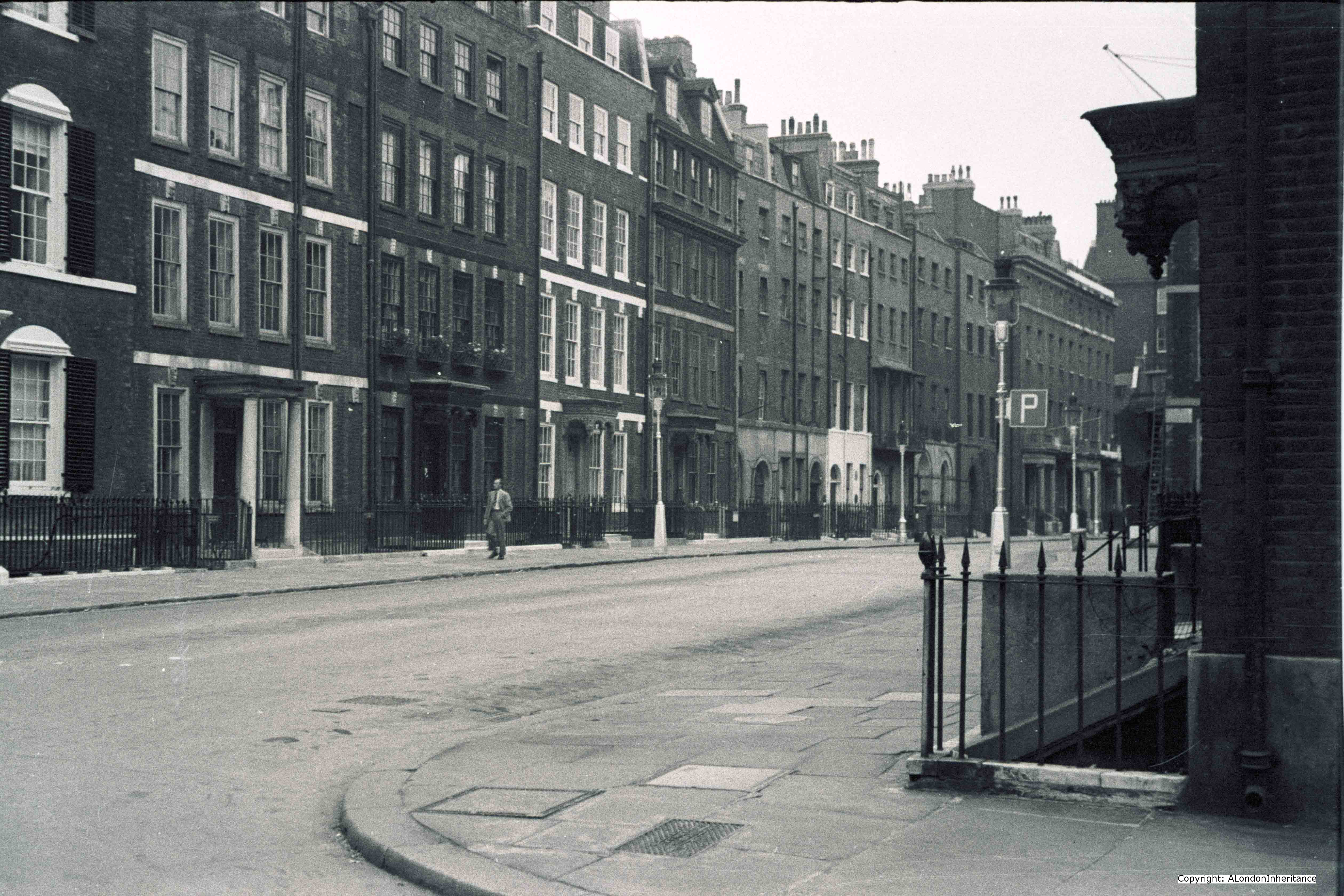
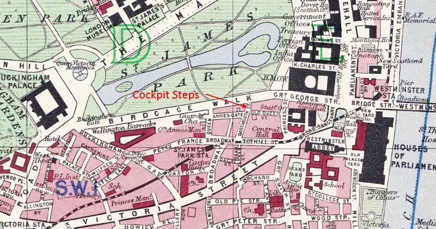
Today’s photo falls into the last category. It is one I have looked at many times, mainly fearing that like many London streets from the 18th Century, this one had been lost forever, however whilst tracking down Cockpit Steps for last week’s post I turned a corner and suddenly found myself looking at a street scene where the buildings had hardly changed in 60 years. I had come out of St. Jame’s Park Underground Station, walked up the first leg of Queen Anne’s Gate, turned to the right to head down to Cockpit Steps and found myself facing the same street scene that looked like this over 60 years ago:
My 2014 photo from the location:
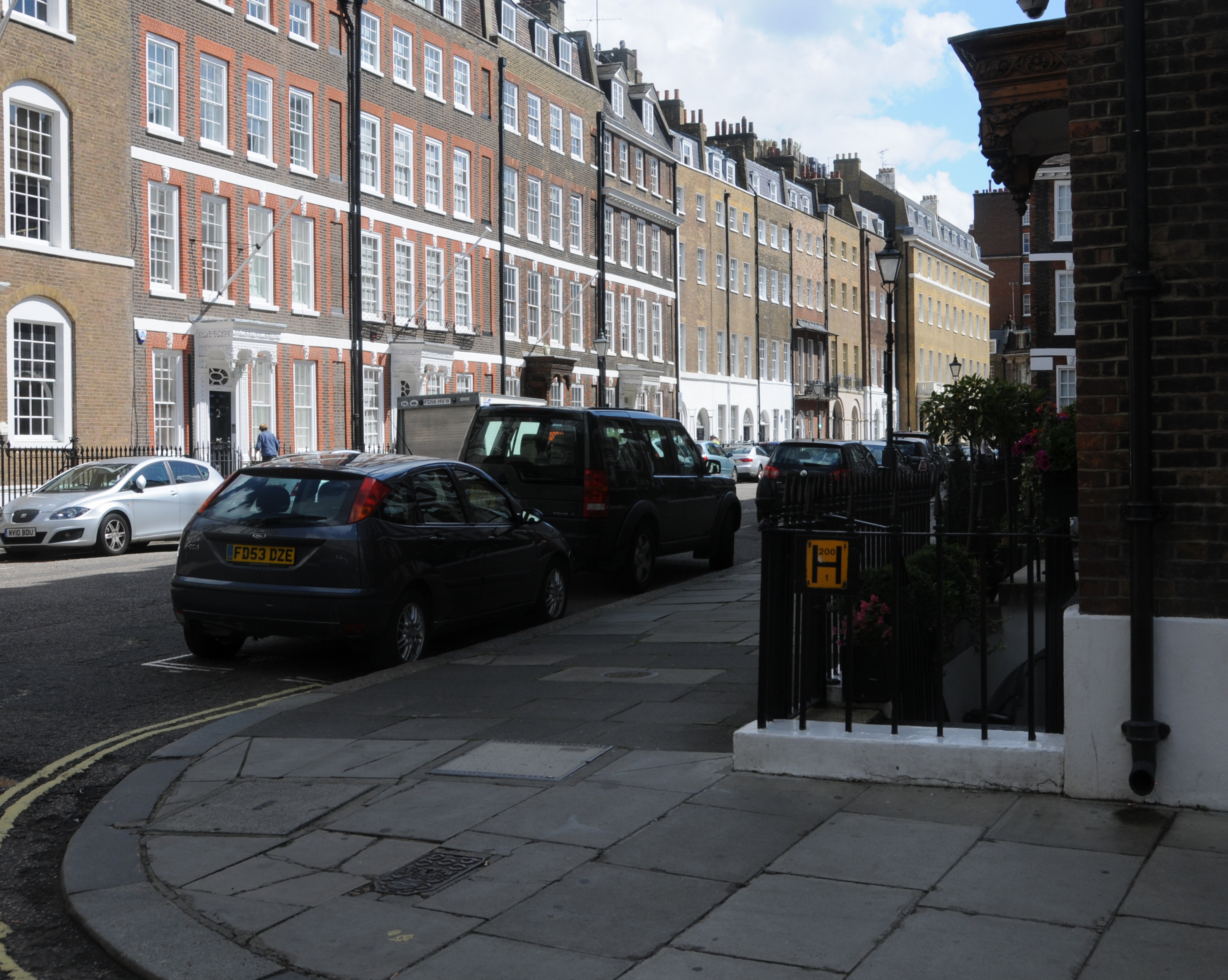
There have been some minor changes to the buildings, however apart from the ever-present impact of the car, the scene is basically the same.
Queen Anne’s Gate is a fascinating road. It was originally a street and a square. The section nearest the camera was Queen Square and the part furthest from the camera was Park Street. They were separated by a wall until 1873 when the two areas were combined into Queen Anne’s Gate. The building of the wall has many echoes with traffic concerns of today. Queen Square was constructed first, then when Park Street was constructed, residents of Queen Square were so concerned that the road would be used as a cut through for carriages to avoid the traffic of King Street, the Sanctuary and Tothill Street that a subscription was collected for the building of the wall to avoid the residents having the peace of their square disturbed.
The wall was just over halfway down the street and although the wall is long gone, the statue of Queen Anne still stands at this point:
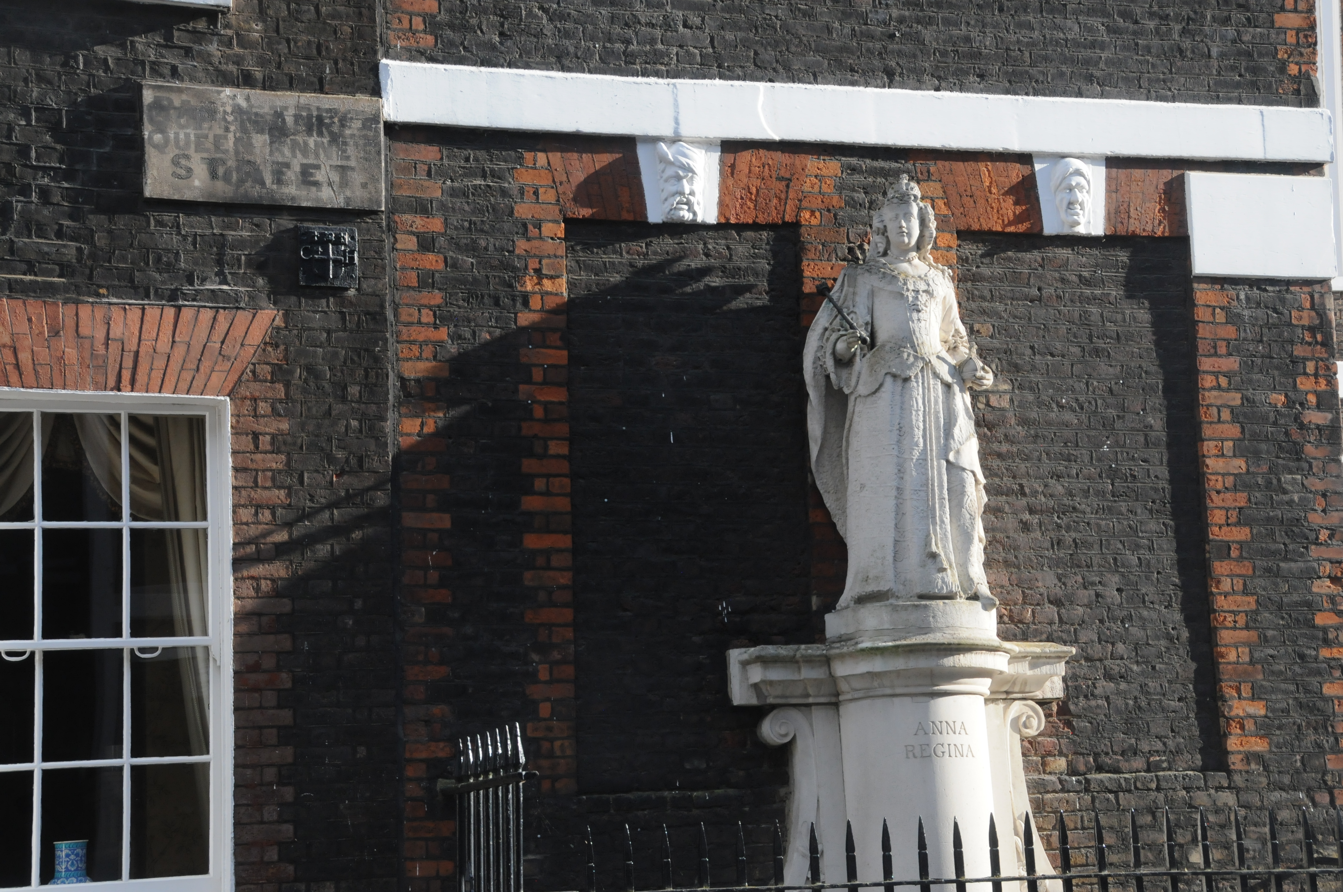
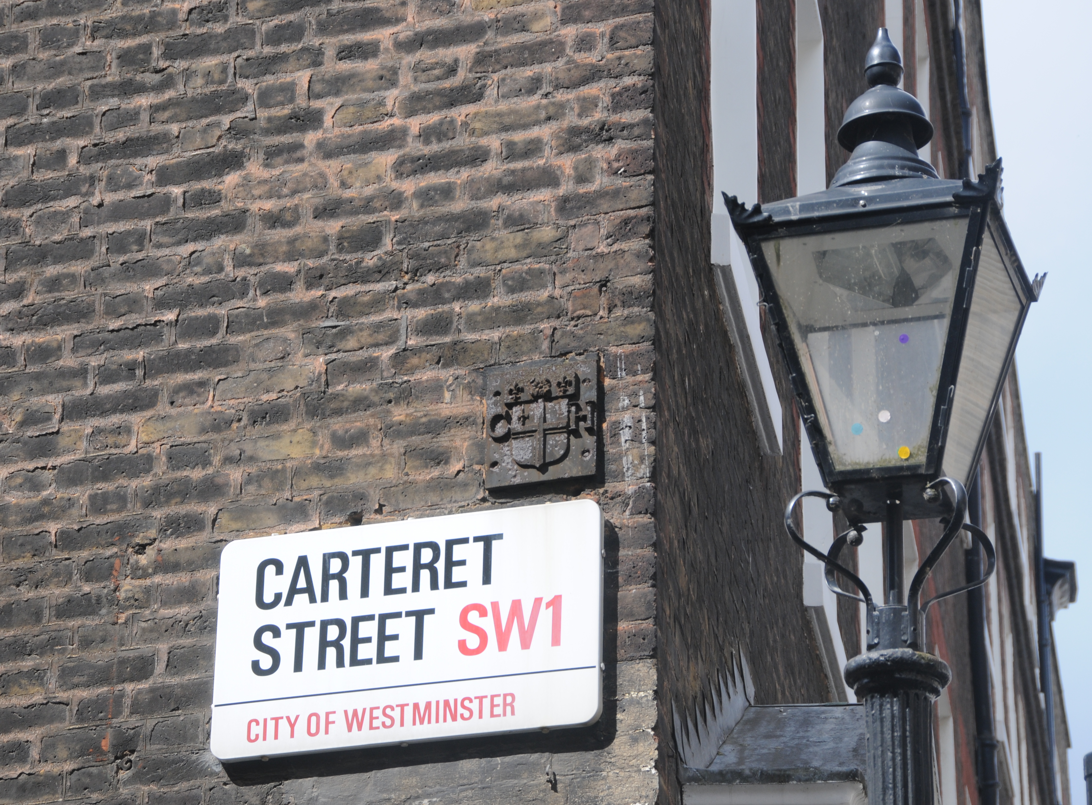
The street name sign still retains faded versions of the different street names. Note also the plaque underneath the street name sign. There is a another of these on the junction with Carteret Street:
This is the symbol for Christ’s Hospital and is used to show that these buildings were owned by Christ’s Hospital. I believe that Christ’s Hospital owned these buildings until as recently as the mid 1990’s. Queen Square was originally the freehold estate of Sir Theodore Janssen, one of the directors of the South Sea Company in 1720, and when the South Sea crash came Queen Square was seized and sold to help pay of the debts of the institution.
The buildings in what was Queen Square (the part of Queen Anne’s Gate covered by my old and new photos) were completed around 1704 in the reign of Queen Anne (1702 to 1714), a monarch that does not get much visibility these days, however she was on the throne at a crucial time in the history of the United Kingdom when the Acts of Union came into force on the 1st of May 1707 which united Scotland and England into the single Kingdom of Great Britain.
Anne was therefore the first Queen of Great Britain and Ireland.
Intriguing to think that these buildings were completed before the act of union and dependent on the outcome of the Scottish vote in September may see a very changed situation.
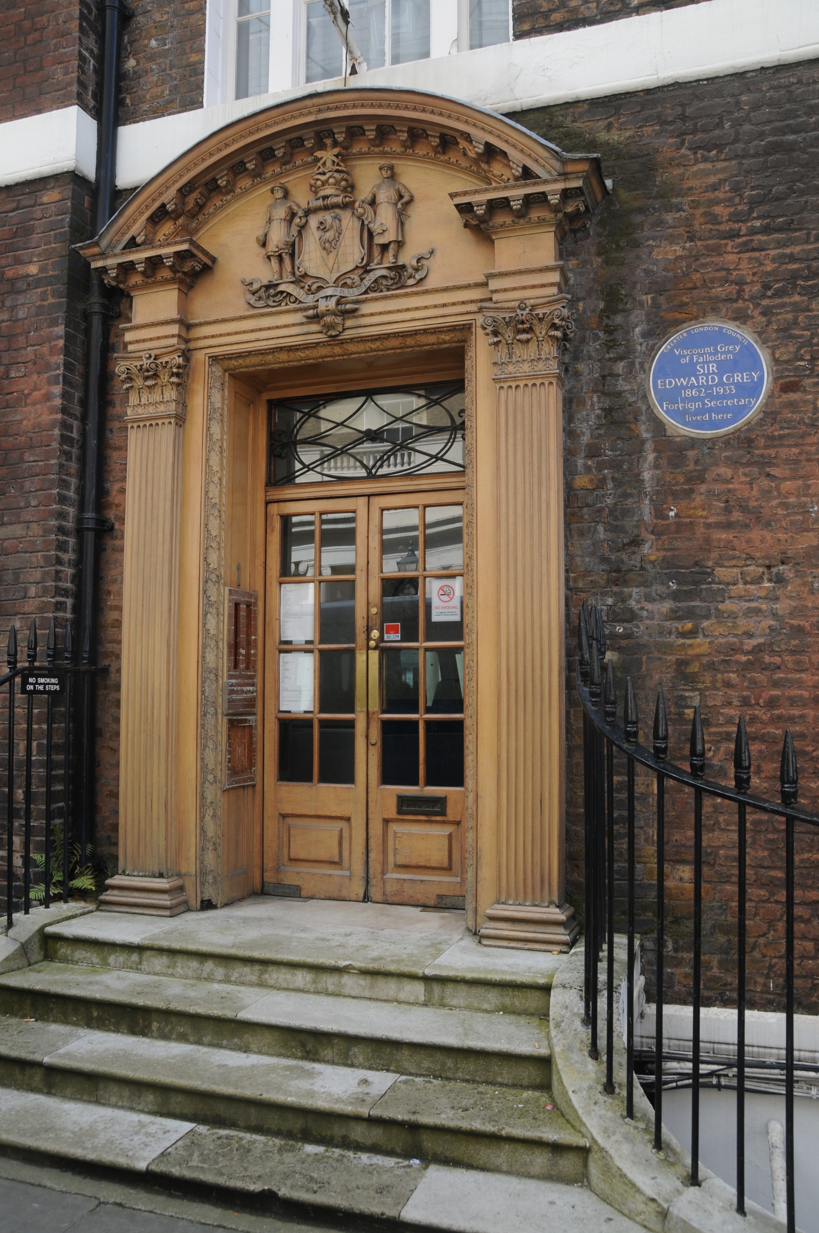
Queen Anne’s Gate has a large number of Blue Plaques. The following plaque is for Sir Edward Grey in what was the Park Street end of the road. Sir Edward Grey was the Foreign Secretary at the time of the outbreak of the First World War.
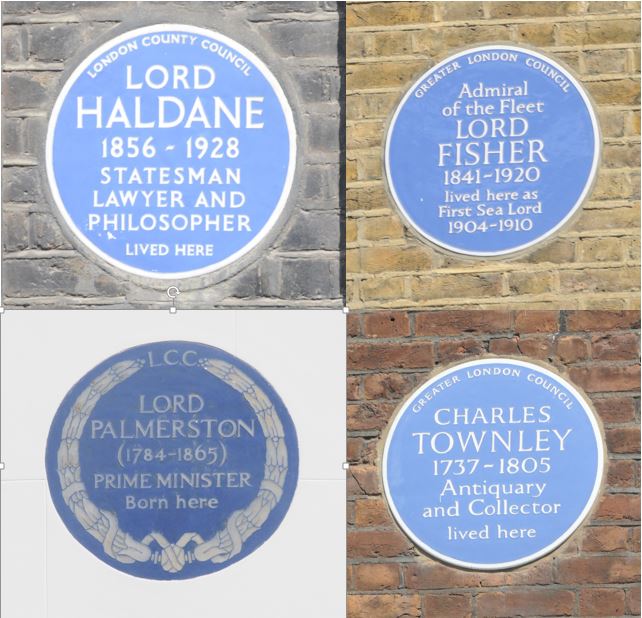
Other Blue Plaques along the street:
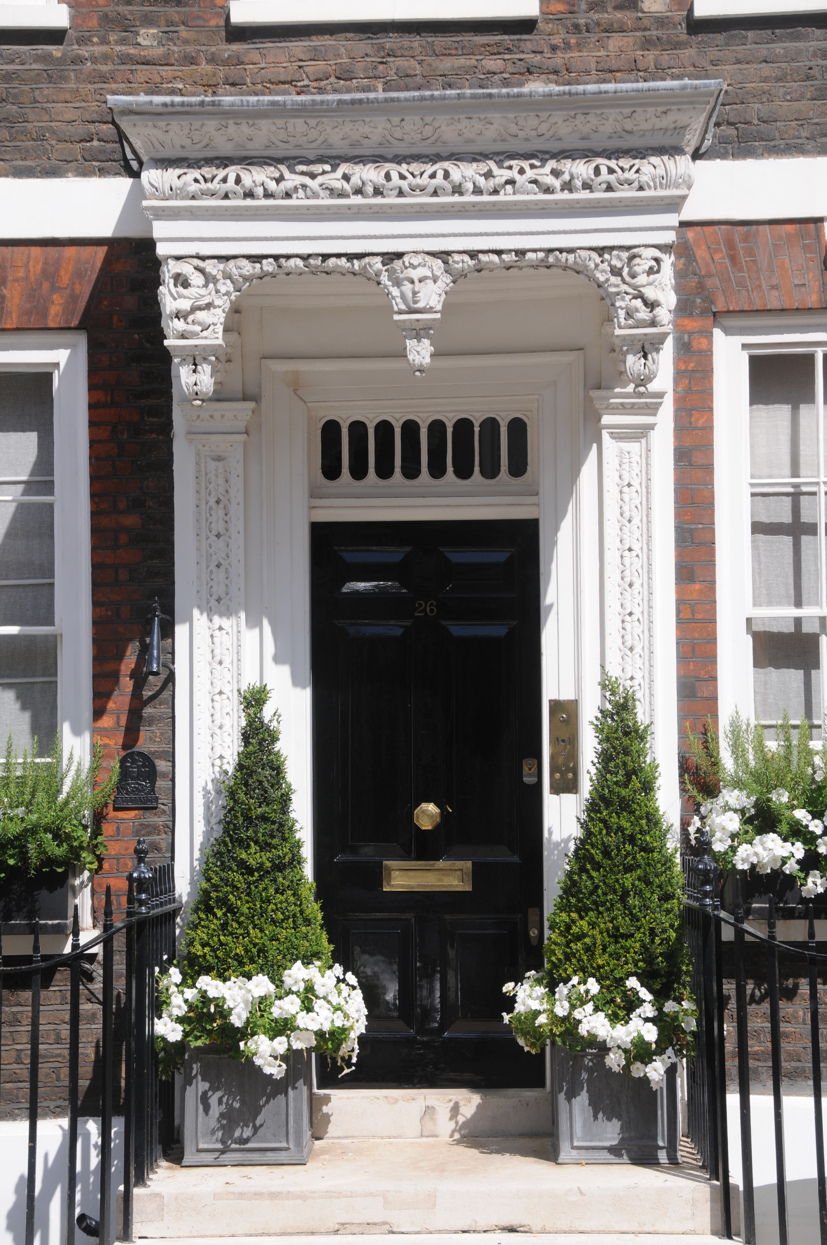
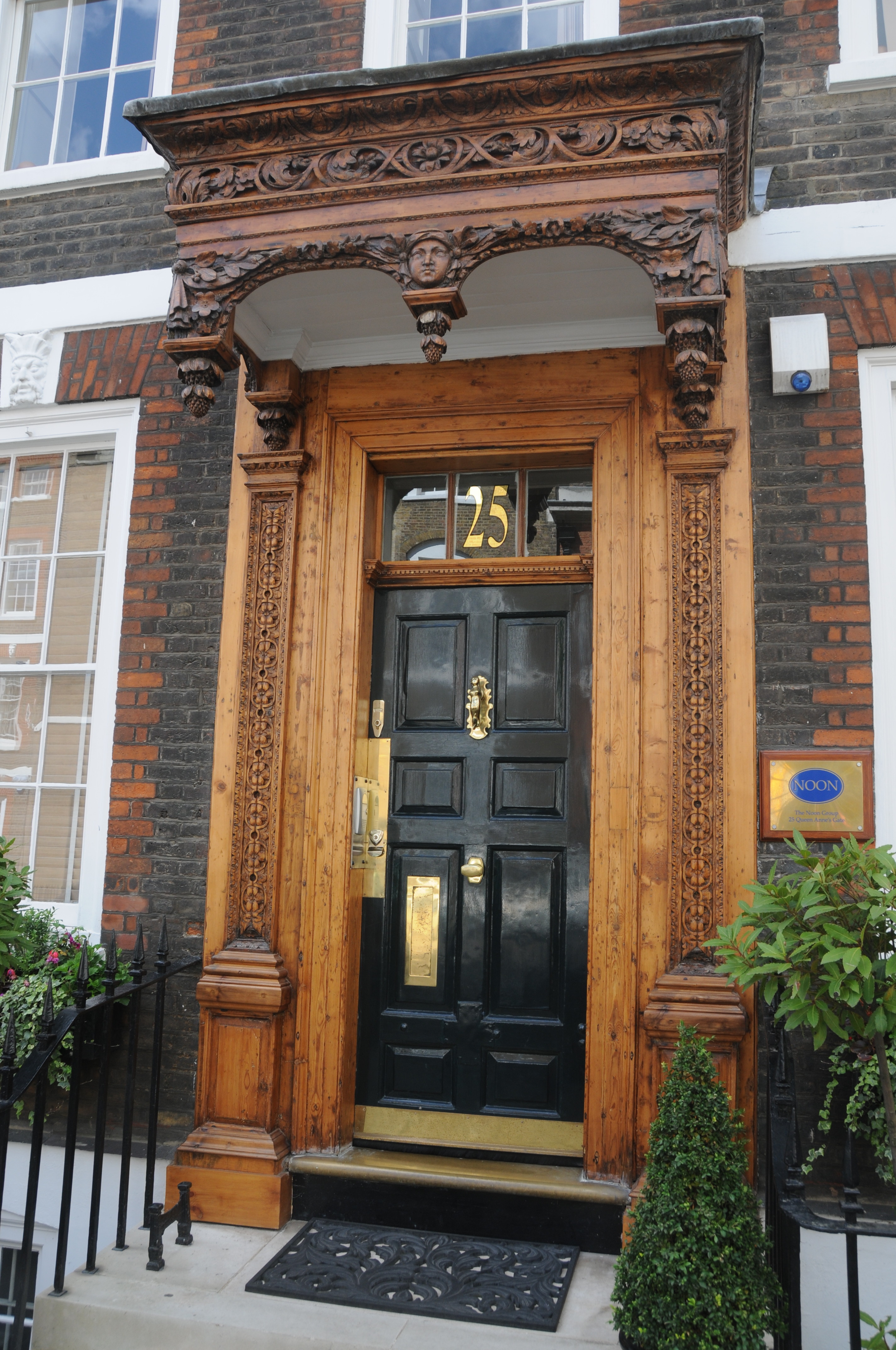
The architecture of the buildings in the original Queen Square part of Queen Anne’s Gate is superb, and the main doors to the majority of buildings have very elaborate decorated wooden canopies, the following being a typical example:
Also along the buildings are elaborate stone carvings of which the following two are examples:
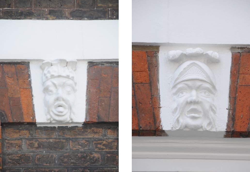
This type of decorative stone carving and the carved wooden canopies were soon to be replaced by the Georgian style of architecture which was neater (less intricate carving) and more magnificent stone work. One of the key drivers behind this change was the considerable number of books published by craftsmen for craftsmen from about 1715, which led to the gradual standardisation of ornamentation. Architectural pattern-books resulted in much standard Georgian architecture across London. These Queen Anne’s Gate buildings were very much the end of an era.
The following map is a repeat of last week’s map showing the location of Cockpit Steps. Queen Ann’s Gate can be seen just to the left of the location of Cockpit Steps. The map also shows how the first part of Queen Anne’s gate is a cut through from St. James Park Underground Station through to Birdcage Walk.
As it was in 1940 it continues to be now, and whilst I was stood on the corner waiting to take a photo down what was Queen Square, there was an almost constant stream of people walking from the station area to Birdcage Walk with hardly a glance at the magnificent buildings that are over 300 years old.
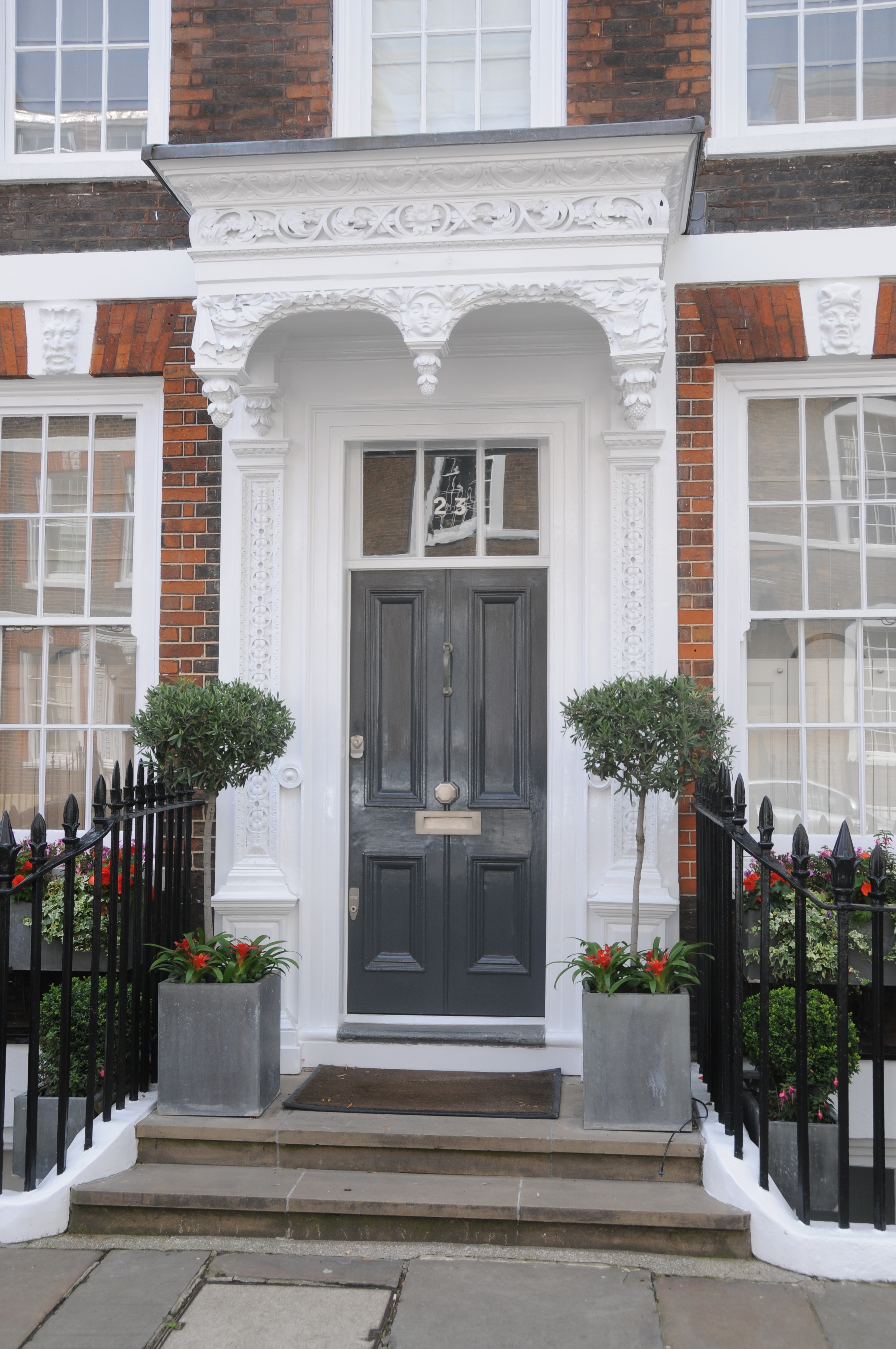
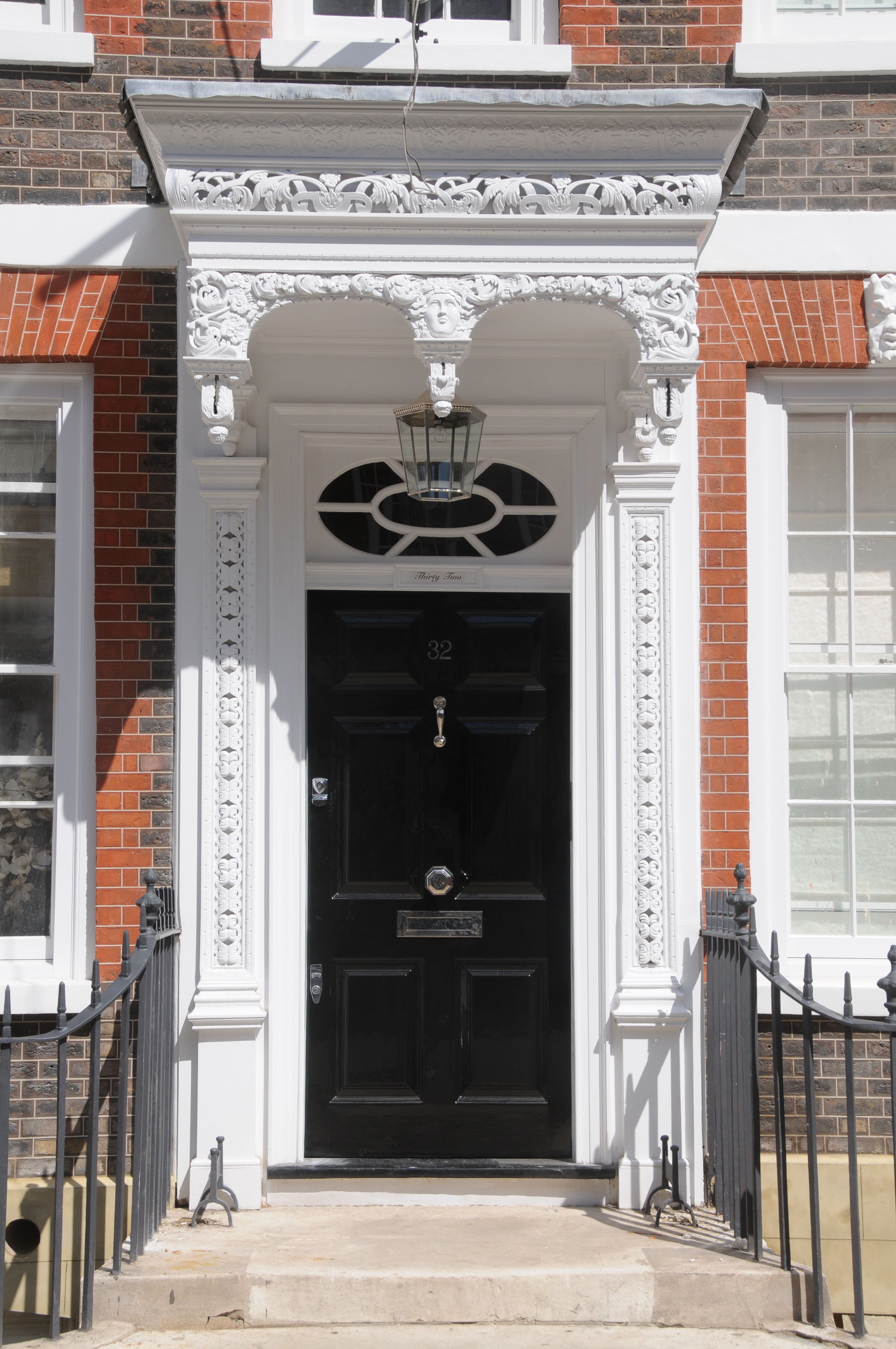
The following is a sample of the doors and carved canopies along Queen Anne’s Gate:
 I am really pleased to have found the location of this photo. Not just for finding the location, but also that these buildings have survived the developments of the last 60 years.
If you arrive at St. James Park underground station, do not cut straight through to Birdcage Walk, take a detour down Queen Anne’s Gate and admire these superb buildings.
The sources I used to research this post are:
- Georgian London by John Summerson published 1945
- London: The Art of Georgian Building by Dan Cruikshank and Peter Wyld published 1975
- The Face of London by Harold P. Clunn published 1951
- London by George H. Cunningham published 1927
- Old & New London by Edward Walford published 1878
- Bartholomew’s Reference Atlas of Greater London published 1940
My favorite street. I love the face carvings so much so that one day while gazing up at them on my way to work before cutting through the park I tripped on a wonky pavement and fell flat onto my hands and knees. Luckily not too damaged and was helped to my feet by a passing cyclist. It taught me to stop and look before walking on! I want to know who did them – there are such a variety – some classically based but others look more like a rendition of the Greene Man.
Thank you for that website. I will follow you with great interest, despite my bad English.
Philippe
This is a fascinating series of articles. In researching my ancestry, I discovered family living in Old Queen St (nearby), who had moved from Gardener’s Lane- demolished when the Treasury was built. Have you any plans to extend your research to lost parts of London, that have been overwhelmed by more recent developments? Clearly, this area was closer to a far poorer area near Whitehall; could this have been a factor in building a wall?