Tag Archives: Bankside Power Station

Trig Lane Stairs and Thames Foreshore Erosion

Trig Lane Stairs lead down to the Thames foreshore, just to the east of the Millennium Bridge. Today, the stairs connect the foreshore with the walkway that now runs along the edge of the river, with apartments and offices between the river and Upper Thames Street.

Back in 1949 it was a very different place, a mix of wartime bomb damage and with many of the warehouses remaining from the time when this section of the river was busy with the movement of goods between barges and warehouses.

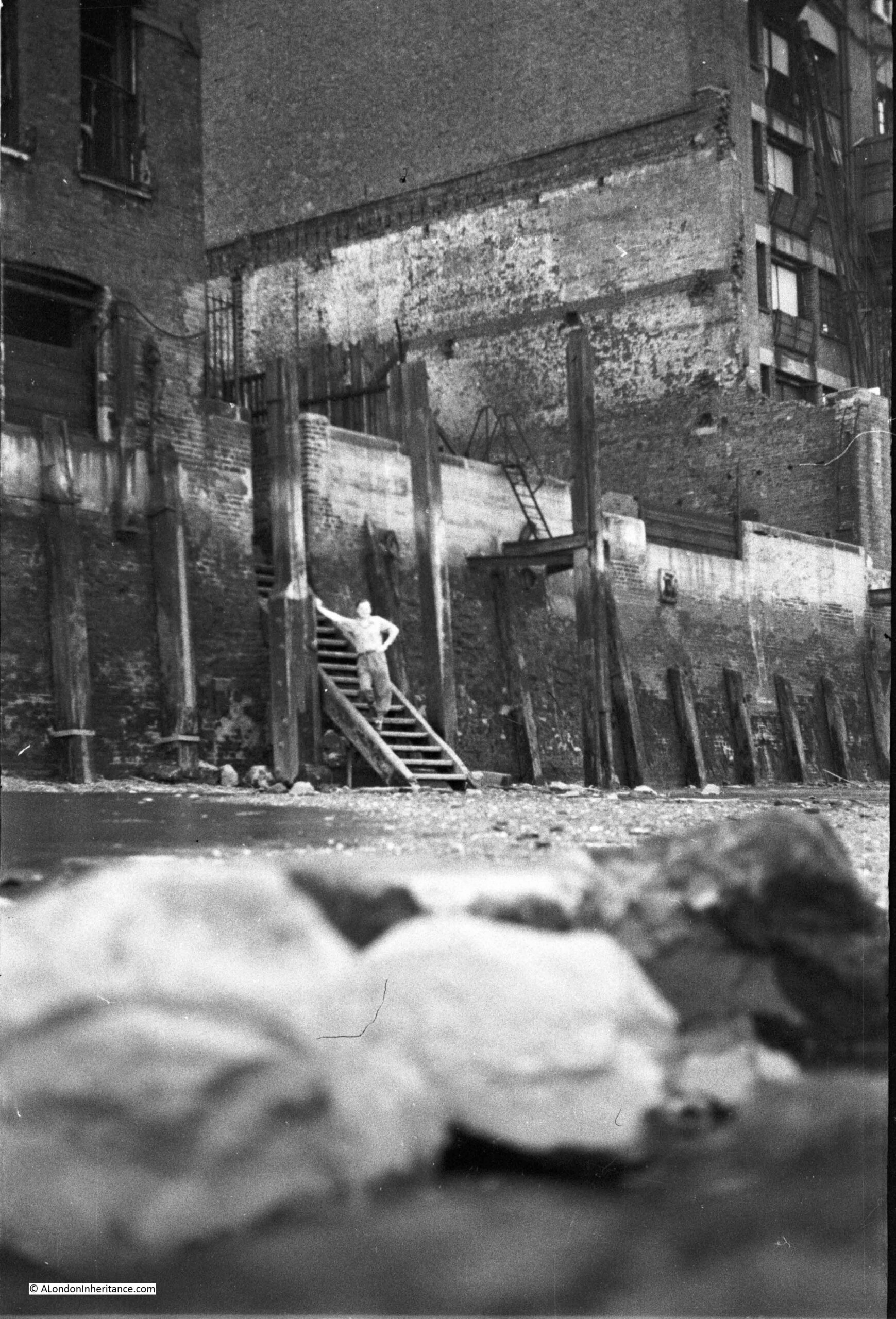
This is one of my father’s photos from 1949. The wooden stairs of Trig Lane Stairs lead down to the foreshore, warehouses either side with an open space between (not bomb damage, but an open space for movement of goods), and one of my father’s friends standing on the stairs:

Trig Lane Stairs

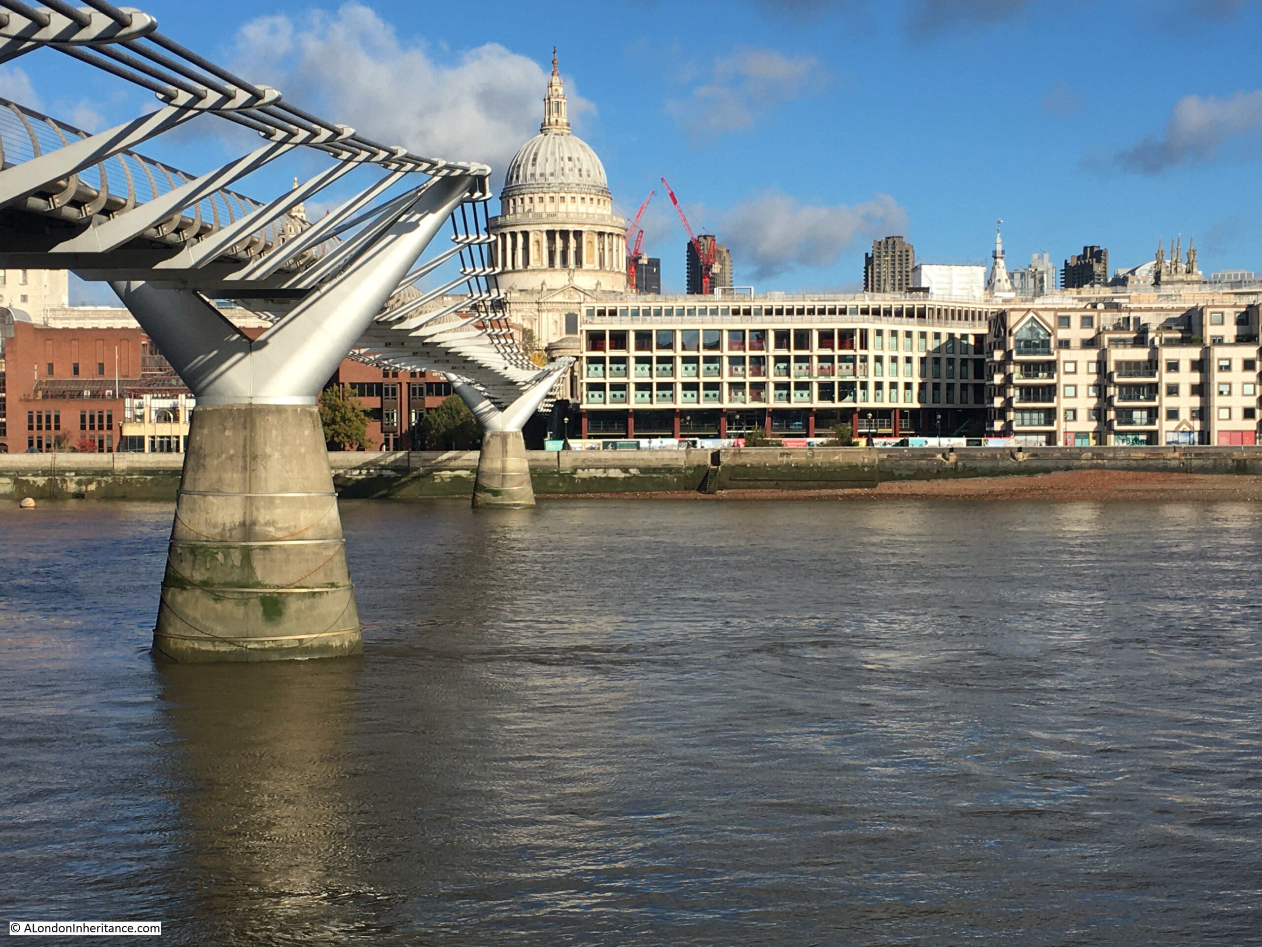
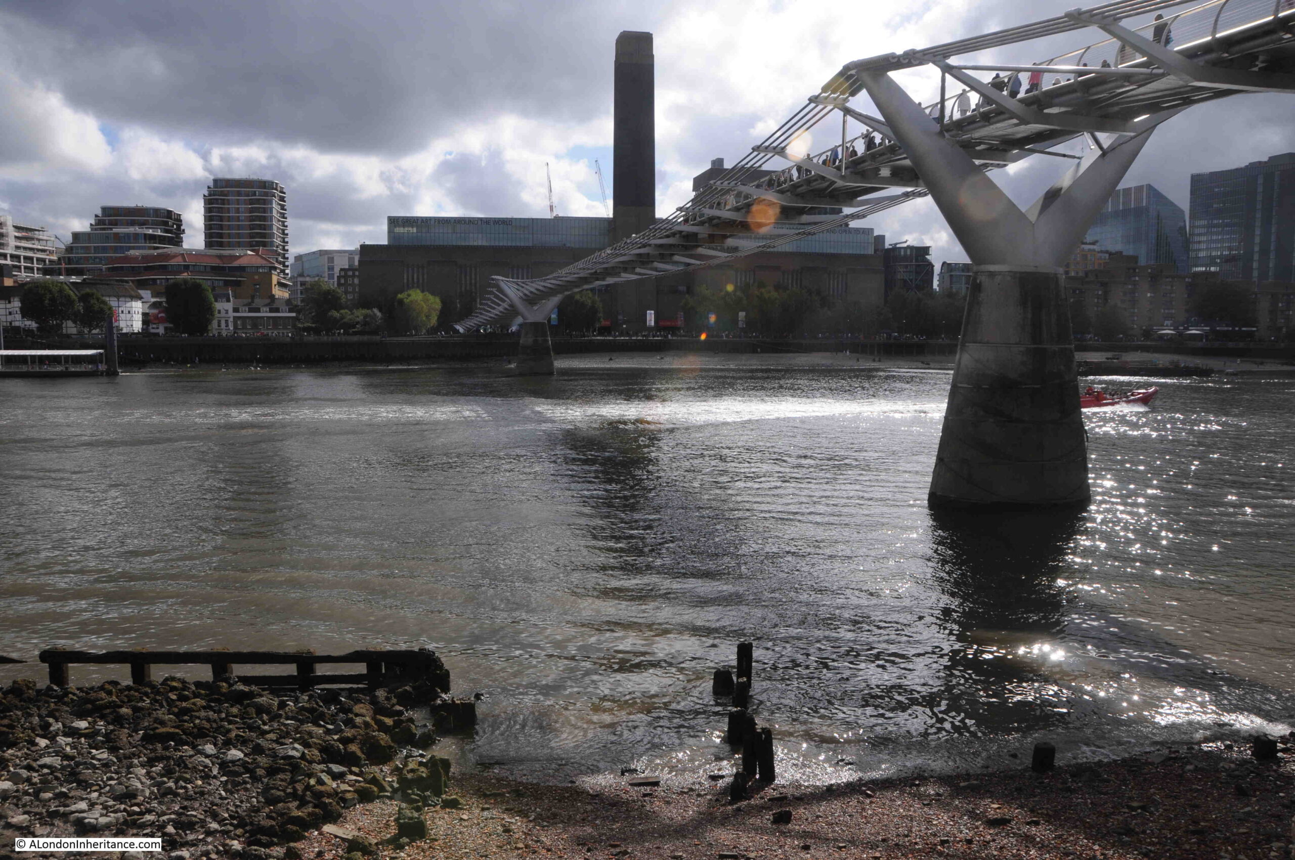
I took the following photo from the south bank of the river. To the right of the Millennium Bridge, along the wall that runs alongside the river, you can see a dark rectangle, which is the entrance to Trig Stairs through the river wall, and the wooden stairs to the foreshore can just be seen below the gap:

Trig Lane Stairs

As with the edge of the Thames through most of London, this area has changed dramatically in the 74 years between the two photos.

The warehouses have been replaced with new buildings, with a single block covering the space behind the stairs and along where several warehouses once stood.

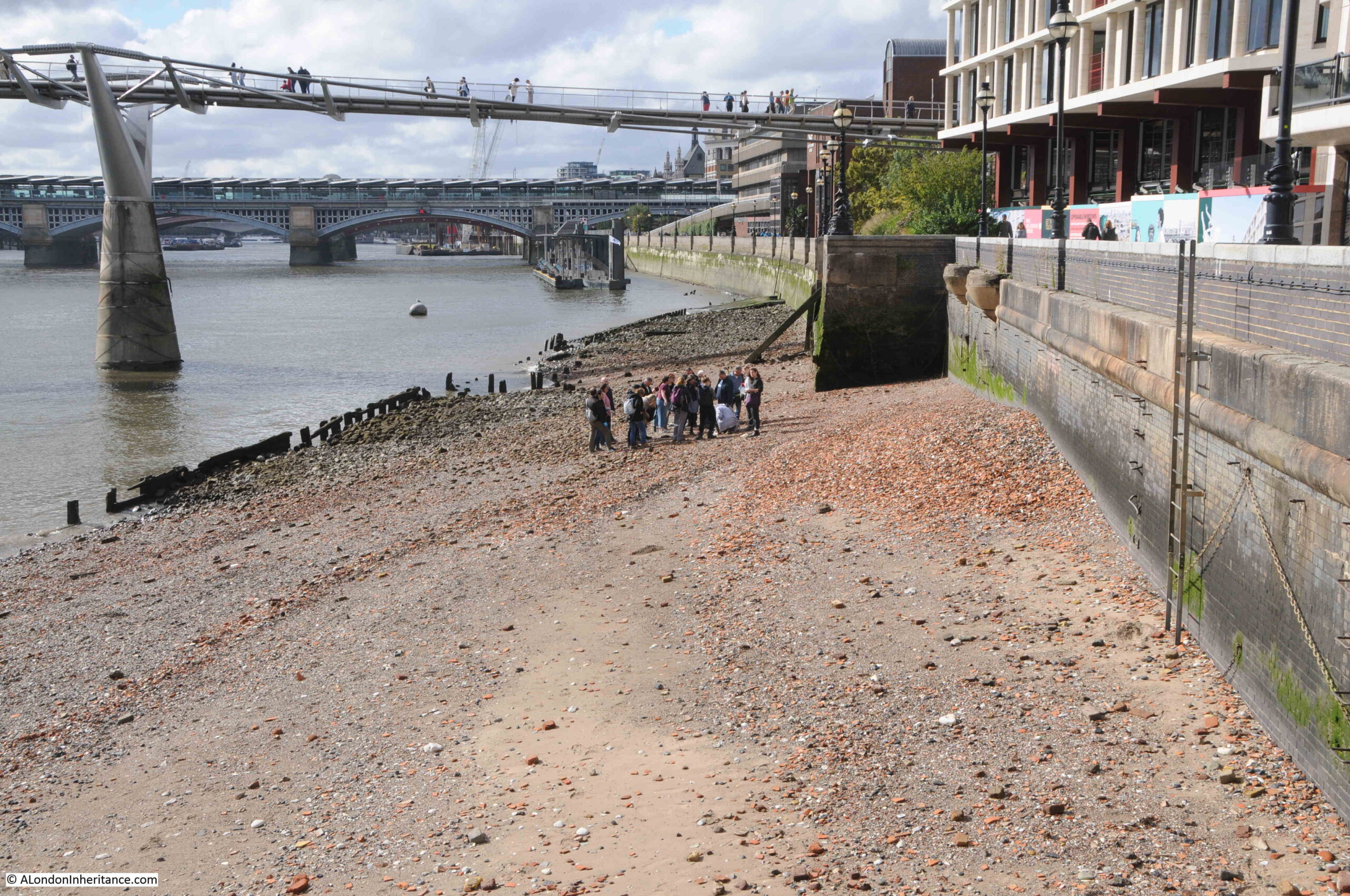
Walking along the edge of the river from the east, and the Trig Lane Stairs can be seen in the following photo, just behind the group of people on the foreshore:

Trig Lane Stairs

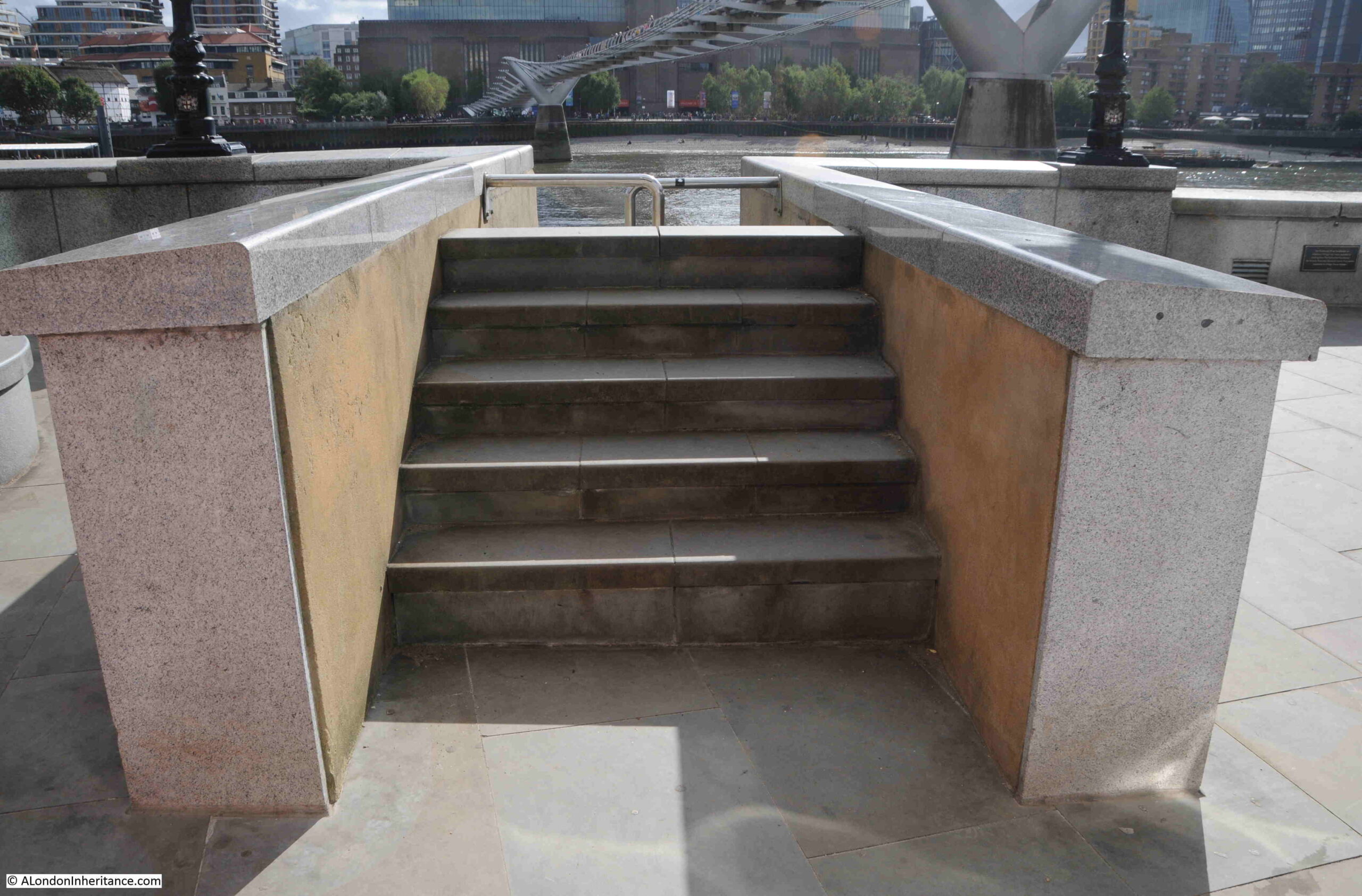
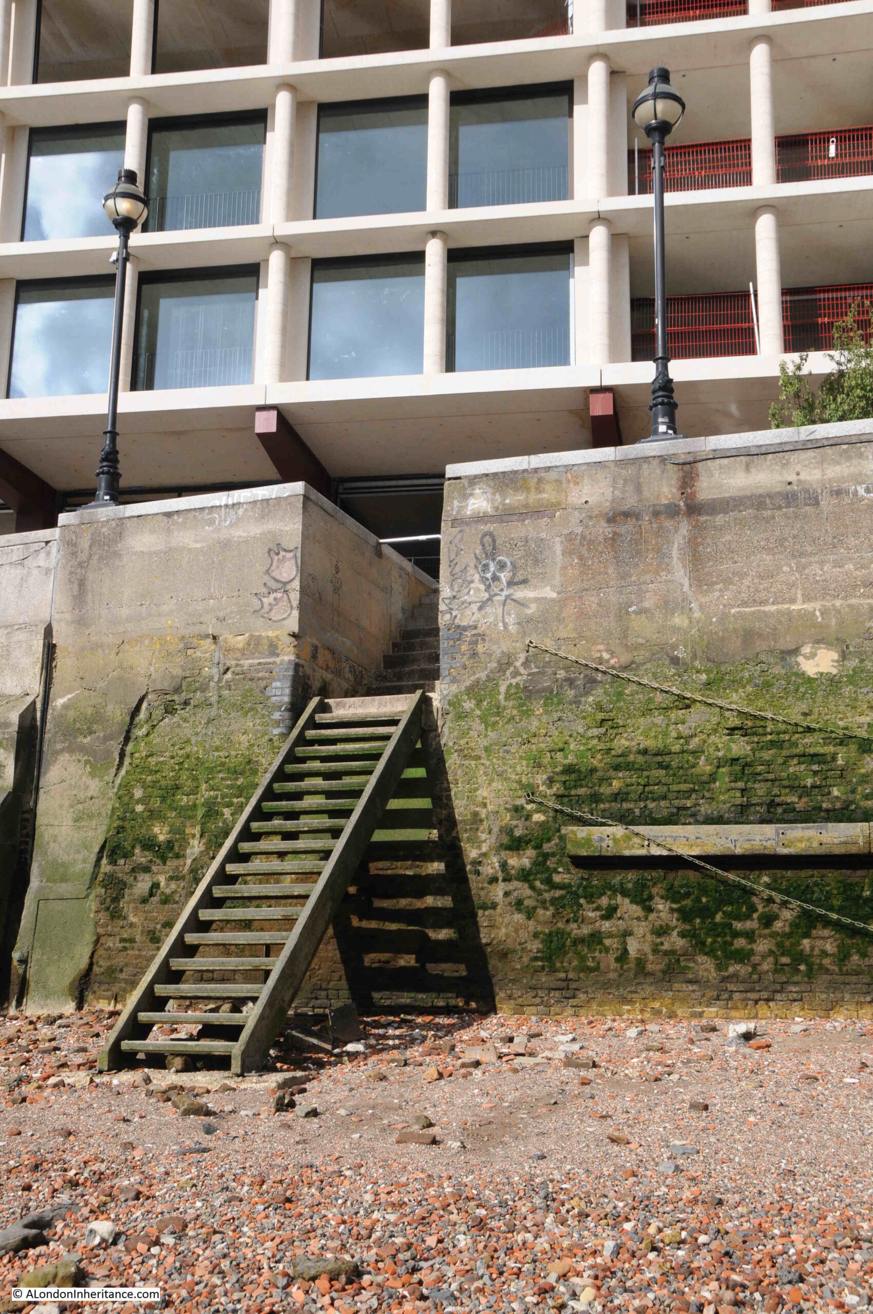
The entrance to Trig Lane Stairs in 2023:

Trig Lane Stairs

The stairs go up, before going down to the foreshore are an indication of the height of the river wall now needed to prevent any flooding at times of exceptionally high tide.

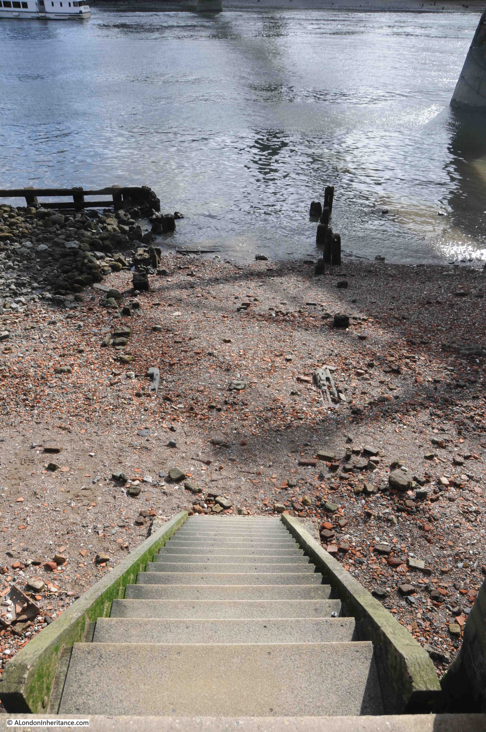
Once over the stairs, we can get a view of the wooden stairs going down to the foreshore:

Thames foreshore

And this was the same view in 1949:

Thames foreshore

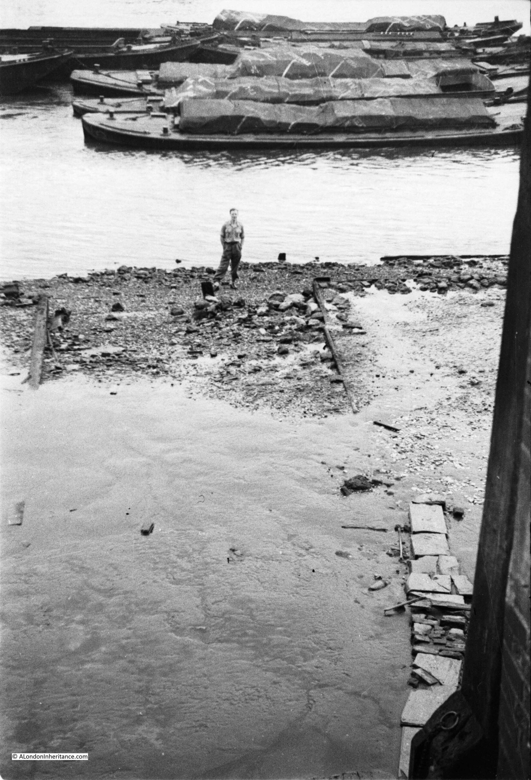
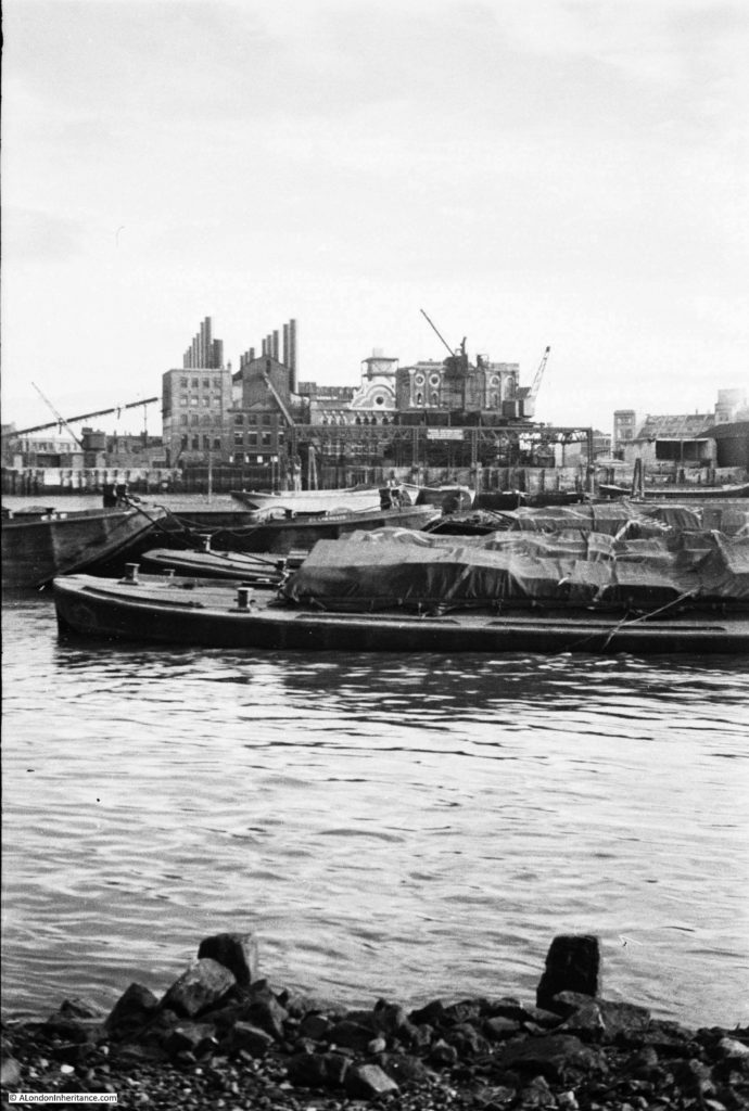
In 1949 the warehouses were still in use, and the loaded barges which can be seen in the background are probably holding goods that are waiting to be moved to the warehouses as these were mostly used for import.

According to the 1953 edition of “London Wharves and Docks”, published by Commercial Motor, the warehouse to the left of the stairs in my father’s photo was the warehouse of Crown and Horseshoe Wharf, which traded in general goods, and specialised in canned goods and chemicals. The warehouse had storage space for 100,000 cubic feet of goods.

The warehouse on the right of the stairs was Sunlight Wharf, owned by LEP Transport, and in 1953 was described as “premises particularly suited for storage of canned goods, having large basement accommodation at average low temperature”.

One of my photos is of the last days of Sunlight Wharf and is in my post “Baynard’s Castle, A Roman Monument And The Last Working Crane In the City”.

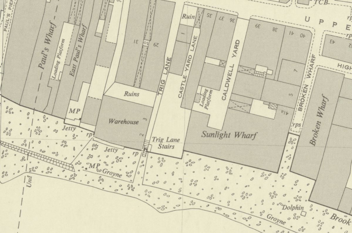
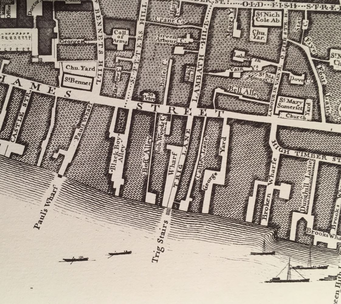
The following extract from the 1951 edition of the OS map shows Trig Lane Stairs just below the centre of the map, at the end of Trig Lane (‘Reproduced with the permission of the National Library of Scotland“):

Trig Lane Stairs

According to “A Dictionary of London” by Henry Harben, the first mention of the name was as Trigge Lane in the 1603 edition of Stow’s Survey of London, and by 1677 it was Trigg Lane.

The first mention of the stairs was by John Strype, who published a new, expanded version of Stow’s Survey of London in 1720. Strype’s description of the stairs and lane was “Trig Stairs, so called from the Stairs on the Water side, which is indifferently well supplied by Watermen. The Lane is pretty open, reasonably well built and inhabited”.

Henry Harben states that the name came from John Trigge, the owner of property around the lane and stairs, and in the following centuries, the name has changed from Trigge to Trig. The “London Encyclopedia” (Ben Weinreb and Christopher Hibbert) also repeats the source of the name, and that “the Trigge family were local residents in the 14th and 15th centuries”.

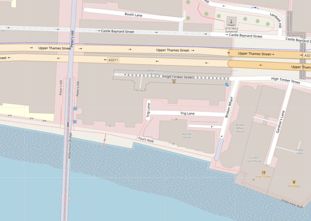
The street Trig Lane has all but disappeared. It no longer runs from Upper Thames Street down to the stairs. Development over the last few decades has obliterated the original route of the street, but the name remains in an east – west street, which is mainly an access route to the rear of one of the buildings that now faces onto the river.

The current routing of Trig Lane can be seen in the following map  (© OpenStreetMap contributors):

Trig Lane

Having photos from 1949 and 2023, looking down from the stairs to the foreshore allows comparison of the foreshore, 74 years apart.

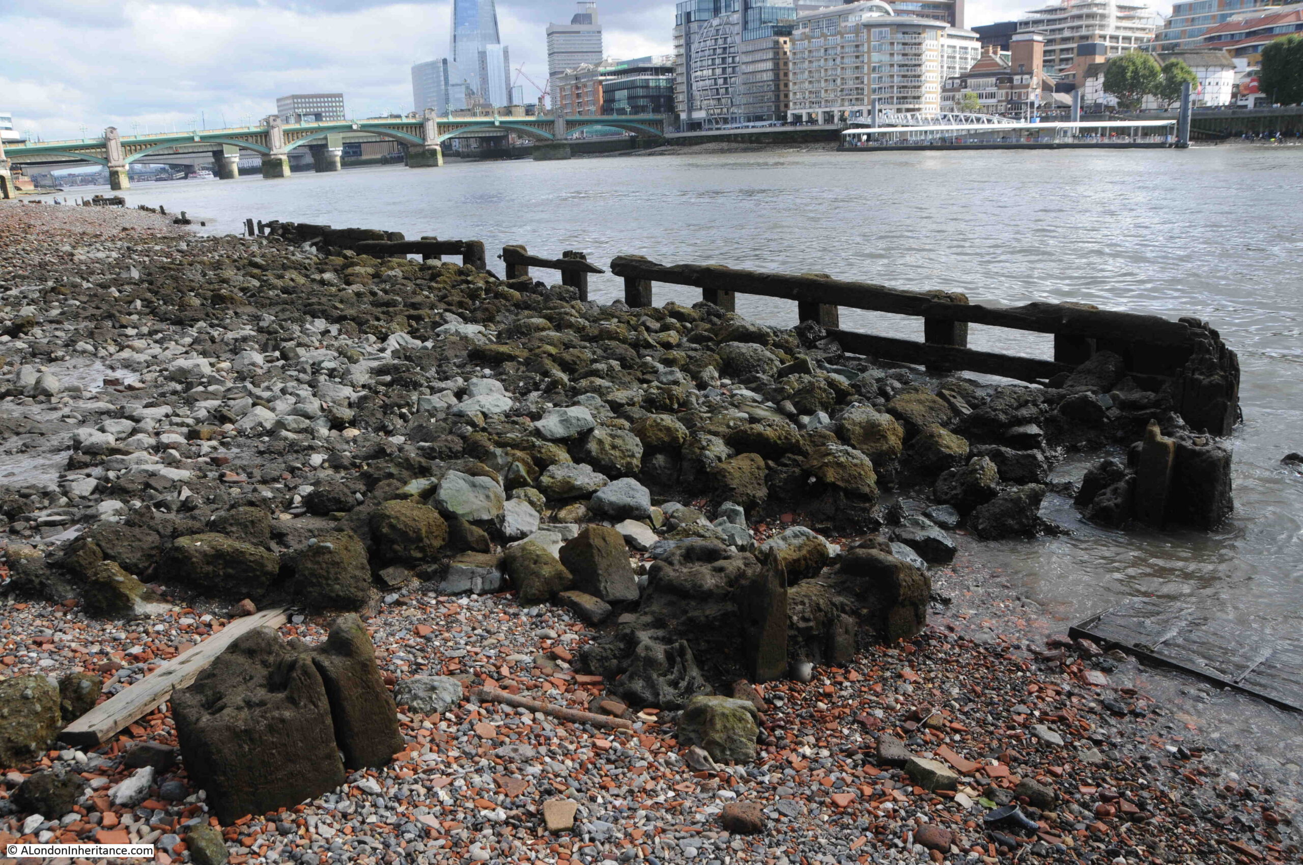
The following photo is an extract from the 1949 photo, looking at the area where a number of wooden structures can be seen:

Thames foreshore erosion

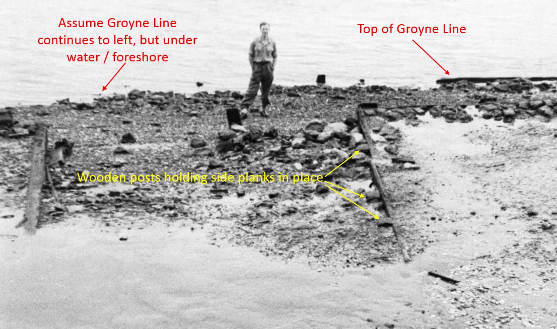
I have labeled what I assume is the top of the groyne line on the right. The groyne line is shown in the 1951 OS map, and apart from a gap opposite the stairs, it runs along the foreshore, a little distance out from the embankment.

The groyne line was probably a wooden wall used to retain the foreshore and create a reasonably flat surface on wich barges could be positioned and their cargo unloaded into the warehouses.

I have also labeled wooden posts that appear to be retaining a plank. There is a similar plank to the left and these two may have been where the groyne line returned to the river wall, or could have formed the edge to a causeway that ran out from the bottom of the stairs.

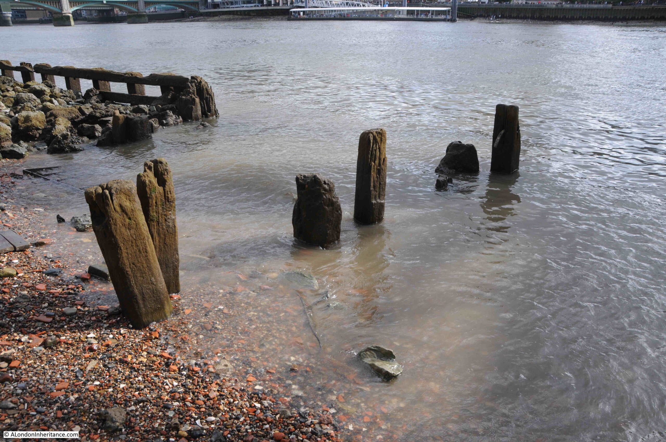
Looking at the same view today, and we can see just how much of the foreshore has eroded in the last seven decades:

Thames foreshore erosion

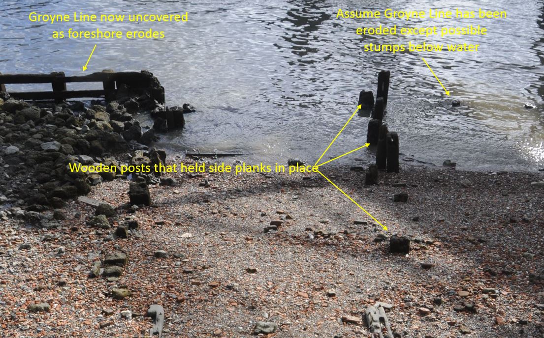
The groyne on the right, the top of which was visible in 1949 has now disappeared. The groyne on the left which was just below the foreshore is now fully exposed.

We can also see the wooden posts which were once retaining the planks along the edge of the causeway.

Comparing these two photos shows that at the location of the groynes, the foreshore has eroded a good two to three feet.

The Thames foreshore is a very fluid space, in all senses of the word.

Trig Lane and the stairs date from the 17th century, and are probably much older and even if the name Trig dated from around that time, there were probably stairs here much earlier as stairs were such an important part of access between the land and the river, and along this part of the river, there has been port infrastructure for so many centuries.

The London Encyclopedia has the same view as it states that the stairs were earlier known as Fish Wharf.

Excavation at Trig Lane between 1974 and 1976, prior to major development of the area revealed remarkable remains of the medieval waterfront with significant wooden revetments and other infrastructure of the port between the late 13th and mid-15th centuries.

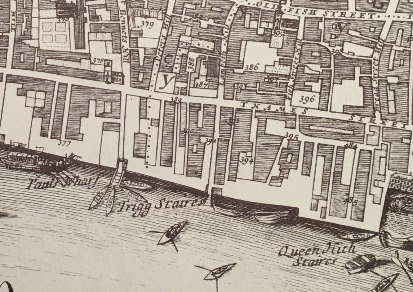
The following is an extract from William Morgan’s map of London from 1682, and shows Trigg Stairs. To the left of Trigg Stairs is Paul’s Wharf which also had a set of stairs. I do not know whether it was an artistic interpretation of the scene, or whether it was fact, but the stairs by Paul’s Wharf had a large cluster of watermen’s boats, but none at Trigg Stairs:

Trig Lane Stairs

What I love above Thames stairs is not just the physical structure, but the stories you can find about what happened at the stairs. Just small glimpses, but they help with an understanding of what life was like at the boundary between river and City.

For example, from the Newcastle Courant on the 15th of July, 1721:

“Last Monday, Mr. Hargrave, who sometime ago killed one Capt. Wilkes, a half Pay Officer in Racket Court, Fleet Street, and fled, and coming off the water at Trig Stairs, drew his sword upon the Waterman, without any provocation, and stabbed him very dangerously in the Breast, for which he and his Companion were forthwith seized, and carried before the Lord Mayor, who committed them to Wood Street Compter”.

And from the Caledonian Mercury on the 1st of July, 1728:

“On Tuesday in the afternoon, a Barge Man was struck down by lightening as he was going up a ladder at Trig Stairs; and falling into the River, was drowned before any help could be got”.

From the Kentish Weekly Post on the 24th of January, 1759:

“A Journeyman Carpenter crossing the water from Trig Stairs, being a little in liquor, and imagining he was near the shore, jumped out of the boat and was drowned”.

The Reading Mercury reported on the 28th of July, 1783, that:

“The lighters of Mr. Rodbard, at Trig Stairs, Thames Street, having been lately frequently robbed, a guard was appointed to overlook them; and early yesterday morning three persons were discovered filling the corn into sacks, who being fired at by the guard, one of them was killed; the others immediately rowed off in a boat which they had stolen for the occasion, to Pepper Alley Stairs, where they escaped, leaving the body in the boat.”

The London Morning Herald reported on the 13th of October, 1837, that:

“Yesterday evening an inquest was held in the King’s Arms, Queenhithe, before W. Payne (City Coroner), on view of the body of Joseph Colcourt, a lighterman. It appeared from evidence that the deceased was in company with a boy bringing a barge down the river, on Wednesday morning last, about three o’clock, and had arrived alongside Trig Stairs, Queenhithe, when the barge struck against another which was moored off the stairs, and deceased, who was at the time standing on the gunwale, was, in consequence of the concussion, precipitated overboard, and sunk immediately. The boy made what efforts he could at the time to save him, but they were ineffectual. The tide was running down very strong, and it was impossible to render assistance. The body of the deceased was found next morning near to the spot where he fell in. Verdict – Accidental Death.”

Whilst all these stories are of assault, theft and accidental death (as today, the press only report the bad news), they are a common theme to all Thames stairs, and show the dangers of working on the river, of crossing the river, crime on the river, children also working in such dangerous conditions etc.

Standing at the stairs today, it is hard to imagine a guard firing and killing one of those trying to steal corn from barges moored by the stairs.

In Morgan’s map of London from 1682, the stairs were spelt Trigg, but by the time of Rocque’s map of London in 1746, the last “g” had been dropped, and they were just Trig Stairs, as they remain today.

Trig Lane Stairs

It is interesting how place names change, and I suspect that it was usually a gradual simplification of the name, so the stairs started with the name of a local land owner as Trigge, then Trigg and finally Trig, so the name ends with a spelling that more accurately mirrors how the name is pronounced.

The groynes today still seem to form a boundary between the water and the foreshore at a typical low tide:

Wooden structures in the Thames

I assume that the rubble behind the groyne may have been used as infill to build up the foreshore on the land side of the groyne to create a platform where barges could be moored on some reasonably level ground.

And today we can also see where the eastern groyne ends, there is a gap where the causeway would have extended, and the wooden posts along the side of the causeway now project above the surface. It could also have been where the groynes returned to the river wall. This shows just how much erosion the foreshore has suffered in the last 70 years:

Wooden structures in the Thames

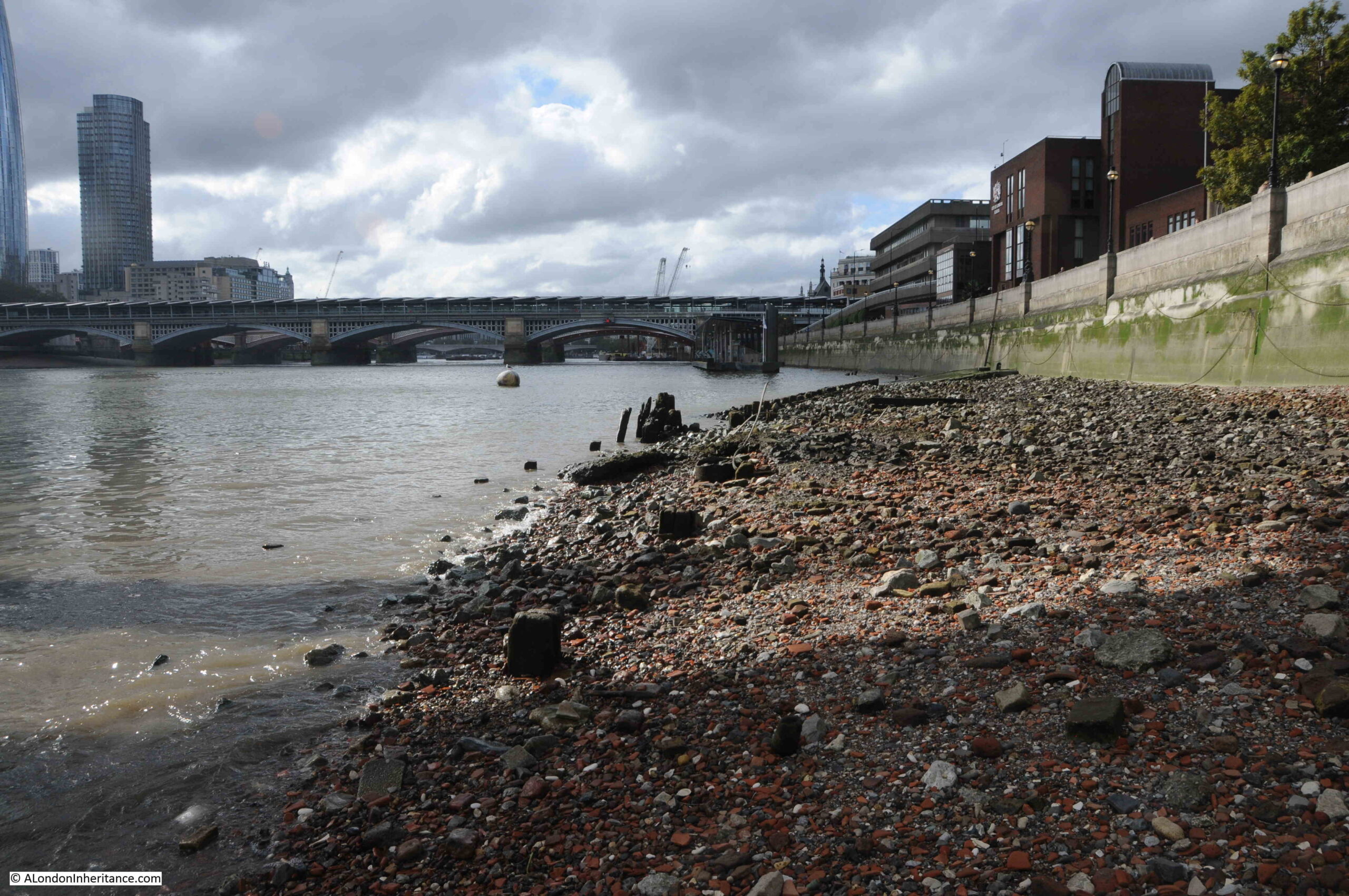
View along the foreshore to the west:

Thames foreshore

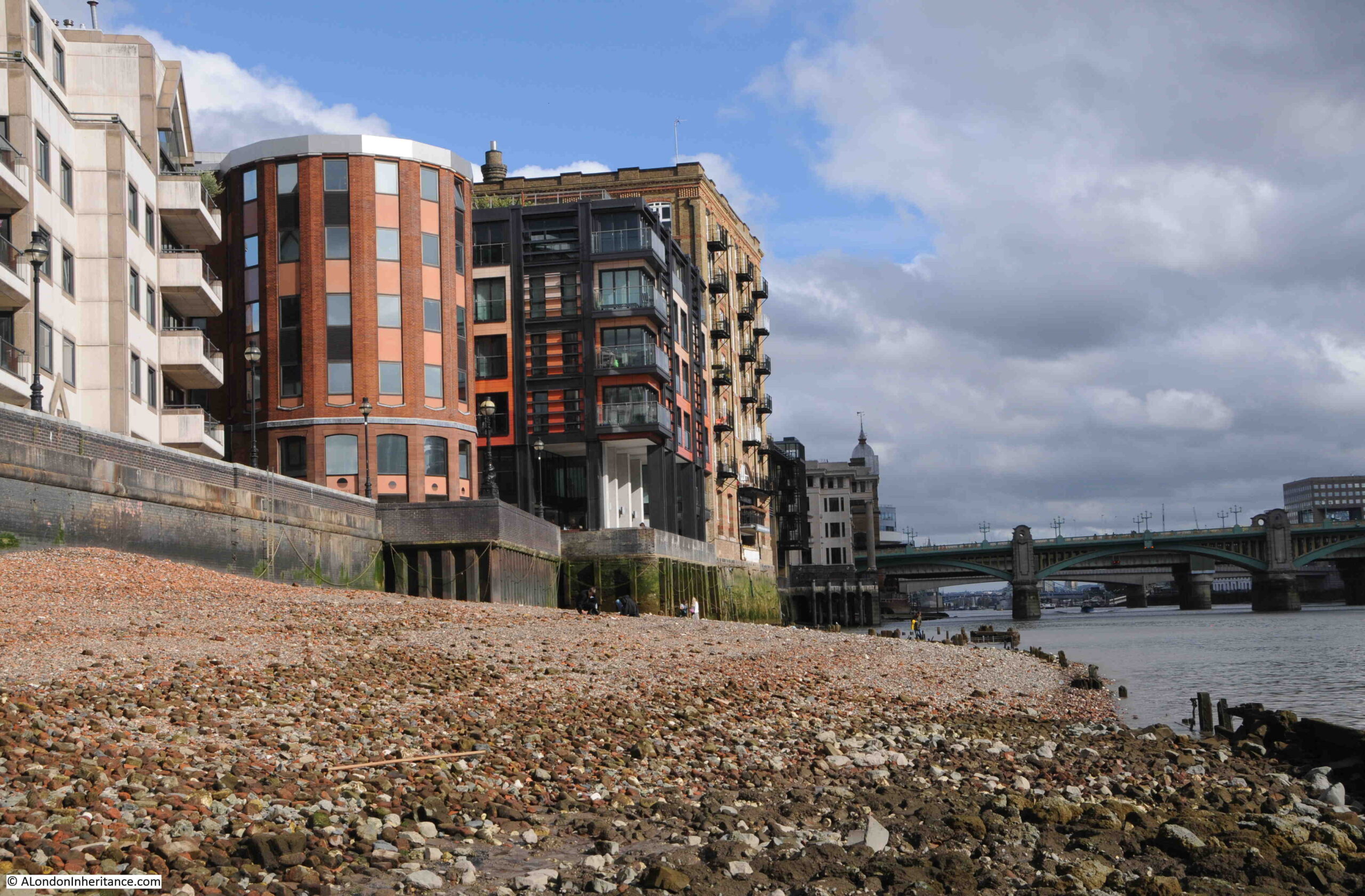
And to the east – the large brick building at the end of the run of modern buildings is the only warehouse that remains from the pre-war period:

Thames foreshore

In the Port of London Authority book: “Access to the River Thames. A Port of London Authority GuideSteps, Stairs and Landing Places on the Tidal Thames” (published around 1995), Trig Lane Stairs is listed as having 9 stone steps and 18 wood steps, and that the condition was bad.

The stairs today have 16 steps. The stairs in the 1949 photo are longer as they went into the recess in the wall, so I do wonder if the stairs at the time of the PLA survey were the same as in my father’s photo, as they would probably have been in bad condition having been exposed to decades of Thames tides washing over them.

The PLA listing confirms that the stairs were in use in 1708, and at the time of the survey they were not in use.

The stairs today are in good condition, and whilst probably not in use as a landing place, they provide access to the foreshore:

Trig Lane Stairs

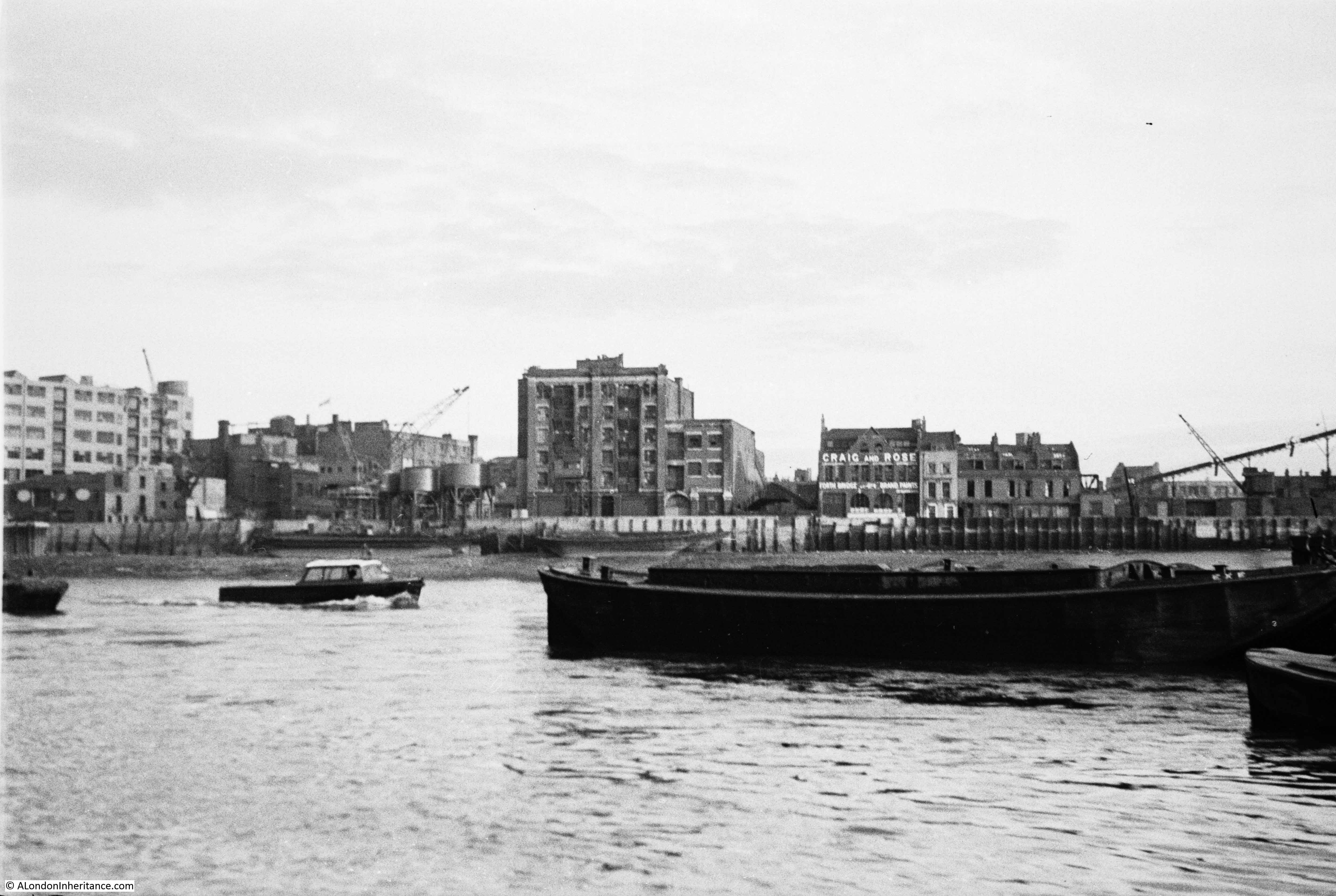
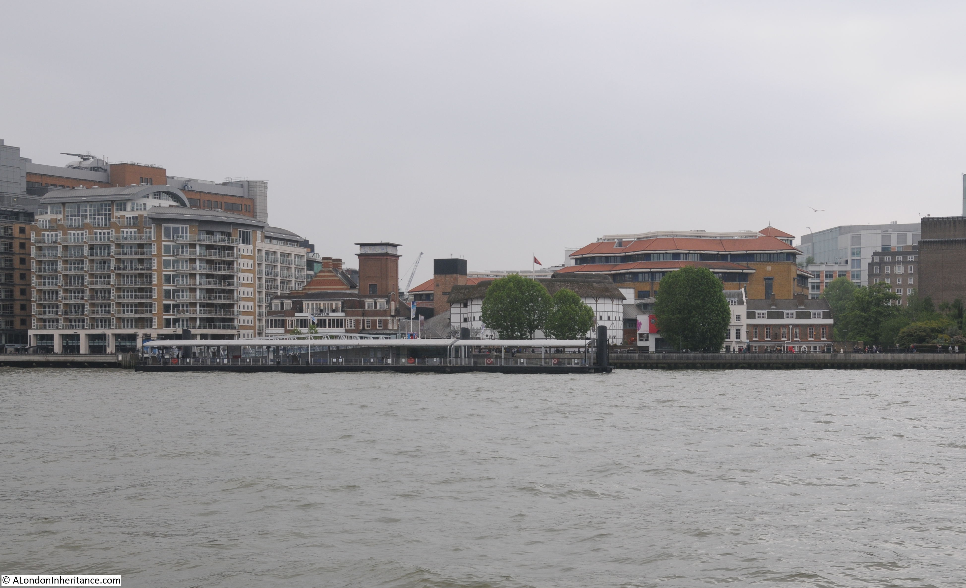
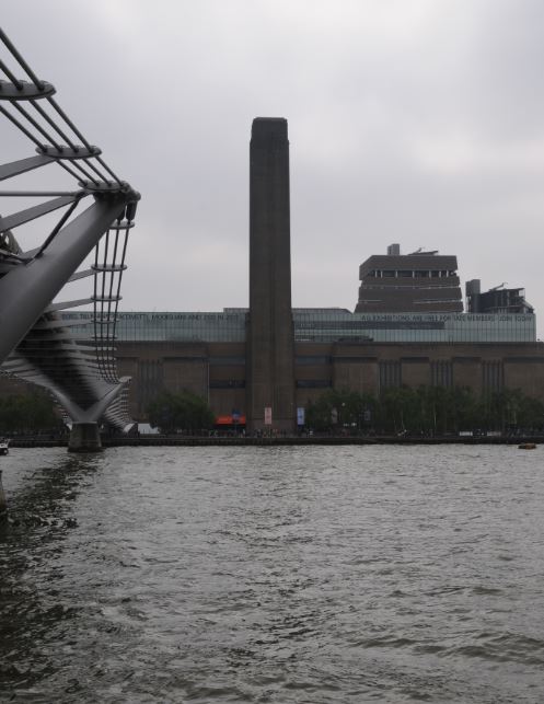
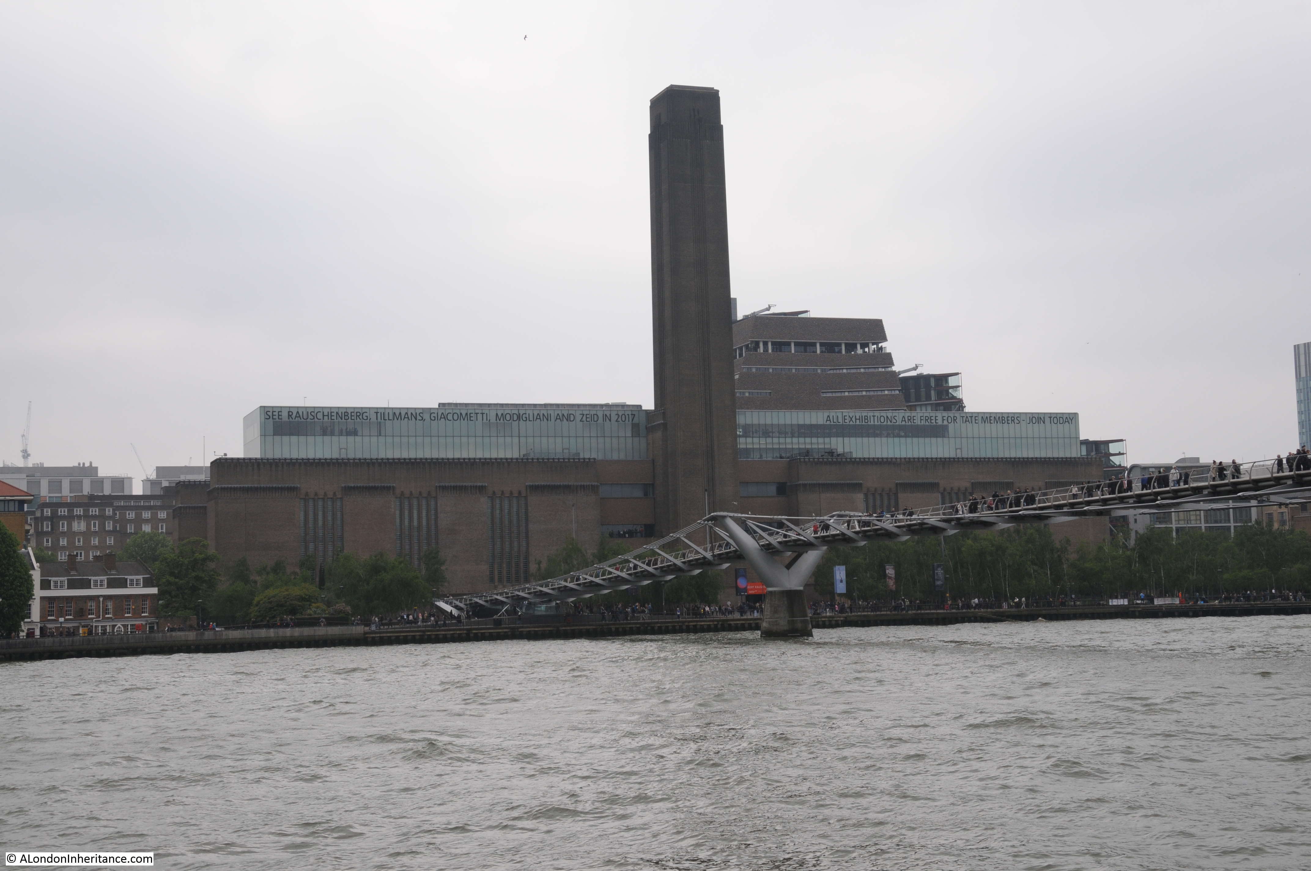
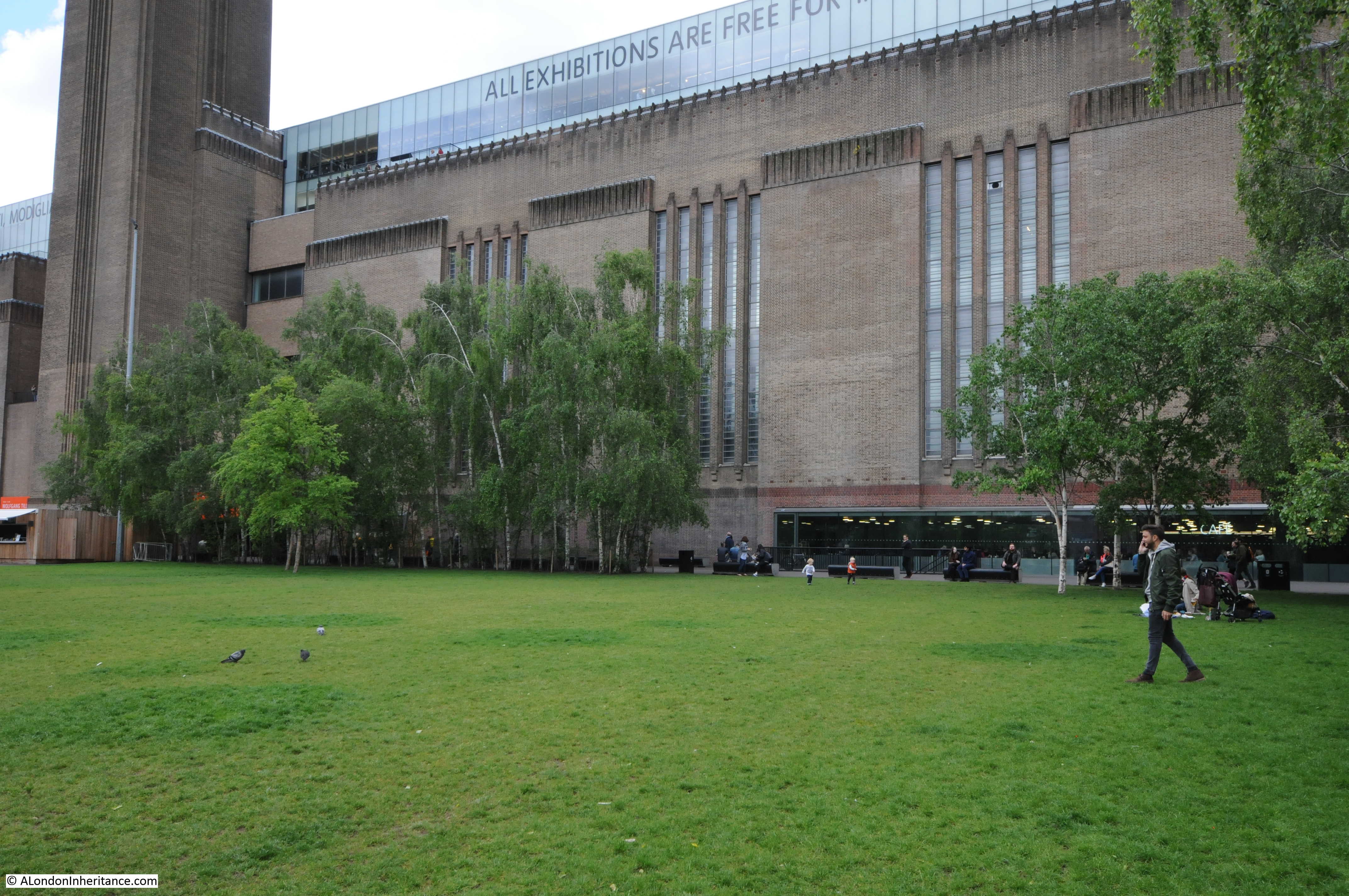
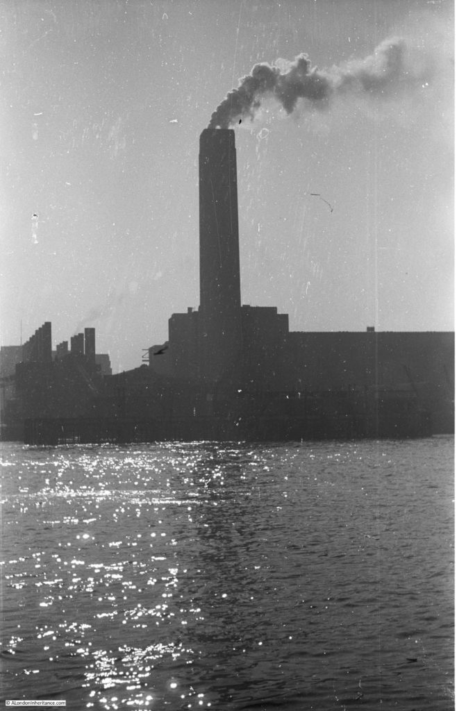
The following photo shows the view across the river to Tate Modern, the old Bankside Power Station:

Bankside Power Station

My father did take photos across the river from the top of the stairs at different times to the photos of Trig Lane Stairs.

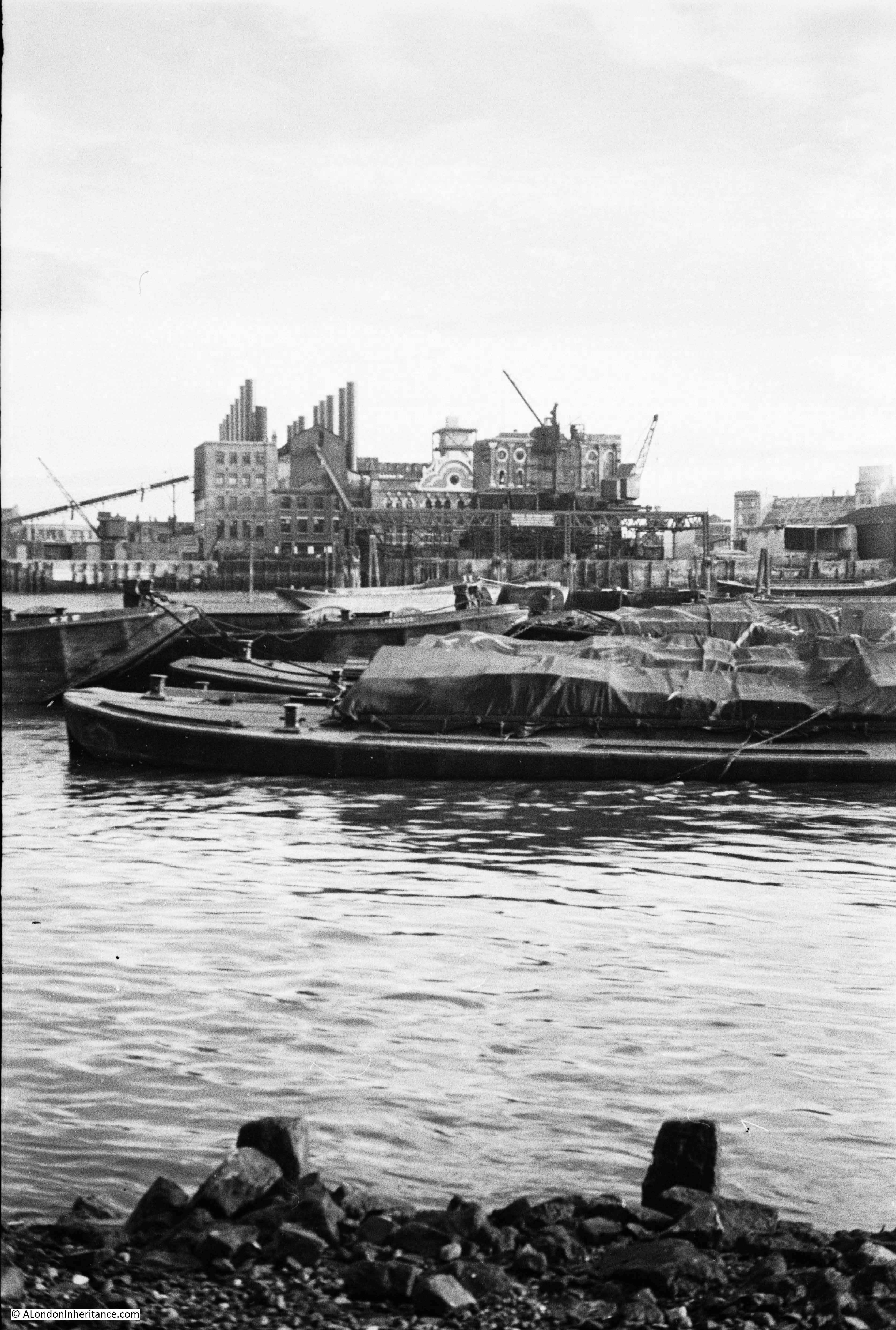
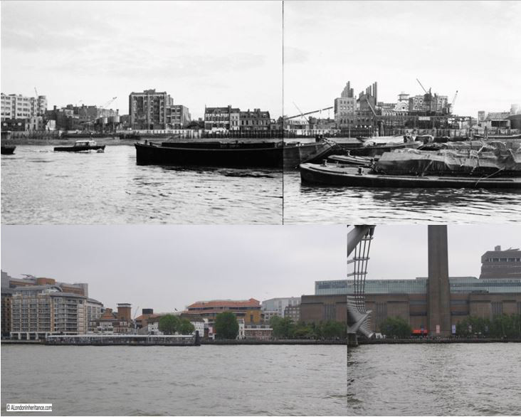
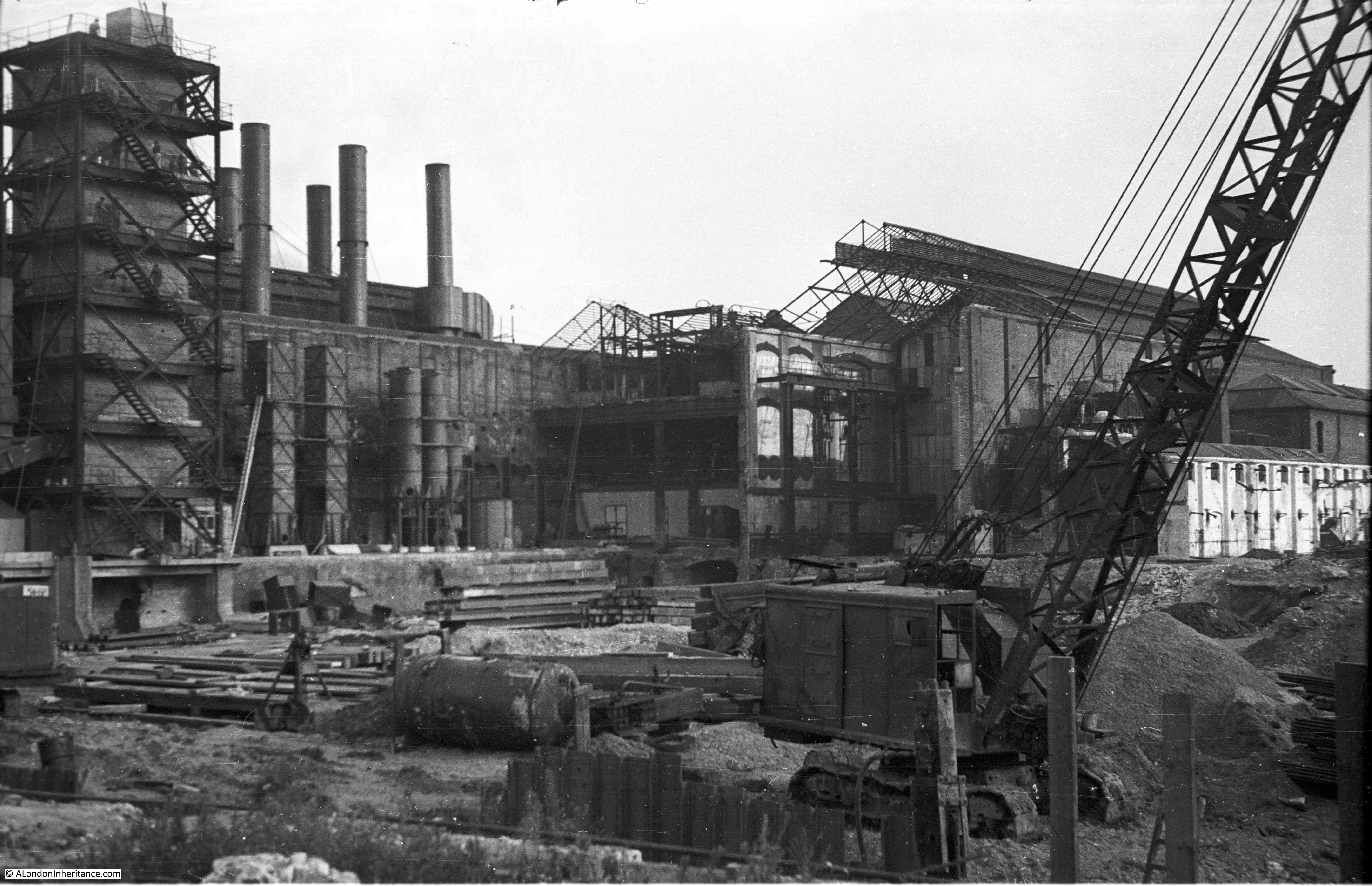
The first shows dates from 1953 and shows the new Bankside Power Station when the first half had been completed and was in operation. The original power station is on the left, where the parallel rows of chimneys can be seen. I wrote about the view, along with other photos in the post Building Bankside Power Station.

Bankside Power Station

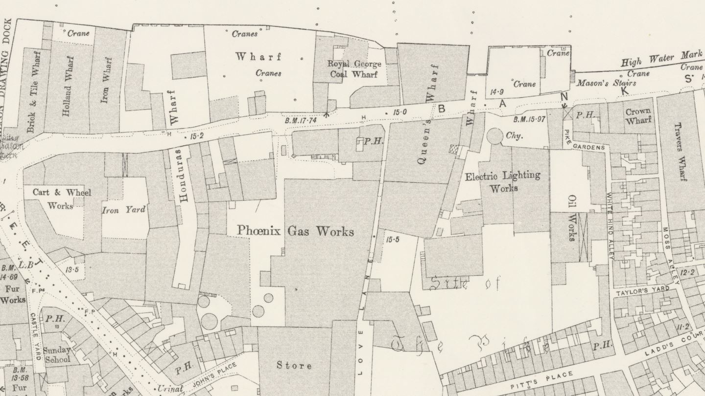
And this view from 1949 shows the original power station on the left, and the Phoenix Gas Works on the right. I wrote about this view, along with a wider view of Bankside in the post A Bankside Panorama In 1949 And 2017:

Bankside Power Station

Trig Stairs are in good condition, but the same cannot be said for the remains of the wooden structures on the foreshore, the groynes and the possible edges to a causeway leading out from the base of the stairs.

I suspect that erosion of the foreshore may have been speeding up over the last few decades, as the groynes and platform they protected are now not needed and are therefore not maintained, and that there are no obstructions along the foreshore or the river that would have slowed down water passing over the foreshore (for example, barges on the river and moored on the foreshore).

I doubt whether the remaining wooden structures below the Trig Lane Stairs will be there in another 74 years time.

alondoninheritance.com

A Bankside Panorama In 1949 And 2017

I have covered Bankside a number of times, however in this week’s post I want to show a different perspective of Bankside, as it was in 1949 from the north bank of the River Thames, before any of the developments that would transform the area from industrial to the arts and leisure Bankside that we see today.

For the post, I am covering the area of Bankside from Tate Modern (the old Bankside Power Station) up to Southwark Bridge.

My father took the following photo of part of Bankside in 1949:

Bankside Panorama

And here is my photo of the same area on a grey day in 2017:

Bankside Panorama

In the centre of the 2017 photo, behind the two trees is the Globe Theatre. To the right of this are the only couple of buildings that are the same in the two photos. Just behind the tree to the right of the Globe is 49 Bankside, the three storey white building (I covered 49 Bankside and Cardinal Cap Alley in detail in a post which can be found here).

To the right of 49 Bankside is a short row of houses, which again are the same in both photos. Everything else in the two photos has changed.

The building immediately to the left of 49 Bankside in the 1949 photo was the office and factory of Craig and Rose. Their name can be seen in large white letters along the top of the first floor. Between the ground and first floors are the words “Forth Bridge Brand Paints”.

Craig and Rose were a paint manufacturer who are still in business today and claim to be the UK’s oldest independent paint manufacturer.

The company was established in 1829 by James Craig and Hugh Rose, two Scottish entrepreneurs who set up the business in Edinburgh. The business expanded rapidly and in 1880 won the contract to supply paint for the Forth Bridge, with their Red Oxide paint being supplied to paint the bridge until 1993.

The Bankside building was constructed in 1897 for Craig and Rose, and operated until the early 1950s. Craig and Rose are now based in Scotland.

When I was sorting through my files of scans of my father’s photos I found the following photo which was taken on the same day as the above 1949 photo.

This is of the original Bankside Power Station on the left and the Phoenix Gas Works on the right. I wrote about the original Bankside Power Station in this post where there are photos of the first phase of the new power station built over the site of the gasworks.

Bankside Panorama

On the left of the above photo is a conveyor belt running from almost the top of the power station down to the ground on the extreme left of the photo. I believe this was to transport coal into the power station ready to be burnt.

This conveyor belt is also visible in the photo at the top of the post with 49 Bankside and Craig and Rose, so despite the photos being different orientations I put the two together to produce the following view of the wider Bankside:

Bankside Panorama

And with a bit of cropping and some very amateur joining of photos I present a Bankside Panorama in 1949 and almost seventy years later in 2017.

Bankside Panorama

Only a small part of the Millennium Bridge is shown as for the photo on the left, I had to take this from almost under the bridge to provide a slightly angled view otherwise with a straight on view, 49 Bankside, the key building in both 1949 and 2017 was obscured by the tree.

I am not sure what is the most remarkable – that this stretch of Bankside has changed so much, or that 49 Bankside and the short row of houses to the right have managed to survive when everything else along this stretch of the river has been redeveloped.

The two photos also show how use of the river has changed. In 1949 the river was busy with lighters and barges moored along the river. Today, the river is quiet apart from tourist boats and the Thames Clipper river buses. I believe the moving boat on the left of the 1949 photo is a police launch as it looks identical to photos I have of moored police launches by Waterloo Bridge.

It was interesting to stand on the north bank of the river with the 1949 Bankside panorama in hand, looking at the view of Bankside seventy years later.

I do need to return when the leaves have fallen from the tree in front of number 49, and the lighting is better so I can get an improved 2017 view, with the bridge and avoiding the grey backdrop, however I hope you find the two panoramas of Bankside as interesting as I have.

alondoninheritance.com

Building Bankside Power Station

In 1953, soon after it started operation, my father took the photo below of Bankside Power Station. The photo suffers from a problem I often have when taking a photo of the southern bank of the river from the north on a clear day as the sun is in the south and puts the power station into silhouette.

In the photo, Bankside Power Station also looks only half built, which indeed it was. There is a smaller building on the left with two rows of chimneys receding from the river’s edge. This is the original power station on the site.

Bankside Power Station

Roughly the same view today. The Millennium Bridge now crosses the river in front of the old Bankside Power Station building.

Bankside Power Station

A view from further along the river showing the full size of the former Bankside Power Station building.

Bankside Power Station

This area of Bankside has produced energy for many years before the current Bankside Power Station was built. The following extract from the 1892 Ordnance Survey map shows towards the right of the map an Electric Lighting Works and on the left the Phoenix Gas Works. Both of these industries were located adjacent to the river as they both used coal to generate either electricity or gas.

Bankside Power Station

The original power station was built by the City of London Electric Lighting Company in 1891 and over the years underwent a number of extensions and upgrades to form the building with the two rows of chimneys as seen in may father’s photo.

Each chimney was connected to an individual boiler and a separate building contained the generator that was driven by the steam from the boilers to produce electricity for distribution in the local area and by cables across the river to the City. Electricity generation was originally a local activity with no national grid to distribute across the country. There were power stations located across London, including the Regent’s Park Central Station where my grandfather was superintendent.

The design of the original power station and the equipment used was highly polluting with so many chimneys pouring smoke, ash and grit onto Bankside.

Planning during the war identified the need for a significant number of new power stations across the country with post war consumption of electricity expected to surge. London would be one of the areas where the old, polluting power stations urgently needed to be replaced with cleaner power stations with higher generation capacity.

The 1943 County of London Plan proposed the redevelopment of the south bank of the river to remove heavy industry and line the river with offices, flats and public gardens with commercial and light industrial buildings to the rear. Heavy industry such as power stations were to be relocated out of central London to places such as Poplar, Rotherhithe and east along the river. The following extract from the 1943 plans shows the proposals for the south bank:

Bankside Power Station

As always happens with long-term, strategic plans, events take over and problems such as power shortages during the very cold winter of 1947 forced different decisions to be made and the go ahead was given in 1947 for a new power station to be built at Bankside. In giving this approval there was one major change. Originally it was planned for the power station to continue using coal, however the level of pollution in the area, the space needed for coal storage and the need to diversify power production away from one signal source Influenced the Government to change plans for the new Bankside Power Station to switch from coal to oil. As well as being slightly less polluting, oil had the advantage that it could be stored in large underground tanks, thereby removing the need for large fuel storage areas above ground.

Although oil was slightly less polluting, the new Bankside Power Station would continue to have an impact on the local area and on the river. Flue gases were washed by water taken from the river. These waters would then be returned to the river with a higher particle content and acidic level.

When the go ahead was given for the new power station, as well as concerns about locating such an industry in central London, there were also complaints that the new building would dwarf St. Paul’s Cathedral. Sir Giles Gilbert Scott changed the design from dual chimneys to a single chimney and ensured that the overall height of the chimney was lower than the dome of the cathedral. This was helped with the land on which the cathedral is built being higher than the river side location of the power station, however the reduced height of the chimney did contribute to ongoing local pollution problems.

Construction of the first half of Bankside Power Station took place between 1947 and 1953. This saw the completion of the western half of the building and the central chimney with first power being generated in 1953, and this is the status of Bankside Power Station that my father photographed in the photo at the start of this post.

He had also walked around the area a number of years earlier when construction first started. He took the following two photos showing the demolition of the buildings that had been on the site, and the start of construction of the new power station.

In this first photo, he is standing in front of what would become the wall of the building facing to the river, at the western edge. Five chimneys on the rear of the original power station can be seen, and on the far left of the photo are the lower levels of the new chimney.

Bankside Power Station

I took the following photo further away from the power station than my father’s photo above. If I was much closer it would just be looking directly into the building, however it does give a view of the same scene as it is today with the base of the chimney on the left of both photos. In the above photo it is the central core of the chimney which is seen, the brick outer structure is yet to be added.

Bankside Power Station

The second photo is looking directly across the construction site towards the south.

Bankside Power Station

The Britain from Above website has a number of photos taken by Aerofilms which show the Bankside site under development. The first photo is from 1946 and shows the site prior to development of the new power station. The site can be located by the double row of black chimneys of the original power station which is located in the middle of the lower part of the photo.

Bankside Power Station

The next photo is from 1952 and shows the power station nearing completion. The core of the chimney is complete, but it lacks the outer brick facing. The metal framework around the upper part of the chimney is the same structure as shown on the lower part of the chimney in my father’s photo. The original power station can clearly be seen covering the land where the second half of the new Bankside Power Station would later be built.

Bankside Power Station

The next photo is also from 1952 and shows the power station looking from the north. This again shows the original power station to the left of the new Bankside power station.

Bankside Power Station

And the final photo in June 1952, a couple of months after the above photos now shows the main building and chimney almost complete. The photo also shows the structures on the river that allowed oil tankers to dock and unload their cargoes into the underground tanks of the power station.

Bankside Power Station

Both the old and new Bankside Power Stations continued in operation until 1959 when the old power station was finally decommissioned and demolished. The second half of the new power station was built between 1959 and 1963 by when the building we see today was finally in place. In all, around 4.2 million bricks were used on the external walls of the building and chimney.

The oil crisis during the 1970s had a considerable impact on the financial viability of oil fired power stations. The power station was also continuing to pollute the local area and the river. Power stations were also being built out of cities and there were now power stations further down the Thames. The continued operation of Bankside Power Station could no longer be justified and electricity generation finally ended at Bankside in 1981, almost 100 years from the first, small steps in electricity generation on the site.

The building remained unused for a number of years until plans were put in place to transform the building into Tate Modern. A competition was held for a new design which was won by the firm of Herzog & de Meuron. Their design made very few changes to the external structure of the building so the original design of Sir Giles Gilbert Scott is basically the building we see on Bankside today.

Bankside Power Station is a wonderful building. It is from an era when power stations were built as cathedrals of power, Battersea Power Station being another example of the style. The preservation of the external structure of the building and that now through Tate Modern it is fully open is to be appreciated.

alondoninheritance.com