Tag Archives: Bermondsey

The Thames from Cherry Garden Stairs

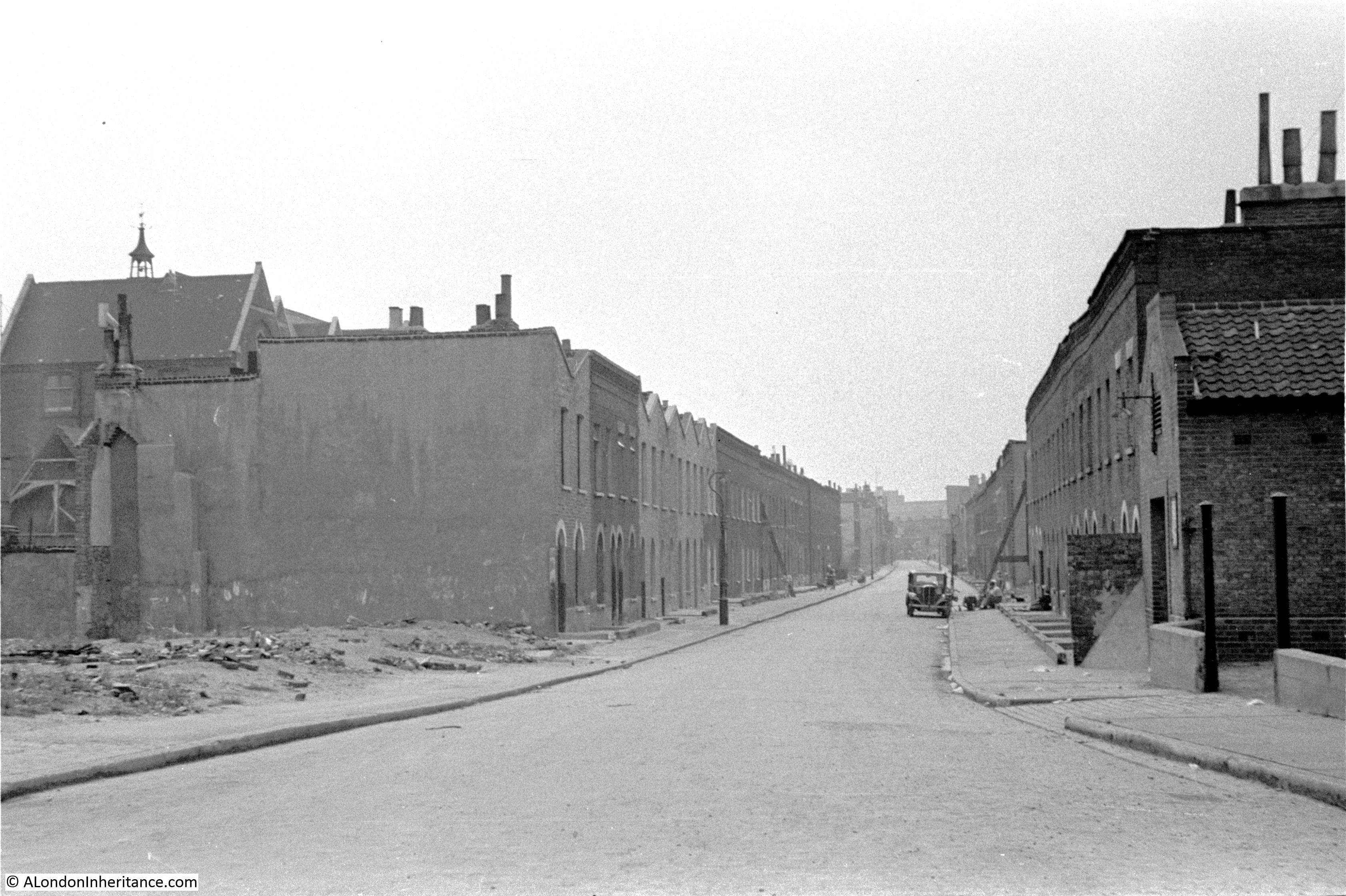
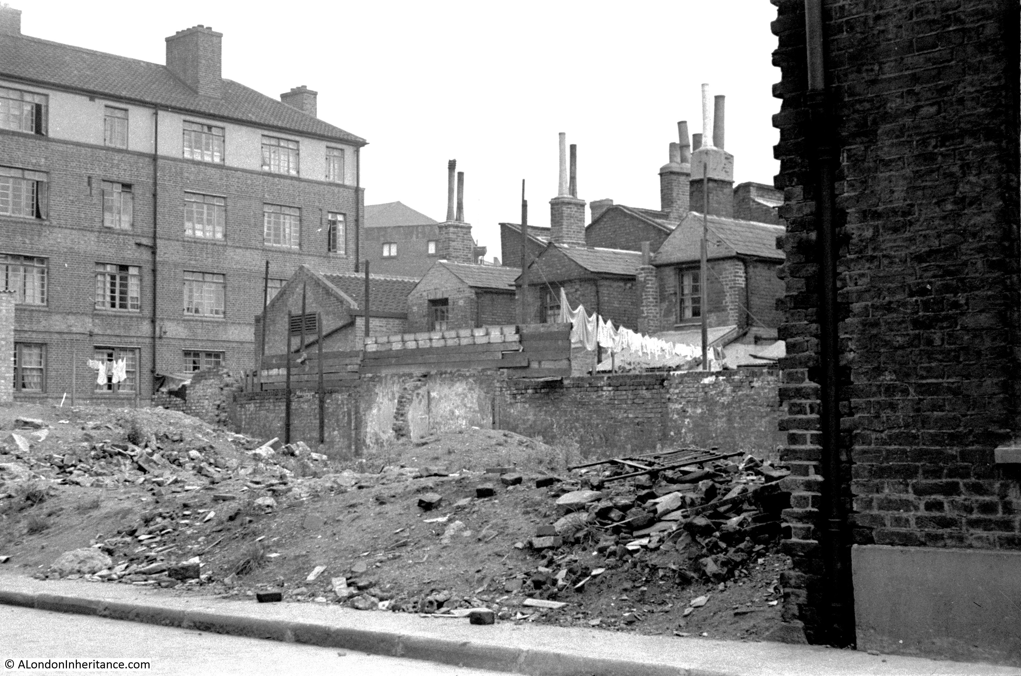
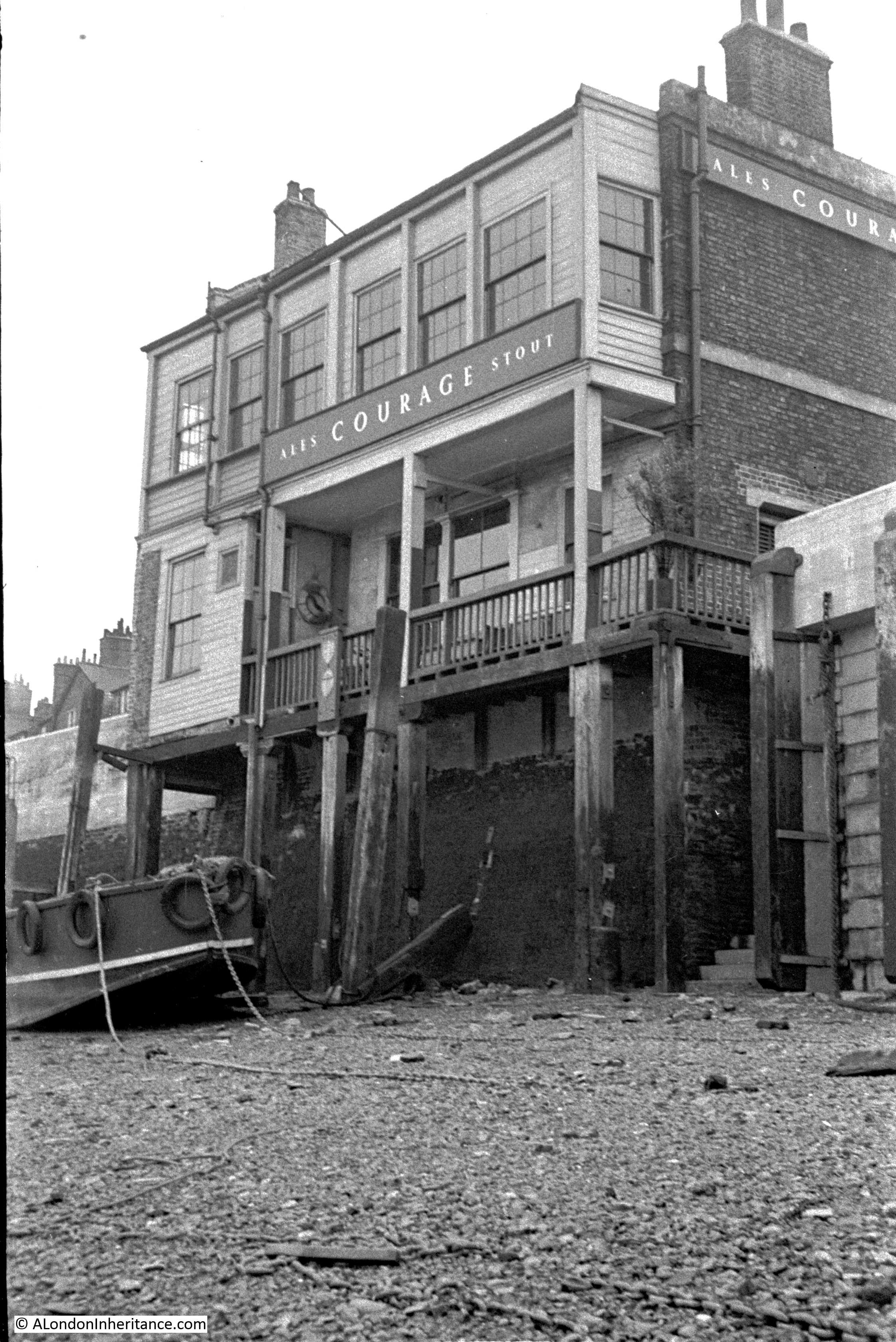
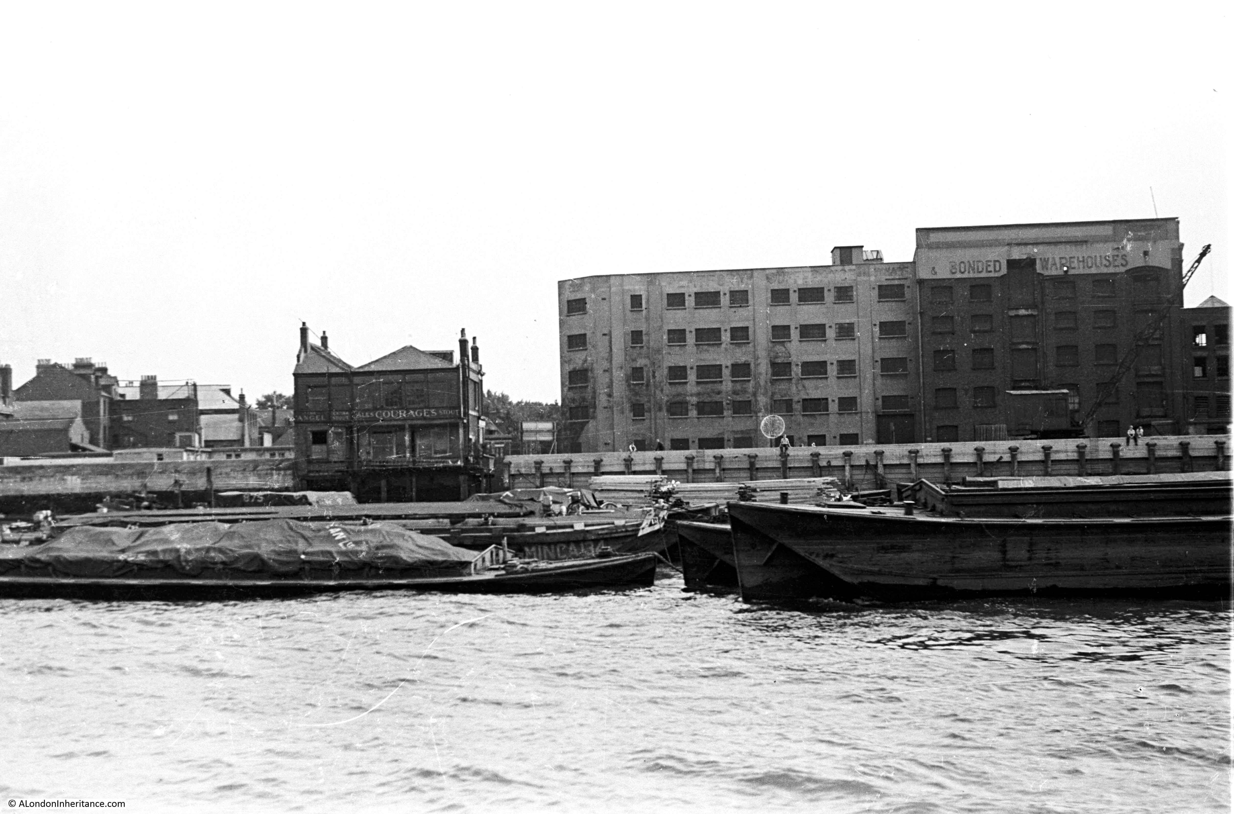
The subject of this week’s post is one of the earliest of my father’s photos as it dates from 1946. The negative is 75 years old and is not in that good a condition. The scanned image needed some processing to get it to the state you see below, and it is still rather grey with poor contrast.

The photo is from Cherry Garden Stairs, Bermondsey, looking along the river towards the City, with the dome of St Paul’s Cathedral visible through Tower Bridge.

Cherry Garden Stairs

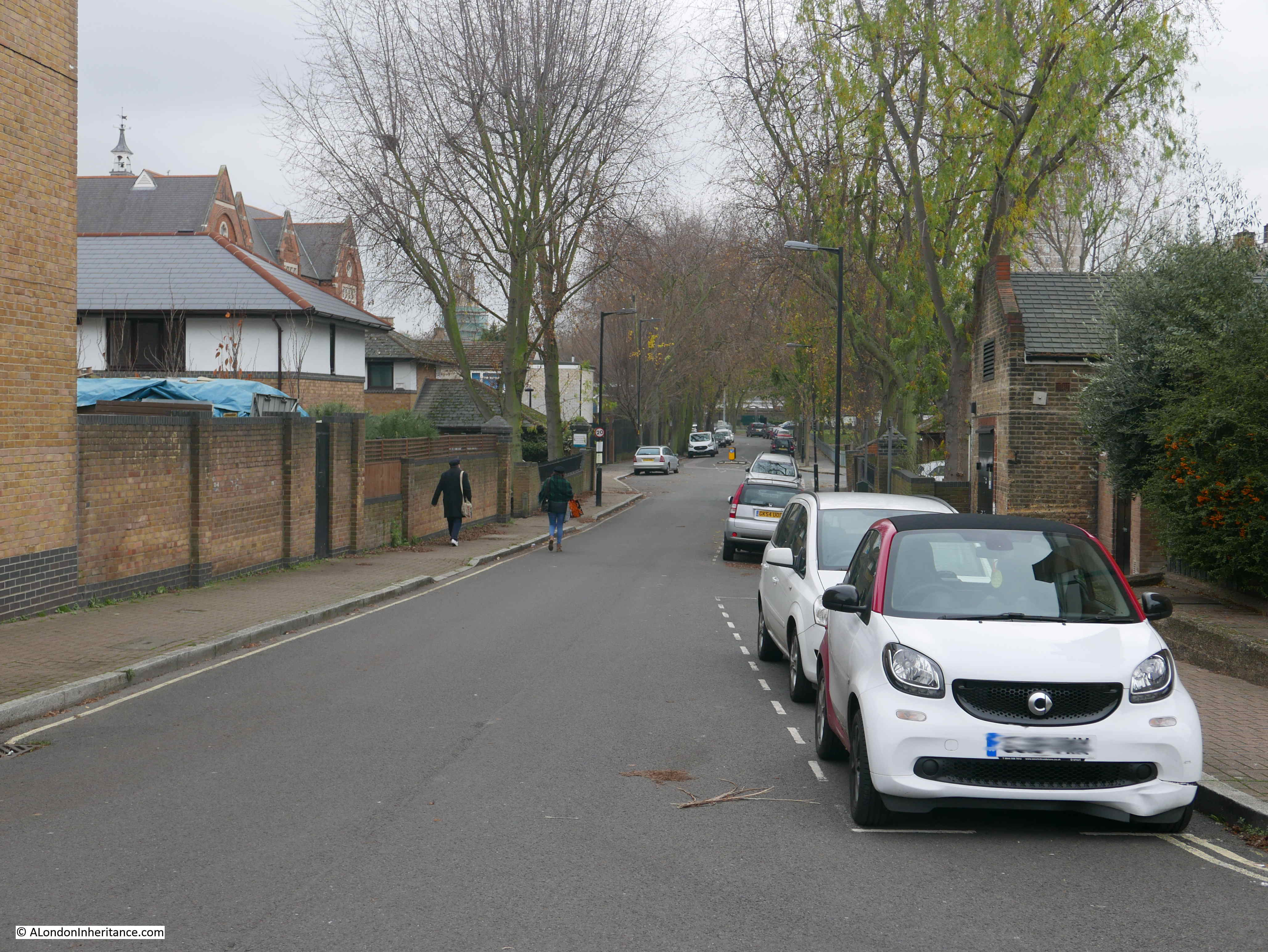
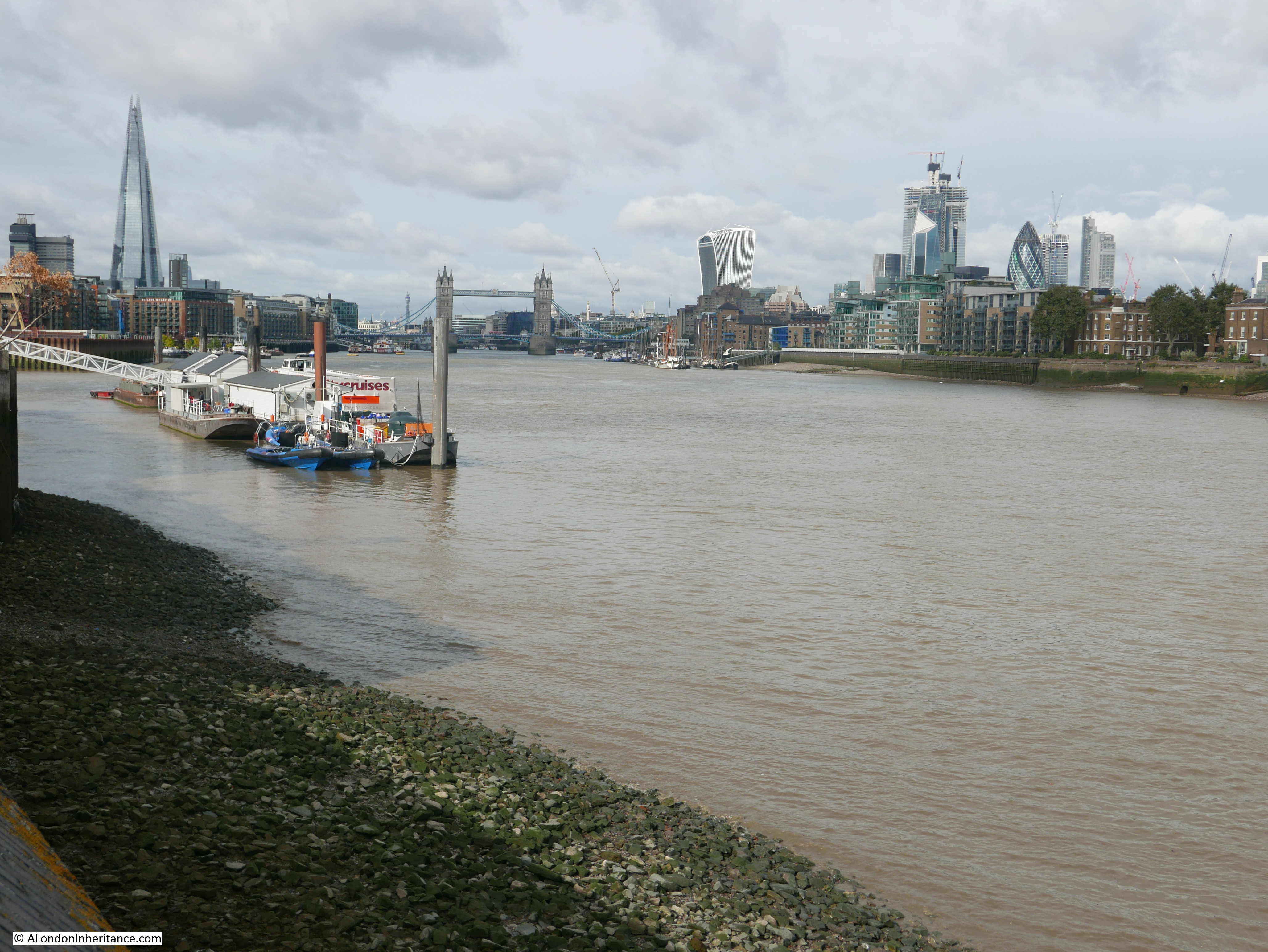
The same view today, with the dome of St Paul’s Cathedral in exactly the same place, however a very different river scene (the perspective looks different due to the very different camera and lens combinations used).

Cherry Garden Stairs

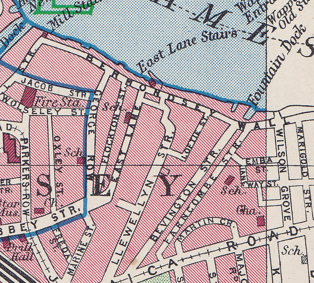
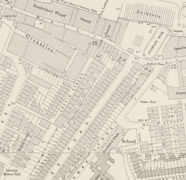
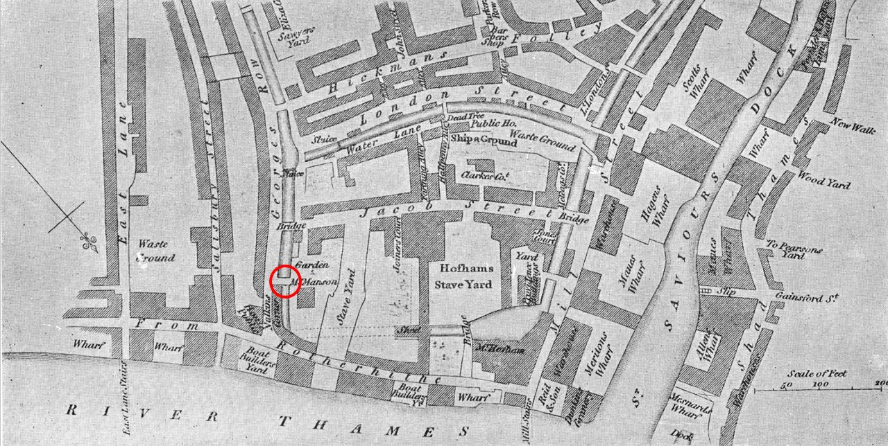
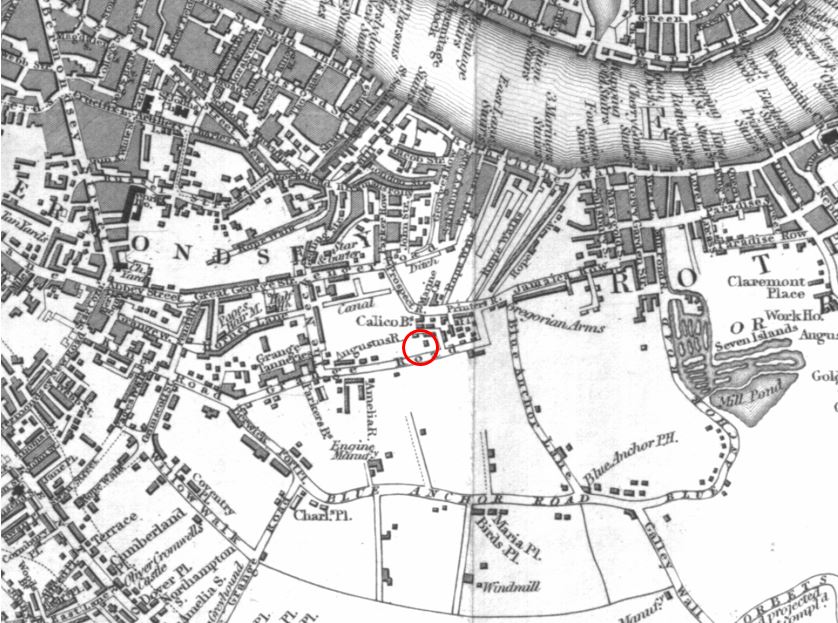
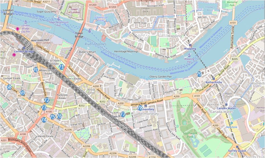
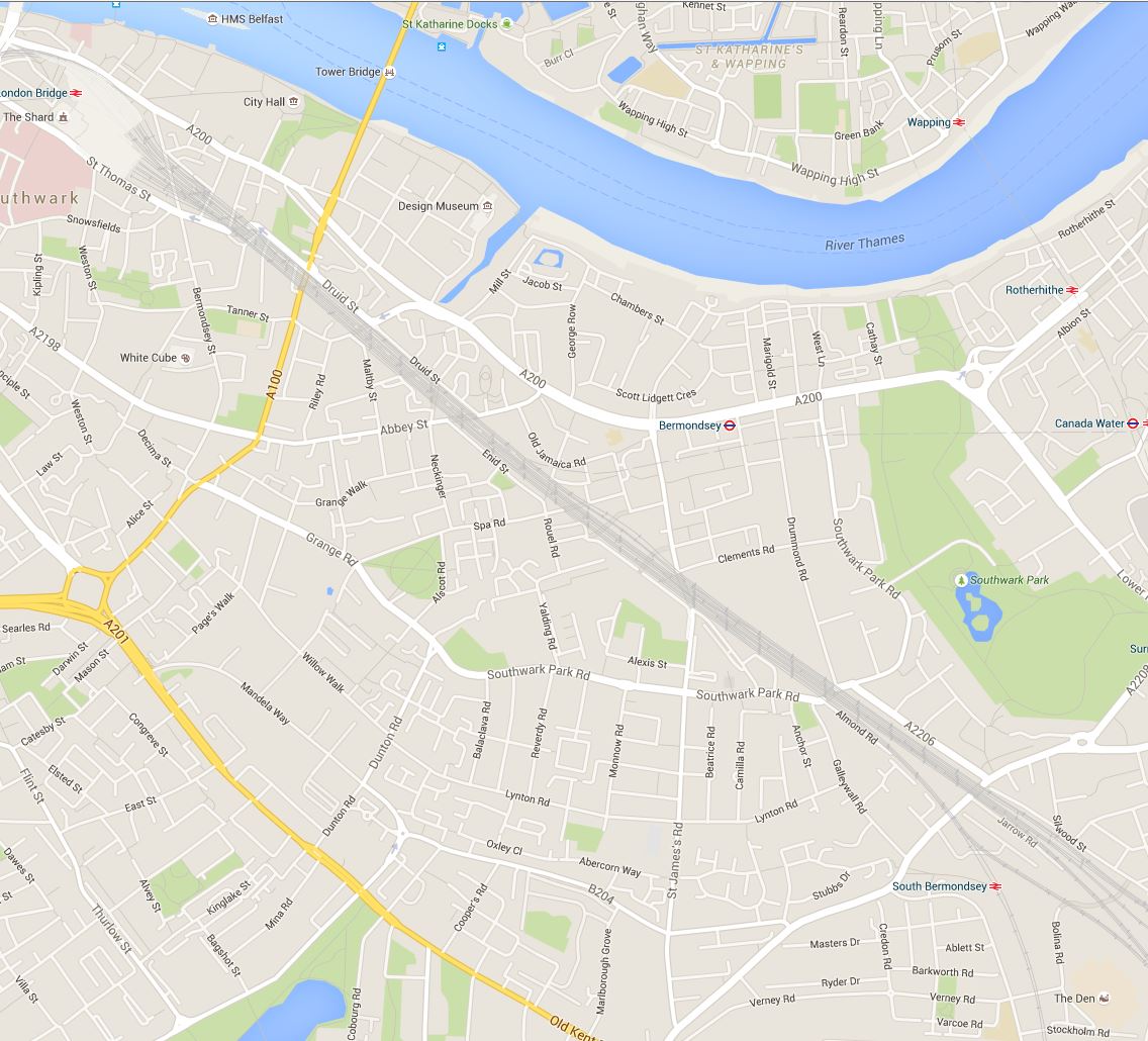
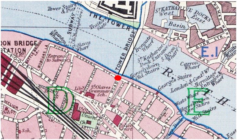
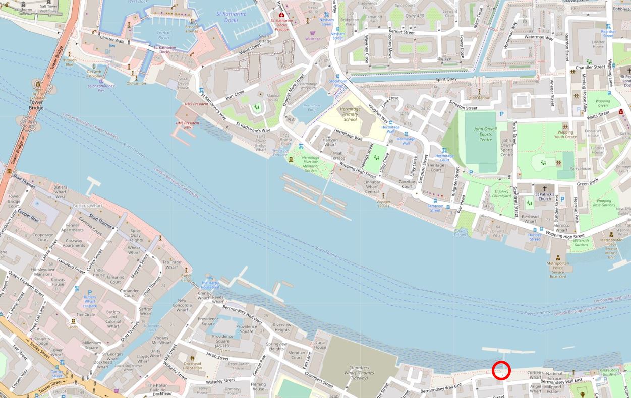
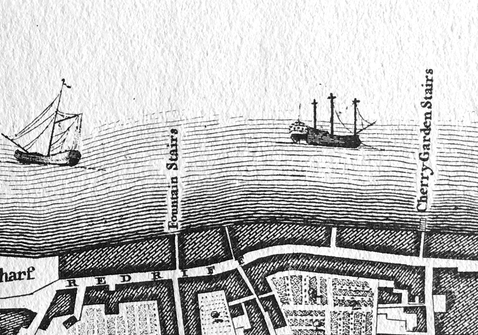
The location of Cherry Garden Stairs is shown in the following map, with the stairs located within the red circle at lower right. The 1946 photo looks along the southbank of the river towards Tower Bridge  (Map © OpenStreetMap contributors).

Cherry Garden Stairs

The two photos show a very different scene.

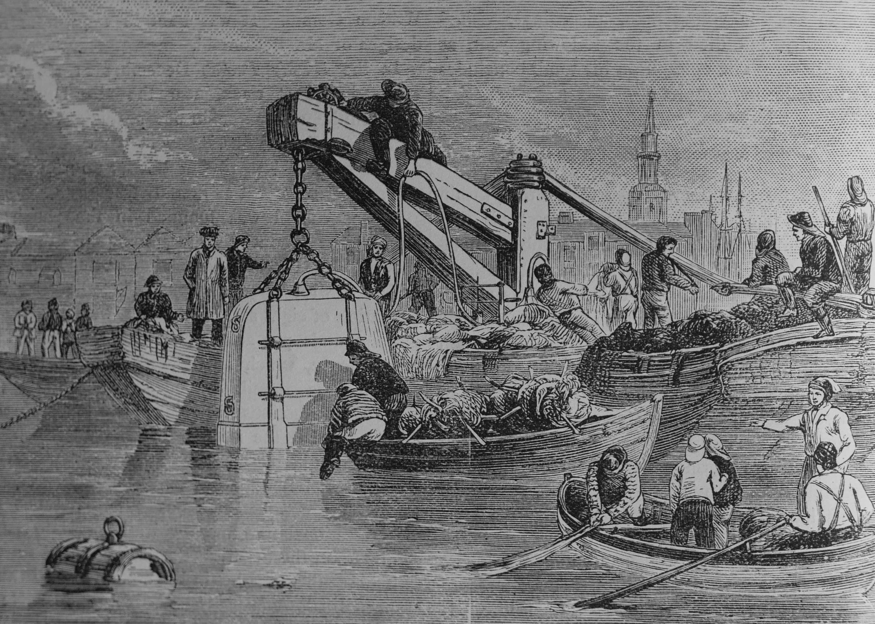
In 1946, the river bank was lined by warehouses, wharves and docks, with cranes along the river. A large number of lighters and barges are moored in the river, and directly in front of the camera, which would have been on the foreshore of the river.

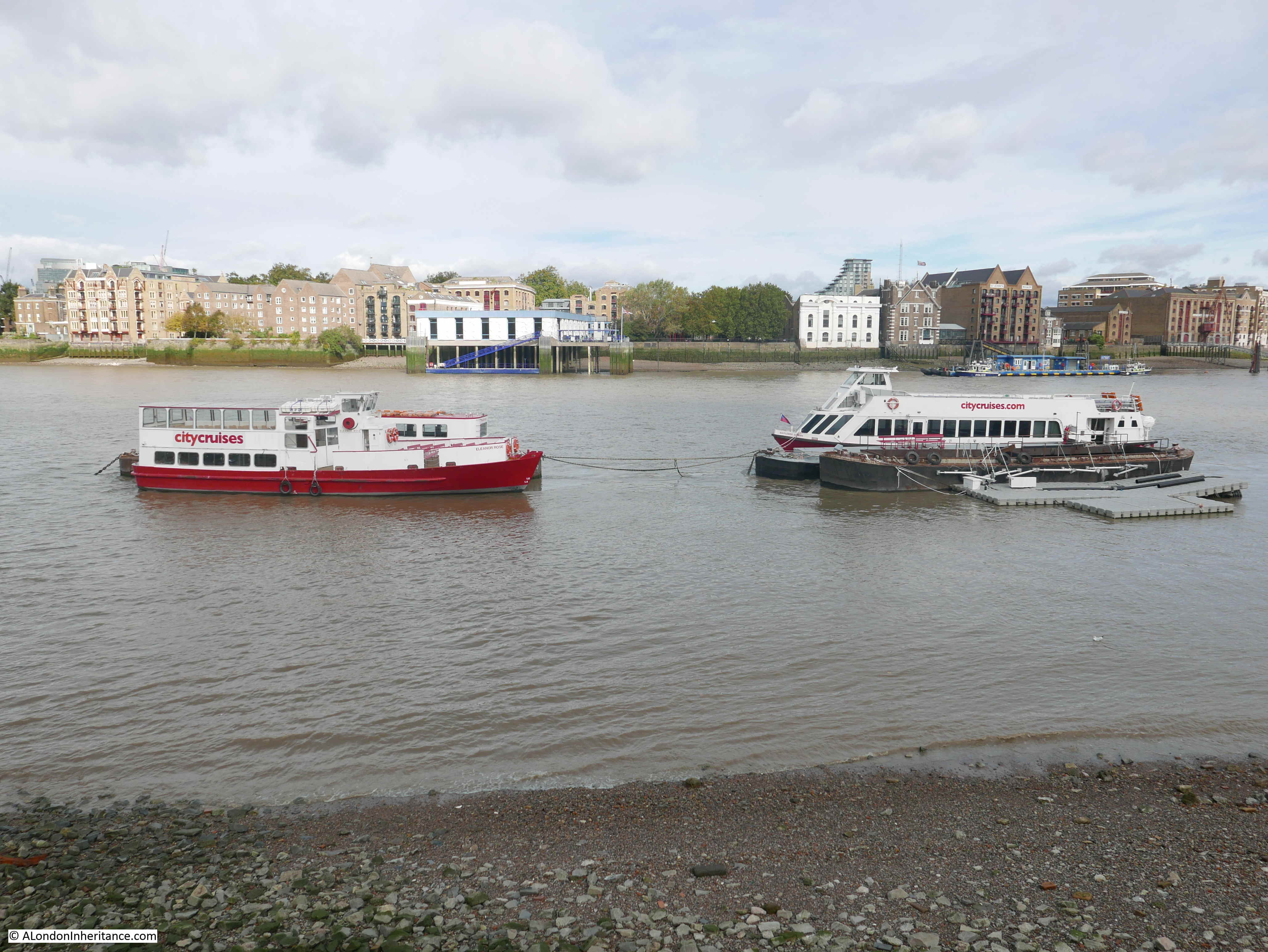
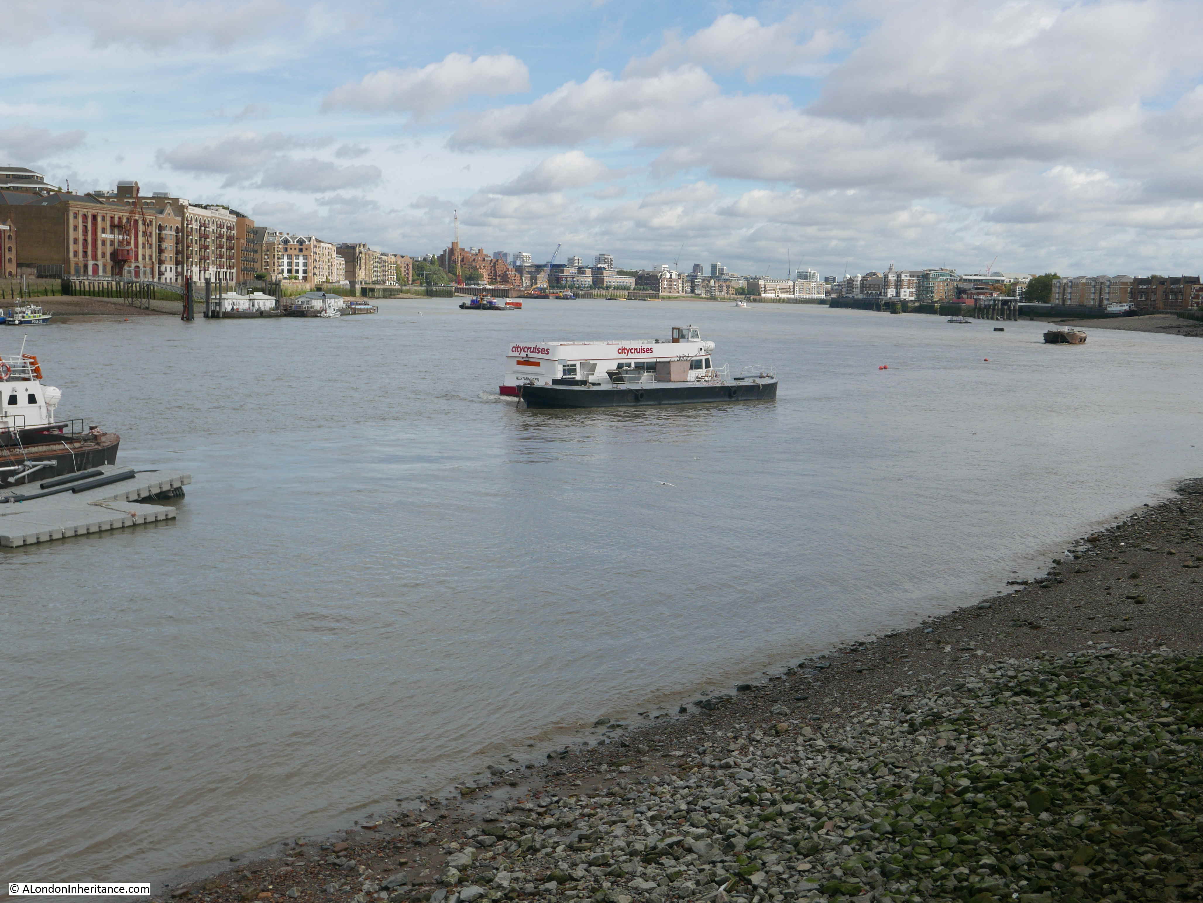
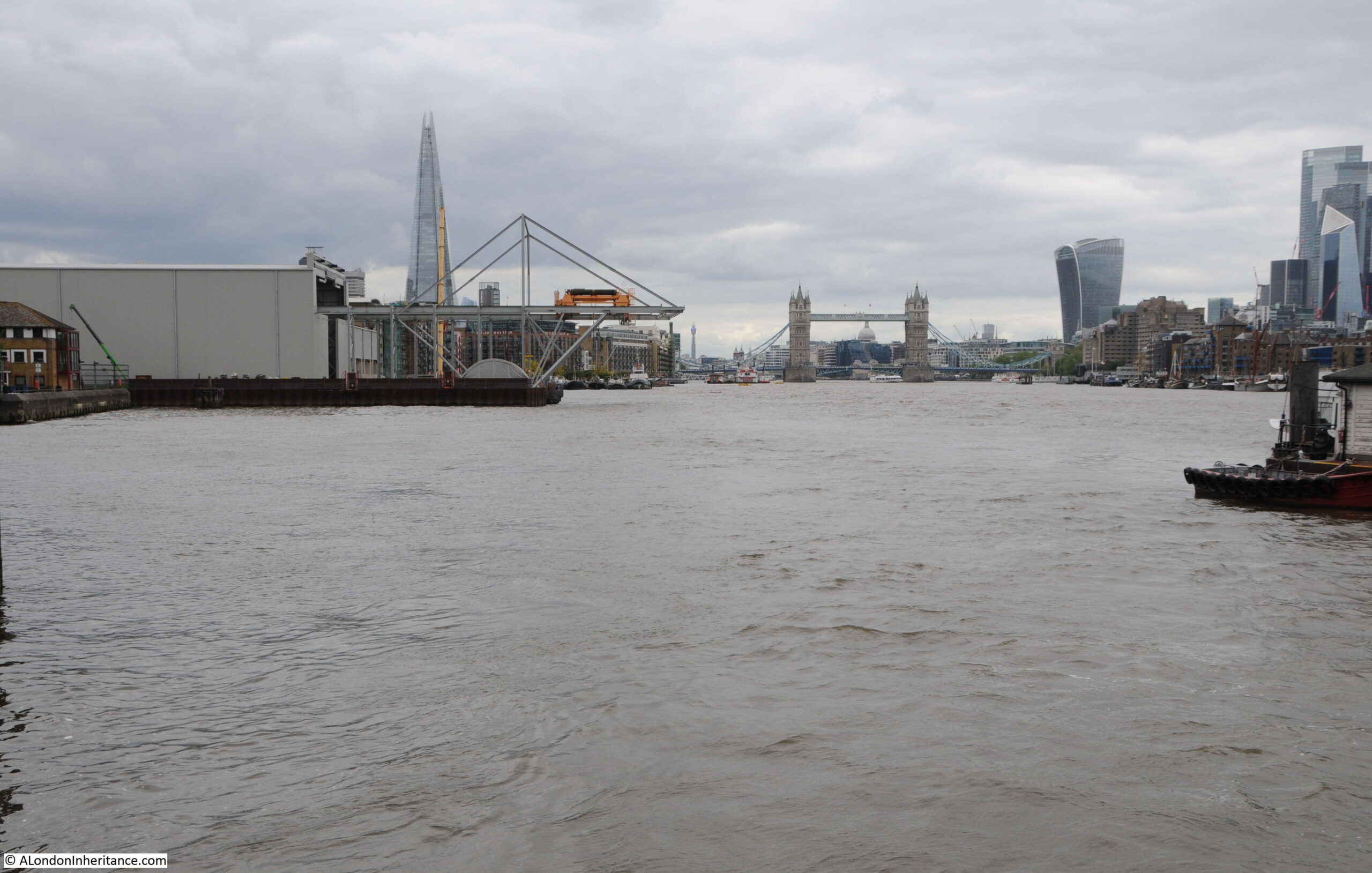
In the 2021 photo the towers of the City are visible to the right, along with the Shard on the left. There are no more working warehouses, wharves or docks, and traffic on the river is today very different.

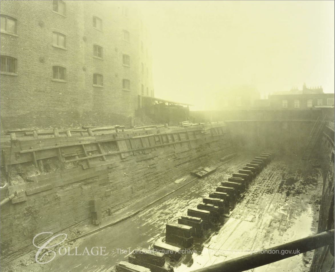
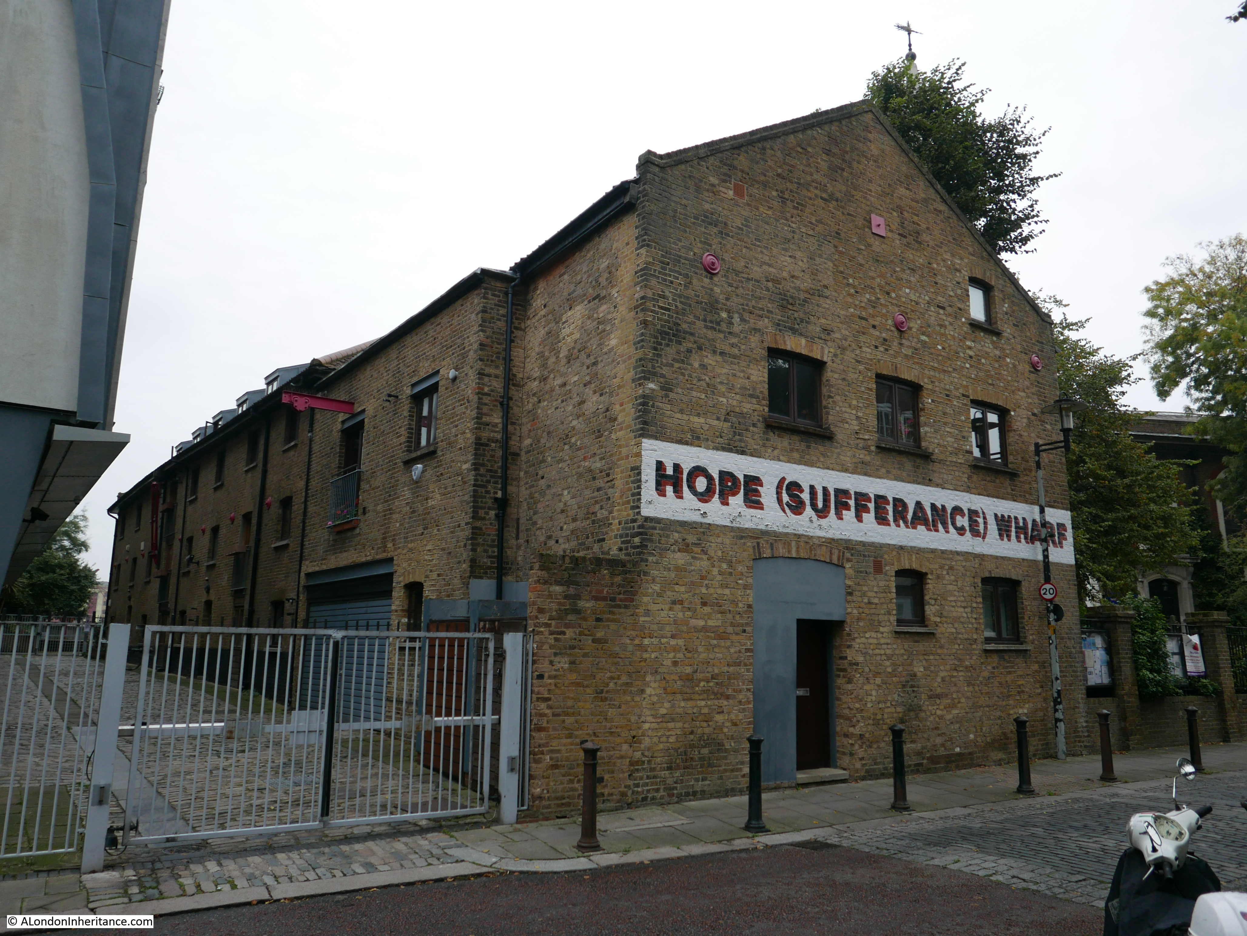
The river is though still used to transport construction equipment to a major construction site. In the 2021 there is a large shed on the left bank of the river, with the metal work of a travelling crane extending from the shed to over the river.

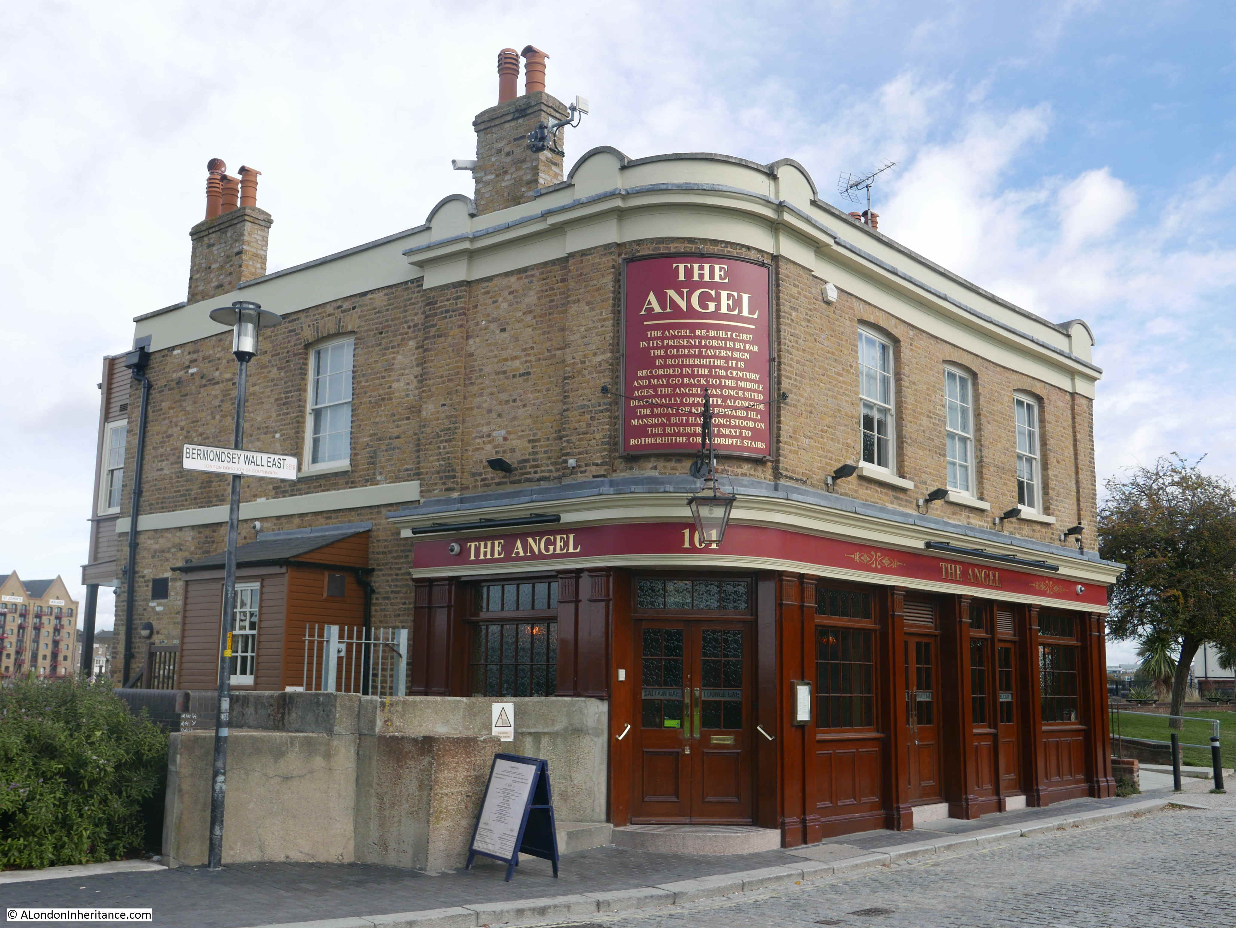
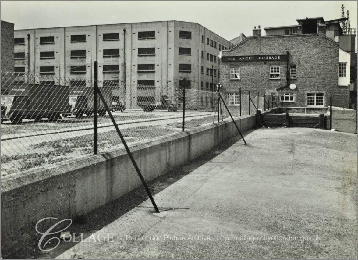
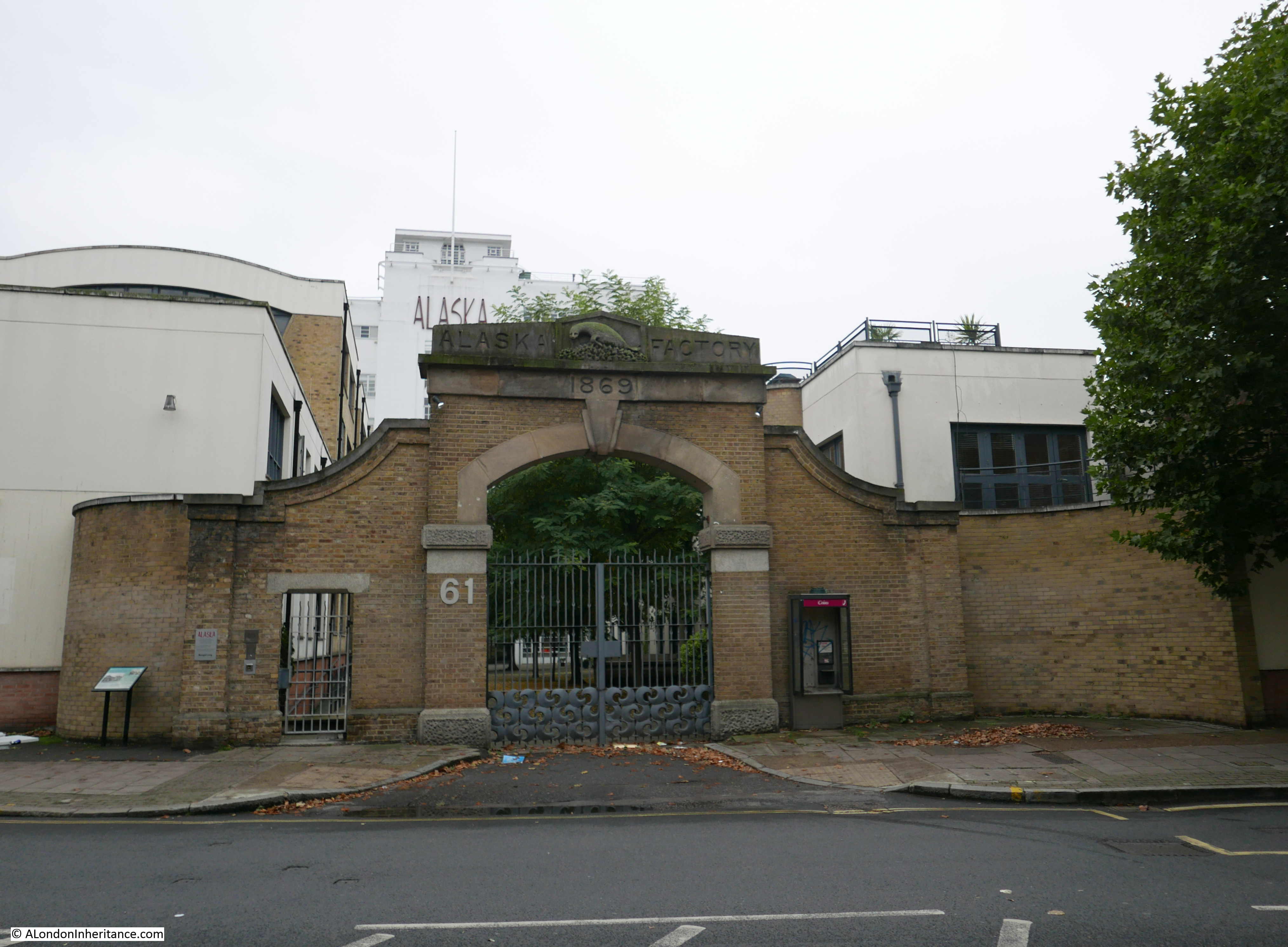
This is Chambers Wharf, one of the main construction sites for the Thames Tideway Tunnel. Chambers Wharf is one of the project’s main drive sites, with boring machines transported to the site via the river, and lowered by crane down to the point where the machines drive out, creating the tunnel.

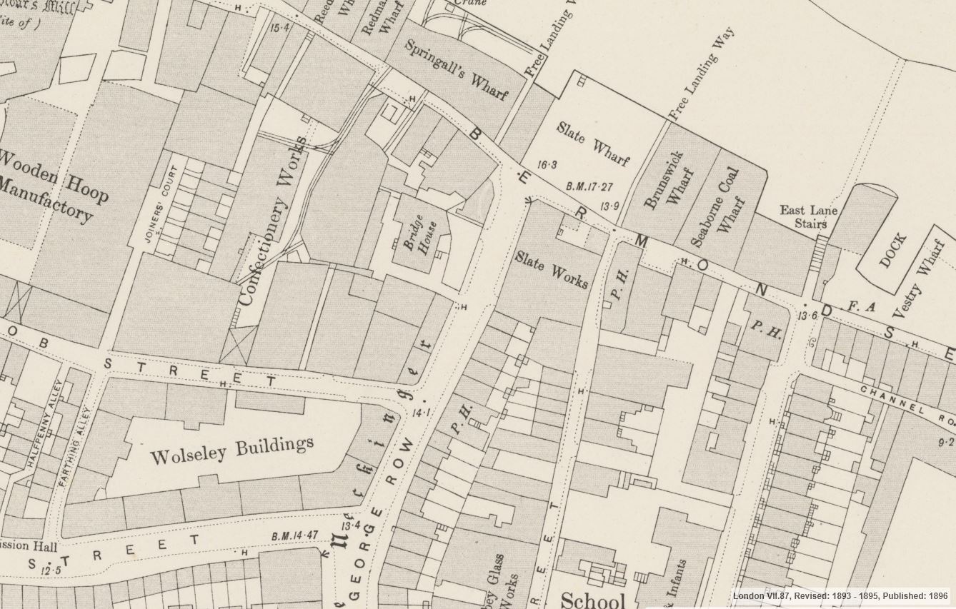
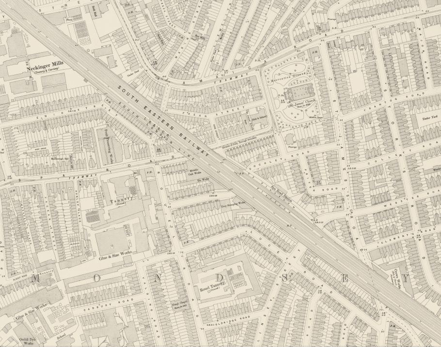
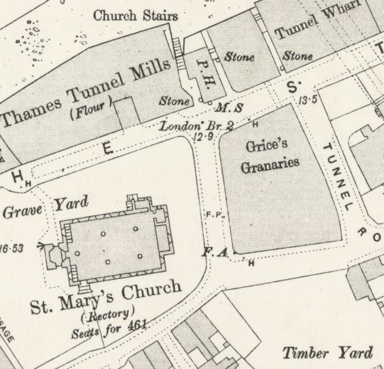
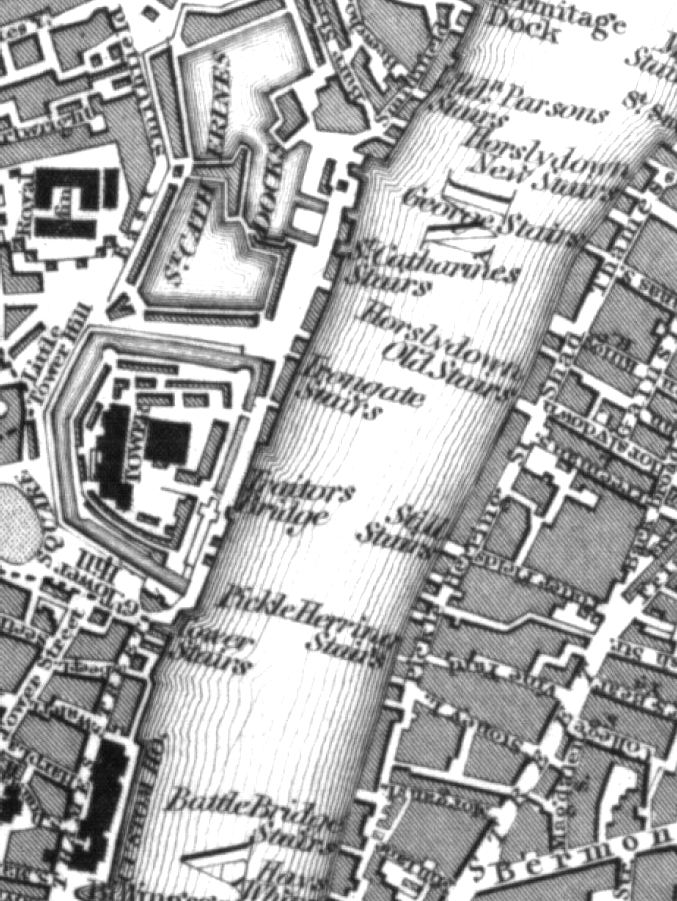
Chambers Wharf was one of the many wharves between Tower Bridge and Cherry Garden Stairs. The following map is from the 1953 edition of London Wharves and Docks, and the left of the river covers the area from Tower Bridge to Cherry Garden Stairs seen in my father’s photo.

Thames Wharves

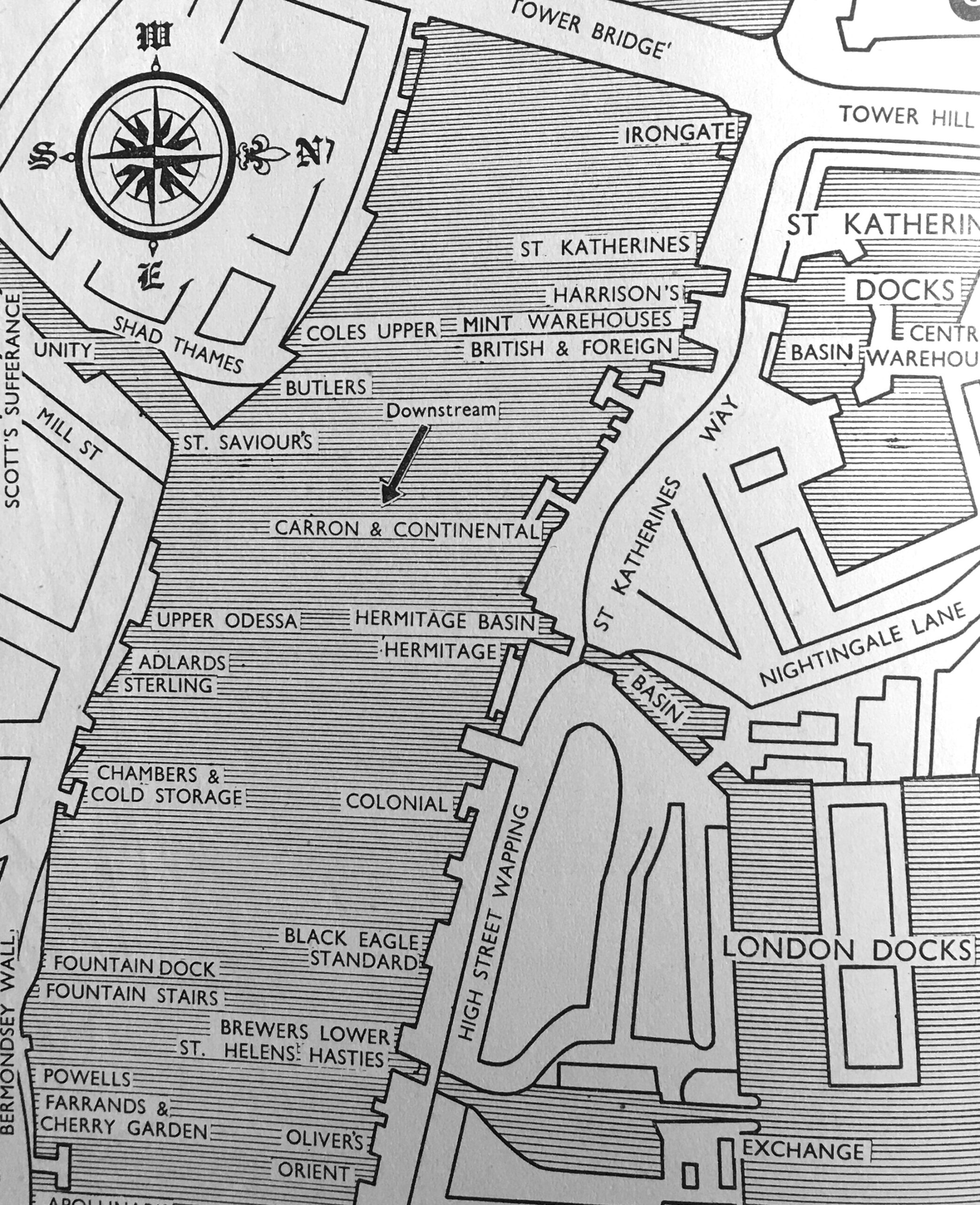
The type of goods that these wharves dealt with are (from the top of the left bank of the river):

  • Coles Upper Wharf: Bulk grain, flour, cereals
  • Butler’s Wharf: Tea, rubber, colonial produce, bulk grain, fresh fruit
  • Upper Odessa Wharf: Cereals, non-hazardous chemicals, bagged goods
  • Adlards Wharf: General and bagged goods, timber
  • Sterling Wharf: General, strawboards and wood pulp boards
  • Chambers Wharf and Cold Storage: All types of food including highly perishable refrigerated dairy produce and quick frozen goods
  • Fountain Dock: Grabable rough goods, coal, granite, ballast and sand
  • Fountain Stairs Wharf: General, flour, cased goods
  • Powells Wharf: Foodstuffs
  • Farrands and Cherry Garden Wharf: General goods in bags, cases and casks, flour and corn starch

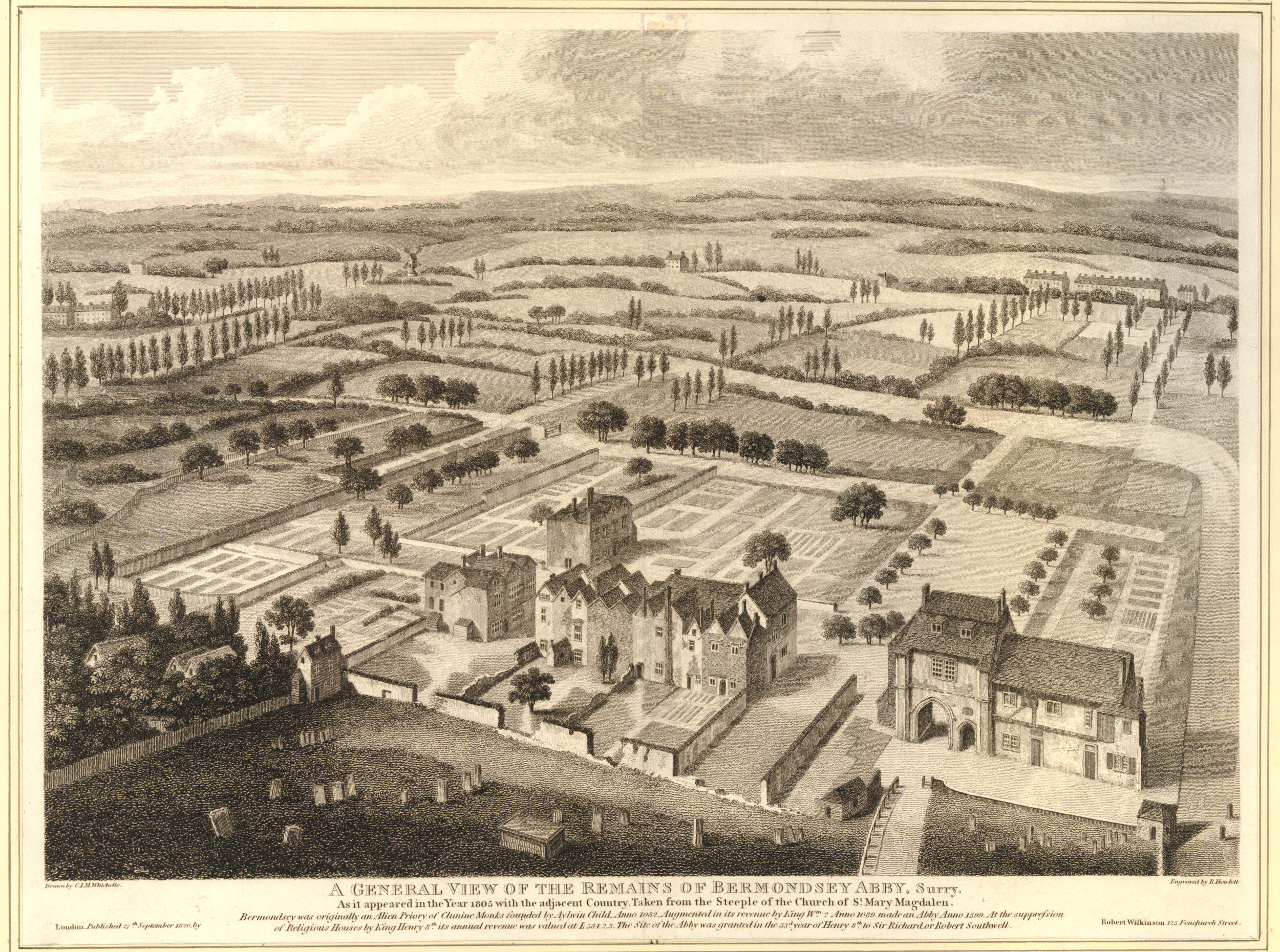
Also in the above map is St Saviour’s Dock, which I will save for a future post.

The list of wharfs does show the considerable range of goods that were being handled in the stretch of the south bank of the river shown in the 1946 photo.

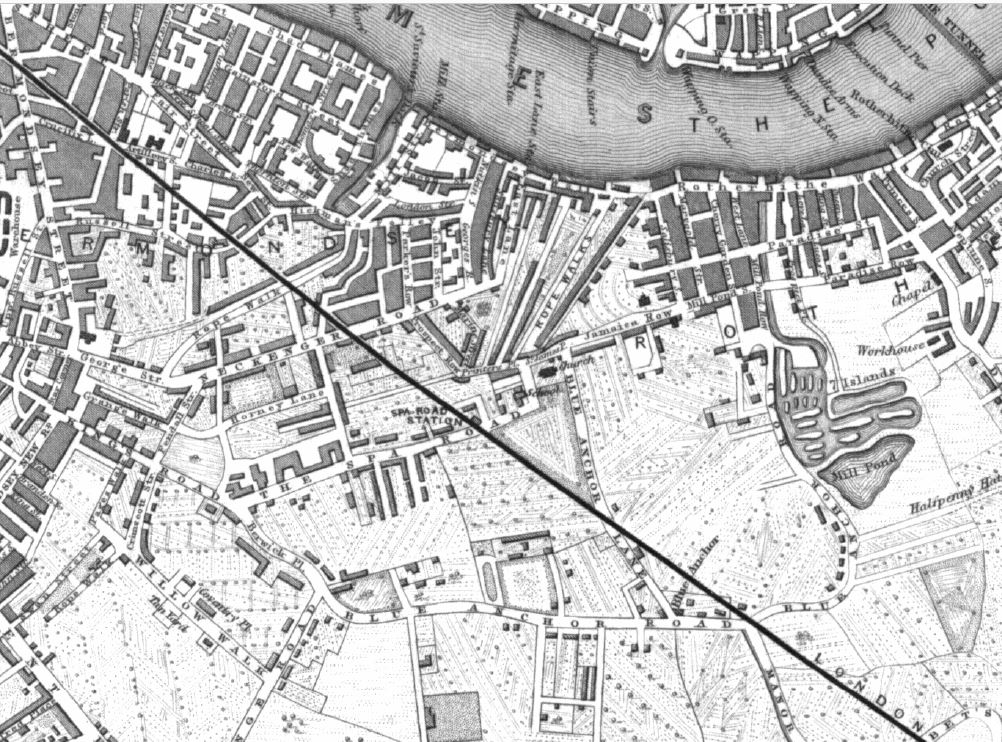
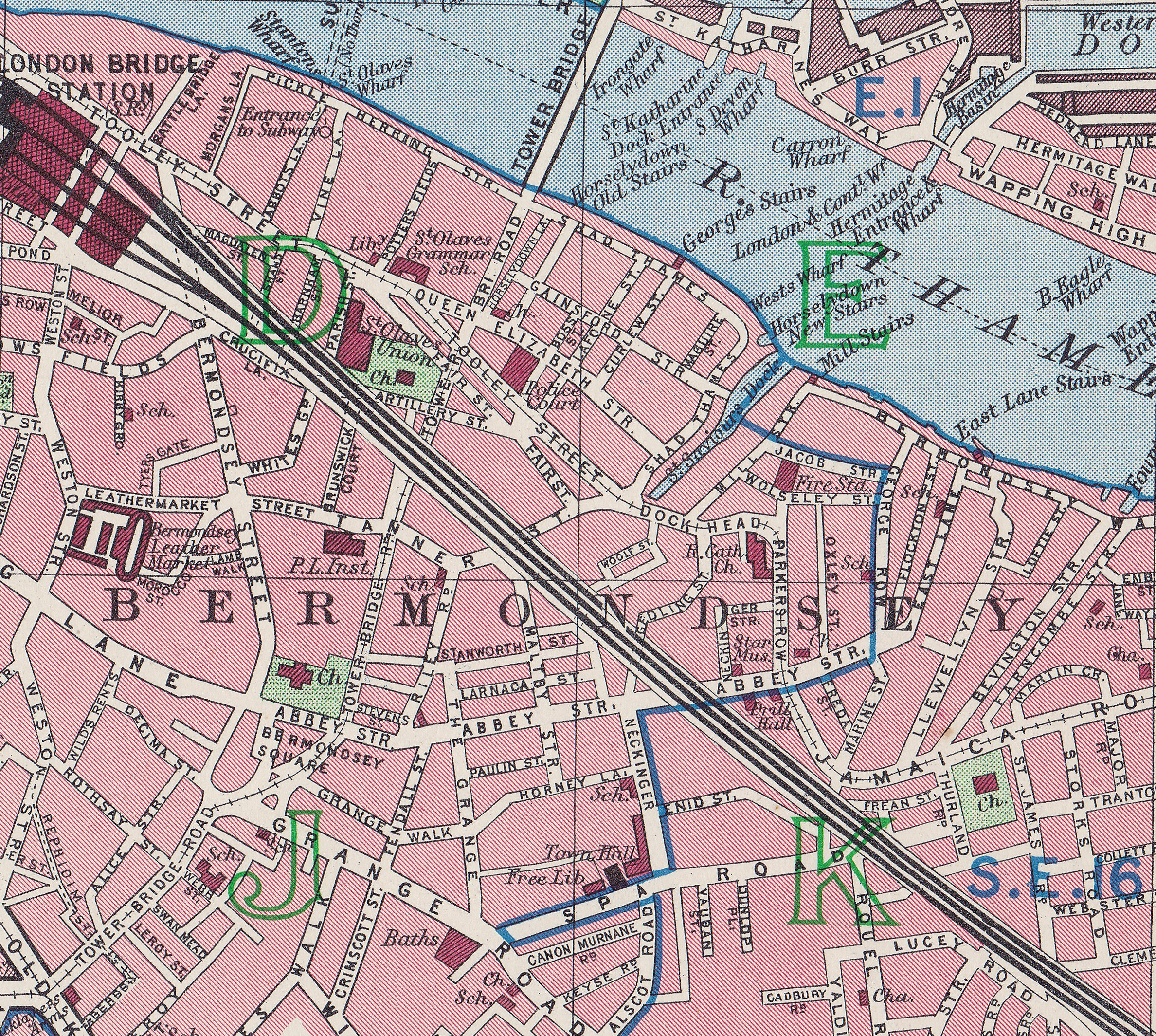
The following extract from the 1949 edition of the Ordnance Survey map shows Cherry Garden Street in the centre of the map, running up to Cherry Garden Stairs, which are at the lower left of Cherry Garden Pier  (‘Reproduced with the permission of the National Library of Scotland’).

Cherry Garden Pier

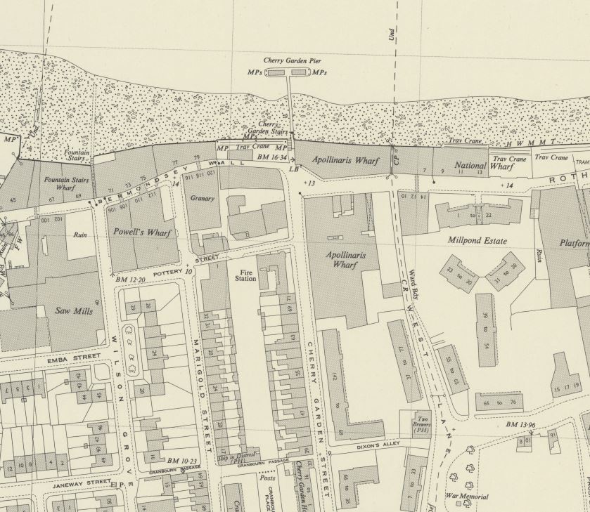
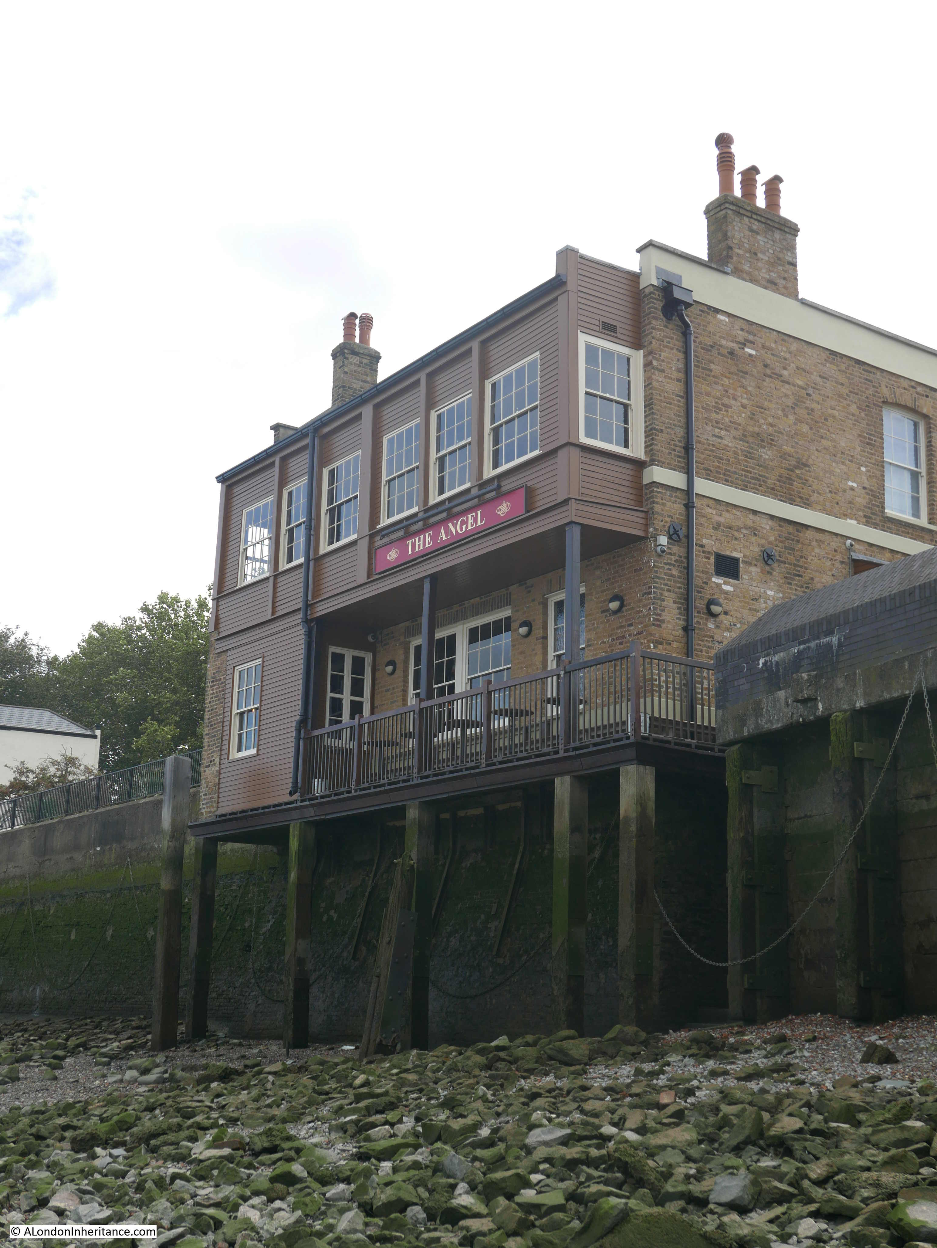
A pier at the site seems to date from the later half of the 19th century, and Cherry Garden Pier is still there today, although used by a private company with no public access.

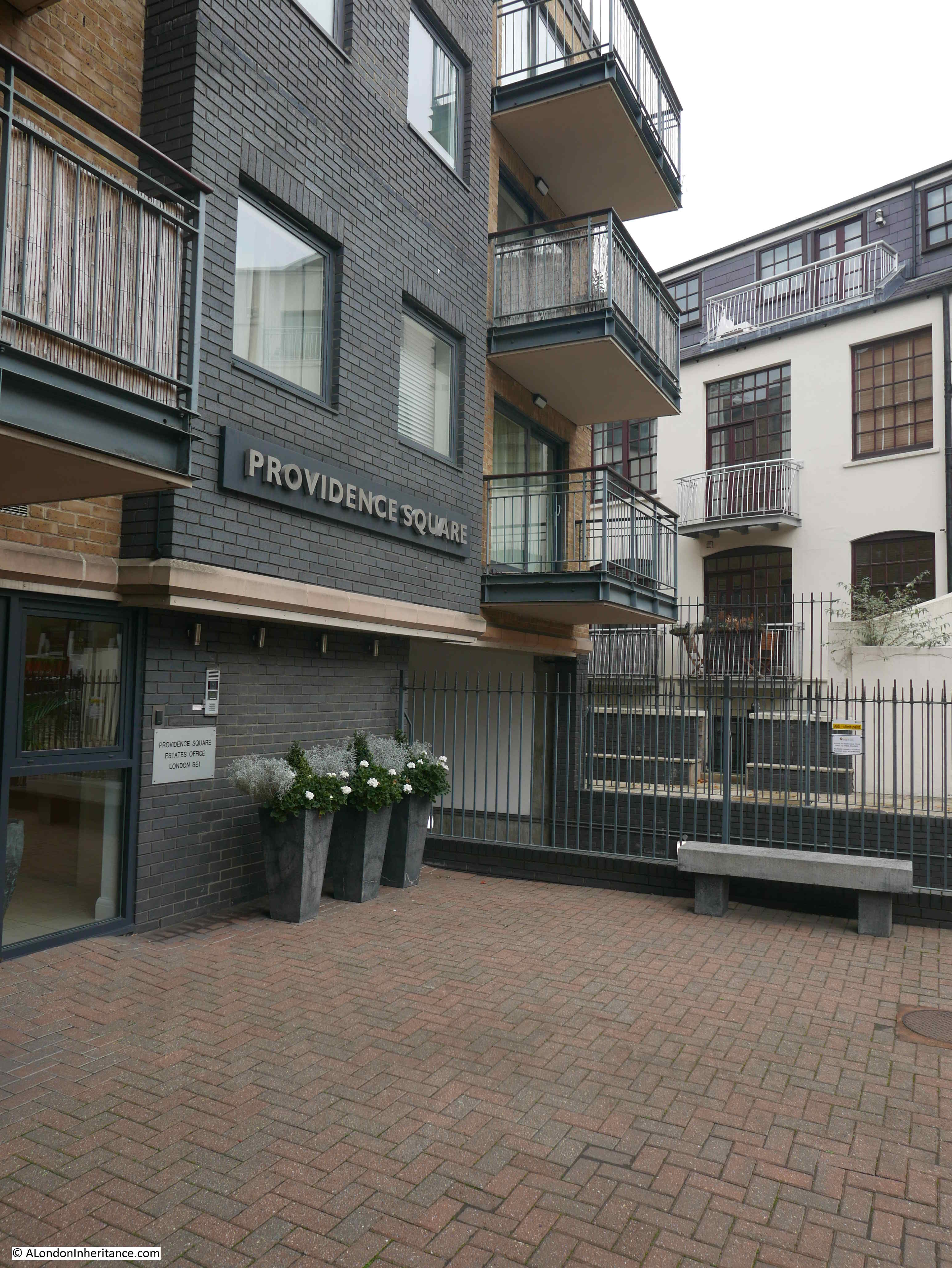
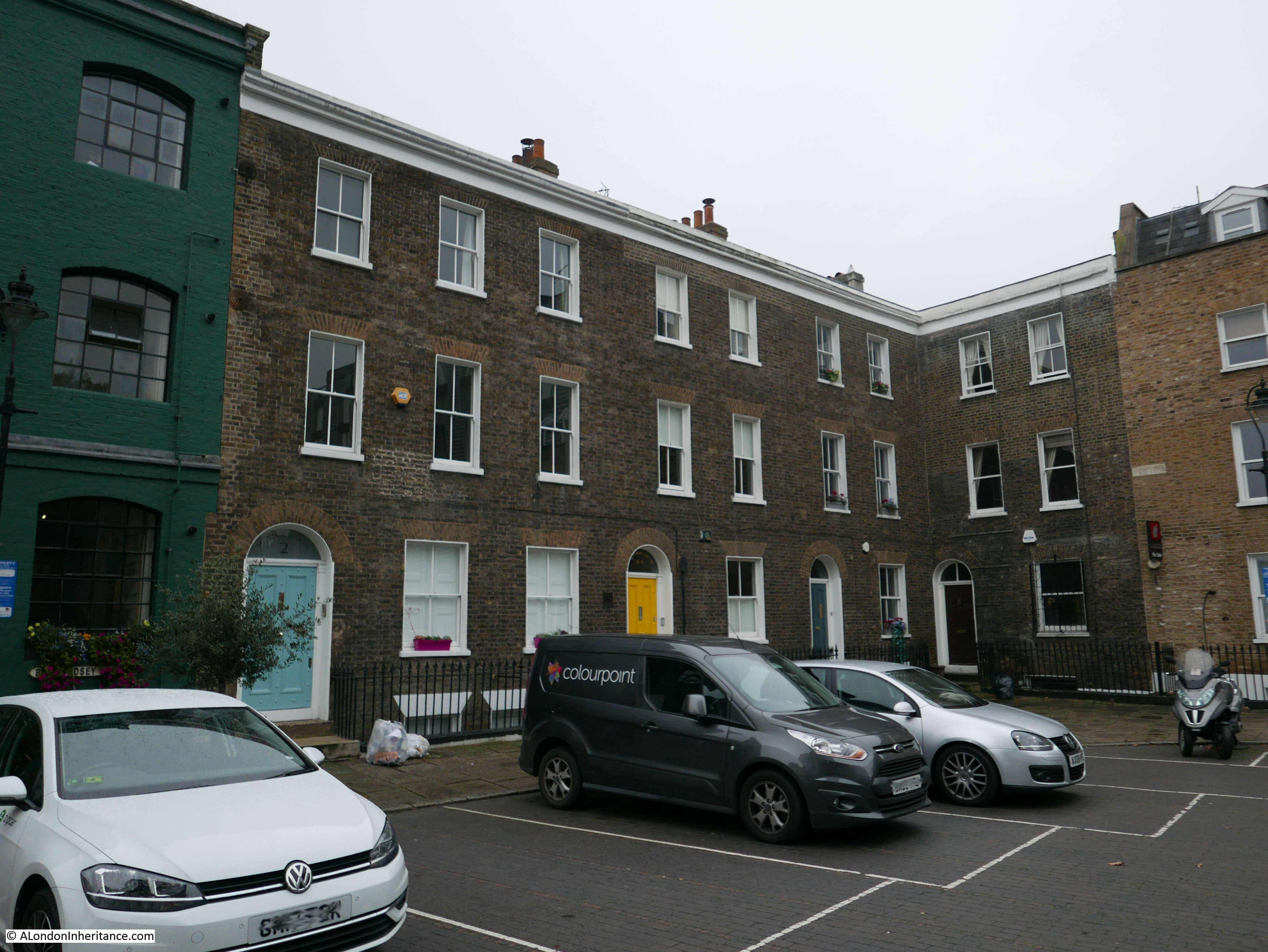
One interesting point in the above map, is to the right of the map is the Millpond Estate, a 1930s housing development which can still be seen today. The location of the estate had been the site of a flour mill, mill pond and terrace housing. The mill pond was once part of an extensive irrigation system that ran inland to much larger ponds – lots more to discover around this part of Bermondsey.

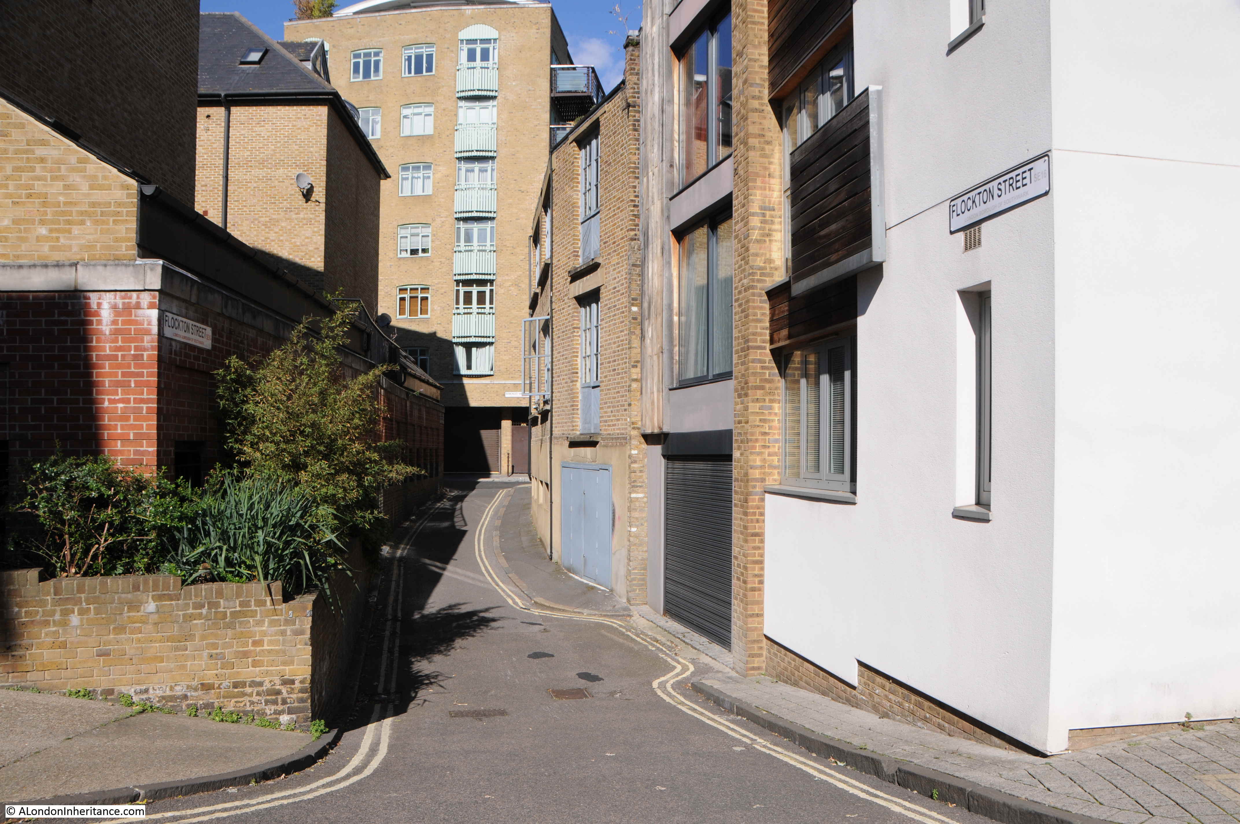
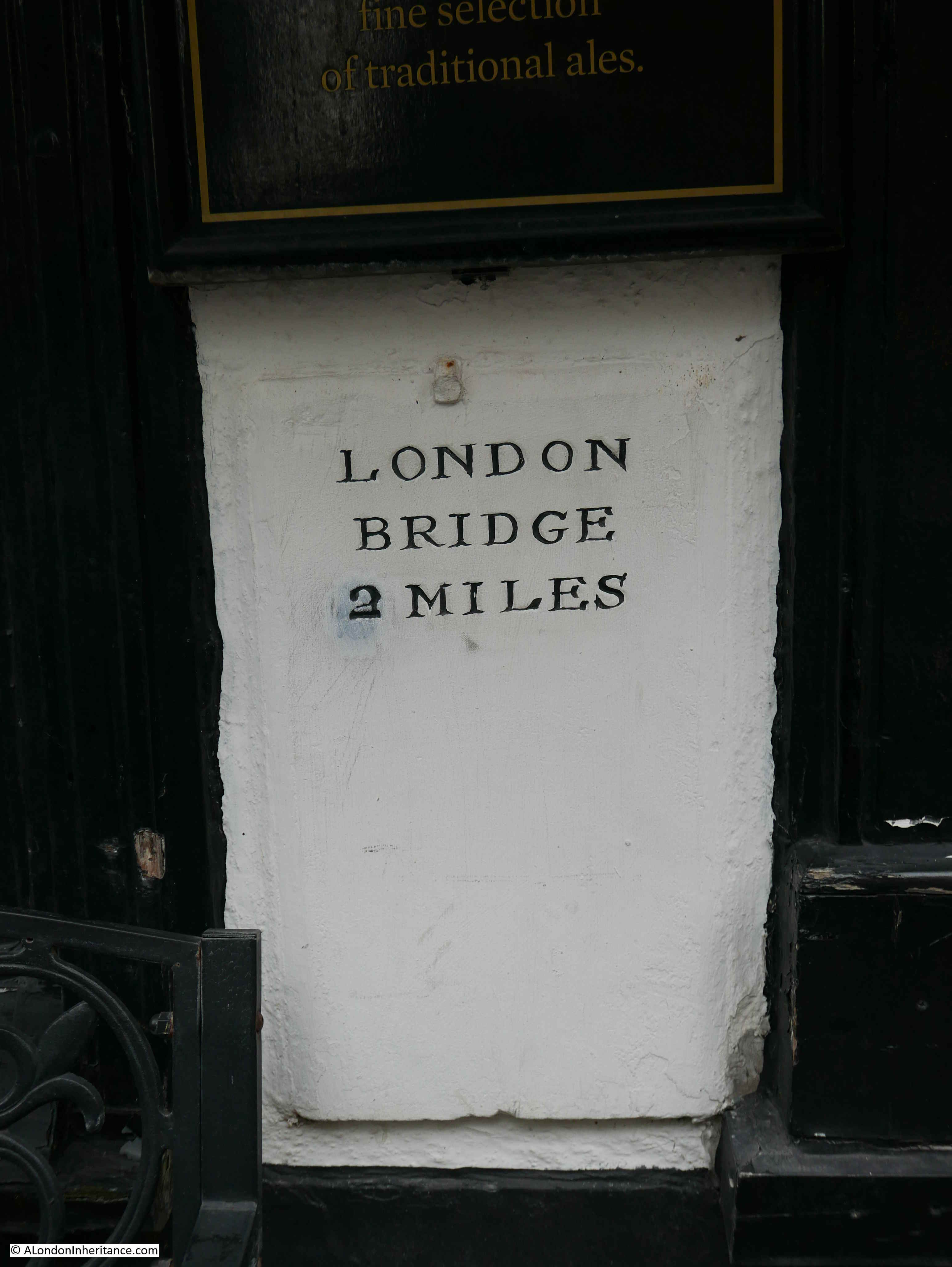
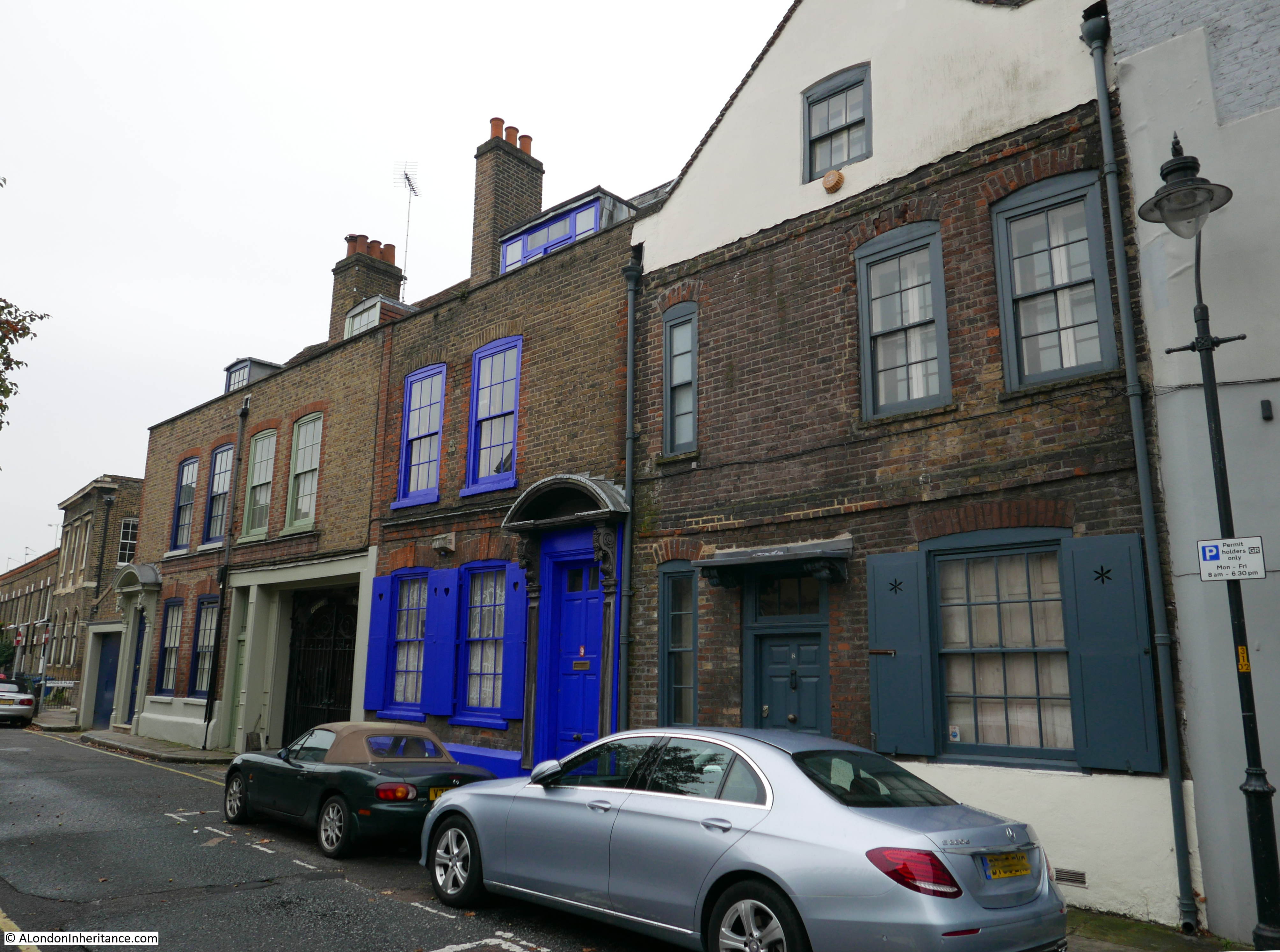
Cherry Garden Stairs are one of the many old stairs that provided access to the river. The earliest newspaper reference I can find to the stairs dates from the 25th May 1738 when “Yesterday morning an eminent Shoemaker at Cherry Garden Stairs, Rotherhith, was found drowned in the River Thames”.

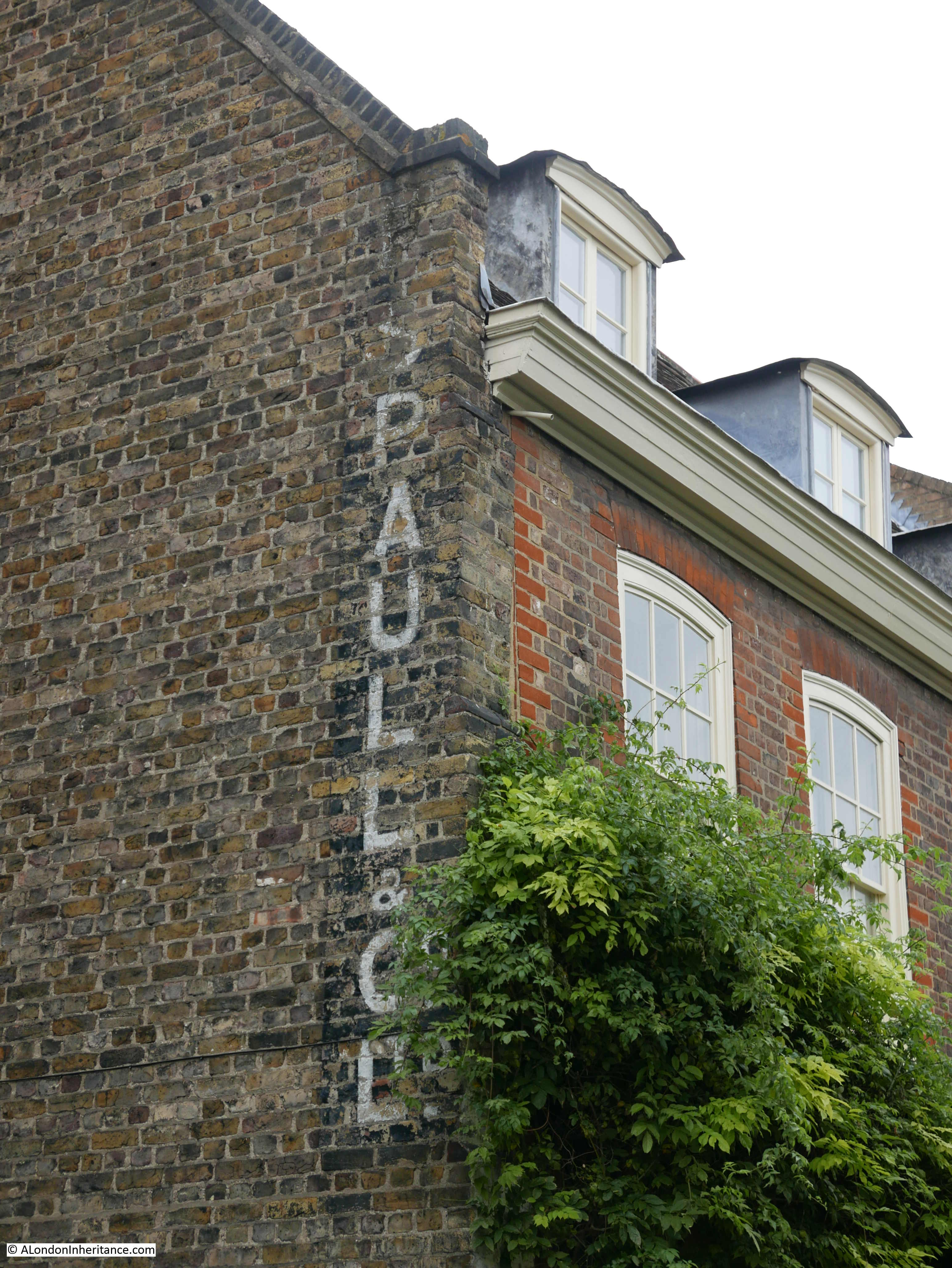
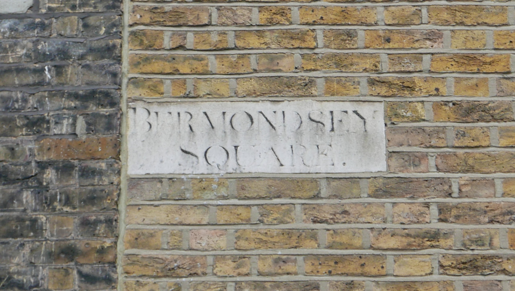
The stairs are probably much older than the 1738 reference. Leading back from the location of the stairs (see above map) is a street called Cherry Garden Street. The street is named after a pleasure garden that was here called Cherry Garden.

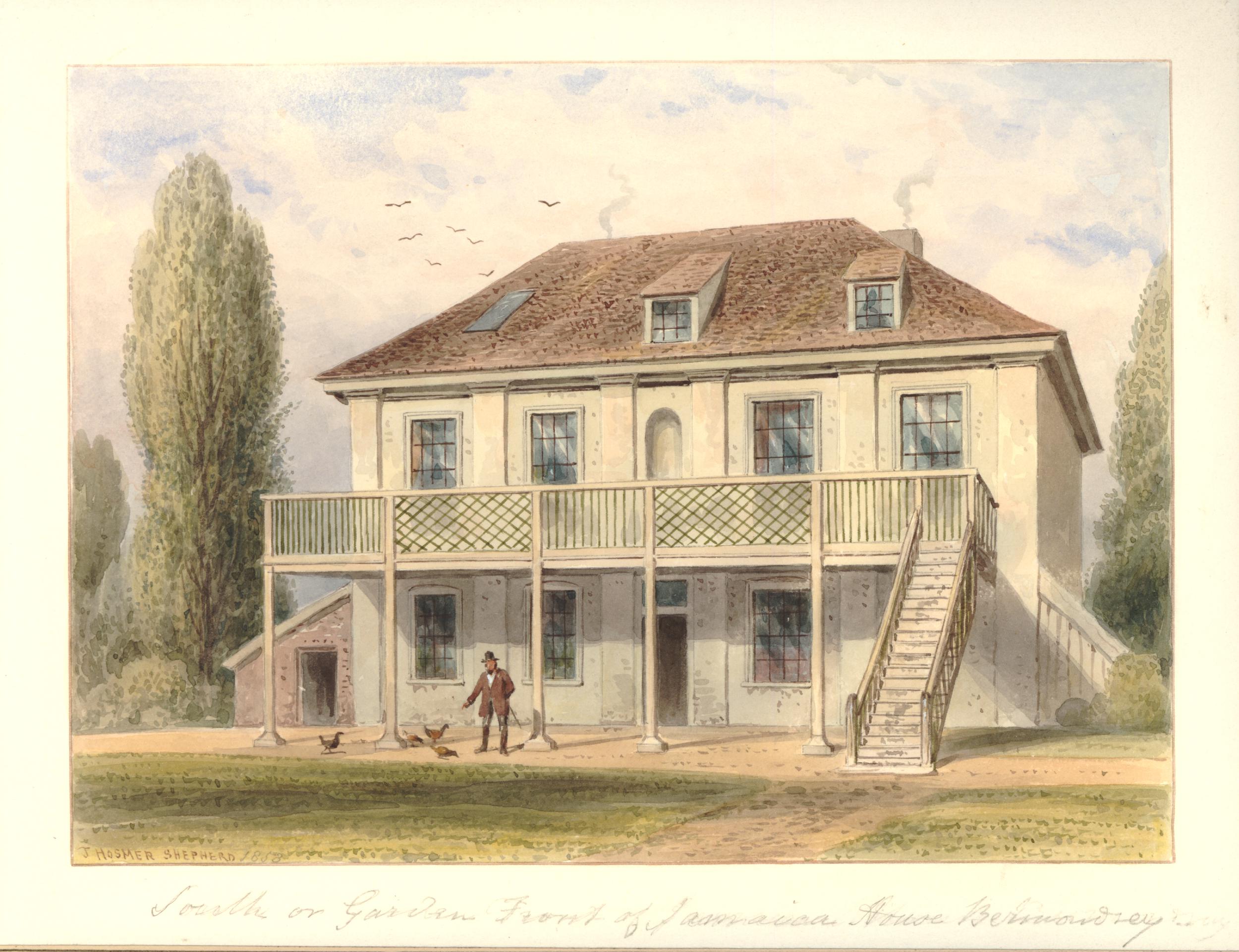
In volume four of the 1912 edition of the History of the County of Surrey in the Victoria County History series, there is reference to a Jacobean style house called Jamaica House which could still be found in Cherry Garden Street until 1860.

This house appears to have been part of the gardens as in the same volume, there is a quote from Pepys which reads “To Jamaica House, where I never was before, together with my wife, and the Mercers and our two maids, and there the girls did run wagers upon the bowling green: a pleasant day and spent but little”.

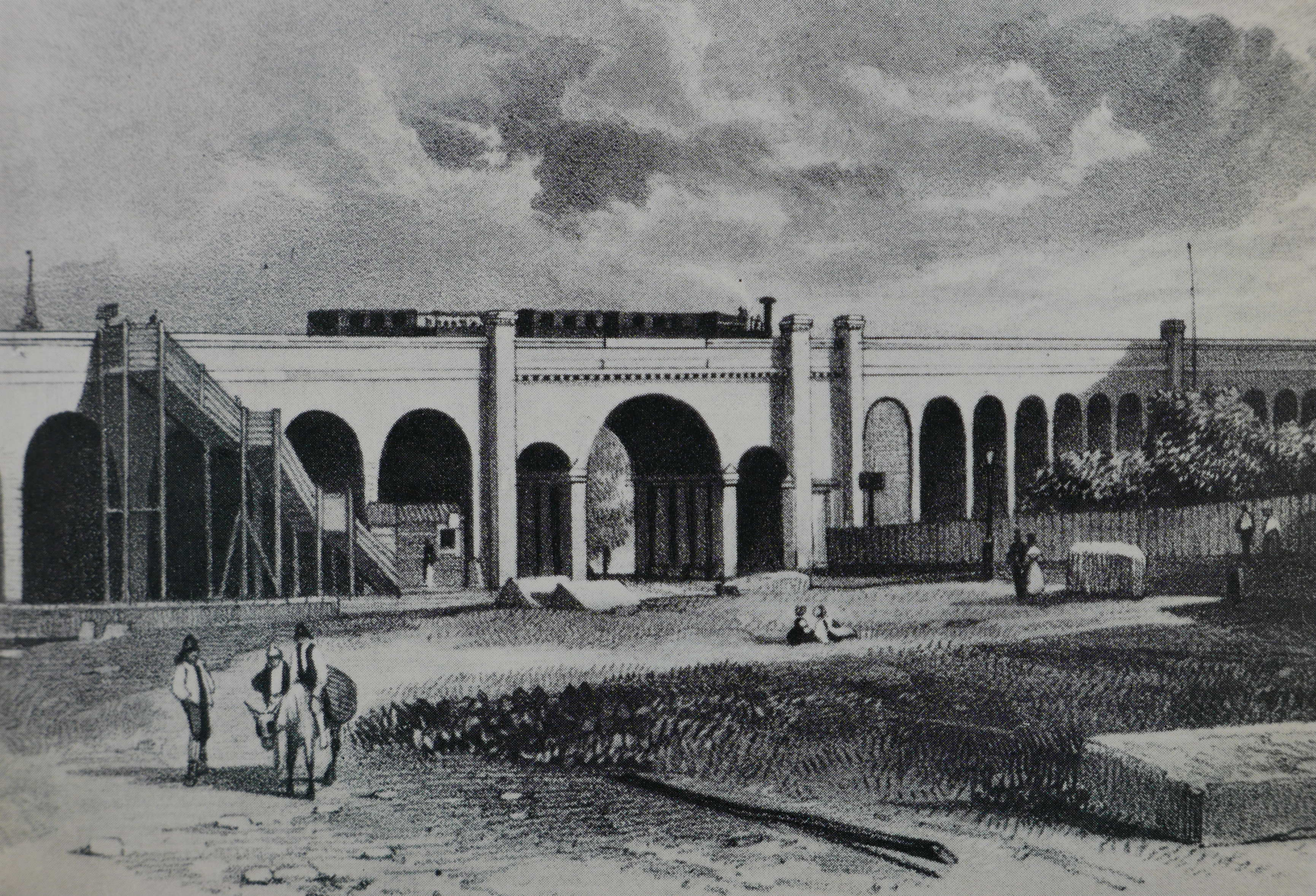
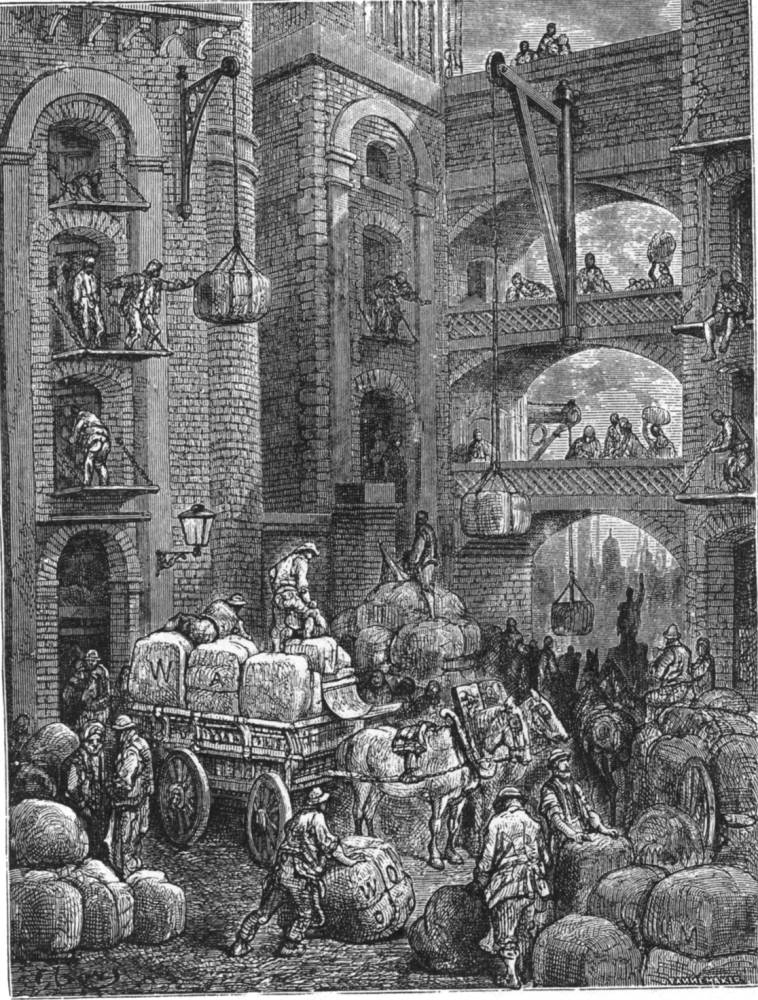
Jamaica House or Tavern in 1858 (© The Trustees of the British Museum):

Jamaica House

Pepys visit is referenced in an article in the Westminster Gazette on the 7th October 1910, which also recalls an inn that was located by the stairs: “Cherry Garden-street, the scene of yesterday’s big riverside fire, occupies the site and preserves the name of the old Bermondsey ‘Cherry Garden’, once a well-known place of public resort. The Cherry Garden was favourably known to Pepys, who recorded his visit there in his famous diary. At Cherry Garden Stairs there was formerly a celebrated inn known as the Lion and Castle, a name supposed to have been derived from the marriage which took place between the Royal House of Stuart and that of Spain. Close by was the even more famous Jamaica, traditionally supposed to have been the residence of Cromwell”.

Edward Walford in Old and New London (1878) doubts the Lion and Castle name originating from a Stuart / Spanish name and prefers the source to be “the brand of Spanish arms on the sherry casks, and have been put up by the landlord to indicate the sale of genuine Spanish wines, such as sack, canary and mountain”.

The Lion and Castle pub seems to have been at Cherry Garden Stairs from the late 18th century to some point around the 1860s. It was not shown on the 1895 OS map.

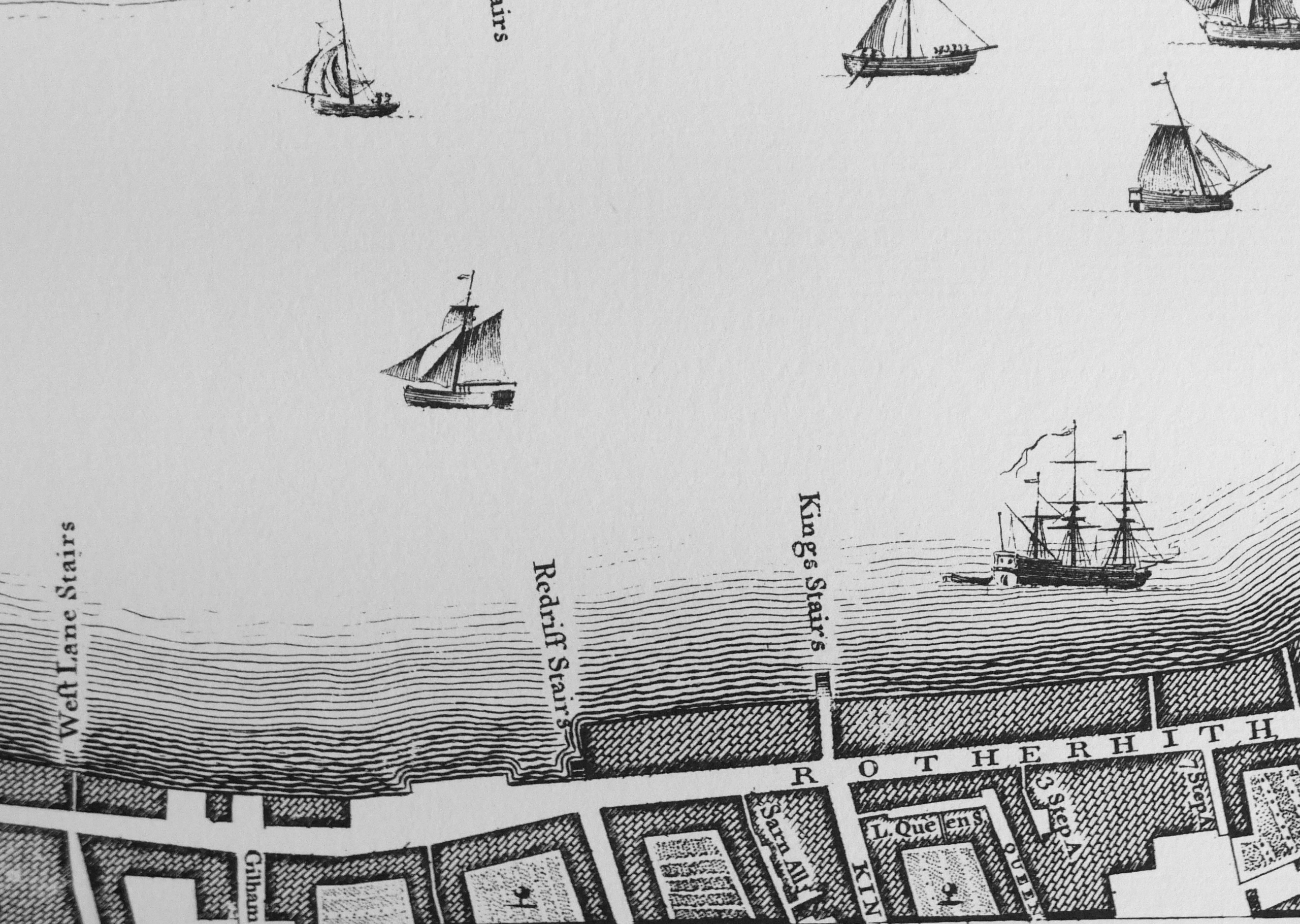
It may have been that the stairs were used for river access to the pleasure gardens and that was why they took the name of the gardens. Rocque’s map of London in 1746 shows Cherry Garden Stairs (right on the corner edge of my copy of the map):

Cherry Garden Stairs

Thames stairs were so very important for centuries in the life of the river, and for all those who had some connection with the activities carried out on, or alongside the Thames.

As well as providing access to and from the river, Thames stairs were a key landmark. There are hundreds of newspaper references to Cherry Garden Stairs during the 18th and 19th centuries. The majority of these are adverts of ships for sale, for lease, or that were about to set out and were advertising for cargo or passengers.

For example, the Public Ledger and Daily Advertiser on the 8th May 1818 has the following advert: “Has only room for a few Tons of Goods, and will be dispatched immediately. For Gibraltar direct. The fine, fast-sailing Brig PRINCE REGENT, Henry Stammers, Commander. lying at Cherry Garden Stairs. burthen 118 tons. For Freight or Passage”.

Other reports concern accidents, collisions, drowning and bodies pulled from the river near the stairs. Such an incident is recorded in the last newspaper reference to the stairs that I can find, when on the 29th November 1936, Reynold’s Newspaper recorded that a ten year old Bermondsey boy had fallen into the Thames from Cherry Garden Stairs and had drowned.

Thames stairs and pubs also seem to be a magnet for crime. For example, there are reports of passengers being rowed across the Thames and then robbed in, or close by the pubs that were often located near the landside of the stairs.

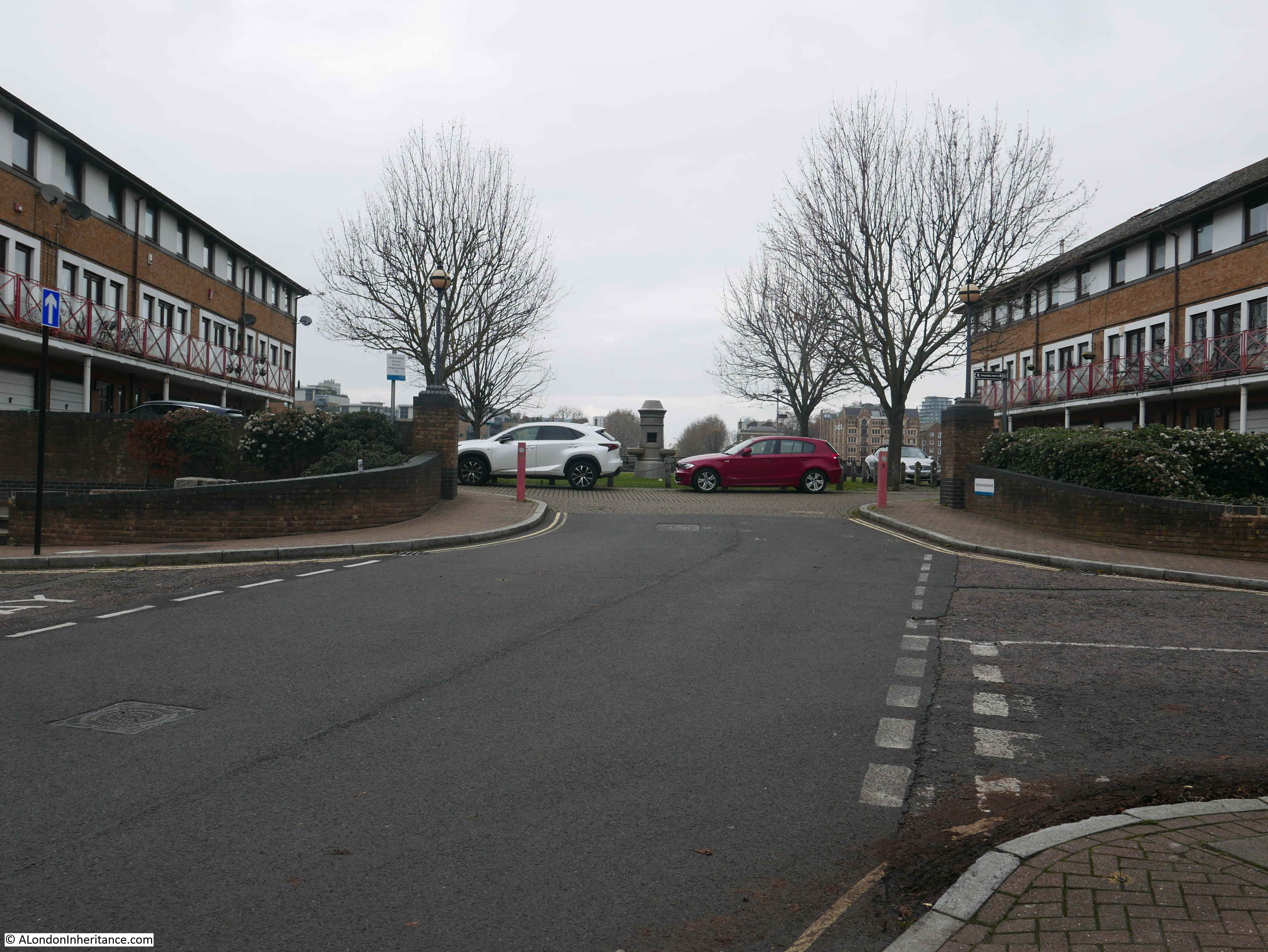
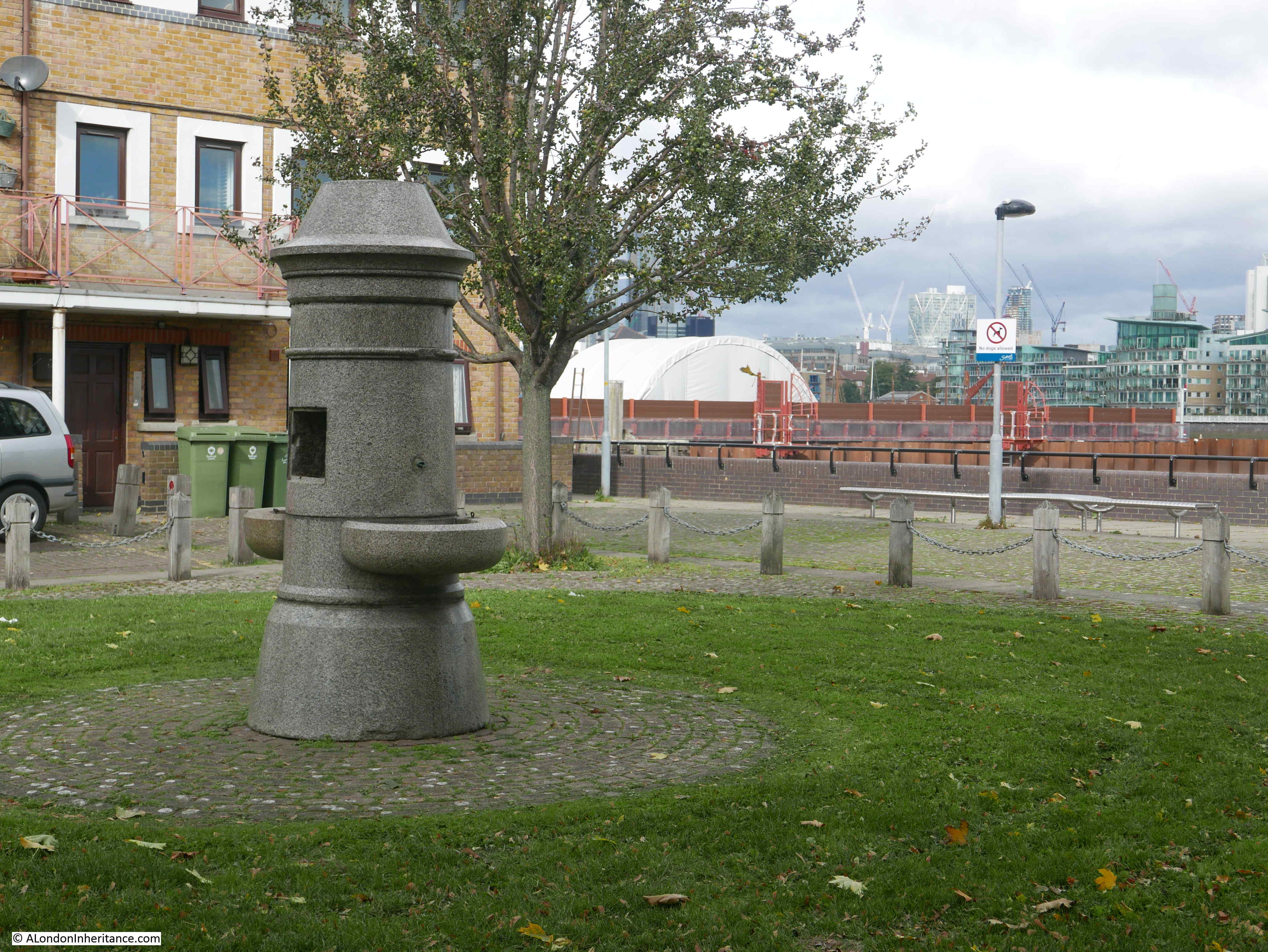
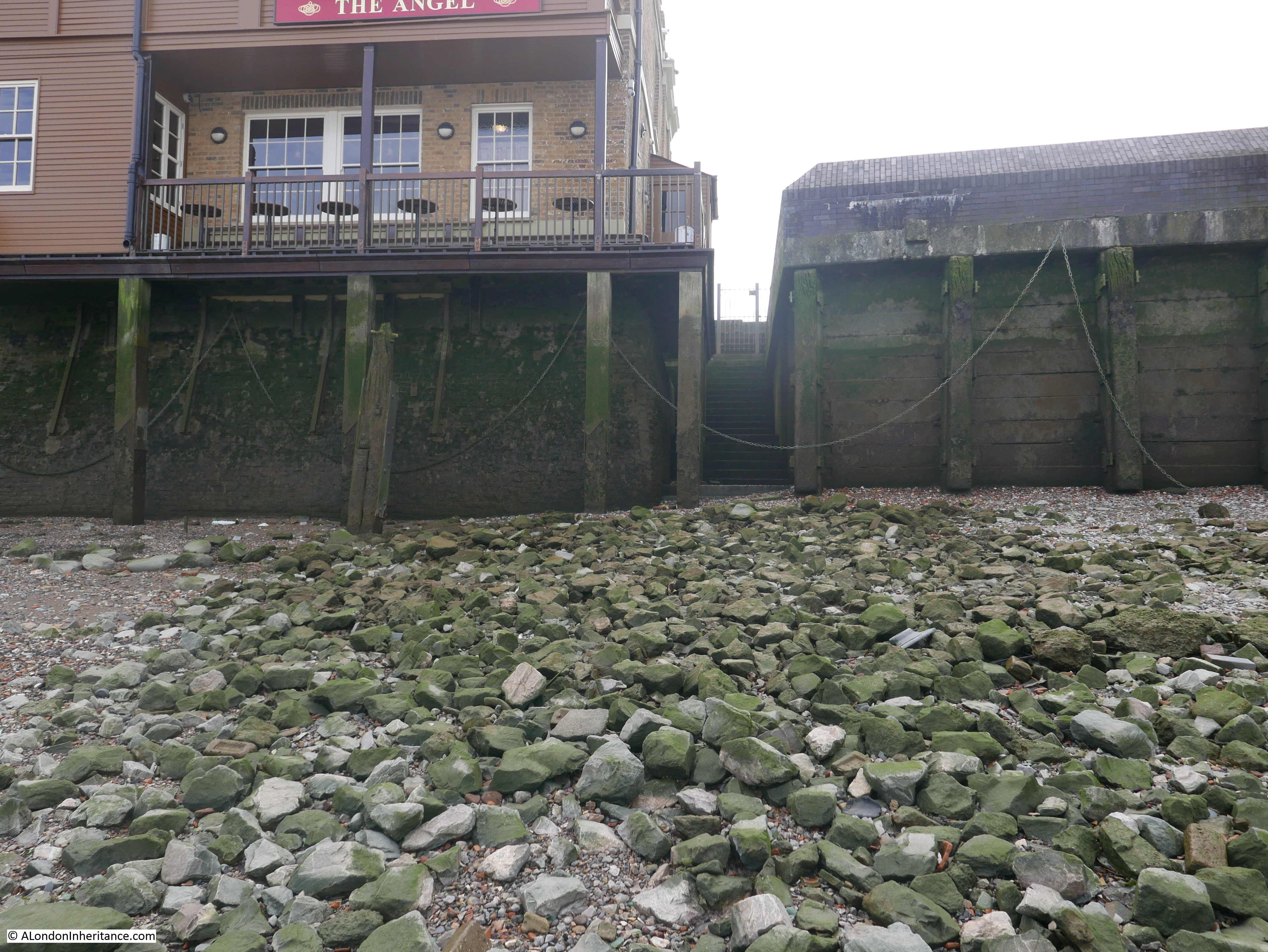
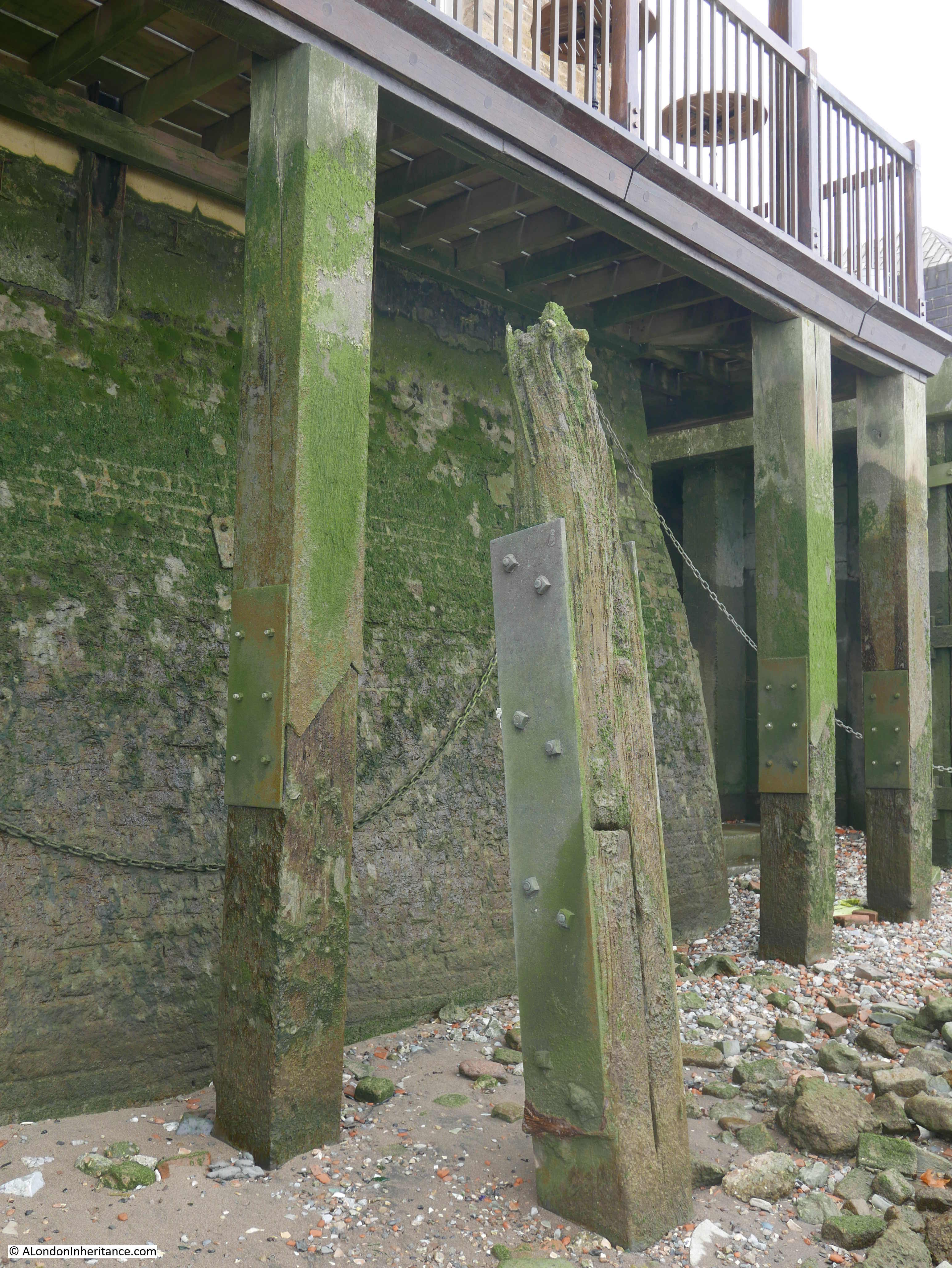
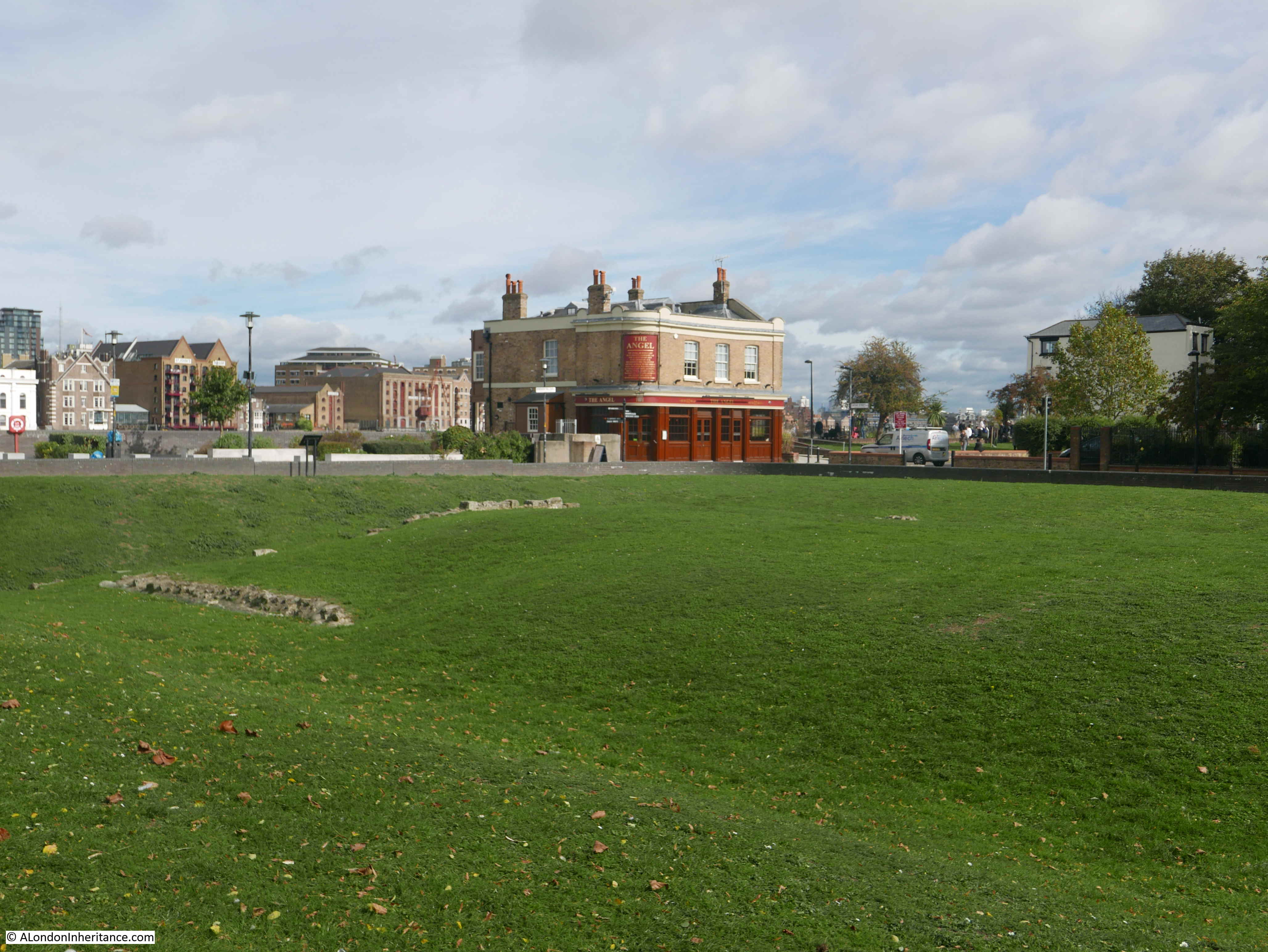
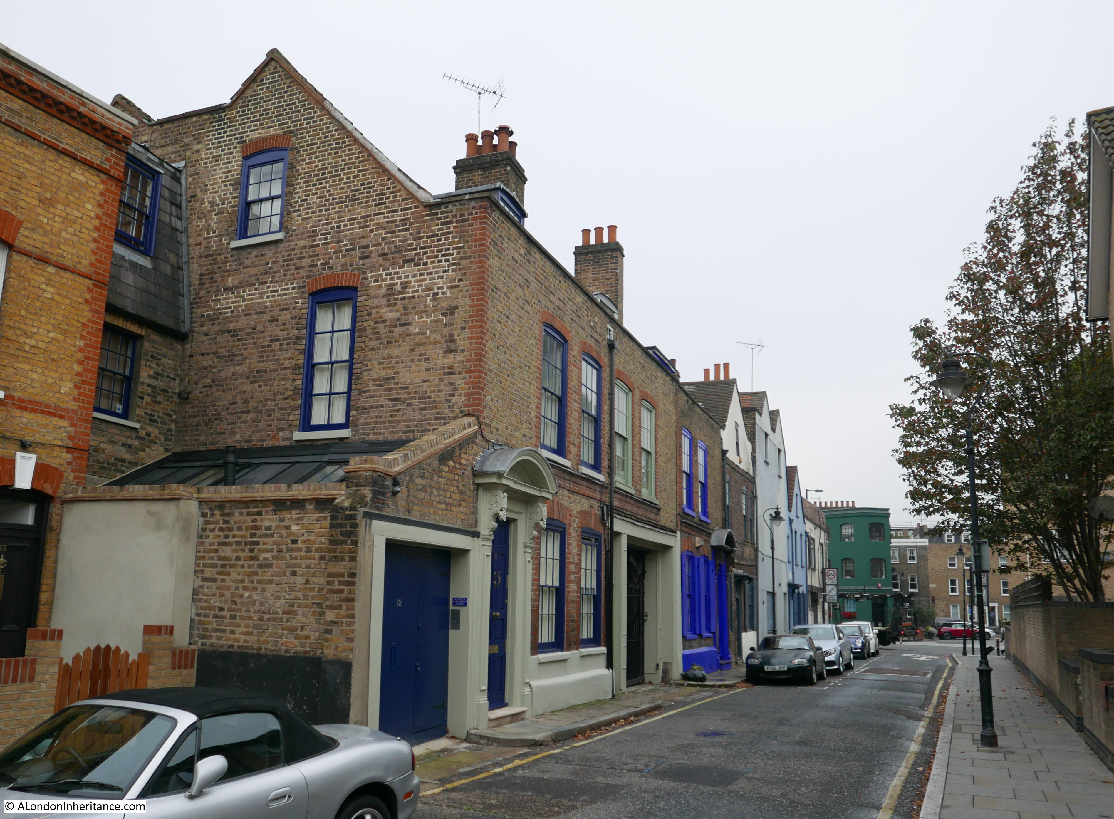
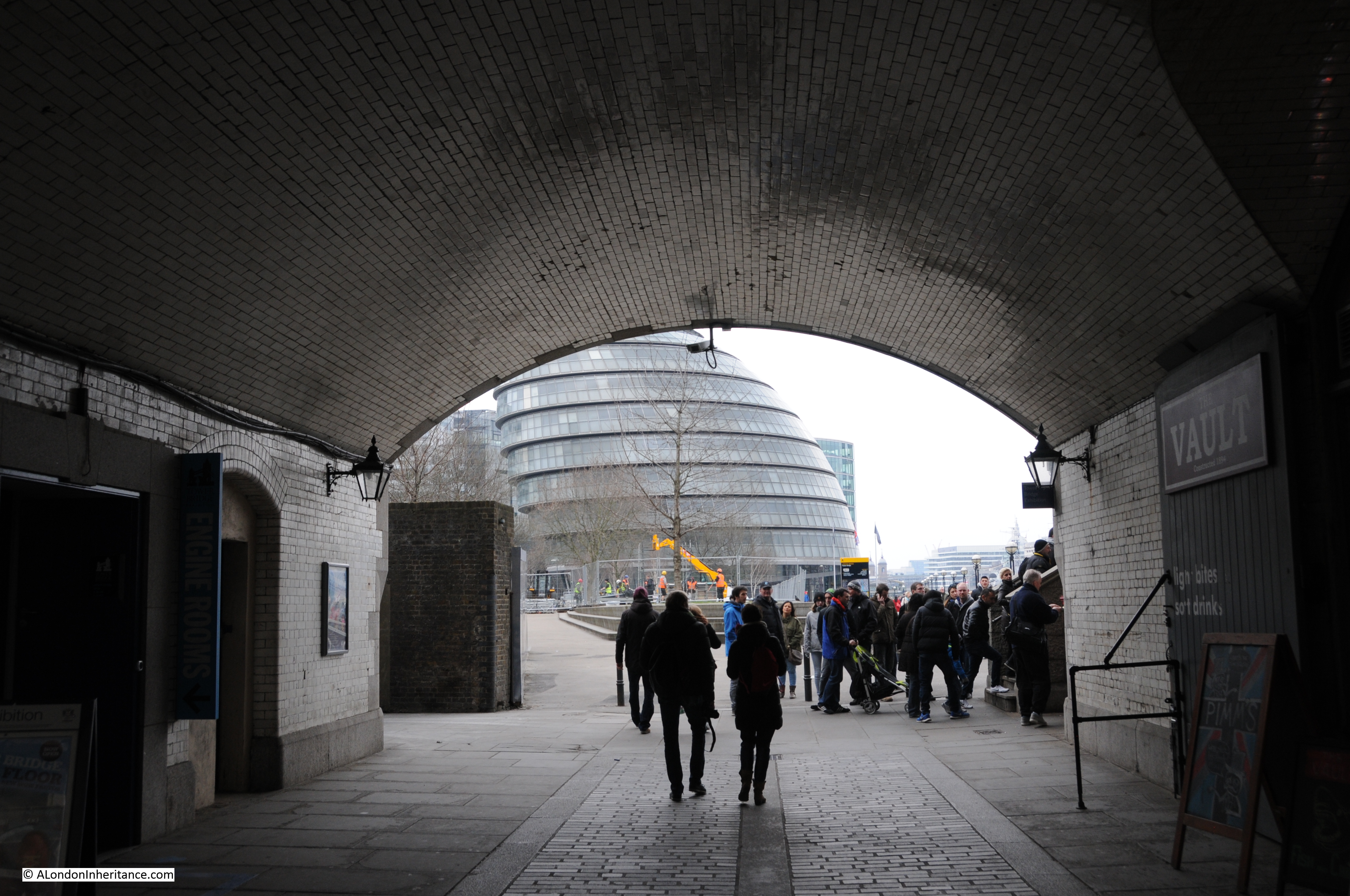
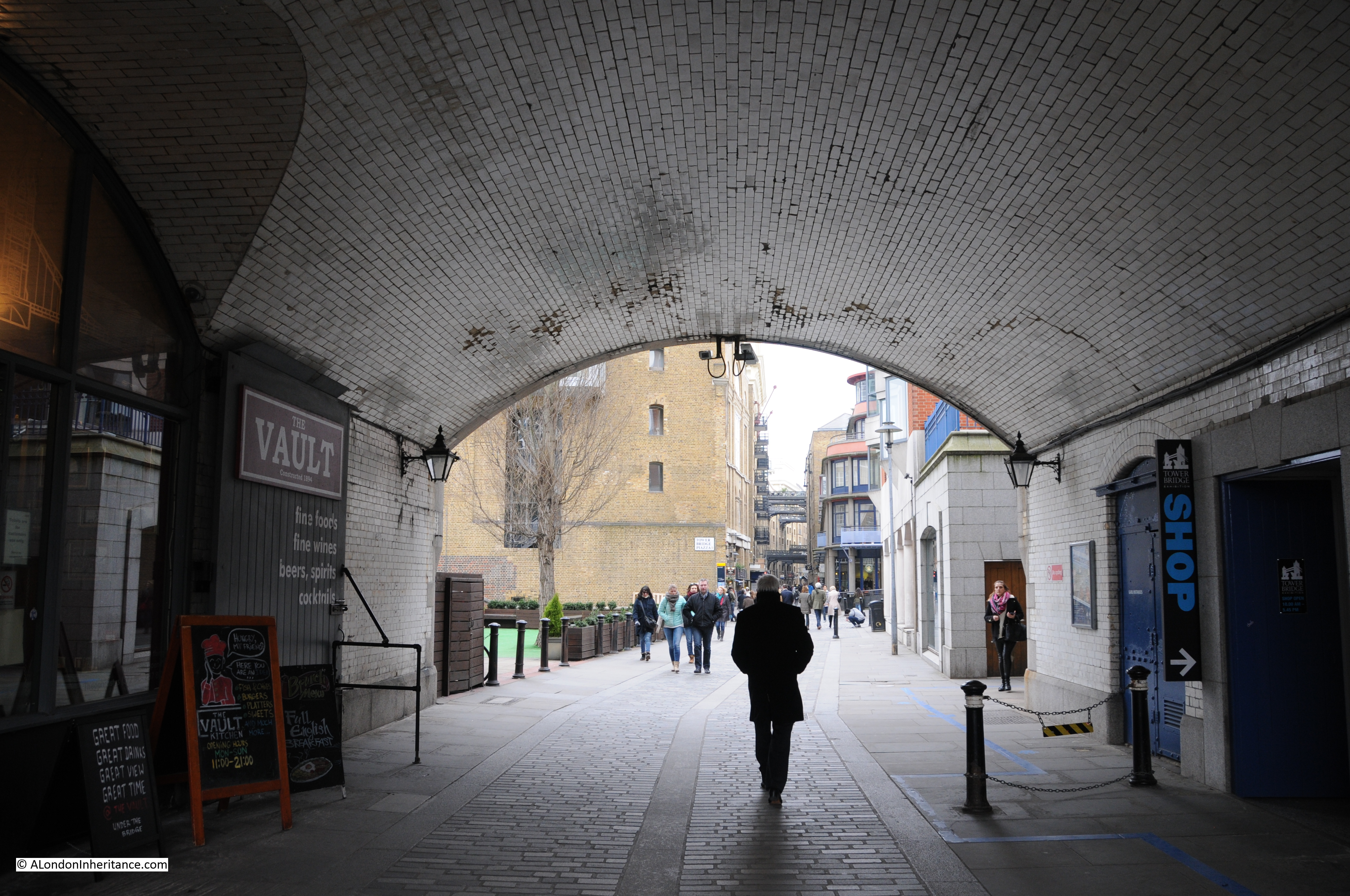
The tide was in when I arrived at Cherry Garden Stairs to taken the comparison photo. Access to the foreshore is now via a modern set of metal stairs that run over the embankment wall that was built as part of the walkway / tree lined open space that runs along the river. Difficult to photograph without being on the foreshore, but the stairs can be seen at the end of the wall in the following photo:

Cherry Garden Stairs

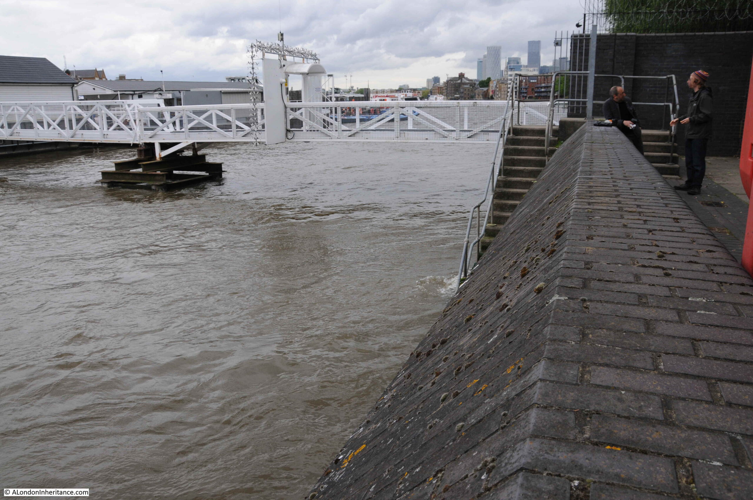
The walkway to the pier can be seen in the background.

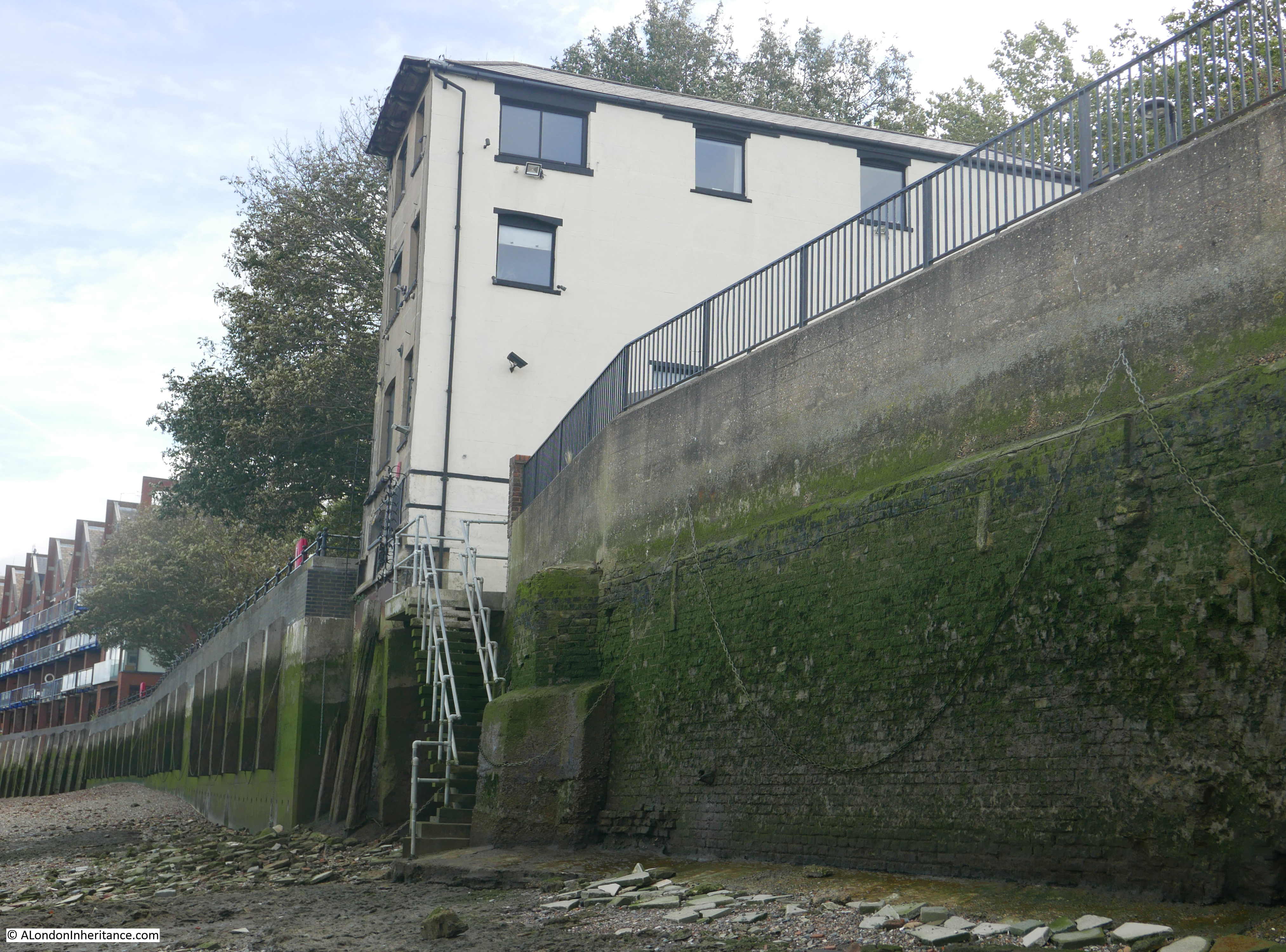
I am sure that my father took the original photo from the 1946 version of the stairs, as it was by standing on the stairs that I could get the dome of St Paul’s Cathedral in exactly the same position. At this distance from Tower Bridge and the cathedral, even a small change in position changed the orientation of bridge and dome.

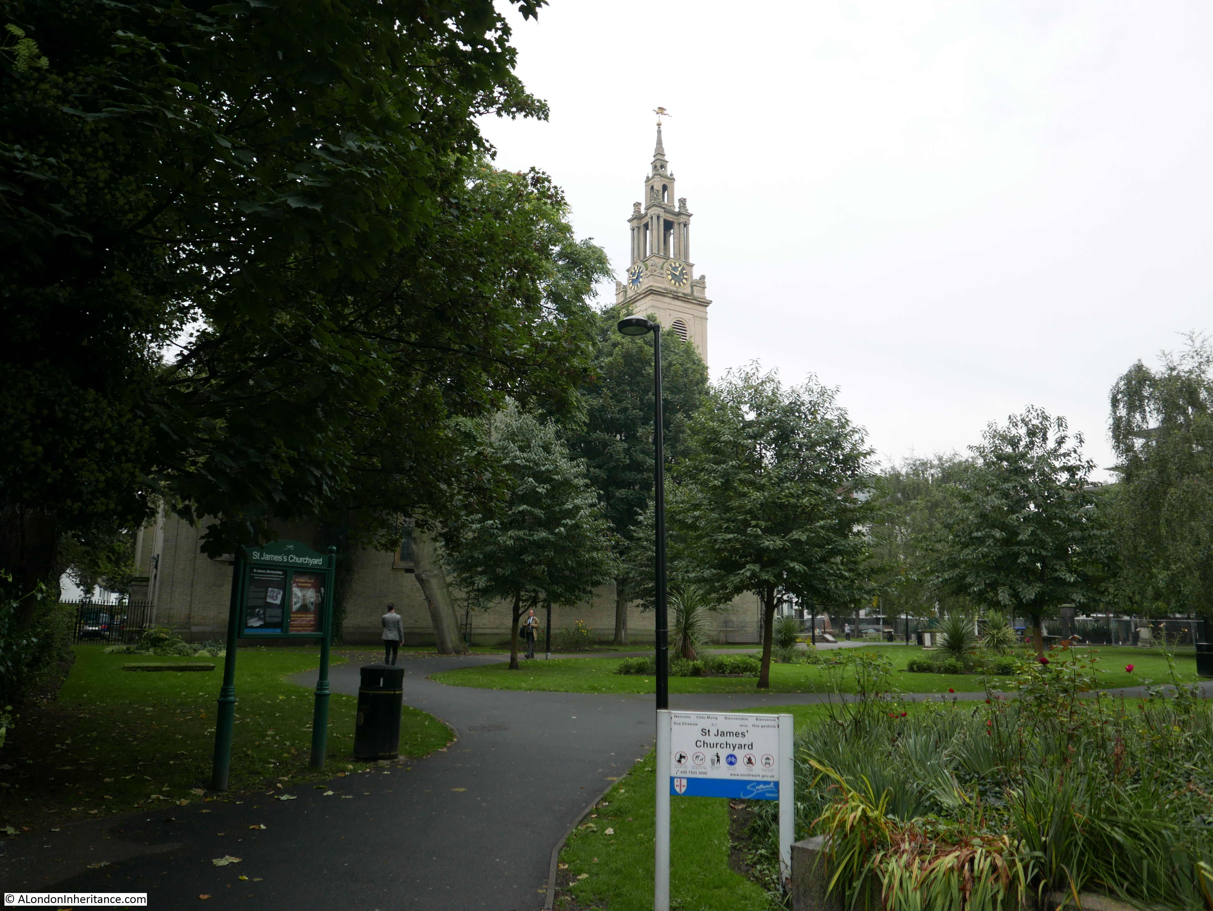
There is much more to discover in this part of Bermondsey, so it is an area I will be returning to again.

alondoninheritance.com

A Return To Bermondsey Wall – Bevington Street, George Row And Bridge House

A couple of months ago, I featured a photo that my father had taken in Bermondsey. He had written the following notes to explain when and where the photo was taken “Flockton Street looking south from Bermondsey Wall. 19th century slum dwellings ravaged by the blitz – Summer 1948”. When I visited what remains of Flockton Street I was doubtful that this was the right location. Many features of the existing streets and in the photo did not line up.

I am really gratefull to a number of readers who identified the correct location as being Bevington Street in Bermondsey, and that a couple of the features in the original 1948 photo can still be seen to confirm. A quick look at Google Streetview clearly showed the location, however I was not content just to use Streetview as the purpose of this project is to revisit and photograph from the same viewpoints as in my father’s photos, so a couple of weeks ago I took another walk to Bermondsey to photograph Bevington Street – a location I have walked past a number of times, but for reasons I will explain later in the post, I was looking in the other direction.

My revisit also enabled the location of another photo to be confirmed, and I also found the location of a building photographed for the Wonderful London series of books published in 1926.

This is the view of Bevington Street from Bermondsey Wall photographed by my father in 1948:

Bermondsey Wall

And this is the same view today:

Bermondsey Wall

There are only two features that remain the same, but serve to confirm the location. The school on the left and the small brick building on the right which now appears to house an electrical substation – remarkable that in all the redevelopment of the area this small building has survived.

So where is Bevington Street? The following extract from the 1940 Bartholomew’s Atlas of Greater London shows the location. Bevington Street can be seen just to the right of the large Y. The school is further to the right, just across Farncombe Street.

Bermondsey Wall

Flockton Street, the wrongly identified location can be seen to the left, leading off from Bermondsey Wall, so these streets are very close. I suspect my father wrote up his notes for the photos after developing the negatives and looking at his route on the map, accidentally picked the wrong street.

I have used this 1940 map as it helps to explain a feature that can be seen today.

Bevington Street ends at Bermondsey Wall, and directly across from Bevington Street, between Bermondsey Wall and the River Thames is Fountain Green Square. The following photo is the view from the end of Bevington Street, looking across Bermondsey Wall to Fountain Green Square.

Bermondsey Wall

The name is very appropriate as there is a central green with a stone fountain in the centre. New housing is arranged around two sides of the green and the River Thames is alongside the far side of the green.

Looking back at the 1940 map and there is a feature here called Fountain Dock. The 1895 Ordnance Survey Map provides some additional detail and shows the shape and location of Fountain Dock.

Bermondsey Wall

Credit: ‘Reproduced with the permission of the National Library of Scotland’ 

The Southwark Council Conservation Area Appraisal (February 2013) confirms that the site of Fountain Green Square was the site of Fountain Dock, and that the dock was one of the few dry docks that operated along this part of the river.

Checking the overlay feature on the National Library of Scotland site, the dry docks appears over the easterly part of the green and partly under the houses on the eastern edge of the green, rather than occupying the full space of the green.

I checked the London Metropolitan Archives, Collage site and there are two photos from 1929 that show the dry dock. The first is looking from the north west corner of the dock, back towards where Bermondsey Wall runs right to left.

Bermondsey Wall

Image credit: London Metropolitan Archives, City of London: catalogue ref: SC_PHL_02_0912_A52734

The second photo, also from 1929, is looking from the south east corner of the dock, towards the river and the direction of the City.

Bermondsey Wall

Image credit: London Metropolitan Archives, City of London: catalogue ref: SC_PHL_02_0912_A5273

These photos from 1929 show Fountain Dock much as it must have been in the 19th century. Dry docks are important as they allow the hull of a ship to be inspected and worked on. The ship was moved into the dock, gates to the river closed and water pumped out from the dock, so somewhere alongside there must have been a building that housed the pump.

In an advert for the dry dock in Lloyd’s List on the 13th May 1893, the dimensions are given as a length of 161 feet and depth of 16 feet. The dock was owned by Mills & Knight who also owned the larger Nelson Dry Dock in Rotherhithe.

In addition to numerous adverts for the dry dock, 19th century newspapers included reports of accidents at the dock, as well as ships for sale. It appears to have been standard practice to offer a ship for sale when the ship is in dry dock for repair. The earliest example I could find was from the Shipping & Mercantile Gazette on the 27th August 1850, when the following ship was in Fountain Dry Dock and advertised for sale:

“The A1 Liverpool-built Barque BRAZILIAN, 345 tons, now lying in the Fountain Dry Dock, and ready for inspection; is in the course of re-coppering, &c., and, if not sold within a reasonable time, will be sent out again by her present owner. Length, 107 feet; breadth, 23 1-10 feet; depth 13 3-10 feet; carries a large cargo at an extraordinary light draught of water, and shifts without ballast”.

The following photo is the view taken from roughly the same viewpoint as the above photo. Today there is a fountain in the centre of the green.

Bermondsey Wall

The 1895 Ordnance Survey Map does not show a fountain, so I do not know if the fountain was moved here when the green was created to provide some relevance to the name. I doubt the fountain was here originally as it looks of rather fine construction to have been in such an industrial area – however I also do not know how Fountain Dock was named.

The origin of the name Bevington Street is interesting. When looking for this street on the 1895 OS map, whilst the street is there, in 1895 is was named Princes Road. It had changed to the current name sometime between 1895 and the 1940 map.

Although I have not been able to find any written confirmation of this, I suspect the name change may have been in the first decade of the 20th century. Bevington probably refers to Colonel Samuel Bourne Bevington. 

When Bermondsey Borough Council was formed in 1900, Samuel Bevington was the first mayor and he was reelected the following year. He came from the family that had established  Bevington and Sons, a company that manufactured leather products at Neckinger Mills in Abbey Street, Bermondsey. He was also a Colonel of the West Surrey Regiment, Justice of the Peace, on school boards and coming from a Quaker background, used family money to support a number of philanthropic activities.

Samuel Bourne Bevington died on the 14th April 1907 leaving a considerable estate to the value of £133,195. His will included money to provide income for four men and four women over the age of 60 who had been engaged in the leather trade.

Because of his role in the leather trade in Bermondsey, that he was the first mayor of Bermondsey Borough Council, and his other activities, I suspect that after his death, the council looked at ways to commemorate him, and one of the ways within their power was to rename one of the local streets, so Princes Road became Bevington Street.

There is much else of interest to be seen from the junction of Bevington Street and Bermondsey Wall.

A very short distance to the east along Bermondsey Wall is a rather unique, listed pub – the Old Justice.

Bermondsey Wall

The pub, as with so many London pubs, has closed, however the building is Grade II listed.

The reason for the listing is that the pub is a rather well preserved example of a style of pub design from the inter-war period. The majority of Victorian London pubs were small and focused on drinking. The design initiatives after the First World War, focused on improving the pub environment, the provision of space for other activities apart from basic drinking, for example with the provision of restaurant space and a function room.

The Old Justice was designed by Sidney C Clark in 1933 for the Hoare & Co brewery. It followed a mock Tudor design that was frequently used on many pubs of the period.

Hoare & Co were taken over by Charringtons and the pub has a pair of Charrington lanterns on the frount, these probably date from the 1960s.

Bermondsey Wall

Alongside one of the lanterns is a plaque recording that Sir Paul McCartney used interiors and exteriors of the Old Justice as locations in his film “Give My Regards To Broad Street” and in the music video to “No More Lonely Nights”.

As well as the pub, the film also has some fascinating shots of the front of the warehouses along the Thames in Bermondsey.

I looked in through the windows of the Old Justice and the interior looks to have been reasonably well gutted, although the wooden paneling remains on the walls and the fireplace is still intact.

The Old Justice is just to the east of the junction of Bevington Street and Bermondsey Wall. To the west is another building that is earlier than the majority of buildings in the area. This is Fountain House:

Bermondsey Wall

I am not sure when Fountain House was constructed, or whether the name is original. however it did feature in another of my father’s photos of Bermondsey. I have now been able to identify the following photo as having been taken in Loftie Street, which runs parallel to part of Bevington Street.

Bermondsey Wall

The rear of Fountain House is on the left of the photo, but what confirmed the location was the rear of the electrical substation building that was one of the surviving features in the photo of Bevington Street. The rear of this building can be seen in the above photo, to the right of Fountain House.

The houses are the rear of the houses that front onto Bevington Street. Washing is hanging to dry at the rear of one house, and I am fascinated by the height of the chimneys on these houses.

What must be the remains of a bomb site is to the front of the photo.

I tried to take a photo from a similar position today, but it was not easy with the buildings and fences that now occupy the area, however in the following photo, the rear of Fountain House can be seen, and just to the right, a small part of the top of the rear wall of the electrical substation building is just visible.

Bermondsey Wall

There was one additional place I wanted to track down. When I was looking for Flockton Street, I walked along George Row, which runs parallel to the original route of Flockton Street. The name George Row was familiar and I recently remembered where I had seen the name.

In 1926 a three volume set of photos and articles titled “Wonderful London” was published and the first main photo in volume 3 was titled “The Bridge House In George Row, Bermondsey”.

Bermondsey Wall

The caption with the above photo read:

“Bermondsey has had its royal palace dating perhaps from Edward the Confessor, and it was only in 1805 that the North Gate of its Abbey was taken down. The building in the photograph is called the Bridge House, since it stands where a bridge was built over one of the creeks that entered the river and made, with what is called St. Saviour’s Dock, Jacob’s Island. This was a densely populated quarter a hundred years ago, and its many canals and ditches had a Dutch air, according to the chroniclers”.

George Row today is a wide street that runs from Jamaica Road down to Bermondsey Wall. There are no buildings that look like the above photo and I was doubtful that I could find the location, however I turned to the 1895 Ordnance Survey map, and at the northern end of George Row, close to the junction with Bermondsey Wall, there is a building clearly labelled Bridge House. The map also shows the steps leading down from the building with what appear to be steps leading down from the building on the eastern side and sidesteps on the western side. This would confirm that the photo from Wonderful London was taken of the eastern face of the building.

Bermondsey Wall

Credit: ‘Reproduced with the permission of the National Library of Scotland’ 

It was easy now to find the location of Bridge House, the map overlay feature helped confirm exactly where to look. Bridge House was not directly on George Row. In the above map there is a space, which appears to be open space between the building and street, and this configuration remains today.

The following photo shows the location of Bridge House today, with a 4 storey block of flats – Providence Square – now standing in what appears to be almost the same footprint of Bridge House.

Bermondsey Wall

It would be interesting to know why the new building did not extend to George Row. Developers tend to maximise the amount they can build and make use of every available bit of space and the area between the building and George Row serves no apparent purpose.

I walked up to the edge of the building to take a photo from roughly the same position as the photo from Wonderful London.

Bermondsey Wall

The caption to the photograph in Wonderful London explains the source of the original name for the building: “The building in the photograph is called the Bridge House, since it stands where a bridge was built over one of the creeks that entered the river and made, with what is called St. Saviour’s Dock, Jacob’s Island”.

There are no signs of the creek today, however maps provide some indications.

In the 1895 Ordnance Survey map the word Neckinger can be seen running alongside George Row. This refers to the River Neckinger. I have read many different accounts of where the Neckinger entered the River Thames, most claim that St. Saviour’s Dock was the main estuary of the Neckinger into the Thames, however this was always low lying marsh land, and there have been many canals and ditches built in this area (I mentioned the 19th century walled drain in my post on Flockton Street, and the outline of this drain can still be seen running across the street).

The book “Bermondsey, Its Historic Memories And Associations” written by E.T. Clarke and published in 1902 provides a location for the creek and bridge. The book includes the following map of the area.

Bermondsey Wall

The so called Jacob’s Island is in the centre of the map, bounded by the Thames at the bottom of the map, St. Saviours Dock to the right, a canal running alongside London Street to the top, and on the left, a canal running along the full length of George Row.

Based on the locations of streets that can still be found today, I have circled in red the bridge that gave Bridge House its name.

This is pure speculation, but it may be that Bridge House is the rectangular building on the above map to the lower right of the red circle.

I do not know when this canal or extension of the Neckinger was filled in – it had disappeared by the time of the 1895 map, but it is interesting that the open space between George Row and the building that now occupies the location of Bridge House would have been where the canal ran.

Finding the location of Bridge House helps to understand how this area has developed over the centuries. Fountain Green Square provides a link to the dry dock that once occupied the site, and Bevington Street records the first mayor of Bermondsey and the leather industry of area.

Finding Bevington Street means I can tick off another of my father’s photos from 70 years ago. My thanks again to everyone who identified the correct location of the photo.

alondoninheritance.com

The Angel Rotherhithe

There are many good reasons for a walk along the River Thames, east from Tower Bridge to Rotherhithe. Views over the river, the historic streets, historic architecture and a number of excellent pubs. One of which is the subject of this week’s post – The Angel Rotherhithe.

My father took the following photo of the pub from the foreshore of the river in 1951:

Angel Rotherhithe

I have been meaning to take a photo of the same view for a couple of years, however my previous walks here have been when the tide has not been low enough, or last year when the tide was low, but the pub had scaffolding around the building.

I was lucky on my recent visit as the tide was low, building work had finished and after some early morning rain, the weather was improving. This is the same view of the Angel Rotherhithe in 2018 from the foreshore of the River Thames:

Angel Rotherhithe

The pub looks much the same despite the 67 years between the two photos. Cosmetic changes, and I suspect some of the woodwork has been replaced.

There is one aspect of my father’s original photo that is a mystery. If you look along the balcony facing the river, there is a wooden panel with what appears to be two badges. I have zoomed in on the original negative scan and I cannot make out what they are. I have enlarged and cropped these out to show in the photo below:

Angel Rotherhithe

They both look to have some form of cross. The lower with a darker cross is a bit more clear than the one above. I do not know if the lower badge is that of the City of London.

They are on the balcony facing the river, so I suspect have some relevance to the working river. I would really appreciate any information as to what these symbols may mean.

There is easy access to the foreshore here, there are stairs just to the right side of the pub in the above photo, these are the Rotherhithe Stairs with a better view in the photo below:

Angel Rotherhithe

A short distance along the river to the east are another set of stairs, the stairs I used to walk down to the foreshore, shown in the photo below. These are the modern replacement for the King’s Stairs. One of the many sets of stairs that used to exist down to the river.

Angel Rotherhithe

From the foreshore it is possible to appreciate the tidal range of the River Thames. The green algae on the walls show the normal tidal range, with occasional high tides reaching further up the wall.

The King’s Stair’s and Rotherhithe Stair’s have been providing access to the river for many centuries. They were both shown on the 1746 Rocque map of London, although the Rotherhithe Stair’s were recorded as Redriff Stair’s (one of the earlier names for Rotherhithe).

Angel Rotherhithe

I suspect that the wooden posts supporting the balcony of the pub have been replaced since my father’s photo. The remains of the angled post shown in the 1951 photo can still be seen, the top part of the post showing considerable signs of decay. The posts also look as if the upper parts have been renewed but the lower section is older. The upper parts are smoother than the lower and they appear of different age.

Angel Rotherhithe

The Angel Rotherhithe is a wonderful early 19th century pub. Grade II listed and dating from the 1830s. The listing states that the building potentially includes material from a 17th century building that occupied the same position.  The entrance is on the westerly facing corner of the building, adjacent to the stairs leading down to the river.

Angel Rotherhithe

Over the years the pub has served the many, varied functions of a public house, over and above selling alcohol. It has hosted inquests, been the meeting place of clubs and societies, sales have taken place and the pub has been used as a contact address. Customers have occasionally attempted fraud (a common method appears to be demanding change when not originally having handed over any note or coin), along with the time in 1845 when the landlady was charged with allowing drinking in the Angel at 11 in the morning on a Sunday.

The Angel has open space on either side of the pub building. Space once occupied by the many working buildings along the river, but today transformed into a space to admire the full sweep of the Thames.

To the west of the Angel, a cat sits on the river wall.

Angel Rotherhithe

The cat is part of a group of figures by the sculptor Diane Gorvin titled “Dr Salter’s Daydream”.

Angel Rotherhithe

The Salter’s were a family who had a considerable impact on the lives of those living in Bermondsey.

Ada Brown was born in 1866 and moved to Bermondsey to work in the slums in one of the Settlements established across London. Alfred Salter was a student at Guy’s Hospital when he met Ada at the Bermindsey Settlement.

They married in 1900 and lived in Bermondsey. Both Ada and Alfred worked tirelessly to improve conditions in Bermondsey and Rotherhithe.

Ada became a Labour councilor, the first woman councilor in Bermondsey in 1909 and set about recruiting women workers to trade unions to organise against the terrible working conditions in the area’s factories.

Alfred was elected MP for Bermondsey in 1909, the same year as Ada was elected Mayor.

Health for those living in Bermondsey and Rotherhithe was not good. Tuberculosis was rife and average life expectancy was at the low end of what could be expected across the whole of London.

Long before the NHS they promoted free medical treatment and education on how hygiene could improve health and prevent disease.

These initiatives resulted in the death rate being reduced from 16.7 per 1,000 down to 12.9 per 1,000 of population in the five years following 1922.

Alfred worked on slum clearance programes whilst Ada focused on how the appearance of an area could improve living conditions, initiatives such as tree planting, public gardens and flower planting.

Ada died in 1942 and Alfred three years later in 1945. The group of statues next to the Angel reveal a tragedy in the lives of the Salter’s. The third statue, up against the river wall is that of a young girl. This is Joyce, their only child who died from scarlet fever in 1920, aged 8.

The title of the group is “Dr. Salter’s Daydream” and represents Alfred in his old age, dreaming of happier times with his wife Ada, their daughter Joyce and her cat.

I am not sure what Alfred would have thought with the statues being located next to the Angel pub as newspaper reports of his death included:

“An advocate of total abstinence, Dr. Salter once declared that he had seen many M.P.s drunk in the House and added that no party was exempt from that failing. He refused to withdraw the statement, and later spoke of Labour Members who ‘soak themselves until they are stupid’. Clergymen and ministers who drank in moderation, he declared, were worse enemies to the temperance cause than clergymen who were drunkards.”

He was also a pacifist. In coverage of local elections in 1907, the London Daily News reported that:

“Bermondsey’s other Councillor, Dr. Cooper, was also elected to Parliament last year. He immediately resigned from the L.C.C. and the seat was retained by Dr. Alfred Salter, who is again before the electors. Dr. Salter is a Quaker and life abstainer, and has resided at the Bermondsey Settlement for several years. He got his municipal training on the Bermondsey Borough Council. As a Passive Resister he has been to prison nine times.”

Dr. Alfred Salter in 1907:

Angel Rotherhithe

The open space next to the Angel provides some wonderful views of the river. Starting with the westerly view towards the City and Tower Bridge:

Angel Rotherhithe

Directly across the river to Wapping:

Angel Rotherhithe

Looking east along the river towards Shadwell:

Angel Rotherhithe

Three years before my father took the photo of the Angel at the top of the post, he took a river trip from Westminster to Greenwich and took photos along the way. The following photo shows the Angel in August 1948.

Angel Rotherhithe

Barges fill the river and large warehouses fill the space to the right of the Angel.

The large, flat roof warehouse was relatively recent. This was a bonded tobacco warehouse built in the 1930s in place of a previous 1907 warehouse (which was probably in place of earlier warehouses).

The LMA Collage archive includes a photo from 1956 of the Angle and the large, 1930s warehouse:

Angel Rotherhithe

Image credit: London Metropolitan Archives, City of London: catalogue ref: SC_PHL_01_040_81_9834

Surprisingly, given the size of the warehouse building, the remains of a much earlier building survived underneath. Much of the space that was occupied by the warehouse is now a large grassed space just to the south west of the Angel. There are the remains of some walls visible above the grass, the remains of King Edward III’s Manor House.

Angel Rotherhithe

Edward III reigned for a surprising long 50 years (for the fourteenth century) from 1327 to 1377. The manor house was constructed on a low lying island when much of the land here was still marsh.

The manor house consisted of a central open courtyard surrounded by buildings with a moat around three sides. The fourth side was open to the River Thames as the land on which Bermondsey Wall now runs had not yet been reclaimed.

There is no written record of why Edward III had a manor house in what must have been a rather damp and isolated place in the 14th century. The information panel states that there is documentary reference to the housing of the king’s falcons ‘in the chamber’ so perhaps it was the isolation and marshy land that provided the perfect place for falconry, at a location easy to access from the river and not far from the City.

The growth of industry eastwards from the City resulted in construction of embankments and walls along the river which cut off the house from the river by the end of the 16th century. The buildings were sold and used for a variety of purposes, before being integrated within the expanding warehouses along the river in the 18th and 19th century.

Some of the walls were still standing at the start of the 20th century when they were part of a 1907 warehouse.

The walls that remain above the current ground level may not look all that impressive (although to me, finding 14th century remains in Rotherhithe is impressive), however much of what was found when the site was excavated in the 1980s was buried for protection.

The buried southern wall includes the remains of what may have been a staircase. The manor house extended beyond the grassed area to include the houses that can be seen to the south and three medieval stone lined cesspits were found during excavations and preserved under these houses.

Excavations also identified a possible late Bronze Age ditch, two Roman pits and additional medieval features, so perhaps this area close the river was reasonably dry and attracted people to build, live and work here for many centuries.

The view from the opposite corner to the above photo, looking back over the remains of the manor house towards the Angel Rotherhithe.

Angel Rotherhithe

This is a fascinating area. Within such a small area there are two historic stairs down to the river, a group of statues commemorating a couple that did much to improve the conditions of the people of Bermondsey and Rotherhithe, as well as the grief they must have felt in the loss of their only child, along with the remains of a 14th century Manor House.

Angel Rotherhithe

The Angel Rotherhithe is also one of my favourite places to stand with a pint on a sunny day and watch the Thames flowing past.

alondoninheritance.com

Flockton Street – A Bermondsey Mystery

The location for this week’s post is a bit of a mystery. The notes my father wrote for the following photo were “Flockton Street looking south from Bermondsey Wall. 19th century slum dwellings ravaged by the blitz – Summer 1948”.

Flockton Street

I will explain why this photo is a bit of a mystery as I go through the post, but firstly, where was / is Flockton Street?

The location is on the south of the River Thames, east of Tower Bridge. The street ran south from Bermondsey Wall, a short distance to the east of St. Saviour’s Dock. The following extract from the 1895 Ordnance Survey map shows the location. I have rotated the map so north, and the River Thames is at the bottom of the map and south at the top of the map. This rotation is to align the map with my father’s photo.

Flockton Street

So far, all looks good. I have marked the position from where I assume the photo was taken, and Flockton Street is the street running upwards from the red circle. My father’s photo is looking along a street with housing either side (although not as much housing in the map close to the camera as there is in the photo). The space on the right of the photo could be the location of the slate works shown on the 1895 map.

In my father’s photo there is a taller building on the left, behind the terrace houses. In the 1895 map, roughly where this building would have been located there is a school, and the limited view of the building in the photo does look like a typical Victorian London school.

But when I went to find the site, I started to have doubts.

As would be expected, the area is very different today. Flockton Street was a long street in the 1895 map, but today, only a couple of short stretches remain, one of which did not exist in 1895,

The following map shows the area today (with north and the River Thames at the top of the map). (Map  “© OpenStreetMap contributors”)

Flockton Street

I have circled one stretch of Flockton Street at the top of the map. This stretch meets Bermondsey Wall at the top of the map, and presumably the point from where my father took the photo.

At the other end of this short stretch is Chambers Street, a street that did not exist in 1895.

I have circled the next identifiable stretch of Flockton Street in the middle of the map. This is a short length from George Row that also did not exist in 1895.

Flockton Street in its original alignment has all but disappeared, although there is what appears to be an unnamed street running from Chambers Street roughly where Flockton Street would have been, although today this is more a walkway in between the flats that now cover the area, rather than a street.

Whilst walking around the site of Flockton Street, there were two main issues with confirming it was the location of my father’s 1948 photo. The first is the short stub of Flockton Street where it joins Bermondsey Wall.

Bermondsey Wall is an old street, that as its name implies was at one time aligned or part of the wall / embankment along the edge of the river. I am not sure when the name Bermondsey was used for the street, in Rocque’s map of 1746 it is called Redriff Wall for the section just east of St. Saviours Dock, then Rotherhithe or Redriff Wall for the rest of the street (Redriff was one of the earlier names for Rotherhithe, hence the alternatives shown on Rocque’s map).

Flockton Street is also not the original name. The London Evening Standard on the 8th August 1878 reported that “Salisbury Lane, Neckinger Road, Bermondsey will be renamed Flockton Street and also renumbered”. There is no additional information to explain why the renaming was needed, or why the name Flockton was chosen. The only person named Flockton that appears in 19th century newspapers is a Thomas Flockton of Leadenhall Street who was a shipping and insurance broker.

Today, Bermondsey Wall has been divided into two sections (with the addition of east and west to the street name) by the works for the Thames Tideway Tunnel.

In the following photo I am standing in Chambers Street looking down Flockton Street towards Bermondsey Wall.

Flockton Street

And in the following photo I am at the Bermondsey Wall end of Flockton Street looking in the direction of my father’s photo.

Flockton Street

There is a significant difference between my father’s photo and the above view. The street is very narrow (as confirmed in the 1895 map) and there is a significant dip in the street unlike my father’s photo which shows a much broader, flat street.

The dip in the street is significant as this hints at the undisturbed nature of this section of Flockton Street.

One of the documents that the Thames Tideway Tunnel had to complete as part of the application for development consent was a Heritage Statement. This document provides an interesting read to get a better idea of the history of the area. For Flockton Street there is the following text:

Flockton Street

The dip in this section of Flockton Street is therefore the evidence for a deep 19th century drainage channel. It does not appear in my father’s photo.

My next thought was whether the 1948 photo was taken from Chambers Street looking along Flockton Street, rather than from Bermondsey Wall. I checked the 1940 edition of Batholomew’s Atlas of Greater London and Chambers Street was not there in 1940. The following extract shows Flockton Street (just to the right of centre of the map) running up to Bermondsey Wall.

Flockton Street

The 1940 map does show the school in the same possible as in 1895 and in the right position as regards the 1948 photo. I doubt that Chambers Street would have been built between 1940 and 1948.

Walking to the other side of Chambers Street, opposite the entrance to the small stretch of Flockton Street is this view.

Flockton Street

This is looking along where Flockton Street was on the 1895 Ordnance Survey map. In this lower part of Flockton Street, there is an open area on the left and the new school buildings that have replaced the Victorian building.

On the right is a block of flats, the first of the flats that cover the land up to where Flockton Street originally met George Row to the south.

It is the design of these flats that also gave me a problem with confirming that this was the location of my father’s photo. Another view of the flats is shown in the photo below, standing in the open space that would once have been Flockton Street.

Flockton Street

My problem with these buildings is that they do not look like post war design, and indeed they are not. I could not find the exact date of construction, however there are newspaper reports which mention some of these blocks in the 1930s. One of these reports, from the Daily Herald on the 9th November 1938 concerns Weller House, one of the blocks of flats between George Row and the original southern end of Flockton Street. The report itself hints at what appears to have been some rather tragic events in the area:

“Police Seek Clue From Blonde – South London police are seeking a young, fair haired girl, who, they think, may be able to help them trace 16 year-old Violet Rose Dicker missing from Weller House, George-row, Bermondsey. Violet is the fifth girl to disappear from Weller House, a block of flats, in six weeks. 

Rosie seemed quite happy until she went to a dance a fortnight ago, her mother said last night. She said she had stayed away two nights, and said she had been with a girl friend.”

I can find no further reports of what happened to Violet Rose Dicker or the other four girls who disappeared from Weller House so no idea whether this was normal teenage rebellion, or something more sinister.

This is the view of Weller House from Scott Lidgett Crescent (part of what was East lane in the 1895 map). The southern end of Flockton Street would have been through the middle of the flats, roughly where the building moves from light to shade.

Flockton Street

So I am still not sure whether Flockton Street is the location of my father’s photo. The notes were generally written after he had taken the original photo, often after he had developed the negatives and printed some of the photos. As I have worked through his photos, it is very rare for the written notes to be wrong, however I suspect with this photo the location may well be wrong.

The school is in the right position, but if the view of Flockton Street is from Bermondsey Wall, the narrow section with the dip is not visible and I doubt Chambers Street was in existence in 1948 – it was not on the 1940 map.

Also the blocks of flats between George Row and Flockton Street appear to be of pre-war construction, certainly those to the southern end of what was Flockton Street are pre-war.

The photo is in Bermondsey, photos on the same negative strip either side of this photo are in Bermondsey. Perhaps some time spent in local archives may reveal the location, but at the moment, this is still a mystery location.

alondoninheritance.com

Spa Road Station, Bermondsey – London’s First Railway Terminus

During my walk through Bermondsey and Rotherhithe in the last couple of posts, I walked past one location that helps tell the story of the development of the railways in London as well as the long brick viaduct that stretches across so much of south east London from London Bridge Station. This was in Spa Road, Bermondsey, the location of Spa Road Station, London’s first railway terminus.

The brick viaduct that carries the railway out from London Bridge Station is an early 19th century engineering marvel. Although sections have been widened, and cast iron extensions to the side of the viaduct help carry the large numbers of trains that run along this route every day, the core of the brick viaduct is the same as when built for the London and Greenwich Railway Company in the 1830s.

When built, Spa Road was roughly the location where the viaduct emerged from the streets of south London and headed over open country and market gardens towards Deptford and Greenwich. In many places the viaduct is hidden from view behind the buildings that cluster up against the sides of the railway, however in the many streets that cross underneath the viaduct, we can still get a good view of this remarkable structure.

As I walked along Spa Road, this is the view of the tunnel underneath the viaduct from the southern approach where Spa Road narrows to pass between the original cast iron columns:

Spa Road Station

The central roadway runs through the middle of the tunnel with footpaths on either side between the cast iron columns and the tunnel walls:

Spa Road Station

And on the side of the tunnel is this plaque commemorating Spa Road Station.

Spa Road Station

Proposals for a railway to run from London out to Deptford and Greenwich had been put forward in the early decades of the 19th century, and in the 1830s. the technical solutions, finance and Acts of Parliament came together to build this first railway into central London.

The land between the planned London terminus of London Bridge and Spa Road in Bermondsey was built up, very densely as the proposed route approached London Bridge. Running a railway at ground level would have caused considerable problems with the large number of streets that would have to be crossed by a railway. The land was also marshy and the open land out towards Rothehithe and Deptford was crossed by streams and ditches.

A viaduct was seen as the best solution as this would carry the railway above the marshy ground and would also ensure the streets that the railway crossed could run underneath the viaduct without obstructing street traffic or the railway.

The route was surveyed in 1832 and in 1833 the Acts of Parliament had been approved and the Act to create the London and Greenwich Railway (L&GR) received Royal Assent on the 17th of May 1833.

The L&GR began compulsory purchases of land in 1834, and the enormous quantities of materials needed to build the viaduct began to arrive on site.

Construction of the viaduct started at Corbetts Lane as this point was roughly in the centre of the route, and was in open country so was not dependent on the land purchases and demolition work required to prepare the route in central London.

Soon after construction started, the considerable quantity of 100,000 bricks were being laid daily and such was the demand for bricks that the price of bricks for sale in the London area rose due to shortages created by the quantities purchased for the construction of the railway.

On either side of the viaduct a roadway and footpath was constructed. This was intended to provide access to the arches and also to provide a parallel walking and carriage route with the railway charging a fee for access. The boundary between the pathway and the adjacent country was made up of shrubs and bushes.

Maps provide an insight into how south east London expanded, the route of the railway and Spa Road Station. The first map shows Bermondsey in 1832:

Spa Road Station

I have marked the location of the future Spa Road Station with a red circle. The street running left to right underneath the circle is the future Spa Road, although in 1832 is was called Grange Road.

Look just to the upper right of the red circle and you will see the name Gregorian Arms – this is the pub on the Jamaica Road which is still in existence and with the same name. See my photo of the pub in last week’s post.

In 1832, the future location of Spa Road station was on the edge of development with open country and market gardens stretching out towards Deptford and Greenwich. To the right of the red circle are the Seven Islands and the Mill Pond. Occasional houses, a windmill and the Blue Anchor Public House can be seen along the sides of the streets.

Now move forward, only 12 years to 1844, and a solid black line across the map shows the new viaduct of the London and Greenwich Railway. Look in the centre of the map, and replacing the red circle is the new Spa Road Station, with the street below the station now having been renamed The Spa Road.

Spa Road Station

Apart from the building of the viaduct, there has not been much more development, with the route of the railway to the south east still running over open land, although more detail has been added to this map which shows the cultivated nature of the land.

The 1895 Ordnance Survey map extract shown below demonstrates how the area around Spa Road had changed from open country to densely built streets in the 50 years between the above and below maps.

Spa Road Station

The map also shows that Spa Road Station has moved from being to the west of Spa Road to now being a couple of hundred yards to the east (I explain the move later in the post).

Forty five years later in the 1940 edition of Bartholomew’s Atlas of Great London, Spa Road Station has disappeared. Spa Road is in the lower right hand quarter of the map and the top right of the green letter K is roughly where the first station was located. The map shows that by 1940 there were no stations in the area with London Bridge being the terminus for rail lines heading off to the south east.

Spa Road Station

As the viaduct was completed, there was considerable interest in the London & Greenwich Railway which the company encouraged by providing access to the viaduct. On Easter Sunday 1835 some 10,000 people walked along the viaduct with the company taking almost £50 in tolls.

During the rest of 1835 construction of the viaduct at the Greenwich and London Bridge ends continued and test runs of trains were made along the route. By early 1836 there was considerable pressure to open the railway. Revenue was needed and there was welcome publicity to be had from being the first railway to run trains in London. It was therefore decided to open the line between Spa Road and Deptford whilst the Greenwich and London Bridge works completed.

The first train left Deptford for Spa Road Station at 8am on Monday 8th February 1836.

It must have been quite an experience to speed along in a train along the viaduct above the surrounding buildings and countryside. The Birmingham Journal on the 13th February 1836 reported “A passenger in a Greenwich Railway carriage, on Monday last, says, that in one of the experimental trips, the train of six carriages was conveyed at the rate of a mile per minute, or 60 miles per hour! He adds, that the sensation experienced was that of flying, rather than that which is felt in the most rapid of ordinary modes of travelling. There were two numerous parties of ladies in the carriages, who seemed highly delighted.”

The first trains on the 8th February marked the start of a regular service from Spa Road. Adverts in newspapers gave details of the services and fares. From the Public Ledger and Daily Advertiser on the 10th February 1836:

“LONDON & GREENWICH RAILWAY COMPANY. A TRAIN of the Company’s CARRIAGES will start DAILY at the following hours, until further notice – Fare, 6d. 

From DEPTFORD to SPA-ROAD, BERMONDSEY, at eight, nine, ten, eleven, twelve, one, two, three, four and five”

The return journey from Spa Road to Deptford was at half past the hour.

The first station at Spa Road was very much of a temporary form. Wooden stairs led up to the top of the viaduct where there was a narrow platform between the tracks and the viaduct parapet. The platform space was so limited that passengers would queue up the stairs until there was space to board a train.

The following print from 1836 shows the Spa Road tunnel underneath the viaduct with the stairs up to the station on the left. This is the view approaching the viaduct from the south.

Spa Road Station

Today, the above view is obscured by buildings, however the following photo shows the arches to the left of Spa Road and it was along here that the stairway led up to the platform.

Spa Road Station

The following photo shows the arches on the northern side, although these have been extended out from the original viaduct to form a bulge in the track for the future station. The metal bridge carrying the rail tracks rather than the original brick arches can be seen in the top left – another example of a later extension to the original viaduct.

Spa Road Station

The narrow nature of the platforms at Spa Road and the casual attitude towards the dangers of trains, with passengers standing on the tracks until the train arrived, resulted in a fatal accident at Spa Road on Monday 7th March 1836. From the London Evening Standard on the 10th March 1836:

“Mr James Darling, poulterer, Leadenhall-market, deposed that on Monday afternoon last, about three o’clock, he was standing by the platform on the Greenwich and London Railway, near the Spa-road, which is erected for the purpose of assisting passengers to get into the coaches that proceed on the railway. He was waiting for the steam engine to come from Deptford, which was shortly expected with a train of carriages, and which on arrival would be detached from that train to be joined to the train of coaches in which passengers would be conveyed to Deptford, and which train was on the railroad on the south line. While standing there he saw the train coming from Deptford. At that moment he was assisted on the platform. He had just been speaking to the deceased. The train came in at a rapid rate, and at the place where the engine is detached it receded from the north to the south line, and was not stopped till it came with a very violent concussion against the carriages. From the shock, witness was completely turned round. The train, by the impetus given it, was propelled to the barrier on the north line; on reaching which witness observed the deceased on the ground, dead.”

Despite this tragic accident and a number of other fatalities, the new railway was popular with travelers between Bermondsey and Deptford, and in December 1836 the stretch of viaduct between Spa Road and London Bridge opened allowing trains to now run to central London and out to Deptford, and following completion of the route from Deptford to Greenwich in April 1840 the full route was open.

Improvements and upgrades were made to the original Spa Road Station, however around 1872 it was relocated to a new station built 200 yards to the east where new ticket offices had been built into the arches and steps from within the arches led up to the platforms. This new station operated until the 15th March 1915 when Spa Road was one of a number of stations closed due to war time economy measures and it was never to re-open.

The remains of this later station can still be seen in a small industrial area at the end of Priter Road.

The view from Priter Road looking directly at the arch that was once the Spa Road Booking Office:

Spa Road Station

The view along the arches. The Spa Road Booking Hall is in the arch just to the left of the white truck:

Spa Road Station

The booking office:

Spa Road Station

To the right of the Booking Office there are a couple of plaques recording the London and Greenwich Railway and Spa Road Station. Had to take the photo at an angle as a truck was parked directly in front.

Spa Road Station

Soon after the viaduct was opened, other railway companies were formed to build and run additional routes out of London Bridge Station. Until these new lines branched off to their final destination, they used the viaduct built by the London and Greenwich Railway and paid a fee to the L&GR, usually based on a percentage of the ticket value.

One of the these was the South Eastern and Chatham Railway, formed in 1899 from the merger of the South Eastern Railway and the London, Chatham & Dover Railway. A couple of arches along from the booking office is another survivor from Spa Road station, with the initials of the South Eastern and Chatham Railway above the main entrance.

Spa Road Station

I have a postcard of the station when in use by the South Eastern and Chatham Railway., although I am not sure which of the two arches feature in the photo.

Spa Road Station

Above the arch are the initials SE&CR which are preserved on one of today’s arches, whilst on either side of these initials in the above postcard are the words Booking Office which feature on the other arch that remains today. There are no other clues as to which of the two arches is in the old photo, however it does show what the station looked like,

The view above the arches also shows the improvements at this second Spa Road Station.

The original station was made up of wooden staircases up the side of the viaduct leading to a narrow platform between the parapet and the tracks. The new station had wider platforms. station buildings and a roof above the platforms. The stairs leading to the platforms were also inside the viaduct. The space for the station on the viaduct was still limited, but it was a considerable improvement on the first station.

The two arches are in the photo below, although the arch with the words Booking Office is behind the wide truck:

Spa Road Station

The remains of the station on the viaduct can still be seen today. I have never been able to get a good photo from a train on the route, however the location of the station can be seen from the Shard.

The following view shows the viaduct stretching out from London Bridge Station towards Deptford and Greenwich, and gives a good impression of the scale of the building work carried out in the 1830s by the London and Greenwich Railway. Follow the viaduct away from London Bridge and in the distance, a train can just be seen on the left of the viaduct.

Spa Road Station

Enlarging this section of the photo shows the location of Spa Road Station where the viaduct extends out to the left. The platform was in the middle of the two tracks:

Spa Road Station

The tower of St. James Bermondsey is on the left of the station, and the large buildings of the old Peek Frean biscuit factory are just to the upper left of the station. These provide a couple of good landmarks to locate the old station when on a train running along the viaduct.

The remains of the station are also visible in these 1951 photos from Britain from Above:

Spa Road Station

Both photos also show the size of the Peek Freans biscuit factory which ran alongside the viaduct.

Spa Road Station

Whilst exploring Spa Road, I walked to some of the other streets passing through the viaduct. There are many of them, all different with features dictated by the places they connect, the type of streets that pass underneath and the architecture of the viaduct.

The number of streets cutting through the viaduct show that the use of a viaduct rather than ground level rail tracks was a superb bit of forward thinking. Despite the size of the viaduct, the frequency of streets passing underneath helps to ensure that the areas on either side are not separated. It all seems part of the same, connected place and instead of walking along open streets, part of the route is through a relatively short tunnel.

Had the London and Greenwich Railway been built at ground level, there would have been very few crossing points resulting in a distinct separation between either side of the tracks.

The wonderfully named Rail Sidings Road passing underneath the viaduct. Rail Sidings Road runs to Lucey Way which in turn runs parallel to the viaduct and alongside a housing estate. It is not a main through road and the tunnels on the right are now used for parked cars with only the tunnel on the left being open for traffic.

Spa Road Station

St. James’s Road tunnels passing underneath the viaduct:

Spa Road Station

Dockley Road passing underneath the viaduct, with a Monmouth Coffee Shop in one of the arches:

Spa Road Station

Whilst walking through these few tunnels I started to have thoughts about a project to photo all the tunnels between London Bridge and Greenwich – I need to take this less seriously !!

Adjacent to the St. James’s Road tunnel is Clements Road. Running from Clements Road. Parallel to the viaduct is a narrow paved road. When the original viaduct was built, construction included a roadway and footpath alongside the length of the viaduct and the L&GR charged a toll for the use of these. I have no idea whether this is true, however it would be good to think that this cobbled roadway is part of the original road from when the viaduct was built.

Spa Road Station

On the junction of Rail Sidings Road and St. James’s Road is the pub St. James of Bermondsey, formerly the St. James Tavern, a Victorian pub dating from 1869.

Spa Road Station

I also walked along Clements Road to take a look at a major landmark in the area, the old Peek Freans biscuit factory.

The Peek Freans factory was part of the development of Bermondsey from the open country shown in the maps earlier in this post to the densely built area of today. The factory was built on 10 acres of former market gardens adjacent to the viaduct which were purchased in 1866.

The factory closed in 1989, and has since provided space for a number of small businesses, however will soon be the subject of a major redevelopment.

Spa Road Station

One of the old factory entrances:

Spa Road Station

There is one of the usual artists impressions of the future development cabled tied to the metal fencing around the old factory. The usual view of these future developments where the sky is always blue, it is always summer and where no one over the age of forty or fifty would apparently ever be seen.

Spa Road Station

To be fair to the developers, the small print in the bottom right corner does state “Indicative computer generated image” so it may look completely different when finished (as these developments often do).

There is so much more to explore here, but this post is getting too long. For a final photo, I found this Bermondsey Book Stop at the junction of Webster Road and Clements Road, opposite one of the entrances to the old Peak Freans factory with quotes from Pride and Prejudice and Tristram Shandy on the doors.  A brilliant initiative.

Spa Road Station

Spa Road Station has now been closed for over 100 years, however the place where the viaduct passes over Spa Road will always be the first railway terminus in London and the viaduct will continue to support many more trains and passengers than the original founders of the London & Greenwich Railway can ever have imagined.

I have only covered the very first years of the construction of the viaduct. As soon as the viaduct was under construction there were many proposals for additional routes and extension of the railway onwards to Gravesend and Dover.

There was even a serious proposal at one stage to extend the viaduct across Greenwich Park, however fortunately this scheme was turned down in favour of the tunnel that was built underneath the land between the Queen’s House and the old Royal Naval College.

If you travel on the railway, look out towards the north when the old biscuit factory comes into view or the tower of St. James Church and you may catch a glimpse of the remains of Spa Road Station.

alondoninheritance.com

New Deal For East London – Bermondsey To Rotherhithe

After last week’s post covering Bermondsey, I had a number of comments and feedback via e-mail and Twitter questioning why I had used the title “New Deal for East London” when I was writing about Bermondsey which is in south London, and the same will apply to today’s post continuing on to Rotherhithe.

A really interesting point and one that got me thinking about how we split London up into different areas.

These posts are based on the 1972 Architects’ Journal article which was titled “New Deal for East London”, so I turned to the article to read their definition which I reproduce below:

“London, like Gaul is divided into three parts. The City is based on its historic centre, first and still one of the great money markets of the world, into which about 1,000,000 office workers pour each morning. 

Then there is London to the west of the city, which has a widely mixed population of all classes doing all kinds of work, and contains centres of all major shopping and entertainment industries, the university and many colleges, art schools, theatres, concert halls, museums, libraries, the publishing and book selling industry, hotels, restaurants, all of which has become the centre of an immense tourist invasion every summer, held together by a good, if overcrowded road and rail network, and predominantly inhabited by a prospering, fully employed population, despite large areas of slum streets. Its comfortable suburbs stretch north, south and west to the motorways, lined with new industry, and the Green Belt beyond.

Finally, beyond the city from the Tower of London, there is the East End, largely cut off from the riverside by the docks where thousands of inhabitants have for long been employed and, despite middle class enclaves, such as Greenwich and Blackheath, this is predominantly working class London – a London of factories and warehouses, and vast council estates, replacing the meanly built streets of terrace houses that were largely shattered in the air raids of the Second World War. This is the poorest part of the capital, with the greatest need for all the social services provided (or permitted to be provided) by the local authorities, and – not surprisingly – with the highest rates. 

Today this is a going-downhill area in which neither the growing tourist industry, nor the entertainment industry, nor the new light industries show any interest. Such industries prefer to expand near the prosperous West End or in some part of the country, such as the new towns, where they will be eligible for an industrial development certificate and all the financial assistance that implies.”

So that is why the Architects’ Journal included Bermondsey, Rotherhithe and Greenwich in East London, a definition with which I can fully understand and agree. East London has traditionally been that part of London east of the City, but north of the river, however I stood on Tower Bridge looking east and the river curves south around the Isle of Dogs then north around the Greenwich Peninsula, taking in an area north and south of the river which had much the same general history, industries, extent of war-time damage and post war challenges.

There are many ways of looking at London and this is why I found this 45 year old article so interesting.

Back to the walk and in this post I am continuing on from Bermondsey to Rotherhithe to track down sites 76 to 79.

Rotherhithe

And an updated map showing the area today, with the four sites I will cover in this week’s post, sites 76 to 79.

Rotherhithe

At the end of last week’s post I was in Grange Walk and as I headed to the next location, I passed the following building on the corner of Grange Walk and Grigg’s Place:

Rotherhithe

The writing along the facade of the building facing Grange Walk announces that this was the “Bermondsey United Charity School For Girls – Erected A.D. 1830”.

I am not sure how long this lasted as a charity school as on the 1895 Ordnance Survey map, the building is labelled as a Mission Hall. It did suffer a serious upper floor fire in the year 2000, but is a listed building and at least externally, looks to have been restored to the building’s original state.

Adjacent to the school and running further along Grange Walk is this lovely row of terrace houses dated from 1890. The building in the centre of the terrace stands out due to the colour of the brickwork.

Rotherhithe

I did wonder if this was due to rebuilding after bomb damage, however the type of bricks, identical features to the other houses and that the individual brick courses run continuously along the terrace indicates that this is all original. I suspect that for some reason the brickwork on this single building has been cleaned. It does show what the terrace would have looked like when built, before being darkened by the city’s dirt.

Almost opposite this terrace of houses I found my next location:

Site 76 – Single House Of About 1700

The map shows this building slightly further on, at the junction with Fendall Street, however there is green space there now, with flats behind and this building is very close to the map location and fits the description.

The first thing I noticed about the building was the faded sign on the corner:

Rotherhithe

This reads “Spaull & Co Ltd” – who were a clay pipe manufacturing company in operation from 1880 to 1942.

Perhaps surprising that a company manufacturing clay pipes should have lasted to 1942, however the company started selling other products, and in later years in Kelly’s Directory they were listed as a Glass and Bottle Merchants.

The factory was located in nearby Westcott Street and later in Bermondsey Street and the building in Grange Walk was used as the company offices and also as a place for workers to stay in the attic rooms.

The front facade of the building which now looks to be a private house:

Rotherhithe

Continuing along Grange Walk and another terrace of 19th century houses:

Rotherhithe

My next location was almost at Bermondsey Underground Station, so I headed in that direction along Grange Road where I found “The Alaska Factory”:

Rotherhithe

The Alaska Factory was originally the firm of C.W. Martin & Sons Ltd, a company that had its roots in a business set up in 1823 by John Moritz Oppenheim to process seal fur.

The first factory was built on this site in 1869. a date confirmed above the original archway entrance to the factory which also includes a relief of a seal above the date with the words Alaska Factory on either side. The name Alaska refers to one of the main sources of seal fur which, along with Canada, and earlier the Antarctic kept the factory busy and 19th century and early 20th century fashion supplied with furs.

Over hunting of seals led to entirely predictable results, so the company expanded into general furs with the factory working on the processing and dying of new fur along with the reconditioning of fur that had already been used.

Whilst the gates onto Grange Road are from the original factory, the factory building we see today dates from a 1932 rebuild, which was designed by the firm of Wallis, Gilbert and Partners who also designed the magnificent Hoover building on the A40.

The factory has long since closed, and followed the inevitable route for most buildings in London, having been converted into flats.

From Grange Road, I turned into Spa Road, where opposite Bermondsey Spa Gardens I found the old public library:

Rotherhithe

This magnificent library building was constructed between 1890 and 1891 and opened as the first free public library in London. A large hall was added to the rear of the building in the 1930s.

Today, the building is occupied by Kagyu Samye Dzong London as a Tibetan Buddhist Meditation Centre.

The plaque still on the wall of the library building records the names of the commissioners, architect and builder:

Rotherhithe

A short distance further along from the library are the Borough of Bermondsey Municipal Offices:

Rotherhithe

Built during the late 1920s on the site of Bermondsey Public Baths and Wash Houses, and adjacent to the original Bermondsey Town Hall which was badly damaged during the last war and later demolished, the building was the home of Bermondsey Borough Council, until Bermondsey was integrated into the London Borough of Souuthwark.

The building has since been converted into, yes you probably guessed this, in the region of 40 new apartments.

The original foundation stone on the side of the building:

Rotherhithe

A short distance along Spa Road is the old Queen Arms pub. Long closed, and in the past subject to planning applications for demolition, the building has survived, converted to flats, and retains original signage. Unfortunately it will not be possible to play pool and darts or listen to the jukebox whilst drinking chilled continental lagers – the 1980s equivalent of craft beers.

Rotherhithe

Walking along Spa Road, I passed again under the railway viaduct to the junction with Thurland Road where I found my next location:

Site 77 – Early 19th Century St. James Church By Savage

Rotherhithe

At the end of the 18th century and start of the 19th, the population of Bermondsey was expanding rapidly and the area needed a church to serve those moving into the area.

St. James’ is one of the so called Commissioners Churches as it was a result of the Church Building Act of 1818 when Parliament voted money for the construction of new churches.

A group of local churchman purchased the land for the church and were given a grant by the Commissioners of the fund provided by Parliament for the construction of the church.

Construction of the church was delayed whilst additional funds were raised to build both a tower and a spire. This was achieved by building a crypt under the church were space was sold for burials, thereby allowing the money to be raised for construction of the tower, topped by a spire which we see today.

John Savage was the architect, the first stone was laid in February 1827 and the church was consecrated one year later in May 1829.

The interior of the church has recently undergone a full restoration and the use of light colours and high windows brightened the church on an otherwise grey day.

Rotherhithe

Looking towards the entrance to the church with the organ above:

Rotherhithe

Roof of the church:

Rotherhithe

The font:

Rotherhithe

The font cover has an interesting plaque:

Rotherhithe

The plaque reads:

“To the Glory of God and in loving memory of Emma Elizabeth, the beloved wife of Albert Fuller and youngest daughter of John & Sarah Ann Porter of 155 Jamaica Road in this Parish who died at Johannesburg, South Africa, May 1st 1897. Aged 24 years. This Font Cover was placed here as a last tribute of love by her sorrowing parents.”

The loss that the parents felt for their daughter is clear from the inscription. Jamaica Road is just outside the church of St. James, and the plaque tells not just a story of the parents grief, but how in the 19th century, people from across London, including the local streets of Bermondsey, were travelling the world. It would be interesting to know what Emma Elizabeth was doing in Johannesburg in 1897.

Another plaque in St. James also tells a story of local Bermondsey people who died in a foreign country. This is the Bermondsey Boer War Memorial:

Rotherhithe

The memorial was unveiled in 1903 in the original Bermondsey Town Hall in Spa Road (next to the Municipal Offices that we met earlier). The Town Hall suffered badly from bomb damage during the Second World War and was finally demolished in the 1960s. The memorial was stored in a council yard, and when that yard was in turn closed, a suitable location for the memorial was looked for, with St. James being a logical home for a memorial to local Bermondsey solders.

Time to walk to the next location, but a final view across the churchyard to St. James:

Rotherhithe

Just outside the churchyard is the Gregorian pub. An interesting architectural style that would perhaps be more at home a bit further out in the south London suburbs, however really good to see a pub which is still open.

Rotherhithe

A short distance further along Jamaica Road, just before reaching Bermondsey Underground Station I found the next location:

Site 78 – 18th Century Terrace

The terrace consists of two houses with two floors and an attic floor, and two houses with three floors:

Rotherhithe

These survivors from the 18th century now look out onto a very busy Jamaica Road and have the Jubilee Line running underneath.

Walking to my next location, I found Jimmy’s & Sons Barber Shops also in Jamaica Road.

Rotherhithe

Traditional Barber Shops are another of my photographic themes whilst walking London – this started with the photos my father took, including these from the mid 1980s.

Unfortunately what with passing traffic and trees, i could not get a perfect photo of the shop front.

To reach the next location, I cut down from Jamaica Road to the river, and walked along to:

Site 79 – Rotherhithe Conservation Area Round 1714 St. Mary’s Church

Rather than a single, or terrace of buildings, site 79 in the Architects’ Journal referred to an area clustered around the church. The risks to these types of street and buildings are clear from the following text from the 1972 article:

“As with the north bank, it was riverside villages that first grew in size and expanded in a linear form along the river. Rotherhithe still retains its early 18th century church and school. The last substantially 18th century street – Mayflower Street – was demolished in the 1960s; and Rotherhithe Street has recently lost the remainder of its early 18th century riverside houses. These losses are made ironic by the recent decision to make Rotherhithe a conservation area.”

Statements like this really bring home the opportunities lost in the decades after the war to retain and restore so many historic streets and buildings.

I walked towards the church at Rotherhithe through the start of Rotherhithe Street from Elephant Lane where Rotherhithe Street is a walkway between old warehouse buildings.

Rotherhithe

The walkway opens out to the wider road where the church is located. The entrance to St. Mary’s Church from Rotherhithe Street:

Rotherhithe

With plaques recording work carried out around the churchyard in the 19th century:

Rotherhithe

St. Mary’s Church from St. Marychurch Street on a grey and overcast September day.

Rotherhithe

The St. Mary’s that we see today dates from around 1714 with the tower and spire being added a few years later. The spire was rebuilt again in 1861. According to Old and New London, the “church was built on the site of an older edifice, which had stood for four hundred years, but which had become at length so ruinous that Parliament was applied to for permission to pull it down. The present church has lately been thoroughly restored and the old unsightly pews of our grandfathers’ time have been superseded by open benches.”

Plaques on the church record the sailing of the Mayflower and also work to underpin the tower of the church:

Rotherhithe

The church, as does much of Rotherhithe, deserves a dedicated post, however for the purposes of this post, I will continue walking around the conservation area identified in 1972.

Across the road from the church is the old churchyard, which is now St. Mary’s Churchyard Gardens. To the left of the churchyard is this old watch house dating from 1821, used for watchmen to provide a lookout over the churchyard for any nefarious activity including any attempted body snatching.

Rotherhithe

To the left of the watch house is a building that once housed a charity school:

Rotherhithe

As recorded on the plaque on the front of the building, the school originally dates from 1613 and moved into the building we see today in 1797. The plaque also has the blue coated children, typical of a charity school on either side. See also this post of another charity school across the river in Wapping.

Rotherhithe

Early 19th century building that formed part of the Hope Sufferance Wharf:

Rotherhithe

Late 18th century Grice’s Granary warehouse on the corner of St. Marychurch Street and Tunnel Road:

Rotherhithe

The blue plaque records that the Rotherhithe Picture Research Library and Sands Film Studio has been established in the building since 1976.

Tunnel Road is a clue that we are close to the Rotherhithe end of the first tunnel under the River Thames. At the junction of Tunnel Road and Rotherhithe Street we can see the Brunel Museum building. My post on walking through the tunnel can be found here.

Rotherhithe

The tower and steeple of St. Mary’s Church can be seen in the background of this print showing the diving bell used in the construction of the Thames Tunnel:

Rotherhithe

Where St. Marychurch Street curves around the church and meets Rotherhithe Street is the Mayflower Pub.

Rotherhithe

A plaque on the wall claims that the pub was built in the 17th century, however whilst a pub may have been on the site since the 17th century, the current pub building is more recent with the latest rebuild being in the 1950s.

Embedded in the front of the pub is a milestone indicating that the pub is 2 miles from London Bridge:

Rotherhithe

I am not sure of the age of this milestone, however in the 1895 Ordnance Survey map (see below), the letter M.S. indicates that the milestone was in front of the pub and 2 miles from London Bridge at the end of the 19th century:

Rotherhithe

There are other old signs on the side wall of the pub, including two parish boundary markers for St. Mary, Rotherhithe and a rather nice Right of Way sign by the Metropolitan Borough of Bermondsey:

Rotherhithe

And finally, before I walk back into central London, a view of one of the windows of the Rotherhithe Picture Research Library and Sands Film Studio on Rotherhithe Street:

Rotherhithe

And that concludes my two posts covering a walk from Bermondsey to Rotherhithe, the sites which the Architects’ Journal described as “Medieval village centres along the southern river bank and around London Bridge”.

In the same category, the article continued on from Rotherhithe to Greenwich, this walk will have to wait for another day when hopefully the weather will be better.

Apologies for the length of this post, however this is a fascinating area and there is much to discover. I have only lightly scratched the surface in these two posts, but it was a really enjoyable walk which I thoroughly recommend.

alondoninheritance.com

New Deal For East London – Bermondsey

At the start of the year I commenced a project to track down all the locations listed in the Architects’ Journal of the 19th January 1972, as buildings that should be considered for preservation if comprehensive development of East London was undertaken.

By the early 1970s, East London had been through a period of almost continual decline since the end of the Second World War. The population of the area had decreased significantly, the docks were still working, however the potential impact on the London Docks of containerisation, much larger ships and different methods for handling cargoes was becoming clear. The growth of the docks at Tilbury and expansion of the container ports of Felixstowe and Southampton demonstrated that the London Docks had a very limited future.

This was also the time when a new Thames Estuary Airport at Maplin Sands was a serious option and work would soon begin on the new Thames Barrier.

New people were starting to move into East London and there was patchy development of buildings without any strategic plan for the area. Whole streets of historic buildings were at risk.

See my first post for more background on the Architects’ Journal article from January 1972.

In today’s post I start walking in Bermondsey to track down the locations in the Architects’ Journal category E – Medieval village centres along the southern river bank and around London Bridge.

Category E runs all the way to Greenwich, and in today’s post I am covering the sites around Bermondsey, in my next post it will be Bermondsey to Rotherhithe, with Greenwich being a future post.

Below is an extract from the 1972 map and today I am starting at site 68 and walking to site 75, tracking down the sites from the article and reporting on some of the other fascinating places in this historic part of London.

Bermondsey

And here is a map of the same area today with the sites identified:

Bermondsey

On the day that I managed to get off from work for this walk, the weather was typically overcast, but I was looking forward to tracking down these sites, just not the best weather for taking photos. I took the underground to London Bridge and walked down to the first location, which on the 1972 map looks to be on Long Lane at the junction with Kipling Street, but in reality is a short distance further east along Long Lane and here I found:

Site 68 – Early 18th Century Pair In Long Lane Bermondsey

Which unfortunately was undergoing some series renovation work. Under all the scaffolding and green netting are two 18th century town houses. The one on the right appears to have had some previous work, but the house on the left of the pair is Grade II listed. This building still has the original door surround, and the Grade II listing includes the railings in front of the building so I assume they are also original, but when I walked past none of this was visible due to the builders hoardings and the photo was at an angle due to lorries parked opposite.

Bermondsey

The four bedroom house has already been sold, but the three bedroom house is still on the market and is yours for £2.4 Million.

Good that these town houses are still on this busy road and their Grade II listing should hopefully ensure a sympathetic restoration.

My next site was a short distance further along Long Lane to:

Site 69 – 18th Century House

I was not so lucky with this building. The map shows this building at the junction of Weston Street and Long Lane. I did walk around the area to see if I could find a building that matched the Architects’ Journal description as working through this project I have found that occasionally the 1972 map is slightly inaccurate, but I could not find anything.

A new building was in the process of construction on the site. I doubt that an 18th Century House has recently been demolished for this new construction so I assume that as was the concern of the 1972 Architects’ Journal, the building was at risk and was demolished.

The site that was originally occupied by an 18th century house:

Bermondsey

I continued walking along Lone Lane towards Bermondsey Street and passed a couple of interesting buildings. The first is the pub Simon the Tanner. The rate at which pubs disappear in London is such that for the last few years I have taken a photo of every pub I have passed, however hopefully this lovely pub is not at risk. The name references an Egyptian Saint as well as the leather working industry that once occupied large areas of Bermondsey.

Bermondsey

A short distance along from Simon the Tanner is this large building:

Bermondsey

These were once the premises of Hepburn and Gale Ltd, once one of the largest tanners and leather manufacturers in Bermondsey. The current building dates from soon after 1898 when a large fire destroyed the previous buildings on the site.

The company had difficulty in competing with the growth of low-cost imports in the 1950s and 1960s and the Bermondsey operations closed in the 1970s.

The name of Hepburn and Gale is still displayed above one of the doors to the building:

Bermondsey

Leather working was once a sizable industry in Bermondsey and the scale of the Hepburn and Gale building provides a reminder of the size of these operations.

From Long Lane, I turned into Bermondsey Street and walked along Bermondsey Street to just past the junction with Tyers Gate to find:

Site 70 – 17th Century Group

This is a fascinating group of buildings of very different styles. There are all Grade II listed, however where the Architects Journal in 1972 classed this as a 17th century group, the listing puts the buildings as early to mid 18th century. No matter their actual age, they form a group of buildings that do not appear to have been much “renovated” and are also of different architectural styles.

Bermondsey

The 1972 article included a photo of part of the building with the timber clad top floor:

Bermondsey

At the end of the group is this building that includes an arched entrance to Carmarthen Place, a corner door and an early shop front.

Bermondsey

The entrance to Carmarthen Place includes what looks to be an imitation Banksy artwork and a carved keystone at the top of the arch.

Bermondsey

The group of buildings have the house in the above photo at one end and the building with the timber-framed top floor at the other end, framing a terrace of three more traditional 18th century buildings.

Bermondsey

There is so much to explore in Bermondsey, each side street offers views of buildings that help to tell the story of the trades and businesses that once operated in the area.

Looking down Morocco Street to the Morocco Store – an 18th century spice warehouse:

Bermondsey

A short distance down Morocco Street is R.W. Auto’s – a local garage with horse heads on the edge of the facade that indicate the previous use of the building as a farriers.

Bermondsey

Walking back along Bermondsey Street towards Long Lane and there are plenty of 19th century buildings, including this terrace of three, with the white plaque on the central building dating them to 1828 and with the initials PD who must have been the builder, architect or original owner of the buildings.

Bermondsey

Al’s Cafe was attracting a steady stream of hi-vis jackets. With the amount of building work I passed in the area I am sure that Al is not short of trade.

Further along Bermondsey Street is this fascinating building with “Time and Talents Settlement” across the facade of the building above the ground floor:

Bermondsey

The Time and Talents Settlement was an Anglican organisation set up in 1887 in the West End by women with the aim of supporting young working girls and women. The organisation is still going, and from their website the founders “deplored the waste and futility of the protected lives of the majority of young girls who were only expected to be decorative and obedient.” 

They wanted girls of leisure and education to use their time and talents (hence the name) to help others less fortunate.

The building in Bermondsey Street was built in 1907 and the architect was Sir Reginald Blomfield. It is now Grade II listed. The Time and Talents Settlement operated out of the building until 1980 when they moved to a new location in Rotherhithe.

Set back between the Time and Talents building and the church of St. Mary Magdalene is the lovely Old Rectory building. For once, there were no parked cars or lorries and I was able to get a photo from directly opposite, just a shame about the lamp-post.

Bermondsey

The Old Rectory dates from 1828 and was the rectory to my next Architects’ Journal location:

Site 72 – 17th Century And Early 19th Century Gothic St. Mary Magdalen

This is the church of St. Mary Magdalen at the Abbey Street / Long Lane end of Bermondsey Street.

Bermondsey

The church is a 17th century rebuild of an original church on the site from the 13th century. Whilst the church dates from the 17th century with various additions, changes, and modifications during the 18th and 19th centuries, there is a small part of the original 13th century church remaining in the form of the lower part of the interior of the tower.

The church survived undamaged during the Second World War.

The following print from 1840 shows the exterior of the church in Bermondsey Street identical to the view we see today, apart from the loss of the railings.

Bermondsey

The original church is shown in the following print:

Bermondsey

The dates and times for ceremonies at the church are written in stone on the front facade of the church. Baptisms and Churchings are solemnized at 12 o’clock. The problem of putting all this in stone is highlighted by just under half way down, someone has had to add “at half past 11 o’clock” in smaller letting. An omission or change after the main plaque was finished.

Bermondsey

And with this plaque, the time for Divine Service on Wednesday evenings must have changed at some point as the number 7 is on a new square of stone inserted to replace the original stone.

Bermondsey

Although the church is now surrounded by the busy streets of Bermondsey, it was once in open countryside and part of the Abbey of Bermondsey.

There may have been a monastery of some form on the site in the 8th century, however development of the large estate that would form the Abbey at its peak started in the last decades of the 11th century when a Priory was established. In 1399 the Priory became Bermondsey Abbey and lasted until the dissolution of the monasteries and abbeys by Henry VIII, when the estate was handed to Sir Thomas Pope.

Some of the Abbey buildings were still in existence in 1805 when the following print was made showing the remains of Bermondsey Abbey, drawn from the steeple of the church.

Bermondsey

I am not sure the direction of view, however I suspect it is looking towards the south-east. What looks like a small patch of water in the left of the horizon could be the River Thames at the southern end of the Isle of Dogs with the higher ground of Greenwich to the right.

The churchyard is still here with a small number of remaining monuments.

Bermondsey

Bermondsey Abbey deserves a much fuller description, however for the aims of this post, it was good to see that St. Mary Magdalen is the same as when the Architects’ Journal listed the building in 1972.

To reach my next location, I walked out the churchyard into Tower Bridge Road and headed in the direction of the river, passing under the brick railway viaduct to look for:

Site 71 – Bombed St. John, Horsleydown And Derelict 1730 Rectory

The rectory and church of St. John, Horsleydown were still damaged and derelict in 1972, and the article was concerned about their long-term future.

The rectory has been rebuilt in much the same style as the original building:

Bermondsey

However with the church it is a very different matter.

The church had been badly damaged by bombing and had not been rebuilt after the war. There was a scheme proposed in 1956 to rebuild the church, but this was never followed through and the church remained in its post war condition before being eventually sold to the London City Mission in 1974.

The London City Mission built the building that now sits in place of the old church. The construction is interesting as the lower part of the external walls of the original church have been left in place, including the original flight of steps up to the door of the church, with a new brick office building sitting in the footprint of the original church.

Bermondsey

The original church was completed in 1733 to a design by Nicholas Hawksmoor and John James.

The following print from 1818 shows the original church of St. John, Horsleydown.

Bermondsey

Despite the demolition of the church down to the lower walls and plinth, the remains of the church are Grade II listed. There are a number of gravestones and plaques remaining in the churchyard, including this plaque mounted on the lower wall of the church and in memory of Mr Griffith Griffiths who died on the 30th April 1829, aged 37. The text is in Welsh.

Bermondsey

I walked under the brick viaduct running from London Bridge Station towards Greenwich to get to the church. I will pass under the viaduct a number of times to get to the sites in Bermondsey and Rotherhithe. The arches adjacent to the churchyard are occupied by the types of business that have always made good use of these facilities.

BermondseyJust outside the churchyard, at the junction of Tower Bridge Road and Druid Street is the wonderfully named Cat and Cucumber Cafe – a typical “greasy spoon” cafe (with excellent breakfasts).

Bermondsey

To get to the next location, it was a walk back along Tower Bridge Road, past the junction with Abbey Street to find the remains of Bermondsey Square:

Site 73 – Remains Of Late 18th Century Square

What was once an 18th century square, retains the name, but only a small section of the original buildings.

Bermondsey

Much of the rest of the square is now occupied by recent developments, including a hotel, Sainsburys Local, and open space. These buildings, with their individually coloured doors did look slightly out-of-place in their new surroundings, but I am pleased that they have survived to give relevance to the name of Bermondsey Square.

Bermondsey

The next location was a short distance further along Tower Bridge Road to the junction with Grange Road to find:

Site 74 – Late 18th Century Group

This is a short terrace of 18th century houses which now face onto a busy road junction:

Bermondsey

Above the entrance on the right of the houses there is a sign of a type that I have not seen before. Black background with white lettering stating “Greater London Council Private Access Do Not Obstruct”. I have seen plenty of do not obstruct signs, but not one prefixed with Greater London Council.

My final location for today’s post was opposite Bermondsey Square where a short walk down Grange Walk revealed a fascinating terrace of houses of architecturally different styles:

Site 75 – Late 17th Century Terrace

The first two houses:

Bermondsey

The rest of the terrace:

Bermondsey

Within the structure of these buildings are apparently parts of the medieval stone gatehouse of Bermondsey Abbey as Grange Walk formed the southern extent of the Abbey’s grounds.

There are so many different features on these houses, evidence of building work over the years, there is a fire insurance mark on one of the houses – however I always feel rather strange examining in detail the facade of what is someone’s home. They are though a remarkable set of interesting buildings which contrast with the opposite side of the street which is all modern buildings

Looking back on the terrace of buildings in Grange Walk.

Bermondsey

Bermondsey is a fascinating area, I have only scratched the surface in this post, but the 1972 Architects’ Journal was a good guide to find some interesting buildings.

Off the eight locations, one (location 69) has disappeared since 1972, and the church of St. John, Horsleydown has all but disappeared leaving only the plinth and lower walls remaining. Six sites have survived the intervening 45 years.

In my next post I will continue through Bermondsey and end up in Rotherhithe,

alondoninheritance.com

A 1943 View Of A Redeveloped London

In 1943, although the end of the last war was still two years away,  the thoughts of the London County Council were focussed on the post war reconstruction of the city.

London had yet to suffer the barrage of V1 and V2 weapons, but in 1943 the London County Council published the County of London Plan, a far reaching set of proposals for the post-war development of the city.

I find the many plans for London that have been published fascinating to read. They show the challenges of trying to forecast the needs of a city such as London for decades to come. They provide a snapshot of the city at the time, and they demonstrate that time after time, development of London has reverted to ad-hoc rather than grandiose, city wide schemes.

In the forward to the plan, Lord Latham the Leader of the London County Council wrote:

“This is a plan for London. A plan for one of the greatest cities the world has ever known; for the capital of an Empire; for the meeting place of a Commonwealth of Nations. Those who study the Plan may be critical, but they cannot be indifferent.

Our London has much that is lovely and gracious. I do not know that any city can rival its parks and gardens, its squares and terraces. but year by year as the nineteenth and twentieth centuries grew more and more absorbed in first gaining and then holding material prosperity, these spaces were over-laid, and a tide of mean, ugly, unplanned building rose in every London borough and flooded outward over the fields of Middlesex, Surrey, Essex, Kent.

Athens was the glory of Greece, Rome the great capital of a great Empire, a magnet to all travellers. Paris holds the hearts of civilised people all over the world. Russia is passionately proud of Moscow and Leningrad; but the name we have for London is the Great Wen.

It need not be so. Had our seventeenth century forefathers had the faith to follow Wren, not just the history of London, but perhaps the history of the world might have been different.

Faith, however was wanting. It must not be wanting again – no more in our civic, than in our national life. We can have the London we want; the London that people will come from the four corners of the world to see; if only we determine that we will have it; and that no weakness or indifference shall prevent it.”

The 1943 plan provides plenty of detailed analysis of London at the time, with some graphical presentation using techniques I have not seen in any earlier London planning documents.

The following diagram from the report provides a Social and Functional Analysis of London. This divides London into individual communities, identifies the main functions of the central areas, shows town halls, man shopping centres and open spaces.

The City is surrounded by an area of “Mixed General Business and Industry”. Press (Fleet Street) and Law (the Royal Courts of Justice) provide the main interface between the City and the West End, which also contains the University and Government areas of the city.

The darker brown communities are those with a higher proportion of obsolescent properties. (click on any of the following maps to enlarge)

Social and Functional Map 1

The plan placed considerable importance on community structure within London:

“The social group structure of London is of the utmost importance in the life of the capital. Community grouping helps in no small measure towards the inculcation of local pride, it facilitates control and organisation, and is the means of resolving what would otherwise be interminable aggregations of housing. London is too big to be regarded as a single unit. If approached in this way its problems appear overwhelming and almost insoluble.

The proposal is to emphasise the identity of the existing communities, to increase their degree of segregation, and where necessary to reorganise them as separate and definite entities. The aim would be to provide each community with its own schools, public buildings, shops, open spaces etc. At the same time care would be taken to ensure segregation of the communities was not taken far enough to endanger the sense of interdependence on the adjoining communities or on London as a whole.”

The following map shows a more traditional view of the Communities and Open Spaces within the Greater London area.

Communities and Open Space 1

The plan identifies a number of issues that divide communities, chief among them the way that railways, mainly on the south of the river have divided local communities with railway viaducts acting as a wall between parts of the same community.

The plan used the following photo of the railway viaducts on the approach to Cannon Street Station and down to Waterloo to illustrate the impact. The report, as with a number of other proposals for the post war development of London, placed considerable importance on moving the over ground railways into tunnels to remove viaducts, bring communities together and to remove rail bridges, such as the one shown leading into Cannon Street Station, from across the Thames.

The Southbank 2

The first sentence in the section on Roads is remarkable, remember this was written in 1943, not 2015:

“The need for improved traffic facilities in and around London has become so acute, that unless drastic measures are taken to relieve a large number of the thoroughfares, crossings and junctions of their present congestion, there will be a grave danger that the whole traffic system, will, before long, be slowed to an intolerable degree.”

The plan also emphasises the dangers resulting from traffic on London roads with in 1937 a total of 57,718 accidents in the Greater London area that involved personal injury.

At the time of planning, the ratio of cars to population was one to twenty two. The plan expects a considerable increase in car usage after the war, stating that the war has “made a vast number of people for the first time mechanically minded, and has given a great impetus to the production of motor vehicles.”

Parking this number of cars was also expected to be a problem. The plan includes the provision of underground car parks and that legislation should be passed that enforces the provision of car parking facilities for all buildings of a certain size.

A new ring road was planned for fast moving traffic.  This is shown as the B Ring Road in the following map. Circling the central area of London and with a tunnel under the Thames running from the Isle of Dogs to Deptford. Roads radiating out from the B Ring Road would allow traffic circulating around London to quickly leave to, or arrive from the rest of the country.

Road Plan 1

The plan also identifies the “cumulative effect of street furniture on the appearance of London and on the convenience of pedestrians and vehicular traffic is very considerable” and recommends the formation of a Panel to provide a degree of control over street furniture, with a preference for embellishing streets with tree-planting and green-swards. With the level of street furniture on the streets today, perhaps a Panel to control this would have been a good outcome.

The provision of more open space was seen as a key component of the future development of London with the standardised provision of space for Londoners.

At the time the plan was written there was a considerable variation in the amount of open space available to Londoners in different boroughs, for example the inhabitants of Woolwich benefited from the availability of 6 acres per 1,000 inhabitants, whilst for those of Shoreditch the amount of open space available was 0.1 acres per 1,000 inhabitants.

The provision of 4 acres of open space for every 1,000 inhabitants across London was adopted as a key strategy for future development.

Examples of how open space could be made available to the public included the use of Holland Park, the grounds of the Hurlingham Club and the Bishops Palace Grounds in Fulham.

Indeed at Hurlingham, after the war, the London County Council made a compulsory purchase of the polo grounds to build the Hurlingham Park recreation grounds, along with the Sullivan Court flats and a school, leaving the Hurlingham Club with the 42 acres retained today.

The plan also states that “The difficulty of finding alternative housing accommodation for people displaced when open spaces are provided in built up areas, has been partly removed through the destruction of many houses by bombing.” I am not sure what the view of those who had lost their homes through bombing would have been, that there was a plan to replace their homes with open space.

The following Open Space Plan shows the proposed new public open space in dark green:

Open Space Plan 1

The 1943 plan presents a fascinating view of the industrialisation of London.

The East End of London and the London Docks were well known industrial areas, however every London borough had a significant amount of factories and industrial employment. The report includes a summary of industry for every London borough. I have shown a sample below to indicate the range of factory numbers, employment levels and types of industry across some of the London boroughs.

Borough Principal industries according to numbers employed Size of Factories Factory numbers in 1938 Factory employees in 1938
Bermondsey Food, engineering, and chemicals, including tanneries Each of the principal industries has a large number of factories 711 31,058
Bethnal Green Furniture and clothing Furniture factories very small, clothing small with a few large premises 1,746 15,945
Finsbury Clothing, printing and engineering, though appreciable numbers are employed in all other industries Mostly medium to small, though each industry has a number of large factories and the average size if bigger than in Bethnal Green, Shoreditch or Stepney 2,523 66,556
Islington Engineering, clothing, furniture and miscellaneous (principally builders’ yards, cardboard boxes and laundries) Mostly small, though engineering, furniture and miscellaneous each has a number of medium sized factories 1,998 35,649
Stepney Clothing, food (including breweries and tobacco) and engineering Mostly small (especially clothing) but each industry has a number of large factories 3,270 58,073
Westminster Clothing, printing and engineering, though appreciable numbers are employed in all other industries Mostly small (especially clothing), but each industry has several large factories 4,414 46,528

The plan identifies a trend of decentralisation which had already being happening for a number of decades with the gradual migration of industry from central to outer London and also identifies the improvement in transport facilities as enabling industry to move away from the main residential areas.

Even in 1943 the report identifies the importance of the new industrial estates at Slough, Park Royal, along the Great West Road etc. as the future home for more of London’s industry.

What the plan does not identify is how the Docks would change over the coming decades. The expectation was that the London Docks would continue to provide a key role in both London and the Nation’s global trade.

The following map shows the proposed approach for how industry would be located across the Greater London area. Note the concentration of industrial areas around the Docks and along the Thames.

Industrial Proposals 1

In addition to planning at the Greater London level, the 1943 report also focussed on a number of specific areas that had suffered extensive bomb damage and were therefore important redevelopment locations.

An example is the redevelopment of Bermondsey. The following plan shows the proposed post-war reconstruction of Bermondsey:

Bermondsey 1

The plan for Bermondsey illustrates how the 1943 plan proposed:

  • replacing the long runs of railway viaducts with underground rail tunnels thereby avoiding the way the viaducts divided communities
  • a considerable increase in the amount of public open space
  • wide through roads to carry traffic efficiently across London
  • reduced housing density

How far these plans were actually implemented after the war can be judged by comparison with the following 2015 map of Bermondsey. The railway viaducts still remain, cutting across the borough, and the street layout remains largely unchanged. Southward Park provides a large amount of open space, however there is not the amount proposed in 1943 and the large park planned to run adjacent to the Old Kent Road was not constructed.

New Bermondsey Map 1

Another focus for significant redevelopment was the South Bank. Starting from Westminster Bridge and County Hall at the right of the following picture, the plans consisted of:

  • a Youth centre to the left of County Hall
  • a new road bridge across the Thames leading to Charing Cross to replace the rail bridge after the railways had been diverted underground
  • a Theatre between Charing Cross and Waterloo Bridges (which did get built in the form of the Royal Festival Hall)
  • Government offices running to…..
  • a new bridge – Temple Bridge – across the Thames from the South Bank to Temple Station, in exactly the same place as the proposed Garden Bridge
  • offices then running to Blackfriars Bridge
  • followed by office and flats leading up to a landscaped area around Southwark Cathedral
  • with public gardens running the length of the Thames embankment

The South Bank 1

When reading the plan I was really surprised to find that in 1943 there were proposals for a bridge across the river at Temple. Although this would have been more functional than the proposed Garden Bridge, it would still have blocked some of the view from Waterloo Bridge and the South Bank across to St. Paul’s and the City.

The following picture is an artist impression from the 1943 report of the proposed new Charing Cross road bridge:

Charing Cross Bridge 1

The 1943 report places considerable importance on the need for housing after the war, claiming that “Of the many aspects of London’s future in so far as replanning is concerned, that of housing must claim first attention.” and that “The provision of new housing accommodation will be a most urgent task to be tackled immediately after the war.” Some things do not change, although in 1943 the plans for housing in central London were very much the provision of affordable housing for Londoners rather than the endless development of luxury apartments we see today.

The 1943 plan proposes a comprehensive housing plan to address the need to improve the housing conditions for Londoners as well as providing the number needed.

The following photo from the 1943 plan shows some of the building commenced prior to the war. This is the White City Housing Estate, Hammersmith. Construction started in 1936 and was suspended in 1939. The plan states that when work recommences, the estate will cover an area of 52 acres and comprise 49, 5 storey blocks with accommodation for 11,000 people.

The White City Stadium can be seen on the left of the photo. Completed in 1908 for the Summer Olympics of the same year, the stadium was demolished in 1985 following which the BBC occupied the site. The BBC are now gradually vacating the site so it will be interesting to see what happens with this significant site in the future. (There is plaque on one of the BBC White City buildings at the point of the finishing line of the 1908 track)

White City 1

The 1943 plan recommends the development of housing estates and uses the Roehampton Cottage Estate in Wandsworth as an example of the type of estate that should be built, including the preservation of trees which “adds greatly to the attractive lay-out”

Roehampton 1The 1943 plan also makes recommendations for greater architectural control and uses the following view of Oxford Street as an example of “the chaos of individual and uncoordinated street development” 

Architectural Control 1

The plan recommends “that Panels of architects and planners might be set up to assist the planning authority in the application of a control for street design, similar to those already in operation in other countries, notably in America and Scandinavia. Cornice and first floor levels, as well as the facing materials used, should be more strictly controlled so as to give a sense of continuity and orderliness to the street”. 

The 1943 plan is a fascinating read, not only covering London at the time, but also how London could be today if these plans had of been adopted in full. I have only been able to scratch the surface of the report in this week’s post.

Reading the plan it is clear that some issues do not change, for example housing and traffic congestion.

The plan also highlights the difficulty in planning for the future. There is only a very limited reference to “Aerodromes”, beginning with “All the portents indicate that, after the war, there will be a very considerable expansion in air transport for passengers and, perhaps, for freight. Any plan for the future of London must have close regard for these eventualities.”

The plan does seem to rule out the construction of a large airport within the central London area as this would be “inimical to the interests and comfort of large sections of the population to embark on a scheme of this kind” The post war development of Heathrow was not considered in 1943.

In many ways I am pleased that many of the plans for the large scale redevelopment proposed in the 1943 plan did not take place. As with Wren’s plans for the City after the Great Fire, London tends to avoid large scale planning and seems to evolve in a haphazard manner which contributes much to the attraction of the city, although I feel that this is now under threat with the rows of identical towers that seem to be London’s future.

alondoninheritance.com


The Lost Warehouses of Pickle Herring Street

Many of the photos I have used to illustrate how London has changed are of the more well known views of London, from the Stone Gallery of St. Paul’s Cathedral, from Greenwich, from Waterloo Bridge, the Royal Festival Hall etc. however sometimes to get a real understanding of how London has changed since the last war in terms of the streets, buildings, employment and people, you need only look in some of the more ordinary, mundane places.

I was unsure of where my father took the subject of this week’s post. There are two photos, taken from within the same tunnel, looking out to streets with closely packed warehouses on either side.

The warehouses with their trademark walkways over the streets were clearly along the Thames. The tunnel in which the photo was taken would be adjacent to one of the stations or bridges across the Thames.

I vaguely recognised the tunnel from many walks along the south bank of the river, and a morning exploring all the tunnels finally found the location, however the changes were such that I was still slightly unsure (I will explain how I confirmed the location later).

The first photo, and it is a Sunday, early in 1947 and a solitary man walks with his two dogs towards my father taking the photo from the middle of the tunnel.

Welcome to Pickle Herring Street, taken from the tunnel under the southern approach to Tower Bridge in 1947 and then in 2015:

Pickle 1

Pickle 2

These two photos really show how London has changed in the intervening 68 years.

In 1947, shipping was still coming this far up river to be loaded and unloaded at the warehouses that ran the length of the river. The warehouses on the right were facing onto the river, walkways over the street lead to further warehouses.

Pickle Herring Street in the 1947 photo is the street winding through the warehouses, it had been here for many years but has now disappeared along with all the warehouses lining this stretch of the Thames in the redevelopment of this area of the south bank for City Hall (the building that appears to lean backwards in the 2015 photo), the home of the Mayor of London and the Greater London Authority, along with the public open space created up to Tower Bridge.

Instead of the solitary Londoner walking his dogs we now find the thousands of tourists who follow the walkway along the river and cross to and from the north bank and the Tower of London via Tower Bridge.

It took a while to take the 2015 photos, I was waiting until there were not too many people in the tunnel, such is the popularity of this area even on a chilly March morning. Not long after I took the photo, an ice cream van arrived and parked to the left of the tunnel entrance. I wonder what the man in the 1947 photo would have thought about how London would be changing over the coming decades.

The change was such that I was still slightly unsure that this is the correct location of the 1947 photo, so I checked the tiling on the roof of the tunnel. The following photos show that even across 68 years the same defects and damage to the tiling can be found.

roof compare 1

In the following map from the 1940 edition of Bartholomew’s Reference Atlas of Greater London I have marked the location from where the photograph was taken with a red dot.

The tunnel is directly underneath the approach road to Tower Bridge and Pickle Herring Street is seen running to the left:

Pickle map 2

The following early 19th century map extract shows the area prior to the construction of Tower Bridge. There was also a Pickle Herring Stairs roughly where St. Olaves Wharf is shown in the 1940 map. Note also Horslydown Old Stairs. This is where Tower Bridge would be built later in the 19th century.

Pickle map 6

Despite having such an interesting name, I have not found that many references to Pickle Herring Street. The name must refer to the landing and storage of pickle herrings here at some point in the past.

Old and New London, published in 1878 describes the area:

“Indeed from Morgan’s Lane – a turning about the middle of Tooley Street, on the north side, to St. Saviour’s Dock, the whole line of street – called in one part Pickle Herring Street, and in another Shad Thames – exhibits an uninterrupted series of wharves, warehouses, mills and factories, on both sides of the narrow and crowded roadway. The buildings on the northern side are contiguous to the river, and in the gateways and openings in these we witness the busy scenes and the mazes of the shipping which pertain to such a spot. “

The buildings would be exactly the same in 1947.

Gustave Doré visited the area in 1872. The following is his illustration of Pickle Herring Street for the publication, “London – A Pilgrimage”:

gustav dore

Doré probably used some artistic license in this drawing, the buildings look rather too finely built for riverside warehouses, however it probably does give a good impression of the atmosphere in Pickle Herring Street at the time.

Return to the dot in the above map, turn to the right and you will be looking down Shad Thames. This was the scene in 1947 looking down to the next stretch of warehousing running the length of the river. This was Butlers Wharf.

Pickle 3

In 2015 Shad Thames remains as does Butlers Wharf, although converted into luxury flats, restaurants and shops, again indicative of the changes across much of central London.

Pickle 4

The excellent Britain from Above website has the following photo of the area, also take in 1947.

The warehouses on either side of the approach road to Tower Bridge can clearly be seen along with the cluster of shipping and barges up against the warehouses along Pickle Herring Street.
EAW011130

I stood for a while in the tunnel waiting to take the photos, in exactly the same place as my 18 year old father back in 1947, under the same tiled roof, but looking out on a very different world.

alondoninheritance.com