Tag Archives: Cannon Street Station

Cloak Lane, St John the Baptist, the Walbrook and the Circle Line

One of the pleasures of wandering around London streets are the random memorials and objects that have survived from previous centuries, and how they can lead to a fascinating story of an aspect of the City’s history. Perhaps one of the strangest can be found in Cloak Lane, to the west of Cannon Street Station, between Dowgate Hill and Queen Street.

The ground floor of one of the buildings on the northern side of Cloak Lane has a number of arches with metal railings, and a large memorial occupying one of the arches:

Cloak Lane

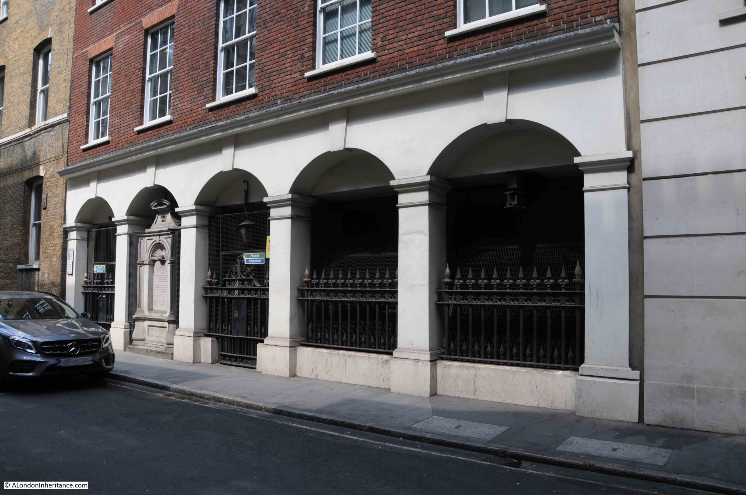
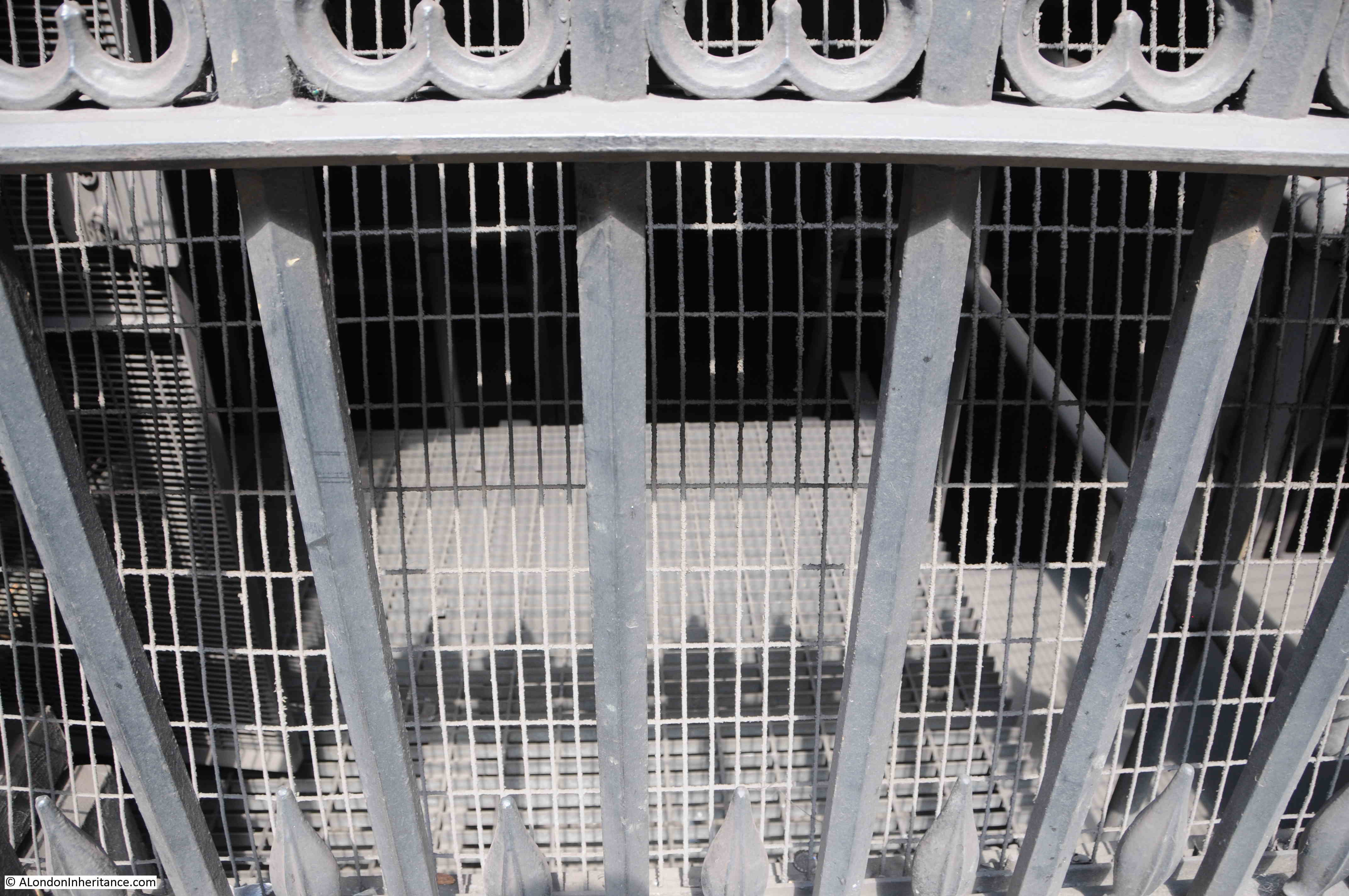
A closer view, and the railings have signs that imply that there is perhaps more to discover:

Cloak Lane

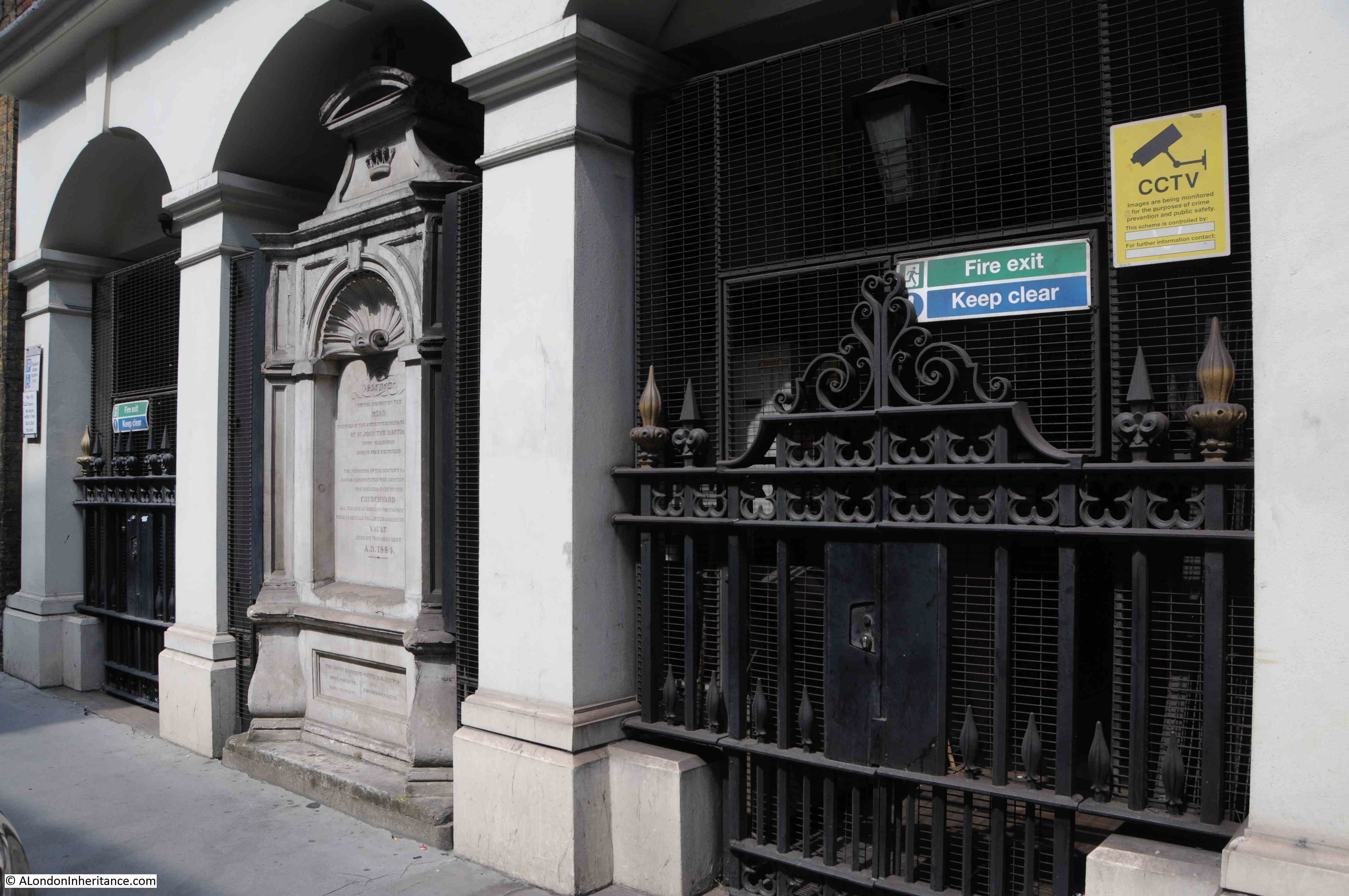
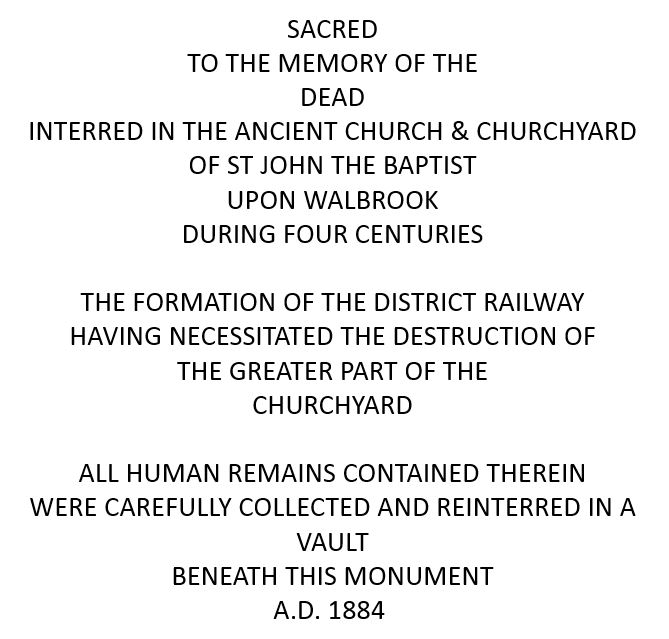
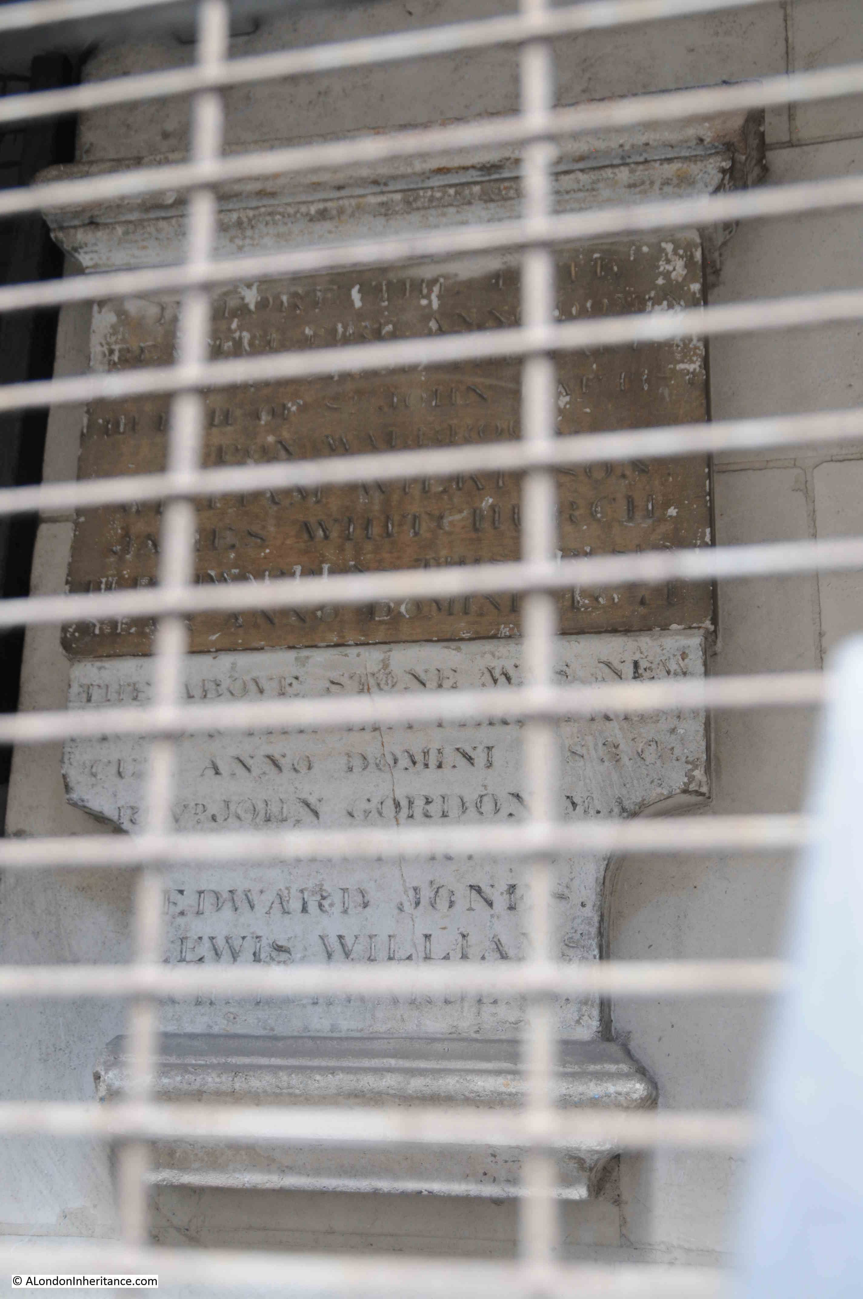
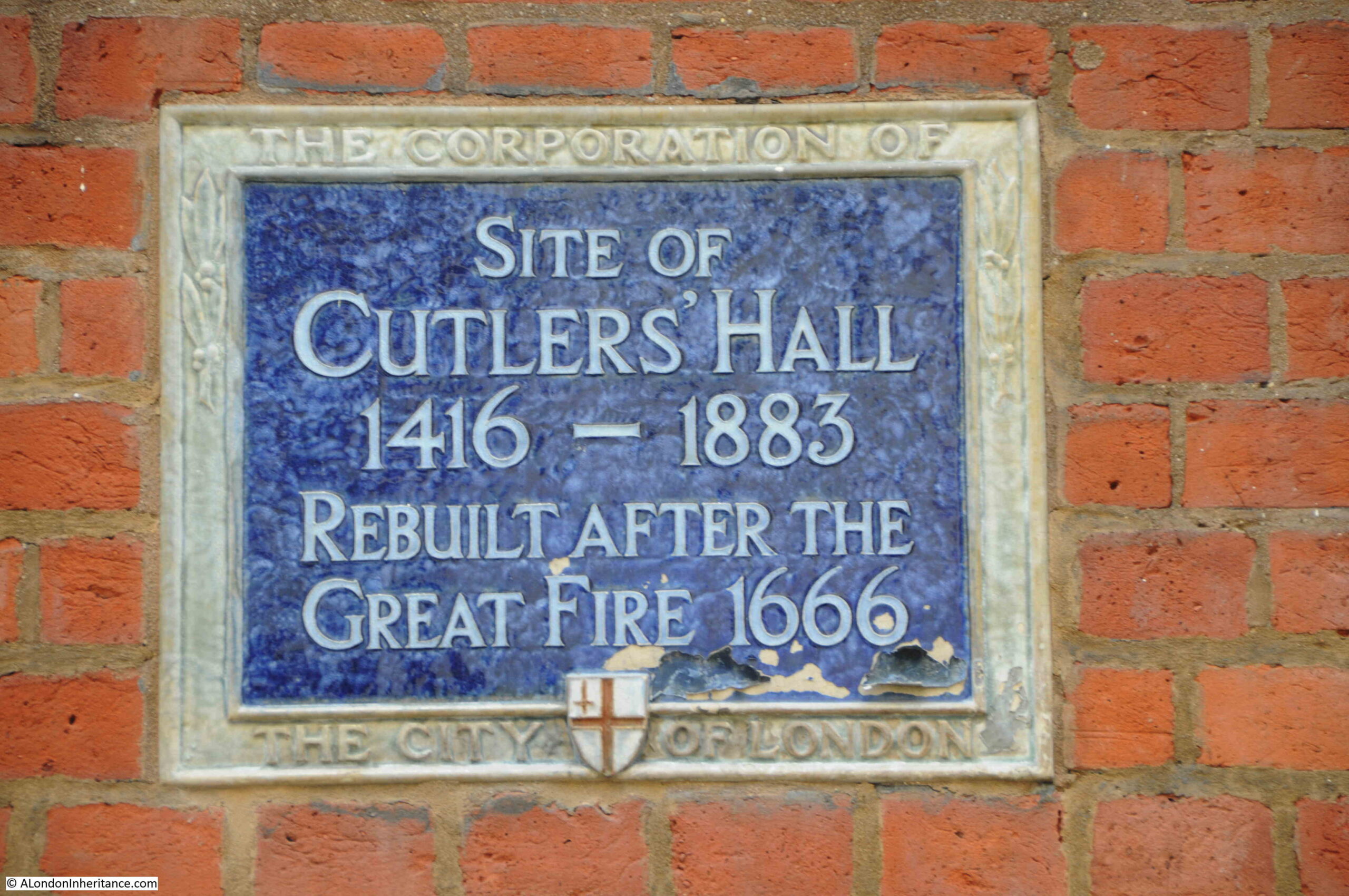
The monument provides some information:

Cloak Lane

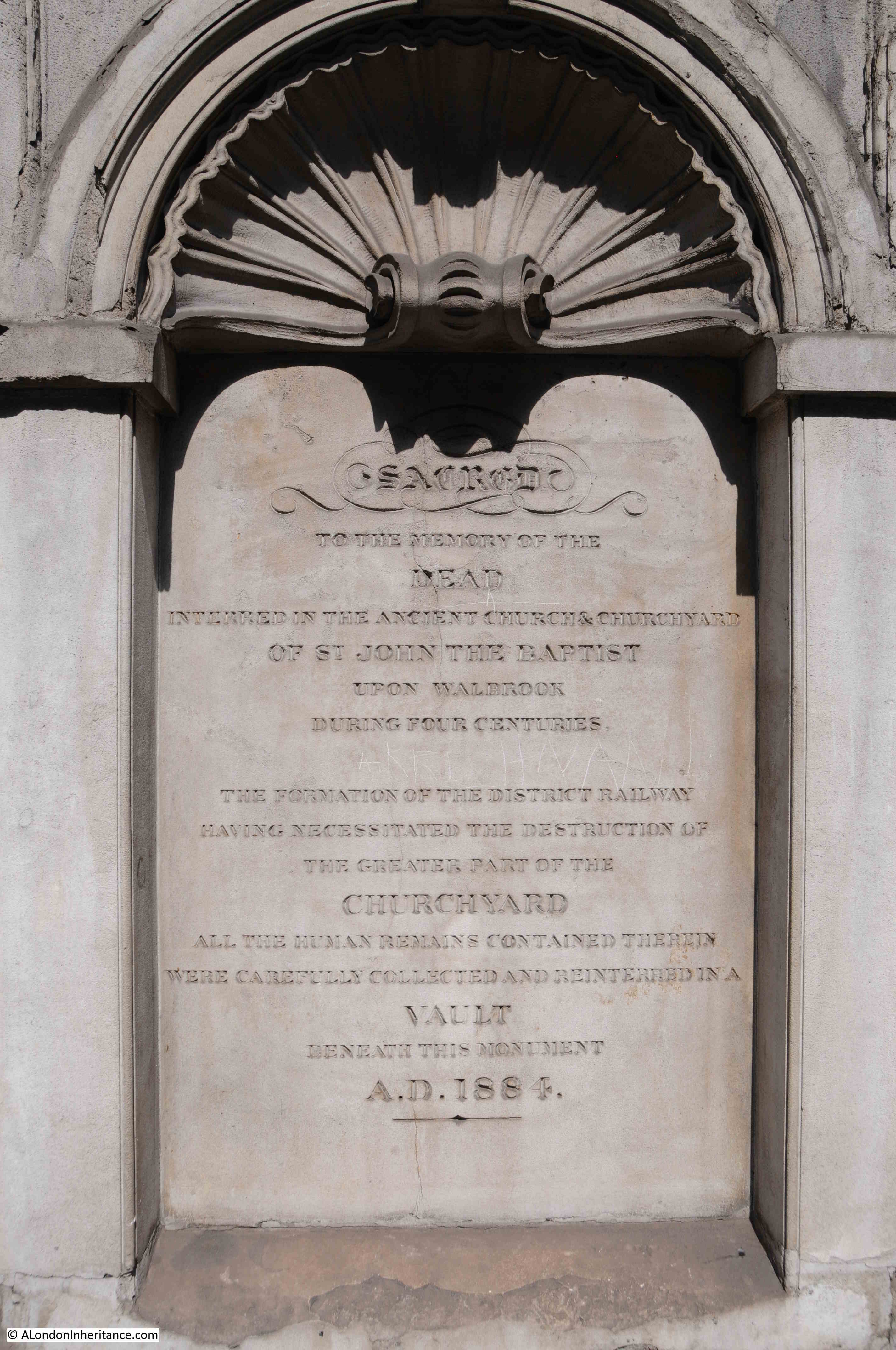
The contrast between letters and stone is not that high in the above photo, so I have reproduced the text on the monument below:

Cloak Lane

There is much to unpack from the inscription on the monument, and it does not tell the full story.

The church of St John the Baptist upon Walbrook was one of the City churches that was destroyed during the Great Fire of 1666, and not rebuilt, so after the fire, only the churchyard remained.

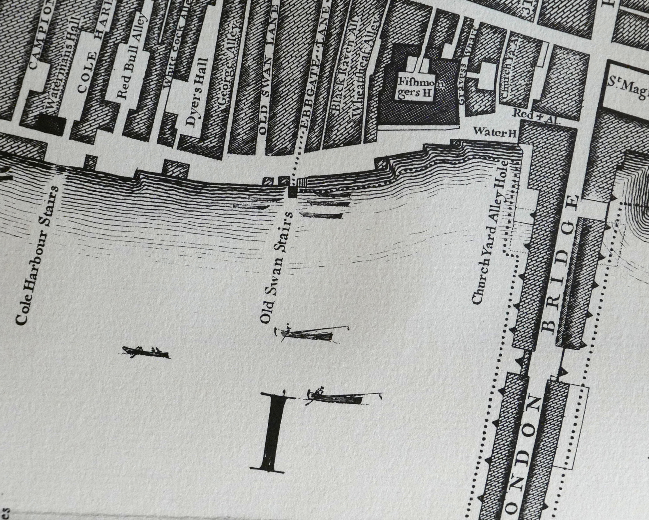
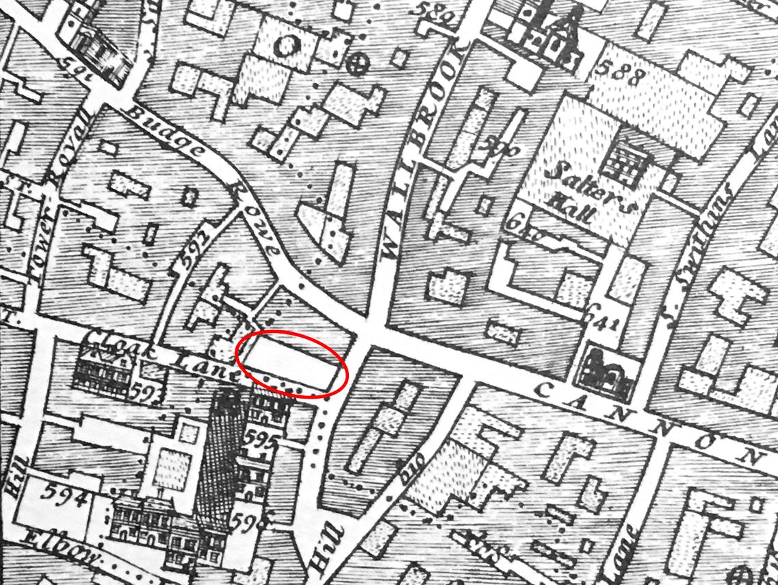
I have circled the location of the surviving churchyard, at the junction of Cloak Lane and Dowgate Hill in the following extract from William Morgan’s, 1682 map of London:

St John the Baptist upon Walbrook

According to “London Churches Before The Great Fire” (Wilberforce Jenkinson, 1917), St John the Baptist upon Walbrook was “Founded before 1291, and enlarged in 1412, and ‘new-builded’ around 1598. The west end of the church was on the bank of the Walbrook, hence the title.”

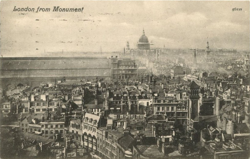
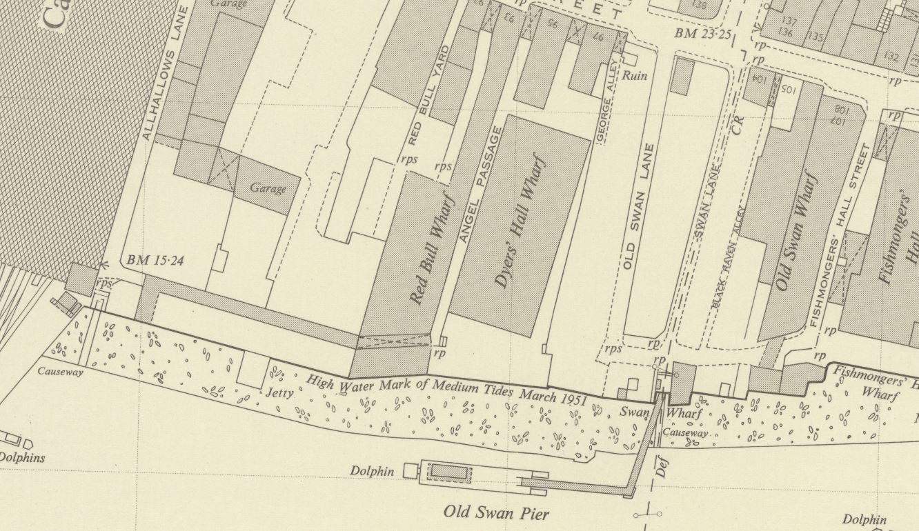
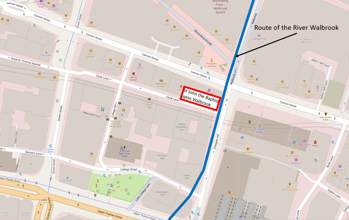
The Walbrook is one of London’s lost rivers, and in the following map I have marked the location of church and churchyard along with the Walbrook which made its way down to Upper Thames Street which was the early location of the Thames shoreline (© OpenStreetMap contributors):

Walbrook and Dowgate Hill

The book states that the west end of the church was on the bank of the Walbrook. This is possibly an error as the eastern end of the church would have been on the Walbrook, or it should have read that the church was on the west bank of the river.

It is possible that the Walbrook ran further to the west than shown in the above diagram, however all the references I can find are to the river running roughly on and alongside Dowgate Hill.

The text on the monument mentions the District Railway, and the title for the blog is about the Circle Line. I will explain why I have used the Circle Line later in the post, however stand next to the railings alongside the monument, and a grill can be seen in the floor. Wait a few minutes and the sounds of an underground train can be heard coming up through the grill.

Cloak Lane

After the 1666 Great Fire, the church was not rebuilt, the churchyard remained, and would do so for the next 200 years. Buildings alongside did encroach on the churchyard, however it was still there in 1880. In the next few years there was some major construction work in Cloak Lane which would result in the loss of the churchyard.

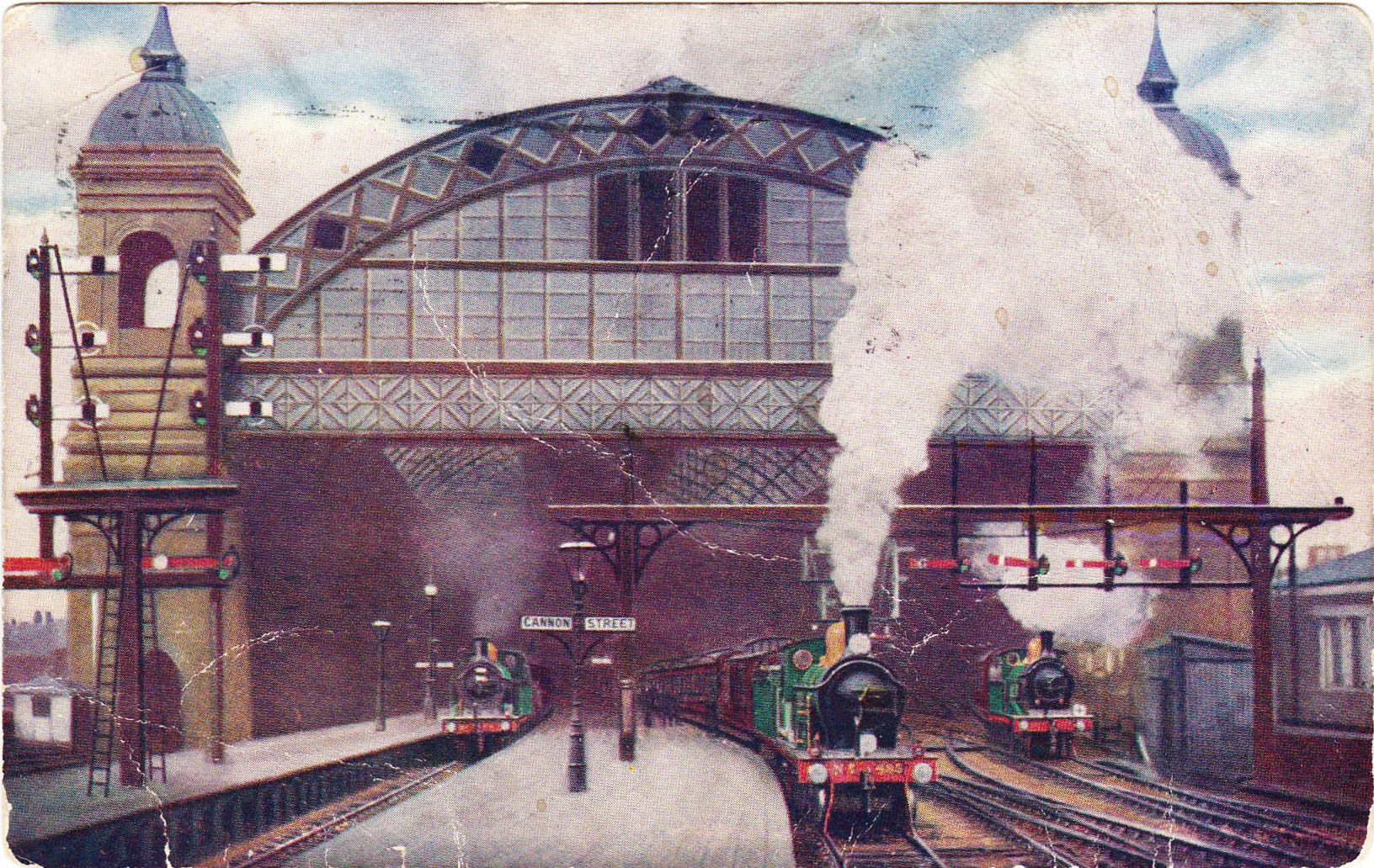
This construction work was for an underground railway that in the newspapers of the time was referred to as the Inner Circle Railway. The following article from the East London Observer on the 31st May 1883 provides some background:

THE INNER CIRCLE RAILWAY. With much less outward demonstration than might have been expected, considering the importance and magnitude of the works, there is now being contracted in the City of London an underground railway which, by uniting the Metropolitan and District systems, will complete the long looked for Inner Circle Railway, and be of immense service to the travelling public and the metropolis.

The Acts of Parliament under which these works are being carried out were obtained in the names of the joint companies – that is to say, the Metropolitan and the Metropolitan District. They authorised the construction of a railway to commence by a junction with the District line at Mansion House Station, and to run under some houses south of the thoroughfare known as Great St Thomas Apostle, crossing Queen Street, then going along the south side of Cloak Lane, across Dowgate Hill, to the forecourt of the South-Eastern Cannon Street Station. Here is to be made a station.

The line is then to pass under the centre of Cannon Street, crossing King William Street, and is then to swerve slightly south. Between this point and Pudding lane is to be a second station, which will serve the busy district around it, including Gracechurch Street, Lombard Street and Billingsgate. By arrangement with the Corporation and the Metropolitan Board of Works, the narrow thoroughfares of East Cheap and Little Tower Street are to be widened on the south side, and Great Tower Street on the north side. The railway is to pass under the centre of the roadway, and will be constructed simultaneously with the new street. the line will then branch slightly to the north, and between Seething Lane and Tower Hill, another large station is to be built.

The line is then to pass by Trinity Square Gardens, joining the piece of railway already constructed.”

So by joining existing lines at Mansion House and Tower Hill, the new line would form what we know today as the route of the Circle and District lines between Mansion House and Tower Hill.

The Railway News (which also called the line the Inner Circle line) on the 18th of August 1883, provided additional technical information on the new line:

“From the Mansion House station to Tower Hill, there is no part of the line on a curve of less than 10 chains radius; the length from Cannon Street to King William Street is straight. The successive gradients are from the level at the Mansion House to a descent by a gradient of 1 on 100, followed by a rise of 1 in 355, then 1 in 100, next to 1 in 321, for 334 yards and then a fall of 1 in 280 for the remainder.”

I never fail to be impressed by the accuracy achieved in measuring and building these early lines, without the surveying equipment that we have available today.

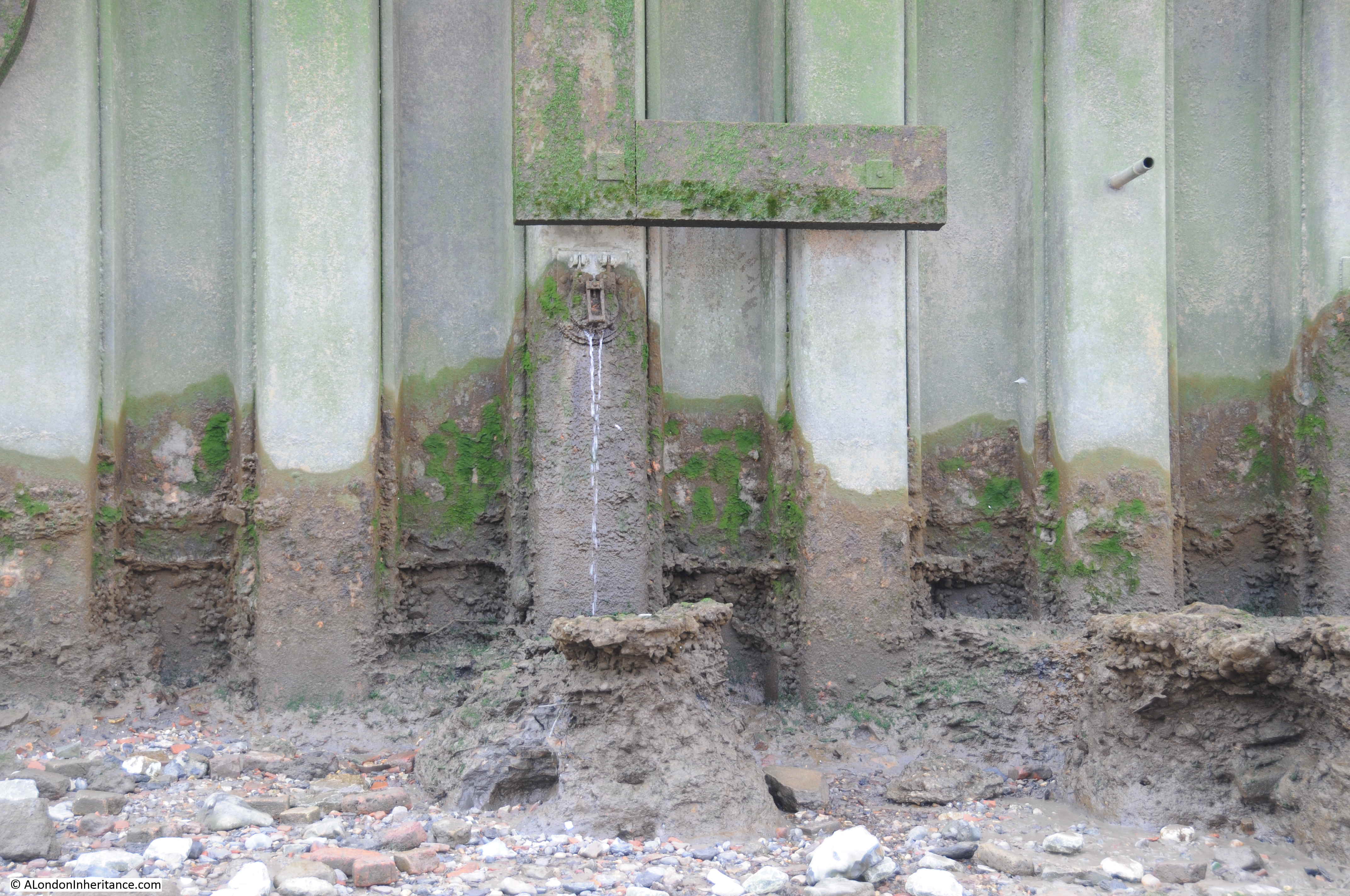
Look through the grills and some of the monuments from the old churchyard have been mounted on the wall behind:

Cloak Lane

The new railway was just below the surface and was partially built using the cut and cover technique where the ground would be excavated to build the railway, which would then be covered over, with roads or buildings then completed on top.

Where cut and cover was not used, the railway would be tunneled underneath buildings, undercutting the foundations, bit by bit, with arches being built as the tunneling progressed to support the building above.

Railway News provides some detail:

“Near the western end of the line 200 feet of girder-covered way has been built between Queen Street and College Hill, and a large portion of the side wall has been advanced to Dowgate Hill. In this vicinity an important work, viz, a diversion of the main outfall sewer, has been successfully completed. It was lowered about 14 feet, and the length of this work from north to south being about 600 feet. The north side wall for the Cannon Street station, is also built, and rapid progress is being made with the excavations.”

The total distance of the new line between Mansion House and Tower Hill was 1,266 yards.

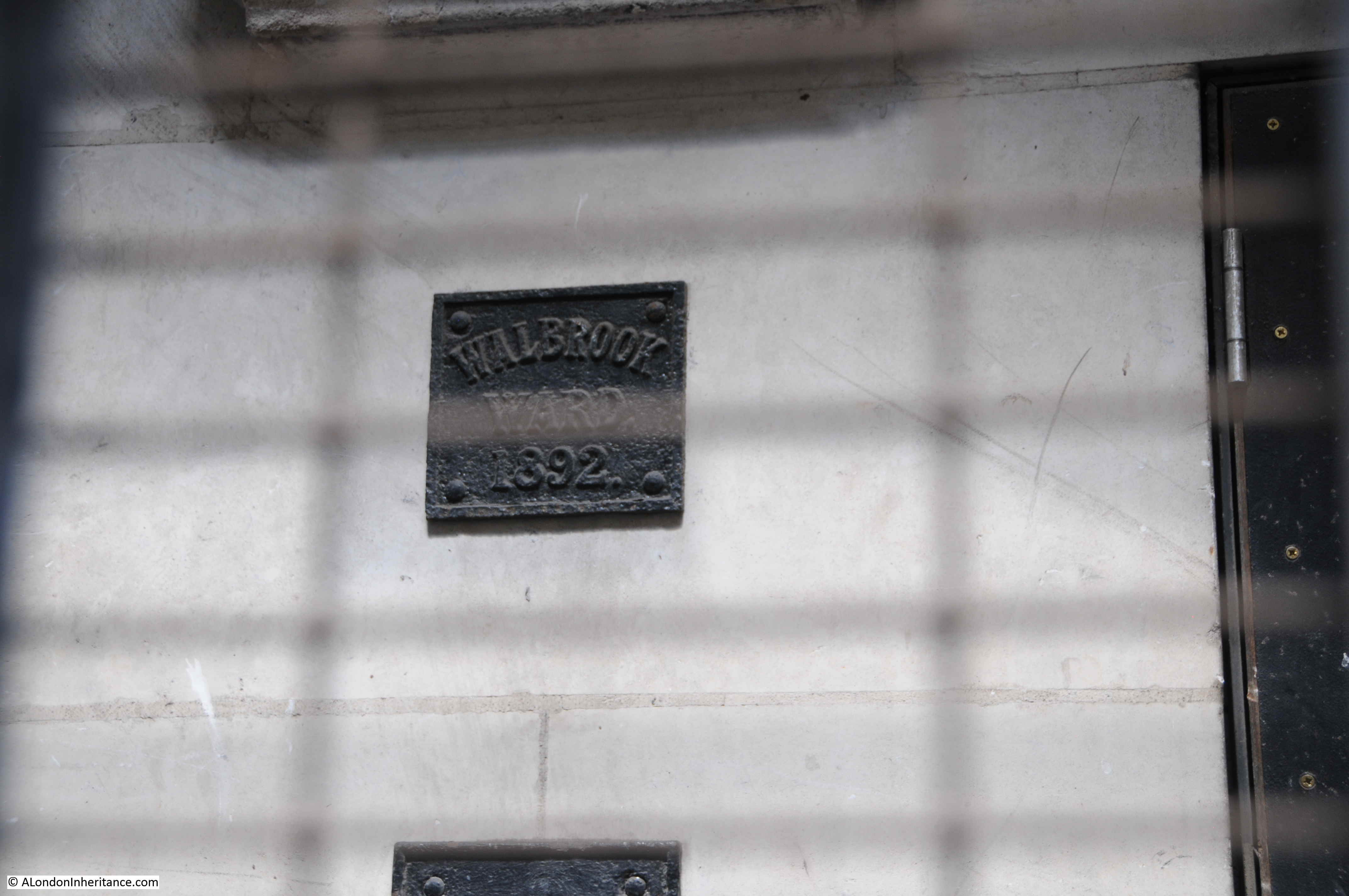
Behind the grills – an 1892 Walbrook Ward boundary marker:

Cloak Lane

The above extract refers to a diversion of the main outfall sewer in the vicinity of Dowgate Hill, which possibly was the sewer running down Dowgate Hill that carried what was left of the Walbrook river.

During excavation work for the new railway, there were a number of finds, which add to the question of the original route of the Walbrook.

In the book “London – The City” by Sir Walter Besant, he quotes from the notes of the resident engineer of the works, Mr. E.P. Seaton: “At the west end of the churchyard was found a subway running north and south. The arch was formed of stone blocks (Kentish rag) placed 3 feet apart, the space between filled up with brickwork. The flat bottom varied from 2 to 4 feet in thickness and was formed of rubble masonry.

A portion of the arch had been broken in and was filled with human bones. the other parts of the subway or sewer were filled with hand-packed stones. this is supposed to be the centre of the ancient Walbrook (this supposition is quite correct) and made earth was found to a distance of 35 feet from the surface. Clay of a light grey colour was then found impregnated with the decayed roots of water plants.

The foundations (it is a matter of regret that no plan of the foundations was taken; the opportunity is now lost forever) of the old church of St John the Baptist were discovered about 10 to 12 feet from the surface and composed of chalk and Kentish ragstones. They ran about north-north-east to south-south-west. Piles of oak were found which seem to denote that the church was built on the edge of the brook, which must have been filled up during Roman occupation, as numerous pieces of Roman pottery were found.

The bottom of the Walbrook valley was reached at 32 feet below the present street level, and is now 11 feet below the level of the lines in the station. During the excavations the piles and sill of the Horseshoe bridge which crossed the Walbrook hereabouts were also found near the churchyard, together with the remains of an ancient boat. These were unfortunately too rotten to preserve, but a block of Roman herring-bone pavement, formerly constituting part of a causeway of landing-place on the brook, is now at the Guildhall Museum. It was found beneath the churchyard 21 feet below the present level of the street.”

Besant can at times be unreliable, however as he is quoting from notes by the resident engineer, and the works were not long before the book was published, they should be an accurate record of finds during the work.

The finds imply that the Walbrook did run to the west of the church, so was further west of the route shown in the earlier diagram and was slightly further west of Dowgate Hill, or perhaps it was a separate channel or ditch.

There is another reference to the Walbrook, and its route in a report on the construction of the railway in the Standard on the 21st April, 1884, which refers to the sewer along Dowgate Hill that ran along the route of the Walbrook, needing to be lowered to make space of the railway. After completion, the sewer and Walbrook ran under the new rail tracks. The report describes the Walbrook as “flowing into the sewer down a flight of steps”.

These layers of history and archeology below the current surface of the City are really fascinating. We really do walk on London’s buried history when we walk the streets, and Besant’s description hints at what has been lost over the centuries, particularly during significant construction works of the later 19th and early 20th centuries, when these sites did not have an archeological excavation before construction commenced, and before the preservation techniques were available, that would have been needed to preserve the boat and wooden piles that were found.

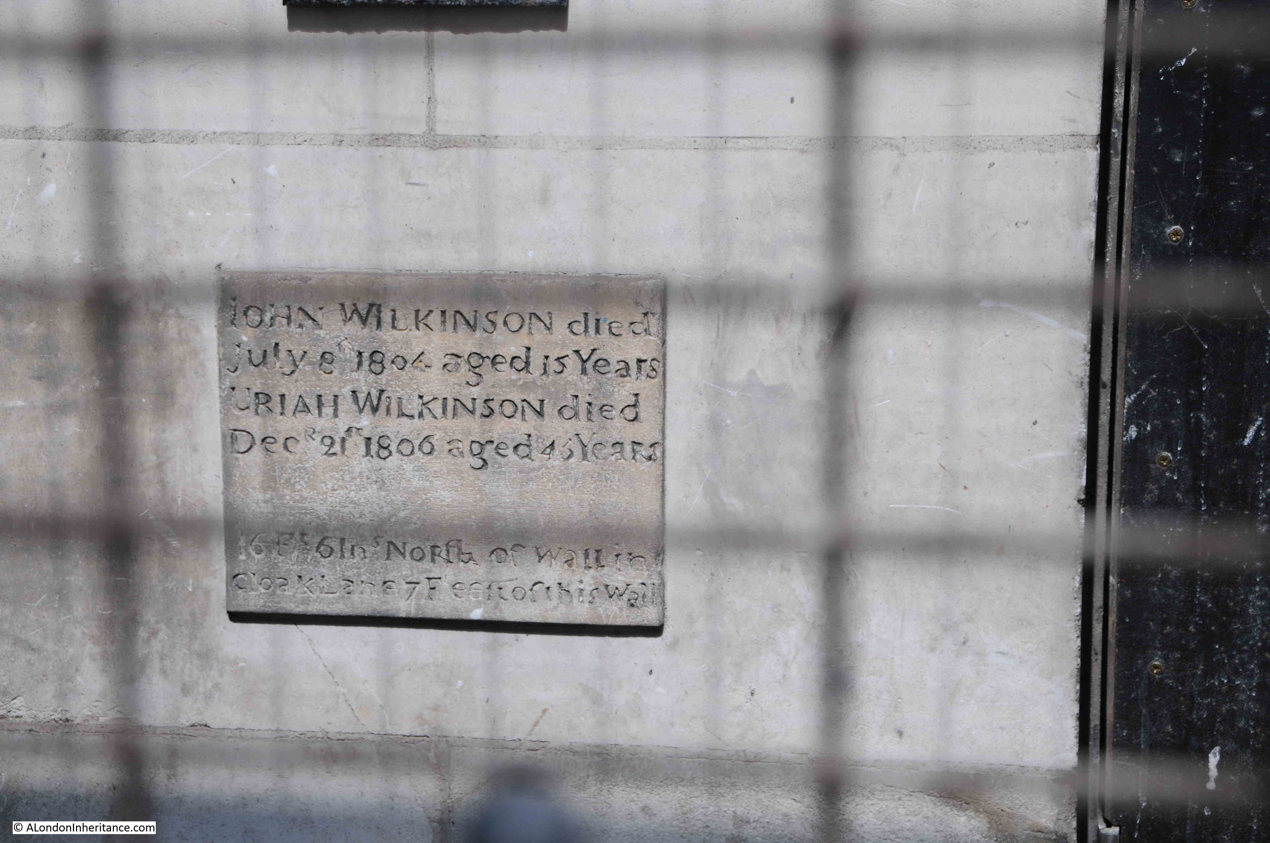
Another of the memorials behind the metal grill – I wonder what John (died in 1804) and Uriah (died in 1806) Wilkinson would have thought if they knew their memorial would be hidden behind a metal grill, and above an underground railway?

Cloak Lane

The extract from Besant’s book mentions the “Horseshoe bridge which crossed the Walbrook hereabouts were also found near the churchyard”. The bridge also has a connection with Cloak Lane.

According to Henry Harben’s Dictionary of London (1918), the name Cloak Lane is of relatively recent origin, with the first mention being in 1677. Prior to this, the street was named Horshew Bridge Street after the bridge over the Walbrook.

A possible origin of the name Cloak Lane is from the word “cloaca” which is a reference to a sewer that once ran along the street down to the Walbrook, however as the name of the street is much later than the sewer and when the word “cloaca” would have been used, it is almost certainly not the source, which remains a mystery.

The first mention of this bridge dates back to 1277 when it was called “Horssobregge”, and was a bridge over the Walbrook close to the church of St John upon Walbrook.

During the medieval period, property owners in the neighbourhood of the bridge were responsible for keeping it in good repair. Around 1462, the Common Council ordained that land owners on either side of the Walbrook (which was then described as a ditch) should pave and vault the ditch, and if a landowner failed to comply, their land would be given to someone who would take on this responsibility.

Following the paving over of the Walbrook, the bridge became redundant, fell into disrepair and was eventually taken apart.

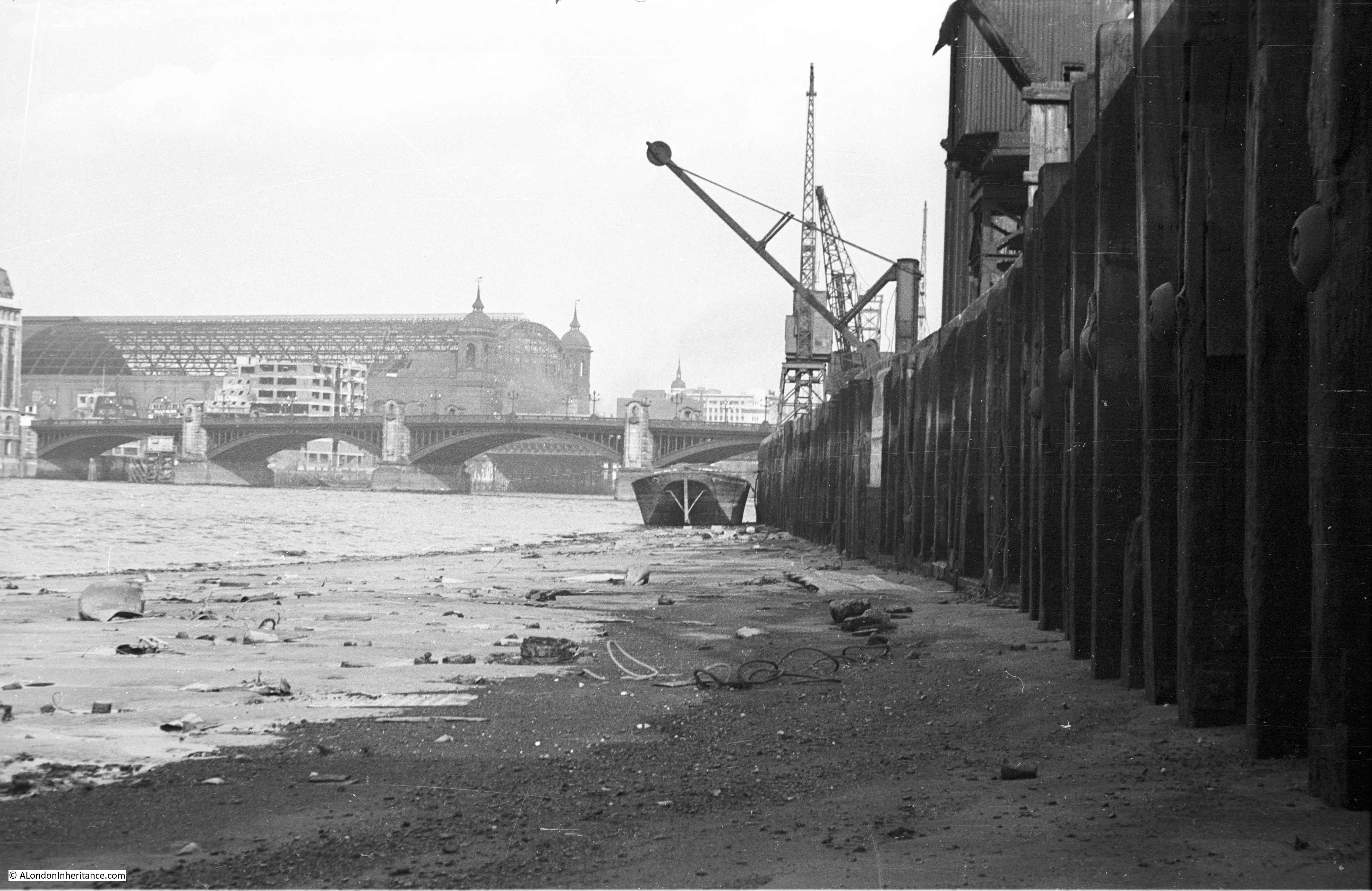
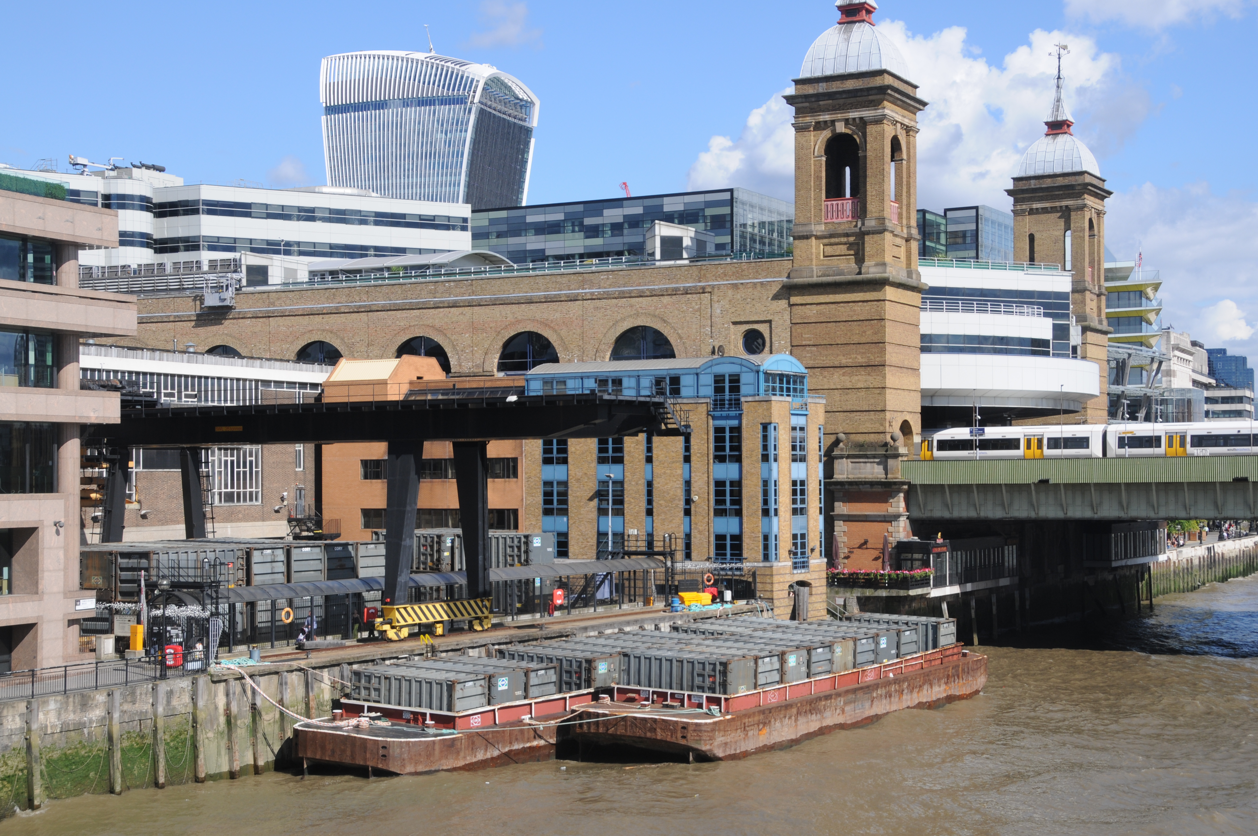
The following photo is looking down Cloak Lane towards Cannon Street Station, the entrance to the Underground station can be seen at the far end of the street, across Dowgate Hill.

I have arrowed two locations in the photo. The orange arrow is pointing at the location of the memorial, and was the location of the church and graveyard.

Cloak Lane

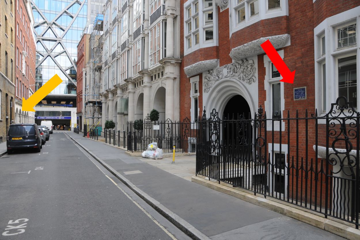
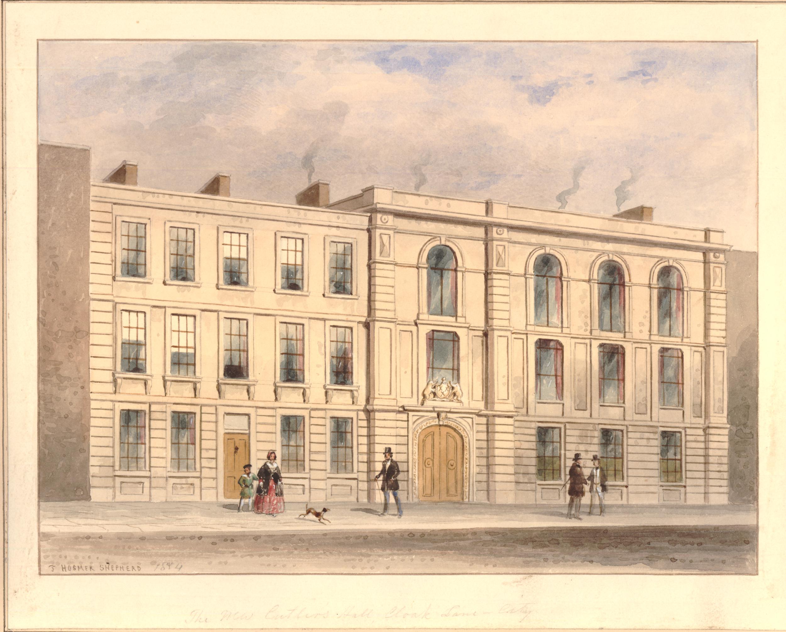
The second arrow is pointing to the site of another building that was demolished to make way for the works to construct the new railway – Cutlers Hall:

Cutlers Hall

Cutlers Hall was the home of the Worshipful Company of Cutlers, one of the City’s ancient companies. When the Cutlers were organised into a Company, the trade consisted of the manufacture of swords, daggers and knives. As an example of how specialised a City workman was at the time, there were seperate trades for hafters, who made the handles, along with blacksmiths and sheathers (who made the sheath in which a sword or knife would be stored).

The first mention of the Cutlers dates back to 1328 when seven cutlers were elected to govern the trade, and in December 1416, a Royal Charter was granted to the company.

Hafters, sheathers and blacksmiths were gradually incorporated into the Cutlers Company.

The hall of the Worshipful Company of Cutlers was in Cloak Lane from the earliest days of the company, until the arrival of the Inner Circle Line, when the hall was demolished in 1883, having been the subject of a compulsory purchase order.

The Cutlers purchased a new plot of land in Warwick Lane, had their new hall designed by the Company’s Surveyor, Mr. T. Tayler Smith, and the new hall came into use in March 1888. The Cutlers have remained at the Warwick Lane site ever since.

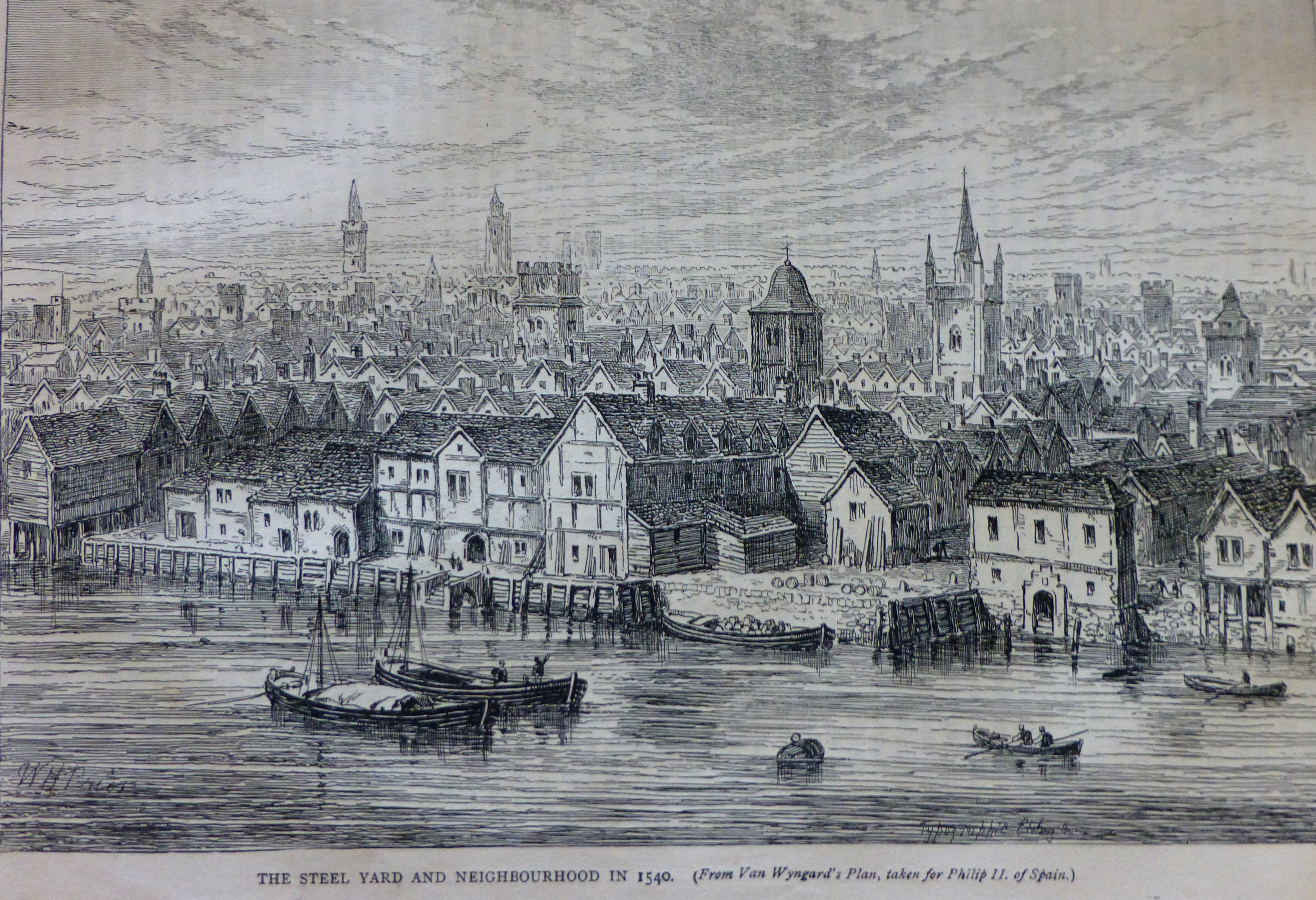
The following print shows Cutlers Hall in Cloak Lane as it appeared in 1854 (© The Trustees of the British Museum):

Cutlers Hall

There were many newspaper reports on the construction of the new railway, and the methods used to minimise disruption to the City above.

Cannon Street Station originally had a forecourt between the station entrance and Cannon Street. The tunnel needed to be built under the forecourt, and the method used to avoid disruption to the station was that the contractor:

“Provided 250 men for the occasion and 50 more as a reserve, the intended work was commenced after the dispatch of the Paris night mail, and then the busy hands plied their busiest. The paving slabs were removed; the twelve inch timbers were laid on the bare ground, three-inch planking put across them, and again three-inch planking over these. And in the morning when Londoners came to their duties in the City they were astonished to see the fore-court paved with wood, and an alteration completely effected, of which there was not a symptom or indication when they went home from their duties the evening before. Having thus laid their roof on the surface the contractor could carry on burrowing to his heart’s content. Beneath the wood platform a heading was soon driven through the soil; and the contractors went on their way below, whilst the cabs and the passengers were going on above”.

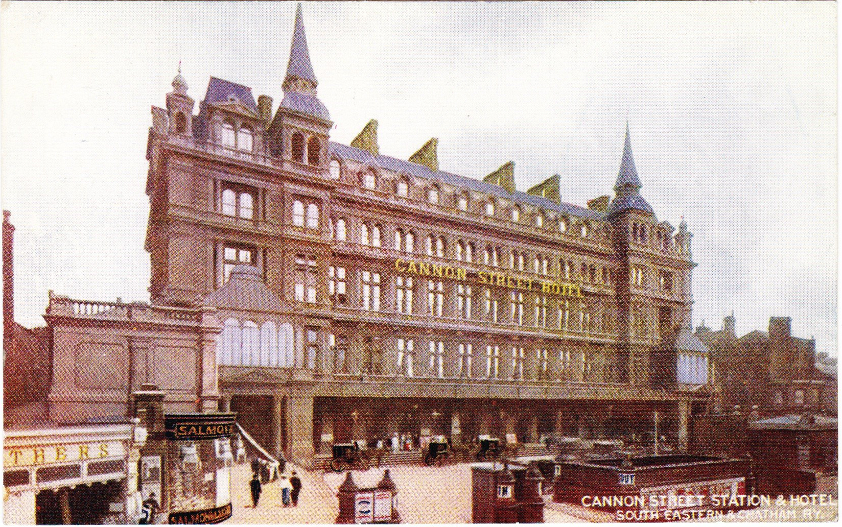
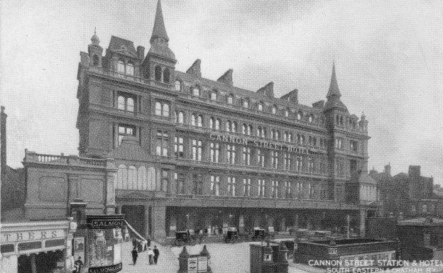
The following photo shows the Cannon Street Station Hotel and entrance to the station behind. The forecourt under which the Inner Circle Line was dug can be seen in front of the hotel.

The monument in Cloak Lane is a perfect example of what fascinates me above London’s history. There is so much to find in one very small section of street, and that London is not just what we see on the surface, there is so much below the streets, lost rivers, centuries of history, remarkable examples of construction methods used to build the start of the underground system in the 19th century, and so much more.

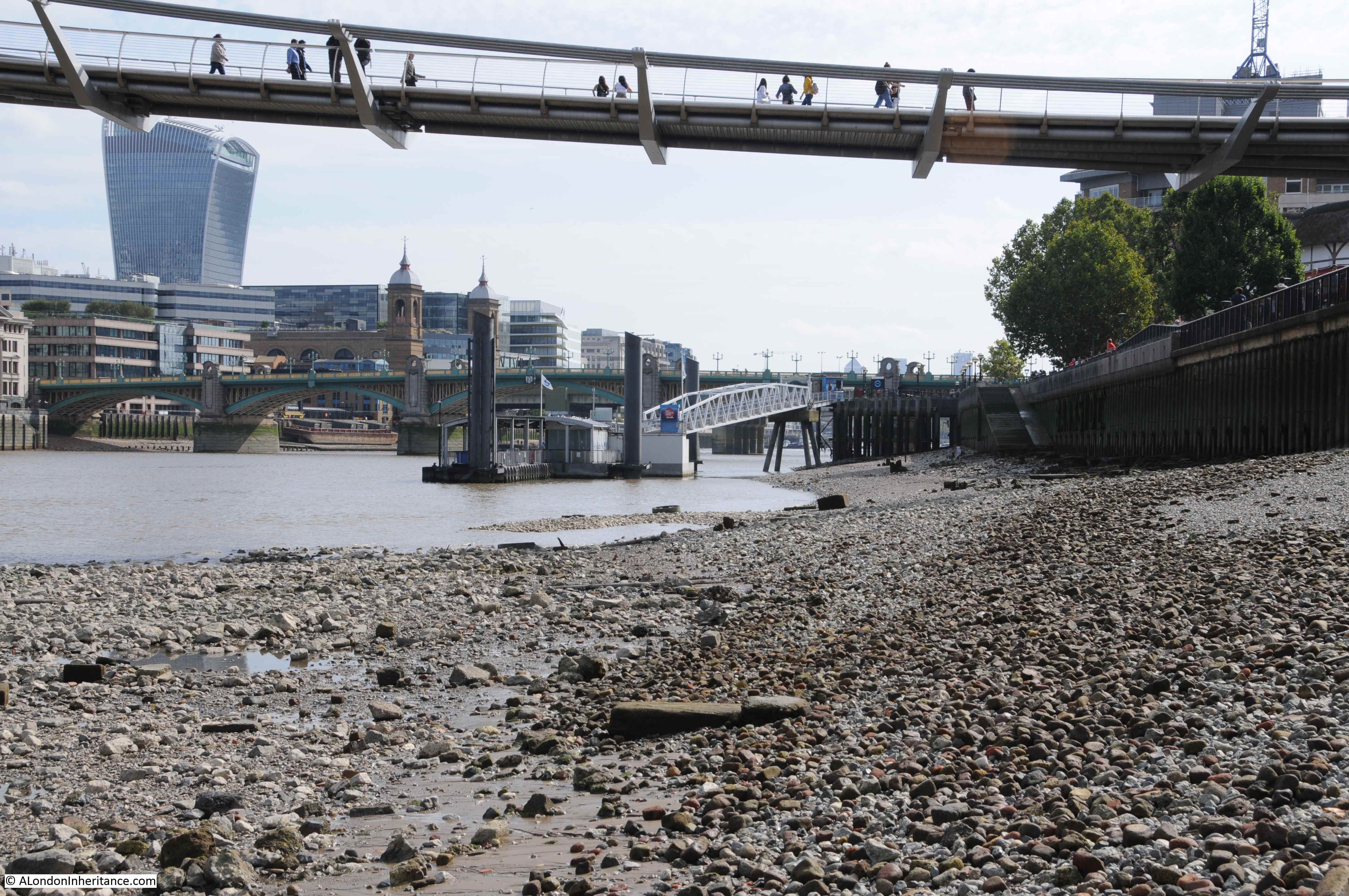
If you take a train on the Circle or District line to or from Cannon Street Station, on the western side of the station, recall the Walbrook and the church and cemetery.

I have also added trying to find out about the fate of the finds from the construction of the railway, given to the Guildhall Museum, and which are now hopefully at the Museum of London. And if anyone from TfL reads this post – if you could let me have a look behind the metal grills in Cloak Street – it would be much appreciated !

alondoninheritance.com

Cannon Street Station from the Thames Foreshore

The joy of scanning negatives is finding different views of places that have been the subject of other photos. This week’s photo is of Cannon Street Station, photographed from the Thames foreshore at Bankside.

Thames Foreshore

The same view today (although I had walked slightly further away from the river wall):

Thames Foreshore

The view has changed considerably in the 70 plus years between the two photos. The only consistent features are obviously the river, Southwark Bridge and the twin towers at the entrance to Cannon Street Station.

The station has since lost the fantastic roof that stretched back from the entrance towers to the station hotel that once faced onto Cannon Street. The Walkie-Talkie, or 20 Fenchurch Street is the City tower visible from this perspective and the Millennium Bridge stretches over the foreshore, transferring walkers between south and north banks of the Thames.

I love being able to cross-reference photos so you can see both sides of the view. A few months ago I wrote about Emerson Stairs and published the following photo which is looking back from Southwark Bridge towards Bankside and includes the area where my father was standing to take the original photo.

Thames Foreshore

If you look at the photo at the top of the post, there is a Derrick Crane with the jib leaning out over the foreshore, and behind is one of the more traditional riverside cranes. In the photo above, taken from Southwark Bridge, I have ringed a small area. The following photo is an enlargement of this area.

Thames Foreshore

On the left is the crane in the background of the photo from the foreshore and to the right I have ringed the Derrick Crane. This is not easily visible due to the grain and contrast of the film, but can just be seen, so my father was standing just a short distance further to the right of the Derrick Crane, not far from where the conveyor belt taking coal from river barges to the original Bankside Power Station was located.

I have an almost complete set of photos of the south and north banks of the river between Westminster and Tower bridges in the late 1940s, and the plan for a future post is to bring these all together and document a trip along the river showing how both sides have changed in the intervening 70 years.

In the original photo, Cannon Street Station still has the arched metal framework which ran from the station entrance and hotel, all the way to the river entrance and the twin towers.

Cannon Street Station was opened in 1866 and the iron and glass arch was around 700 feet long and must have been a magnificent sight. The following postcard with a photo from the Monument gives an impression of what the arched roof must have looked like soon after completion, and how the new station dominated this area of the City.

Thames Foreshore

Maintenance of the station roof had been neglected prior to the last war, and the glass panels had been removed from the roof, leaving just the iron frame at the start of the war. Bomb damage included many incendiary bombs and a few explosive bombs, however as can be seen from my father’s photo, the majority of the iron frame of the arch survived.

The iron frame of the roof was removed in 1958, and the space above the platforms has been redeveloped with the office space that we see today.

The following photo is looking in the opposite direction, and shows the railway bridge running across the river for Blackfriars Station.

Thames Foreshore

The Thames foreshore is a fascinating place, with plenty of relics of the industrial past of the river. Comparing my father’s photo with view today, it looks as if there is now a more pronounced slope of the foreshore. It looked reasonably flat in the original photo, but as can be seen in my photos from the same place, the foreshore looks to slope down into the river. Possibly more erosion is taking place with increased water flow?

The foreshore is littered with traces of the past. Exposed pipes that run from the land down into the river. What was their original use, or are they still in use?

Thames Foreshore

Chains, the red / orange of tide worn bricks and lumps of chalk that were once used to create level platforms to position barges, all provide evidence of an earlier city.

The main change to the river in the area of my father’s photo has been the construction of the Millennium Bridge, which is just as interesting from below the bridge as from above.

Thames Foreshore

The day I was on the Thames foreshore to take an updated photo was a day of an exceptionally low tide. This is when the river reveals many more features including those that demonstrate that the foreshore is not a flat slope down to the centre of the river. Here a raised bank runs out further into the river.

Thames Foreshore

Almost certainly not a natural feature, but possibly enhanced by the river eroding softer sediment on either side.

Alongside the raised bank, the remains of iron piers run out into the river. The remains of a structure from the days when Bankside was industrialised and dependent on the river.

Thames Foreshore

When the water is this low, it is intriguing to imagine what the view would look like if all the water was drained away. The detritus of a couple of thousand years of London’s history revealed.

During the reconstruction of the area and the new walkway along Bankside, the river wall was replaced by metal piles, however they do not provide an impervious barrier between land and river and there are still plenty of points where water drains into the river, as well as strange pipes which serve no obvious purpose.

Thames Foreshore

For centuries, the river has collected everything that has been lost by those working or travelling alongside, or on the river. Buried under the silt and often returned to the surface following erosion by water flow and the tides. You will not find clay pipes being dropped into the river these days, rather the evidence of 21st century construction work on, or alongside the river.

Thames Foreshore

Low tide is a fascinating time to walk along the Thames foreshore, walking on a couple of thousand years of London’s history. Cannon Street Station has only been there for a very short period in that history, the wonderful arched roof has been lost, but the twin towers will continue to welcome trains into the station for years to come.

alondoninheritance.com

Old Swan Stairs

Following last Sunday’s post covering the first part of my walk around London’s West End theatres, I had been expecting to publish the second part a couple of days ago, however I must admit I have never really counted up how many theatres there are (over 40), so I am still working on the post. Therefore today, back to one of my father’s photos of London 70 years ago.

This is my father’s post war view of the stretch of the north bank of the River Thames between London Bridge and Cannon Street Station:

Old Swan Stairs

The magnificent framework of the original glass roof of Cannon Street Station is in the rear of the photo, the glass had previously been removed so this is just the metal framework.

My father was standing on London Bridge to take the photo and the river front consists of space cleared of buildings damaged by wartime bombing and some of the remaining warehouse and wharf buildings.

I took a wider photo of the scene today to set the context as the side walls of Cannon Street Station are now obscured and the station has long since lost the original roof.

Old Swan Stairs

The scene has completely changed, and the perspective of the two photos looks different due to very different lens and camera types, however there are some features remaining that allow the buildings in the original photo to be located.

The following map extract is from the 1952 Ordnance Survey map of the area (published in 1952, surveyed the previous year).

Old Swan Stairs

In the map, Cannon Street Station is the large building, partly shown on the left of the map.

The first feature to identify on the photo is Old Swan Pier. In the map, this can be seen running from a small, rectangular indentation in the river wall. In the original photo, this is the metal walkway that can just be seen running out from the river wall, with the small indentation in the river wall also partly visible.

This allows the building to be identified adjacent to the pier, this is Swan Wharf, the building has a date on the very top which I can just make out as either 1896 or 1894.

Now follow the river wall from the pier and Swan Wharf back to the right hand edge of the photo and the river wall steps back twice, once alongside the edge of the Swan Wharf building, and the second slightly further along. These two steps backs in the river wall can also be seen in the 1952 map which identifies the building to the right of the crane as the building at the end of Old Swan Wharf in the map.

The definition of the original film is not sufficient to clearly read the white writing on the side of the crane, but it appears to read “The Swan Wharf & ———“. I cannot make out the last word.

Given the level of redevelopment in this area it would be surprising if any of these features (apart from the station) remain, however there are some that allow the location of the original buildings to be placed along the river’s edge today.

Firstly, look along the river wall in today’s photo and you will see an indention in the river wall. This is the same indentation as at the location of the pier in the original photo and was retained as this gap in the river wall is the location of Old Swan Stairs, one of the many historic stairs leading down to the river.

Two dolphin structures can also be seen in the river, these are a couple of the remaining supports from the Old Swan Pier.

To the right of the stairs in today’s photo is a large tree, this is the location of the Swan Wharf building in the original photo.

From the tree to the right of today’s photo there are two step backs in the river wall. These are the same as those in the post war photo, with the old building to the right of the crane being the building at the end of Old Swan Wharfe in the 1952 map.

Old Swan Stairs have been here for many centuries. The following extract from John Rocque’s map of 1746 shows Old Swan Stairs.

Old Swan Stairs

In the 1746 map, the stairs are at the end of Ebbgate Lane, in the 1952 map this lane was then Swan Lane with Old Swan Lane to the left in both maps.

Swan Stairs were mentioned in the diaries of Samuel Pepys and in Stow’s 1603 Survey of London there is a mention Old Swan: “This ward turneth into Thames streete westwarde, some ten houses on a side to the course of the Walbrooke, but East in Thames streets on both sides to Ebgate lane, or old Swan.” in his description of the boundaries of Downegate (Dowgate) Ward.

In Old and New London, Walter Thornbury writes about how Swan Stairs were used to avoid the dangers of passing under the old London Bridge by boat: “The Swan Stairs, a little ‘above bridge’ was the place where people coming by boat used to land to walk to the other side of Old London Bridge when the current was swift and narrow between the starlings, and ‘shooting the bridge’ was rather like going down the rapids. Citizens usually took boat again at Billingsgate, as we find Johnson and Boswell once doing, on their way to Greenwich in 1763.”

Old Swan Stairs were also the starting point for the Swan Upping ceremony when it started in central London. My father took some photos of Swan Upping starting around Old Swan Stairs and in the following photo is Mr Richard Turk who was the Vintners Swan Marker and Barge Master, with the Old Swan Pier in the background. The sign on the right of the piers indicates that boats to Greenwich could be boarded here. My full post on Swan Upping can be found here.

Old Swan Stairs

I am not sure exactly when Old Swan Pier opened, however the first adverts I can find for sailings from the pier are from 1838, when on the 21st May the Shipping and Mercantile Gazette carried an advert for “Steam – Cheap Fares from Old Swan Pier” . The sailings were:

  • To Gravesend – every morning at 9 o’clock, precisely. Cabin 1s: Saloon 1s 6d
  • To Richmond – Daily at half-past 9, calling at Hungerford at 10 o’clock, and to Twickenham every Monday, Wednesday and Friday. Week days 1s 6d; on Sundays 2s.
  • To Woolwich – Every Sunday at 10, 2 and 5, calling at West India Dock Pier, Blackwall, at 11, 3 and 6. To Woolwich 1s, to Blackwall 9d, from Blackwall to Woolwich, 6d

The earliest newspaper report I could find referring to Old Swan Stairs is from the 9th August 1729, when it was reported that:

“Last Monday a Waterman, naked all but his shirt, rowed in a Butcher’s Tray from the Old Swan Stairs, to Greenwich, for a Wager of four Guineas, and won the same”

There are frequent mentions of Old Swan Stairs in newspaper reports since the early 18th century, and they describe the life and tragedies that must have been day to day experiences along this stretch of the Thames.

From the London reports of the Ipswich Journal on the 12th February 1743:

“Sunday Morning a young Man, dressed in a Sailor’s Jacket with Trowsers and a speckled Shirt was found in the Mud near the Old Swan Stairs; his Buckles, which were supposed to be Silver, were taken out of his Shoes. He was carried into the Church-yard, near the Stairs, till own’d, or a Warrant granted for his Burial”.

The implications being that either he was murdered for the silver shoe buckles, or he had died accidentally and his shoe buckles had been stolen.

Standing at Old Swan Stairs would have provided a fascinating view across to what would later be Southwark Cathedral with London Bridge to the left. John Cleverly made the following drawing  (©Trustees of the British Museum) of the view from Old Swan Stairs in 1792. Old Swan Stairs

Despite the land along the river having changed so dramatically over the last 70 years, we can still find features that date back hundreds of years and allow us to accurately place events from centuries of London’s history.

alondoninheritance.com

Cannon Street Station and a Lost Roof of Iron and Steel

Cannon Street Station is a strange station. If you walk down Cannon Street the station appears to be hiding, pretending to be an office block and blending in with the other recent glass and steel office blocks that now make up so much of the City.

To find any real evidence of Cannon Street Station you need to head to Southwark Bridge where across the Thames you can view the rail bridge heading across the river and entering the station where it is flanked by two brick towers providing passengers their first glimpse of the London Terminus of the original South Eastern Railway.

This was the photo my father took back in 1948 of the entrance to the station from Southwark Bridge:

Cannon Street Station

In 2014 I took the following photo from the same spot on Southwark Bridge: Cannon Street Station

From this perspective the towers and the side walls remain, however the most significant change to Cannon Street Station is the roof. The original roof was glass on an iron frame that arched from side wall to side wall across the width of the platforms and ran the entire length of the station. The shape and length of the roof from the edge of the river to the station entrance made this a very significant landmark in the south of the City. The following photo is from a postcard showing the view across London looking west from the top of the Monument. The size of the roof of Cannon Street Station and how it dominated the area is clearly visible.

Cannon Street StationCannon Street Station was built on the location of the Steel Yard. According to “Old and New London”, this was:

“the residence of the Hanse Town, German and Flemish merchants who obtained a settlement in London as early as 1250. Henry III, in 1259 at the request of his brother Richard, Earl of Cornwall, granted them very valuable privileges, renewed and confirmed by Edward I. The City also conceded them many privileges, on condition of their maintaining Bishopsgate in repair (they rebuilt it once), and sustaining a third of the charges in money and men to defend it when need was. In spite of English jealousy, the Steel Yard merchants flourished till the reign of Edward VI, when the Merchant Adventurers complained of them and they were held, like all other strangers to have forfeited their liberties. In vain Hamburg and Lubeck sent ambassadors to intercede for their countrymen. Their monopoly was gone, but the Steel Yard men still throve, and continued to export English cloth. Elizabeth, however, was rougher with them, and finally expelled them from the country in 1597-8.”

The Steel Yard derived its name not from the steel imported by the Hanse merchants, but from the King’s steel yard here erected to weigh the tonnage of all goods imported into London, the tonnage office being afterwards transferred to the City.

A view of the Steel Yard and neighbourhood in 1540 can be seen below:

Cannon Street Station

Approval for the construction of the station was given through an Act of Parliament passed in 1861. Construction commenced in 1863 and the station was officially opened on the 1st September 1866. The station and bridge were designed by the Civil Engineers Sir John Hawkshaw and Sir John Wolfe Barry (who was also the engineer for the construction of Tower Bridge).

The station serves suburban South East London, Kent and East Sussex.

Due to pre-war neglect and damage during the war, the roof was demolished in 1958 and the hotel followed soon after in 1960. There followed a series of re-development projects across the station platforms and on the frontage to Cannon Street resulting in the station and offices we see today. Fortunately the towers facing the Thames are Grade II listed so at least what remains of the once magnificent building over and into the platform area is protected.

Much of the brick wall on either side of the station that reached up to the base of the roof is still in place and provides a sense of the scale of the original station. If you walk down to Upper Thames Street, then on the east side of the station, walk down Allhallows Lane along the side of the wall to the river, up a small set of steps and on the right is a plaque commemorating the German Hanseatic merchants who were based here in the Steel Yard for so many centuries.

Cannon Street Station

Cannon Street, after which the station is named, was originally Candlewick Street, first mentioned in 1276 and ran from Watling Street to London Bridge and was widened and extended to St. Paul’s Cathedral in 1853-4.

The original station buildings facing the road were in true Victorian station style. Along with the functions needed to support the station, the building also included the Cannon Street Hotel. The following postcard shows the station and hotel building facing onto Cannon Street. The architectural style is very similar to that of Charing Cross Station. Note also the two towers that matched those facing the bridge across the river.

Cannon Street Station

Looking at this postcard of Cannon Street it is hard to believe (or rather perhaps not given how much change there has been in the City) how the station frontage has changed. I took a walk down Cannon Street and took the following photo of the station as it now borders Cannon Street:

Cannon Street Station

As I said at the start of this post, until you get really close and look at the ground floor entrance, would you really know that this is a station, or just another City office building?

Walk past the station and you will see an M&S Simply Food shop to the left of the entrance. Above this are two parish boundary markers for St Swithin London Stone (the church damaged by bombing during the war and demolished in 1962) and St Mary Bothaw (this church was on the site of Cannon Street Station, but was destroyed in the Great Fire of London and not one of those selected to be re-built).

Cannon Street Station

Passengers arriving into Cannon Street Station would, if they could have looked directly into the station have seen the following view. Looking down into the station from this perspective gives an idea of the scale of the roof as it covered the length of the platforms from the edge of the Thames through to the station buildings on Cannon Street.Cannon Street Station

Today, by London station standards, Cannon Street Station is relatively quiet.  In 2012/13 there were just over 20 Million entries / exits compared to 95 Million for Waterloo (the busiest) and 38 Million for Charing Cross and unlike other central London terminus stations, Cannon Street is closed on Sunday’s (although this will change in 2015).

A shame that this station hides itself in the street after which it is named, however at least the view from the Thames continues to provide a memory of this fantastic example of Victorian architecture and engineering.

The sources I used to research this post are:

alondoninheritance.com