Tag Archives: Greenwich Peninsula

Lovells Wharf and Enderby House, Greenwich Peninsula

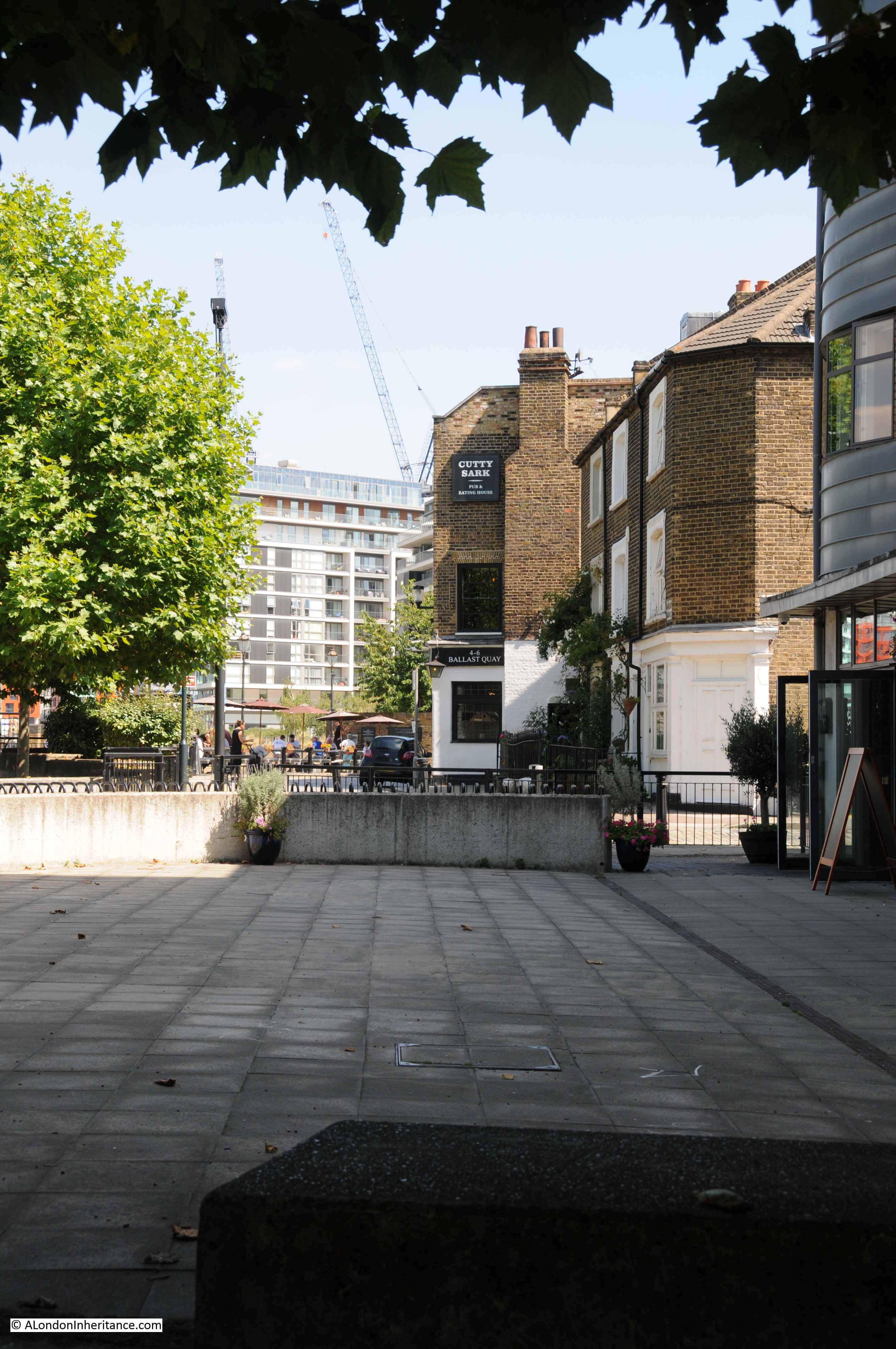
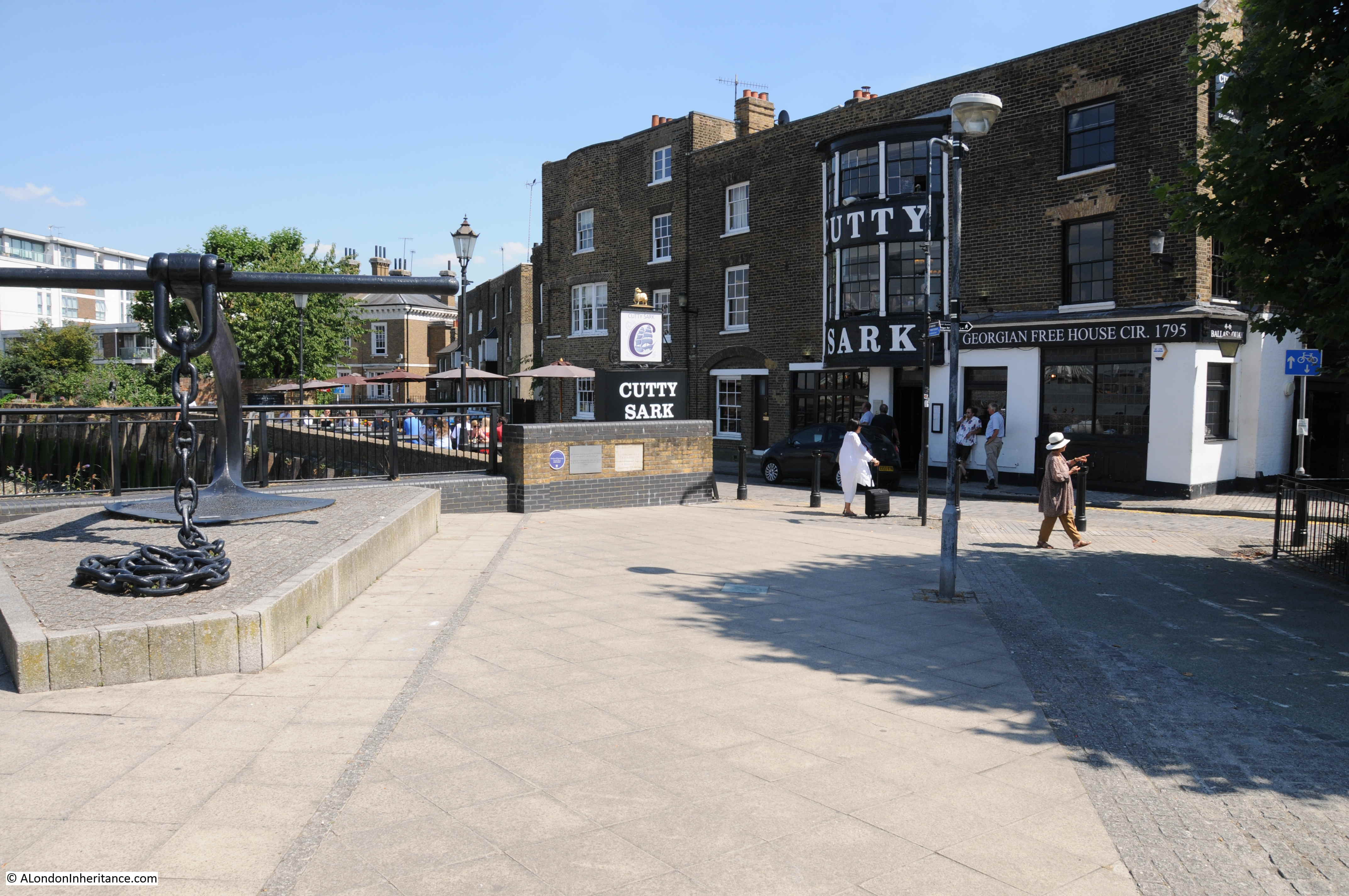
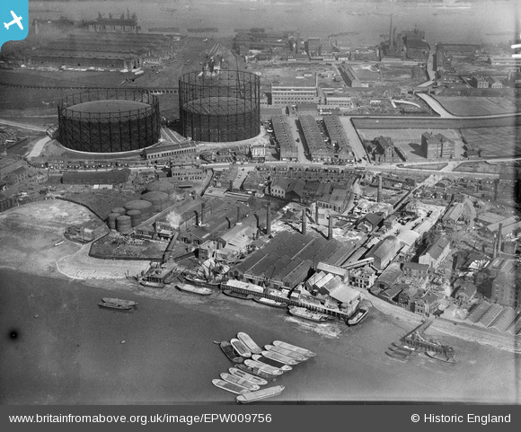
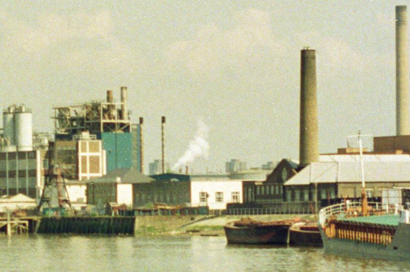
I recently scanned some negatives from 1986, and came across three photos taken in Greenwich, where the walk along the river heads past the power station and the Cutty Sark pub, and joins the Greenwich Peninsula. This is the first of the three:

Lovells Wharf

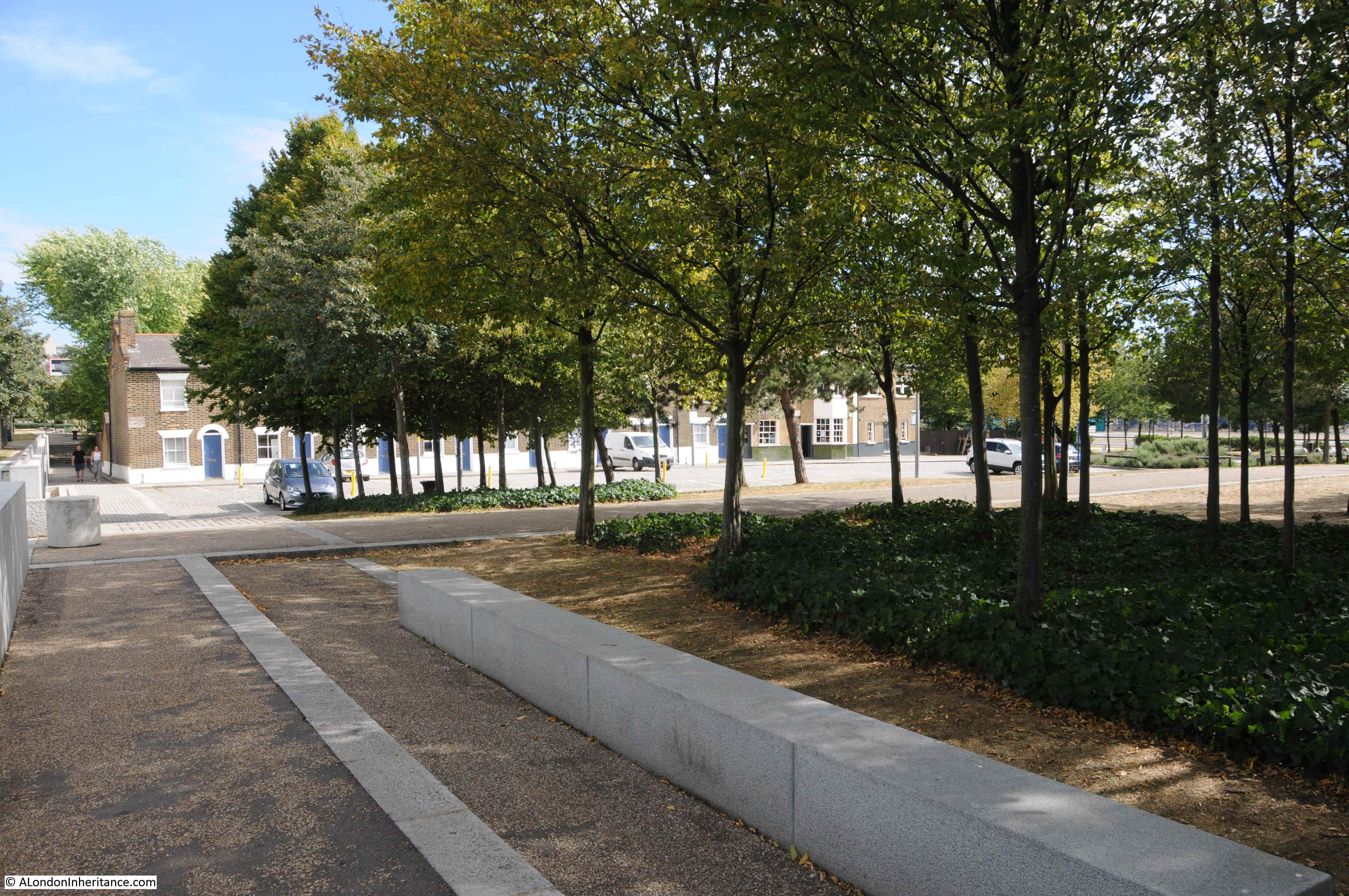
Very roughly the same view today – despite lots of walking around I could not get exactly the same view, as the area has been remodeled considerably since the mid-1980s.

Lovells Wharf

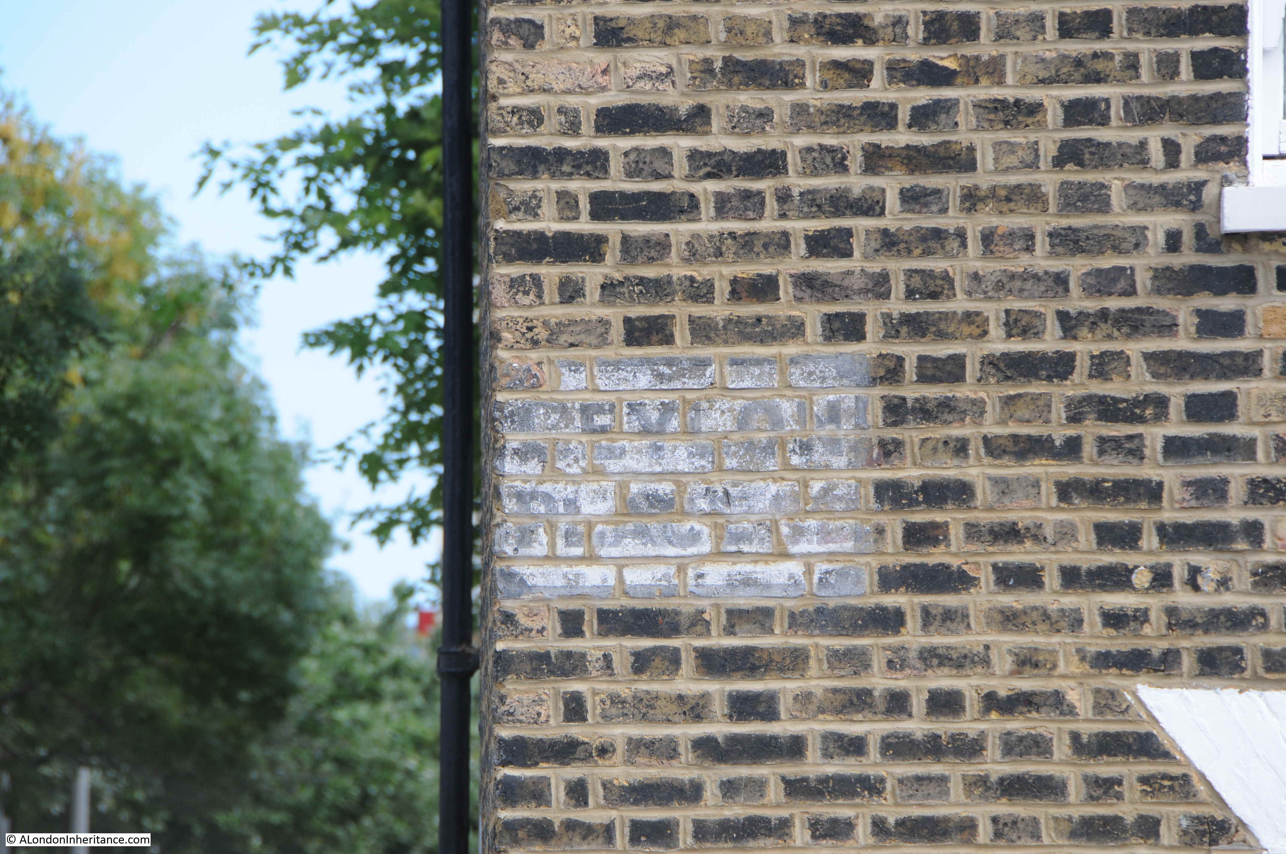
Along the wall in the 1986 photo there were painted white letters for C. Shaw & Sons Ltd and Lovell’s Wharf:

Lovells Wharf

The books by Mary Mills are my go to source for anything about the Greenwich Peninsula, and Mary has recently published “The Greenwich Riverside. Upper Watergate to Angerstein”:

Greenwich Peninsula

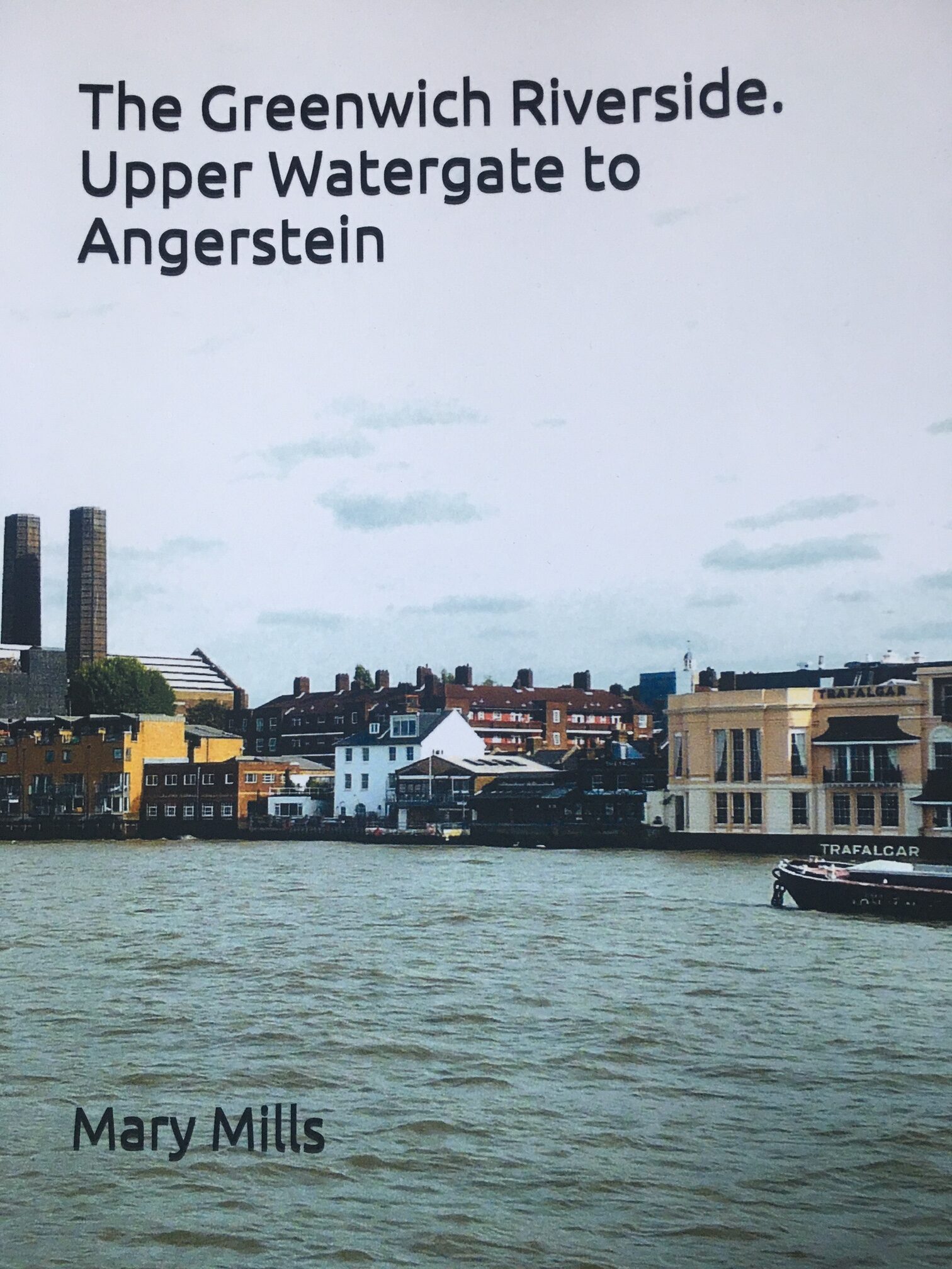
For a detailed history of the peninsula and the considerable industrial heritage of the area, the book is invaluable.

The book states that the company Shaw Lovell leased the site in the 1920s. A company with a Bristol heritage, their business was as a “Shipping and Forwarding Agent”.

The company handled non-ferrous metals, including in the 1920s, scrap from the Great War battlefields.

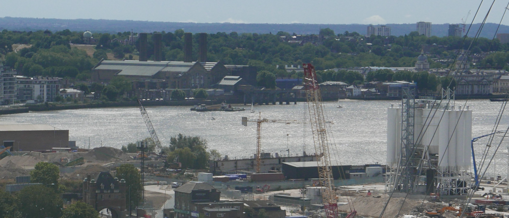
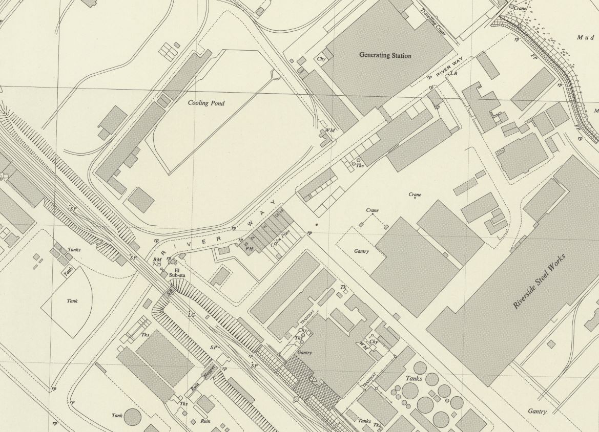
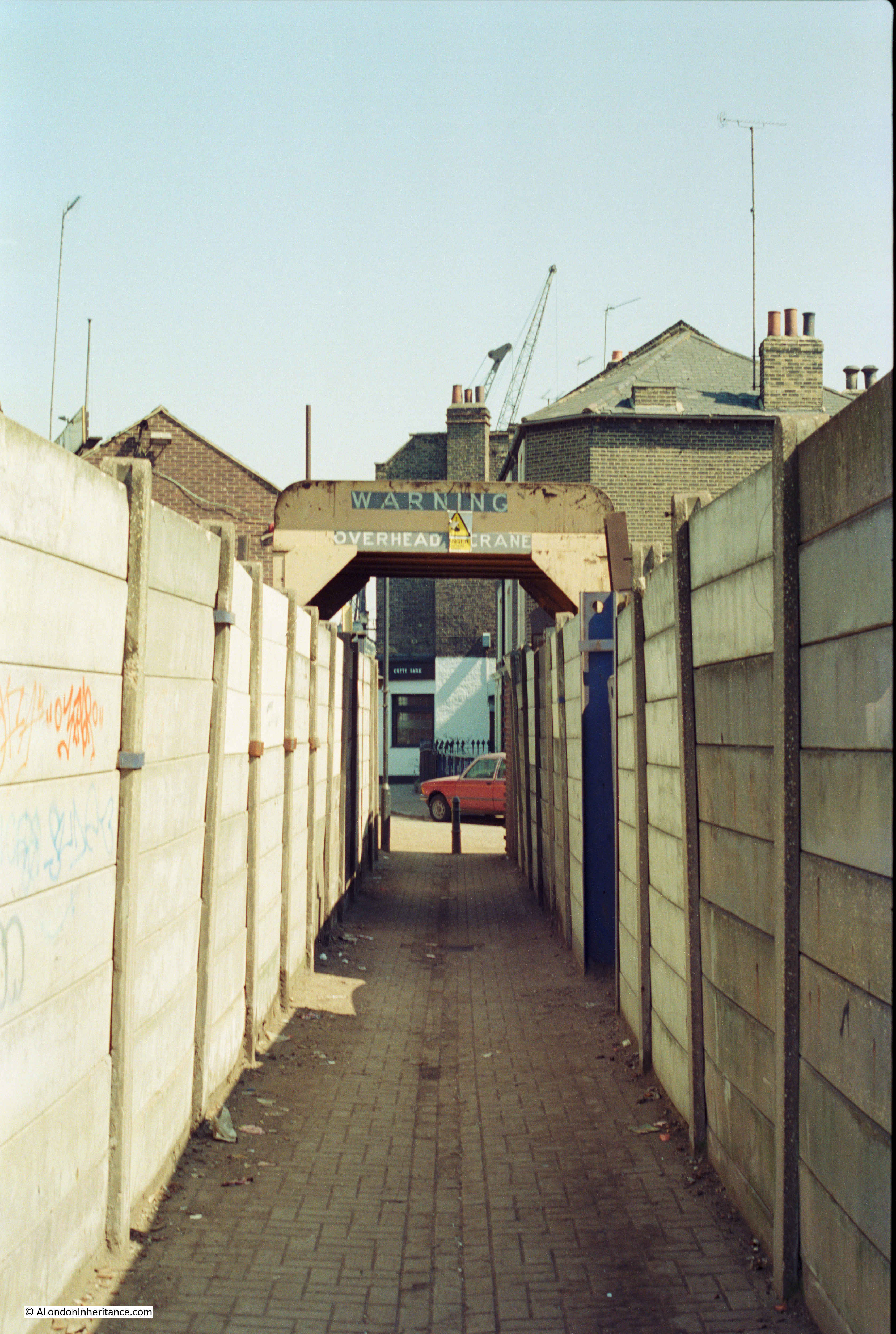
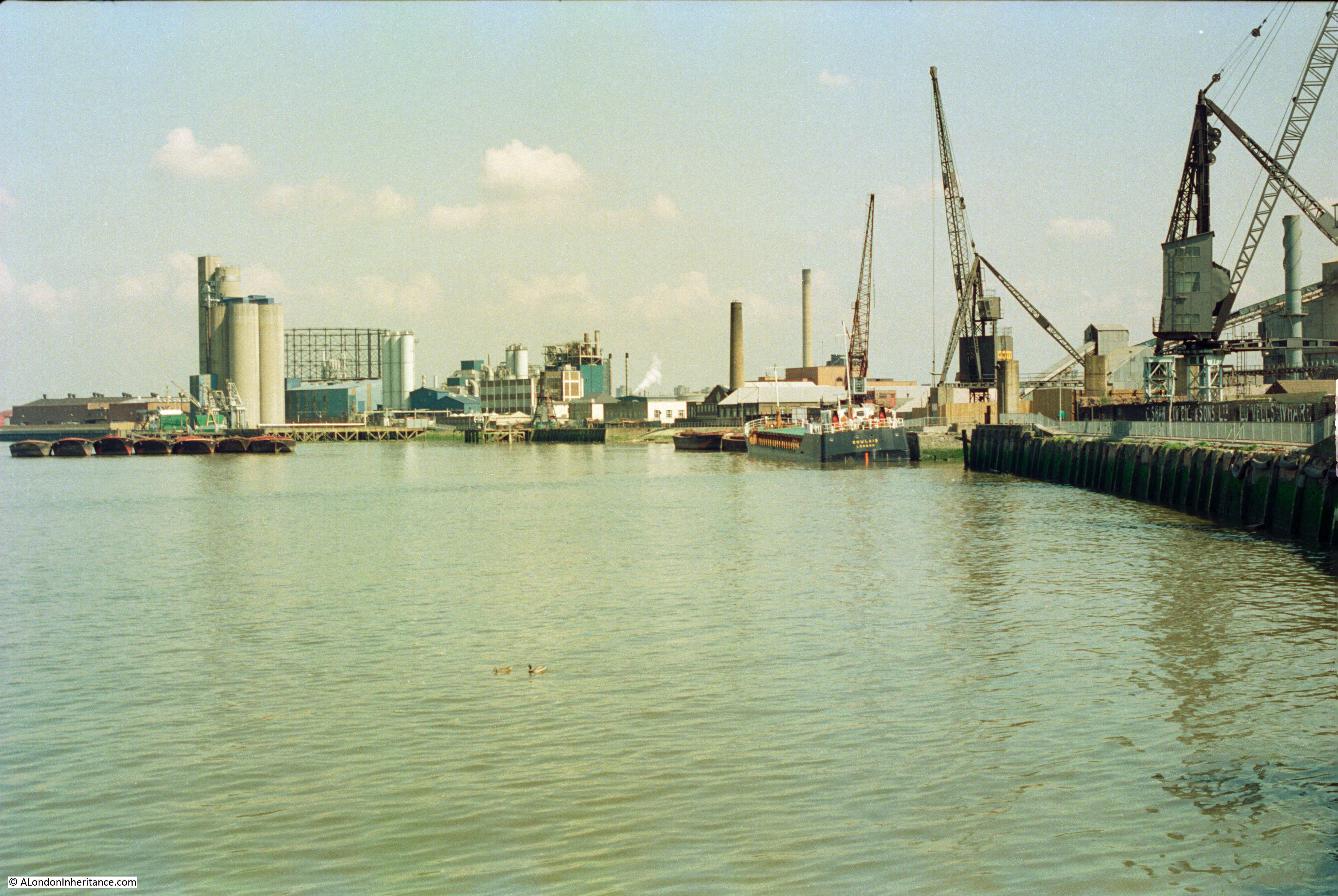
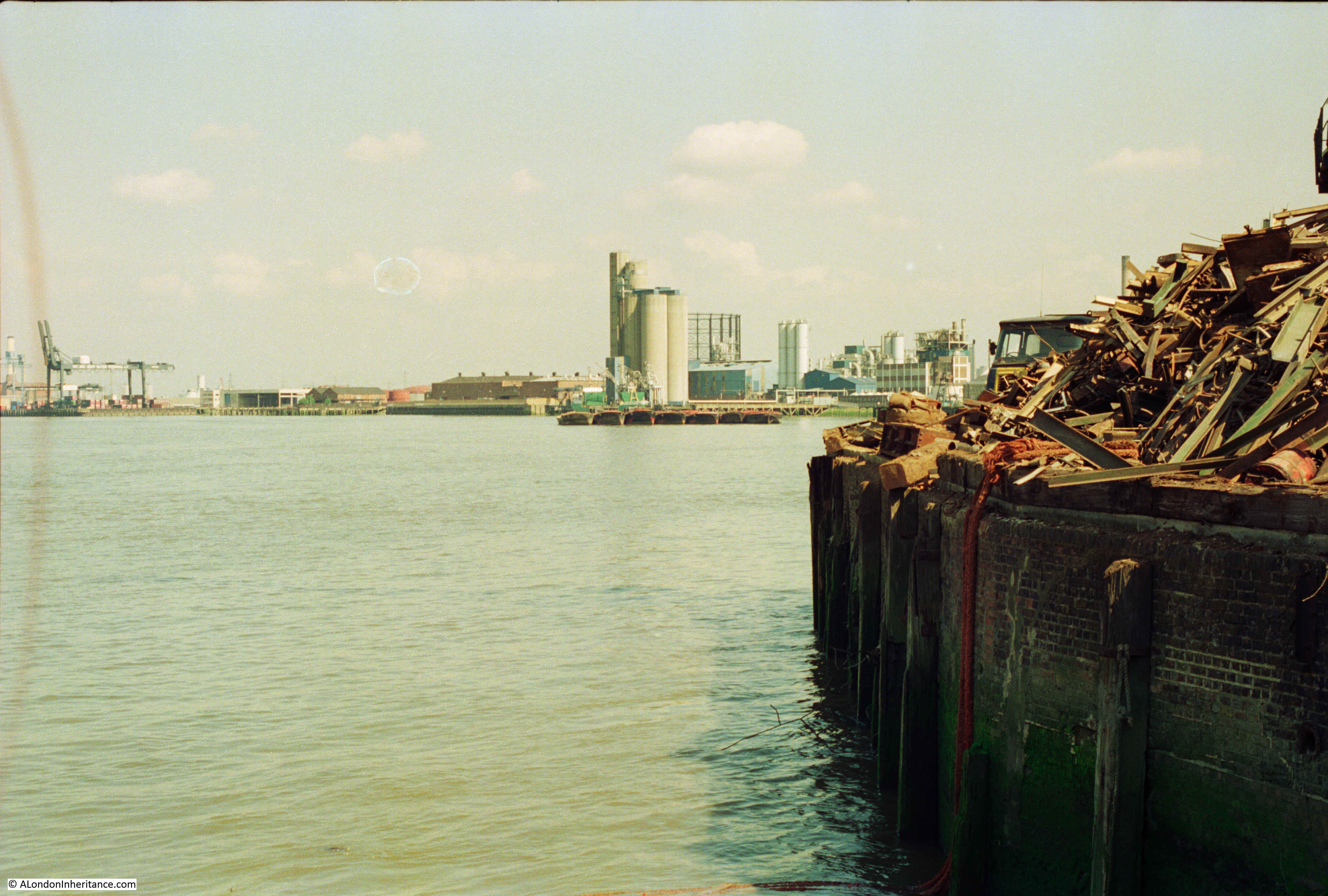
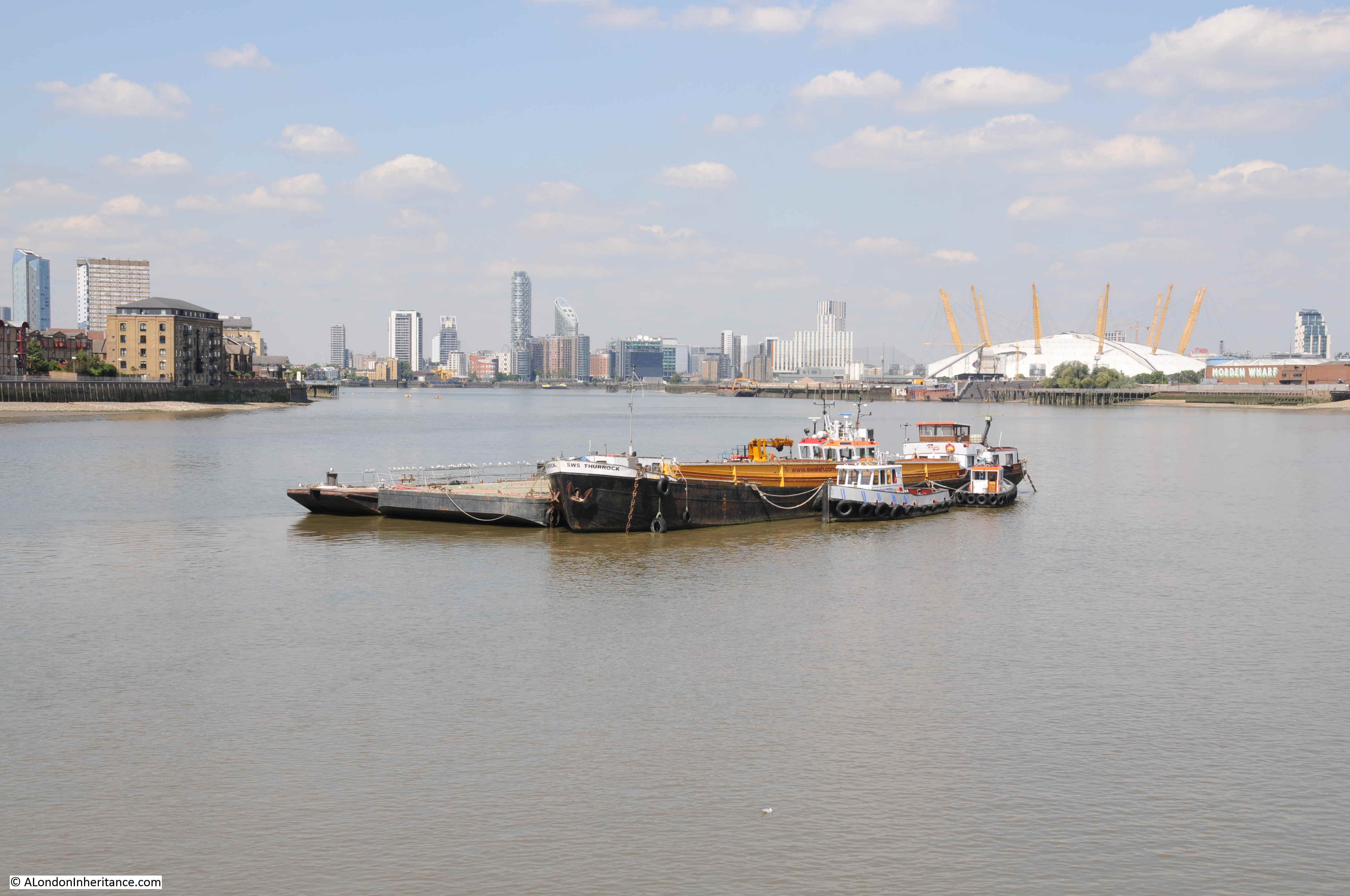
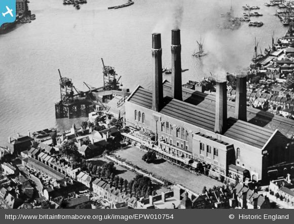
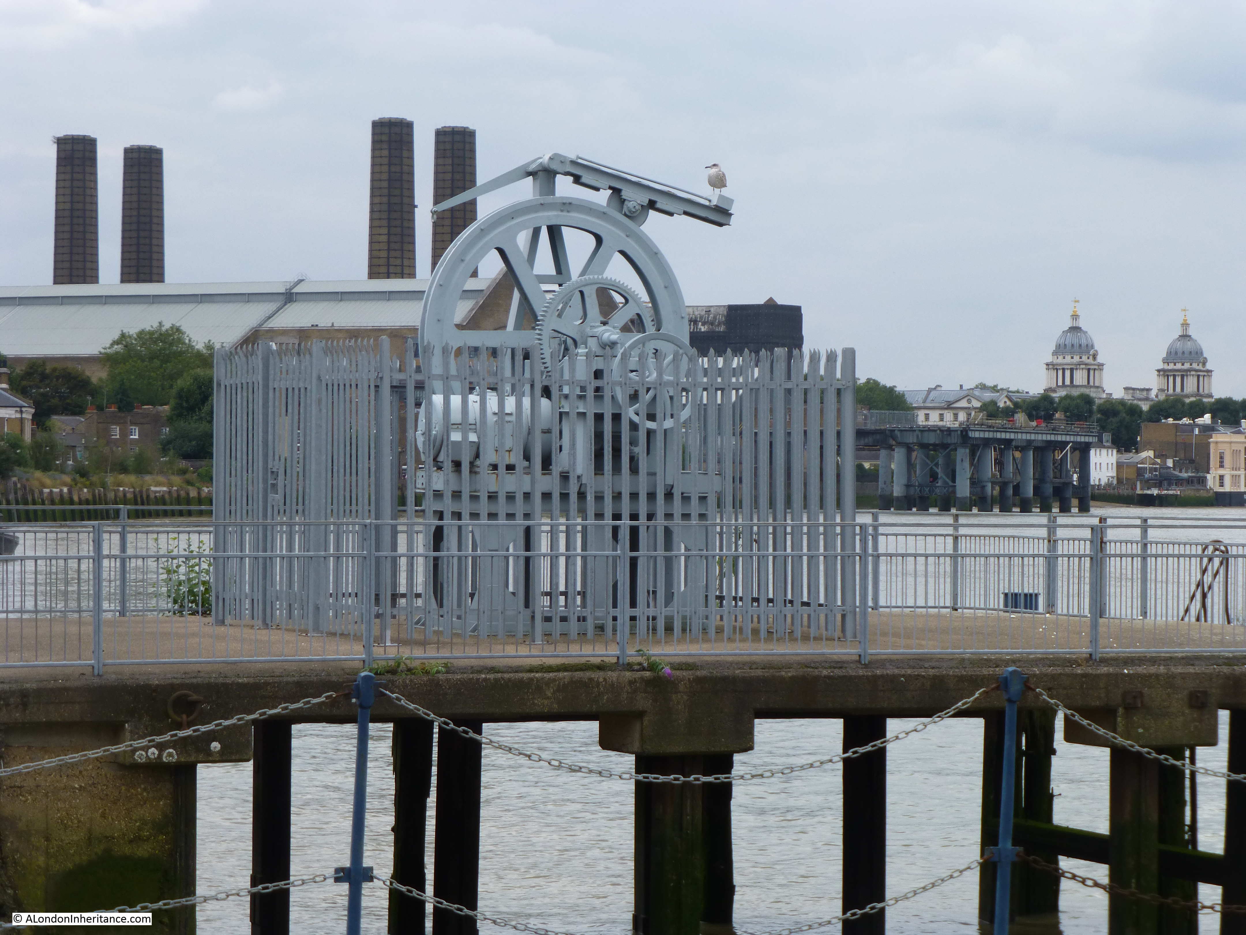
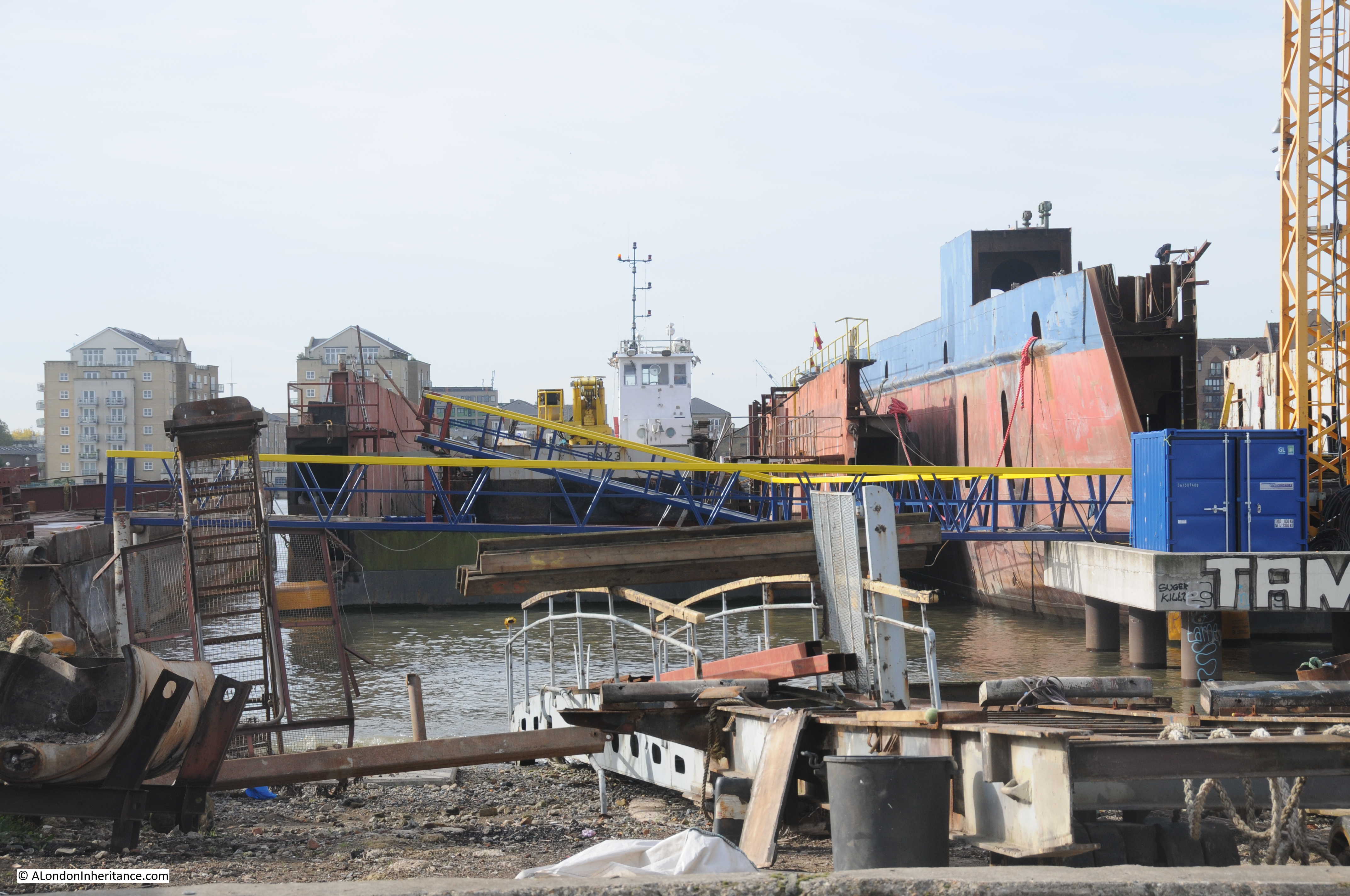
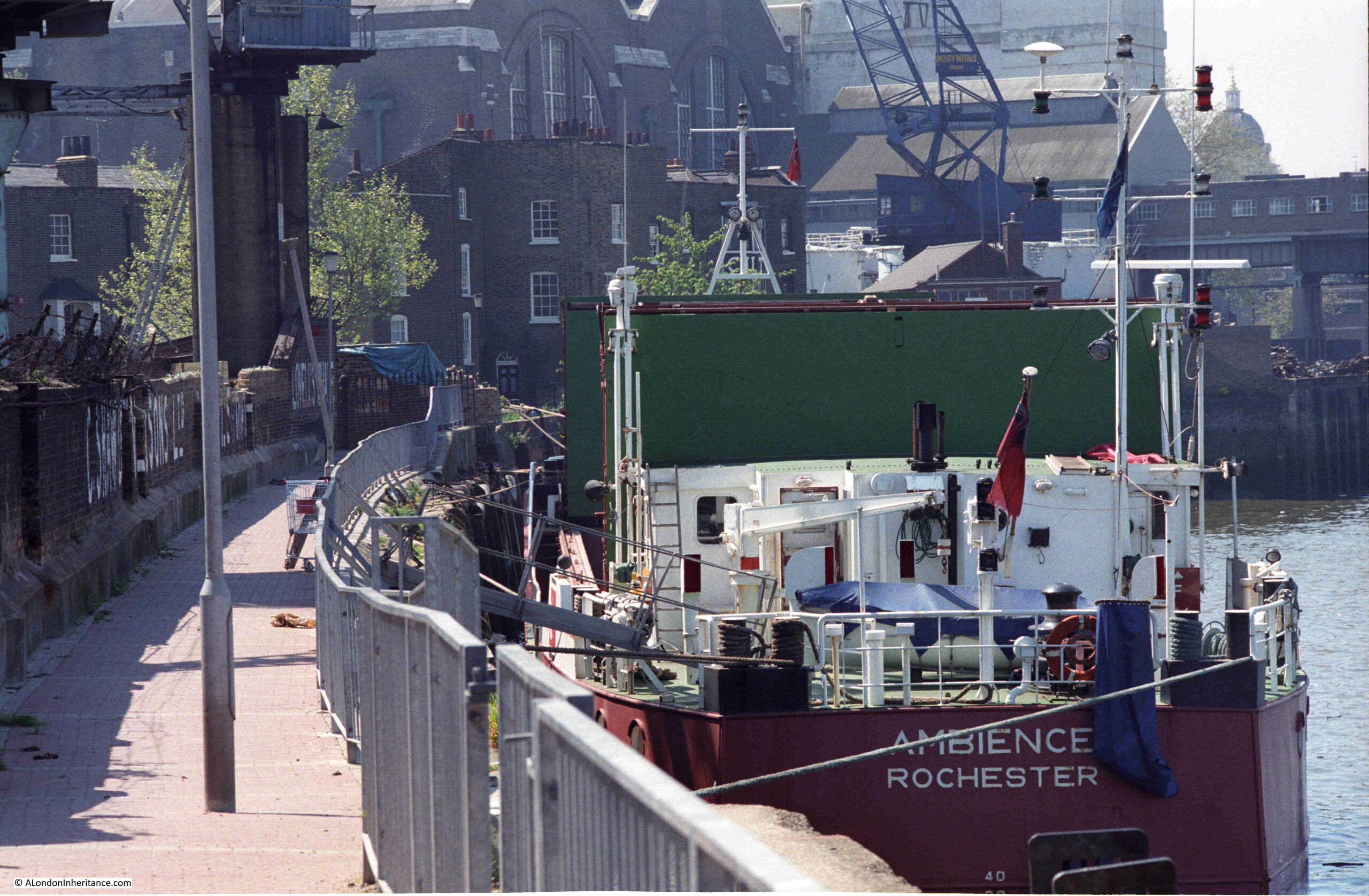
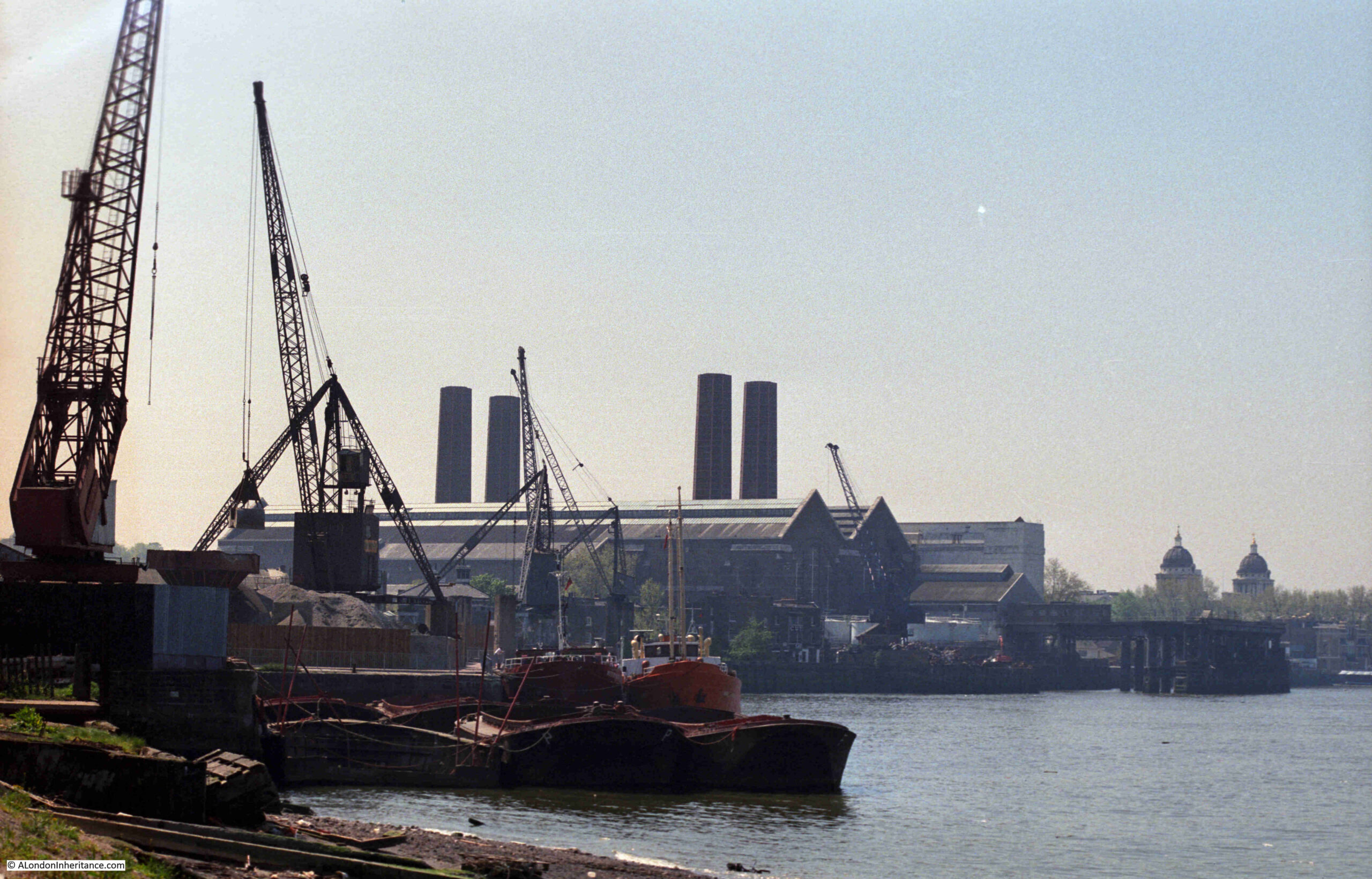
A view of the methods that the company used to transport material between shipping on the river and the land is shown in the following photo from a bit further along the Greenwich Peninsula:

Greenwich Peninsula

The same view today:

Greenwich Peninsula

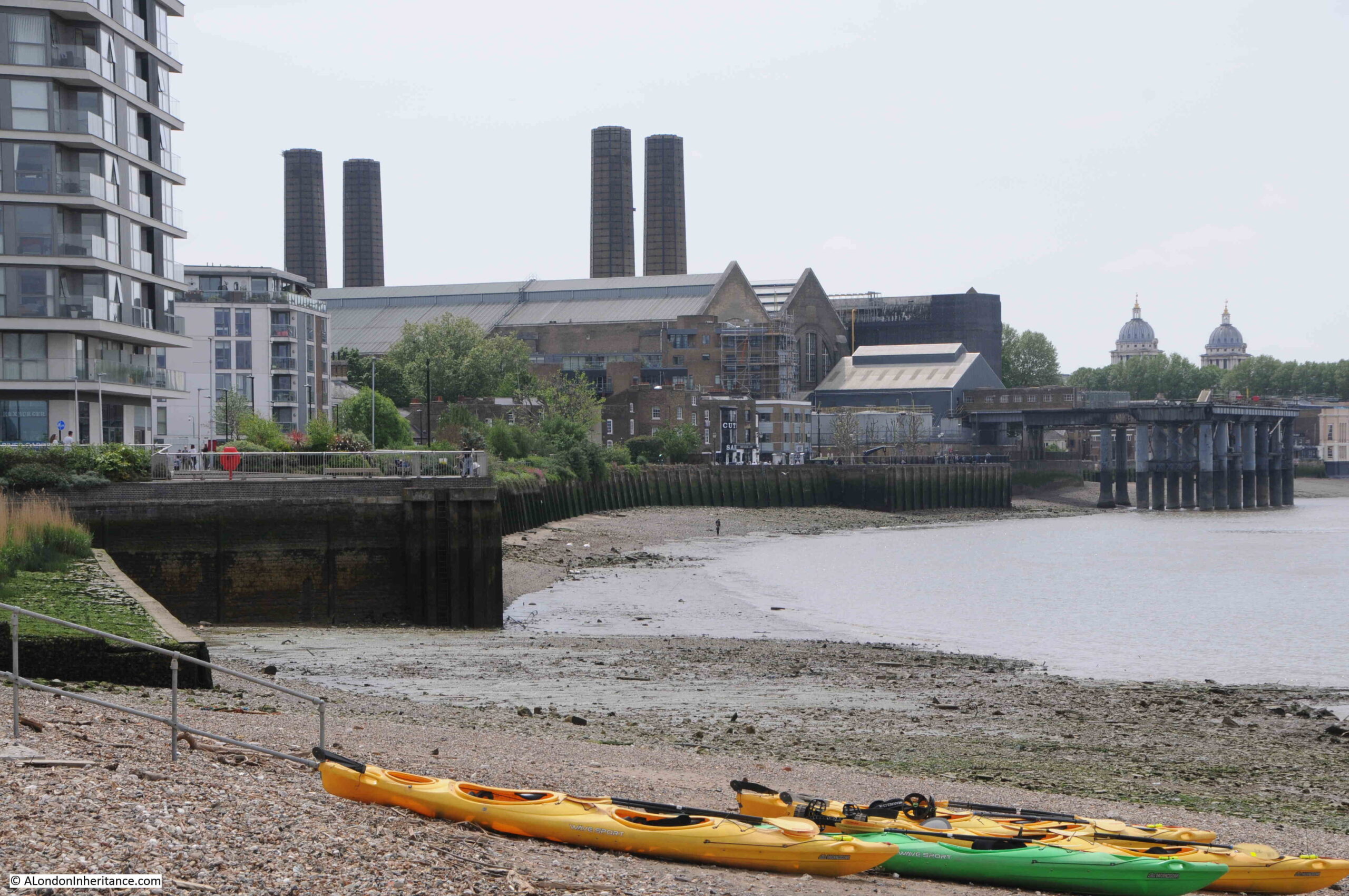
I found the exact position for the above photo. The chimneys of the power station, and domes to the right help, but in the foreground there is the low concrete wall on the left, and behind the barges in the 1986 photo is where the shore wall extends out into the river. If I had timed my visit better, I could have got the tide in the same position.

The main differences between the two photos is the lack of shipping moored alongside the wharf, and the cranes being used to transport materials.

The cranes were significant local landmarks. They may have dated from around 1950 and were originally in use in Dublin. The cranes moved to Greenwich in the 1970s, and remained on site until 2000, when the owner of the land had them removed.

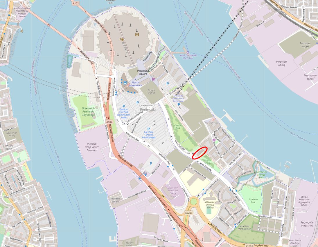
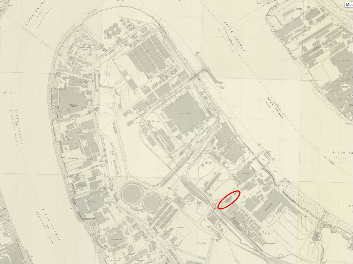
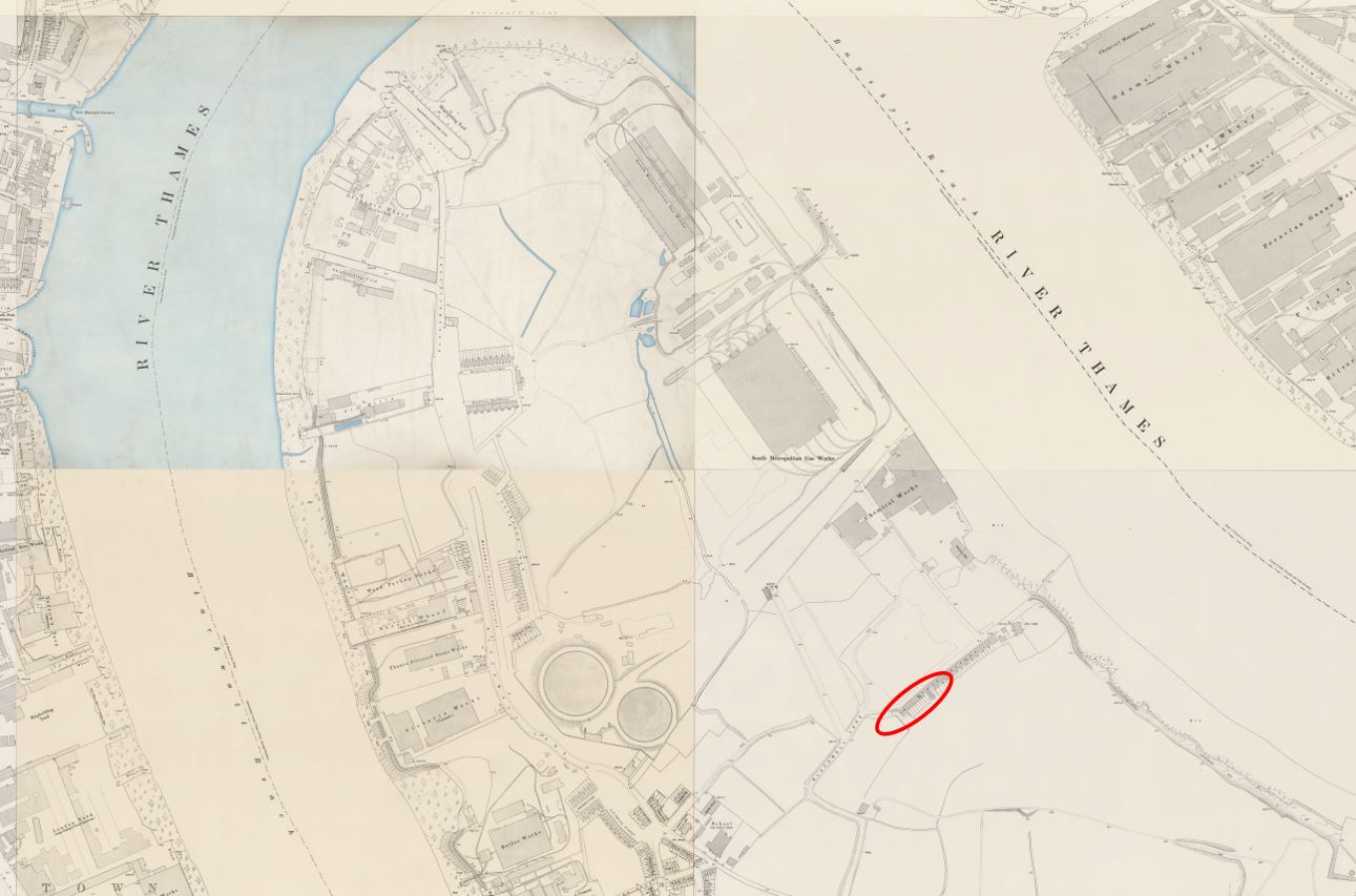
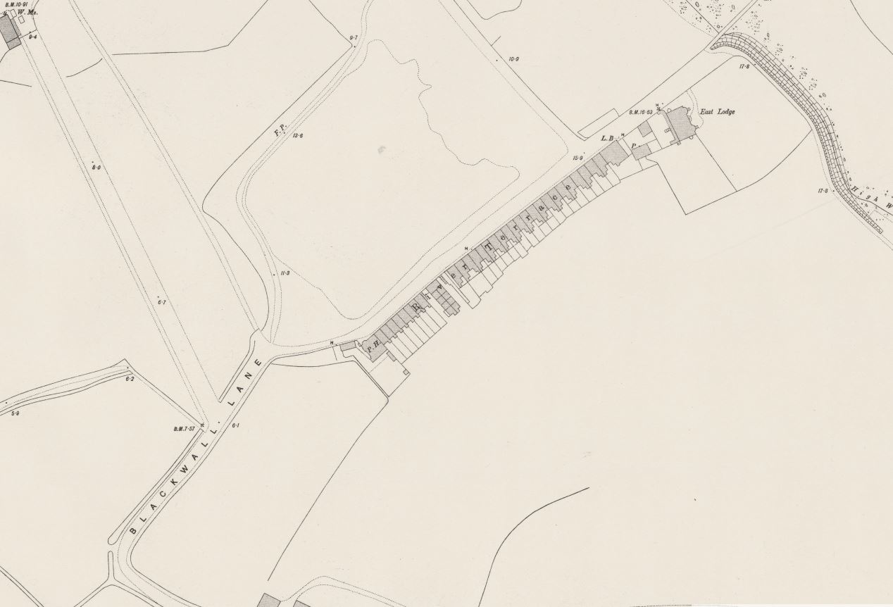
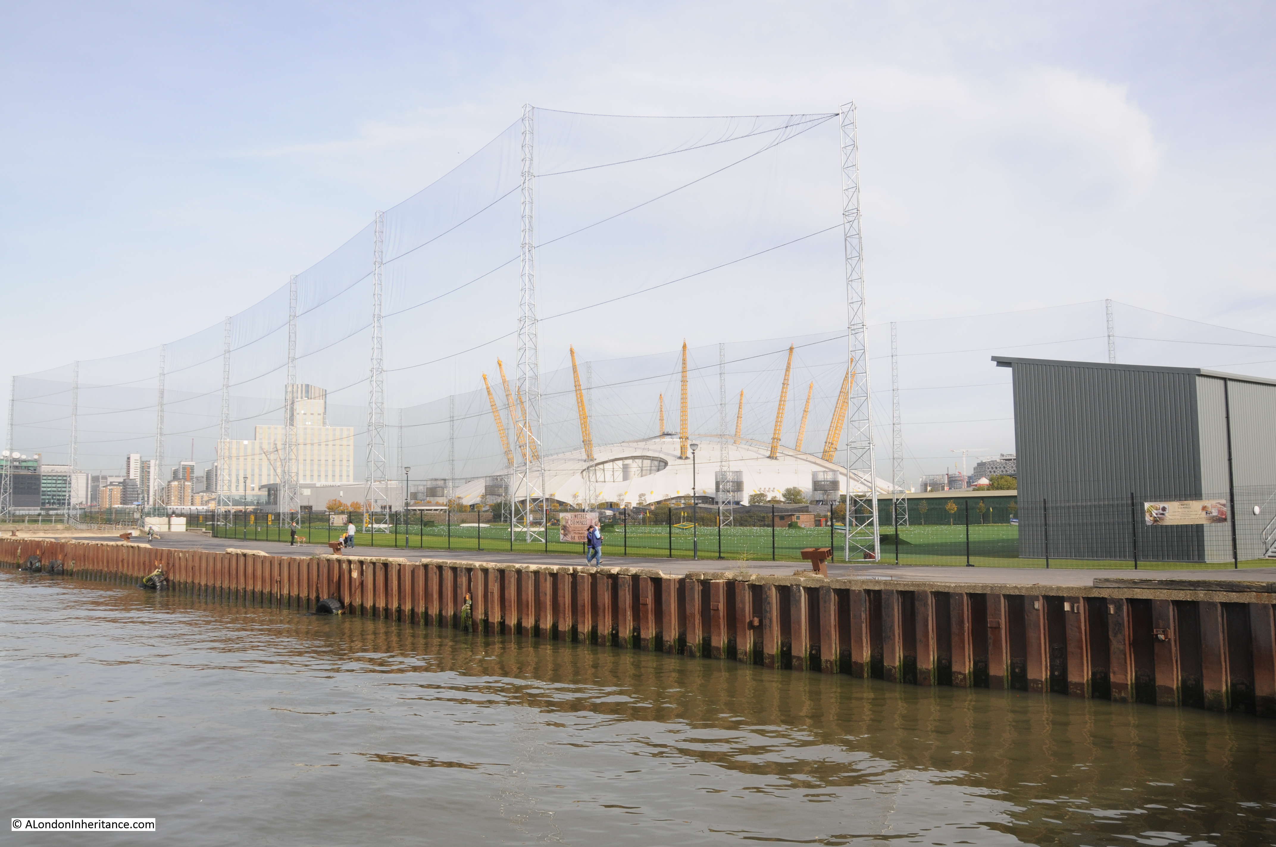
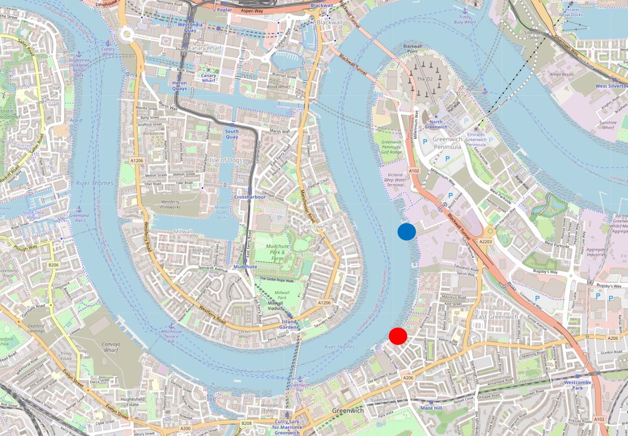
To put the locations of this week’s post in context, the following map shows where I will be covering. Starting at the red circle, with the above photos just north of this circle, and finishing at the end of the post at the blue circle  (© OpenStreetMap contributors).

Greenwich Peninsula

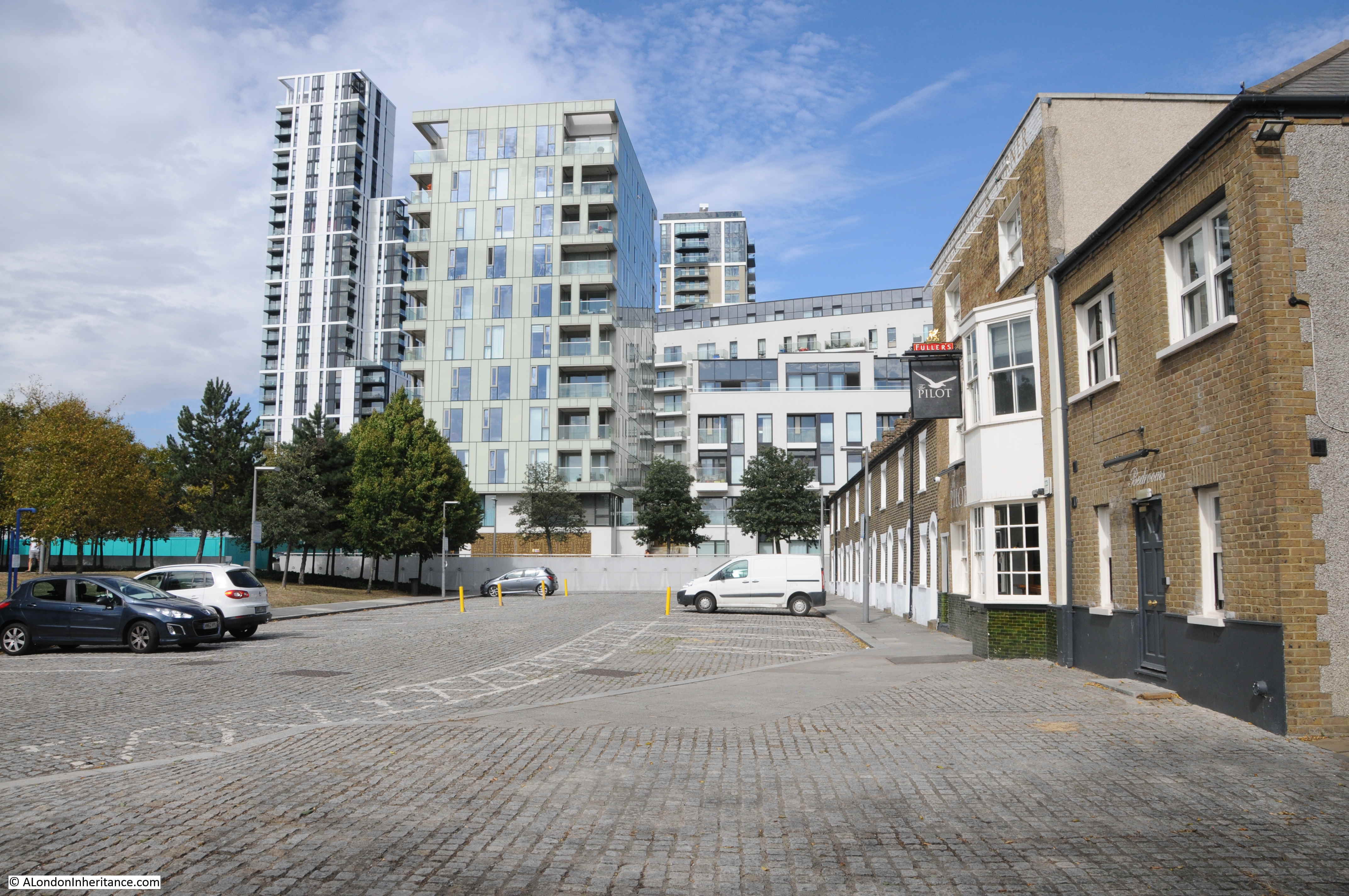
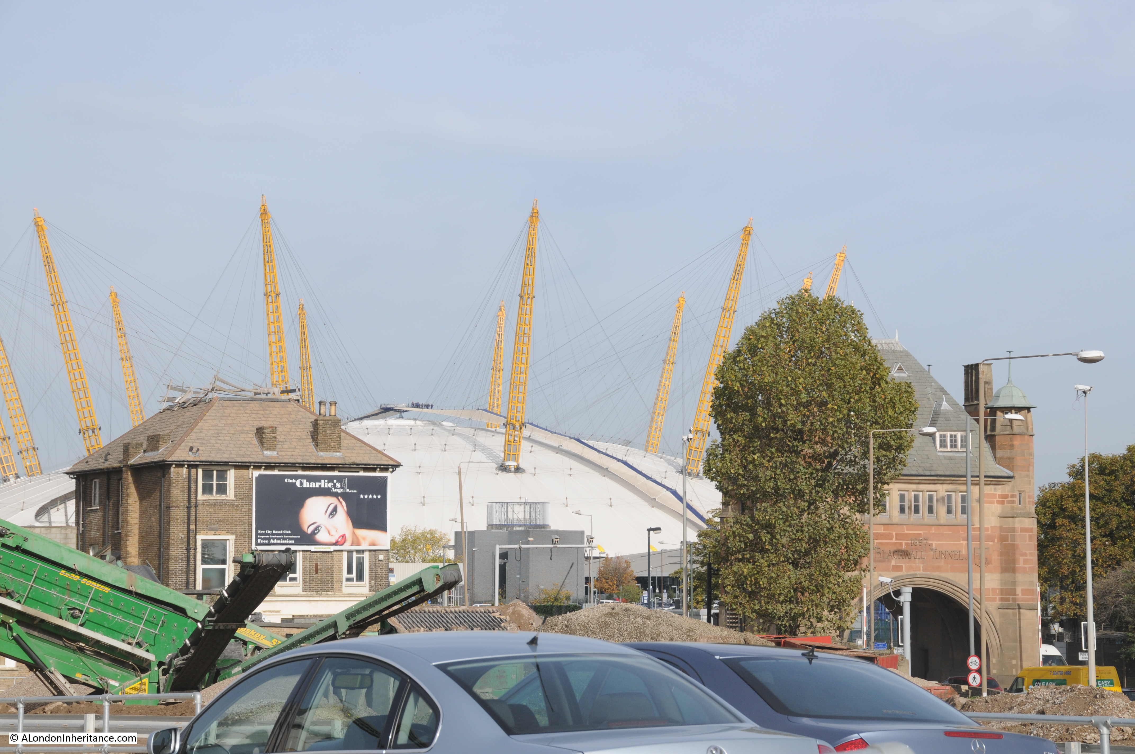
As can be seen by comparing the above then and now photos, the area has changed considerably. What was an area of considerable industry has been derelict for some years, and over recent years the northward expansion of apartment buildings has started along the western side of the peninsula, and will no doubt meet the southward run of buildings close to the O2 dome.

Greenwich Peninsula

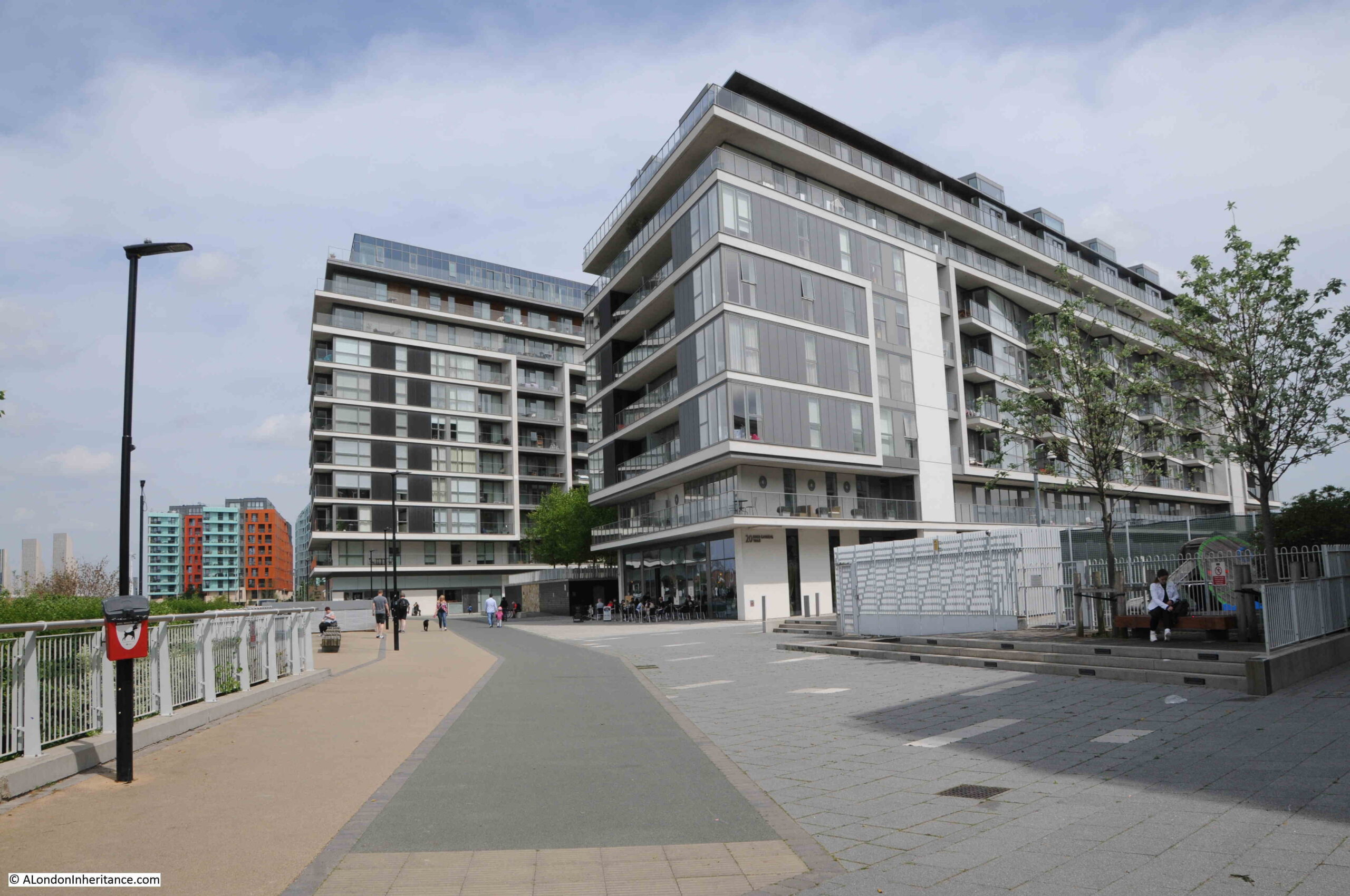
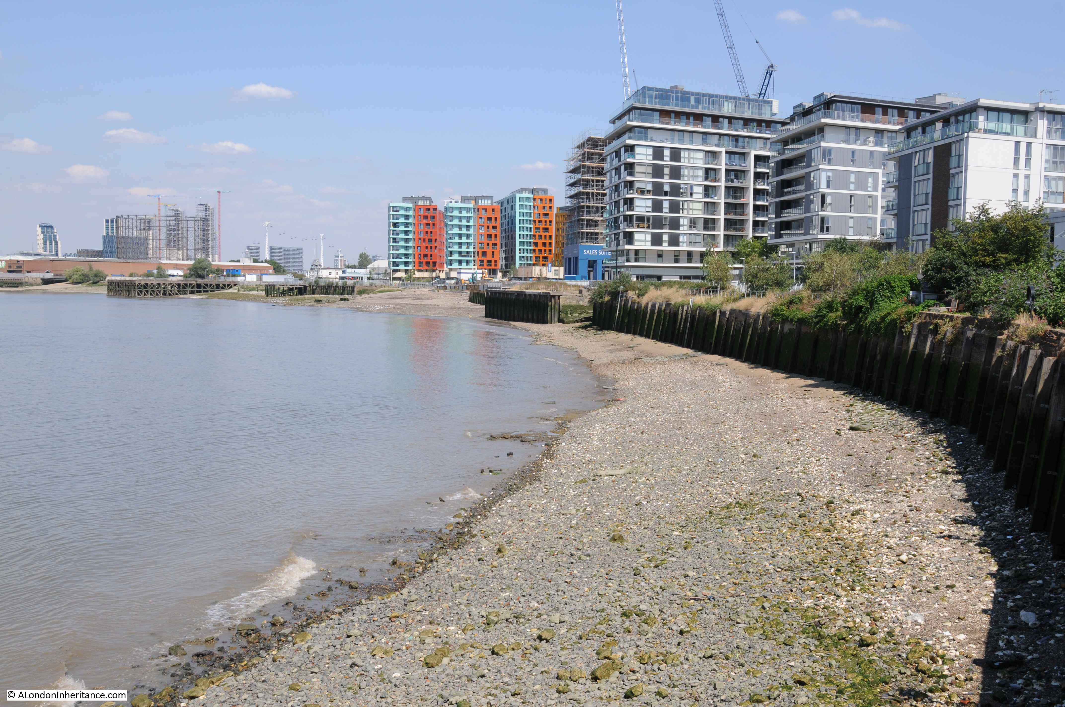
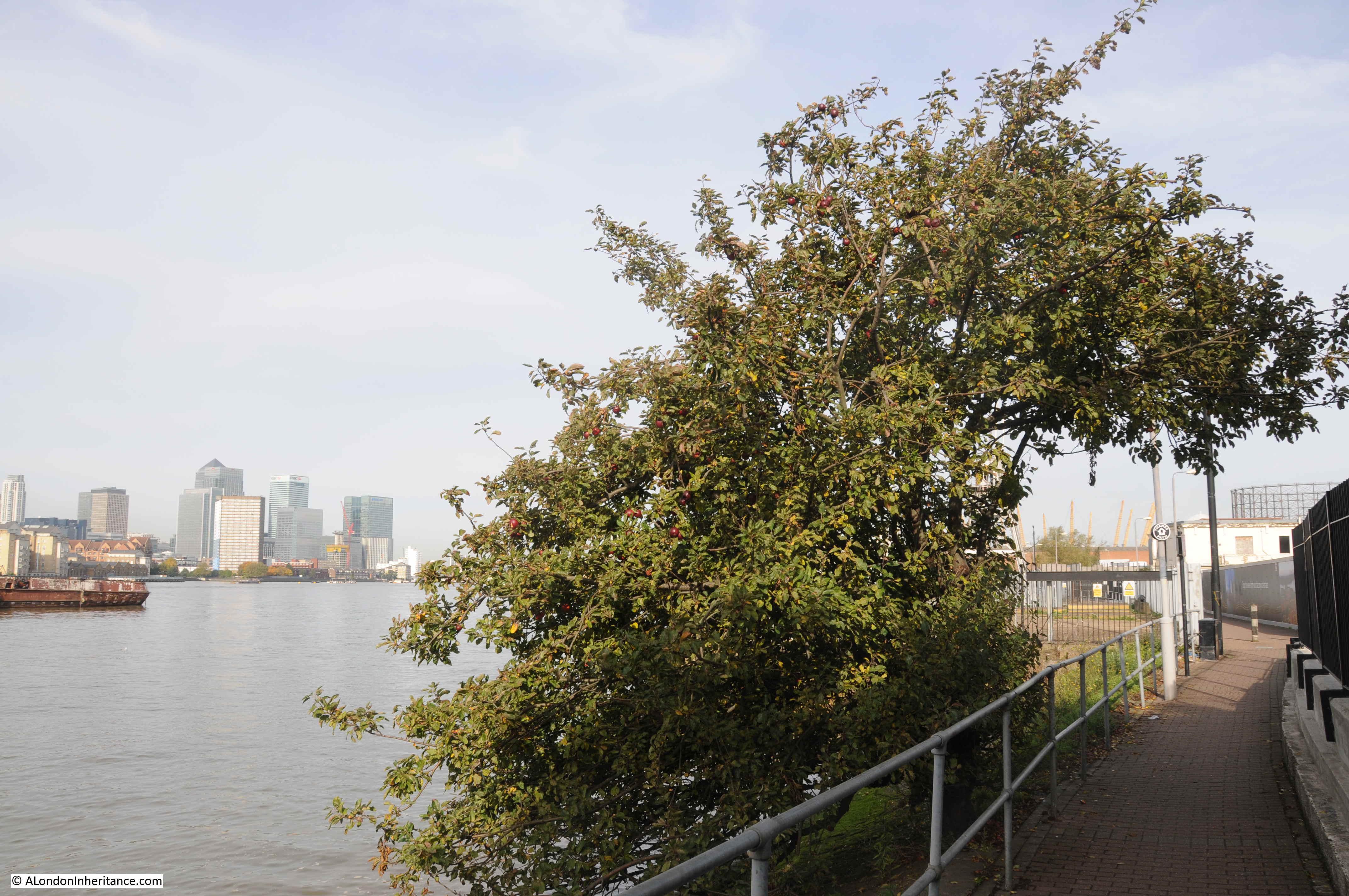
Looking along the foreshore towards the dome at the northern tip, with new apartment buildings replacing the industries that once occupied the area:

Greenwich Peninsula

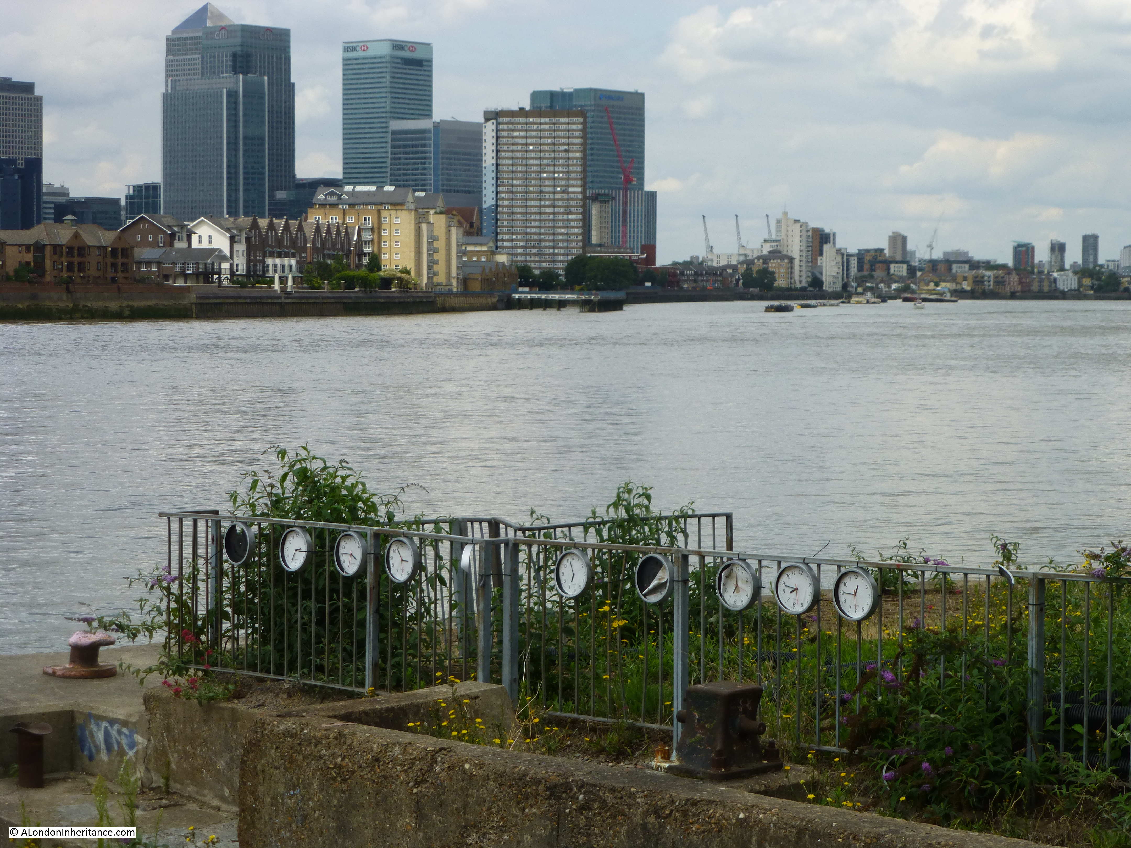
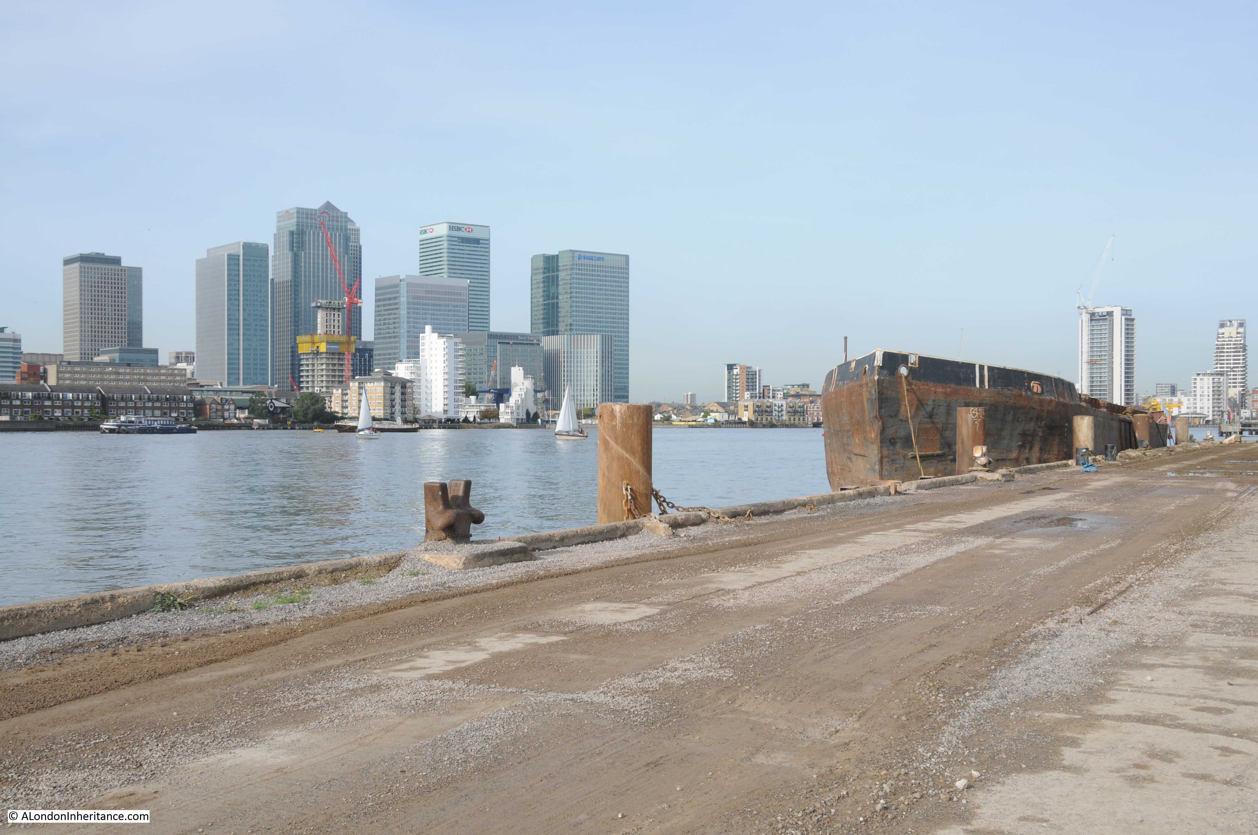
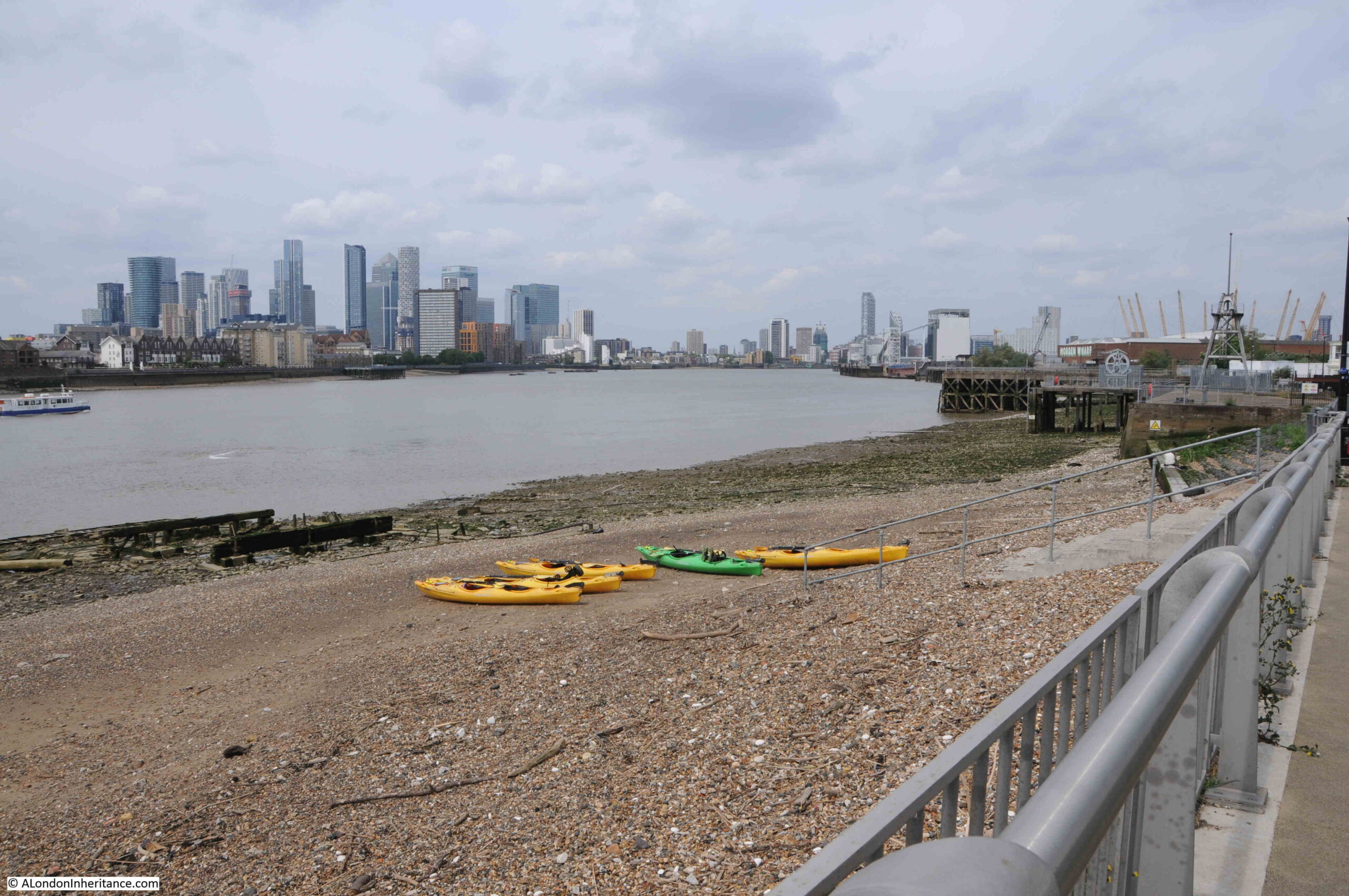
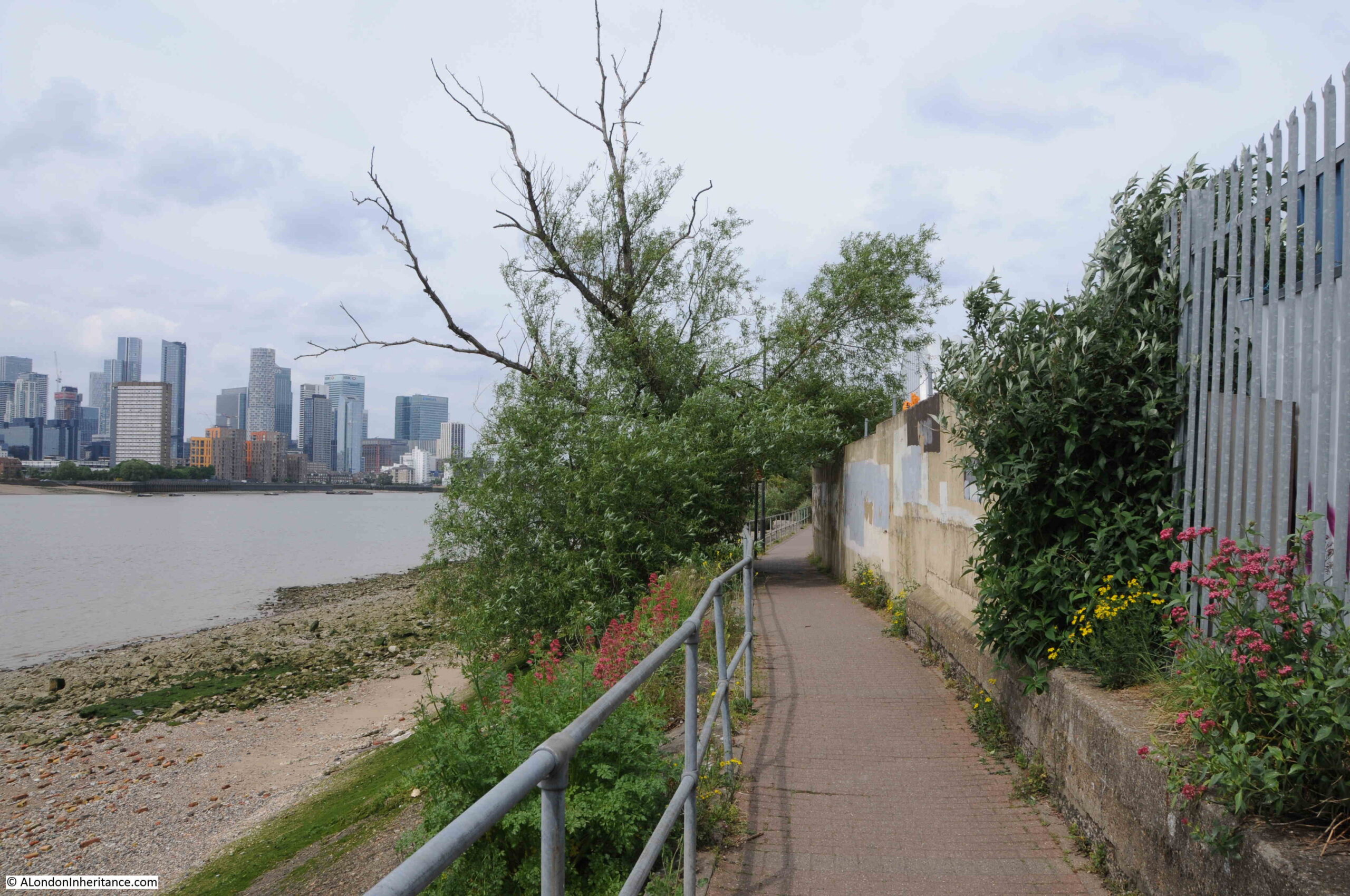
View across the river to the towers of the Isle of Dogs:

Greenwich Peninsula

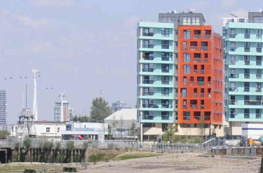
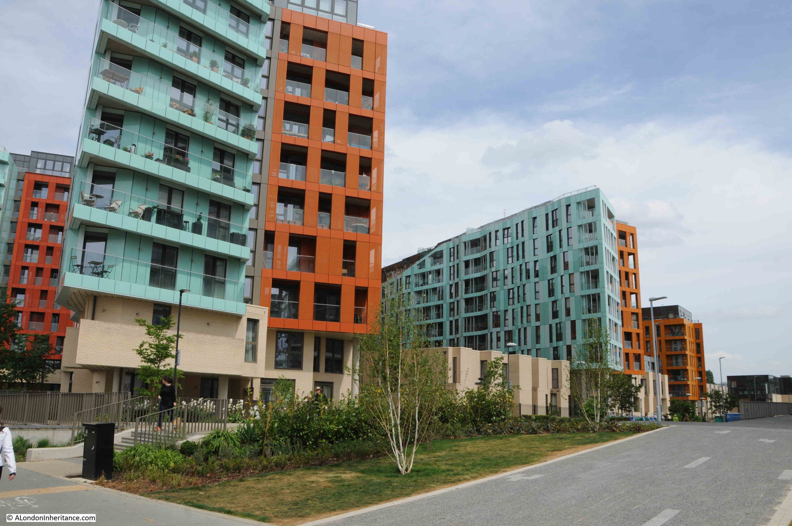
Two colour apartment blocks:

Greenwich Peninsula

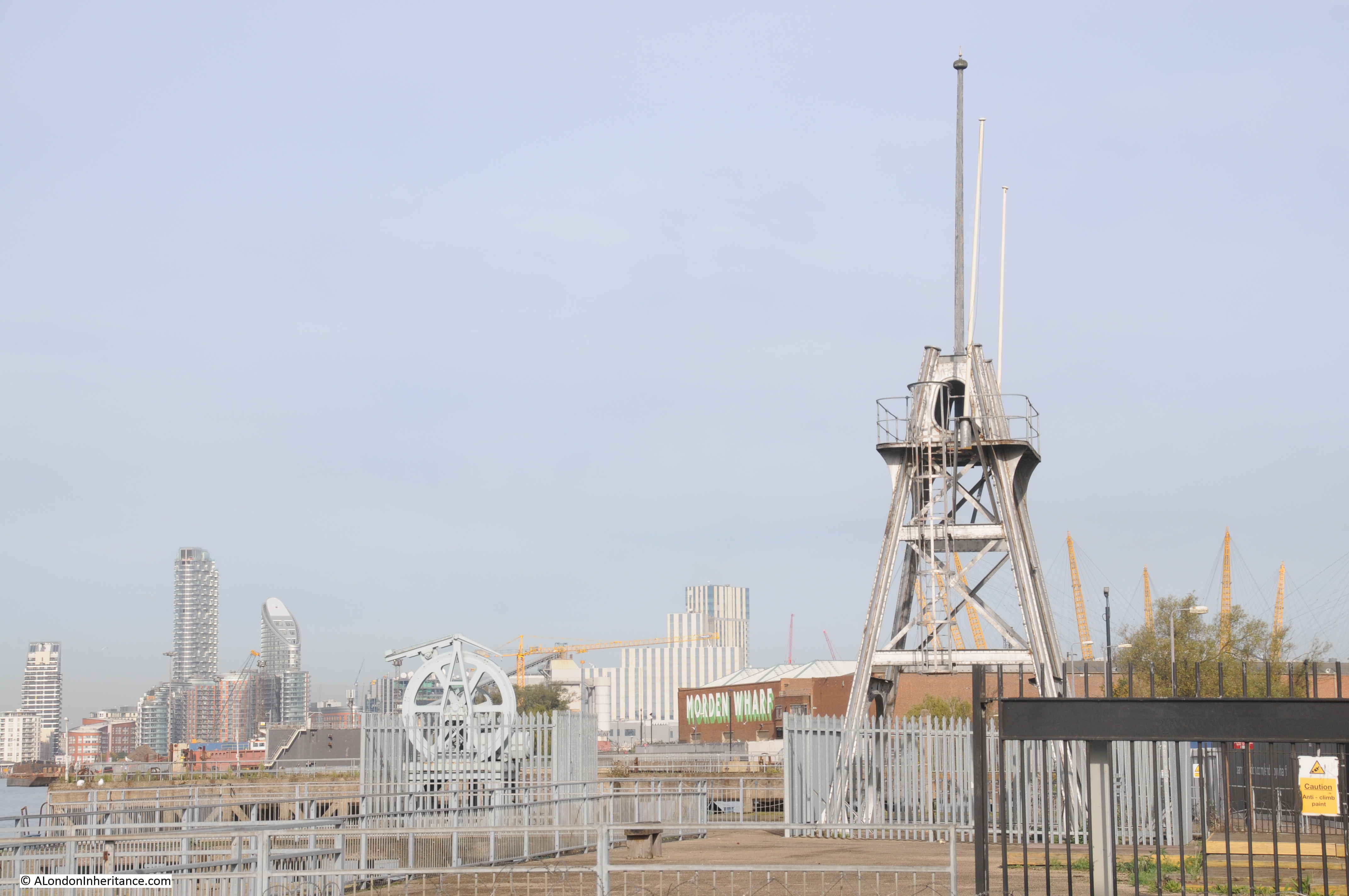
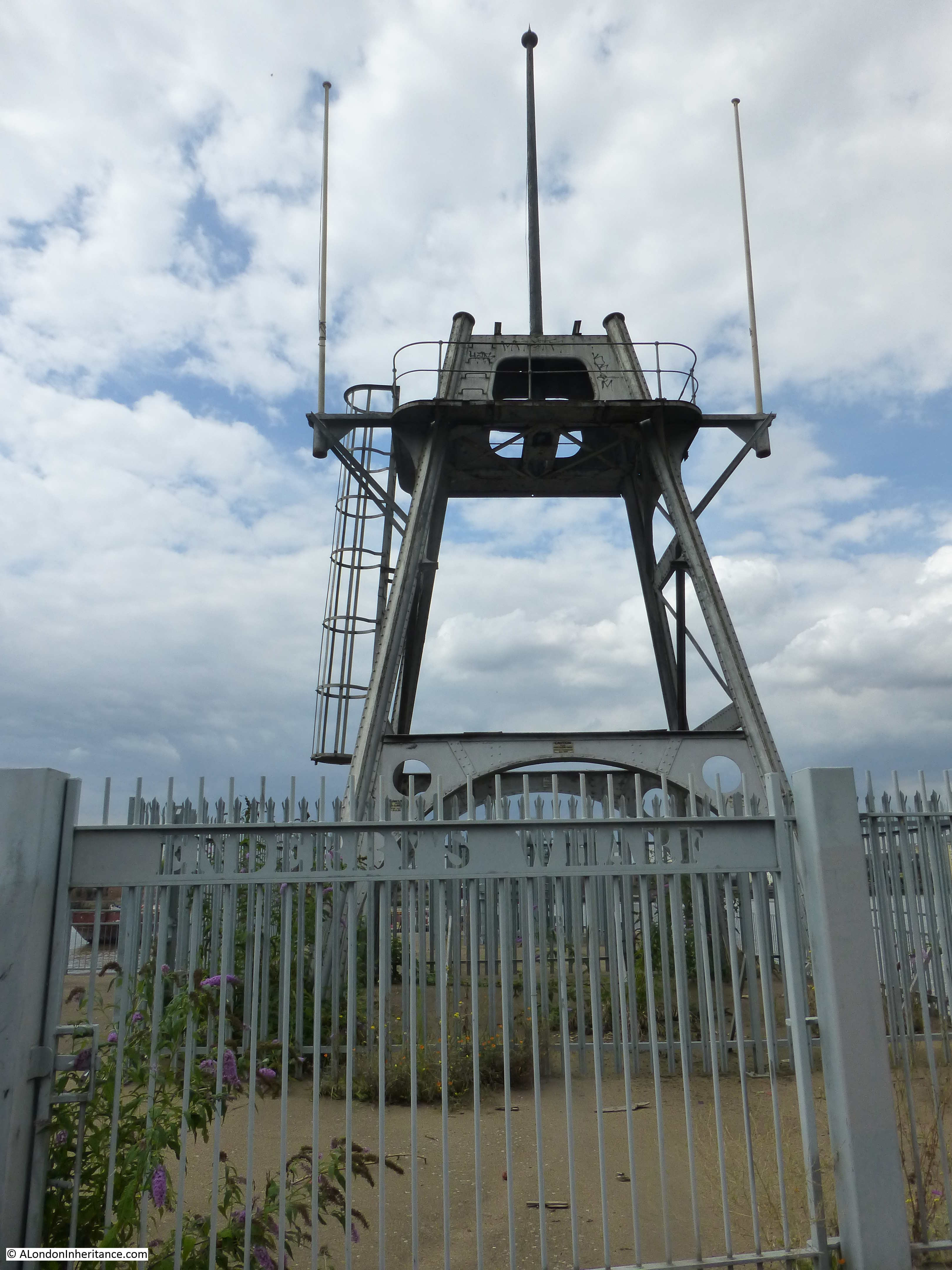
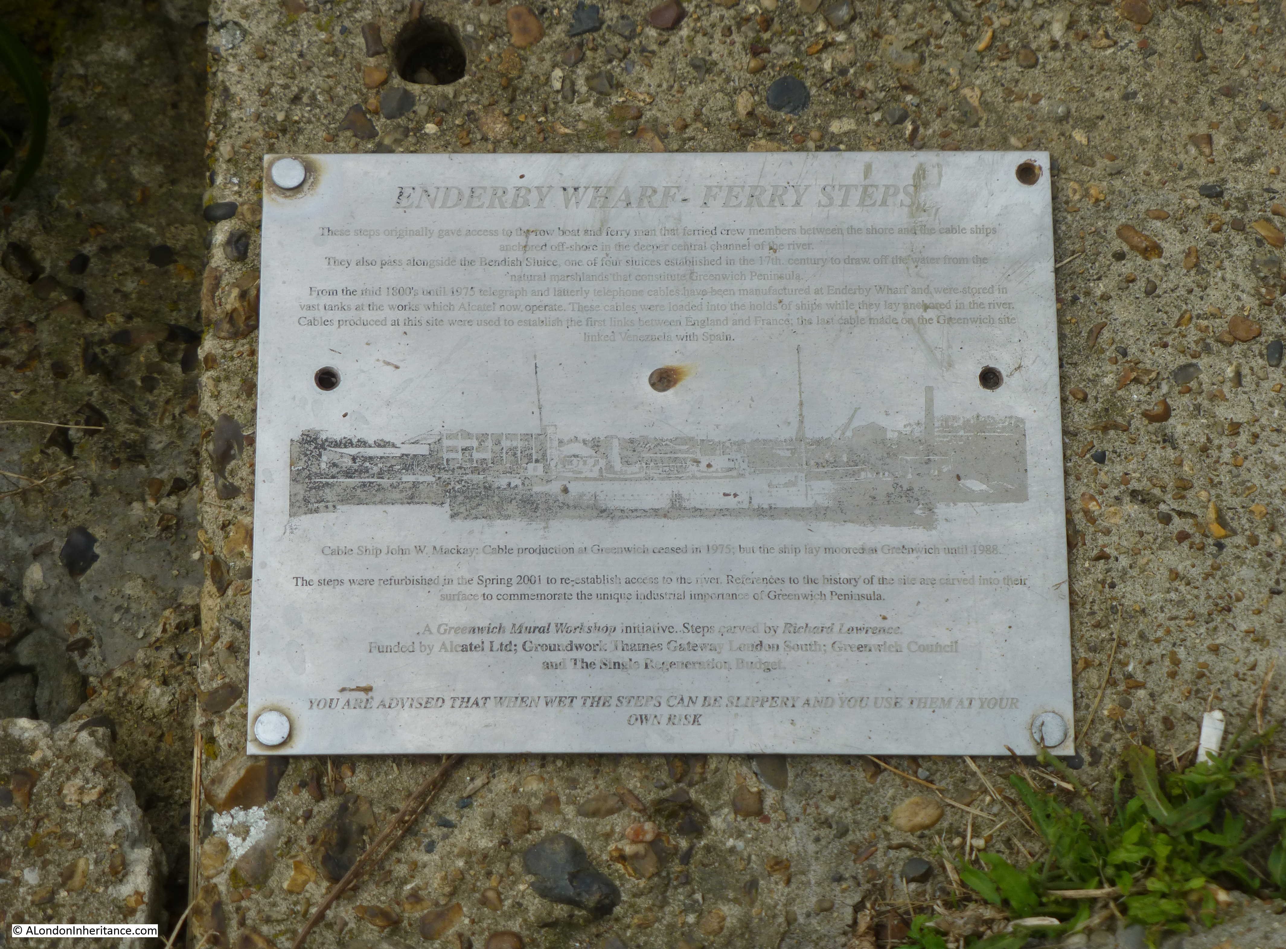
Of the many industries along this stretch of the river, one was a company that was key in the provision of a technology that enabled communications across the world. This was the manufacture of submarine communication cables which took place at Enderby Wharf and it is here that we can see the remains of some of this activity.

Here was manufactured the first cable to cross the Atlantic and up until the mid 1970s much of the world’s subsea communication cables had been manufactured here. The web site covering the history of the Atlantic Cable and Undersea Communications has a detailed history of Enderby Wharf.

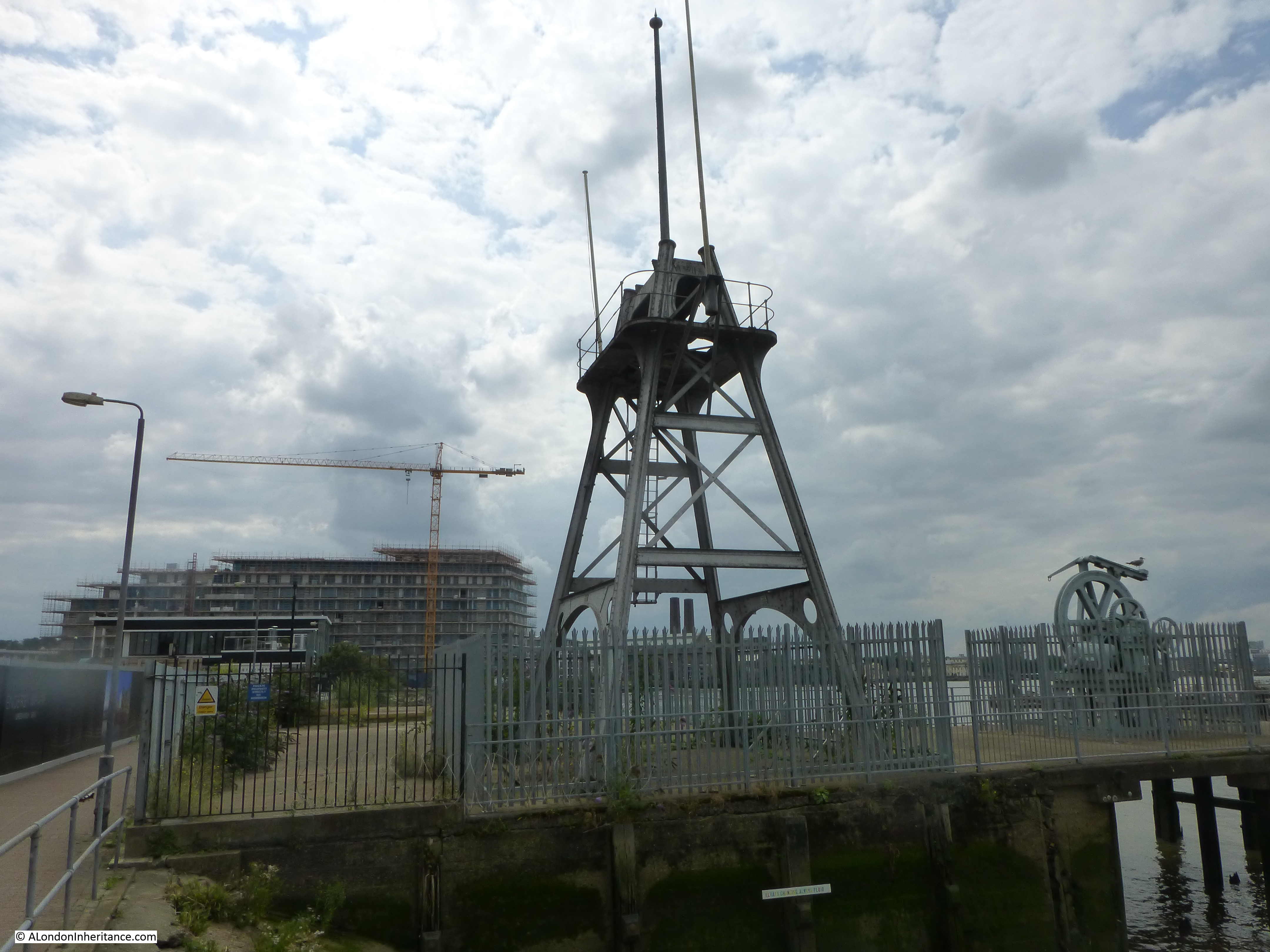
The tower structure that can still be seen is part of the mechanism, along with the smaller wheel on the left, used for transferring cable from the factory on the right to cable ships moored in the Thames on the left. Cable would be run across the walkway to the top of the tower then to the round hold-back mechanism on the left then onto the ship:

Enderby House

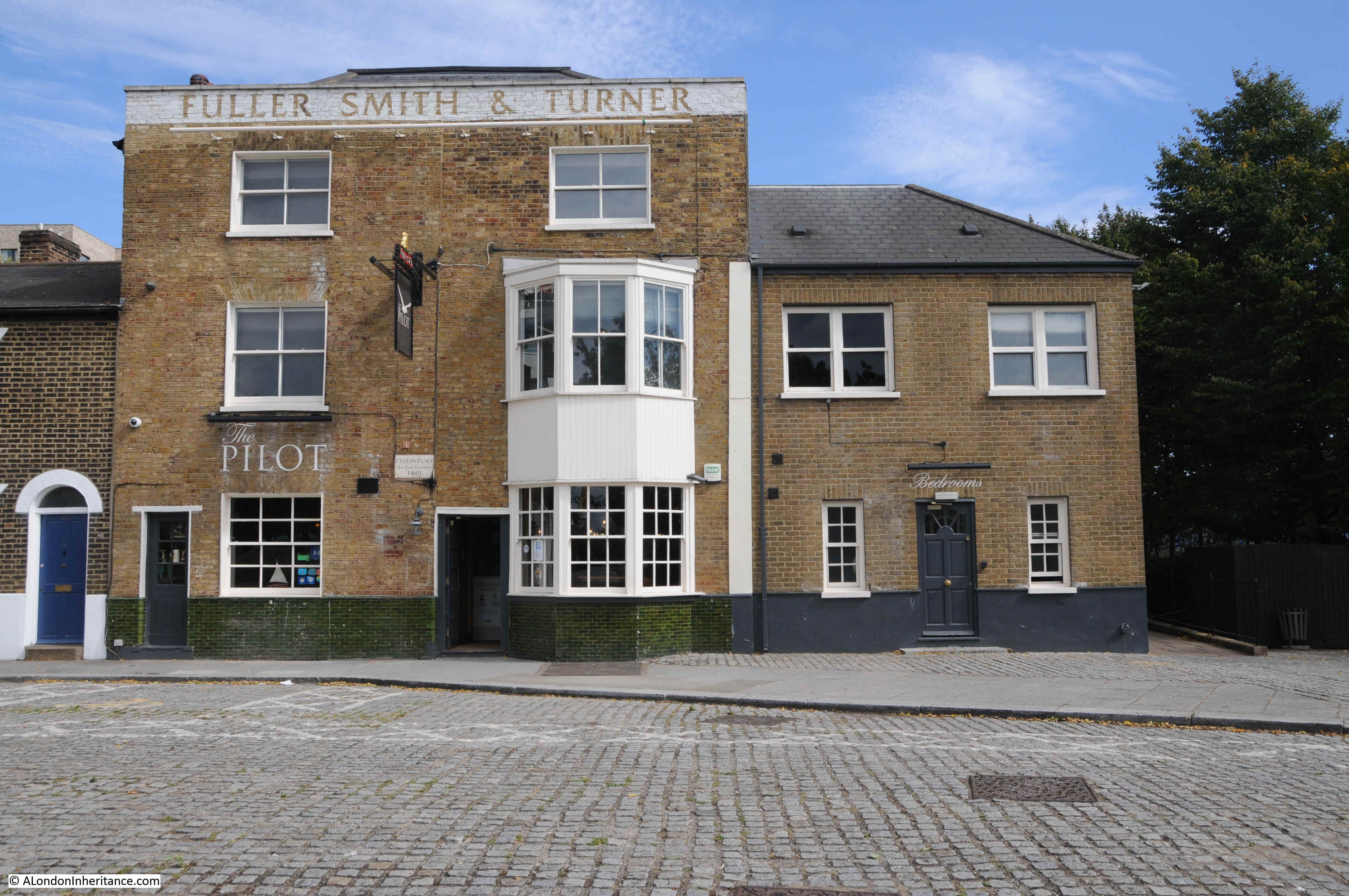
It was here that I was really surprised to see a new pub – Enderby House:

Enderby House

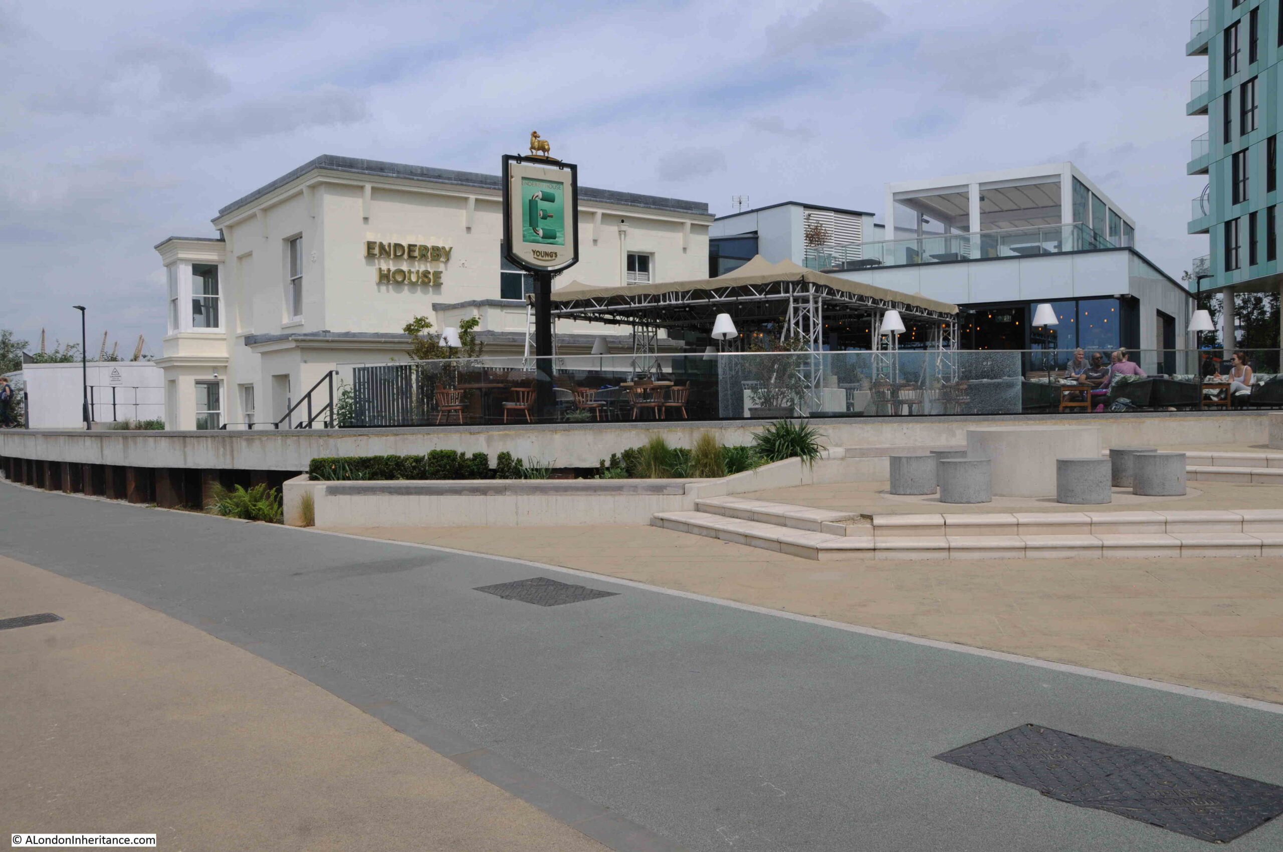
Enderby House is a historically important building. Grade II listed, the Historic England listing provides more details about the building:

Enderby House belonged to the firm of Samuel Enderby, the largest whalers and sealers in Britain, and pioneers of Antarctic exploration. Hermann Melville describes their flagship and crew in “Moby Dick”. The decline of British whaling led to the Enderbys ceasing to have an interest in Enderby’s Wharf in 1854.  It was then taken on by Glass, Elliott and Company, a contractor for the first transatlantic telegraph cable (lost while being laid in 1857) then the second in 1858 which operated for a few weeks.  The business was reconstituted in 1864 as the Telegraph Construction and Maintenance Company, who manufactured cable at Enderby’s Wharf to an improved design for another attempt in 1865, and a fourth in 1866, both times with the Great Eastern as the cable-laying ship, and by the end of 1866 had achieved the first successfully working transatlantic telecommunications cable connection. “

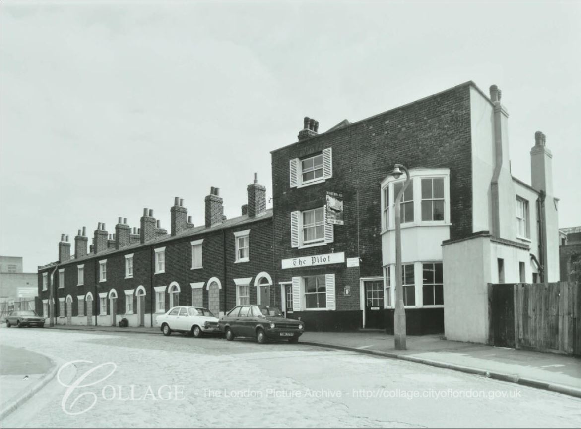
The last time I walked along this stretch of the peninsular in 2015, from Cutty Sark pub to O2 dome, Enderby House was looking in a very poor condition:

Enderby House

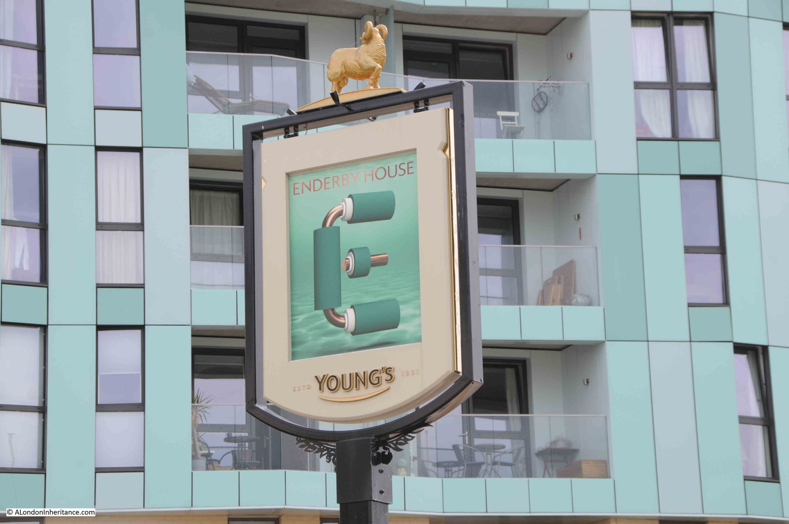
I walked around the outside of the pub, but could not see any references to the history of the site, or to the impact on communication technologies that the products manufactured here would bring, however the pub sign did appear to illustrate what I assume to be a representation of a telecommunications cable:

Enderby House

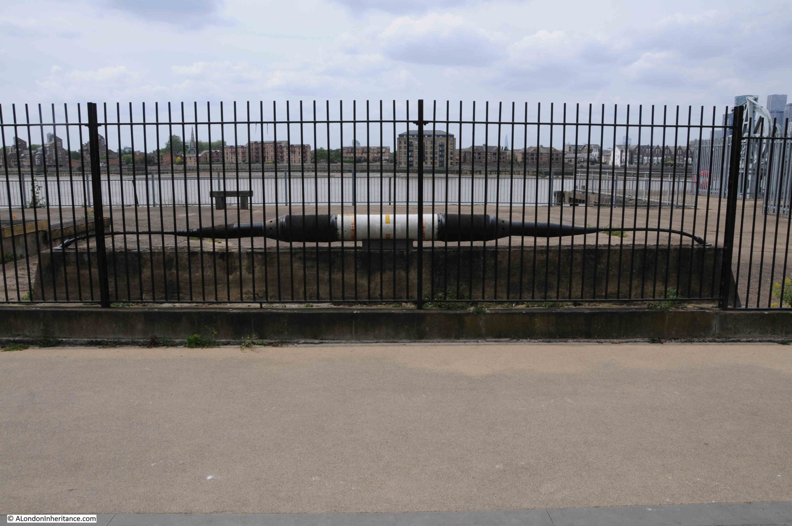
Opposite, within the fenced off wharf, was an example of a length of cable and the housing for the repeater equipment that would amplify the signal as it travelled for thousands of miles under the sea:

Enderby House

I get really conflicted when I see a building such as Enderby House. I am pleased that it is still there, and that it is a new pub (too many of these are closing), however it appears to be heavily altered, and does not appear to offer any information as to the importance of the site, apart from retaining the name and the pub sign.

Perhaps there is information inside and I am being unfair. I did not have time for a visit, having a meet arranged at the Cutty Sark pub on the walk back.

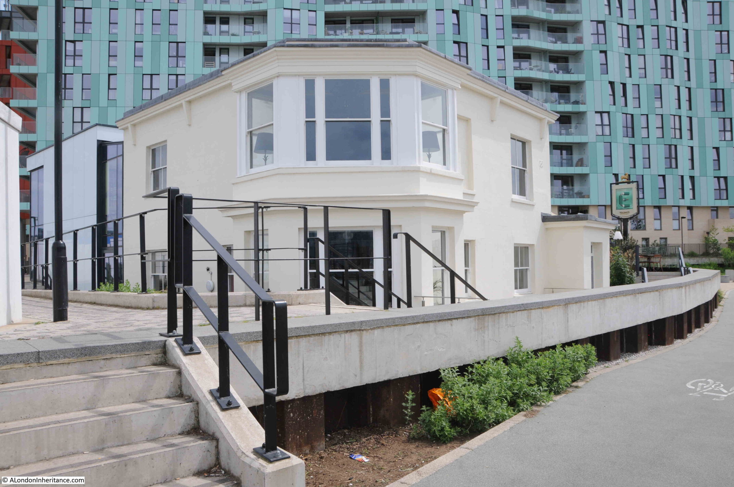
View of the northern side of Enderby House – if I was responsible for decorating the building I would have an artwork representing a trans-Atlantic cable running along the side of the building to break up the rather bland cream paintwork.

Enderby House

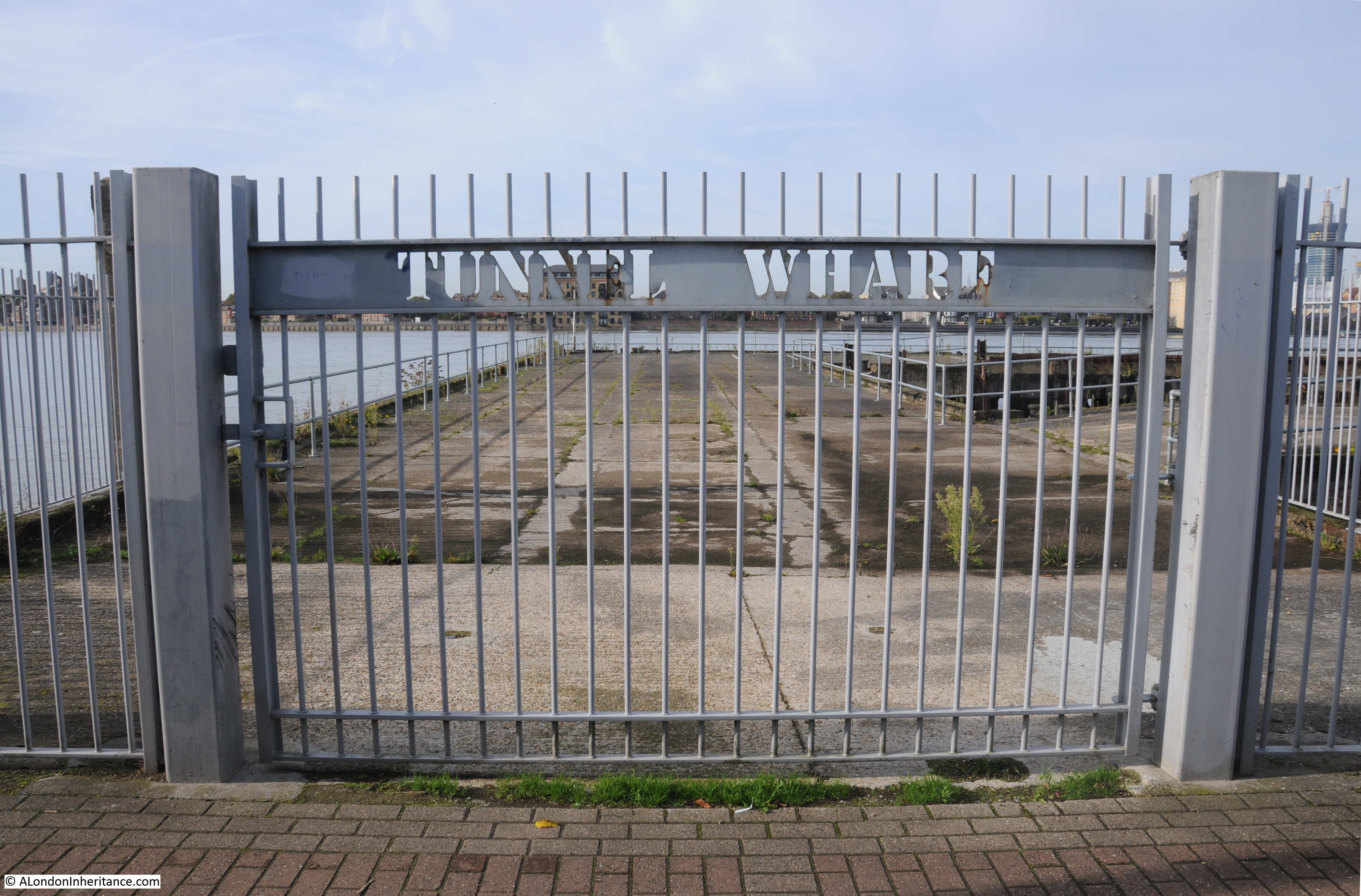
Fenced off access to the wharfs near Enderby House:

Tunnel Wharf

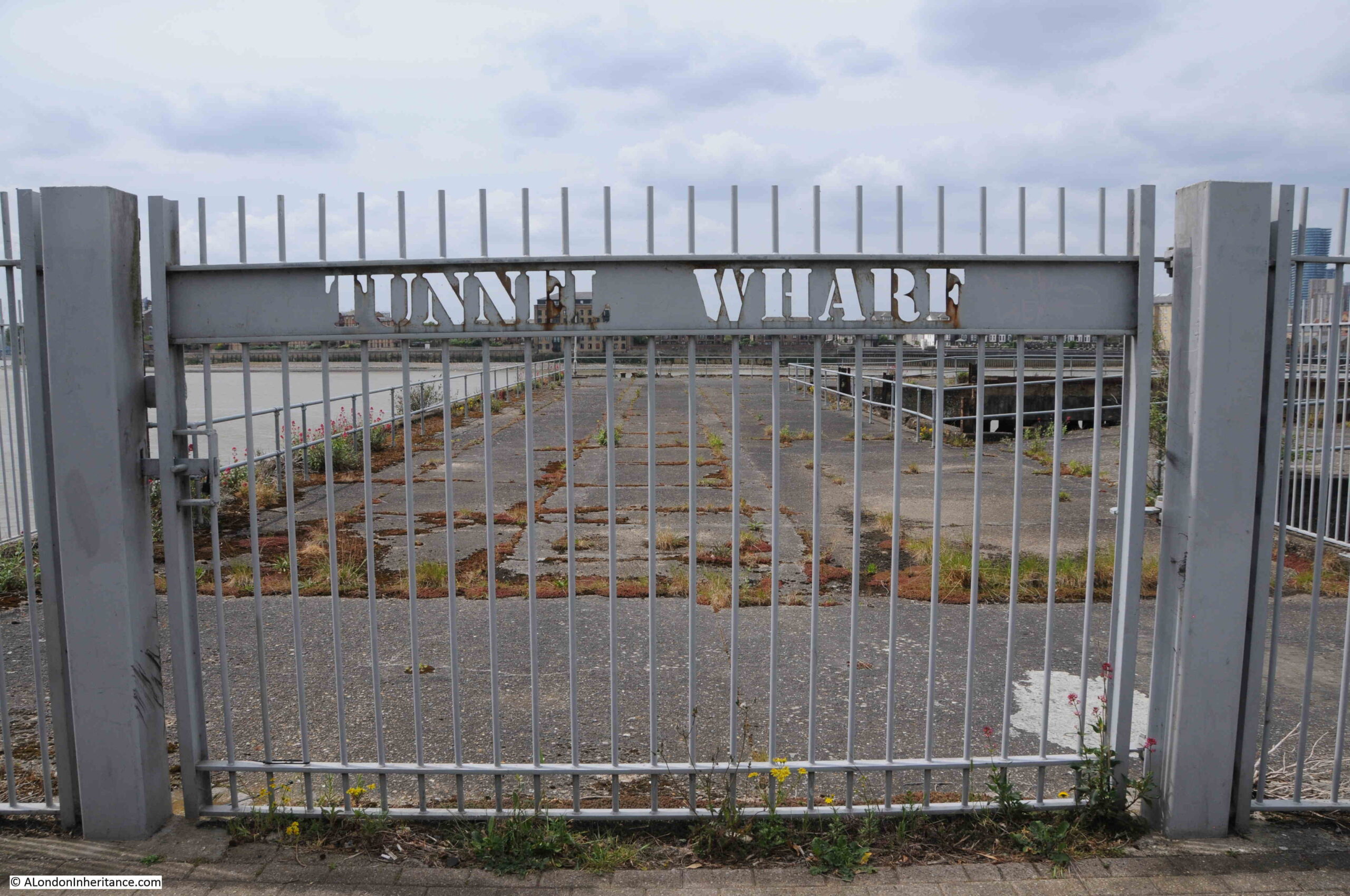
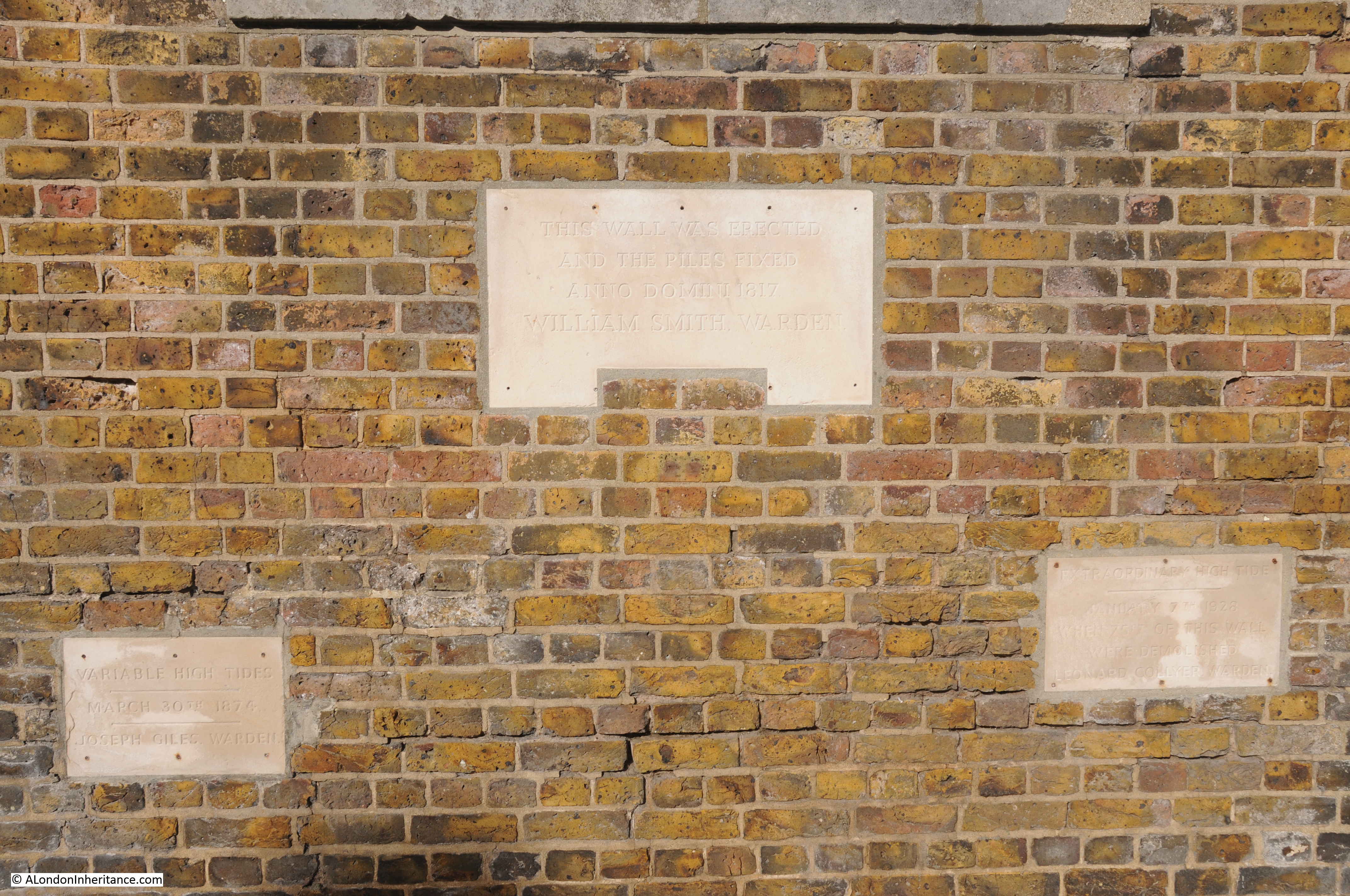
There is a flat wall of stone to be found among the apartment buildings and facing on to the walkway along the river:

Greenwich Peninsula

Rather than repeat what the information panel to the right of the wall states, I will summarise Mary Mills comments from her book.

There was a road that ran underneath the new apartment buildings between Lovell’s and Granite Wharf (which was to the north of Lovell’s).

Much of the boundary wall of Granite Wharf along this roadway was made up of an extraordinary range of what appeared to be random stone, and was thought to have been quarried in Dorset, shipped to Greenwich where it was stored until it was sold for use in a construction project. Some of this stone had been used to construct the wall.

This stone wall was important as it was a visual demonstration of the stone trade from along the English Channel.

When the wall, along with the rest of the site was being demolished, Mary Mills was instrumental in getting the importance of the stone recognised, however the wall created by the developer using the stone is very far from how it was originally used, and what had been rough stone had been tided up considerably and placed in what is now a smooth wall of stone. Again, good that it has been retained, but it could have been so much better.

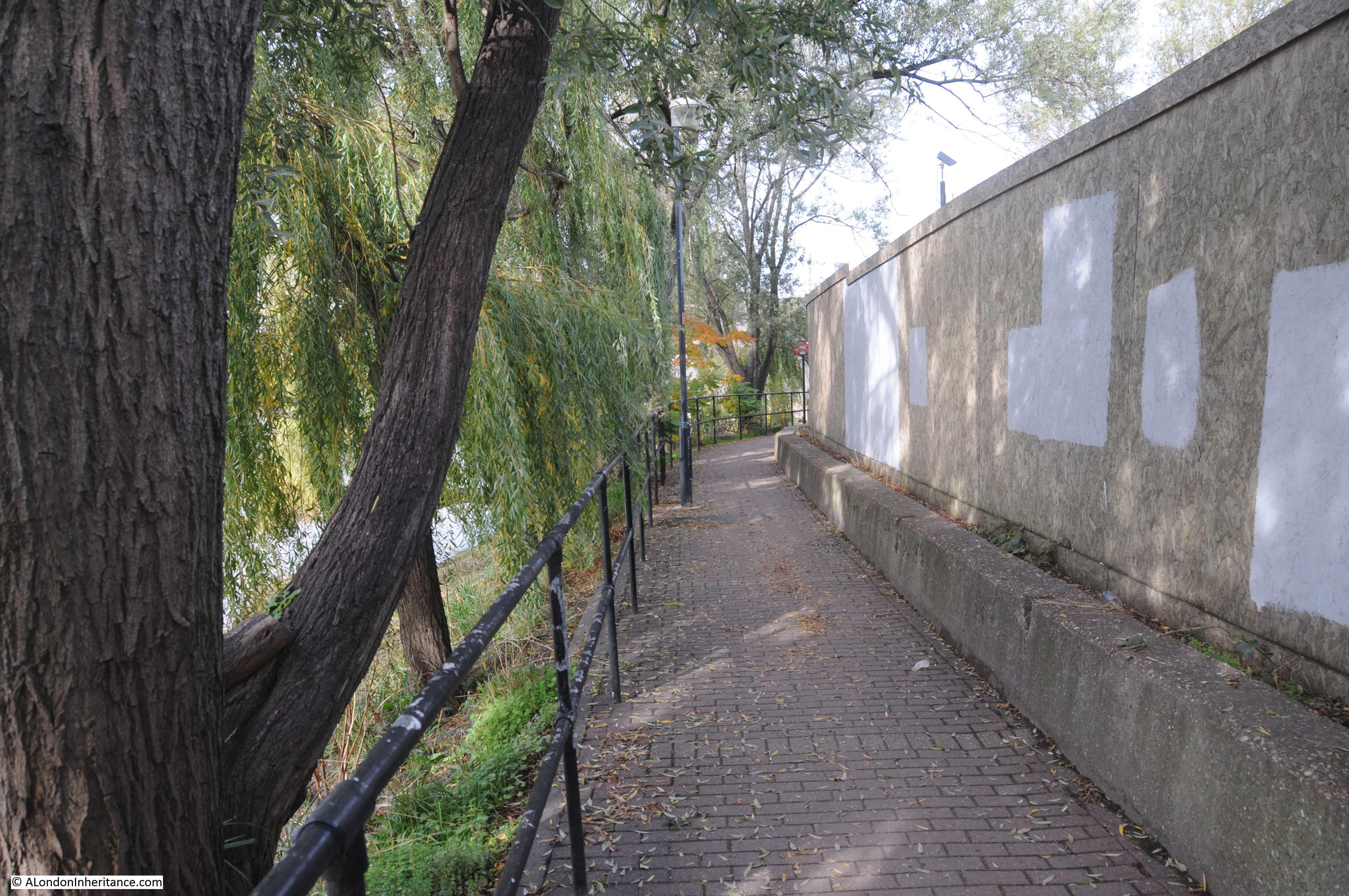
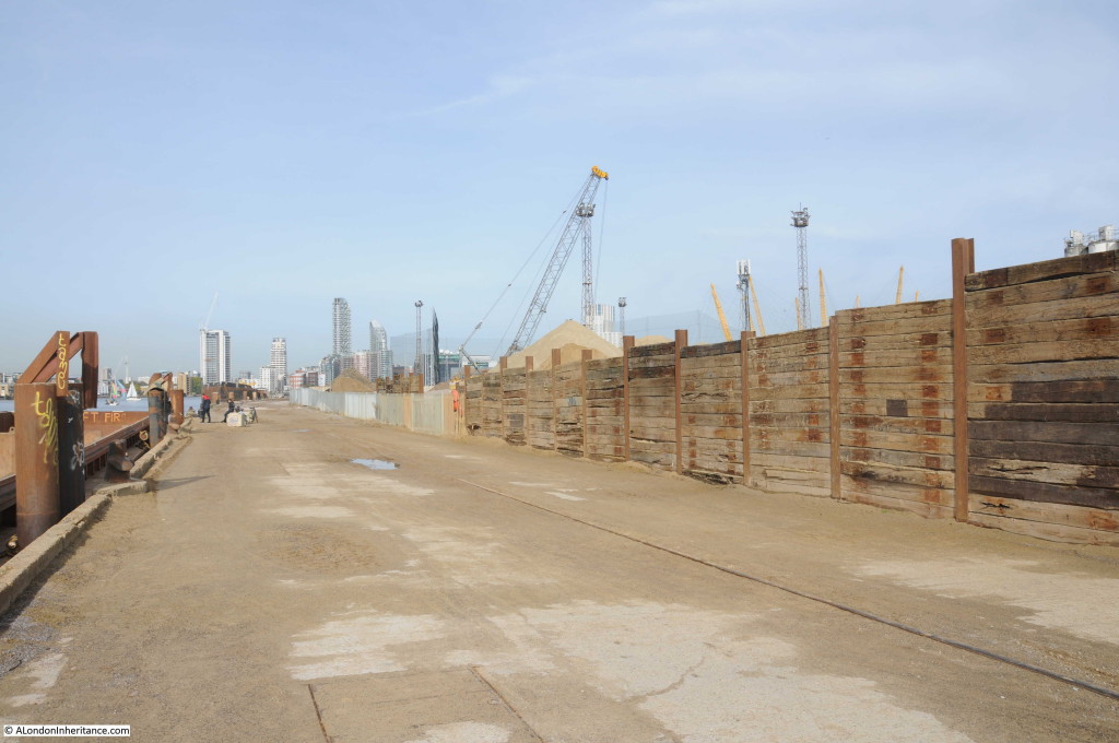
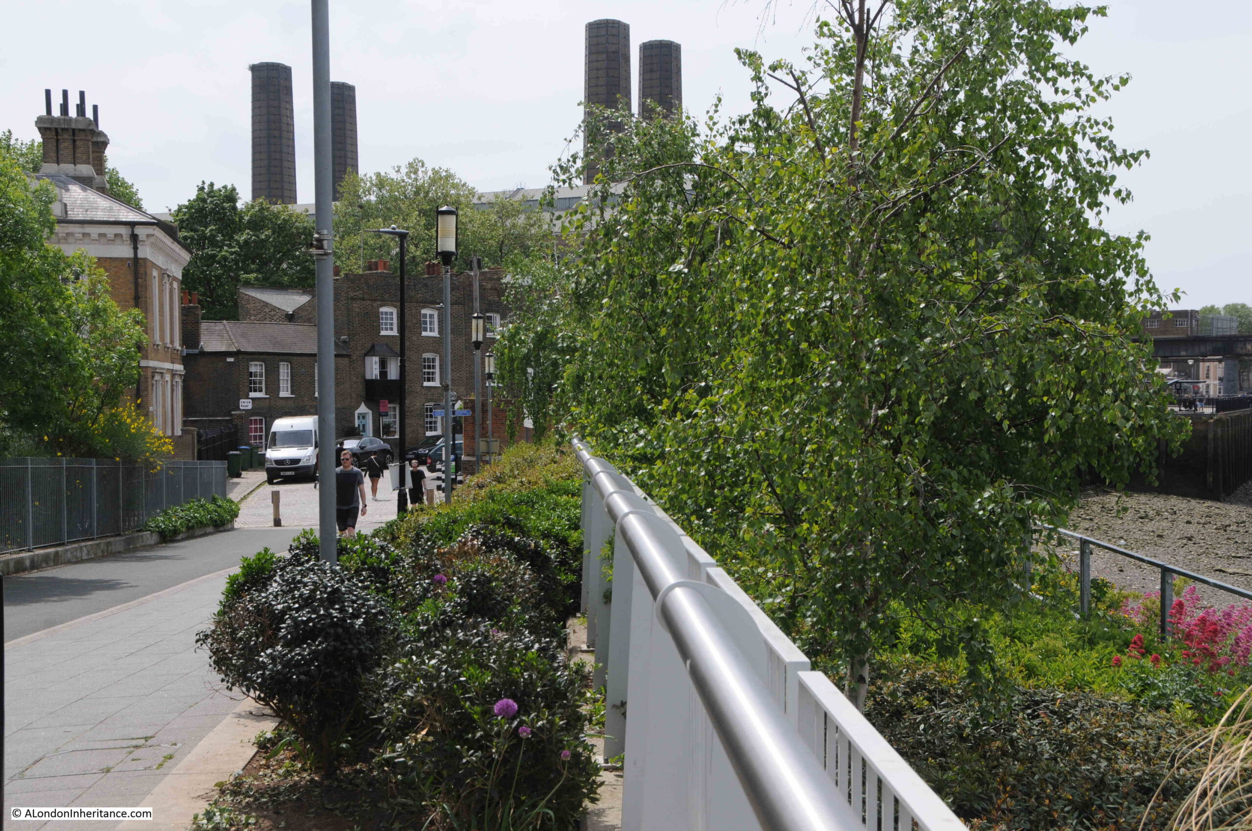
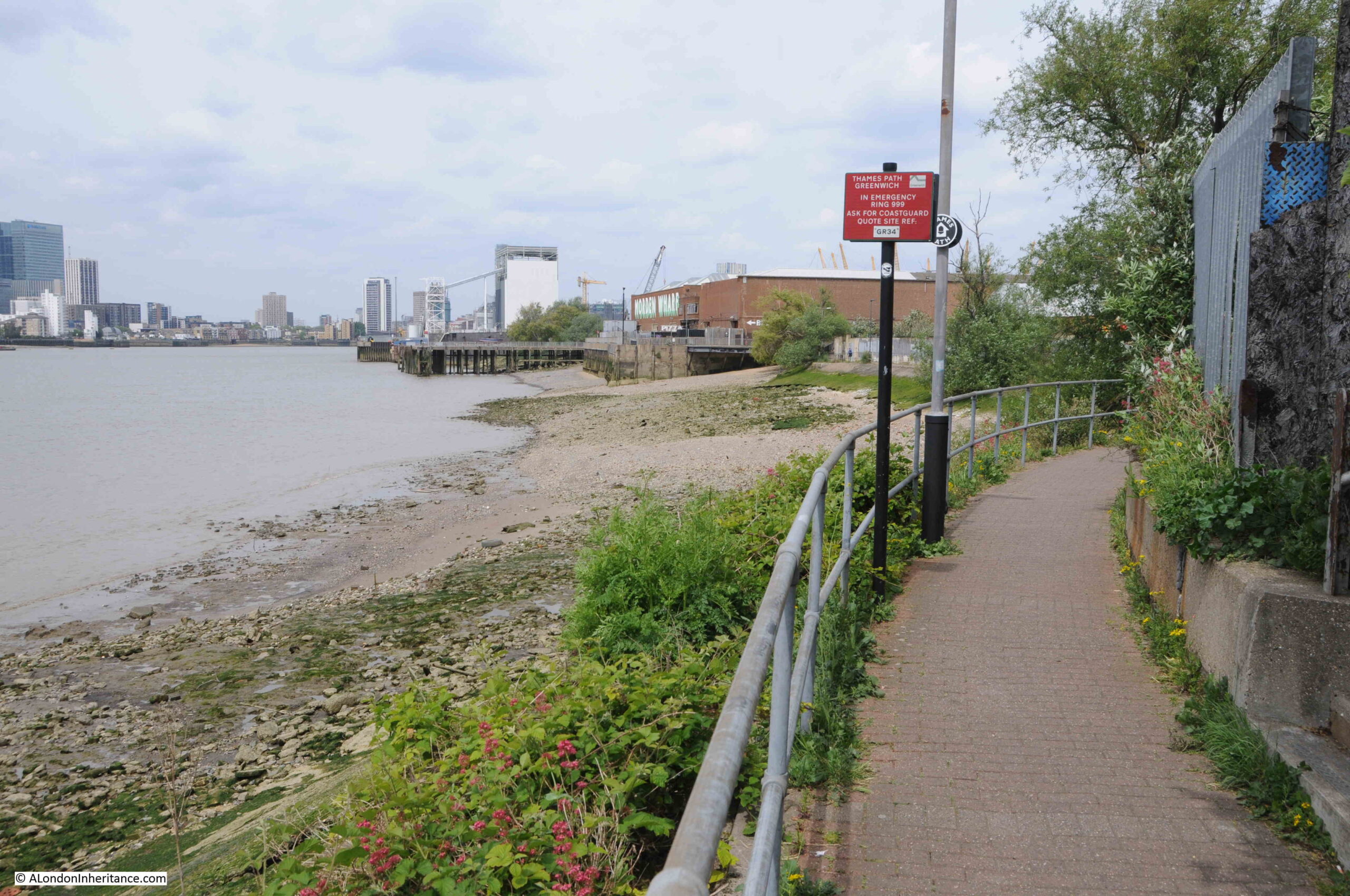
Soon after walking past Enderby House, development has stopped and the river path changes from a new, wide path in front of apartment buildings, to a narrow path alongside the derelict sites that are probably scheduled for development:

Greenwich Peninsula

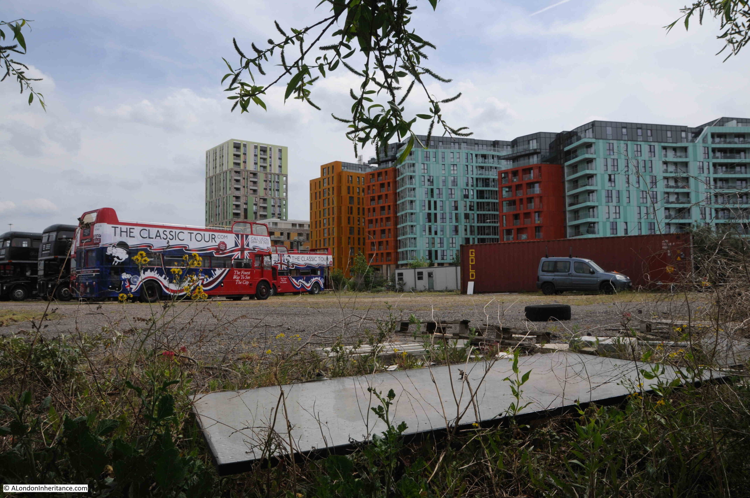
Where tour buses go to park:

Greenwich Peninsula

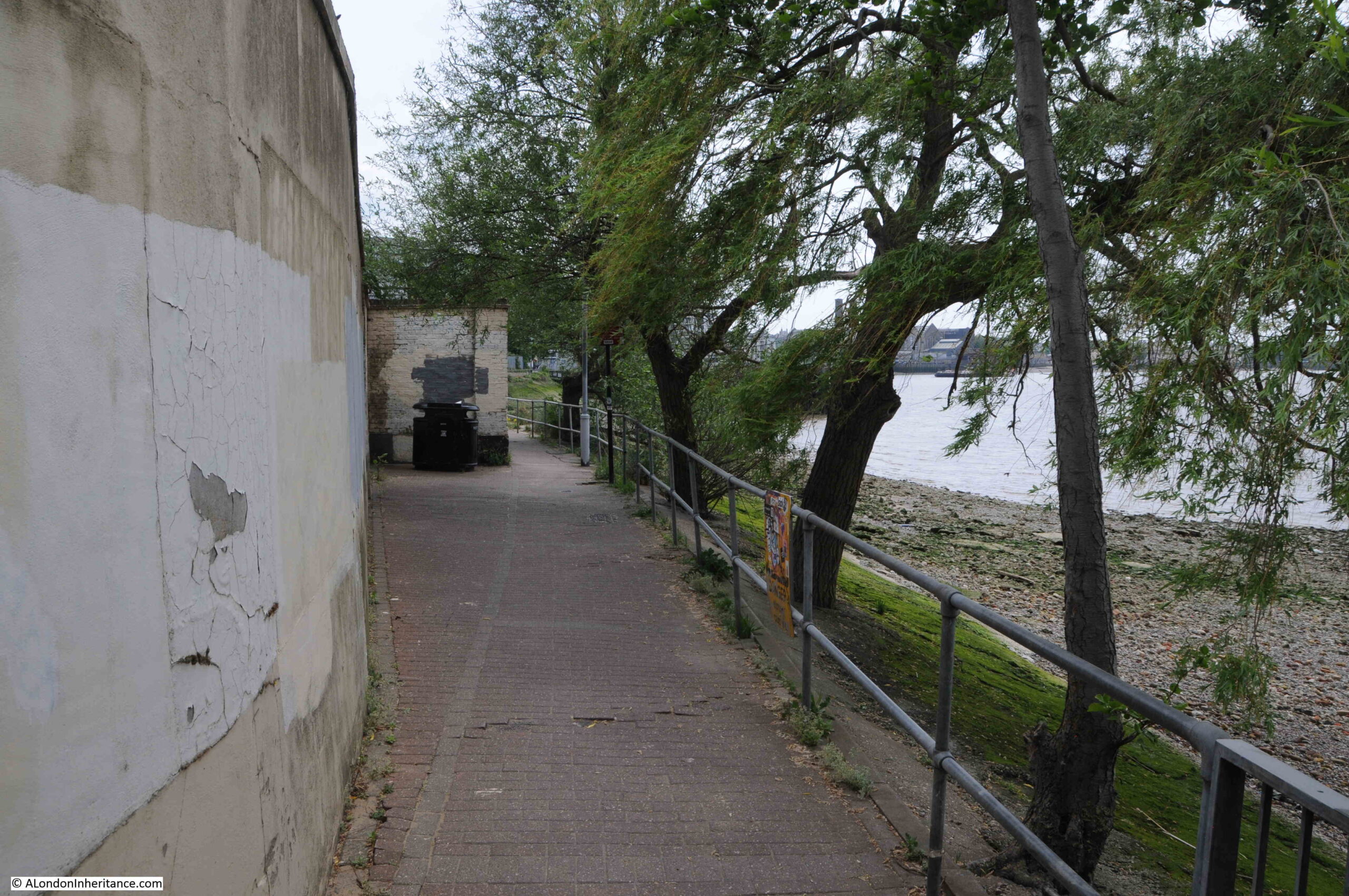
I really love this part of the walk along the peninsula. A narrow path along the river’s edge, quiet, and a chance to think about what was here:

Greenwich Peninsula

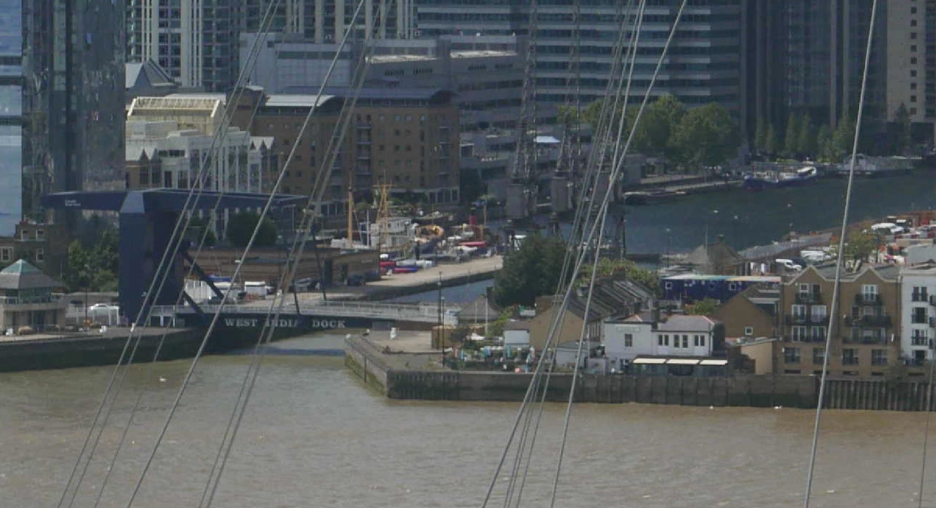
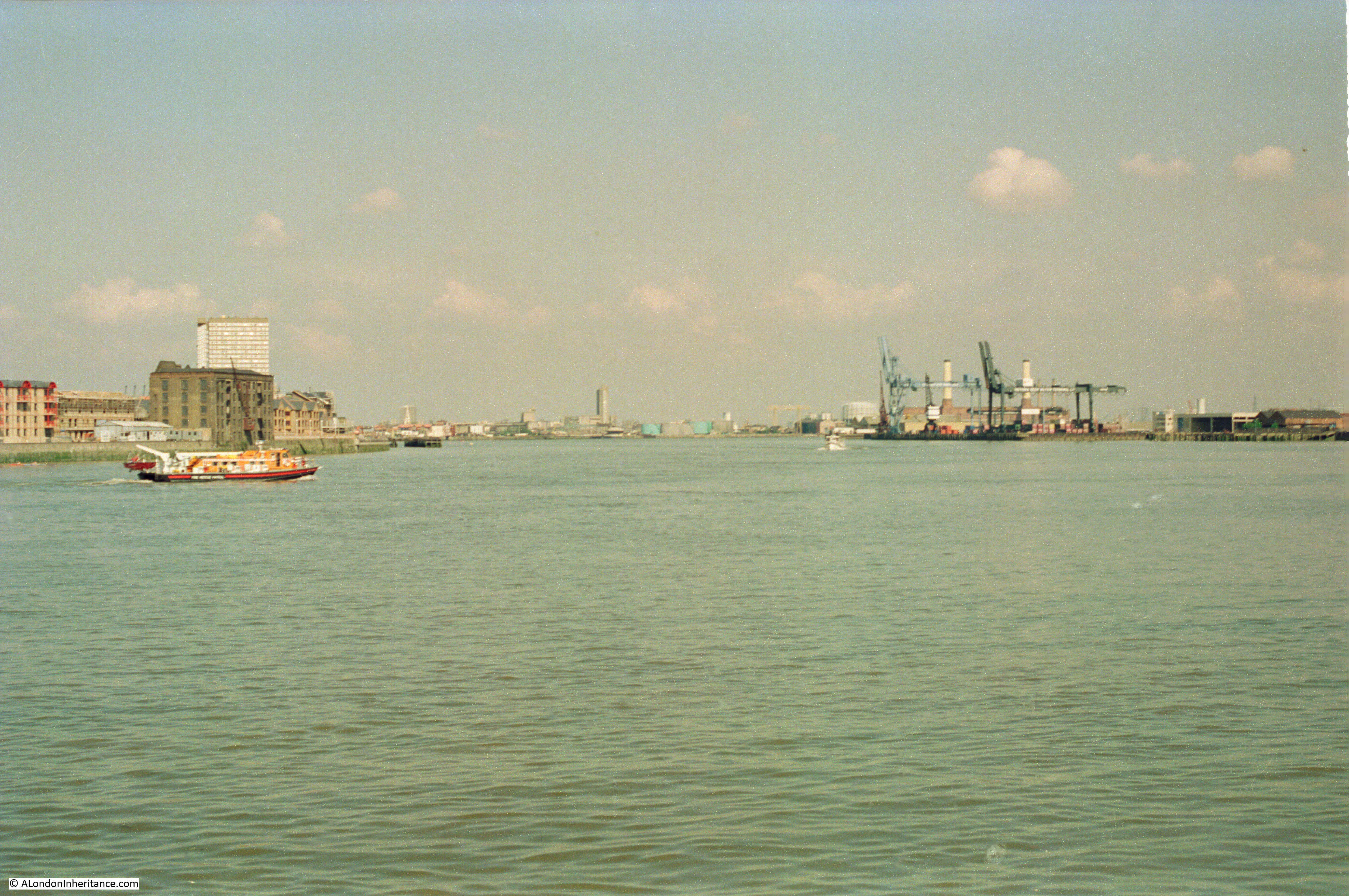
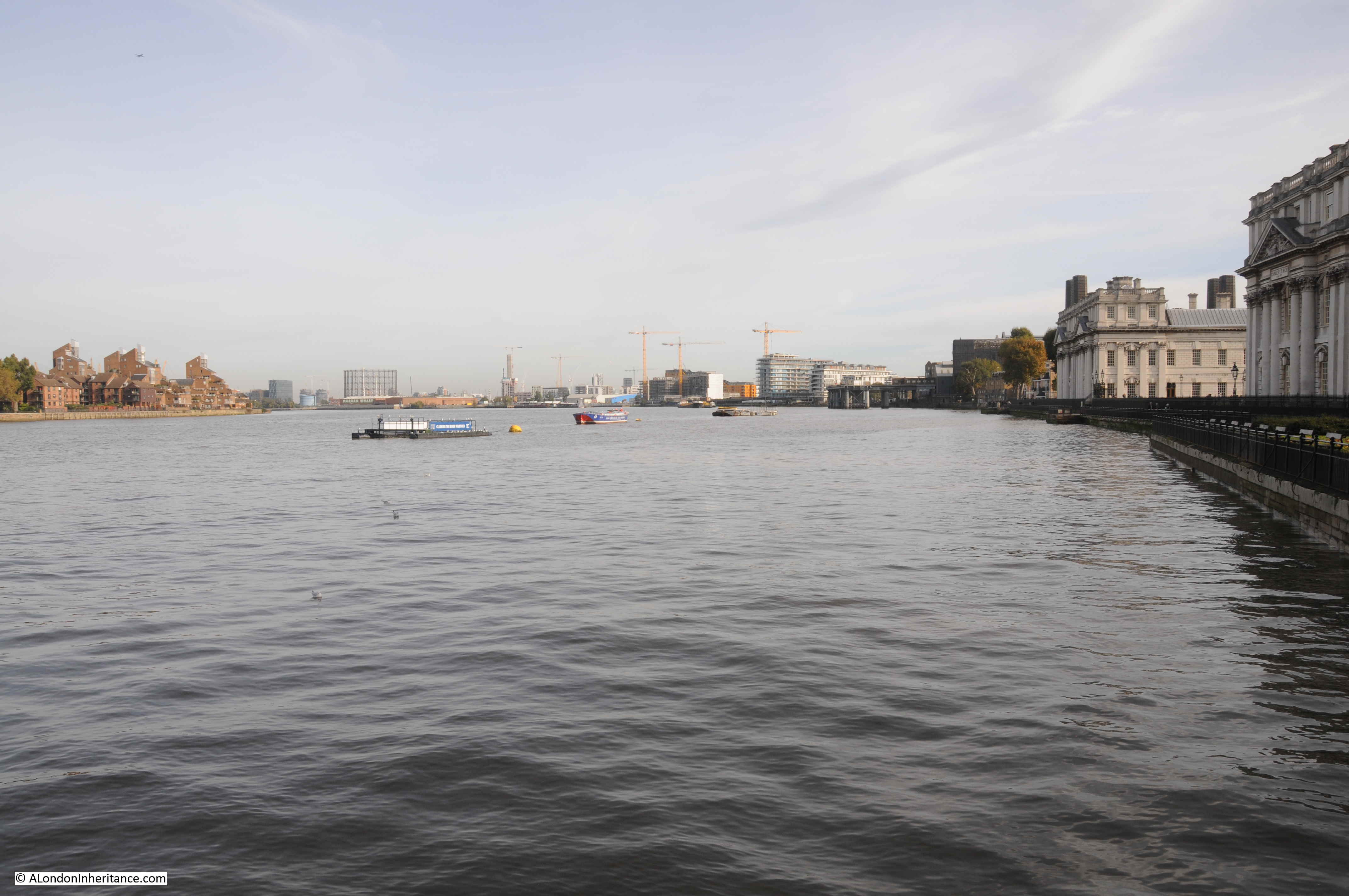
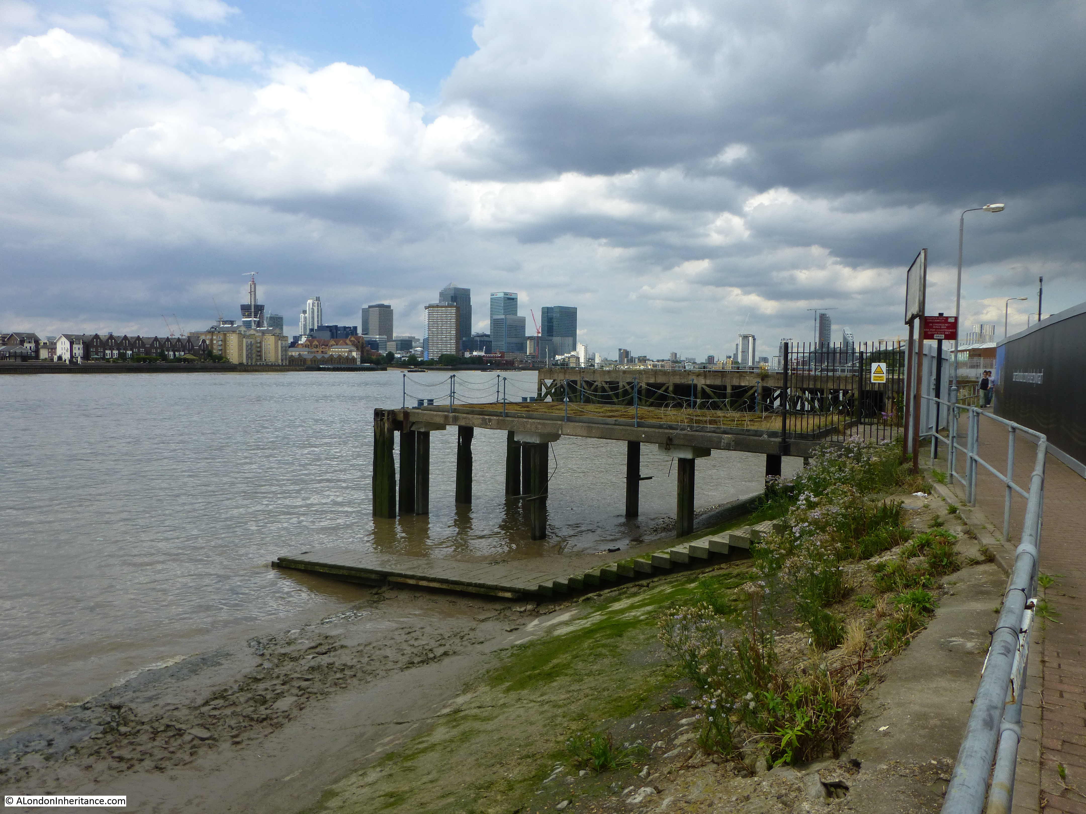
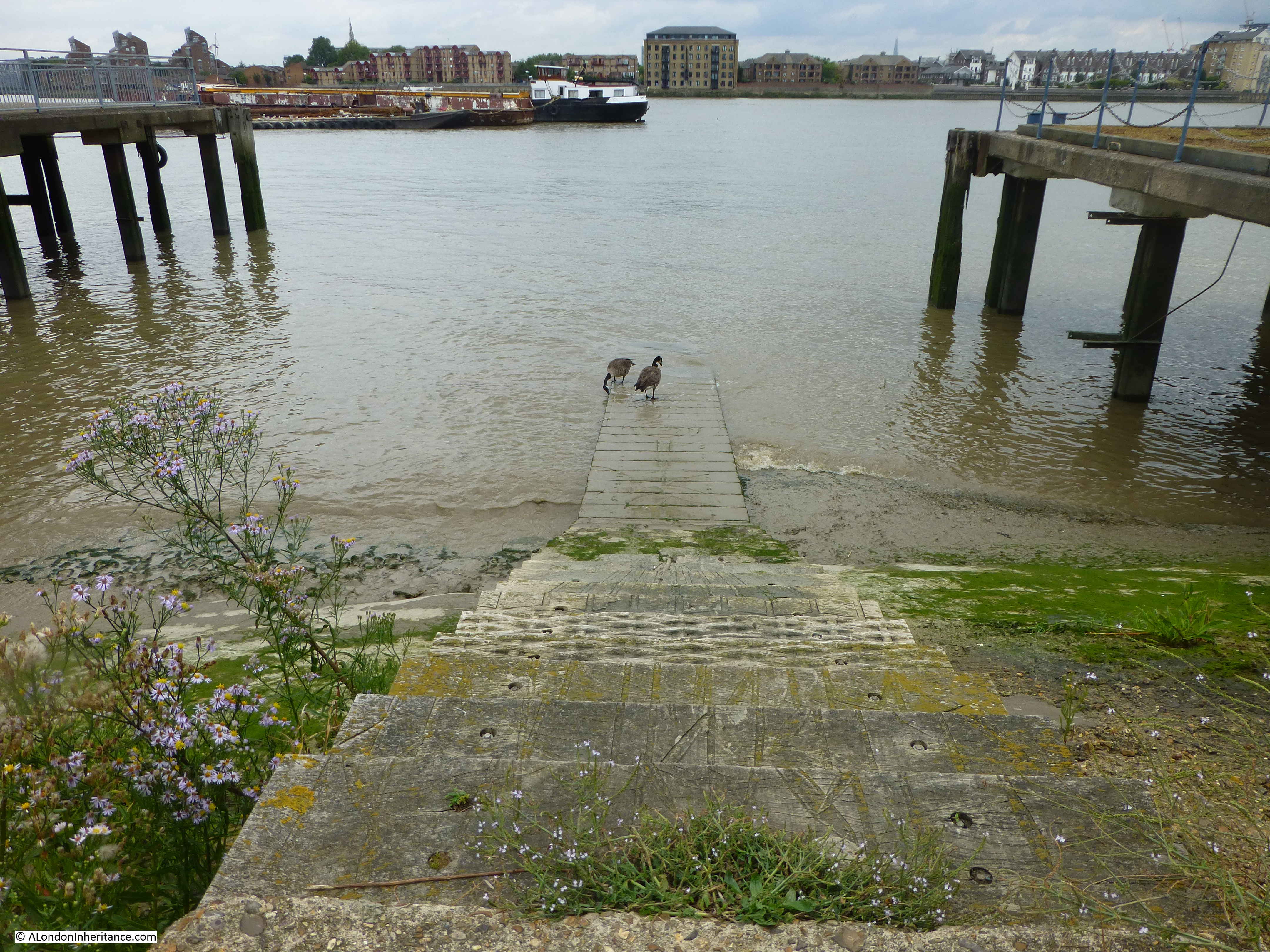
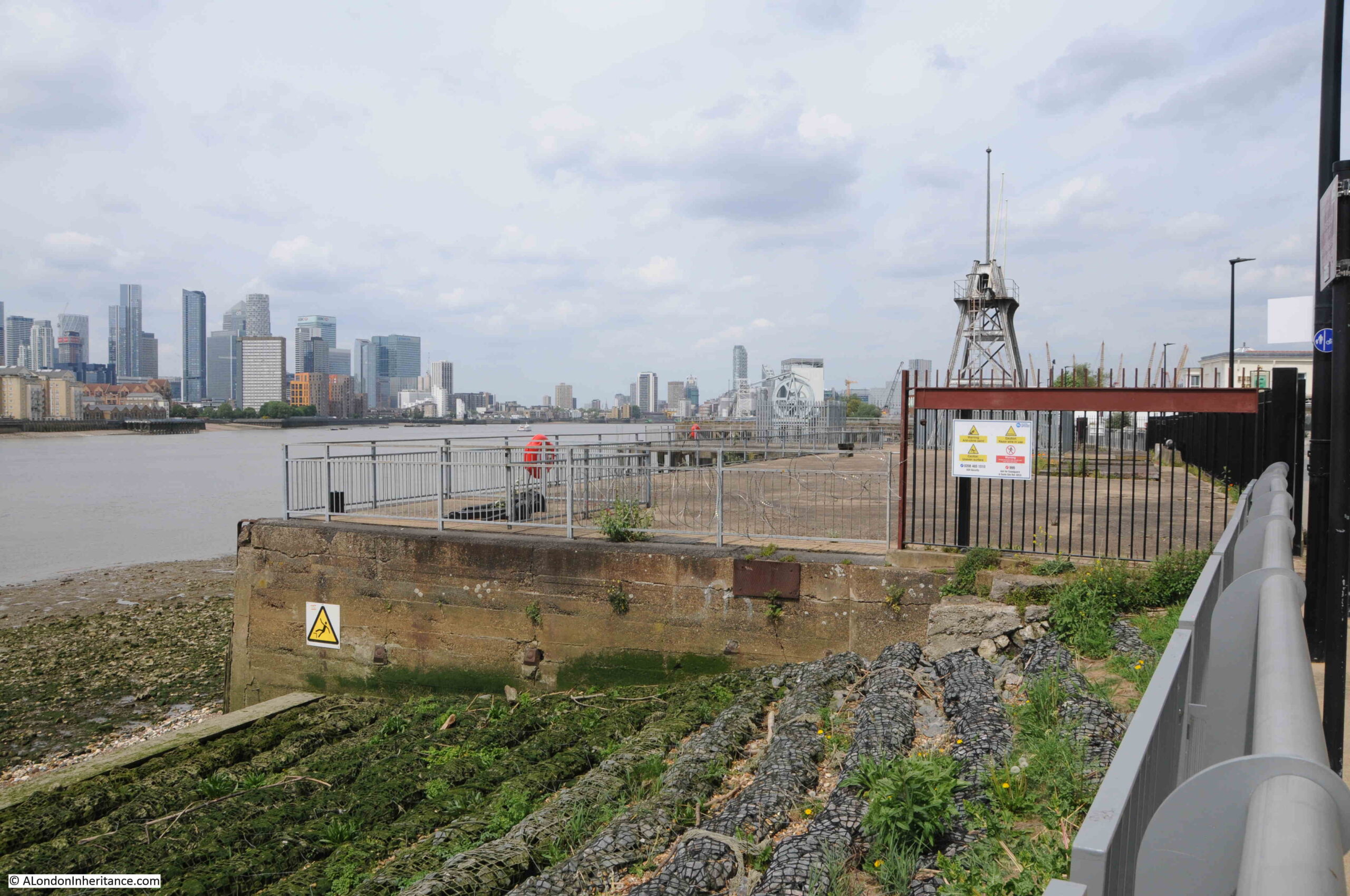
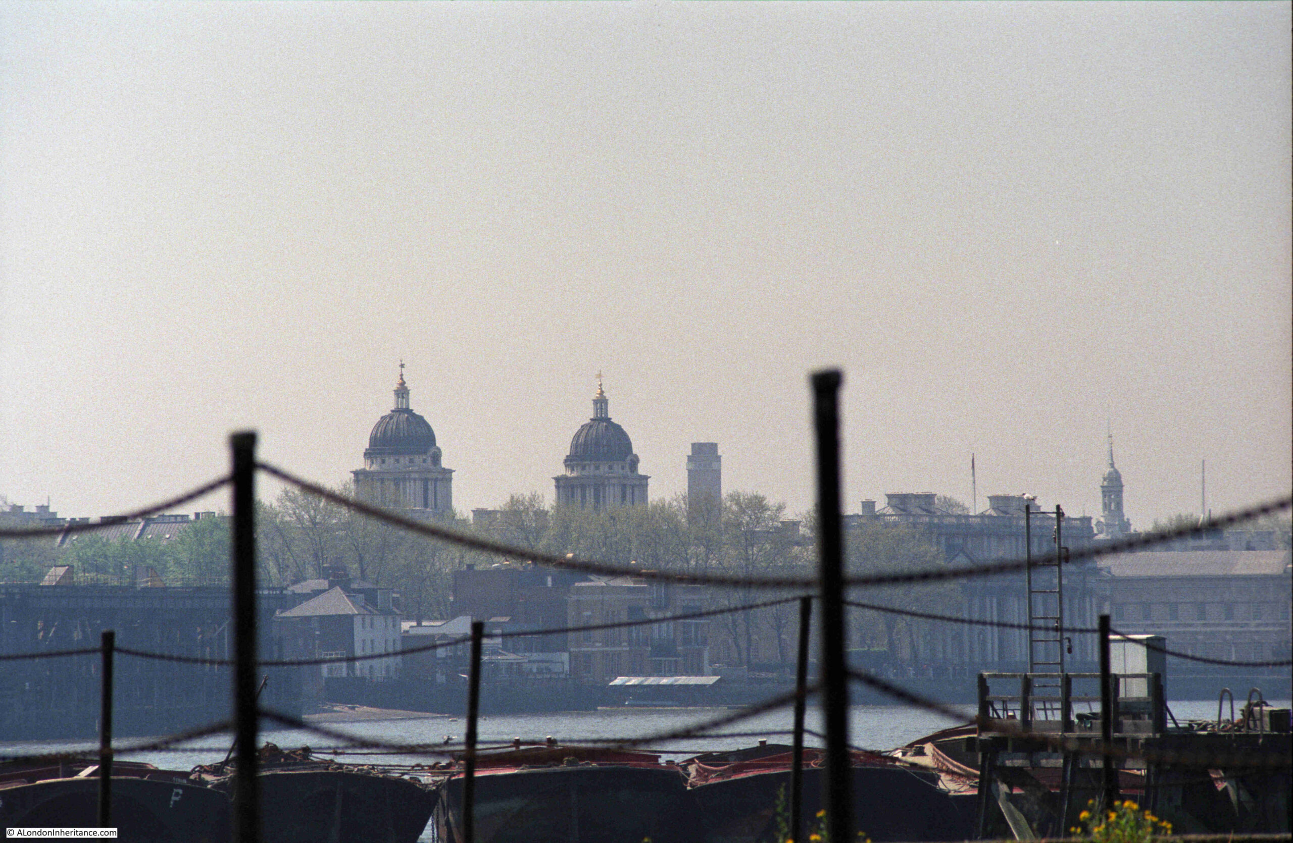
I still had my third 1986 photo to track down, and I suspect it was taken from the following pier:

Greenwich Peninsula

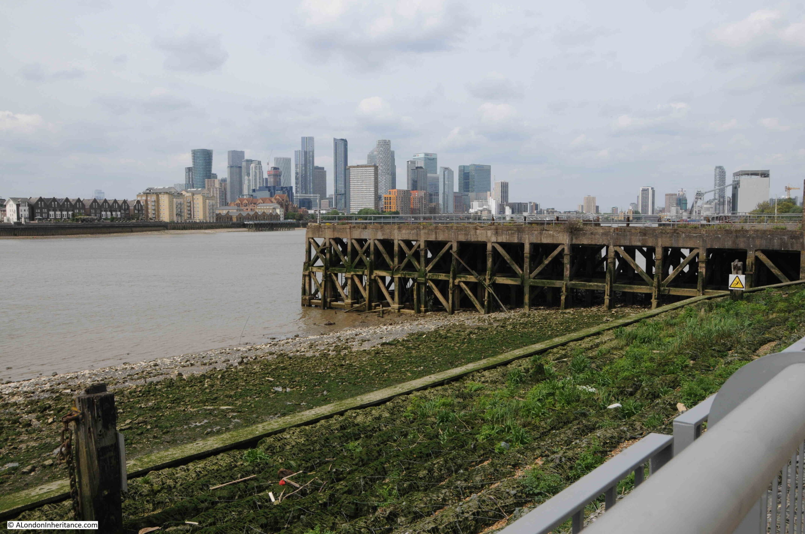
This was the view looking back towards central Greenwich in 1986:

Greenwich Peninsula

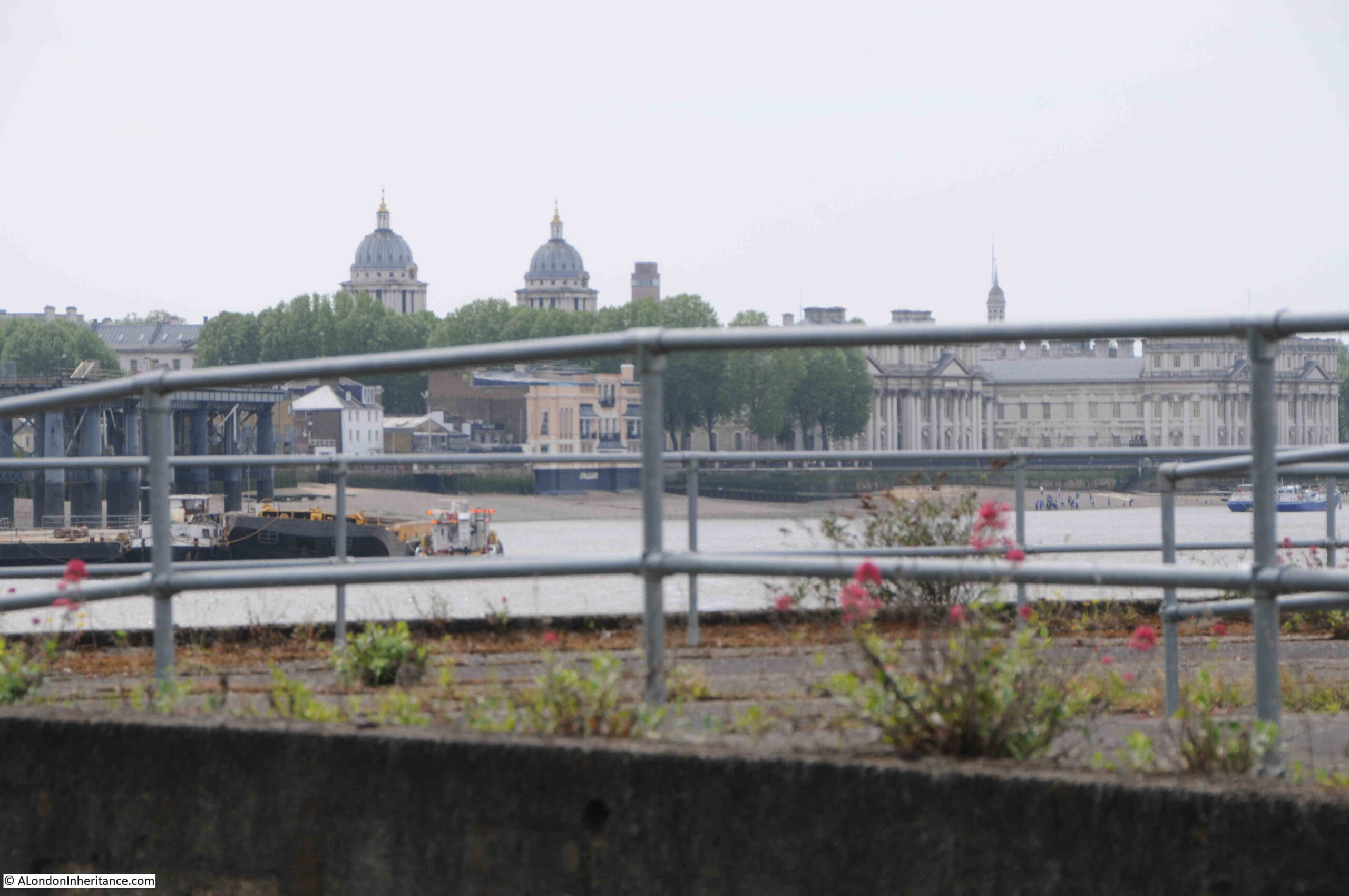
The following photo was the closest I could get to recreating the above. The landmarks of Greenwich all line up reasonably well. The barges moored alongside the pier in 1986 have all disappeared.

Greenwich Peninsula

To the side of the footpath, there are the remains of structures that once provided access to the long gone industrial premises that lined the river:

Greenwich Peninsula

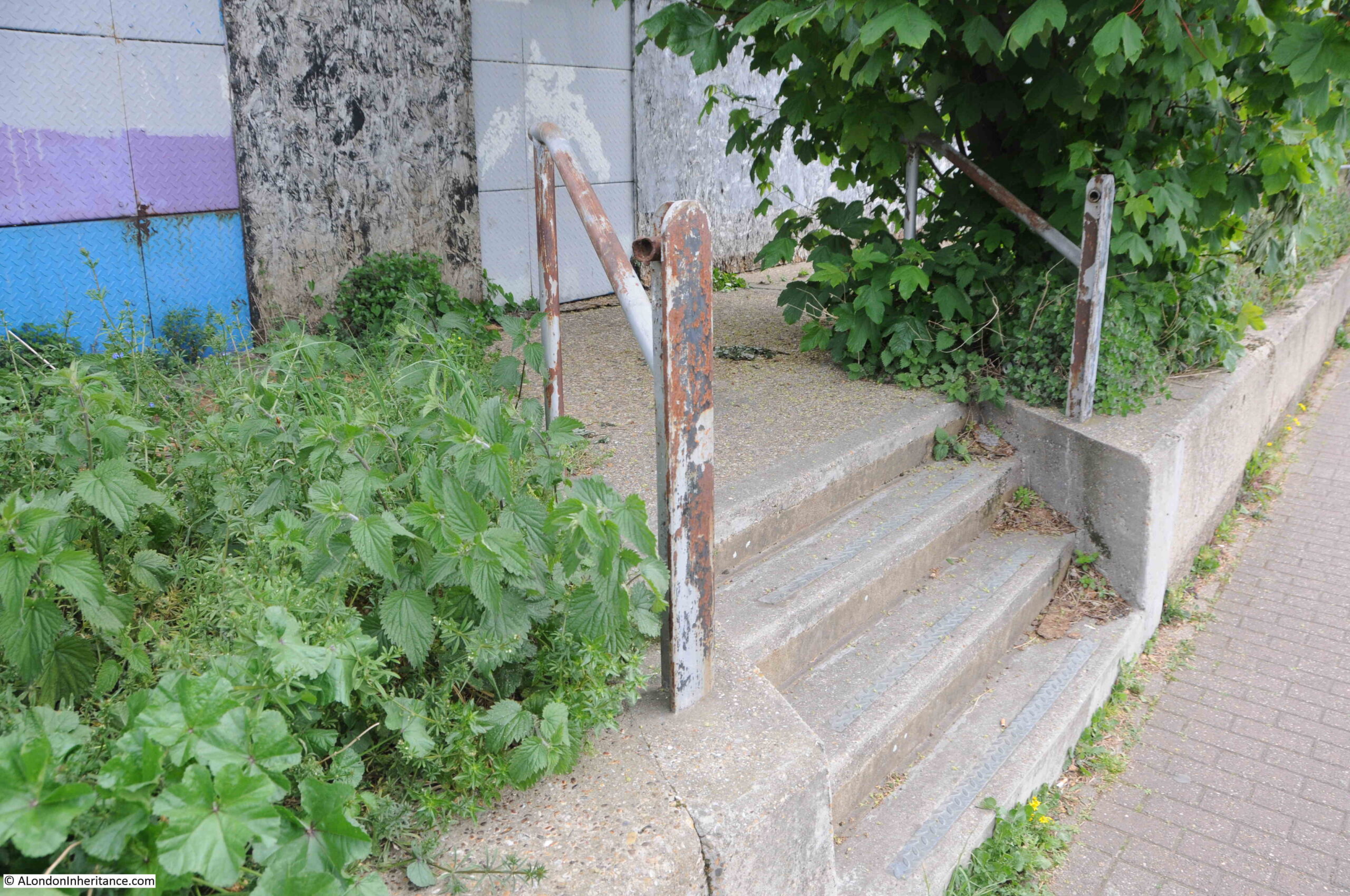
A long closed gateway:

Greenwich Peninsula

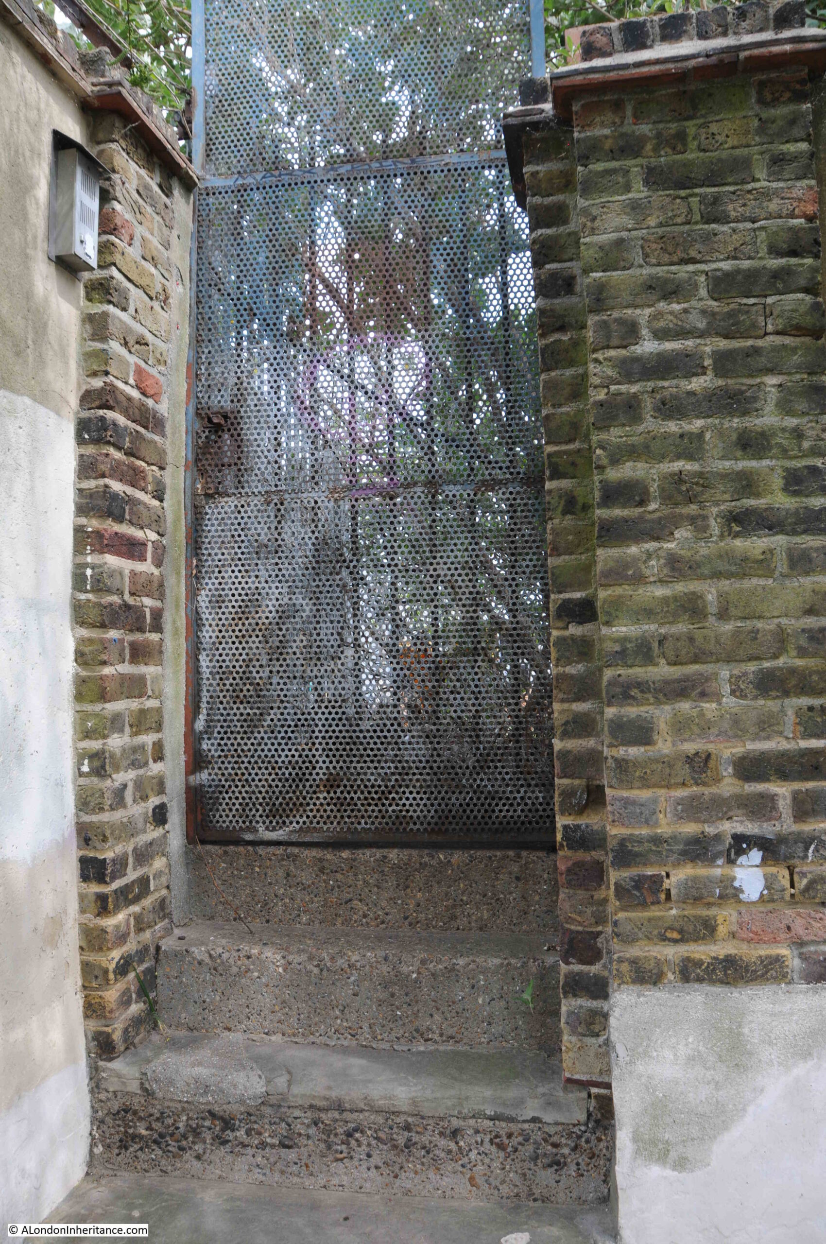
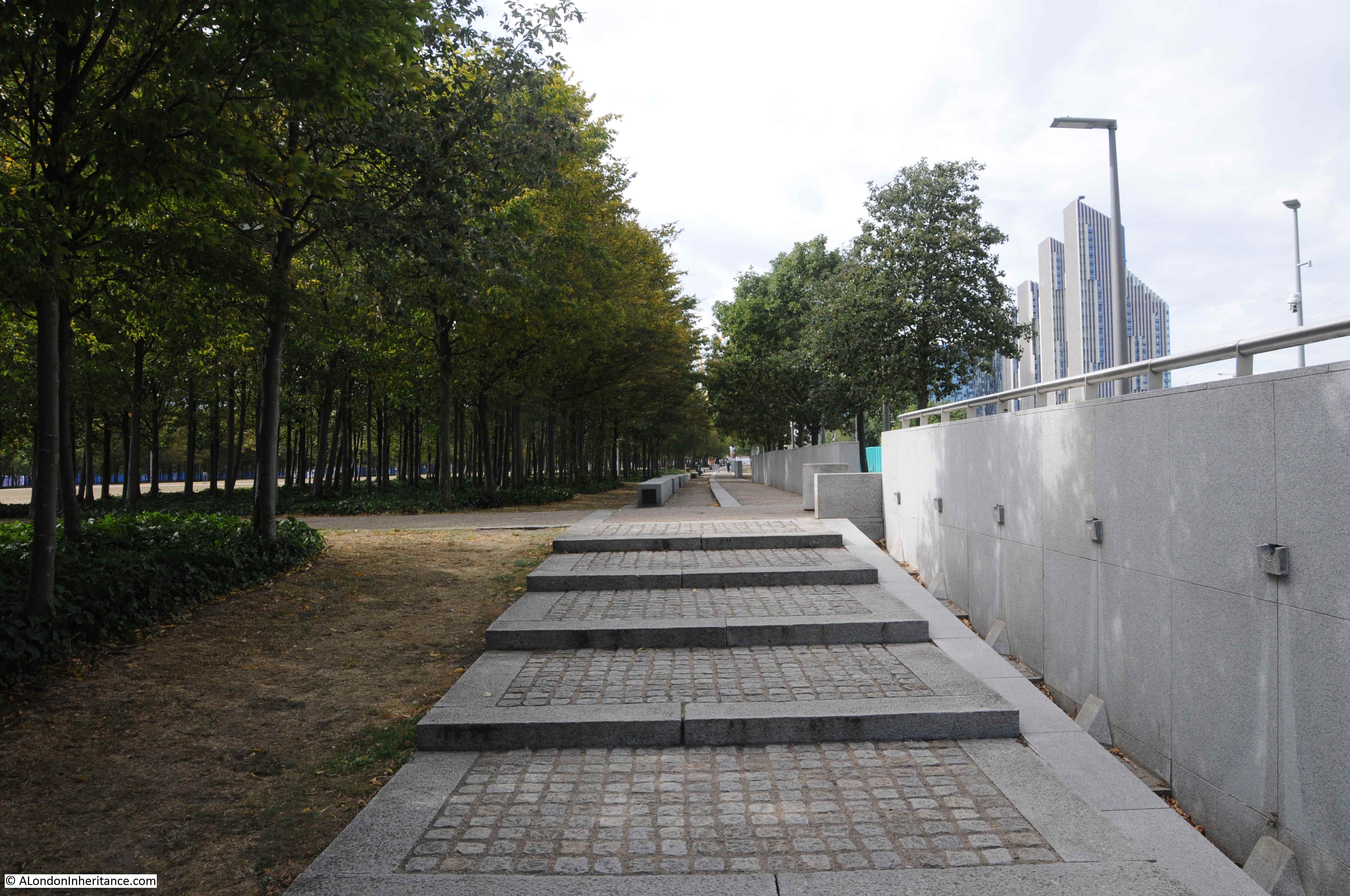
Looking back along the footpath – this stretch of the river is so very different to that which has already been developed, and I assume that at some point in the future, this footpath will become the same wide pedestrianised area next to new apartment buildings, as found at the start of the post:

Greenwich Peninsula

A welcome sign:

Morden Wharf

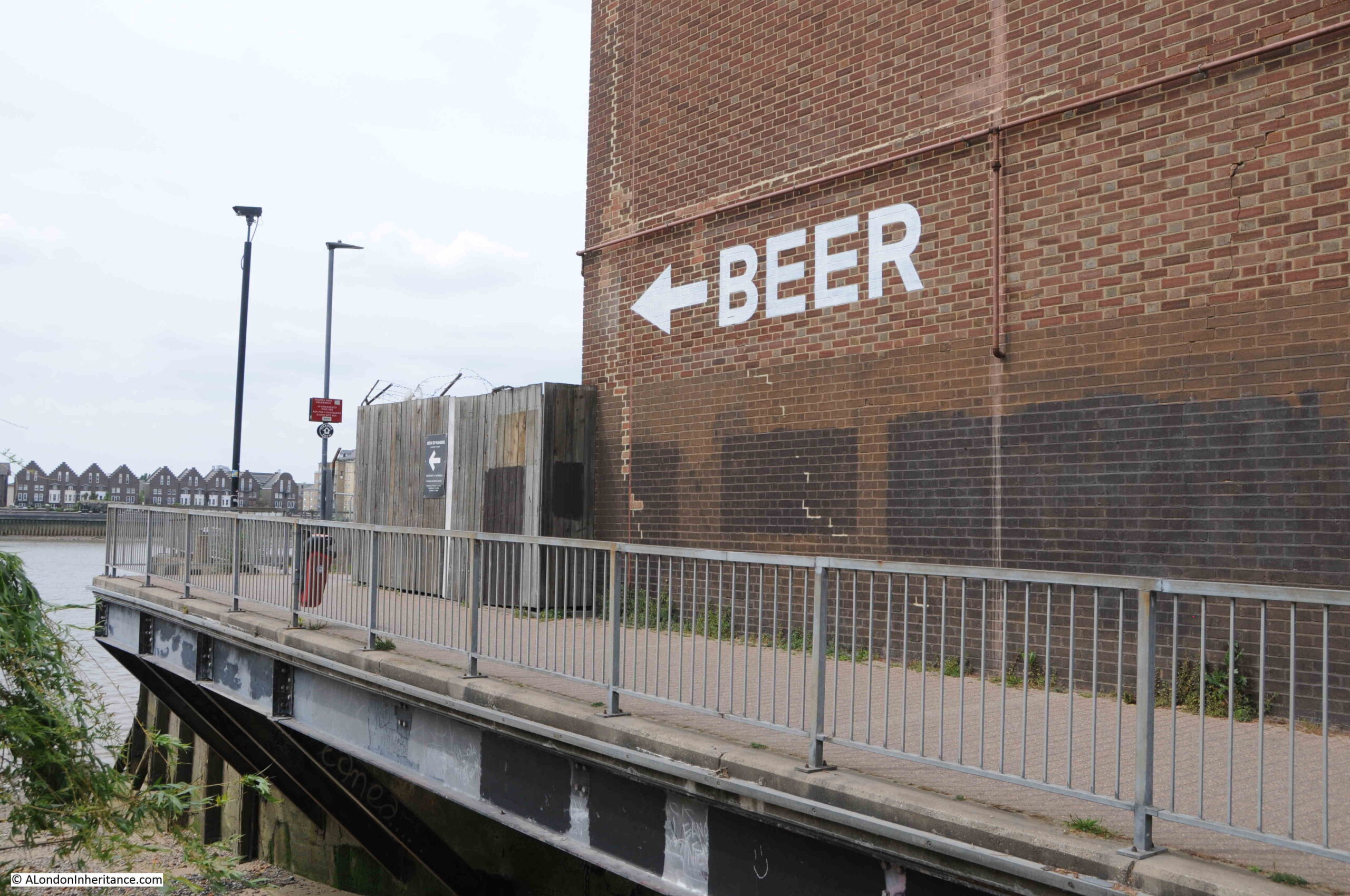
The sign points to what looks like a temporary bar / pizza area built in front of Morden Wharf:

Morden Wharf

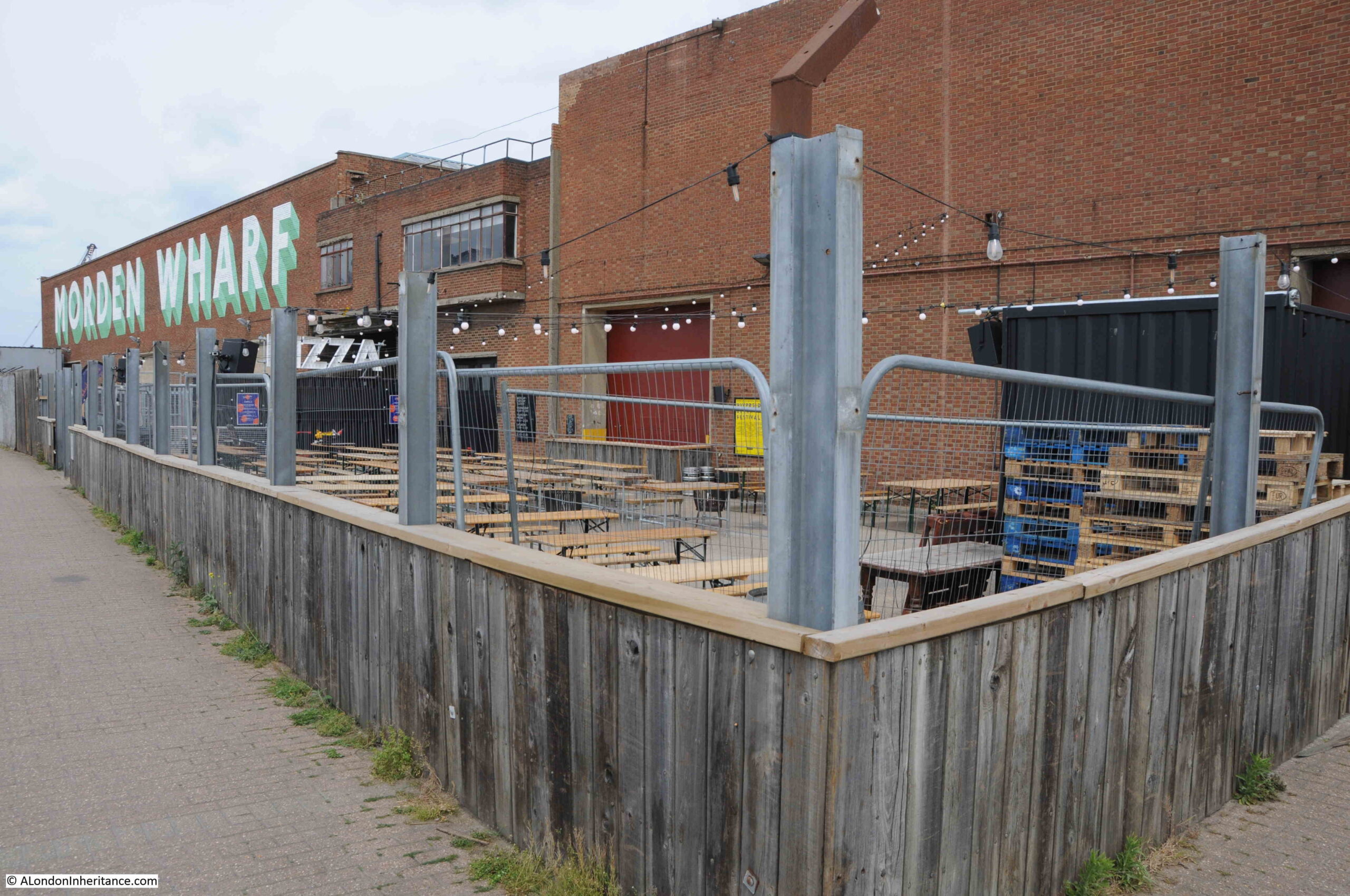
Morden Wharf was named after Morden College, the freeholder of much of the land in the vicinity of the wharf.

The last time I walked along the peninsular, Morden Wharf was fenced off from the footpath with high, wooden panels, these have now been removed with only their vertical metal supports remaining.

Having reached Morden Wharf, I turned back towards Greenwich.

The area that I have walked which has not yet been developed, is planned to undergo a significant transformation. The footpath winding its way between the river and the derelict industrial sites will disappear and large new towers will be built.

The developed is called Morden Wharf, and the website describing the development can be found here.

Scroll to the bottom of the page, on the Morden Wharf website, and the area I have walked can be seen to the right of the old brick Morden Wharf building, and the bar and pizza area will apparently become “The reinstated Sea Witch pub”, a very different recreation of a pub that was once close to the river, and that was badly damaged by a V1 flying bomb on the 12th of July 1944.

The 1986 photos captured some of the last years of some of the industry along this side of the Greenwich Peninsula. It would then remain derelict for some years, and is now undergoing a significant transformation. It is a good time to walk the western side of the peninsula before this happens.

My 2015 walk along the peninsular to the O2 dome can be found here and shows how the area is changing, and the final part of the walk.

alondoninheritance.com

The View from the O2

A few weeks ago at the start of August, I walked up to the top of the O2 / Millennium Dome. It was my second walk to the top, the first visit had been brought for me as a present a couple of years ago, and this second visit was to take my 12 year old granddaughter as it was something she has wanted to do for some time, and with the reopening of the site, it seemed the ideal time to visit.

I will also take any opportunity to walk up to a high point, as these provide the perfect location to get a different perspective of London, which is sometimes difficult from street level.

This is not a blog that focuses on commercial / tourist experiences, so I will not be covering these aspects, just what can be seen from the top, and what it tells us about the way the city is changing. There is significant change to be seen as the Greenwich Peninsula is in the process of having almost all of its industrial history demolished.

The O2 Dome photographed from the river a couple of years ago. The walkway to the top can be seen, suspended above the material of the roof of the dome.

O2

The weather on our visit was really good. Perhaps a bit too warm for such a climb, but the views from the top were worth the effort. The following photo is looking roughly north east, across the River Thames. An area of water can be seen. This was the Royal Victoria Docks.

O2

On the far right of the photo can just be seen the old Millennium Mills building. The building with what appears to be white scaffolding along the roof line is the Excel exhibition centre, the location of the London Nightingale Hospital.

Two of the towers carrying the cable car across the river can be seen, and to the left of the water of the Royal Victoria Docks is a low, angular building with glass sides. This is the Crystal, a building which may play an important part in the future life of the city.

The Crystal was built in 2012 by the German engineering company Siemens. It was intended to be a location for some of the company’s staff, as well as being an exhibition centre and demonstration capability on the technology that would drive future cities.

The Crystal was designed and constructed to show how future buildings could be environmentally friendly and sustainable, and use recycled rain water to drinking water, used heat pumps to draw heat from the environment to heat the building in winter and cool the building in summer. Building management technologies, and sensor systems to adjust the building’s environment to the number of visitors.

Unfortunately, the building did not attract the number of visitors expected, so the original exhibitions closed, and the building is now owned by the Great London Authority and used as an events and exhibition space.

City Hall on the south bank of the Thames, just to the west of Tower bridge is the current base of the Mayor of London, and the “head office” of the Greater London Authority (GLA). The building is leased and currently costs the GLA £11.1 million a year in rental costs. The GLA can exit the lease in 2021, and the Mayor has proposed a move to the Crystal building as this is already owned by the GLA and will make substantial savings of rental costs.

Whilst I can understand the reasons, and the financial benefits make absolute sense, it does seem a shame that the symbolic location of the GLA will relocate from a prime position in central London, to a location that will only really be seen by those working at the GLA, or visiting exhibitions at the Excel.

Turning a bit further round to the north, and we can see the entrance to Bow Creek.

O2

Bow Creek is where the River Lea runs into the River Thames. The Lea is a significant river and runs through Bedfordshire and Hertfordshore before reaching greater London, through numerous twists and turns, diversions and reservoirs. Water from the River Lea was taken to feed into the New River when additional capacity was needed over and above that available from the original springs.

To the left of the point where the Lea meets the Thames is a small brick building, with a rather unusual structure on the end. This is London’s only Lighthouse.

O2

Built between 1864 and 1866, it was not that sailors on the river needed a visible navigation sign to find the entrance to the Lea in thick river fog, it was built as a place to test out lighting systems and measure their effectiveness and efficiency, so that the best systems could be installed in the lighthouses around the coast of the country.

The lighthouse is at Trinity Buoy Wharf. Now used for weddings, office space and a rather nice cafe after a long walk. The site was owned by Trinity House and as well as testing equipment at the lighthouse, the area was used for the storage and maintenance of buoys and navigation markers that were used in the waters under the responsibility of Trinity House.

It would have been fascinating to see a light from the lighthouse sweeping the dark, misty waters of the Thames when tests were underway.

Now looking to the north and we can see a cluster of different coloured towers.

O2

These apartment towers form City Island, a recent development that sits on the small peninsula of land in one of the meanders of the Bow Creek. The following map extract shows the area where the apartment blocks have been built, with the River Lea / Bow Creek passing on three sides (Map © OpenStreetMap contributors).

O2

A location map at the entrance to City Island shows how the buildings have been packed into this small area of land. Note the thick red line at the top of the map.

O2

The shape of the peninsula and the lack of access apart from the roads to the south meant that those living at City Island had very limited public transport options, so a foot bridge was constructed at the northern end of the peninsula (the thick red line) to connect City Island to Canning Town Station.

The view from the northern end of the footbridge looking into City Island.O2

Slightly to the west of City Island, there is an old locked entrance to the river with a small patch of water behind.

O2

This is all that remains of the East India Dock complex. The section that remains is the basin between the river and main docks, which are now filled in and built over.

I find it interesting that the buildings that now occupy the old East India Docks are today some of the largest Data Centres, supporting major Internet hubs. From places that once moved physical goods, the same space is now being used for one of the 21st century’s most important commodities – data.

Just to the west there are two buildings with solid lines down their facade, and to their left another building with a broken line running down the balconies, all giving the impression of a vertical line facing Greenwich.

O2

These three towers form the Elektron Buildings. The individual names of the towers from left to right are the Elektron Tower, Neutron Tower and the Photon Tower. The towers were built on the southern part of the old Brunswick Wharf Generating Station, and the names of the towers are meant to reflect this electrical history.

The broken brown line running up the balconies of the tower on the left is meant to show the route of the Greenwich Meridian, however the tower is offset a couple of metres to the west, so the prime meridian defined by Sir George Airy in 1851 passes just to the east of the block. This is probably fortunate (or possibly planned) for the tenants as when the meridian laser shines from Greenwich to mark the route of the meridian, it passes just to the east of the tower. If the tower has not been in its current position, it would have blocked the laser.

Just to the right of the right tower of the three, the ArcelorMittal Orbit at Stratford can be seen , along with (to the right), the towers that are springing up around Stratford.

Moving further to the west and there is a building in the centre of the following view with satellite dishes on the roof.

O2

I had a meeting in this building in the early 1990s. It was almost the only building here, and was surrounded by an expanse of derelict buildings, and spaces in the process of being cleared.

But again, there are reminders of the old industries that once lined the river here. In the following extract from the above photo, look to the right of the photo and there is an entrance from the river with Blackwall Yard written on the river facing side.

O2

This was part of the Graving Dock on the right of the cluster of docks and launching sites in the centre of the following extract from the 1893 Ordnance Survey map (‘Reproduced with the permission of the National Library of Scotland’).

O2

Surprising that this small part of what was once a complex web of docks, railways and warehouses survives.

Continuing towards the west, and the tower blocks that form the Canary Wharf complex come into view, however tower block development along the edge of the Greenwich Peninsula is starting to block the view across the river.

O2

Slightly further to the west and we can see the entrance to what was the South Dock on the Isle of Dogs.

O2

An enlargement from the above photo showing the dock entrance. The first white building to the right of the entrance is the Gun pub.

O2

The view is now turning to the south west, and on the western edge of the Greenwich Peninsula is one of those strange oddities that were built here when I suspect someone was trying to find how to make money out of all the empty space. The green space is the Greenwich Peninsula Golf Range.

O2

In the lower right hand corner, the upturned electricity pylon created by Alex Chinneck as an artwork for the 2015 London Design Festival, can be seen.

In the far distance, the TV and Radio mast at Crystal Palace can just be seen. Getting up this high also shows why the mast was placed at Crystal Palace. As well as being a site with the space for a mast, it is already a high point overlooking much of the lower land of greater London.

Looking further south, and we can see where the river turns to pass the southern tip of the Isle of Dogs.

O2

To the left of the golf driving range is yet another large building site with the next part of the peninsula’s transformation about to be constructed.

Although there are already many new tower blocks here, the Greenwich Peninsula is only at the start of a transformation which will significantly change the above view, and indeed nearly all the views from the O2.

The Greenwich Peninsula Masterplan shows the developments planned for the area, with a dense cluster of towers transforming the area beyond all recognition.

The view below is looking to the south. Much of the area closest to the dome is covered with car parking space, used for the big events at the dome, however compare with the Greenwich Peninsula Masterplan and this view will look very different.

O2

The above view also shows how the industrial history of the Greenwich Peninsula is continuing to be demolished. The photo below is an extract of the above photo and shows nothing remarkable.

O2

My first climb up the dome was a few years ago (family present) and in the following photo showing roughly the same view is the outer framework of large gasholder.

O2

The gas holder was demolished earlier this year and was originally one of a pair dating from the late 1880s / early 1890s. The gas holder in the above photo is number 1. The larger number 2 gas holder was demolished in 1985 and will be the site for the Silvertown Tunnel workings and entrance, with construction expected to start this year with completion around 2025.

The Silvertown Tunnel is another of the construction projects that will be transforming the Greenwich Peninsula. The tunnel is being financed through a Private Finance Initiative (PFI) model. When open, a toll will be charged for using either the Blackwall or the Silvertown Tunnels which will be used to pay the PFI charges. The tunnel developers take the risk with construction costs, however Transport for London take the risk with usage and whether this will be sufficient to cover the PFI costs.

in 2015 I photographed the gas holder from the river. In the foreground were dry docks for the Thames tourist boats. These will also, or perhaps already have gone.

O2

Still looking to the south, and there are several features in the following photo:

O2

In the middle of the photo is the entrance arch to the Blackwall Tunnel. This can be seen in the following extract from the above photo:

O2

And in the distance (see photo below) we can see Greenwich Power Station, used by TfL to provide backup power to the Underground network. On the hill behind the power station, the Royal Observatory can just be seen, and on the right of the photo, the towers of the old Royal Naval College.

O2

These sights will be disappearing from the top of the O2 Dome as the towers planned for the western edge of the peninsula are built.

The eastern edge of the peninsula perhaps provides some indication of what the western edge will look like in the years to come. Development along the eastern edge has already progressed and now consists of multiple apartment towers of differing designs.

O2

The Greenwich Peninsula is a great place to watch the eastwards march of development along the Thames.

The peninsula will soon be a completely different place if all the proposed towers and associated buildings are built. There will be very little evidence of the peninsula’s industrial past, and what remains, such as the Pilot pub, will be very out of place.

My granddaughter really enjoyed the climb of the O2 Dome, and the views of London from the top. Hopefully she will be back at some point in the future to compare the view then, with her photos taken in August 2020.

For further information on the Greenwich Peninsula I can recommend the Greenwich Industrial History Society, and any of the books and articles by Mary Mills.  “Greenwich Marsh – The 300 years before the Dome” provides a fascinating account of the history of the place.

alondoninheritance.com

The Pilot and Ceylon Place, Greenwich

Thirty five years ago, my father was outside the Pilot in Greenwich. Located on the peninsular which now has the O2 Dome at the northern tip, the Pilot is one of the very few original buildings left after the recent and ongoing development of the Greenwich peninsula.

The Pilot pub in 1985:

Pilot

Last week I returned to the Pilot to take a comparison photo and for a beer. Although redecorated, and no longer a free house, the pub looks very much the same.

Pilot

The Pilot is at the end of a short terrace of houses, originally going by the name of Ceylon Place.

Pilot

The location of the Pilot, and the terrace is shown in the following map, marked by the red oval. The O2 Dome is at the top of the peninsula (Map © OpenStreetMap contributors).

Pilot

From the above map, it is hard to appreciate the level of development on the peninsula. The O2 Dome, or Millennium Dome as it was, kick started development of the area, and after a use was finally found for the dome as a major London concert venue, development on the peninsula has been a permanent activity, with apartment towers, offices and hotels of strange design rising from this once industrial landscape.

The Pilot and the terrace at Ceylon Place have are remarkable history, dating back to the early development of this part of Greenwich. The level, and type of change over the last couple of hundred years has been such that the pub and terrace have been surrounded by incredibly different landscapes.

We can explore these by looking at maps. The above map extract shows the area now dominated by the O2 Dome, and the associated developments, however, going back to 1951, and this was a very industrialised place. The Pilot and terrace is highlighted by the red oval in the following map extract (Following maps: ‘Reproduced with the permission of the National Library of Scotland’:

Pilot

There are a few other terraces, in addition to Ceylon Place, however the majority of the land is occupied by Gas Works, Tar Works, Electricity Generation, a Steel Works, and many other smaller industrial sites. The following map extract is an enlargement of the area around the Pilot and Ceylon Place, which are in the centre of the map.

Pilot

The pub and terrace face onto River Way which leads down to the Thames. A cooling pond occupies much of the space directly opposite. A railway runs to the west, Behind the terrace is a steel works.

Much of the development of the peninsular was during the later part of the 19th and early 20th century. If we go back to 1893, we can see the start of the industrialisation of the peninsular.

The Pilot pub and Ceylon Place can be seen, with a longer terrace that stretched to the east. Much of the immediate surroundings are open space, and the railway has not yet arrived. The area to the south are the Greenwich Marshes.

Pilot

Looking at an extract from the above map, we can see the terrace in 1893, with the Pilot (labelled P.H.) at the western end of the terrace as it still is today.

Pilot

At the eastern end of the terrace, there is a large building called East Lodge with open space leading down to the river and bays on either side – presumably bay windows to provide a good view of the Thames.

The majority of the terrace, and East Lodge would disappear in the coming years. By the 1913 Ordnance Survey map, East Lodge had gone. and by 1939 much of the terrace had also been lost, leaving only Ceylon Place we see today, and the Pilot pub.

In all this time, the Pilot has looked out over a very different landscape. Once surrounded by open space and marsh land, the Pilot was then surrounded by some of the most polluting industries to be found in London, then as industry in the area closed, the pub looked out on a derelict landscape.

Today, the Pilot looks out on yet another very different landscape. A ten minute walk from the O2 Dome, in the middle of a green space, and in the process of being surrounded by tower blocks of ever more outlandish design.

The Pilot and the terrace date from 1801. A plaque on the front of the pub to the upper left of the main entrance confirms the date, the name Ceylon Place and New East Greenwich which was the name given to the development, as it was expected to form the basis of a larger development.

The main body of the pub is original, however, as will be seen when comparing my father’s photo, and my photo below, a smaller extension to the right has been added. This now provides accommodation, so if you want to stay on the Greenwich Peninsular, there is an option with a pub attached.

Pilot

The London Metropolitan Archives Collage collection has a photo of the Pilot and terrace dating from 1979. The Pilot looks the same as in my father’s photo, with the same pub sign, however look closely at the terrace of houses and you will see three of these have their window and door bricked up. The 1970s and 80s were the time when industry in the area was in significant decline, and it is surprising that the terrace has survived to this day.

Pilot

Image credit: London Metropolitan Archives, City of London: catalogue ref: SC_PHL_02_0976_79_5000

The street in front of the pub and terrace now ends in a dead end, rather than running down to the causeway that ran into the Thames. Today, blocks of apartments now separate the Pilot and terrace from the river that for much of their time, must have been a significant influence on the lives of those who lived in the houses and drank in the pub.

Pilot

We can get a good idea of life in the terrace and pub by looking at old newspaper reports. When first built, the rear of the terrace looked out onto the Greenwich Marshes and a maze of ditches draining into the Thames, however in July 1857, the Kentish Mercury reported that:

“The inhabitants of Ceylon-place, East Greenwich complain of the very offensive state of the ditch at the back of their houses. They inform me that this ditch, like all other ditches on the Marshes, was formerly flushed out at every tide, but since Mr Wheatley has lately stopped up a sluice at the entrance to the ditch. The water is, therefore, become stagnant, and is certainly in an offensive state, and thereby causing the nuisance complained of”.

There were the day to day events that would have had significant personal impact, to those who lived in the terrace. On the 30th May 1840:

“POOR MAN’S LOSS – On Saturday evening last, as a poor labouring man was going home, after work, he lost the whole of his wages, amounting to 30s, besides some papers which, to the owner, are of consequence. The finder of the documents would be doing an act of great kindness by forwarding the same to No. 3, Ceylon Place, Greenwich”.

There was the type of crime common when drink was involved. In March 1903 the Woolwich Gazette reported that:

“Frederick Boos, a foreign seaman, of s.s. Hendon, was charged on Thursday at Greenwich  with assaulting a waterman, named Russell Lewis, of 6, Ceylon Place, East Greenwich. The victims head was bandaged and he said he was suffering from several bad cuts, said the prisoner hit him several times without any provocation. Boos alleged that the prosecutor had been making false statements about him and that he (Boos) was drunk at the time – Two months hard labour”.

The victim, Russell Lewis is recorded as being a waterman of Ceylon Place. Checking the census data reveals that this was a common occupation for those living in the terrace in the 19th century. In the 1871 census, there were several watermen, and watermen’s apprentices among the occupants of several of the houses.

Another mention of a Waterman living at Ceylon Place is from the Kentish Mercury on the 3rd April 1885: “A PUGILISTIC WATERMAN – Charles Watkins, waterman, of 8 Ceylon-place, East Greenwich, was charged on summons of assaulting another waterman named Richard Preddy. The complainant said he was sitting on a seat at the Anchor and Hope Wharf, waiting for a ship to come up the river. He heard footsteps and saw Mr Watkins, who pulled off his coat and wanted him to fight; he told him to put on his coat, when the defendant struck him in the face, and then they both fell over the seat”.

Charles Watkins was fined 20 shillings with 2 shillings costs for the attack.

The majority of the other inhabitants were recorded as being labourers. One, a Mrs Elizabeth Elliott, widow, aged 74 was on the Parish Poor Relief. This was a very working class terrace.

There were other professions, perhaps unexpected in such an industrial area. In 1901, a resident of Ceylon Place was up before the Lord Mayor:

“THE SERIOUS CHARGE AGAINST A GREENWICH MAN – At the Mansion House on Thursday last week, Charles Rayner, aged 23, described as a music-hall artiste of Ceylon-place, Greenwich was again before the Lord Mayor on the charge of being concerned with another man in stealing £10 from the Falstaff Restaurant, Eastcheap”.

Publican’s were in danger of prosecution if they continued to sell alcohol to those already drunk, and in July 1908, in an article entitled The Peril of the Publican, it was reported that:

“Mary Ann Millington of the Pilot public-house, Ceylon-place, East Greenwich, was summoned for selling intoxicating liquor to a drunken person, and for permitting drunkenness”.

Mary Ann Millington was fined 40 shillings.

When they were living in the terrace, Charles Watkins and Charles Rayner, would have looked out on a rapidly industrialising area, but they would have still been very familiar with the last of the fields and marshes on the peninsular, and the causeway down to the river at the end of the longer terrace would have probably been used by many of the watermen of Ceylon Place.

Looking north from the terrace, the view would have been of cooling ponds and gas works. Today the view is of a park.

Pilot

And replacing the electricity generating station, and steel works are now rows of apartment buildings, which also block off the direct access to the river that the watermen of Ceylon Place formerly enjoyed.

Pilot

At the eastern end of the terrace. an old, painted sign provides a faded view of the original name of the terrace.

Pilot

The view of the terrace hidden behind trees on the walk down from the northern tip of the peninsula:

Pilot

The park is now established, but all along the eastern edge of the peninsula, building is continuing and the park is fenced off from numerous building sites. The following photo is the view looking north from the same position as the above photo. Tall buildings can be seen in the distance, to the east of the O2 Dome, and the building sites to the right are fenced off, so many more tall apartment buildings will soon overlook Ceylon Place and the Pilot pub.

Pilot

The Pilot is a really lovely pub, with an open terrace at the rear which was perfect on a warm August afternoon.

The Pilot and Ceylon Place have been here for over 200 years. They were:

  • Built when much of the Greenwich Peninsula was still field and marsh
  • They saw the building off, and were surrounded by some of the most polluting industries in London
  • They saw the decline of these industries and the derelict state of the much of the peninsula
  • The Millennium Dome came to the end of the peninsula
  • They are now being surrounded by towers of apartment buildings, but with an open space providing a view to the north

I suspect one of the watermen, or a worker in the industries on the peninsula would never have guessed what the place would look like today, and likewise, we probably have no idea what the peninsula will be like in one or two hundred years time, but I hope the Pilot and the Ceylon Place terrace will still be there to see how this part of London develops.

alondoninheritance.com

Cutty Sark Pub And Greenwich Peninsula

I must have been going to the Cutty Sark pub in Greenwich for well over 45 years. I can just about remember the first trips, where as part of a family day out to Greenwich, after feeding the squirrels in the park, walking down to the Cutty Sark ship and the old Gypsy Moth IV, Francis Chichester’s boat in which he circumnavigated the world single handed in 1967, we would walk along the river to the Cutty Sark pub for a soft drink and crisps.

The walk along the river was different to that of today. It was much quieter and the industrial nature of the Greenwich Peninsula extended up to the Greenwich Power Station. My father would tell us stories along the way. Along the narrow walkway between the River Thames and the old Royal Naval College he would tell of people being robbed along here at night with the threat of being thrown in the river if they did not comply – no idea if these stories were true, or whether they were to keep the interest in a walk, but I could imagine this happening on a dark night with mist drifting across from the river.

To get to the Cutty Sark pub, it was a walk in front of the Royal Naval College, past the Trafalgar Tavern, Trinity Hospital and Power Station. There was then a short walk through a scrap metal yard to get to the pub.

A couple of months ago, I scanned some negatives and among the photos were some I had taken in Greenwich, including these photos which were probably taken in 1986 (plus or minus a year – I did not date these negatives, but judging by other photos on the same negative strips they are from this time).

The approach to the Cutty Sark pub was through a scrap metal yard. High walls of concrete panels held back large amounts of metal on either side of a narrow walkway:

Cutty Sark pub

The scene today is so very different. As part of the de-industrialisation of the area, the scrap yard has been cleared, space opened up to the river on the left and flats built to the right.

The following photo shows the same scene today:

Cutty Sark pub

The Cutty Sark pub is in a superb location. An early 19th century building (although a pub had been on the site for many years prior to the current building), it looks out over the river, providing views to the east and west. We sat outside on a hot day in early August 2018 during the visit to take these photos, something I dream about doing again whilst writing this on a cold, grey and overcast January morning.

The current name of the pub is relatively recent, only being named the Cutty Sark in 1951 when the ship of the same name first arrived in Greenwich. Originally the pub was called the Green Man, then from 1810 it was named the Union Tavern.

After clearance of the scrap yard, the Cutty Sark pub now enjoys a large open space to the west along with a seating area directly in front of the pub.

Cutty Sark pub

In the above photo there is a brick wall with three plaques, a close up photo provides some detail:

Cutty Sark pub

The middle plaque informs that the foundation stone on the right was from the old metal recycling yard that occupied the space.

I have not been able to find any information as to the blue plaque on the left, and who was “Gordon of Greenwich”, There are English Hedonists plaques in other parts of London, created as an artwork, but the Greenwich plaque does not appear to be included in lists of these other plaques.

The area around the Cutty Sark pub is an ideal point to view the river and the western edge of the Greenwich Peninsula. The closure of industry along this stretch of the river is almost complete and it is undergoing a similar transformation to much of the rest of the river, with blocks of flats being built, the first of these can be seen in my photo earlier in the post showing the view from where the scrap yard once stood, with a tall block of flats taking up the area behind and to the left of the Cutty Sark pub.

In 1986, this was the view along the Greenwich Peninsula:

Cutty Sark pub

The same view today (I must get better at taking photos at the same state of the tide):

Cutty Sark pub

Apart from the curve of the river, the only recognisable feature in both photos is the gas holder further down the peninsula. This was originally one of a pair of gas holders, the largest of their type when constructed. One of the gas holders was demolished in 1986, fortunately one survives.

This photo from Britain from Above shows the pair of gasholders in 1924 and the surrounding industrial landscape.

Cutty Sark pub

Two large concrete silos can also be seen, shown again in the following photo which was taken from the edge of the scrap yard. These were the storage silos of a sugar refinery which, as with much of British industry in the past few decades, went through a number of changes of ownership before being bought in 2007 by a French company and then being closed two years later, with demolition of the silos following soon after.

Cutty Sark pub

The following photo from 1986 shows a view across the full width of the River Thames. The large container cranes were part of the Victoria Deep Water Wharf. Behind these are two chimneys from the old Blackwall Power Station, commissioned in 1951 and closed thirty years later.

Cutty Sark pub

The same view today:

Cutty Sark pub

The only obvious surviving features are the old brick warehouse on the left (now flats) and the tower block behind.

There are a few remaining historical features buried within the photos. The following is an enlargement of one part of my 1986 photos. Part of the old sugar refinery is to the left, but look in front of this building and along the river edge is a triangular metal structure:

Cutty Sark pub

The following enlargement from one of my 2018 photos shows the same area today and whilst all the factory buildings have been demolished, the triangular metal structure, now painted grey, remains.

Cutty Sark pub

This is part of the winding equipment that allowed undersea telecommunications cables manufactured in the buildings to the right in the 1986 photo to be transported from the factory onto ships moored in the river.

This is Enderby Wharf and is where the first cable to cross the Atlantic was manufactured with  much of the world’s sub-sea communication cables being manufactured here until the mid 1970s.

The white building behind is Enderby House, built around 1830 and the only remaining building from the factory site.

Enderby Wharf was the site for a planned cruise liner terminal, however these plans have been abandoned following local campaigns against the terminal as the lack of shore power would have meant ships moored at the terminal would be generating their own electricity and therefore polluting the local area.

Although the cruise terminal has been abandoned, development of the Greenwich Peninsula continues and the river bank between the Cutty Sark pub and the O2 Dome will soon be an almost continuous line of flats.

The industrial history of the Greenwich Peninsula is fascinating. The book “Innovation, Enterprise and Change on the Greenwich Peninsula” by Mary Mills provides plenty of detail on the factories and industries that made their home on the peninsula. The Greenwich Industrial History site also has plenty of detailed information.

In the depths of January, I am just looking forward to when the weather improves and provides the opportunity to sit outside the Cutty Sark on a warm sunny day, with a beer and taking in the views of the river.

alondoninheritance.com

A Walk Along The Greenwich Peninsula

I have to blame a busy week at work for a different post this week to the one I had planned as I had hoped to visit a couple of locations for some research, so for this week’s post I would like to take you on a walk along the Greenwich Peninsula. It is rather brief, but does cover a fascinating part of London and one that is to see some significant change over the next few years.

London is changing so rapidly that it is difficult to photograph places and buildings before they change or disappear and the subject of this week’s post is an area I wish I had photographed before, I have walked the area but did not photograph, so this is very much a catch-up.

Greenwich is mainly known for the Royal Observatory, the National Maritime Museum, Cutty Sark etc. however step a short distance away from these places and there are the remains of an industrial landscape that will soon be covered in the ubiquitous apartment buildings that can be seen across London, all basically to the same design and of the same materials.

As well as the apartment buildings, this area is also planned to be the site of a cruise ship terminal in the next few years, providing visitors with access to both Greenwich and central London.

The photos below come from a couple of last year’s walks from Greenwich to the O2 Dome. The area has a fascinating industrial history and for a very well researched book about the area I can highly recommend the book Innovation, Enterprise and Change on the Greenwich Peninsula by Mary Mills.

Starting from the Greenwich Pier, the view along the river gives an indication of what is to come with cranes in the distance towering above new construction work.

Greenwich Peninsula 1

Walking along the river path having passed the buildings of the Old Royal Naval College and along a side road, is the Trinity Hospital and Greenwich Power Station.

The Almshouses of Trinity Hospital have been on the site since the 17th century, but the current buildings are from the early 19th century. The adjacent power station was built at the start of the 20th century to power the London tram and underground network, however since the transfer of the power supply for the underground to the National Grid, the Greenwich Power Station retains a role as a backup generator.

Greenwich Peninsula 2

The river wall in front of the Almshouses records past levels of flooding.

The lower left plaque records the height of the tide on the 30th March 1874. The plaque on the right records “an extraordinary high tide” on January 7th 1928 when “75ft of this wall were demolished”.

The plaque at the top records that the wall was “erected and the piles fixed” in the year 1817.

Greenwich Peninsula 3

Walk along a bit further and it is possible to look back to the river wall in front of the Almshouses and see the remains of the original steps that led up from the river. A reminder of when the majority of travel to sites along the river would have been on the river.

Greenwich Peninsula 4

The original coal supplies for the power station came by river and the jetty remains, now unused as the limited amount of oil and gas needed for the power station in a standby role is delivered by road.

Greenwich Peninsula 27

The Britain From Above website has an excellent aerial photo of the power station in full operation in 1924. The almshouses can be seen to the left with their gardens running back in parallel to the power station. This is photo reference  EPW010754

EPW010754

Walk past the power station and the Cutty Sark pub (a good stop before setting off towards the Dome) and the building marked as the Harbour Masters Office is the last building before we come to what was the old industrial area and is now the subject of much redevelopment.

Greenwich Peninsula 5

Walk up a short ramp and this is the view. Whilst there is an urgent need for lots more housing in London, why do all apartment buildings have to look identical and obliterate any local character.

Greenwich Peninsula 6

There are the remains of a number of artworks along this stretch of the Thames. Here a line of clocks tied to fencing.

Greenwich Peninsula 28

Some parts of the walk are between fenced off industrial areas waiting for development. Indeed walking along the path you do get the feeling that the area is just waiting – the industry has gone, the new development has not yet started.

Greenwich Peninsula 8

Where the pathway runs along the river there are a surprising number of trees. Here an apple tree, intriguing to think that this could have grown from the seeds in an apple core thrown down by a long departed worked, or possibly washed down the Thames.

Greenwich Peninsula 9

One of the main industries along this stretch of the river was the manufacture of submarine communication cables which took place at Enderby Wharf and it is here that we can see the remains of some of this activity.

Here was manufactured the first cable to cross the Atlantic and up until the mid 1970s much of the world’s subsea communication cables had been manufactured here. The web site covering the history of the Atlantic Cable and Undersea Communications has a detailed history of Enderby Wharf.

The two structures that can still be seen are part of the mechanism for transferring cable from the factory on the right to cable ships moored in the Thames to the left. Cable would be run across the walkway to the top of the tower on the right then to the round hold-back mechanism on the left then onto the ship.

Greenwich Peninsula 10

Again, the Britain from Above web site has a photo of the Enderby Wharf site which is in the middle of the photo. This is photo reference EAW002289

EAW002289

The following photo is why I wish I had taken photos along this stretch of the Thames some years ago. Hoardings now block of the factory site, but only the original Enderby House remains. This is a listed building, built around 1830, but looks to be in a process of slow decay. The Atlantic Cable and Undersea Communications website has lots of detail on Enderby House and how the building has decayed.

All I can do now is climb on the river wall and try to look over the hoardings.

Greenwich Peninsula 11

Looking onto Enderby’s Wharf. Cable being run onto ships would have crossed directly above on its route from the factory.Greenwich Peninsula 12

How Barratt Homes plan to develop Enderby Wharf can be found here.

Look into the river and a set of steps running down into the Thames can be seen. These are the Enderby Wharf Ferry Steps. Whilst steps into the river have been here for many years, these steps are recent, having been installed in 2001.

Greenwich Peninsula 13

The plaque at the top of the steps.

Greenwich Peninsula 14

The plaque records that:

These steps originally gave access to the row boat and ferry man that ferried crew members between the shore and the cable ships anchored off-shore in the deeper central channel of the river.

They also pass alongside the Bendish Sluice, one of the four sluices established in the 17th century to draw off the water from the natural marshlands that constitute Greenwich Peninsula.

From the mid 1800’s until 1975 telegraph and latterly telephone cables have been manufactured at Enderby Wharf and were stored in vast tanks at the works which Alcatel now operate. These cables were loaded into the holds of ships while they lay anchored in the river. Cable produced at this site were used to establish the first links between England and France; the last cable made on the Greenwich site linked Venezuela with Spain.

Looking down the Enderby Wharf Ferry Steps:

Greenwich Peninsular 30

Another view of the cable transfer machinery.

Greenwich peninsula 15

Greenwich Peninsula 26It is in this area that the cruise terminal is planned to be built. The London City Cruise Port will be at Enderby Wharf and will allow mid-sized cruise ships to moor at a site with easy access to Greenwich and central London. I only hope that Enderby House, the original cable transfer machinery and the Enderby Wharf Steps are retained and protected.

A short distance past Enderby Wharf is Tunnel Wharf.

Greenwich Peninsula 16

And the hoardings continue to fence off the areas waiting for redevelopment. This is Morden Wharf.

Greenwich peninsula 17

Parts of the path seem to have a distinctly rural quality with trees lining the slopping river bank down into the Thames.

Greenwich Peninsula 18

But the remains of old industrial areas soon return. London will soon be losing the majority of the old gas holders that were once major landmarks across the city. I do not know if this large gas holder on the Greenwich Peninsula is protected, I suspect not.

Greenwich peninsula 19

Walking past the area where some of the river’s shipping is maintained in a row of dry docks.

Greenwich Peninsula 20

Looking across from the river path to the Dome, with the grade 2 listed entrance to the Blackwall Tunnel.

Greenwich peninsula 21

The final stretch of the river walk before reaching the new developments around the O2 also have an air of waiting for a different use.

A large site is used for the storage and processing of aggregates that arrive by barge along the river.

Greenwich peninsula 22

Greenwich Peninsula 23

And then we reach the area leading up to the Dome consisting of a golf driving range:

Greenwich Peninsula 24

And another building site and behind, a building that I cannot understand how an architect thought would be a good design for this location.

Greenwich Peninsula 25

The Greenwich Peninsula has not attracted the same attention as much of the recent development in central London, however it is an area that will be changing dramatically over the next few years as stretches of almost identical glass and steel buildings run further along the river.

Now where to photograph next in a continually changing city?

alondoninheritance.com