Tag Archives: London Bridge

Three Future Demolitions and Re-developments

The streets of London always have, and always will change. Buildings can disappear almost overnight and be replaced by a very different structure.

I try and photograph buildings and places before any demolition. This can be a challenge given the rate of change, however for today’s post, there are three places I want to focus on which will probably be very different in the years to come.

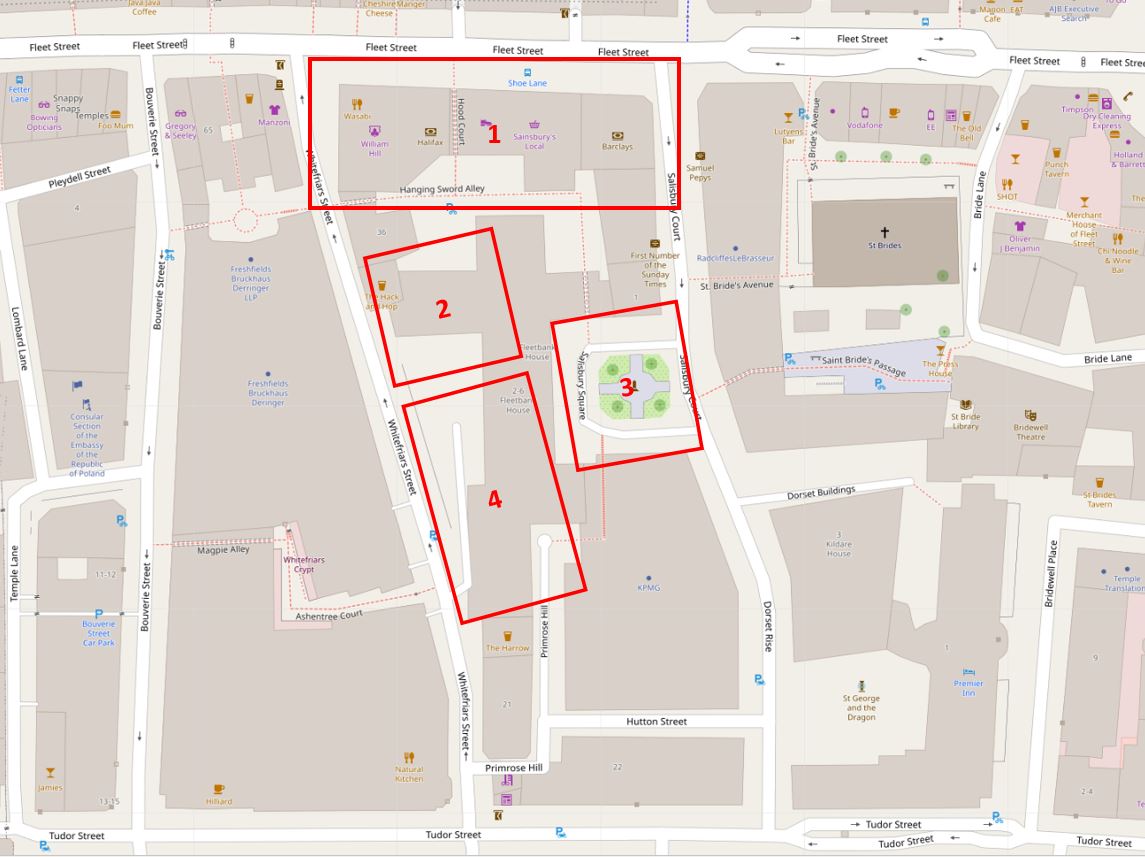
The three locations are shown in the following map  (Map © OpenStreetMap contributors):

Three Future Demolitions

The London Studios / London Weekend Television

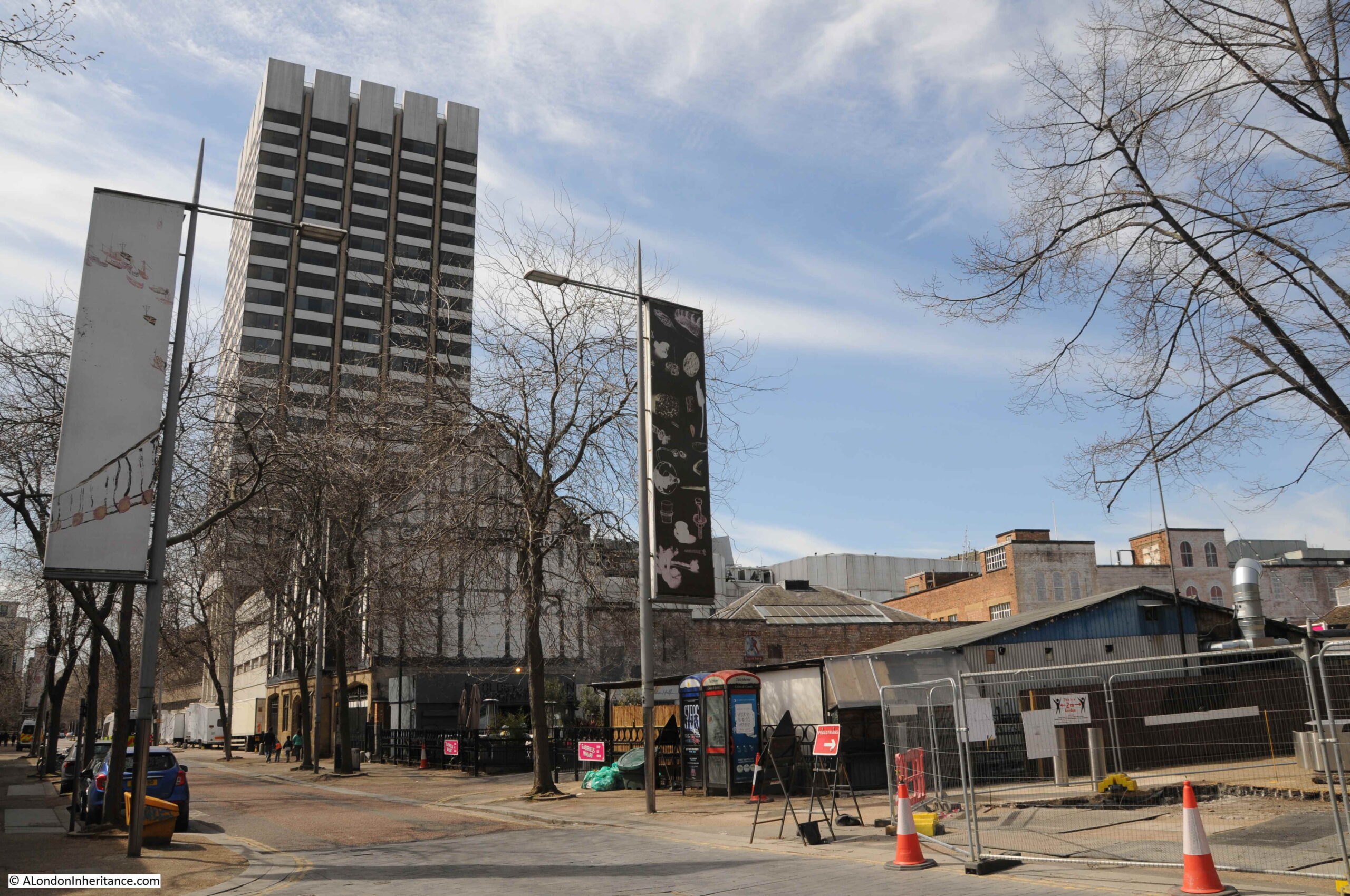
Look across the river from the Embankment by Temple Underground Station, and this is the view:

London Studios

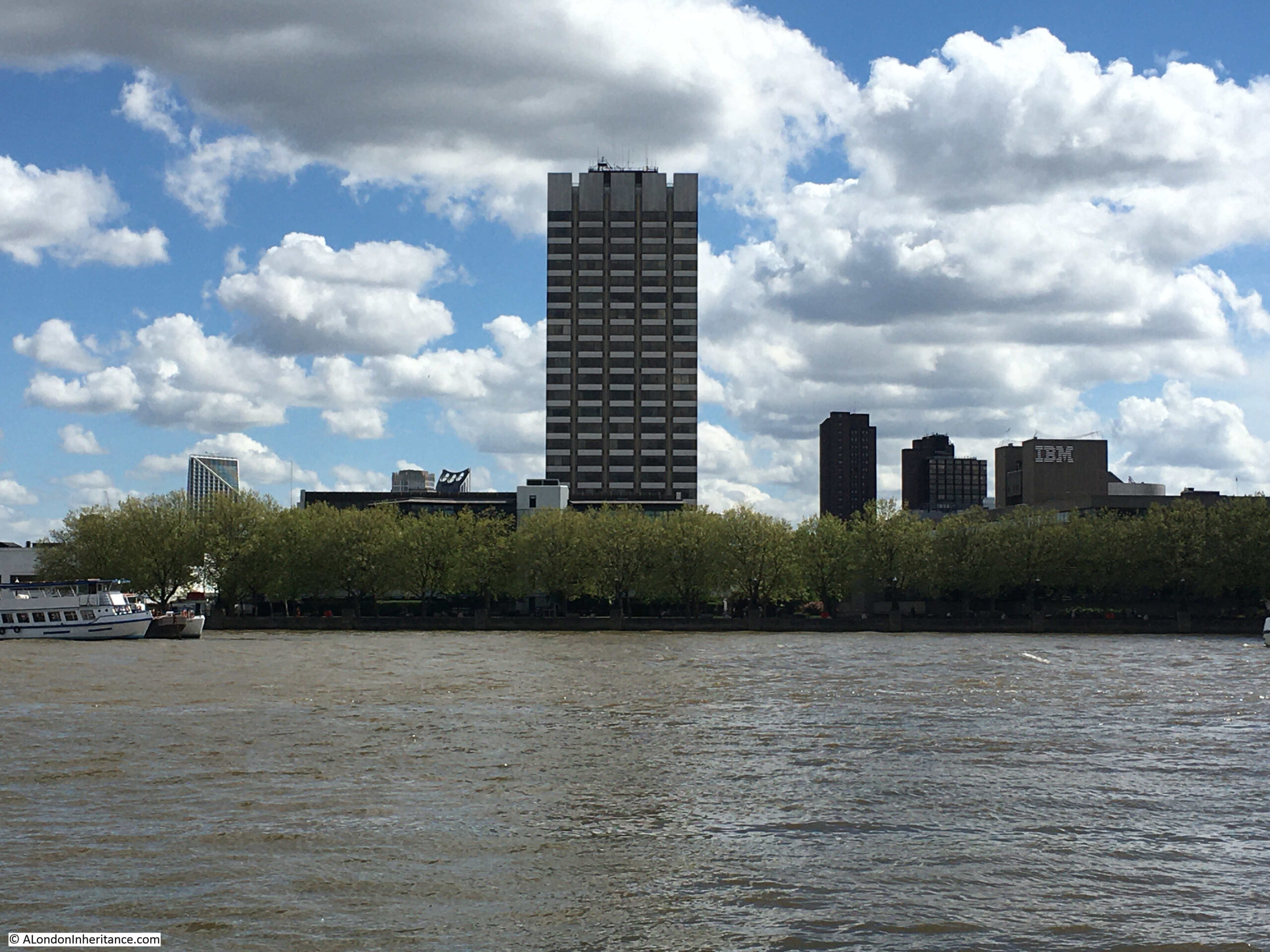
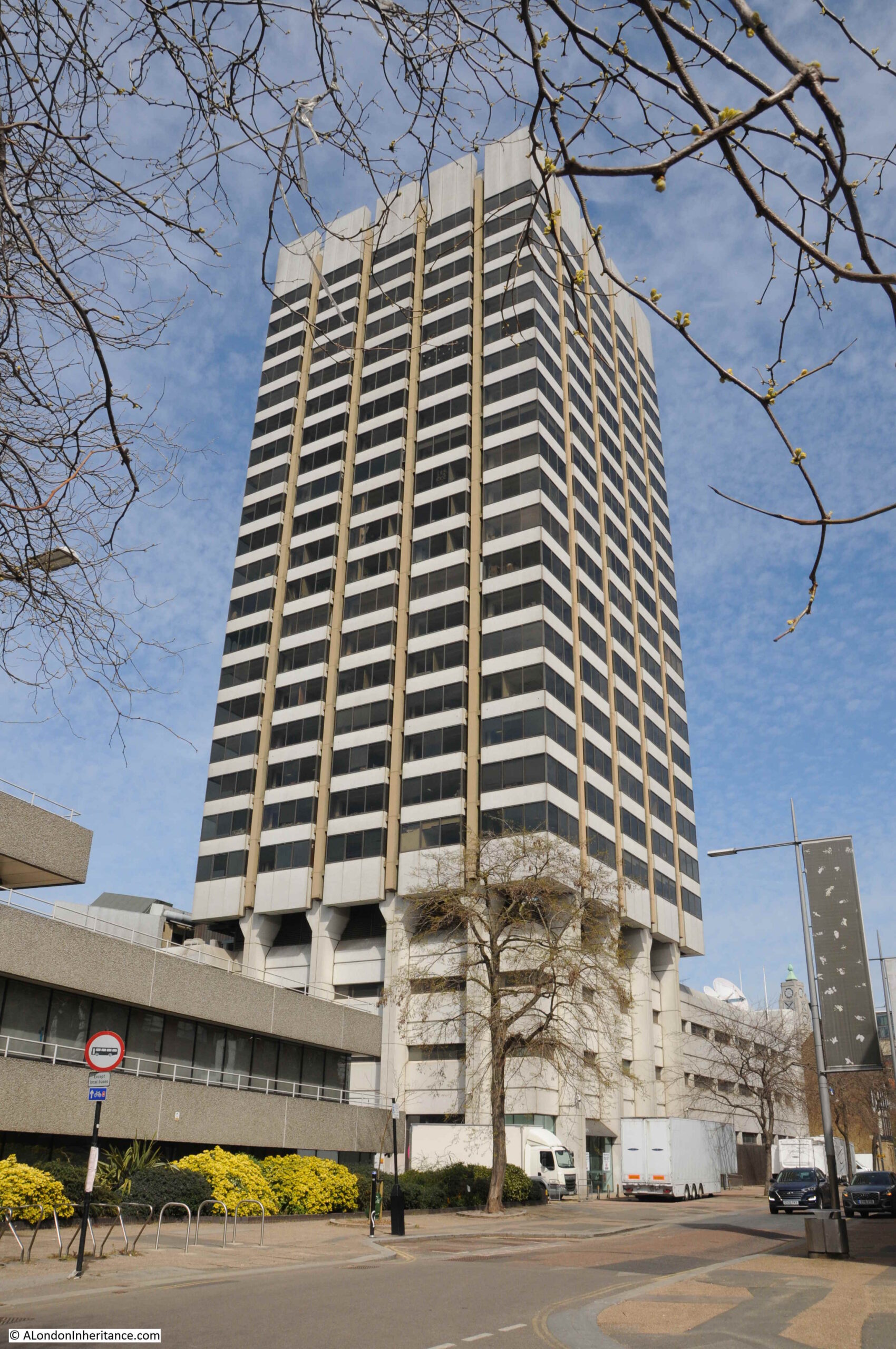
The tall tower was originally known as Kent House, a 24 story tower block, and the most visible part of the old studio complex which also includes a significant area of land around the base of the tower, including the low rise buildings which can just be seen to the left of the tower, above the tree line.

Kent House, and the low rise buildings were until 2018, ITV’s London Studios, also known as the Southbank Television Studios. It was here that ITV made Good Morning Britain, Loose Women, Ant and Dec’s Saturday Night Takeaway, the Jonathan Ross Show, along with a considerable number of shows for other channels, such as the Graham Norton Show and Have I Got News For You for the BBC. If you have watched ITV prior to 2018, chances are that you would have seen a programme filmed here on the south bank of the river.

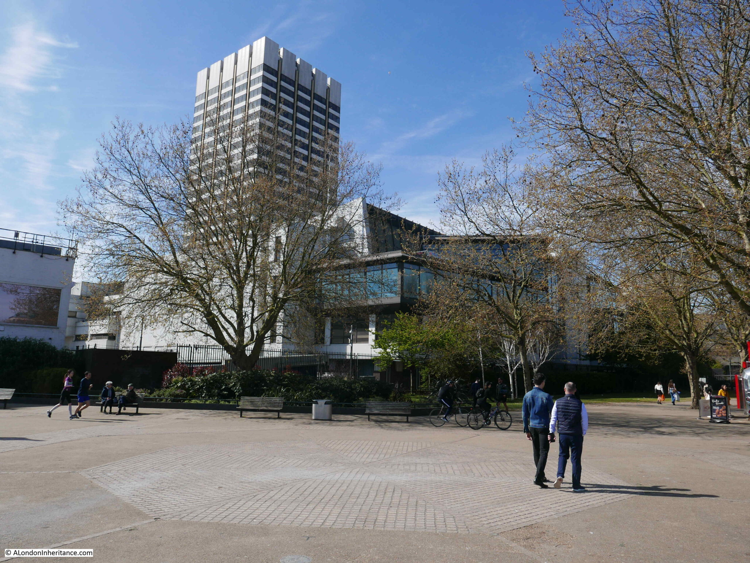
The following photo shows the view of Kent House from Waterloo Bridge. The National Theatre is the building to the right.

London Studios

ITV were intending to return to the south bank studios after refurbishment and development, however they made the decision to leave and sell the site, with their programmes such as Good Morning Britain now filmed at the old BBC Television Centre in White City.

The story of Kent House and the associated studio buildings dates back to the early 1970s when there were two independent television stations serving London. Thames Television operated from Monday to Friday, and from Friday evening to six on Monday mornings, London Weekend Television (LWT) would broadcast.

When LWT started broadcasting in 1968, they only had temporary studios in Wembley, and were in urgent need for custom built studios, which was even more important with the transition from black and white to colour TV.

LWT identified a block of land near the National Theatre on the south bank and proceeded to build the new studio complex, including Kent House. These opened in 1972 and became the hub for all LWT production. The benefit of a new build was that they became the most technically advanced colour TV studios in Europe at the time of opening.

The studio complex faces onto the walkway along the south bank of the river. The tower is at the rear of the complex, facing onto the street Upper Ground, with low rise buildings facing onto the river.

ITV Studios

Studio buildings extend to the left of the above photo, with the block in the following photo up against the cafes, restaurants and shops at Gabriel’s Wharf which is further to the left.

ITV Studios

The whole site will soon look very different.

ITV sold the studio complex in 2019, including Kent House, to the Japanese real estate company, Mitsubishi Estate, and plans have now been submitted for redevelopment.

Kent House and the entire studio complex will be demolished, and replaced by a 26 storey office building to the rear (Kent House has 24 floors), two lower rise blocks of 13 and 6 storeys facing on to the river.

What is a surprise is that the majority of the complex will be office space, with a capacity for up to 4,000 workers. Based on what normally happens to sites in such a prime location is conversion to apartment blocks, as is happening around the Shell Centre tower further west along the south bank. Whether the plan continues to be for offices after the work at home impact of the pandemic will be interesting to see.

The proposal also includes plans for some form of open space, the obligatory restaurants and some form of cultural space.

The view from Upper Ground:

Gabriel's Wharf

The cafes, restaurants and shops at Gabriel’s Wharf are to the right of the two telephone boxes. Behind them are the low rise studio buildings.

Plans for the redevelopment of the area are still at an early stage, however Mitsubishi’s partner CO-RE are currently listing a 2026 date for completion of the project.

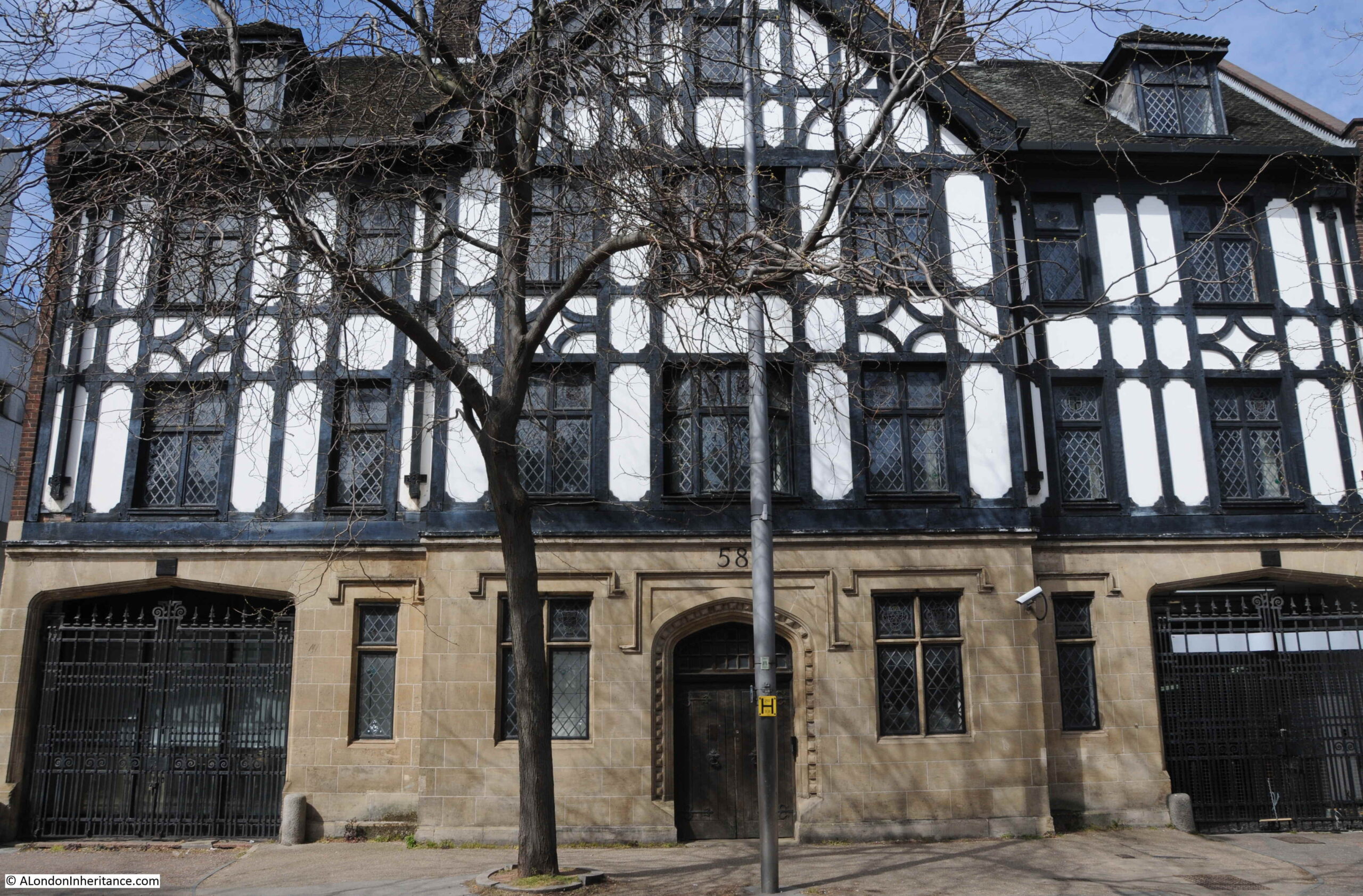
The following photo shows part of one of the old warehouses / offices at 58 Upper Ground, now part of the studio scenery stores.

Gabriel's Wharf

To the left of 58 Upper Ground is the early 1970s studio complex at the base of Kent House:

Southbank Studios

The mock Tudor building is one of the few survivors from before post war redevelopment of the area.

Gabriel's Wharf

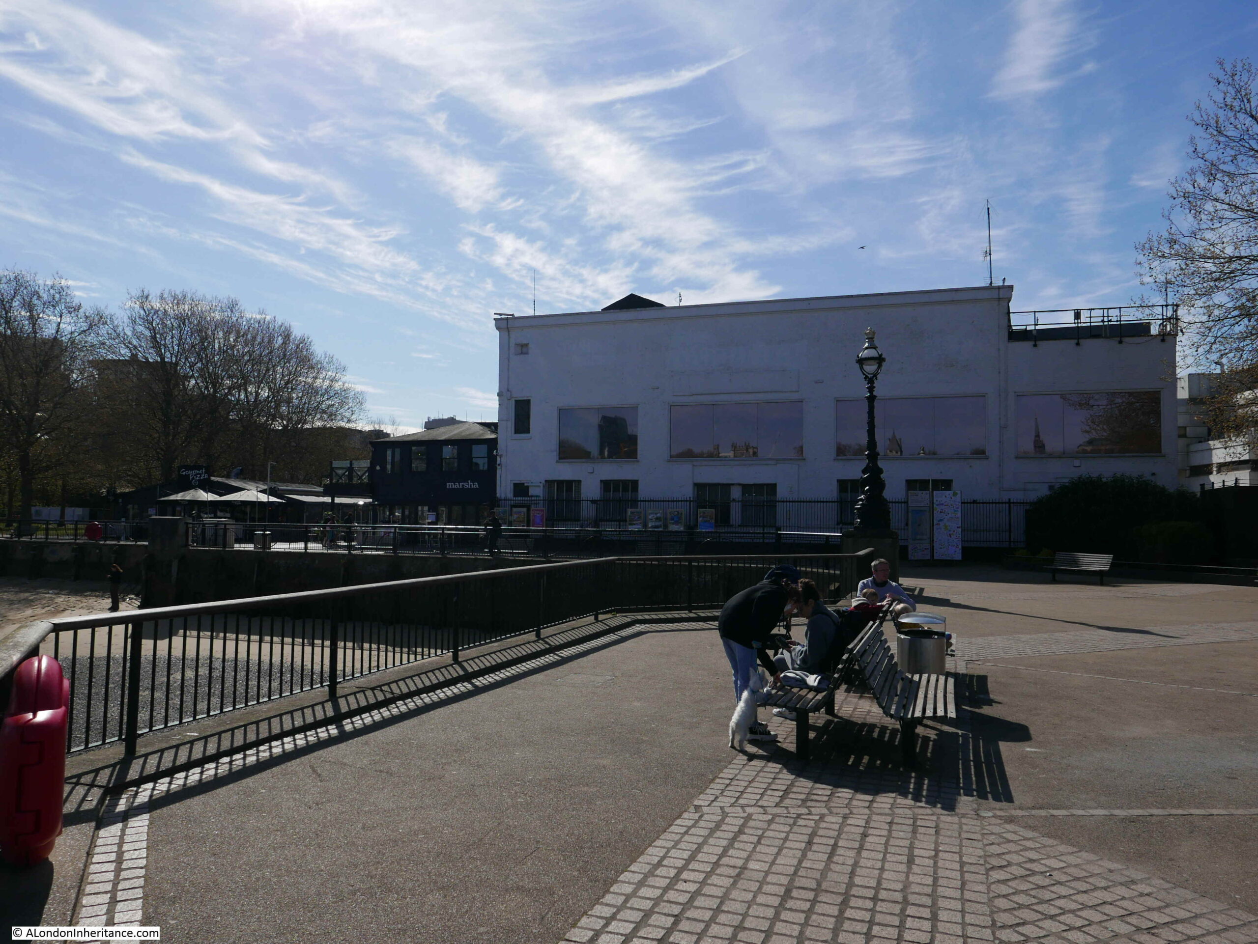
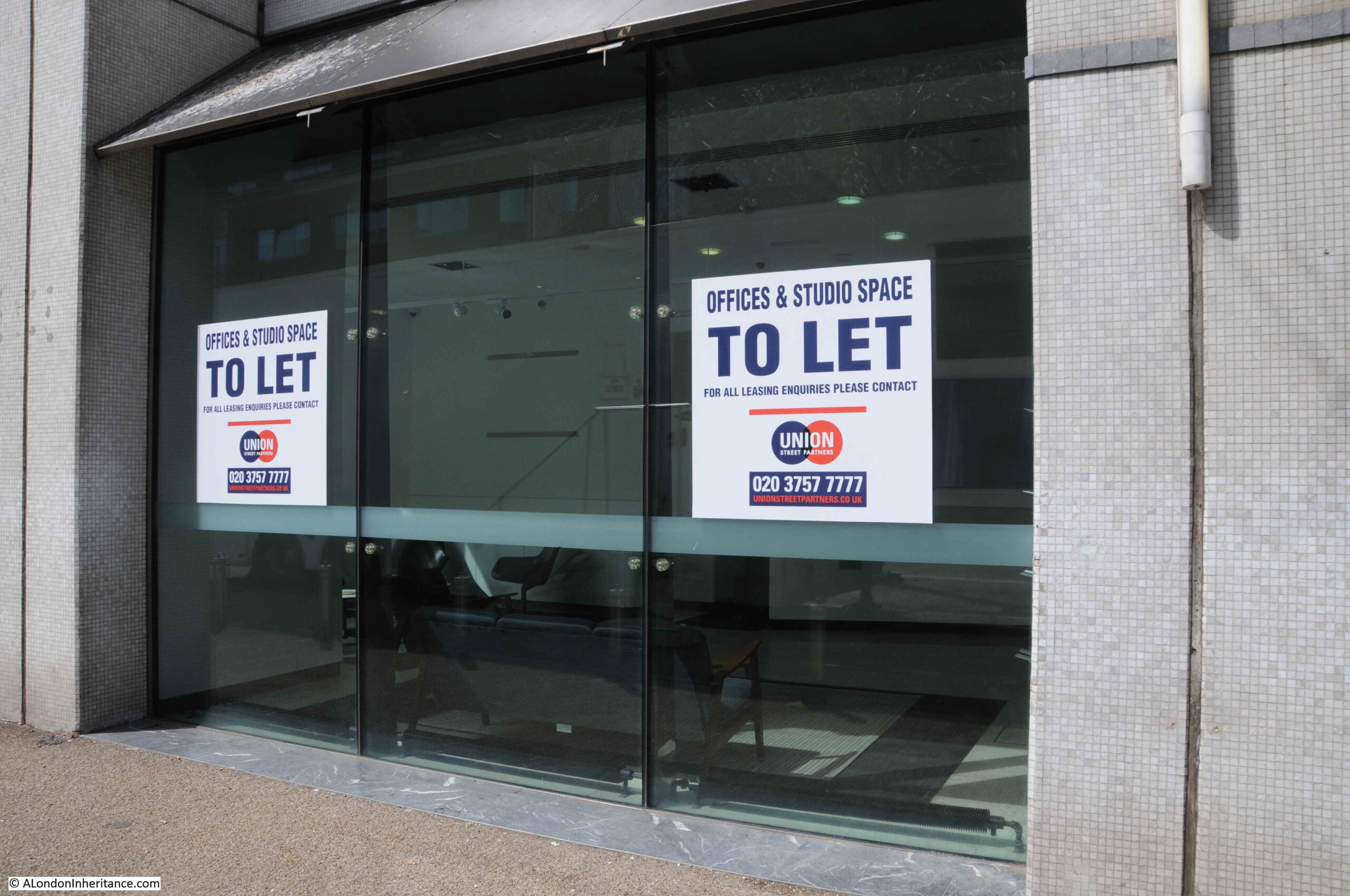
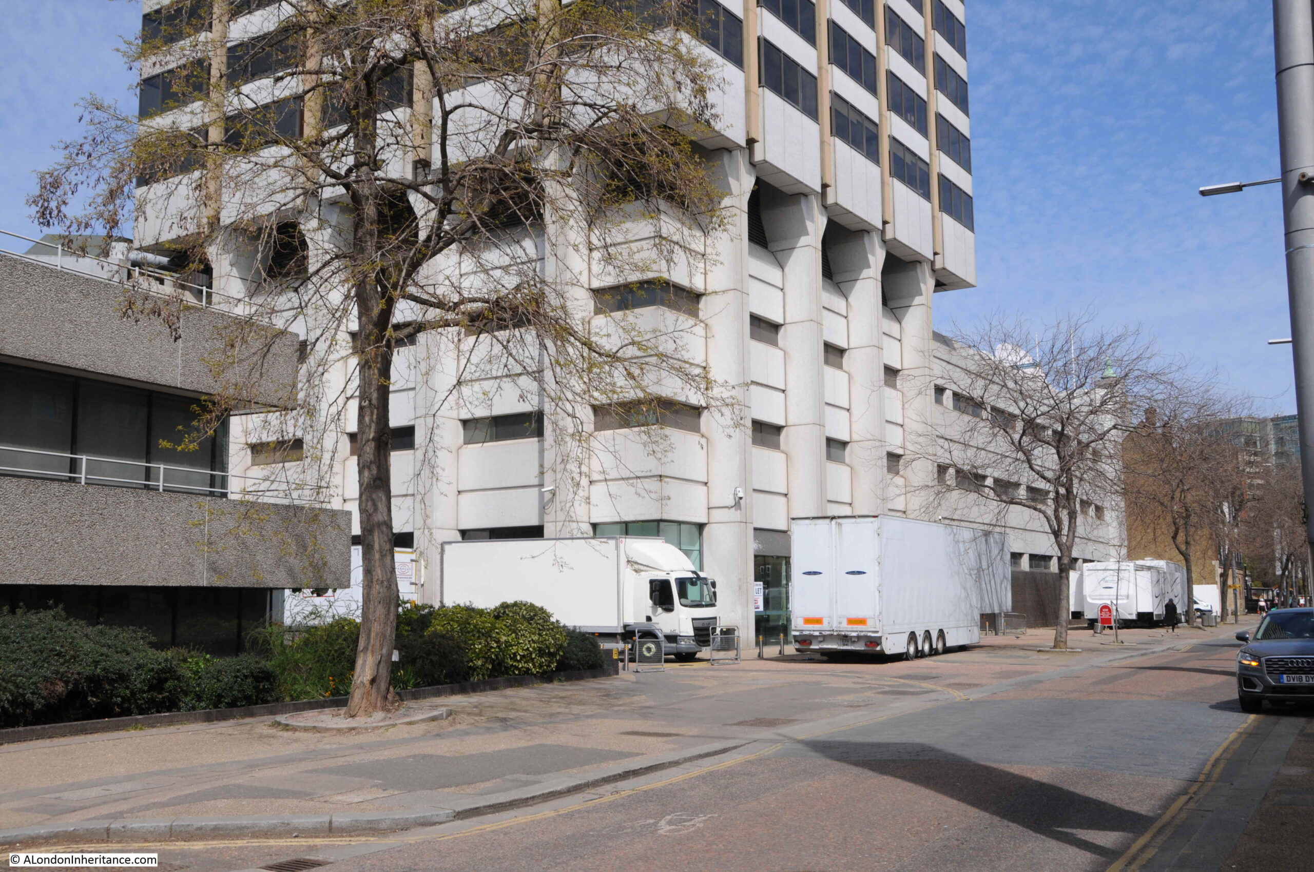
ITV left the site in 2018, however the site still offers temporary office and studio space:

Kent House

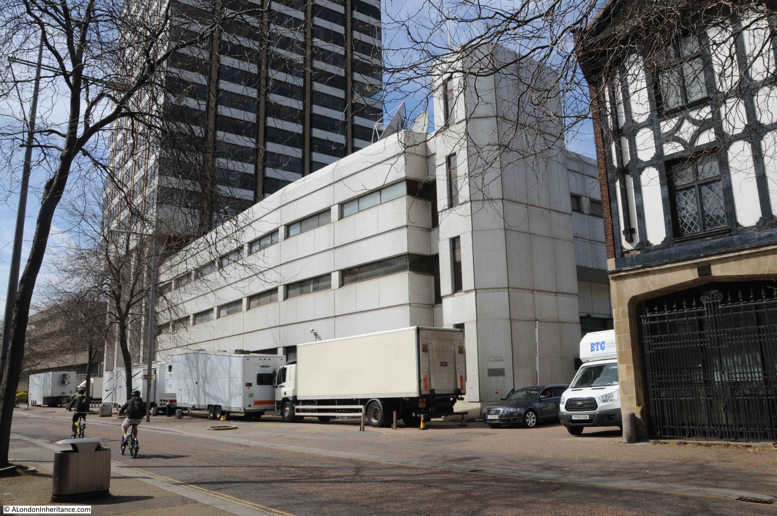
To the lower left of the Kent House tower, the studio complex can be seen at the rear. This is the western boundary of the studio complex. In the distance can just be seen the half roof of a covered walkway. This was where the audience attending a show would queue for entry. When I worked on the Southbank, it was common to see a long queue of people here in the late afternoon.

Kent House

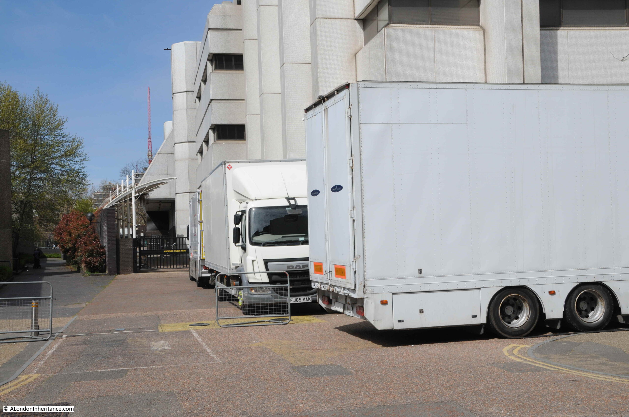
As shown in the above photo, there are frequently lorries parked around the base of the tower and studio area when the studios are in use.

The Southbank Conservation Area Statement prepared for Lambeth Council Planning states “The ITV tower is reasonably attractive but the lower buildings are of little architectural interest and the entrance forecourt is almost cluttered with waiting vehicles and delivery lorries”.

Personally, I think that this is a danger when looking at something only from a conservation perspective. The lorries at the base do add clutter to the scene, however they are there only because this is a working studio complex, which has added a diversity of activity and a busyness to Upper Ground.

The loss of a diverse range of activities when areas are transformed to a mix of expensive apartments, offices, hotels and chain restaurants, cafes and take-ways can really destroy an area.

Diversity of activity is essential in keeping a city alive.

The following photo shows the base of the tower and the lower levels of the studio complex. I love the way the tower looks as if it has been slotted over the lower levels, with the legs of the tower reaching down along the sides to the ground.

Kent House

A full view of the Kent House tower from Upper Ground:

Kent House

The next site is still on the south of the river, close to London Bridge Station and Tooley Street is:
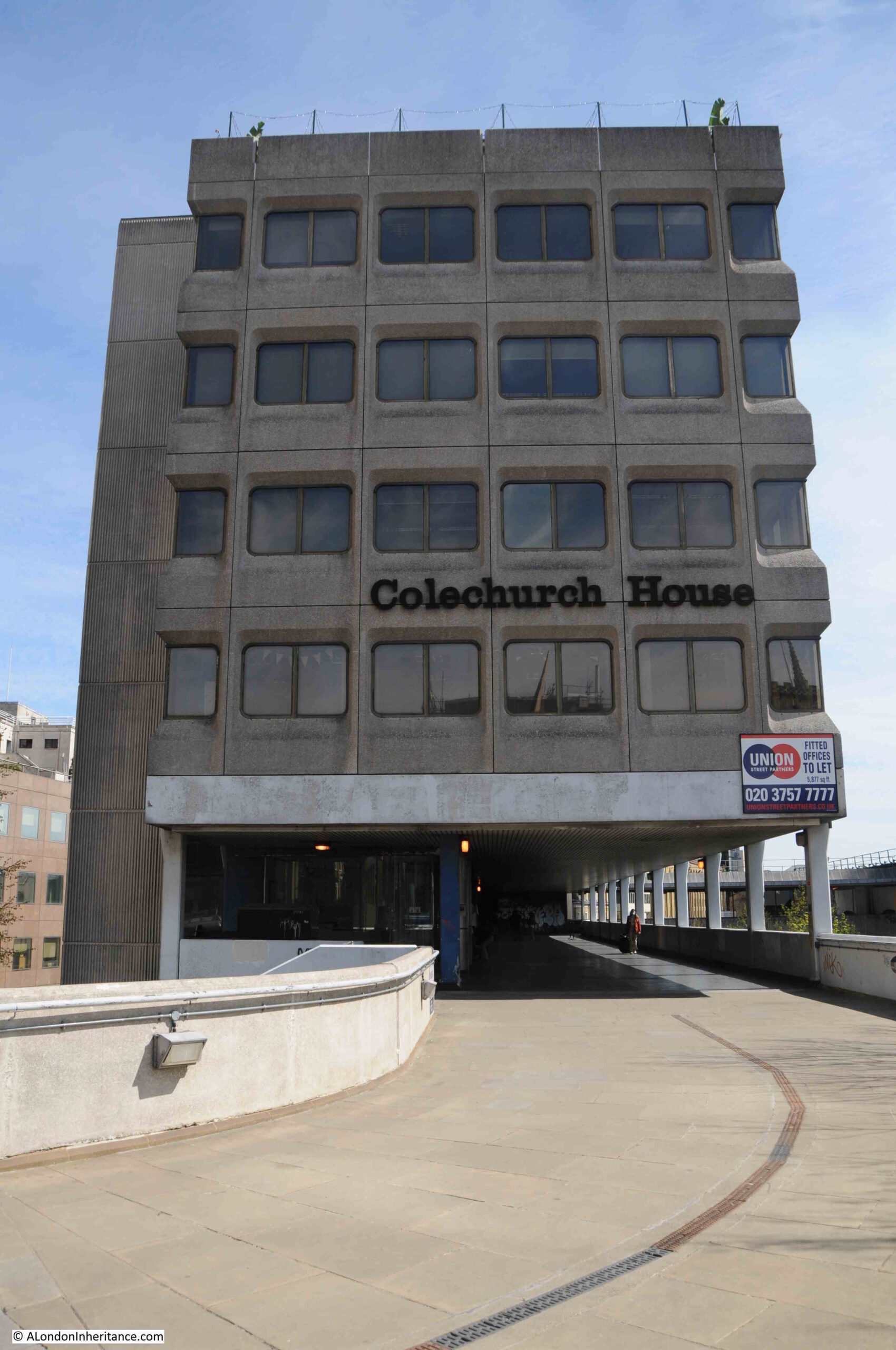
Colechurch House

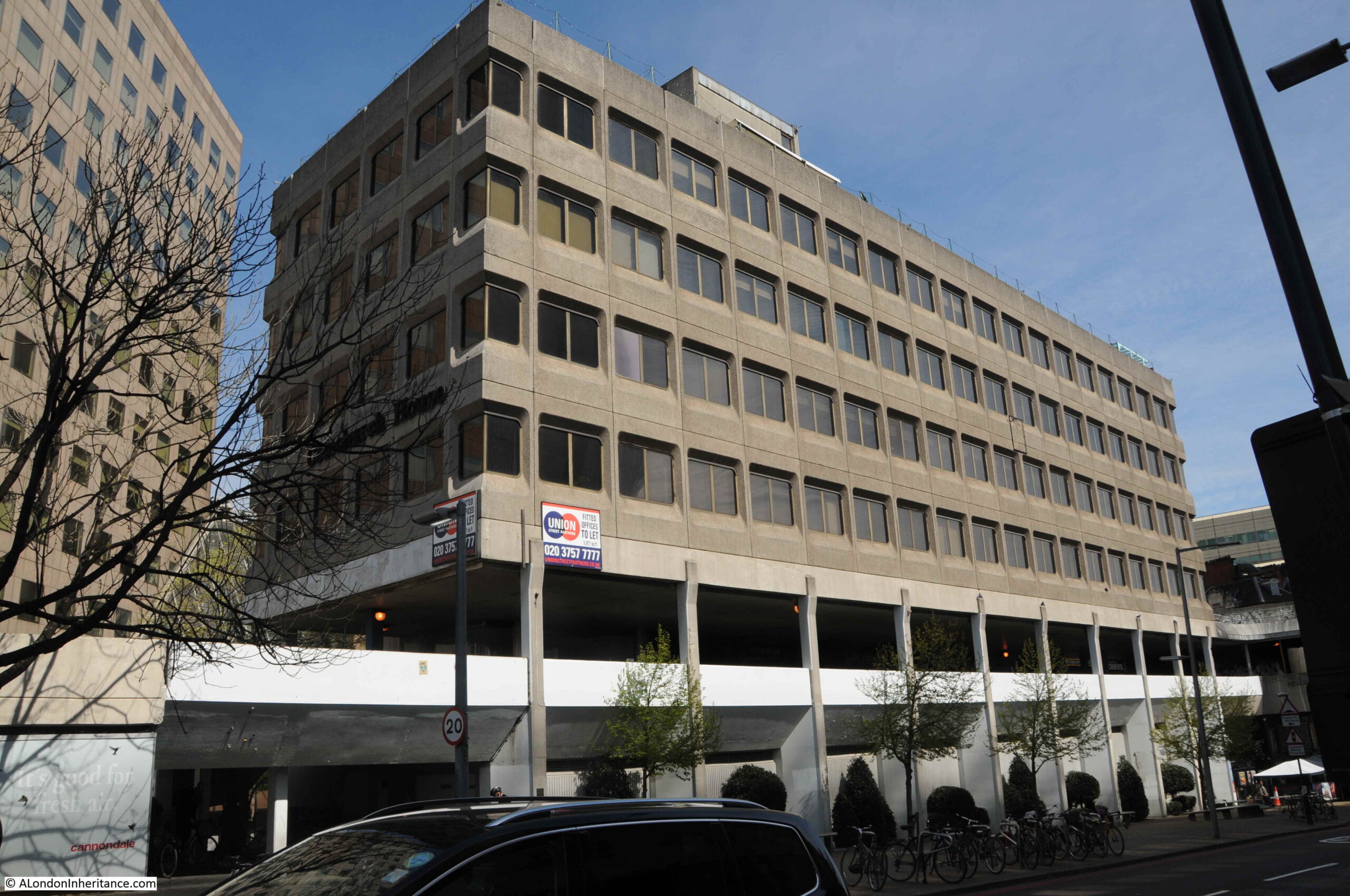
Colechurch House is a late 1960s office block on a relatively narrow strip of land between Tooley Street and Duke Street Hill. The main office building is lifted above ground level, and includes a walkway which provides access to the taxi waiting area for the station and London Bridge Street.

Colechurch House

Colechurch House was designed by architect E G Chandler for the City of London. It was named after Peter de Colechurch who was responsible for the first stone London Bridge, the building of which was started in 1176 and completed in 1209.

The building and the freehold of the land is owned by Bridge House Estates, and on the 14th October, the City of London Corporation as Trustee of Bridge House Estates released a press statement that property owner CIT had purchased a lease of the building, and would be bringing forward proposals for redevelopment.

Colechurch House

CIT’s proposals for the complete redevelopment of the site include replacing Colechurch House with a new office building ranging in height from 12 to 22 storeys, with the lowest height part of the building being at the London Bridge / Borough High Street end of the street. The highest part of the building was originally planned to be 32 storeys, however following a consultation process this has now been reduced to 22.

The new office block will be lifted off the street, with the area at ground level being public open space called the Park, which will be divided into a number of areas – Bridge Gate Square, Old London Bridge Park and St Olaf Square.

View of Colechurch House from the elevated walkway. The entrance to the office block is where the two lights can be seen.

Colechurch House

The planning application was submitted at the end of 2020, a number of issues with the application were raised in a letter dated the 1st March 2021. Consideration of these and a final decision is still to be confirmed, however I expect the demolition and rebuild will go ahead within the next couple of years.

Across the river to Fleet Street now, to find the site of a much larger redevelopment:

Fleet Street and Salisbury Court

This is probably the larger of the three developments covered in this post, and it covers a significant frontage onto Fleet Street and to the rear within a block bounded by Salisbury Court and Whitefriars Street.

The redevelopment is for a new area which has been dubbed the “Justice Quarter” as it will include a number of new buildings that will house functions related to the law.

The following map shows the area to be redeveloped, and the new functions that will be located in the development  (Map © OpenStreetMap contributors).

Justice Quarter

1 – New City of London Law Courts

2 – New headquarter building for the City of London Police

3 – Public space covering an area slightly larger than the current Salisbury Square

4 – New commercial / office space with, you may have guessed, space for restaurants, bars or cafes on the ground floor

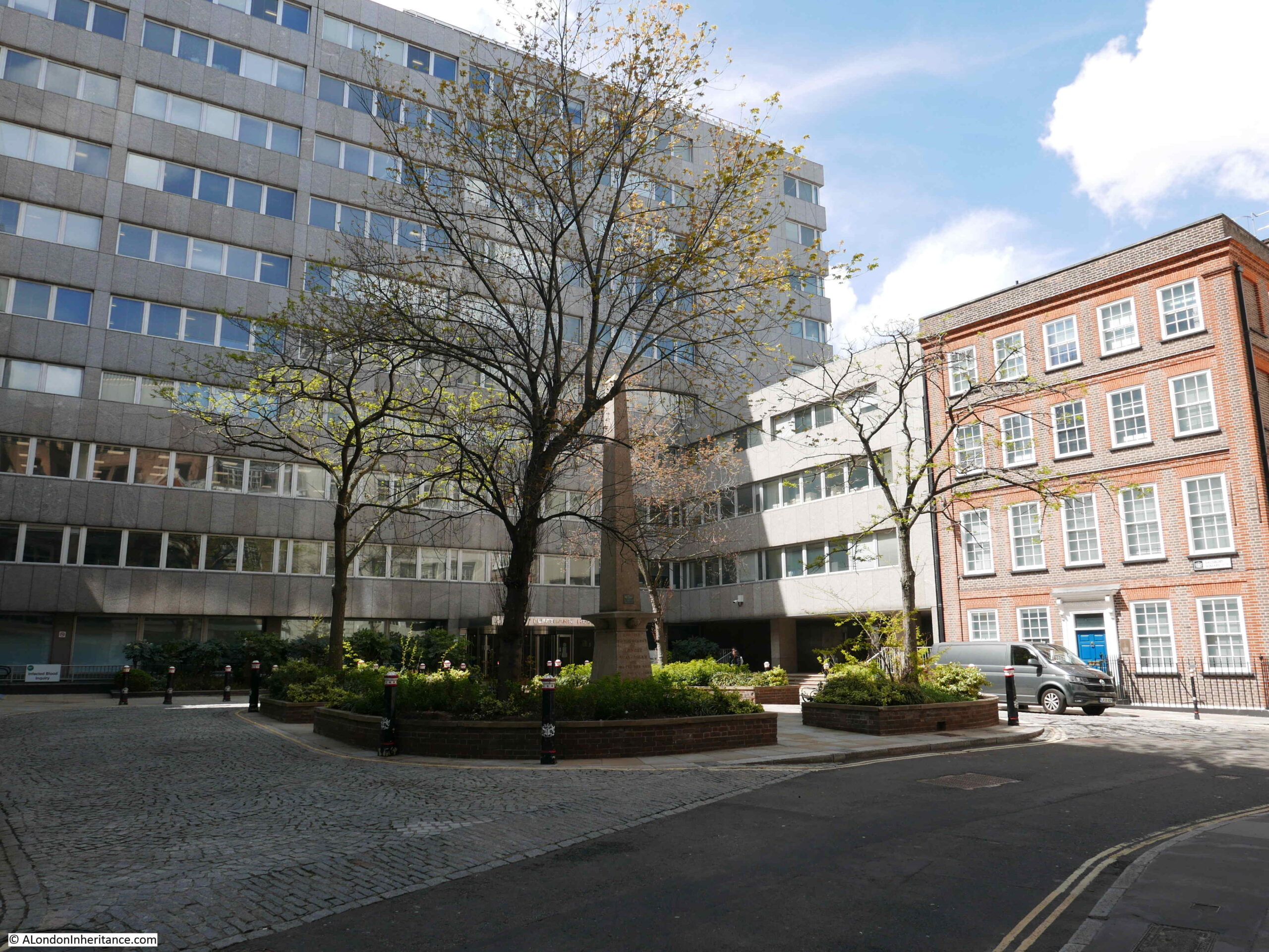
The following photos walk through the area, starting from Salisbury Square, which is the green space within rectangle 3 in the above map.

This is the view across the square.

Salisbury Square

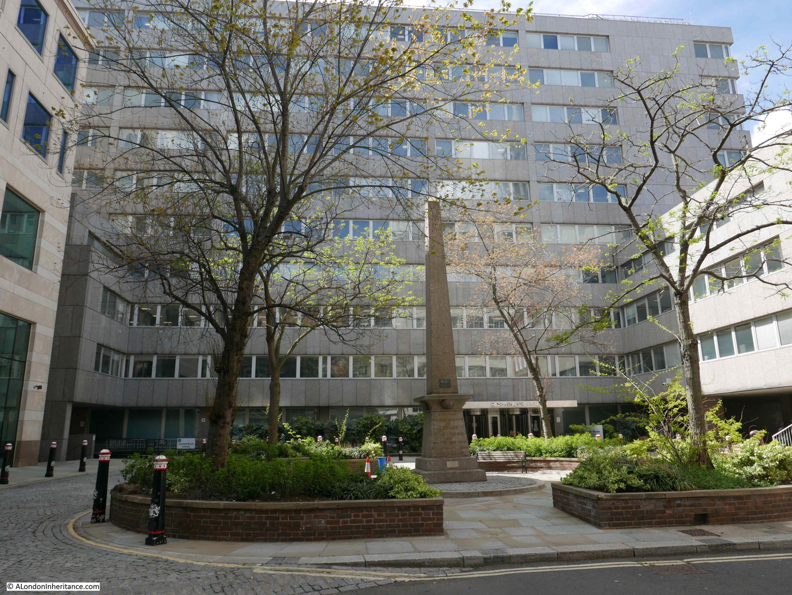
The building in the background is Fleetbank House, built between 1970 and 1975, a large building that has a lower section to the right, and also runs down Whitefriars Street, which is behind the building.

The obelisk in the centre of the square is a memorial to Robert Waithman, Lord Mayor of the City between 1823 and 1824. The memorial states that it was erected by his friends and fellow citizens.

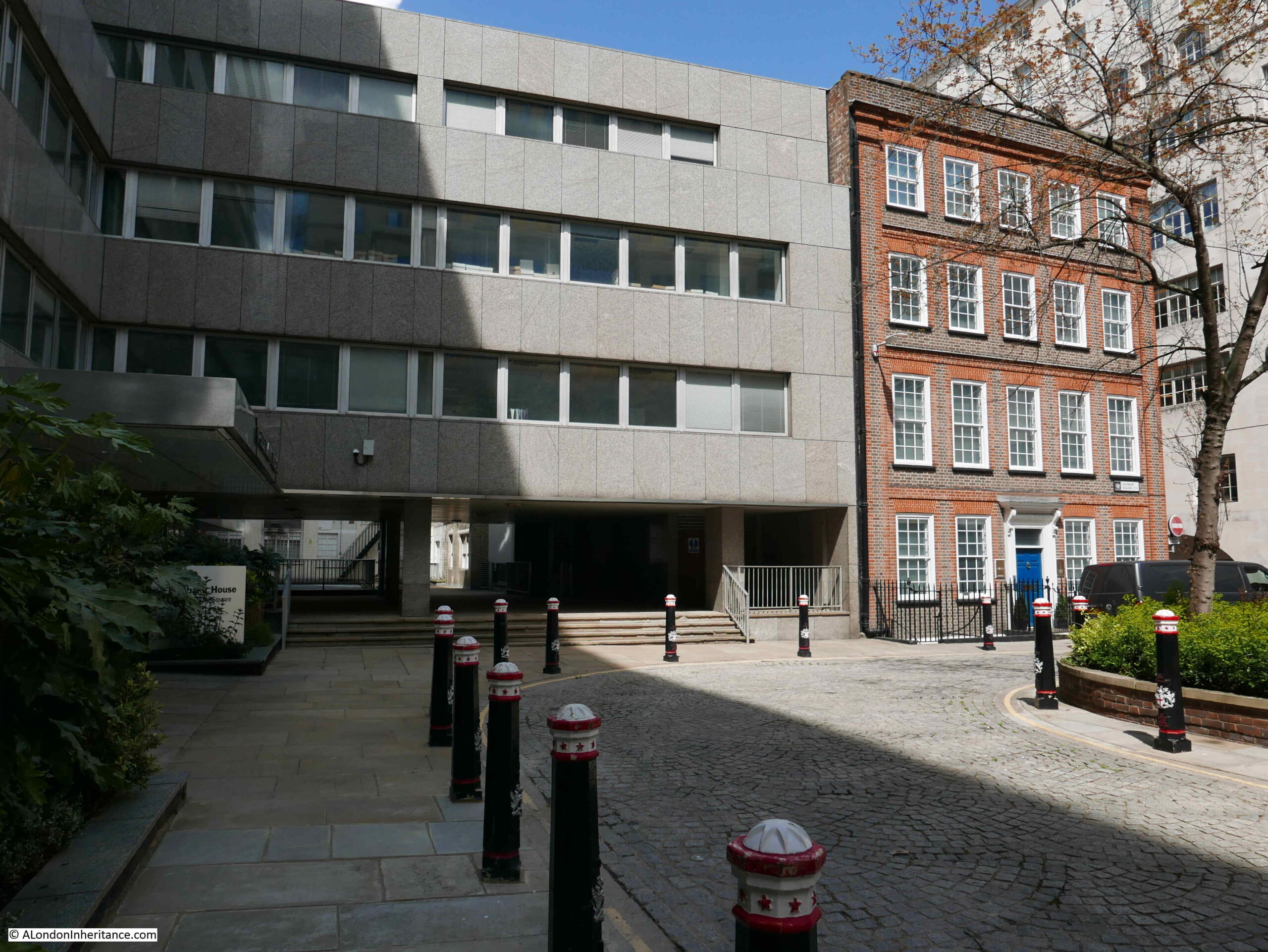
To the right of the above photo, is the following brick building, 1 Salisbury Square:

Salisbury Square

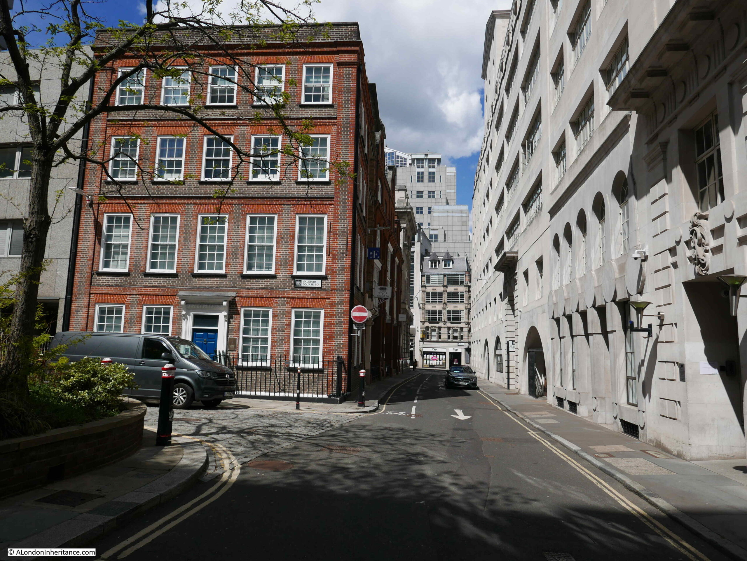
The road to the right is Salisbury Court, running up to Fleet Street at the top.

Both Fleetbank House and 1 Salisbury Court have been granted a certificate of immunity by Historic England. This certificate states that the Secretary of State does not intend to list the buildings for a specific period of time – in the case of these buildings, up to July 2025.

If I have understood the proposals correctly, 1 Salisbury Square will be demolished and the area occupied will become part of the larger public space of Salisbury Square.

The following photo is a wider view across the square:

Salisbury Square

I am always amused by developers now and future impressions of proposed developments. If you look halfway down this page on the Salisbury Square Development website, there is a now and future picture where you can scroll between the two.

The now part of the photo was taken on a relatively grey day, with people milling about, or hurrying across the square. The proposed computer generated picture, shows the square at dusk, subtle lighting lights up the trees and the ground floor area of the new public space and there is not a cloud to be seen in the sky. Buildings frequently look their best with this form of lighting.

This type of comparison is all too common with the proposals for any new development.

A row of bollards line Salisbury Square:

Salisbury Square

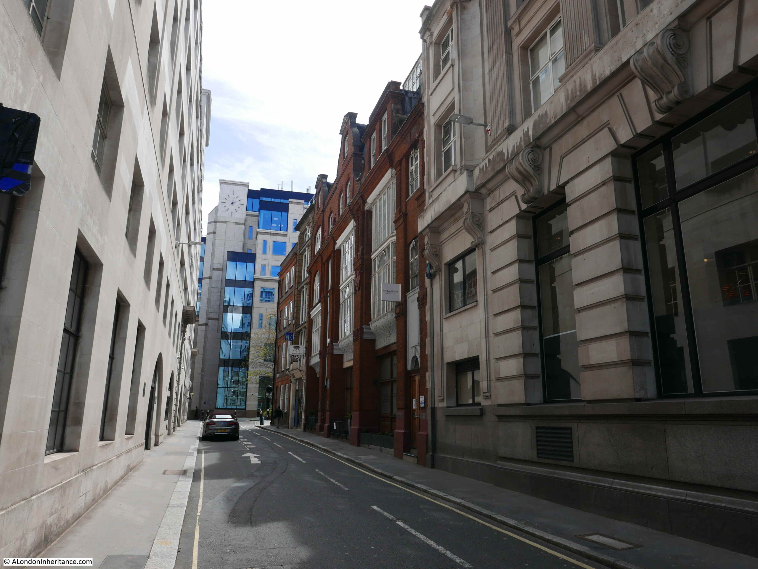
Walking along Salisbury Court, up to Fleet Street. A relatively narrow street, the edge of 1 Salisbury Court is to the left of the photo:

Salisbury Court

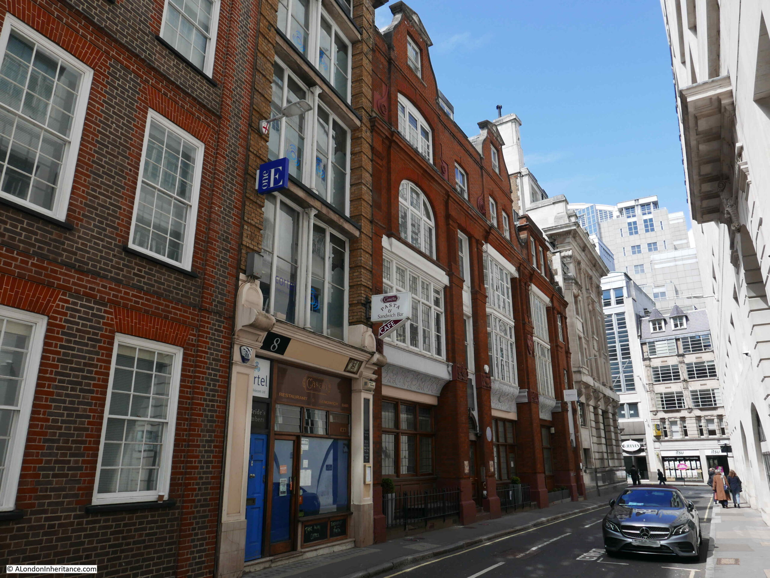
8 Salisbury Court – again if I have understood the proposals correctly, this building will also be demolished, and the land become part of the new public space.

Salisbury Court

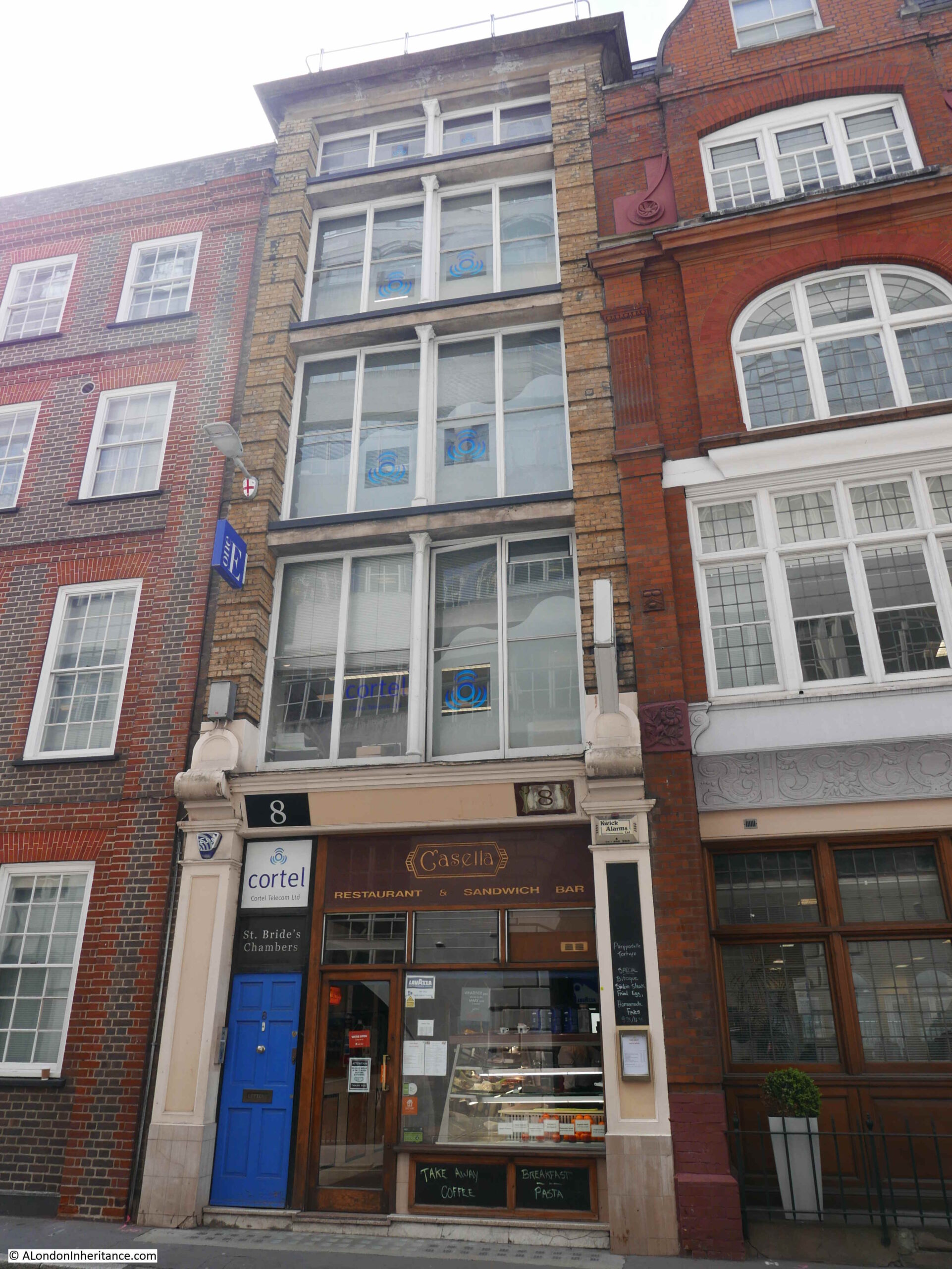
To the right of number 8, is a large brick building that covers number 2 to 7 Salisbury Court. This is Greenwood House.

Salisbury Court

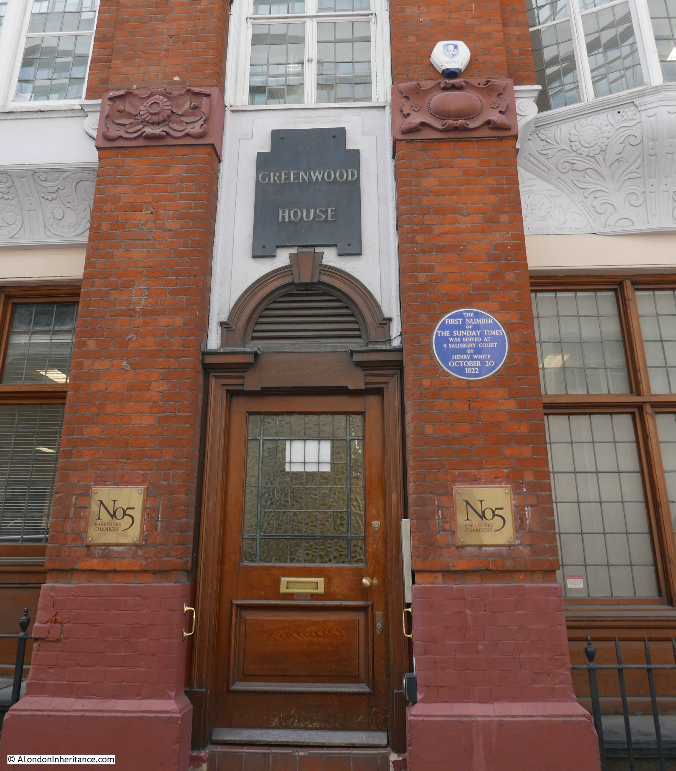
The blue plaque states that the first number of the Sunday Times was edited at 4 Salisbury Court by Henry White on October 20th 1822.

The building dates from 1878, and was designed by the architect Alexander Peebles.

Between the ground and first floors, the building has some rather ornate terracotta carvings, and the land or building may have once belonged to the Vintners Company, as their arms with the three tuns can be seen on the wall between first floor windows.

Salisbury Court

2 to 7 Salisbury Court are Grade II listed, however a City of London notice cable tied to the iron railings outside the building state that a number of changes will be made:

i) Part demolition of 2-7 Salisbury Court Grade II listed;

ii) remodelling at roof level;

iii) formation of new facade to south elevation, and part new facade to west elevation;

iv) replacement fenestration;

v) new plant; and

v) associated internal alterations.

The two “v” bullets are directly from the notice, the final should I suspect be a vi.

Always hard to decode exactly what these planning notices mean, but I suspect it will be a new façade to replace the joining wall where number 8 has been demolished. Possible demolition of the internal structure of the building, with the wall facing Salisbury Court retained as a façade. A new roof and changes to the windows.

So some dramatic changes.

The view looking down Salisbury Court from the junction with Fleet Street:

Salisbury Court

On the corner of Salisbury Court and Fleet Street is 80 to 81 Fleet Street. A large corner building that was until recently a Barclays Bank. The building was originally, up to 1930, the home of the Daily Chronicle.

Fleet Street

This corner building will also be demolished, and will form, along with the entire block along Fleet Street as shown in the above photo, the new City of London Law Courts.

The centre block in the following photo is Chronicle House, covering 72-78 Fleet Street. The building dates from 1924 and was designed and built by Hebert, Ellis & Clarke.

Fleet Street

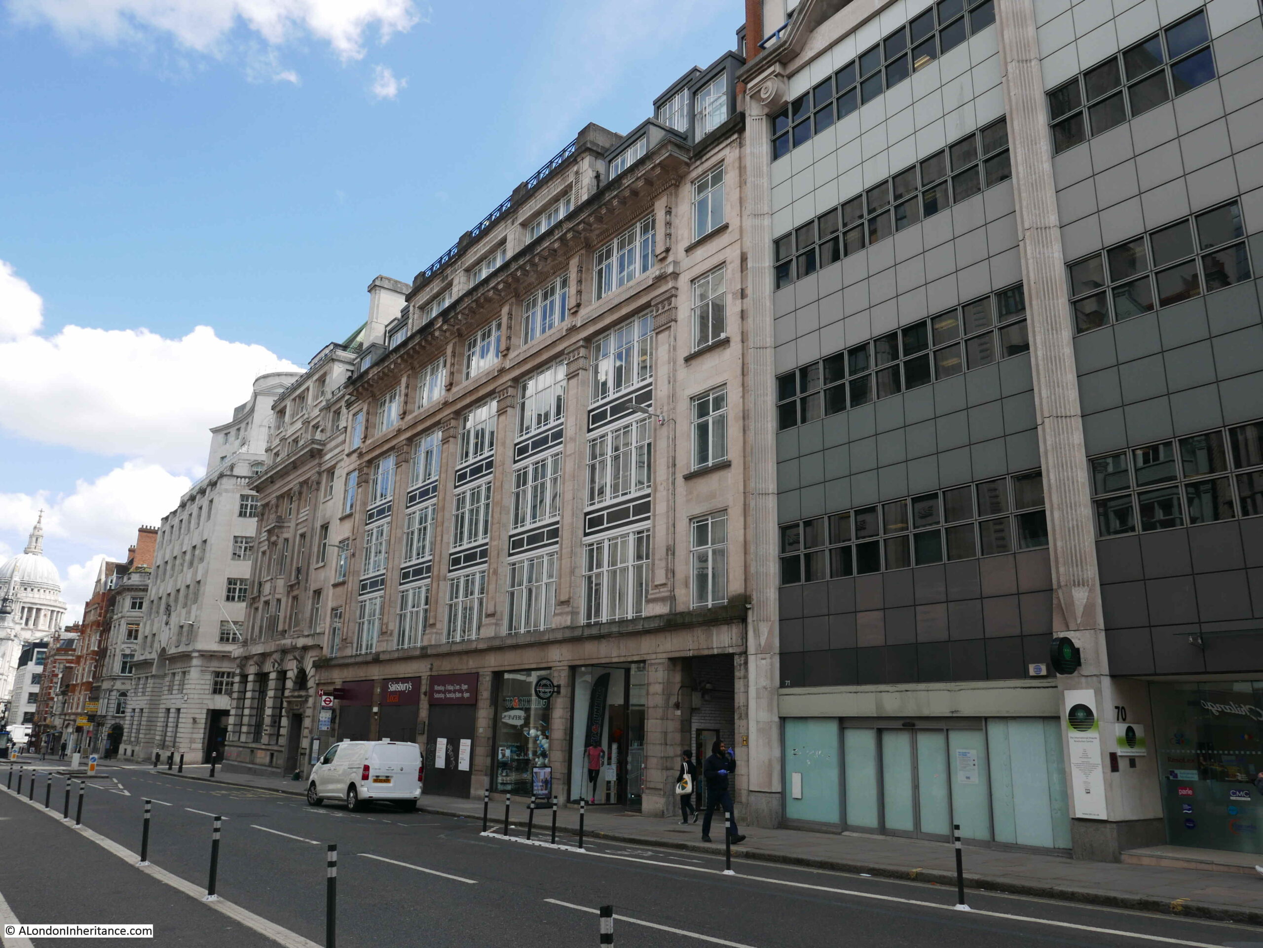
The building takes its name from being home to the newspaper, the News Chronicle. The building has also been granted immunity from listing by Historic England and the Secretary of State.

The following block is on the corner of Fleet Street and Whitefriars Street, and will also be demolished to become part of the Law Courts complex.

Fleet Street

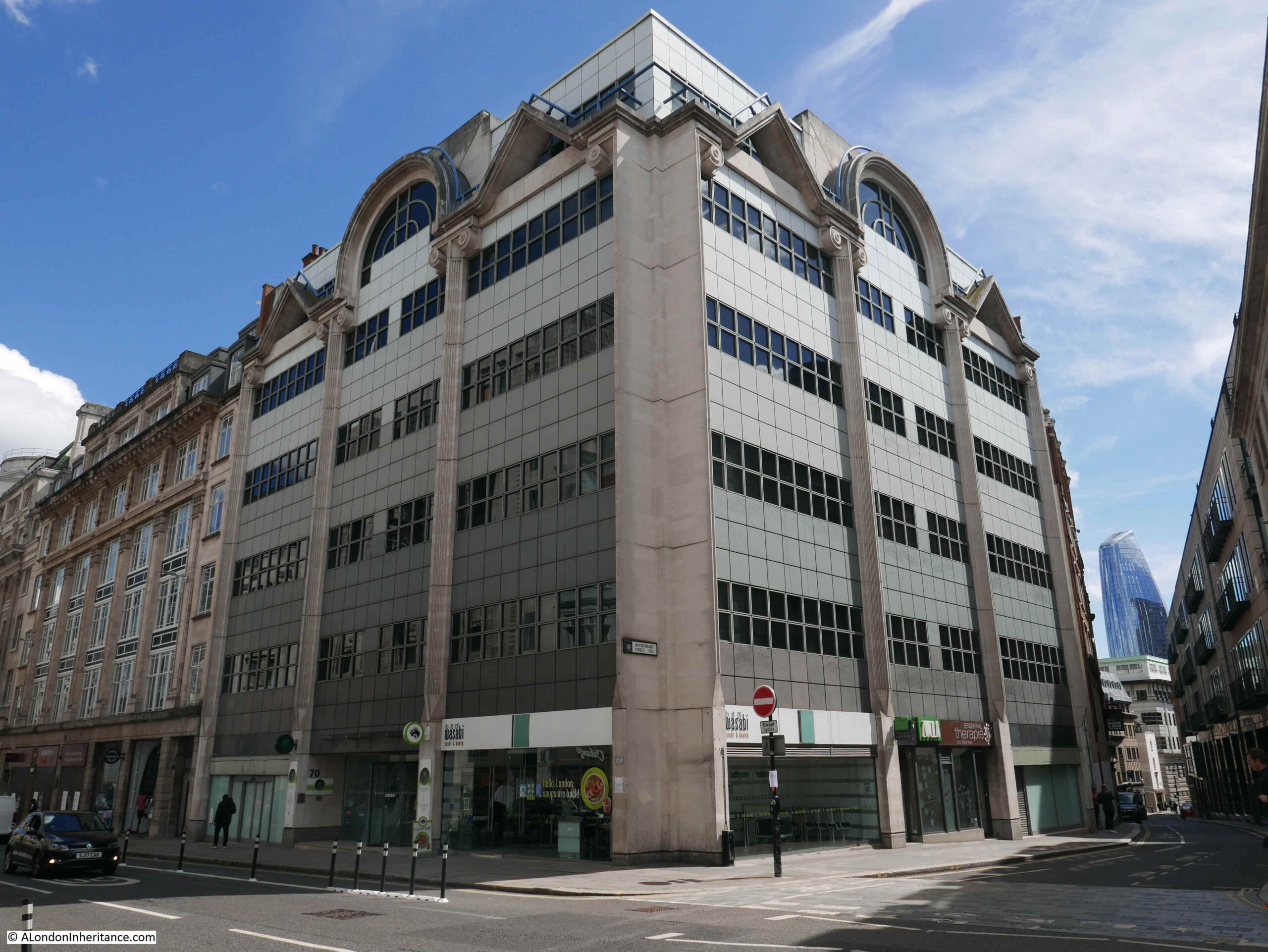
Walking down Whitefriars Street, and the following building is the Hack and Hop pub:

Hack and Hop

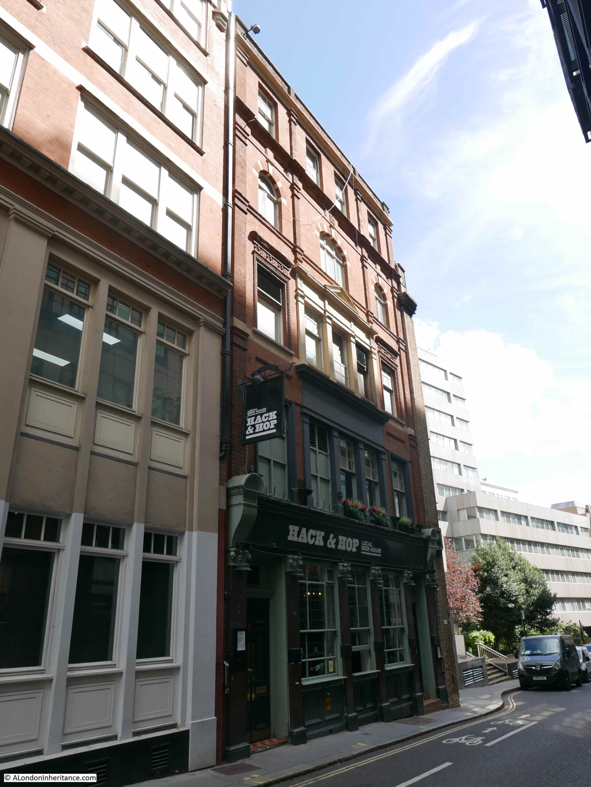
The Hack and Hop was originally the Coach and Horses, a pub that dates back to the mid 19th century. The earliest record I can find of the pub is a newspaper mention in the Morning Advertiser on the 25th November 1850, where there was an advert for a regular Monday evening meeting where a penny subscription would be collected for the London Copper-Plate Printers Benevolent Fund – a reminder of the long history of the area with the printing trade.

Hack and Hop

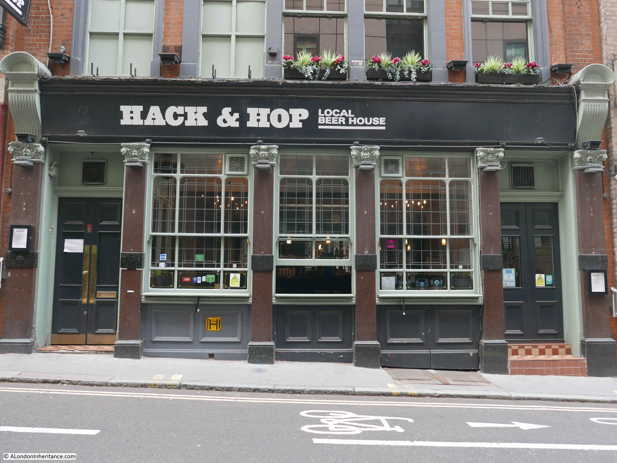
The buildings along this part of Whitefriars Street, including the Hack and Hop pub will be demolished and replaced by the new headquarters building for the City of London Police.

The new building will bring together police functions from a couple of existing buildings which have already been sold – Wood Street and Snow Hill police stations. The new building will have ten floors above ground with space for 1,000 police officers and civilian staff, with three levels below ground for specialist functions and parking.

Continuing on down Whitefriars Street, and we see the other side of Fleetbank House:

Whitefriars Street

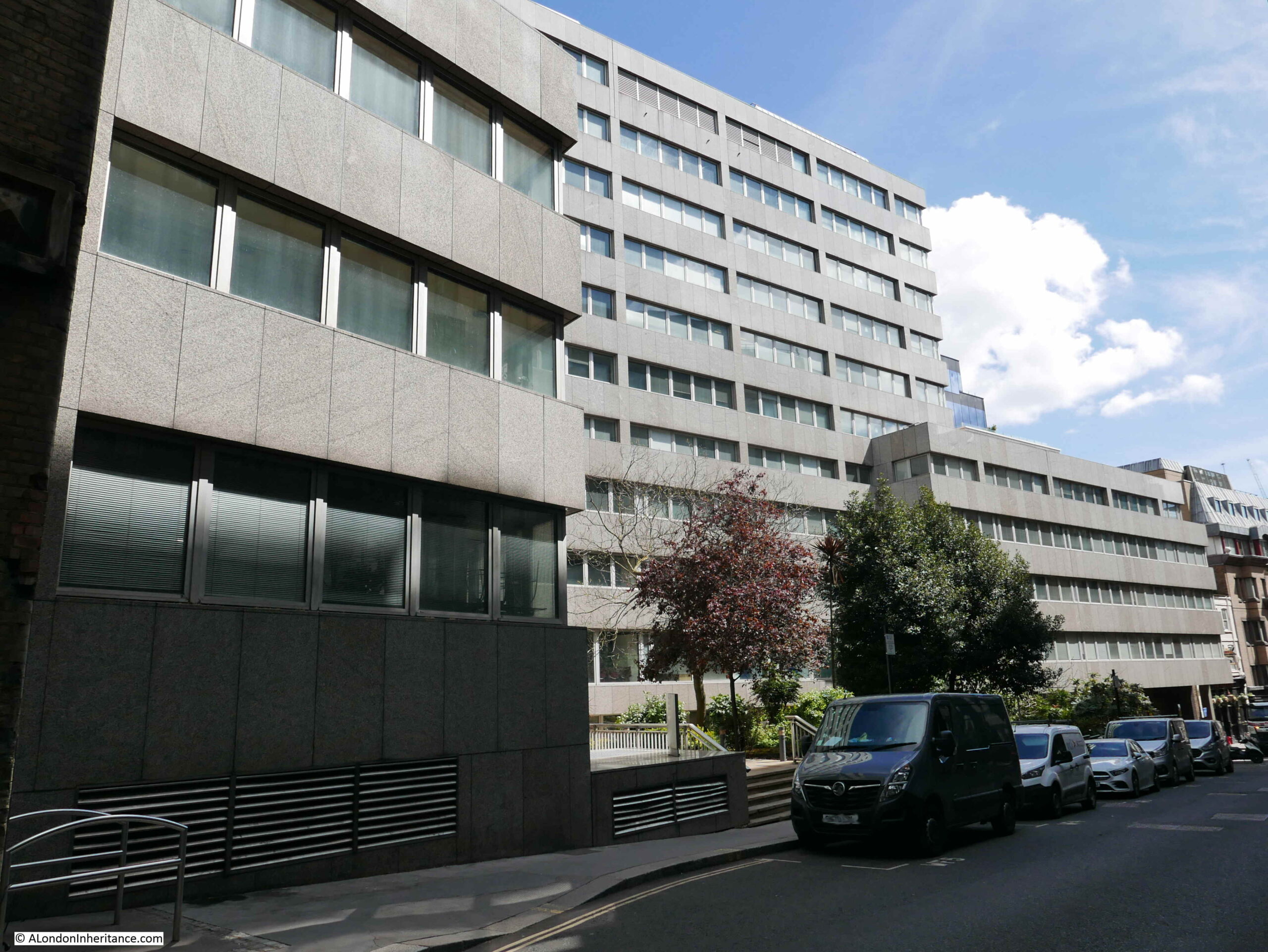
Fleetbank House will be demolished and replaced with a new office / commercial building, which is described as having a “lively frontage”. I suspect this means cafes, bars and restaurants.

The view looking up Whitefriars Street, with the grey walls of Fleetbank House.

Whitefriars Street

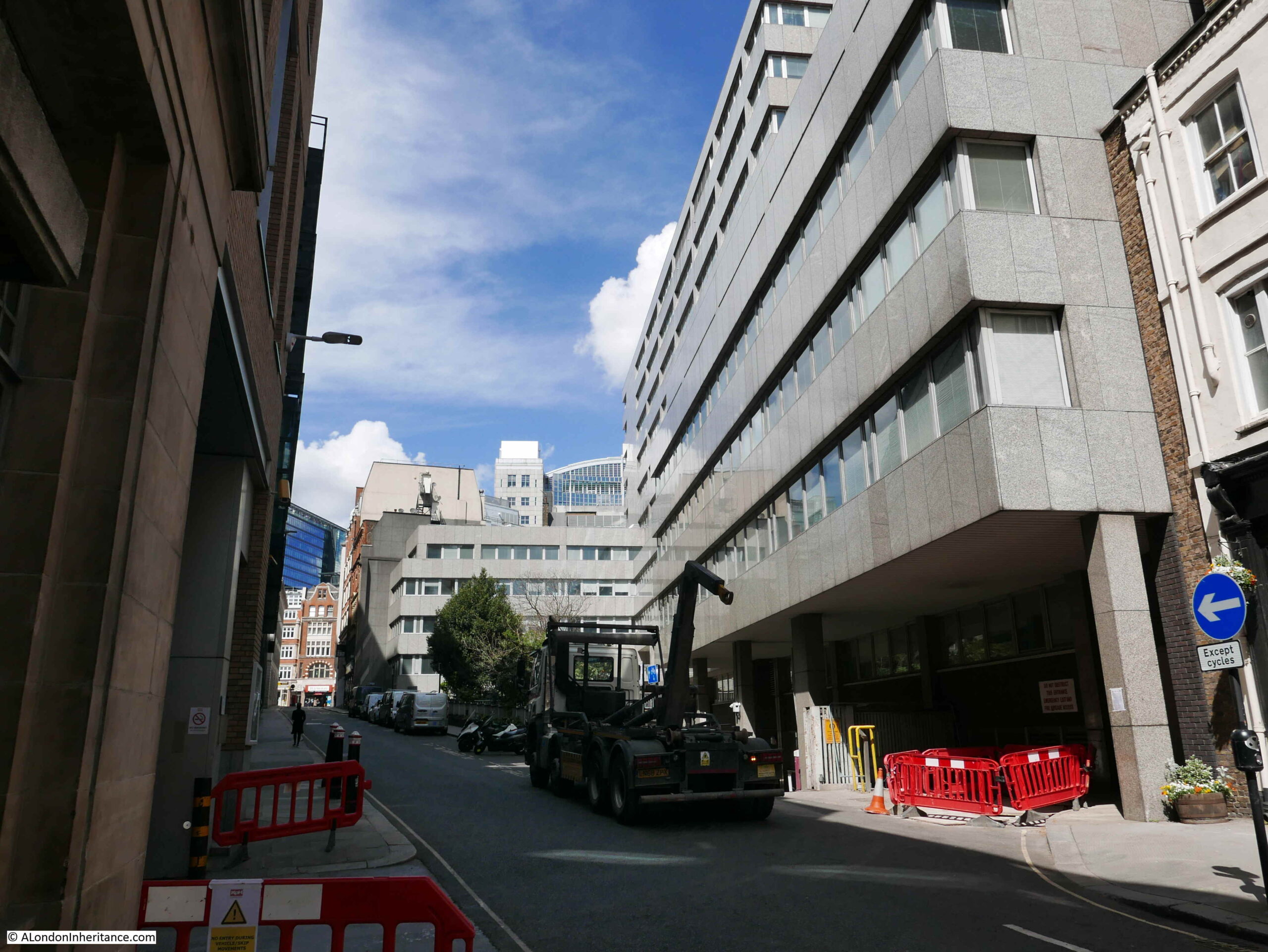
The end of Fleetbank House in the above photo marks the southern limit of the new re-development of Whietfriars Street. The work to create the so called Justice Quarter will be one of the most significant developments along Fleet Street for a very long time.

The area off Fleet Street has a considerable amount of history which will require a dedicated post. Hanging Sword Alley passes through the space from Whitefriars Street to Salisbury Court. There is a memorial to journalist T.P. O’Connor along Fleet Street. Bradbury and Evans, one of Dickens publishers were located here. The Fleet water conduit was here until the Great Fire in 1666.

The whole block has a long association with the journalism and the publishing industry, which ended in 2009 when the French Press Agency left 72-78 Fleet Street (Chronicle House).

It is hard to avoid getting into a discussion about the good or bad points of any new development, and I have tried to avoid this in the above post, focusing instead on recording what may well disappear in the coming years.

There is much to consider regarding any change. The buildings lost, the new buildings, what the change brings to the overall area, architecture, impact on wider views, jobs, diversity of activity etc. etc.

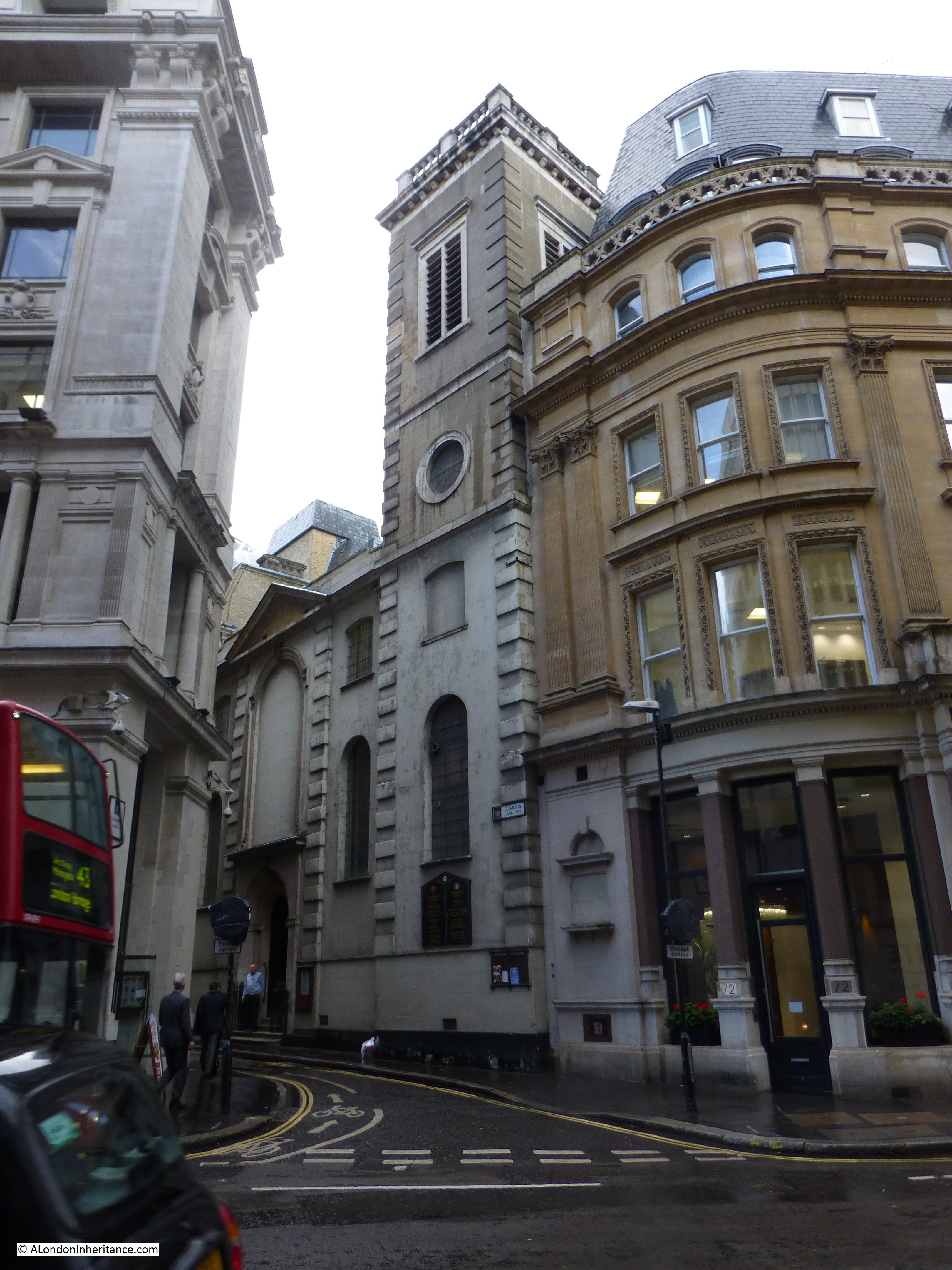
There is also the issue of what then happens to the buildings where functions will move from. For example, one of the City of London courts that will move into the new Fleet Street building is the City of London Magistrates Court on the corner of Queen Victoria Street and Walbrook, shown in the following two photos:

London Magistrates Court

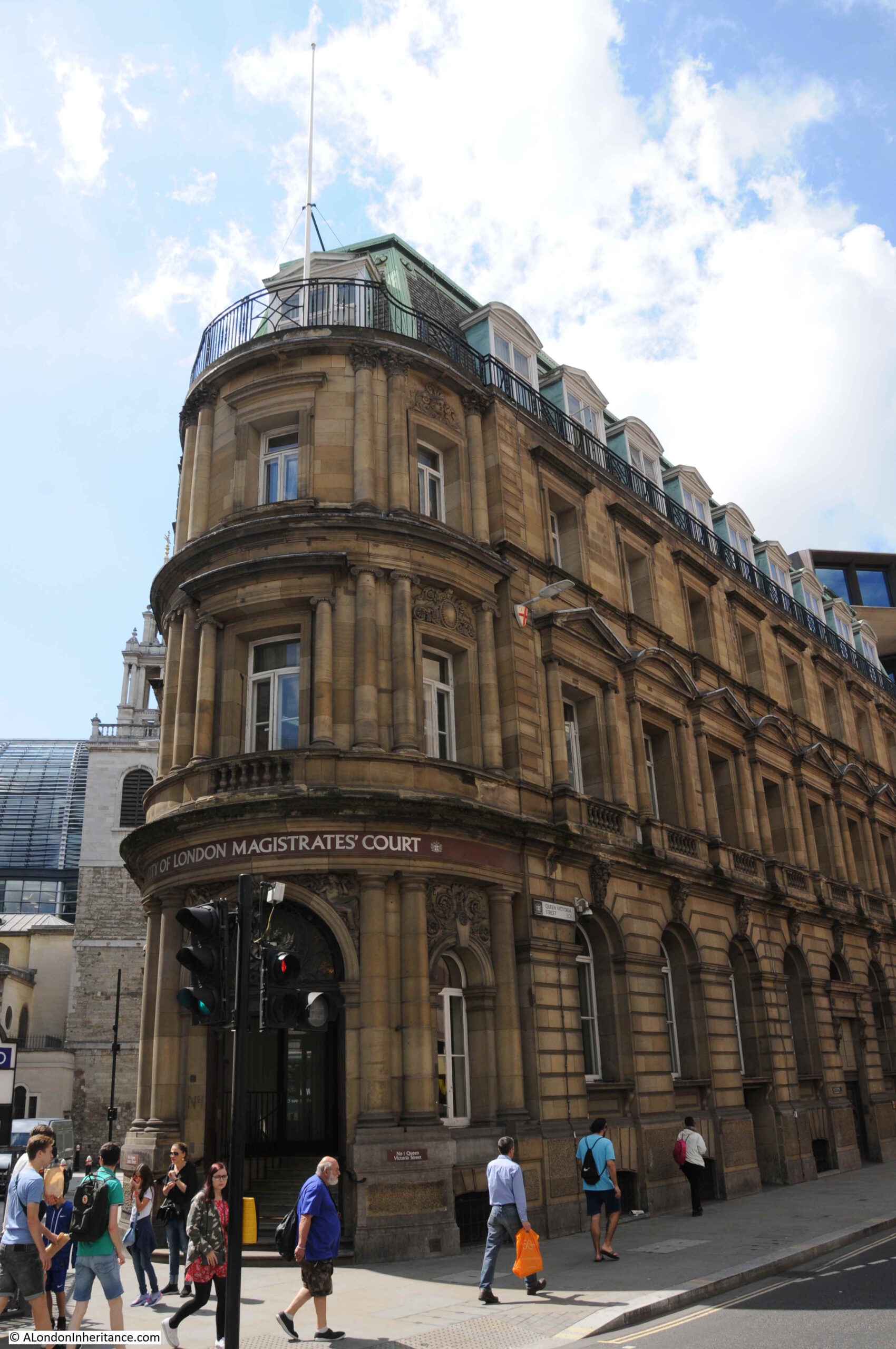
A building in a very prime location.

Development often leads to further development as functions, businesses etc. shuffle their way around the City.

Three possible future demolitions and re-developments that will have a significant impact on their local area of London.

Further reading on these can be found at:

City of London Salisbury Square Development web site

City of London Consultation briefing for the Salisbury Square development

Save Britain’s Heritage petition to stop the demolition of 72 – 81 Fleet Street

Colechurch House development web site

Article with artist’s impression of new Colechurch House development

Article with artist’s impression of development on south bank replacing Kent House and Studios

alondoninheritance.com

The Great Fire at London Bridge

If you walk out of London Bridge Station into Tooley Street, walk west up towards London Bridge, you will see a memorial to a fireman who died during what was described as the Great Fire at London Bridge in 1861 (also known as the Great Fire in Tooley Street), when a considerable number of the warehouses between Tooley Street and the River Thames were destroyed, alongside millions of pounds worth of goods.

Chances are that you will miss the memorial, installed on the first floor corner, along the side of a building facing on to Tooley Street. Although the lane alongside the building is now gated, it is called Cottons Lane, a name relevant to the warehouses destroyed in the fire.

Great Fire at London Bridge

Although the words on the memorial are difficult to read, it really does deserve a closer look. It records the death of James Braidwood, Superintendent of the London Fire Brigade who “was killed near this spot on the execution of his duty at the great fire”. These details are in the centre of the memorial, surrounded by a wreath.

Great Fire at London Bridge

Around the wreath are some details of the fire brigades profession, along with an image of the Great Fire at London Bridge.

At bottom left is a fireman’s helmet, sitting on the end of a nozzle through which jets of water were directed. To the right is an axe, followed by a water hose. Above this is the wheel of a fire engine.

At top left is a burning warehouse, with flames and smoke covering the top of the monument.

The fire that the memorial records, broke out on Saturday 22nd of June 1861. It would burn for days, destroy many warehouses and cause millions of pounds worth of damage and loss.

The following newspaper report provides a good indication of the scale of the fire:

“DREADFUL CONFLAGRATION IN LONDON. UPWARDS OF TWO MILLIONS’ LOSS – The metropolis on Saturday evening was visited by one of the most terrific conflagrations that has probably occurred since the great fire of London. Certainly for the amount of property destroyed, nothing like it has been experienced during the last half century.

The scene of the catastrophe was on the water side portion of Tooley-street, nearest London bridge, a locality which has been singularly unfortunate during the last 25 years, some of the largest fires having occurred here. The outbreak took place in the extensive range of premises known as Cotton’s Wharf and the bonded warehouses belonging to Messrs. Scovell.

They had an extensive river frontage, and the whole place on the land side extending to Tooley-street was covered with eight or nine warehouses six stories in height, some of which had formerly been used as ordnance stores, and the whole occupying, as we were informed, about three acres.

These buildings were filled with valuable merchandise of every description. There were some thousands of chests of tea and bales of silk stored in the upper floors, while in the lower was an immense stock of Russian tallow and tar, oils, bales of cotton, hops and grain. Every portion of the establishment might be said to have been loaded with goods, and of the whole of this property, not a vestige remains but the bare walls and an immense chasm of fire, which at dusk on Sunday evening still lighted up the Pool and the east end of the City.

To be added to this very serious loss is the destruction of the whole of the western range of Alderman Humphrey’s warehouses flanking the new dock, known as Hay’s Wharf, the burning of four warehouses comprising Chamberlain’s Wharf, adjacent to St Olave’s Church, besides many other buildings in Tooley-street”.

Smaller fires were a frequent hazard in the warehouses lining the Thames. The article extract above lists some of the goods stored in the warehouses. All very inflammable, and it had been a hot summer with little rain, so the buildings and their contents were dry and ready to burn.

The following print from the time gives an impression of the scale and ferocity of the fire. The southern tip of London Bridge can just be seen on the right edge of the print.

Great Fire at London Bridge

Image credit: London Metropolitan Archives, City of London: catalogue ref: p5354642

As well as the size of the fire, the print shows some of the fire fighting methods of the time. On the river are two steam powered fire boats. This method of firefighting was essential in London due to the number and size of the warehouses hard up against the river. It was frequently only possible to fight a fire from the river. One issue facing the fire boats at the London Bridge fire when they arrived was a very low tide. This prevented them getting close to the warehouses and drawing sufficient water. It was only when the tide came in that the height of water in the river was sufficient for the fire boats to be effective.

To the right of the fire, a cluster of firefighters can be seen in front of the large building at the end of London Bridge. They are directing their hoses on the western edge of the fire.

The river is full of boats carrying spectators, and I suspect the watermen of the river found it very profitable to give people a close up view of the fire, although this could be dangerous. Look at the larger boat on the left edge of the print. A fire has started on the boat, and a figure is seen jumping into the river from the boat.

Fires were almost entertainment events for Londoners, who lined London Bridge and filled the many boats on the river at all hours of the day and night. The following newspaper extract illustrates how the fire spread and the onlookers responses:

“While Chamberlain’s Wharf was in full blaze it was feared by many that St Olave’s Church and Topping’s Wharf would follow, but fortunately, a vacant piece of ground interposed, which no doubt saved both. On the other hand, Hay’s Wharf, it became evident, had caught fire in the roof, through which clouds of smoke and sharp spires of flame were darting. The iron shutters for a long time kept in the fire here, except at intervals when it forced its way upwards; it must have been at least an hour after the top floor was blazing before the fire descended to the floor below. After that the other floors followed. When Hay’s Wharf was included the river sweep of the conflagration must have been 300 yards, with a deep foreground of blazing oil and tallow. The higher the tide rose the wider became the sheet of flame, as cask after cask of tallow melted and rolled, liquidwise, into the Thames.

As the tide rose attention became fixed upon the dock at the end of Hay’s Wharf, for the spectators were anxious upon two points – first, they wished to see if there was a possibility of escape of the two vessels lying there, close to the walls of the fire proof, but fire filled buildings; and secondly, they feared that the fire would leap the narrow chasm of the dock and seize on Beal’s Wharf, and then, as must have happened, burn down a great extent of wharfage property beyond. After midnight, when the water had risen sufficiently high, the screw steamer was towed out amid the cheers of the onlookers, and ten minutes later two tugs drew out an American barque, just as the iron shutters of the building fell out of the side next to the dock, and the conflagration shot forth its fiery tongues”.

The following print of the fire shows the masts of one of the ships that were rescued from the fire. They can be seen on the left of the print, with the flames of the burning warehouses getting dangerously close.

Great Fire at London Bridge

The following plan shows the buildings destroyed in the fire:

Great Fire at London Bridge

Image credit: London Metropolitan Archives, City of London: catalogue ref: p5354659

The fire as viewed from Tooley Street:

Great Fire at London Bridge

There were a number of casualties during the fire. Five men who were in a boat collecting tallow floating on the river were either burnt to death or drowned when their boat caught fire. A number of men working in the area of the warehouses fell into the river and drowned.

Those suffering burns were taken to St Thomas’s Hospital, which also included a man who had his neck broken when the chain from a fire boat was caught around his neck.

Many of the boats on the river were collecting goods that had fallen out of the warehouses which they then sold for profit. Papers also reported that numerous mudlarks were out on the river foreshore using old sacks, saucepans, baskets, anything they could use to hold the goods from the warehouses being washed up on the shore.

The fire also brought out the worst in human behavior with groups of pickpockets making their way among the crowds watching the fire. Twenty four pickpockets were caught and taken to Mansion House for immediate judgement.

The memorial in Tooley Street records the name of the most high profile casualty – Mr James Braidwood of the London Fire Brigade.

Braidwood was the Superintendent of the London Fire Brigade and had many years of experience. The following report details the circumstances of his death, whilst he was visiting the individual groups of fire fighters in among the warehouses:

“Mr Braidwood, who had visited the men several times, was engaged in giving them some refreshment, when, all of a sudden, a terrific explosion occurred. In an instant it was seen that the whole frontage of the second warehouse was coming down, falling outwards into the avenue. Mr Henderson, the foreman of the southern district of the brigade, who was standing within a few paces of Mr Braidwood, shouted for all to run. The men dropped their hose branches. Two, with Mr Henderson escaped by the front gateway, and the others ran in the opposite direction on to the wharf where they jumped into the river. Mr Braidwood made an effort to follow Mr Henderson, but was struck down by the upper part of the wall, and buried beneath some tons of brickwork. His death must have been instantaneous. Several of his men rushed to extricate him, hopeless as the task was, but another explosion happening, they were compelled to fly. The sad fate of their chief had a most depressing effect upon all, and, to add to their trouble, the conflagration now assumed a most awful ascendancy”.

James Braidwood played a key part in establishing the London Fire Brigade. Born in Edinburgh in 1800, he was appointed superintendent of the Edinburgh fire brigade at the age of 23, and quickly gained a reputation for increasing the efficiency of the fire service in Edinburgh. In 1830 he published “On Construction of Fire-Engines and Apparatus, the Training of Firemen and the method of proceeding in the Cases of Fire”. In London at the time, the fire service was still run by individual insurance companies. This often resulted in a fire engine arriving at a fire, determining that the building was not insured by their company, and turning around.

Braidwood’s publication gained the attention of London’s insurance companies, and in 1832 he was appointed to the supreme command of the embryonic London Fire Brigade.

He initially had to overcome the prejudices and dislike of innovation from the London firemen, but gained their support and trust when they could see the benefits of the changes he put in place.

London’s fire service was very small for a city of such size and complexity, with numerous warehouses full of combustible goods. For comparison, Braidwood took on a force with 120 firemen, when at the same time, Paris had a force of one thousand trained firemen, and numerous fire appliances.

One of Braidwood’s innovative methods was his approach to fire prevention. He took an active part in advising owners of buildings how to implement precautions against fires.

He was also known for acts of bravery. In a fire in Edinburgh where barrels of gunpowder were stored in a burning building, he went in alone and carried each barrel out after having wrapped the barrels in wet blankets. In London he rescued a child from a burning building, having to walk across a plank to the room where the child was, and return via the same route.

He left a widow and six children. His wife had already suffered a similar bereavement, as a son from a previous marriage had died fighting a fire in Blackfriars Road in 1855.

His funeral took place at Abney Park Cemetery. The funeral procession was almost a mile and a half in length, and as well as the London Fire Brigade, there were members of the City and Metropolitan Police forces, members of the remaining private fire-brigades, along with many prominent persons of mid Victorian London.

The memorial in Tooley Street was installed in March 1862. I suspect it was in a more prominent place than now, as when installed it was on the west wall of a building on Tooley Street. Today it is on the eastern side of the building.

As well as the memorial, a short distance east there is a Braidwood Street, also to commemorate James Braidwood:

Great Fire at London Bridge

The inquest into the death of James Braidwood reached a conclusion of accidental death.

The jury at the inquest heard that he had been in among his fire fighters handing out brandy and encouragement when the wall fell on him, killing him instantly.

The inquest recorded the enormous quantities of goods held in the warehouses, the majority of which were highly inflammable, including a considerable quantity of salt peter, which is the natural mineral form of potassium nitrate.  Among its many uses, it is the principal ingredient in gunpowder, and as an oxidizer for fireworks and rockets. Having such an explosive chemical stored in such large quantities in a very busy warehouse complex in the centre of London shows the complete lack of any regulations at the time for the safe storage of such materials.

The area between Tooley Street and the river were still smoldering two weeks after the start of the fire. Over 200 police were employed to stop the public trying to get into the area. The fire brigade were kept busy pulling down dangerous walls and getting access to the burning vaults.

The area was though, quickly rebuilt and by the time of the 1893 Ordnance Survey map, the area is again full of warehouses. Hay’s Wharf was rebuilt, and it is the post 1861 fire version of Hay’s Wharf that we see today. ‘Reproduced with the permission of the National Library of Scotland’

Great Fire at London Bridge

If you find yourself in Tooley Street, glance up at the memorial to remember the Great Fire at London Bridge and the Superintendent of the London Fire Brigade, Mr James Braidwood.

alondoninheritance.com

Old Swan Stairs

Following last Sunday’s post covering the first part of my walk around London’s West End theatres, I had been expecting to publish the second part a couple of days ago, however I must admit I have never really counted up how many theatres there are (over 40), so I am still working on the post. Therefore today, back to one of my father’s photos of London 70 years ago.

This is my father’s post war view of the stretch of the north bank of the River Thames between London Bridge and Cannon Street Station:

Old Swan Stairs

The magnificent framework of the original glass roof of Cannon Street Station is in the rear of the photo, the glass had previously been removed so this is just the metal framework.

My father was standing on London Bridge to take the photo and the river front consists of space cleared of buildings damaged by wartime bombing and some of the remaining warehouse and wharf buildings.

I took a wider photo of the scene today to set the context as the side walls of Cannon Street Station are now obscured and the station has long since lost the original roof.

Old Swan Stairs

The scene has completely changed, and the perspective of the two photos looks different due to very different lens and camera types, however there are some features remaining that allow the buildings in the original photo to be located.

The following map extract is from the 1952 Ordnance Survey map of the area (published in 1952, surveyed the previous year).

Old Swan Stairs

In the map, Cannon Street Station is the large building, partly shown on the left of the map.

The first feature to identify on the photo is Old Swan Pier. In the map, this can be seen running from a small, rectangular indentation in the river wall. In the original photo, this is the metal walkway that can just be seen running out from the river wall, with the small indentation in the river wall also partly visible.

This allows the building to be identified adjacent to the pier, this is Swan Wharf, the building has a date on the very top which I can just make out as either 1896 or 1894.

Now follow the river wall from the pier and Swan Wharf back to the right hand edge of the photo and the river wall steps back twice, once alongside the edge of the Swan Wharf building, and the second slightly further along. These two steps backs in the river wall can also be seen in the 1952 map which identifies the building to the right of the crane as the building at the end of Old Swan Wharf in the map.

The definition of the original film is not sufficient to clearly read the white writing on the side of the crane, but it appears to read “The Swan Wharf & ———“. I cannot make out the last word.

Given the level of redevelopment in this area it would be surprising if any of these features (apart from the station) remain, however there are some that allow the location of the original buildings to be placed along the river’s edge today.

Firstly, look along the river wall in today’s photo and you will see an indention in the river wall. This is the same indentation as at the location of the pier in the original photo and was retained as this gap in the river wall is the location of Old Swan Stairs, one of the many historic stairs leading down to the river.

Two dolphin structures can also be seen in the river, these are a couple of the remaining supports from the Old Swan Pier.

To the right of the stairs in today’s photo is a large tree, this is the location of the Swan Wharf building in the original photo.

From the tree to the right of today’s photo there are two step backs in the river wall. These are the same as those in the post war photo, with the old building to the right of the crane being the building at the end of Old Swan Wharfe in the 1952 map.

Old Swan Stairs have been here for many centuries. The following extract from John Rocque’s map of 1746 shows Old Swan Stairs.

Old Swan Stairs

In the 1746 map, the stairs are at the end of Ebbgate Lane, in the 1952 map this lane was then Swan Lane with Old Swan Lane to the left in both maps.

Swan Stairs were mentioned in the diaries of Samuel Pepys and in Stow’s 1603 Survey of London there is a mention Old Swan: “This ward turneth into Thames streete westwarde, some ten houses on a side to the course of the Walbrooke, but East in Thames streets on both sides to Ebgate lane, or old Swan.” in his description of the boundaries of Downegate (Dowgate) Ward.

In Old and New London, Walter Thornbury writes about how Swan Stairs were used to avoid the dangers of passing under the old London Bridge by boat: “The Swan Stairs, a little ‘above bridge’ was the place where people coming by boat used to land to walk to the other side of Old London Bridge when the current was swift and narrow between the starlings, and ‘shooting the bridge’ was rather like going down the rapids. Citizens usually took boat again at Billingsgate, as we find Johnson and Boswell once doing, on their way to Greenwich in 1763.”

Old Swan Stairs were also the starting point for the Swan Upping ceremony when it started in central London. My father took some photos of Swan Upping starting around Old Swan Stairs and in the following photo is Mr Richard Turk who was the Vintners Swan Marker and Barge Master, with the Old Swan Pier in the background. The sign on the right of the piers indicates that boats to Greenwich could be boarded here. My full post on Swan Upping can be found here.

Old Swan Stairs

I am not sure exactly when Old Swan Pier opened, however the first adverts I can find for sailings from the pier are from 1838, when on the 21st May the Shipping and Mercantile Gazette carried an advert for “Steam – Cheap Fares from Old Swan Pier” . The sailings were:

  • To Gravesend – every morning at 9 o’clock, precisely. Cabin 1s: Saloon 1s 6d
  • To Richmond – Daily at half-past 9, calling at Hungerford at 10 o’clock, and to Twickenham every Monday, Wednesday and Friday. Week days 1s 6d; on Sundays 2s.
  • To Woolwich – Every Sunday at 10, 2 and 5, calling at West India Dock Pier, Blackwall, at 11, 3 and 6. To Woolwich 1s, to Blackwall 9d, from Blackwall to Woolwich, 6d

The earliest newspaper report I could find referring to Old Swan Stairs is from the 9th August 1729, when it was reported that:

“Last Monday a Waterman, naked all but his shirt, rowed in a Butcher’s Tray from the Old Swan Stairs, to Greenwich, for a Wager of four Guineas, and won the same”

There are frequent mentions of Old Swan Stairs in newspaper reports since the early 18th century, and they describe the life and tragedies that must have been day to day experiences along this stretch of the Thames.

From the London reports of the Ipswich Journal on the 12th February 1743:

“Sunday Morning a young Man, dressed in a Sailor’s Jacket with Trowsers and a speckled Shirt was found in the Mud near the Old Swan Stairs; his Buckles, which were supposed to be Silver, were taken out of his Shoes. He was carried into the Church-yard, near the Stairs, till own’d, or a Warrant granted for his Burial”.

The implications being that either he was murdered for the silver shoe buckles, or he had died accidentally and his shoe buckles had been stolen.

Standing at Old Swan Stairs would have provided a fascinating view across to what would later be Southwark Cathedral with London Bridge to the left. John Cleverly made the following drawing  (©Trustees of the British Museum) of the view from Old Swan Stairs in 1792. Old Swan Stairs

Despite the land along the river having changed so dramatically over the last 70 years, we can still find features that date back hundreds of years and allow us to accurately place events from centuries of London’s history.

alondoninheritance.com

St Clement Eastcheap

When the 19th century London Bridge was built to replace the original medieval bridge, the new bridge was built slight further west along the river allowing the old bridge to continue in use until the new bridge was completed.

The construction of the 19th century bridge had quite a dramatic impact on the streets on the north bank of the river. I have already covered some examples in my post on the Ticket Porter in Arthur Street which you can find here, and there were more street changes further north.

Today’s post on the church of St Clement Eastcheap provides us with another example.

St Clement Eastcheap is a modest church in Clements Lane almost at the corner with Cannon Street. The church does not have a spire and the church tower is at the same level as the surrounding buildings so unlike many other City churches, you will not find a spire to help locate the church.

The church does though have a fascinating piece of early 18th century graffiti in one of the most unusual locations, more on this later.

So, to start, here is St Clement Eastcheap in Clements Lane taken from Cannon Street.

St Clement Eastcheap 1

St Clement Eastcheap, located in Candlewick Ward, dates from at least the 12th Century, probably earlier and was originally adjacent to the street Great Eastcheap.

The church was destroyed in the Great Fire of London and rebuilt by Wren between 1683 and 1687. The church suffered very little damage during the 2nd World War which is surprising given the central City location, so the church we see today is much the same as the original Wren construction.

The following map is from the 1940 Bartholomew London Street Atlas. The street plan is also much the same today. St Clement Eastcheap can be seen to the lower right, just above Monument Station.

Clements Lane today, runs between Lombard Street and King William Street which runs on to London Bridge.

St Clement Eastcheap 12

Much of this street plan was created to provide an efficient route onto the new London Bridge with King William Street providing direct access from the major road junction at the Bank.

The extract below from  John Rocque’s map of 1746 shows the street plan when the original London Bridge was still in place.

Here, Gracechurch Street runs to Fish Street Hill then on to London Bridge. Compare this with the above map where Gracechurch Street now curves past Monument Station to King William Street and the approach to London Bridge, highlighting the slight westward move of the bridge.

Just above and to the right of the number 3 in the map below can be seen St Clement. Here, St Clements Lane runs down to Great Eastcheap. Note also how Eastcheap is split into Great and Little Eastcheap, with Little Eastcheap remaining to this day, but now called simply Eastcheap.

Stowe states in his 1603 Survey of London that:

“The street of Great Eastcheape is so called of the Market kept, in the east part of the City, as West Cheape is a market so called of being in the West.

This Eastcheape is now a flesh Market of Butchers there dwelling, on both sides of the street, it had sometime also Cookes mixed amongst the Butchers, and such other as solde victuals readie dressed of all sorts.”

Great Eastcheap was lost when King William Street was built, with Great Eastcheap being included in the end of Cannon Street, King William Street and the Gracechurch Street, Eastcheap section by Monument Station.

St Clement Eastcheap 10

When I visited the church, there was an interesting reminder of the geology of the City. When I entered the church, there was a clear blue sky, however on leaving there was a very heavy rain shower and water was streaming down the narrow Clements Lane, carrying various bits of rubbish in the flow. Whilst today, the water disappeared down the nearest drain, this was a graphical reminder of how much of this side of the City slopes down towards the Thames and how in the past the water and rubbish running down these streets would have been carried straight down towards the river.

On entering the church from the street we look straight at the gilded reredos behind the altar.

St Clement Eastcheap 6

There was some redesign of the interior of the church during the Victorian period and much of the ceiling was renewed in 1925.

The interior of the church has always been relatively simple, Stowe summed up the church as “This is a small church, void of any monuments”, and today the church performs a function which would have surprised Stowe. The pews have been removed and half of the floor space is now office space for charities. A good use and which helps the continued occupation of the church.

Looking back towards the entrance with the charity office space to the left. The original oak casing surrounding the organ appears to have a look of surprise, perhaps because of the current use of the church.

St Clement Eastcheap 5

One of the most unique features of the church can be found in the toilets. Modern toilets have been built up against the original wooden wall panelling as can be seen in the photo below. It cannot be seen in the photo due to the lighting and dark panelling, but on the panelling, just to the left of the small wooden table is some very early 18th century graffiti.

St Clement Eastcheap 8

A close up of the graffiti, dating from the year 1703, carved 15 years after the church was completed. A remarkable survival and very surprising to find this in such a location.

St Clement Eastcheap 9

The church also retains some original Bread Shelves, used to store bread ready for charitable distribution.

St Clement Eastcheap 7

To the side of the church is St Clement’s Court, a narrow lane leading to the small churchyard at the rear of the church.

The plaque on the building on the left reads:

Here lived in 1784

Dositey Obradovich

1742 – 1811

Eminent Serbian man of letters

First Minister of Education

in Serbia

The lane also provides access to some of the office buildings that back onto the rear of the church.

St Clement Eastcheap 13

The remaining churchyard is very small with only a couple of in-situ graves. In 1910, Sir Walter Besant wrote of the churchyard:

“In Church Court we come to the ancient graveyard of St Clement, a minute space with one great shapeless tomb in the centre of the asphalt and a few small erect tombstones on the little border running inside the railings”

Not much has changed in the 105 years since that was written.

St Clement Eastcheap 4

And a couple of gravestones which have been relocated up against the wall of adjoining buildings.

St Clement Eastcheap 3

The church of St Clement, Eastcheap is easy to miss when walking in the area, but well worth a visit, including an essential trip to the toilet to see graffiti from 1703.

alondoninheritance.com

The Ticket Porter – Arthur Street

For this week’s post we are in the City of London in 1948, on the corner of Arthur Street where it joins with Upper Thames Street, close to the northern approach to London Bridge. A small part of the City that did not suffer major damage during the war just a few years earlier.

Looking up Arthur Street we can see a large pub, “The Ticket Porter”:

Ticket Porter 1

I stood at the same place in 2015 and looked across to a very different scene:

Ticket Porter 2

A building site now occupies the location of the Ticket Porter. The original pub lasted until the early 1970s and the building work on the site is for probably the third building since the destruction of the pub.

To confirm that this is the correct location, if you look at the buildings on the left of the street, the second building is still the same as when my father took the original. It is the only building on Arthur Street that has survived the last 67 years.

This photo taken from the approach road to London Bridge shows the original building and the curve of Arthur Street round to the right.

Ticket Porter 3

Arthur Street, by London standards, is a relatively new street and I believe it was constructed to provide a route up from Upper Thames Street to London Bridge.

The location of Arthur Street is shown in the Google Map below. The curve of the street from Upper Thames Street to King William Street providing easy access to London Bridge can be clearly seen.

Prior to the move of London Bridge to its current location, Arthur Street did not exist. The following map is an extract from John Rocque’s survey of London from 1746. I have highlighted St. Martin’s Lane with an orange line. This street once ran all the way to Upper Thames Street, however today, Arthur Street now forms the lower half of what was St. Martin’s Lane (you need to zoom in on the above Google map for the street names to appear).

Today, St. Martin’s Lane has also been abbreviated to Martin Lane.

The original London Bridge was further to the east than the current bridge, John Rocque’s map shows the bridge up against the church of St. Magnus. The London Bridge that replaced the one shown in Rocque’s map was built slightly further to the west, allowing the original bridge to continue in use until the new bridge was opened in 1831.

Ticket Porter Map 2

The following extract from Cruchley’s New Plan Of London Improved to 1835 shows the new London Bridge opened a few years earlier, with Fish Street Hill, the approach road to the original London Bridge now terminating at the river. Cutting across from St. Martin’s Lane, across King William Street to Fish Street Hill is Arthur Street.

1835 London Bridge 1

So, Arthur Street may well have been part of the changes in the area when the new London Bridge was built, originally to provide access up to King William Street and London Bridge from the surrounding roads.

At some point after 1835, Arthur Street was changed again to terminate on King William Street and down to Upper Thames Street, cutting in half St. Martin’s Lane. I suspect this change was soon after 1835 as licensing records from the 1840s give an Arthur Street address for the Ticket Porter pub.

Having established how Arthur Street may have come into existence, what about the pub?

Although there were probably more, I have only been able to find references to two pubs called The Ticket Porter. One in Moorfields and the one in Arthur Street.

The pub takes its name from those who were employed as Ticket Porters across London. The job of a Ticket Porter was to transport and carry goods across London. Ticket Porters who worked at the riverside would be responsible for the transport of goods to and from ships whilst Ticket Porters who worked in the streets would transport goods and parcels between London locations, so if a London Bookseller wanted to deliver a parcel of books to a customer, they would call on the services of a Ticket Porter.

Ticket Porters could be identified by the pewter badge that they wore, bearing the arms of the City of London.

Hogarth includes a Ticket Porter in his drawing “Beer Street”:

37376001

©Trustees of the British Museum

In the lower right of Beer Street can be seen a man drinking from a large tankard of beer. Across his chest can be seen the badge of the Ticket Porter and below him is a tied up bundle of books which he has set down whilst getting some refreshment during his journey across London.

The role of Ticket Porter also gave the name to the drink Porter, which they consumed on benches and tables set outside many London pubs as the thousands of men employed as Ticket Porters crossed London with their loads.

Hogarth’s drawing Beer Street was published to show the virtues of drinking beer rather than Gin. His Gin Lane drawing shows the drunken state to which Gin drinkers have descended whilst Beer Street shows a healthy, working population, even with the ability (as can be seen above) to work at height on the roofs of buildings. Health and safety was not the same in the 18th century.

To add to the positive images in the drawing, the text at the bottom reads:

Beer, happy Produce of our Isle,

Can sinewy Strength impart,

And wearied with fatique and Toil,

Can chear each manly Heart,

Labour and Art upheld by Thee

Succesfully advance,

We quaff Thy balmy Juice with Glee

And Water leave to France.

Genius of Health, thy grateful Taste

Rivals the Cup of Jove,

And warms each English generous Breast

With Liberty and Love

The next time I am in a London pub I will certainly be thinking of Hogarth’s words to justify the many benefits of a few pints of beer!

Compare the virtues of Beer Street and the Ticket Porter with the depravity of Gin Street:

37377001

©Trustees of the British Museum

Gin cursed Fiend with Fury fraught,

Makes human Race a Prey,

It enters by a deadly Draught,

And steals our Life away.

Virtue and Truth driven to Despair,

It’s Rage compels to fly,

But cherishes with bullish Care,

Theft, Murder, Perjury.

Damn’d Cup! that on the Vitals preys,

That liquid Fire contains,

Which Madness to the Heart conveys,

And rolls it thro’ the Veins.

Beer drinkers did not always achieve Hogarth’s high standards. The Old Bailey records include the case of a Mr James Collins who at the age of 67 was sentenced to 5 years of  “penal servitude” for unlawfully using counterfeit coin in the Ticket Porter pub.

At 7:30 on the evening of the 5th February 1870 James Collins had bought two glasses of ale and each time paid with a shilling which the barmaid (Ann Hawkins, also the daughter of the licensee of the pub) had found to be “bad”. Ann had asked for the change she had given James Collins back, when he refused she called the police and gave the bad shillings to the constable who attended.

James Collins defence in court was “I was not aware I had any bad money about me; I was very drunk.” Confirmation that the shillings were “bad” was not from any official but from a Pawnbroker from Bishopsgate Street, a Mr John Althon who confirmed to the court that both shillings were “bad”.

Hogarth would not have approved.

As ever when I am looking for the locations of my father’s photos I will take a walk around the area. I found the following on the side of The Olde Wine Shades in Martin Lane and I have no idea what is it. It looks old, and is built into a brick arch behind what looks like a layer of concrete. I could not work out the function it was meant to perform.

Ticket Porter 4

Another view from Martin Lane showing the location to the side of The Olde Wine Shades:

Ticket Porter 5

Any information as to what this is would be really appreciated.

The Ticket Porter is a long lost London pub, however it provides us with a reminder of one of the many jobs that provided employment to Londoners, and how these jobs were seen within the issues of the day as captured by Hogarth.

alondoninheritance.com

London’s Railways – Planning For Peace

Around this time of year, a number of London stations are in the news for the considerable amount of work that is on-going for rebuilding, the creation of new lines and what always seems to be the inevitable overrunning engineering works. The work at London Bridge and for Crossrail being just two examples.

Major schemes have always been in various stages of planning to address London’s ever increasing transport requirements. Some schemes have reached completion, others never moved from the conceptual stage.

For this week’s post, I want to illustrate one set of schemes that were published in January 1946 and show how usage of the main London stations has changed over almost 80 years.

In the middle of the last war, there was a general feeling that the tide was starting to turn and planning could start for what London would look like in the decades after the war. How could the city be developed, what would be the transport needs of Londoners in the future, how could both the city’s infrastructure and landscape be improved and better use made of the limited space available?

In 1943 the London County Plan was published, then in February 1944 a committee was established :

“To investigate and report upon the technical and operational aspects of those suggestions made in the County of London Plan of 1943 which relate to the main line and suburban railway system of London, both surface and underground, bearing in mind that these suggestions are intended to contribute towards and form part of a comprehensive scheme for the re-development of the area in question.”

The report from the committee was published in 1946 and made some very far-reaching proposals, that had they been implemented would have had a dramatic impact on the transport system we see in London today.

Report Cover 1

Before getting into some of the details of the proposals, it is fascinating to compare the use of London stations between the 1930s and today. The 1946 report details passenger numbers of all mainline terminals up to the end of 1938 , the latter being the last year free from the influence of war.

The following table compares passenger arrival numbers during maximum morning peak hour  pre-war and in 2010 (the 2010 figures are taken from the “Central London Rail Termini: Analysing Passengers’ Travel Patterns Policy Analysis Research Project” published in September 2011 by Transport for London):

Station 1938 Peak Hour 2010 Peak Hour
Paddington 4,800 10,500
Euston 5,800 11,500
St. Pancras 2,100 9,000
Fenchurch Street 10,500 11,500
King’s Cross 9,000 7,500
Liverpool Street 34,700 32,500
Marylebone 3,900 5,500
Waterloo 24,300 45,500
Victoria 16,400 28,500
Charing Cross 17,000 15,500
Cannon Street 18,100 15,000
London Bridge 31,300 31,000
Totals 177,900 223,500

Whilst overall numbers have increased considerably there are some fascinating individual station comparisons. I bet if you use London Bridge on a daily basis the fact that in 2010 passenger numbers were still slightly below the 1938 level is of little comfort.

Perhaps reflecting the different options for transport and the changes in home locations for those working in central London, there are some significant swings. Paddington, Euston, St. Pancras, Waterloo and Victoria all showing significant increases in passenger traffic whilst King’s Cross, Liverpool Street, Charing Cross, Cannon Street and London Bridge are all showing reductions.

There were a couple of major themes within the 1946 report, perhaps reflecting the “anything can be done” attitude needed during the war, and a realisation that the changes caused to London by heavy bombing presented a major opportunity to improve London for everyone who lived and worked in the city. A similar approach to that taken by Wren after the Great Fire of 1666 when he proposed the creation of a city more along the lines of Paris than London had been with an ordered city with straight boulevards and a logical planning approach rather than the numerous small lanes and alleys of pre-fire London .

The major themes of the 1946 report were:

  • The removal of the head on terminals at Charing Cross and Cannon Street and the high level stations at London Bridge and Waterloo Junctions and the associated bridges across the River Thames
  • The construction of an extensive series of deep level tunnels and interchanges to replace the above ground infrastructure and to provide improved passenger and freight transport across London, capable of meeting the expected increase in both freight and passenger volumes.

As well as the removal of the bridges across the Thames, the viaducts across south London were also seen as a problem. Not just as a wasted space, but that they also split communities and their replacement by tunnels was seen as a way of integrating the many communities of south London. This was one of the areas where the rebuilding of the rail system would contribute into the overall London plan by making redevelopment of large areas such as the South Bank possible without the extensive railway infrastructure across the area.

In these proposals it is also possible to see the ideas behind Crossrail where trains from outside the immediate underground network are routed in tunnels across London with deep level interchanges with the tube and other rail networks and with the surface. Whilst the destinations are different, the concept is the same.

The following map from the report identifies the possible routes:

Map 1

The options shown in the map are:

Project A: A new deep-level North Bank link from Battersea to Deptford via Victoria, Charing Cross, Blackfriars, Cannon Street, Shadwell, Wapping and Surrey Docks

Project B: A new deep level-loop connecting Waterloo Junction, Charing Cross, Blackfriars, Cannon Street and London Bridge and then by tunnel via the Surrey Canal rising to join the existing surface systems in the south and south-east.

Project C: A north-south tunnel, an underground link to replace the existing viaduct from Snow Hill to Loughborough Junction

Project D: A northern arc suburban passenger route, passing below the main line stations at Paddington, Marylebone, Euston, King’s Cross and Liverpool Street with interchange facilities.

The projects also included the electrification of all remaining lines into London. I did not realise how much of the rail network leading into London had been electrified by the start of the last war. We tend to think that this was still the age of steam, but into London, the percentages that were already electrified after completion of the 1935 / 40 New Works Programme were:

Southern Railway: 86%

London and North Eastern Railway: 26%

London Midland and Scottish Railway: 32%

One of the other projects considered for the rail terminals was “The reconstruction of terminals at two levels, with flat roofs for future air landing”. Just shows the difficulties in trying to forecast how transport will be used in the future.

Removal of the bridges across the river was considered important as “the merit of a clean sweep of the three rail bridges over the Thames between Westminster and London Bridge cannot be denied”. How different the river would look today without the rail bridges.

Some of the themes driving the need for change are the same now as they were in 1946:

“Size and Distribution of Population. For many decades past, London has embraced a rising proportion of the total population of the whole country, which has itself been rising. During the inter-war years approximately half of the increase in London’s population could be attributed to immigration from the provinces

Decentralisation of employment, for it is one of the guiding principles that industry also should be de-centralised and there are proposals for satellite towns to be located, and existing towns expanded beyond the green belt.

Increasing traffic. Experience shows that, as income rises, the demand for transport rises more than proportionately, irrespective of transport to and from work.”

These words could equally have been written in 2014 as they were in 1946, and in 2014 to support the second point could also be added the ever-increasing price of property in central London driving people further out in search of affordable housing.

The following map from the 1946 report shows the proposed routes in their wider context and the considerable complexity of these proposals (click on the map to open a large copy):

Map 2
London Bridge Station was singled out for special interest. Total passenger numbers in the peak hour in 1925 was 38,000 and grew to 55,000 in 1938. In planning the proposed changes to the rail system, an expected 75,000 passengers was considered the level for which an upgrade should be planned.

As well as moving part of the station underground, an alternative site was considered and a major new underground / overground station was planned for a site adjoining Tower Bridge Road (as marked in Map No. 2 above)

The following map shows the first and second priority routes and also tunnels for the use of passenger and freight traffic. This was still at a time when significant volumes of freight traffic were carried by rail. The explosion of road transport, the motorway network and the considerable use of lorries for freight was not forecast to have a major impact on the rail system in 1946 (again click on the map to open a larger copy).

Map 3

The cost for the priority works were estimated as:

North Bank Route Cost (£)
Main Route 20,920,000
Clapham Branch 2,640,000
Brixton Branch 1,940,000
Deptford Branch 530,000
New Cross Branch 1,380,000
New Cross Gate Branch 1,620,000
Lay-over at Charing Cross 1,840,000
South-east, City and West End Route  
Main Route 5,590,000
Lay-over at Charing Cross 460,000
North-South Route  
Main Route 4,800,000
Lay-over at Holborn 920,000
Northern Arc Route  
Main Route 6,450,000
Lay-over 460,000
Total Scheme 49,550,000

This was rounded up to £50 Million, which was then doubled to take into account the cost of land, property, traction equipment, rolling stock and signalling, plus a further £10M for other ancillary works, giving a total estimated cost of £110 Million. A considerable sum just after the war, also given the financial situation of the country at the time.

The cost of all proposals in the plan was estimated at between £228 Million and £236 Million and these costs did not include the cost of electrification or any other works outside of the proposed tunnels. Estimates of construction time were “under the most favourable conditions, would not be less than 30 years”.

New types of train were also recommended. The majority of overland trains on the Southern Railway comprised carriages with six-a-side compartments, however the safety needs of operating these trains underground required the provision of rolling stock with some form of through corridor to enable passengers to pass in emergency from one coach to another. The types of trains in use at the time were made up of six-a-side compartments and an overall train could carry 1,050 passengers. A 10-coach train of similar length with through corridors reduced passenger carrying capability down to 600 passengers. A challenge with the proposed approach as an increase in the number of trains would be required to carry the same number of passengers without any capacity for the expected increase in numbers.

So what happened to these proposals which would have had a very dramatic impact on the train services and stations in London as well as the view along the Thames if the removal of the rail bridges had gone ahead?

As well as the very significant costs of the proposals, shortly after they were published alternative committees were also set-up to look at options for upgrading London’s transport services.

London Transport planners also prepared their own report which was published the following year in March 1947. On the 1st January 1948, the British Transport Commission took over London Transport as well as the main line railways. The Commission also set-up a new working party to report on transport services within London and a report was completed in late 1948.

The multiple reports, high costs and the economic state of the country in the late 1940s and early 1950s put on hold this type of far-reaching proposal and development of transport within London followed a more individual project approach. Some of the 1946 proposals did get included in alternative projects. For example the Brixton branch proposed in 1946 was eventually covered by the routing of the Victoria Line to Brixton.

London Bridge Station in all it’s complexity is still there and perhaps after the ongoing considerable rebuilding work including the work over this year’s Christmas break, will see the station reach the potential envisaged by the 1946 planners, although with the significant difference of being above ground rather than below.

The sources I used to research this post are:

  • Railway (London Plan) Committee 1944 Report to the Minister of War Transport – 21st January 1946
  • Central London Rail Termini: Analysing Passengers Travel Patterns. Policy Analysis Research Report. published by Transport for London, September 2011

alondoninheritance.com