Tag Archives: London Churches

All Hallows Staining And Star Alley

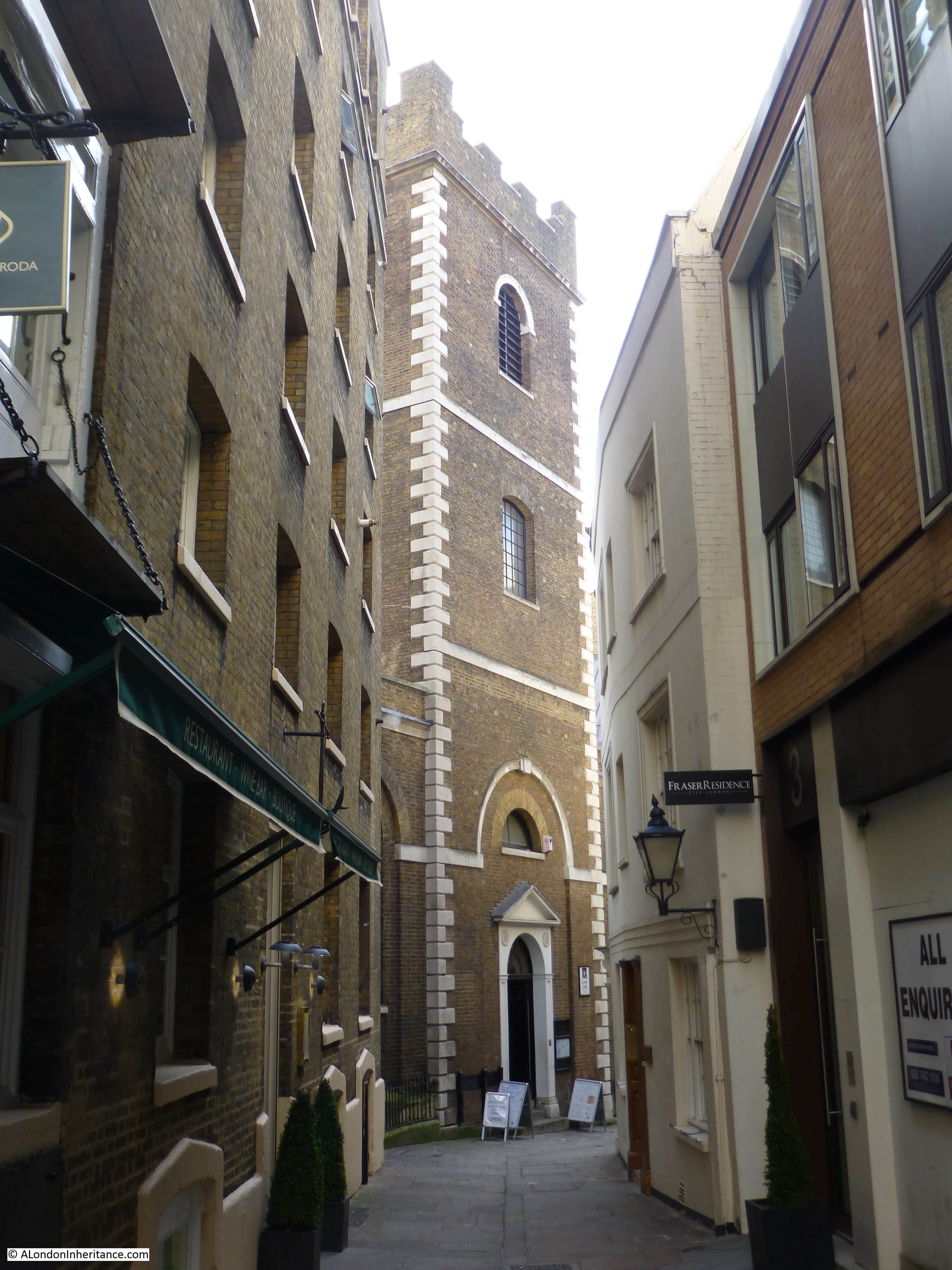
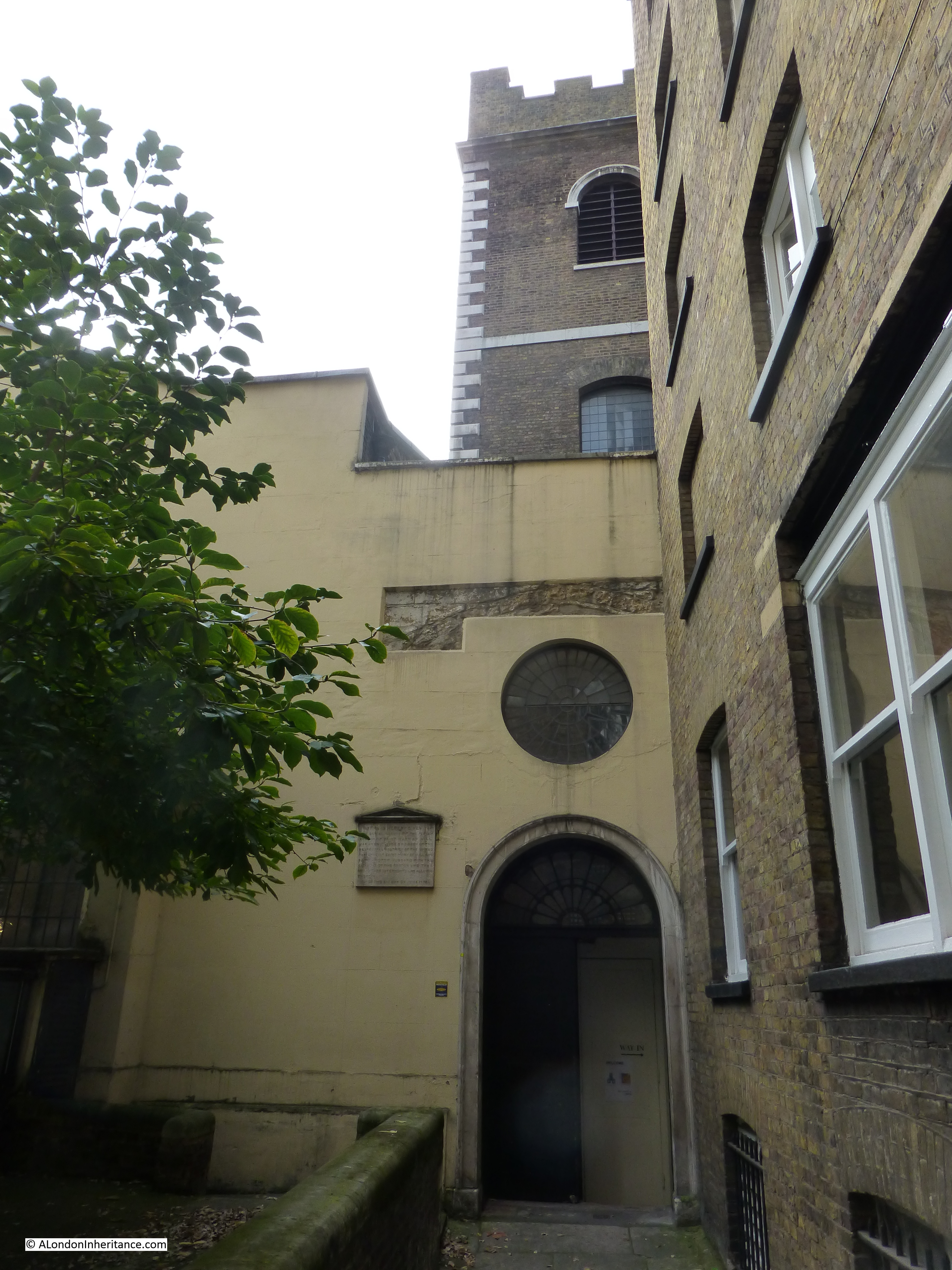
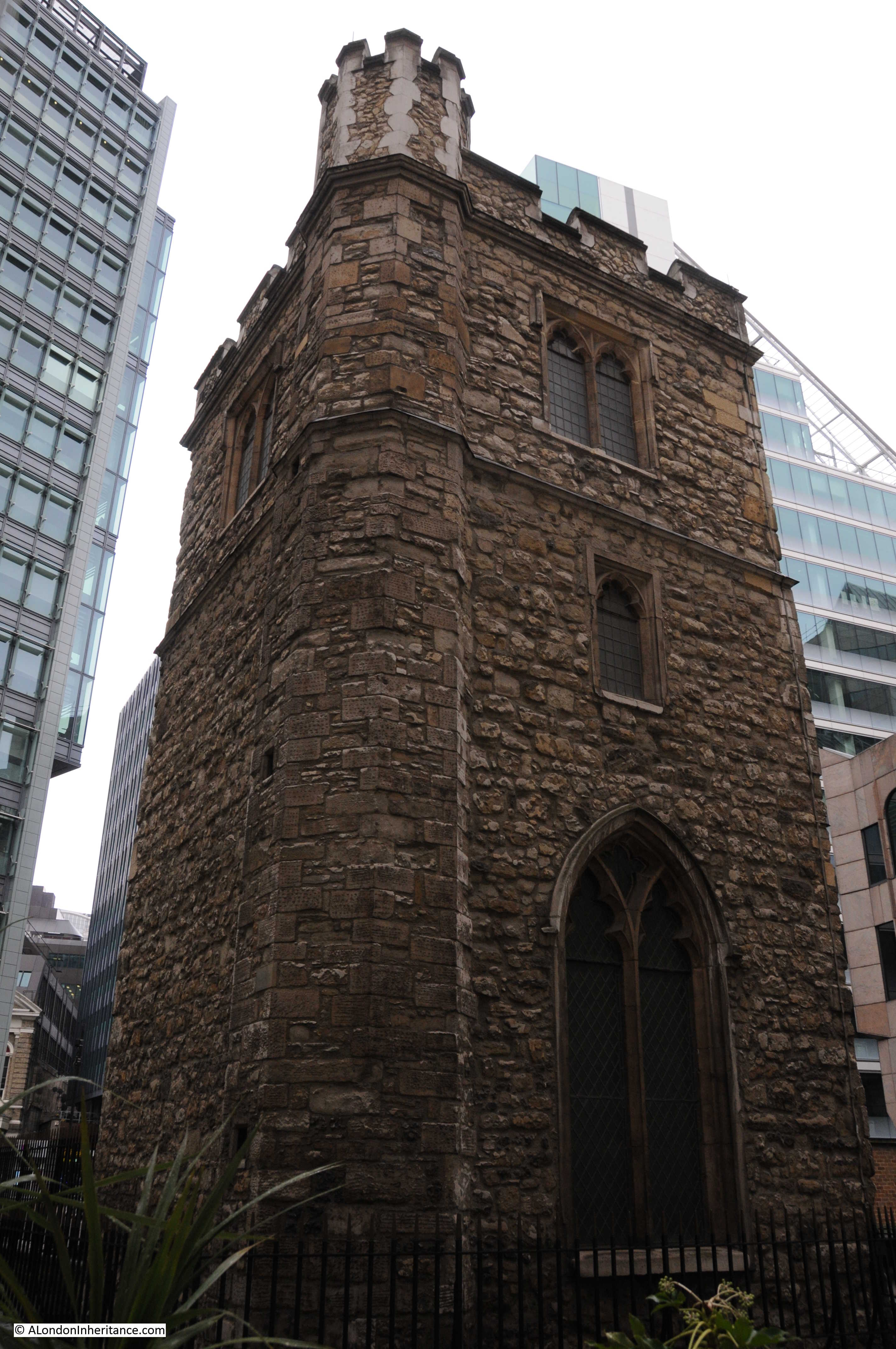
If you are in the vicinity of Fenchurch Street and head down Mark Lane, a short distance along you will see a church tower standing alone, surrounded by modern buildings that are significantly taller than this relic of a much earlier time. This is all that remains of the church of All Hallows Staining.

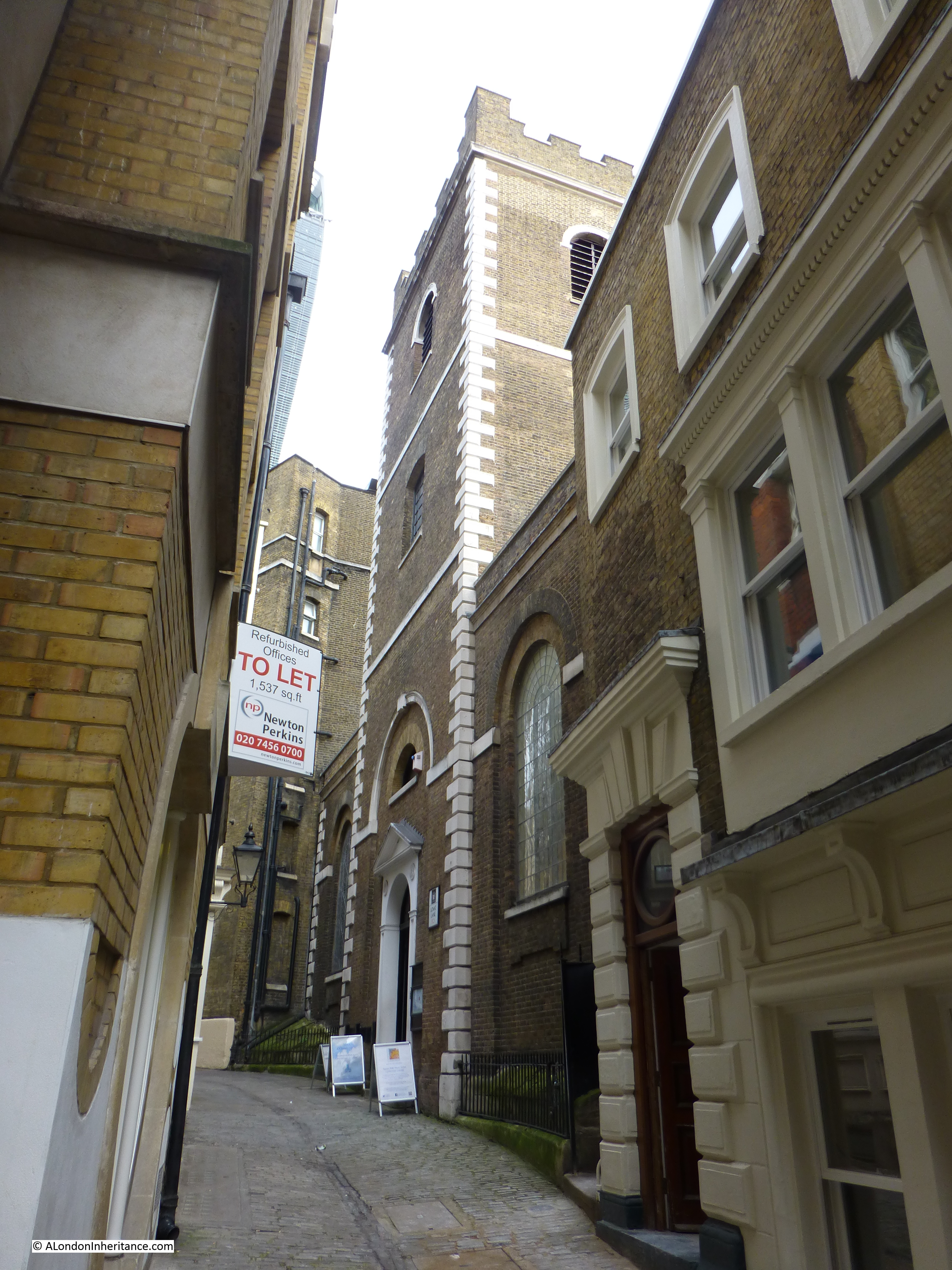
My father photographed the church tower in 1948:

All Hallows Staining

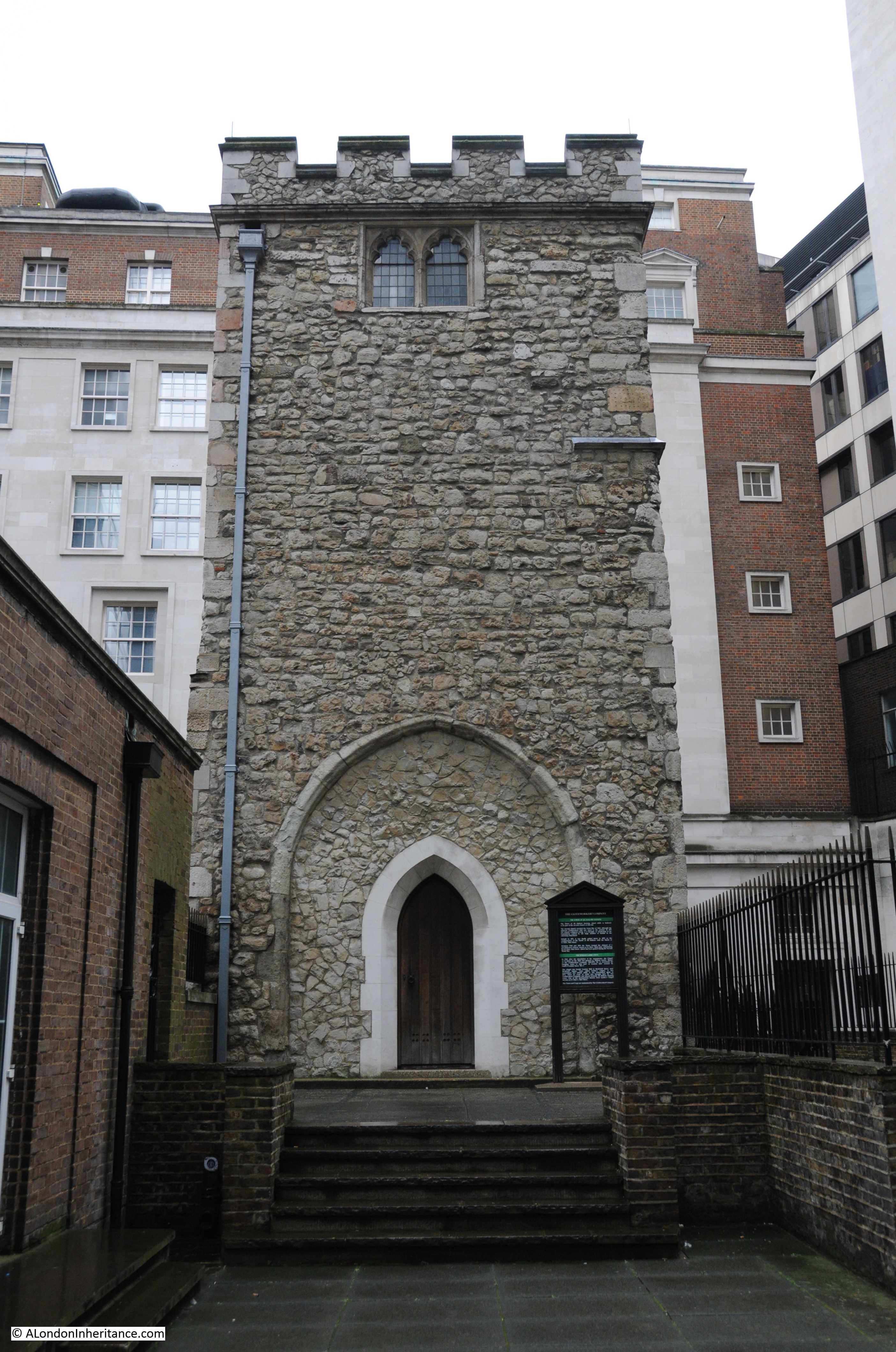
Seventy years later in 2018 I took the following photo of the tower of All Hallows Staining:

All Hallows Staining

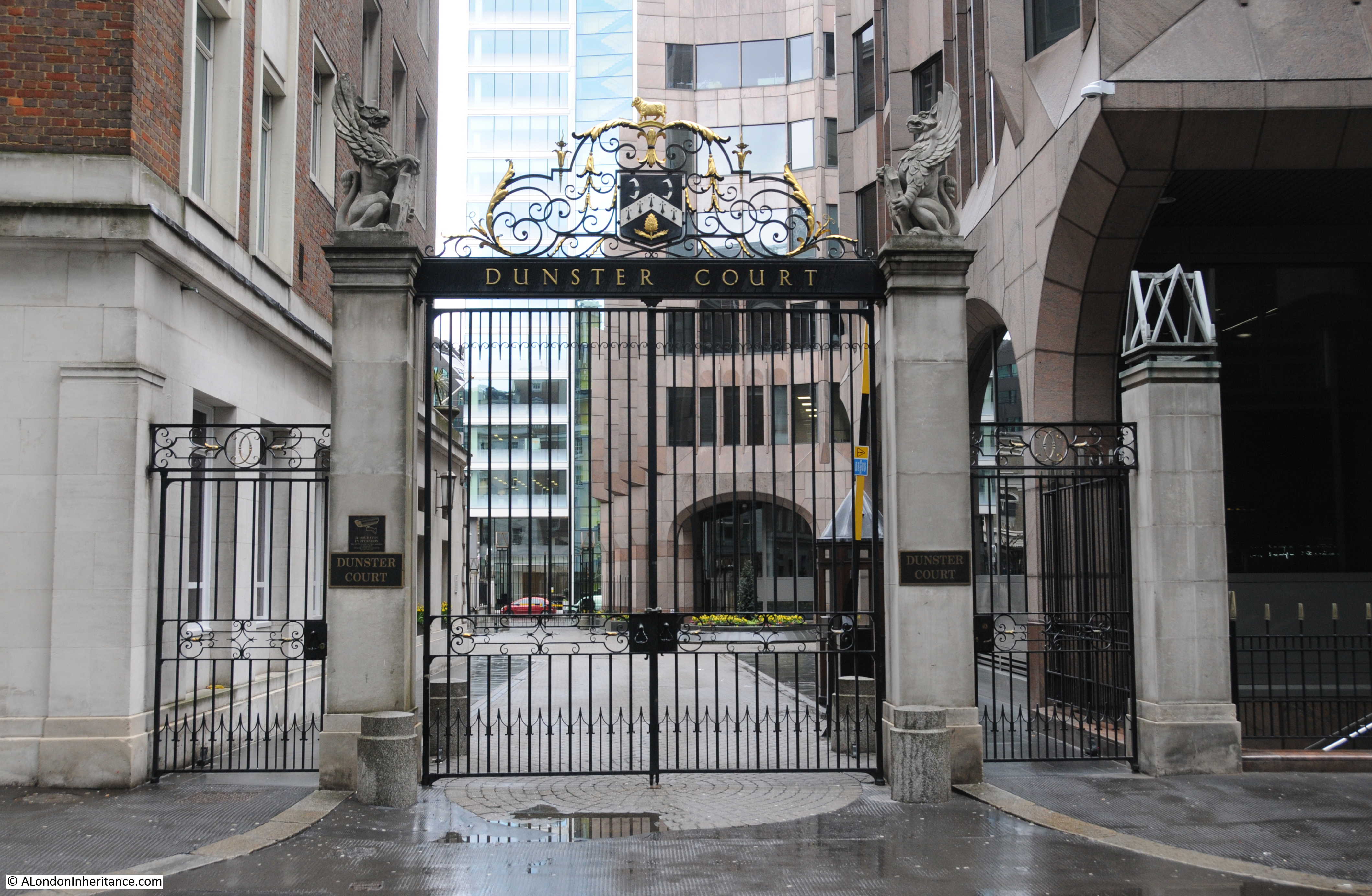
Both photos were taken from Dunster Court, the street that runs from Mark Lane to Mincing Lane, running past the Clothworkers Hall.

The exterior of the tower is much the same in both photos, however since 1948 the windows and entrance arches have been in filled with glass and wooden doors, and there is a roof to the top of the tower.

The 1948 photo gives the impression that as with many City churches, this was all that remained following wartime bombing, however for All Hallows Staining, this was not the case as by the start of the last war, All Hallows Staining had already been reduced to just the tower for some years.

The immediate area of the church does show though, the level of general debris that could be found across the post war City.

In front of the tower in the 1948 photo is a large wooden cross. After the war a temporary church was set up adjacent to the tower to provide a temporary place of worship following the destruction of the nearby St. Olave in Hart Street.

This is the view of the tower from Mark Lane. This space was once occupied by the body of the church.

All Hallows Staining

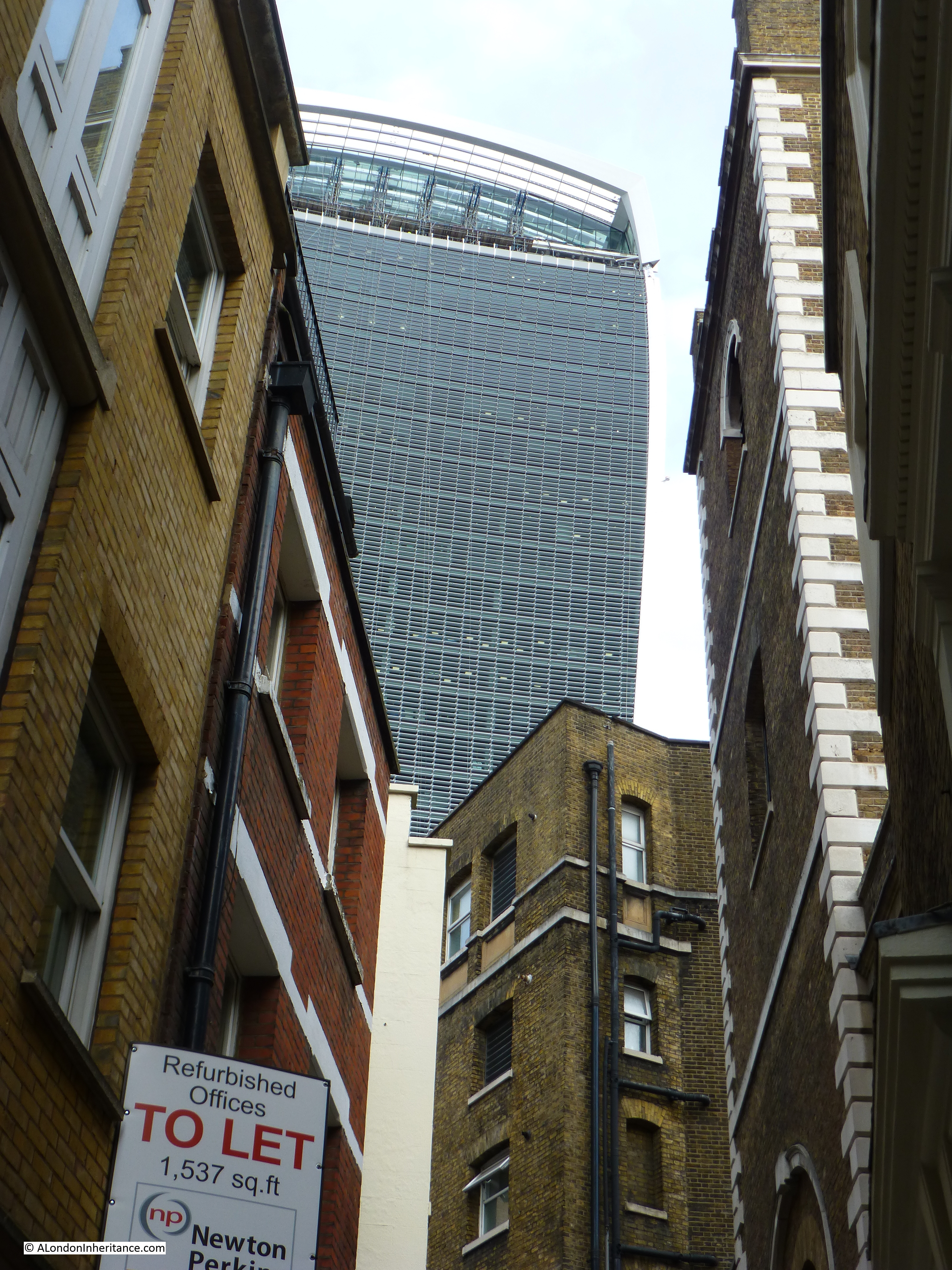
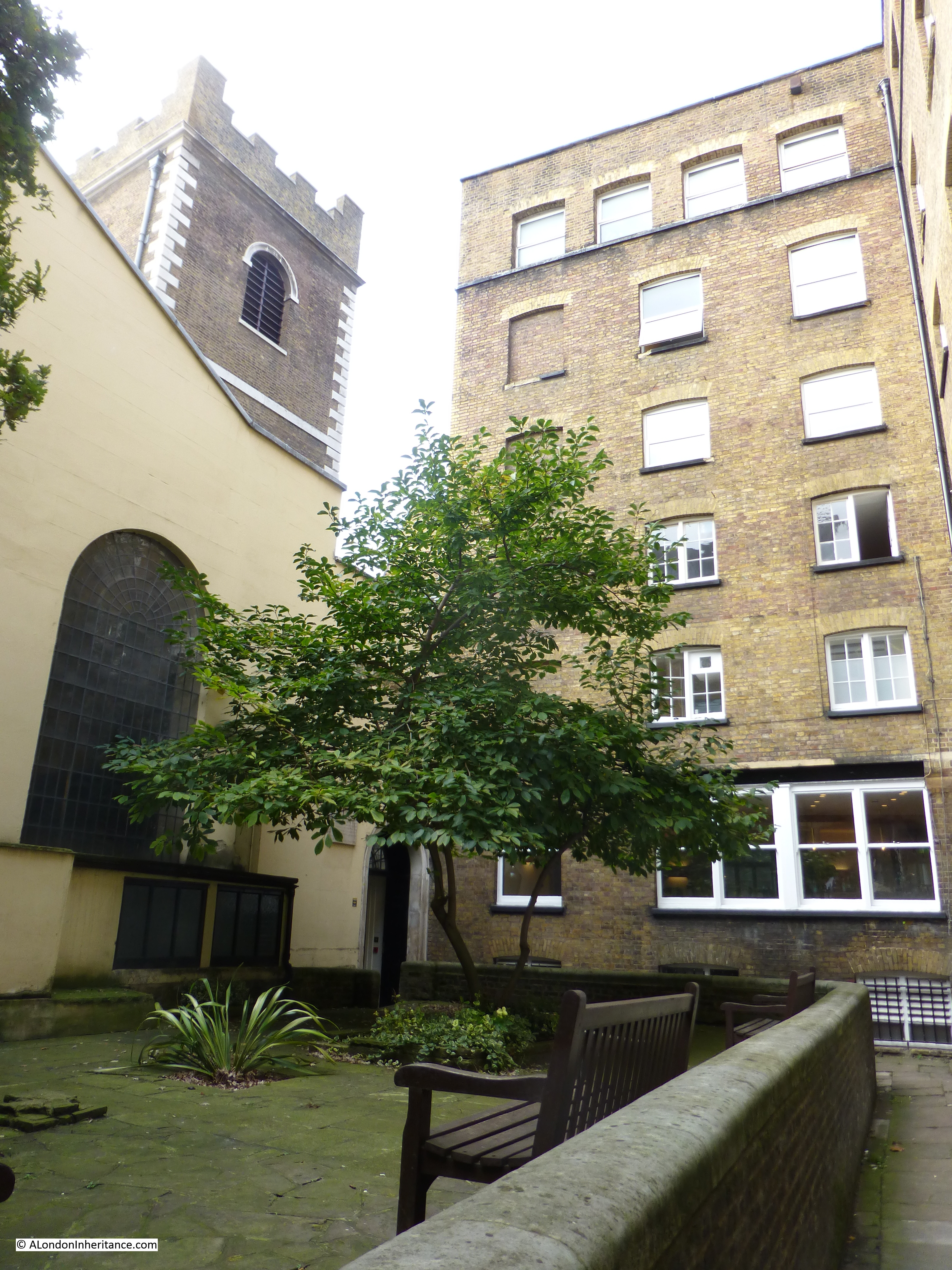
A wider view from Dunster Court showing how the surrounding buildings now tower over the remains of All Hallows Staining.

All Hallows Staining

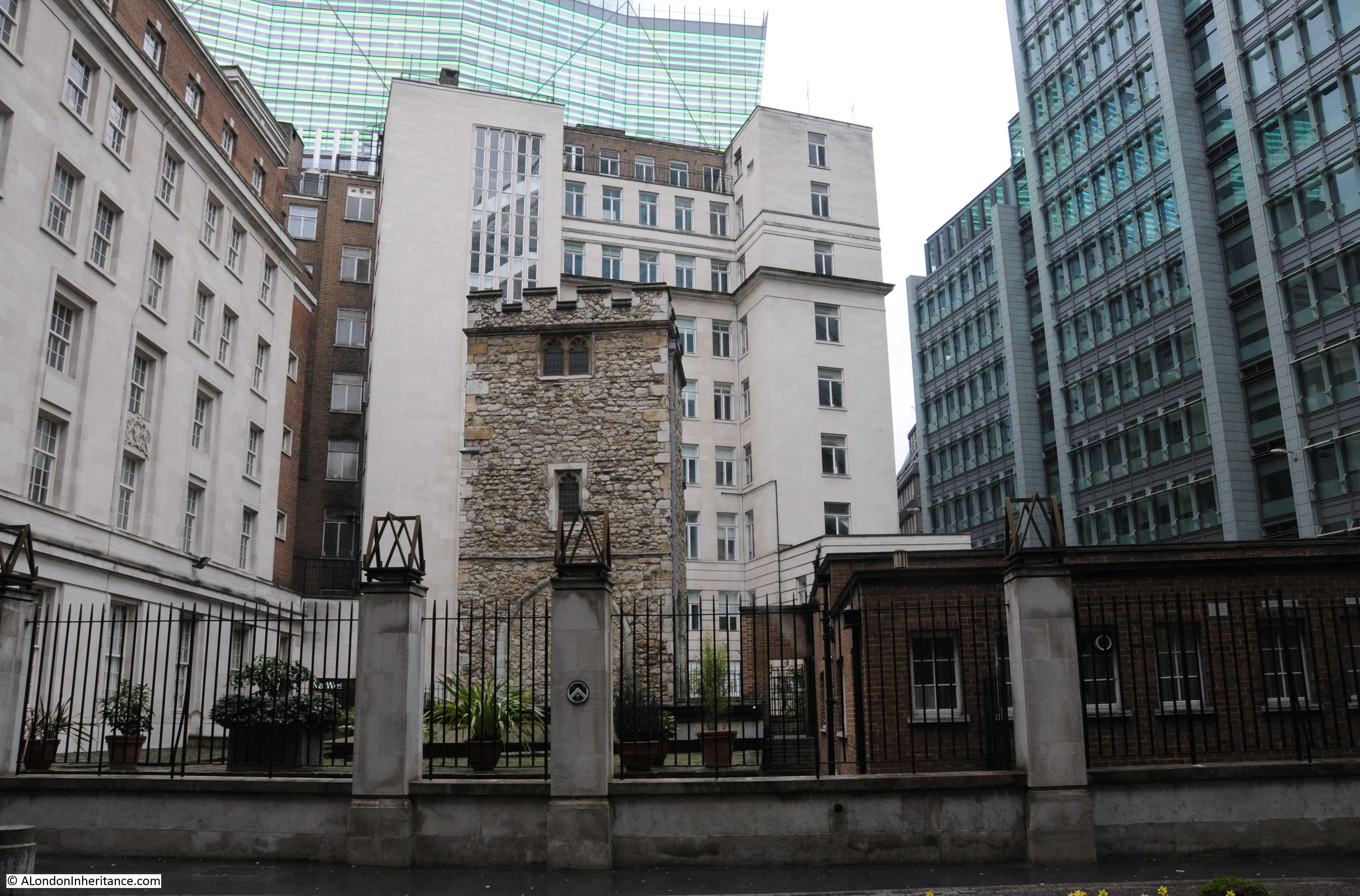
The building on the left of the above photo is the hall of the Clothworkers’ Company. The Hall was severely damaged during the war, and was in the gap on the extreme left of the 1948 photo. The Clothworkers’ lost a significant amount of historic items including the loss of their library.

The Clothworkers’ Company have taken on the maintenance of the tower and crypt of All Hallows Staining. The arms of the Clothworkers’ can be found on the pillars between the old churchyard and Dunster Court.

All Hallows Staining

The tower of All Hallows Staining is very different to the majority of the City churches which typically have a steeple or spire and conform to the style introduced by Wren during the post Great Fire rebuild of the City churches.

This difference in style indicates the age of the church and that it is a survivor from before the Great Fire of 1666.

Writing in his book “London”, George Cunningham describes All Hallows Staining as “one of the earliest London churches to be built of stone – possibly the very first – and if so it must have dated from very early times. The church is first mentioned in 1335, and the tower dates from about a century later. Although the church escaped the Fire in 1666, it fell down in 1671; rebuilt 1673. but removed except for the tower in 1870.”

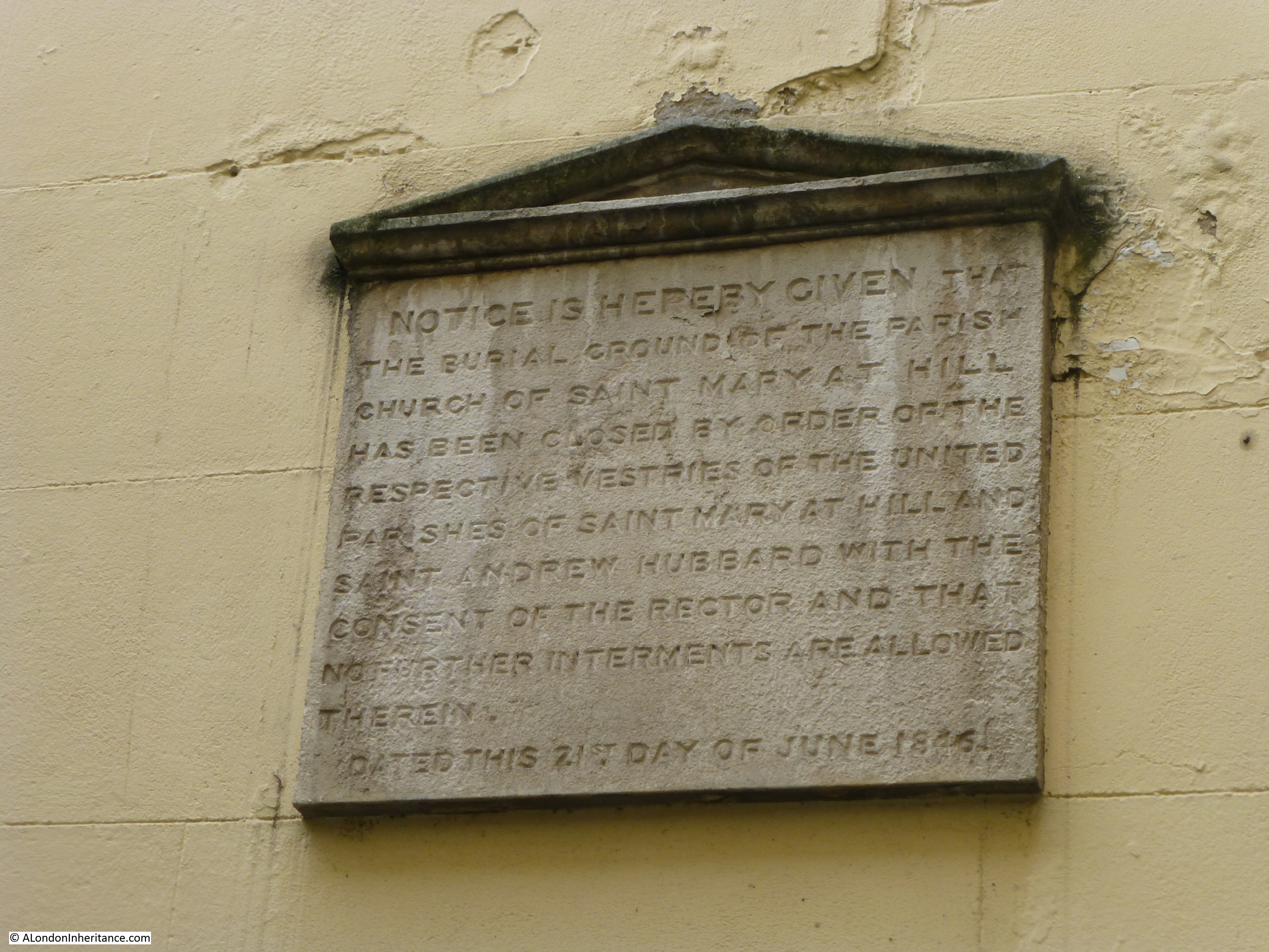
The information plaque in frount of the church attributes the collapse of the main body of the church to the weakening of the foundations due to the large number of burials in the churchyard.

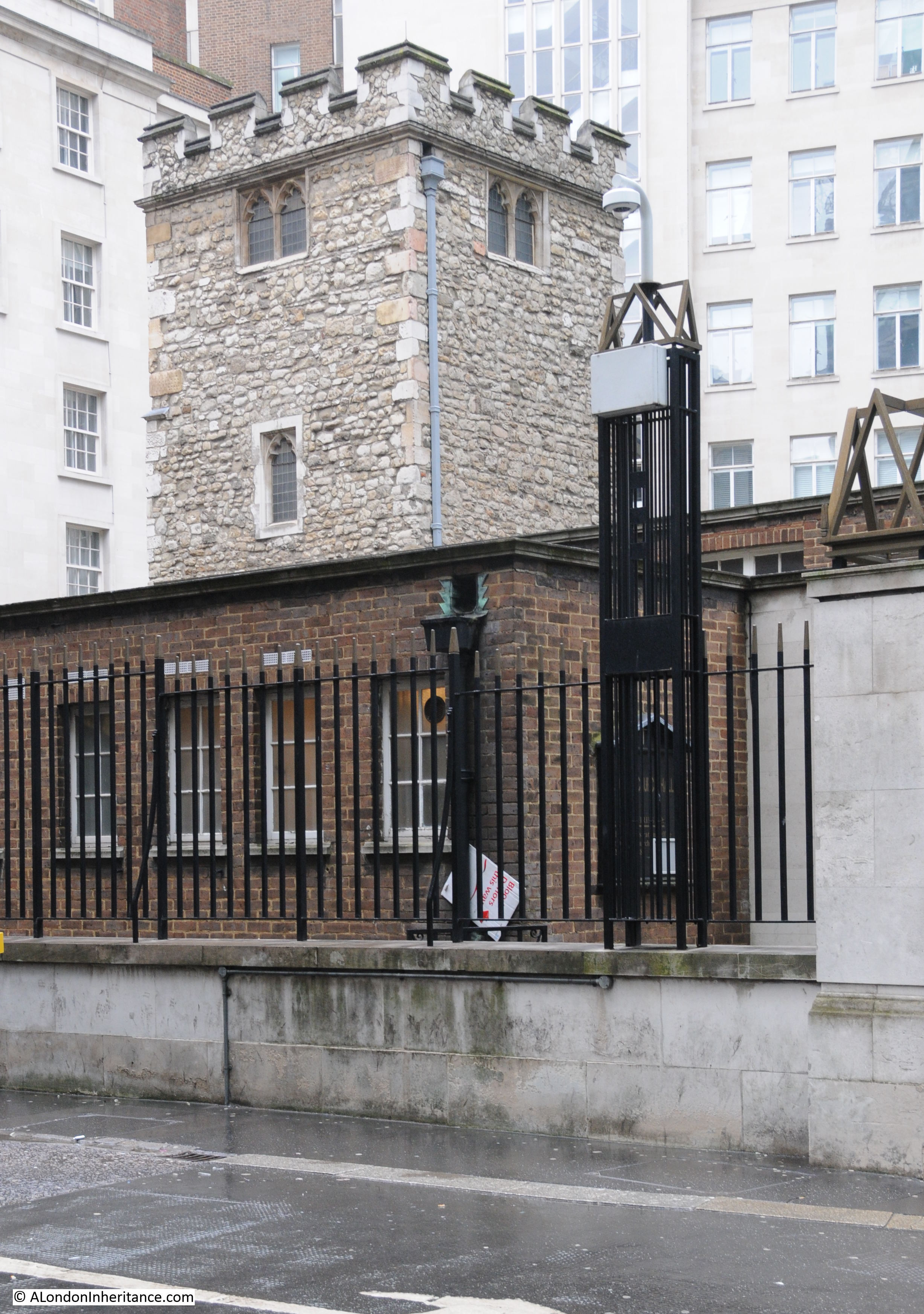
In the Pevsner guide to the City of London, All Hallows Staining is described “Pulled down in 1870 except for the humble and much-restored medieval tower. The church is recorded by the late 12th century. The tower’s lowest stage may be of this date, though the earliest firmly datable feature is the early cinquefoiled two-light west window. The northwest stair turret, late 14th or 15th century seems formerly to have extended to a vanished top stage.”

Writing in “London Churches Before The Great Fire”, (1917) Wilberforce Jenkinson describes All Hallows Staining:

“Of All Hallows Staining, Stow writes:

‘commonly called Stane Church (as may be supposed) for a difference from other Churches, which of old were builded of timber’,

but the explanation is not very satisfactory. He says of a street called Stayning Lane that it was so called of Painter Stainers dwelling there, and that the small Church of St. Mary Stayning took its name from the Lane. Mr. Kingsford, Stow’s latest editor, thinks the name is explained by a reference to the ancient ‘parochia de Stanenetha’ (Stonehithe). Stow adds that most of the ‘fayre monuments of the dead were pulled downe and swept away and that the Churchwardens accounts shewed 12 shillings for brooms’. At the present time all that is left of this church, viz. the square stone tower and part of the churchyard, can be seen from Star Court, Mark Lane.

It would appear that the church was built before 1291. According to the London Register, which commenced in 1306, the first rector was Edward Camel, who died in 1329. The church was not burnt in the Great Fire, although the flames approached very nearly, but not long after the main part of the church fell suddenly. It was rebuilt (in part) at the beginning of the eighteenth century. Portions of the old church remained, for a drawing by West engraved by Toms in 1736, shows the old tower and a portion of the church having a Gothic style window of the decorated period.”

The drawing mentioned by Jenkinson by West and engraved by Toms is shown below:

All Hallows Staining

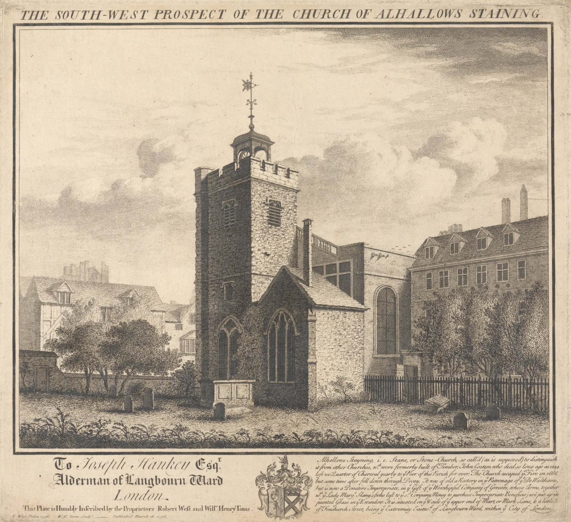
The drawing shows a rustic view of the church with a rather empty churchyard. The enlarged, rounded corner of the church tower (which presumably enclosed spiral stairs leading up to the roof of the tower) is still to be seen and means that we can locate the position of the artist who was in the south west corner of the churchyard. The main body of the church is heading east from the tower towards Mark Lane.

The text at bottom right of the drawing also states the source of Stayning to be from Stone Church to distinguish the church from other wooden churches. The text also records that “John Costyn who died so long ago as 1244 left 100 quarter of Charcoal yearly to ye Poor of the Parish for ever.” Looking around at the buildings in the vicinity of All Hallows Stayning, I doubt there is anyone in need of Charcoal today.

Ten years after the above drawing of the church was completed, John Rocque published his map of London and the following extract shows the area, with the church shown just below the centre of the map:

All Hallows Staining

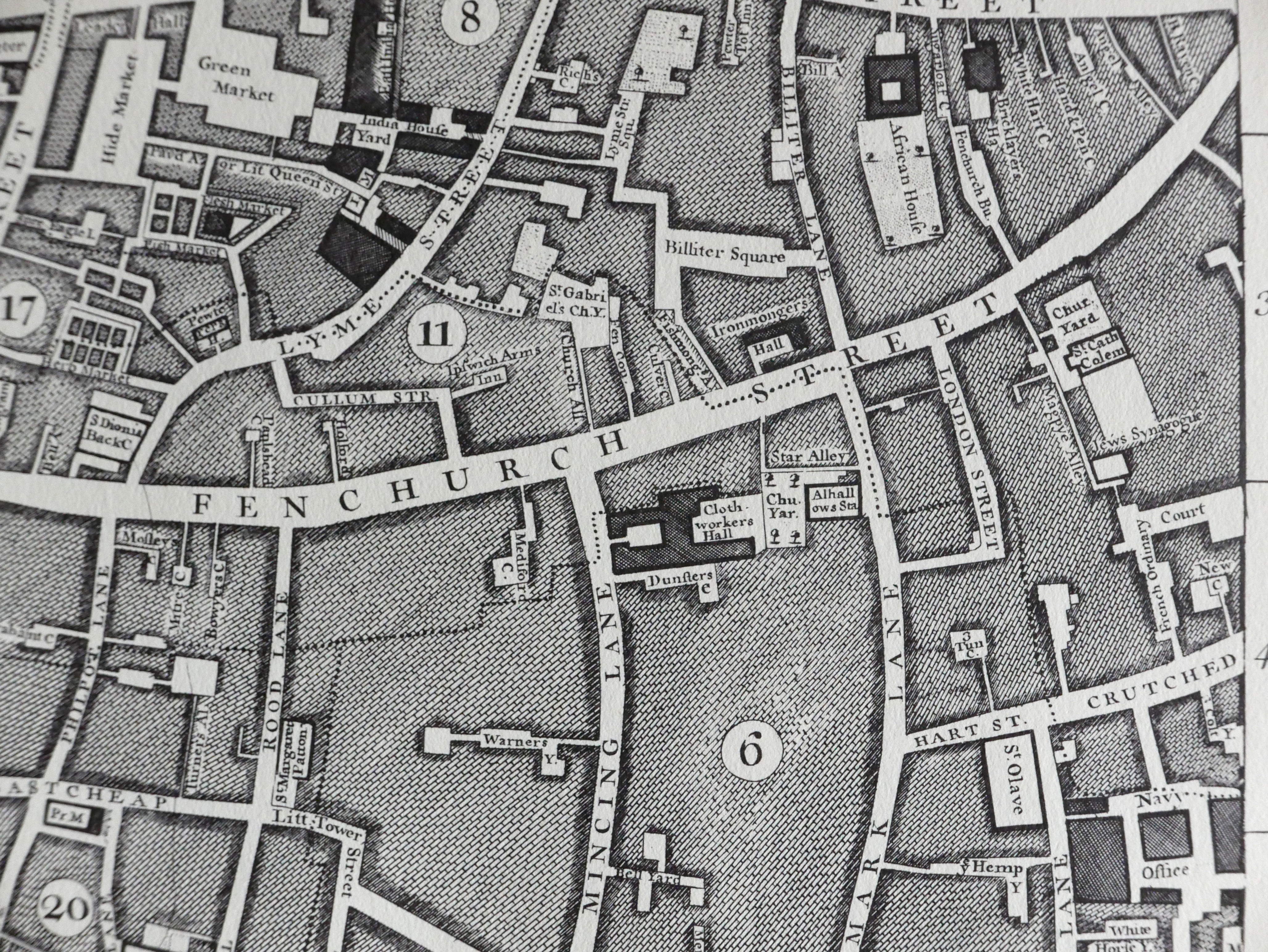
The map shows Fenchurch Street running west to east with Mincing Lane and Mark Lane running to the south. Just below Fenchurch Street and up against Mark Lane can be seen the church with the churchyard to the rear.

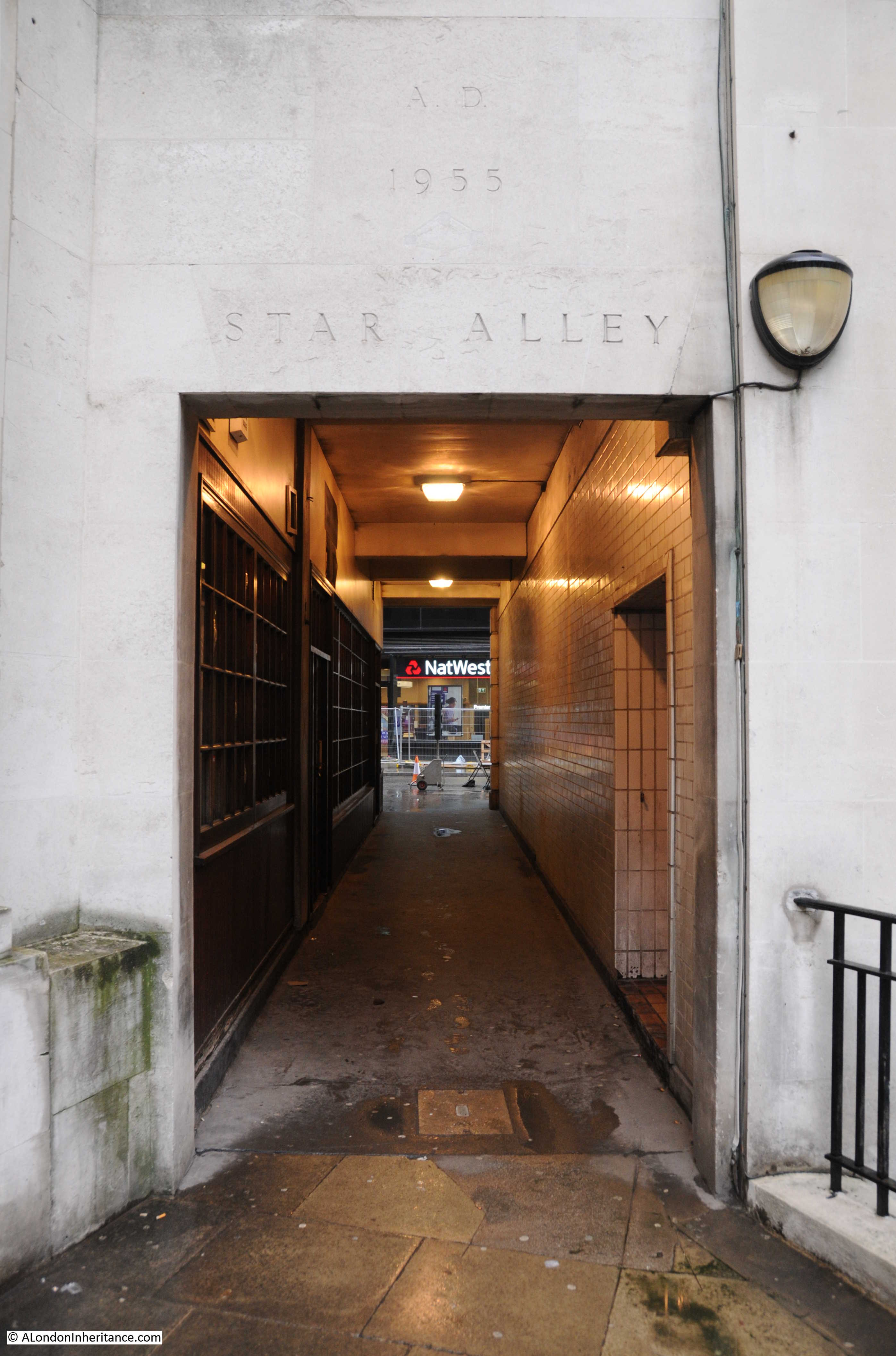
Star Alley is seen running alongside the churchyard before taking a sharp right turn at the end of the churchyard up to Fenchurch Street.

Between the churchyard and Mincing Lane is the Clothworkers Hall and Dunsters Court.

The area is still much the same. Star Alley continues to run alongside the old churchyard and takes a sharp turn up to Fenchurch Street. The Clothworkers’ Hall is still to be found along with Dunster Court to the south of the hall (the ‘s’ at the end of Dunsters appears to have been dropped).

The entrance gates to Dunster Court from Mincing Lane:

All Hallows Staining

The following view is of the north west corner of the tower showing the 14th or 15th century stair turret as described in the Pevsner guide.

All Hallows Staining

The photo was taken in Star Alley at the point where the alley makes a 90 degree bend towards Fenchurch Street.

From this point, a solitary grave can be seen in all that remains of the churchyard:

All Hallows Staining

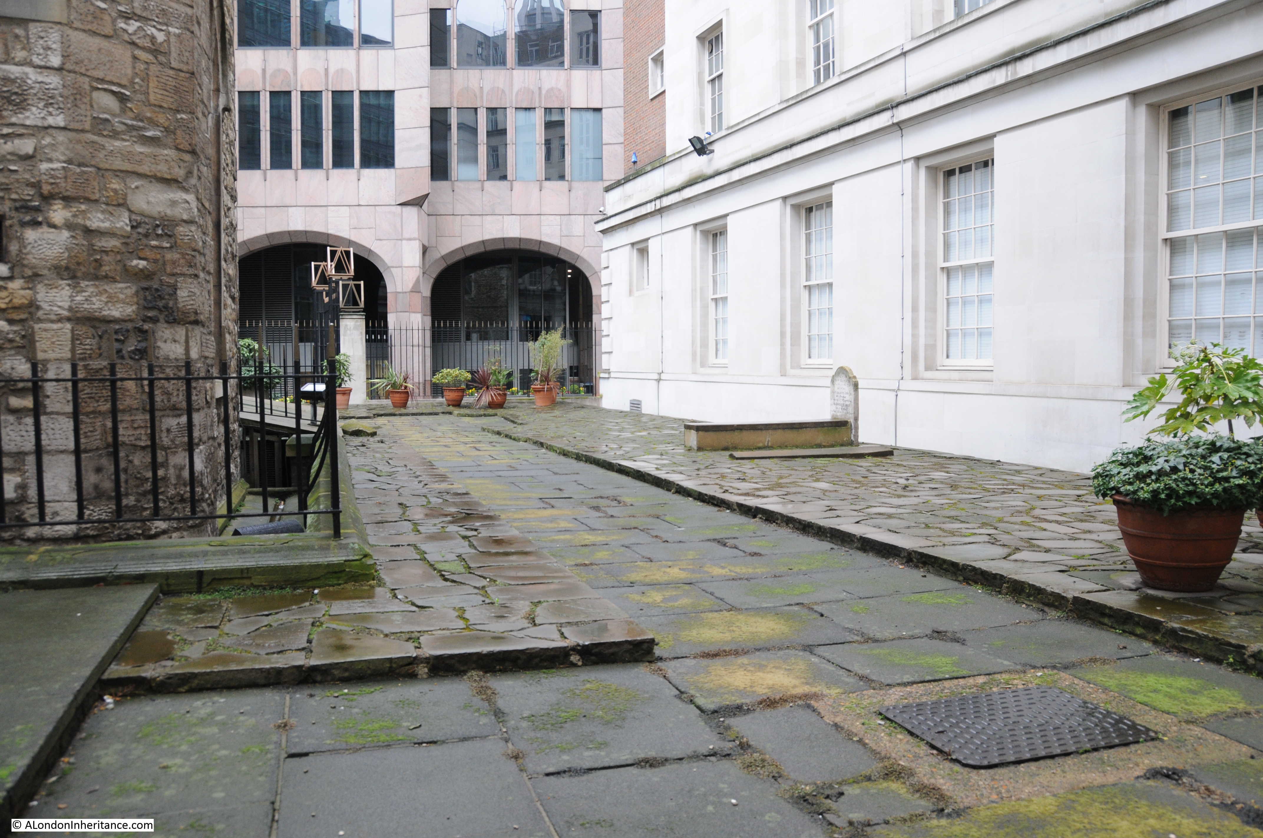
The grave is from the 1790s (I could not make out the last digit) and is of John Barker, his wife Margaret and their son Robert.

It is always worthwhile looking at surrounding buildings. On walking into Star Alley from Mark Lane, I found the two tiles shown in the following photo stuck to the wall bordering Star Alley. No idea of what they mean, for how long or why they are there, but the tiles appear to be about the construction industry that is so much a part of the City.

All Hallows Staining

Star Alley runs alongside the old churchyard, and at the end of the churchyard it makes a 90 degree bend where it then runs through the surroundings buildings to Fenchurch Street. It is good to see that the exact alignment of Star Alley as shown in Rocque’s 1746 map has been retained.

All Hallows Staining

It is remarkable that the tower of All Hallows Staining has survived for so long without a functioning church. The tower, churchyard, Star Alley, Dunster Court and the Clothworkers’ Hall form a small City landscape that is the same as mapped in 1746 and may date back to around 1456 when the Shearmen (the predecessors of the Clothworkers’ Company) purchased the land in Mincing Lane.

alondoninheritance.com

St Mary At Hill And Lovat Lane

My posts of last weekend covered some of the extensive damage suffered by the City of London during the war. Fortunately there were areas that escaped with only light, cosmetic damage and have also survived the considerable development in the intervening 70 years. Places remain where it is still possible to get an impression of what London was like as a city of narrow lanes.

The church of St Mary At Hill is best approached not by the road of the same name, but turn off the busy East Cheap / Great Tower Street and head down Lovat Lane. This is the scene which meets you.

st mary at hill 1

Lovat Lane is a narrow lane that heads down to Lower Thames Street and retains the width of many of the city lanes prior to the war. Buildings face directly onto the lane and we can see the tower of St Mary at Hill which, unusually for a City church, still appears to be higher than the immediate surroundings.

The name Lovat Lane is recent. The lane was originally called Love Lane and was changed around 1939 to avoid confusion with the Love Lane further north off Wood Street. This change also appears to have justified the lane being included on maps. In the Bartholomew’s London Atlas for 1913, Love Lane is included in the index and referenced to the correct grid square in the map, however it is not shown. In the 1940 Bartholomew’s Atlas, the name has now been changed to Lovat Lane and is shown on the map. Various early references attribute the original name as being due to the frequenting of the lane by prostitutes, however this may be wrongly using the same source for the other Love Lane which Stow refers to as being “so-called of wantons”. The new name Lovat was chosen due to the quantity of salmon being delivered to Billingsgate Market from the fisheries of Lord Lovat.

As with many other City churches, a church has been recorded as being on the site since before the 12th century. The church was severely damaged in the 1666 Great Fire and then came under the rebuilding programme of City churches managed by Wren, however it was probably Wren’s assistant Robert Hooke who was responsible for much of the design and reconstruction of the church. The “At-Hill” part of the name is due to the church being located up the hill from Billingsgate and the downwards slope of Lovat Lane is one of the locations where the original topography of the City can still be seen with the streets sloping down from the higher ground down to the river.

Despite the central location of St. Mary, the church survived the blitz, although a fire in 1988 severely damaged the Victorian woodwork, the organ and the ceiling, however the interior has been superbly restored.

Before entering the church, walk past the church and look back up Lovat Lane, again we get a really good impression of what the narrow city lanes would have looked like. Remove the modern-day signage and add some dirt to the road surface and soot stain to the brick walls and we could have travelled back in time.

st mary at hill 7

Although just as we walk back up to enter the church, the modern-day City intrudes:

st mary at hill 8

The church prior to the Great Fire, in common with many other City churches of the time had a spire. These were made of wood and covered in lead. In 1479 the church of St. Mary at Hill paid “Christopher the Carpenter” 20 shillings to take down the spire and 53 shillings to rebuild using 800 boards, two loads of lead, nails and ironwork costing 14s 7d.

On entering the church we can see the following carved Resurrection Panel.

st mary at hill 6

From the information sheet;

“The Last Judgement relief is a very unusual example of late 17th century English religious carving, and most likely dates from the 1670s. Its carver is unknown, but we do know  that the prominent City mason Joshua Marshall was responsible for the rebuilding of the church in 1670-74: his workshop may have produced the relief.  Exactly where the relief was originally positioned is uncertain; most likely it stood over the entrance to the parish burial ground and was brought inside in more recent times.

St. Mary-at-Hill’s relief is one of a small number of Last Judgement scenes carved in later 17th century London.”

We can now enter the main body of the church and a wide space opens up before us, surprising considering the external appearance from Lovat Lane:

st mary at hill 5

The restoration following the 1988 fire created a very simple interior. The original box pews were lost and not replaced leaving a large open space from where we can look up and admire the interior of the roof, restored following the fire of 1988:

st mary at hill 2Again a surprise given the external appearance of the church from Lovat lane.

Within the church before the Great Fire was a large Rood, a cross or crucifix set above the entry to the chancel. In 1426 a new Rood was installed at St. Mary at Hill and cost £36, a very considerable sum at the time. A great stone arch was built to support the Rood, however in 1496 the arch required underpinning to support the weight and to achieve this the church procured three stays and a “forthright dog of iron” weighing 50 pounds.

At the same time the Rood was renovated and we can get an idea of what this must have looked like by the items that were included in the renovation:

– to the carver for making of three diadems, and of one of the Evangelists and for mending the Rood, the Cross, the Mary and John, the crown of thorns and all other faults

– paid to Underwood for painting and gilding of the Rood, the Cross, Mary and John, the four Evangelists and three diadems

It must have been a very impressive sight. The work was funded through a subscription being raised across the parish. Parishioners contributed a considerable sum towards the upkeep and decoration of their church. In 1487 a parishioner, Mistress Agnes Breten paid £27 to have a tabernacle of Our Lady painted and gilded. In 1519 a parishioner provided a large carved tablet to hang over the high altar at a cost of £20. Thirty years later at the time of the reformation the tablet had to be sold and only raised 4s 8d, a time that marked the end of the type of church decoration that had persisted from the medieval period.

Back towards the entrance is the magnificent organ, built by the London organ manufacturer William Hill in 1848. It is the largest surviving  example of his early work and reputed to be one of the ten most important organs in the history of British organ building. William Hill worked for the organ builder Thomas Elliot from 1825 until Elliot’s death in 1832. He had married Elliot’s daughter so on his death he inherited the company. The Hill’s workshop was London-based in St. Pancras and was known for building organ’s of the highest quality, providing organs for many important locations including Birmingham Town Hall and York Minster. The business continued until 1916 when Hill and Son as the company was known amalgamated with another organ builder Norman and Beard of Norwich. The combined company of Hill, Norman & Beard diversified into cinema organs in addition to church organs, however the limited market for these specialist products resulted in the company closing in the 1970s.

st mary at hill 3The organ was restored following the fire of 1988 and rededicated in 2002.

The church has one more secret to reveal. Step through the side door and we are out into what remains of the churchyard. Totally enclosed on all sides and only accessible either through the church or through the small alley at the far end of the churchyard which leads through to the street of St. Mary-at-Hill.

st mary at hill 9A plaque on the wall informs us that “the burial ground of the parish church of St. Mary-at-Hill has been closed by order of the respective vestries of the united parishes of St. Mary-at-Hill and Saint Andrew Hubbard with the consent of the rector and that no further interments are allowed therein – Dated this 21st day of June 1846.” Following closure, all human remains from the churchyard, vaults and crypts were removed and reburied in West Norwood cemetery.

st mary at hill 10The reference to St Andrew Hubbard is an example of the consolidation of parishes after the 1666 Great Fire, The church of St Andrew Hubbard was not rebuilt and the parish integrated with that of St. Mary at Hill.

Looking back towards the doorway we can see, above the round window some of the original fabric exposed .

st mary at hill 11

And at the end of the churchyard, one final look back before entering the short alley that takes us into the street of St. Mary at Hill.

st mary at hill 12

With not too much imagination, Lovat Lane and St. Mary at Hill provide a glimpse of what the City of London was like when many of the City streets were lanes and churches stood tall above their surroundings. Highly recommended for a visit.

St. Mary at Hill is regularly opened by the Friends of City Churches

The sources I used to research this post are:

  • The Old Churches Of London by Gerald Cobb published 1942
  • Old Parish Life In London by Charles Pendrill published 1937
  • Historic Streets of London by Lilian & Ashmore Russan published 1923
  • London by George H. Cunningham published 1927
  • Old & New London by Edward Walford published 1878
  • Bartholomew’s London Atlas, 1913 and 1940 editions

 alondoninheritance.com