Tag Archives: London Wall

Fire, Blitz and Route 11 – How Two Historic City Walls Have Survived The Centuries

I find it fascinating comparing my father’s photos of the bombed City with London of today. Exploring how much has changed, how the long history of the City survived, and despite how much has changed over the last seventy plus years, how much remains the same.

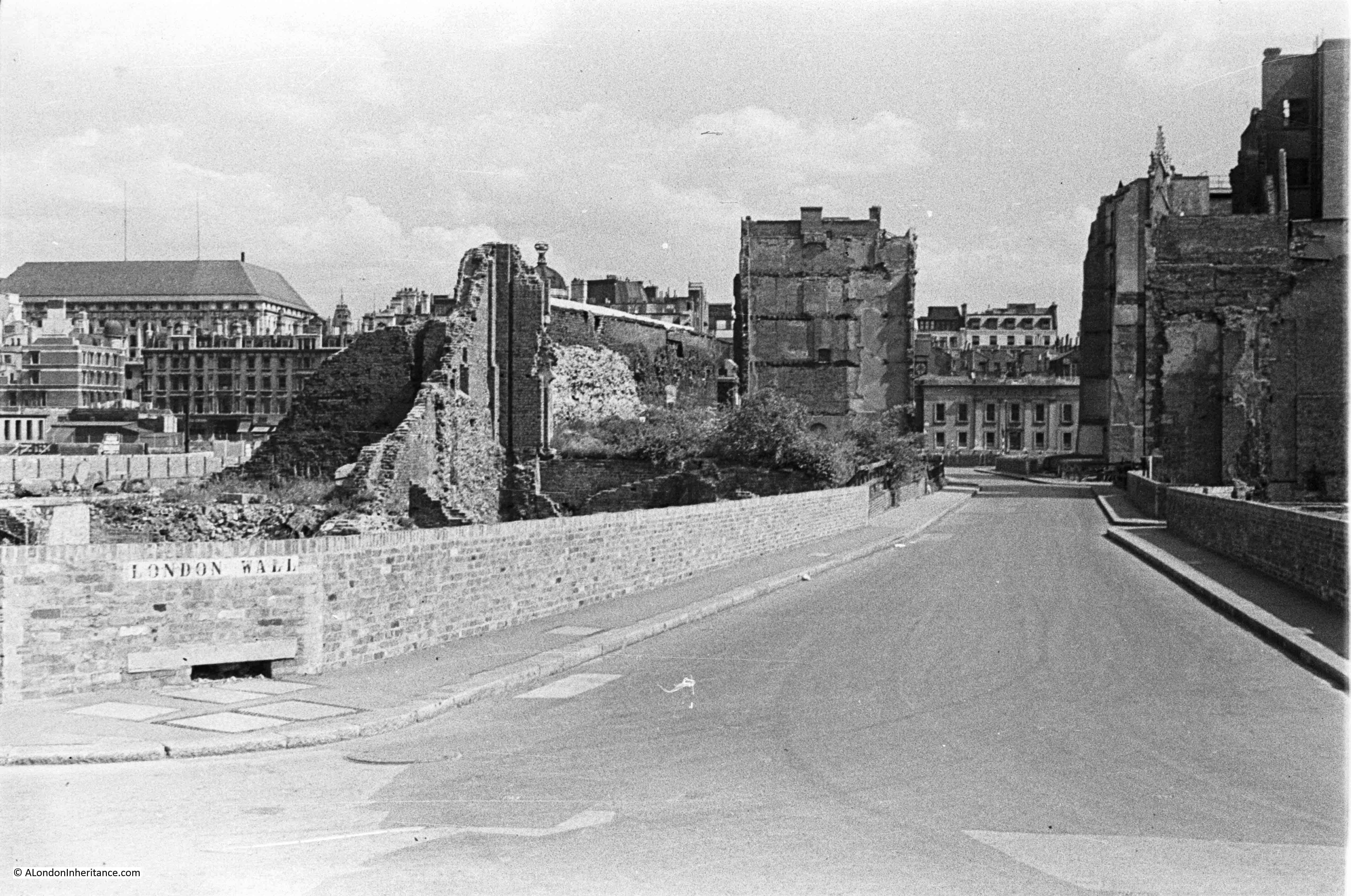
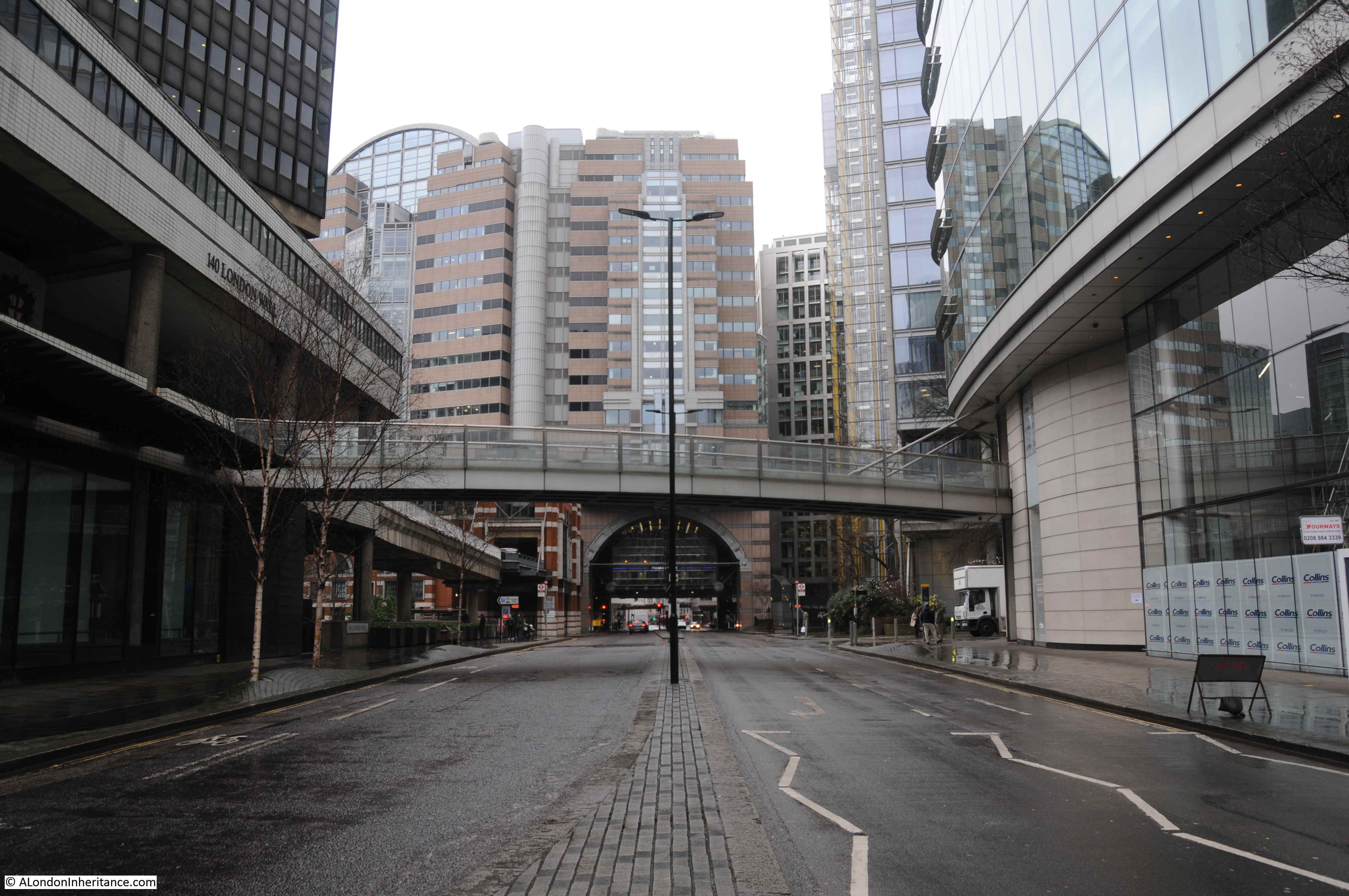
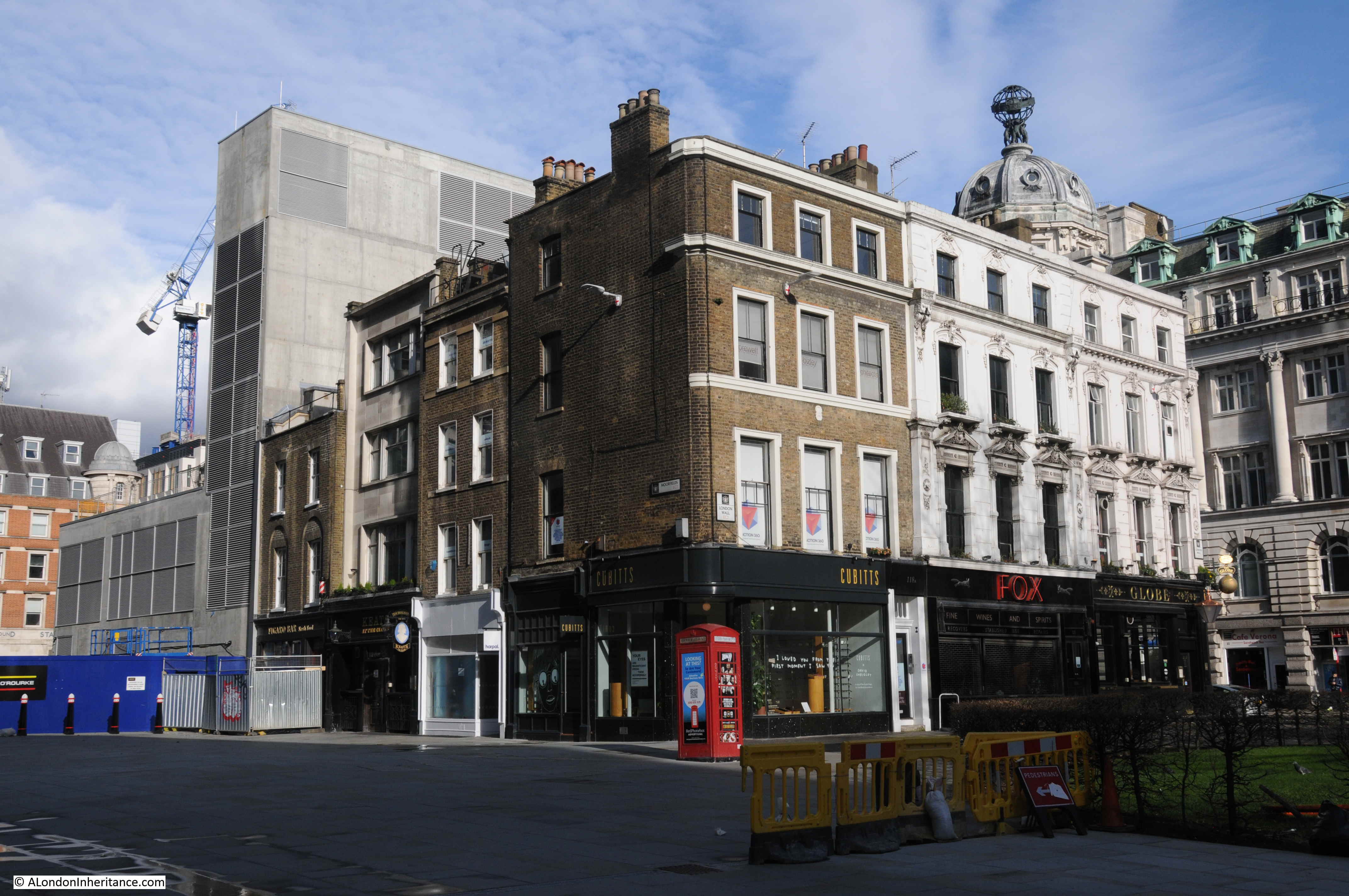
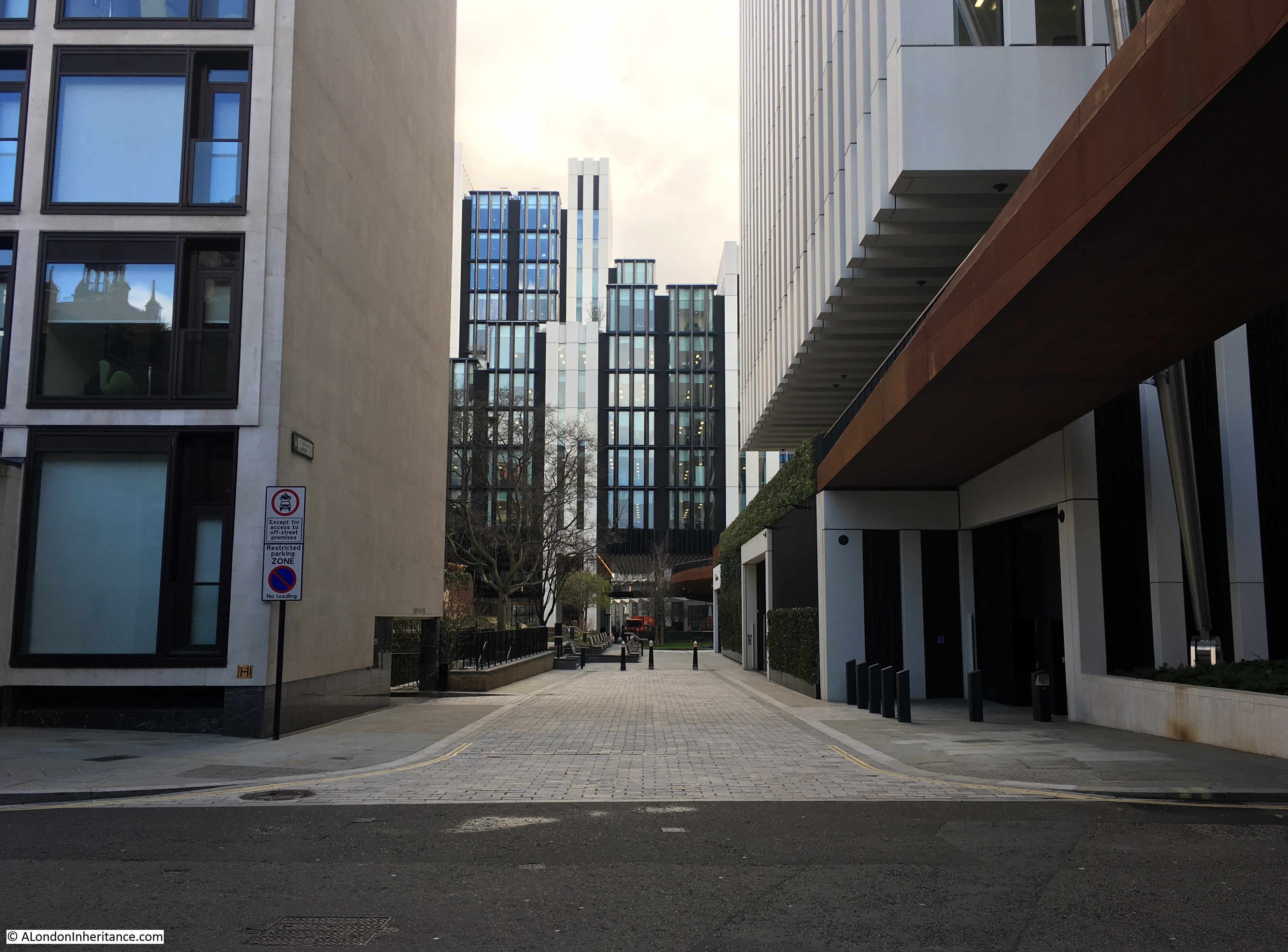
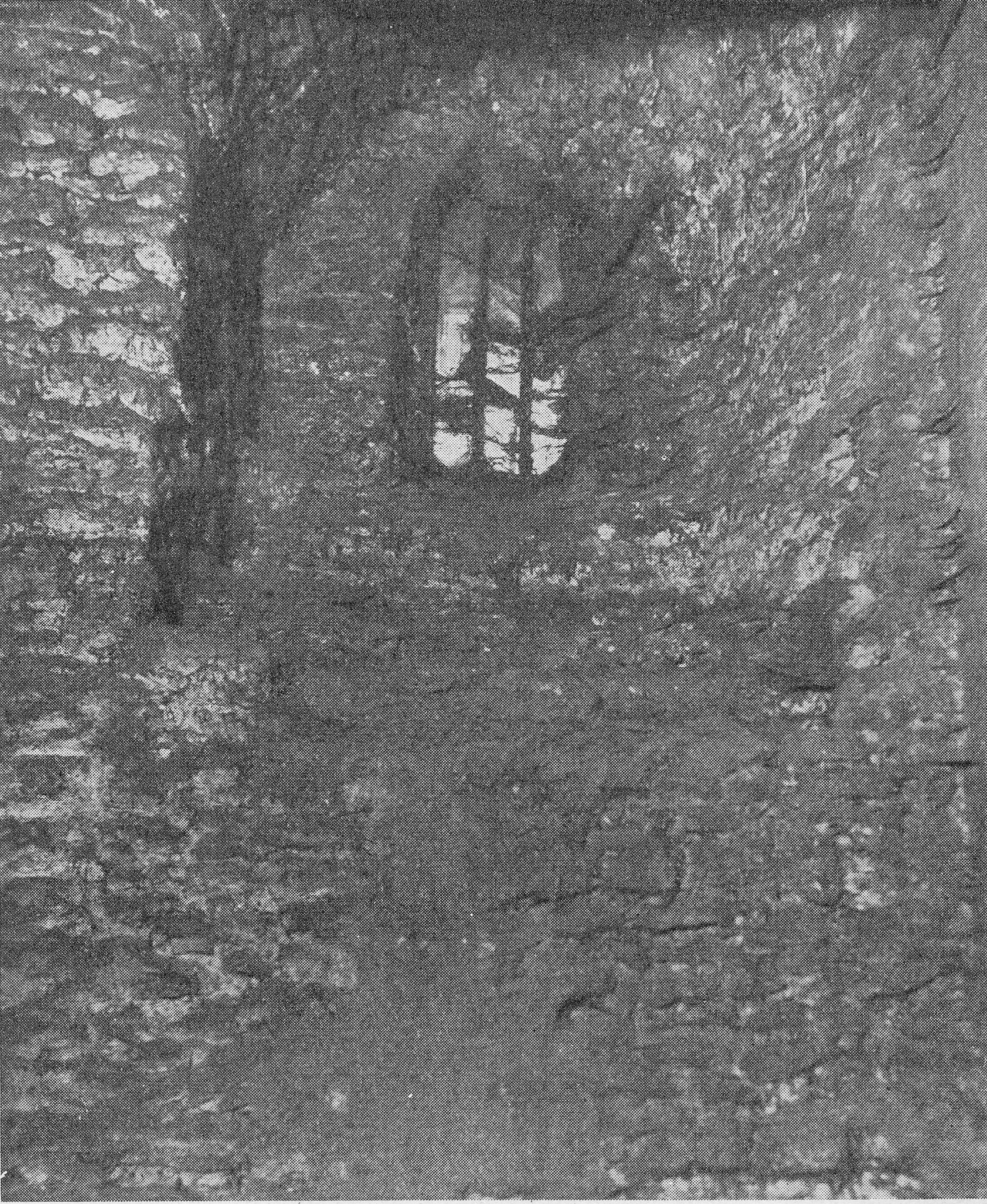
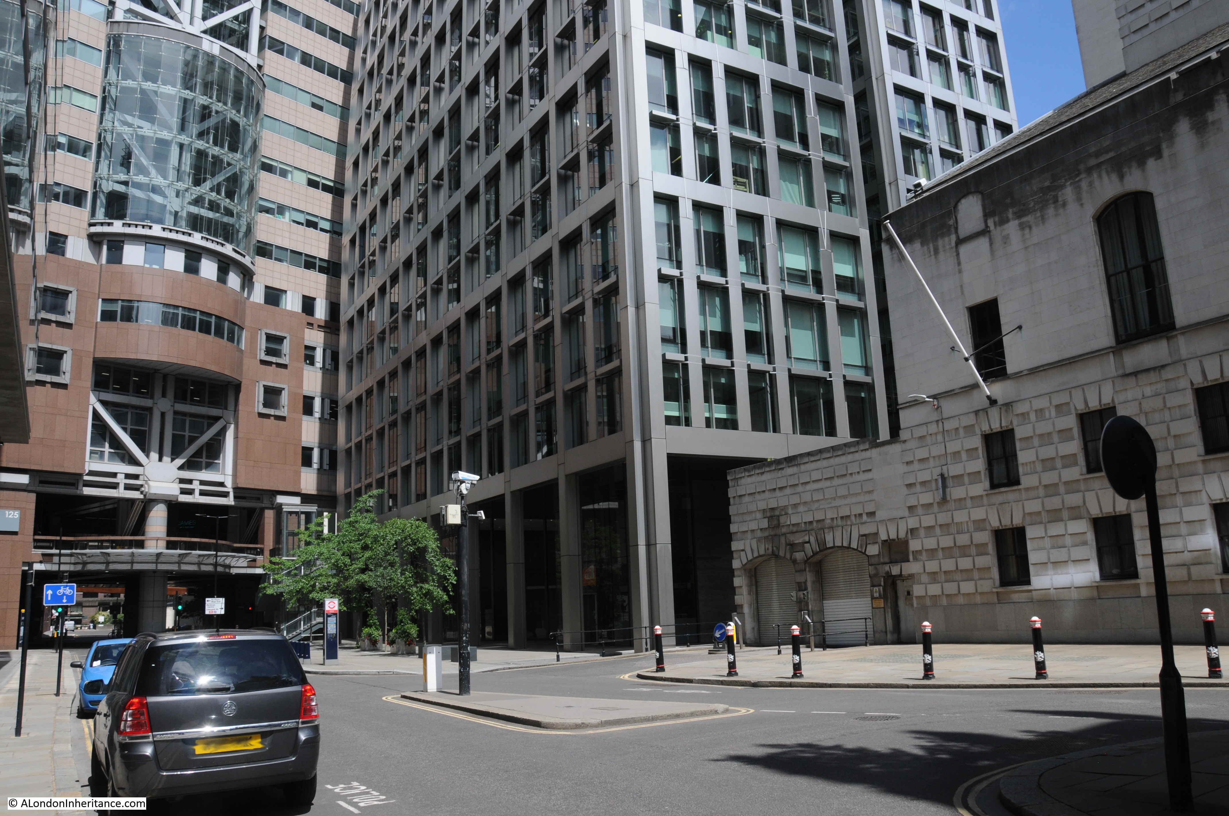
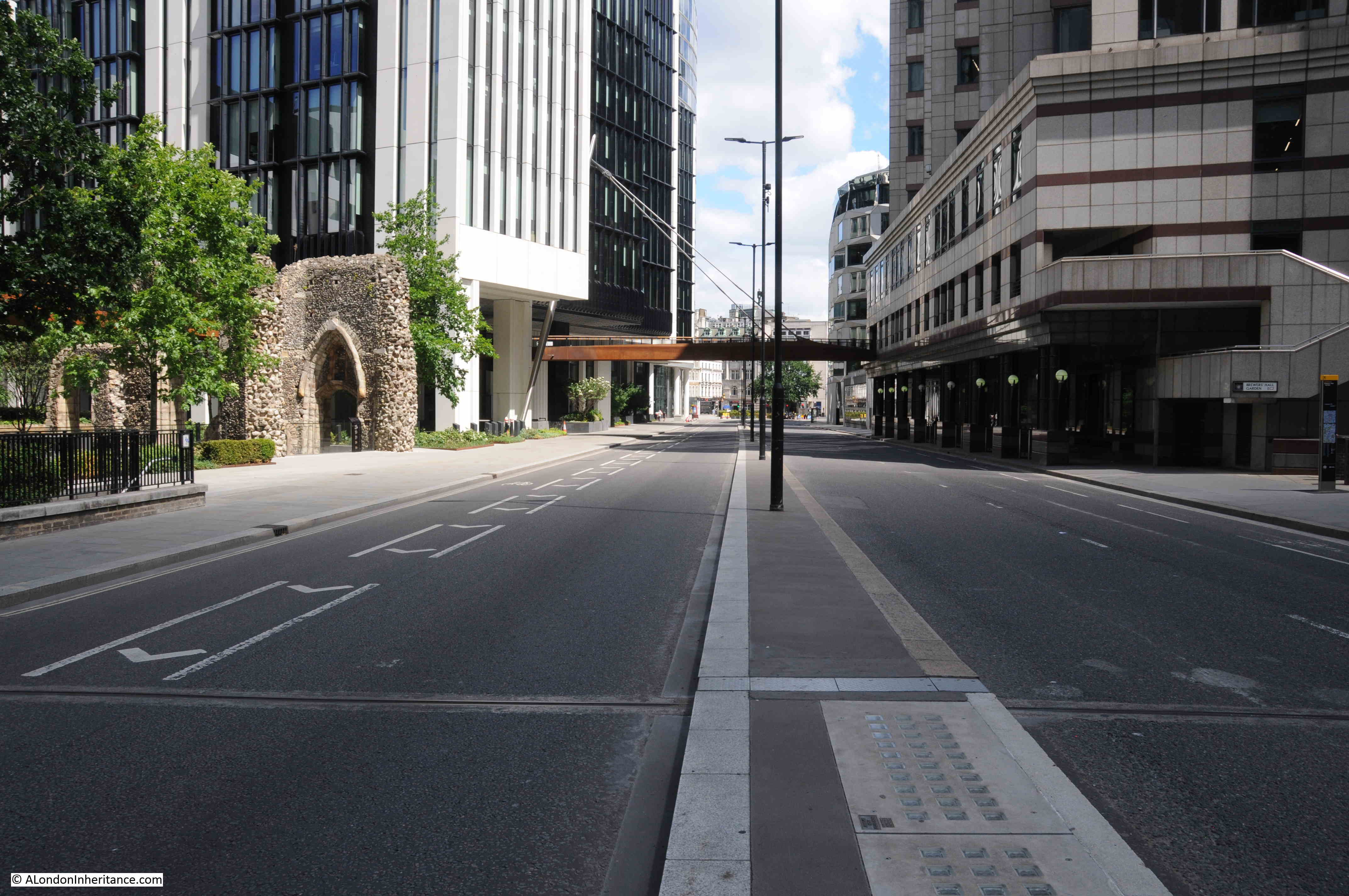
The following photo was taken in Wood Street looking roughly north east.

St Alphage

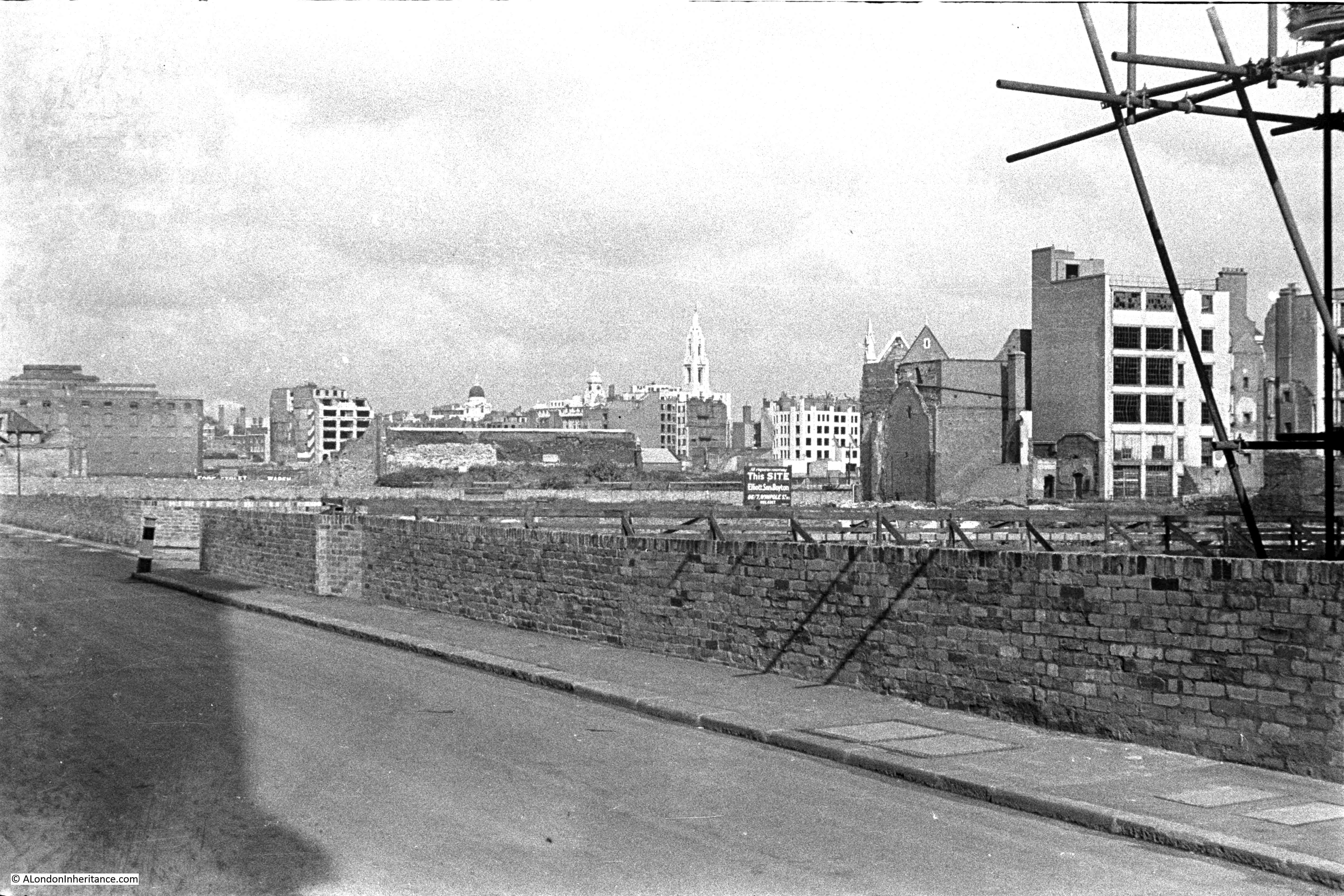
I know the exact spot where my father was standing to take the photo, and there are a number of landmarks that can be identified. I have marked these on the photo below, and will explore them in today’s post.

St Alphage

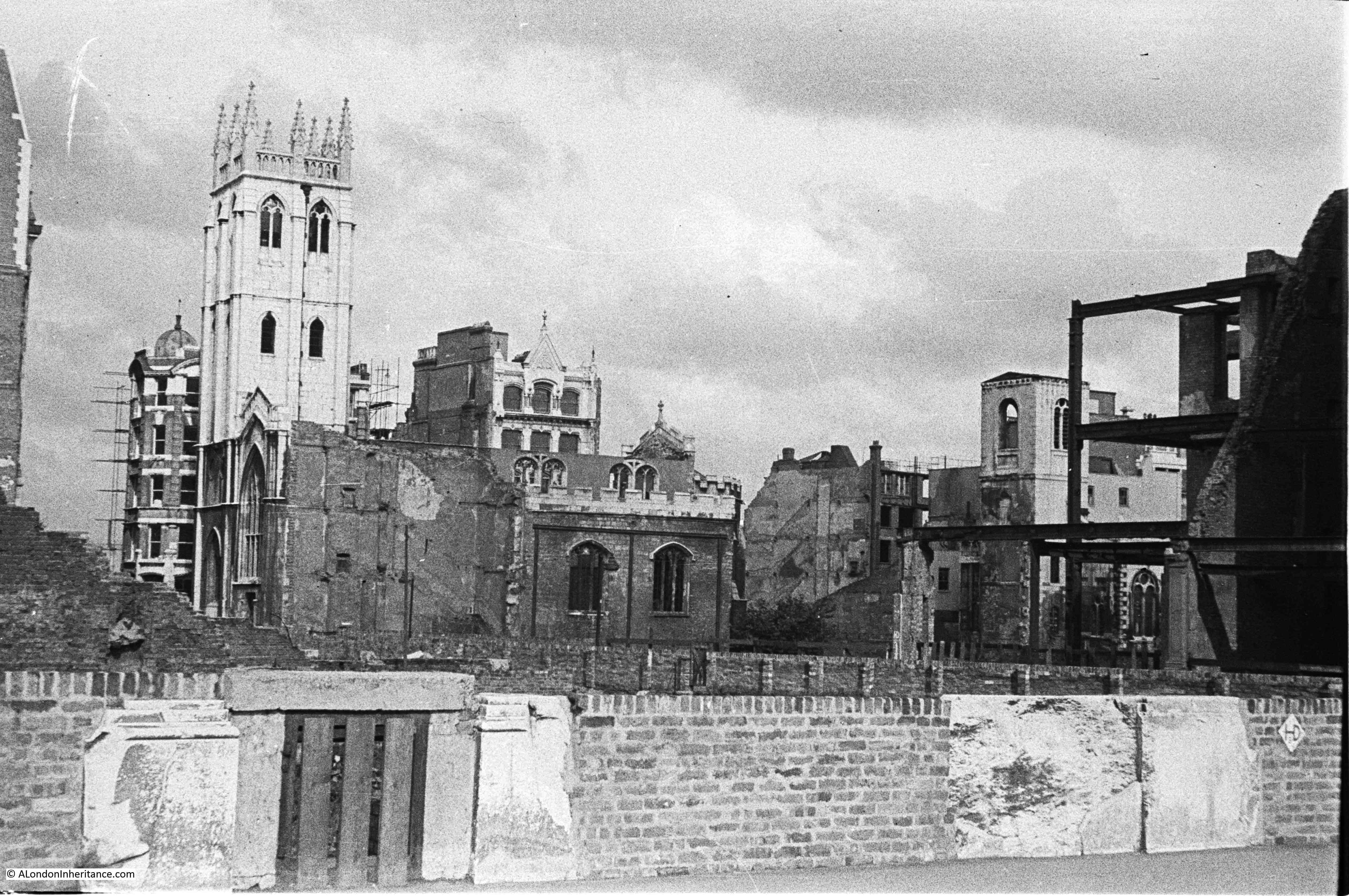
Firstly, the photo was taken from Wood Street, a short distance north of the tower of the church of St Alban. The following photo is from my post of a couple of weeks ago on the churches of St Alban and St Mary. Just behind the tower of St Alban is a building with scaffolding projecting from the side. This is the same scaffolding seen in the photo above.

St Alphage

I am trying to work out a way to bring together all the photos of the bombed City to provide a comprehensive walk through of the City in 1947 – not sure the best way to do this yet but they provide a detailed view of the bombed City that my father witnessed.

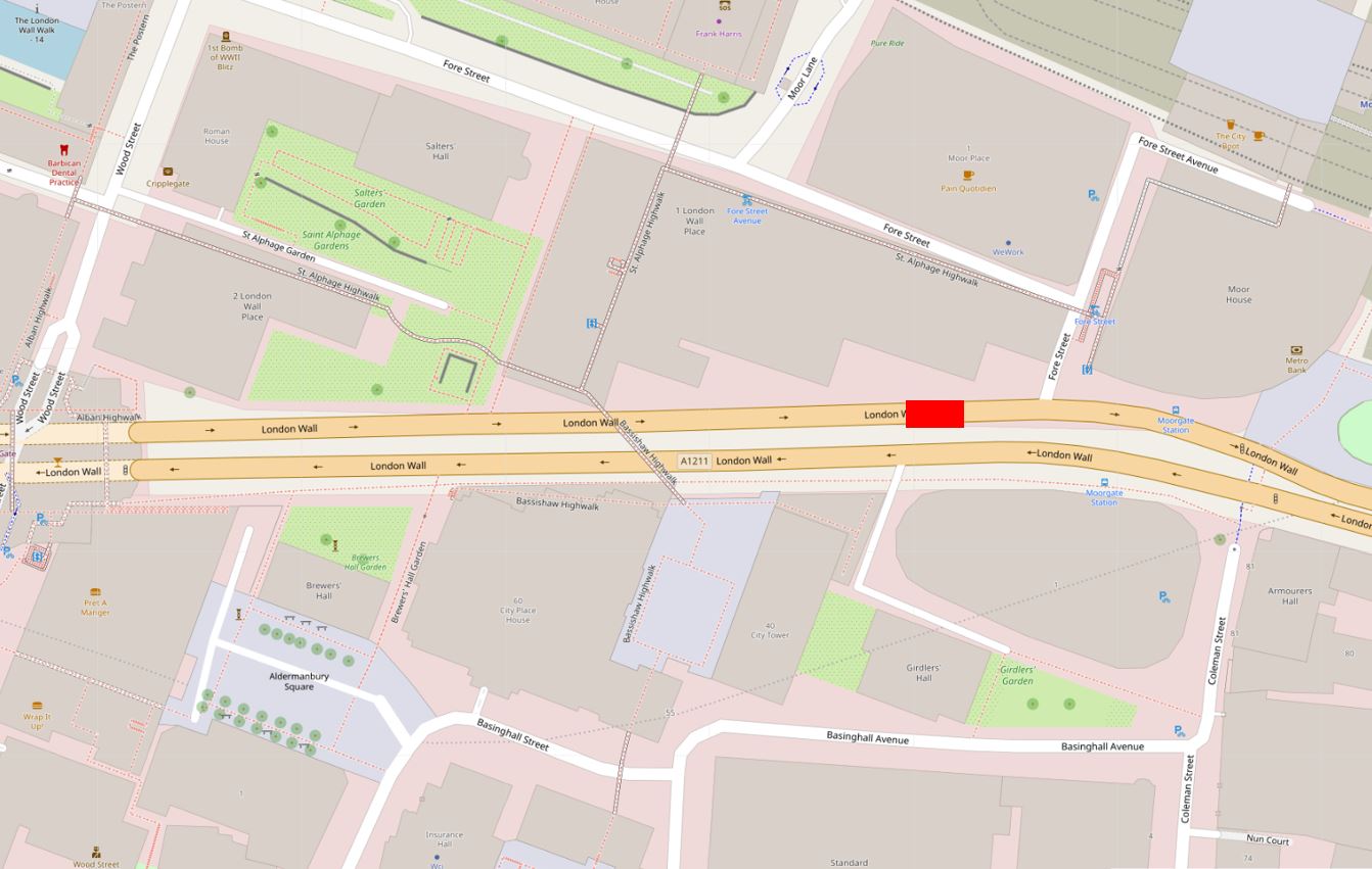
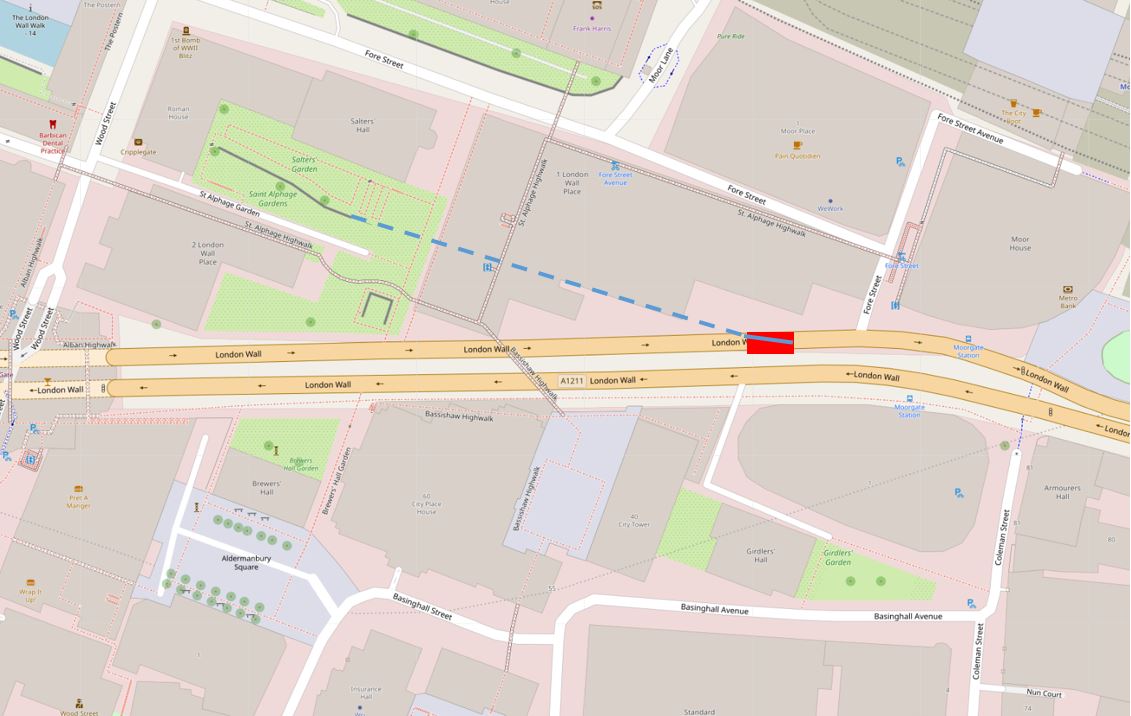
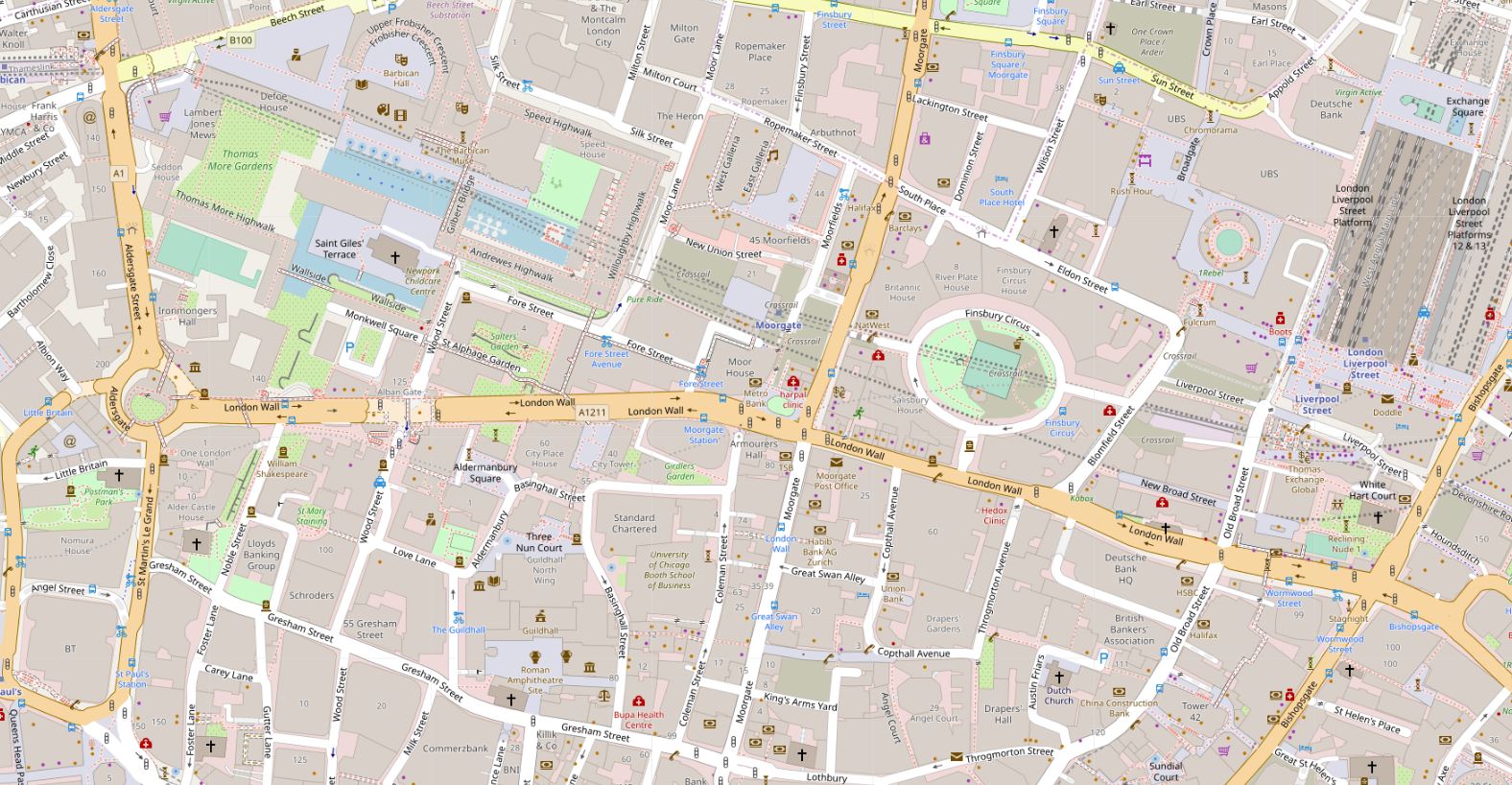
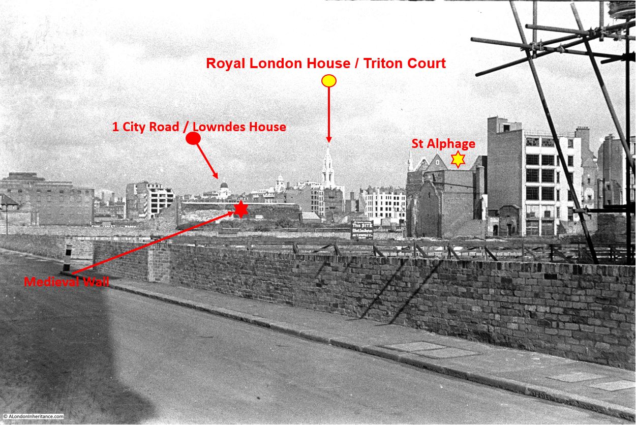
From the Wood Street viewpoint, the following map extract shows the landmarks identified in the photo. I have used the same symbols as in the above photo (Map © OpenStreetMap contributors).

St Alphage

The following photo shows the view from the same place that my father was standing at, in 1947. A very different view with none of the landmarks visible.

St Alphage

The shadow of the tower of St Alban is on the lower right corner, and the building with the scaffolding would have been on the right, with the scaffolding protruding into the edge of the photo.

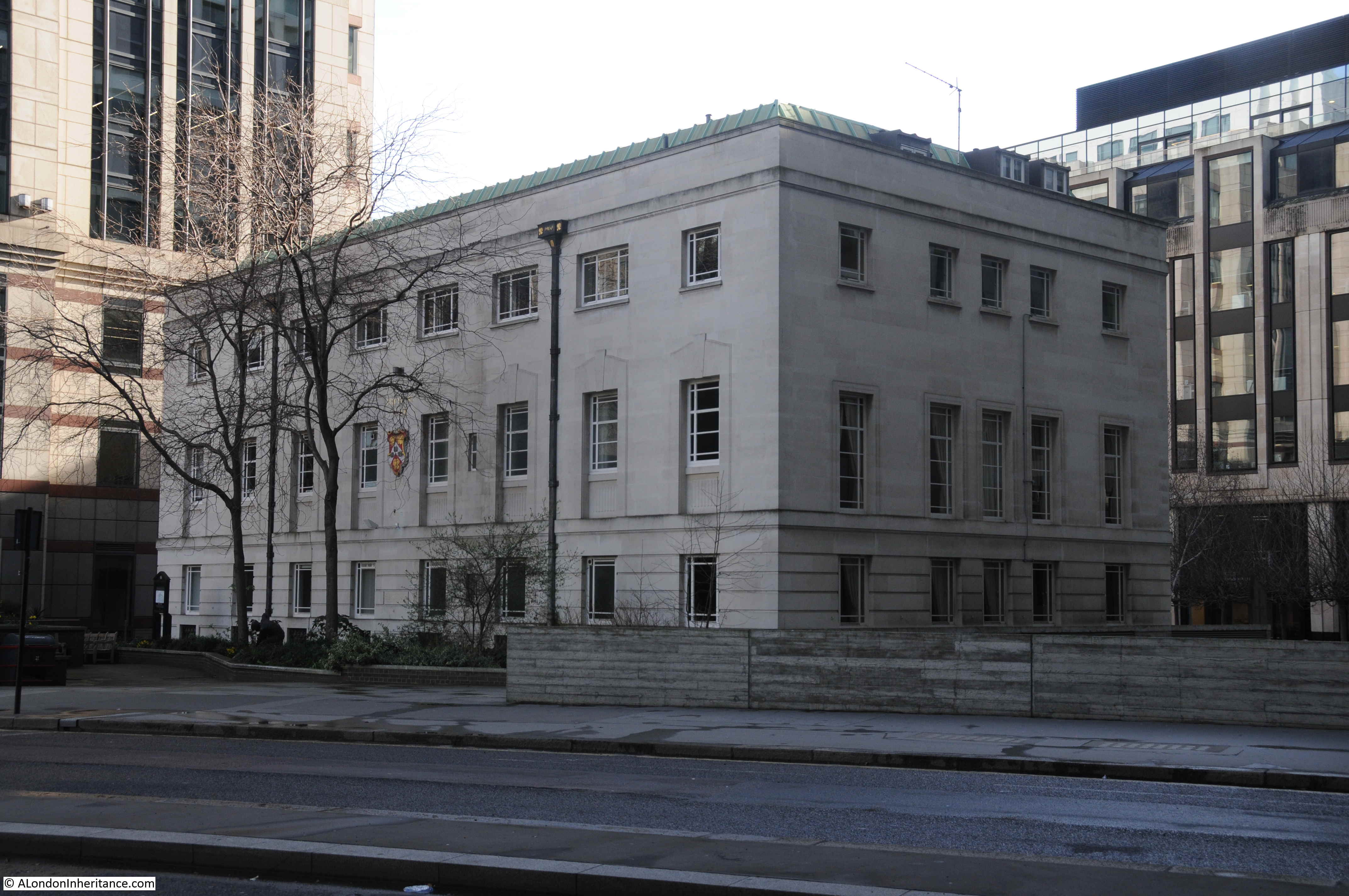
The rather solid looking building on the right of the above photo is the Wood Street City of London police building, constructed in 1965.

In the 1947 photo there is a street entrance on the right. This was Addle Street, a street that has been lost in the development of the area. It was roughly just after the tree in the above photo.

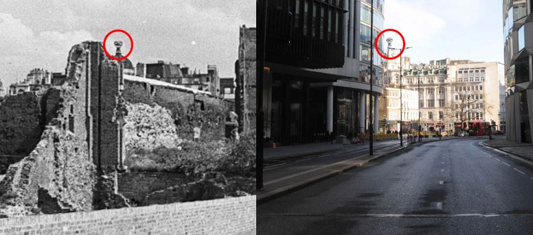
Looking at the landmarks in the distance, and one of the most distinctive is a tall tower which I have marked with a yellow circle in the map and photo. This building can still be found on the north side of Finsbury Square.

St Alphage

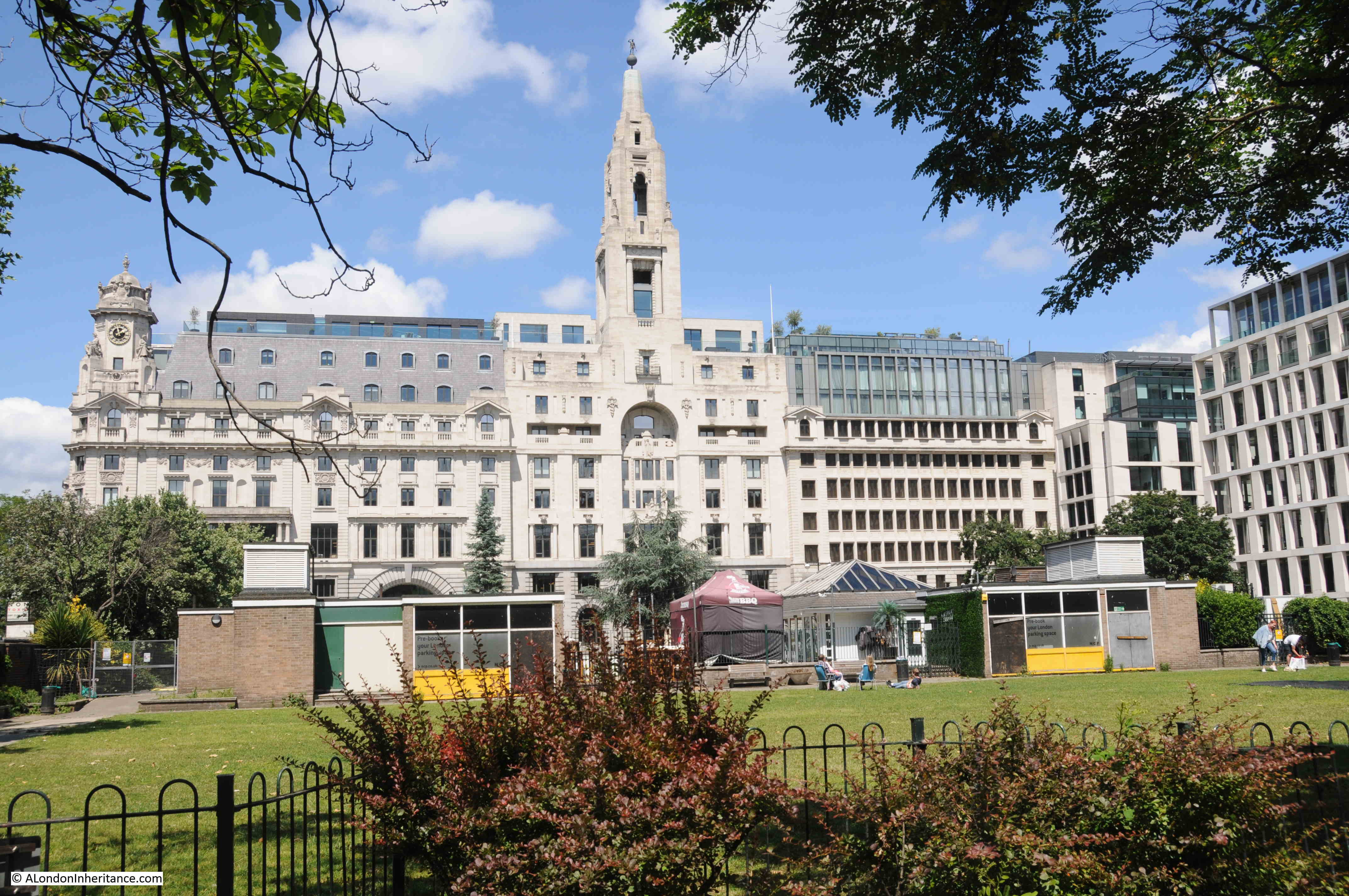
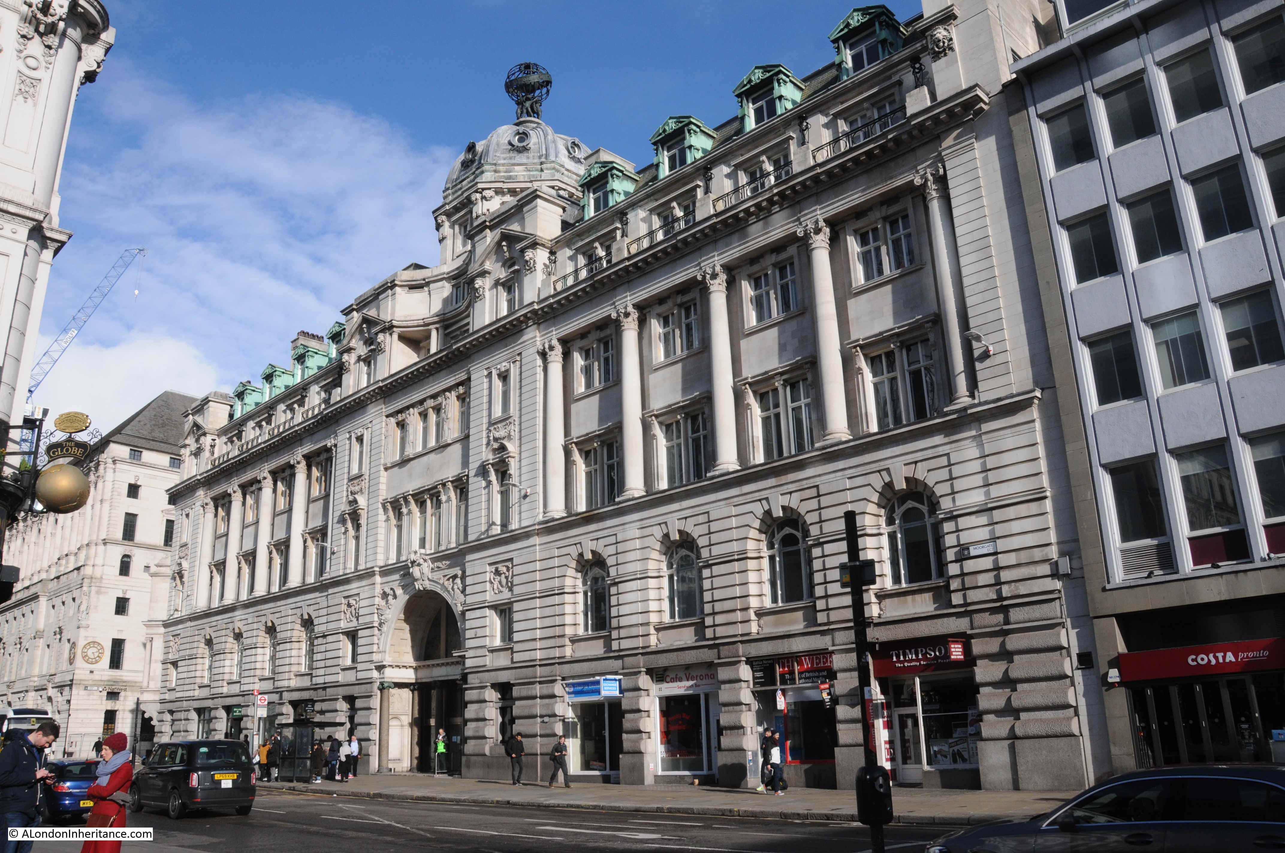
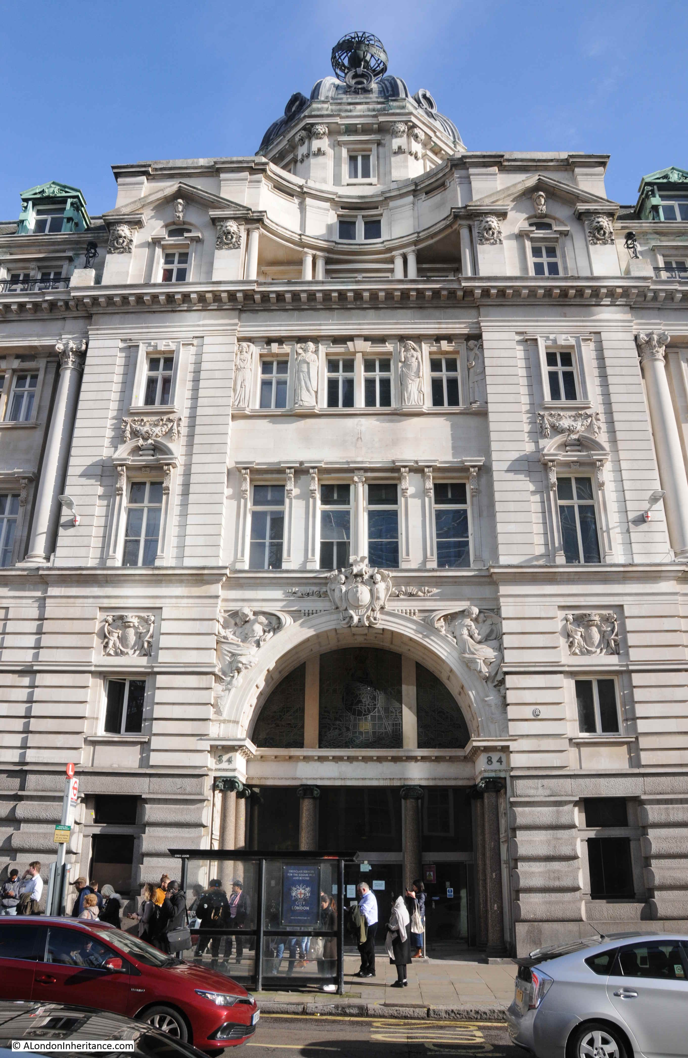
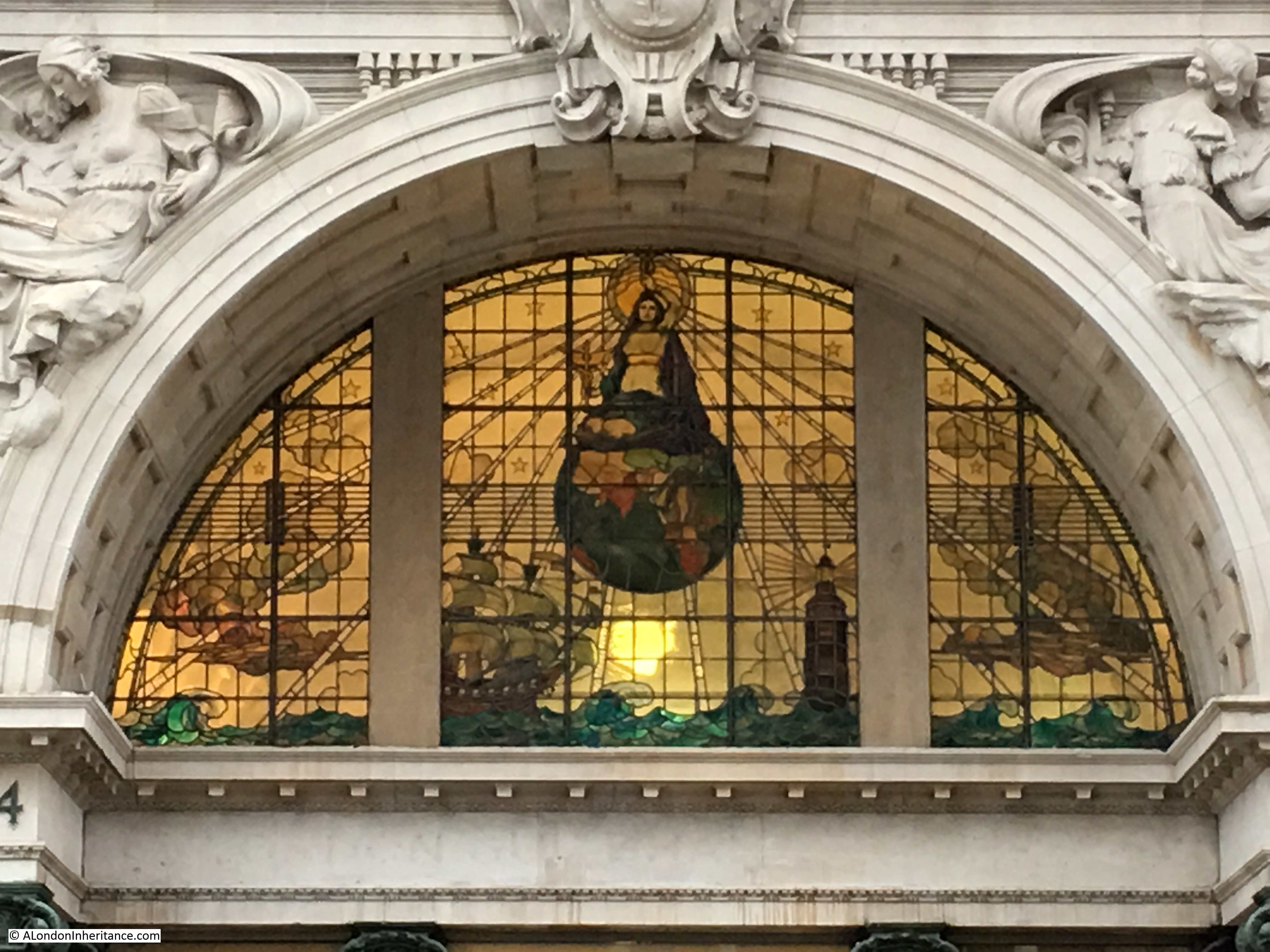
The tower belongs to the building that was Royal London House, but is now called Triton Court. Royal London started as a Friendly Society and grew rapidly during the first half of the 20th century. They occupied the entire north side of Finsbury Square. The building on the left with the cupola on the corner was constructed first in 1905. The central block with the tower was added in 1930, and the block to the right was added in the 1950s.

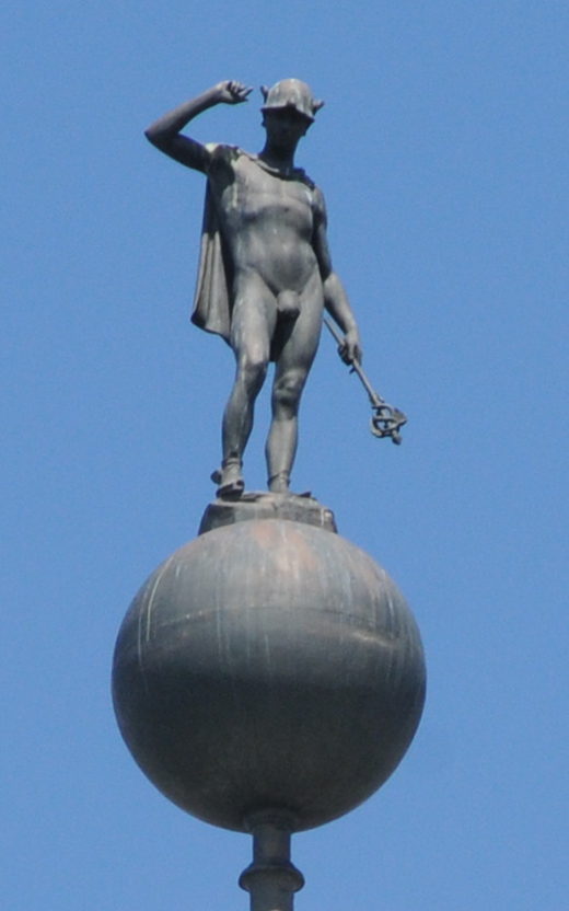
The block on the right is now a hotel and the two earlier blocks are office space. Internally, the buildings have been mostly gutted as part of the conversion to new offices, with only the facades remaining as they were, including the original statue of the Roman god Mercury, who has been looking out over London for over one hundred years.

St Alphage

To the left of the tower in the 1947 photo is the cupola on the corner of the first of the Royal London buildings, then look further to the left and there is another cupola. This is marked on the photo as 1 City Road / Lowndes House (red circle on the map), and is seen in the following photo at the end of the street, where City Road bends to the left.

St Alphage

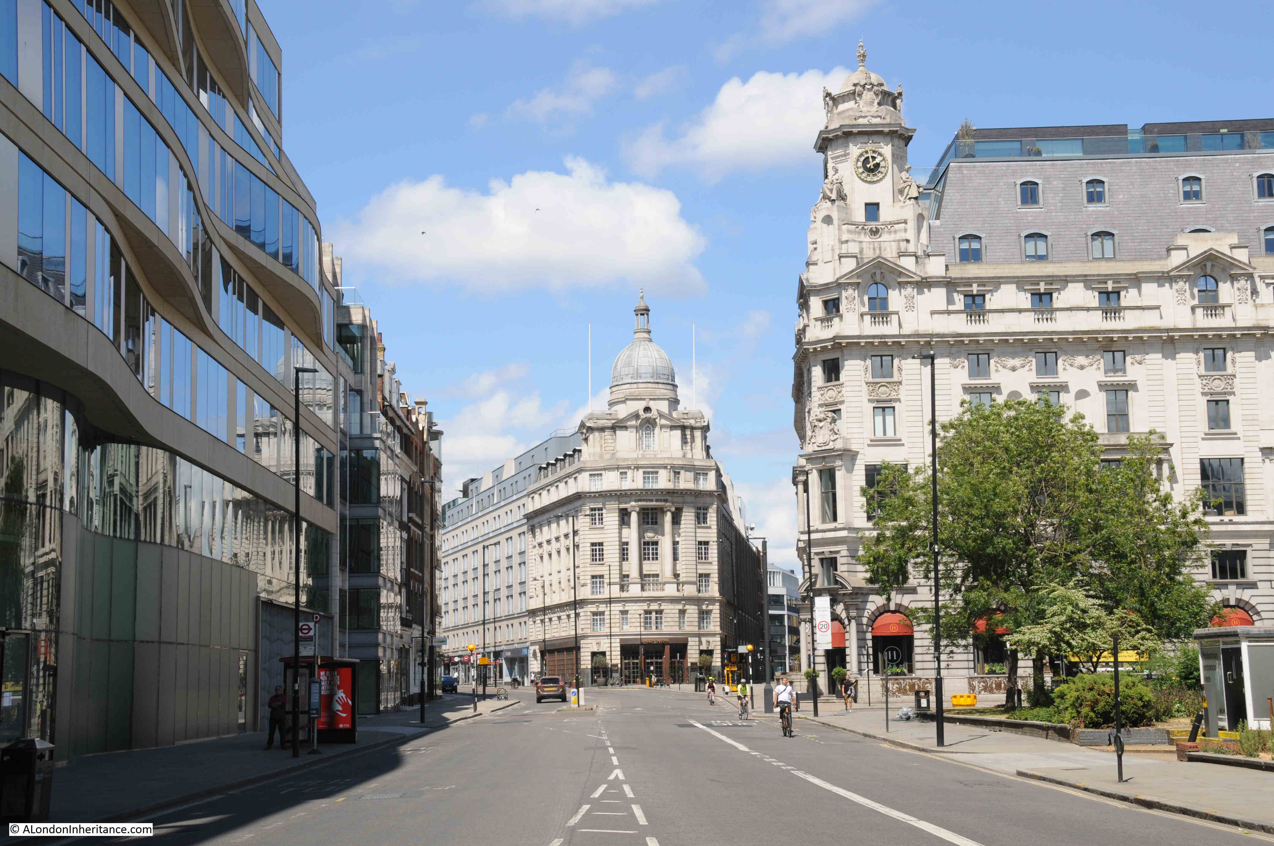
The building is now 1 City Road, but was called Lowndes House when built in 1929 for the Singer Sewing Machine Company as their London headquarters. It was designed by architect William Lewis, and is now Grade II listed.

The 1947 photo, and also just by walking the streets, show the boundaries of the fires caused by bombing during the Second World War. They covered an extensive area of the land now occupied by London Wall, the Barbican, and east to towards Finsbury Square, but getting towards Finsbury Square and many of the buildings that remain are still pre-war rather than the post-war buildings to the west.

Much of the damage to the area was through the fires caused by incendiary bombs rather than high explosive, and many walls of buildings did remain. Many had been cleared by the time my father took the original photo, however the clearance, and following post war work, did reveal some much older structures which, fortunately, have been preserved.

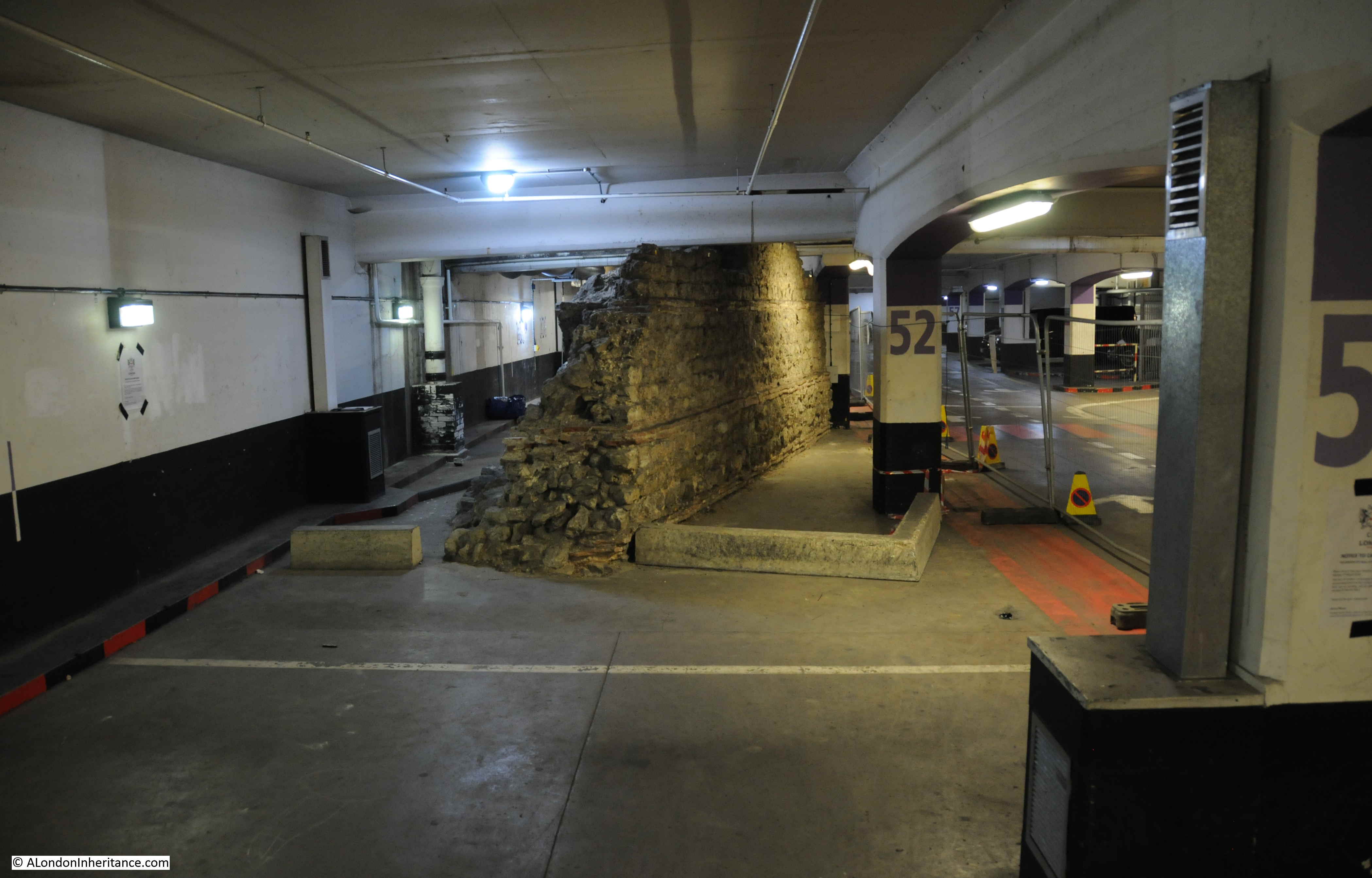
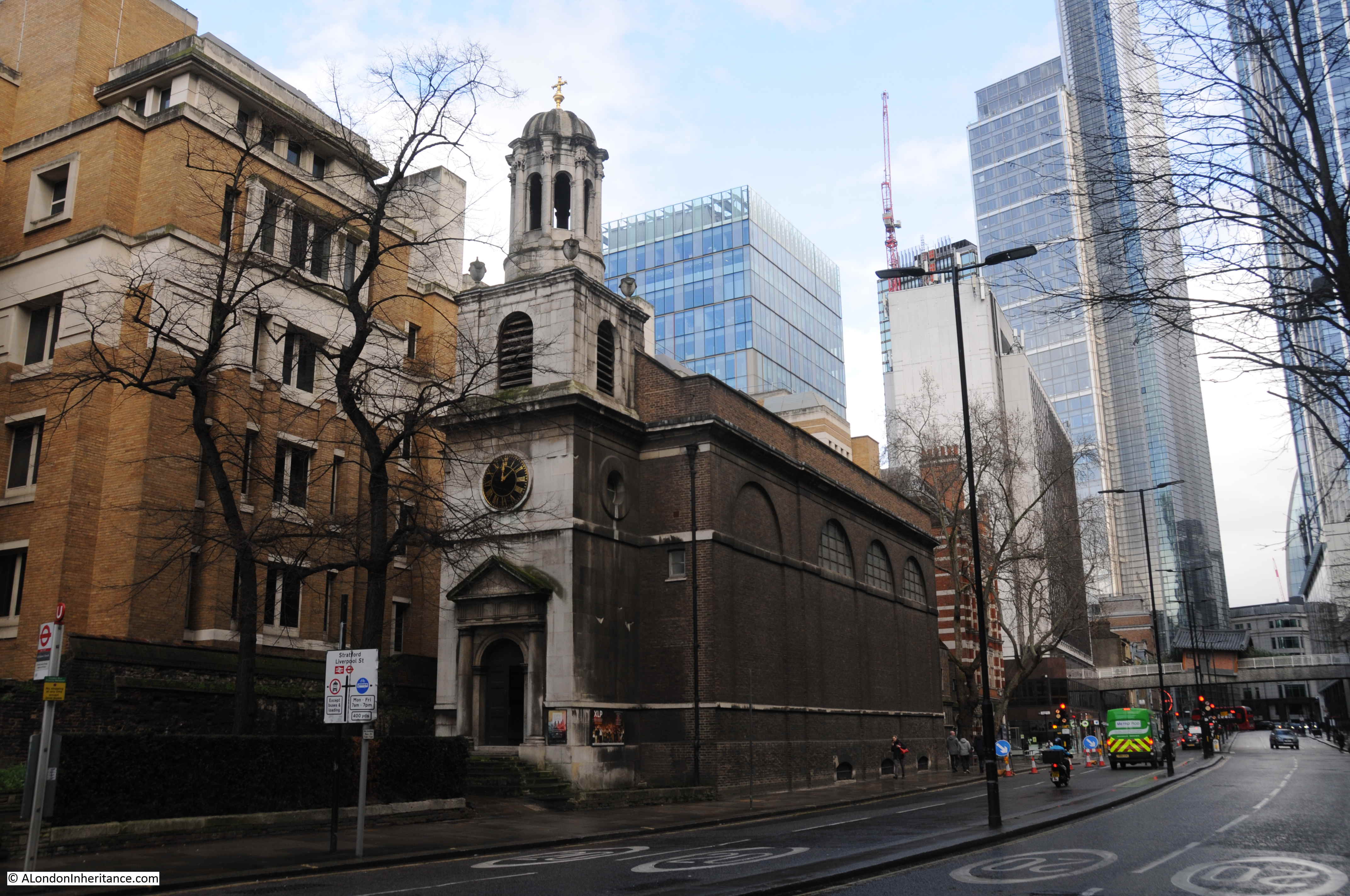
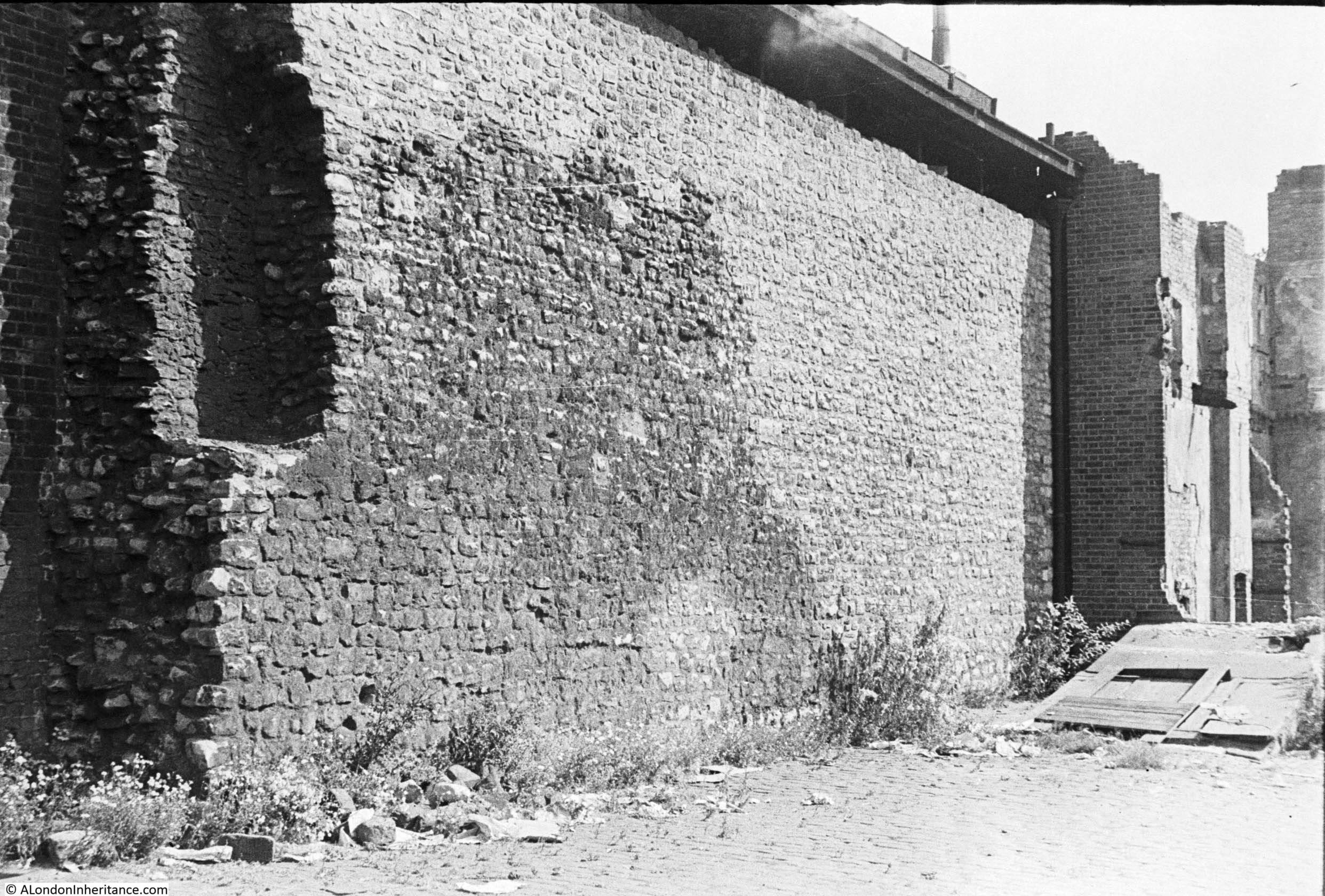
To the right of the 1947 photo there is the shell of a building that I have labelled St Alphage (yellow star on the map and photo).

Churches were also left during wartime demolition. Although many City churches were reduced to their outer walls and tower, there was an expectation that being churches they would be restored, which indeed did happen to many churches, although some were demolished. One was St Alphage, although not before some medieval remains of an earlier building that had been integrated within the structure of St Alphage were identified and saved.

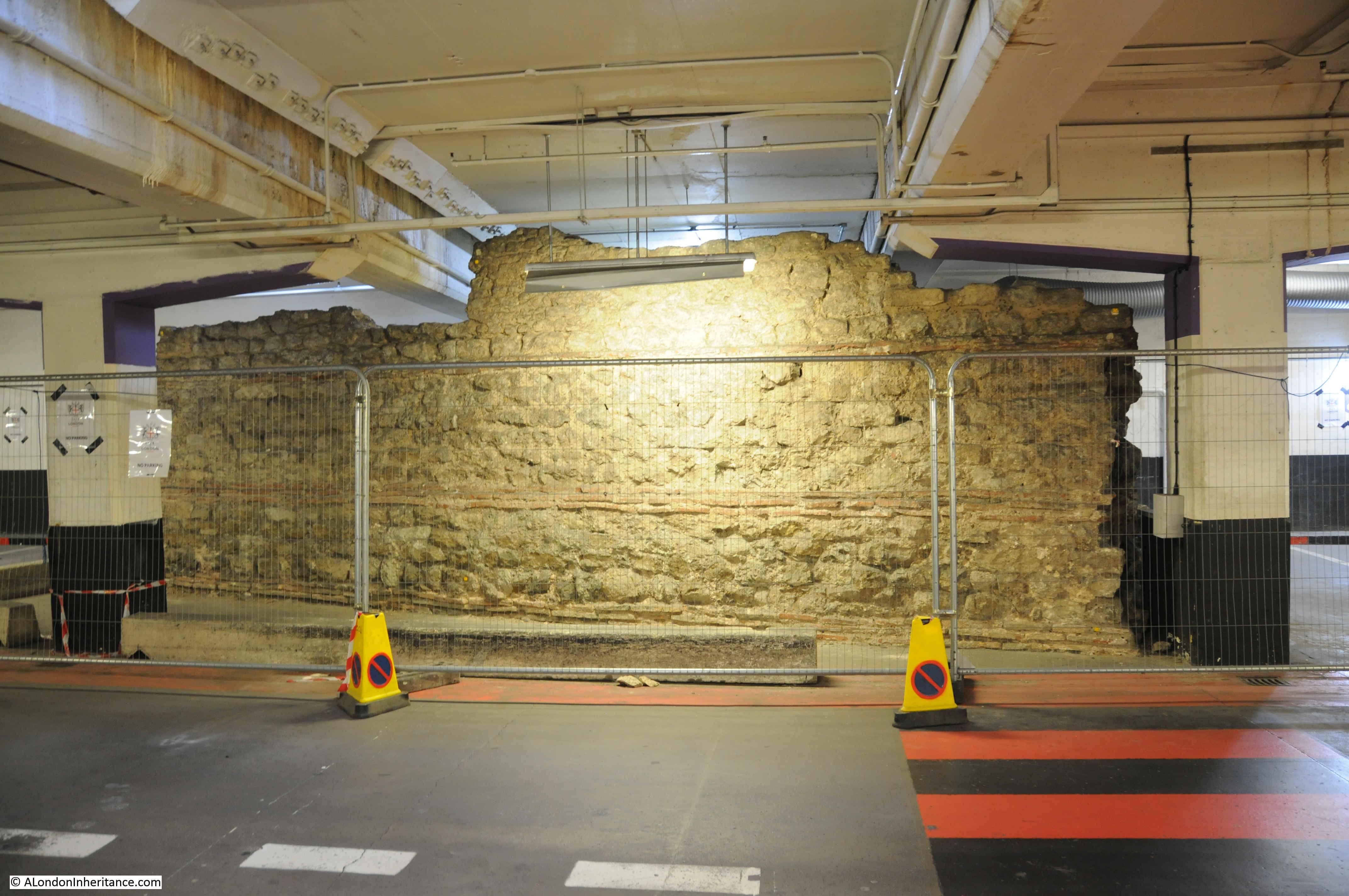
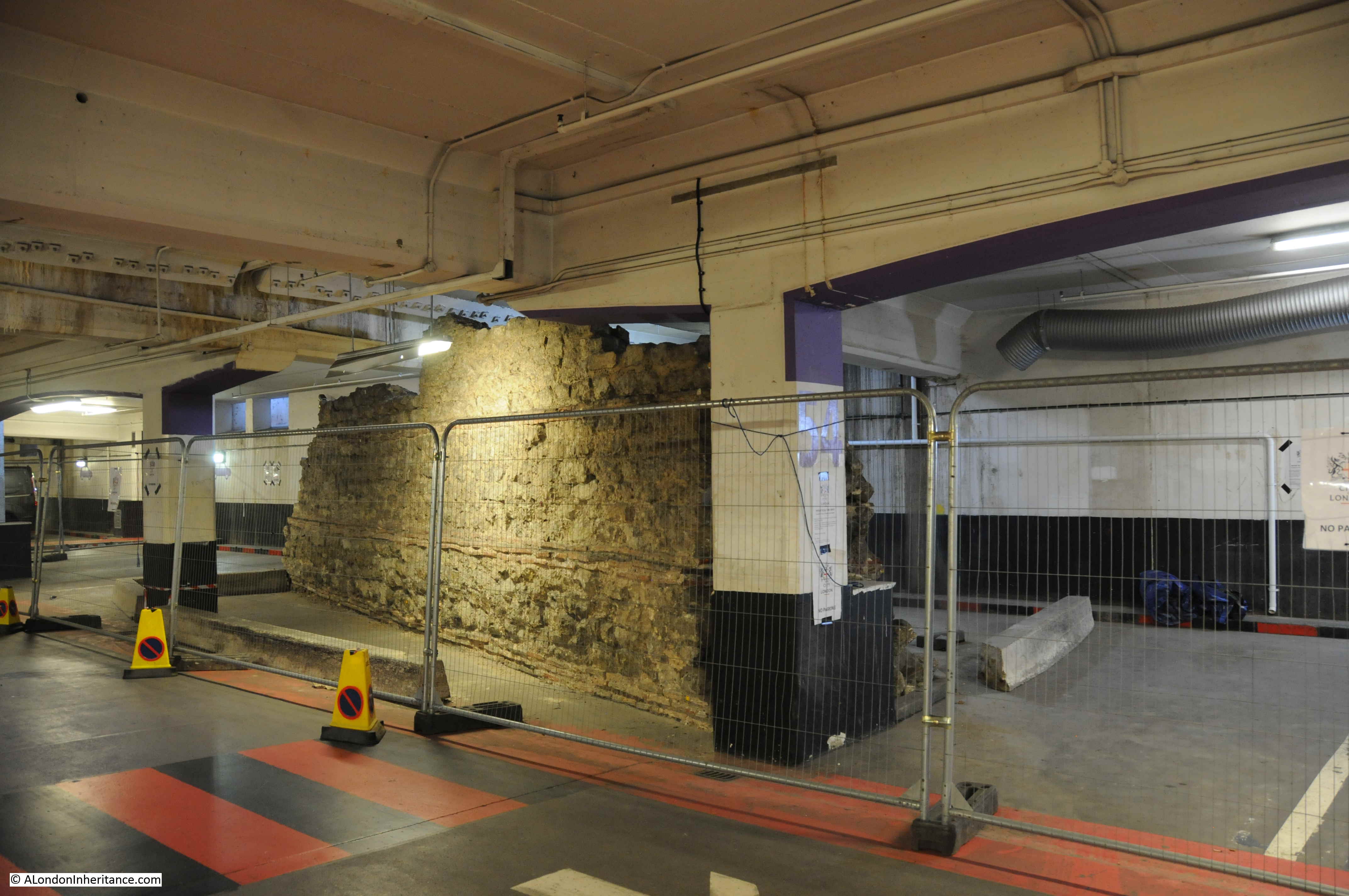
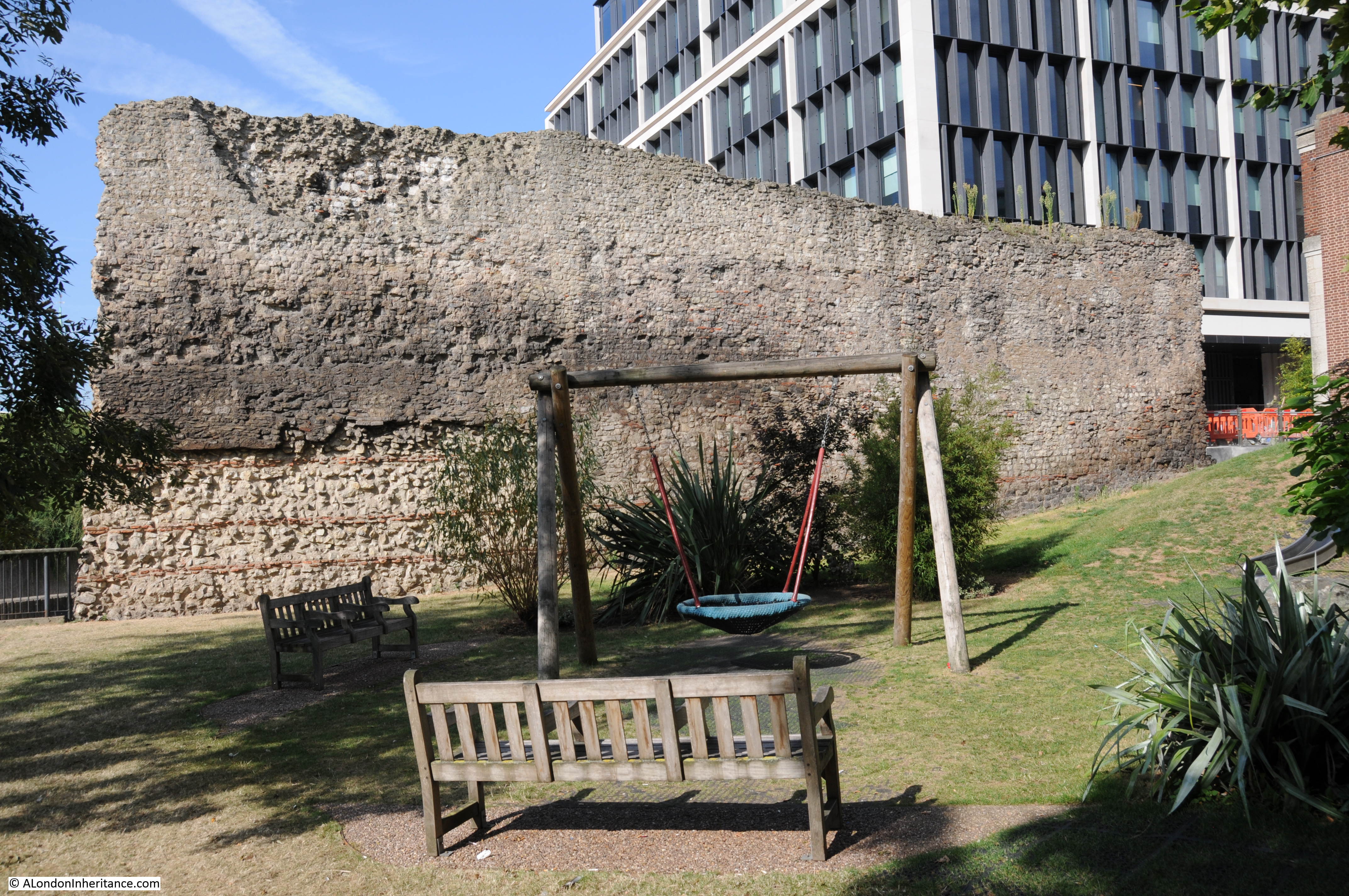
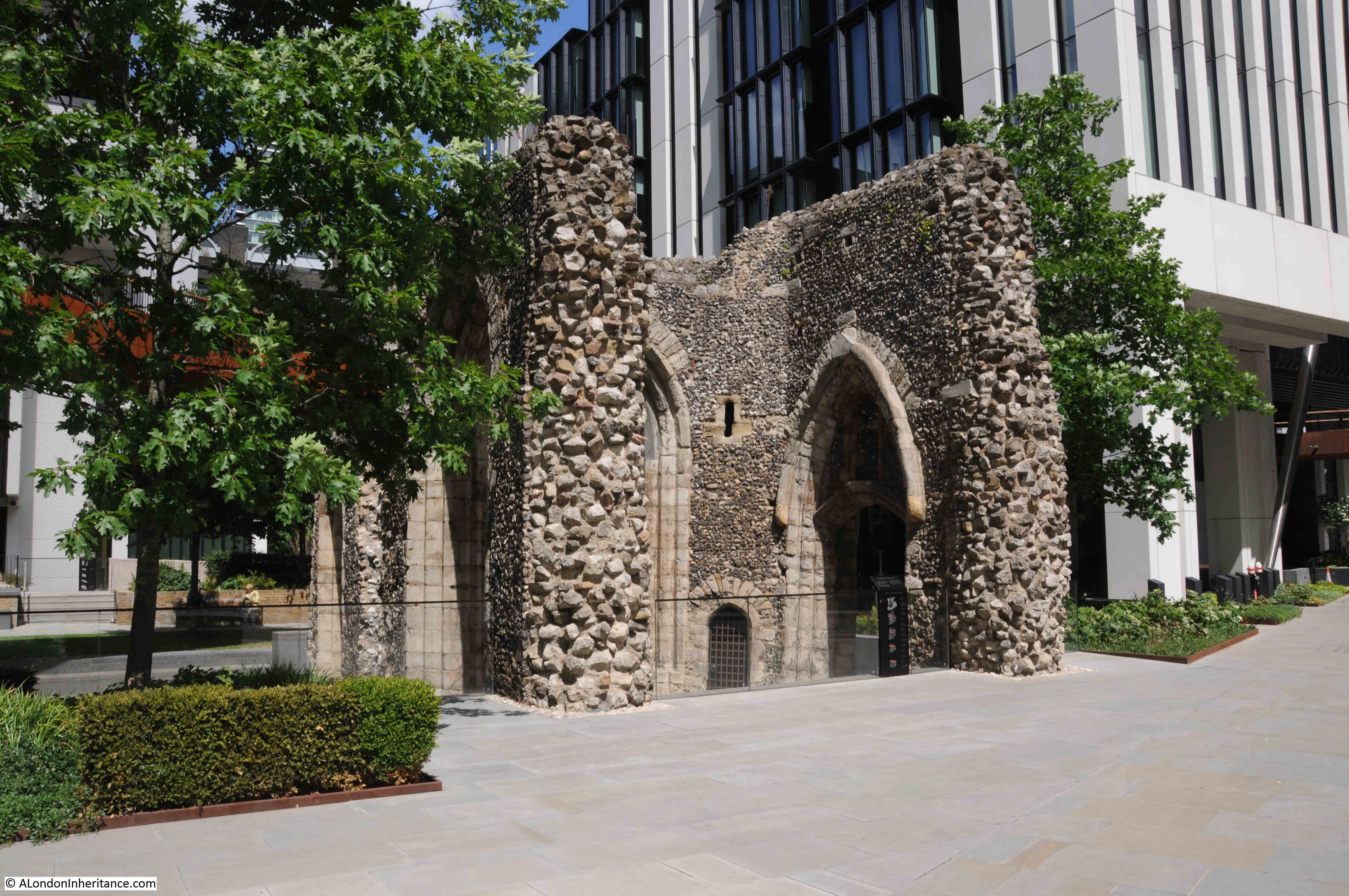
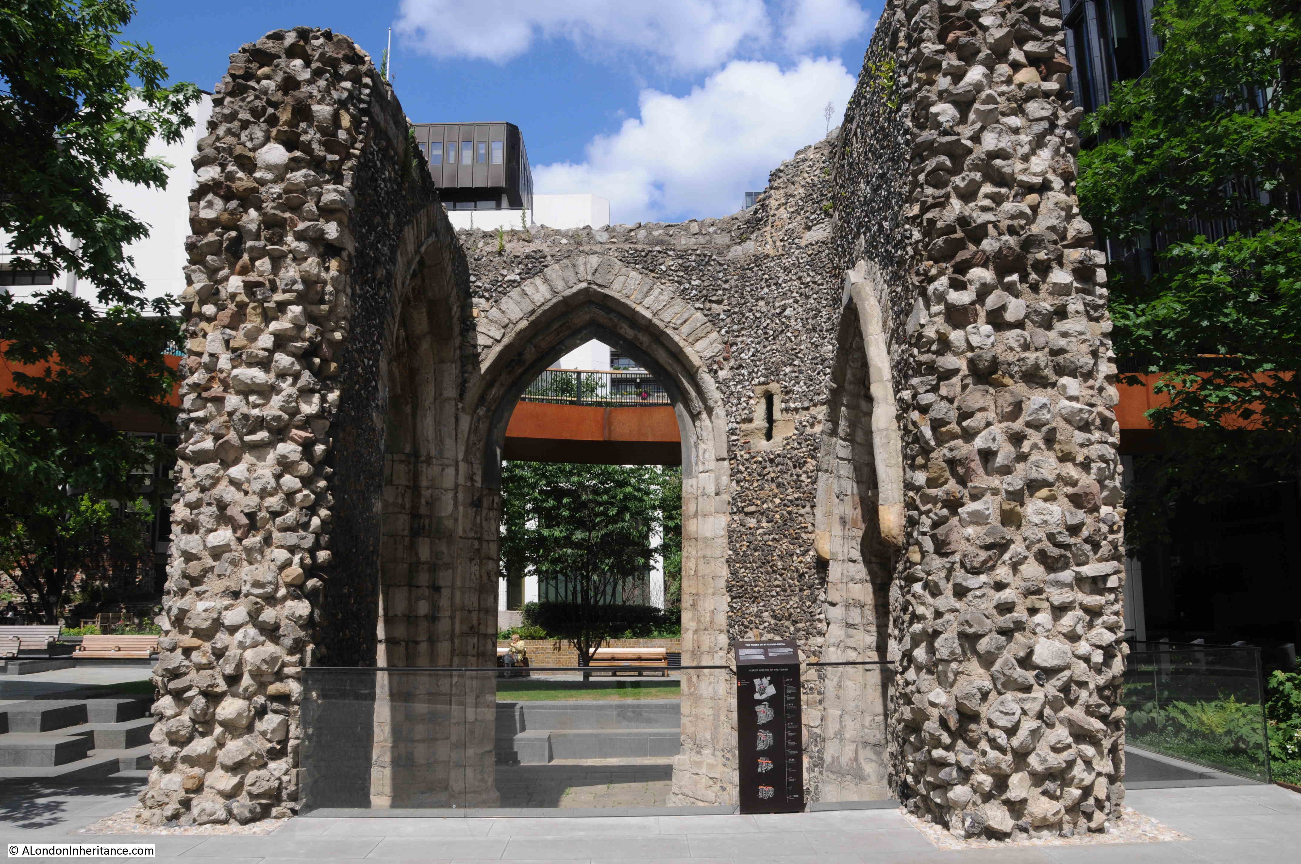
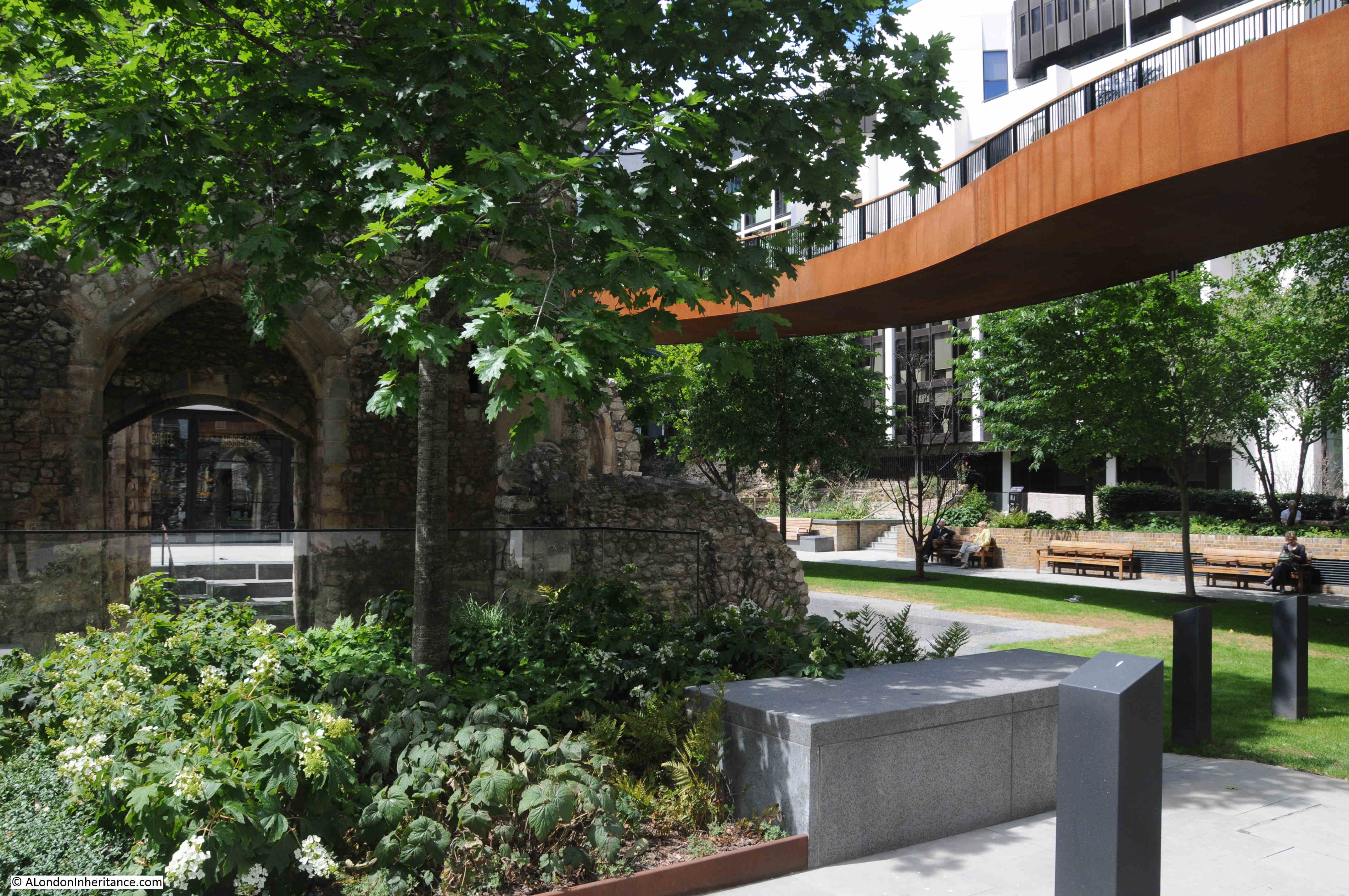
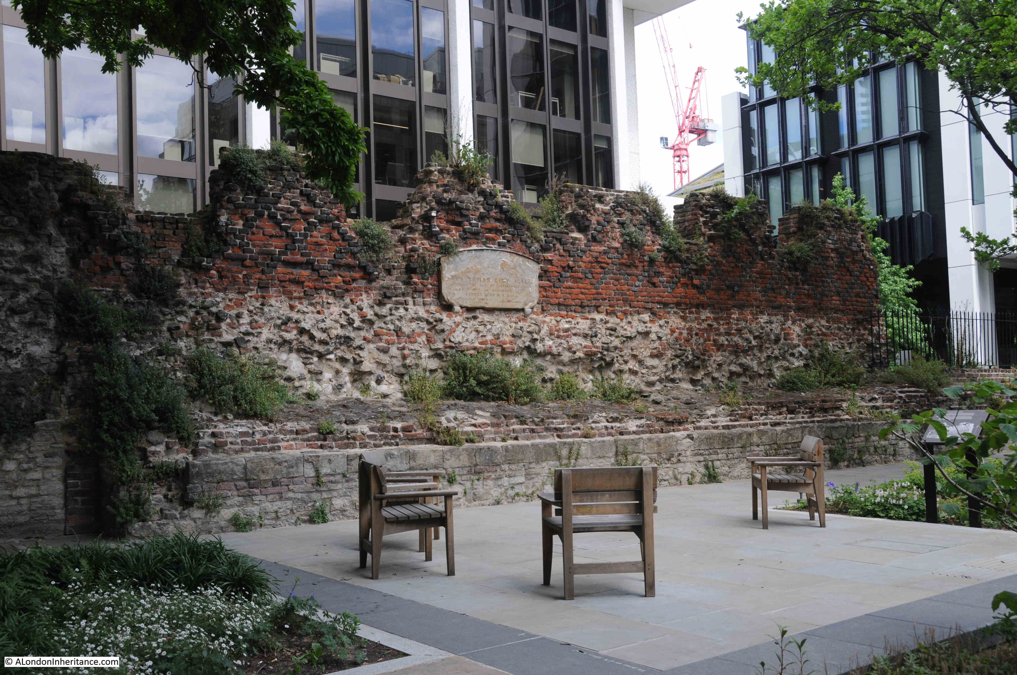
These were from the former priory chapel of St Mary Elsing (also Elsyng and Elsyng Spital – Spital being the name given to a charitable establishment that would provide care for the sick), and these medieval remains can be found today alongside London Wall.

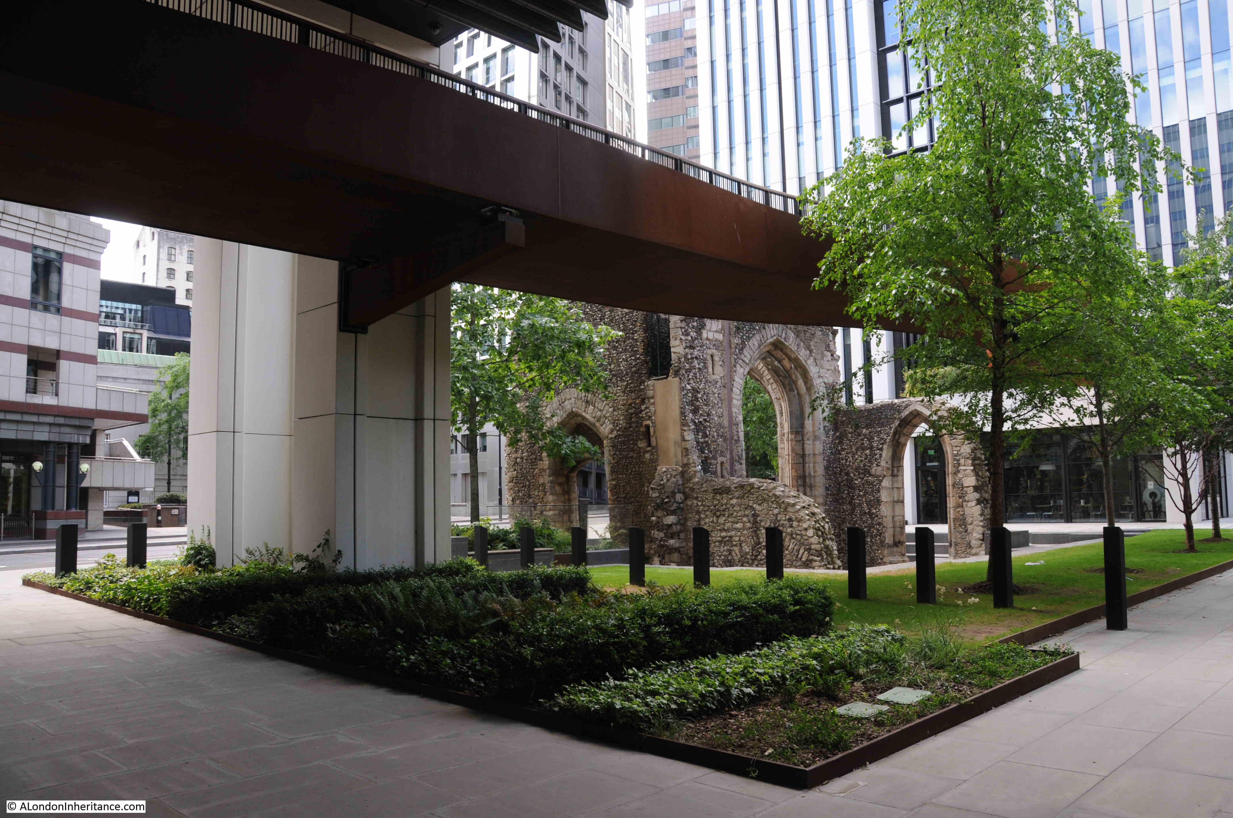
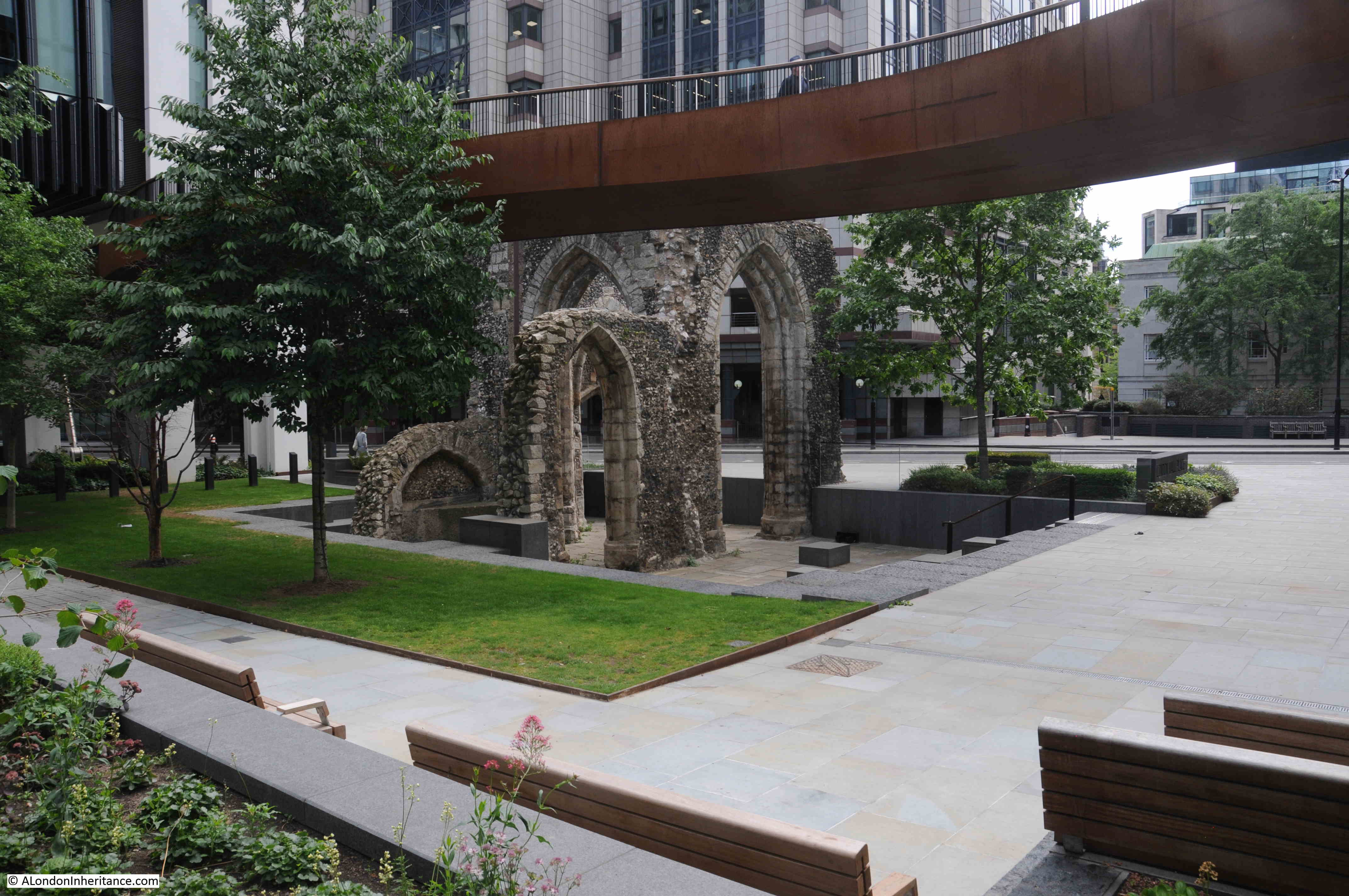
In the following photo looking east along London Wall, the stone arches of St Mary Elsing can be seen on the left.

St Alphage

The walls that we can see today alongside London Wall are from the medieval chapel of St Mary Elsing. This chapel was part of a hospital and priory which had been founded by Sir William Elsing early in the 14th century.

St Alphage

The hospital was founded with the intention of providing care for the blind, presumably by the nuns and sisters of the priory. It was common across the City for hospitals and priories to be a single institution.

The location of the priory may have been a religious site back to the 11th century when a nunnery may have occupied the location.

The priory was closed during the dissolution in 1537 when it became the property of the Crown, although most of the land and buildings were soon sold off.

The view of the remains of the priory of St Mary Elsing viewed from London Wall.

St Alphage

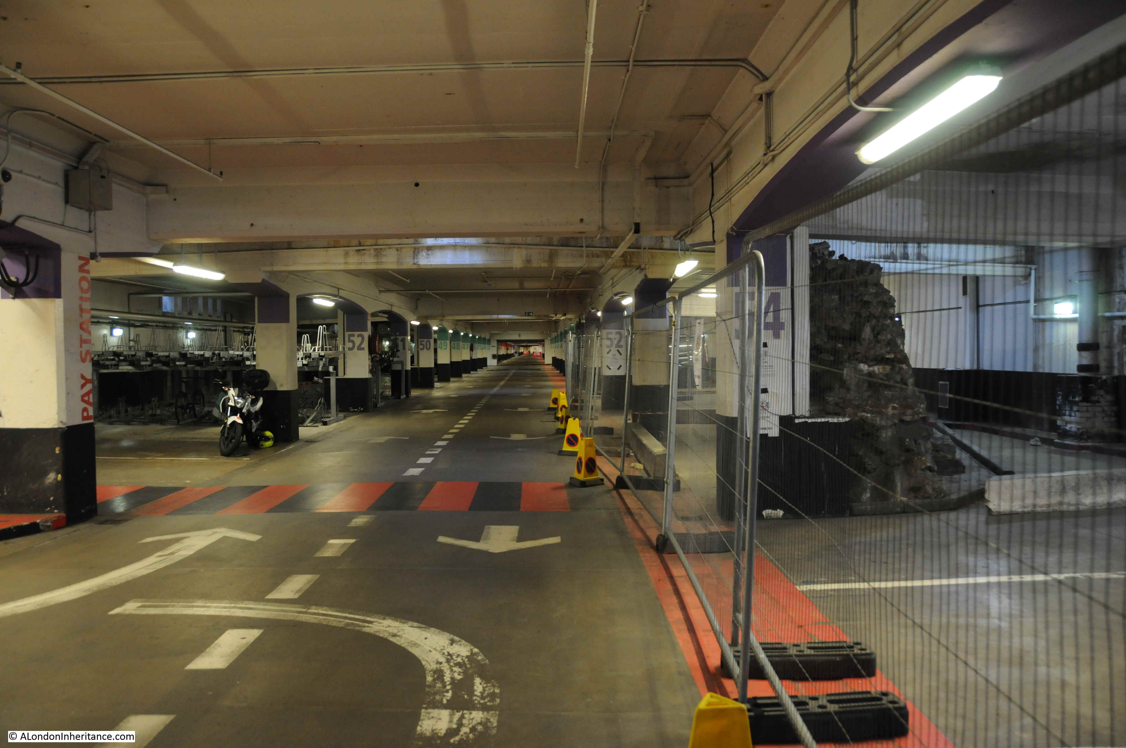
The area has recently been subject to redevelopment which has considerably enhanced the view of the medieval walls. As part of the original redevelopment along London Wall, the remains were hemmed in by new buildings and under the high level walkways that were such a feature of the post war development of London Wall.

The space around the walls has been opened up, and a new walkway was recently opened, set back from the remains of the priory, and of a much more sensitive design.

St Alphage

Close to the priory of St Mary Elsing was another religious building, the church of St Alphage.

The original St Alphage was built up against the London Wall, a very short distance to the north west of the priory. St Alphage may date from the 11th century, the same century as the saint after which the church is named died.

St Alphage was Bishop of Winchester and from the year 1006 was Archbishop of Canterbury, although this post would not last too long as in 1012 he was murdered by the Danes.

His murder is thought to have taken place at Greenwich, at, or near, the Greenwich church also dedicated to St Alphege (using one of the alternate spellings of his name).

St Alphage

By the early 16th century, the first St Alphage was in a very poor condition, and the parishioners were looking for an alternate site for the church. They were given the tower and chancel of St Mary Elsing, they converted the building, and moved their parish church into the new site.

The original St Alphage was demolished and the site sold to a carpenter. Wilberforce Jenkinson in London Churches Before The Fire states that the original location is “now used as a little garden of rest for London wayfarers”.

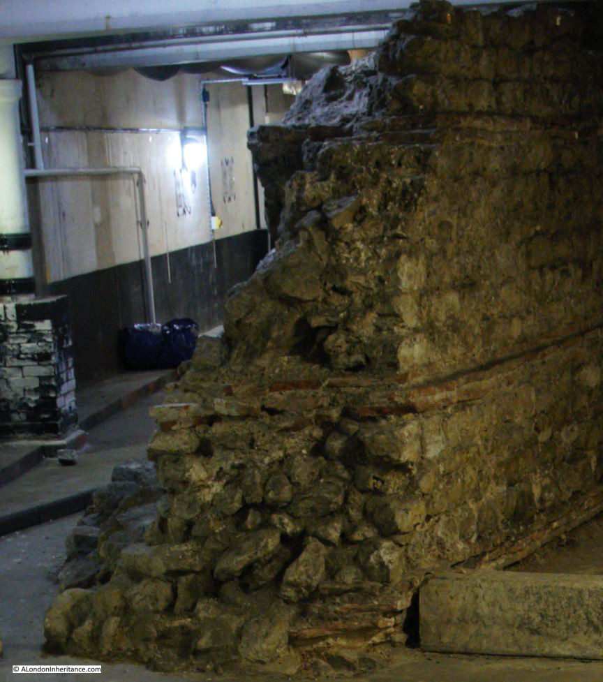
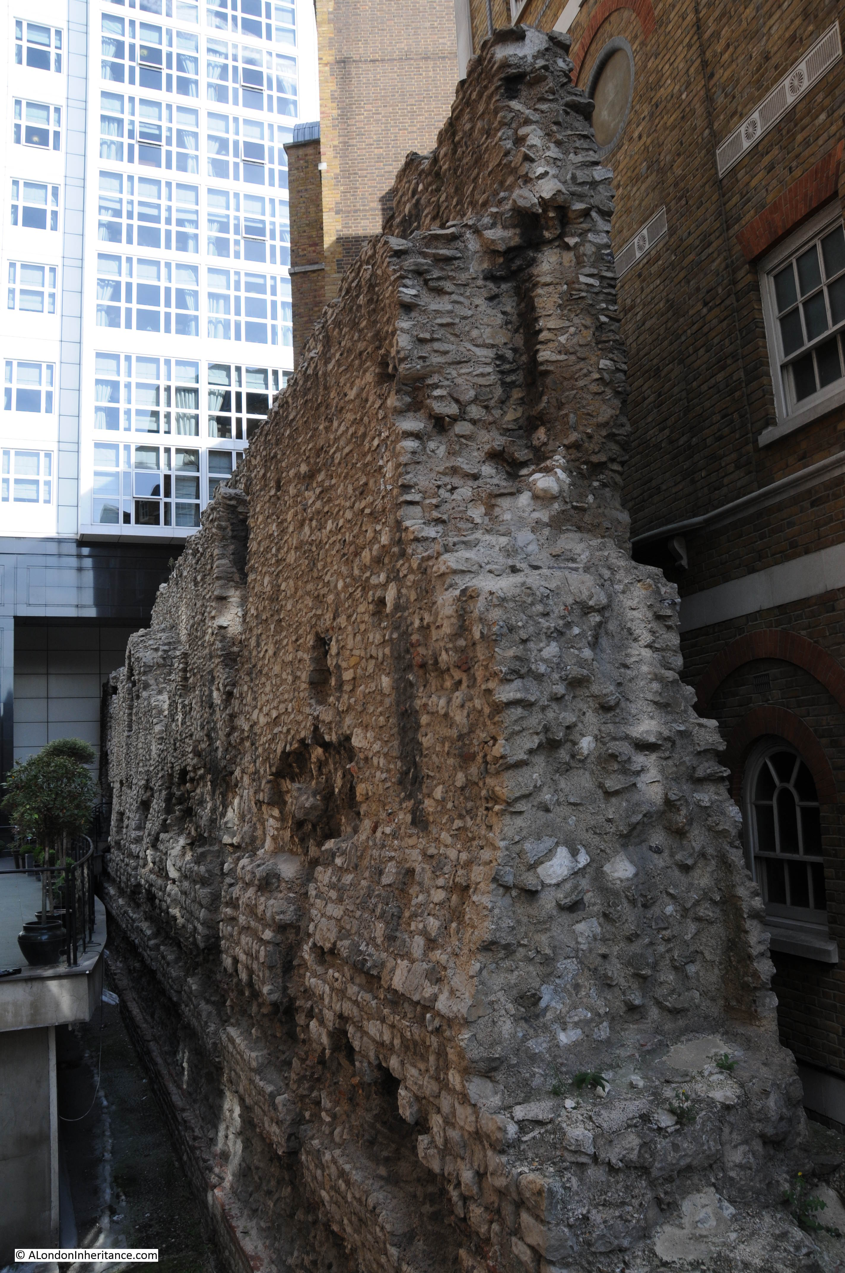
The view of the remains of St Mary Elsing, looking back towards London Wall is shown in the following photo. The tall arches which formed the base of the tower can clearly be seen. At the left there is a low wall. This has a small, arched recess which may have been used to house a tomb.

St Alphage

Note that there is a slight height difference between the base of the walls and the surrounding street level. The new St Alphage therefore included some of the medieval walls from St Mary Elsing. These medieval walls have been incredibly lucky to survive into the 21st century.

St Alphage survived the Great Fire of London. The church was significantly rebuilt in 1777, and the medieval walls remained.

In 1913, a new Gothic front was built on the side of the church facing the original route of London Wall. A couple of features of this facade can be seen in my father’s 1947 photo, where there is a short pinnacle on the top left corner of the church along with the triangular top of the wall.

The 1947 photo shows that these were on the northern side of the church which at the time was facing onto London Wall, however the route of London Wall was about to change, and St Alphage would see the final, dramatic change to its immediate landscape.

I have covered the route of London Wall in previous posts. The change in route was to meet the expected post war rise in car usage through the City. During the war, plans were made for the post war redevelopment of the City, and these included major new, wide roads through the City along with the parking needed for all those who would be driving into the City.

One of these new routes was Route 11, an 86 foot wide dual carriageway that would run from Ludgate Circus in the west to Aldgate High Street in the east.

The section between Aldersgate Street and Moorgate was the easiest to build as the area had been so damaged during the war and was almost an empty space waiting for redevelopment. The majority of the other sections of Route 11 were through existing streets that had not suffered so much damage and would have required major demolition of buildings.

The section of Route 11 between Aldersgate Street and Moorgate was named London Wall, with the western section being moved south from the original route of London Wall so that the new route would align with the expected westward extension.

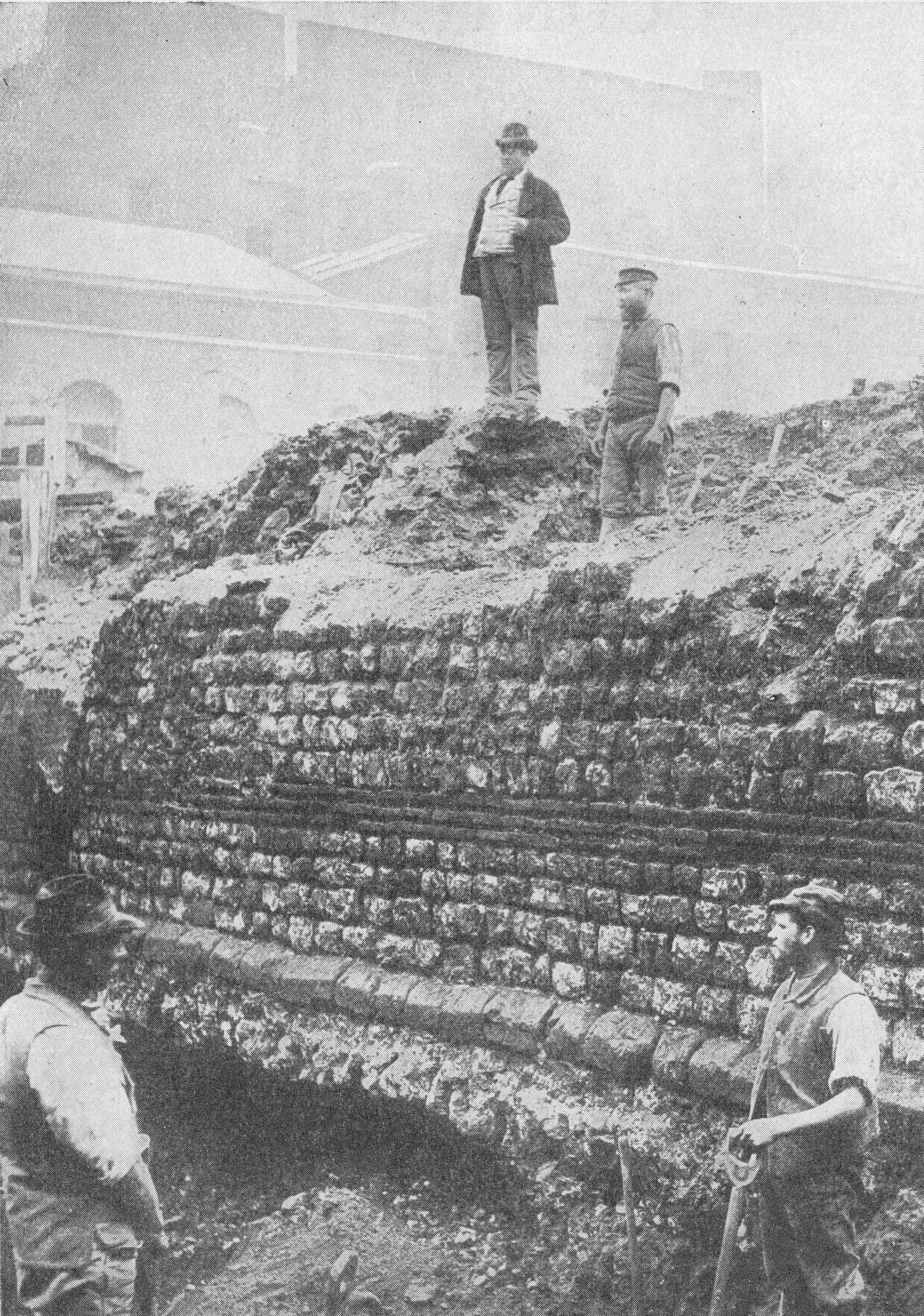
The following photo from 1958 shows the construction of Route 11 along the new London Wall. I have marked the position of St Alphage and the original western section of London Wall.

St Alphage

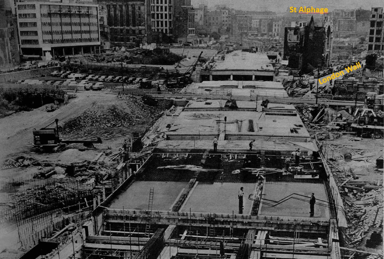
The photo shows how the medieval walls of St Mary Elsing moved from being to the south of London Wall, to their current position to the north of the street.

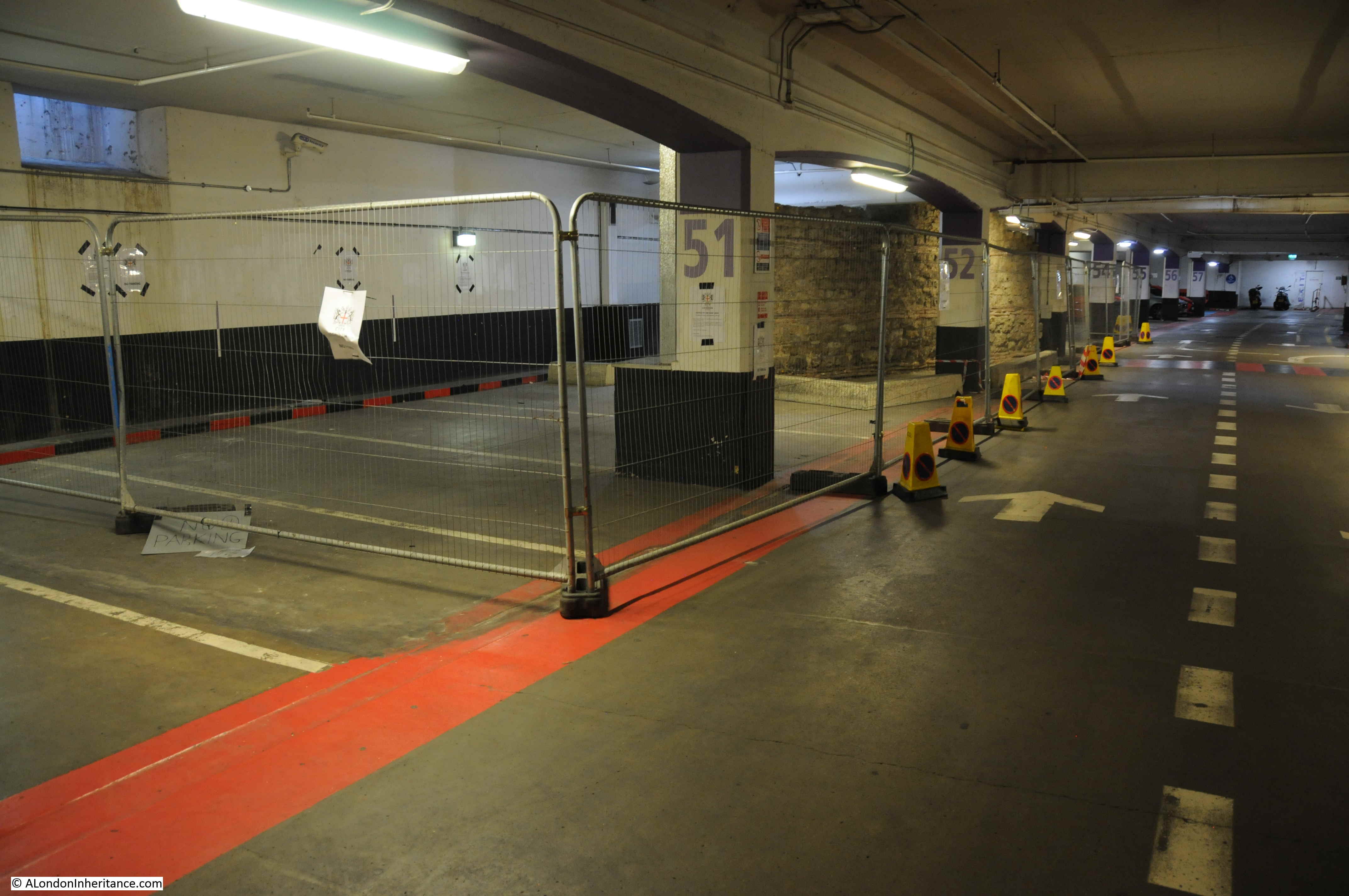
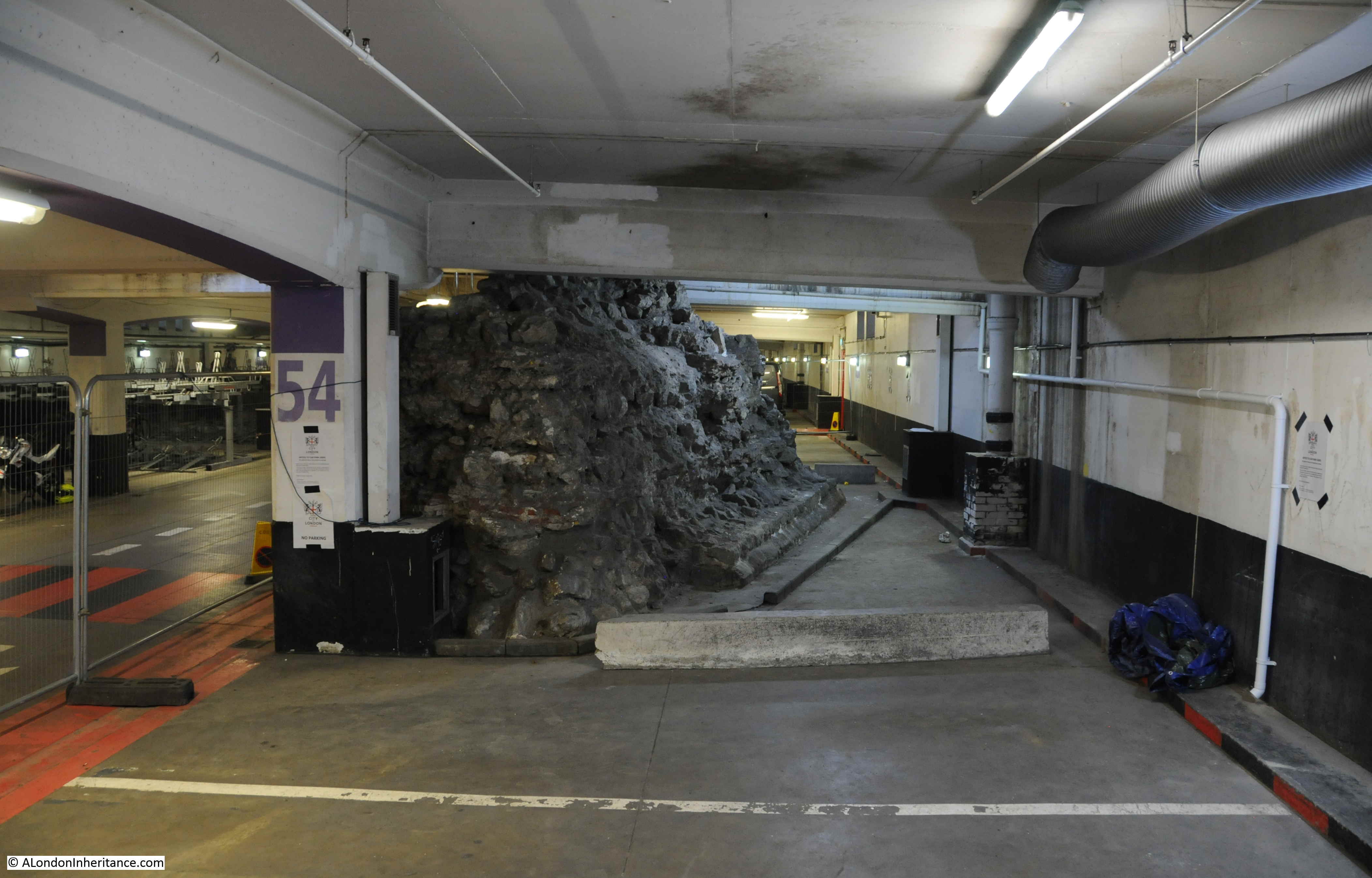
The photo also demonstrates what a significant construction project this was. Basically a long hole being dug, then filled with a concrete box. Car park being within the concrete box and new street running along the top. The car park below London Wall has space for 250 cars – and includes the remains of a Roman Wall.

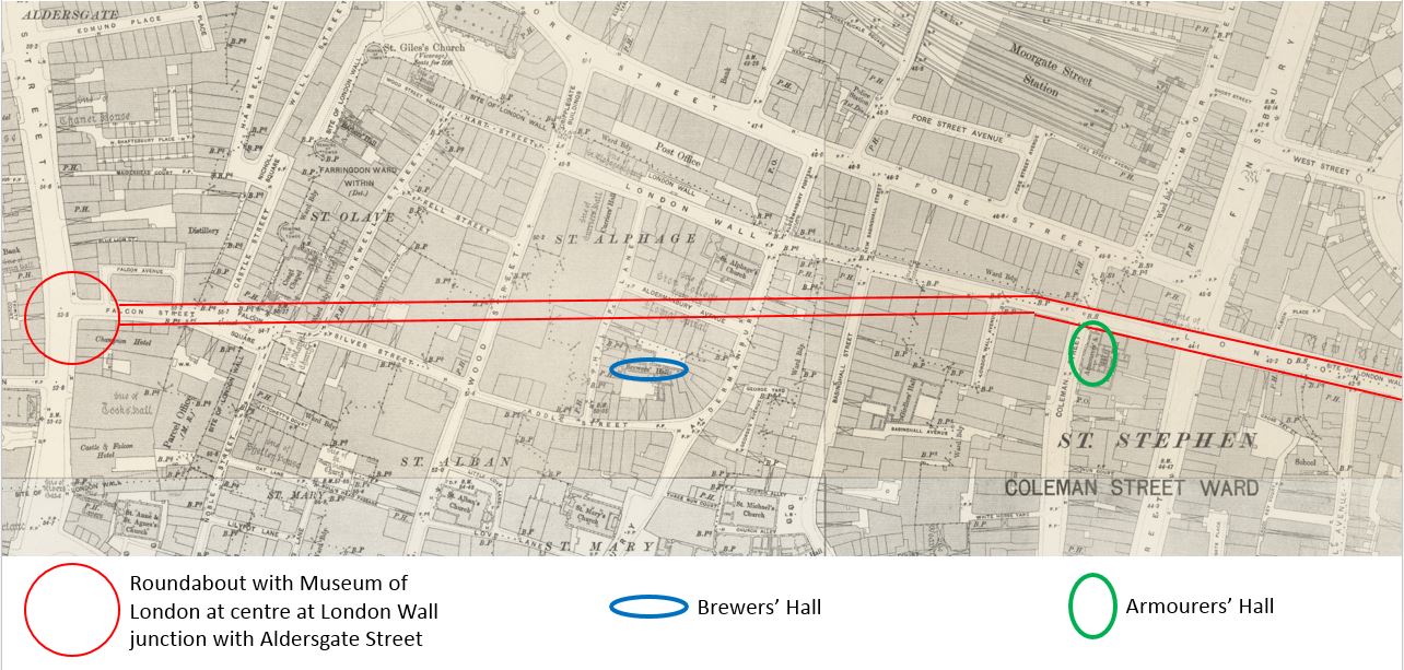
The plan for post war redevelopment – “Reconstruction of the City of London” by the Corporation of London was published in 1944 and includes a map of the planned trunk routes through the City. The routes included in this original plan were changed slightly. I have marked the original London Wall route in the map with A and B.

St Alphage

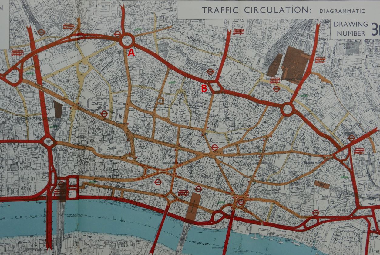
Whilst the eastern section would end where the new London Wall currently ends at the junction with Moorgate, the western end was originally planned to be at a large new roundabout at the Aldersgate Street / Long Lane junction, by Barbican Station.

This original route would have taken Route 11 through the area now occupied by the Barbican, and as plans for the Barbican were taking shape when the final plans for Route 11 were being made, the western end of the new street was moved south to leave a large area free to the north ready for the Barbican Estate.

The construction of London Wall did require the demolition of a small southern section of St Alphage. The majority of the church was demolished in the 1960s leaving the medieval walls of St Mary Elsing as a scheduled ancient monument, standing separate from the church that had been built around them, and looking out on a very different landscape.

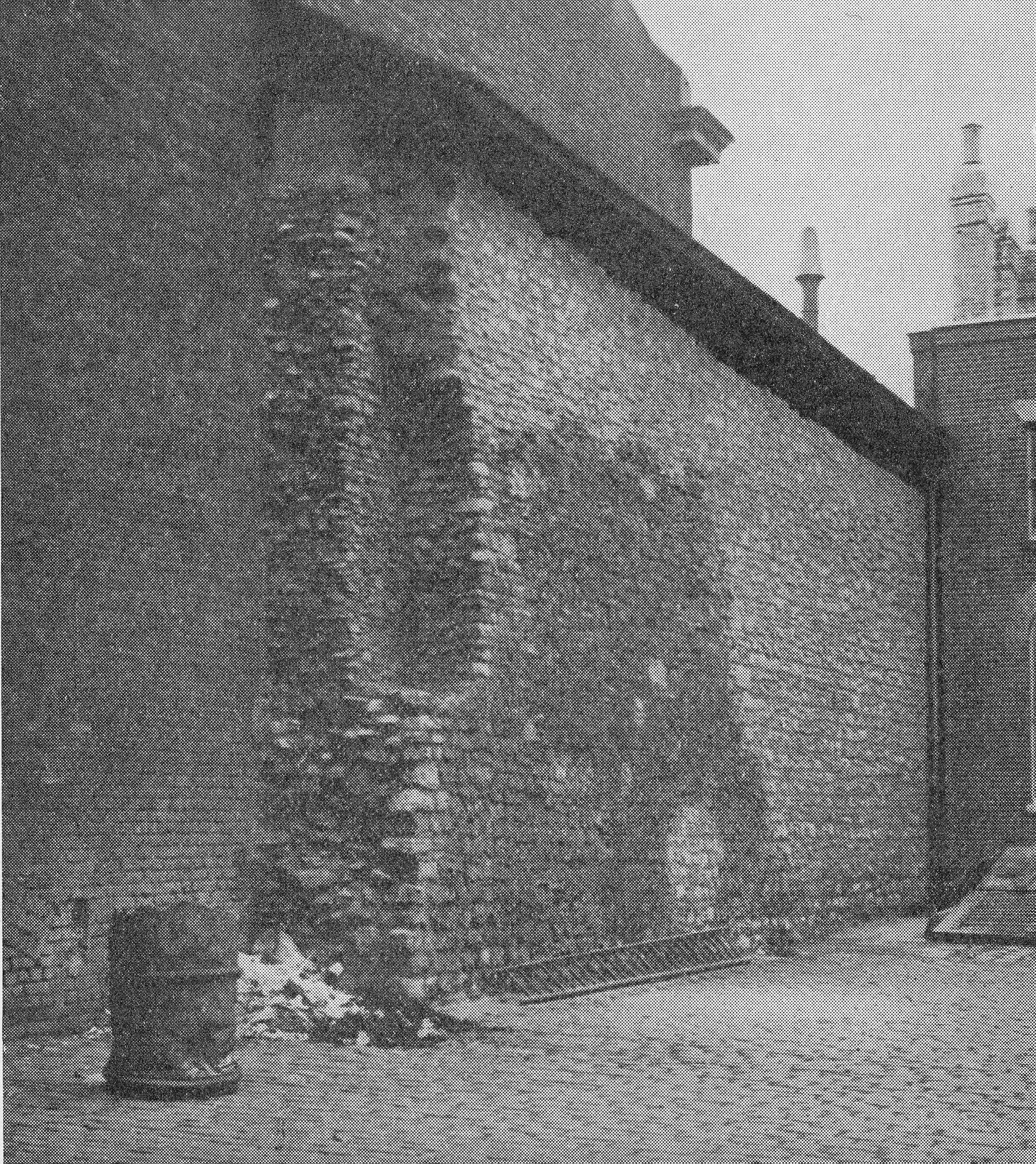
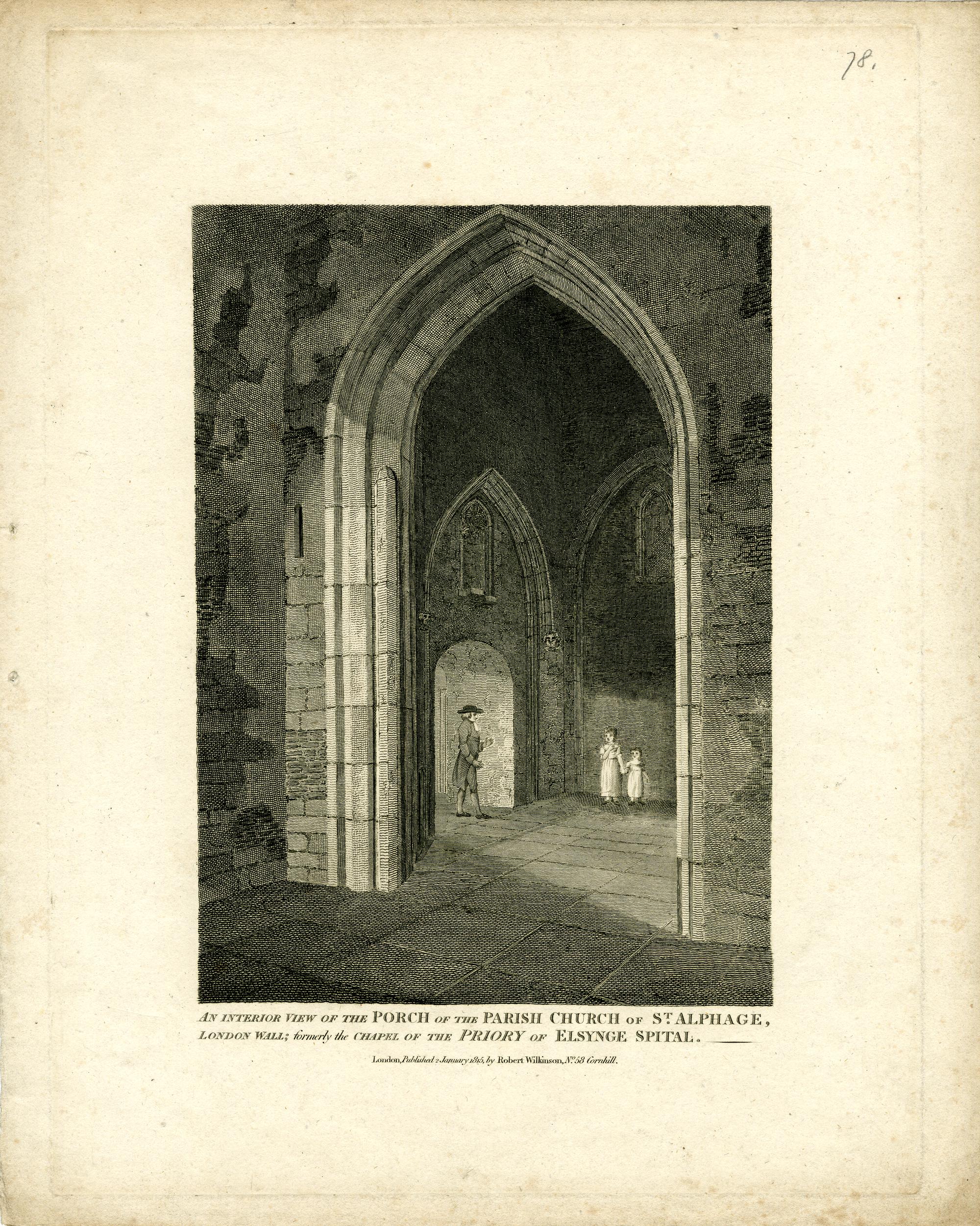
We can get an impression of how the walls and arches of St Mary Elsing were incorporated in the structure of St Alphage by looking at some old prints.

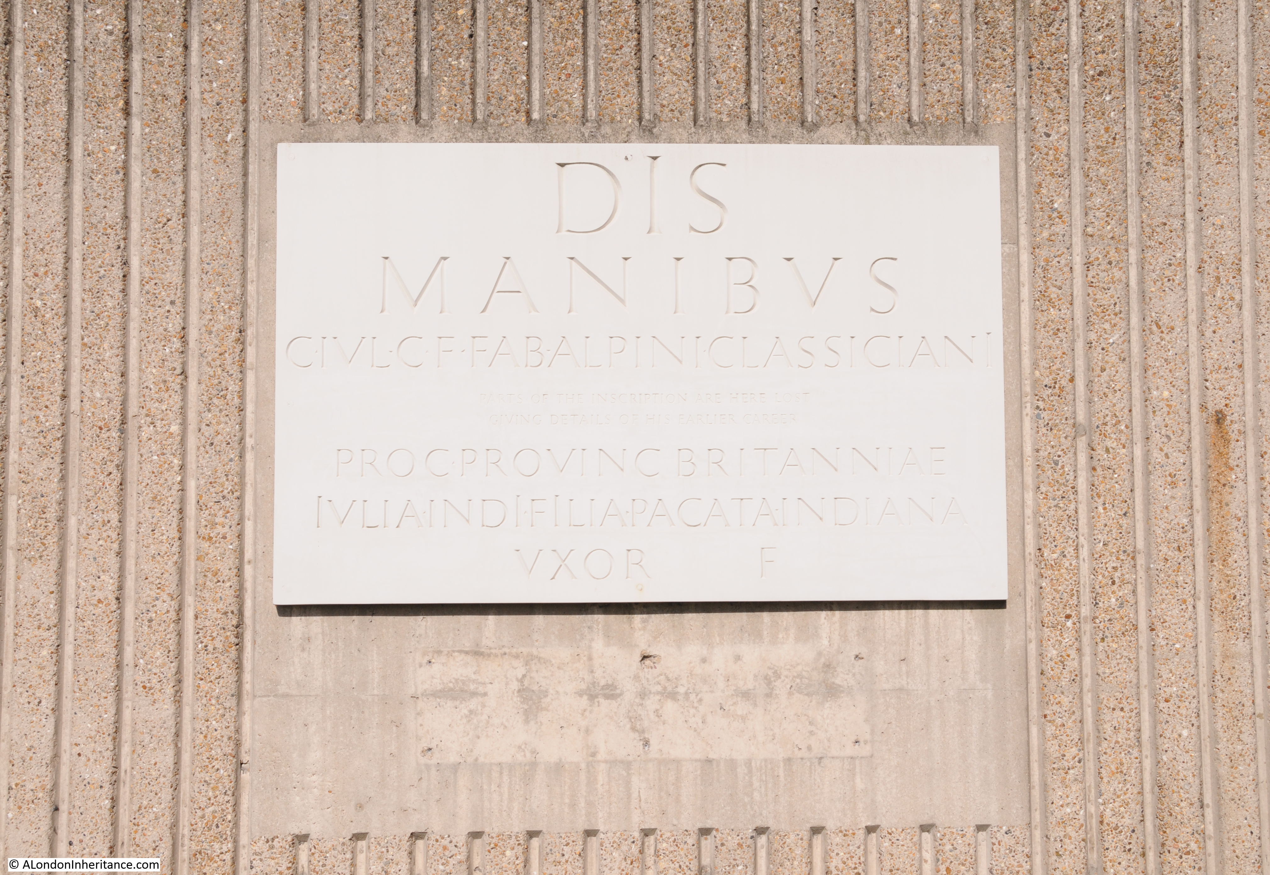
The following print from 1815 states “An interior view of the porch of the parish church of St Alphage, London Wall: formerly the chapel of the priory of Elsynge Spital”. (©Trustees of the British Museum)

St Alphage

The fact that these were ancient walls was understood as the following print, also from 1815, demonstrates by showing the architectural details of the arches to be found in St Alphage (©Trustees of the British Museum).

St Alphage

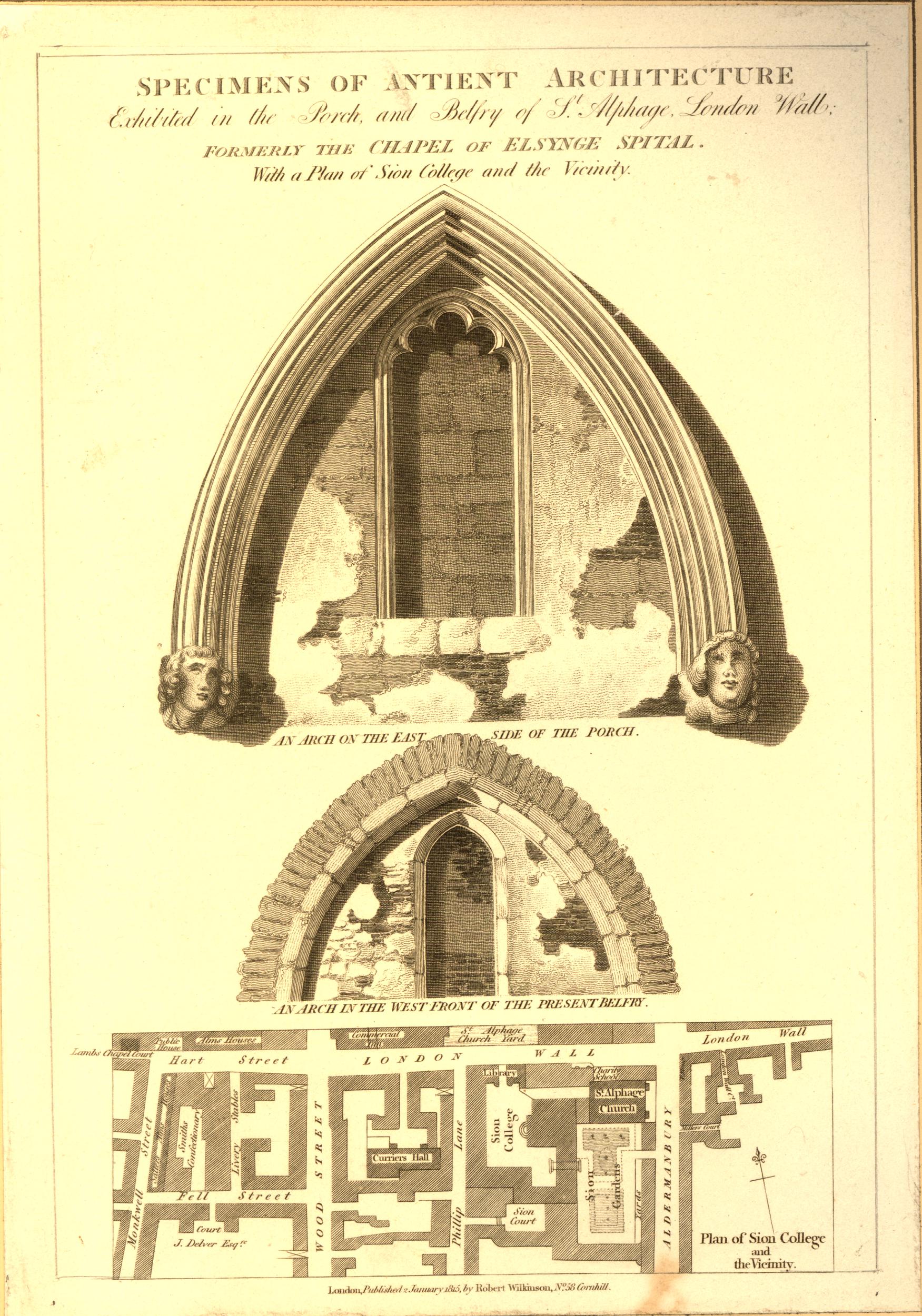
The print also includes a map of the area showing the location of the church. Note that in the map there is an area labelled St Alphage Church Yard just to the left of the church, on the northern side of London Wall – we shall come to this later.

The following print shows the southern prospect of St Alphage in 1736. This was before the 1777 rebuild and presumably shows the church much as it could have been when the parishioners moved from their original church to the chapel of St Mary Elsing in the middle of the 16th century (©Trustees of the British Museum).

St Alphage

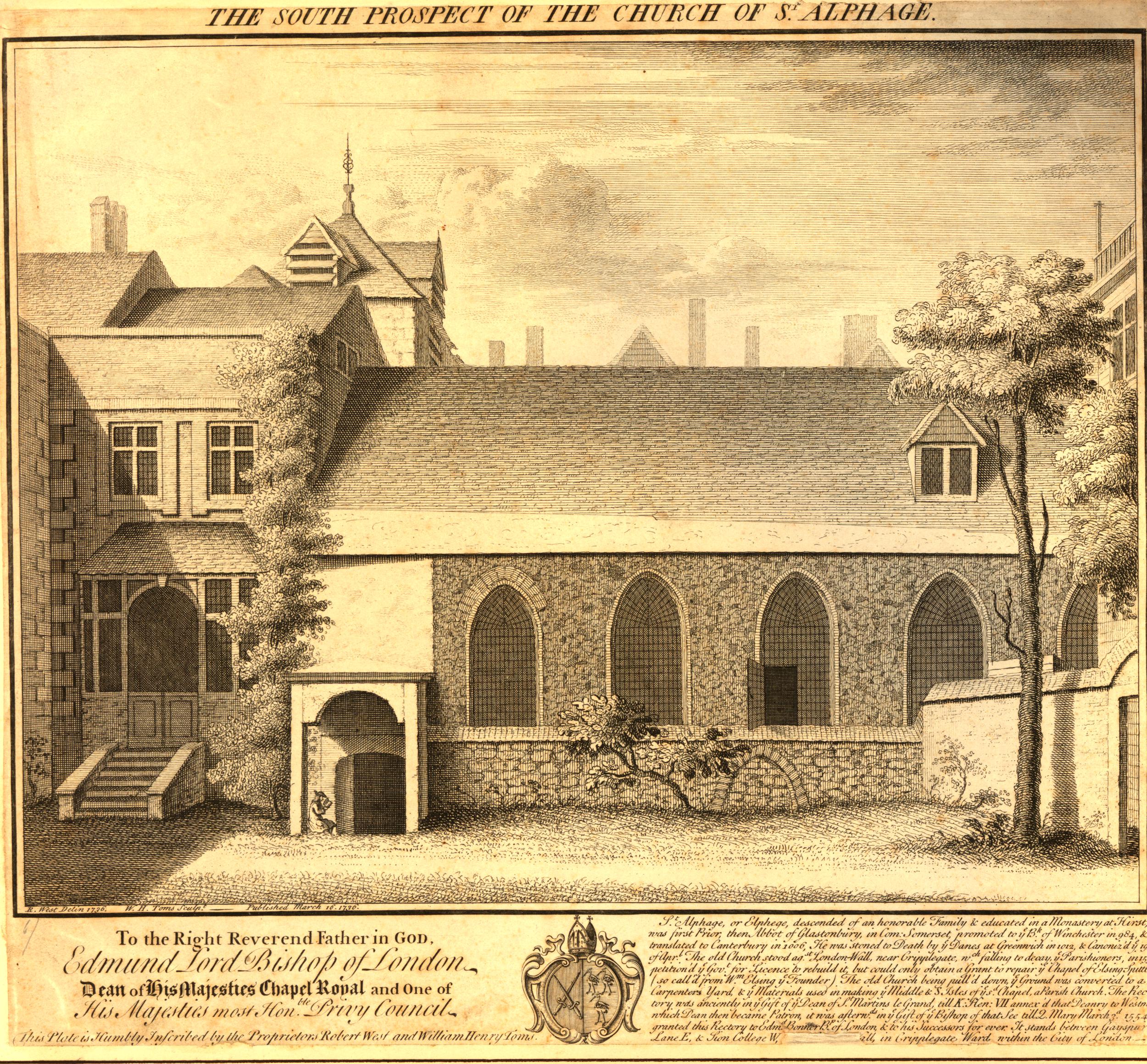
Hard to believe that the point where the above print was drawn from is now the dual carriageway of London Wall.

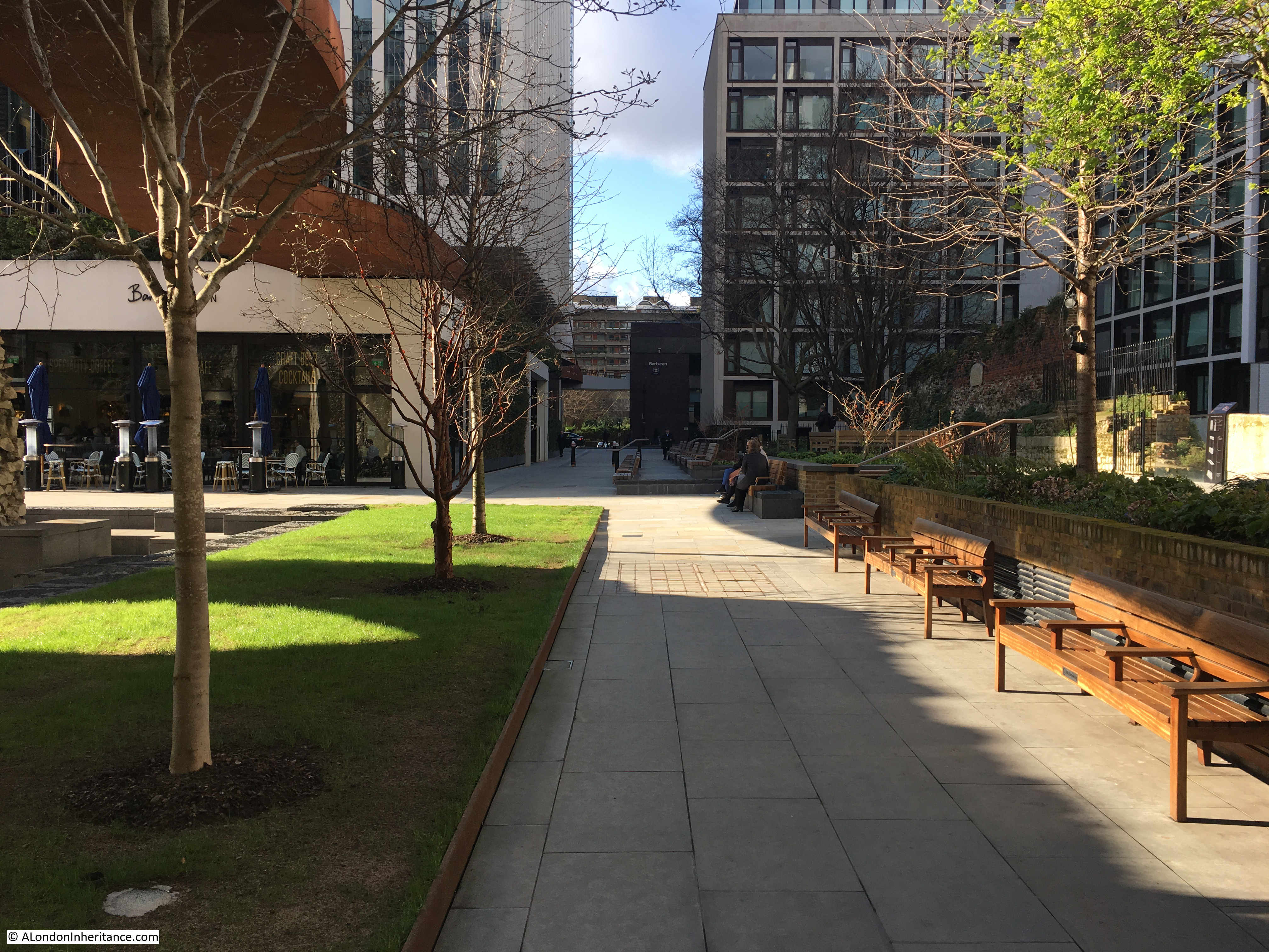
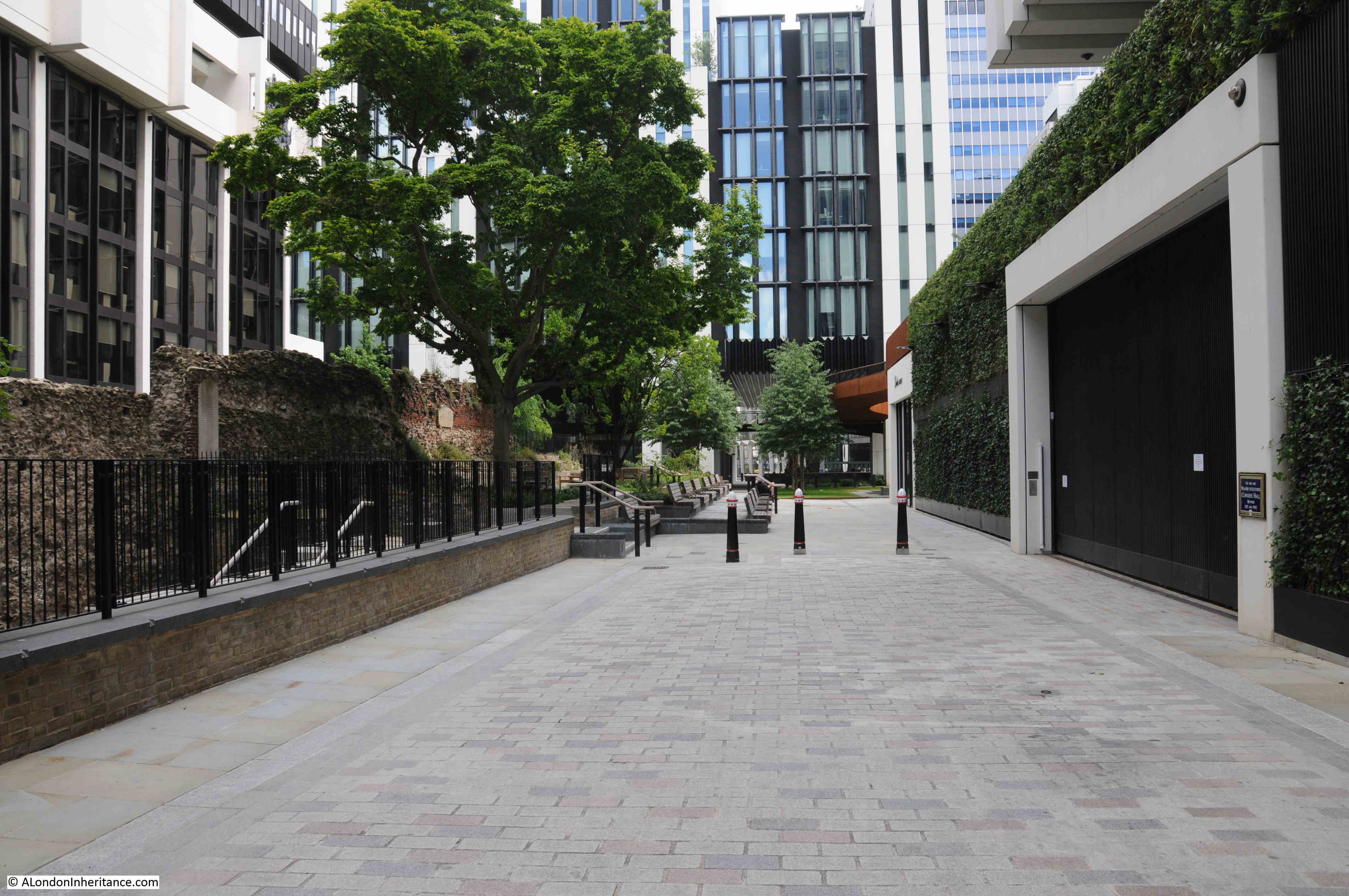
There is one landmark from the 1947 photo left to find. In the following photo I am standing in the original route of London Wall, now a pedestrian walkway, close to the junction with Wood Street. This is now called St Alphage Garden. The northern facade of St Alphage would have been at the far end, just where the brown of the high level walkway can be seen.

St Alphage

In my father’s 1947 photo, there is a feature I have labelled as Medieval Wall. This feature can still be seen today:

St Alphage

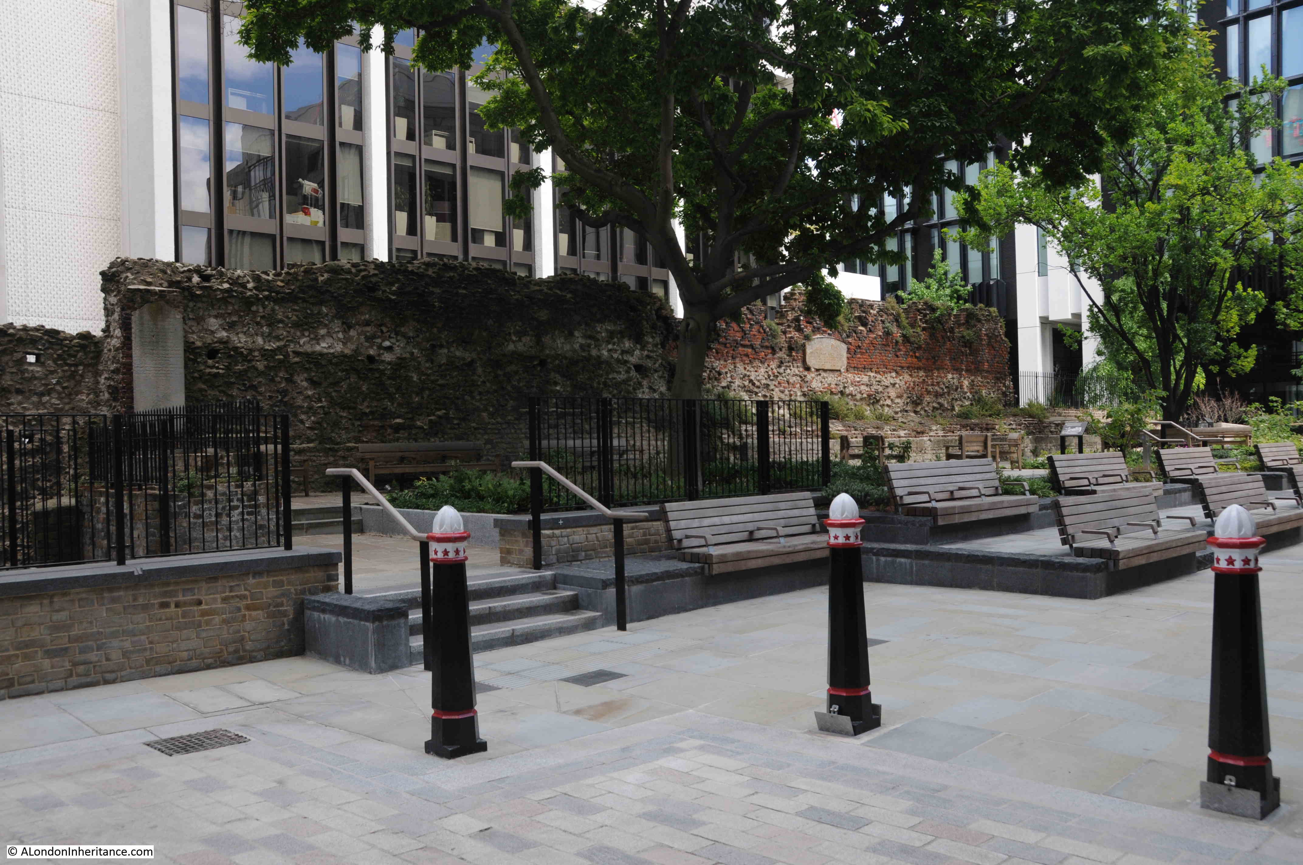
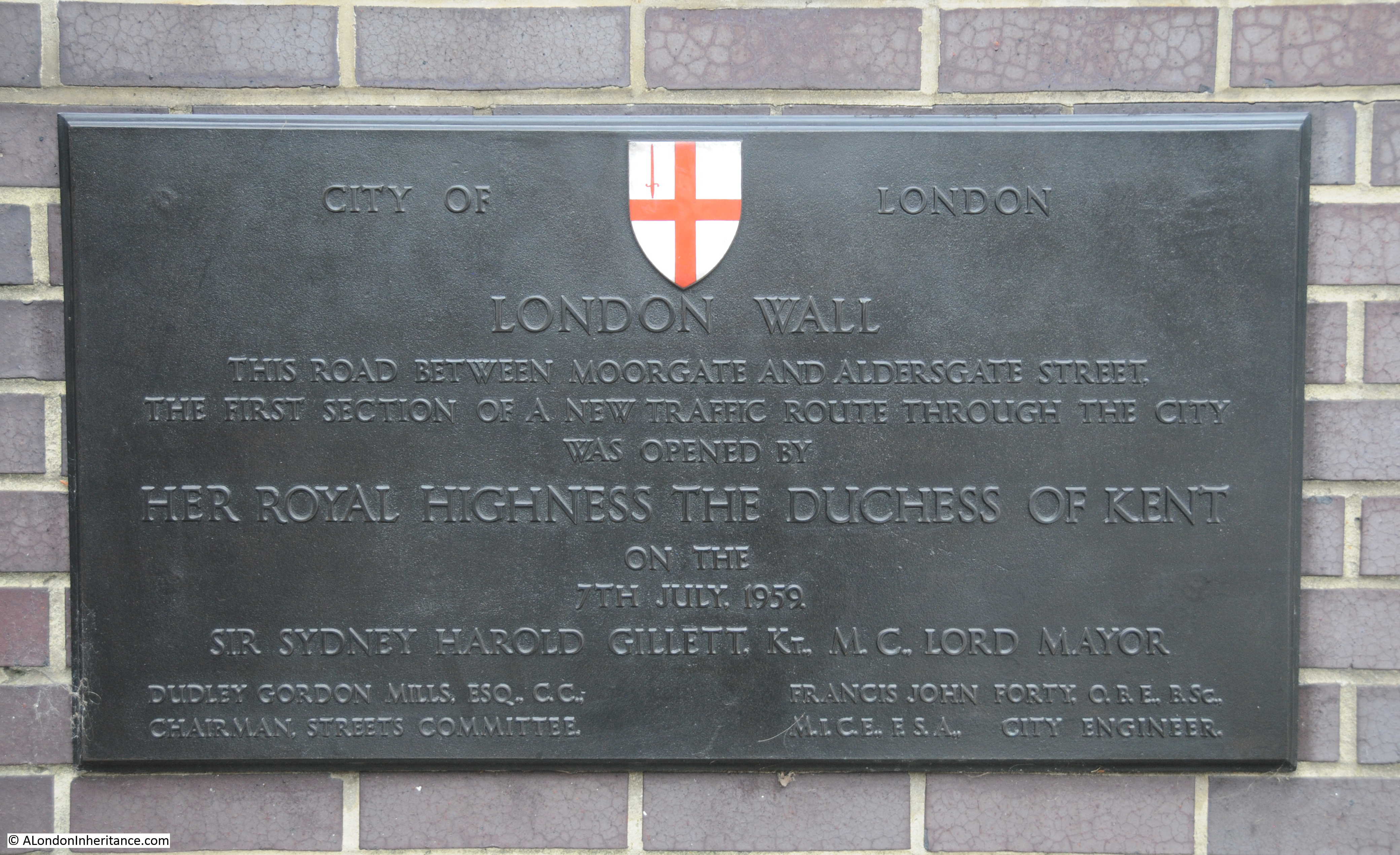
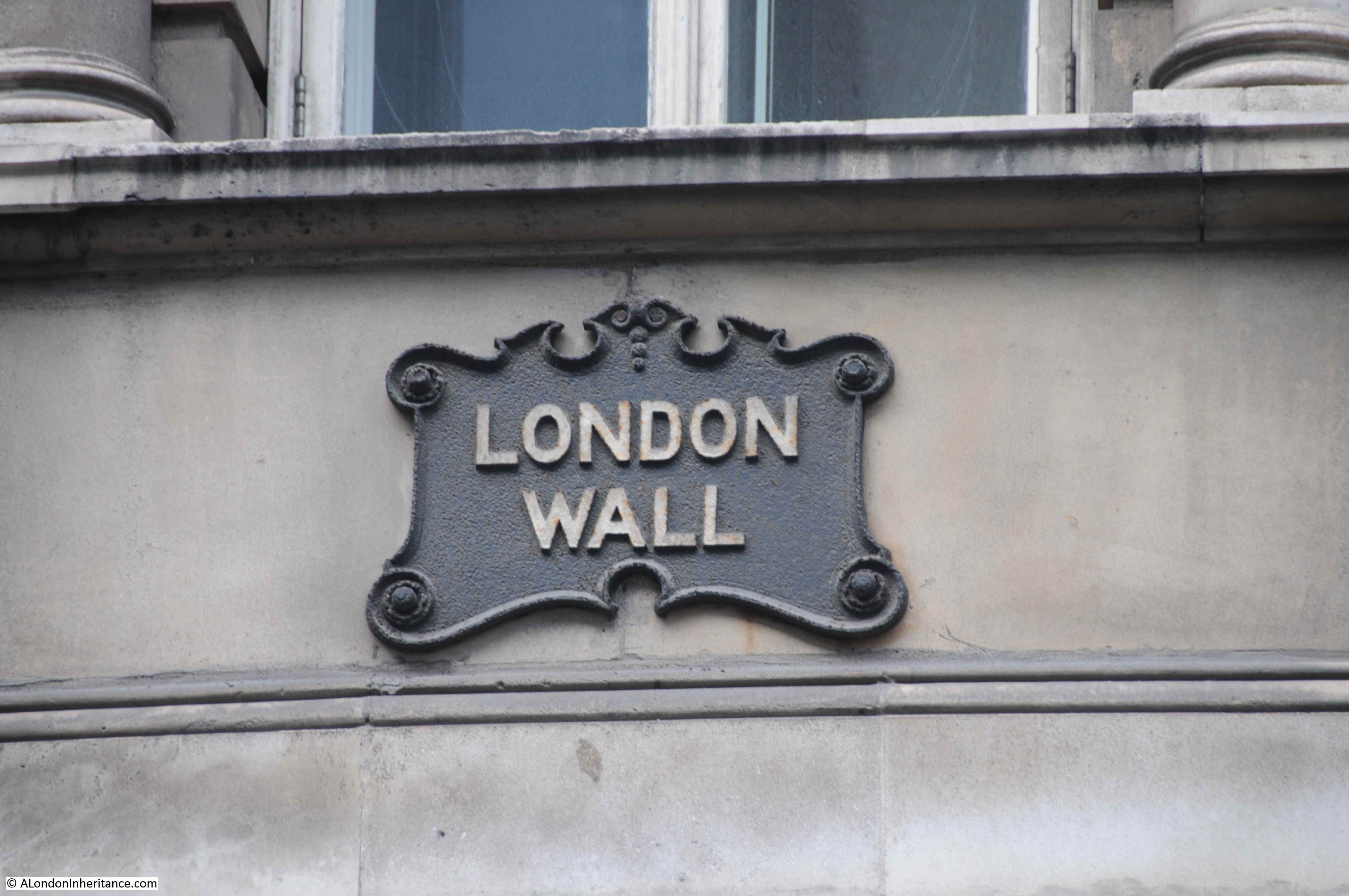
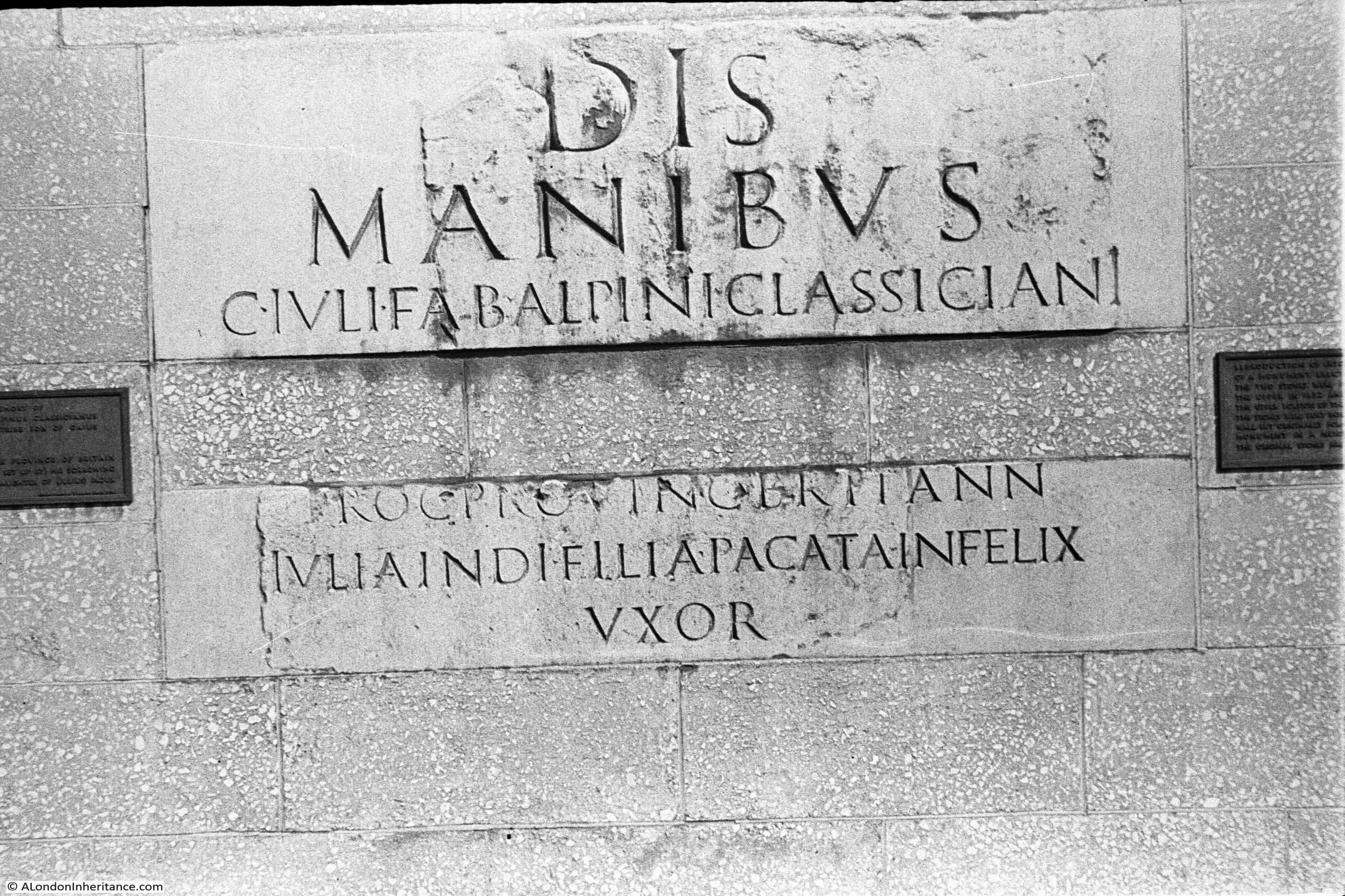
There is a plaque on the wall from 1872 that states Roman City Wall, however whilst the wall is on the alignment of the City Wall, only the very lower sections are Roman.

St Alphage

An information panel adjacent to the wall explains that the top brick section with the “crenellations and diaper pattern brickwork” (the regular battlement shape of the top of the wall and the brick pattern formed with the dark bricks) date from 1477 when the City Wall was strengthened during the Wars of the Roses. Medieval is below the brickwork, with Roman down at street level.

St Alphage

The space in front of the wall is now a garden / seating area and is the same space as marked in the map in the 1815 print as St Alphage Church Yard. This was also where the original St Alphage church was located.

Whilst the southern aspect of the wall was visible pre-war, much of the rear of the wall had buildings up against it – demolition of buildings damaged during the war opened up both sides of the wall as a free standing structure.

To bring this post full circle with my very first post in February 2014, when I wrote about the following photo.

St Alphage

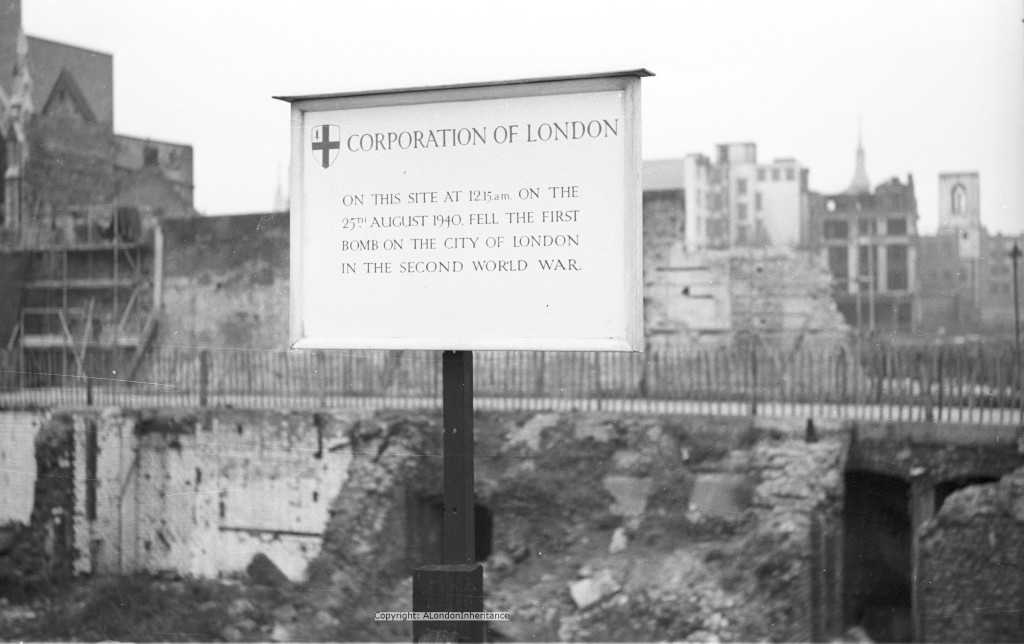
This was the original sign put up by the Corporation of London in Fore Street to mark the site of the first bomb on the City. What I did not mention at the time was that on the left edge of the photo you can just see the ruins of St Alphage, with the same pinnacle as in the photo seen at the start of the post. The section of City Wall is behind the sign.

It is fascinating how places change. The former priory chapel of St Mary Elsing and the Roman Medieval Wall have survived so much change and now look out on a very different landscape. The area surrounding St Mary Elsing is not the same as the post war rebuild, with most of the buildings being from the last few decades, and the original pedestrianised high level walkways have also been replaced.

I very much doubt whether the view the wall and chapel look out on now could have been imagined by anyone over their hundreds of years of existence. Although my father was aware of Route 11 (he bought the books with the redevelopment proposals when they were first published), he did not expect the size of buildings that now surround London Wall and Wood Street.

When London Wall was built, the car was expected to be the future of transport in the City. The car is now being actively discouraged as a means of transport in the City, so whatever may seem to be the future, will always change.

I suspect the next big change to the area will be when the Museum of London moves, and the proposed Concert Hall is built on the site (if the money is still there). This may drive more local change if there are empty offices to be repurposed due to remote working becoming the norm.

When researching these photos, as well as the history, I always try to imagine what the future may bring to these places, but the lesson of looking at the past is that the future will almost certainly be very different – but hopefully the walls of St Mary Elsing will still be there.

alondoninheritance.com

A Roman Wall in a Car Park and a Pottery Kiln in Kensington

Part of the fun of exploring London is finding things in the most unexpected places. Objects that have survived for many years, long after they finished serving their original purpose, and where modern London has been built around them. I have two examples in today’s post, a Roman Wall in a car park and a Pottery Kiln in Kensington.

The Roman Wall in a Car Park

When the street London Wall was rebuilt after the war from Aldersgate Street to Moorgate, it was widened and built along a new alignment. At the time, the car was seen as the future of transport in London, hence the four lane London Wall, and to accommodate the cars that would need to be parked in the City, the opportunity was taken to build a new underground car park that now runs almost the entire length of the new alignment of London Wall.

When London Wall and the car park was being built in 1957 a length of 64m of Roman wall was discovered. Much of the wall was demolished, but a section was retained and occupies a couple of parking bays within the car park.

The part demolished appears to have been mainly medieval rebuilds of the wall, but there must have been Roman within this wall, and the foundations, so a sad loss.

Access to the London Wall car park is either through the main entrance near the Museum of London, or down one of the pedestrian entrances along London Wall. If you enter through the main entrance, it will be a longer walk, as the wall is towards the end of the car park, near Moorgate.

As you walk along the car park, the wall emerges between pillars 51 and 52:

Roman wall in a car park

In the following map extract, the red rectangle shows the location of the wall. The car park extends to the left along the full length of the section of London Wall shown in the map  (Maps © OpenStreetMap contributors).

Roman wall in a car park

Looking from the side, the wall is at an angle to the wall of the car park:

Roman wall in a car park

The alignment of the Roman wall in the car park seems to align with the remains of the Roman wall that can still be found in St Alphage Gardens. In the following map, the rough alignment of the wall in the car park is the solid line in the rectangle, the blue dashed line runs up to the wall remnants in St Alphage Gardens (the grey solid line):

Roman wall in a car park

The side of the wall facing into the car park is the side that would have faced into the Roman City. The side is well preserved and consists of Kentish ragstone with triple tile courses at the base and the next course up, with a double tile course towards the top of the wall.

Roman wall in a car park

The following photo shows the construction of the wall, with on the right, the Kentish ragstone with the layers of tiles, the first along the base of the wall, then the second and third layers further up the wall. To the left is what is left of the core of the wall which had a rubble fill.

Roman wall in a car park

This section of wall is important, as it is the only surviving section of Roman wall in this part of the city that does not have lots of Mediaeval and later additions.

Roman wall in a car park

View to show the location of the wall and the length of London Wall car park. The car park seems to be under the entire length of the newly built four lanes of London Wall, and also runs the full width of the street – a cut and cover car park.

Roman wall in a car park

View of the rear of the wall in the following photo. The external facing facade of the wall has been robbed, demolished or lost at some point over the previous 1500 years. The view does show how substantial the wall must have been.

Roman wall in a car park

The wall in the car park must have been typical of much of the wall surrounding the City. W.F. Grimes in “The Excavations of Roman and Mediaeval London” compares the wall as follows: “A fragment of wall seen and partly preserved beneath the new London Wall is identical in general character with lengths exposed on the eastern side of the city at the Tower of London”.

It is rather strange to be standing in the car park, with the traffic of London Wall overhead, looking at a well preserved section of the Roman Wall. Another out of place structure to be found in London is:

A Pottery Kiln in Kensington

Walk along Walmer Road, towards the south end of the street and the junction with Hippodrome Place, roughly half way been Holland Park and Latimer Road stations, and a rather strange shaped brick structure will appear, jutting out in a gap between two rows of modern terrace houses.

Roman wall in a car park

This brick kiln is all that remains of a pottery industry that existed in this area from the mid 18th century, to the 19th century. The shape of the kiln is known as a bottle kiln and is mainly a chimney to the kiln which would have been at the base of the structure.

The shape of the structure is to create an even airflow and remove smoke through the relatively small hole at the top, retain heat within the kiln, and to protect the interior of the kiln from external weather conditions.

Roman wall in a car park

The kiln in Walmer Road was in use in the mid 19th century, and was part of a factory making products such as flower pots and drain pipes.

Today the kiln sits alongside Walmer Road, in a gap between two rows of recent terrace houses (sorry for the poor photos – I was using my small compact camera and something seems to have gone wrong with the way it handles back lighting).

Roman wall in a car park

The plaque on the base of the kiln provides some background information:

Roman wall in a car park

The Hippodrome Race Course occupied much of the surrounding area for five short years between 1837 and 1842. The race course was not a success for a number of reasons, including one that justified the existence of potteries in the area.

The ground consisted of heavy clay, which was good for making pottery, but not for horse racing. Much of the area was also very poor, with slum housing and the inhabitants were not those that the owners of a race course wanted to have attending or around the race course.

Clay had been dug up within the area for many years with a record dating back to 1781 of a “brickfield of yellow clay covering some 17 acres”.

Charles Dickens refers to the area in an edition of Household Words, where he described the conditions and also referred to the area as being called the Potteries:

“In a neighbourhood studded thickly with elegant villas and mansions, viz., Bayswater and Notting Hill, in the parish of Kensington, is a plague-spot, scarcely equaled for its insalubrity by any other in London; it is called the Potteries. It comprises some seven or eight acres, with about two hundred and sixty houses (if the term can be applied to such hovels), and a population of nine hundred or one thousand.  The occupation of the inhabitants is principally pig-fattening. Many hundreds of pigs, ducks, and fowls, are kept in an incredible state of filth. Dogs abound, for the purpose of guarding the swine. The atmosphere is still further polluted by the process of fat-boiling. In these hovels, discontent, dirt, filth, and misery are unsurpassed by anything known even in Ireland. Water is supplied to only a small number of the houses. There are foul ditches, open sewers, and defective drains, smelling most offensively, and generating large quantities of poisonous gases; stagnant water is found at every turn; not a drop of clean water can be obtained; all is charged to saturation with putrescent matter. Wells have been sunk on some of the premises, but they have become in many instances useless, from organic matter soaking into them”.

Some local street names recall the history of the area. Hippodrome Mews is on the other side of the kiln. Hippodrome Place is at the southern end of Walmer Road, and a short distance further south is Pottery Lane.

A painting by Henry Alken (Junior), titled “The last grand steeplechase at the Hippodrome racecourse, Kensington” shows a smoking kiln in the background:

Roman wall in a car park

The size of the kiln is an impressive 7.5m high and 6m in diameter at the base. The kiln is Grade II listed. Similar kilns would have been scattered across many other areas of London. Wherever suitable clay existed, and there was a need for fired clay products, kilns would have been built.

Roman wall in a car park

The Roman wall in a car park, and the pottery kiln are two very different structures in very different places, but both help tell the story of London’s long history, and both are examples of what you can find in the most unexpected places.

alondoninheritance.com

London Wall – A Location Shifting Historic Street

For this week’s post, I am back to tracing the locations of my father’s photos, and this photo dates from 1947. Locating the photo is helped by the street name, London Wall being displayed on one of the low walls built to separate street from bomb damaged buildings. Much of London Wall today is a very different place, not only with the buildings that line the street, but also the location of the street.

London Wall

This is roughly the same scene today, in 2020:

London Wall

There are a couple of features in the 1947 photo which help to confirm the location. I have ringed the first of these features in extracts from the 1947 and 2020 photos below:

London Wall

This feature can be found on top of the magnificent number 84 Moorgate, or Electra House, built in 1903 for the Eastern Telegraph and Allied Companies, one of the early telecommunications companies that built cable networks across the world.

London Wall

The two storey entrance to the building, with the dome at the top, and the feature that can be seen in my father’s 1947 photo.

London Wall

Above the main entrance is this magnificent coloured glass. A figure sits on top of the world, with a glowing orb above her head which sends rays across the seas, where a sailing ship and lighthouse can be seen. Eastern Telegraph was responsible for the installation and operation of a number of sub-sea communications cables that gradually connected the continents, so I suspect the glass mural in some way represented sub-sea cables shedding light across the world by providing the means for instant communications.

London Wall

The feature at the very top of Electra House, and visible from London Wall is in the photo below. For a company that was involved with technologies leading the global communications revolution, I was surprised to see the signs of the zodiac surrounding the world.

London Wall

The second feature that helped to identify the location is this two storey building seen at the end of the section of London Wall shown in the 1947 photo.

London Wall

Although only visible when you are near the building today, as new developments along London Wall have hidden the building from view along much of the street, the building still exists today.

It is the Armourers’ Hall of the Armourers and Brasiers’ Company, a rather nice Georgian building in the neo-Palladian style.  Due to new buildings, I could not photograph the Armourers’ Hall from the same direction as in my father’s photo, so this is the view looking across London Wall.

London Wall

The Armourers and Brasiers Company was formed in 1322 by a number of craftsman looking to maintain standards in the manufacturer or craft of armour.

London Wall

London Wall is two very different streets. The section of London Wall west of Moorgate is a wide dual carriageway, leading from the roundabout with the Museum of London at the centre at the junction with Aldersgate Street. East of the Moorgate junction, London Wall is a narrower street with many pre-war buildings still lining the street.

The following map shows the location of London Wall today, running left to right along the centre of the map, with the roundabout that forms the junction with Aldersgate Street on the left  (Map © OpenStreetMap contributors).

London Wall

The area between Moorgate and Aldersgate Street suffered terrible damage during the war. A large part would be redeveloped as the Barbican Estate, and a major change was made to London Wall. From just west of Moorgate, the road was diverted to a new southerly routing to a large new roundabout.

in the following map extract, the original route of London Wall can be seen coming from the right then moving diagonally up along the map. I have marked the first third with red lines.

London Wall

A third of the distance along, the new London Wall then takes a completely new direction, carving the new dual carriageway through a series of old streets and buildings, many of which had been badly damaged by wartime bombing.

The location of Armourers’ Hall is the green circle on the right. To the left, the red circle is the new roundabout that forms the junction with Aldersgate Street and is the location of the Museum of London. In the centre, there is another landmark that helps confirm the location. This is Brewers’ Hall, set back a short distance from London Wall, with the original, smaller hall shown as the blue oval in the above map.

London Wall

This new section of London Wall between Aldersgate Street and Moorgate Street was opened on the 7th July 1959. As the plaque shown in the following photo indicates, this was intended to be the first part of a major new traffic route through the City of London. A due carriageway providing a northern, east to west route, with the planned Upper and Lower Thames Street providing the southern, east to west route.

London Wall

The new dual carriageway would be lined with new office tower blocks, and the planned Barbican to the north would be the future of City residential living. This was how post war City planning was based on the assumption that car travel would be the future and City streets were needed that provided easier traffic flow, with pedestrian walkways above the streets separating pedestrians from traffic.

Fortunately, the full east and west extensions of the new London Wall did not get built, although part of the eastern stretch of the street was extended to dual carriageway, but not as drastically as the western section.

The differences between the two sections of London Wall can best be seen by taking a walk along the complete length of the street. This is the start, looking at the roundabout junction with Aldersgate Street, with part of the Museum of London in the centre of the street.

London Wall

From the junction with Aldersgate Street, we can look east along London Wall, a view which clearly shows a wide dual carriageway, designed to carry large amounts of traffic, quickly through the City.

London Wall

The buildings that line London Wall, and occupy space over the street are the second incarnation of office blocks along this street, having largely replaced the 1950s / 1960s office blocks that originally lined either side of London Wall.

London Wall was designed specifically for the car, and this can be seen both above and below ground.

Underneath London Wall is a large underground car park operated by the City of London. The car park runs for a large part of the new section of London Wall. The photo below was taken roughly underneath the lamp-post in the above photo.

London Wall

There is a section of the original London wall in the car park – a subject for another post.

The majority of the space either side of London Wall is occupied by gleaming new glass and steel office blocks. One exception are the ruins of the tower of the church belonging to the medieval hospital of Saint Elsyng Spital.

London Wall

The new office blocks that line London Wall are not just tall, they occupy large areas of land, and dwarf older building such as Brewers’ Hall which can be seen in the lower right of the following photo.

London Wall

The building in the following photo is the one that obscures the view of Armourers’ Hall, which is located just behind the building, where Coleman Street meets London Wall (although traffic access between the two streets is now blocked by a pedestrian route along London Wall).

London Wall

Nearing the junction of London Wall and Moorgate, where London Wall continues into the heart of the City as indicated by the gleaming towers in the background.

London Wall

From London Wall, we can look across to Moorgate, and set back from the road is this row of buildings, with a large pedestrian area and small green space between the buildings and London Wall, which help show how the area has changed.

London Wall

The building on the right of the terrace is a pub, the Globe, and this pub, and the other two buildings that make up this terrace can be seen in the map extract below.

London Wall

Credit: ‘Reproduced with the permission of the National Library of Scotland’ 

These buildings were originally on Fore Street, a street that once ran all the way up to St Giles Cripplegate. Fore Street has been shortened and blocked of by one of the new buildings alongside London Wall.

Fore Street ran just north of the original alignment of London Wall, and we can still walk part of the original route.

I have ringed a section of the original route of London Wall in the following map extract. Just above the word London, is a small space with the words London Wall.

London Wall

This is the section of Roman Wall in St Alphage Gardens, shown in the following photo:

London Wall

This section of wall helps explain why the street is called London Wall, as the street originally ran along the wall, just inside the City.

The following photo is looking west along what was the street London Wall, the section of wall at St Alphage Gardens can just be seen to the right.

London Wall

The following photo is looking along St Alphage Gardens, what was London Wall, from the junction with Wood Street.

London Wall

The above photo highlights one of the things I find fascinating about the city. Despite the amount of change, you can still trace out many lost streets, and although London Wall has been widened and moved to the south, we can still find the original junction with Wood Street and the original route down to Moorgate.

Returning now to the junction of London Wall and Moorgate, and the three houses on the left that once faced onto Fore Street, this is the old Fox umbrella shop.

London Wall

Now Grade II listed. Thomas Fox first opened an umbrella shop in Fore Street in 1868 and umbrellas were both made and sold on the premises for many years.

The wording below the FOX sign give an indication of the business at the site today, however Fox Umbrellas are still being made and sold from the company’s new location in Shirley, Croydon.

Now lets continue along the street, east of the Moorgate Junction, and this is the original London Wall with a much narrower street and still with many pre-war buildings. Thankfully the original scheme to extend the dual carriageway of the moved length of London Wall was never carried out in full.

London Wall

We have already seen the halls of the Armourers and Brasiers’ Company and the Brewers’ Company, and there is a third hall along London Wall. In the photo below, on the right, the building with the Corinthian Pillars is the hall of the Carpenters’ Company.

London Wall

The Carpenters’ have had their hall on this site in London Wall since 1429. The hall today is the third hall, as the previous hall had been badly damaged during the war.

On the opposite side of the street, old and new buildings sit on opposite corners.

London Wall

The building on the left in the above photo still has original London Wall street signs. Not sure of the exact age of these, but they must be pre-war.

London Wall

Just east of the Carpenters’ Hall, London Wall widens again from a single carriageway to a dual carriageway, as part of the scheme to create a major through route, however along this part of the street, the widening has not been as dramatic as on the section from Moorgate to Aldersgate Street,

Almost at the eastern end of London Wall is the church of All Hallows on the Wall, the name referencing the fact that the church is located up against the Roman wall, with the original church on the site being built on a bastion of the wall.

London Wall

The present church was built in 1767 to replace the earlier church which had become derelict. The church did suffer damage during the war, but was restored in the 1960s, and is now the Guild church of the Worshipful Company of Carpenters.

A short distance further east from the church, just by the green van and traffic lights in the above photo, London Wall comes to an end, where the road continues as Wormwood Street.

That completes a walk along London Wall. A historic street that originally followed the path of the Roman Wall, but now only does this for the eastern section up to Moorgate. Passing Moorgate, London Wall diverts to the south and becomes a large dual carriageway, reflecting the post-war view that city design had to accommodate the car.

However the magic of London is that we can still find the line of the original London Wall, and that these old routes and boundaries have been retained.

alondoninheritance.com

The Lord Mayor’s Show In The Early 1980s

The annual Lord Mayor’s Show took to the streets of the City yesterday. I did not visit this year’s event, but have been many times over the years, and I first started taking photos of the Lord Mayor’s Show in 1981.

For this week’s post, I have scanned a sample of photos from the Lord Mayor’s Show between 1981 and 1983. Rather than the main route of the procession, I always went to the streets where the procession assembled in the couple of hours before the start. It was here that you could talk to, and get some more interesting photos of those involved.

As well as the participants in the Lord Mayor’s Show during the early 1980s, these photos also show the area around London Wall as it was before the major rebuilding of the last couple of decades that has resulted in a significant change to the streets.

So, to start with, here are some uniformed Unigate milkmen:lord-mayors-show-1

Only at the Lord Mayor’s Show could you spend your day in (I think) a chicken costume:

lord-mayors-show-2

I remember this character from the 1970s and 80s, but cannot recall his name:

lord-mayors-show-3

The military have always played a significant role in the Lord Mayor’s Show:

lord-mayors-show-4

I had forgotten all about this pub until I scanned this photo. In the background is the Plough pub on St Alphage High Walk. It was demolished in 2006 as part of the reconstruction of the area.  In the foreground is the Debenhams float, which I think is a bike they will all be cycling along the procession.

lord-mayors-show-5

Chelsea pensioners from above:

lord-mayors-show-6

The British Airways float:

lord-mayors-show-7

I took this photo of the man in the centre, however look at the man to his right. he is carrying a cine camera. These photos are only around 35 years old, but this was the technology of the time – there is not a mobile phone in sight.

lord-mayors-show-8

Cannot remember who “JLW” were:

lord-mayors-show-9

“Why move to the middle of nowhere, when you can move to the middle of London?”

lord-mayors-show-10

The brewer Samuel Smith with the Harrods float on the left:

lord-mayors-show-11

British Telecom float. Very early computer terminals, but not a mobile phone in sight. How technology would change over the coming 35 years.

lord-mayors-show-12

Post Office float – advertising down the side to “Use the postcode – you’re not properly addressed without it”.

lord-mayors-show-13

The following few photos were taken from the footbridge that ran across London Wall from the southern to the northern sides of Wood Street. The church tower is that of St. Alban. This area has been completely rebuilt. Whilst the church tower remains, the exit of the southern part of Wood Street into London Wall is now a single lane. The surrounding buildings, the foot bridge and the elevated walkways have all disappeared and the 18 floor office block, 125 London Wall now sits across this junction.

lord-mayors-show-14

LBC radio van:

lord-mayors-show-15

Vintage army uniforms and equipment:

lord-mayors-show-16

The Underground, advertising the capital investment that had recently resulted in the Heathrow extension of the Piccadilly line:

lord-mayors-show-17

SAGA – “world-wide holidays for people who matter”:

lord-mayors-show-18

This bus appears to be an entry by, or sponsored by Disney:

lord-mayors-show-19

“Give me Bournemouth anytime” – the rather exotic entry that must be by the Bournemouth Tourist Board:

lord-mayors-show-20

Float entry by the construction company Mansell advertising 75 years of the company’s existence. This would not last for too much longer as Mansell was purchased by Balfour Beatty in 2003 and the name was phased out in 2014.

lord-mayors-show-21

British Telecom, when a large handset attached to a landline was the latest in technology:

lord-mayors-show-22

Not sure what this float was:

lord-mayors-show-23

A better view looking from the north edge of London Wall down Wood Street showing the stairs that ran up to the foot bridge and the pedestrianised walkways:

lord-mayors-show-24

Floats from Selfridges and Harrods:

lord-mayors-show-25

British Gas:

lord-mayors-show-26

The military wait the start of the procession:

lord-mayors-show-27

Military equipment:

lord-mayors-show-28

The Lord Mayor’s Coach:

lord-mayors-show-29

Passing The Plough pub on London Wall:

lord-mayors-show-30

British Airways, City & Guilds College and Cubitts the builders:

lord-mayors-show-31

In perhaps a reverse of the many other changes in the last 35 years, the Lord Mayor’s Show appeared to be much more commercial than it is today. Companies such as Selfridges, Harrods, British Airways, British Telecom and as shown below, BP, along with many others all had floats in the procession. An interesting change in focus.

lord-mayors-show-32

The Lord Mayor’s Coach:

lord-mayors-show-33

British Rail and the InterCity 125 train that had been introduced during the previous few years:

lord-mayors-show-34

The Company of Pikemen and Musketeers of the Honourable Artillery Company have long been a feature of the Lord Mayor’s Show. Here marching down the northern part of Wood Street from Fore Street towards London Wall:

lord-mayors-show-35

Milk and cheese deliveries to the door. Tesco float in the background:

lord-mayors-show-36

Lord Mayor’s coach again:

lord-mayors-show-37

The latest gas appliances from Unigas:

lord-mayors-show-38

British Aerospace and the Jetstream 31 which first flew in 1980:

lord-mayors-show-39

View along London Wall:

lord-mayors-show-40

Harrods float:

lord-mayors-show-41

London Docklands Development Corporation float. Created in 1981 at around the same time as these photos. The work of the L.D.D.C. would have a significant impact on the area of London east of Tower Bridge and down to the Isle of Dogs:

lord-mayors-show-42

Wimpey, from the days when mock Tudor architecture was the aspiration for a new home owner:

lord-mayors-show-43

Thames Water:

lord-mayors-show-44

The Lord Mayor’s Coach in Wood Street by the tower of the church of St. Alban:

lord-mayors-show-45

The Household Cavalry:

lord-mayors-show-46

“Doorstep delivery service, British and best”:

lord-mayors-show-47

It is a number of years since I last saw the above photos, and looking at them now the things that strike me most are the changes along London Wall, and the large number of private companies that once participated in the Lord Mayor’s Show. The procession seems rather different today.

London Wall at the time was the post war development of a heavily damaged area and consisted of plenty of rather unattractive office tower blocks, but looking at the photos now, including the junction of Wood Street and London Wall I feel strangely nostalgic for this area as it was. London Wall does not feel as much an open space as it did, with the building of 125 London Wall blocking the view along the length of the street.

alondoninheritance.com

The Roman Wall On Tower Hill

Tower Hill is one of the best places to see remnants from London’s early history. A couple of weeks ago I featured the church of All Hallows by the Tower with the Saxon arch and Roman floor, this week it is the turn of the Roman Wall on Tower Hill.

This is my father’s photo from 1947 showing a length of Roman wall on Tower Hill.

roman-wall-on-tower-hill-2

It was easy to locate this length of wall, the cut out section at the end of the wall is a clear marker of which side of the wall is the subject of the photo. My father took the photo in the afternoon as the sun was shining directly onto the wall. When I visited, I made the mistake of being there in the morning when the sun was just over the eastern edge of the wall and caused problems trying to get the same photo, so I took the following slightly edge on, still with some impact from the sun, however it clearly shows the same cut out section and has the benefit of positioning the location of the wall by showing the Tower of London in the background.

roman-wall-on-tower-hill-3

Today, this length of wall stands in isolation, however this area of Tower Hill was once full of buildings and as can be seen from my father’s photo there is a building at the end of the wall and parts of the roof of a building on the other side of the wall can just be seen.

The wall today is just outside Tower Hill Station, however in 1947 the station did not exist. An earlier Tower Hill Station had closed in 1884 and Mark Lane Station (located opposite All Hallows by the Tower) had served the area. Mark Lane Station (more on this in a future post) closed in 1967 when the present Tower Hill Station opened.

The following extract from the 1940 Bartholomew’s Atlas of Greater London shows the route of the underground (the black and white line) with Mark Lane Station clearly marked in the centre of the map opposite the church, and no mention of Tower Hill Station, as it did not exist at this time.

map-2

One of my books on London is a little publication with the title “London Wall Through Eighteen Centuries”. Published in 1937 for the Council for Tower Hill Improvement, the book is a detailed history and survey of the London Wall with articles on the history of the wall in Roman, Medieval, Tudor and later times, and a detailed guide of where to find the wall (one of my many future projects is to use this book as a guide to walking the wall today to see how the wall, its visibility, condition and the route has changed since 1937).

One of the photos in the book is the same section of the wall as my father photographed with the same cut out section at the end of the wall and the same markings on the wall. I will have to return one afternoon and get a better photo with the sun in the right position.

The photo shows how the wall was part of the surrounding buildings – very different to today.

roman-wall-on-tower-hill-7

My father also photographed parts of a Roman tombstone which had been found on Tower Hill. Two parts of the tombstone were found, with the first top section in 1852 and the lower section during construction of an electricity substation at Tower Hill in 1935. The following photo shows these parts, which I believe are the originals inserted in a surrounding stone with the missing lettering added to the smooth stone on the top block.

roman-wall-on-tower-hill-1

The words Dis Manibvs confirm this to be a tombstone as they mean “to the shades of the dead”. The middle section is missing, however the tombstone appears to be to Gaius Julius Alpinus Classicianus, the procurator of the province of Britain after Boudica’s revolt, so very early in the Roman occupation of Britain. The tombstone was set up by his wife, Julia Pacata Indiana.

If the stones in my father’s photo are the originals, I believe they have since been moved to the British Museum and today a modern replica exists at Tower Hill. I have not had time to check, but if you know if the originals are at the British Museum, or another location I would be interested to know.

roman-wall-on-tower-hill-4

There is a small park area on the opposite side of the wall, this was occupied by buildings in the earlier photos above.

roman-wall-on-tower-hill-6

There is another large section of wall on Tower Hill, although not so visible. This sections runs further back from the above section between offices on the right and the CitizenM hotel on the left.

roman-wall-on-tower-hill-5

The book “London Wall Through Eighteen Centuries” has another photo of the wall at Tower Hill, but of a section that does not now exist. The following photo is captioned “The Roman Wall at Trinity Place, Tower Hill, being destroyed when that part of the Inner Circle Railway was constructed in 1882. The east side of the wall showing the foundations, external plinth and one bonding course.”

roman-wall-on-tower-hill-8

I assume that this part of the wall needed to be destroyed due to the cut and cover technique of building this section of the underground.

The book provides more detail on the wall at Tower Hill. In the section titled “Where to find the wall” by Walter G. Bell, he writes about the Tower Hill section:

“It is built into Barber’s Bonded Warehouses, which you enter from Cooper’s Row, Trinity Square – or, more truthfully, I might say this part of the wide-spreading vaults and floors is added to the old City Wall. Long ago, when Barber’s premises were about to rise under scaffolding, the builder found the City Wall there standing, and I picture him gazing at it, lost in thought, in puzzling wonder what he should do. To destroy it with pickaxe and shovel would be a herculean and costly task. It is immensely thick, and hard as iron. How long ago that was I cannot tell, but the partner of Messrs. Joseph Barber & Co. who showed me the wall, with lamp held at the end of a lath and lighted that I might explore its intricacies, mentioned to me his great-grandfather as having been a member of the firm owning these vaults.

Why waste a good wall? The question had only to be asked to be answered, and with a few shallow windows added at the bulwark level and a course or two of brick, the warehouse roof was sprung from the top. So the structure continues to do good service, as it has done eighteen or more centuries ago, and to the builders happy inspiration (with the added savour of economy) is owning the preservation of the most complete fragment of the City Wall today, and one may hope for all time, now that the Corporation are beginning to realise the value of the City’s historical antiquities.”

These paragraphs by Walter G. Bell tell us so much about how London’s wall has survived and the attitude to the wall. Those sections that still remain are there because they could serve some purpose over the centuries. They are there as they could provide a wall without the need to build a new one, they are there as sometimes they would have cost more to destroy. Written in 1937, it was only then that the historic value of the wall was starting to be considered.

It is the Barbour’s Warehouse Buildings that be seen in my father’s photo and the photo from the book with the roof above the Roman Wall and at the end of the wall.

There is one final intriguing photo in the book on the wall at Tower Hill. The following photo is captioned “A medieval window in the Wall in Barbour’s Warehouse, Cooper’s Row, Tower Hill, November 1936”.

roman-wall-on-tower-hill-9

Coopers Row is shown in the 1940 map above, to the right of Trinity Square. I believe this may be in the section running back past the CitizenM hotel, but I could not get close enough to check, but again it demonstrates how the wall has been incorporated in other buildings over the centuries.

The book “London Wall Through Eighteen Centuries” provided a complete survey of the wall as it was in 1937, just as the importance of preserving antiquities such as the wall was starting to be understood.

Hopefully, one day I will get the time to explore the full length of the London Wall using the 1937 book as my guide, but until then I will try and get back to Tower Hill and take a better photo with the right lighting of this lovely remaining section, now standing free of Barber’s Bonded Warehouses.

alondoninheritance.com