I do a considerable amount of walking around London, on foot being by far the best way to explore and understand the city. When not hunting down the locations of my father’s photos, then either a random walk or a walk with a specific theme or target.
I also like looking at London from above. My first view of London from the top of St. Paul’s Cathedral was over 40 years ago and during occasional visits since it has been possible to witness the changing skyline of the city.
Viewing London from above also gives a geographical context to London. The relationship with the River Thames, the route to the open sea, the surrounding hills and how London has expanded from the original settlement around the City of London.
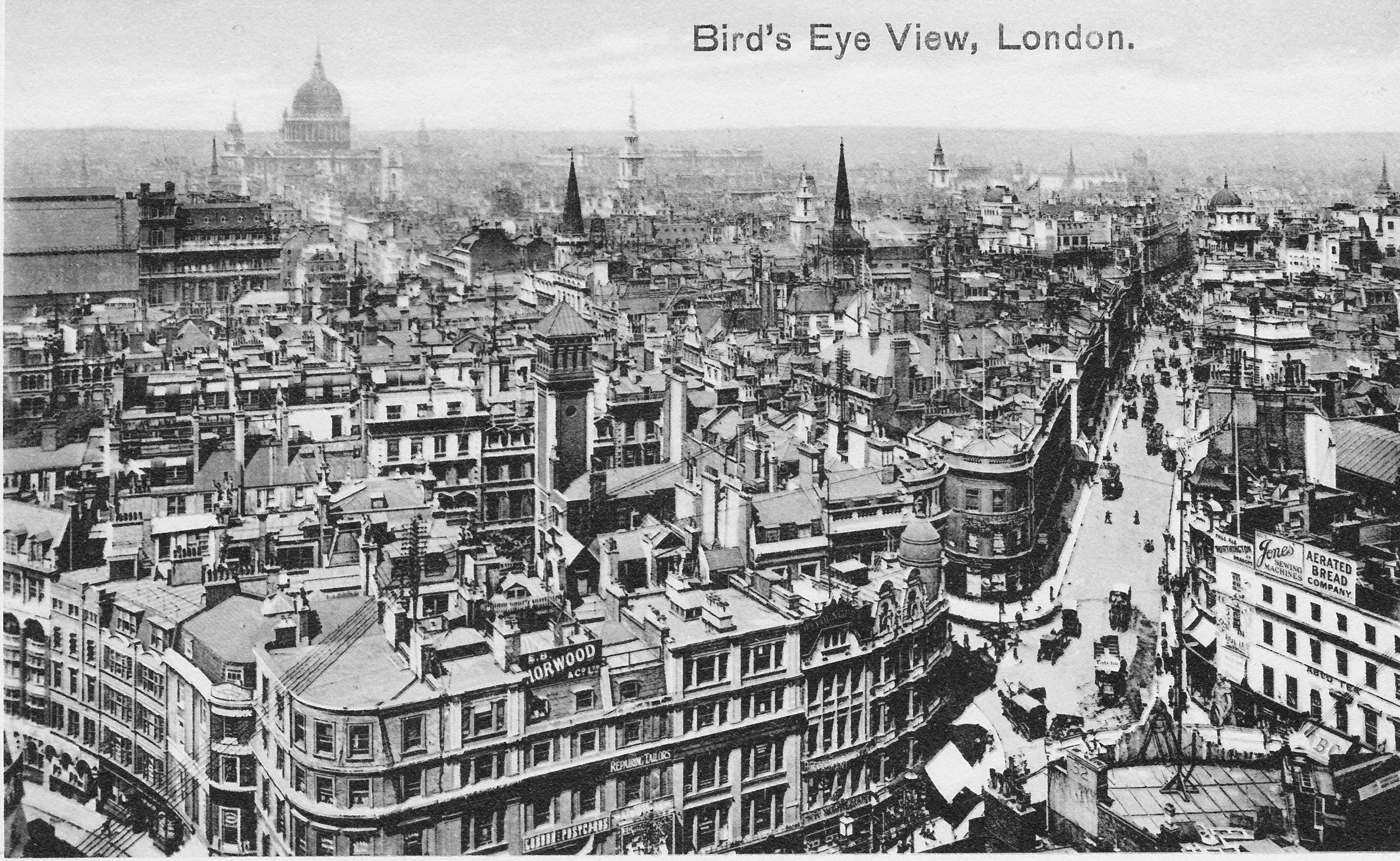
When thinking about a possible theme for a walk, I had been talking to someone who had recently completed the Three Peaks Challenge – climbing Scafell Pike in England, Snowdon in Wales and Ben Nevis in Scotland within a period of 24 hours. London does not have any equivalent peaks but what it does have is a number of tall buildings with viewing galleries, so on a Saturday in August I went for my own very unambitious 5 peaks challenge, to see London from the top of 5 locations – The Monument, Sky Garden, St, Paul’s Cathedral, Shard and the London Eye.
Only two of these needed climbing and it is there that any comparison with the 3 peaks challenge ends, but it did provide an opportunity to see the changing London skyline from different locations, understand the structure of London (for example only by looking from above can you really understand how the railways have carved up the south of the river) and just to enjoy the view of this remarkable city.
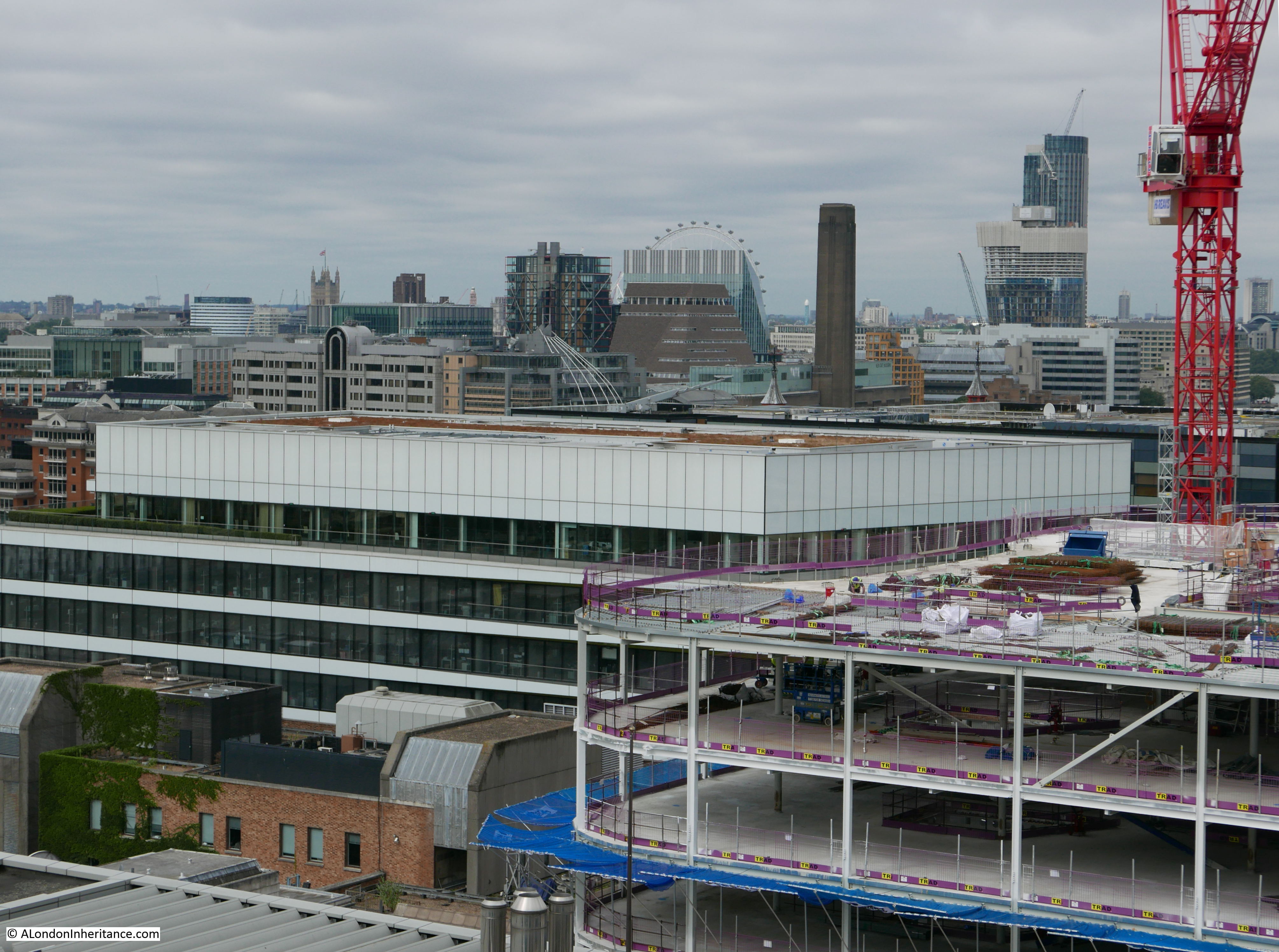
As you would expect, this is rather photo heavy, so I have split into three posts over the next few days. The first covering the Monument, Sky Garden and St. Paul’s Cathedral, the second post covering the Shard and London Eye, with the third post answering the question of the furthest man-made object visible from London (I am afraid the sort of question I find fascinating).
I am going to stay clear of any discussion of the buildings in these posts, rather just enjoy the views across London.
So, at 10:00 on an overcast Saturday morning in August (with the forecast for improving weather), I arrived at:
The Monument
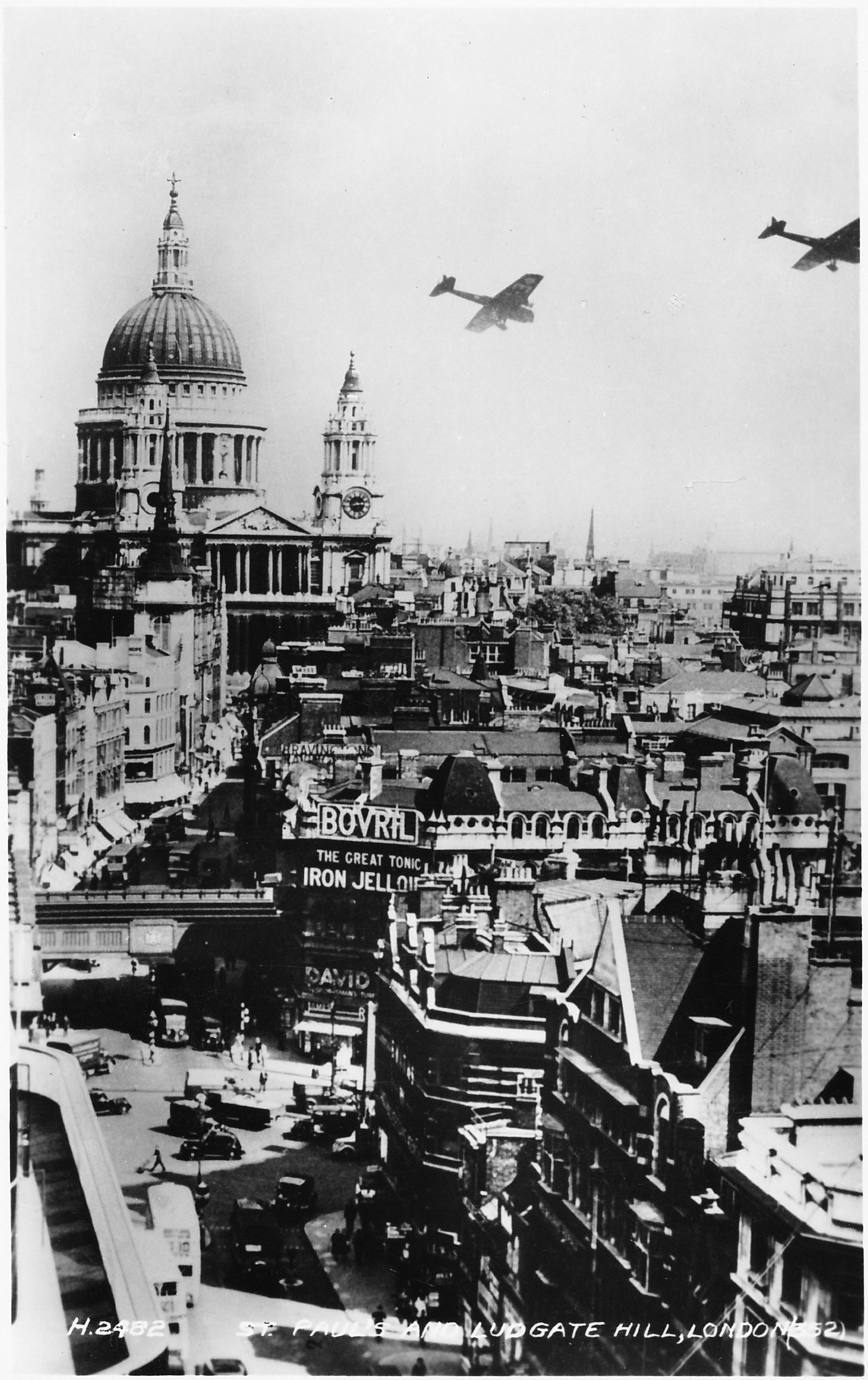
Completed in 1677 by Sir Christopher Wren and Robert Hooke to commemorate the Great Fire of London, the Monument provides a view-point in the heart of the City. When built, the Monument at 202 feet high would have stood clear of the surrounding buildings but today is starting to feel rather enclosed with the continuing growth in height of buildings across the City.
The viewing gallery is 311 steps from the entrance up a narrow cantilevered staircase, so after paying at the entrance it was a swift climb to the top for views across London from the oldest of the viewing points that I will looking from today.
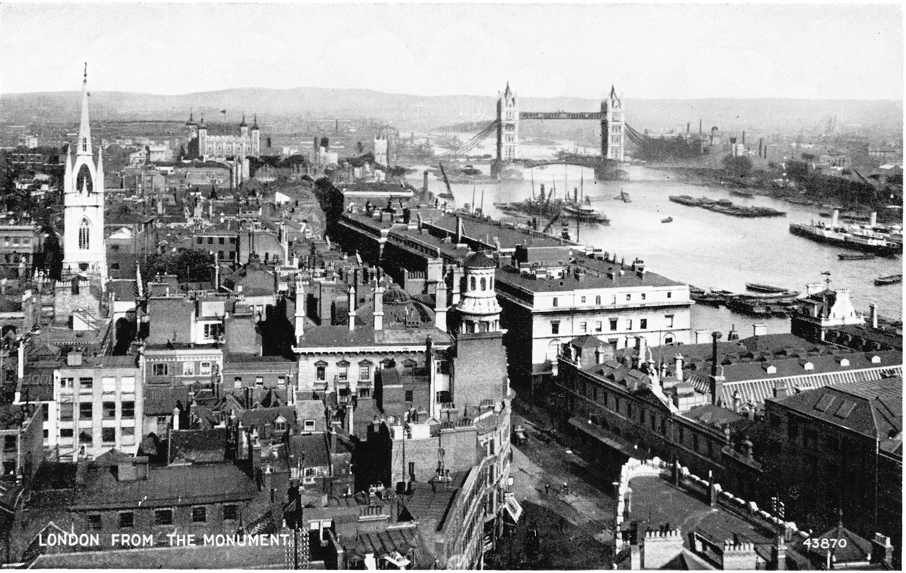
First view from the Monument, looking down Monument Street towards the old Billingsgate Market and running across the Thames, Tower Bridge.
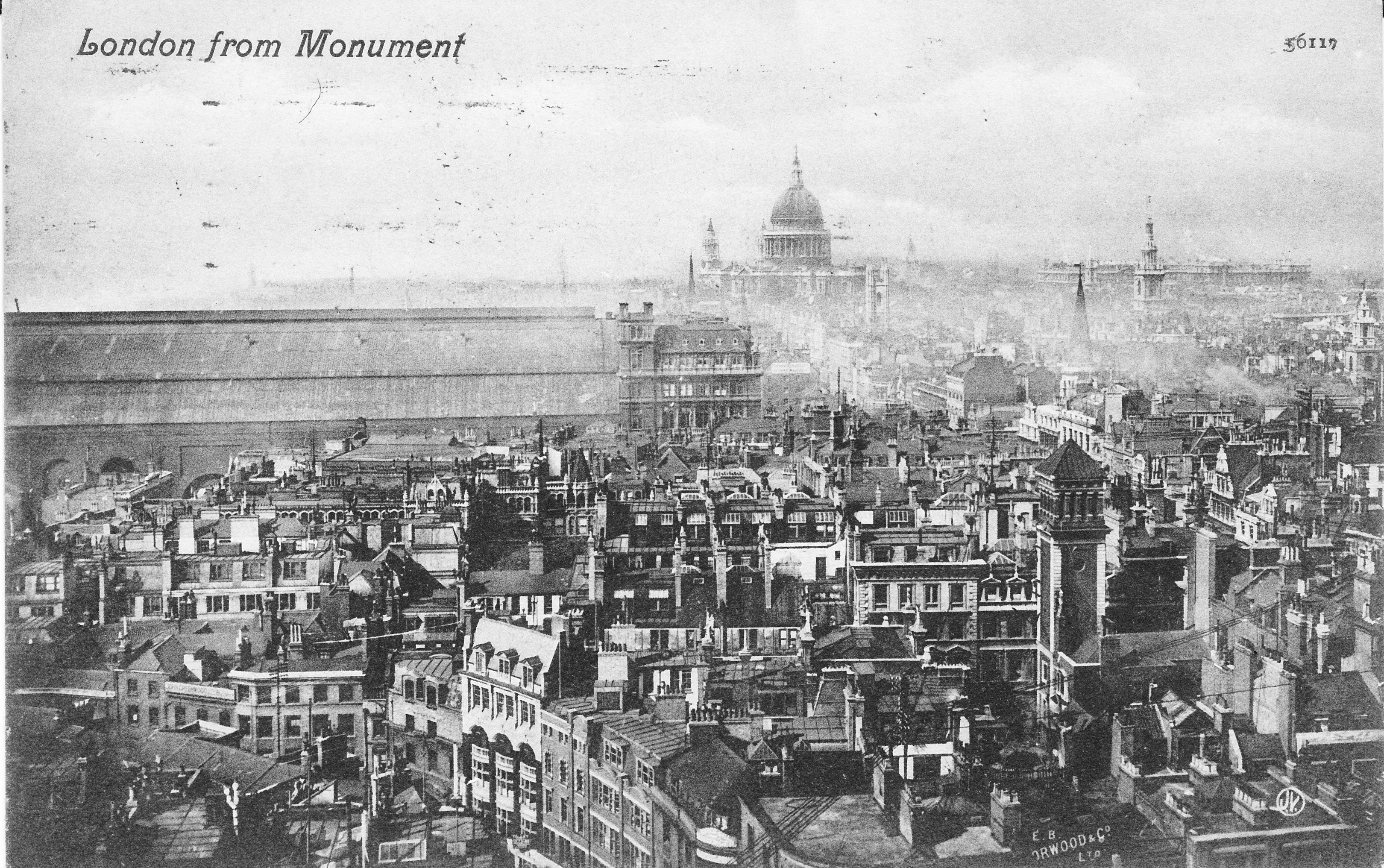
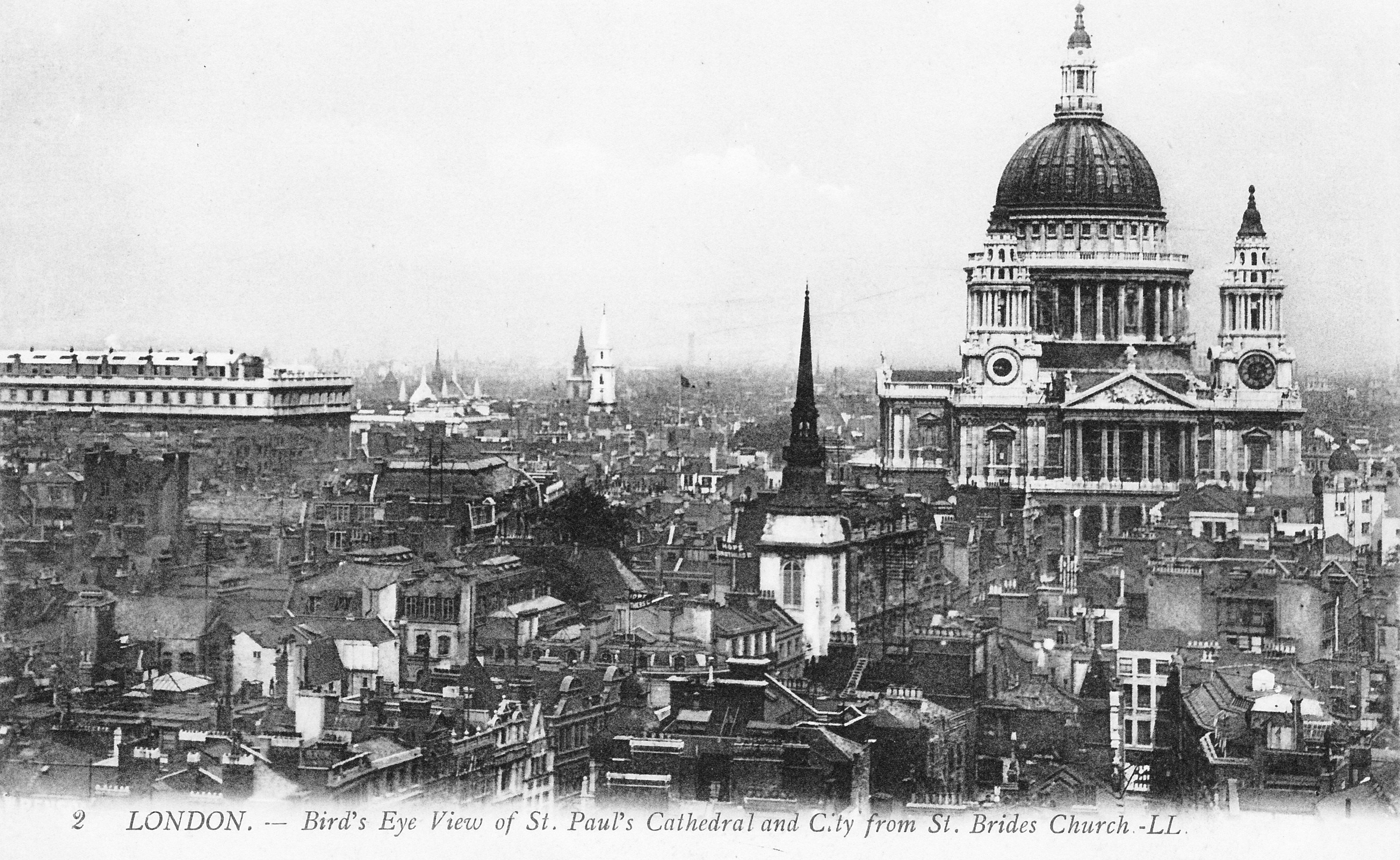
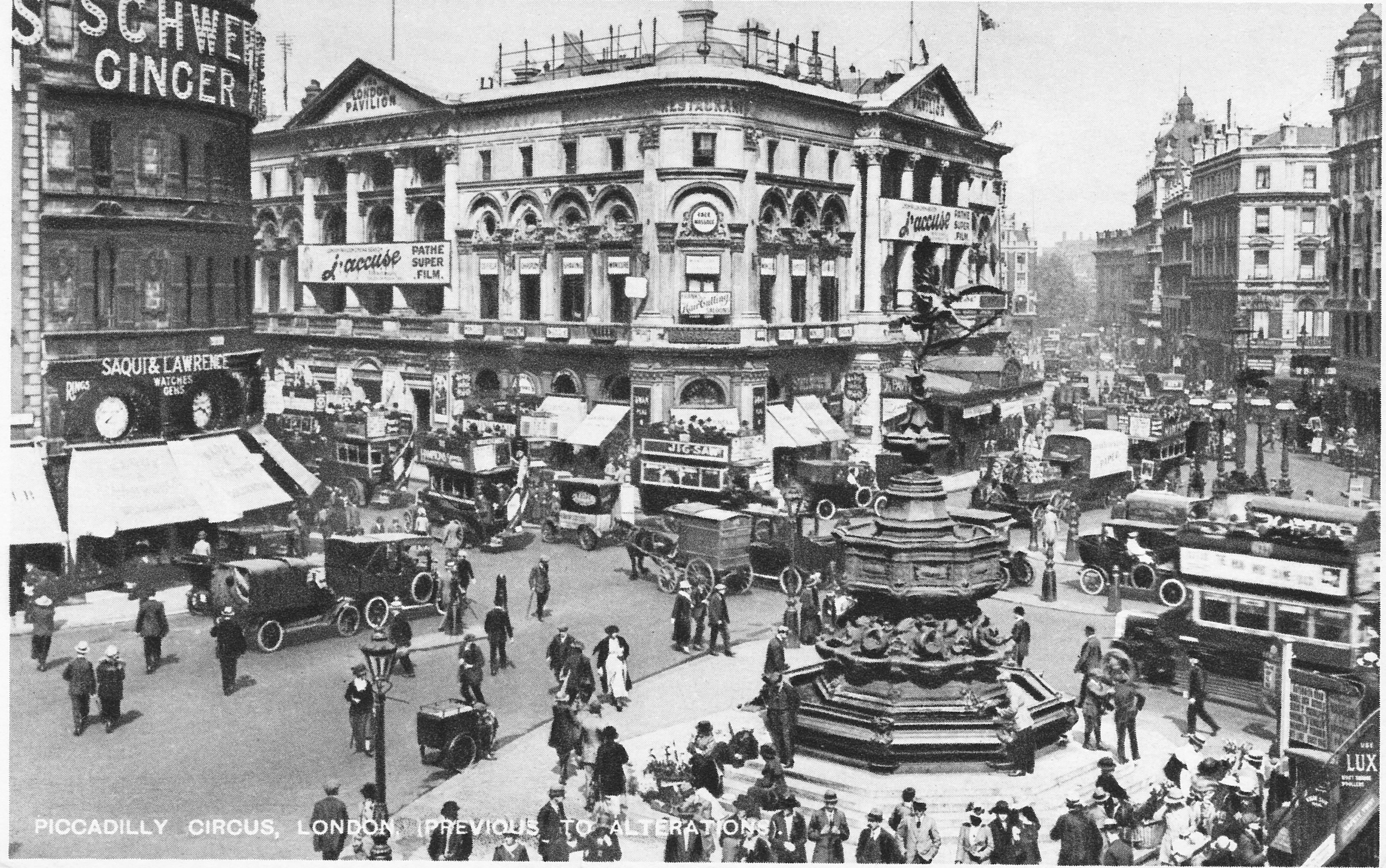
A series of postcards were published in the early 20th century showing the view from the Monument – the first showing a similar view to the above:

Looking up Gracechurch Street towards the towers of the City:

Looking up King William Street with the towers of the Barbican in the distance and the dome of St. Paul’s Cathedral on the left.
Similar early 20th century view to the above photo. The growth in height of City buildings is obvious by how the church steeples once towered above their surroundings.

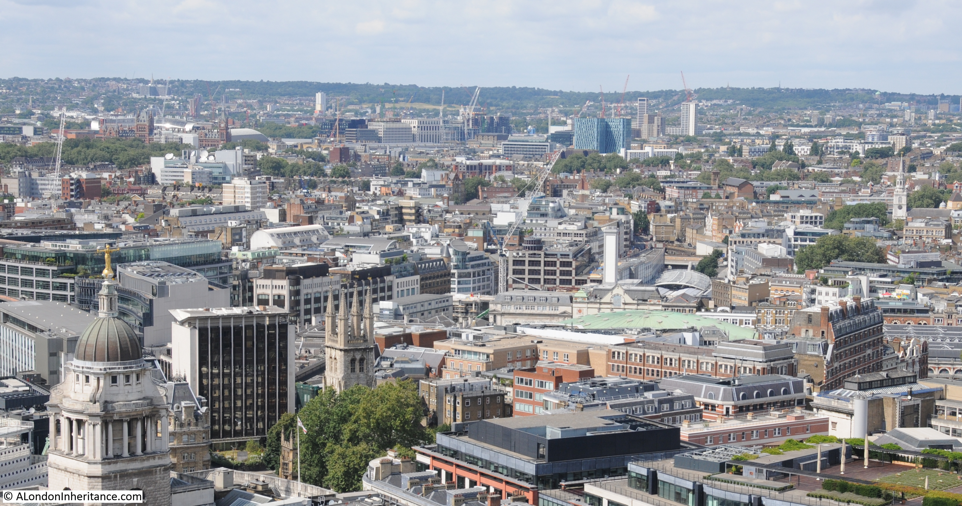
St. Paul’s Cathedral and the Post Office (BT) Tower in the distance.
This view was once dominated by the roof of Cannon Street Station:

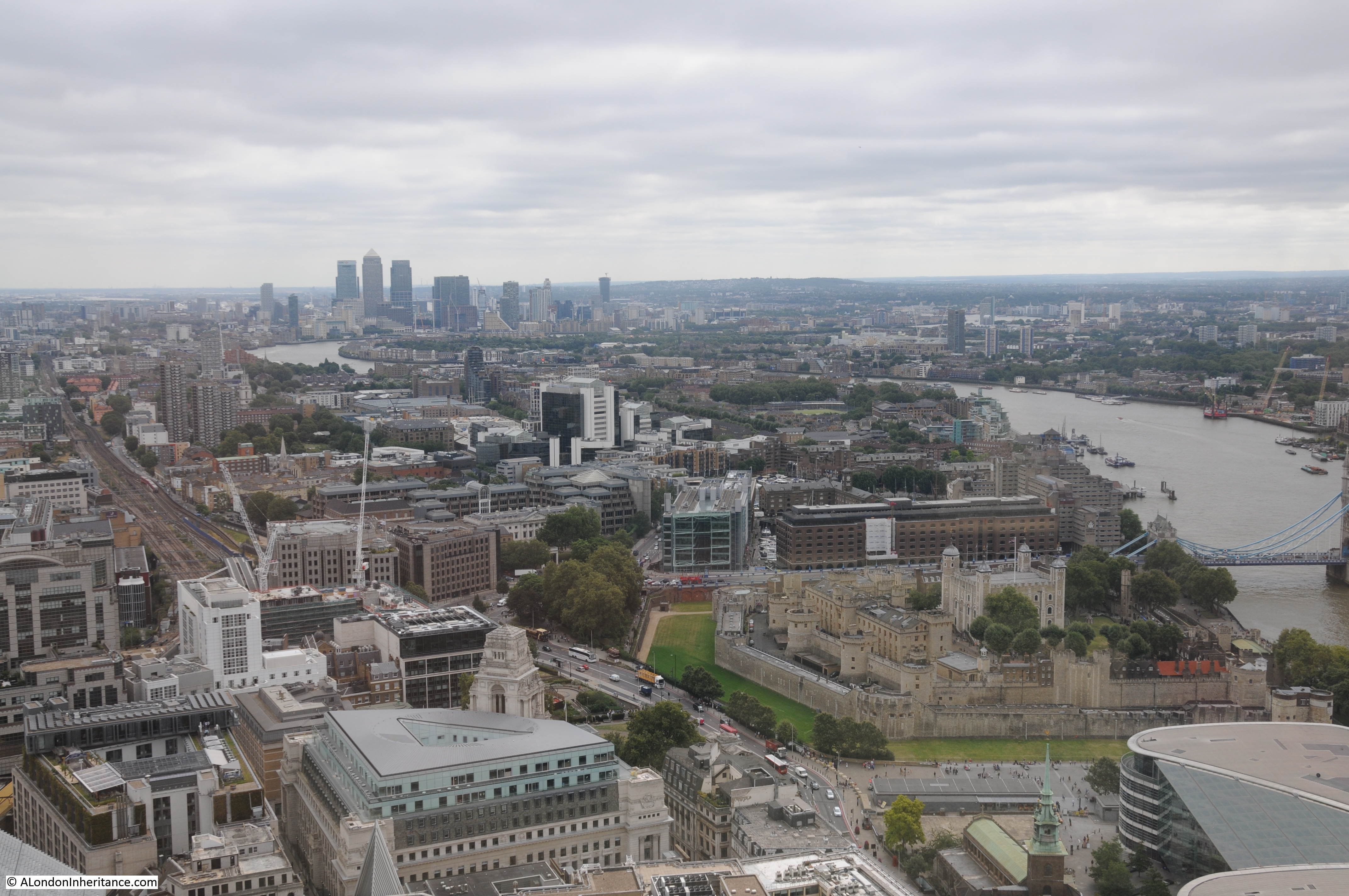
View back across the City towards the towers of Canary Wharf in the distance. The looming presence of 20 Fenchurch Street (the Walkie Talkie building) dominates this part of the City. The Sky Garden at the top is my next stop.
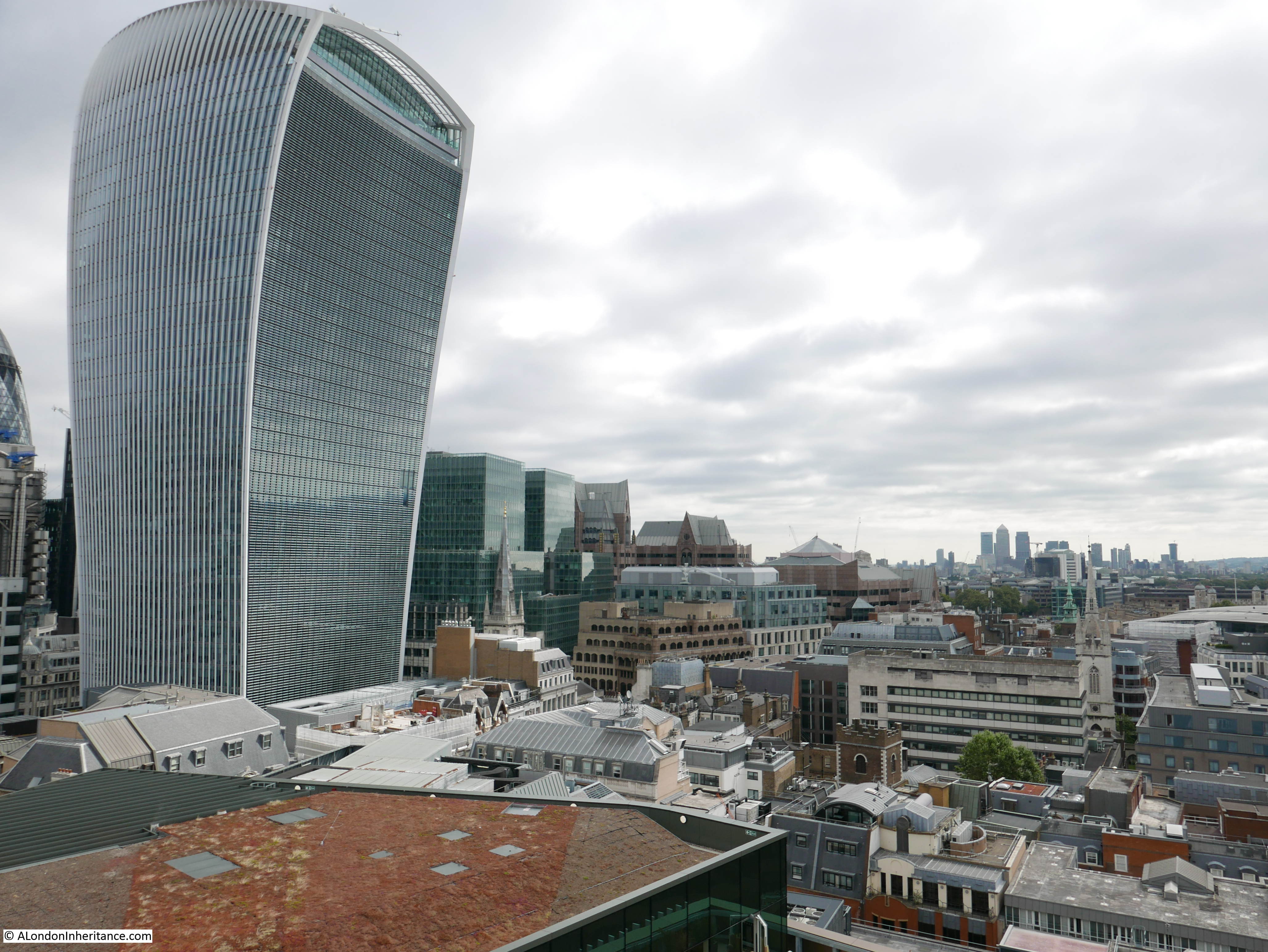
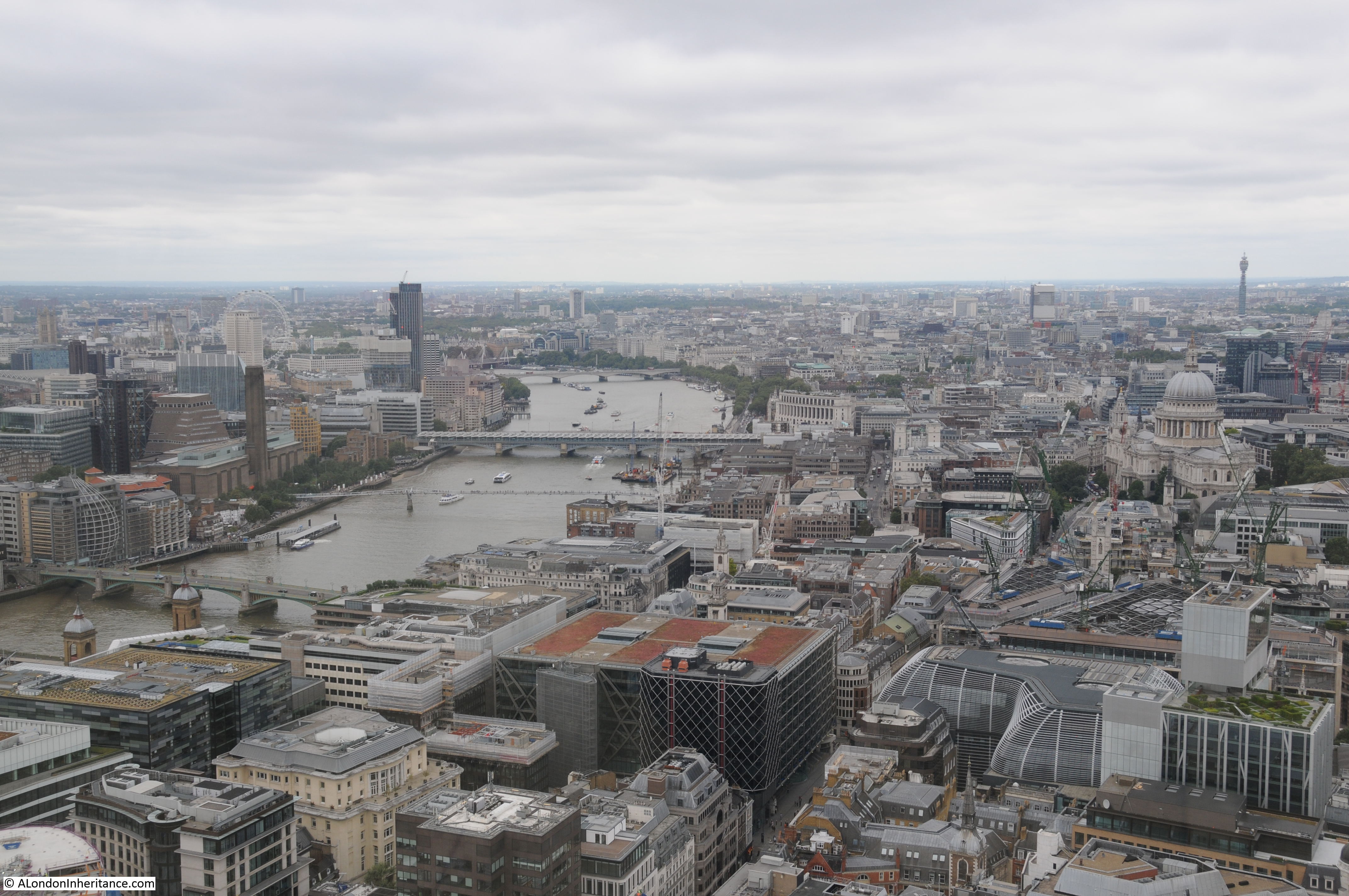
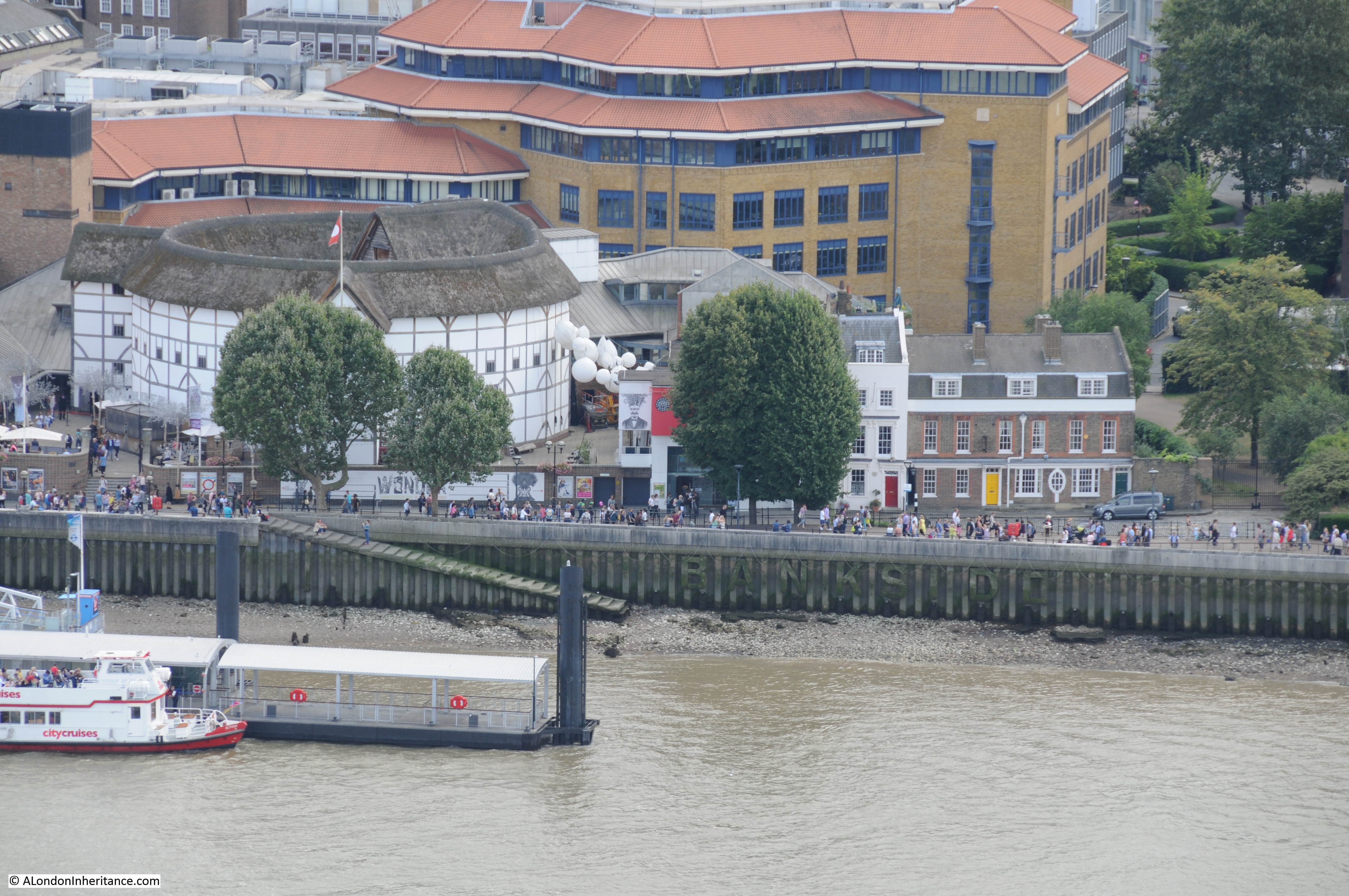
Although the River Thames is hidden by the buildings in the foreground, this is looking towards Bankside with the chimney of Tate Modern along with the new extension and viewing gallery to the left of the chimney. The top of the London Eye can be seen in the distance – my final stop later in the afternoon when hopefully the weather will have improved.
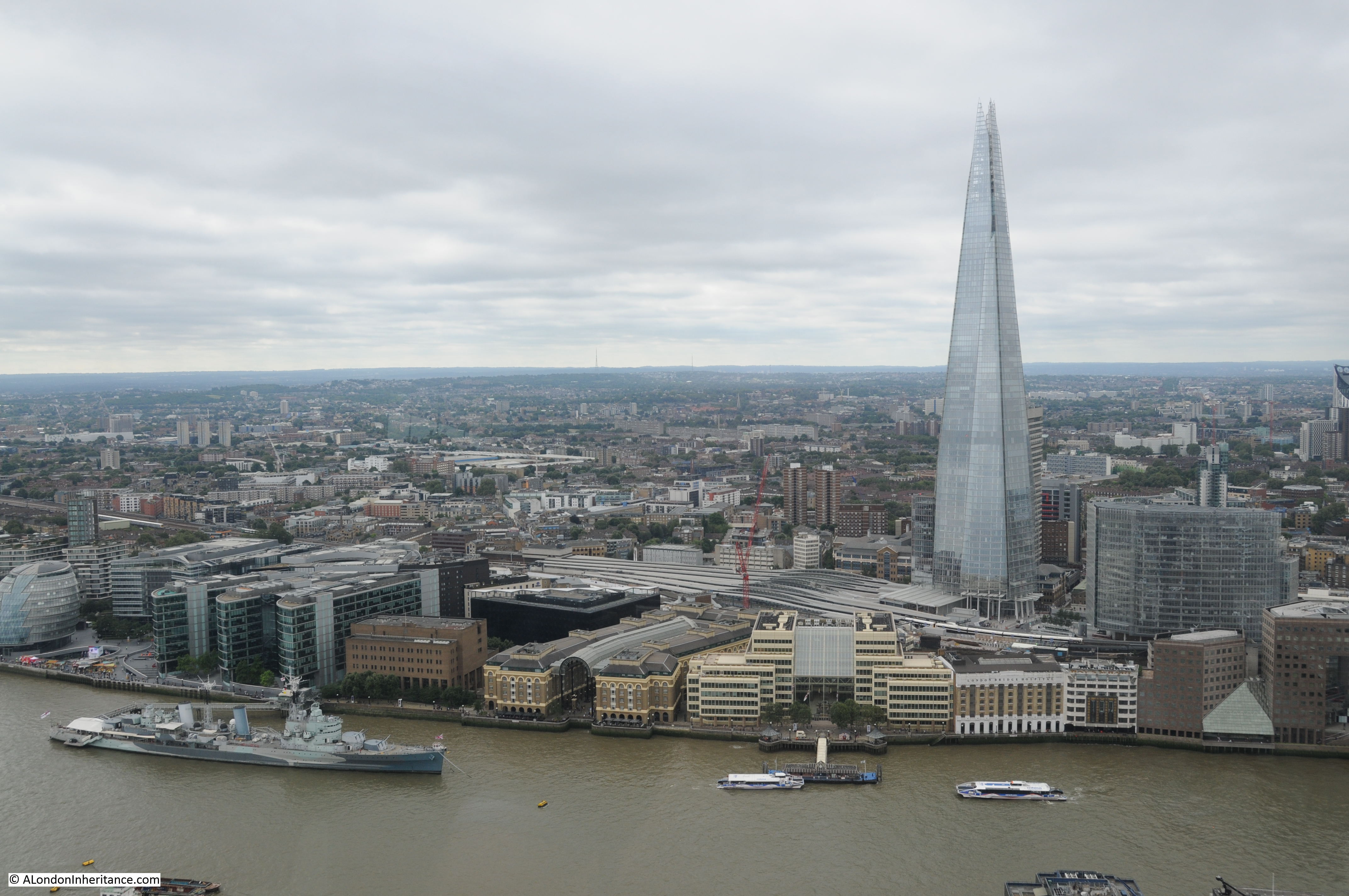
View across the river to the Shard. The church of St. Magnus the Martyr in the lower centre of the photo with London Bridge hidden behind the building to the right of the church. This building is on the route of the original London Bridge.
Time to descend the Monument and head off to the Sky Garden, always easier to climb down rather the climb up.
The Monument is the City’s original viewing gallery and although now rather hemmed in by the surrounding buildings still offers good views of the City of London.
Above the viewing gallery is the flaming orb which is hollow and reached by a further small flight of stairs. At the very top, not visible from ground level is a CCTV camera which provides a 24 hour time-lapse view on the Monument’s web site, which can be found here, although it does not appear to be updating at the moment.
Now on to my next stop:
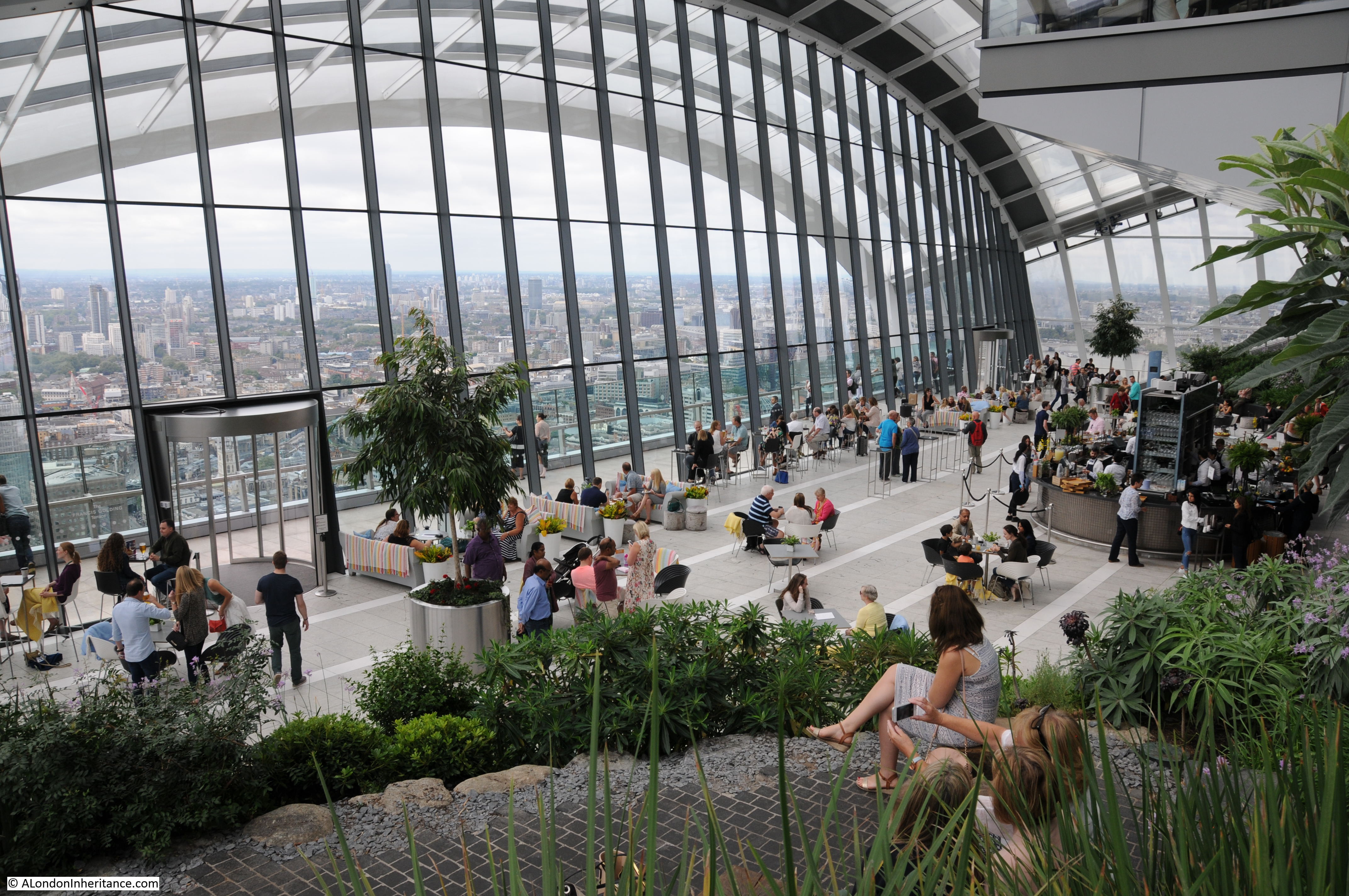
The Sky Garden
Access to the Sky Garden was quick and efficient and the lifts provided a rest in between climbing the Monument and the next climb to the top of St. Paul’s Cathedral. Completed in 2014 and at a height of 525 feet, the design of the Sky Garden results in the best views being towards the south.
My first view was back towards the Monument which now looked busier than during my visit. Look closely at the top of the orb and the CCTV camera can just be seen along with the hollow top of the orb.
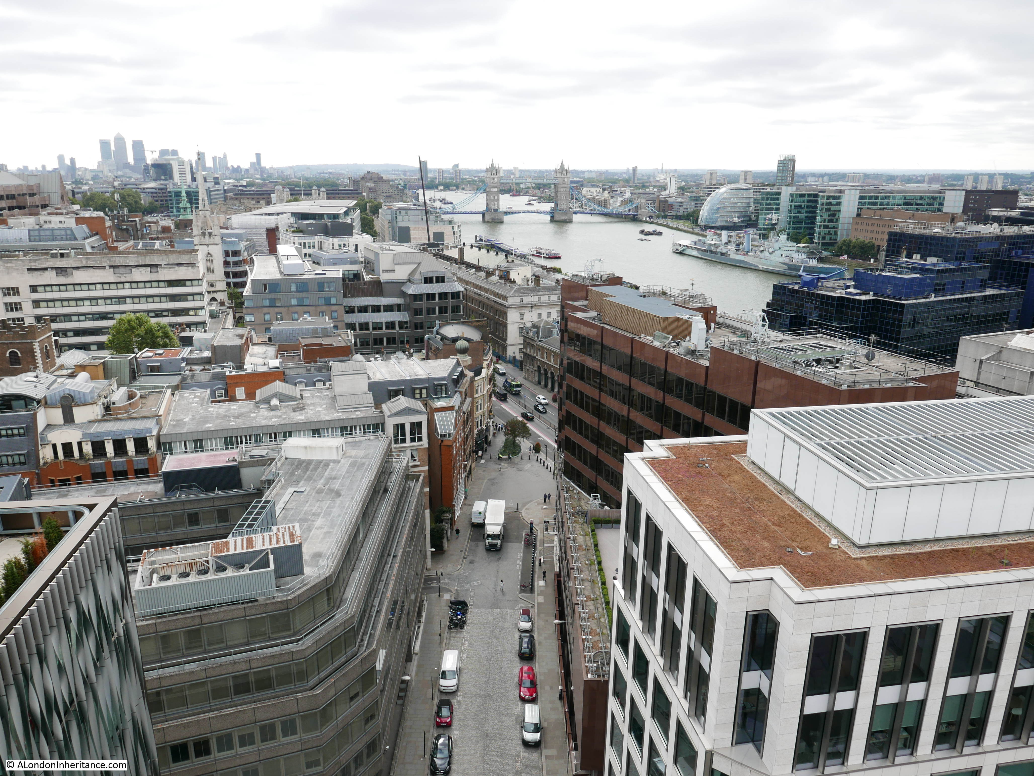
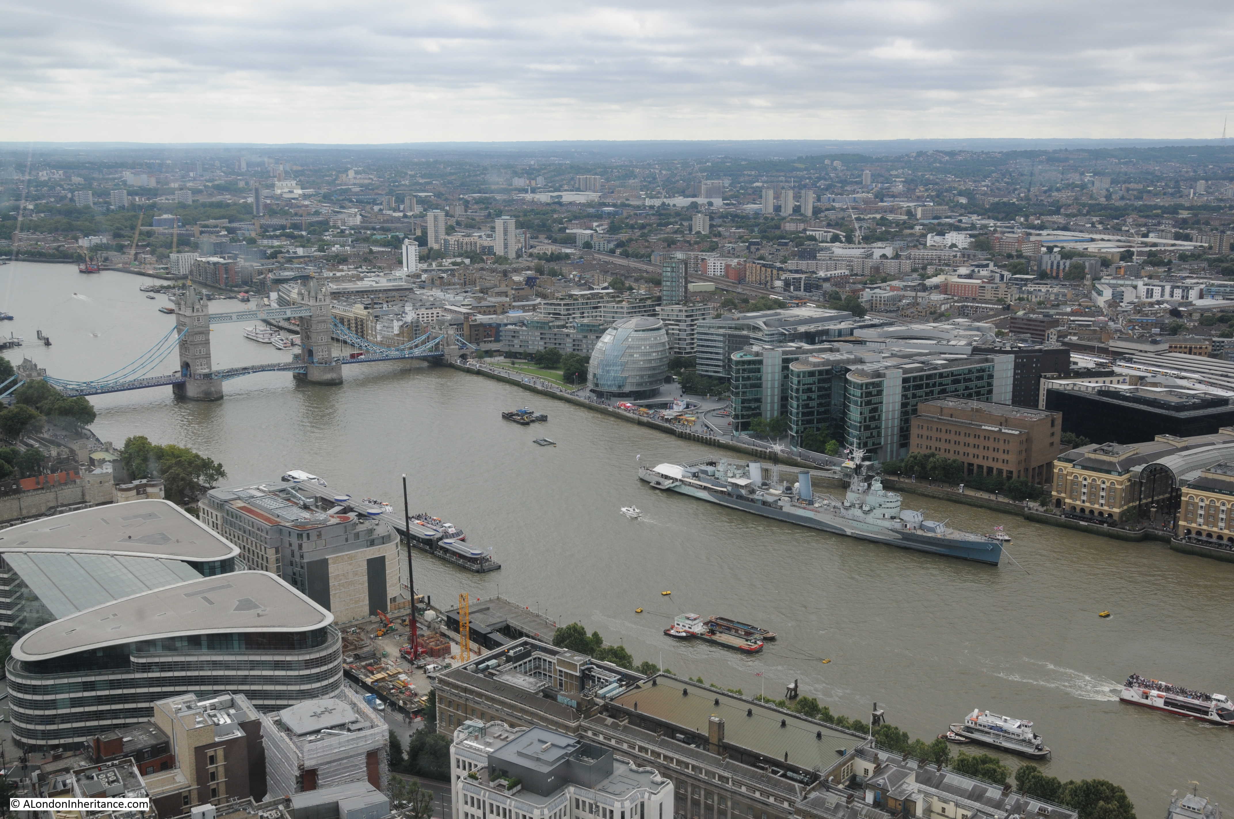
Views towards Tower Bridge, City Hall and HMS Belfast. From this height it is easy to understand the flooding risk to London with the height of the river and how low and flat the surrounding land is, and this was not a particularly high tide. It is also at this height that you can start to see the higher ground that surrounds London to the north and south.
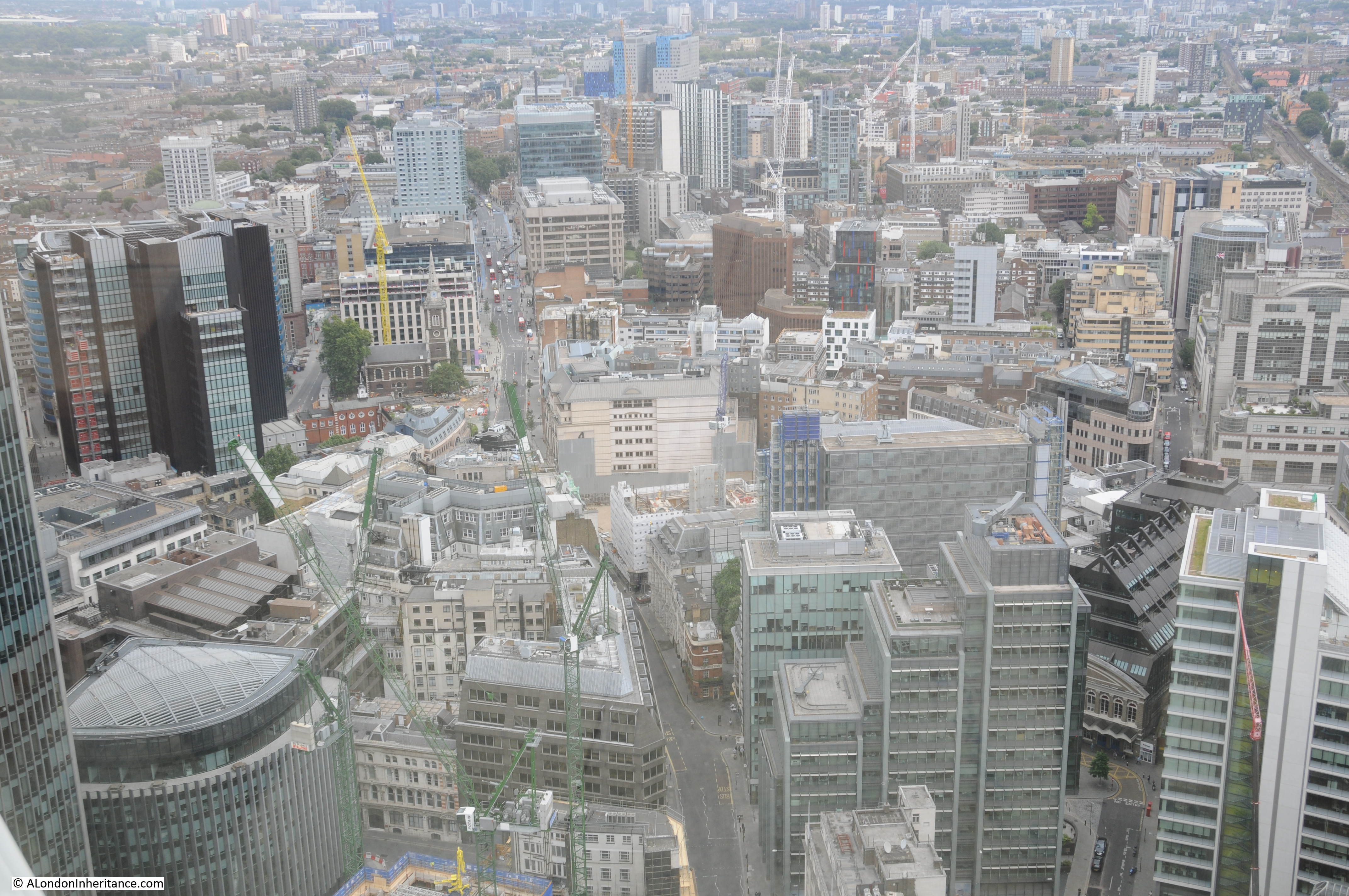
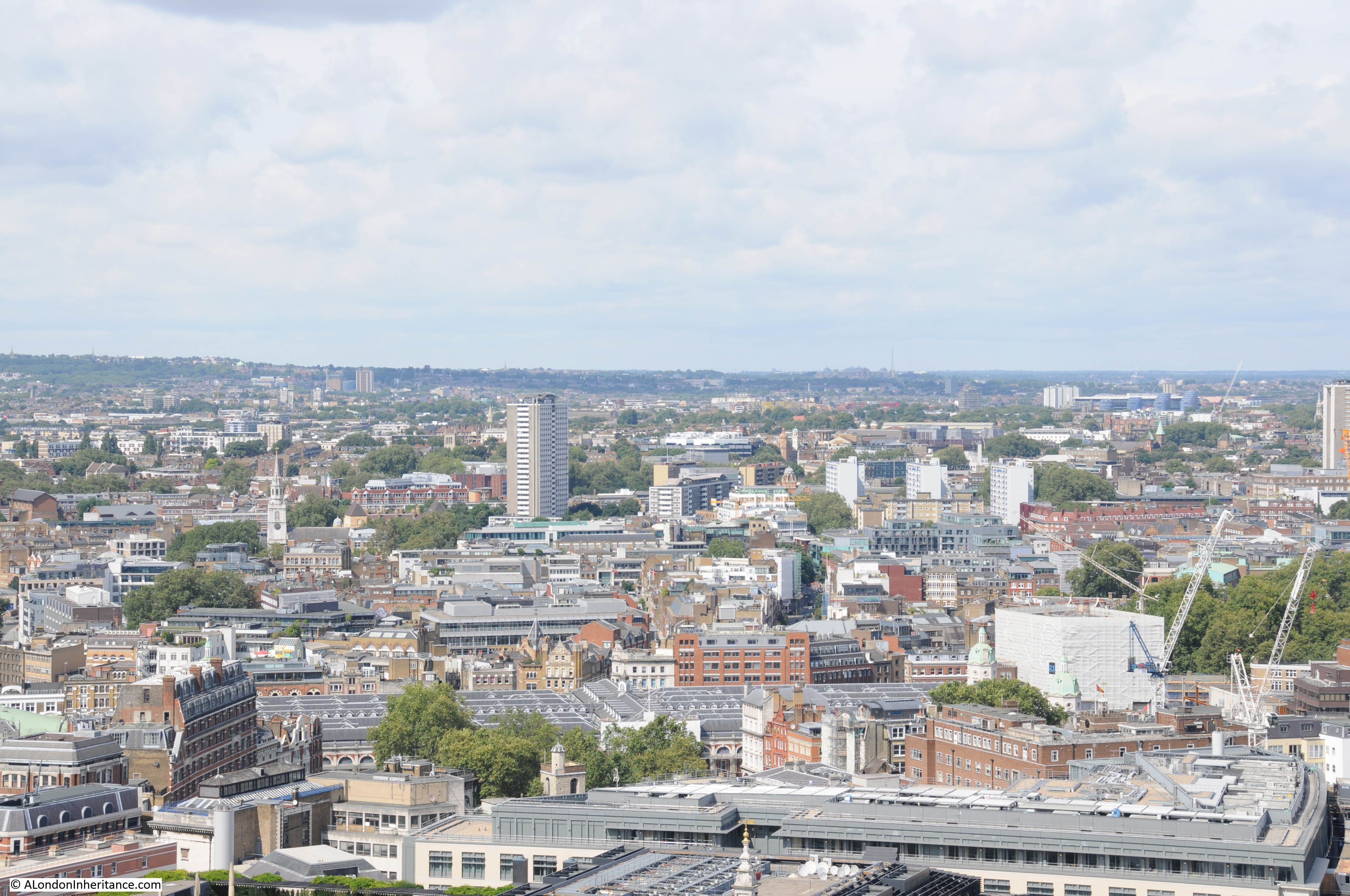
View to the west with the Post Office Tower in the distance with Euston Tower just to the right. As yet, there are few tall buildings across this part of London.
Wembley Stadium can be seen between the Post Office Tower and Euston Tower.
Internal view of the Sky Garden.
Through the revolving doors in the above photo, there is an external viewing gallery. Although there is still a glass barrier it is possible to look down on the City. The church of St. Mary at Hill is at lower centre with the old Billingsgate Market in the top centre.

Across the river towards the Shard:
And unlike the Monument, the view of the river from the Sky Garden is unobstructed.
Looking down towards the Bank junction with the Bank of England building at the centre right.
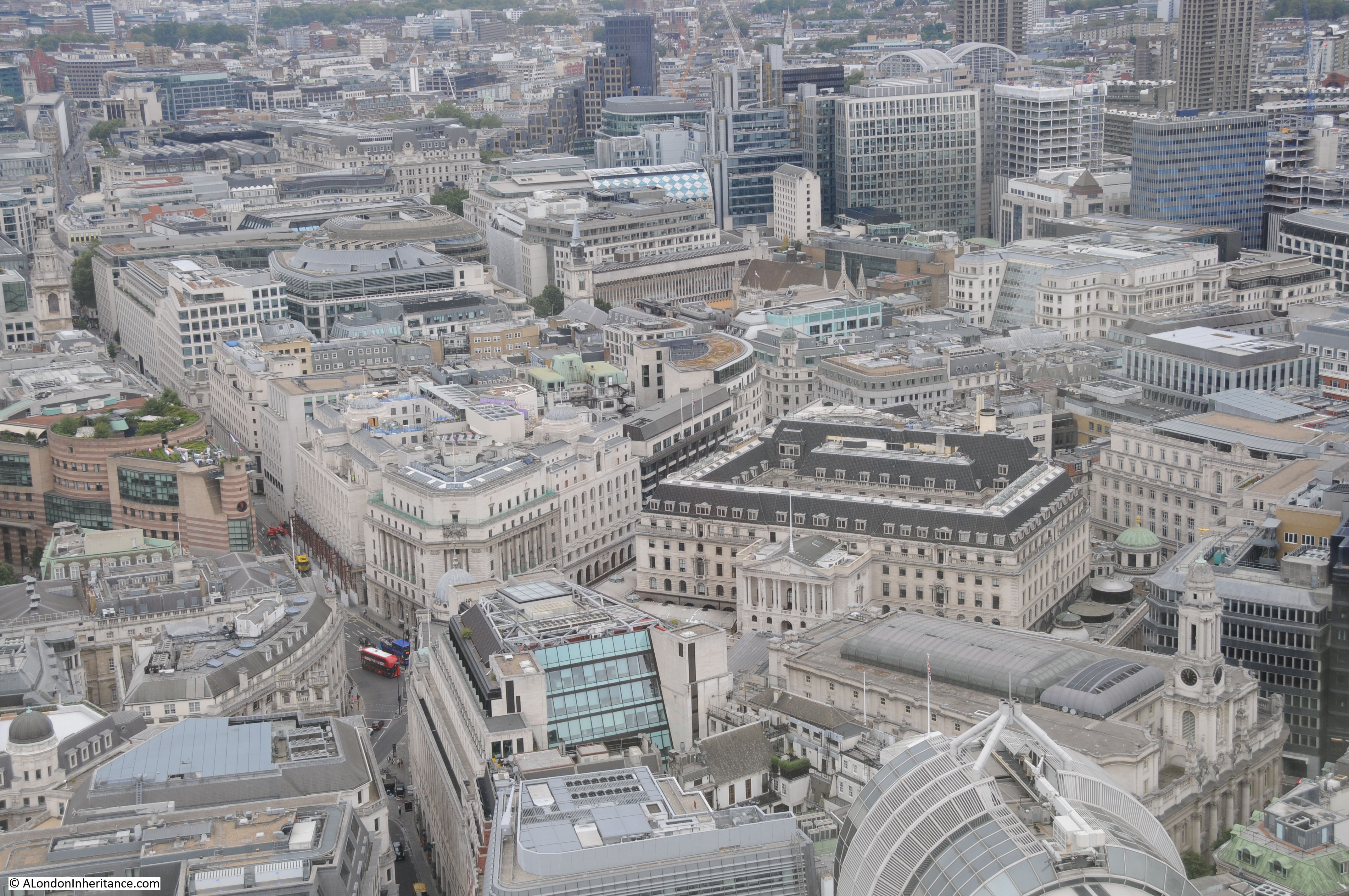
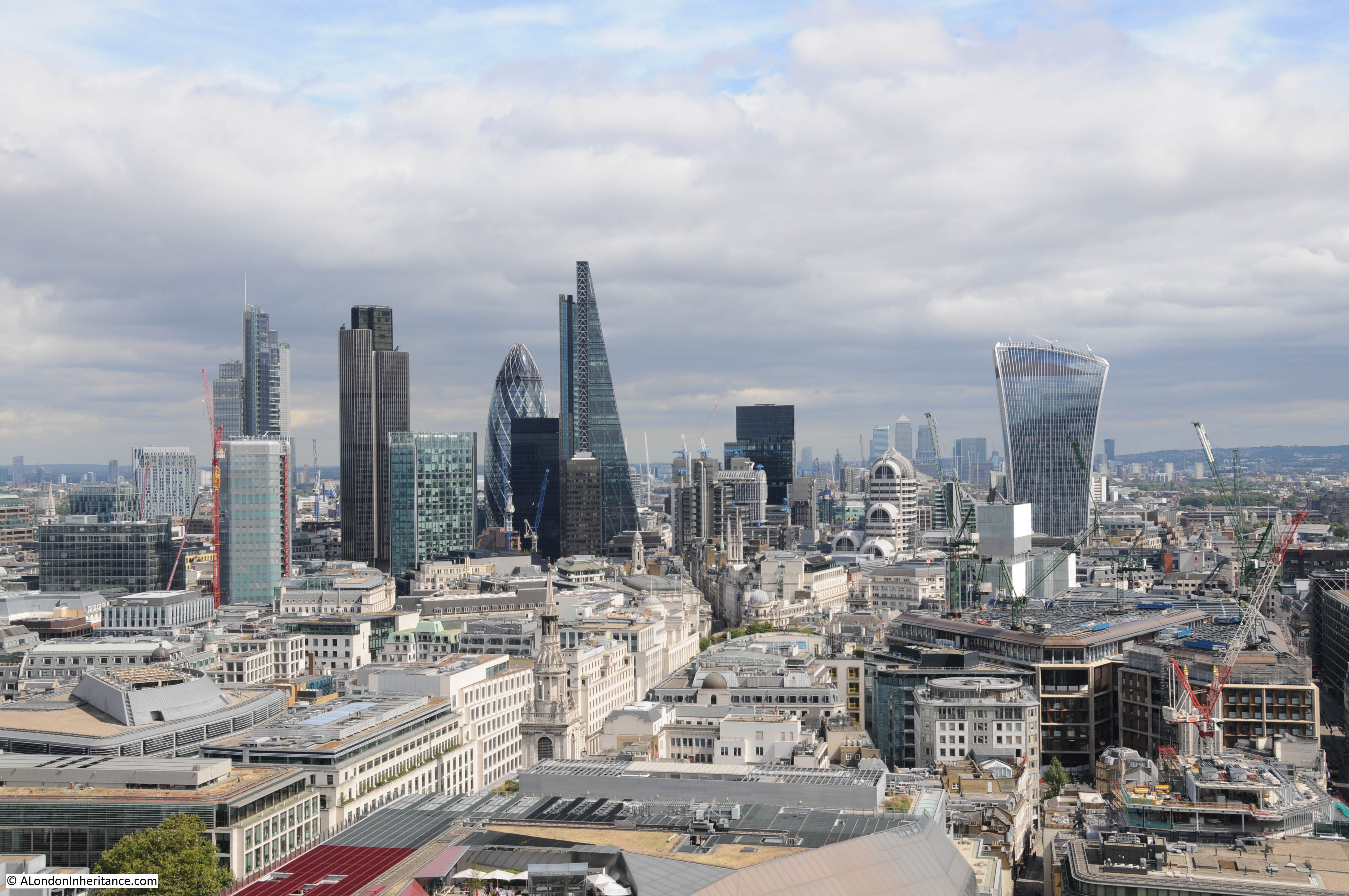
Looking north towards the other towers of the City. Tower 42 on the left, the 122 Leadenhall Street building (the Cheesegrater) in the middle and 30 St. Mary Axe (the Gherkin) on the right.

Tower 42, originally know at the NatWest Tower when completed in 1980 and at 600 feet high was the first really tall tower building in the City. I remember this being built and at the time bought a copy of, if I remember correctly, the Illustrated London News which had a superb photo of the building by a photographer who was suspended in a large bucket away from the top of the tower by a crane also mounted on the top of the tower. Rather precarious, but a superb photo.
The Gherkin building was completed at the end of 2003 and stands at 591 feet high with the Cheesegrater being completed in 2013 at 738 feet.
View towards Canary Wharf with the Tower of London at lower right. From this height we can start to see the route of the river as it heads east towards the sea.
View towards the east along Fenchurch Street and Aldgate High Street. The church of St. Botolph Without Aldgate can be seen to the left of centre, in front of the yellow crane.
From this height we can also start to see how the construction of the railways carved through London. Here, the rail tracks running from Fenchurch Street Station out towards the east.

Leaving the Sky Garden, with the promise of improving weather with the cloud breaking in the west, it was time for a walk to:
St. Paul’s Cathedral
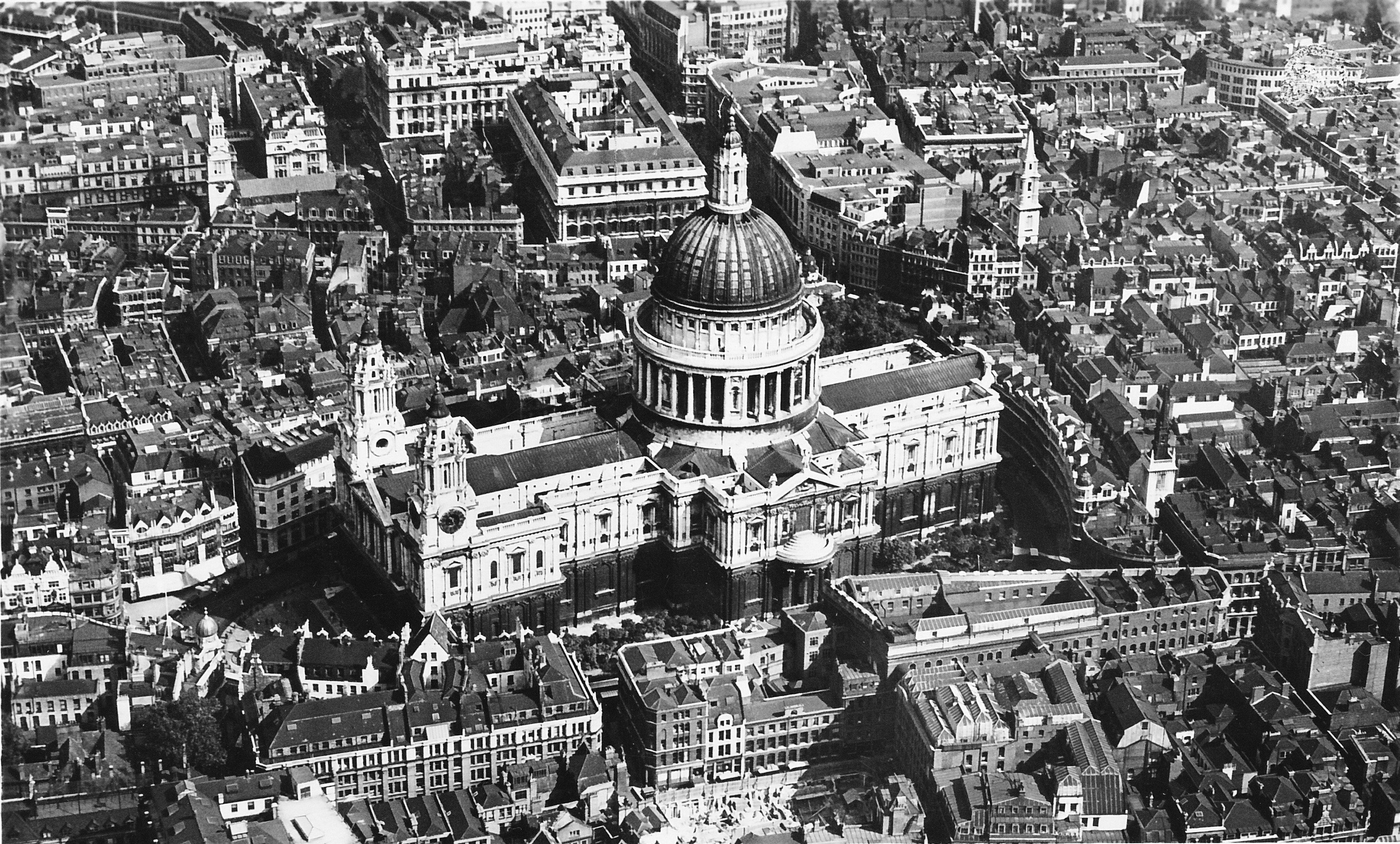
St. Paul’s Cathedral is my favourite place to look out across London. It is the history of the building, location, the climb up the 528 steps through the Whispering Gallery, Stone Gallery and finally to the Golden Gallery, along with the chance to admire the internal architecture and the construction methods used.
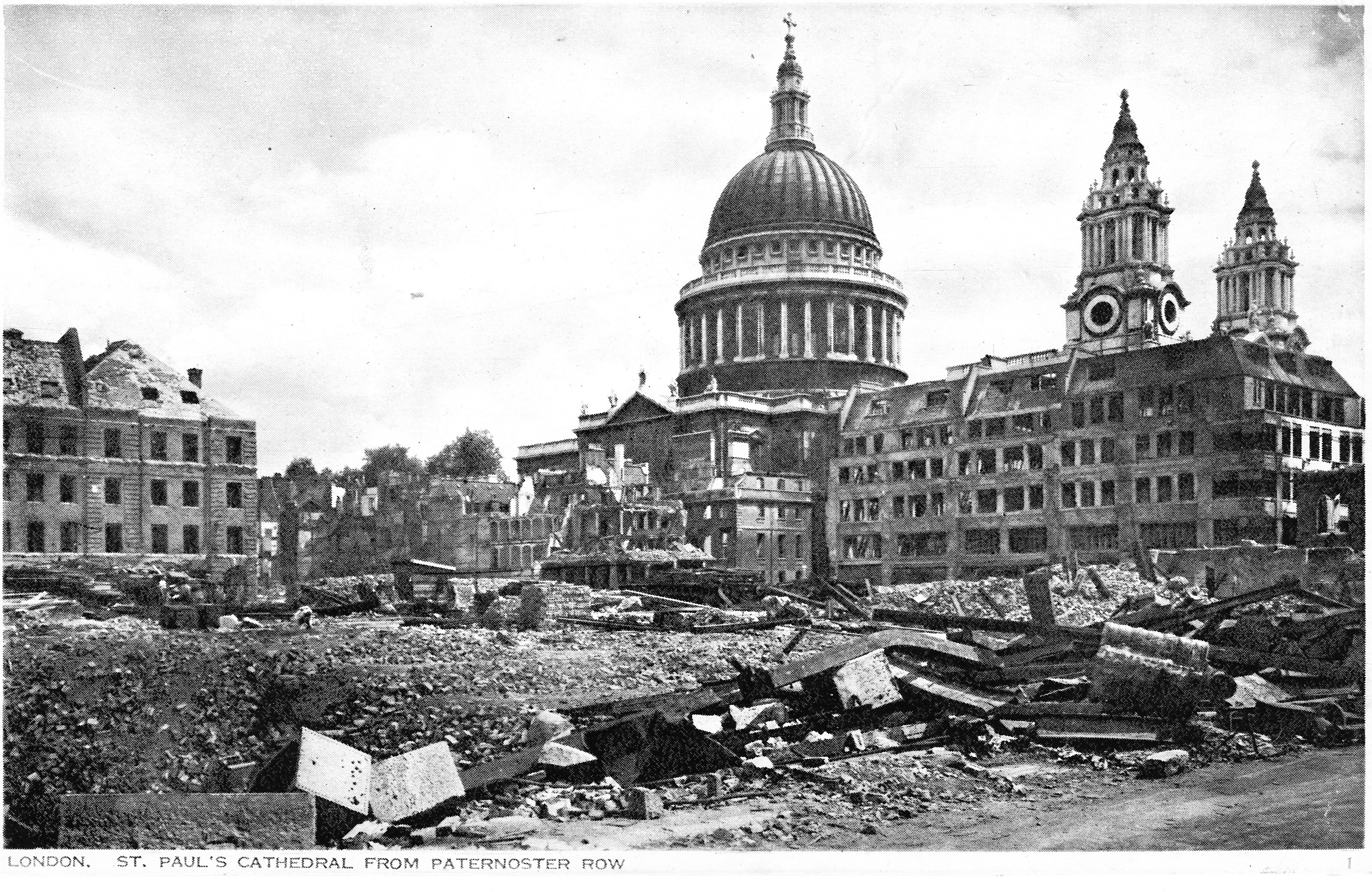
My first climb of St. Paul’s was over 40 years ago and I started taking photos from the Lantern and Stone Galleries about 35 years ago. My father took a series of photos from the Stone Gallery just after the war showing the devastation around the Cathedral. These can be found here and here.
At the top of the final climb through the Dome, there is a small glass window at the centre which looks down to the floor of the church. This produces a strange optical effect as this is not looking through the roof of the dome directly above the floor, but through the space between the external and internal domes. The distorted view of the stairs that run up above the internal dome to get to the Golden Gallery can be seen in the periphery of this photo. It does though create the impression that you are directly above the internal dome.

The first glimpse of the view through the door out to the narrow walkway that runs around the base of the Golden Gallery. The cloud is breaking and the sun is out.

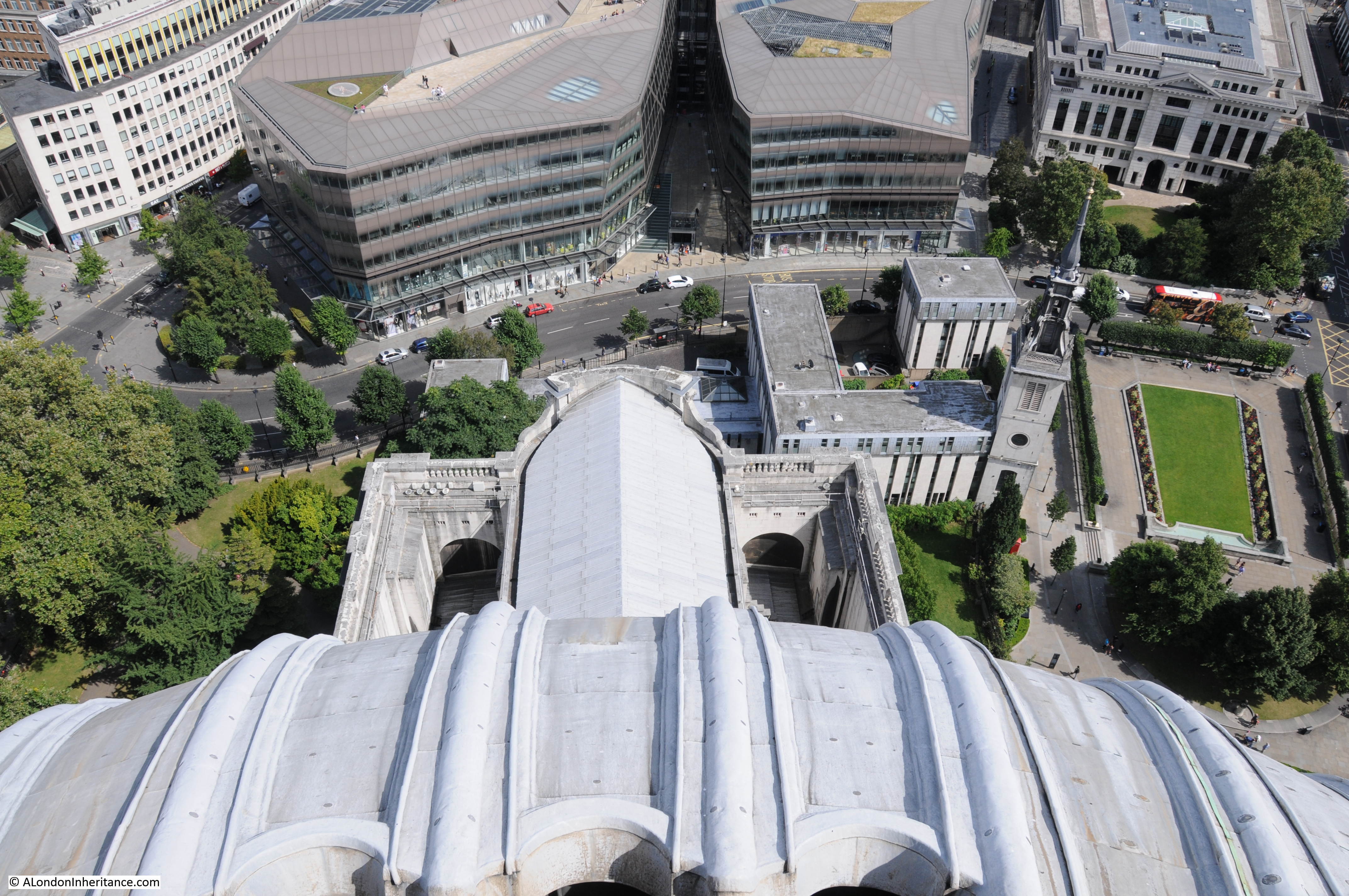
The view as you pass through the door, looking down between the two west towers to Ludgate Hill and Fleet Street.
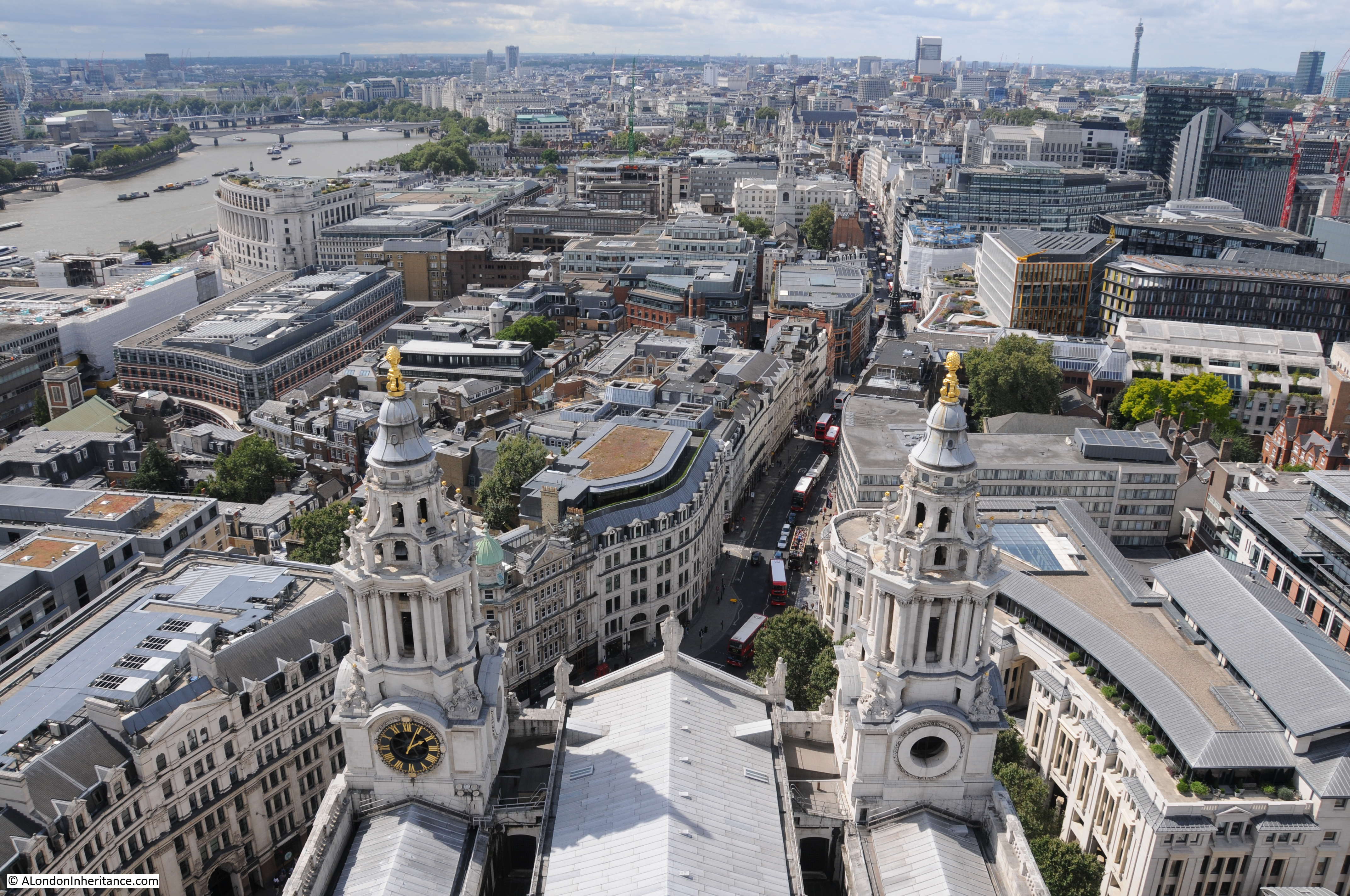
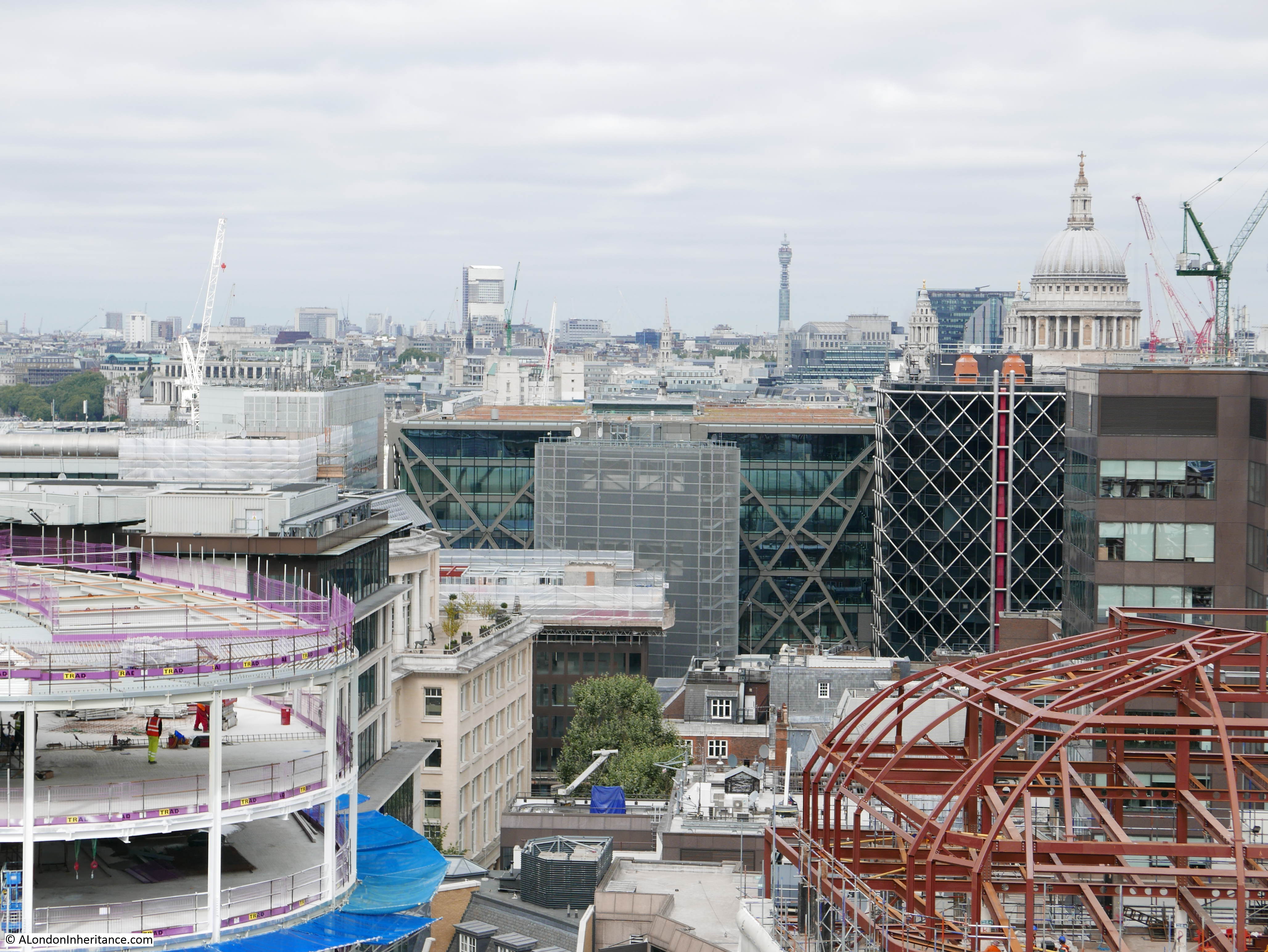
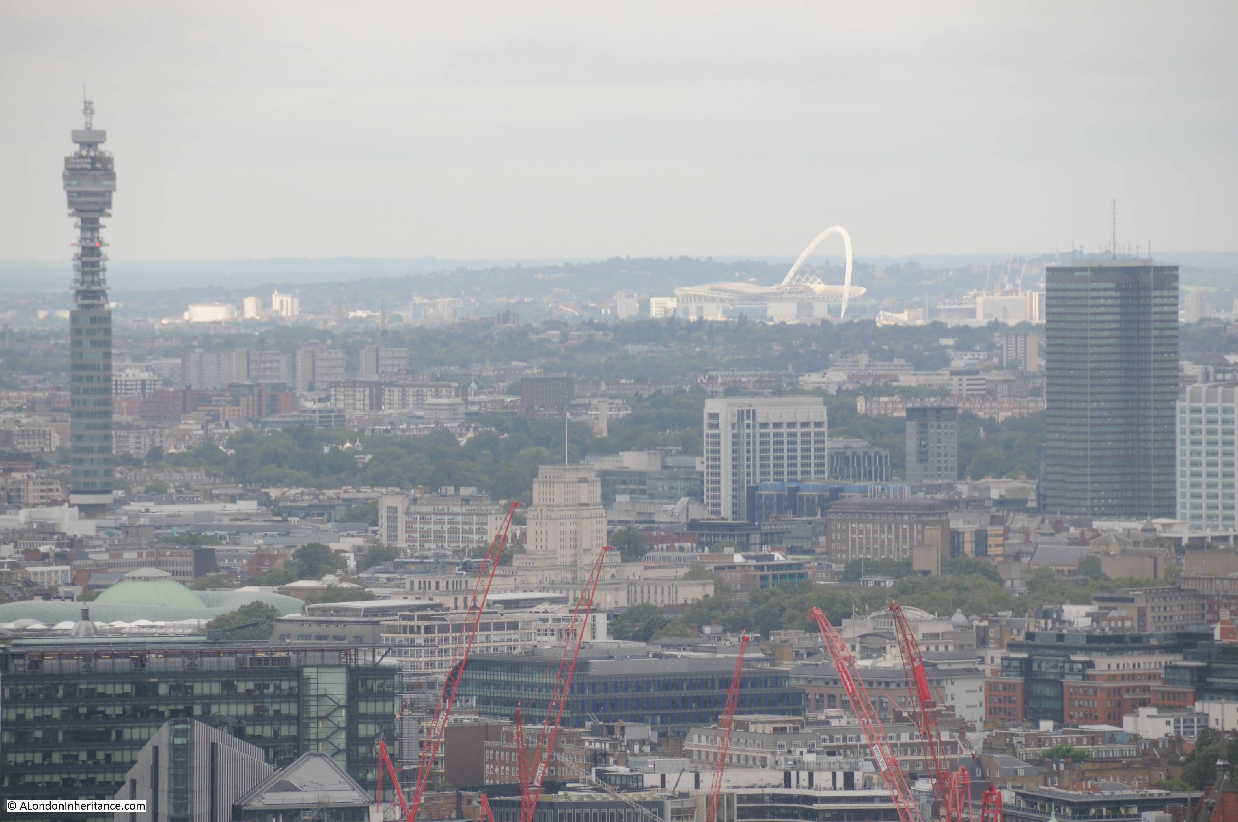
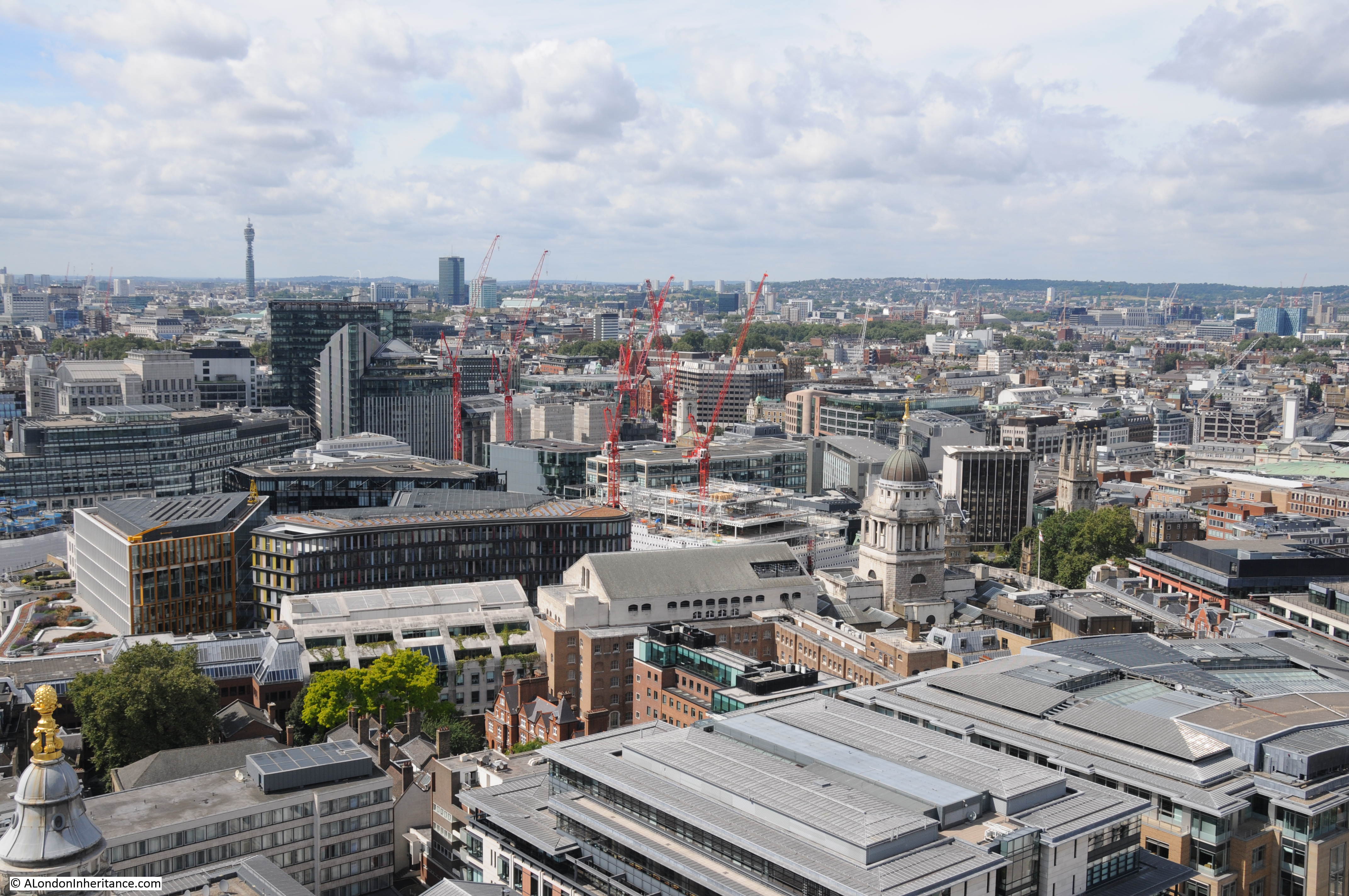
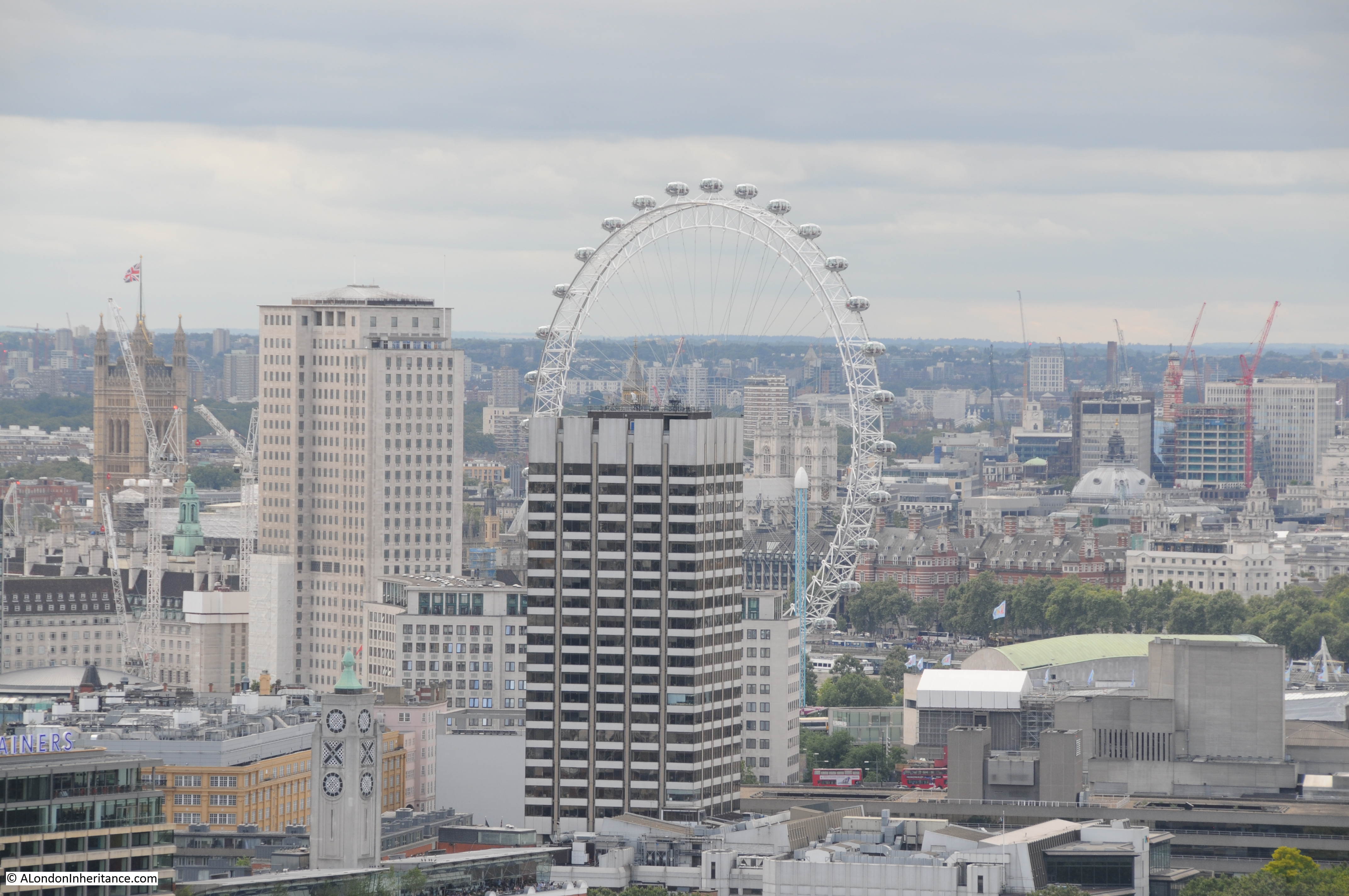
The view towards the Post Office Tower and Euston Tower. The Old Bailey can be seen to the lower centre right, just to the right of the red cranes.
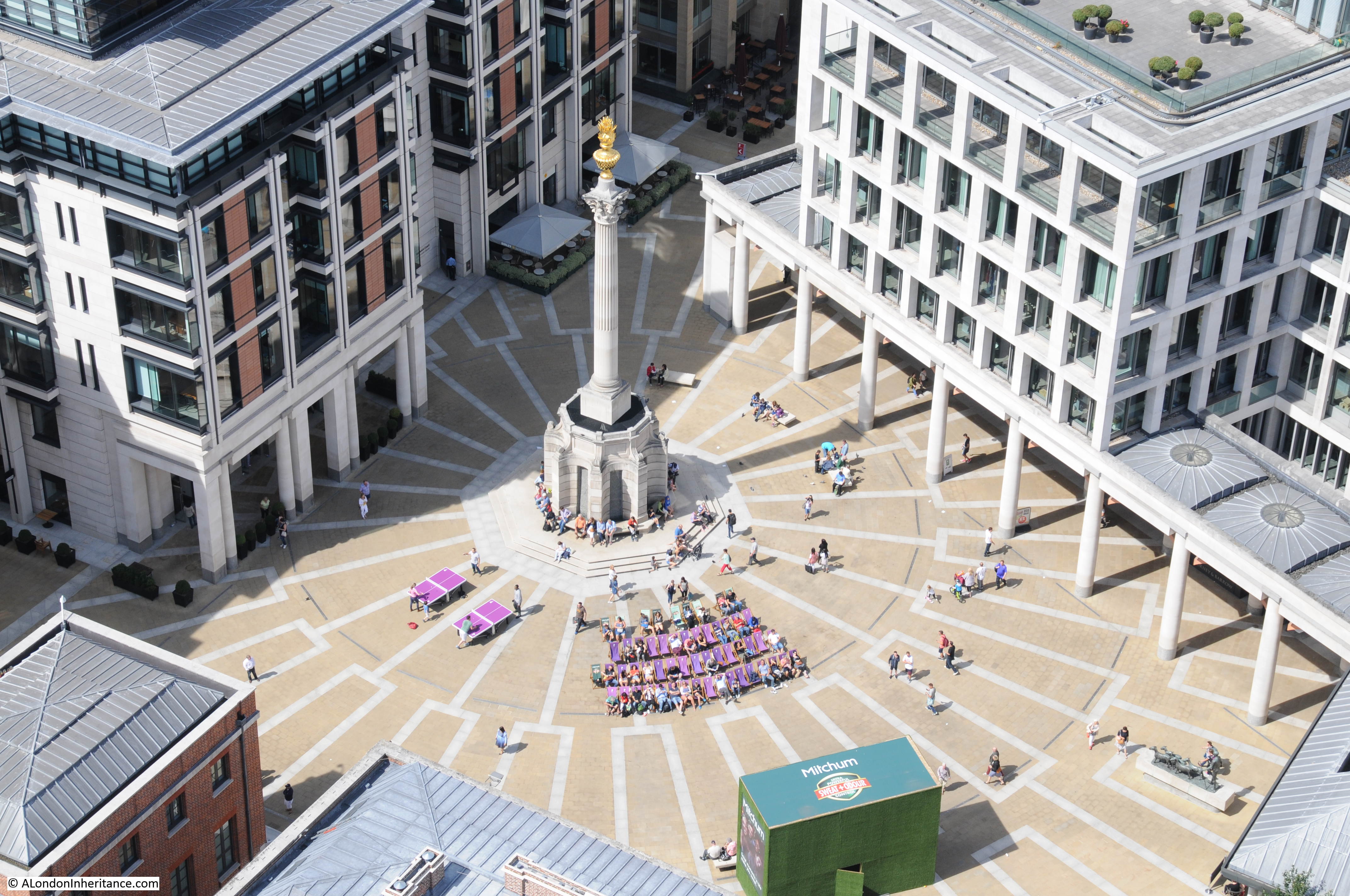
Paternoster Square:
The three tower blocks of the Barbican with the low-rise block running between the left and centre towers. The church of St. Giles Cripplegate can be seen at the base of the right-hand tower.

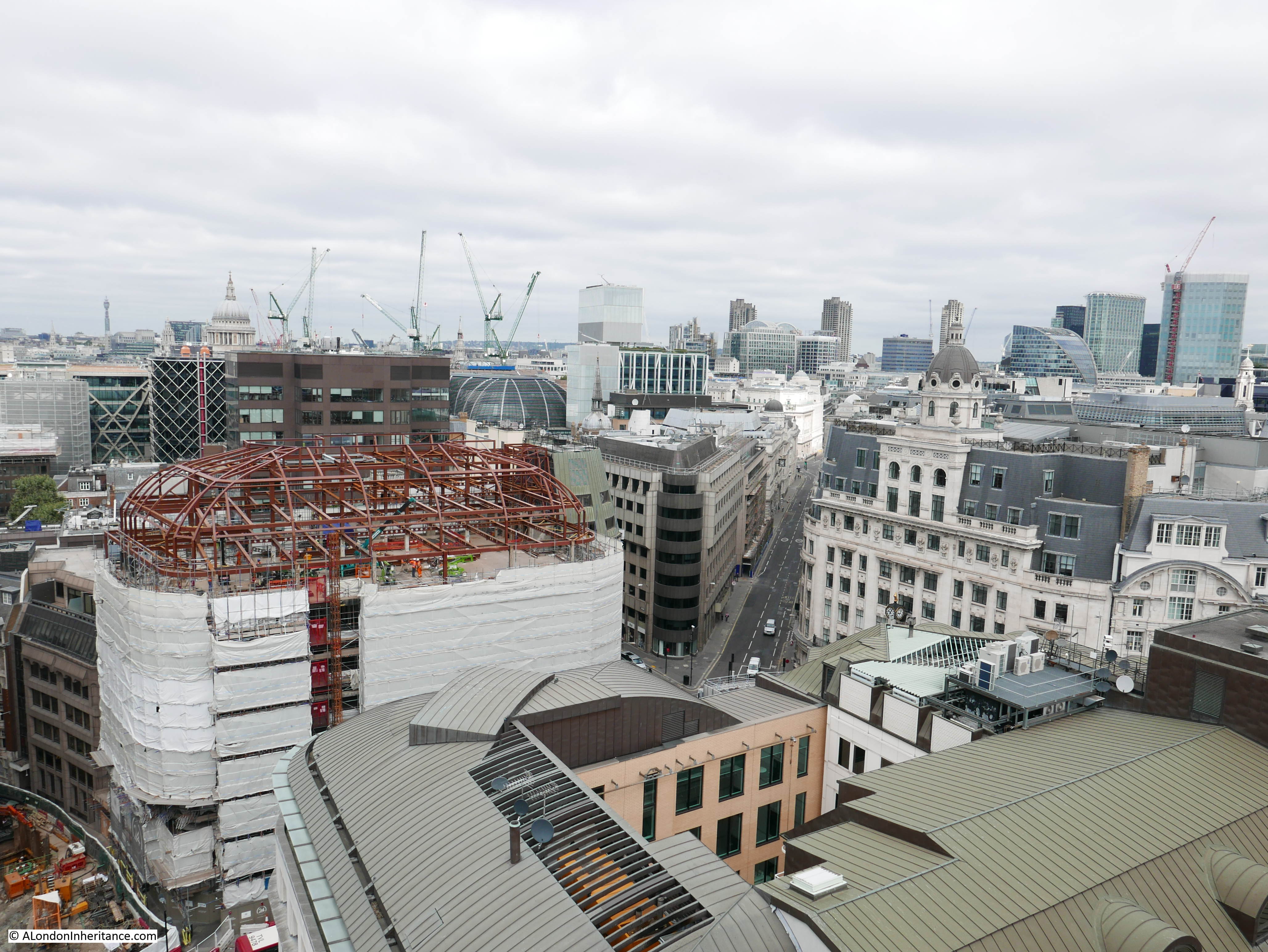
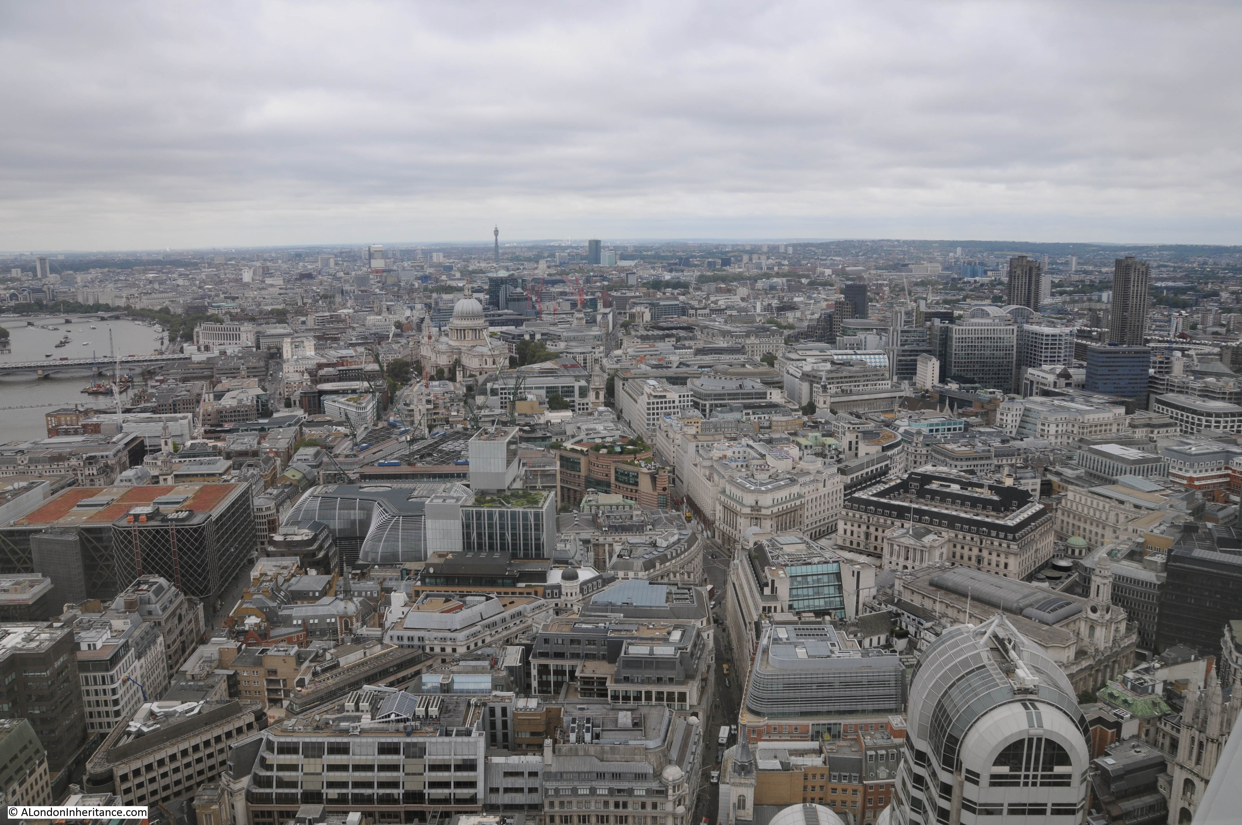
The view towards the east showing the cluster of towers in the City. This view also shows how the 20 Fenchurch Street building is separate from the main cluster of towers and much closer to the river. More towers will be added to this view over the coming years.
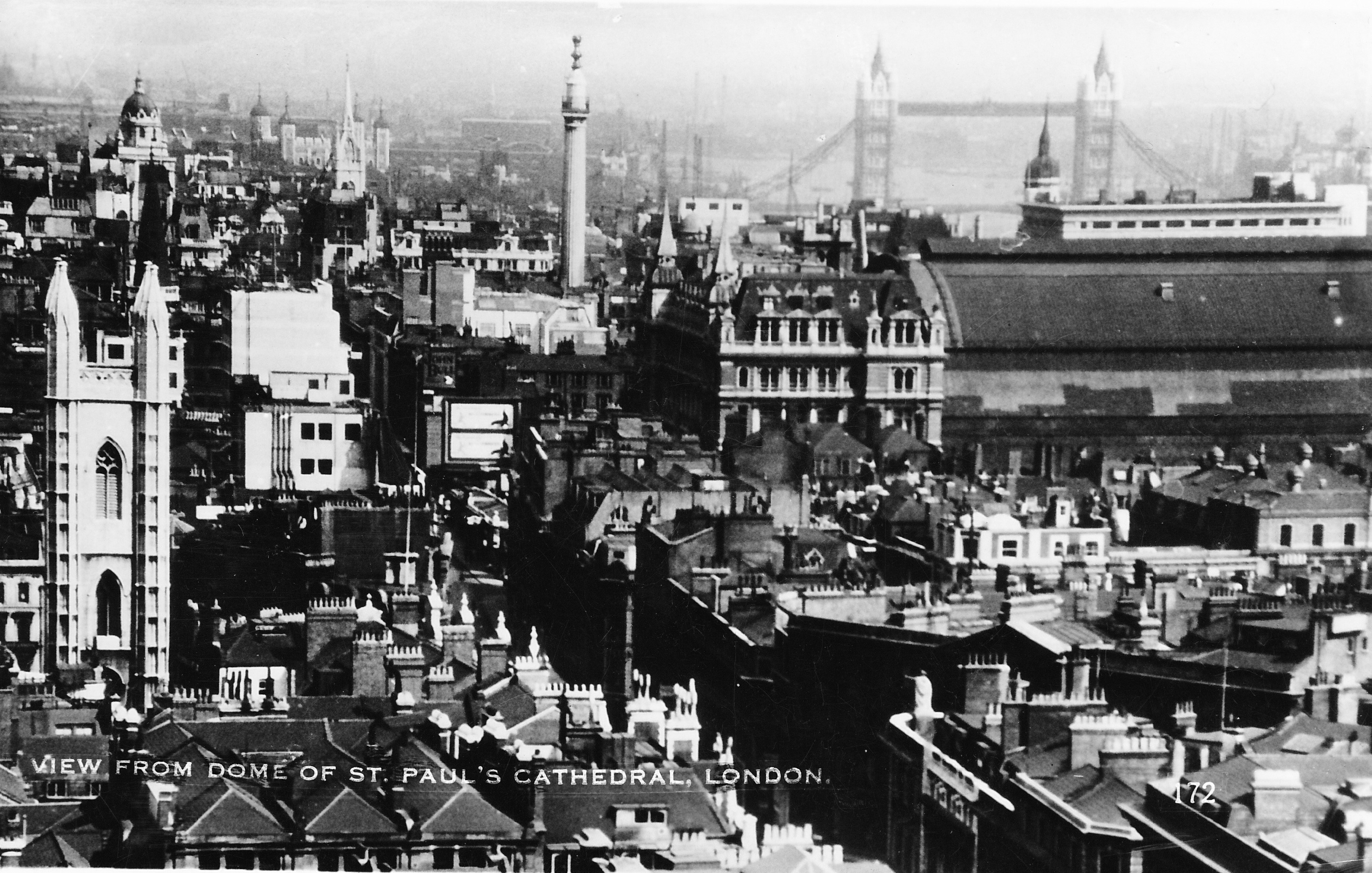
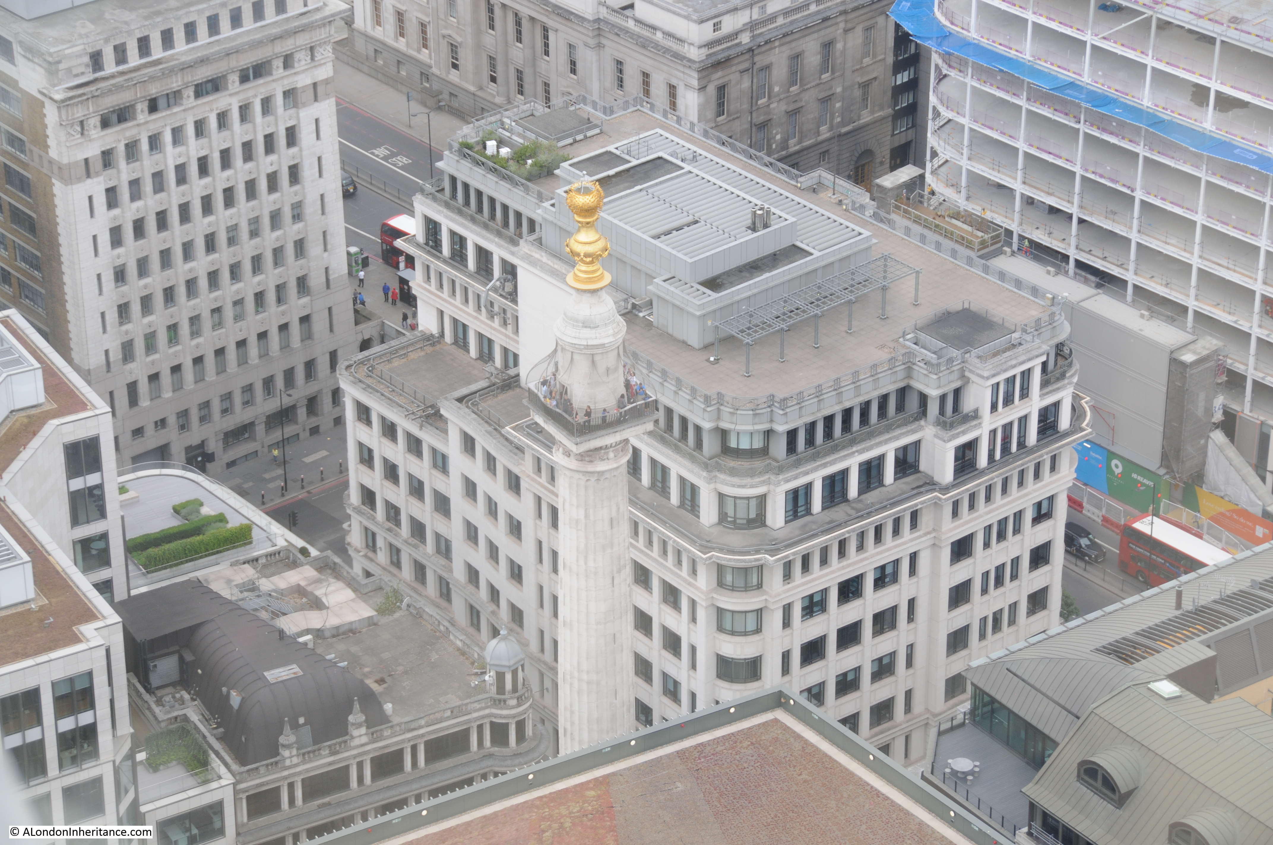
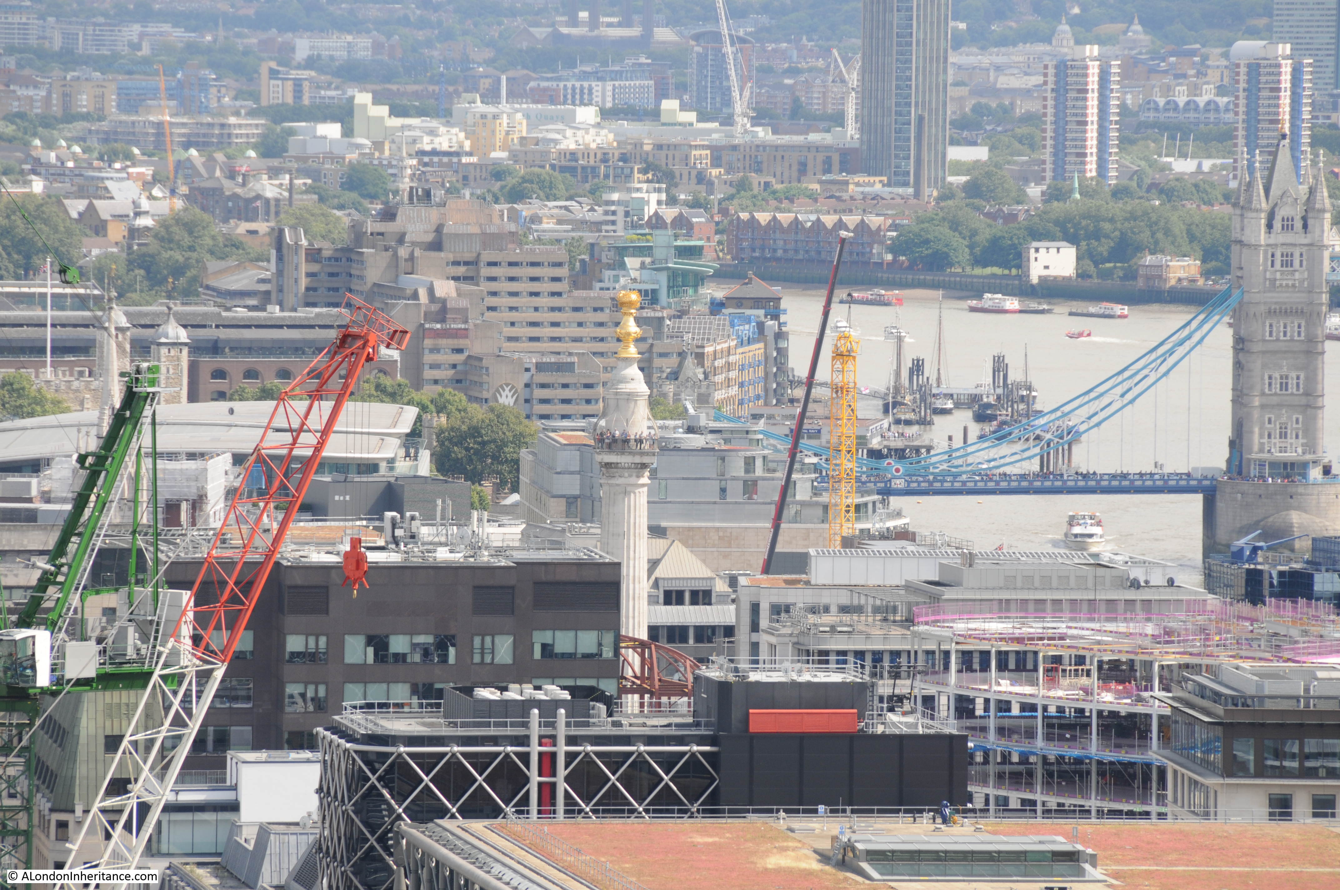
Close up of the Monument from St. Paul’s Cathedral:
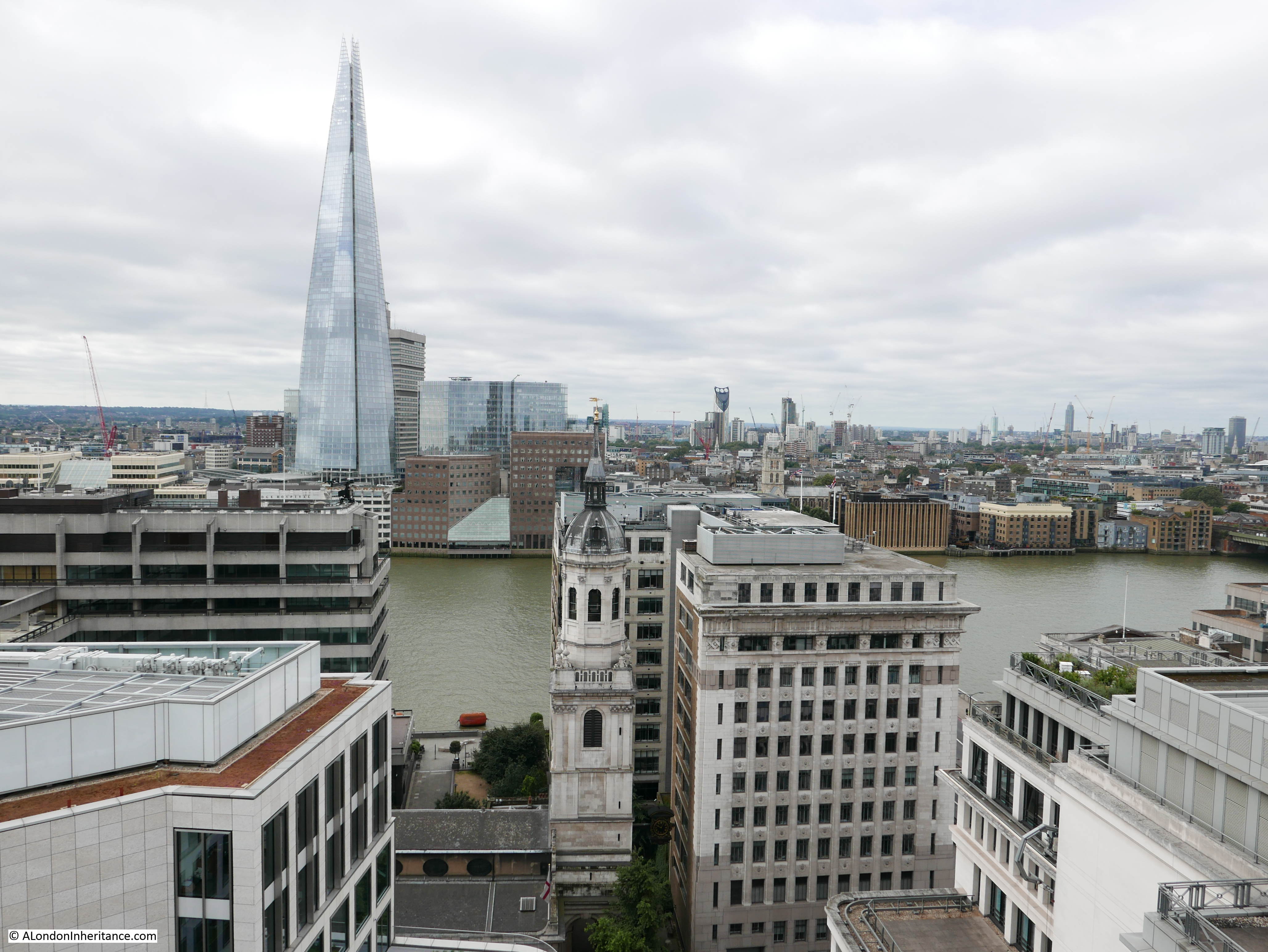
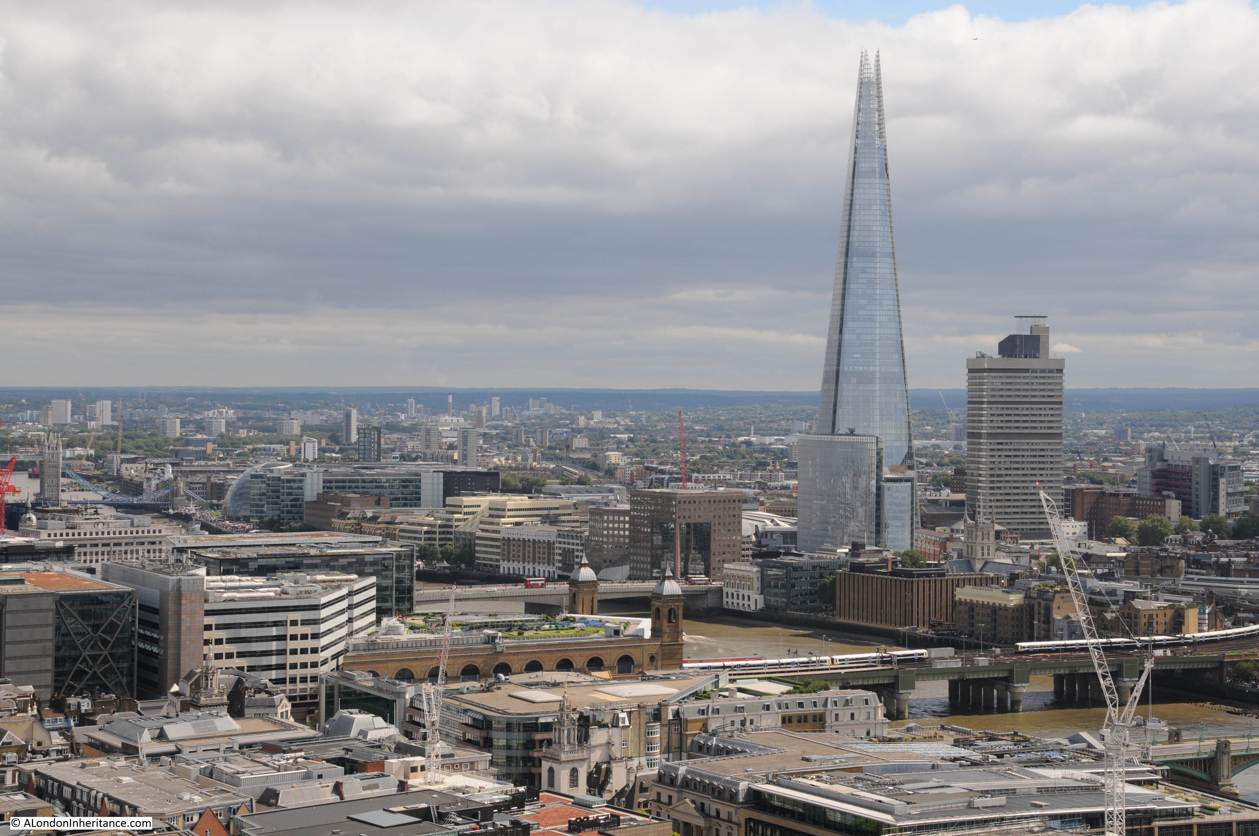
The Shard and Cannon Street station:
By climbing to the Golden Gallery we can get an understanding of the construction technique used to build the internal and external domes. From the gallery we can see some of the external construction techniques, for example the screen walls which were used as a method to hide the tops of the flying buttresses which were needed to strengthen the core of the cathedral. In the photo below, the roof of the Choir is in the centre, below the Dome with the screen walls running around the edge. The use of screens also avoided the need for expensive decorative work along the top of the choir walls and roof.
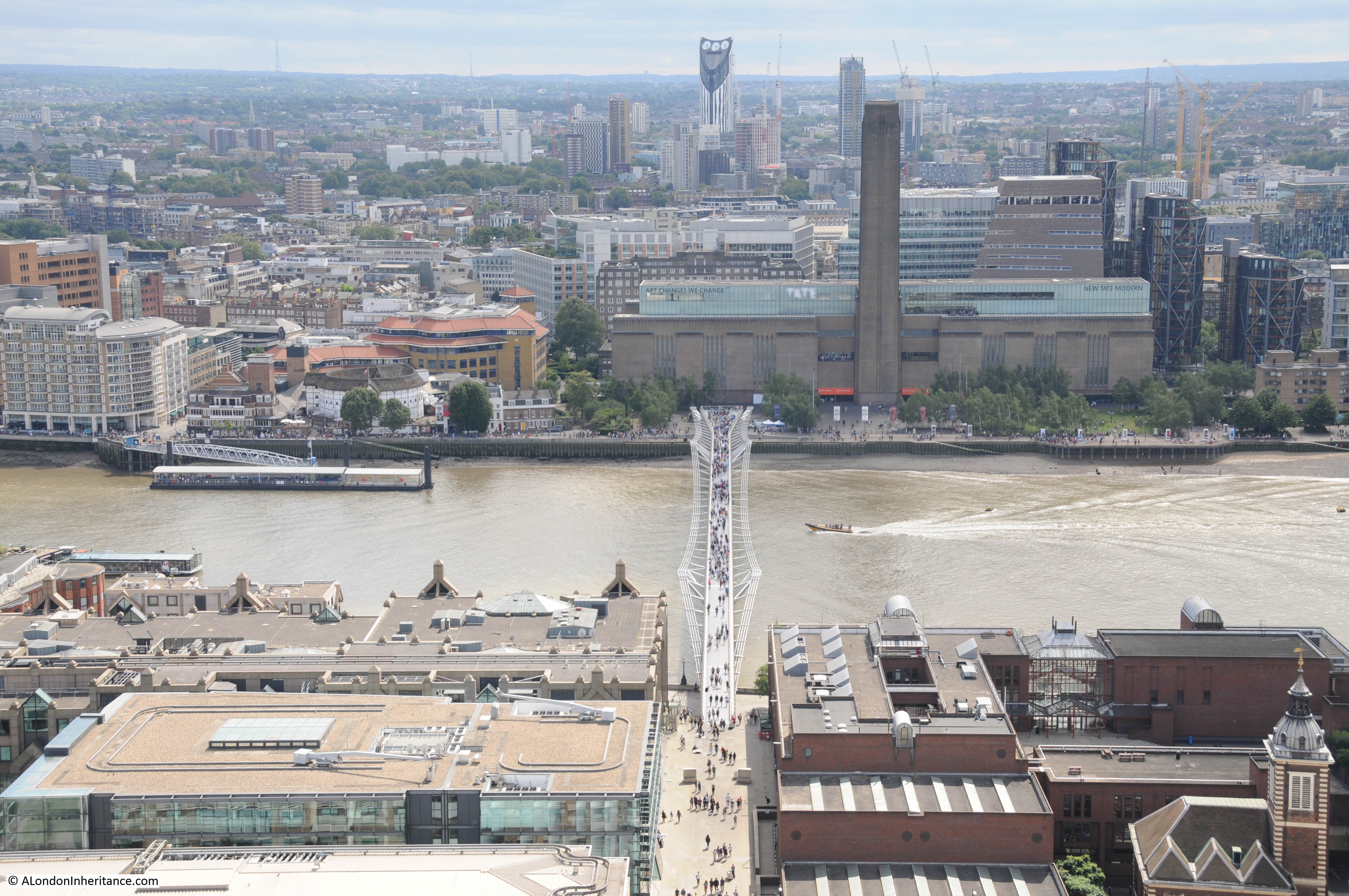
View looking across the Millennium bridge towards Tate Modern, the old Bankside Power Station.
The view from the Golden Gallery includes many of the local churches. Here, the church of St. Nicholas Cole Abbey alongside a new building site. As soon as this new building is in place, the view of the church from the cathedral will be mainly hidden again apart from the very top of the tower.

St. Benets Metropolitan Welsh Church surrounded by Queen Victoria Street, the road down to Lower Thames Street and the City of London School.
View across to the South Bank with the London Eye which will be my final stop.
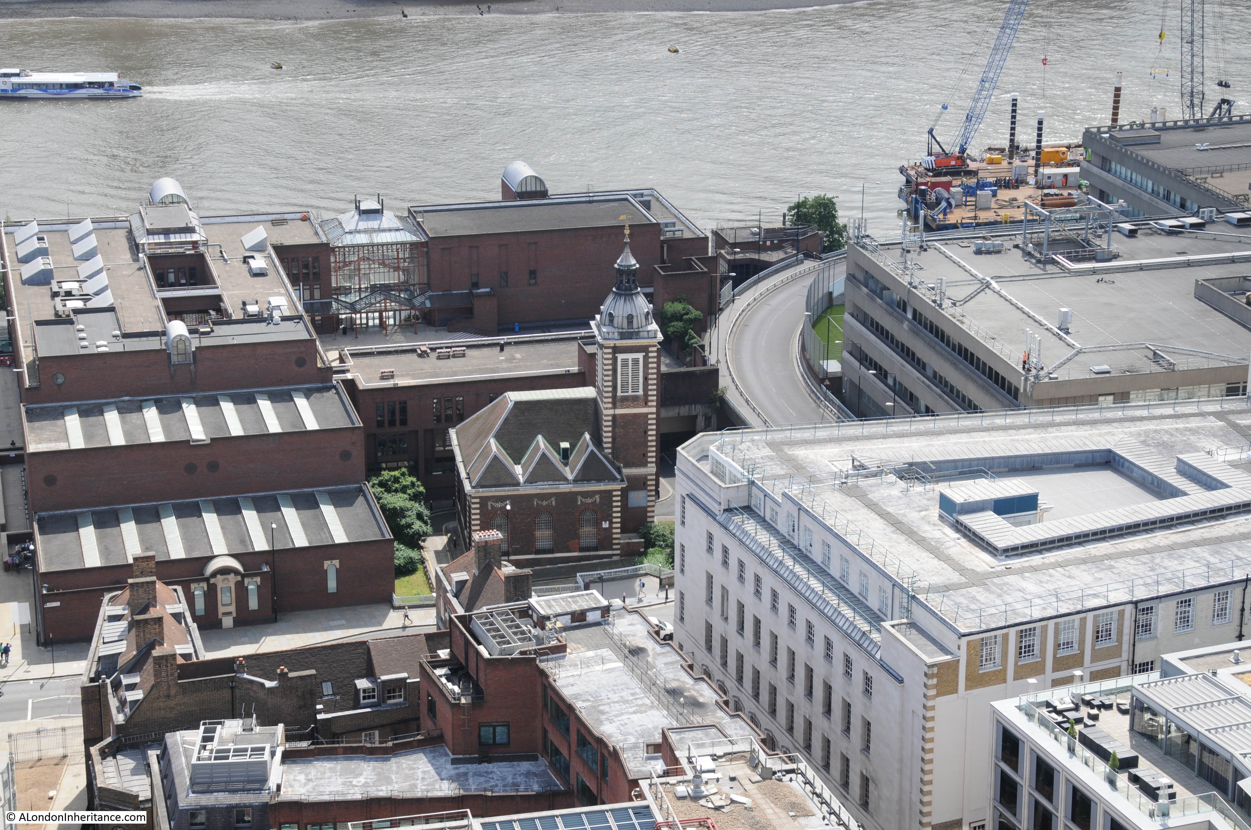
Close-up view of Bankside. This was once an industrialised area, but is now home to the reconstructed Globe Theatre. 49 Bankside, the building partly covered by the central tree and with the red door is a centuries old survivor of large amounts of change along Bankside.
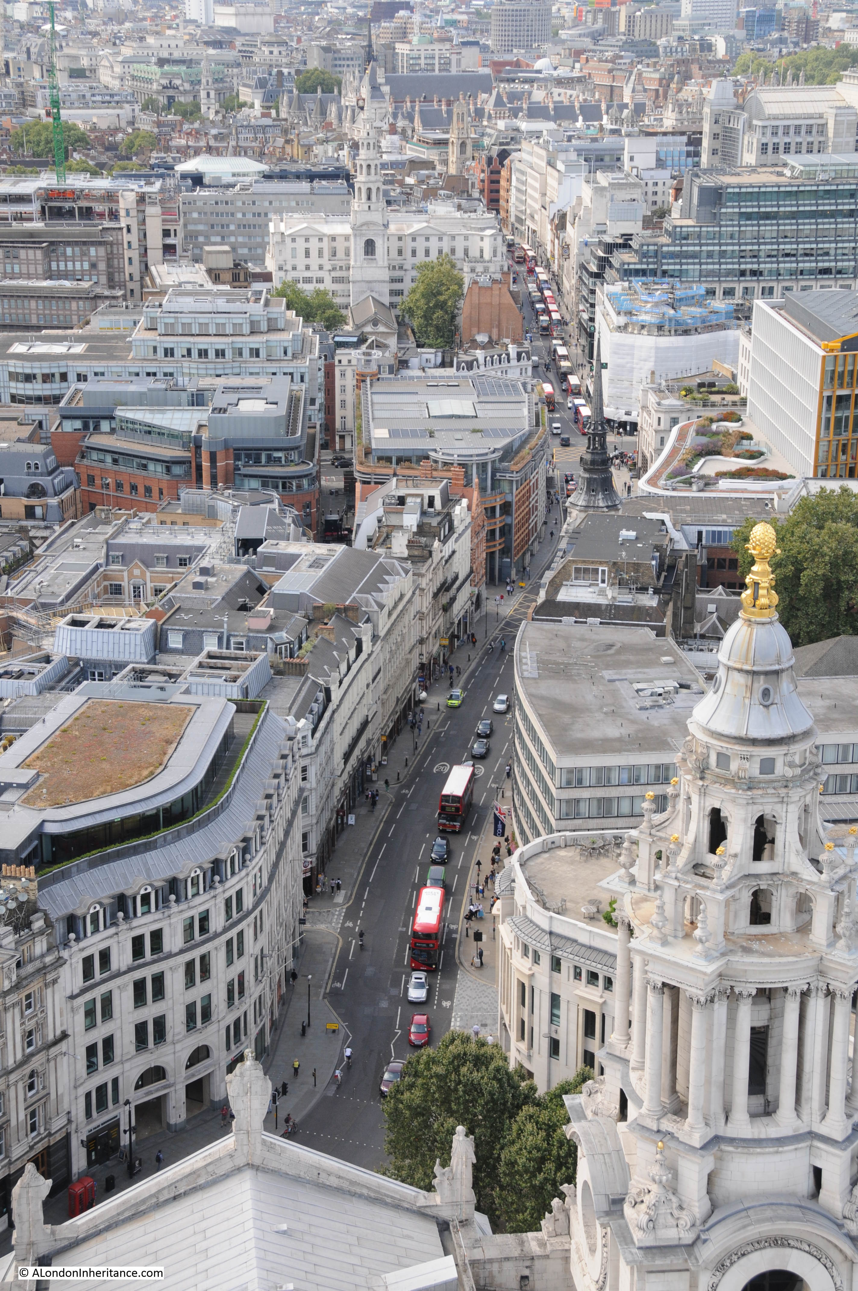
View along Ludgate Hill and into Fleet Street. The way that both these streets drop down towards Farringdon Street is a reminder that they originally ran down towards the River Fleet. The church of St. Martin-within-Ludgate is the dark tower on the right of Ludgate Hill. Further along on the left is the tower of St. Bride’s. Further along Fleet Street is the tower of St. Dunstan-in-the-West, and as Fleet Street curves towards the left behind the buildings is the tower of St. Clement Danes.
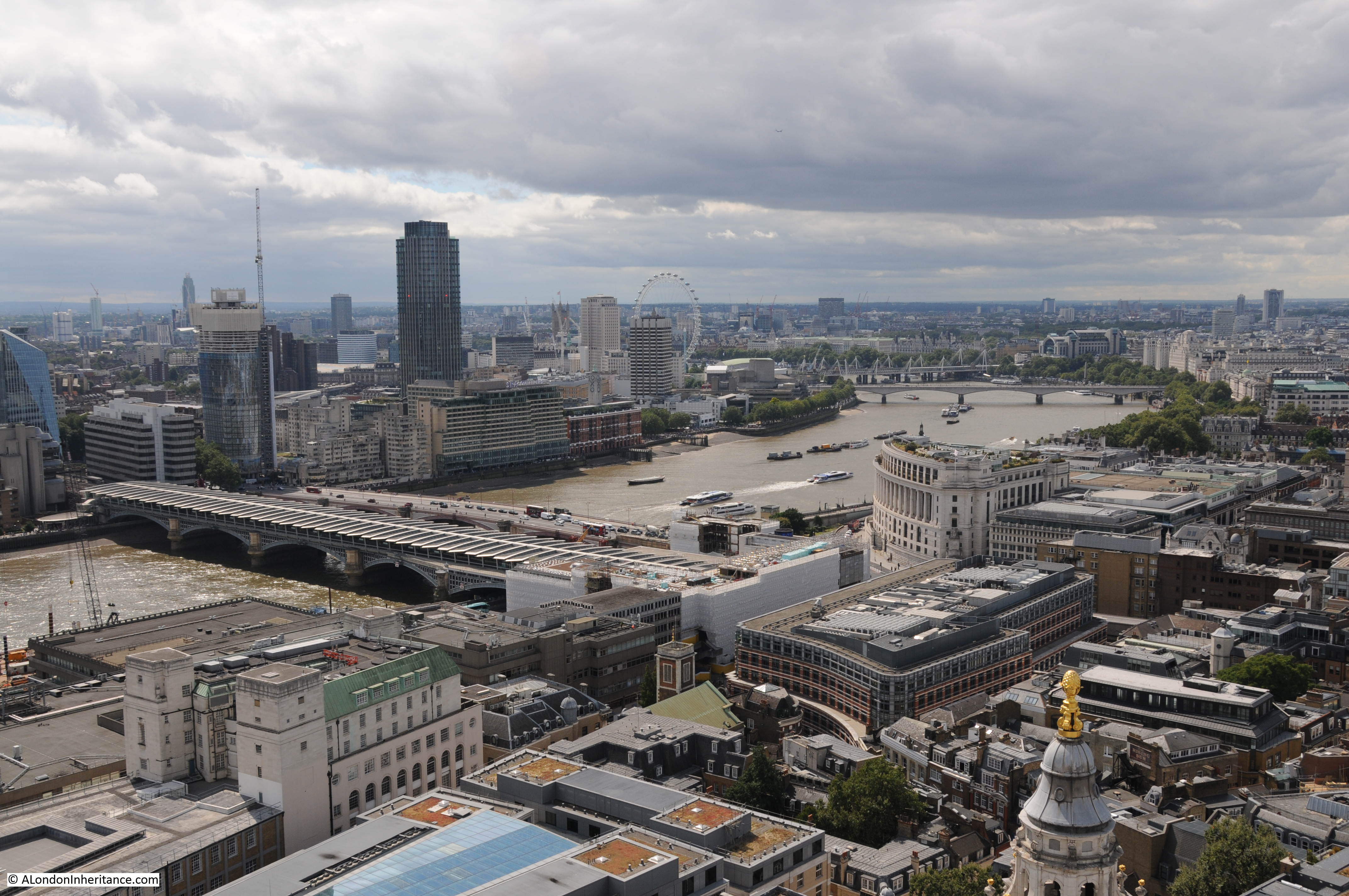
View to the west looking up towards Waterloo Bridge. If the Garden Bridge is built it will cut across the river in the centre of the photo, obstructing views of the cathedral from the South Bank and Waterloo Bridge.
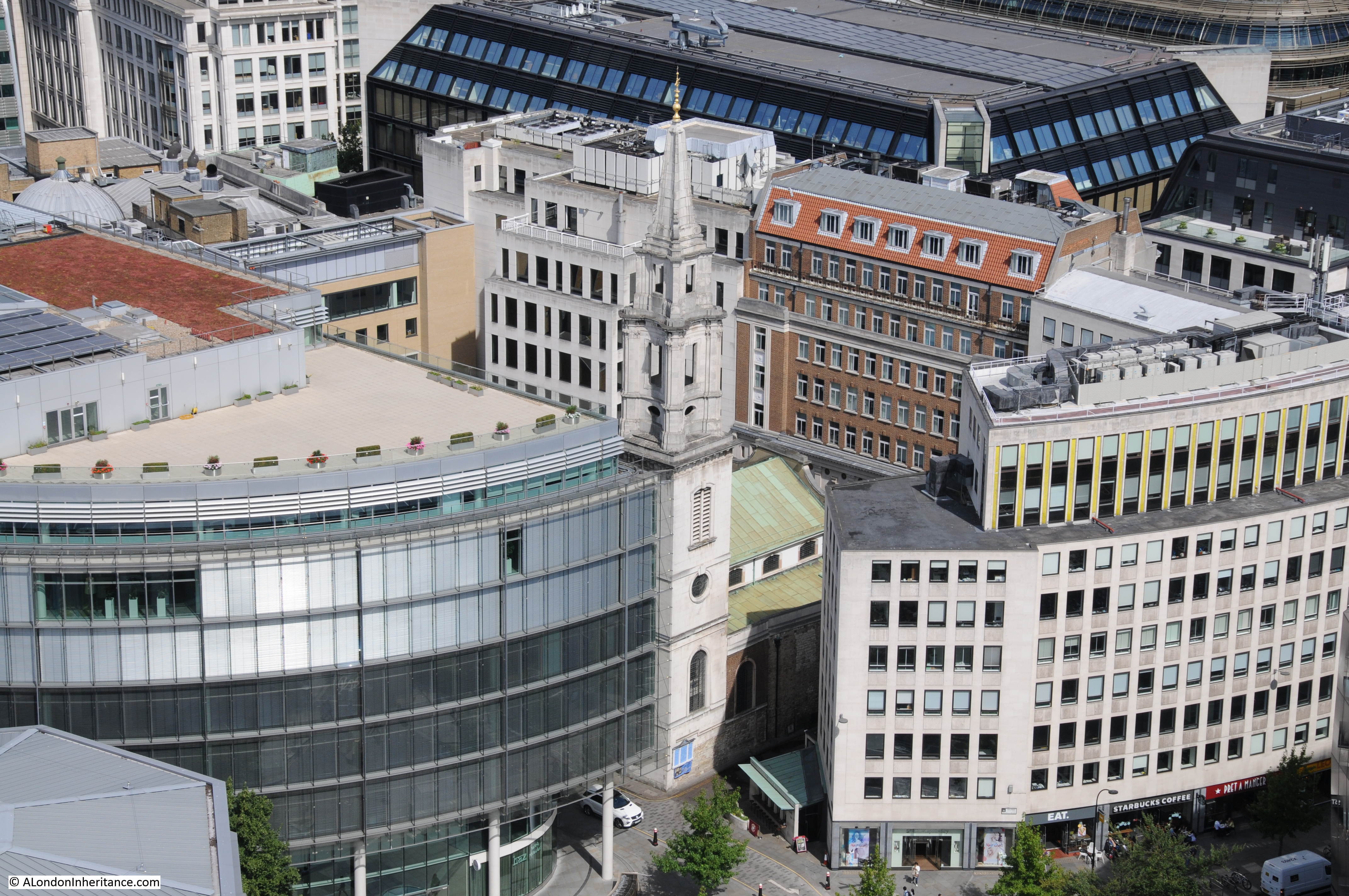
The church of St. Vedas alias Foster in Foster Lane:
Looking northwest to the high ground around Hampstead Heath and East Finchley. A number of the old rivers that originate in the north of London come from this area including the Fleet, Tyburn and Westbourne. The maximum height of the land at Hampstead Heath is around 443 feet and at the base of St. Paul’s Cathedral is around 36 feet showing the considerable change in height from the centre of London to the ring of hills around the north and south of the extended city.
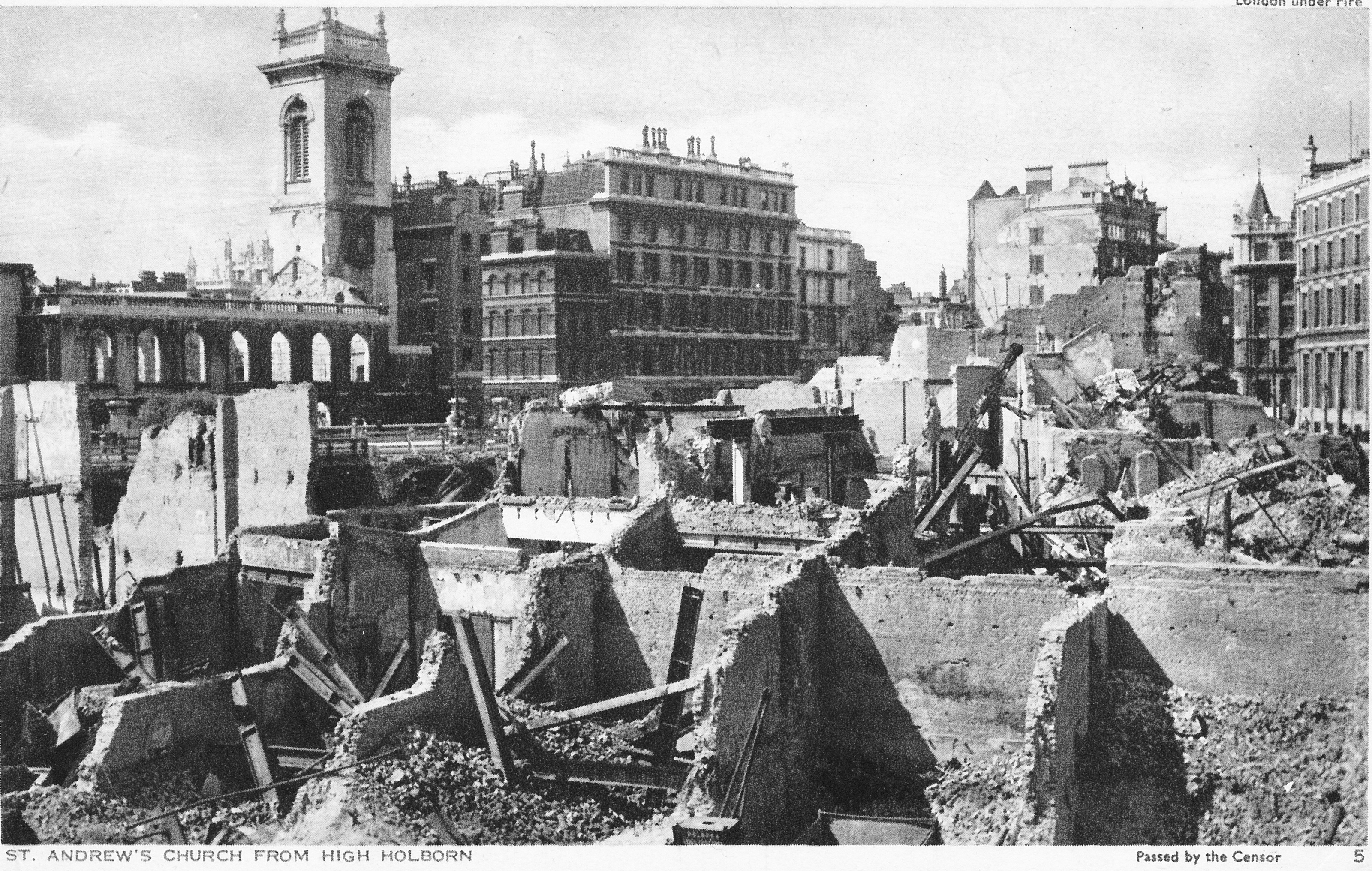
The tower of Christchurch Greyfriars alongside King Edward Street with the shell of the church a reminder of the bombing in this area during the last war:

View across to Alexandra Palace and Alexandra Park with the Emirates Stadium on the right. The land in the distance sloping down from the heights of Hampstead Heath:
The view from the Golden Gallery at St. Paul’s is superb. Standing 279 feet above the floor of the Cathedral on a narrow walkway in the open air is a wonderful way to experience the views across London.
After a quick look around the Cathedral and a much-needed drink in the Crypt Cafe, it was time to head to the Shard for number 4 in my London 5 Peaks Challenge which, along with the London Eye, will be the subject of my next post.