Tag Archives: Shell Centre

Panorama Of London

In May 2015 I published the photos I took in 1980 from the viewing gallery at the top of the Shell Centre tower on the Southbank. The viewing gallery was closed for public viewing soon after opening, however I recently found a copy of a booklet titled Panorama of London that was part of the public visit to the gallery and provided fold out views, labelled with the sights to be seen, distances to towns surrounding London and heights of the hills on the horizon.

Walking around the viewing gallery with the booklet, visitors would have been able to pick out all the key features of the view before them. There is no date in the booklet to date publication, however I would estimate it to be from the mid to late 1960s. There is an introduction which provides some statistics on oil consumption with 1960 being the most up to date figure and 1975 being used as a date for expected future consumption.

The views also include Millbank Tower, built in 1963 so the booklet is not from the early 1960s.

The cover of the Panorama of London:

Panorama of London

The booklet starts with an introduction to the Shell Centre complex, informing the visitor that the viewing gallery is on the 25th floor of the Shell Centre tower, 317 feet above sea level. The tower block in total is 351 feet high, just 14 feet lower than the cross of St. Paul’s Cathedral.

The booklet has four fold out views, corresponding to the view from each side of the tower. Each view consists of a transparent layer, labelled with the sights to be seen, which overlays a detailed drawing of the view.

So, lets commence a walk around the viewing gallery, starting with the view to the south-east and east from the rear of the tower. (Click on the pictures to open much larger versions).

In this view, Waterloo Station occupies much of the area immediately to the frount, however moving from the east we can see Southwark Cathedral, Tower Bridge, Guy’s Hospital, the Old Vic Theatre. Elephant and Castle, and the Imperial War Museum.

On the horizon, Shooters Hill at 425 feet and a distance of 8.5 miles away, Knockholt Pound at 587 feet is 17.5 miles away and Tatsfield Gt. Farm at 784 feet is at 16.5 miles.

Panorama of London

Panorama of London

Moving to the side of the tower, we can look towards the north-east and the north. Here we can see the City of London. Bankside Power Station with a smoking chimney is on the south bank of the river. Cranes can still be seen along the south bank of the river between Waterloo and Blackfriars Bridges. St. Paul’s Cathedral is still the highest building in the City. The view moves to the north passing through Shoreditch, Islington, Holborn and to part of Bloomsbury.

On the horizon is Fox Hatch at 338 feet and 20 miles distant. Epping Forest is 14.5 miles away, and we can see Alexandra Palace on the horizon.

Panorama of London

Panorama of London

We now move to the part of the viewing gallery that is at the frount of the Shell Centre Tower, looking from the north-west to the west. On the north-western edge is Senate House of the University of London. We then come to the G.P.O. Tower (now the BT Tower), then Charing Cross Station and Hungerford Railway Bridge, Nelson’s Column, the three parks of St. James’s, Green and Hyde, then the Albert Hall and on the far west, the start of the museums of Kensington with the Victoria and Albert.

On the horizon is Elstree at 478 feet and 12 miles, Harrow Weald at 486 feet and 18 miles, and the Kensal Green Gasholder at 5 miles.

Panorama of London

Panorama of London

The final view in this Panorama of London is to the south-west and south, from the side of the Shell Centre tower. The Palace of Westminster and Westminster Abbey are across the river, and moving to the south, the chimneys of Battersea Power Station are smoking. We then come to Millbank Tower, Vauxhall Bridge, Lambeth Palace and the Kennington Oval.

On the horizon is Windsor Great Park at 20.5 miles, Oxshott at 257 feet and 15.5 miles, Coulsdon at 468 feet and 12.5 miles and finally Woldingham at 868 feet and 16.5 miles.

Panorama of London

Panorama of London

In 1980 I walked around the Shell Centre viewing gallery and created my own Panorama of London series of black and white photos of the view. Following the same route as taken in the Panorama of London booklet, I am starting at the rear of the tower, looking towards the south-east:

Panorama of London

Looking over the tracks that lead into Waterloo Station:

Panorama of London

Then round towards the east with the rail tracks running through Waterloo East and onward towards London Bridge.

Panorama of London

Now with the City coming into view with at the time the tallest tower in the City, the NatWest Tower, completed in 1980 and now known as Tower 42.

Panorama of London

In the following view, Stamford Street is leading off towards the east. Kings Reach Tower is adjacent to Stamford Street, completed in 1972 and was the home of IPC Media, the publishing group behind a diverse range of publications from Loaded and NME to Country Life and Marie Claire. The tower has now been converted to apartments with several floors added, and renamed the South Bank Tower. I took photos from the top of this tower in the late 1990s.

Panorama of London

At the junction between Waterloo Bridge, Stamford Street, Waterloo Road and York Road was this large roundabout, now the home of the BFI IMAX cinema.

Panorama of London

Looking over towards the north-east and the towers of the Barbican come into view.

The tall building closest to the camera is the London Studios – ITV’s main home in London. Built in the early 1970s as the home for London Weekend Television (seems strange now remembering the Friday evening switch over to LWT). The studios here had been hosting some of ITV’s daytime output (now moved to the remaining studios at the old BBC Television Centre at White City) and large Saturday night shows. The site is about to be redeveloped with new offices for ITV, a set of smaller studios so that the daytime TV shows can return, and (you have probably guessed) a much taller residential tower which will be built on the site of the existing tower.

Panorama of London

Moving along in my Panorama of London, this is the view over Waterloo Bridge.

Panorama of London

The white building adjacent to the river is the old Shell-Mex House building and moving back, towards the left is Centre Point, at the top of Charing Cross Road.

Panorama of London

Charing Cross Station and the BT Tower.Panorama of London

Slightly further to the left.

Panorama of London

The Ministry of Defence building along the Embankment to the right.

Panorama of London

And finally the Palace of Westminster. The London Eye would now be obscuring much of this view.

Panorama of London

The skyline of London is rapidly changing. For Shell Centre, the office blocks surrounding the base of the tower have been demolished and new apartment blocks are being built around three sides of the original tower.

It would be interesting to see if I can get back up to the viewing gallery in two years time for a 40 year then and now set of photos, as the view will be very different to the Panorama of London and my 1980 photos.

alondoninheritance.com

A Walk Along Belvedere Road – 1947 and 2016

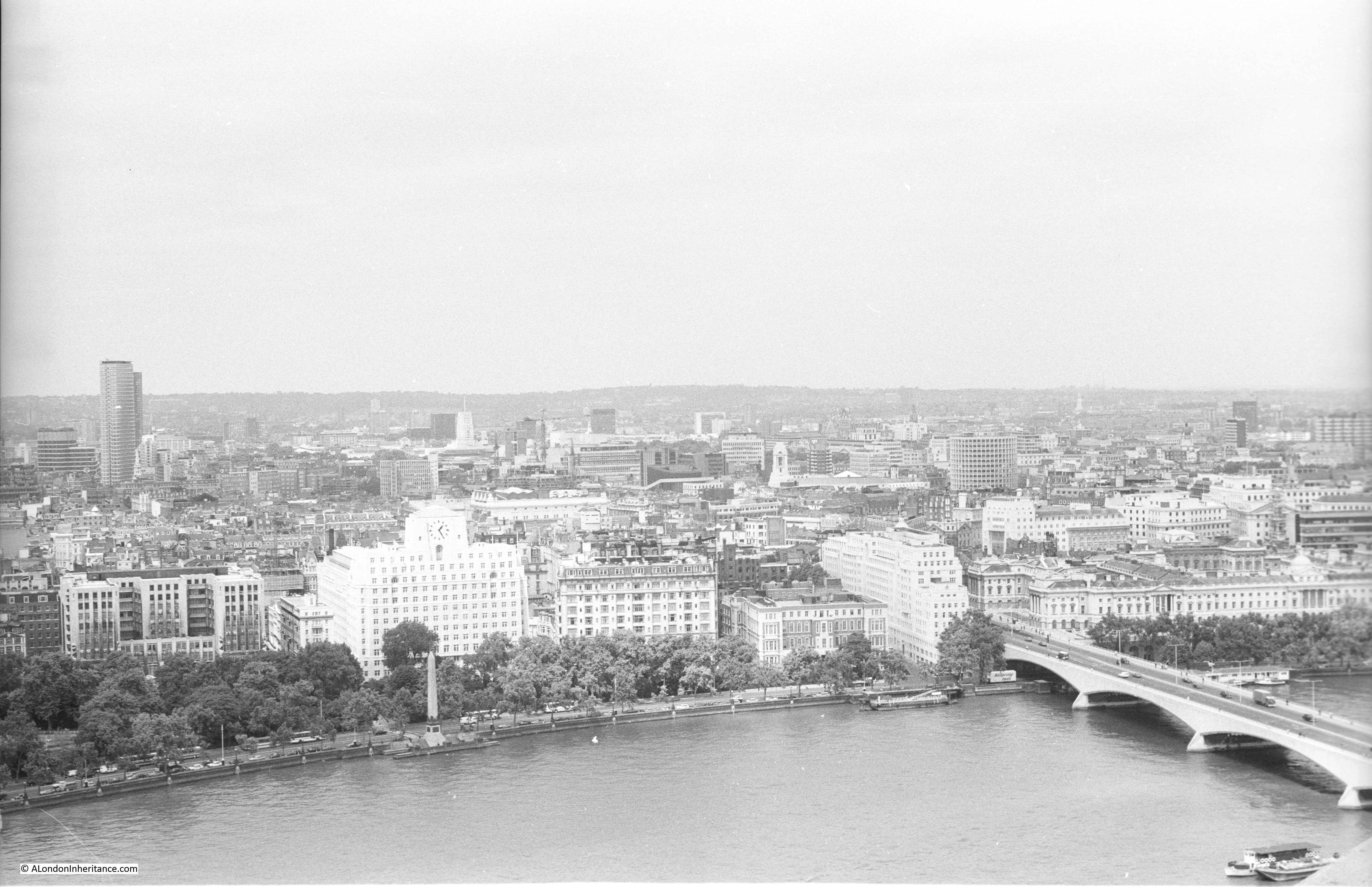
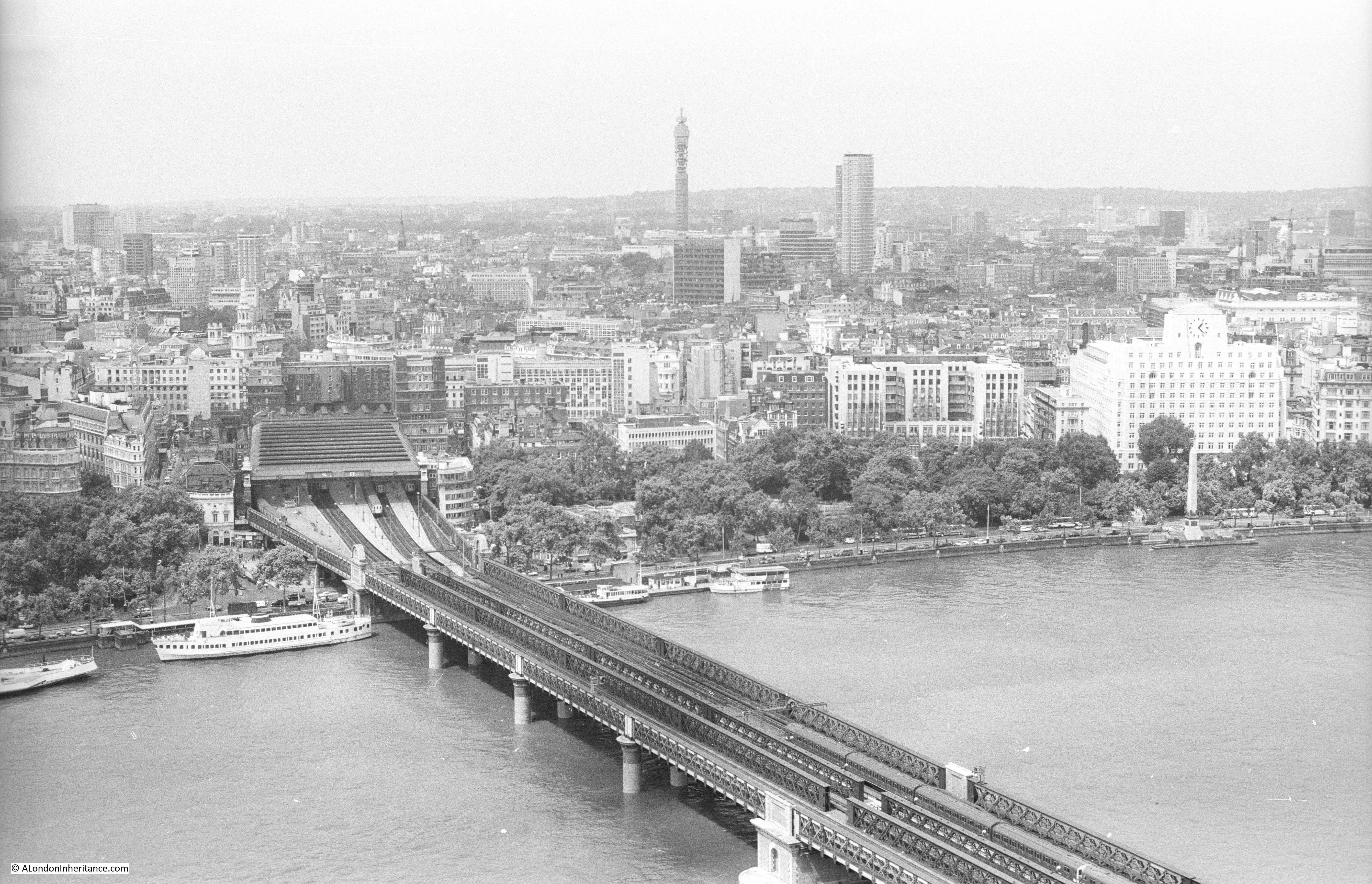
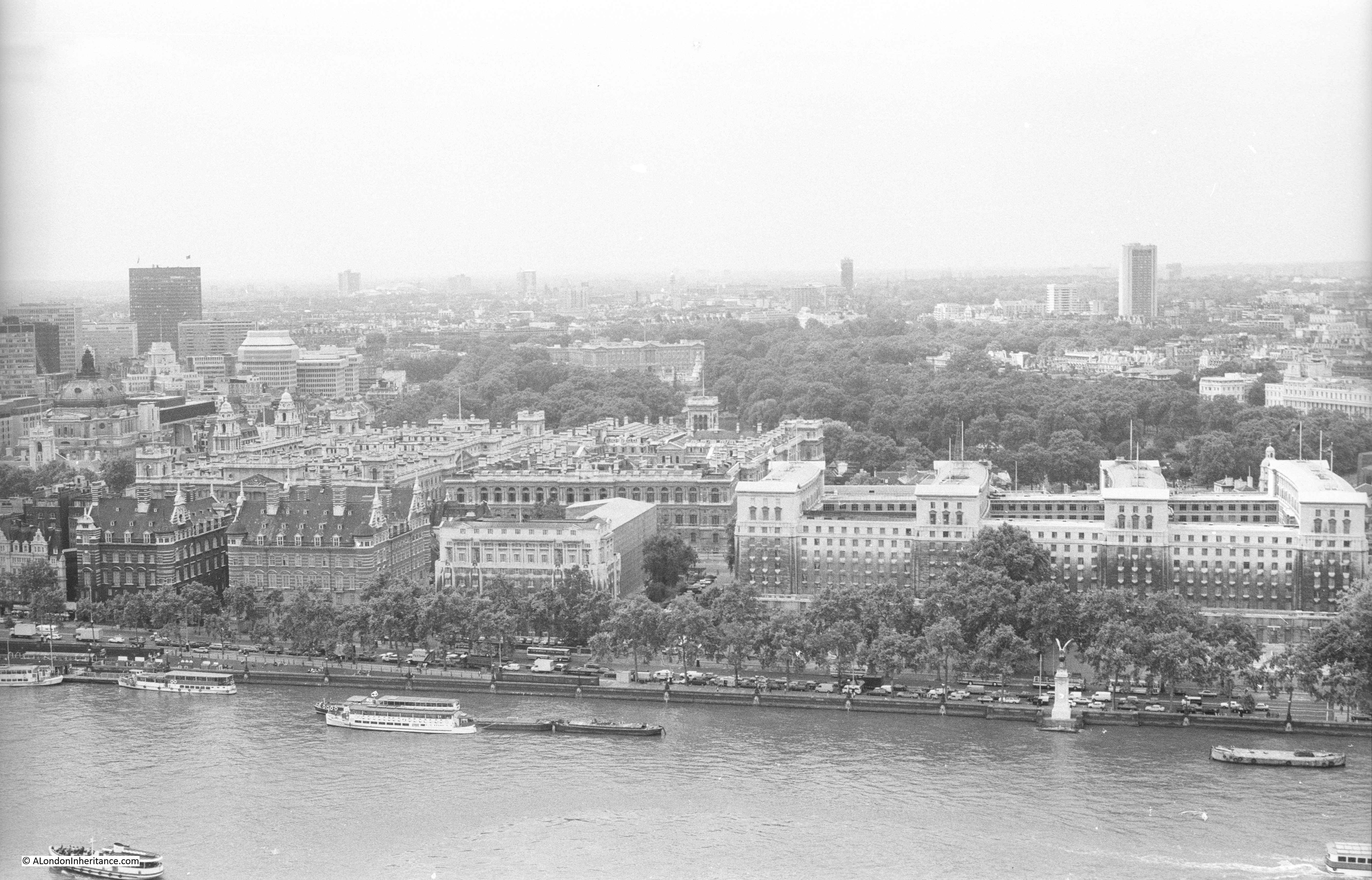
Having explored the history of the South Bank in yesterday’s post, today it is time to take a walk along Belvedere Road to see the remains of buildings dating back to the start of the 19th century, the clearance ready for construction of the Festival of Britain and the foundations of the Royal Festival Hall. We will start from where Waterloo Bridge crosses Belvedere Road, drop down to Belvedere Road and then walk along Belvedere Road to County Hall.

My father visited this area a number of times between 1947 and 1951, first to photo the buildings as they were, then the area as it was cleared and finally as the construction of the Royal Festival Hall was underway. This post brings together photos distributed among a number of different posts over the last couple of years along with some new photos I have recently scanned.

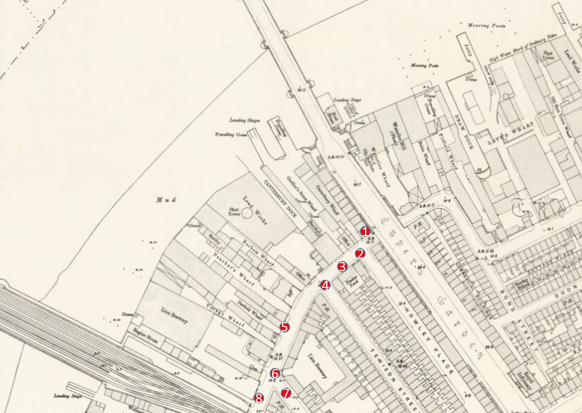
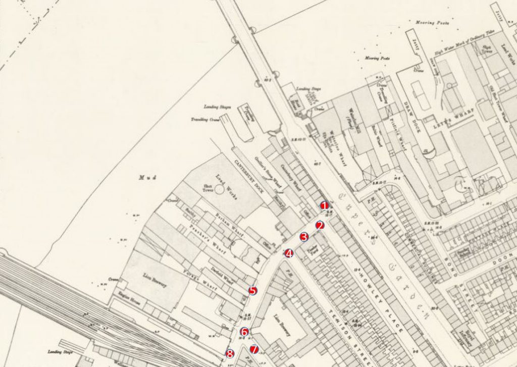
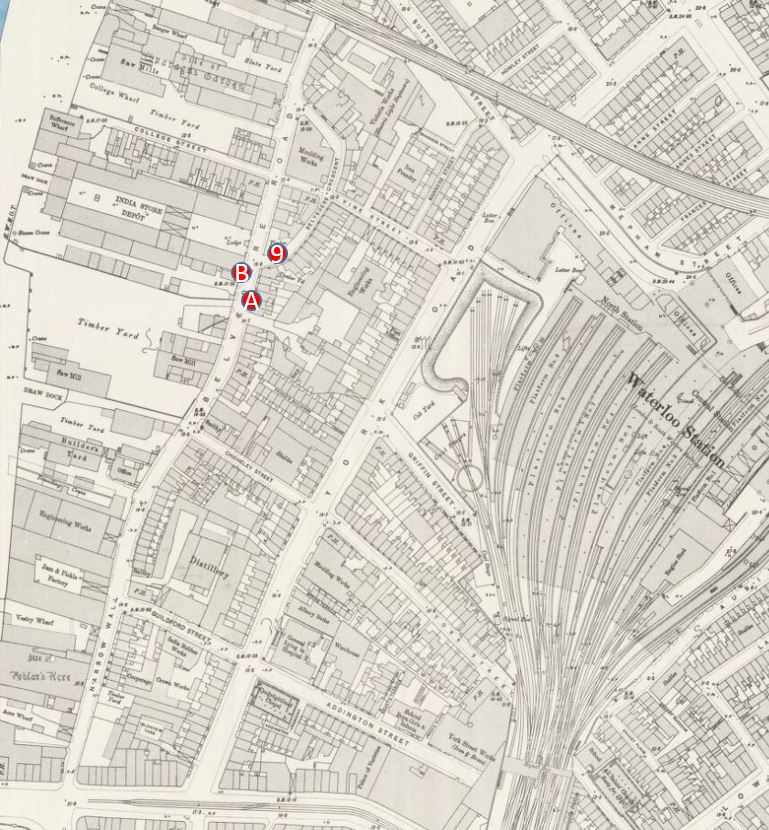
The map below is the same extract from the 1895 Ordnance Survey Map covering the area between Hungerford and Waterloo Bridges as in yesterday’s post. I have marked in numbered red dots the locations from where the photos in today’s post were taken.

Belevedere Walk Map 1

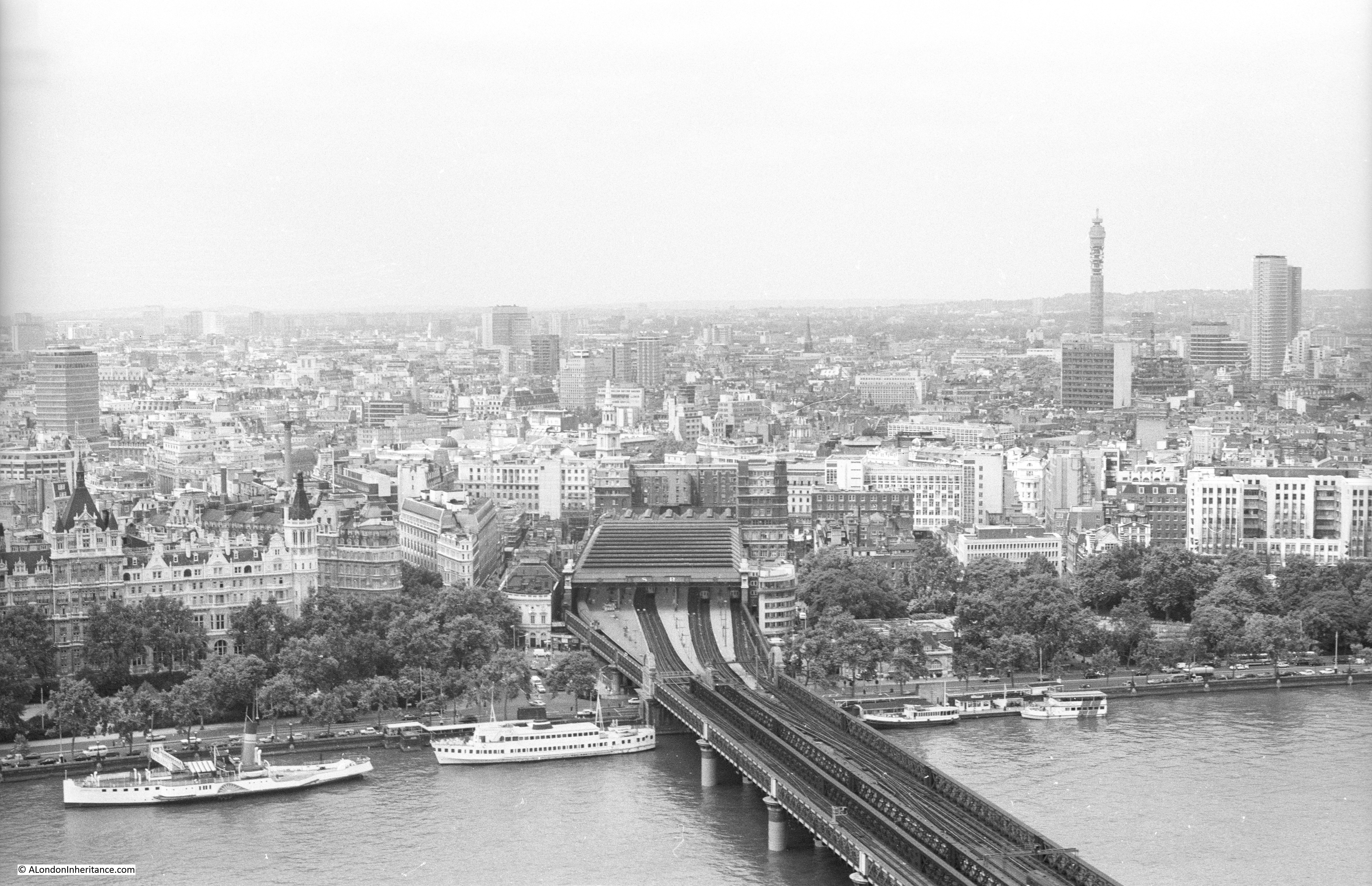
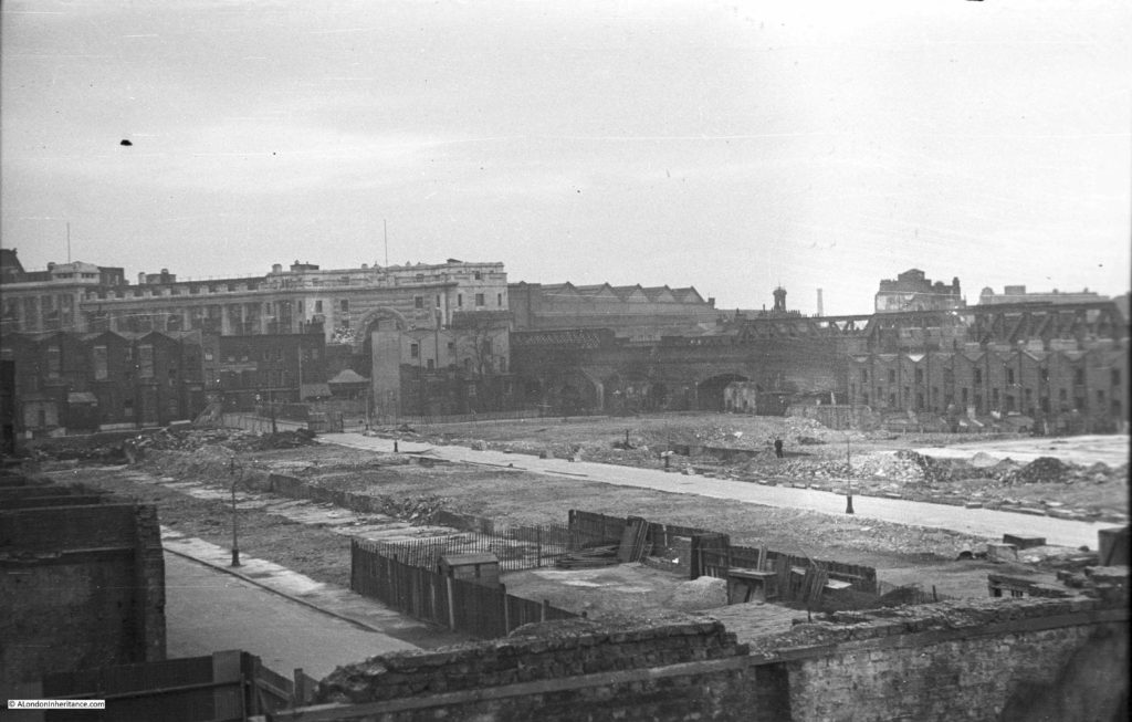
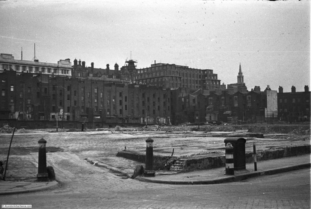
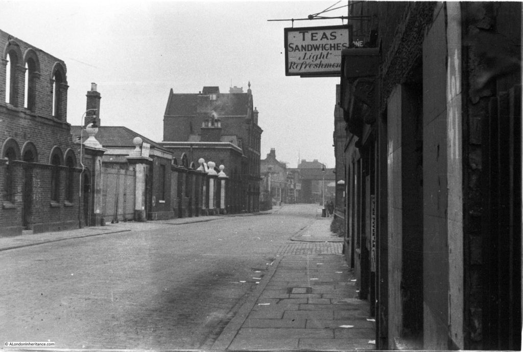
The first three photos are at point one. I am not sure whether they were taken from Waterloo Bridge, or from one of the buildings alongside the bridge, however this first photo is looking along Belvedere Road towards the bridge under the rail tracks leading up to Hungerford Bridge.

Demolition is already underway. The remains of the entrance to the Lion Brewery can be seen on the right, in front of the railway, and clearance of the houses on the left is well underway.

History of the Southbank 3

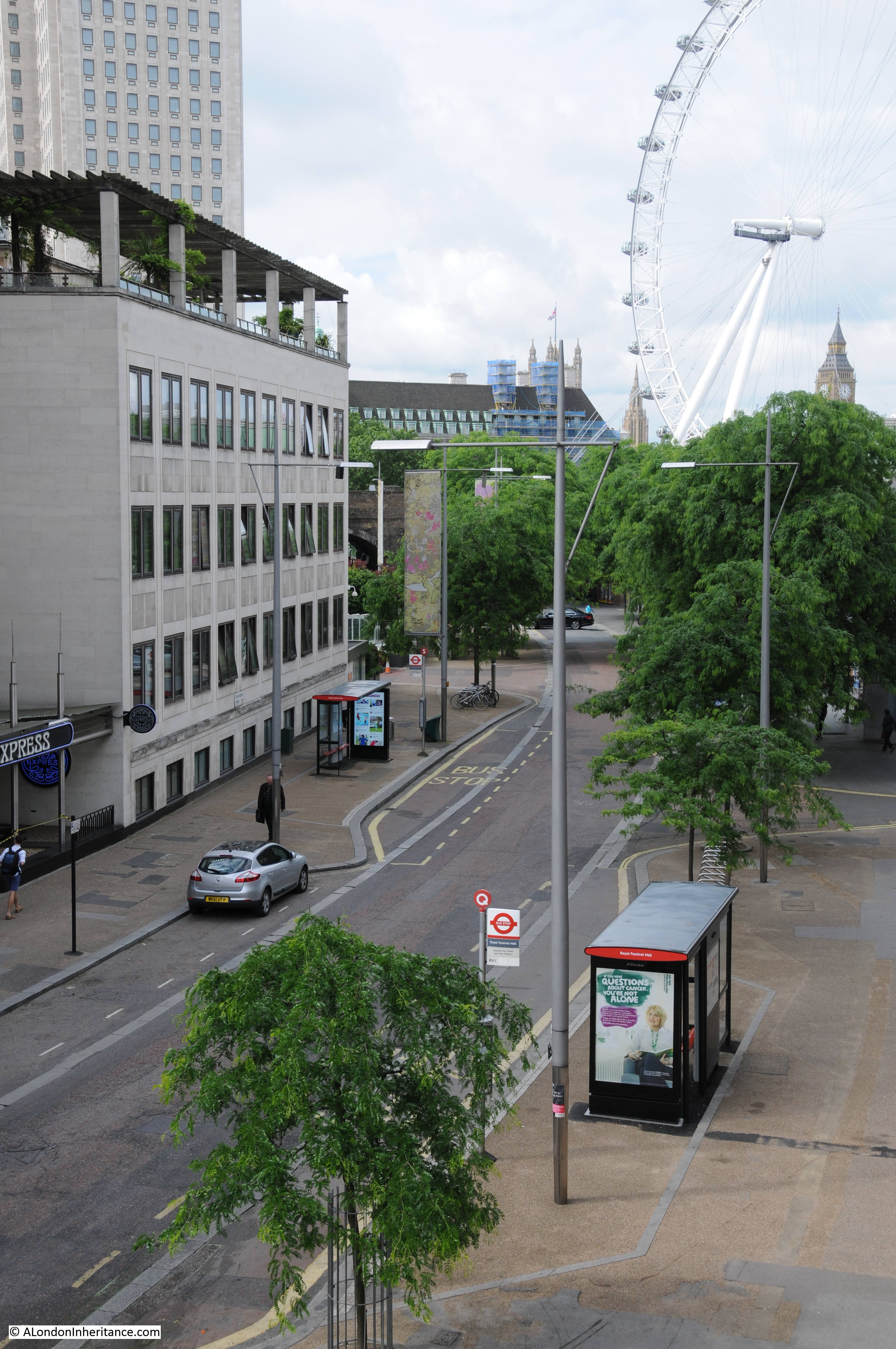
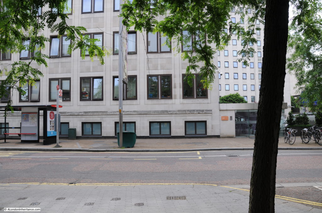
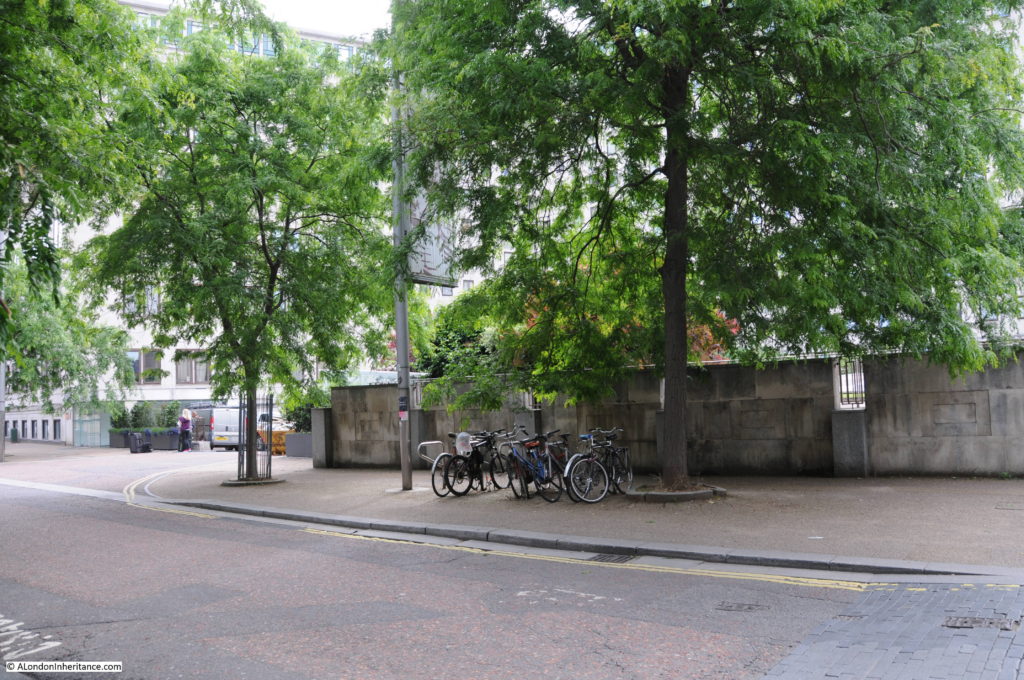
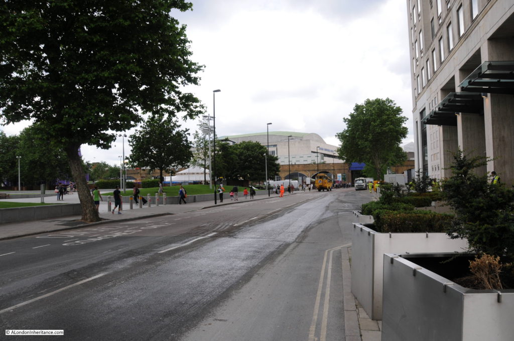
This is roughly the same view today. I should have been a bit further to the right, however the buildings of the Hayward Gallery obscure the view. Belvedere Road curves to the left towards where the road passes under the rail tracks – the bridge is obscured by the trees.

Belvedere Road Walk 1

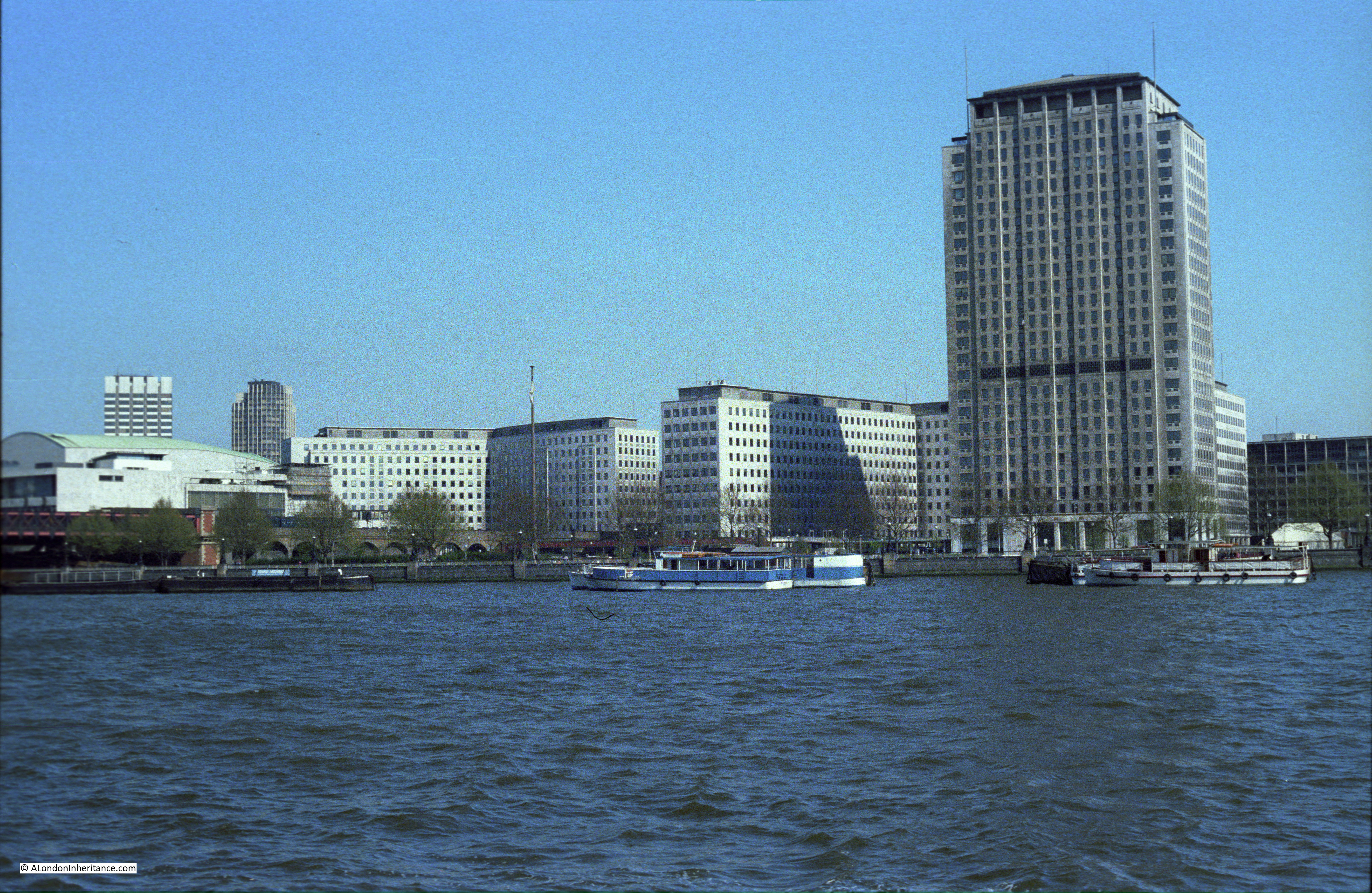
This next photo is from the same spot, but is looking towards the right, towards the Thames. The large building is the Lion Brewery. Note that on the opposite side of the river, construction of the new Ministry Defense Building is well underway. The buildings in the foreground are along Grellier’s Stone Wharf on the 1895 map.

History of the Southbank 2

Again, I should have been a bit further towards the right, however the following view from 2016 shows that the entire site of the above photo is now occupied by the Royal Festival Hall, the Hayward Gallery, Queen Elizabeth Hall and the Purcell Room.

Belvedere Road Walk 2

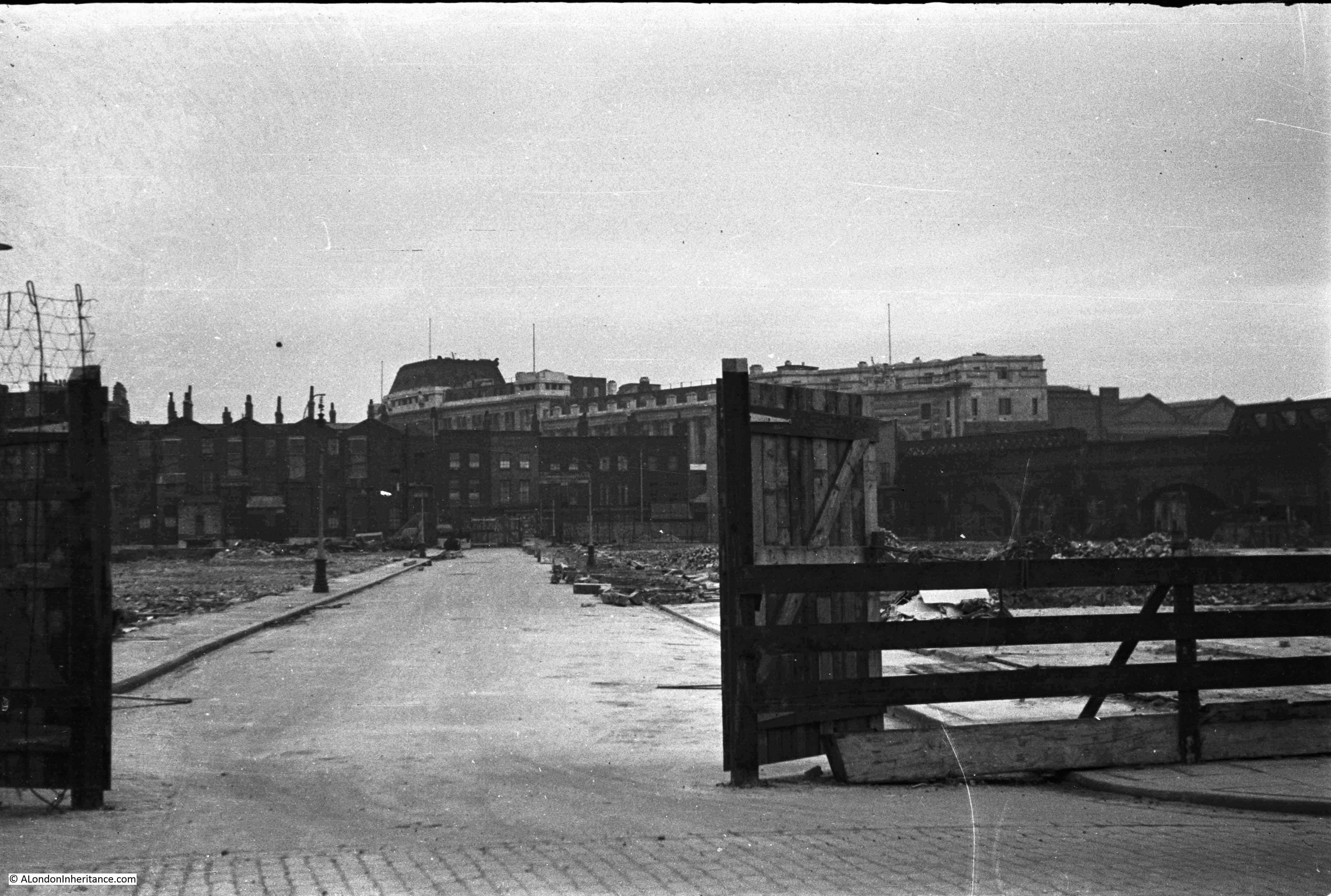
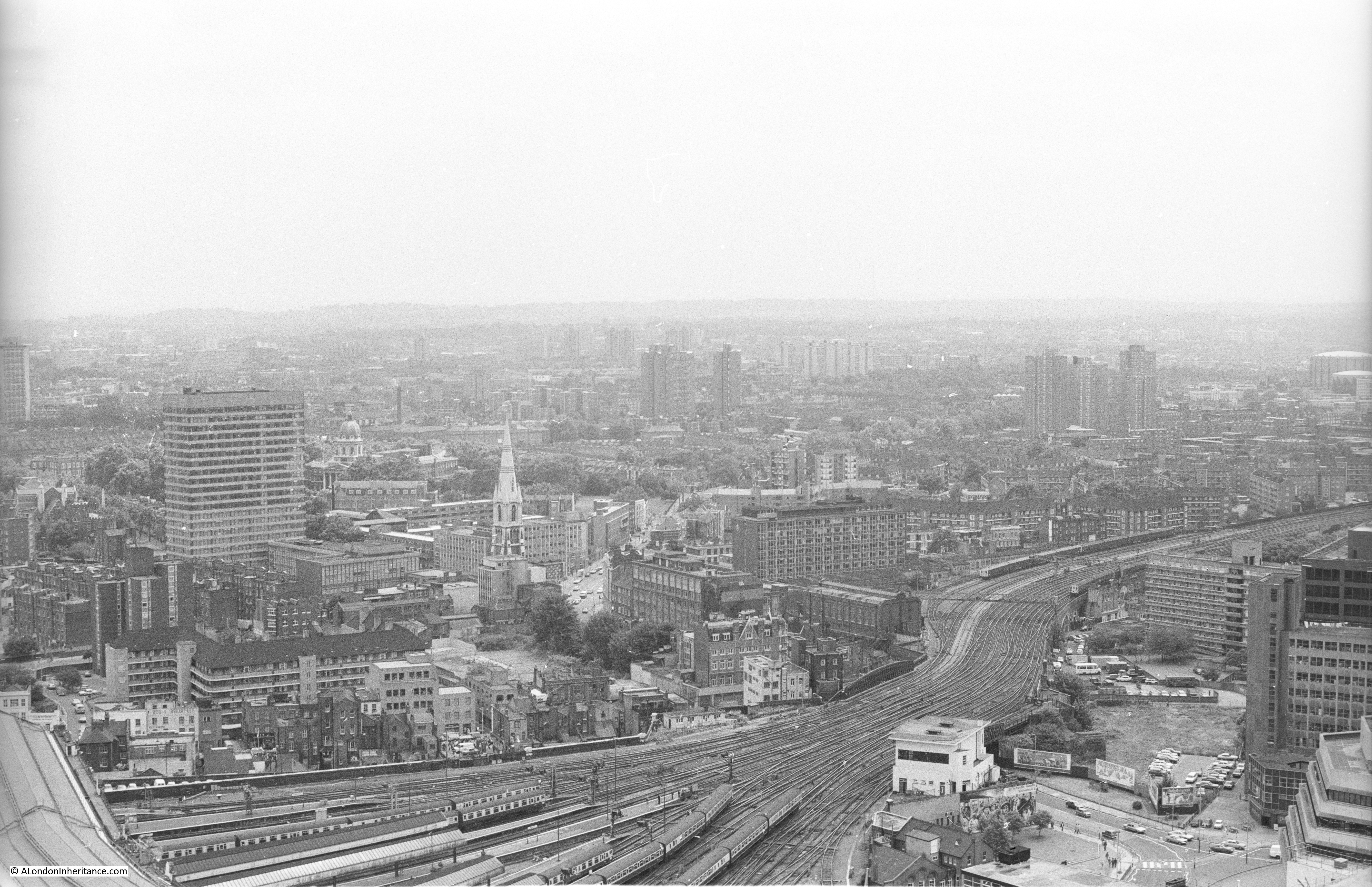
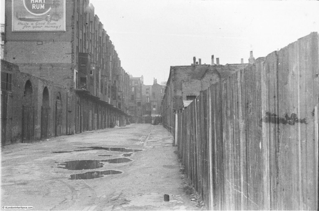
And the following photo is the last from the bridge and is looking to the left, towards Waterloo Station. Two streets can be seen, on the left is Howley Place and the street in the middle is Tenison Street. The terrace buildings that lined these streets have been demolished, however those along the boundary of the site remain. On the right are the houses along Sutton Street and the houses in front of Waterloo Station are along York Road. To the right of centre, there is a solitary figure standing on the rubble left by demolition.

History of the Southbank 1

And the same view today. The entire site is now occupied by what was the Downstream Building of the Shell Centre office complex, but is now the Whitehouse Apartments. When I checked on their website, two apartments were for sale, one from just over £1 Million and the second for £2,750,000. A chat box from a representative in Hong Kong popped up whilst looking at the page asking if I needed help which tells you all you need to know about central London”s property market.

Belvedere Road Walk 3

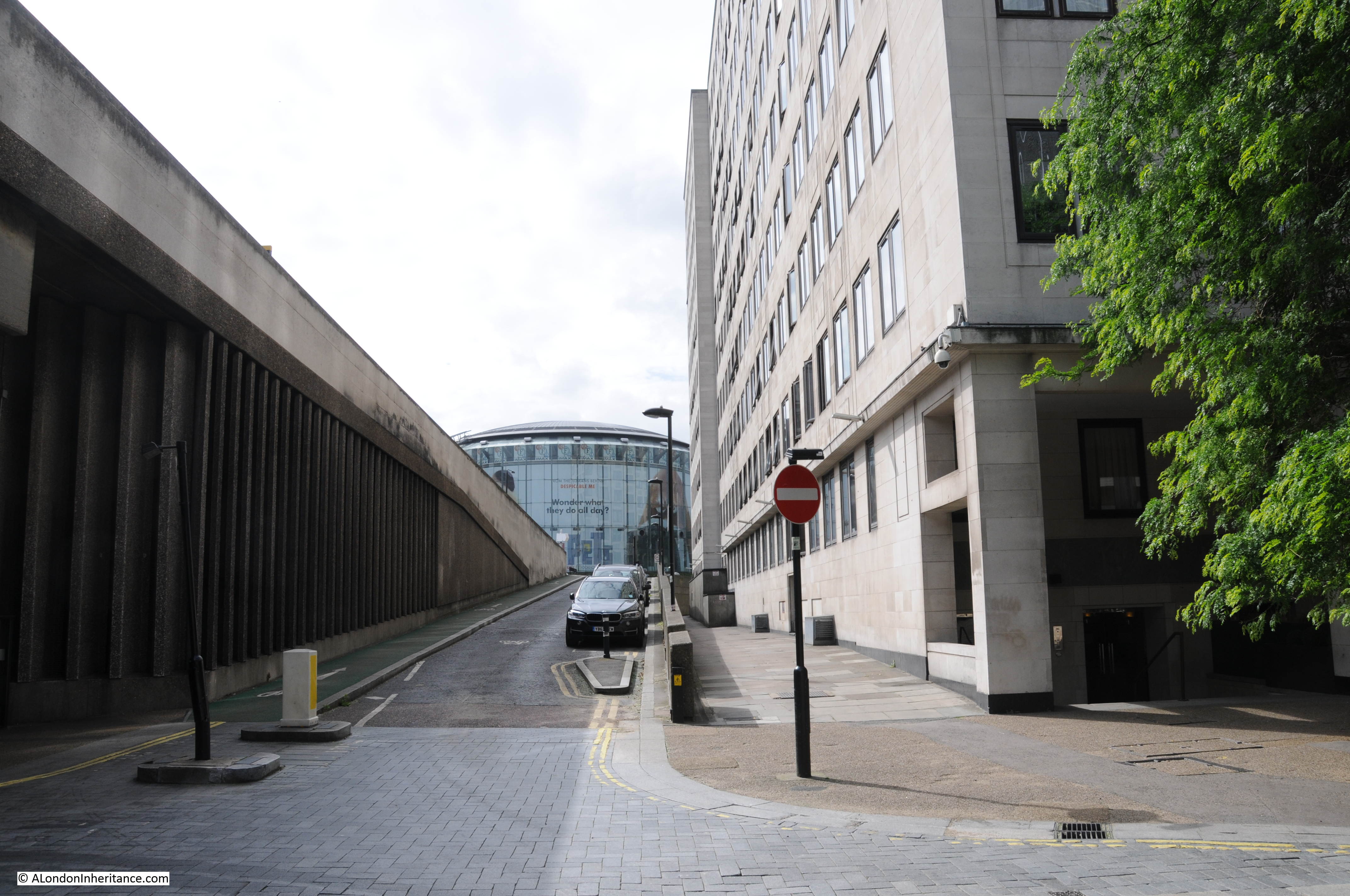
Now walk towards the large roundabout at the southern end of Waterloo Bridge and take an immediate right hand turn down the slip road that takes you down to Belvedere Road. This road does not appear to have a name, but runs along the route what was Howley Place. At the end of the slip road, on reaching Belvedere Road, turn round to look back up the slip road (position 2 on the map).

This was the original view:

History of the Southbank 27

The buildings on the left are the rear of buildings facing onto the approach road to Waterloo Bridge which has since been widened. The large roundabout with the glass IMAX cinema in the centre, which can be seen at the end of the current slip road had not been built at the time of these photos, so the houses seen at the end of Howley Place are roughly where the edge of the IMAX is currently located.

Belvedere Road Walk 4

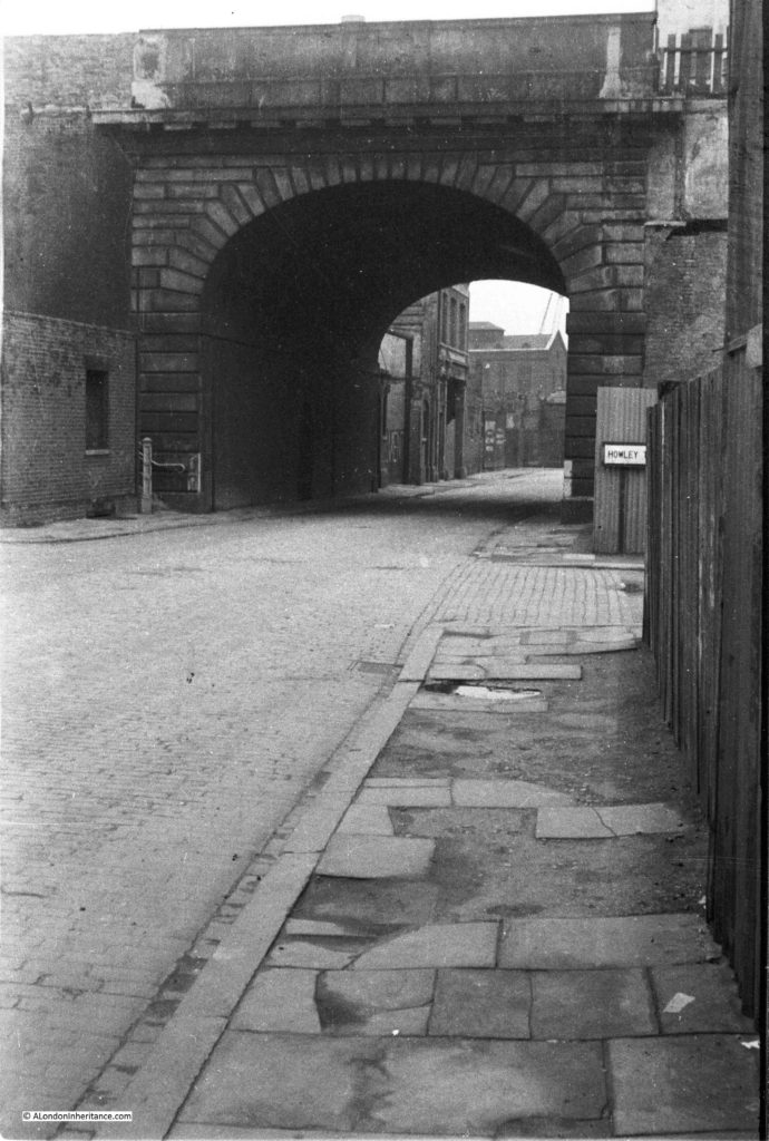
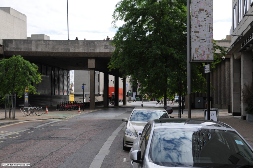
We can now start walking along Belvedere Road, but only a short distance to point 3 on the map where we can look back at the original bridge which takes the approach road to Waterloo Bridge over Belvedere Road. The entrance to Howley Place is on the right with part of the street name sign visible.

History of the Southbank 18

The same scene today. The approach road to Waterloo bridge has been replaced and is wider than in the original photo.

Belvedere Road Walk 5

Now walk a short distance along to point 4. This is the entrance to Tenison Street, looking towards Waterloo Station.

History of the Southbank 23

And this is roughly from the same position today. Waterloo Station is behind the buildings of the Whitehouse Apartments.

Belvedere Road Walk 6

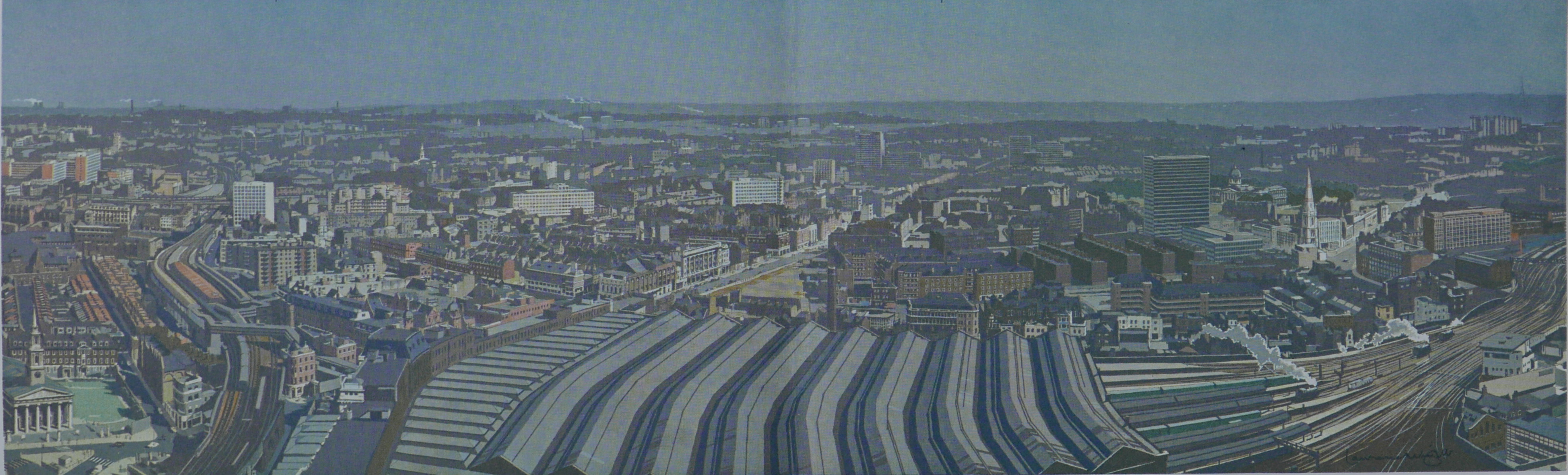
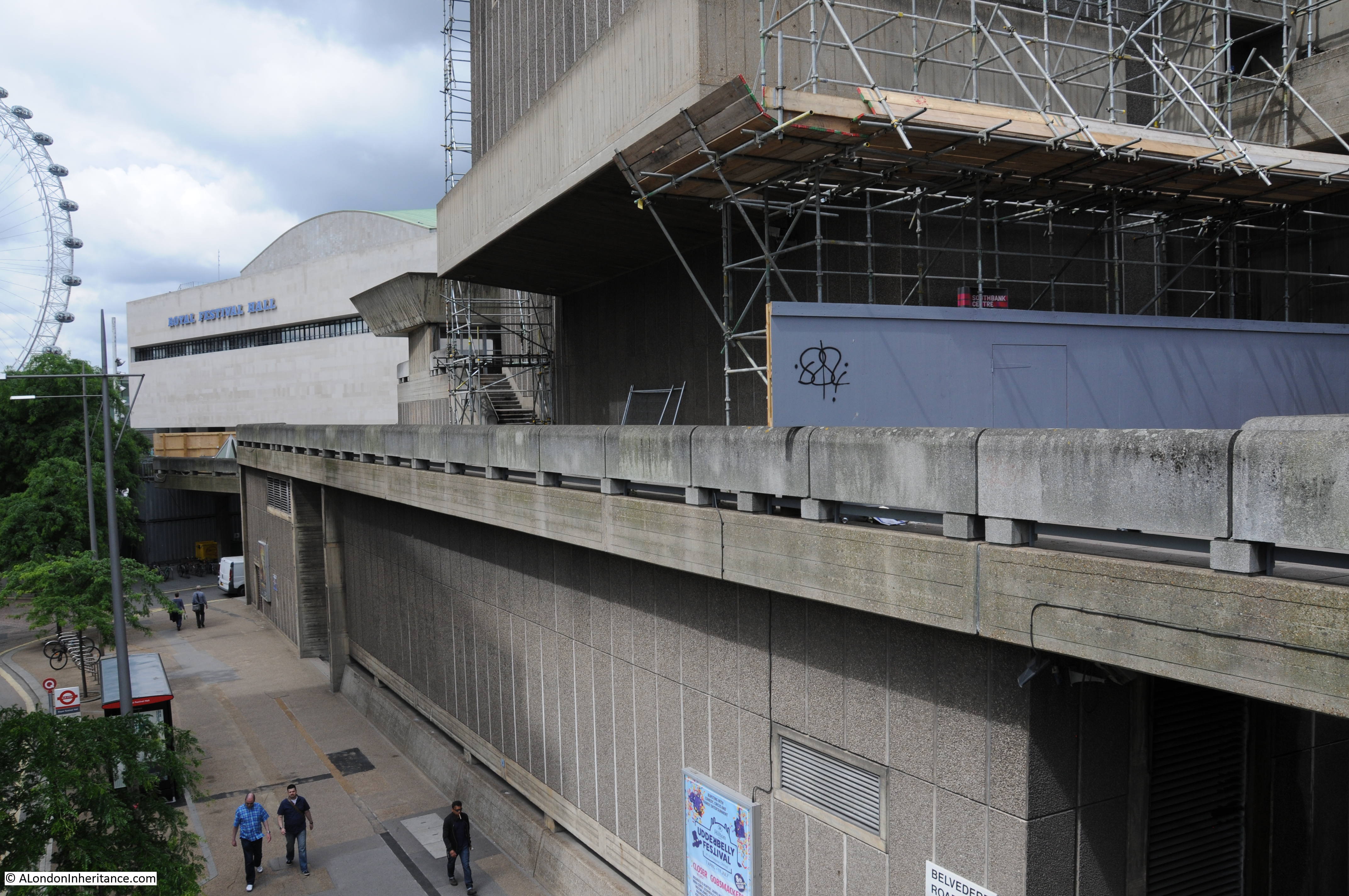
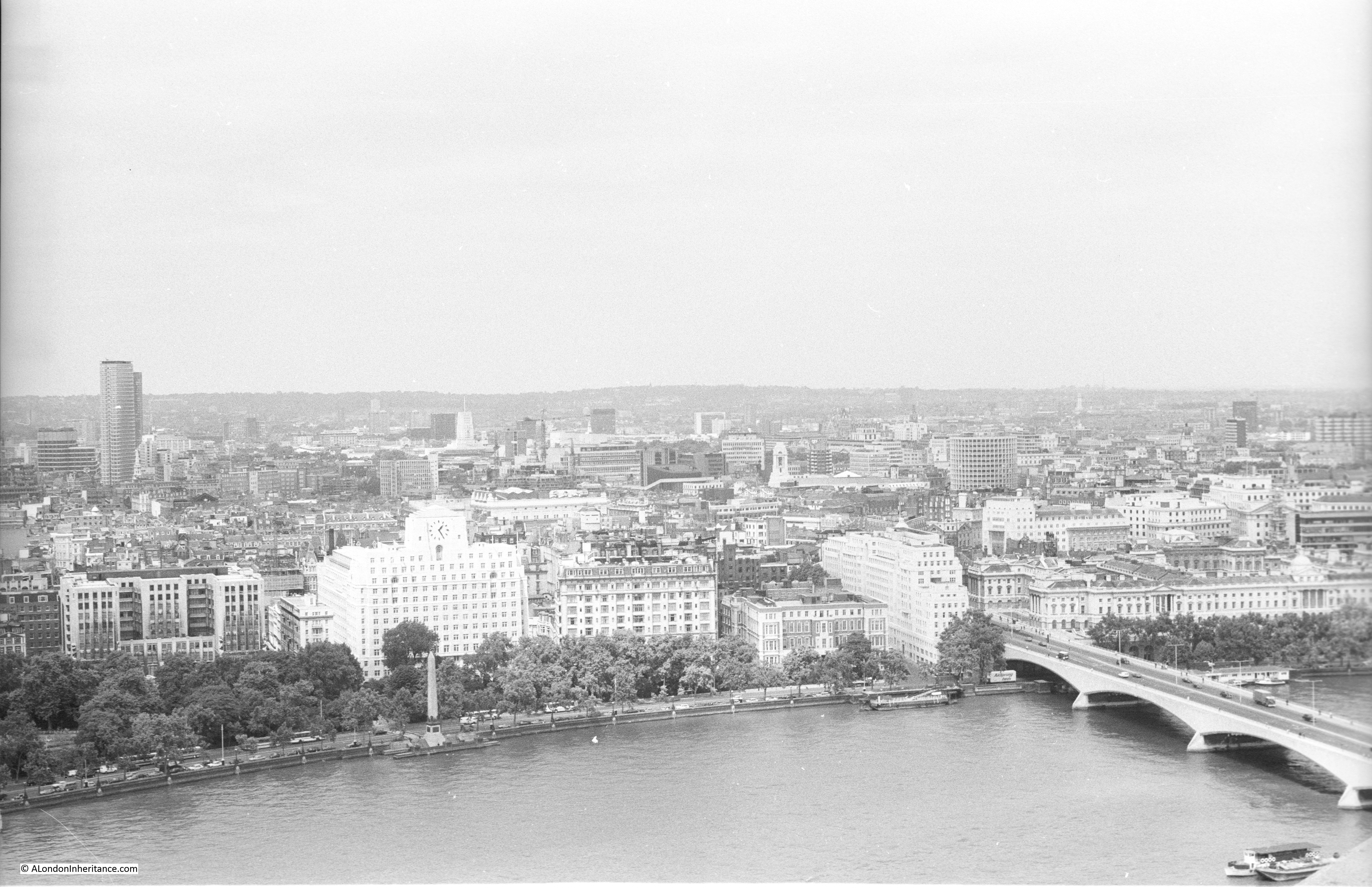
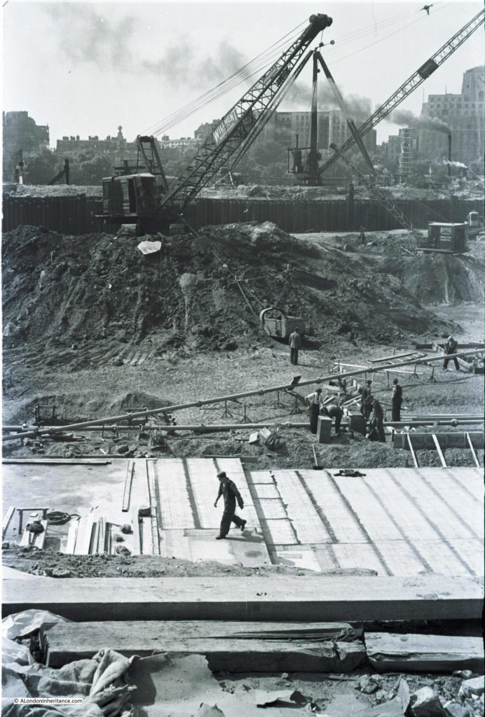
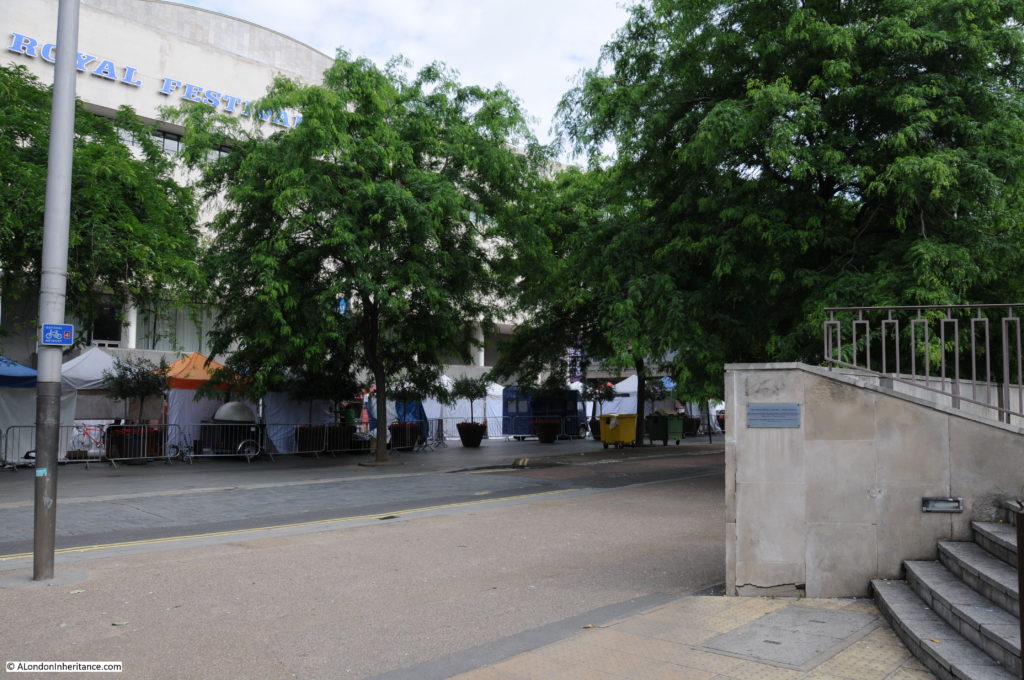
Now walk along to point 5 which is roughly half way along the rear of the Royal Festival Hall, and look towards the building. This was the scene at the start of construction of the Royal Festival Hall with the buildings on the north bank of the river clearly visible. There were some fascinating challenges with the construction of the building which I will cover in detail in my next post.

History of the Southbank 30

The same scene today, although not much to see with the trees in the foreground and then the rear of the Royal Festival Hall.

Belvedere Road Walk 7

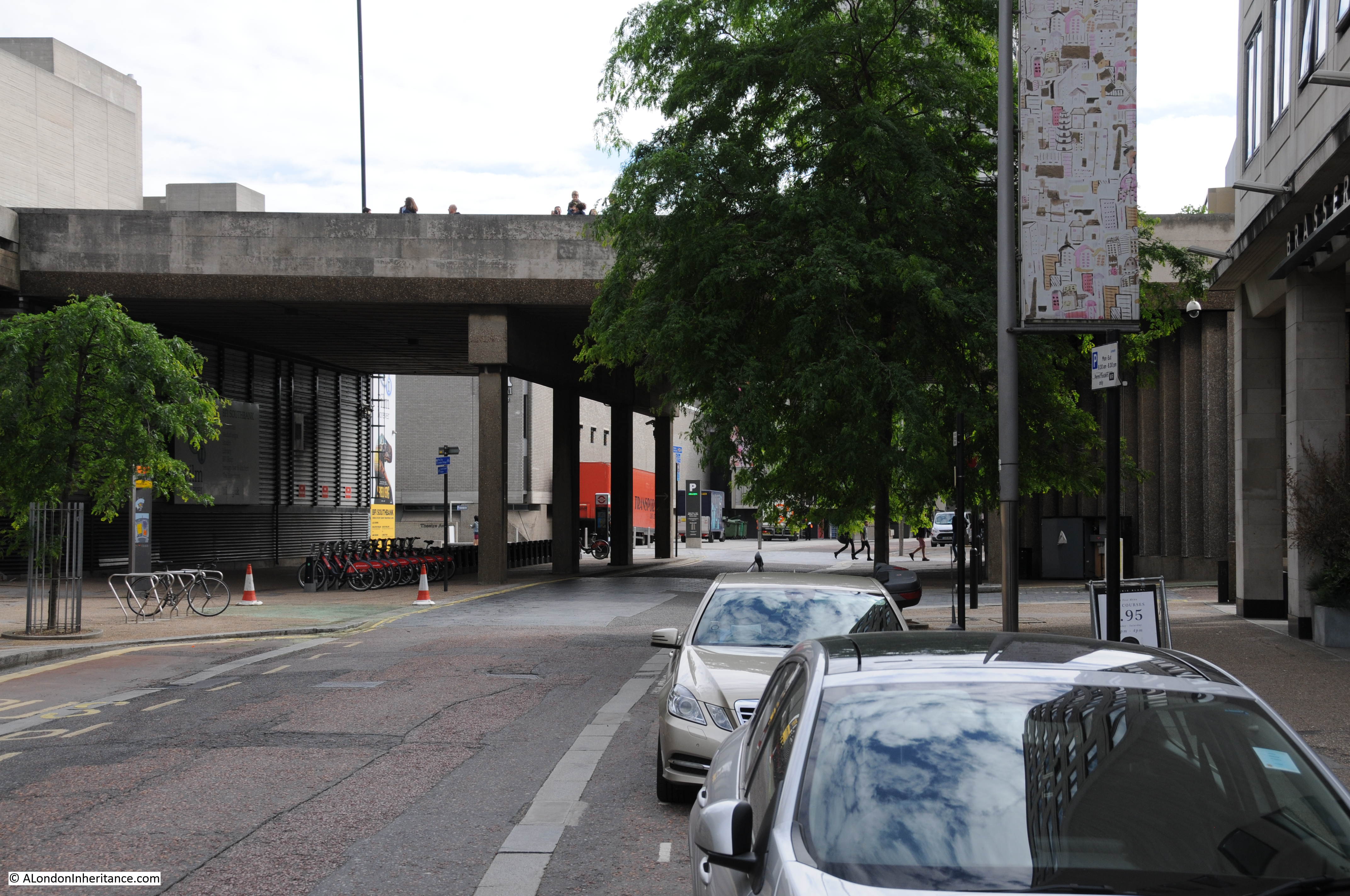
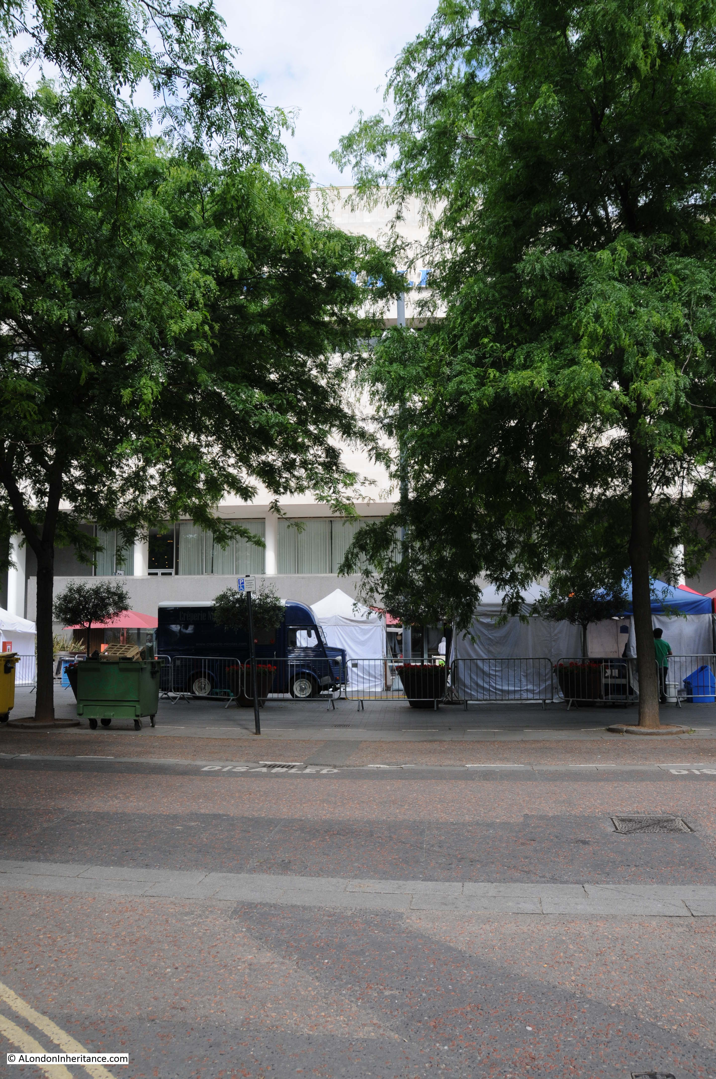
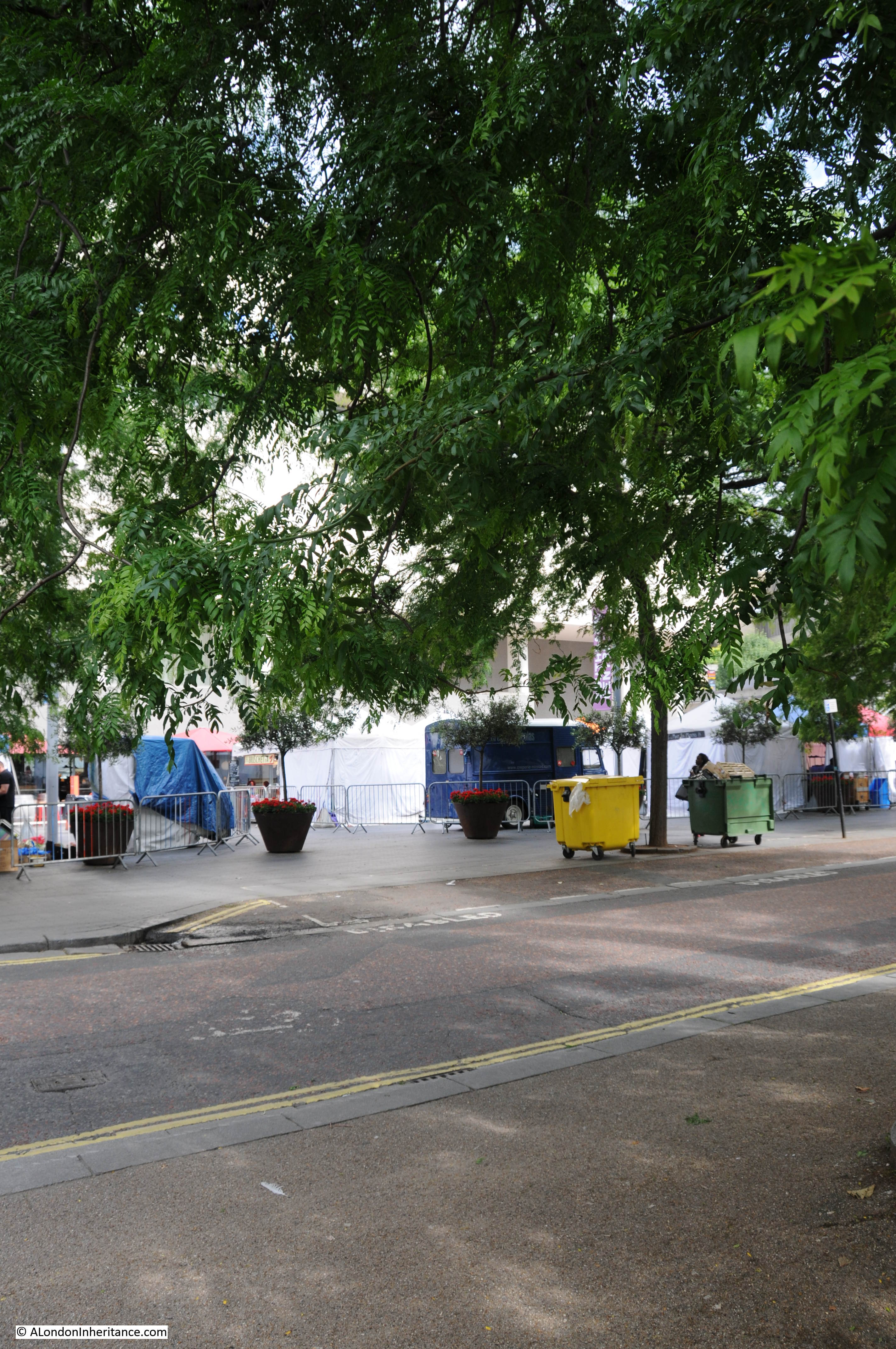
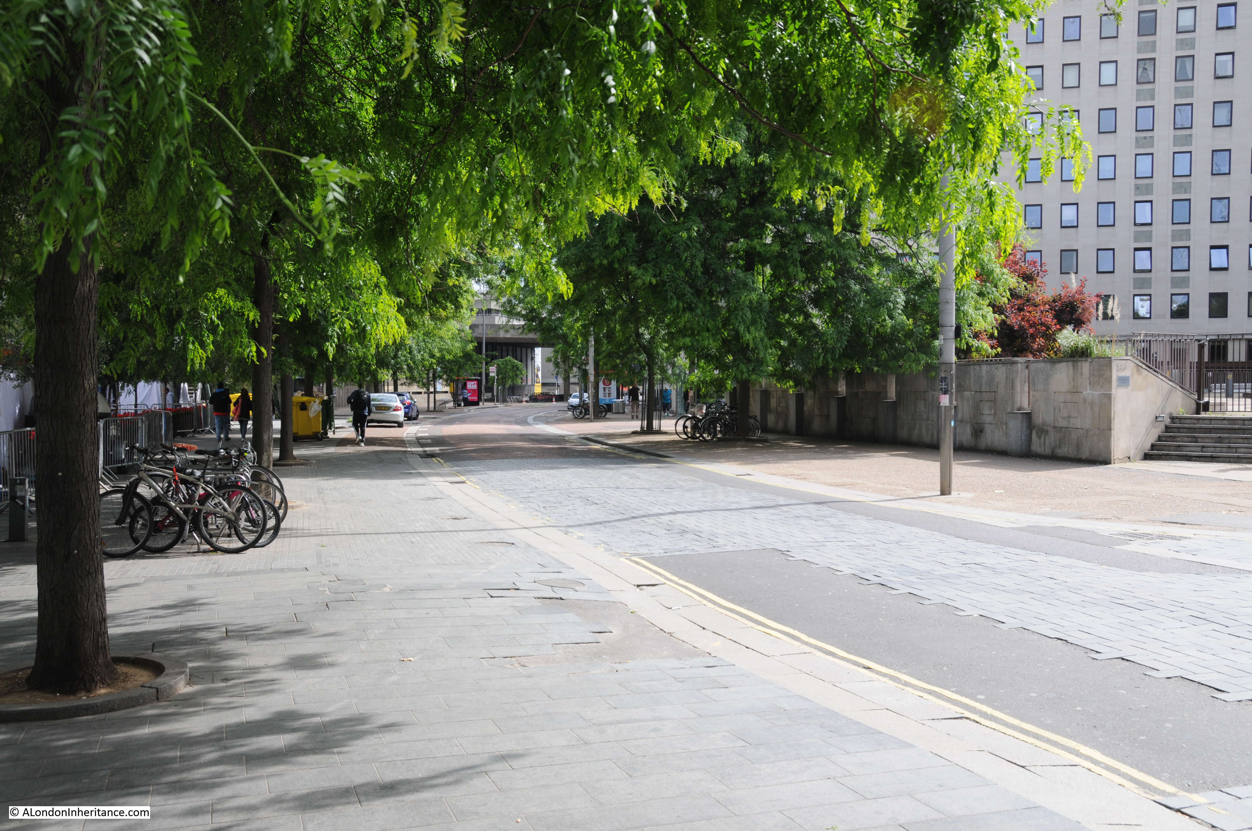
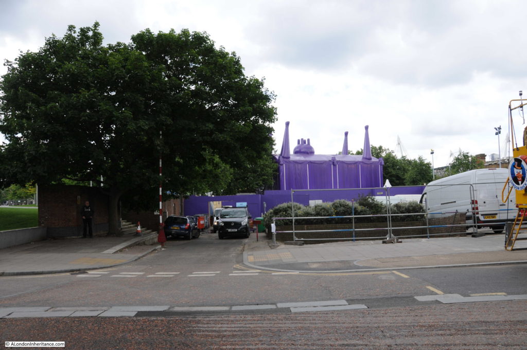
Now walk along to point 6 which is at the end of the original alignment of Sutton Walk which has now been cut short by Concert Hall Approach. The following photo shows where the original Sutton Walk met Belvedere Road. Looking over the wall surrounding the Whitehouse Apartments it is possible to see the remaining length of Sutton walk where it passes under the railway tracks. Sutton Walk originally continued straight on, to end at the point where this photo was taken.

Belvedere Road Walk 15

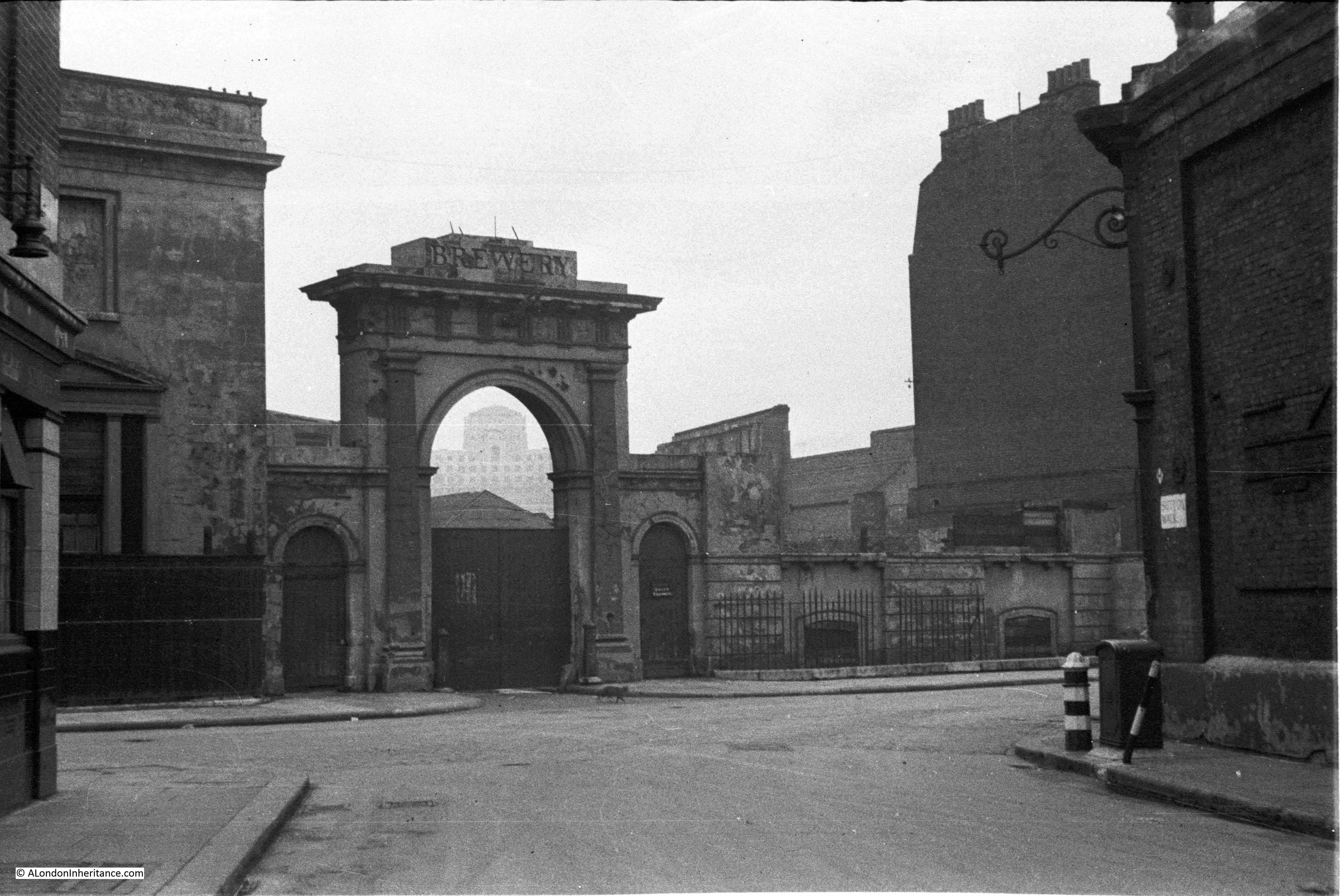
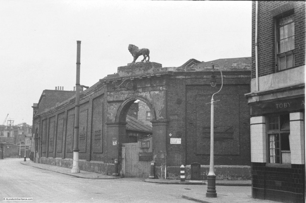
From this point we can walk slightly further along then turn back and look across where Sutton Walk joined Belevdere Road. This is the entrance to the buildings of the Lion Brewery on the south side of Belvedere Road with one of the three lions that were used above brewery entrances and the main brewery building. These buildings were used for stables and also as a warehouse. Look in front of the entrance arch and there are bollards on either side.

History of the Southbank 22

And they are still here in this later photo following demolition of all the buildings. The buildings running along the left are those along the approach to Waterloo Bridge and Howley Place, with the buildings along York Road on the right. All the buildings in the background are still there, with the Royal Hospital for Children and Women being the second building from the left.

History of the Southbank 24

This is the same scene today.

Belvedere Road Walk 8

The following photo was taken from Sutton Walk, looking down towards the entrance to the Lion Brewery from Belvedere Road. There was a lion on top of this arch but this had already been removed.

History of the Southbank 20

Not easy to replicate this photo as this section of Sutton Walk does not exist, but the following photo is looking towards the area where the entrance to the brewery was located.

Belvedere Road Walk 9

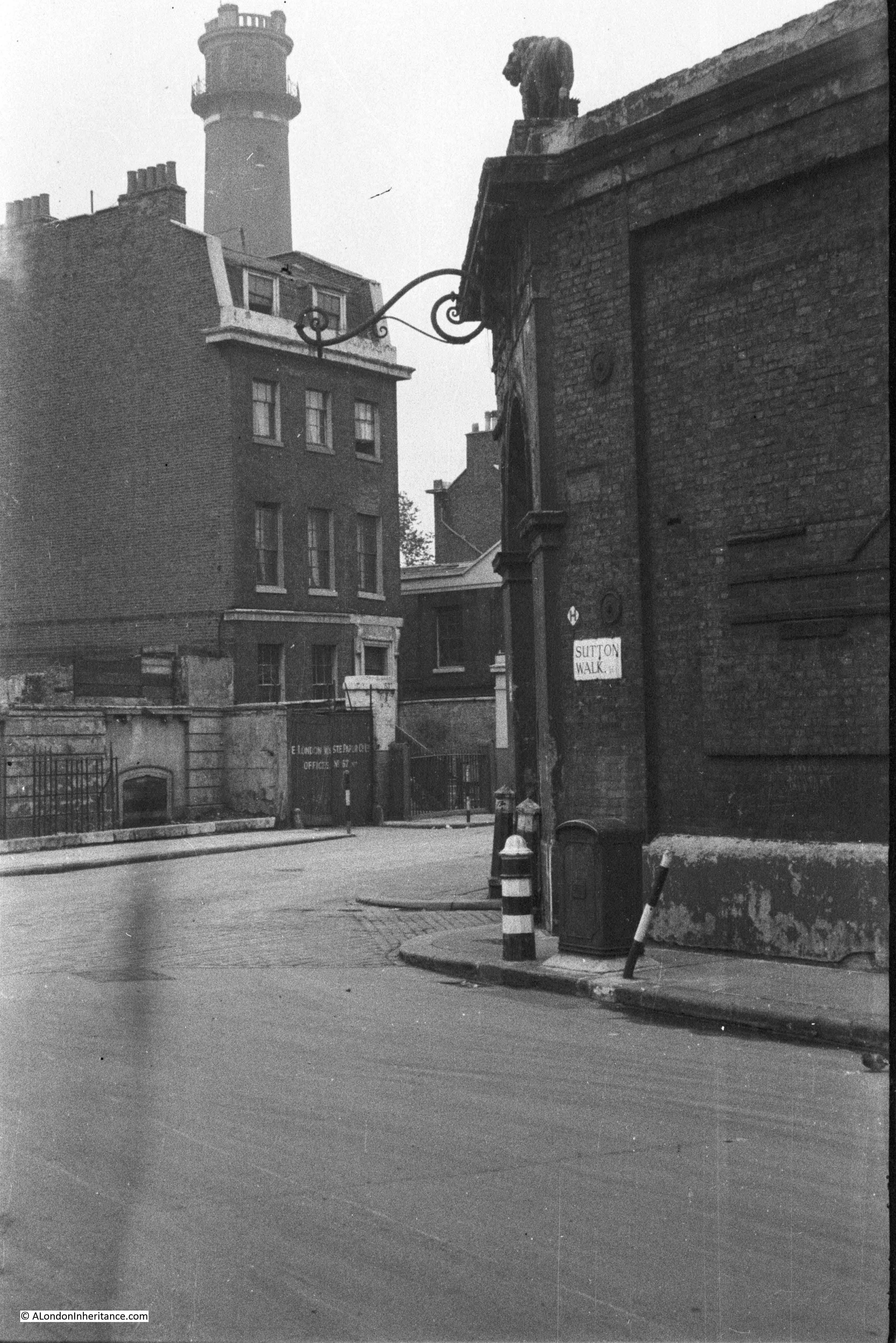
The next photo was also taken from the original Sutton Walk and is looking towards the right with the Shot Tower in the background.

The house in front of the Shot Tower is number 55 Belvedere Road, one of the substantial houses that went up along Belvedere Road in the first decades of the 19th century.

In 1821 a tin plate worker named John Fowler extended his lease on the land and built No. 55 for his own use. The Survey of London describes the building:

“No. 55 was a house of substantial character. Though detached, it was of terrace type without openings in the flank walls. It was in yellow stock brick and its front elevation was three windows wide to each of the ground, first and second floors. The windows had gauged flat arches and all had glazing bars to their double hung sashes. The ground storey was raised above a semi-basement and the entrance, which was reached by a short flight of steps, had an architrave surround with consoles each side designed to support a flat hood. The hood had been removed some time prior to demolition. There was a moulded band at first floor level and a bold parapet cornice above the second floor. Behind the parapet dormer windows were set in a slated mansard roof”.

History of the Southbank 21

John Fowler annoyed his neighbours when in 1839 he converted a factory between the rear of his house and the river into a lead works. Concern about the works was such that Golding, the owner of the Lion Brewery complained to his landlord, however a report from a Professor of Chemistry into the conditions of the lead works stated that their construction and use was such as to prevent waste, injury to the workmen and annoyance to the neighbourhood.

Along with the Lion Brewery, No. 55 was used by the London Waste Paper Company in the 1930s and would be demolished in 1949.

Again, not easy to replicate the original view as this part of Sutton Walk does not now exist, however the following photo is as close as I could get. Not much to see due to the trees, but the Royal Festival Hall is in the background.

Belvedere Road Walk 10

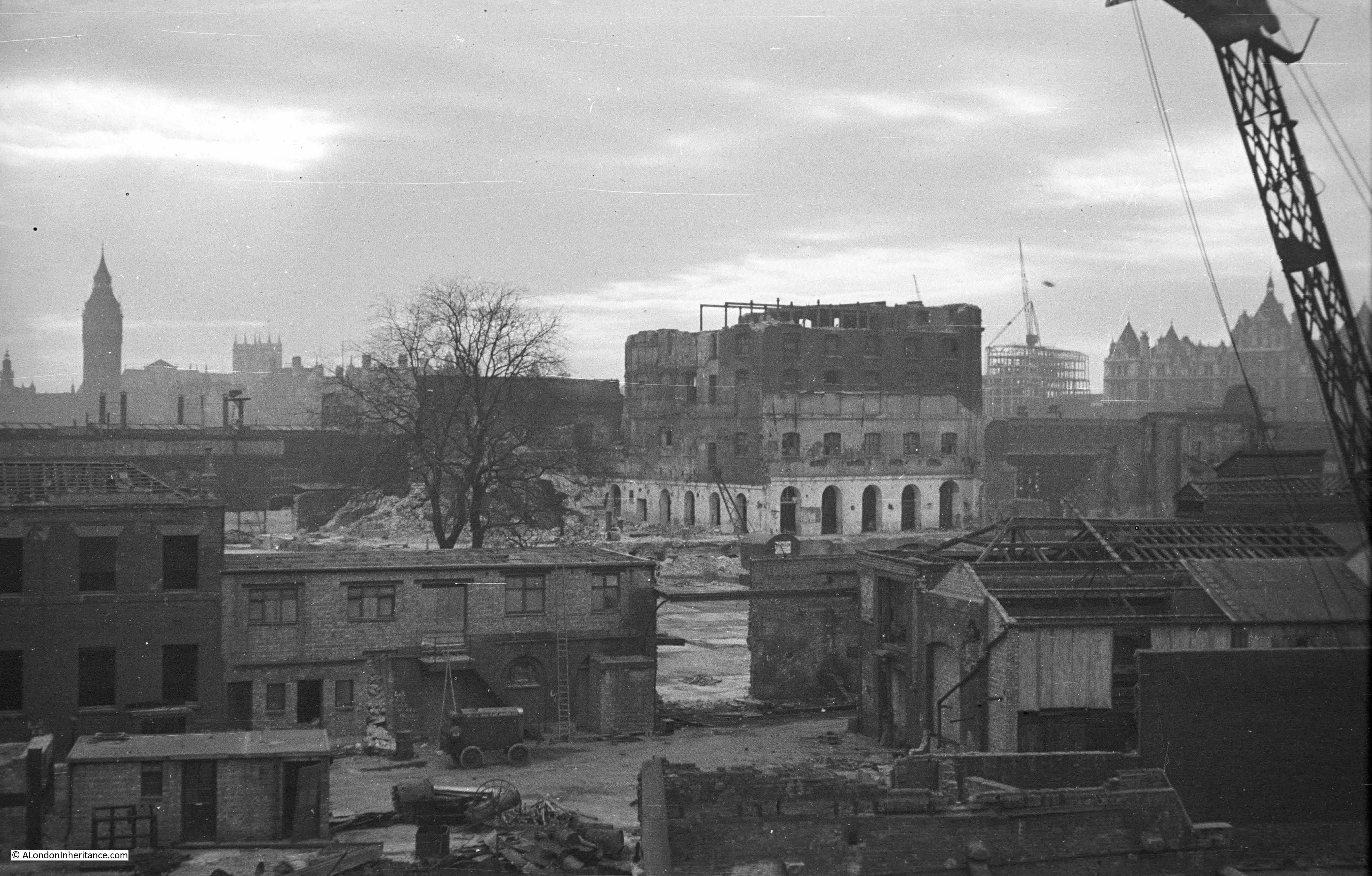
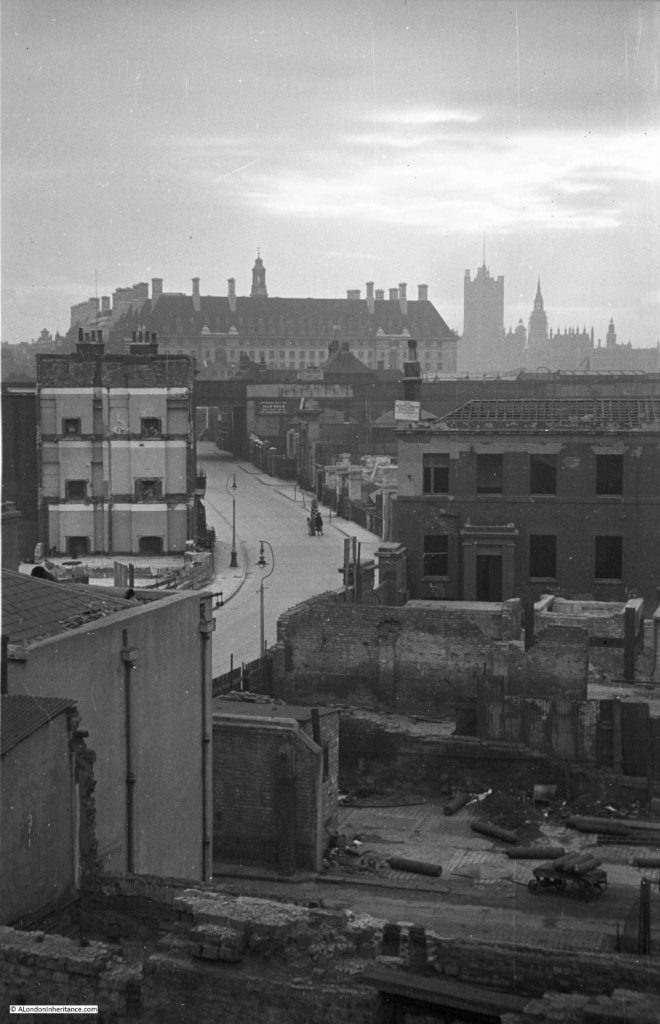
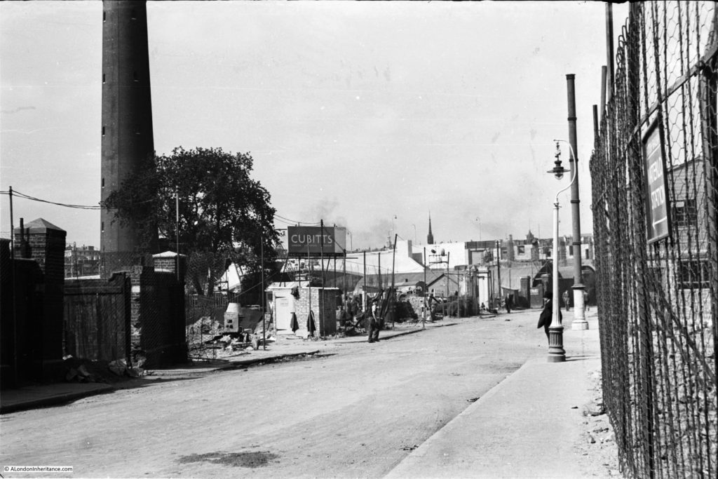
The following photo was taken just before construction of the Royal Festival Hall commenced. It was taken from where Belvedere Road passes under the rail tracks leading up to Hungerford Bridge and is looking back down Belvedere Road towards Waterloo Bridge which can just be seen behind the Cubitts sign at the centre left. Sutton Walk is just behind the lamppost running to the right. The Shot Tower is on the left. Note the “stink pipe” behind the lamppost (not sure if that is the correct name, but that is what we always called them).

History of the Southbank 29

This is the view some weeks later, taken from the opposite side of the road. The “stink pipe” in the centre of the photo is the same as in the above photo. The Cubitts site office is on the former location of the Lion Brewery Stable and Warehouse. On the left is one of the three legs of the derrick supporting the crane that was used to build the Royal Festival Hall.

History of the Southbank 5

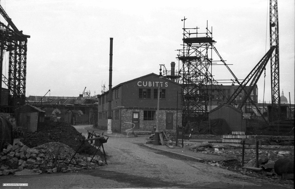
Cubitts were the main building contractors for the Royal Festival Hall, and the use of an onsite site office seems to have been unique for the time as it helped with the rapid construction of the building with drawings been passed from the office to the builders as the drawings were being completed – such was the pace with which the Royal Festival Hall was built.

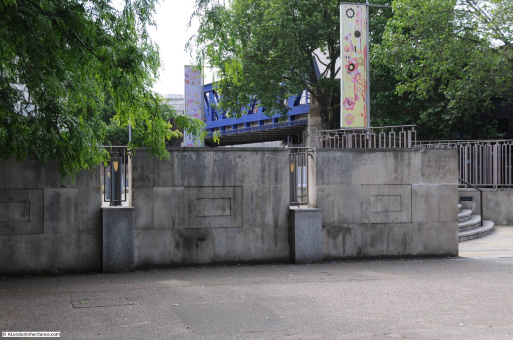
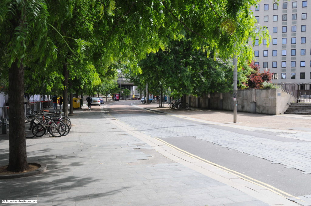
This is the same view today as the above photo taken at point 8 on the map.

Belvedere Road Walk 11

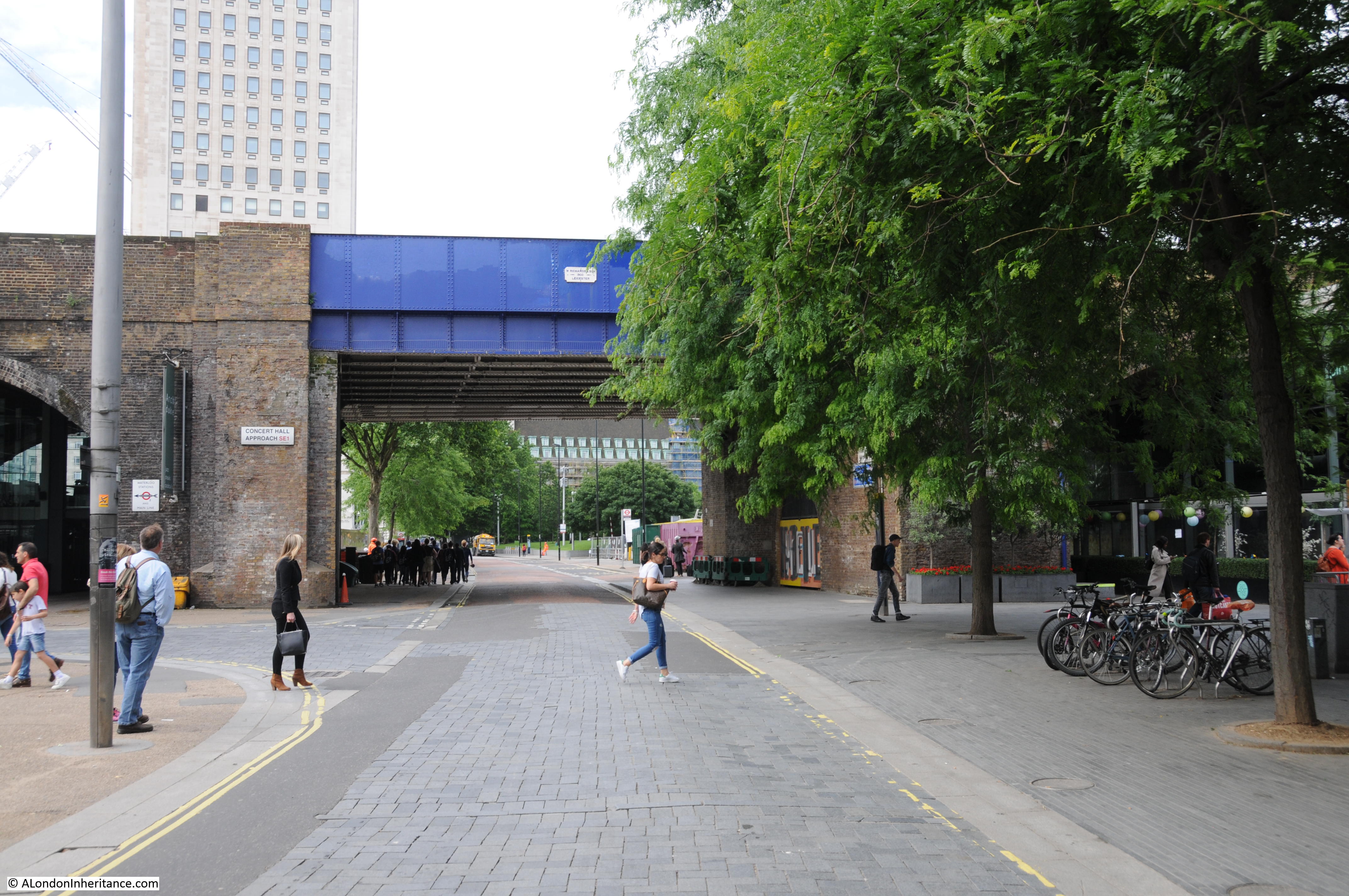
Now it is time to walk through to the other half of the area which is split in two by the rail tracks running up to Hungerford Bridge. This brick-built viaduct is the only remaining construction from the pre-war period and provides a perfect reference point to locate the key places on the 19th century Ordnance Survey maps. The viaduct has retained the original position of Belvedere Road and by retaining the short length of Sutton Walk that runs from York Road to the new Concert Hall Approach, allows the alignment to be confirmed to Belvedere Road and therefore the position of the entrances to the Lion Brewery.

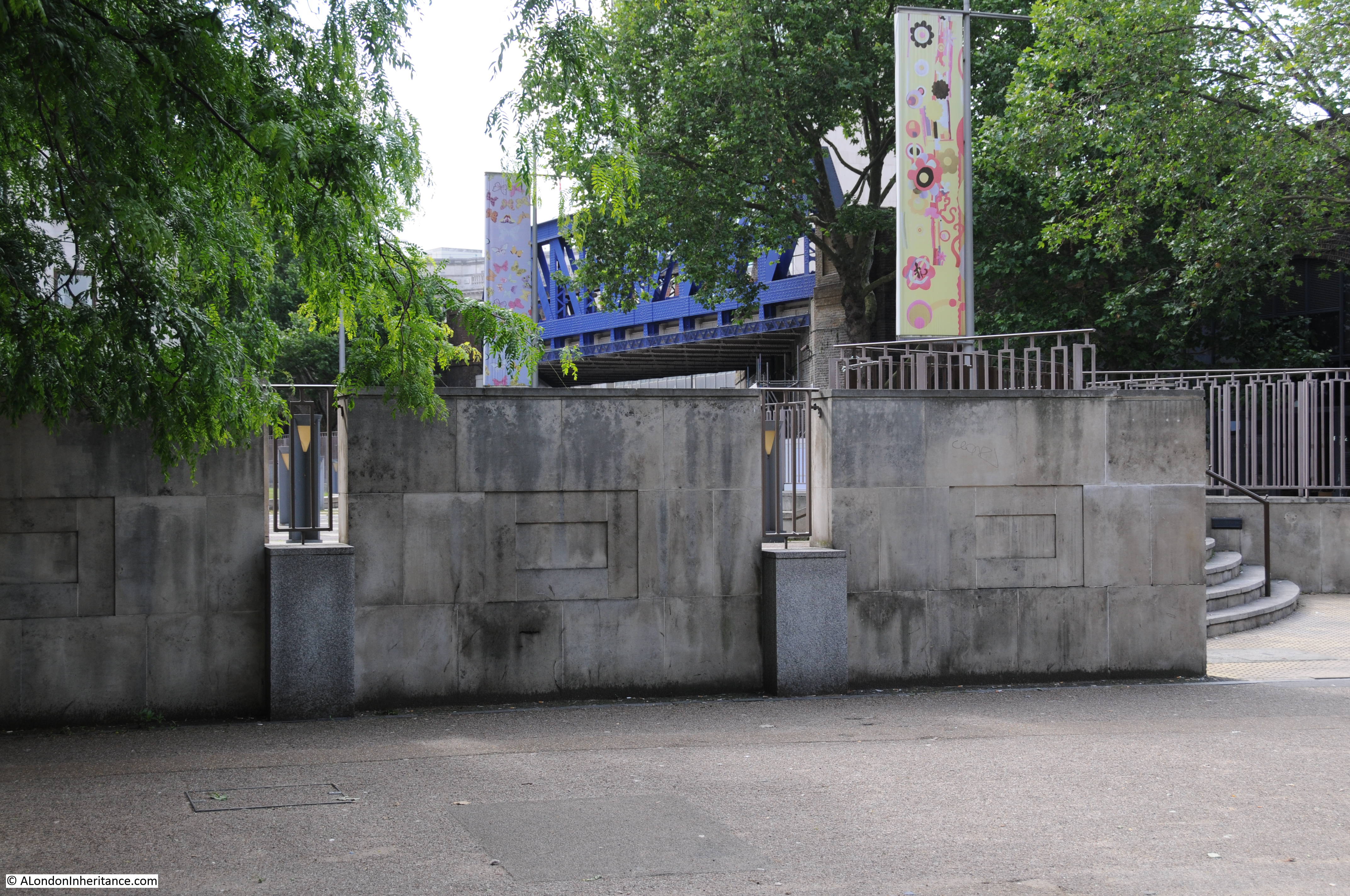
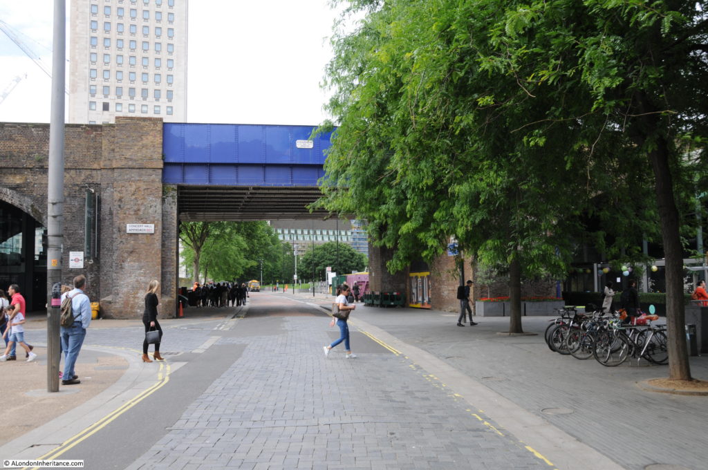
This is where Belvedere Road passes underneath the rail tracks. The white plaque on the blue bridge reads “W. Richards & Son – 1900 – Leicester”.

1900 is not old by London standards, but it is the oldest construction in this part of London.

Belvedere Road Walk 14

The following map shows the area we are now in, having passed under the rail tracks at the top and continuing along Belvedere Road.

Belevedere Walk Map 2

A short distance along Belvedere Road, we can look towards the river and this is the approximate position of College Street leading down to Kings Arms Stairs. There is an entrance to the car park here – would be interesting to believe that this is a remaining part of College Street.

Belvedere Road Walk 16

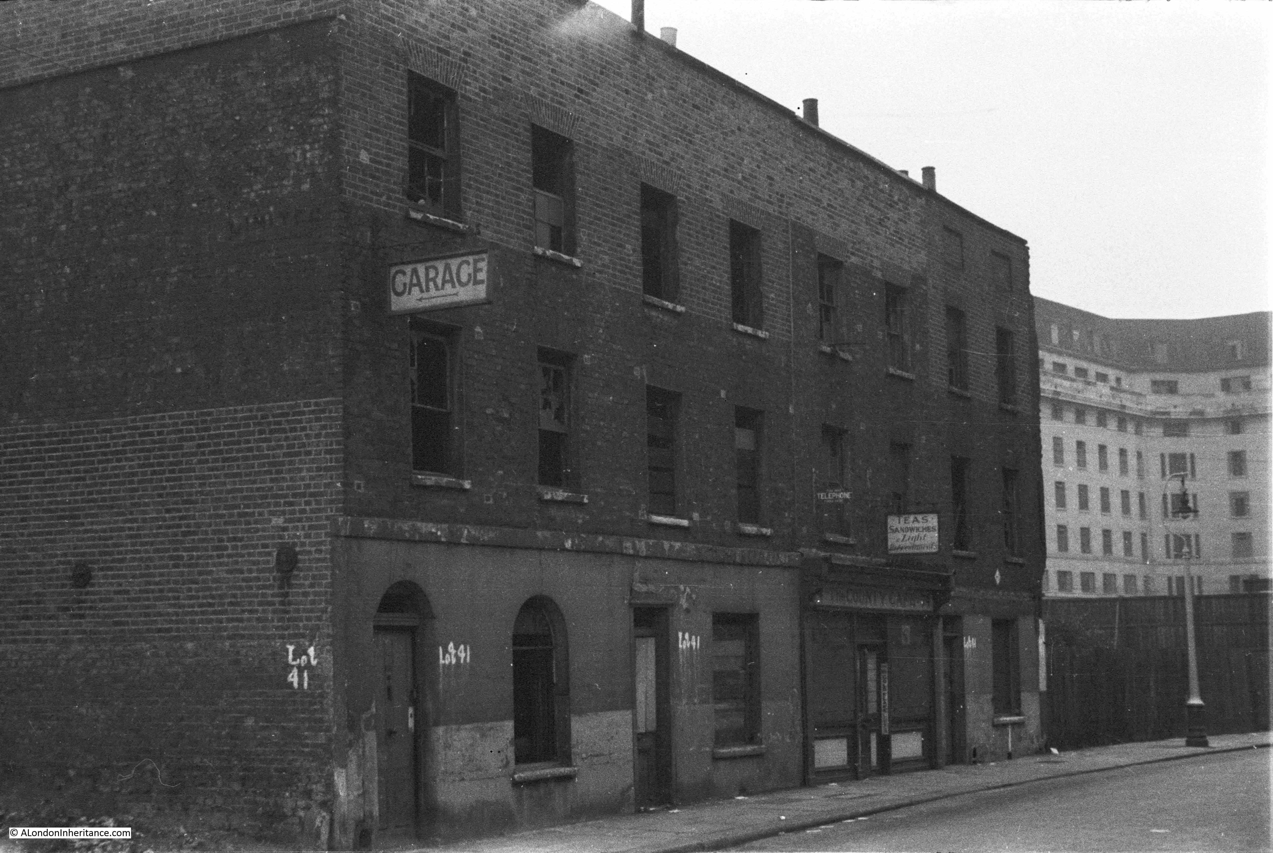
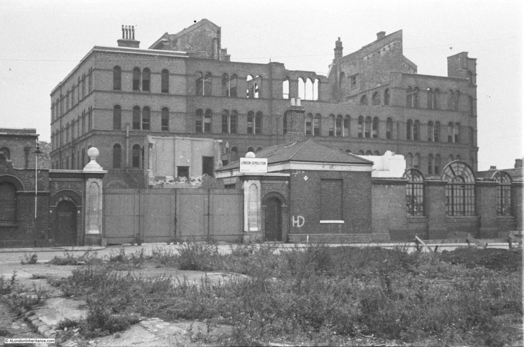
The next photo shows the India Stores Depot as it was prior to demolition. The photo was taken from point 9 in the above map, a short distance in Belvedere Crescent, the kerb of which can be seen in the lower left corner. The road running left to right in front of the gates is Belvedere Road. The India Stores Depot suffered badly from bombing during the war with the majority being left as a shell of a building.

History of the Southbank 16

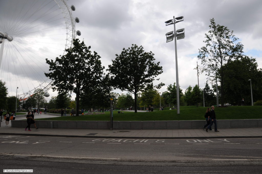
I could not get to the same position as the original Belvedere Crescent is under the Shell Centre complex. The following photo was taken from in front of Shell Centre looking across Belvedere Road to where the India Stores Depot were located, on the current Jubilee Gardens.

Belvedere Road Walk 12

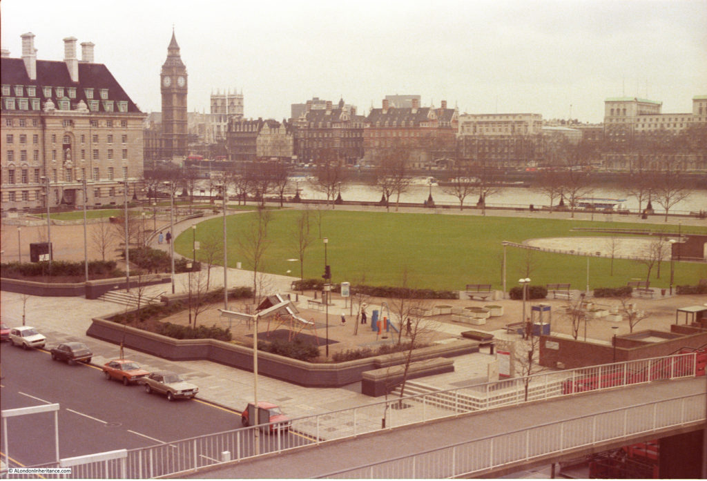
The Jubilee Gardens have been through a number of changes. I took the following photo in the mid 1980s of a much quieter Jubilee Gardens than today. The central area was later used as a construction site for the Jubilee Line extension with a large access shaft in the middle of the grassed area. The grass would be packed during summer lunchtimes with office workers from the Great London Council and Shell Centre.

Belvedere Road Walk 18

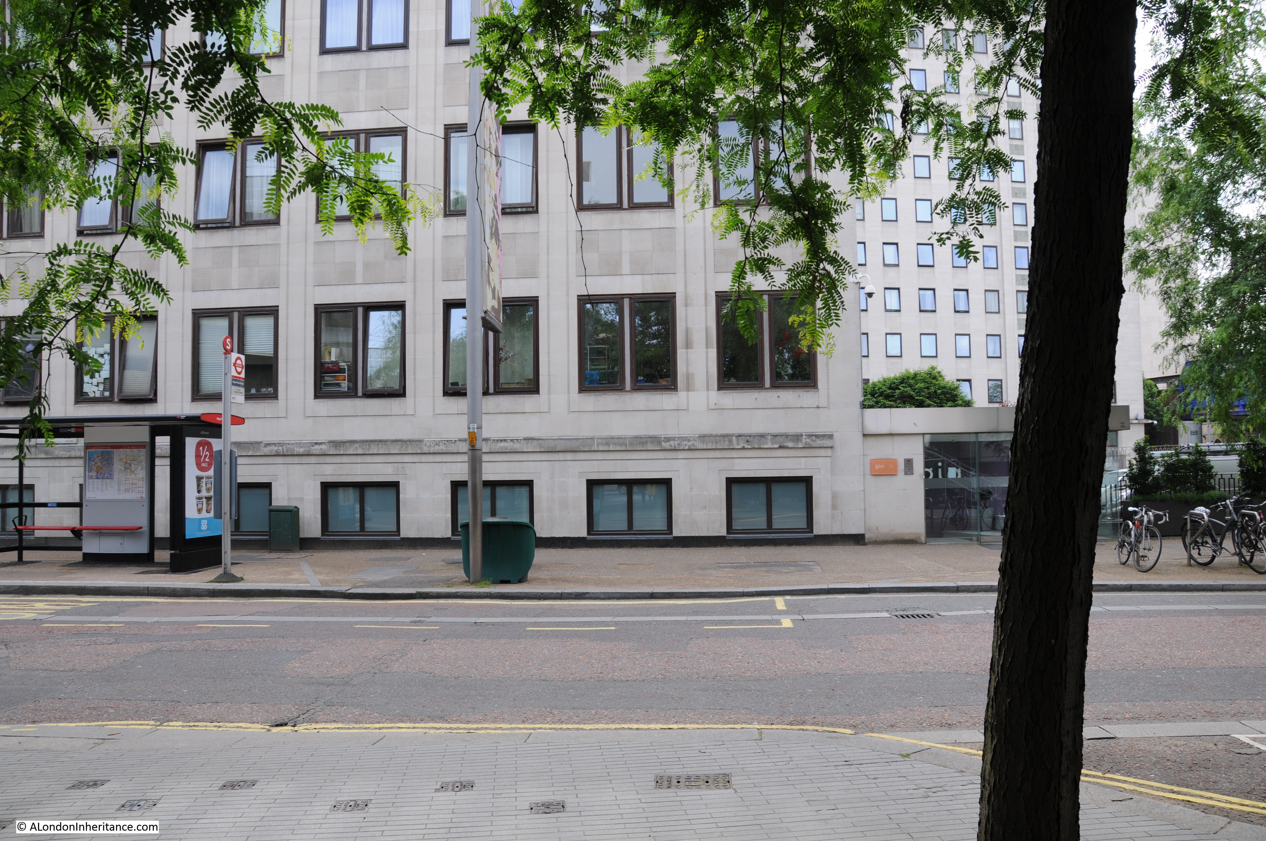
The buildings in the following photo were along Belvedere Road, roughly at point A, which today is the location of the Shell Centre tower building.

History of the Southbank 17

Another view with the buildings in the above photo now on the right of the photo below. The cafe in the photos above and below was called “The County Cafe” – I assume a reference to County Hall, just a bit further along Belvedere Road. It is small buildings such as these where the signs of the business still remain that bring home that this was once a busy area full of industry, cafes, shops and residents. The bridge carrying the rail tracks over Belvedere Road can be seen at the far end of the road and the entrance to the India Stores Deport is on the left.

History of the Southbank 15

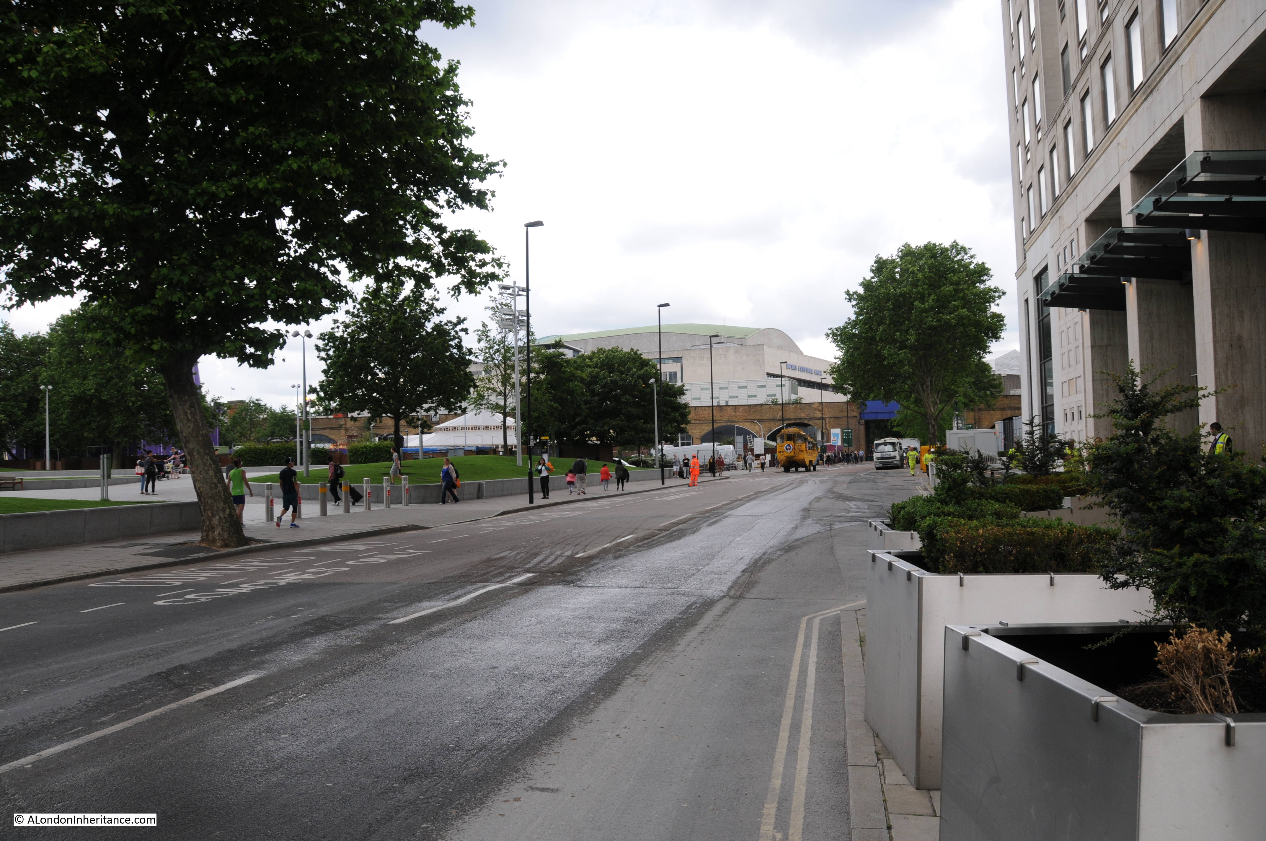
This is same scene today with the main tower building of the Shell Centre complex on the immediate right, occupying the space where the County Cafe once stood. The blue bridge at the end of Belvedere Road is in the same position as the photo above.

Belvedere Road Walk 13

Many of the streets in this area were named after Archbishops of Canterbury. Sutton Walk was named after Charles Manners-Sutton (Archbishop between 1805 and 1828).

Tenison Street was named after Thomas Tenison (Archbishop from 1694 to 1715) and Chicheley Street. was named after Henry Chichele (Archbishop from 1414 to 1443).

The naming of streets after Archbishops extended beyond the area between York Road and Belvedere Road. The street in front of Waterloo Station, Mepham Street was named after Simon Mepeham, Archbishop of Canterbury from 1329 to 1333).

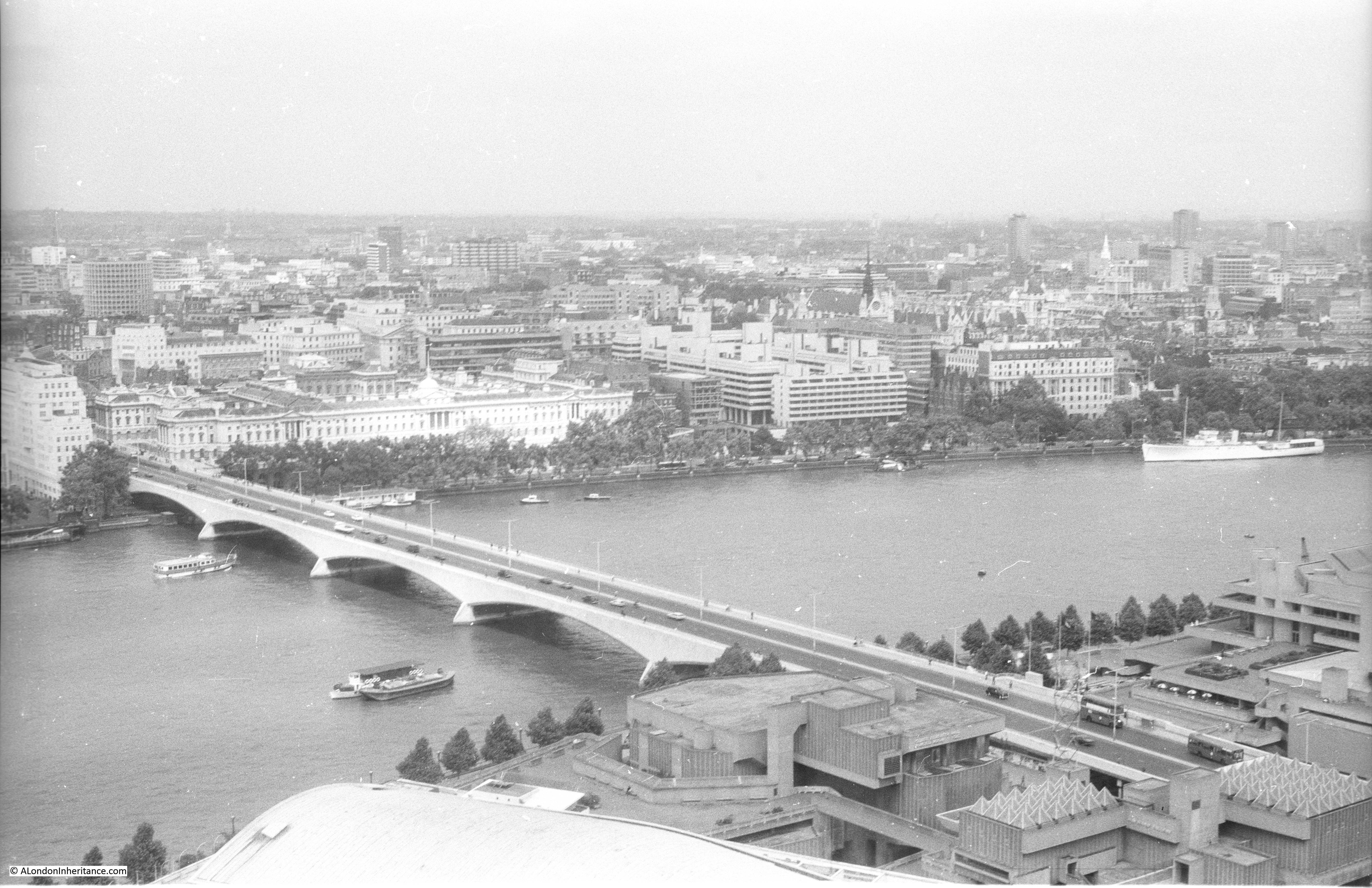
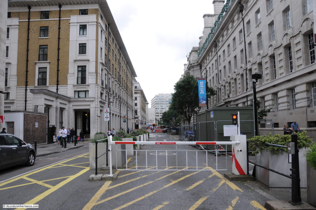
From outside Shell Centre, we can turn towards County Hall and walk to the junction of Belvedere Road and Chicheley Street. Instead of turning up Chicheley Street we can still walk up towards Westminster Bridge through the County Hall complex. Today this is marked on maps as Belvedere Road, but on the 1895 Ordnance Survey maps, Belvedere Road ended at the Chicheley Street junction and this stretch of road up to Westminster Bridge was still called Narrow Wall, the last remaining use of this original name and reference to the earthen bank that separated the Thames from the rest of Lambeth marshes.

The following photo shows the Belvedere Road / Narrow Wall passing through the County Hall buildings, I will continue on from the end of this road in my next post.

Belvedere Road Walk 17

We have now walked the length of Belvedere Road and traced the pre-1951 streets and buildings where much of the original street plan still remained.

Although Belvedere Road has been straightened and widened over the years, we have walked the route of the original earthen wall.

In my next post we will walk along the north bank of the river before returning alongside Hungerford Bridge to look at the building of the Royal Festival Hall.

alondoninheritance.com

A Walk Round The Shell Centre Viewing Gallery

Shell Centre is an office complex on the Southbank, located between Hungerford Bridge and the old London County Council building. The most obvious part of the complex is the 26 storey tower.

Designed by Sir Howard Robertson and built between 1957 and 1962 for the Royal Dutch Shell group of oil companies, the office complex set new standards for staff facilities and building automation. Originally two main blocks, one either side of Hungerford Bridge, the “downstream” building to the east of Hungerford Bridge was sold during the 1990’s and converted to apartments.

Although large buildings above ground, there is a significant part of the complex below ground with a large swimming pool, theatre and bar being among the facilities for the original 5,000 staff to enjoy. Two underground tunnels connected the upstream and downstream buildings, running underneath the rail arches leading to Hungerford Bridge and being just above the underground train tunnels running north from Waterloo.

The building also had a tunnel out to the Thames so that river water could be used for cooling.

The “upstream” building to the west of Hungerford Bridge has a “U” shape set of 10 storey offices with the 26 storey, 351 foot tower block being the most obvious feature of the complex.

Shell has temporarily moved out of the complex and there is a proposed redevelopment of the site that will significantly change this part of the Southbank, more on this at the end of this post.

Long before the Shard and the Sky Garden at 20 Fenchurch Street, one of the innovations for the time was that the tower had a public viewing gallery. This was when there were very few tall buildings across London and certainly nothing built or planned in this part of the city. The viewing gallery provided almost continuous all round views of London.

The viewing gallery closed not that long after opening. I was told this was because that sadly there had been a suicide (although I have no verification of this). I was able to visit the viewing gallery in 1980 and took the following photos which show a very different London skyline to that of today. It always surprises me that it was not that long ago that there were very few tall buildings across London.

We will start with the view across to the Houses of Parliament and walk round the viewing gallery.

This was long before the construction of the London Eye which would now be the main feature of this view:

Shell Centre Viewing Gallery 3

Moving further to the right we can look straight across the river. The large building to the right are the offices of the Ministry of Defence. Buckingham Palace is to the left of centre:

Shell Centre Viewing Gallery 15

And further to the right, this is the original Charing Cross Station at the end of Hungerford Railway Bridge. In the years after this photo was taken, in common with many other main London stations, office buildings were constructed on top of the station. This was also before the Golden Jubilee foot bridges were added to either side of Hungerford Railway Bridge. At the time the photo was taken there was a single, relatively narrow foot bridge on the east side of the bridge.

Shell Centre Viewing Gallery 4

Looking directly onto Charing Cross Station with the Post Office Tower in the background and Centre Point to the right:

Shell Centre Viewing Gallery 2

Further to the right, the building left of centre is Shell-Mex House. This was occupied by the UK operating company of Shell. To the right is Waterloo Bridge.

Shell Centre Viewing Gallery 14

And further to the right with the full width of Waterloo Bridge:

Shell Centre Viewing Gallery 13

We are now starting to look over towards the City of London, St. Paul’s Cathedral can be seen to the upper right of centre and the three towers of the Barbican to the left.

The L shaped building in the lower foreground is the downstream building of the Shell Centre complex, and just above this building is the tower that was for London Weekend Television. The base of this tower still consists of TV studios, one of the few buildings that have had the same function over the last 35 years.

To the right of this is Kings Reach Tower, occupied at the time by IPC Magazines, publishers of magazines ranging from Loaded to Country Life. IPC Magazines vacated this tower block some years ago and it is now in the process of being converted into, yes you have probably guessed, more apartments. The height of the building is being raised with additional floors being constructed in top.

Shell Centre Viewing Gallery 7

And slightly further to the right, the tower in the distance was at the time the tallest office block in the City of London, the recently completed NatWest Tower, built for the NatWest Bank, now renamed as Tower 42.

Shell Centre Viewing Gallery 1

This photo is looking down onto the roundabout at the southern end of Waterloo Bridge. The large space in the centre of the roundabout is now occupied by an IMAX Cinema. The church to the right is St. John’s, Waterloo. The church was built between 1822 and 1824 and due to the marshy land had to be built on piles.  I was told at the time that one of the reasons for so much space below ground level at Shell Centre was also due to the marshy ground and the need to keep the overall weight on the site equal. Excavating below ground level to remove sufficient weight of earth equal to the weight of building on top. No idea if this is true, but it does seem plausible.

Shell Centre Viewing Gallery 5

This photo is looking straight across to the City and Southwark. There is nothing of any height in the far distance. The buildings of Canary Wharf would now be very visible in the distance.

Shell Centre Viewing Gallery 9

Continuing to move to the right, this is looking over south-east London with the roof of Waterloo Station occupying the bottom right corner of the photo.

Shell Centre Viewing Gallery 8

And round to the right again looking over south London with the extensive network of tracks leading into Waterloo Station. The lower section of tracks at the bottom part of the photo would soon be converted to the London terminus of Eurostar prior to the completion of the HS1 rail route which transferred Eurostar trains into St. Pancras.

Shell Centre Viewing Gallery 11

Detail from the above photo showing British Rail rolling stock prior to privatisation of the rail network:

Shell Centre Viewing Gallery 18And a final view over to south west London. This was as far as the viewing gallery would allow, the gallery did not run along the western side of the tower:

Shell Centre Viewing Gallery 12

I cannot remember why I was using Black and White film when I took these photos from the viewing gallery. Shortly after taking the above, I took the following photo in colour showing Shell Centre from the north bank of the Thames. The north facing part of the viewing gallery can be clearly seen at the very top.

Shell Centre Viewing Gallery 17

The building is one of the few immediate post war developments that works well. If the proposed redevelopment of the site gets approval, it will be very different. The plans propose the demolition of the “U” shaped 10 storey office block at the base of the tower, and a whole new cluster of towers built around the original tower.

To see the proposed development, look here.

It was quite a surprise to see how much this area will change, and in my view, the close proximity of towers of very different materials and design to the original tower just does not look right.

It was fascinating to look back on these photos of the London skyline from 1980. It looks very different now, and the almost continuous development of tower blocks look set to continue transforming the skyline for many years to come, although unlike the original Shell Centre complex, with almost identical glass and steel towers that are removing so much of the local character of London.

alondoninheritance.com