Tag Archives: South Bank

The South Bank Shot Tower and Riverside Buildings

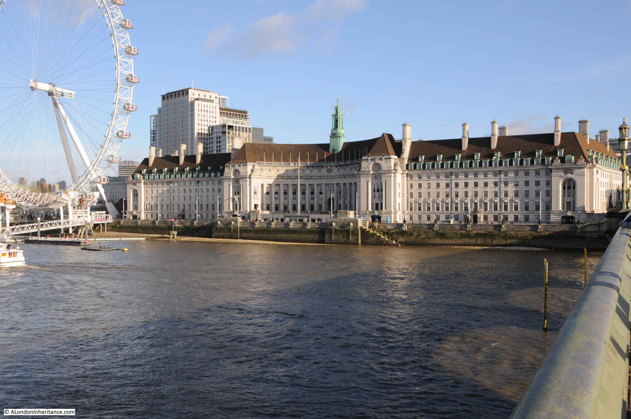
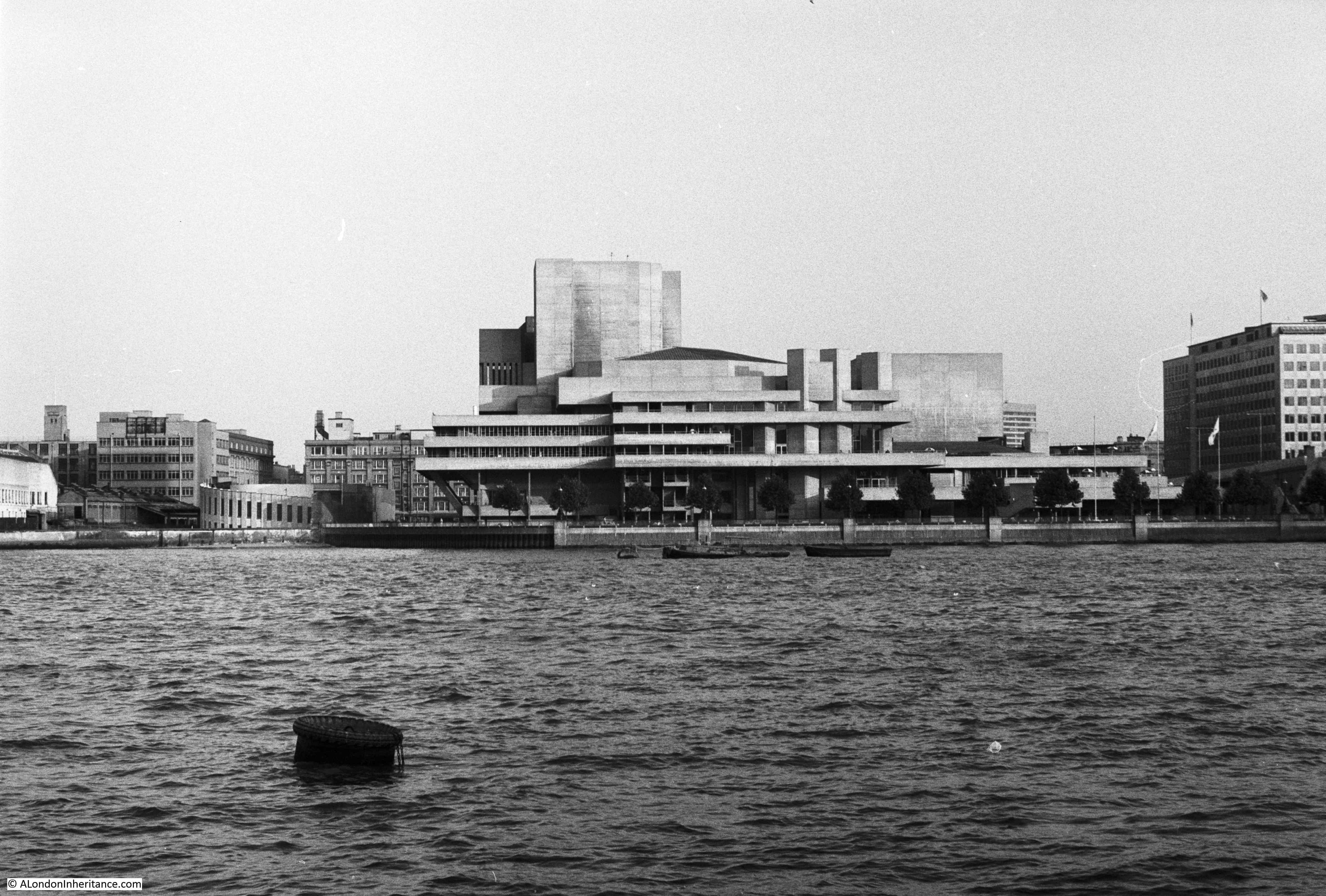
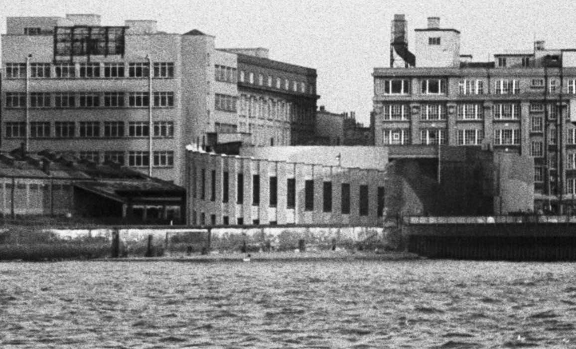
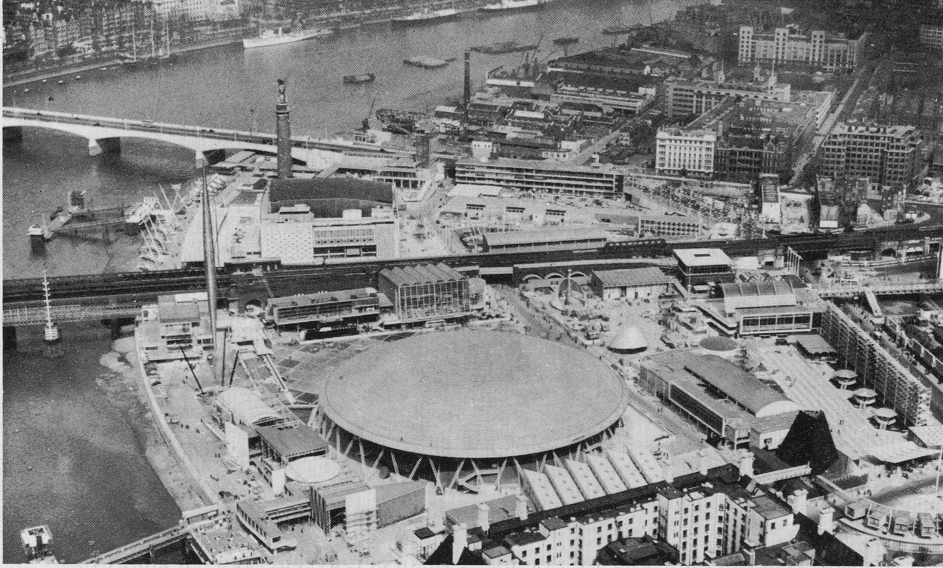
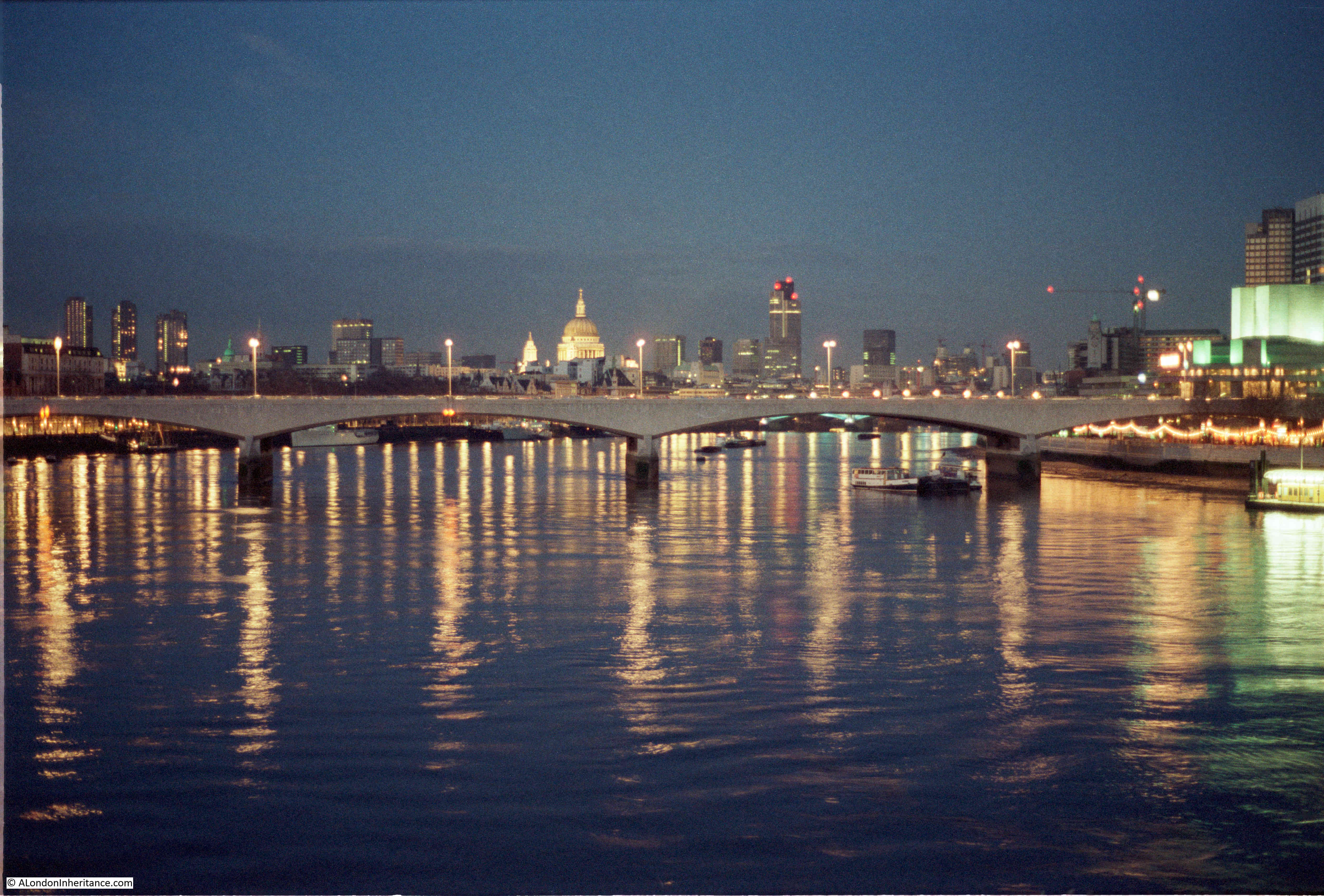
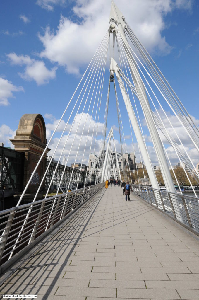
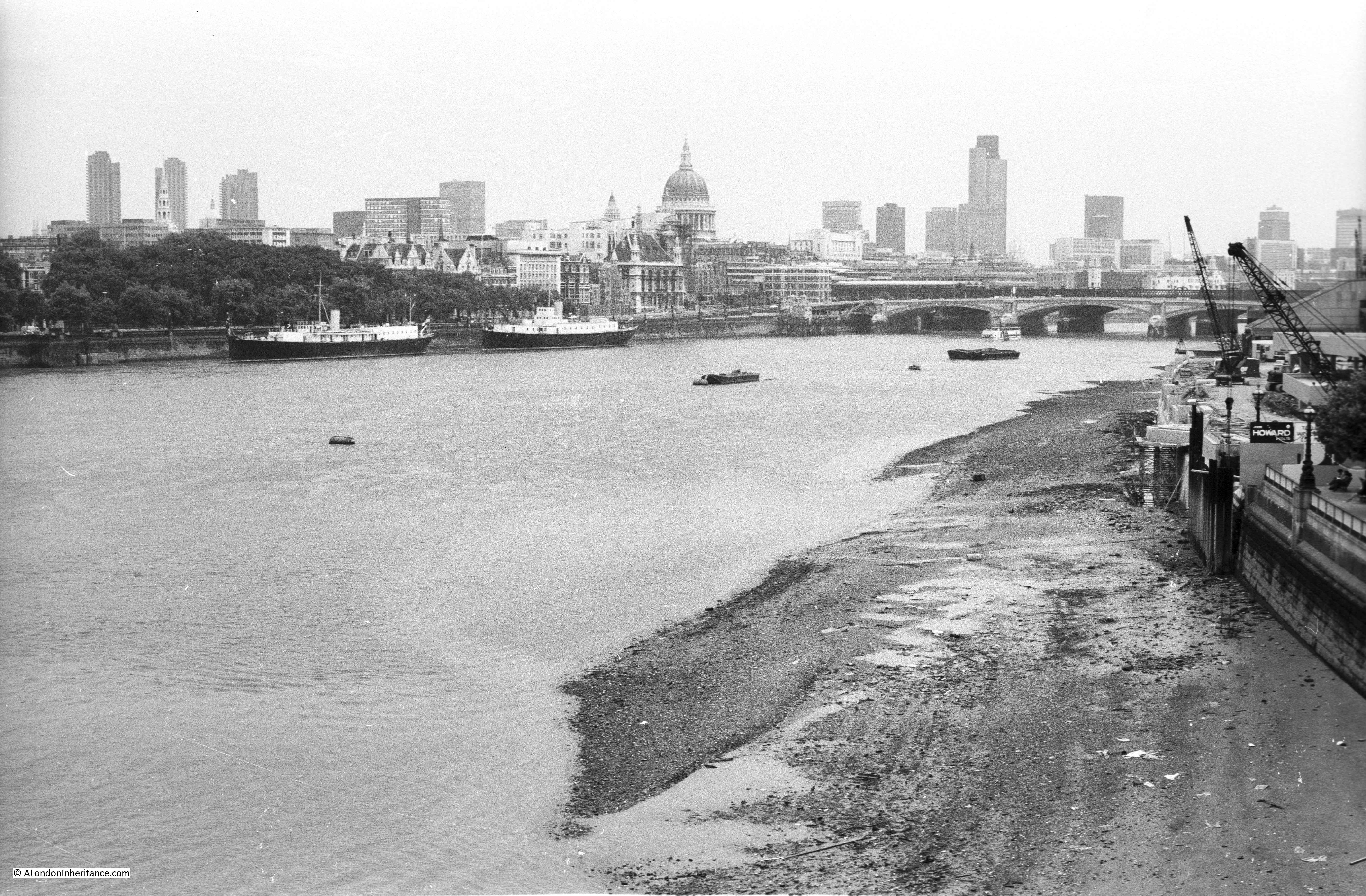
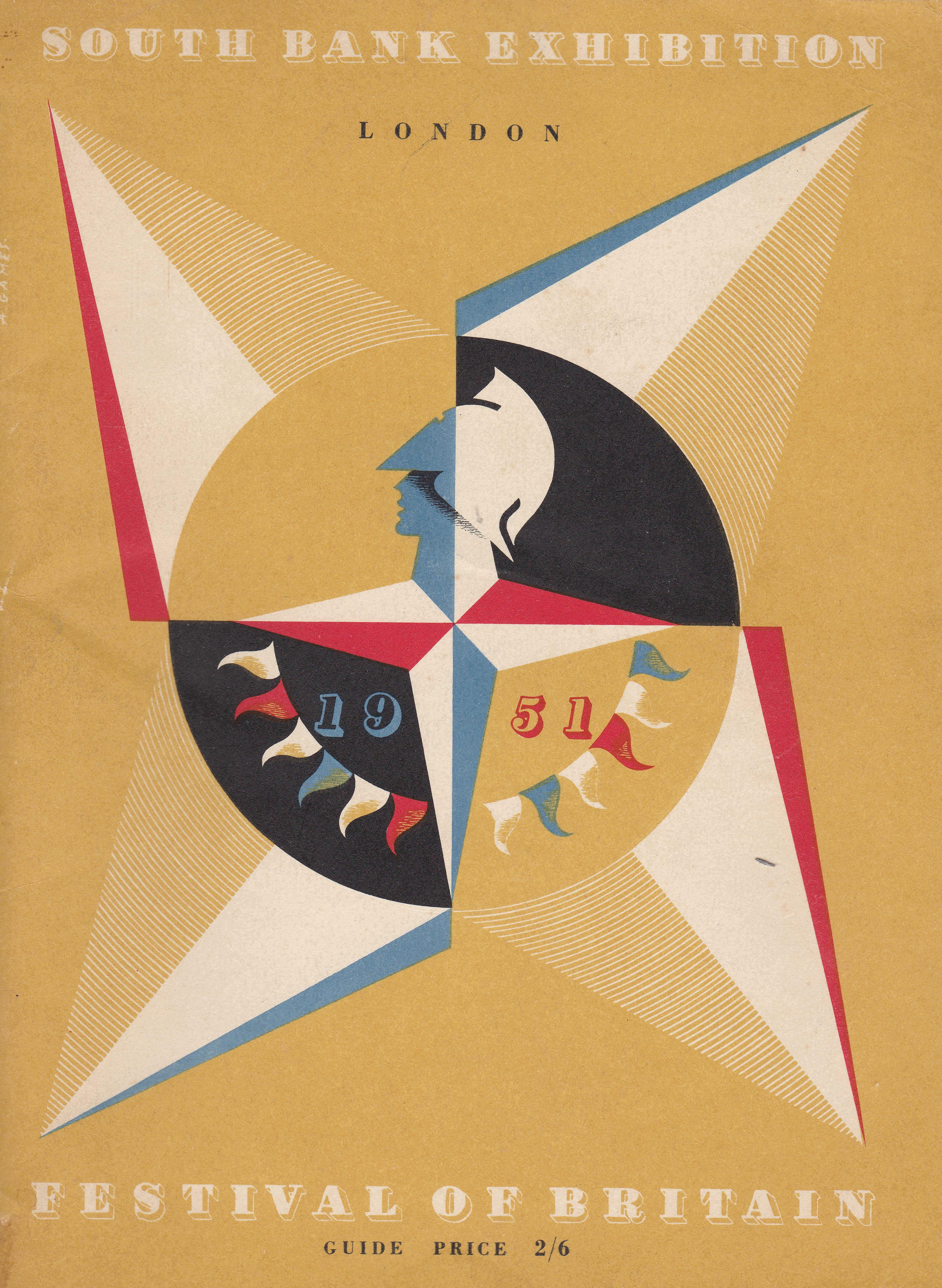
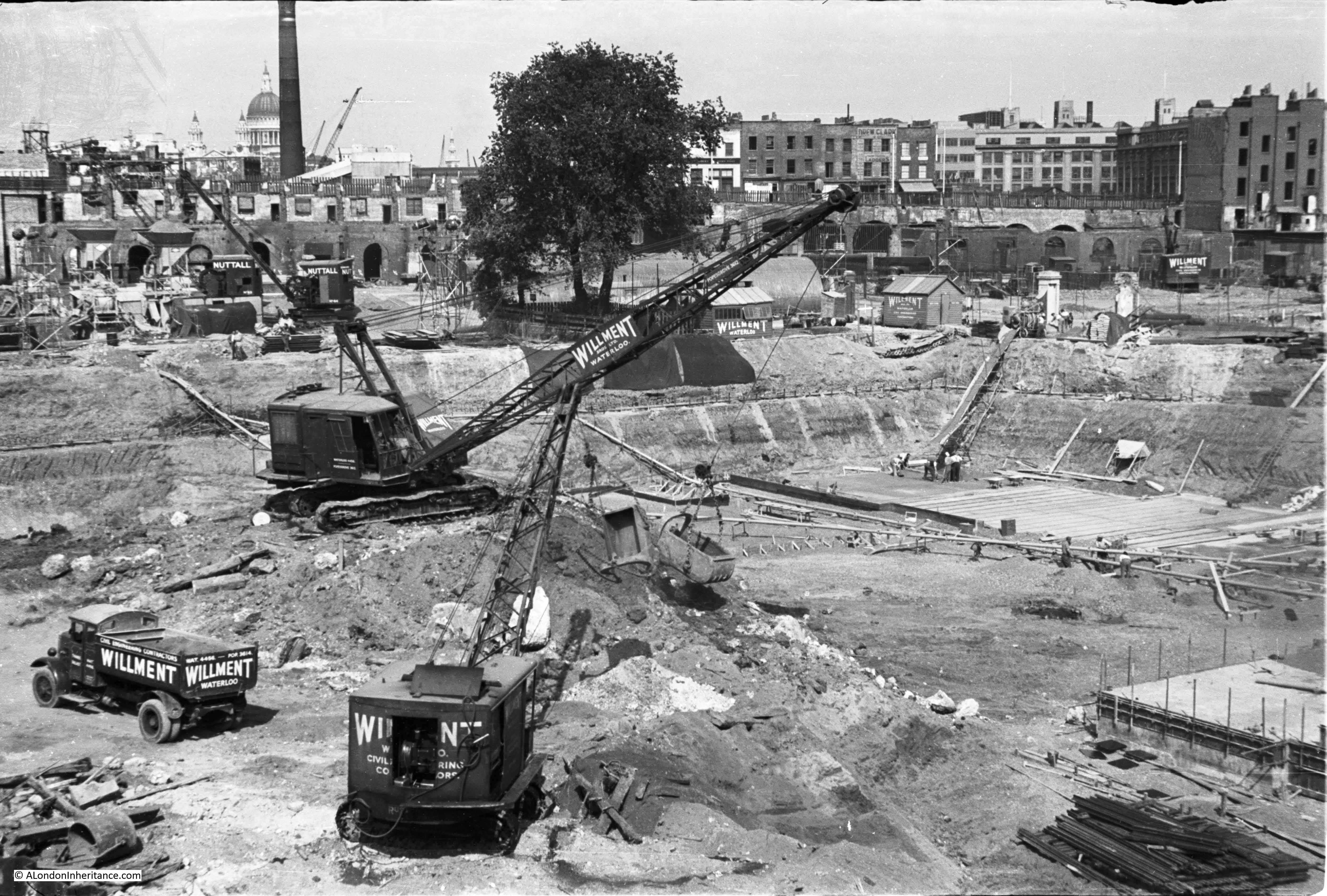
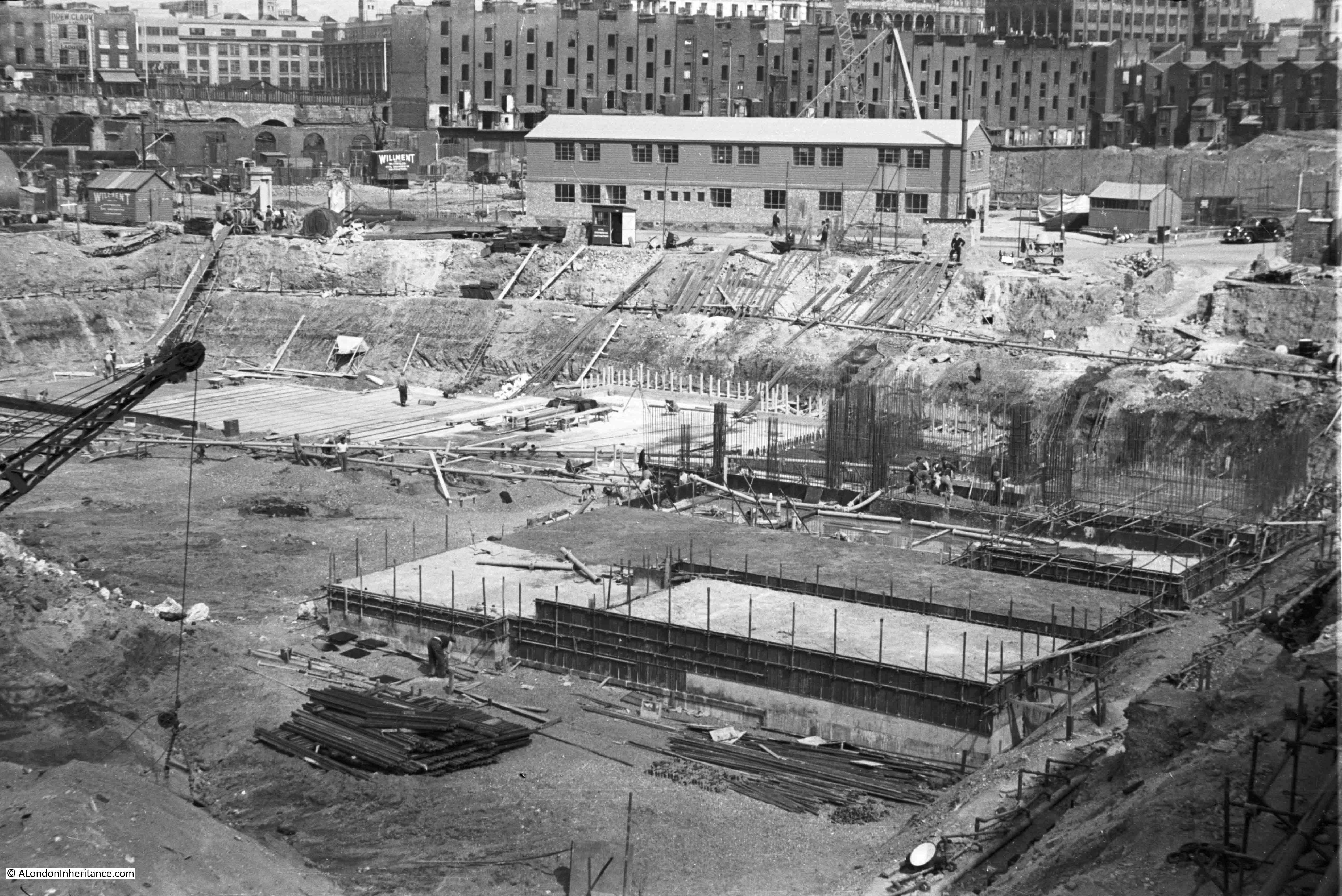
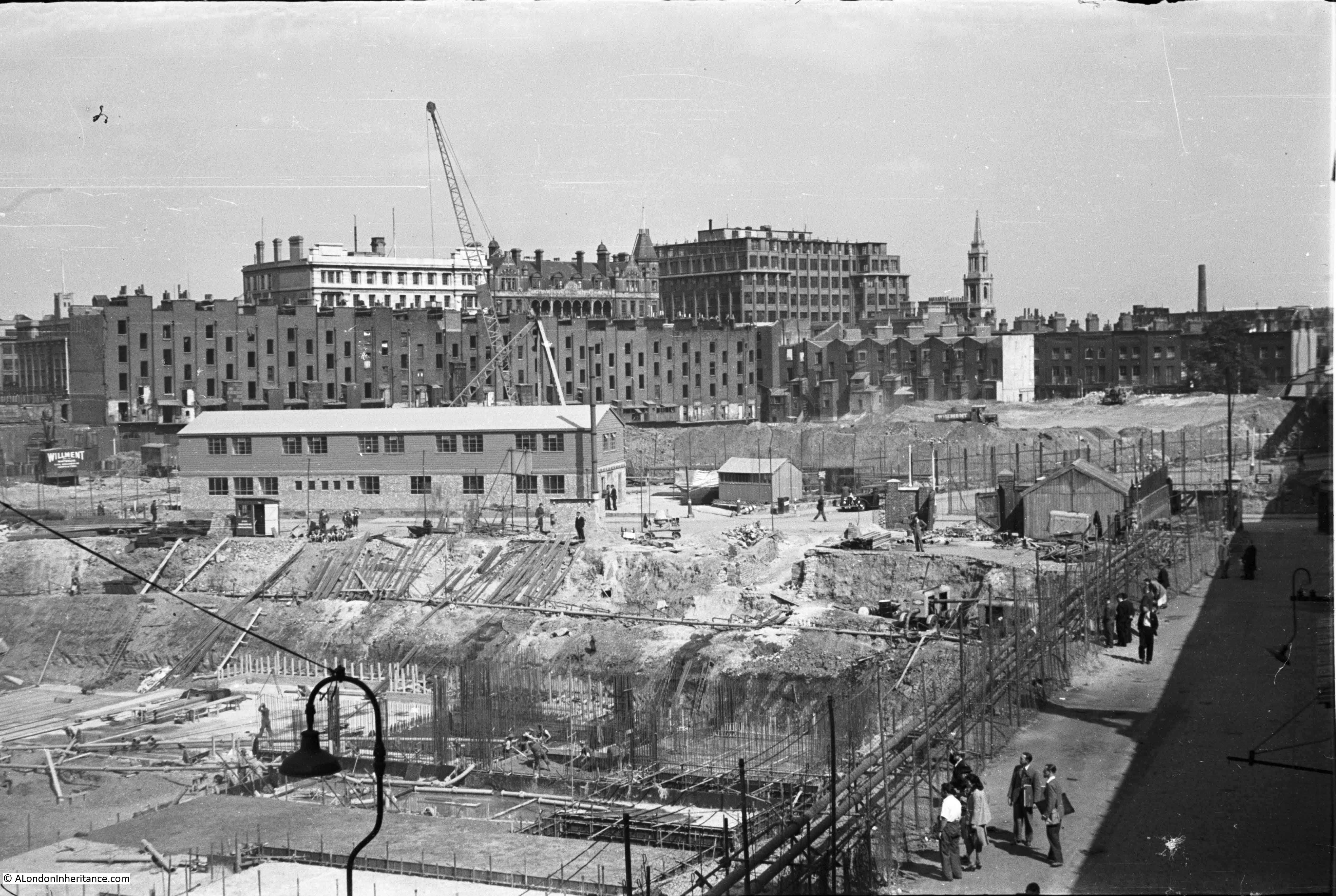
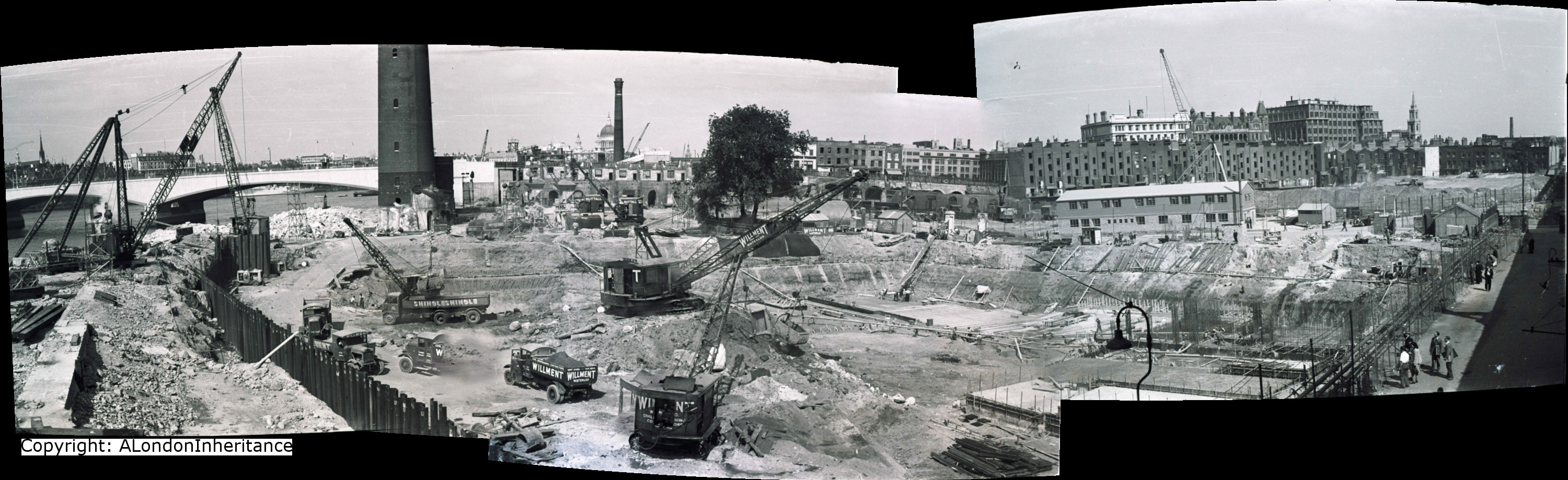
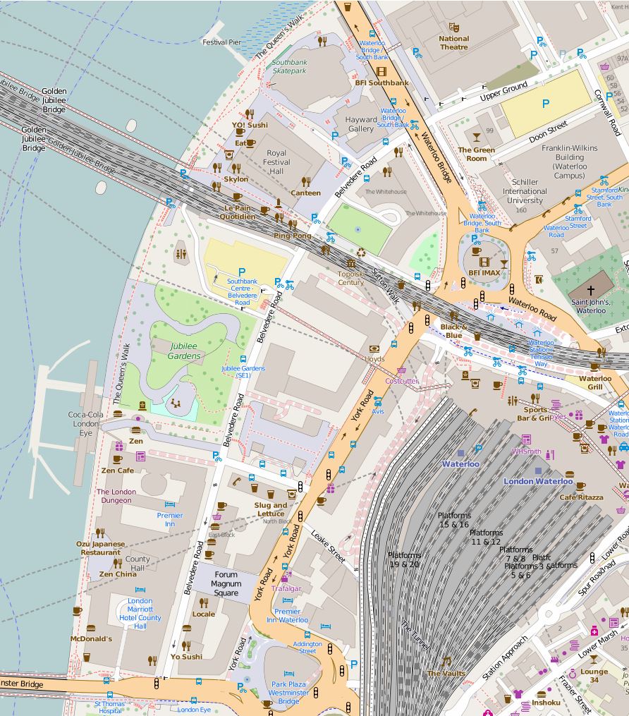
I have written a number of posts about the South Bank, and the transformation of the area from industrial and terrace housing, via the Festival of Britain, to the place we see today with the Jubilee Gardens and Royal Festival Hall. The majority of my father’s photos of the area were taken in the streets of the South Bank, however there is one that was taken from across the river featuring the Shot Tower, and part of the Thames foreshore between Waterloo Bridge and the site of the Festival Hall.

1947 view of the Shot Tower and South Bank

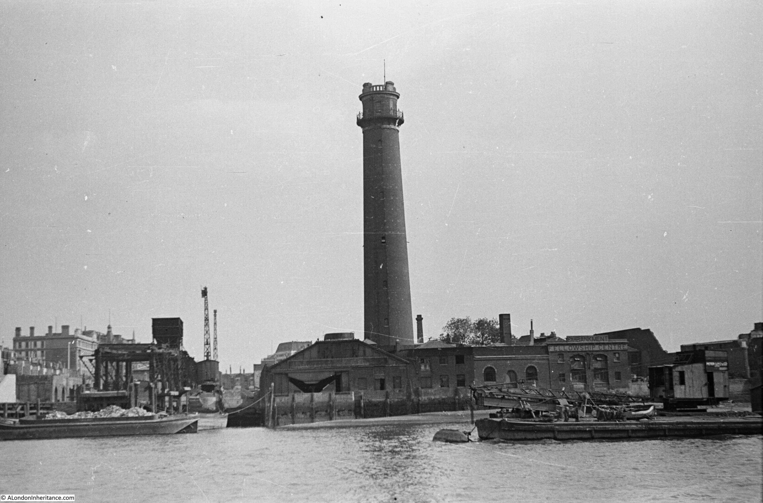
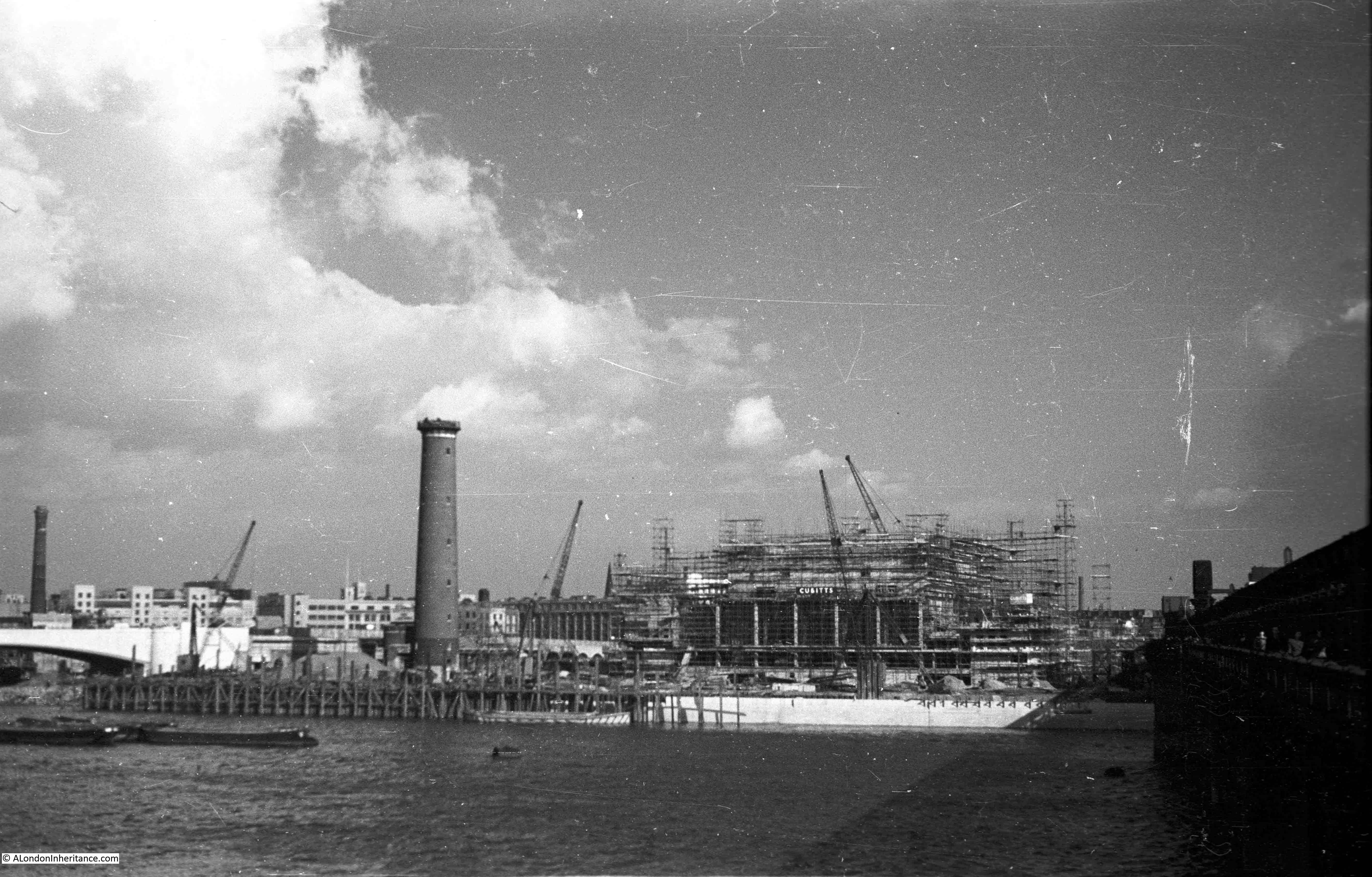
The above photo was taken on Saturday 23rd August 1947, and shows the Shot Tower, and the buildings along the river. The approach to Waterloo Bridge can just be seen on the left of the photo, and on the right would today be part of the Royal Festival Hall.

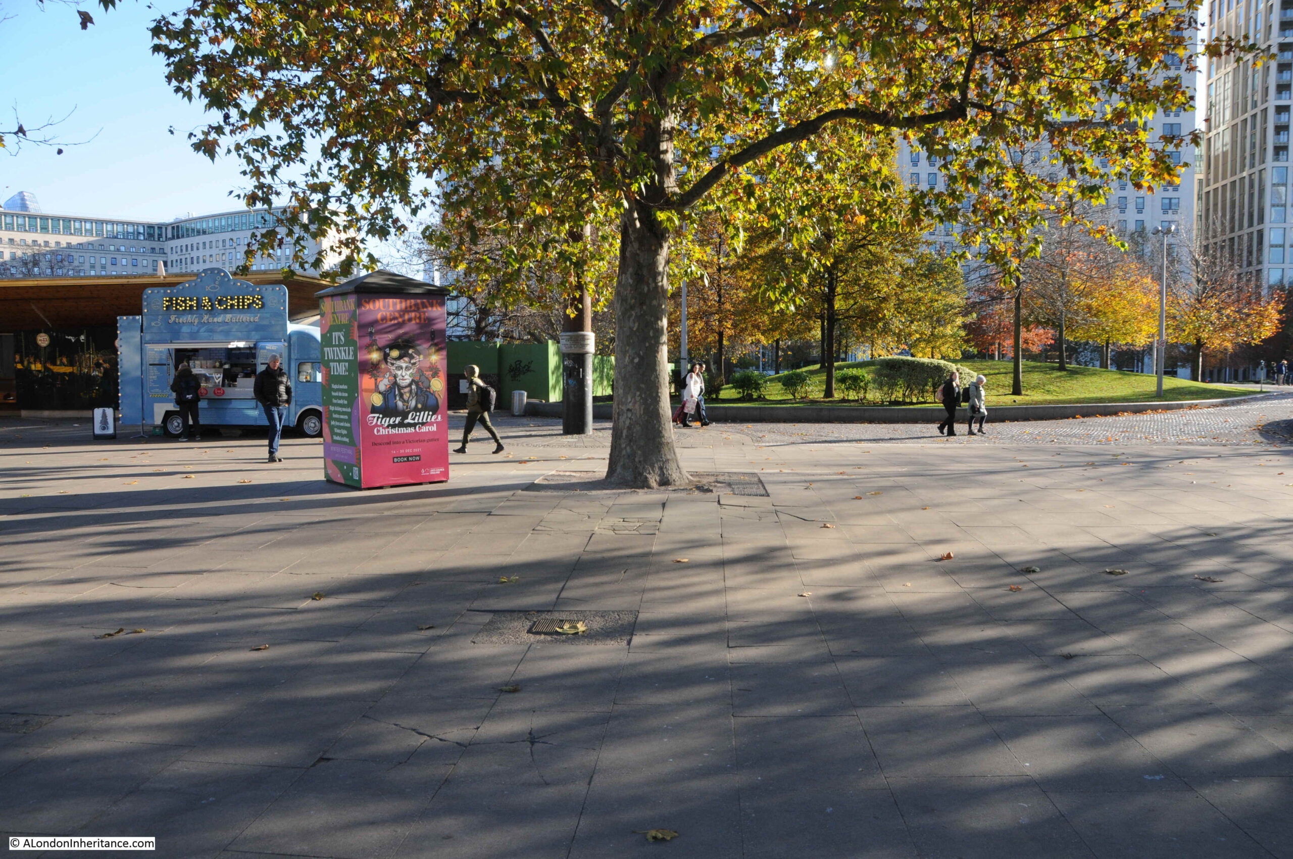
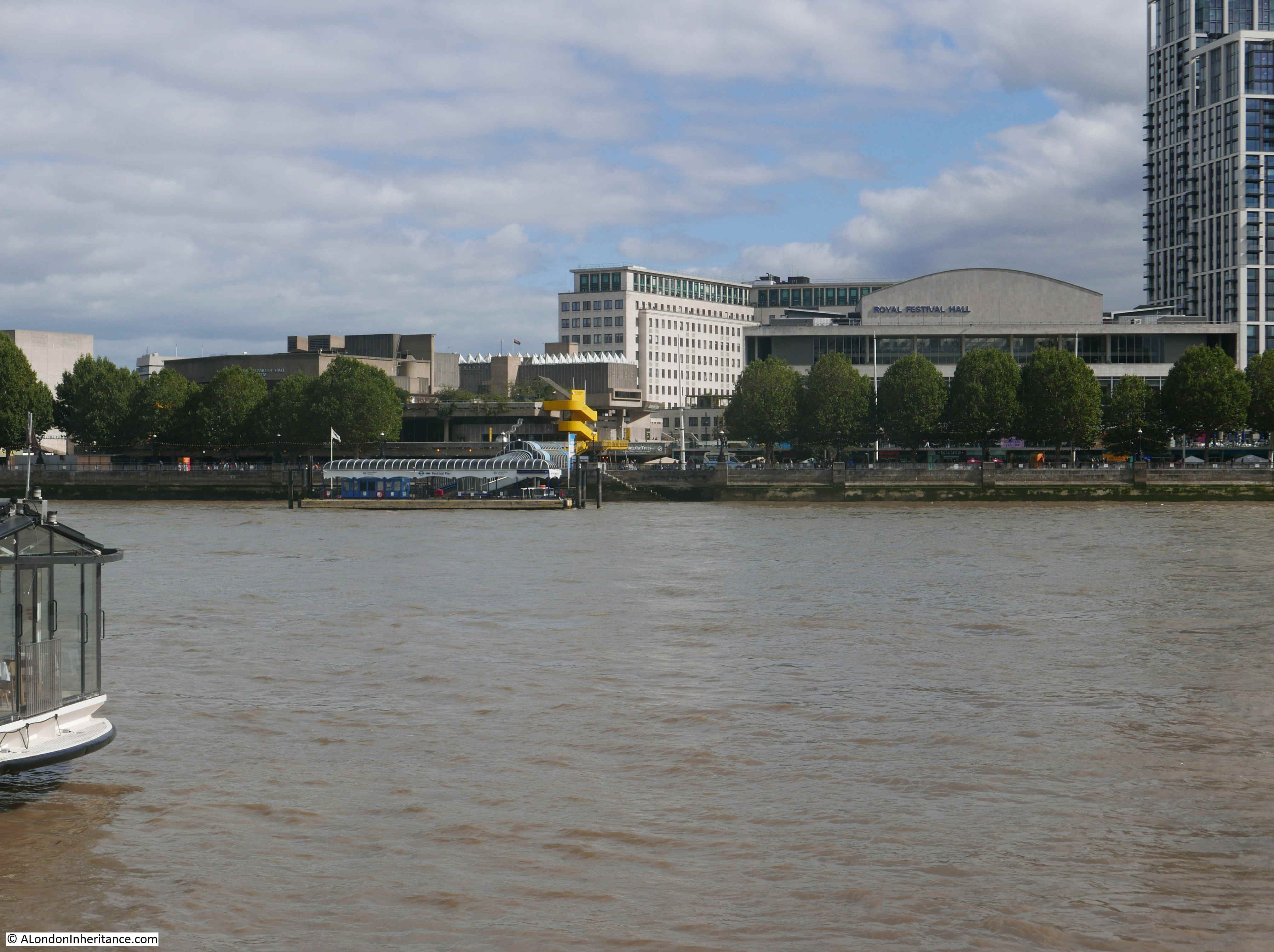
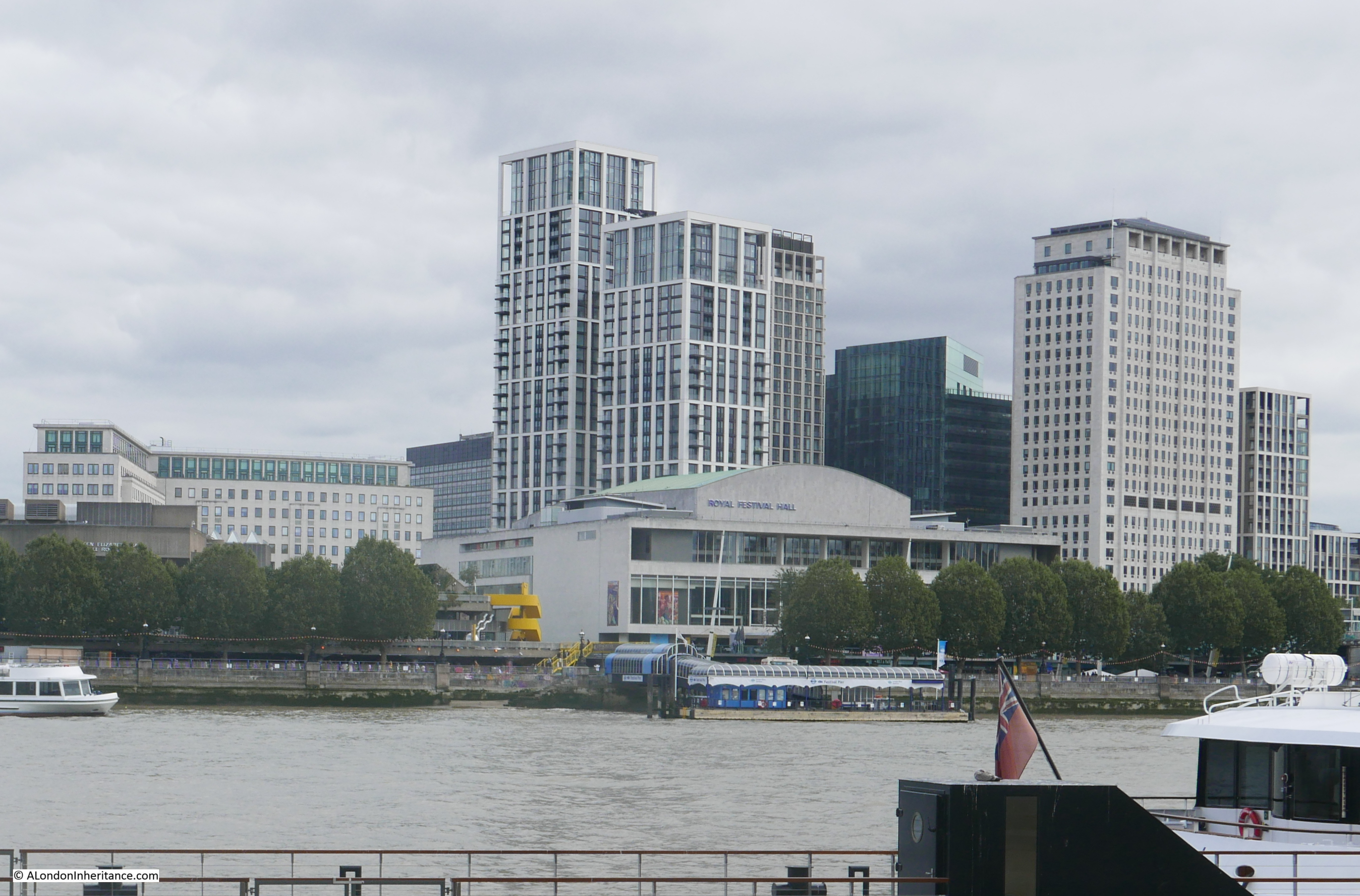
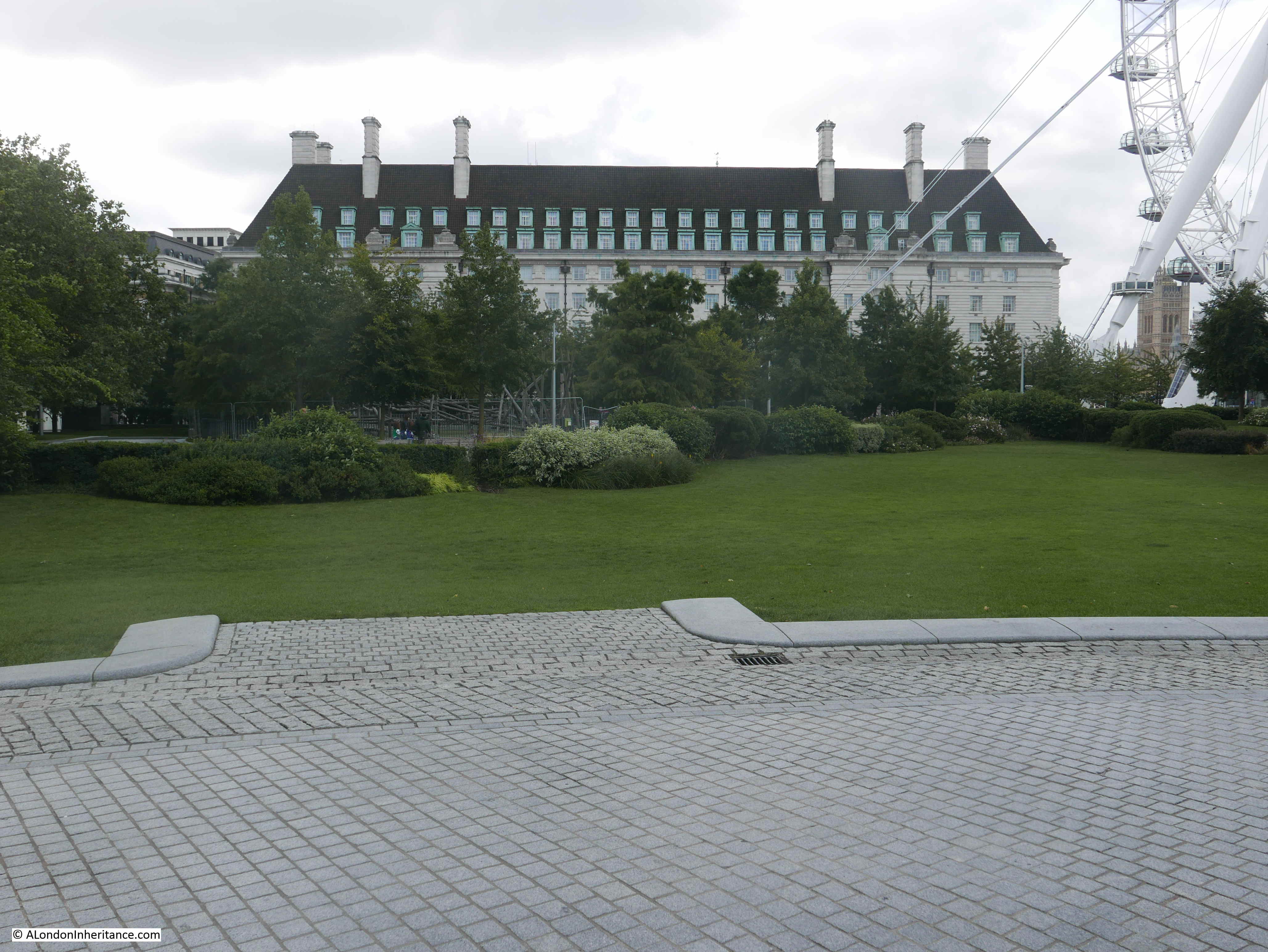
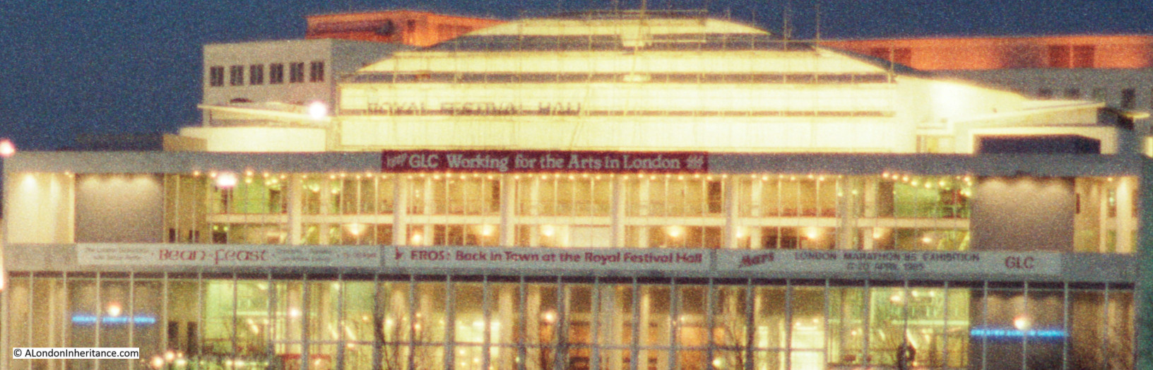
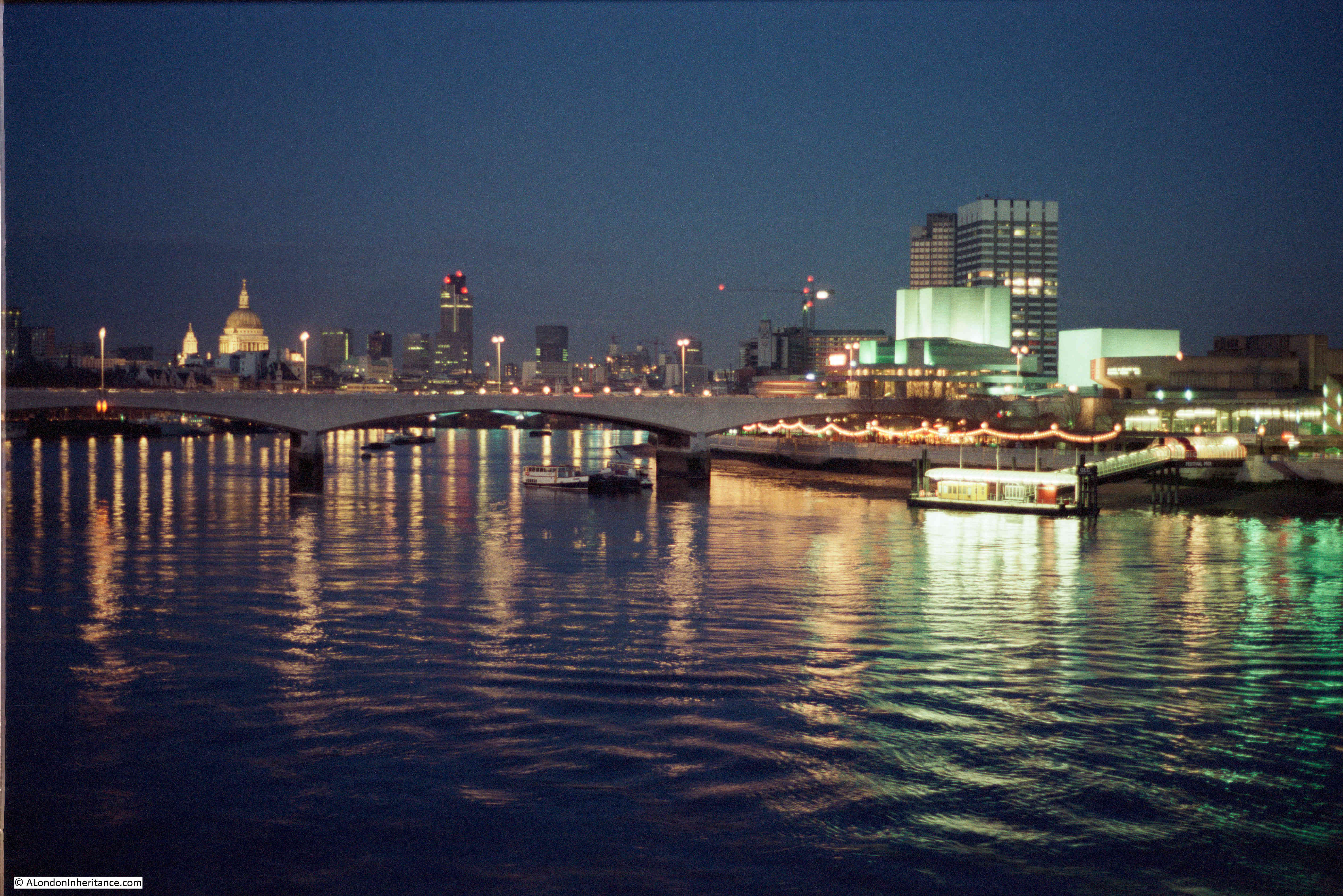
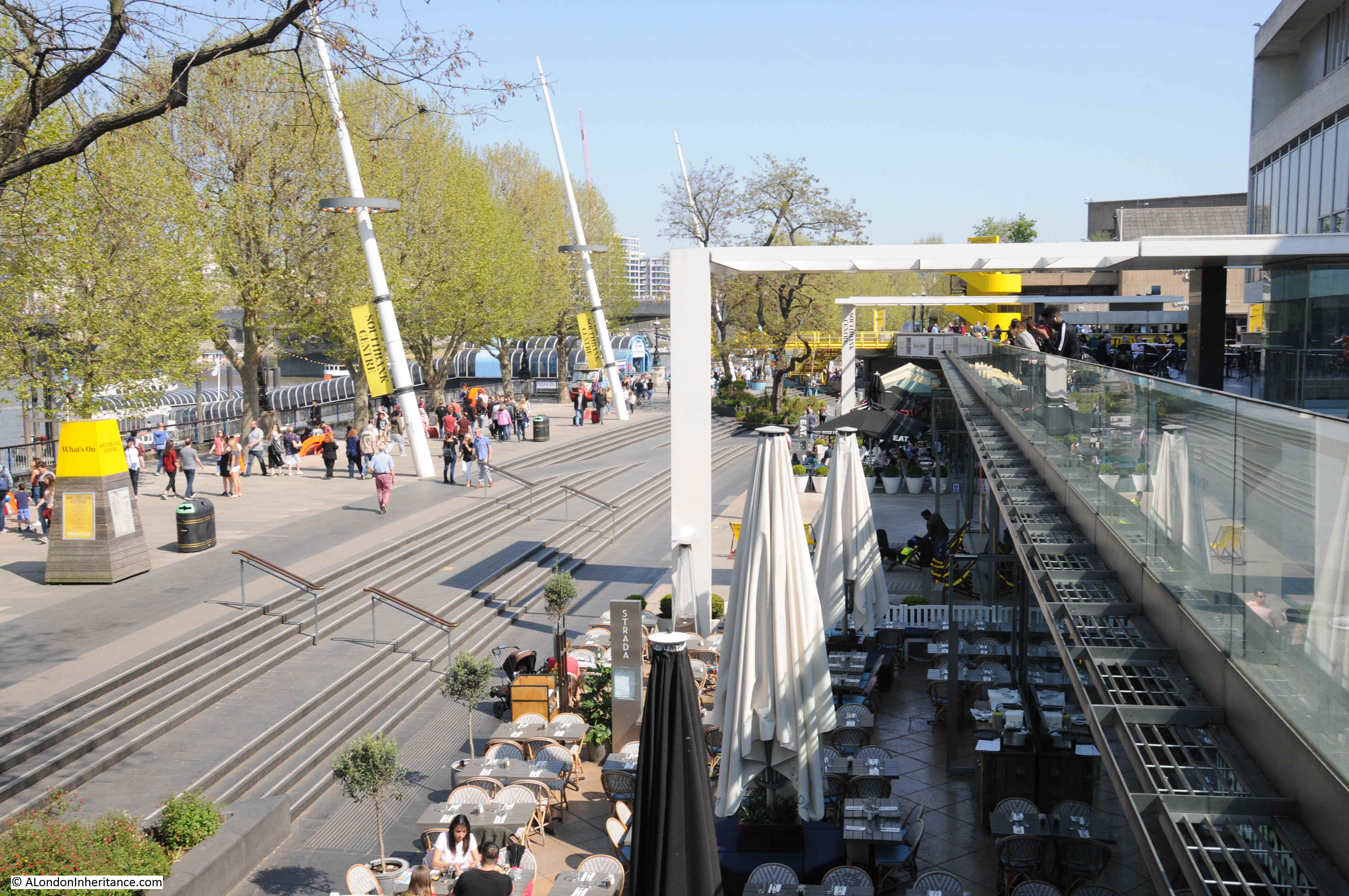
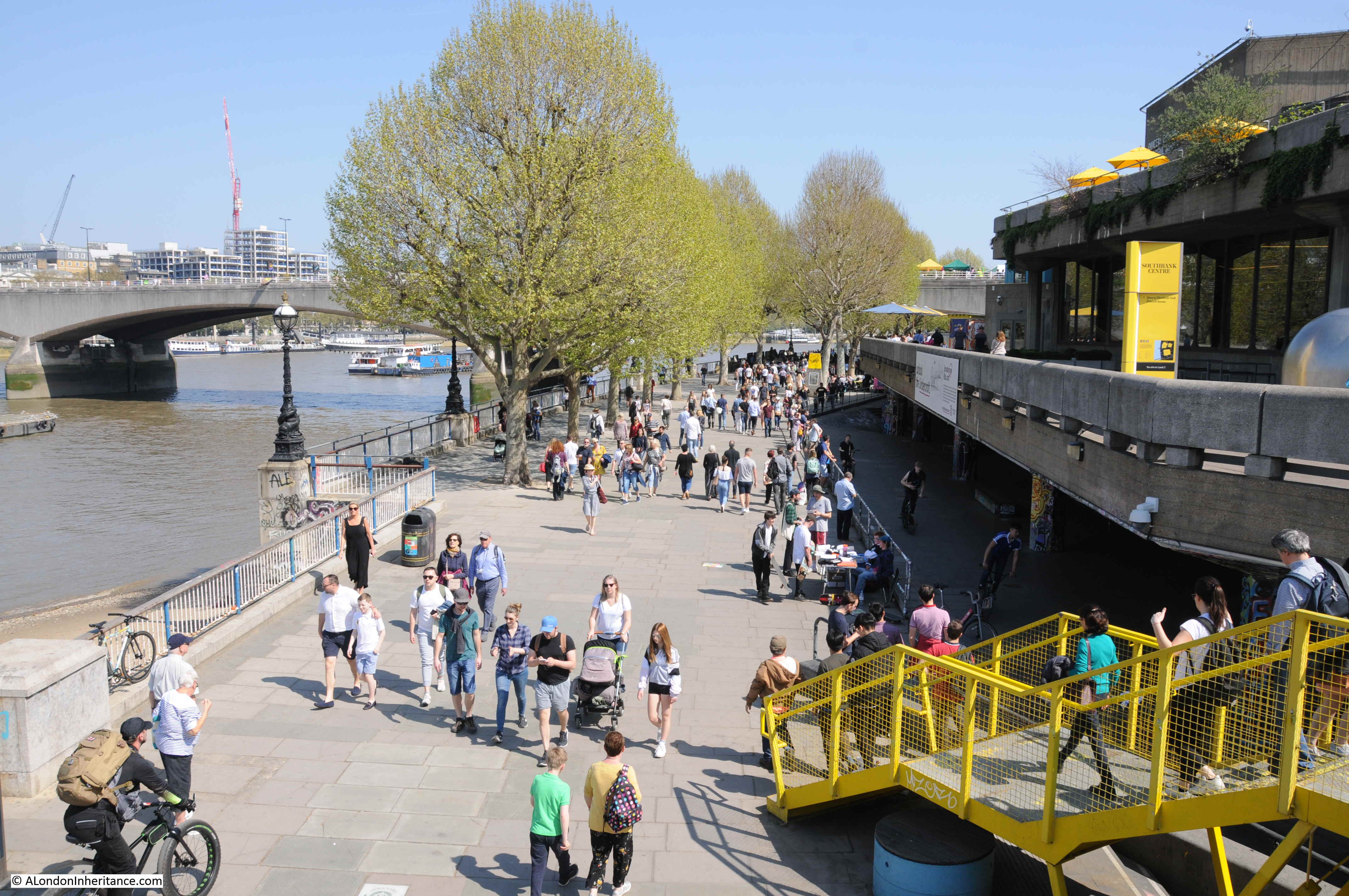
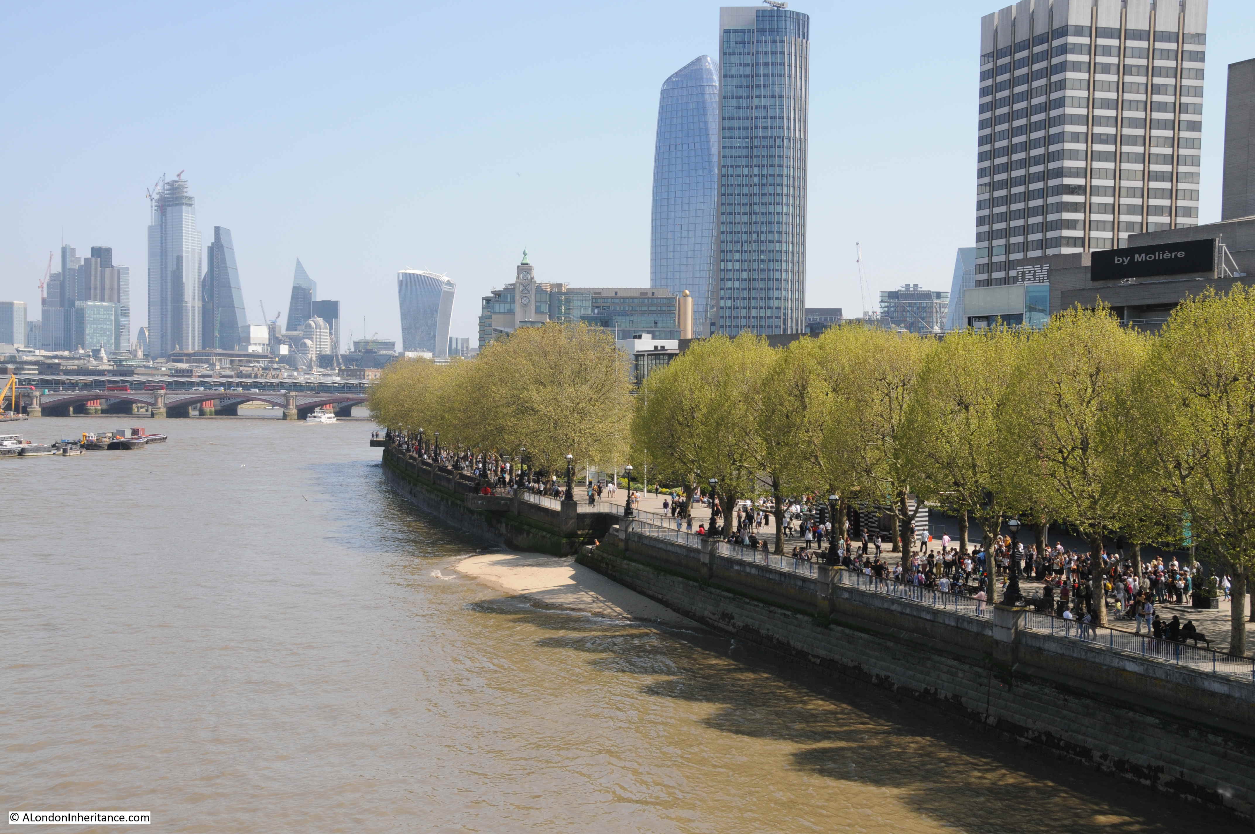
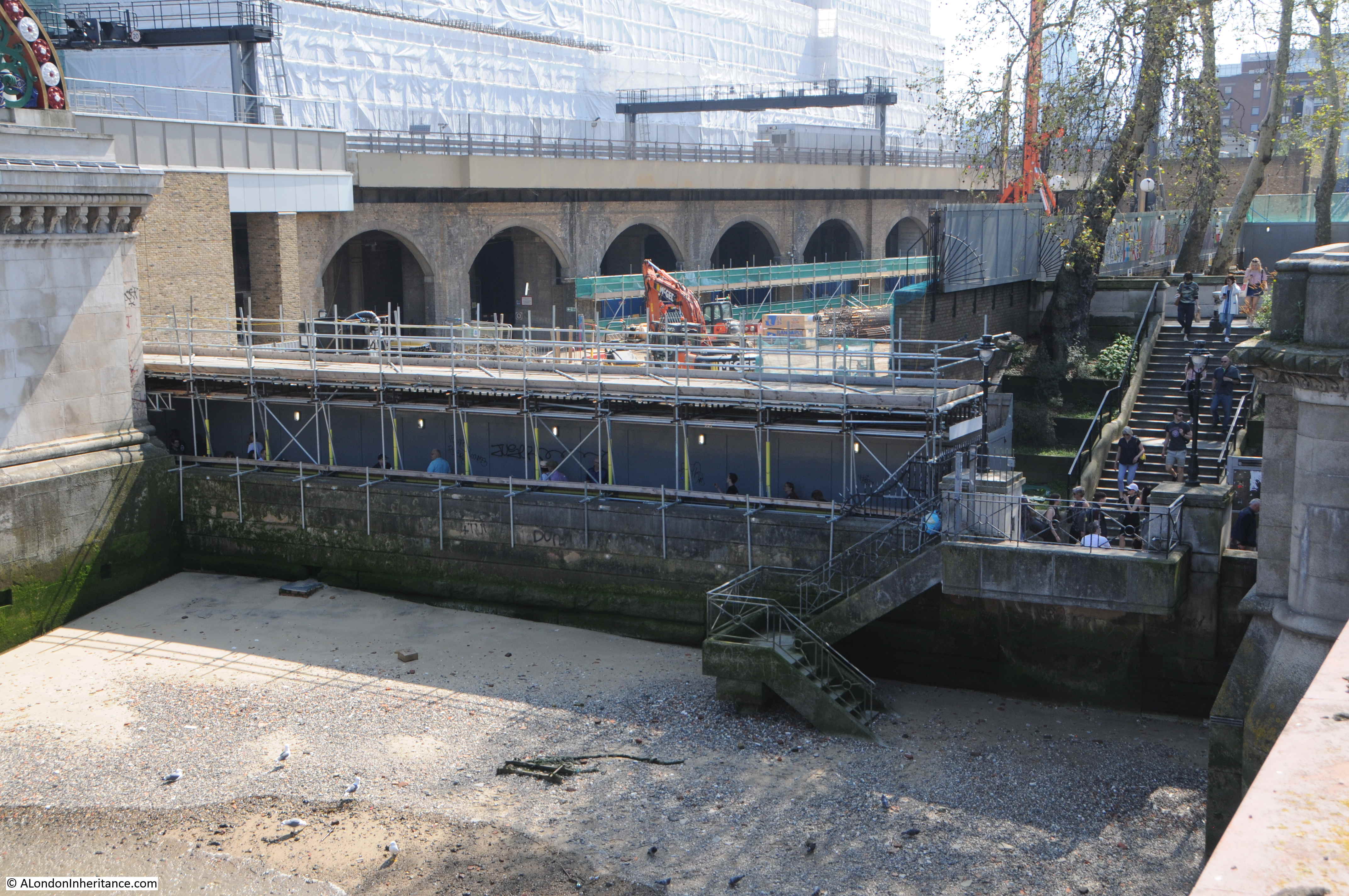
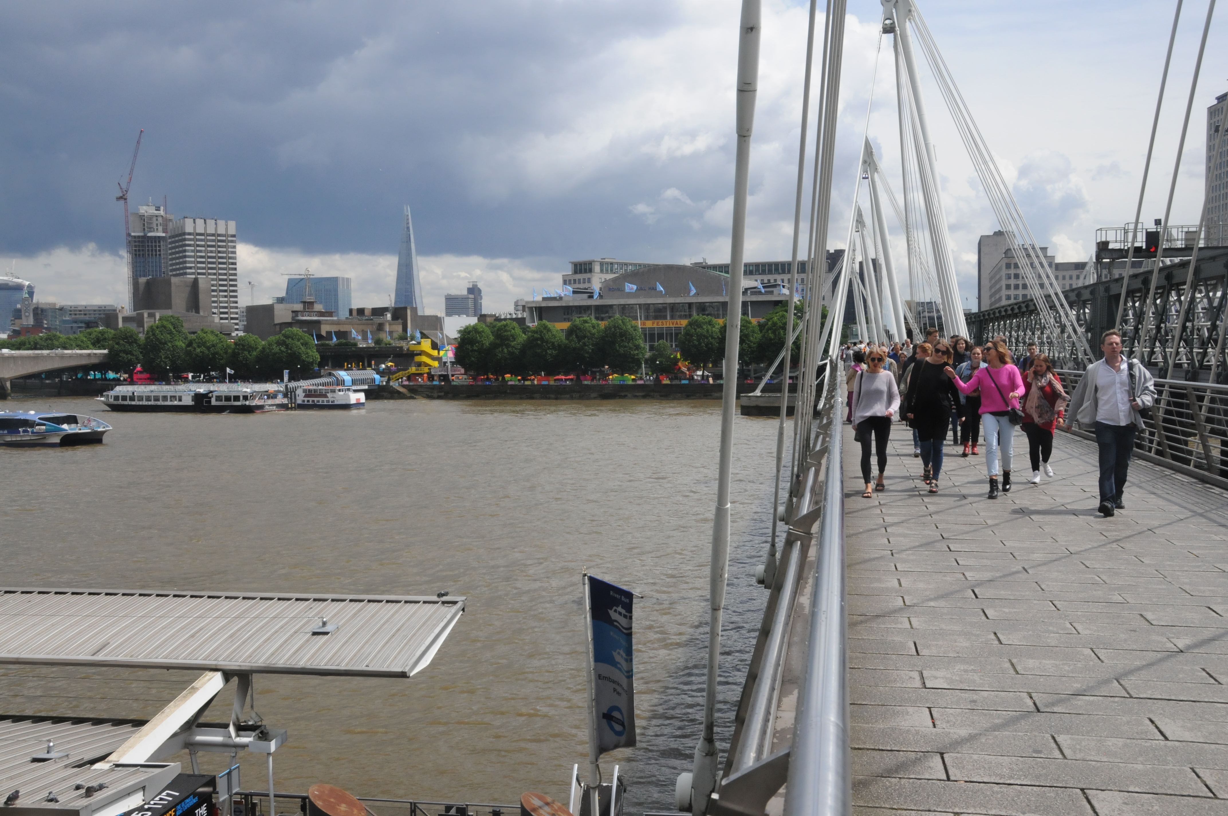
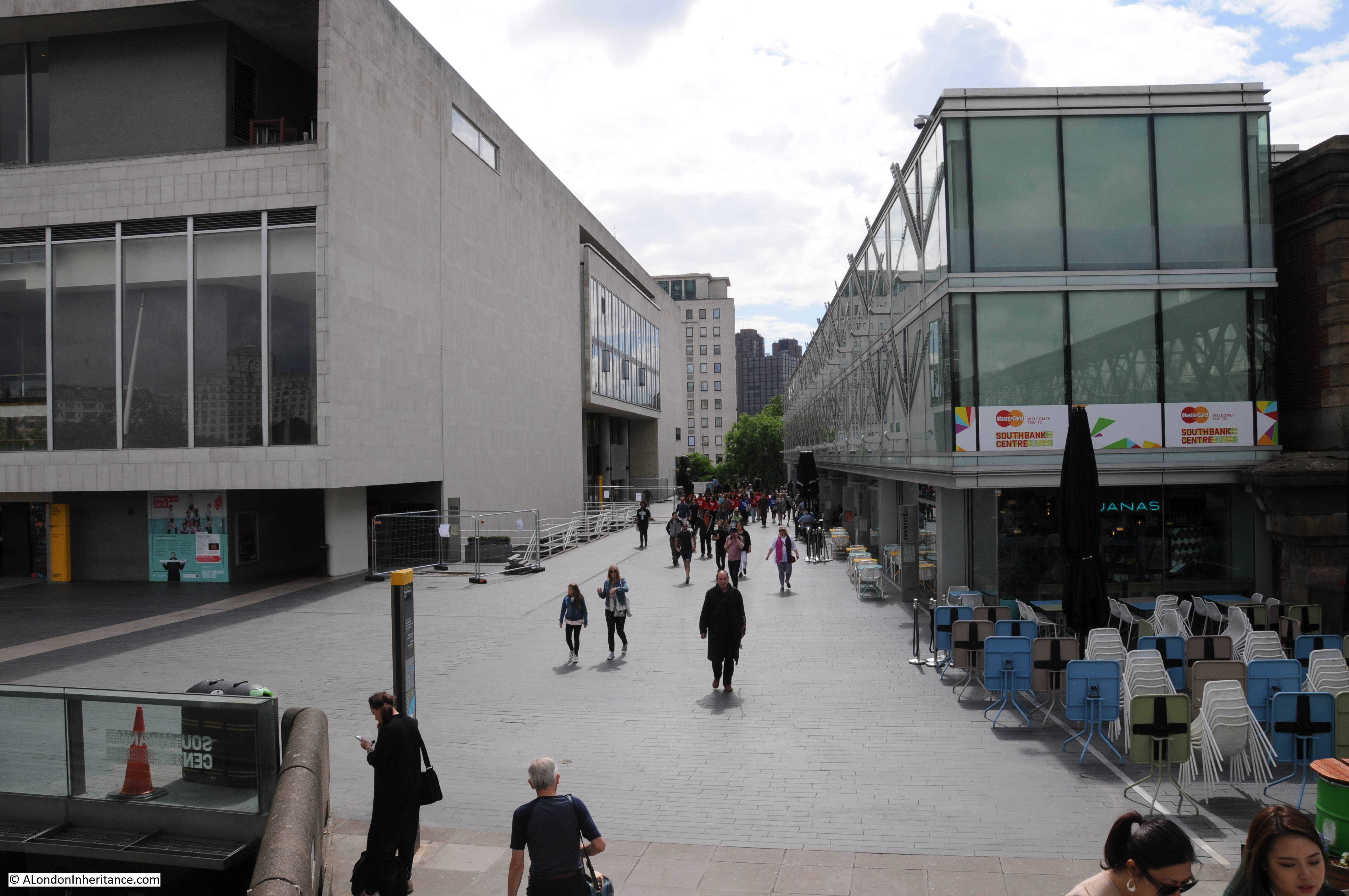
The same view in 2022 (although a bit too much of the Royal Festival Hall):

View of the South Bank

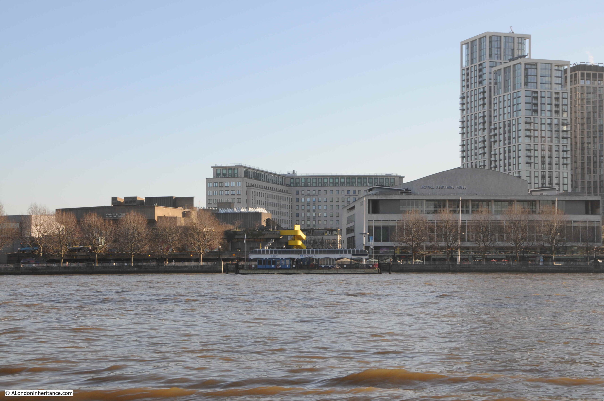
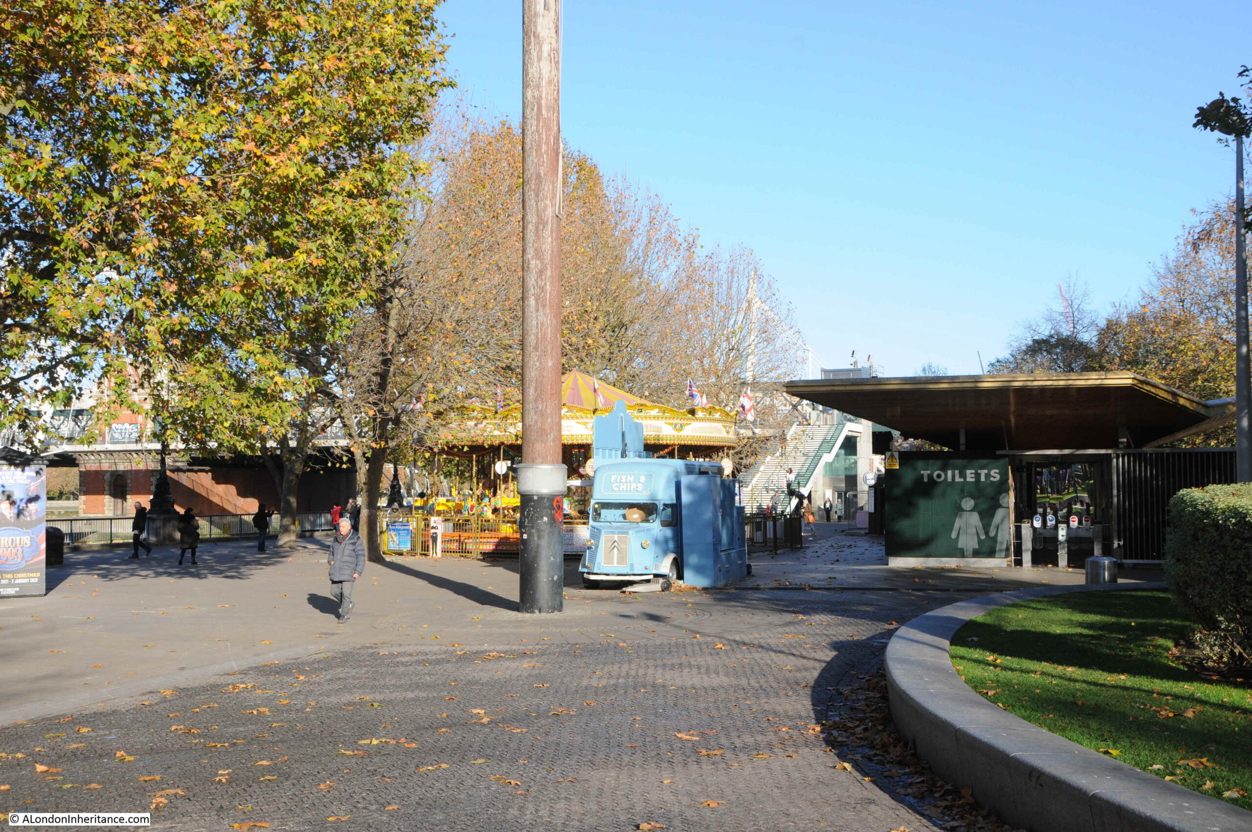
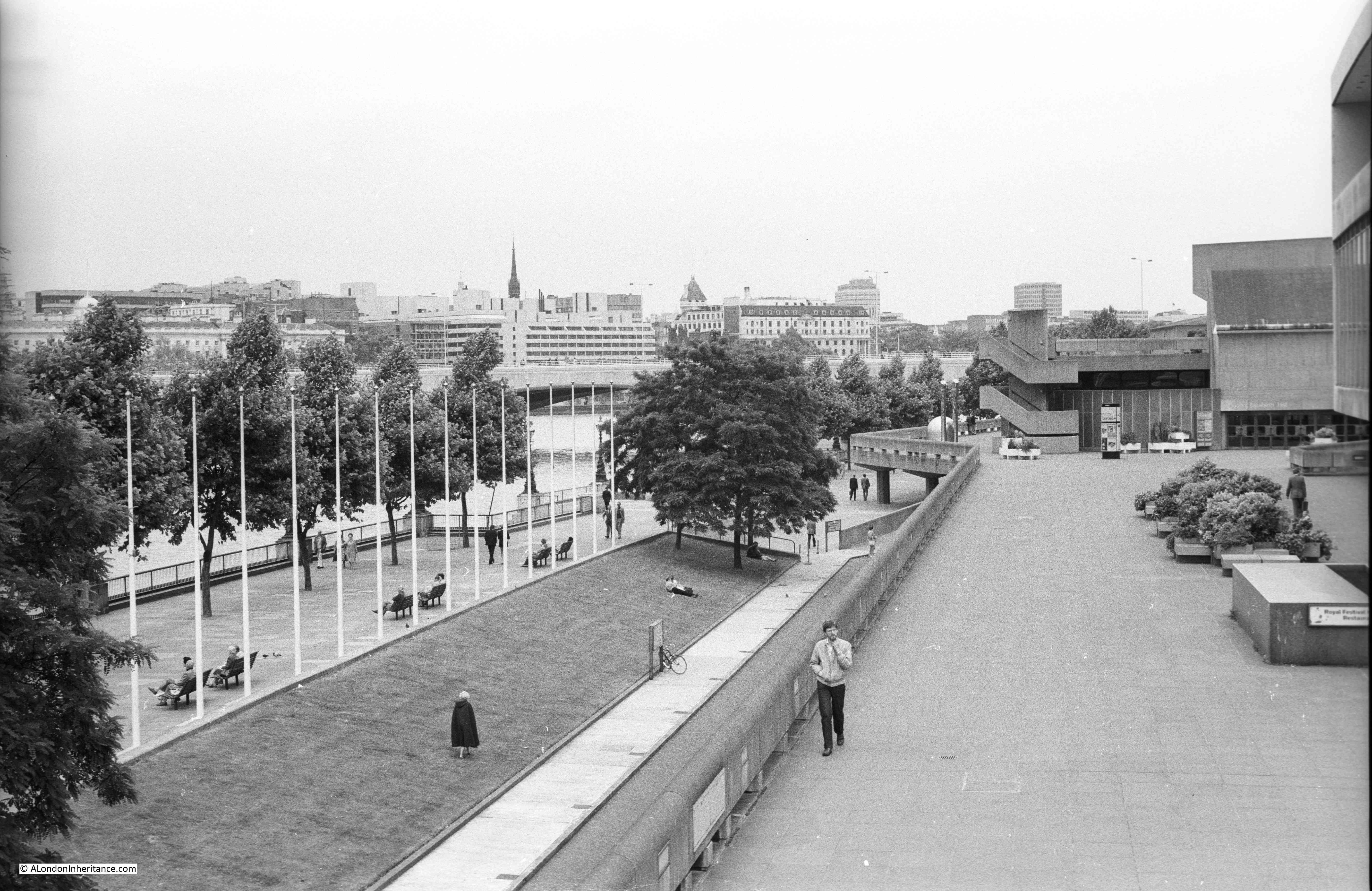
The Shot Tower was just behind and to the left of the yellow stairs seen in the centre of the above photo.

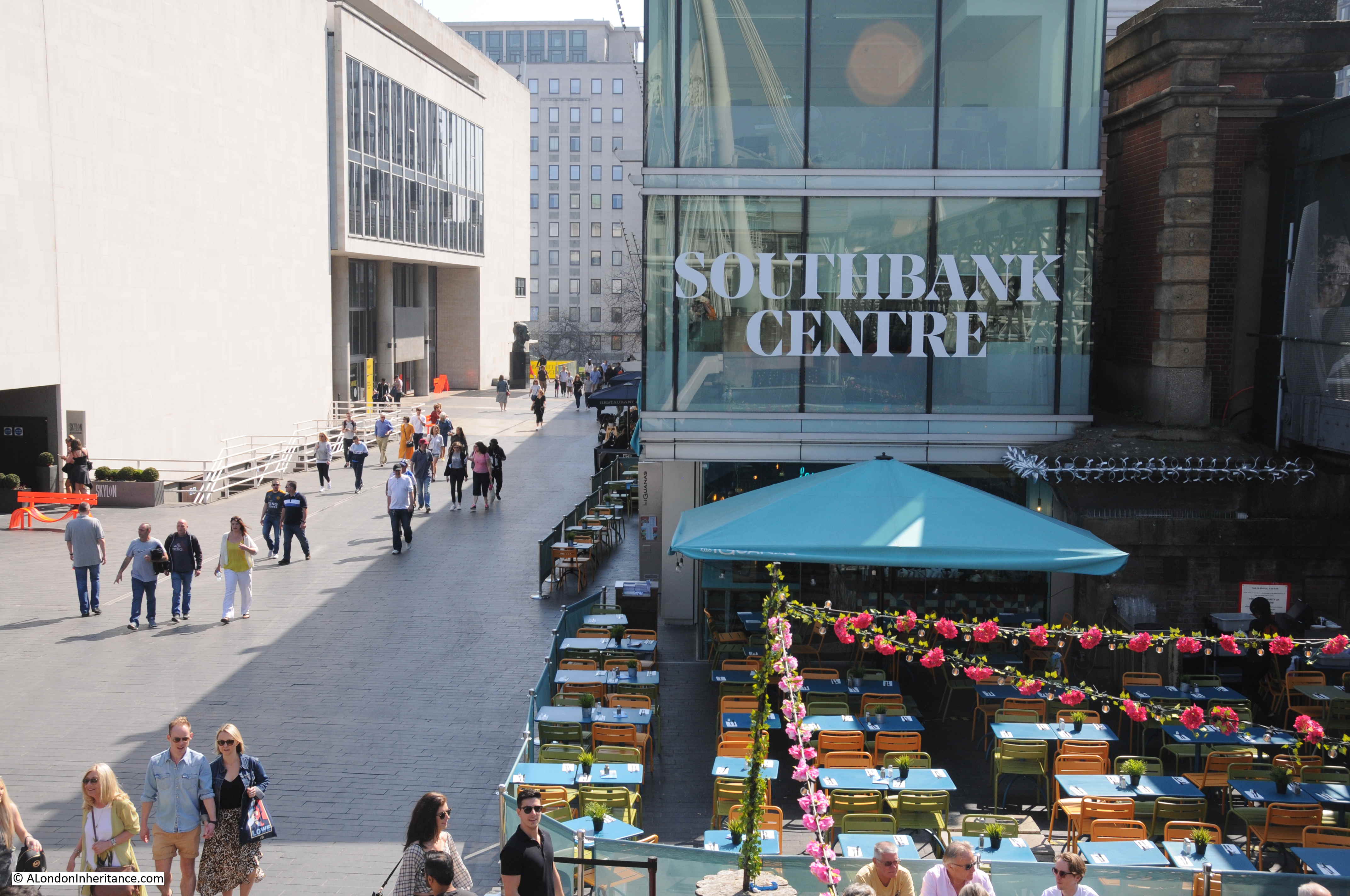
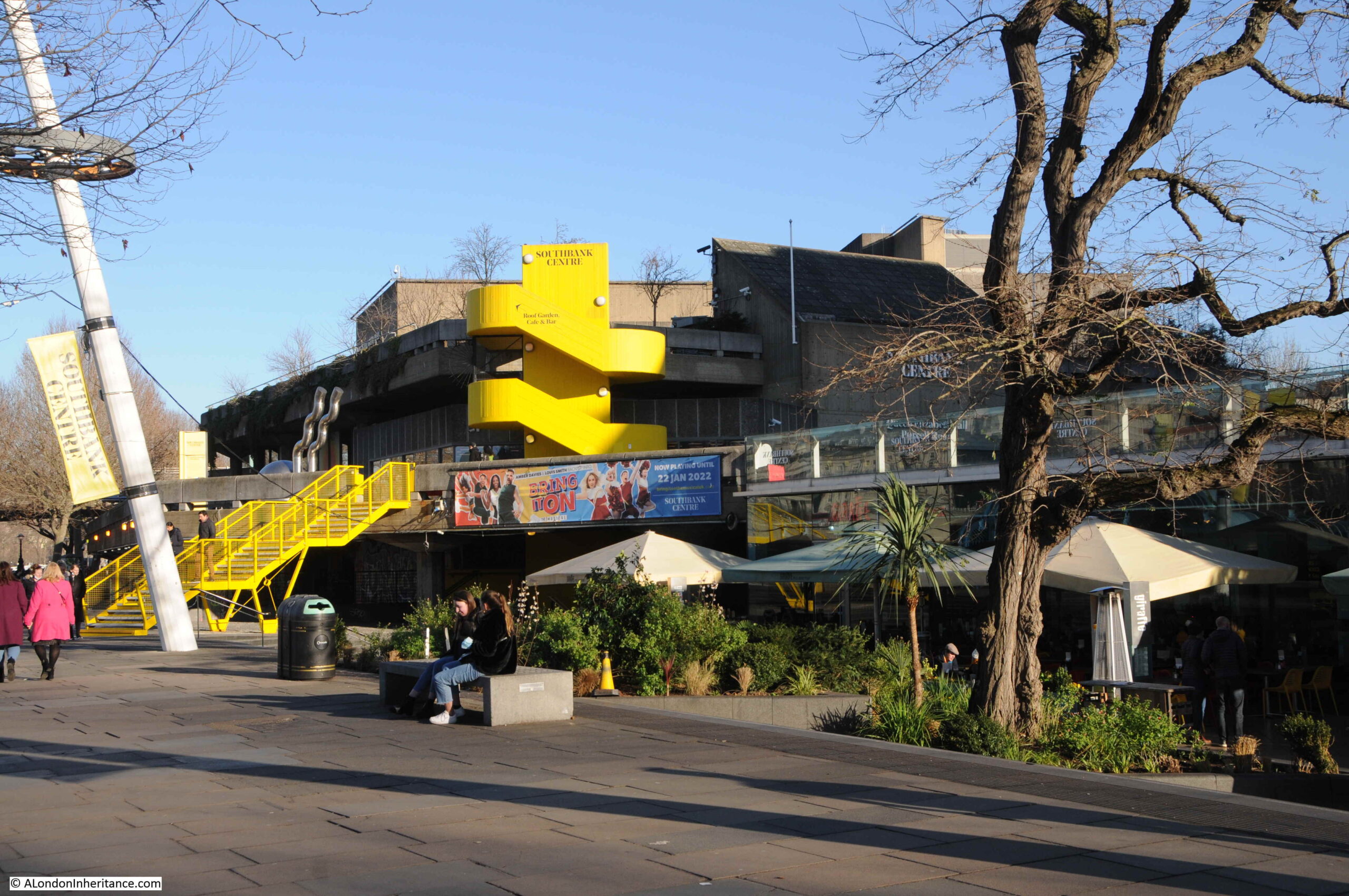
The South Bank today, and the Shot Tower would have been just to the right and further back from the yellow concrete stairs, and the edge of the Queen Elizabeth Hall:

Location of the Shot Tower

The purpose of the Shot Tower, and the process which gave its name to the tower, was the manufacture of lead shot for shotguns.

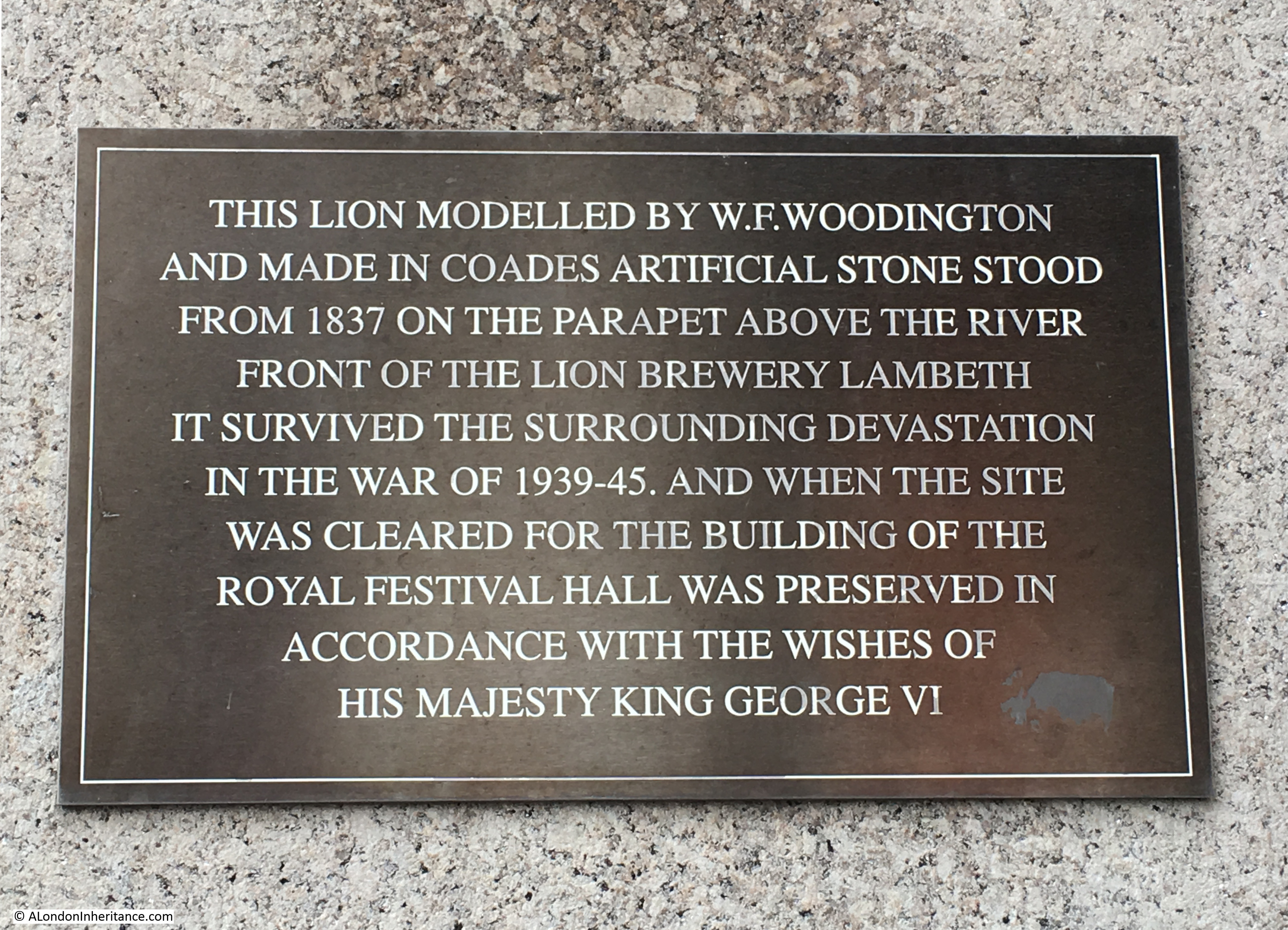
The Shot Tower was built in 1826 for Thomas Maltby & Company, and in 1839 was taken over by Walker, Parker & Company, who would continue to operate at the site until closure in 1949.

The Shot Tower was designed by David Riddal Roper and stands 163 feet from ground level to the top gallery. A spiral staircase within the tower provided access to two galleries, one half way up from where molten lead was dropped to produce small lead shot, and a gallery at the top of the tower which was used for large lead shot.

It was a considerable brick construction, with 3 foot thick walls at the base of the tower, tapering to 18 inches at the top.

There were a number of shot towers across London, including one on the other side of Waterloo Bridge which I will show later in the post. There was also one in Edmonton and a film was made using the Edmonton tower to show how lead shot was made within the tower.

The film can be found here on the British Pathe site, and shows the process which would have taken place within the South Bank Shot Tower.

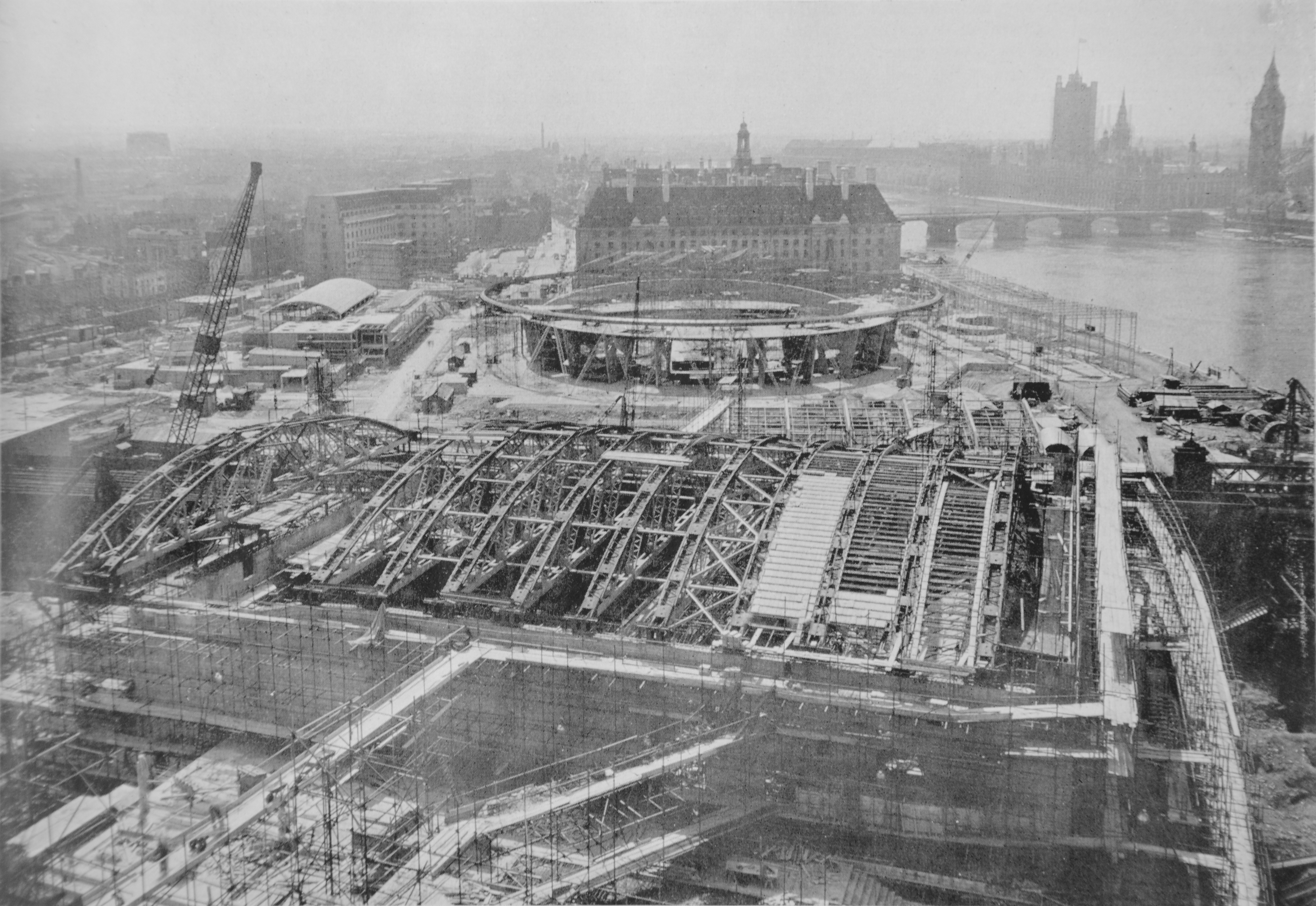
The Shot Tower survived the demolition of all the other buildings on the South Bank as part of the clearance for the Festival of Britain, and was included as part of the festival.

It was finally demolished in 1962, clearing the site for the construction of the Queen Elizabeth Hall. A real shame that it was not preserved and space made for it in the design of the new hall. It would have been a fitting reminder of the industrial history of the South Bank.

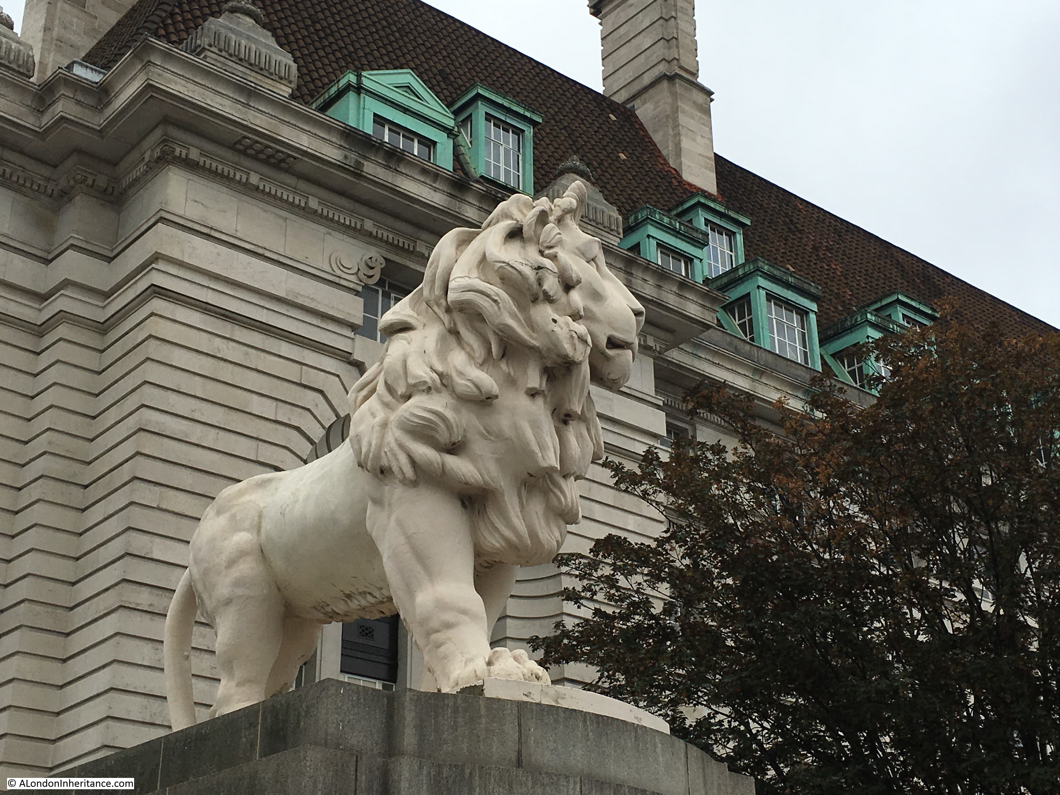
The Shot Tower survived and was included in the Festival of Britain as it was considered a well known landmark, and as with the lion on the top of the Lion Brewery, there was public concern that such a landmark would be demolished.

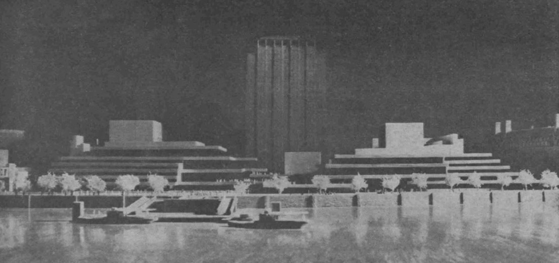
The festival organising committee wanted vertical features on the South Bank to draw attention to the site (the Skylon was the primary feature, designed specifically for the festival) and they also wanted the festival to demonstrate Britain’s scientific and technical achievements and advanced British manufacturing, as the country faced the economically difficult post war years and was in desperate need of foreign trade and currency.

The answer was to save the tower, and include it as part of the displays. The very top of the tower was removed and a new structure installed that consisted of a large lamp, emulating a light house, and a large radio dish antenna mounted on an anti-aircraft gun carriage.

The following photo shows the Shot Tower with the additions to the top of the tower for the Festival of Britain:

Shot Tower with radio dish and lighthouse

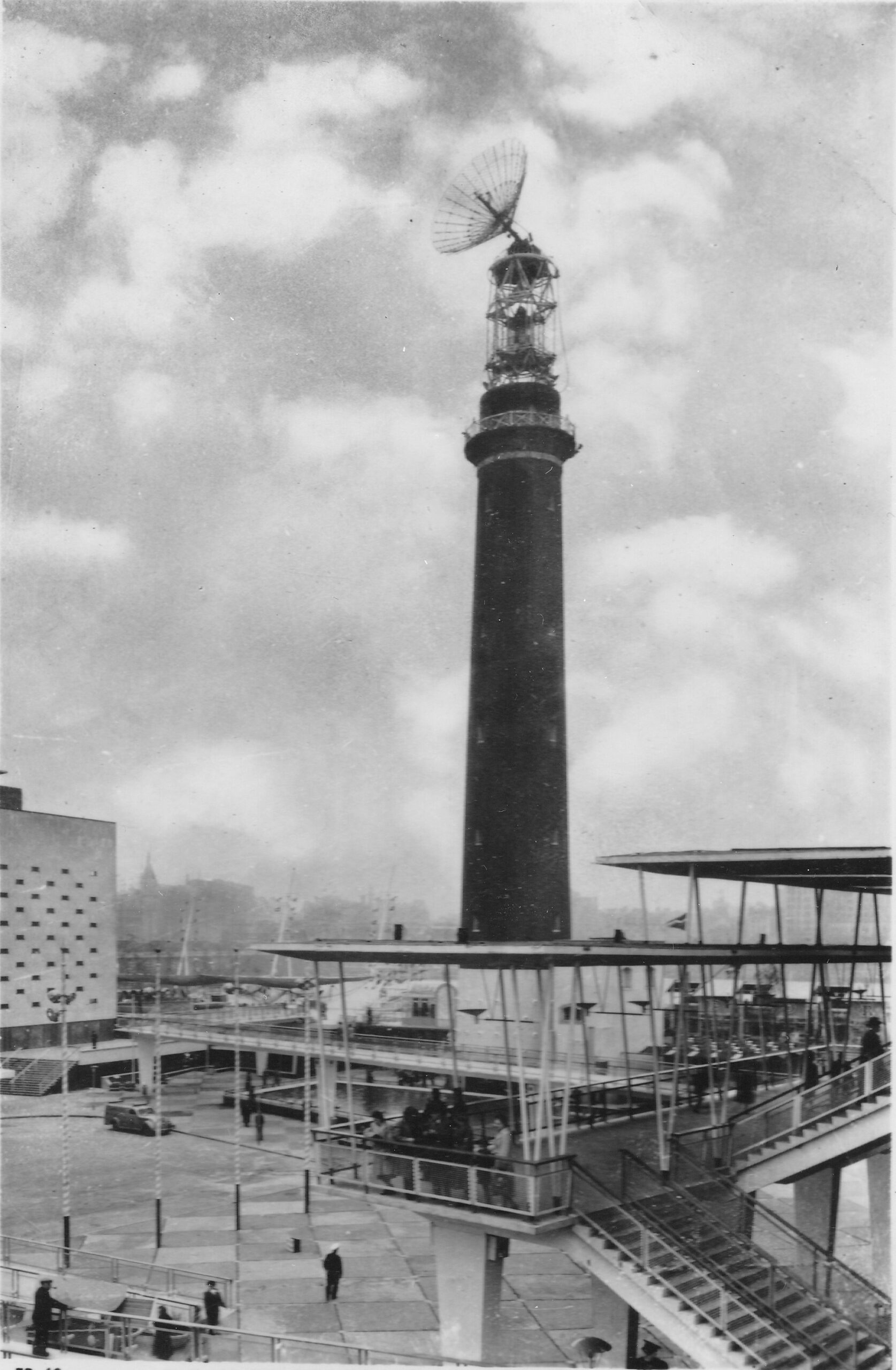
The intention with the radio dish at the top of the tower was described in the Festival of Britain Guide Book, as: “The radio beacon is above the lighthouse optic. The most obvious part of it is a large reflector which beams a signal to the moon. This is part of the radio telescope and is connected with the display in the Dome of Discovery by underground cable. In the Dome visitors can transmit signals to the moon and actually see them reflected back to the earth after about two and a half seconds”.

The display was in the Outer Space section of the Dome of Discovery, and the use of an anti-aircraft gun carriage at the top of the tower on which the radio dish was mounted, was to enable the dish to move to follow the moon in the sky.

The above description of the intended use of the radio dish is from the official festival guide, and the majority of books on the Festival of Britain repeat this planned use, however it seems that a different use for the dish had to be found after the technically advanced parts for such as radio transmitter / receiver were not available in time.

The Illustrated London News on the 21st April 1951 (not long before the opening of the festival on the 3rd of May 1951) records the new use of the radio dish: “There is to be no moon radar telescope on the top of the 200-ft shot tower on the South Bank: instead , visitors will see radio ‘noises’ or atmospherics from outer space on a television screen.” I assume the guide book had already been printed when the change was made.

The display on a TV of radio noise from sources such as the sun was probably far less visibly dramatic than the radio dish on the top of the old Shot Tower, but it did follow one of the Festival’s aims of showing scientific and technical advancements, just not in such a dramatic way as bouncing a radio signal off the moon.

Mounting an anti-aircraft gun carriage at the top of the tower was not without its dangers as this report from the Evening Telegraph on the 26th of October 1950 describes: “GUN CRASHES INSIDE SHOT TOWER – The gun mounting of a 3.7 A.A. gun being hoisted to the top of the Shot Tower at the Festival of Britain site fell 120 feet inside the tower to-day.

A 20-year-old soldier, Edward Bradley, was taken to St Thomas’s Hospital with slight bruises.

The mounting which weighs about five tons was being placed at the top of the Shot Tower. The gun is to carry a radar set which will send pulsations to the moon during the Festival.

Mr. Morrison told the Commons yesterday the equipment would cost £25,000 and would help in the development of radar astronomy.

Gunner Bradley was half-way up the staircase inside the tower, guiding the load, when he was struck by a falling plank. The gun mounting landed squarely in the centre of the tower and broke through the concrete floor to a depth of a foot.

Also inside the tower at the time were Captain Elliott, in charge of the operation, and a sergeant. The sergeant said ‘We heard a noise as if there was something amiss and we baled out of the tower as quickly as possible'”.

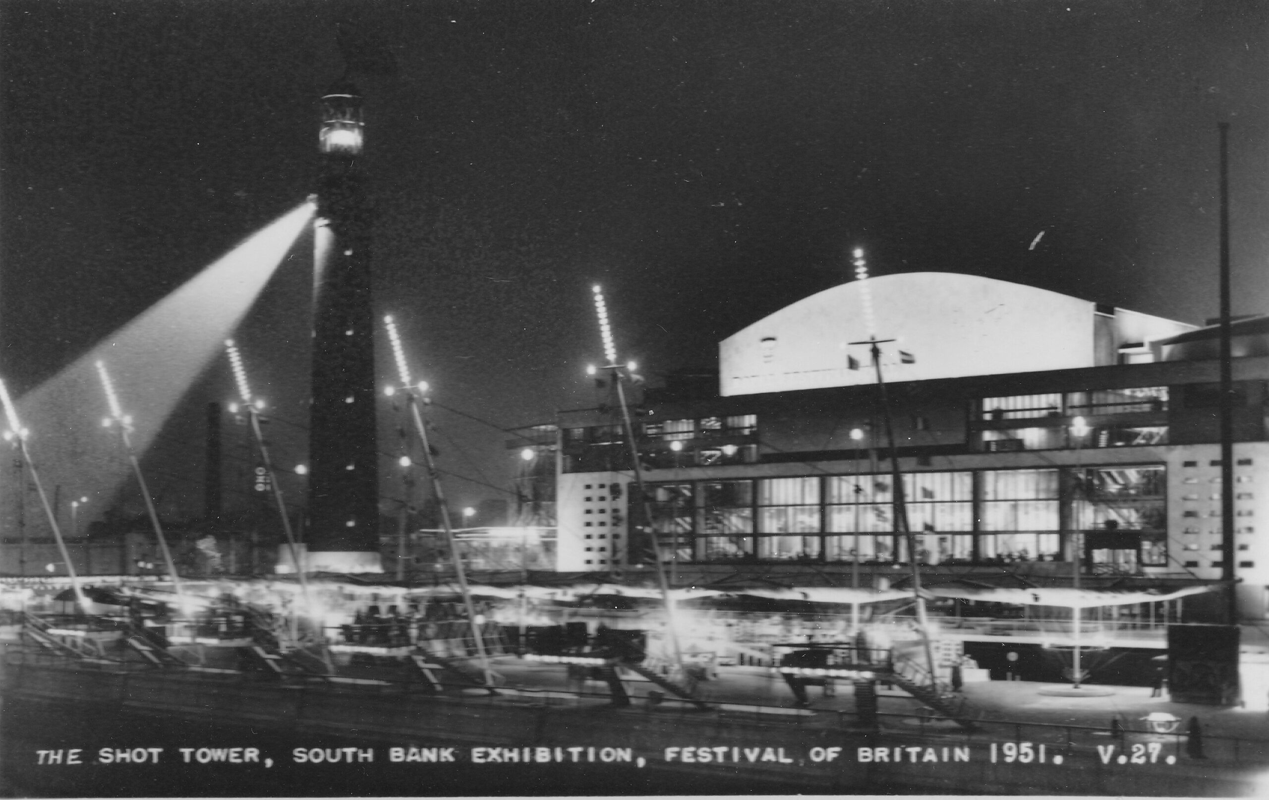
Underneath the radio dish was the “lighthouse” which was in operation from dusk until the evening closure of the festival. It was an electrically operated light (described as “of the most modern all-electric design”) with a lamp of three thousand watts, with a second lamp available should the main fail. The glass of the lighthouse optics which focused the light was made by Chance Brothers, the company that had made the glass for the original Crystal Palace in 1851.

The beam from the lighthouse could be seen up to 45 miles away from the South Bank site.

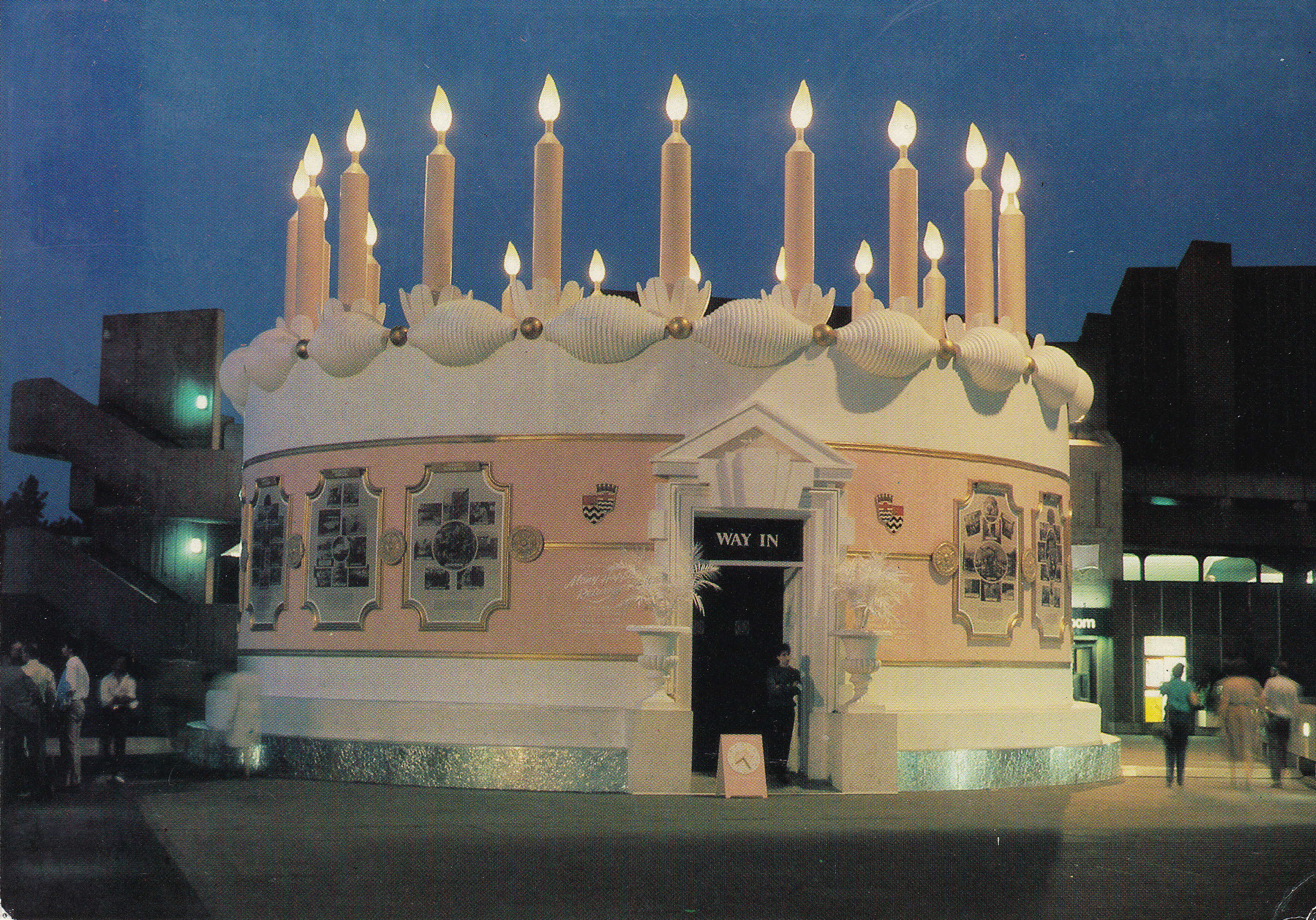
The following postcard showed the Shot Tower at Night. The lighthouse is the lit section at the very top of the tower, not the beam of light shining down from the tower.

Shot Tower at night

There were discussions on how to decorate the brick tower. Aluminum was suggested (the material was used for the Dome of Discovery and the Skylon), but was deemed too expensive. Cellophane was also suggested but considered a very poor choice. In the end, it was left as the original brick

The two vertical features of the South Bank, Festival of Britain – the Shot Tower, and much taller (300 feet from ground to tip) Skylon:

Skylon

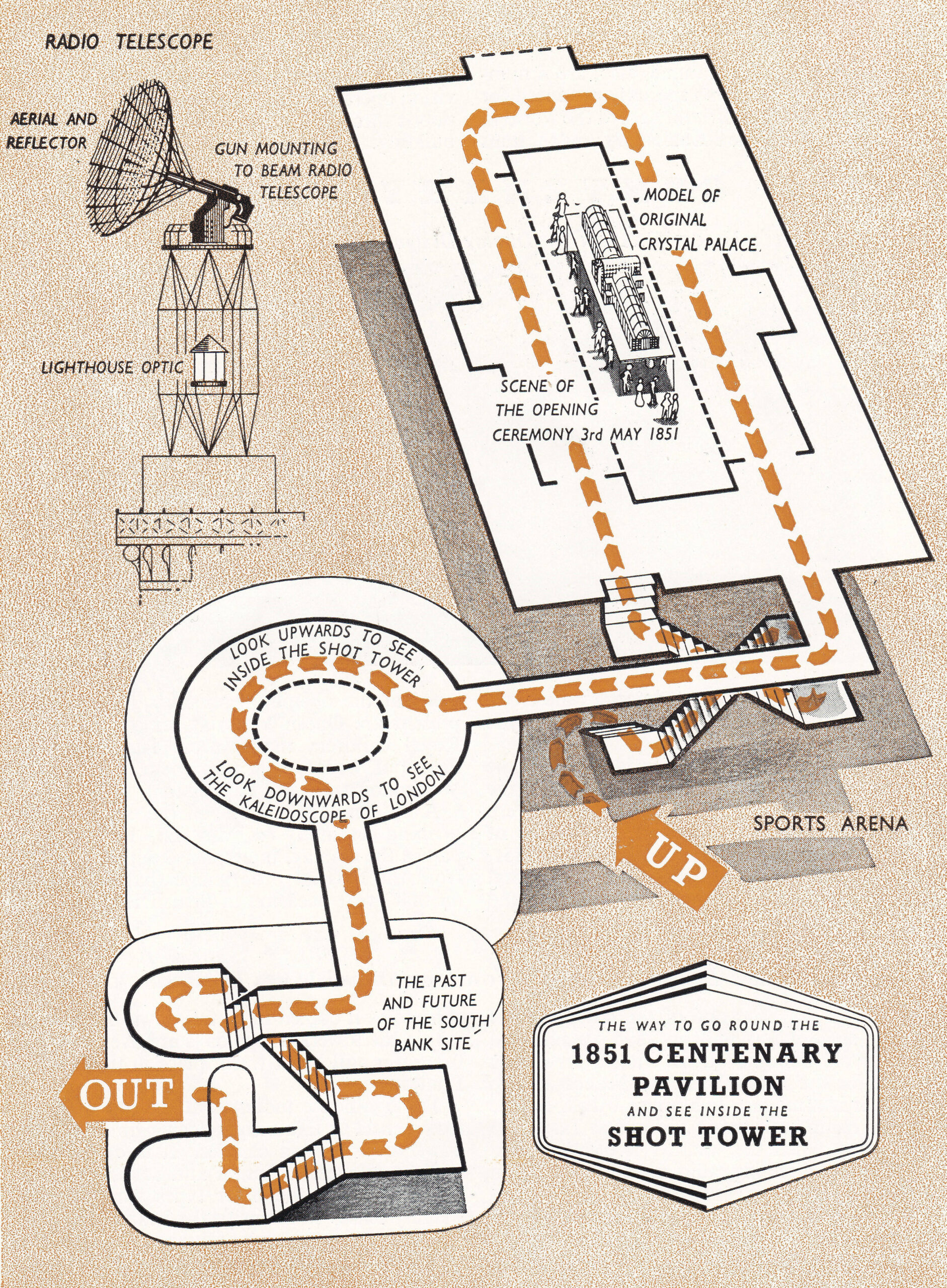
As well as the Shot Tower, a brick building at the base of the tower was retained and used for a small exhibit showing the development of the South Bank site, as well as some control equipment for the radio system at the top of the tower.

A walkway from this building led into the Shot Tower where visitors could look up and see the top of tower, and below a kaleidoscope of changing London scenes was shown.

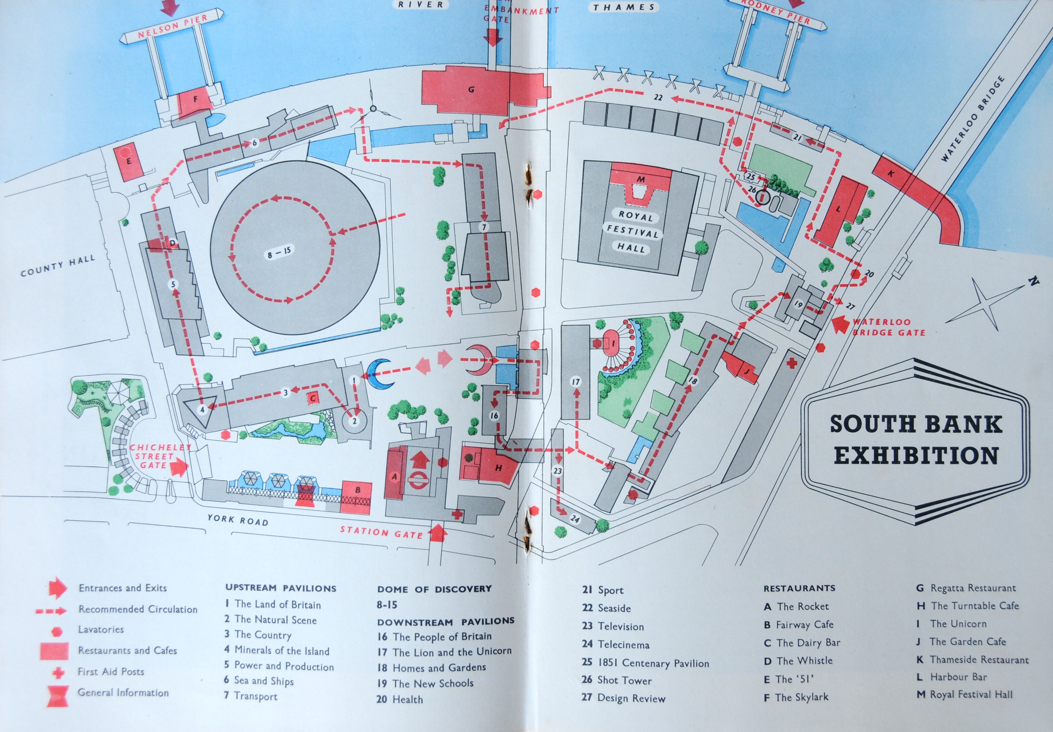
The following page from the Festival of Britain, South Bank Guide Book shows the Shot Tower and the recommended route:

The Guide Book also included a rather good colour advert from the construction engineers who had completed the work to extend the steelwork at the top of the Shot Tower for the lantern and for supporting the anti-aircraft gun and radio dish:

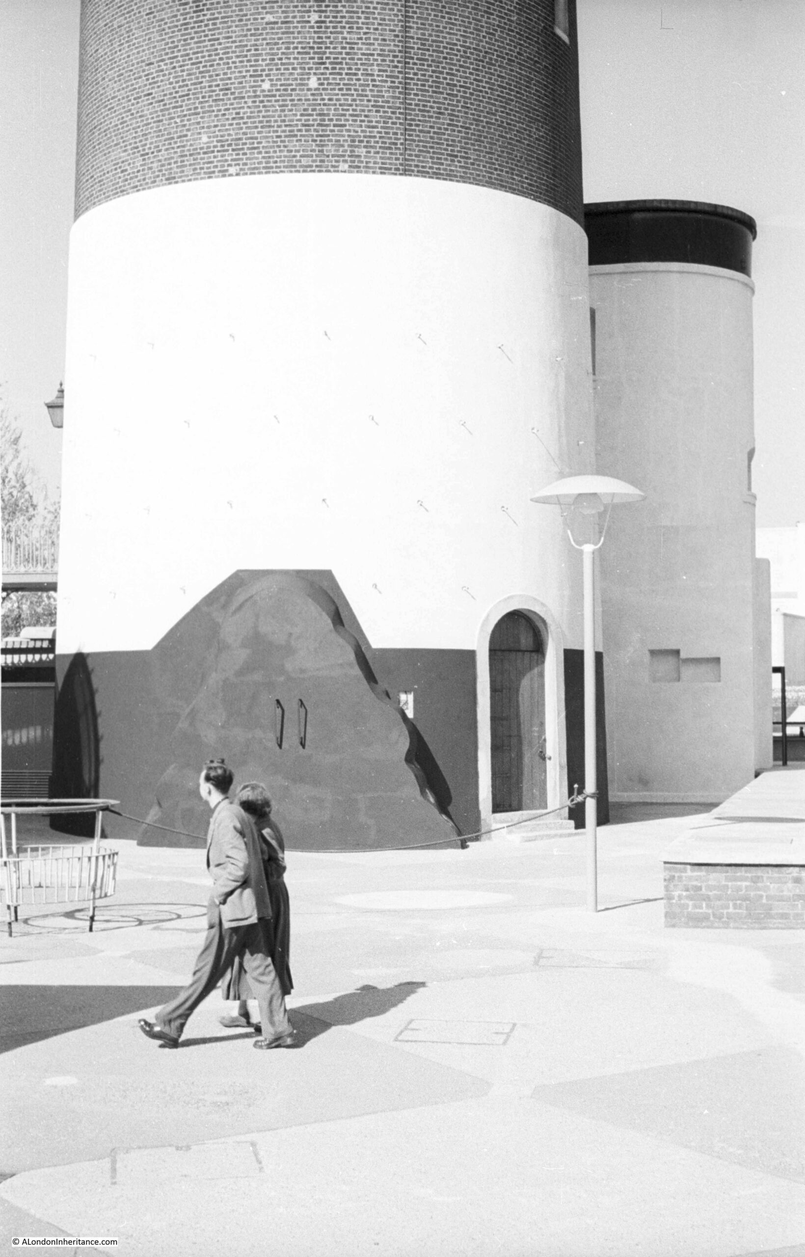
The following postcard shows the base of the Shot Tower and the adjacent brick building which provided the access route to the tower during the festival:

Shot Tower

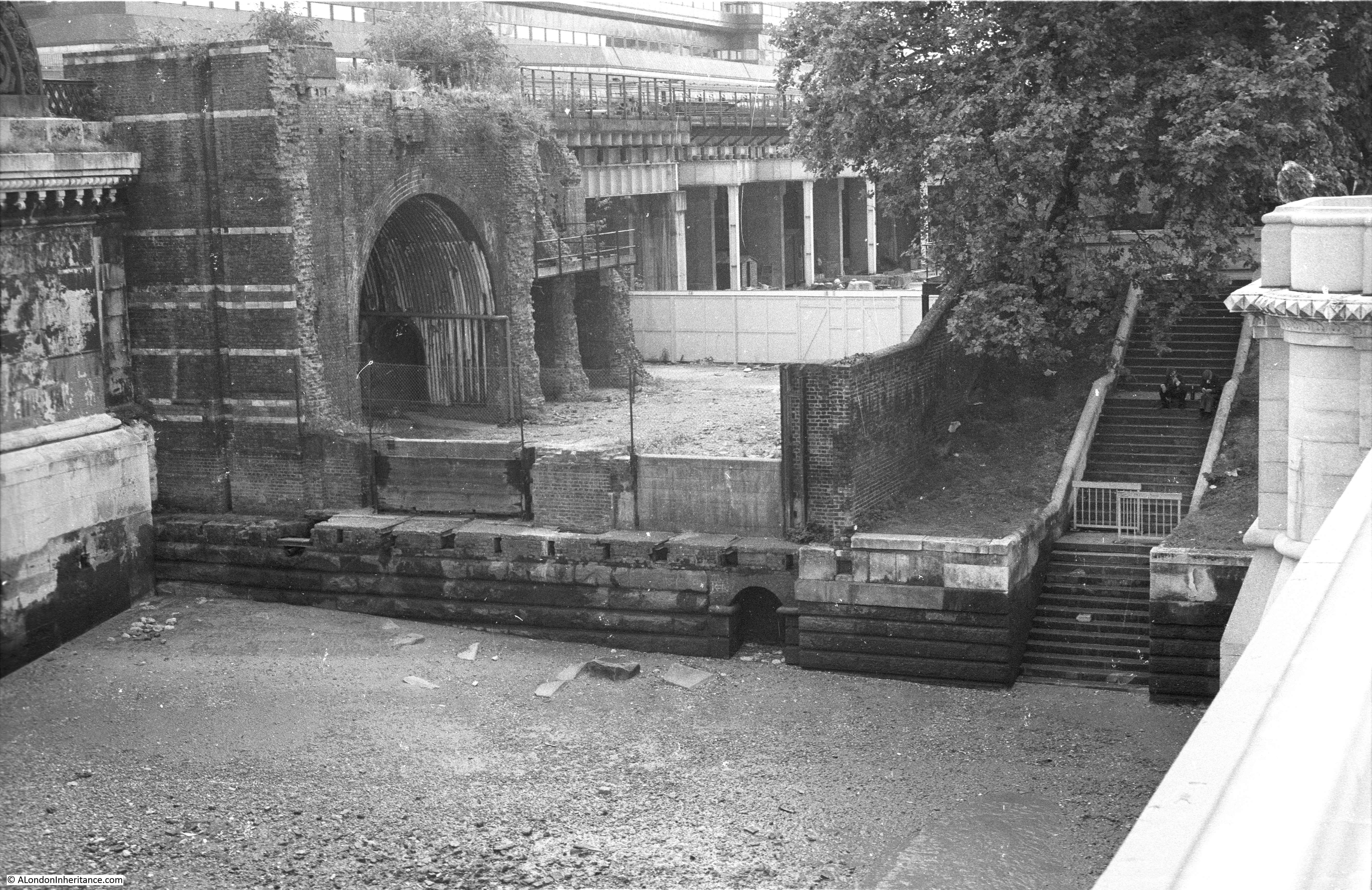
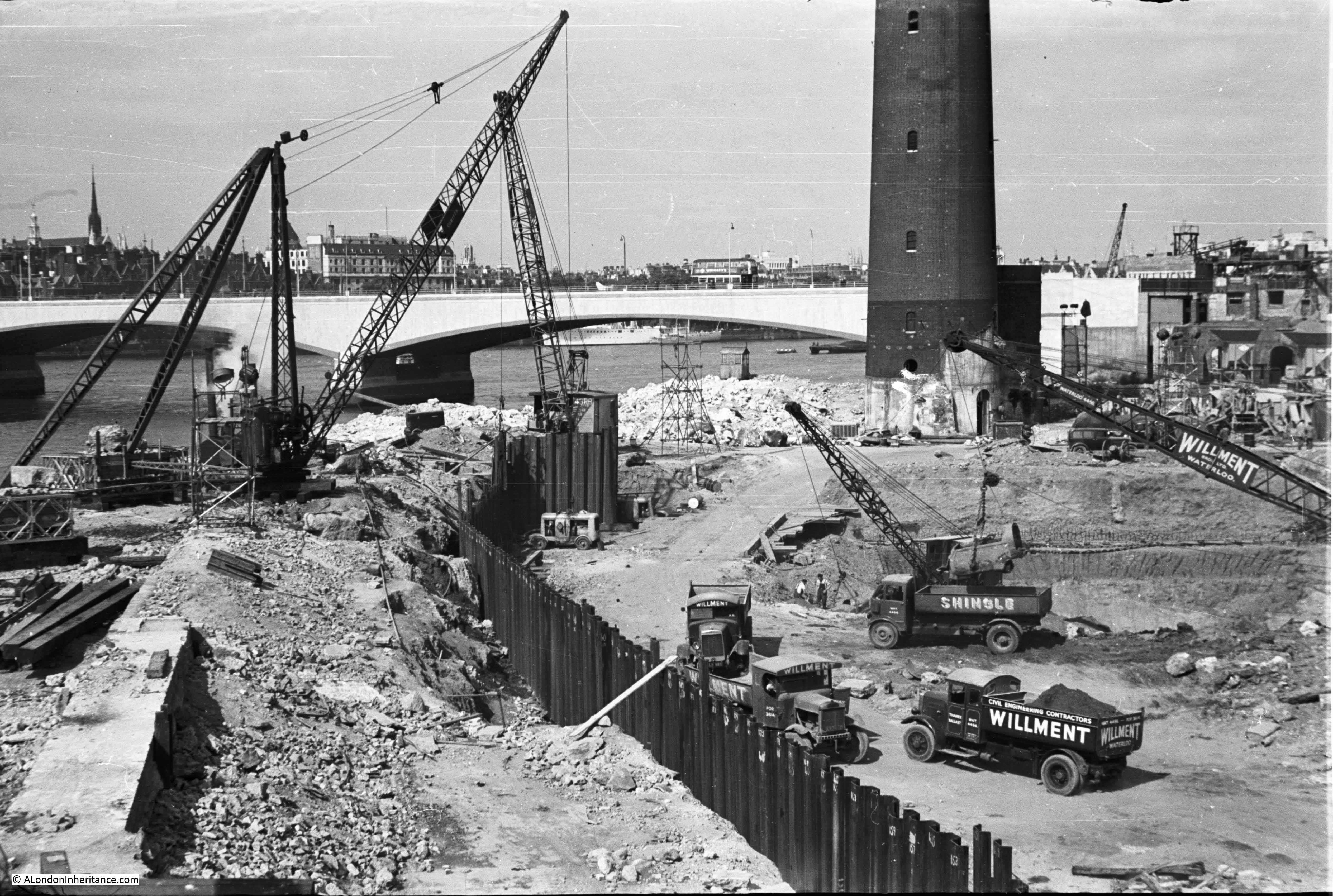
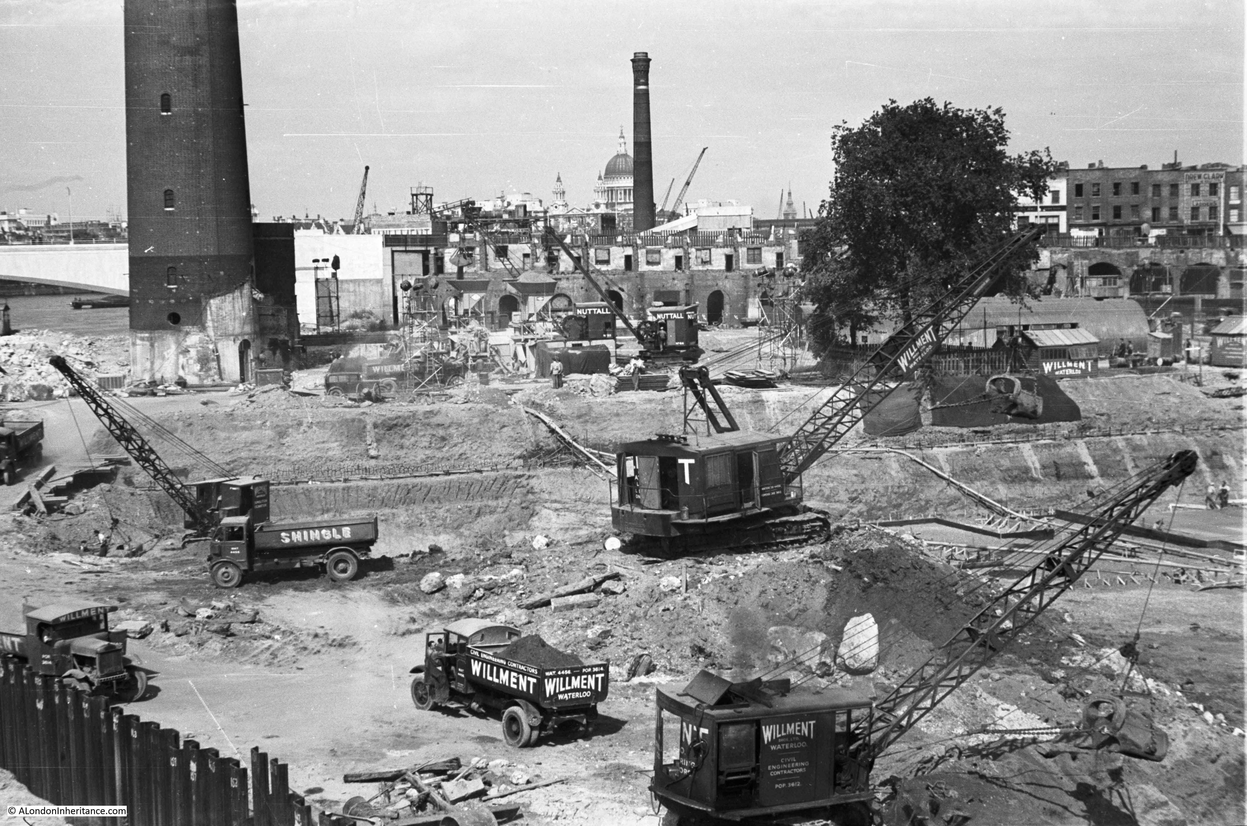
My father took the following photo at the base of the Shot Tower:

Base of the Shot Tower

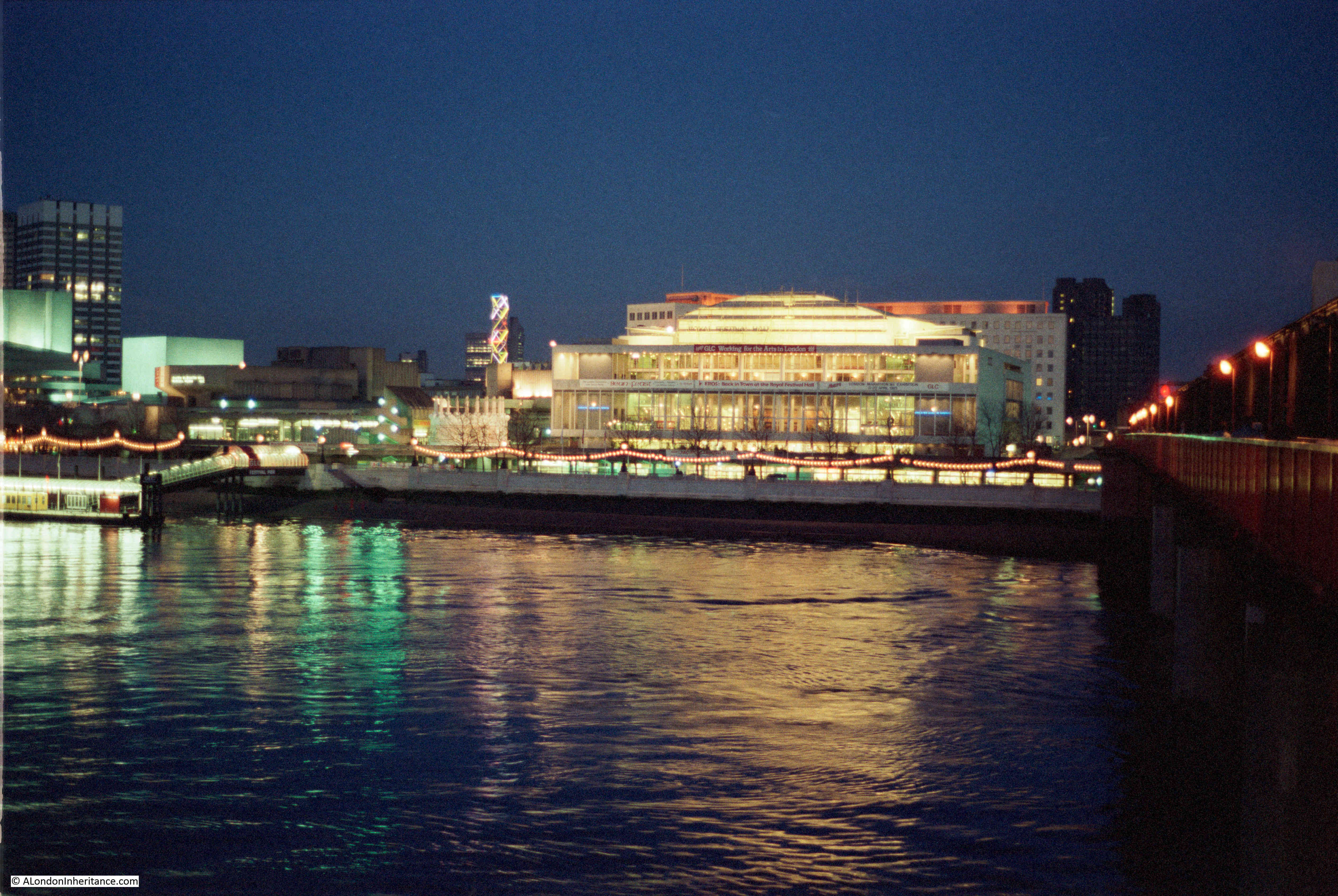
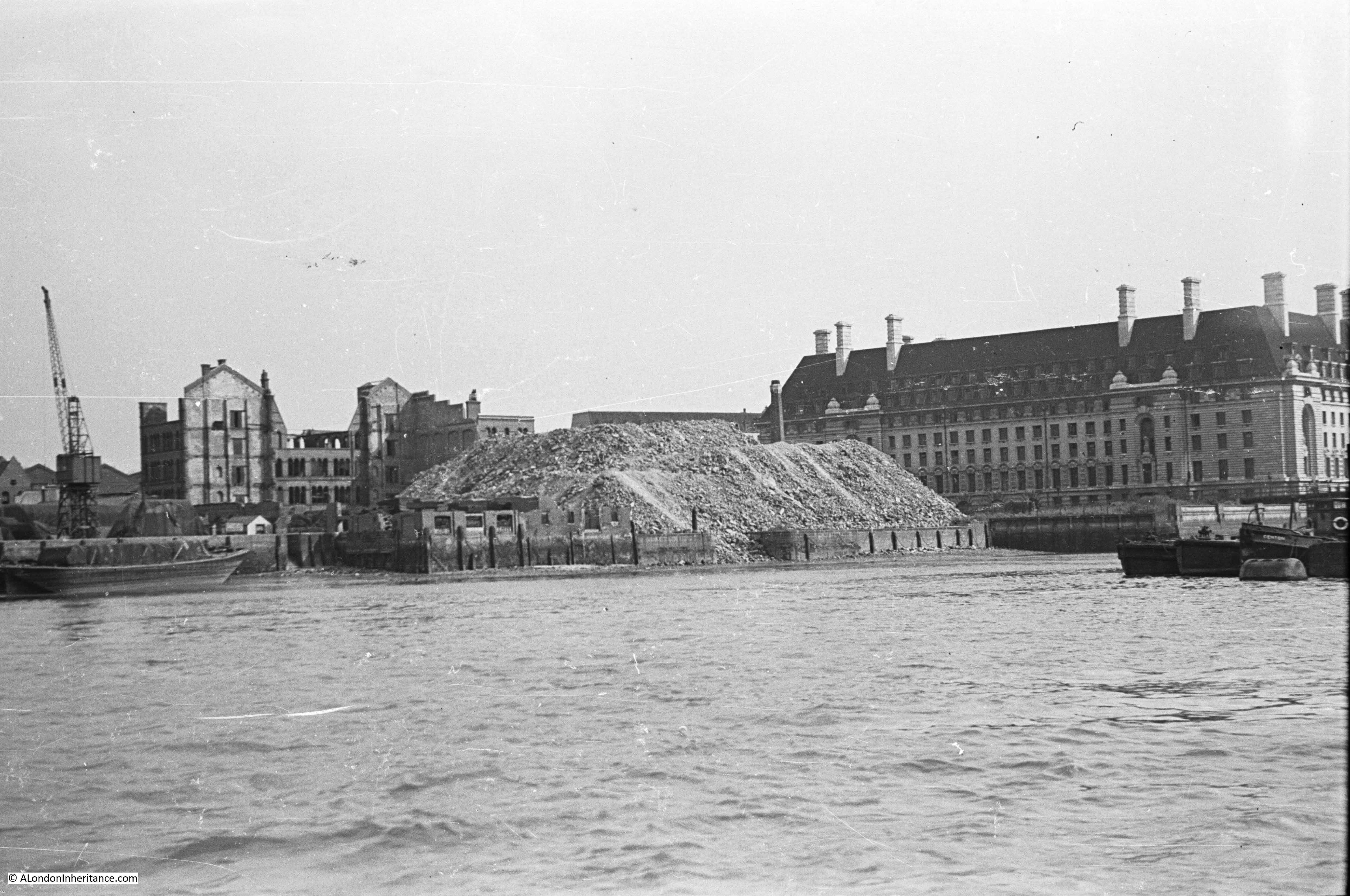
Time to return to my father’s original photo and look at the other buildings facing onto the river:
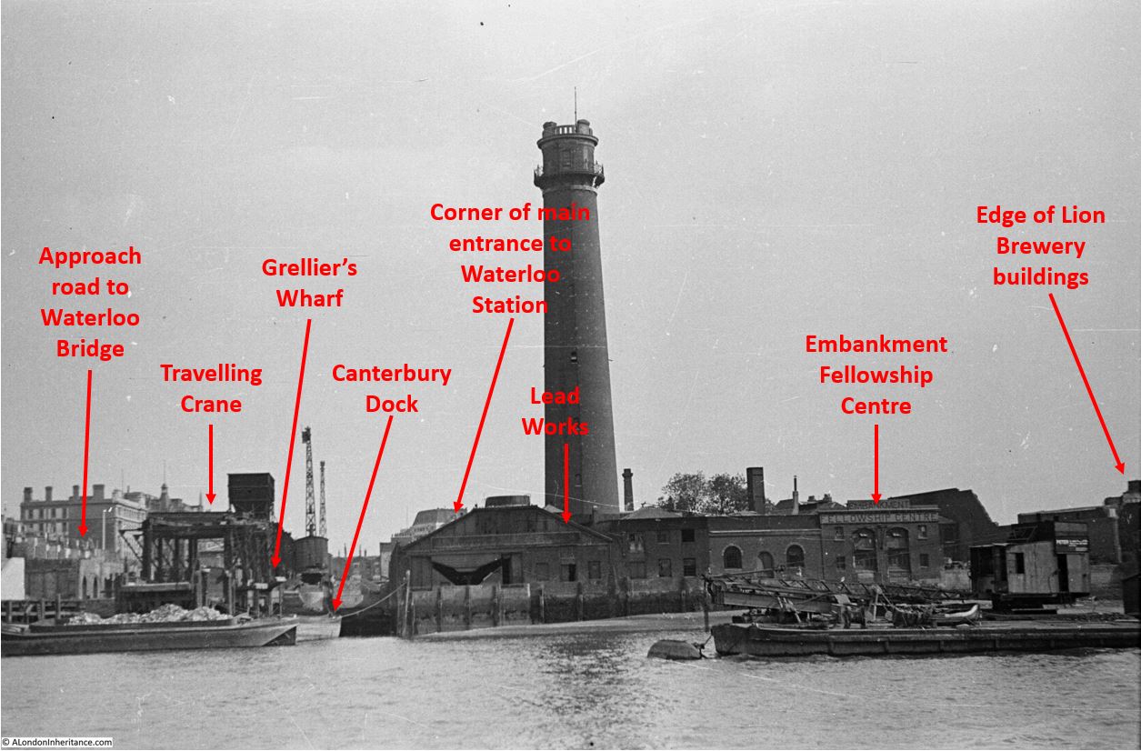
View of the South Bank in 1947

From left to right:

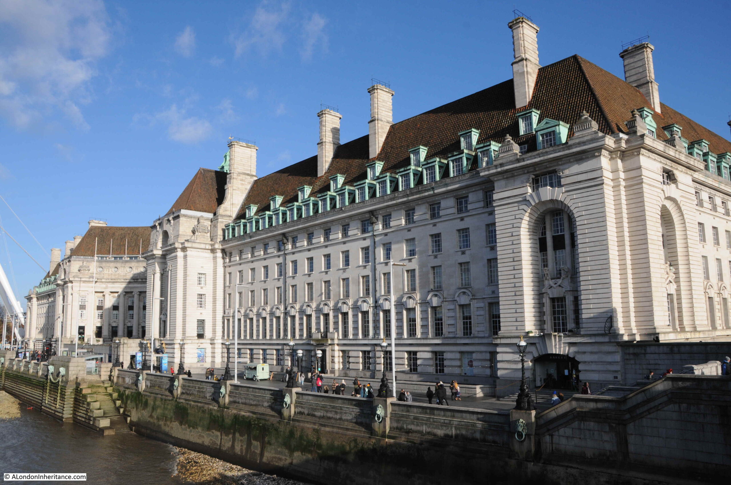
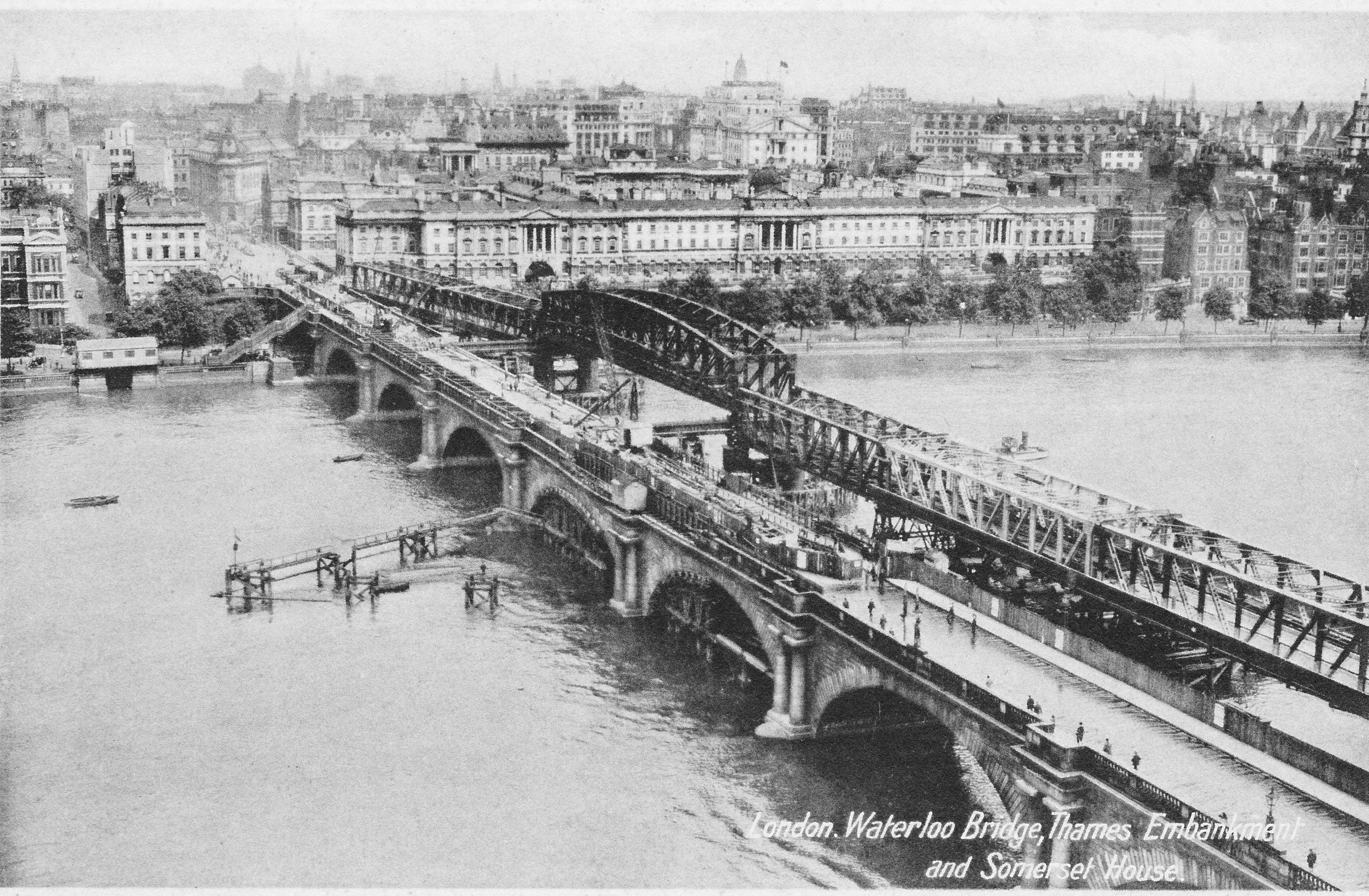
On the far left edge of the photo is the approach road to Waterloo Bridge. Behind the red arrow pointing to the approach road is one of only two buildings that have survived from the photo, the building is now part of King’s College, London.

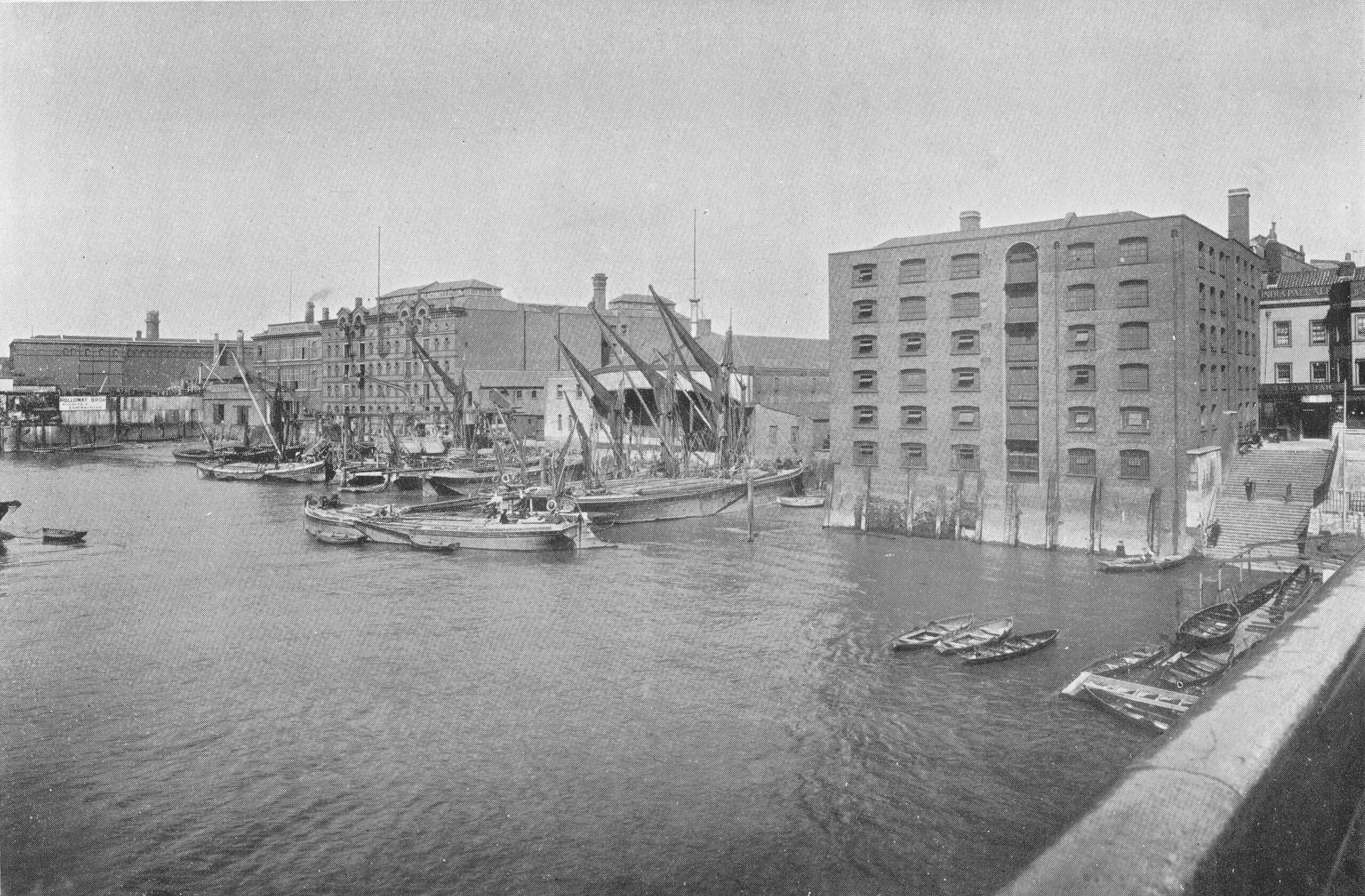
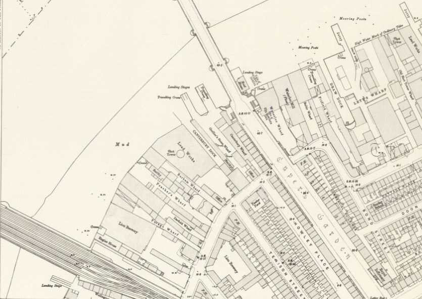
To the right is a travelling crane and Canterbury Dock that were part of Grellier’s Wharf.

The name Grellier’s Wharf came from Peter Paul Grellier, who opened a stone and marble business at the site between Belvedere Road and the Thames. Auctions were held at the site of imported stone and marble, for example, on the 20th July 1843, there was an auction of “a very large importation of very fine marble, consisting of statuary, black, black and gold, vein, dove and bardilla. This importation is recommended to the attention of the trade, as being of a very superior description”.

Canterbury Dock was a small inlet of the river into the site. The name Canterbury came from the Archbishop of Canterbury who was a major landowner in the area (and is also why many of the streets with housing developed in the area between Belvedere Road and Waterloo Station in the 19th century were named after Archbishops of Canterbury).

Slightly to the right, in the background can be seen a small part of the main entrance to Waterloo Station, the second building that remains from the 1947 photo.

The buildings of the lead works are next with the Shot Tower behind.

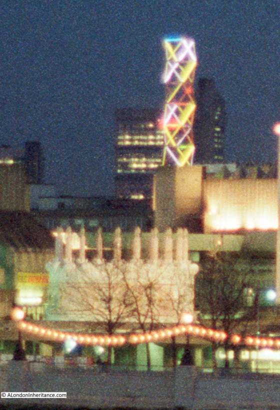
To the right of the Shot Tower, along the buildings facing the river, there is one with the name “Embankment Fellowship Centre” along the top of the building. An enlargement from the original photo is below:

Embankment Fellowship Centre

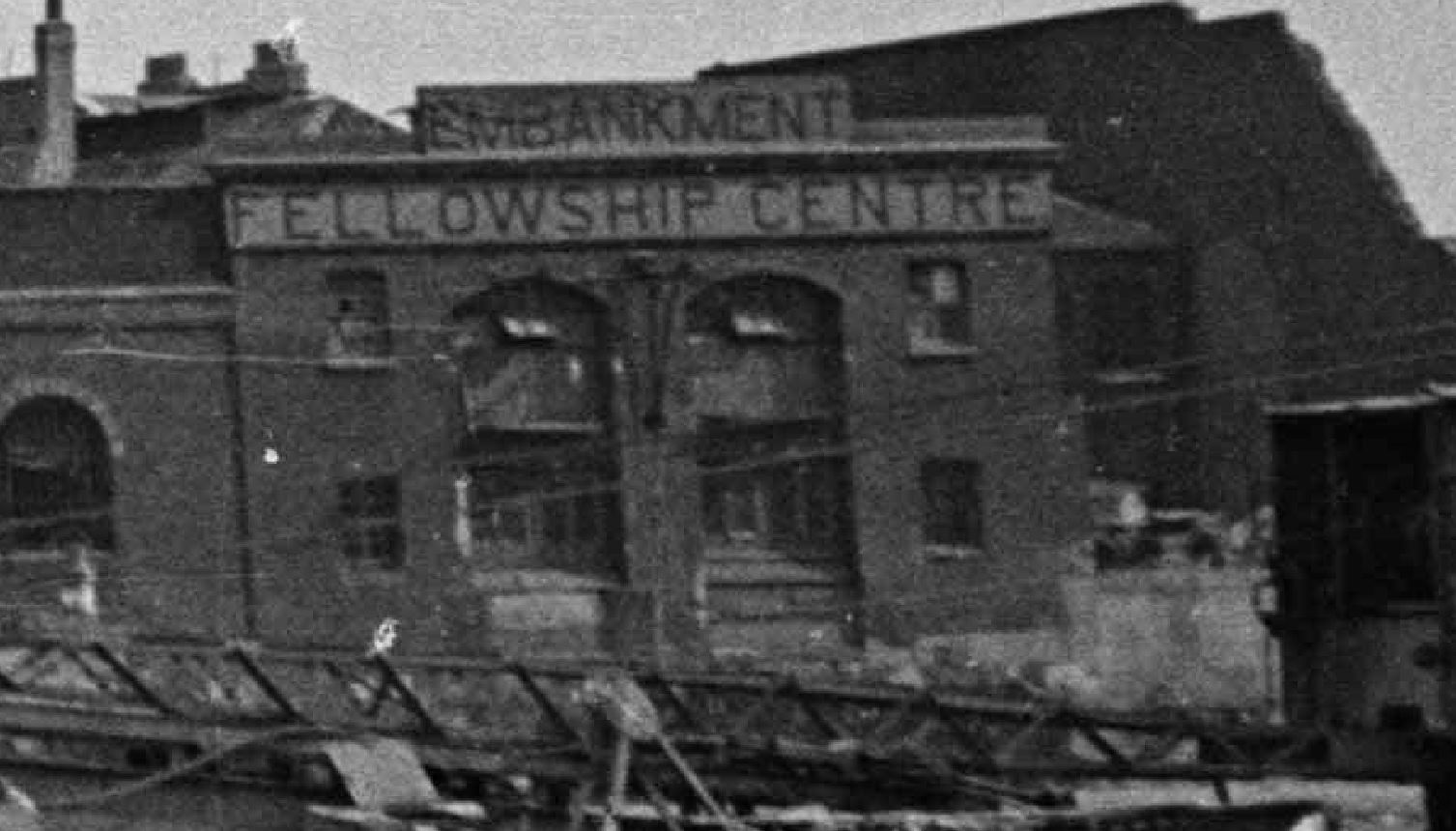
The Embankment Fellowship Centre was a charitable organisation with an aim of helping unemployed ex-servicemen who had fallen into poverty. Established in 1932 by Mrs. Gwen Huggins the wife of the Adjutant of Chelsea Hospital. She decided to do something to help the ex-servicemen she saw sleeping rough in London, and along the Thames Embankment.

Originally known as H10, and changing name to Embankment Fellowship Centre in 1933, the following article from The Sketch on the 30th of August, 1939 provides a good summary of the organisation’s approach and what took place on the south bank:

“The EMBANKMENT FELLOWSHIP CENTRE provides a constructive solution to the unemployment problem where it affects its most difficult victim, the middle-aged ex-Service man from the Navy, Army, R.A.F., or Mercantile Marine. The Centre does not cater for the vagrant, the work-shy, or the waster, but can claim that every man helped has been reduced by sheer misfortune and no fault of his own to the lowest ebb of poverty.

Painters, doctors, miners, schoolmasters, chauffer’s, stockbrokers, plasterers, mechanics and clerks are all among those who have been assisted. The credentials of all applicants who must be over forty-five, are carefully examined before admission to the Centre, where they are housed, fed and re-clothed and maintained for a period averaging 47 days per case. When a man reaches the Centre he has usually been through a bad period of stress, so the first task is to ‘recondition’ him. To that end he is surrounded by an atmousphere of cheerfulness, comfort and companionship. In the daytime he has occupational work, and every evening he has something to look forward to – a lecture, a show by an amateur dramatic society, a game of darts or billiards, or a film.

Meanwhile officials endeavour to find suitable employment for him; and since many applicants belong to overcrowded or depressed trades, the Fellowship Centre undertakes free training in its own workshops for employment in which middle-age is only a slight handicap, such as valeting, housework, cookery, carpentry, boot and shoe repairs, and so on.

Last year employment was found for 549 men, at an average age of 53 years. The total could have been larger had the premises been capable of accommodating more men. During the past four years some 2000 men have been found employment at an average age exceeding 50 years. Included in the Centre is the Ward of Hope, where a period of free convalescence is provided, following discharge from hospital for homeless and friendless men.

The Council are trying to solve the problem of expansion. They are also trying to raise capital for maintaining a country home, to be modelled on Chelsea Hospital, where veterans of good record with no pension and past the working age can be housed.

Subscriptions to this excellent cause to be sent to Major R.M. Lloyd, Appeal Director, the Embankment Fellowship Centre, 59 Belvedere Road, S.E.1.”

The Embankment Fellowship Centre made a film in 1939 telling the story of a middle aged man named Smith, who lost his job, and could not get another because of his age. Things went downhill quickly with the family possessions being repossessed until he was recommended to the centre. With the centre’s help, he found a new job, and the last scene of the film is Smith and his wife agreeing to donate his recent pay rise to the Embankment Fellowship Centre.

The film “Smith” can be watched here.

The centre on the South Bank was closed not long after my father took the photo, and Hansard records a question in Parliament about the closure, when on the 23rd September 1948, Commander Noble “asked the Minister of Health why the Embankment Fellowship Centre, Lambeth, which provides accommodation for ex-Service men, has just been given notice to quit by 1st December”

Mr. Bevan answered “I understand that this and other notices are occasioned by a London County Council scheme for the redevelopment of the area of the South Bank in which this centre lies.”

The redevelopment of the South Bank would lead to the Royal Festival Hall and the Festival of Britain.

The Embankment Fellowship Centre relocated, and in 2007 changed name to  ‘Veterans Aid’, and is still in operation.

Veterans Aid have their main London centre at ” New Belvedere House”, which is rather nice as hopefully the intention was to name the building after the original location at 59 Belvedere Road on the South Bank.

On the right edge of the 1947 photo is part of the Lion brewery. It would be demolished to make way for the Royal Festival Hall which would be built on the land to the right of the Shot Tower.

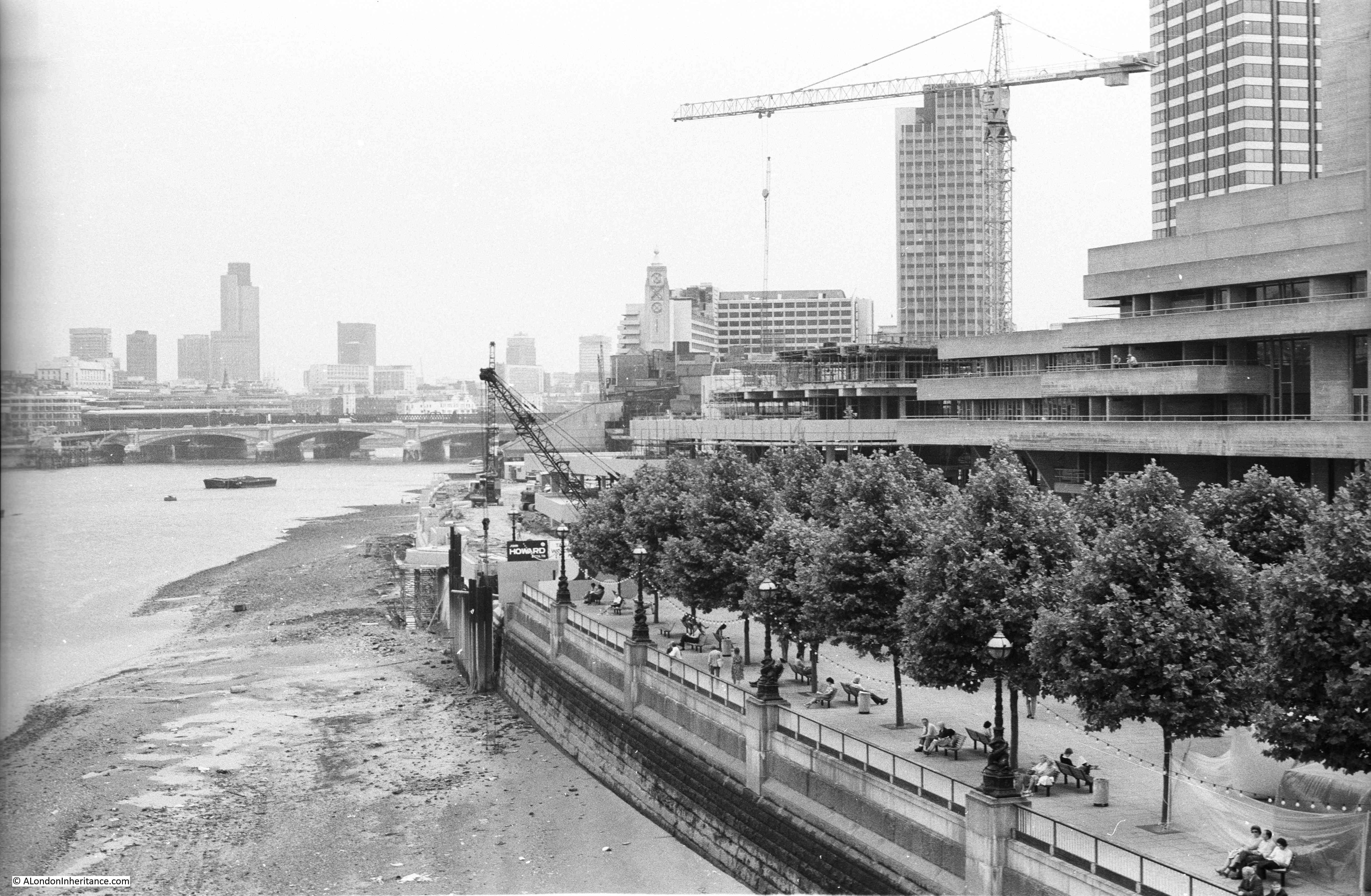
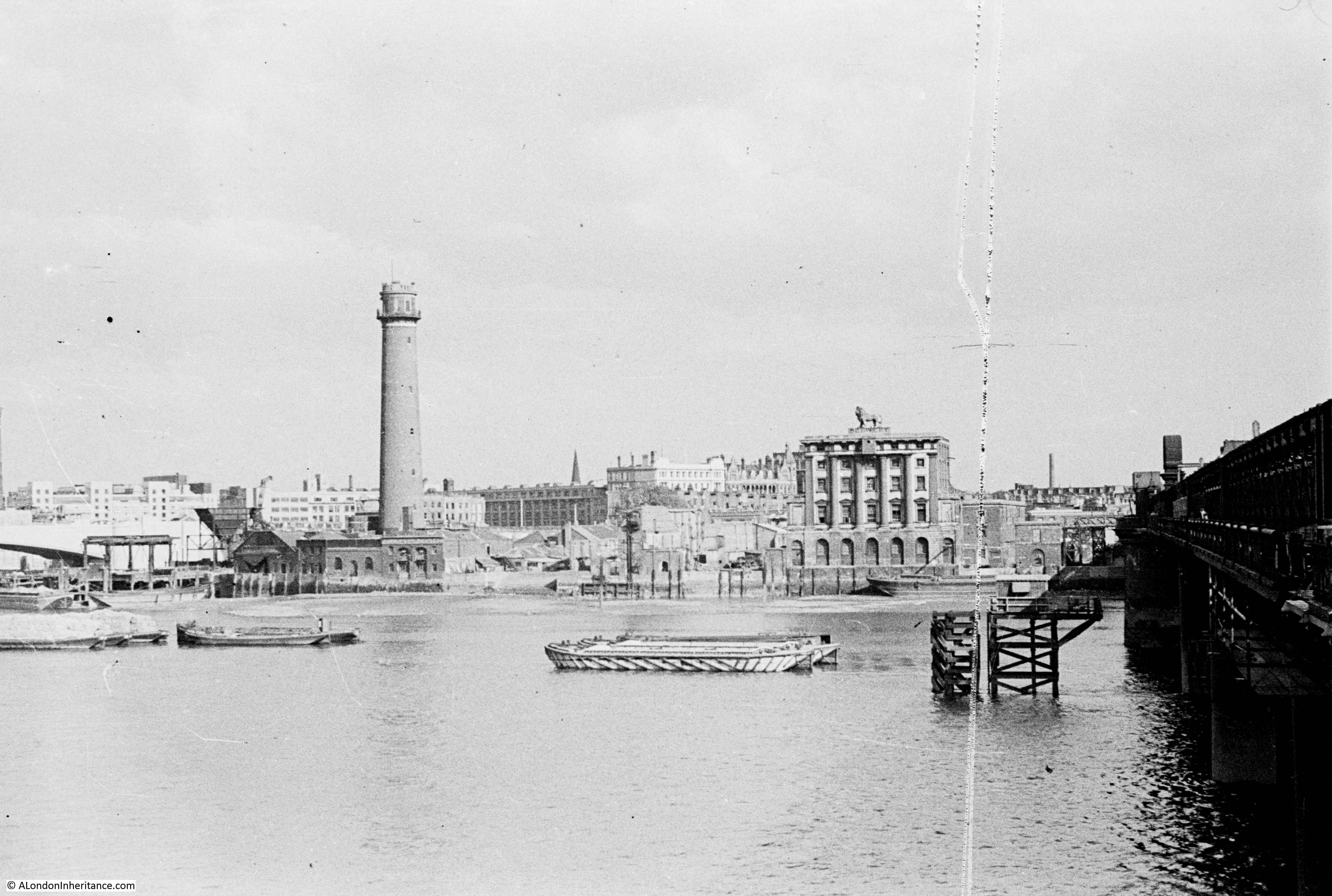
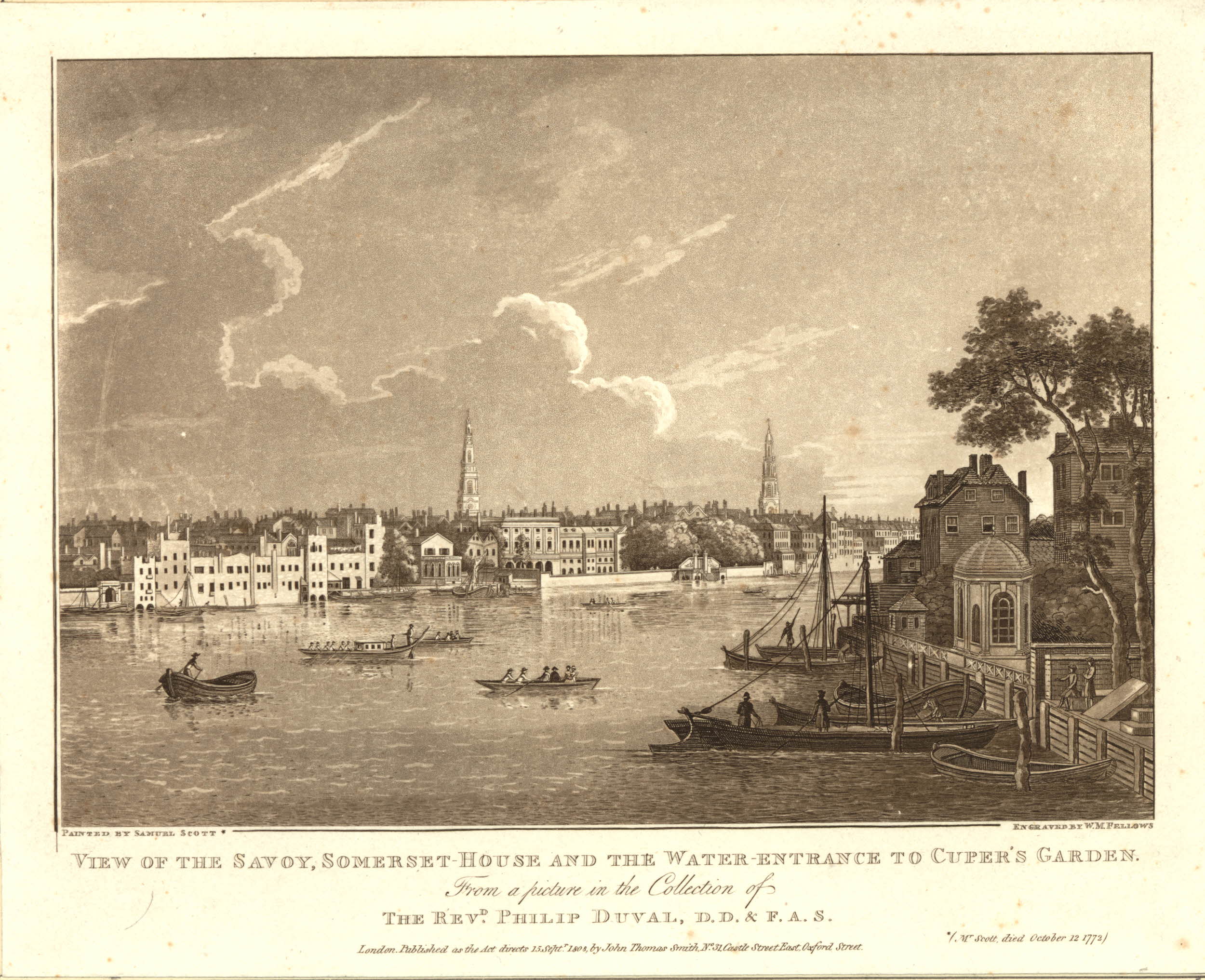
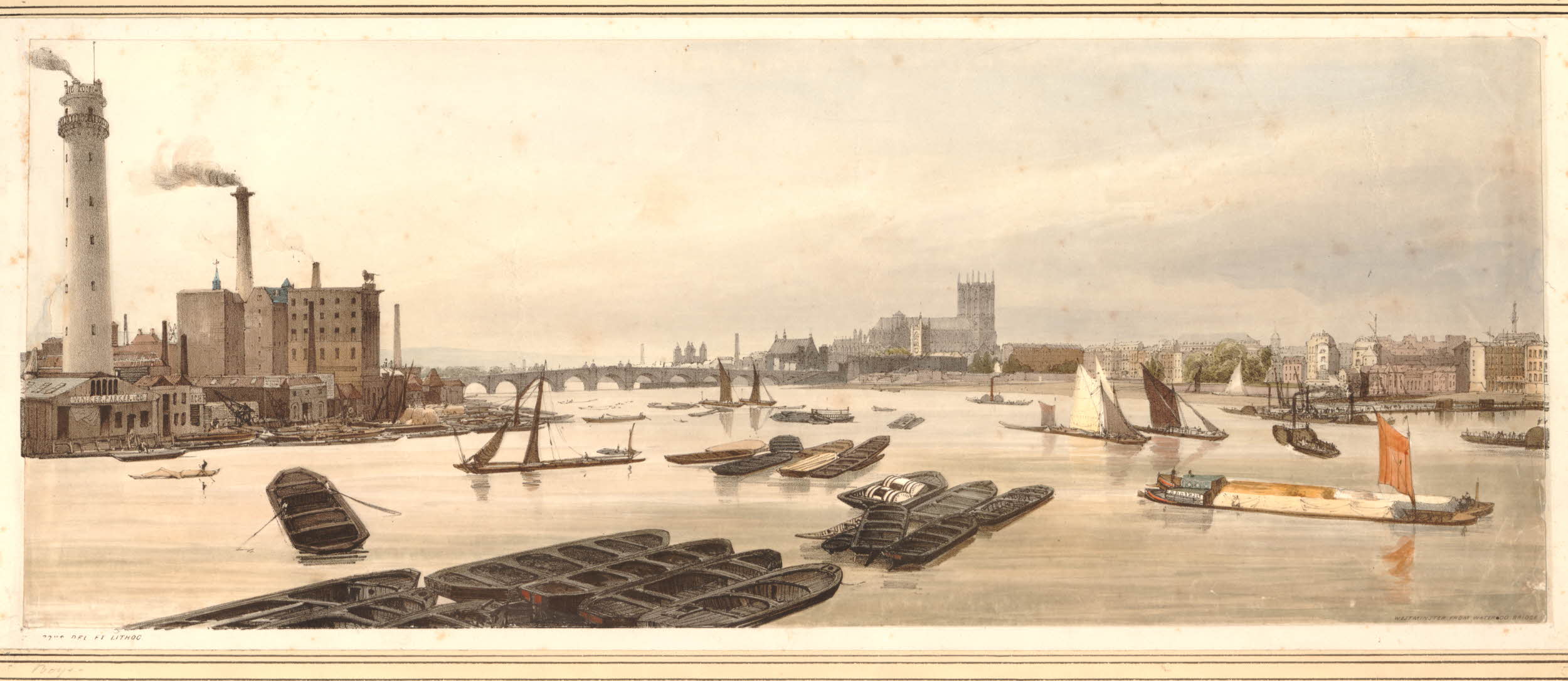
The South Bank Shot Tower was not the only shot tower along the south bank of the river. The following postcard is a view from the top of the Shot Tower, looking towards the City of London:

View from the Shot Tower

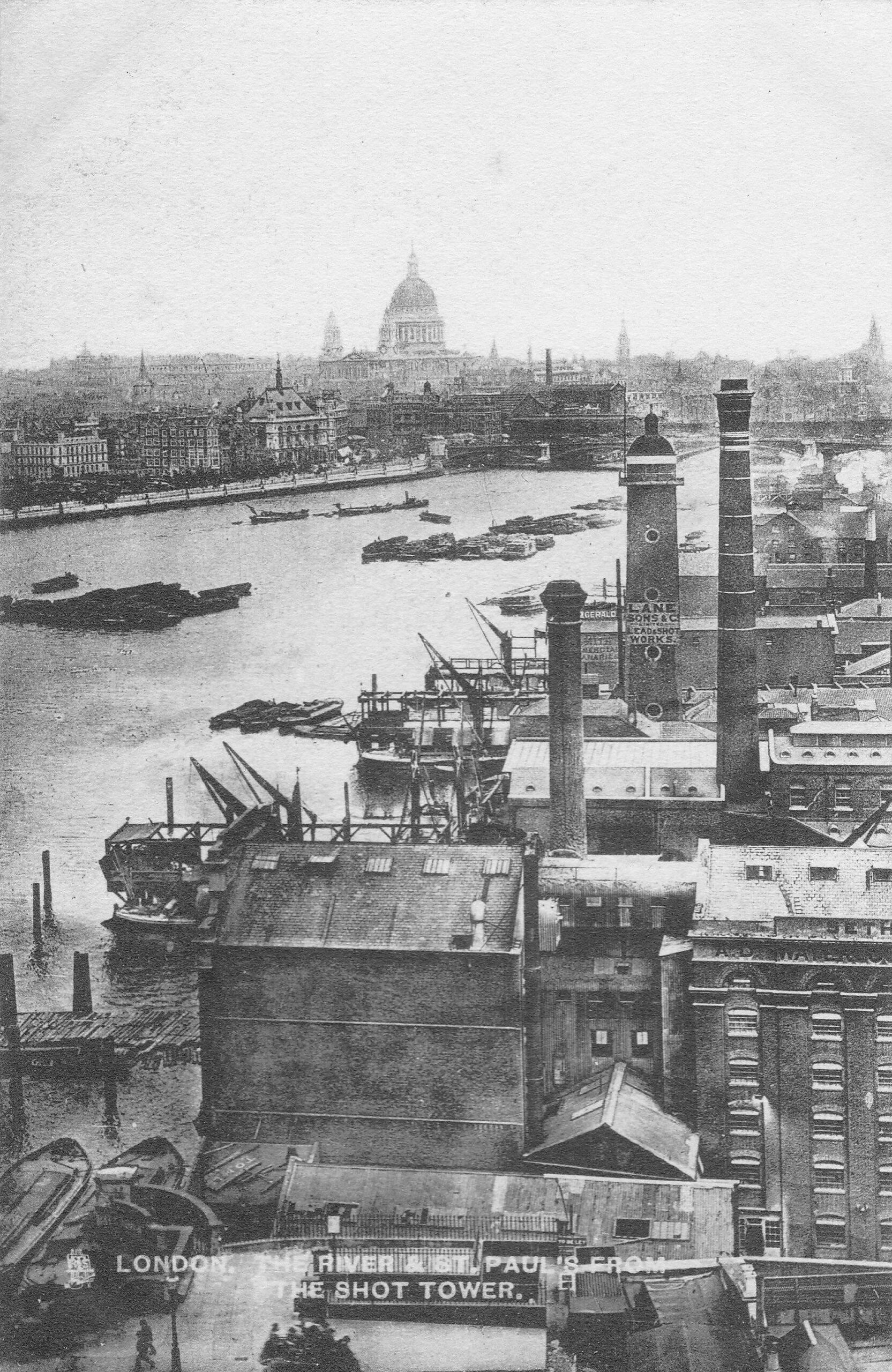
Between the two chimneys is a much wider tower, with a dome shaped top. This was also a shot tower, and was older than the one on the South Bank.

Built around 1789, it was described as “a new structure, which cost near six thousand pounds, but cannot be considered as an object ornamental to the River Thames”. It was 150 feet high, and in 1826 the top part was destroyed by fire, which was not surprising given the activity carried out within the tower.

The lead works which included this second shot tower were also owned for a period by Walker, Parker & Company, the same company that owned the South Bank Shot Tower. They left the works in 1845 to concentrate on their South Bank site. The site was advertised in the Morning Chronicle on the 9th October 1845 as: “EXTENSIVE LEAD WORKS, Shot Tower, Wharf, Dwelling-house, and Buildings, Commercial-road, Waterloo-bridge. To be LET on LEASE for twenty one years, from Michaelmas next, when possession will be given in one or two lettings, all those capital and spacious PREMISES, with Wharf, extending about 120 feet next the river Thames, with the lead works, shot tower, and buildings lately occupied by Messrs.’ Walker and Co. Also a counting house, extensive stabling and premises, lately occupied by Mr. Sherwood”.

By the time of the above photo, the large advertising sign on the side of the shot tower was advertising that the works were “Lane, Sons & Co Limited. Lead and Shot Works”.

The street name in the advert is given as Commercial Road. This was a short lived name for the street which is now Upper Ground.

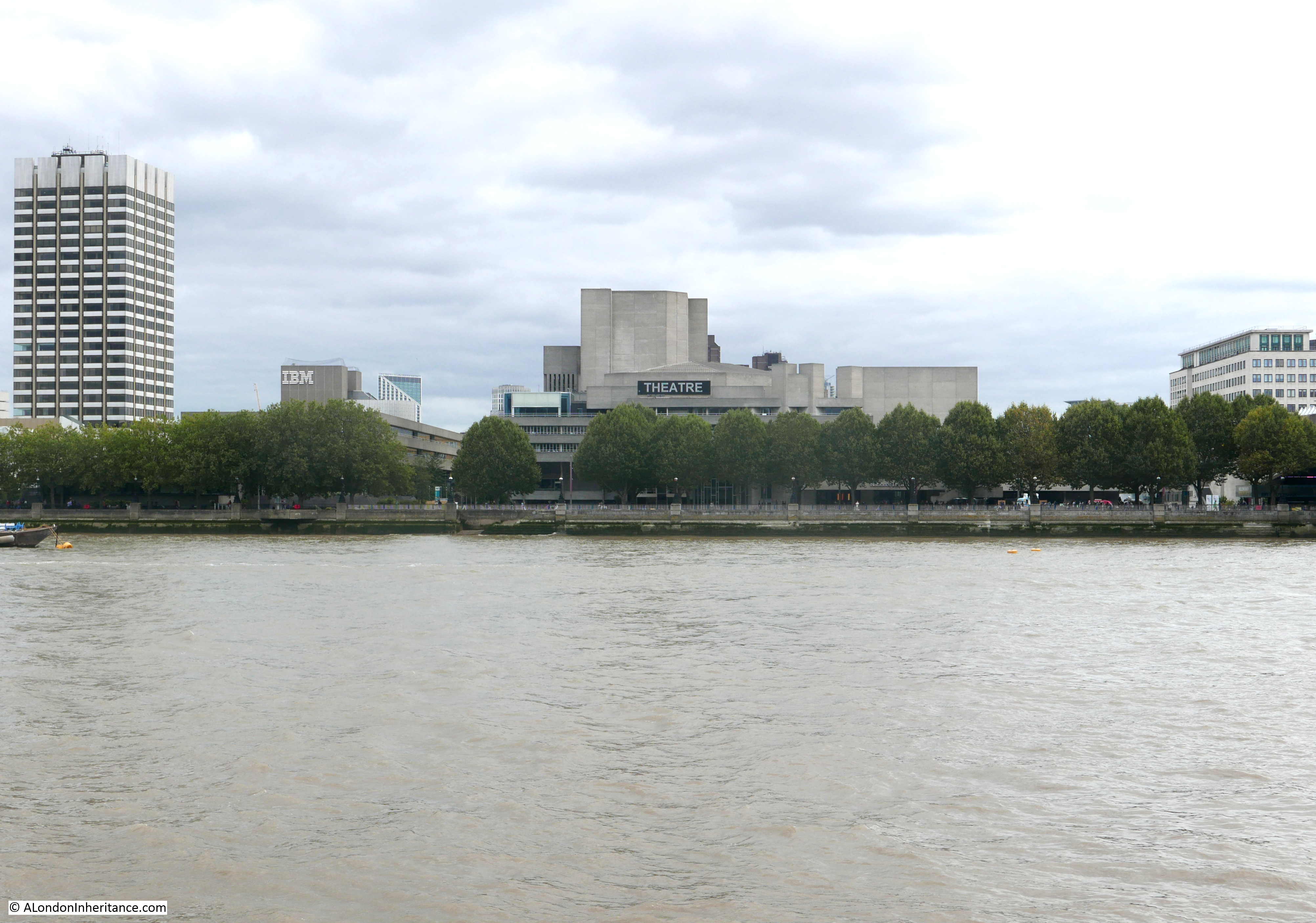
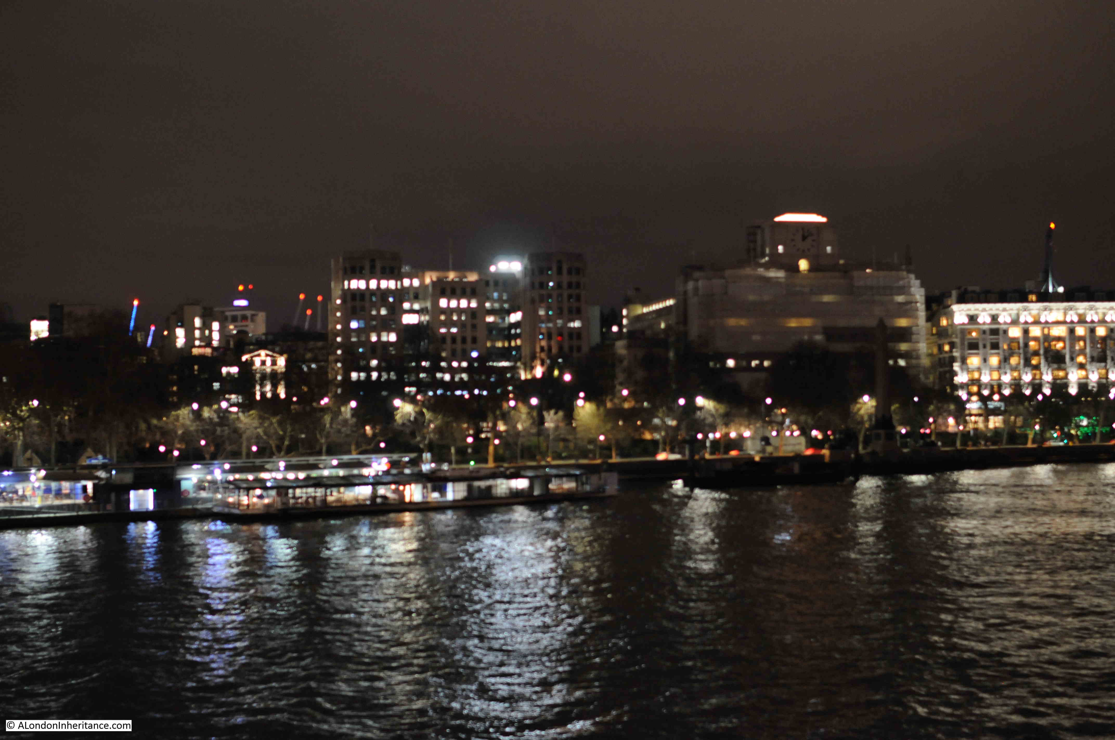
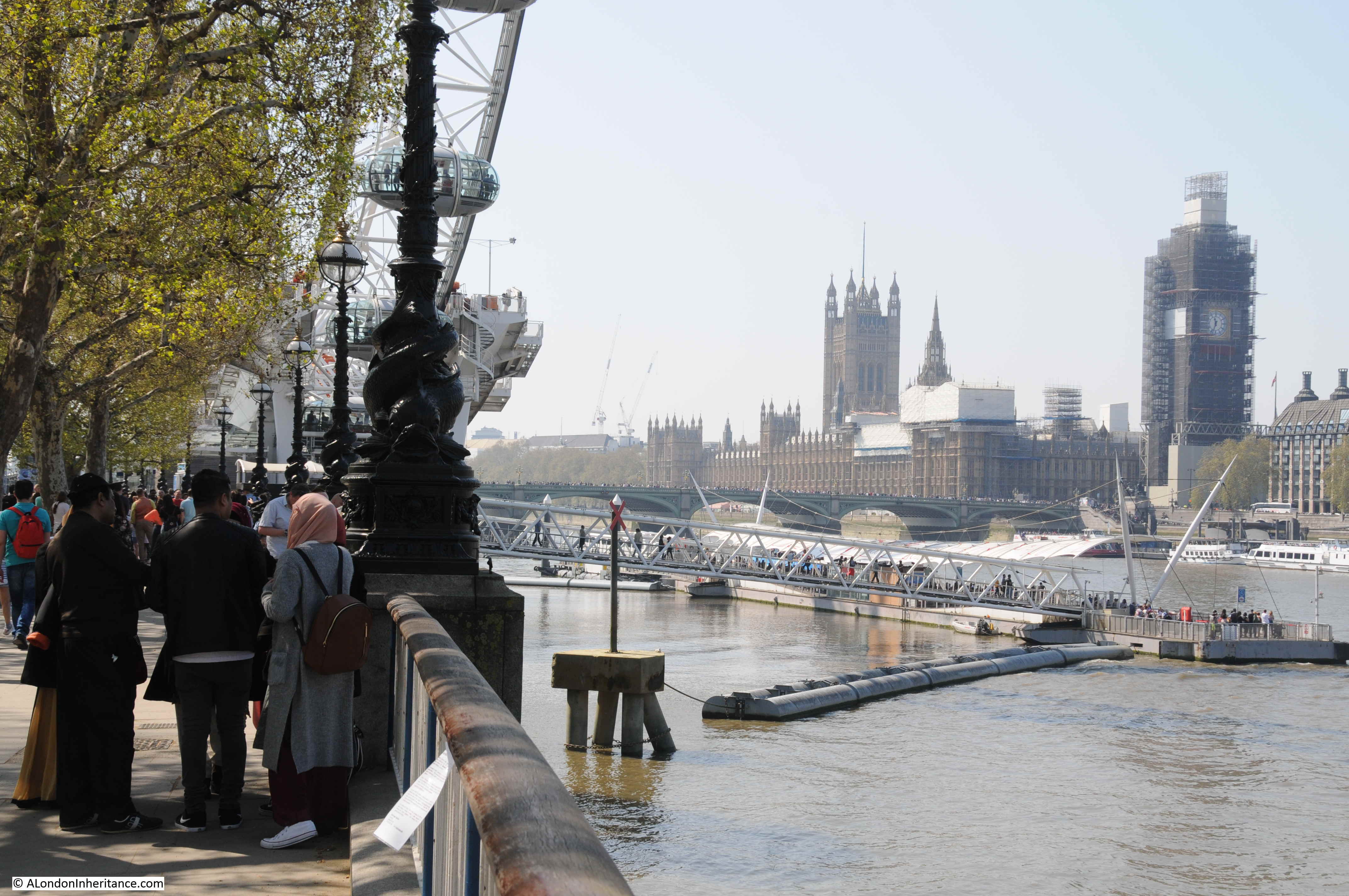
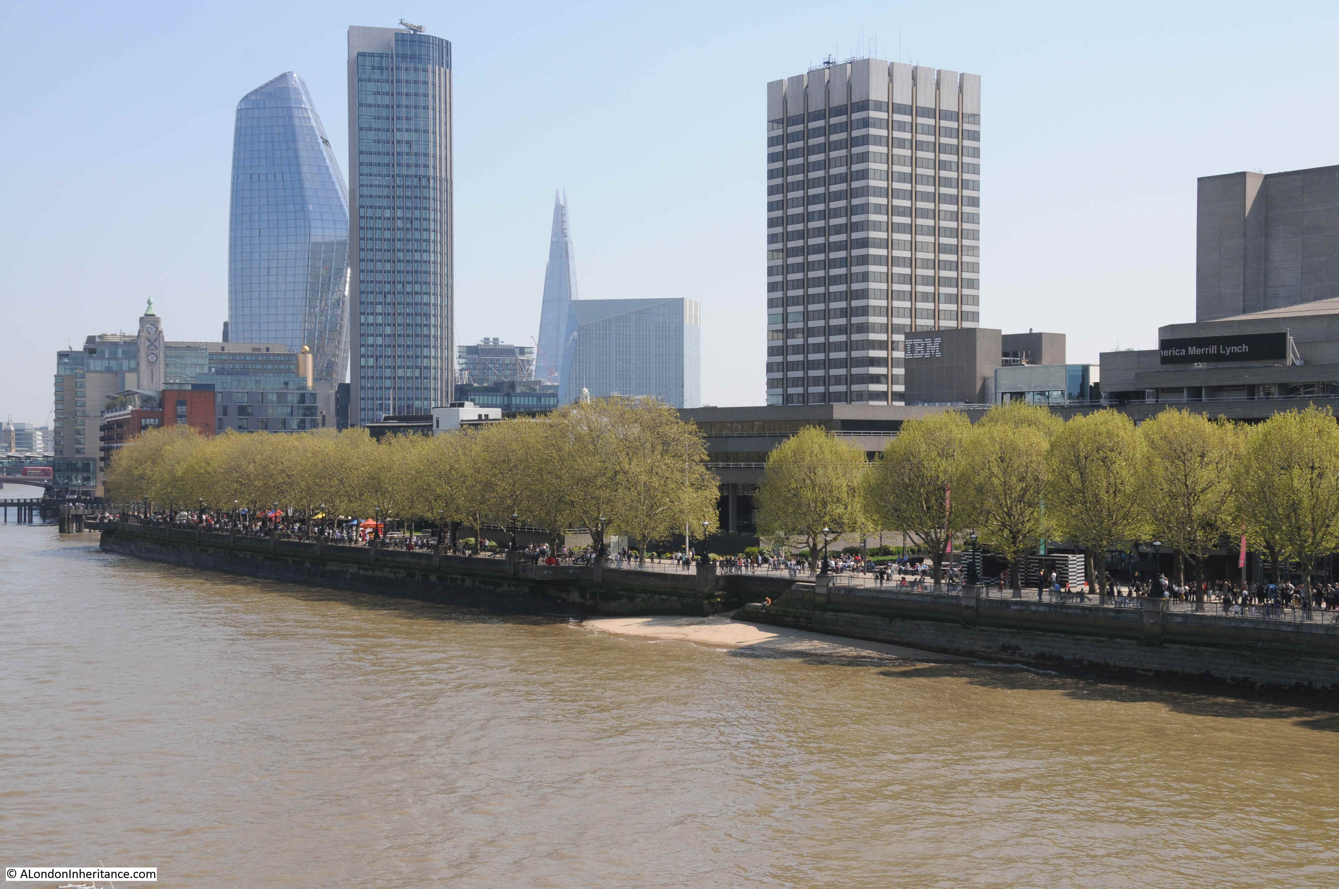
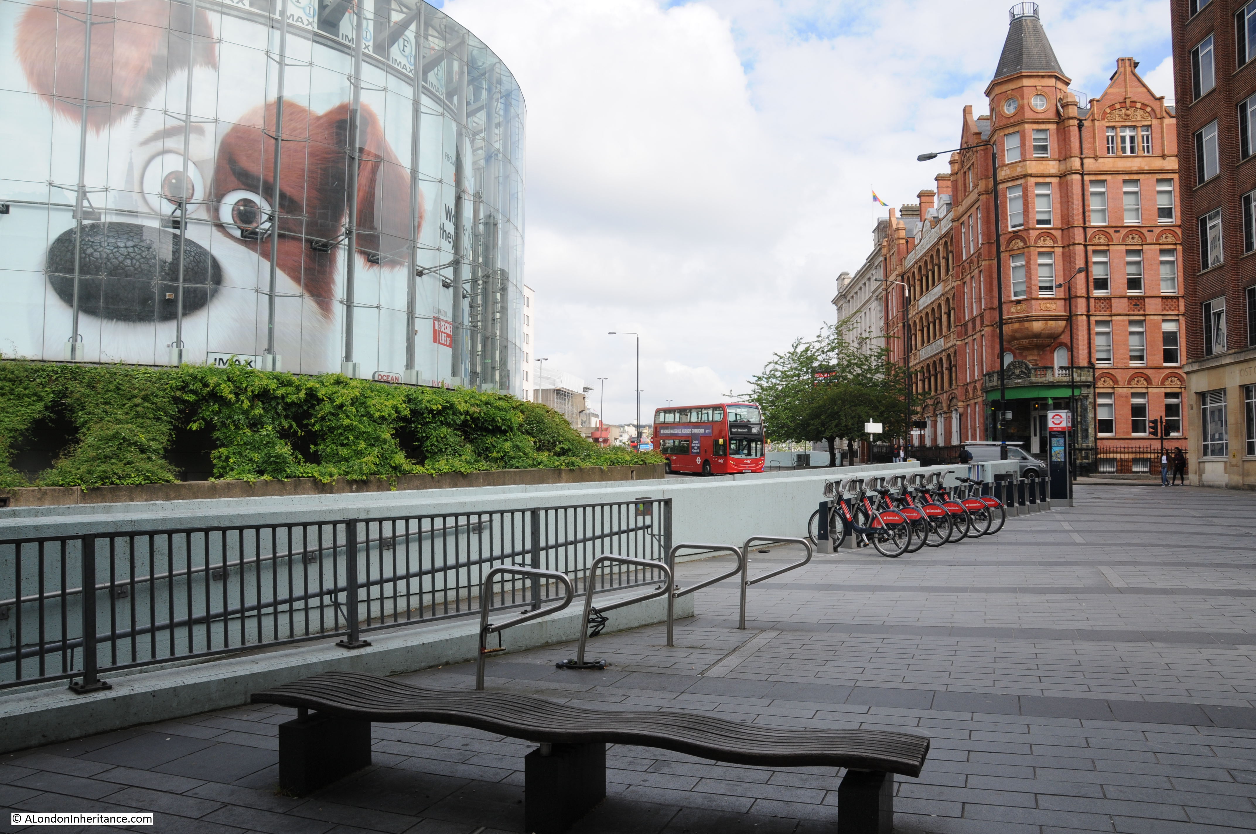
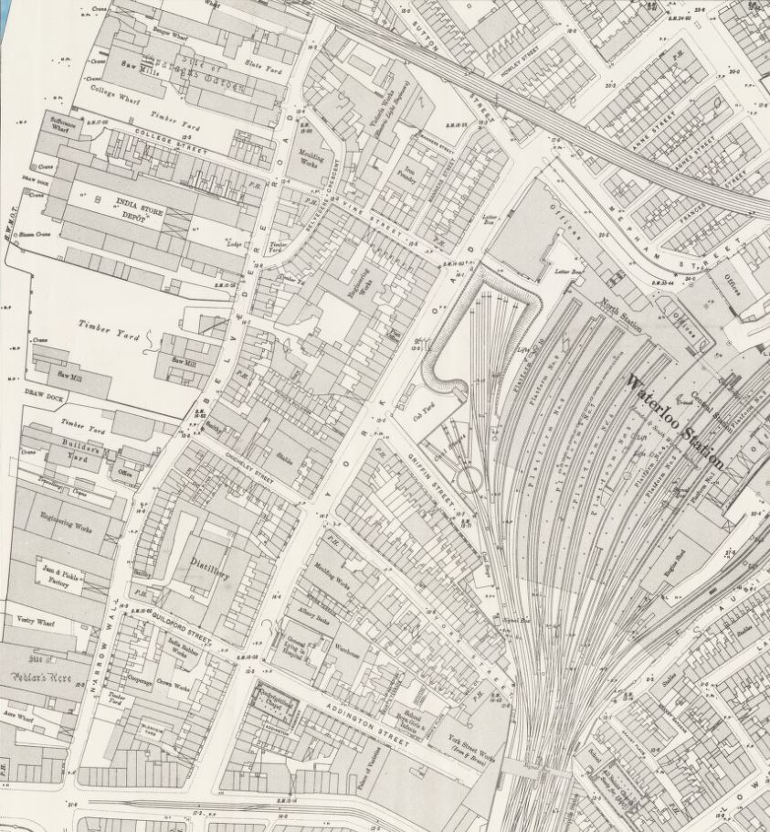
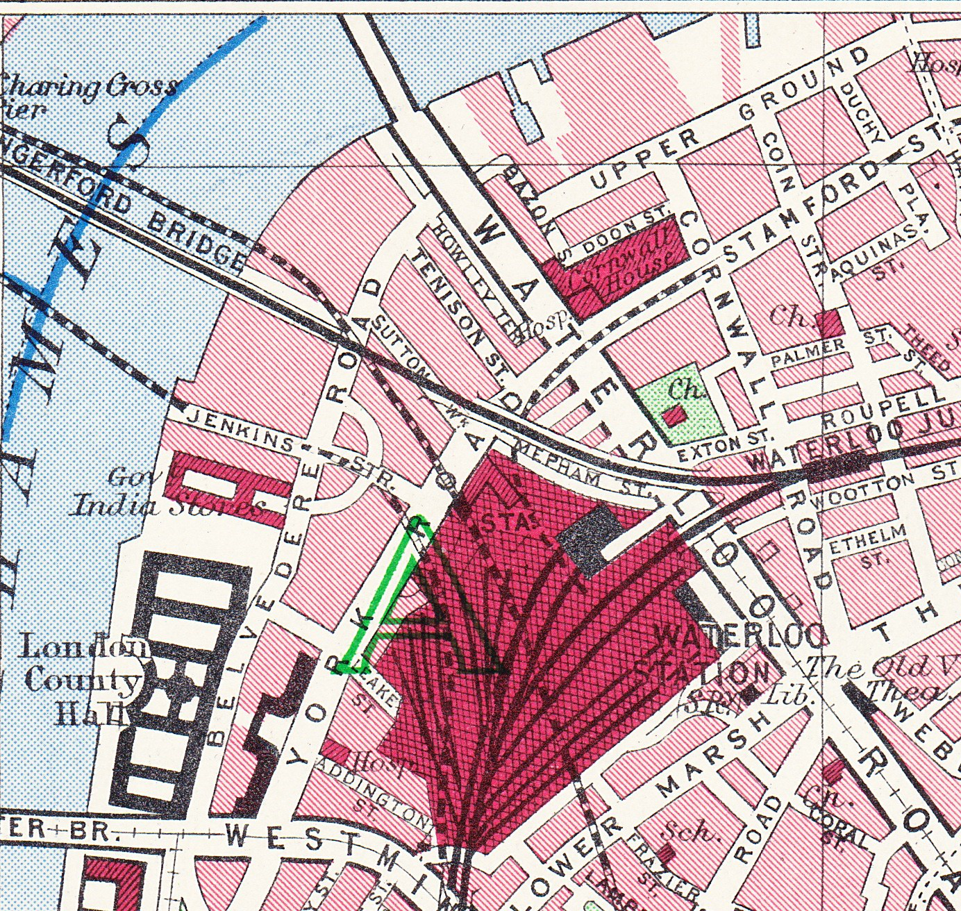
The shot tower was demolished in 1937 after having been out of use for several years. Today, the IBM offices (in the photo below) occupy the site of this second shot tower and lead works:

It is such a shame that the South Bank Shot Tower could not have been included in revised plans for the Queen Elizabeth Hall, and could today be seen between the Queen Elizabeth and Royal Festival Halls.

A reminder of the industrial history of the area, and adding some historical complexity to the buildings we see today, lining the side of the river.

alondoninheritance.com

County Hall and a Roman Boat

Today, the River Thames runs between embankments on the north and south sides of the river, embankments built over the last 160 years, and were still being completed in the 1980s. For centuries the river had an extended foreshore which would shift with the tides, and particularly on the south bank, large areas of wet, marshy land.

One stretch of the embankment, built during the first decades of the 20th century, is the stretch in front of County Hall, the purpose built home of the London County Council, then the Greater London Council, and now home to hotels and tourist attractions.

County Hall photographed from Westminster Bridge:

County Hall from Westminster Bridge

The London County Council was formed in 1889 to replace the Metropolitan Board of Works and to gradually take on powers covering Education, Health Services, Drainage and Sanitation, Regulation and Licensing of a whole range of activities, dangerous materials, weights and measures, street Improvements – there was hardly an aspect of living in London that would not be touched by the LCC.

The problem with having all this responsibility was that the LCC also needed the space for all the elected officials and the hundreds of staff who would deliver the services.

The LCC initially had an office at Spring Gardens, near Trafalgar Square, the old home of the Metropolitan Board of Works, but quickly started looking for a new location as staff began to be scattered across the city.

A wide range of locations were suggested, but they were either too small, too expensive or too close to the Palace of Westminster – the London County Council wanted to be seen as a completely separate authority to the national government, but still wanted a prominent location, suitable for the governance of London.

The LCC already had a Works Department which occupied a small part of a site on the South Bank, to the side of Westminster Bridge.

The new St Thomas’ Hospital on the other side of Westminster Bridge had already started the improvement of the Lambeth side of the river, which included the creation of a large formal embankment.

The land across Westminster Bridge Road from the hospital provided a sufficient area for the LCC with space to grow. It was in a prominent position, directly facing onto the river, and importantly was on the opposite side of the river to the Palace of Westminster so was close to, but separate from the national government.

As the site was being acquired, attention turned to the design of the new building, and a competition was organised to invite designs for the new home of the LCC.

There were some incredibly fancy and ornate designs submitted, however the winning design was one of relative simplicity by the 29 year old architect Ralph Knott.

Construction of County Hall began in January 1909 with the construction of a coffer dam in the river, which allowed the new river wall to be built, reclaiming an area of land from the river. Work then began on excavation of the ground, ready for laying a concrete raft on which County Hall would be built.

Work was sufficiently advanced, that by 1912 the laying of the foundation stone could take place, and to commemorate the event, a booklet was published, providing some history of the construction of County Hall up to 1912, along with some plans and photographs of the original river frontage, and an important find during digging ready for the construction of the concrete raft.

County Hall foundation stone

County Hall would be built on a 6.5 acre site, and to achieve this area, a significant part of the foreshore and river needed to be reclaimed. In total two and a half acres of the river were reclaimed and a new river wall constructed to hold back the Thames.

A new river wall had been part of the construction of St Thomas’ Hospital, and the alignment of this wall would be continued with the construction of County Hall.

588 feet of new river wall was constructed. the most difficult part being where the wall would come up against Westminster Bridge. The piers of Westminster Bridge had been built on timber piles, and the foundations of the river wall would go a further 6 feet deeper than those of the bridge, so careful construction was needed to avoid damage to the bridge. This included steel piles driven around the foundations of the bridge to provide some protection from the excavations of the river wall.

Construction of the wall started in January 1909 and was completed in September 1910 at a total cost of £58,000.

The booklet includes the following diagram which shows the outline of County Hall, the alignment of the new river wall, and within the outline of County Hall, the original buildings on the site and the alignment of the old river wall, showing just how much was reclaimed from the river.

County Hall

The site was occupied by businesses such as Cross and Blackwell with a jam and pickle factory, and the engineering firm of Peter Brotherhood who had their radial engine factory on the site. Their radial engine was an innovative machine used to power the Royal Navy’s torpedoes, as well as being a source of power for other machines including fans, and dynamos for the generation of electricity.

The booklet also includes the following photo of the site from Westminster Bridge. I suspect the embankment wall now runs roughly where the photographer was standing.

County Hall original river frontage

If you look at the edge of the photo on the right, there are a large flight of stairs leading down to the river, and at the top of the stairs can just be seen part of a pub. The pub had one side facing onto Westminster Bridge Road, and the other facing a small square and the river stairs. With limited research time, I have been unable to find the name of the pub, and it is not mentioned in the County Hall booklet.

This is the view of County Hall today, the photographer for the above photo was probably standing a bit closer to the river wall than I am, but everything in the following photo was built on reclaimed land.

County Hall

The new river wall and embankment was a significant construction, and before work on this could start, a timber dam had to be built to hold back the Thames from the construction site. The dam consisted of a wall of tongue and groove timber piles, which had to be driven through four feet of mud, then eleven feet of ballast (sand, gravel etc.) before reaching London Clay, then driven further into the clay to provide a firm fixing.

This was needed as the dam would have to hold back a significant wall of water, as the tidal range could be over 20 feet, so the dam had to hold back sometimes no water (at very low tides) and at very high tides, a wall of over 20 feet of water pressing on the dam.

The embankment wall was a very substantial construction, reaching down over 35 feet below the original Trinity high water mark. Between the river wall and County Hall, a new public walkway was constructed, and under the walkway there were large vaults within the open space between the walkway and the concrete raft at the base.

The following drawing shows the construction of the wall and embankment:

County Hall Embankment Wall

Behind the wall, a large area was excavated. Due to the marshy, damp nature of the ground a concrete raft was needed across the whole area on which County Hall would be built. It was during the excavation to build that raft that a significant discovery was made of the remains of a Roman boat, seen in the following photo as discovered:

County Hall Roman Boat

The booklet provides a description of how the boat was found:

“The discovery was primarily due to Mr. F.L. Dove, the present chairman of the Establishment Committee. While inspecting in January 1910, with Mr. R.C. Norman, the then Chairman of the Committee, the excavation for the concrete raft, he noticed a dark curved line in the face of the excavation immediately above the virgin soil, and some distance beneath the silt and the Thames mud. The workmen engaged suggested that it was a sunken barge, but Mr. Dove realised from its position that it must be of considerable antiquity, and accordingly requested the Council’s official architect to have the soil carefully removed from above.”

Mr. Dove was right about the considerable antiquity of the find. When excavated, it was found to be a Roman boat, constructed out of carved oak. It was lying 19 feet, 6 inches below high water, and 21 feet 6 inches below the nearby Belvedere Road.

The size of the boat was about 38 feet in length, and 18 feet across.

Within the boat were found four bronze coins, in date ranging from A.D. 268 to 296, portions of leather footwear studded with iron nails, and a quantity of pottery. There were signs that the boat had been damaged as several rounded stones were found, one of which was embedded in the wood, and there was indication that some of the upper parts of the boat had been burnt.

After excavation, the boat was offered to the Trustees of the London Museum, who accepted, and the boat was removed from site, with the following photo showing the transport of the boat from the excavation site. It is within a wooden frame to provide some protection.

Roman Boat

The boat was put on display in Stafford House, then the home of the London Museum. (Stafford House is now Lancaster House, in St. James, a short walk from Green Park station).

The following photo shows the boat on display:

Roman Boat

I contacted the Museum of London to see if parts of the boat were available to view, and was told a sorry story of the limitations of preservation techniques for much of the 20th century.

The boat was found beneath the silt and Thames mud in an area of damp ground. This created an oxygen free environment which preserved the boat’s timber.

As soon as the boat was exposed, it started to dry out, and over the year the timbers cracked and disintegrated. Museum of London staff tried to patch up with fillers, but this was long before the chemical means of conservation that we have today were available.

When the Museum of London moved to its current site on London Wall, only a small section was displayed, and this was removed from display when the gallery was refurbished in the mid-1990s.

Some key features of the boat such as joints and main timbers have been preserved as well as they can be after so many years, and are stored in the Museum of London’s remote storage facility, so not available for public display.

The Museum of London did donate some of the fragments to the Shipwreck Museum in Hasting, so I got in contact with them to find out what remained.

I had a reply from the former City of London archaeologist, Peter Marsden, who advised that much of what was preserved at Lancaster House was modern plaster of paris painted black. He also confirmed that only some ribs and a few bits of the planks survive, and are no longer on display.

Peter Marsden has written some fascinating books on Ships of the Port of London. They are very hard to find, however the English Heritage Archaeology Data Service has the book “Ships of the Port of London, First to eleventh centuries AD” available to download as a PDF from here. It is a fascinating read which includes many more discoveries in the Port of London as well as the County Hall Roman boat.

The age of the boat seems to be around 300 AD which is confirmed by the coins discovered in the boat all being earlier, and Peter Marsden managed to get a tree ring date of around 300 AD from one of the planks.

It is difficult to confirm exactly why the boat was lost on the future site of County Hall. There was much speculation at the time, including in the County Hall booklet, that the boat had been lost during battles in AD 297. The burning on parts of the wood written about in the booklet has not been confirmed, and the stones could have been ballast.

It seems more likely that the boat may have been damaged, or simply lost on what was the marshy Thames foreshore and land of the south bank. Away from the City of London, the boat was left to rot, gradually being covered by the preserving mud and silt of the river until discovery in 1910.

There is another feature on the plan of the new County Hall that suggests the boat could have been on the edge of the Thames foreshore.

On the opposite side of County Hall to the river is a street called Belvedere Road. This was originally called Narrow Wall. The first written references to the name Narrow Wall date back to the fifteenth century, and it could be much older. The name refers to a form of earthen wall or walkway, possibly built to prevent the river coming too far in land, and as a means of walking along the edge of the river.

In the following extract from John Rocque’s 1746 map of London, Westminster Bridge is at the lower left corner, and slightly further to the right, Narrow Wall can be seen running north.

Narrow Wall

Although straightened out and widened, Belvedere Road follows the approximate route of Narrow Wall.

If Narrow Wall was built along a line that formed a boundary between river and the land, then the Roman boat was close to this and would have been in the shallow part of the reed beds that probably formed the foreshore.

I have annotated the original plan from the booklet with some of the key features, including the location of the Roman boat:

County Hall

The following view is looking along Belvedere Road / Narrow Wall, with County Hall to the left:

Belvedere Road

The following photo is a view of the entrance to County Hall from Belvedere Road. The Roman boat was found just behind the doors to the left:

County Hall

There is a curious link between the finding of the Roman boat and the laying of the foundation stone commemorated by the booklet.

The foundation stone was laid on Saturday the 9th of March 1912 by King George V. Underneath the foundation station was a bronze box, the purpose of which was described in newspaper reports of the ceremony:

“Depositing a ‘find’ for some archaeologist of the future, the King and Queen watching the foundation stone of the new London County Hall being lowered into position. Before the stone was lowered into position and declared by the King to be well and truly laid, his Majesty closed a bronze box containing certain current coins and documents recording the proceeding, and caused it to be placed in a receptacle in the stone. Perhaps at some dim future day, when London ‘is one with Nineveh and Tyre’ this box and its contents will come to light beneath the spade of an excavator, burrowing amid the ruins of a forgotten civilisation.”

So having been the site of excavation of a Roman boat, the hope was that the bronze box would form an archeological discovery in some distant future.

I assume the bronze box is still there, below the foundation stone, in the north-east lobby adjacent to the old Council Chamber.

Construction of County Hall continued slowly. It was a large building requiring large numbers of workmen and materials.

The coal and dock strikes of 1912 and building workers strike of 1914 delayed construction. Work continued during the First World War, however war demands such as on the rail network caused problems with the transport of granite from Cornwall to London.

As parts of the building became useable, they were taken over by rapidly growing Government departments such as the Ministry of Munitions and Ministry of Food, who were able to prioritorise their needs over the LCC due to the demands of war.

By the end of September 1919, the LCC were able to retake possession of the building, and work on completion continued quickly, with over one thousand men working on the site by March 1921.

The building was soon substantially complete, was gradually being taken over by an ever expanding LCC staff, and was officially opened in July 1922.

The London County Council continued until the 1st April 1965. The London Government Act of 1963 restructured how London was governed, and this led to the Greater London Council (GLC) which took over from the LCC.

The GLC lasted to the 31st of March, 1986 when it was abolished by the 1985 Local Government Act, primarily down to conflict between the Labour held GLC and the Conservative government of Margaret Thatcher across the river.

The building was sold to the Shirayama Shokusan Corporation, a private Japanese company, for £60 million. and in the following years it would be converted to a hotel and the ground floor facing the embankment walkway hosts tourist destinations such as Shrek’s World of Adventure, a Sealife Centre and the ticket offices for the London Eye.

County Hall is Grade II listed, and the original Council Chamber of the LCC has been preserved, and is now available to hire and is used as a theatre.

The architect Ralph Knott worked on County Hall for most of his career. He had been called up into the Royal Air Force during the First World War where he was responsible for the design of airfield buildings, but he still kept in touch with County Hall construction. He returned to the County Hall project after the war to see the main building through to completion.

He was still working on plans for extension of the building late in his career, which were not finished at the time of his death at the young age of 50 on the 25th of January 1929.

County Hall is a fitting tribute to Ralph Knott. A relatively simple, but grand and imposing building facing onto the river, suitable for an institution that was to have so much impact on the 20th century development of London. A building of contrasting design to the Palace of Westminster on the opposite bank of the river.

Sad that the Roman boat has been substantially lost. Preservation of organic remains that have been in waterlogged soil for centuries is difficult, but thankfully now much better, as seen for example, with the preservation of the Mary Rose in Portsmouth.

I hope that no readers comment that the bronze box beneath the foundation stone has been removed. It would be great that it is still there for archaeologists in the distant future to dig up.

alondoninheritance.com

Tunnelling the Baker Street and Waterloo Railway

A couple of week’s ago, I wrote about the construction of the Greenwich foot tunnel, based on a pamphlet published in 1902 by the Institution of Civil Engineers. The pamphlet included details of another recent tunnelling project, constructing the tunnels of the Baker Street and Waterloo Railway (known from the start as the Bakerloo line), under the Thames between Embankment and Waterloo Stations.

Parliamentary Acts of 1893 and 1896 had approved construction of the Baker Street and Waterloo Electric Railway, initially running from Dorset Square near Marylebone Station, to Waterloo Station. Further requests for extensions were approved and by 1904 the line ran from Paddington to Elephant and Castle.

The route of the Baker Street and Waterloo railway ran beneath the Baker Street Station of the Metropolitan District Railway, by Regent’s Park and Crescent Gardens into Portland Place, through Langham Place to Oxford Circus (where the tunnels pass over those of the Central Line with a clearance of only 6 inches at one point), down Regent Street to Piccadilly Circus, along Haymarket and Cockspur Street to Charing Cross, along Northumberland Avenue, then under the Thames to College Street, Vine Street and Waterloo Station.

The majority of the tunnel went through London Clay and was a relatively easy construction project, however there was a challenge where the tunnel went underneath the Thames.

The following diagram from the pamphlet shows the route under the river, from Northumberland Avenue to College Street on the opposite side of the river. The station shown above Hungerford Bridge, labelled Charing Cross Station, is now Embankment Station.

Baker Street and Waterloo Railway

The diagram shows a “River Stage” extending south from Hungerford Bridge. This was a large platform, 50 feet wide and 370 feet long on which were built workshops, stores, steam cranes, boilers and air-compressors, staff buildings along with two shafts down to where the tunnels would be built.

The construction platform and shafts on the Thames were needed due to a strange anomaly found in the bed of the river when test boreholes were made along the route of the tunnels.

In the middle of the river there was a sudden depression in the London Clay through which the rest of the tunnel had been bored. This had filled with gravel, which was porous to water and required a different tunnelling method to the rest of the route, which would use compressed air to help keep out water as the tunnel went through the gravel.

The following diagram shows the route under the Thames of the Baker Street and Waterloo railway, the depression in the London Clay and short distance of gravel through which the tunnel would need to run.

Baker Street and Waterloo Railway

The diagram also shows the shafts sunk down to the level of the tunnels for their construction, along with the temporary work platform created on the river.

College Street on the right is now under the Jubilee Gardens.

Note also in the diagram how the depth of the two tunnels diverge as they route under the Thames, with the “up” line having a rising gradient towards Waterloo (shown as dotted lines) and the “down” tunnel having a descending gradient towards Waterloo.

The ground beneath the streets and buildings of London is generally invisible, but is just as interesting as the surface. I have written about some of the areas where the geology beneath the city has influenced the development of an area, for example, how water shaped north Clerkenwell, Bagnigge Wells, St. Chad’s Place and a Lost Well, and also when oil was found beneath the streets of Willesden.

There are many features below the surface, some as a result of ice and freezing, some as a result of water, for example when the Thames was a much wider river, and the multiple smaller rivers that ran into the Thames, and some the result of human activity.

I wondered whether the feature shown in the 1902 pamphlet was still there. I suspect we look at the Thames at low tide, and assume a uniform bed to the river as it descends from one side of the river, to rise on the opposite side.

The Port of London Authority (PLA) have a complete set of survey and navigation charts on their website, detailing the river from Teddington to Southend. They show a very different view of the Thames, a view that is essential to those on the river. The depth of water, obstructions, navigation lights, moorings etc.

A view where bridges almost disappear, with only the piers supporting the bridge shown on the chart, as these are the key features for those on the river.

The PLA kindly gave permission for me to include an extract from the chart for Lambeth Reach in today’s post, an extract which covers the area where the tunnel for the Baker Street and Waterloo Railway was constructed.

Port of London Authority chart for Lambeth Reach

Hungerford Bridge can be seen in the centre of map, although only shown by black lines, with the piers supporting the bridge as the key feature.

The depth of the water is shown in metres (the depth is the average depth at the lower of each day’s two tides, which should show the minimum depth of water for those travelling along the river). The green areas along each side of the river are where the land is exposed at each low tide, with the height being shown (numbers underlined).

The depth of the Thames is typically between 2 and 3 metres at low tide in the central part of the river, however as can be seen just south of Hungerford Bridge (arrowed) there is a small area where the depth increases to a maximum of 5.4 metres, which is the same area as the depression in the London Clay shown in the 1902 diagram. Today’s Bakerloo line runs a short distance below the deepest area of this depression.

The PLA charts show how the depth of water gradually increases as the Thames heads towards the estuary, which is to be expected. They are some other similar features to the depression by Hungerford Bridge. For example, just off Limehouse Marina, there is a small area where the bed of the river suddenly descends from an average depth of between 6 and 7 metres, down to 11.7 metres, which is quite a depth at low tide.

Returning to the 1902 diagram of the route of the tunnels, it shows the tunnels running under College Street on the south bank of the river. This is one of the many streets that were lost following clearance of the area for the Festival of Britain.

The 1894 Ordnance Survey map shows the location of College Street (underlined in red) in the following extract  (‘Reproduced with the permission of the National Library of Scotland“):

College Street

Interesting to compare the above map with the PLA chart. In the OS map, the priority is the land, so the river is shown as a blank stretch of water, with no defining features.

The location of College Street today, is under the northern edge of the Jubilee Gardens. The Thames has also been pushed back, with the construction of the embankment and walkway along the river for the Festival of Britain. In the following map, I have marked the location of College Street, pre-1950 edge of the river, where the shafts to the tunnels and the working platform were located, along with the route of the tunnels which today form the Bakerloo line ( © OpenStreetMap contributors).

Baker Street and Waterloo Railway

Looking at the area today, the tunnels of the Bakerloo line, run roughly under the blue van in the photo below. The edge of the grass to the right is the approximate pre-1950 boundary with the Thames.

Baker Street and Waterloo Railway

This view is looking back towards Waterloo Station from the walkway along the south bank, following the route of the Bakerloo line tunnels and College Street:

College Street

in the following view, the work platform extended from the first bridge pillars on the opposite side of the river (in front of the white boat) and extended 370 feet to the left. The depression in the London Clay is in the centre of the photo, and the Bakerloo line tunnels are running from the white ship to where I am standing to take the photo.

River Thames

One of the benefits stated in the 1902 pamphlet of the work platform in the river was that material excavated during the construction of the tunnels could be taken away by barge, saving the transport of large amounts of material through the city’s streets.

The river continues to be used for a similar purpose, with close to the route of the Bakerloo tunnels, a new construction site on the edge of the river for the Thames Tideway Tunnel or the Super Sewer, being dug at a much greater depth to the Bakerloo line tunnels, but with the same need to understand the geology through which the tunnel will be bored beneath London, and to transport materials via the river.

Thames Tideway Tunnel

There is a superb aerial view on Google Maps of the above Tideway Tunnel construction site showing the shaft down to the tunnel, which can be found on this link.

The two tunnels of the Bakerloo are each 12 feet in internal diameter, and were located in the gravel bed at a distance of 23 feet apart from the centre of each tunnel. As the tunnels approach the south bank, they move closer and the east bound tunnel will be running vertically over the west tunnel along the old route of College Street. This was done to keep the tunnels within the limits of the street.

Presumably this was done to avoid any damage to the buildings on either side of the street, or to create problems with later construction on the street, where deep cellars may have been built.

To get from College Street to Waterloo underground station, the tunnel crossed Belvedere Road and then routed along Vine Street. This street was also lost during clearance for the Festival of Britain, and in the late 1950s, the Shell Centre complex was built over the site of the street (only the tower block still remains).

I worked in the building during the 1980s, and fortunately working in what would today be called IT (lots of network, radio and telephone cabling), was able to access many of the tunnels built as part of the complex. There were two tunnels between the upstream (with the tower block) and downstream buildings of Shell Centre (on the opposite side of the railway viaduct to Hungerford Bridge). One of these tunnels was for pedestrians, and the other was a service tunnel.

The service tunnel had a raised section which went over the upper tunnel of the Bakerloo line, and it was possible to hear trains rumbling through the tunnels below.

To start construction of the Baker Street and Waterloo railway tunnels, two shafts of cast iron, 16 feet in internal diameter, were sunk from the work platform on the Thames. They reached down 50 feet. I like to assume these cast iron shafts are still below the surface, filled in, as probably too difficult and expensive to remove.

From a chamber at the bottom of the shaft, tunnels were started heading in both directions, with special attention paid to the tunnels under the Thames due to the gravel. The gravel was waterlogged, and at high tide, the combination of river and waterlogged gravel gave a head of 70 feet which created a considerable pressure of water through which the tunnel had to be driven.

A special shield was constructed, weighing 29.5 tons and with an outer steel cylinder of 13 feet in diameter. The shield included 14 hydraulic rams, each 6 inches in diameter, to push the shield forward as the gravel in front of the shield was excavated.

The following diagrams show some of the detail of the shield’s construction, including the hydraulic rams, their controls and the pipes feeding the rams, along with elevations of sections of the shield. Each hydraulic ram could be operated independently

Baker Street and Waterloo Railway

Specially constructed iron rings were designed for the tunnel wall under the river. Each ring was 18 inches wide, and constructed of seven segments. Initially, the joints between the rings were machined to give a smooth fit between rings where bolts were inserted to join the two, however this design was soon revised with rough surfaces on the joints, which were then packed with creosoted pine wood (figures 7 and 9 below).

Baker Street and Waterloo Railway

Gaps were grouted using a specially designed grouting machine (figure 10 above), which applied the grout at pressure, through special grouting holes, to help make the rings water tight.

The first part of the tunnel was through London Clay, however as the tunnel approached the centre of the Thames, it hit the water bearing gravel shown in the diagram earlier in the post. This required a change in tunneling method.

Compressed air was now used to keep the tunnel pressure at a level slightly higher than the pressure of the water through which the tunnel was being bored. This prevented water entering the tunnel, but required adjusted working conditions for the workers, with shifts reducing from 12 to 8 hour shifts.

Air pressure was also adjusted as the tide above rose and fell as the pressure of the column of water above the tunnel through the gravel and the river changed.

As the air pressure in the tunnel was higher than the water column, air would escape from the tunnel, up through the gravel, and could be seen by those on the side of the river as water spouts, with the position of the spouts changing as the tunnel progressed across the river.

The configuration of the shield needed to change as the shield approached and entered the gravel. The following drawings show the shield as it approached and then went through the gravel (called ballast in the diagrams).

Baker Street and Waterloo Railway

Work on the first tunnel commenced on the 19th March 1900. it had taken the previous January and February to construct the shield at the bottom of the shaft. On the 2nd of April, work was stopped to allow the construction of an 8 foot thick bulkhead brick wall in the tunnel. This would form the airlock to the section of the tunnel through the gravel where compressed air would be used.

Tunneling restarted on the 2nd of May and on the 6th of June the shield entered the gravel, and on the 15th July, the tunnel was fully within the gravel.

During the period of tunneling through the gravel, there were a few “blowouts” where water entered the space behind the shield. The design of the shield allowed time for the men working to escape, and provided a means of re-entering sections, and continuing work.

On the 27th September, the tunnel re-entered London Clay, with the last of the gravel seen on the 6th October 1900.

Tests were then carried out by removing the pumped air pressure to check for leaks, repairs carried out and compressed air was ended on the 27th October, with the airlock being demolished in November 1900.

The second tunnel was constructed in 1901, with the majority of the same workers, and using many of the lessons learnt on the first tunnel. This second tunnel was completed separately as the shield from the first tunnel was reused.

There were no deaths during construction, two “illnesses” due to working in compressed air, neither of which appear to have been serious. Workers were provided with hot coffee, clean work clothes, and a place to change before and after work. A doctor was assigned to the project to monitor those working in the part of the tunnels with compressed air.

Figure 11 at the top of the following diagrams highlights the method of tunneling in loose, water-bearing gravel:

Baker Street and Waterloo Railway

The Baker Street and Waterloo Railway commenced services in 1906, from Baker Street to Elephant and Castle. The Middlesex & Surrey Express on March the 9th, 1906 provided a description of the new railway:

“The Bakerloo, London’s new tube railway, running from Baker-street to Kennington-road, will be opened tomorrow. There are intermediate stations at Waterloo, Embankment, Trafalgar-square, Piccadilly Circus, Oxford Circus and Regent’s Park, and a novelty about the new stations is that they are each treated in a separate colour scheme.

A uniform fare of twopence for the whole or any distance is to be charged, and trains will run at frequent intervals from half-past five in the morning until twelve thirty at night. The cars are of the usual type, well lighted, and with good, if not excessive provision made for ‘strap-hangers’ and one can imagine a scramble for straps taking place during the busiest hours. Collisions are rendered practically impossible for a most ingenious system, of automatic signaling has been adopted. Should, however, there be a prolonged breakdown, passengers will be able to leave the trains as a lighted footway has been provided between each stopping place along the whole length of the line.

The booking halls at the various stations are almost palatial in their design, and a feature of the lift accommodation is the use of compressed air in the rapid opening and shutting of the gates. All the wood used in construction has been rendered fire resisting”.

What is not mentioned in any of the news reports covering the opening of the Bakerloo is the tunnel under the river, and the challenges that were overcome in building two rail tunnels through water logged gravel under the Thames.

There was speculation at the time that the depression in the clay was caused by dredging for an earlier tunneling project for the Whitehall and Waterloo Railway.

This was a scheme to build a pneumatic railway in an iron tube under the river, the tube being sunk into the river bed rather than bored. The Railway News on the 20th of May, 1865, provided a description of project;

“THE WHITEHALL AND WATERLOO RAILWAY. Arrangements have now been completed which will admit of the commencement of works of this proposed railway immediately on the necessary Parliamentary powers being obtained. The bill has passed the Commons, it is now unopposed in the Lords and in a few days it may be expected to receive the Royal assent.

The railway is to be worked on the pneumatic principle, and is to be carried under the River Thames from Scotland-yard to the Waterloo Station of the London and South Western. The work must, of course, be finished before the wall of the Thames Embankment on the north side is built up, hence the necessity of pushing forward the preliminary arrangements as quickly as possible.

The railway will be formed by an iron tube, twelve feet in diameter, sunk into the bed of the river and supported in piers – a bridge, in fact, built in, not over the waters. the iron tubes will be made by Messrs. Samuda, and the laying of the tube and the other works will be undertaken by Messrs. Brassey and Co. The principle upon which the line will be worked will be much the same as that adopted on the experimental railway in the grounds of the Crystal Palace. The machinery will be on the Surrey side at the York-road Station.

The whole of the works will be completed in twelve months from the date of commencement. The cost of the undertaking will be about £130,000. The total weight of iron in the tube will be about 5,000 tons, and it will be sunk in four separate sections.”

The project soon ran into financial difficulties, the proposed timescale and costs for the project were hopelessly optimistic. In February 1868, papers were reporting that “The Whitehall and Waterloo Railway is at a complete standstill, and the directors advise the abandonment of the concern, unless, as they say, something turns up between this and the spring. They, of course, hope the South Western will help them in their difficulty, but one would think nothing could be farther from the thoughts of the directors of this company.”

In 1871, the company formed to build the Whitehall and Waterloo Railway was wound up.

The route of this earlier railway did follow much the same route as the later Baker Street and Waterloo Railway, and some parts of the iron tube were found during excavation for the construction of the Shell Centre complex, however I am not sure whether the depression in the London Clay was caused by dredging for this abandoned project.

The shape looks natural, the plan was to dig in the tunnel across the river to bury the iron tube, however the PLA chart shows the change in depth running along the river.

Whether natural or man-made, it was a considerable achievement to bore two tunnels that would become the Bakerloo line, through water bearing gravel, under a considerable head of water, at the start of the 20th century.

If you travel from Embankment Station to Waterloo on the Bakerloo, you will pass through this area of gravel soon after leaving the station.

alondoninheritance.com

The National Theatre – Denys Lasdun’s theatre on the Southbank

In 1979 I photographed the recently opened National Theatre on the Southbank:

National Theatre

In 2020 I photographed the same building again:

National Theatre

Before getting into the history of the building, the two photos highlight an issue I have with the Southbank – trees.

The trees along the Southbank illustrate a really difficult problem with landscaping public space. When walking along the Southbank, the trees add considerably to the environment. Providing shade, colour, breaking up and adding texture to an open space, as well as their environmental benefits.

However from an architectural perspective, I am not sure they are in the right place.

The National Theatre building has always been a rather controversial design. In 1988 the Prince of Wales described the theatre as “a clever way of building a nuclear power station in the middle of London without anyone objecting”, which is a rather good description.

Personally I really like the building. Close up, with the textured concrete, the external stairways and the diagonal columns that stretch out to support the lower cantilevered terrace. The building also looks good at night:

National Theatre

When the large glass windows to the lower floors, and the external stairways stand out well:

National Theatre

However it is only from a distance that the building can be really appreciated.

It was constructed on land next to the River Thames as part of the post war plan for cultural development of the Southbank, and it is from across the river that the overall design of the building can be fully seen.

Compare my two photos and standing on the north bank in 1979, we can see the complete façade of the building, the full width of the stacked terraces and the two rectangular concrete towers that rise above the building. In 2020 the trees obscure the majority of the tiered terraces.

The architect of the National Theatre building, Sir Denys Lasdun, probably designed the river facing façade expecting this view of the building to be seen from across the river, and the trees that have been planted along the Southbank obscure this view – as shown in my 2020 photo.

I am not against trees in a city environment. Far more are needed in London. They considerably improve the walking experience, they improve the environment, they cut down the wind tunnel effect produced by the clustering of tall buildings. I am just not sure that the trees along the Southbank are in the right place, in respect to the architecturally important buildings that line this part of the river.

We can see the same issue a short distance further west, where trees also obscure views of the Queen Elizabeth Hall complex to the left, and the Royal Festival Hall to the right.

National Theatre

The Royal Festival Hall also has a problem with the development around the Shell Centre tower, where the tower is the only remaining part of the original office complex. The earlier 9 storey office blocks surrounding the tower have been demolished, to be replaced by much taller blocks which dominate the view of the Royal Festival Hall from the east.

National Theatre

The National Theatre has a fascinating history.

Ideas for a National Theatre started in the mid 19th century, however first plans for a National Theatre would come fifty years later in 1903 when the actor and director Harvey Granville Barker published plans for a National Theatre.

Fund raising and campaigns continued through the first decades of the 20th century, however it would need the post war consensus that something good should come out of the war, along with the availability of space on a bomb damaged Southbank to turn almost one hundred years of ideas and campaigning into a physical building.

The 1943 County of London Plan proposed a radical development of the Southbank, with Government Offices, a Youth Centre, and in the centre, a Theatre.

National Theatre

The Festival of Britain went on to occupy the site and the Royal Festival Hall remained as the only permanent building from the festival. The Festival of Britain did not include a National Theatre.

In 1949 a National Theatre Bill committed £1M of central government funding towards the project, but the project would have to wait until 1961 when the London County Council committed to the rest of the funding for the theatre.

The Royal Institute of British Architects (RIBA) appointed a panel of architectural experts to evaluate proposals for the building’s design, and after a shortened evaluation process, Denys Lasdun was appointed as the architect for the National Theatre.

Denys Lasdun’s career started in the 1930s, but was interrupted during the Second World War by a period in the Royal Engineers.

Restarting his career after the war, his early work included east London developments such as Sulkin House and Keeling House (see this detailed exploration of these two buildings on the Municipal Dreams site).

In the early 1960s his work included the Royal College of Physicians in Regent’s Park, and the University of East Anglia campus, which included rather novel pyramidal shaped student halls.

The initial plans for the National Theatre included not just the Theatre, but also an Opera House. Land was made available for these by the LCC, between County Hall and Hungerford Bridge. The land that had been occupied by the Dome of Discovery during the Festival of Britain.

Lasdun created a model of his proposed National Theatre and Opera House in the original location. I photographed a photo of the model from a magazine a number of years ago (hence the poor quality). In the model below, the National Theatre is on the right and the Opera House is on the left. The ghostly form of the Shell Centre tower hovers in the background. The site today is occupied by the Jubilee Gardens (see this post for the story of the gardens).

National Theatre

The two buildings almost mirror each other, and the designs are very similar to that of the National Theatre we see today, with terraces running along the length of the buildings and the large concrete towers above.

They almost look like two cruise ships in dock alongside the river.

Going back to my comments earlier on trees, Lasdun’s model includes trees along the river side of the buildings, so it must have been part of his original thinking, however I wonder if he considered the visual impact these would have after years of growth on the visibility of his design from across the river?

The designs for the two buildings were highly regarded, however late 1960s budgetary constraints scaled back the project to just the National Theatre, along with a location change to a site immediately to the east of Waterloo Bridge.

Construction began in 1969.

Work during the 1970s was relatively slow due to a number of strikes, shortage of workers and the 1973 oil crisis.  There were also funding problems, with the cost of the project going significantly over the initial budget. There had already been many design changes to address budgetary issues, for example, the terraces which run along the river facing side of the building were originally to have run around all sides of the buildings. Terraces on all but the river façade were dropped to save costs.

Additional funding was provided by the Arts Council and Government during the 1970s. In March 1975, Hugh Jenkins the Minister for the Arts made the following statement in Parliament in support of the National Theatre, in reply to a question “Our attitude to the arts has changed. We no longer take the view that only that which pays can and should be done. We now say that we must do it the best way it can be done. We must do it even if it is expensive because the theatre is as necessary to urban civilisation as an art gallery, a library, or a museum”.

As well as the National Theatre, the Government also had another costly project in view, the extension of the Royal Opera House in Covent Garden. With the planned move of the market to Nine Elms the Arts Council had already purchased the land, however Hugh Jenkins was not in a position to confirm any future plans or funding for the Royal Opera House.

Construction of the National Theatre was complicated not just with the building, but by the three theatres that were within the overall structure. These were planned to make use of the latest technological advances, which again caused delays and cost overruns.

The three theatres were:

  • The Olivier. Named after Laurence Olivier, the first artistic director of the theatre. Seating 1160 in two main stepped tiers, linked by intermediate tiers
  • The Lyttelton. Named after Oliver Lyttelton, the first chairman of the National Theatre. Seating 890 across two levels
  • The Cottesloe. Named after Lord Cottesloe, the Chaiman of the Southbank Theatre Board. Seating between 200 and 400, dependent on the layout of stage and seating. The name of this theatre has since changed to the Dorfman, after Lloyd Dorfman, who donated £10 million towards the National Theatre Future redevelopment.

Each theatre had its own machinery to move scenery and equipment across the theatre, elevators to raise up to the stage floor, lighting and lighting control systems, sound systems and stage management systems. The Olivier also had an 11.5 metre drum revolving stage as part of the theatre’s construction.

The aim was to make each theatre as flexible as possible so as to support a wide range of future productions.

Attention to detail was not limited to the technically advanced theatres. Although the concrete construction of the building could appear to be a simple and cheap construction method, in reality great care was taken with the shuttering into which the concrete was poured. The wood used was sawn Douglas Fir, with a six-inch module being used for most parts of the building. This gives the building the appearance of being constructed from the concrete equivalent of wooden planks.

The Queen officially opened the National Theatre on the 25th October 1976, and the three individual theatres gradually opened between 1976 and 1977 as they were completed.

In five years time, the National Theatre will be celebrating 50 years since being opened by the Queen. The theatre has been redeveloped and upgraded during the past decades and still continues to serve the purpose first proposed in the mid 19th century.

Sir Denys Lasdun was knighted in 1976. He would continue with his architectural practice, with projects including the European Investment Bank in Luxembourg. He died in 2001.

I will leave the last word on the National Theatre to the architect Denys Lasdun who, when the theatre opened in 1976, said “Nothing takes priority over the atmosphere and the dramatic space created by the building. Although we’ve opened the theatre, it’s not the end but the beginning of something, from my point of view. The nature and the quality of something won’t be known for a couple of years; it depends on the directors and what they create within the new space”.

The building does indeed create an atmospheric and dramatic space.

Before closing the post, going back to the original 1979 photo, there is a mystery structure which I just cannot remember anything about. To the left of the National Theatre, on space which is now occupied by the IBM building, there is a strange, apparently circular structure which appears to spiral into or out of the ground.

I have enlarged this feature in the photo below:

National Theatre

Any suggestions would be most welcome.

alondoninheritance.com

Jubilee Gardens and the World’s Longest Safety Poster

In July 1979, the Jubilee Gardens on the south bank of the River Thames near Waterloo Station and County Hall, was the location for the World’s Longest Safety Poster:

Jubilee Gardens

I took a couple of photos during a lunch time wander along the south bank:

Jubilee Gardens

The poster was an attempt on the world record, although a search of the online database of the Guinness Book of Records does not bring up any reference, although they do not have data online of all records, and this was 41 years ago.

1979 was the Year of the Child, and 360 children from across the country painted individual posters over a four day period, each showing a different aspect of safety, of the emergency services, or some other form of safety message relevant to a child.

The combined posters measured 800ft by 10ft and circled around the central green space of the Jubilee Gardens.

When I photographed the scene, the Jubilee Gardens were two years old. As their name suggests they were created in 1977 to mark the Queen’s Silver Jubilee, and they quickly became a popular lunchtime spot for the thousands of workers in the Greater London Council, County Hall, or the Shell Centre buildings – the two large office complexes on two sides of the gardens.

To the east of the park (just visible to the right of the first photo), there was a small stage area, and lunchtime concerts were organised by the GLC.

When weather was not so good, for the rest of the working day, and at weekends, the Jubilee Gardens were quiet. County Hall’s conversion into a hotel and centre for tourist attractions, along with the London Eye were still some decades in the future.

The Jubilee Gardens were closed for a number of years during the 1990s as they were one of the construction sites for the Jubilee Line extension which runs slightly to the west between Westminster and Waterloo Stations. An access shaft was dug in the centre of the gardens down to the level of the tunnel workings.

I often wonder if the access shaft is still there, below the surface, when ever I walk across the gardens.

After the gardens were reopened, they did deteriorate somewhat, but underwent a major redesign and restoration project, reopening in 2012, and it is these gardens we see today:

Jubilee Gardens

As well as the design of the gardens, their surroundings have changed considerably over the years, and the people who probably make most use of the gardens today are not office workers, they are more likely to be tourists.

The GLC was disbanded in 1986, and the buildings now host functions mainly aimed at the tourist industry.

Shell have sold off most of the space originally occupied by their offices with today only the tower remaining. New apartment towers have recently shot up around the original Shell tower. The following photo shows the southern edge of the Jubilee Gardens:

Jubilee Gardens

The view across the gardens from the northern edge, adjacent to the Embankment walkway:

Jubilee Gardens

The London Eye now dominates the view across the Jubilee Gardens:

Jubilee Gardens

The Jubilee Gardens as an open space date back to just after the Festival of Britain which occupied the site in 1951. The Shell Centre complex was built on part of the Festival site between Belvedere Road and York Road, construction being between the years of 1957 and 1962.

Part of the plan for the development of the south bank was to leave the space between the Shell tower and the river as open space, enabling an unobstructed view of the tower down to ground floor foyer level from the north bank of the river. The following photo from 1978 shows the view. I took this in the spring so the trees are only just starting to come into leaf, so the gardens are almost invisible from the north bank.

Jubilee Gardens

From the closure of the Festival of Britain, until the creation of the Jubilee Gardens in 1977, the site was a temporary car park – temporary in that it was never properly constructed as a car park, the space was just for this purpose until a long term use could be found (and financed).

The Jubilee Gardens were part of the Jubilee Celebrations along the South Bank in July 1977, when there were a number of short, informal performances, and if you had been in the gardens on either the 2nd or 9th of July, you could have seen “Morley College Choir, Tilford Bach Festival Choir, Morley Meridian Choir, Morley Brass Band, Morley Jazz Orchestra, along with performances of opera, early music groups with folk, court, ballet and modern dancing”. Morley College is a specialist provider of adult education, founded to address the learning needs of Waterloo and Lambeth, hence the local connection with Jubilee Gardens.

The gardens were the scene of a number of demonstrations during the 1980s. Marches demonstrating against unemployment in the early 1980s and during the miners strike of 1984 to 1985 there were rallies and demonstrations by miners and supporting trades unions in the gardens.

The view across the Jubilee Gardens in 1980.

Jubilee Gardens

The stage area can be seen on the right. The area on the left was still used as a car park. I doubt that anyone at the time could have imagined the London Eye being central to this view.

However, as well as being close to the London Eye, the area was the location for one of the key structures of the Festival of Britain, when the Dome of Discovery occupied the space now occupied by the Jubilee Gardens as can be seen in the following photo:

Jubilee Gardens

In the above photo, the buildings of County Hall that now face onto the gardens are seen on the lower right of the photo.

The following photo shows the construction of the Royal Festival Hall (in the foreground) and the Dome of Discover, with the buildings of County Hall in the background to confirm that the Jubilee Gardens now occupy the same space as the Dome of Discovery.

Jubilee Gardens

One of the reasons that the south bank site was chosen for the Festival of Britain was that the area had been very badly damaged during the war. During, and just after the war, many of the buildings on the site of the Jubilee Gardens had been demolished, with all that remained being a growing pile of rubble, as shown in the following photo by my father – again the buildings of County Hall confirm the location.

Jubilee Gardens

The site was completely cleared as shown in the following remarkable photo, which shows the area now occupied by the Jubilee Gardens cleared down to what was probably the original ground level when this was all marsh land.

Jubilee Gardens

The river must have flooded over the area at high tide – which explains why if you are at ground level at the edge of the side of County Hall facing the gardens, there appears to be an extension of the Embankment wall running inland alongside the building. It was to keep the Thames out.

This was the first area cleared for the construction of the Festival of Britain, as on the other side of Hungerford Railway Bridge, just behind the Shot Tower is the Lion Brewery, which would also soon be demolished.

Before the war, the area now occupied by the Jubilee Gardens was mainly warehousing and industrial. A large warehouse – the Government India Stores – occupied the site, along with a now lost street – Jenkins Street, as shown in the following map extract (again the buildings of County Hall provide a point of reference).

Jubilee Gardens

The Government India Stores, or the India Stores Depot was built in 1862 on land leased by the Secretary of State for India. The purpose of the building was to hold goods that had been purchased in the UK by the Government of India, prior to shipping to India.

By the end of the 19th century, this was getting to be a dubious exercise with questions being asked in Parliament about why the Government of India was purchasing goods in the UK which could also easily be purchased in India, and would benefit the Indian economy.

My father photographed the post war remains of the Government India Stores prior to demolition:

Jubilee Gardens

The area occupied by the Jubilee Gardens has long been an industrial site. The following extract from Rocque’s map of London from 1746 shows the sweep of the river as it curves down to Westminster Bridge at lower left.

Jubilee Gardens

Where Westminster Bridge lands on the right side of the river, a street named Narrow Wall runs north. The site of the Jubilee Gardens are roughly to the left of the word ‘Wall’. The map shows that the area of land between Narrow Wall and the river was the first to be developed.

Before any buildings had occupied the site, the area had been marsh, and part of the river foreshore. The name Narrow Wall probably refers to an embankment between the river and the land, with a roadway of some basic form running along the embankment.

Just south of the site of Jubilee Gardens, where County Hall is now located and long before any building occupied the location, a Roman Boat was found during the construction of County Hall:

Jubilee GardensImage credit: London Metropolitan Archives, City of London: catalogue ref: SC_PHL_04_15_53_27D

So the area around Jubilee Gardens has a long history and it is intriguing to imagine the Roman boat beached on the foreshore of the Thames and gradually sinking into the mud.

The Jubilee Gardens have seen the dramatic rise in tourism over the last few decades, although they are relatively quiet today as London is still missing the millions of tourists that visit the city.

Their location has seen the London County Council and the Greater London Council come and go, along with the construction of the Jubilee Line extension, the Dome of Discovery and the Festival of Britain. The site has been bombed and was the location of a warehouse for goods bound for India.

They have been the site for demonstrations, a wide range of entertainments, and a green space for office workers to spend summer lunchtimes – and possibly the record breaking World’s Longest Safety Poster,

alondoninheritance.com

The View from Hungerford Bridge – 1985 and 2020

I usually try to get in a couple of evening walks in that quiet period just after Christmas and before the main return to work at the start of January. This year, part of one of these walks crossed the River Thames using the Golden Jubilee walkways alongside Hungerford Bridge. I wanted to photograph the same scenes as 35 years ago in 1985, and to have a look at what has changed. Although the formal name of the crossing is the Golden Jubilee Bridge, I have called the post the view from Hungerford Bridge, as this was the original 1985 walkway and seems to be the most used name for the crossing.

This was the view in 1985, looking south across the river towards the Royal Festival Hall.

View from Hungerford Bridge

The same view 35 years later:

View from Hungerford Bridge

The viewpoint is slightly different, as seen by the different location of the tall office block on the left, however the area around the Royal Festival Hall is still an illuminated focal point on the South Bank.

The 1985 photo does include a feature that was a focal point of the South Bank. To the left of the Royal Festival Hall was a tall, illuminated lattice structure. The coloured lights were continuously changing.

I was working on the South Bank for much of the 1980s, and these ever changing lights were always in the background when working or walking in the area after dark. I moved abroad for a few years at the end of the decade, and cannot remember when these lights disappeared. It is these subtle changes that are so easy to miss.

The following photo shows a detailed section from the original 1985 photo, which includes the lights, and also another unique feature from the 1980s.

View from Hungerford Bridge

In a previous post on London postcards, I included one of a large birthday cake created by the Greater London Council on the South Bank as an exhibition and celebration of 95 years of the London County Council / Greater London Council. I had visited the exhibition within the cake, and taken photos, but had not yet scanned the negatives. In scanning negatives I finally found some which included the GLC cake.

This can be seen in the 1985 photo above, and also in the extract, which does give an indication of the size of the cake, and how incongruous a traditionally decorated birthday cake looked against the concrete architecture of the South Bank.

The following photo is from the original postcard which shows the cake close up.

View from Hungerford Bridge

There was also some event advertising along the front of the Royal Festival Hall. The following is an extract from the 1985 photo which shows this advertising along the front of the building.

View from Hungerford Bridge

The red banner requests “Keep GLC Working for the Arts in London”. The mid 1980s was a time of conflict between the Thatcher led Conservative Government and the Labour majority Greater London Council led by Ken Livingstone.

This resulted in the 1985 Local Government Act which dissolved the GLC in 1986. Campaigns by the GLC could not influence the majority of the Conservative Government, and at the time there were serious concerns about future funding of South Bank complex. Probably one of the reasons why now the majority of the exterior ground level of the Royal Festival Hall is occupied by commercial businesses.

In the centre of the hall, there is a banner advertising that “EROS: Back in Town at the Royal Festival Hall”. I had completely forgotten about this, but in the 1980s the statue on the top of the Shaftesbury Memorial Fountain in Piccadilly Circus (so I assume technically correct to state Eros, which is frequently applied to the whole fountain), had been removed for restoration.

Prior to the return of the statue to Piccadilly Circus in 1985, it was displayed for a short period in the Royal Festival Hall.

The banner on the right advertises the “Mars London Marathon Exhibition” in advance of the marathon which took place in April of that year. Perhaps strange now that a health focused event would be sponsored by a brand such as Mars, but at the time (and for many years previously), the energy giving benefits of glucose were a major advertising feature of Mars bars.

The following 1985 photo again shows the GLC cake, and also the Festival Pier.

View from Hungerford Bridge

The same view from a slightly different angle, as to the right, the Kings Reach Tower office block now appears from behind the square office block of what was London Weekend Television.

View from Hungerford Bridge

A similar view in 2020 is shown in the photo below. The Kings Reach Tower building is now much taller having had several floors added during conversion of the block from offices to apartments.  The future of the old London Weekend Television building (known after the closure of London Weekend Television as the London Studios and operated by ITV) is not clear. ITV moved out of the complex a few years ago, originally intending to return to refurbished studios, but they now uses studios at the redeveloped BBC Television Centre site in White City. I am sure that this high value location on the South Bank will become yet more expensive apartments.

View from Hungerford Bridge

The following 1985 photo is looking along the river towards Waterloo Bridge, St Paul’s Cathedral and the City of London.

View from Hungerford Bridge

In the above photo, the cathedral stands clear, as does the old Nat West Tower to the right. This building, now called Tower 42, was the tallest building in the City.

The same view today is shown in the following photo. The Nat West Tower is now dwarfed and almost lost by the City developments of the last few decades.

View from Hungerford Bridge

The following 1985 view is of the north bank of the river from the Hungerford Bridge walkway. The brightly lit building is the wonderful 1931, Grade II listed, Shell-Mex House, occupied at the time by Shell UK.  The building is now known as 80 Strand. To the left is the Adelphi building, and the Savoy on the right.

View from Hungerford Bridge

The same view today, although a bit later in the evening so a somewhat darker sky. The front of the Shell-Mex building is covered in sheeting as part of an ongoing refurbishment.

View from Hungerford Bridge

Walking along the walkway towards the north bank, and this was the 1985 view from Hungerford Bridge looking towards the Embankment.

View from Hungerford Bridge

The same view in 2020:

View from Hungerford Bridge

The Embankment is much the same, however the main change is the scale of the Embankment Pier. This is a relatively small feature in the 1985 photo, which has since been replaced by a much larger pier by the 2020 photo. This is indicative of the considerable growth in passenger transport along the Thames in the 35 years since 1985, when river piers were mainly used for tourist focused cruises of the river. The opening of the Thames Clipper Service in 1999 has contributed significantly to passenger traffic on the river, with the resulting upgrades and additions of river piers to support this traffic.

The main change between 1985 and 2020 has been the bridge across the river from which the photos were taken.

In 1985 there was only a single walkway on the side of the bridge looking towards the City. It was a narrow walkway, frequently covered in large puddles of water, and from experience, not somewhere that you would really want to walk across late at night.

The following photo shows the original walkway:

View from Hungerford Bridge

Today, there is a walkway on either side of Hungerford Bridge. Officially named the Golden Jubilee Bridge, these new walkways were completed in 2002 and provide a considerably improved walking route between the north and south banks of the River Thames.

With the growth of attractions and events along the South Bank, the number of people walking across the bridges has grown considerably. According to the website of the architects Lifschutz Davidson Sandilands, who with engineering company WSP, won the competition for the bridges, they are the busiest walking routes across the river in London, with 8.4 million pedestrians in 2014.

The following photo is the view south along the walkway, towards the Royal Festival Hall.

View from Hungerford Bridge

A view during the day of the Golden Jubilee bridge:

View from Hungerford Bridge

The architects state that the bridges “are slung from inclined pylons that pay homage to similar structures created for the 1951 Festival of Britain, held on the adjoining South Bank”.

As evidence of this, the following photo was taken by my father from the southern end of Hungerford bridge, just after the Festival of Britain had closed, and shows the structures referenced by the architects.

View from Hungerford Bridge

The view looking north along the walkway towards the illuminated buildings above Charing Cross Station.

View from Hungerford Bridge

One final photo before I headed off north of the river – the Embankment from the walkway looking unusually quiet:

View from Hungerford Bridge

The Golden Jubilee Bridge is a considerable improvement over the previous walkway and provides a wonderful location to look at a spectacular view of the river, north and south banks, and the City, whether by day or night. The second walkway on the other side of Hungerford Bridge provides superb views towards Westminster.

The opening up of a walking route from the South Bank through Bankside and to Tower Bridge and beyond, along with attractions such as the London Eye and growth in the numbers of bars and restaurants has significantly increased walking across the river, along with the always present use of the bridge as a route between the north bank of the river and Waterloo Station.

Use of the river has grown since 1985 as evidenced by the considerably enlarged Embankment Pier.

In another 35 years time, the Royal Festival Hall will be just over 100 years old – it will be interesting to see how the area changes in the coming decades. One change I suspect will happen is the growth of tower blocks on the south bank beyond Waterloo Bridge and across the City. The area around the old London Weekend Television tower block and the London Studios will certainly look very different.

alondoninheritance.com

Walking the South Bank in 1980 and 2019

In the summer of 1980, I went for a walk along the South Bank, taking a few photos of the area, and of the extension of the embankment and walkway onward from Waterloo Bridge.

Last Saturday, the weather was perfect and the light ideal for photography. The sun was out and unusually, there was no haze in the sky, so 39 years later I took another walk along the South Bank to photograph the same scenes and consider the changes.

I walked down from Westminster Bridge, straight into the crowds in front of County Hall and through the queues waiting for a ride on the London Eye.

In 1980, this was the view along the South Bank, in front of Jubilee Gardens and looking towards Hungerford Bridge.

Walking the South Bank

The same scene today (I should have been slightly further along, but the space was occupied by a street entertainer and large crowd).

Walking the South Bank

The South Bank today is an extremely busy part of London. The wonderful weather and long Easter weekend added to the crowds, but walk along here nearly any weekend and there are crowds of people walking along the southern bank of the river.

In 2017, the Southbank Centre (the Royal Festival Hall and Queen Elizabeth Hall) was the UK’s seventh most visited attraction with a total of 3.2 million visitors. By 2018, the London Eye had rotated 70 million visitors over the previous 18 years.

It was very different in 1980, as whilst a popular place to walk. County Hall was still the GLC seat of government, not the hotel and site of tourist attractions it is today. The river walk ended at the National Theatre and the London Eye was still many years in the future.

The stretch of the embankment between Westminster Bridge and Waterloo Bridge was part of the development work for the 1951 Festival of Britain which occupied much of this space.

The South Bank does provide some superb views across the rivers, many of these views must have been photographed millions of times by the stream of visitors.

In 1980 I took this photograph of the view across the river to the Palace of Westminster.

Walking the South Bank

The London Eye and the river pier have changed both the views and the numbers of visitors to the South Bank. The same view in 2019.

Walking the South Bank

Looking towards Hungerford Railway Bridge in 1980:

Walking the South Bank

In 1980 there was a single, narrow walkway running along the eastern side of the bridge so not visible in the above photo. In 2002, the Golden Jubilee foot bridges were opened, one on either side of the bridge, and their concrete piers and white supports have changed the view of the bridge as shown in the 2019 photo below.

Walking the South Bank

The other significant change between the above two photos is the building above Charing Cross Station. The station is on the left side of the above two photos, and in the first photo the original station buildings can be seen at the end of the bridge, whilst in 2019, the office blocks that were built above the entrance to the station obscure the view of the station buildings.

The South Bank is a magnet for street entertainers. As well as the usual floating Yoda’s, a wide variety of street entertainers attract large crowds, and frustratingly the space below was where I wanted to take the first comparison photo.

Walking the South Bank

Passing underneath Hungerford Railway Bridge, we find the Royal Festival Hall. Built for the Festival of Britain, and the only permanent structure left over from the festival on the South Bank. It is still a magnificent building, however the immediate surroundings of the building have changed significantly.

In the photo below, I was standing at the end of the footbridge, looking along the front of the Royal Festival Hall and the space between building and river.

Walking the South Bank

This is the same view today (I could not get to the exact same viewpoint as the original walkway has been demolished).

Walking the South Bank

The grass slope running from the river walkway down to the lower level of the hall has been replaced by steps and restaurants now run along almost the entire length.

I have written about this area a number of times as my father photographed the site of the Royal Festival Hall and the streets between the river and Waterloo Station just before they were demolished to build the Festival of Britain.

The following photo is one of my father’s, taken from a building at the end of Hungerford Bridge, looking south towards Waterloo Station.

Walking the South Bank

In 1980 I took the following photo of the same view:

Walking the South Bank

In 2019, the same scene is shown in the photo below (I could not get to the same position as for the 1980 photo otherwise I would have been standing in among the restaurant tables with a very limited view).

Walking the South Bank

The three photos above symbolise what I really enjoy about this project. My father started photographing London in the late 1940s. I started in the 1970s and it is fascinating to continually watch and photograph the city as it evolves.

The view looking from the eastern end of the Royal Festival Hall.

Walking the South Bank

As part of the Festival of Britain, a pier was built to allow visitors to arrive and depart by river. An updated version of the Festival Pier is still in operation.

Walking the South Bank

The view from Waterloo Bridge in 1980, looking towards the City.

Walking the South Bank

In 1980, the South Bank river walkway ended by the National Theatre. After the Festival of Britain there were plans to develop the area to the east of the Royal Festival Hall as a cultural centre.

The London County Council developed a master plan for the site in 1953, and it was this plan that gave the name South Bank. The plan identified a programme of development for the following 25 years and this resulted in the National Film Theatre (1956-8), Queen Elizabeth Hall complex (1963-8) and the National Theatre (1976).

The South Bank further east from the National Theatre would be commercial, but the long term plan was for a single embankment walkway stretching from Westminster Bridge to Tower Bridge. This would be developed over the following decades, and in 1980, the first stretch extending eastwards from the National Theatre was being built.

Walking the South Bank

The same view in 2019.

Walking the South Bank

A better view of the works in 1980 is shown in the photo below. The National Theatre is on the right. The building under construction to the left of the National Theatre was being built as offices for IBM.

The National Theatre and IBM buildings have a similar style and they were both the work of the architect Denys Lasdun.

The London Weekend Television building is the tower block closest, whilst the tower furthest from the camera was Kings Reach Tower, occupied by the IPC publishing company.

Walking the South Bank

In the above photo, the extension of the embankment and walkway can be seen as the very clean white stone, compared to the original embankment to the right.

The same view today is shown in the photo below. The stone of the embankment extension has now been weathered and blends in with the original.  Kings Reach Tower has been vacated by IPC and has been converted to apartments, with several floors added to the top of the original tower.

Walking the South Bank

The 1980 view across the river from Waterloo Bridge to the City. The three towers of the Barbican are on the left and the relatively new Nat West Tower stands tall in the centre of the City.

Walking the South Bank

The same view in 2019. the Barbican towers can still be seen, however the original Nat West Tower has now been dwarfed and almost concealed by the many new tower blocks that have been, and continue to be built.

Walking the South Bank

The walk along the South Bank from Waterloo Bridge to Blackfriars Bridge, whilst not as busy as the length between Westminster and Waterloo Bridges, is still busy with walkers. On a warm and sunny spring day, food traders were being kept busy.

Walking the South Bank

Although there is always an option to get away from the crowds at low tide.

Walking the South Bank

Sand sculpture on the Thames foreshore.

Walking the South Bank

Getting closer to Blackfriars Bridge, and the latest construction that will subtly change the river can be seen. This is one of the construction sites for the Thames Tideway super sewer, and when finished, will be the site for an embankment extension into the river, covering the access shaft.

Walking the South Bank

Reaching Blackfriars Bridge, I walked a short distance along the eastern side of the bridge, to take a photo from the same position as I took the following photo in 1980.

Walking the South Bank

This short space of land is between the road bridge, and to the left the rail bridge, that carried the rail tracks over the river to Blackfriars Station. In 1980, this space was still many years from being part of the walkway along the southern bank of the river.

One of the original pier’s from the railway bridge can be seen on the left. On the right are steps which provided direct access to the foreshore.

The 2019 photo of the same scene is shown in the photo below.

Walking the South Bank

The steps that once led directly down to the river have now been blocked off. The walkway along the river now runs underneath the scaffolding, as this part of the walkway seems to be a continuous construction site.

The large building behind the railway viaduct, covered in sheeting can just about be seen in the 1980 photo. This was built as a cheque clearing facility for Lloyds Bank and also operated as a Data Centre for the bank. In the last few years it was used by IBM, but is now being demolished to make way for a number of office and apartment towers.

Despite the crowds, I really enjoy a walk along the South Bank and London always looks at its best when the sun is shining and the sky is clear. There is something about walking alongside the river and watching the changing relationship between the city and the river.

The South Bank continues to evolve. New apartment towers are rising adjacent to the Shell Centre office block. The Lloyds building next to Blackfriars Bridge will be replaced by more tower blocks and there have been plans for more towers adjacent to the old London Weekend Television tower block.

It will be interesting to see what the area looks like in another 39 years – although I very much doubt it will be me taking the photos.

Some other posts as I have written about the area:

Building the Royal Festival Hall

A Walk Round The Festival Of Britain – The Downstream Circuit

A Walk Round The Festival Of Britain – The Upstream Circuit

A Brief History Of The South Bank

Tenison Street and Howley Terrace – Lost Streets On The Southbank

alondoninheritance.com

The Festival Of Britain South Bank Exhibition

The Festival of Britain South Bank Exhibition occupied the site on the South Bank that I have been exploring in the last few posts. The South Bank Exhibition was the largest part of what was a national exhibition with events across London and the whole country. The Festival of Britain was very much a product of its time and attempted to provide visitors with a multi-layered view of Great Britain – the land and people, history, achievements in science, industry, art, design and architecture and a view of what the future held for a unified and confident people.

Whilst both London and the rest of Great Britain is now a very different place to 1951, researching the Festival of Britain in parallel to the EU Referendum brought home a number of common themes:

  • what is Great Britain and who are the British
  • Great Britain’s place in the world, and a focus on Europe or Empire
  • the politics of the country and the influence of the press

In this post I will try to provide an overview of the Festival of Britain and in the next two posts take a walk around the South Bank site. This is a personal view and only very lightly scratches the surface of the politics and British society at the time, and the complex organisation of highly talented people who put together the Festival of Britain in a very short period of time and whilst the country was still recovering from the war.

The view of Britain portrayed at the Festival may today seem very dated, however it is still possible to recognise many of the views of Britain from the Festival and 1951 in the Britain of today. It is also possible to see how the vision of the future portrayed at the Festival has turned out very differently.

Again, I can only scratch the surface. There are a number of excellent books on the Festival of Britain and I have listed these at the end of the post.

Background to the Festival of Britain

The possibility of some sort of festival had been raised a number of times from the middle of the last war, however it was when Gerald Barry, the editor of the News Chronicle wrote an open letter in the paper to Stafford Cripps, the President of the Board of Trade that the idea started to gain support.

The initial idea was along the lines of pre-war International Exhibitions and similar to the 1851 Exhibition, however the cost of such an exhibition would have been considerable and given the country’s financial state in the immediate post war period, a much reduced festival was agreed by the government. The festival was to be a “Festival of Britain”. Commemorating the centenary of the 1851 festival, and also providing a much-needed boost to the population after years of war and the continuing rationing and austerity of the post war years. The Britain in the name of the title also demonstrated that the festival was to focus on the country of Great Britain rather than the Empire, which had been the subject of previous exhibitions and festivals.

The Labour MP Herbert Morrison was placed in charge of the planned festival. (His grandson, Peter Mandelson would later be responsible for the Millennium Dome).

Although Morrison intended the festival to be non-political, it was given the go-ahead by a Labour Government and many of the themes of the festival were aligned with the thinking and policies of the Labour Government at the time. The festival was not supported by many members of the Conservative Party, or by much of the right-wing press, mainly the newspapers owned by Lord Beaverbrook such as the Daily Express and the London Evening Standard.

Newspaper headlines were openly critical of the festival, for example complaining about the waste of resources when the country needed more housing and factories. Beaverbrook was also an Empire loyalist and would later oppose Britain’s application to join the European Economic Community the predecessor of the European Union.

The focus of the festival was Great Britain and its core theme was the idea of an ordinary people with deep historic roots that were closely tied to the land. An innovative people who had made use of the opportunities provided by a rich landscape and land to make significant contributions to civilisation through art, design, architecture, science and industry. The theme also put forward “two of the main qualities of the national character: on the one hand, realism and strength, on the other, fantasy, independence and imagination”.

Unlike previous exhibitions, the Festival of Britain would be a journey, taking the visitor on a journey from the earliest geology of the country, to the first human arrivals and the later waves of immigration that would build the British population. It did though show a very limited view of this journey. As well as there being hardly any mention of the Empire, the story of immigration to the country ended with the Norman invasion and did not cover later arrivals such as the Huguenots, or immigration from the rest of the Empire.

As well as the historic story of the land and the British people, the Festival of Britain would also be forward-looking. The festival would show how innovation and design, science and industry would build a far better future for the country and would show visitors how new ideas, products, design and scientific exploration would benefit them in the future after years of war and austerity.

The Festival of Britain was not just intended for the British public, it was also expected that the festival would help bring in tourists from across the world along with their much-needed foreign currency.

The South Bank Festival of Britain was the main location and continues to be the site most associated with the festival, however it was planned to be a festival across the whole of Great Britain, with the intention that every town and village would get involved and do something in the name of the festival. This may be a carnival, it could be to tidy up part of a town after the lack of maintenance and manpower during the war, it could also be planting trees – anything that would help celebrate the festival and involve the community.

Within London there were a number of main events:

  • the main Festival exhibition on the South Bank
  • a Festival of Science at the Science Museum in Kensington
  • a Festival of Architecture at the new Lansbury Estate in Poplar, East London
  • the Festival of Britain Pleasure Gardens at Battersea Park

The Pleasure Gardens at Battersea were considered an essential balance to the educational and informative tone of the rest of the festival, although the prevailing view at the time was that there was a genuine public thirst for knowledge. The popularity of educational broadcasts during the war, army educational initiatives and the number of people attending night schools all supported this view which also aligned with Labour policy of the time.

Outside of London there were major festival events that would focus on the strengths of the individual countries of Great Britain and would also ensure that the festival was available to the majority of the population of Great Britain. These included the:

  • Belfast – Farm and Factory exhibition
  • Glasgow – Industrial Power: Coal and Water exhibition

There was also a travelling exhibition on board a decommissioned aircraft carrier, the Campania which traveled the coast of Great Britain, visiting key coastal towns and cities.

There was also a land based travelling exhibition which went to Manchester, Leeds, Birmingham and Nottingham.

The arts were represented by events across the country, for example:

  • Stratford – Shakespeare and his Histories
  • Bournemouth – The Arts at Bournemouth
  • Norwich – The Arts in a Country City
  • Liverpool – The Port, the City and the Arts
  • Llangollen – The National Eisteddfod
  • Aberdeen – The Festival in Aberdeen

The Festival of Britain was fully intended to cover the whole country and involve as much of the population as possible.

The Lion and the Unicorn

The Lion and the Unicorn pavilion on the South Bank shows how the Festival of Britain wanted to portray the British people both within Great Britain and to visitors from abroad.

The South Bank Festival guidebook offers this introduction to the pavilion:

“The British people are something more than the sum of: men with ancestors, children in schools, families in homes and gardens, and patients in hospitals. They are, in addition, compositions of various particular habits, attitudes, instincts, qualities and characteristic moods. But these attributes, not being tangible, are hard to display, “in the round”, in an exhibition of tangible things.

Nevertheless, we should not like visitors – particularly those from overseas – to leave the South Bank without having seen, at least, some token and visible reminders of the British people’s native genius. So, this Pavilion offers one or two clues to their character”.

The attributes that the pavilion presented were:

Language and Literature: showing how the English language has grown from being used by a “huddle of British Islanders” to being used by 250 million people. How the English Bible, Chaucer, Shakespeare, T.S. Elliot, Defoe, Swift, Sterne, Carlyle, Dickens and Lewis Carole have used the English language to create works that have helped grow the usage of the language and embody the British character in their works.

This is another example of where the Festival avoided references to the Empire which probably did far more to spread the use of English than many of the literary works of the countries authors.

Eccentricities and Humours: a characteristic of the British people being their love of eccentric fantasy.

Skill of Hand and Eye: the long tradition of British craftsmanship demonstrated by old furniture, sporting guns, fishing tackle and tailoring and how British artists such as Gainsborough and Constable have expressed the British landscape, along with the applied arts such as textiles, china and wallpaper.

The Instinct of Liberty: where the British have a continuing impulse to develop and enlarge the opportunities for freedom of worship, freedom of government and personal freedom. Examples given being the Magna Charta, the freedom of the press, the Tolpuddle Martyrs, the suffragettes.

The Indefinable Character: Here the guidebook sums up the challenge of understanding what it means to be British. It suggests that after leaving the pavilion the visitor from overseas may “conclude that he is still not much the wiser about the British national character, it may console him to know that British people are themselves still very much in the dark about it”. 

The name of the pavilion which attempted to define the British people is also the title of an essay written in 1941 by George Orwell which also seems to be putting forward many of the same views of Britain and the British people as the Festival.

The essay was written when, as the first sentence describes “As I write, highly civilized human beings are flying overhead, trying to kill me.”

The Festival of Britain described the British as a family, Orwell refers to the English and that they are different to the rest of the world and also the historical continuity (which was also a theme of the festival) which binds the English people:

“When you come back to England from any foreign country, you have immediately the sensation of breathing a different air. Even in the first few minutes dozens of small things conspire to give you this feeling. The beer is bitterer, the coins are heavier, the grass is greener, the advertisements are more blatant. The crowds in the big towns, with their mild knobby faces, their bad teeth and gentle manners, are different from a European crowd. Then the vastness of England swallows you up, and you lose for a while your feeling that the whole nation has a single identifiable character. Are there really such things as nations? Are we not forty-six million individuals, all different? And the diversity of it, the chaos! The clatter of clogs in the Lancashire mill towns, the to-and-fro of the lorries on the Great North Road, the queues outside the Labour Exchanges, the rattle of pin-tables in the Soho pubs, the old maids hiking to Holy Communion through the mists of the autumn morning – all these are not only fragments, but characteristic fragments, of the English scene. How can one make a pattern out of this muddle?

But talk to foreigners, read foreign books or newspapers, and you are brought back to the same thought. Yes, there is something distinctive and recognizable in English civilization. It is a culture as individual as that of Spain. It is somehow bound up with solid breakfasts and gloomy Sundays, smoky towns and winding roads, green fields and red pillar-boxes. It has a flavour of its own. Moreover it is continuous, it stretches into the future and the past, there is something in it that persists, as in a living creature. What can the England of 1940 have in common with the England of 1840? But then, what have you in common with the child of five whose photograph your mother keeps on the mantelpiece? Nothing, except that you happen to be the same person”.

But Orwell brings out the contradictory nature of the English people – the opposite of the Festival of Britain which after the experience of the war presented the view of the British as a family.

“And yet the gentleness of English civilization is mixed up with barbarities and anachronisms. Our criminal law is as out-of-date as the muskets in the Tower. Over against the Nazi Storm Trooper you have got to set that typically English figure, the hanging judge, some gouty old bully with his mind rooted in the nineteenth century, handing out savage sentences. In England people are still hanged by the neck and flogged with the cat o’ nine tails. Both of these punishments are obscene as well as cruel, but there has never been any genuinely popular outcry against them. People accept them (and Dartmoor, and Borstal) almost as they accept the weather. They are part of ‘the law’, which is assumed to be unalterable”.

and:

“England is a family with the wrong members in control. Almost entirely we are governed by the rich, and by people who step into positions of command by right of birth. Few if any of these people are consciously treacherous, some of them are not even fools, but as a class they are quite incapable of leading us to victory”.

and as part of the final section of the essay titled “The English Revolution”, Orwell states:

“An English Socialist government will transform the nation from top to bottom, but it will still bear all over it the unmistakable marks of our own civilization, the peculiar civilization which I discussed earlier in this book.

It will not be doctrinaire, nor even logical. It will abolish the House of Lords, but quite probably will not abolish the Monarchy. It will leave anachronisms and loose ends everywhere, the judge in his ridiculous horsehair wig and the lion and the unicorn on the soldier’s cap-buttons. It will not set up any explicit class dictatorship. It will group itself round the old Labour Party and its mass following will be in the trade unions, but it will draw into it most of the middle class and many of the younger sons of the bourgeoisie. Most of its directing brains will come from the new indeterminate class of skilled workers, technical experts, airmen, scientists, architects and journalists, the people who feel at home in the radio and ferro-concrete age. But it will never lose touch with the tradition of compromise and the belief in a law that is above the State. It will shoot traitors, but it will give them a solemn trial beforehand and occasionally it will acquit them. It will crush any open revolt promptly and cruelly, but it will interfere very little with the spoken and written word. Political parties with different names will still exist, revolutionary sects will still be publishing their newspapers and making as little impression as ever. It will disestablish the Church, but will not persecute religion. It will retain a vague reverence for the Christian moral code, and from time to time will refer to England as ‘a Christian country”.

Although some of Orwell’s statements, such as the abolition of the House of Lords has not happened, much of the above paragraphs does describe the post war Labour Government and the key people involved in the development of the Festival of Britain.

Whilst Orwell identifies the English as a family, but with the wrong members in control, a central aim of the Festival of Britain was also to show the British as a family – a family with differences, but with a core set of attributes as shown in the Lion and the Unicorn pavilion, and a family with a long, shared history and common roots from the pre-1066 Norman conquest.

The festival also stated that “Britain is a Christian Community” with the official book of the festival claiming that the Christian faith is inseparably a part of our history, and that it has strengthened all those endeavours which the festival has been built to display. There was no exhibit on the South Bank site to cover this element of the national character, however the church of St. John’s on Waterloo Road was designated as the Festival Church with daily services and events for the duration of the festival.

The festival film, Family Portrait by Humphrey Jennings for the Central Office of Information provides an insight into the story that the Festival of Britain aimed to portray about the British. It is well worth a watch to understand the thinking behind the festival.

The film can be found here. (Humphrey Jennings was an English documentary film maker who worked for the Ministry of Information during the war. He was also one of the founders of Mass Observation. The film Family Portrait was completed in 1950 ready for the festival of the following year, however Jennings died in 1950 after a cliff fall).

Designing the Festival

Orwell stated that “Most of its directing brains will come from the new indeterminate class of skilled workers, technical experts, airmen, scientists, architects and journalists, the people who feel at home in the radio and ferro-concrete age” and this was very true of the Festival of Britain.

Gerald Barry, the Festival’s director was a journalist and editor of the News Chronicle.

Gordon Russell who was the director of the Council of Industrial Design was responsible for how industrial design was represented in the festival. Huw Wheldon represented the Arts Council and the festival’s director of science and technology was Ian Cox from the Ministry of Information.

The festival team was made up of designers and architects who qualified during the 1930s and worked on wartime design projects (e.g. specialist camouflage techniques), temporary and travelling exhibitions such as the Army exhibition on the site of the bombed John Lewis store in Oxford Street, and members of groups such as the Modern Architecture Research Group.

Designers and architects such as Misha Black, Ralph Tubbs, Hugh Casson , james Holland and Abram Games who was responsible for the design of the Britannia and Compass symbol for the festival which was used across all festival locations and activities, not just at the South bank.

Abram Games symbol for the festival on the cover page of the guide-book to the South Bank:

Festival of Britain 62

Each of the main themes at the festival had a core team who were responsible for the architecture, the theme and the display design, for example, for the first part of the story “The Land”, the team responsible for the direction were Misha Black for Architecture, Ian Cox for the Theme and James Holland for the Display Design.  Individual pavilions and sections then also had an architect, theme convener and display designer. This approach ensured that a common, consistent theme could be applied to the main parts of the story that the festival would tell, whilst individual sections would have their own specialist team.

Other people involved with the creative design of the Festival of Britain included Laurie Lee, the author of Cider with Rosie, who wrote much of the text to go with the exhibition. The textile and furniture designer Ernest Race designed the innovative Antelope chair which was used across the Festival of Britain site.

The architecture of the festival was mainly Modernist in style and meant to reflect the social democratic and egalitarian approach to how design would build a new Britain. This would be seen in the schools, hospitals and public buildings that would be built across the country.

There were many pieces of sculpture across the South Bank, including works by Barbara Hepworth and Henry Moore, along with major painted murals across the site, for example Seaside Family by Carl Giles at the Seaside display and Country Life by Edward Bawden in the Lion and the Unicorn pavilion. The intention of the festival was also to make sculpture and art in general more accessible to the general population.

A number of the buildings across the site needed specialist technical expertise to design, engineer and build buildings that were the first of their type. For example Ralph Tubbs was the architect of the Dome of Discovery, Freeman, Fox were the consulting engineers who helped to work out how to construct the building which at the time was the largest span (365 feet) in the world. The construction company Horseley Ironworks were responsible for the build of the Dome which again as a first for a building of this size and shape used aluminium.

In showing British contributions to civilisation, British architecture, design, art and engineering was core to the festival.

A Visit to the Festival on the South Bank

As described above, the festival would show that the British are a family with a deep-rooted history, the character of the British, and British contributions to science, architecture, design, engineering and art and this would all be covered on the South Bank.

The map below shows the Festival site:

Festival of Britain Map 1

Covering the area enclosed by the river, Waterloo Bridge, County Hall and York Road with Hungerford Bridge cutting the site in two. the same area of land I covered in my last three posts on the South Bank.

Although the buildings appeared to be randomly placed, there was a structure to the site and a route around the festival that would tell a story to the visitor. The apparent random placement of buildings and pavilions helped to give the impression that the site was larger than it was. The area was relatively small for such a complex exhibition and the random placing of buildings meant the route around the exhibition was not obvious and also gave the opportunity for the visitor to discover hidden little parts of the exhibition and different views.

The official opening of the Festival of Britain was on the 3rd May 1951. A special service was held at St. Paul’s Cathedral and in the afternoon King George VI and Queen Elizabeth attended a ceremony of dedication at the Royal Festival Hall.

Festival of Britain 34

Postcards above and below showing the King and Queen at the festival site.

Festival of Britain 38

I do not know why, but my father did not take many photos of the festival, however a couple of his photos show the flags around St. Paul’s Cathedral for the Festival of Britain:

Festival of Britain 63

Festival of Britain 64

By the time the festival closed on the 30th September 1951, almost 8.5 million people had visited the South Bank site. The public enthusiasm and the support of the King and Queen for the festival resulted in the papers which had been so hostile before the opening of the festival, now being supportive.

The General Election on the 25th October 1951, soon after the festival closed, resulted in a Conservative Government led by Winston Churchill who had always been critical of the Festival of Britain. The decision was made that the festival site should be demolished as quickly as possible, including the major landmarks of the site, the Dome of Discovery and the Skylon – only the Royal Festival Hall would remain.

In my next two posts I will take a walk around the South Bank site following the suggested route from the guidebook to see the pavilions and what the site looks like today.

There are a number of excellent books on the subject of the Festival of Britain. Books I have read and recommend include:

  • The Festival of Britain, A Land and its People by Harriet Atkinson
  • The Autobiography of a Nation by Becky E. Conlin
  • Festival of Britain – Twentieth Century Architecture 5. The Journal of the Twentieth Century Society
  • A Tonic to the Nation by Bevis Hillier and Mary Banham
  • The Lion and the Unicorn by Henrietta Goodden
  • Festival of Britain Design by Paul Rennie published by the Antique Collectors’ Club
  • Abram Games Design by Naomi Games and Brian Webb published by the Antique Collectors’ Club

alondoninheritance.com

Building The Royal Festival Hall

Now for the final post in my trilogy on the history of the South Bank. In my last post, we had walked the length of Belvedere Road which ends on the approach road to Westminster Bridge. In this post, it is a quick walk along the north bank of the river to get some views of the South Bank, then back across Hungerford Bridge to look at the building of the Royal Festival Hall.

A short distance after leaving Belvedere Road and just before crossing Westminster Bridge is the lion that was at the top of the Lion Brewery building on the river facing side.

History of the Southbank 34

The lion is now on a large plinth which a plaque on the south facing side of the plinth with a brief history of the lion and how it came to be at the current location. We will meet the lion again as we cross Hungerford Bridge.

History of the Southbank 35

At the end of Westminster Bridge, turn along the north bank of the river, almost to Hungerford Bridge and look across the river to the South Bank. My father took the photo below when demolition of the buildings between County Hall and Hungerford Bridge had commenced. The shell of the building in the background is the India Store Depot. Along the edge of the river is a huge pile of rubble from the demolition work that had already taken place across the area. This was used to help build the extended embankment along the Thames where the embankment that has been built in front of County Hall would be extended all the way to Waterloo Bridge creating additional land that would be used for the Festival of Britain and would finally close and fill in all the various wharfs and inlets across this stretch of the river.

History of the Southbank 8

The following photo is from roughly the same position today. Not easy to get a clear photo due to the ships that are now moored along this side of the river.

Building the Royal Festival Hall 5

Now walk up to the footbridge on the side of Hungerford Railway Bridge that faces Waterloo Bridge. My father took the following photo from along here before the main demolition started. The Lion Brewery is on the right, still with the stone lion on the top of the brewery, the same lion that we walked past on the southern end of Westminster Bridge. The Shot Tower is on the left.

History of the Southbank 7

The original footbridge alongside the Hungerford Railway Bridge was a narrow walkway right up against the railway bridge, only on the side of the bridge facing Waterloo Bridge. This was replaced in 2002 by the much larger Golden Jubilee Footbridges which stand off from the railway bridge and are also on both sides of the railway bridge.

As these footbridges stand off from Hungerford Railway Bridge, it is not possible to get the same perspective, however the following photo is roughly from the same location. Waterloo Bridge is on the extreme left of both photos. The Royal Festival Hall is on the site of the Lion Brewery and the Hayward Gallery on the site of the Shot Tower,

Building the Royal Festival Hall 6

This photo was taken when my father took a boat trip down the Thames from Westminster to Greenwich. There is an inlet along the river edge to the left of the Shot Tower. Referring back to the 1895 Ordnance Survey map in my previous posts, this can be identified as Canterbury Dock. On the left of the Dock is a travelling crane.

History of the Southbank 9

My father then took the following photo from the same position as the earlier photo, now showing the Royal Festival Hall under construction. All the original buildings on the site have been cleared with the exception of the Shot Tower, although the very top of the Shot Tower has been removed ready for the installation of the anti-aircraft gun that would provide the mount for the antennae that would be used during the Festival of Britain to bounce radio signals off the moon enabling visitors to see the echo of the radio signal – part of the Festival’s demonstration of British scientific achievements.

History of the Southbank 4

Walk further along the bridge and this is a closer view. The new embankment is also being built.

History of the Southbank 6

There are now a series of photos from the end of the footbridge, taken earlier than the above couple of photos, that show the digging of the foundations of the Royal Festival Hall. These start from the river edge and move round to the edge of the excavations. They show the amount of excavation needed as preparation for the rest of the build.

History of the Southbank 13

History of the Southbank 12

History of the Southbank 10

In this photo, the buildings of Howley Place can still be seen in the background behind Cubitts site office.

History of the Southbank 11

And in this photo, the buildings that ran along the edge of York Road are still there. These, and the building along Howley Place would soon be removed ready for the construction of the rest of the Festival of Britain site.

History of the Southbank 14

I stitched the above photos together to get a panorama of the building site.

Building the Royal Festival Hall 7

Construction of the Royal Festival Hall was documented in a book published for the Festival of Britain by the Association of Consulting Engineers. The book celebrates the role of Britain’s Engineers in a wide selection of global construction projects ranging from the Royal Festival Hall to Power Stations in South Africa and a Hydro-Electric scheme in Ceylon.

The section on the Royal Festival Hall details construction and some of the challenges with the build, for example with the proximity to the river and high ground water level. The land on which the Royal Festival Hall would be built is described as miscellaneous fill and silt down to about 10ft and London Clay at about 20ft. The ground water level also rises and falls with tide from a level of 2ft below and 3ft above ordnance datum (see picture below).

Building the Royal Festival Hall 3

Work on the foundations started in May 1949 with bulk excavation of the whole area – as clearly seen in the photos above that my father took of the area. Bulk excavation was used as the easiest way to clear the area needed for the foundations. The centuries of previous construction on the site included the remains of the old water works along with the brewery which was built on a 6 foot thick mass concrete raft. There was a large amount of work to prepare, which included sinking well points and then pumping out water which started on the 17th June 1949, when, withing four days the ground water level was reduced to 13ft below the ordnance datum. A huge volume of water was extracted, with at the start of pumping 150,000 gallons of water per hour were being pumped out, and even after the site had been “de-watered”, pumping was still needed of 80,000 gallons per hour to keep the area of the foundations dry.

A total of 63,000 cubic yards of materials were removed for the foundations.

To assist with construction, a 10-ton derrick and and 50ft gabbard was erected adjacent to Belvedere Road. This is shown in the photo below and is the tripod like structure with the crane on the top platform – typical of the large cranes of the day, unlike the singe tower cranes that would be used today. Belvedere Road is running from left to right, the black cars show the location of the road and the Cubitts site office is the same as in the photos my father took along Belvedere Road and featured in the previous post.

Building the Royal Festival Hall 4

The book by the Association of Consulting Engineers describes the key structural features of the Royal Festival Hall:

“The structure under and around the auditorium consists of floors carried on columns and without infilling walls. The external faces of the building being largely glazed. These fundamentals of the architectural design resulted in the rather unusual condition  of the heavy mass of the auditorium weighing about 25,000 tons being supported at a high level on slender columns without lateral support. It was consequently decided to use the staircases at the four corners of the building as buttresses, and with this end in view they were designed as far as possible with reinforced concrete walls. It was found as the design developed that these walls had to be pierced by a large number of openings for ventilation and other services which has made them somewhat intricate. This result was not foreseeable at the time when the decision to use reinforced concrete walls was taken, since very little was known about the ventilation and other requirements. Had such information been available the design of the stair blocks would have been somewhat modified, although their function as buttresses would have had to be retained. This experience emphasises the importance of the ventilation scheme being developed at an early stage of the design of buildings.

The magnitude of the Festival Hall can be gauged from the particulars given below:

Contract price (including small hall)  £1,628,260

Tonnage of Steel reinforcement (excluding small hall): 2,340 tons

Weight of Roof Steelwork: 260 tons

Volume of mass of concrete: 8,800 cubic yards

Volume of Reinforced Concrete: 23,000 cubic yards”

The comment about the need to pierce the buttresses and install ventilation again shows the speed with which the Royal Festival Hall was being built with plans still being completed as the building was being constructed. New plans would be brought across from the Cubitts site office to specify the next part of the build and any problems would need to be resolved where the new plans required a change to what had already been built.

A criticism at the time that the Festival of Britain was planned and being built was that the manpower and resources being used were a distraction from the real need to build homes and factories after the devastation of the war, as well as the need to export production to bring in much needed foreign currency. The figures above illustrate the volume of materials needed for this single building.

The book then goes on to describe the challenges with the roof of the building:

“The acoustic consultants originally laid down that the roof of the auditorium should consist of two leaves, the inner one 8 inches thick and the outer 6 inches thick. These leaves were to be supported by an air space of 12 inches minimum thickness, and where the outer leaf rested on supports from the inner leaf, it was to be isolated by some insulating material which was subsequently decided to be 2 inches of glass silk. In addition to the 8 inch and 6 inch roof slabs, the roof girders are also required to carry a 2 inch solid suspended ceiling, ventilation ducts and other miscellaneous items. It will be realised that this constitutes a roof of unusual weight. The structural engineers recommended that the acoustic consultants should reconsider the rook thickness, and it was finally arranged that an inner leaf 6 inches thick and an outer 4 inches thick would suffice, a saving of 4 inches of concrete or approximately 50 lb. per square foot on the original proposal”.

The following drawing shows a cross section of the Royal Festival Hall showing the raised auditorium:

Building the Royal Festival Hall 2

The design was dictated by the limited area of the site which resulted in the raised auditorium allowing two levels of main floors below the auditorium consisting mainly of open space for the main reception, restaurants and bars and exhibition areas. Walking in from the South Bank takes you directly into these open areas from where the fact that the main auditorium is built above is not immediately obvious – a very clever design.

The Royal Festival Hall went from design to completion in a very short time. A sketch design had been prepared by October 1948. Work on the engineering design started the following month in November 1948. Work on foundations started in May 1949 with the concrete super-structure starting to rise above ground level in October of the same year. The reinforced concrete roof was completed by the end of September 1950.

The short time for construction required work to continue throughout the cold winter of 1949/50. To ensure concreting work could continue during low temperatures, two stages were implemented. For stage one, precautions included heating of the mixing water, shielding and warming aggregate heaps to prevent them becoming frozen and covering over concrete with special mattresses. For even colder temperatures, stage two was needed during the early months of 1950 and included the use of a battery of steam boilers with steam heat being applied to newly concreted areas.

This was a significant achievement given that the Royal Festival Hall was only one part of a major construction site on the South Bank. There were also many other construction priorities across the country, there was a shortage of money and foreign currency, rationing was still in place and the country was still recovering after over 5 years of an intense war.

The following photo from the Association of Consulting Engineers book was taken from the top of the Shot Tower and shows the construction of the Royal Festival Hall in the foreground with the Dome of Discovery between the hall and County Hall, both surrounded by the construction site that will be the location of the Festival of Britain.

Building the Royal Festival Hall 1

Still standing at the end of the footbridge, this is what the area looked like prior to the construction of the Royal Festival Hall.

History of the Southbank 28

The Survey of London volume on the South Bank and Vauxhall included a drawing of the shop on Belvedere Road which can be seen at the far end of the road running alongside the railway arches.

Building the Royal Festival Hall 10

And months later, the same area with clearance well underway.The entrance arch to the Lion Brewery from Belvedere Road is still there.

History of the Southbank 26

I mentioned in my first post on the South Bank that I first realised that my father had a large store of negatives of London when I started working here and he showed me some of the photos he had taken of the area. Back in 1980 I had also started taking photos of London which included photos around the South Bank and I have recently found and scanned some of these negatives.

The following photo is the same scene as the above two, but taken in 1980. It is closer to the first of the above two photos, the part of the bridge on the right is still much the same and there is still a road on the lower right providing access to the arches underneath the railway.

Building the Royal Festival Hall 8

And below is my photo from June 2016 showing the same area, 36 years after I took the above photo and between 69 and 66 years after my father took the photos showing the various stages of the development of the site. It is much different now. New buildings have been constructed along the space of the original road.

Building the Royal Festival Hall 9

I have mentioned the footbridge alongside Hungerford Bridge a number of times and it was at the end of this bridge that my father took the above photos. He also took the following photo looking back from the southern end showing the bridge as it was when he was taking these photos between 1947 and 1951.

Building the Royal Festival Hall 11

The old footbridge is long gone and has been replaced by the Golden Jubilee footbridges that run on either side of Hungerford Bridge, unlike the original which only ran on the side facing Waterloo Bridge. I think you will agree, a major improvement to walking across the river.

Building the Royal Festival Hall 12

To finish off this exploration of the South Bank as it was before the Festival of Britain, walk straight on past the side of the Royal Festival Hall and walk down the steps to reach Belvedere Road and we have come full circle.

In my next post I will start to explore the Festival of Britain commencing with the South Bank Exhibition which occupied the area I have covered in my last three posts, and was the reason for the end to end clearance of the site and the construction of the Royal Festival Hall.

alondoninheritance.com

A Brief History Of The South Bank

I have long been interested in the history of the South Bank, which for the purposes of this post I will define as the area between County Hall and Waterloo Bridge. I worked there for 10 years from 1979 and it was the location where I first realised that my father had a collection of photos as he brought out some of the photos he had printed to show me what the area where I was now working had looked like some 30 years earlier.

The South Bank has been through two major transformations since the war. The first with the construction of the Festival of Britain exhibition which required the demolition of the whole area between County Hall and Waterloo Bridge (with the exception of Hungerford Railway Bridge which provides a useful reference point).

Following closure, the Festival of Britain site was in turn swiftly demolished with only the Royal Festival Hall remaining, with the rest of the site being gradually built up to the position we see today.

The South Bank was an inspired location for the main Festival of Britain site, a decision which has resulted in the South Bank continuing to be an arts and entertainment centre to this day.

The Festival of Britain was in many ways, a break point between the immediate post war period and the decades to follow. The Festival attempted to define the place of Great Britain within a new world order and looked at how British industry, science, design and architecture could shape that future for the better.

Starting today, and for the next few weeks, I will be exploring the history of the South Bank and the Festival of Britain in detail, starting with three posts covering the South Bank prior to the Festival of Britain.

Then next week, exploring the Festival of Britain at the South Bank, the week after moving to the Festival of Britain Pleasure Gardens at Battersea, then moving onto the Festival’s Architectural Exhibition at Poplar and finally, rounding off with the wider impact of the Festival of Britain.

These are locations and a time in recent history that I find fascinating – I hope you will also enjoy the journey.

A Brief History of the South Bank

I have published a number of photos my father took of the South Bank over the last couple of years and in the next couple of posts I will take a walk along Belvedere Road and then look at the construction of the Royal Festival Hall using these photos, including a number that I have not published before, but first, some history of the South Bank.

Originally, the river frontage along this stretch of the Thames was mainly marsh land and at times of high tide, water would sweep inland. At some point, an earthen bank was constructed to prevent the Thames coming too far inland and by the Tudor period, a road had been constructed on the alignment of this original earthen bank, although according to Thomas Pennant, in 1560 there was not a single house standing between Lambeth Palace and Southwark. This road was shown on maps as Narrow Wall and today, Belvedere Road is roughly along the line of the old Narrow Wall and therefore also the original wall that formed the barrier to the Thames.

Land between Narrow Wall and the river was gradually drained and a number of small industries grew up along this stretch of the river, with the land behind the Narrow Wall staying as marsh and pasture with drainage ditches taking water into the river.

In the fifteenth and sixteenth centuries, the land between the current location of Waterloo and Westminster Bridges, from Narrow Wall to the river was called Church Osiers (Osier being a name for a type of Willow) after the osier bed which occupied this marshy land at the side of the river that would frequently flood. At some point prior to 1690 the land was named Pedlar’s Acre. 1690 is the first time that the name appears in a lease document. The legend behind the name Pedlar’s Acre is that a Pedlar from Swaffham in Suffolk had traveled to London with his dog in the hope of finding his fortune. Different versions of the legend either has the Pedlar’s dog digging up a pot of money either on the South Bank, or after returning home to Swaffham. The Pedlar then gave the strip of land along the river to the parish of Lambeth on condition that his portrait, along with his dog be preserved in painted glass in the parish church.

What ever the truth of this story, there was a picture of the pedlar and his dog in one of the windows of Lambeth Church until 1884.

From the 17th century onwards, the land between Narrow Wall and the river was gradually developed. John Rocque’s map shows the area in the middle of the 18th century.

Westminster Bridge is at the bottom of the map and the future location of Waterloo Bridge is at the top of the map, to the left of the bowling green.

History of the Southbank Map 1

Narrow Wall, the original earthen wall, can be seen running parallel to the river, dividing the development along the river from the pasture land that covered much of Lambeth. Starting at the top right of the map, Cuper’s Garden runs in land from the river following almost exactly the route today of the approach road up to Waterloo Bridge.

Cuper’s Garden, one of the many pleasure gardens that ran along the south bank of the river was well known for displays of fireworks and it was also described as “not however the resort of respectable company, but of the abandoned of either sex”. The name came from one Boydell Cuper who had been the gardener to Lord Arundel at his property on the north bank of the river and who rented the land and created the gardens including using some of the old statues from Arundel House.

The land from Cuper’s Gardens along the river went under a number of changes of ownership and names including Bishop’s Acre, Four Acres and Float Mead.

Follow the river south through the wharfs and timber yards that now occupy the space between the river and the Narrow Wall, until College Street.

College Street is on the edge of the current location of the Jubilee Gardens with the open space bounded by College Street, Cabbage Lane and Narrow Wall, called College Gardens part of which is also now the Jubilee Gardens. At the end of College Gardens is Kings Arms Stairs, one of the many stairs down to the river. The curve inland of Narrow Wall at this point was later straightened out, with the inland curve being retained and originally named Ragged Row and then Belvedere Crescent.

The name College Street and College Gardens may refer to the ownership of this parcel of land by Jesus College.

The land after the next Timber Yard and onwards to Westminster Bridge was the future location of County Hall.

There are a number of prints of Cuper’s Gardens which give the impression of a very pleasant place. The following is from the mid 18th century and is looking across the curve of the river to the north bank, but shows the water entrance to Cuper’s Garden on the right side of the print.

591508001

The following print is from 1798 and shows when part of the gardens were occupied by Beaufoy’s Distillery with a large amount of barrels outside. The print gives a good impression of the number of trees across the gardens as it was always described as a wooded area.

806092001

Another view of the Distillery in Cuper’s Gardens.

806217001

The next map is part of the “New and Correct Plan of London, Westminster and Southwark” from 1770. This shows the area to be roughly the same with Cuper’s Gardens at the top right of the map and Narrow Wall running down towards Westminster Bridge. This map is interesting as it shows the difficulty with relying on one specific map for accuracy. In the Rocque map, College Street is shown running into Vine Street. In the following map, College Street is now College Walk and Vine Street has changed into Wine Street. These are the only references I have found to these names so I assume that they are errors in 18th century map making.

History of the Southbank Map 6

The above map shows the location of Kings Arms Stairs. The following print from 1791 is titled “A View of Westminster Bridge, the Abbey &c. from Kings Arms Stairs, Narrow Wall, Lambeth Marsh”. The stairs can be seen on the left, the tide is low and there is much activity on the waters edge. Westminster Bridge can be seen across the river with Westminster Abbey and Westminster Hall just to the left of the Abbey.

The rest of the scene cannot be a usual scene on this part of the south bank. In the centre of the print is a very ornate boat facing into the river with the flag of the City of London on the stern of the boat. The two small boats in the river to the right have people in ornate dress and large baskets of flowers. It would be interesting to know what was happening. On the left, the building just past the stairs has a sign reading “Artificial Stone Manufactory”, referring to Coade’s Stone Factory which i will cover later in the post.

582791001

Between the above map of 1770 and the next map, the Ordnance Survey map of 1895, the whole area underwent considerable development.

This edition of Ordnance Survey map splits coverage of the area between two maps, so the following map shows the area between Waterloo Bridge and Hungerford Railway Bridge.

History of the Southbank Map 3

The approach road to Waterloo Bridge still has the name of Cuper’s Garden, retaining a link from when this now heavily built area was mainly pasture land. The Waterloo Bridge approach was developed between 1813 and 1816.

The area inland from Belvedere Road has been developed with rows of terrace houses.

The area between the old Narrow Wall, now named Belvedere Road, and the River Thames is still industrial with two major landmarks, the Iron Works and Shot Tower close to Waterloo Bridge and the Lion Brewery adjacent to Hungerford Bridge. Narrow Wall was widened and straightened between 1824 and 1829 to become Belvedere Road. The source of the name is from Belvidere, a house and grounds on the land south of the Iron Works in the above map. As with many of the other pleasure grounds along the river, Belvidere was opened to the public from 1718 and sold wine and food, including fish taken from the river.

The start of the Hungerford Railway Bridge is shown in the lower left of the above map. Construction of the bridge and the associated railway almost cut the area in two with Belvedere Road now being the main route through the area. If you look back at the Rocque map, Hungerford Bridge was built over the Timber Yard and land just north of College Street.

Designed by Brunel, construction of the original Hungerford Bridge was completed by 1845 when the bridge was opened. It was not originally a railway bridge, the aim of the bridge was to bring more custom to the Hungerford Market on the north side of the river. The original bridge did not last long and in 1859 the construction of a new railway bridge was authorised by the Charing Cross Railway Act. The old bridge was demolished and the new railway bridge was opened in 1864. The chains and ironwork from the old Hungerford Bridge were sold to be used in the construction of the new Clifton Suspension Bridge, also to a design by Brunel.

The original Hungerford Suspension Bridge:

582941001

The other major change was the construction of Waterloo Bridge, with the approach road across the former Cuper’s Gardens. Construction of the original Waterloo Bridge commenced in 1811 with the bridge being opened by the Prince Regent on the second anniversary of the Battle of Waterloo in 1817, after which the bridge was named following an act of parliament in 1816 to approve the proposed name.

The following map is interesting as it appears to bring together some of the later development around Waterloo Bridge with the area in 1746. Published in 1825, eight years after the bridge was opened, it is titled “A Plan of Cuper’s Gardens with part of the Parish of Lambeth in the year 1746 showing also the site of the Waterloo Bridge Road and the new roads adjacent”.

The map helps define the exact location of Cuper’s Gardens as the church of St. John is also shown. The large roundabout at the end of Waterloo Bridge Road is now covering the end of Cuper’s Gardens at the junction with Stamford Street.

The map also shows how the name Belvedere Road came into use. The first straightening of the Narrow Wall is shown close to the approach to Waterloo Bridge and the name for this short section is New Belvidere Road. It is the first reference to the new street name, and also retains the original spelling from the house and gardens. As the name was taken on by the rest of the Narrow Wall, the name changed to the present spelling.

806218001You will need to click on the map to expand a larger version to see the next reference point to the area today. In the gardens in the wooded area just at the bottom right corner of the pond is a building marked D. Checking the key at top left, D is given as the “Royal Universal Infirmary for Children”. This is on an alignment of Waterloo Bridge down to St. John’s Church and although it has now closed as a hospital, a later version of this building, the Royal Waterloo Hospital for Children and Women is still there, on the junction with Stamford Street. This allows us to place the location of Cuper’s Garden precisely and as you walk up towards Waterloo Bridge from St. John’s Church, you are walking through the middle of Cuper’s Gardens.

The following photo shows the Royal Waterloo Hospital for Children and Women on the corner of the approach to Waterloo Bridge and Stamford Street.

History of the Southbank 31

The church of St. John, although badly damaged by bombing during the last war, it was rebuilt to the original plan and is still exactly the same as the drawing on the 1825 map. During the Festival of Britain, the church was designated as the Festival Church with a programme of events during the period of the festival. The church is at the end of the original location of Cuper’s Gardens, the entrance to the gardens was on the left.

History of the Southbank 32

Looking up towards Waterloo Bridge from where the end of Cuper’s Gardens would have been. The hospital and Stamford Street are on the right. The IMAX cinema is on the left in the centre of the roundabout. A very different place to the 18th century gardens.

History of the Southbank 33

In 1923, Waterloo Bridge suffered from settlement to the central arch along with subsidence to the carriageway and parapet, leading to the bridge being closed to traffic in 1924. A temporary bridge was constructed alongside Waterloo Bridge and options were reviewed as to whether the original bridge should be repaired, rebuilt or a completely new design of bridge built.

The decision was for a new design of bridge and the Waterloo Bridge that we see today was fully opened in December 1945. The following postcard with a photograph taken from the top of the Shot Tower shows the original Waterloo Bridge with the damage to the central pier, along with the temporary bridge built alongside.

Postcard 5

Also in the above map, adjacent to Hungerford Bridge is the Lion Brewery. This area was originally the location of Belvidere House and Grounds, and in 1785, Water Works were built on the southern end of the gardens, drawing water from the river to supply the local residents. Not surprisingly, there were issues with the purity of the water being taken from the river and as part of the general improvements to London’s water supply, the water works were moved to outer London locations such as Surbiton. After the closure of the water works, the lease on the land was assigned to James Golding and the Lion Brewery was completed in 1837. On the opposite side of Belvedere Road to the brewery, Golding purchased a lease on an additional parcel of land and built stables and warehouses to support the brewery.

The Lion Brewery was taken over by the brewers Hoare and Company of Wapping in 1924 and in 1931 the building was badly damaged by fire. It was then temporarily used for paper storage before being demolished in 1949 to make way for the Royal Festival Hall.

During the demolition of the brewery buildings, a total of five wells were found which had been used to provide water for the brewery as water could not be taken from the Thames.

There are a number of prints which show the industry along the South Bank between Hungerford and Waterloo Bridges. The following shows the Lion Brewery. Note the tower of the church of St. John’s in the background.

334997001

Another print shows both the Lion Brewery and the Shot Tower with the original Waterloo Bridge on the left.

582939001

And a view from Waterloo Bridge along the river to Westminster Bridge before the construction of Hungerford Bridge. The Shot Tower and the Lion Brewery are on the left.

582808001

The Shot Tower was built in 1826. The gallery at the top of the tower is 163 feet high, and was used to drop molten lead for large shot. A gallery half way up the tower was used to make small lead shot.

The Shot Tower and the associated lead works were owned from 1839 by Walkers, Parker and Company who ran the business until 1949.

The area between Hungerford and Westminster Bridges is shown in the following map (the map cuts off before Westminster Bridge but if included it would be just at the bottom of the map to the left).

The map shows the straightened Belvedere Road, with the original curve in the road still in existence but is now named Belvedere Crescent. Follow Belevedere Road towards the bottom of the map and at the junction with Chicheley Street, it reverts back to Narrow Wall.

Below the Chicheley Street junction, the whole area between York Road and the river would later be occupied by County Hall. Following the Festival of Britain, the area bounded by York Road, Belevedere Road, the rail tracks and Chicheley Street would be occupied by the Shell Centre building. On the opposite site of Belvedere Road, up to the river, during the Festival of Britain, the Dome of Discovery would be built on the area occupied by the India Store Depot and today the Jubilee Gardens are on this spot.

History of the Southbank Map 4

At the top left of the map is a set of buildings, over which is written “site of Sparagus Garden”. This was also an early pleasure gardens, but unlike Culper’s Gardens, is not very well documented. This was also the site of Coade’s Artifical Stone Works.

The initial stone works on the site were opened in around 1770 by Daniel Pincot who published that he had opened a factory “by King’s Arms Stairs, Narrow Wall, Lambeth”. At some point soon after 1770, the factory appears to have been taken over by Eleanor Coade who would go on to run the factory for 25 years until her death in 1796 when her daughter, also called Eleanor, took over the factory. The younger Eleanor also ran the business well and opened a gallery for the factory’s products at the corner of Narrow Wall and Bridge Street – the street leading up to Westminster Bridge – along with a number of houses which took the name Coade’s Row.

The entrance to the Coade Stone showroom on Westminster Bridge Street:

853044001

Products from the Coade factory were used across London and wider afield, but the most long lasting and well known is the lion that was on top of the Lion Brewery. Removed and stored at the time that the brewery building was demolished, it was installed on a plinth at the southern end of Westminster Bridge in 1966.

The younger Eleanor Coade was unmarried and had no children by the time of her death in 1821, however she had already taken on a cousin, William Croggon to take control of the business, who was succeeded by his son Thomas in 1836, however his ownership of the business did not last long and the Coade Stone Factory appears to have closed a year later in 1837 and the production of this unique, man-made stone was consigned to history.

Just to the south of College Street, is labelled the India Stores Depot. This was built in 1862 on land leased by the Secretary of State for India. These stores were gradually extended until the start of the 2nd World War, during which they suffered considerable damage and were demolished to make way for the Festival of Britain.

As a final bit of confusion regarding continuity of street names, the following map extract is from the Bartholomew Greater London Street Atlas from 1940. It shows Belvedere Road running between Westminster and Waterloo Bridges, with Howley Place shown at Howley Terrace, Tension Street and Sutton Walk with the same names as previous maps, but further along, where College Street and Vine Street were shown in the 1895 Ordnance Surcey map, the street is now called Jenkins Street. This map is the only place I have seen this name for the street, so it was either an error, or there was a name change between 1895 and 1940.

History of the Southbank Map 7

And finally we come to today and the following map shows the layout of the area as it is now – although this will also change soon as the buildings surrounding the Shell Centre tower have been demolished to make way for a new development of multiple apartment towers.

History of the Southbank Map 5

The map shows roughly the same area, between Waterloo Bridge at the top of the map and Westminster Bridge at the bottom.

The only streets that remain from previous years are Belvedere Road and Chicheley Street. Belvedere Road has been widened and straightened over the years, but follows roughly the same route as the Narrow Wall and the original earthern embankment.

There is more land between Belvedere Road and the river as during the construction of County Hall and the Festival of Britain, the embankment was pushed further into the river.

The approach road to Waterloo Bridge now covers the area occupied by Cuper’s Gardens. The Royal Festival Hall occupies the site of Timber Yards and then the Lion Brewery.

The Coade Stone Factory was on the site now occupied by the car park above the Jubilee Gardens.

The rows of terrace houses between Belevedere Road and York Road have gone with the space being occupied by the Shell Centre Upsteam and Downstream buildings – off which all but the tower building have either been converted into apartments or have been demolished to make way for more apartment blocks.

In my next post we will have a walk along Belvedere Road looking at the buildings and views from between 1947 and 1950 as the site is prepared for the Festival of Britain and comparing with the same scenes today.

All the prints in the above post are ©Trustees of the British Museum

The extracts from the 1895 Ordnance Survey Map are reproduced by permission of the National Library of Scotland.

alondoninheritance.com