Tag Archives: Sutton Walk

Tenison Street and Howley Terrace – Lost Streets On The Southbank

The area on the Southbank between Waterloo Station, the Thames, Waterloo Bridge and County Hall has seen considerable change over the last 70 years. Originally the location of industry and closely packed housing, post war the streets and buildings were almost completely erased and the Festival of Britain was built on the site in 1951.

Following the end of the Festival, the Royal Festival Hall remained with later additions including the Hayward Gallery and Purcell Room. On the area between Belvedere Road and Waterloo Station, Shell Centre, the UK head offices of the Royal Dutch Shell oil company were built, consisting of a tower block and upstream building to the west of Hungerford Bridge, with a downstream building to the east. The downstream building of Shell Centre was converted into flats some years ago, and currently the wings around the tower building are almost fully demolished ready for the construction of more residential towers (see my post covering a walk round the Shell Centre viewing gallery for more information).

My father took a number of photos of the area just after the war and during the building of the Royal Festival Hall. I have already covered posts on Building the Foundations of the Royal Festival Hall, the South Bank before the Royal Festival Hall, Construction of the Royal Festival Hall, and Sutton Walk.

Scanning through negatives, I have since found additional photos of the area and I feature these for this weeks post.

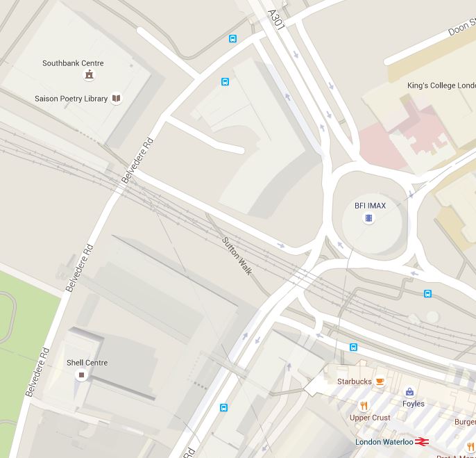
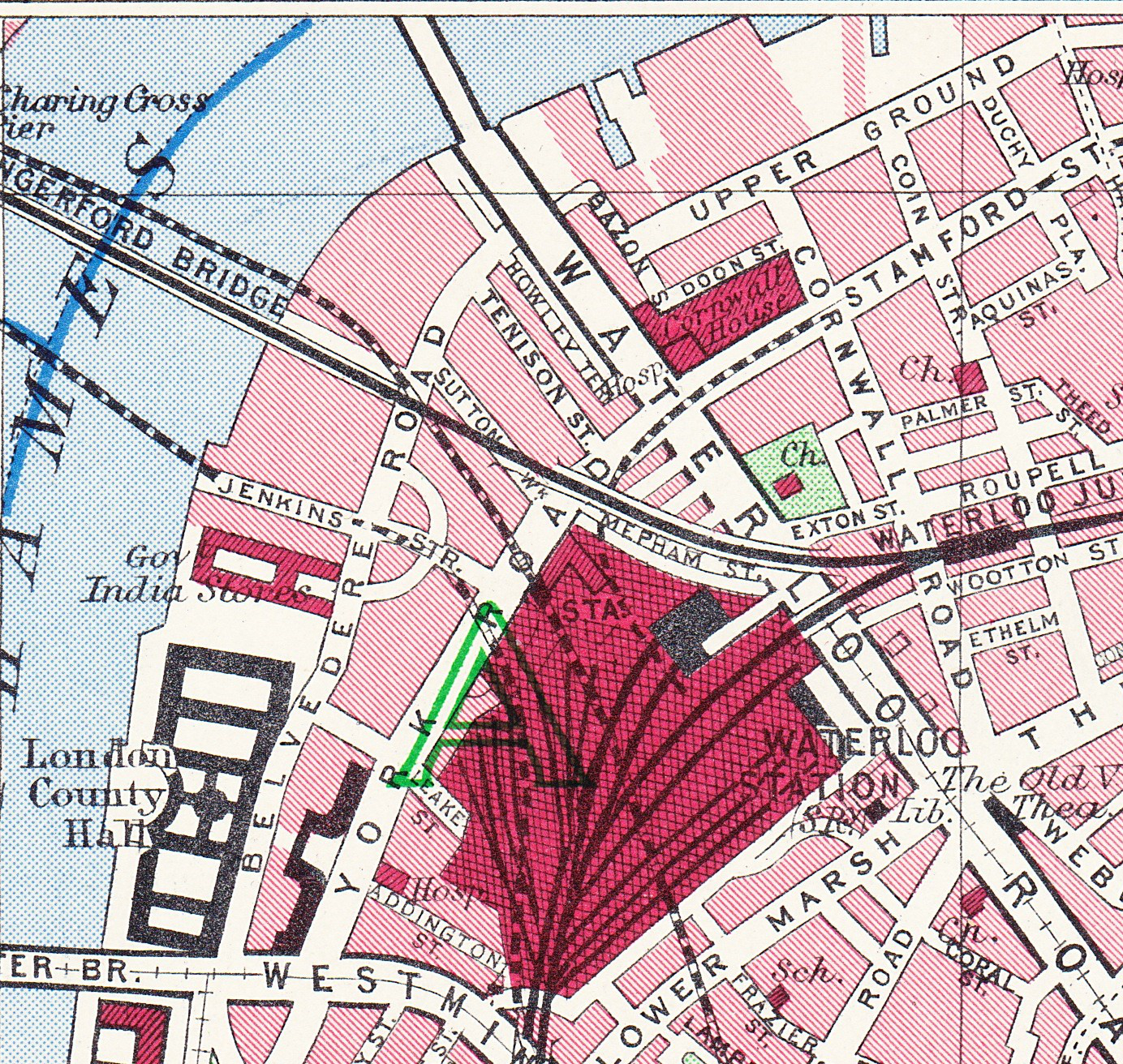
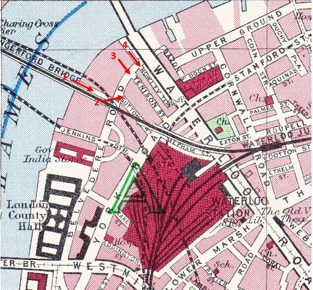
The map below is from the 1940 Bartholomew’s Atlas of Greater London and I have marked the locations and directions of view of this week’s photos.

More Southbank 12

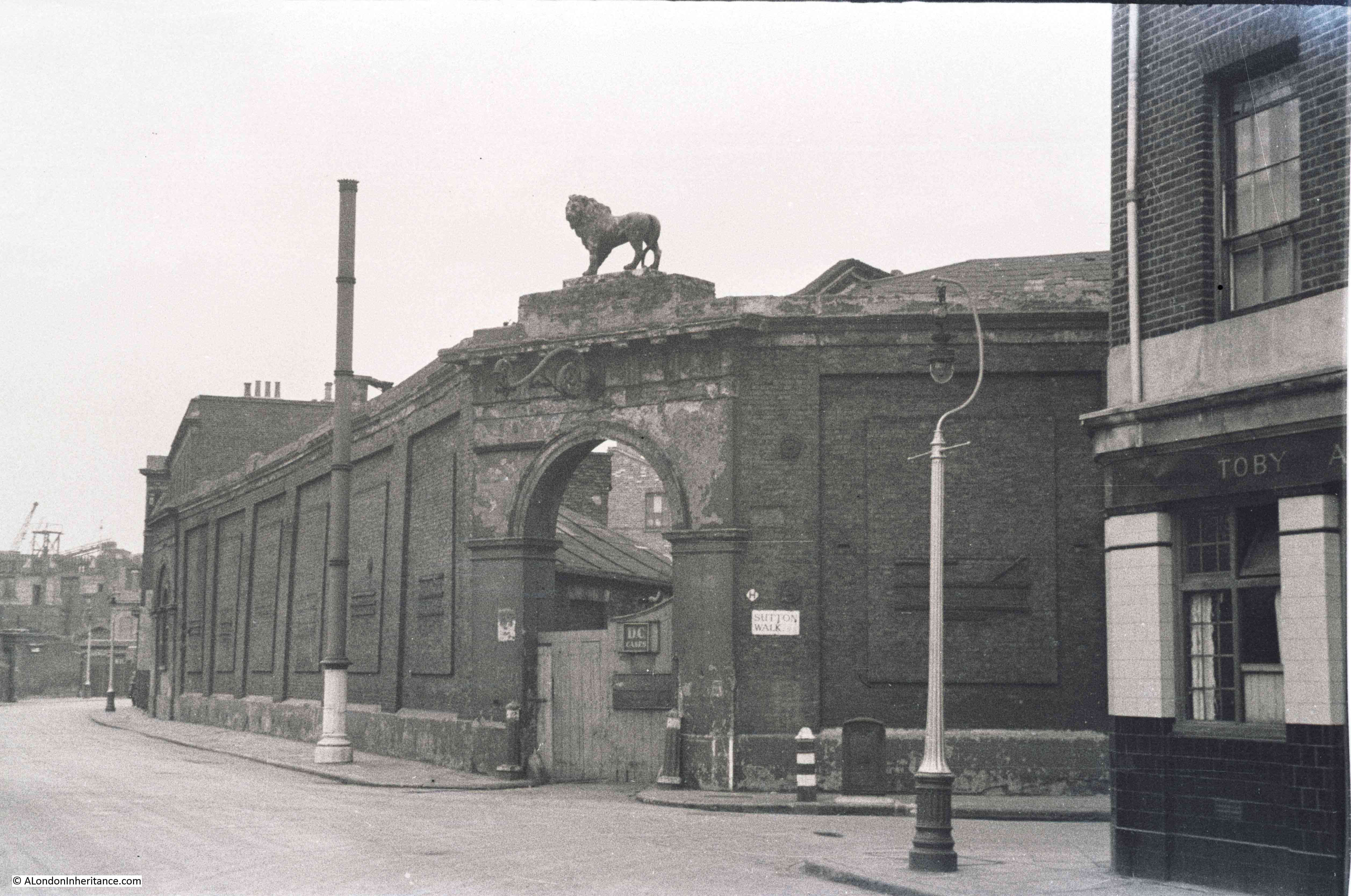
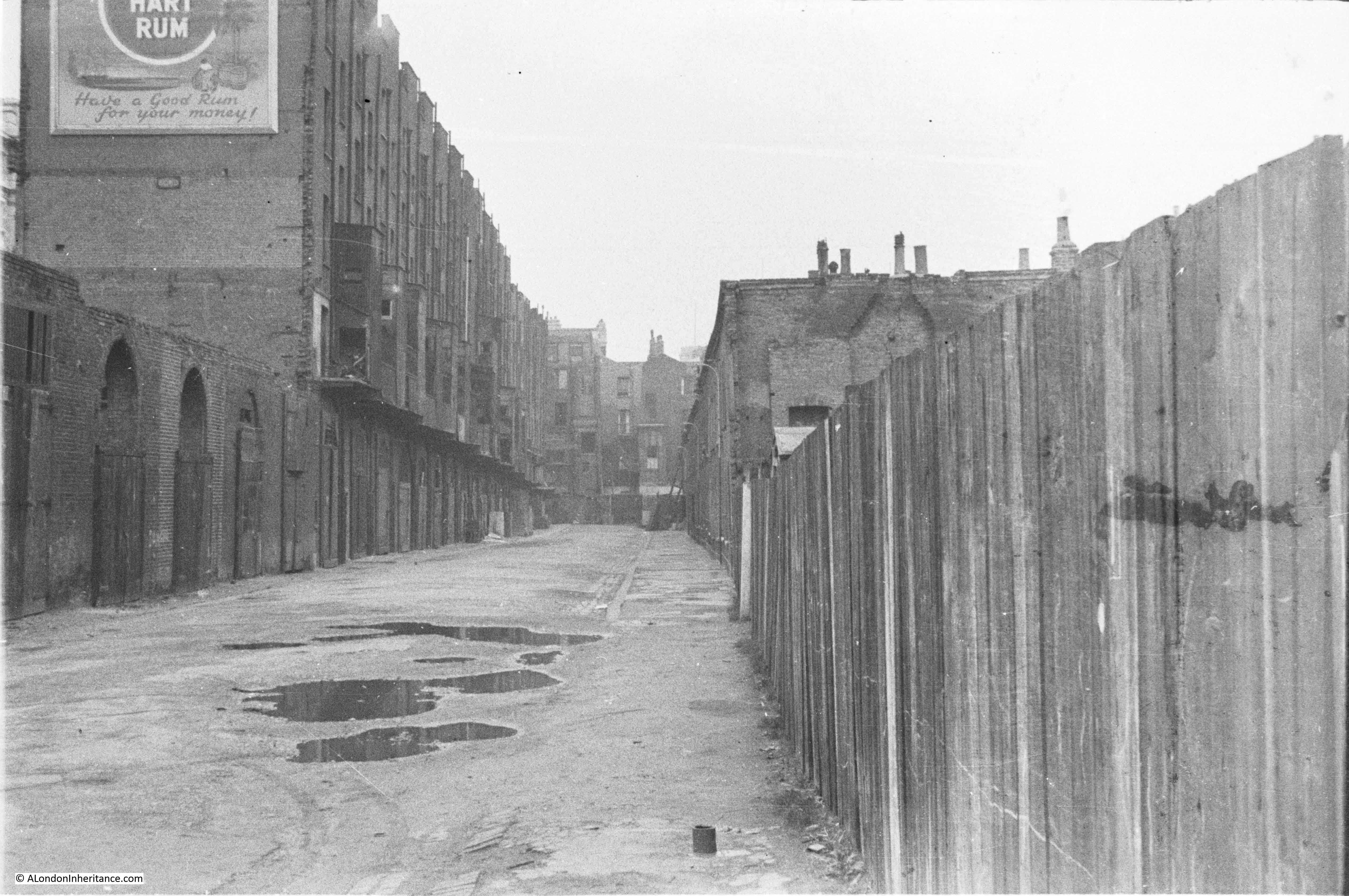
The following photo is from position 1 on the map and was taken from the end of the footbridge that ran alongside Hungerford Railway Bridge. The Lion Brewery is on the left and the railway into Waterloo East and across the river to Charing Cross Station is on the right, with Waterloo Station being the building on the far right. The buildings at the end of the road alongside the railway are along Belvedere Road. The building with the white lower level is a pub, however I have been unable to confirm the name, there were a number of pubs along Belvedere Road but I cannot find the name of this one. Sutton Walk is to the left of the pub.

More Southbank 5

Enlarging the photo, the building to the right of the pub has the name “Westward Ho” on the sign above the ground floor door and window. Not sure what this was, however in the Survey of London volume for the area there is a drawing of the building, the online page can be found here. Unfortunately, the Survey of London does not shed any light on the name of the pub. It does confirm that these buildings were numbered 116 and 118, the only pubs I can find were the White Hart at number 35 and the Green Dragon at number 68.

These photos were taken in 1948, before demolition took place in 1949. Another view at a slightly different angle from the end of the footbridge:

More Southbank 6

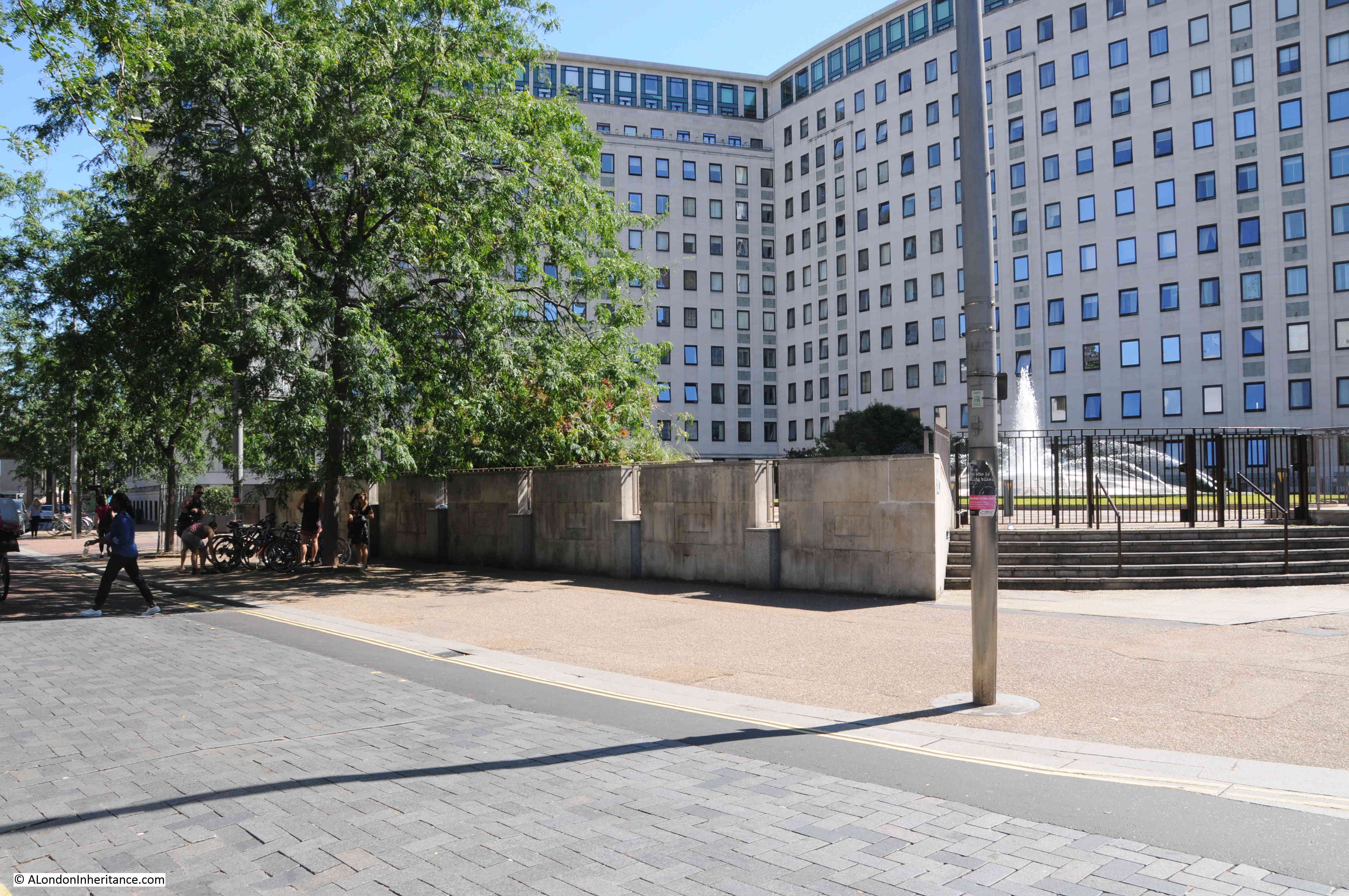
The Royal Festival Hall now occupies the area on the left and the whole scene has changed dramatically. Standing on the end of the new footbridge alongside Hungerford Bridge, I took the following photo.

More Southbank 10

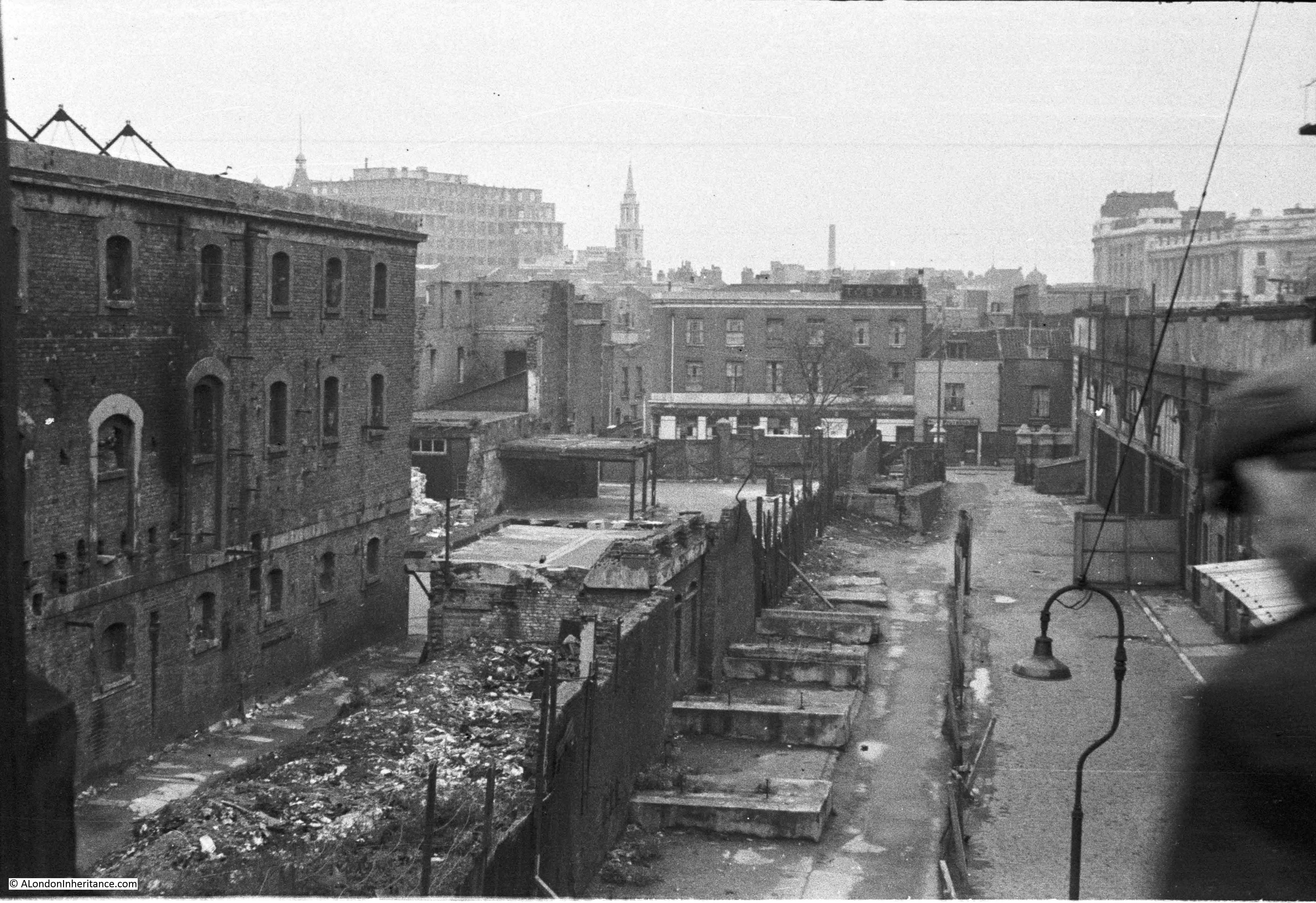
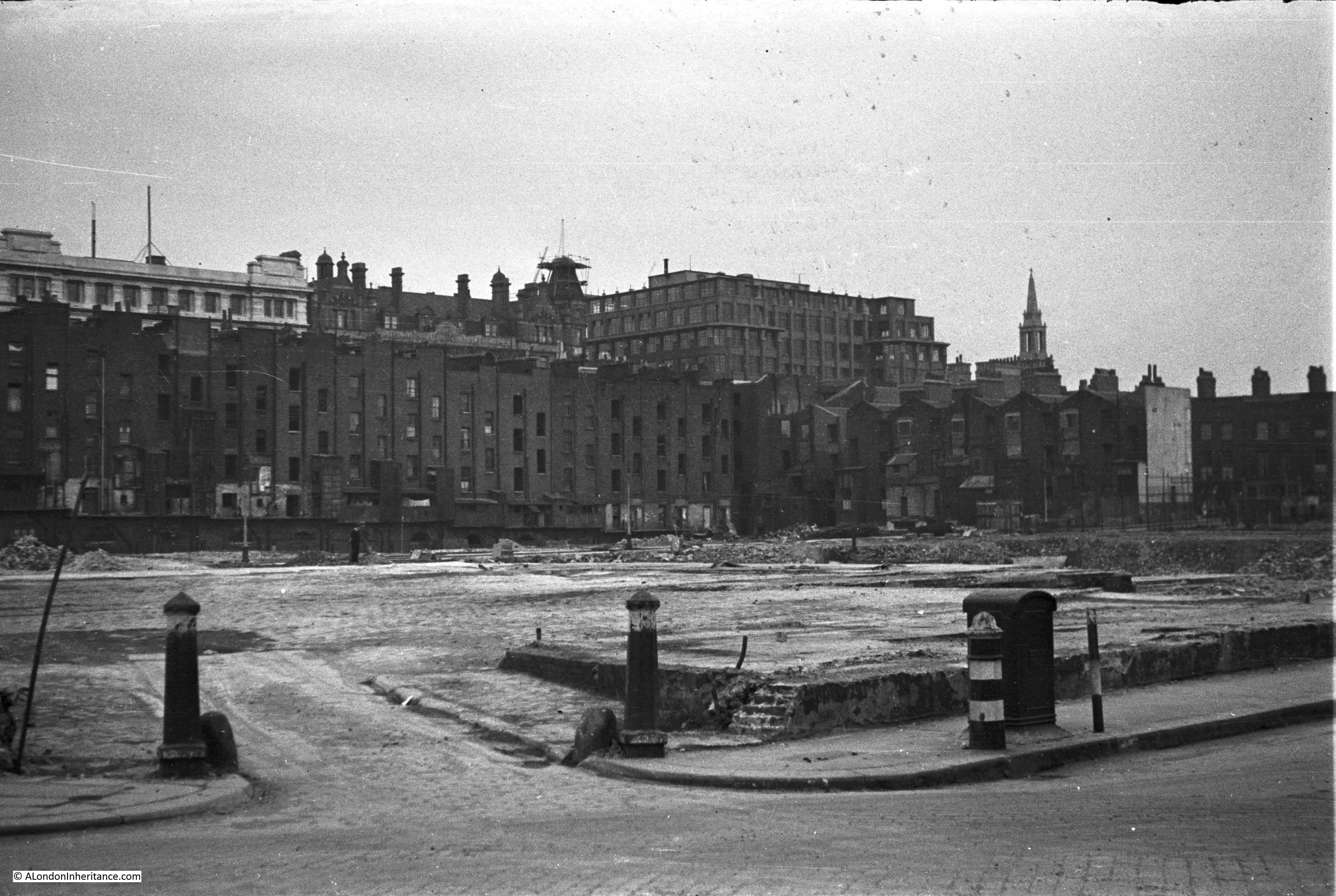
My father visited the area again as demolition was taking place. This must have been around 1949 as this was the time when the area was being cleared ready for construction of the Festival of Britain.

The following photo is from the same position on the end of the Hungerford Bridge footbridge and is looking slightly to the left of the above photos. Much of the Lion Brewery has now been cleared with only the entrance arch to Belvedere Road remaining. It also looks as if the pub has been gutted with empty windows now looking out onto the area.

More Southbank 3

The tall buildings in the background to the left all remain to this day. The church is St. Johns at Waterloo, the building to the left of the tall office block is the old Royal Waterloo Hospital for Women and Children.

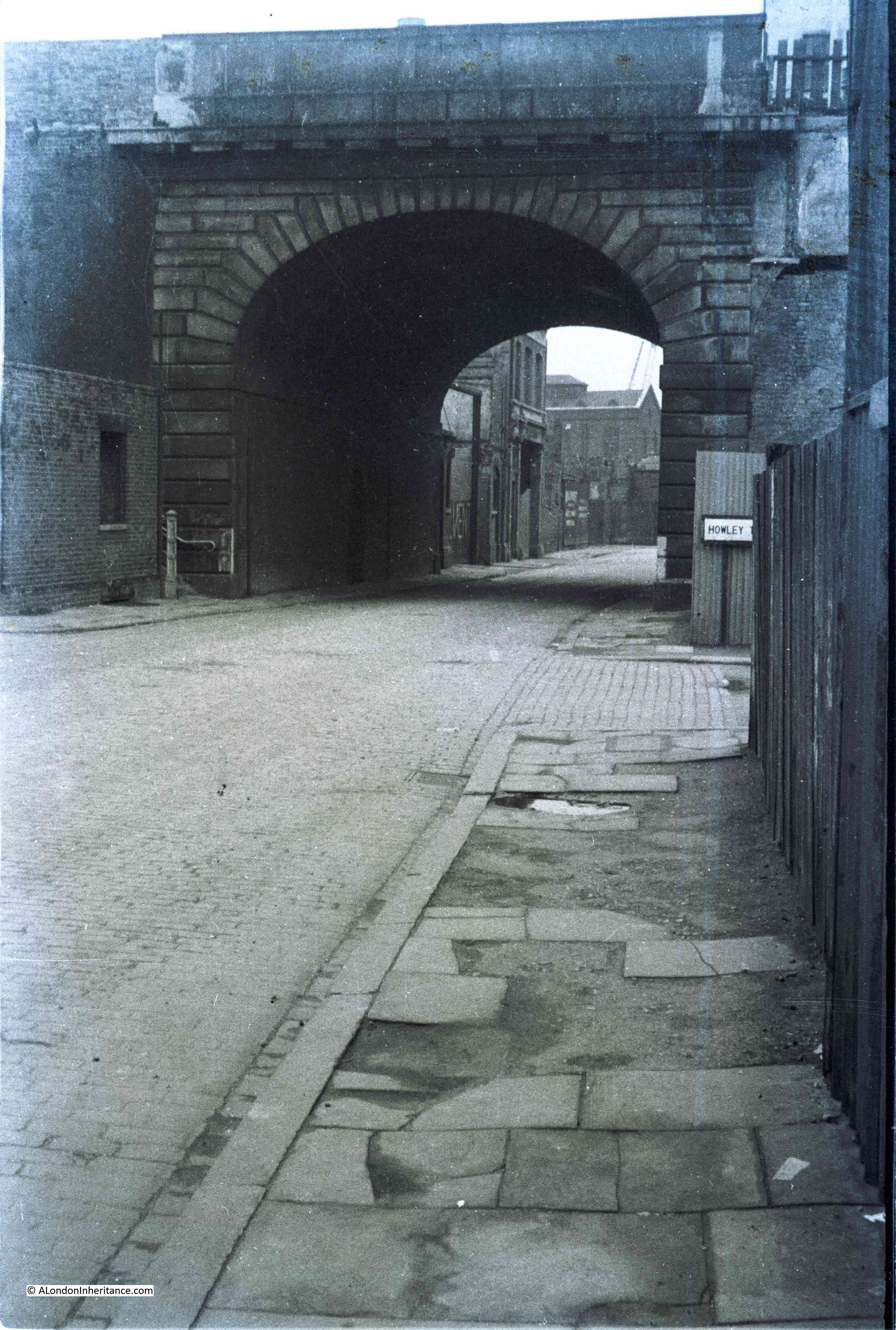
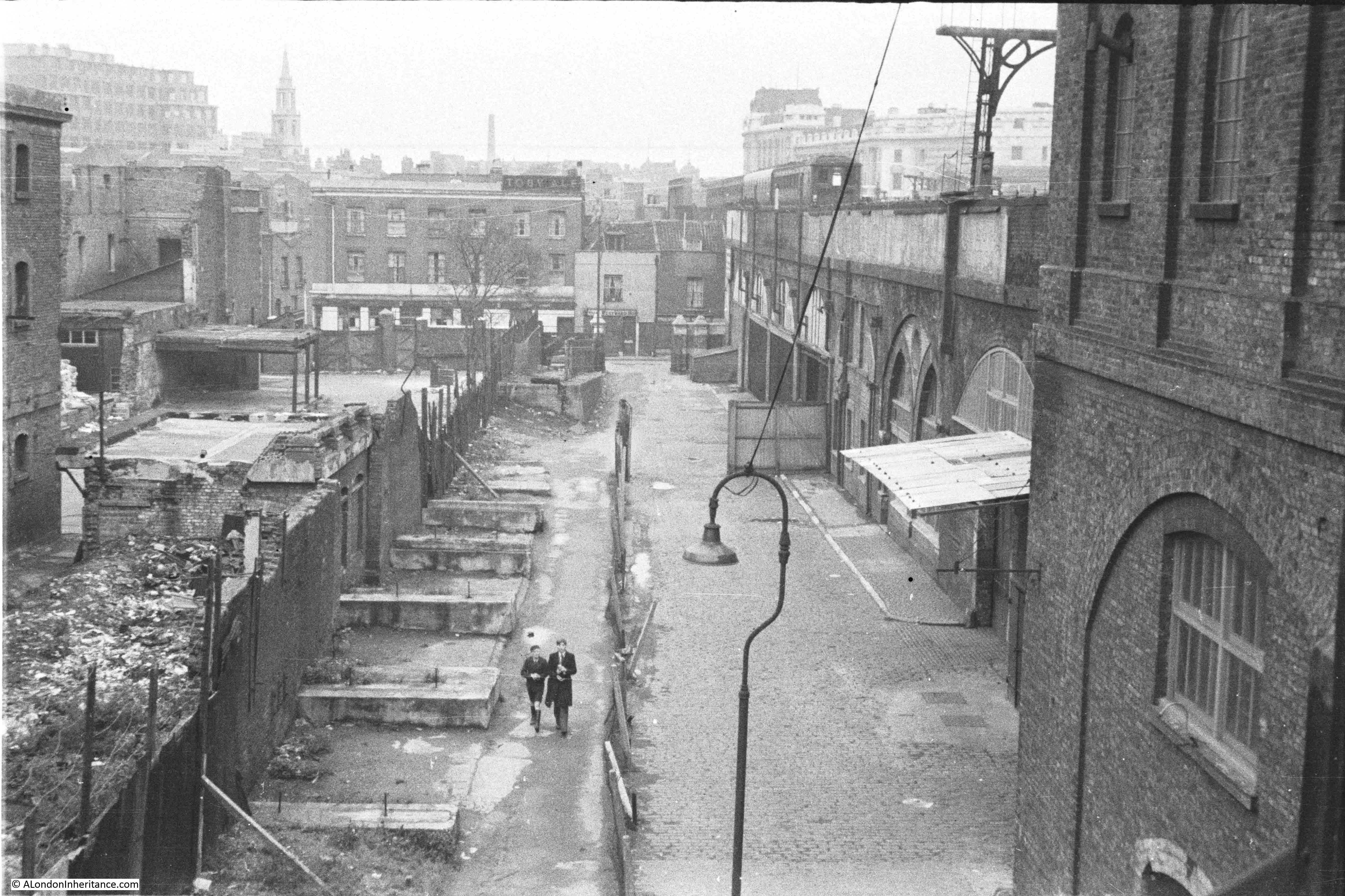
I featured the following photo in my post on Sutton Walk. This was taken outside the pub with Sutton Walk running off to the right and part of the Lion Brewery directly opposite.

More Southbank 7

I have repeated this photo as the following photo was taken from roughly the same position after the brewery buildings had been demolished. The bollards confirm the location. This is looking from point 2 on the 1940 map.

The buildings that edge the open area are houses that ran along Howley Terrace.

More Southbank 2

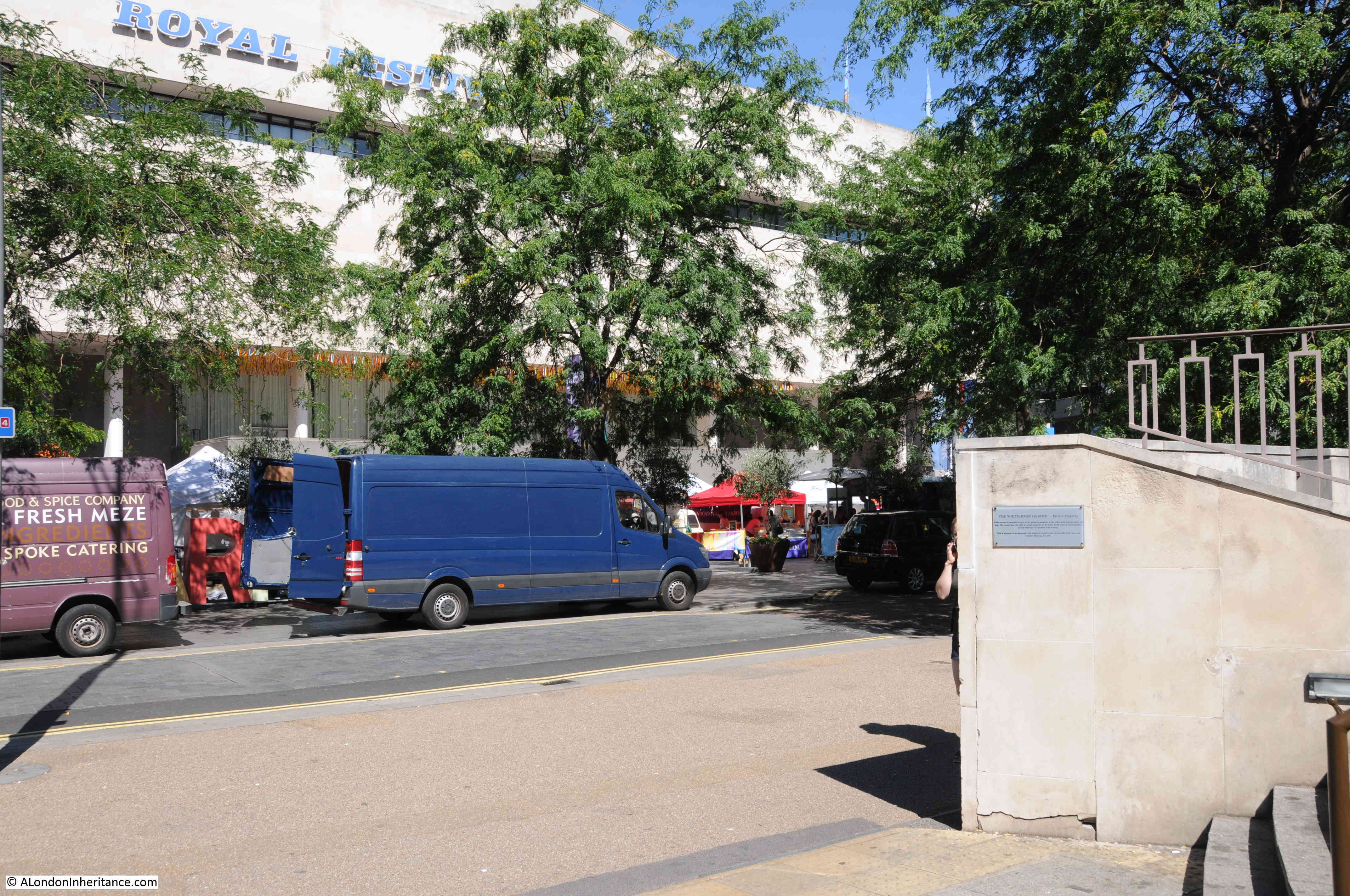
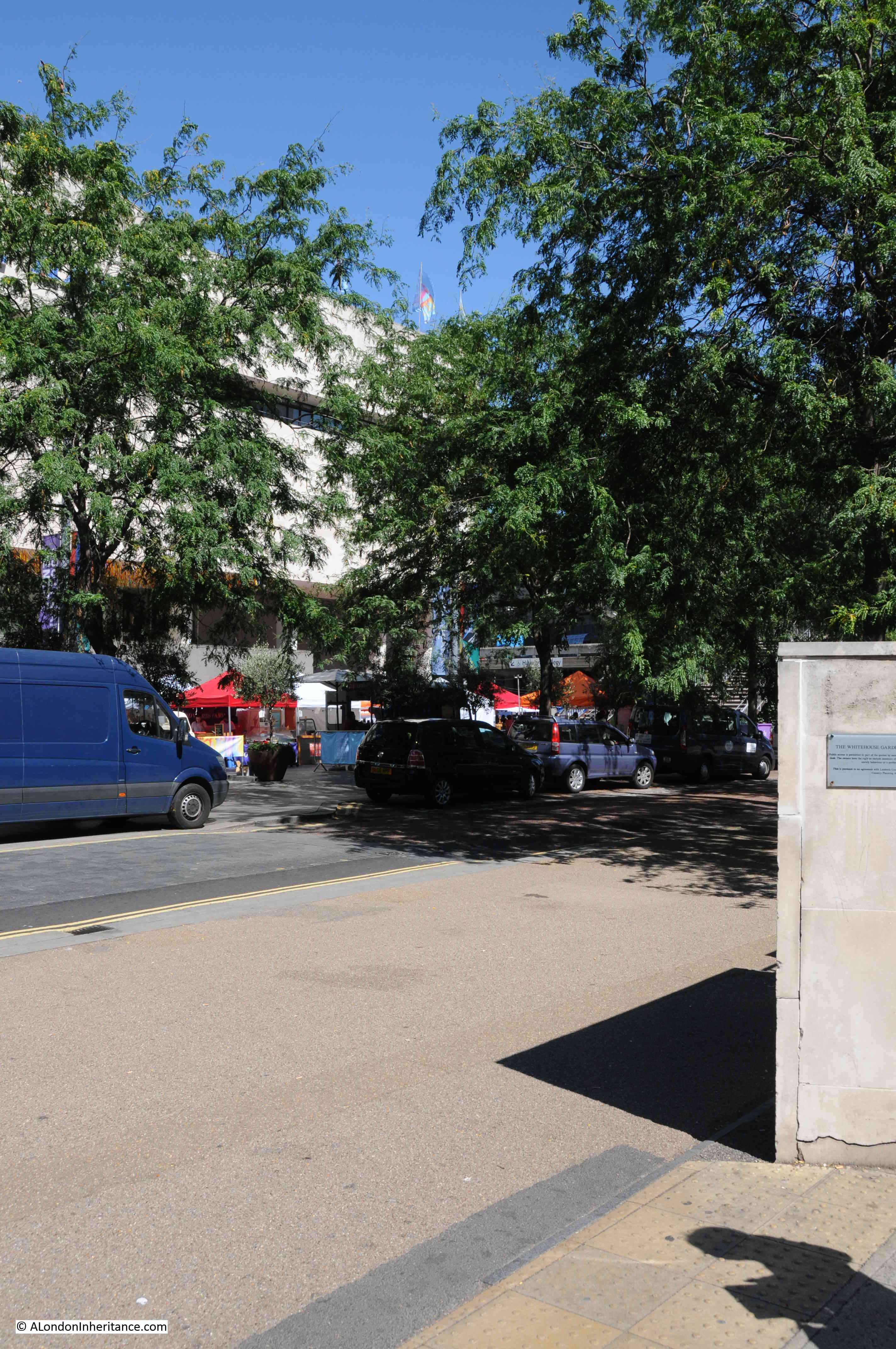
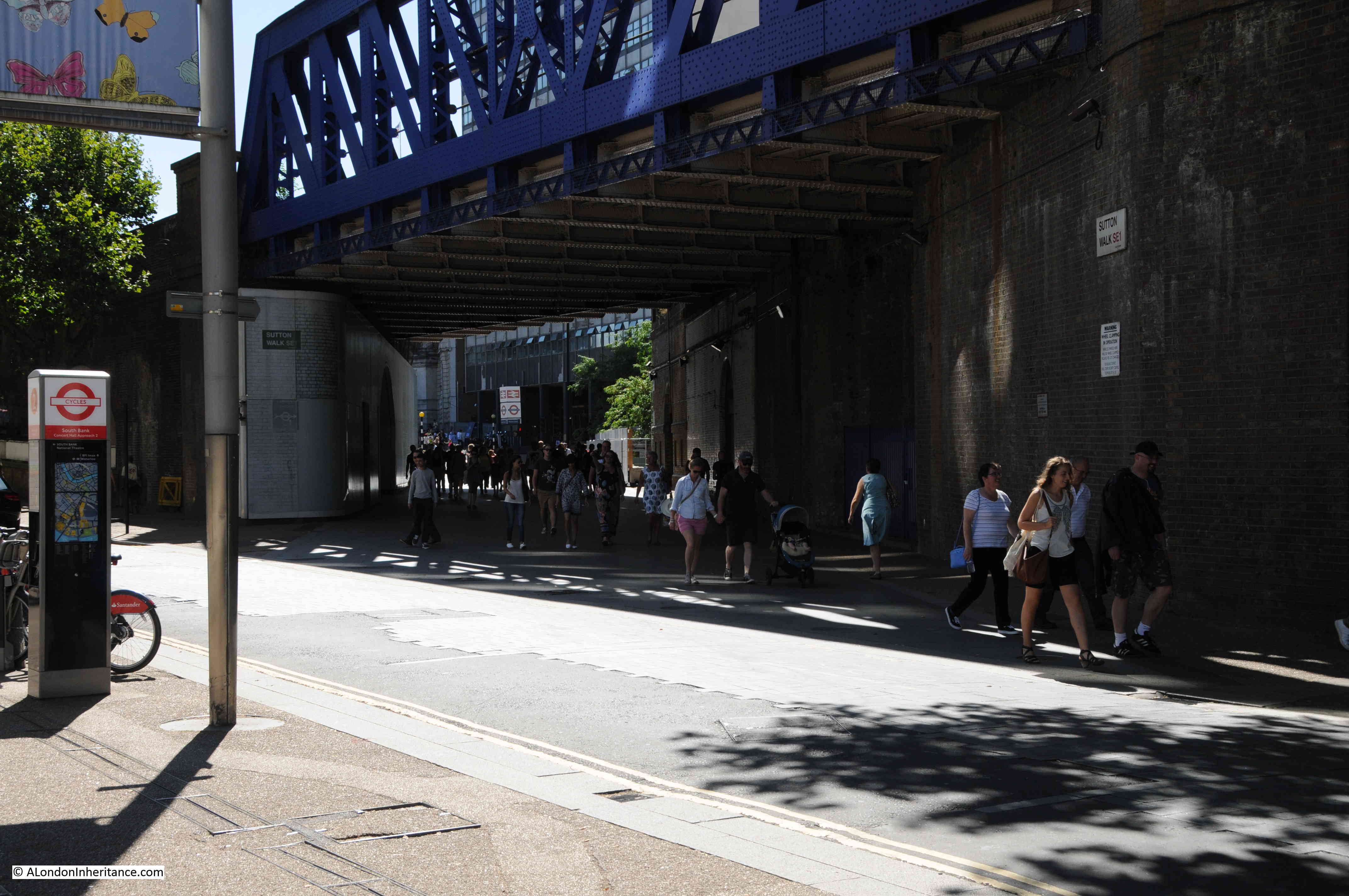
Sutton Walk has changed location, however the following photo was taken from roughly the same location and looking in the same direction. This whole area is now occupied by the White House Apartment Building (the old Shell Centre Downstream Building).

More Southbank 8

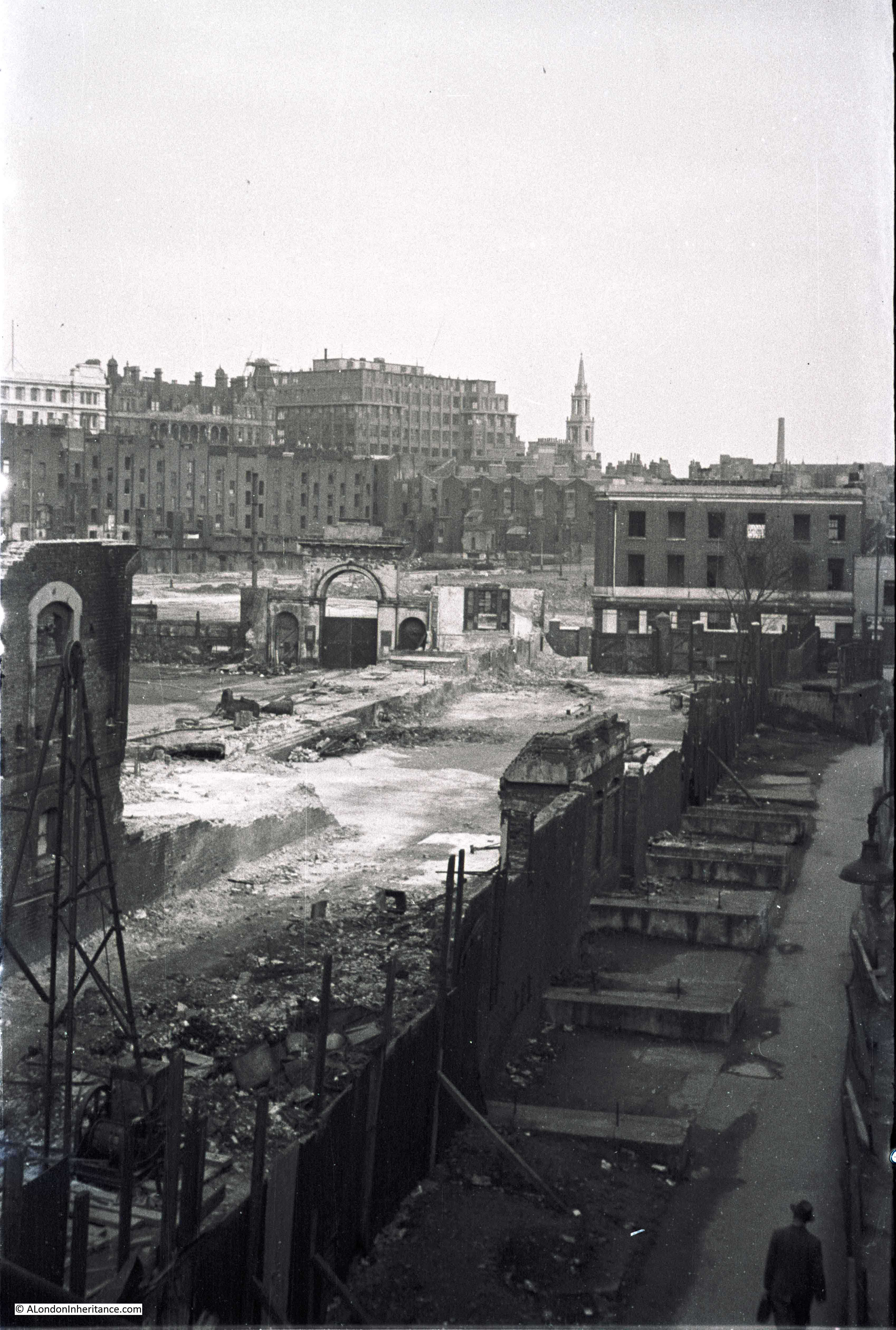
Moving along Belvedere Road towards Waterloo Bridge, the following photo is looking along point 3 in the map, along what was Tenison Street. The buildings have all been demolished but the road, pavement and street lamps remain, however they will also soon go ready for the Festival of Britain.

More Southbank 1

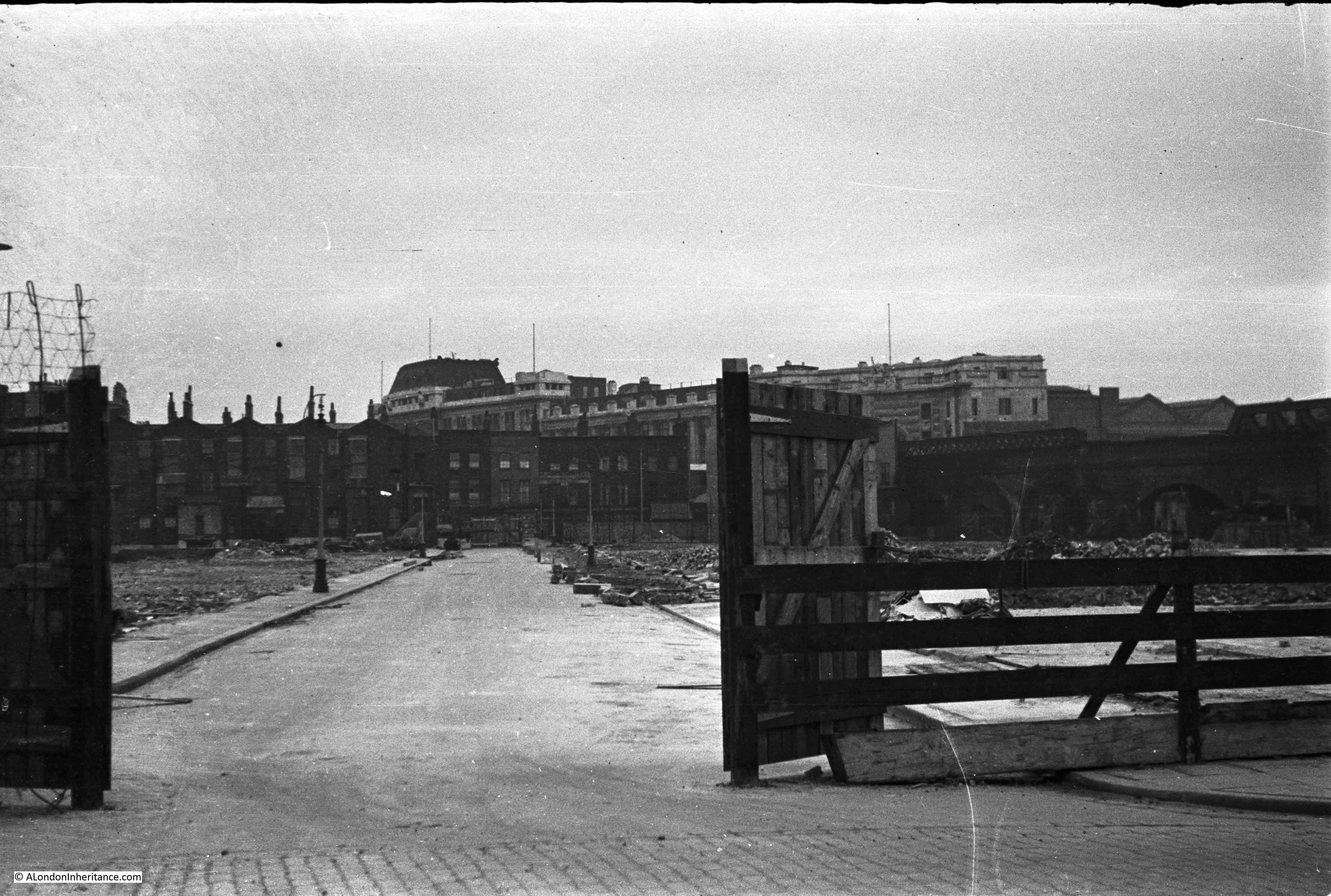
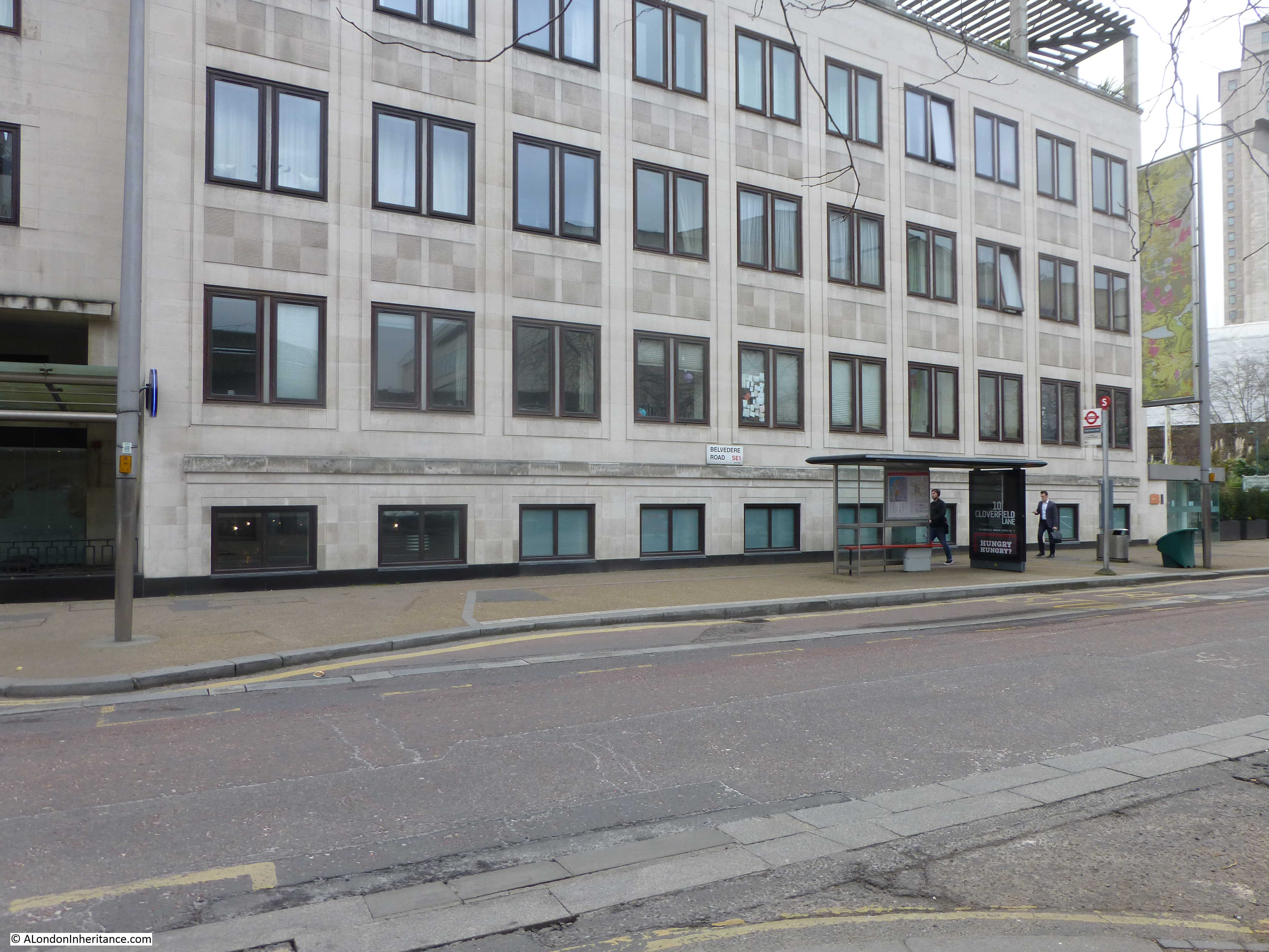
It is difficult to get the precise location today as the White house building obscures the view of Waterloo Station, however I took the following looking in the direction of where I believe Tenison Street ran.

More Southbank 13

As I covered in one of my earlier posts on the area, many of the roads in this area were named after Archbishops of Canterbury. Tension Street was named after Thomas Tenison who was Archbishop of Canterbury from 1695 to 1715.

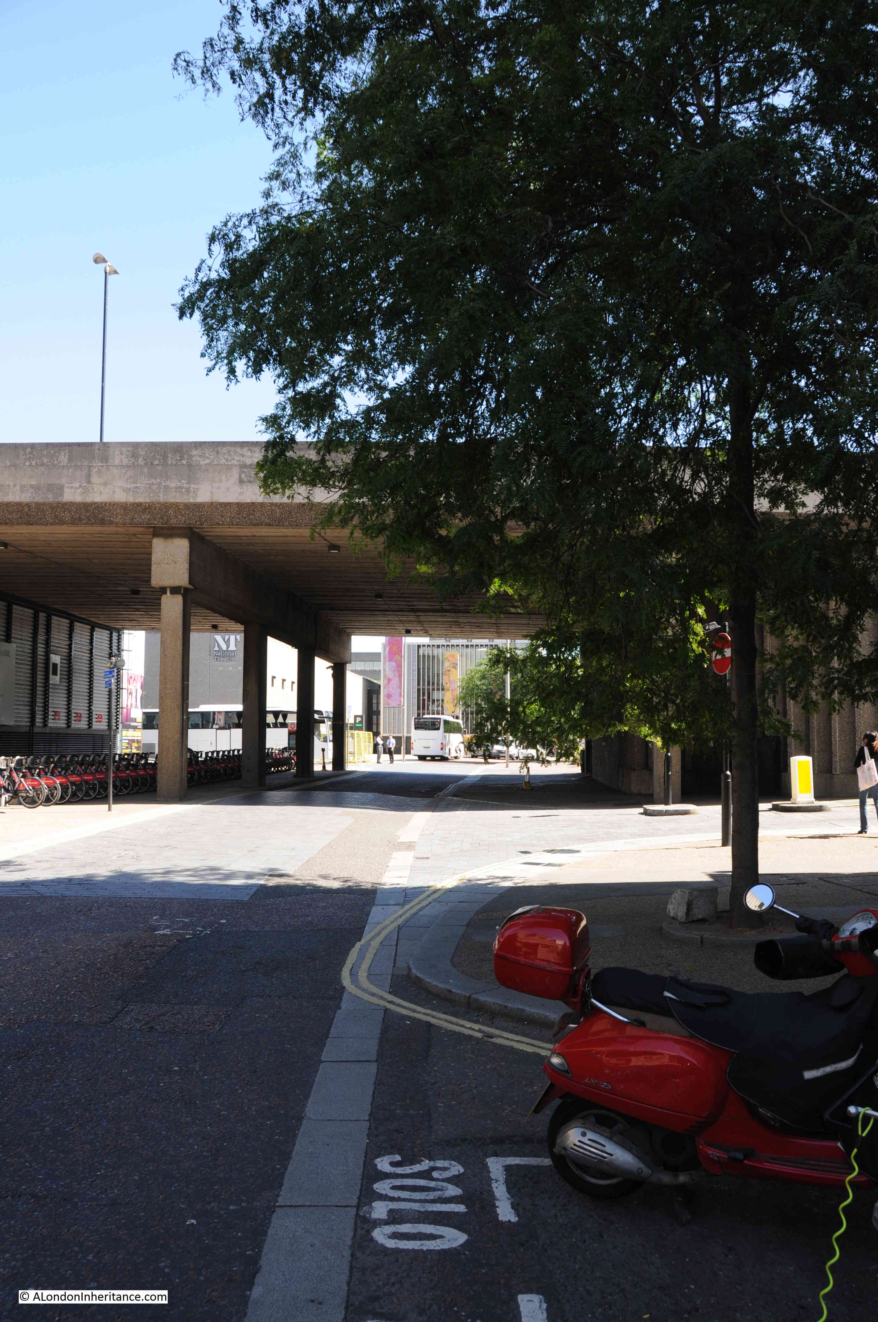
Move a bit further along Belvedere Road, and the following photo is looking along Howley Terrace (view 4 in the above map). The approach road running up to Waterloo Bridge is to the left of the photo hence the large advertisement on the side of the building to catch the eye of those travelling across Waterloo Bridge from the north to the south.

More Southbank 4

As part of the reconstruction of the area, a new approach road was built up to Waterloo Bridge. This approach road covered some of the area occupied by most of the housing on the left. Today, at the end of the approach road to Waterloo Bridge, at the junction with York Road and Stamford Street is a large roundabout which covers the space occupied by the houses at the very end of Howley Terrace.

The following photo is looking along the same view today.

More Southbank 11

Remarkable how the area has changed. The original buildings along Howley Terrace (named after William Howley, Archbishop of Canterbury from 1828 to 1848) were crowded, multi-tenant housing with very basic facilities. Apartments in the White House now sell for between one and three million pounds.

William Kent in his 1951 edition of An Encyclopedia Of London has a couple of references to Tenison Street and Howley Terrace:

“The Lion Brewery has always been associated with a famous crime. In 1872 Dr. W.C. Minor, who had been a surgeon in the American Civil War, and on a visit to this country, was staying at 41 Tenison Street, shot a stoker, an employee of the Brewery in Belvedere Road. At the trial, he was found guilty but insane. From Broadmoor criminal lunatic asylum, where he was confined, he contributed between five and eight thousand quotations to Sir James Murray’s famous Oxford English Dictionary, and his name will be found in the acknowledged assistants to that great work.

In the process of making a site for the Festival of Britain, in the course of excavations, a skeleton was found near Howley Terrace. It was 12ft below ground and in 2ft of mud. It is believed to have been two hundred years old. Its legs were sprawled in odd directions, which seemed to indicate a violent end.”

Kent also states that during the preparation of the site for the Festival of Britain, sixty men used 93,000 tons of demolition material to build the river wall which is 1,691ft long,  so it is interesting to think that as you walk along the Southbank, next to the Thames, you may well be walking on all the materials that once made up the brewery and houses that occupied this area.

It is fascinating to walk around the Southbank with the photos from this and previous posts on the area. I can now build up a detailed photographic record of this small but fascinating part of London. I plan to bring these all together in a future post for a detailed walk around the area covering before, during and after the Festival of Britain to the current day.

alondoninheritance.com

The Brewery At The End Of Sutton Walk

Chances are, if you have walked from Waterloo Station down to the Royal Festival Hall, or the Southbank, you have walked along Sutton Walk without really being aware that you have.

Today, Sutton Walk is a short stretch of pedestrian walkway through one of the rail arches under the rail tracks leading up to Hungerford Bridge, however it was once a short street leading down to the Lion Brewery on Belvedere Road.

This is the location of Sutton Walk in 2015, in the centre of the map, the short stretch under the rail tracks:

Sutton Walk Map 2

Before the post war development of the area for the Festival of Britain, the 1940 Bartholomew’s map showed the original Sutton Walk:

Sutton Walk Map 1

Before the demolition of the original buildings along Belvedere Road, my father took some photos in 1947 from the junction of Sutton Walk with Belvedere Road. These show part of the old Lion Brewery that are not often seen. There are many photos from the river (including some my father took here), but in this article I want to show the other side of the brewery.

In the first photo, we are standing in the original Sutton Walk. The road running left to right is Belvedere Road. Straight ahead is the archway leading into what was the Lion Brewery. The word “Brewery” remains on the block at the top of the arch, however the stone Lion that originally sat on top of the arch has already been removed, leaving only the stubs of metal rods that would have held the Lion to the arch.

Sutton Walk 2Framed within the archway is Shell-Mex House on the north bank of the river. Originally on the right of the arch was a building of identical design to the building remaining on the left, and the main brewery buildings would have been visible through the arch. It must have been an impressive sight when the brewery was in full production.

One can only imagine the number of barrels of beer that have come through that archway.

The brewery was built between 1836 and 1837 on the site of a Water Works that supplied water to the local area using water taken directly from the river. Prior to the water works, a house called Belvedere (the origin of the road name) occupied the site. This became a tavern in 1781 and along with the gardens, was opened to the public following the tradition of “pleasure gardens” being opened along the south bank of the river.

The brewery building was seriously damaged by fire in 1931, after which it was used for a brief period as a storage place for waste paper.

This whole area was demolished in the late 1940s ready for the construction of the Royal Festival Hall and many of the streets were either lost or considerably changed. Although Sutton Walk does not now extend down to Belvedere Road it is still easy to find the location of my father’s photos by extending the line of the remaining pedestrian stretch under the railway.

The same view today from roughly the same position:

Sutton Walk 6The Royal Festival Hall now fully occupies the site of the Lion Brewery between Belvedere Road and the Thames.

The next photo is from the end of Sutton Walk and looking to the right along a short stretch of Belvedere Road. Behind the building we can see the top of the Shot Tower. The top of the tower still in the original state prior to the modification for the Festival of Britain. The lettering on the wooden gate in the centre of the photo spells out the name of the London Waste Paper Company Ltd. After the brewery closed, the site was used for storage of waste paper by this company.

Sutton Walk 3The same view in 2015 looking at the edge of the Royal Festival Hall and towards the Hayward Gallery (hidden behind the tree):

Sutton Walk 7Now we can cross over Belvedere Road and look back at the junction with Sutton Walk and we can see another part of the brewery with the same style of entrance arch, but still retaining the lion. This part of the brewery site contained warehousing and the stables.

Sutton Walk 4Also in the above photo, there is a pub on the right. There were several pubs along Belvedere Road as before the war, this was a very busy light industrial and residential area. It looks still occupied, but when the photo was taken in 1947 this area had mainly been cleared and the pub would soon be demolished.

And the same view in 2015. The building is the old Shell Centre Downstream building which is now “The Whitehouse”, one of the many office to luxury apartment conversions that now seem the norm across so much of central London.

From extending the remaining stretch of Sutton Walk down to Belvedere Road, the lamp posts on the right in the two photos seem to be in exactly the same position.

Sutton Walk 5This is all that is left of Sutton Walk today, the short pedestrian stretch under the railway. The road running left to right is Concert Hall Approach, a new road (if you call more than 50 years old, a new road !!), built as part of the redevelopment of the area.

Sutton Walk 10Although Belvedere Road was named after a house on the site of the Lion Brewery, a number of other roads in this area were named after Archbishops of Canterbury (no doubt due to  Lambeth Palace, the London residence of the Archbishop of Canterbury being not that much further along the Thames).

Sutton Walk was named after Charles Manners-Sutton (Archbishop between 1805 and 1828).

The nearby Tenison Street, (see the 1940 map, next street up towards Waterloo Bridge, lost during the construction of the Shell buildings) was named after Thomas Tenison (Archbishop from 1694 to 1715).

Although the street is not named in either the 2015 or 1940 maps, the street that runs from the corner of County Hall towards Leake Street is Chicheley Street. This street is still there and is named after Henry Chichele (Archbishop from 1414 to 1443).

Returning to Belvedere Road, we can walk to the right, eastwards towards Waterloo Bridge. This was the view in 1947 with the approach to Waterloo Bridge crossing over Belvedere Road:

Sutton Walk 1Although the current Waterloo Bridge was built in the early 1940s and opened in 1945, it still used the original approach road and the arches over the roads on the southbank. To confirm that this is indeed the location, look to the right of the above photo and part of a street sign can be seen.

This is Howley Terrace and using the 1940 street map, Howley Terrace can be seen running parallel to the Waterloo Road as it runs up to the bridge (and continuing the street name theme, Howley Terrace was named after William Howley, Archbishop from 1828 to 1848 – this also provides a good estimation of when these streets were named, probably around1848 as William Howley is the last Archbishop to have a street named after him in this area).

Sutton Walk Map 1

The naming of streets after Archbishops extended beyond the area between York Road and Belvedere Road. The street in front of Waterloo Station, Mepham Street (seen in the above 1940 map and still in existence) was named after Simon Mepeham, Archbishop of Canterbury from 1329 to 1333). The history of the church appears to be written across this area of Lambeth.

The view is very different now. The new approach road to Waterloo Bridge, built as part of the redevelopment of the area provides a very different crossing of Belvedere Road. There is still a road turning off to the right. This is now a slip road down from the roundabout at the end of the road to Waterloo Bridge, down to Belvedere Road. Unlike Sutton Walk, the slip road does not appear to have any name, therefore the name Howley Terrace looks to be consigned to history.

Sutton Ealk 8

I find the Southbank fascinating. It is one of the areas in London that has undergone such significant post war development that there are very few traces of what was there before. The railway running up to Hungerford Bridge is the only remaining structure that has survived, but it is good that some of the streets can still be found, even though, as with Sutton Walk, it is now a shadow of its former state.

 alondoninheritance.com