Tag Archives: Tilbury

Exploring Post War Netherlands – The Hague

Although by far the majority of my father’s photos are of London, he took his camera with him where ever he went, and in the late 1940s and early 1950s, along with some friends, he cycled across the UK, staying in Youth Hostels and taking photos along the way. I have already featured a number of these locations.

In 1952 he also traveled out to the Netherlands, cycling to a number of cities, both typical tourist destinations and also places that had featured significantly in the war. (I will use the Netherlands as the full name of the country, probably better known as Holland, although this is really only the name of the western province of the country).

Coincidences are strange. My father always wanted to return to the Netherlands and in 1989 my job transferred to the country, so along with my wife and daughter I moved out to live in the Hague for the next five years. It was a wonderful experience, and during this time my parents came to visit several times and we took them to visit the places my father had been to almost forty year earlier.

I knew that he had taken photos, but these photos had not been printed so it has been only in the last few years that I have scanned and seen the photos he took during his post war visit – I had not seen any of these when we lived in the country.

We recently decided to spend a week in the Netherlands this summer to visit the places where we use to live, and as my aim with this blog is to trace the locations of my father’s photos it was a perfect opportunity to track these down as well, now that they have been scanned, rather than hidden in negative boxes.

So, with apologies that this is not London, for the next few weeks I would like to take you on a journey across the Netherlands. Not just tracking down the locations of my father’s photos, but also to discover much about the history of the country, how a suburb of the Hague will forever have a tragic link with west London, how the Dutch commemorate the sacrifices of British and Polish forces, when the war came to Nijmegen, Arnhem and Oosterbeek, and how the bombing of Rotterdam during the German invasion of the country gave an indication of the destruction that would soon visit London.

On the way there are some fascinating individual stories, street photography, some wonderful architecture and architects, and for me, given the state of the world today, some very important lessons that should not be forgotten.

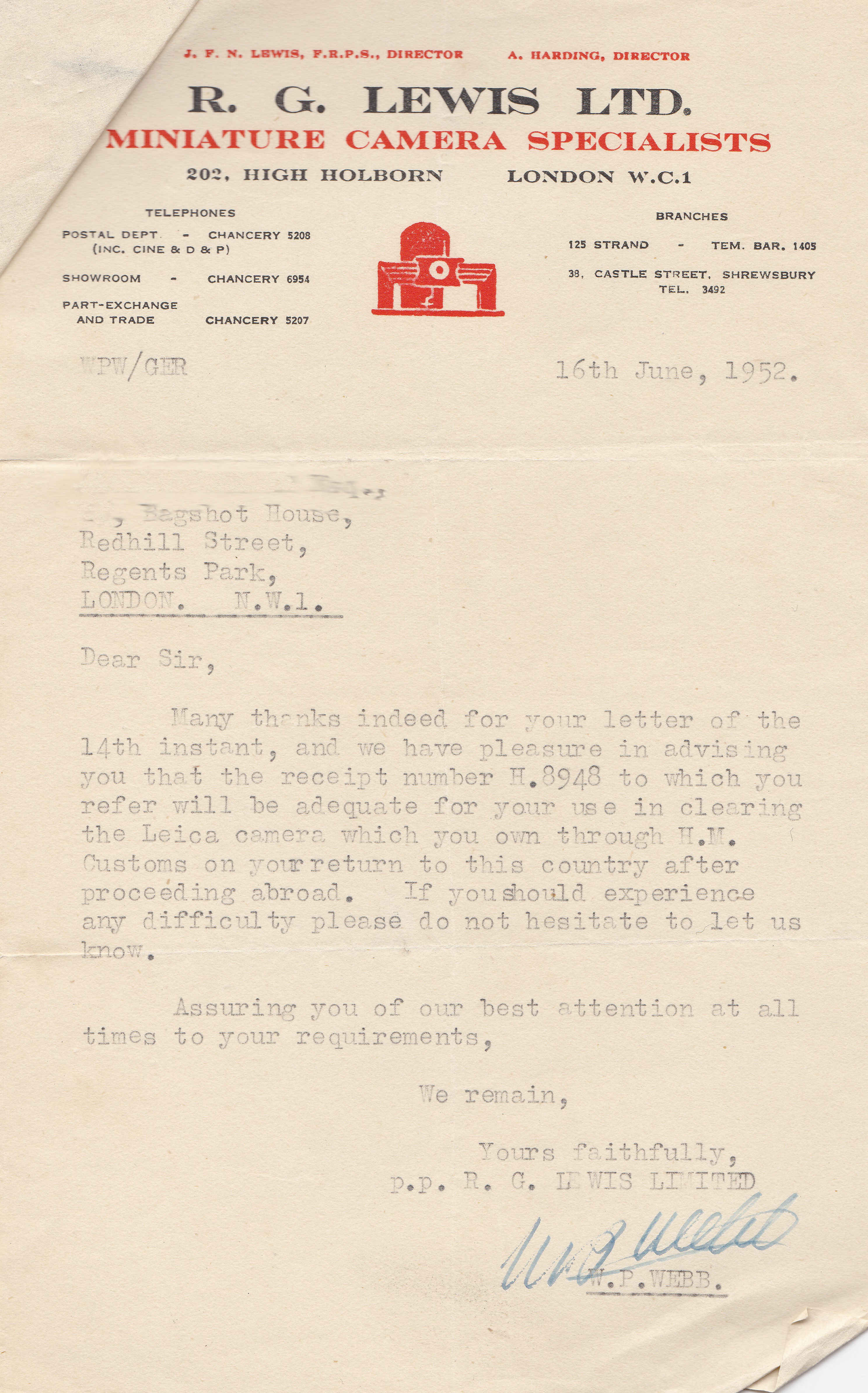
But before leaving, there was some important documentation to check. My father had just bought a new Leica camera from R.G. Lewis in High Holborn and the photographic press at the time was reporting on a number of confiscations of “expensive miniatures” by customs on return to the country. Leica cameras in the post war years could be purchased in Germany for much less than you would pay in the UK so documentary proof was needed that a camera had been purchased in the country. R.G. Lewis were able to provide assurance that the receipt provided sufficient documentation:

the Hague

With the right documentation to avoid any customs problems on return to the UK, it was time to get going.

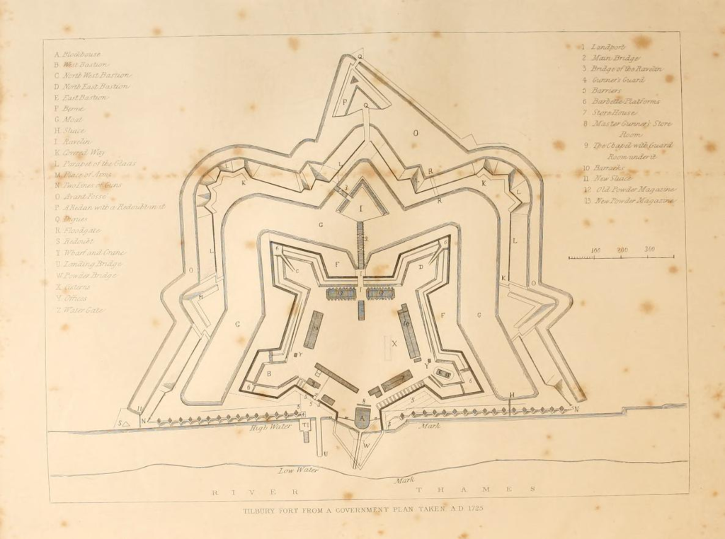
From Tilbury to Rotterdam

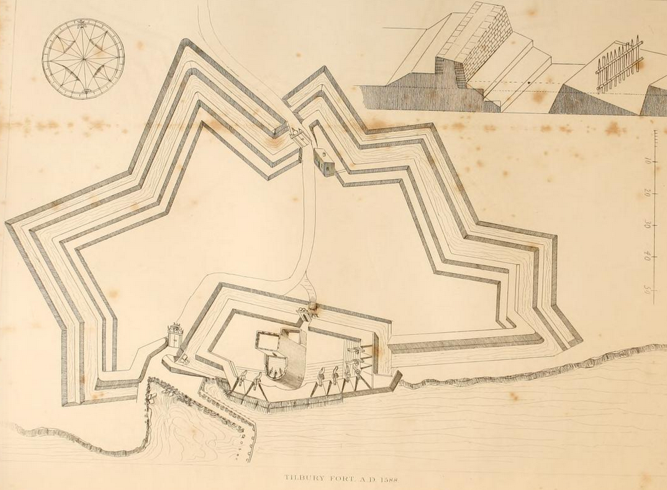
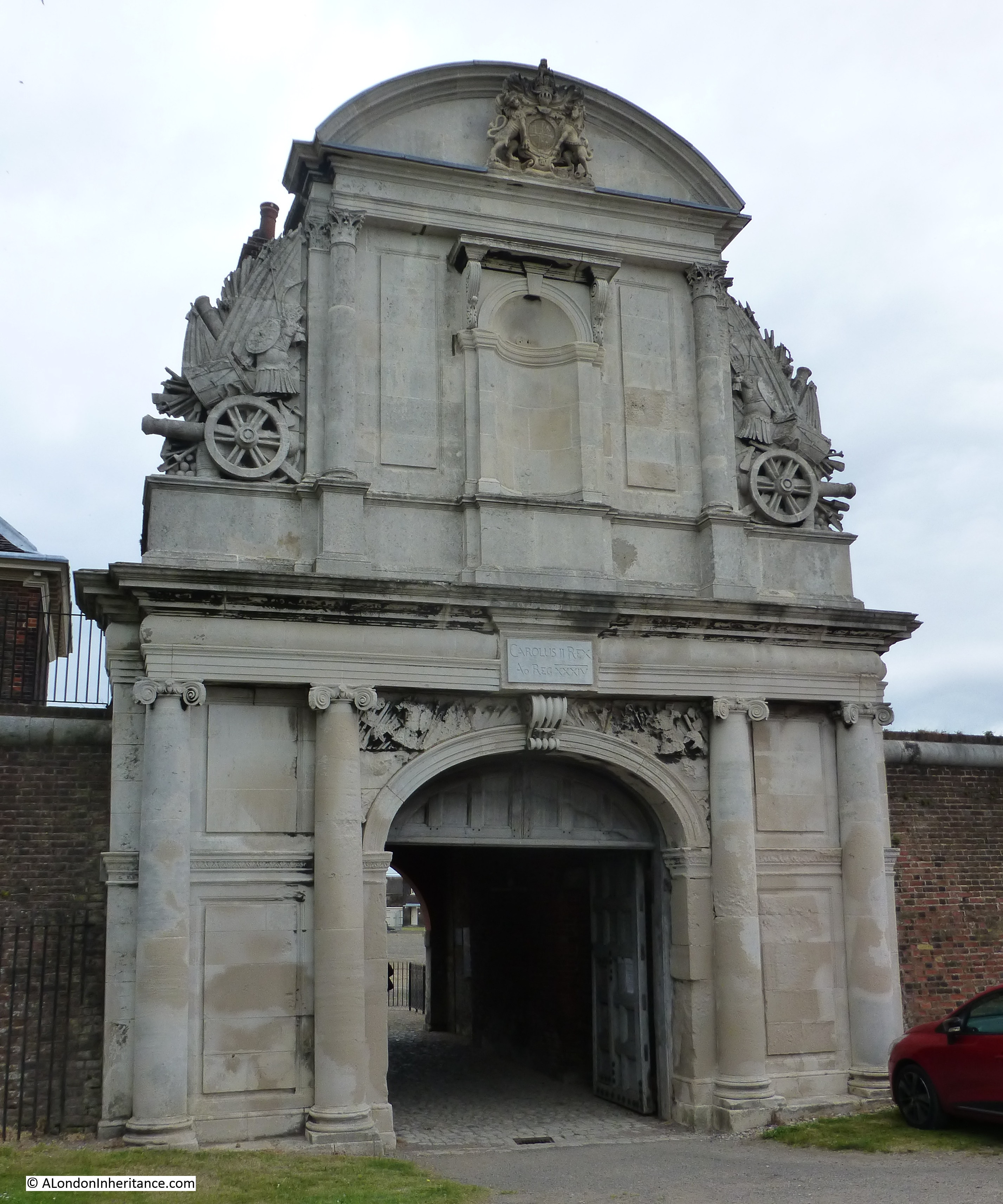
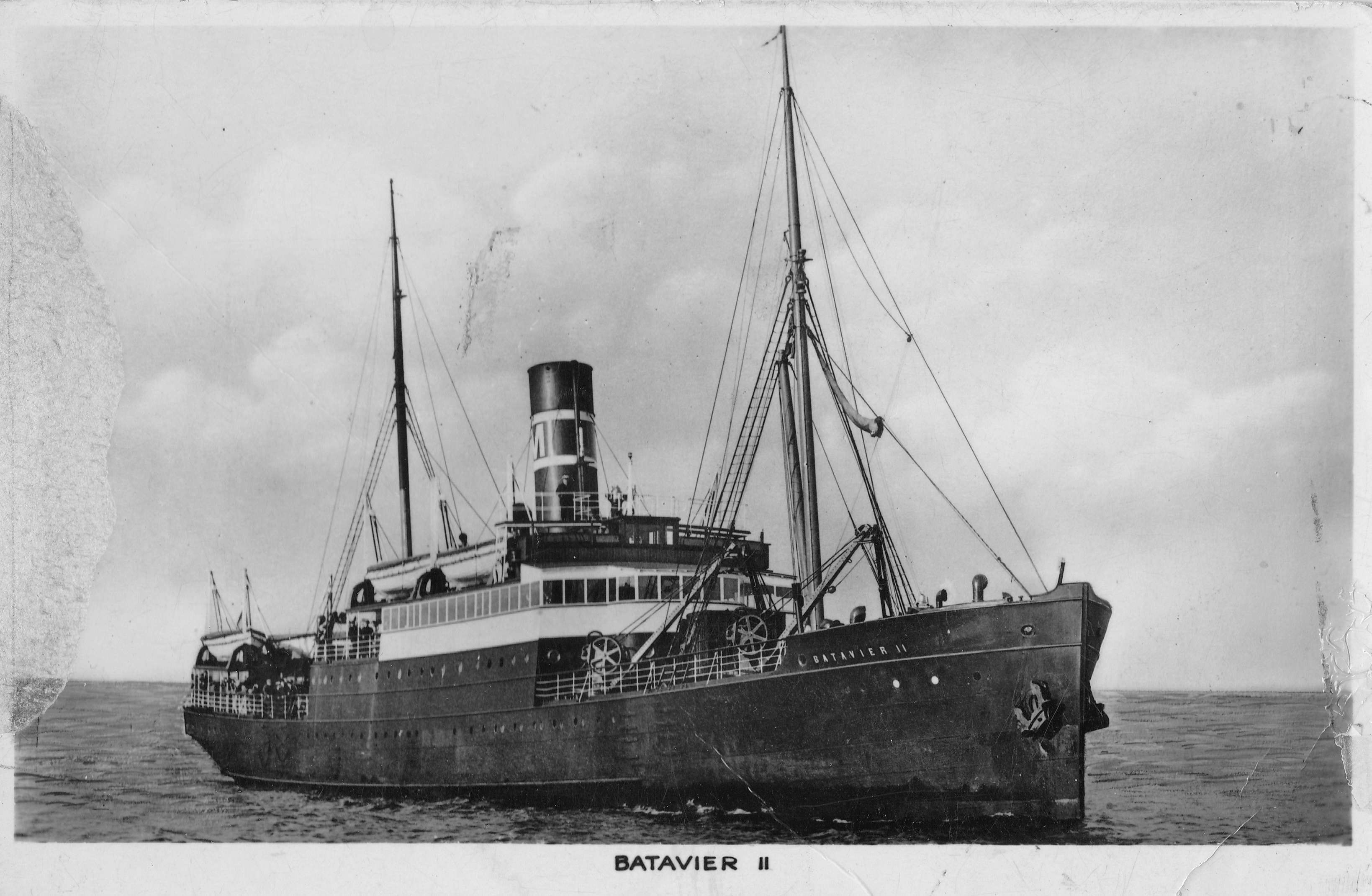
To start, we need to get from London to the Netherlands. At the time, the easiest method was to take the train out to Tilbury, then catch the Batavier Line ship, Batavier II from Tilbury to the port of Rotterdam.

This is the route that my father took, when, along with two friends, they took their bikes with them from London. They traveled light, each with a bike and a saddlebag containing everything they needed for the trip.

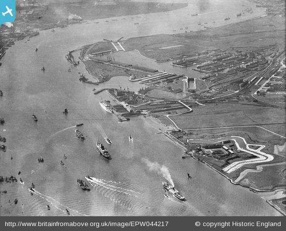
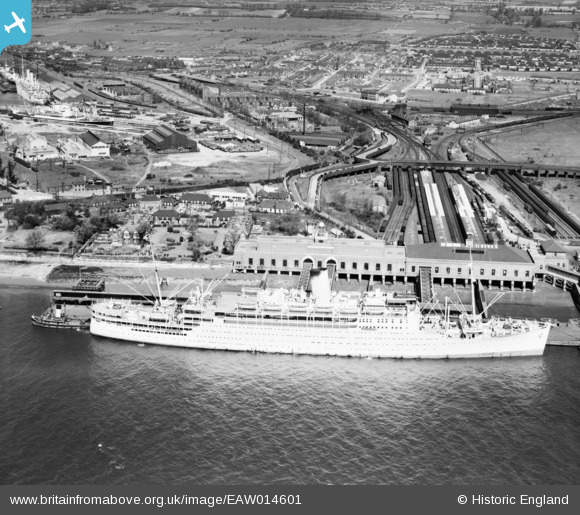
The following photo from Britain from Above shows the passenger terminal building at Tilbury with the station platforms behind the terminal building. The much larger RMS Strathaird is docked rather than the smaller Batavier II.

the Hague

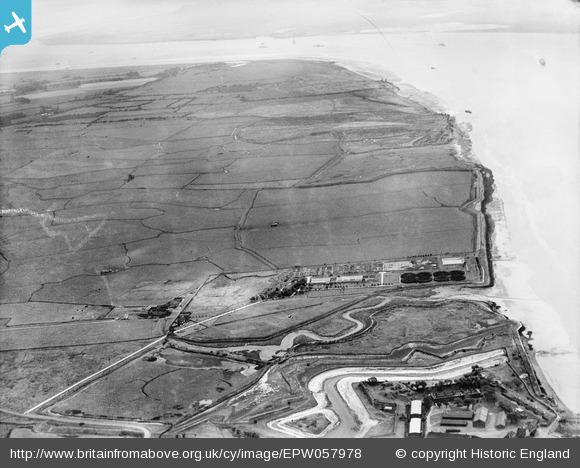
I would have loved to have seen some photos of the Tilbury terminal, the ship and the outbound voyage, however one of the limitations in the days of film cameras was the cost of film and the amount that could carried, so there are only a few photos.

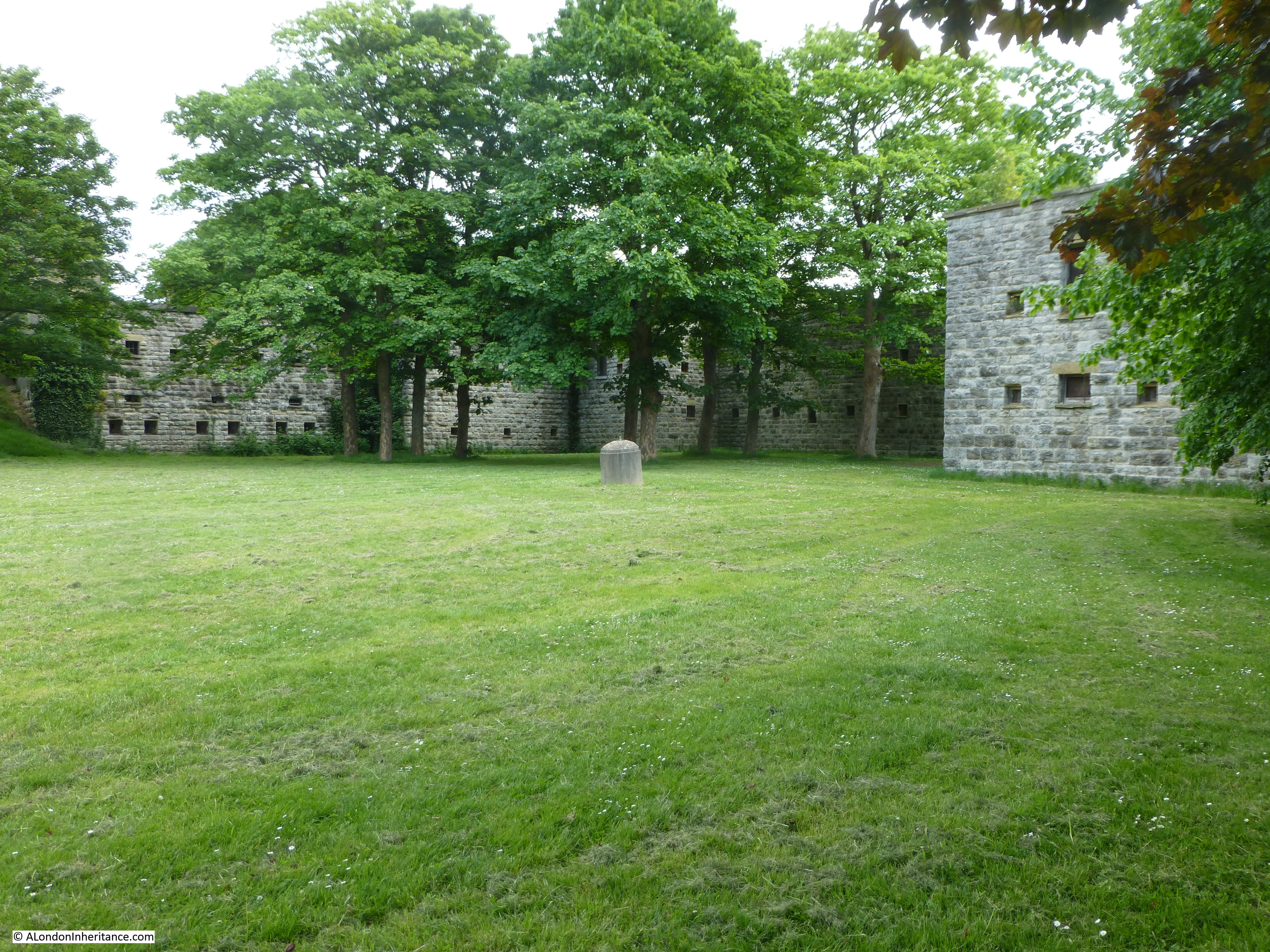
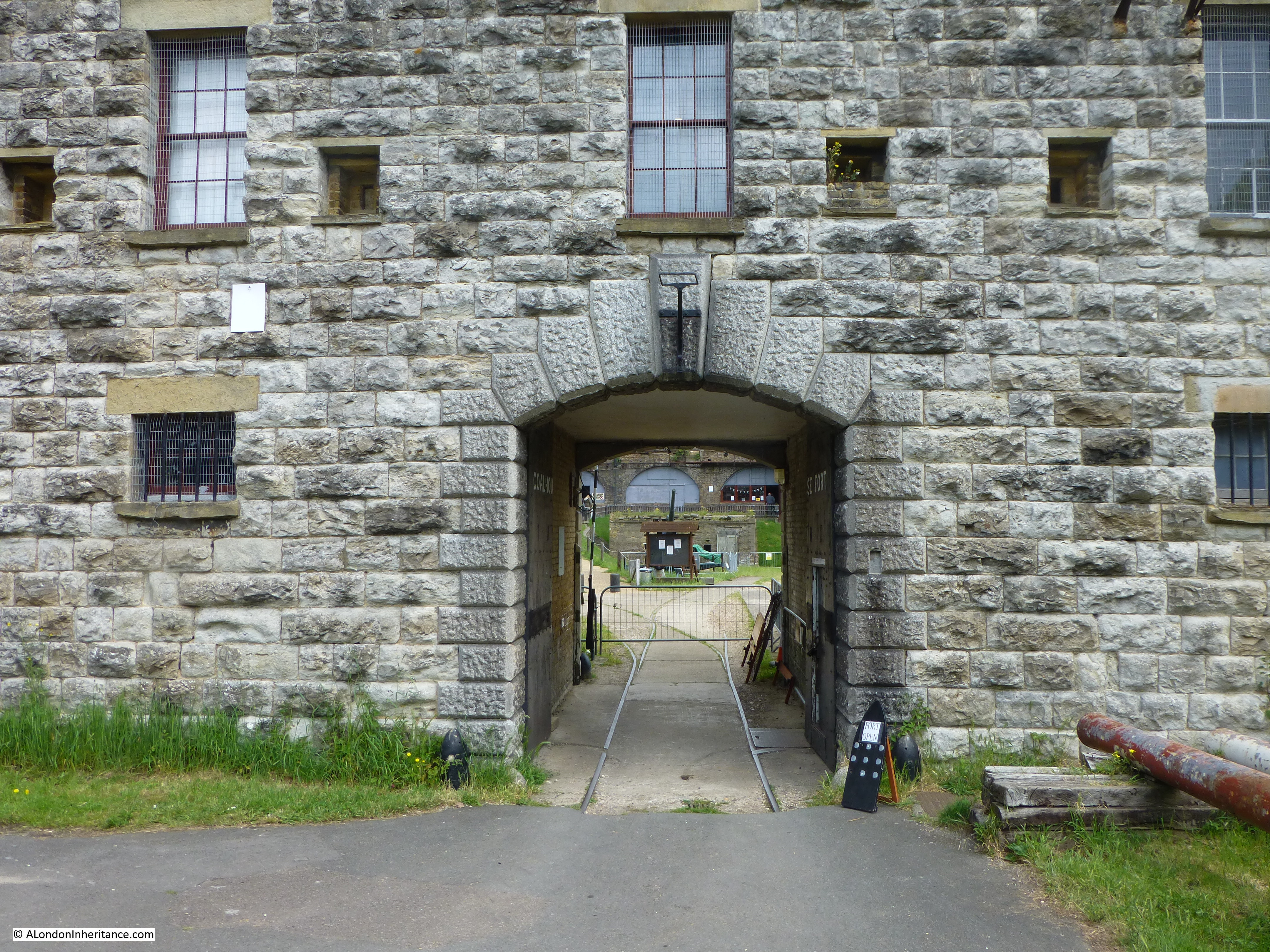
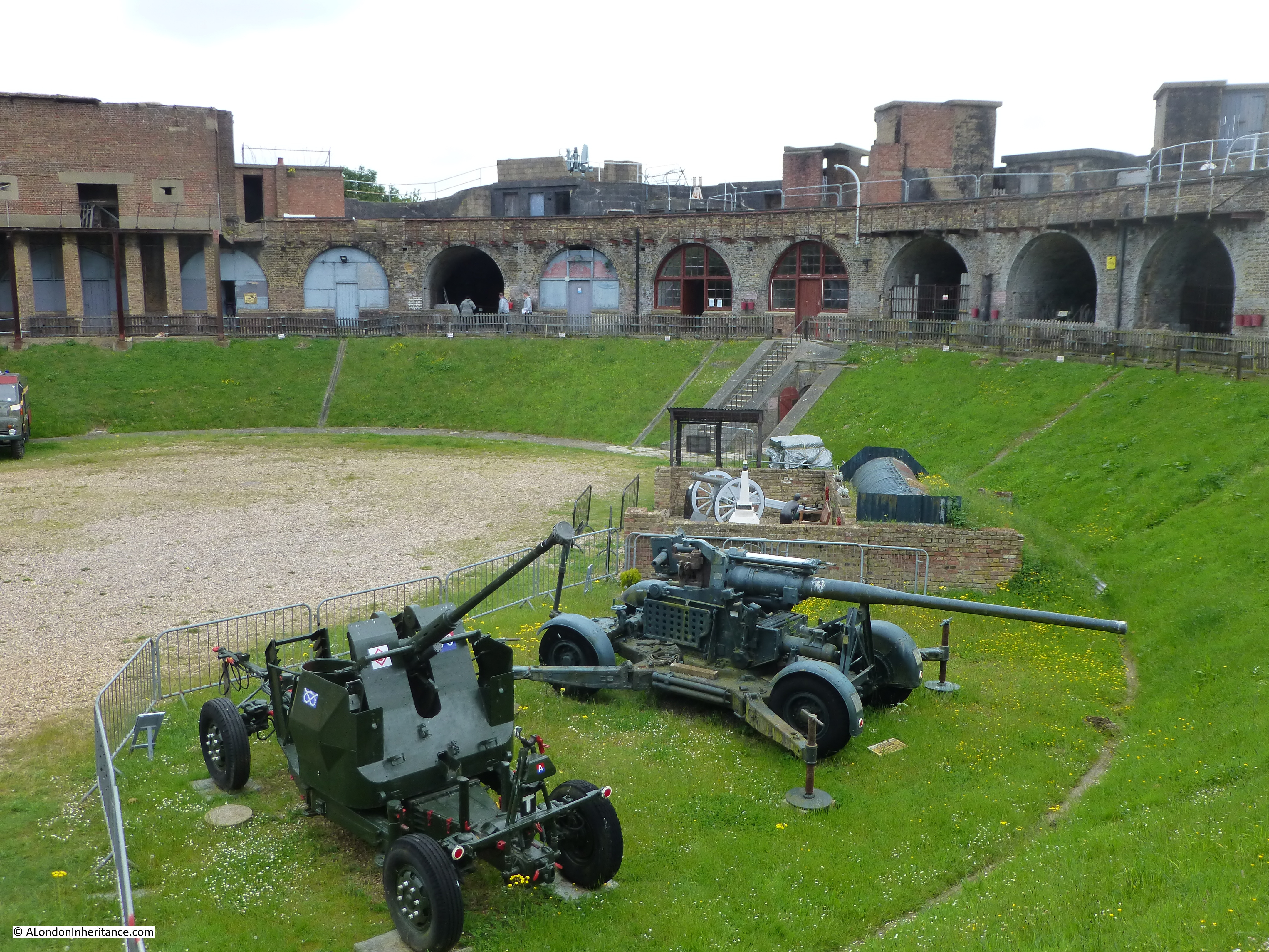
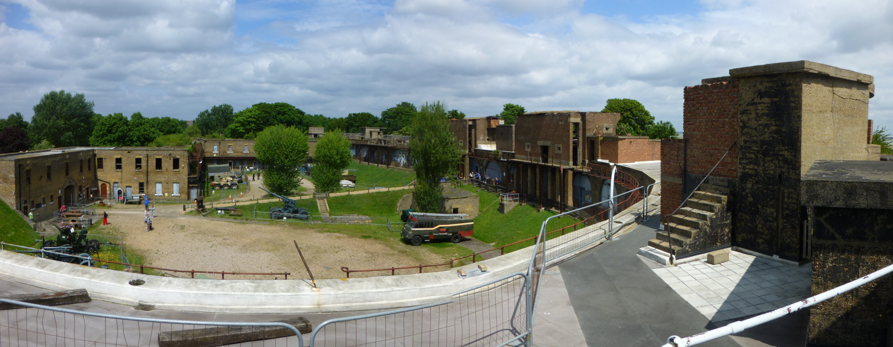
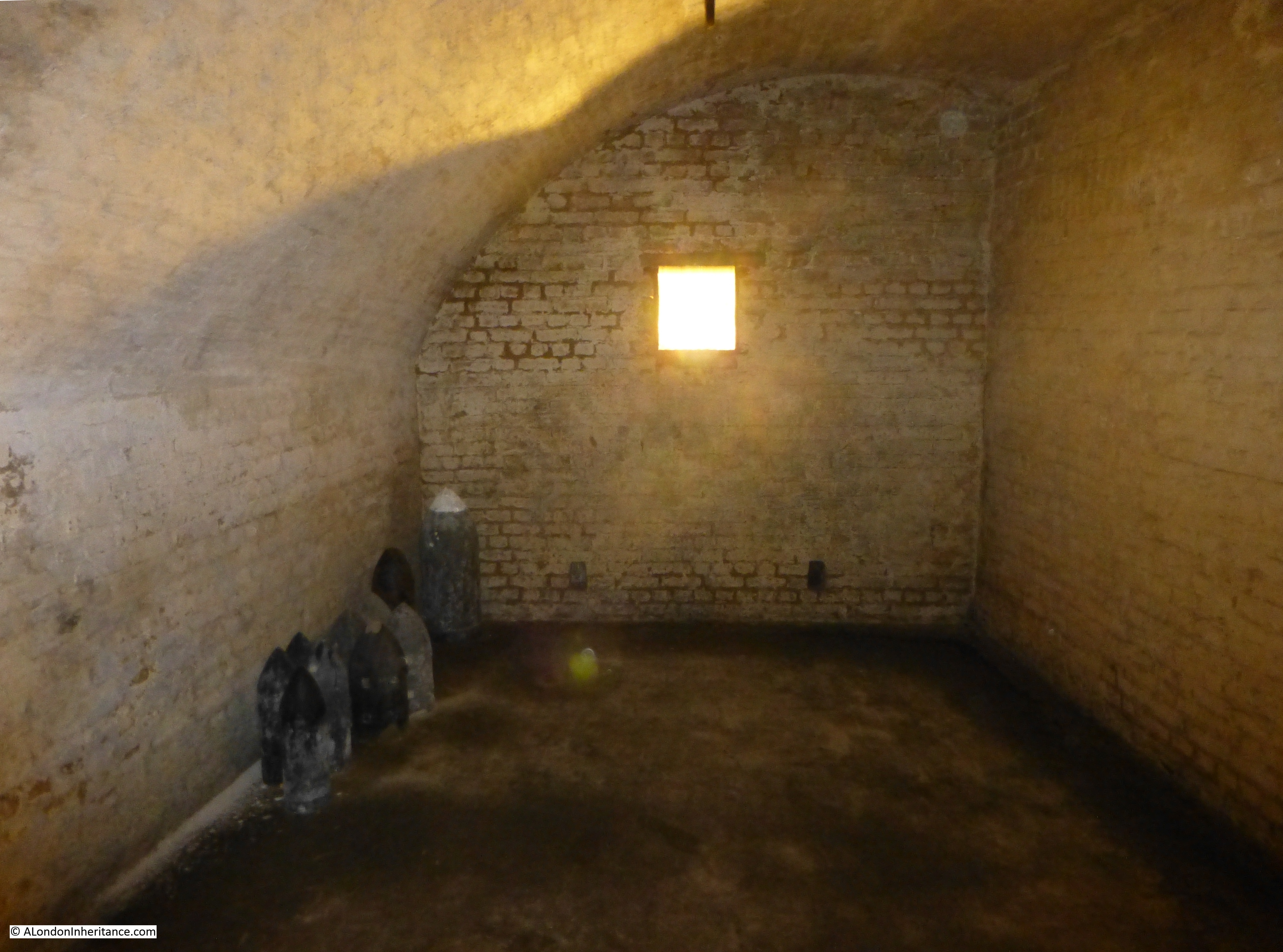
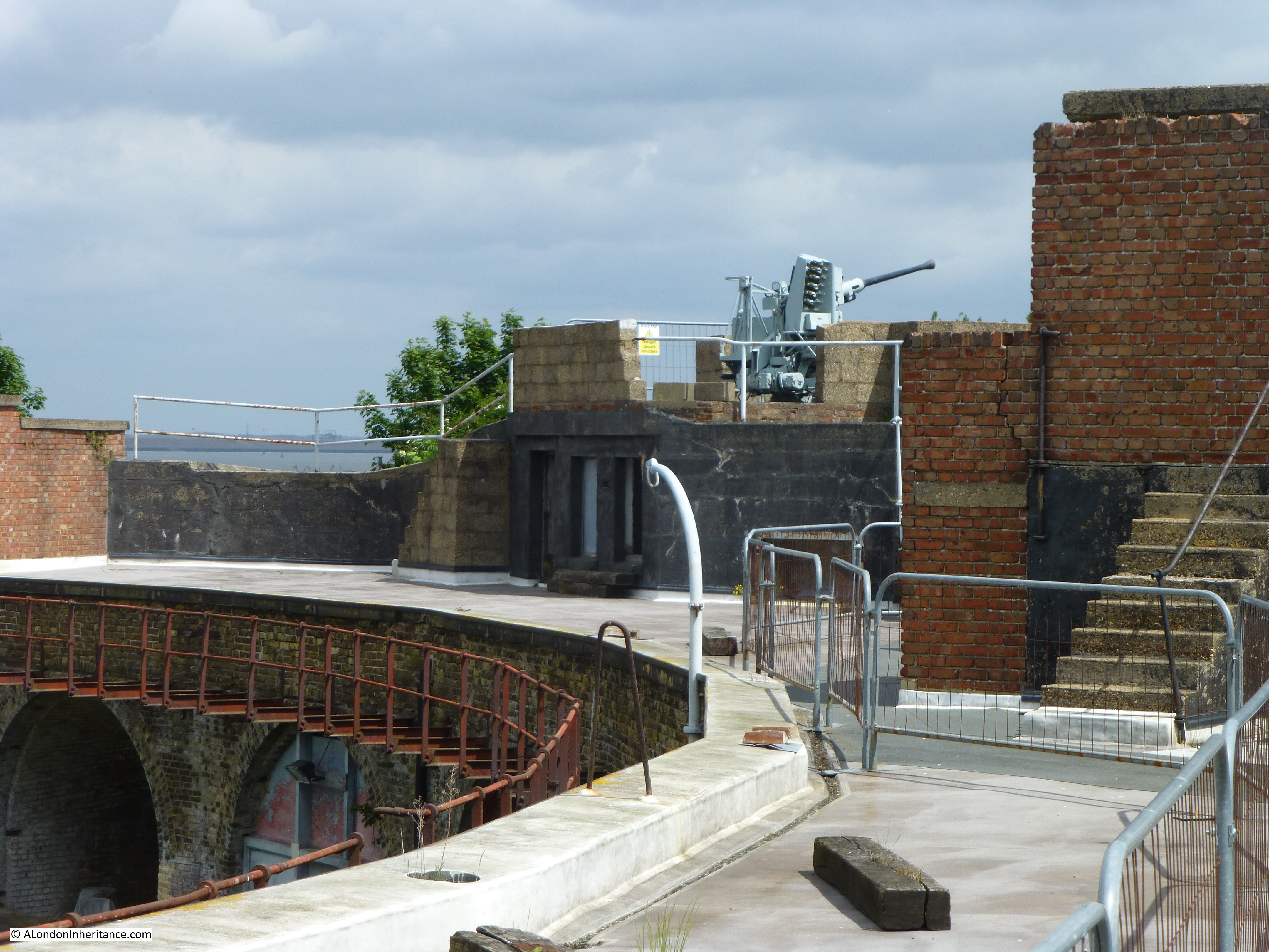
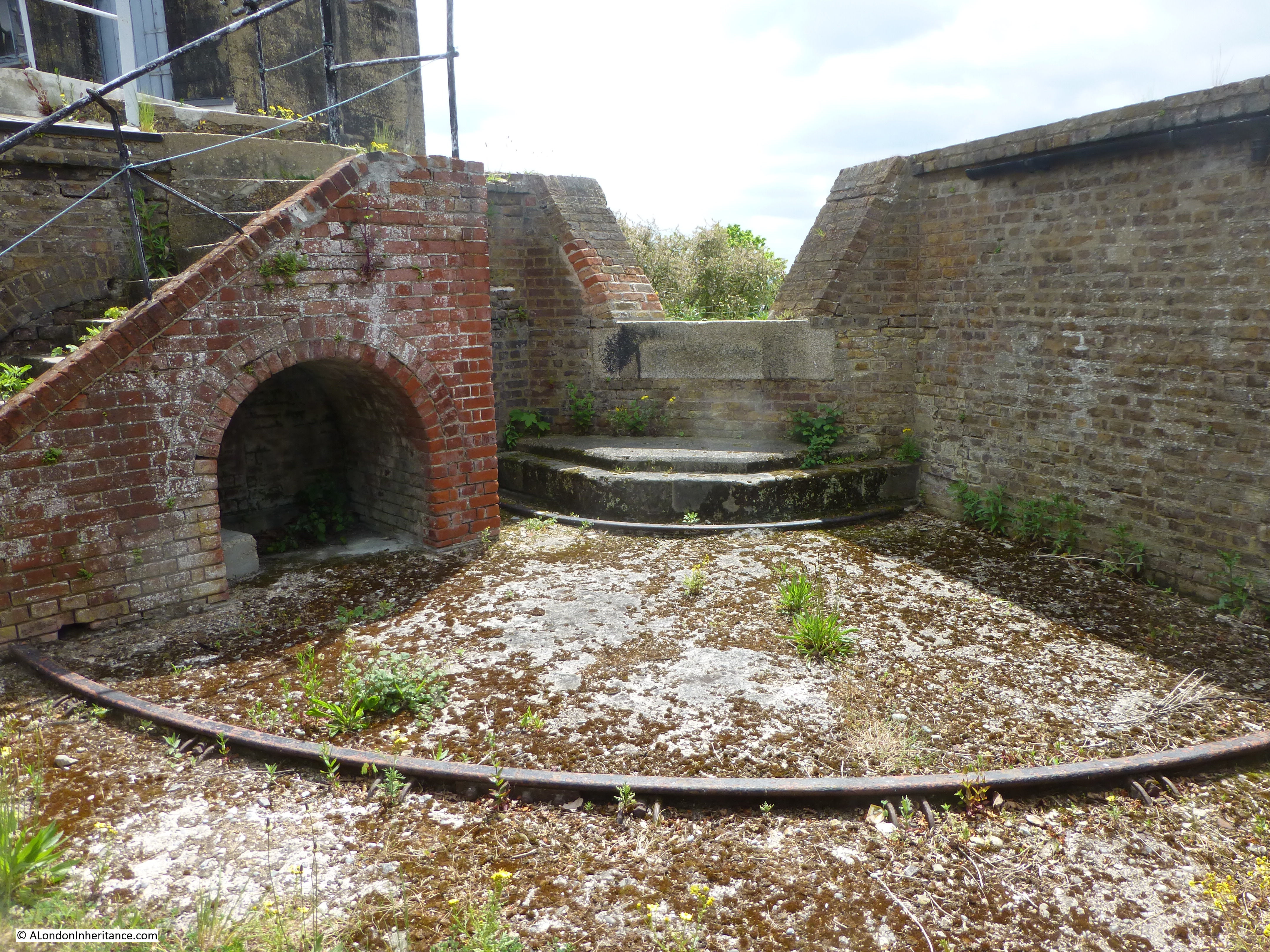
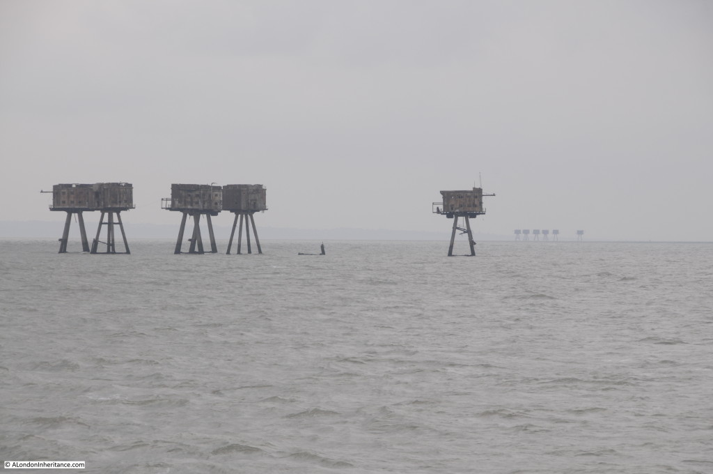
The first is of the Red Sands fort in the Thames estuary. Built during the war as an anti-aircraft gun emplacement to defend London from aircraft approaching up the Thames, when my father took the following photo of the fort, it was still in use.

the Hague

In 2015 I was on the paddle steamer Waverley on a trip from central London out to the forts and took the following photo with the Shivering Sands fort and the Red sands fort in the distance.

the Hague

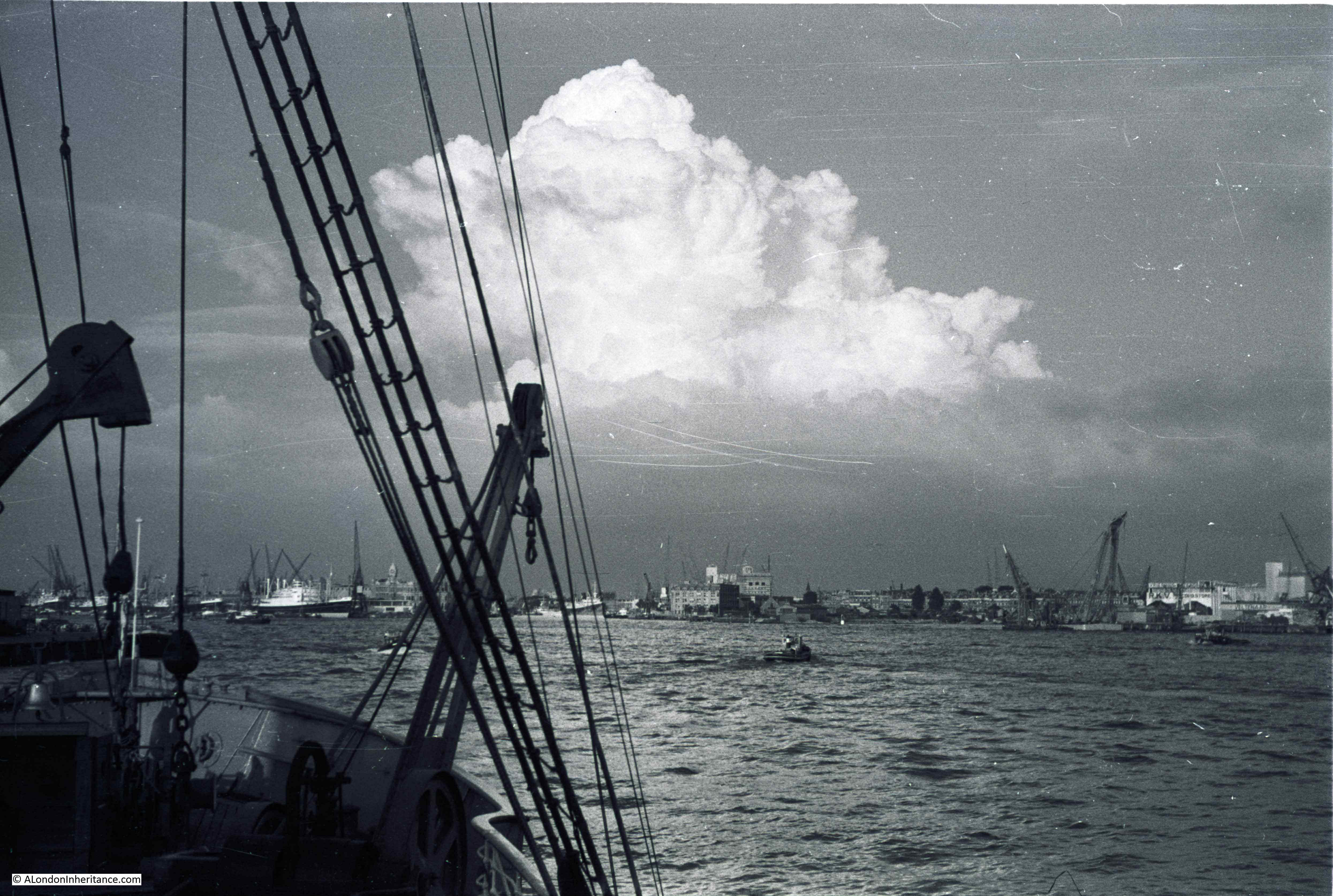
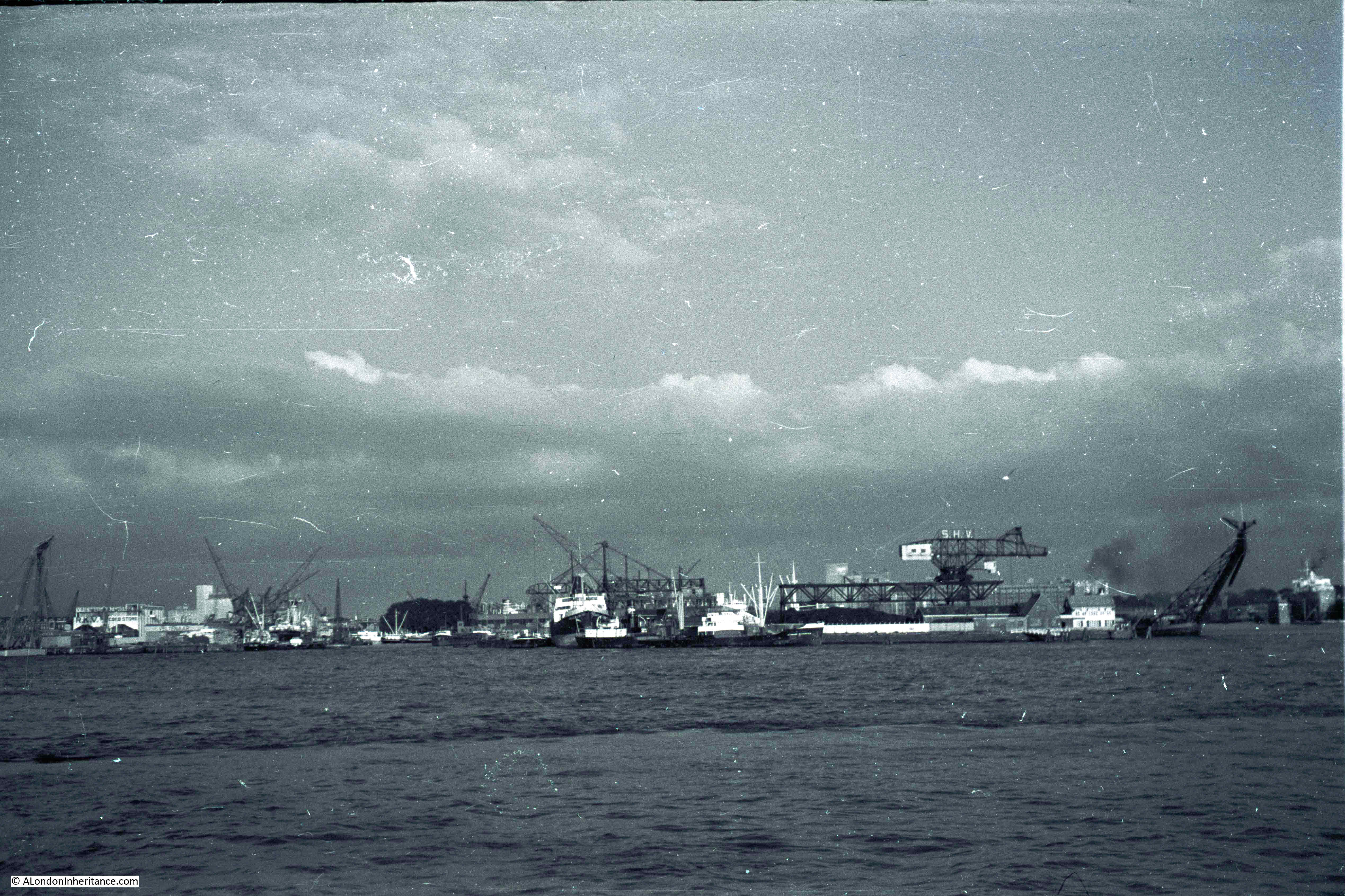
There are also a couple of grainy and distant photos of the Thames river bank as the Batavier II headed out into the north sea, but the first detailed photos are the arrival at the port of Rotterdam. This one from the bow of the Batavier II:

the Hague

The Batavier Line was a Dutch shipping line established in 1830 by the Netherlands Steamship Company, when a regular service was operated from the Port of London to Rotterdam. In 1895 the Batavier Line was sold to Wm. H. Müller and Co, and the Batavier name was retained and a number of new ships were ordered including the Batavier II (a replacement of a ship with the same name). The ship was delivered in 1921.

The Batavier II was the only ship of the Bataview Line that survived the war. Of the immediate pre-war Batavier ships, the Batavier V was seized by the invading German forces, but sunk by the Royal Navy in 1941. The Batavier III had also been seized and sunk off Norway in 1942 after hitting a mine whilst being used as a German troop carrier.

Only the Batavier II survived the war to reenter service on the Tilbury to Rotterdam route which survived until 1958 when Batavier ended their passenger services.

The following postcard shows the Batavier II. On the reverse of the card is written “Batavier Line, London to Rotterdam”. The above photo was taken from the front of the boat, just by the railings which can be seen in the postcard.

the Hague

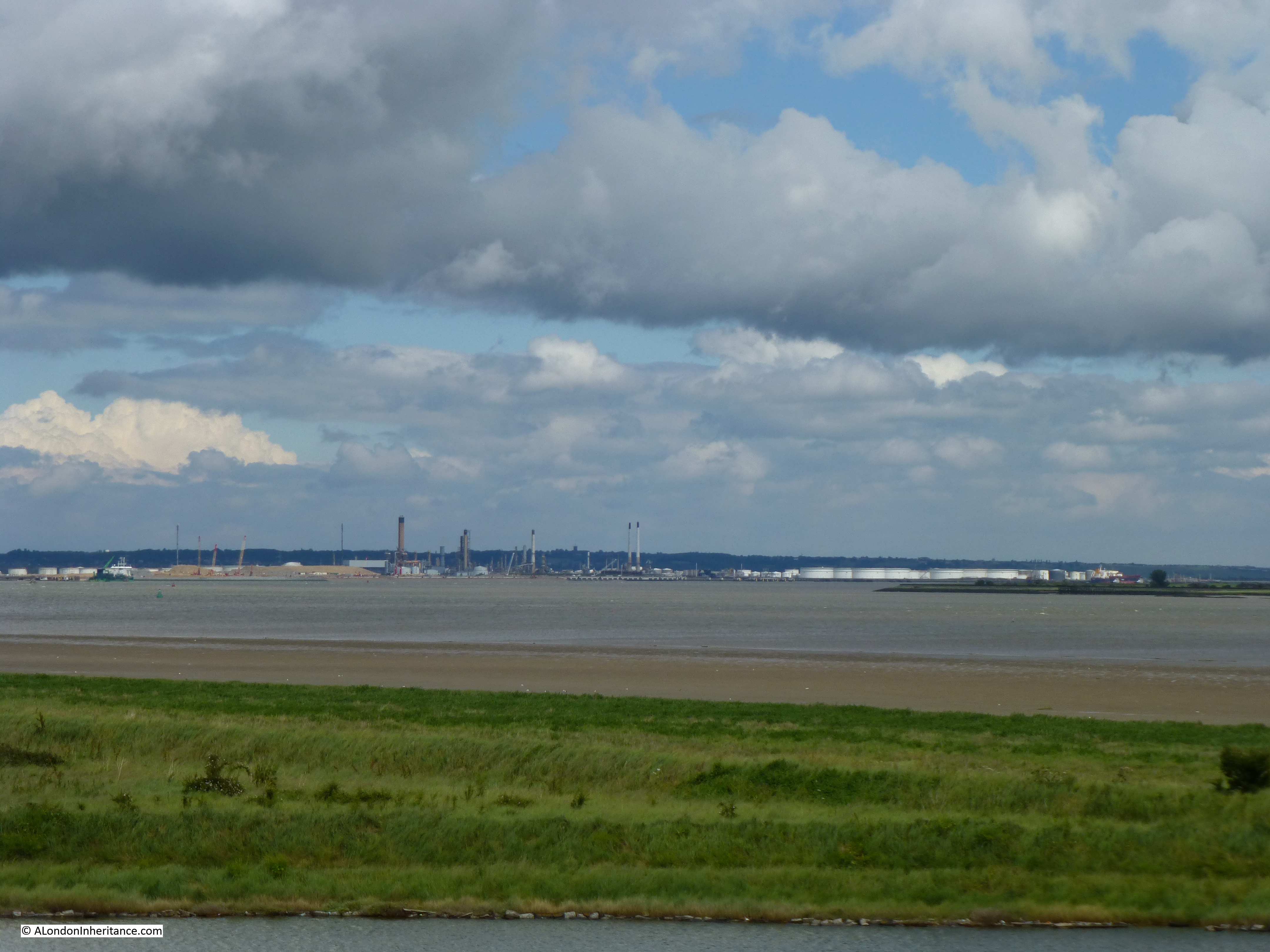
The port of Rotterdam is one of Europe’s largest ports, as it was when these photos were taken with industries related to shipping lining the river for a considerable distance.

the Hague

There are no passenger services from London to Rotterdam today, however the alternative would be a train journey from Liverpool Street to Harwich and then the ferry service from Harwich to the Hook of Holland.

I am not sure where the ship docked in Rotterdam. It was not at the Hook of Holland as this terminal is located at the entrance to the port. My father’s photos show that the ship traveled further into central Rotterdam.

the Hague

When we travelled to the Netherlands this year we did not take the ferry, instead we travelled on the EuroTunnel shuttle service from Folkestone to Calais, then a drive up through France and Belgium, to arrive in Holland.

I suspect my father visited Rotterdam first, and this city will be the subject of one of the coming posts, For this Sunday’s post, it is a brief visit to:

The Hague

Amsterdam is the capital of the Netherlands whilst the Hague is the administrative centre. The city where the States General of the Netherlands (the country’s parliament) is located, along with the Supreme Court and the International Court of Justice.

As with the country as a whole, the Hague has a complex history. The origins of the city date back to the early 13th century, when Floris IV, the Count of Holland established a base in the area,

The city and what was to become the Netherlands has been through a series of occupations, consolidation and separation. The Spanish occupied the city during the eighty years war, the country was a client state of the First French Empire at the start of the 19th century, the country was combined with Belgium with separation only achieved in 1830, and the country was occupied by Germany during the second world war. As with the rest of the Netherlands, the Hague suffered terribly during the last war.

The country has also had a long trading history, at times in competition and also at war with England.

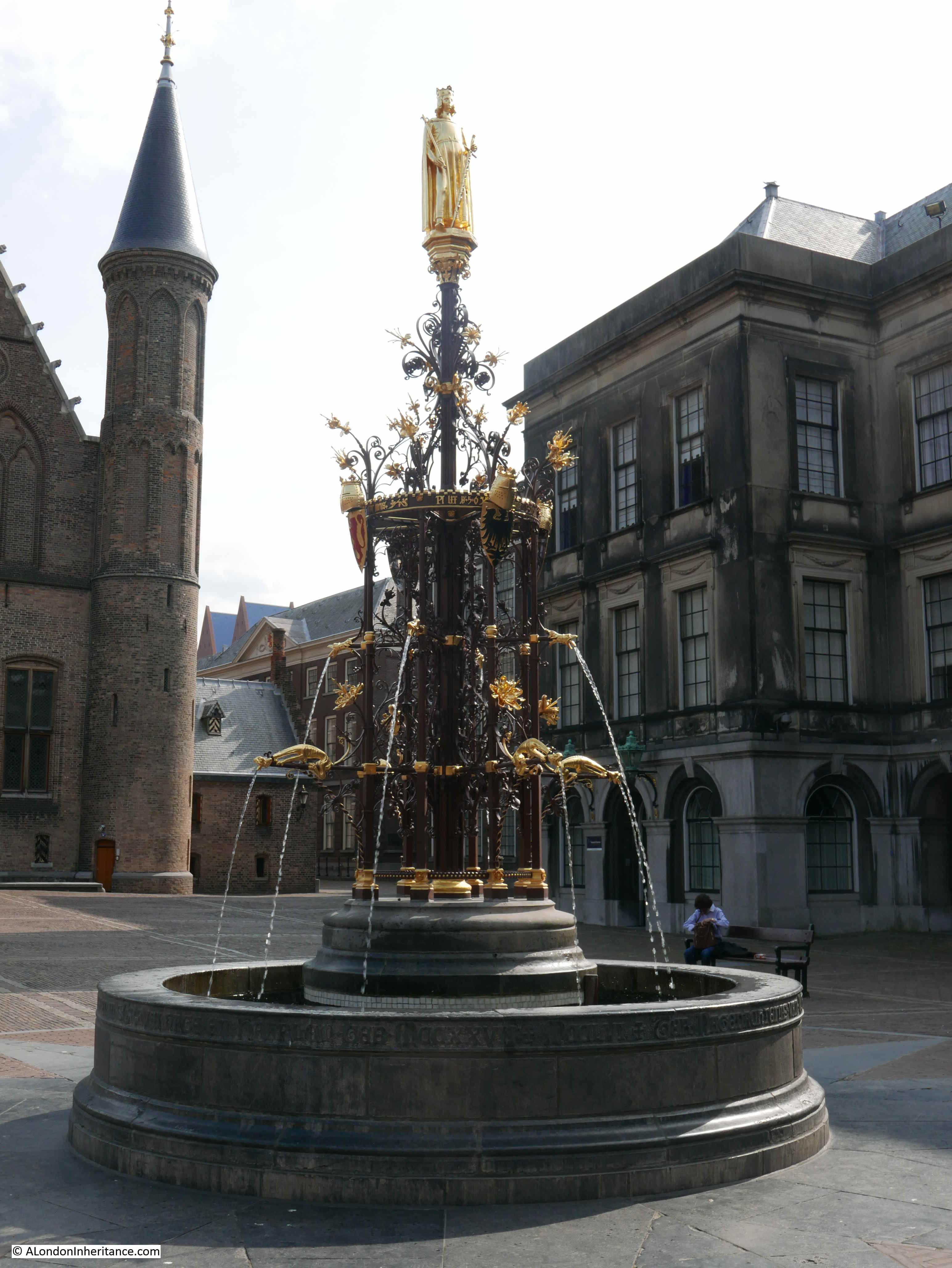
Whilst in the Hague, my father took some photos of the Binnenhof, the meeting place of the States General (the equivalent of London’s Palace of Westminster) and the official residence of the Prime Minister of the Netherlands.

Considering the function of the Binnenhof, access is open and the visitor is free to walk around. Whilst there are armed police around the site, there are no searches or restrictions to exploring the open areas and taking photos.

The main entrance into the Binnenhof complex:

the Hague

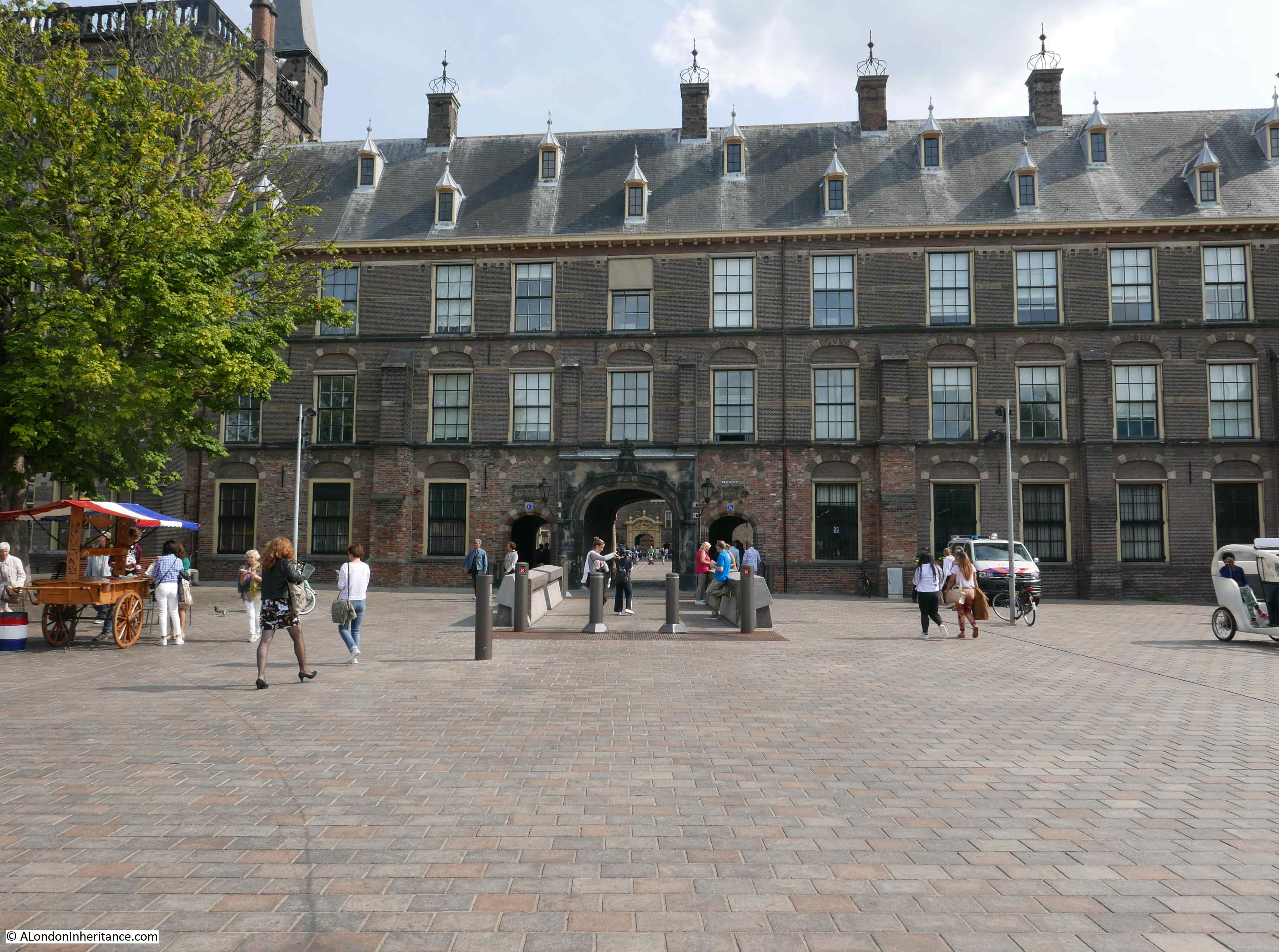
Once inside and standing in the central courtyard, I found the location of the first of my father’s photos:

the Hague

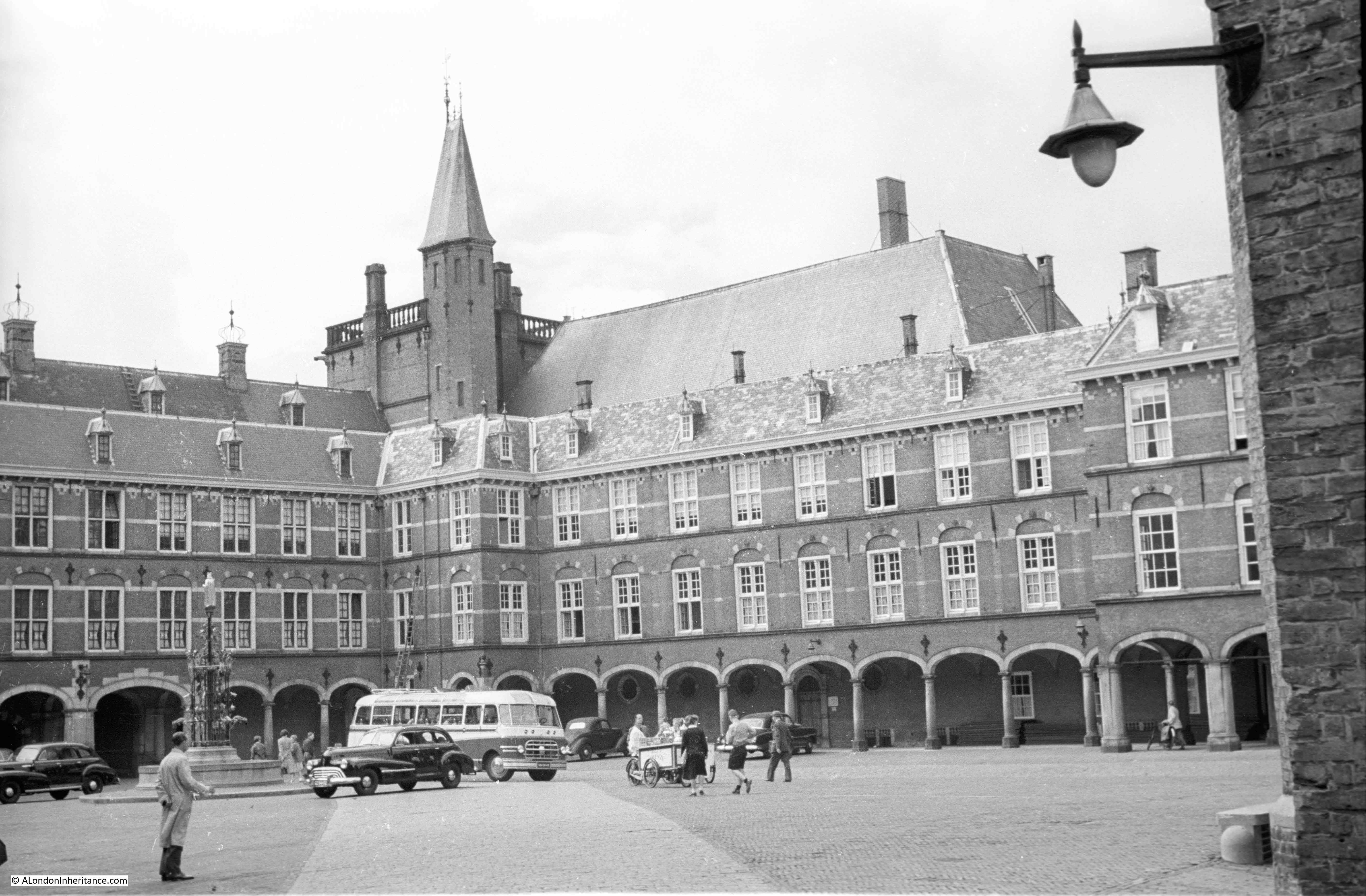
As probably to be expected of the seat of Government, there has been hardly any change. The main physical change is that the fountain in the above photo has been moved slightly to the left, so just outside of the photo of the same scene today.the Hague

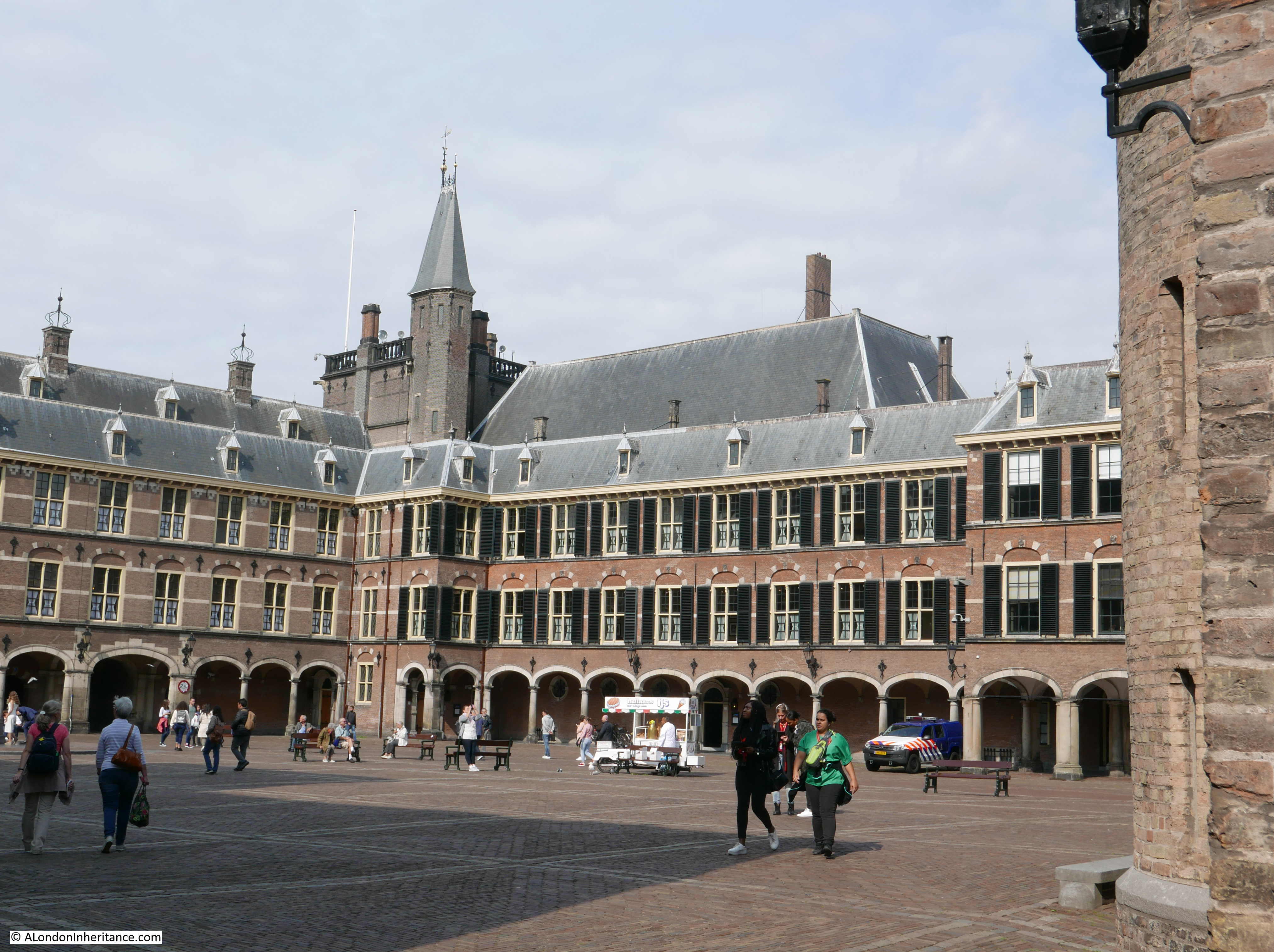
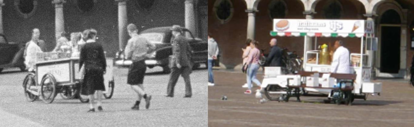
I always find the small details fascinating in comparing the original photos with the scene today. Despite being almost 70 years apart, there is a mobile ice cream seller in almost exactly the same place:

the Hague

One side of the courtyard is taken up by the Ridderzaal, or Knight’s Hall.

the Hague

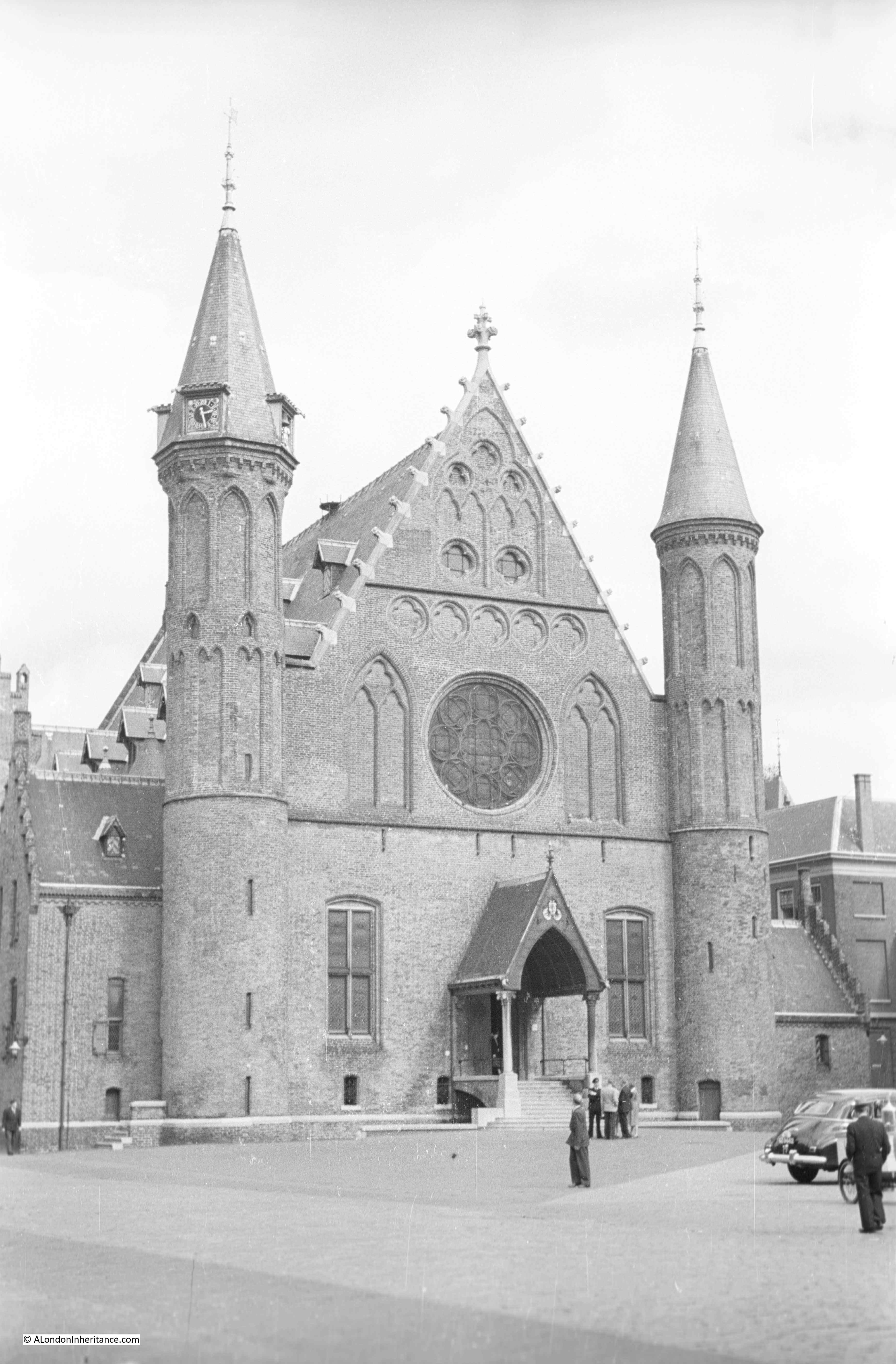
The origins of the Ridderzaal date back to the 13th century when Floris V built his first manorial hall within the area of land first developed by his grandfather. The Ridderzaal has been used for a multitude of purposes over the centuries, and today hosts the annual opening of the Dutch Parliament by King Willem-Alexander.

The Ridderzaal today, again with hardly a change:

the Hague

I am not sure of the significance of the clothes that this group were wearing.

the Hague

But again,. the scene is much the same today:

the Hague

The Binnenhof appears to have escaped any significant damage during the war, although this was not the same for the rest of the Hague. The population suffered considerably during occupation, and the Hague, along with much of western Holland was occupied until the closing months of the war. Supplies were cut and much of the population were close to starving. When I lived in the Hague, work colleagues told stories of the time which included tinned food being floated down the canals from liberated areas into the occupied.

There was also physical destruction to the Hague, not just from the occupation forces, but also from the Allied forces. The suburbs of the Hague were used for V2 rocket launches against Antwerp and London and the RAF tried to address this threat by bombing the facilities used to store the rocket fuel, the rockets and the mobile launch platforms, however one significant bombing raid missed the target resulting in hundreds of deaths among the local population.

In the Binnenhof courtyard is a rather impressive, neo-gothic fountain. Designed by the architect P.J.H Cuypers (who was also responsible for the Rijksmuseum in Amsterdam), the fountain was in operation by 1885.

the Hague

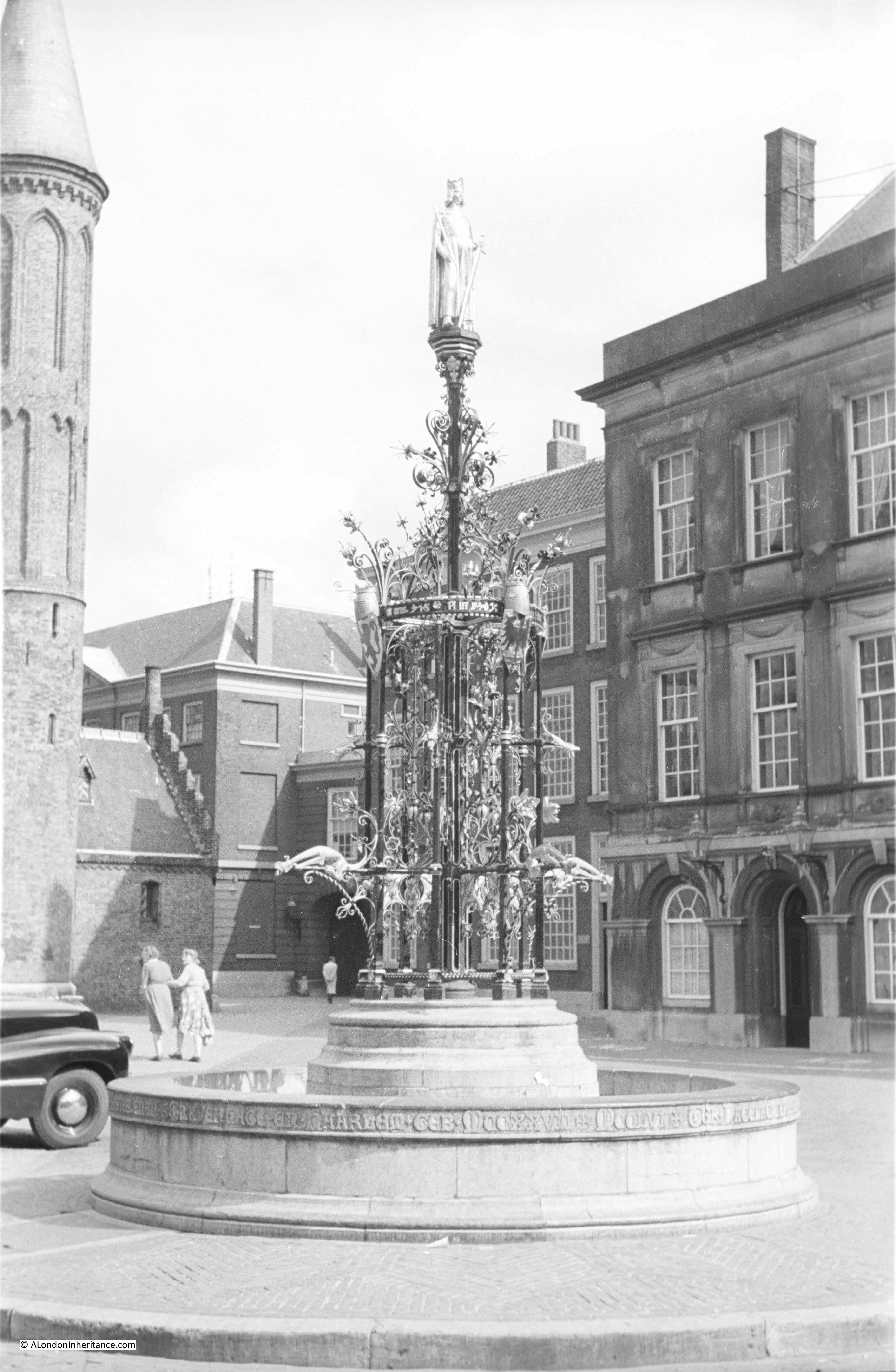
The fountain today. Colour photography brings out the gilding of the fountain. It appears to have been relocated slightly at some point over the last 70 years.

the Hague

As the home of the Dutch Parliament, the Binnenhof has always had a symbolic importance to the Dutch population and the state. It was therefore used for rallies and ceremonies by the occupying forces not that many years before my father’s 1952 photos. The following photo is of the main courtyard with the fountain visible in the top left.

the Hague

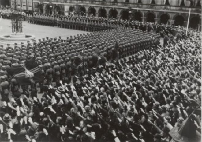
And in front of the Ridderzaal:

the Hague

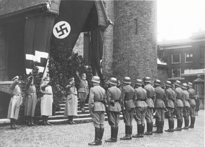
As mentioned earlier, the Dutch population suffered terribly during the war. Arthur Seyss-Inquart was the Reichskommissar of the Netherlands during the war. An Austrian and a fervent Nazi, he aggressively pursued the round up and deportation of Jews within the country. He was found guilty in the Nuremberg Trials and hanged shortly after. 

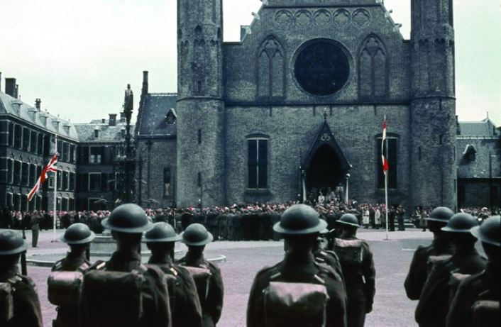
A very different ceremony was held in the Binnenhof courtyard in May 1945 following the liberation of the Netherlands by British and Canadian armed forces.

the Hague

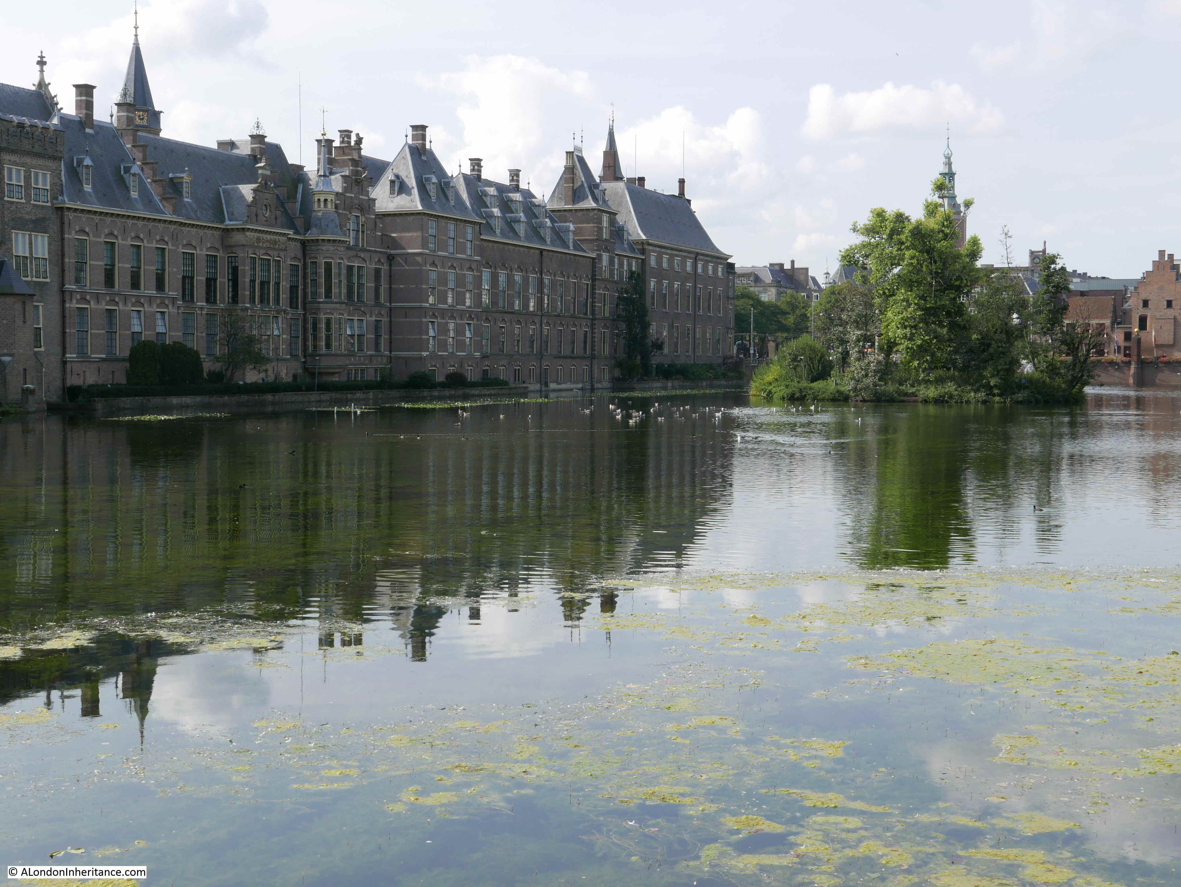
Directly outside the Binnenhof is the Hofvijver, translated as Court Pond, although the word pond does not seem appropriate for this large expanse of water.

the Hague

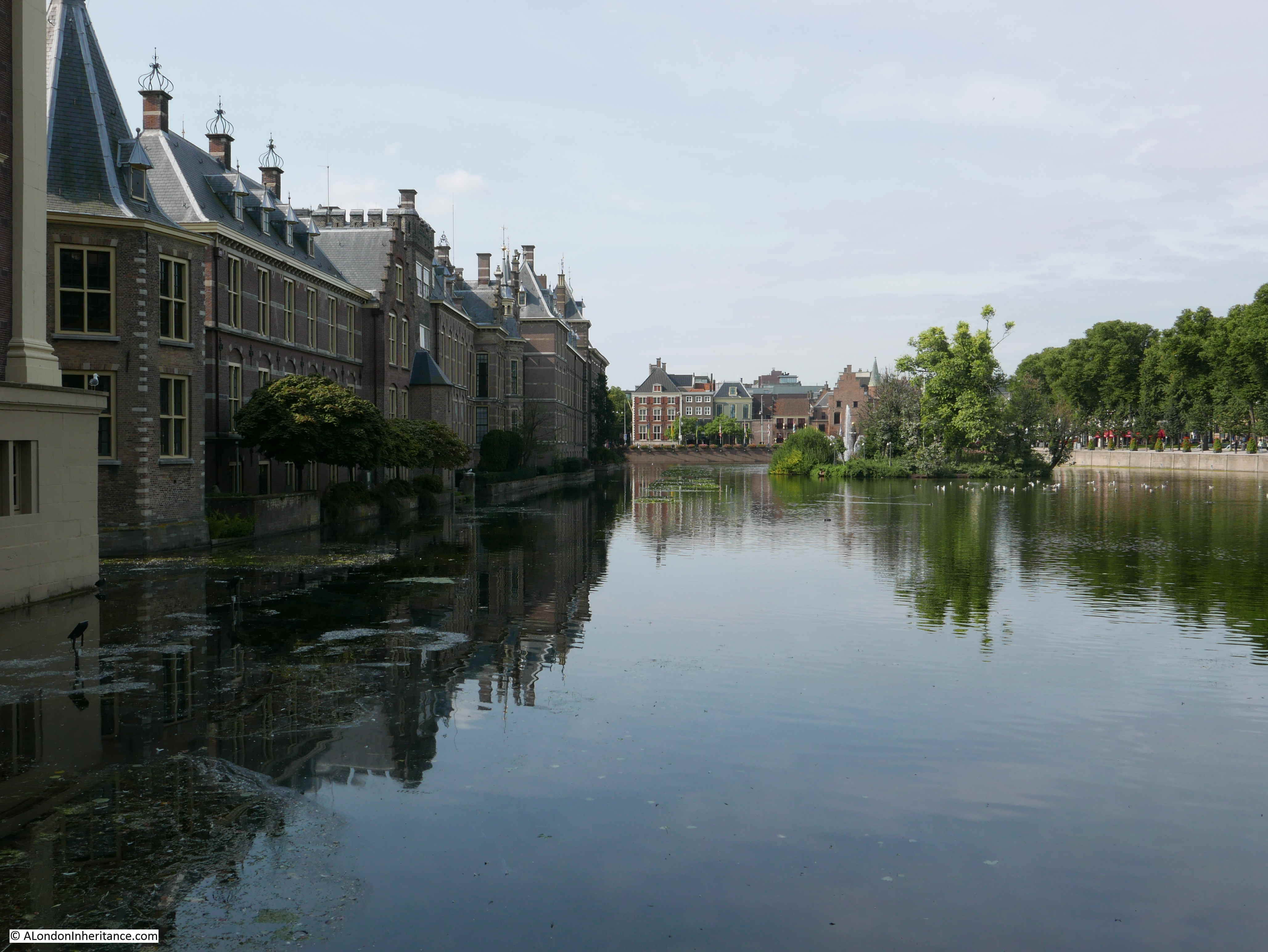
The history of the Hofvijver can be traced back to the first manorial buildings here in the 13th century. It was originally a lake within the sandy landscape of the area (water is never far away in much of the Netherlands).

As part of the development of the Hofvijver, it was bounded by street and pedestrian areas on three sides with the Binnenhof on the fourth side to form a rectangular area of water, which from the sides looks remarkably shallow.

The scene has not really changed for centuries. This painting from the Dutch School, dated 1625 shows a similar view, although the Hofvijver today is not used for any form of boating.

the Hague

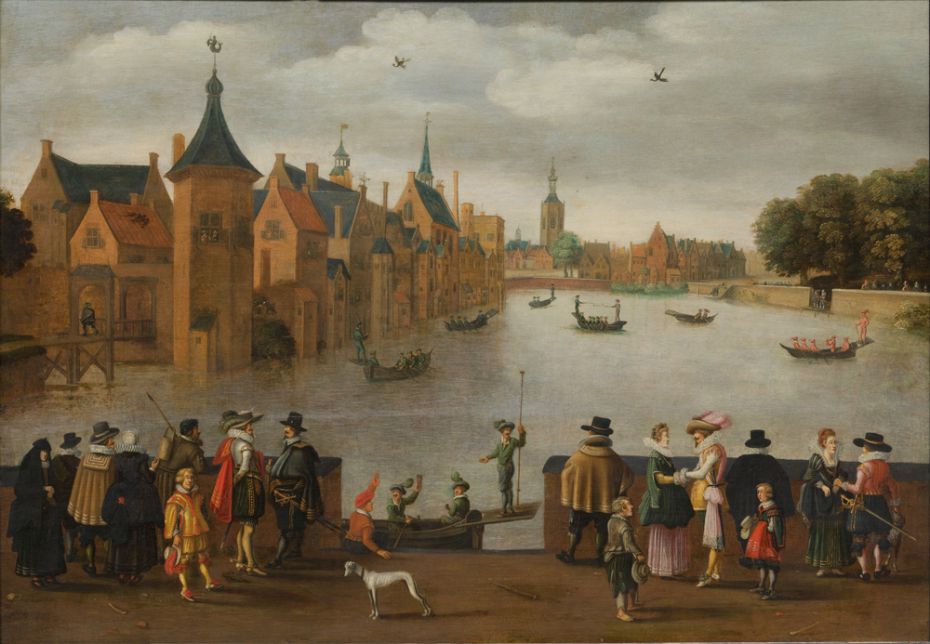
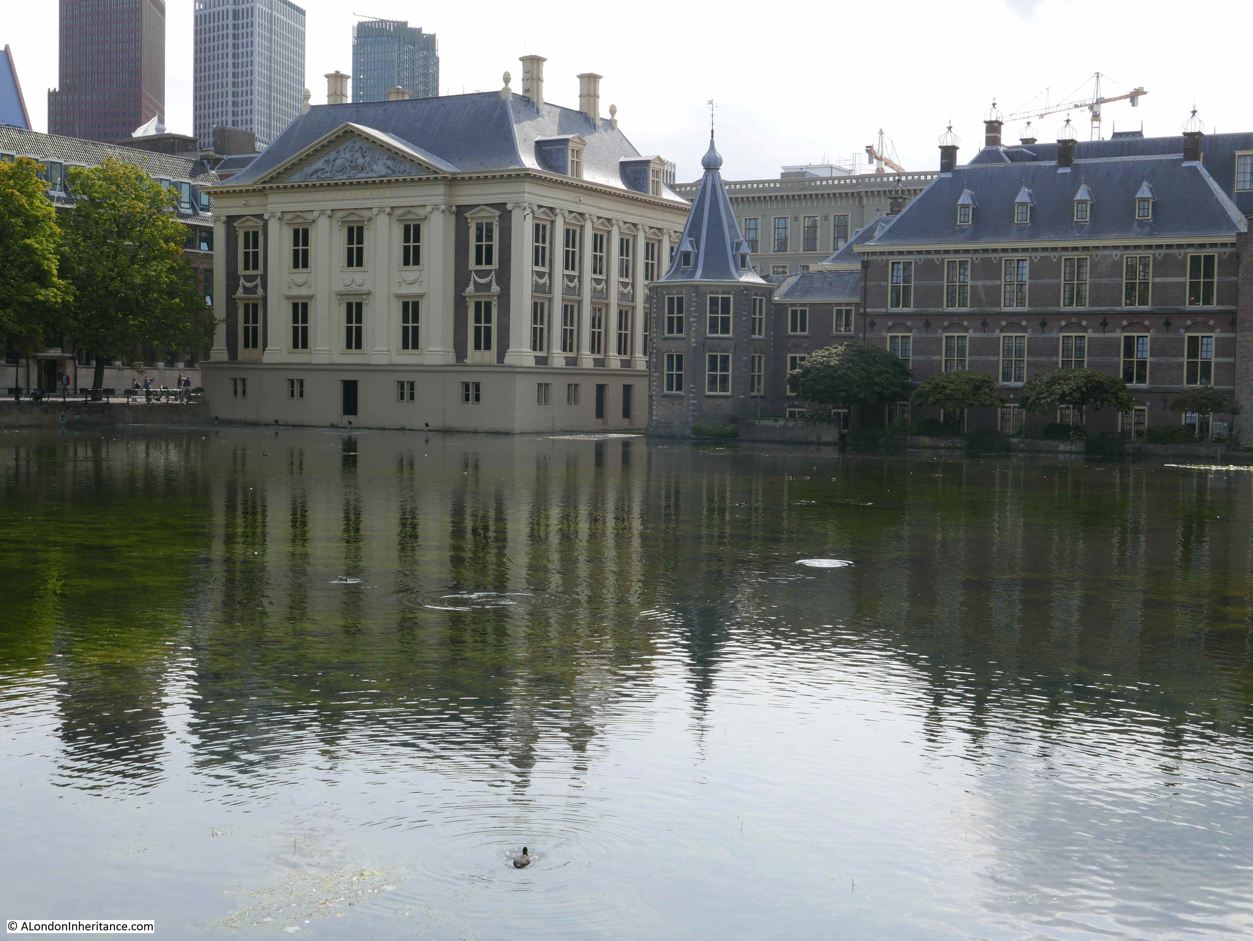
So if it looks much the same over almost 400 years, I would expect the views over the last 70 years to be much the same, and indeed they are:

the Hague

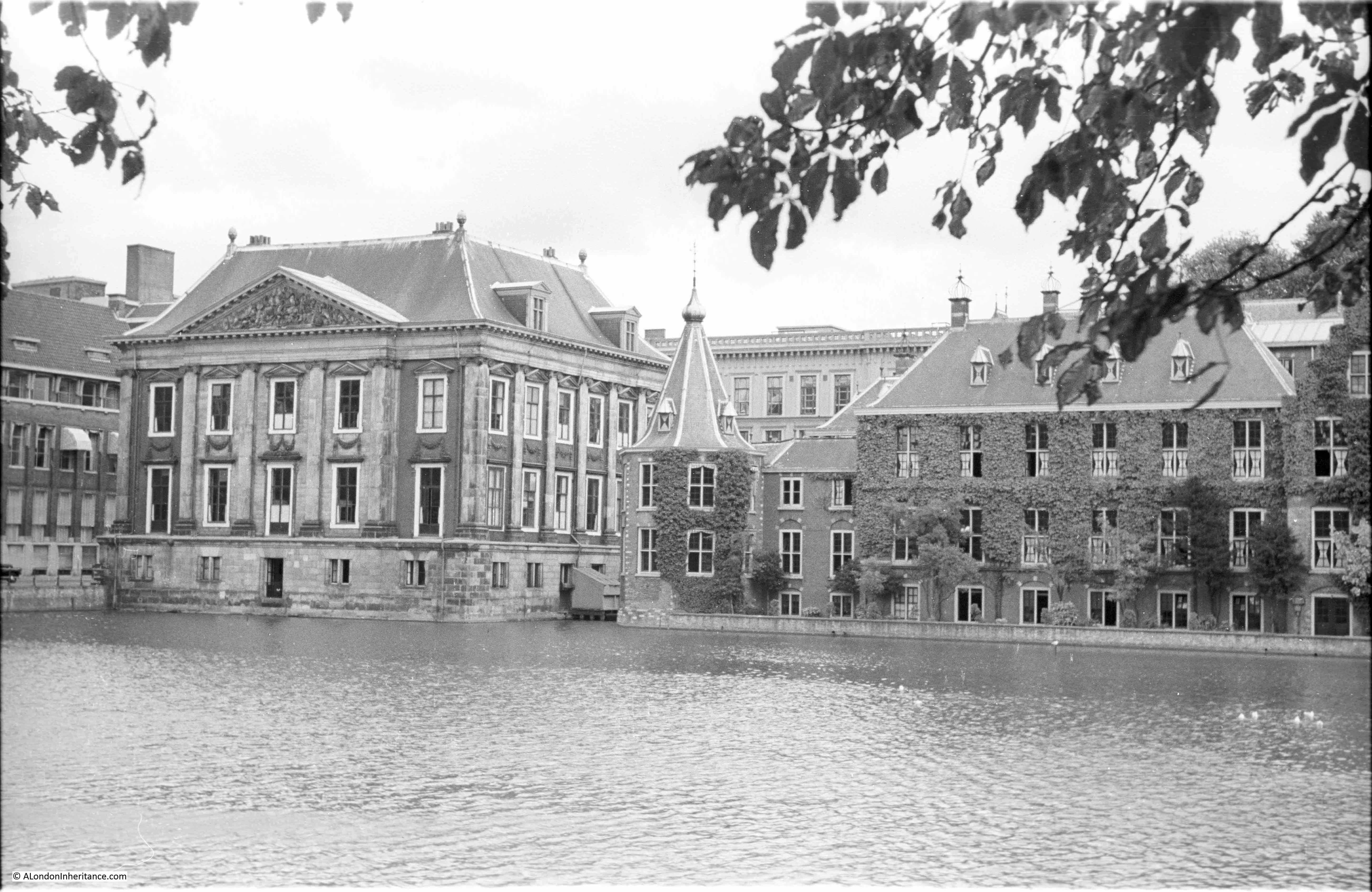
Apart from the expansion of high rise buildings in the background. The building on the left of both photos is the Mauritshuis, the home to a large collection from the golden age of Dutch art, and home to Vermeer’s “Girl with a Pearl Earring” – well worth a visit.

The small, circular building to the right of the Mauritshuis is known as the “Little Tower” and is the office of the Dutch Prime Minister.

the Hague

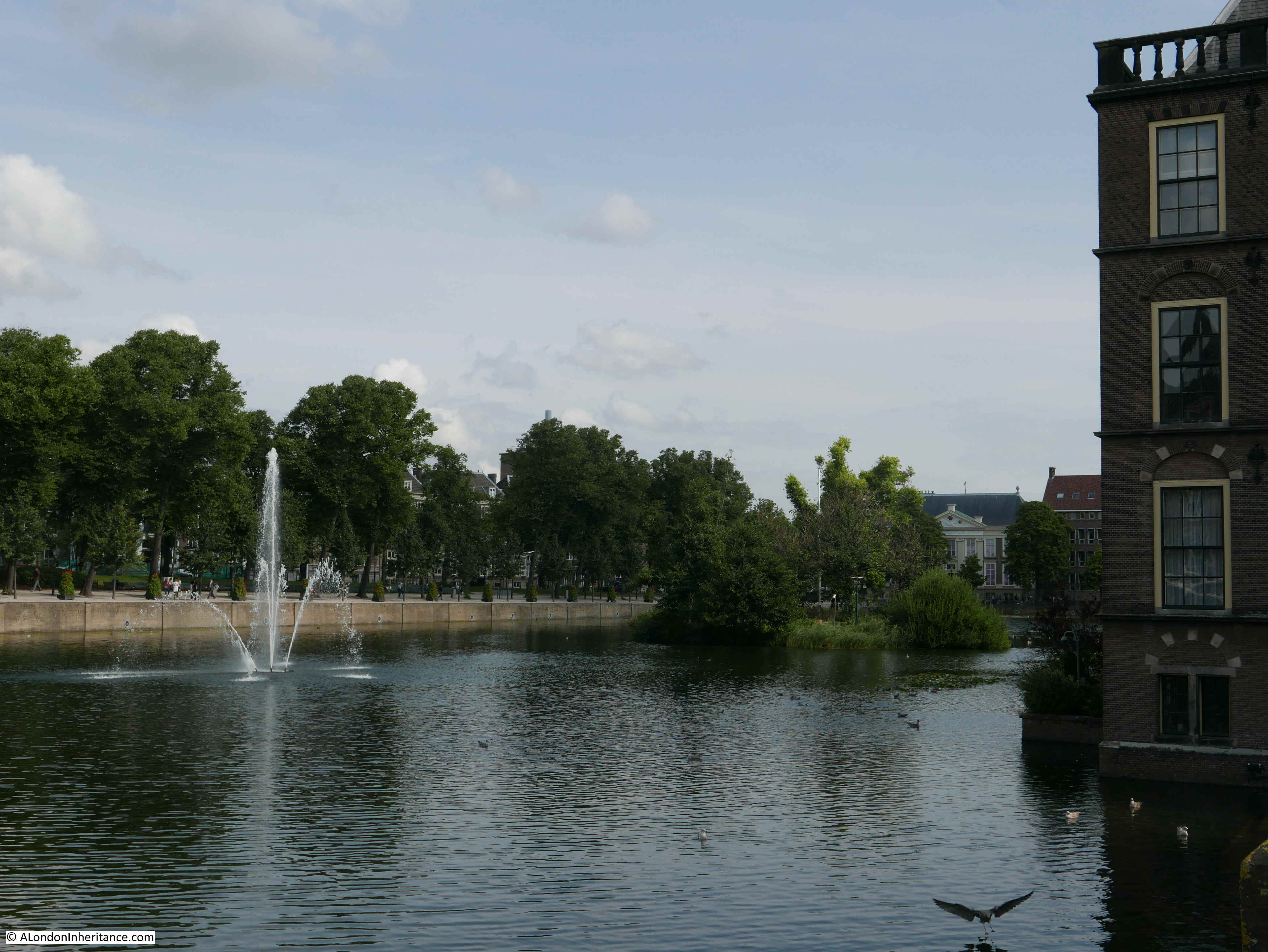
Another view along the Hofvijver:

the Hague

Although the lake that formed the Hofvijver dates from before the first buildings, the island in the middle is only about 300 years and of unknown original purpose.

the Hague

A close up view, with the Prime Minister’s office on the left:

the Hague

At the opposite end of the Hofvijver was a fountain:

the Hague

And a rather less impressive fountain can still be seen today:

the Hague

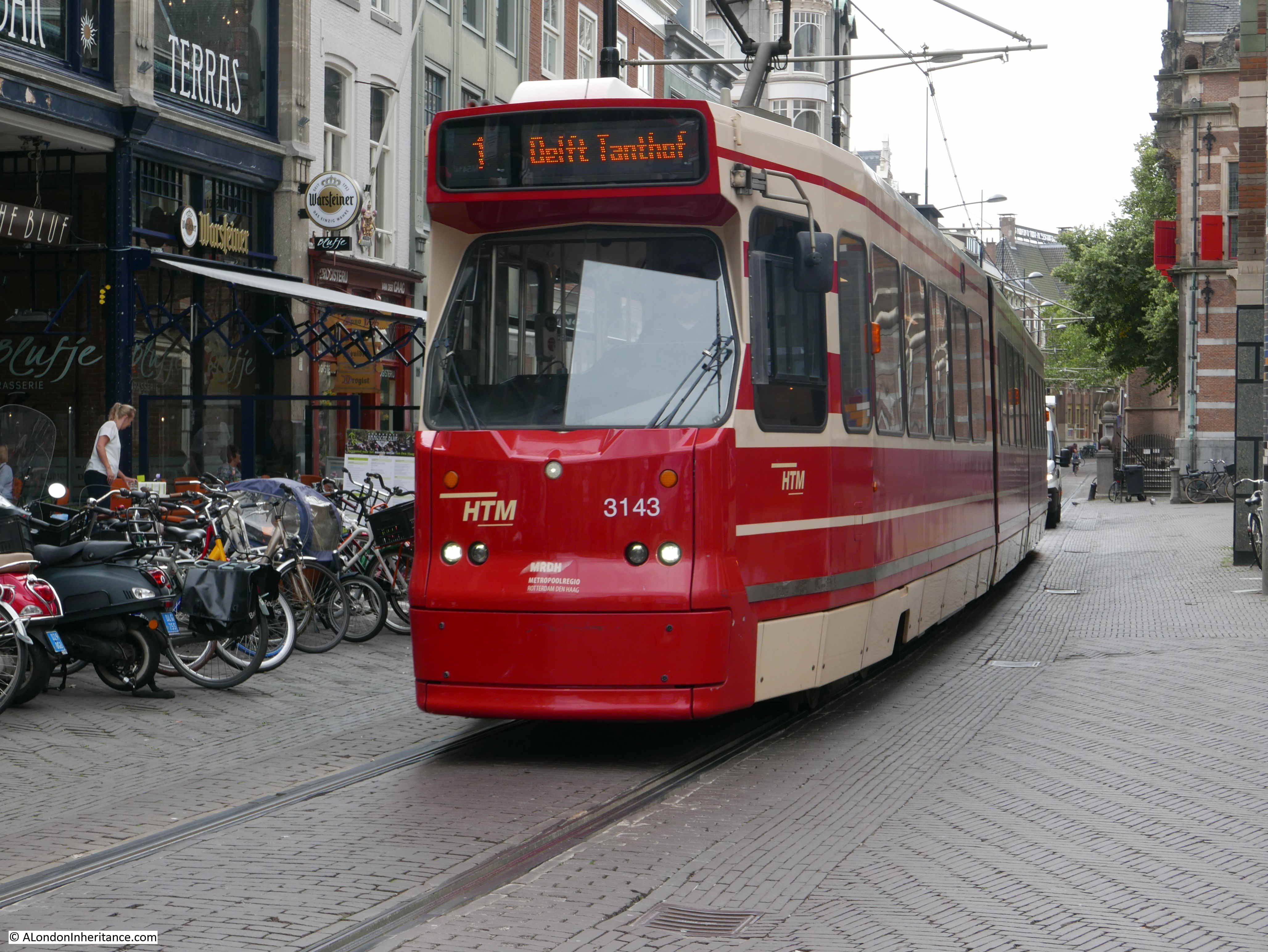
It is interesting to compare transport systems when visiting other cities and whilst the Hague is many times smaller than London, it does have a very impressive public transport system with a combination of buses and trams providing comprehensive coverage of the central city and surrounding suburbs and towns.

Trams navigate the central streets of the Hague and the pedestrian needs to keep a careful lookout for the large number of bikes as well as trams.

I was please to see the number 1 tram. This tram runs from the coastal suburb of Schvenenigen to the town of Delft. It was the tram I caught every day to and from work. The same model of tram is currently in use so these must be over 30 years old.

the Hague

However very new trams have been introduced on a number of routes.

the Hague

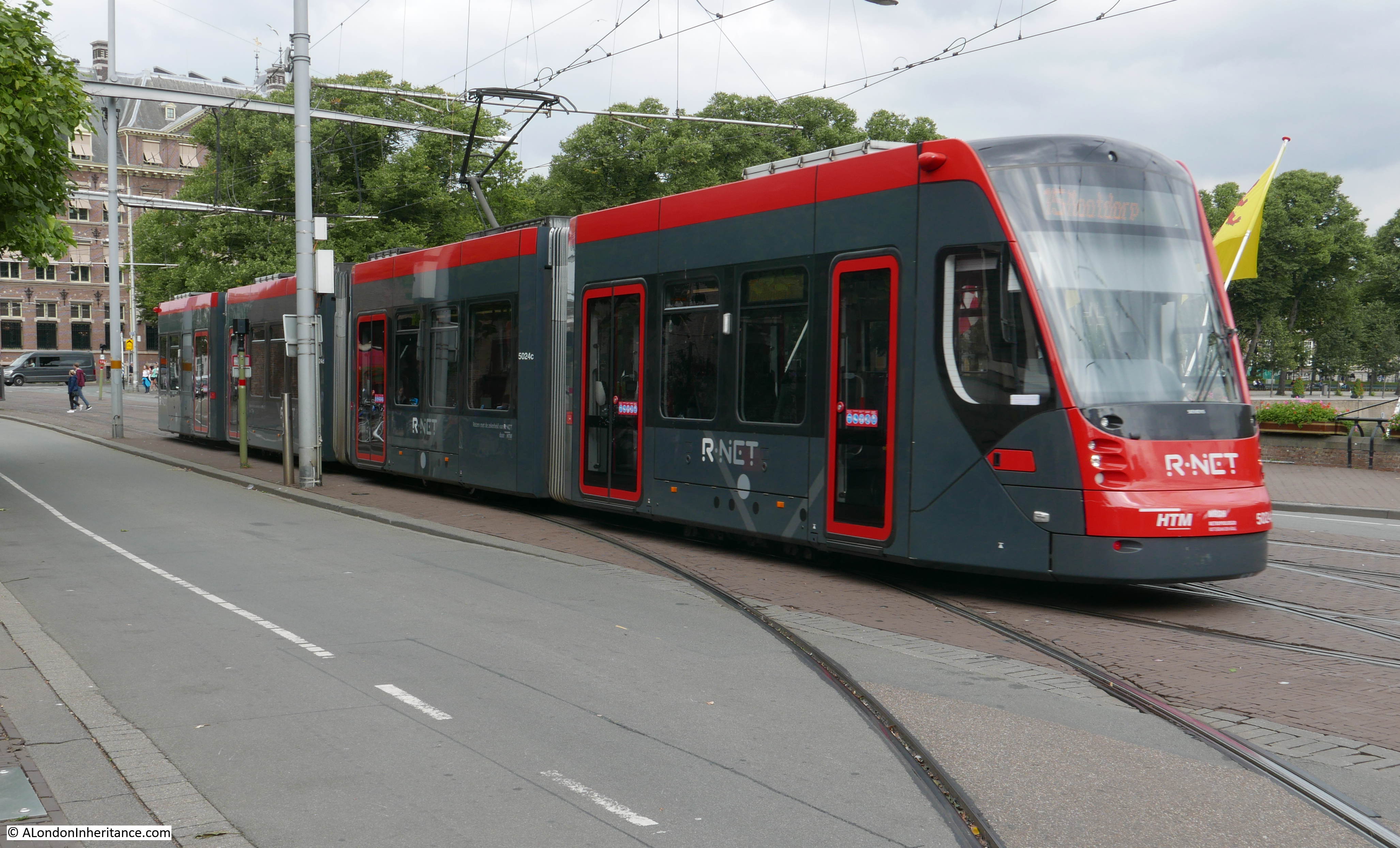
The public transport system is fast, efficient and reliable. A day card allowing travel on trams and buses across the Hague and the surrounding towns covered by the system costs the equivalent of £6 (and would be less, but given the current very depressed state of the Pound against the Euro),

My father only took a few photos of the Hague, he would take many more in the places he visited next. We left the Hague to Amsterdam as our next destination, but not before a trip to a suburb of the Hague which has a tragic connection with west London and that will be the subject of my next (midweek) post.

alondoninheritance.com

Defending The Thames – Coalhouse Fort

Coalhouse Fort on the River Thames at East Tilbury is a short distance further towards the Thames estuary from Tilbury Fort, the subject of my last post.

As with Tilbury Fort, the purpose of Coalhouse Fort was to protect London and the towns and industries along the river’s edge from any naval force that attempted to penetrate the river.

The location of Coalhouse Fort can be seen in the following map. A key location on a bend in the river enabling any attacking force to be shelled on the approach and as it rounds the bend in the river. Two forts on the opposite bank of the river at Cliffe and Shornemead would also have engaged with any attacking force and if they managed to pass through this part of the river, they would then come into the range of Tilbury Fort.

This level of defence highlights the fear that the River Thames could have provided easy access to London, and shows how well London was protected.

As with Tilbury Fort, the origins of Coalhouse Fort are with one of Henry VIII’s blockhouses, constructed in five locations along the Thames following the break with Rome and fears of invasion from Catholic Europe. Unlike Tilbury Fort, Coalhouse was not upgraded or used during the time of the Armada and it fell into disuse.

The original fort was not utilised during the time of the Dutch Admiral, de Ruyter’s incursion into the River Thames and there are local traditions that during this raid the church at East Tilbury was damaged by cannon fire from the Dutch fleet.

Due to continuing threats of war with France during the late 18th century, new fortifications were planned at East Tilbury and building work finally commenced in 1799. A semi-circular defensive structure was built which could support cannon and behind this were constructed the buildings to house supplies and barracks for those manning the fort.

No attack was forthcoming and after the end of the Napoleonic Wars in 1815, the fort was again abandoned.

Ongoing tensions with France during the 19th century resulted in a plan for significant upgrades at East Tilbury. The original fort was demolished in 1861 and the new fort was constructed at a cost of £130,000.

It is this fort which is still substantially in existence today.


Unlike Tilbury Fort, Coalhouse Fort today is run by a volunteer group, the Coalhouse Fort Project who run occasional open days and are gradually restoring the fort and attempting to stop further decay.

Coalhouse Fort is found at the end of the road that passes through East Tilbury and the original site of the factory and village created by the Bata Shoe Company. (The history of Bata in East Tilbury and the factory / village Bata created is fascinating and there is a website dedicated to the history of the East Tilbury site which can be found here)

On arrival, the solid construction of the fort is clearly visible, now surrounded by landscaped parklands. The fort was constructed to be defendable from land based attack as well as to attack enemy shipping on the Thames.

Coalhouse Fort

The entrance gate to the fort:

Coalhouse Fort

Once inside the fort, the archways ringed around the river facing side of the fort can be seen, these are the gun casements, each originally housing an 11 inch gun (with some 1877 upgrades to 12.5 inch guns), with above the casements, space for a range of 9 inch guns on the roof.

These had a range of 3.1 miles with the whole fort capable of firing many rounds per minute at any attacking force coming up the Thames.

The later brickwork buildings along the top are from the 20th century.

Coalhouse Fort

The view of the fort from the roof. The Gatehouse is on the left, with the barracks for those manning the fort to the left and at the far end of the photo:

Coalhouse Fort

Underneath the gun casements are a series of tunnels and storage rooms to store and move the ammunition needed by the guns. Some of these tunnels are still accessible:

Coalhouse Fort

Storage rooms run the length of the tunnel:

Coalhouse Fort

The bright light at the end of the room is an electric light in the original lighting window. The challenge with lighting underground ammunition storage rooms was to eliminate any possibility of sparks or flames, whilst still providing sufficient light for work. The window was completely sealed of from the room, and held an oil lamp which was lit and refueled from a separate set of tunnels which provided access to these lighting windows. This approach ensured that light could be provided whilst separating the two areas and preventing any sparks or flames being exposed to the contents of the ammunition stores.

Following the initial armament of the fort, upgrades continued, including placing quick fire guns, controlled from the fort, nearer to the river to counter new threats from fast-moving torpedo boats.

Guns with increased range (7 miles) were installed and some of the earthen embankments at the front of the fort were added to improve the camouflage of the fort.

During the 1st World War, an Artillery Company along with the 2nd Company of the London Electrical Engineers moved into the fort to man the guns and the searchlights used to monitor traffic on the river.

Minefields were established in the Thames to manage the traffic flow along the river, with tugs in the river checking incoming vessels. In support of this activity, Coalhouse Fort had the role of firing a warning shot at any suspect vessel, or any vessel that refused to stop for examination.

As with Tilbury Fort, Coalhouse Fort was used as a transit and training camp for troops on their way to the battlefields of France and Belgium.

During the 2nd World War, the fort served a number of functions.

Whilst new gun batteries had been set-up closer to the sea, along with greater naval protection, Coalhouse Fort was one of many batteries along the banks of the Thames designated as anti-invasion weapons, tasked to provide protection to the ports and docks of London from any fast moving cruisers and torpedo boats that had evaded the outer defences, as well as being able to attack any mass landing of enemy troops on the flat lands of the Thames estuary or the river.

The whole area around the fort was heavily defended. Bofor anti-aircraft guns were installed on the roof along with further batteries of anti-aircraft guns and searchlights in the immediate locality. These saw a considerable amount of action during the bombing raids on London as the Thames was a perfect navigation aid providing a route direct from the coast to the docks and central London.

Parts of the roof are still accessible. A single Bofor anti-aircraft gun remains on the roof as an example of the types of weaponry used at the fort and in the locality in the defence of London.

Coalhouse Fort

The view from the roof shows why this is an ideal location for defending the river. This is the view looking downstream towards the point where the river curves to the east. The white fuel tanks are those at the Coryton site and Canvey Island. To the left of the tanks is the new DP World London Gateway Port. The latest incarnation of docks along the River Thames, gradually moving further downstream in order to support the ever-growing container ships and the volume of land needed to manage the growth in container storage and movement.

View from Coalhouse Fort

Later additions on the roof including positions for the control of searchlights and also range finder equipment:

Coalhouse Fort

There were many installations around the fort, a few of which remain. The tower in the middle of the following photo adjacent to the Thames is a 2nd World War Radar Tower which was used to control the approaches along the river and through the minefields.

View from Coalhouse Fort

During the war, the fort also had a special role in protecting shipping leaving the London docks. One of the many threats to ships leaving the Thames was the magnetic mine, capable of detonating at a distance from a passing ship without any contact and either sinking or causing considerable damage, without even being seen.

To counter the threat from magnetic mines, it was found that moving a cable with an electric current along the hull of the ship would, for a relatively short time “de-gauss” or remove the ships magnetic field sufficient to allow the ship to leave London, pass out through the Thames estuary and the Channel into open waters where magnetic mines were less of a threat.

To ensure that ships leaving London were sufficiently de-gaussed, sensors placed on the river bed, fed signals back to a monitoring station on the roof of Coalhouse Fort. Ships which still had a magnetic field capable of triggering a mine could be identified, contacted, and sent back for further attention.

One of the now empty gun emplacements on the roof:

Coalhouse Fort

The construction of the new Coalhouse Fort in 1861 was the result of a Royal Commission recommendation for a whole series of forts around the country to defend strategic rivers, ports, dockyards etc. The recommendation was supported by the Prime Minister of the time, Lord Palmerston. As well as Coalhouse Fort, many others still exist, perhaps the most dramatic being the forts built in the Solent to defend the approaches to Portsmouth and Southampton.

Solent Forts

Although sea based, these forts had exactly the same purpose as the Thames forts, to provide a platform for heavy artillery to fire on any attacking naval force.

After the last war, Coalhouse Fort was used for a short time for the training of sea cadets, and then by the British Bata Shoe Corporation for storage.

The fort is now owned by Thurrock Borough Council with the volunteer Coalhouse Fort Project taking on the task of restoration and enabling open days throughout the year.

Tilbury and Coalhouse Forts provide an example of how London has been dependent on a much wider area around London. For four hundred years Tilbury and Coalhouse Forts have played many roles in the defence of London from the risk of attack along the river and in the last century, from the air.

Details of open days at Coalhouse Fort can be found on the Coalhouse Fort Project website which can be found here.

alondoninheritance.com


Defending The Thames – Tilbury Fort

As well as publishing my father’s photos and tracking down their location, one of my aims with this blog is to give me a push to get out and explore more of London’s fascinating history, locations such as Tilbury Fort.

The history of London is indelibly linked with the surrounding countryside, towns and villages, and what has always interested me is how London’s influence spreads so far beyond the original walled city. Central to London is also the River Thames, without which London would not have come into existence and developed in the way that it has. The influence of the Thames is often somewhat neglected these days, frequently just a scenic backdrop to the developments alongside.

If you follow the river from central London towards the estuary there are two forts at Tilbury that have played a key role in protecting both the River Thames and London from a range of threats over the centuries.

Tilbury today is best known for the Tilbury Docks (the first major commercial docks this far east of London, opened in 1886), as a cruise terminal and with a ferry across the river to Gravesend, however Tilbury has also been the location since Tudor times of a Fort to protect the River Thames and the approaches to London.

The River Thames provided access directly to the City of London, it carried all the import and export trade to the docks, and along the banks of the river were many of the yards that constructed and equipped the countries naval and commercial shipping (for example the Woolwich Arsenal and the Deptford Dockyards).

The relative ease with which these could be attacked was highlighted in June 1667 when a Dutch fleet entered the Thames estuary and sailed up the River Medway to attack the naval shipping at Chatham, burning a number with fire ships, capturing and sailing away a number of others. After this event, the diarist John Evelyn visited Chatham and wrote “a Dreadful Spectacle as ever any Englishman saw and a dishonour to be wiped off”.

The construction of the first Tilbury Fort was a result of Henry VIII’s separation from the Church of Rome. Fearing attack from the Catholic powers of Europe, five “blockhouses” were built along the Thames at West and East Tilbury, Higham, Milton and Gravesend.  The blockhouses had artillery installed on the ground floor and the roof, aligned to provide crossfire across the Thames in conjunction with the blockhouse on the opposite side of the river.

Any attacking force moving up the river would have to pass these five blockhouses, all firing multiple artillery rounds.

Fortunately for Henry VIII, there were no attacks along the river so the blockhouses remained untested. When Mary 1 became queen in 1553, the papal supremacy was restored so the threat of invasion from Catholic Europe was lifted. The blockhouses were disarmed and left.

When Elizabeth became queen in 1558 the Tilbury blockhouse was repaired and re-armed with additional reinforcements during the threat from the Spanish Armada in 1588. The following plan from The History of the Town of Gravesend by Robert Peirce Cruden shows the site in 1588 with the blockhouse in the lower centre surrounded by embankment defences.

Tibury_Fort_AD_1588

The site was completely rebuilt after the 1667 Dutch attack, with construction commencing in 1670 and completion in 1685 resulting in one of the most powerful forts in the country, equipped to protect the City of London, the docks and industries along the river from any attacking force that ventured up the Thames. The new Tilbury Fort also included major defences to protect the fort against any land based attack.

It is this Tilbury Fort which is still substantially in existence today.

Approaching Tilbury Fort today, walking alongside the River Thames, entrance is through the ornate Water Gate, completed around 1682. The plaque above the main entrance reads “Carolus II Rex” – Charles 2nd and there was probably a statue of the King in the niche above.

Tilbury Fort 1

The Water Gate stands out well in this 1849 painting by Clarkson Frederick Stanfield titled Wind Against Tide (source: commons.wikimedia.org – click on image for original link) showing the fort on the right with shipping on the river experiencing rather rough conditions.

Tilbury_Fort_-_Wind_Against_Tide_by_Clarkson_Stansfield,_1849

On entering the fort, the large parade ground gives an indication of how many soldiers would have been stationed here at the height of operations. Throughout the life of Tilbury Fort, numbers were in the range of between 100 and 300.

The officers barracks are at the back of the parade ground.

Tilbury Fort 2The layout of the rebuilt Tilbury Fort and the considerable defences can be seen in this plan of the fort in an engraving from a 1725 plan from The History of the Town of Gravesend by Robert Peirce Cruden. The Water Gate is at the lower centre of the plan. Note the markings for low and high water showing that at high water the river originally came up to edge of the fort.

Tibury_Fort_AD_1725

It is hard to get an impression of the overall scale of the fort from ground level. The following photo is from the Britain From Above website and was taken in May 1934. Tilbury Fort can be seen at the lower right of the photo. The defensive moat that runs around the fort was partially dry at the time and shows up as white. The Tilbury Docks can also been seen, along with a considerable amount of shipping in the river between Tilbury and Gravesend on the opposite shore.

EPW044217As well as defending the river, Tilbury was also a mustering point for soldiers from London.

In March 1587, Queen Elizabeth 1st requested the City to provide a force of 10,000 men, fully armed and equipped. The following table lists the numbers of men from each individual ward:

Farringdon Ward Within 807 Broad Street 373
Bassishaw 177 Bridge Ward Within 383
Bread Street 386 Castle Baynard 551
Dowgate 384 Queenhithe 404
Lime Street 99 Tower Street 444
Farringdon Without 1264 Walbrook 290
Aldgate Ward 347 Vintry 364
Billingsate 365 Portsoken 243
Aldersgate 232 Candlewick 215
Cornhill 191 Cripplegate 925
Cheap 358 Bishopsgate 326
Cordwainer 301
Langbourne 349
Coleman Street Ward 229 Total 10007

These numbers give some idea of the population density of each of the wards, The Earl of Leicester was in command at Tilbury and received 1000 of the London force, only on the condition that they brought their own provisions.

The description of their arrival at Tilbury gives the impression of  London men being dressed for show, rather than for work and fighting:

“The London men wore a uniform of white with white caps and the City arms in scarlet on back and front. Some marched in companies according to their arms. Their officers rode beside the men dressed in black velvet. They were preceded by billmen, by a company of whifflers (trumpeters) and in the midst marched six Ensigns in white satin faced with black sarsenet and rich scarves The dress of the officers and men was just as useless and unfit for continued work as could well be devised. It is melancholy to find that the Earl of Leicester who was in command at Tilbury held a very poor opinion of the London men.”

It was also at West Tilbury that Elizabeth 1st met the Earl of Leicester on the 8th August 1588 and the following day addressed the troops with the speech:

“And therefore I come amongst you at this time, not as for my recreation or sport, but being resolved, in the midst and heat of the battle, to live or die amongst you all, to lay down, for my God, and for my kingdom, and for my people, my honor and my blood, even the dust. I know I have the body of a week and feeble woman; but I have the heart and stomach of a king, and of a king of England, too; and think foul scorn that Parma or Spain, or any prince of Europe, should dare to invade the borders of my realms; to which, rather than any dishonour should grow by me, I myself will take up arms.”

Although there are a number of different versions of this speech, the evidence appears to be strong that Tilbury was the location where Elizabeth 1st addressed her troops at the time of the Armada.

For those stationed at Tilbury Fort, it must have seemed a remote and barren location. Today, the fort is surrounded by docks and a power station, but up to the building of the docks the area was mainly barren, flat land. To get an idea, the following photo from 1938 is also from Britain From Above and shows the fort in the bottom right hand corner with only a water treatment works before flat fields stretch into the distance. Much of this is now occupied by Tilbury Power Station.

EPW057978

At the far end of the parade ground are the officers barracks. These were originally built in 1685, rebuilt in 1772 with further modifications during the 19th century. These barracks would have been used by the senior officers along with their families. Unfortunately the solders barracks were demolished in the early 1950s. They also faced onto the parade ground.

Tilbury Fort 3

There is an interesting connection between Tilbury and Greenwich. When Charles II approved the construction of the Royal Observatory at Greenwich, the King allowed £500 towards the new building, together with a supply of bricks from Tilbury Fort, where there was a spare stock, so some of the fabric of both locations is from the same stock of bricks.

As well as acting as a mustering points for troops, the main function of the fort was to protect the river.

Tilbury is the point in the Thames where the river starts to narrow on the approach to London, so it is an ideal location to site guns to fire at any invading ships attempting to move up river. Gun emplacements are arranged along the fort providing firing points looking across the river with Gravesend in the background:

Tilbury Fort 8

Shipping still passes Tilbury Fort, but of a very different type from when the fort was in use:

Tilbury Fort 9

The fort also stored a considerable amount of gunpowder and munitions, both for use in the fort and as a general reserve for the army. Two magazines held large quantities of gunpowder. These are the only powder magazines to remain in Britain from the early 18th Century. Very strong, with a large blast wall around the perimeter.

Tilbury Fort 10

As well as gunpowder, munitions were stored in tunnels constructed under the earthworks. One of the tunnels leading to storage rooms for artillery shells and other munitions:

Tilbury Fort 6

One of the storage rooms leading off the tunnel:

Tilbury Fort 7During the 18th and early 19th centuries there was the occasional threat of an attack on London via the river, although the majority of wars were being fought on the continent or at sea.

Tilbury Fort was permanently manned with numbers being ramped up or down dependent on the perceived threat level. The troops at the fort were also responsible for defending the fort and surrounding area from any land based attack. The fort was very well protected from land based attack with a series of moats and land defences. To the rear of the fort, a reconstructed bridge leads across to one of the island defensive locations, then on to the flat lands north of the river.

Tilbury Fort 4

Soon after the Jacobite rebellion of 1745-6 Tilbury Fort was used as a prison for survivors of the rebellion whilst they waited for trial in London. Off 303 that sailed from Inverness, 268 survived to Tilbury. They were imprisoned in the gunpowder magazines in such dreadful conditions that a further 50 died. After trial in London in 1747 they were either executed or transported to Barbados and Antigua to work on the sugar plantations as slave labourers.

Another view inside the fort. The Water Gate is on the left with the guard-house and chapel on the right:

Tilbury Fort 5

The gunpowder held at the fort was used for many purposes. In May 1838 the Brigg, William had been run down by a steamer opposite the fort and was causing an obstruction in the river. The people of Gravesend petitioned the Government to have it removed and a party of sappers and miners led by a Colonel Paisley arrived to sink a large amount of powder under the wreck by means of a diving bell. A special fused pipe led to the surface allowing the fuse to be lit from the surface and the sappers to get back to shore in time. There was an “awful explosion” with “waters rising mountains high followed by clouds of black coal and pieces of wreck”.

Tilbury Fort continued in use throughout the 19th century with occasional upgrades as technology provided new and more efficient guns and threats changed, however by the start of the 20th century naval technology had increased so much that large shore forts along the river had become obsolete and naval protection of the Thames was considered a more effective form of defence.

The fort continued to be used for storage and also as a transit centre for troops, a key role during the 1st World War, given the adjacent port of Tilbury.

During the 2nd World War, the fort had a brief role as an anti-aircraft operations centre, controlling the fire from guns along the river.

Tilbury Fort finally ceased any military role in 1950 when it was transferred into the Ministry of Works as a historic monument and the fort is now in the care of English heritage.

alondoninheritance.com