
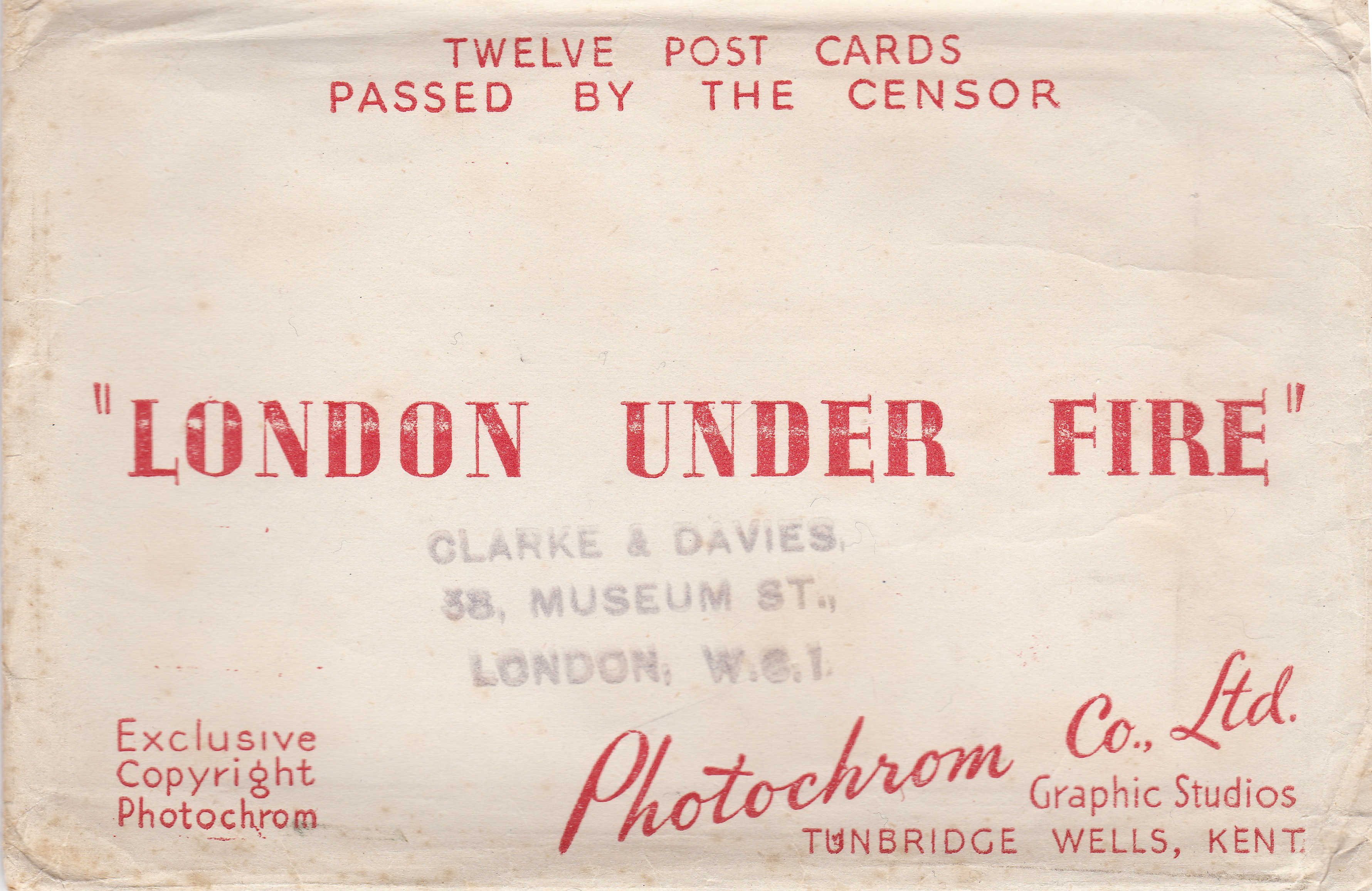
London Under Fire is the title of a set of postcards issued during the last war showing some of the damage caused by bombing around the city.
You might think that this was a strange subject for a postcard, and given the levels of censorship at the time, why would photos showing considerable damage to London be published?
The envelope containing the set of twelve postcards, “passed by the censor”:
Although showing how much damage had been caused, these postcards had a very serious message. Firstly, the photos were mainly of the City of London, not the main population centres, for example across east London that had suffered so much damage which directly impacted the lives of Londoners.
The postcards were meant to inspire and motivate the population, London has taken this much damage and has come through and will be rebuilt again. The rear of the postcards carried exerts from the speeches of Winston Churchill:
“Let us all strive without failing in faith or in duty”
“This is a time for everyone to stand together and hold firm”
This was after the initial Blitz but before the V1 and V2 weapons fell upon London. The war still had an at the time unknown number of years to run so the message carried by the postcards was very clear, we have taken this much so this is not the time to weaken in any shape or form.
As well as an example of one of the many forms of subtle propaganda employed during the war, today they are helpful in understanding how the city has changed so a couple of weeks ago, I took the postcards up to the city for a walk to see what the locations looked like now and how much remained from these original photos.
The first postcard is of St. Paul’s Cathedral from Paternoster Row, this whole area across Paternoster Square was destroyed during the attack on the night of the 29th December 1940. The area today is now covered by the Paternoster Square development, I located the position where I suspect the photo was taken from, but looking across towards St. Paul’s I was looking into an office wall with no sight of the Cathedral.
As well as the cathedral, the only building that remains today is the Chapter House. This had been reduced to a shell and is the building in the centre of the photo below the dome of St. Paul’s. The Chapter House was rebuilt and has recently finished a full restoration.

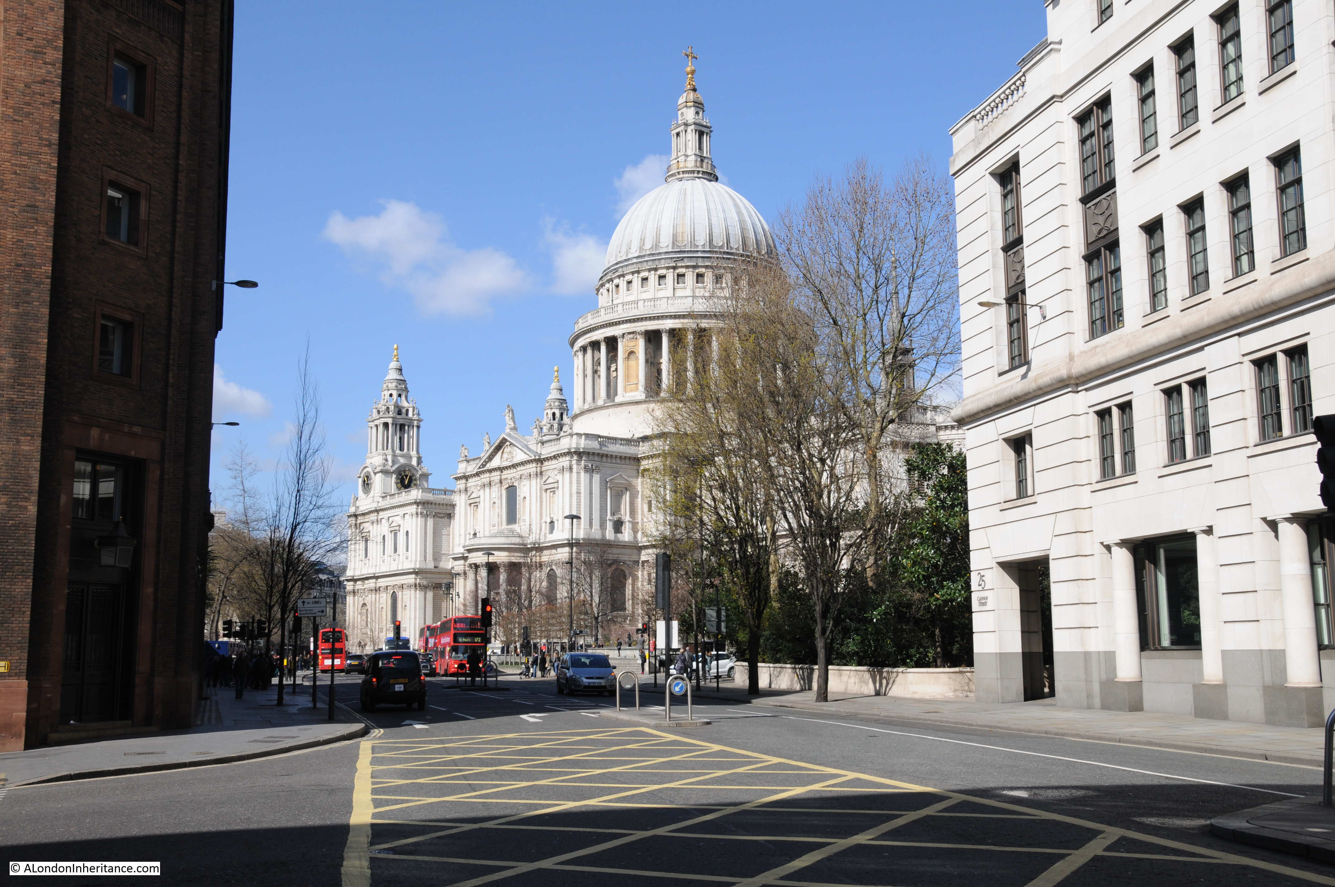
I had better luck with the next postcard, again of St. Paul’s but now from Cannon Street.
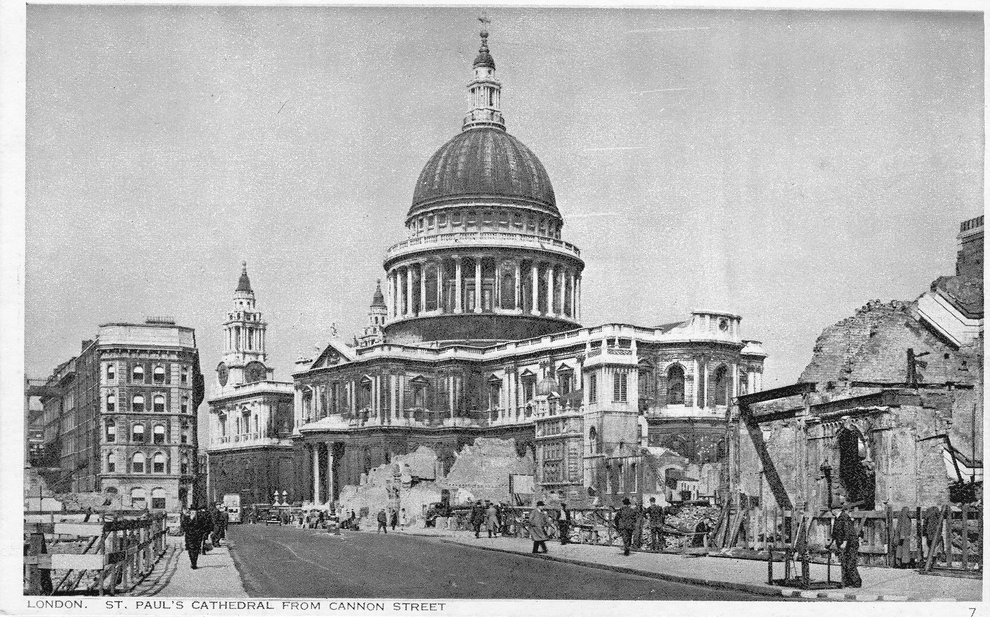
The photo was taken on the corner of Friday Street and Cannon Street. As can be seen in the postcard by the remains of buildings leading up to St. Paul’s along the right hand side of Cannon Street, this view was only possible due to the destruction of these buildings and in the plan for rebuilding the City, the area around the cathedral was opened up making the views we see today possible.
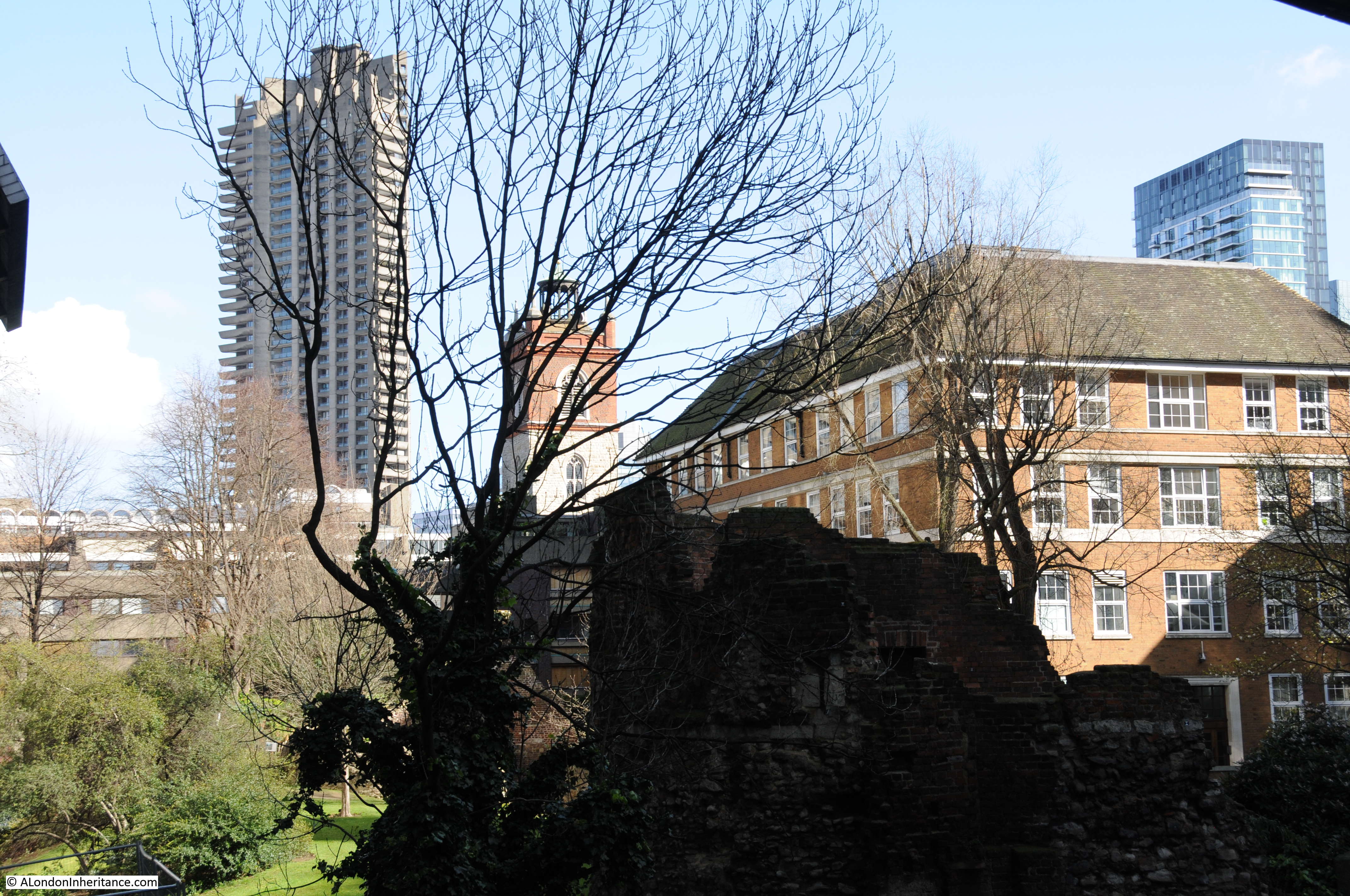
The next postcard was taken from London Wall and is looking north across to the church of St. Giles, Cripplegate.
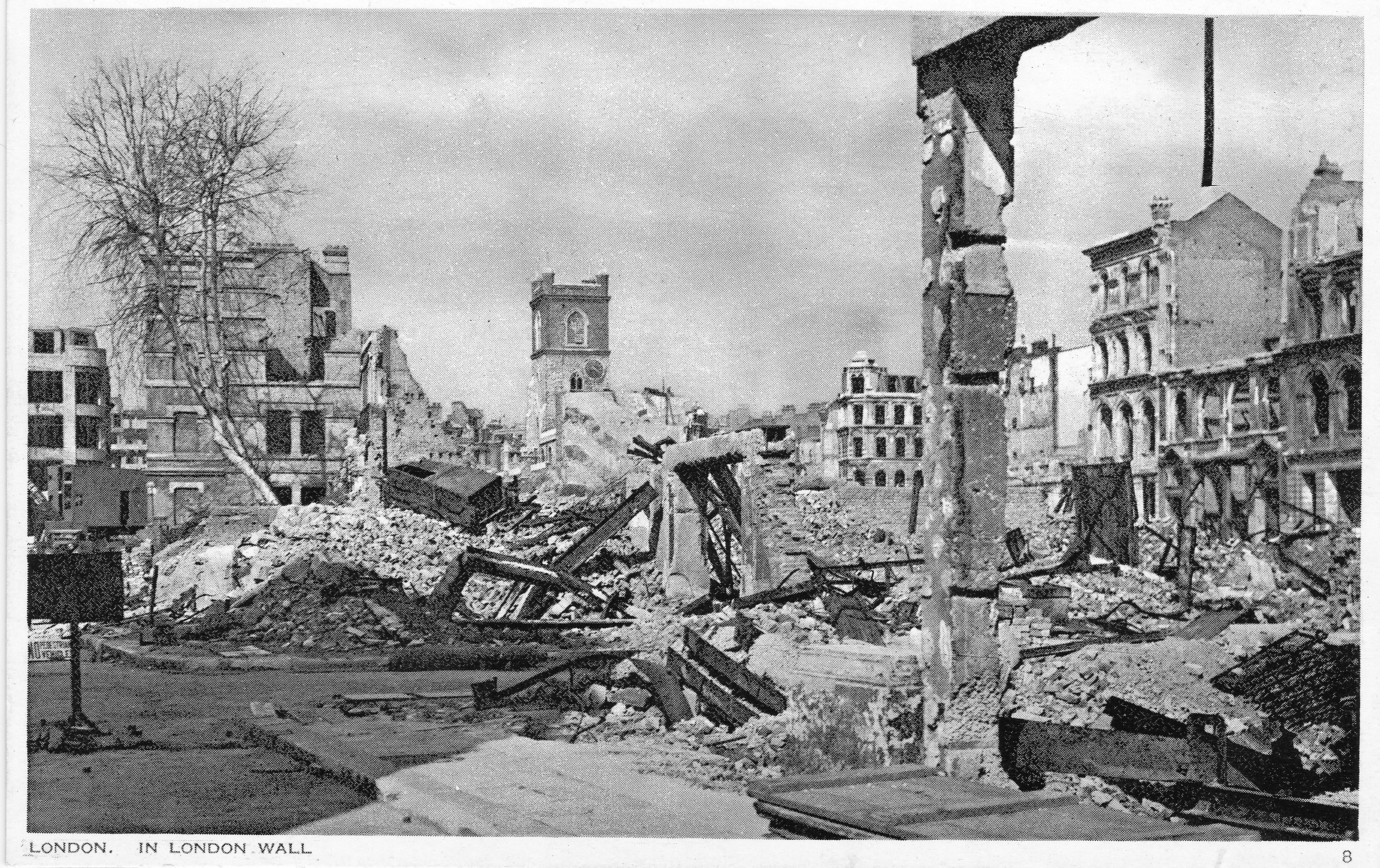
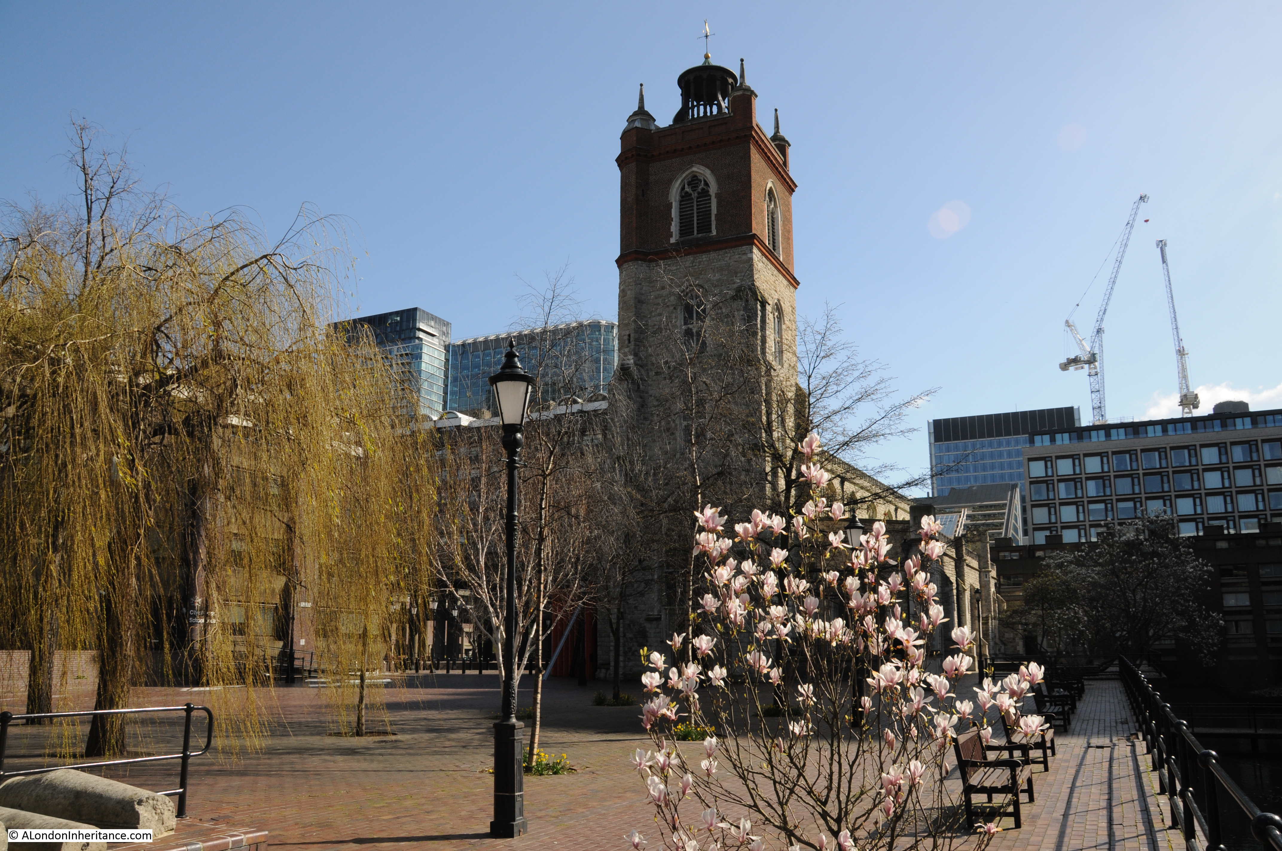
With the amount of building along London Wall, I could not get to the exact position of the original photo, however I did find one position in London Wall where the church tower is visible today. This also shows the Barbican development which would cover so much of this area in the post war redevelopment.
Postcard showing the remains of the interior of St. Giles, Cripplegate. Again, the church suffered this damage mainly on the night of the 29th December 1940.
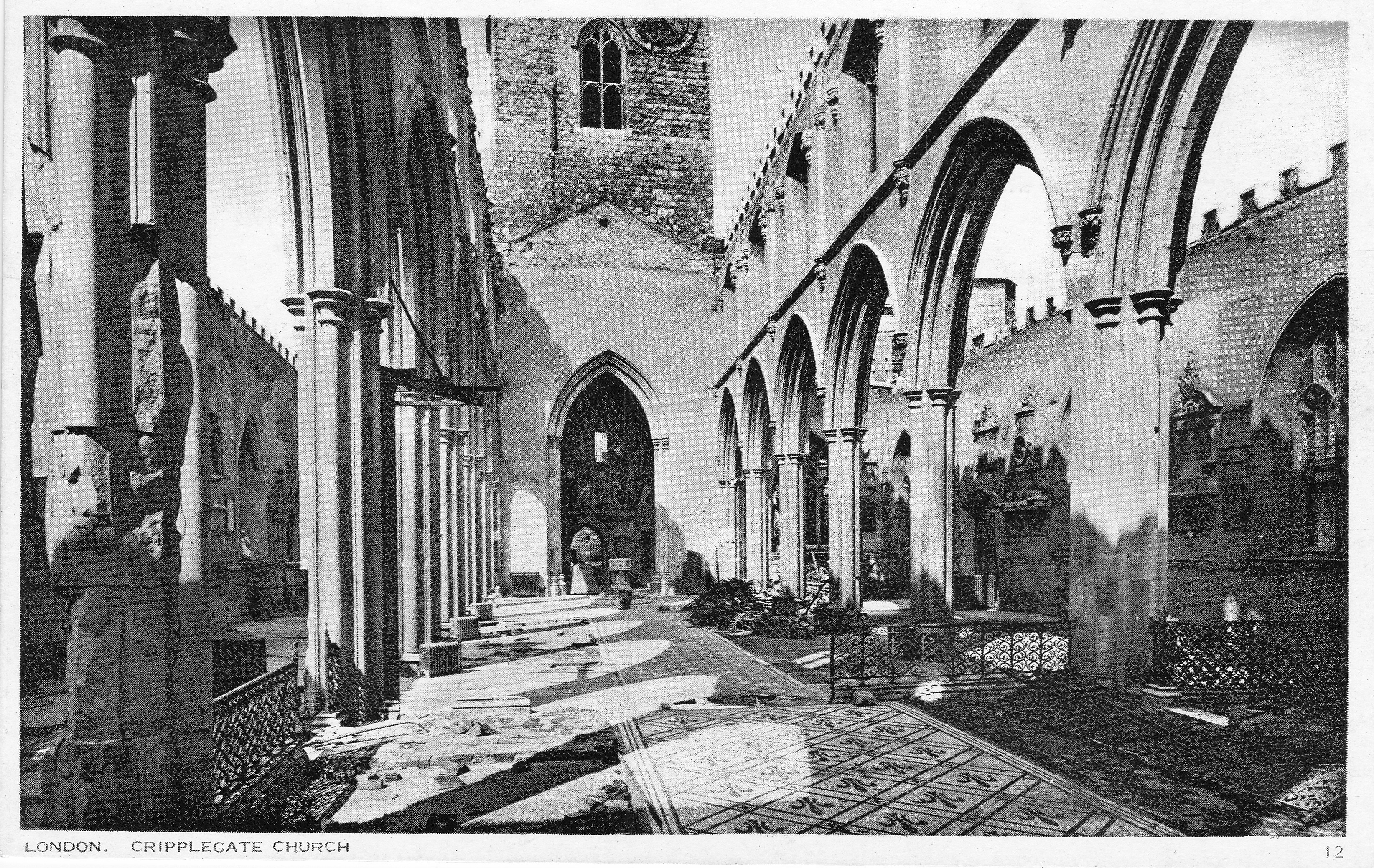
The church was rebuilt after the war, and apart from the remains of the Roman city wall, is all that remains in this area from the pre-war city following the development of the Barbican.
The next postcard is showing Fore Street, no idea where in Fore Street as there are no points of reference.
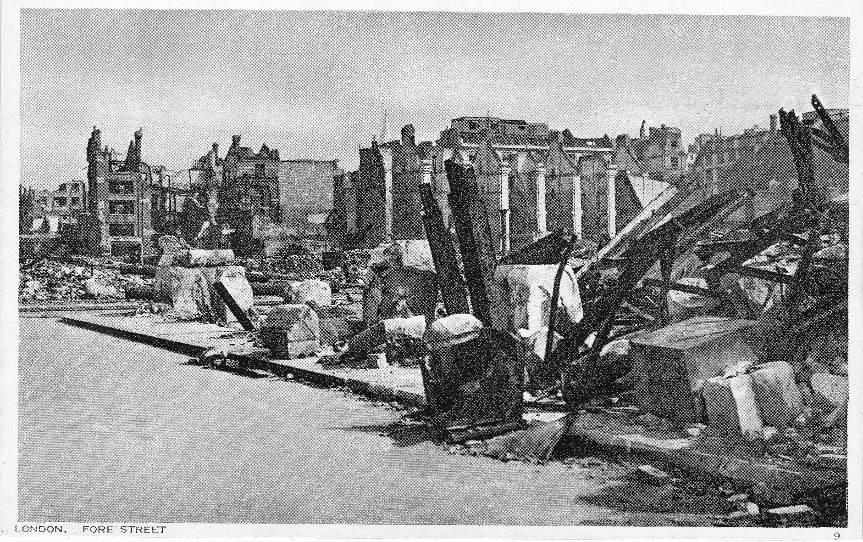
But this is Fore Street today. The Barbican is on the left and office buildings between Fore Street and London Wall are on the right.
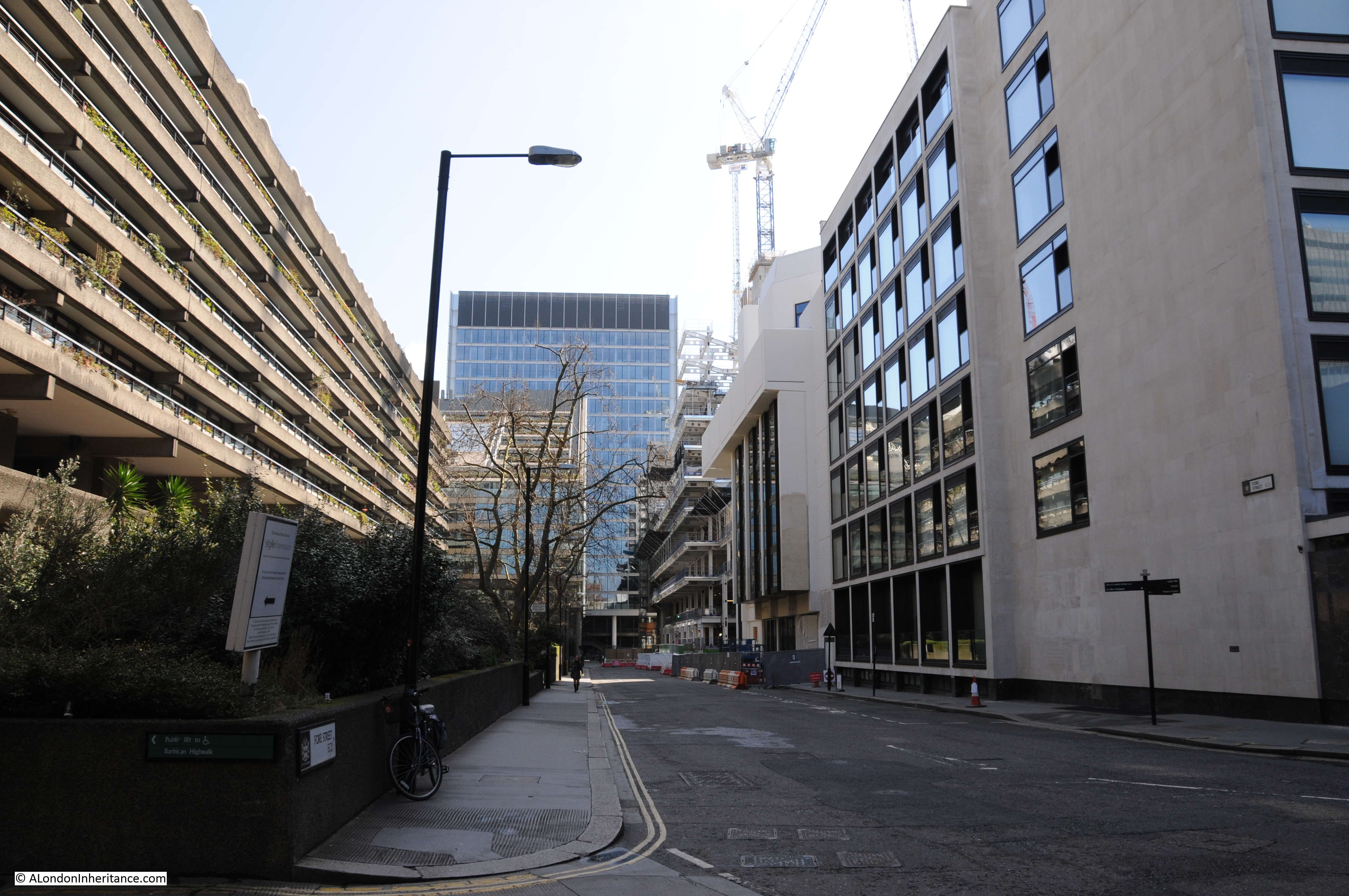
The following postcard is titled New Basinghall Street.

I could not find a New Basinghall Street in the City today. There is a Basinghall Street, but not a “New”, so it was to the 1940 Batholomew’s Reference Atlas of Greater London to check and this is where I found New Basinghall Street, a short extension of Basinghall Street from London Wall to Fore Street.
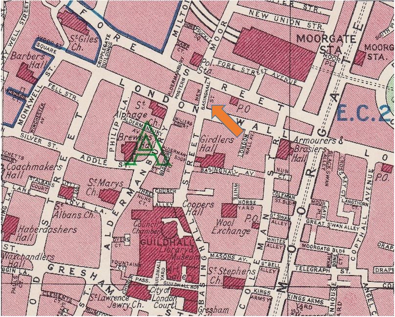
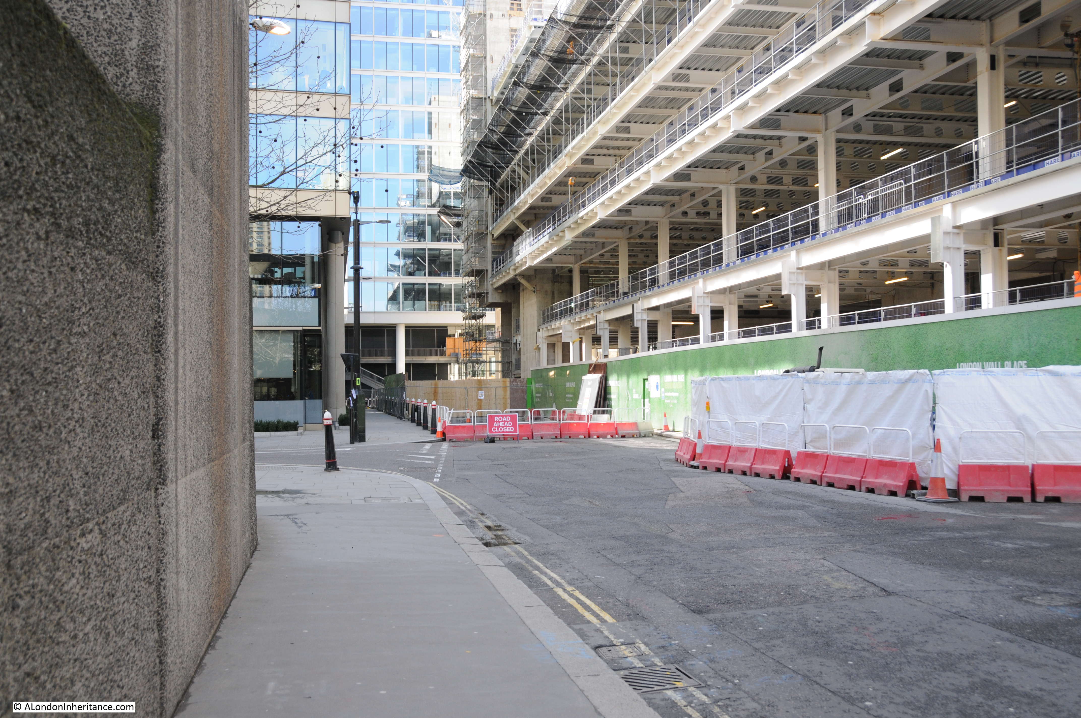
Today, New Basinghall Street does not exist. In the photo below of Fore Street today, it was on the right, just past where the road is closed and passed to the right under the new office development to meet up with London Wall. Returning to the postcard of Fore Street, this shows a road leading off to the right and this may have been New Basinghall Street.
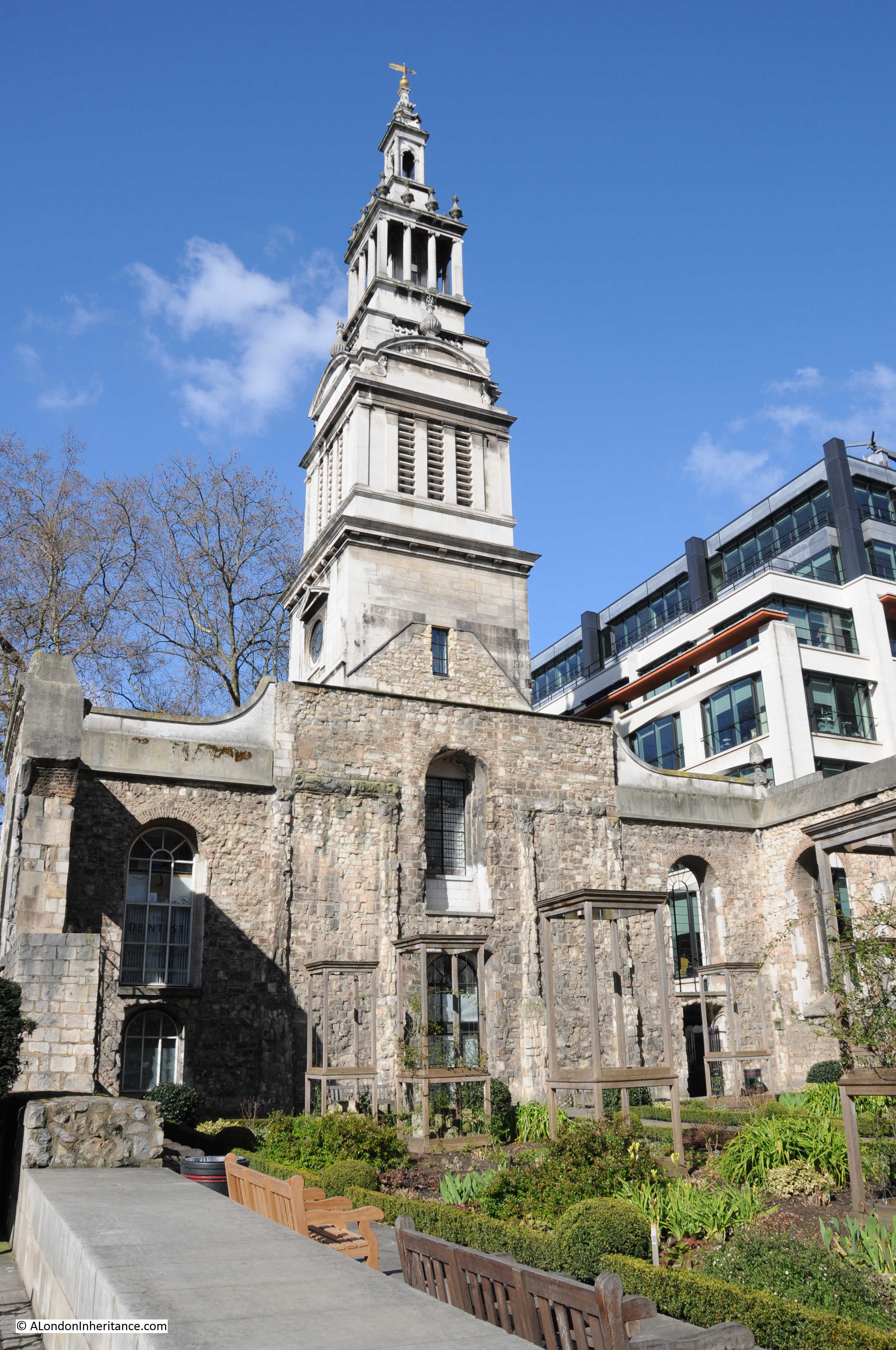
The next postcard is of the buildings of the General Post Office from Newgate Street. Strange that the postcard does not mention the church in the foreground, only the buildings of the G.P.O in the rear. The church is Christ Church, Greyfriars.
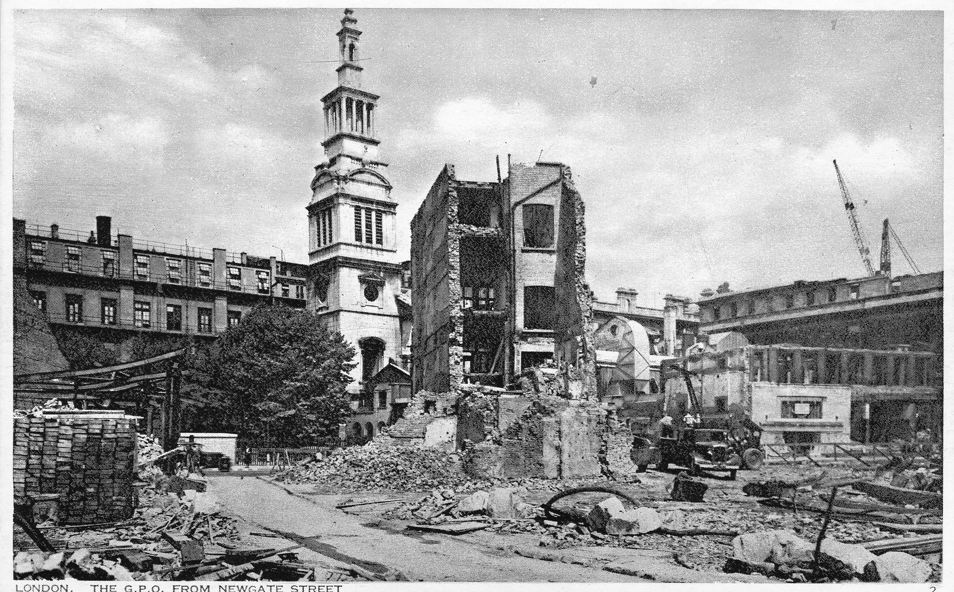
I could not get the same angle due to new building in the area, so I took the following of the church. The church was not rebuilt after the war, the tower was preserved and the main body of the old church turned into a garden. One of the few reminders in the area of the damage suffered during the last war.
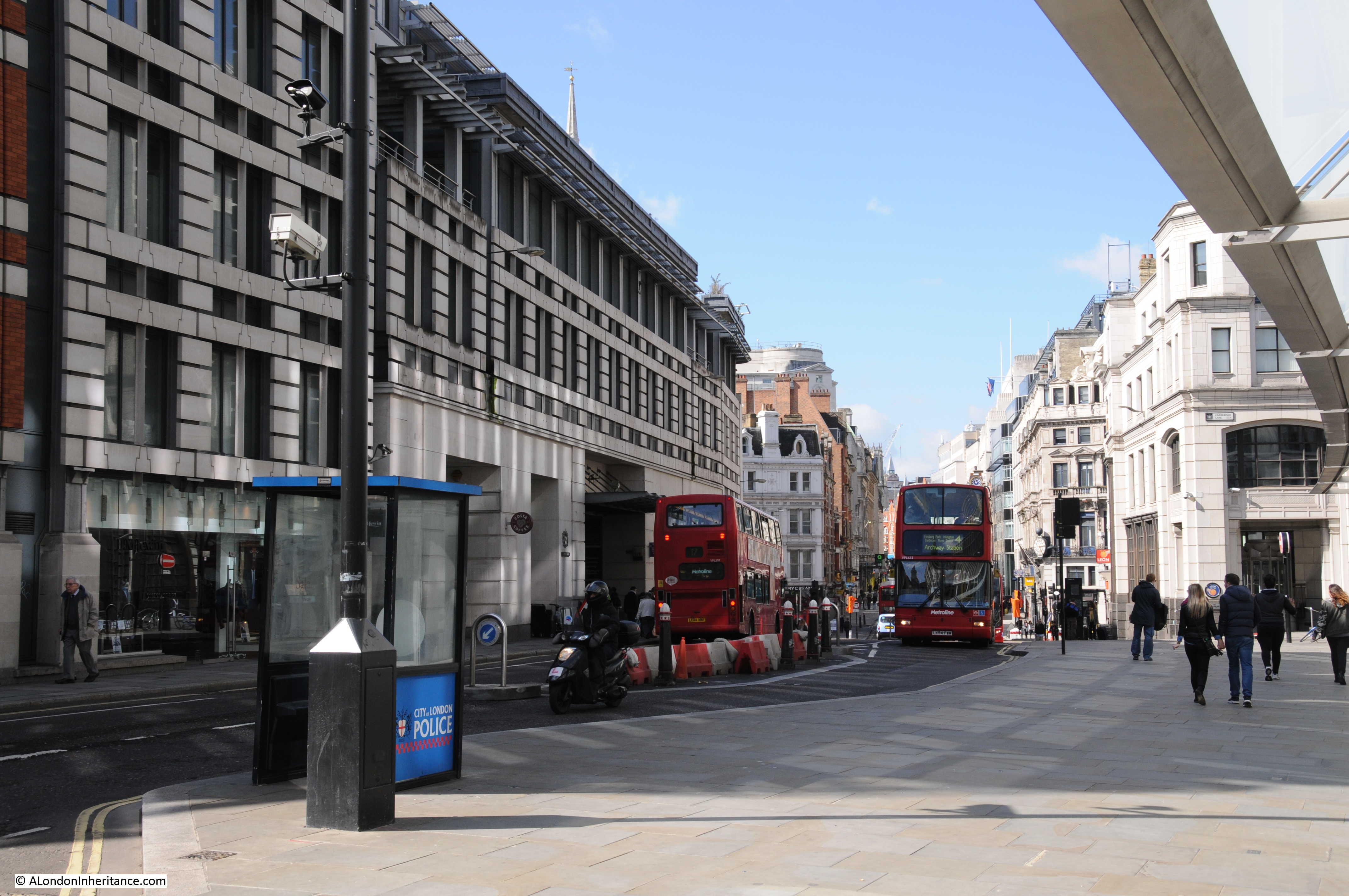
We are now at Ludgate Hill, looking down towards the junction with Fleet Street. The church tower on the left is that of St. Brides.

Ludgate Hill today still has the slight bend to the left, however since the photo for the postcard was taken, the railway bridge has been removed and new building on the left has obscured the view of St. Brides with only the very tip of the steeple visible if you find the right place. The buses also look very different as well.
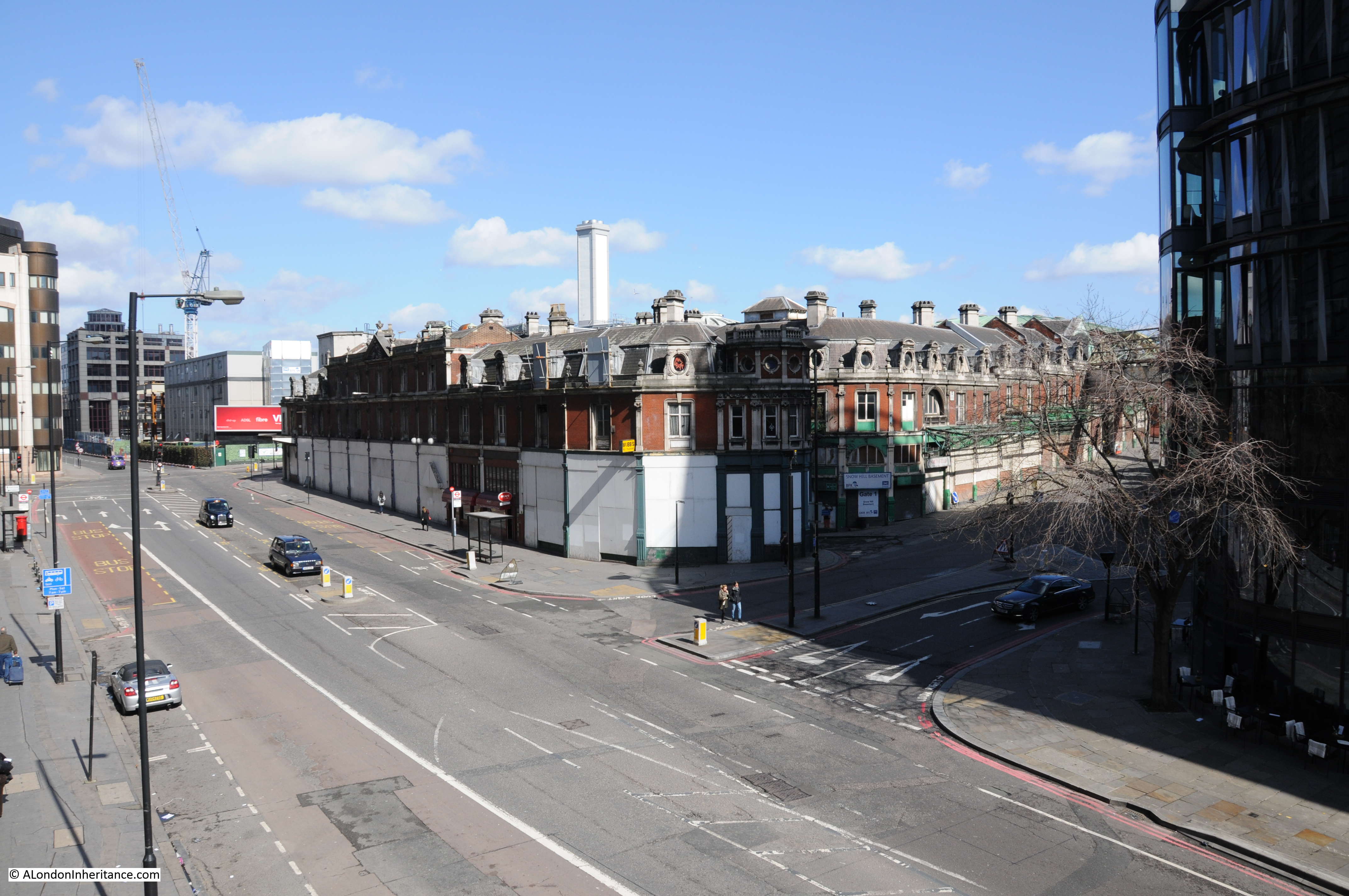
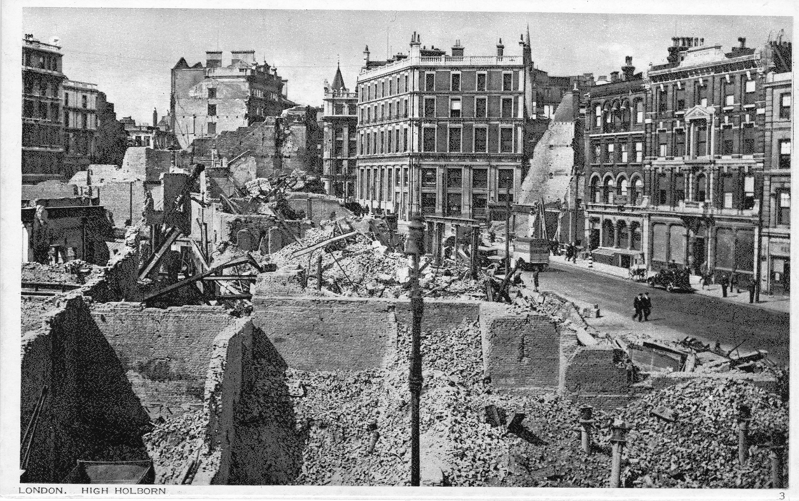
Now moving slightly to the west, the following postcard is titled “View from High Holborn”. The buildings in the background to the right are those of Smithfield Market.
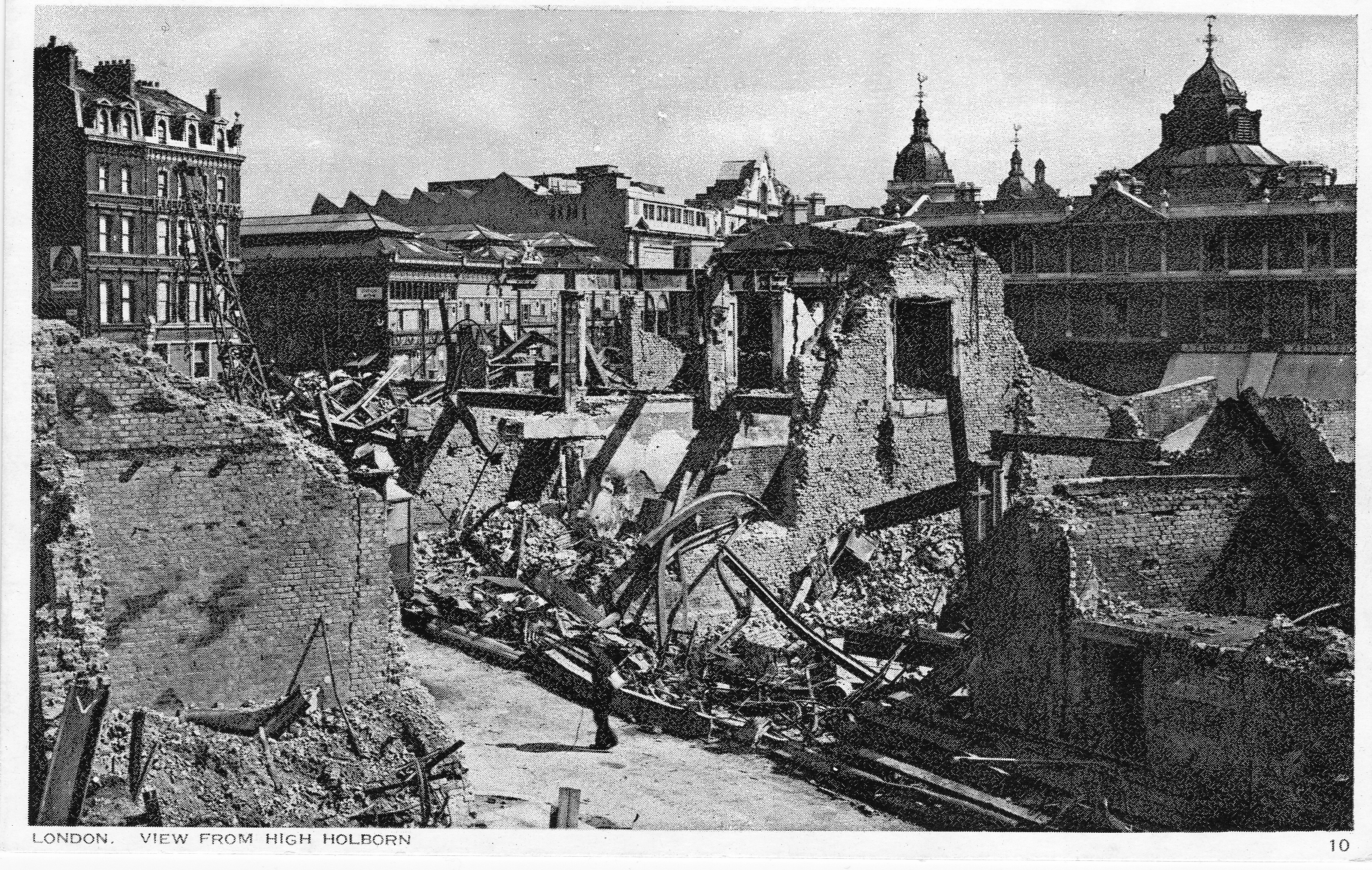
Although I could find the position from where I suspect the photo was taken, the view is totally obscured by new building, so I walked back to where Holborn Viaduct crosses Farringdon Street and took the following photo of the market buildings.
The next postcard is of St. Andrew’s Church from High Holborn:

And another view of High Holborn. There is a single building in this wartime view that remains to this day.
The building is the one in the centre of the photos above and below. I could not get the same angle as the original photo as the photographer must have been standing on the ruins of buildings between High Holborn and Charterhouse Street so the original photo is looking onto the side of the building which in my photo is off to the right.
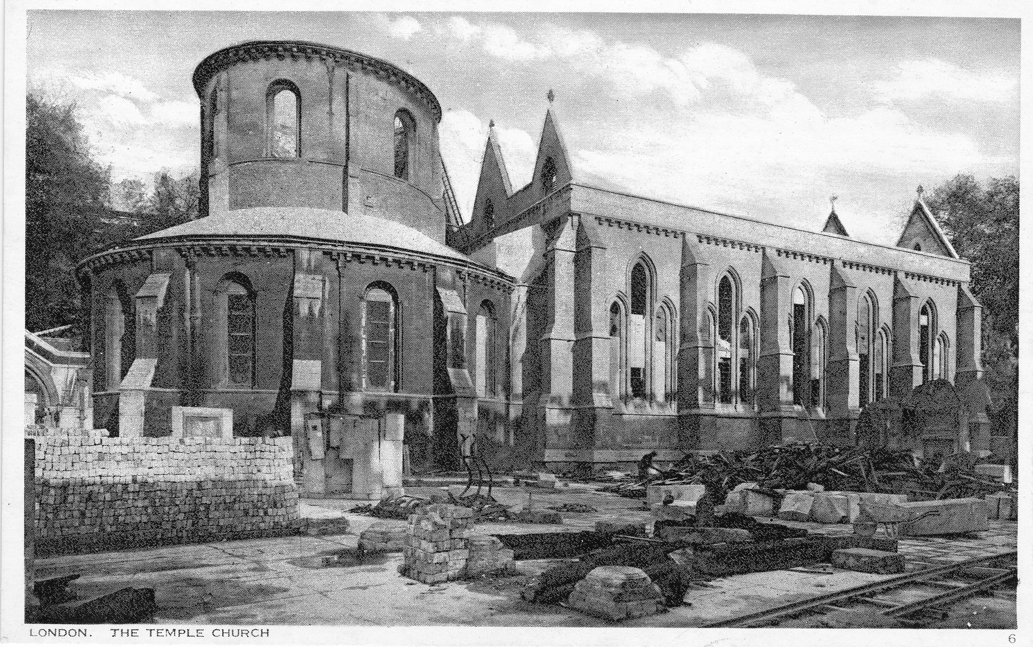
The final photo is of Temple Church, closed during my walk around London.
It would be interesting to know how many of these postcards were posted. I suspect the majority were purchased and kept as a record of the destruction of the City rather than for posting.
They provide a fascinating view of the city at a point in time, before the start of the post war redevelopment that in many areas such as the Barbican and Paternoster Square, would result in so much change.
I loved this posting. Seeing old London, even blitz’ed, is so interesting; and that there should be postcards: I never knew that was done. My enjoyment was also, because I have had a long, though not systematic, interest in old postcards. And also, fairly recently, I have had several separate conversations with people about postcards – and the realisation – which is my fascination put into words – they give us the chance to view and talk: history. Thank you
Thank you for this (and many other) fascinating posts. The only modern day comparison that did not quite look right was at Smithfield Market but then I read your text and realised the modern view was blocked. I agree with your analysis – in the postcard, the man walking in the foreground is probably on Shoe Lane, and this makes suggests the photograph was taken standing on High Holborn opposite St Andrews Church. This is about 50 yards to the right of the postcard view, confirmed by the facade which we see face-on in the top right of the postcard being seen obliquely on the right in the modern view. The domes in the postcard view were of a market building (possibly the poultry market?) now demolished.
The building with the pediment in the centre of postcard at the top is still there, on Charterhouse Street just east of the junction with Farringdon Street.
Two points of possible interest:
1. Shoe Lane in the foreground was the location of Leonard Roosman’s painting “The Wall” (http://www.iwm.org.uk/collections/item/object/23296)
2. From the pediment in the top centre of the postcard, just to the left is a jagged-tooth roof and just below that is a somewhat unremarkable building (maybe two storeys) on the east corner of Farringdon Street and Charterhouse Street. This was the fruit and vegetable market; on 8th March 1945 a V2 rocket landed here killing over 100 people; this is the first wartime picture of the building I have found prior to its destruction. If you go to this website you can see the view from Farringdon Street, with the pediment building in the background:
http://www.flyingbombsandrockets.com/V2_maintextd.html
Thank you for posting these postcards.
Fascinating, I find the changes wrought since the blitz astounding. Bread Street – not mentioned in these pcs had one derelict building left after the celarances which turns up in two or three post war films as late as 1952, today Bread Street looks like something from a scifi film.
Very interesting post. I’ve been reading Cyril Demarne’s book “The London Blitz – a fireman’s tale”, which gives terrifying accounts of fighting the fires around St Paul’s with fairly basic equipment and a low tide to contend with (so not much water pressure). Great to see the old photos before the new building took place.
I always enjoy emails from this site. I live in Covent Garden and often go for strolls along holborn and Fleet St. (If the annoying tourists get out of my way). I love the beautiul old buildings and of course the old pubs that are left. My favourite is the Cheshire Cheese. Thank God it wasn’t flattened! Cheers!!
Fascinating. I’d love to see photos of these locations before the blitz…. although less chance of that I guess.
Let me join the chorus – these are fascinating!
I hadn’t realised that St Pauls was so hemmed in by surrounding buildings before the war. Of course, the building were lower, only 3-4-5 stories) so the dome was visible from afar above the roofline (and we still have some protected lines of sight).
The postwar Bracken House to the left on Cannon Street, in pink FT stone, with its Churchill-faced clock (not visible in your photo).
We are lucky that so many of the fine pre-war buildings at Ludgate Circus and along Fleet Street survived.
Was that dome at Smithfield above the General Market (the end block) and later removed, or above the old Poultry Market which burned down in 1958? Thankfully the long-neglected General Market seems to have found a role as the new site for the Museum of London when it moves out of the Barbican.
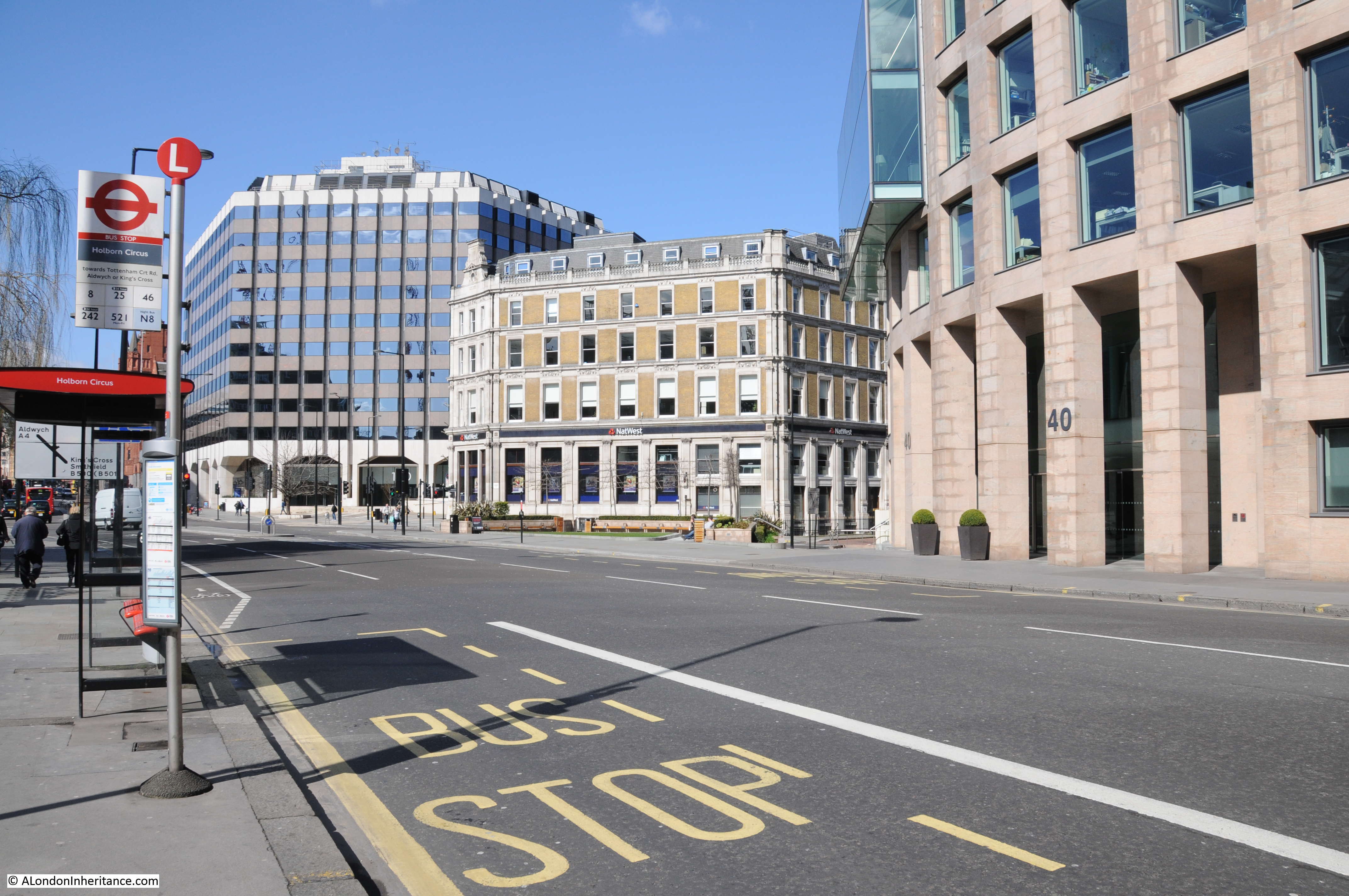
I can’t spot the statue of Prince Albert at Holborn Circus (recently moved back to give the traffic more space) but I think the buildings beyond that were where the Gamages department store was located (now replaced by the tall and ugly glass thing) .
That building at the top of Charterhouse Street, on the junction with Holborn, seems to have sprouted a post-war mansard roof! Ely Place in the gap to its right.
The building constructed on the bombsite was itself replaced a few years ago! I can’t spot the equestrian statue of Prince Albert in Holborn Circus (recently moved back to give the traffic more space). And is that corner tower (now replaced by the ugly glass building) part of the buildings on Holborn were Gamages was based?
I meant to add, an ugly ?1960s office block was built on the site of the former fruit and vegetable market at Smithfield (which was destroyed by a V2 in 1945, with over 100 killed) but the site has been cleared again to make way for Crossrail.
And for the 1958 fire, see http://www.britishpathe.com/video/two-die-in-smithfield-blaze
A fascinating post once again I shall look at these areas in a different light next time I am in London,
Hello! A few years ago I wrote a piece for the Picture Postcard Monthly about the London Under Fire series. There are actually three sets available in a variety of formats (including minatures). The third set is pretty rare but probably the most interesting. I’ve got exact locations for all the cards and notes about features and so forth. Anyway if anyone would like a copy please let me know and I will try to dig the stuff up for you. My address is 3 Grenville Close, Hethersett, Norfolk, NR9 3AG. email: hroberts1970@btinternet.com. Interesting site incidentally. – Keefs –
Thank you so much for the post. I’ve long wondered why there are not more photos of London after all the bombings. I thought it would have been a time, immediately after the war that at least one or two photographers would have prowled around with their camera taking photos. I imagine that our Max Dupain would have had an amazing time.
Just came across this by chance – about the building of the Barbican.
http://player.bfi.org.uk/film/watch-barbican-regained-1963/
Mike, many thanks for the link. The BFI have some really good films but I have not seen this one before. Really is interesting, thanks again – David
I think you’ve made a slight error with the picture of St Giles Cripplegate. Your father’s picture is actually taken looking westwards as the clock face indicates. Also a suggestion: a search box on the front page. I don’t know how to do this (!) but I understand it’s very easy to add a google-powered widget which indexes your site.
Thanks for the comment Matt – I will check the St Giles photo. Thanks also for the suggestion for a search box, found how to add one to the site and a search box is now on the right hand panel.
Fascinating. As you say Christ Church (Grey Friars) Newgate Street was not rebuilt, but in about 2005 the tower was turned into an extraordinary house on eleven floors. The owner who achieved this was an investment banker called Kate Renwick, and the architects were Boyarsky Murphy. My wife and I looked at it when Ms Renwick put it on the market in 2008. The ground floor is a hall and dining room, then there is a spiral staircase to the first floor kitchen, and then a pencil lift carries one person at a time up to further floors. There are three bedrooms, a living room and I think 3 bathrooms. Ingenious storage solutions abound, reminiscent of a yacht. An eccentric triumph (but not for us).
Très interessant. Mon beau-père, Henri Gauthier, nous a fait parvenir une carte postale de la série London under fire. Le numéro est 21 . Avez vous des informations sur cette photo? Il était un militaire canadien affecté au service postal.
Merci de votre aide
Bonjour Monsieur. Un peu d’histoire dans votre main. London Under Fire: No. 21. “St. Nicolas Cole Abbey & St. Paul’s”. Vue nord-ouest de la Queen Victoria Street près du coin de la Knightrider Street en direction de la cathédrale Saint Paul. Le bâtiment survivant (maintenant disparu) fait face au Saint Paul’s Churchyard. Saint Nicolas (maintenant restauré) a été conçu par Sir Christopher Wren. C’est la mur est de l’église. Toute cette zone a été détruite lors de la “Dernière nuit du Blitz” (10/11 mai 1941). Date de la photographie: vers 1942 (la zone a été dégagée mais les clôtures de bois temporaires qui ont été remplacées par des murs de briques sont toujours en place). – keefs ps. Vous pouvez voir l’église dans le film “The Lavender Hill Mob”, voir: https://alondoninheritance.com/thebombedcity/st-nicholas-cole-abbey-a-bombed-church-and-film-location/
My late mother, her parents and grandmother, had lived in a flat above a warehouse in Fore Street until they were bombed and lost everything that night. What’s left of their home being shown on a postcard in that condition, I think would have been too much for her to bear.
I have all of these postcards but they are not postcard size they are 8cm x 6cm and in a small holder which says on the front at the top “London Under Fire Snap Shots” & at the bottom “Published by Photochrom Co. Ltd. London & Tonbridge Wells. Exclusive Copyright”…… On the back fold in tab it has an image of the world and written on the top of that image it says “Published to the World” underneath that is says again “PHOTOCHROM. CO. LTD. London & Tonbridge Wells”……. The card holder itself is a brown colour and very “ripply (is that a word?) made to look similar to reptile type of skin! …. Someone (I assume my Dad as a child) has cut a small triangle in the front to make like a window so you can see some of the first card.
those are the miniatures. if i remember right, they are photographic rather than printed. some of the views are different.
Hi Keith, I found these in an old shoe box that belonged to my Dad (born 1930) with other bits and pieces of memorabilia like an old food ration book and petrol ration book and what looks like the tip of a shell as it’s about 4″ long, conical and has numbers round the base with what looks like a keyway to adjust the numbers! These small packs of miniatures, do you think they would have maybe been given out at school or something?
Regards,
Steve 🙂
a lovely treasure trove. the metal thing sounds like an antiaircraft shell nosecone or cap. It might have some id on the rim. i imagine the pictures were something his dad might have bought him as a treat or maybe he saved up his pocketmoney. i’ve seen three shillings pencilled on a set but that might have been later. three bob seems rather a lot.
Hi Keith,
thanks for replying.
Yes, it is the nose of an anti-aircraft shell ….. I looked it up and it said it’s a ” Fuze AA No. 109 ” with a maximum delay of 30 seconds.
There is an underlined “44” on the silver tip of it and on the top brass ring the markings ” No 199 IV FL 10/39 ” on the opposite side it has ” CY 5/40 73 “.
On the bottom brass ring there is just an arrow pointing down which I found out would have lined up with another arrow on a brass ring below that one with “SAFE” stamped under it.
It’s like holding a little piece of history in my hands! 🙂
Oh, and yes, 3 bob does sound like a lot but 36 pennies sounded like a lot more!! lol
I have all these postcards images but they are smaller than a postcard. They were brought back from England by my aunt. She was a Canadian Nursing Sister and was in England between 1941-1943 than in Italy 1943-1945.
I understand they were published by Photochrom Co. Ltd. Can you help me to find who owns the copyrights of them. I need permission to publish them. (Biography of my aunt )