Monthly Archives: September 2026

Walking the Rocque Ring Part 3 – Buckingham Gate, House and Palace to Constitution Hill

I am into part three of my Rocque’s Ring walk – exploring the boundaries of built London in 1746, and for this section of the walk, I am starting at the rear of the Bluecoat School in Caxton Street, which was the end of part two, and walking up to Hyde Park Corner, which will be the subject of part four.

The route followed in this post is shown in red in the following extract from Rocque’s 1746 map. Part one is in yellow, and part two in orange:

The following map shows in detail the first section of today’s walk. The Bluecoat School is at bottom right:

Leaving the Bluecoat School behind, I am now walking along Buckingham Gate. In 1746, gardens were on the left with built up streets on the right. The road joining on the right is Caxton Street, which was Little Chapel Street in 1746. The junction with Buckingham Gate has been changed slightly since Rocque’s map, as today, it has been bent slightly to cut across the left hand end of the land of the Bluecoat School, underneath the first “L” of Little Chapel Street:

A short distance along Buckingham Gate is St James Court, a hotel under the Taj Hotel brand and part of the Indian Hotel Company:

St James Court was built at the end of the 19th and start of the 20th centuries, designed as large blocks of apartments. The website of the hotel has a brief history and lists a Major Pawley as the person who proposed construction of the building. I cannot find any reference from the time of a Major Pawley being involved with St James Court (probably down to my lack of time and available resources), however a Major Pawley was around at the time, and was making proposals for the redevelopment of parts of London.

The following is one of his proposals, as reported in the Evening News on the 24th of November 1919, which if it had gone ahead, would have resulted in parts of Westminster looking very different:

“NEW ROAD THROUGH LONDON – Project to Relieve Traffic Between City and West End. A scheme to make a new main road artery connecting Victoria and London Bridge stations is being considered by Sir Eric Geddes, Minister of Transport.

He met Major C.J.C. Pawley, the originator of the proposal, a few days ago and expressed a desire to see the plans of the proposed improvements.

Details have already been made public as part of the Empire War memorial, Westminster. Major Pawley first designed a new city between Westminster, Millbank and Victoria. It entails the clearance of property in this district belonging chiefly to the Ecclesiastical Commissioners, the Duke of Westminster and the Gas Light and Coke Company.

A centre and home for Science, Art, and Learning is proposed, with wide avenues and circuses adorned with monuments dedicated to the achievements of the Allied Forces. A widened Horseferry-road would become Empire Avenue, leading from Victoria to a Memorial Bridge, in place of the present condemned Lambeth bridge.

I think the enhanced value of the sites would go a long way towards paying for the cost of the street improvements, said Major Pawley, to The Evening News.

The proposed main road would be of enormous value in relieving the congestion in Fleet Street and the Strand, as well as in Holborn and Cheapside. Sir Eric Geddes was very favourably impressed by the scheme.”

Not sure how this scheme would have improved traffic in Holborn and Cheapside, however it is illustrative of one of the many schemes for “improving” London that have been put forward over the centuries, and with Major Pawley’s scheme, it would have left the area covered by the first three sections of the Rocque’s Ring walk looking very different.

When St James Court was completed, adverts started to appear in the press for the apartments that were available, such as, from January 1904: “ST. JAMES’ COURT, Buckingham Gate. HIGH-CLASS RESIDENTIAL FLATS AND BACHELORS’ SUITES. Rent £90 to £500 per annum. Most central situation in the immediate neighbourhood of Buckingham Palace and the Houses of Parliament.”

These were full service apartments, as they had access to the following facilities: “Restaurant recently and tastefully decorated; with Ladies’ Reception Room, Writing Room, and Private Dining Rooms. Catering and Valeting for Tenants, if required. Electric Light, Passenger Lifts, Messengers’ Call Office. Postal Facilities.”

Despite the high rental costs, and the extensive facilities available, the builder of St. James Court had kept his costs down by limiting the facilities available to those constructing the building.

In 1898, the builder, a Mr. W.R. Rickards was summoned by Westminster sanitary inspectors for failing to provide proper sanitary appliances at a workshop on the site. There were up to 200 workmen on site, and they were provided with “sanitary arrangements of the crudest and most outrageous manner – a menace to the health of the public and probably a source of future nuisance”.

The façade onto Buckingham Gate is only a very small part of the hotel, which extends much further back, and which includes apartment buildings also owned by the Taj Hotel brand.

To the right of the entrance arch in the photo above, there is a small plaque which hints at the earlier history of the site:

The plaque states that on the site, the Emmanuel Hospital, founded in 1594 by Lady Dacre once stood, and it is clearly shown in Rocque’s map (as Lady Dacre’s Alms Houses), when it was already 150 years old:

Before looking at Anne Sackville, the Lady Dacre who founded the Emanuel Hospital, a quick look at her mother-in-law, Mary Fiennes, also Lady Dacre who must have been a rather strong and resourceful woman in Tudor England.

Her first husband, Thomas Fiennes, 9th Baron Dacre, had been executed in 1541 following the murder of a gamekeeper. As well as execution, his titles and land were also stripped from his family.

She campaigned for the restoration of these titles and land for her children, and when Elizabeth I became queen in 1558, she restored these to Mary Fiennes second son, as her first born son had already died.

She married a further two times, and had more children (possibly up to 6), and died around 1576.

Mary, Lady Dacre, with her son Gregory, who had the title 10th Baron Dacre after his mother had campaigned for the title to be restored:

Source: Mary Neville, Lady Dacre; Gregory Fiennes, 10th Baron Dacre by Hans Eworth oil on panel, 1559 NPG 6855© National Portrait Gallery, London

Mary’s son, Gregory, married Anne Sackville, who became Lady Dacre.

During the later part of her life, she lived, along with her husband Gregory, Baron Dacre, in Thomas Moore’s old house in Chelsea, which Mary had inherited from her mother. It was in this house that Gregory died in 1594, and Mary died not long after in 1595.

They were both buried in Chelsea Old Church.

Mary’s will stated that her Executors should build a house to be called “Emanuel Hospital in Westminster for the relief of twenty aged people and for the bringing up of twenty children in virtue and good and laudable arts”.

The Emanuel Hospital in 1850:

© The Trustees of the British Museum. Shared under a Creative Commons Attribution-NonCommercial-ShareAlike 4.0 International (CC BY-NC-SA 4.0) licence.

Horwood’s map of 1799 shows the Emanuel Hospital, but labelled as Almshouses. There were also three other Almshouses in the very local area, along with the Bluecoat School:

The street in which the hospital / almshouses were located was called James Street, but I have also seen references to the name Dacre Street being in use. Note also in the above map the first use of the name Buckingham, with Buckingham Row, a row of terrace houses on what had been gardens / agricultural land in Rocque’s map.

By the 1880s, educational changes, that also affected the colour coated schools in the area as mentioned in the previous Rocque Ring post, resulted in the merger of several charity schools, and the Emanuel school was included in this merger, and the institution relocated to Wandsworth, where the school is still to be found today.

The old almshouses / school was then demolished, to make way for St. James Court.

A short distance further along Buckingham Gate is Westminster Chapel:

This Grade II listed Nonconformist chapel dates from 1865 – 1866 and was designed by the architect William Ford Poulton, who seems to have been a specialist in designing Nonconformist and Congregational chapels.

The Westminster Chapel was one of several large Nonconformist Chapels in London, including Union Chapel in Islington, and the Surrey Chapel on Blackfriars Road.

I am now passing the junction of Buckingham Gate with Petty France:

Just north of this junction, there is an intriguing feature in Rocque’s map – a Vineyard:

I can find no reference to a Vineyard in Westminster, and in Horwood’s map of 1799, the space occupied by Rocque’s vineyard looks to be part of St. James’s Park. It may have just been a name for a place rather than an actual vineyard, as the map shows the majority of the land as open space with some trees, along with a couple of buildings. There is a small area to top right which may show grapevines being grown, but it is a very small space, and I doubt that they could have been grown successfully or economically in 18th century London.

Between 1833 and 1859, the area occupied by the vineyard, and a large area north of Petty France and alongside Buckingham Gate was taken over by the Wellington Barracks.

The original Grade II listed parts of Wellington Barracks face onto Birdcage Walk, where the large parade ground can also be seen. I took a quick detour down Petty France to see the early 1980s rebuilds of parts of the barracks which loom fortress like over the street and buildings on the opposite side:

Whilst the Birdcage Walk side of the barracks and parade ground is the normal tourist view, Petty France offers a different perspective into the everyday life of a Guardsman:

Back in Buckingham Gate, and I have always been fascinated by this Dry Cleaners on the corner with Wilfred Street:

For as long as I can remember, they have always had a stack of cotton reels up against the window. The different colours and sizes are fascinating, and in a time when shops have such little character, this one stands out:

The Wellington Barracks extend up Buckingham Gate, although unlike Petty France, it is only the castle like walls along the street:

As with the rest of London, Buckingham Gate is constantly changing, and you can walk the street to find a building that was to be seen not so many months ago, has suddenly disappeared:

There are very few buildings along Buckingham Gate that date from the original development of the street, and the majority are at the north western end of the street.

In the above photo, there is a house to the right of the large gap, which thankfully would be rather challenging to demolish, as this is the Grade II listed, late 18th century, number 17 Buckingham Gate:

Next door to the above house, seen to the right of the boarded up house in the photo below is the older, Grade II* listed, number 16 Buckingham Gate, dating from 1706:

It is the only surviving house on the street that would have been here when Rocque was making his map, and I am as certain as I can be, that it is the building that I have circled in yellow in Rocque’s 1746 map below:

The Historic England listing states that the house is “attributed to Captain William Winde”.

William Winde, born around 1645 in the Netherlands to English parents, was typical of the 17th century type of gentleman who moved between different professions. He was described as an architect and a soldier, and was engaged in military engineering, the techniques of which could also be seen in some of his country house commissions.

I assume that rather than just build this house, he also lived there, because, as will become clear later in the post, he worked on one of the major buildings we will soon encounter.

The house to the right of number 16 is Grade II listed, and dates from the mid 18th century. It is not shown in Rocque’s map, and as his survey must have taken place prior to publication in 1746 / 1747, the house must be from the late 1740s onwards.

The house is indicative of the infill that was taking place during the later half of the 18th century.

It has a blue Greater London Council plaque to Wilfred Scawen Blunt, Diplomat, Poet and Traveller, and Founder of Crabbett Park Arabian Stud:

Wilfred Scawen Blunt was certainly an interesting man. He was very anti-establishment, was against imperialism, and for Irish home rule. He had travelled widely particularly throughout the middle east, where Blunt and his wife developed a fascination with Arabian horses, They purchased a number of horses and established the Crabbet Park Arabian Stud in West Sussex.

He seems to have treated his wife appallingly, as he had numerous affairs. His wife Lady Anne Isabella Noel King (whose maternal grandfather was Lord Byron), claimed that she did not receive any love and affection from her husband after their marriage, and the result of one of his many affairs led to the breakdown in his relationship with their only child, a daughter named Judith. Lady Anne had suffered many miscarriages, and Wilfred Blunt appears to have preferred to have had a son.

They legally separated in 1906.

His daughter found out that he had fathered at least one illegitimate child, and he had also tried to seduce her best friend, which understandably led to the estrangement of father and daughter.

Blunt and his wife had owned the Crabbet Park Arabian Stud, where they kept and bred Arabian Horses.

In his later life Blunt signed over management and ownership of the horses at the stud to his ex-wife, but following the death of his wife, he tried to disinherit his daughter and get back the stud and horses.

Legal cases went back and forth between father, daughter and granddaughters, with the court finally finding in favour of his granddaughters.

None of this was mentioned in the obituaries, although some did hint at his more unusual attributes, such as the following from the Liverpool Weekly Courier:

“LOVED HOT WATER – Plenty of conventional notes have been written about the life of Wilfrid Scawen Blunt, who passed away after a stormy career; but I suppose the most interesting portions of his chequered career will never be recorded – for the simple fact that some of his actions were so unusual that they disturbed a great many highly placed individuals.”

He also served two months in prison for his involvement with Irish political agitation during disturbances of 1888.

He also had some strange conditions for his burial, as he wrote in his will that: “I wish to be buried in the simplest manner, being laid in the ground wrapped in my old Eastern travelling carpet, without coffin or casket, at a spot in Newbuildings Wood known to my executors“.

And so he was, buried in the Sussex woodland in the presence of his daughter, his grandchildren, and a few friends. He also requested that his nurse, Elizabeth Lawrence, arranged him in his grave, and that £10 was given to each of the men of the estate who carried out his burial.

There is always far more to be found behind the names on plaques, and his wife Lady Anne seems to have been at least his equal in developing and managing the stud, so should also be named.

A short distance along, Buckingham Gate turns left, and Birdcage Walk joins from the right:

I am approaching Buckingham Palace, and it is the role and enlargement of this building that has resulted in road changes at this end of Buckingham Gate.

I am now in the following extract from Rocque’s map, and the red line shows the route I am taking. At the very bottom of the red line, Birdcage Walk ran to the right, over the lower part of Rosamond’s Pond, and Buckingham Gate continues to the left, along the bottom edge of the map:

Rosamond’s Pond was probably one of James I’s alterations to St. James’s Park (the park takes its name from a leper hospital, not from King James). The pond cut across the photo of Birdcage Walk shown above.

The following is a view of Rosamond’s Pond (the water on the left), in the mid 18th century, the same timeframe as Rocque’s map:

Rosamond’s Pond was apparently known as a place where lovers would meet, where illicit affairs took place, and more dramatically, where scorned lovers (mainly women) committed suicide. There is some evidence of this from newspapers of the time, for example the following from the Kentish Weekly Post on the 10th of January 1730: “Yesterday a Woman well dressed was observed by the Centinel to throw herself into Rosamond’s Pond in St. James’s Park, but he could not come Time enough to prevent her being drowned; it is not known who she belongs to”.

Rosamond’s Pond was filled in, in 1770.

The following photo shows the view along Buckingham Gate where it cuts through the houses shown in Rocque’s map. These were demolished to make way for the road, and the extension of the estate that makes up the ground surrounding Buckingham Palace:

Now I am looking to the Victoria Memorial and the road that circles the memorial, part of which is now pedestrianised in front of Buckingham Palace. In Rocque’s time, all of these was part of St. James’s Park with grass and avenues of trees covering the area I am looking at:

And this is Buckingham Palace, taken from the Victoria Memorial, one of the most photographed buildings in London:

If you look back at Rocque’s map, the house on the site is much smaller and is called Buckingham House.

The house was originally built as a London town house for John Sheffield, the first Duke of Buckingham in 1703, when much of the surrounding land was of parks and fields. The house is the reason why James Street changed named to Buckingham Gate as there was also a gate at the upper end, near the house.

It was designed by Captain William Winde, which is probably why he also built the Grade II* listed house in Buckingham Gate that we passed earlier in the post.

We can get an idea of the almost countryside location of Buckingham’s house, and of William Winde’s design by looking at some prints of the house, as well as how the house looked when Rocque’s map was being surveyed.

From 1727:

From 1753:

From 1799:

The reason why the Duke of Buckingham wanted his London house here can be seen in the following print from 1736, showing the view from the house over St. James’s Park. Rosamond’s Pond is in the trees to the right and St. James’s Palace is to the left – then as now, those with money and influence want a prime London location for their house:

Looking in the same direction as the above print, but from the Victoria Memorial, which is in the central avenue of trees in the above print:

Buckingham House was purchased by King George III in 1761 as a home for his wife, Queen Charlotte. Whilst very few architectural changes were made to the house, purchase by the King put the house on the road to its use as a royal palace which attracts tourists in the thousands to photograph the building today.

Changes started with King George IV in the 1820s who employed John Nash to transform Captain William Winde’s Buckingham House to a royal palace.

After the work of John Nash, completed in the 1830s by Edward Blore, Buckingham Palace appeared as shown in the following print:

The large arch in front of the palace was Nash’s ceremonial entrance to the palace, however the arch was relocated to the north-east corner of Hyde Park as part of major changes in the 1840s and early 1850s. It is now known as Marble Arch.

The changes which moved the arch also included the first balcony on the eastern front of the palace, and the first recorded balcony appearance by members of the Royal Family was in 1851 as part of celebrations to mark the Great Exhibition.

In 1913, the architect Sir Aston Webb was employed to reface the front with Portland Stone and to create a the more formal classical façade to the palace that we see today.

The Victoria Memorial which stands in front of the palace was the work of the sculptor Sir Thomas Brock, and it was unveiled in 1911.

I had a decision here about the route for Rocque’s Ring which should follow the boundary of built London in 1746.

Buckingham House had a walled garden to the rear, which in a much enlarged state is emulated by the walled garden to the rear of Buckingham Palace. I decided not to take the route around the walled garden, but take Constitution Hill alongside the palace grounds and Green Park.

As shown in Rocque’s map, there was a route through Green Park called Constitution Hill in 1746. It has since been straightened out and now runs up to Hyde Park Corner, and follows the boundary of the much enlarged gardens of Buckingham Palace (the red line shows route of Constitution Hill today):

Constitution Hill from the corner of Buckingham Palace:

As you start to walk along Constitution Hill, you can see the difference in the use of stone, with the more expensive Portland Stone used for the eastern front of the palace, with earlier and cheaper stone for the buildings behind:

Walking along Constitution Hill with the palace gardens on the left and Green Park on the right, with the Wellington Arch at the end of the street:

At the north west end of Constitution Hill are the Commonwealth Memorial Gates. They were unveiled by Queen Elizabeth II in 2002, and are dedicated to the five million people from Commonwealth countries in the Caribbean, Africa and the Indian sub-continent, who volunteered to serve with the British military during the First and Second World Wars. The individual countries are listed on the four pillars alongside Constitution Hill:

And with that, I am at Hyde Park Corner. A simple junction with a turnpike in Rocque’s map, but a very busy circular junction today, with traffic both below and above ground, and with a large central area with an extensive array of monuments, which I will discover in the fourth part of walking Rocque’s Ring.

Bury St Edmunds – 1952 and 2026

Bury St Edmunds in Suffolk is a very old town. Originally having the Anglo Saxon name of Beodricsworth, the change to the name the town is known by today has its origin in the death of Edmund, King of East Anglia at the hands of the Danes in 869, and his burial and shrine in the Abbey that once dominated the town until the mid 16th century Dissolution of the Monasteries.

In July 1952, my father along with two of his friends from National Service, were cycling around Suffolk and he took a couple of photos whilst visiting Bury St Edmunds. We had a day in the town in July 2026 to track down the location of these photos, and to explore the history of the place.

This is the Grade II listed Cupola House, at number 7, The Traverse, photographed by my father on the 23rd of July 1952:

My photo of Cupola House, 74 years later, almost to the day, on the 27th of July 2026:

Cupola House is a 17th century building, that started as two separate properties before being converted into a single house with a large shop of the ground floor.

Thomas Marco came into possession of the house in 1679 and increased the height of the building, added the balcony and the cupola at the top of the building, which gave the house its name.

Cupola House was used as a greengrocers and a wine and spirits merchant, and in the mid 19th century, the grocery business was phased out and the building continued as a pub.

It became part of Clarke’s Brewery, a small brewery in Bury St. Edmunds, which later became part of Greene King in 1917.

The building continued as a pub until 2002, when it was sold by Greene King.
It reopened as a bar and restaurant, however in June 2012 a fire destroyed much of the building’s historic fabric. The front façade, including the balcony, survived, but much of the interior was destroyed, including original panelling.
Cupola House was rebuilt, retaining as much of the original fabric as was possible, and was strengthened by the use of an interior steel frame.

After completion, Cupola House reopned as a resturant. Today it is the Sakura Japanese Food Restaurant.

In the following extracts from the 1952 and 2026 photos there is some rather nice continuity as there are bottles in the two bay windows when it was a Greene King pub in 1952, and as a restaurant today:

Comparing the two photos reveals some differences. The side window to the left and door to the right have been removed allowing the bay windows to be moved outwards from the central door. I assume this happened during the rebuild after the 2012 fire.

The Suffolk Chronicle on the 22nd of September 1933 repeated a story about Cupola House, that the house was “for a time the residence of Daniel Defoe”.

Whilst Defoe did visit Bury St. Edmunds, there is no documentary evidence that he stayed in Cupola House

It must have been a wonderful market town pub.

My father took another photo during his visit to Bury St. Edmunds. This is on the outskirts of the town, on the A1101, Fornham Road, where in 1952 were some remains of St. Saviours Hospital:

Walking up to the site today, you can see the houses on the left, two of which partly appear in the 1952 photo. The remains of the hospital can be seen behind the white car:

The structure we see today are the remains of the medieval Hospital of St Saviour, which was founded between 1184 and 1185 by Abbot Sampson.

Looking at a map of Bury St. Edmunds today, it is not fully clear why a hospital would be established at this place, on the outskirts of the town. The town has grown significantly in the late 20th / early 21st century, and as well as housing and business premises, there are many new roads, inclduing a large road that bypasses the towm.

If we go back to the end of the 19th century, we can see a street plan that had not really changed for centuries. I have marked the location of the hospital with a red arrow, and it can be seen that it was alongside the only road running north from Bury St. Edmunds, so the hospital would have been on a well travelled route:

(‘Reproduced with the permission of the National Library of Scotland“)

The remains of the hospital in 2026:

In both the 1952 and 2026 photos there is a plaque above the arch:

Humphrey Plantagenet was, as the plaque records, the Duke of Gloucester, son of Henry IV, brother of Henry V and uncle and guardian of Henry VI. The reference to being guardian to Henry VI, was down to Henry VI becoming king when he was eight months old, and Humphrey, Duke of Gloucester was appointed Lord Protector and Defender of the Realm and when John, Duke of Bedford (one of Humphrey’s brothers), was out of the country, and his role in the Regency further increased after the Duke of Bedford’s death.

Humphrey was born on the 3rd of October 1390. He was the fourth son of Henry IV, so was never expected to take on the role of king, although he held a range of key positions and was very influential in politics and the court up to the time when the young Henry VI came of age and took on the full role of king, after which he started to appoint and listen to younger members of the court and aristocracy, and Humphrey gradually became less influential.

One area he was very passionate about was the king retaining British lands in France, and styling himself King of France. This had been the ambition of his brother Henry V, and after Henry’s death, Humphrey continued to champion his dead brothers cause.

Whilst Humphrey had the same aims as Henry V, he lacked the dead king’s political abilities, forming alliances, and ability to raise finance, as ongoing wars with France had left the country in considerable debt.

In the early 1420s, Humphrey had married Jacqueline of Hainaut, who held lands in the Netherlands, and in marrying Jacqueline, Humphrey could see a route to taking on the rather strange mix of titles of Count of Holland, Zeeland, and Hainault.

Humphrey’s failure to take over his wife’s contested lands meant that he could see no further use for her, and he caused a scandal by leaving his wife for the chambermaid Eleanor Chobham.

The choice of a chambermaid as a wife for a high born Duke, and Humphrey’s divorce of Jacqueline and marriage to Eleanor gave his rivals and enemies a further reason to challenge his judgement, in addition to his championing of wars with France.

Despite military defeats and ever increasing costs and debts, Humphrey continued to support aggressive military action in France, despite regular failures and losses of land that English forces were experiencing.
One of the contributing reasons for why Humphrey died in the Hospital of St Saviour in Bury St Edmunds was down to his new wife Eleanor allegedly consulting astrologers for any signs that her husband would one day be king. At the time, the new king Henry VI had not yet married and therefore had no heir.
This was at a time when talking about, or taking any action that might imply the king’s death, was considered a treasonable crime.

Henry VI had been negotiating for a truce and peace with France, and these resulted in the Treaty of Tours along with the agreement that Henry VI would marry Margaret of Anjou, who was the niece of the King of France.

Margaret of Anjou was not a rich woman, and Humphrey was very critical of the marriage, declaring that the king “had bought a queen not worth ten marks“.

In 1447, Parliament was planning to discuss and make a decision on peace with France. The decision to move Parliament’s meeting to Bury St Edmunds was taken as Humphrey, Duke of Gloucester was known to have strong support in London, and Bury St Edmunds was under the Duke of Suffolk’s influence. Suffolk was a supporter of the terms with France and an enemy of Humphrey, Duke of Gloucester..

Humphrey arrived in Bury St Edmunds on the 20th of February 1447 and was staying at in inn along with a small group of supporters. During his stay, he was arrested on charges of treason, and held in confinement. I cannot tell whether he was held in the Hospital of St Saviour, or whether he had been taken ill and moved to the hospital, however just three days later on the 23rd of February, he had died in the hospital.

Whether this was a natural death, or whether intentional, such as by poisoning, has never been confirmed. The shock of a sudden arrest and potential trial for treason may also have contributed.

He was buried in St. Albans Cathedral.

I always like to find a London connection when writing these out of London posts, and Humphrey, Duke of Gloucester has a key connection with Greenwich.

Humphrey inherited the land that today makes up Greenwich Park in 1427, and in 1433 he was the first to enclose the park, and he also built a tower on what today is the site of the Royal Observatory.

After Humphrey’s death, the Greenwich estate was taken by Margaret of Anjou, the wife of King Henry VI, and under her ownership, it was renamed the Manor of Pleasance or Placentia.

In my father’s 1952 photo the entrance arch in the ruins was walled up. Today it is open and we can walk through to see what is left of the hospital:

These low walls were found during excavations of the site between 1989 and 1996, when the area was being cleared for a large Tesco store. The brick wall at the far end of the above photo is a very small part of the Tesco buildings.

The structure that remains is believed to be the entrance to the Great Hall and Chapel, and would have been the main area where travellers looking for the hospitality of the hospital would have been welcomed. Fascinating to imagine who may have walked through that door over the almost four centuries that the hospital was in use:

St. Saviour’s Hospital lasted to 1539, when during the dissolution of religious establishments, Henry VIII took posseion of their lands and buildings, and frequently sold these onwards or gave to his supporters.

Much of the stone of the hospital was demolished and taken away, and apart from the walls we see today, the remains below the surface lay hidden until the coming of Tesco, when excavations took place to discover the extent of any remains..

There is much more to discover in Bury St Edmunds, including what must be one of the most impressive direction signs that I have seen:

This is the Pillar of Salt road sign which is Grade II listed and is in a prominent position in an open space between the old abbey grounds, and the rest of the town.

In the early 1930s, road traffic was increasing rapidly, and the local council wanted a direction sign that was worthy of being installed in such an important location.

The design was by the East Anglian and London architect Basil Oliver and is constructed out of whitewashed concrete and metal.

The Town Council needed special approval from the Ministry of Transport as in the 1930s road signs were starting to be standardised under the 1933 Regulations.

Belhind the Pillar of Salt road sign is the Abbey Gate and Gatehouse:

The Abbey Gate is Grade I listed and dates from the 14th century:

Although it is not the original, this was destroyed by the townspeople in 1327 following disagreements between the people of the town and the monks of the abbey. It was rebuilt in 1347, and this is the building we see today:

Today, you can look up to the roof of the Abbey Gate, however originally there was an upper floor, and the fireplace that warmed this floor can still be seen between two windows:

Much of the land behind the Abbey Gate which was once part of the abbey is now parkland, and there are a number of stone ruins to be seen, but there is one part of the old abbey that today has a most unusual use that I wanted to see.

Walk past St Edmundsbury Cathedral and through the Norman Tower, and you come to another open space with some interesting buildings at the far end:

This length of wall consists of the remains of the west front of the Abbey of St Edmund. It dates from the 12th and early 13th centuries, and consists of the lower part of what was a large and impressive front to the abbey, which stretched a considerable distance behind this length of wall.

There are three large arches within the walls, but it is what occupies these arches today makes these remains of the old abbey so remarkable:

After the 16th century closure of the abbey, the space within these arches were used for a number of purposes, including stables, dye works and the town’s Probate Registry and registrars residence, and with 19th century alterations, there were altered to become houses.

It is remarkable how a house has been built within an arch in the remains of parts of the abbey’s structure. Not just the main living space, the door and windows, but also how the tiled roof slopes around the towers of the old abbey:

You can imagine these houses featuring in an M.R. James story.

The remains of the 13th century Charnel House of the Abbey:

There are many more stone remains of the original abbey to be found across the gardens, but this could be a very long post, so I will turn to the left of where I am standing to take the above photos and look at the current St Edmundsbury Cathedral, and in the foreground, below the tower, is a metal sculpture of a wolf, which is linked to the story of Edmund:

But before entering the cathedral, a brief bit of history about the abbey.

Bury St Edmunds was originally a small village called Beodricsworth, in the kingdom of East Anglia.

Edmund was a Christian king of East Anglia between 855 and 869, and was killed during an invasion by the Danes in 869. Soon after his death, he became known as a martyr, and his reputation was further enhanced in the 10th century when a French monk, Abbo of Fleury, wrote the life of Edmund, and described his death as being tied to a tree, shot with arrows and then beheaded, apparently because he refused to abandon his Christian religion. Abbo also states that when Edmund’s head was found, it was being guarded by a wolf.

His remains were moved to a church at Beodricsworth, and the church was given large estates, and in the 11th century, King Cnut funded a rebuilding of the church in stone.

Edward the Confessor further enhanced the status of the church by granting it jurisdiction of over a third of the county of Suffolk.

Throughout the 11th, 12th and early 13th centuries, the original church was redeveloped into a very large abbey complex, which was also one of the most wealthy in the country.

The end came in the 1530s during Henry VIII’s dissolution of the monasteries. Thomas Cromwell was appointed in 1535 to find reasons for closing the abbey, however there were no obvious issues that could be used against the abbey, so, with nothing to be found, it was assumed that the abbey was covering up any issues of corruption, mis-use of money, deviant religious practices etc. so this gave the justification for the closure of the abbey.

In 1538, many of the younger monks were forced to leave and Commissioners were sent in to calculate the abbey’s wealth and remove valuable objects. The abbot surrendered the abbey on the 4th of November 1539, and the abbot, prior and remaining monks left the abbey, but were allowed a pension.

In the weeks that followed, demolition of the abbey commenced with lead from the roof and stones from the buildings being removed either for reuse or for sale.

This included the destruction of St Edmund’s shrine and the loss of St Edmund’s remains.

St Edmundsbury Cathedral, the church we see today, was originally a parish church for the town.

The original parish church had been demolished to make space for the new abbey buildings, so a new church dedicated to St James was built, and rebuilt in Perpendicular Gothic style in the 16th century.

In 1914, the church became the cathedral of the new diocese of St Edmundsbury, and this is the building we see today:

The brightly painted roof was part of the restoration work carried out by Sir George Gilbert Scott in the 1860s:

Th central altar which sits beneath the millennium tower, which is a Gothic Revival tower added to the church starting in 2000, with completion in 2010:

Organ loft:

The Bishop’s Throne, which was the work of the Oxford architect Frank Ernest Howard:

View looking back from the choir stalls:

Organ, decorated roof, and view up to the richly decorated Millennium Tower:

Strange to think that this tower is only around 20 years old. The church was Grade I listed in 1952, and the Historic England listing seems based on Pevsner’s description of the building in 1974.

The listing makes no reference to the new tower, but states that the church has “an incomplete central tower”. As the church is Grade I listed, it must have had approvals for the work to build the tower, so it is strange that the listing has not been updated.

The font, also by Oxford architect Frank Ernest Howard:

A Lego model of the cathedral:

So the St Edmundsbury Cathedral dates from after the Dissolution, and served as a parish church to the town before becoming a cathedral early in the 20th century.

The cathedral building has been restored and had much additional work and new building works, which have continued into the 21st century with the tower.

The cathedral does not have any bells. These are nearby in a Norman survivor from the abbey, where we can see the Norman tower that also acted as an abbey gate and now serves as the belfry. It was built between 1120 and 1148; when Abbot Anselm was in charge of the abbey:

There is far more to the history of Bury St Edmunds than I can cover in a weekly post, and the town has many fascinating buildings – it is well worth a visit.

My father’s visit was during one of his post National Service cycling trips around the country, which also extended into the Netherlands.

He travelled with friends he had met during National Service, an experience which seems to have sparked an interest in travelling for many who had grown up in London during the war, and had minimal experience of the world beyond London’s boundaries.

For those with little money, Youth Hostelling was a cost effective way of having somewhere to stay, and the Youth Hostel Association offered cheap and basic accommodation.

The night before they travelled on to Bury St Edmunds, my father and his two friends stayed in Finningham Youth Hostel, which is to the east, and a 17 mile cycle. To reach Finningham, they had cycled the 34 miles from Felixstowe where he had taken some photos of Martello Towers and the towers of Bawdsey Radar.

He made some notes to these photos, and the following is Finningham Youth Hostel and the Warden:

Finningham Youth Hospital consisted of two old farm workers cottages that had been converted into a single building. It was very basic and those staying were expected to work on whatever task was needed during their stay, including emptying the chemical toilet.

The following is of his two friends out the hostel. Note the horse shoe hung over the door:

Finningham Youth Hostel closed in the 1960s. I suspect by then there were more opportunities for young people to travel, and cycling around the country was no longer as attractive as it was to those who had been children during the war.

There is much more to Bury St Edmunds than I have been able to cover in a single post – it is a fascinating place to visit.

A New Walk: Bermondsey – The Associations and Features of this Ancient and Interesting Borough

Firstly, an update to the second part of the Rocque Ring walk: I have been away for the last couple of weeks with very limited Internet access, so have been unable to correct an error I made in the post on the 30th of August. I stated that the memorial in Christchurch Gardens was to Chopin, where I should have stated that it is a memorial to Henry Purcell. Another example of a disconnect between brain and fingers as I had written Purcell in my notes when I walked the route. Thanks to those who pointed this out, and the post is corrected.

Now to a new walk exploring the Ancient and Interesting Borough of Bermondsey.

I can remember the first time I heard the name Bermondsey. It was in the early / mid-1970s (cannot remember the exact year), and the radio was on at home. It was Good Friday, and they were broadcasting a feature about events on the day in London.

Part of the feature was on the Widow’s Son pub in east London, when on Good Friday, a bun is added to the net hanging over the bar.

The other part of the feature was about an event in Bermondsey. I cannot remember what the event was, but the name Bermondsey, an area in south London, and whatever the event was, sounded fascinating and rather exotic (I was very young at the time).

Over the years, I have been to various places in Bermondsey more times than I can remember, it is a fascinating place to explore, but that early memory of somewhere a bit different has always stayed.

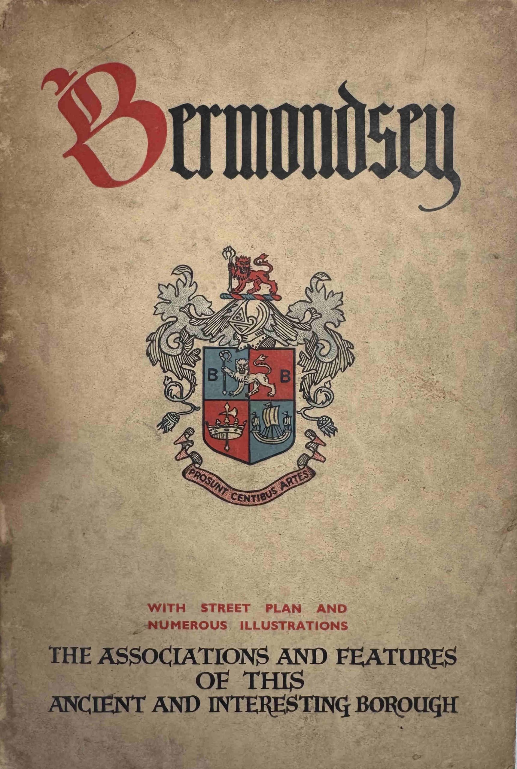
The title of this walk comes from a 1930s edition of a guidebook produced by the Metropolitan Borough of Bermondsey, and highlights that whilst in the 1930s Bermondsey was a centre of industry, with a population of over one hundred and eleven thousand, it was also a very old and historic borough.

The industry which was so much a part of 1930s Bermondsey and described in the guidebook, is also now part of that long history.

This walk explores Bermondsey’s transformation from a land of marsh and water, and includes the historic Abbey, London’s first railway terminus, industries such as the production of leather and processing of seal skins and furs, a ground-breaking charity that supported girls who worked in factories, Jacob’s Island, the slum made famous by Charles Dickens in Oliver Twist, pubs, Thames river stairs, the remains of a medieval manor house, and much more.

The walk starts from London Bridge Station (southern exit from the concourse of the railway station (not the underground) into St Thomas Street, next to Café Nero) and ends at the Angel pub, which is about a 7 minute walk from the Bermondsey Jubilee line station.

The walk lasts around 2 hours 30 minutes and covers just under two and a half miles.

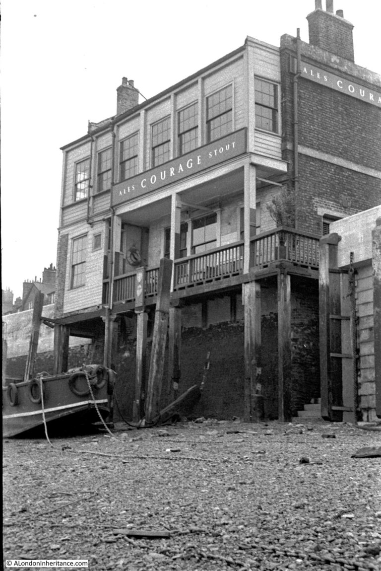
The Angel, where the walk ends, photographed by my father in 1951:

All dates for this new walk can be found on my Eventbrite page at the following link:

A London Inheritance Walks

I will be adding some more dates for this walk (and my other walks), so if a convenient date is not available, click the Follow button at the Eventbrite page, and you should get a notification when new dates are online,

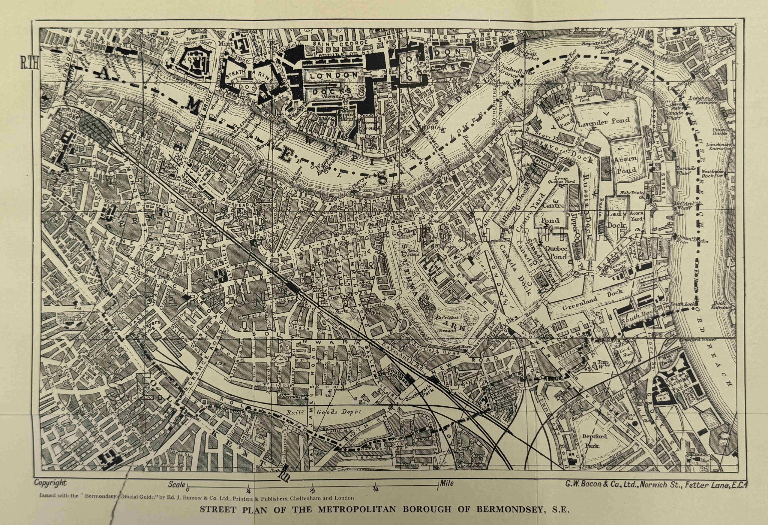
A small sample of images from the 1930s guide, including a Street Plan of the Metropolitan Borough of Bermondsey:

Old houses in Grange walk:

Municipal Offices, Spa Road:

Bermondsey Parish Church with Recreation Ground Adjoining:

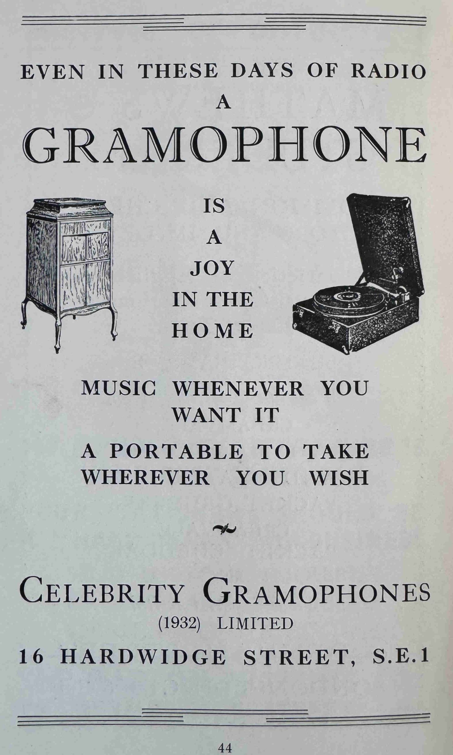
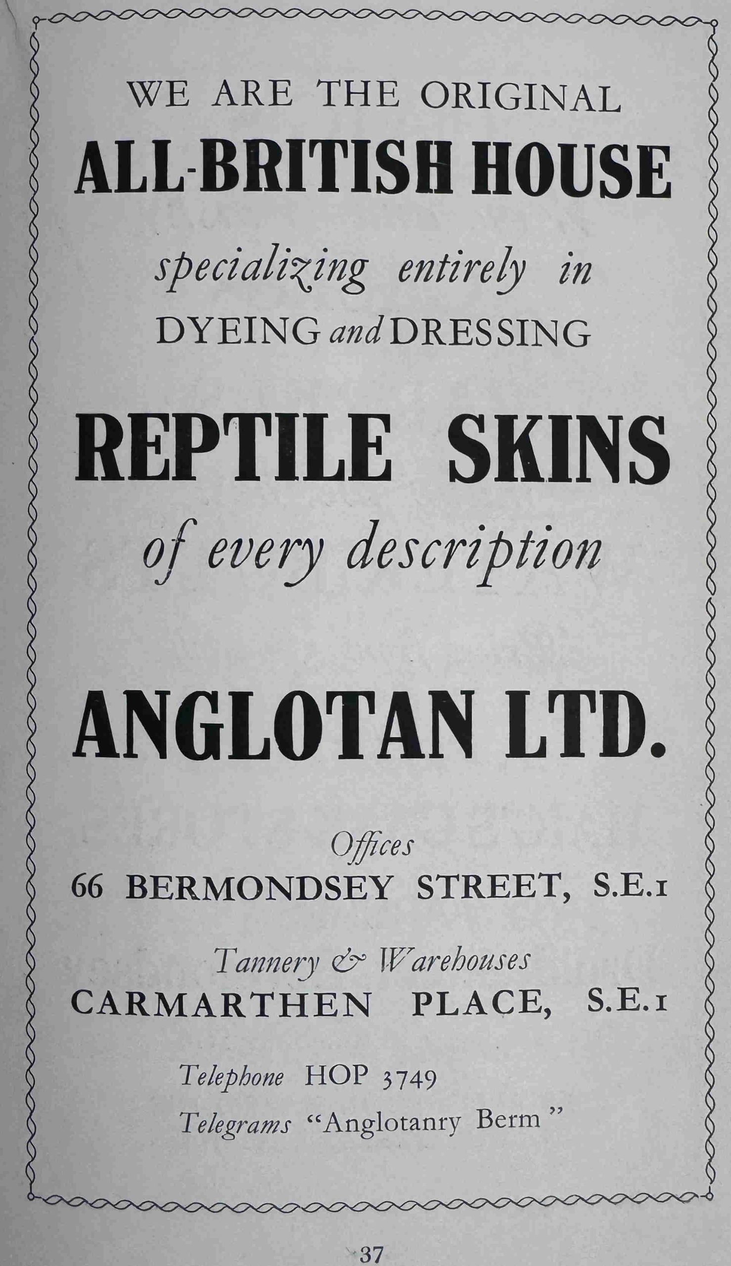
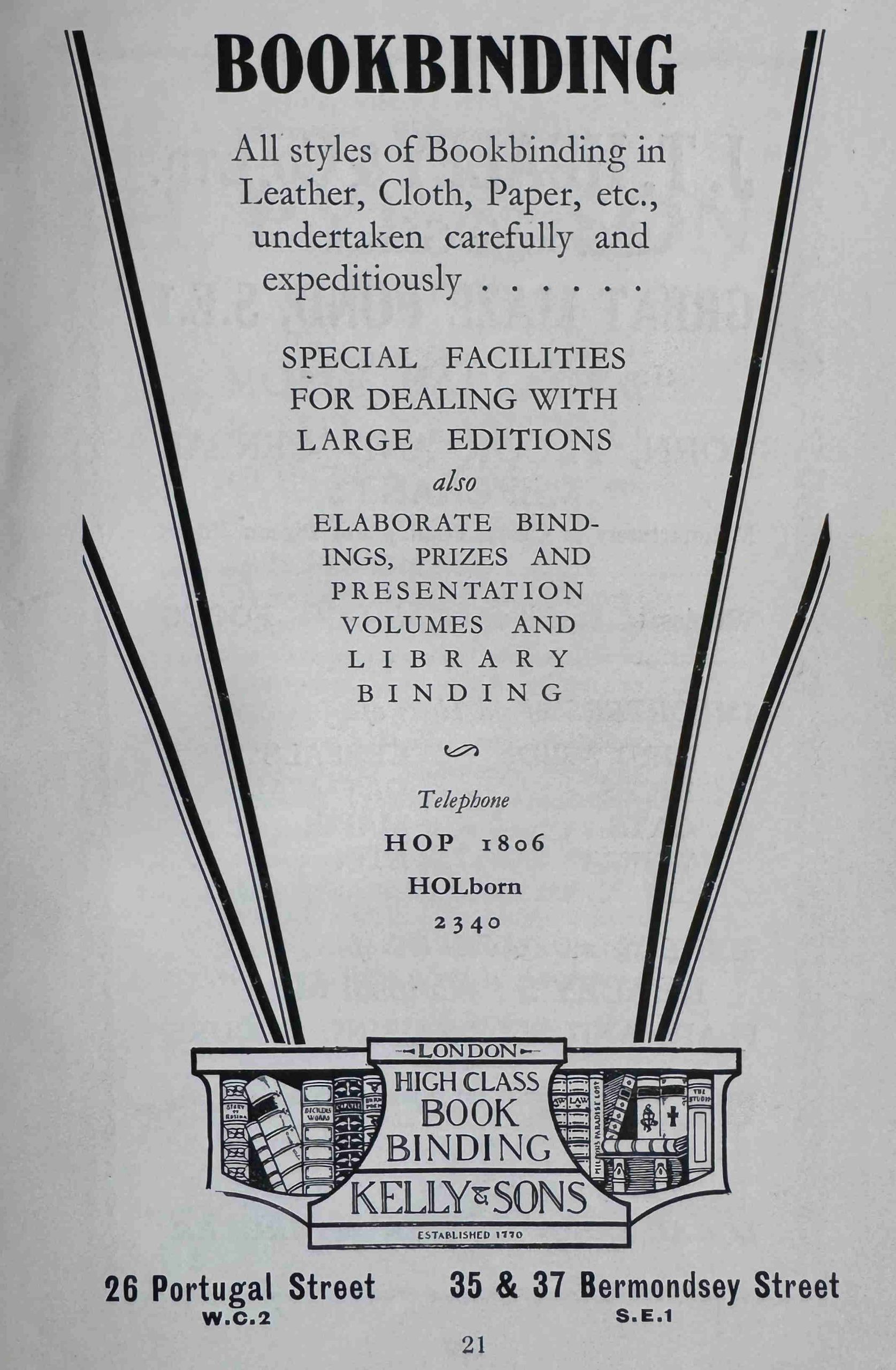
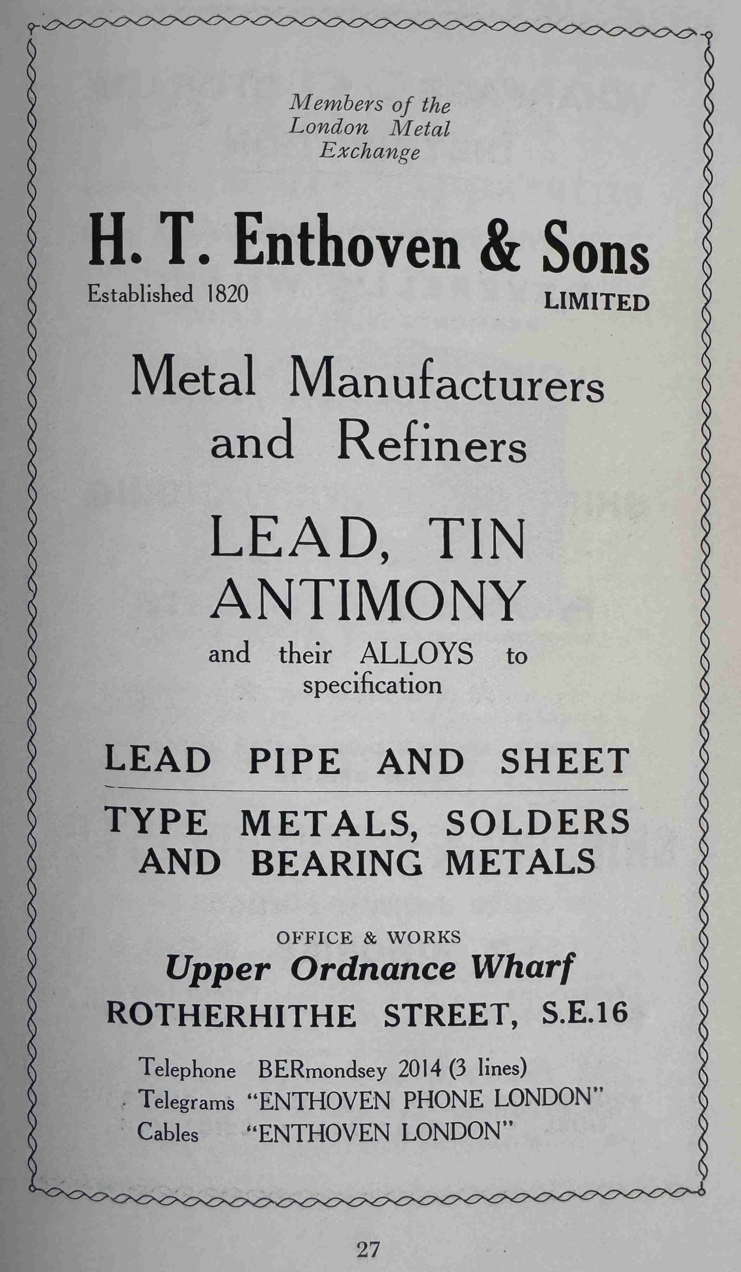
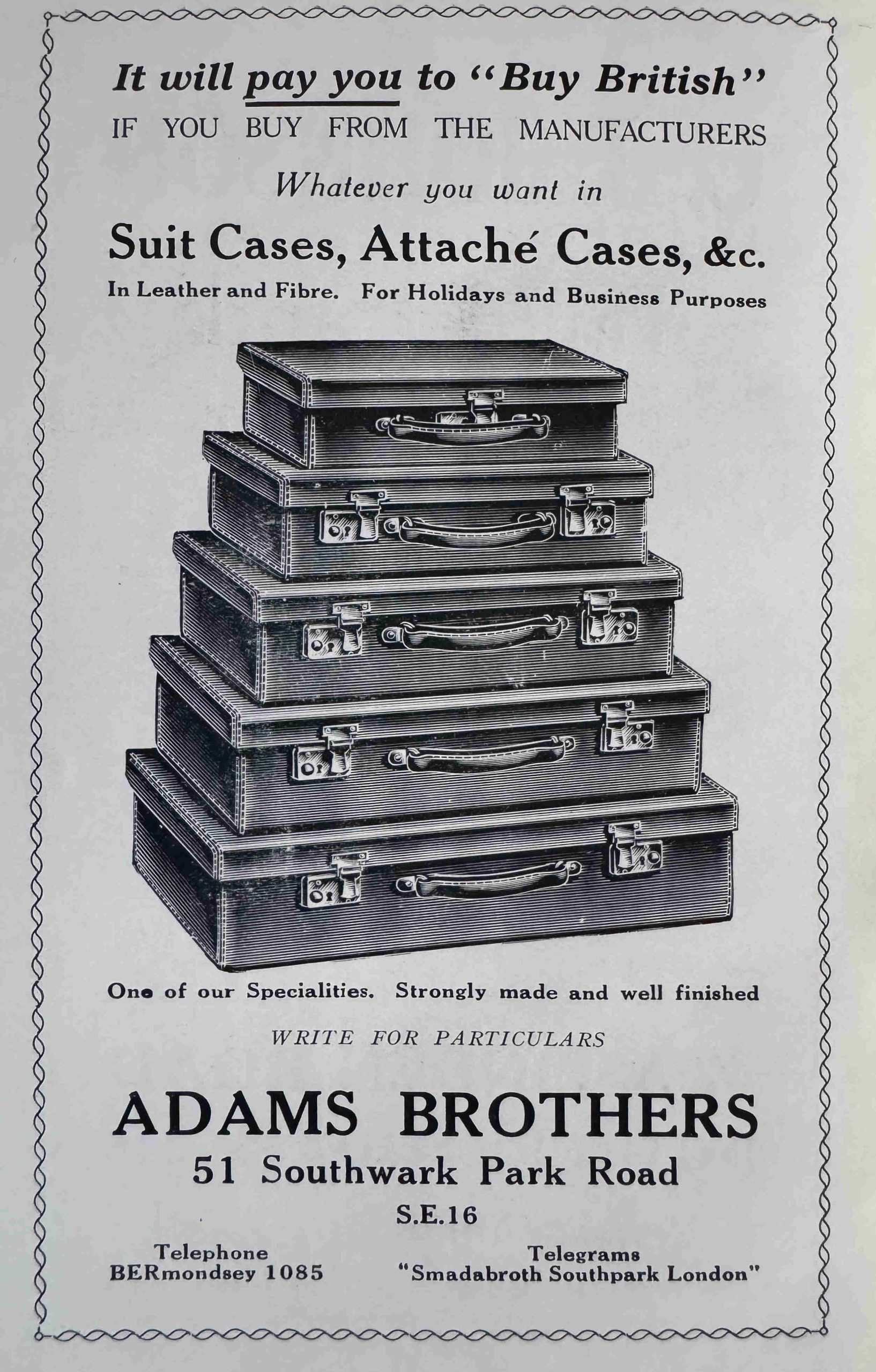
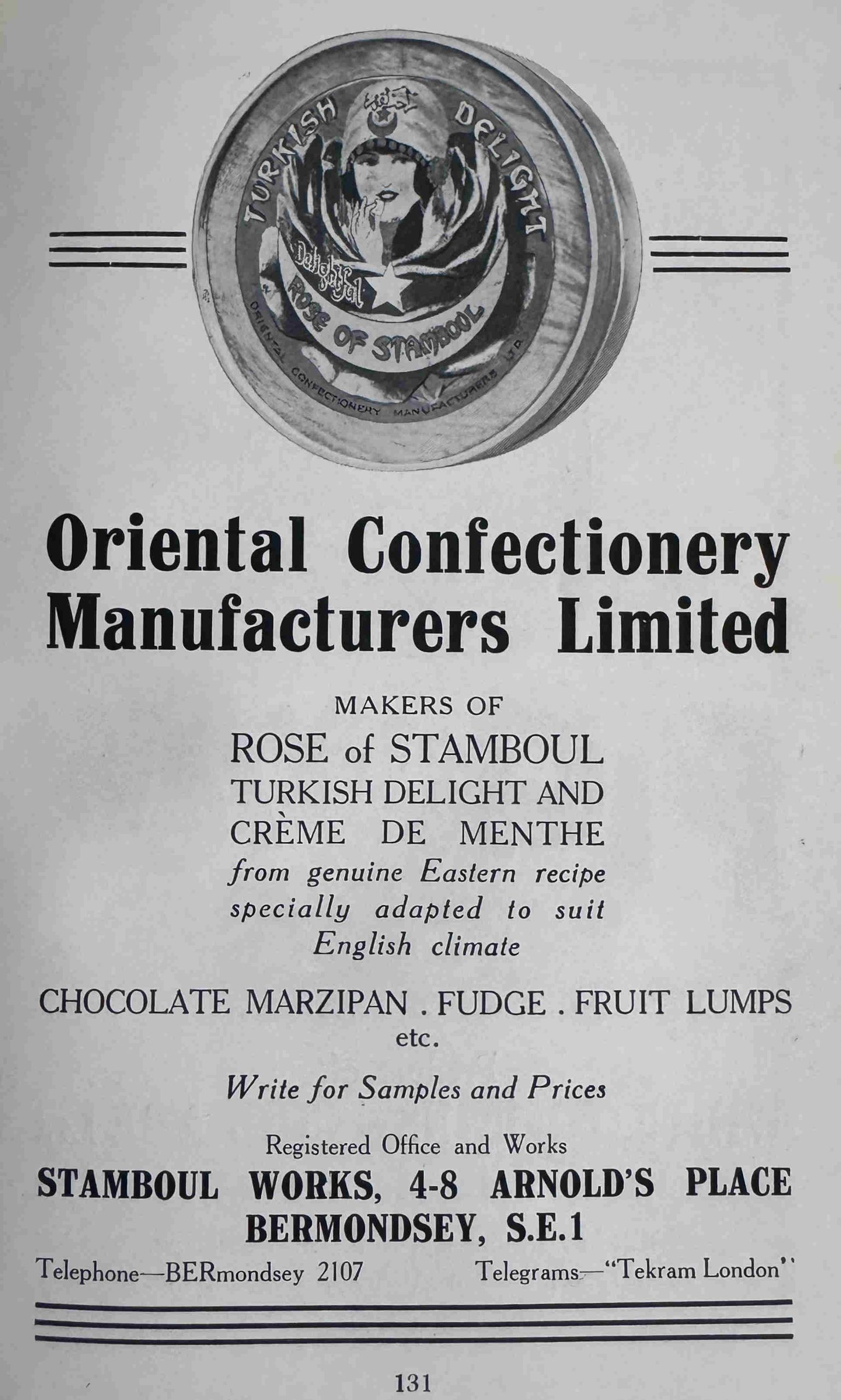
As well as a detailed history of Bermondsey and description of the borough in the early 1930s, the guide book includes numerous pages of adverts for the businesses that manufactured, exported, imported, and traded in Bermondsey.

A small sample which gives an idea of the breadth of industry and business in Bermondsey, which included the Oriental Confectionary Manufacturers Limited:

Celebrity Gramophones:

Anglotan Ltd. – the All-British House for Reptile Skins:

Kelly & Sons – High Class Book Binding:

H.T. Enthoven & Sons Limited – Metal Manufacturers and Refiners:

Adams Brothers – Suit Cases, Attaché Cases, &c. It will pay you to Buy British:

Bermondsey today is a very different place to that described in the 1930s guide book, but these adverts show only a small snapshot of the long history of an Ancient and Interesting Borough.

Booking for all dates at the following link: A London Inheritance Walks

The Creatives behind the Festival of Britain – Laurie Lee

In the 75th anniversary year of the Festival of Britain, I am looking at some of the creatives behind the Festival. From those who were involved with setting the overall approach and theme of the Festival down to those who worked on specific tasks to create the displays and pavilions.

Back in July, I looked at Jacquetta Hawkes, and for today’s post, I am looking at someone who in the years after the Festival, would become a very well known author.

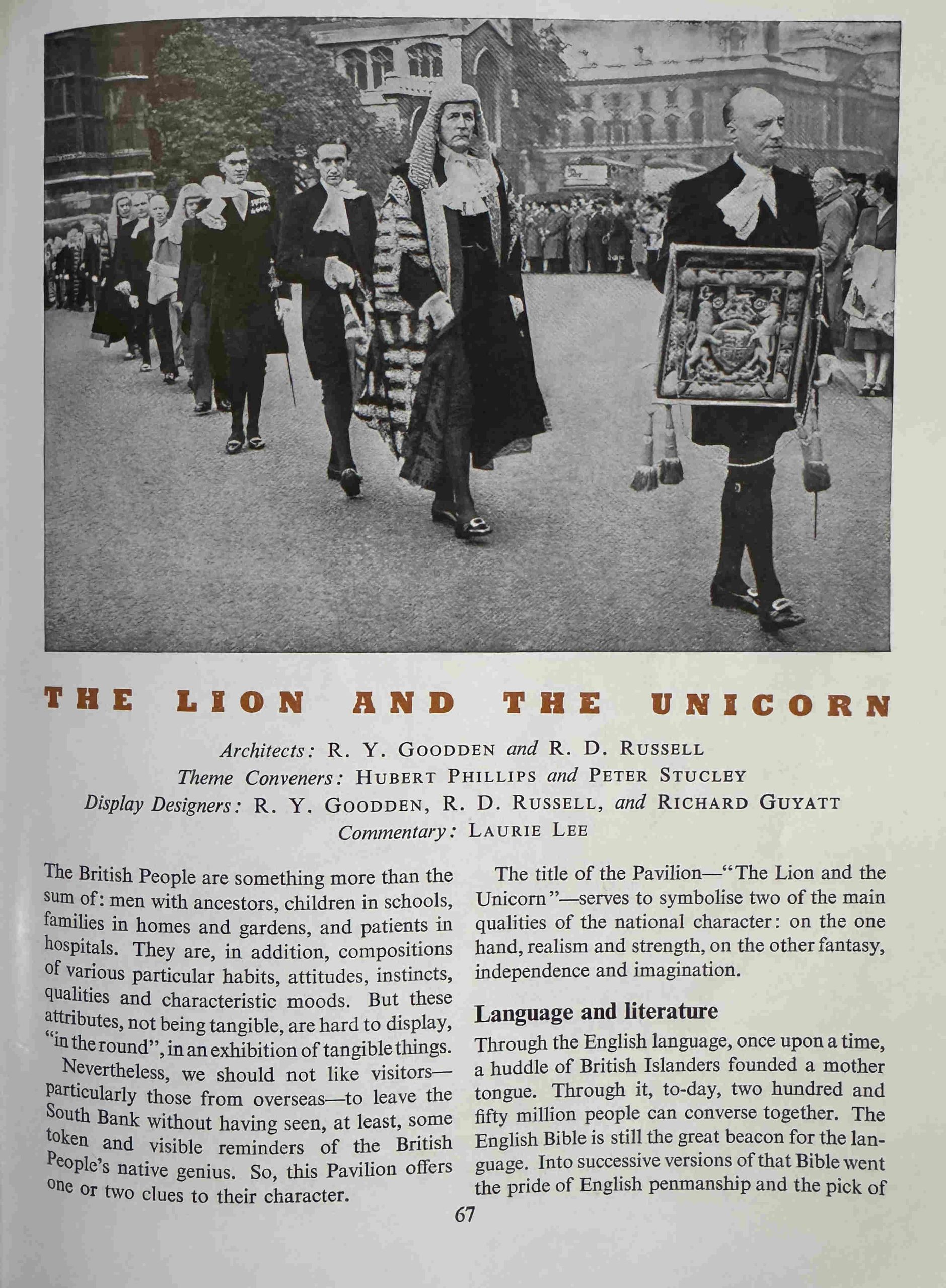
This is the page from the Festival guide book for the South Bank Festival site, covering the Lion and the Unicorn pavilion:

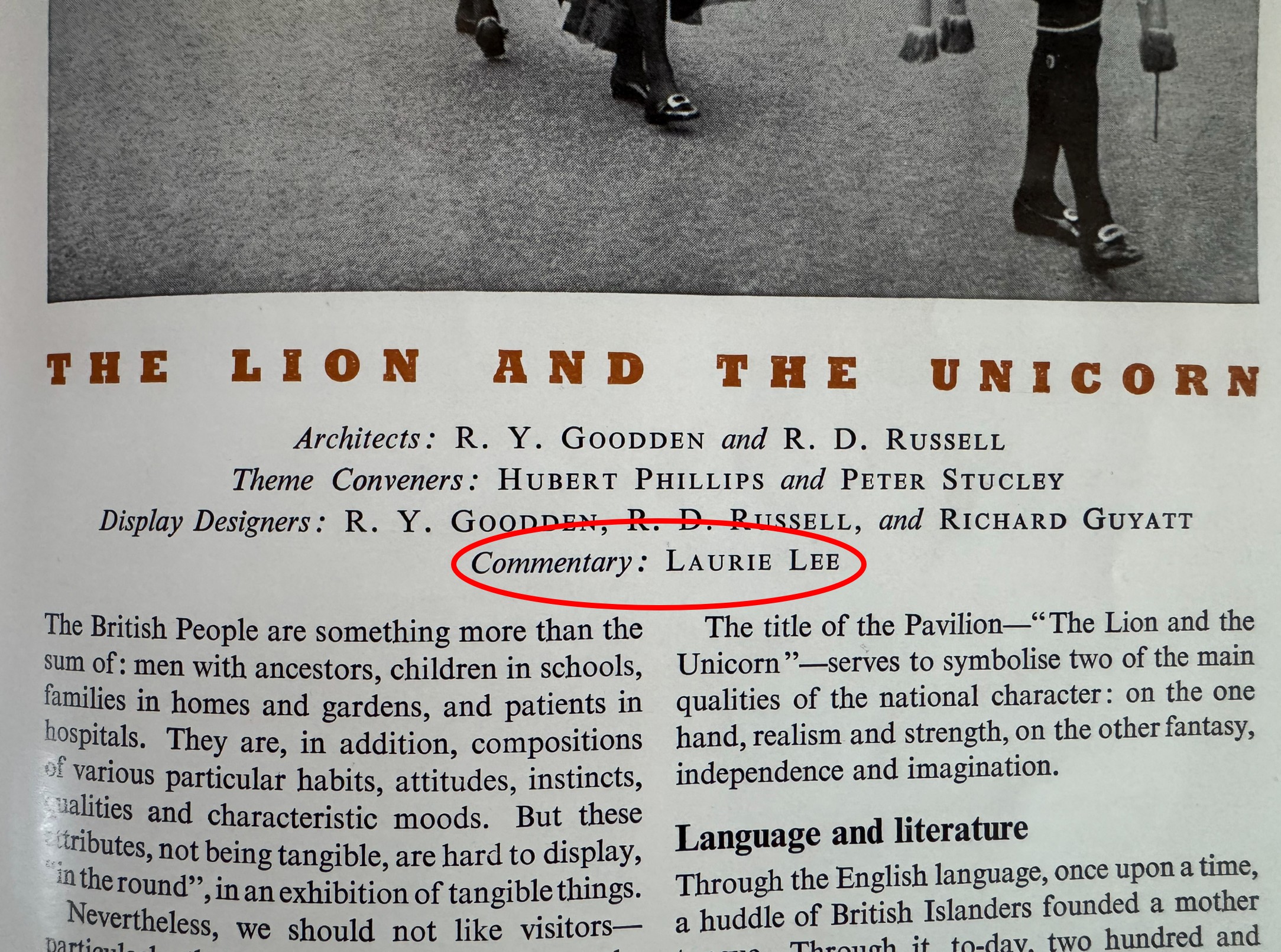
Among the names of those responsible for the Lion and the Unicorn, the person who created the commentary (the text to go with the displays and exhibits), there is the name Laurie Lee, an author who would later become very well known for the book Cider with Rosie:

Laurie Lee was born on the 26th of June 1914 in the town of Stroud in Gloucester. Three years after his birth, his family moved to the village of Slad, also in Gloucestershire, a village which would provide the experiences and material for the book that would make his name as an author, and a village that he would have a life long attachment to, moving back to Slad in the 1960s, and where he was buried after his death in 1997.

He left his home in Slad at the age of 19. He travelled to London, where he stayed for a year, busking with his second hand violin and working as a builders labourer, before travelling on to Spain. After the outbreak of the Spanish Civil War, Lee was one of a number of British subjects picked up on the southern Spanish coast by the destroyer HMS Blanche.

The destroyer came under attack by anti-government forces. A news report from a crew member of a merchant vessel being escorted by HMS Blanche describes the attack:

“When dawn broke we were glad to see H.M.S. Blanche close to us and five of the rebel’s aeroplanes came over aloft. At first they thought the warship was Spanish and dropped some bombs round her, but none hit her. The aeroplanes then discovered that the boat was an English naval vessel, and continued to escort us into harbour.”

The British Government did receive an apology for the attack as they were informed that “the anti-Government leaders desire to express their own and General Franco’s profound regret for the bombing of H.M.S. Blanche, which they say was mistaken for the Government destroyer Jose Louis Diez.”

He travelled back to Spain in 1937, and joined the International Brigades, who were formed to support the government of the Second Spanish Republic against the Nationalists of General Franco.

Lee’s experiences whilst in Spain during the Civil War and with the International Brigades were described in his book “A Moment of War“.

Returning to England, he wrote poetry, being named one of five little known poets who were “Poets of Tomorrow” in the Bookseller on the 30th of October 1941. His poetry became more widely known during the 1940s, and by October 1945, the Birmingham Mail was naming Lee as a “Midland Poet”, due to his birth in the Cotswolds.

During the war he worked for the Crown Film Unit as a scriptwriter and also with the publications department of the Ministry of Information.

In 1950 he married Catherine Francesca Polge, whose mother was Helen Garman, one of four sisters who were part of the Bloomsbury set.

In 1951 he wrote the script for the Board of Trade film “West of England”, a wonderful colour film that describes a lost way of life, but a film very much aligned with the themes of the Festival of Britain:

There is a wonderful line in the film, where he is describing the continuity of the countryside, and the churches which have “bells that have rung in a thousand years of Christmases”.

He was also writing drama for broadcast on radio, some of which were published, and again the Bookseller on the 6th of March 1948 advertises “The Voyage of Magellan” by Laurie Lee – “The text of the highly praised verse drama which helped to inaugurate the Third Programme in 1946”.

His work for the Festival of Britain started in 1950. Whilst he was writing the commentary for the Lion and the Unicorn Pavilion he was also advertising for contributions to a specific part of the pavilion.

I have written about the Lion and the Unicorn pavilion before, most recently in this post, which included the new Wetherspoon’s in Waterloo Station which is themed and named after the Lion and the Unicorn.

I have not written about the specific area in the Lion and the Unicorn over which Laurie Lee had some key responsibilities.

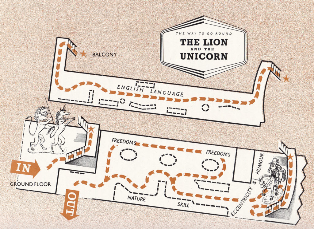
The overall theme of the Lion and the Unicorn pavilion was the British character, language and literature, the instinct of liberty, British craftsmanship, and the area where Laurie Lee had specific responsibility – Eccentricity and Humour.

This display area within the pavilion looked at both British humour and the streak of eccentricity in the British character, and to build this display, Laurie Lee wanted the eccentrics among the British population to contribute. The following is one of many newspaper articles advertising what he was after, from the London Weekly Dispatch on the 19th of November 1950:

“HE WANTS MADMEN TO HELP WITH FESTIVAL SHOW – If you have an eccentric mind, and during a nightmare or in a waking thought, have conjured up the weirdest, most fantastic object, the Festival of Britain wants to hear from you.

One section of a pavilion in next years’ Exhibition will be devoted to the ‘craziest’ conceptions of the British mind.

Mr. Laurie Lee of the Festival staff, eccentric poet, writer of film and radio plays, is the man responsible for choosing four objects that will, he hopes, evoke laughter, admiration, and technical interest.

Junk-Shop Hunt: ‘The main idea is to show in this Crazy Corner, things that will stand up to the foreigner’s idea of the ‘Mad English’ he said yesterday. ‘We want what I’d call fertile madness. for example, if someone told me of a hitherto unknown solution of perpetual motion, it would appeal.

Laurie Lee told me he had already dug into all the junk-shops of the East End of London and Chelsea, as well as in the country, without finding anything more eccentric than a square-rigged model bargue in an ordinary electric light bulb.

He invites ‘British Madmen’ to send written offers of their craziest creations to him at 2, Savoy-court, London, W.C.2.”

This was definently the “men in sheds” section of the Festival of Britain. Laurie Lee was after the sort of creation that use to feature on the “and finally” section of TV news, and on local TV news features.

In January 1951, the West London Observer was reporting on the creations that Laurie Lee was receiving: “They include ‘a machine 20ft square on the best engineering principles, with the sole object of blowing out matches. Says Mr. Lee; Admirable for its particular purpose, but slightly too big. I have suggested he builds a smaller model and perfects it by making it light matches as well. Another offer is a smoke grinding machine. Then, there is a mouse trap maze. This is a really cunning device in rough brick (the rough brick is important, so read on). Lured in by the smell of cheese. the mouse is diverted into dead ends until it becomes hysterical. its frantic running stirs up pepper on the pathways. causing such violent sneezing that it ‘bashes its brains out’ on the rough brickwork.

But, as Mr. Lee wisely points out, ‘you cannot have six months of mouse massacre just for the fun of the thing. How right he is! More than anything, Mr Lee wants little machines that work like mad and do nothing in particular”.

I wonder if Laurie Lee, poet, playwright and script writer, and soon to be author, felt any frustrations with having to deal with this type of submission, however the £11 a week as an Executive Officer in the Civil Service he was earning for his role in the Festival of Britain may have come as a welcome regular income.

In an interview with the Daily Express on the 20th of January 1951 Laurie Lee said that his role was “interesting and exhausting. To overcome this he takes three kinds of anti-nervous pills”.

With the sheer scale of the festival, the short time available before the festival was to open, and limited finances, I suspect that the pressure that Laurie Lee was feeling was common across all those involved.

In the same article he speaks about having just tested some “Walking-on-Air” shoes – he fell flat on his face when he tried them out. He had also received a violin made of matches, a tea-set made of old haddock bones, a pair of motoring goggles with windmill and windscreen wipers attached and some bottled circus clowns (miniatures).

He has also received a “Moral Uplifter”, created by a retired colonel, and worn inside your jacket, and gives out encouraging sounds of “Jolly good show, Hear Hear, applause and even laughs when you tell a joke”.

Also in Lee’s office was a stuffed white rabbit which contained a music-box, however the workings had gone wrong and the rabbit now plays God Save the Queen at unexpected times.

I cannot find a list of all the items submitted to Laurie Lee that ended up in the Eccentricities section of the Lion and the Unicorn pavilion. The text for the guide book was probably finished before the final selection was agreed, but the guide book does state that the visitor would see Tenniel’s White Knight

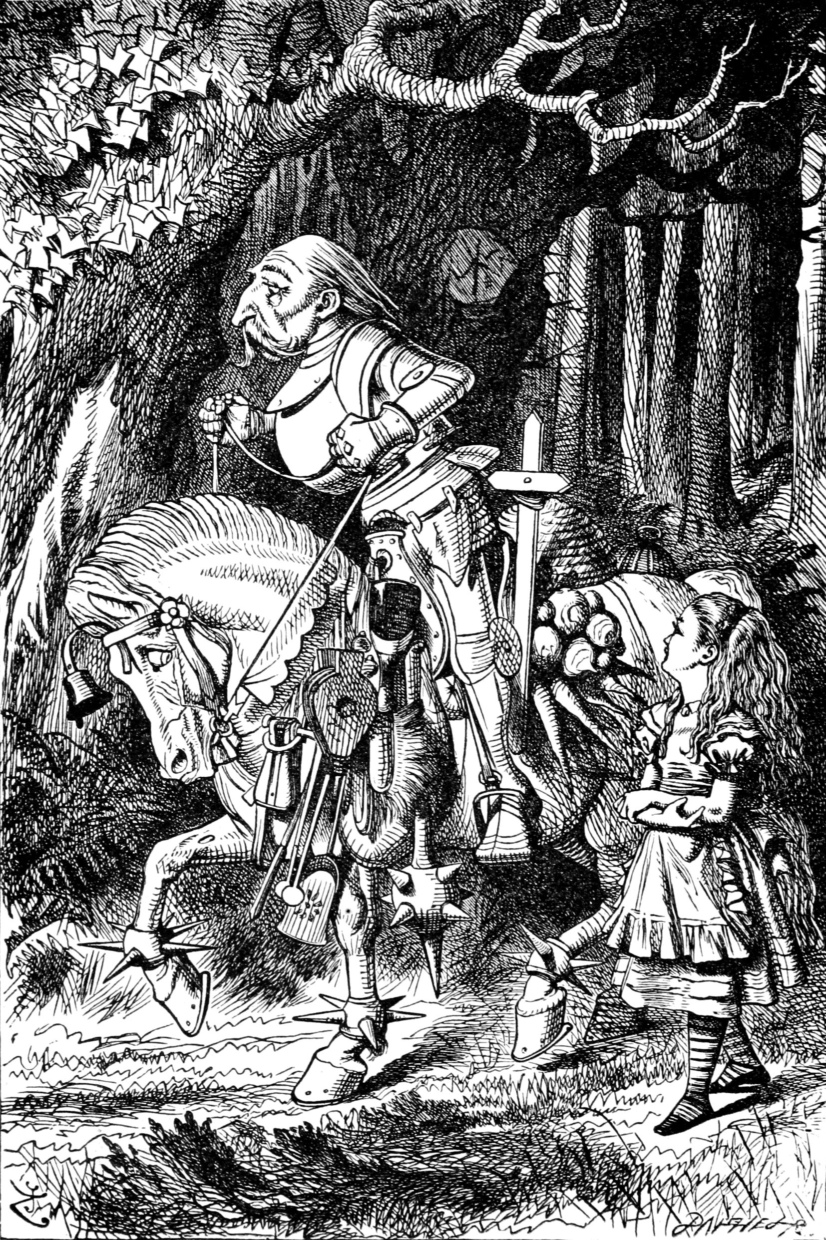
The White Night is a character from the book “Through the Looking Glass” by Lewis Carroll. he is an inventor, of the type wanted by Laurie Lee, and the following print is of the White Knight, by John Tenniel who provided illustrations for Lewis Carroll’s book, published in 1871:

Attribution and source: Джон Тенниел, Public domain, via Wikimedia Commons

In the illustration, the White Knight is seen sitting on his horse, which is covered in many of his inventions.

He can also be seen on the right in the Eccentricity and Humour section of the Lion and the Unicorn Pavilion:

As well as writing for the Lion and Unicorn pavilion, Laurie Lee also wrote captions for other pavilions on the South Bank festival site. A reviewer in the Daily Herald in the days after the festival had opened wrote about the Lion and the Unicorn pavilion “I was especially impressed by the captions, the work of the poet Laurie Lee, who has written captions for several other pavilions as well. These combine point with nonchalance in a way that would be impossible to anyone but a most sensitive artist in words.”

Looking through the Festival of Britain guide for the South Bank and the Lion and the Unicorn pavilion is the only one where there is a named author for the commentary. No idea whether this was because the commentary in the pavilion was considered of more importance compared to the other pavilions, whether it was because of Laurie Lee’s reputation as a poet, or for some other reason.

In the years after the Festival of Britain, Laurie Lee began the strand of his career that would lead to his popular fame as an author.

In 1955 “A Rose for Winter: Travels in Andalusia” was published. This was about a return visit to Andalusia, to find a country that had been broken by the Civil War, but the underlying character of Spain was still to be found.

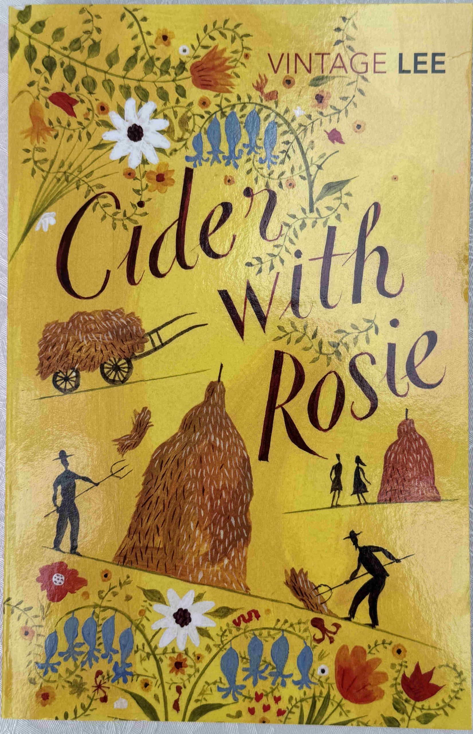
In 1959, “Cider with Rosie” was published. This was the story of his childhood in the village of Slad, from a time when the way of life in the British countryside was still much as it had been for a very long time, and before modern conveniences such as electricity and the car had arrived.

This is probably Laurie Lee’s most well known book. Turned into a number of TV adaptations and films, radio dramas and a stage play. It was also one of the books used for school English Literature courses and examinations.

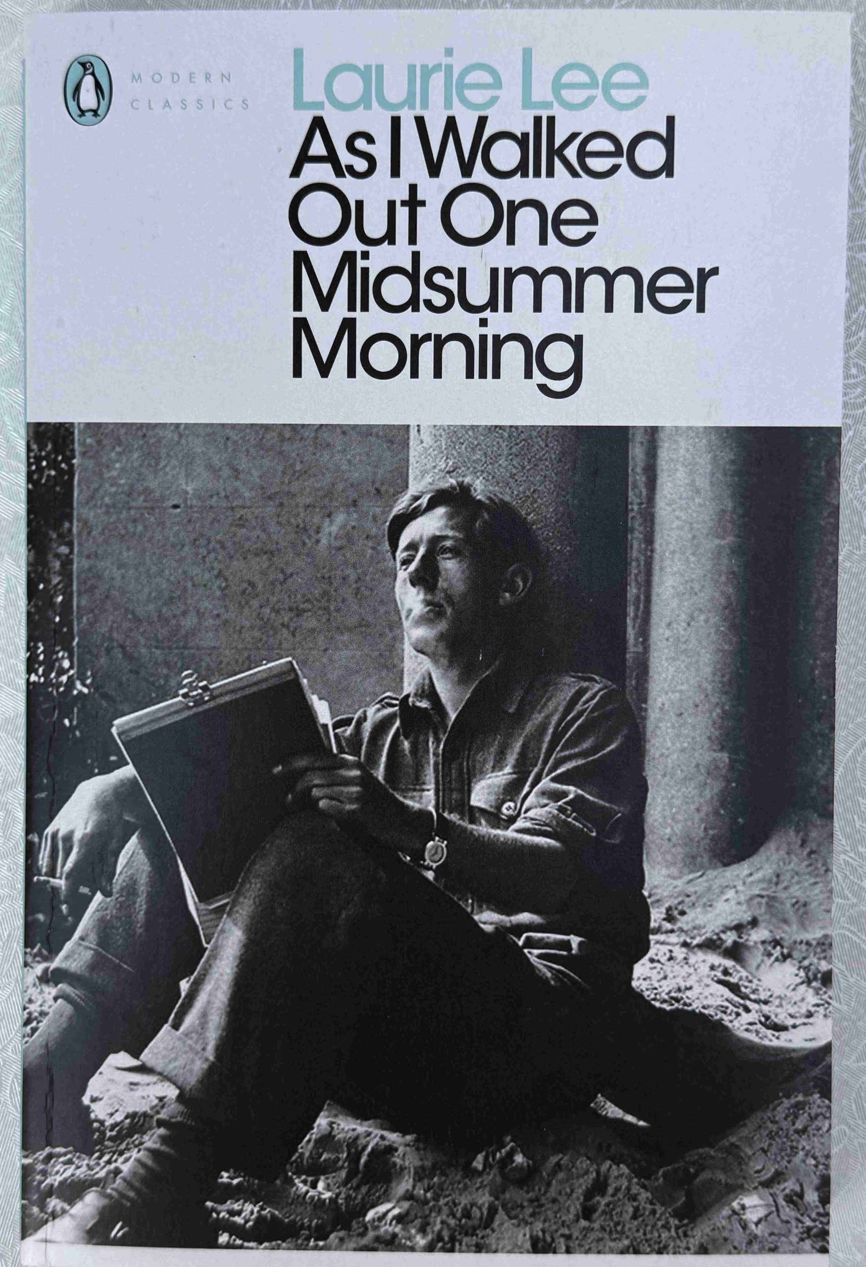
Cider with Rosie was followed in 1969 by the second book in Lee’s autobiographical series – “As I Walked Out One Midsummer Morning“. This book starts when he first leaves his home in Slad, his journey walking to London, then his time in Spain, and ends when he returns to his family home.

“A Moment of War“, published in 1991 tells of his time in Spain and involvement in the Spanish Civil War.

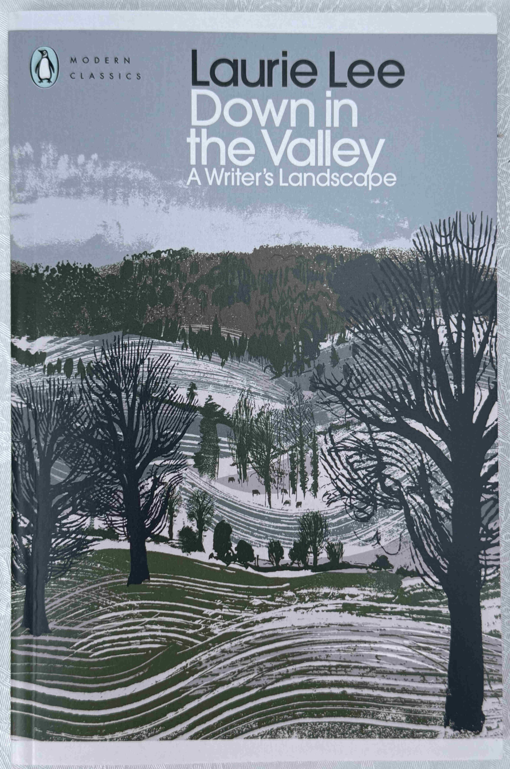
Whilst writing these autobiographical books, he continued to write and publish poetry, along with other books such as “Down in the Valley”, a description of the landscape, life and traditions of his Cotswold home:

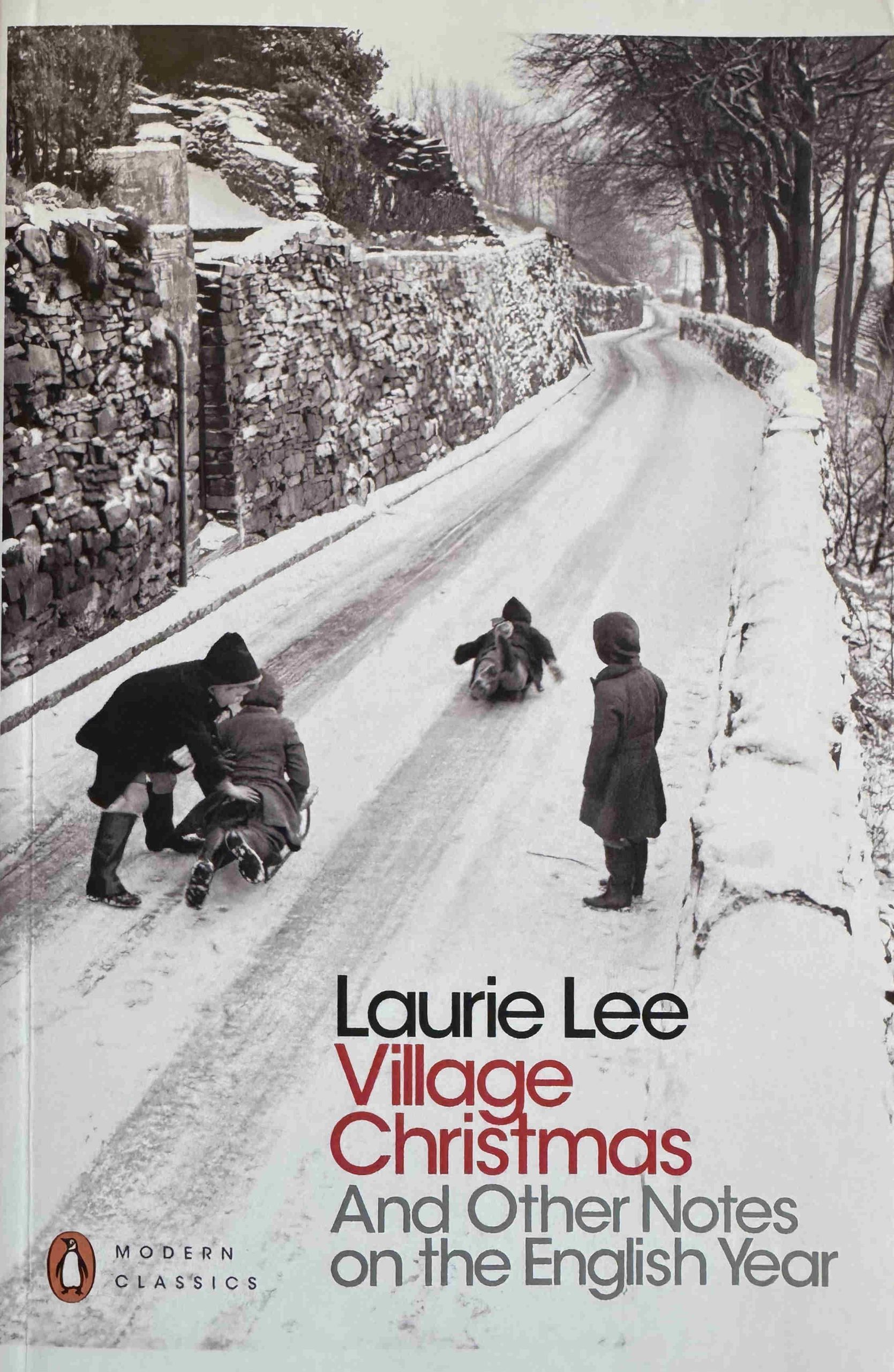
And also “Village Christmas And Other Notes on the English Year”, which included both his home landscape of the Cotswolds as well as his time living in Chelsea.

The majority of his books show an intense love of place, the landscape, people and traditions that make a place.

Laurie Lee’s attachment to his home village of Slad lasted all his life. Along with his wife, he returned to the village to live in the 1960s, whilst keeping a flat in Chelsea.

As with my post on Jacquetta Hawks, all the photos I can find of Laurie Lee seem to be in copyright, or taken from a source which appears under copyright.

There is a photo of Lee, along with his wife at the following link: https://www.npg.org.uk/collections/search/portrait/mw251363/Katherine-Kathy-Francesca-Lee-ne-Polge-Laurie-Lee although at the time of writing, the National Portrait Gallery appear to be having problems with loading images.

He died in 1997 at the age of 82, and was buried in the churchyard at Slad.

A typical obituary focused on his book A Cider with Rosie, but also said that he was:

“First and foremost a poet, and his writings were autobiographical. He imposed on his work a vigorous discipline and perfection which might involve rewriting a book three or four times. It meant his output was small, with barely a dozen books published.

Lee also represented an era of brilliance and idealism that sprang from the 1930s; he fought in the Spanish Civil War, wrote verse plays for radio, and was a contemporary of such literary figures as Stephen Spender, John Lehmann, George Orwell and Cecil Day-Lewis.”

The majority of his books are still in print, and reading them today, it is clear why he wrote the commentary for the Lion and the Unicorn pavilion, as well as a number of other pavilions across the festival.

I just wish I could write blog posts that are able to “combine point with nonchalance in a way that would be impossible to anyone but a most sensitive artist in words“, as a reviewer of his work for the festival had written.