
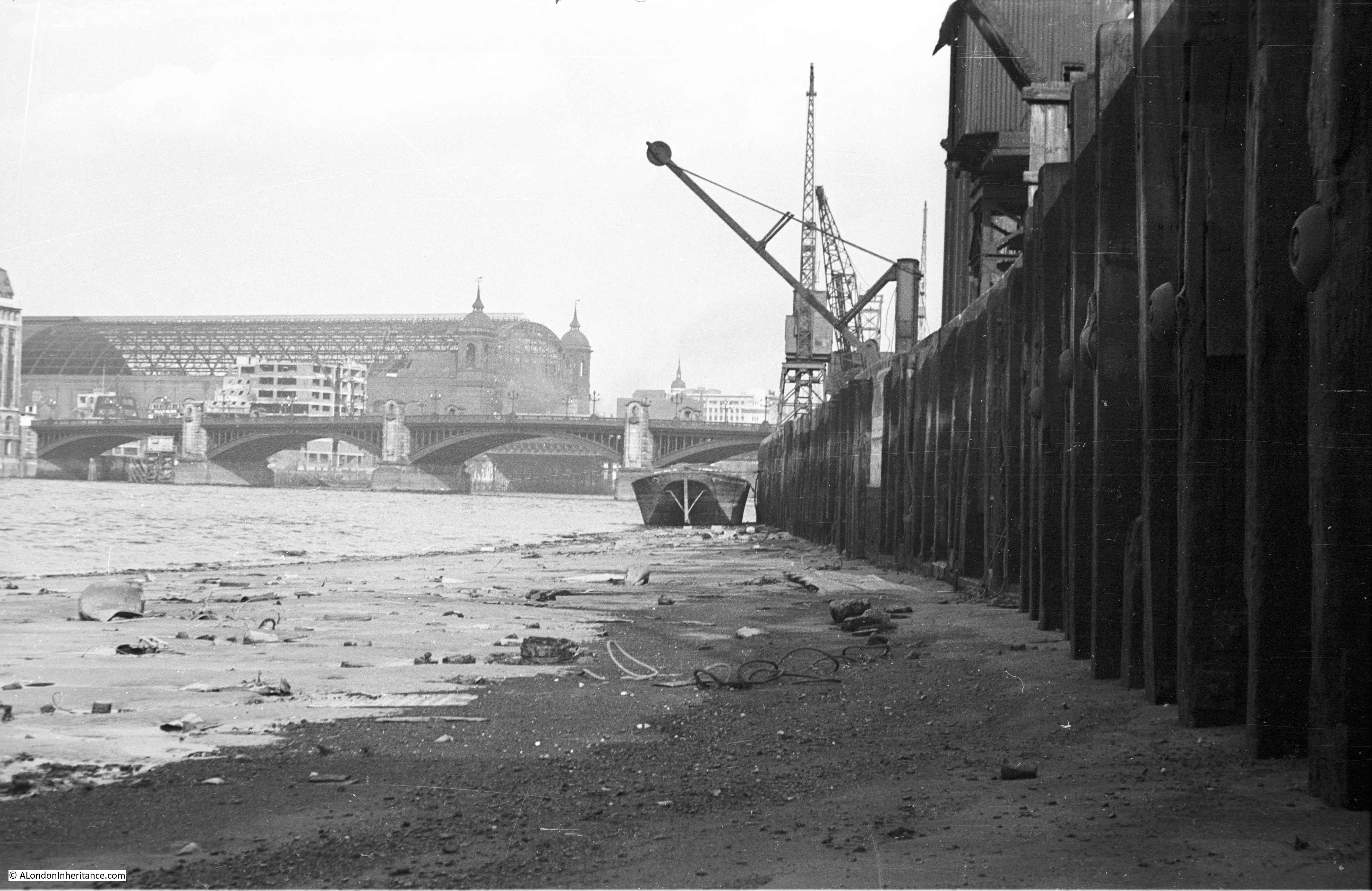
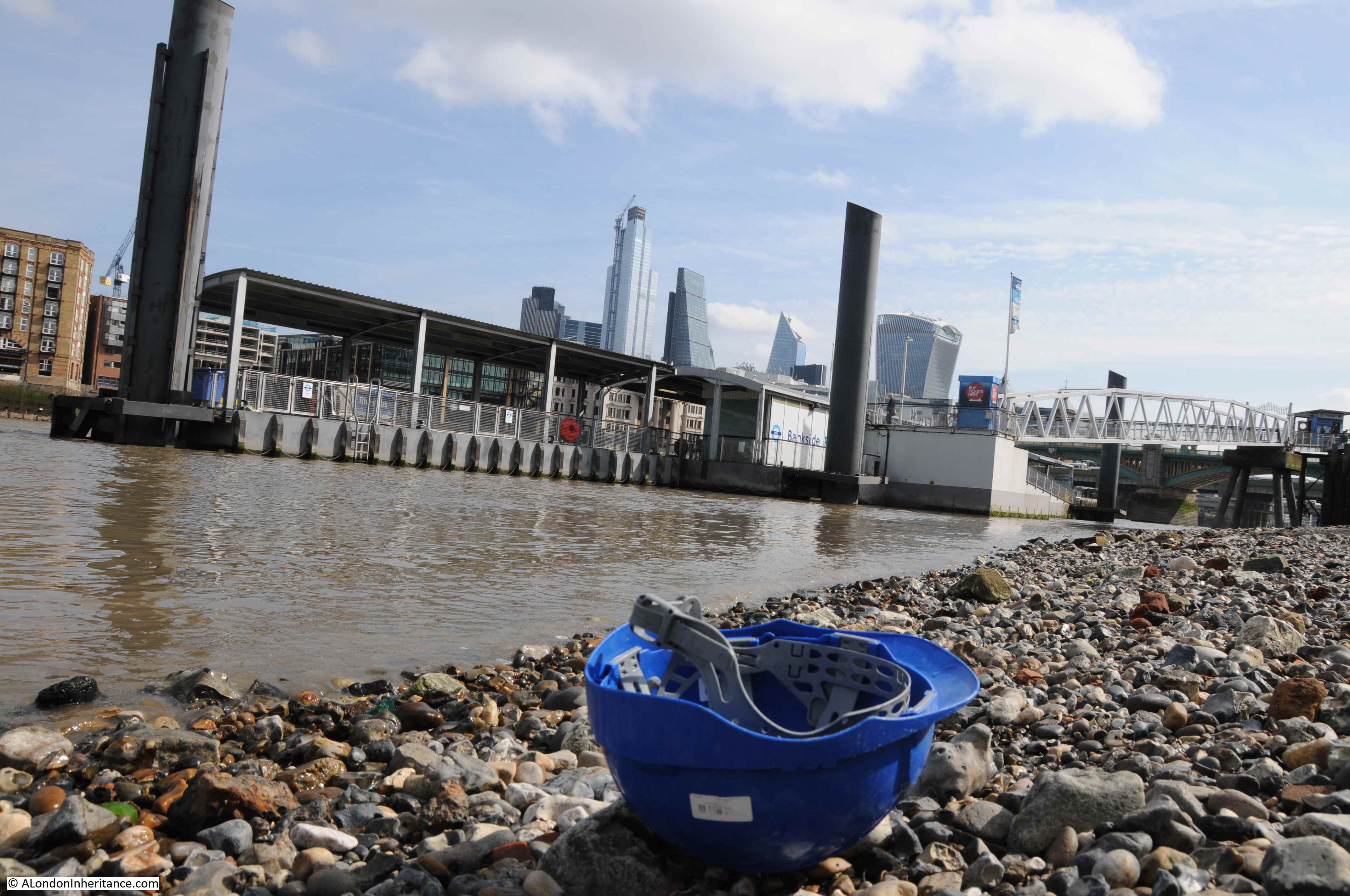
The joy of scanning negatives is finding different views of places that have been the subject of other photos. This week’s photo is of Cannon Street Station, photographed from the Thames foreshore at Bankside.
The same view today (although I had walked slightly further away from the river wall):
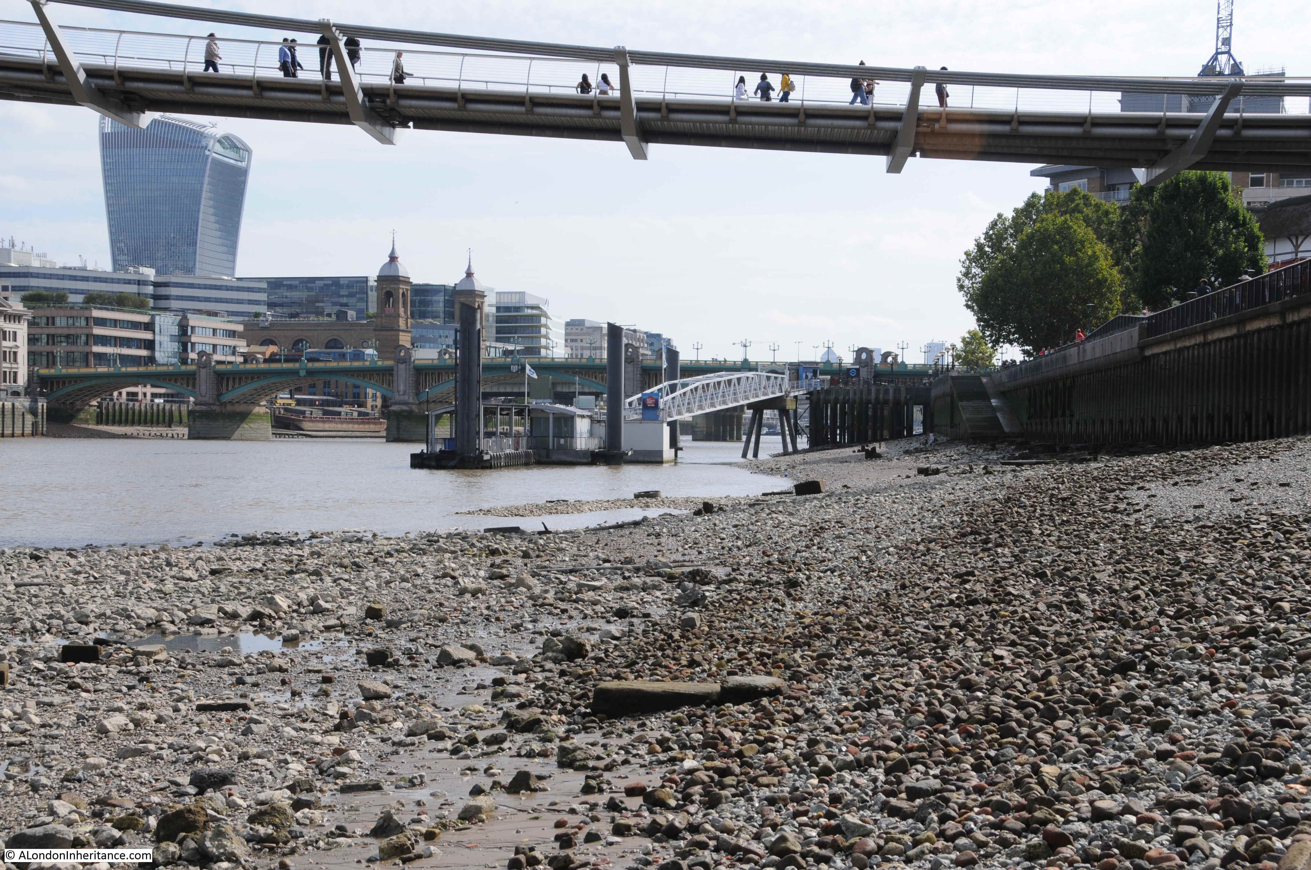
The view has changed considerably in the 70 plus years between the two photos. The only consistent features are obviously the river, Southwark Bridge and the twin towers at the entrance to Cannon Street Station.
The station has since lost the fantastic roof that stretched back from the entrance towers to the station hotel that once faced onto Cannon Street. The Walkie-Talkie, or 20 Fenchurch Street is the City tower visible from this perspective and the Millennium Bridge stretches over the foreshore, transferring walkers between south and north banks of the Thames.
I love being able to cross-reference photos so you can see both sides of the view. A few months ago I wrote about Emerson Stairs and published the following photo which is looking back from Southwark Bridge towards Bankside and includes the area where my father was standing to take the original photo.
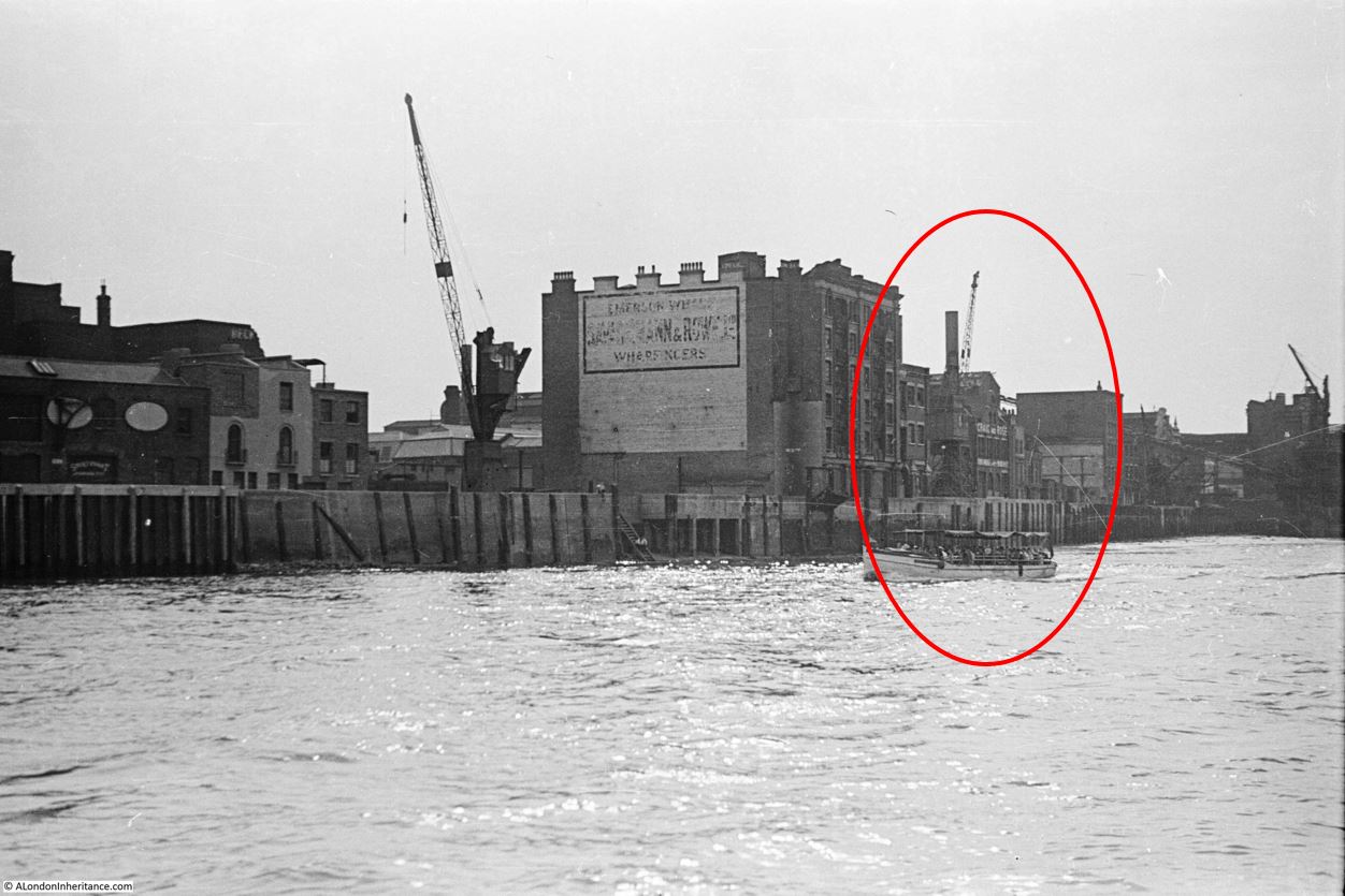
If you look at the photo at the top of the post, there is a Derrick Crane with the jib leaning out over the foreshore, and behind is one of the more traditional riverside cranes. In the photo above, taken from Southwark Bridge, I have ringed a small area. The following photo is an enlargement of this area.
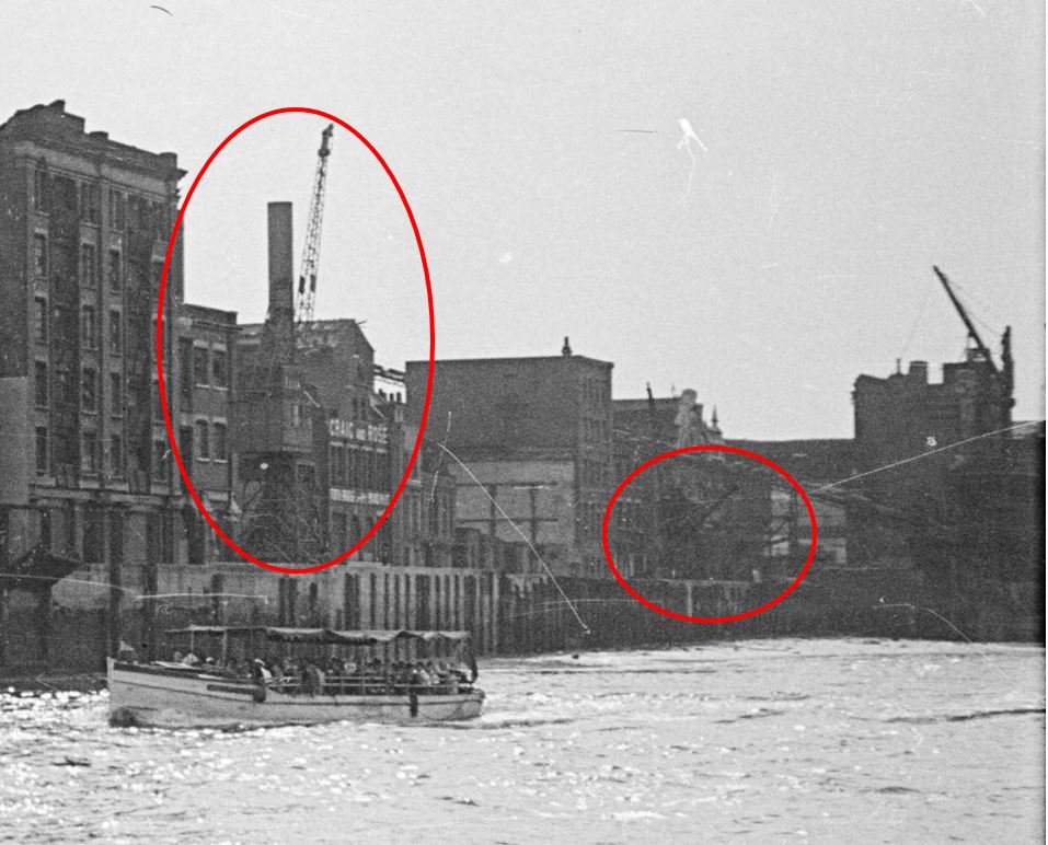
On the left is the crane in the background of the photo from the foreshore and to the right I have ringed the Derrick Crane. This is not easily visible due to the grain and contrast of the film, but can just be seen, so my father was standing just a short distance further to the right of the Derrick Crane, not far from where the conveyor belt taking coal from river barges to the original Bankside Power Station was located.
I have an almost complete set of photos of the south and north banks of the river between Westminster and Tower bridges in the late 1940s, and the plan for a future post is to bring these all together and document a trip along the river showing how both sides have changed in the intervening 70 years.
In the original photo, Cannon Street Station still has the arched metal framework which ran from the station entrance and hotel, all the way to the river entrance and the twin towers.
Cannon Street Station was opened in 1866 and the iron and glass arch was around 700 feet long and must have been a magnificent sight. The following postcard with a photo from the Monument gives an impression of what the arched roof must have looked like soon after completion, and how the new station dominated this area of the City.
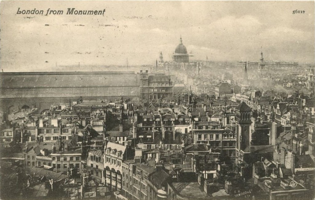
Maintenance of the station roof had been neglected prior to the last war, and the glass panels had been removed from the roof, leaving just the iron frame at the start of the war. Bomb damage included many incendiary bombs and a few explosive bombs, however as can be seen from my father’s photo, the majority of the iron frame of the arch survived.
The iron frame of the roof was removed in 1958, and the space above the platforms has been redeveloped with the office space that we see today.
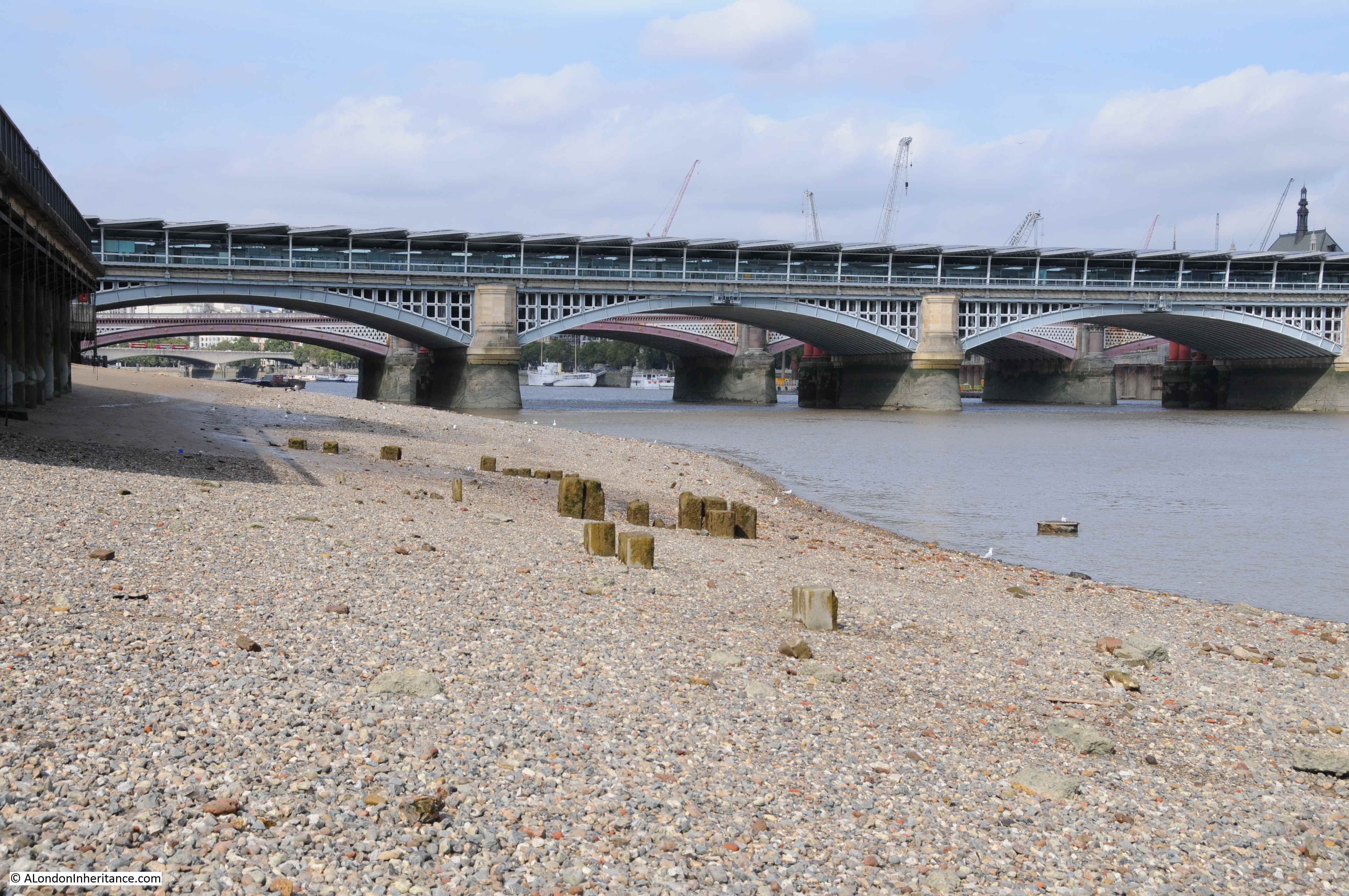
The following photo is looking in the opposite direction, and shows the railway bridge running across the river for Blackfriars Station.
The Thames foreshore is a fascinating place, with plenty of relics of the industrial past of the river. Comparing my father’s photo with view today, it looks as if there is now a more pronounced slope of the foreshore. It looked reasonably flat in the original photo, but as can be seen in my photos from the same place, the foreshore looks to slope down into the river. Possibly more erosion is taking place with increased water flow?
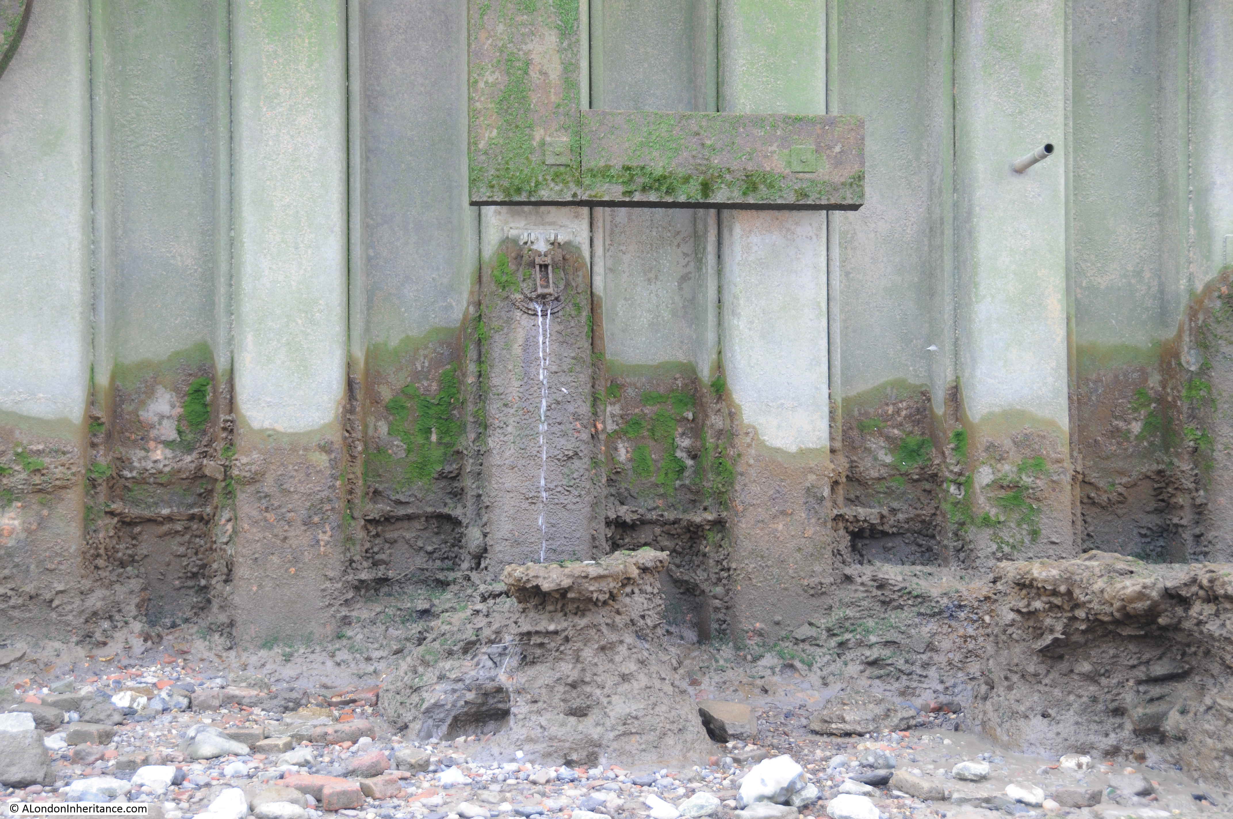
The foreshore is littered with traces of the past. Exposed pipes that run from the land down into the river. What was their original use, or are they still in use?
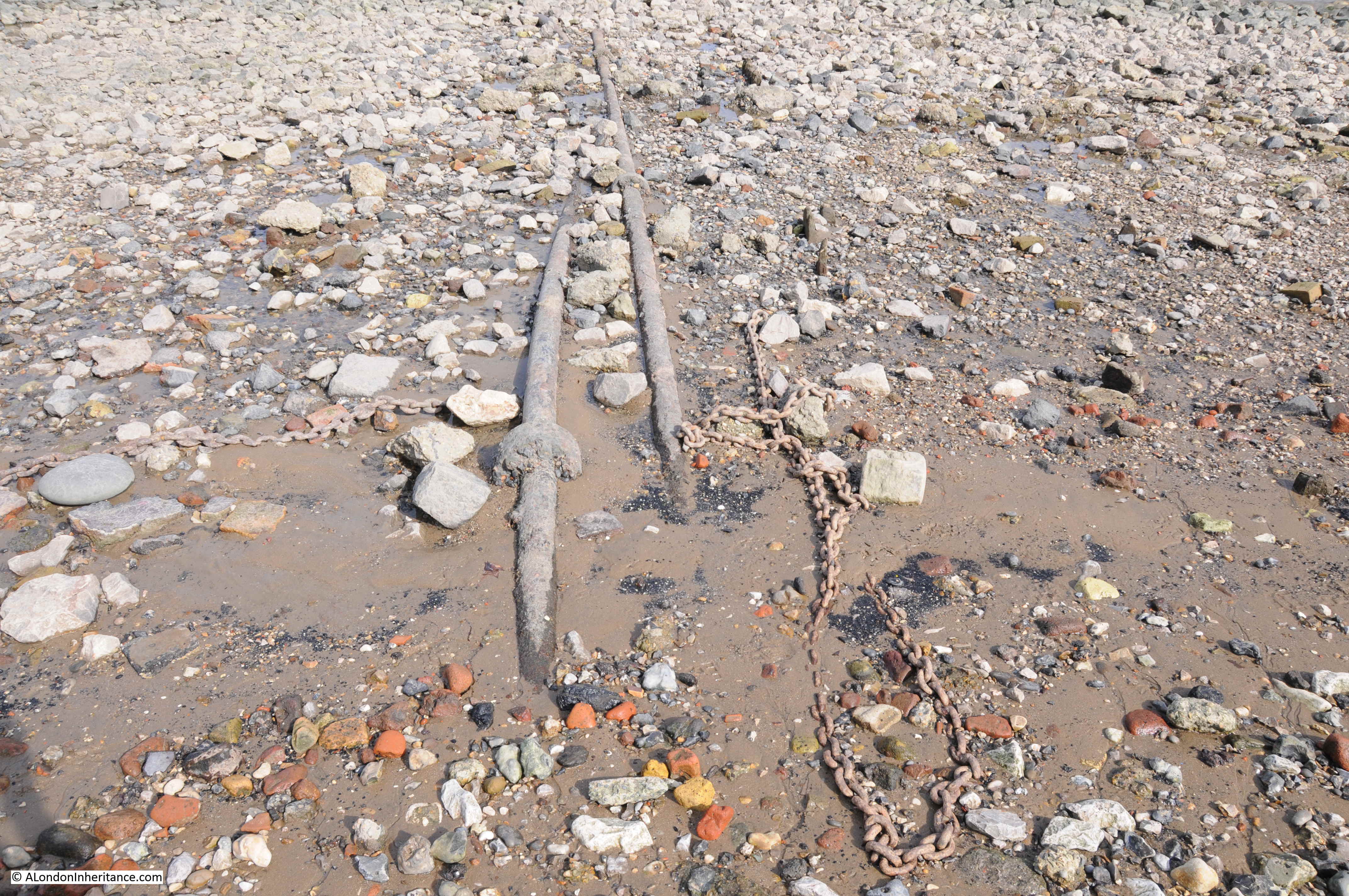
Chains, the red / orange of tide worn bricks and lumps of chalk that were once used to create level platforms to position barges, all provide evidence of an earlier city.
The main change to the river in the area of my father’s photo has been the construction of the Millennium Bridge, which is just as interesting from below the bridge as from above.

The day I was on the Thames foreshore to take an updated photo was a day of an exceptionally low tide. This is when the river reveals many more features including those that demonstrate that the foreshore is not a flat slope down to the centre of the river. Here a raised bank runs out further into the river.
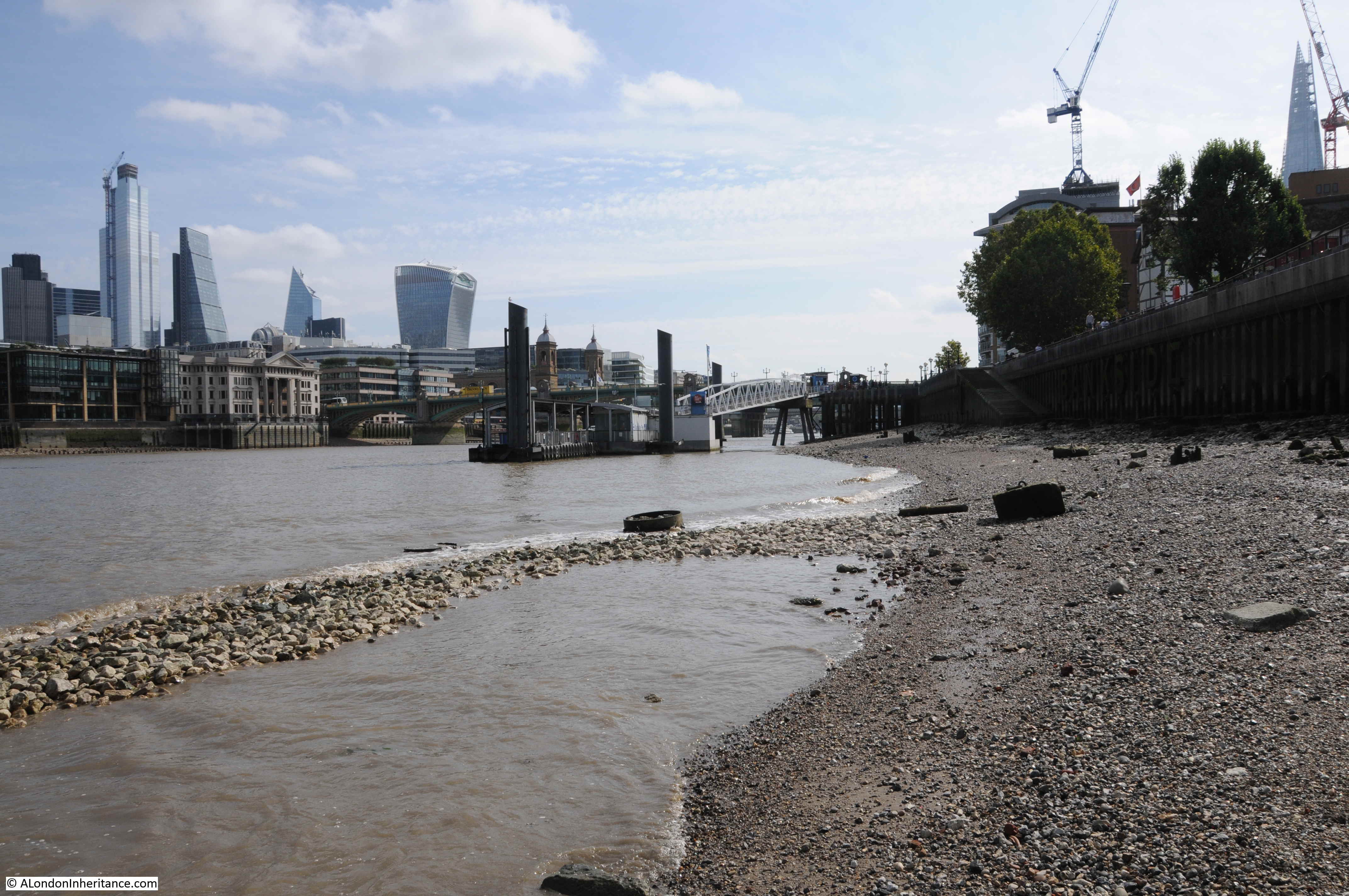
Almost certainly not a natural feature, but possibly enhanced by the river eroding softer sediment on either side.
Alongside the raised bank, the remains of iron piers run out into the river. The remains of a structure from the days when Bankside was industrialised and dependent on the river.

When the water is this low, it is intriguing to imagine what the view would look like if all the water was drained away. The detritus of a couple of thousand years of London’s history revealed.
During the reconstruction of the area and the new walkway along Bankside, the river wall was replaced by metal piles, however they do not provide an impervious barrier between land and river and there are still plenty of points where water drains into the river, as well as strange pipes which serve no obvious purpose.
For centuries, the river has collected everything that has been lost by those working or travelling alongside, or on the river. Buried under the silt and often returned to the surface following erosion by water flow and the tides. You will not find clay pipes being dropped into the river these days, rather the evidence of 21st century construction work on, or alongside the river.
Low tide is a fascinating time to walk along the Thames foreshore, walking on a couple of thousand years of London’s history. Cannon Street Station has only been there for a very short period in that history, the wonderful arched roof has been lost, but the twin towers will continue to welcome trains into the station for years to come.
‘The Thames foreshore is a fascinating place, with plenty of relics of the industrial past of the river.’ Sadly there are now plans to dredge 2200 cubic metres of the foreshore between Cannon Street and London Bridge to create a ‘berthing pocket’ for the Ocean Diva, a 282 foot long Dutch party boat. The Ocean Diva consortium claims there is little or nothing of archaeological interest in this stretch of the river. Anyone who would like to explain otherwise – please do so on the planning portal. https://www.planning2.cityoflondon.gov.uk/online-applications/applicationDetails.do?activeTab=neighbourComments&keyVal=PMKFGWFHI8H00
Another question is why this stretch of foreshore is so very contaminated with heavy metals? Lead (60 times the actionable level), zinc, mercury and cadmium have revealed in water quality surveys. The contamination is so hazardous that the material is considered even by the applicant to dump at sea. The EA has noted this fact, wondering if it might have been a munitions dump. Does anyone know?
If you’re interested in the foreshore, it’s history and what can be found there, pick up a copy of Mudlarking by Lara Maiklem. It’s a beautifully written book full of fascinating snippets about the history of London.
Great stuff. I well recall that part of the southern riverside in the 70s and early 80s, pre-development. A fascinating hinterland, great for walking but practically deserted. Mind you, I love it now, all lively and busy and giving you the perfect opportunity to admire the north bank. Strange to think that not so long ago it was still a bustling and busy industrial area. Glad that the Thames is doing its job, now a lot freer. Off to the foreshore myself in a coupe of weeks.
Yes Annie I grew up in that area in the 50s & 60s. The Bankside was our playground at the weekend…climbing cranes, jumping from barge to barge and running along the wall. The whole place was deserted from Friday to Monday except for water colour artists sitting on the wall & steps just below Southwark Bridge. We lived on the corner of Park Street and Horseshoe Alley …directly across from the original site of the Globe. Our access to the Bankside was Horseshoe Alley…an alley/street now disappeared completely. For some reason that I cannot recall we never went onto the foreshore…
Another wonderful post of old London. Thank you.
Thanks for that Anne
Congratulations on this very detailed and interesting post. The areas I know (Deal in Kent where I was raised and Oxford where I now live) carry similar kinds of history for those who care to look at past and present images in the home and the ‘field’. I once spent time studying the foreshore down river from here (just beyond Tower Bridge) and found the OS 6″ to the mile map especially useful in helping me a) interpret what I was seeing (eg old embankment stairs into the river) and find what I wouldn’t have known existed (eg an exit to a tunnel adjacent to the Tower). You’re right about the importance of visiting these sites during exceptionally low tides. Evidence of the former peir in Deal (the present one was built in the late ’50’s) is plain to see in the form of remnants of piles revealed at very low tides. The point you make about outflows from the embankment into the Thames is a really interesting one. Up at street level those old watercourses/sewers are not visible and many have been conduited to different places. But ultimately water has to get into the river. It would be easy anough, armed with the detail of the 19th century OS maps, to see where the outflows then were and what evidence for them remains today. In fact that’s the only way now to work out the actual route of the River Rea in Birmingham, on which the city was originally founded. One last point, which is a matter of regret to me in terms of my friends and children. Whilst I find this stuff fascinating and of abiding interest, many (perhaps most) don’t. I think maybe it requires a particular kind of visual imagination and curiosity to be able to carry in one’s head (and then superimpose in the field) past and present imagery of the same scene and so observe the changes. Sometimes the discoveries are truly exciting (to me!!) e.g the most remarkable surivival I ever found was a cast iron roofer’s ladder in Saltaire still in place at the point where the roofer finished slating an entire terrace, over a hundred and twenty years later, incredible though that seems. I think it was too heavy to move without damaging the roof just laid because while the roofer did his work brickies had built a garden wall around it! So the ladder had to stay where it was! Thanks again for a wonderful post.
There is a magnificent garden on the top of Cannon Street station. You can stand between the two towers and survey the scene both to the east and west. It was opened to the public on Open Gardens weekend last year but generally only for the use of employees of the offices below.
Another fascinating post. I grew up alongside the river in Wapping: there was always something interesting to see or do and when I go back it’s fascinating to look at the changes – not all good – that have taken place alongside the river.
Thank you for many memories. As a child I remember my dad (in the 1950`s) travelling to Fenchurch street station to work in offices in Stamford street. Relocated to Kent in the late 1950`s.
Great post.
“I have an almost complete set of photos of the south and north banks of the river between Westminster and Tower bridges in the late 1940s, and the plan for a future post is to bring these all together and document a trip along the river showing how both sides have changed in the intervening 70 years.”
Wonder if that might have the makings of an London Topographical Society publication? 🙂
Mike
Good idea. It
There are great views of Cannon Street Station bridge and the surrounding derelict sites in the 1946 film “Hue and Cry”, with many other London scenes including roadside trees still sporting their WWII blackout stripes.
I think ReelStreets has all of the film’s locations identified now, but there are still a few “now” shots to be taken, should anyone be so inclined.
The Thames at low tide has a particular fragrance, doesn’t it. For that reason I’m not sure I’d want one of those luxury flats right on the riverside despite the wonderful vistas which they provide. I wonder if any residents are put off by it. And of course there is the dilemma — would you live on the south side to enjoy the view of St Pauls, or on the north side to get the sunshine.
I am all ways interested and envious of those people you see muckraking on the foreshore at weekend’s would like to have a go myself but I believe you need to have a permit -great read again .