
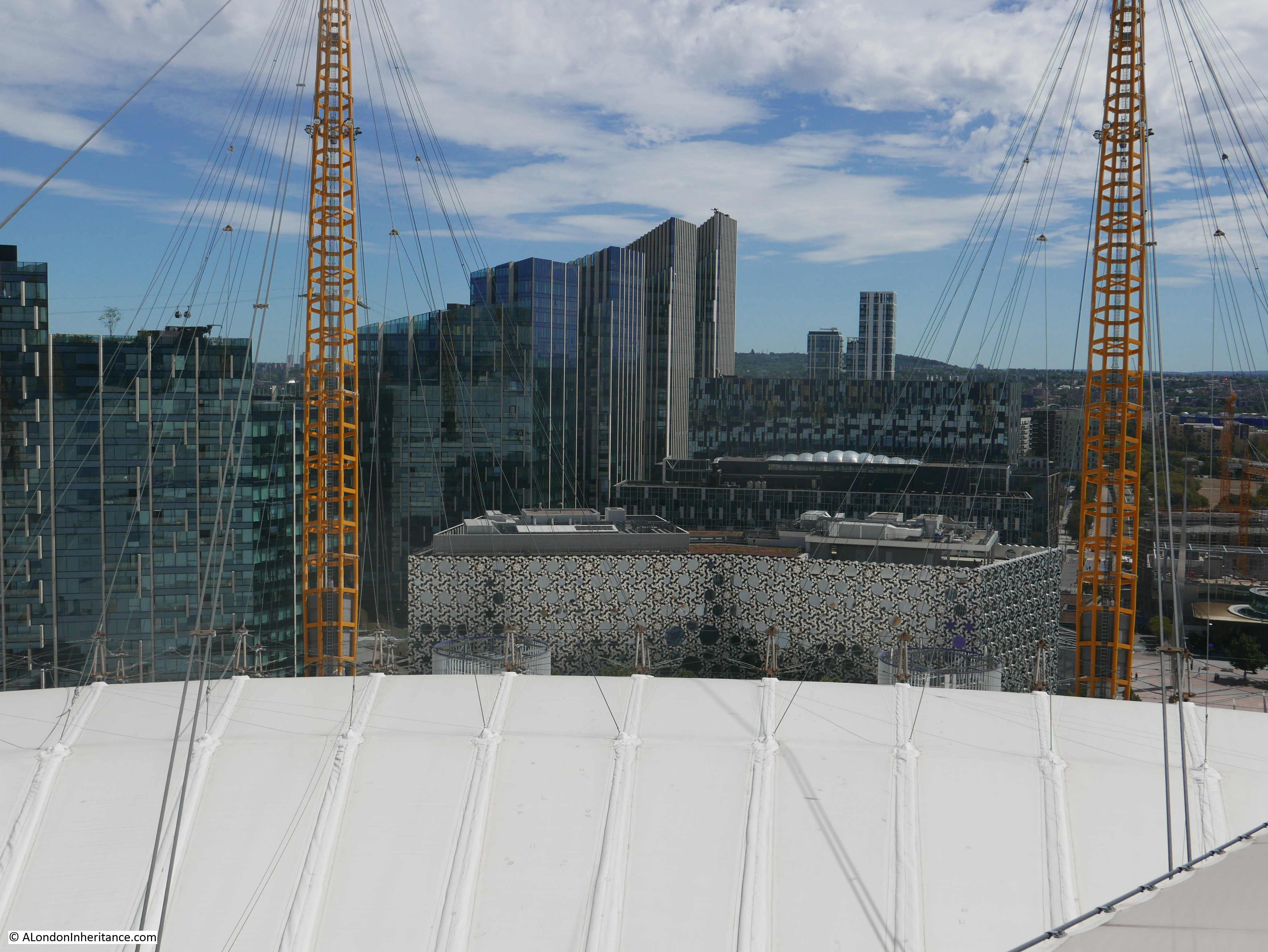
A few weeks ago at the start of August, I walked up to the top of the O2 / Millennium Dome. It was my second walk to the top, the first visit had been brought for me as a present a couple of years ago, and this second visit was to take my 12 year old granddaughter as it was something she has wanted to do for some time, and with the reopening of the site, it seemed the ideal time to visit.
I will also take any opportunity to walk up to a high point, as these provide the perfect location to get a different perspective of London, which is sometimes difficult from street level.
This is not a blog that focuses on commercial / tourist experiences, so I will not be covering these aspects, just what can be seen from the top, and what it tells us about the way the city is changing. There is significant change to be seen as the Greenwich Peninsula is in the process of having almost all of its industrial history demolished.
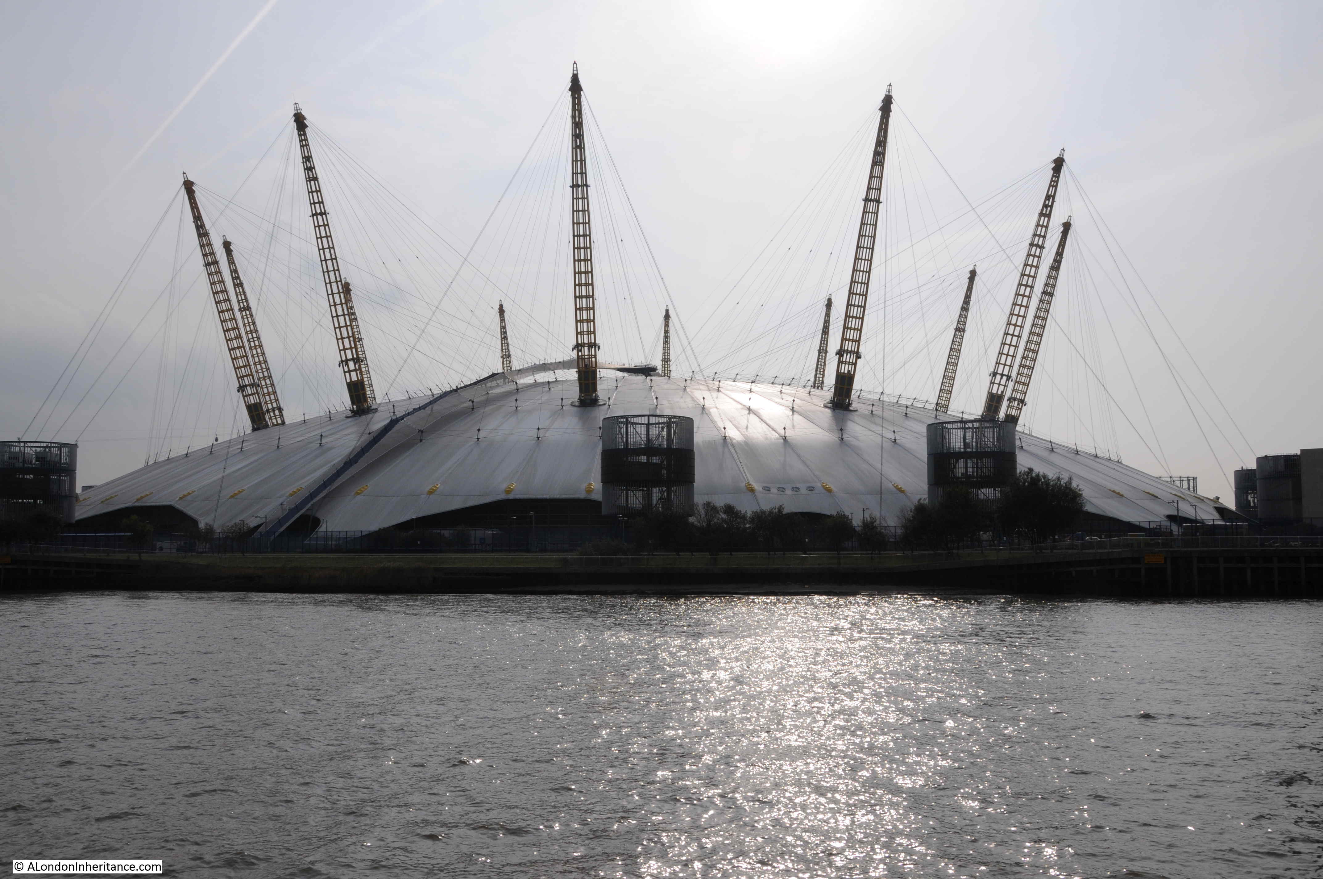
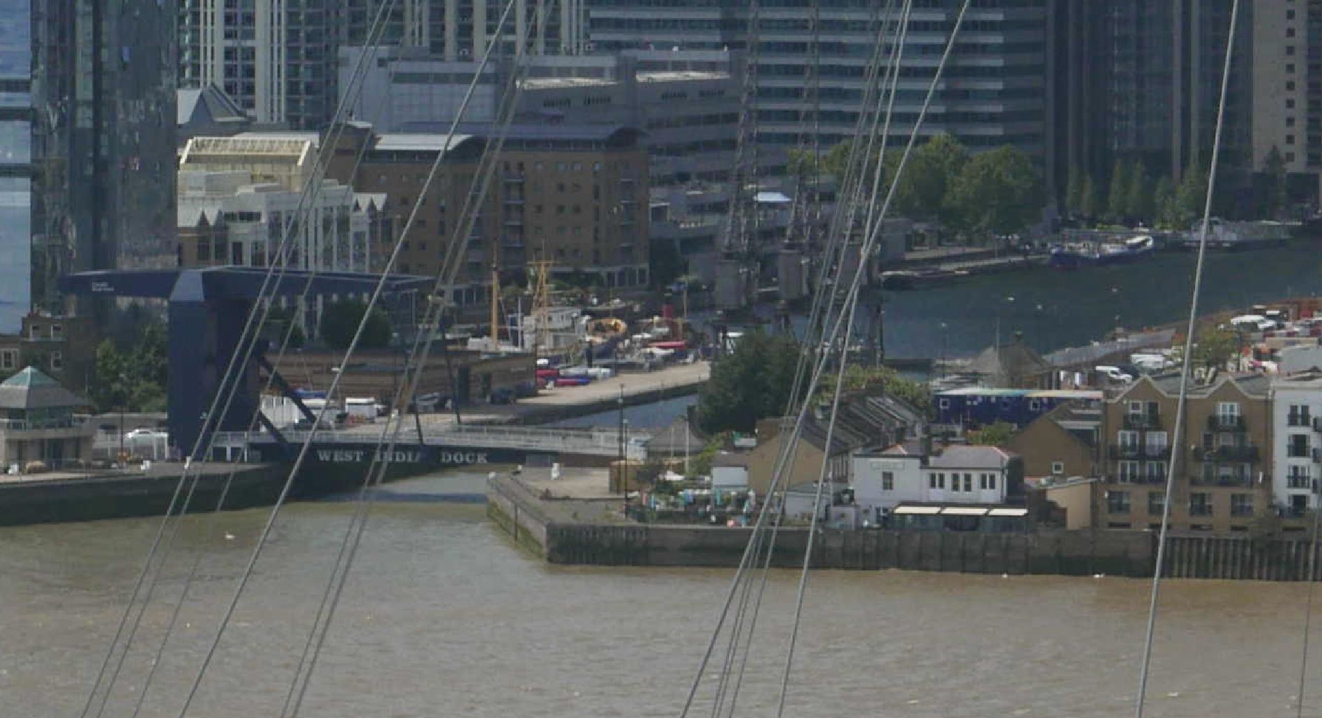
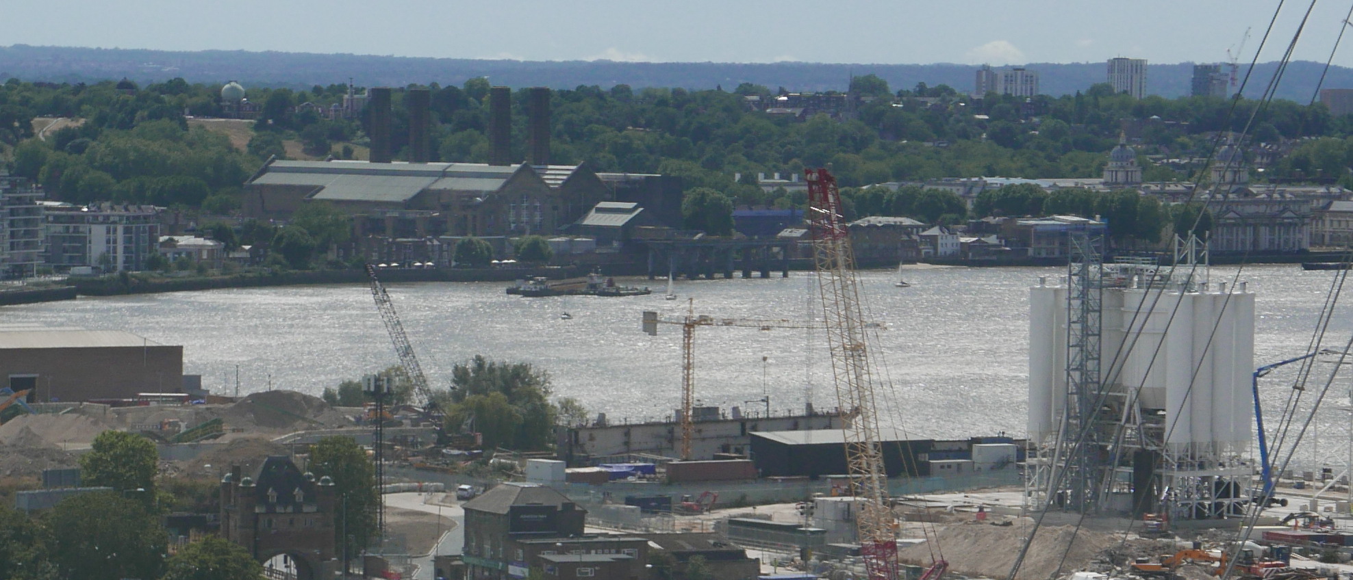
The O2 Dome photographed from the river a couple of years ago. The walkway to the top can be seen, suspended above the material of the roof of the dome.
The weather on our visit was really good. Perhaps a bit too warm for such a climb, but the views from the top were worth the effort. The following photo is looking roughly north east, across the River Thames. An area of water can be seen. This was the Royal Victoria Docks.
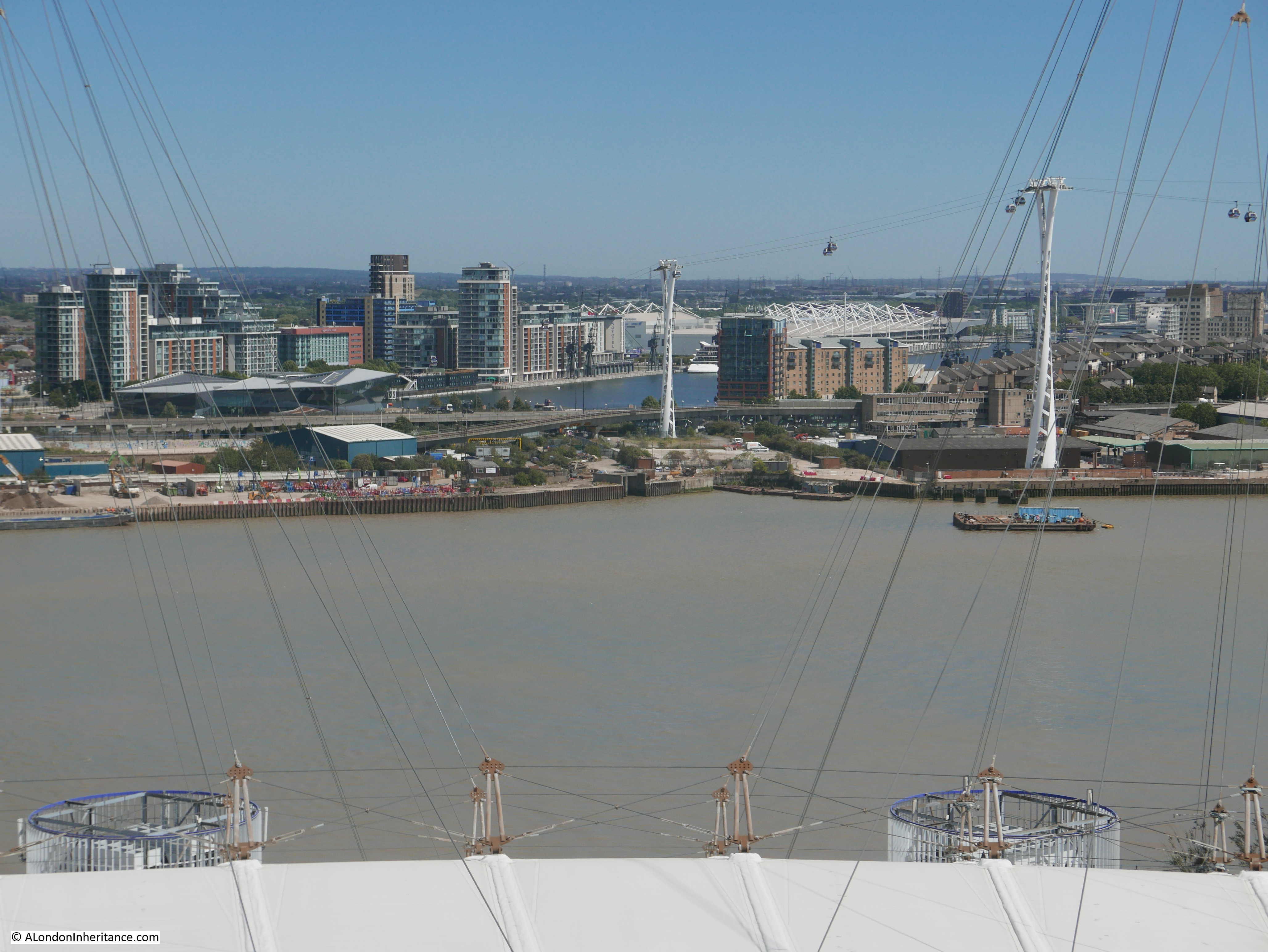
On the far right of the photo can just be seen the old Millennium Mills building. The building with what appears to be white scaffolding along the roof line is the Excel exhibition centre, the location of the London Nightingale Hospital.
Two of the towers carrying the cable car across the river can be seen, and to the left of the water of the Royal Victoria Docks is a low, angular building with glass sides. This is the Crystal, a building which may play an important part in the future life of the city.
The Crystal was built in 2012 by the German engineering company Siemens. It was intended to be a location for some of the company’s staff, as well as being an exhibition centre and demonstration capability on the technology that would drive future cities.
The Crystal was designed and constructed to show how future buildings could be environmentally friendly and sustainable, and use recycled rain water to drinking water, used heat pumps to draw heat from the environment to heat the building in winter and cool the building in summer. Building management technologies, and sensor systems to adjust the building’s environment to the number of visitors.
Unfortunately, the building did not attract the number of visitors expected, so the original exhibitions closed, and the building is now owned by the Great London Authority and used as an events and exhibition space.
City Hall on the south bank of the Thames, just to the west of Tower bridge is the current base of the Mayor of London, and the “head office” of the Greater London Authority (GLA). The building is leased and currently costs the GLA £11.1 million a year in rental costs. The GLA can exit the lease in 2021, and the Mayor has proposed a move to the Crystal building as this is already owned by the GLA and will make substantial savings of rental costs.
Whilst I can understand the reasons, and the financial benefits make absolute sense, it does seem a shame that the symbolic location of the GLA will relocate from a prime position in central London, to a location that will only really be seen by those working at the GLA, or visiting exhibitions at the Excel.
Turning a bit further round to the north, and we can see the entrance to Bow Creek.

Bow Creek is where the River Lea runs into the River Thames. The Lea is a significant river and runs through Bedfordshire and Hertfordshore before reaching greater London, through numerous twists and turns, diversions and reservoirs. Water from the River Lea was taken to feed into the New River when additional capacity was needed over and above that available from the original springs.
To the left of the point where the Lea meets the Thames is a small brick building, with a rather unusual structure on the end. This is London’s only Lighthouse.
Built between 1864 and 1866, it was not that sailors on the river needed a visible navigation sign to find the entrance to the Lea in thick river fog, it was built as a place to test out lighting systems and measure their effectiveness and efficiency, so that the best systems could be installed in the lighthouses around the coast of the country.
The lighthouse is at Trinity Buoy Wharf. Now used for weddings, office space and a rather nice cafe after a long walk. The site was owned by Trinity House and as well as testing equipment at the lighthouse, the area was used for the storage and maintenance of buoys and navigation markers that were used in the waters under the responsibility of Trinity House.
It would have been fascinating to see a light from the lighthouse sweeping the dark, misty waters of the Thames when tests were underway.
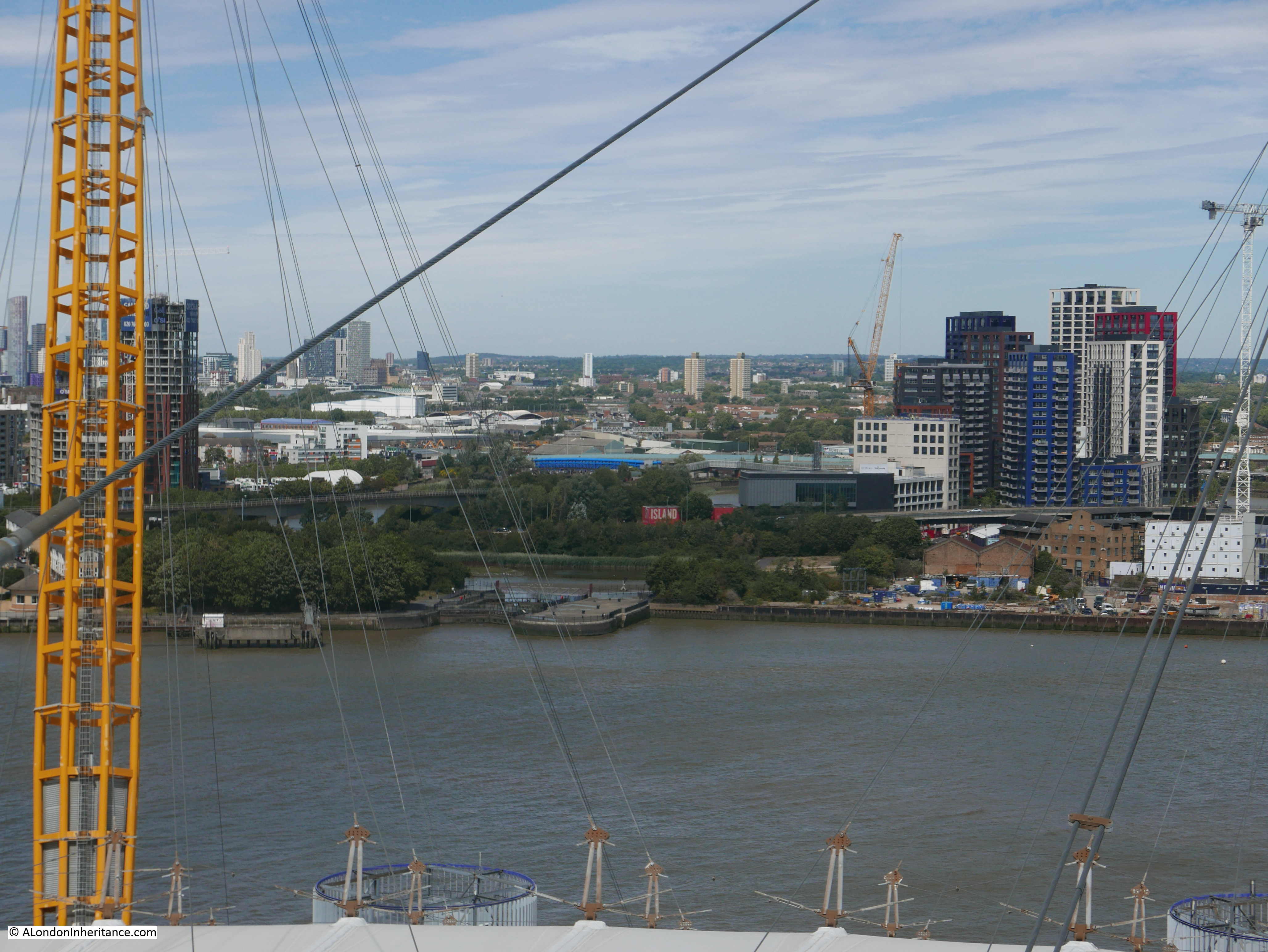
Now looking to the north and we can see a cluster of different coloured towers.
These apartment towers form City Island, a recent development that sits on the small peninsula of land in one of the meanders of the Bow Creek. The following map extract shows the area where the apartment blocks have been built, with the River Lea / Bow Creek passing on three sides (Map © OpenStreetMap contributors).
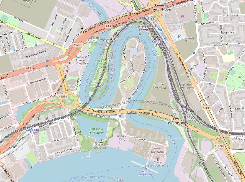
A location map at the entrance to City Island shows how the buildings have been packed into this small area of land. Note the thick red line at the top of the map.
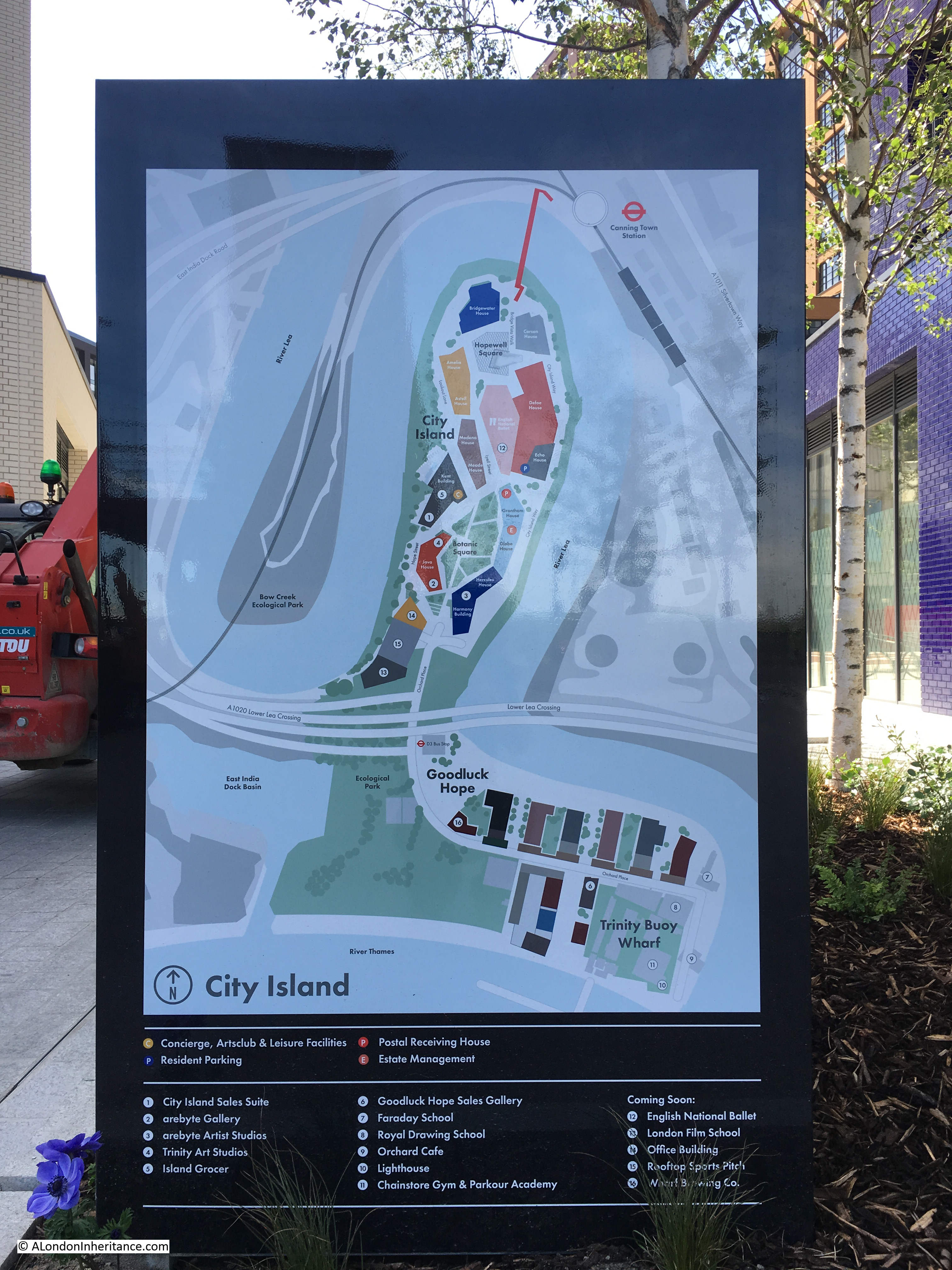
The shape of the peninsula and the lack of access apart from the roads to the south meant that those living at City Island had very limited public transport options, so a foot bridge was constructed at the northern end of the peninsula (the thick red line) to connect City Island to Canning Town Station.
The view from the northern end of the footbridge looking into City Island.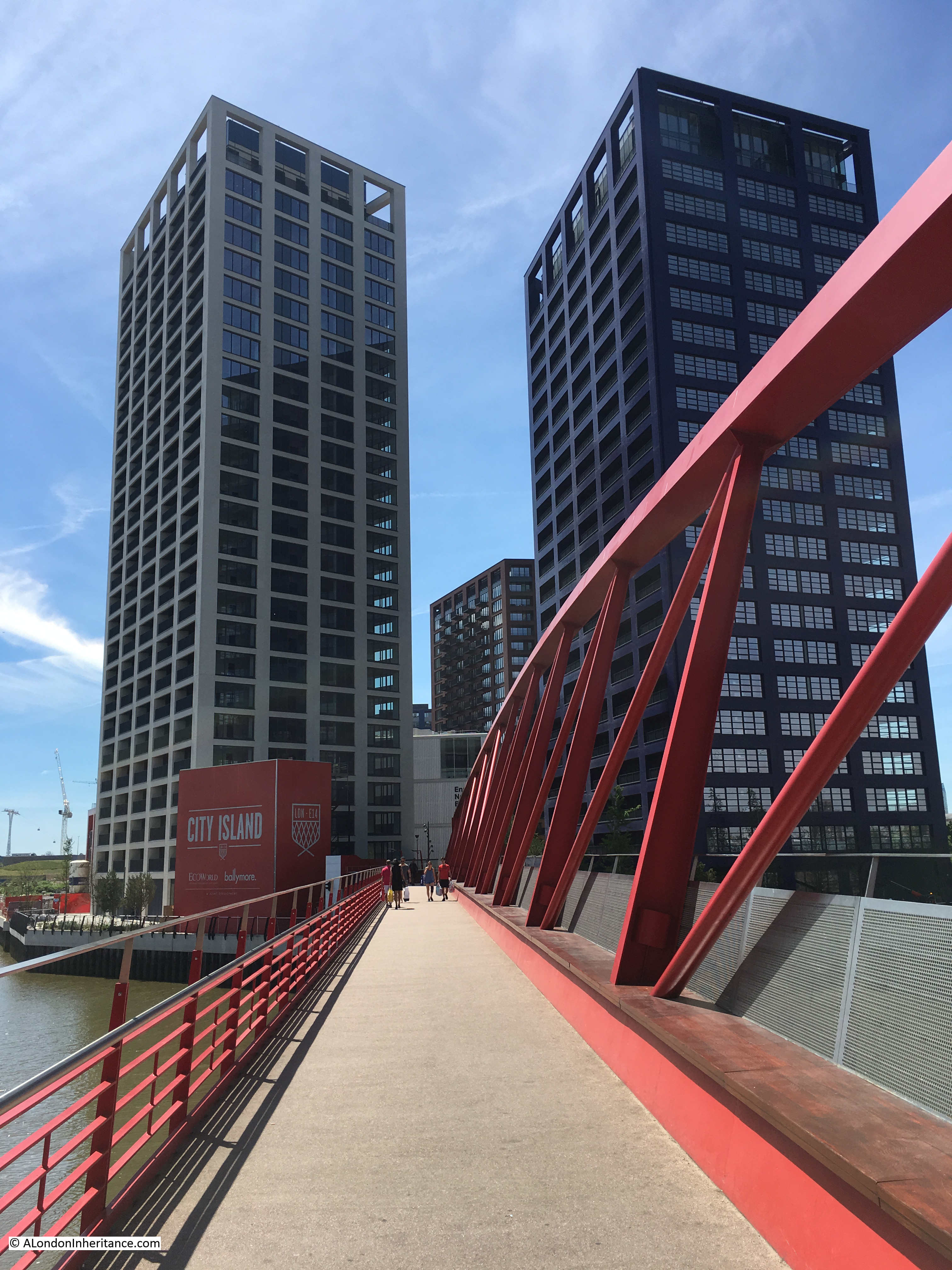
Slightly to the west of City Island, there is an old locked entrance to the river with a small patch of water behind.
This is all that remains of the East India Dock complex. The section that remains is the basin between the river and main docks, which are now filled in and built over.
I find it interesting that the buildings that now occupy the old East India Docks are today some of the largest Data Centres, supporting major Internet hubs. From places that once moved physical goods, the same space is now being used for one of the 21st century’s most important commodities – data.
Just to the west there are two buildings with solid lines down their facade, and to their left another building with a broken line running down the balconies, all giving the impression of a vertical line facing Greenwich.

These three towers form the Elektron Buildings. The individual names of the towers from left to right are the Elektron Tower, Neutron Tower and the Photon Tower. The towers were built on the southern part of the old Brunswick Wharf Generating Station, and the names of the towers are meant to reflect this electrical history.
The broken brown line running up the balconies of the tower on the left is meant to show the route of the Greenwich Meridian, however the tower is offset a couple of metres to the west, so the prime meridian defined by Sir George Airy in 1851 passes just to the east of the block. This is probably fortunate (or possibly planned) for the tenants as when the meridian laser shines from Greenwich to mark the route of the meridian, it passes just to the east of the tower. If the tower has not been in its current position, it would have blocked the laser.
Just to the right of the right tower of the three, the ArcelorMittal Orbit at Stratford can be seen , along with (to the right), the towers that are springing up around Stratford.
Moving further to the west and there is a building in the centre of the following view with satellite dishes on the roof.
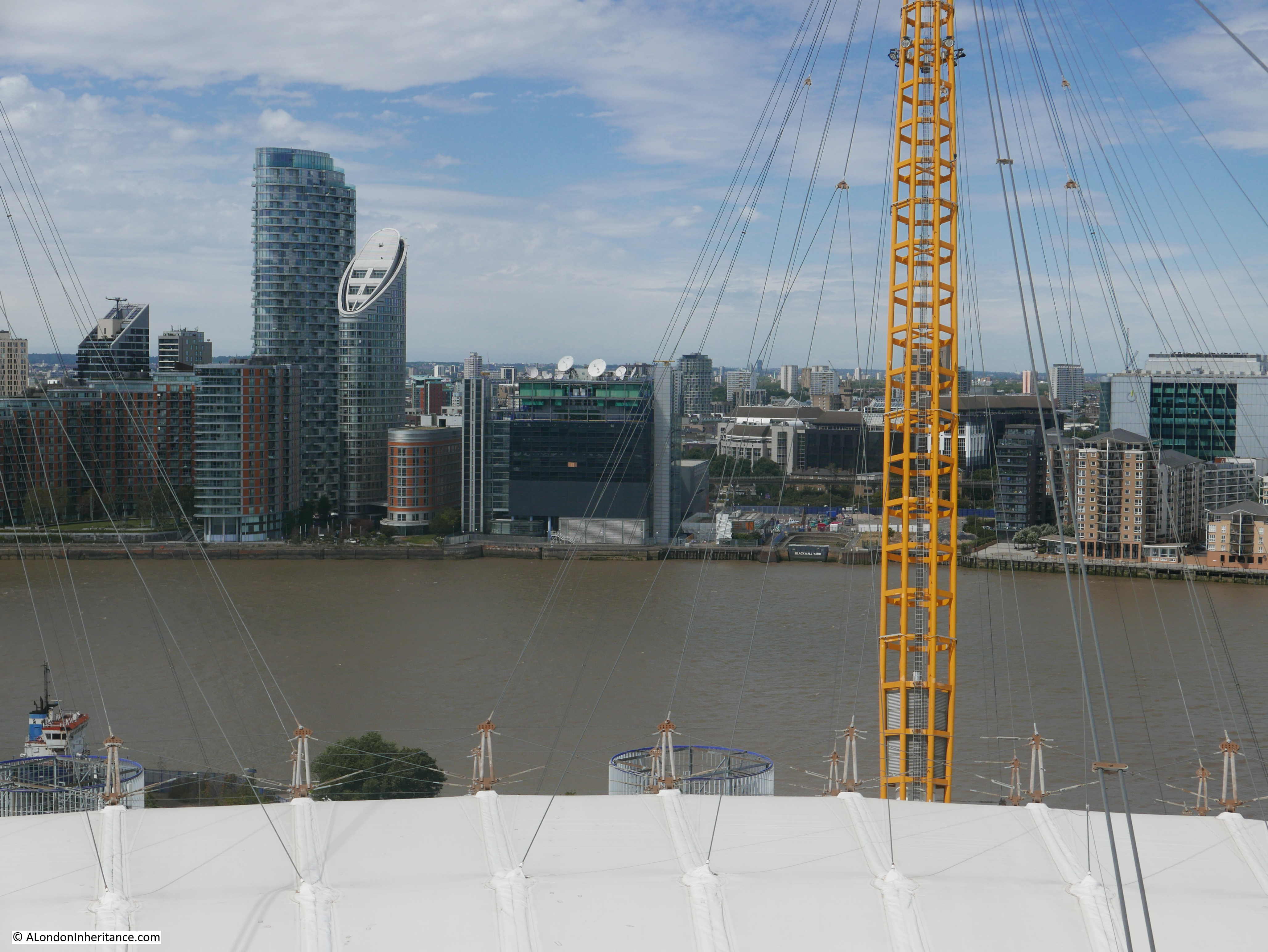
I had a meeting in this building in the early 1990s. It was almost the only building here, and was surrounded by an expanse of derelict buildings, and spaces in the process of being cleared.
But again, there are reminders of the old industries that once lined the river here. In the following extract from the above photo, look to the right of the photo and there is an entrance from the river with Blackwall Yard written on the river facing side.
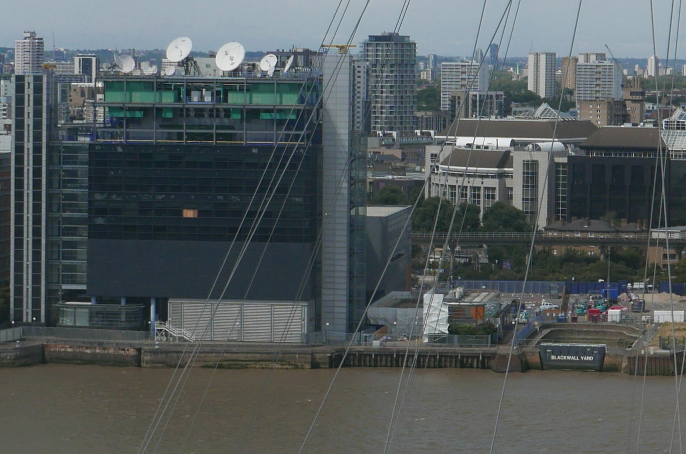
This was part of the Graving Dock on the right of the cluster of docks and launching sites in the centre of the following extract from the 1893 Ordnance Survey map (‘Reproduced with the permission of the National Library of Scotland’).
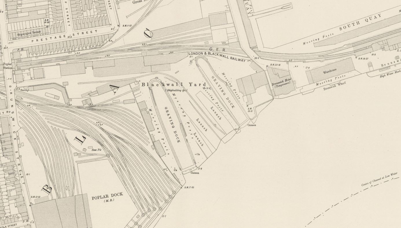
Surprising that this small part of what was once a complex web of docks, railways and warehouses survives.
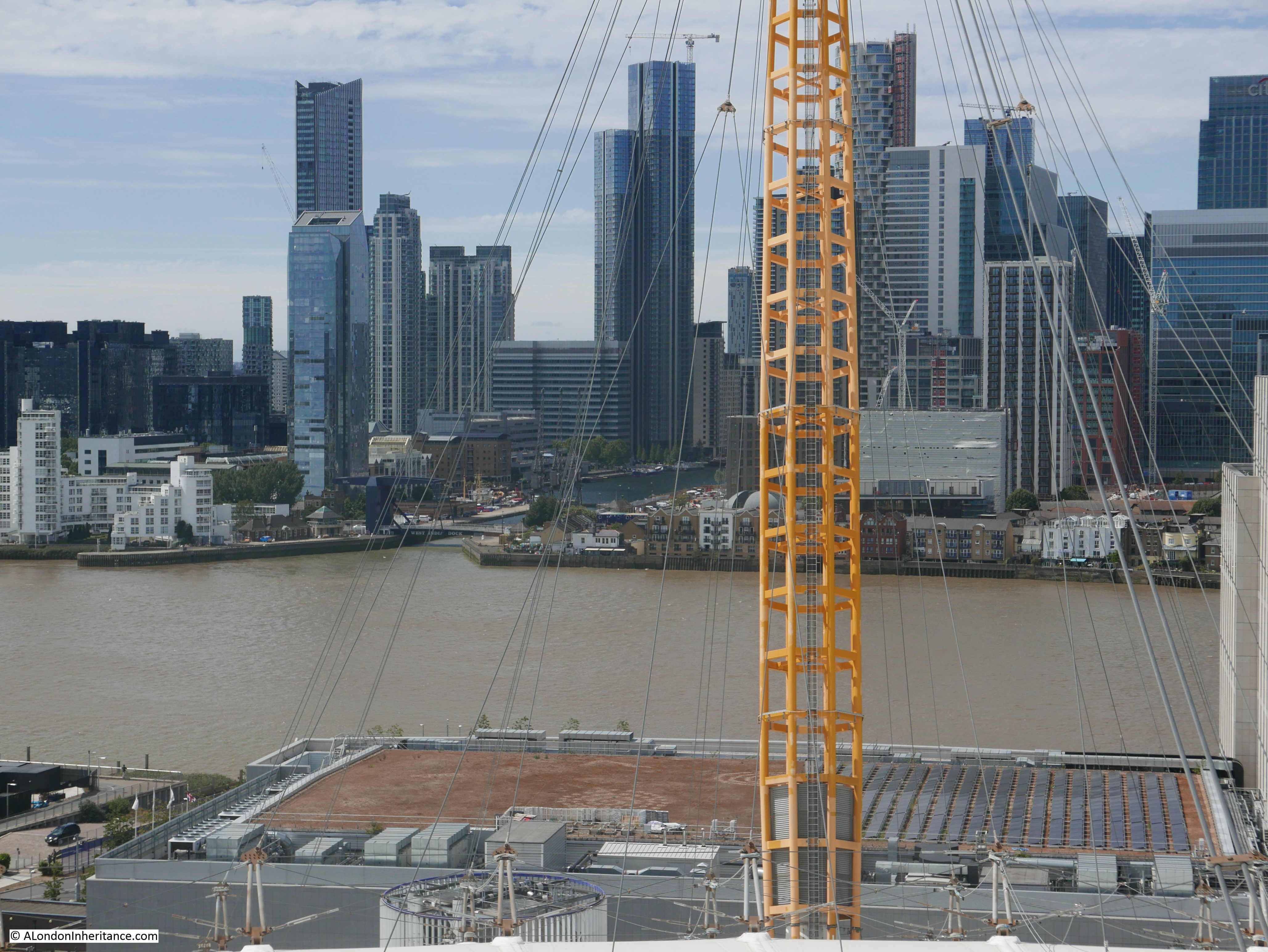
Continuing towards the west, and the tower blocks that form the Canary Wharf complex come into view, however tower block development along the edge of the Greenwich Peninsula is starting to block the view across the river.

Slightly further to the west and we can see the entrance to what was the South Dock on the Isle of Dogs.
An enlargement from the above photo showing the dock entrance. The first white building to the right of the entrance is the Gun pub.
The view is now turning to the south west, and on the western edge of the Greenwich Peninsula is one of those strange oddities that were built here when I suspect someone was trying to find how to make money out of all the empty space. The green space is the Greenwich Peninsula Golf Range.
In the lower right hand corner, the upturned electricity pylon created by Alex Chinneck as an artwork for the 2015 London Design Festival, can be seen.
In the far distance, the TV and Radio mast at Crystal Palace can just be seen. Getting up this high also shows why the mast was placed at Crystal Palace. As well as being a site with the space for a mast, it is already a high point overlooking much of the lower land of greater London.
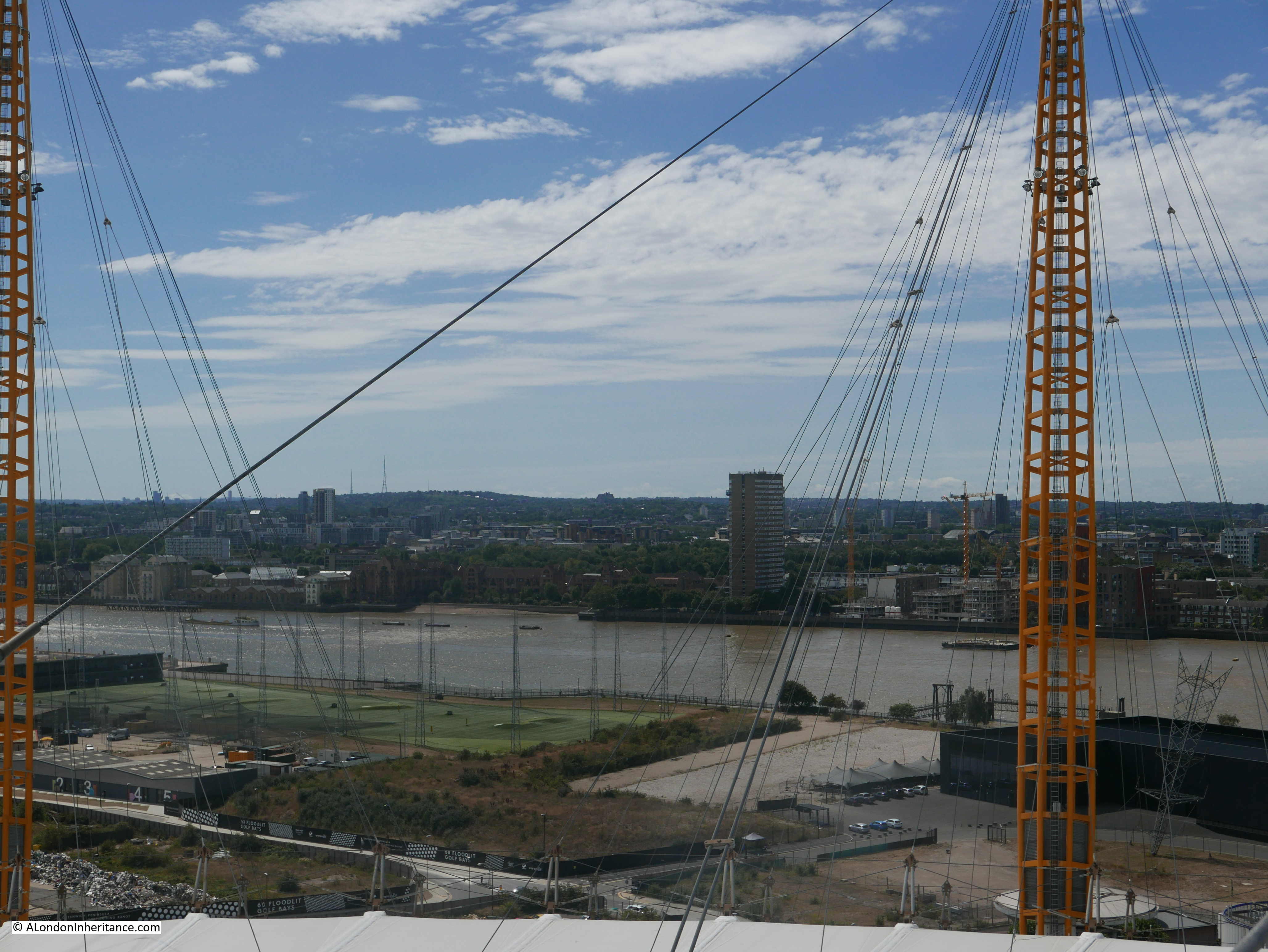
Looking further south, and we can see where the river turns to pass the southern tip of the Isle of Dogs.
To the left of the golf driving range is yet another large building site with the next part of the peninsula’s transformation about to be constructed.
Although there are already many new tower blocks here, the Greenwich Peninsula is only at the start of a transformation which will significantly change the above view, and indeed nearly all the views from the O2.
The Greenwich Peninsula Masterplan shows the developments planned for the area, with a dense cluster of towers transforming the area beyond all recognition.
The view below is looking to the south. Much of the area closest to the dome is covered with car parking space, used for the big events at the dome, however compare with the Greenwich Peninsula Masterplan and this view will look very different.
The above view also shows how the industrial history of the Greenwich Peninsula is continuing to be demolished. The photo below is an extract of the above photo and shows nothing remarkable.
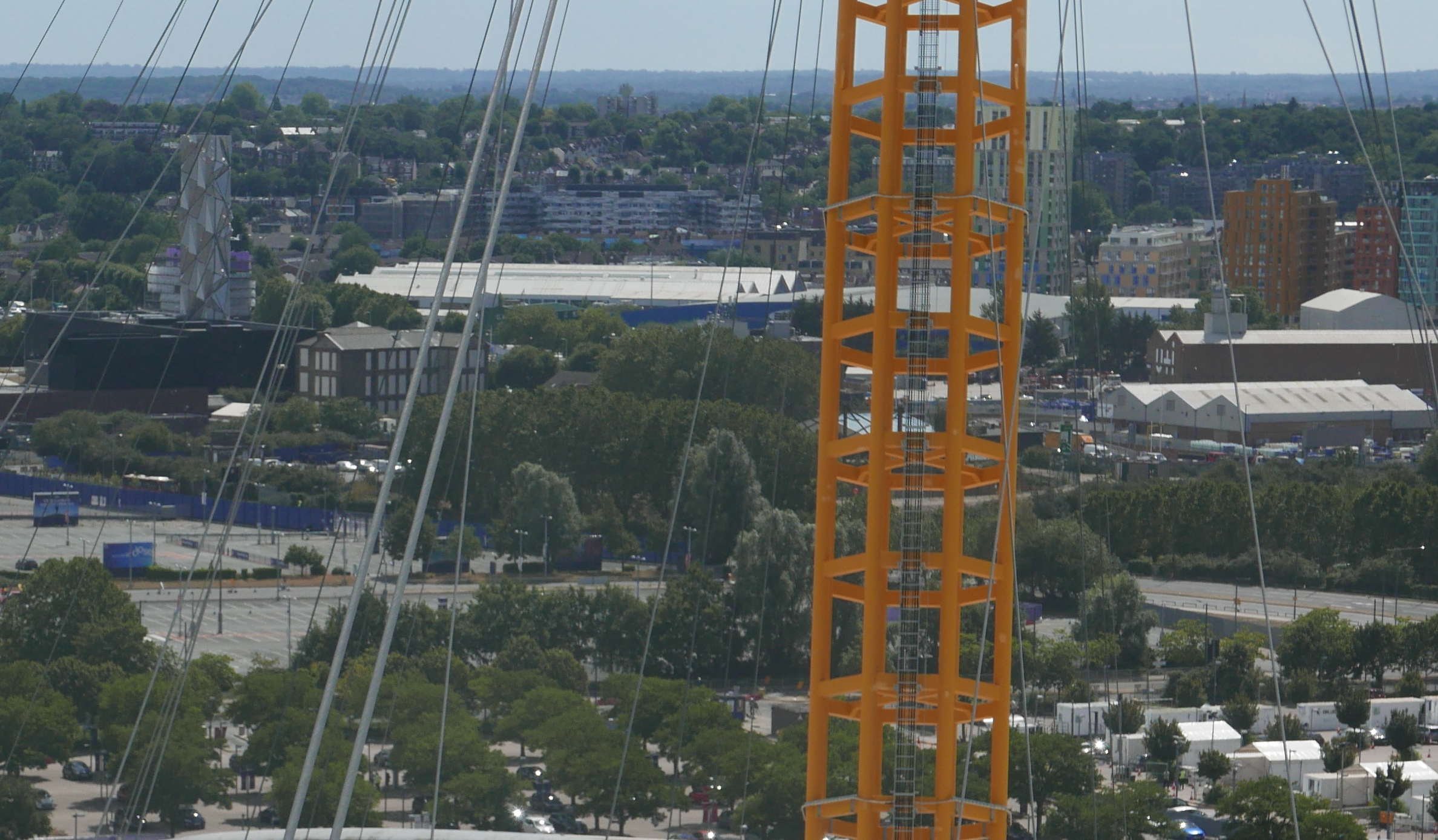
My first climb up the dome was a few years ago (family present) and in the following photo showing roughly the same view is the outer framework of large gasholder.

The gas holder was demolished earlier this year and was originally one of a pair dating from the late 1880s / early 1890s. The gas holder in the above photo is number 1. The larger number 2 gas holder was demolished in 1985 and will be the site for the Silvertown Tunnel workings and entrance, with construction expected to start this year with completion around 2025.
The Silvertown Tunnel is another of the construction projects that will be transforming the Greenwich Peninsula. The tunnel is being financed through a Private Finance Initiative (PFI) model. When open, a toll will be charged for using either the Blackwall or the Silvertown Tunnels which will be used to pay the PFI charges. The tunnel developers take the risk with construction costs, however Transport for London take the risk with usage and whether this will be sufficient to cover the PFI costs.
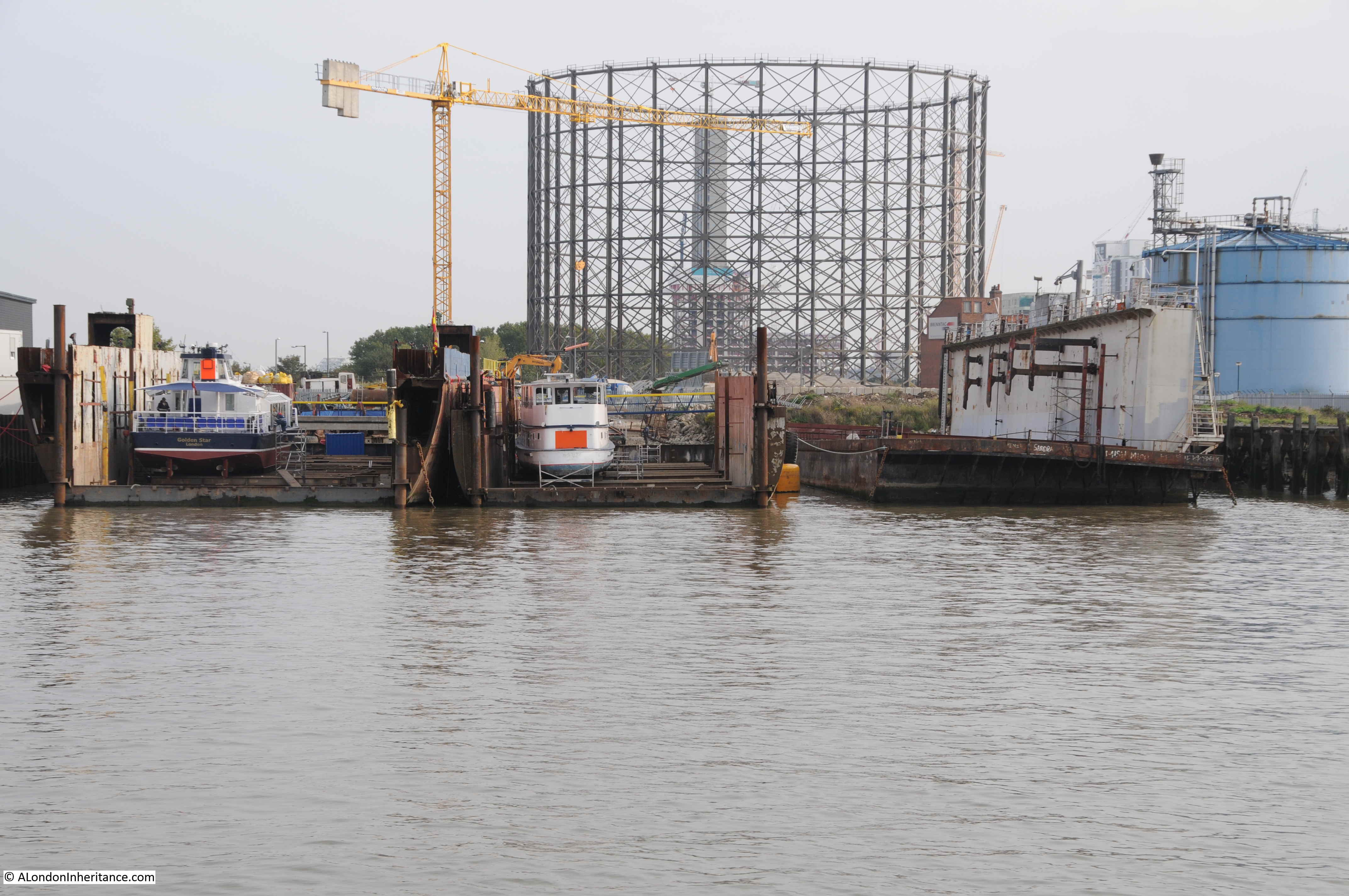
in 2015 I photographed the gas holder from the river. In the foreground were dry docks for the Thames tourist boats. These will also, or perhaps already have gone.
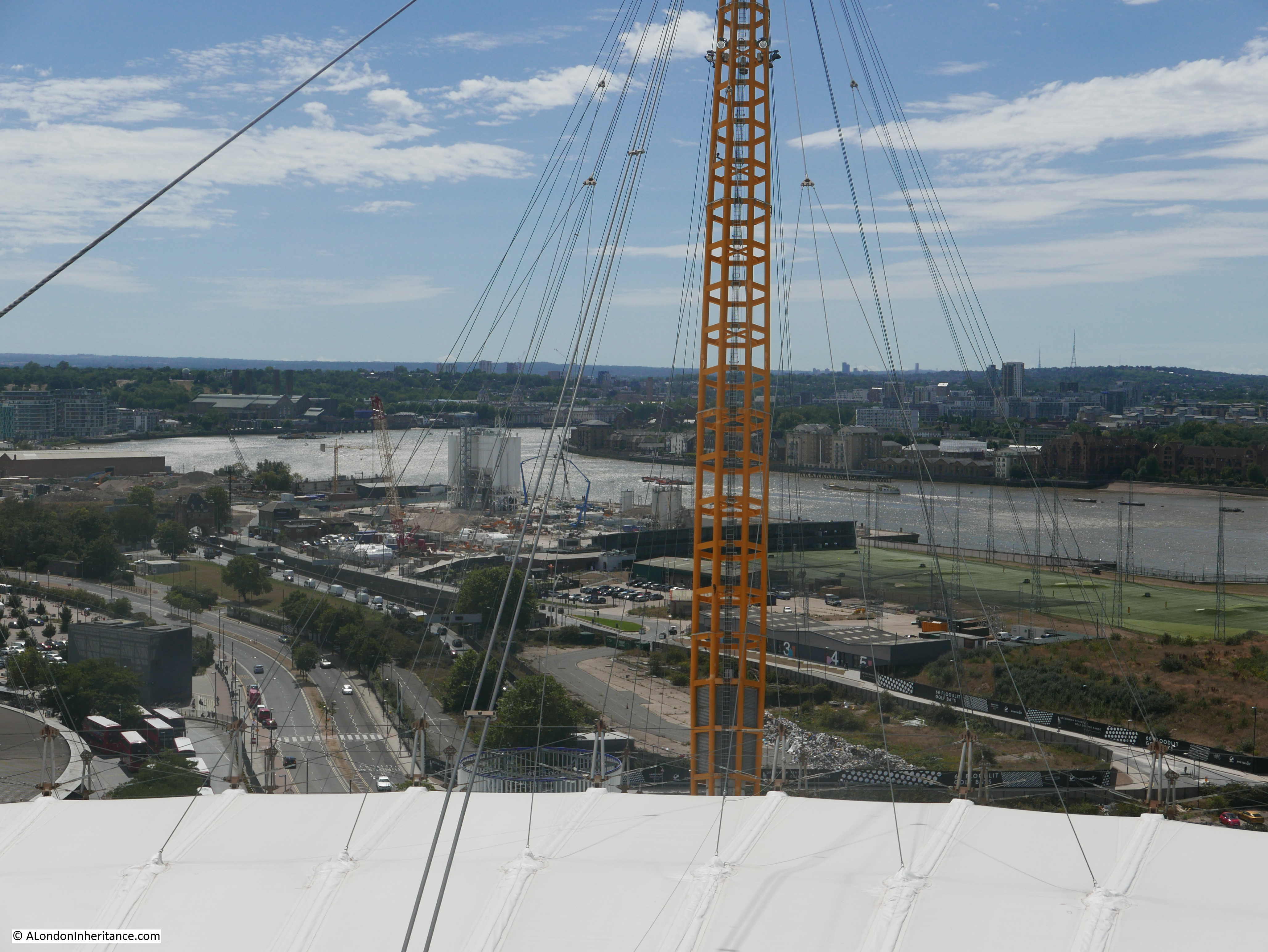
Still looking to the south, and there are several features in the following photo:
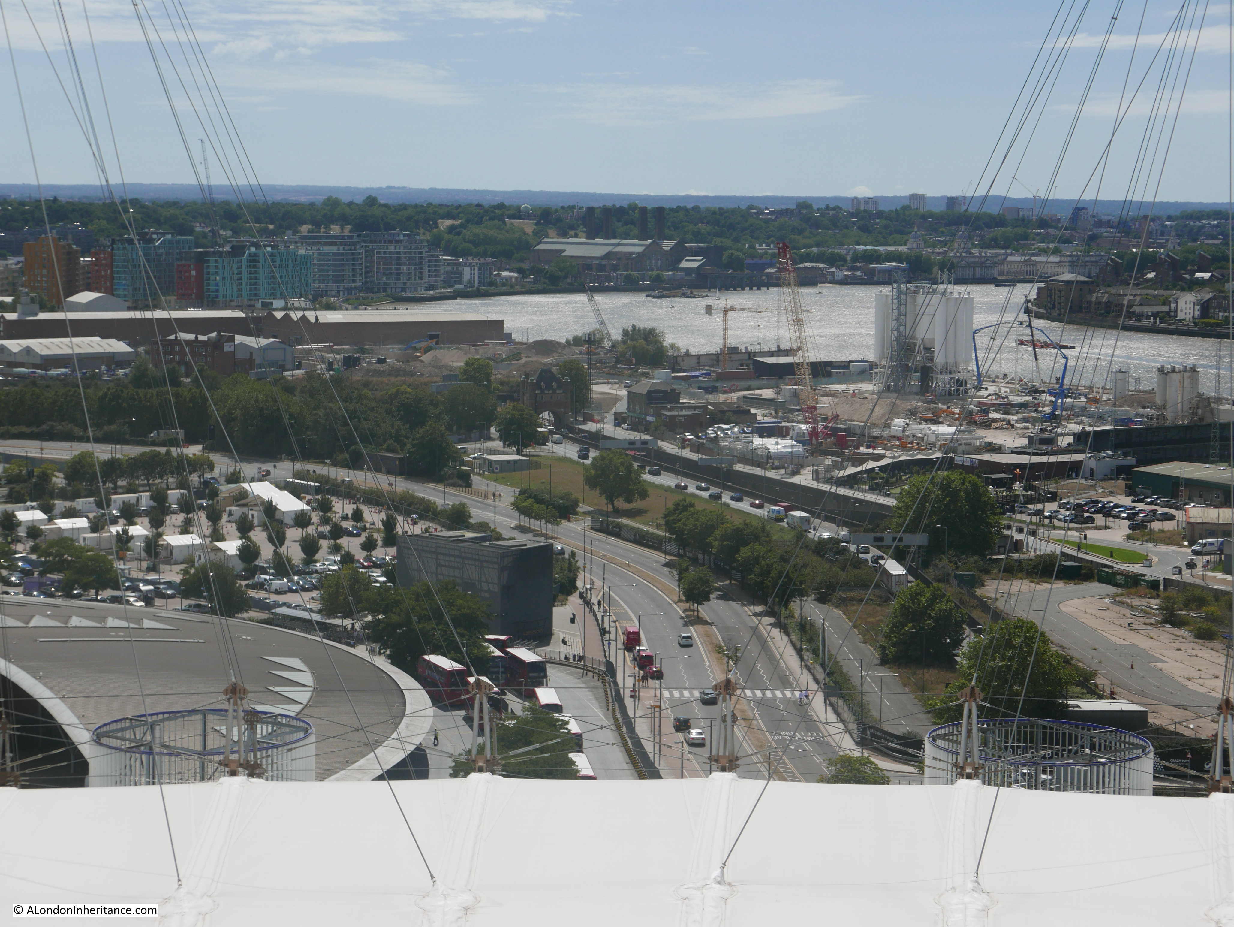
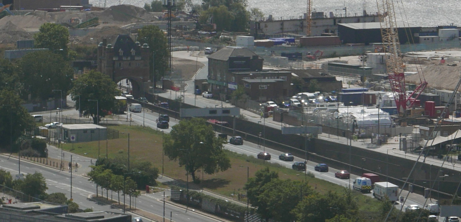
In the middle of the photo is the entrance arch to the Blackwall Tunnel. This can be seen in the following extract from the above photo:
And in the distance (see photo below) we can see Greenwich Power Station, used by TfL to provide backup power to the Underground network. On the hill behind the power station, the Royal Observatory can just be seen, and on the right of the photo, the towers of the old Royal Naval College.
These sights will be disappearing from the top of the O2 Dome as the towers planned for the western edge of the peninsula are built.
The eastern edge of the peninsula perhaps provides some indication of what the western edge will look like in the years to come. Development along the eastern edge has already progressed and now consists of multiple apartment towers of differing designs.
The Greenwich Peninsula is a great place to watch the eastwards march of development along the Thames.
The peninsula will soon be a completely different place if all the proposed towers and associated buildings are built. There will be very little evidence of the peninsula’s industrial past, and what remains, such as the Pilot pub, will be very out of place.
My granddaughter really enjoyed the climb of the O2 Dome, and the views of London from the top. Hopefully she will be back at some point in the future to compare the view then, with her photos taken in August 2020.
For further information on the Greenwich Peninsula I can recommend the Greenwich Industrial History Society, and any of the books and articles by Mary Mills. “Greenwich Marsh – The 300 years before the Dome” provides a fascinating account of the history of the place.
Thank you as usual for such an interesting piece. A collection of photographs that would mean almost nothing to me without your descriptions and explanations. It will be fascinating to see how the future development of London (and other cities) may be affected by the working from home imposed by the pandemic and the discovery by many that the expense and stresses of commuting can be avoided or mitigated, resulting in much less need for office space, and perhaps also for all these blocks of flats.
Thanks for another fascinating article. A lot of family history of the Peninsula as my father worked as a gas engineer on the site from 1969 to the mid 80s by which time production had stopped (due to North Sea gas) and he was one of fewer than 20 employees on site. He was also on the news when the IRA tried to destroy a gas holder in the late 70s.
Fond memories of the employees sports and social club (Metrogas) where IKEA now stands and their annual family jamboree. We also used to have impromptu driving lessons on the site in the 80s as it was private land and so much space. Also huge employee allotments and towards the end, as so few employees were left, I think my dad had about 6 allotments and so magnificent bounties of onions, potatoes and rhubarb which we helped harvest. Finally, remember us kids waving to the Royal Yacht Britannia from the foreshore as she sailed up the Thames and pretty sure the Queen Mother was waving.
Such an awful shame that the last gas holder could not be saved and now unable to say to our kids whenever we drive past, that’s where your grandad worked and he was even on the News!
I used to work at Blackwall Yard till it closed in 1983.
Thank you. What a treat to read this.
Thank you for bringing to light my ancestors and my own memories. The Gun pub…ancestors lived in Lower Gun Alley circa mid 1800`s. In the 1970`s I worked and lived near Crystal Palace and knew the area as it was then.
Your previous comment from Anne makes me wonder like her, if all the flats and offices will be needed once home working is deemed more efficient (no office rents etc to pay) by companies and are the flats destined to be the slums of the future?
A useful overview of what is happening/has happened recently in the area. I never saw Brunswick/Blackwall power station but did see the switchgear house, which remained well into the 1990s and so was part of my semi-regular trips out into docklands when the DLR was extended into the Royals. It was a massive rectangular block built entirely of lovely orange bricks in Modernist style. It would have made an interesting conversion idea but sadly went. It was more than 30 years ago that I first visted the docks, attracted by the redevelopment and clutching both my and my dad’s camera (on loan, with a single precious roll of film)…
May I irrelevantly butt in here, Chris Rogers, to say that coincidentally I’ve just this morning finished reading through your excellent book – How to Read London. (In fact I recall that it was reading some authoritative comments of yours below-the-line on a newspaper article that led me to your publication!).
A small world, this blogosphere, in which ALH is such a valuable and growing resource.
Fascinating as always!
I have a (small) family involvement in the history of this area. Quite apart from his family coming from the East End, in the late 1970s my father was hired by the relevant London boroughs to form the Docklands Development Corporation. Things were just getting under way – he had found premises for the offices and was beginning to gather a team – when the Thatcher government came to power, Heseltine took the whole project out of local government control and my father’s organisation was swept aside to become a mere footnote in the history of the area. I often wonder what he would have thought of subsequent developments…
More about what was there before all the flats and houses from the Greenwich Industrial History Society. The autumn programme starts on Tuesday 13 October (19.30 pm and Dr Mills herself will be giving the talk on Tuesday 10th November. All lectures will be live online, available afterwards as recordings, and free to all, members and non-members.
https://www.tottenhamhotspur.com/the-stadium/visitor-attractions/the-dare-skywalk/
An absolutely fascinating and enjoyable post. It will be a shame that a lot of the views to the east and west may be lost when/if the development is fully completed. The view of what is planned for the peninsular’s future, whilst i guess well intended, gave me a profound sense of “urban claustraphobia” . As others have intimated will the plan survive the potential changes that Covid-19 seem to have accelerated?
An engineer working on the Internet cables in the west end, told me that every e-mail sent to the UK has to go through Wapping.
@James Buchanan – so THAT’s how Murdoch gets his news!
🙂
When I googled ‘Amazon Warehouses in East London’, the map from Tilbury to Leadenhall Street’s results seemed to have a similarity to the heyday of the East India Company of 200 years ago.
Another great read. A very interesting and absorbing history of this area of London.
Marvellous piece with great photos.Photograph number seventeen down shows Kelson House on the far bank on the Isle of Dogs,where we lived in 1980,before all the modern building took place,and I’m guessing it must have been the only council block with its own private beach.Wonderful memories and happy days indeed,Thank you.
A brilliant performance. It would make a good and inspiring geography lesson for locked down pupils.
Highlighted a must do visit to the dome with my grandchildren.
Another fascinating read with some great pictures.
Just to clarify the caption with the view of the upturned electricity pylon, there are two transmitting towers in the distance. The taller one is located on the site of the swimming pool at the former Crystal Palace (and is known as the Crystal Palace transmitting station), the other is at the top of South Norwood Hill (known as the Croydon transmitting station). Both are now owned by Arqiva (a telecommunications infrastructure company located in Crawley, West Sussex).
The taller of the two towers was originally constructed for BBC transmissions, taking over from Alexandra Palace in 1956. Currently, it transmits ITV and BBC television, some BBC and commercial FM radio stations and DAB to London and the South East.
The other tower was constructed for ITV television transmissions on VHF (405 lines). However, when UHF (625 lines) television began, ITV transferred to the Crystal Palace transmitter. The tower is now used only as a back-up for certain Crystal Palace television and radio transmissions.
That photographed building with the satellite dishes on the roof was build as the offices for Reuters back in the late 1980’s; my company provided the curtainwall cladding (exterior skin) for that building, as well as several others in London at that time. I remember trekking out there for jobsite meetings from our offices near London Bridge in Southwark; miserable, muddy effort stat seems to take an eternity just to go a couple miles. And you are right; at the time, it was about the only thing built or being built in the immediate neighborhood. We also did buildings near Canary Wharf, on Bishopsgate Street and in Chelsea Reach. But I recall that this one was the most difficult to get to. It is amazing to see the build up of that same neighborhood today!