
In the summer of 1980, I went for a walk along the South Bank, taking a few photos of the area, and of the extension of the embankment and walkway onward from Waterloo Bridge.
Last Saturday, the weather was perfect and the light ideal for photography. The sun was out and unusually, there was no haze in the sky, so 39 years later I took another walk along the South Bank to photograph the same scenes and consider the changes.
I walked down from Westminster Bridge, straight into the crowds in front of County Hall and through the queues waiting for a ride on the London Eye.
In 1980, this was the view along the South Bank, in front of Jubilee Gardens and looking towards Hungerford Bridge.

The same scene today (I should have been slightly further along, but the space was occupied by a street entertainer and large crowd).
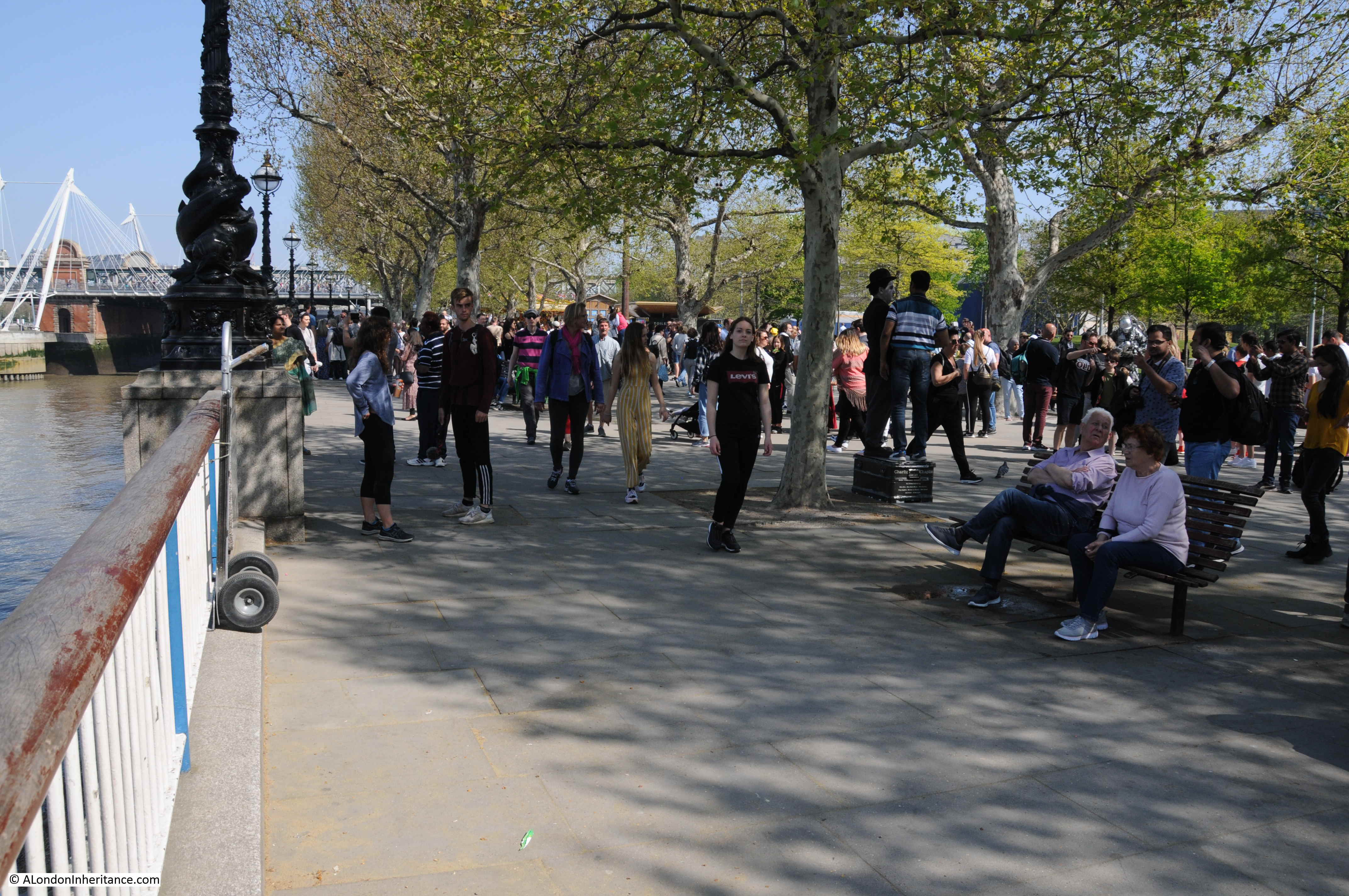
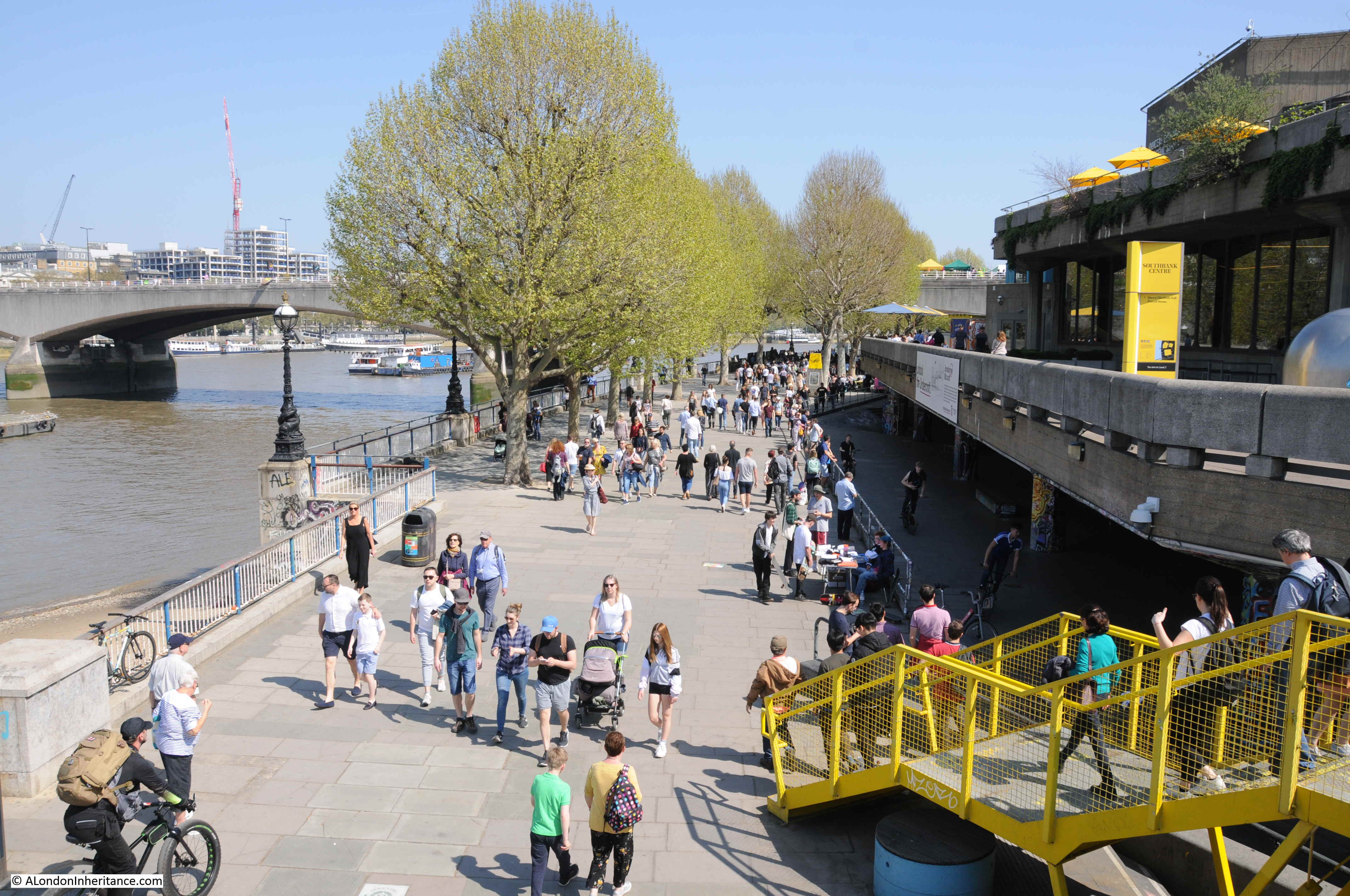
The South Bank today is an extremely busy part of London. The wonderful weather and long Easter weekend added to the crowds, but walk along here nearly any weekend and there are crowds of people walking along the southern bank of the river.
In 2017, the Southbank Centre (the Royal Festival Hall and Queen Elizabeth Hall) was the UK’s seventh most visited attraction with a total of 3.2 million visitors. By 2018, the London Eye had rotated 70 million visitors over the previous 18 years.
It was very different in 1980, as whilst a popular place to walk. County Hall was still the GLC seat of government, not the hotel and site of tourist attractions it is today. The river walk ended at the National Theatre and the London Eye was still many years in the future.
The stretch of the embankment between Westminster Bridge and Waterloo Bridge was part of the development work for the 1951 Festival of Britain which occupied much of this space.
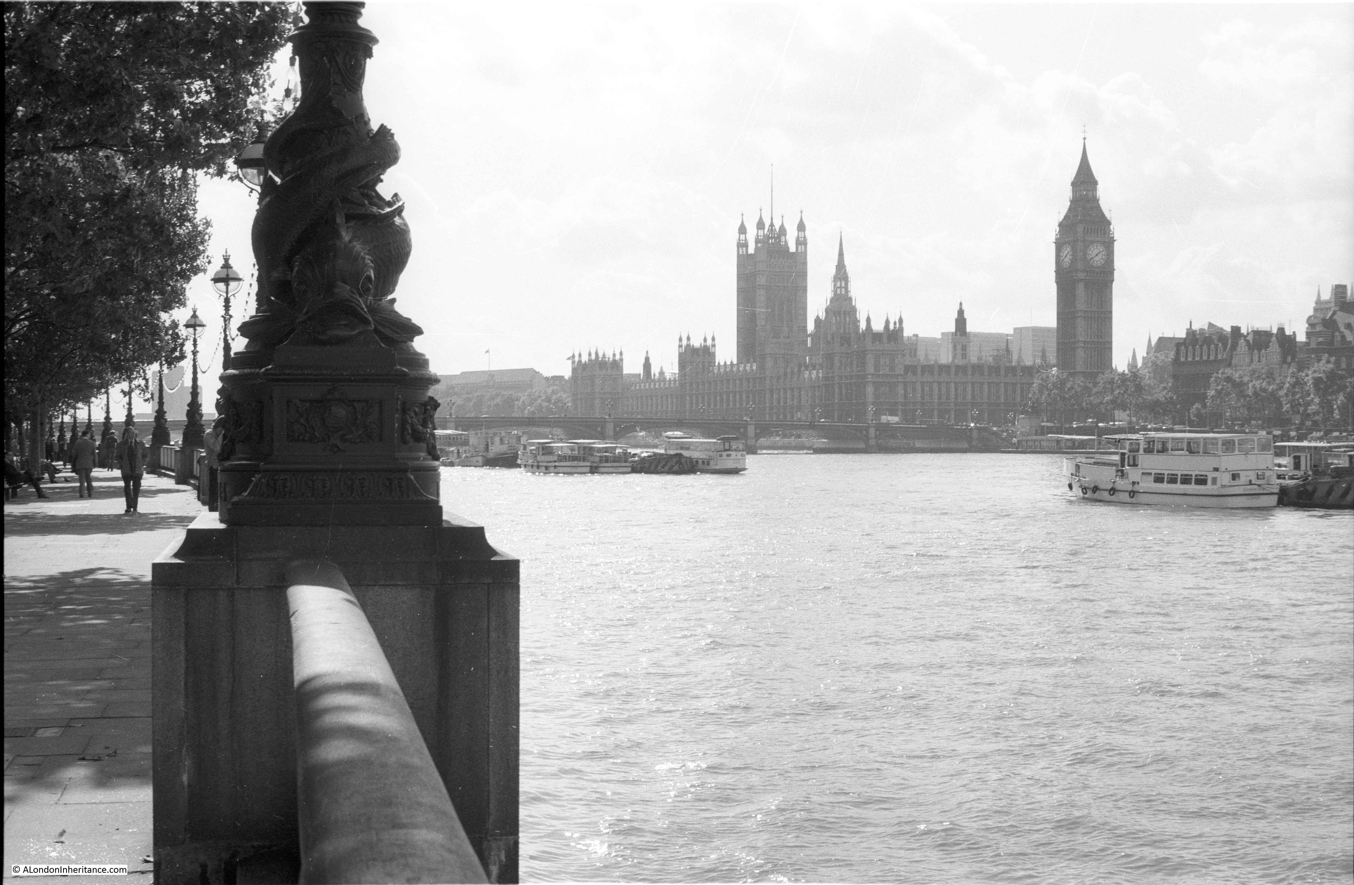
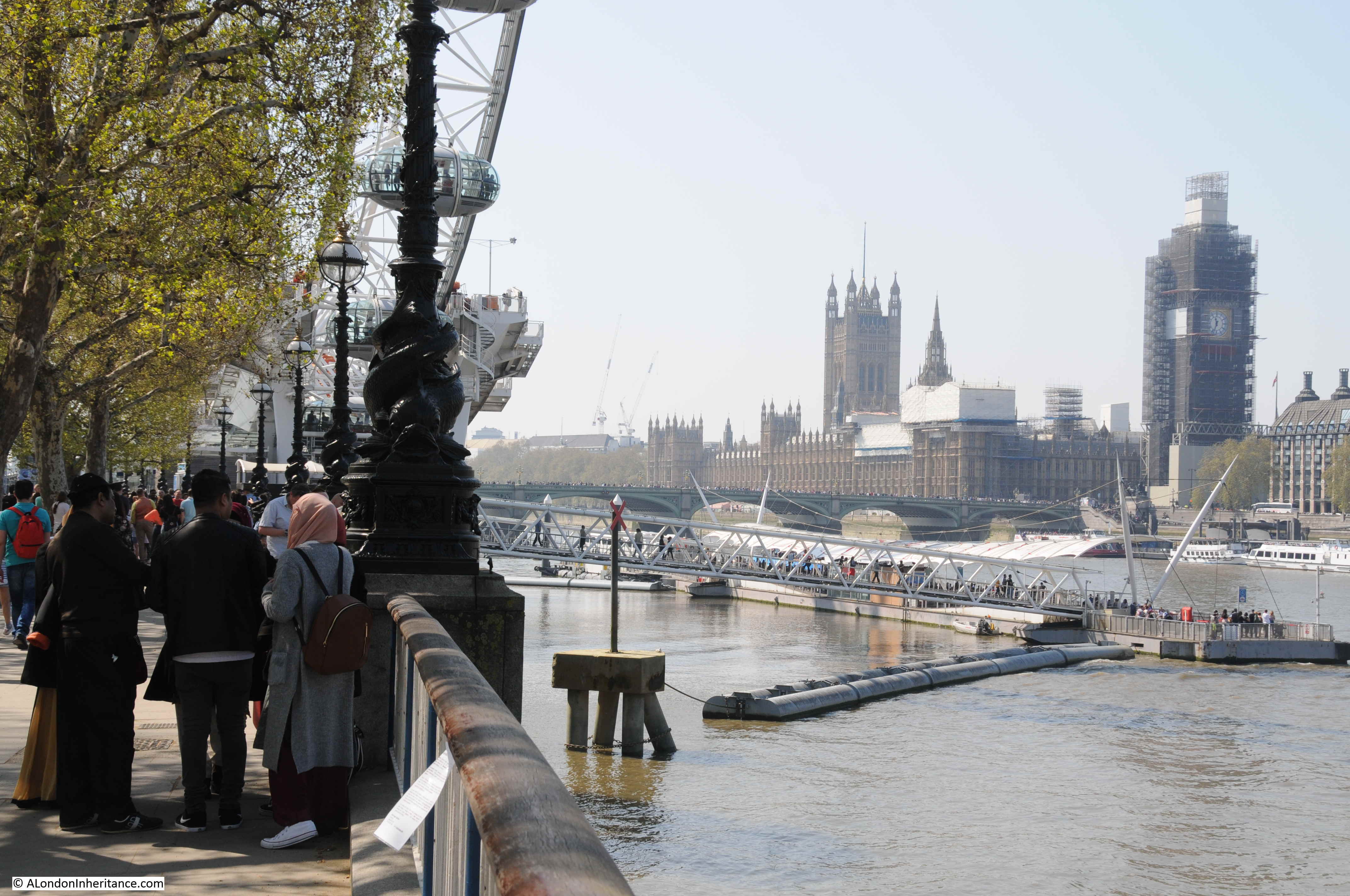
The South Bank does provide some superb views across the rivers, many of these views must have been photographed millions of times by the stream of visitors.
In 1980 I took this photograph of the view across the river to the Palace of Westminster.
The London Eye and the river pier have changed both the views and the numbers of visitors to the South Bank. The same view in 2019.
Looking towards Hungerford Railway Bridge in 1980:
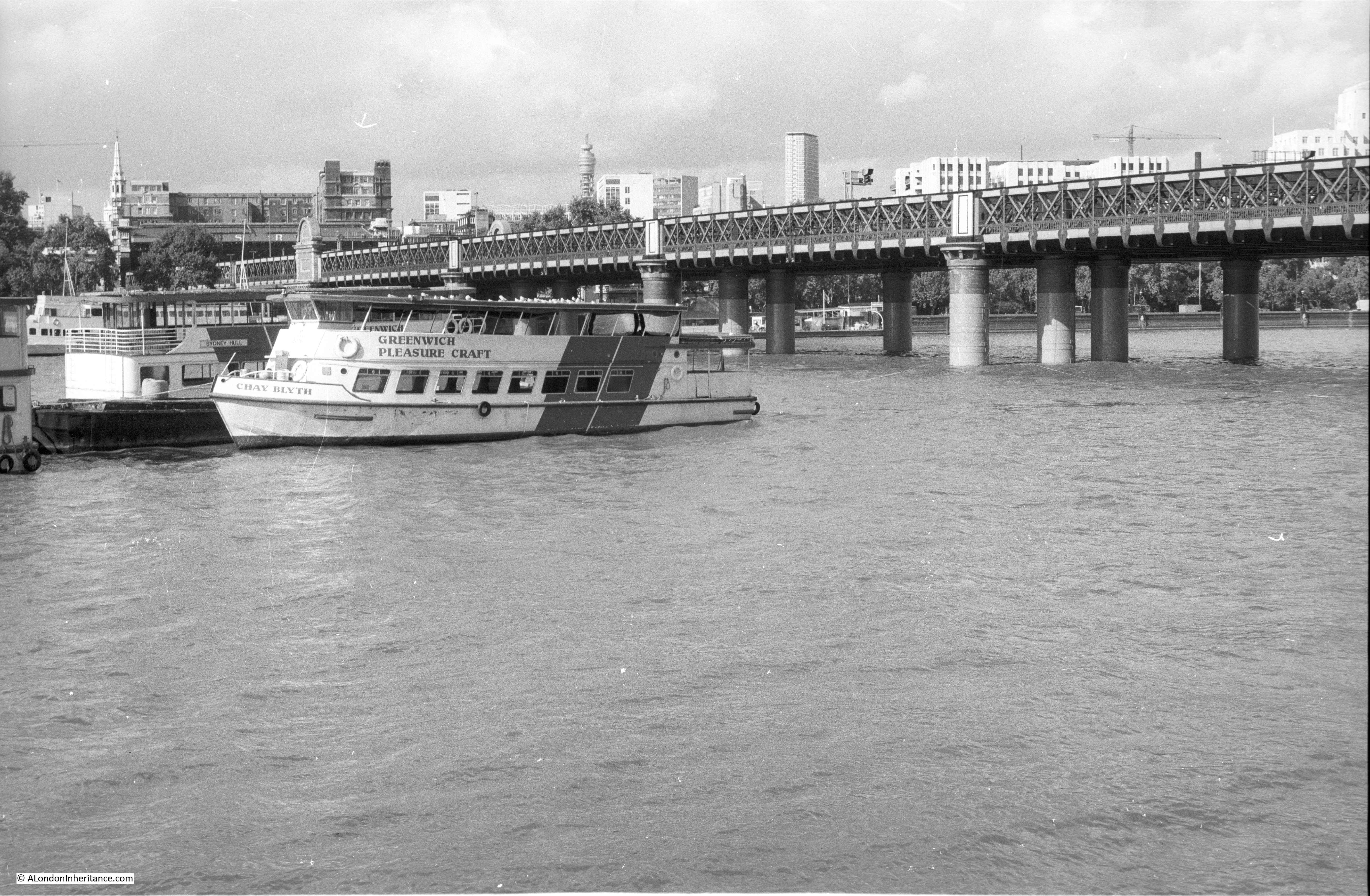
In 1980 there was a single, narrow walkway running along the eastern side of the bridge so not visible in the above photo. In 2002, the Golden Jubilee foot bridges were opened, one on either side of the bridge, and their concrete piers and white supports have changed the view of the bridge as shown in the 2019 photo below.
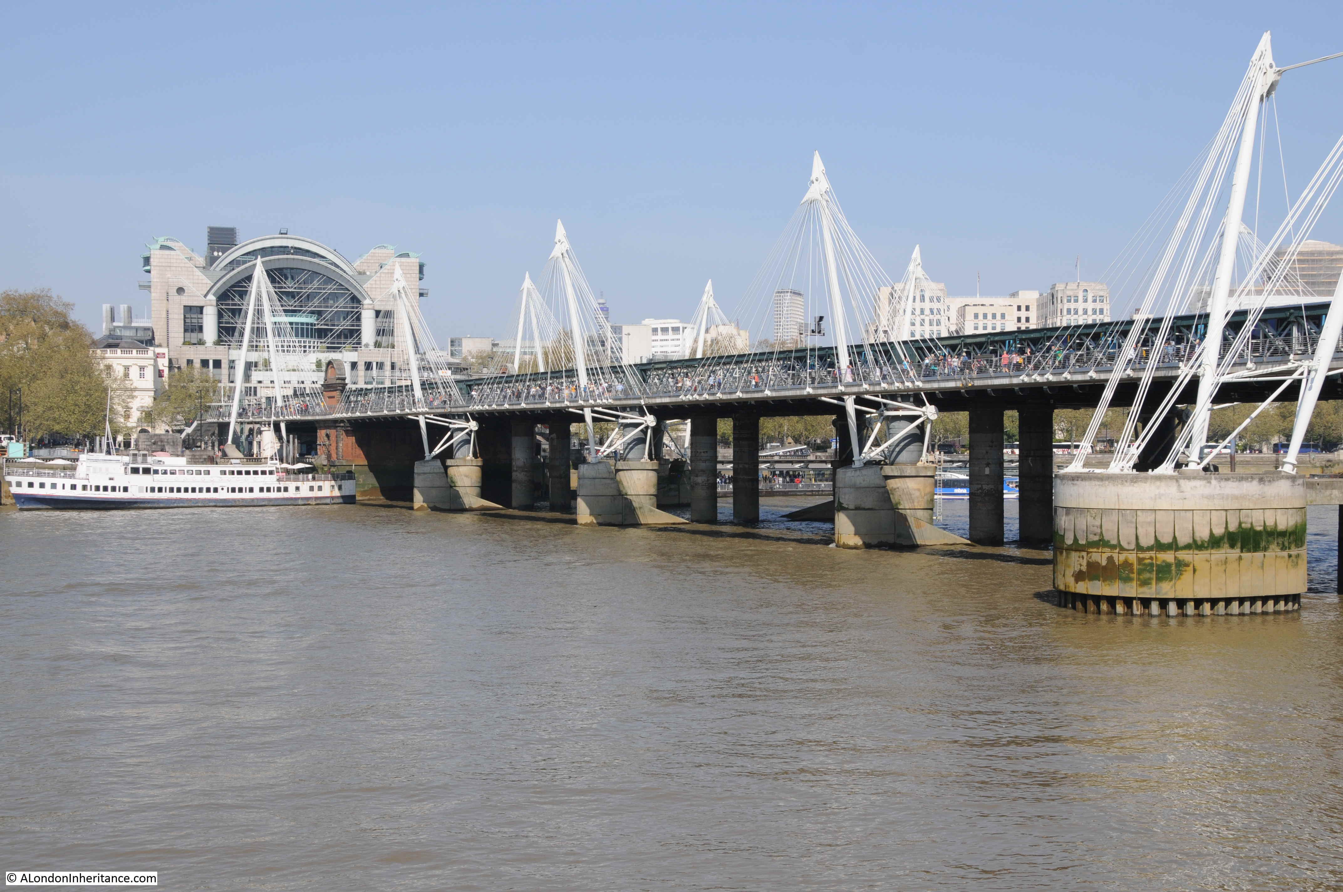
The other significant change between the above two photos is the building above Charing Cross Station. The station is on the left side of the above two photos, and in the first photo the original station buildings can be seen at the end of the bridge, whilst in 2019, the office blocks that were built above the entrance to the station obscure the view of the station buildings.
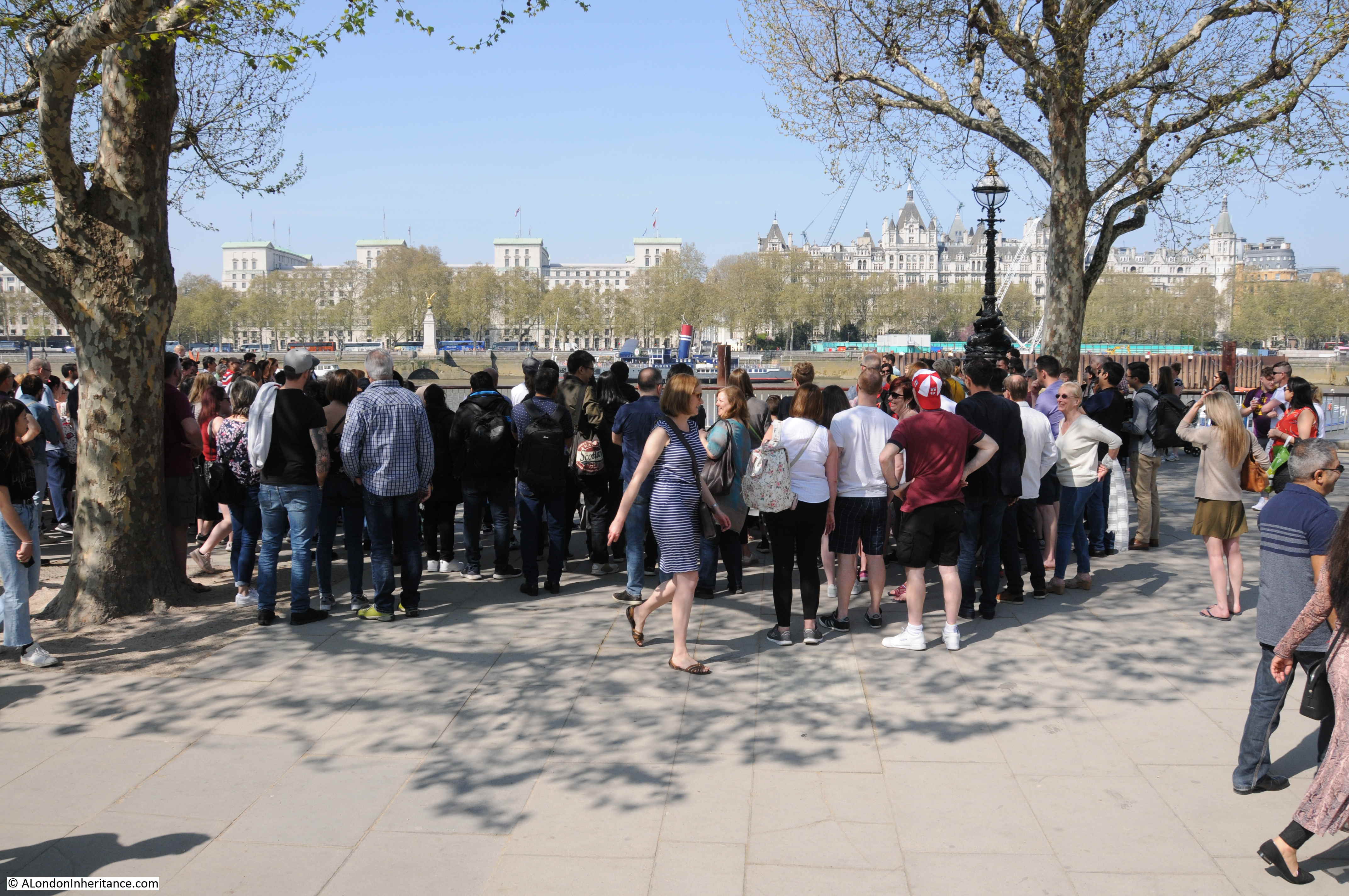
The South Bank is a magnet for street entertainers. As well as the usual floating Yoda’s, a wide variety of street entertainers attract large crowds, and frustratingly the space below was where I wanted to take the first comparison photo.
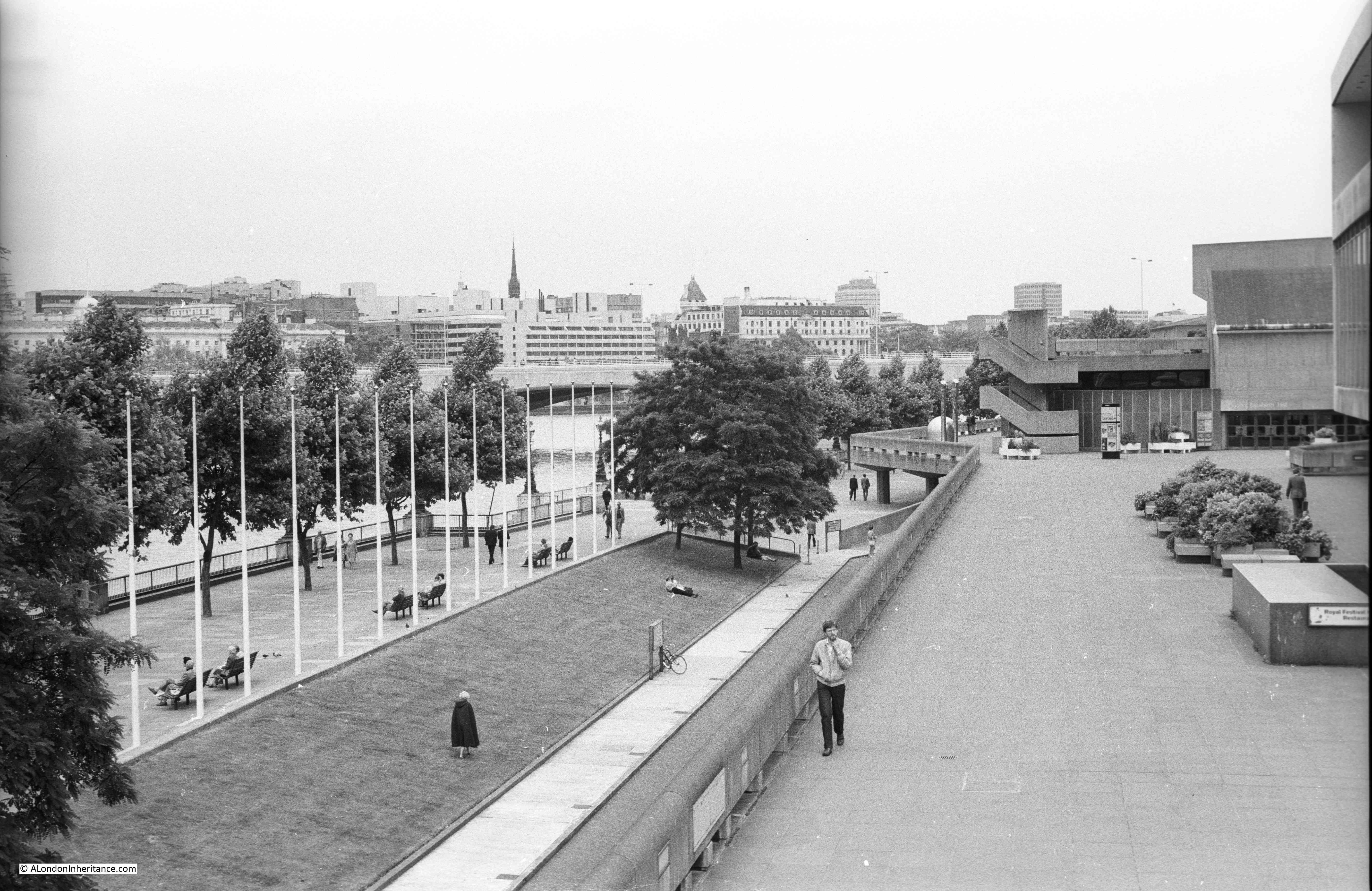
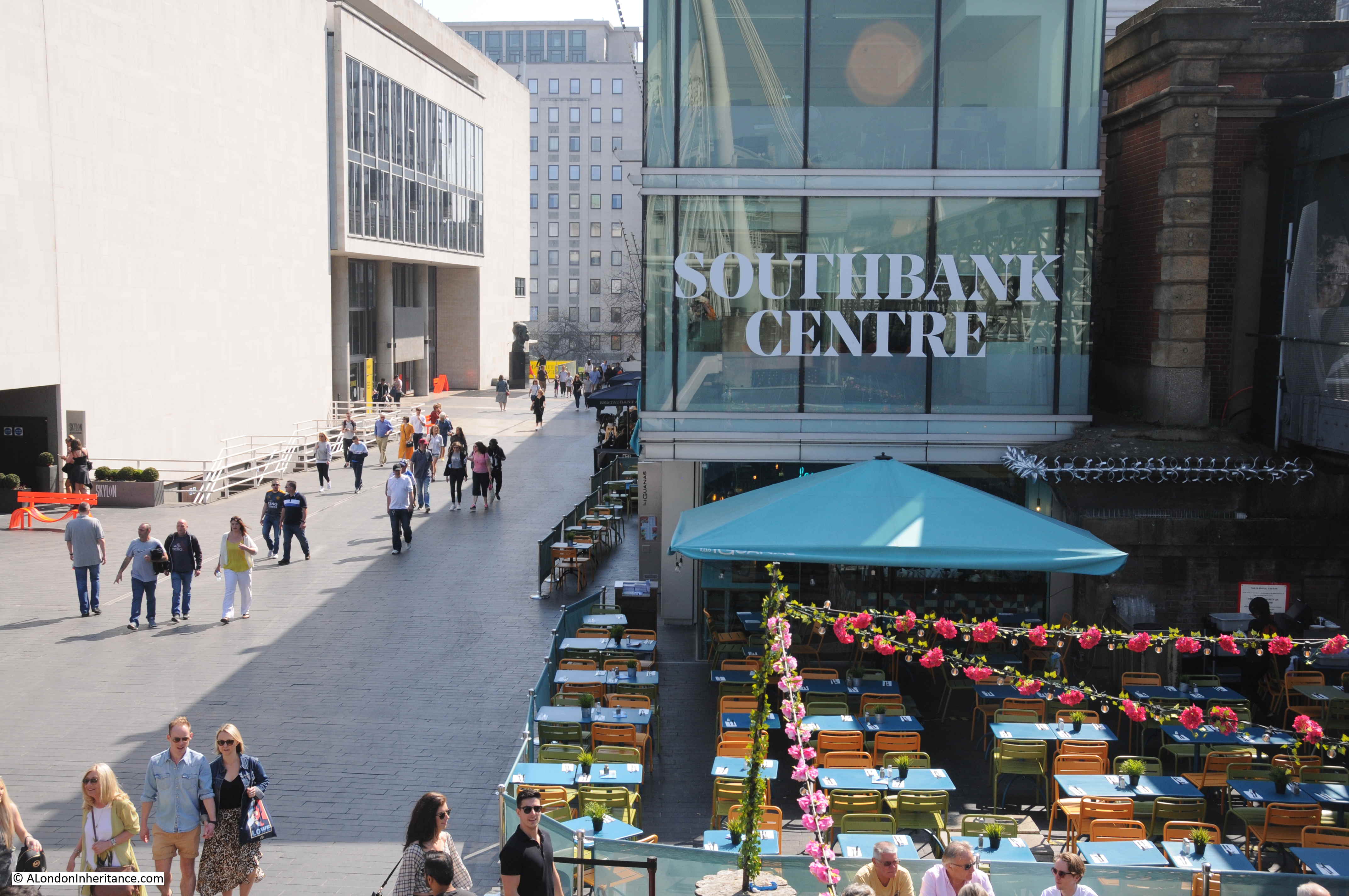
Passing underneath Hungerford Railway Bridge, we find the Royal Festival Hall. Built for the Festival of Britain, and the only permanent structure left over from the festival on the South Bank. It is still a magnificent building, however the immediate surroundings of the building have changed significantly.
In the photo below, I was standing at the end of the footbridge, looking along the front of the Royal Festival Hall and the space between building and river.
This is the same view today (I could not get to the exact same viewpoint as the original walkway has been demolished).
The grass slope running from the river walkway down to the lower level of the hall has been replaced by steps and restaurants now run along almost the entire length.
I have written about this area a number of times as my father photographed the site of the Royal Festival Hall and the streets between the river and Waterloo Station just before they were demolished to build the Festival of Britain.
The following photo is one of my father’s, taken from a building at the end of Hungerford Bridge, looking south towards Waterloo Station.
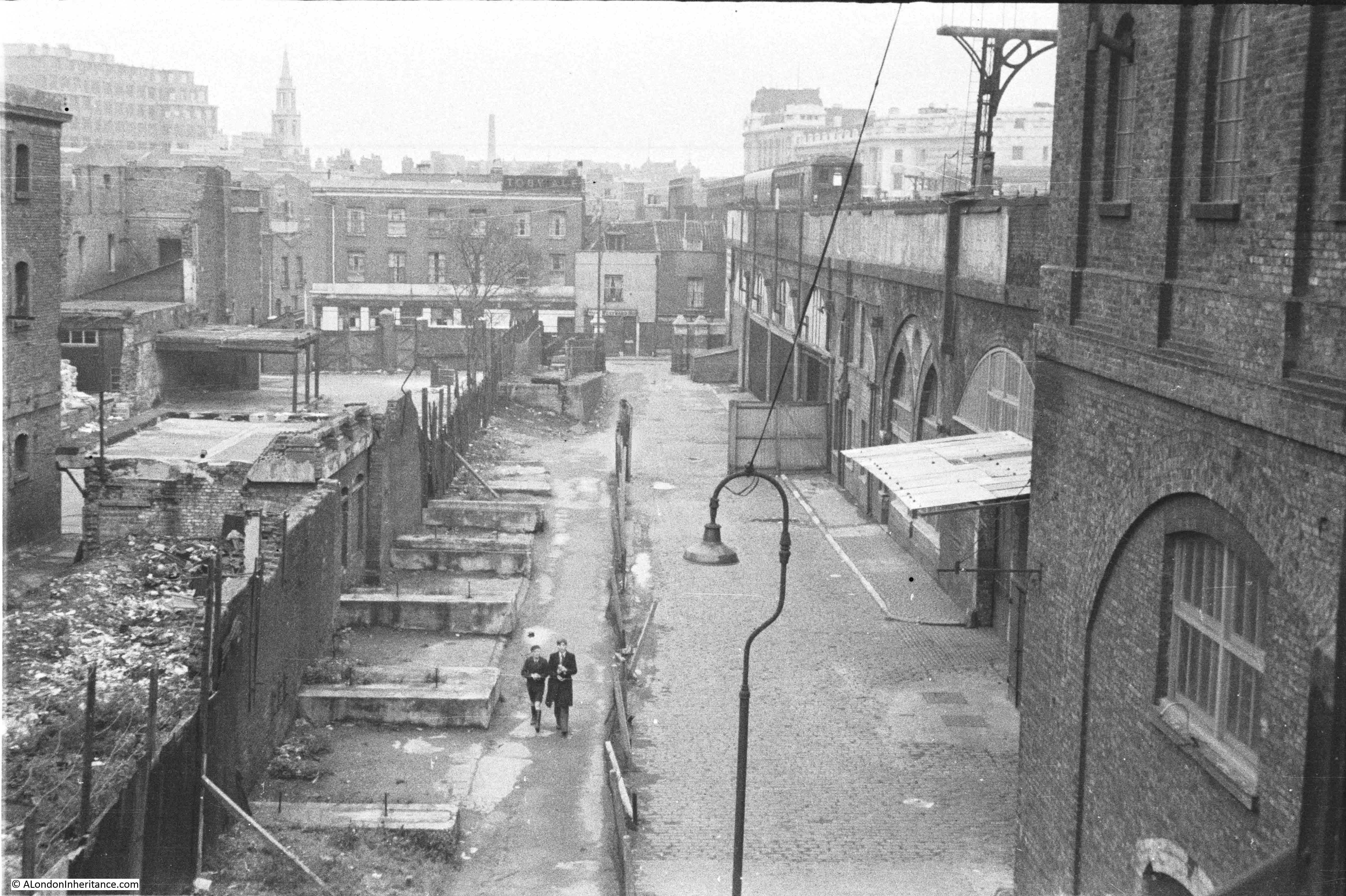
In 1980 I took the following photo of the same view:
In 2019, the same scene is shown in the photo below (I could not get to the same position as for the 1980 photo otherwise I would have been standing in among the restaurant tables with a very limited view).
The three photos above symbolise what I really enjoy about this project. My father started photographing London in the late 1940s. I started in the 1970s and it is fascinating to continually watch and photograph the city as it evolves.
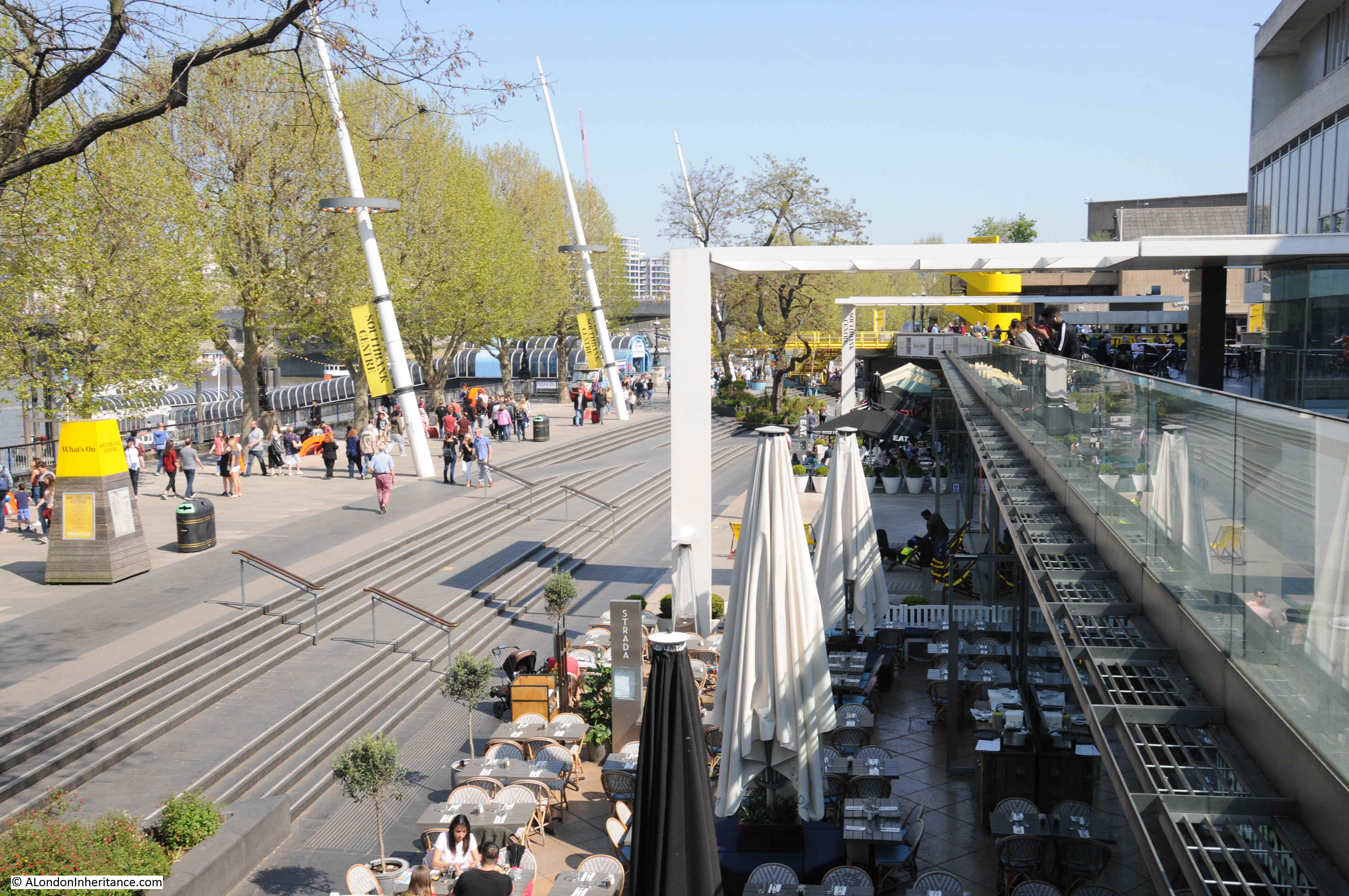
The view looking from the eastern end of the Royal Festival Hall.
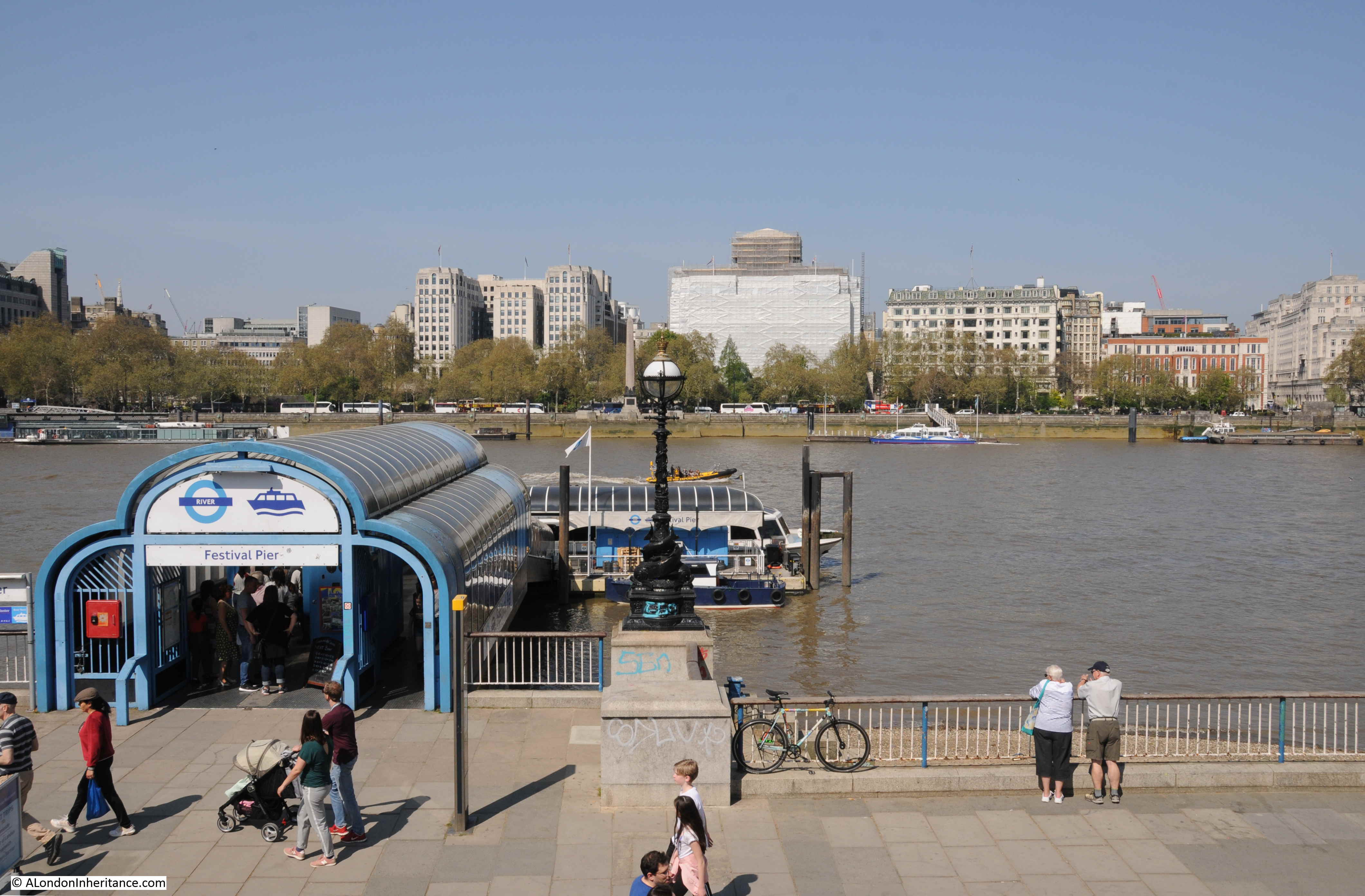
As part of the Festival of Britain, a pier was built to allow visitors to arrive and depart by river. An updated version of the Festival Pier is still in operation.
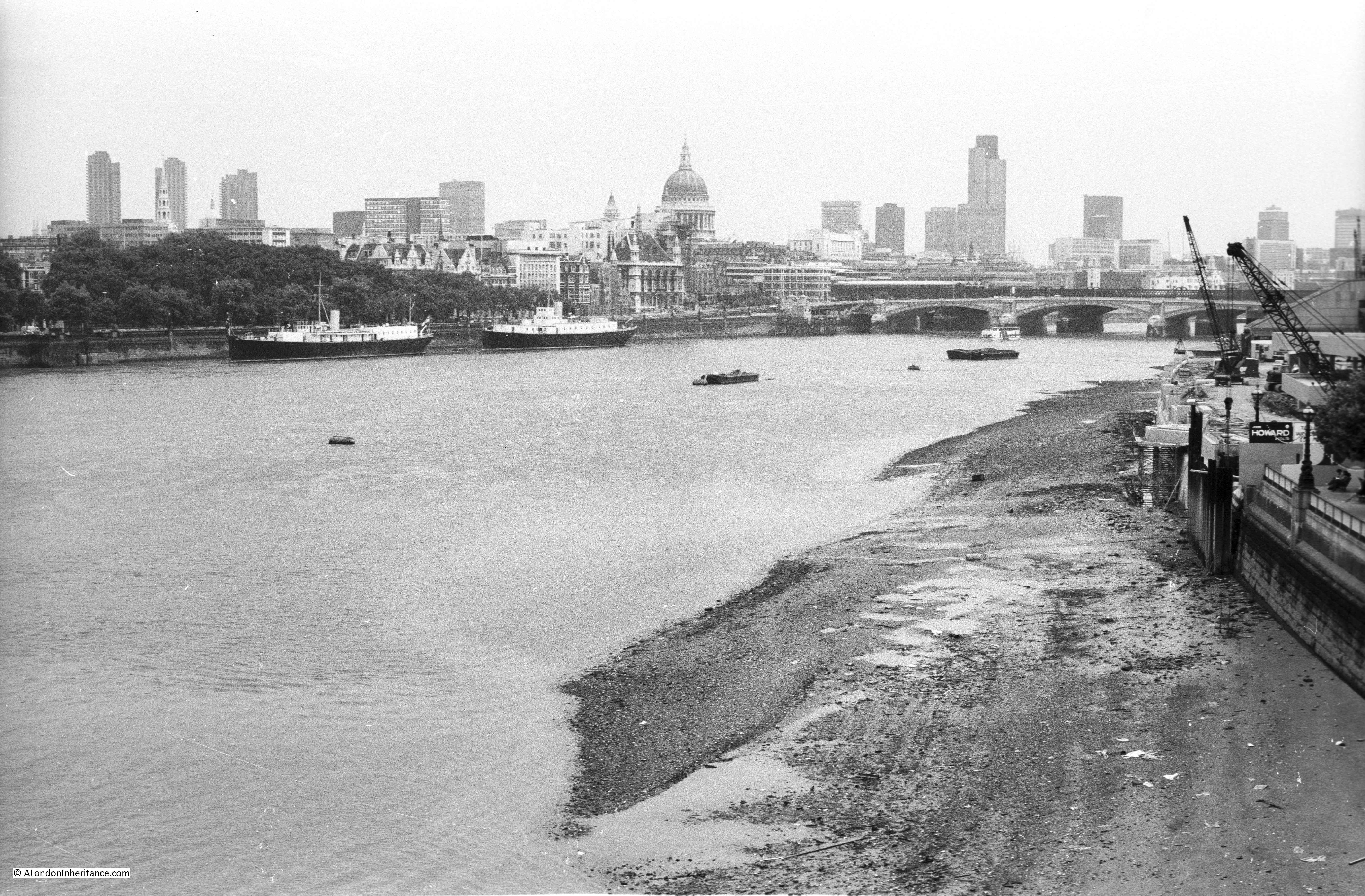
The view from Waterloo Bridge in 1980, looking towards the City.
In 1980, the South Bank river walkway ended by the National Theatre. After the Festival of Britain there were plans to develop the area to the east of the Royal Festival Hall as a cultural centre.
The London County Council developed a master plan for the site in 1953, and it was this plan that gave the name South Bank. The plan identified a programme of development for the following 25 years and this resulted in the National Film Theatre (1956-8), Queen Elizabeth Hall complex (1963-8) and the National Theatre (1976).
The South Bank further east from the National Theatre would be commercial, but the long term plan was for a single embankment walkway stretching from Westminster Bridge to Tower Bridge. This would be developed over the following decades, and in 1980, the first stretch extending eastwards from the National Theatre was being built.
The same view in 2019.
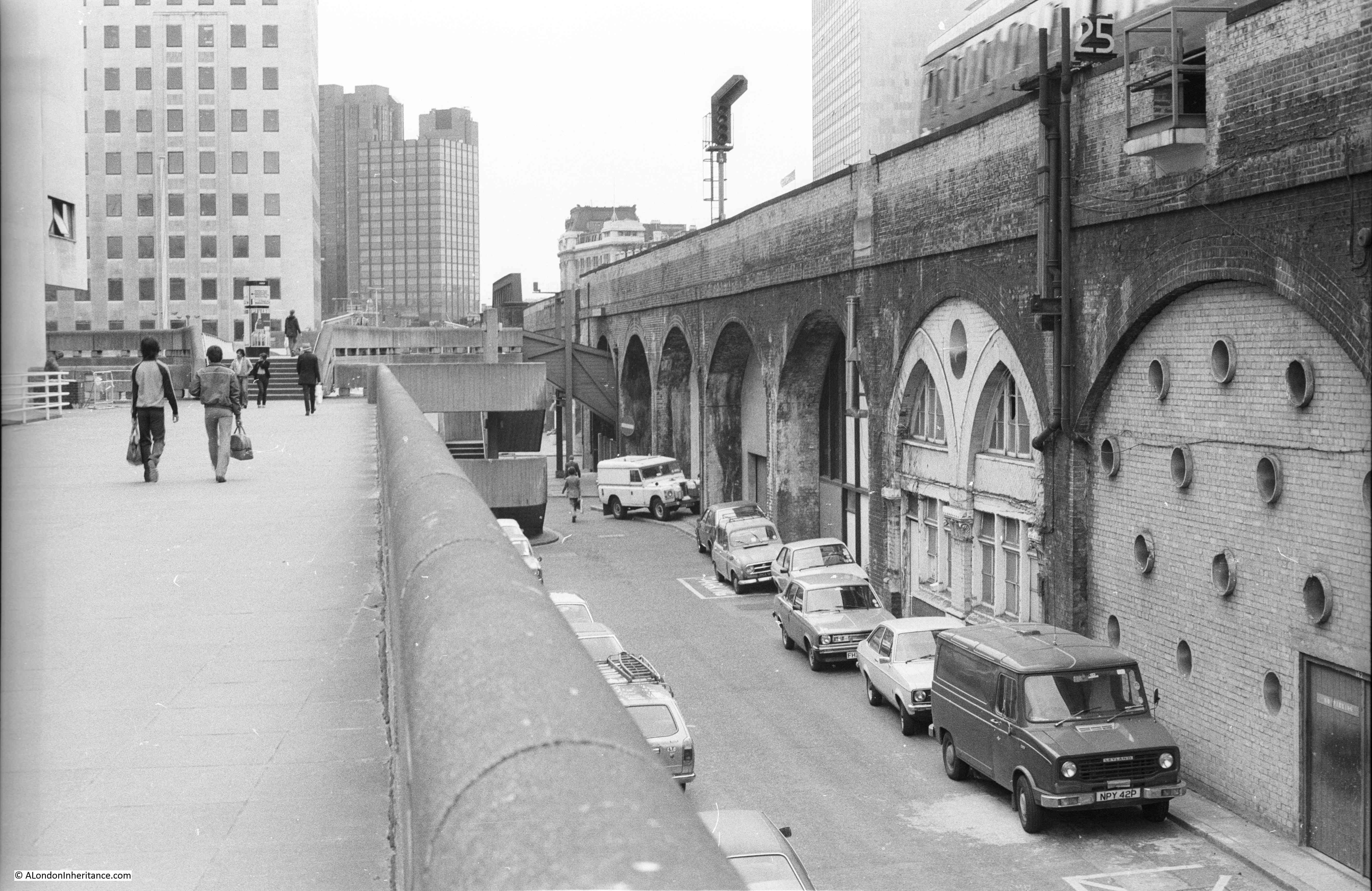
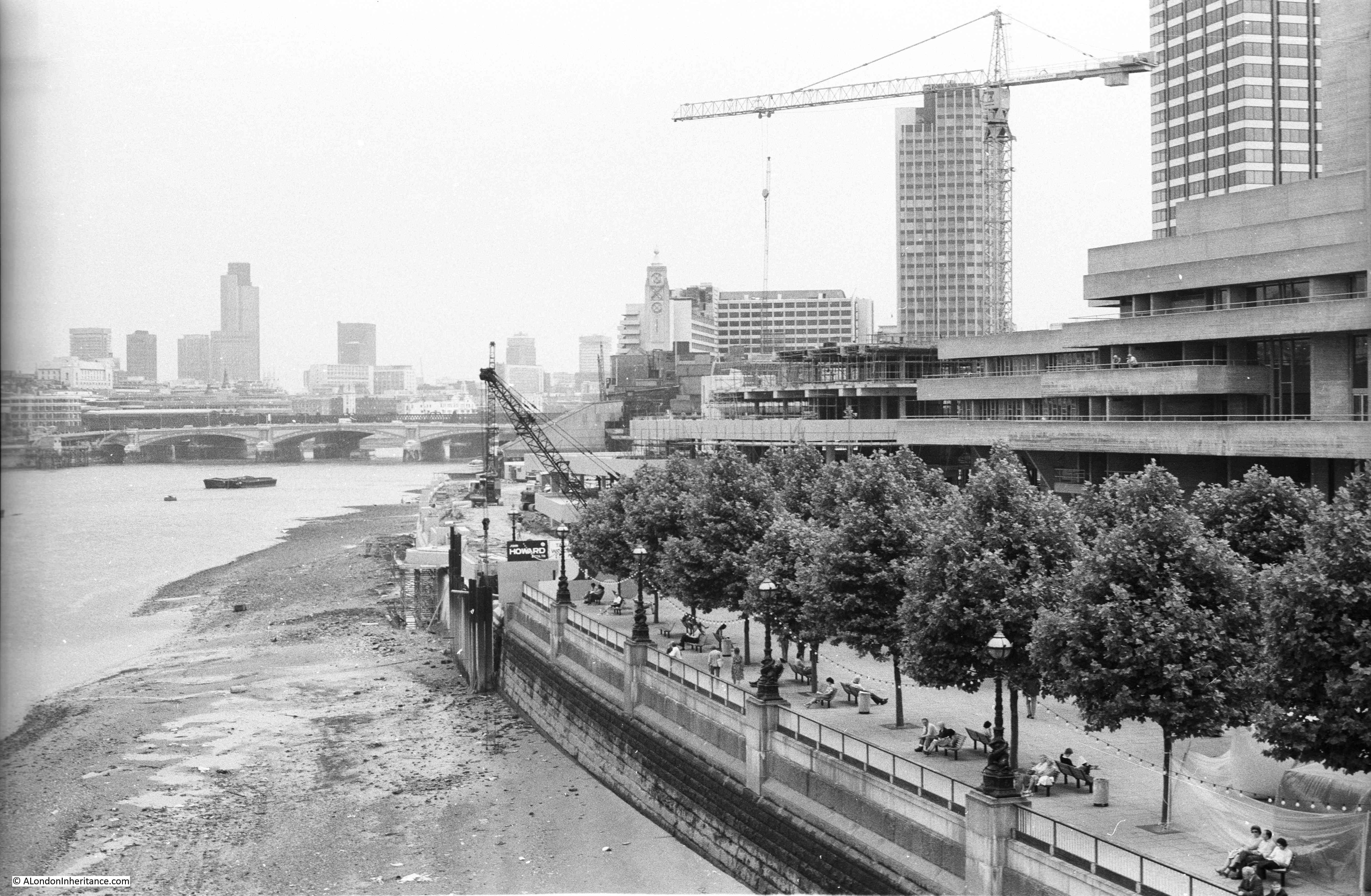
A better view of the works in 1980 is shown in the photo below. The National Theatre is on the right. The building under construction to the left of the National Theatre was being built as offices for IBM.
The National Theatre and IBM buildings have a similar style and they were both the work of the architect Denys Lasdun.
The London Weekend Television building is the tower block closest, whilst the tower furthest from the camera was Kings Reach Tower, occupied by the IPC publishing company.

In the above photo, the extension of the embankment and walkway can be seen as the very clean white stone, compared to the original embankment to the right.
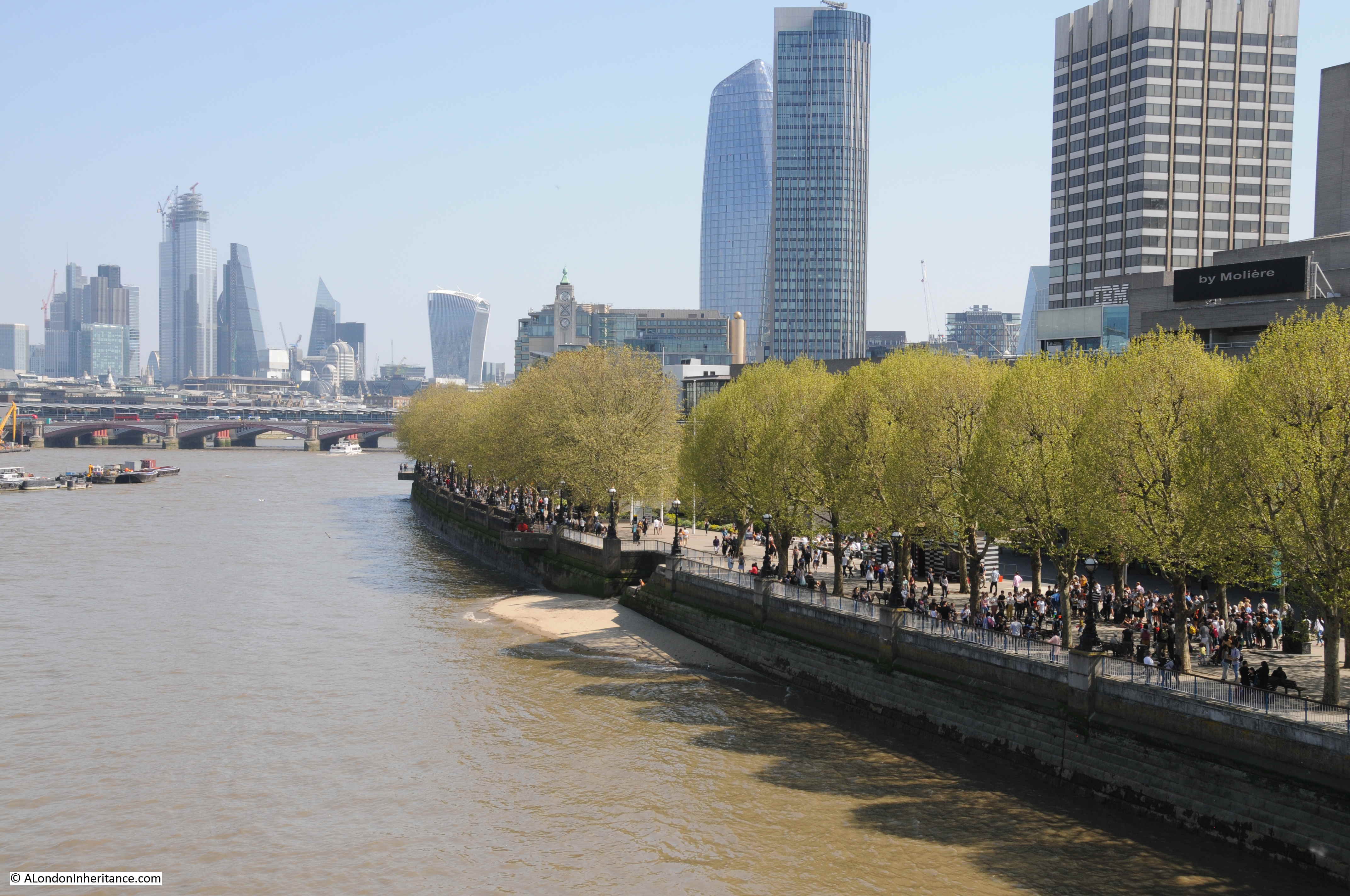
The same view today is shown in the photo below. The stone of the embankment extension has now been weathered and blends in with the original. Kings Reach Tower has been vacated by IPC and has been converted to apartments, with several floors added to the top of the original tower.
The 1980 view across the river from Waterloo Bridge to the City. The three towers of the Barbican are on the left and the relatively new Nat West Tower stands tall in the centre of the City.

The same view in 2019. the Barbican towers can still be seen, however the original Nat West Tower has now been dwarfed and almost concealed by the many new tower blocks that have been, and continue to be built.
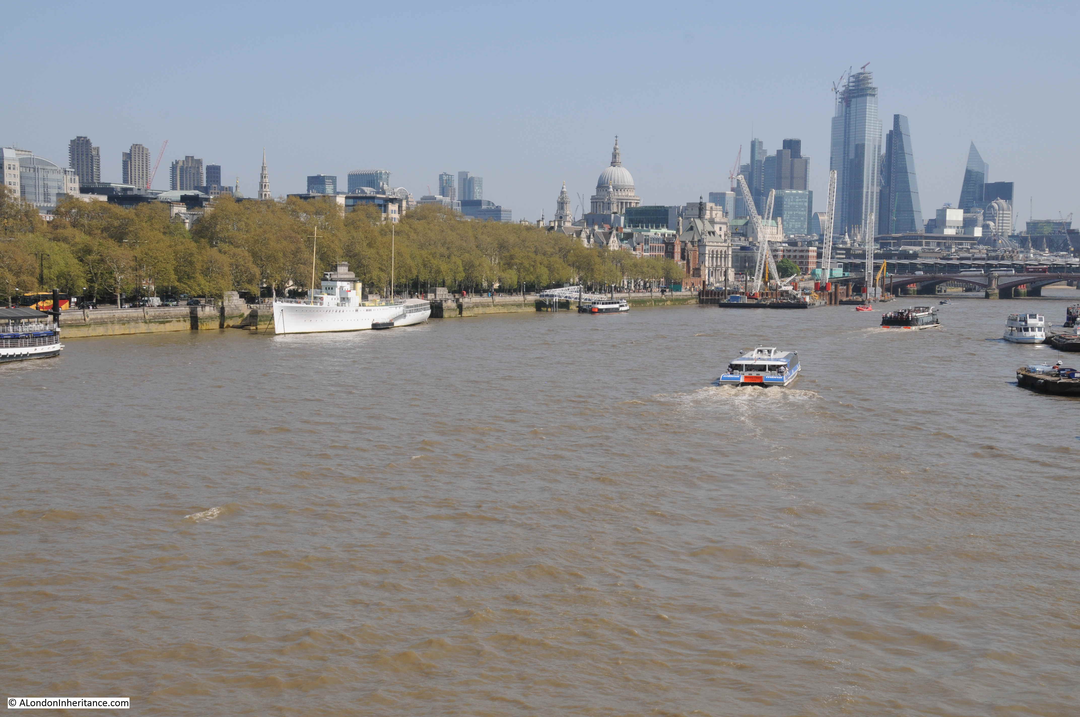
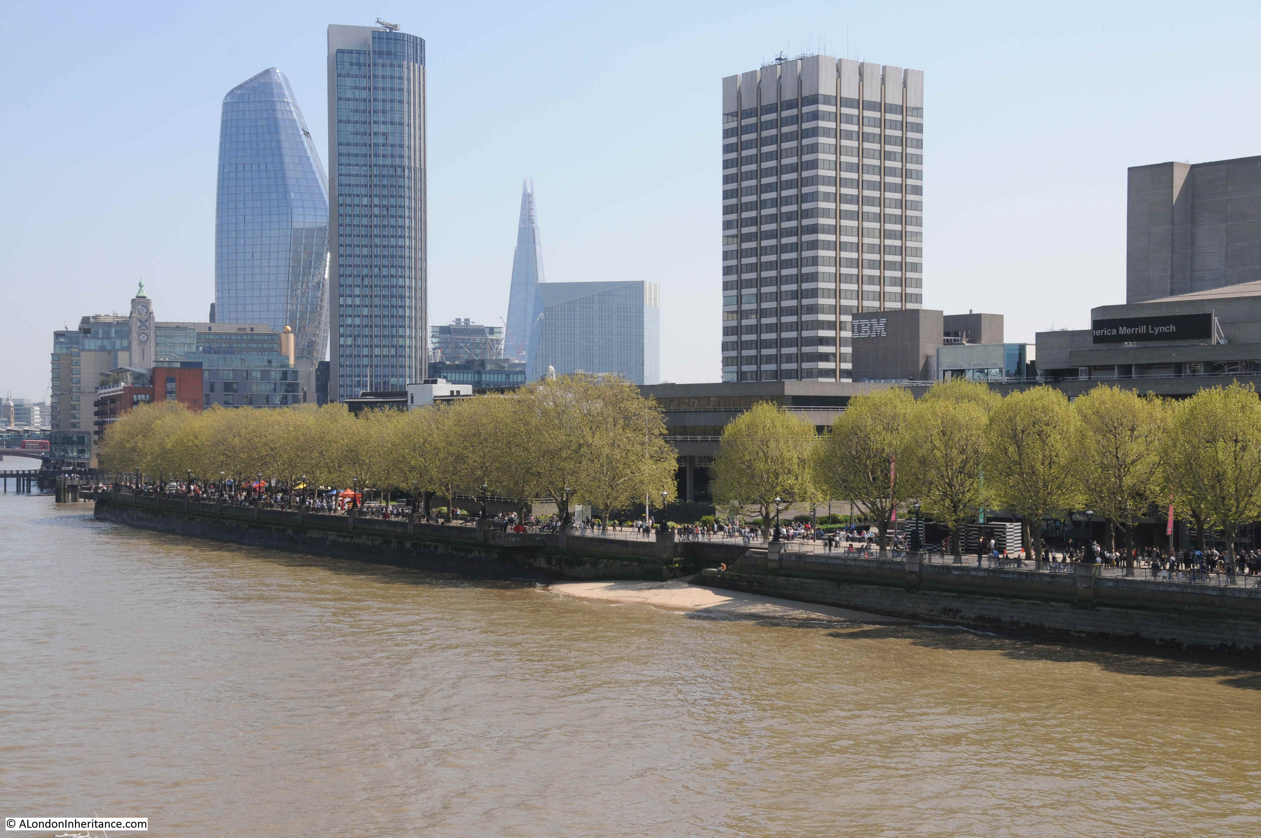
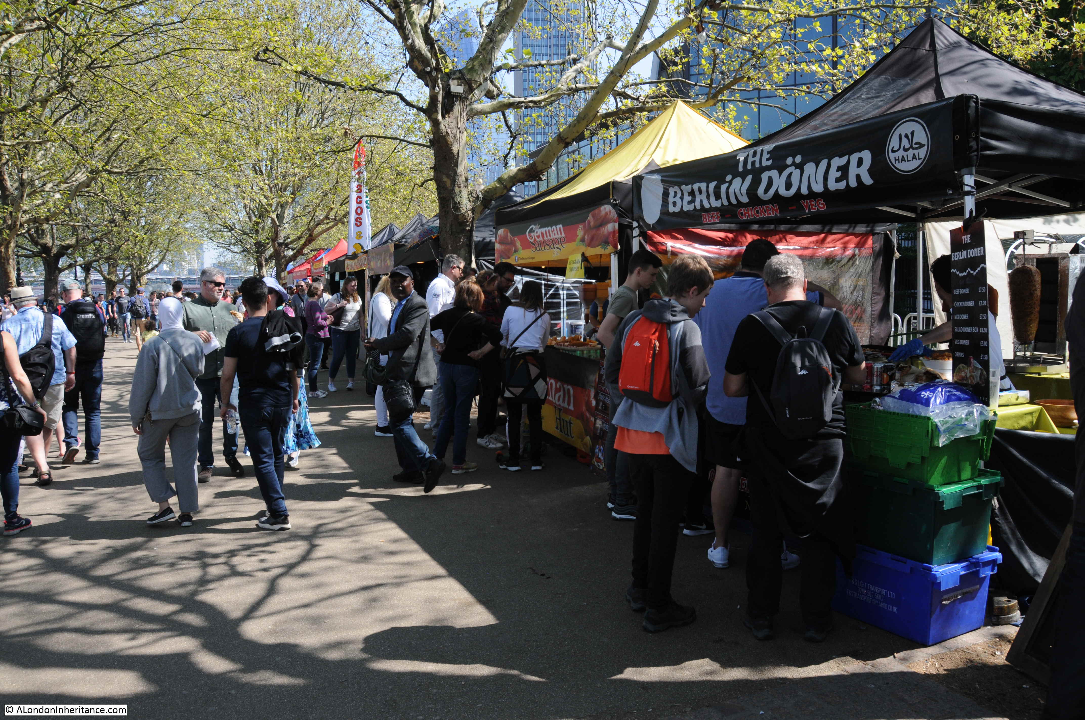
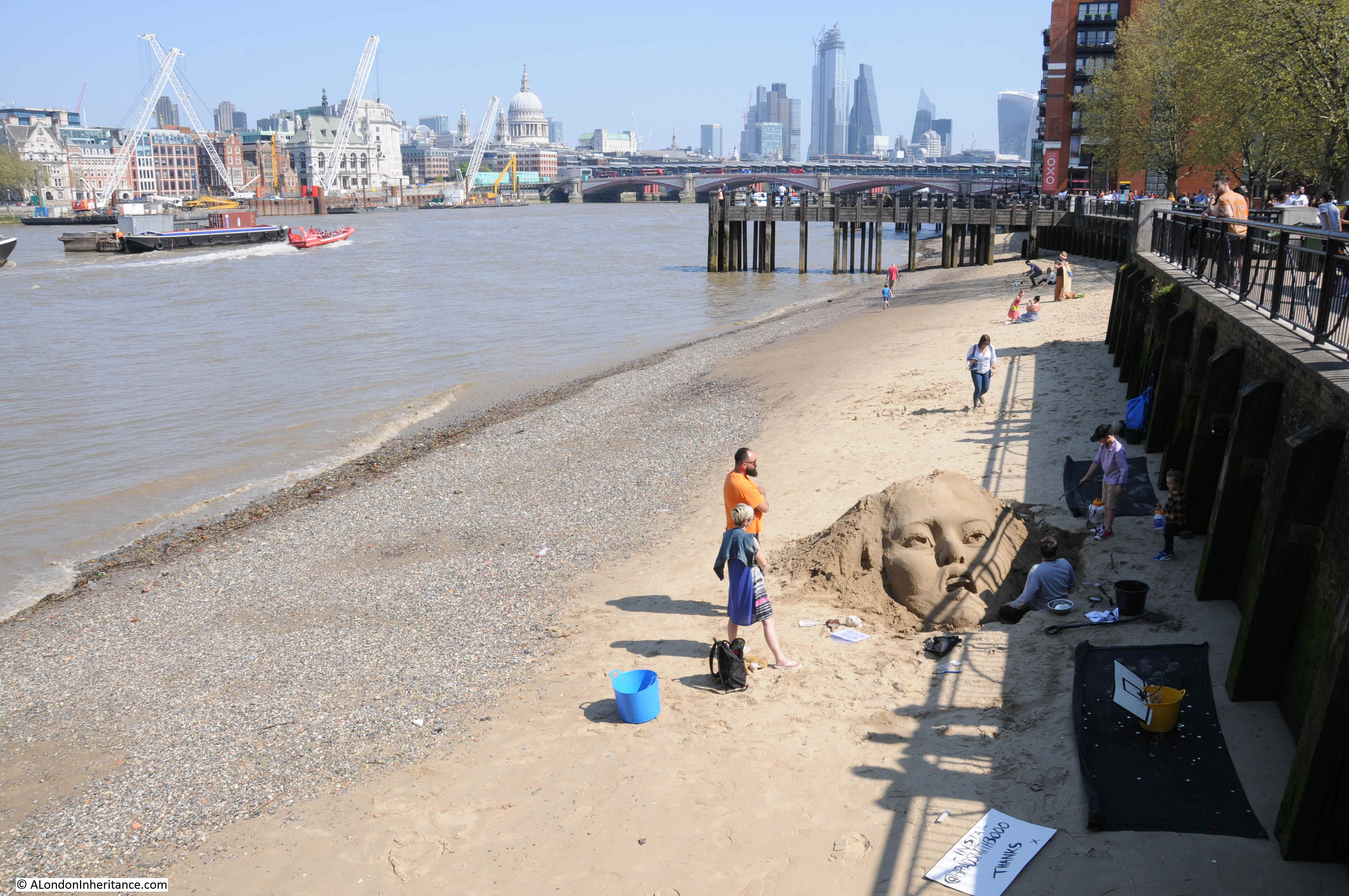
The walk along the South Bank from Waterloo Bridge to Blackfriars Bridge, whilst not as busy as the length between Westminster and Waterloo Bridges, is still busy with walkers. On a warm and sunny spring day, food traders were being kept busy.
Although there is always an option to get away from the crowds at low tide.
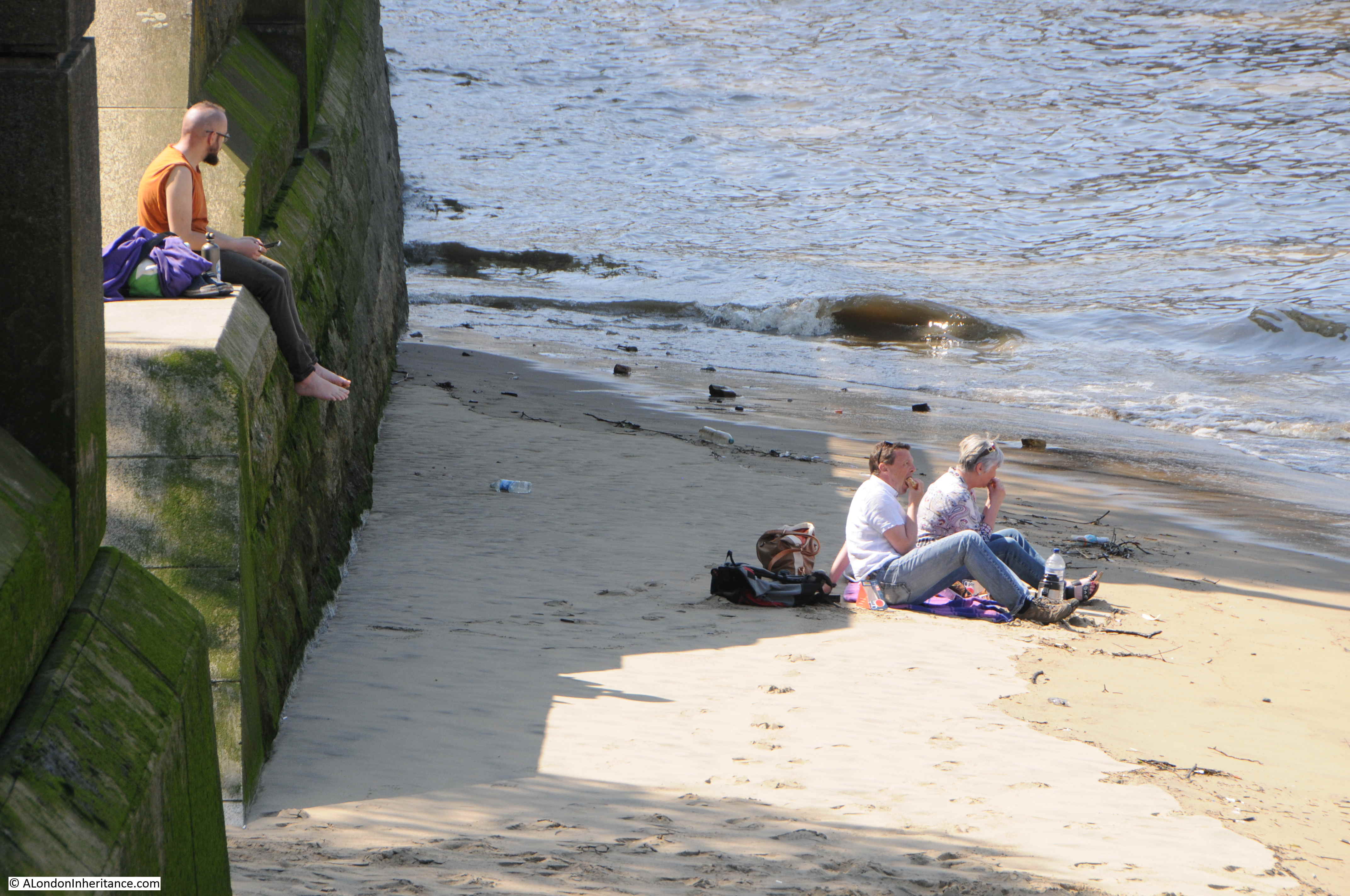
Sand sculpture on the Thames foreshore.
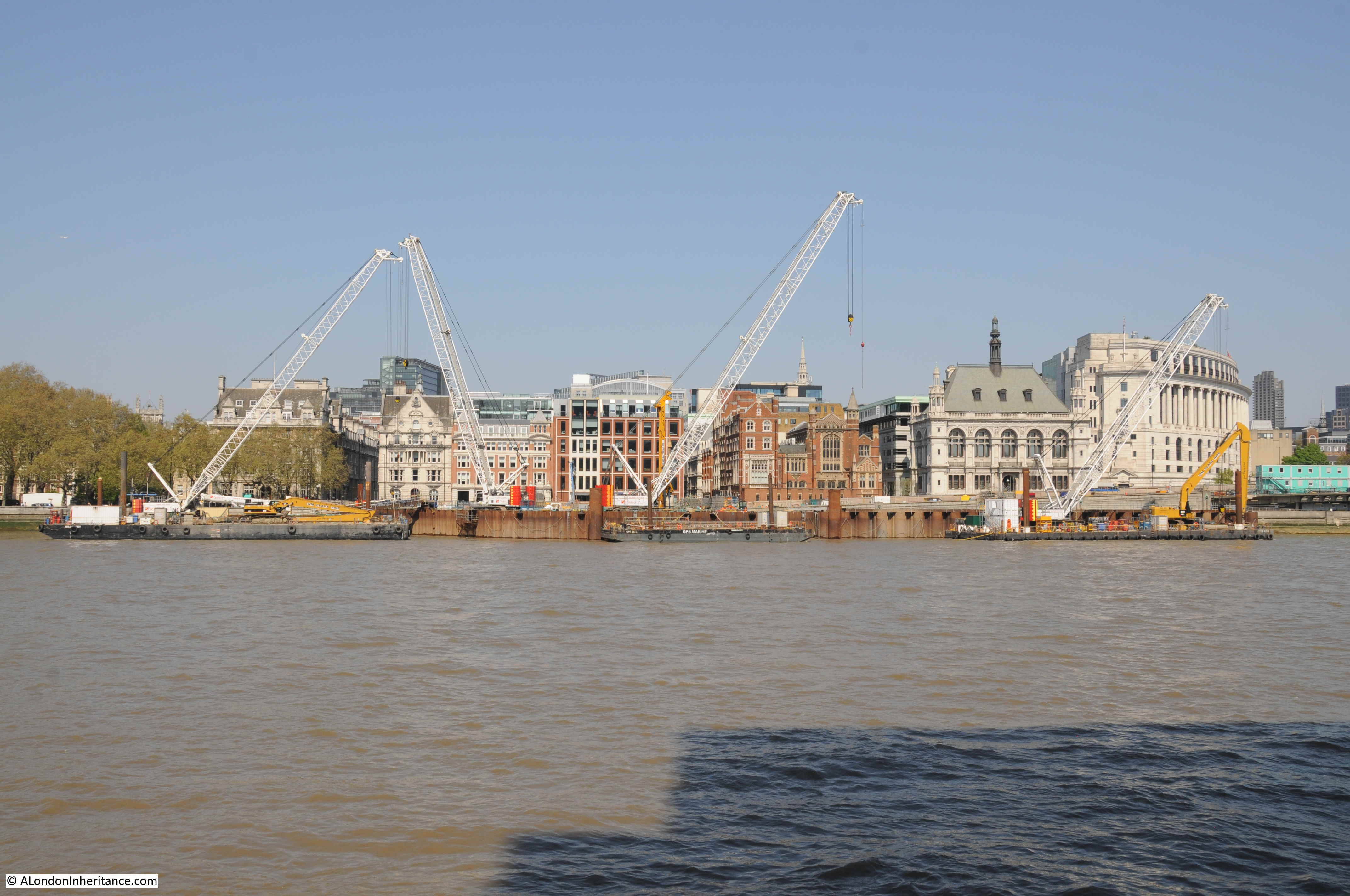
Getting closer to Blackfriars Bridge, and the latest construction that will subtly change the river can be seen. This is one of the construction sites for the Thames Tideway super sewer, and when finished, will be the site for an embankment extension into the river, covering the access shaft.
Reaching Blackfriars Bridge, I walked a short distance along the eastern side of the bridge, to take a photo from the same position as I took the following photo in 1980.
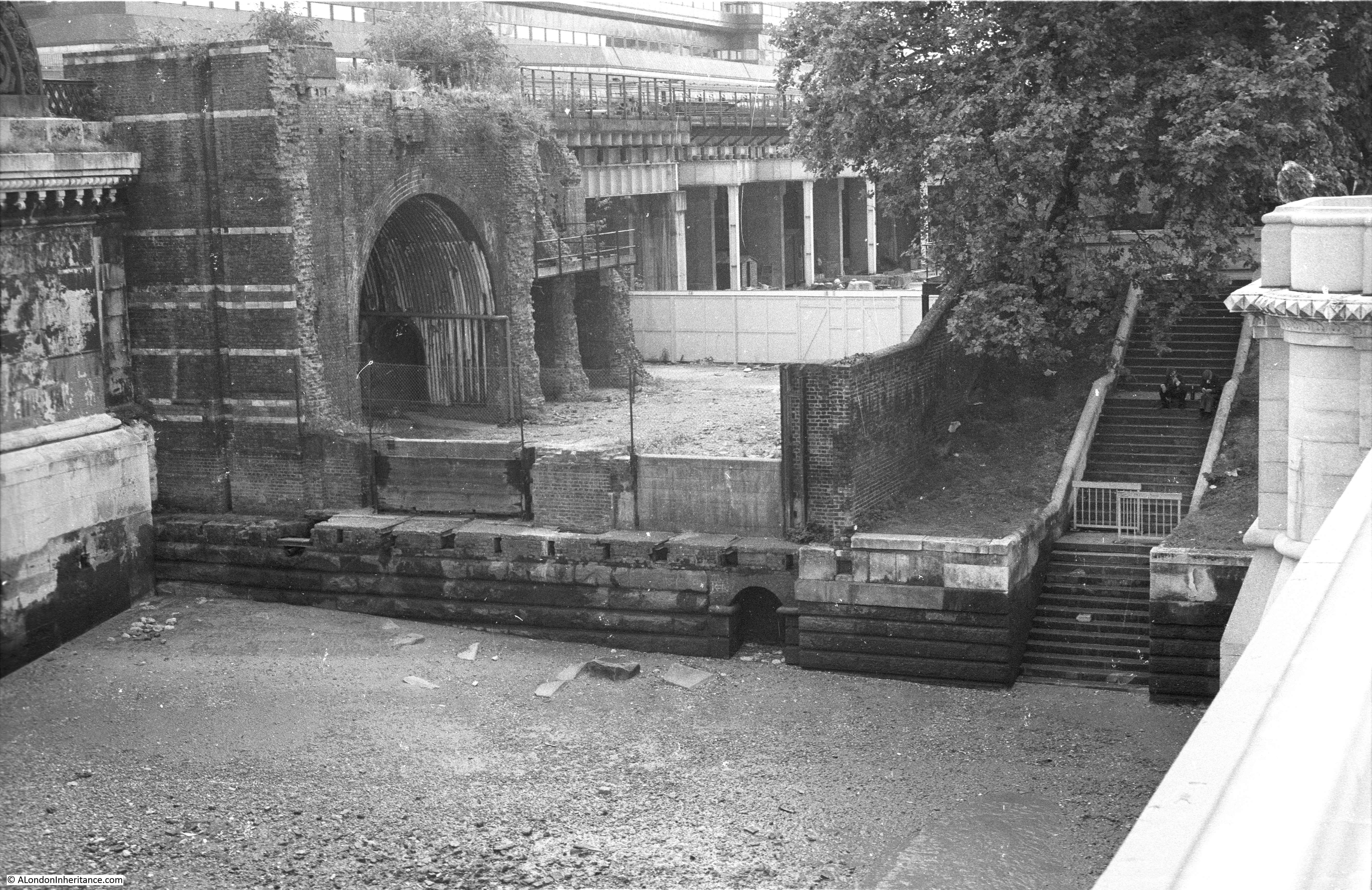
This short space of land is between the road bridge, and to the left the rail bridge, that carried the rail tracks over the river to Blackfriars Station. In 1980, this space was still many years from being part of the walkway along the southern bank of the river.
One of the original pier’s from the railway bridge can be seen on the left. On the right are steps which provided direct access to the foreshore.
The 2019 photo of the same scene is shown in the photo below.
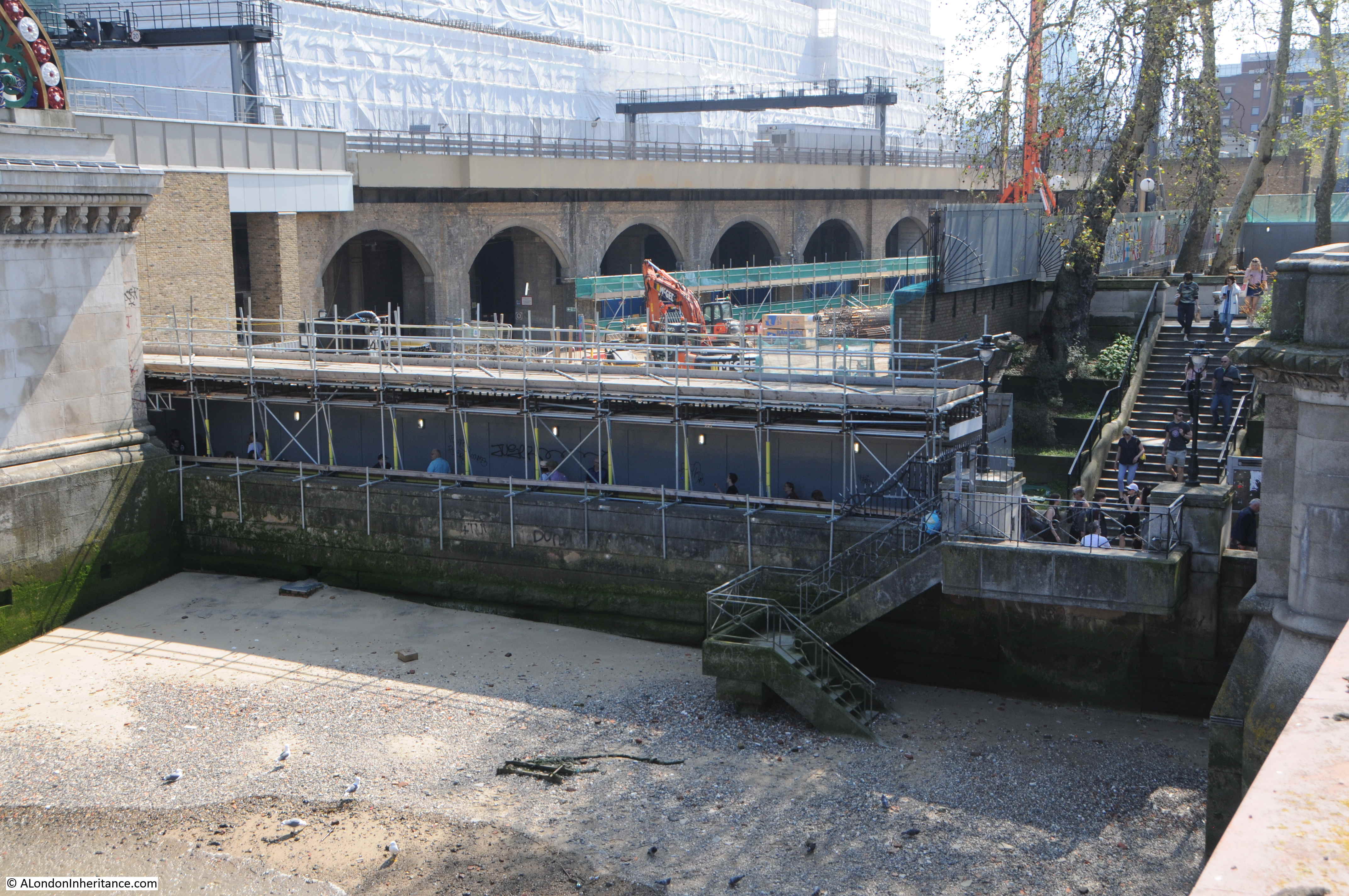
The steps that once led directly down to the river have now been blocked off. The walkway along the river now runs underneath the scaffolding, as this part of the walkway seems to be a continuous construction site.
The large building behind the railway viaduct, covered in sheeting can just about be seen in the 1980 photo. This was built as a cheque clearing facility for Lloyds Bank and also operated as a Data Centre for the bank. In the last few years it was used by IBM, but is now being demolished to make way for a number of office and apartment towers.
Despite the crowds, I really enjoy a walk along the South Bank and London always looks at its best when the sun is shining and the sky is clear. There is something about walking alongside the river and watching the changing relationship between the city and the river.
The South Bank continues to evolve. New apartment towers are rising adjacent to the Shell Centre office block. The Lloyds building next to Blackfriars Bridge will be replaced by more tower blocks and there have been plans for more towers adjacent to the old London Weekend Television tower block.
It will be interesting to see what the area looks like in another 39 years – although I very much doubt it will be me taking the photos.
Some other posts as I have written about the area:
Building the Royal Festival Hall
A Walk Round The Festival Of Britain – The Downstream Circuit
A Walk Round The Festival Of Britain – The Upstream Circuit
A Brief History Of The South Bank
Tenison Street and Howley Terrace – Lost Streets On The Southbank
My own memories of this area date from an earlier period – the late 19502 and early 1960s. My mother was a teacher, and therefore had access to the immense library housed in the (then) LCC building. It was many times larger than the Public Library on Buckingham Palace Road which was our usual stamping ground. Later, I was one of the children who went to Robert Mayer’s Children’s Concerts in the Festival Hall. Our music teacher, who took us, used to pop her Mini in some free parking lot very close by with no problems. I don’t remember our walking along the river on that side at all. We were more likely to stroll along the Embankment. Was it because we couldn’t? I don’t know. A final memory. The Shell building, carefully lit over the Christmas period at night by leaving office lights on in such a way that the block appeared as a huge Christmas tree.
> the Public Library on Buckingham Palace Road
How odd, I used to think when passing by on the bus as a child, that the sculpting signwriter had made such a blunder to spell it “PVBLIC”. I fully expected it to be corrected one day but no, it’s still there long after the Romans have gone.
Southbank is indeed so crowded these days. For walking exercise I’ve transferred my loyalty to Victoria Embankment, including Embankment Gardens, on the other side of the river. Road traffic is mostly light there these days so that’s not the impediment it used to be. Of course being on the outer side of the river’s curve it’s a longer walk but that’s probably a good thing.
None the less I’m grateful to our host for this opportunity to reconsider the delights of the Waterloo side and its considerable history, much of which can also be enjoyed in the several views afforded on the Britain From Above site.
How lucky we are to have London Inheritance to remind us of how grand are the river’s attractions.
Thank you for more fascinating facts and photos
I always enjoy reading your posts and particularly studying the photographs, but this week’s about the South Bank has a particular resonance for me. I started visiting the area back in the 1970’s, when you could still park on Waterloo Bridge at weekends, and used to visit the BFI and National Theatre a lot. I particularly remember the year the National transferred to its new building, 1976, as we had a very hot summer that year. We went to the theatre dressed for the heat and were totally unprepared for the air conditioning as this was something public buildings didn’t have back then – we froze!
I can attest to the enormous changes between Waterloo Bridge and Blackfriars Bridge (and on to Bankside etc.); it is a pleasure to be able to walk by the river and there is always something new to see. My favourite view is from the top of Tate Modern across to St Pauls, the Faraday building and the Barbican – you couldn’t get that view back in 1980 even.
Once again, thanks for a great blog.
I’ve commented before about growing up just off Trafalgar Square, and vague memories of being taken by my mother over the old Hungerford Bridge walkway to the South Bank before the Queen Elizabeth Hall and the National Theatre were built. So many thanks for these reminders about an area deeply embedded within my childhood. Although very much more crowded these days, I agree that it is still a pleasure to be able to walk along this stretch of the river, and enjoy the vistas towards the City. Many thanks for your endeavours.
Brilliant post as usual, some great old photos of the SB too. I was and still am a regular visitor to the area and like David Holmes used to frequent the NFT and still go to The National Theatre a fair bit. I have mixed feelings about the way the area has developed though. I think it’s great that it draws so many people in but I do have reservations about the fun fair near the Eye and the increase in public areas being turned into retail and catering opportunities. That said it’s wonderful to be able to walk from Westminster to Tower Bridge alongside the river virtually all the way.Thanks again.
You blink and it changes- and what on earth is going on with Shell-Mex House [designed by my gt-g-dad] and sad to see HMS President gone [my father’s ‘ship’ in WWII]
Thank you for all the photos great to see all the info as well. As a Londoner now living in Sussex they are very interesting to me
Fantastic photos. I’ve been traveling to London for the past 20 years and even in that short time I have seen so many changes. I liked it better when St Pauls soared above everything else. However, I still return almost every year.
Walked that area many times ,there is a DVD out titled night and the city by Jules dassin well worth viewing for a lot of the filming took place on the very bomb damaged south bank after the 2ww.
Great read as usual.
I have been much moved by the quite superb content of all your blogs.
Indeed, very much so last evening in particular, with the revelation of some of the scenes taken around South Bank by your Father.
One photograph in particular has moved me to write this note of appreciation: it is of the area by Hungerford Bridge facing towards Waterloo Station, before any of the demolition and rebuilding in the period of preparation for the Festival of Britain.
For this area I came to know modestly well and even prior to your Father’s picture when it was in a far worse state.
This was during the immediate two years after the end of the war in 1945 when in 1946/47 I was in my early ‘teens my Mother having brought me up single-handed during the war years and being unable herself to do so at this critical stage in a youngster’s life, asked a family friend to take me up to London from the outer suburbs of the City to broaden my outlook and to witness the lights of London after all the gloom of the war years of air- raid shelter life and bombing raids. Although on the outskirts of London, we had been bombed, and doodle- bug activity became a daily occurence. And so on a few occasions I was taken up by train to Waterloo Station and across the side footpath you describe of Hungerford Bridge to the London streets by Charing Cross Station including the « Arches » brought to life by that wonderful duo Flanagan and Allen, in their immortal song « Underneath the Arches, I dreamed my heart away… » To revert to the South Bank side, and to where the photo was taken, the sight of terrible state it was in remains with me today, it was really an area you just had to have someone guide you through because you wouldn’t have even tried to venture into it. Later on, of course the whole area became the Festival of Britain which I was able to visit just prior to enlisting in the RAF for my National Service.
Before closing this comment, I’d like to mention another vivid impression made upon my young mind in those terrible war years which might possibly be of interest to you in the light of your Father’s interest in photographing London.
One day, still during the war years but when these were drawing to a close, my mother took me up to London to visit family relatives in Victoria Street ( actually in Artillery Mansions, next to the Army and Navy Store).
In the train, I stood in the corridor, and saw to my horror all the bomb damaged sites around Clapham Junction. One picture of it all made a very deep impression and has remained in my mind all my life: it was the scene of endless movement of lorries as the drove up and upwards to the top of a massive bomb-rubble disposal dump that was easily the height of a three-story building. I have often felt frustrated never ever coming across a newspaper article or book page or any other reported description or photograph of such a scene in the Clapham Junction area close to the railway approaches of Waterloo Station, even at times wondering whether my impression might be somewhat exaggerated.
But I remain firm in my conviction that it wasn’t. Should you ever find any photo of anything similar in the area or further afield to illustrate and support the quite vivid impression I gained in my very young years, I should be grateful if you bring it to my notice.
A last word before thanking you once more for all your superbly excellent commentaries, descriptions and photographs, it is that the People of those War Years, pre-War Years and post-War years were in one word: magnificent! [ apart from the Spivs of course! ]…
Dennis, thanks for your feedback on the blog and for your fascinating memories of London. There were a number of these mounds of bomb site rubble across the city. In this blog post https://alondoninheritance.com/thebombedcity/a-brief-history-of-aldersgate-street/ my father photographed one at Aldersgate Street and in this post there is a photo of a mound of rubble on the south bank next to County Hall https://alondoninheritance.com/the-thames/a-wartime-temporary-bridge-and-county-hall/
Ros:
Thanks a million for the reference to the Aldersgate ‘mound’ …
If not a new word for me most certainly a new reference term indeed for effectively ‘ the immense mounds of rubble ‘ …
Elsewhere in among your selection of books, I was greatly pleased to see ‘ The White Rabbit…’ on Wing-Commander Forest Yeo- Thomas who suffered terribly in captivity at the hands of the Gestapo… Some years back a friend gave me a hard back copy of the book which I read through being held aghast at the sheer horror of it all. Instinct tells me to say the book ought to be recommended reading in all schools of teen age attendance…but even so, as to the wayward nature of base human nature, ever the watchful eye remains the order of the day, alas.
Your whole input blog is immense and gives so much pleasure to so many including « Joe Bloggs » on whose behalf I submit grateful thanks!
My own work experience in London [ not a Londoner, but born and bred a little south of Surbiton] I came to the big City in the late 1950s working in the export trade at Fortnum’s, British Aluminium (at Norfolk Ho, St James’s Square) thence to the City to my first Bank Swiss Bank Corp in 1960. First time in the City, almost fell in love with the place (sounds a silly thing to say) for the intense seriousness of manner and quiet elegance of most people who worked there ie their close interest in what they did workwise in comparison with the West End…Of course, I know the saying « comparisons are odious » and « no one’s perfect ». but it certainly had a sublimely positive effect on my psyche at the time, perhaps because I desperate…Happy memories nevertheless…
Kind regards and with renewed thanks.
A fascinating post as ever, thank you. I wonder whether anyone might help me with more information on the Lion Brewery, as it features in my 2xgt. Grandfather’s will as possible owner/leaseholder(Gasson, 1872) but there is a gap between Golding 1837 and Hoare taking over in 1924 in anything I can find. Many thanks.
Hello I wanted to write and ask a question, if that’s ok ?
I was researching the Tower Bridge Beach , thats closed in the 1970’s and remembered the South Bank Beach..would you know when this was built , was it part of the festival in 1951..or a much later creation as it seems a mystery to me..
Many thanks Gregg m
Excellent blog posts by the way, I just found it today an will start to read through…
What happened to the walkway from the side of the Festival Hall that went right up to Waterloo Station above the road ? – it just ends blocked off near the hall
Also i remember walking to the Festival of Britain from Waterloo Station with my parents and we went down a small road mear the station and by opening a green ( I think ) wooden door we entered an amusement arcade ( slot machines ) room similar to those at the seaside resorts, leaving by another door at the far end to get to the Festival itself – where was this ?