
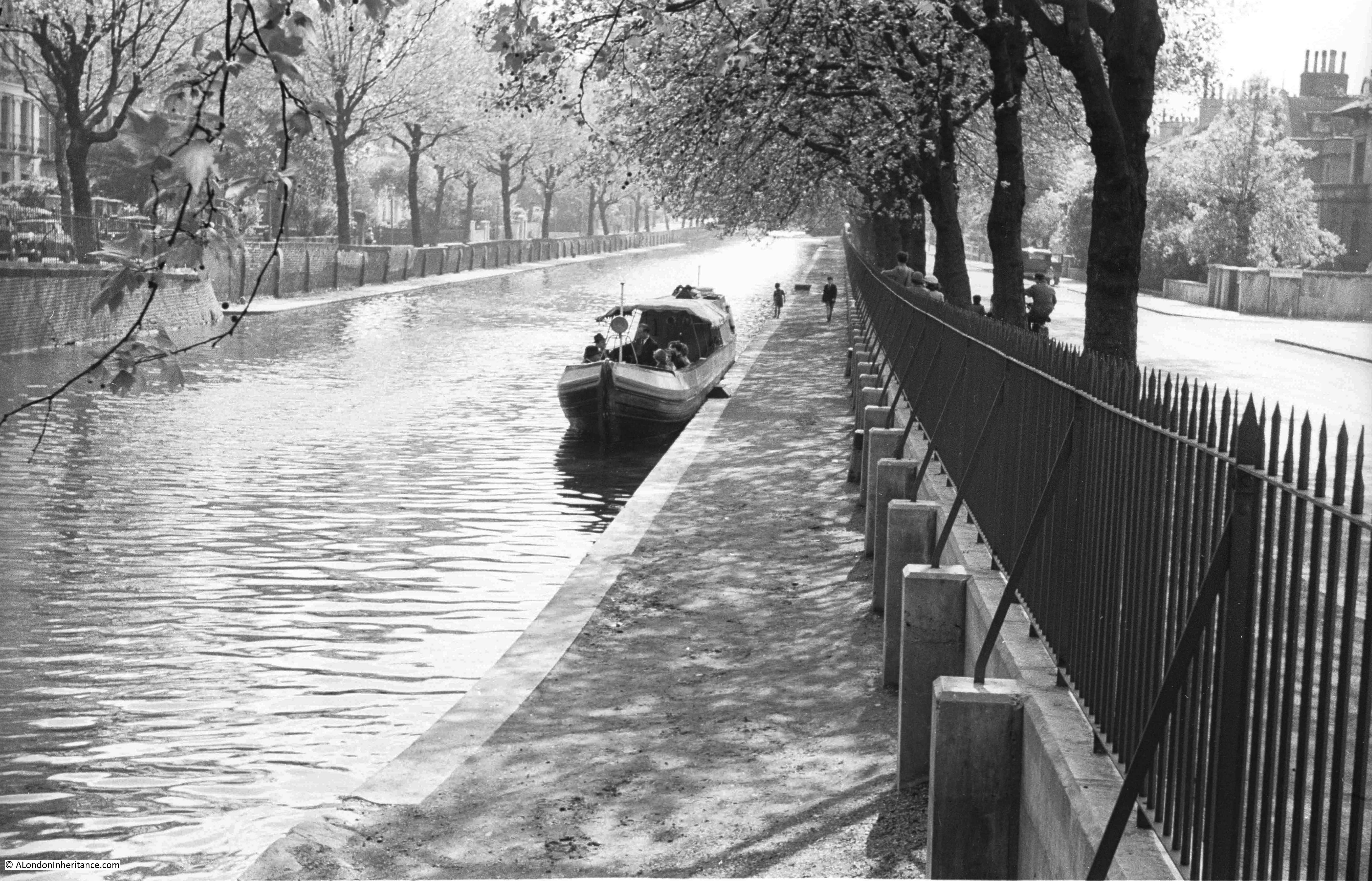
The Regents Canal stretches from the River Thames at Limehouse Basin to meet the Grand Union Canal just north of Paddington Station, at the area known as Little Venice. The stretch of the canal before it joins with the Grand Union runs alongside Blomfield Road, and it was from the Edgware Road end of Blomfield Road that my father took the following photo, looking along the Regents Canal in 1951.
The same view in July 2018:

The photos are 67 years apart, and the view, whilst basically the same, has some significant differences. Blomfield Road is to the right of the photo with Maida Avenue running along the opposite side of the canal.
In 1951 the Regents Canal was still a working waterway. My father’s photo shows a clear canal (apart from a single boat), along with an unobstructed tow path. In 1951 Blomfield Road was clear, however today, as with the majority of all London streets, Blomfield Road now has parked cars running the length of the street.
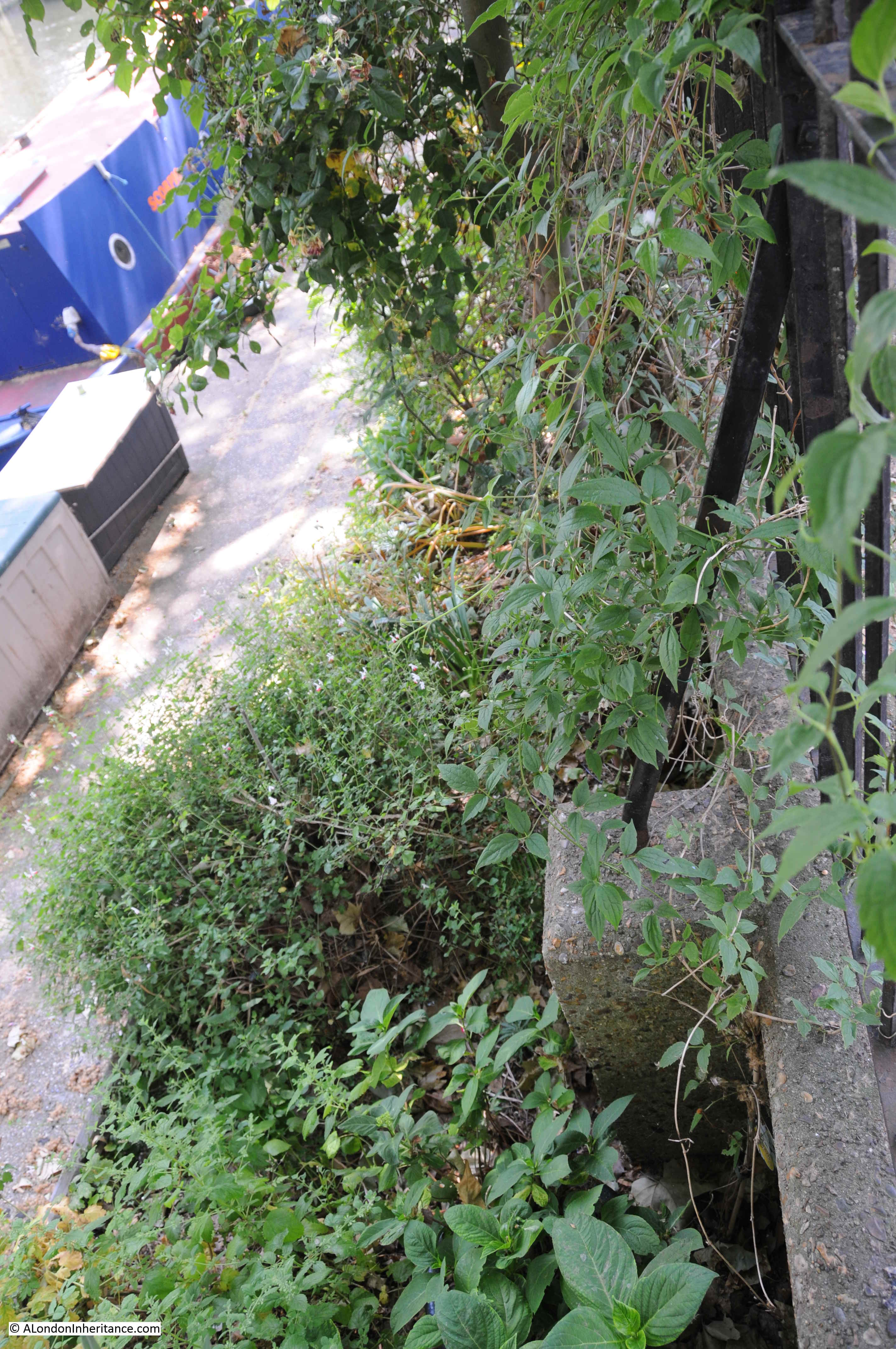
This length of the canal is now occupied by private moorings, so it is not possible to walk the tow path along the Blomfield Road stretch of the canal. Boats line the canal, with domestic paraphernalia alongside the boats with the stretch of the tow path immediately alongside Blomfield Road now occupied by a considerable amount of planting.
In the 1951 photo there are curved metal supports running from the railings down to concrete blocks. These are not immediately visible in my photo above, however walk alongside the railings and peer over and the same metal supports and concrete blocks can still be seen in the undergrowth.
My father took the photo a short distance along Blomfield Road from the junction with Edgware Road. It was at the point where a walkway leads off to the tow path.
The orange circle at the top right of the following map shows the location. (Map “© OpenStreetMap contributors”).
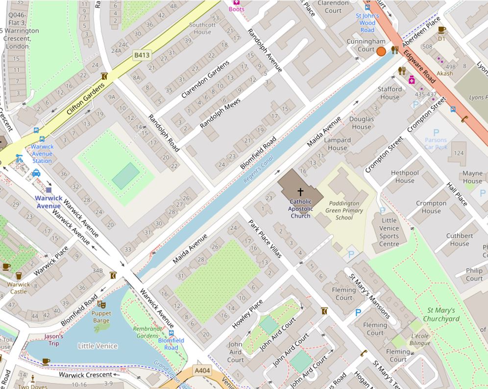
The photo below shows from where the 1951 and 2018 photos were taken – as best as I can judge, the original photo was taken just to the left of the tree, looking along the canal.

The location is close to where the Regents Canal enters the Maida Hill Tunnel:
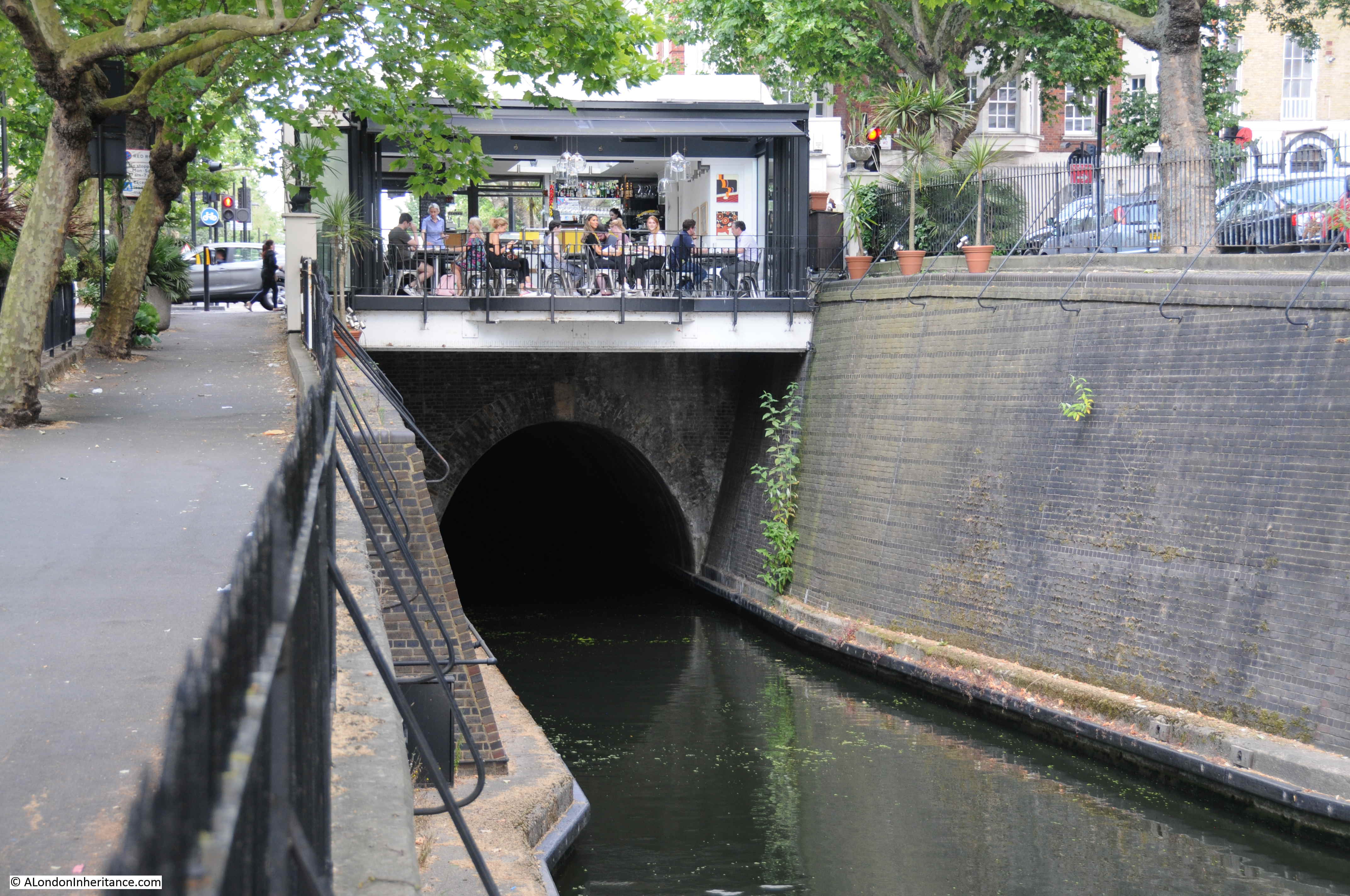
The Maida Hill Tunnel is 248 meters long, running to the east under Aberdeen Place. It is only wide enough for a single boat, so care is needed to check that the tunnel is clear before entering. Fortunately the tunnel is completely straight so checking to see if the tunnel is clear is down to whether you can see light at the far end (or hopefully another boat’s lights at night).
The tunnel does not have a tow path, so horses pulling barges along the Regents Canal would have been walked between tunnel entrances above ground, with those on the barge propelling it through the tunnel by lying on their backs and using their feet on the walls of the tunnel to “walk” the barge through the tunnel.
The cafe built above the tunnel entrance provides a rather spectacular view along the length of the canal, however whilst I was there most people seemed more interested in their phones than the view along the canal.
Construction of the Regents Canal started in 1812 from the Grand Union Canal junction, reaching Camden by 1815. The extension on to the River Thames was completed by 1820 at what was called the Regents Canal Dock, now Limehouse Basin.
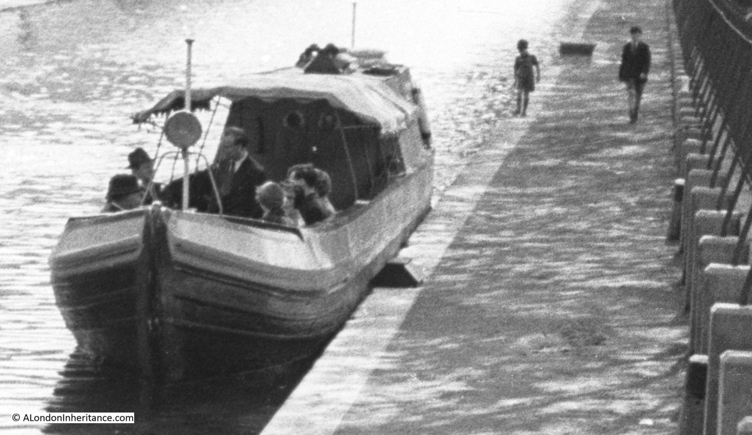
In the 1951 photo there is a single boat moored to the side of the canal. A close up reveals a rather formal group on the boat. This may have been one of the early pleasure trips along the canal. Two boys can also be seen walking along the tow path.
When the canal was built, the development of London was spreading north. Building was initially along the Edgware Road, however the development of the Regents Canal was the catalyst for further expansion to the north with Blomfield Road being named by 1841.
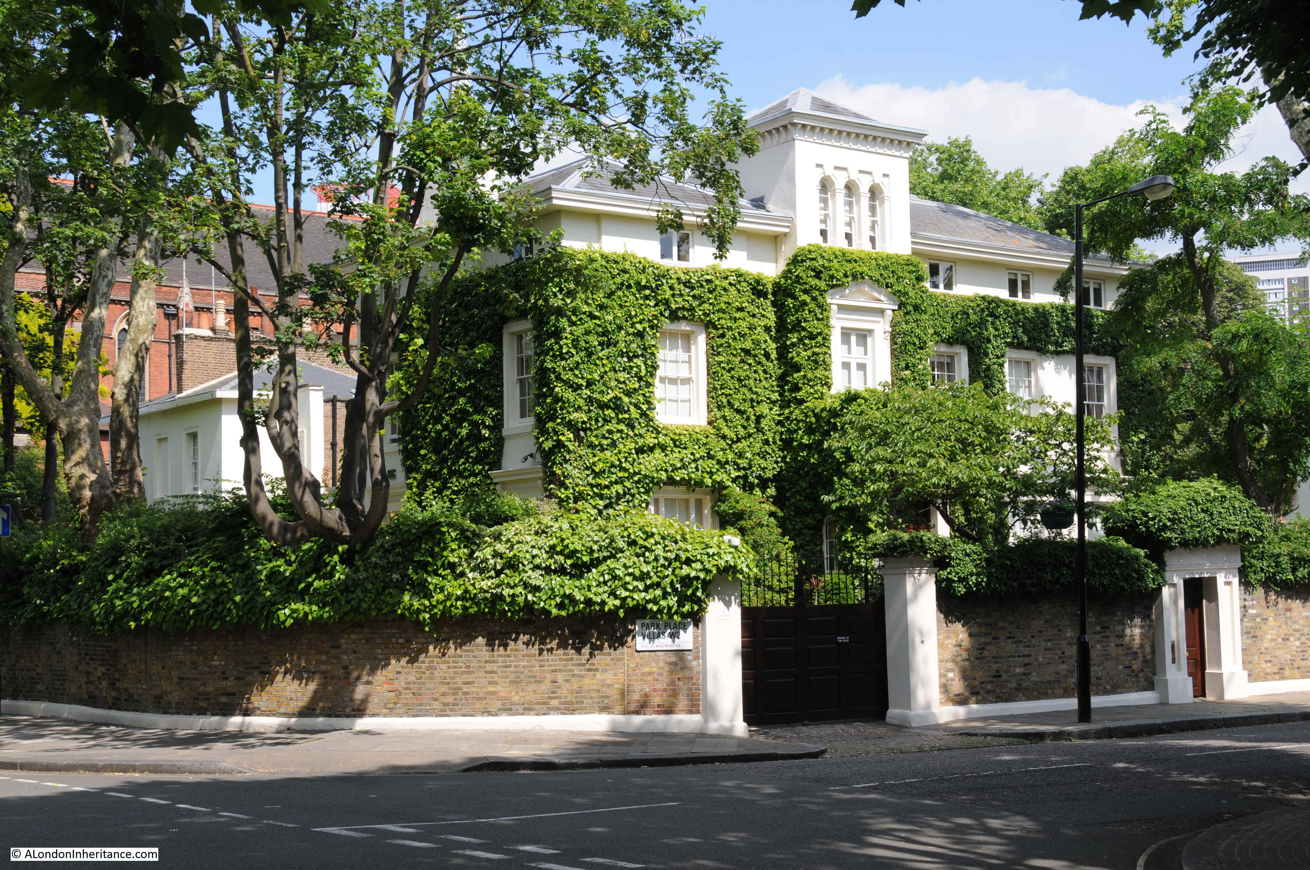
Both Blomfield Road and Maida Avenue have some rather impressive villas lining the street. The large number of chimney pots are the same as can be seen to the right of my father’s photo.

An impressive corner plot:
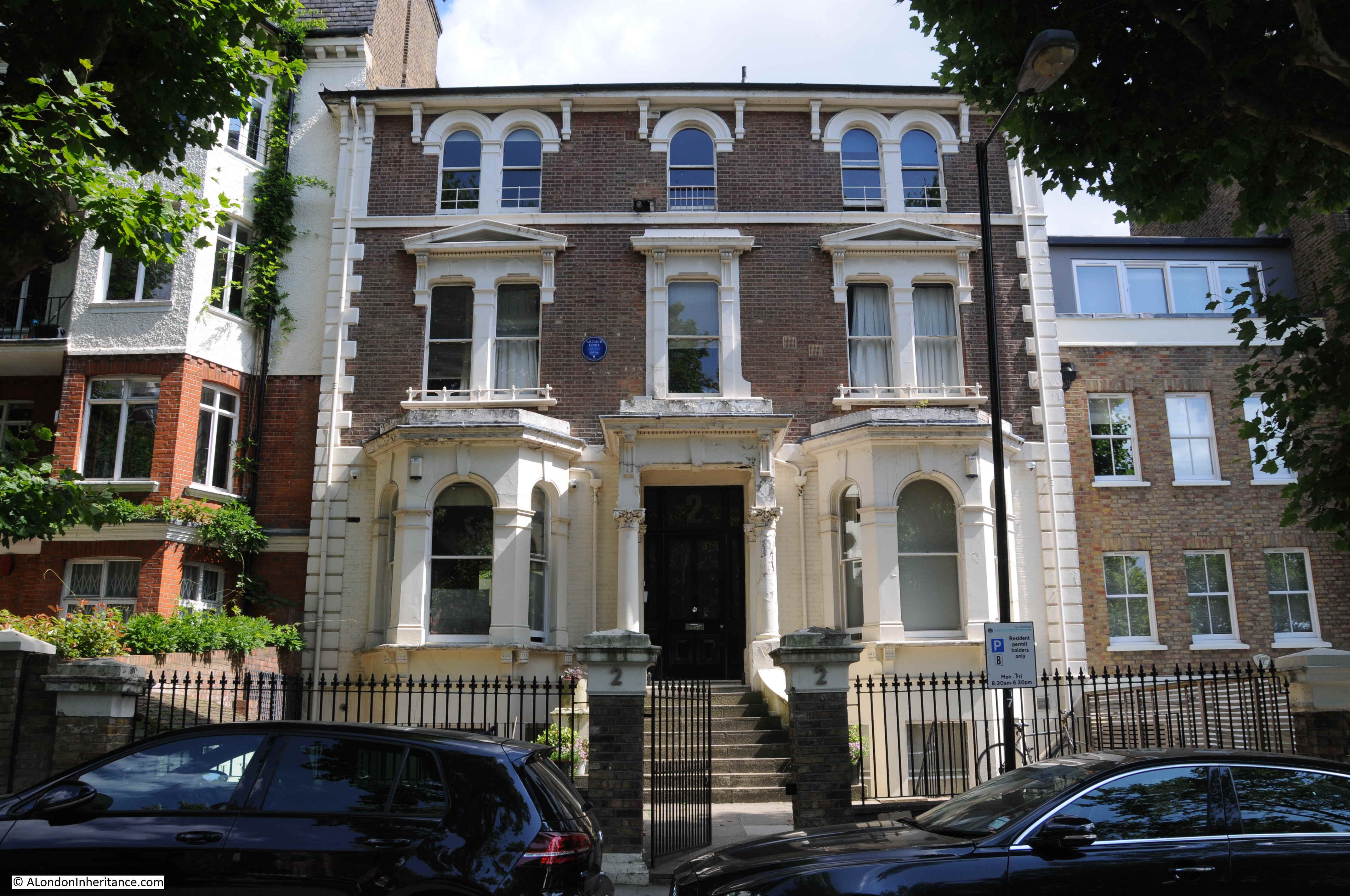
A more traditional, large, three storey town house. The blue plaque informs that Arthur Lowe (Captain Mainwaring of Dad’s Army) lived in the house from 1969 to 1982, the year of his death.
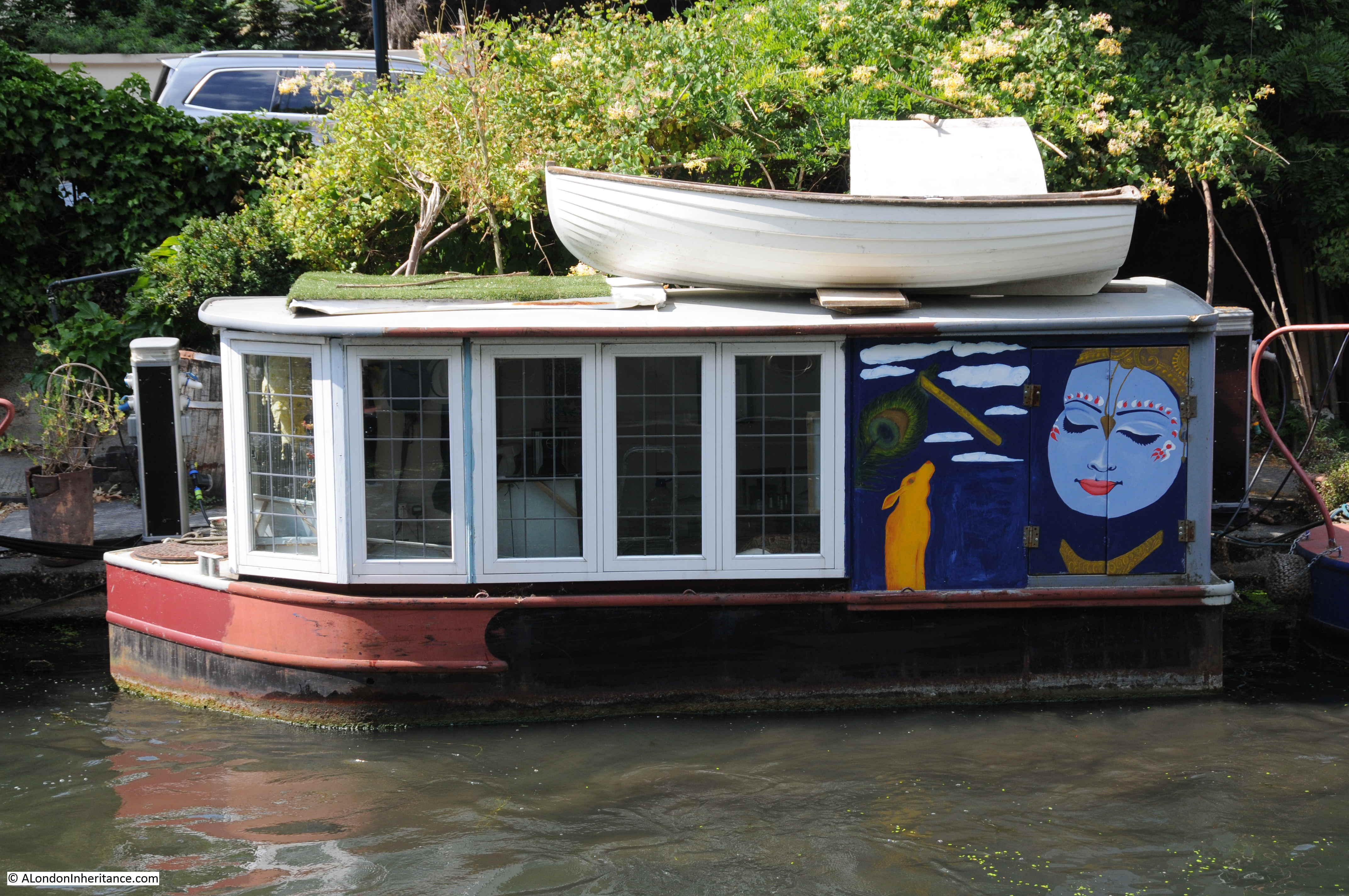
The tow path is now part of the private mooring space with access only for those with a mooring along the canal. Boat owners have set up their own garden space on the tow path alongside their boats.

The boats are very individual, with their internal decoration:
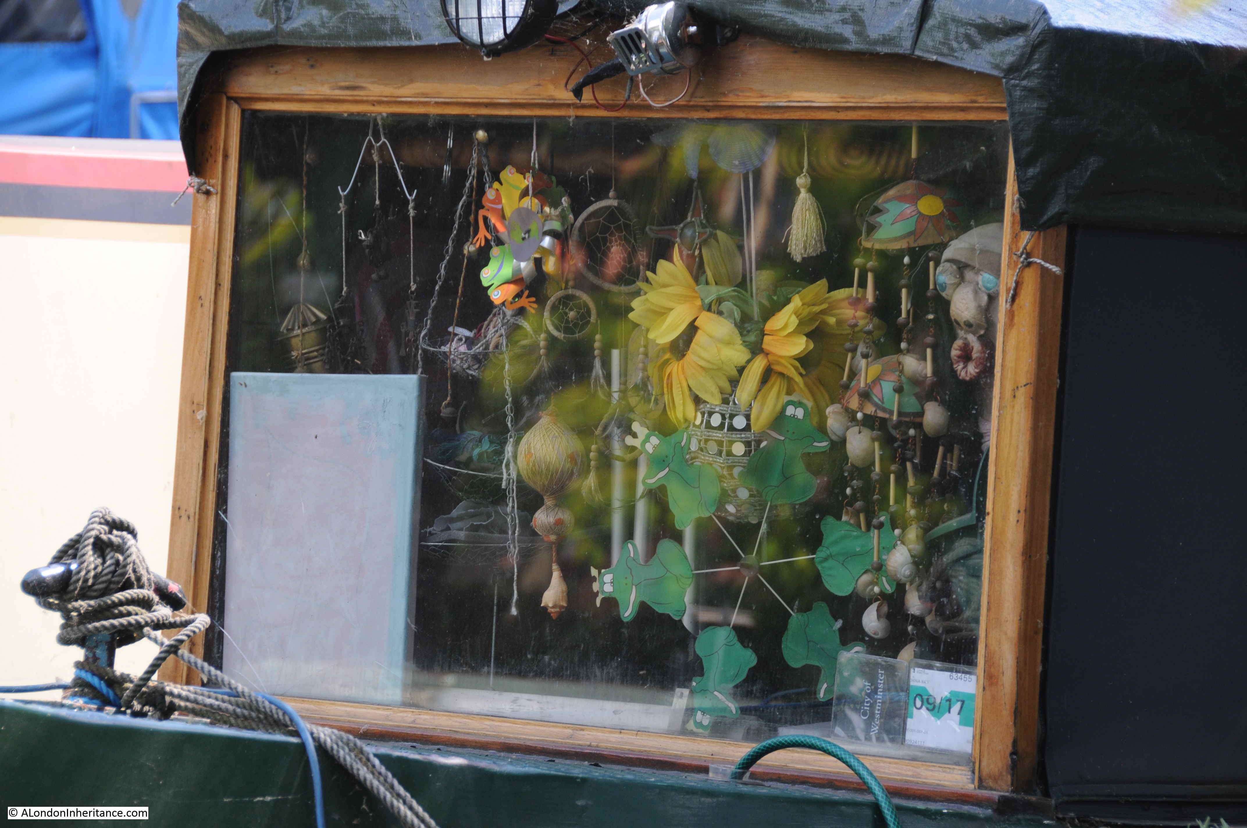
And also their design and external decoration:
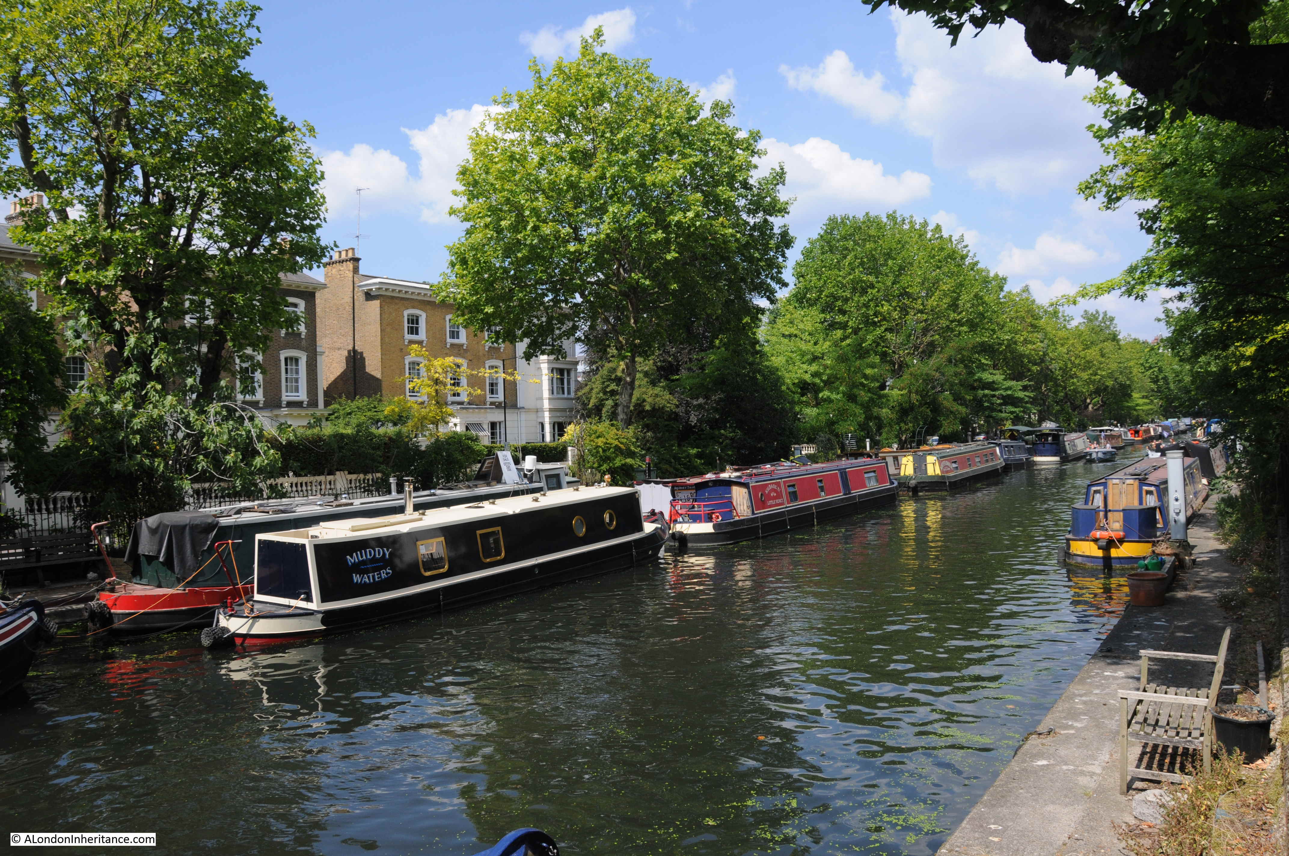
The following view is from the Warwick Avenue end of the canal, just before the Regents Canal enters the junction with the Grand Union Canal. The full length of the canal between Warwick Avenue and Edgware Road is occupied by barges and boats, many with two barges to a single berth alongside the tow path.
Where Blomfield Road meets Warwick Avenue there is a bridge that carries Warwick Avenue across the Regents Canal. Through the bridge is the larger expanse of water that makes up the junction with the Grand Union Canal and the branch down to the Paddington Basin.
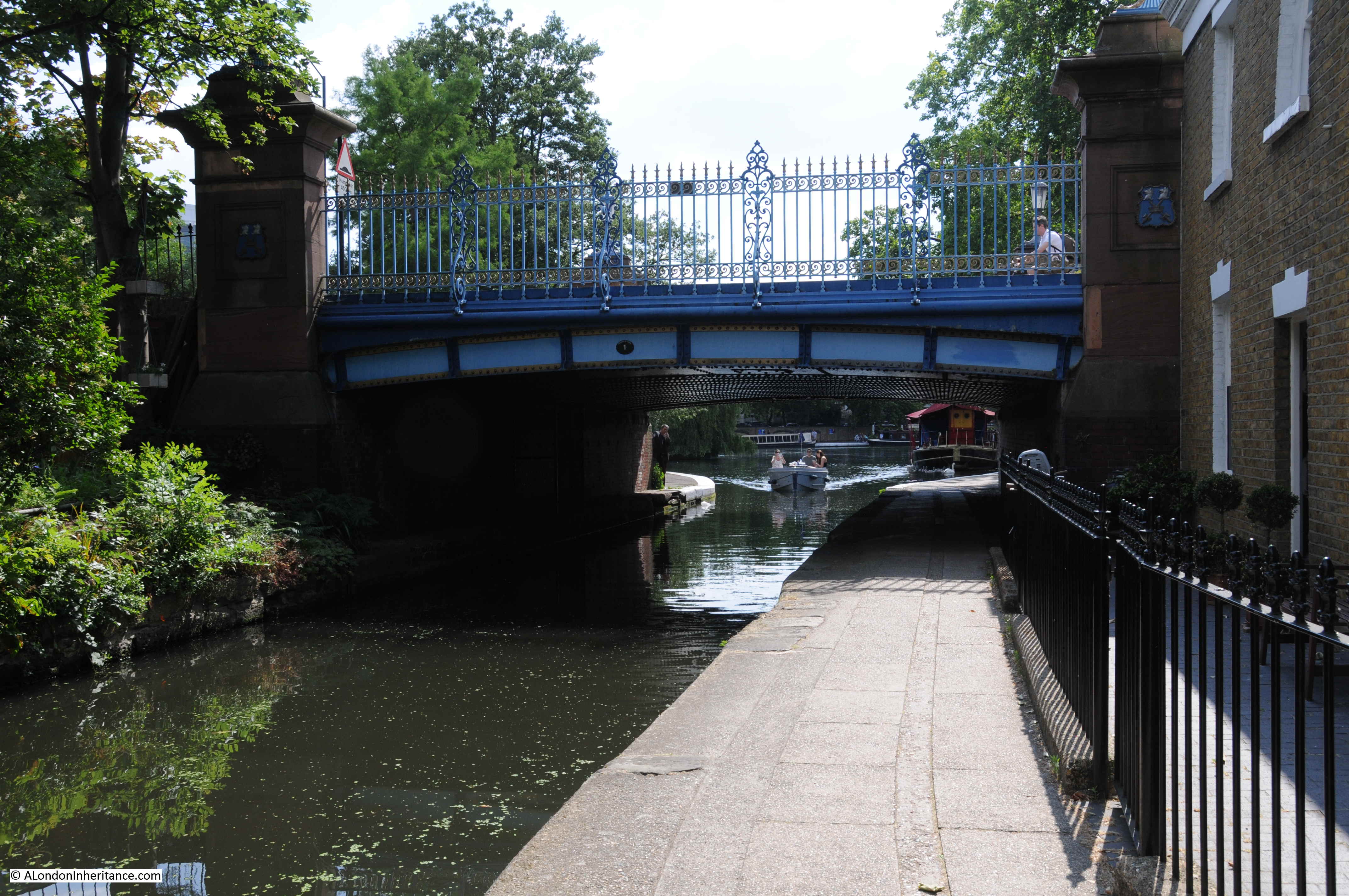
The next photo is the view from the top of the bridge looking back along the canal with Blomfield Road on the left. The empty canal in my father’s photo now looks very different.

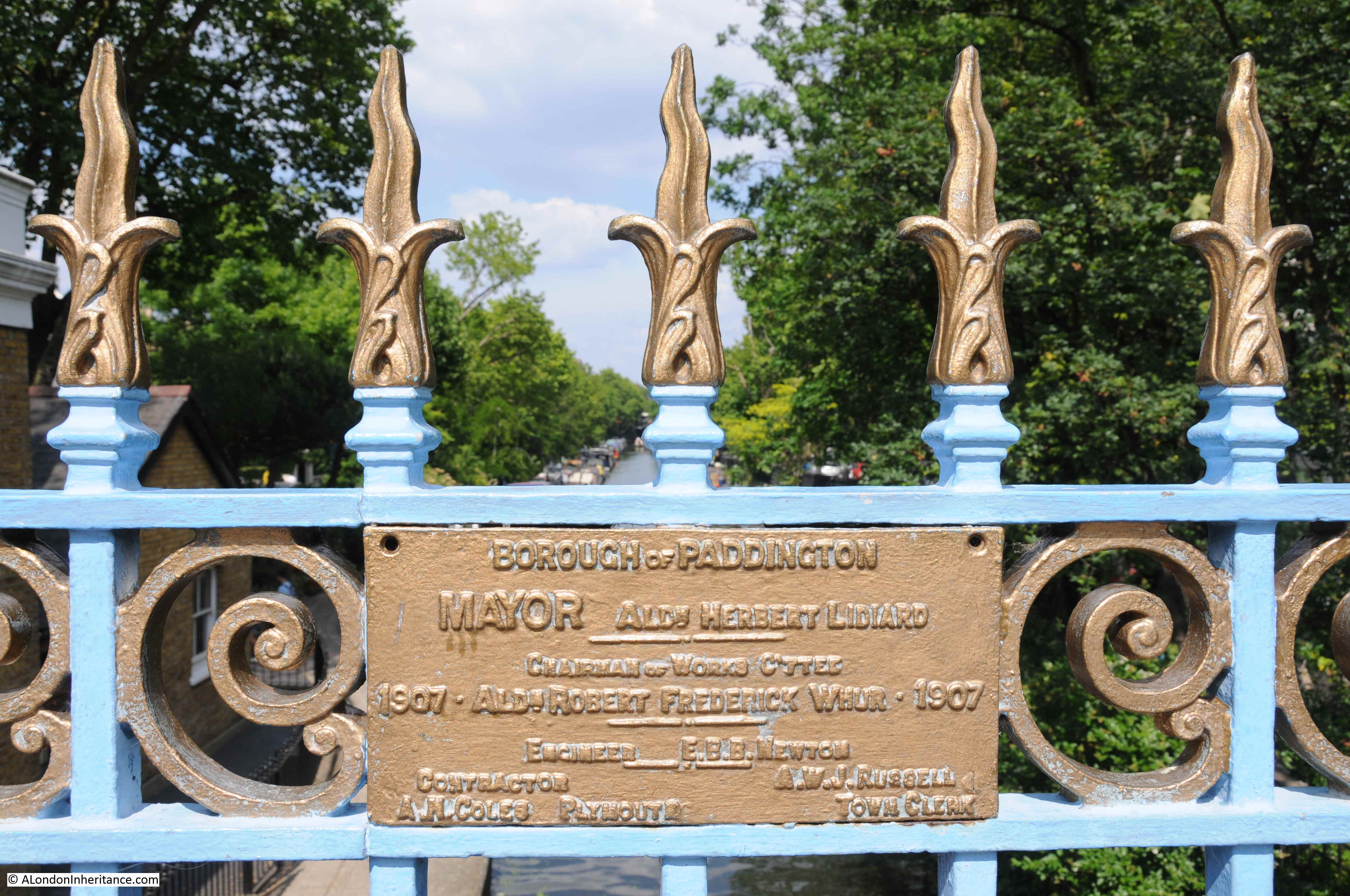
On the railings along the side of the bridge there is a rather nice plaque dating the current bridge to 1907 and constructed by the Borough of Paddington.
I always wonder why my father took the photos from the position that he did. I would have thought that the bridge provided a better viewpoint, however given that the majority of the canal as seen from the bridge was empty in 1951, his photo from the Edgware Road end of Blomfield Road included the boat with the group of people, possibly waiting for a trip along the canal, and the two boys walking along the tow path. It was probably these features that added to the overall composition of the photo.
It also makes me very aware of how photography has changed from when my father had the expense of film and developing of the negatives, so individual photos had to be more carefully considered. Compare this to digital photography today when having paid for the camera and memory cards the cost of photo is effectively zero.
The Regents Canal offers some fantastic walking. I have walked several sections, but never the entire length of the canal – another long walk added to the ever growing list.
I’ll have to add this stretch to the walks I sometimes take as I return northwards via Kings Cross station. The juxtaposition of old and new – such as at the Gasholder development – always astonishes me. On the whole, I guess the canal retains much of the atmosphere present in your father’s day.
Lovely to read this. I grew up in Maida Vale in the 1950’s & 60’s, as did my father who was born there in the Edwardian era. Way back in the 1920’s he & his brother skipped off Sunday School one Sunday to play by the Regents Canal. Unfortunately, his brother slipped and fell into the canal &, not being able to swim, had to be rescued by a nearby boatman. They returned home to severe punishment! Sadly, Maida Vale is now way beyond the financial reach of ex-locals, such as me!
I can recommend the excellent book, ‘Glimpses into the Past: Paddington, Little Venice & Maida Vale over the years’. Hans Norton (editor) published by the Paddington Waterways & Maida Vale Society Local History Group. 2005. T contains some excellent in-depth articles including ‘Stucco Houses & the Great Crash 1830-1865’ which contains information about the development of Blomfield Road.
Those are lovely photos in a cherished place. Thank you for publishing them and your essay. When I was in my mid-20s I worked in London as a U.S. expat for Esso Petroleum. An American colleague my age lived on the canal in a rented flat in the toll house at Delamere Terrace where a separate bridge crosses the canal at Blomfield Road. In the final two photos above if you’d turn around on the Warwick Avenue bridge and look across the basin at Little Venice, you’d see the bridge and toll house where the Grand Union Canal’s Paddington Arm meets the Regent’s Canal and Paddington Basin.
My friend and I used to walk along Blomfield road in the summertime to Lord’s to watch Sunday League matches (one-day, limited-over cricket) or longer tests. We’d take the Sunday papers and lounge in the (sometimes) sun. I still have my floppy Marylebone Cricket Club sun hat from those days. Or we’d walk the tow path through Regent’s Park to Camden Lock and back. I recall admiring the private portion of the towpath east of Warwick Avenue and the variety of houseboats and garden paraphernalia along there.
Last summer I spent a couple weeks in London on holiday this time of year. I walked the Paddington Arm of the GU Canal on my first day in town, from Kensal Green Cemetery to Camden. I, too, noted that little cafe perched above the canal tunnel entrance and also that no one there was actually anjoying the view oft he canal! Later the following week, I walked it from Camden to Limehouse. The toll house on Delamere Terrace, where my friend once lived, is now fully occupied by the canal trust. The canal to the west of Little Venice passes Trellick Tower. The walk from Kensal Green to Paddington is interesting .
The stretch from Camden to Limehouse is really worth walking, too, moreso than the segment from Kensal Green to Maida Vale. The locks in Islington adjacent to City Basin are splendid and one can depart from the towpath at leisure to take in interesting architecture in adjoining neighbourhoods, such as the houses ringing De Beauvoir Square off Kingsland Road; London Fields and Broadway Market; Victoria Park; and Mile End Park. The latter has an interesting lock at its south end, which was being opened when I happened upon it on a previous visit. I enjoyed a chat with the lock operator.
At Limehouse Basin it’s worth taking in Nicholas Hawksmoor’s lovely St. Anne Limehouse, just east of the basin off the towpath of the Limehouse Cut, which runs from the River Lea at Three Mills/Bromley-by-Bow to Limehouse. Ropemaker Fields park along the way affords a fine view of the adjacent Canary Wharf skyline.
Finally, the walk along the Thames from Limehouse up the Thames through Shadwell Basin and Wapping, and thence up to St. Katherine’s Dock and the Tower Bridge, is interesting, too. The bascule bridge at Shadwell Basin and the Tudor (c. 1520) pub, The Prospect of Whitby, at the south end of the bridge are lovely. The docks here (Western and Eastern and Shadwell Basin) were filled in during the ’80s. In addition to admiring the handsome rehabilitated warehouses along the river, I enjoyed seeing how the new housing built in this area in the ’80s and ’90s, and the ornamental canal installed through what was the Eastern and Western Dock potions, preserves a gentrified feel for the old character of the area. It’s worth taking a detour here above Tobacco Dock to the top of Wapping Lane to see a real Hawksmoor gem, St. George-in-the-East, and contrast it with St. Anne’s Limehouse. Ian Nairn’s guide to London has pithy observations about both churches that are worth reading.
On my next trip to London I have a walk planned from the GU Canal at Northolt to Kensal Green Cemetery. Some day I may do the final four-mile stretch of the Paddington Arm from Northolt south to Bull’s Bridge.
Thanks again for your regular posts. It had been nearly 20 years away from London for me since I began returning on business 3-1/2 years ago. I’ve so enjoyed walking it extensively since then. Your essays give me further nooks and crannies to investigate.
It is so nice to see these canals still being used, I lived in Newcross in the 80’s where there was a canal that we would go and play in, we watched the Gypsy boats pulled by the horses it was a great sight, I believe it ran under Old Kent Rd, it was such a sham these were filled in, does anyone know of a canal map showing the them when they were all in use?
David, have a look for “Surrey Canal” in this 1895 OS map available on the excellent National Library of Scotland site:
https://maps.nls.uk/view/101202207
Your canal did indeed pass under Old Kent Road and its tramlines. As ever, it is fascinating to trace the course of former transport routes on modern maps to see how they have been absorbed into the cityscape. But in this case, with nothing like the status of the Maida Vale section of the Regent’s Canal.
My uncle ran pleasure cruises in an narrow boat Late 1950s early 1960s.
They had second a boat as their home, moored in the basin of Little Venice.
I remember motoring through the tunnel, out into daylight, past Regents Park and London Zoo.
It was great fun visiting and pretending to be an important part of the crew.
My cousin being a little older, about 13 was sometimes given the responsibility of being the helmsman.
Martin Glassborow
I’ve just come across a picture of a narrow boat providing trips on the Regents Canal in the 1960s. It is named as ‘Jason’ & the name of the owner/operator is painted on the side. This is John James & gves the telephone number as Cunningham 4328. Would this be your uncle? The boat is underway and, by modern standards, is seriously overcrowded! Passengers are even sitting on the roof with feet dangling. All sans life jackets!! The pic appears in a book published by the Paddington Waterways & maida Vale Society Local History Group. I can scan the pic if you like.
Jason is alive and kicking and still operates a service from Brownings Pool (Little Venice) to Camden and back. Check out their web site http://www.jasons.co.uk/index.html
A very nice read alongside well taken and considerate pictures, look forward to next week thank you