If you are interested in exploring the history of Bermondsey, three tickets have just become available for my walk next Saturday, the 31st of October. Click here for details and booking.
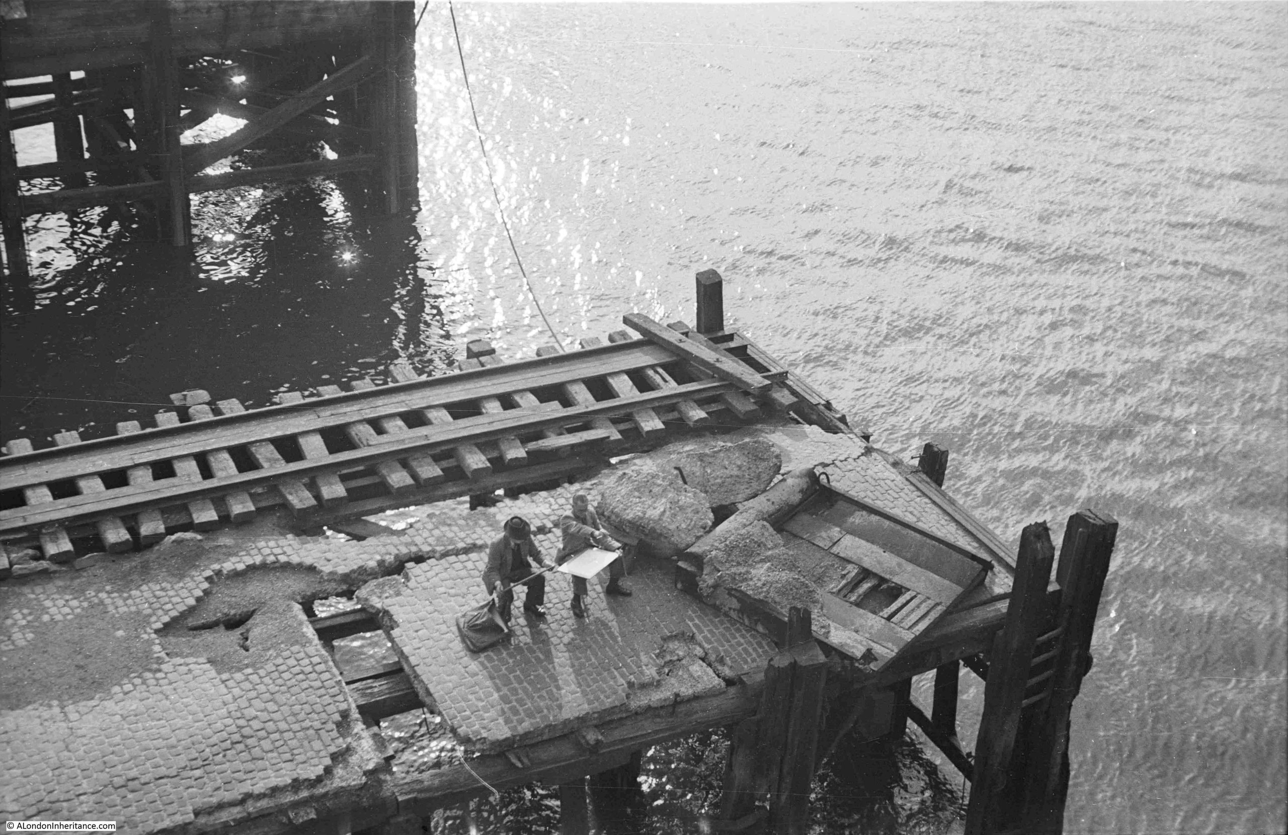
The location of the following photo by my father has been a puzzle for some years, and I still cannot be sure exactly where it was, or from where he took the photo, which shows two artists work on a landing stage over the Thames:
The photo adjacent to the above photo on the strip of negatives, showed a view across the river from south to north, underneath one of the many piers, landing stages, crane platforms etc. that lined the edge of the river:
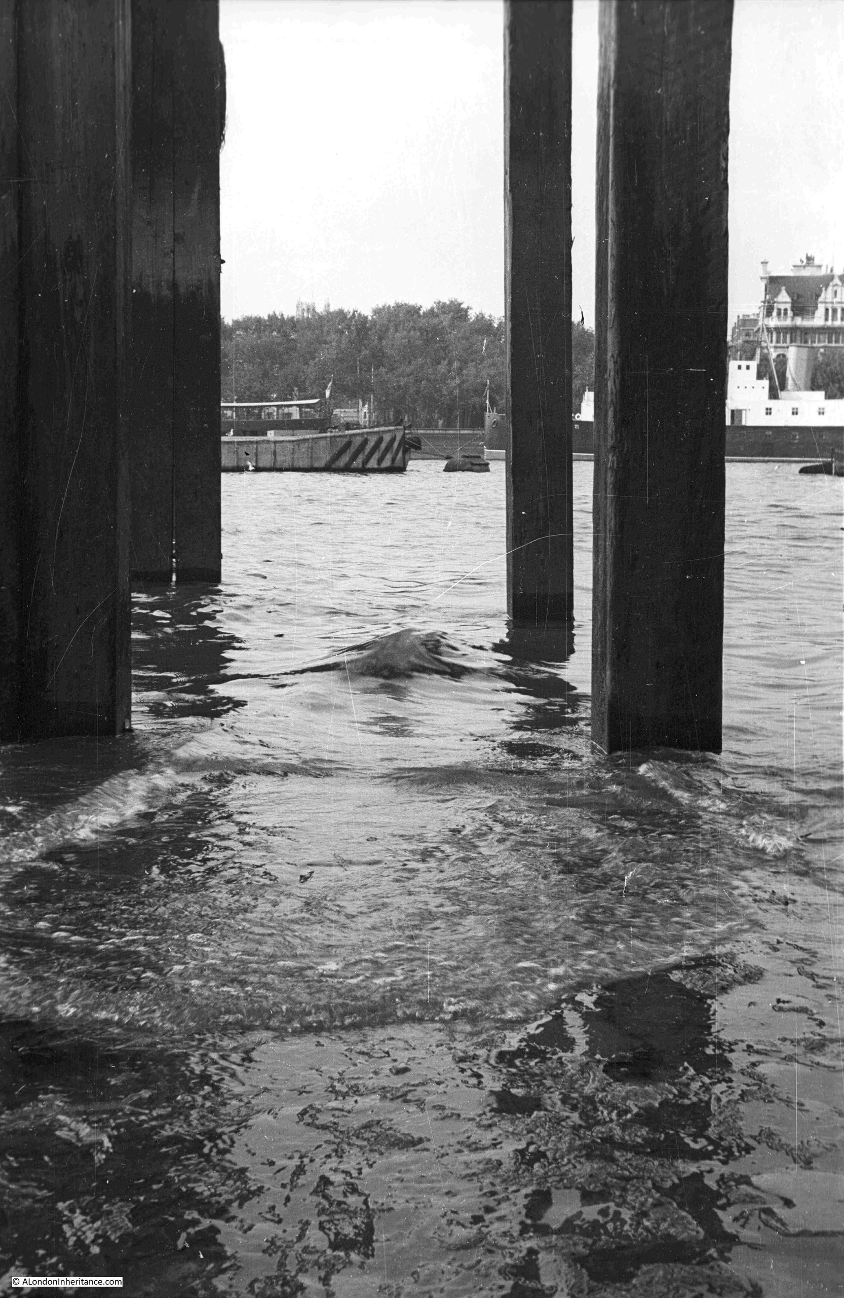
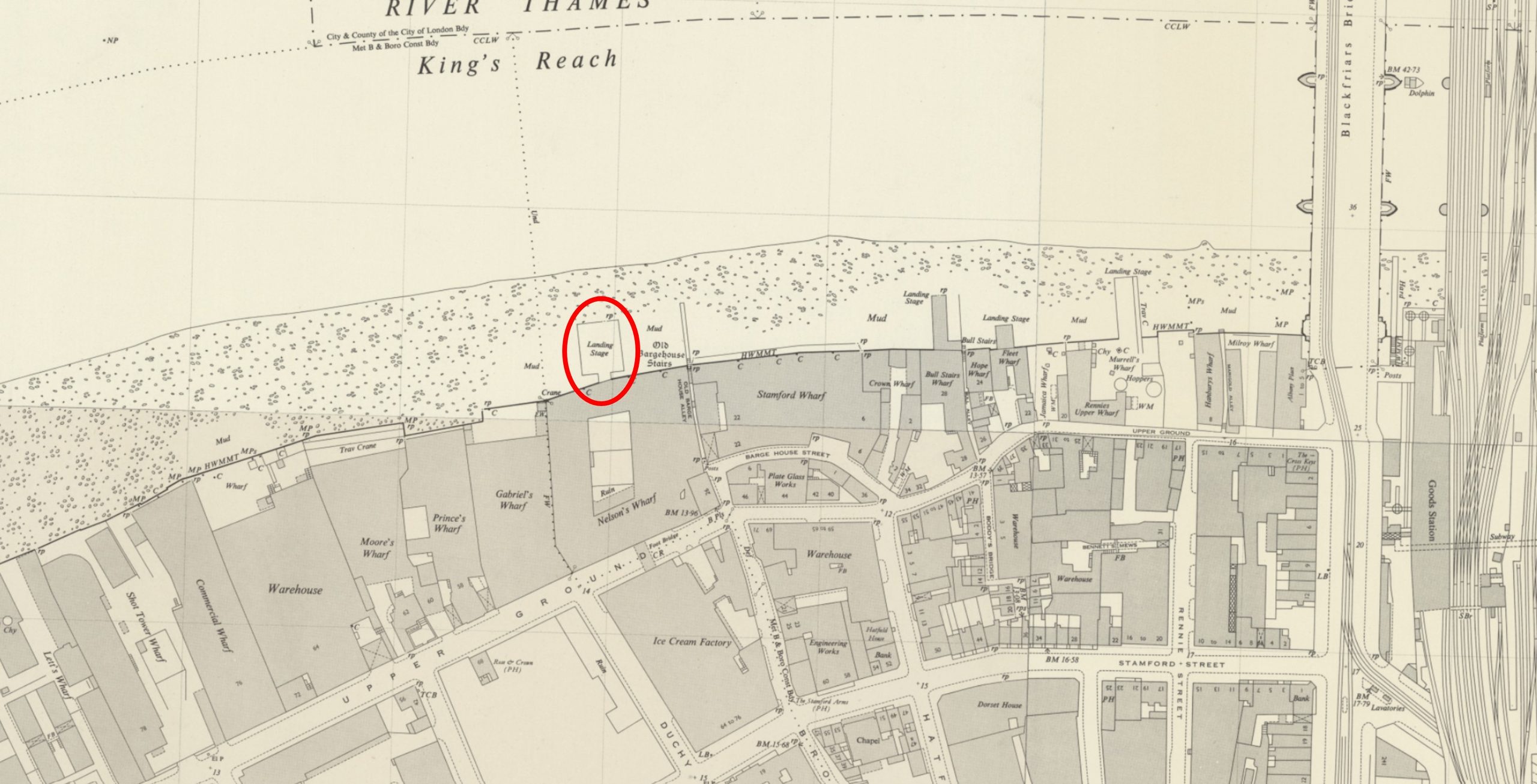
I believe the above photo was taken from below the landing stage which I have marked in the following extract from the mid 20th century version of the OS map (‘Reproduced with the permission of the National Library of Scotland“):
The landing stage does not exist today, however there are now a couple of much smaller walkways over the river along the river walkway in front of Gabriel’s Wharf and the Oxo Tower.
This is the first of the walkways. It has a really good view over to St. Paul’s and the City. Whilst the towers in the City would not have been there when my father photographed the artists on the pier, the site would have provided a really good view of St. Paul’s Cathedral:
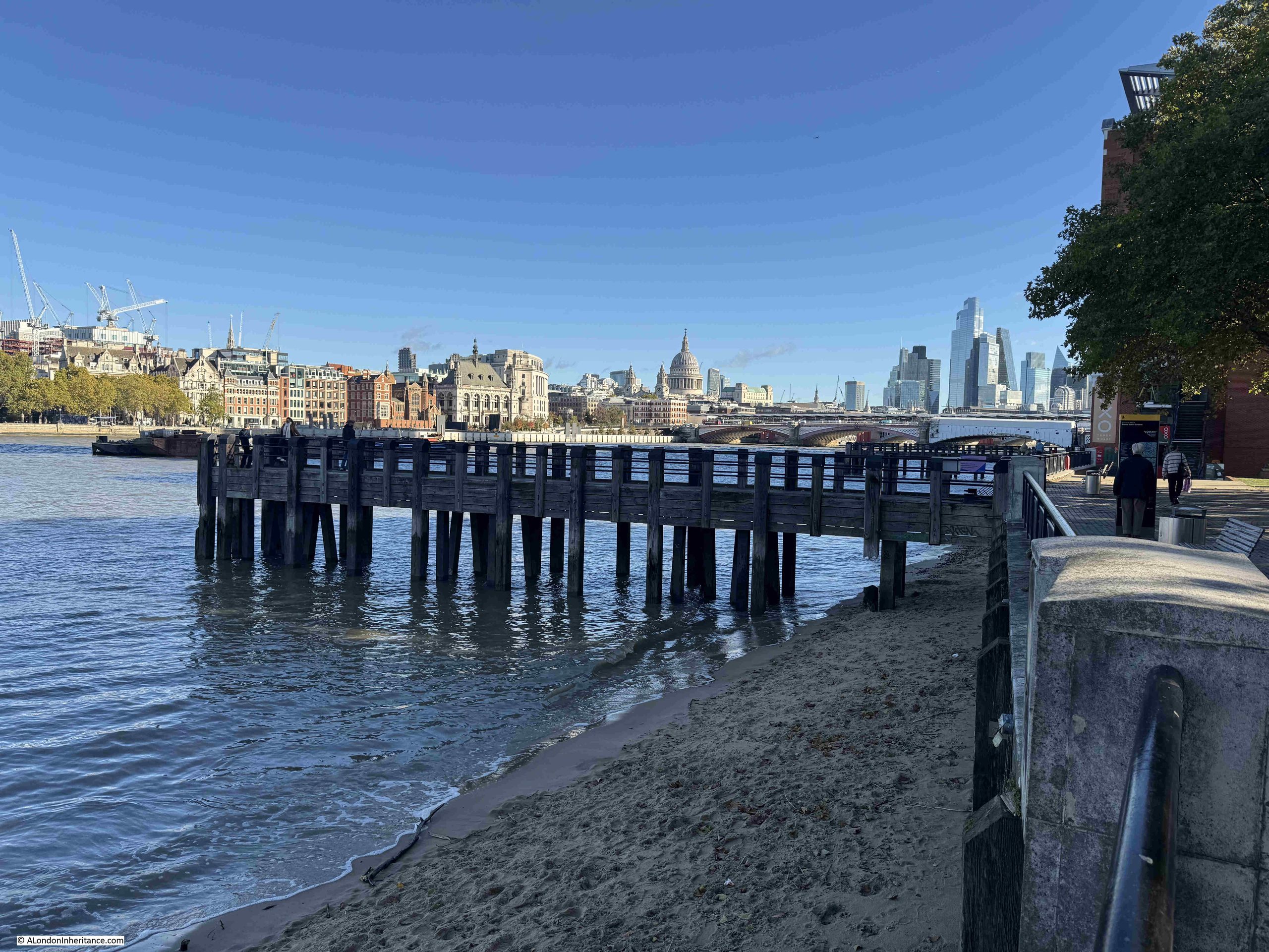
Although the position does not look exactly right. In the photo taken underneath the pier, across the river can be seen trees and a building with a distinctive upper level. The trees form part of Inner Temple Gardens, which are still there today, along with the building on the immediate right of the trees:
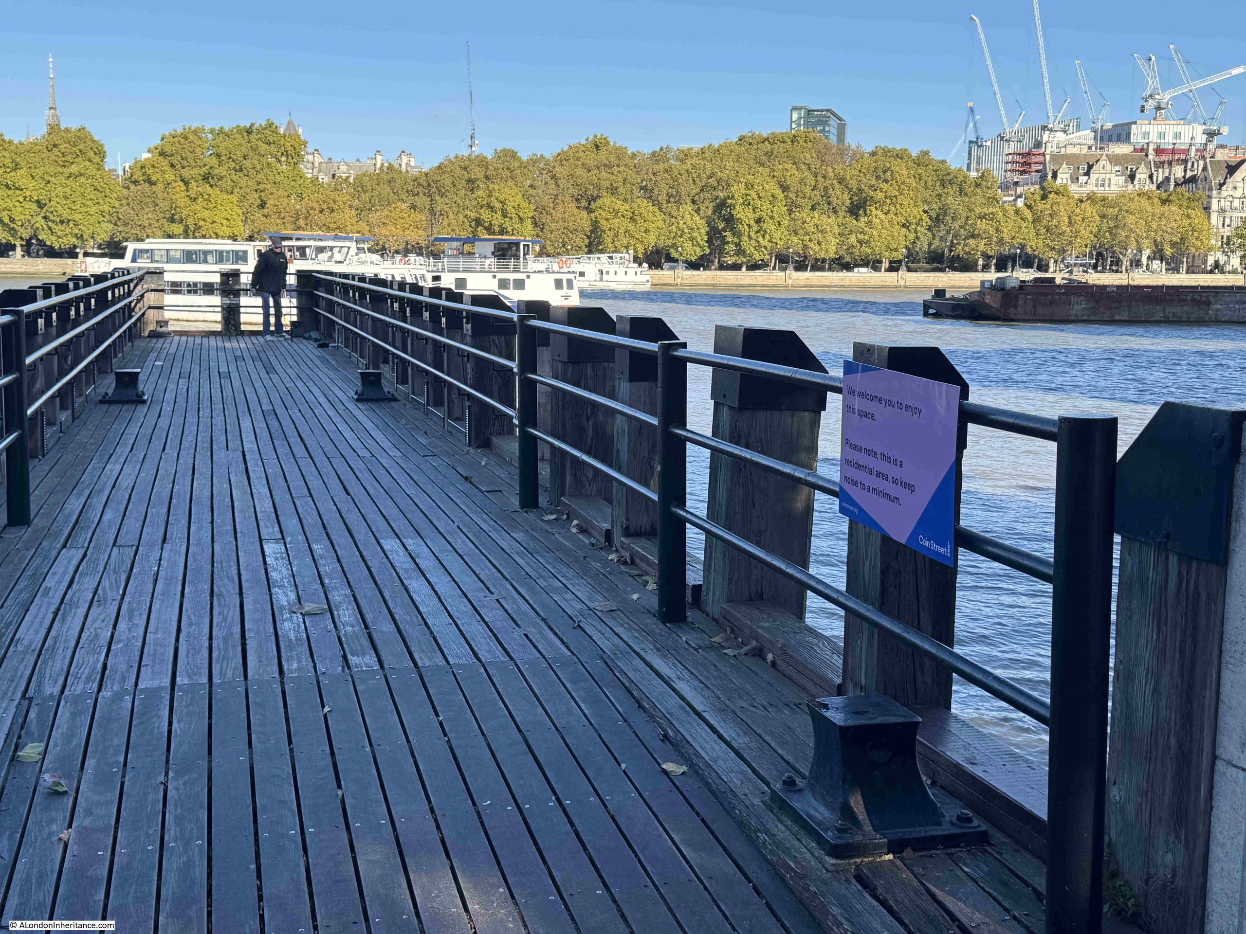
The view from the above pier looks to be slightly off from where my father took his photo, so I moved to the second pier, this one in front of the building with the Oxo tower. Again, this pier offers a good view for an artist:
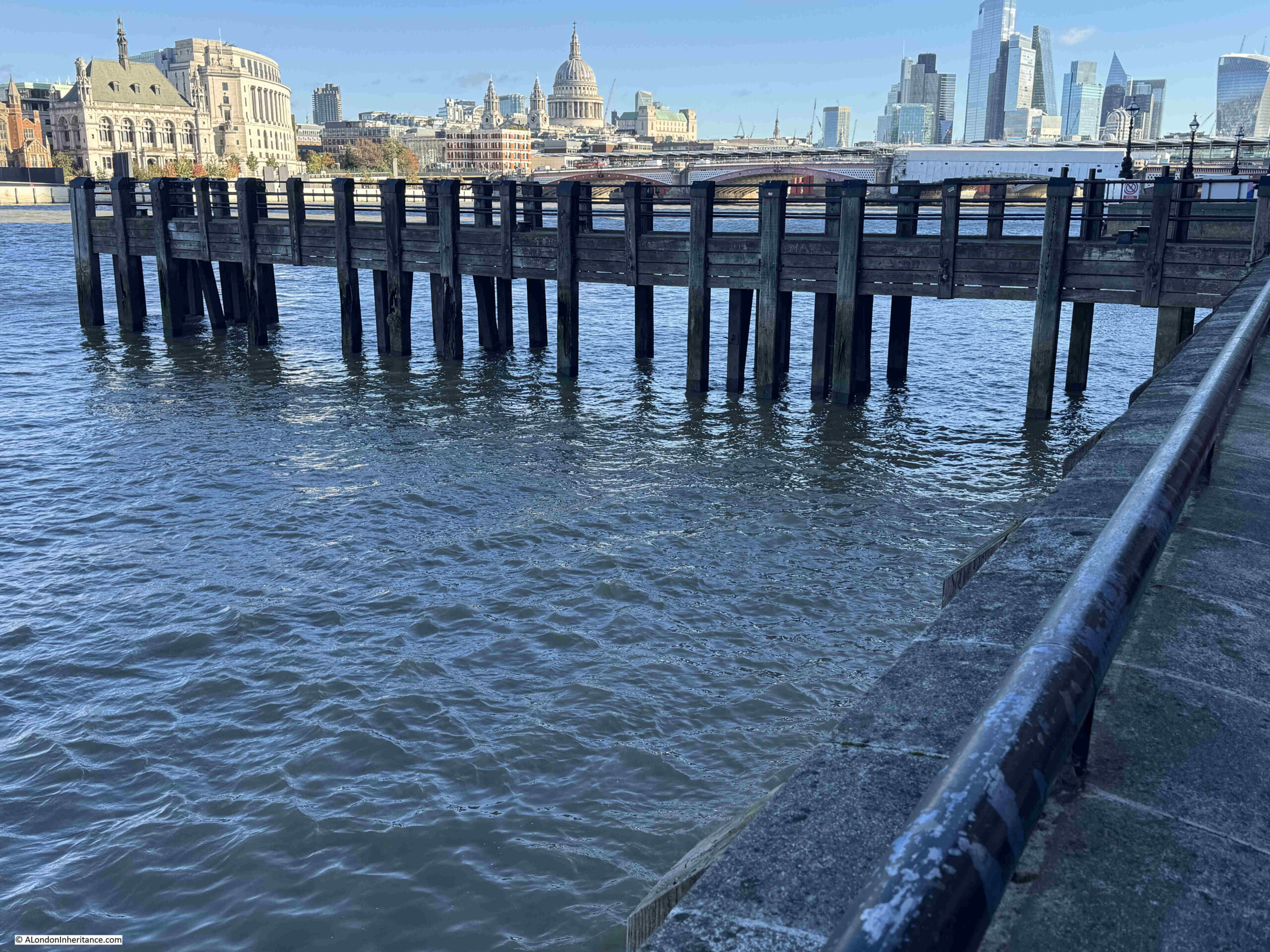
And whilst the tide was not out enough to allow a walk under the pier, from the top, we can see that the view looks much closer to my father’s photo, although this time perhaps a bit too far along the river:
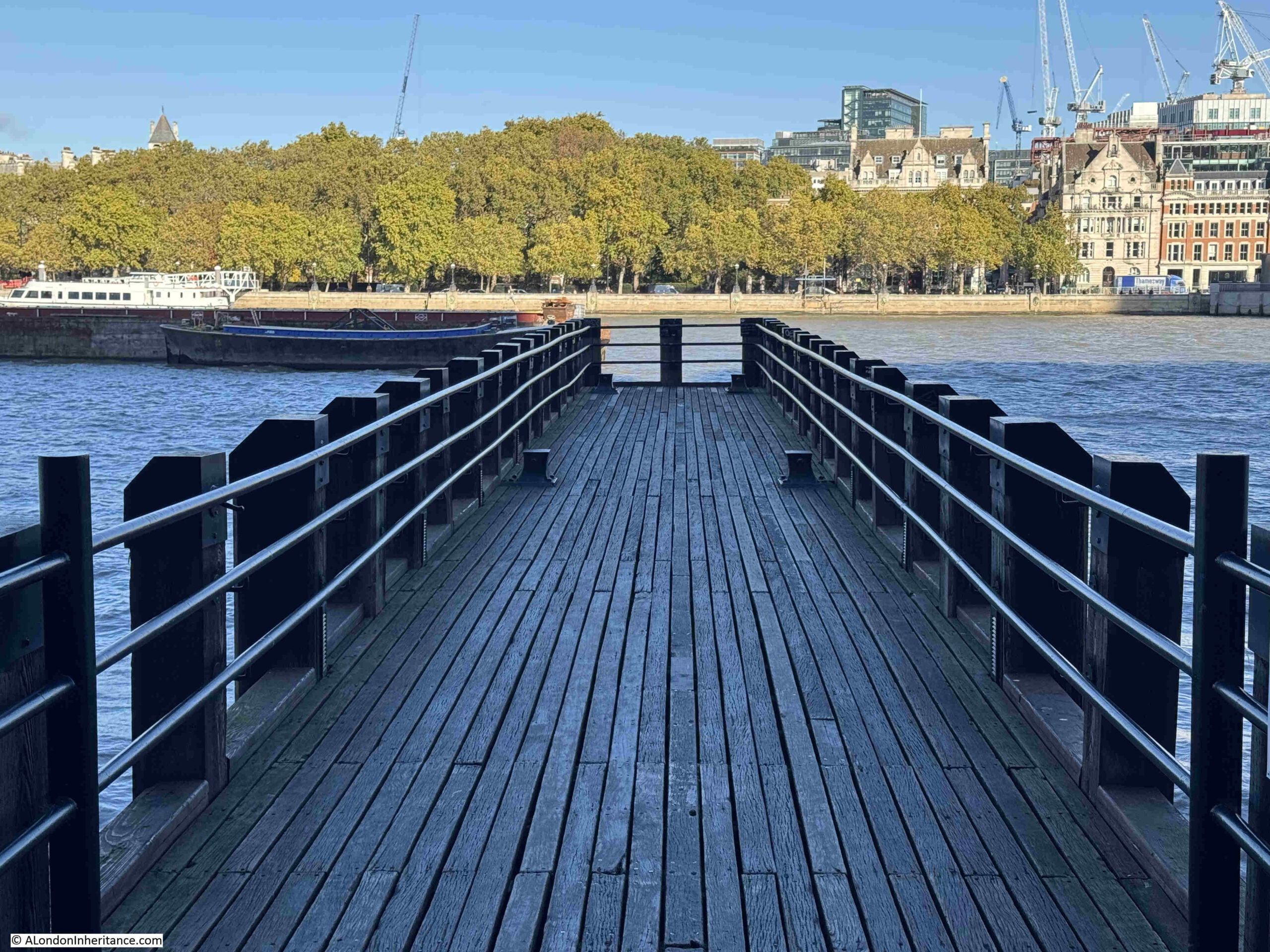
So whilst the two piers are not in exactly the same place as the landing stage shown in the OS map, they confirm that the landing stage must have been the right place for the photo taken on the foreshore, but what about the artists – where they on the same landing stage?
I suspect not. Firstly, in the back of the photo with the artists, there is another landing stage in the background, and this is not shown in the OS map, where there is just the single landing stage.
Secondly, looking at the surface of the landing stage on which the artists are working, it is in very poor condition. Behind the artists there is a section of rail. This was common on landing stages and alongside wharfs on the Thames, as they provided the means on which travelling cranes could move, however as with the rest of the landing stage, these rails look to be in very poor condition and it is doubtful they were still in use at the time.
Looking along the foreshore in the OS map from the Southbank to Tower Bridge, there is one landing stage that has rails, circled in the following map (‘Reproduced with the permission of the National Library of Scotland“):
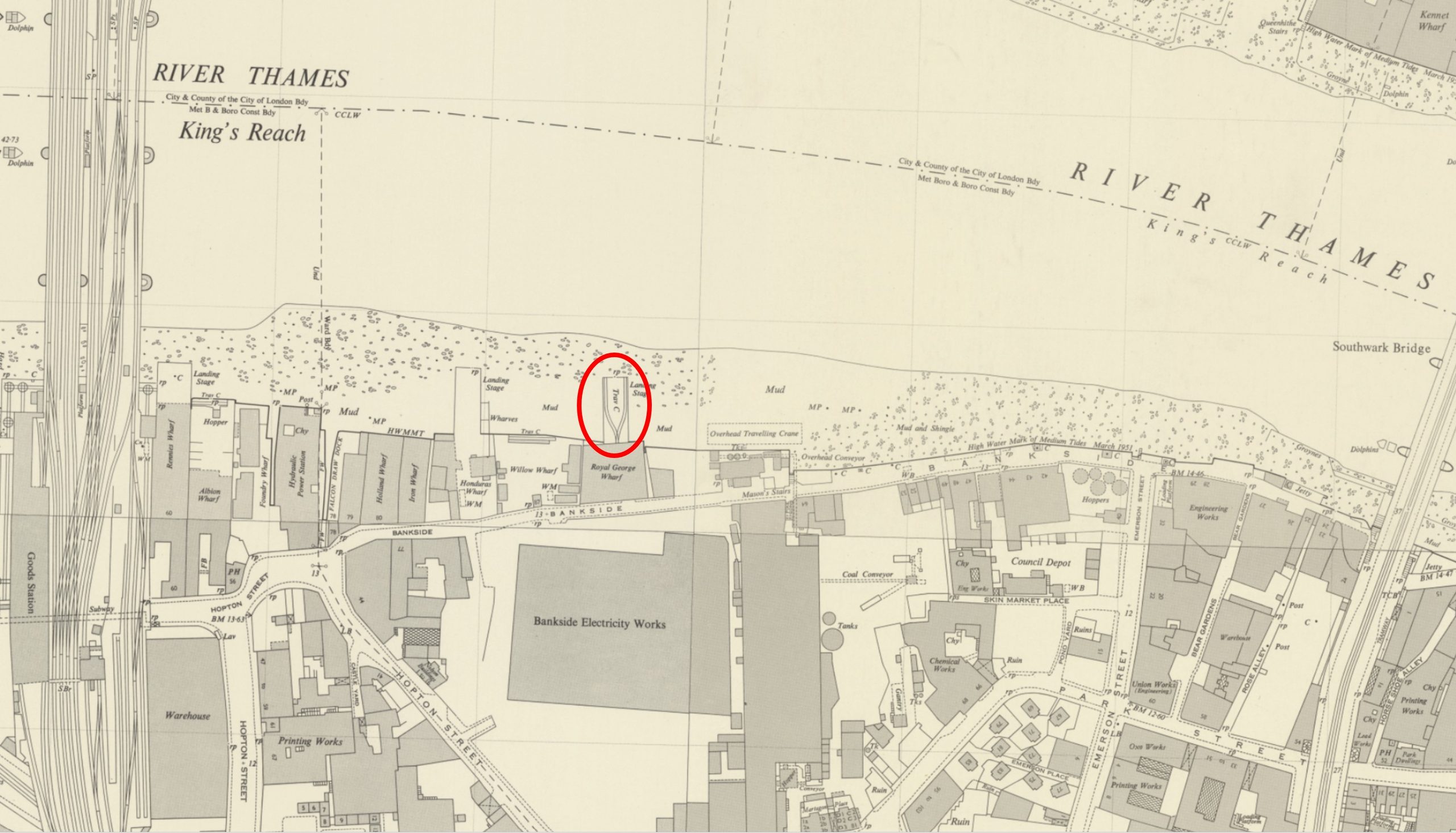
This landing stage is in front of the original Bankside Power Station, and there are two sets of rails, running on either side after splitting out from Royal George Wharf. The Landing Stage is labelled as having a Travelling Crane.
There is also another landing stage to the left, which could have been the landing stage in the background of my father’s photo of the artists. It looks slightly further away than in the photo, but the perspective of the photo could be bringing the landing stage closer.
When my father took the photos, the original Bankside power station was part closed, and soon to being the process of demolition ready for construction of the Bankside Power Station / Tate Modern that we see today, so that could explain why the landing stage was in the state it was.
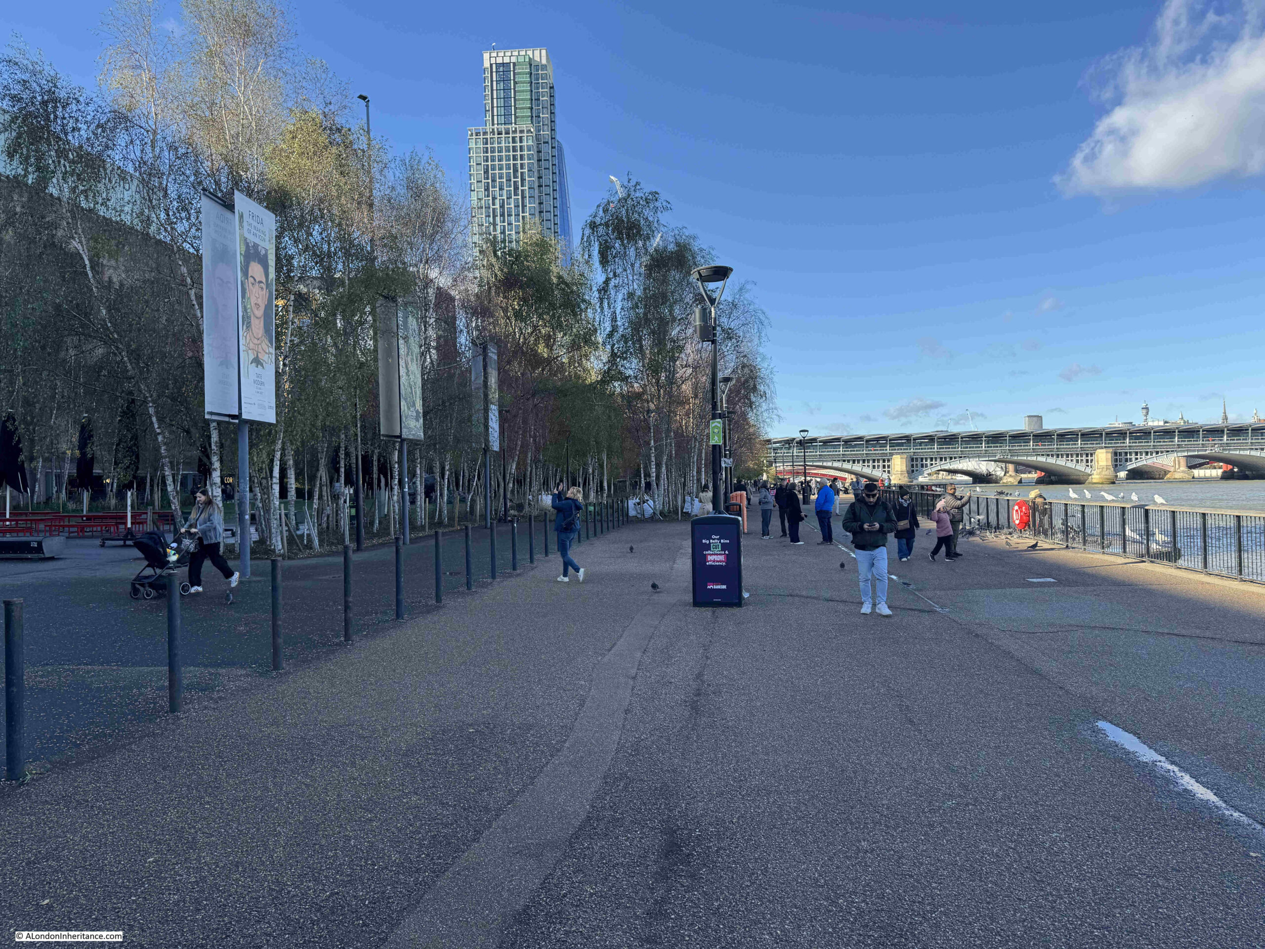
The river walkway that now runs in front of Bankside power station covered part of the old foreshore and also part of the landing stage with the travelling crane, but it would have been in the middle distance of the following photo:
Another possible option is a short distance further east, where the Sea Containers building is today, just to the west of Blackfriars Bridge. In the following OS map, we can see a number of landing stages in the river (‘Reproduced with the permission of the National Library of Scotland“):
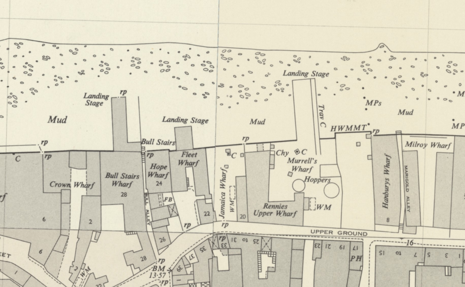
One even has a travelling crane, but it is on the wrong side of the landing stage.
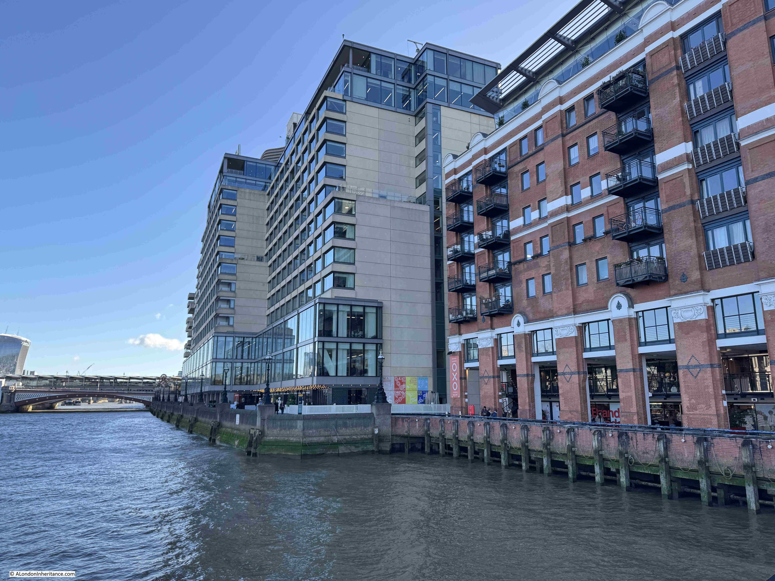
Again all these landing stages have disappeared with the redevelopment of the area, and in front of the Sea Containers building, the construction of the building and river walkway has pushed the land out into the river, covering much of where the old landing stages once stood.
In the following photo I am looking from the pier in front of the Oxo tower / building towards the walkway and foreshore in front of the Sea Containers building:
Another issue with the artists photo is how did my father take the photo from above?
Probably from one of the old buildings that then lined the river, although it looks from a point that was slightly over the river.
So, whilst the landing stages in my father’s photo do not exist, I know the location of the photo taken from underneath one of these structures, thanks to the building on the opposite side of the river still being there, along with Inner Temple Gardens.
I still do not know exactly where the two artists were sitting. There are a number of possible candidates, however all these landing stages have been lost during redevelopment.
Of the two artists, the one of the left is rather distinctive, mainly due to his darker clothes, and he is also wearing a hat.
My father had already taken a photo of him when he was at work, but in a location that is very easily recognisable. I included this photo in a post about Horselydown Old Stairs:
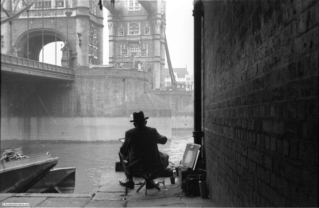
He was obviously interested in painting the views along the river. It would be fascinating to known who he was, and to see some examples of his work.
A New Memorial to Hicks Hall
Last year I wrote a post on Hicks Hall, which was the original Middlesex Sessions House. A really key building in the story of justice in London, and especially because in 1660, the Regicides (the Commissioners who had signed the warrant for King Charles’s I execution, or those who had a major part in his trial or execution) commenced at Hicks Hall on Tuesday the 9th of October 1660, and ended later the same month at the Old Bailey.
I finished the post with the following paragraph:
“Given that it was the first dedicated Sessions House for the County of Middlesex, that it was a place where lots of trials took place, and where many of those involved in the execution of King Charles I started the trials that would lead to their executions or life imprisonment, the site of Hicks Hall must deserve some form of onsite record.”
Islington Council have been making some changes to the road layout in St John Street, and as part of this work, a memorial to Hicks Hall has now been installed.
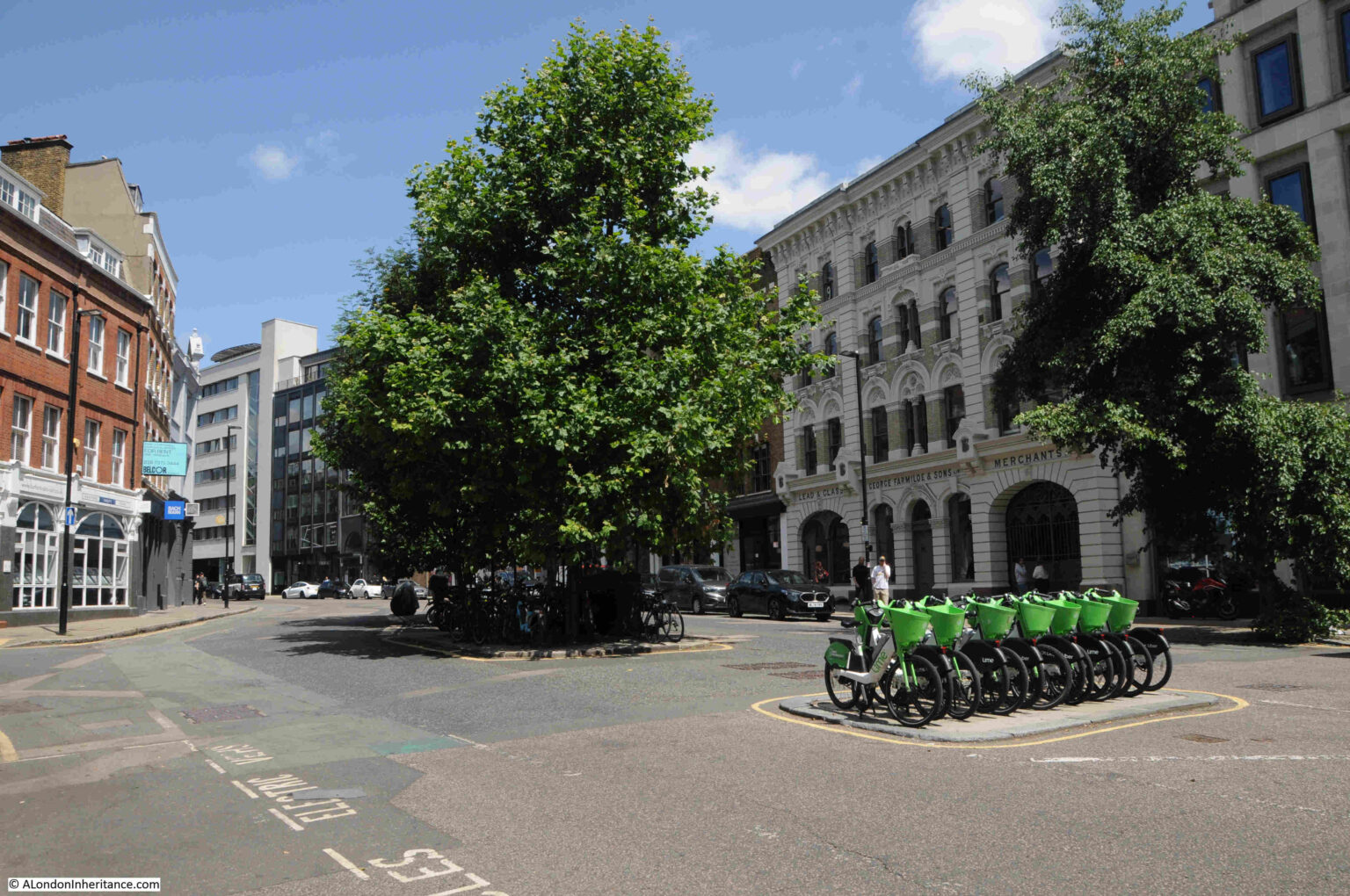
I photographed the location of Hicks Hall back in 2025. It is where St. John Street, which runs north from Smithfield Market, widens out, with an island of trees and another of bike parking:
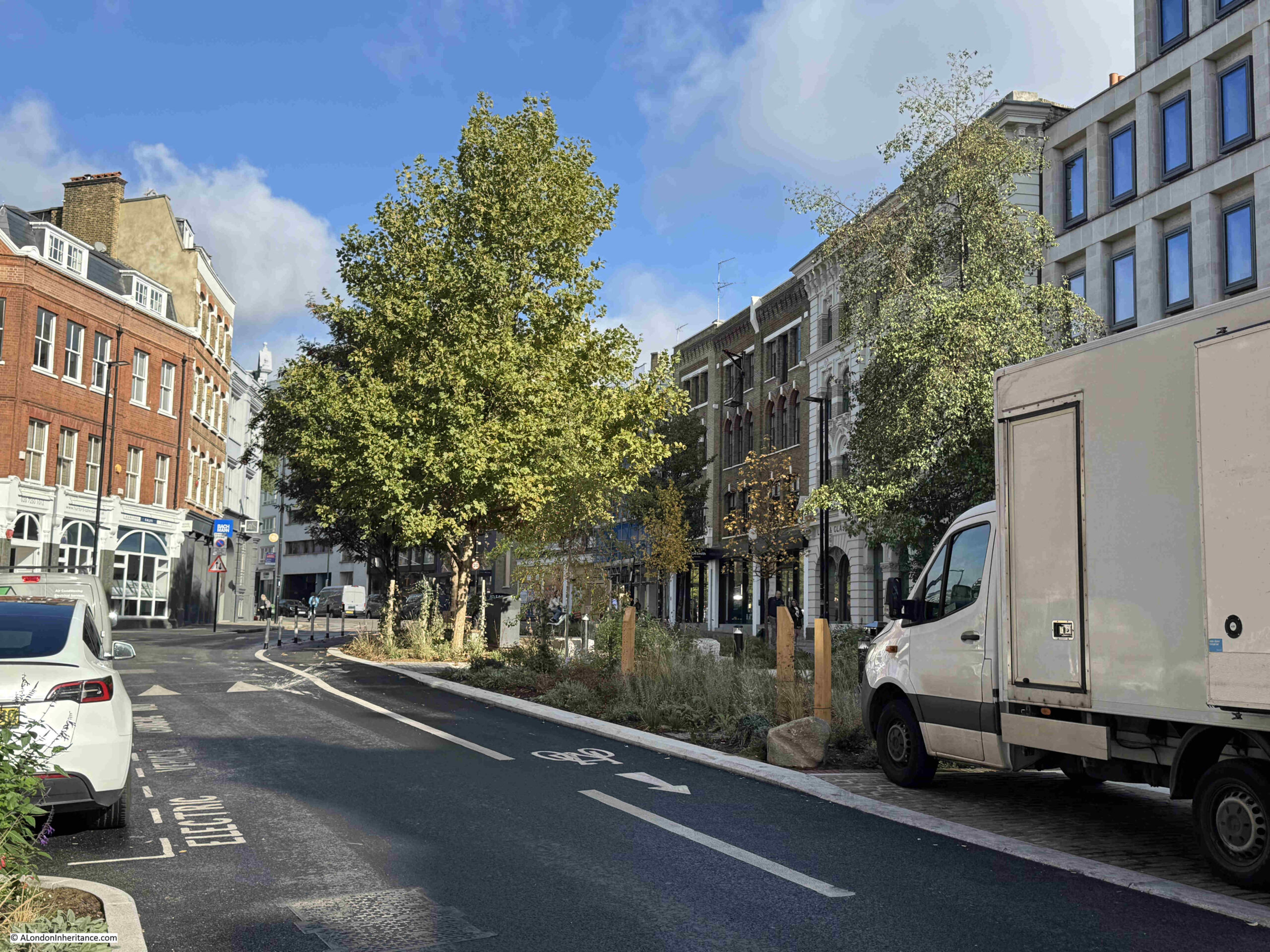
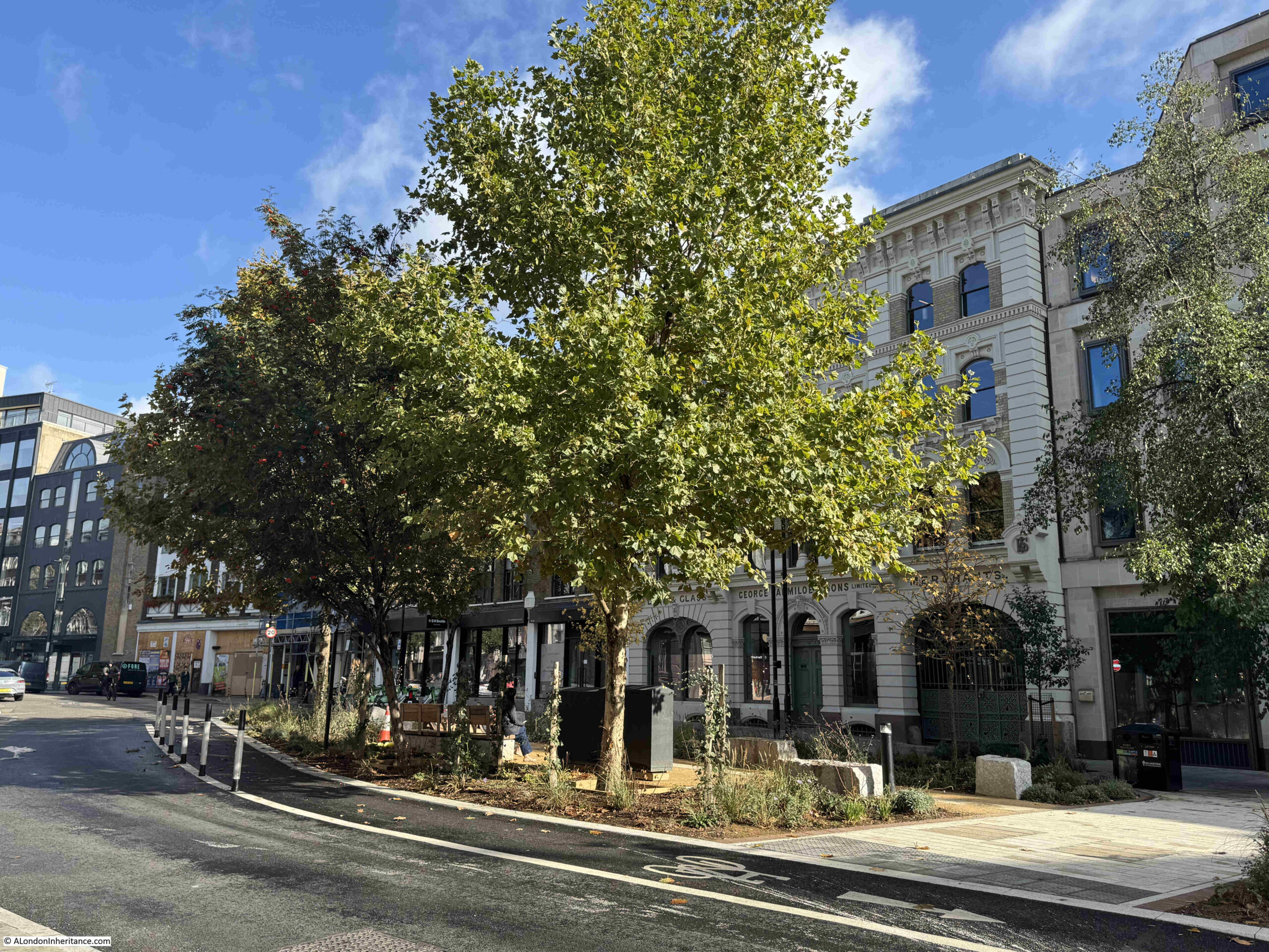
This is the location today, with a planted area now occupying the space between the pavement on the right and the islands, with the trees remaining:
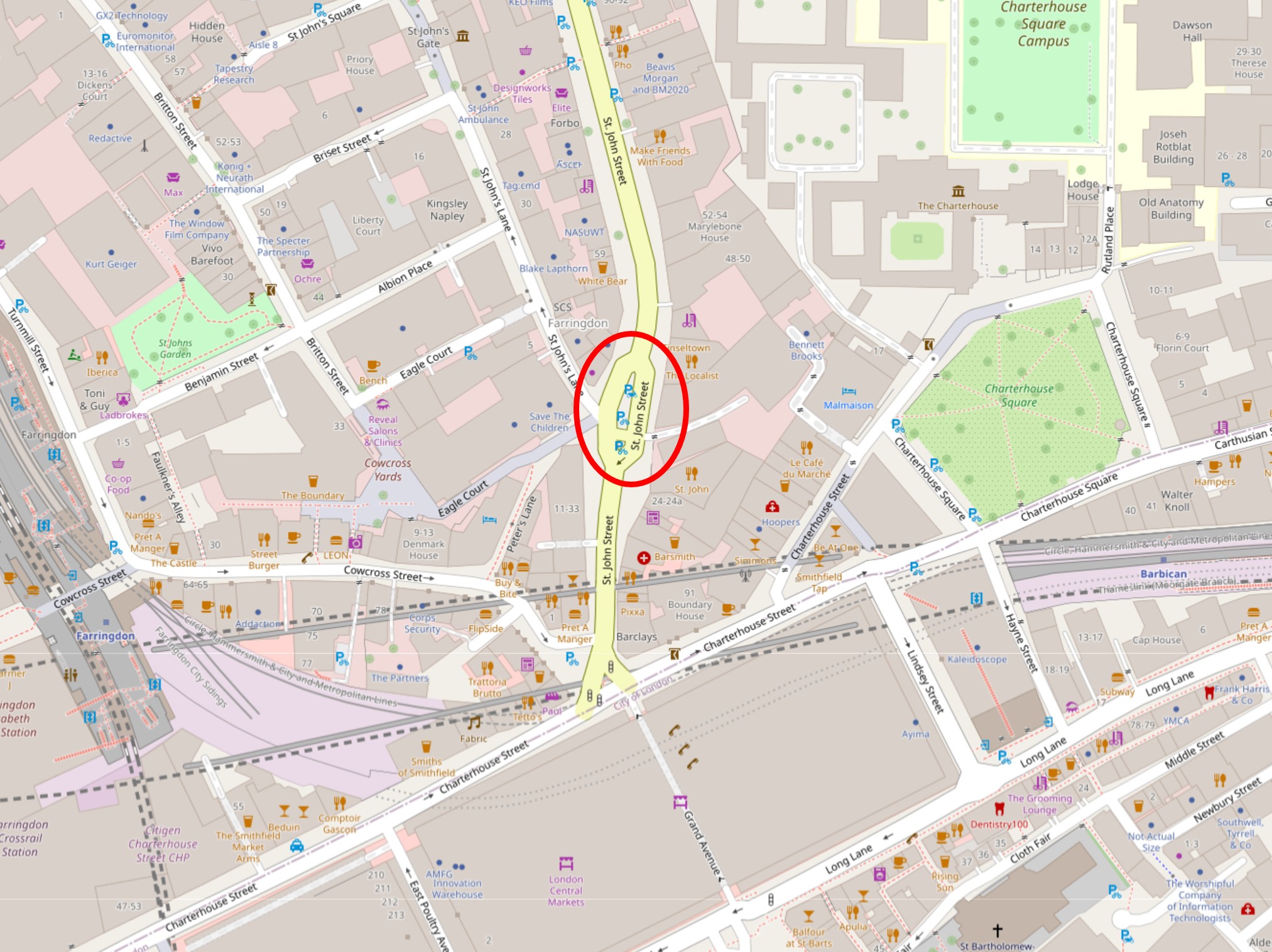
The location of Hicks Hall circled in the following map (© OpenStreetMap contributors):
The northern part of the new landscaping is where the memorial can be found:
Full view of the new area from the south:
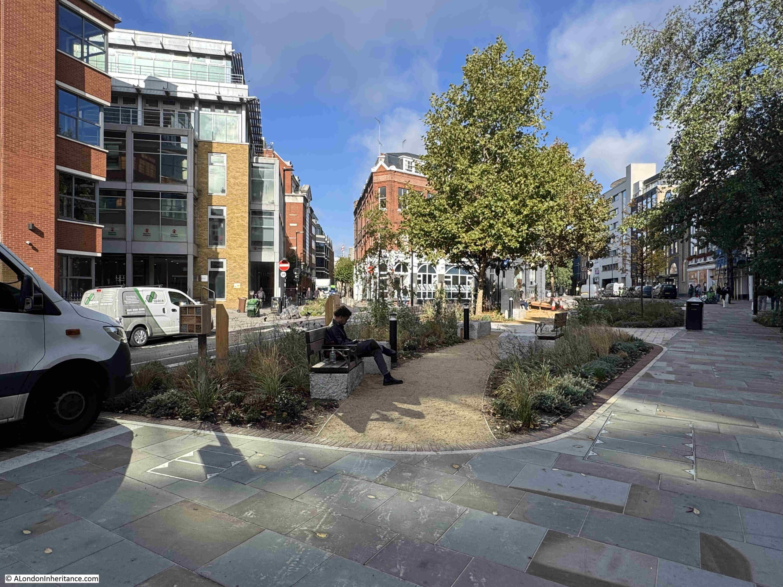
The scheme was designed by LDA Design, with extensive planting by Meristem Design, and Alistair Hall of the graphic design studio We Made This wrote the copy and designed the layout of the memorial. (You can read Alistair’s account of the creation of the memorial at this link).
The memorial runs almost the full length of the northern section of the new landscape, and consists of reclaimed riven York stone paving slabs provided by Islington Council, running along the central walkway. Each paving slab is engraved with part of the story of Hicks Hall:
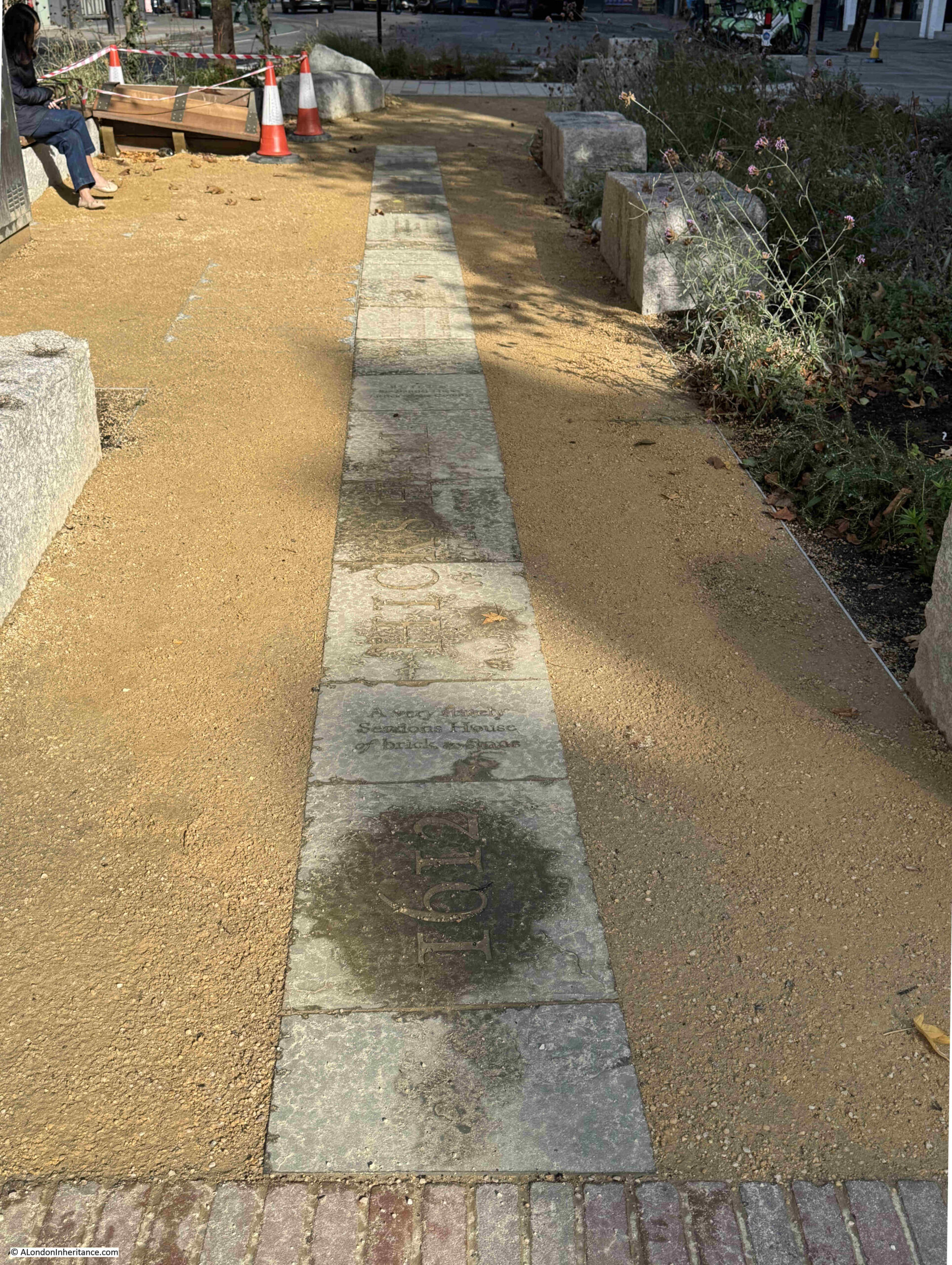
Walking along the slabs from the south, the timeline starts in 1612, when Hicks’s Hall was built by Sir Baptist Hicks, a rich silk merchant, who lived in Soper Lane in the City:
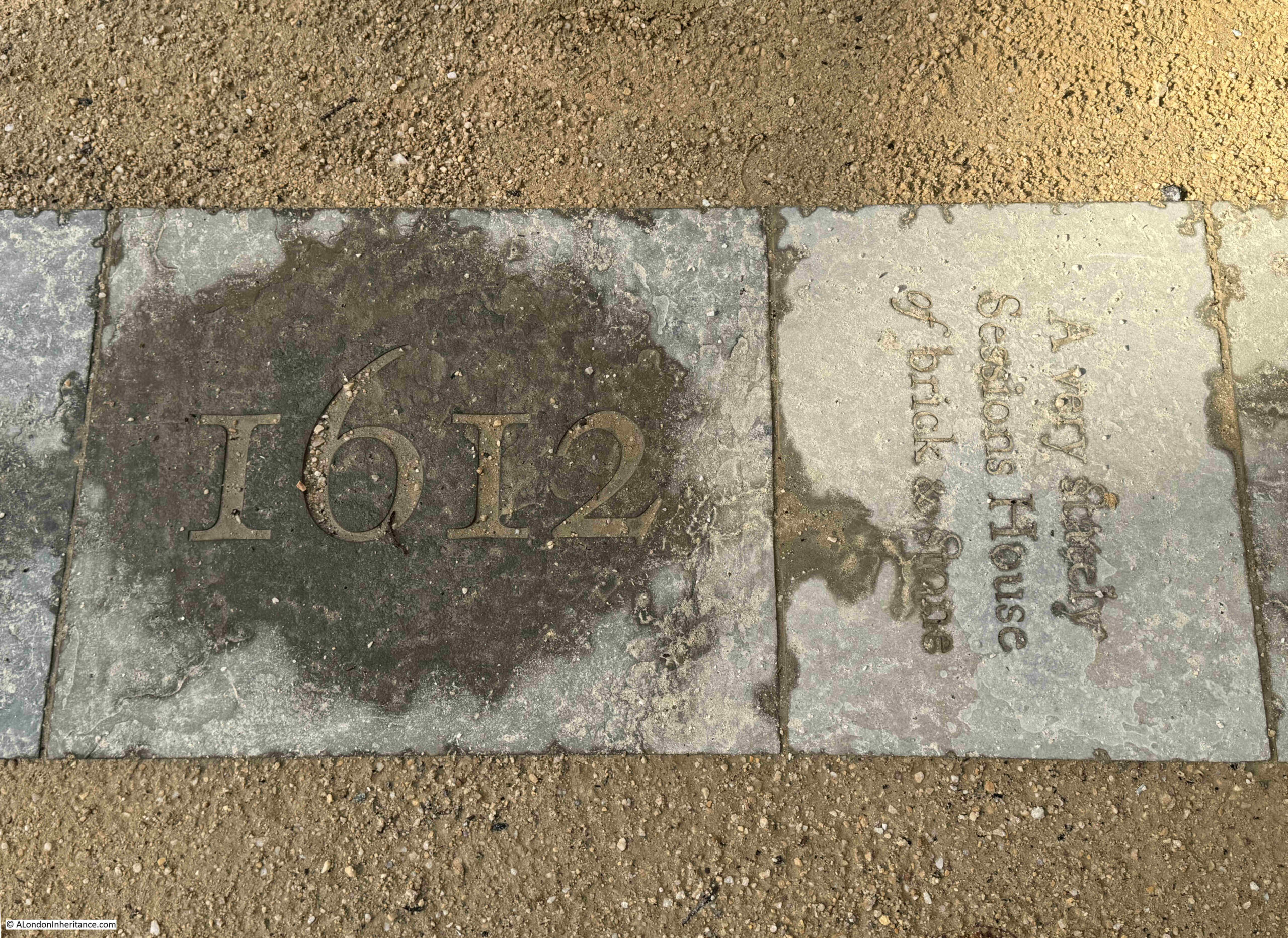
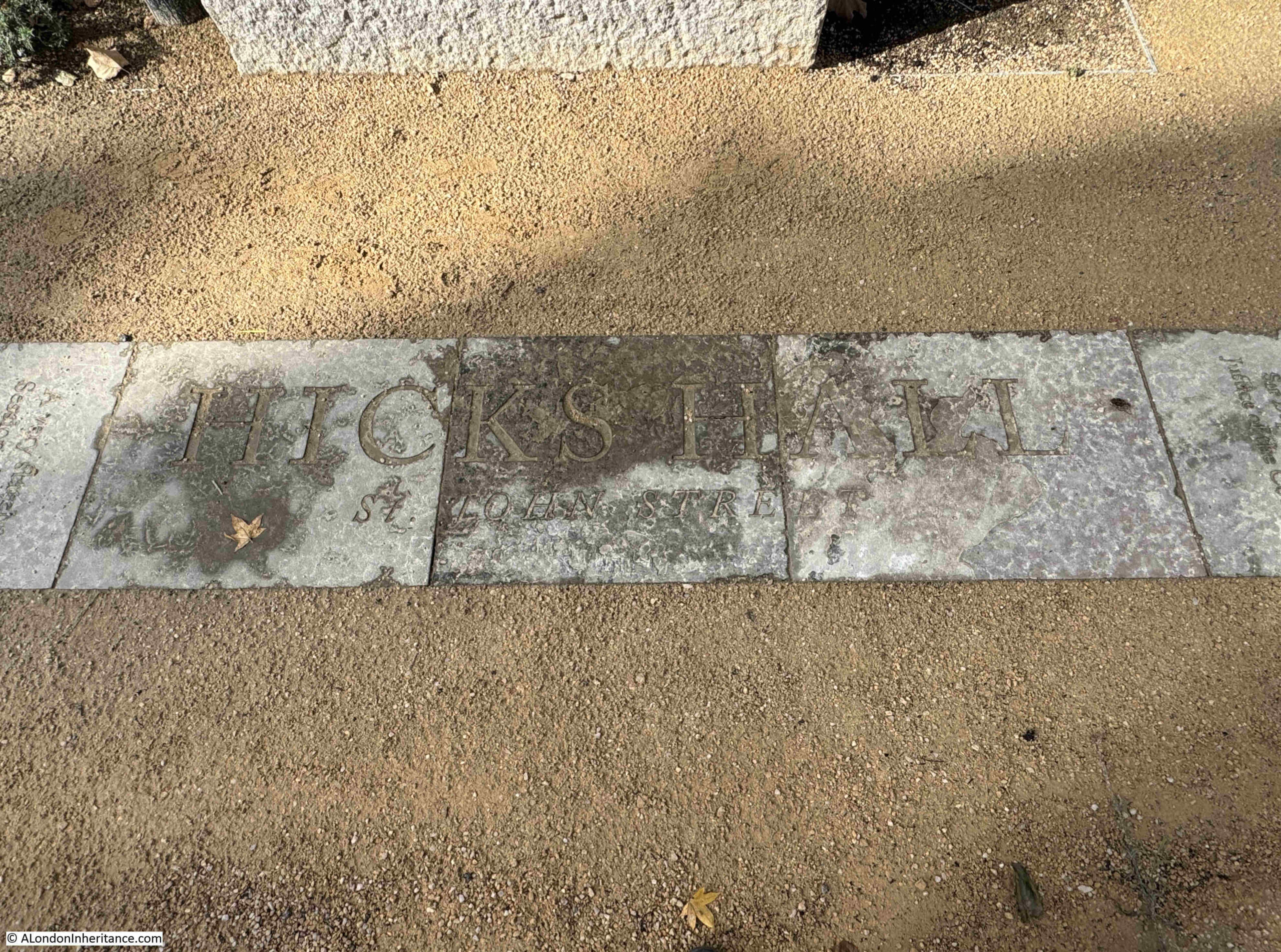
Some of the story of Hicks Hall is described on individual paving slabs, such as the slab on the right in the above photo, which has the description of the hall as “A very stately Sessions House of brick & stone”, whilst other parts of the story are spread across a number of slabs, such as the name and address of the hall in the following photo:
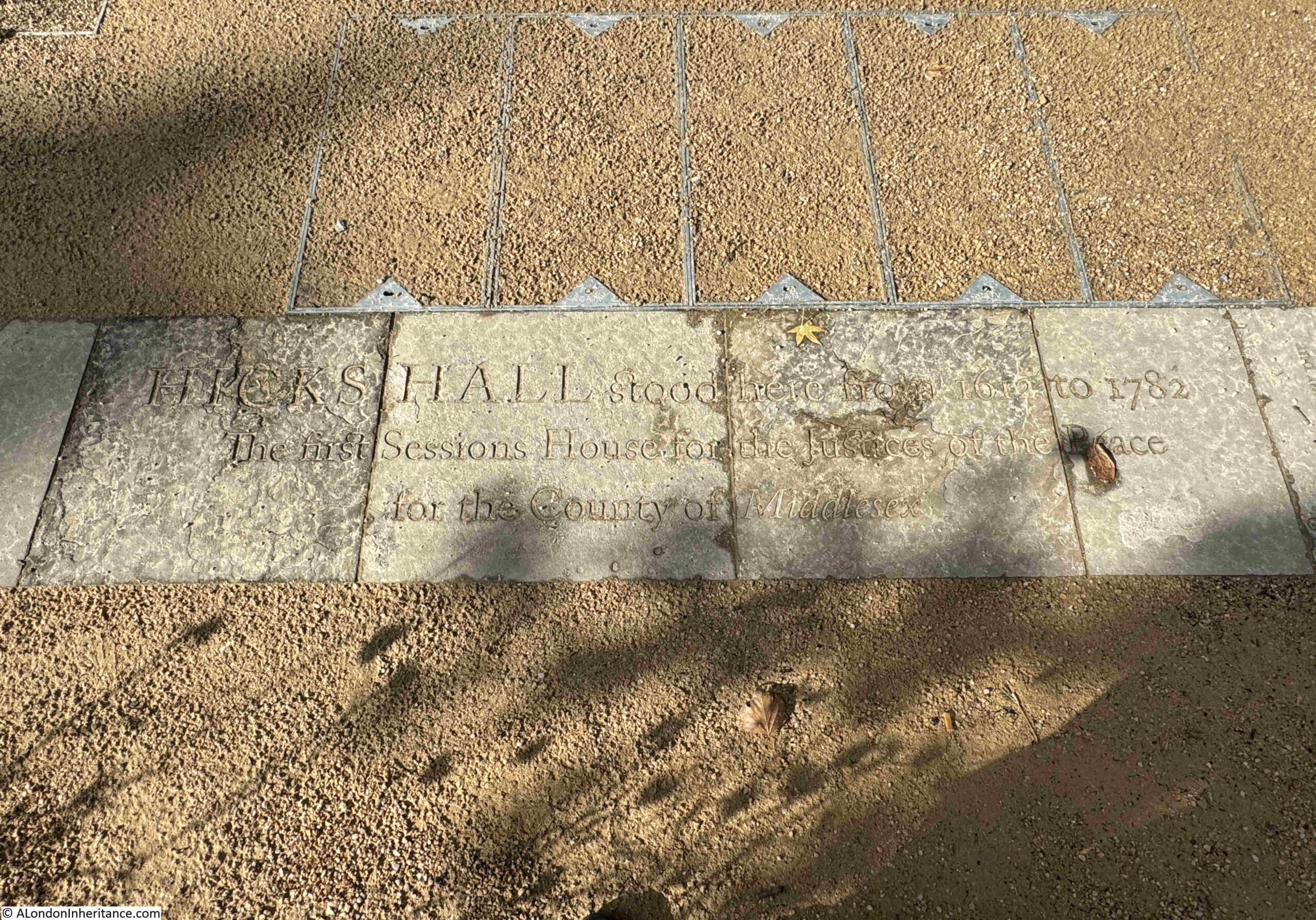
And an overview of the hall: “Hicks Hall stood here from 1612 to 1782. Sessions House for the Justices of the Peace for the County of Middlesex”:
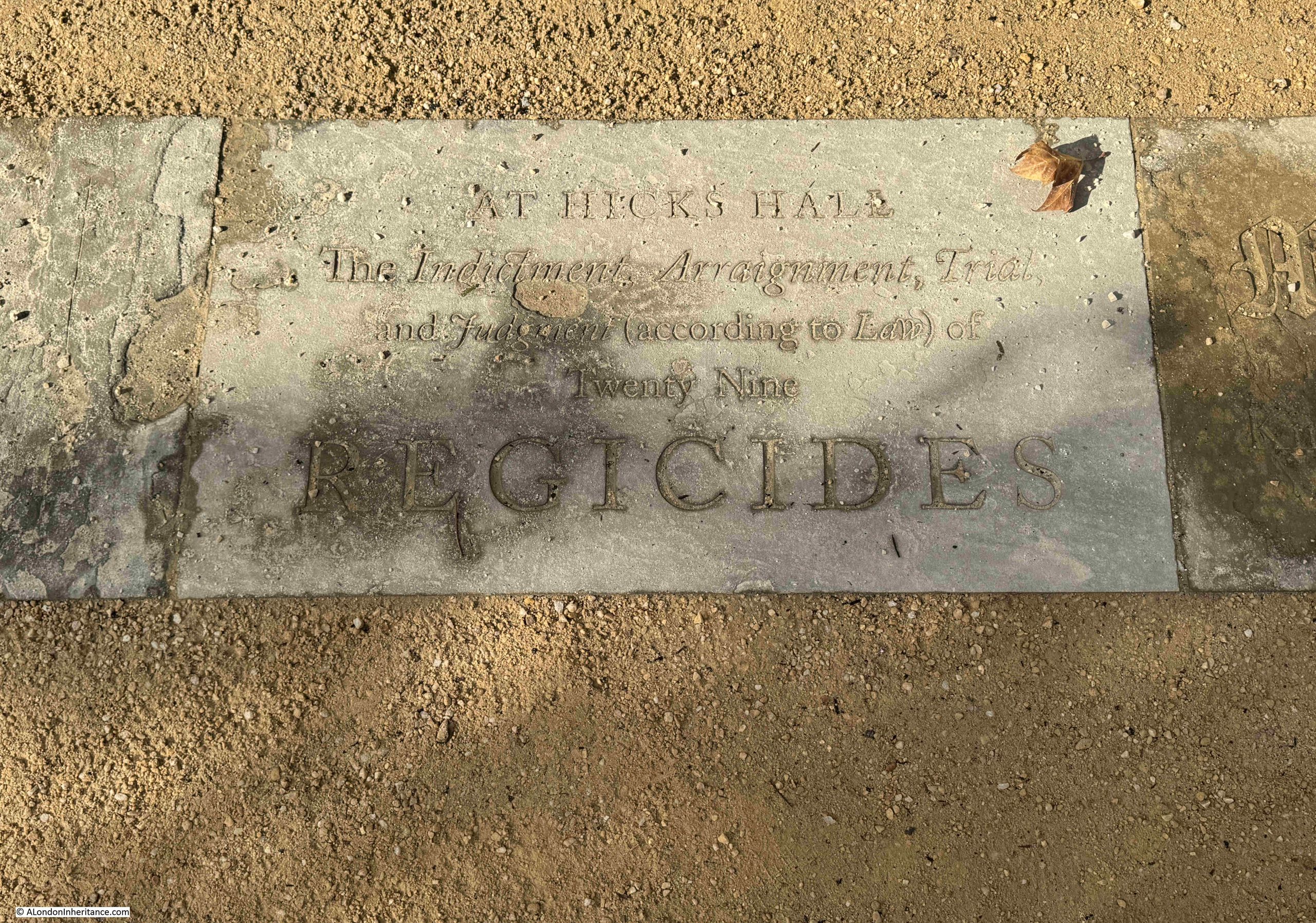
Regicides:
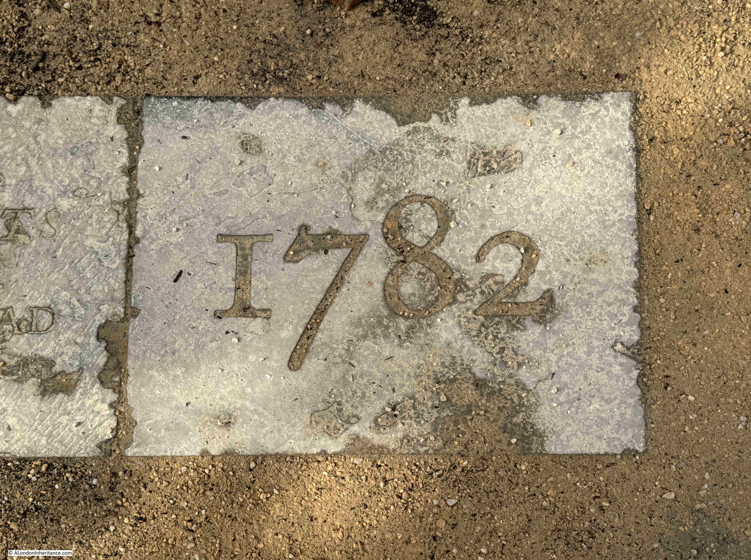
The end of the timeline:
My slightly wobbly video whilst walking along the full length of the memorial:
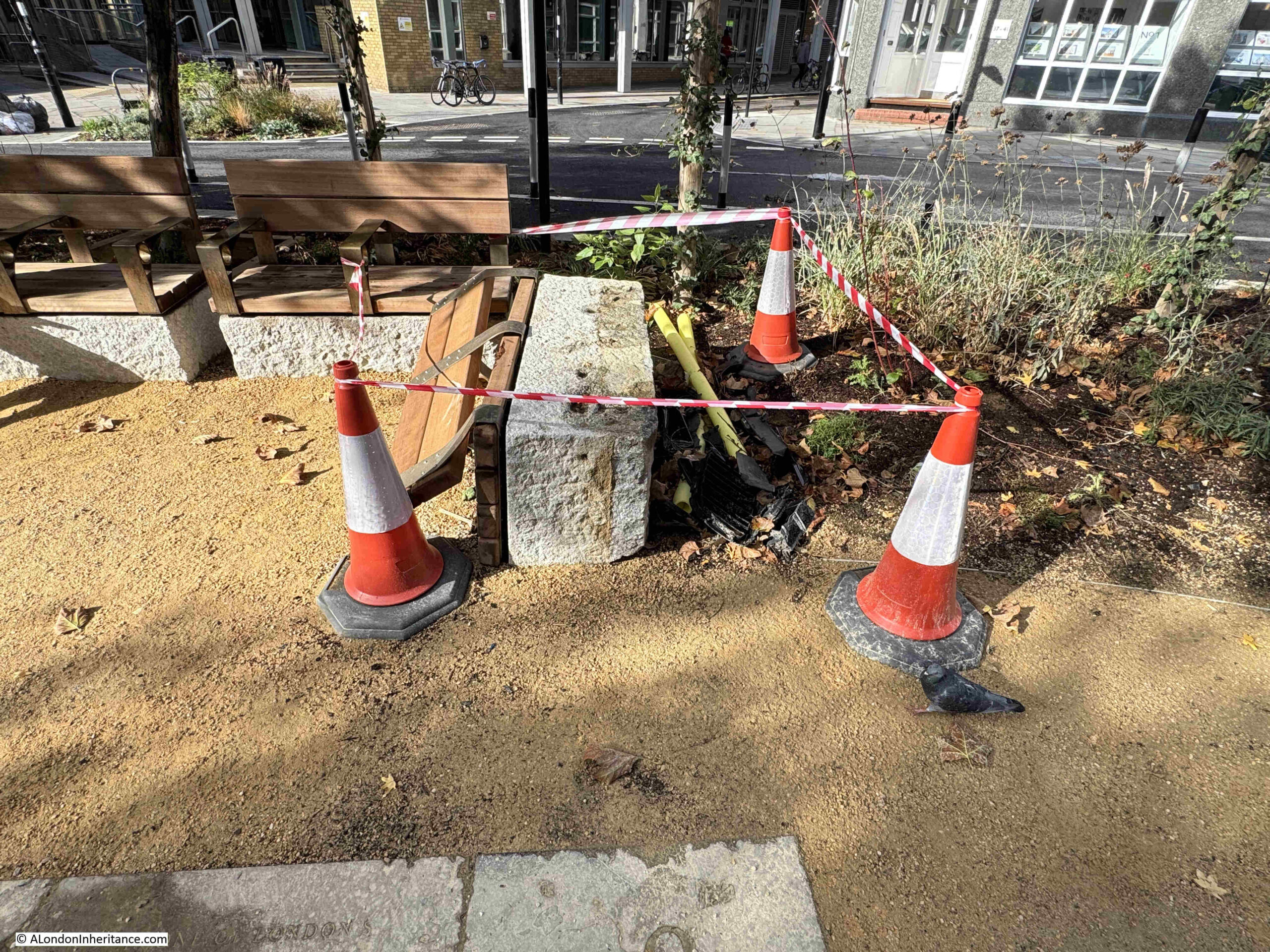
Unfortunately the site has already suffered some damage, apparently a car crash, with the driver and passengers running off:
Looking from the north, towards Smithfield Market in the distance:
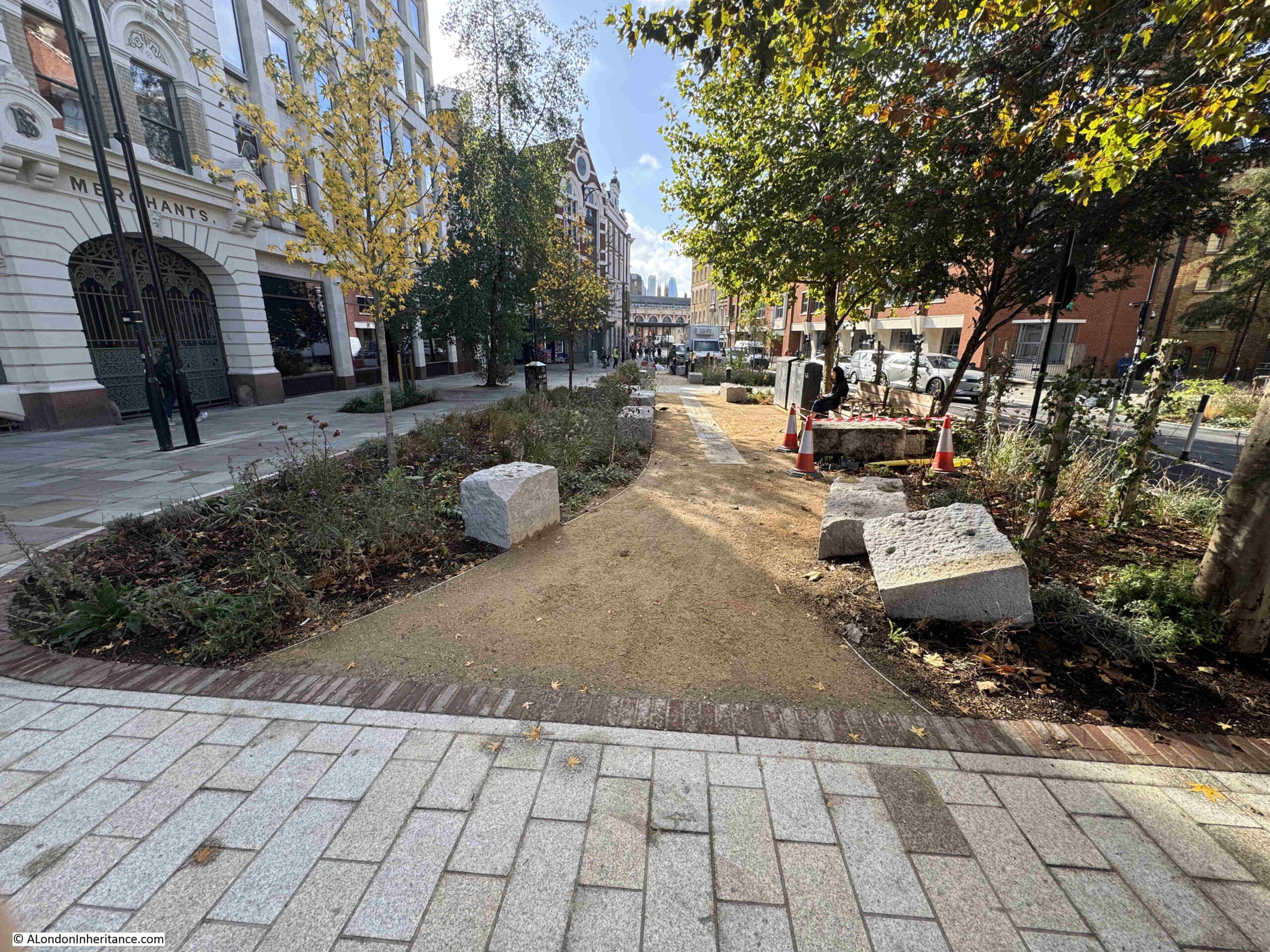
I really like this memorial.
Rather than a simple plaque which just names Hicks Hall and a date, the memorial provides some of the key facts regarding the building, and includes its role in the initial stage of the trials of the killers of King Charles I.
The timeline format is good, starting (providing you walk from the southern end), with the construction of the hall, with the final year of the hall at the end of the timeline.
The use of reclaimed stone means that the paving slabs already have some history, and the story being engraved in stone hopefully provides a good degree of permanence to the memorial. Stone does not deteriorate as much as many of the plastic / metal signage that is often used, however it will be interesting to see how the engraving changes over time with wear and weather.
Some thought and care has gone into the design of the memorial, and I can think of many places across London that would benefit from the same treatment – and it would be the ideal format to tell the story of some of the Thames Stairs, on paving slabs running along the alley that leads between street and stair.
It is wonderful to see such an important building being remembered in such a way, at the location where it stood, and where so many Londoners were sent for trial – some in the case of the Regicides, with more terrifying punishments than others.