Tag Archives: Limehouse Cut

Walking the Limehouse Cut – Part 2

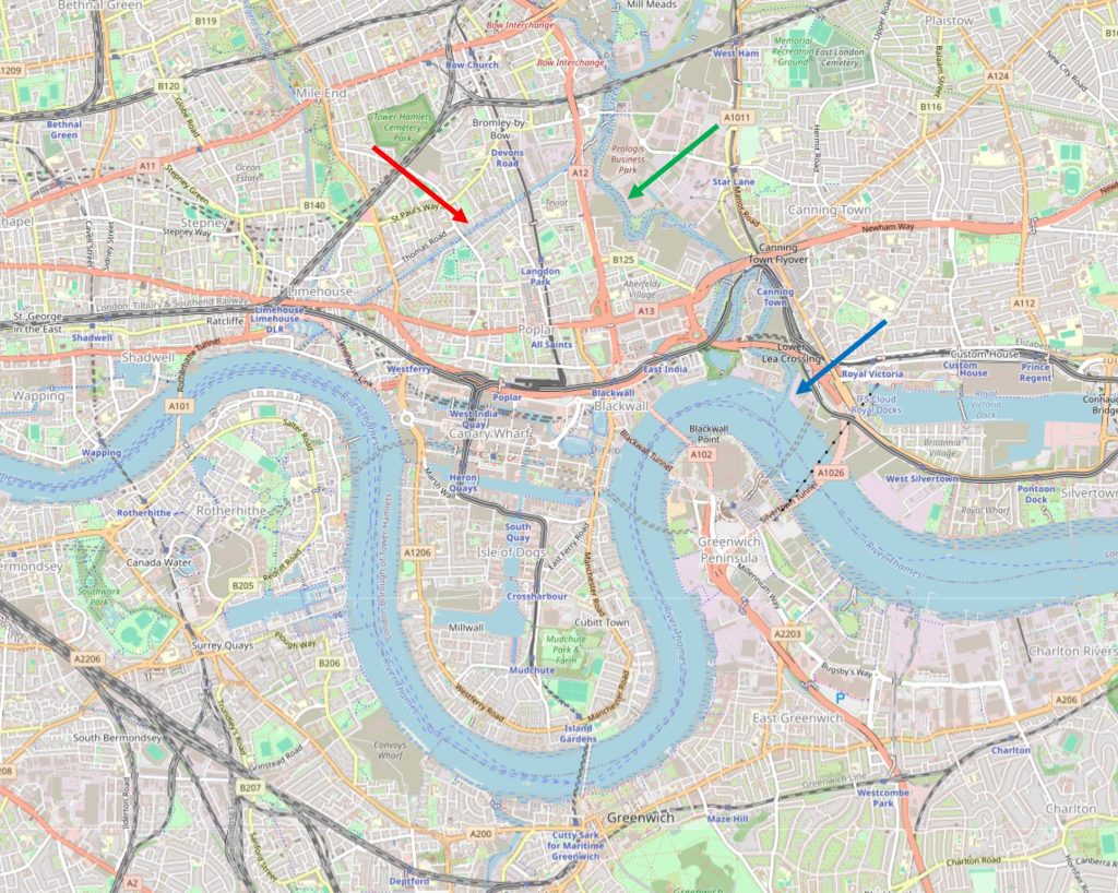
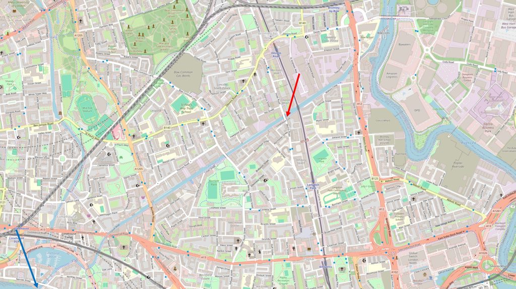
In the first part of my walk along the Limehouse Cut, I started where the Cut once entered the River Thames (blue arrow in the following map), and ended where Morris and Violet Roads cross the Cut (red arrow). In today’s post, I am continuing along the Limehouse Cut to where it meets the River Lea and walking up towards Three Mills Island (map © OpenStreetMap contributors):
From here onwards, there are not so many people walking along the tow path. The first part of the walk has been reasonably busy with walkers, joggers and cyclists.

If you do walk the same route, the only thing to watch out for is the occasional cyclist who does not give any warning of their approach, races up behind you, and when you are aware of them coming up behind, the distance is insufficient for both pedestrian and cyclist to safely move to opposite sides of the tow path. One cyclist almost ended up in the water when we both moved to the same side, and the distance between us required an emergency swerve.

This was only a single instance, the majority of cyclists are very considerate of pedestrians.

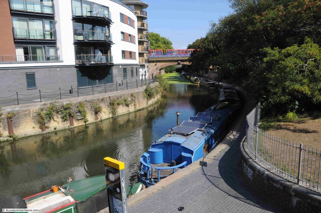
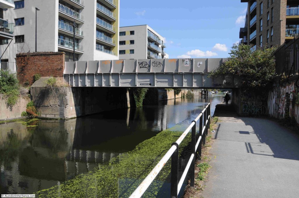
A short distance along from the Morris and Violet Roads bridge is the bridge that carries the Docklands Light Railway across the Limehouse Cut. As I passed under the bridge, a train passed above:
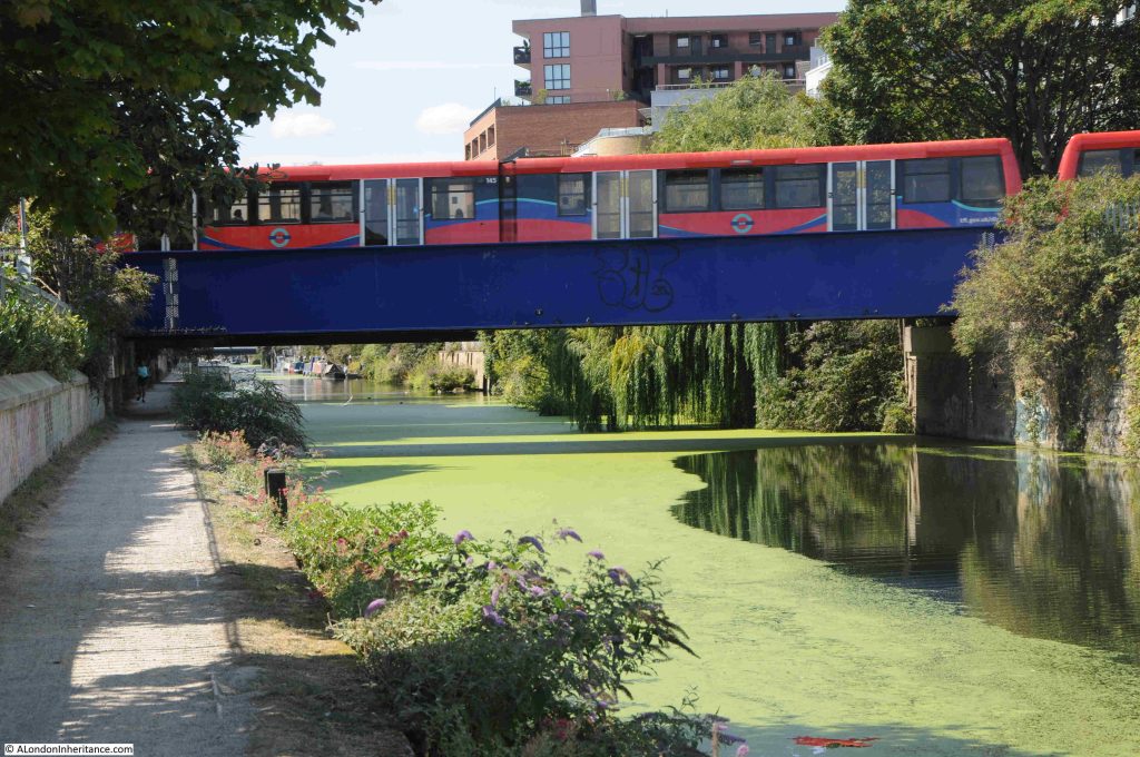
This is the section of the DLR that runs between Poplar and Stratford, Devons Road station to the north west and Langdon Park station to the south east. It was originally the route of the North London Railway, and on the land to the right of the above photo, there was a complex of engine and carriage sheds with multiple tracks to serve these, and provide a connection with the main railway.

The Limehouse Cut now has a much more industrial / commercial feel to the land alongside the Cut, which probably explains why there are not so many people walking this section than along the earlier part of the walk:
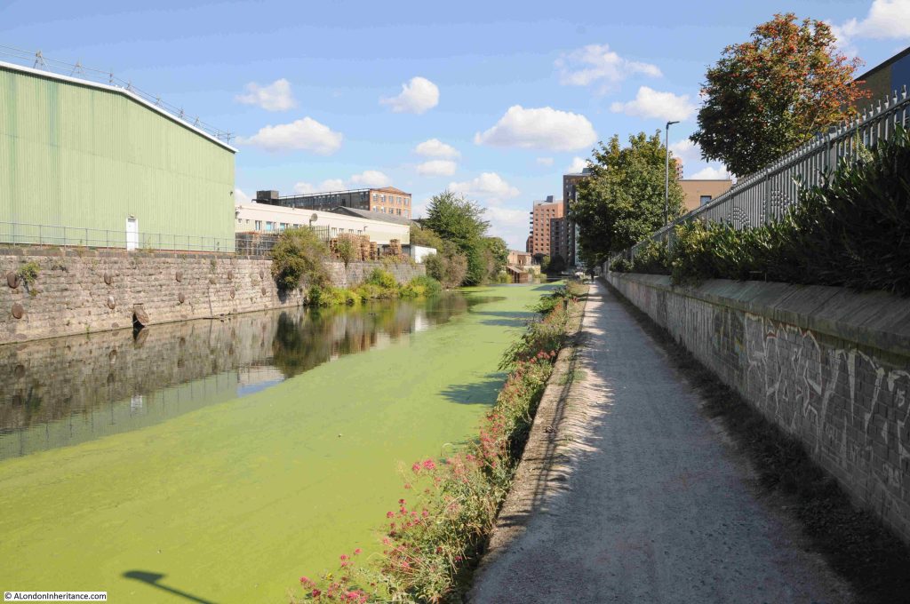
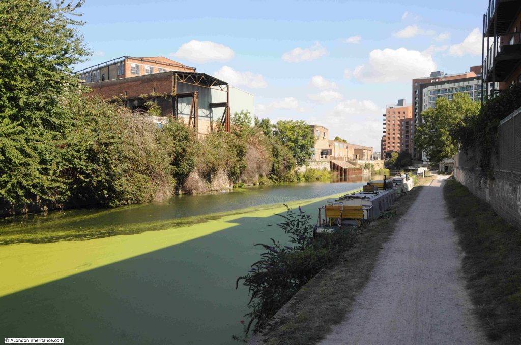
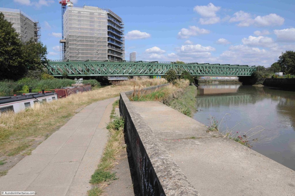
Very few remains of earlier industry survive, however is the metal frame of an earlier building surrounding a new building seen to the left in the following photo. This was originally a furniture factory and what is now a rusty metal frame once extended over the Limehouse Cut to provide a gantry with facilities to load and unload barges on the water:
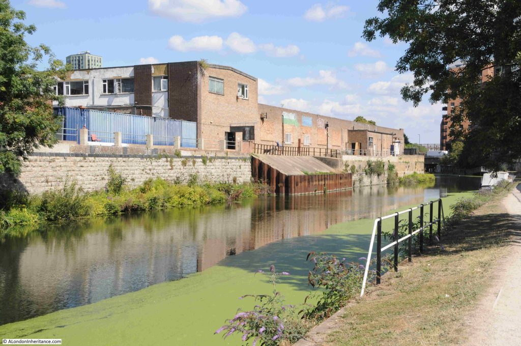
Further along there is a length of metal piling and concrete infill extending into the water. I cannot find any similar features in earlier maps, and it looks relatively new. No idea of the purpose:
For almost the entire length of the route, the Limehouse Cut has been a straight line. It was built at a time when north of a small area along the river, there was no development, so the original builders dug the Cut through what was rural land.

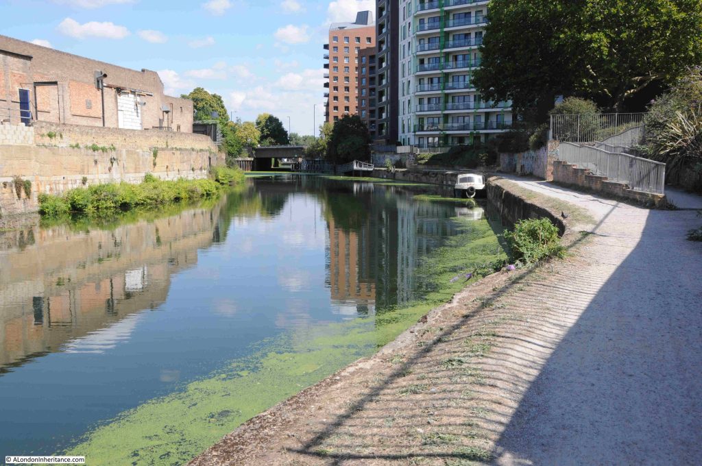
We are now though approaching the end of the Limehouse Cut and there is a slight curve in the route:
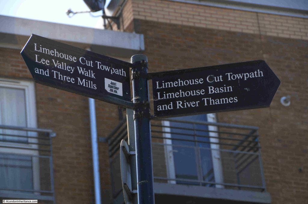
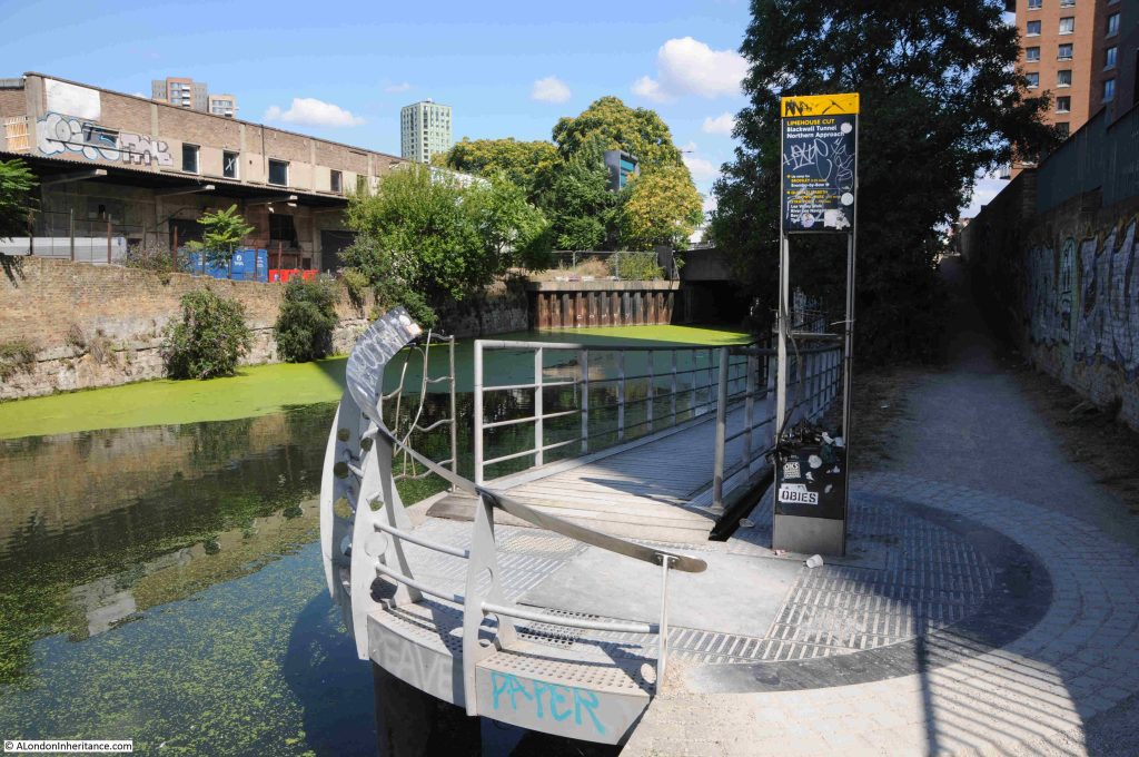
Well signposted:
The towpath changes here and offers two routes. To the right, the footpath runs up to the six lanes of the A12 road, and to the left, and new walkway takes the walking route along the side of Limehouse Cut:
And under the A12:
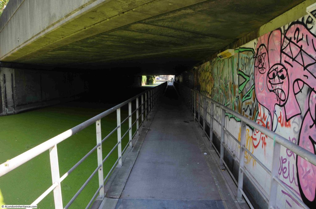
This walkway was needed when the A12 was enlarged. This section has always been a narrow part of the Cut, and a place where Leonard’s Road crossed, however the routing of the A12 from Stratford down to East India Dock Road (A13) and the Blackwall Tunnel required a new, significantly larger bridge to be built.

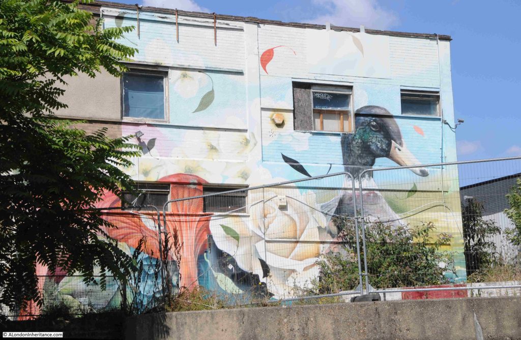
There were a good number of ducks along the length of the Limehouse Cut, and after walking under the A12, one of the breeds seen on the water has been painted on the wall of a building to the side of the Cut:
Looking back towards the bridge thar carries the A12, and next to it another bridge for Gillender Street. The original wall of the Cut can be seen on the left:
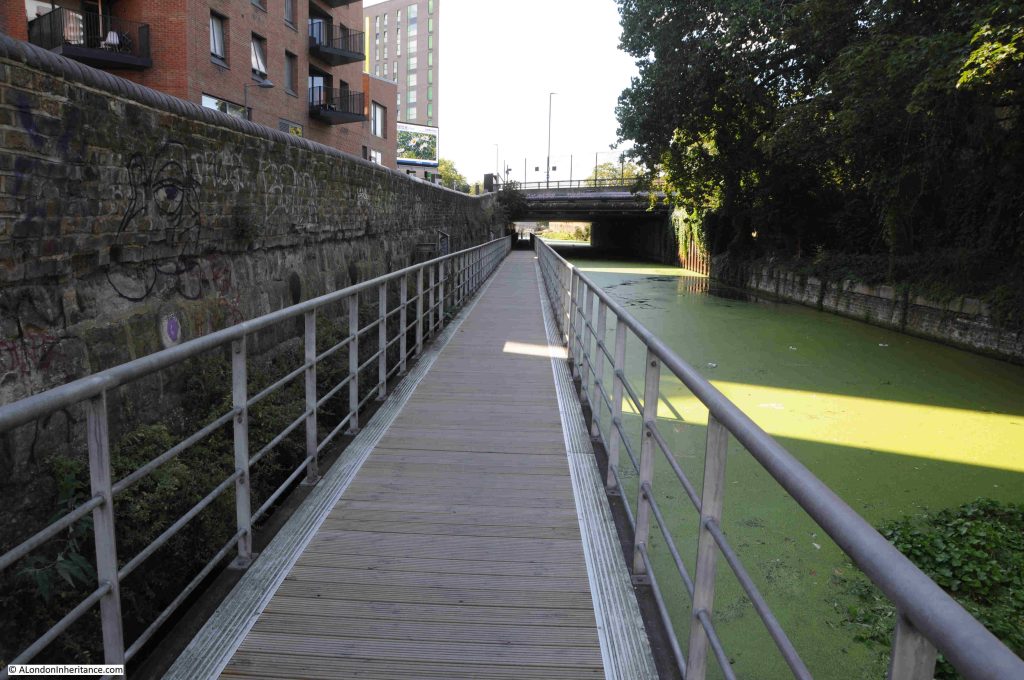
At the end of the walkway, the water opens up as we approach the River Lea:
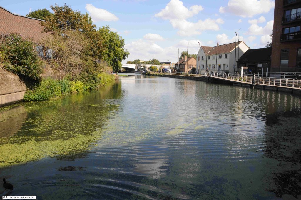
I have been using the name River Lea throughout my posts on the Limehouse Cut, although two spellings are used for the river that the Limehouse Cut was built to bypass. Lea and Lee.

The source of the River Lea is in Bedfordshire, to the north of Luton. The river runs through Bedfordshire, Hertfordshire, on the edge of Essex before heading into Greater London.

The name Lea is used from the source to Hertforshire, and from Hertford to the Thames, both Lea and Lee are used.

The Lee comes from the Lee Navigation.

The reason why the Limehouse Cut was built was to bypass the River Lea as it ran to the east of the Isle of Dogs, to provide a more direct route to the City of London, to avoid the bends in the River Lea as it approached the Thames and to avoid the tidal sections of the Lea.

Similiar issues resulted in the construction of the Lee Navigation. This is a canal built on a parallel route to the River Lea, with an aim of smoothing out many of the bends in the Lea, providing additional space for boats, along a route where water levels could be managed. In a number of places the Lee Navigation and River Lea are combined as a single channel.

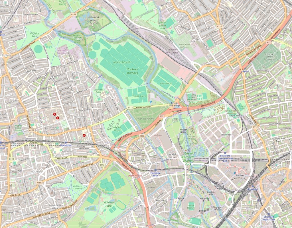
This is why a look at a map reveals a complex route of parrallel waterways, which often combine.

In the following map, the River Lea runs to the right and the Lee Navigation to the left, as they both pass through, and then head north from Stratford (map © OpenStreetMap contributors):
The River Lea had been subject to many previous attempts to manage the use of the river, make improvements and control water extraction. See my post on the New River for where this early 17th century approach for providing water supplies to the growing city met the Lea.

The 1767 River Lee Navigation Act authorised a number of improvements, including the construction of new lengths of canal, and further acts, such as the 1850 Lee Navigation Improvement Act allowed additional construction, including a number of locks along the route.

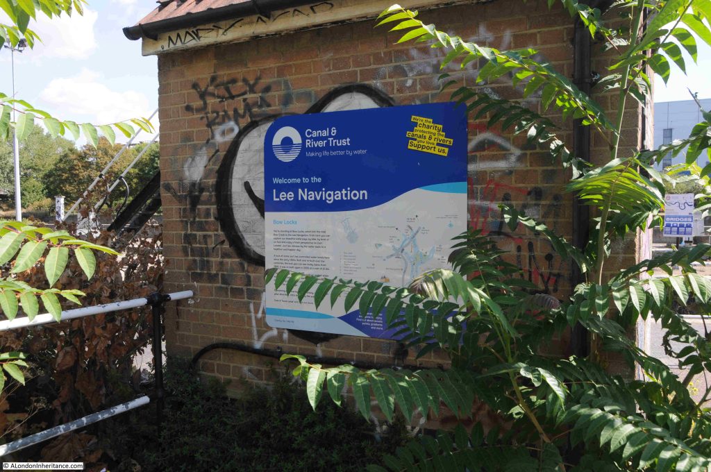
The parallel running, sometimes combining and both routes serving the same source and destination have resulted in both Lea and Lee being used, however Lea is for the river and Lee is for the Lee Navigation, the fully navigable canal system built over the last few centuries, that provides an easier to use route than the river, and we see this name as we approach the point where Limehouse Cut, Lee Navigation and River Lee combine:
And it is here that we find the Bow Locks:
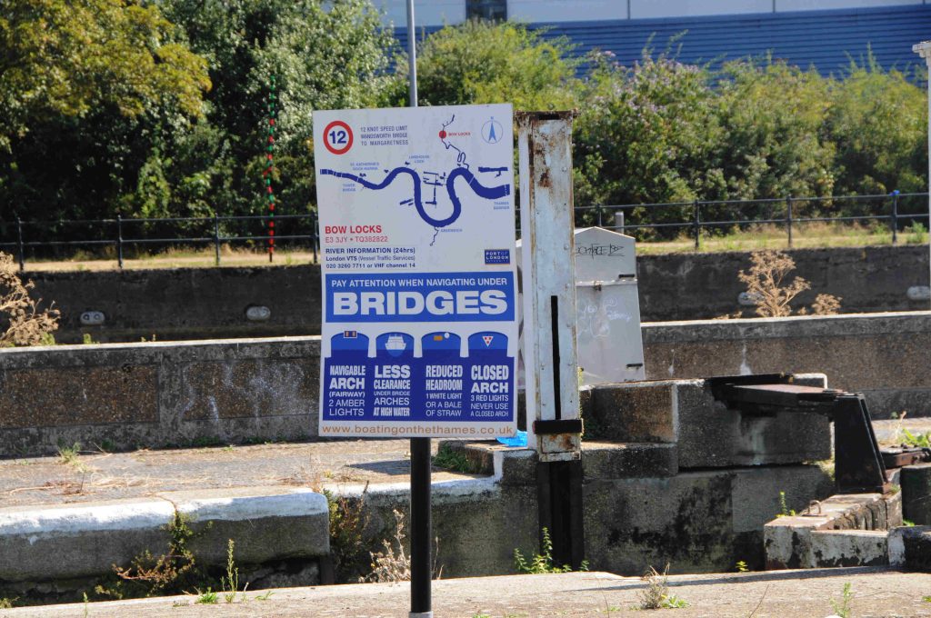
Bow Locks control access from where the Limehouse Cut meets the River Lea, and Bow Creek, also known as the River Lea which runs down to the River Thames, and is tidal:
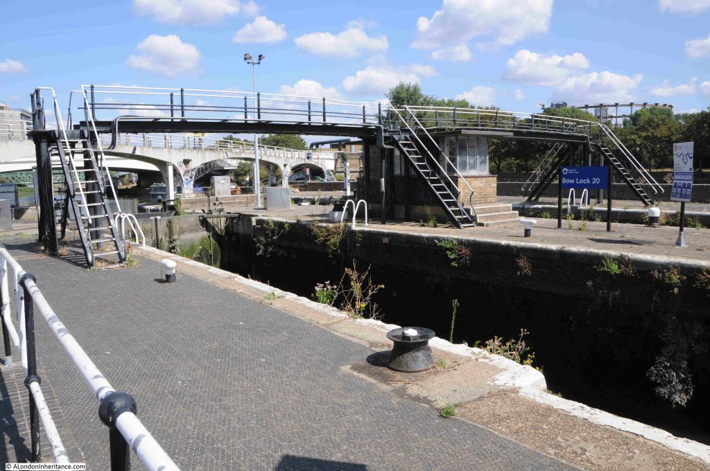
In the background of the above photo there is a grey / white bridge. This is a 1930s foot bridge that spans the waterways, and although I was at the end of the Limehouse Cut, I wanted to explore a bit further, so headed over this footbridge:
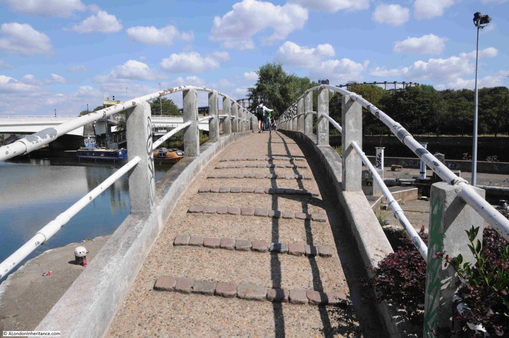
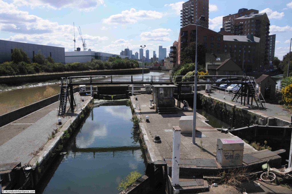
From the footbridge, we can look over the lock and along Bow Creek / River Lea as it heads towards the Thames. The mud banks on the side show that this stretch of the river is tidal, and demonstrates why the lock is needed. On the right edge of the photo, a small part of the Limehouse Cut can be seen. It is these locks that ensure there is a stable height of water in the Limehouse Cut:
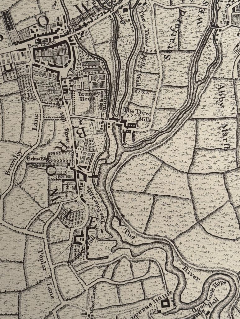
Around 20 years before the completion of the Limehouse Cut, where it joins the River Lea was an area of fields, orchards, gardens and limited housing. In the following extract from Rocque’s map of 1746, you can see the world BROMLEY curving to the left of centre. The Limehouse Cut went through the letter M as it ran from bottom left up to join the River Lea:
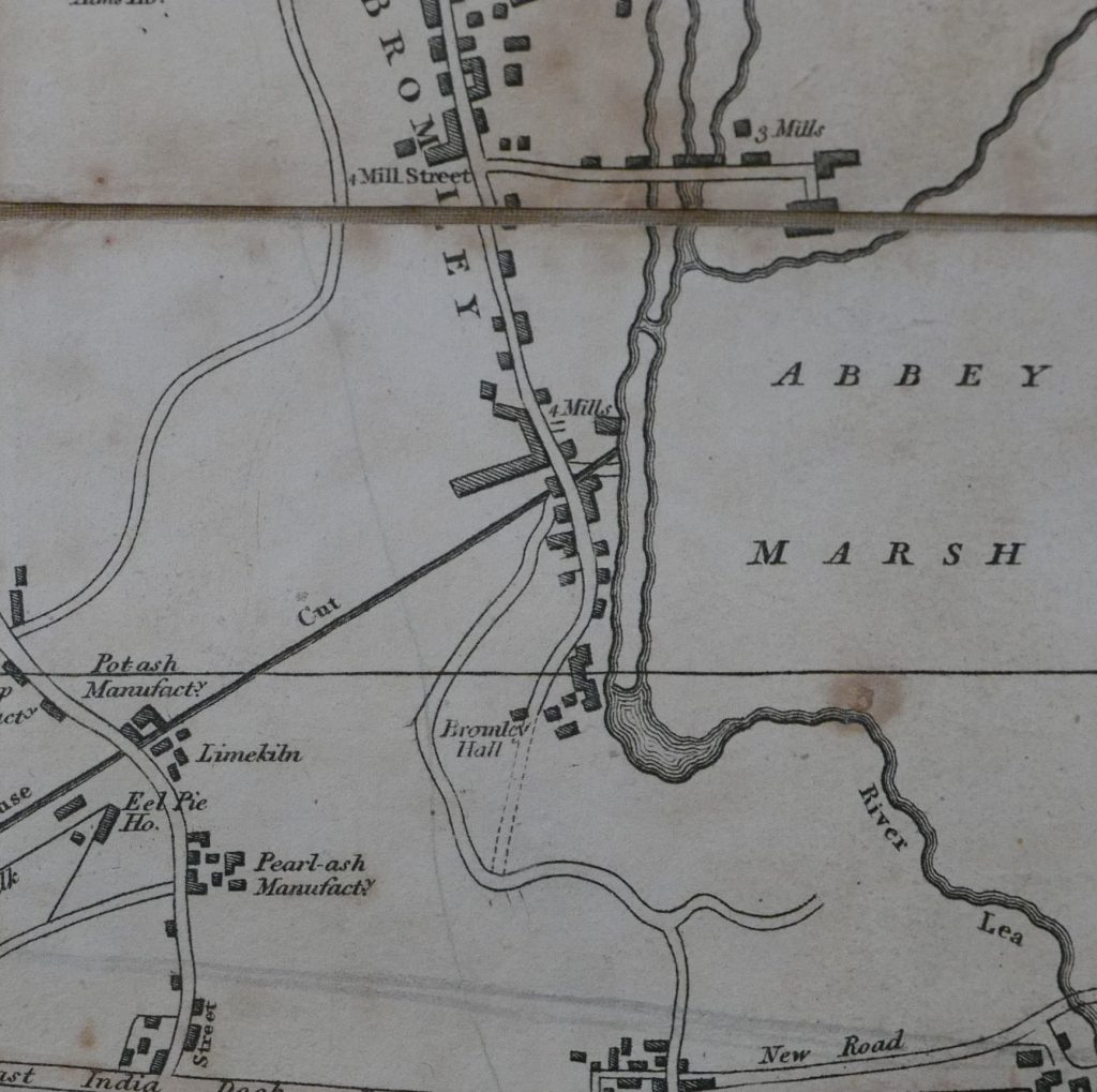
To demonstrate the complexity of the River Lea / Lea Navigation, and the associated waterways in the area, the following extract is from Smiths New Plan of London from 1816, and shows the straight line of the Limehouse Cut joining one of the strands of the Lea:
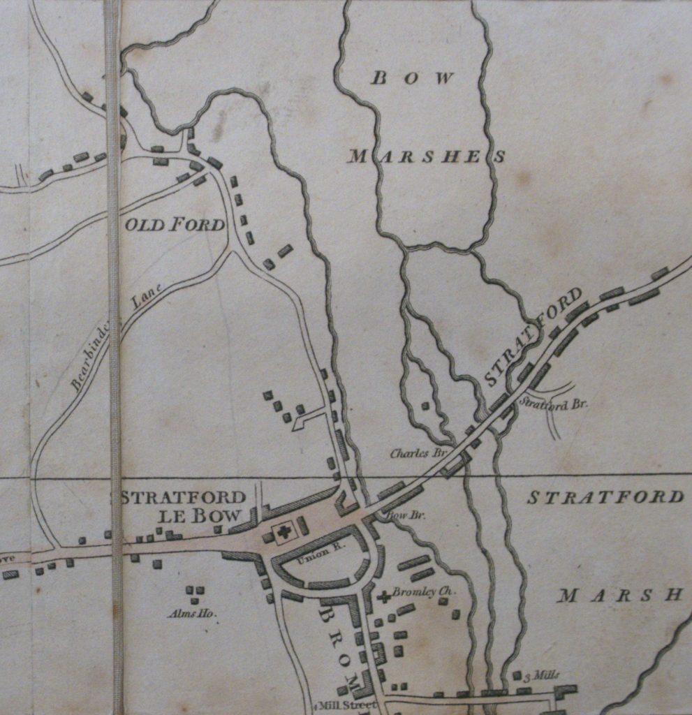
The complexity of this water network can be shown using the same map, but a bit further north in the area surrounding and to the north of Stratford. The names Stratford Marsh and Bow Marshes demonstrate the nature of the surrounding land, and how the Lea river system has had an impact on this area for centuries:
After that slight digression, I am still on the footbridge, and this is the view looking north with the bridge carrying Twelvetrees Crescent across the Lea:
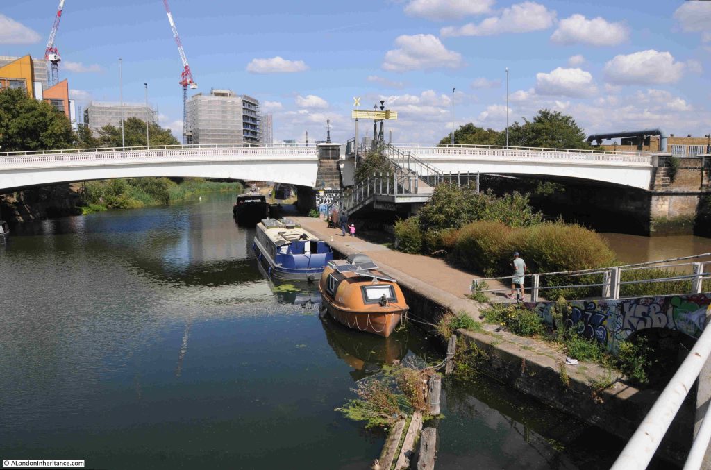
The orange boat moored in the above photo is an old British Gas life boat, which I assume came from either a North Sea gas / oil rig or a ship – and is now performing a very different use.

Walking under Twelvetrees Crescent Bridge, and there is a walkway that once provided access to the gas works just to the east:
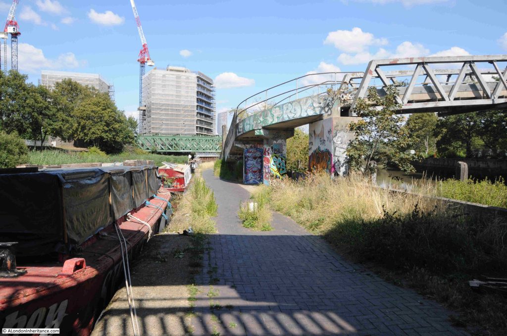
Further on is the bridge that carries both the District and the Hammersmith & City lines over the Lea:
Along this stretch of the Lea is a rather isolated but colourful piece of sculpture. I knew it was sculpture as the small blue plaque on the concrete base states “Please do not climb on the sculpture”:
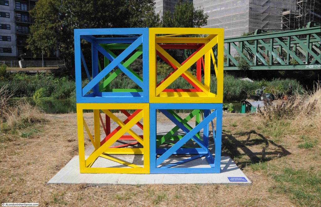
The sculpture is part of “The Line”, and the following is from the project’s website: “The Line is London’s first dedicated public art walk. Connecting three boroughs (Newham, Tower Hamlets and Greenwich) and following the Greenwich Meridian, it runs between Queen Elizabeth Olympic Park and The O2 on Greenwich Peninsula. The Line features an evolving programme of art installations (loans and commissioned works), projects and events, illuminating an inspiring landscape where everyone can explore art, nature and heritage for free.”

The above work is by Rasheed Araeen, who “is renowned for his use of an open cube structure with diagonal support in his sculptural works”.

A map of the route of The Line, and the works along the route, can be found at this link.

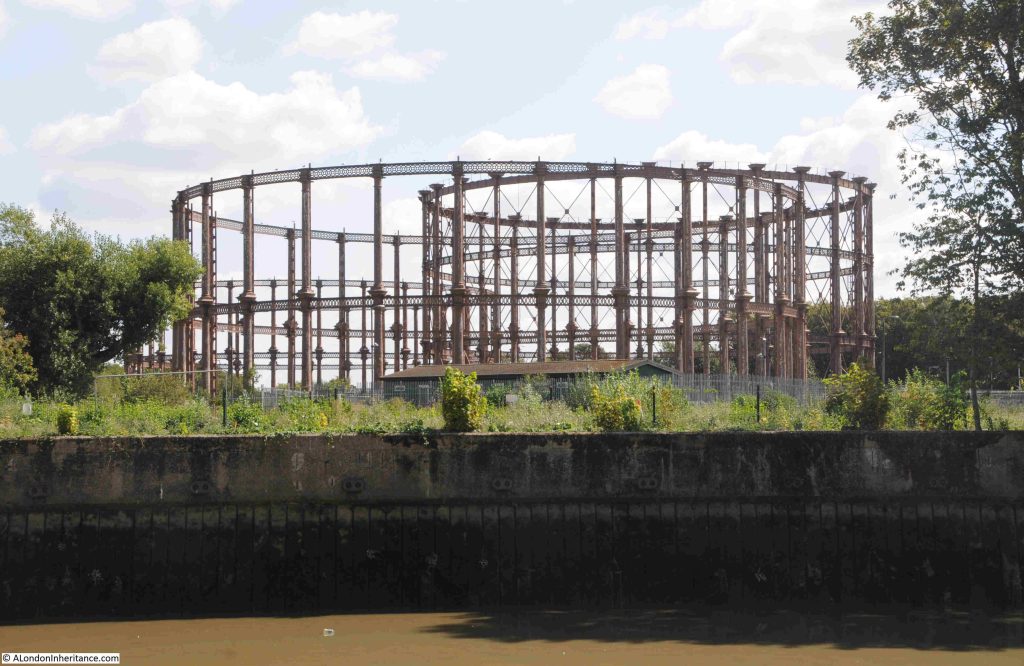
Looking across the branch of the Lea that runs to the right of where I am walking, are the old gas holders of the Bromley by Bow gas works:
The 1914 revision of the OS map shows the round circles of the gas holders, and a short distance below is the Bromley Gas Works, who had their own dock leading from the River Lea. A small part of this dock still remains in the middle of an industrial estate which has taken over the land of the gas works:
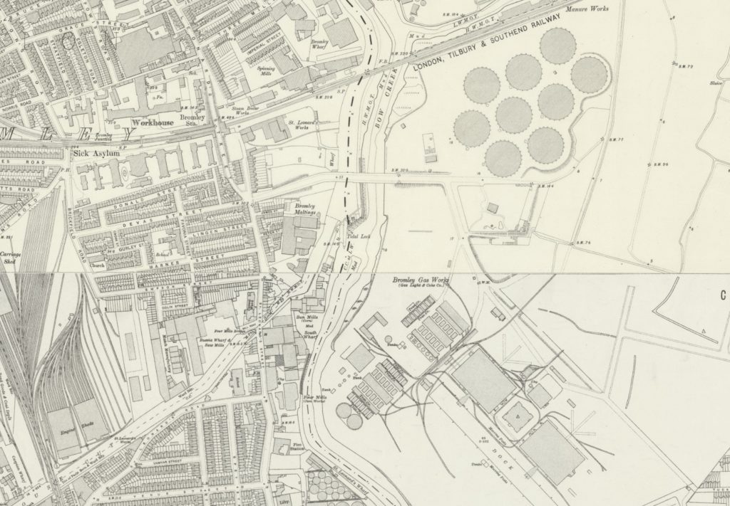
(Map ‘Reproduced with the permission of the National Library of Scotland)

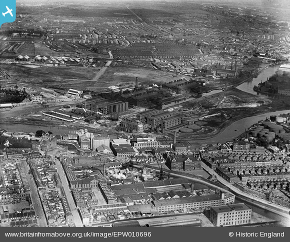
The following photo from Britain from Above shows the Bromley by Bow Gas Works in 1924. The River Lea can be seen running below the gas works buildings, and the dock that served the works can be seen coming of the Lea on the right of the photo, and running into the heart of the works. The gas holders are off to the left of the photo, a short distance from the works:

The Bromley by Bow gas works have a fascinating history and hopefully will be the subject of a future post, but for now I am continuing along the River Lea to my final stop.

In the complex web of waterways, as we approach Three Mills Island, we can see through the trees and bushes that line the river, the Channelsea River, one of the old rivers that ran across Bow. It now runs up to Abbey Road where it disappears into a culvert, and also forms the southern part of the channels that now makes Three Mills Island, an island:
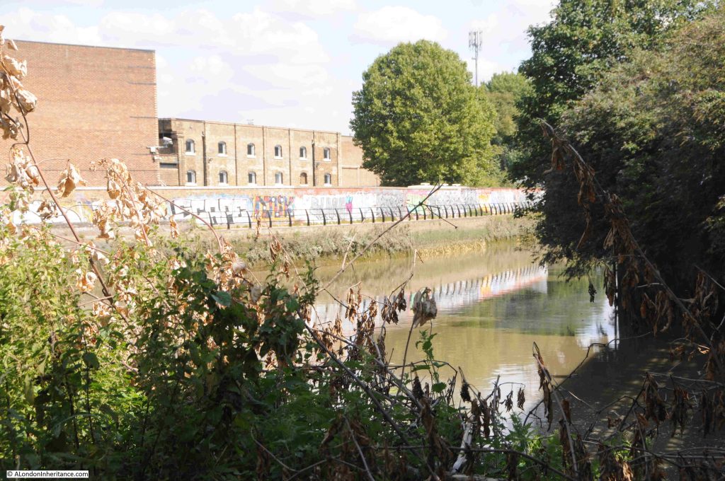
If you go back to the 1746 and 1816 maps, you will see the Channelsea River heading east from the Lea, just below the Mill.

Back looking along the River Lea, and if it was not for the tower blocks in the background, this idyllic view could be deep in the countryside rather than being in east London:
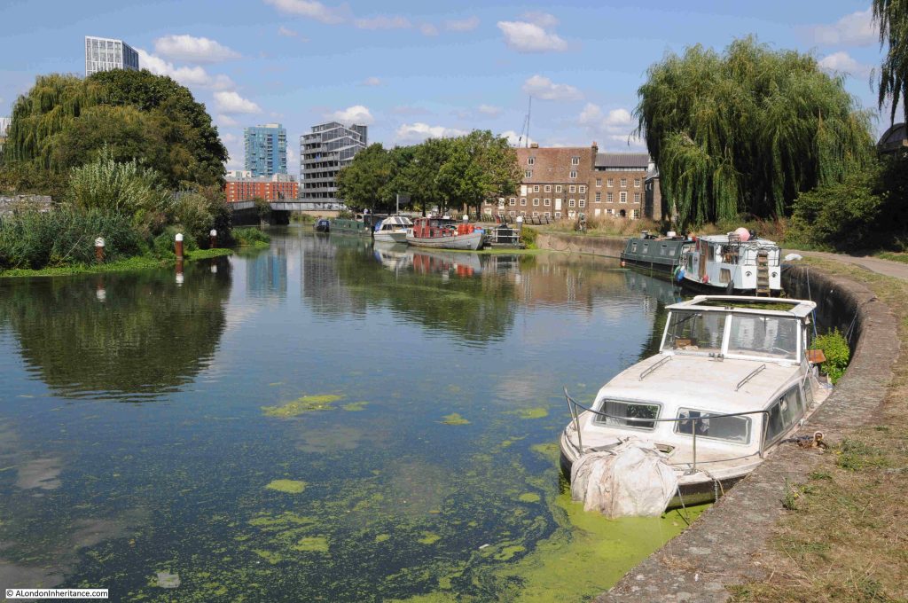
The brick buildings to the right of the above photo are those of the old mill buildings on Three Mills Island, which look glorious as you approach:
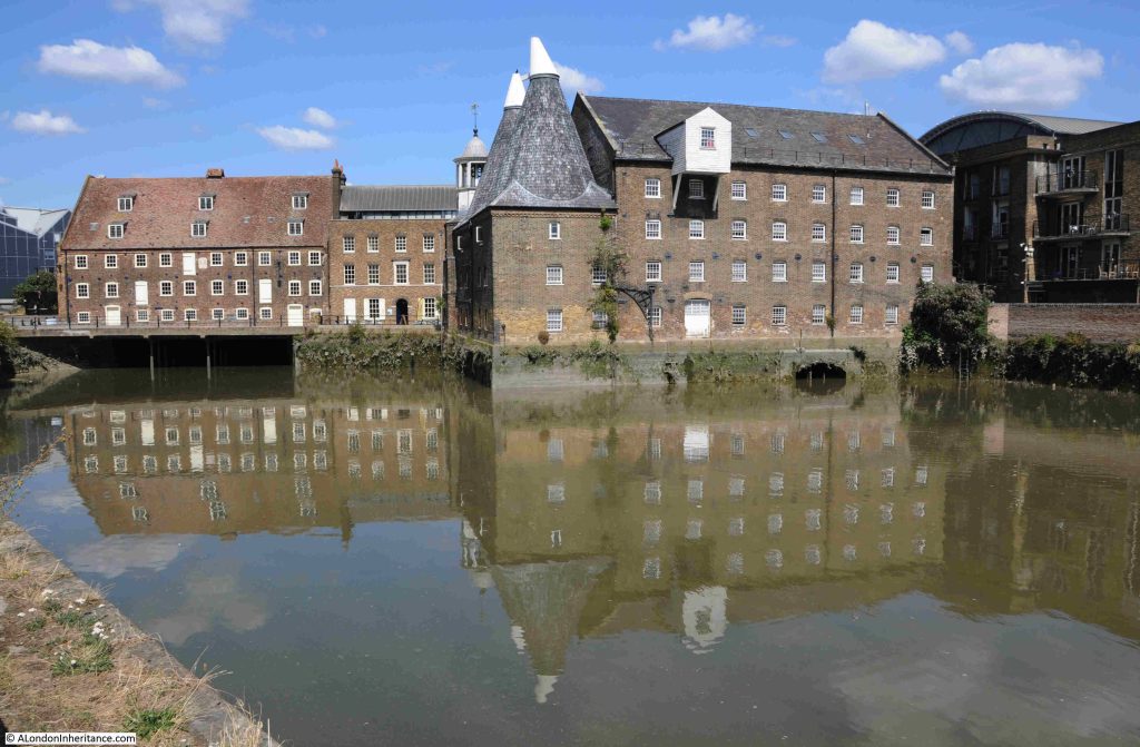
Although now an island due to the rivers that surround the site, it has not always been an island as the maps earlier in the post show. The site became an island when a channel along the east of the site was built from the Channelsea River back up to the River Lea.

Mills have been operating here for centuries, making use of the power of the water and tides along the River Lea. The buildings that we see today are mainly 18th century and range from Grade I to Grade II listed:
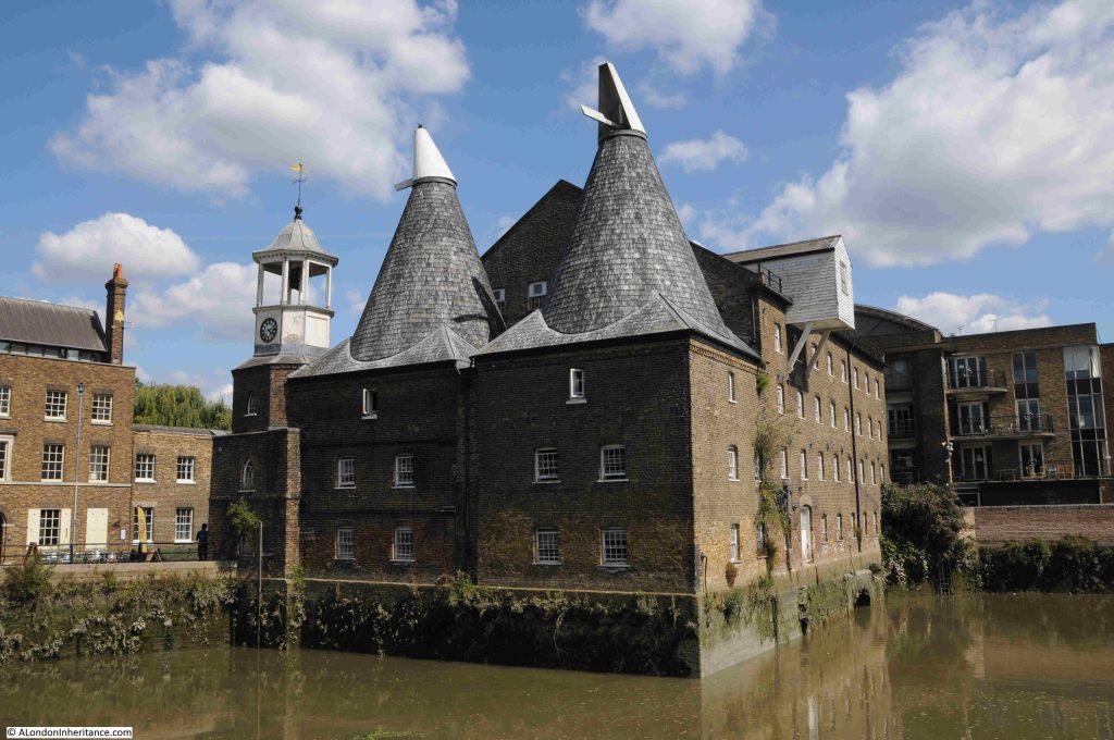
Back in 1972, the Architects’ Journal featured a lenghty article on the sites in east London that were considered at risk. Bombing, post war industrial and population decline across east London resulted in a range of buildings that were considered at risk of demolition.

I started working through all the sites back in 2017, to see how many had survived. The first post in the series is here. I still have a small number to finish off.

Given what a wonderful set of buildings we see today, it is surprise (or perhaps not given the attitude to many old industrial buildings at the time), that the mill buildings were considered at risk, including what is the world’s largest surviving tidal mill.
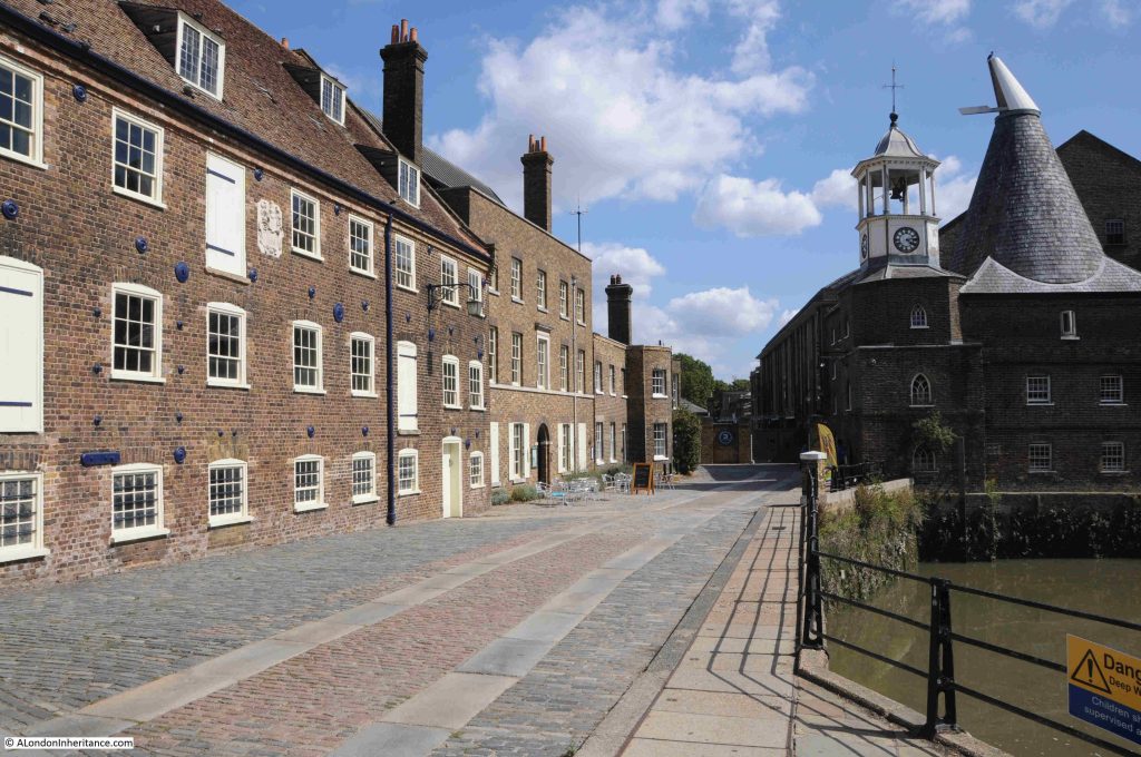
At the end of the street in the above photo is 3 Mills Studio, a studio complex built on the site of the Three Mills Distillery, and the studios where Master Chef is filmed.

As with the gas works, the history of this site deserves a dedicated post, which will hopefully appear in the not too distant future.

It is a really interesting walk along the Limehouse Cut from the old entrance to the Thames, up to the River Lea, and along the Lea to Three Mills Island.

Limehouse DLR station is near the start of the walk and Bromley by Bow station is a short walk from the end (walk to the north of the nearby Tesco store, underneath the A12, then south to the station.

The Limehouse Cut was a clever answer to the challenges of 18th century cargo transport from the Lea to the City of London, along with the docks and industry along the Thames from Limehouse to the City.

The Limehouse Cut eliminated the need for a long detour around the Isle of Dogs, the curving southern stretch of the Lea into the Thames, and the tidal challenges of this stretch of river.

Today it provides the route for a fascinating walk.

alondoninheritance.com

Walking the Limehouse Cut – Part 1

Thank you so much for ticket purchases of my walks announced last Sunday. They all sold out on the same day. I will be adding a few more dates for these walks in the coming months, and for an update as soon as they are on line, follow me on Evenbrite, here, and I will also announce in the blog.

For today’s post, I am walking along an 18th century engineering and construction innovation that helped transport goods from the counties north of London, into the city, and also served the industry that developed in east London.

The River Lea (Lee is also used, but I will stick with Lea), runs from Bedfordshire, through Hertfordshire, and then through east London to enter the River Thames just to the east of the Isle of Dogs at Bow Creek.

The Lea was used to carry goods, such as grain and malt, from the counties to the north and east of London to the Thames, where barges would turn west and head into the City.

Traffic on the River Lea started to increase considerably during the 18th century, and during this period a number of improvements were made, including locks and cuts, to bypass meanders in the river.

The big problem for those using the Lea to transport goods into the City was the Isle of Dogs. Being to the east, barges and shipping had to navigate around the Isle of Dogs before they could head into the City. This was at a time before the extensive use of steam power and when barges and shipping relied on the wind and tide.

If you look at the following map, the River Lea is highlighted by the green arrow, with the entrance of the river into the Thames shown by the blue arrow. As can be seen, the Isle of Dogs caused a significant addition to the route to head west into the City (map © OpenStreetMap contributors):

There had been proposals to cut a channel through the northern part of the Isle of Dogs to provide a direct route, however use of the land for the docks that expanded across the area was a more profitable and efficient use of the land.

The Civil Engineer John Smeaton had been looking at how the River Lea could be improved to make it easier to navigate, and one of his recommendations was to build a channel or cut from the River Lea to the Thames at Limehouse.

This would provide a direct route to the Thames, and would avoid the time consuming journey around the Isle of Dogs.

The River Lee Act, an Act of Parliament, was obtained in 1766 to build the channel, and work swiftly commenced with the new Limehouse Cut opening on the 17th of September, 1770.

Referring back to the above map, the Limehouse Cut is highlighted by the red arrow, and it can be seen to run from the Lea at the upper part of the Cut, down to enter the Thames at Limehouse.

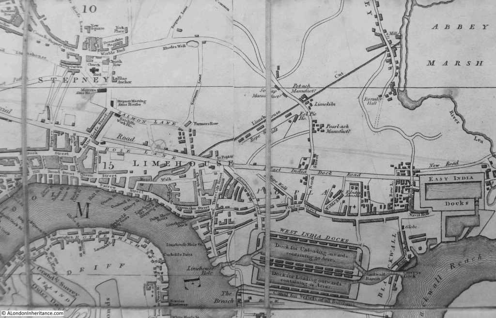
The map today shows the Limehouse Cut running through an area which is heavily built up, however even over 40 years after completion, much of this area was still rural, and in the following extract from the 1816 edition of Smith’s New Plan of London, we can see the Limehouse Cut running from Limehouse up to the River Lea next to Abbey Marsh through mainly empty land, which allowed a very straight channel to be built:

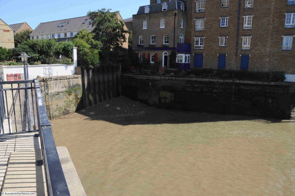
Not that clear in the above map, but the Limehouse Cut ran directly into the Thames, and the original entrance to the river can still be seen today:

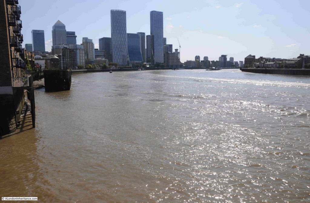
The view looking east from where the Limehouse Cut originally entered the Thames, where we see the Thames turning to the right to start its route around the Isle of Dogs:

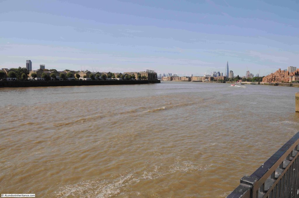
And looking west in the direction of the City, the Limehouse Cut provided a far more direct route for shipping on the Lea taking their produce and goods to the City:

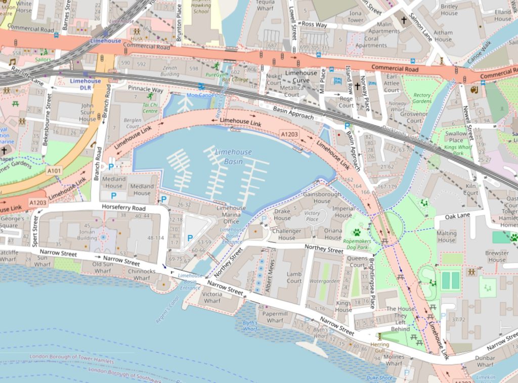
Whilst the old entrance remains, the Limehouse Cut is now diverted into the Limehouse Basin. If you refer back to the map of the area today, the Limehouse Basin is the area of water just to the left of the lower part of the Limehouse Cut.

The following map shows Limehouse Basin, look just to the right of where the channel from the basin enters the Thames and there is an indent. This is the original entrance to the Limehouse Cut (map © OpenStreetMap contributors):

The Limehouse Basin, or originally the Regent’s Canal Dock opened along with the Regent’s Canal in 1820, to form a place where shipping could dock, load and unload whilst transferring their goods between the barges that travelled along the Regent’s Canal.

The two entrances to the river for the Regent’s Canal Dock and the Limehouse Cut were very close together, and for eleven years between 1853 and 1864, the Limehouse Cut was diverted into the Regent’s Canal Dock, however after 1864 the original entrance was back in use, with a new bridge carrying Narrow Street over the canal. It seems that the return to the original route into the Thames was down to the imposition of additional charges and rules by the owners of the Regent’s Canal Dock on the users of the Limehouse Cut, who now had to pass through the dock to reach the Thames.

Use of the original route would last for another 100 years, when the Limehouse Cut was rediverted back into what is now Limehouse Basin, a routing it retains today.

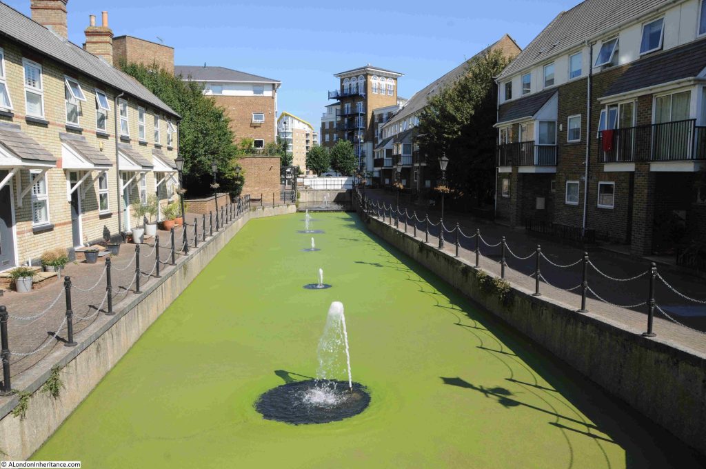
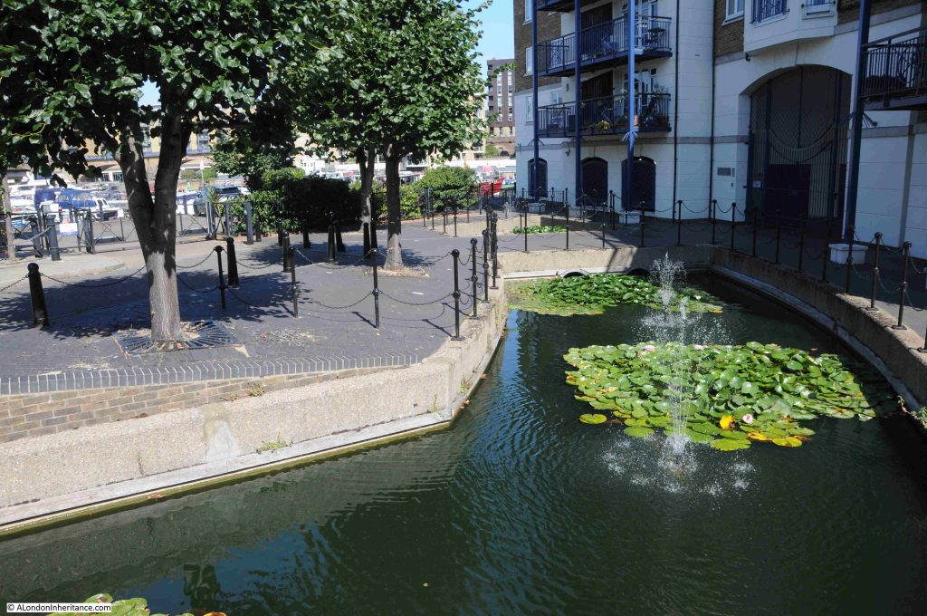
Although blocked up where the original entrance meets Narrow Street, we can follow the old route of the Limehouse Cut in the way the area has been landscaped as part of the redevelopment.

The side of the 1864 bridge that once carried Narrow Street over the Limehouse Cut remains:

The following photo is the view looking north from the bridge which once took Narrow Street over the Limehouse Cut, and a channel of water follows the original route. It was here that a lock was located to control the height and flow of water between the tidal Thames and the Limehouse Cut:

Which then continues after Northey Street:

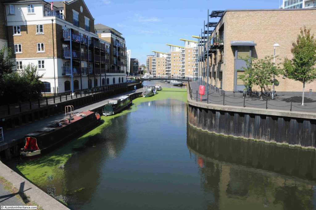
And in the following photo, I am now at the Limehouse Cut, where it curves to head towards Limehouse Marina. The original route to the Cut is to the left of the photo:

The following photo is looking north along the Limehouse Cut at the start of the walk. The first of many bridges can be seen. This one carrying the DLR over the Cut:
The Limehouse Cut took just 16 months to build, and was the first canal built in London as well as being one of the first across the country.

As can be seen in the maps at the start of the post, the Cut was (and still is) remarkably straight, and it followed a minor geological feature, where there was a slightly higher flood plain to the north west, and slightly lower flood plain to the south east of the Cut, although with so much later construction, this feature is hardly visible today.

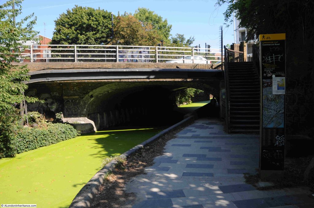
The first road bridge we come to is the bridge that carries the Commercial Road over the Cut:

The Commercial Road was built in the first years of the 19th century to connect the expanding docks to the east of the City, with warehouses, business premises and workers in the City and east London.

The Evening Mail on the 24th of August, 1804 was reporting on the build of the Commercial Road (or Grand Commercial Road as it was first called), and highlighted the Limehouse Cut as being one of the obstructions in Limehouse: “At a short distance before it arrives at Limehouse church, the direct communication is impeded; but to prevent, as much as public convenience could admit, any variation, the bridge of the Limehouse Cut is considerably enlarged”.

Although the bridge was enlarged, the Limehouse Cut still narrows as it passes under the bridge.

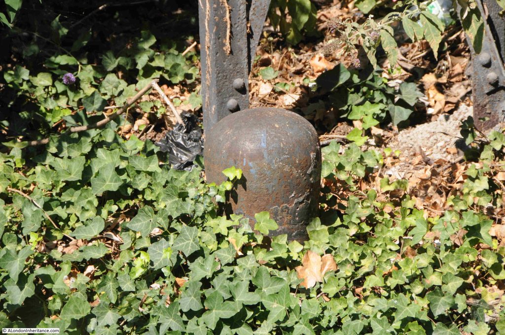
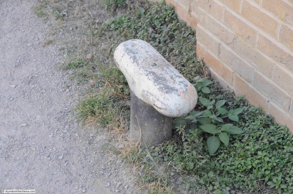
Along the route there are reminders of the heritage of the Cut, with features once used for mooring ropes:

Passing under the Commercial Road Bridge, and this is the view looking north:

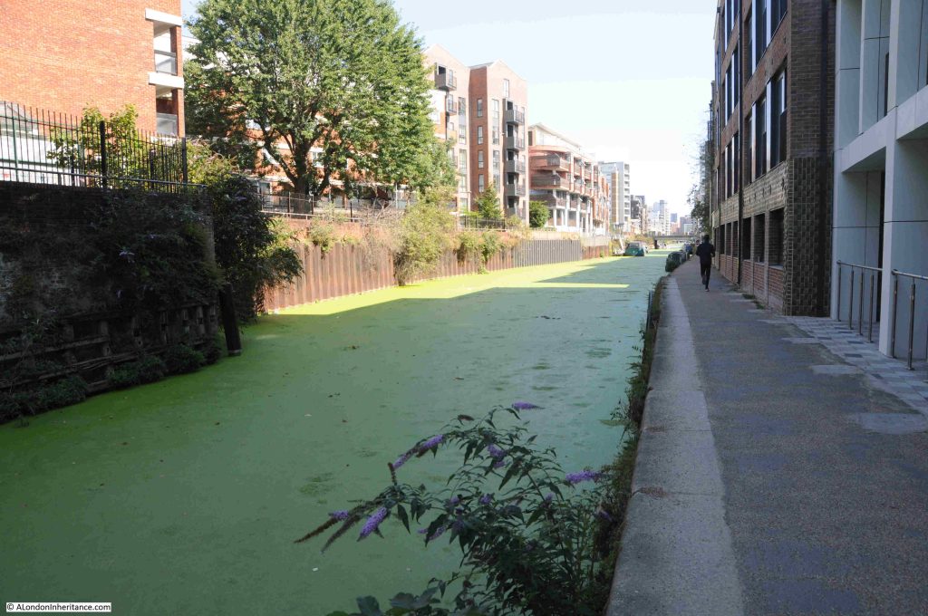
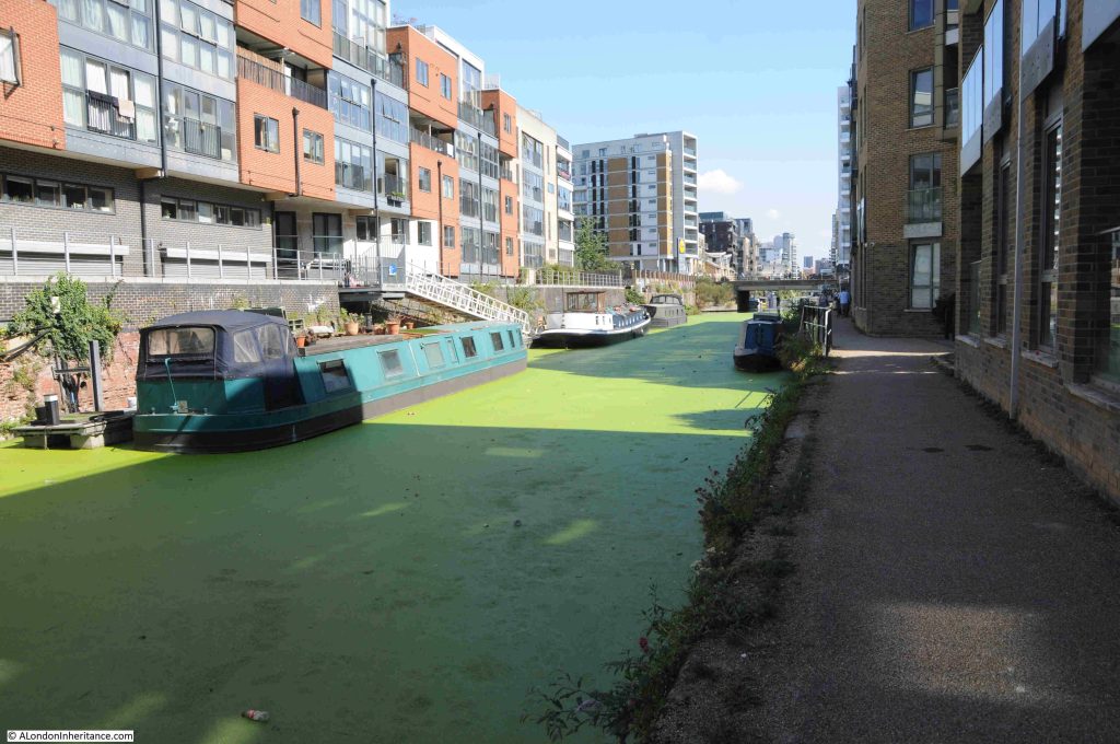
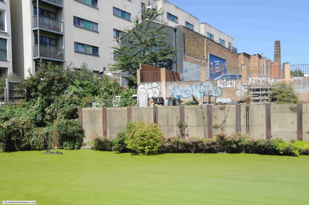
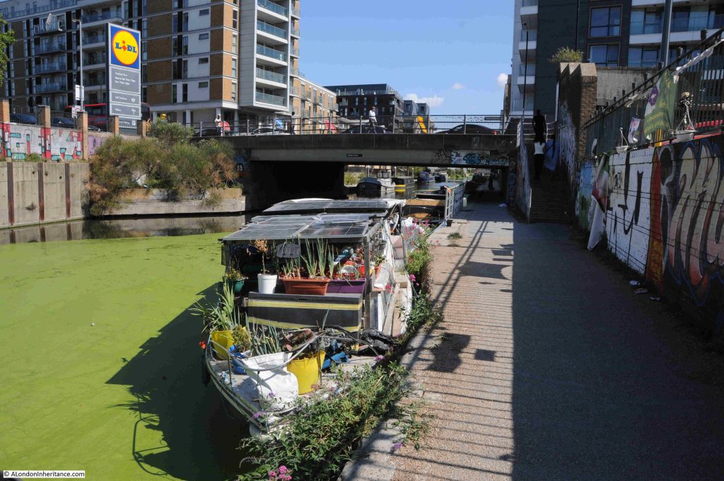
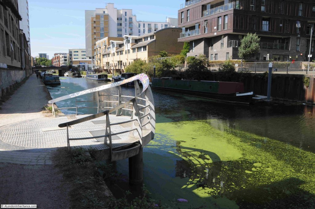
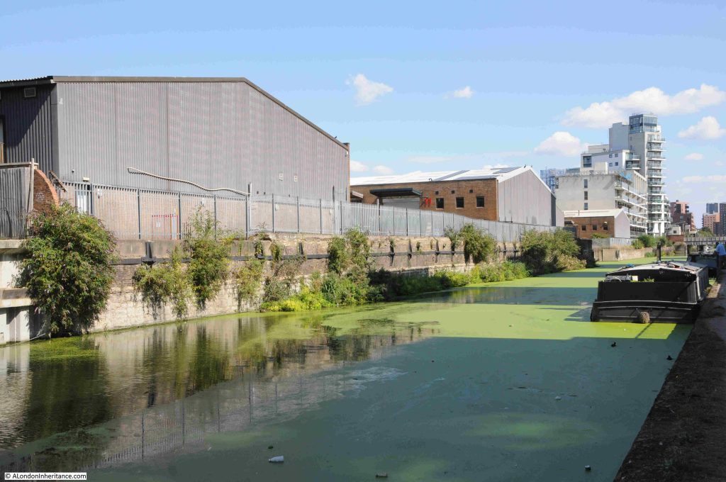
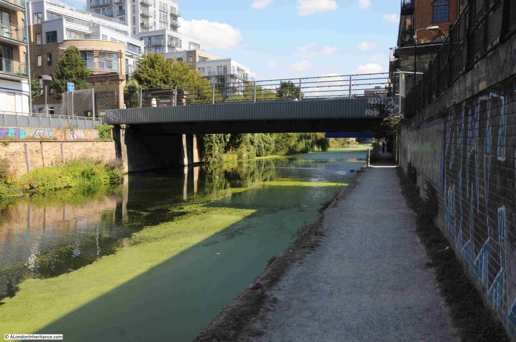
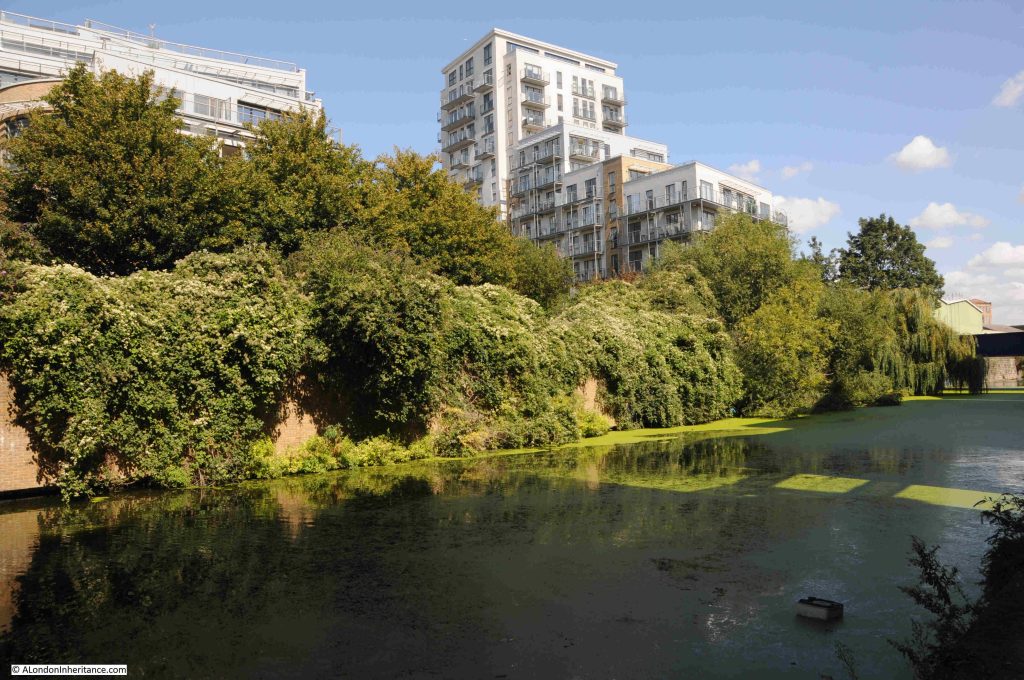
Much of the Limehouse Cut as well as the Limehouse Basin was covered in green weed growth, possibly a result of the hot summer:

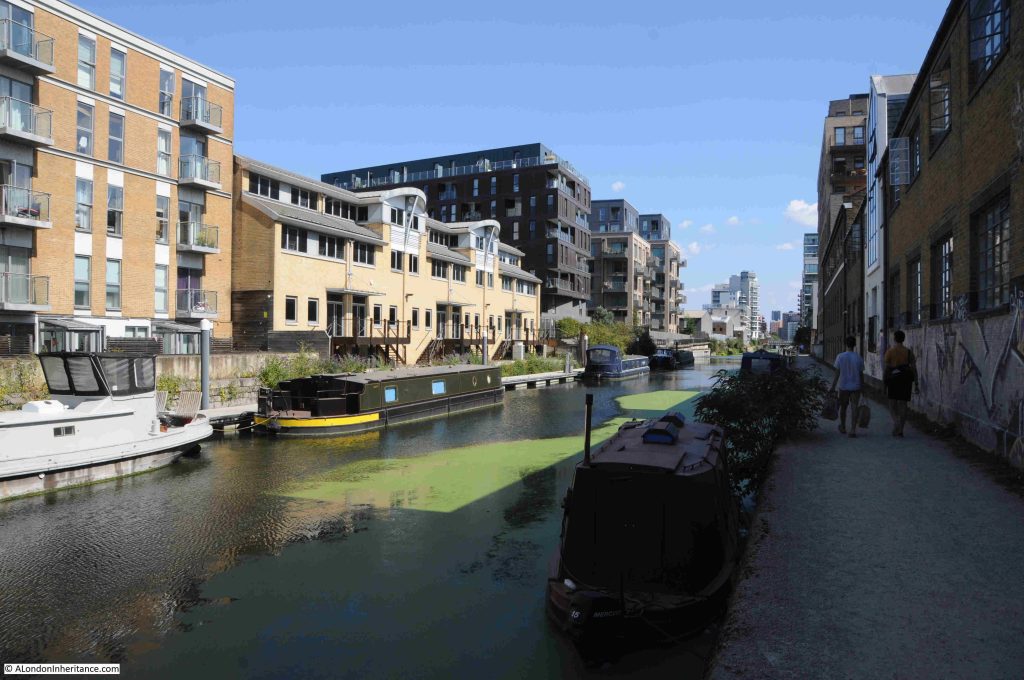
The majority of the land along the side of the Limehouse Cut has been converted to either new apartment buildings, or renovation of earlier buildings into apartments.

Very little examples of the old industries that once lined the Limehouse Cut remain, in the following photo is an example of part of the industrial heritage of the area:

In the late 19th century, the space in the above photo was occupied by a disinfectant factory. I do not know if the buildings and chimney we see today are part of that business, or from the early 20th century.

I have been trying to build a list of all the businesses that once operated along the Limehouse Cut, but it is one of many projects that is taking time to complete and is only partly done.

Looking to the right of the above photo, and we see the bridge carrying Burdett Road over the Cut. A Lidl is on the left, on space once occupied by a lead works:

Passing under the Burdett Road bridge, and the Limehouse Cut carries on to the north. Walking the Cut highlights just how straight the route taken for the construction was, although the empty fields on either side have long gone.

To walk the Limehouse Cut, the eastern side of the Cut is the best route to take, this provides a continuous walkway from the Limehouse Basin, all the way up to where the Cut joins the River Lea.

The eastern side is marked “towing path” on OS maps, so this was the continuous pathway alongside of the Cut so horses and men could pull barges along the length of the Cut.

It is possible to walk parts of the western side of the Cut, however much of this route is built up to the edge of the water.

Along the footpath, there are more reminders of the heritage of the Cut:

Somewhere to stand and look out over the Cut:

Walking further along the Limehouse Cut, and there is a bit more industry along the western edge. Not the dirty, manufacturing businesses that once occupied the space rather light industrial, storage and distribution etc.

A short distance along and there is a short indent to the Cut named Abbott’s Wharf:

There was an Abbott’s Wharf to the left, however checking the OS maps for 1914 and 1951, and there is no indent at this position. There was an Abbott’s Wharf as a set of large buildings to the left, but the OS maps show a continuous tow path, without any indent, so this is probably part of the recent redevelopment of the area as a new apartment block to the right of the wharf is named Abbott’s Wharf.

A short distance along is the bridge that carries Bow Common Lane (to the west) and Upper North Street (to the east), across the Limehouse Cut:

The Limehouse Cut, along with the Regent’s Canal, helped the considerable industrial development of the area, and industry took up a considerable length of the sides of the Limehouse Cut.

Much of this was dirty, polluting industry, although there were places such as biscuit factories along the route.

In the 1860s, the rector of St. Anne’s Limehouse wrote that “no bargee who fell in had any chance of surviving his ducking in the filthy water”, such was the polluted state of the water.

Despite this claim in the 1860s, and the considerable range of dirty and polluting industries alongside the Cut, in 1877 the Limehouse Board of Works was claiming that the water was in excellent condition. At a meeting looking into a number of local issues, when talking about fever and smallpox:

“Mr. Peachey stated that fever was prevalent in the neighbourhood of the Limehouse Cut. Mr. Potto said that the disease could not be attributed to the Limehouse Cut for the water there was in excellent condition.”

I am not sure though whether Mr. Potto would have been happy to swim in the Cut despite his claim.

The bridge shown in the above photo was a notorious place for the appalling smell from adjacent industries and the bridge acquired the name of Stinkhouse bridge.

Stinkhouse Bridge was mentioned in numerous newspaper reports in the 19th century, including one report in 1844 about a fire at a factory complex next to the bridge. The factory was a pitch, tar and naphtha distillery. Naphtha is a distillation of crude oil, gas, or coal-tar.

There were attempts at cleaning up the root cause of the smells, for example, the following is from the East London Observer in November 1878, reporting on a local council meeting, where:

“The Medical Officer of the North District (Mr. Talbot), reported that in consequence of complaints made to him concerning noxious vapours in the vicinity of ‘Stink House Bridge’, he had carried out a series of systematic observations both as to their existence and their causes. The results of his examination, with the assistance of Inspector Raymond, were that the nuisance was traced to some six factories, and in each case a notice had been served by order of the Sanitary Committee, and a communication sent to the Metropolitan Board about the discharge of ammoniacal liquor into the sewers.”

The notices served do not seem to have had too much impact, as complaints continued for many years.

The name Stinkhouse Bridge continued to be in use for many decades. The last written use in either local or national press was in 1950.

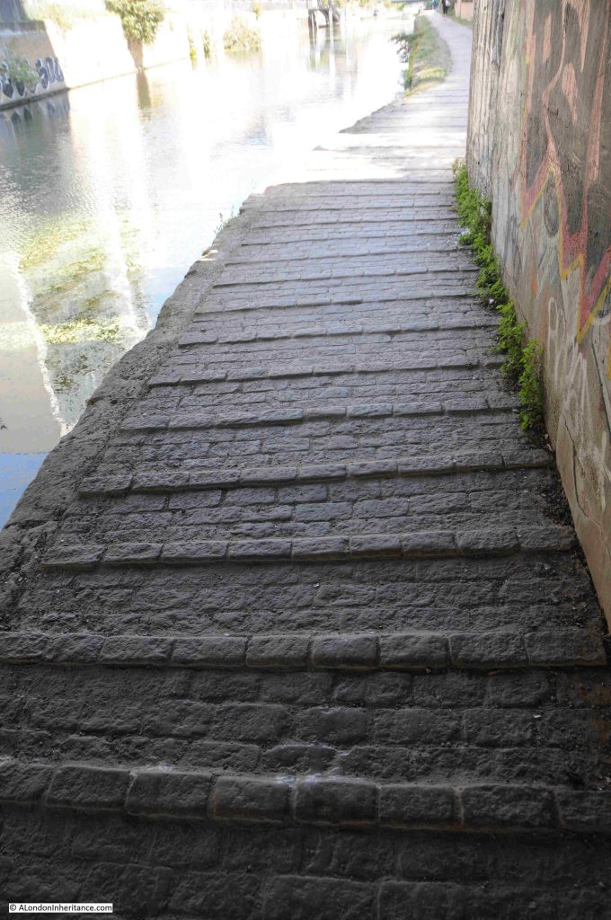
Underneath the bridge, there are raised sets along the towpath. I do not know if they are original, or if they were there to help provide grip for the horses pulling barges along the Cut:

As with the River Thames, the Limehouse Cut was both a playground and a death trap for children.

As industry populated the banks of the Cut, and streets with housing covered the surrounding area, children were drawn to the Cut by the attraction of water, the novelty of the barges both moored and passing along the Cut, and the variety of places to play.

This resulted in the deaths, usually by drowning, of a considerable number of children. Looking through old newspapers, a child’s death is reported almost every year.

For example, two years that are typical:

  • 1936 – A verdict of accidental death was recorded by Dr. R.L. Guthrie at a Shoreditch inquest upon John Brown aged 7, of 72 Coventry Cross Estate, Bow, who was drowned in Limehouse Cut on Saturday
  • 1937 – Dinner Hour Swim which Ended Fatally. A verdict of accidental death was recorded on George Henry Hector, aged 16, employed at Crown Wharf, Thames Street, Limehouse, who was drowned in Limehouse Cut

Fires were frequent along the Limehouse Cut, both in the buildings alongside, and in the barges travelling and moored along the Cut. Buildings were often storing or processing, and barges were transporting, highly inflammable goods.

One such example is from 1935, as reported in the following article;

“Frederick Carpenter, aged 15, of Provident Buildings, Limehouse, played a valuable part in assisting to prevent the spread of an outbreak of fire which involved three barges lying in Limehouse Cut, near Burdett Road, Limehouse.

Several craft were stationed close together, and Carpenter leapt through flames and smoke to loosen moorings so that those which were on fire might be separated from the rest. A crowd on onlookers helped to drag other barges out of the danger area. Of the barges which caught fire two were laden with timber and one with bales of sacks.

Firemen fought for more that an hour to extinguish the blaze.”

The Limehouse Cut is a very different place today:

In the above photo, the Limehouse Cut appears reasonably wide. It does narrow where it passes under bridges, but for much of its length, it is wide enough for barges to be moored either side, and a couple of barges to pass in the centre. This was not how the Cut was originally built.

When the Limehouse Cut was opened in 1770, it was only wide enough to carry a Lea Barge with a standard beam (width) of 13 foot. Very quickly this became a significant problem with the number of barges attempting to travel both ways along the Cut.

A couple of years after opening, passing places started to be built along the length of the Cut, but this was a very limited solution, and to support the expected rapid increase in use of the Cut, in 1773 it was decided that the whole length of the Cut should be widened to allow barges to pass in both direction.

It took some time to widen a working canal, but by 1807 the majority of the Limehouse Cut had been widened to 55 feet. The challenge was with the bridges, and as can still be seen today at a couple of the bridges, the Cut narrows to pass underneath the bridge.

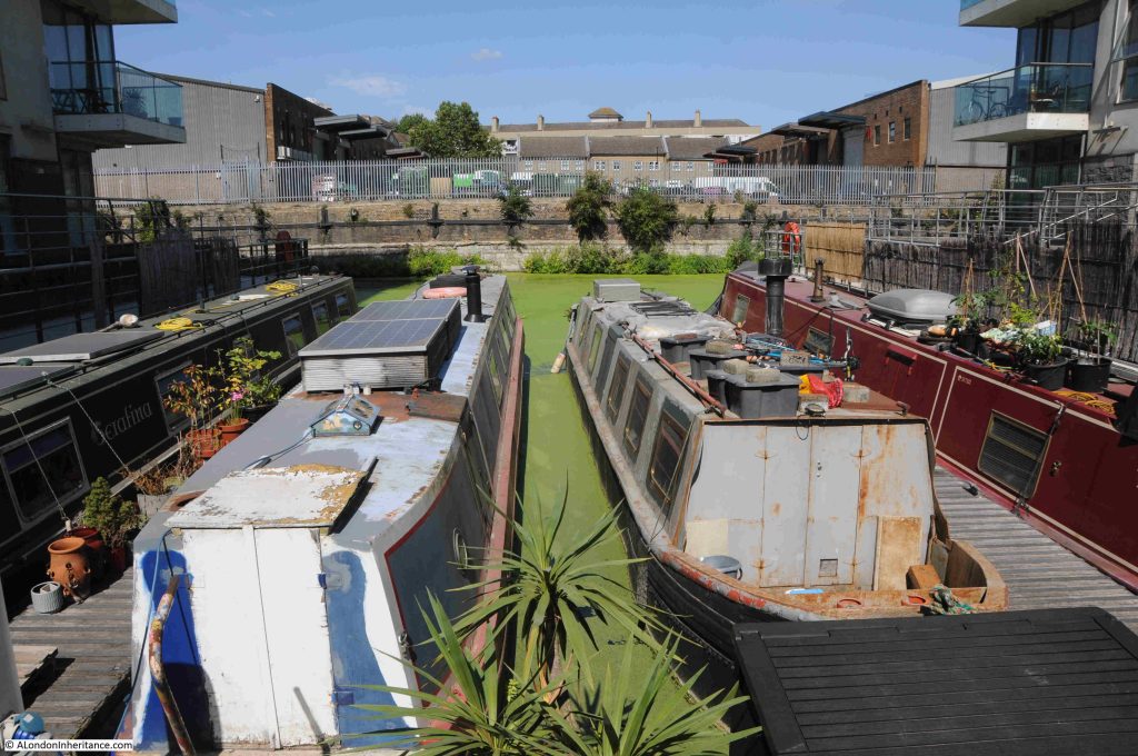
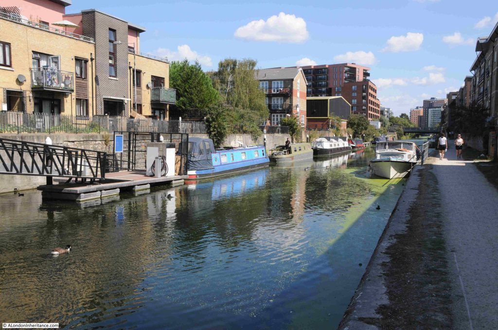
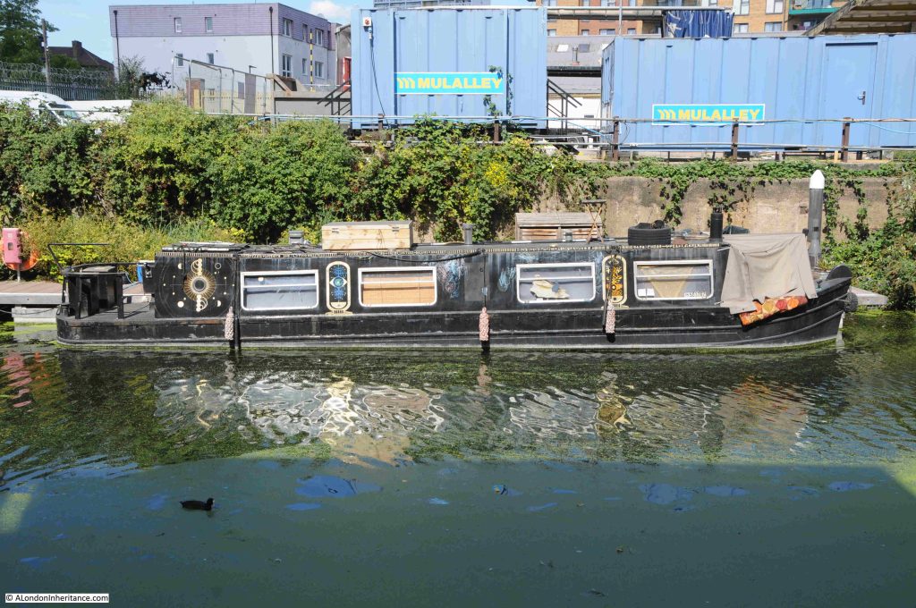
The Limehouse Cut continues to be lined with a much smaller number of barges than when the Cut was in use as a route between the River Lea and the Thames, and the majority today appear to be residential:

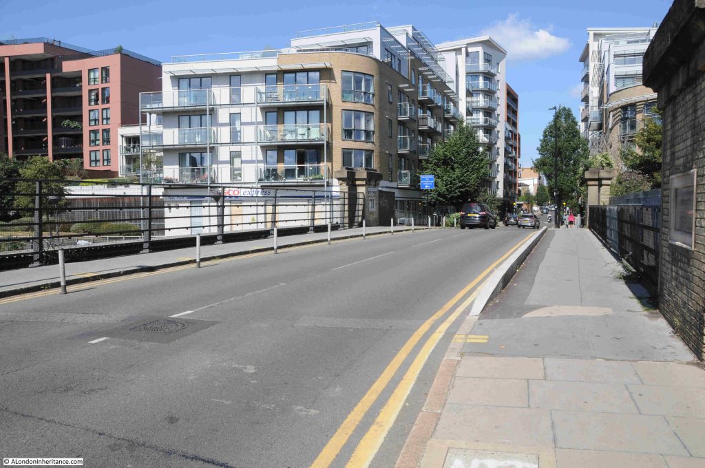
The following bridge carries Morris Road (to the south east) and Violet Road (to the north west), over the Limehouse Cut:

There are a range of interesting features here, and it is worth walking up to the bridge to take a look.

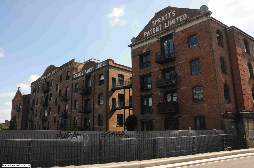
Firstly, along the eastern side of the Limehouse Cut is Spratt’s Patent Limited factory, a manufacturer of foods for a wide range of domestic animals, probably best known for their dog foods:

In 1910, Pratt’s Patent were supporting the Cruft’s dog shows, where they were described as “the universal providers to the dog, poultry and caged bird fraternities”.

At a 1910 Kennel Club show at Crystal Palace, Spratt’s Patent provided the food for 3,346 dogs.

Spratt’s Patent was founded by James Spratt, an American electrician who arrived in the UK in the 1850s intending to manufacture and sell lightning conductors.

The story behind the animal foods business is that in east London he saw dogs eating the hard biscuits left from the ships docked in the area. He patented a new dog food which was made by baking wheat-meal which had been mixed with rendered meat and vegetables. 

Whether it was coincidence or not, Charles Cruft, the founder of Cruft’s Dog Shows started off as an employee of Spratt’s Patent, and when Cruft went on to run the dog shows, Spratt’s became a key supplier.

For many years, the company was the largest manufacturer of dog food and dog biscuits in the world, and supplied not just domestic demand, but also the US and Europe, along with exports to many other countries.

They also had premises in Bermondsey and Barking. Their address in Bermondsey was used for advertising featuring Dog Medicines, Poultry Houses, Appliances and Medicines, and via Bermondsey, dog owners could also entrust Spratt’s Patent with their dogs whilst they were on holiday. The dogs were transferred to Mitcham, as in the following from the Kilburn Times in July 1891:

“PETS IN HOLIDAY TIME – our readers, before leaving for their holidays , might entrust their canine friends as boarders to Spratt’s Patent Dog Sanitorium, which is on a healthy site near Mitcham. The kennels are large and spacious, the dogs are groomed and exercised for several hours daily, and are not caged or chained. Write Spratt’s Patent Limited, Bermondsey for all particulars.”

Today the building is mainly residential.

The bridge carrying Morris and Violet Roads over the Limehouse Cut has a new deck, however at the four corners of the bridge, the brick pillars survive:

On one pillar is a plaque that tells that the bridge was built by the Board of Works for the Poplar District, and that it was opened on the 19th of May, 1890.

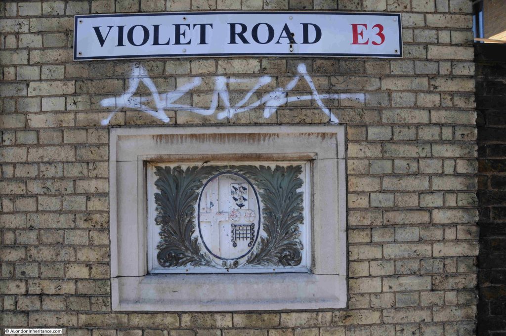
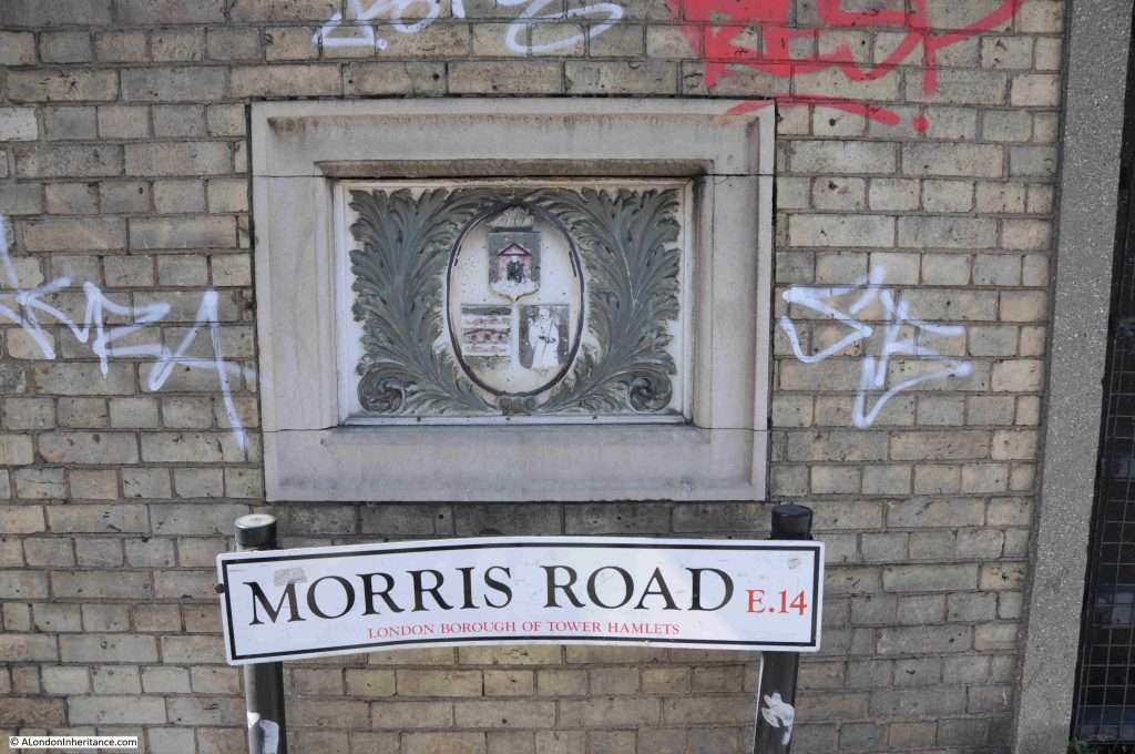
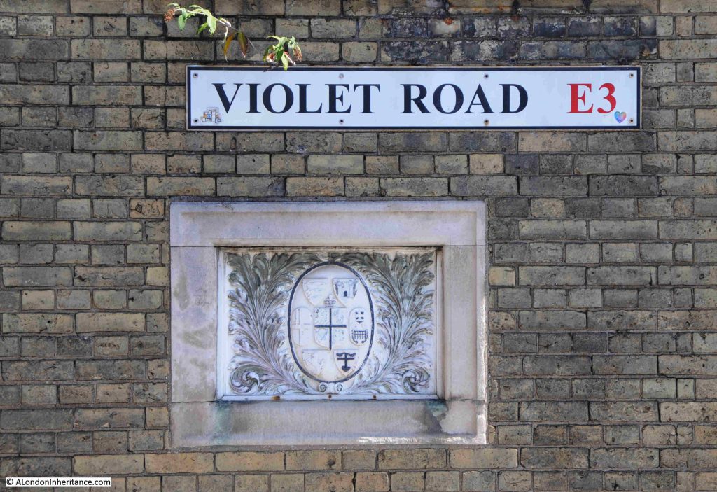
On the other three pillars there are coats of arms. These seem to be arms of many of the boroughs in London that may have some involvement with the Limehouse Cut.

In the following, the arms of the City of London are on the left, not sure about the arms on the right:

Morris Road is the eastern side of the bridge, towards Poplar, and the arms on this side of the bridge are those of old Poplar Borough Council:

And the third pillar has a collection of arms, which I need to research:

Back down alongside the Limehouse Cut, and the banks along the western side look almost as if they are lining a country canal.

In the next post, I will complete the walk, and reach where the Limehouse Cut meets the River Lea, the Bow Locks, and take a quick look at the Bromley by Bow Gas Works and Three Mills Island.

alondoninheritance.com