Monthly Archives: April 2017

262 High Holborn And Pearl Assurance

One of my issues with modern architecture is that at street level buildings tend to be very bland. Lots of glass, steel and stone cladding, falling far short of the original architects usual description which frequently seems to include the work “iconic”. Office buildings in the City today are often multi-tenant rather than built for a specific occupier and blandness of the exterior offers no indication of the occupier of the building.

Whilst the existence of the majority of companies is obviously to make a profit for their owners, the function within the company that produces these profits often appears to be a sideline for financial manipulation. Buildings that have any external pride or recognition of the business of the occupiers are now rarely seen.

This was not always the case, many older buildings in London retain symbols of their past occupiers. A couple of examples I have written about include Imperial Chemicals House on Millbank and the Faraday Building on Queen Victoria Street.  Unilever House at Blackfriars is another building that has company related decoration.

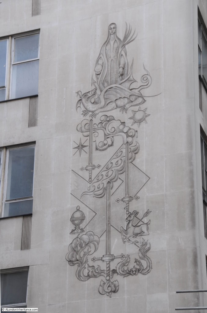
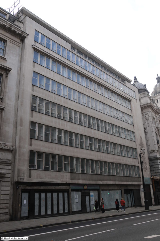
There is another building that has some fascinating decoration, 262 High Holborn has a relief that looks more suited to Glastonbury than adorning an office block in High Holborn.

The following photo is of 262 High Holborn, once a property owned by the Pearl Assurance Company. Their main office was the very grand 252 High Holborn, the edge of which is just seen to the right.

262 High Holborn

In contrast to their main building, 262 High Holborn was a very bland and functional office block but look to the far right of the building and an elaborate relief can be seen running up alongside floors 1, 2 and 3.

At first glance it looks as if the designer of this relief may have had some substance assisted creativity, but in reality this tells a company history and relationship with London.

262 High Holborn

I have wondered about the detail of the relief every time I have walked past, however a chance find of the book “Pearl Assurance – An Illustrated History” published in 1990 provides a full description of the individual elements of the relief and how they relate to Pearl Assurance.

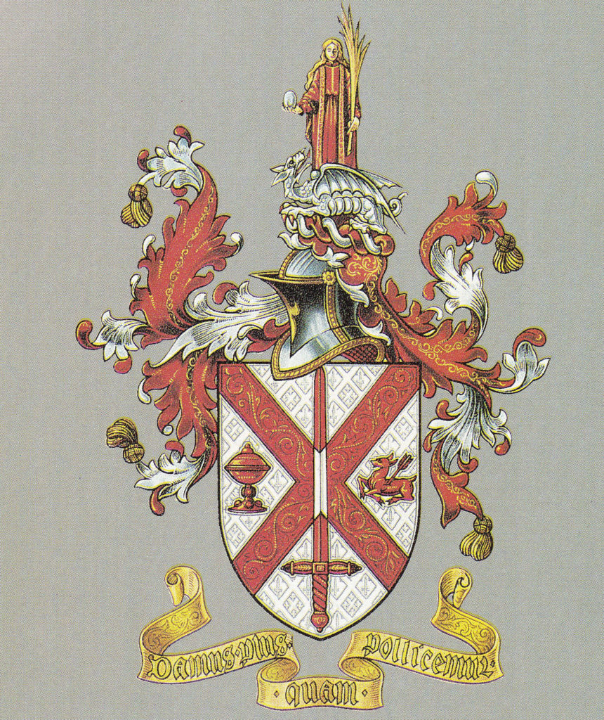
The relief is a representation of the armorial bearings assigned to Pearl Assurance on the 30th November 1911. The following picture from the book shows the armorial bearings in their standard form and it may take a bit of back and forth comparison between the two pictures, but the common elements should be clear.

262 High Holborn

The book includes the following description of the individual elements from information gleaned from an article in the Pearl Magazine of 1950 reporting research by the editor of the time, Len Miller.

The book explains:

The Shield: In general terms the shield refers to the geographical origins of the company and the figure represents Pearl. The Covered Cup is associated with St. Dunstan, the patron saint of the Borough of Stepney, where the company had its first office, in Denmark House, Commercial Road. 

The Sword represents the City of London (the sword of St. Paul). as does the dragon in the crest above the shield. Both refer to the company’s association with the City through Adelaide House, London Bridge. 

The Wounded Hind and the Red Cross, or Saltire, are taken from the Arms of the Borough of Holborn. Although in 1911 the company’s head office was at London Bridge, the move to Holborn had been planned. The wounded hind refers to St. Giles in the Fields, an allusion to the legend that St. Giles received a crippling injury whilst saving a hind from the huntsman. The cross refers to St. George the Martyr and St. George, Bloomsbury, both churches in what was, in 1911, the Borough of Holborn. 

The Crest: This consists of a figure representing St Margaret, with a Pearl in her right hand, a palm branch in her left hand and a dragon at her feet. Saint Margaret of Antioch, the Christian daughter of a pagan priest, was imprisoned for her faith and devoured by Satan, in the form of a dragon. With the cross that she wore she possessed the power to burst the dragon open and she emerged unhurt. 

Margarita (Margaret) is Latin for a pearl, hence a pun links the name of the company with the legend. The palm branch is an emblem of honour and a symbol of success. 

The Motto: ‘Damus Plus Quam Pollicemur’ when translated reads “We give more than we promise’ “

The motto was not included in the relief on 262 High Holborn, however the rest of the relief is a brilliant interpretation of the armorial bearings of Pearl Assurance and provides a graphical history of the company.

The Pearl Life Assurance Loan and Investment Company Limited was formed on the 8th July 1864. It was very much an East London company with all the original directors living within a mile of the Aldgate Pump and the company was registered at the home of one of the directors in Commercial Street.

The name Pearl goes back further to 1857 and the Pearl Loan Company, also operating in Commercial Road, with four directors of the company also becoming directors of the 1864 company.

Pearl Life Assurance expanded rapidly and moved into offices in City Road, then in 1878 to Adelaide House adjacent to London Bridge. In 1914, the company had outgrown Adelaide House and a new, considerably larger office building was constructed at 252 High Holborn. In the same year the company changed name from Pearl Life Assurance Company Limited to Pearl Assurance Company Limited allowing the company to expand its range of products.

Pearl Assurance operated from 252 High Holborn until the 1980s when the company relocated to Peterborough. The old building not being suitable for a financial company transferring over to computerised operations.

252 High Holborn is now the Rosewood Hotel.

The building of 262 High Holborn is a bit of a mystery. I have seen references on the Internet to it being of 1950s construction. The website of the architectural practice T.P. Bennet refers to a period between 1967 and 1979 when the company opened a number of new offices  “as well as the main office at 262 High Holborn, designed by the firm for Pearl Assurance”.

The style of the relief does look more of this later period. I suspect that despite being adjacent to their head office, Pearl Assurance did not occupy the building. They were investors in property and 262 High Holborn was probably one of their investments. The book “Pearl Assurance – An Illustrated History” seems to confirm this as the book, which covers in detail the growth of the company, buildings occupied, staff facilities etc., makes no reference to 262 High Holborn.

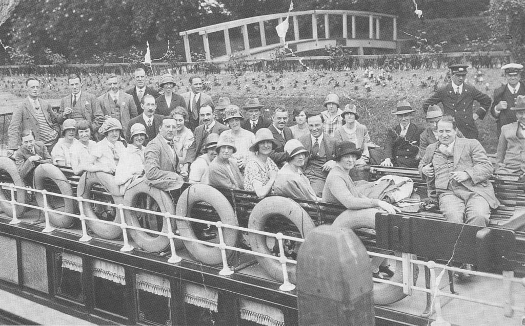
The book is a fascinating history of Pearl Assurance from 1864 to 1989. From their East London origins, the company grew globally with offices across India, Africa, Australia and America. Pearl Assurance was typical of large companies in the 20th century in building a company culture and providing facilities for staff that embedded them within that culture. There are photos of the Sports Ground and Clubhouse at New Malden (now the Kings College London Sports Ground). There was the annual cricket match between teams from field and head offices, football tournaments, and a photo of the Policy Department Thames river outing in 1926:

262 High Holborn

1989, the year of publication, was a crucial year for Pearl Assurance as in that year the company was purchased by the Australian Mutual Provident Society. At the time of purchase, AMP’s managing director stated that “We aim to build upon its (Pearl) strengths, and continue the impressive process of change currently underway. This will involve retaining the Pearl name and identity whilst also expanding the business.”

It was not to be. This Guardian article from 2004 details the demise of the company. It was later spun off and amalgamated with other assurance companies and funds and the Pearl Assurance name disappeared.

The company had a significant amount of archives and there was a Company Archivist. The archives included not only documents and photos covering the history of Pearl Assurance, but also artifacts such as clay pipes from the 17th century found during excavations at 252 High Holborn. I believe that the National Archives now hold a significant part of the Pearl Assurance archives.

Today, the relief on 262 High Holborn is the only visible sign in London that I am aware of, of a company that operated in London and was a major employer for well over 100 years – I am pleased that I now understand the meaning behind the details of the relief.

alondoninheritance.com

Keats House, Hampstead

Keats House in Hampstead was the home of the poet John Keats for part of his short life. Saved from demolition when there were plans to replace the house with a row of flats in 1920, the house became a museum in 1925, a role which continues to this day. Keats House is now the responsibility of the City of London Corporation.

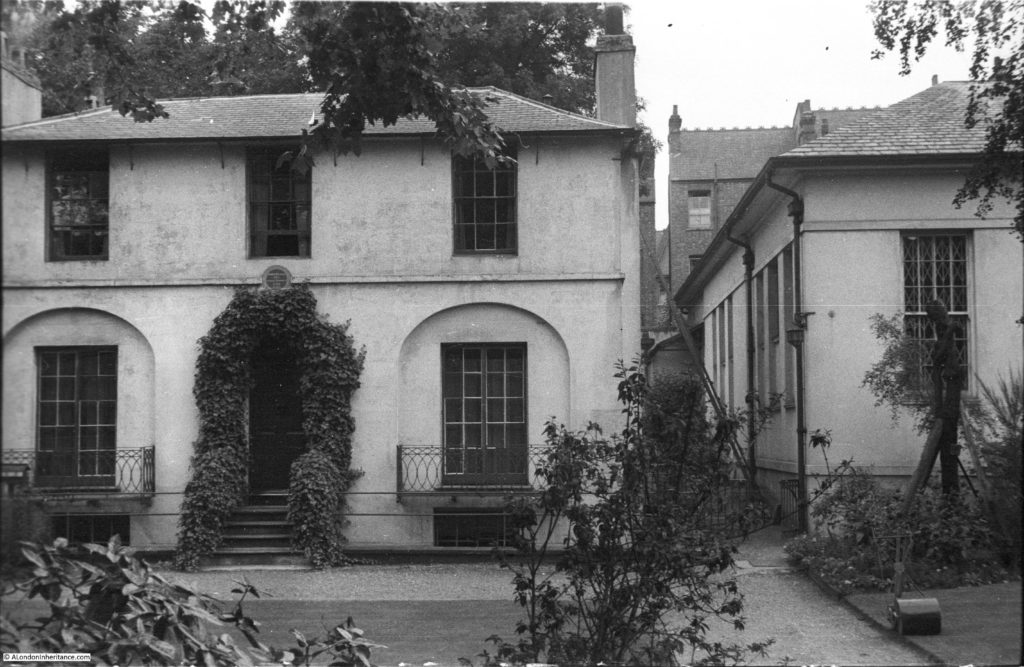
My father photographed Keats House in 1951:

Keats House

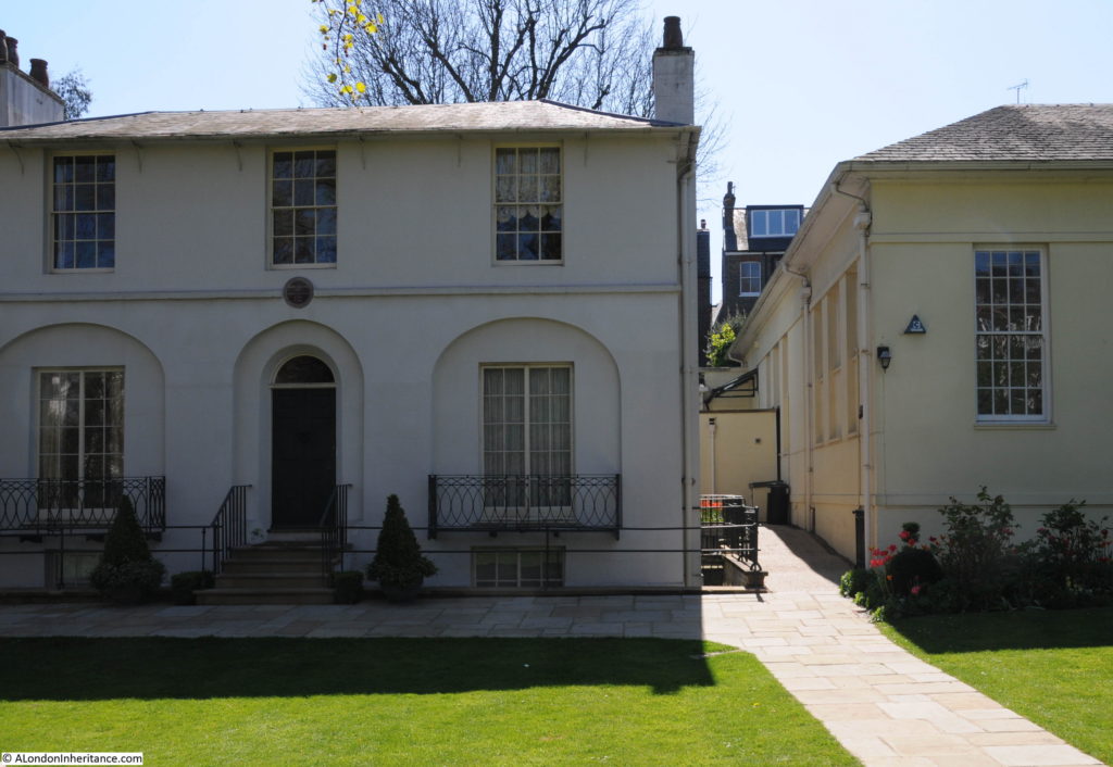
Sixty six years later I made a return visit to photograph Keats House on a warm and sunny April day:

Keats House

The house has hardly changed apart from the foliage around the door and some restoration work, the latest of which was a Heritage Lottery Funded redevelopment in 2009 and Arts Council supported work in 2015.

I love finding small details in these photos. In the lower right corner of the 1951 photo is a push lawnmower. I remember these from childhood as about the only way of cutting the lawn in a normal garden.

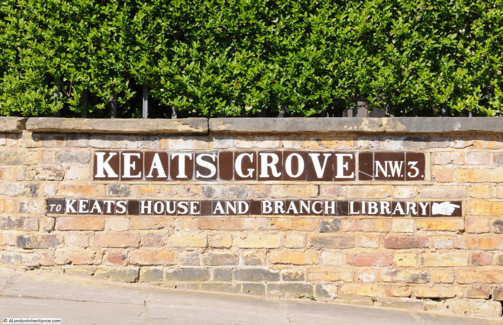
Keats House is a short walk from Hampstead underground station. Walk down Hampstead High Street and continue where the high street becomes Rosslyn Hill until a turning on the left  with the name of Downshire Hill, past the Keats Group Practice (the association with Keats is very popular here) till the junction with Keats Grove where there is a handy pointer to the museum.

Keats House

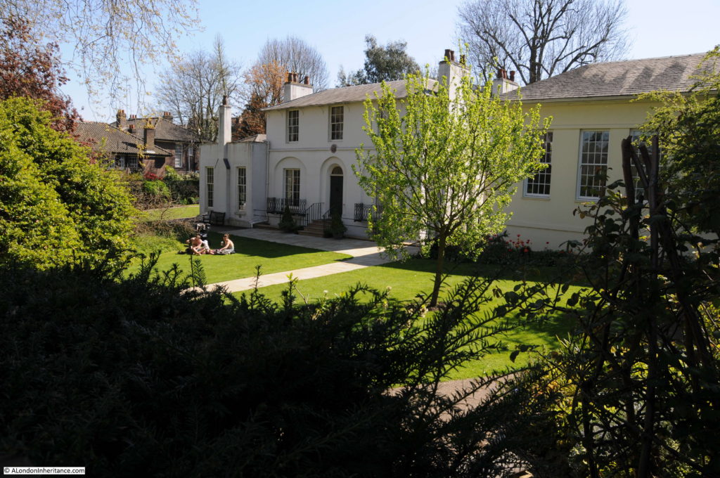
A short distance along Keats Grove we find Keats House standing in the middle of a large garden, looking wonderful on a spring afternoon.

Keats House

The house was built between 1815 and 1816 and at the time was called Wentworth Place. Although it has the appearance of a single house, at the time of Keats occupation it was divided into two homes.

The large building on the right was completed in 1931 over the original stables and kitchen garden. It was built as a branch library of Hampstead Library and also to house a collection of Keats books and letters donated by Sir Charles Dilke.

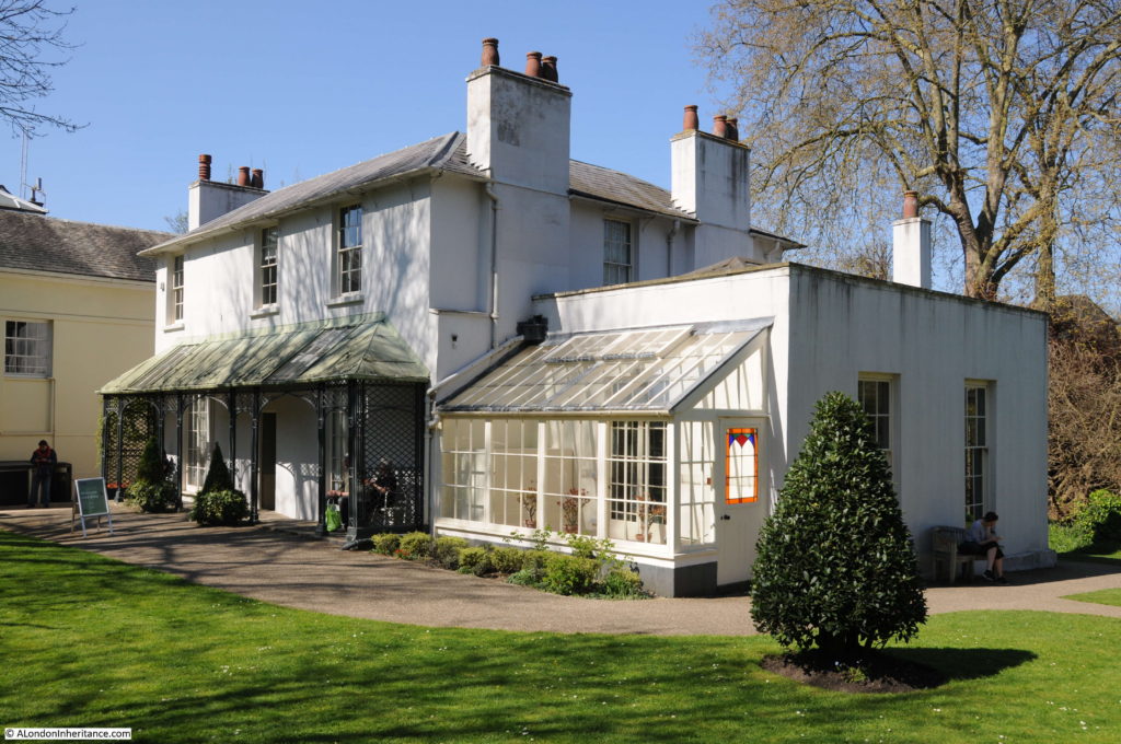
View of Keats House from the rear. The flat-roofed building on the left in the photo above and right in the photo below was built about 20 years after Keats left Hampstead. When he was in residence this would have been part of the garden.

Keats House

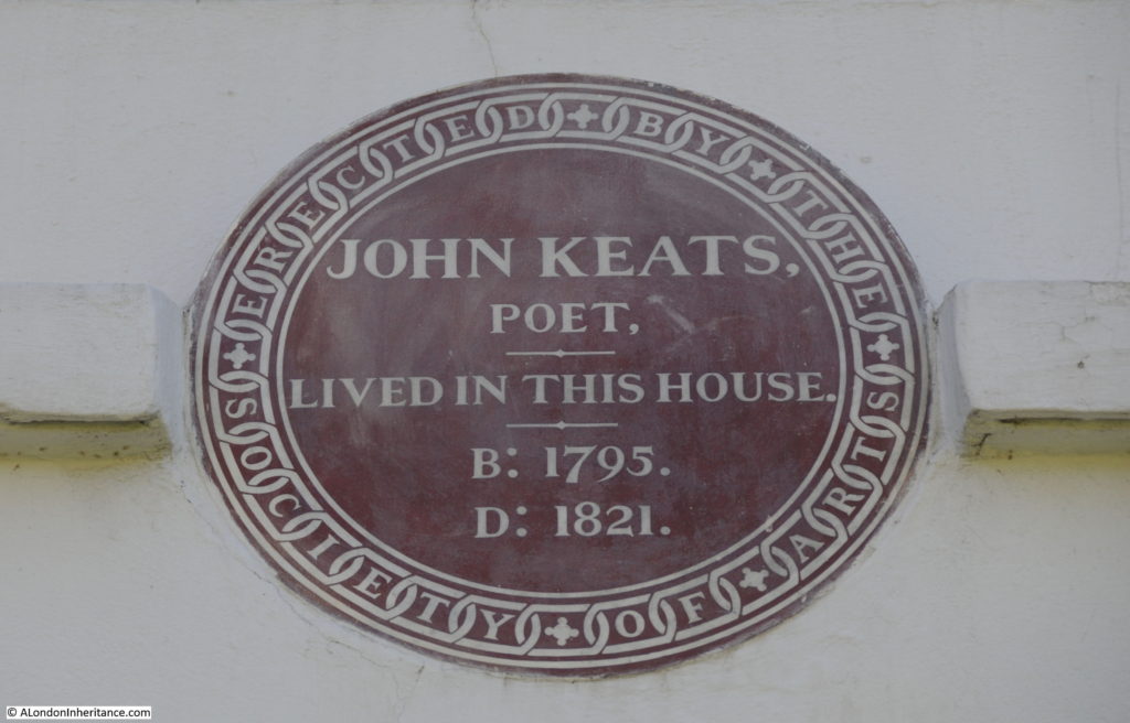
The plaque above the main entrance door at the front of the building, also to be seen in the 1951 photo. It was installed in 1895.

Keats House

John Keats had a tragically short life and his work did not achieve the level of recognition it has today until long after his death.

He was born on the 31st October 1795 at the Swan and Hoop Livery Stables in Moorfields. He was the eldest of four children, with two younger brothers (George and Tom) and a sister Frances Mary, or Fanny.

His father died in 1804 which resulted in a period of change as the children were moved around, first to Enfield then after the death of his grandfather, to Edmonton.

His mother died in 1810 of tuberculosis, a disease that would come to haunt Keats.

In 1810 Keats whilst still in Edmonton, was apprenticed to the surgeon Thomas Hammond and in 1816 he passed his exams at the Apothecaries’ Hall which enabled him to practice in the medical professions, however whilst working as an apprentice he had also been writing poetry. The same year he was introduced to the writer and poet Leigh Hunt who the following year introduced him to Shelley.

With the encouragement of the writers and poets in his circle of friends, he made the decision to concentrate on poetry and give up the medical profession. He moved to Hampstead in 1817, and the following year he moved into Wentworth Place – or Keats House as it is now.

In 1818 his brother Tom died of tuberculosis.

Whilst staying in Wentworth Place he met Fanny Brawne, who with her mother would also move into the other half of Wentworth Place in 1819. Keats and Fanny Brawne fell in love and became engaged but were unable to marry due to Keats lack of money.

During his time in Hampstead, Keats was also travelling extensively, including Chichester, Bedhampton, the Isle of Wight, Winchester and also taking temporary lodgings in Westminster.

In January 1820 his brother George returned from America for a short visit to sort out issues with their inheritance. John Keats traveled with him to Liverpool to see him off on his return to America. On Keats return to Hampstead from London, he fell very ill having traveled on the outside of the coach as this was the cheaper option.

His friend Charles Brown found him stumbling and feverish.

Keats was spitting blood and recognised the signs of tuberculosis which had killed both his mother and brother. In July 1820 his Doctor recommended that Keats travel to Italy in the hope that the warmer weather would help his condition.

Keats found it hard to leave Fanny, he wrote to her “I feel it almost impossible to go to Italy, the fact is I cannot leave you”. Just before leaving, Keats and Fanny exchanged gifts, a diary, a ring, books and a lock of hair.

He left Gravesend on the 18th September 1820, but the journey to Italy was beset with problems. Bad weather required a stop at Portsmouth, there was a further stop in Dorset and the ship did not reach Naples until the 21st October where it was then held in quarantine for 10 days, not ideal in autumn weather on board a ship for a person suffering from tuberculosis.

Keats finally reached Rome on the 15th November. A time of year when the hoped for warm weather had finished. Keats had a relapse on the 10th December and died on the 23rd February 1821 at the age of 25. He was buried in the Protestant Cemetery in Rome.

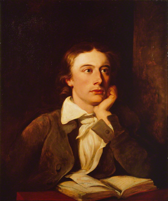
John Keats by William Hilton, oil on canvas, © National Portrait Gallery, London:

Keats House

Keats published three books of poems – “Poems” in 1817, “Endymon” in 1818 and “Lamia, Isabella, The Eve of St. Agnes and other Poems” in 1820. During his lifetime his work did not achieve any recognition and he was branded by critics as a “cockney poet”, probably due to his origins in Moorfields. It was after his death and throughout the rest of the 19th century that his work gained a wider readership and his reputation grew to the point that he is now considered as one of the greatest of the romantic poets in the English language.

He lived a very short time in Wentworth Place, Hampstead, but it was here that he met Fanny Brawne and where they lived together in separate parts of what at the time was a divided house.

Following Keats death, the house went through many changes in ownership. The division was removed making it into a single house, the flat-roofed extension was built on the left of the house and the large library building built to the right.

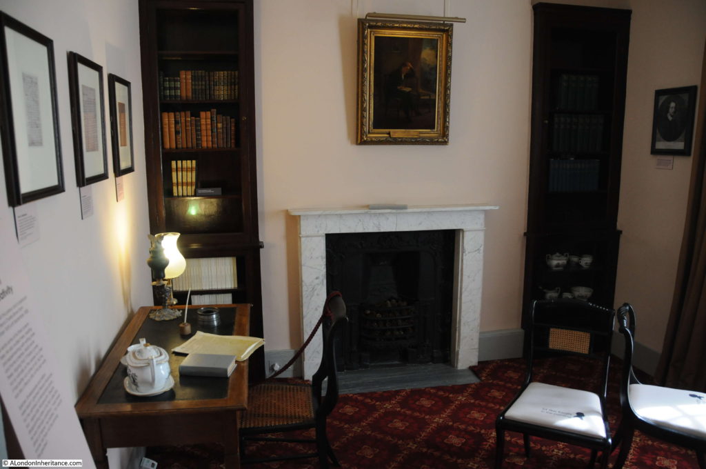
The visitor entry to the house is at the rear of the building and there are three floors to explore, basement, ground and first floors. Whilst none of the furniture or decoration is from the time that Keats occupied the house, it does set the scene and there are many Keats related artifacts throughout the house.

Starting on the ground floor is Charles Brown’s Parlour. It was Charles Brown who occupied part of the house and rented out a parlour and bedroom to Keats from December 1818 to September 1820.

Keats House

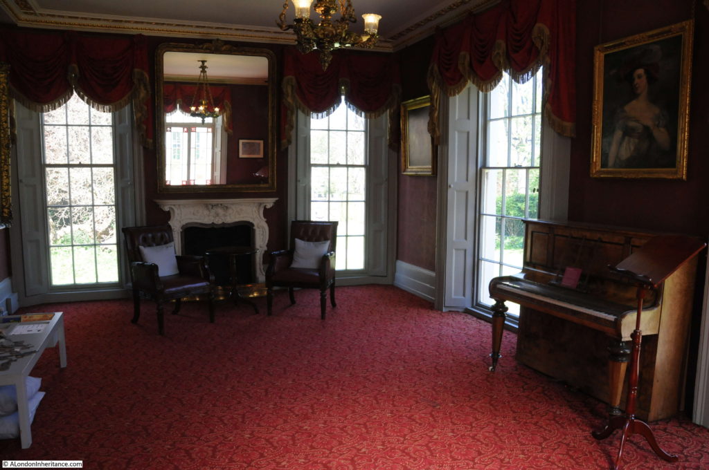
The largest room on the ground floor is the Chester Room, named after the actress Eliza Jane Chester who built the room 20 years after Keats death so in his time this was part of the garden.

Keats House

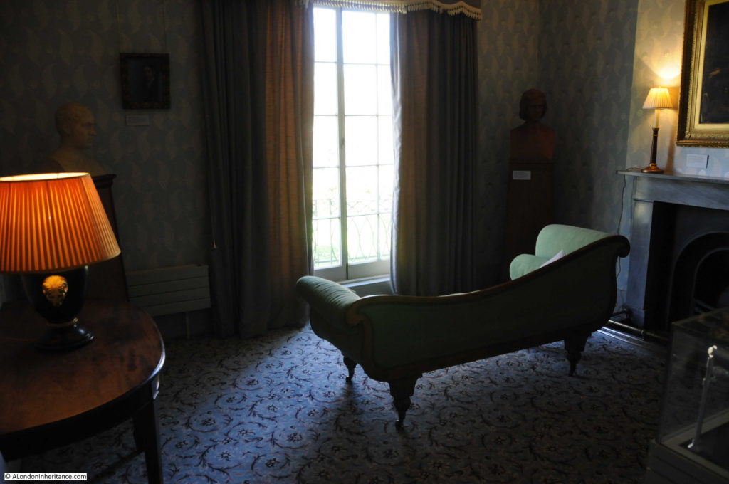
John Keats’s Parlour – it was during his time at Wentworth Place that Keats wrote much of the poetry that would be considered his greatest work. The surroundings, Fanny Brawne and Hampstead Heath all providing inspiration.

Keats House

There are a number of quotes from Keats work around the house including the following written on the 28th August 1819 in a letter to his sister Fanny – 200 years later and it would still be hard to beat this combination..

Keats House

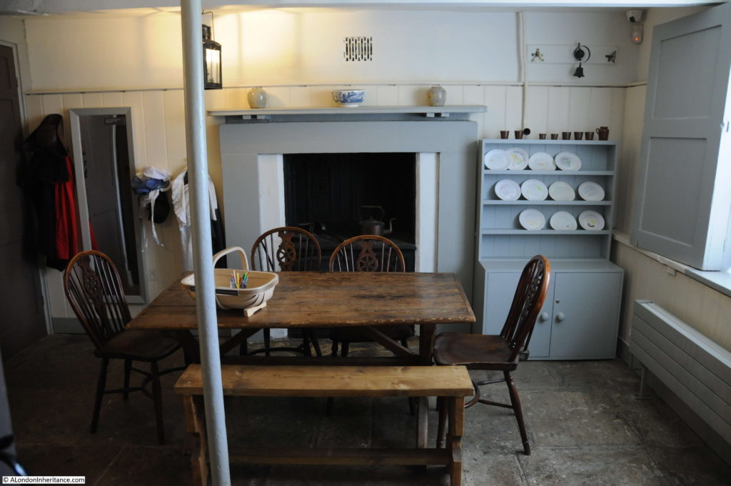
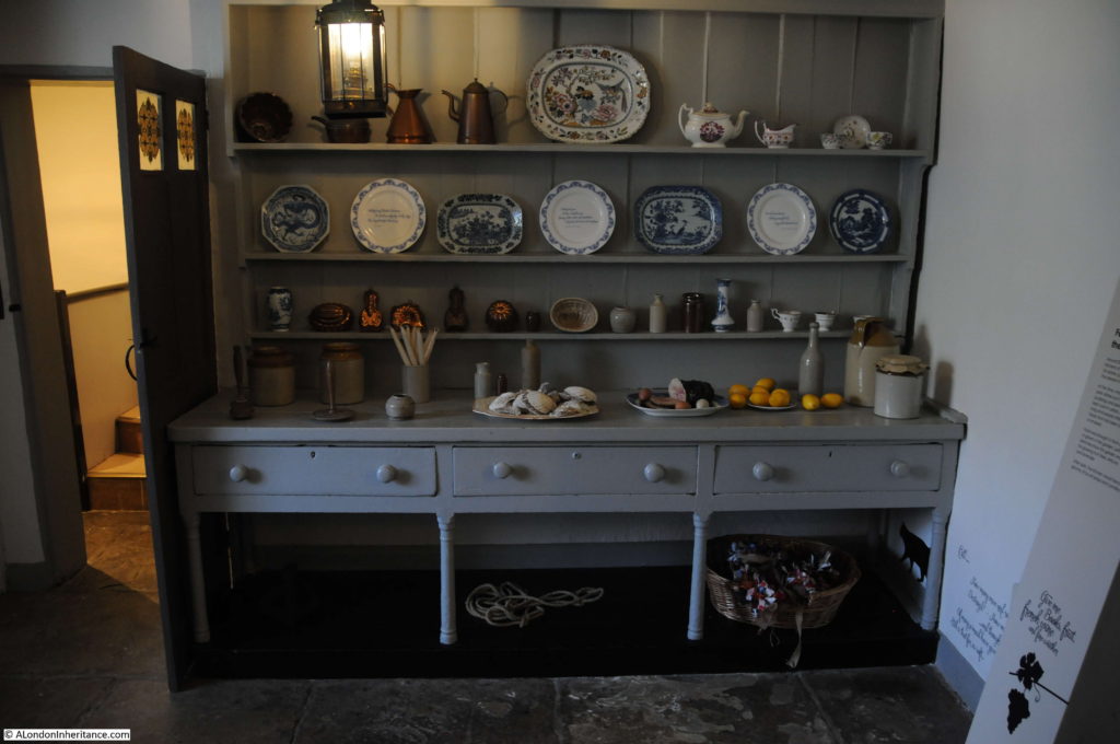
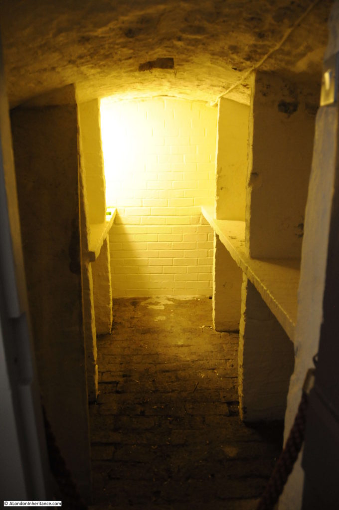
In the basement one room shows a film about Keats whilst the other two rooms are configured as the kitchen and servants quarters they would have been at the time, although part of this area would also have been a coal store.

Keats House

Charles Brown who rented rooms to Keats had an affair with Abigail O’Donaghue, one of the servants in the house. This caused a stir and they may have later married. Abigail had a child in 1820. Brown later moved to Italy with the child and they later emigrated to New Zealand, apparently without Abigail and there is no record of what became of her.

Keats House

Coal store:

Keats House

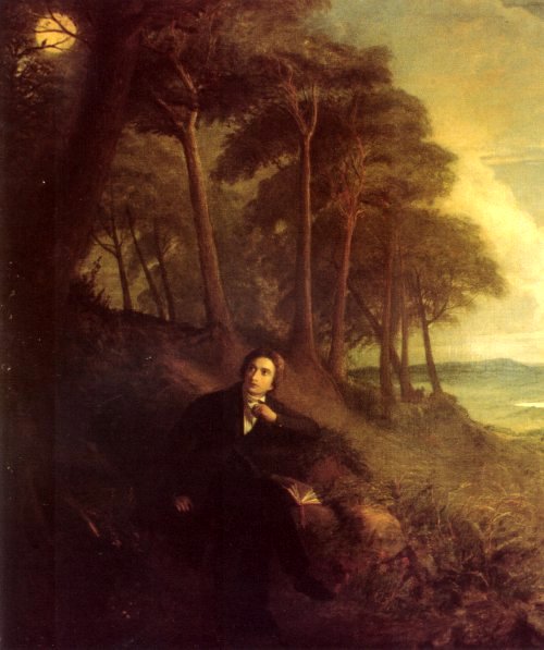
One of the paintings on show in the house – Keats listening to a Nightingale on Hampstead Heath by Joseph Severn:

Keats House

Painted by Joseph Severn in 1849, he was a friend of Keats and had traveled with him to Rome and had been with him in his final days. Severn would complete a number of paintings of Keats, including some which referenced his work, including the above alluding to Keats poem “Ode to a Nightingale”.

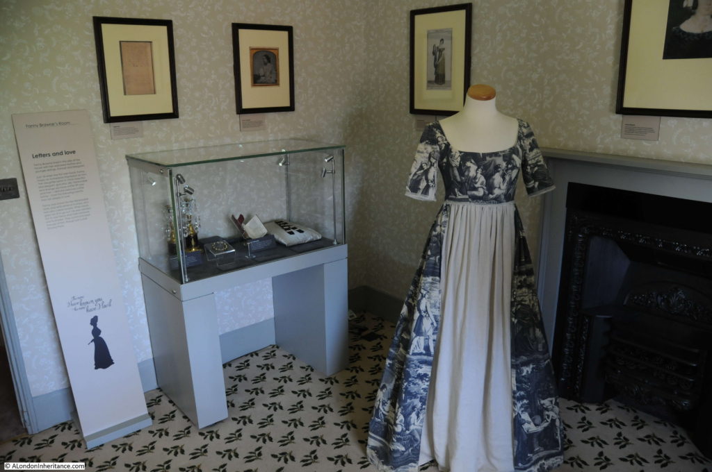
Fanny Brawne’s room.

Keats House

Fanny lived in this half of the house with her widowed mother and younger sister and brother. She was 18 when she first met Keats.

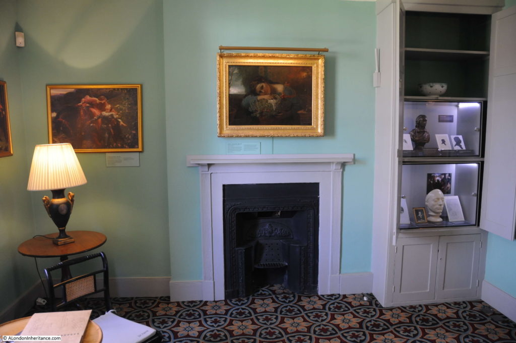
Charles Brown’s bedroom:

Keats House

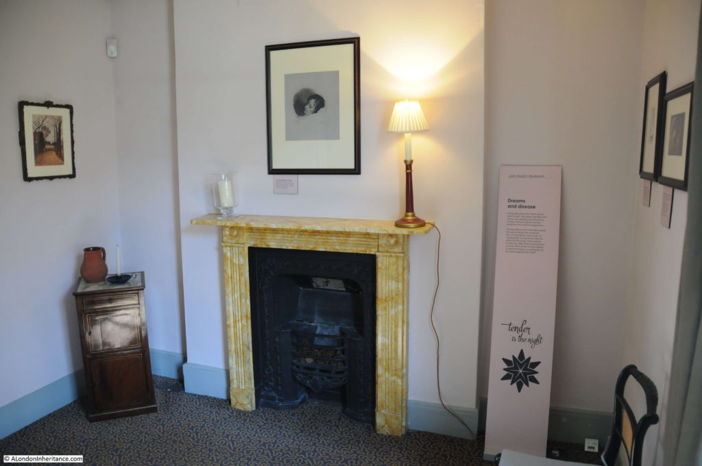
John Keats’s bedroom:

Keats House

It was in this bedroom where Keats was in bed after returning from London in February 1820 when he started coughing up blood. Through his medical training he knew that this was arterial blood – a clear indicator of consumption, or tuberculosis, which he had also seen in his mother and brother.

On the landing is an example of Regency plumbing that may have been here in Keats time. A small lead sink which held rainwater collected from the roof.
Keats House

Keats House is a wonderful museum. He spent a very short time at the house but it was where some of his best work was completed and where he met the woman who had such an impact on him. His death, along with that of his mother and brother all from tuberculosis is a reminder of how harsh life was in the 19th century.
I was surprised to learn that the house had to be rescued from demolition in the 1920s. It is not just recently that it seems that anywhere in London is at risk of being converted into luxury apartments.

I visited Keats House after Fenton House. There is a Waterstones bookshop on Hampstead High Street, a secondhand bookshop in Flask Walk, some excellent pubs and restaurants and the weather was fantastic so I was able to follow Keats recommendation to:

“Give me Books, fruit, french wine and fine weather”

alondoninheritance.com

The London Harness Horse Parade 2017

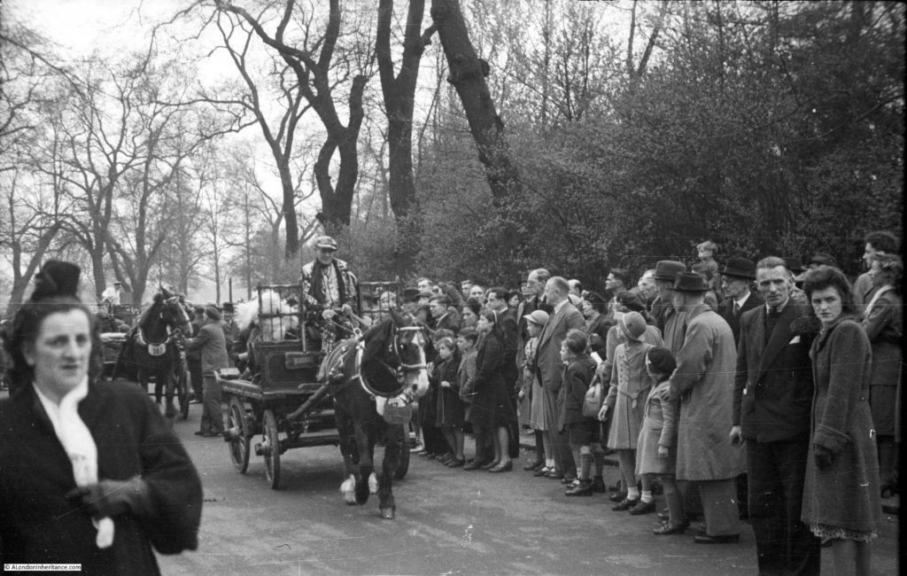
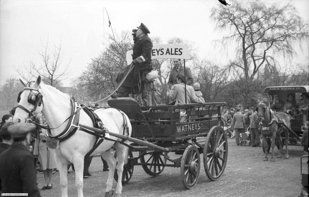
Back in January I published a post on the London Cart Horse Parade showing some of the photos my father took of the event in Regent’s Park in 1949. A couple of photos from the post are shown below:

London Harness Horse Parade

They show the vehicles that in 1949 were still probably in use across London transporting people and all manner of goods essential for the functioning of the city.

London Harness Horse Parade

The original London Cart Horse Parade was founded in 1885 with the aim of improving the conditions of the thousands of horses that carried both goods and people along the streets of London. It was held on Whit Monday, starting in Battersea Park before moving to Regent’s Park.

The London Van Horse Parade ran from 1904 with the same objectives, but was held on an Easter Monday.

These parades must have had a considerable impact on the surrounding streets as there were hundreds of entries (the largest Van Horse Parade has 1,259 animals in the parade in 1914). After the presentation of prizes at the Cart Horse Parade, the procession would leave Regent’s Park and proceed along Albany Street, Portland Place, Oxford Street, Tottenham Court Road, Euston Road and to King’s Cross.

From 1950 the numbers of entries to the parades started to decline. Rapid growth in the use of cars, vans and lorries meant that the need for horse driven transport was in sharp decline and in 1966 the two parades joined to become the London Harness Horse Parade, continuing to be held on Easter Monday in Regent’s Park.

In 1995 the parade moved to Battersea Park, but in 2006 the costs and health and safety requirements of operating such a parade in central London meant that it was no longer possible to run the parade in Battersea Park and it moved out of London.

The London Harness Horse Parade continues to be held on Easter Monday, but now at the South of England Showground at Ardingly in  West Sussex.

My aim with this blog is to track down the locations of my father’s post war photos. For the photos he took of the parade in Regent’s Park, the nearest I could get was to visit the parade in its current location, so this Easter Monday I traveled out to Ardingly to see if the London Harness Horse Parade resembled the photos taken by my father in 1949.

A showground in West Sussex is very different to Regent’s Park, however the aims of the current parade are still the same as when the parade was first held in 1885. To encourage and demonstrate the welfare of the horses, maintenance of the harness and vehicles and the standards of the driver.

The parade is a window on a way of life that has long since departed from London. Entries now come from the counties surrounding London, but many of the vehicles are originals that would have once worked the city’s streets, carrying all manner of goods and passengers.

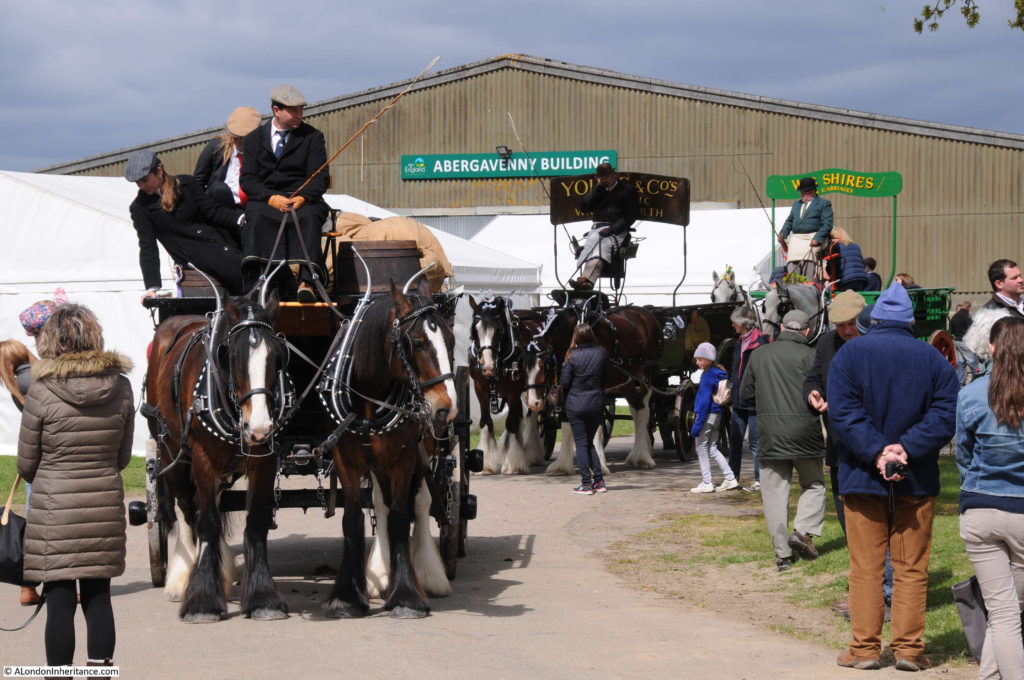
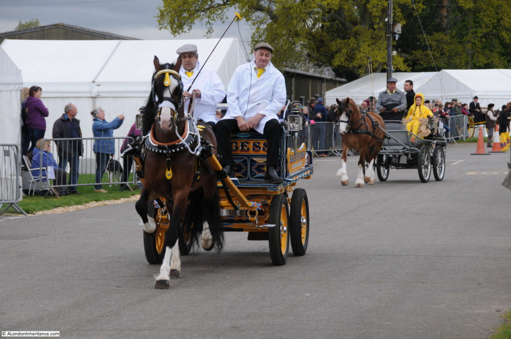
The parade lining up to start:

London Harness Horse Parade

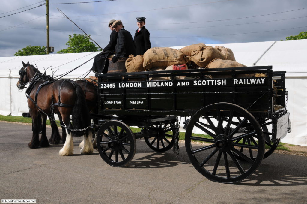
This is a five ton open van pulled by two Shire Horses and was used to carry goods to and from the stations of the London, Midland and Scottish Railway across London:

London Harness Horse Parade

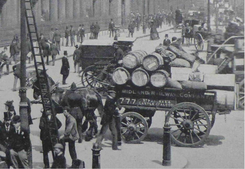
The following photo is from the book “The Queen’s London” published in 1896. It shows an identical open van in front of the Bank of England transporting goods for the Midland Railway Company. The historical accuracy of the 2017 vehicle is such that a chain is hanging down underneath the van in both photos (I only realised this after the event when I was comparing photos otherwise I would have asked what the chain was for).

London Harness Horse Parade

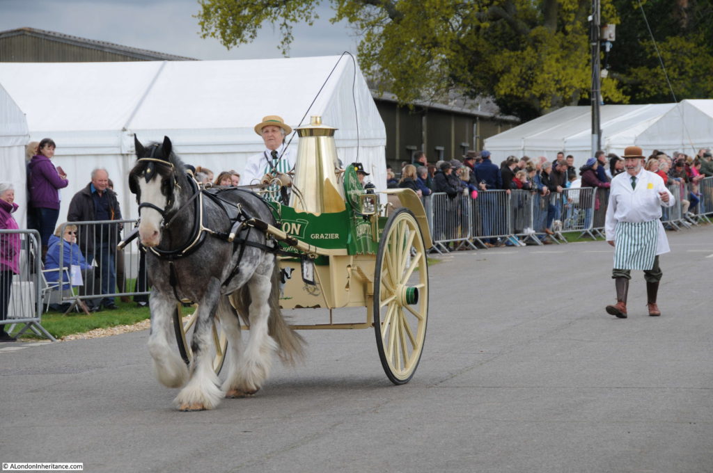
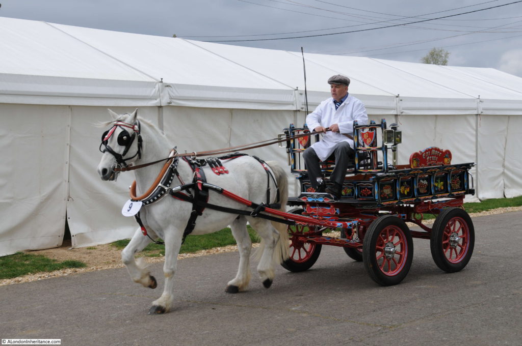
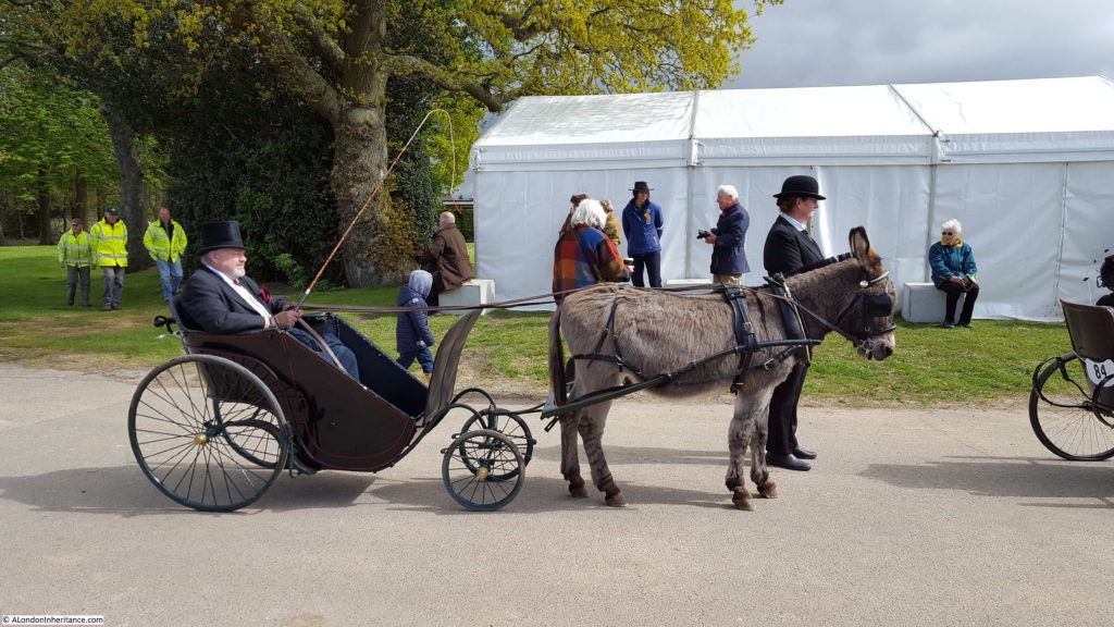
The range of entries highlight the specialist vehicles that once transported goods along the streets. This is a 1920 Milk Float:

London Harness Horse Parade

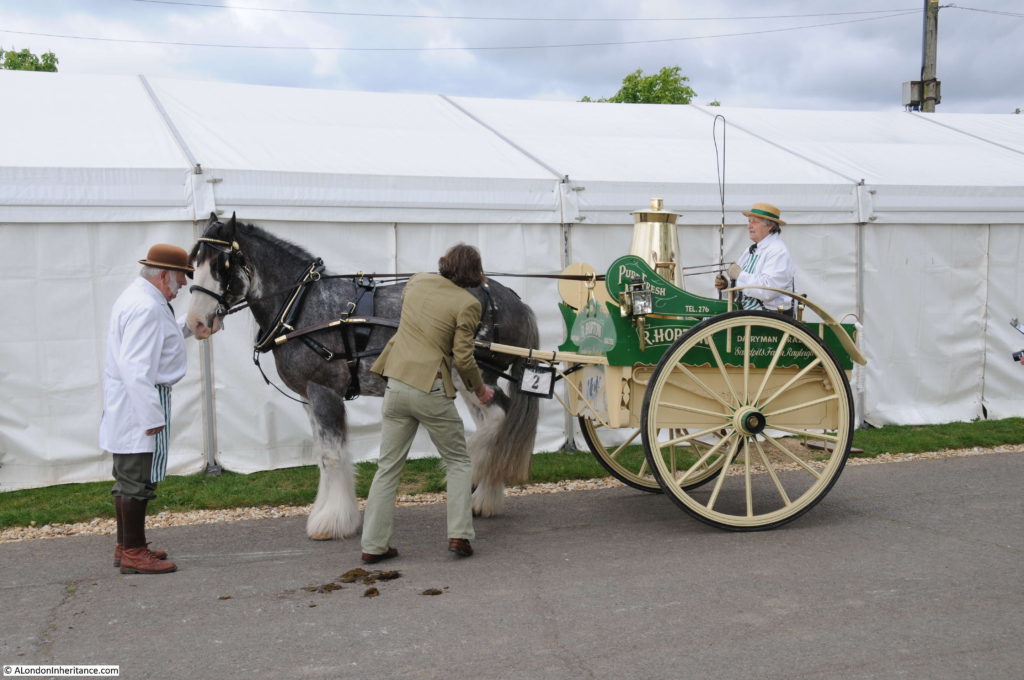
As part of the event, each horse is checked by a vet, continuing the aims set out for the parade in 1885 that the welfare of the horses is to be encouraged. The parade is not competitive, there is no winner, rather all those that achieve the required standard receive a rosette.

London Harness Horse Parade

As well as the condition of the horses, the vehicles are also judged and are immaculately preserved and maintained.

London Harness Horse Parade

A standard design known as a “London Trolley”:

London Harness Horse Parade

Running down to one of the judging areas:London Harness Horse Parade

Many of the vehicles are from the 1920s and 30s highlighting that it was not just in the 19th century that horse-drawn transport was used across London, it was still a means of transport well into the 20th century.

London Harness Horse Parade

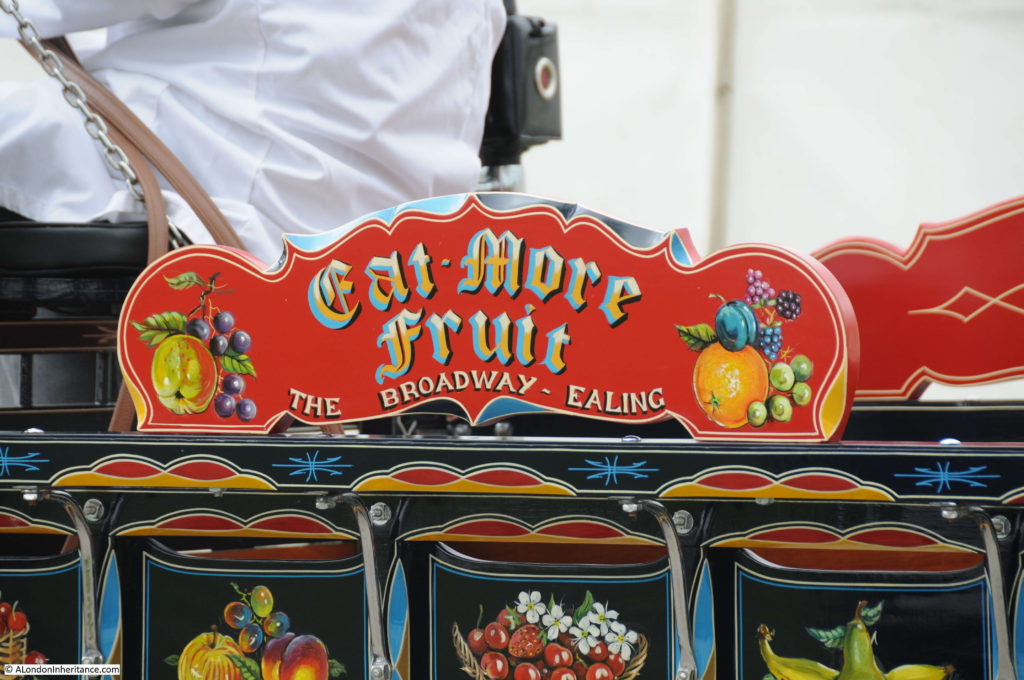
Immaculate paint work:

London Harness Horse Parade

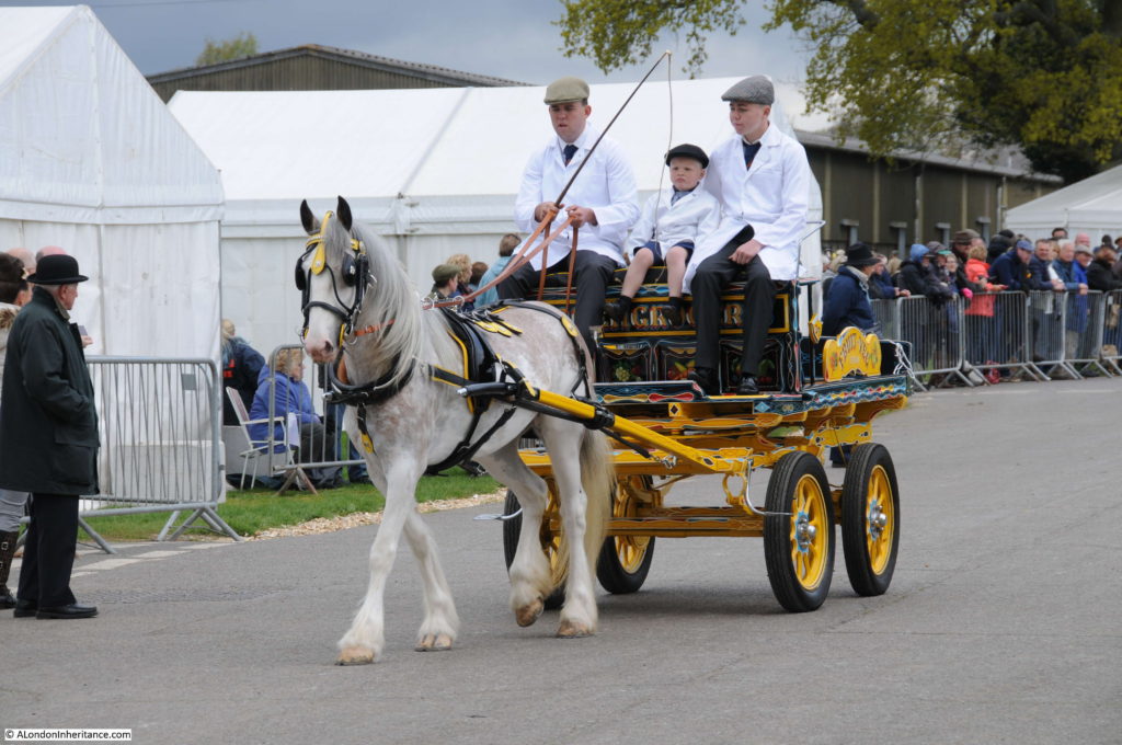
All ages participate in the parade:

London Harness Horse Parade

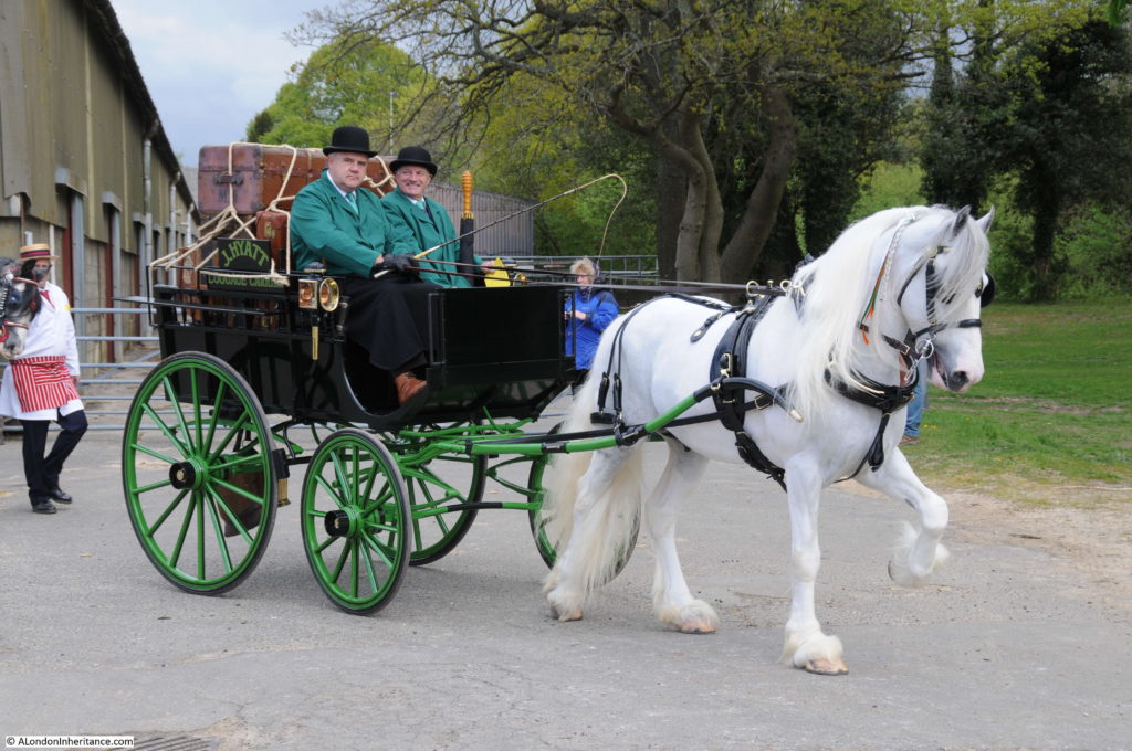
For those who could afford it, this is the type of vehicle that would have carried your luggage to the station:

London Harness Horse Parade

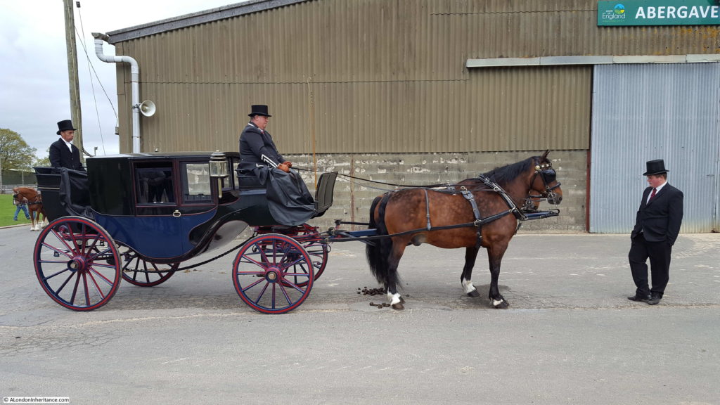
And you would have traveled in the following carriage:

London Harness Horse Parade

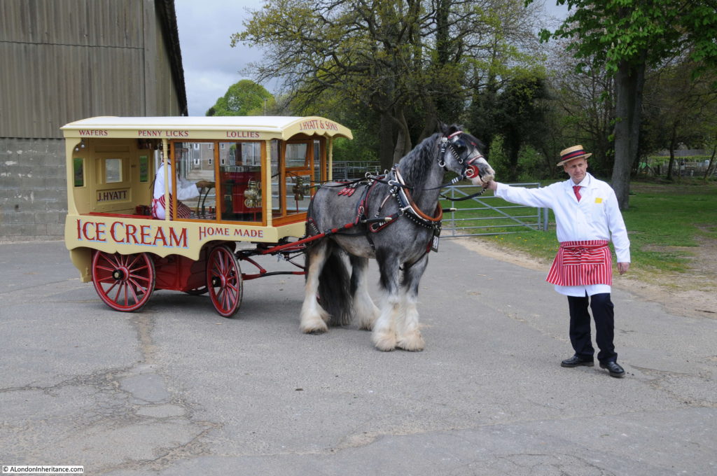
A 1920 Ice Cream Cart:

London Harness Horse Parade

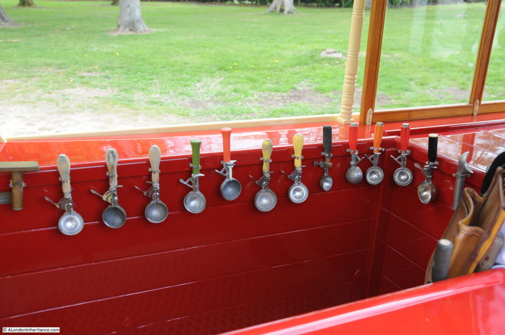
Brilliantly restored, including a selection of vintage ice cream scoops:

London Harness Horse Parade

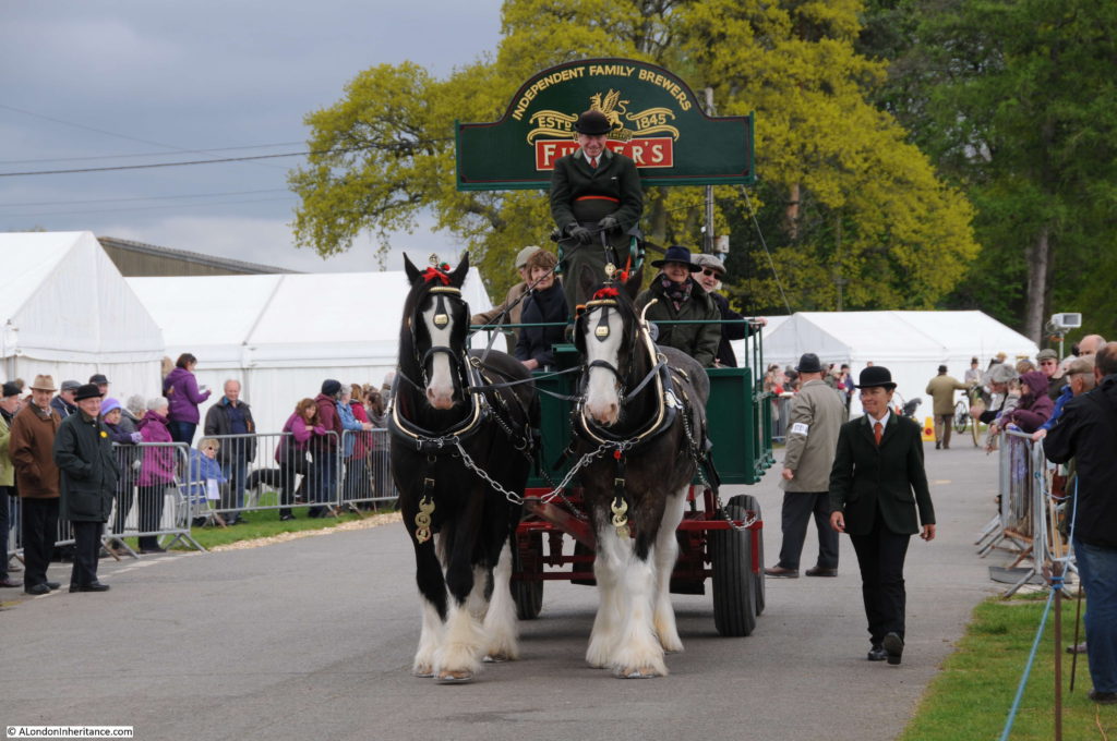
Horse drawn delivery drays transporting barrels of beer would once have been a common sight across London:

London Harness Horse Parade

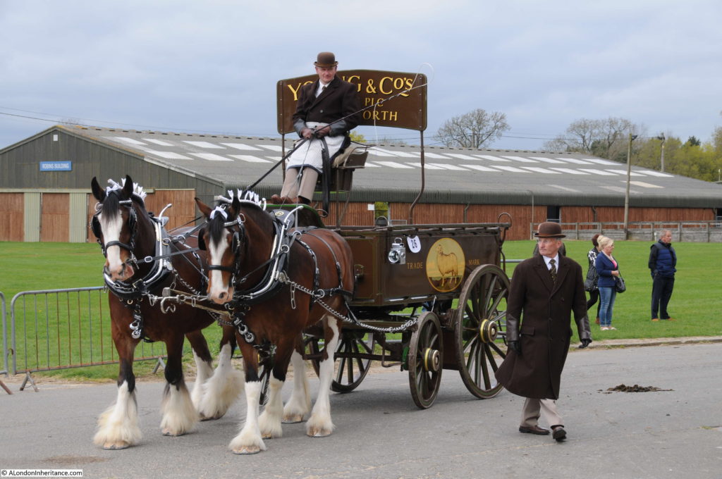
The Young & Co delivery dray was built-in Chelsea and dates from 1924:London Harness Horse Parade

A Victorian Invalid Carriage from 1890:

London Harness Horse Parade

The London Harness Horse Parade is now much smaller than the parades once held in Regent’s and Battersea Parks. In 1926 there were 864 vehicles entered in the Easter Monday parade, today there were around 100 entries to the 2017 parade.

It is though really good to see that the parade is still running every year and true to its original purpose of improving the conditions and treatment of London’s cart horses. Also, a place to see a historically accurate display of the vehicles that were once essential in nearly all aspects of the life of the city.

alondoninheritance.com

Fenton House, Hampstead

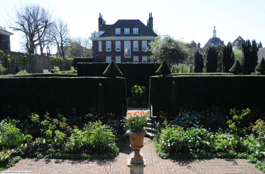
On the hottest day of the year so far, when temperatures on an April day reached 25 degrees in central London, I headed out to Hampstead to visit Fenton House, a wonderful 17th century house with a glorious garden and views over London.

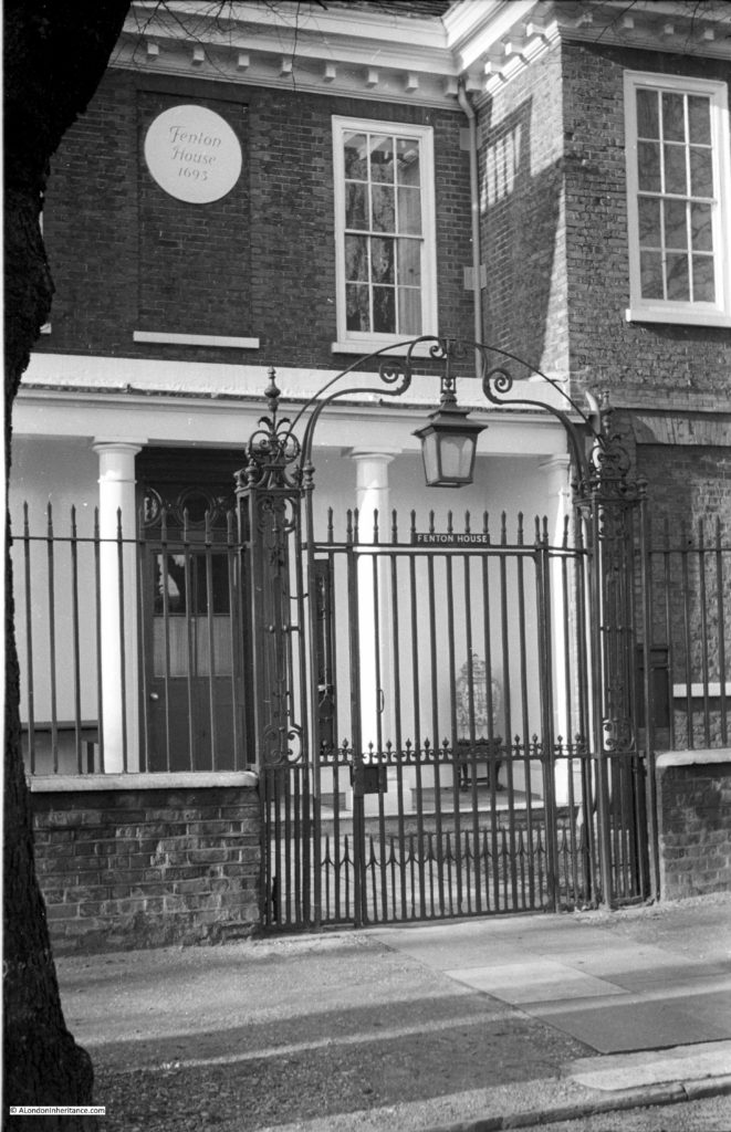
The reason for this visit was to see if the photo of the entrance to the house has changed much since my father took the following photo in 1951.

Fenton House

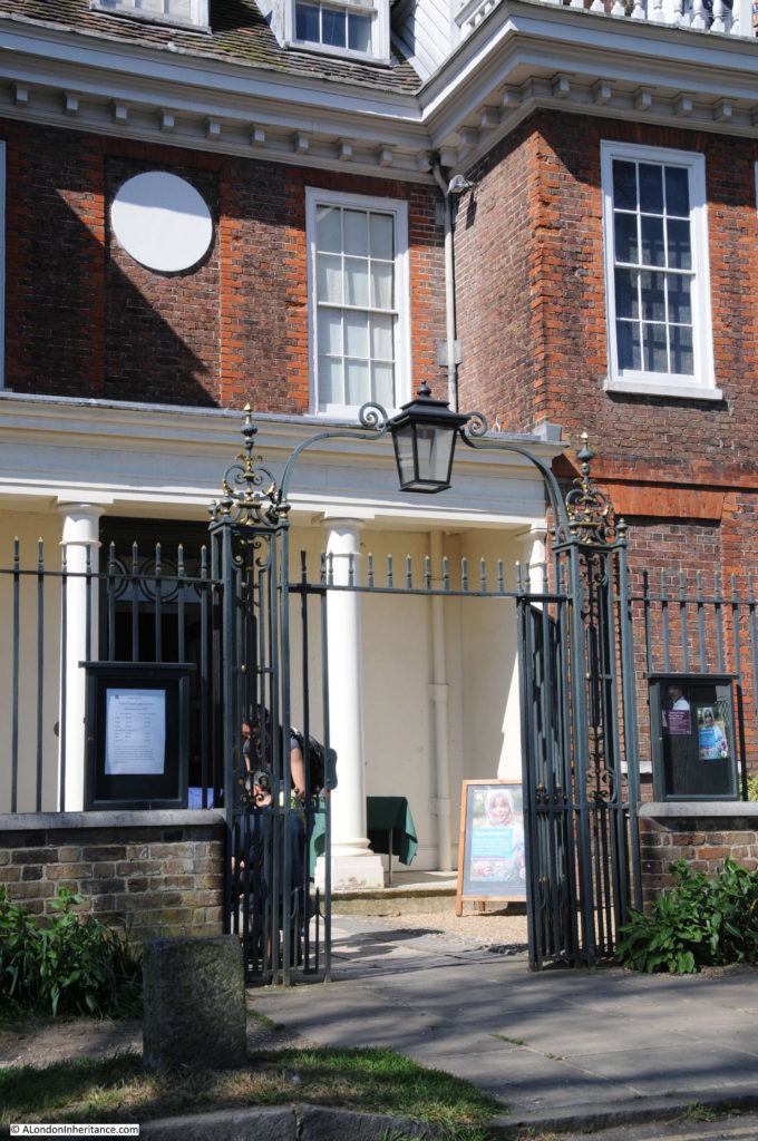
Sixty six years later and the same view today.

Fenton House

The scene is almost identical apart from some cosmetic changes, including the lamp and metalwork arch over the entrance gate.

Fenton House is now owned by the National Trust, hence the signs around the entrance and the house and gardens are open including the balcony that offers a superb view over central London.

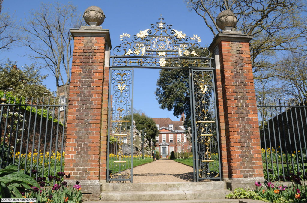
Fenton House is a short walk north from Hampstead underground station, along Holly Hill, Holly Bush Hill then into Hampstead Grove. There are two entrances into Fenton House, the first from Holly Bush Hill that leads through an ornate gateway and garden to the front of the house, and the second entrance which is the view in the above two photos in Hampstead Grove.

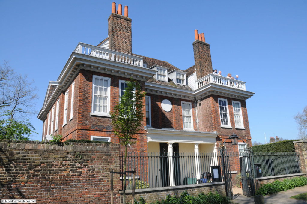
The photo below shows the full view of the house from Hampstead Grove.

Fenton House

Fenton House was built around 1686 by William Eades. At the time, the land around Hampstead was being developed with individual large houses being built for the aspiring professional classes who wanted a house close to London but away from the congestion and pollution of central London.

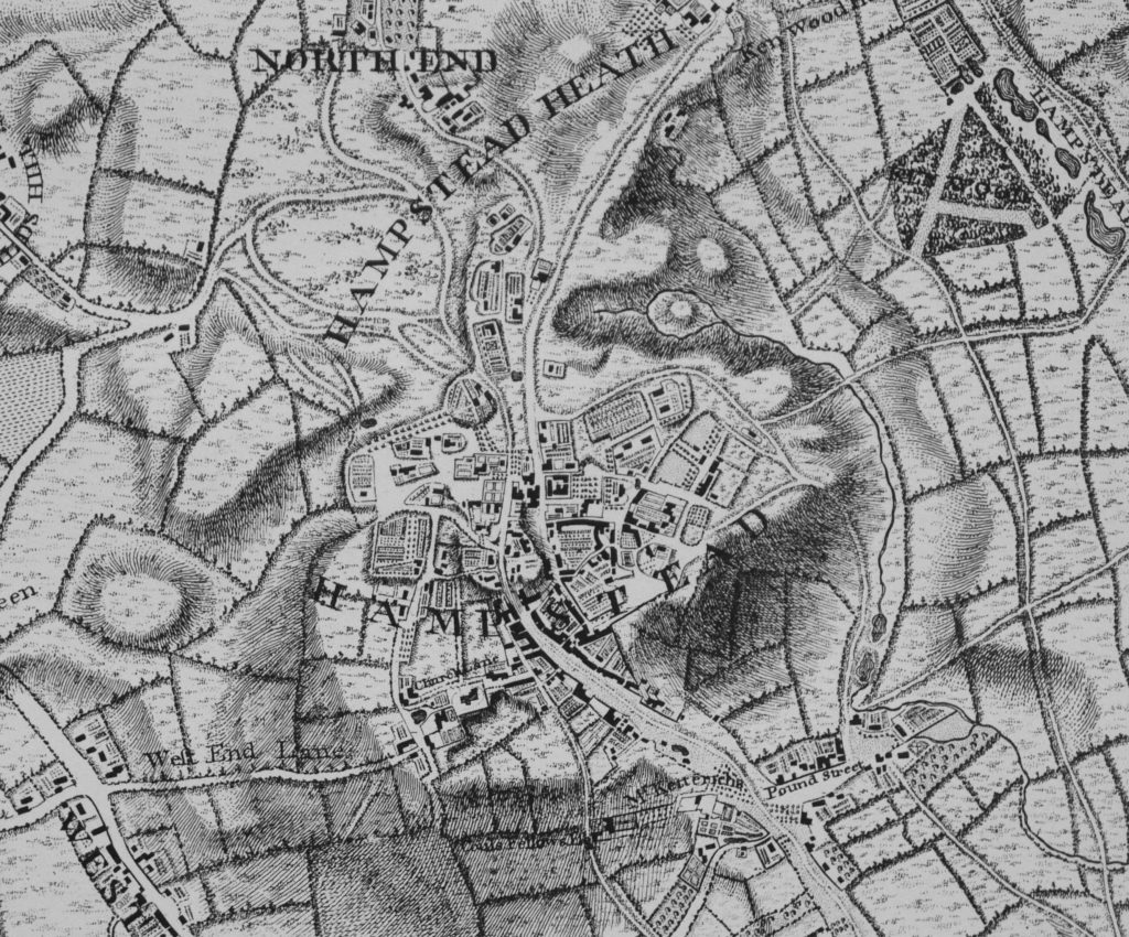
The following extract from John Rocque’s map from 1746 shows the village of Hampstead and the enclosed gardens of large houses can be seen spreading to the north, west and east of Hampstead. One of these is Fenton House although I have tried to identify which one, also comparing with later maps, but I cannot work out which one is Fenton.

Fenton House

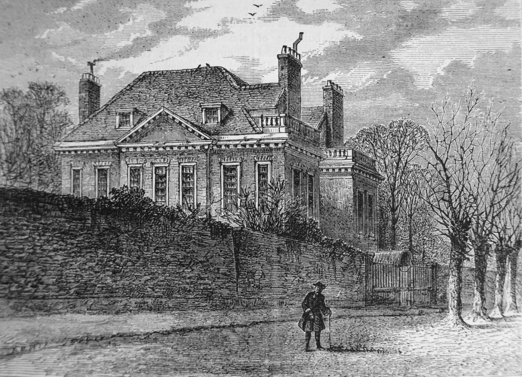
In Old and New London, Edward Walford described the house: “Hard by the house of Joanna Baillie is an old mansion named Fenton House, but generally known as ‘The Clock House’ from a clock which adorned its front, now superseded by a sundial; the house is chiefly remarkable for its heavy high-pitched roof, not unlike that of many a château in Normandy. It now belongs to a member of Lord Mansfield’s family.”

The position of the old clock and later the sundial is still marked by the circular plaque above the entrance, as still visible in the photos above. A 1780 view of the house from Old and New London is shown below:

Fenton House

From the late 17th century, the house went through a series of owners. Mary Martin brought the house around 1756 and it was during her time at the house that the clock was added. The house was purchased by Philip Fenton in 1793 and remained with the Fenton family until 1834. The Fenton family gave the house its current name – I am not sure why the Fenton family name has survived when the house has been through multiple owners since 1686. I assume the Clock House name was not relevant after the removal of the clock, the Fenton’s named the house after their family name, and future owners did not want to change the name, or were not in residence through multiple generations.

Philip Fenton was a Yorkshire man who became a Baltic Merchant exporting to England. Prior to his purchase of the Clock House as it was, he was based in Riga (now the capital of Latvia but then part of Russia) along with his nephew James who married in Riga and had seven children. After Philip purchased Fenton House, he was later joined by James and his family, and James inherited the house after Philip’s death. It was James who added the colonnaded porch above the entrance from Hampstead Grove shown in the photos at the start of this post, the only substantial change to the house since the 17th century.

James Fenton was involved in the protests against further development of Hampstead Heath. In 1829 the Lord of the Manor, Sir Thomas Maryon Wilson tried to get an act of parliament passed against the restrictions preventing building on the heath. This was a battle that ran for many years, continuing after James’ death as the Heath only passed into public ownership in 1871 when the heir of Sir Thomas sold his manorial rights.

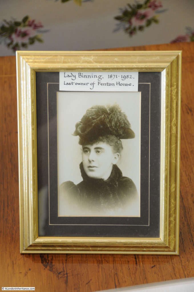
After James Fenton, the house continued through a succession of owners, all apparent;ly making little if any changes to the fabric and appearance of the building. The last owner of the building was Katherine, Lady Binning who purchased the house in 1936. Lady Binning was a widow, her husband the heir to the Earl of Haddington had died in 1917. The family had a number of houses in the Scottish Borders and in London at 49 Berkeley Square and she appears to have spent very little time at Fenton House and after purchasing allowed Robert Broussons to stay in the house (he had leased the house from the previous owner) and in 1937 she let the house to a Dr. Abercrombie.

Lady Binning had an extensive collection of porcelain, furniture and needlework and before the second world war had entertained the idea of leaving the house to the National Trust as a museum to display the collections. This was formalised after the war and on Lady Binning’s death in 1952, Fenton House passed to the National Trust. It was opened to the public in 1953.

My father’s photo of the entrance is from 1951, so the last full year of Lady Binning’s ownership.

The house today continues to display Lady Binning’s collection and the National Trust have added the George Benton Fletcher collection of early keyboard instruments and the Peter Barkworth art collection.

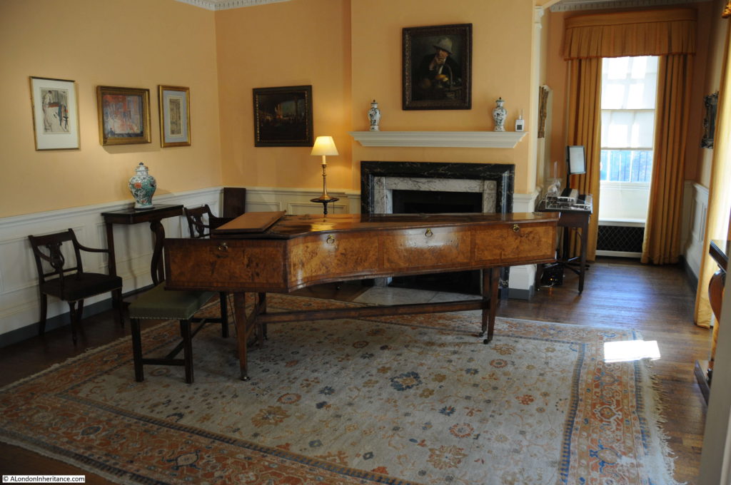
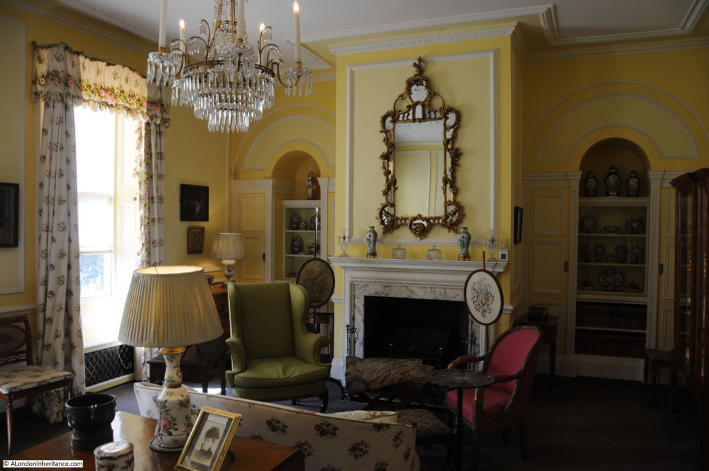
Time for a walk around Fenton House. The Dining Room with a Shudi and Broadwood harpsichord dating from 1770:

Fenton House

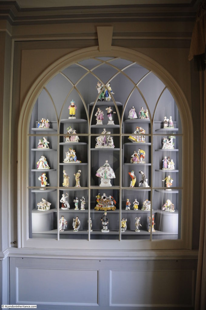
Part of the porcelain collection:

Fenton House

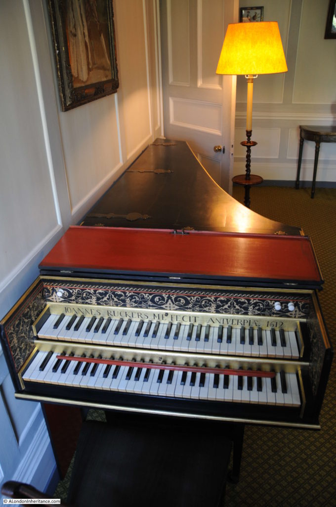
A Johannes Ruckers harpsichord from 1612:

Fenton House

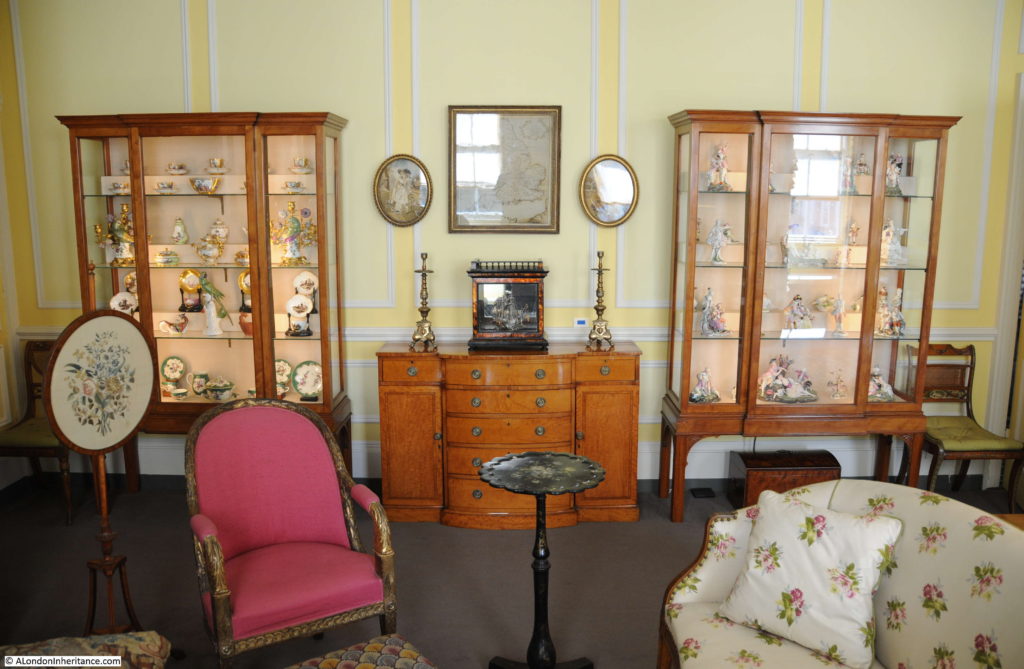
The Drawing Room:

Fenton House

Two large display cabinets in the Drawing Room display more of Lady Binning’s porcelain collection:

Fenton House

Lady Binning – the last owner of Fenton House, and thanks to her donation of the house to the National Trust, the house and gardens are now fully open to visit and explore.

Fenton House

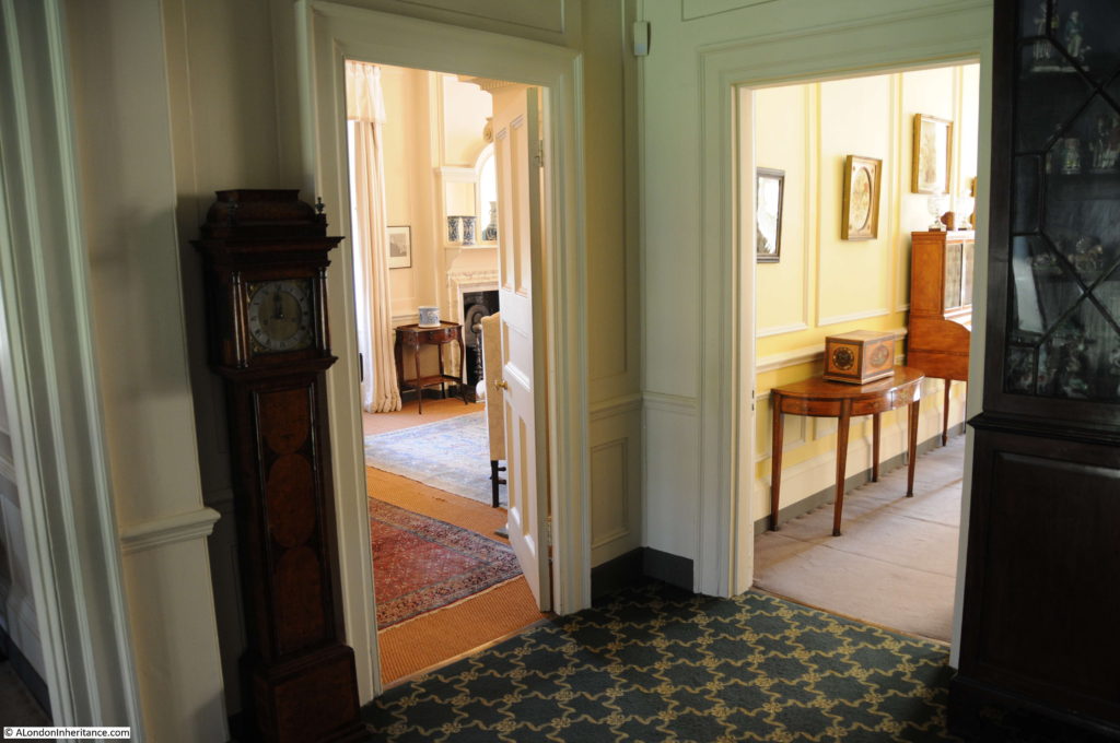
Landing between rooms:

Fenton House

On the east side of the house, above the entrance from Hampstead Grove there are two balustraded flat roofs and one of these is open to provide spectacular views across Hampstead to the City of London. Fenton House is built on one of the highest points in Hampstead, roughly 124 meters above sea level, with the land rising by an additional 10 meters further north on the heath. To the south the land falls away to provide the following view which greets you as you step out.

Fenton House

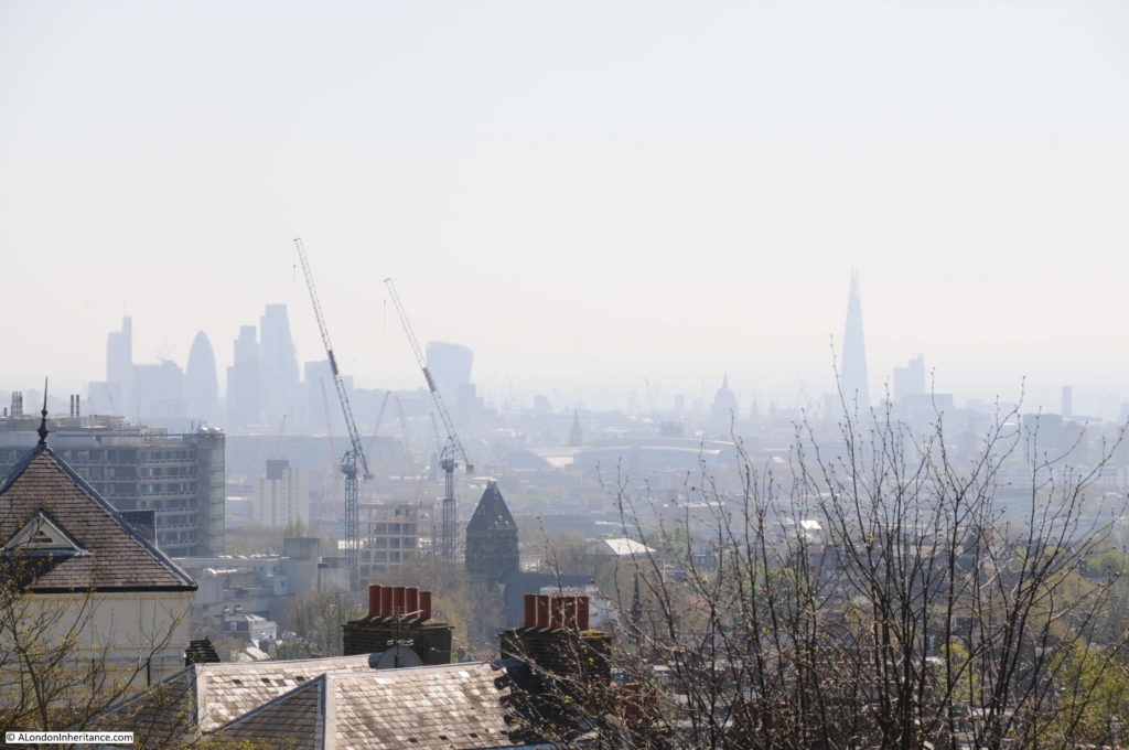
Close up of the view across to the City. St. Paul’s Cathedral to the right of centre along with the Shard. To the left are the towers of the City with the unmistakable shapes of the Walkie Talkie and the Gherkin. The total height of St. Paul’s Cathedral is about 111 meters and the ground height is 11 meters giving a total of 122 meters so standing on this balcony we are a few meters higher than the very top of the cathedral.

Fenton House

Roughly half way between the dome of St. Paul’s and the Walkie Talkie and slightly lower down can be seen the clock tower at St. Pancras Station. The chimney of the old Bankside Power Station is on the far right.

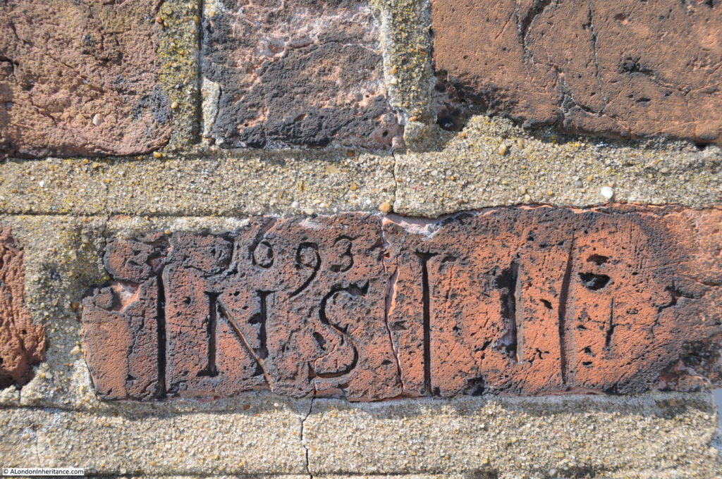
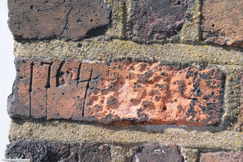
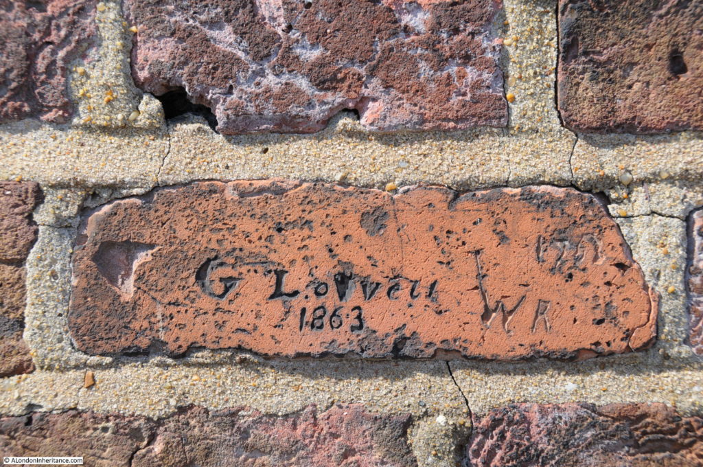
In the brickwork behind the balcony a number of initials and dates have been carved, including the following from 1693, a couple of years after the completion of Fenton House:

Fenton House

Then in the 18th century:

Fenton House

And finally in the 19th century:

Fenton House

The carvings show how long this has been a place to look out over Hampstead and London. I also find it strange to be pleased to find these old dates and initials carved into the fabric of old buildings, when if someone did this today it would be considered an act of vandalism.

Fascinating though to think of the changes since those 1693 initials as London has gradually expanded to take in the village of Hampstead, the long years of St. Paul’s Cathedral dominating the city skyline followed by the recent rush of tower blocks.

I wonder what the same view will look like in 100 and 200 years time?

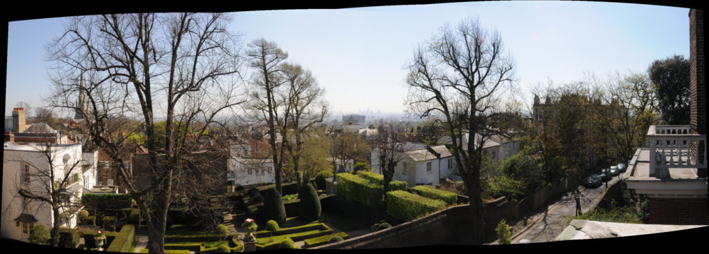
A panorama from the balcony (click on the photo for a larger version):Fenton House

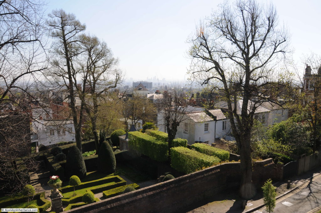
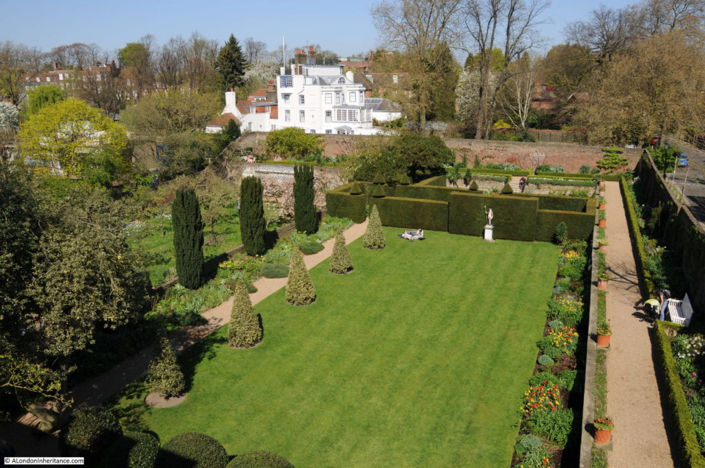
As well as the house and the view, Fenton House also has some superb gardens. The view from the balcony:

Fenton House

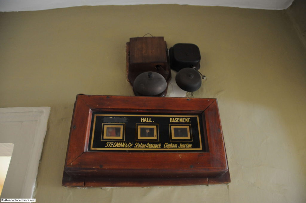
Walking back down from the balcony, an indicator board manufactured in Clapham Junction:

Fenton House

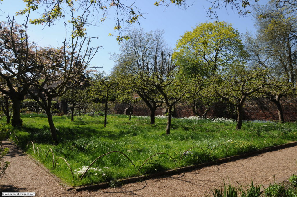
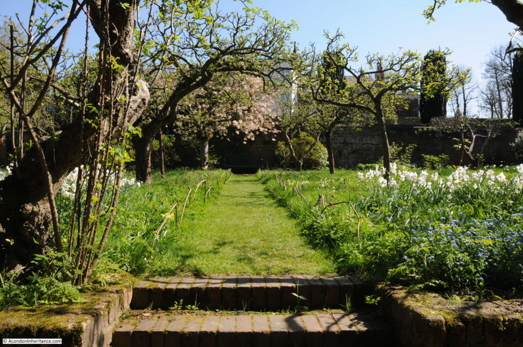
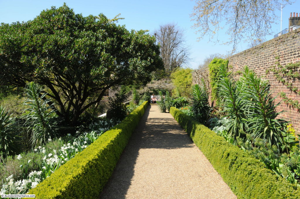
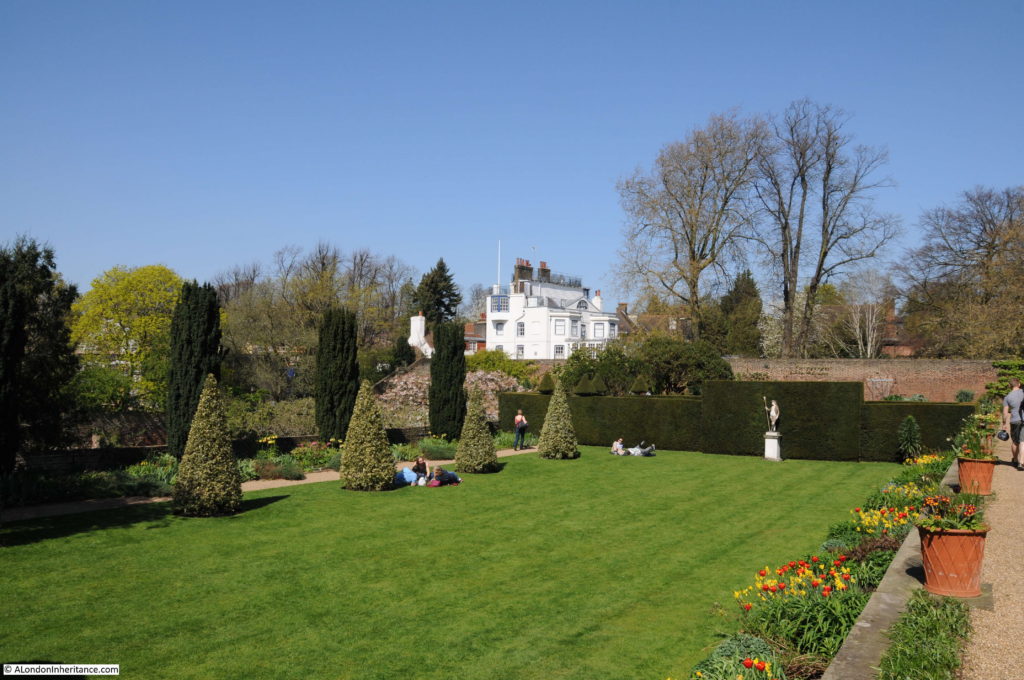
The gardens are divided into two main sections – a formal part of grass and hedges and an adjacent kitchen garden. Spring is a perfect time for walking through a garden, but the weather on this April day made this extra special as the garden was full of life and the bright sunshine made the natural colours of spring all the more vivid.

The Kitchen Garden:

Fenton House

Path through the Kitchen Garden:

Fenton House

Pathways, hedges and a brick wall:

Fenton House

The formal garden – view from the far end looking back towards Fenton House:

Fenton House

The lawn on a sunny April day:Fenton House

I left Fenton House by the Hollybush Hill entrance. I suspect that this is the entrance by which the majority of visitors would have entered the house. Facing onto the street leading up from the main Hampstead roads, an impressive entrance gateway with a long path leading up to the house.

Fenton House

A visit to Fenton House is highly recommended. The house and gardens provide a good example of the developments that took place across this part of the heath from the mid 17th century.

Standing on the balcony with three centuries of initials on the brickwork behind and the view of London in front, makes you think of all those who have also lived in or visited Fenton House and also looked over the changing city – and how the city will continue changing.

alondoninheritance.com

Bankside And Horseshoe Alley

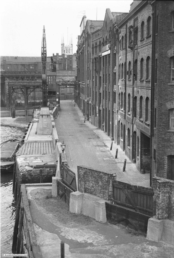
Last week I was at Southwark Cathedral. This week I have walked from the Cathedral to Southwark Bridge to look along Bankside back towards the Cathedral. This was my father’s view in 1953:

Bankside

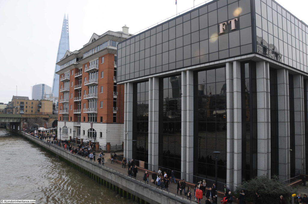
I could not take a photo from the same position for reasons which I will explain shortly, so I took the following photo from Southwark Bridge showing this part of Bankside as it is now:

Bankside

This short stretch of Bankside is completely different from 1953. A straight length of river wall and walkway now lines the river between Southwark Bridge and the railway bridge into Cannon Street station. The warehouses have been replaced by two office buildings and the cranes and infrastructure along the river have long since disappeared.

The changes since 1953 also include where the Bankside walkway is located and the alignment of the river wall.

I could not take a photo in the same position as my father as I would be looking from the bridge straight into the FT building on the right. The river wall has been pushed further into the river and the edge of the buildings now cover the original Bankside roadway. In my father’s photo it was possible to look straight along Bankside and see the tower of Southwark Cathedral from the bridge. Today, this is not possible as the two new buildings obscure the view having been built over the original road (also Southwark Cathedral is hard to see due to the taller buildings directly behind).

The river wall has been straightened and pushed into the river. Look at the 1953 photo and at the far end is the railway bridge. To the left of the crane you can see the brick pier of the bridge extending into the river. Today, the edge of this brick pier is now aligned with the edge of the river wall and Bankside walkway.

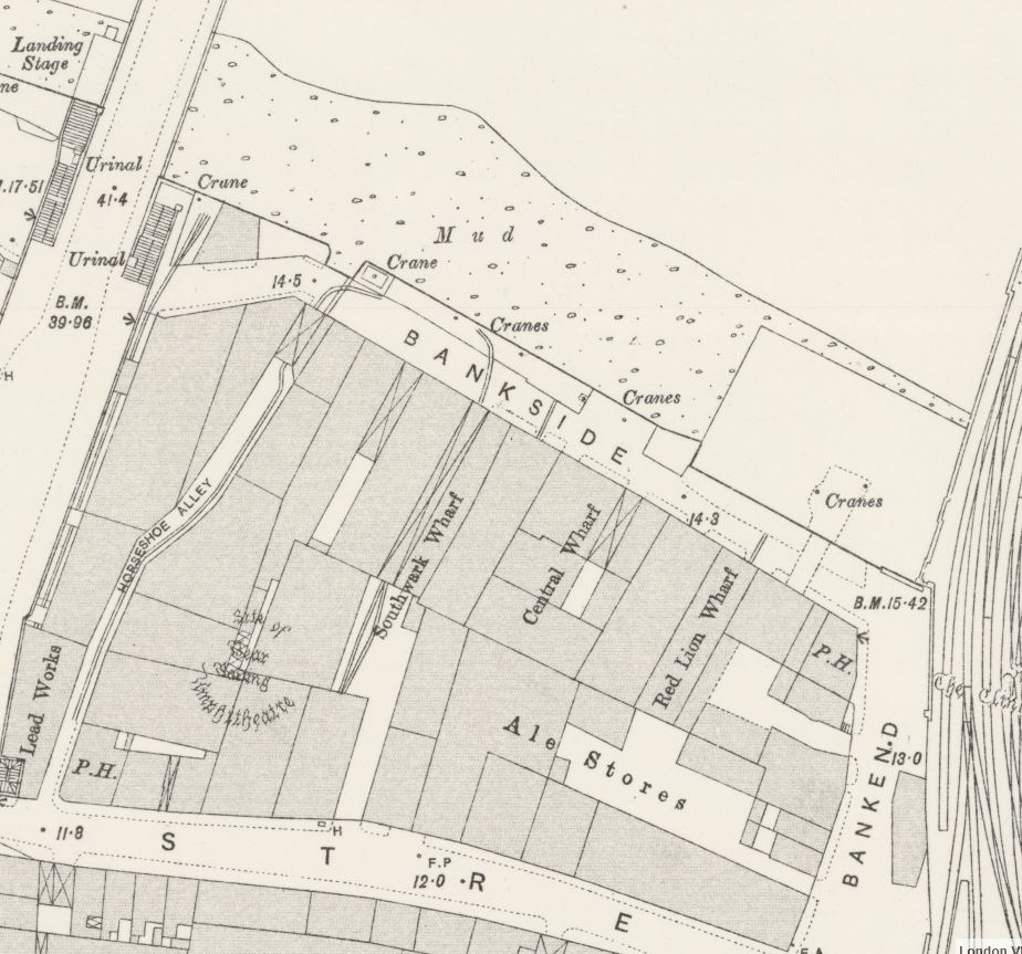
The following extract from the 1895 Ordnance Survey map shows this stretch of Bankside which I suspect had not change that much in the almost 60 years between the map and my father;s photo. It shows Bankside lined with warehouses, wharves and cranes along the river’s edge.

Bankside

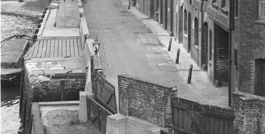
There are a couple of features that interested me in my father’s photo. In the lower part of the photo is a solitary lamp mounted on the wall along the river and to the right is a large entrance on the ground floor of the building. What was this single lamp doing in this position?

Bankside

Looking at the 1895 map, the large entrance to the building on the right is the entrance to Horseshoe Alley. Covered over by the building, but opening out to an exposed alley as it heads in land. Opposite Horseshoe Alley at the water’s edge is what appears to be an opening in the river wall down to the river which can also be seen in the photo above to the left of the lamp.

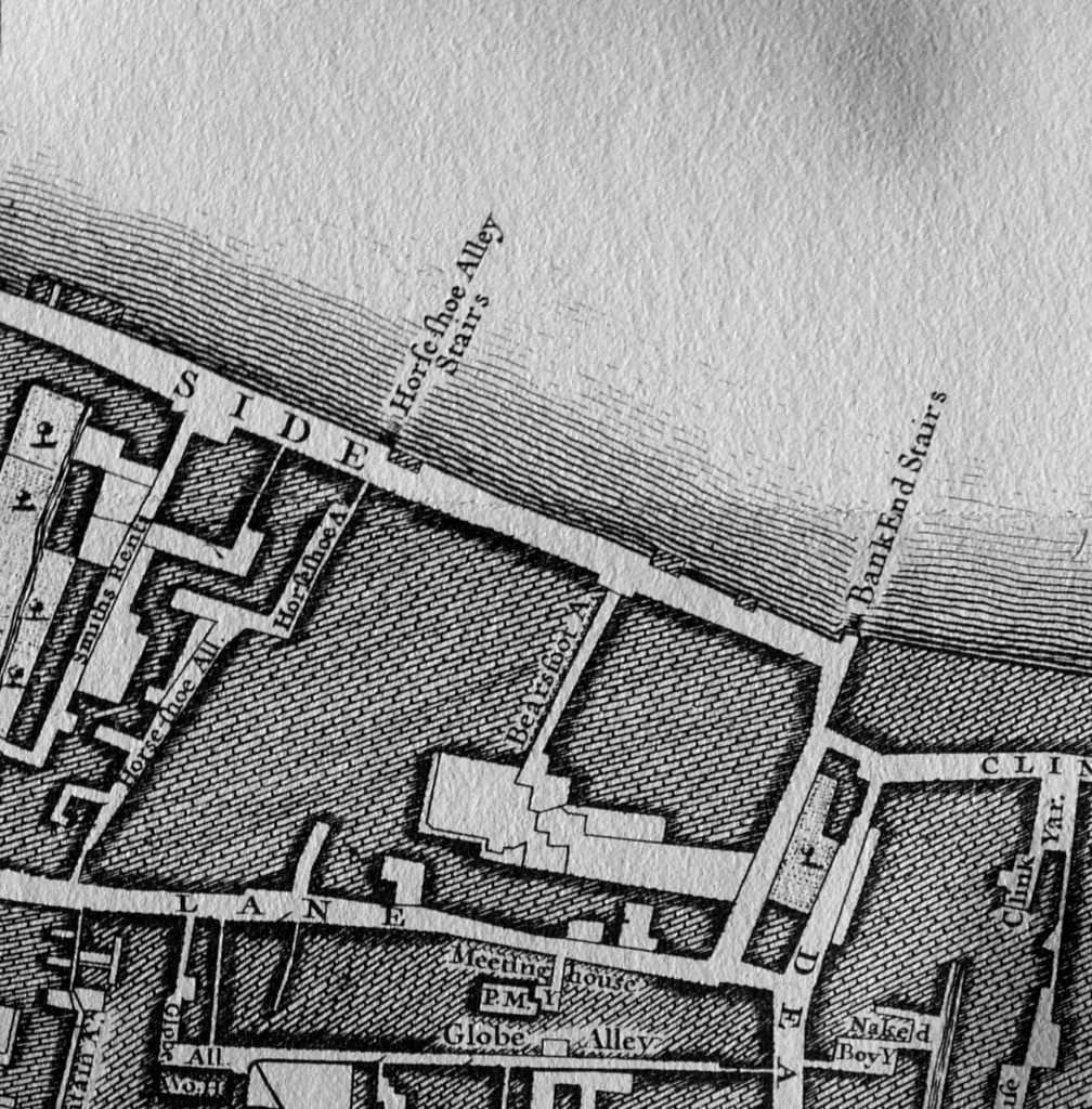
I then checked my copy of John Rocque’s, map from 1746. In the extract below, Horseshoe Alley is there, but also, leading down to the river is Horseshoe Alley Stairs.

Bankside

So perhaps this single lamp was there to mark the position of the stairs and to guide those walking up and down what would have been rather dangerous and slippery steps down to the river.

Another feature that both of the above maps confirm is where Bankside ended at the appropriately named Bank End. It is at the edge of Bank End that the bridge carrying the railway across to Cannon Street station now runs. The Rocque map confirms that Bankside terminated here well before the railway bridge was built.

The approach road to Southwark Bridge runs over the street marked Smiths Rents on the left in the 1746 map.

There is an interesting story in the South London Press on the 4th March 1882 about Horseshoe Alley that shows how much flooding there was along this area of Bankside and the precautions put in place (or sometimes not) in an article titled: “The Floods in Southwark. How ‘Not To Do It’ “

The article reports on an inquiry by the St. Saviour’s Board of Works into flooding along Bankside:

“The chairman said that the board had been in communication with the Metropolitan Board of Works prior to the overflow with reference to the work to be carried out; and he apprehended that it was in consequence of that not being done that the flood took place. 

Mr Stafford asks: But did we not delegate one of our officers to attend to the question of floods specially, in order that the flood-gates may be closed at the proper time?

The surveyor (Mr Greenstreet) said that was the case. The board had appointed the clerk of the works to look after the barriers. With reference to the flood on Sunday week, he (the surveyor) was himself at Christchurch at 1 o’clock in the day. The clerk of the work’s unfortunately had only two men with him, though on such occasions he generally had four. All the dam-boards that were in use were at once put up so as to prevent the overflow of the water; but he found that at one important point-viz., Horseshoe-alley, the barricade had been removed. The water could not, therefore be prevented from coming in there, and it came up with such rapidity – more rapid, in fact, than on any previous occasion of which he had experience – that it washed away all the clay at Bank End. he found that nearly half of the dam-boards along Bankside were in an incomplete state, but some were now in proper order. The fact that the water overflowed was a pure accident that could not be prevented.

Mr Stafford asked the surveyor, with reference to the board at Horseshoe-alley, whether, prior to the flood he was aware it was not in position.

The surveyor replied in the negative. He only noticed its absence on the Sunday when the flood occurred, and it then struck him that the board must have been stolen.

Mr. Evans mentioned that on the Sunday in question he happened to be passing over Southwark Bridge when the water was coming up, and he immediately repaired to Bankside. He met the inspector and along with that officer they did what they could to prevent an inundation. Three men were employed to put up the barricades, and they had since complained to him (Mr. Evans) that they only received half a crown each for their work. As regarded Horseshoe-alley, he found that there were no boards there, and he took it upon himself to advise the inspector of nuisances to do what he could. 

Mr Hale asked the surveyor how long it was since he had ordered the removal of the boards at Horseshoe-alley. The Surveyor replied that he had not ordered their removal and that it was impossible to say where the boards went. It is pretty well a month since it went.”

I suspect the surveyor may have lost his job as a decision on his future was postponed for a later meeting.

The flooding referred to happened on Sunday 19th February 1882. There were frequent floods along the Thames, however the river level for this flood was one of the highest and impacted a far wider area. There were reports of high tides and floods along the East Coast, but the greatest damage was done along the Thames.

The high tide on the morning of the 19th rose to above its normal height but did not give any cause for alarm, however it was the afternoon tide that went higher. By 2:30 pm the Trinity high-water mark at London Bridge had been reached. The tide continued to rise for another 30 minutes so that by 3pm it was now 2 ft higher than the Trinity mark.

Whilst some of the dams did hold, much of the Bankside and Blackfriars Bridge area flooded and there were bad floods in Lambeth. There was a heavy rush of water through Blackfriars Bridge Wharf with 2 foot of water flooding the surrounding streets. Men, women and children were reported to be “seen rushing about in all directions to find means of keeping out of the muddy water.”

The areas worse affected were Rotherhithe, Southwark and Lambeth on the south side of the river, and High Street, Wapping on the northern side. At St. Katherine’s Dock, the water level was recorded as being only 5 inches below the highest level ever recorded on the Thames which had occurred only a year earlier on the 18th January 1881.

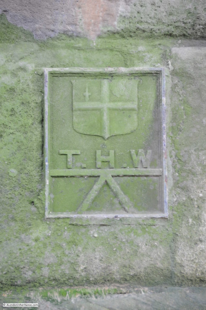
The article mentions the Trinity high-water mark. I found the following on the river wall underneath Southwark Bridge on the north bank of the Thames. I believe it is one of the Trinity high-water marks:

Bankside

Looking back at my father’s 1953 photo it is easy now to understand the structures along the left side of the street. Heavy concrete walls, with the access points secured by heavy wooden panels slotted into the edges of the concrete walls to form a watertight seal.

Apart from the bridges that form the borders to this stretch of Bankside, there is only a single building that remains from the time when my father took the 1953 photo and the 1895 map.

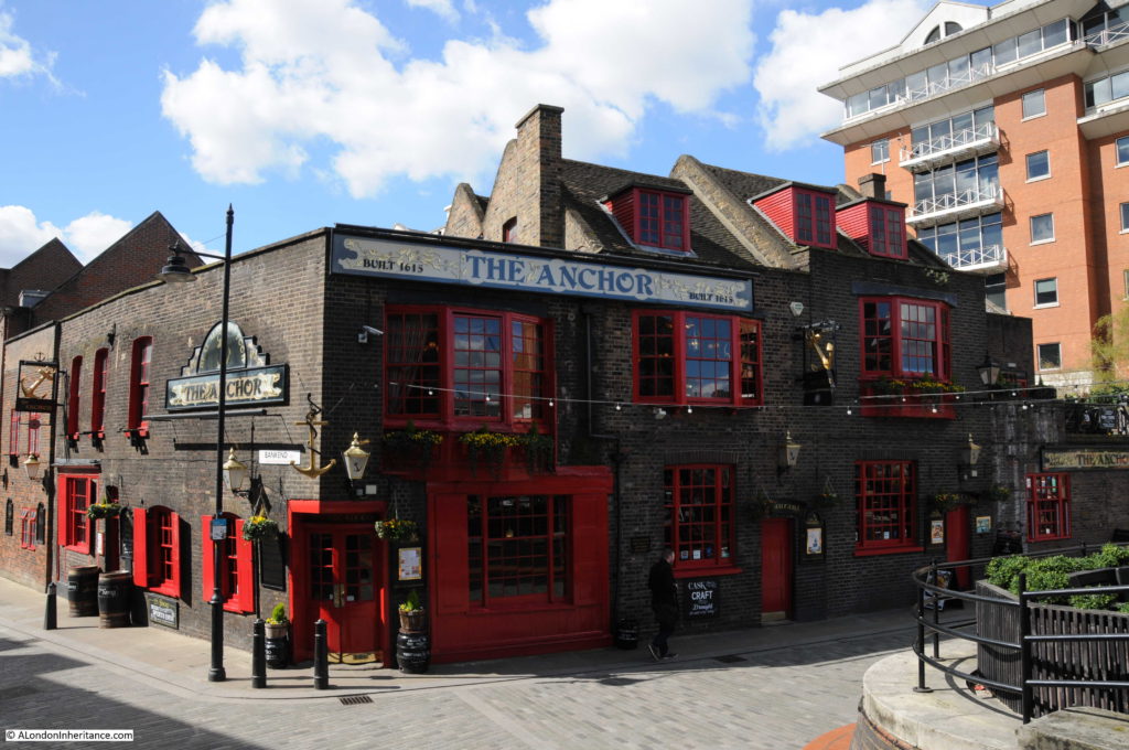
Although not visible in the 1953 photo, if you look at the 1895 Ordnance Survey map, there is a Public House marked on the corner at Bank End. The pub is still there and is now called The Anchor:

Bankside

For part of the 19th Century the pub was called the Blue Anchor. In the 1953 photo there was only the relatively narrow street between the pub and the river, however today, with the straightening of the river wall out to the end of the brick pier of the bridge, there is a large open area in front of the pub – perfect for a beer on a nice day or evening.

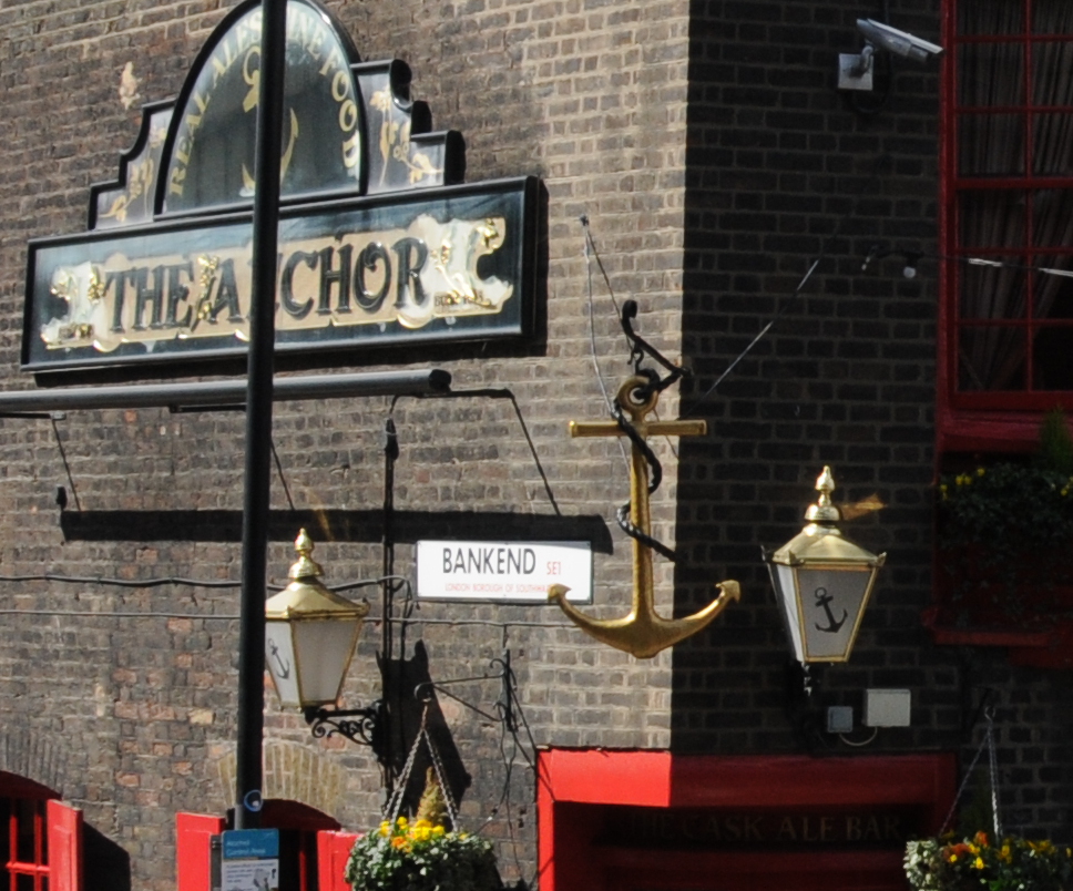
The area on the left of the above photo is Bank End, as confirmed by the name on the side of the pub, so if you stand here, this is where Bankside ends.

Bankside

Today, apart from the pub, this stretch of Bankside is rather bland and Horseshoe Alley and Stairs disappeared during the reconstruction which resulted in the river wall, walkway and buildings we see today. Stand here during a high Thames tide and it is easy to appreciate the challenges of protecting the land when all that was available to prevent an inundation were wooden boards .

I wonder what happened to the surveyor and if he had any role in the disappearance of the Horseshoe Alley dam-boards.

From Bankside To The Proud City

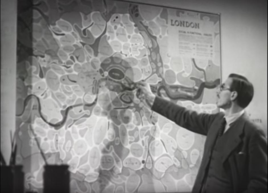
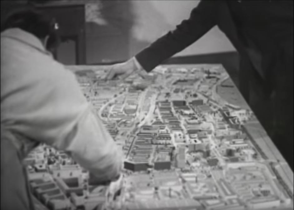
On a completely different subject, I recently found a copy of the film “The Proud City” on YouTube. The film tells the story of the planning for the post war reconstruction of London by Patrick Abercrombie and JH Forshaw. The film includes many views of London, along with Abercrombie and Forshaw explaining the background to the plan, along with some wonderful large scale posters of the maps that would be in the printed report along with models of areas to be redeveloped. The following screen shots from the film show some examples.

BanksideI wonder what happened to these large wall maps. I would love to have them on my wall. I featured a number of them in my post on the 1943 plan for post war reconstruction here.Bankside

The film is very much of its time, but is 25 minutes well spent to see some fascinating film of London and to understand the thinking behind the Abercrombie and Forshaw plan.

The Proud City can be found here.

alondoninheritance.com

Southwark Cathedral

There are a few places in London where I can stand in exactly the same position as my father and the view is almost identical. In Winchester Walk, approaching Southwark Cathedral, the subject of this week’s post, is one of these locations.

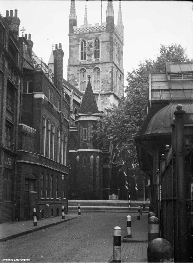
My father took the following photo of the Cathedral in 1953 from Winchester Walk.

Southwark Cathedral

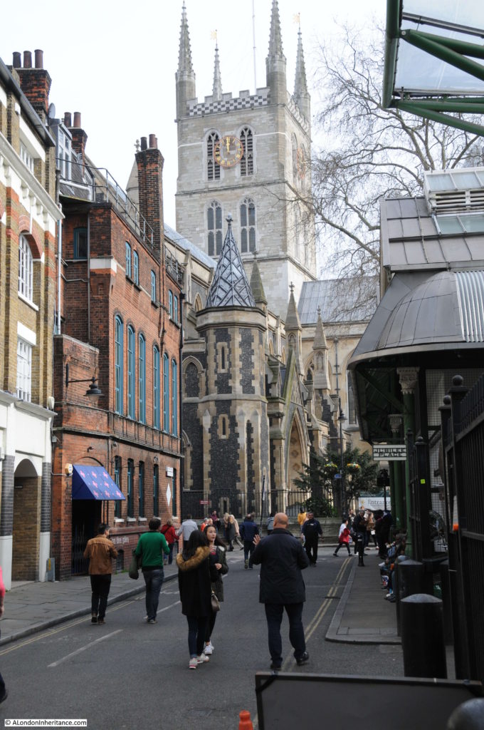
My 2017 photo from the same location:

Southwark Cathedral

I managed to get the alignment between these two photos almost exactly the same. The differences between the two are mainly cosmetic and if I had been there early in the morning with no people around and converted to black and white the photos would have been almost identical, amazing considering they are 64 years apart. The roof and air vents on the Borough Market building on the right are identical as is the roof line of the buildings on the left including the railing around the top of the wall at the base of the roof.
When I take photos at places where the view and surroundings are almost identical, knowing who was standing at this exact same place decades ago, it does bring home how quickly time passes and that we are all just very temporary occupants of these streets.
One of the differences between the two photos is the cleanliness of the buildings. It is perhaps difficult to appreciate how clean the buildings of London are today when compared to those of the city when the burning of coal in homes and factories was common across the city, and from the steam trains passing on the railway viaducts adjacent to the market and Cathedral.

Southwark Cathedral is in the background and Borough Market on the right – Borough Market being the reason why there are so many people around this area.

There has been a church on the site of Southwark Cathedral for many centuries, and the location close to the southern end of London Bridge, a river crossing point since Roman times, perhaps explains the importance of this location.

The first church on the site was possibly built around the 7th century, allegedly by a ferryman who used his wealth to fund the construction of the church. Edward Walford in Old and New London includes a story which also refers to a ferryman, but attributes the building of the church to his daughter, Mary Audrey. Old and New London records that this story came from Stow, who chronicled it as the report of the last prior, Bishop Linsted. Walford does then go on to state that this story has been much discredited.

I suspect we will never know who was responsible for the original church, however it was rebuilt in the 9th Century by the Bishop of Winchester and then in 1106 the church was re-founded by two Norman Knights, William Pont de l’Arche and William Dauncey as a priory for Augustine Canons.  The church was dedicated to St. Mary and then later to St. Mary Overie. Walford in Old and New London suggests that Overie is a corruption of the surname of Mary Audrey, however I suspect this is part of the discredited story. The official explanation is that Overie means “over the river”.

In 1424 the church held its only royal wedding when James I of Scotland married Jane Beaufort, the daughter of the Earl of Somerset.

During the reformation, the priory was closed and the church taken by Henry VIII, when it became a parish church, dedicated to St. Saviour.

The church was purchased by the parishioners in 1614 and in 1689 the new tower was completed which is the tower we see today.

In the following centuries the church went through periods of decay and repair. The tower was in jeopardy on a number of occasions , Walford reports that once was due to vibration damage resulting from the ringing of the bells. The south-eastern pinnacle was struck by lightning and fell on the roof of the south transept. The wooden roof of the nave was demolished, followed by the original nave.

The church became Southwark Cathedral in 1905 to recognise the importance of the church and the considerable growth in population south of the river. The full title of the church retains the original dedications as the Collegiate Church of St. Saviour and St Mary Overie.

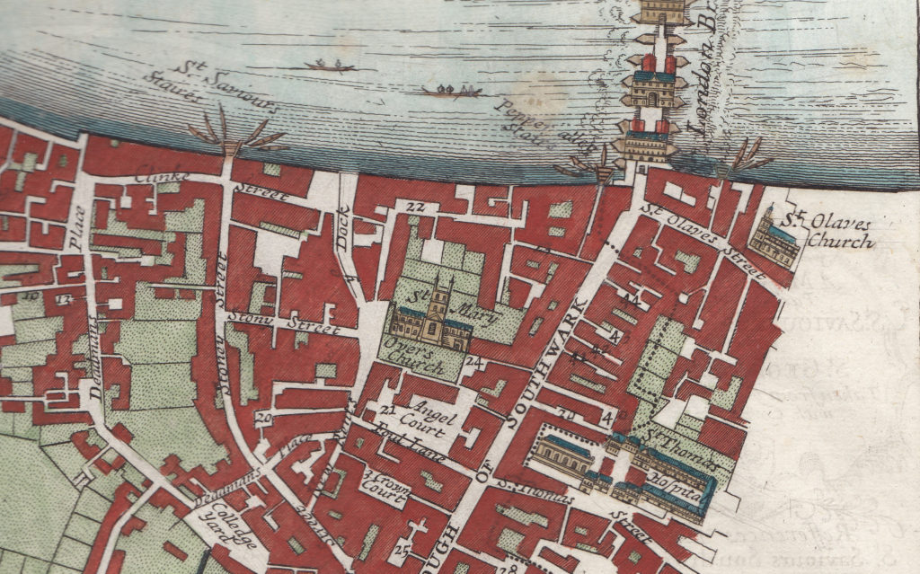
The following map extract from the late 17th century shows the church with the tower looking as it does today. To the left of the church is a small open area into which leads into Stony Street. This is the street from which the 1953 and 2017 photos were taken, however at some point it has changed its name to Winchester Walk. Borough Market now occupies the area south of the Cathedral on what was once Angel Court and the wonderfully named Foul Lane.

Southwark Cathedral

The current name Winchester Walk retains a link the area has had with the Bishops of Winchester. Winchester House or Palace once occupied a large area west of the Cathedral which included a hall of which the circular window can still be seen when walking from the Cathedral into Clink Street.

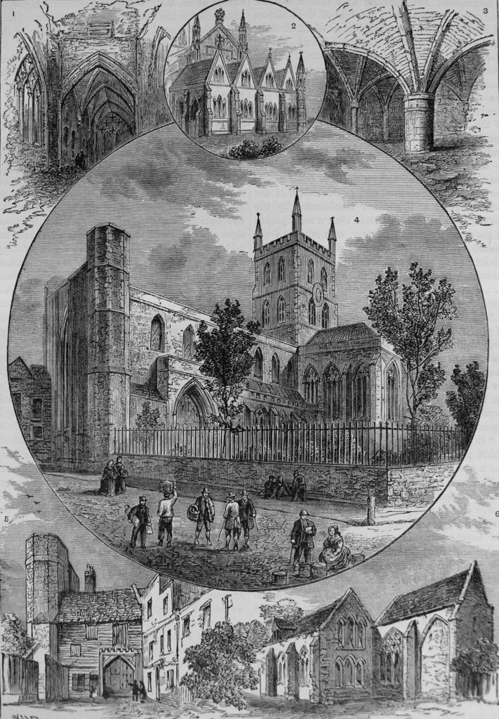
Views of Southwark Cathedral from Old and New London.

Southwark Cathedral

The top right drawing shows the part of the Priory of St. Saviour’s, the oldest part of the church and dating from the 13th century. This part of the church is still in existence and I will find this during a walk around the Cathedral.

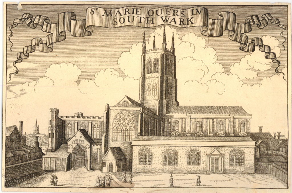
Wenceslaus Hollar also made a number of drawings of the Cathedral including the following showing the south front of the church. The print was published around 1690, although certainly drawn much earlier as Hollar died in 1677. The church in the distance to the left of the Cathedral is St. Paul’s Cathedral so this could be a pre-1666 print. The spire on the tower of St. Paul’s must have been added by Hollar as it collapsed in 1561.

Southwark Cathedral

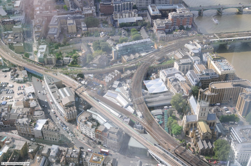
The future of the church was at risk during the 19th century when the church was still a parish church rather than a cathedral. During the 19th century, railways would cut through the south of London to reach stations along the south of the river such as Waterloo and cross the river to reach stations on the north bank. Walking around Borough Market shows how part of the market is enclosed within railway viaducts, and the impact of these on both the market and the church can really be appreciated from the top of the Shard.

The following photo shows the Cathedral to the lower right with the loop of railway viaduct heading round to the bridge to Cannon Street Station on the north side of the river.

Southwark Cathedral

There were proposals to demolish the church during the planning of the railways along the south of the river, fortunately these did not get put into practice, however the proximity of these viaducts clearly demonstrates the impact of the railway in the area around the Cathedral.

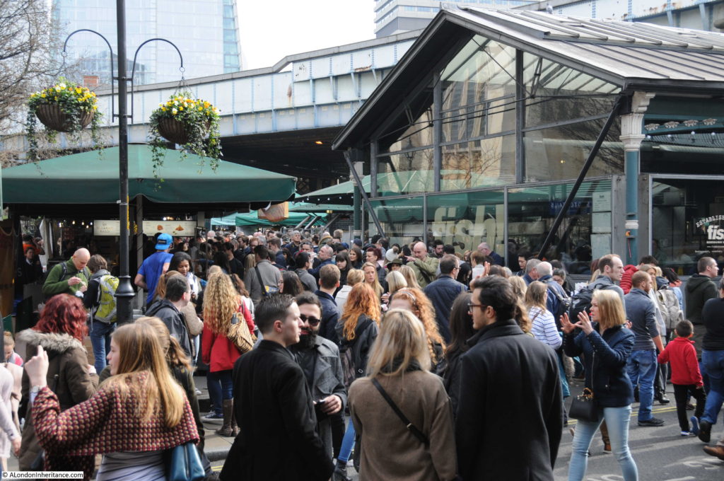
The area to the south west of the Cathedral and within the area enclosed by the railway viaducts is now occupied by Borough Market.

Southwark Cathedral

If you are there during a weekend, I recommend avoiding the crowds in Borough Market and visit the Cathedral instead. The interior of the church is fascinating and well worth a walk around.

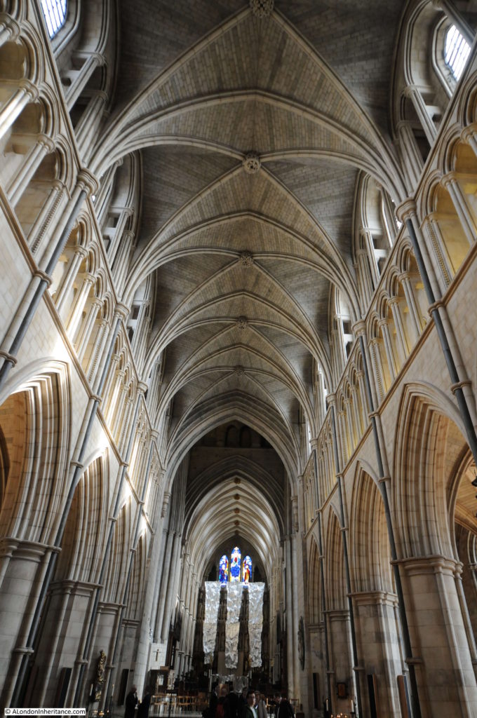
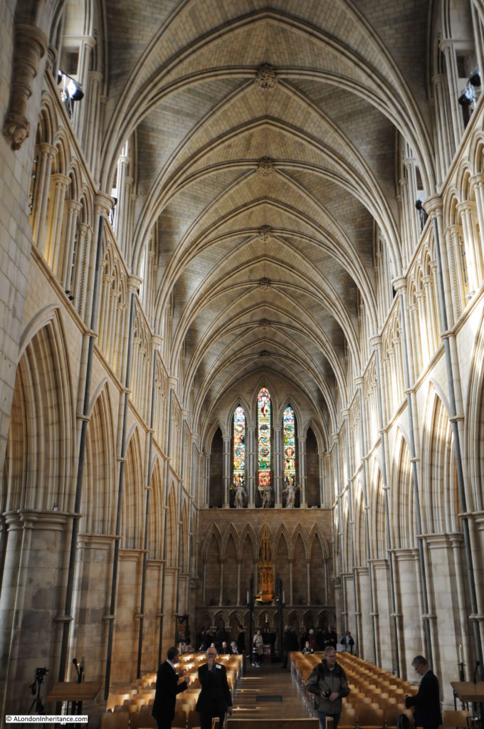
The view on entering the Cathedral, looking down the nave towards the Choir.

Southwark Cathedral

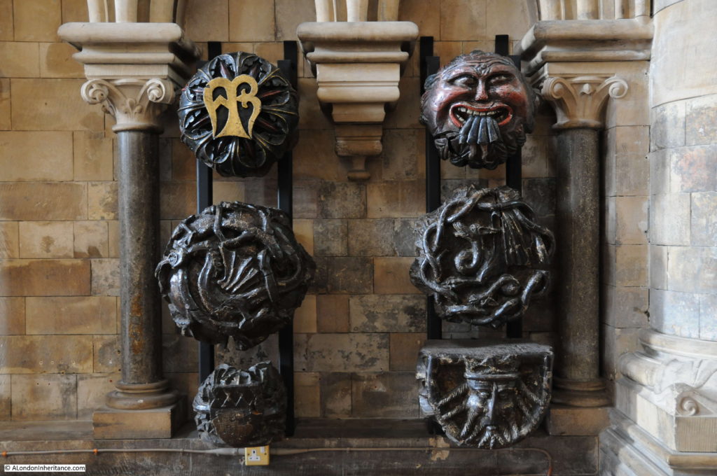
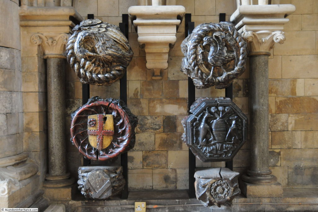
The following two photos show some of the medieval roof bosses from the 15th century wooden ceiling, installed following the collapse of the earlier stone ceiling.

Southwark Cathedral

Southwark Cathedral

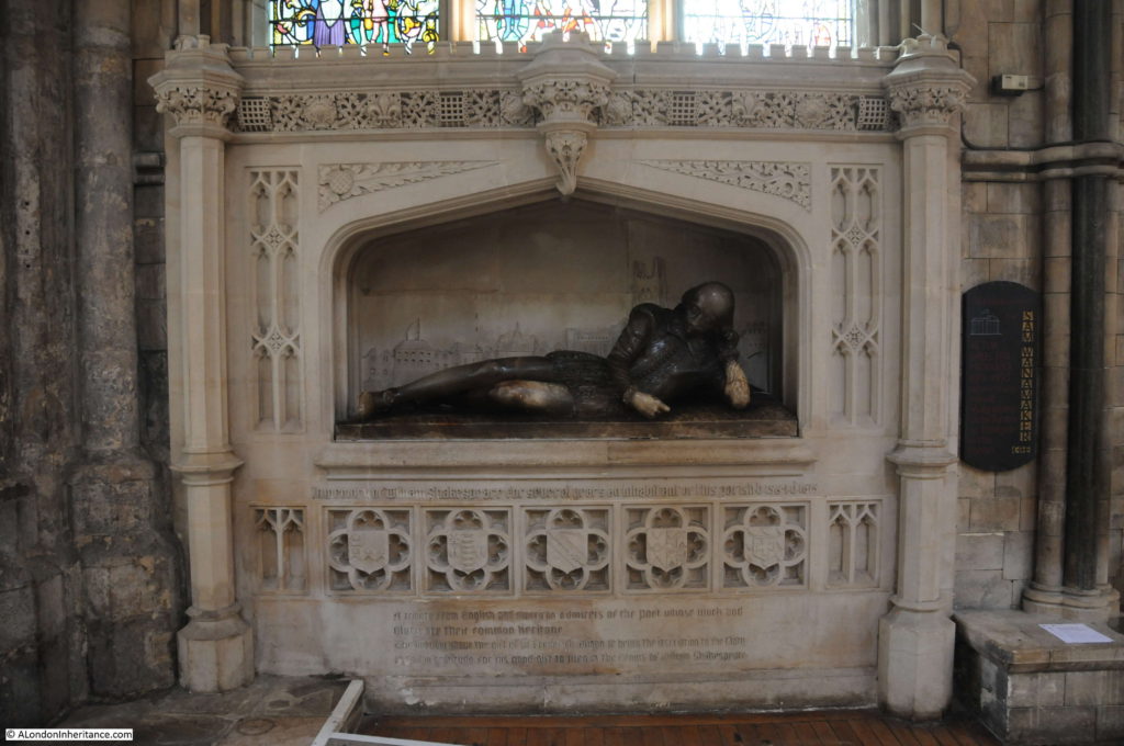
At the end of the nave is the Shakespeare memorial. The carved figure of Shakespeare is from 1912. Sir Walter Besant in London, South of the Thames mentions that Shakespeare’s brother Edmund was buried in Southwark Cathedral.

Southwark Cathedral

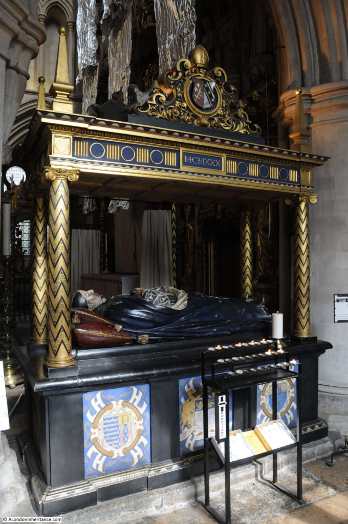
The tomb of Bishop Lancelot Andrewes who died in 1625. Andrewes was one of the translators of the King James version of the Bible.

Southwark Cathedral

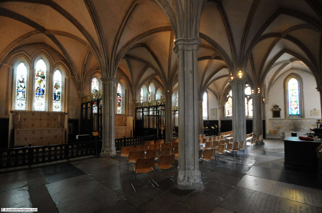
At the eastern end of the church is the retro choir. This is from the 13th century and is the oldest part of the Cathedral still standing (see the drawing of the retro choir in the drawings from Old and New London above).

Southwark Cathedral

There is an open archaeological excavation outside the main church which I will come to later. This shows a 1st Century AD Roman road and has an information panel which shows that the original Watling Street ran along the eastern edge of the church, just outside the windows that run along the left of the photo above. The road cut through the far corner of the church.

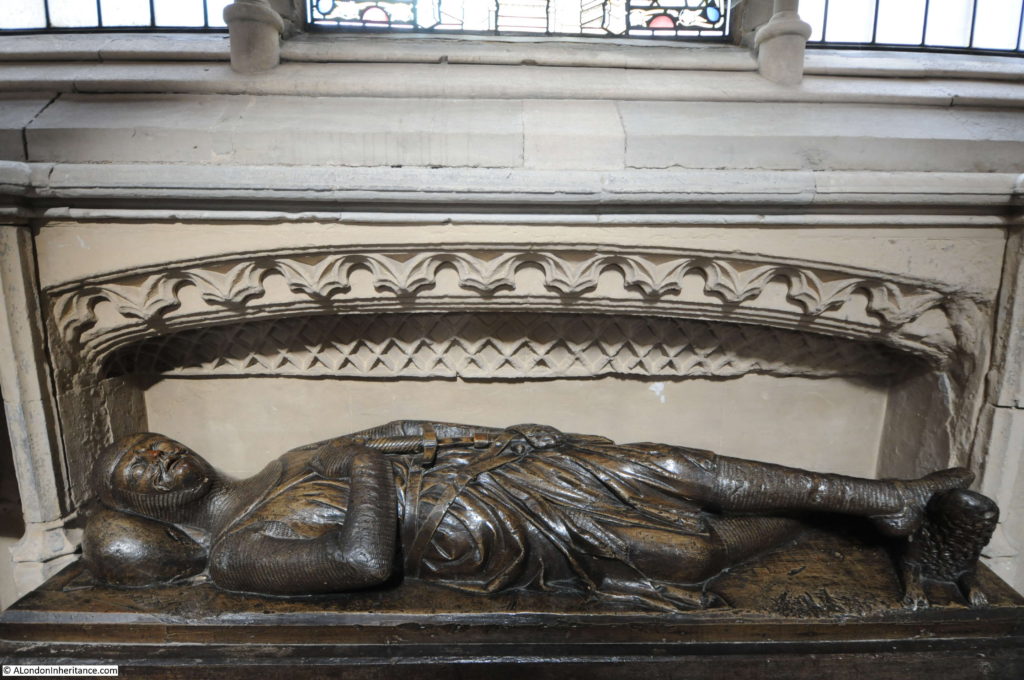
The majority of effigies are carved in stone, however Southwark Cathedral has a rather unusual effigy carved in wood which dates from the 13th century.

Southwark Cathedral

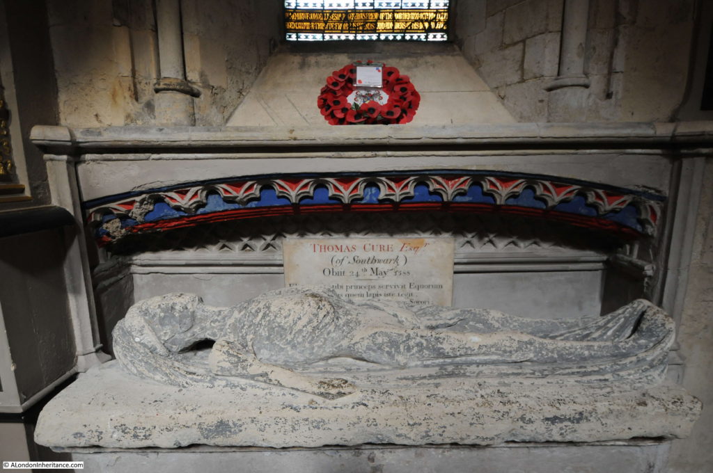
There is also an effigy of the rather shrunken body of Thomas Cure of Southwark who died on the 24th May 1588.

Southwark Cathedral

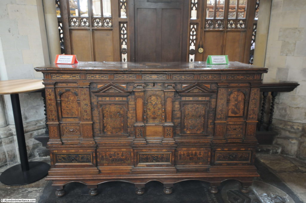
This superb wooden chest once held all the parish records. Made by German immigrants in the parish, it was given to the church in 1588.

Southwark Cathedral

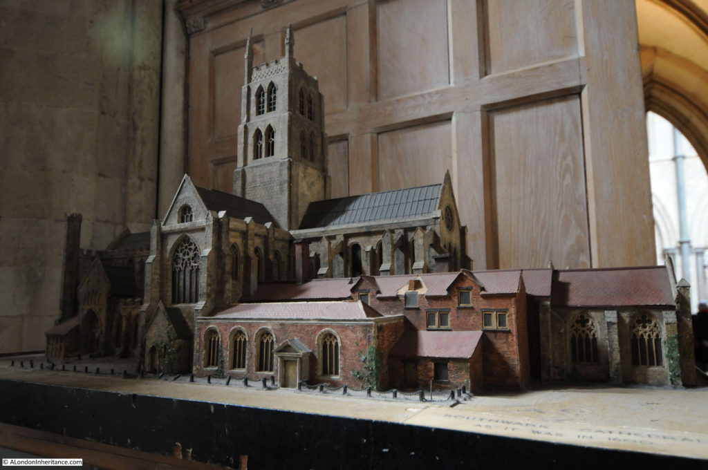
A wonderful model of the church, although a couple of the pinnacles on top of the tower appear to be missing, perhaps recreating the lightning strike that brought down one of the pinnacles onto the roof of the south transept.

Southwark Cathedral

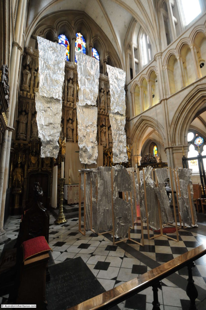
During my visit the High Altar Screen was partially hidden behind an artwork. The High Altar Screen dates from 1520, but with later added detail. The screen consists of carvings of saints and those who have been connected with the Cathedral.

Southwark Cathedral

Looking down the Nave from the Choir.

Southwark Cathedral

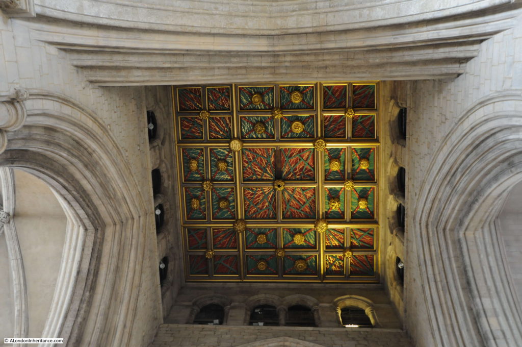
The painted ceiling on the base of the tower.

Southwark Cathedral

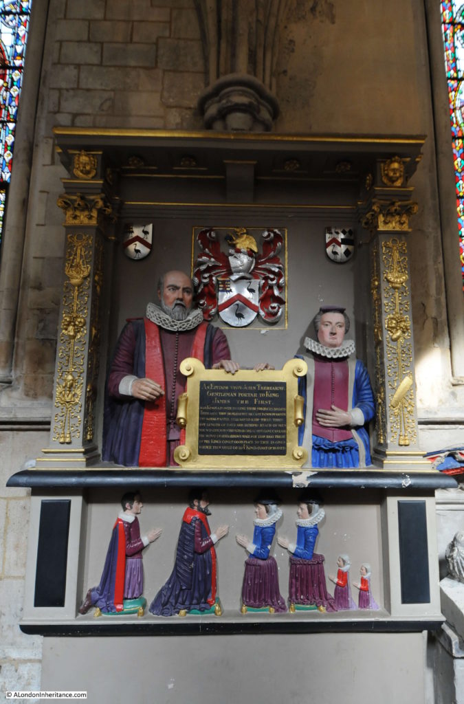
An epitaph to John Trehearne, Gentleman Portar to King James the First.

Southwark Cathedral

The epitaph reads:

“Had Kings a power to lend their subjects breath Trehearn thou should’st not be cast down by death. Thy royal master still would keep thee then but length of days are beyond reach of men, nor wealth, nor strength, nor greatmen’s love can ease the wound death’s arrows make. Thou hast these in thy King’s court good place to thee is given. When thou shalt go to ye King’s Court of Heaven.”

A salutary reminder that no matter your wealth or power, there is no escape from death.

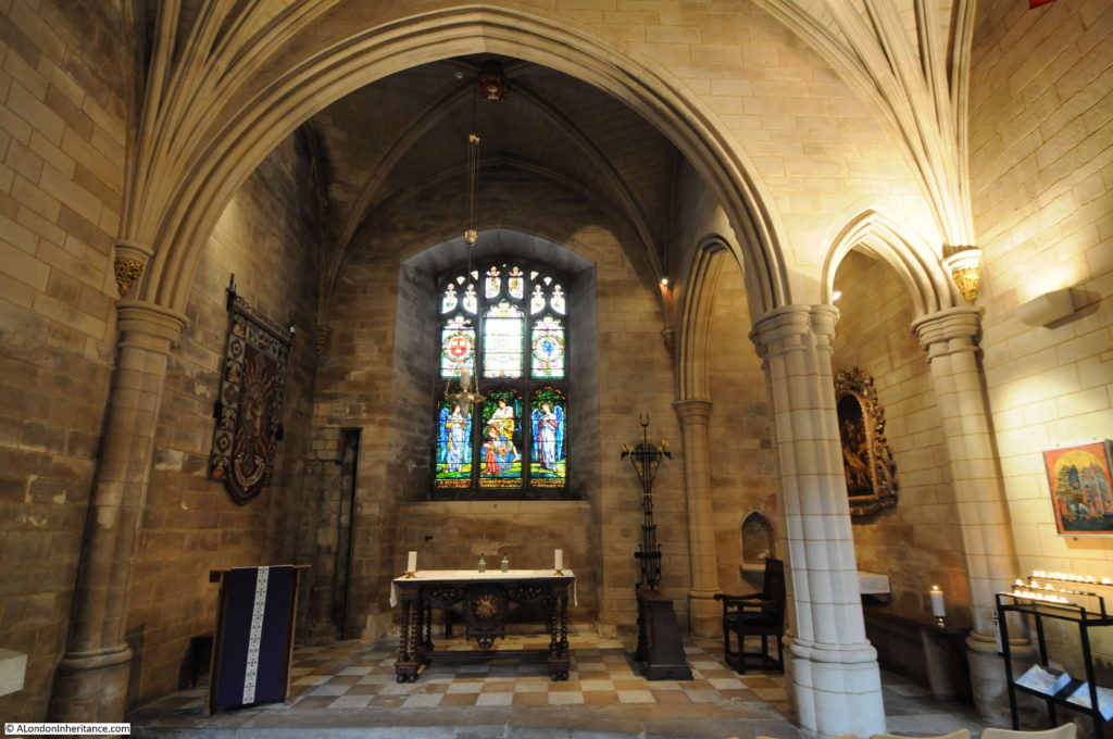
Along the northern side of the church is the Harvard Chapel which is named after John Harvard, the benefactor of Harvard University who was baptised in Southwark Cathedral, or St. Saviour’s as it was in 1607.

Southwark Cathedral

John Harvard was born in Southwark in 1607. He emigrated to America in 1637 and settled in Charlestown where he became a minister. He was only there for one year, as he died in 1638. He left his library and part of his estate to the college that had been established two years earlier and which would take his name.

The stained glass window in the Harvard Chapel was given to the church by the US Ambassador in 1907.

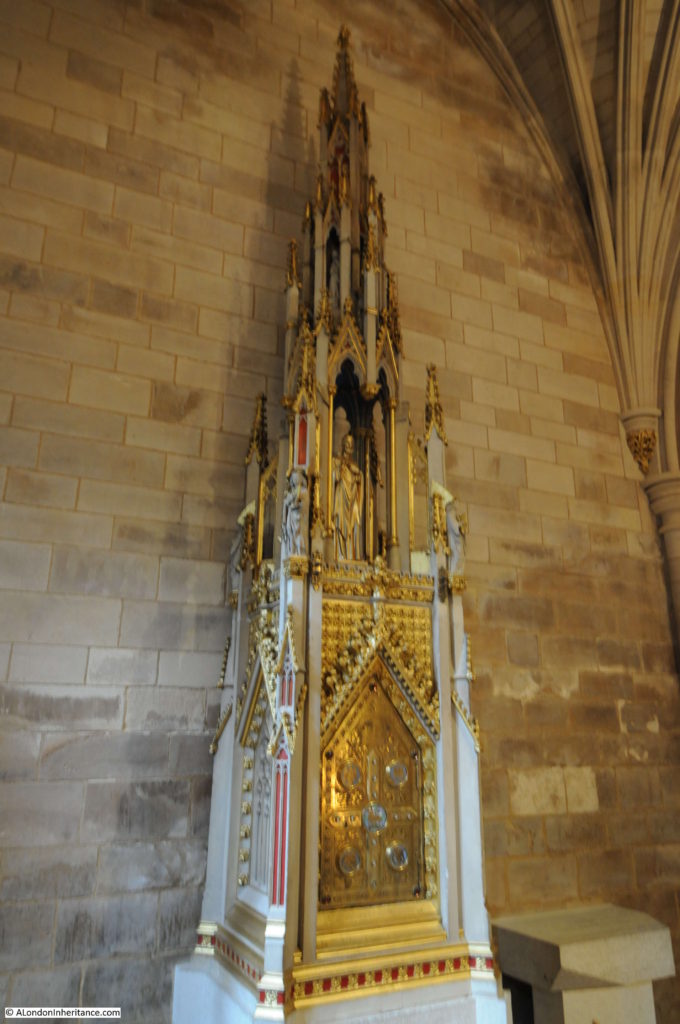
Also within the Harvard Chapel is a tabernacle designed by Augustus Pugin in 1851, the year before his death in 1852. It was Pugin who was responsible for so much of the design of the Palace of Westminster, including the Elizabeth Tower.

Southwark Cathedral

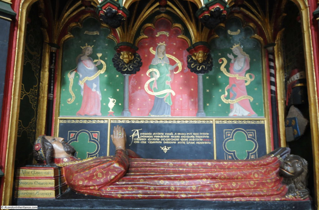
The tomb of John Gower. a poet to King Richard II and Henry IV. His head is resting on three books representing three of his greatest works.

Southwark Cathedral

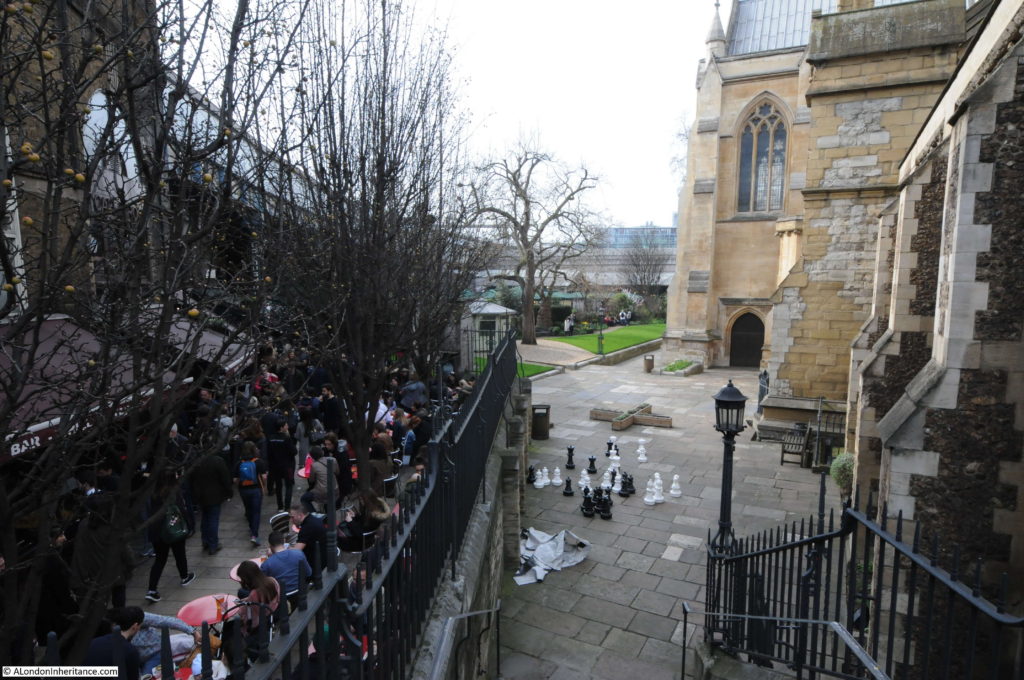
The railway viaduct and market now occupies part of what was the churchyard of the Cathedral. There are some steps in the south-east corner of the churchyard from where the difference between the quiet churchyard of Southwark Cathedral and the crowds of Borough Market can be appreciated.

Southwark Cathedral

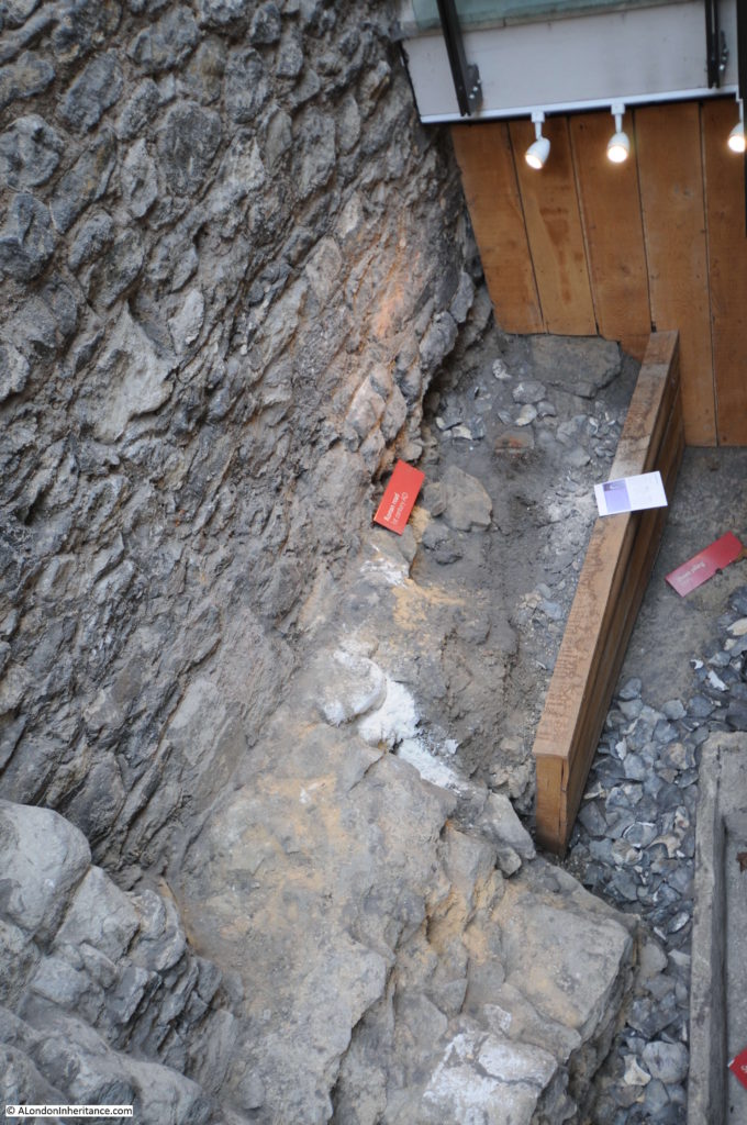
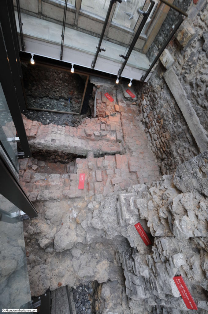
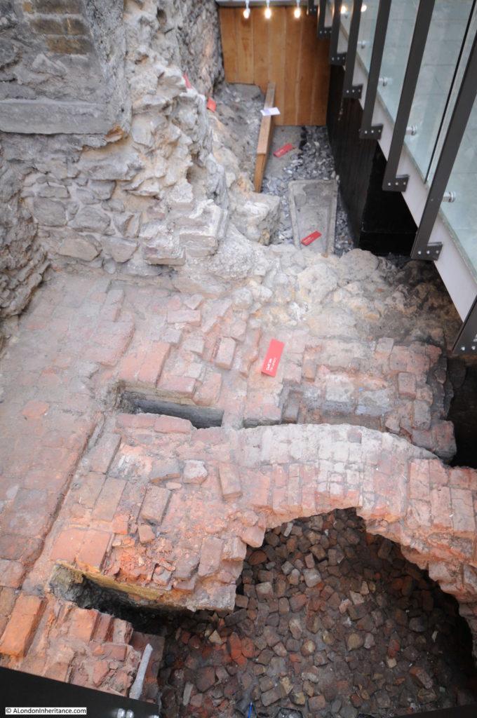
There were a fair number of visitors to the Cathedral during my visit, however what most people seemed to miss was perhaps one of the most interesting features. Walk back out the entrance to the Cathedral and there is a corridor where the Cathedral Shop is located. At the end of this corridor is the result of some of the archaeological excavations that took place prior to the building of the rooms on the north-side of the Cathedral in 1999.

The excavations show the layered history of the Cathedral, starting with the remains of a Roman road from the 1st Century AD, 12th Century foundations of the Norman Priory, 17th Century Delft Kiln, 18th Century stone pavement and a 19th century lead water pipe.

The remains of a 1st Century Roman road between the walls of the cathedral and the wooden retaining panels.

Southwark Cathedral

The information panel explains that the Roman road was a smaller road running diagonally across the church and appears to be running up to the river to meet at the same place where Watling Street met the river.

Lower right are 12th Century remains of the Norman church. In the middle is the 17th Century Delft Kiln and at the top is the lead piping and pavement.

Southwark Cathedral

Looking along the excavations with a coffin behind the kiln.

Southwark Cathedral

It is good to see these features in situ rather than as isolated exhibits. They show the layered history of London’s past and how London has always been built on earlier versions of the city.

It is also not just the stones of the city that have a layered history. All those who have lived and worked in the city over the centuries are also part of these layers, and it is this that I feel part of (although on a very much shorter time span) when taking photos in the same locations as those from 60 and 70 years ago.

alondoninheritance.com