Monthly Archives: January 2019

St Giles In The Fields

St Giles has always been a distinctive area. Not in the West End, not part of the expensive streets of Bloomsbury to the north, ignored by those shopping on Oxford Street and bypassed by New Oxford Street and Charing Cross Road. My memories of St Giles from the late 1970s and 1980s are that it always had a slightly edgy atmosphere when visiting in the evening, drinking in the local pubs and the late night bars and music venues.

I had been intending to write a post about St Giles as an area, however working away this last week and the sheer breadth and depth of the history of St Giles swiftly stopped this attempt, so for today’s post I will focus on the church of St Giles in the Fields, a church that has been central to the history of the area for hundreds of years, located to the west of the parish, at the junction of St Giles High Street, Denmark Street and Earnshaw Street.

I visited last June, a gorgeous summer day in London, which seems a long time ago whilst writing this on a grey January day.

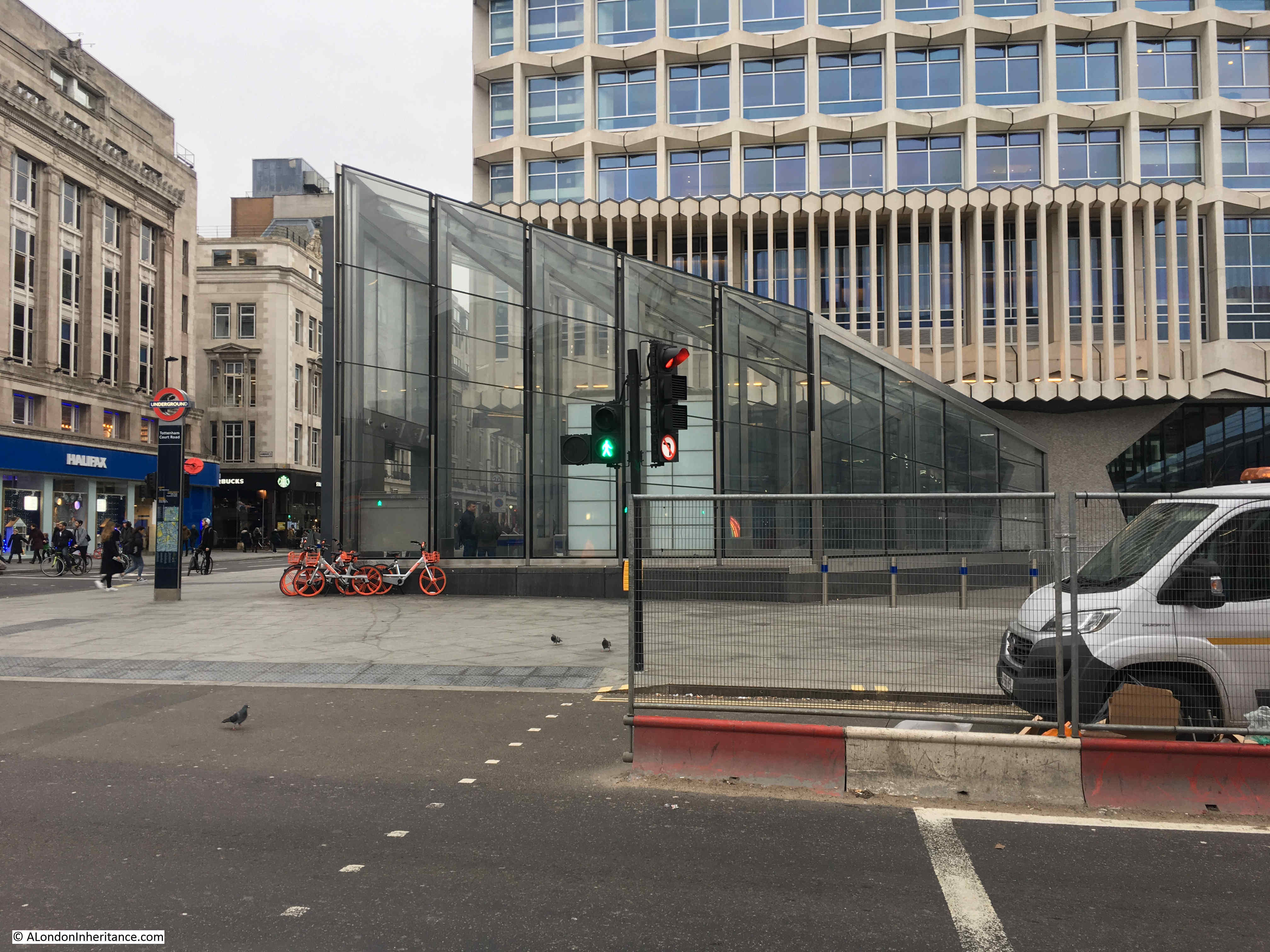
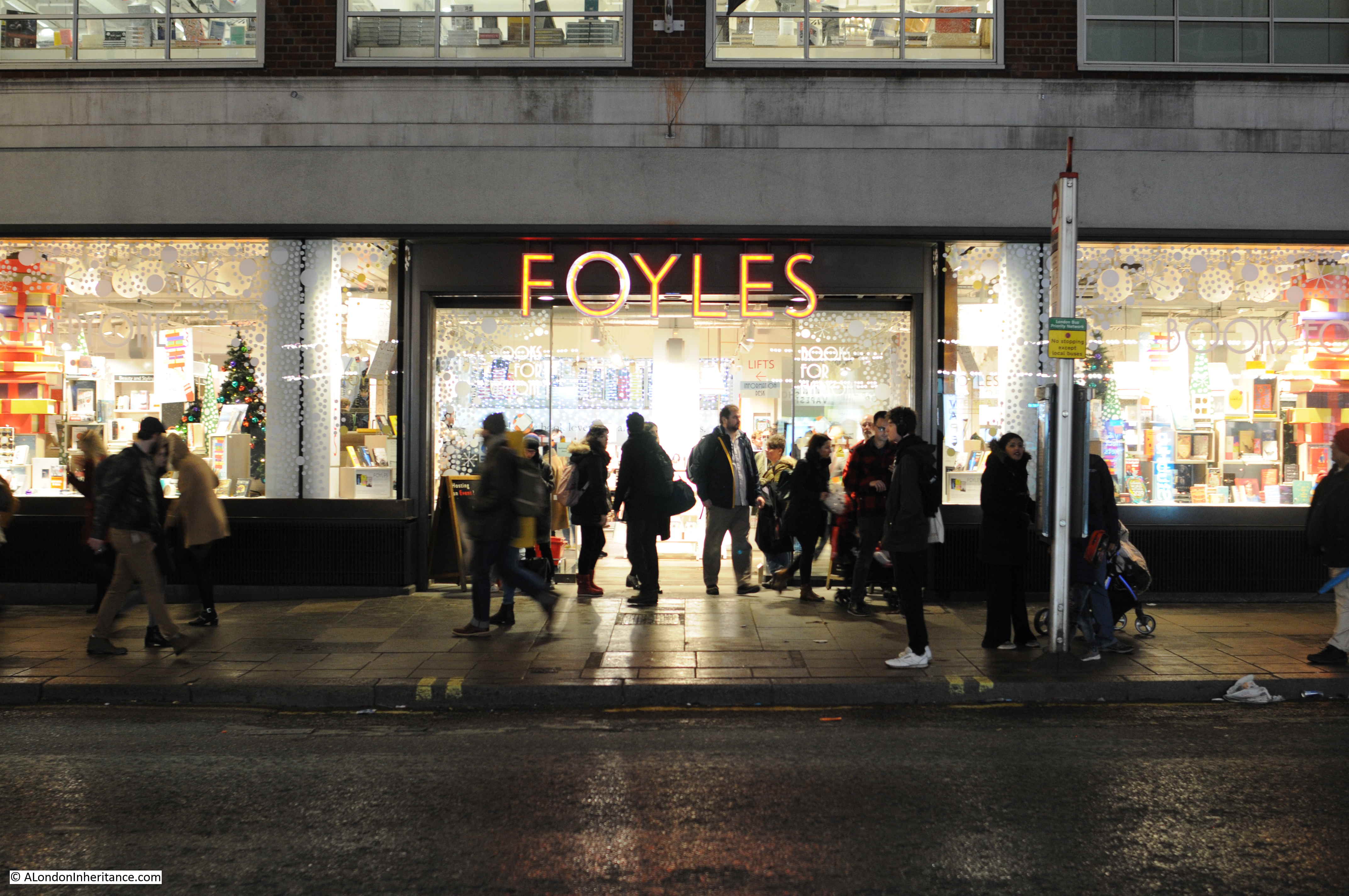
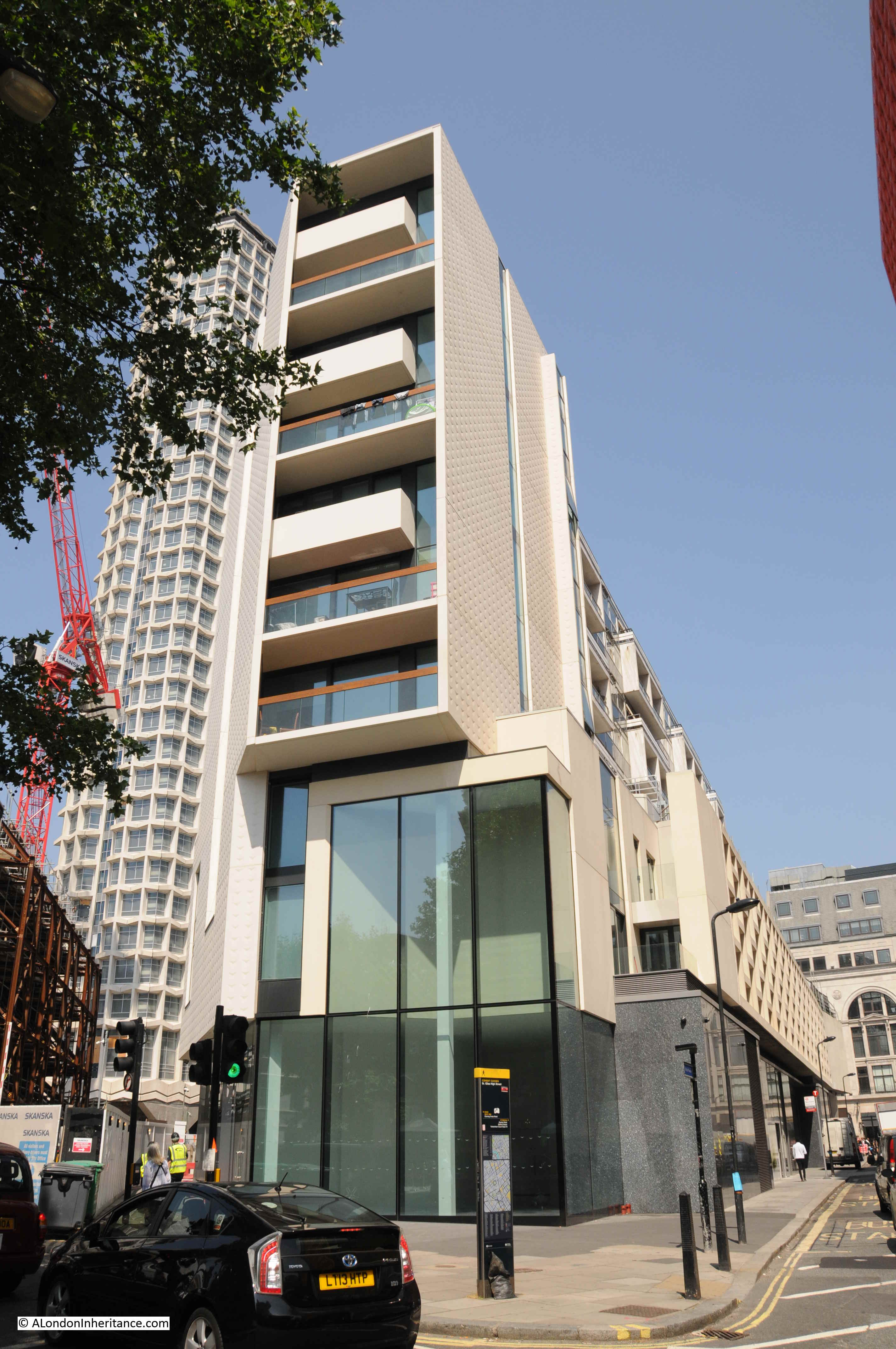
The view on leaving Tottenham Court Road Underground Station immediately shows how the area is changing. The space between New Oxford Street, Charing Cross Road and Denmark Street is a major building site. The original site of Foyles disappeared a few years ago.

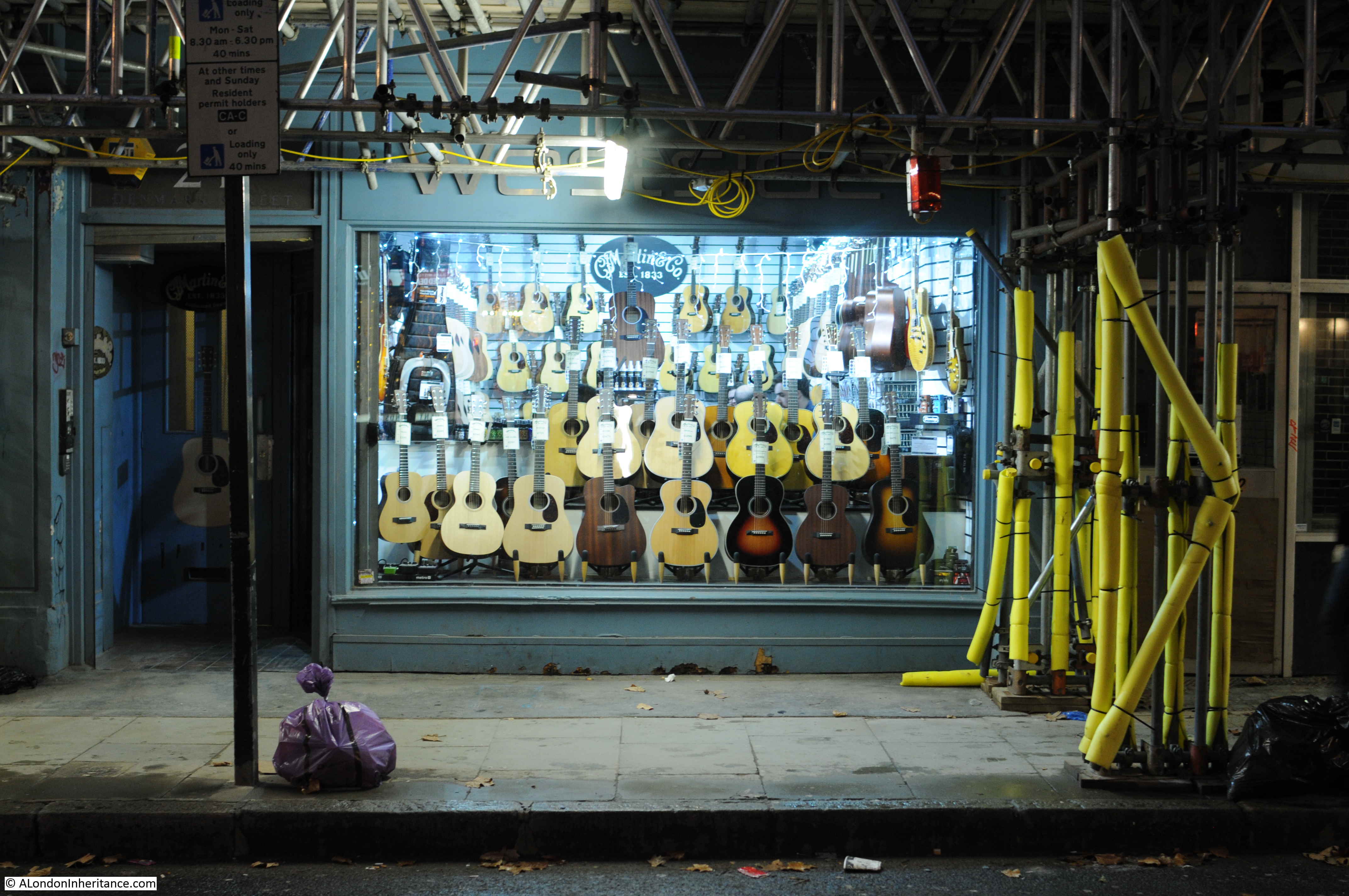
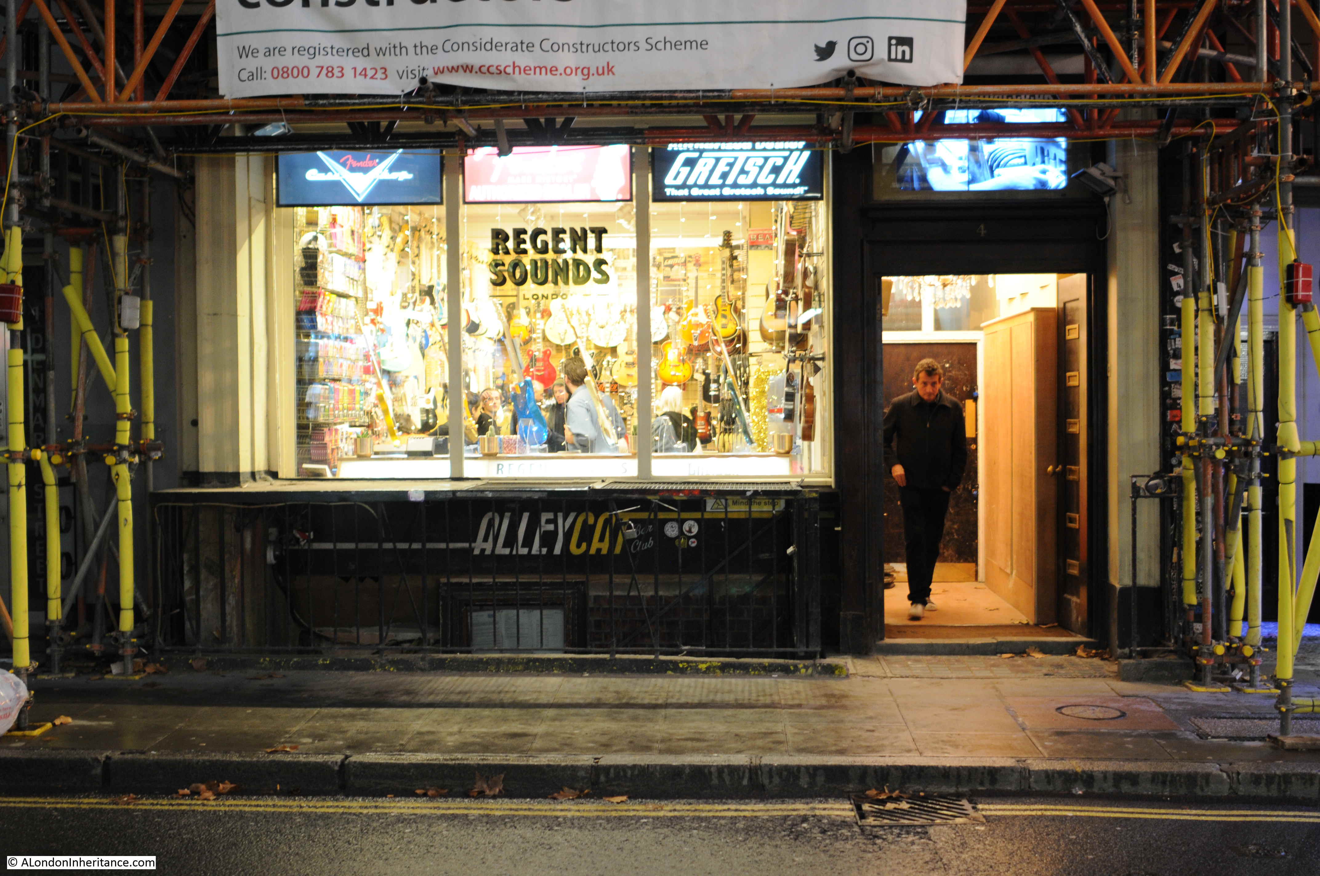
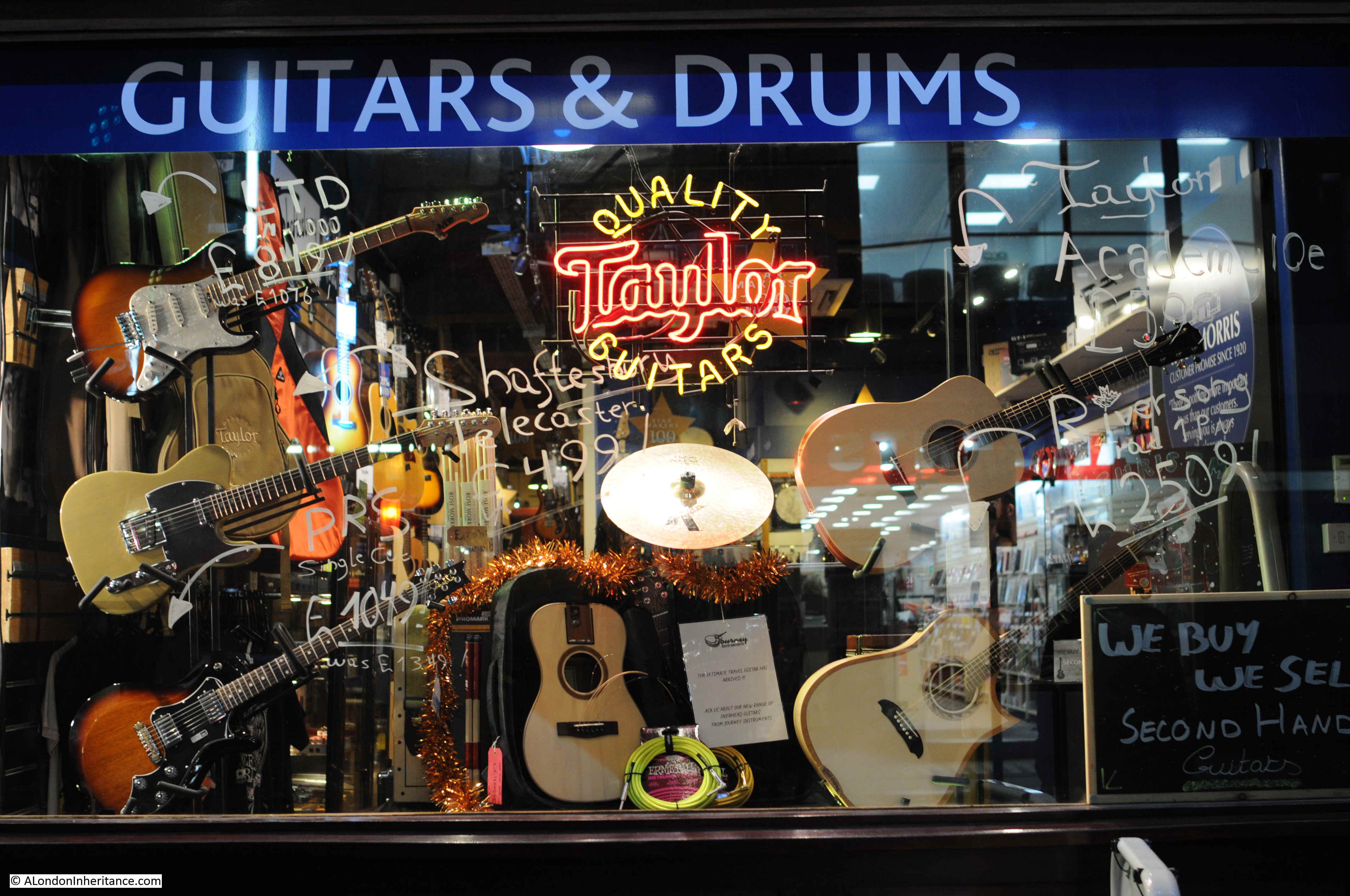
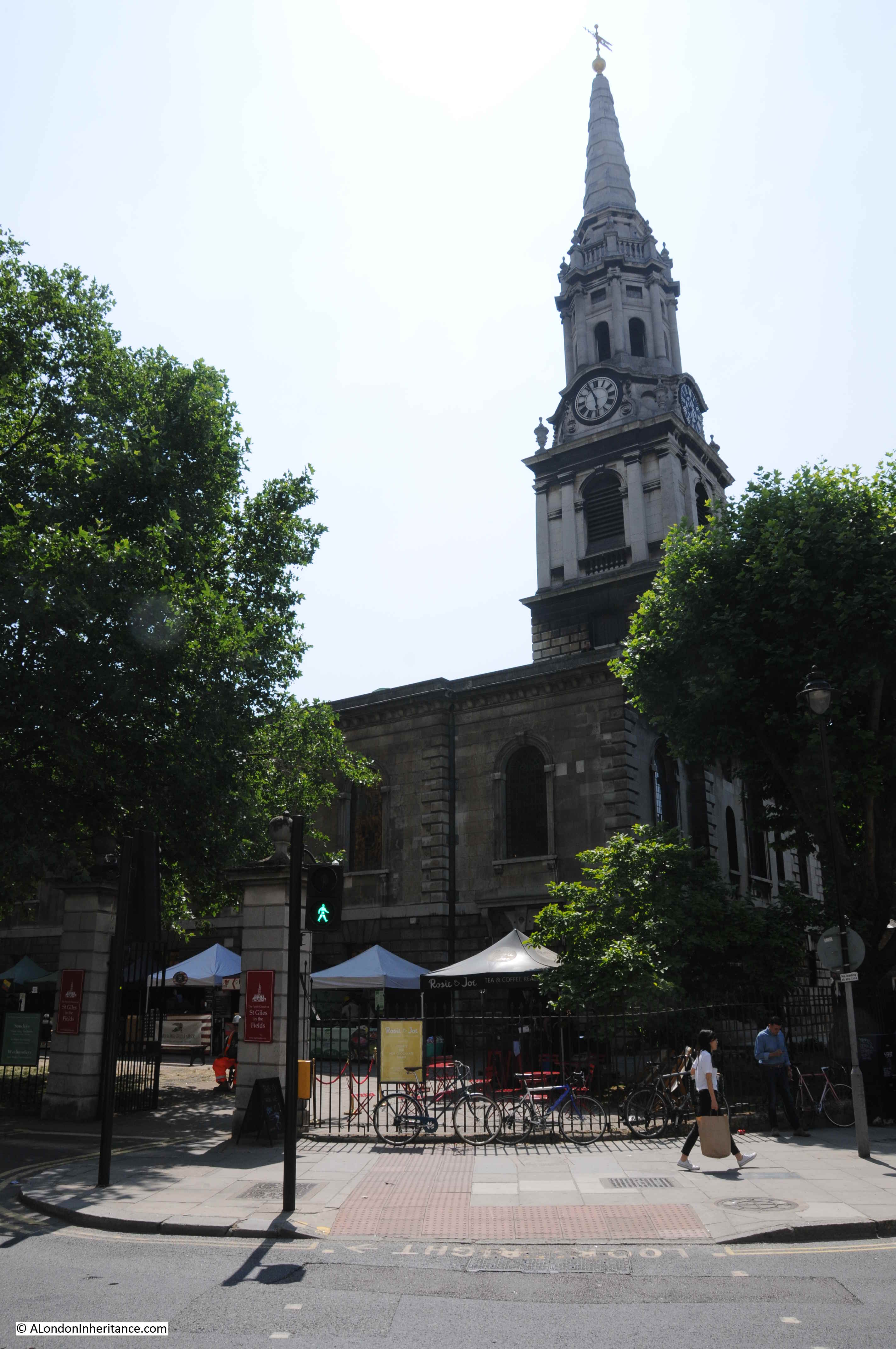
I walk down Charing Cross Road, along Denmark Street to find St Giles in the Fields:

St Giles in the Fields

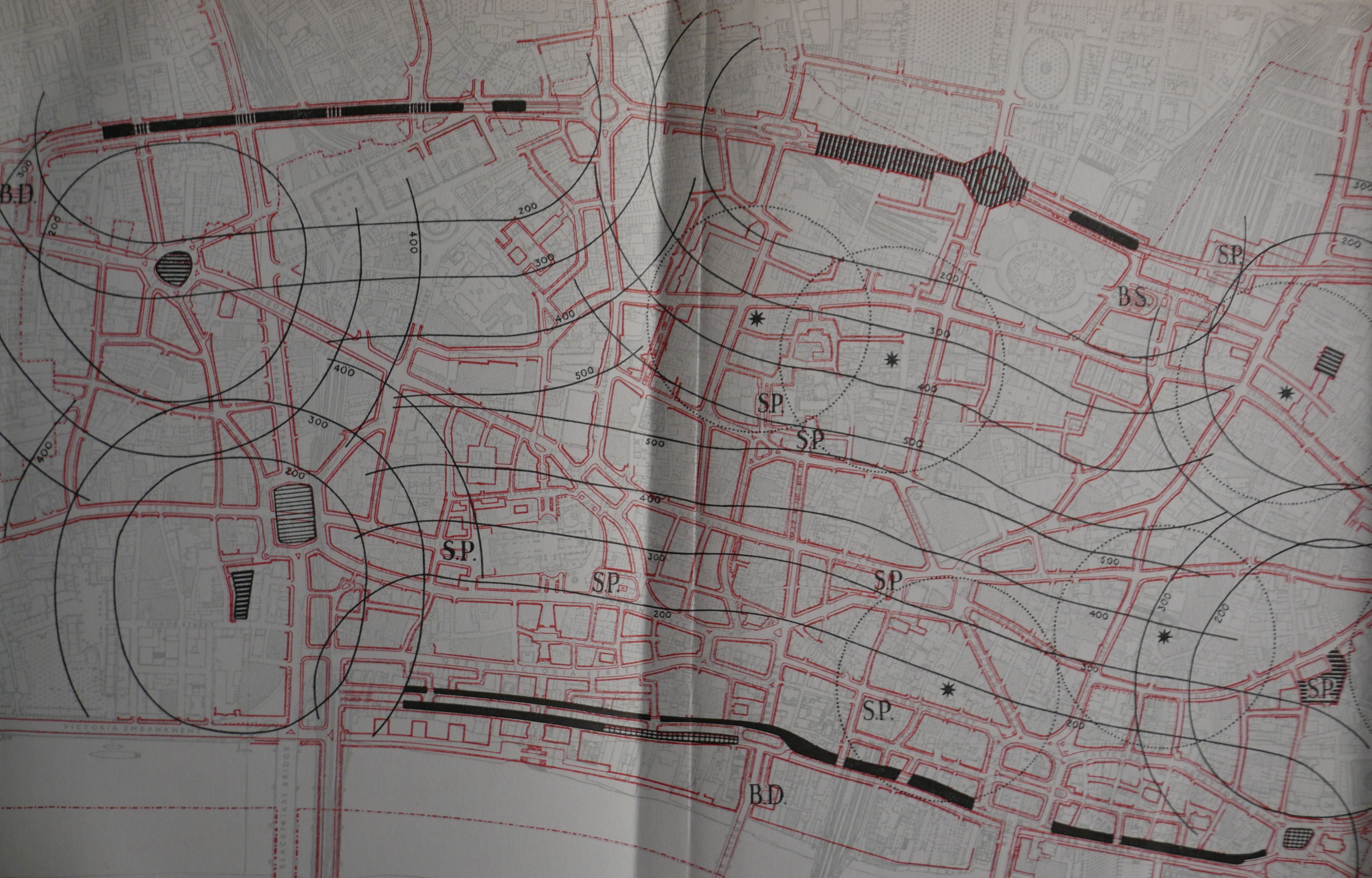
St Giles in the Fields was on the main route that led from Holborn up along what became Oxford Street to Tyburn. The following extract from John Rocque’s 1746 map shows St Giles in the Fields in the lower left corner (unfortunately the corner of the page in my copy of the map, so does not show the area around the church).

St Giles in the Fields

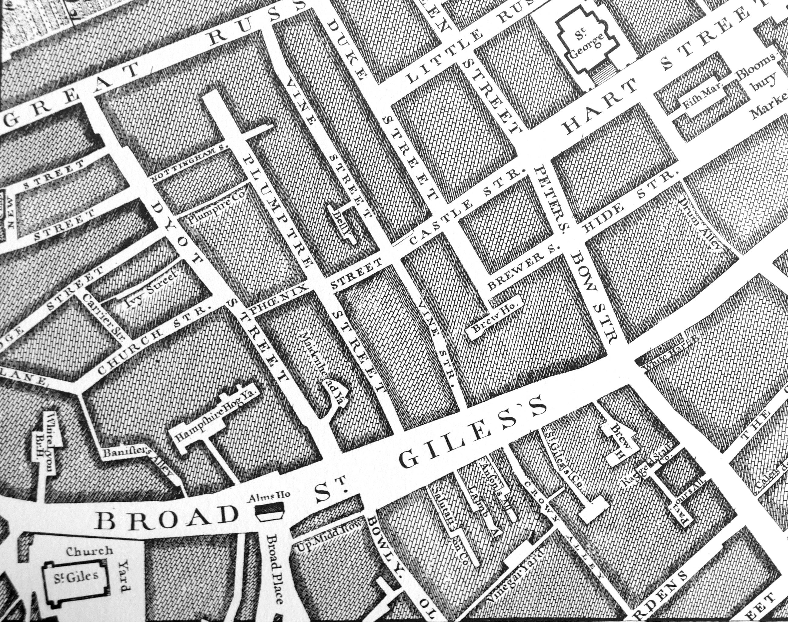
The wide street labelled “Broad St Giles’s” connected Holborn on the right with Oxford Street on the left. The significance of the street as a main route was relegated with the construction of New Oxford Street which cut across the streets between St Giles and Great Russell Street to the north. The construction of New Oxford Street was planned as a continuation of Oxford Street and to help with traffic congestion along St Giles. The area north of St Giles consisted of densely packed buildings, courts and alleys and was known as one of London’s notorious Rookeries.

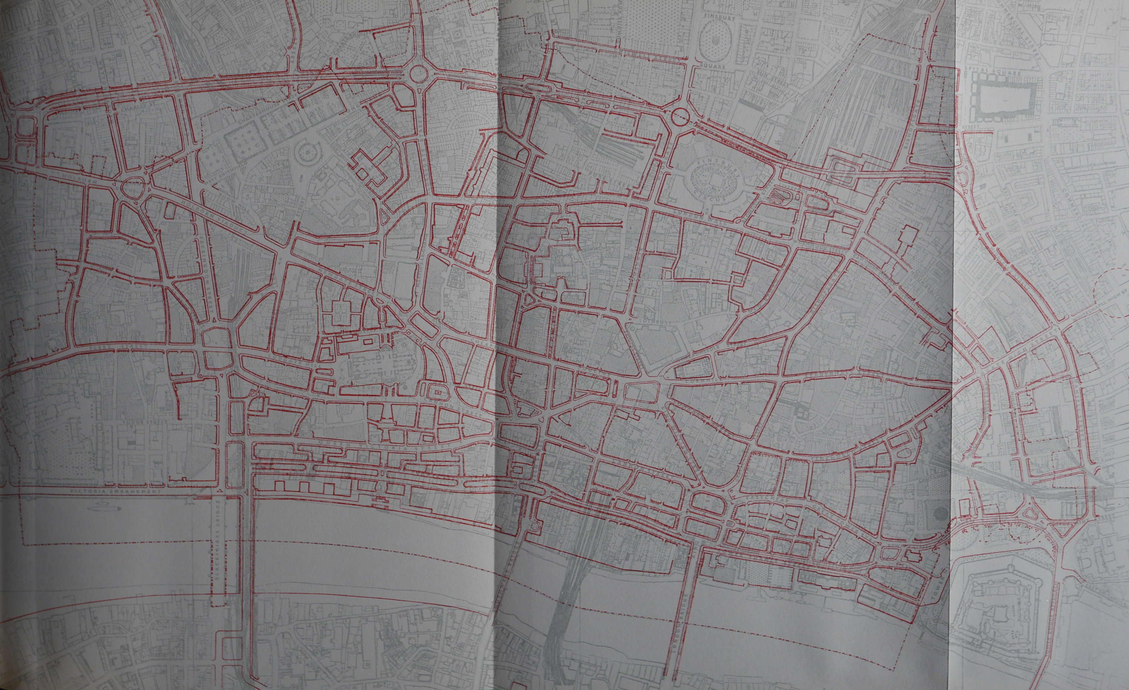
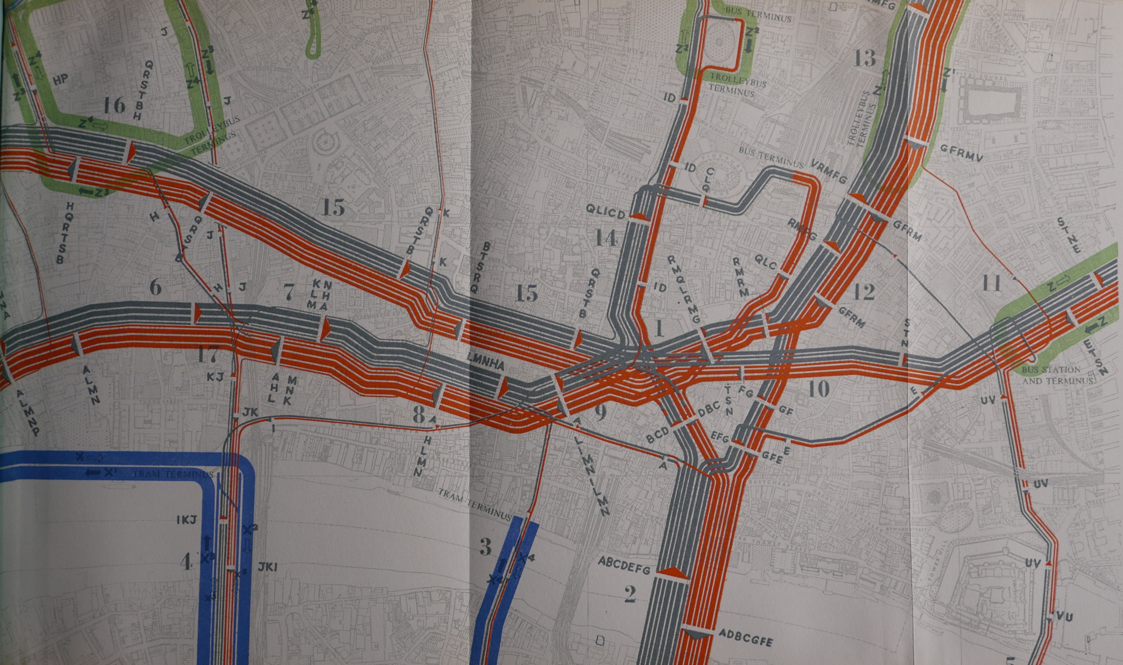
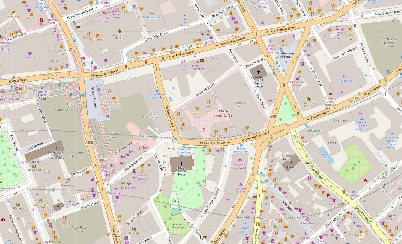
The following map of the area today shows St Giles in the Fields in the lower centre of the map, with Denmark Street continuing to the left towards Charing Cross Road and Earnshaw Street continuing up to New Oxford Street.

St Giles in the Fields

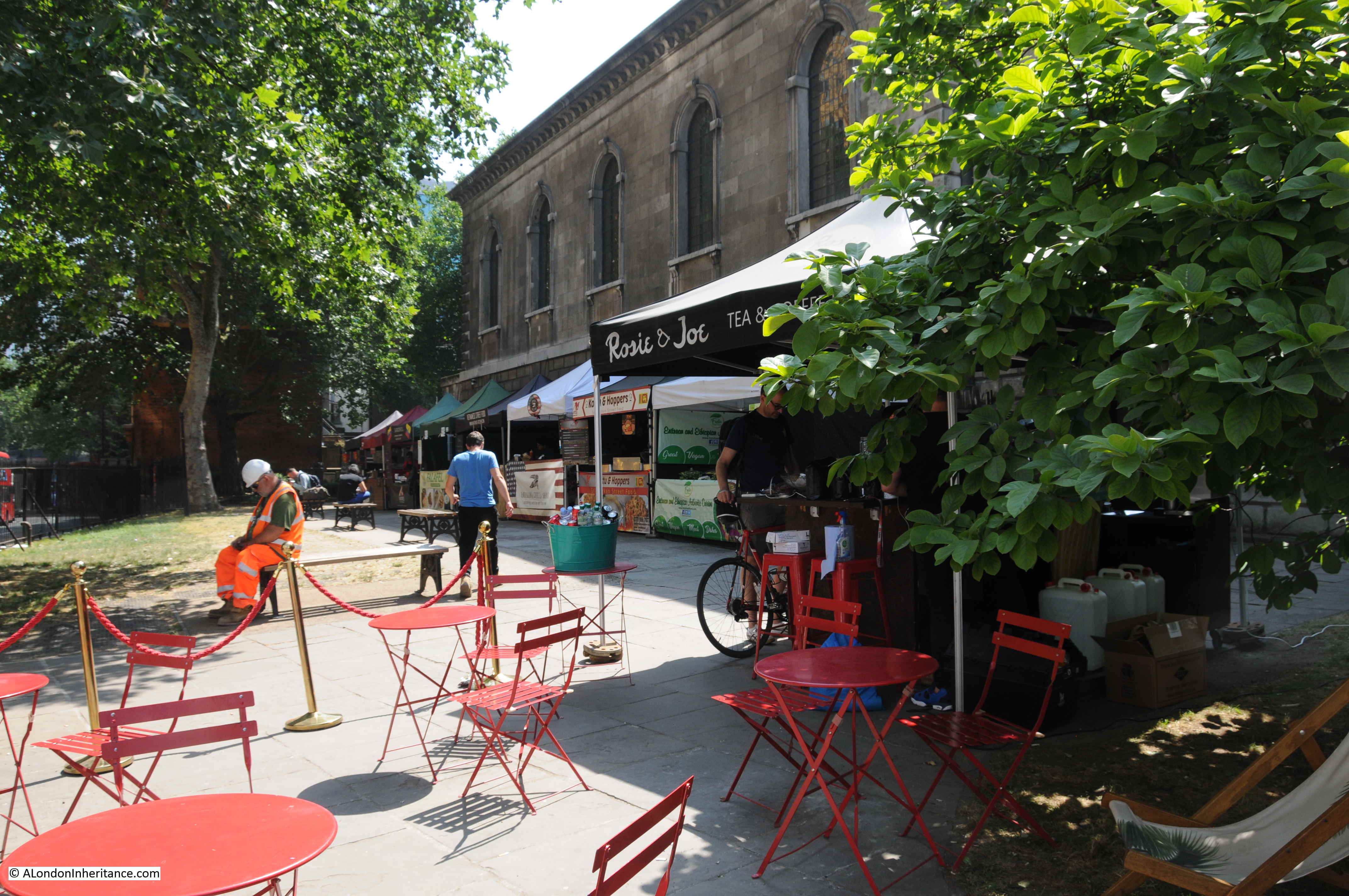
It was late morning when I arrived and stalls in the churchyard facing St Giles High Street were setting up ready to provide food and drink to workers and visitors.

St Giles in the Fields

The origins of the church date back to the founding of a leper hospital in 1101 by Queen Matilda, when the site of the church was the hospital chapel. With the dissolution in the 16th century, the chapel became the parish church for the small village that had grown up around the original hospital.

St Giles grew into an affluent area and contributions from many of the parish’s wealthy residents allowed the chapel to be replaced by a new church in the 17th century. Edward Walford in Old and New London describes this church as being a “red brick structure, commissioned by Laud, whilst Bishop of London in 1623”.

The church of St Giles in the Fields as it appeared in 1718:

St Giles in the Fields

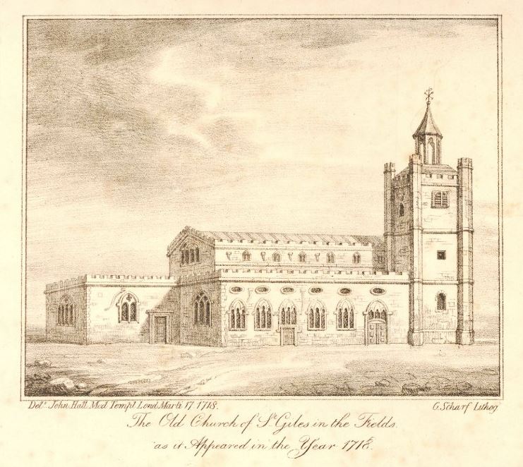
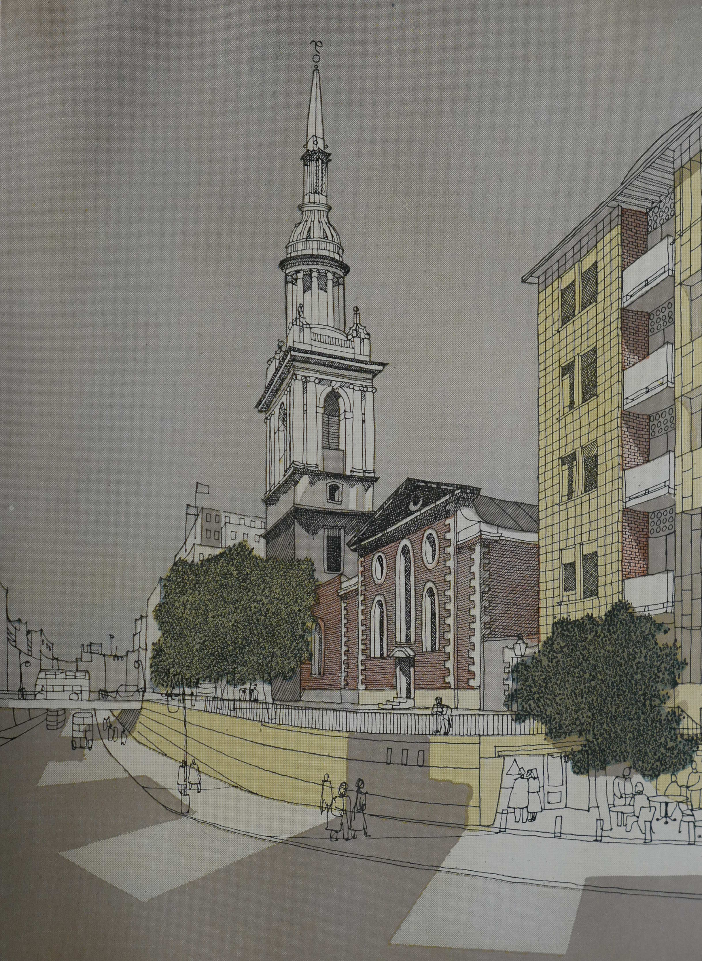
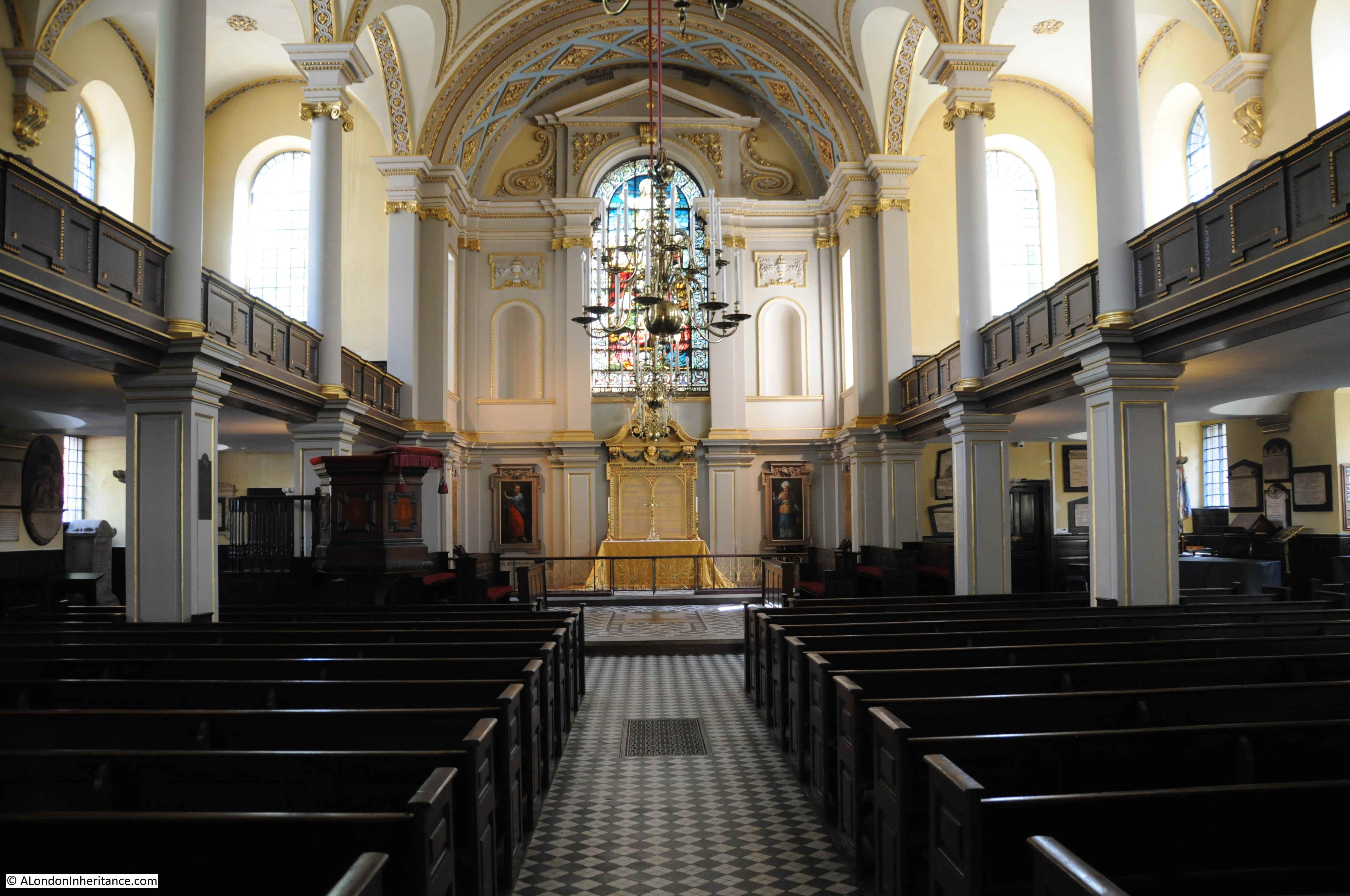
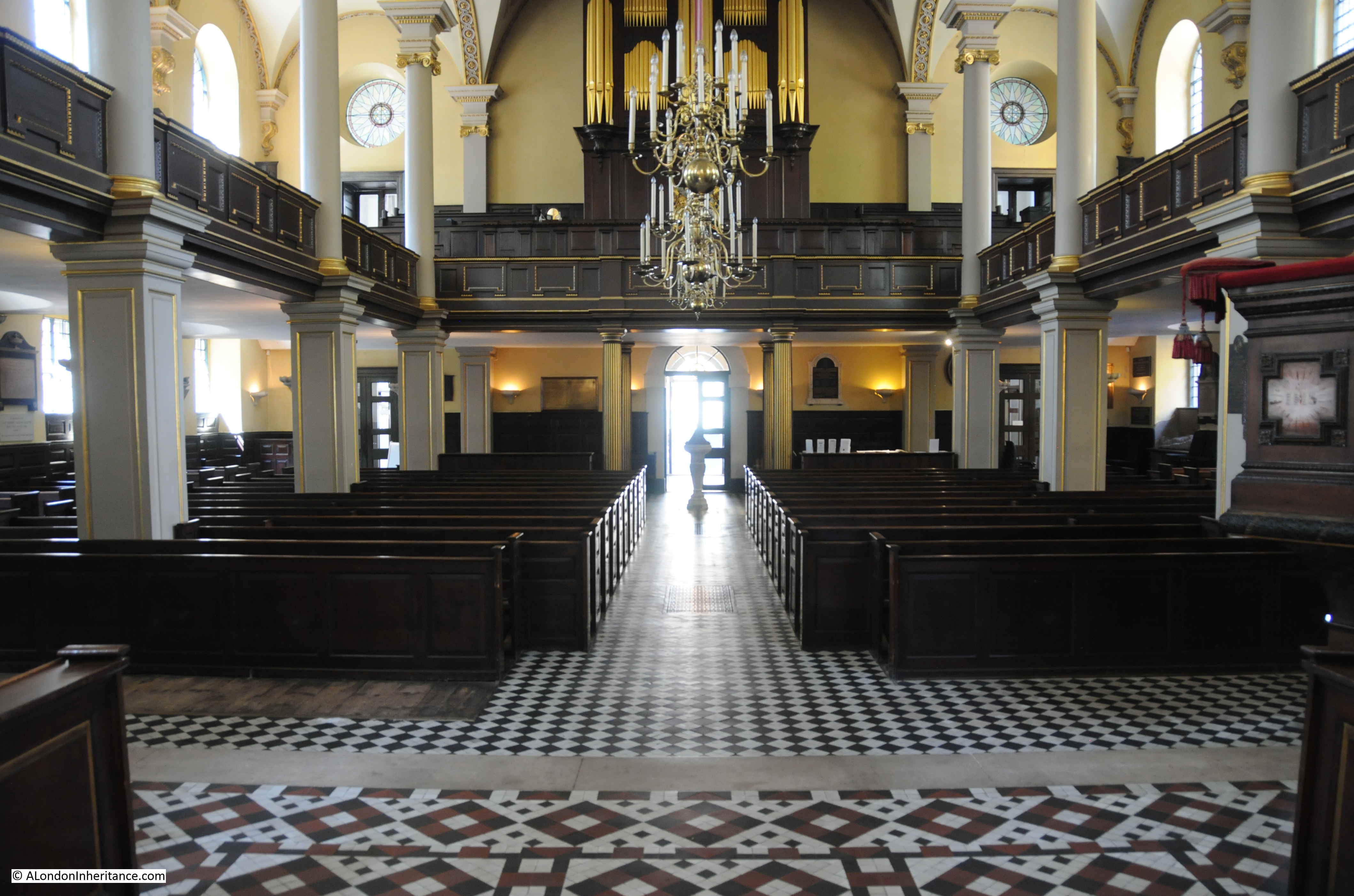
This 17th century church was in a very poor state 100 years later, and was demolished to make way for the present church which was built between 1730 and 1734.  Edward Walford describes the new church as “a large and stately edifice, built entirety of Portland stone, and is vaulted beneath. The steeple, which rises to a height of about 160 feet, consists of a rustic pedestal, supporting a range of Doric pilasters; whilst above the clock is an octangular tower, with three-quarter Ionic columns, supporting a balustrade with vases, on which stands the spire., which is also octangular and belted. The interior of the church is bold and effective, the roof is supported by rows of Ionic pillars of Portland stone, and the semicircular-headed windows are mostly filled with coloured glass”.

St Giles in the Fields faces to the west and the main entrance to the church is off Flitcroft Street, a narrow street that leads down from Denmark Street.

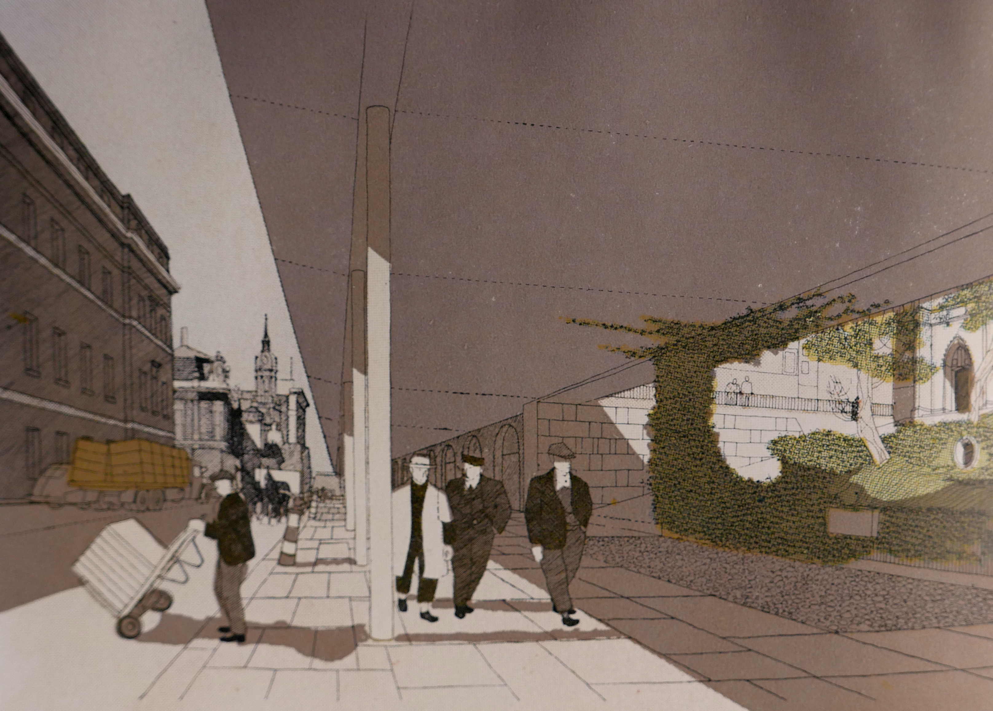
The following photo is from the entrance to the church looking down Flitcroft Street, a view that still retains the mix of architectural styles and narrow streets that once typified the majority of streets in St Giles.

St Giles in the Fields

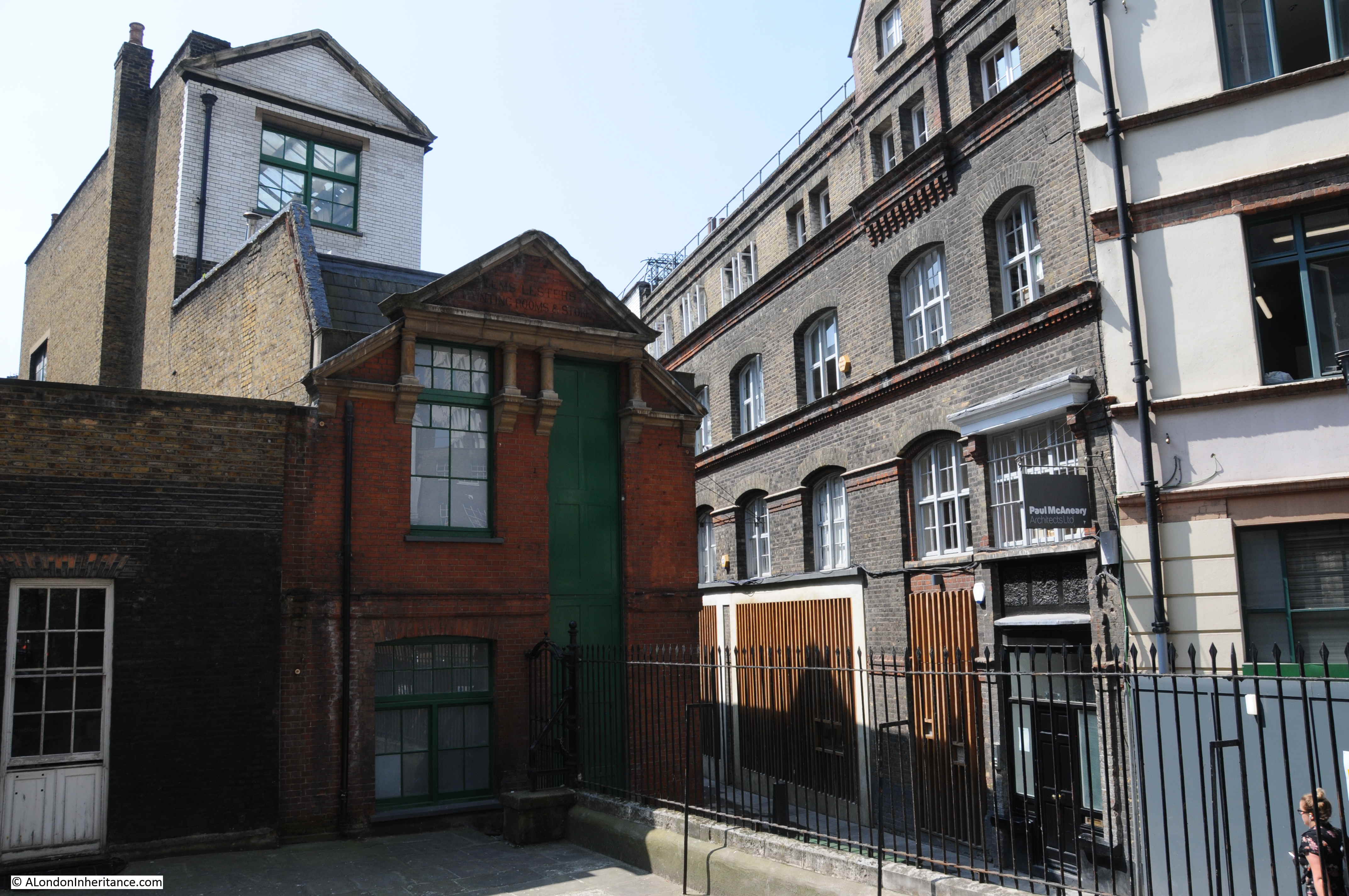
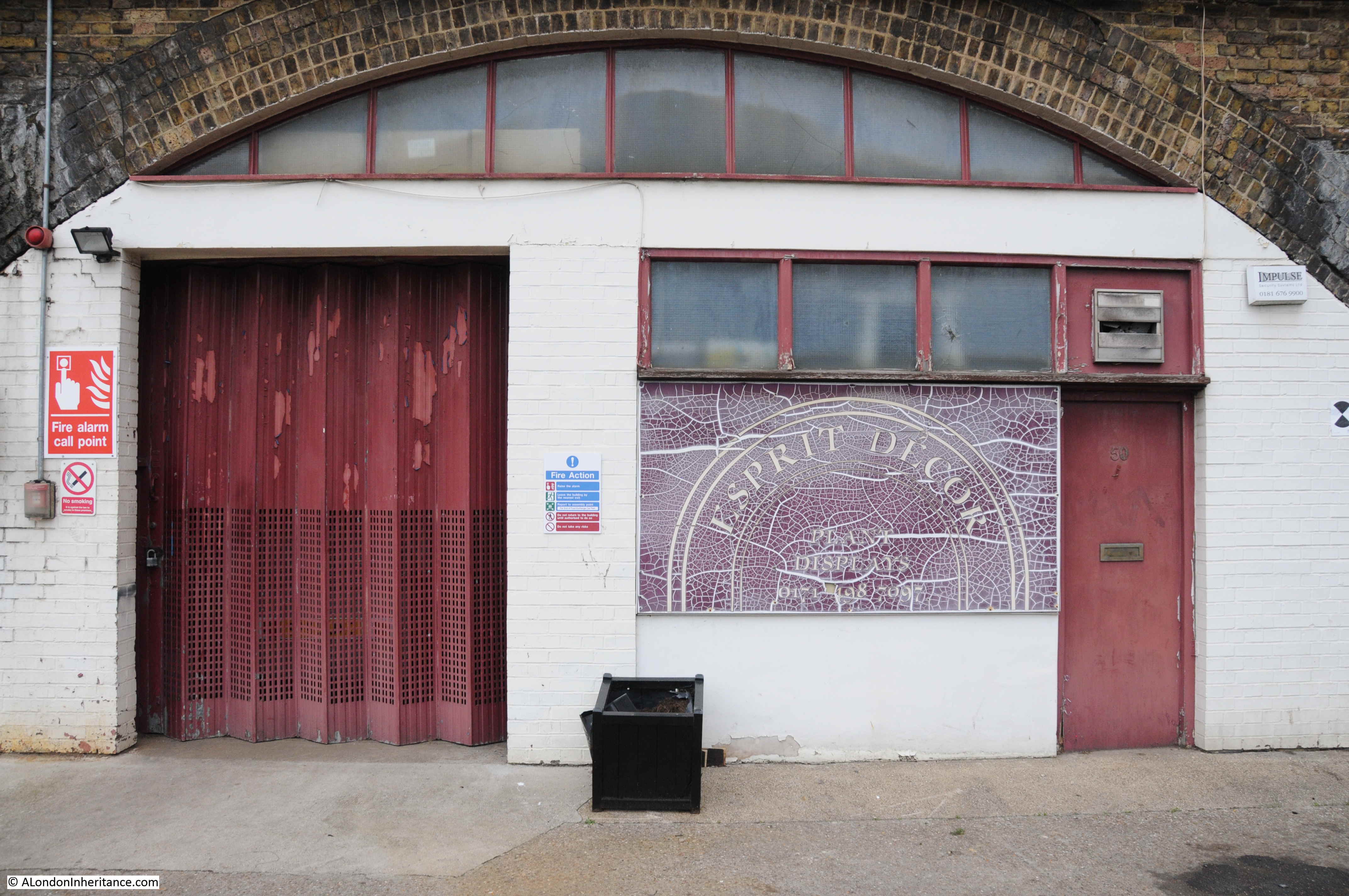
The brick building between Flitcroft Street and the corner of the churchyard has an interesting history. The tall green doors on the side of the building facing the street may provide a clue, as does the name of the building on the brick apex:

St Giles in the Fields

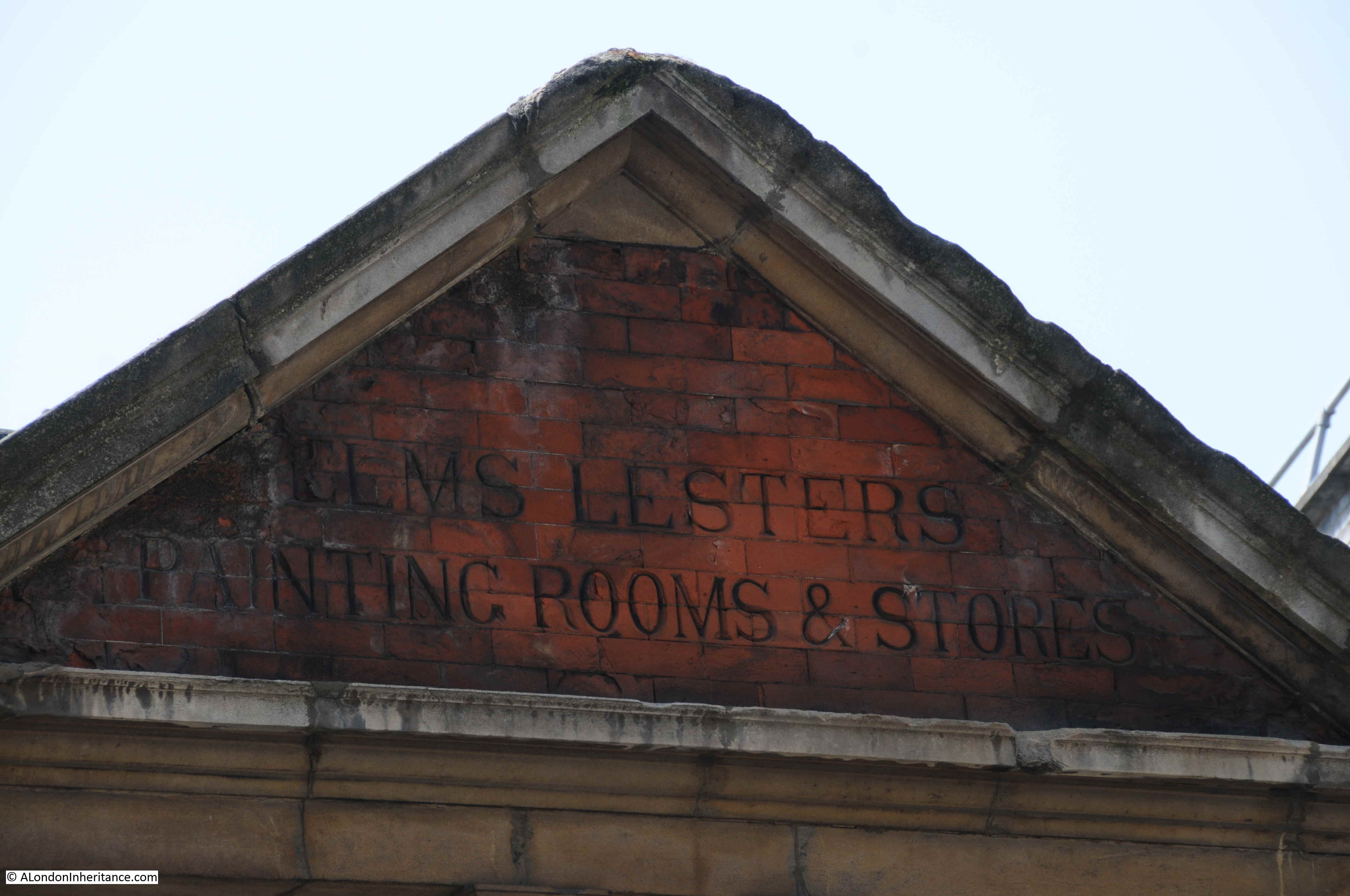
As the wording states, the building was Elms Lesters Painting Rooms & Stores and was used for painting the scenic backdrops used in West End theatres, hence the tall green doors to allow these backdrops to be removed from the building for transport to the theatre.

The main entrance to the church and the associated gateway is from Flitcroft Street which, given the narrowness of the street and St Giles High Street running along the northern boundary of the church, could be considered a strange location.

St Giles in the Fields

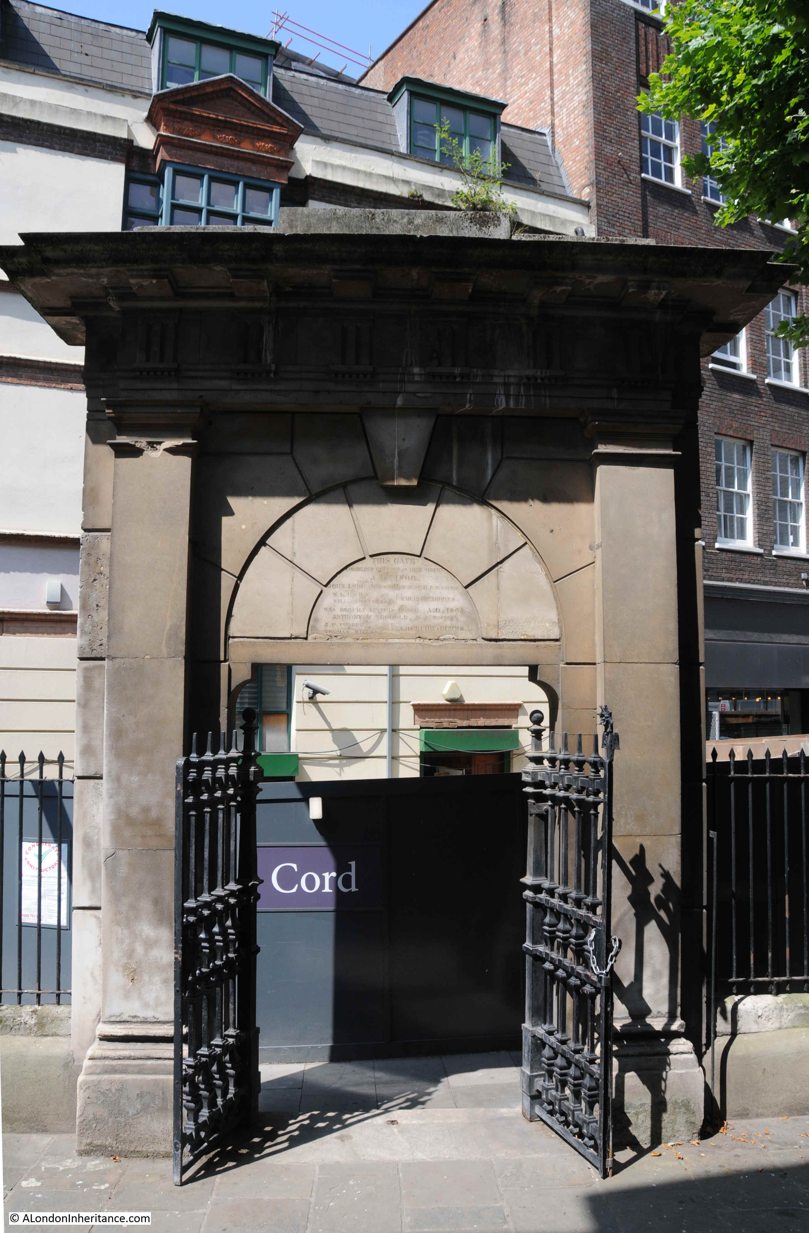
Edward Walford again helps with understanding why the gateway is here “The gate at the entrance of the churchyard which dates from the days of Charles II, is much admired. It is adorned with a bas-relief of the Day of Judgement. It formerly stood on the north side of the churchyard, but in 1865, being unsafe, it was taken down and carefully re-erected opposite the western entrance, where it will command a prominent position towards the new street that is destined sooner or later to be opened from Tottenham Court Road to St Martin’s Lane”.

The bas-relief can still be seen on the arch above the entrance on the side of the gate facing the street. The reference to the new street was to one of the many plans in the 19th century for new streets to be constructed across London to create major through routes, rather than the mix of large streets separated by large blocks of much smaller streets and alleys. The new street referenced by Walford was not built, otherwise Flitcroft Street would look very different today.

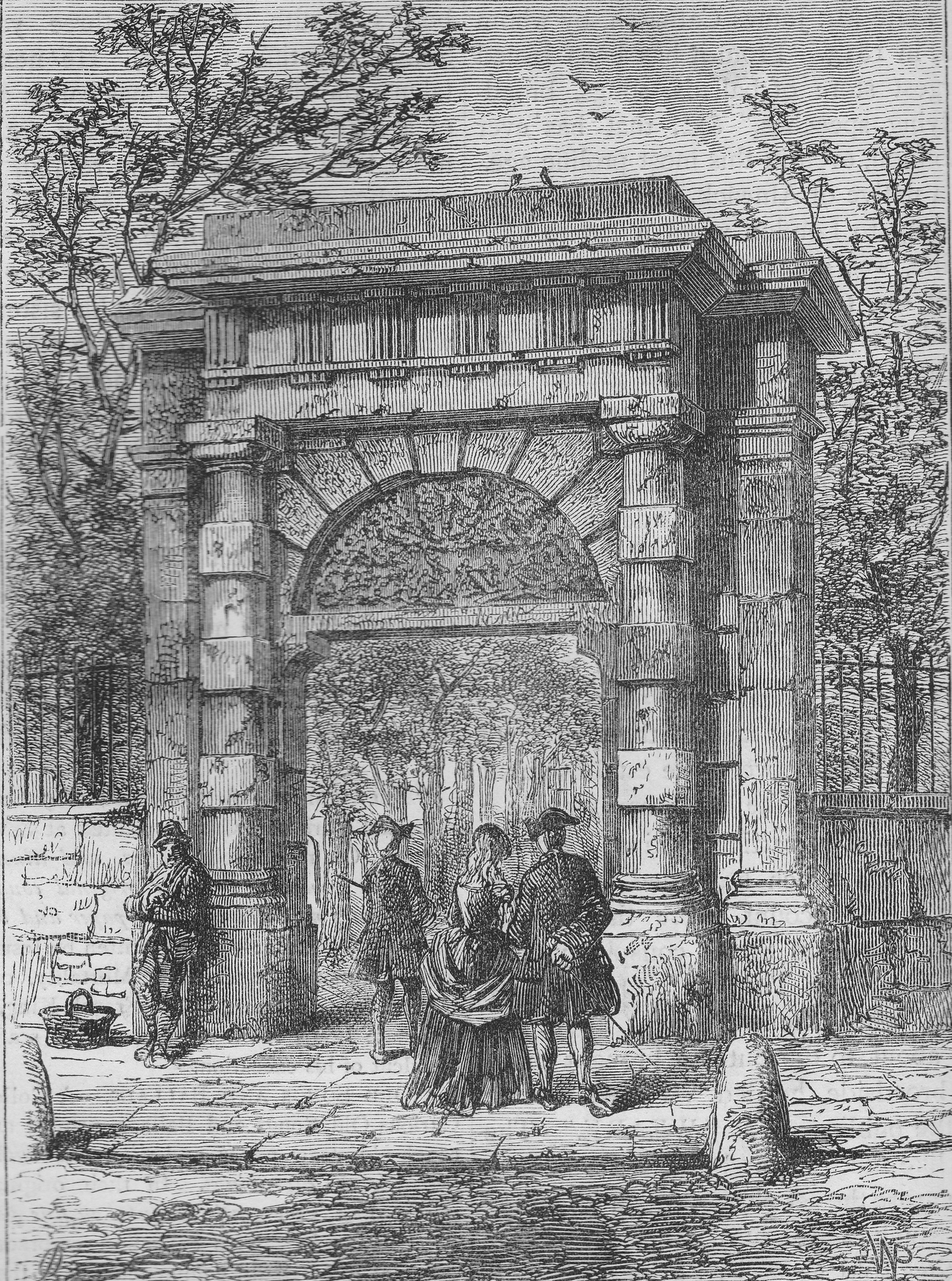
Old and New London included a print of the gate in its original position:

St Giles in the Fields

Edward Walford’s 19th century description of the church is still relevant today:

St Giles in the Fields

There are many monuments within the church, but one of the most interesting is up against the side of the church, with a detailed and well preserved figure of a recumbent woman with an inscription on the stone at the rear of the figure.

St Giles in the Fields

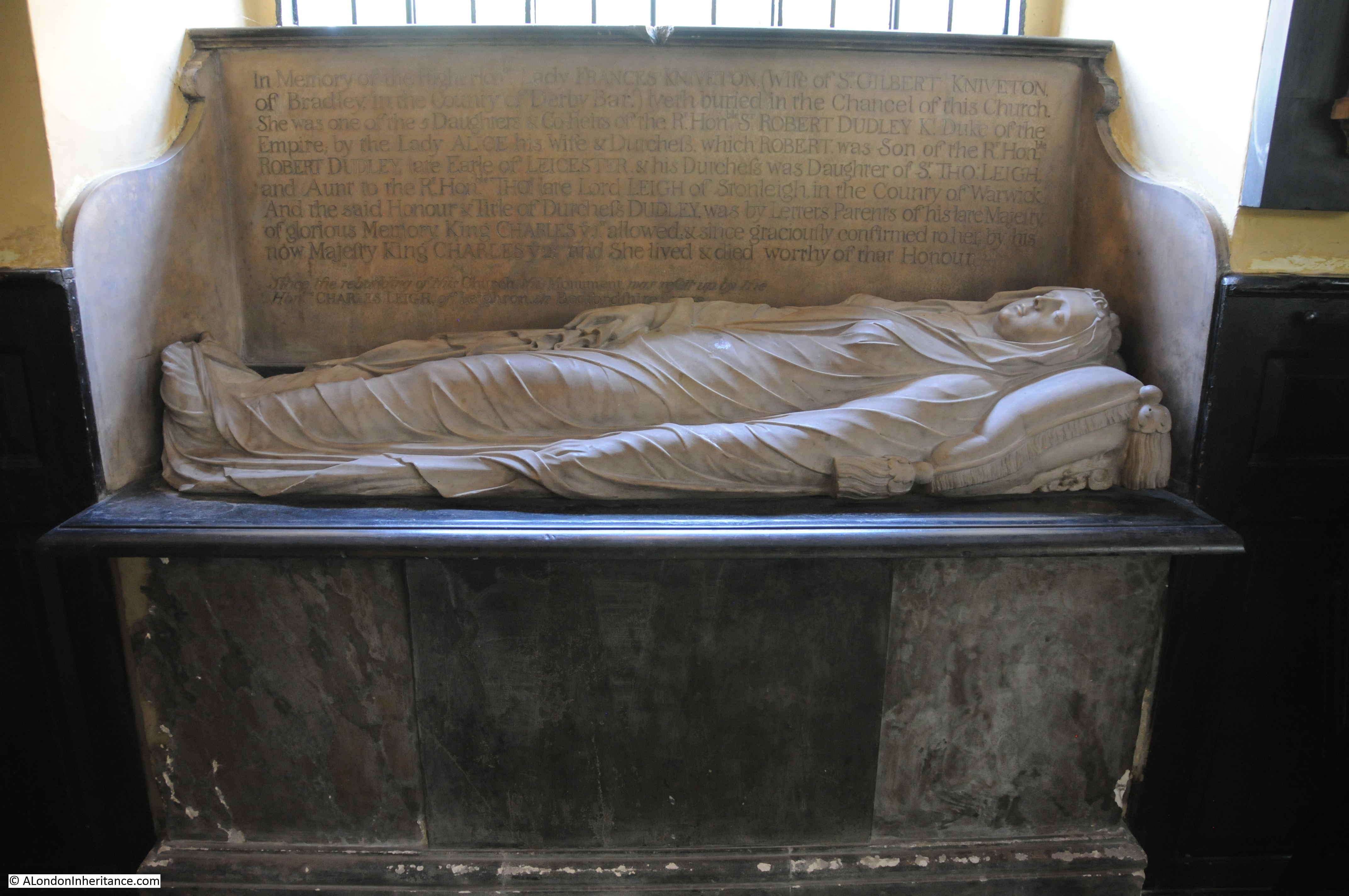
The monument is in memory of Lady Frances Kniveton. She was one of the five daughters of Sir Robert Dudley and his wife Lady Alice. Sir Robert Dudley is an interesting character, however his later treatment of Lady Alice demonstrates that the title of “Right Honourable” is not always appropriate. The illegitimate son of Sir Robert Dudley, the 1st Earl of Leicester, he was an explorer, in the days when the majority of exploration seemed to involve capturing Spanish ships.

He tried to prove that he was the legitimate son of the 1st Earl of Leicester, however the majority of evidence that he produced was not convincing and a judgement handed down in 1605 refused to accept that he was the legitimate son.

Soon after he left the country, heading to Italy with his first cousin once removed, Elizabeth Southwell. They settled in Florence, converted to Catholicism, married and Dudley went on to have 13 children with Elizabeth, in addition to the 5 he left in England with Alice.

Lady Alice was made a Duchess in her own right by Charles 1st. She lived in St Giles and contributed significantly to the church.

The text at the bottom of the inscription explains why the monument was saved from the original church and installed in the 18th century church. Old and New London explains: “This monument was preserved when the church was rebuilt, as a piece of parochial gratitude to one whose benefactions to the parish in which she resided had been both frequent and liberal. Among other matters, she had contributed very largely to the interior decoration of the church, but had the mortification of seeing her gifts condemned as Popish, cast out of the sacred ediface, and sold by order of the hypocritical Puritans.”

There are two pulpits in the church, the traditional church pulpit:

St Giles in the Fields

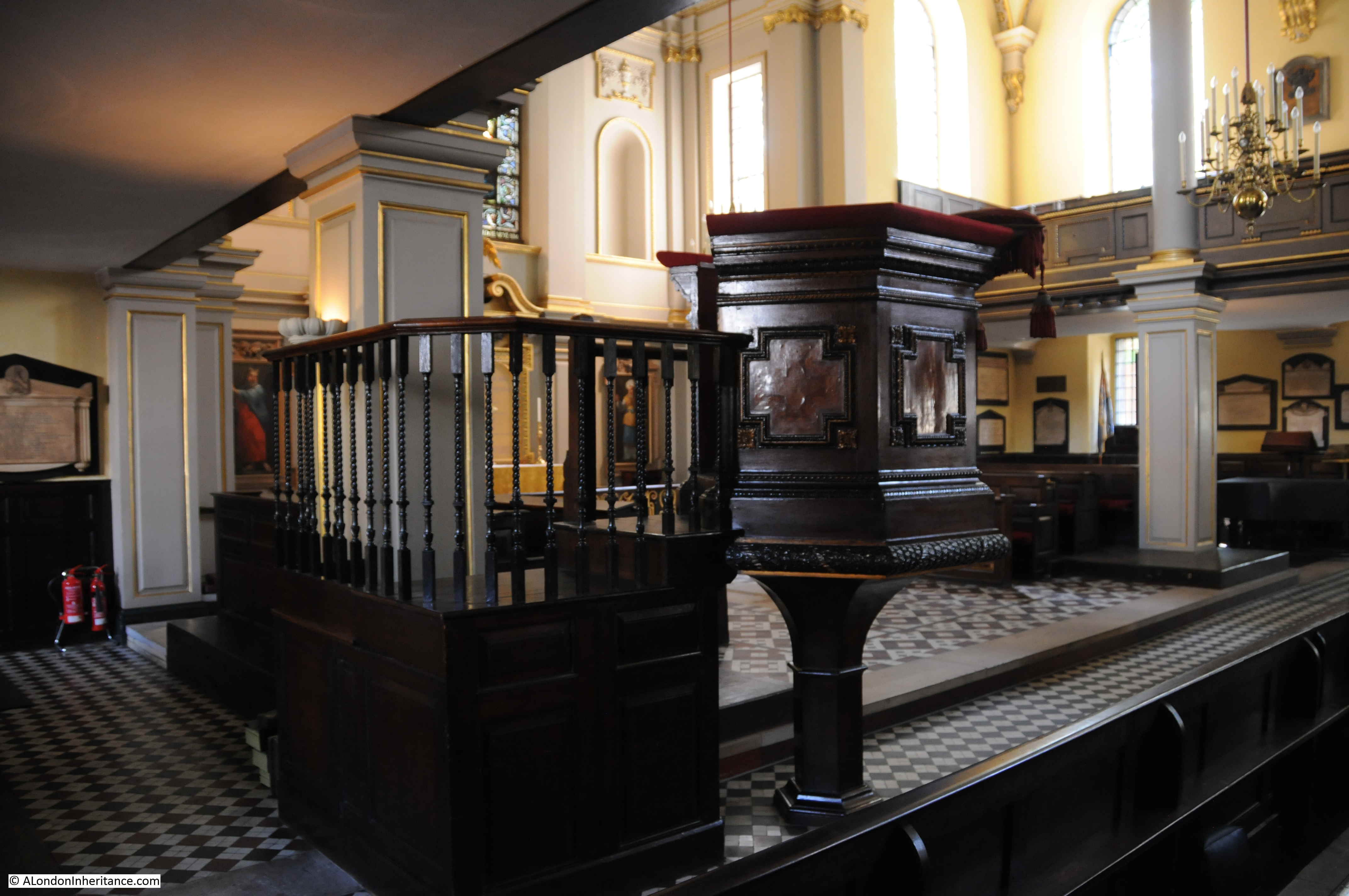
Along with a pulpit that came from the West Street Chapel, John Wesley’s first Methodist chapel in London’s West End (West Street is between Shaftesbury Avenue and Upper St. Martin’ Lane).

St Giles in the Fields

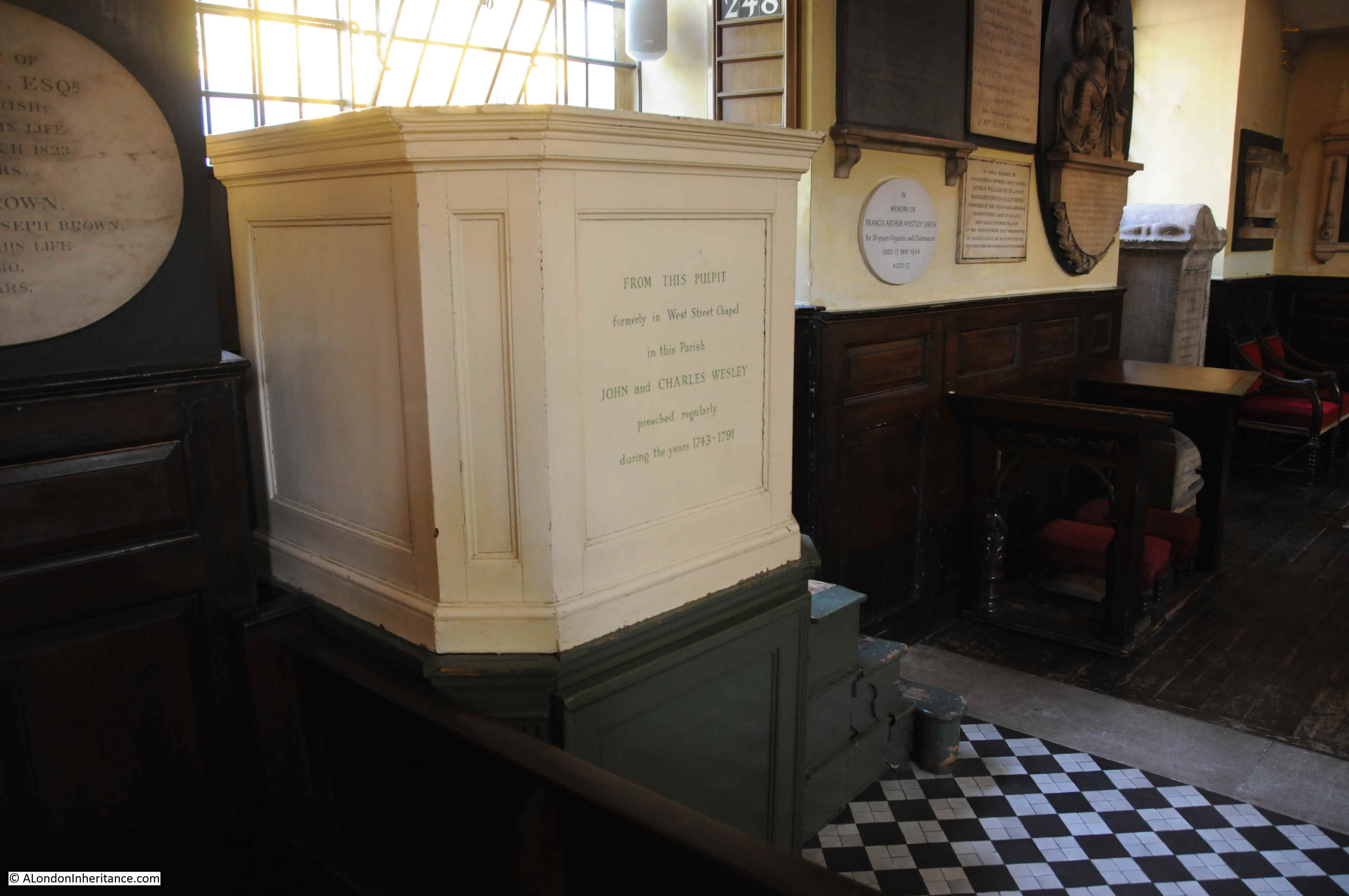
The inscription on the front of the pulpit informs that John and Charles Wesley preached regularly from the pulpit between 1743 and 1791.

There is a rather magnificent model of the church, within the church:

St Giles in the Fields

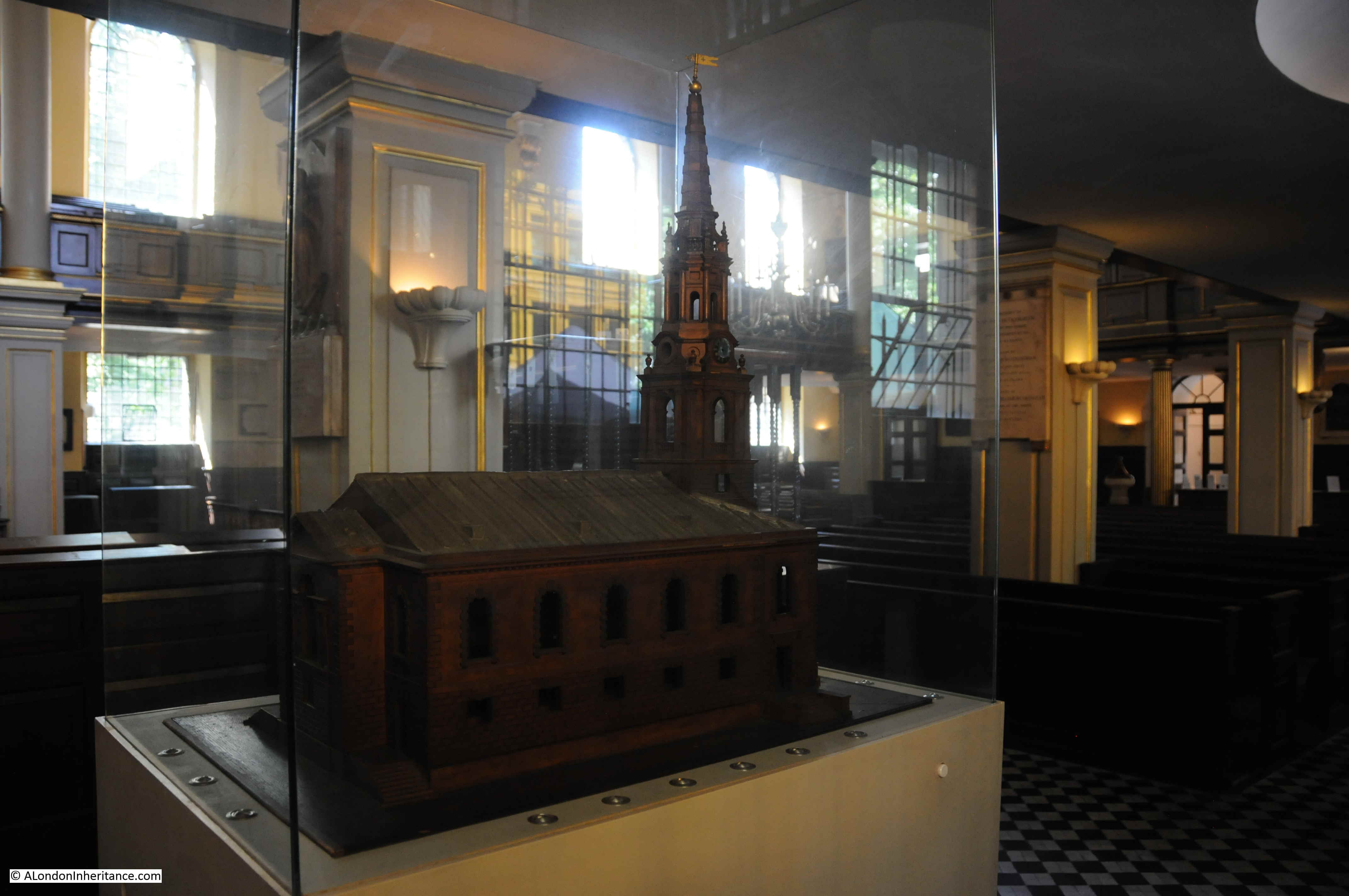
The model was made by Henry Flitcroft, the architect of the church, to demonstrate to parishioners and those funding the construction of the new church, what his design would like like when completed.

The architect’s name also explains the origin of the name of the small street to the west of the church where the main entrance is found – Flitcroft Street.

View looking towards the entrance of the church:

St Giles in the Fields

There are numerous monuments around the church. Members of the East India Company, solicitors from Lincolns Inn Fields, and one of the latest, dating from 1996 is to Cecilius Calvert, the first proprietor of Maryland:

St Giles in the Fields

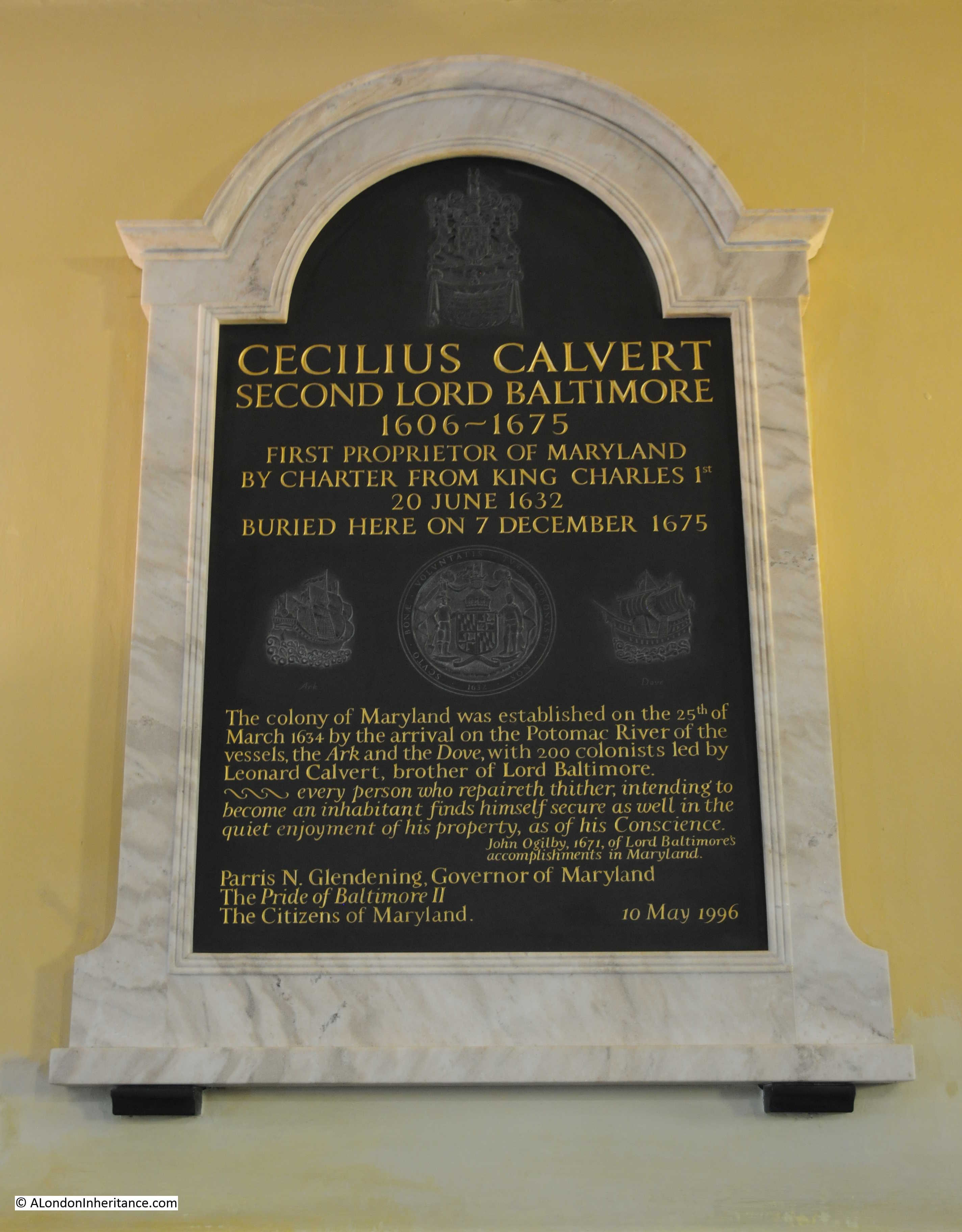
Cecil Calvert was the Second Lord Baltimore (hence the name of the city in Maryland). He had been to the Americas once in 1628 with his father to the newly established colony in Newfoundland, however the colony failed and Cecil returned to England with his father.

The charter for Maryland was granted by Charles 1st to Cecil, however he would never visit his colony. It was overseen by his brother Leonard and later by his son Charles.

The above monument dates from 1996, the following is from 1677:

St Giles in the Fields

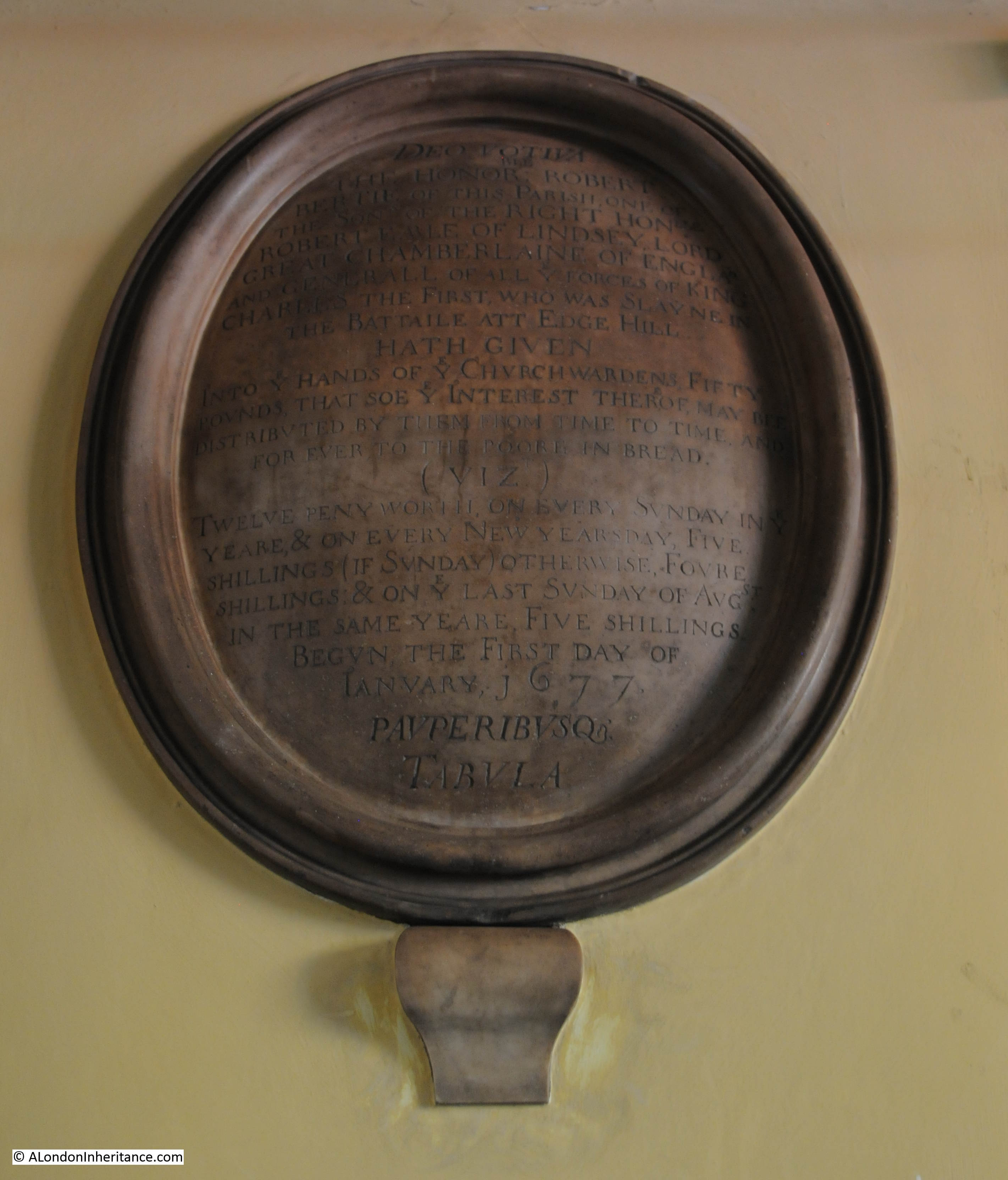
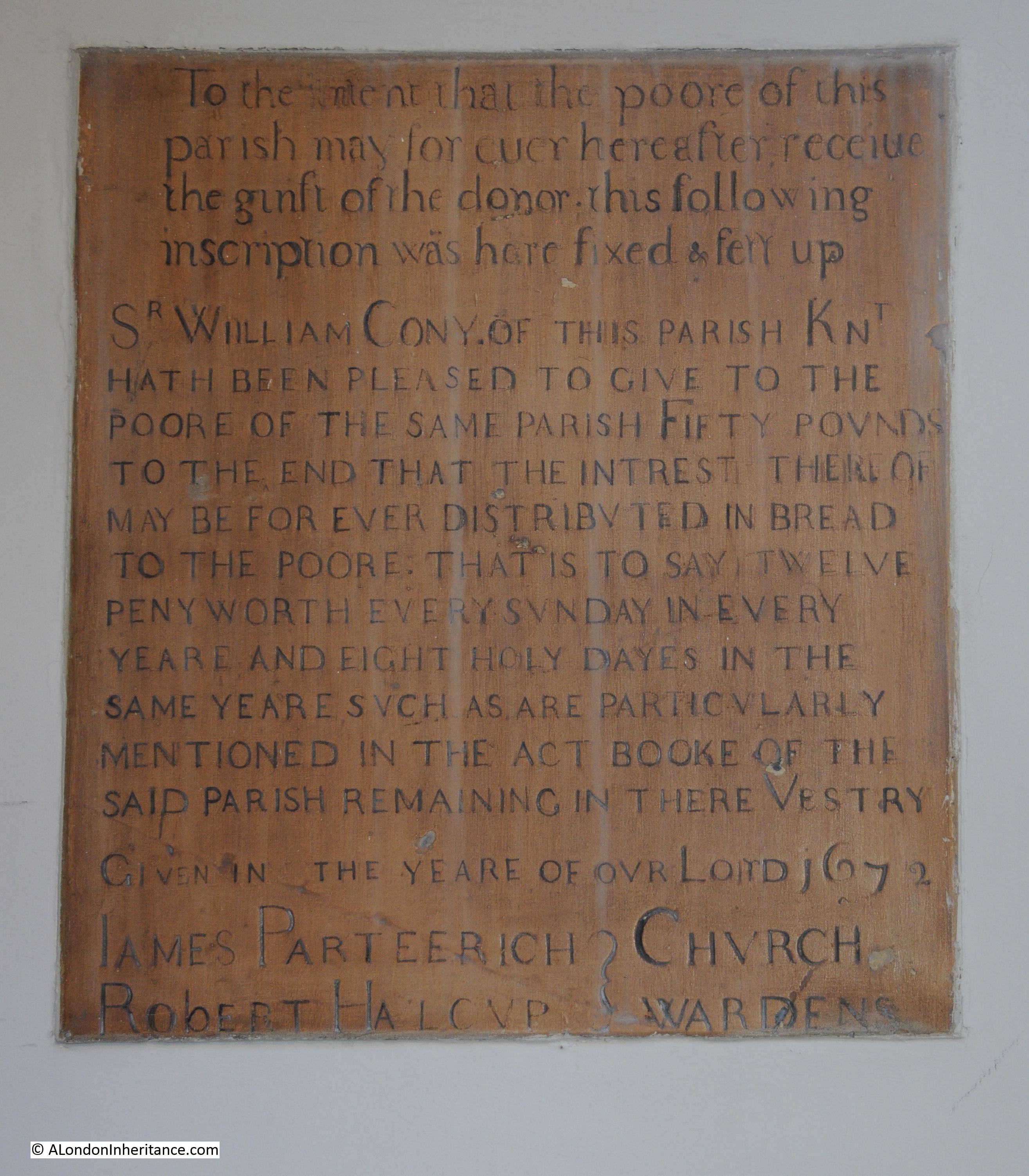
This records the donation of £50 to the church wardens of St Giles in the Fields by Robert Bertie with the intention that the interest from the £50 would be used to buy bread for the poor of the parish “for ever” commencing on the 1st January 1677.

Robert Bertie was the son of another Robert Bertie, the Earl of Lindsey who was Lord Great Chamberlain at the time of the English Civil War. Robert Bertie was a Royalist supporter and General in Chief of the Royalist forces at the Battle of Edgehill. He disagreed on the military tactics for the battle with the much younger and inexperienced Prince Rupert who led the cavalry forces. Charles 1st eventually supported Prince Rupert’s strategy, Robert Bertie resigned his position and went to fight with his own supporters. he was badly wounded and died soon after the battle.

The Civil War and Battle of Edgehill features in another monument. the following erected in 1736 by the family of John Belasyse, 1st Baron Belasyse.

St Giles in the Fields

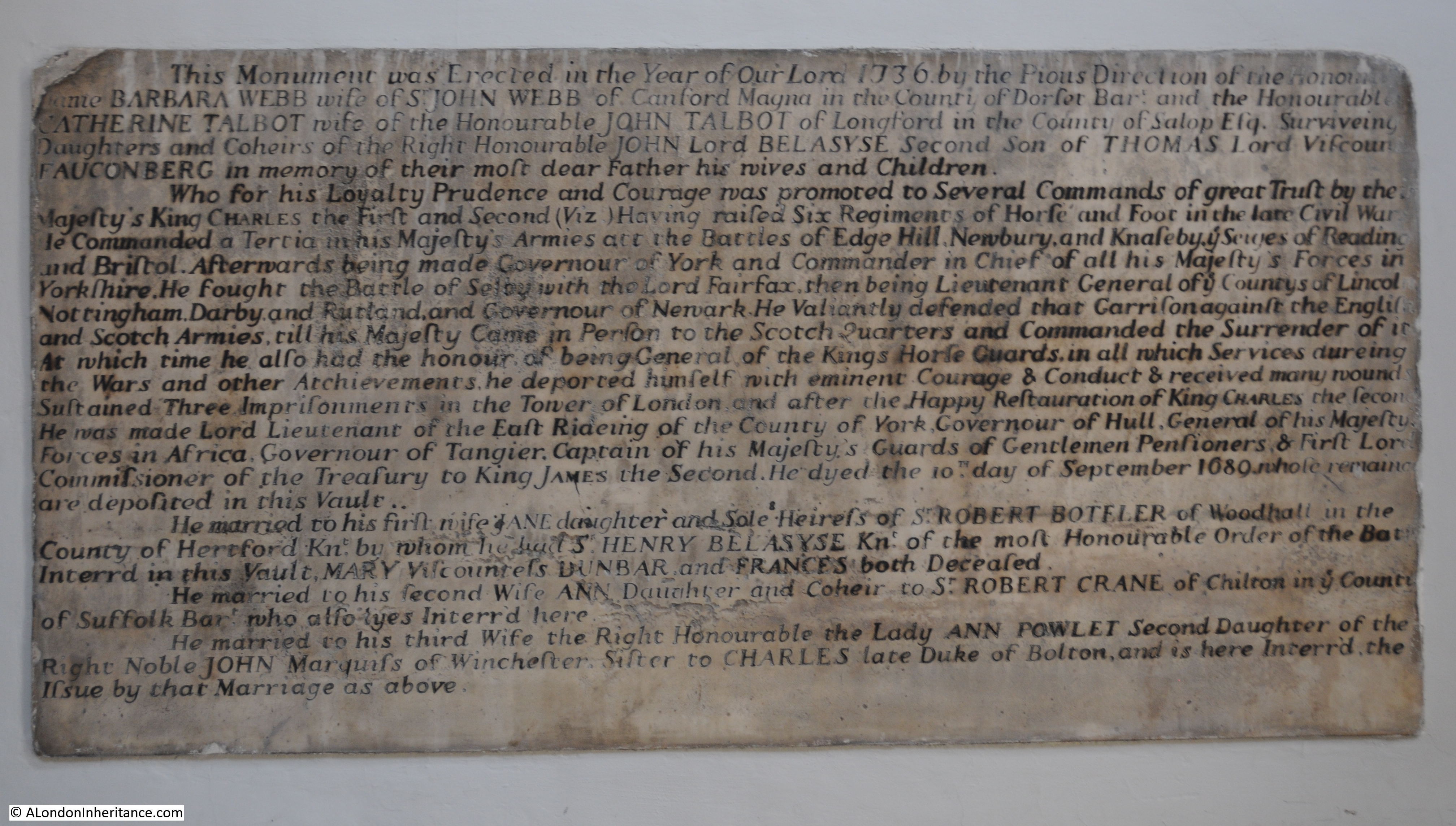
John Belasyse also fought at the Battle of Edgehill, which he survived, along with many of the following battles and sieges of the Civil War. He went underground during the “Commonwealth of England” and following the restoration, Charles II gave Belasyse many senior appointments and positions of power.

An unusual plaque for the interior of a church is the blue plaque for George Odger:

St Giles in the Fields

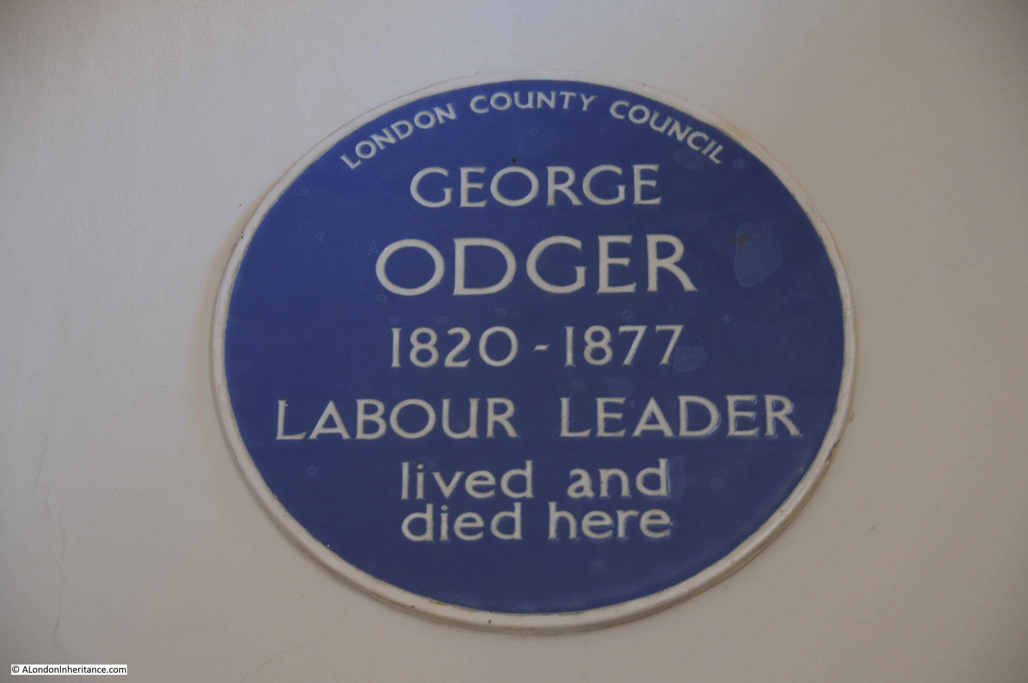
George Odger lived nearby at 18 St Giles High Street. He was a 19th century trade union leader, active in the London Trades Council and later the Trades Union Congress. The blue plaque was installed on the house in the 1950s and moved to the church when the house was demolished in the 1970s.

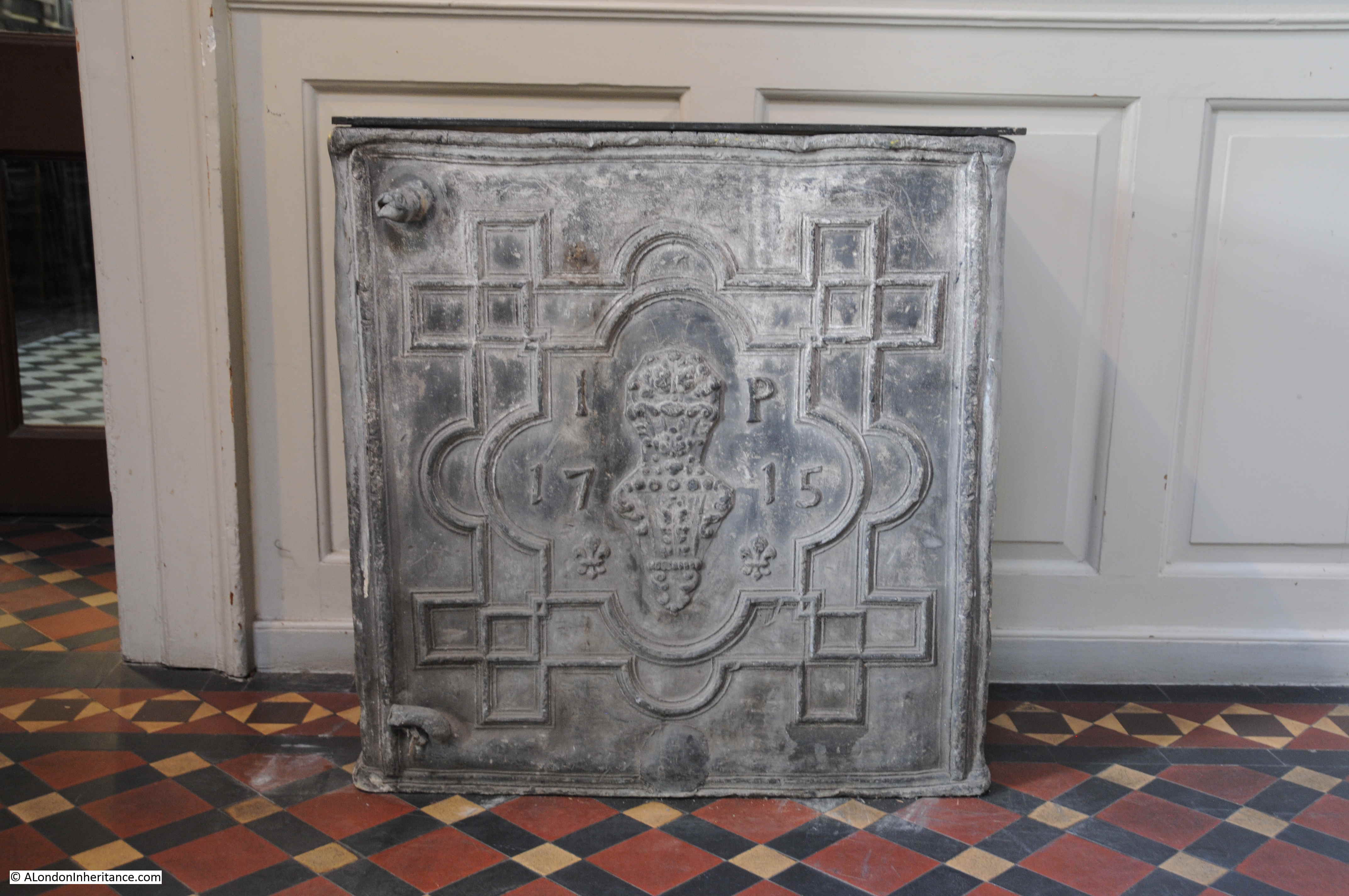
18th century lead cistern:

St Giles in the Fields

Another donation of £50 for the purchase of bread for the poor:

St Giles in the Fields

Heading back outside the church, turning left from the main entrance takes you round to the large graveyard to the south of St Giles in the Fields.St Giles in the Fields

View over the graveyard, which as with the majority of city churches, has been cleared of gravestones.

St Giles in the Fields

The rear of St Giles in the Fields somewhat obscured by trees.

St Giles in the Fields

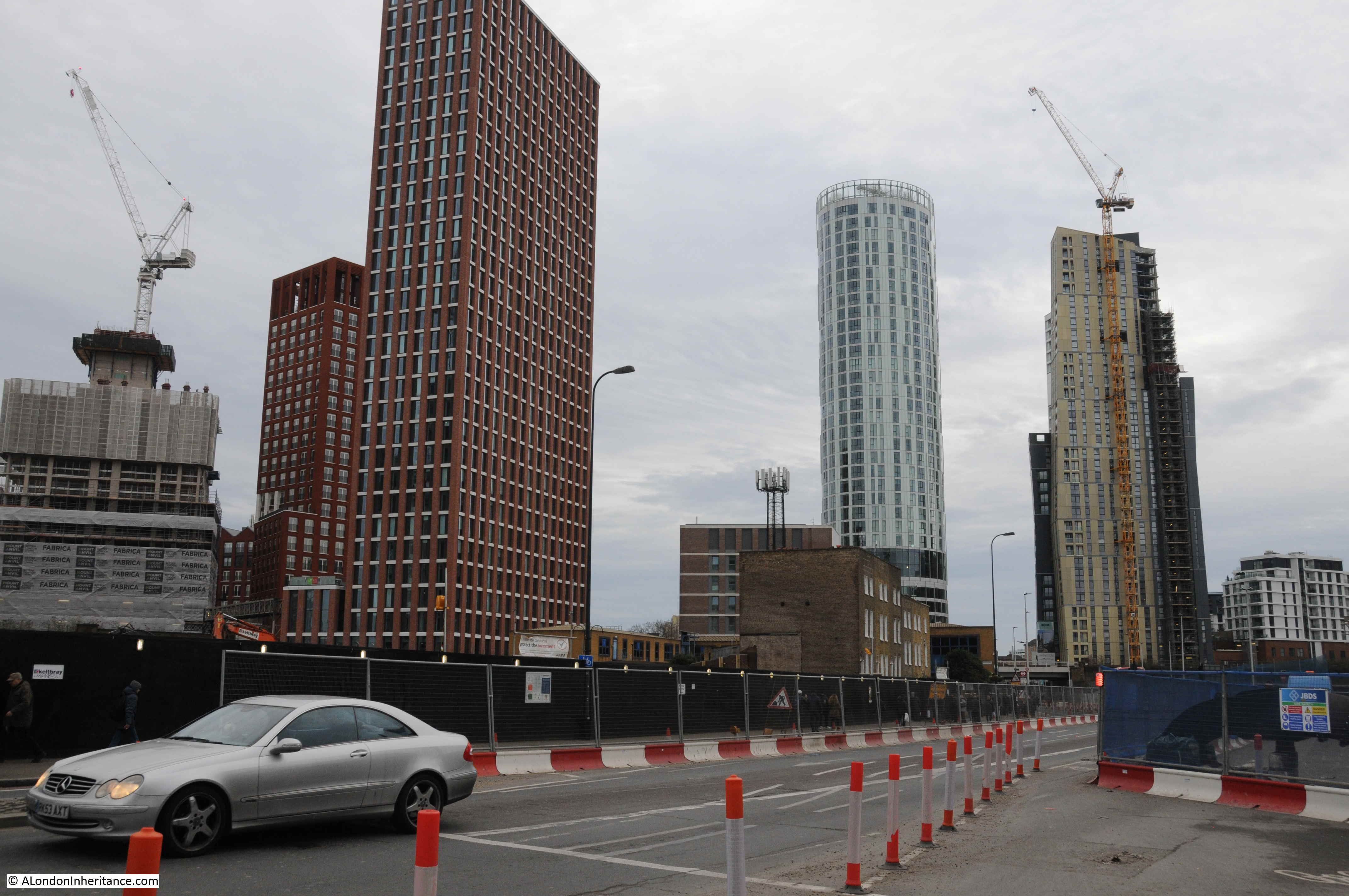
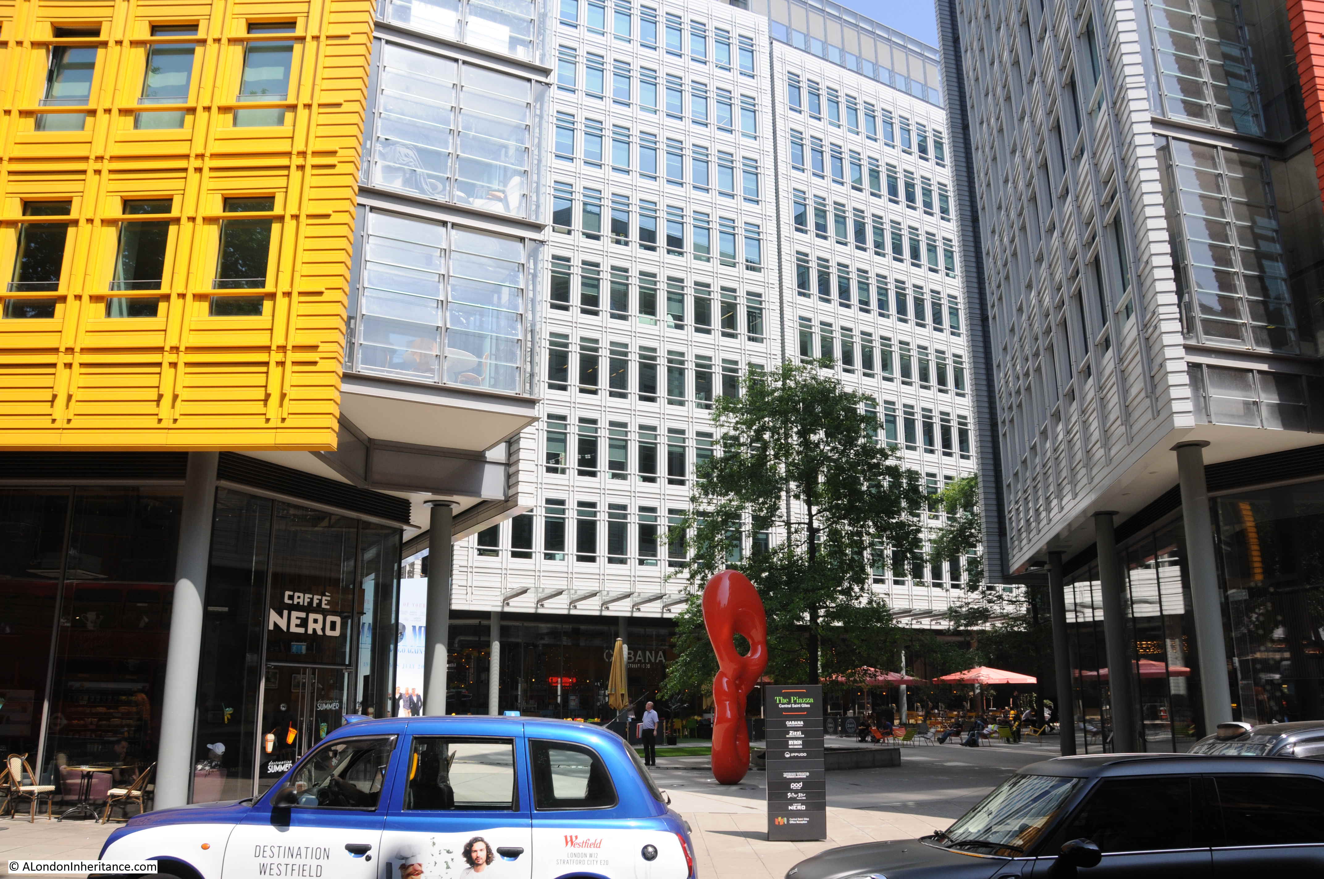
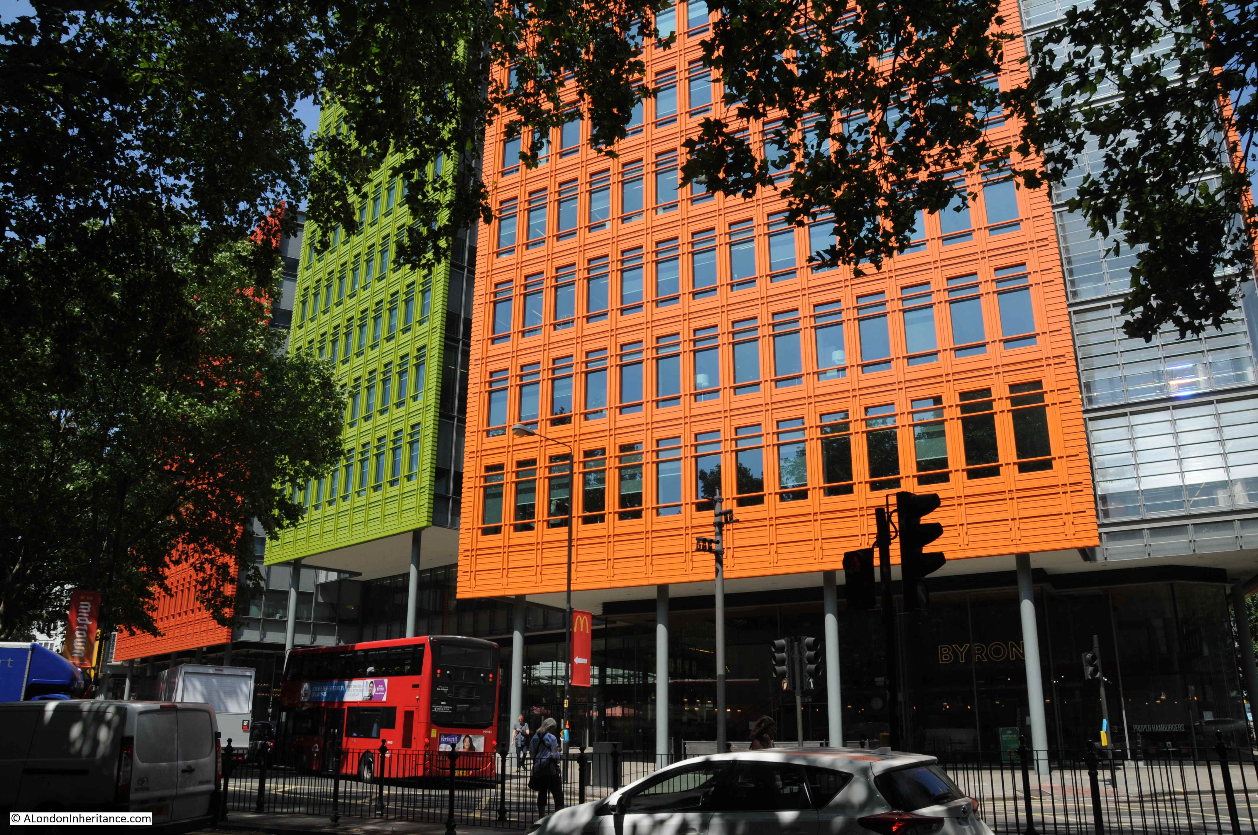
St Giles in the Fields now looks on an area that will change beyond recognition over the coming years. Change has already started and the arrival of Crossrail at Tottenham Court Road will accelerate that change.

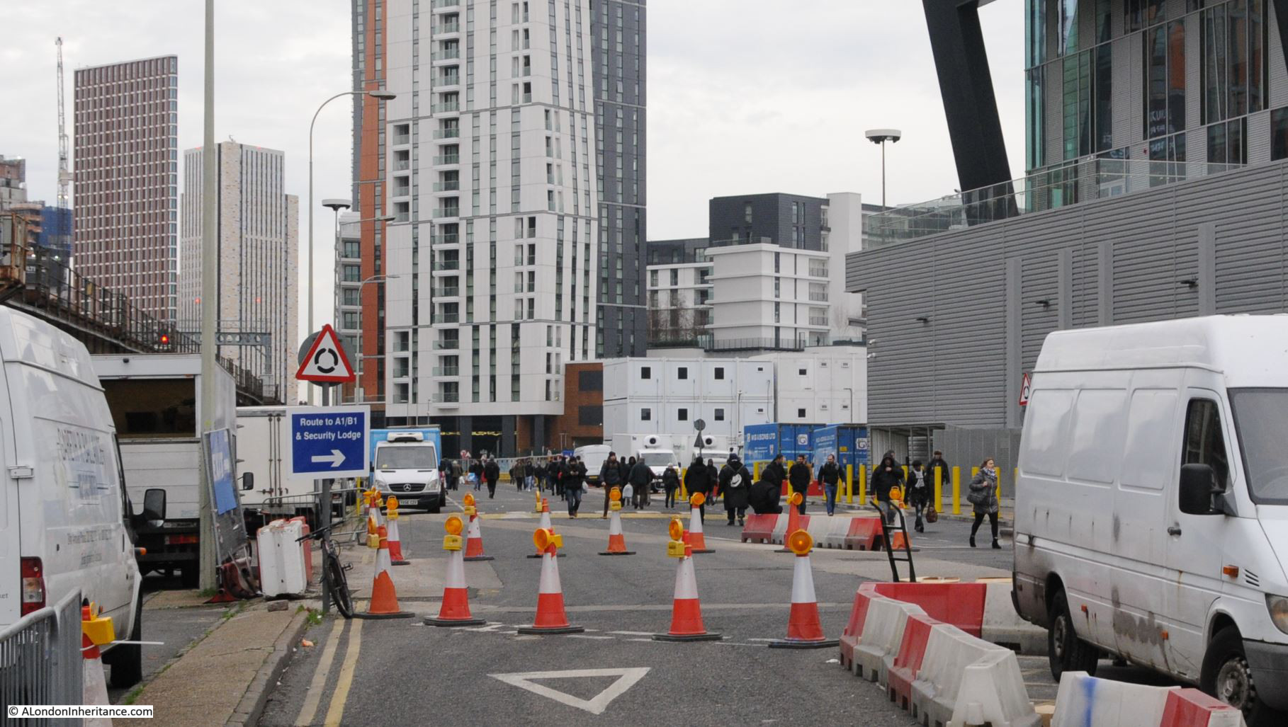
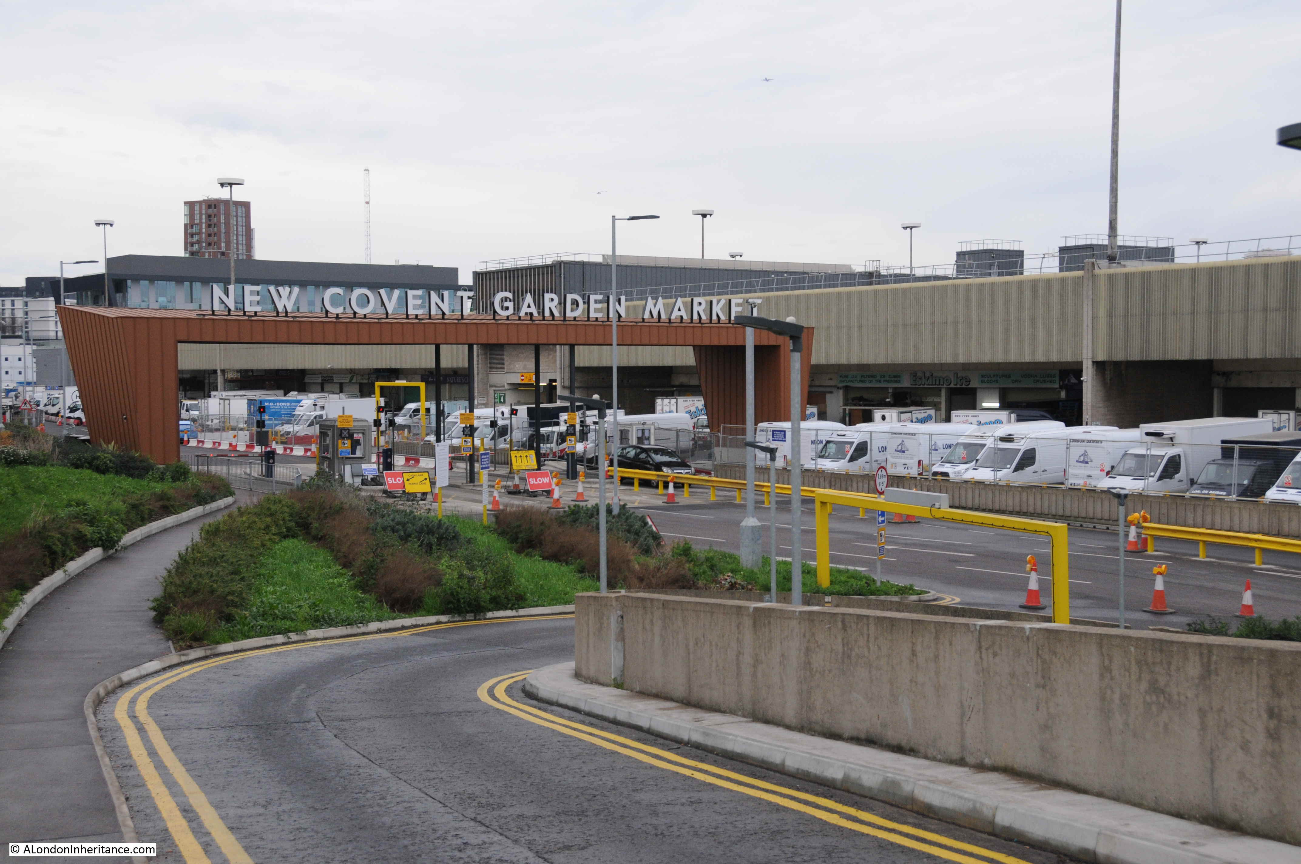
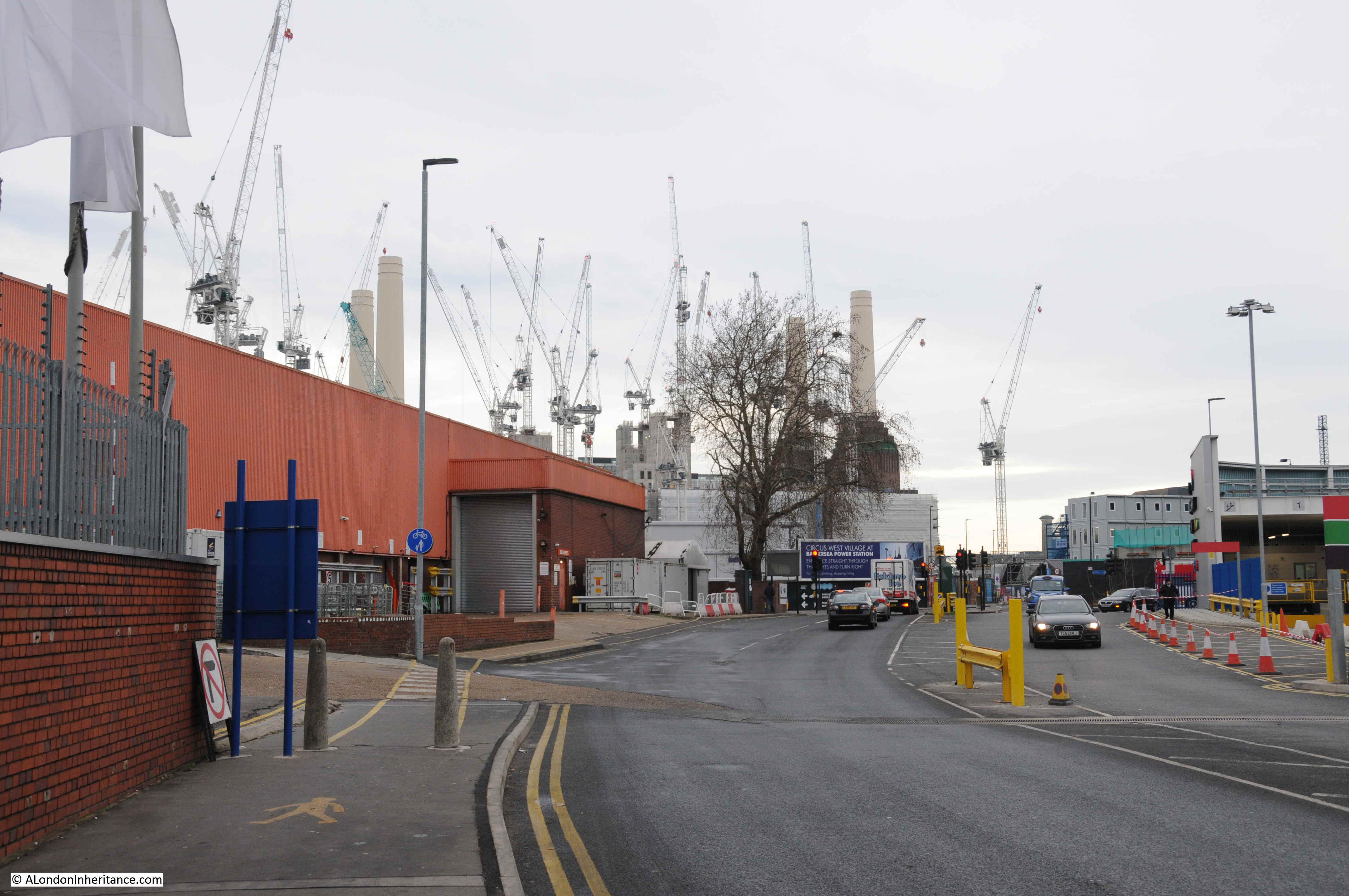
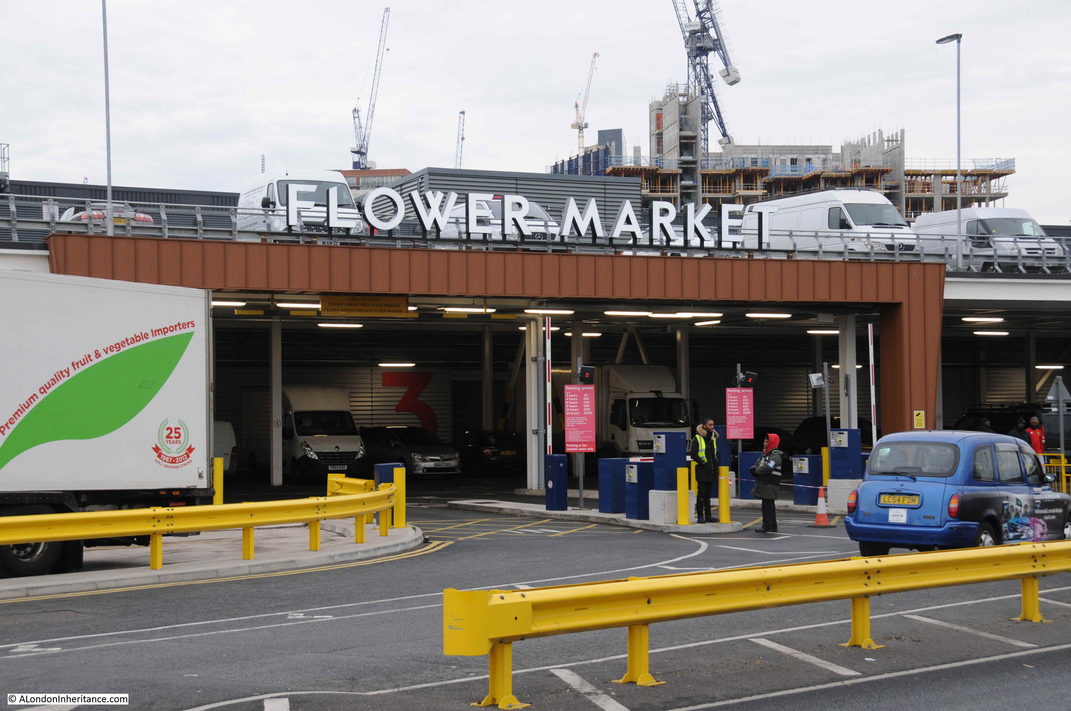
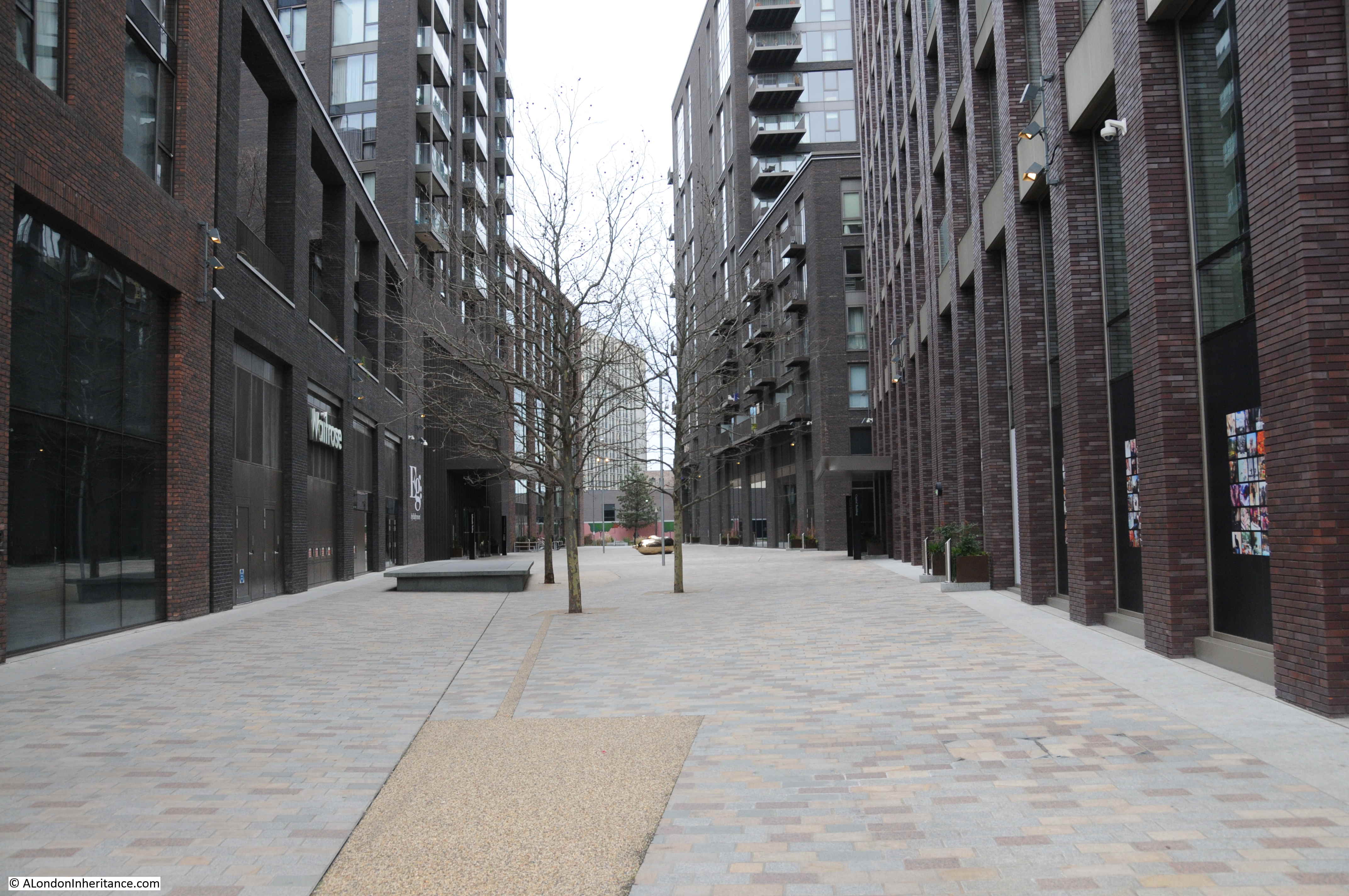
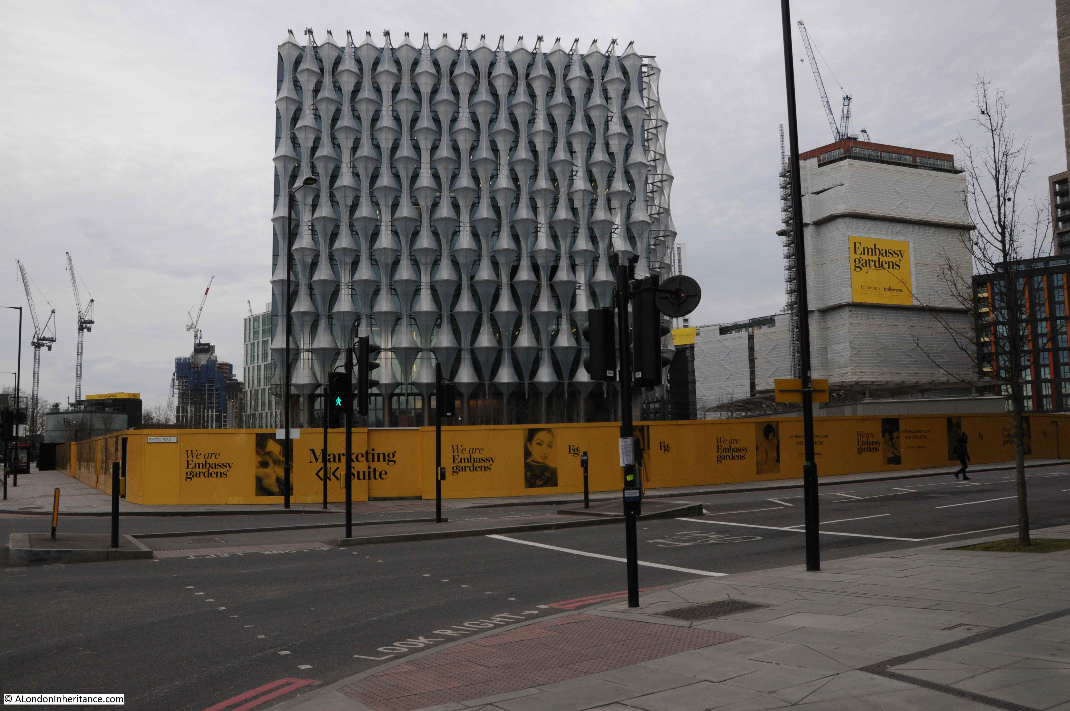
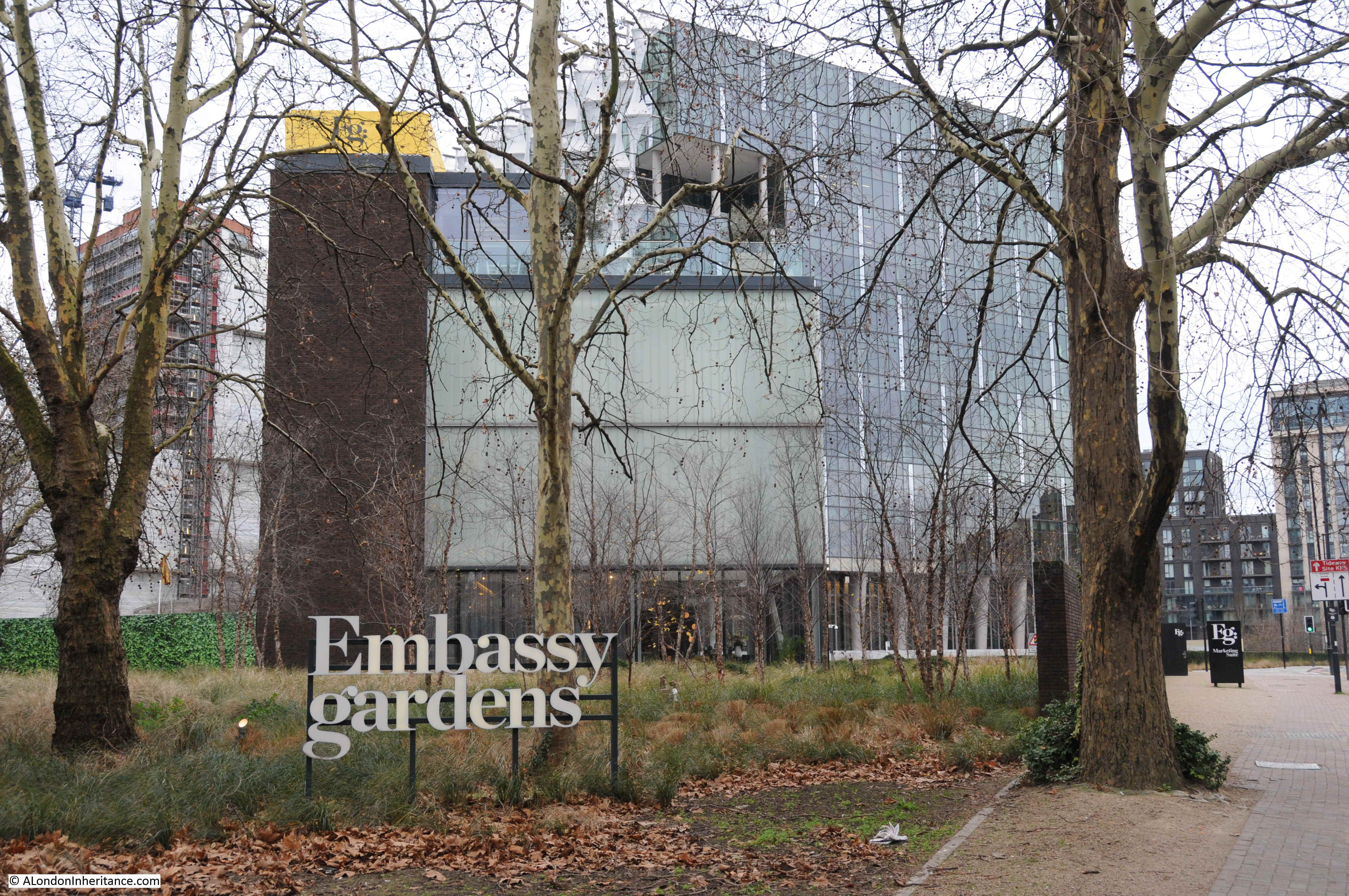
These are some of the new developments around St Giles:

St Giles in the Fields

St Giles in the Fields

St Giles in the Fields

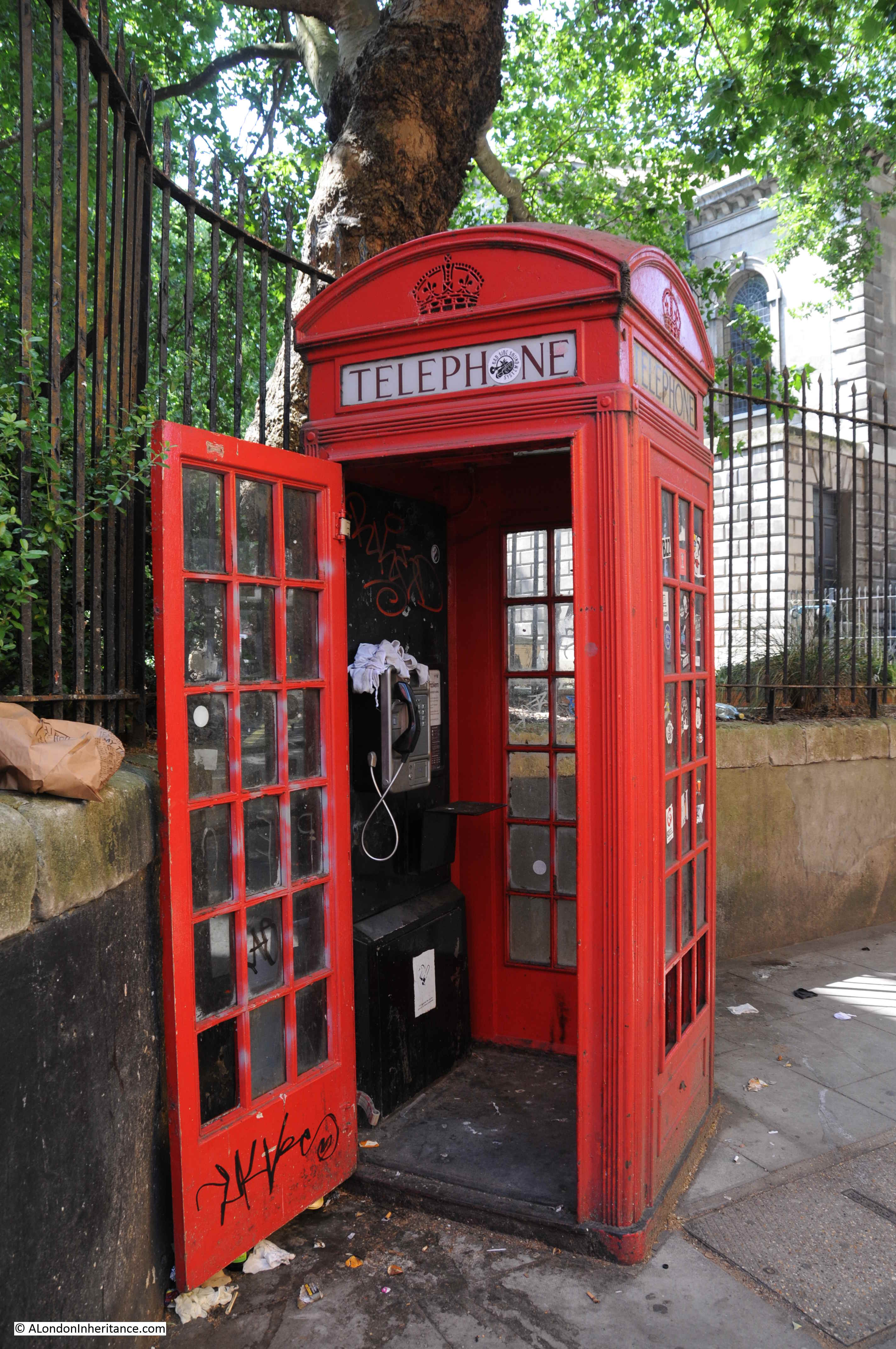
I suspect this relic, just outside the church, from not that many years ago, will not last long in the new St Giles:

St Giles in the Fields

Again, a very brief look at the history of one building, only touching on a few points from a very long history.

St Giles has a fascinating history which I will explore further in the future, but walking around the streets today feels very different to when I started going out in London.

alondoninheritance.com

A Sunday Morning Walk In Nine Elms

In photographing London, I try to get to places before they change, which is not an easy task given the rate of change in London. One area undergoing significant change is Nine Elms, and indeed the whole arc to the south of the river between Battersea Power Station and Vauxhall. This must be one of the largest construction sites in the country, with demolition of acres of industrial space, to make way for a forest of new apartment towers.

The most well known new occupant of this area is the United States Embassy, however the majority of the area is still a construction site and recent demolition has cleared a new area for development.

I am occasionally on the train between Clapham Junction and Waterloo and the train provides a perfect view of Nine Elms. I have been planning to take a walk around the area, but the view a couple of weeks ago prompted me to walk Nine Elms sooner rather than later.

The view from the train was the usual acres of cleared space ready for new construction, along with a range of new apartment towers in various stages of completion, however what caught my eye was at the edge of one of the recent blocks of demolition, a row of what looked to be early 19th century houses were visible. An unexpected sight given that this area was previously occupied by light industry, numerous courier companies, car repair businesses, markets etc.

Last Sunday I had a couple of hours spare in the morning. so I headed to Vauxhall to take a quick walk around Nine Elms, to find the houses I could see from the train. I also found hundreds of people making their way from Vauxhall to Nine Elms wrapped up against the cold of a January morning.

Walking across Vauxhall Bridge, I headed along Wandsworth Road to find the houses I had seen from the train. I have marked my full route around Nine Elms on the following map.

Nine Elms

Maps  © OpenStreetMap contributors. 

I have also added the times each photograph was taken to record a January Sunday morning in Nine Elms.

09:43

I found the houses I was looking for a short distance along the Wandswoth Road, just before the junction with Miles Street. A terrace of six houses with three taller on the left and three shorter on the right.

Nine Elms

Of the six houses, a couple look as if they have been cleaned whilst the house on the far right looks rather strange when compared with the other five, one window per storey rather than two. They currently appear to be providing office space for activities associated with the redevelopment of the area.

Although Nine Elms may be considered a rather unattractive area, it has a fascinating history and has been a key location in the development of the railway system to the south of London.

The 1895 Ordnance Survey map provides a good overview of the area following the first wave of development, and also locates the houses that still stand on the Wandsworth Road.

The following extract from the map shows the railway running into Waterloo Station towards the top right of the map. The area between the railway viaduct into Waterloo and the river has a considerable amount of railway infrastructure, including the Nine Elms Depot, however there are also pockets of housing with an oval shaped area between Wandsworth Road and the viaduct and it is here that we can find the six houses.

Nine Elms

Credit: ‘Reproduced with the permission of the National Library of Scotland’ 

I have circled the six houses on the map, at the junction of Miles Street and Wandsworth Road. They are almost the only survivors from the nineteenth century, and it is surprising that these houses have lasted through successive waves of redevelopment.

The following map shows roughly the same area today as the 1895 map, again I have marked the location of the six houses.

Nine Elms

There is so much history in this area. In the first decades of the 19th century, various schemes were looked at to try and speed up the transport of goods and people arriving by sea into London, as from the Atlantic, the route along the south coast then along the Thames added a number of days and were dependent on weather and tide. One scheme considered the construction of a canal from Portsmouth to London, but in 1831 initial plans were made for a railway from Southampton to London, with the London terminus at Nine Elms.

Construction of the railway from Nine Elms to Southampton started with the route to Woking Common in 1838. In 1846, a train pulled by an engine named “The Elk” ran from Southampton to Nine Elms in 93 minutes. By comparison, an on-time journey today takes around 80 minutes, so not a significant difference (although there is no mention of the number of intermediate stops for “The Elk”).

Nine Elms closed as a passenger station ten years later when the viaduct into Waterloo was built and the London terminus of the railway moved to the first Waterloo Station. Nine Elms then provided space for a Locomotive Works, which closed in 1909 when the works moved to Eastleigh in Hampshire. Nine Elms also provided space for a large Goods Yard and this continued in operation until 1968.

This photo from 1938 shows the scale of the railway sheds and goods yard at Nine Elms.

Nine Elms

This post is already too long, so I will leave the history of the railways in Nine Elms for another time, and continue walking.

09:44

There was a continuous stream of people walking along Wandsworth Road, and just to the left of the six houses, one of the illegal betting scams normally seen on Westminster Bridge was in action, looking to take money from those streaming past – and probably those less able to manage the inevitable loss.

Nine Elms

This is obviously a problem in the area as there are signs up along the street advising people not to participate in these activities.

I walked past the houses and tuned into Miles Street and walked down to take a look at the rear of the buildings.

09:45

Nine Elms

This explained why one of the end houses looked so different. The view from the back shows that the end house appears to be a new build. The other houses in the terrace look original from the rear.

Hoardings lined the edge of Miles Street, hiding the areas of demolition that had opened up the view of these houses from the railway. There were a couple of gates where it was possible to peer through.

09:46

Nine Elms

The above photo is looking through a gate onto the open space between the six houses (on the immediate left) and the railway viaduct (out of view on the right). Vauxhall is in the distance and only part of the space is visible, there is more to the right. The demolition of the buildings in this area opened up the view of the six houses from the railway.

09:47

Nine Elms

The above view is from the point where Miles Street meets the railway viaduct. The large open space is behind the hoardings on the right and the six houses can be seen in the distance.

09:47

Just before the point where Miles Street passes under the viaduct there is a street running towards Vauxhall. The following photo shows this street and also highlights one of the problems of walking around this area, so many streets have been closed off for construction. This is happening so rapidly that online maps such as Google and OpenStreetmap are not up to date with changes in the area.

Nine Elms

The above view is looking along the viaduct towards Vauxhall and Waterloo. Looking in the opposite direction and there are new buildings and a walkway alongside the viaduct – this was the direction that I decided to follow.

09:47

Nine Elms

A newly surfaced walkway runs alongside the viaduct and what appears to be a new student accommodation building on the right.  Further along this walkway is a rather strange survivor from the 19th century.

09:49

At the end of the student accommodation building is this strange wall.

Nine Elms

On the opposite side of the wall is a small electricity substation, so I am not sure if this is the reason why the wall has survived, I can see no other reason. The wall is not at right angles to the viaduct, it is slightly angled. The following is a detailed extract from the 1895 Ordnance Survey map. Miles Street is at the top and the route of the walkway is from Miles Street down, along the edge of the viaduct. Halfway along there is a large building, at an angle to the viaduct. I suspect that the wall is the remains of the uppermost wall of this building, the section where it is joined on to the smaller building at the end of the Laundry.

Nine Elms

No idea why the wall has been retained, however I really do hope that it remains exactly as it is, a shadow of the many buildings that once occupied this area over a century ago.

09:49

Goal on the viaduct:

Nine Elms

The end of the walkway joins Wandsworth Road, which I crossed over to walk along Parry Street. This is a narrow street that heads underneath the viaduct.

09:54

A look back down Parry Street at the continuous stream of people:

Nine Elms

There are a couple of tunnels underneath the viaduct. The majority of people were taking the direct road route, I spotted a narrow entrance and went to take a look at what was intended to be the pedestrian route under the viaduct.

09:55

Nine Elms

I love railway viaducts. They are brilliant examples of Victorian construction, and whilst train passengers pass above, there is a different world of passages and arches underneath.

09:56

Reaching the other side of the viaduct and there are a number of businesses operating in the arches. Espirit Decor:

Nine Elms

09:56

And Sophie Hanna Flowers (a logical location given the flower market which I will soon find).

Nine Elms

09:57

Directly opposite is the Nine Elms construction site for the Northern Line extension from Kennington to Battersea,Nine Elms

09:57

The viaduct now takes on a different appearance with infrastructure to service the tracks above and parking / workshop space for the considerable number of vans that wait here ready for their early weekday morning activity.

Nine Elms

10:00

I had to wait for a gap in the stream of people walking along the road to take the following photo.

Nine Elms

The photo does not really convey the view. I am standing surrounded by vans, a stream of people, wrapped up against the January cold and carrying bags, pulling shopping trolleys and wheeled suitcases walk below the railway tracks. Around them tall apartment blocks grow, each with a design that appears completely uncoordinated with any other, as if each had been designed in isolation and dropped from above onto Nine Elms.

This being a Sunday, the railway is relatively quiet. In the week a stream of trains would be taking commuters from the suburbs of London, the villages of Surrey, Hampshire and beyond into the city.

On the other site of the railway, huge signs advertise luxury apartments and penthouses.

10:01

Turning round and there is a large car park full of vans – this is New Covent Garden Fruit and Veg Market.

Nine Elms

Just past the first market buildings was the reason for so many people walking along these streets on a Sunday morning as a large Sunday Market and Car Boot Sale operates here from eight in the morning to two in the afternoon.

10:03

Nine Elms

This is not a market for arts and crafts, this is market for the basics in life. I did not have time to explore the market apart from a quick walk along a couple of aisles where there are clothes, bags and cases of every description, tools, mobile phones and tablets.

It would have been good to take photos in the market, but the last thing the people who have come shopping here on a cold Sunday in January want is some bloke taking photos.

The market appears to be known as a source for second hand tools. On my walk back to Vauxhall, a man with an east European accent asked where the tool market was. He had just arrived in the country looking for work and needed to find some cheap tools to get started. How many times has that happened in London over the centuries.

The market is very busy, the photo below shows the number of people walking to and from the market.

10:07

Nine Elms

Continuing on, I walked through the man entrance to New Covent Garden Market.

10:10

Nine Elms

Covent Garden Market had outgrown its original location by the early 1960s. Lack of space for expansion and congestion on the surrounding roads required a new location to be found. The Nine Elms site was identified in 1961 and construction of New Covent Garden started in 1971. The Fruit & Veg and Flower Markets moved from Covent Garden to Nine Elms in November 1974 to sites to the south and north of the railway viaduct.

The southern market has been demolished and relocated (which I will find soon), but the main fruit and veg market continues in the original 1974 location and many of the buildings have recently been rebuilt and refurbished, with further construction ongoing.

The market has a dedicated road tunnel under the railway viaduct allowing access to and from Battersea Park Road, so this is the route I took. Passing under the railway and the cranes surrounding Battersea Power Station come into view, further emphasising the sheer scale of the construction projects between Vauxhall, Nine Elms and Battersea.

10:15

Nine Elms

It is along this road, just under the railway viaduct, that the new Flower Market has been located.

10:17

The entrance to the Flower Market:

Nine Elms

The Flower Market was opened in April 2017 having moved from a location further down towards Vauxhall. That original site has now been demolished and cleared ready for new construction.

10:20

The new – New Covent Garden Flower Market in Battersea Park Road:

Nine Elms

Completing a circular route, my plan was now to walk back along Battersea Park Road and Nine Elms Lane to where I started in Vauxhall. It is along here that some of the original apartment blocks from this recent phase of development can be found.

10:32

When redevelopment started, it was on the bank of the river, and over the last few years has continued back inland. Between Nine Elms Lane and the River Thames are five blocks of identical design/

Nine Elms

On the opposite side of Nine Elms Lane, large areas of land have been cleared. The roads are ready and utility services laid underneath the roads ready to service the buildings that will spring up on either side.

10:36

Nine Elms

10:38

Opposite is Cringle Street which leads to the large construction site surrounding Battersea Power Station:

Nine Elms

Further along Nine Elms Lane there are a number of completed buildings.

10:40

A very quiet January Sunday morning:

Nine Elms

Walking further along Nine Elms Lane and I found probably the most publicised building in the Nine Elms redevelopment.

10:48

This is the new United States Embassy:

Nine Elms

It is January, it is a grey day, it is a Sunday morning so there are not many people around, the building is surrounded by construction sites, however comparing the new location to the original location in Grosvenor Square – it is very different.

I am sure it will be a much improved environment when the rest of the redevelopment of Nine Elms is complete. The hoardings around the site between road and Embassy are for the residential blocks that will be built here – the Embassy Gardens development. Based on the photos of potential residents on the hoardings around the building site, I doubt I fall within their age demographic.

10:50

Further down Nine Elms Lane:

Nine Elms

10:55

Continuing along Nine Elms Lane and there is another large space cleared and ready for new construction. This was where the original flower market was located.

Nine Elms

And if I have calculated the location correctly, it was also somewhere here that the original London terminus of the Southern Railway was located.

This was the street entrance of the terminal building in 1942. The building suffered bomb damage during the war and was demolished in the 1960s ready for the construction of the New Covent Garden Flower Market in 1974.

Nine Elms

Image credit: London Metropolitan Archives, City of London: catalogue ref: SC_PHL_02_0629_F898

10:56

Mural by Wyvil Primary School – the mural informs that London is home to 914,000 children between the ages of four and eleven.

Nine Elms

I now reached the junction of Nine Elms Lane and Wandsworth Road.

10:57

From here I could look down Wandsworth Road again to see the houses that were the reason for spending Sunday morning in Nine Elms.

Nine Elms

It is a wonder that they have survived so long, given the closure of the railway station, workshops and good yards which were the catalyst for development of the area. The houses are probably of the same age as the original Nine Elms station.

The houses and the strange length of wall in the walkway alongside the viaduct are the only survivors from the 1895 map that I found, apart from the railway viaduct.

No idea what will happen to the houses. I hope they survive the latest phase of development and having seen the railway come and go, the Flower Market almost opposite built and demolished, they will now be surrounded by the towers that are springing up all around them.

11:10

At the junction of Nine Elms Lane, Wandsworth Road and Parry Street, the bright lights of Barbados shine on those still streaming from Vauxhall Station to the Sunday Market.

Nine Elms

And as one final comparison photo, the old Brunswick Club building with the residential blocks behind in the above photo and the Nine Elms Cold Store in the photo below.

Nine Elms

Image credit: London Metropolitan Archives, City of London: catalogue ref: SC_PHL_01_258_71_7183

Nine Elms is probably not high up on the list of walks in London, however I found it fascinating. The sheer scale of the redevelopment work, with the extension down to Battersea Power Station, is remarkable. Not just above the surface, but also below ground with the Northern Line extension. The Sunday Market also serves those who need somewhere to buy cheap goods and for those seeking to start a life in London.

Nine Elms has been through two development phases. Originally as the first Southern Railway terminus in London, then with the associated locomotive works and goods yard, then as the site for Covent Garden’s relocated fruit, veg and flower markets with other light industrial business. Now a third phase as Nine Elms transitions to a mainly residential area, however it is good to see that the market will stay here.

There is still much to explore in Nine Elms, and when I return I will check to see if the six houses have survived along with the strange wall alongside the viaduct.

alondoninheritance.com

The City of London – A Record Of Destruction And Survival

Towards the end of the last war, a whole series of reports were commissioned into the rebuilding and development of the City of London. These reports used the opportunity for major reconstruction to propose significant change and to address the needs that the City would be expected to support in the future.

I have already written about a number of these reports, including the 1944 report on Post War Construction in the City of London, the 1943 County of London Plan and the 1944 Railway (London Plan) Committee report. For this week’s post I would like to cover another report, covered in a book that documented proposed redevelopment of the City of London.

This was published in 1951 by the Architectural press, on behalf of the Corporation of London as the City of London – a record of Destruction and Survival, with a report on reconstruction by the planning consultants C.H. Holden and W.G. Holford.

The preface to the book provides some background “In April 1947 the joint consultants on Reconstruction in the City of London, Dr. C.H. Holden and Professor W.G. Holford, presented their final report to the Improvements and Town Planning Committee of the Corporation. The proposals contained in that report were subsequently accepted in principle by the Court of Common Council, and the Court approved the publication of a book to describe and illustrate the proposals for rebuilding more fully than had been possible up to that time. In the preparation of such a volume the opportunity has also been taken to record the damage suffered by the City from aerial attack during the war of 1939-45.”

The 1951 book is far more comprehensive than the earlier reports. It includes a detailed historical background to the City of London, including a chronological table and describes in detail the war damaged areas. There are numerous statistical details and plenty of maps overlaid with detail on the pre-war City and future plans for the City.

Reading the book in 2019 also demonstrates the difficulty in making long term plans. Unforeseen events frequently resulted in an expected future trend becoming obsolete.

The book includes many proposals that we can see around the City today, some looking remarkably modern for their time. Other proposals, thankfully, did not get implemented as they would have left a significant architectural and visual scar on the City.

One of the first maps aims to provide a view of the main functions of the City and how these are grouped into specific geographical areas. The following map is titled “Distribution Of Trades And Activities, 1938” (if you click on the maps you should be able to open up a larger version)

Development of the City of London

Yellow is General Commercial and takes up large parts of the City. The area along the river is still dominated by Wharfs and the Billingsgate Fish Market. Textiles take up the area from around St. Paul’s Cathedral and up to the north of the City. The Press and Printing surrounds Fleet Street. There are smaller concentrations of specialist trades – Chemists Supplies, Books, Wines & Spirits. Railway Warehouses and Clothing Warehouses occupy the east of the City.

The book tries to look at how these trades should be distributed in the future City. The following map is titled “Proposed Distribution of Trades and Activities”

Development of the City of London

At first glance the map is much the same as pre-war, however there are some subtle differences. Wharfs still occupy the river bank, but the fish market has moved. Chemist Supplies has disappeared from the City. In the north of the City a much larger area has now been allocated to Commercial and Light Industrial, reducing the area for Textiles, Furs & Skins – the expectation was that new Light Industrial businesses would start to replace some of the traditional City trades.

Apart from these relatively small changes, the immediate post war planning expected the trades that would occupy the City would continue to be much the same. Cargo ships and Lighters would still moor along the wharfs, textiles would occupy a large part of the City as would the Press and Printing. The following 30 to 40 years would transform the trades and activities of the City far beyond the expectations of 1951.

Another map looked at the Inventory of Accommodation within the City.

Development of the City of London

The map details the total floor space in 1939 for each area along with the percentage of floor space destroyed during the war. These figures are shown in the following table:

Development of the City of London

By comparison, the latest City of London Housing Stock Report (December 2018), does not report on the amount of accommodation floor space, rather the number of residential units in the City of London (7,240) along with the split of these residential units by the number of habitable rooms.

The map also highlights the considerable amount of damage caused by the early raids of 1940 / 41 when incendiaries caused significant fire damage in the areas around and to the north of St. Paul’s Cathedral as shown by the high percentage figures for blocks 2,7 and 9.

A key focus of the report was the support of pedestrian and vehicle traffic throughout the City. New boundary routes were proposed to the north and south of the City to support traffic passing through the City to get between east and west London and across the river. Plans also included widening of streets, new streets driving across existing street and buildings and elevated sections for roads.

High and low level separation of pedestrians and vehicles was seen as the way forward for the City. Two main areas where this would apply would be the northern boundary route along Holborn to Aldersgate and the south route along Thames Street.

The following map shows where improvements or changes would be made, marked by the streets in red.

Development of the City of London

The book includes many artist impressions of what the proposed developments would look like. The following drawing show the proposed high level road in Lower Thames Street, with ground level occupied with a service road and pedestrian area.

Development of the City of London

The proposal for Lower Thames Street is very different to what was finally implemented, with a multi-lane road built at ground level by widening the original street. The level of traffic does not lead to a pleasant experience walking along the street today, and the artist impression above does look good, but the impact of a high level road would have destroyed the whole view of the street and I suspect would not have been wide enough to support the growth in the level of City traffic.

The book also goes into detail on the public utility services needed to support a city and aspects of street furniture which were all considered as part of the overall designs needed for improving the City’s streets for pedestrians and drivers.

In describing how these utility services and street furniture would be implemented, the book includes the historical context, and as an example, the following illustration from the book shows the development of lamp standards from 1827 to 1946.Development of the City of London

Continuing on the theme of pedestrianised areas, the book describes a number of options, supported by artist impressions for how traffic and pedestrians would be separated and large areas opened up for pedestrian circulation.

The following drawing is of the proposed low level concourse at London Bridgehead, just to the west of the Monument.

Development of the City of London

Although from a book published in 1950, I find these impressions of a redeveloped London curiously modern. Change the name on the glass fronted Tea Rooms on the right to a Starbucks or Pret, change the Sherry sign on the left to Gin and update the clothes the people are wearing and this could be a proposal for today.

The following impression, also of the proposed London Bridgehead is again (apart from the clothes) rather modern.

Development of the City of London

In many of these artist impressions there are cafes and restaurants shown lining the edge of the pedestrian areas. The proposals within the book see these as meeting a key need for City workers as “The City is chronically short of places to have lunch”. I suspect the authors would be rather pleased with the number of establishments in the City today to provide a worker’s lunch.

There are other ways in which the 1951 artists impressions are surprisingly modern. The following artist impression is described as “A view of the base of the Monument and the proposed new Underground entrance as they would be seen from Monument Street, if the two level proposal were carried out.”

The high level separation of traffic can be seen as part of the large circulatory road system on the northern end of London Bridge.

Development of the City of London

To the right is a glass sided entrance to the Monument Underground Station with the London Transport roundel on the side. This would have replaced the entrance on Fish Street Hill which today is an entrance directly on the ground floor of an office building rather than this rather nice, glass sided descent by escalator.

This type of entrance has been used at a number of Underground stations, one of the latest being a couple of entrances to the Tottenham Court Road Underground station. I was passing in the week and took the following photo – perhaps not so elegant as the 1951 plans, but such is the way of all artist impressions.

Development of the City of London

Proposals for developments along the river’s edge included terraced walkways along the river, with entrances between the warehouses opening up views to the river. The following drawing illustrates the proposals, but also shows how the proposals were not aware of the future changes to the use of the river, with shipping and cranes still expected to line the river.

Development of the City of London

I love the artistic addition of the two men in some form of naval officers uniform.

The book describes these river side developments “The first buildings to be rebuilt near Upper Thames Street are likely to adjoin the high level road, and where stairs lead down to the low level some look-out points might be arranged from which the river can be seen between the warehouses below. Another possibility is the building of restaurants or public houses right on the river front.”

Another drawing shows that “the Consultants propose a riverside walk along the river front below Upper Thames Street. The drawing shows how a maritime atmosphere might be introduced here.”

Development of the City of London

The proposals were very enthusiastic about the opportunities of opening up the river front, an area that for centuries had been hidden behind the warehouses, wharfs and fish market that traditionally lined the river. The book describes “Another possible form for new buildings on the river front is that they should be warehouses below and offices above, the offices set back to provide a pedestrian walk overlooking the river – perhaps one with a distinctly maritime atmosphere. A riverside pedestrian walk from Blackfriars to St. Paul’s Steps or even to Southwark Bridge would be one of the sights of London; and one of the best viewpoints in London, as it would command the river from Whitehall to the Pool – not forgetting the new South Bank. A walk over the top of warehouses that handle riverborne goods would be difficult to design. Pedestrians might damage goods in lighters below and a carelessly handled crane might damage pedestrians. Yet these and many other difficulties – real though they are – seem small in comparison with the possibilities of such a walk planned along the now largely outworn strip of buildings from Blackfriars to Southwark bridge. It is a wonderful site.”

It is indeed a wonderful site and a riverside walk has been realised for parts of the route, although at a single riverside level rather than the multi-layer possibilities of the 1951 proposals. No longer any risk that a “carelessly handled crane might damage pedestrians.”

The comments about the riverborne goods, issues with cranes etc. also show the difficulties with long term planning as those working on the 1951 plan were unaware of the changes that would take place to river traffic in the next few decades with not only the loss of all goods traffic, cranes and warehouses in the Pool of London, but also further down the river at the much larger docks. Who would be a city planner ?

In improving the experience for pedestrians, the proposals including opening up views to the river as mentioned above. Another key view was that of St. Paul’s Cathedral to and from the river.

The following drawing is titled “An impression of a possible treatment of the proposed new approach to St. Paul’s from the river.”

Development of the City of London

The development of this area has resulted in a view that is broadly similar to that proposed in the 1951 plan, although the buildings along the side are different and I suspect the width of the pedestrian walkway is today wider than the impression given in the drawing.

The proposals so far, would have had a positive impact on the City, however other proposals, whilst for very good reasons would have been very negative and I am thankful that they were never built.

Post war, continuation of pre-war growth in vehicle traffic was expected and proposals were included in the 1951 book to manage an increasing growth in motor traffic.

New through routes were planned for the south of the City along Lower and Upper Thames Street and a northern boundary route was proposed, cutting through numerous streets north of Smithfield and Finsbury Circus (see the map above with the red street highlighting).

The book included artist impressions of what these developments could look like and they are frankly horrendous.

The following drawing is titled “The raised Northern Boundary Route proposed by the consultants, would have two decks of car parking space under it.”

Development of the City of London

Thankfully this was never built along the northern edge of the City and as its name implies, the Northern Boundary Route, would have indeed formed a solid boundary between the City and the land to the north.

It was not just the boundary routes where major changes were proposed to accommodate traffic, the central City also had some horrendous schemes.

The following drawing is titled “An impression of the suggested Cheapside Underpass, a proposal which, has been postponed on grounds of cost.”

Development of the City of London

Yes, that is the church of St. Mary-le-Bow to the right, with Cheapside dug out to form a lower level for traffic. Thankfully it was postponed on grounds of cost and never resurrected.

If the proposals had been fully implemented, there would have been considerable infrastructure across the City to support the car. The following map shows proposed Car Parks and Garages.

Development of the City of London

Solid black shows where multi-level car parks were proposed. The run of car parks at top left were those shown in the drawing of the northern boundary route above. Note also that multi-level car parks would have run along Upper and Lower Thames Street.

The tick vertical lines represent underground car parking. Horizontal lines represent additional possible car parking whilst the limited number of cross hatch markings represent possible lorry parks.

The star symbols represent locations for commercial multi-storey garages.

There would not have been a problem parking in the City of London if all this lot had been built.

Although there was considerable emphasis on the car and other forms of motor traffic, public transport was also a consideration. The following diagram shows Bus Traffic in 1947.

Development of the City of London

The table that accompanies the above diagram is shown below. This details the traffic density during the peak hour for the bus routes through the City and includes bus service number, frequency, density of buses per peak hour, and density in either direction. As a reminder that buses were not the only form of ground level public transport at the time, similar data is also provided for trolleybus and trams.

Development of the City of London

Given the time, I would love to create similar tables for bus traffic today as a comparison.

The title of the book includes the sub-title “A Record Of Destruction And Survival”. The book has a large section documenting the destruction of parts of the City during the war. This part of the book includes a large number of photos. It was fascinating to find that a number of these photos were of similar scenes to the photos taken by my father.

The following is my father’s photo of the tower of All Hallows Staining taken from Mark Lane.

Development of the City of London

This photo from the book also shows the tower of All Hallows Staining, but from the opposite side, looking back towards Fenchurch Street Station, the facade of which can be seen in the rear of the photo.

Development of the City of London

Another of my father’s photos showed a very large pile of rubble following the demolition of bombed buildings in Aldersgate.

Development of the City of London

The book also includes a similar photo with the title “A mountain of rubble from bombed buildings piled up on a derelict site off Aldersgate Street.”

Development of the City of London

The City of London – a record of Destruction and Survival is a fascinating book. Although primarily a means of publishing the 1947 proposals, in its 340 pages the book contains a wealth of information on the history of the City, the damage to the City during the war, the workings of the City, the start of redevelopment of the City and what the City could look like should the proposals be fully implemented. The text and photos are supported with lots of data and statistics.

And for me, a book with fold out maps is always a thing of beauty.

The immediate post war period created many proposals that if fully implemented would have transformed the City of London. Thankfully the multi-level traffic routes did not get built, Cheapside did not get an underpass and the north and south of the City are not bounded by multi-storey car parks.

The ideas about creating space for pedestrians are good, as are the proposals for opening up the views of the river and walkways along the river. Many of these ideas have been implemented, but perhaps not as dramatically as proposed in 1951.

The separation of pedestrians and traffic can still be seen in the remaining lengths of the pedestrian ways (pedways).

When reading these books, I always wonder what the authors of these proposals would think of the City if they could take a look today, 70 years later. Would they be pleased with the result, would they wonder about the lost opportunities, and perhaps be thankful that some of their proposals were not implemented.

Planning the development of a City for the long term is very difficult, there is no way of knowing what external or internal changes may suddenly move the City in a new direction. It is intriguing to wonder what the City of London will look like in another 70 years.

alondoninheritance.com

Cutty Sark Pub And Greenwich Peninsula

I must have been going to the Cutty Sark pub in Greenwich for well over 45 years. I can just about remember the first trips, where as part of a family day out to Greenwich, after feeding the squirrels in the park, walking down to the Cutty Sark ship and the old Gypsy Moth IV, Francis Chichester’s boat in which he circumnavigated the world single handed in 1967, we would walk along the river to the Cutty Sark pub for a soft drink and crisps.

The walk along the river was different to that of today. It was much quieter and the industrial nature of the Greenwich Peninsula extended up to the Greenwich Power Station. My father would tell us stories along the way. Along the narrow walkway between the River Thames and the old Royal Naval College he would tell of people being robbed along here at night with the threat of being thrown in the river if they did not comply – no idea if these stories were true, or whether they were to keep the interest in a walk, but I could imagine this happening on a dark night with mist drifting across from the river.

To get to the Cutty Sark pub, it was a walk in front of the Royal Naval College, past the Trafalgar Tavern, Trinity Hospital and Power Station. There was then a short walk through a scrap metal yard to get to the pub.

A couple of months ago, I scanned some negatives and among the photos were some I had taken in Greenwich, including these photos which were probably taken in 1986 (plus or minus a year – I did not date these negatives, but judging by other photos on the same negative strips they are from this time).

The approach to the Cutty Sark pub was through a scrap metal yard. High walls of concrete panels held back large amounts of metal on either side of a narrow walkway:

Cutty Sark pub

The scene today is so very different. As part of the de-industrialisation of the area, the scrap yard has been cleared, space opened up to the river on the left and flats built to the right.

The following photo shows the same scene today:

Cutty Sark pub

The Cutty Sark pub is in a superb location. An early 19th century building (although a pub had been on the site for many years prior to the current building), it looks out over the river, providing views to the east and west. We sat outside on a hot day in early August 2018 during the visit to take these photos, something I dream about doing again whilst writing this on a cold, grey and overcast January morning.

The current name of the pub is relatively recent, only being named the Cutty Sark in 1951 when the ship of the same name first arrived in Greenwich. Originally the pub was called the Green Man, then from 1810 it was named the Union Tavern.

After clearance of the scrap yard, the Cutty Sark pub now enjoys a large open space to the west along with a seating area directly in front of the pub.

Cutty Sark pub

In the above photo there is a brick wall with three plaques, a close up photo provides some detail:

Cutty Sark pub

The middle plaque informs that the foundation stone on the right was from the old metal recycling yard that occupied the space.

I have not been able to find any information as to the blue plaque on the left, and who was “Gordon of Greenwich”, There are English Hedonists plaques in other parts of London, created as an artwork, but the Greenwich plaque does not appear to be included in lists of these other plaques.

The area around the Cutty Sark pub is an ideal point to view the river and the western edge of the Greenwich Peninsula. The closure of industry along this stretch of the river is almost complete and it is undergoing a similar transformation to much of the rest of the river, with blocks of flats being built, the first of these can be seen in my photo earlier in the post showing the view from where the scrap yard once stood, with a tall block of flats taking up the area behind and to the left of the Cutty Sark pub.

In 1986, this was the view along the Greenwich Peninsula:

Cutty Sark pub

The same view today (I must get better at taking photos at the same state of the tide):

Cutty Sark pub

Apart from the curve of the river, the only recognisable feature in both photos is the gas holder further down the peninsula. This was originally one of a pair of gas holders, the largest of their type when constructed. One of the gas holders was demolished in 1986, fortunately one survives.

This photo from Britain from Above shows the pair of gasholders in 1924 and the surrounding industrial landscape.

Cutty Sark pub

Two large concrete silos can also be seen, shown again in the following photo which was taken from the edge of the scrap yard. These were the storage silos of a sugar refinery which, as with much of British industry in the past few decades, went through a number of changes of ownership before being bought in 2007 by a French company and then being closed two years later, with demolition of the silos following soon after.

Cutty Sark pub

The following photo from 1986 shows a view across the full width of the River Thames. The large container cranes were part of the Victoria Deep Water Wharf. Behind these are two chimneys from the old Blackwall Power Station, commissioned in 1951 and closed thirty years later.

Cutty Sark pub

The same view today:

Cutty Sark pub

The only obvious surviving features are the old brick warehouse on the left (now flats) and the tower block behind.

There are a few remaining historical features buried within the photos. The following is an enlargement of one part of my 1986 photos. Part of the old sugar refinery is to the left, but look in front of this building and along the river edge is a triangular metal structure:

Cutty Sark pub

The following enlargement from one of my 2018 photos shows the same area today and whilst all the factory buildings have been demolished, the triangular metal structure, now painted grey, remains.

Cutty Sark pub

This is part of the winding equipment that allowed undersea telecommunications cables manufactured in the buildings to the right in the 1986 photo to be transported from the factory onto ships moored in the river.

This is Enderby Wharf and is where the first cable to cross the Atlantic was manufactured with  much of the world’s sub-sea communication cables being manufactured here until the mid 1970s.

The white building behind is Enderby House, built around 1830 and the only remaining building from the factory site.

Enderby Wharf was the site for a planned cruise liner terminal, however these plans have been abandoned following local campaigns against the terminal as the lack of shore power would have meant ships moored at the terminal would be generating their own electricity and therefore polluting the local area.

Although the cruise terminal has been abandoned, development of the Greenwich Peninsula continues and the river bank between the Cutty Sark pub and the O2 Dome will soon be an almost continuous line of flats.

The industrial history of the Greenwich Peninsula is fascinating. The book “Innovation, Enterprise and Change on the Greenwich Peninsula” by Mary Mills provides plenty of detail on the factories and industries that made their home on the peninsula. The Greenwich Industrial History site also has plenty of detailed information.

In the depths of January, I am just looking forward to when the weather improves and provides the opportunity to sit outside the Cutty Sark on a warm sunny day, with a beer and taking in the views of the river.

alondoninheritance.com

The West End At Christmas

Last year I took a walk around the City at Christmas. A time of year when construction stops, the majority of office workers take a long Christmas / New Year break, and the streets take on a silence not seen at any other time during the year. For this year, I took a walk around the West End at Christmas to find a very different city, one that was still busy. Streets, shops, restaurants, theatres and pubs all still crowded.

Whenever I walk, I always take photos. I have learnt from my father’s photos and any old photo in general that even the most ordinary scene is of interest, and with the rapid state of change across London, streets and buildings can look very different in just a few years.

For a New Year’s Day post, join me for a short walk and a sample of photos that hopefully bring across the atmosphere of the West End at Christmas.

I started in the Strand, just off Trafalgar Square.

The first photo is of one of my pet hates – the renaming of an area which comprises streets which already have their own distinct identity. Here the “Northbank” is bringing together Trafalgar Square, Strand and Aldwych.

West End at Christmas

The “Northbank” is a Business Improvement District (BID) created by the business community in the area. The “Northbank’s” website explains: “With a shrinking public sector threatening the breadth and longevity of some council services, BIDs are able to carry out additional services bespoke to the needs of the local community” . Whilst I can understand the motivation, this appears to be another symptom of the under-funding of Councils and transfer of services to a potentially unaccountable private sector.

There are a number of Business Improvement Districts across London and the Mayor of London / London Assembly web site has more details.

Leaving the Strand, I walked up Charing Cross Road and then along Cecil Court. These individual shops always look good as dusk falls.

West End at Christmas

West End at Christmas

Up St. Martin’s Lane to photograph and have a last look around Stanfords in Long Acre before the store closes in mid January to reopen nearby in Mercer Walk.

West End at Christmas

West End at Christmas

Back up Upper St. Martin’s Lane and a crowd of Father Christmases, with many more following behind.

West End at Christmas

Monmouth Street:

West End at Christmas

Laptops and mobile phones:

West End at Christmas

The Two Brewers, Monmouth Street:

West End at Christmas

Seven Dials:

West End at Christmas

Leaving Monmouth Street, along St. Giles High Street and into Denmark Street to see what remains of the street:

West End at Christmas

Hanks is holding out:

West End at Christmas

Westside at number 24 surrounded by scaffolding:

West End at Christmas

Regent Sounds, also surrounded by scaffolding:

West End at Christmas

Rose Morris, guitars and drums:

West End at Christmas

The new Foyles store in Charing Cross Road. I was really sorry to see the old Foyles store disappear, but it is good that the book shop is still in Charing Cross Road, and that this building remains as it was here that my father went to college and used the basement as a bomb shelter.

West End at ChristmasDown Charing Cross Road, then I turned into Shaftesbury Avenue:

West End at Christmas

Wardour Street:

West End at Christmas

West End at Christmas

West End at Christmas

Along Coventry Street and an alternative method to see Christmas Lights, however I prefer walking:

West End at Christmas

The 453 to Deptford Bridge leaves Piccadilly Circus:

West End at Christmas

Down to Waterloo Place:

West End at Christmas

West End at Christmas

Walking the streets of London at any time of year is a pleasure, however in the week’s before Christmas the streets of the West End provide a different perspective to the rest of the year. The same shops, theatres, all you can eat buffets, pubs, hotels, clubs, restaurants, but all looking a bit different, however with the same underlying commercial drive to make money.

Thank you all for reading my blog during the last year, for the comments and e-mails and helping me to learn more about the city.

The days are now slowly starting to get longer and I am looking forward to lots more walking and exploring across London during 2019. A very Happy New Year to you all.

alondoninheritance.com