Monthly Archives: November 2019

New River Head and London’s Water Industry

Last week I had the opportunity to research the New River, and to walk around the site of New River Head, where the New River terminated, just south of the Pentonville Road.

The New River dates to the start of the 17th century, a time when there was a desperate need for supplies of clean water to a rapidly expanding city. Numerous schemes were being proposed, and the build of the New River tells the story of how the City of London, Parliament, the Crown and private enterprise all tried to gain an advantage and ownership of significant new infrastructural services, the power they would have over the city, and the expected profits.

The New River proposal was for a man-made channel, bringing water in from springs around Ware in Hertfordshire (Amwell and Chadwell springs) to the city. A location was needed outside the city where water from the New River could be stored, treated and then distributed to consumers across the city.

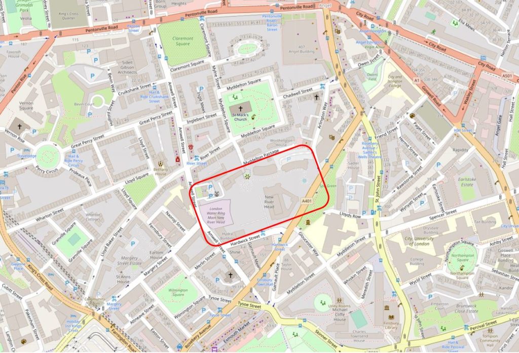
The site chosen, called New River Head, was located between what is now Rosebery Avenue and Amwell Street. The red rectangle on the following map shows the area occupied by New River Head (Map © OpenStreetMap contributors).

New River Head

The story of the New River dates back to 1602 when a former army officer from Bath, Edmund Colthurst who had served in Ireland, proposed a scheme to bring in water from Hertfordshire springs to a site to the north of the city.

As a reward for his military service, he was granted letters patent from King James I, to construct a channel, six feet wide, to bring water from Hertfordshire to the city.

Colthurst’s was not the only scheme for supplying water to the city. There were a number of other private companies, and the City of London Corporation was looking at similar schemes to bring in water from the River Lea and Hertfordshire springs.

Whilst Colthurst’s project was underway, the City of London petitioned parliament, requesting that the City be granted the rights to the water sources and for the construction of a channel to bring the water to the city.

In 1606 the City of London was successful when parliament granted the City access rights to the Hertfordshire water, a decision which effectively destroyed Colthurst’s scheme, which collapsed after the construction of 3 miles of the river channel.

It was an interesting situation, as Colthurst had the support of the King, through the letters patent he had been granted, whilst the City of London had the support of parliament.

The City of London took a few years deciding what to do with the water rights granted by parliament, and in 1609 granted these rights to a wealthy City Goldsmith, Hugh Myddelton. He was a member of the Goldsmiths Company, an MP (for Denbigh in Wales), and one of his brothers, Thomas Myddelton was a City alderman and would later become Lord Mayor of the City of London, so Myddelton probably had all the right connections, which Colthurst lacked.

Colthurst obviously could see how he had been outflanked by the City, so agreed to join the new scheme, and was granted shares in the project. Colthurst joining the City of London’s scheme thereby uniting the rights granted by James I and parliament.

Work commenced on the New River in 1609, but swiftly ran into problems with owners of land through which the New River would pass, objecting to the work, and the loss of land. A number of land owners petitioned Parliament to repeal the original acts which had granted the rights to the City, however when James I dissolved Parliament in 1611, the scheme was given three years to complete construction and find a way to overcome land owners objections, as parliament would not be recalled until 1614.

There were originally 36 shares in the New River Company. Myddleton had decided to enlist the support of James I to address the land owners objections, and created an additional 36 new shares and granted these to James I who would effectively own half the company.

in return, James I granted the New River Company the right to build on his land, he covered half the costs, and Royal support influenced the other land owners along the route, removing their objections, as any further attempts to hinder the work would result in the king’s “high displeasure”.

The New River was completed in 1613. It was a significant engineering achievement. Although the straight line distance between the springs around Ware and New River Head was around 20 miles, the actual route was just over 40 miles, as the route followed the 100 foot height contour to provide a smooth flow of water, resulting in only an 18 foot drop from source to end.

The New River Head location was chosen for a number of reasons. A location north of the city was needed to act as a holding location, from where multiple streams of water could then be distributed through pipes across the wider city.

The location sat on London Clay, rather than the free draining gravel found further south in Clerkenwell, and it was also a high point, with roughly a 31 meter drop down to the River Thames, thereby allowing gravity to transport water down towards consumers in the city.

The site already had a number of ponds, confirming the suitability of the land to hold water.

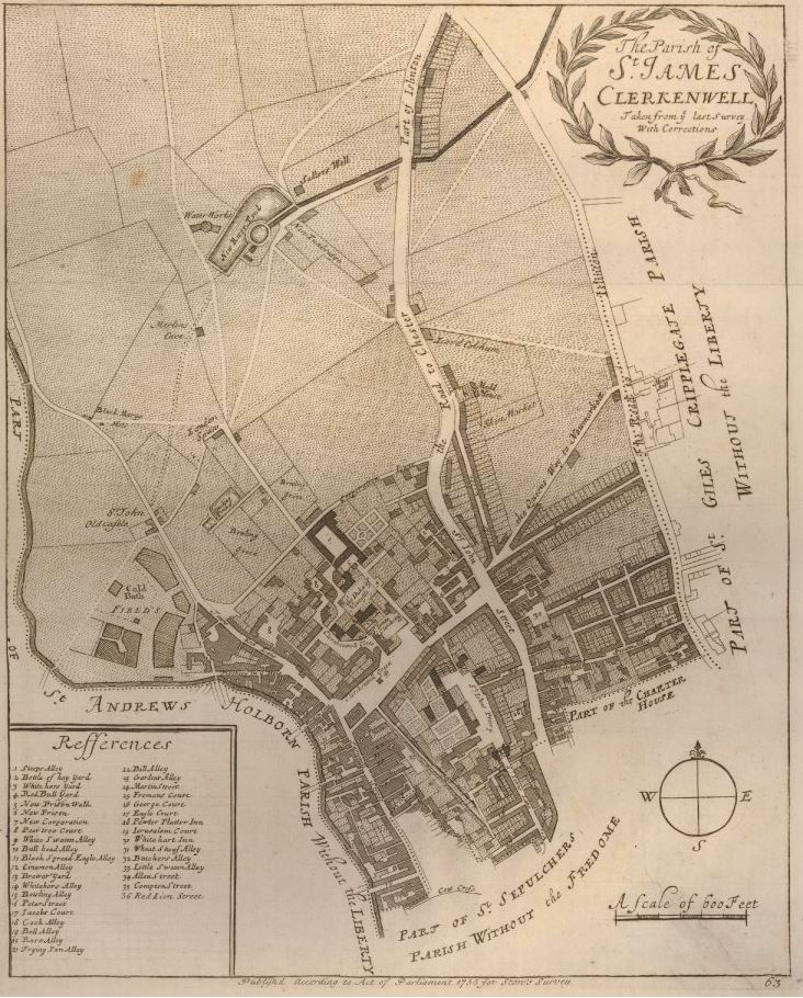
The following map from Stow’s Survey of London, dated around 1720, shows the location of New River Head, still in fields to the north of the city, with the New River feeding in from the right.

New River Head

The New River project was a success, however by the end of the 17th century, the New River Company was supplying water to a considerable part of London, and had reached the organisational and technological limits of the time.

Whilst there were no significant problems with transporting water from Hertfordshire to New River Head, the real problems were distributing water onward across the city, where a system of pipes had grown over the years without any integrated planning, and no real understanding of the implications of water pressure, pipe size, height profiles etc.

Users were starting to complain, water could be cut off for days, pressure was frequently low, and the number of consumers continued to grow rapidly, for example in the ten years between 1695 and 1705 an additional 600 new consumers had been added in the West End, an area of considerable growth for the New River Company.

The West End also had unique problems as it was higher than the City and the difference in height required different distribution methods, rather than just adding more pipes to an already overstretched network.

Sir Christopher Wren was asked to help with understanding the problems of distributing water to Soho Square in the West End, however Wren looked at the whole system and recommended that the problems could only be addressed by effectively replacing the entire system with a new, integrated design.

The New River Company also commissioned John Lowthorp (a clergyman, who was also a member of the Royal Society) to look at the distribution problems,

Lowthorpe established that it was not water supply problems to New River Head (indeed the New River supplied enough water for the whole of London), as with Wren, Lowthorpe identified the distribution network and the organisation of the company.

The New River Company undertook a significant reform of their operations over the course of the 18th century. An integrated approach to distributing water, placement of valves and cisterns, use of different pipe bores and careful surveys of the height profile of the distribution network, and the locations of consumers.

The New River Head location also expanded with additional holding ponds, and in 1709 a new reservoir called the New or Upper Pond was constructed, a short distance north from New River Head, where Claremont Square stands today towards Pentonville Road.

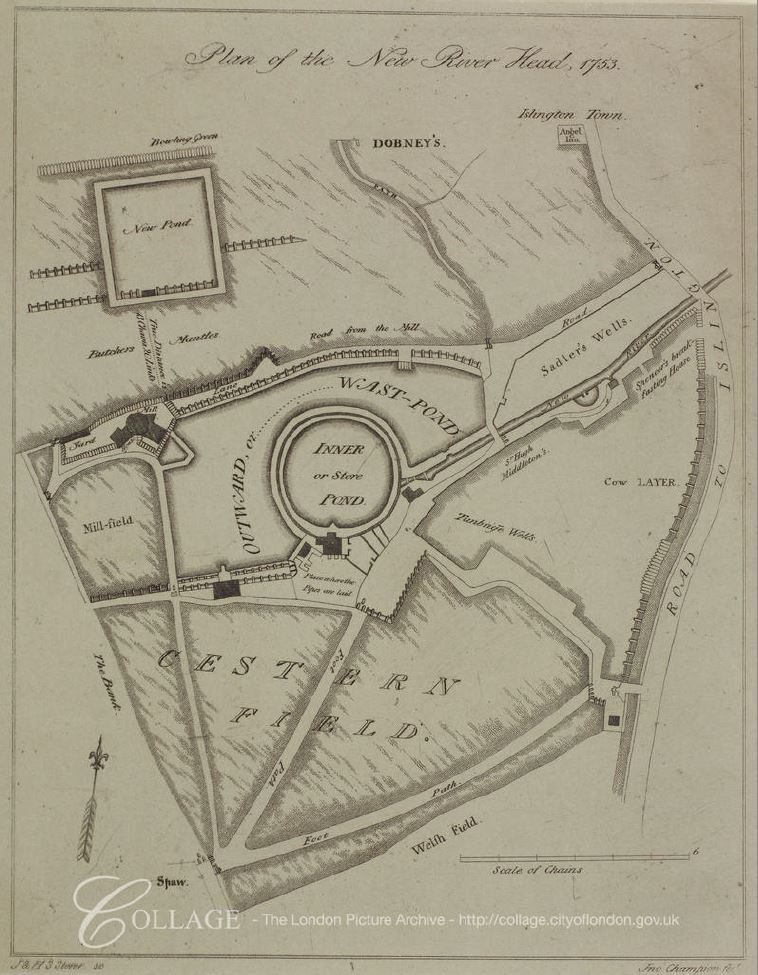
The following plan shows the New River Head in 1753. The original Inner pond, built for the 1613 opening of the New River, surrounded by later ponds, and to the upper left, the New Pond dating from 1709.

New River Head

Image credit: London Metropolitan Archives, City of London: catalogue ref: p5440560

The New Pond was higher than the main New River Head site, so a means of pumping water was required and initially a windmill was constructed at the New River Head site to pump water up to the New Pond, however this was an inefficient method. Water could not be pumped at times of insufficient wind and the windmill was also damaged during times of high wind. The windmill was soon replaced by horsepower, and then by steam pumps in a new pump and engine house.

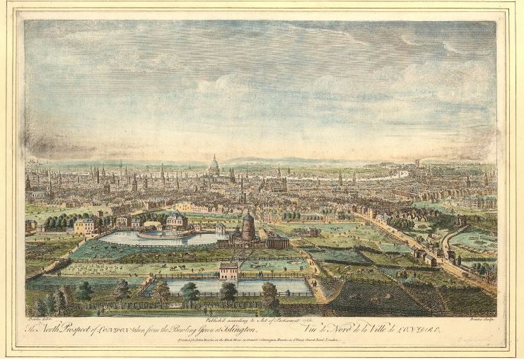
The following print shows New River Head in 1752.

New River Head

The New Pond is at the bottom of the picture, the ponds at New River Head are just above and the windmill can be seen to the right of the New River Head ponds. This print also shows how the buildings of the city are gradually creeping towards New River Head, when compared to the map from 1720 – all new consumers for the New River Company.

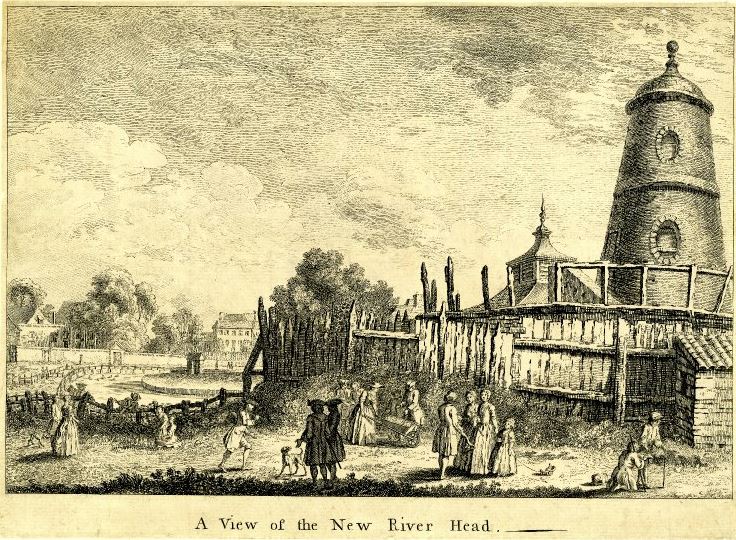
This print from the 1740s shows New River Head and the windmill.

New River Head

The growing demand for water also meant that the capacity of the original Hertfordshire springs was insufficient. The New River Company had started to use the River Lea as an additional source of water and in the 17th century had constructed pipes to take water from the River Lea to the New River.

Bargeman and Mill owners along the River Lea were not happy with the impact of the New River on the volume of water and rate of flow along the River Lea, resulting in a number of disputes.

Parliament provided their approval to an agreement drawn up between the trustees of the River Lea Navigation and the New River Company in 1739, which allowed the New River Company to continue drawing water on payment of £350 per annum to the River Lea Navigation.

There is so much history to New River Head, however this post is already far too long, so a brief look at a couple of maps to show how the site then developed to the site we see today.

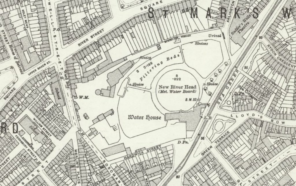
This 1913 revision of the Ordnance Survey map, shows New River Head, with the central round pond, and surrounding filter beds. The map also shows the level of development during the 19th century with the fields that surrounded the site in the 17th century, now covered with housing and streets.

New River Head

Credit: ‘Reproduced with the permission of the National Library of Scotland’ 

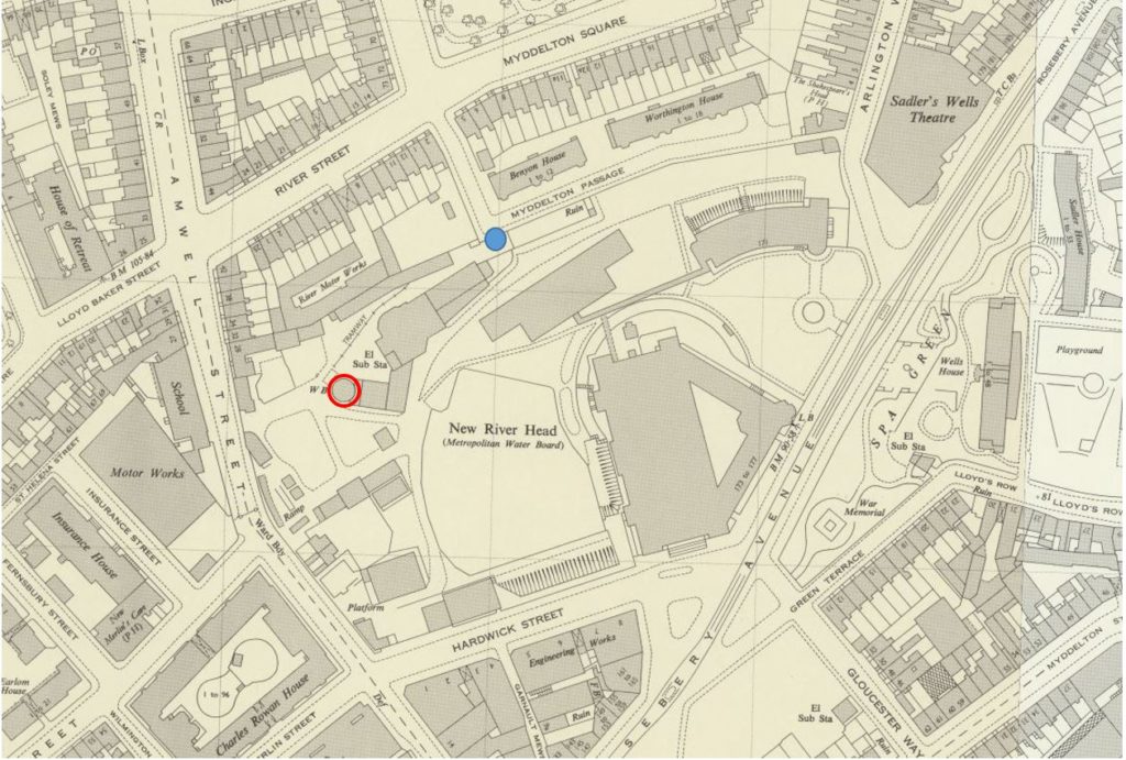
Fast forward to the 1952 revision, and we can see the large head office of the Metropolitan Water Board (discussed further down the post) dominates the site, and covers much of the original location of the round pond, with only parts of the northern edge remaining (which we can still see today).

New River Head

Credit: ‘Reproduced with the permission of the National Library of Scotland’ 

In the map, I have marked the location of the New River Head viewing point (see further down the post) by a blue circle, and the red circle outlines the base of the original windmill used to pump water to the Claremont Street reservoir.

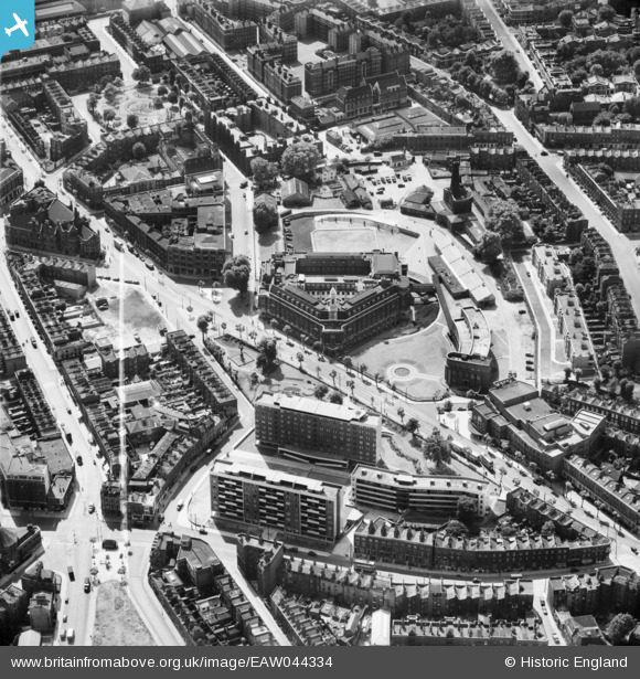
The following photo from Britain from Above, dated 1952, shows the New River Head location. It is really only with an aerial view that you can appreciate the head office of the Metropolitan Water Board in the centre of the photo.

New River Head

Time for a walk around the site today, to see what is left of New River Head.

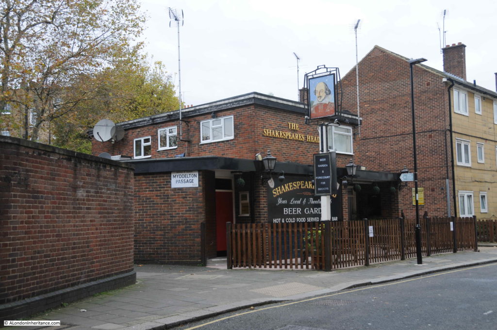
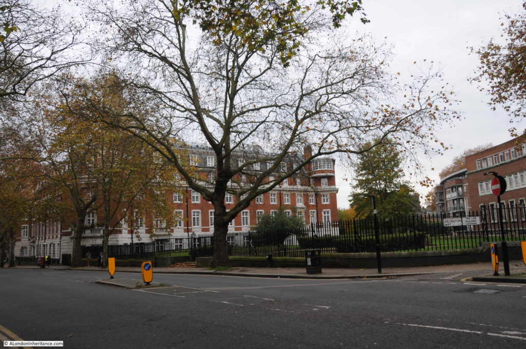
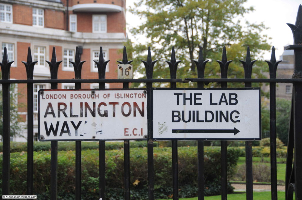
As part of the New River Path, developed to follow the route of the New River between Hertford and Islington, Thames Water created a viewing platform to look over the site of New River Head. To get to there, i walked up Rosebery Avenue, and just before the Sadler’s Wells Theatre, turned left into Arlington Way, then just before the Shakespeare’s Head pub, turned left into  Myddleton Passage.

New River Head

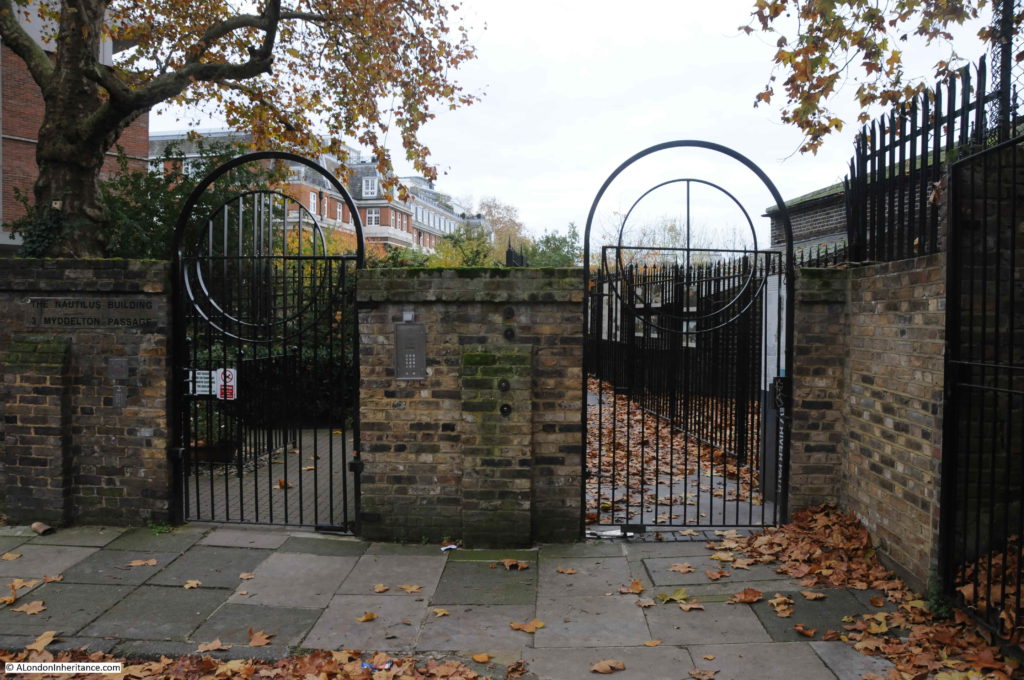
At the point where Myddleton Passage does a 90 degree bend up to Myddleton Square (both named after Hugh Myddleton), there are two metal gates, the one on the right provides access to the viewing platform.

New River Head

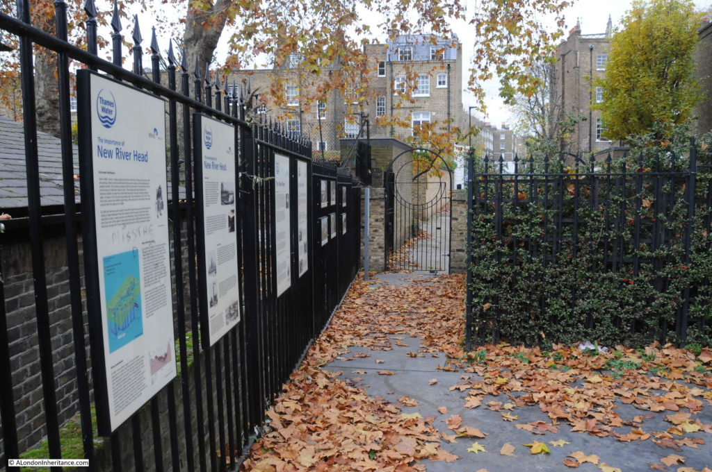
There are a number of information panels lining the fence providing some background to the New River and New River Head.

New River Head

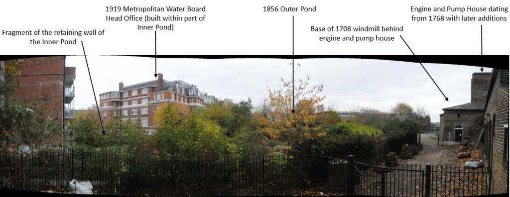
The concept of having a viewing platform at the end of the New River Path, overlooking the place where water emptied out into the ponds and the infrastructure to distribute the water onward across London is brilliant, however I must admit I was somewhat disappointed by the limited view. Much of the original history of the site is either obscured by plant growth, or buildings, or is just too low to be visible.

The following panorama shows the view from the viewing platform, and I have marked some of the key features which are either visible, or hidden.

New River Head

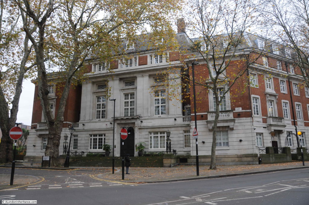
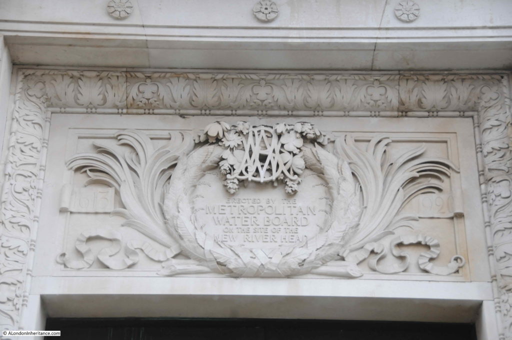
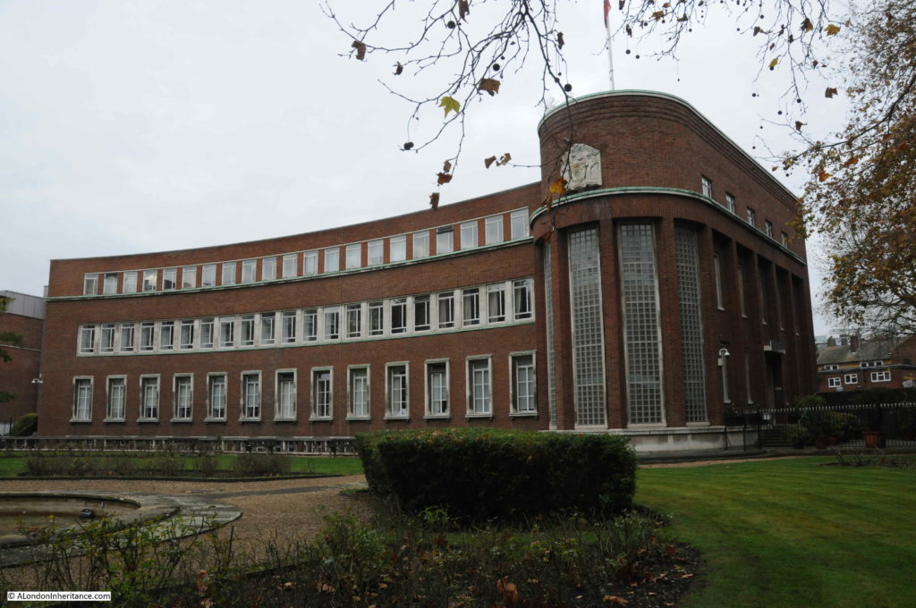
Fortunately, taking a walk around the wider area reveals much more of New River Head and the New River Company, so here is a tour round the site starting with the magnificent Head Office of the Metropolitan Water Board constructed in 1919 / 1920. This is the view of the building as you walk up Rosebery Avenue from the south.

New River Head

It is hard to appreciate the full size, or shape of the building from ground level. The Britain from Above photo shown earlier in the post shows what a magnificent building this is when the full building can be appreciated.

There are multiple reminders of the original function of the building and New River Head, to be found all over the building:

New River Head

Walking further north along Rosebery Avenue, and this is the view looking back towards the Metropolitan Water Board head office. The full area on the right is part of the original New River Head.

New River Head

In the above photo, where the head office building ends along Rosebery Avenue, there are gates which provide a glimpse of the original round pond. The photo below shows part of the retaining wall of the round pond behind the far fence – later upgrades and restorations so not exactly the 1613 walls, but retaining the position of the original round pond.

New River Head

To the north of the site is the magnificent Grade II listed, 1938 Laboratory Building, designed by John Murray Easton and formerly the water testing centre for Thames Water.

New River Head

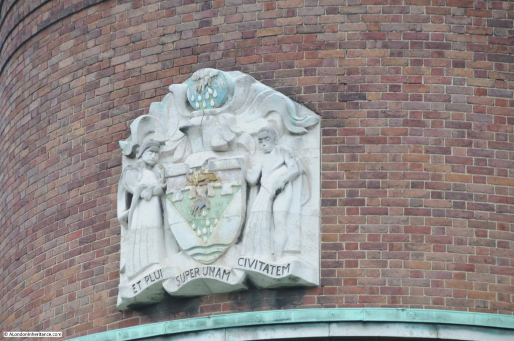
The Laboratory Building is now home to 35 apartments. On the rounded corner of the Laboratory Building is the seal of the New River Company:

New River Head

The seal depicts the hand of Providence bestowing rain upon the city. The motto “et plui super unam civitatem” translates as “and I rained upon one city”.

This is the turn off from Rosebery Avenue to get to Myddleton Passage:

New River Head

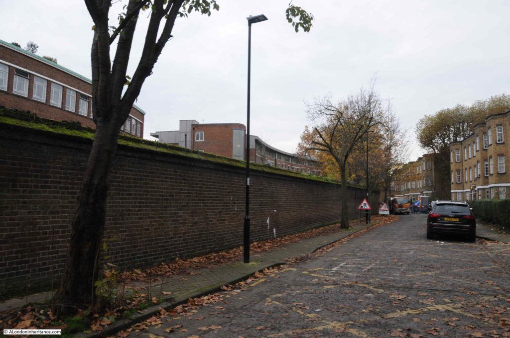
The view along Myddleton Passage. The passage can be seen along the northern boundary of New River Head in the maps above. The wall on the left is the boundary wall from 1806-7.

New River Head

In the 19th and early 20th centuries this passage, alongside the water works was a dark and isolated place at night, and a number of crimes were reported in the press of the day. For example from the London Daily News on the 26th March 1846 “Robbery from the person of Mr Thomas Woods, of Number 9 Wardrobe-place, Doctors Commons whilst passing through Myddleton-passage, Clerkenwell, a striped silk purse, containing twenty sovereigns and twenty shillings in silver”.

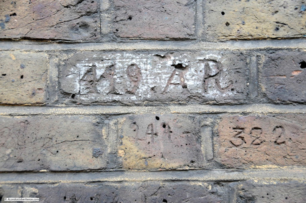
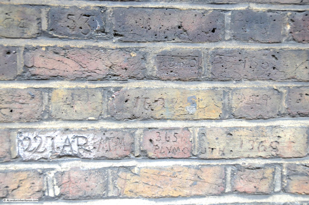
The presence of police officers in Myddleton Passage can be seen through “collar numbers” carved into a section of the boundary wall along Myddleton Passage.

New River Head

The Survey of London identifies a number of the officers who recorded their numbers along the wall. One being Frederick Albert Victor Moore, from Cornwall, who joined G Division of the Metropolitan Police in 1886. Prior to his transfer to London he had served at the Devonport Naval Dockyard, and in Myddleton Passage recorded not only his London number, but also his original 365 PLYMOUTH number, seen in the middle of the second from bottom course of bricks in the following photo:

New River Head

Fascinating to imagine Metropolitan Police Officers of the 19th century patrolling this lonely alley on a dark night, with the waters of New River Head just behind the wall.

Walk to the end of Myddleton Passage, stop off at the viewing platform then head north.

At the end of Myddleton Passage, we reach Myddleton Square, a large square with the church of St Marks, Clerkenwell in the centre. Both passage and square named after Hugh Myddleton.

New River Head

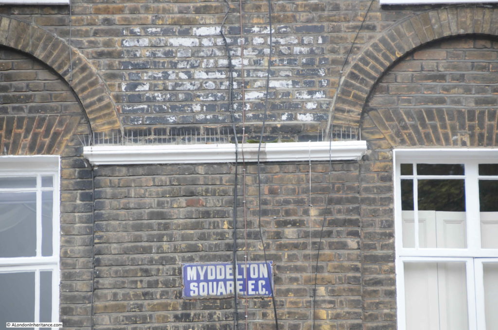
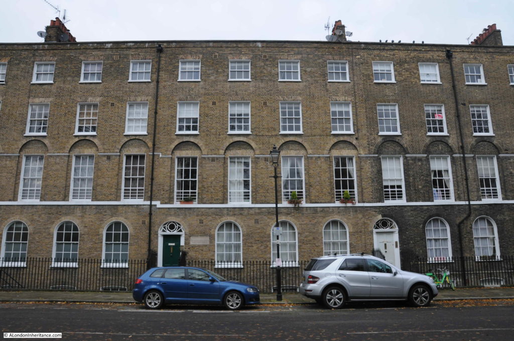
Along the northern terrace of Myddleton Square, there is a distinctive change in brick colouring:

New River Head

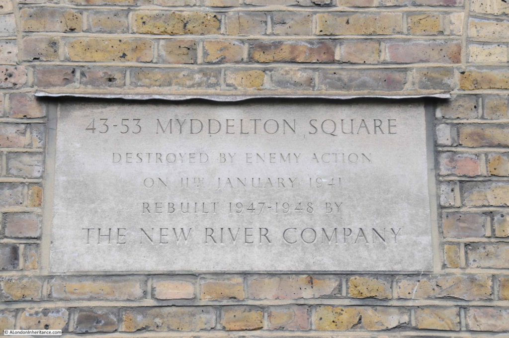
Not due to cleaning, rather bombing of the site and a rebuild of the terrace as recorded on a plaque adjacent to the black door in the centre of the above photo:

New River Head

The plaque records the New River Company rebuilt this section of Myddleton Square between 1947 and 1948, and it also gives a clue as to how the New River Company evolved.

The Metropolis Water Act of 1902 transferred the responsibility of the many local water companies serving London to the newly created Metropolitan Water Board. The New River Company ceased the role that it had been created for almost 300 year before.

As well as supplying water, the New River Company had long been a significant owner of land and properties, both along the route of the New River and the surroundings of New River Head. In 1904, the New River Company re-incorporated as a property company.

In 1974 the New River Company was taken over by London Merchant Securities, but still operated as a separate division.

Today, the New River Company is a subsidiary of the property company Derwent London plc (I am constantly fascinated by how you can still find evidence of centuries old institutions across London).

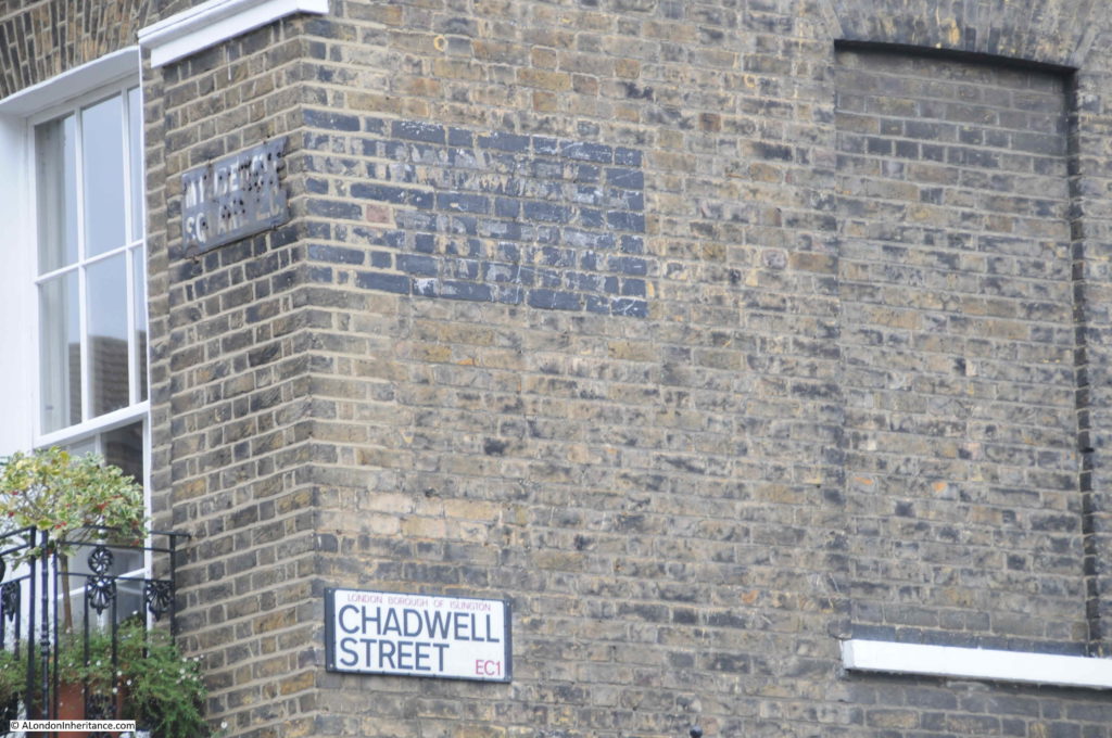
A turning off Myddleton Square is Chadwell Street – after one of the original Hertfordshire springs.

New River Head

Leading north from Myddleton Square is Mylne Street.

Mylne Street is named after Robert Mylne (1733 to 1811), who became the New River Company’s second chief surveyor in 1771. Mylne had already worked on Blackfriars Bridge (completed in 1760), he was surveyor of St Paul’s Cathedral and worked on numerous canal and architectural construction and engineering projects.

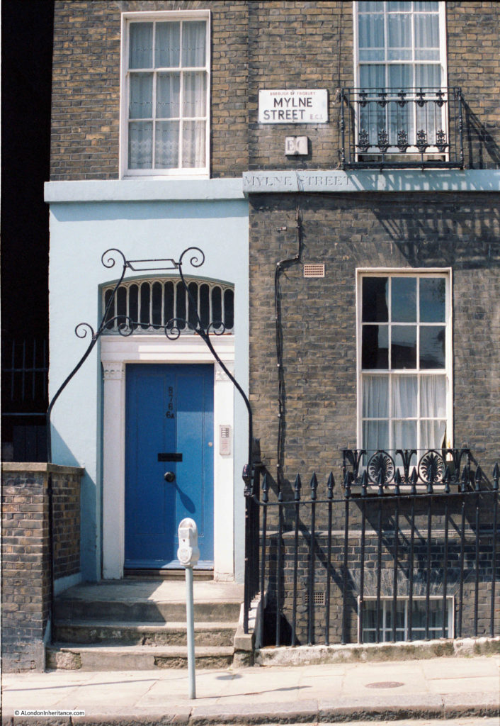
I have a load of 1980s photos that we took around Clerkenwell and Islington, and one of the reasons for my visit to the area was to photograph the same locations today. The following is a photo from 1984 showing one of the first buildings in Mylne Street from Myddleton Square.

New River Head

It is a lovely building, with ornate ironwork fronting the street, but what was of interest is the street name carved between the ground and first floors. Also, from the perspective of 2019, the parking meter that was once so common across London streets.

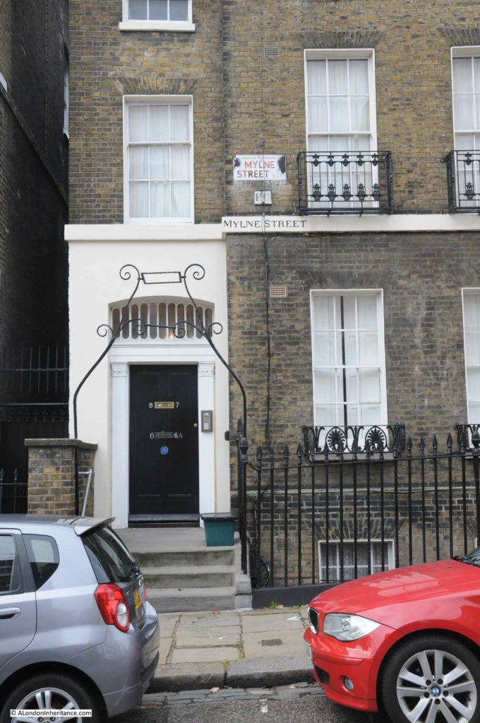
The same building in November 2019:

New River Head

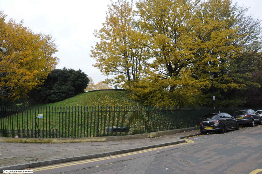
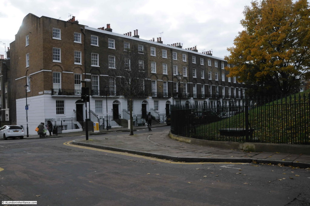
At the northern end of Mylne Street we reach Claremont Square. This was the location of the New, or Upper Pond. In a wonderful example of continuity of use, over 300 years later, the centre of the square is still occupied by a large, covered reservoir, with grassed, earth banks surrounding the centre of the square.

New River Head

Lining three sides of the square are early 19th century terrace houses. Pentonville Road lines the northern edge of the square.

New River Head

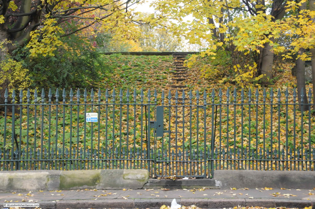
Steps leading up from Claremont Square to the top of the reservoir:

New River Head

The original reservoir was uncovered, however as the reservoir contained filtered water ready for distribution to consumers, the Metropolis Water Act of 1852 required such reservoirs to be covered to prevent any form of contamination entering the water from the wider environment.

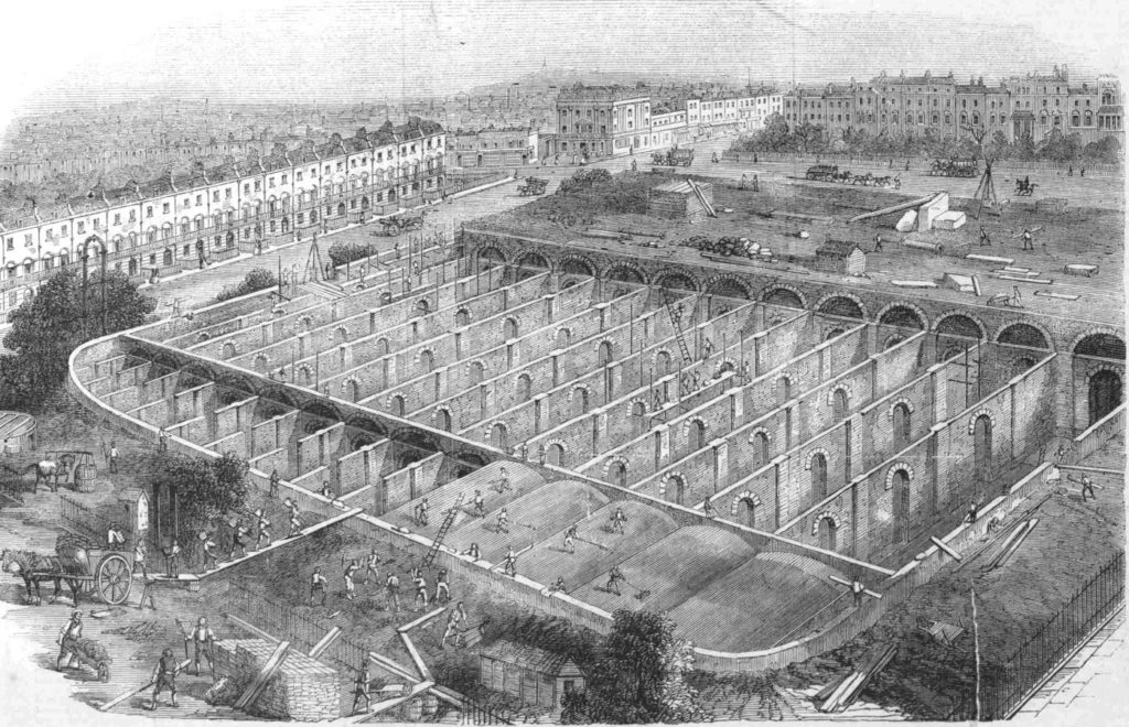
In the 1850s, the reservoir was drained, brick piers built, covered and turfed over. The reservoir was also raised in height to give a total depth of water of 21 feet, and the capability to hold 3.5 million gallons.

Four million bricks were used in the reconstruction and covering the reservoir, and the following print showing work taking place, and the internal construction provides a good view of how the reservoir was built and covered.

New River Head

Whilst New River Head could provide water for large parts of London in the 17th and 18th centuries, new sources and reservoirs were being developed, including reservoirs in Stoke Newington, where the New River now terminates and feeds the east and west reservoirs just south of Seven Sisters Road.

The Claremont Square reservoir was already integrated into a wider water distribution network in the 19th century, as in the 19th century, large pipes had been installed between the reservoirs in Stoke Newington and Claremont Square, so the reservoir could be stocked with water from both New River Head and Stoke Newington.

Today, the reservoir is fed with water from the London Ring Main, and the reservoir was Grade II listed in the year 2000..

The western edge of Claremont Square is at the top of Amwell Street (named after one of the original Hertfordshire springs), so I turned into Amwell Street and headed south.

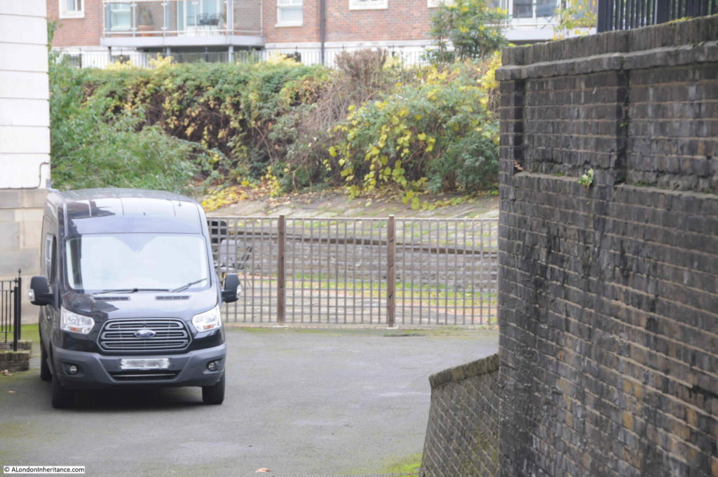
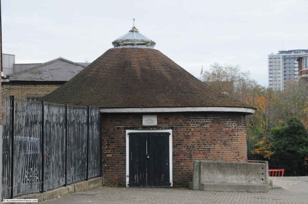
Passing the junction with River Street (after the New River) and Lloyd Baker Street (see my earlier post on the Lloyd Baker Estate), I reached the point where you can peer through railings surrounding the New River Head site, and see the base of the windmill that was built to pump water from New River Head to the Claremont Square Reservoir in 1709:

New River Head

The plaque above the door reads:

“The round house, remains of the windmill used C. 1709 -1720 to pump water from the round pond to the upper pond (now Claremont Square reservoir)”.

Locks on the entrance gate between Amwell Street and the New River Head site – they really do not want you to get in:

New River Head

Which is understandable, as New River Head is still a key location in the distribution of water across London.

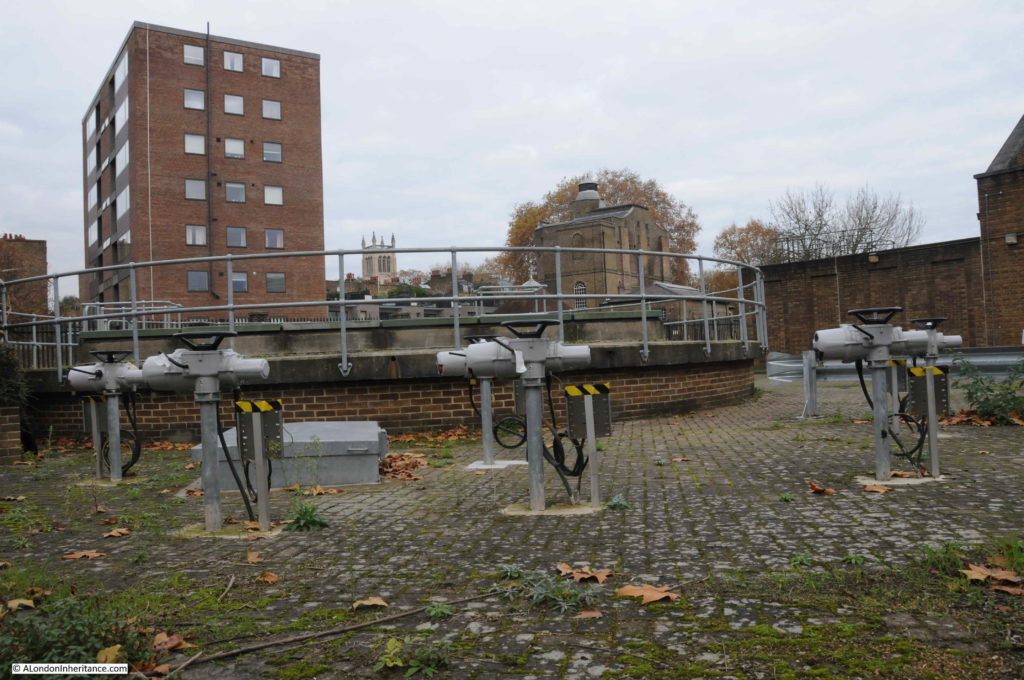
In another fascinating example of how locations across London maintain a continuity of use across centuries, the information panel at the viewing point shows where a deep shaft at the New River Head site connects to the London Ring Main, a core part of the infrastructure that now distributes water across London.

Pumps raise water from the ring main for distribution via the Claremont Square reservoir.

New River Head

As well as the London Ring Main interconnect, the New River Head site also hosts a bore hole used to extract ground water.

For centuries, water intensive industries such as breweries, tanneries etc. drained London’s ground water, resulting in an ever dropping level of ground water.

With the decline of these industries, ground water has been gradually rising. Whilst a good thing to return to natural levels, rising groundwater does create problems for the infrastructure now buried deep under London. For example, TFL has to pump 47 million litres of water a day from across the network, with 35 litres per second needing to be pumped from just Victoria Station.

The bore hole at New River Head is to the left of the old windmill base, but appears to be out of operation at the moment as stabilisation works are required, however when back in operation, the New River Head bore hole can extract between 3 and 3.46 million litres per day from London’s rising ground water.

Again, I have only scratched the surface of the history of the area and New River Head. Within the Round Pond, there is the Devil’s Conduit, a chimney conduit originally from Queen’s Square, Bloomsbury and moved to New River Head in 1927. The original 17th century oak room from the Water House building, built next to the Round Pond, and dating from around 1693, is now in the Metropolitan Water Board head office building (open during Open House, London).

Thames Water (the successor to the Metropolitan Water Board) have long left the New River Head offices, and are now based in Reading. The old head office building has been converted into flats.

To research this post, as well as walking the area I have used a number of excellent books, including:

  • The New River by Mary Cosh
  • The Survey of London, Volume 47 on Northern Clerkenwell and Pentonville
  • The History of the London Water Industry 1580 to 1820 by Leslie Tomory
  • Online reports from Thames Water and TFL
  • Online reports by the General Aquifer Research Development and Investigation Team

The book by Leslie Tomory is a fascinating read if you want to understand how the water industry developed across London from very simple beginnings, to an industry that could serve an industrialising and rapidly expanding city.

alondoninheritance.com

Drury Lane, Amos Jones and S. Krantz

The streets of London have lost so many of their local, specialist shops over the years. Shops that catered for the practical needs of everyday life, and also supported activities that were concentrated in the local area. For today’s post, I am in Drury Lane, looking at two shops which highlight how these streets have changed over the last 30 years.

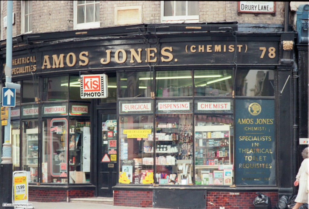
This is the shop of Amos Jones, Chemist, on the corner of Drury Lane and Long Acre, photographed in 1985.

Drury Lane

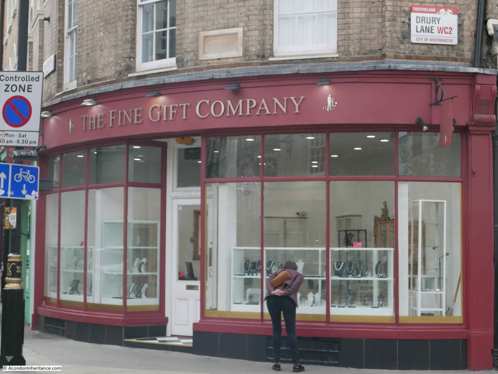
This is the same shop in 2019:

Drury Lane

Amos Jones, the Chemist, has now been replaced by The Fine Gift Company, a shop specialising in the sale of handmade Italian silver jewelry – a very different form of business. Although the street sign visible in the photo states Drury Lane, the shop address is 78 Long Acre. There is a Long Acre street sign above the left edge of the shop.

The panel on the right of the shop in the original photo claims that Amos Jones was established in 1785, and also highlights the chemist’s prime location in the theatrical hub of the city by advertising “Specialists in Theatrical Toilet Requisites”. I cannot find any evidence that the chemist was trading at this location as Amos Jones back to 1785. I did find a 1921 reference to Amos Jones being the chemist, and in volume 129 of the “Chemist and DruggistThe Newsweekly for Pharmacy” from 1938 there is a reference to what appears to be a purchase of the chemist trading as Amos Jones at 78 Long Acre.

The shop also advertises the developing and printing of photos – a sideline for chemists that was swept away by the arrival of digital cameras.

I have not been able to find too much history of the chemist, however one reference I did find is when Amos Jones appears to have been caught up in a rather strange toothpaste related crime.

in July 1921, Amos Jones was summoned to Bow Street Court as part as a court case against Alphonse Carreras and Enrique Carreras of King Street, Hammersmith.

Alphonse and Enrique were on trial for running a lottery called “The Enolin Tooth Paste Competition”. The lottery or competition was for prizes to accurately estimate the number of tubes of toothpaste sold during a certain period. The first prize was a motor-car valued at £2,250, with £500 in cash. There were over 3,000 other prizes with a combined value of £5,000.

Amos Jones was summonsed for selling the “chances” .

The court case appeared to hinge on whether the competition involved skill or luck (in which case it would be considered a lottery). The prosecution did agree that the competition was bona-fide and that prizes were awarded, but that it was still a lottery. The judge agreed as he “could not help thinking that the good fortune of the prize winners was the result of a lucky shot, and did not depend upon the exercise of any real skill”.

Alphonse and Enrique Carreras were each ordered to pay a penalty of £50, and costs of £10, 10 shilling.

Amos Jones, listed as a chemist of Long Acre was charged with publishing the scheme, but was dismissed under the Probation of Offenders Act, on payment of £5, 5 shillings costs.

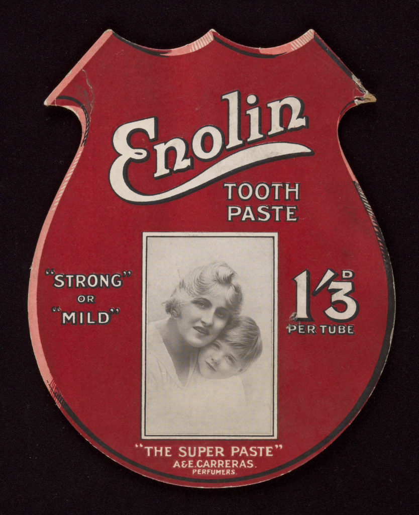
An Enolin Toothpaste show card, of a type which possibly could have been displayed in Amos Jones shop. At the very bottom of the card, A&E Carreras were “Perfumers” who had obviously branched out into the toothpaste trade.

Drury Lane

(Source: https://wellcomecollection.org/works/nantqzph)

Above the shop in both photos there is a plaque on the wall:

Drury Lane

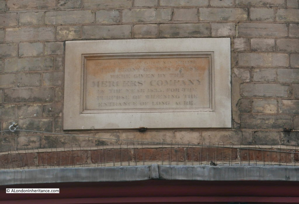
The plaque reads “Eight feet of ground from the front of this house were given by the Mercers Company in the year 1835, for the purpose of widening the entrance of Long Acre”.

This work was part of the widening and straightening of many streets in the area carried out during the first half of the 19th century.

The Mercers Company is a name that I keep finding all over the city. They were significant landowners and the building with the chemist shop was just part of their landholding in Drury Lane and Long Acre.
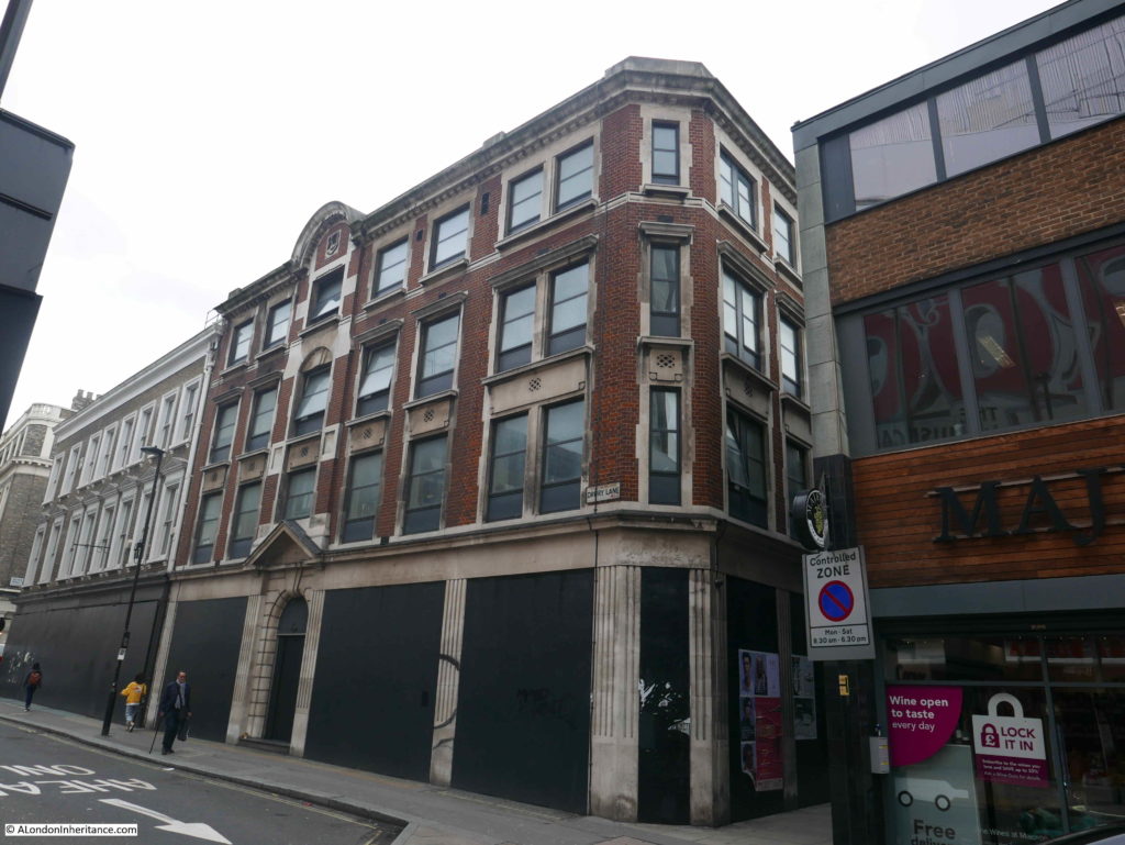
Walking north along Drury Lane, crossing Dryden Lane and there is another block of buildings with very different architectural styles, however the larger building closer to the camera also was / is part of the Mercers property in Drury Lane.

Drury Lane

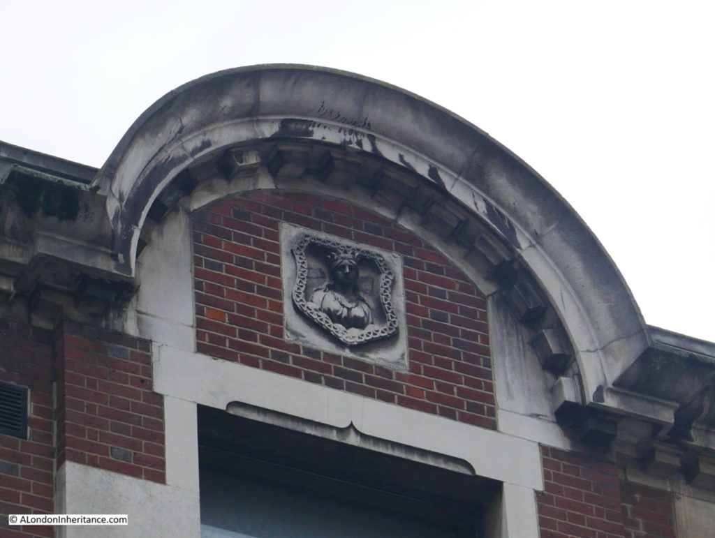
If you look at the top of the building, directly above the main entrance door there is a Mercers Maiden – the symbol of the Mercers Company and displayed on buildings owned by the company to indicate their ownership.

Drury Lane

There are many of these to be seen across London, one of my side projects is to photograph and map these for a future post.

Rather worryingly, the building is empty and boarding covers the ground floor.

The Mercers still own a significant amount of land around Long Acre, and have a map on their website showing their property portfolio in the area.

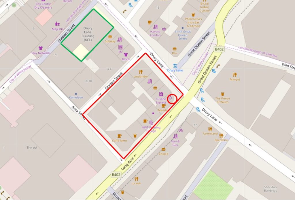
In the following map, I have marked the old Amos Jones chemist shop with a red circle. The red rectangle indicates that the whole block within the boundaries of Drury Lane, Long Acre, Arne Street and Dryden Street is still owned by the Mercers Company (Map © OpenStreetMap contributors).Drury Lane

The building with the Mercers Maiden is the building further north bounded by the green rectangle. This building is not part of the current Mercers portfolio so must have been sold at some point.

Further down Long Acre, the majority of the land to the north of the street, between Neal Street and Upper St. Martin’s Lane is still owned by the Mercers Company. It is a good area for Mercers Maiden spotting and there is also a Mercer Street running north from Long Acre to Seven Dials.

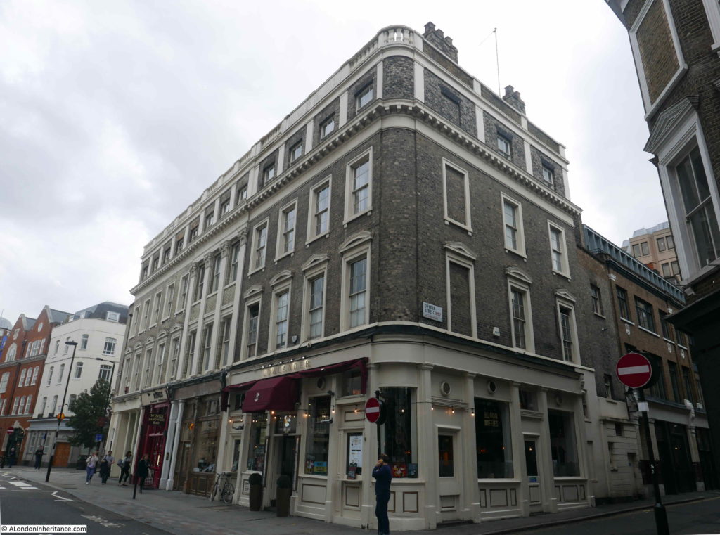
The following photo shows the block of buildings along Drury Lane, the old Amos Jones shop is at the far end of the block.

Drury Lane

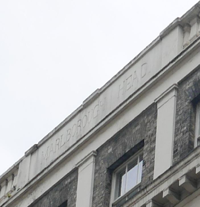
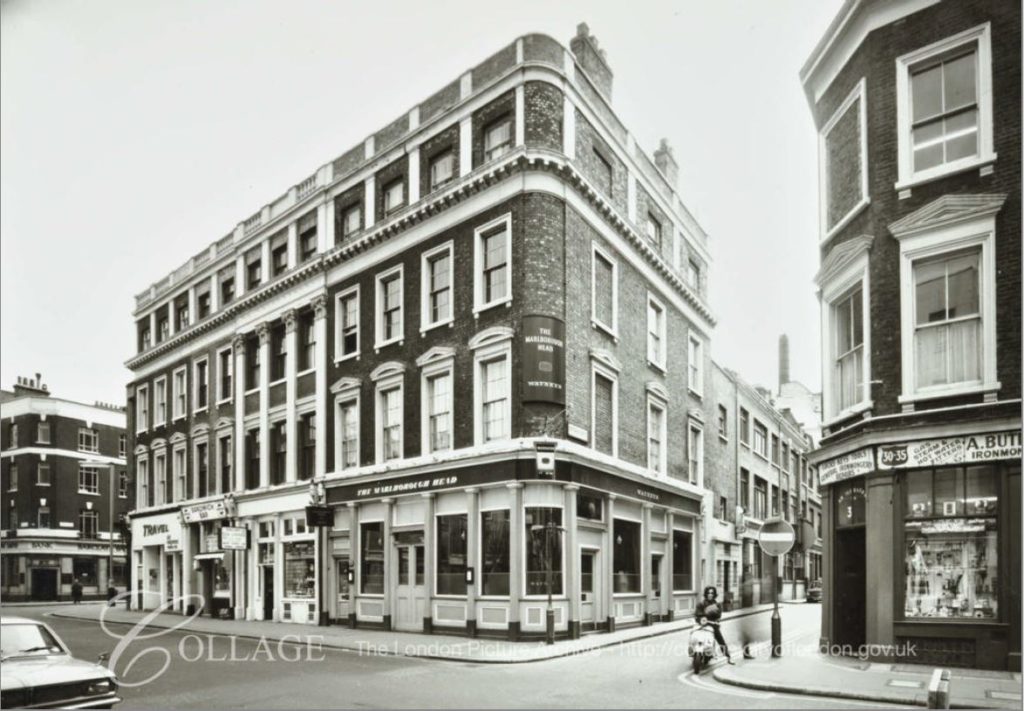
On the corner of the block, facing the camera was the old Marlborough Head, a pub dating  from the early 19th century (the first reference I can find dates from 1818). The building has the curved corner which is an indicator of a building specifically designed as the pub, as this is where the pub name would have been prominently displayed.

The building is now the Lowlander – not so much a pub, rather an establishment which is advertised as “London’s Premier Belgian Grand Cafe”.

The name of the original pub can still be seen carved at the top of the building.

Drury Lane

The LMA Collage collection has a photo of the Marlborough Head dated 1971:

Drury Lane

Image credit: London Metropolitan Archives, City of London: catalogue ref: SC_PHL_02_0974_71_3915

The image of a typical 1970s London Watney’s pub.  The store on the right in the above 1971 photo was an Ironmongers, again the type of shop that has almost disappeared from the streets of central London.

To the left of the Marlborough Head, between the pub and Amos Jones was:

  • The Drury Tea and Coffee Company
  • Enrico’s Sandwich Bar
  • Air Express Travel Ltd

Enrico’s is still a sandwich shop, but now called Wings, and the travel company shop is now a dry cleaners.

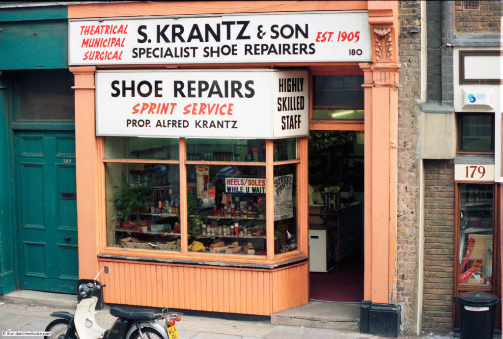
Walking further north along Drury Lane, and in 1986, at number 180 was S. Krantz & Son, Specialist Shoe Repairers – Proprietor Alfred Krantz.

Drury Lane

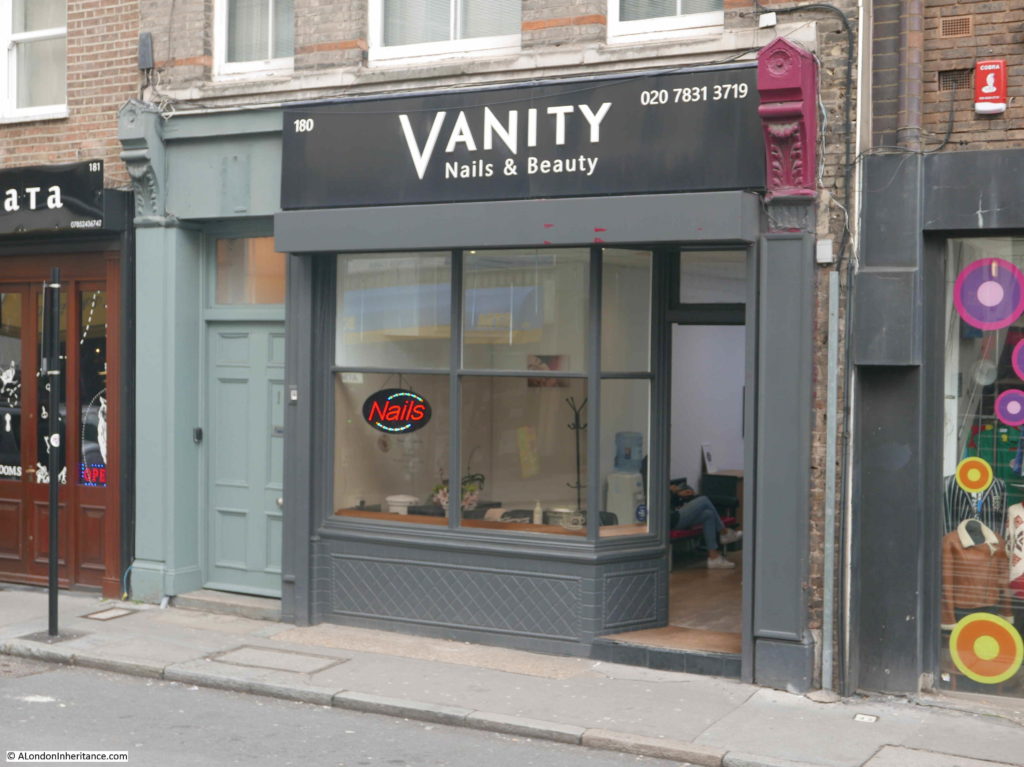
The same shop today, now Vanity Nails & Beauty:

Drury Lane

S. Krantz also advertised their specialty of Theatrical, Municipal and Surgical, which I guess covers everything from theatrical footwear needed for the theatres of the West End, to surgical footwear, perhaps for the medical community of Bloomsbury, and municipal, which I suspect covered everything else.

The shop to the right of S. Krantz in the original photo was a general hardware and tool shop, A couple of wood saws can be seen in the window of the shop on the right of the photo. Today the same shop is selling retro clothes.

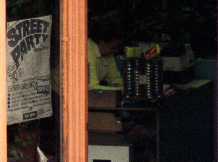
The following enlargement from the original photo perhaps shows Alfred Krantz working in the shop?

Drury Lane

The above photo also shows an interesting poster in the doorway of S. Krantz, advertising a street party on Saturday 25th in nearby Parker Street, with a Disco, Sports Challenge, BBQ and Yard of Ale – not an event you would see on the streets of the West End today.

There seems to be an ever reducing number of these small, one-off shops, catering for local day-to-day needs, and with a local specialism (the theatrical focus of both Amos Jones and S. Krantz). London’s streets will be poorer without them.

alondoninheritance.com

A Remarkable Story of Bravery

Last year, I visited the Netherlands to photograph the locations that my father photographed in 1952. This included the Oosterbeek war graves cemetery on the outskirts of Arnhem where those who died during Operation Market Garden are buried.

Those buried here were not just casualties from the fighting on the ground, but also those who time after time flew supply missions and sustained terrible casualties as they had to fly low and slow to deliver an accurate drop.

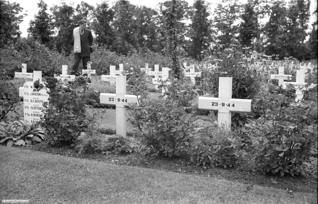
In one of my father’s photographs, there is a temporary cross with multiple names, seen below to the left of the photo.

I did discover that they were an aircrew, probably flying supply missions, but could find no further information.

I was really pleased to be contacted by Paul Brooker, the nephew of Richard Bond, the name just visible at the bottom of the list of names in my father’s photo.

Paul has researched the story of Richard, and the aircrew named on the temporary cross, and has uncovered a remarkable story of bravery, so for today’s post, I would like to hand over to Paul to tell their fascinating story.

Richard Bond at Arnhem

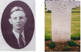
Richard (Dick) Bond was the elder of two brothers by 3 years, and he enlisted into the RAF reserves as a fitter on 3rd September 1940, at the time that the Battle of Britain was coming to its climax. Whether it was the fact that his brother Stan was training as a Navigator I don’t know, but he subsequently started training as a Flight Engineer on 21st December 1942, later joining A. V. Roe & Co (AVRO) for a six week period on 25th October 1943. He qualified as a Flight Engineer on 25th November 1943, just 3 months after his brothers’ death. Married, his picture gives me the impression of the quieter elder brother. Much of the following information was unknown to my family until I started my research in 1994.

At the end of 1943 he joined 1665 Heavy Conversion Unit at Woolfox Lodge in Rutland where he met up with his first crew and flew his first Stirling. Although some of the crew members were to change over the coming months, he stayed with his pilot, Bill Baker right through to the end. Apparently Bill was an American pilot who already owned his own aircraft in the States, and he volunteered with the Royal Canadian Air Force as a way of “seeing the action.”

On the 7th January 1944 the crew joined their first operational squadron, 196 at Tarrant Rushton. In the previous months the Stirlings had taken such a mauling that they had been withdrawn from front line bombing duties due to their low ceiling capability of only some 16,000ft. The introduction of the Lancaster in greater numbers, with its higher ceiling and greater bomb capacity meant that the Stirling was now being used to good effect in a transport role.

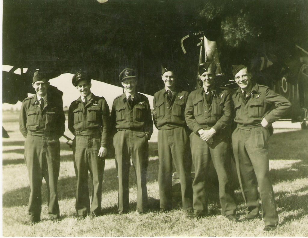
Their first Operational Mission was flown from Hurn, just a short hop south of Tarrant Rushton on 8th February 1944 in aircraft W ZO.  (See picture above)  The log simply states “Special Mission-Low Level S. France.” This was to be the first of a number of night-time flights deep into enemy occupied France at rooftop height. Five hours forty minutes of intense concentration, especially for the pilot! Although it was generally believed that they were dropping supplies of arms and ammunition to the French resistance, together with SOE agents the exact details are unclear, indeed the full information of most of these low level drops remains covered by the Official Secrets Act.

Throughout much of early 1944 many supply drops were made to France by Stirlings in readiness for the coming invasion. Dick’s Log also shows an increasing number of flights were made towing Horsa Gliders and paratroop dropping – the shape of things to come. On 14th March 1944, 196 Sqn moved from Tarrant Rushton to Keevil where flying took place almost every day, practicing for the invasion. It is interesting to note from the log that flying appears to come to an abrupt halt after 27th May. This is explained by the need to get all aircraft serviced and fully ready to take part in what was to become known as D Day. During this intervening week all personnel were confined to the airfield. Secrecy was paramount and nobody was allowed in or out of the base without a very good reason. Finally, the aircraft were taken up for a short air test on 3rd June 1944.

Dick’s involvement with D Day actually began the night before when 20 troops together with their kit, 9 containers and a bike(!) were loaded into the aircraft. Along with many others from 196 & 299 Sqns, the Stirlings thundered down the Keevil runway and into the night sky on “Operation Tonga.” The only information that I originally had about the destination of this trip was that Operation Tonga involved dropping troops in the dead of night on “Drop Zone N.” Where was Drop Zone N?

In 1994, 50 years after D Day I went to France for the 50th Anniversary of D Day. My first stop in Normandy was the Cafe Gandrée at Ranville, next to what has now become known as “Pegasus Bridge” after the Flying Horse emblem of the Paratroops insignia. This was the first house in the first village to be liberated from German tyranny. Buying a souvenir map of Normandy I was astounded to realise that Drop Zone N was within 800m of where I sat. Dick’s troops must have been involved with the liberation of the first French village!

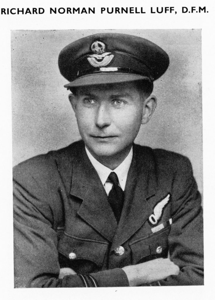
However, things did not all go smoothly. The anti-aircraft fire was intense, and the log reads “Two inner engines knocked out by flak. Nav. and Bomb Aimer bailed out over France. Crash landed at RAF Ford.” This matter-of-fact report must cover a great deal of fear and anxiety. According to family history, the aircraft had taken a bit of a pasting, and the intercom was u/s, the pilot, Bill Baker, said “prepare to bail out”, unfortunately the Navigator and Bomb Aimer only heard part of the message and they bailed out over the English Channel in the early hours of 6th June and were drowned. Richard Luff DFC, the Squadron Bomb Aimer was never found and his name is remembered along with all other aircrew with no known grave on the RAF Runneymead Memorial overlooking the River Thames near Windsor. He also took with him the whereabouts of a squadron sweepstake! Before D Day they had apparently taken bets on the time and date of the Normandy Invasion. The winner was denied his money as nobody knew where Richard Luff had left the takings!

Richard Luff was not normally part of my Uncle’s crew. Apparently, so I am advised by surviving 196 Sqn members, Richard Luff was the Squadron Bomb Aimer, so perhaps he was making sure he got in on the event! My Uncle’s pilot, Bill Baker, was already an experienced pilot before he came over from America, so perhaps he wanted to go with a reliable pilot! This is just my guessing, we shall never know.

Flying Officer Anderson, the Navigator, was washed up at Calais three weeks later and is now buried in the Canadian War Cemetery on the cliffs overlooking Calais.

The remaining crew then fought to bring their stricken aircraft home, throwing out guns, ammunition, indeed anything they could remove, into the English Channel. They finally made land at 02.28am, crashing just short of the airfield at RAF Ford. When you realise that Ford is only 1/2 mile from the sea, and that they couldn’t make it to the airfield, you begin to understand how close they came to ditching – no fun in the dead of night. The crew were given the customary week’s compassionate leave, but how does one get over leaving part of your crew in the English Channel?

After a week Dick was back to flying again, carrying out three more low level Special Missions to France, dropping containers and panniers for the SOE. On the 8th August, Dick and Bill Baker were transferred to 570 Sqn at Harwell where they teamed up with an existing crew who had lost their pilot due to sickness. This crew were to remain together until the end. A further three missions were flown to France during August and September before the log shows the final entries.

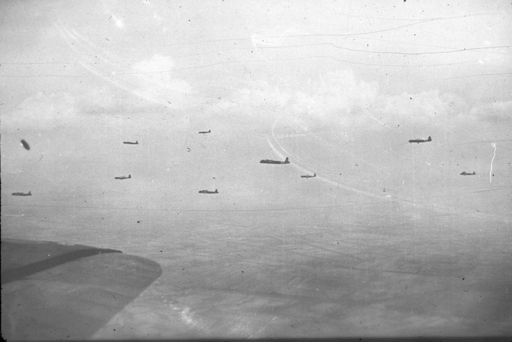
On the 17th September, eight aircraft from Harwell were detailed, as part of a much larger force, to tow Horsa gliders from Harwell to Arnhem. The gliders were carrying the HQ Staff and others from the First Airborne Division. One aircraft crashed on take-off. The remaining aircraft flew in loose pairs in a line astern formation. The trip out was at 2500ft, releasing the gliders over the drop zone at Grave, Holland, and then back at 7000ft. The chalk number of the glider was 504 belonging to 1st Airlanding Light Regiment, delivering them to landing zone Z.  Enemy opposition was light and the weather fair. The only problem was with the planning, it was believed, wrongly as it turned out, that the drop of sufficient troops to capture Arnhem and its bridge could not be achieved in one day, and it was therefore split over two days, losing the element of speed and surprise. As a consequence the paratroops became heavily pinned down, and the rest has now become the sad but heroic history of Arnhem.

The 18th September saw phase two, the continued re-supply, 15 aircraft from 570 Sqn each containing 24 containers and four packages were detailed to re-supply the troops on the ground at Arnhem. The run to the drop zone was carried out at 1500ft, descending to 600ft for the actual supply drop. One aircraft failed to return, another was badly hit by flak over the Dutch Islands and made a successful crash landing. Enemy opposition was getting heavier with most aircraft suffering some flak damage.

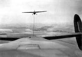
View of Horsa Glider being towed:

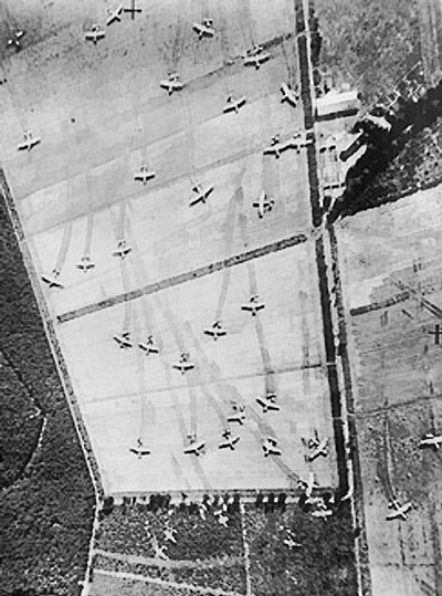
View of the landing ground to the north west of Arnhem showing gliders scattered over the landing field:

By the 19th September the position of the troops on the ground was getting desperate. The part time German troops that were originally believed to be in the area turned out to be a crack Panzer division on rest leave. The British Paratroops were out-gunned and outnumbered, and were being squeezed into an ever smaller enclave. Food and ammunition were running low and it was clear that the objective of capturing the bridge over the Rhine would not be achieved. The troops were now fighting for their survival. For the third day running 570 Sqn were detailed to fly to Arnhem, 17 aircraft each carrying 24 containers and four packages were briefed to drop on the ever decreasing area occupied by the British troops. The weather was bad over Belgium and Holland with 10/10ths cloud and visibility in most areas down to 2-4000yds. This restricted fighter support as most of the continental airfields were closed. Enemy opposition had greatly increased, especially around the D.Z. area, and crews reported intensive 88mm flak most aircraft suffering casualties and damage. All dropped successfully but three aircraft failed to return to base from 570 Sqn which was doubly hard as it was subsequently learned that the British were no longer in the Drop Zone, having been beaten back into an ever diminishing area by overwhelming fire power.

The adverse weather prevented flying on the 20th. It was 55 years later, sitting in the Oosterbeek Cemetery in September 1999, the 55th Anniversary Commemoration of the Arnhem landings that I realised Dick and his crew had tried to fly on the 21st. It is not shown in his log book as they probably did not have time to keep the books up to date, but the Squadron records show that they took to the air once again but had to turn back after an hour with engine problems – perhaps as a result of flying lead on the last trip – we shall never know.

Dick and his crew were again in the air on 23rd, taking-off at 14.34. Because of the desperate position our troops were now in the drop was ordered at zero feet to try and ensure the supplies got through. At this height aircraft and crew become very vulnerable. Little did the rear gunner, Dennis Blencowe know that a distant relative, George Blinko who was with the 21st Independent Parachute Regt. was one of those fighting below. He was wounded and on his way to hospital in Oosterbeek and ultimately to a German POW camp. George never knew of their efforts but I’m sure he would have been amazed to know a distant cousin was fighting for him in the skies above.

Fighter support was again poor and the usual 88mm flak came up in large quantities. All aircraft were believed to have dropped their supplies, but four failed to return home – including Stirling EF298 V8-T which carried Dick Bond and his crew, plus two Royal Army Service Corps dispatchers who were pushing the supplies from the aircraft.

THE CREW OF STIRLING EF 298 V8-T

  • Pilot F/O William Baker (RCAF)
  • Air Gunner   F/Sgt Dennis James Blencowe
  • Flight Engineer Sgt Richard Bert Bond
  • Air Bomber  F/O Robert Carter Booth
  • Navigator F/O John Dickson DFM
  • Wireless Operator   P/O Francis George Totterdell
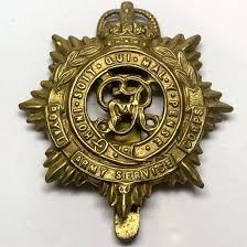
  • RASC dispatchers – Robert William Hayton & Reginald Shore

Robert William Hayton:

The time of qualifying as a Flight Engineer to the time of his death was only 10 months. He had flown a total of 121 hours daylight and 110 night. He was 24, leaving a wife and baby daughter.

Postscript

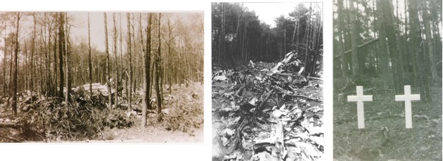
As I mentioned earlier, much of the above information has only come to light during my research since 1994. Dick and Stan’s 3 sisters and one brother, together with Dick’s wife and daughter have only learned recently what quiet heroes these young lads were. In 1994, the 50th Anniversary of Arnhem I visited the town and saw where the fighting took place. Although some 90 aircraft were lost in total, I managed to locate the crash site of Dick’s aircraft, deep in pine woods some 5 miles to the North-West of Arnhem – they had evidently dropped their supplies and were on their way home. The crash site was very much like Stan’s – a peaceful pine forest, but still with broken pieces of aircraft clearly visibly across a wide area. Again, I had an unbelievable stroke of good fortune. The owner of the woods produced two photographs taken of the crashed aircraft and kindly provided copies for me. To be able to actually see the crashed aircraft 50 years later was remarkable.

Pictures courtesy of Mr Koker, the land owner:

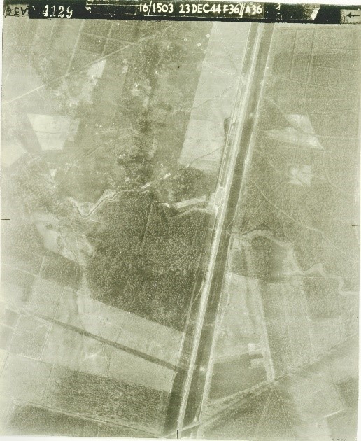
Aerial photo taken 3 months later 23rd Dec 1944. The crash site is the rectangular shape in the centre of the picture, to the left of the road and railway line. The Germans collected the metal to recycle.

Although there are memorial stones in the Arnhem cemetery to all the crew of six plus the two Army Air Corps dispatchers who were pushing the supplies out of the aircraft, it was known that only three bodies were actually found. Our family have always believed for the last 50 years that Dick was literally blown to pieces. Although his wife has visited the gravestone, she felt that this had little meaning as “Dick was not there”. After my return to England I received a letter from the Dutch man who owned the woods. He had found a negative and had it developed. It showed two crosses. Of the eight people on board, three bodies had been found and buried alongside the plane. Of these three bodies the picture only showed two crosses. On one of the two crosses it is possible to make out on the original enlargement the words “An unknown British Airman”.    On the other is my Uncle’s name –R.B. BOND

My Aunt (Dick’s wife) and her daughter went back to Arnhem in September 1994 for the 50th Anniversary Commemorations. For my Aunt, it was to say a final Goodbye to her husband after 50 years. For her daughter, it was to say Hello to the Father she never knew.

In October 2002 Aunt Jessie died. It was Dick’s daughter’s wish that her mum’s ashes would be buried at her father’s grave in Arnhem. Re-united at last.

The Commonwealth War Graves Commission advise that Robert Hayton was found in or near the aircraft and given a field burial by local Air Raid Wardens in the Onder de Bomen General Cemetery Renkum and was re-interred to Arnhem Oosterbeek War Cemetery on 22 August 1945.

The CWGC advise that Dispatcher Shore’s unidentified body was initially buried by the crashed plane in the wood and was subsequently moved to Arnhem in March 1946. He was later identified in 1987 as the other members of the aircraft had been positively identified.

This report is my small tribute to the brave young men who gave their lives for our freedom

Headstones of the Aircrew Baker, Blencowe, Bond, Booth, Dickson & Totterdell

Oosterbeek Commonwealth War Graves Cemetery

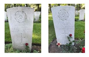
Headstones of the RASC Army Dispatchers Hayton & Shore

I am really grateful to Paul for telling the remarkable story of those named on the temporary grave marker in my father’s photo, and for letting me publish it on the blog. If anyone has any additional information, or are relatives of the other aircrew, Paul can be contacted on:


The View from Greenwich Park – Watching the City Evolve

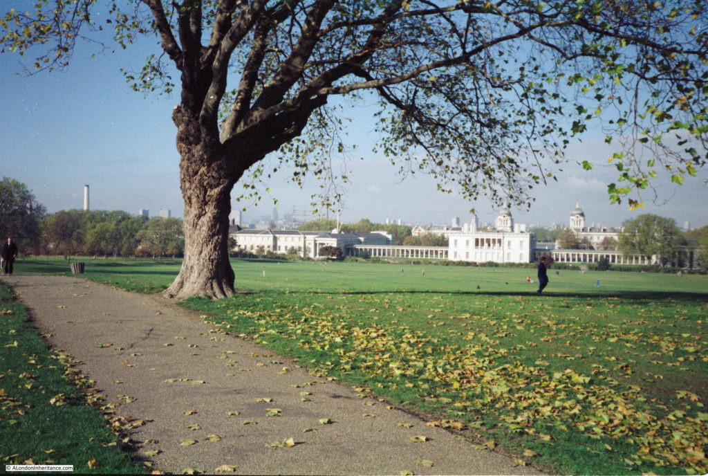
Last Sunday was one of those lovely autumn days when it was sunny, clear blue sky, and views were clear, with a lack of haze. To take advantage of the weather, I headed to see the view from Greenwich Park, one of my favourite locations to watch how London has been evolving over time.

My first visits to Greenwich Park were in the 1970s when our parents would take us for walks across the park and down to the river. The park has been a destination for repeat visits every few years since, with the high point adjacent to the Royal Observatory providing a location to view the changes across the Isle of Dogs and the City.
I wrote about the view from Greenwich Park in one of my first posts in 2014, and it is dramatic how the view has changed in just the five years since.

I am also slowly working through scanning of my own photos, and recently found a few more photos of the view from Greenwich Park, so for this week’s post, I thought I would explore how the view has changed over the centuries, and the rapid developments of the last few years.

The view from Greenwich Park has always attracted artists. the proximity of the Royal Observatory, Queen’s House, Royal Naval College and Hospital added interest to the view over the River Thames, and west towards the City of London.

I will start with the seventeenth century, and a view from:

1676

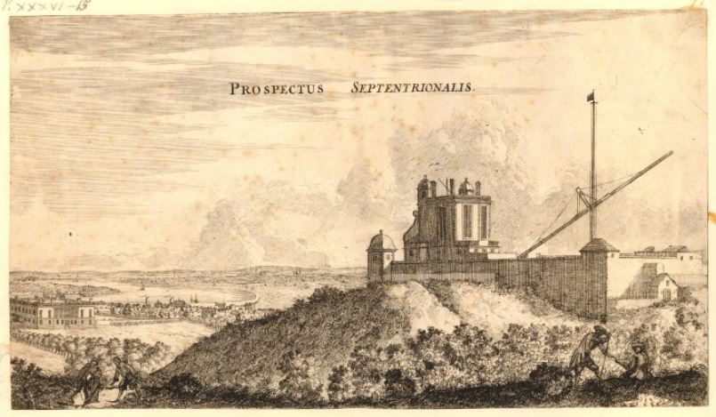
This print from 1676 shows the Observatory looking to the north, with the Queen’s House and the City of London in the distance. I am not sure if it is geographically accurate, but the river is on the left of the print with the City in the distance.

View from Greenwich Park

The print was made 10 years after the Great Fire, and before the completion of St Paul’s Cathedral, so this future landmark in the City is not yet shown in views from the park, but this would change in the 18th century:

1750

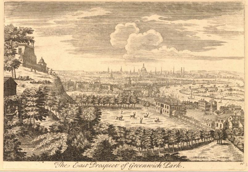
The following print is dated between 1740 and 1760, and provides a more accurate representation of the view from Greenwich Park.

View from Greenwich Park

The Royal Observatory is on the left, the Queen’s House to the right, and the dome of St Paul’s Cathedral with the spires of the City churches very visible in the distance. This would be the view of the City for much of the following two hundred years.

On the right, the river curves around the southern edge of the Isle of Dogs, still very rural with the 19th century industrialisation, docks and housing yet to appear.

1811

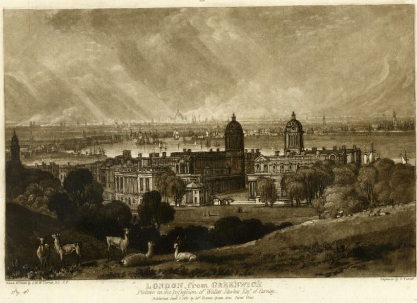
This print by J.M.W. Turner from 1811 shows the buildings of the Royal Naval College and Hospital. which have been constructed between the Queen’s House and the river.

View from Greenwich Park

In the distance we can still see St Paul’s Cathedral and the spires of the City churches. There is more shipping in the river and the print gives the impression of a more industrial environment along the river’s edge.

(The above three prints are © The Trustees of the British Museum)

1926

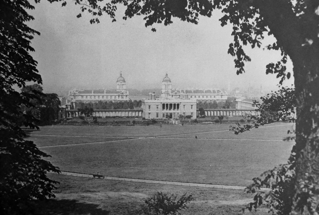
In 1926, the book Wonderful London included a photo of the Queen’s House and the Royal Naval College.

View from Greenwich Park

The photo looks across to the Isle of Dogs rather than the City, but the low rise nature of the buildings across the river are hidden in the haze and photo / print quality from the 1920s.

1953

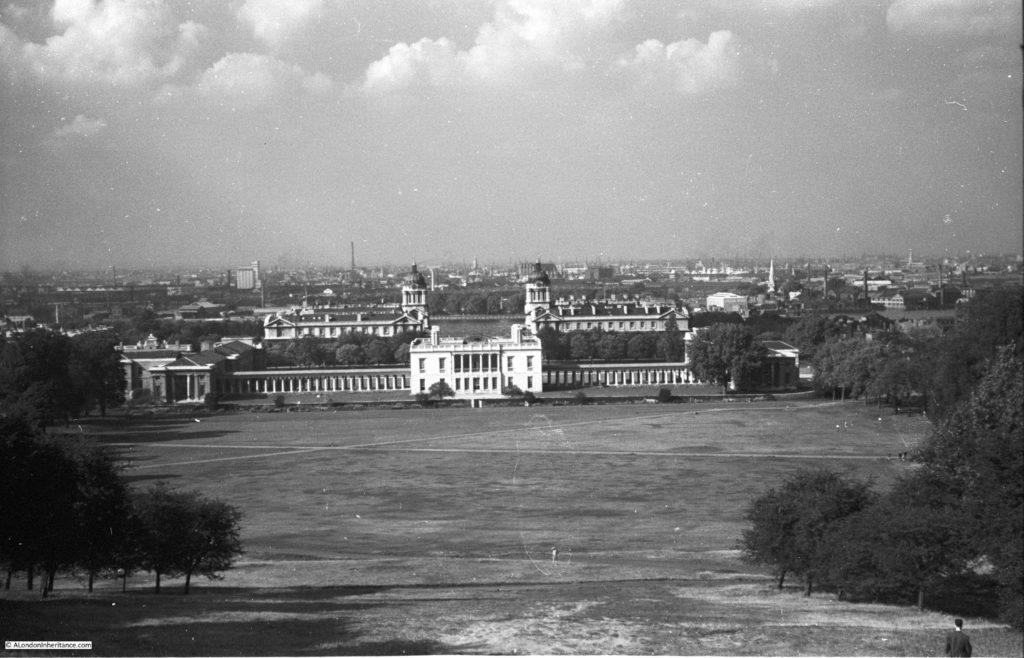
In 1953, my father photographed the view from Greenwich Park, looking across to the Isle of Dogs.

View from Greenwich Park

The view across the river is still of low rise construction. The cranes lining the docks, the occasional chimney, and some large warehouses and grain stores.

I only wish my father had taken a photo of the view across to the City, but like the majority of photos taken from the high point adjacent to the Royal Observatory, it is the view across the park to the Queen’s House and Royal Naval College that provide the historic / scenic interest.

Working on this blog, and looking at the historical record in photos, what interests me is how photos record how the city changes, so I take photos of even the most mundane scene as you never know what the same view will be like in years to come.

I now come to the first of my photos:

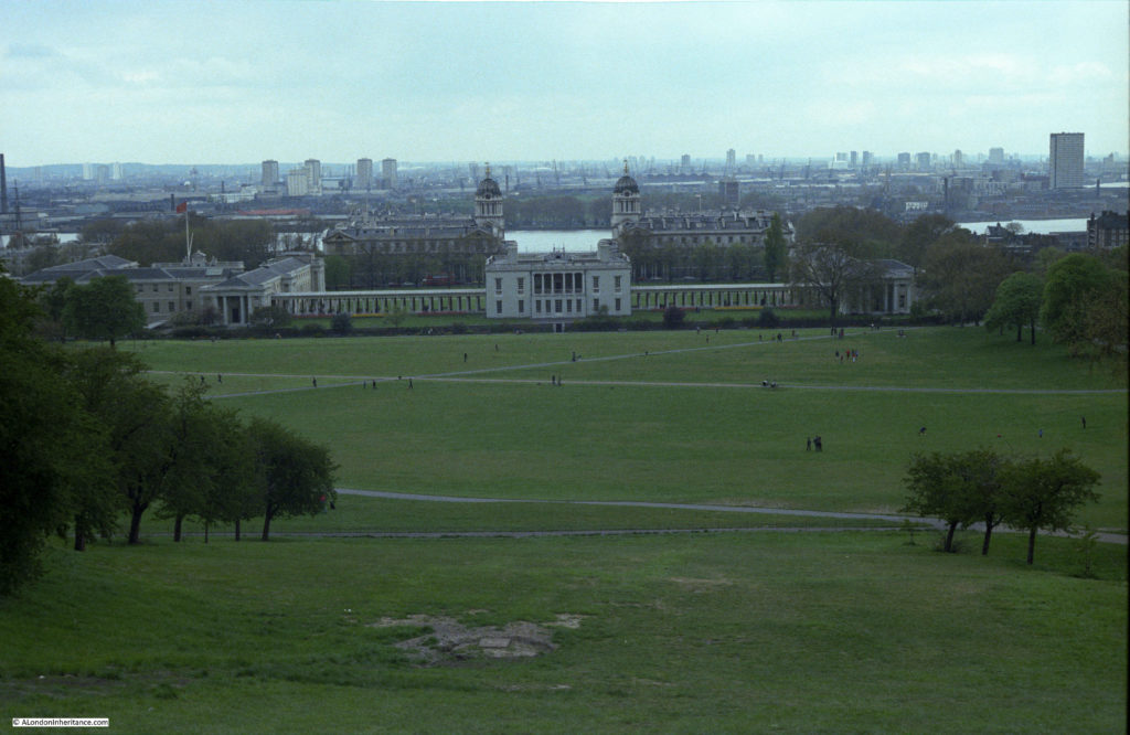
1980

I took the following photo many years before I had seen or scanned my father’s photos, but it is remarkable how similar it is to the above photo, even the trees on the right look as if they have hardly grown in the 27 years between the two.

View from Greenwich Park

The view across to the Isle of Dogs is much the same, however there are now a number of tower blocks of flats starting to appear across east London.

The Cutty Sark, which arrived in Greenwich in 1954 is just visible on the left of the photo.

When I started taking photos of the view from Greenwich Park, I did photograph the view across to the City, not with any intention of seeing how the view would change, but I remember taking this photo because the first large office tower built in the City was now visible from Greenwich Park.

View from Greenwich Park

The NatWest Tower (now Tower 42) had just been completed when I took the above photo and the tower can seen in the centre of the photo – an indicator of the changes to come.

1986

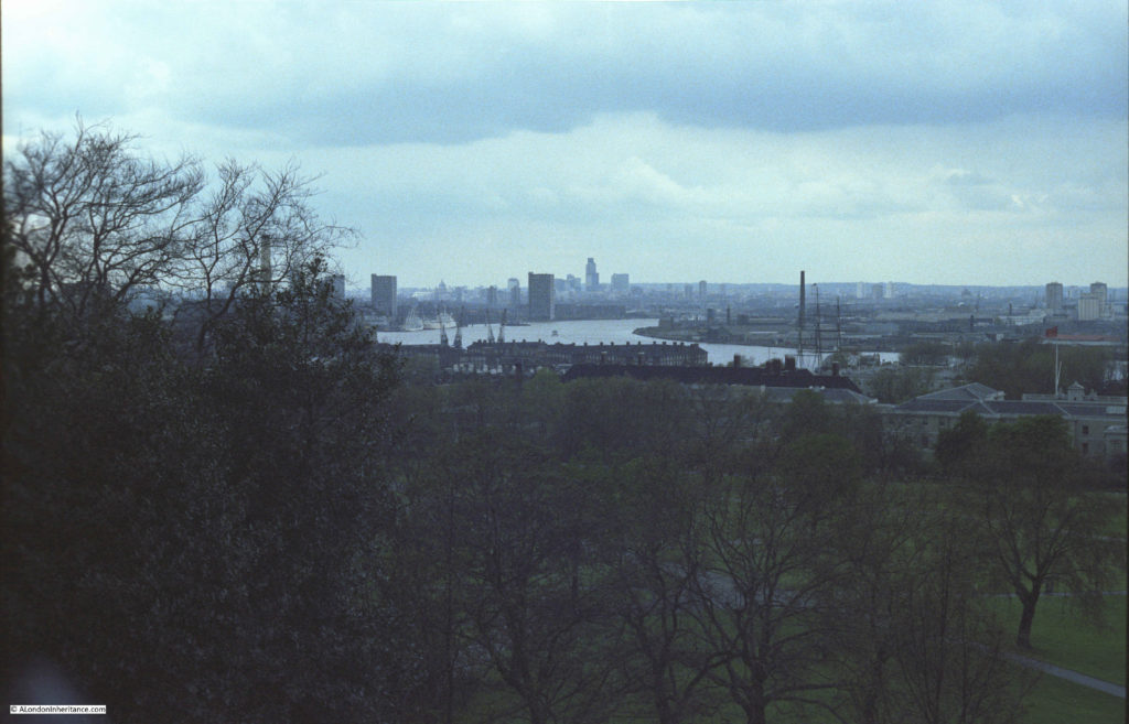
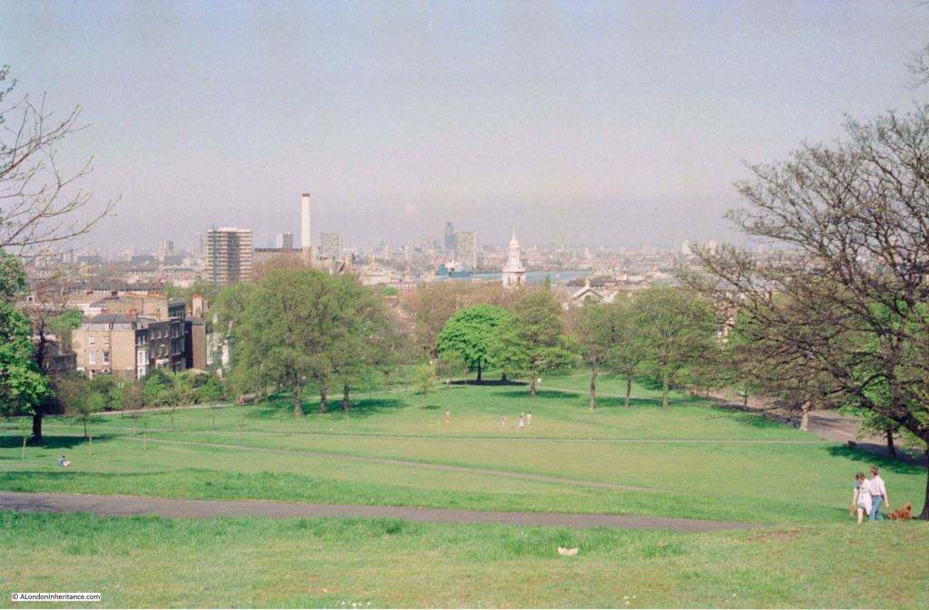
In 1986 I was back in Greenwich. I have not yet found the negative with the view from the top of the park, but I did find this view from one of the paths leading down from the viewpoint by the Royal Observatory towards the river.

View from Greenwich Park

Again, the view across to the Isle of Dogs has very little in the background.

I also took the following photo during the same year looking across to the City.
View from Greenwich Park

The NatWest Tower is visible in the City. The chimney towards the left of the photo is at Deptford Power Station.
Both the above photos were taken during visits at the weekend, on lovely sunny days. They highlight how visitor numbers have changed over the last couple of decades, as in the 1980s, even on a sunny day, the park was not that busy.

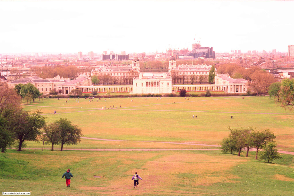
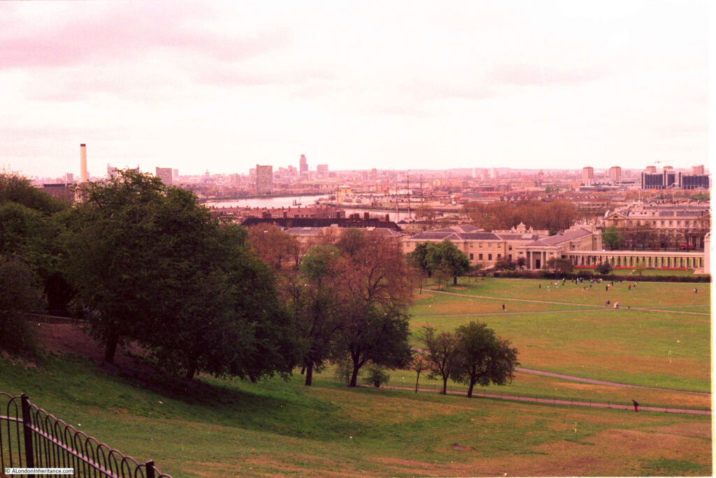
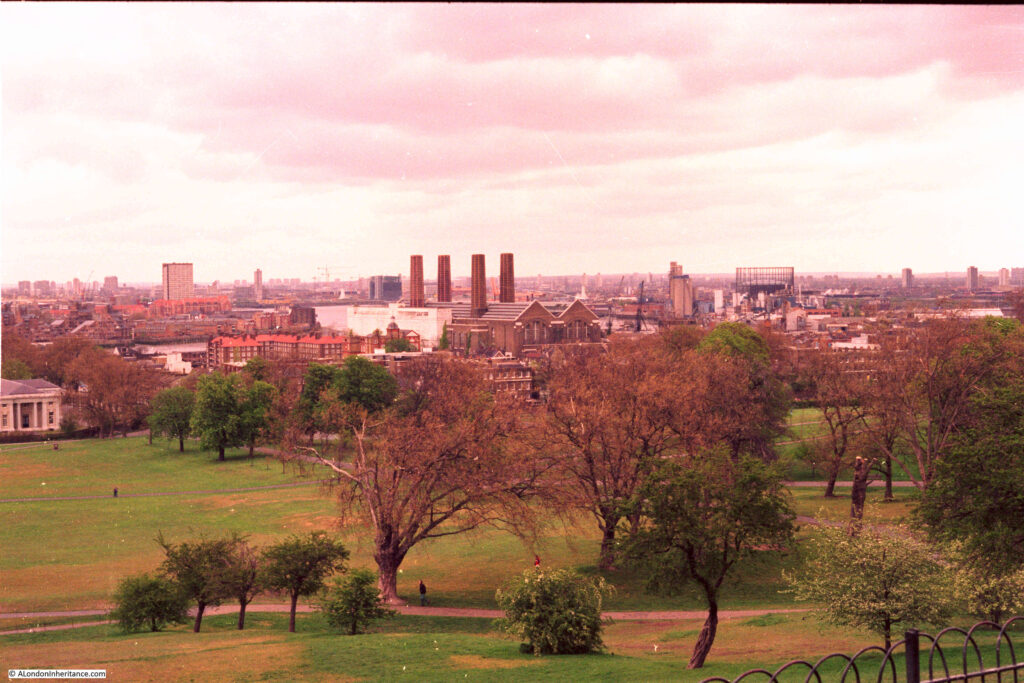
1989

Three years later and we can see 1 Canada Square, the focus of the Canary Wharf development starting to be built.

The quality of my 1989 photos is not good. I have tried several processing options, but I cannot get the colour balance right.

in the distance there are cranes and a mass of steel frame where 1 Canada Square (the tallest building in the Canary Wharf development) has started construction, along with a number of other buildings of the development. The first indications of the considerable changes to the view from Greenwich that will take place over the coming years.

Looking to the west and the view is much the same, with the original NatWest Tower being the stand out feature of the City of London.

Looking to the east, with the four chimneys of the power station, and the gas holder on the Greenwich Peninsula.

I have not yet found any negatives with photos from the 1990s, so lets jump to the year 2007 and some dramatic changes have started.

2007

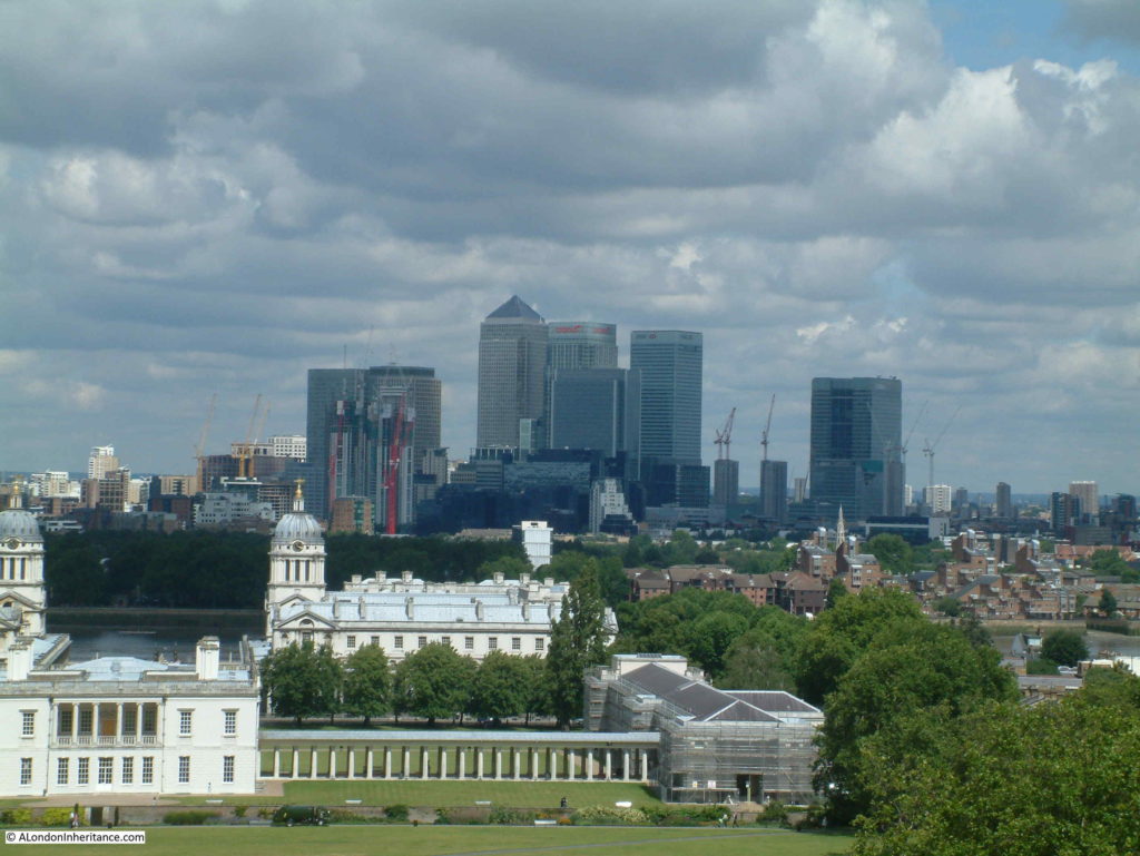
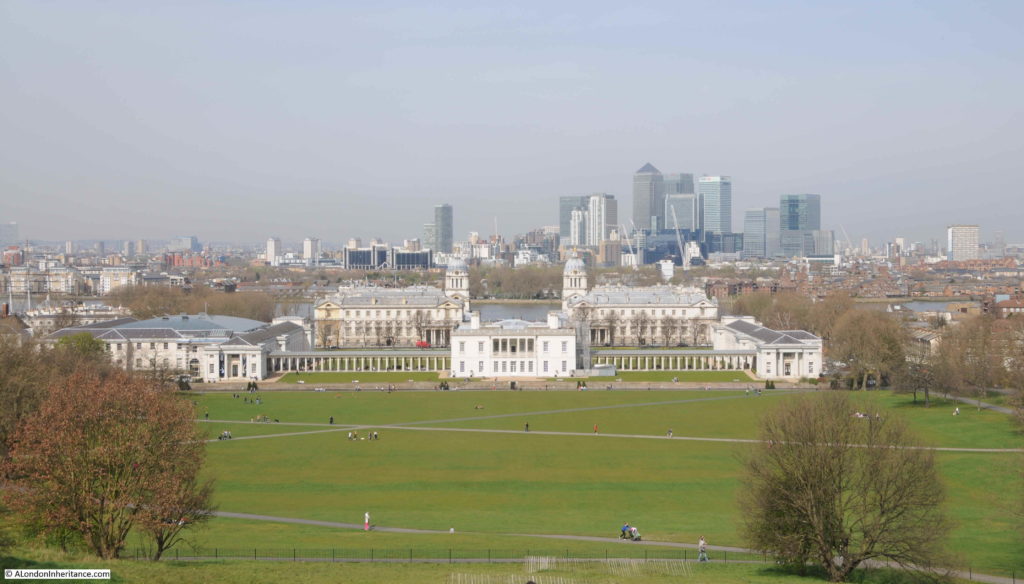
In 2007, the office towers clustered around Canary Wharf present a dramatic change in the view from Greenwich Park

View from Greenwich Park

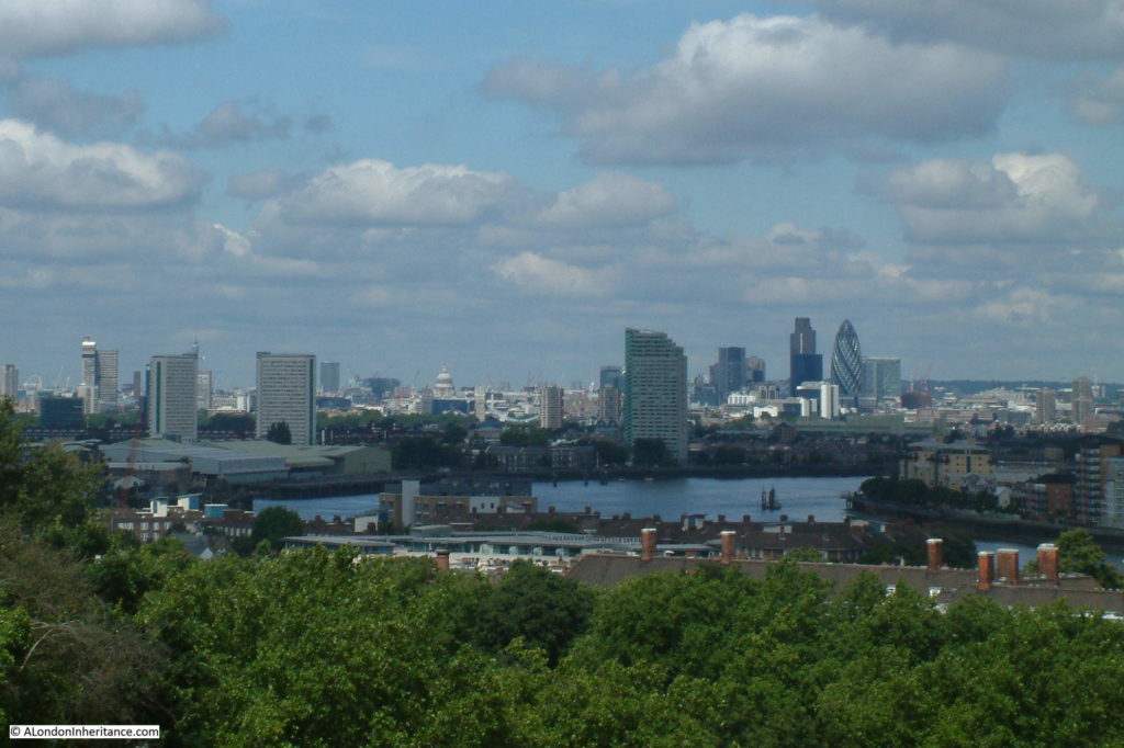
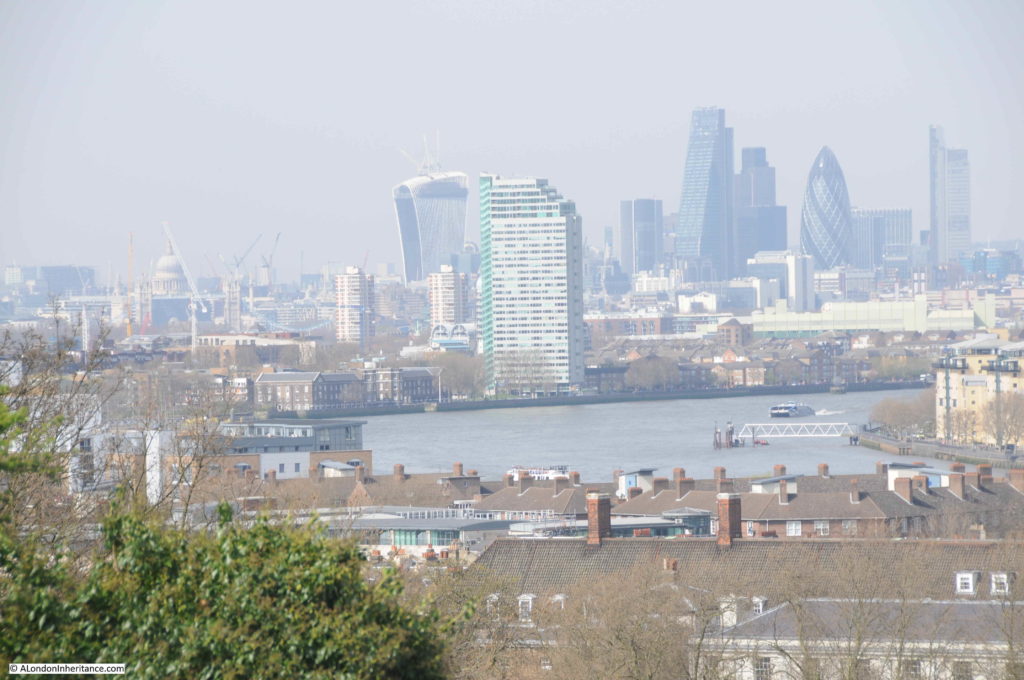
And looking towards the City of London, and whilst the NatWest Tower is still prominent, it has now been joined by the Gherkin (30 St Mary Axe), completed in 2003.

View from Greenwich Park

St Paul’s Cathedral stands out to the left of centre.

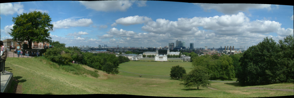
I had started playing with stitching photos together to make panoramas when I took these photos and the following is made from a number of photos from the Royal Observatory on the left across to the Millennium Dome on the right (click on the photo to enlarge).

View from Greenwich Park

My next visit was in:

2010

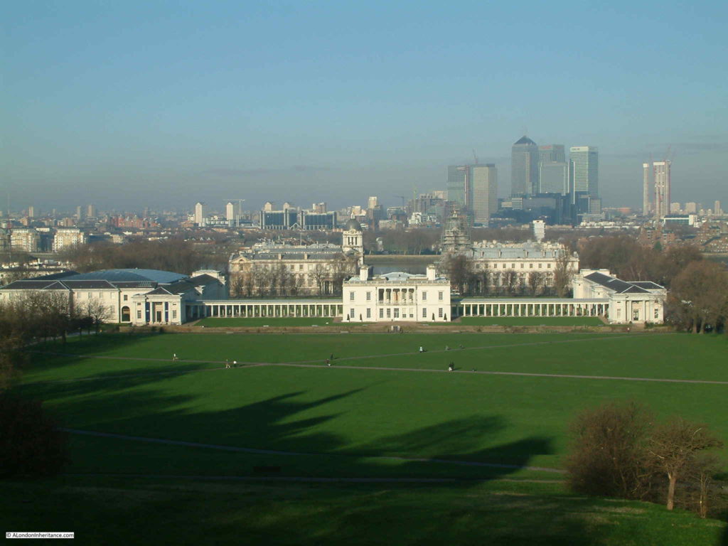
And the view across to the Isle of Dogs is much the same as it was in 2007:

View from Greenwich Park

Four years later I was back again:

2014

I took the following photo for one of my first blog posts, in April 2014 when I first wrote about the view from Greewich Park.

View from Greenwich Park

The view across to the Isle of Dogs is much the same as in 2007, but the view of the City has changed.

View from Greenwich Park

The NatWest Tower is still visible, with the Cheesegrater (the Leadenhall Building), completed in 2013 to the left of the NatWest Tower. The just completed Walkie Taking building (20 Fenchurch Street) is to the centre left, with the Heron Tower (completed in 2011) on the right.

Now jump 5 years later to:

2019

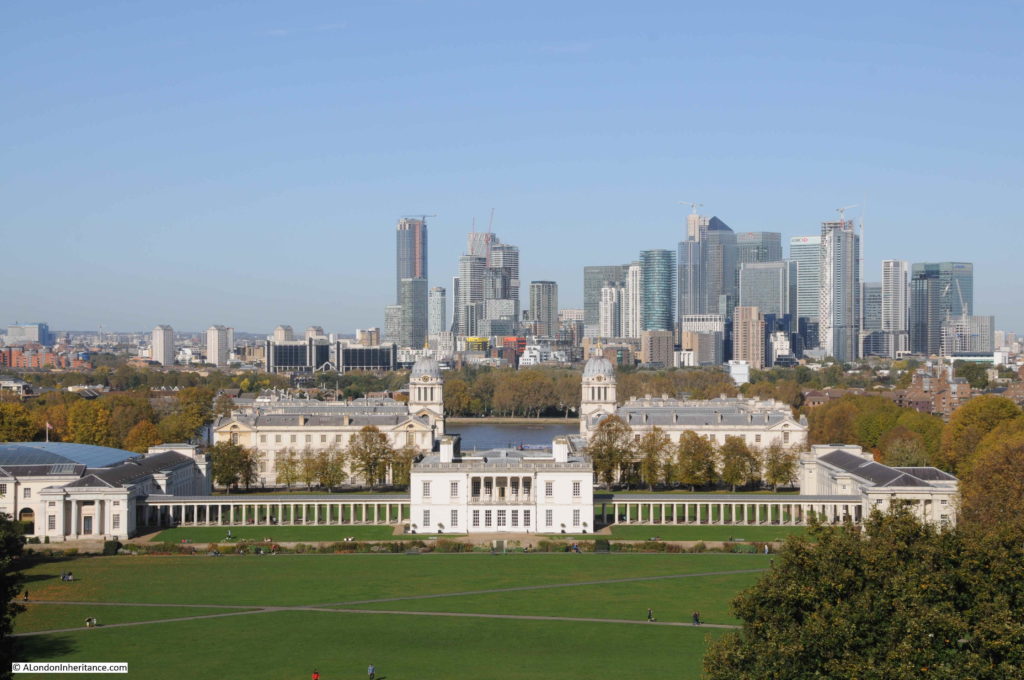
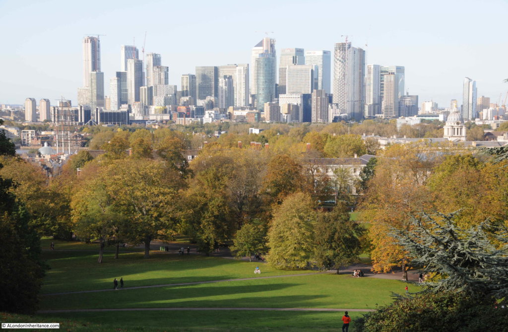
This was the view last Sunday from Greenwich Park across to the Isle of Dogs.

View from Greenwich Park

One Canada Square, the tower block with the pyramidal top, is almost lost among a jumble of different towers, which now consists of not just office blocks, but residential towers.

Note how the four blocks of flats on the left, which were first seen in my 1980 photos when they stood out as some of the tallest buildings in the view, have now been dwarfed by their new neighbours.

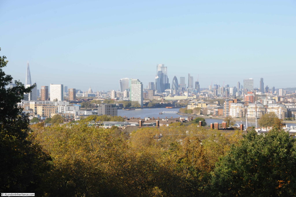
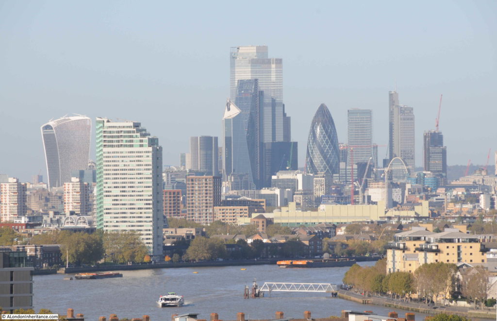
The view across to the City has changed.

View from Greenwich Park

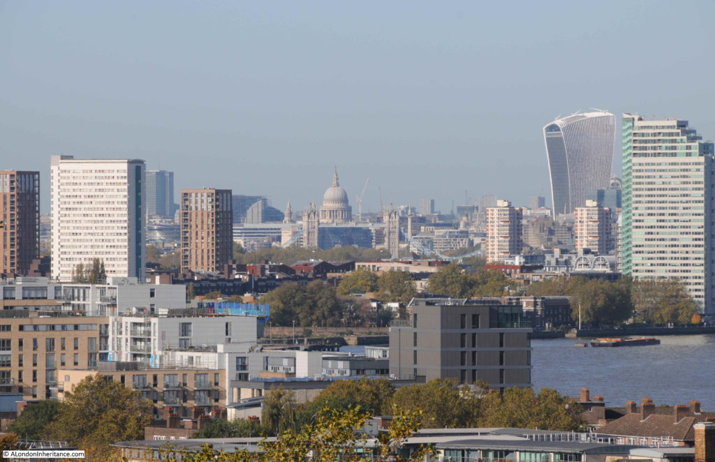
The Shard is now visible on the left, and the office blocks in the City have grown.

The view of St Paul’s Cathedral is still unobstructed:

View from Greenwich Park

The recent completion of 22 Bishopsgate, the large block to the left of the Gherkin, almost completely hides the NatWest Tower, with the edge of the building just peeping out at the side of its much taller neighbour.

View from Greenwich Park

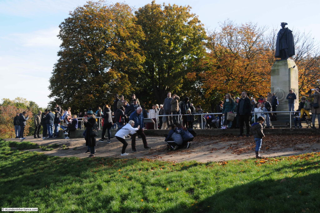
There is another viewpoint just to the west of the Royal Observatory. It is a good place to look at the view without the crowds that now cluster around the statue of General Wolfe, just outside the Royal Observatory, and from this viewpoint there is a better view of the cluster of towers across in the Isle of Dogs.

View from Greenwich Park

It is remarkable how rapid the development has been. Comparing with my 2014 photos show the degree of construction in just the last 5 years.

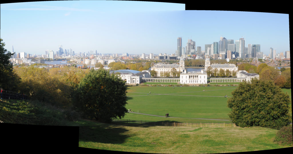
A 2019 panorama:

View from Greenwich Park

The view from Greenwich Park must be one of the most photographed views in London. The area outside the Royal Observatory, in front of the statue of General Wolfe is frequently crowded with people taking photos or just looking across to the towers of glass and steel that now dominate the view.

View from Greenwich Park

If I manage to keep up the blog for another 5 years, I will have to return to Greenwich and see how the view has changed and how many more towers have grown across London, and hopefully by then I can also fill in some of the missing years when I find and scan the negatives.

The Greenwich Peninsula is fast developing, and the Peninsula, Isle of Dogs and the City will be  three large clusters of towers that dominate the future view from Greenwich Park.

alondoninheritance.com