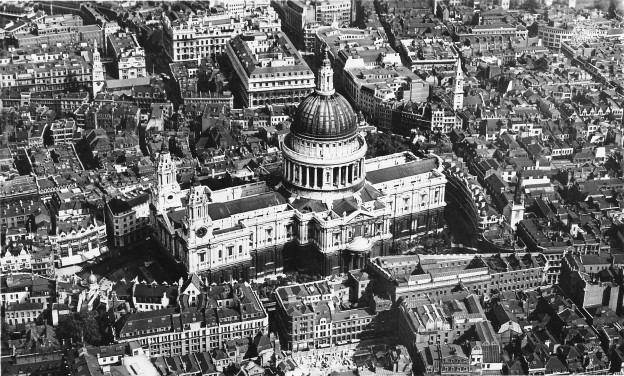
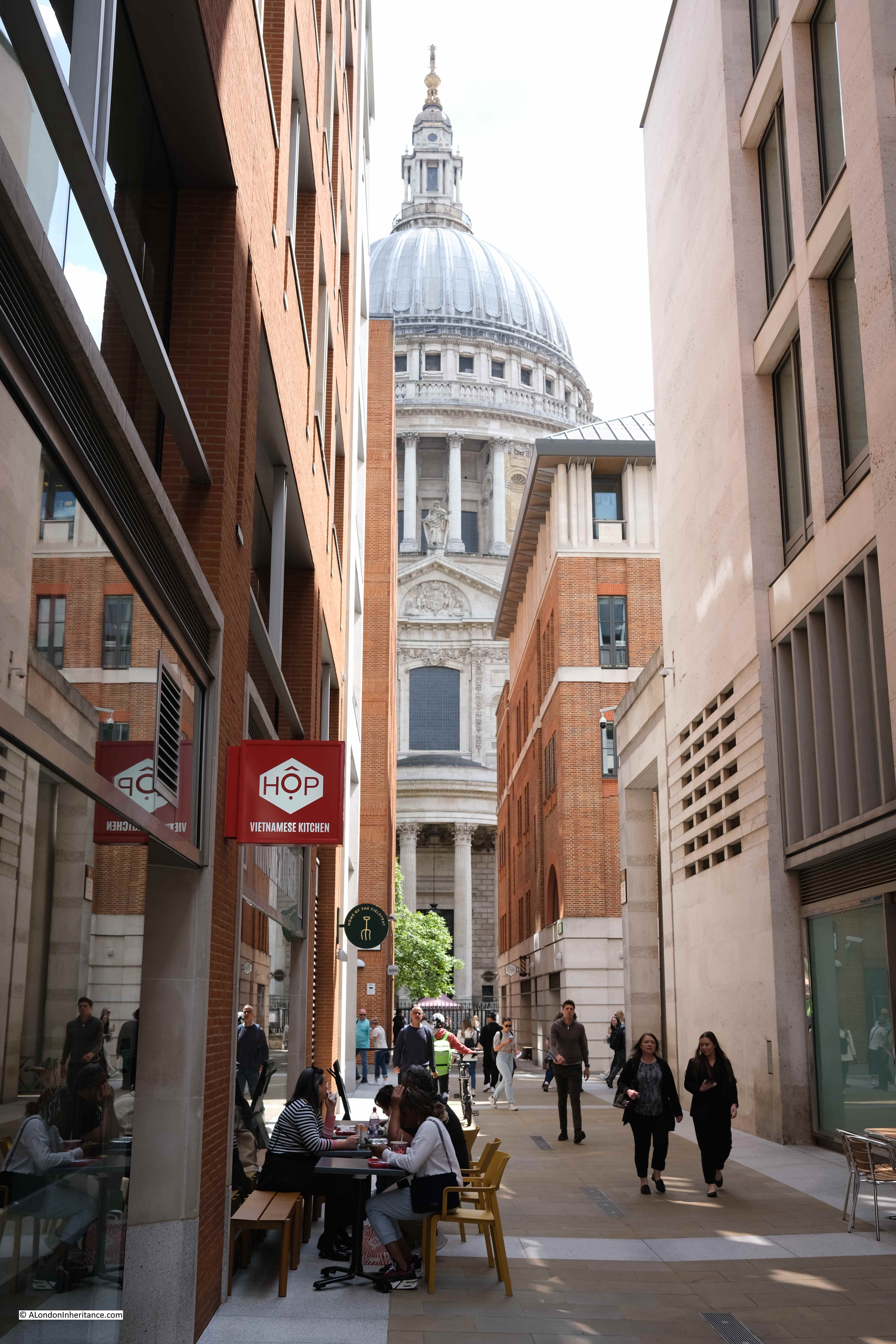
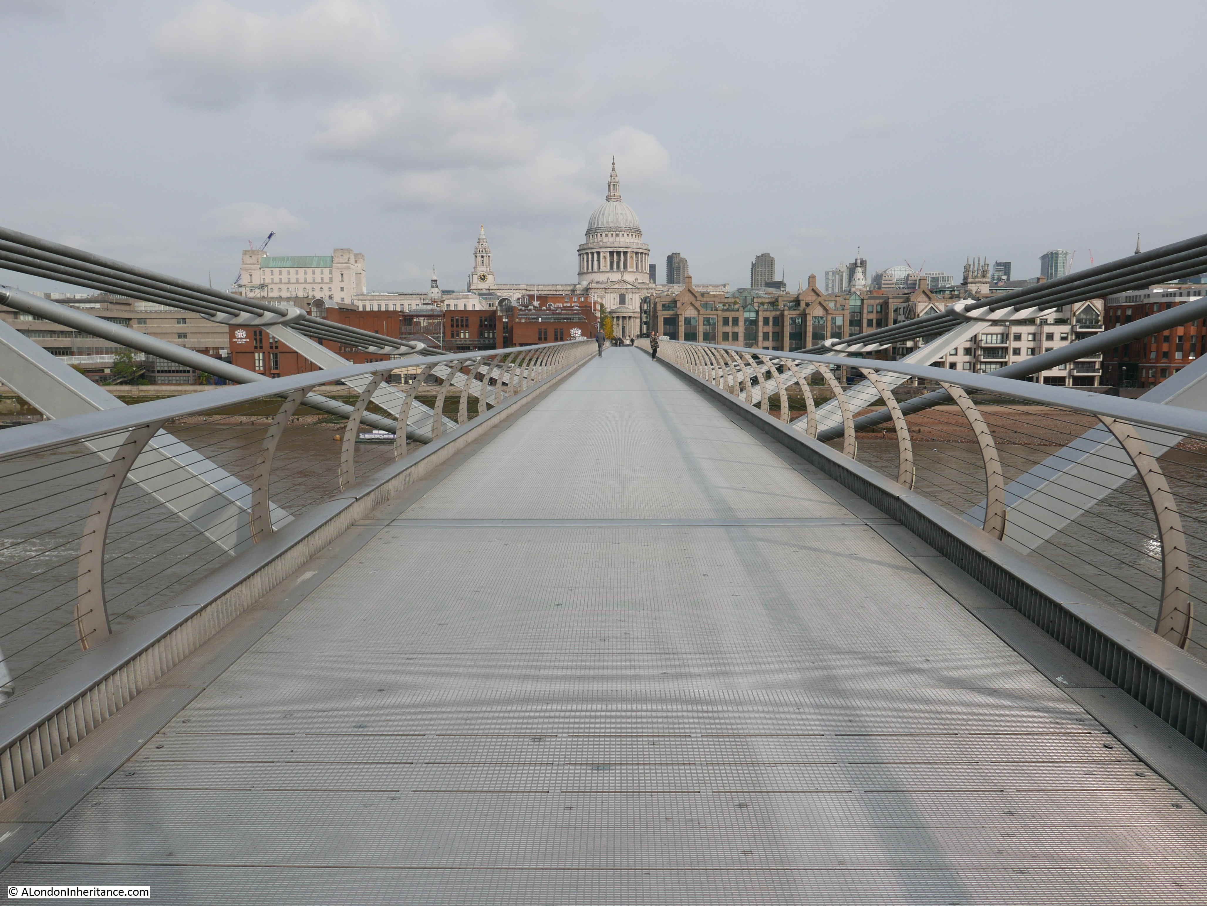
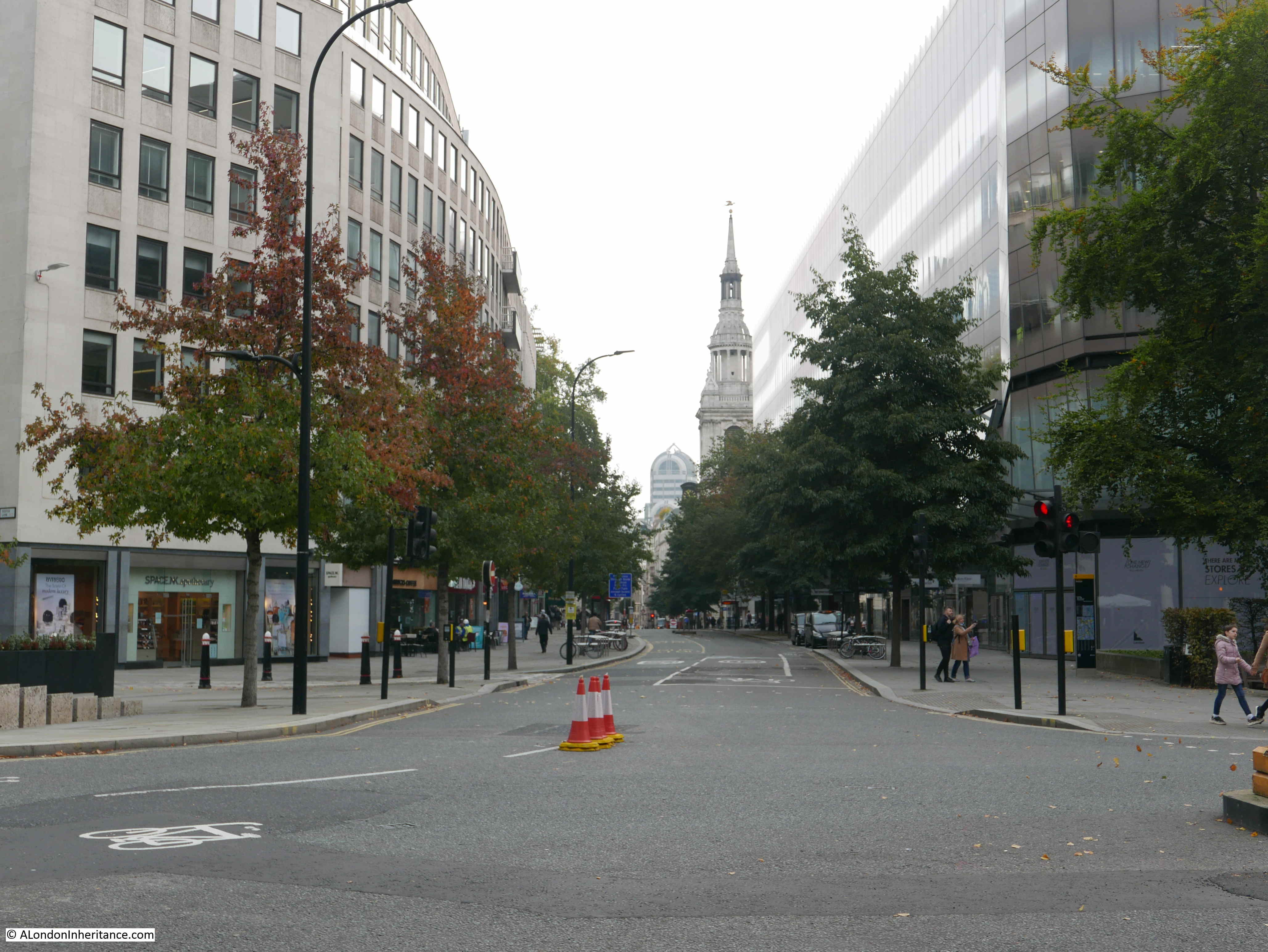
Back in October, in a post on two London churches and a Battersea Gas Holder (no connection between them – just some random features of London), I wrote about All Hallows Staining and the 50 Fenchurch development. I was rather frustrated that you could not get a view of the tower of the church on stilts as the main development went on around the ancient remains of All Hallows Staining.
A comment from a reader (thanks Brian J) informed that a view of the building site and the church was available from the viewing area at 120 Fenchurch Street – one of the new public viewing spaces on top of a recent City development.
The Garden at 120, to give the space its correct name, has been on my list of places to visit, but stupidly I had not made the connection between the viewing area and the building site directly in front.
I fixed that last week, with a visit to explore another view across the City.
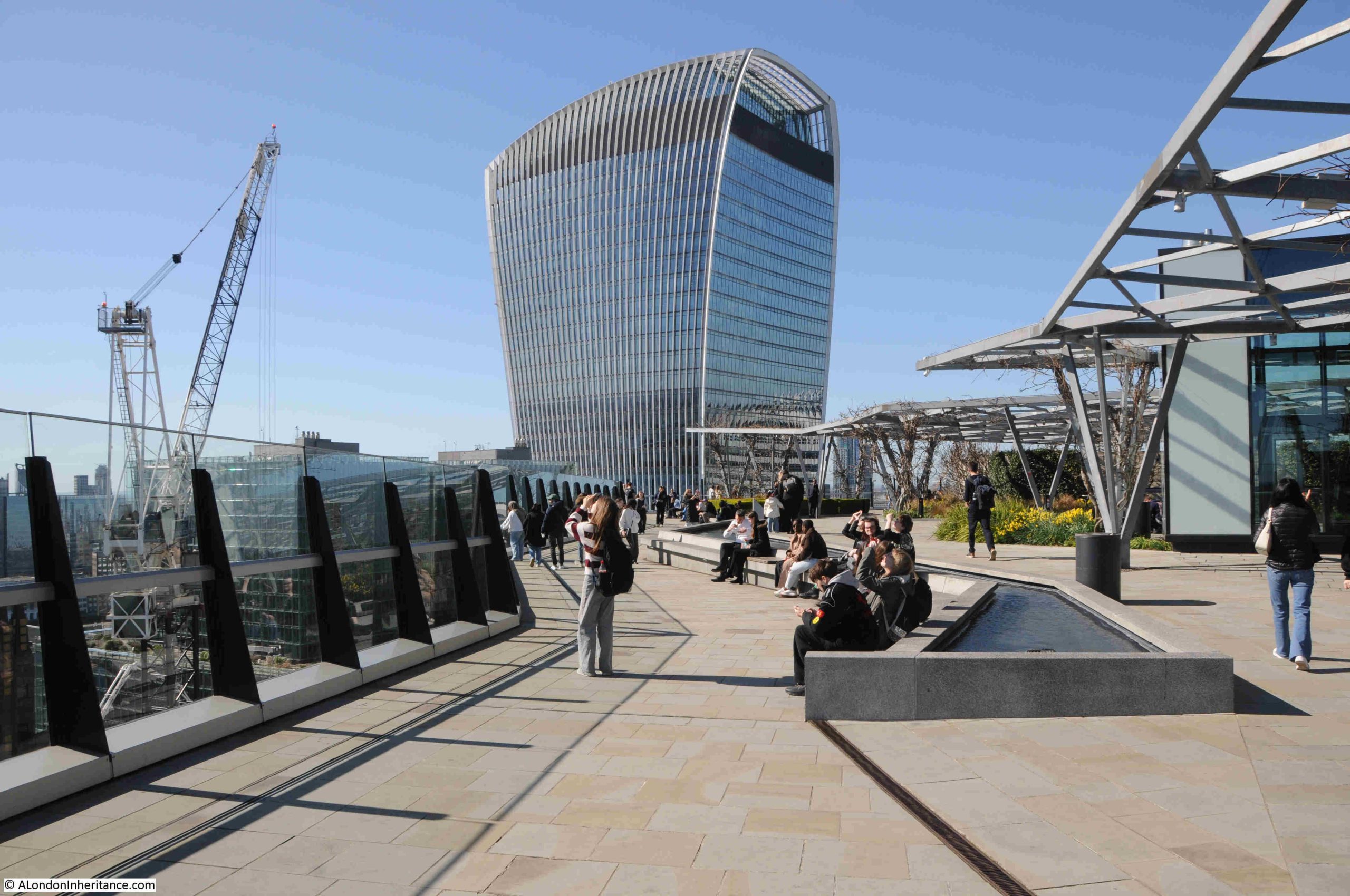
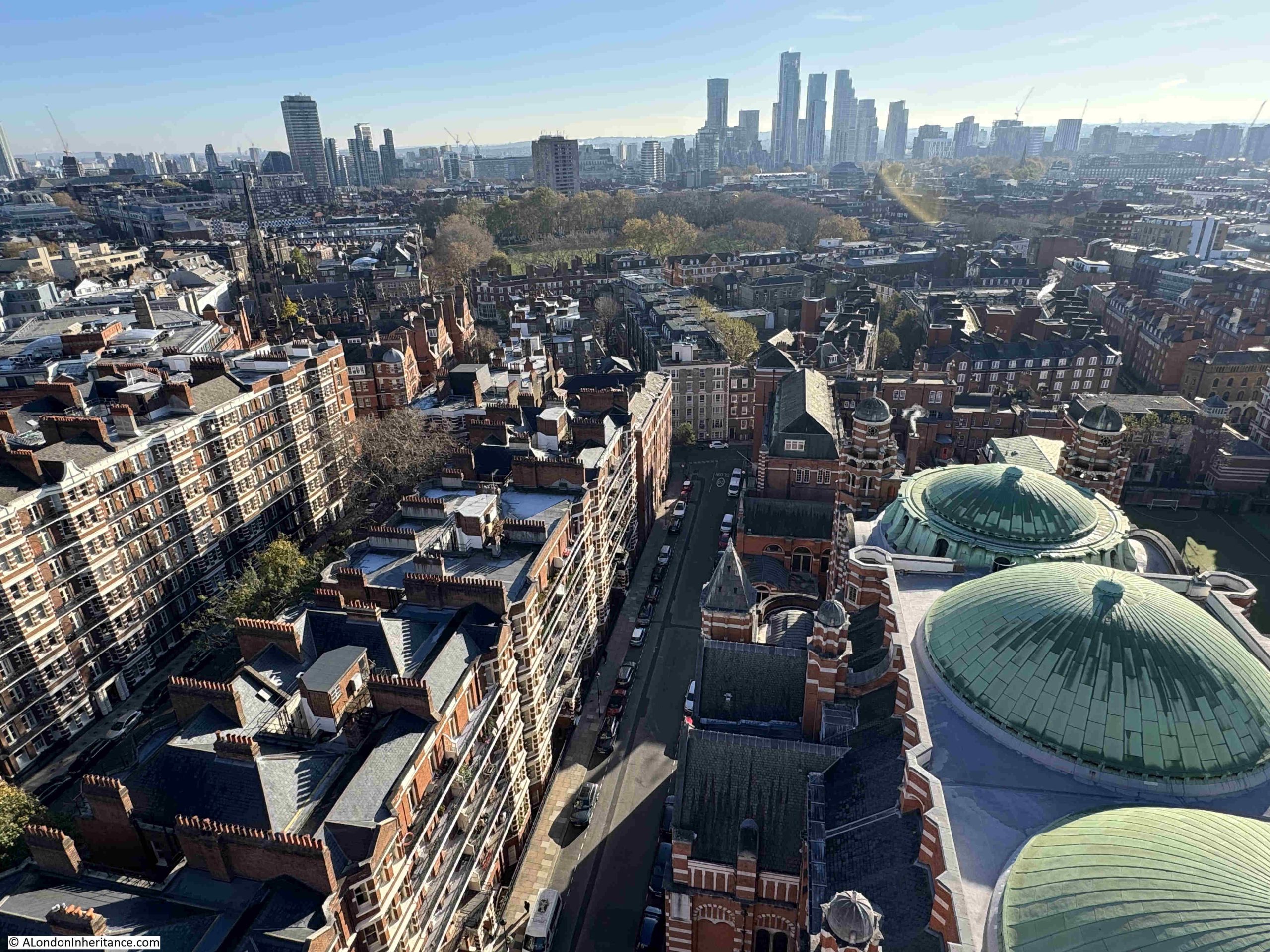
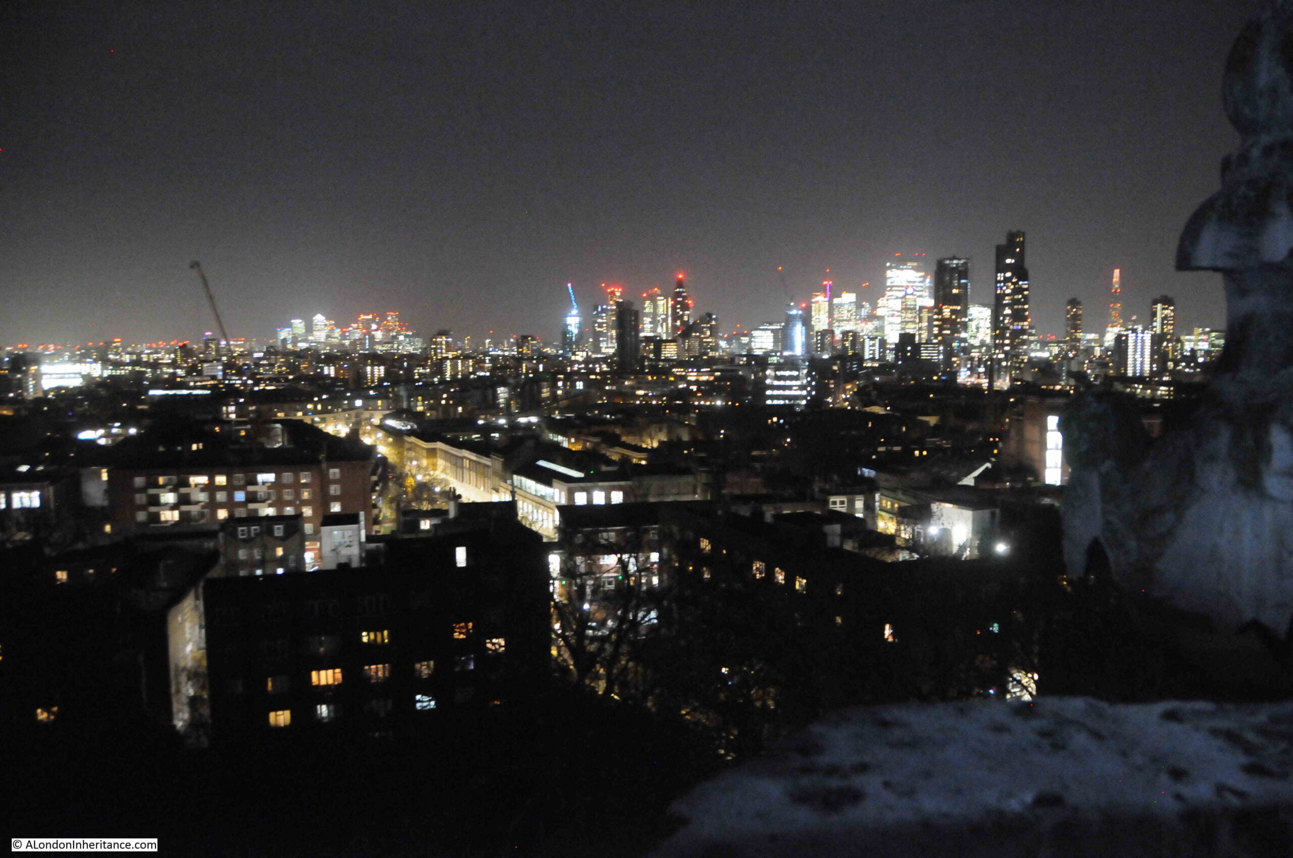
The Garden at 120 is free, does not require a ticket and following a very brief wait in a small queue, the inevitable security check, then the lift took me to the 15th floor, which leads directly out to the viewing area:
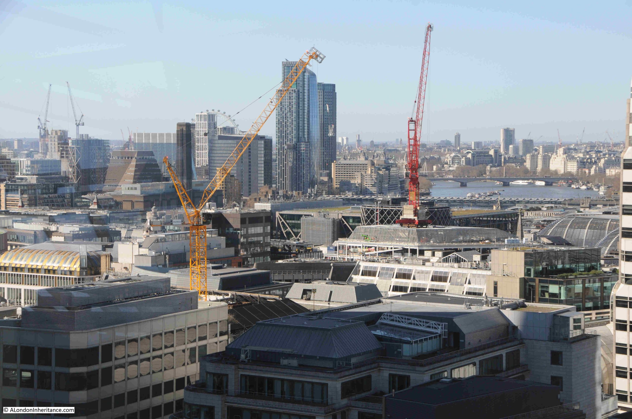
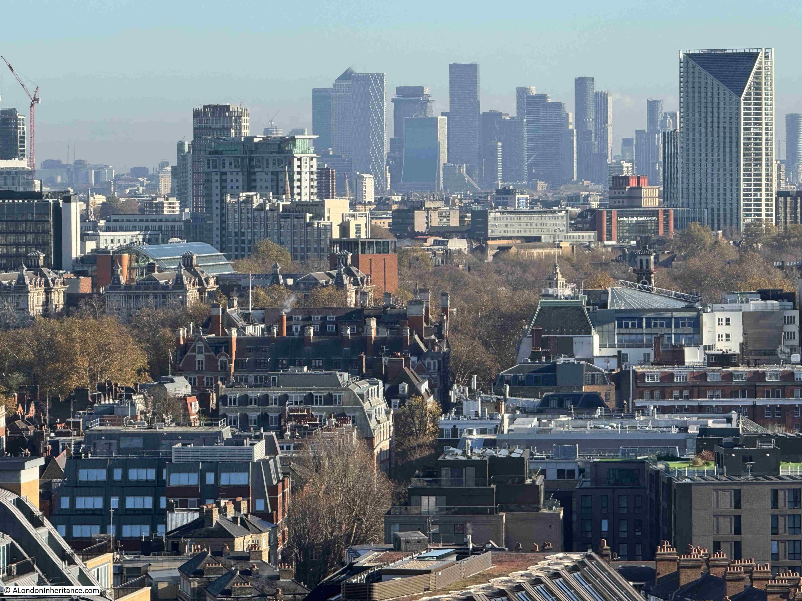
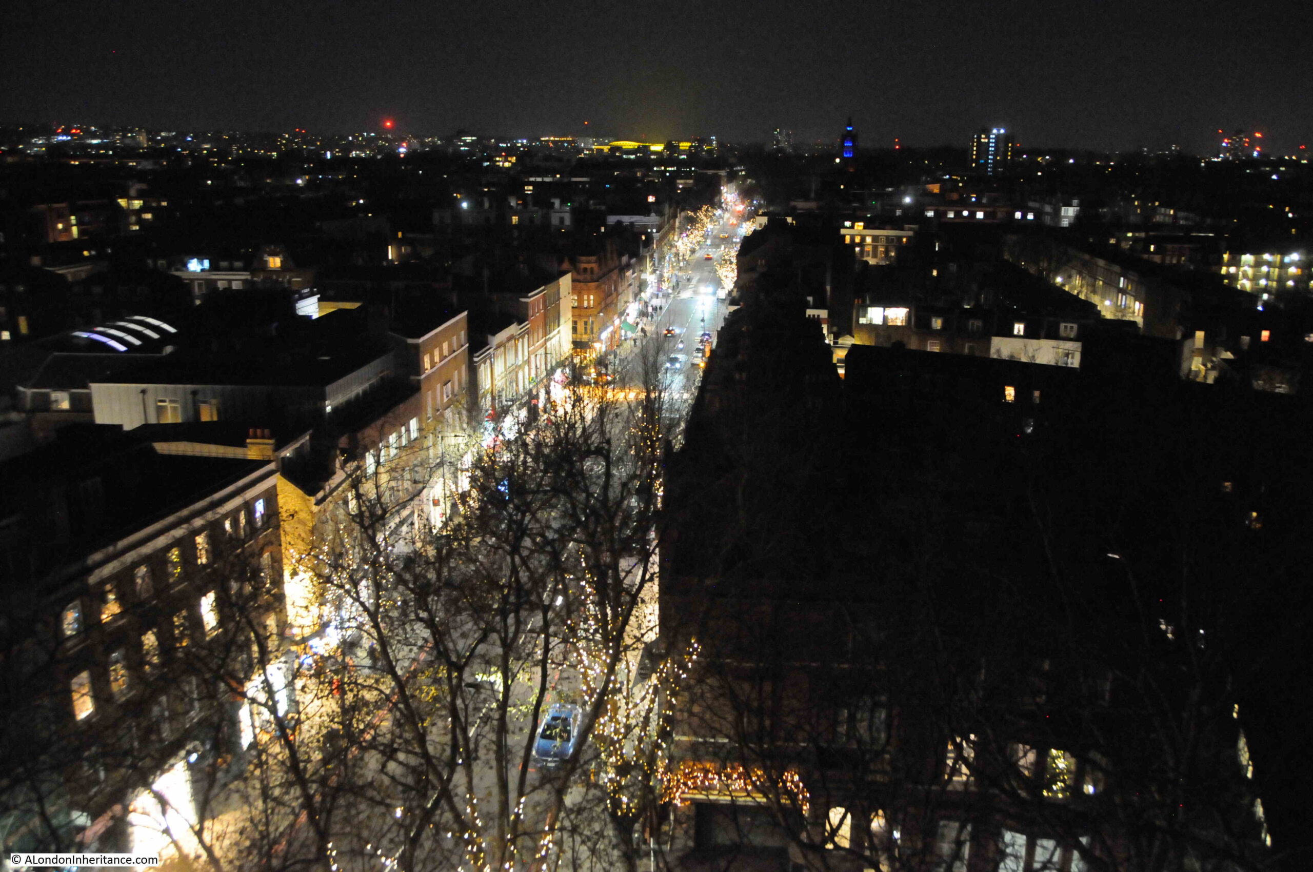
The above view is of the south facing part of the viewing area, which also runs around all four sides.
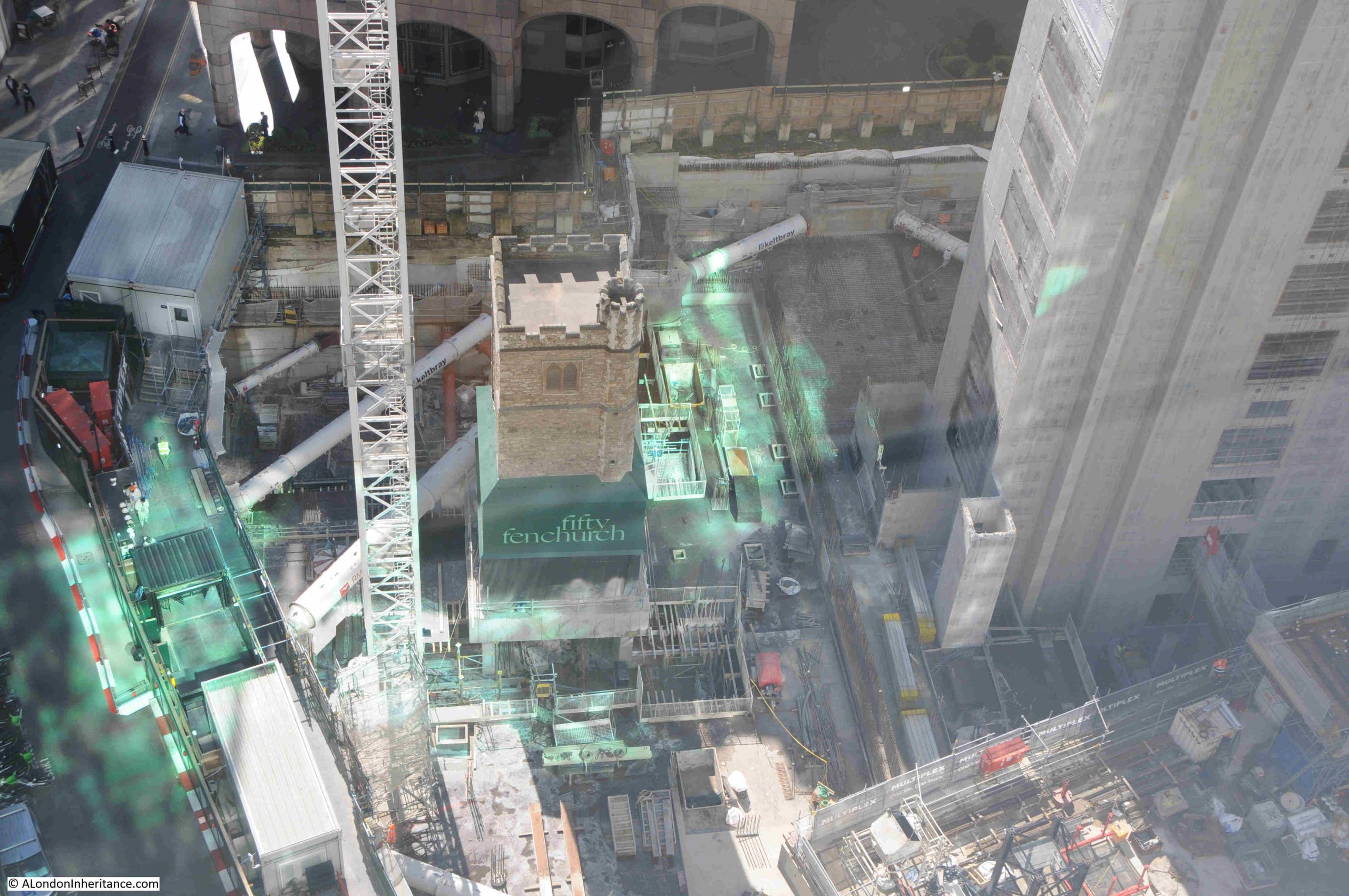
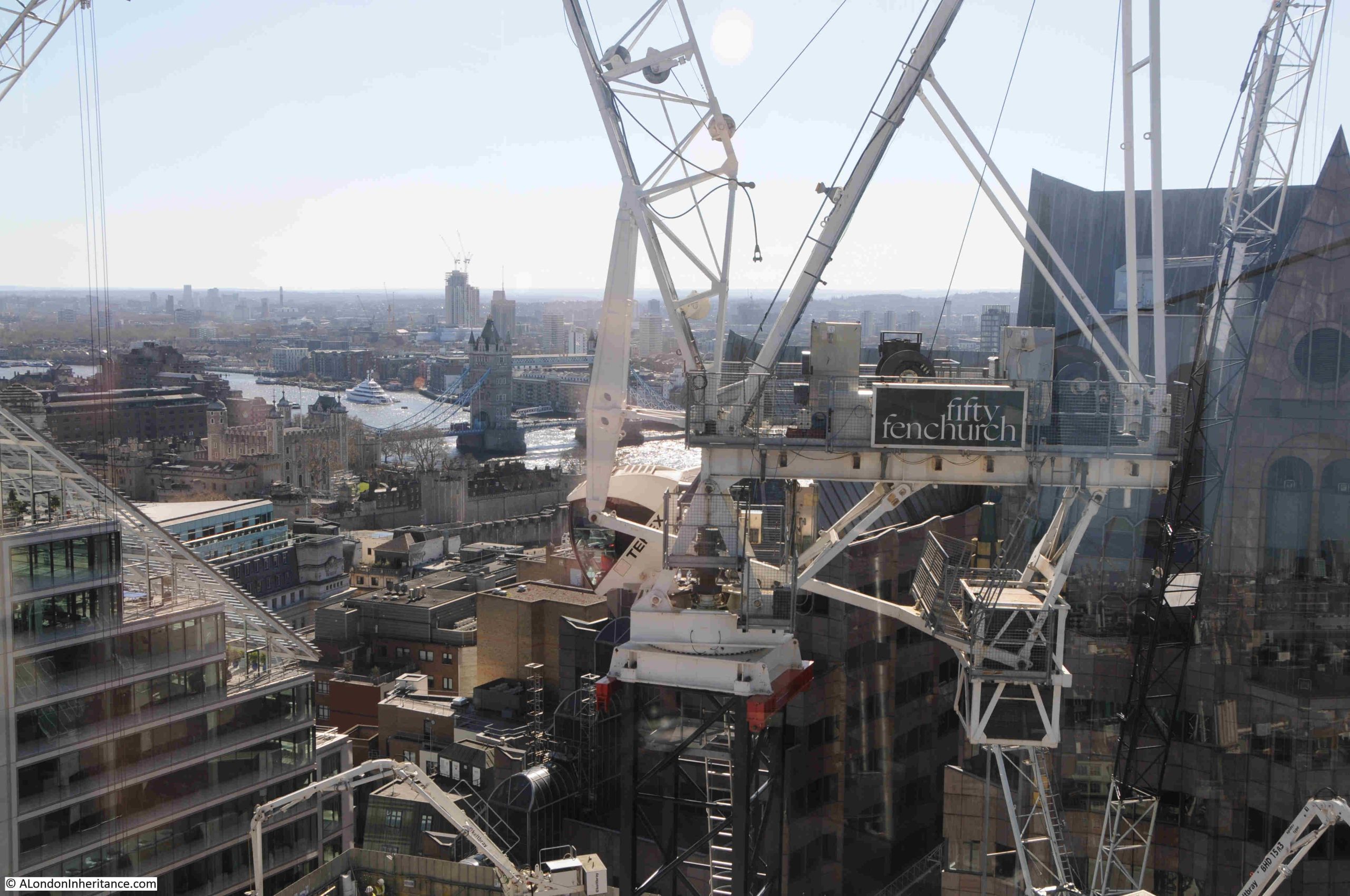
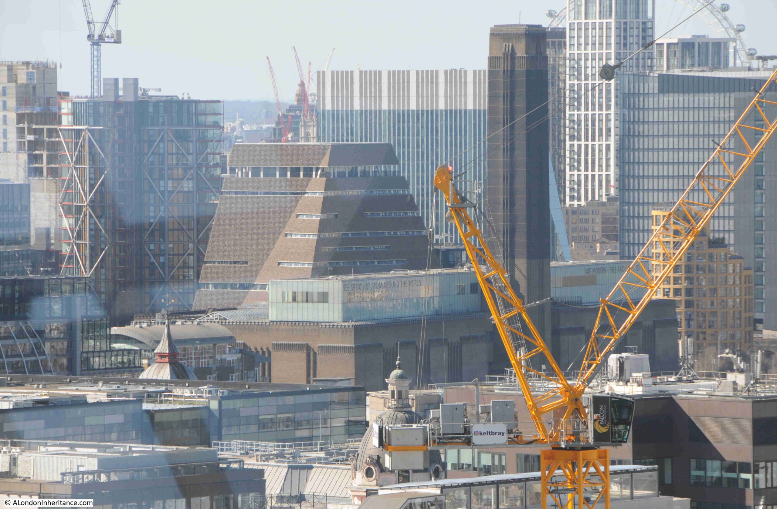
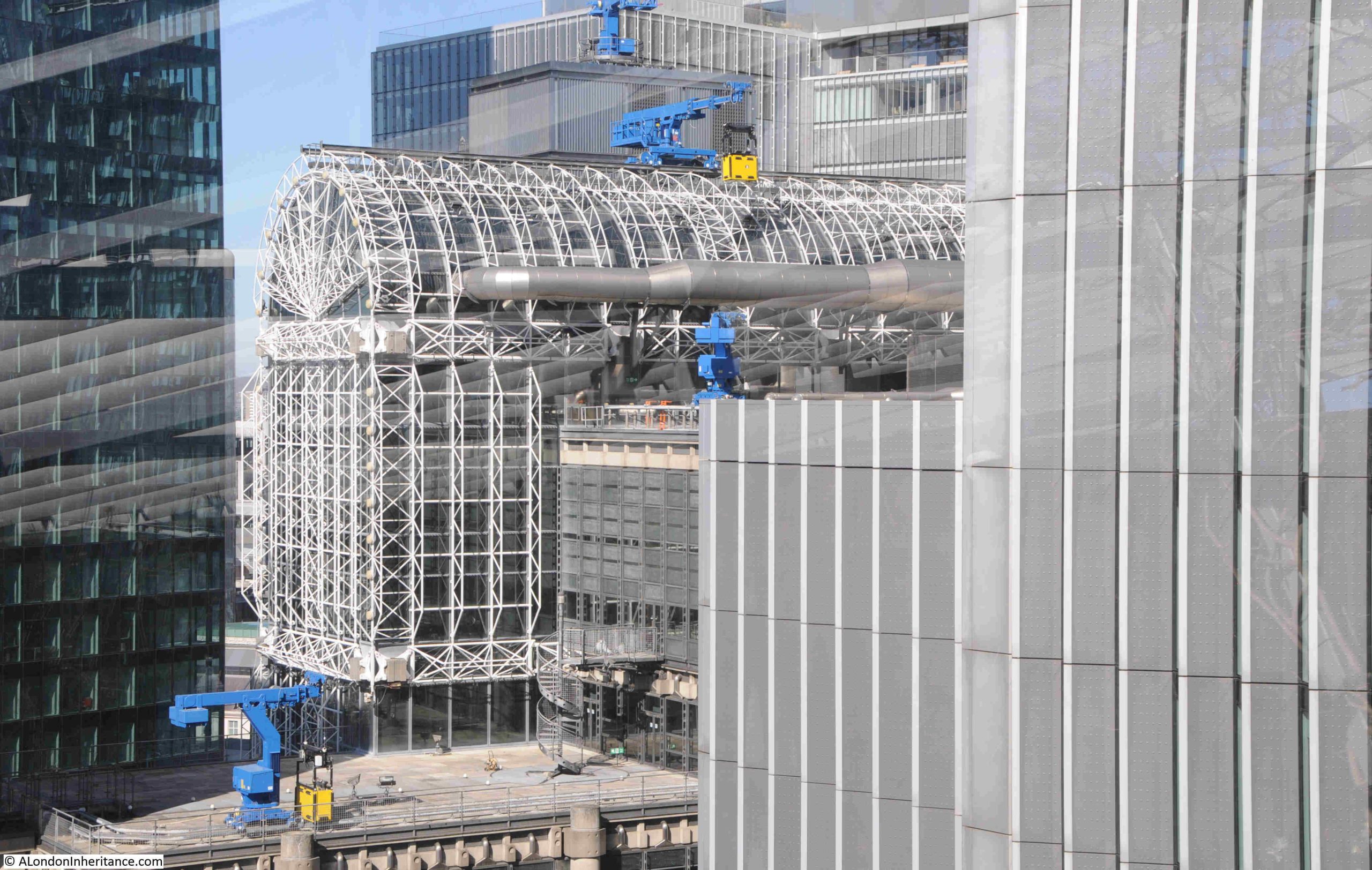
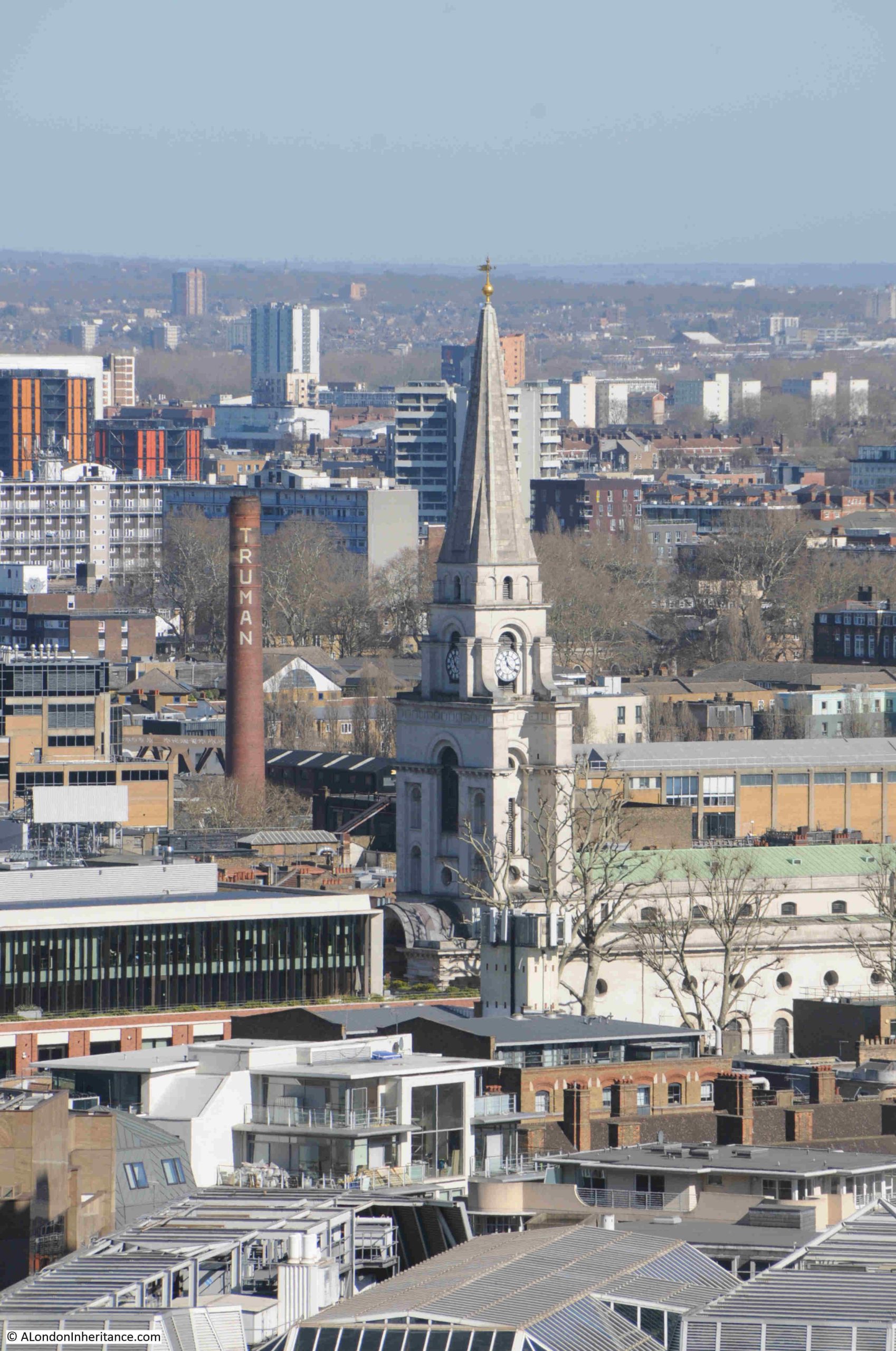
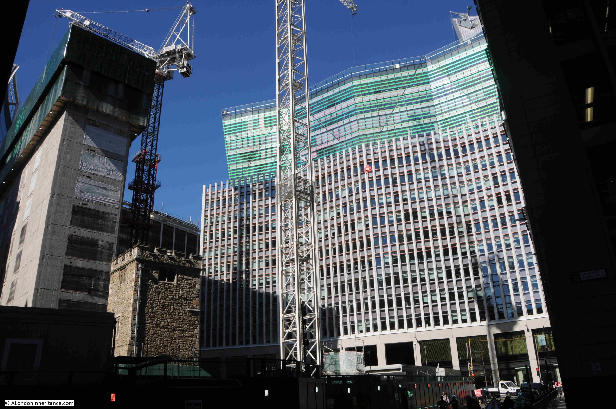
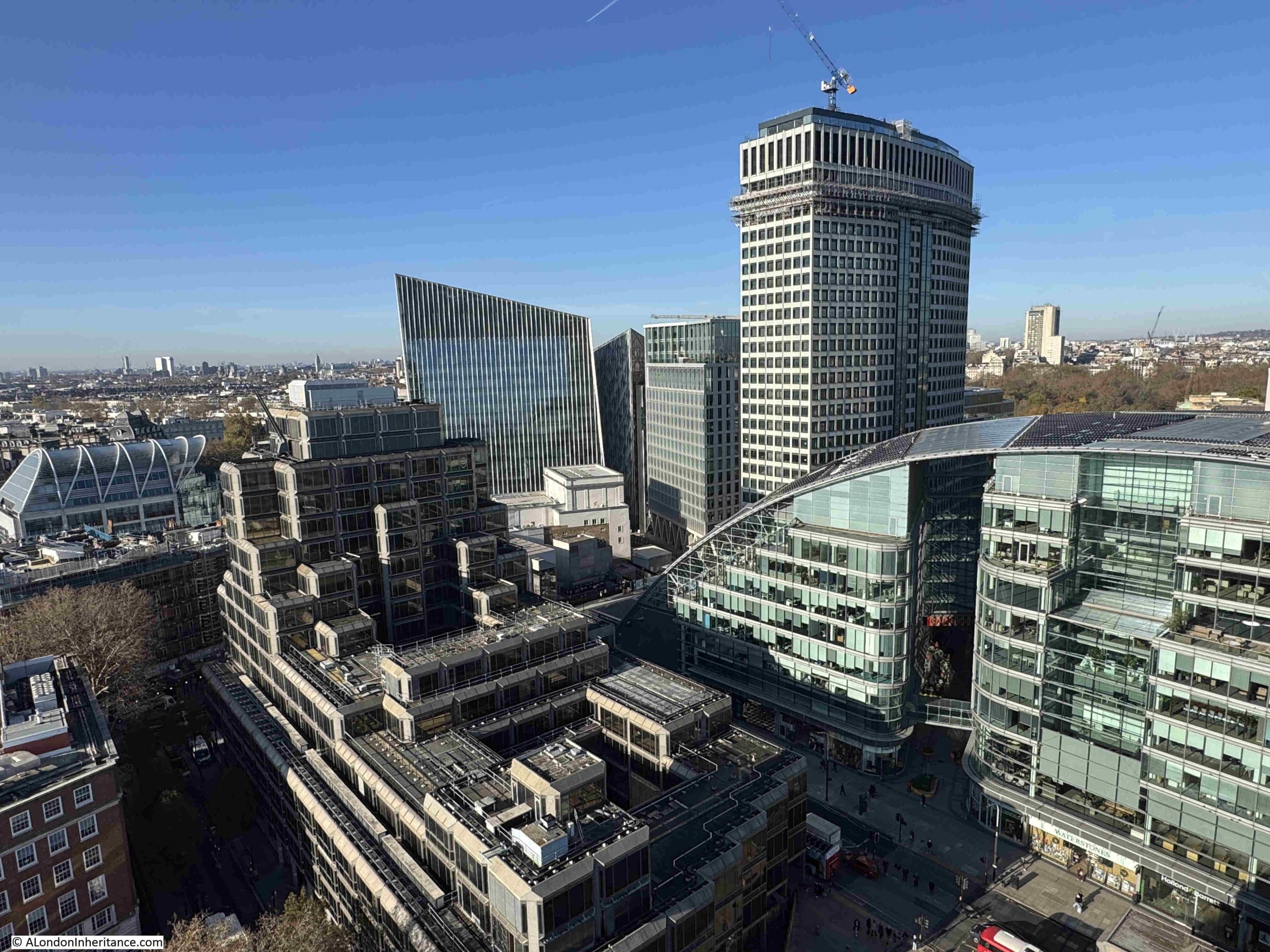
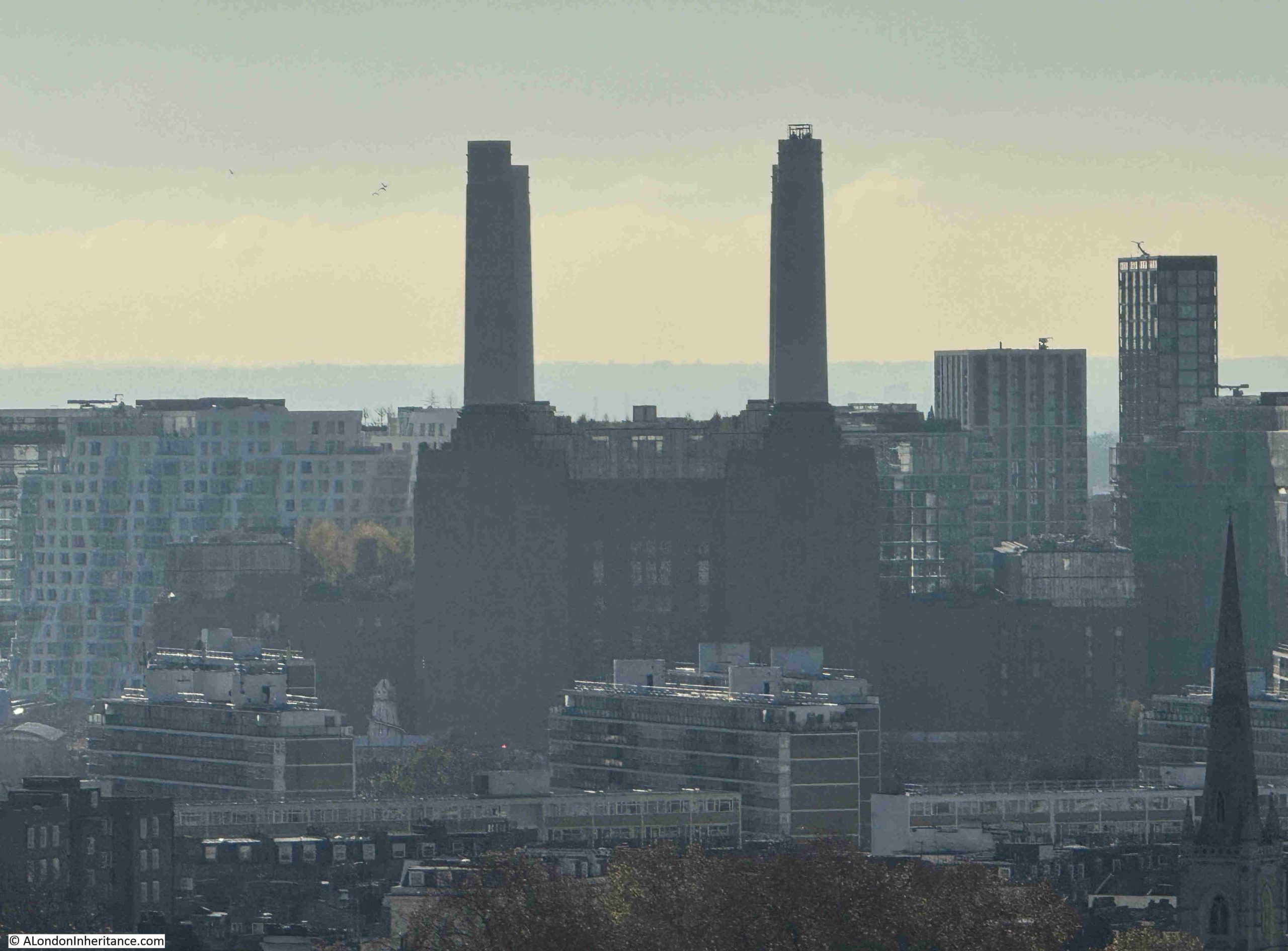
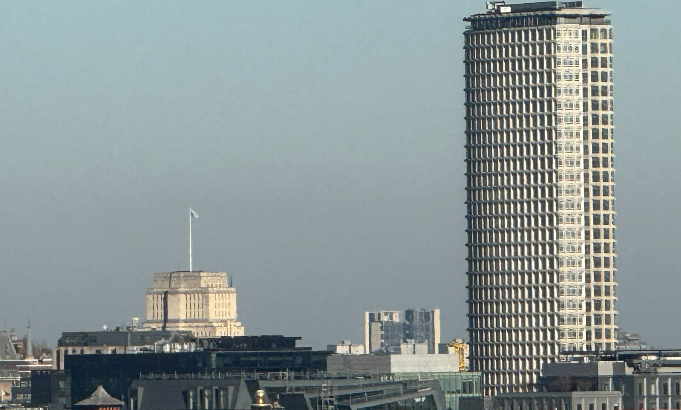
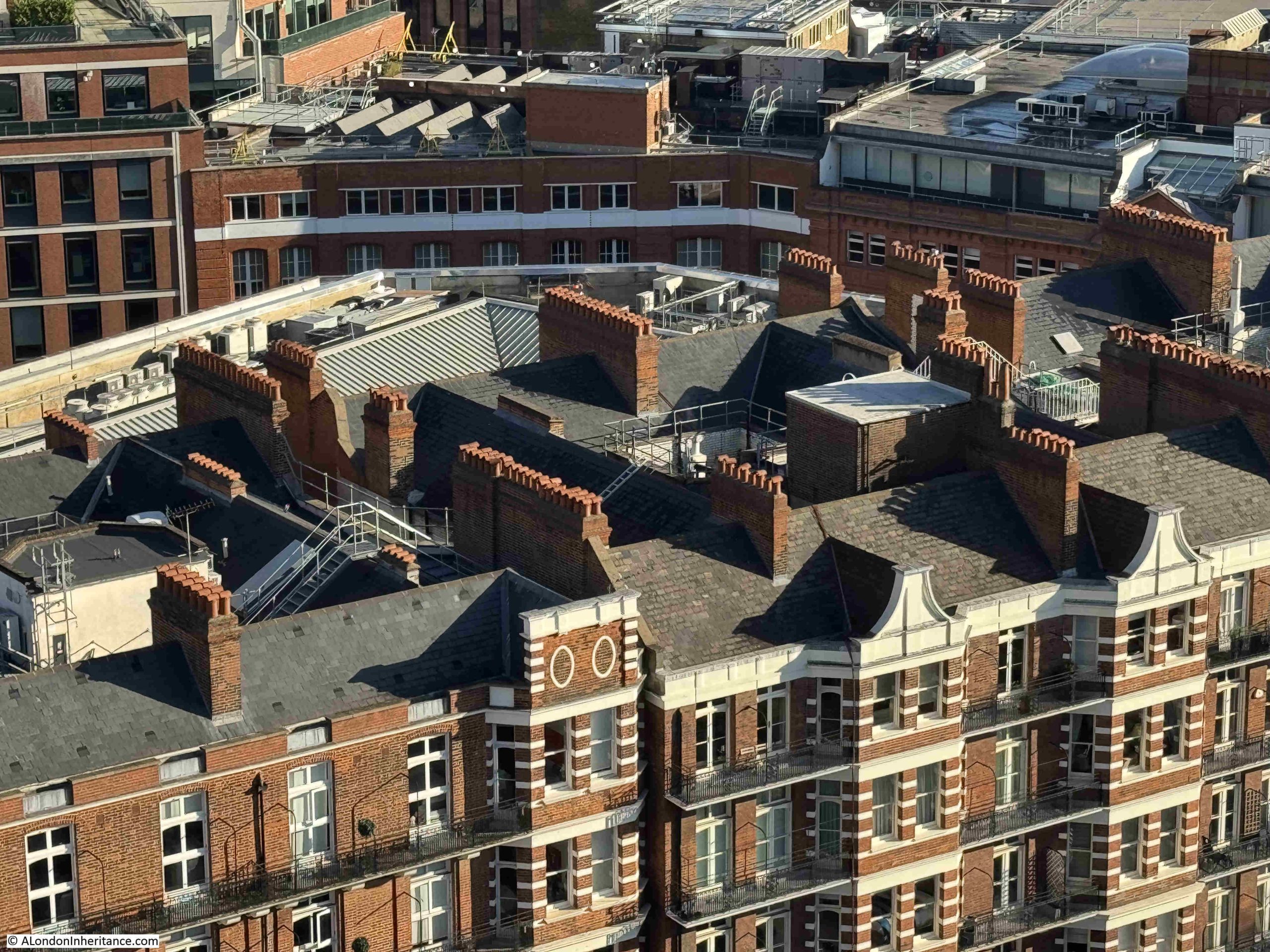
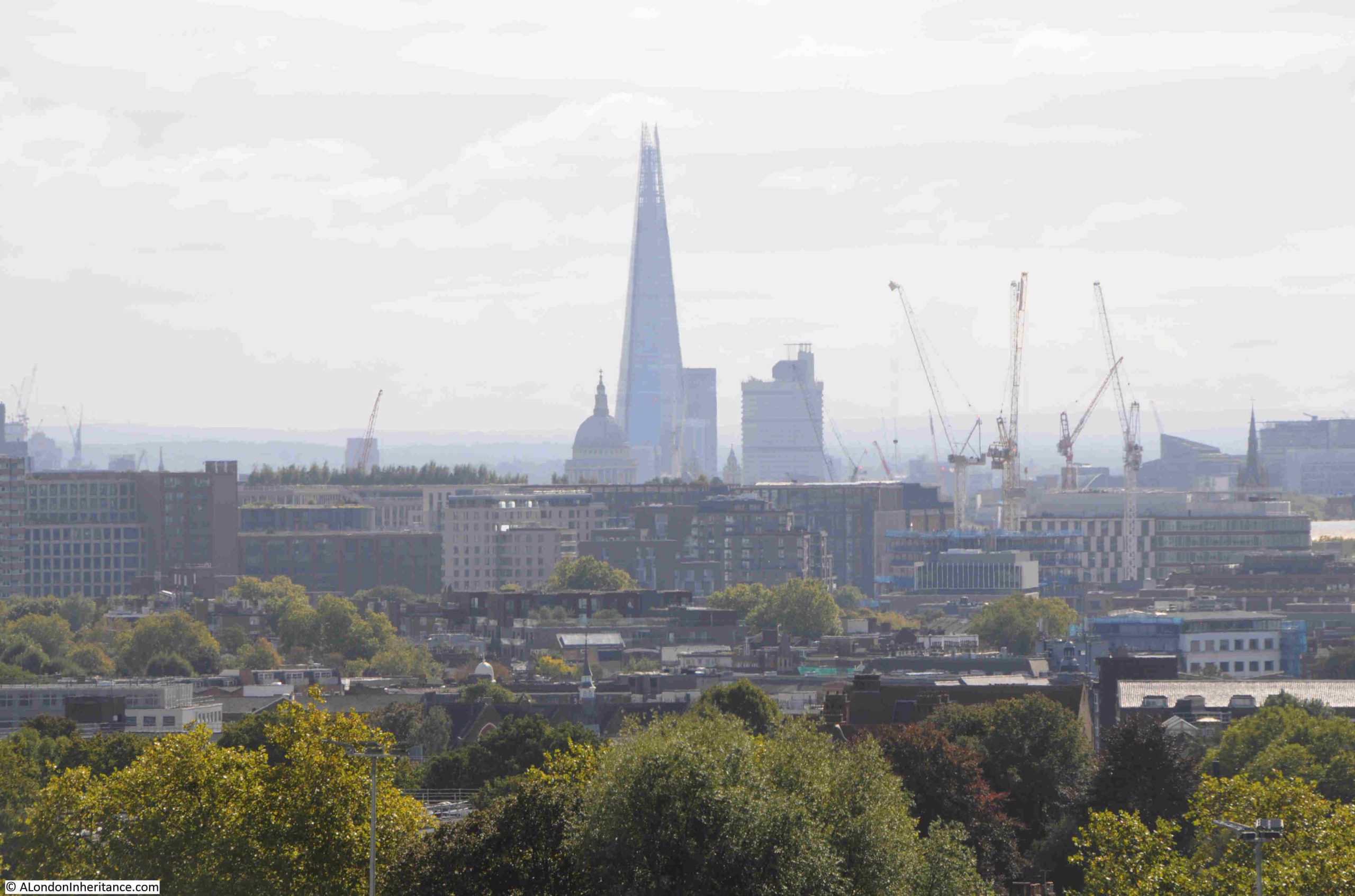
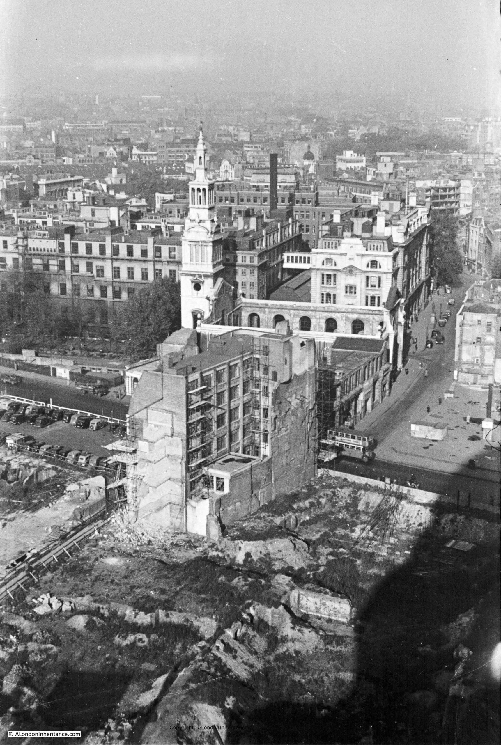
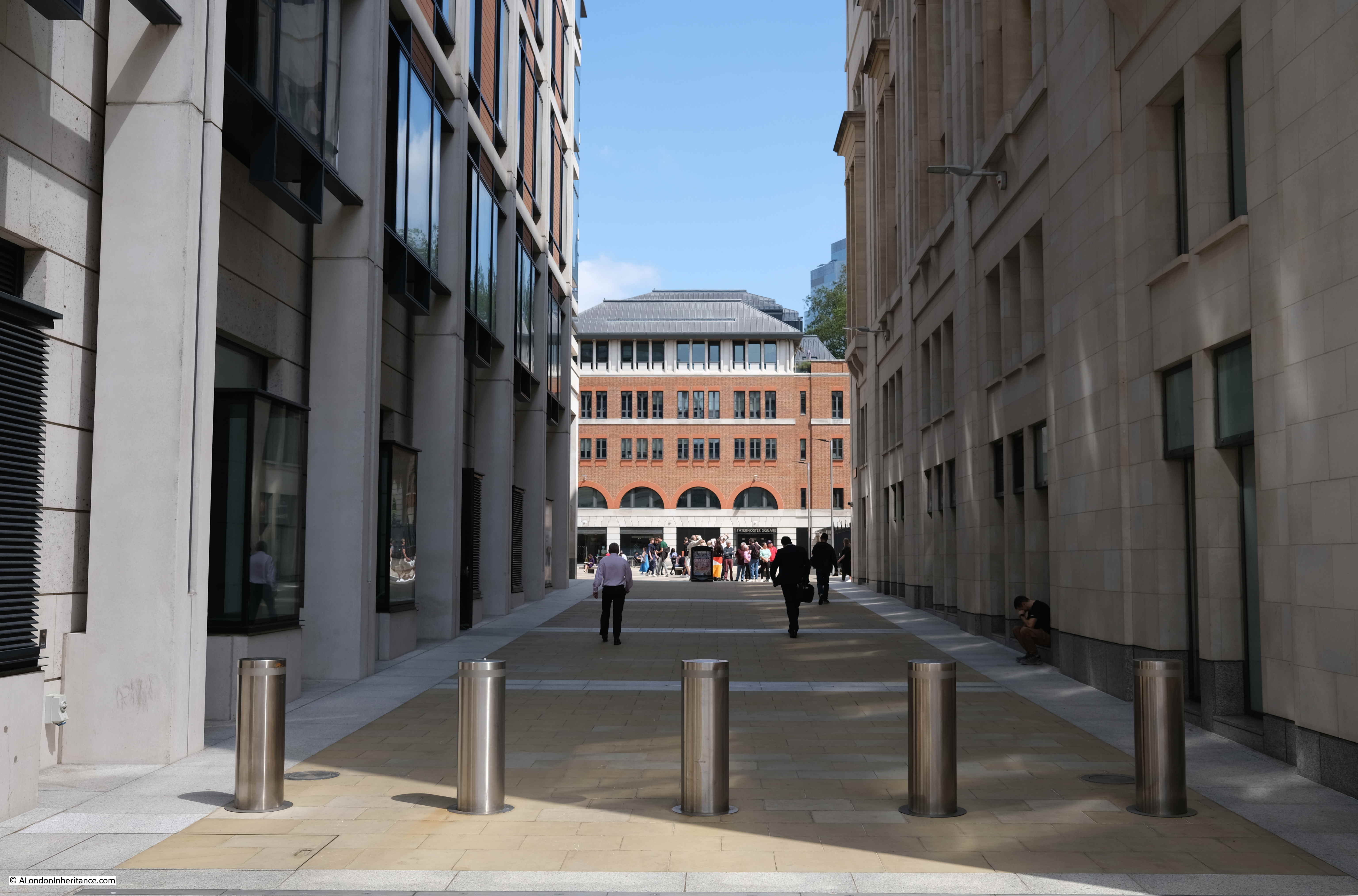
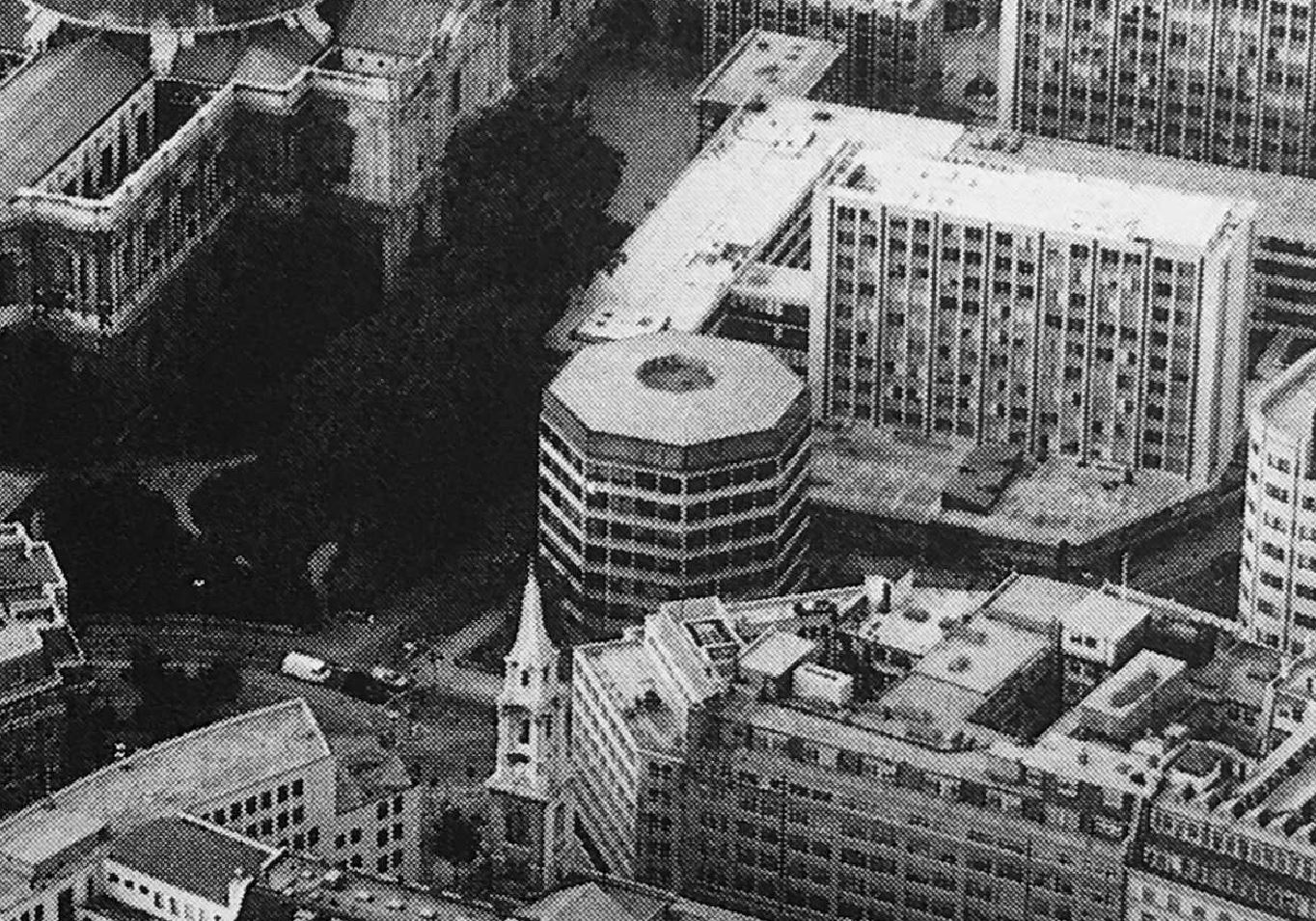
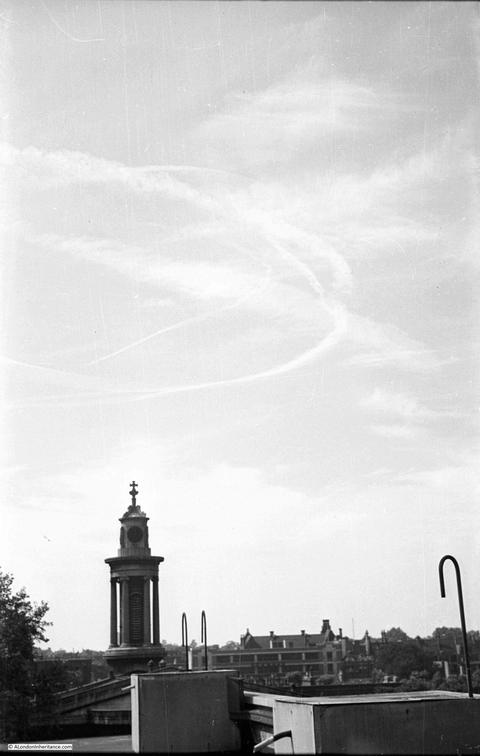
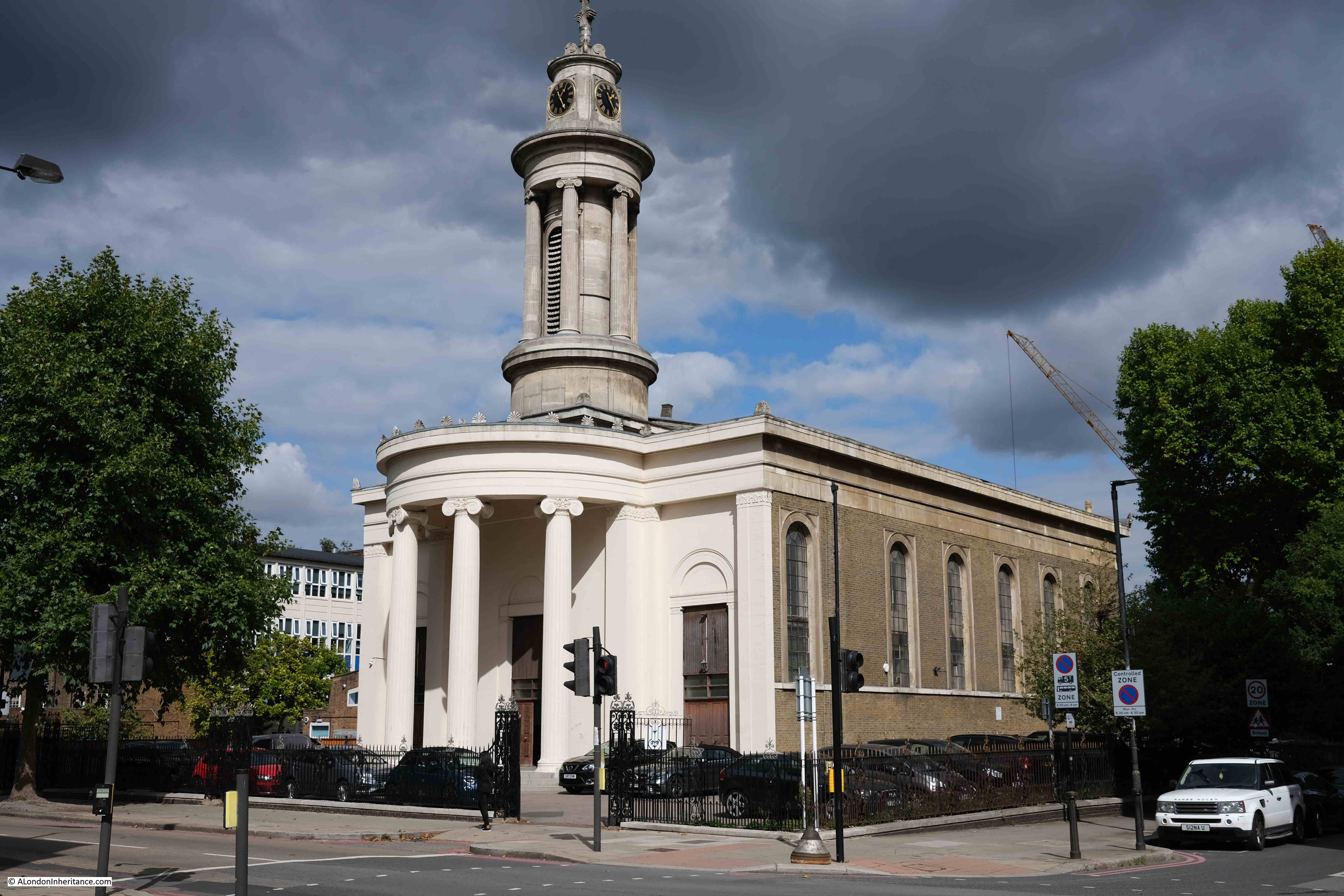
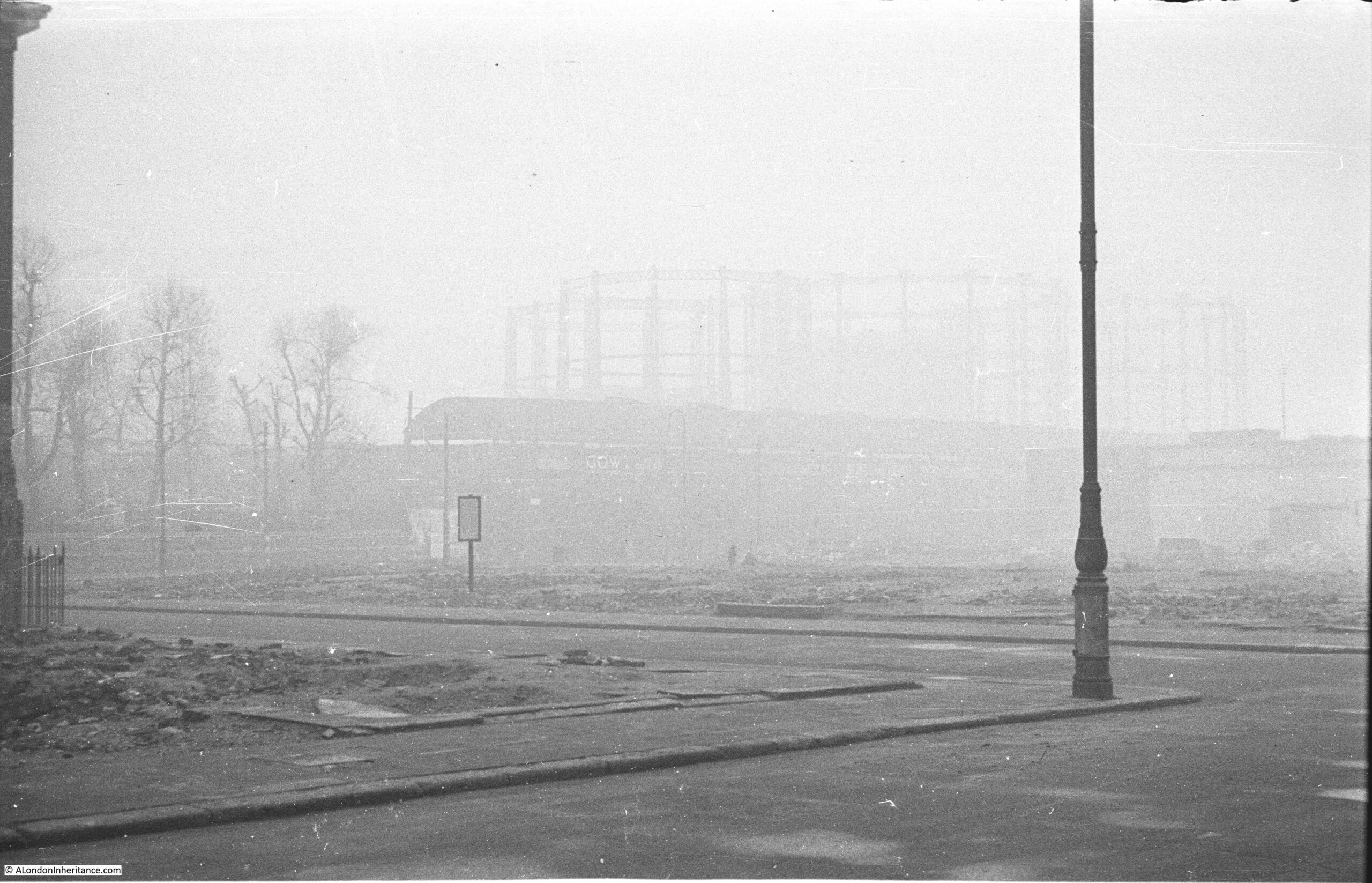
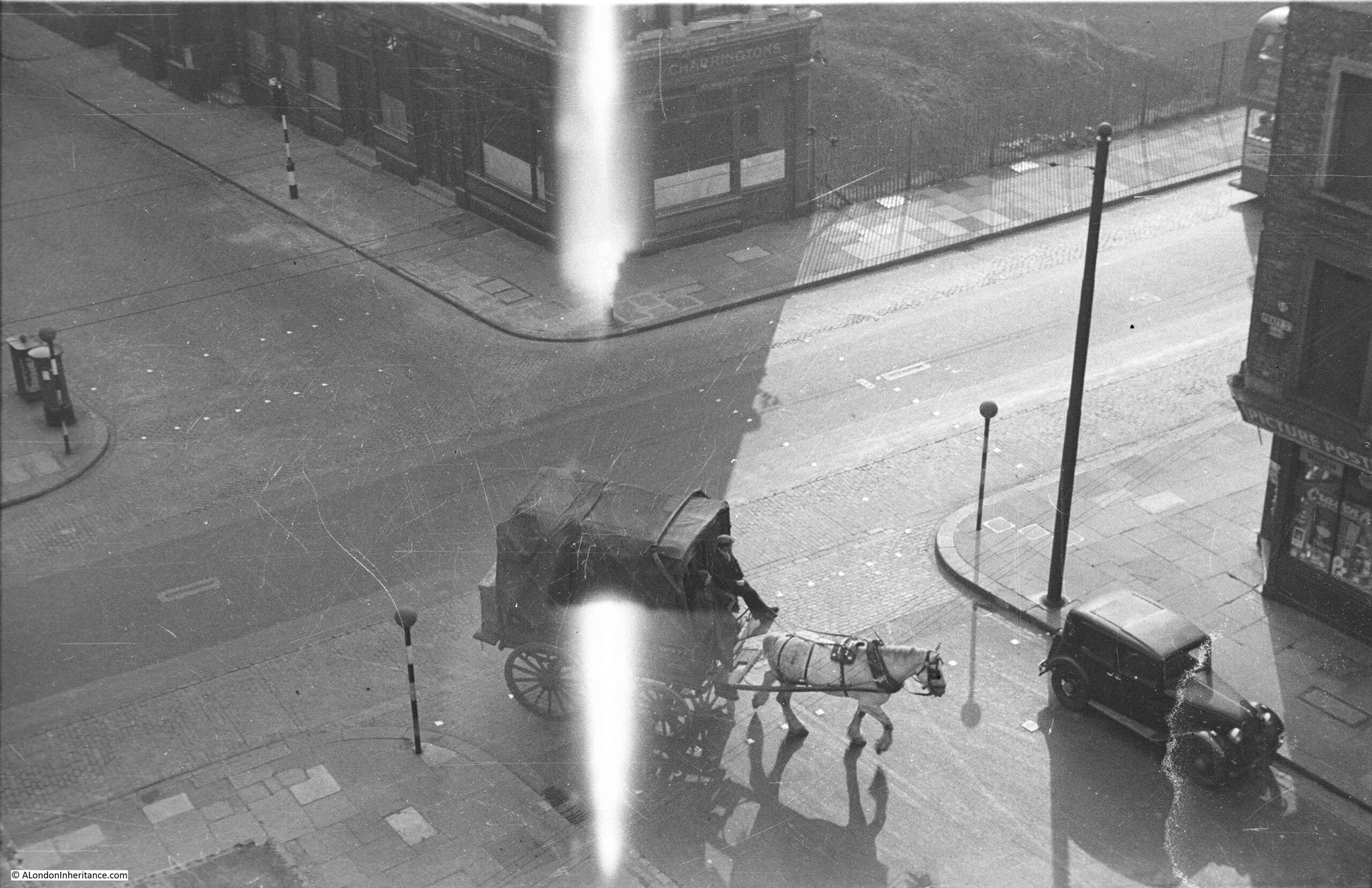
The weather was superb, however I immediately found some problems with taking photos through glass panels looking south, with the sun shining directly into the panels – lots of reflections and strange optical effects, which can be seen in the following photo looking directly down onto the tower of All Hallows Staining:
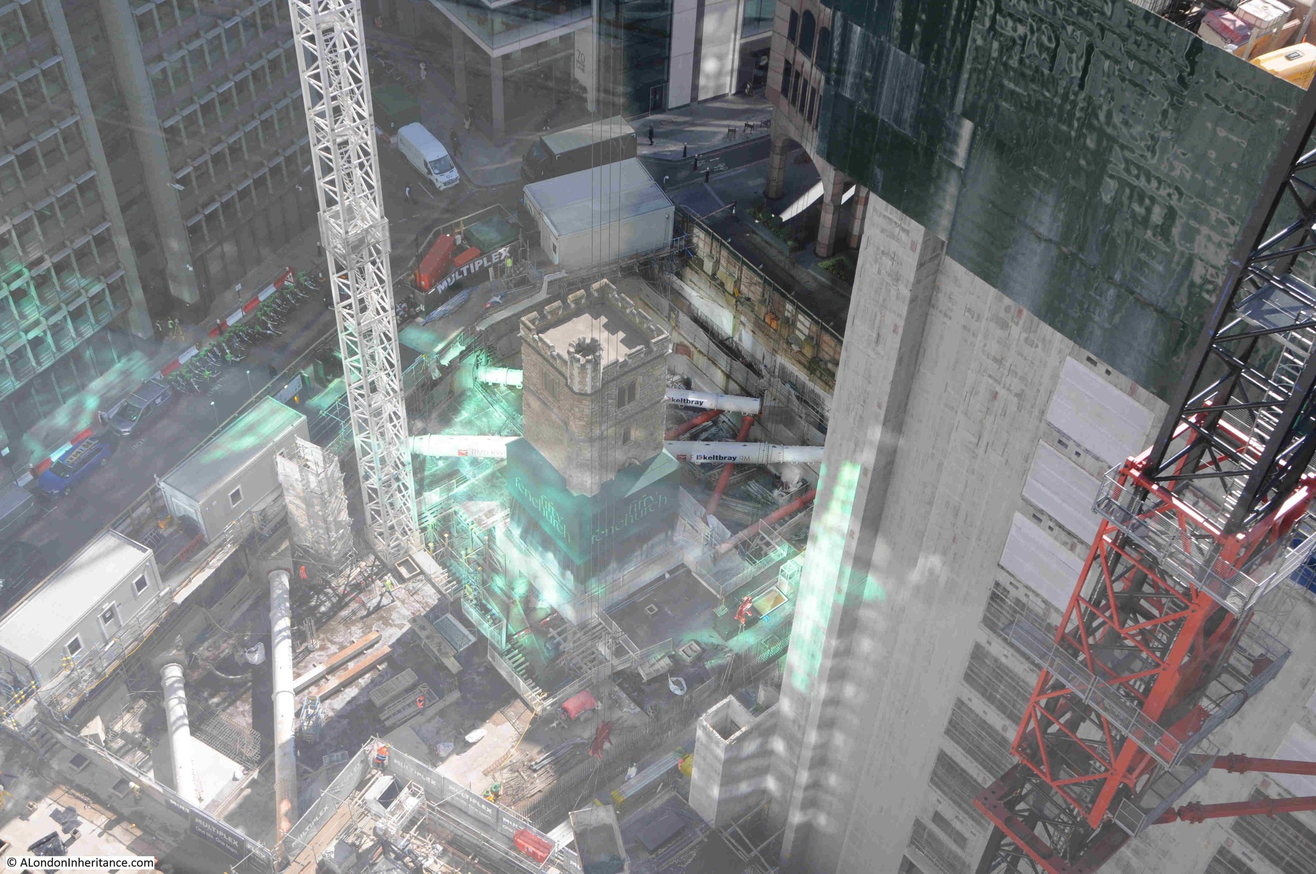
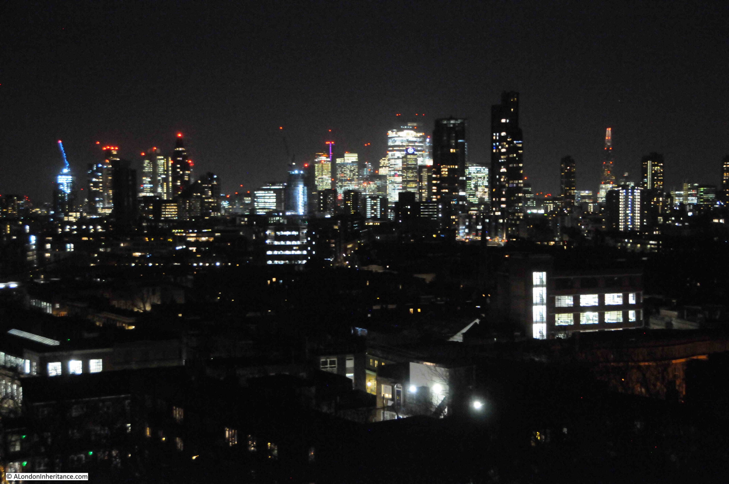
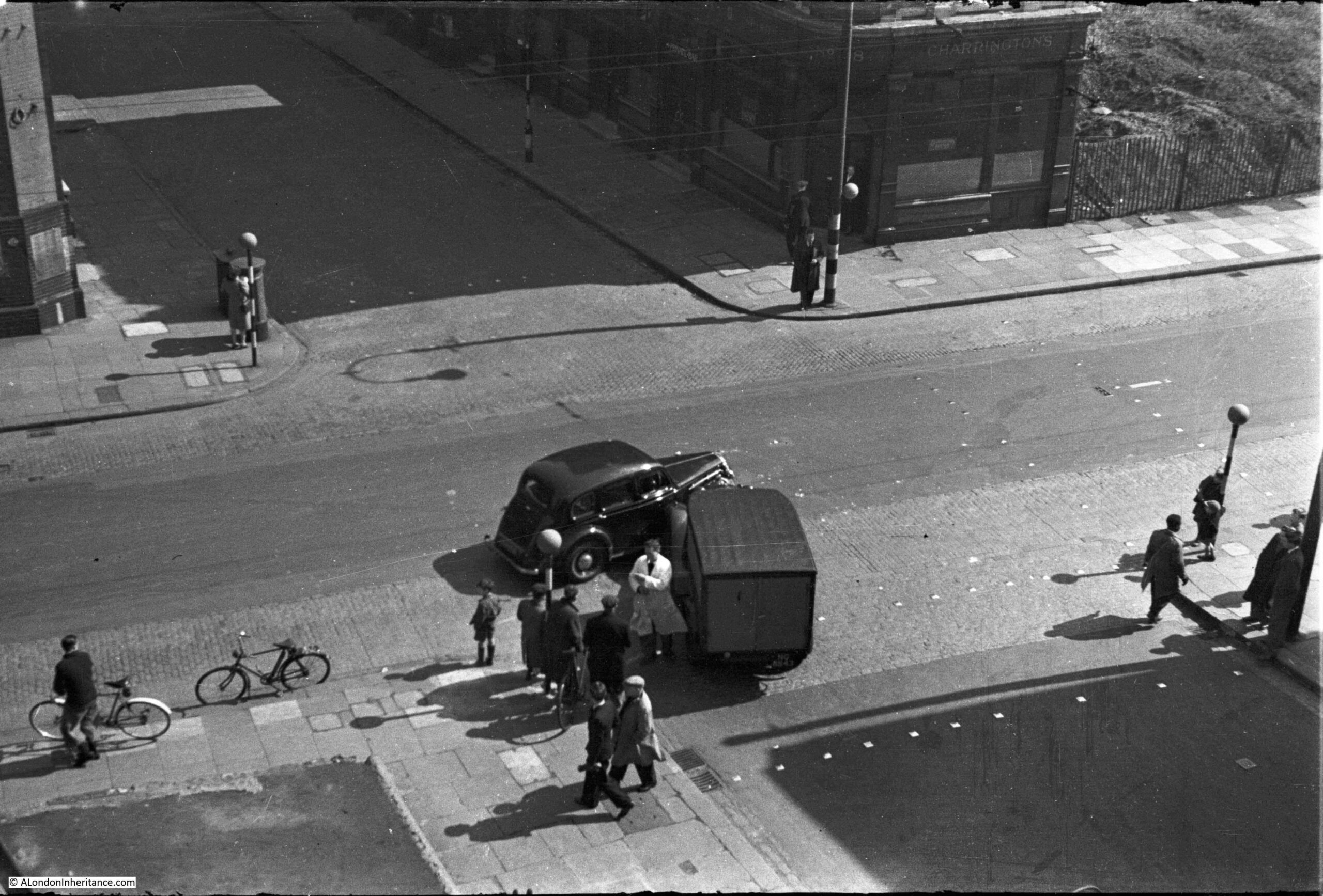
It is just possible to see the tower, standing isolated in the middle of an extensive building site, with the large round metal excavation support struts supporting the retaining walls around the excavation. A view from another angle:
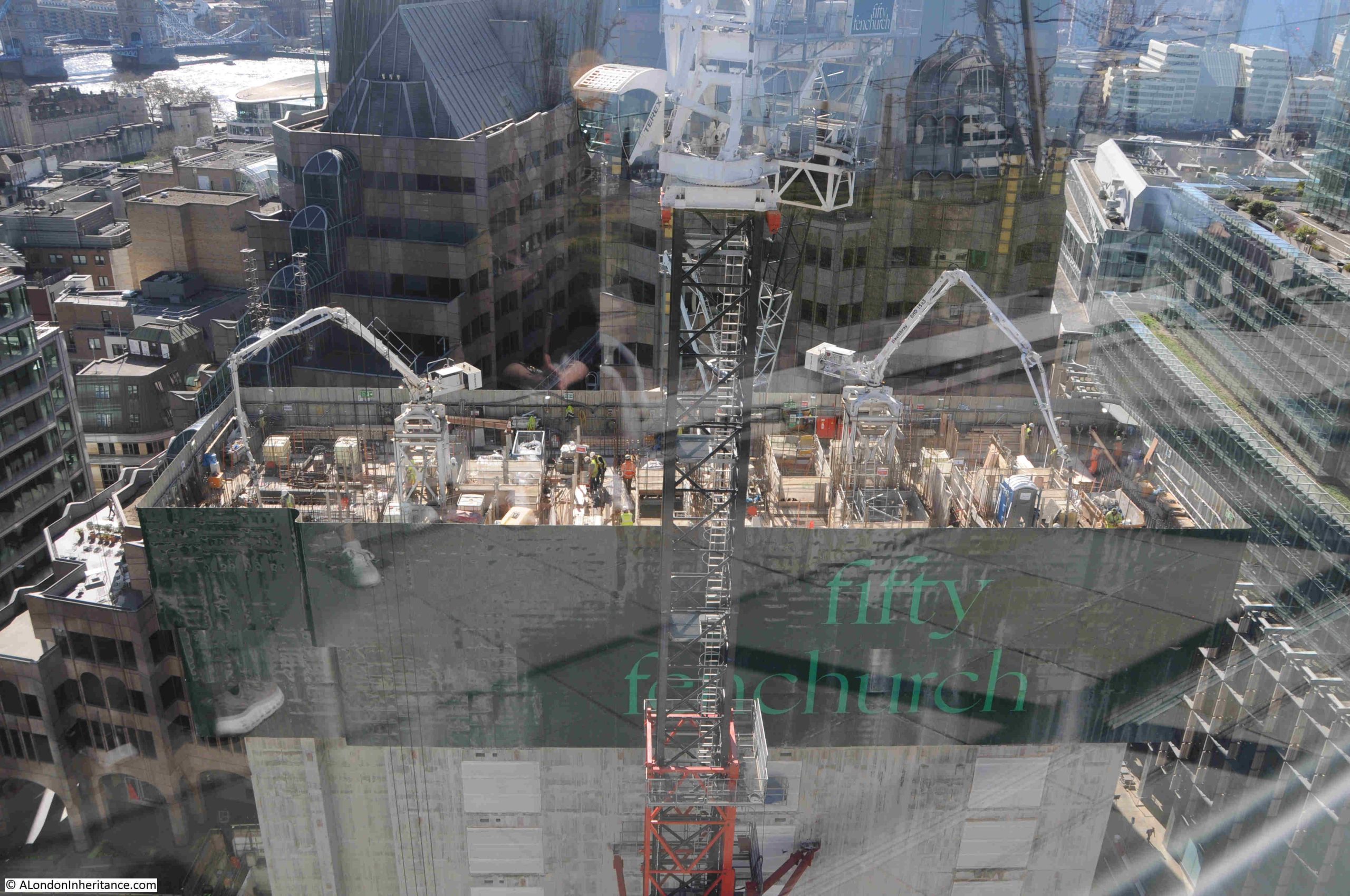
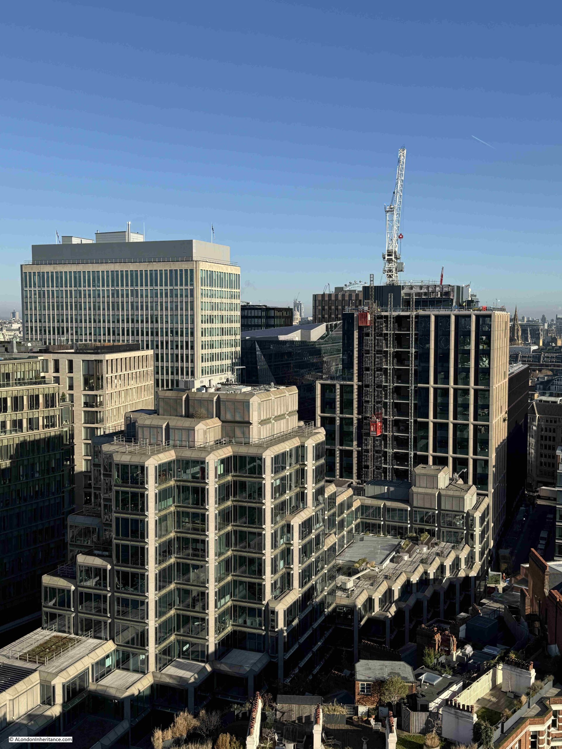
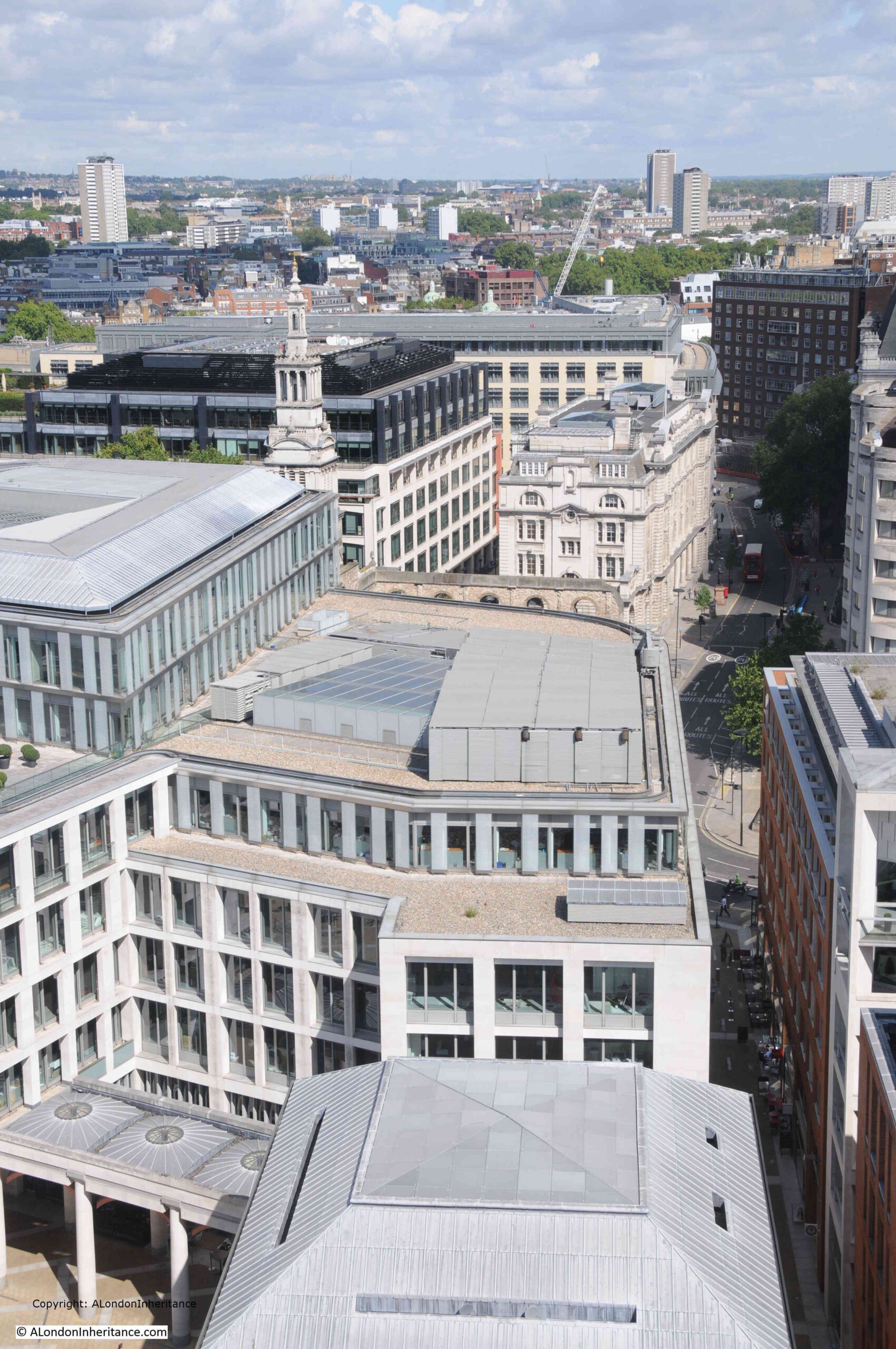
The development in front of 120 Fenchurch Street is Fifty Fenchurch, and when complete will be a 36-storey building, so will be much taller than 120 Fenchurch Street and will block part of the view to the south from the 15th floor garden.
As with almost all new towers in the City, Fifty Fenchurch will also include a public viewing gallery, but strangely this will be at level 10 rather than the roof or upper floors of the building, so the viewing gallery will be lower than the Garden at 120.
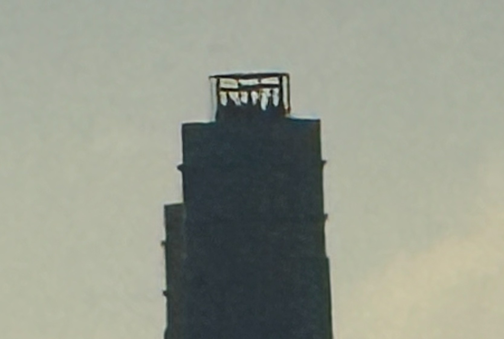
The current upper level of Fifty Fenchurch – the inner concrete core, which still has someway to go:
If you have a head for heights, then a job as a crane operator must provide some fascinating views of both construction sites and the wider area, although I would not fancy the climb up the ladders within the central frame to reach the cabin:
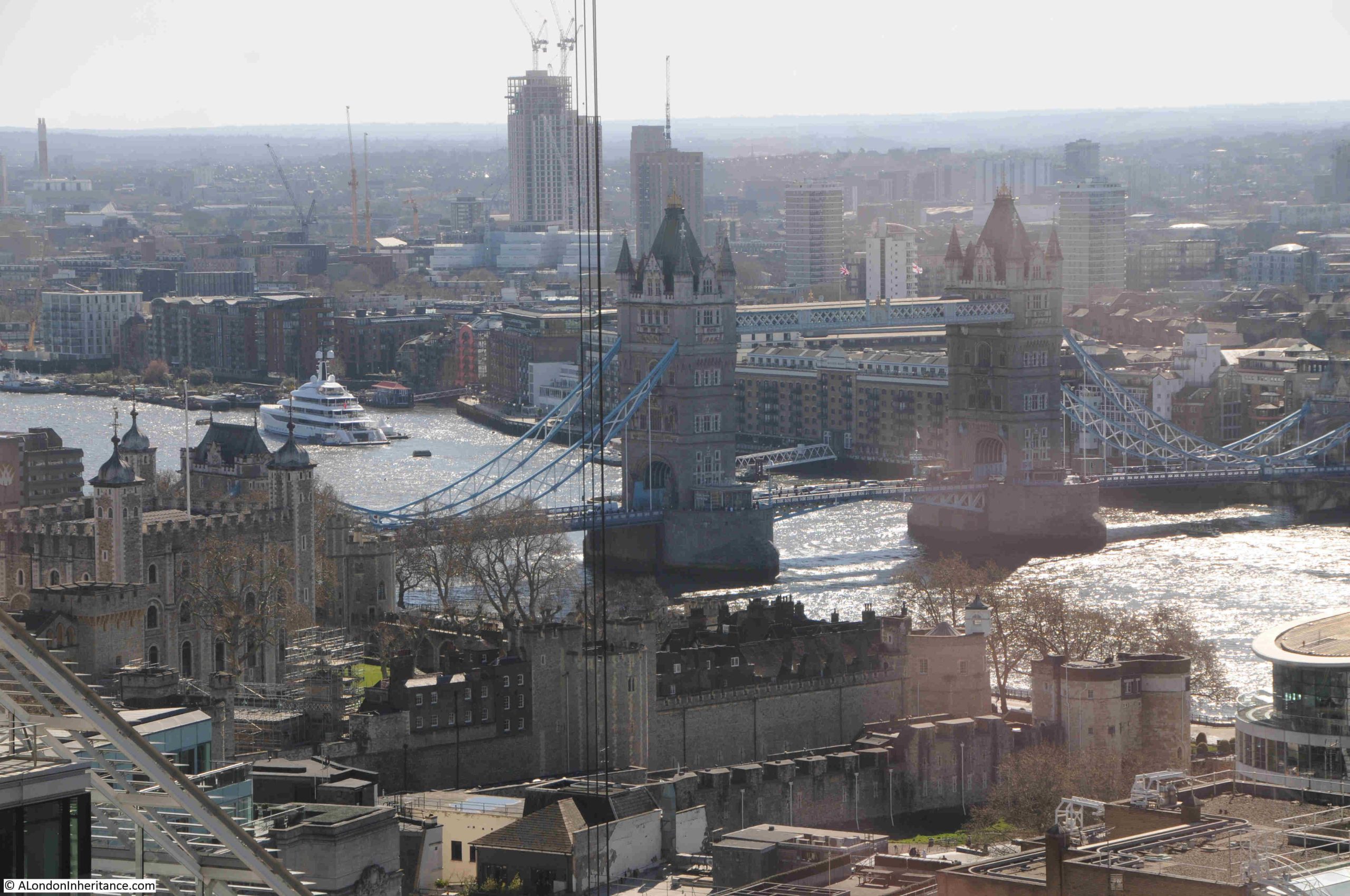
Tower Bridge:
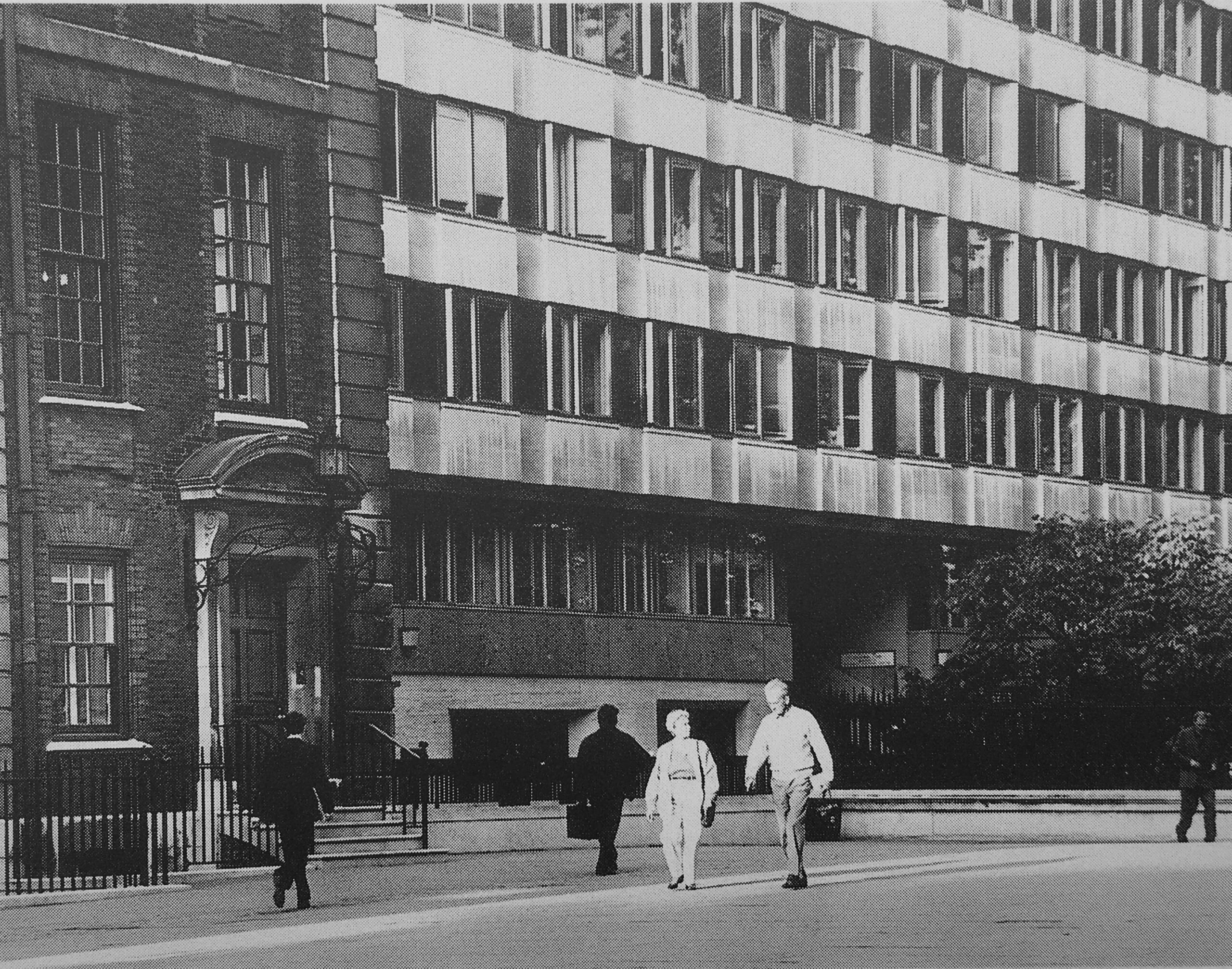
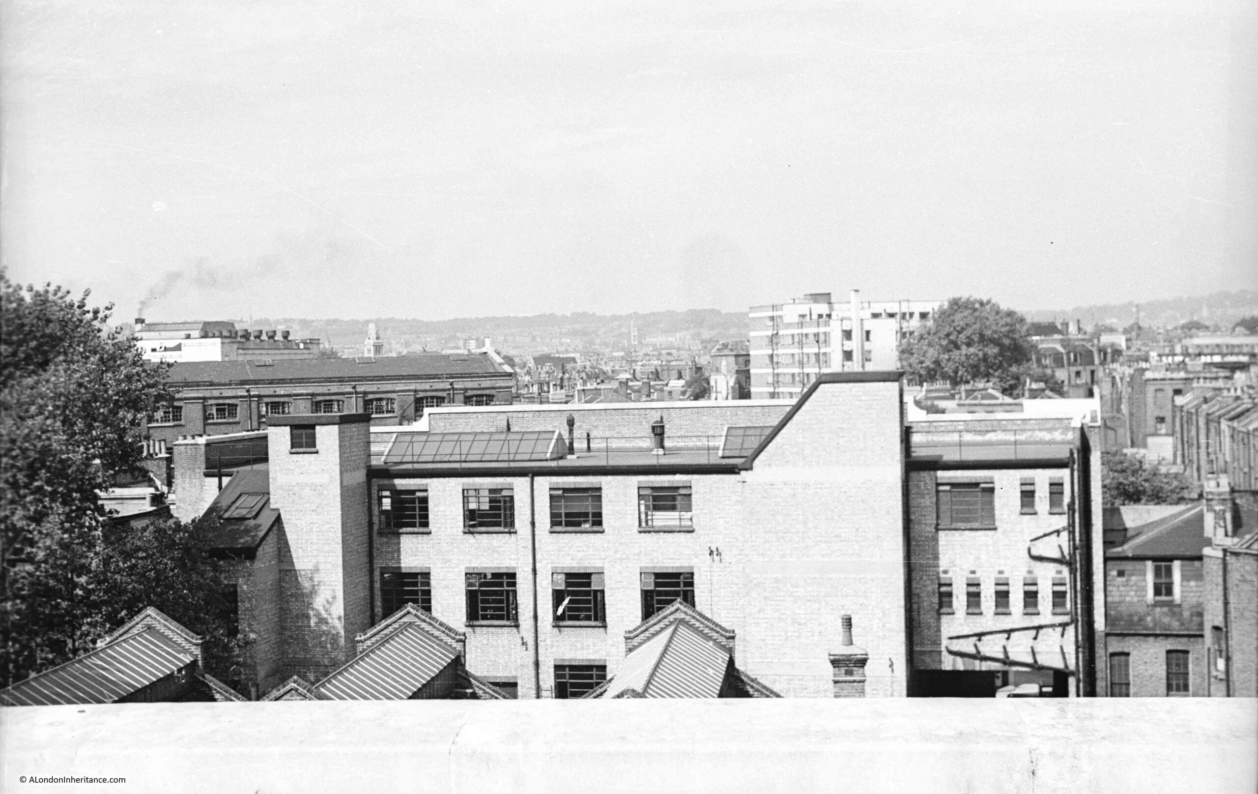
Immediately to the west of 120 Fenchurch Street is Fountain House:
Fountain House was built between 1954 and 1958 to a design by W.H.Rogers and Sir Howard Robertson (Consulting). It was the first London building constructed to the tower and podium formula where a large podium occupies the full area of the plot of land, with a much small central space occupied by a tower block. I have written about the building in this post.
It will probably not be there for much longer, as the City of London Corporation has approved a new development with two new towers, one of 31 storeys and the other with 34, and on the 17th floor there will be a publicly accessible external garden terrace, so there will be three public viewing terraces all next to each other, so visitors to one, will be able to look across to visitors at the other two.
The development replacing Fountain House will also be much taller than 120 Fenchurch Street, so with Fifty Fenchurch to the south, Garden at 120 will be slowly surrounded by higher blocks.
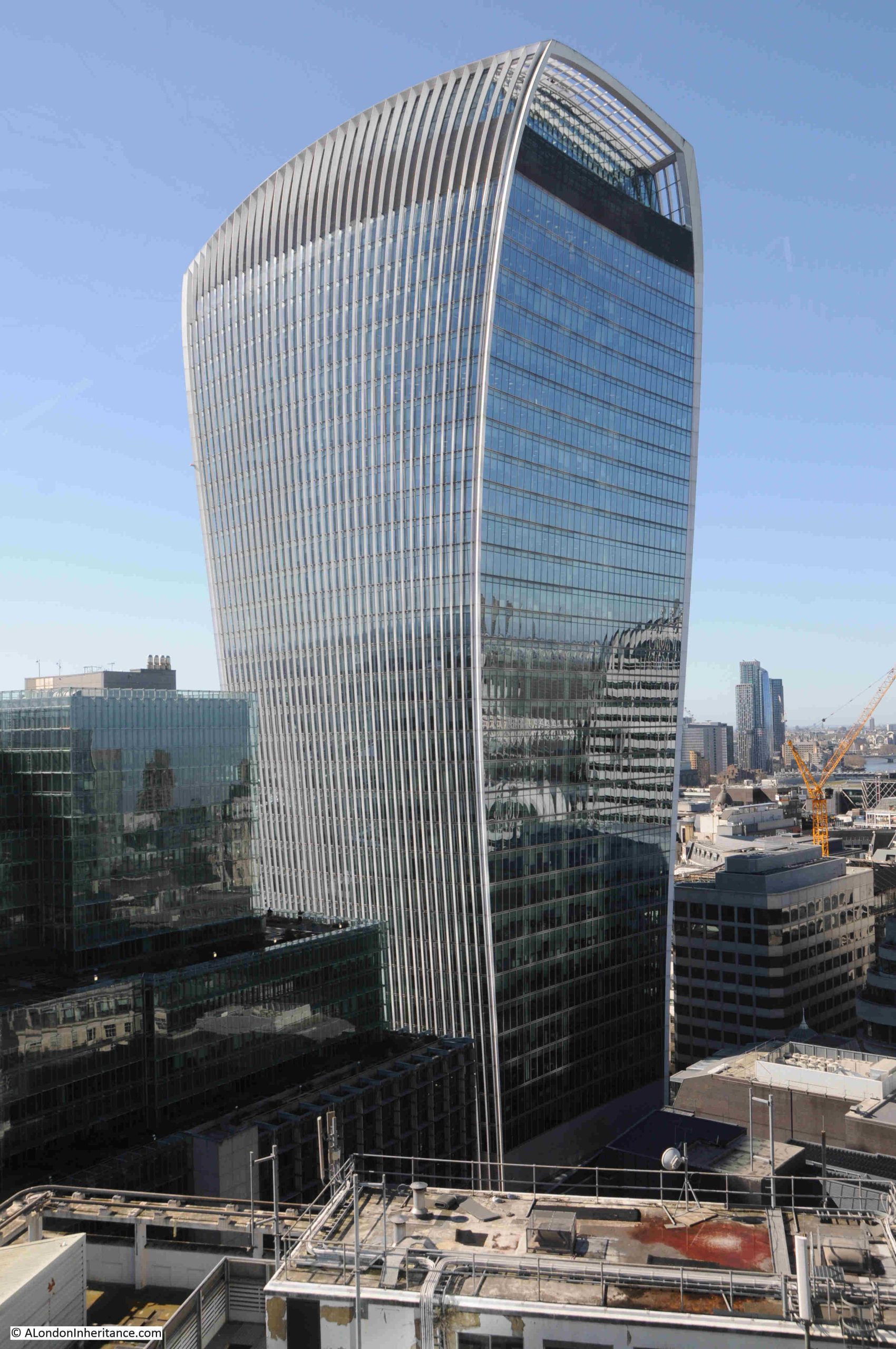
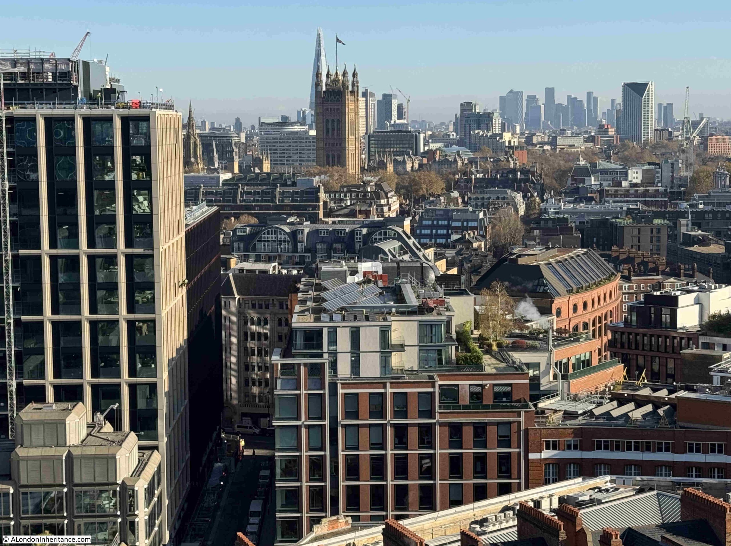
Another building, also with a public viewing gallery is the Walkie Talkie, or more officially. 20 Fenchurch Street. The plan for the replacement of Fountain House implies that the following view of the Walkie Talkie will be obscured from the Garden at 120:
In a few years, you will be able to spend an entire day out visiting the four public viewing terraces all within a short distance along Fenchurch Street.
View towards the west with a small stretch of the Thames from Blackfriars Railway Bridge up to Waterloo Bridge:
There is another viewing gallery in the above photo, just to the left of the yellow crane, is the Blavatnik Building of Tate Modern, and on the 10th floor is a viewing gallery:
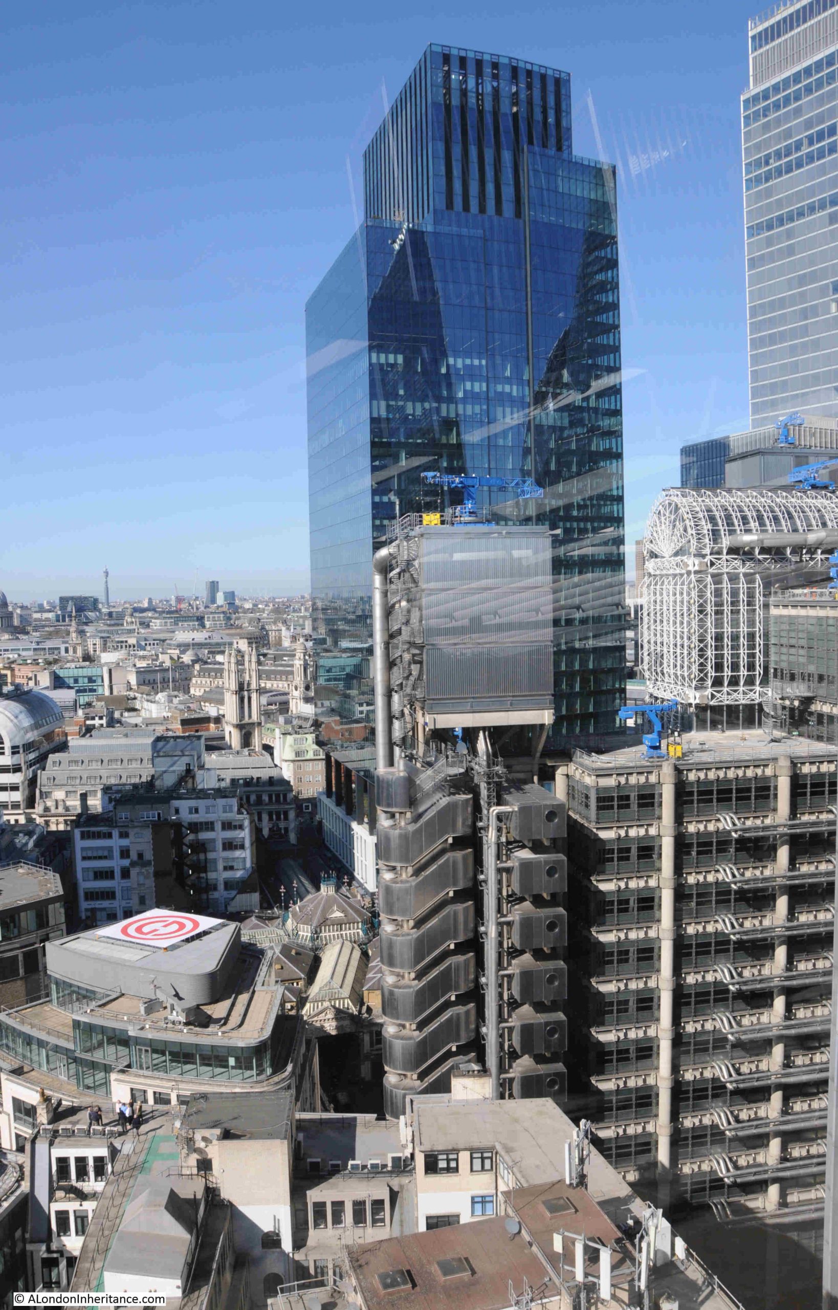
The following photo illustrates how the scale of the modern City has grown exponentially from the historic City, and how historic buildings are reduced to filling in the ever decreasing gaps.
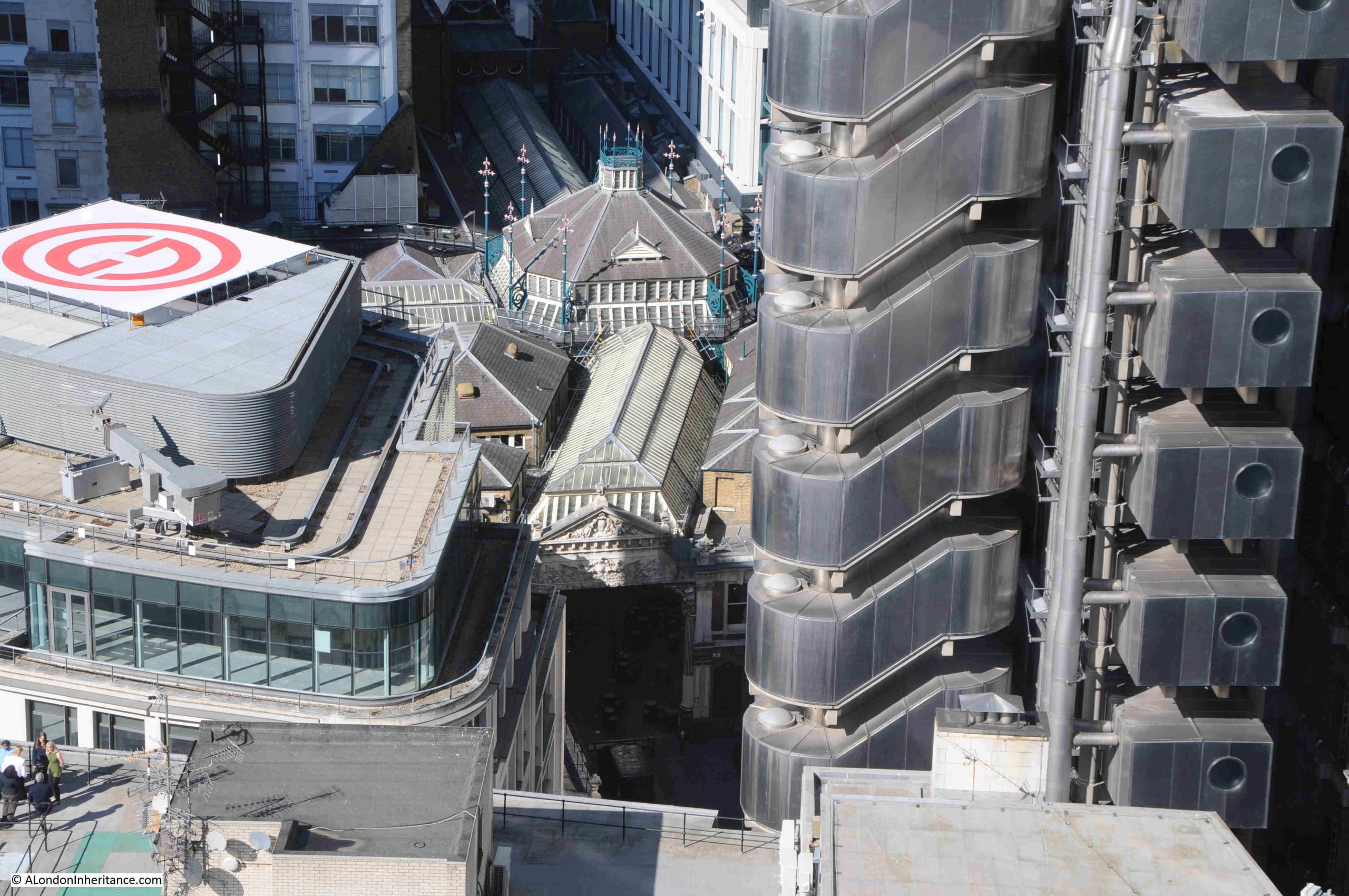
The Lloyd’s of London building is on the right, with the blue cranes along the roof, and the tall tower in the centre is the recently completed One Leadenhall:
If you look to the lower left of One Leadenhall and the Lloyd’s of London building, you will see a very different structure – the roof of Leadenhall Market:
Although a market has been at the site for centuries, the current market buildings date from 1881, and the height and footprint of buildings in the City has grown so much in the following 145 years, at a scale that, whilst Victorian architects and builders were ambitious, would probably have been beyond their imagining.
There is a brief sequence early on in the 2013 Star Trek film – Into Darkness, where a bomb explodes in an underground facility in the City, and the CGI generated view of the City still shows St. Paul’s Cathedral, but it is surrounded by incredibly tall towers, much higher than we see in the City today.
The film is based in 2259, in 233 years time, and based on the rate of growth since the current Leadenhall Market buildings were completed, the CGI in Star Trek will probably be an accurate vision of the future London.
More of the Lloyd’s of London building – watching the blue crane along the top slowly moving along the roof line was interesting:
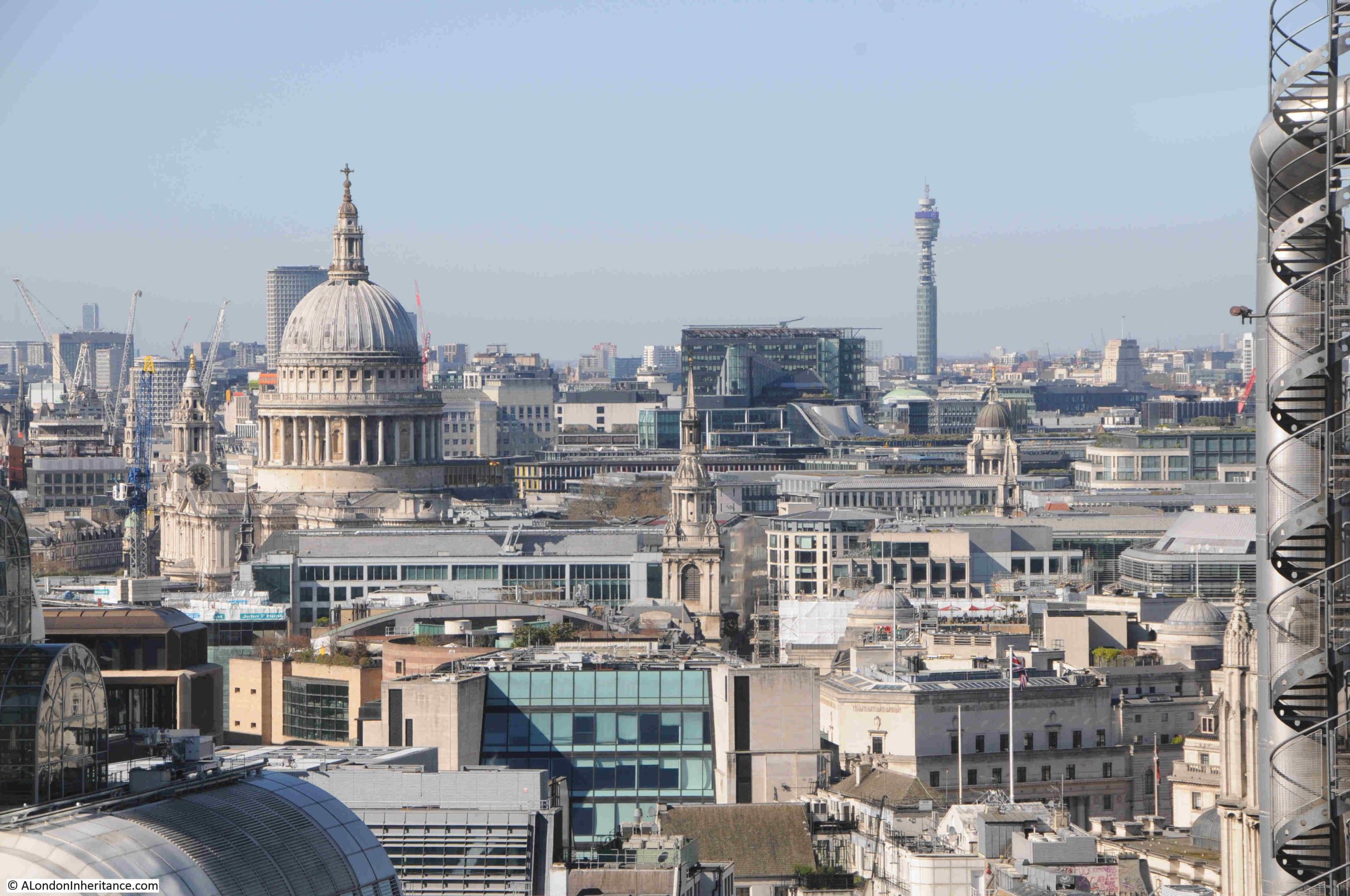
St. Paul’s Cathedral and the Post Office / BT Tower:
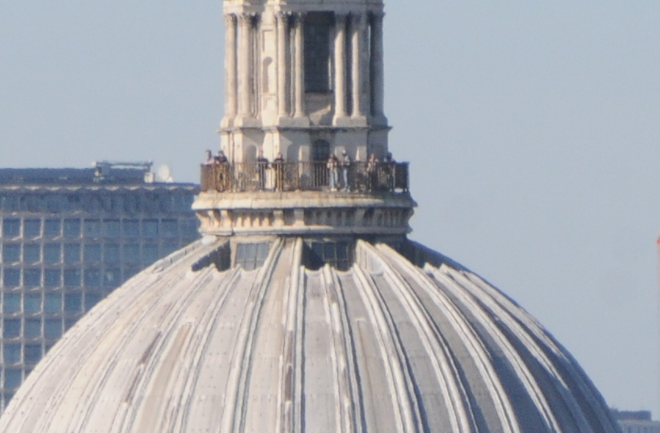
St. Paul’s Cathedral also has a couple of viewing galleries, including the Golden Gallery at the top of the dome, and from the Garden at 120 you can look across at other people enjoying the view of the city:
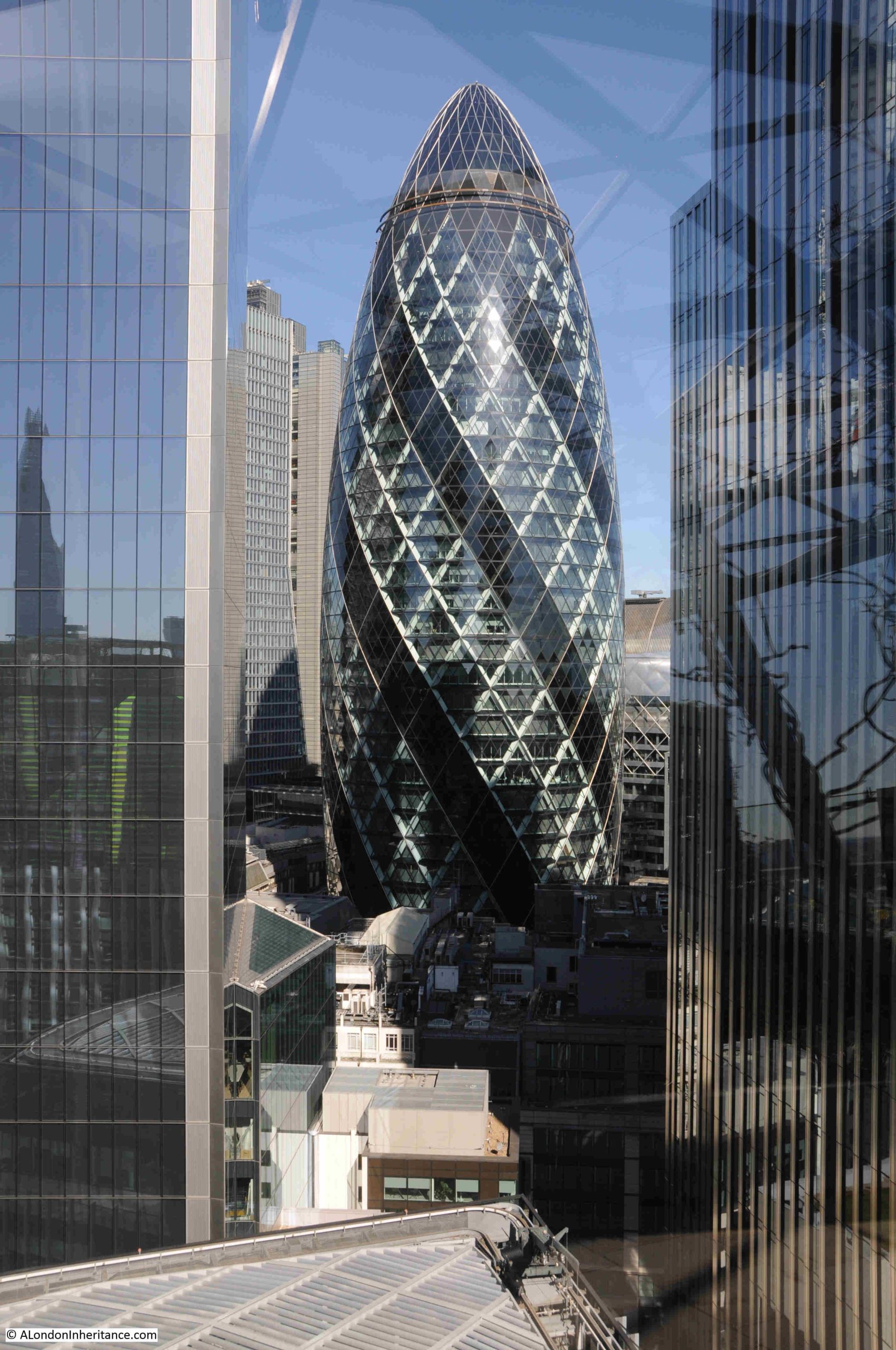
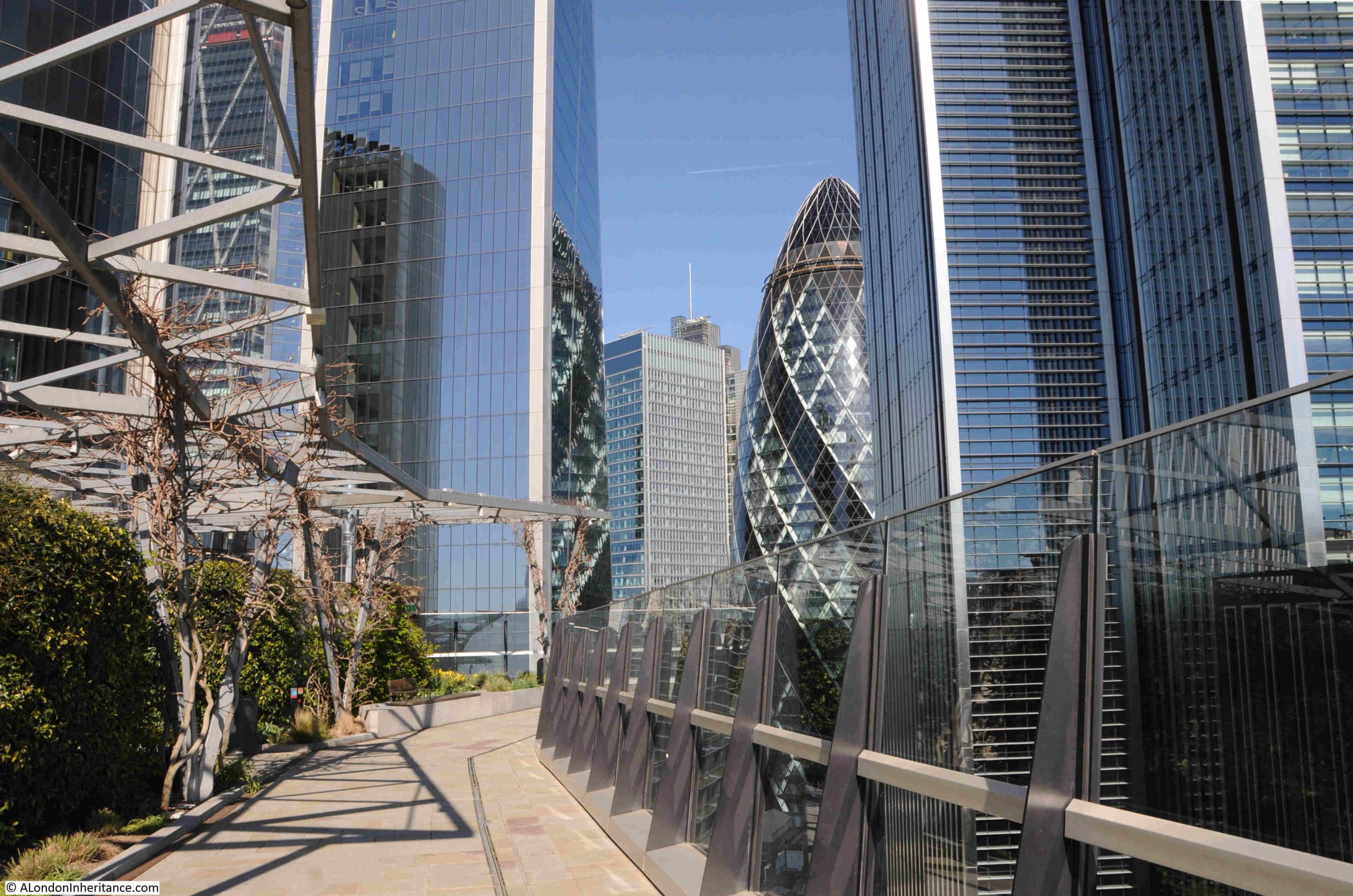
Because The Garden at 120 is on the 15th floor of, by recent standards, a relatively modest building, as you walk to the north of the garden you are looking between gaps in much taller buildings, although this does provide some interesting compositions, where other buildings are framed between towers, including this view of the Gherkin – 30 St. Mary Axe, a building which does not have a viewing gallery at the top, although it did have a bar at the top, which offered good views across London. The bar closed at the start of the year for renovations:
Through another gap we can see Christ Church Spitalfields and the chimney of the old Truman brewery:
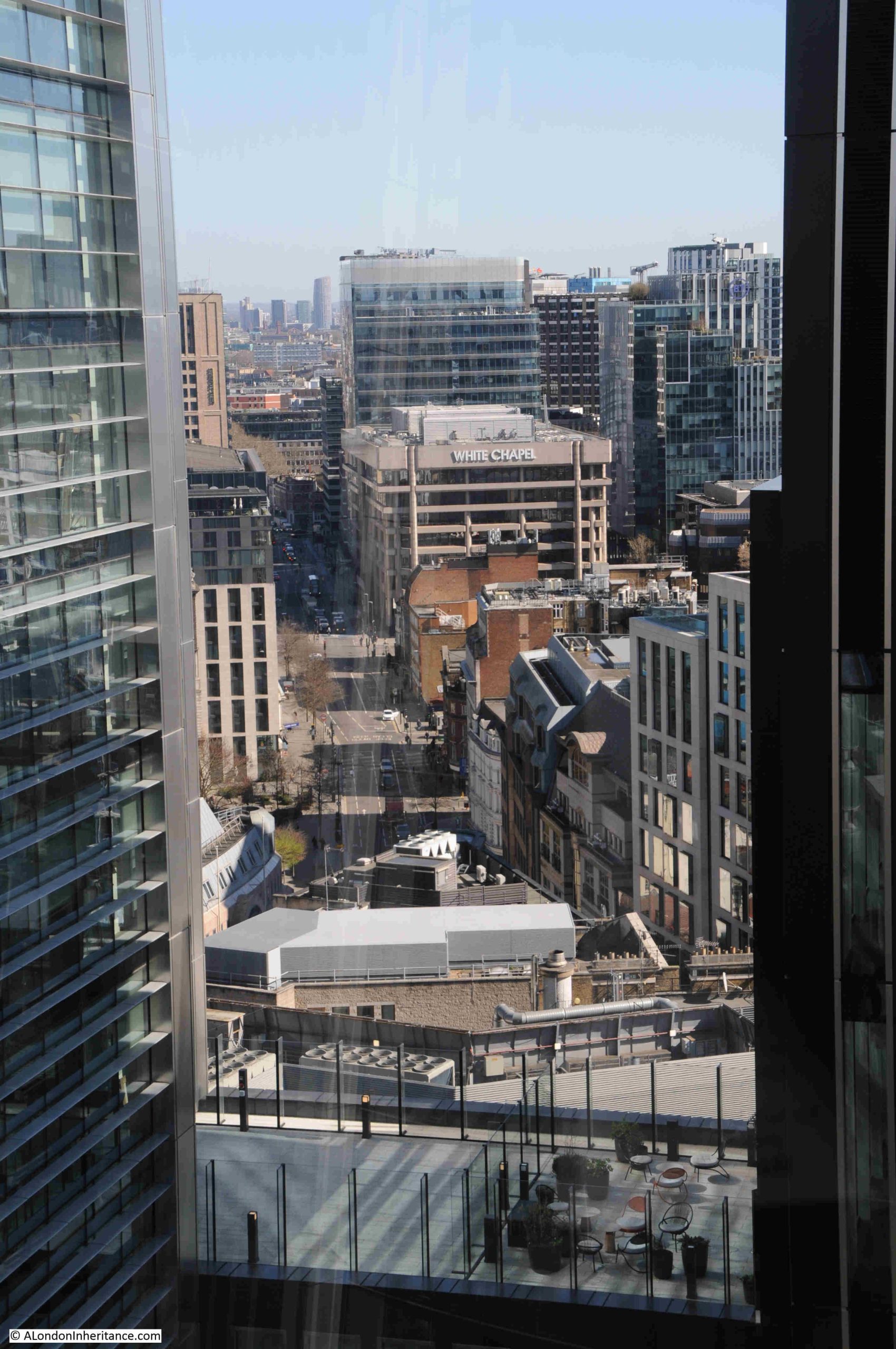
The Whitechapel building stands out on the corner of Whitechapel High Street (the road to the left of the building), and Mansell Street:
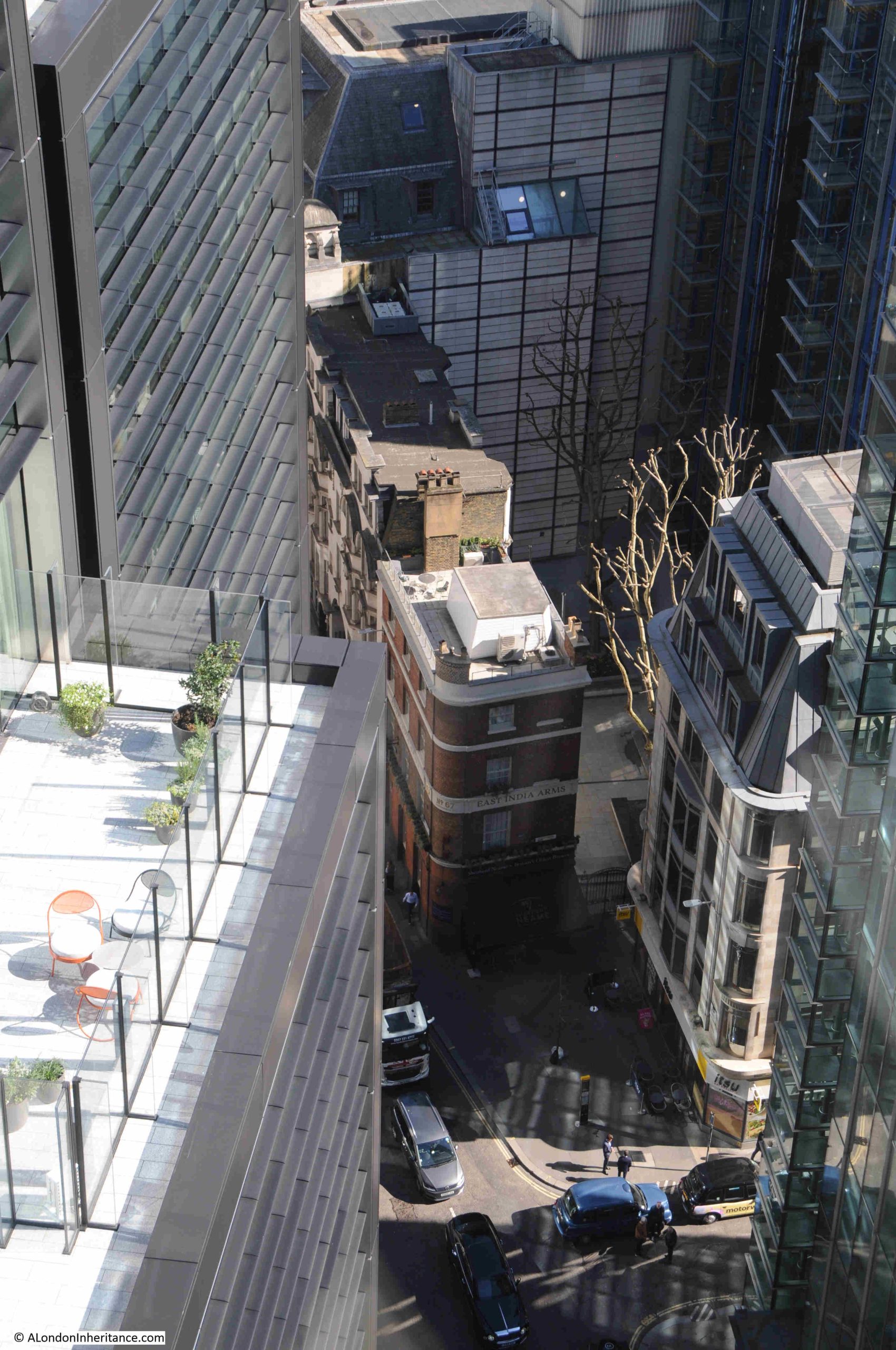
Looking down to a very small part of Fenchurch Street, at the junction with Fenchurch Place, we can see a small part of a terrace of 19th / early 20th century offices, with the distinctive brick built East India Arms pub on the corner:
View to the east:
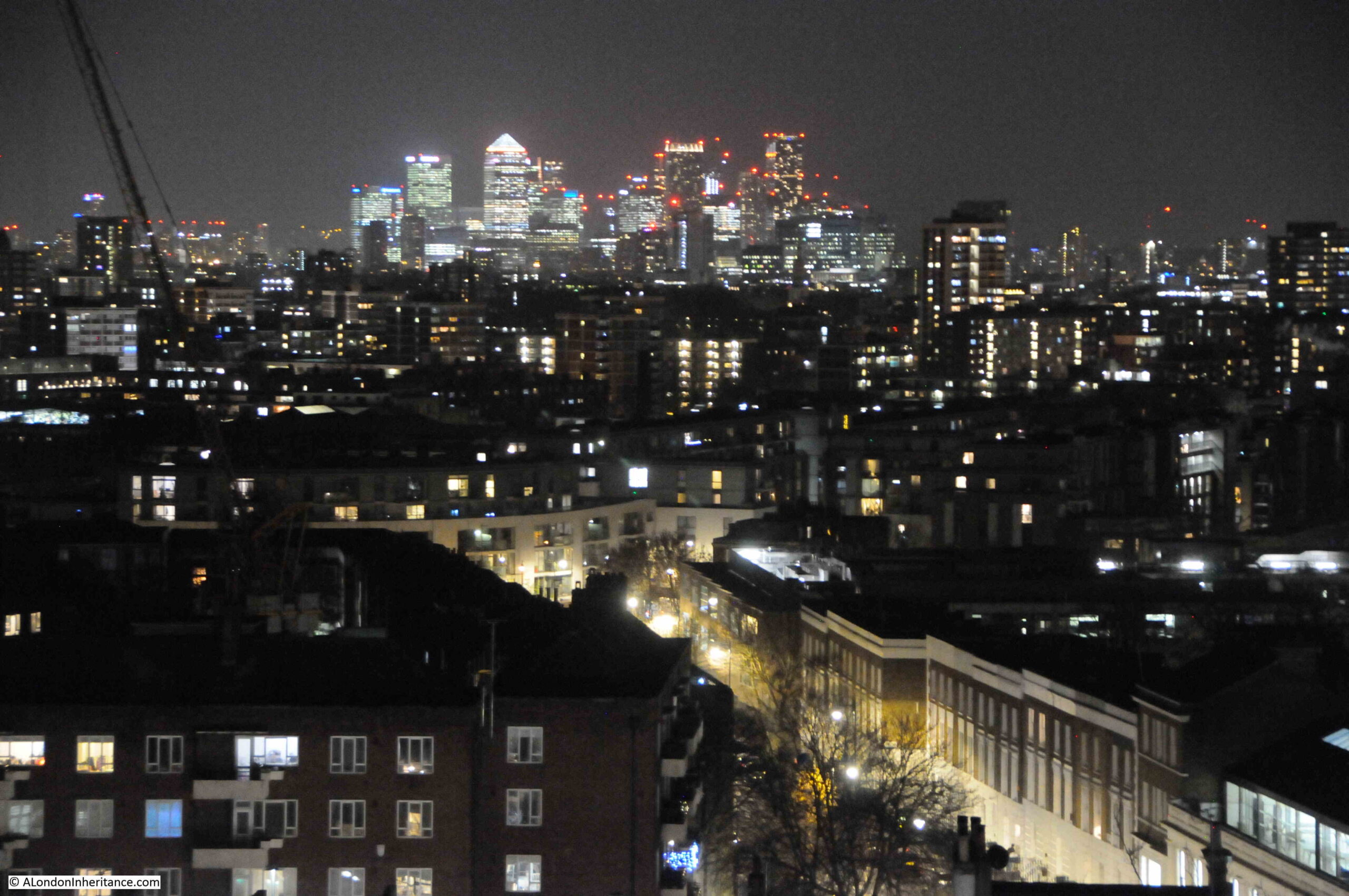
The office and residential towers of Canary Wharf and the Isle of Dogs:
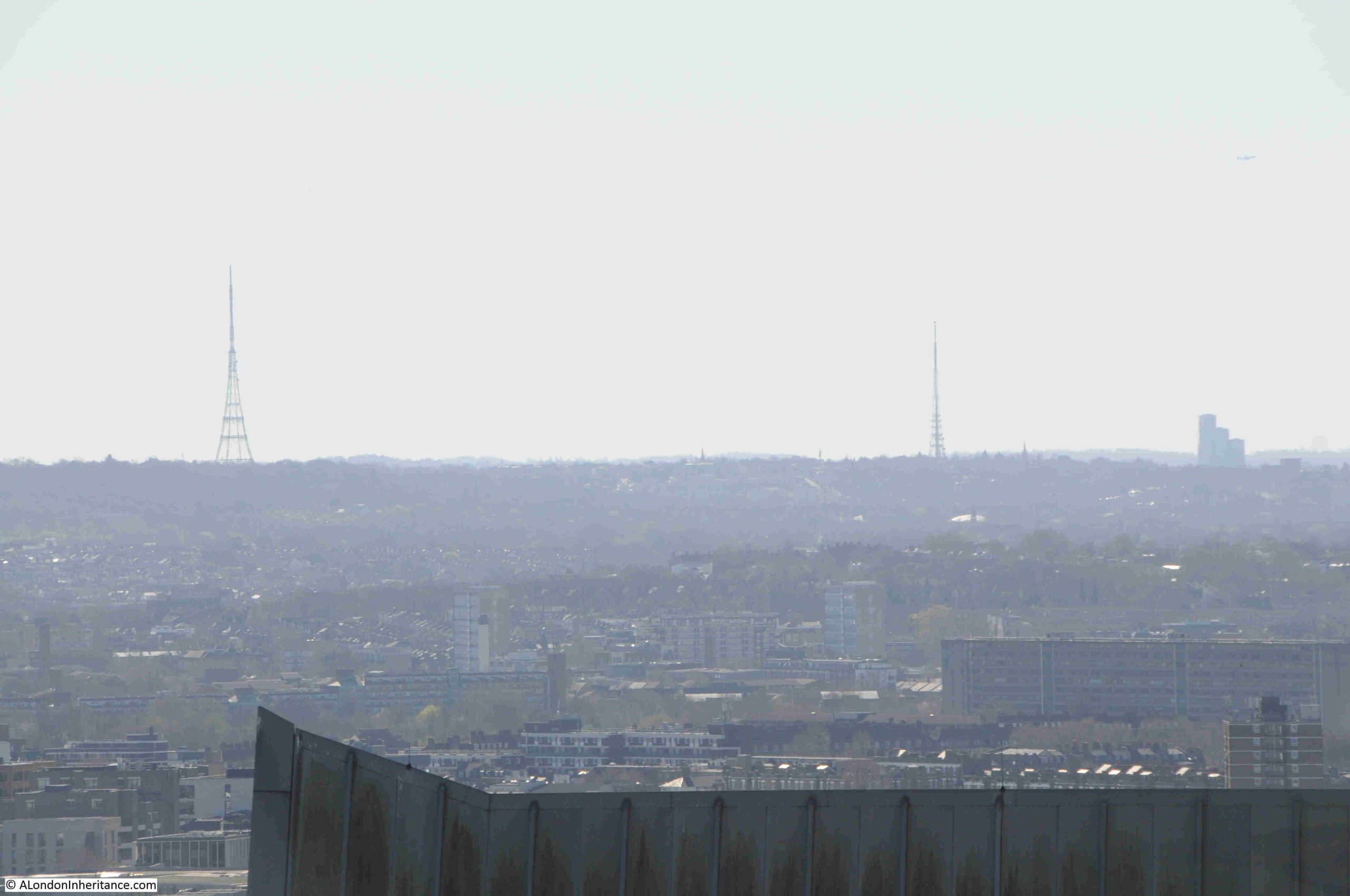
On the horizon, looking to the south, there are two tall radio masts. The one on the left is at Crystal Palace. The mast to the right is at Beaulieu Heights, next to South Norwood Hill:
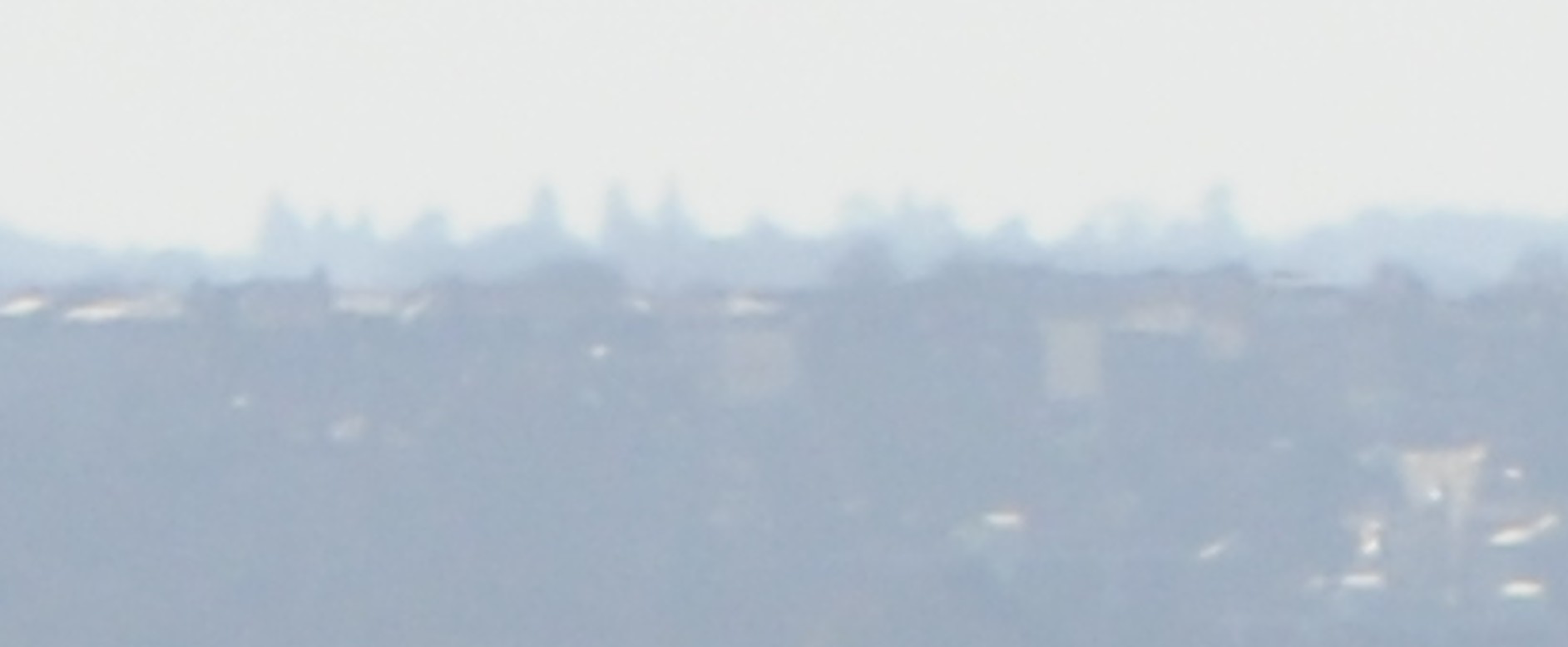
I find it fascinating to see how far you can see from height, and zooming in between these two masts is the following view:
I have no idea what the shadows are on the distant horizon. I did wonder if it was Croydon, however checking on a map, and Croydon is further to the right, and following the line between the two masts from Fenchurch Street, there are no significant clusters of buildings, so I have idea what they are.
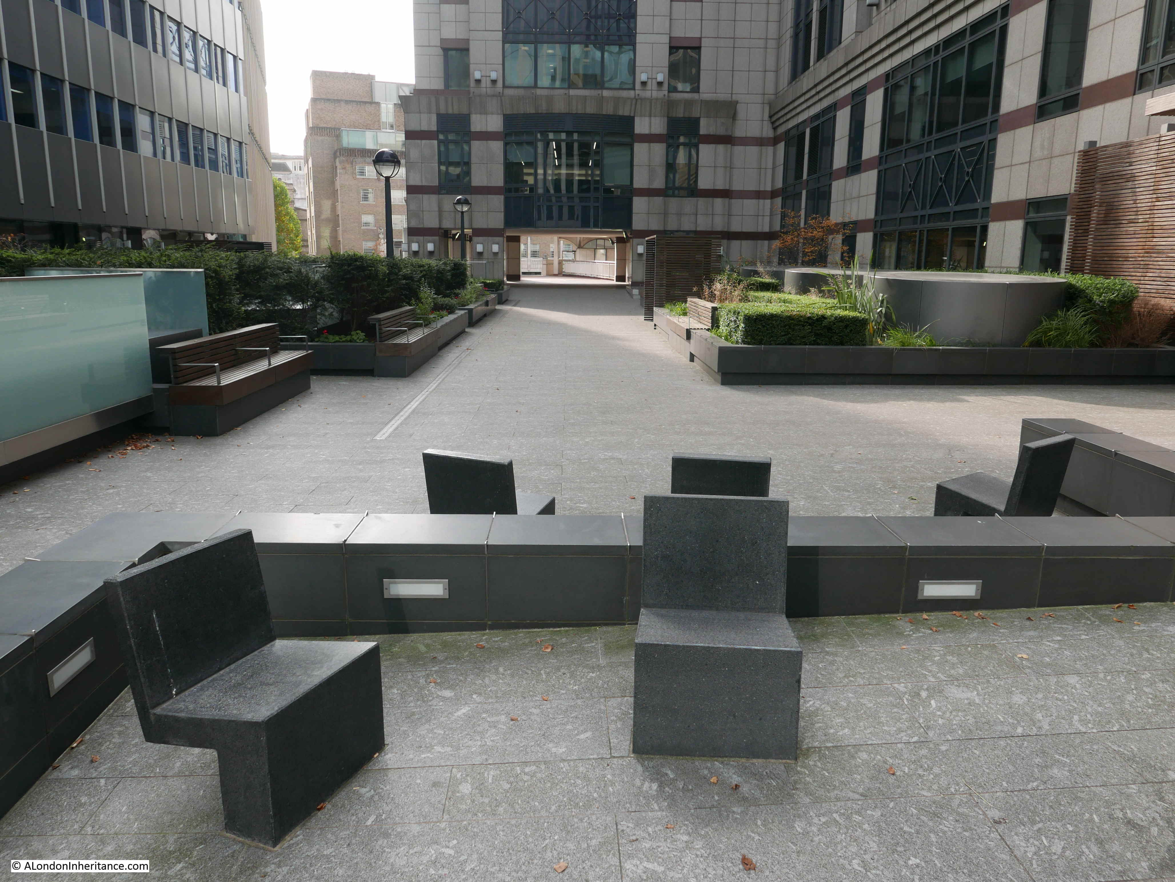
I have not mentioned the Garden part of the name of the Garden at 120.
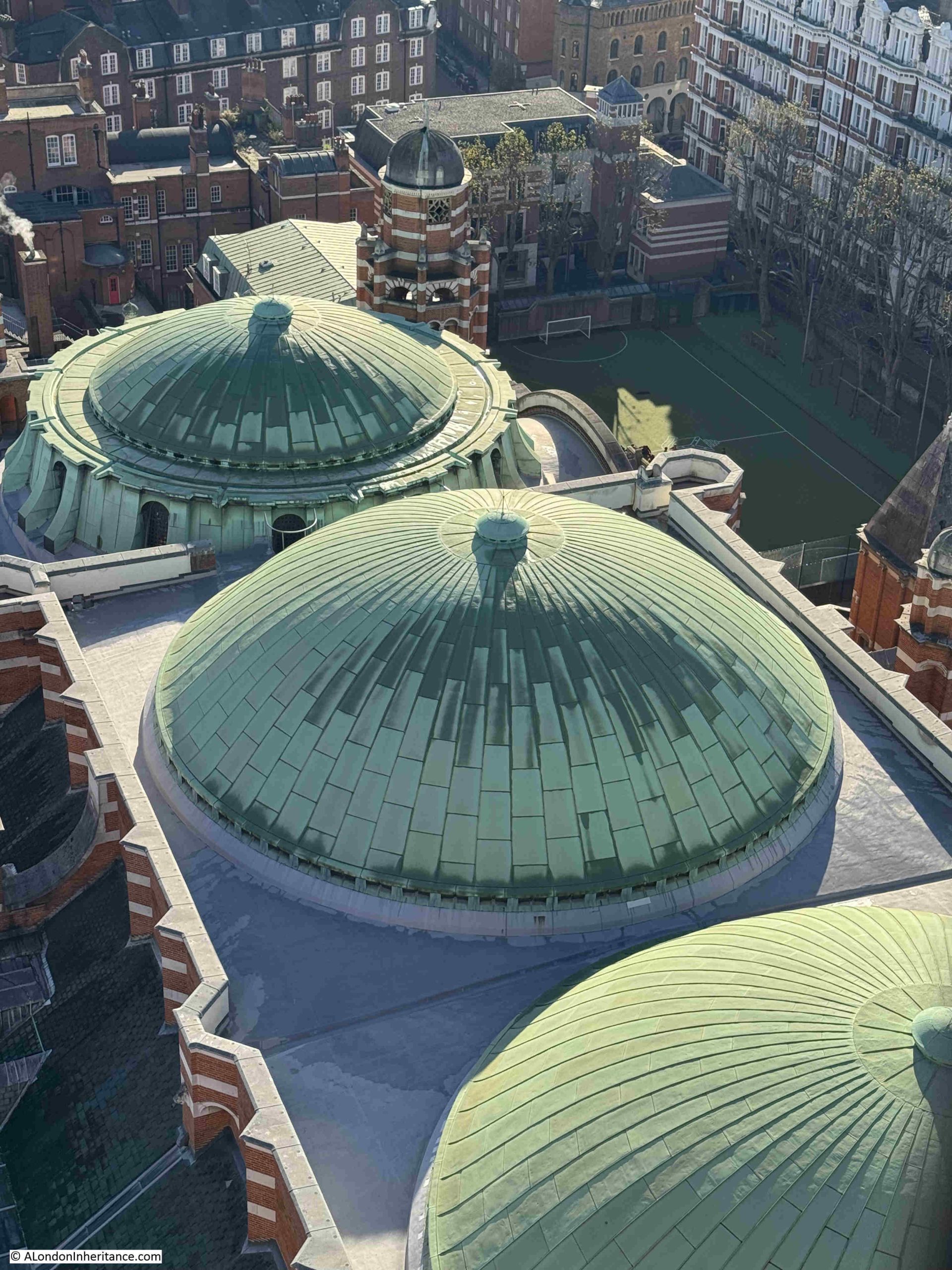
The garden is around the central core of the roof space, with a walkway around the perimeter.
The garden was designed by landscape architects Latz+Partner, and does consist of a good amount and variety of plants. View along the walkway on the eastern side of the roof, with planting on the left:
Having various forms of planting seems to be a core part of the majority of proposals for new towers in the City.
Fifty Fenchurch will include a public roof garden and winter garden at level 10, whilst the Fountain House replacement will have an external garden terrace.
Whilst this may be viewed as greenwashing, it does follow the approach of Fred Cleary, who campaigned and worked for much more planting, flowers and gardens as part of the post war redevelopment of the City, and as described in his 1969 book “The Flowering City”.
The southern side of the Garden at 120, with the main viewing area looking south and planting to the right:
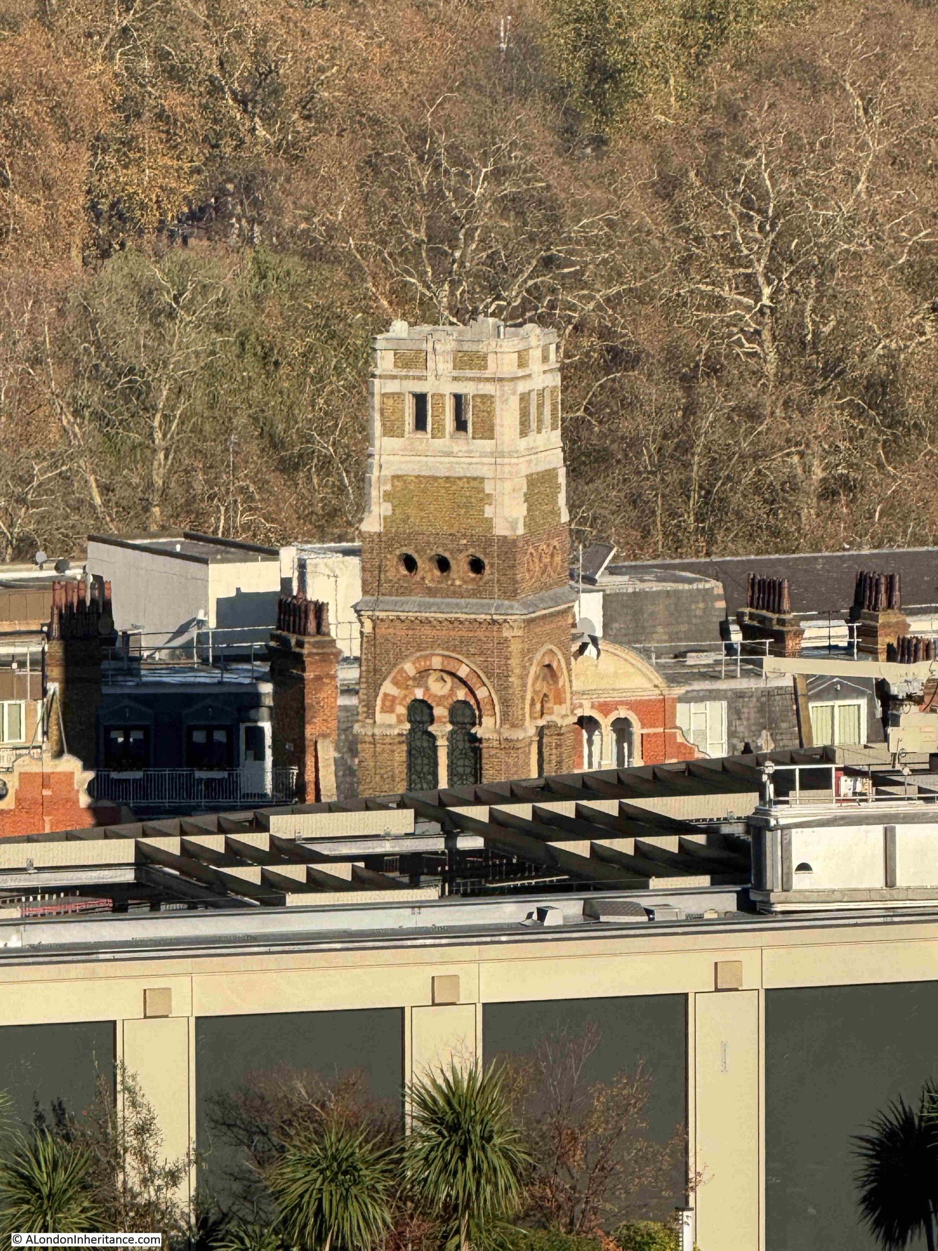
Back on ground level, I walked across to the east of the Fifty Fenchurch building site, next to the tower of All Hallows Staining and looked back at the building with the Garden at 120 on the roof:
There are a growing number of places across London to look across the city from above, and each offers a different perspective of an ever changing city.
It is also interesting to visit these places across the years to see the rapid change taking place, and the view from the Garden at 120 will change significantly in the coming years when Fifty Fenchurch and the Fountain House site developments are completed.
A high level view always provides a different perspective than walking the streets of London. From high-up, we can see how the height of the city changes over time, how different parts of the city relate to one another, how new developments impact the overall look and feel of London, architectural features not easily visible from ground level etc.
I have always taken any opportunity to look at London from above. Two of my first experiences of this were the Shell Centre Viewing Gallery, and crossing London in an old biplane (here and here). Click on the links for photos of a very different city.
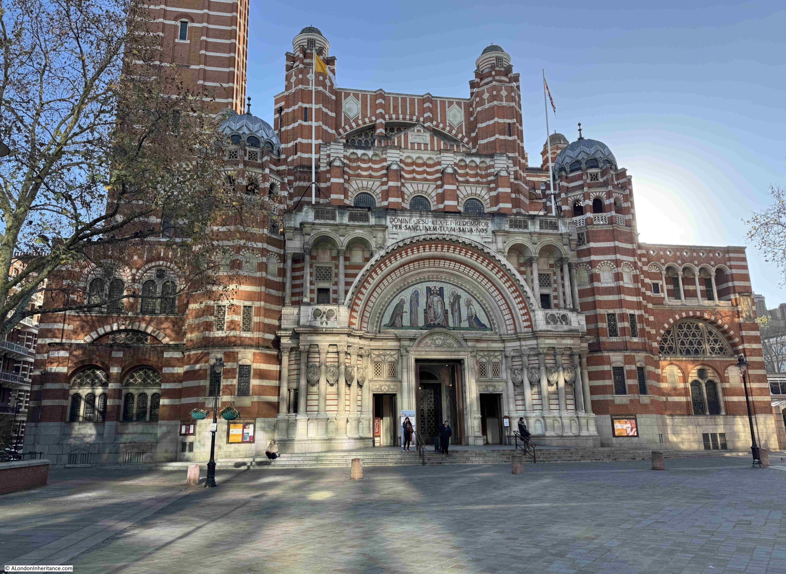
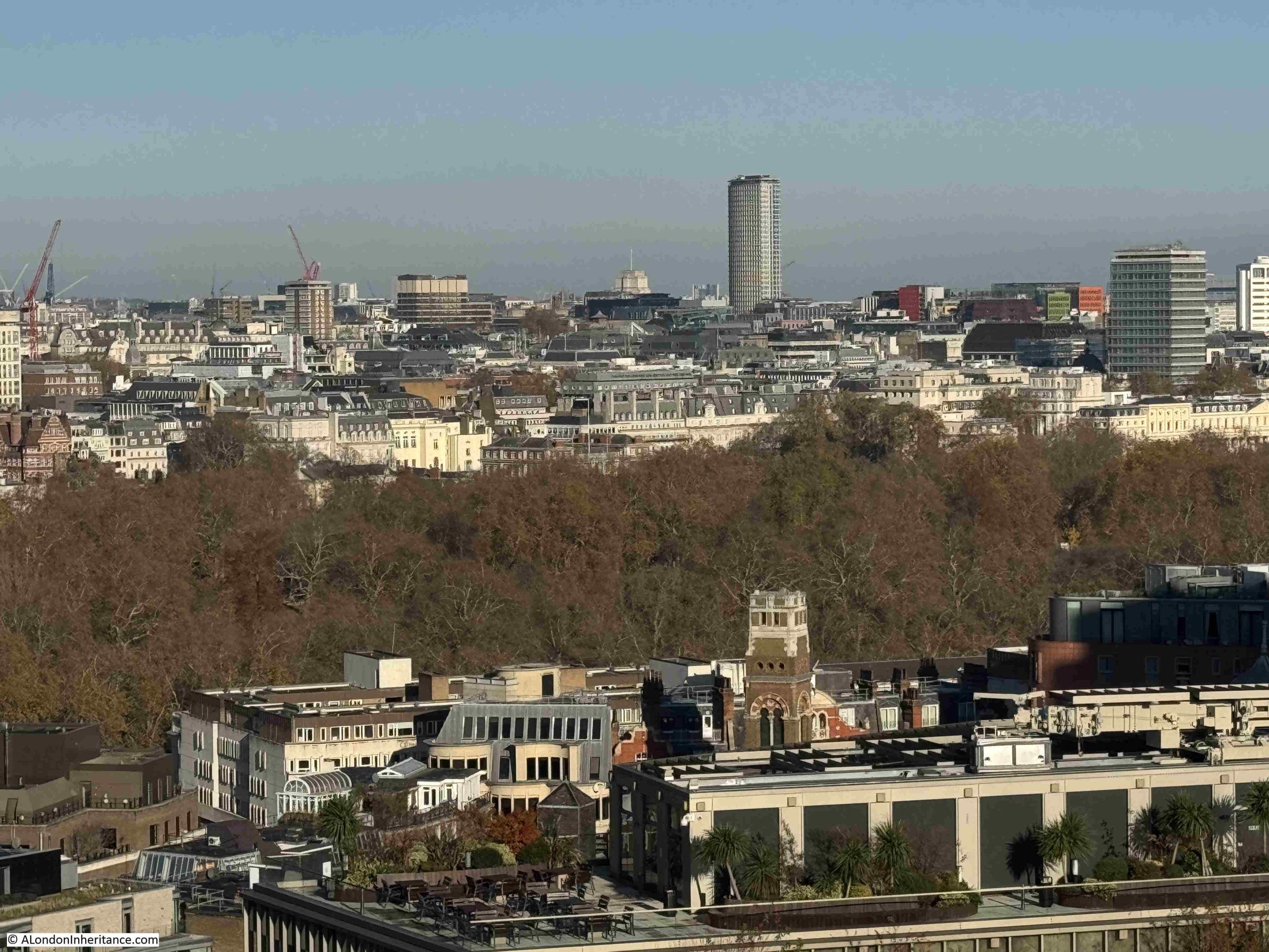
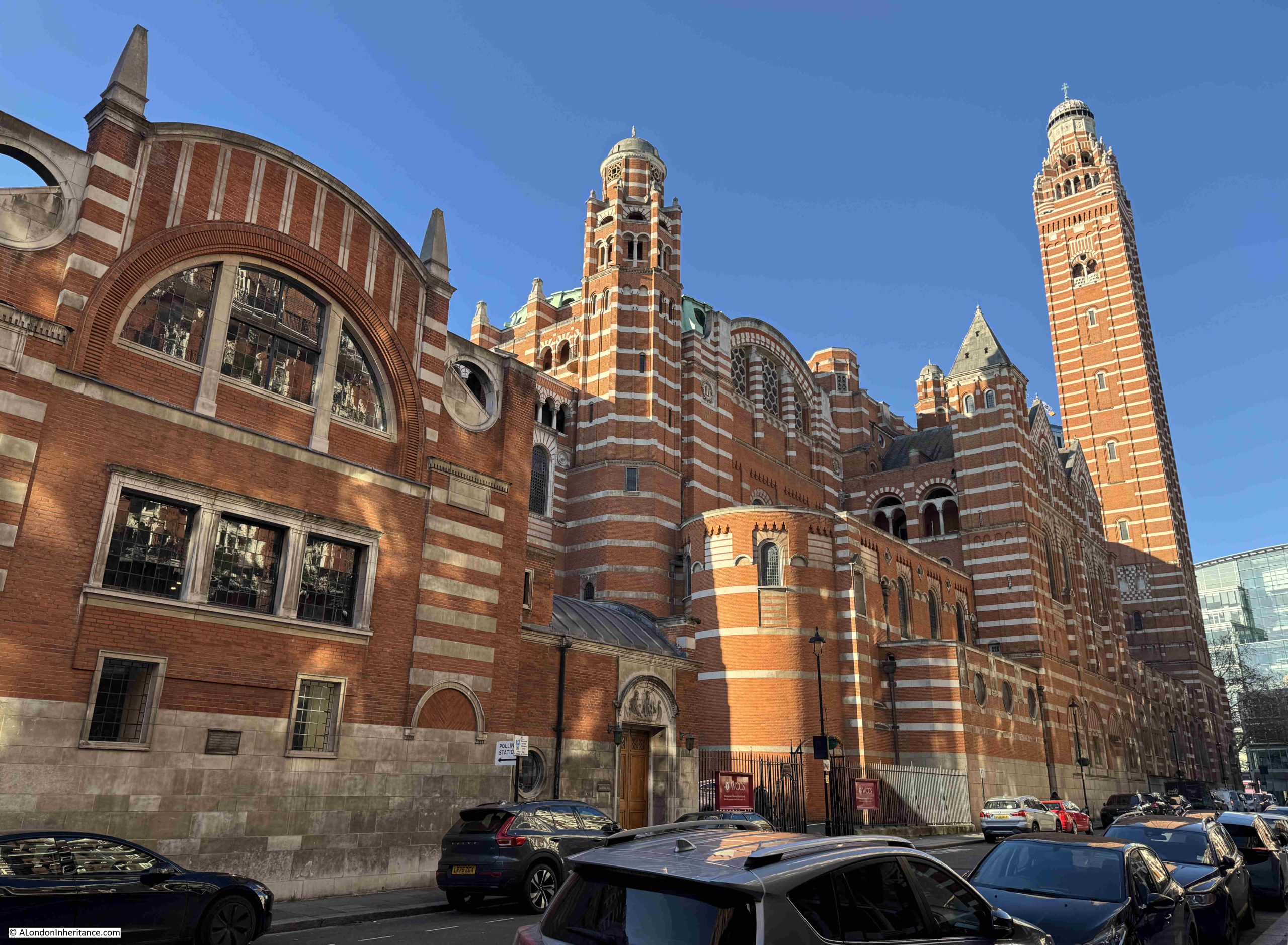
A couple of week’s ago I was in Victoria on a fine autumn day with clear blue sky and bright sun, which presented another opportunity to look at the view over London, as Westminster Cathedral has a wonderful outlook from a viewing gallery towards the top of its 284ft high bell tower.
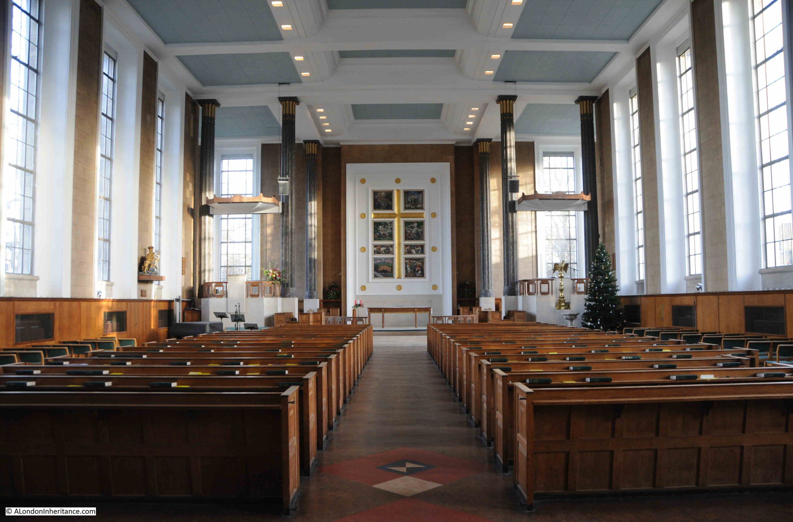
Westminster Cathedral is the Mother Church for Catholics in England and Wales, and is the home for the Archbishop of Westminster. It is a wonderful building, so very different to the buildings that have been recently built around Victoria:
The cathedral is also so very different to other churches to be found in London. Designed by the architect John Francis Bentley and based on the type of Byzantine – Christian style of architecture frequently found in Italy and eastern Mediterranean countries, construction marked the end of the 19th and start of the 20th centuries, as the Cathedral was completed in 1903, so for a London church, it is relatively recent.
The view of the cathedral we see today from street level is even more recent, as up to the 1970s there were the large terrace style of houses, still to be found in Victoria, lining the street in front of the cathedral and blocking the view.
The cathedral was constructed of brick and Portland stone, the extensive use of brick was to reduce costs, however brick is a really good building material, and the mix of brick and Portland stone considerably adds to the architecture and appearance of the Cathedral, and the brick looks wonderful in the sun of an autumn day.
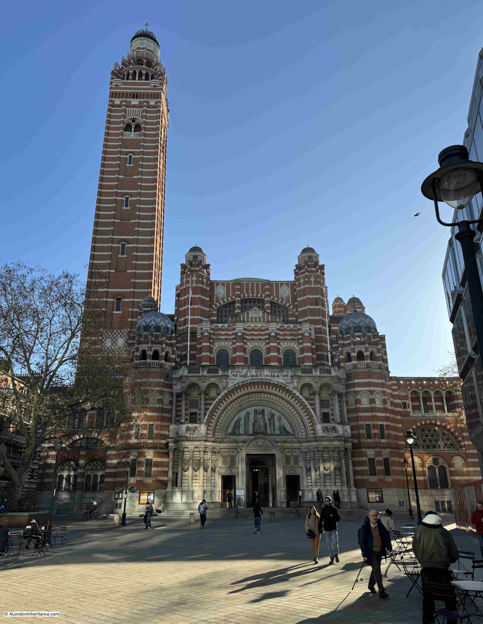
A full view of the façade of the Cathedral, with the bell tower on the left:
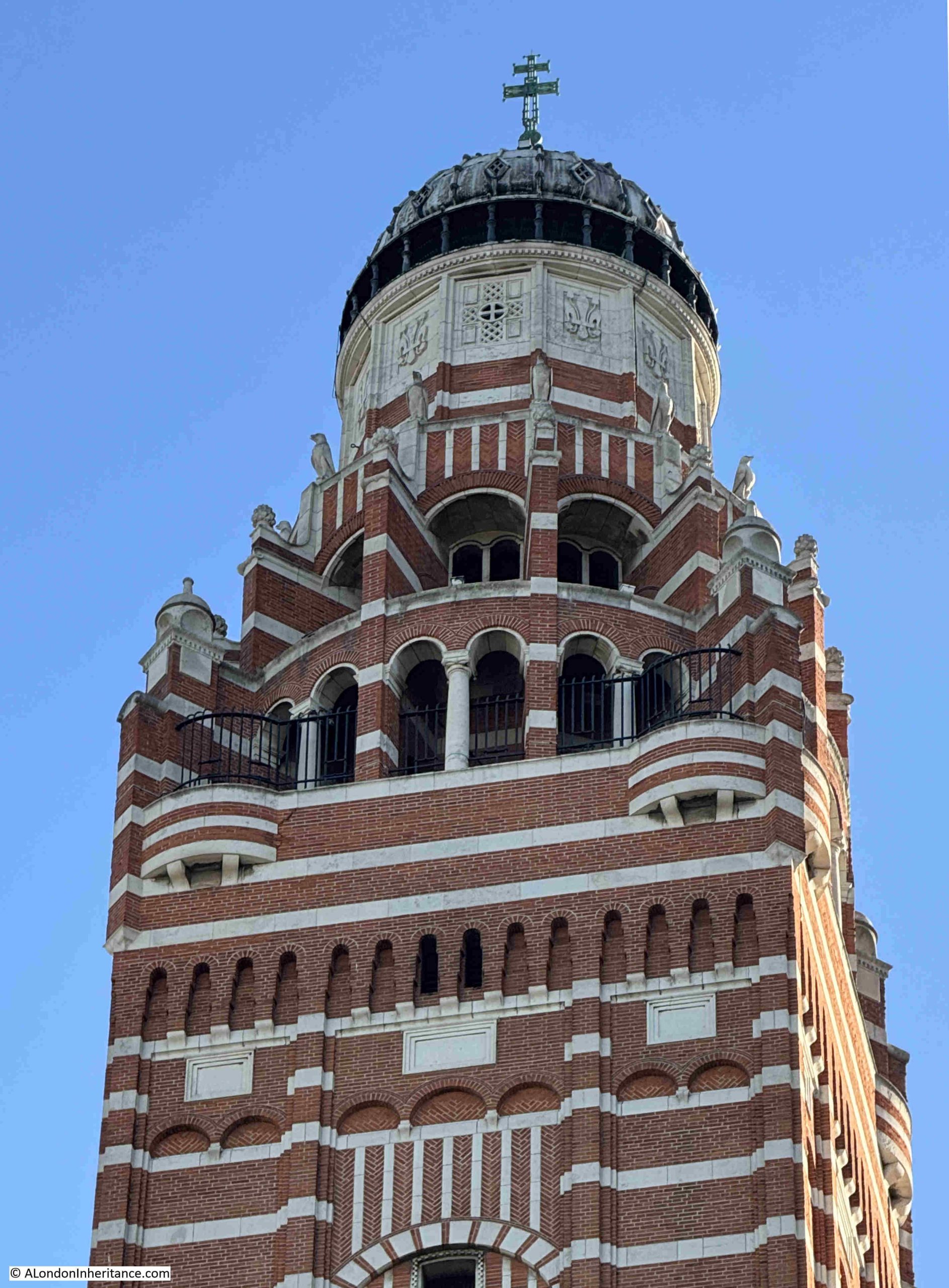
The overall height of the bell tower, or campanile to use the correct term, is 284 feet to the top of the cross on the dome, and just below the very top of the tower, there is a viewing gallery at 210 feet.
The bell tower has only one bell, however it weighs over 2,646 kg, and was cast in 1910 at the Whitechapel Bell Foundry, having been funded by Gwendolen Mary Fitzalan-Howard, Duchess of Norfolk.
The bell is apparently known as Big Edward, after Edward the Confessor, who is buried just along Victoria Street in Westminster Abbey.
In the following photo, the viewing gallery is the section of the tower where there are black railings:
Thankfully, there is a lift that takes you from the ground floor up to the viewing gallery, although they do warn you that if there is a problem with the lift, then it will be stairs all the way down.
The lift was blessed in 2015, and on a sign inside the lift is a copy of the blessing, so hopefully no lift problems during my visit.
The lift opens out onto a semi-enclosed area, where there are arches providing access to stunning views across the city.
In the lower right of the following photo are two of the domes on the roof of Westminster Cathedral, and the towers in the distance are part of the recent developments at Nine Elms on the southern side of the Thames:
The following photo shows a close-up view of the domes along the roof. There are three of these, and whilst they look impressive from above, internally they provide a dramatic addition to the roof space, again following the style of Byzantine – Christian architecture:
At the rear of the cathedral is the Westminster Cathedral Choir School, which explains the football pitch and the buildings at the back.
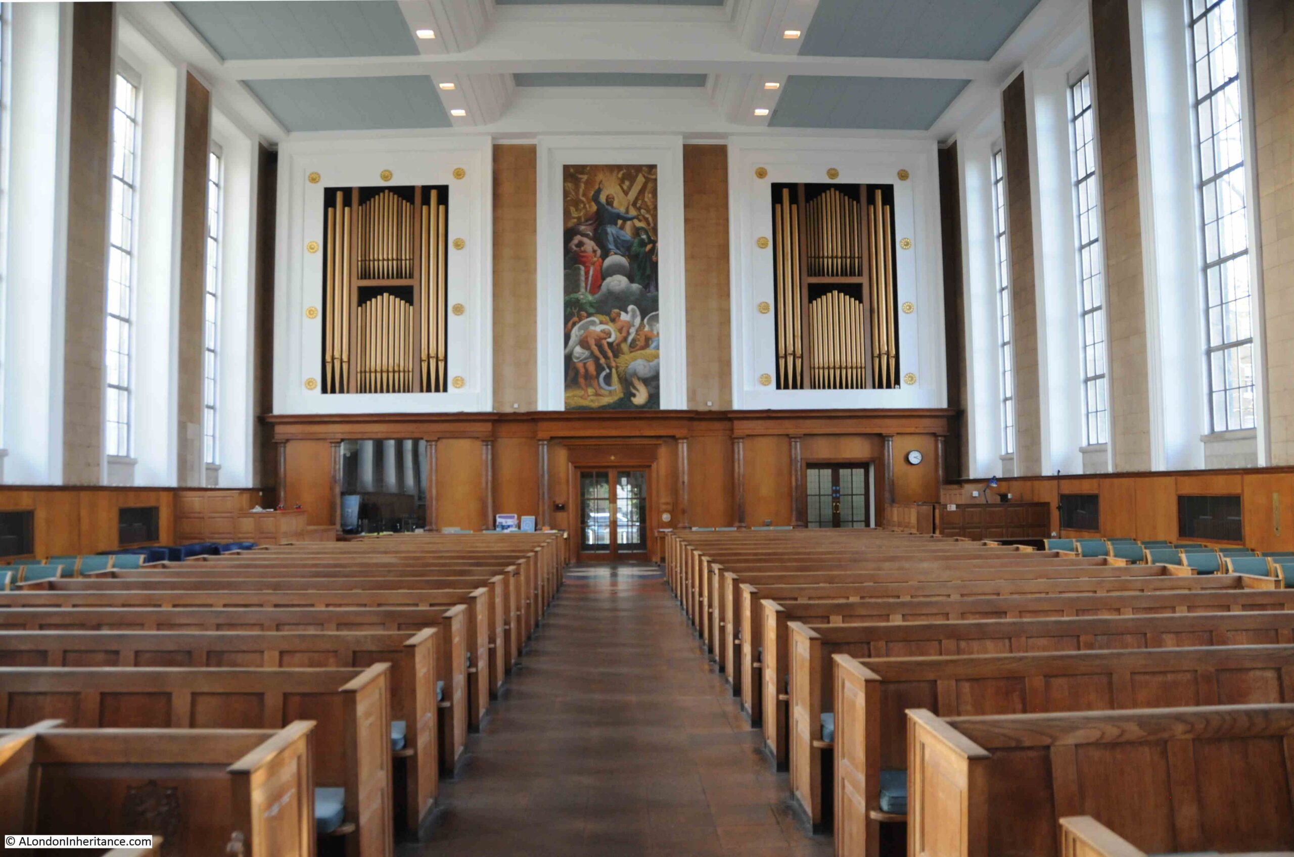
Internally, the church is richly decorated across the lower half. The upper half and the internal sides of the domes are plain brick, which gives the upper part of the cathedral a darker appearance as you look up.
During my visit, there was a service in progress and no photo signs in place, so I cannot illustrate the internal appearance of the cathedral, but it is well worth a visit if you are in Victoria.
As well as the wide sweep of a view across the city, one of the joys of looking from above is picking out individual buildings, and getting a different perspective which is not that obvious from street level.
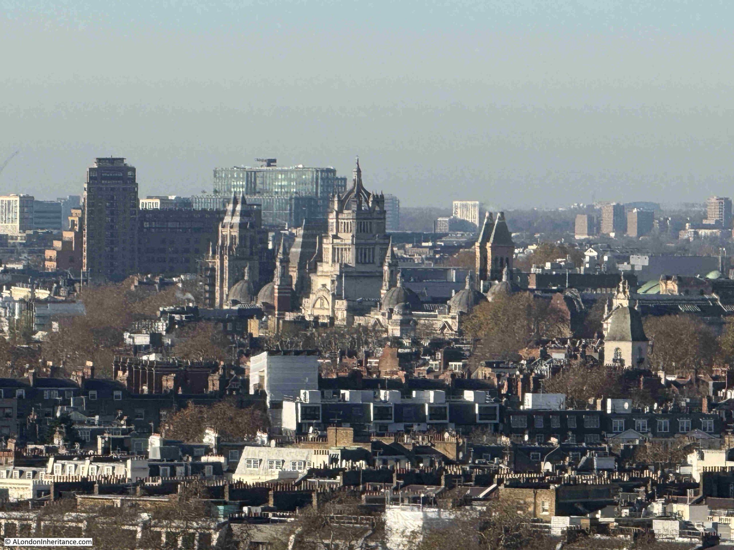
In the centre of the following photo is the impressive tower above the main entrance to the Victoria & Albert Museum in South Kensington, and behind the V&A is the Natural History Museum:
The dome in the following photo is that of the Brompton Oratory, and the tower to the right is the Queen’s Tower at Imperial College London, also in South Kensington. It is hard to tell from this distance, but I think the Queen’s Tower is still wrapped in sheeting as restoration work has been underway:
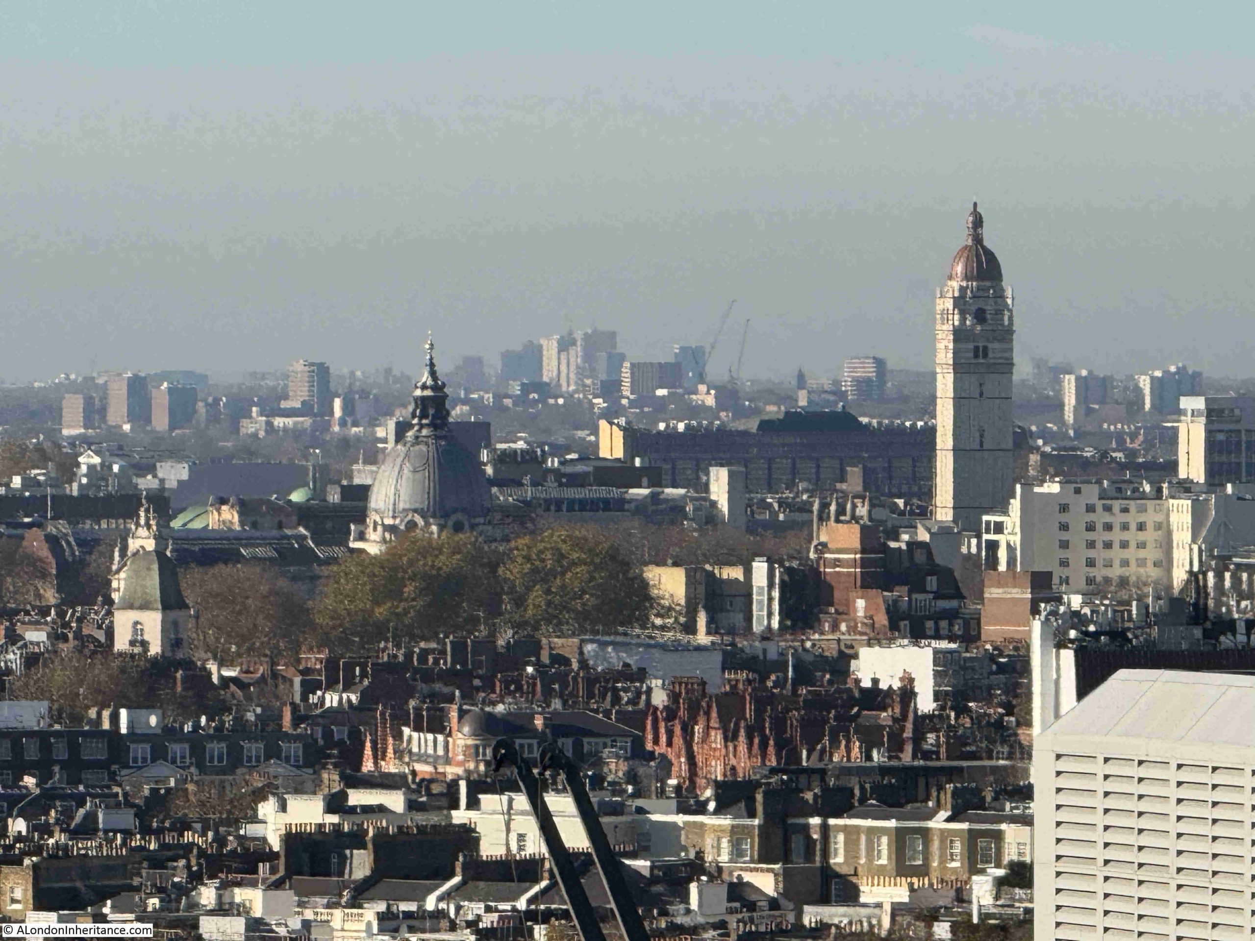
Victoria has changed dramatically over the last decade, and from the cathedral tower we can see many of the new buildings that now dominate the area:
Looking down to street level gives an impression of the height of the viewing gallery:
As I mentioned earlier in the post, when built, Westminster Cathedral was screened from Victoria Street by rows of terrace houses.
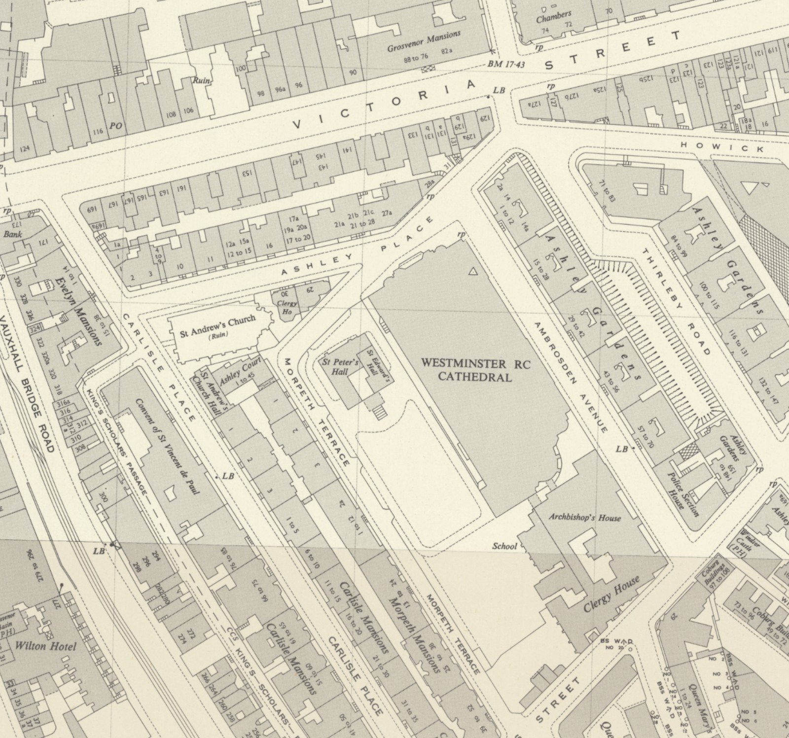
As a post is never complete without a map and the following is an extract from the 1952 revision of the OS map, where the houses that that once sat between Ashley Place and Victoria Street can be seen. These would be demolished in the 1970s, opening up the view to the cathedral from Victoria Street (‘Reproduced with the permission of the National Library of Scotland“:
In the above map, another church can be seen to the left. This is St. Andrew’s Church, but with the word “ruins” in brackets. This church was also demolished in the 1970s and today the office building on the site is the head office of the John Lewis Partnership (although I vaguely recall a story that they were relocating from this office).
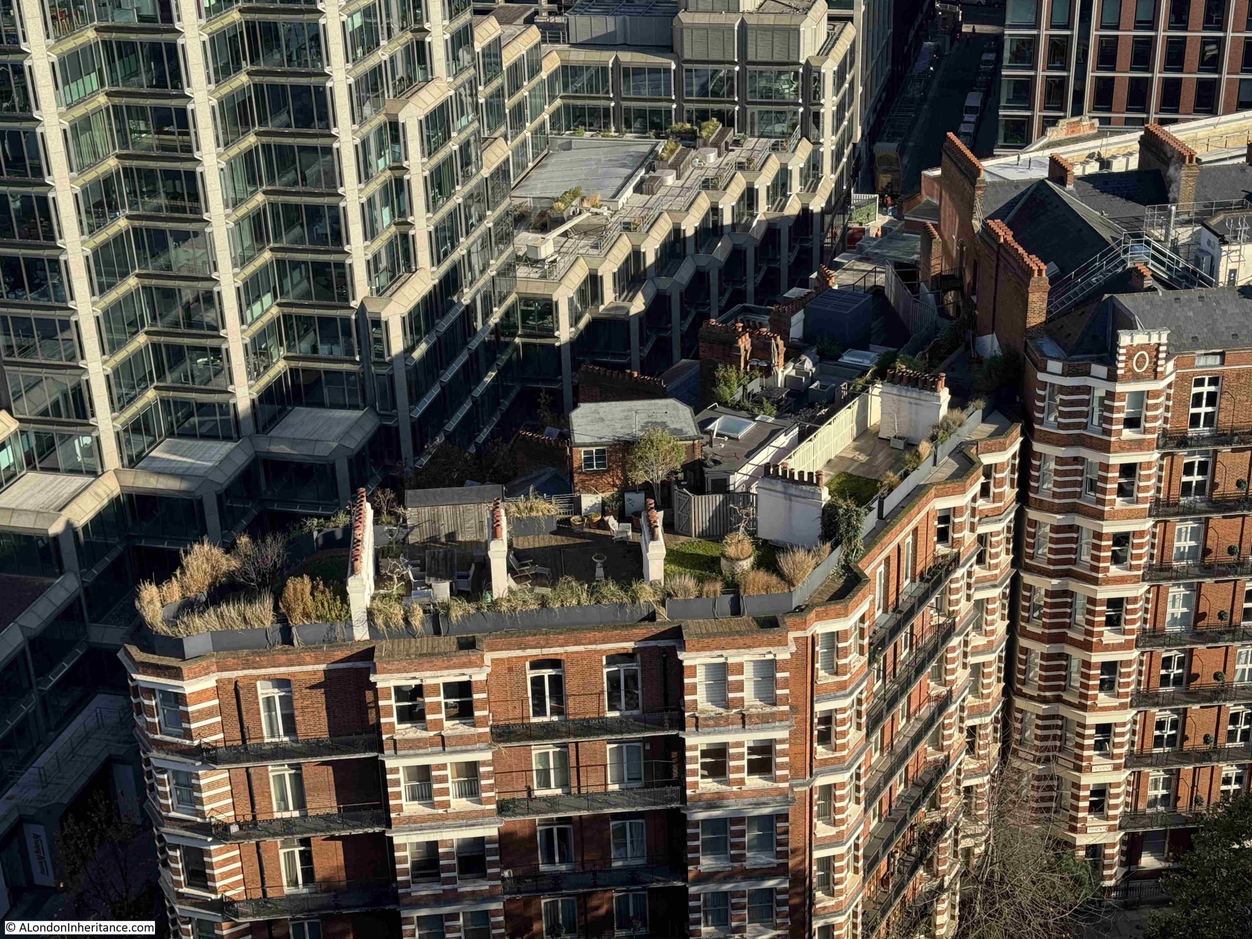
Large terrace blocks of flats can still be seen to either side of the cathedral, some of which have roof gardens:
As well as Nine Elms, another part of London that has, and continues to change, is the Isle of Dogs, and from the tower of Westminster Cathedral we can see the towers that continue to be built in this part of east London. The change has been such as the tower with the pyramidal roof top, One Canada Square, the original tower at the development is now almost obscured by the other towers that have since been built:
In the following photo, the Victoria Tower of the Palace of Westminster can be seen to left of centre, with the Shard partially obscured behind. The Elizabeth Tower with the clock is obscured by the building on the left, as are views of the City of London. The Isle of Dogs towers are in the distance:
Another view of the Nine Elms development. The green space in the centre and to left is Vincent Square:
To the west of the cathedral is another long line of terrace flats, with those along Morpeth Terrace in the foreground and to the rear, Carlisle Place:
In the above photo we can see the chimneys of Battersea Power Station in the distance, and the following photo shows a closer view. It is good that with all the development around the old power station, the chimneys are still a stand out feature of this part of the city:
One of the power station’s chimneys also has a view across London, with an enclosed platform that rises up through the chimney, which can be seen in the above photo, and a close-up in the following photo (see links at the end of the post for views from the top of the chimney):
The long roof over the platforms of Victoria Station can be seen in the following photo, with the partially obscured brick building at the station entrance to the right:
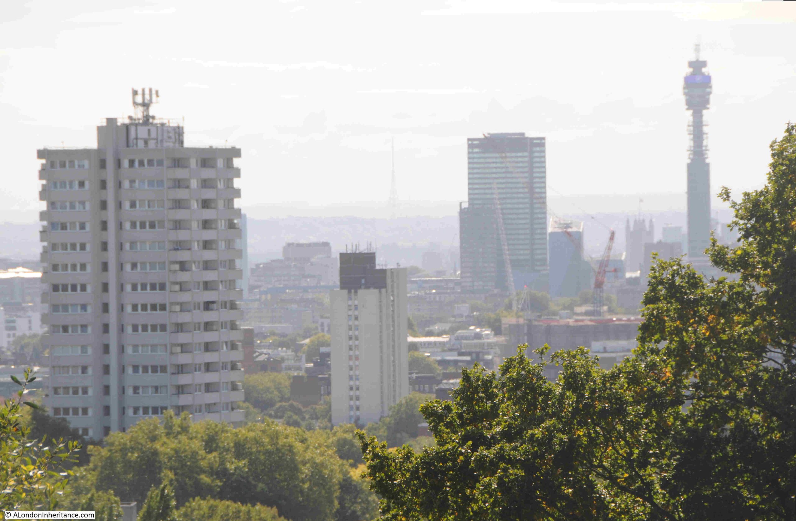
View looking towards the north, with the Centre Point building still dominating the skyline:
A closeup of a section of the above photo shows Centre Point, with to the left what was once one of the tallest buildings in London – Senate House of the University of London:
Also in the wider photo which includes Centre Point on the skyline, is a square brick tower, which is shown in the following close-up. This is the tower on the corner of Westminster Chapel, a much large church than this view of the tower suggests, founded in 1840 and facing onto Buckingham Gate:
In the centre of the following photo is the Post Office / BT / New Hotel Tower, with Euston Tower in the background. Again, this view shows that there have been very few buildings of much height constructed since the Post Office Tower (officially opened 1965) and Euston Tower (completed in 1970) in this part of the city:
Close-up of the Post Office Tower with Euston Tower in the background:
Plenty of chimneys along the tops of the terrace buildings that still surround part of the cathedral. One can imagine the smog in the air when all these fires were once lit:
The 1963 Millbank Tower dominates the following photo, with new apartment blocks on the south of the river behind:
The church tower and steeple in the above photo belongs to St. Stephen’s in Rochester Row.
The City of London is obscured by the new blocks that have been built along Victoria Street, with one exception.
The following photo shows the blocks running south along Victoria Street. In the centre of the photo, in a gap between two smaller blocks is:
St. Paul’s Cathedral:
I do not think this small gap is part of the protected view of St. Paul’s, but I need to check. It is interesting though that in scanning the skyline from London’s high viewpoints, there is always something to find hiding among the later developments across the city.
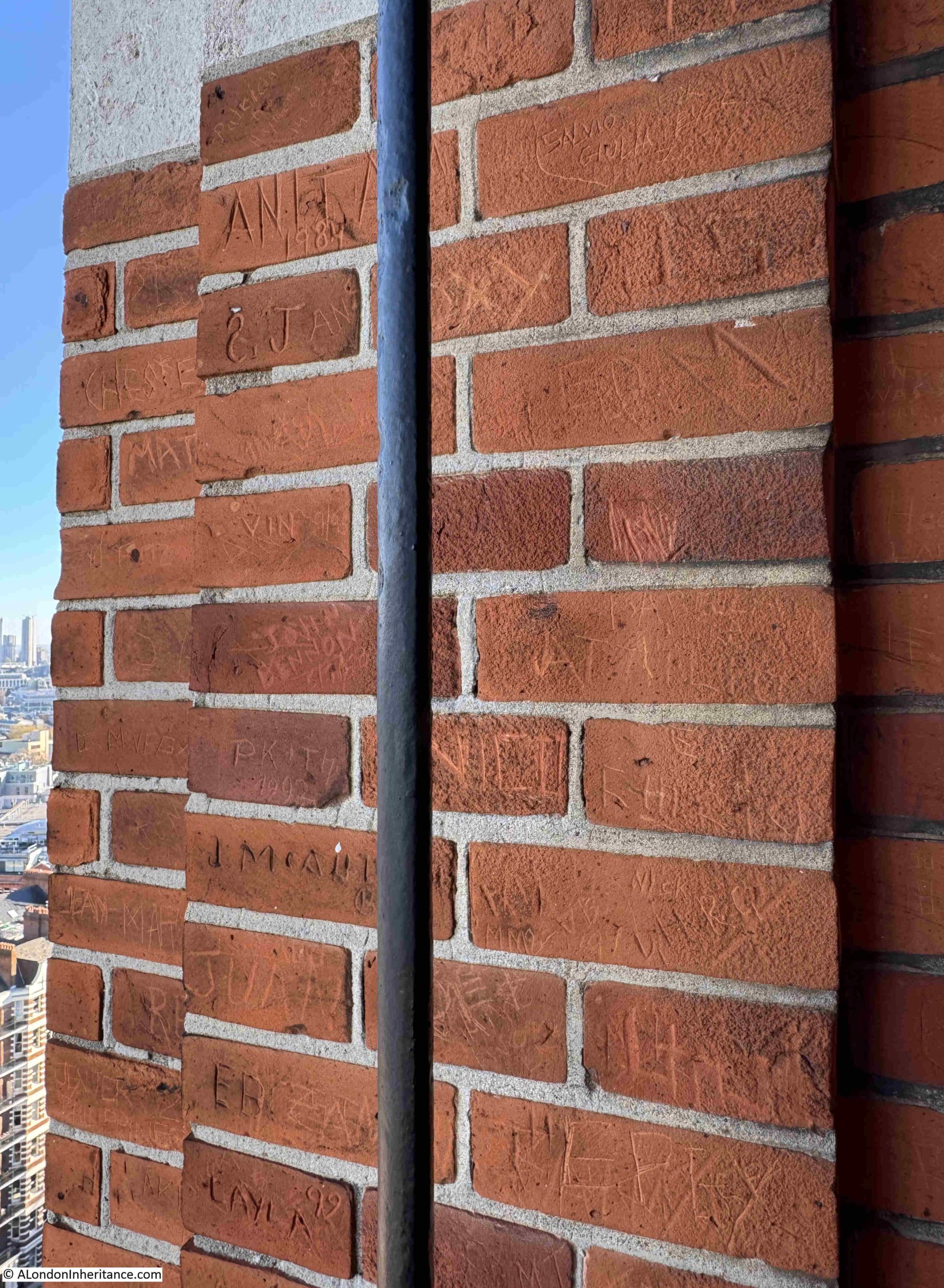
Unsurprisingly, the brick walls surrounding the viewing area at the top of the tower are covered in the names and initials of previous visitors:
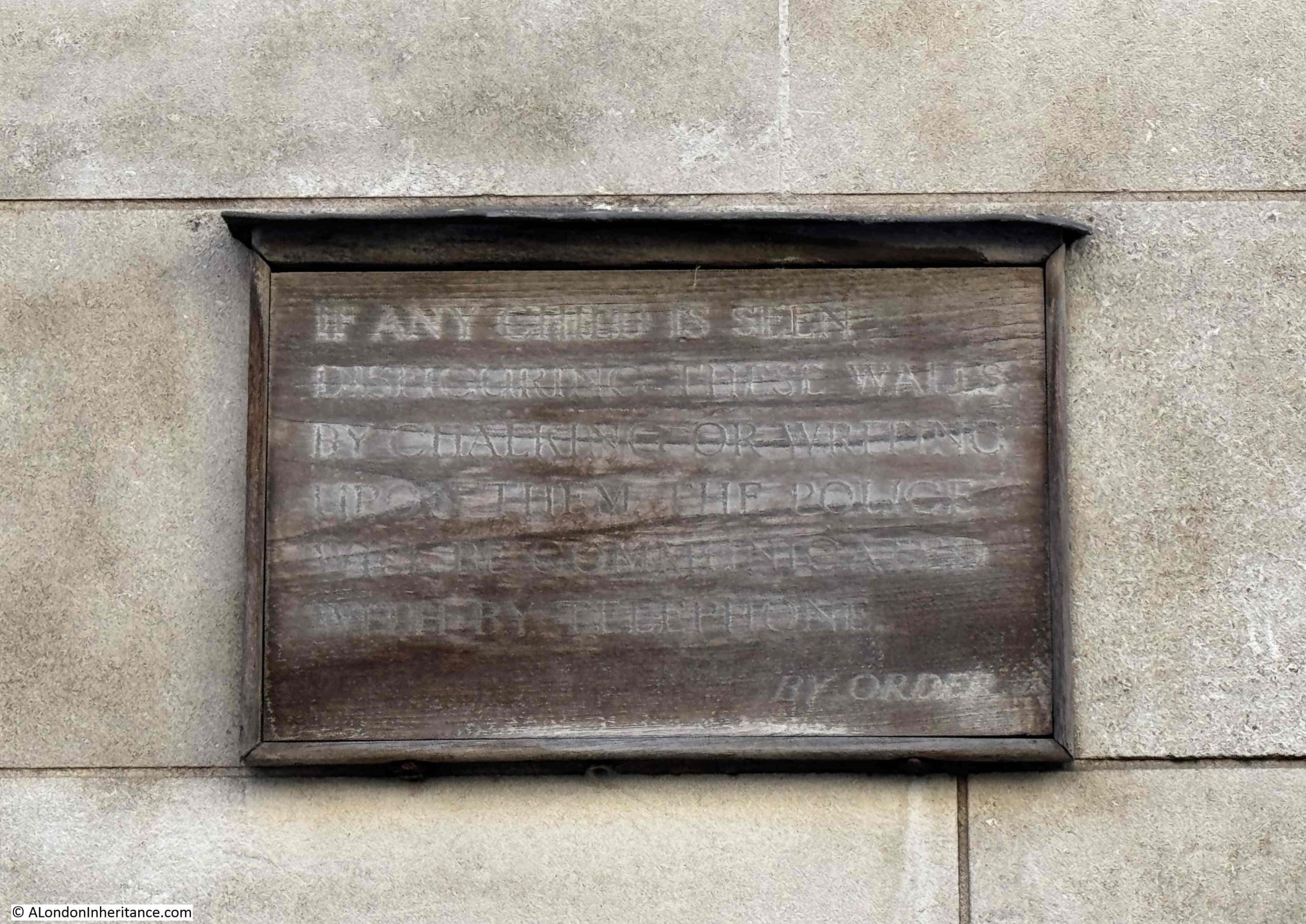
After returning back to ground level, I took a walk along Ambrosden Avenue, the street that runs to the east of Westminster Cathedral. The rear and sides of the building are just as ornate as the front, and in the sunshine of an autumn day, the red brick and Portland stone look really good:
In the above photo, between the two windows in the lower left corner, there is an old wooden sign on the wall, with one of the strangest warnings I have seen on a sign in London:
As far as I can tell, the sign reads:
“If any child is seen disfiguring these walls by chalking or writing upon them, the Police will be communicated with by the phone. By Order.”
I do not know if the sign was aimed at pupils at the Westminster Cathedral Choir School, or children in general, who must have been writing on the wall, and requiring the contact with the Police, but it must have been a real problem.
The viewing gallery at Westminster Cathedral is a wonderful place to look across London, and over time, to watch the development of the city.
Every time I have been to the top of the tower, it has been empty, and during my visit to take these photos, I was up there for about 30 minutes and no one else came up during that time.
If you are in Victoria, it is well worth a visit, both to see a fascinating cathedral, and to look across London. Entrance to the tower is via the shop, on the left side of the main entrance.
The viewing gallery is open from 10.30am to 4.30pm, Wednesday to Sunday, and costs between £5 and £10.
The following videos should help provide an impression of the view from the top of the bell tower.
Firstly looking from the west to the north:
Continuing round from the north to the south (the thumping sound you can hear in the next video is a military band along the Mall):
A bit more detail from the east to the south:
And finally from the south to the west:
For some of my other posts on views over London, the following links may be of interest:
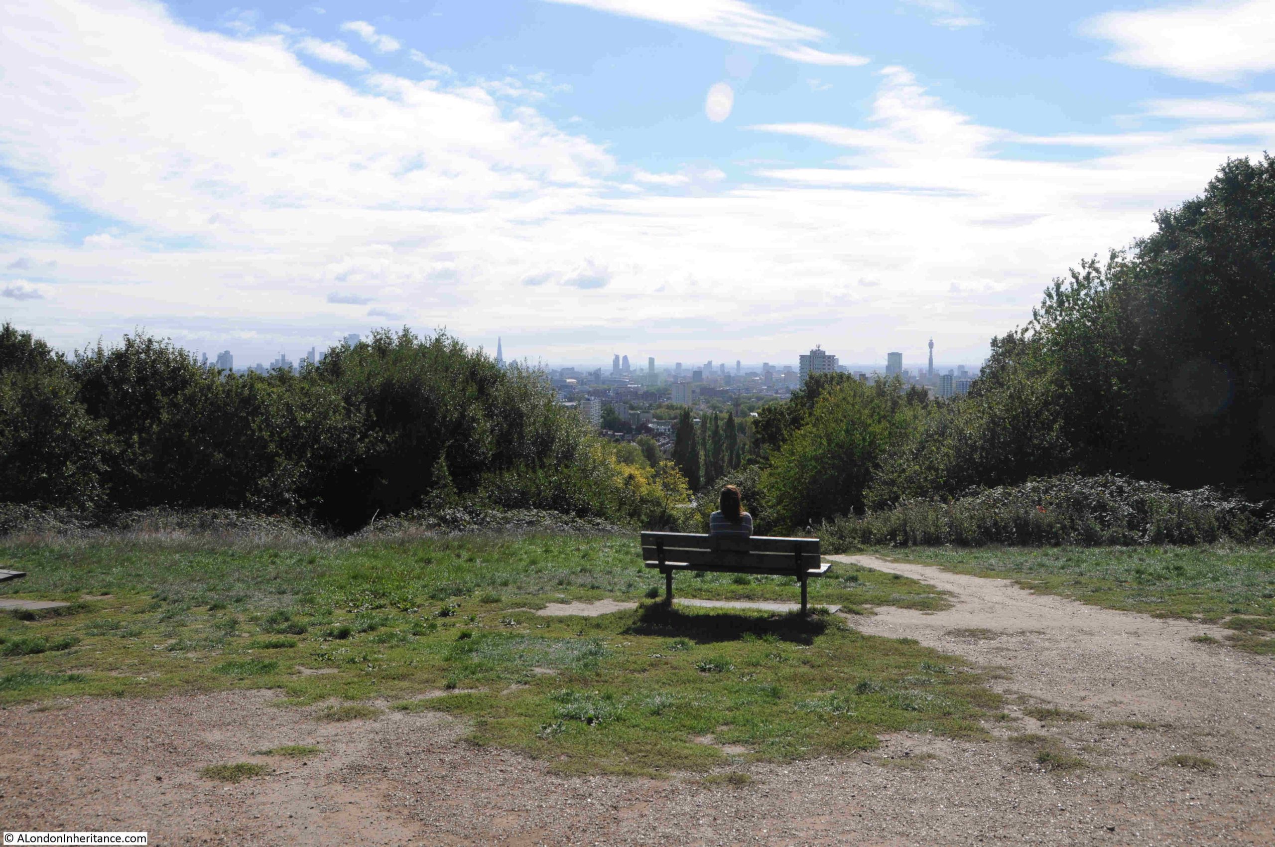
Parliament Hill is at the southern part of the high ground of Hampstead Heath. From the top of the hill there are wide ranging views across London, although these views are somewhat obscured by the trees that have grown on the slope leading down from the top of the hill to the fields below.
Parliament Hill has for long been a place to visit, to walk, to look at the view, to play games, and to enjoy the fresh air and open space, above the congested streets of the city.
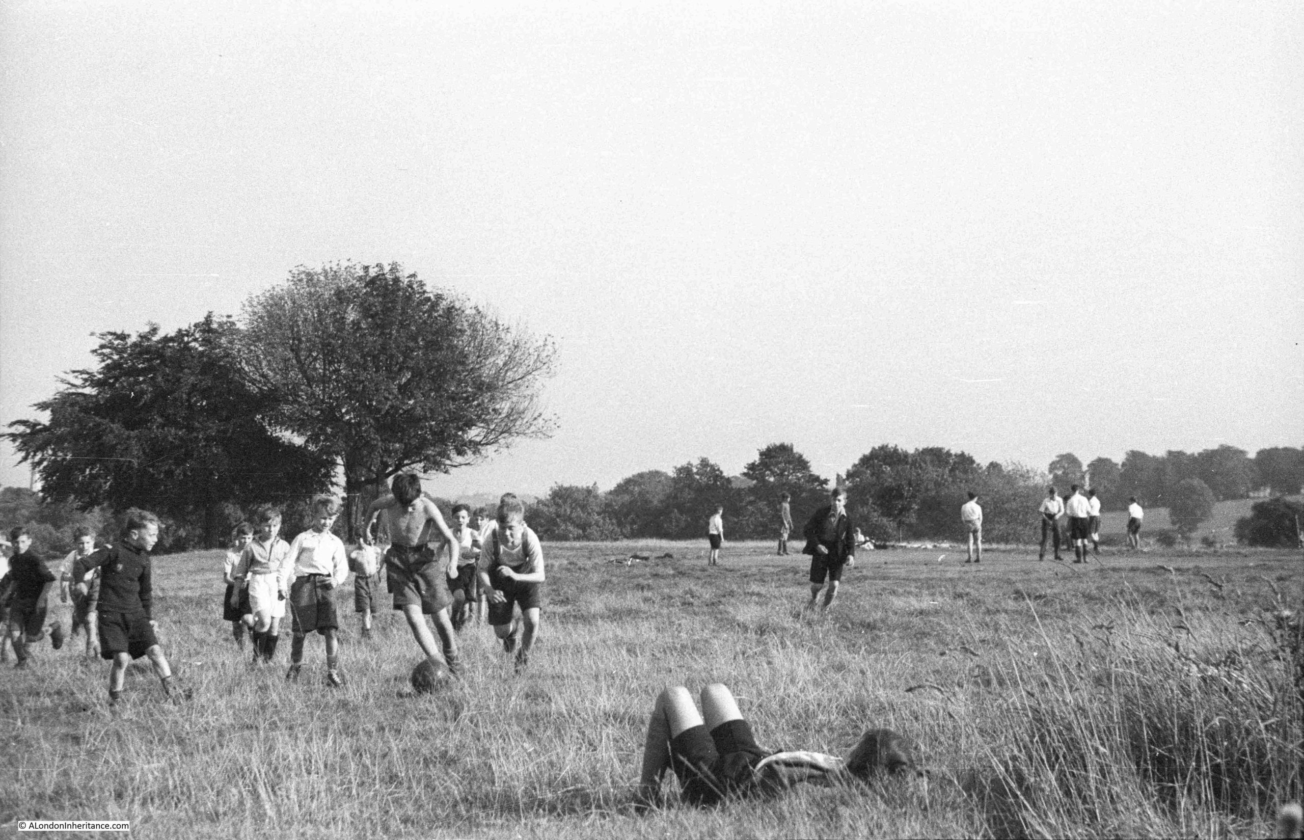
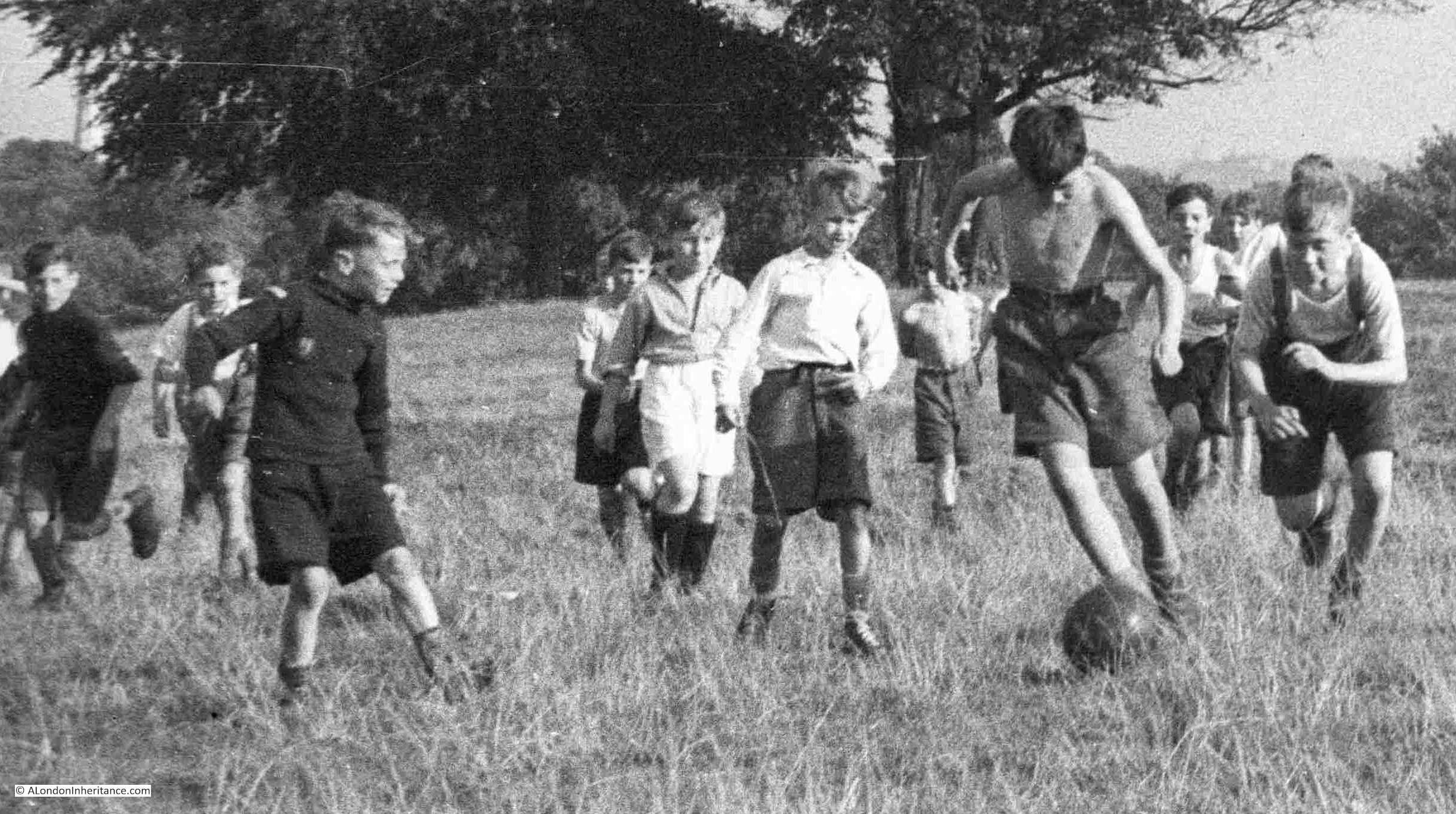
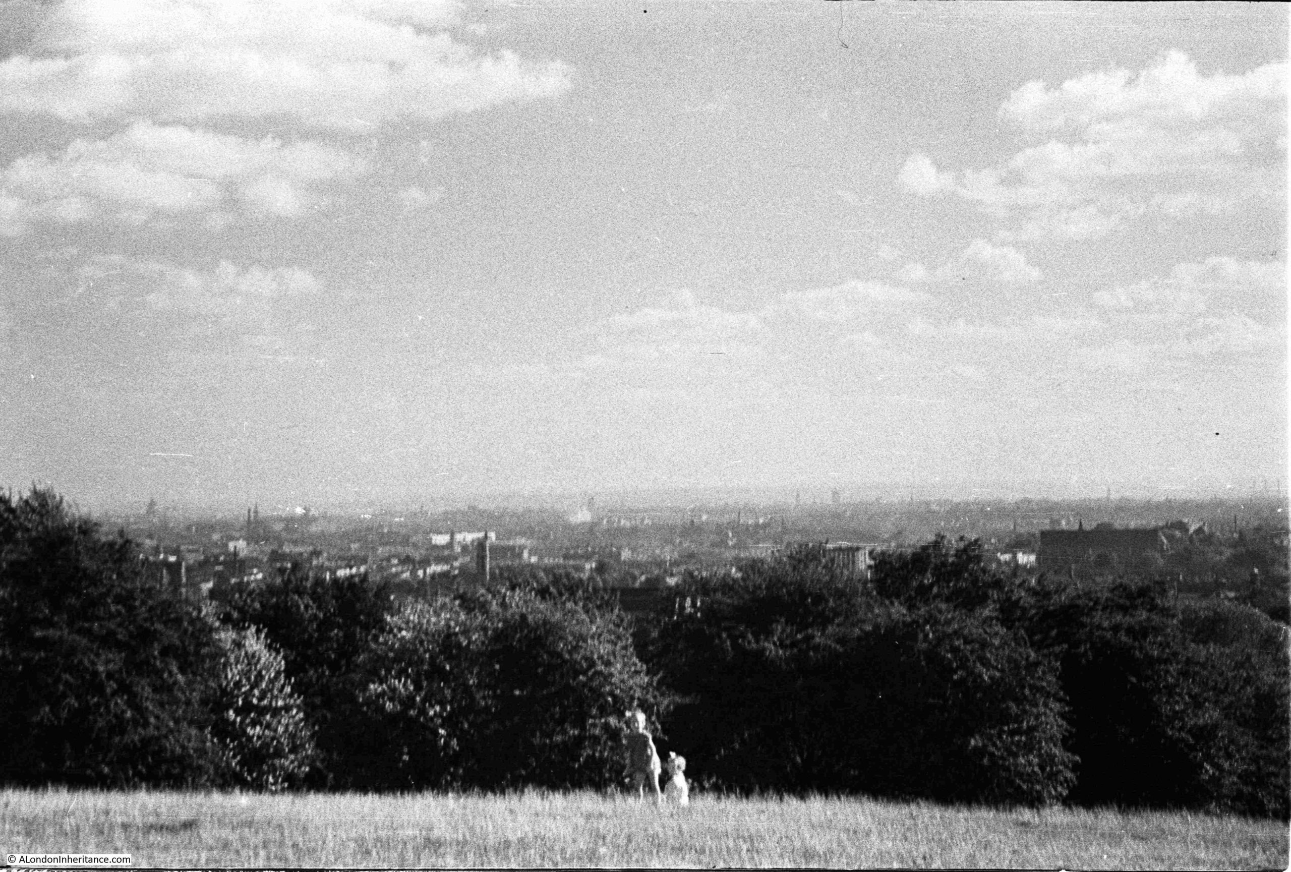
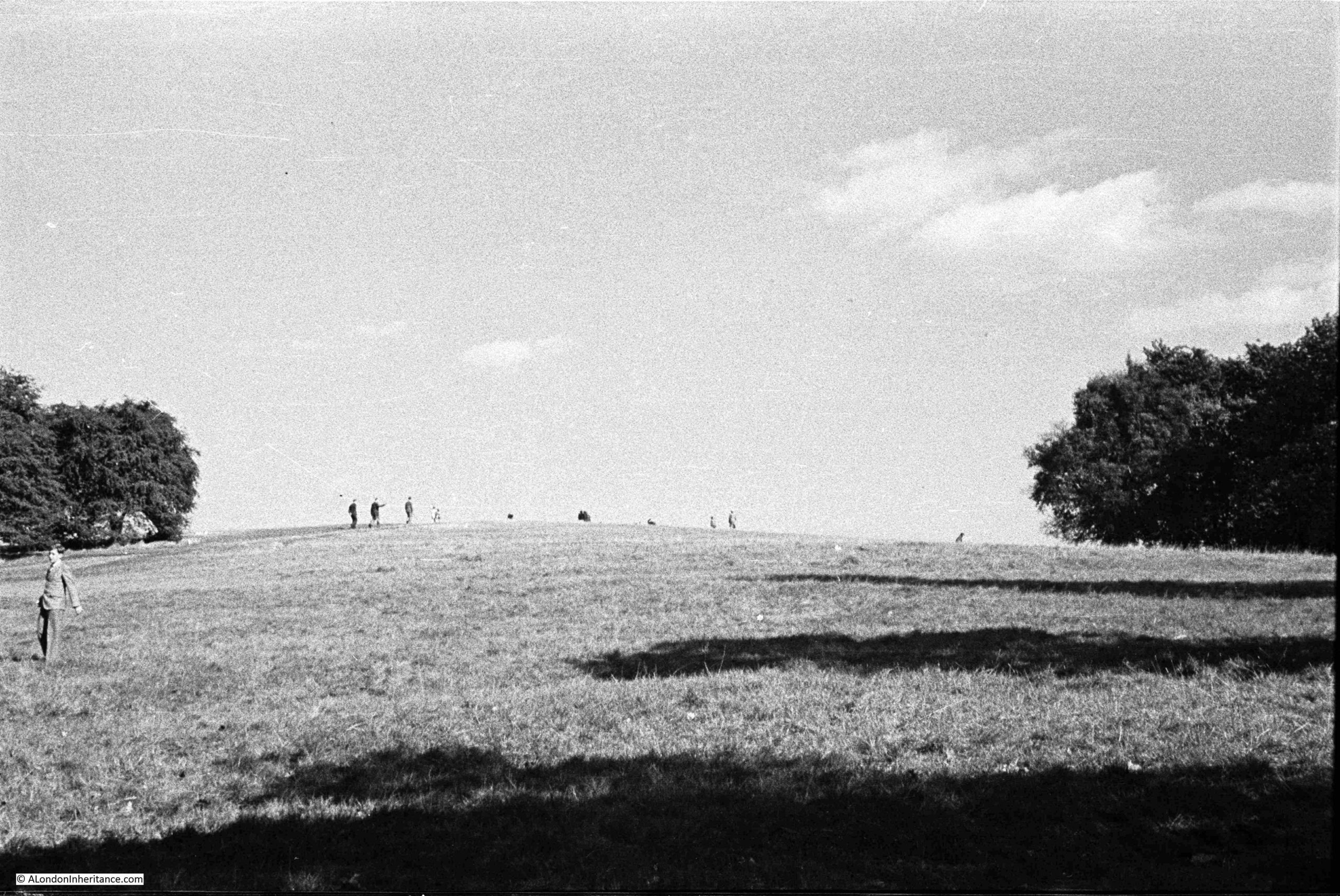
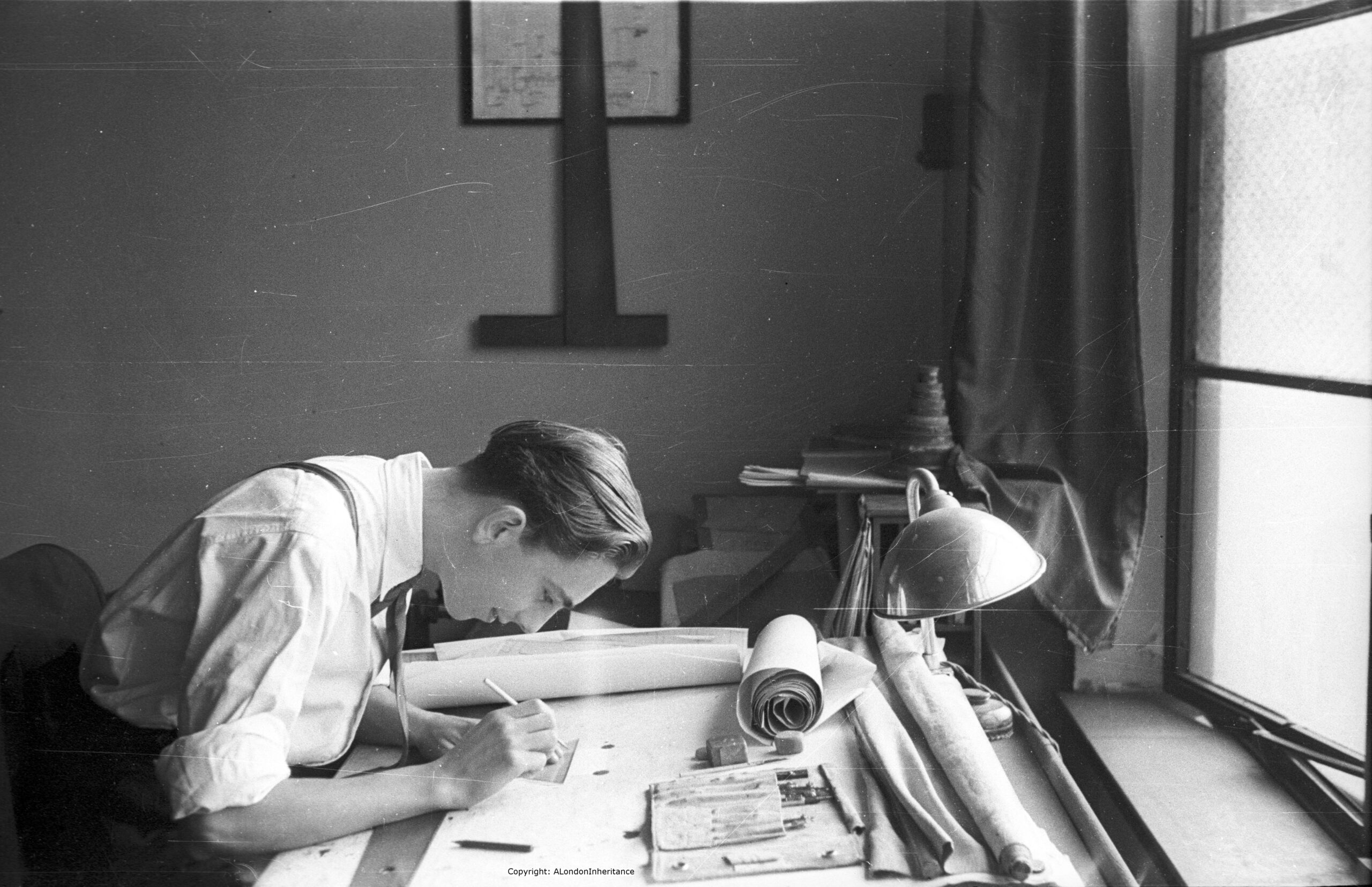
In August 1947, my father took a number of photos whilst on Parliament Hill, looking at the view, and the surrounding landscape. The first shows an intense, youthful game of football:
I love the concentration and their focus on the ball, a leather ball rather than the lighter balls in use today:
As usual for many places in London, there are different names for the hill, and different origins for these names.
Two names have been associated with the hill, and there is some common root to these names. The name in use today is Parliament Hill, however for most of the 19th century, Traitors Hill seems to have been the most common.
Examples of where references are made to these two names, and their origins include:
From the Holloway Press on the 8th of August 1952: “Of the many explanations of how Parliament Hill got its name, the most popular is that the instigators of the Gunpowder Plot met here to see the effects of their mischief. Some still call the place ‘Traitors Hill’. Another much favoured story dates back to the Civil War when the Parliamentarians had a camp on the site. The Royalists naturally called this ‘Parliament’ Hill ‘Traitors Hill'”.
On the 15th of July, 1897, there was a report of a garden party given by Baroness Burdett-Coutts at her home in Highgate, and after the garden party “A great many of the guests strolled through the numerous walks towards Traitors; Hill, whence, perhaps, the finest panoramic view of London is to be obtained. The extent of the view seemed to impress the Colonial visitors. Traitors’ Hill is so called from the fact that Catesby and his fellow conspirators awaited there the result of Guy Fawkes villainous attempt to blow up the Houses of Parliament”.
The hill seems to have been the destination for those holding parties in the surrounding houses, as another report from the Morning post on the 2nd of June 1834 explains that after a Fete held by the Duchess of St. Albans at her nearby villa “After the déjeuner there was a promenade to Traitors Hill, which is half a mile from the house, and through the most romantic labyrinth imaginable, whence there is a prospect of London and the counties of Essex, Kent, Surrey and Sussex.”
There are also claims that the Parliamentarians had cannon on the hill during the Civil War, and also used the high point as an observation post.
So whatever the true source of the name, it seems to date back to the 17th century, either from the 1605 Gunpower Plot or the English Civil War between 1642 and 1651.
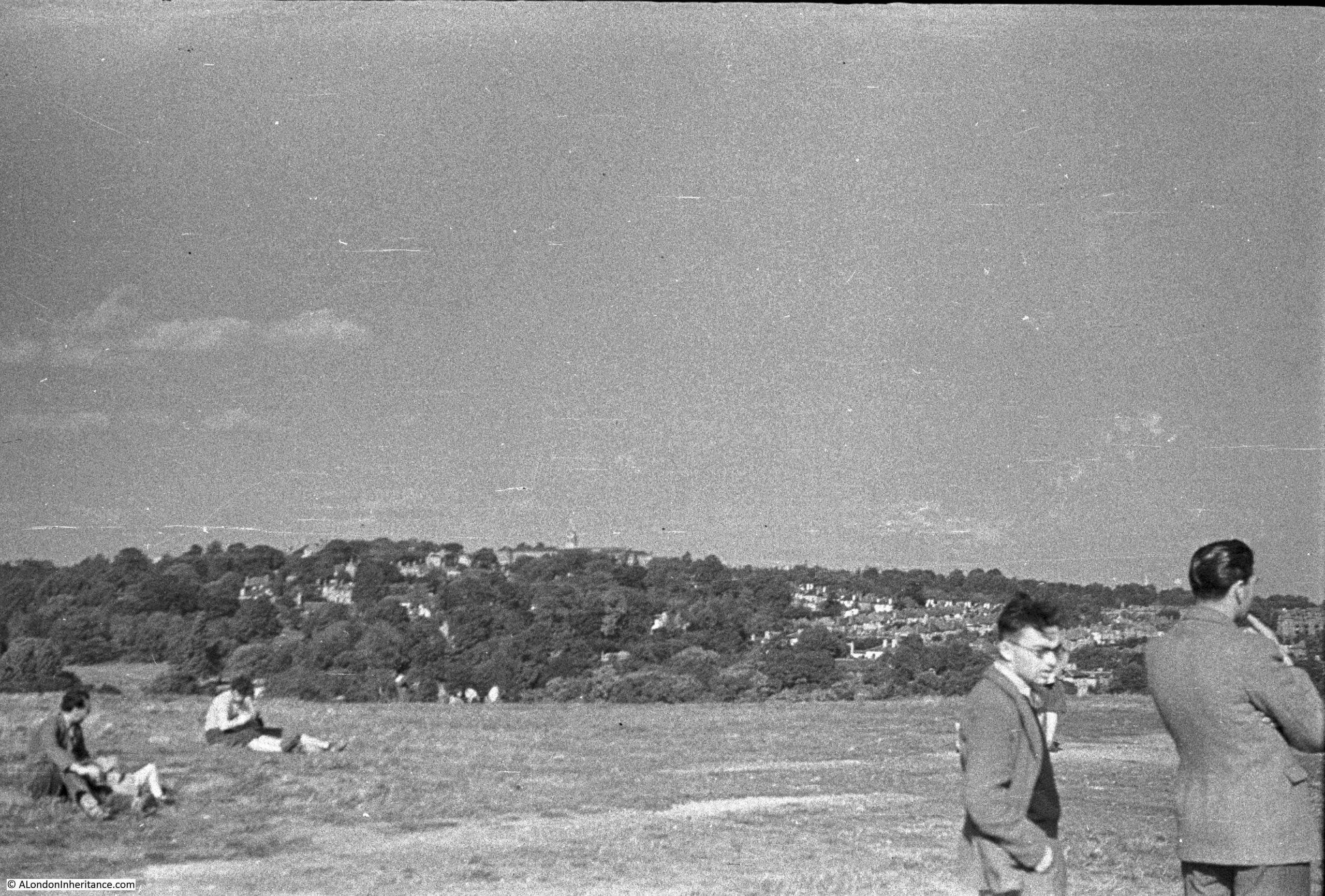
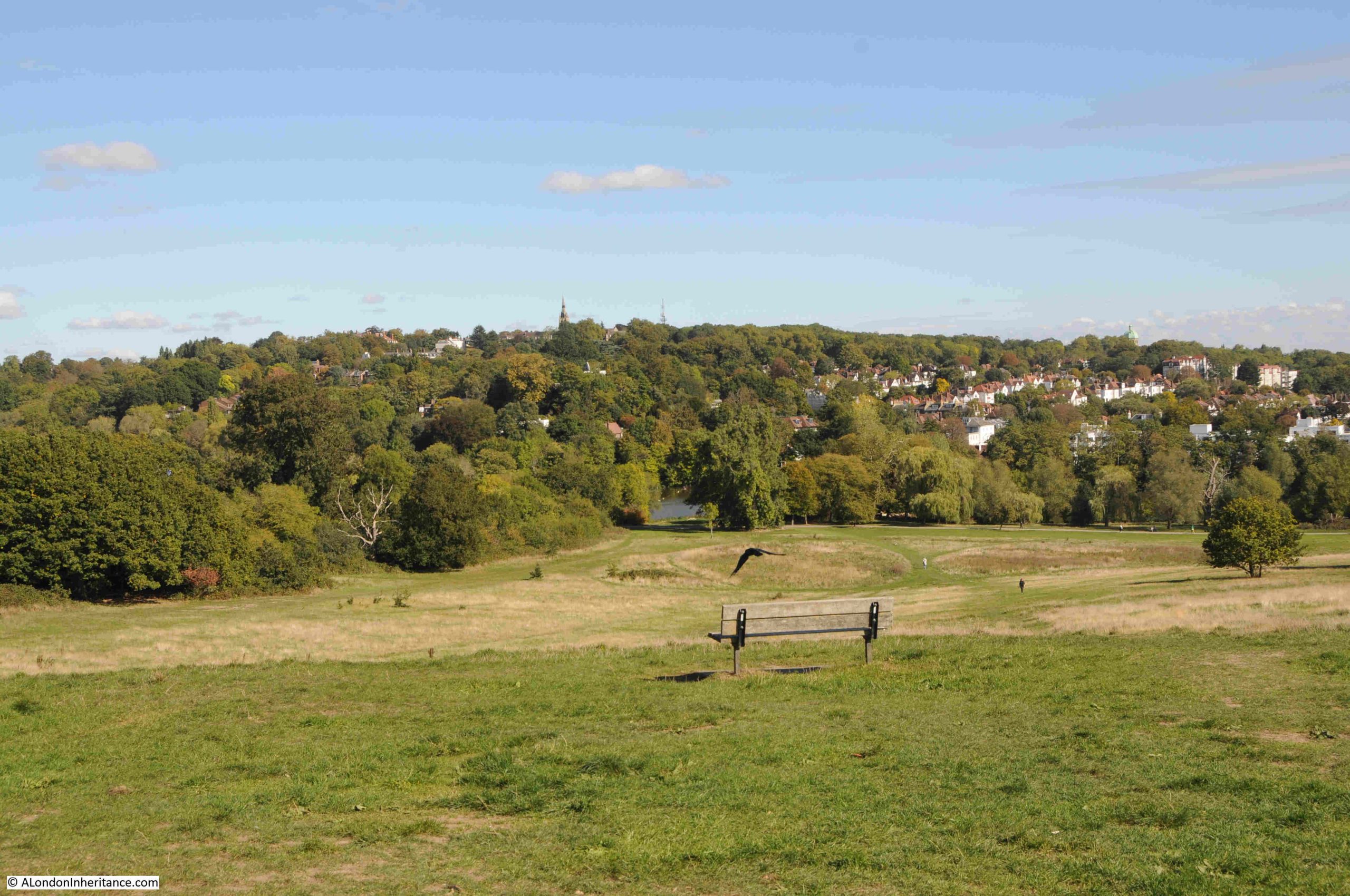
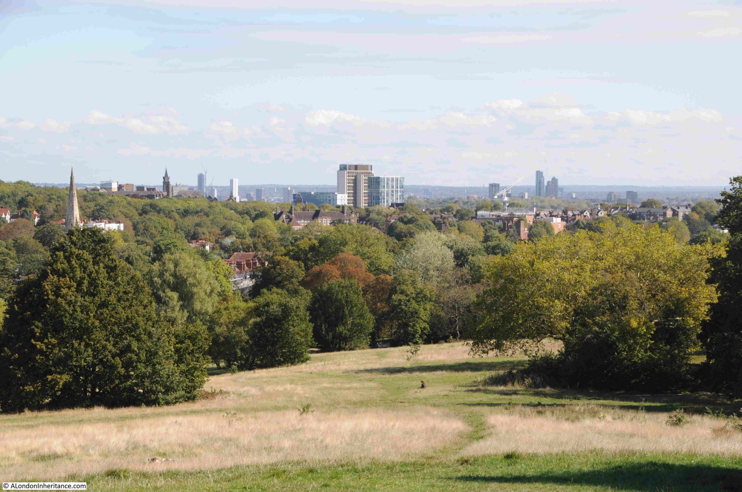
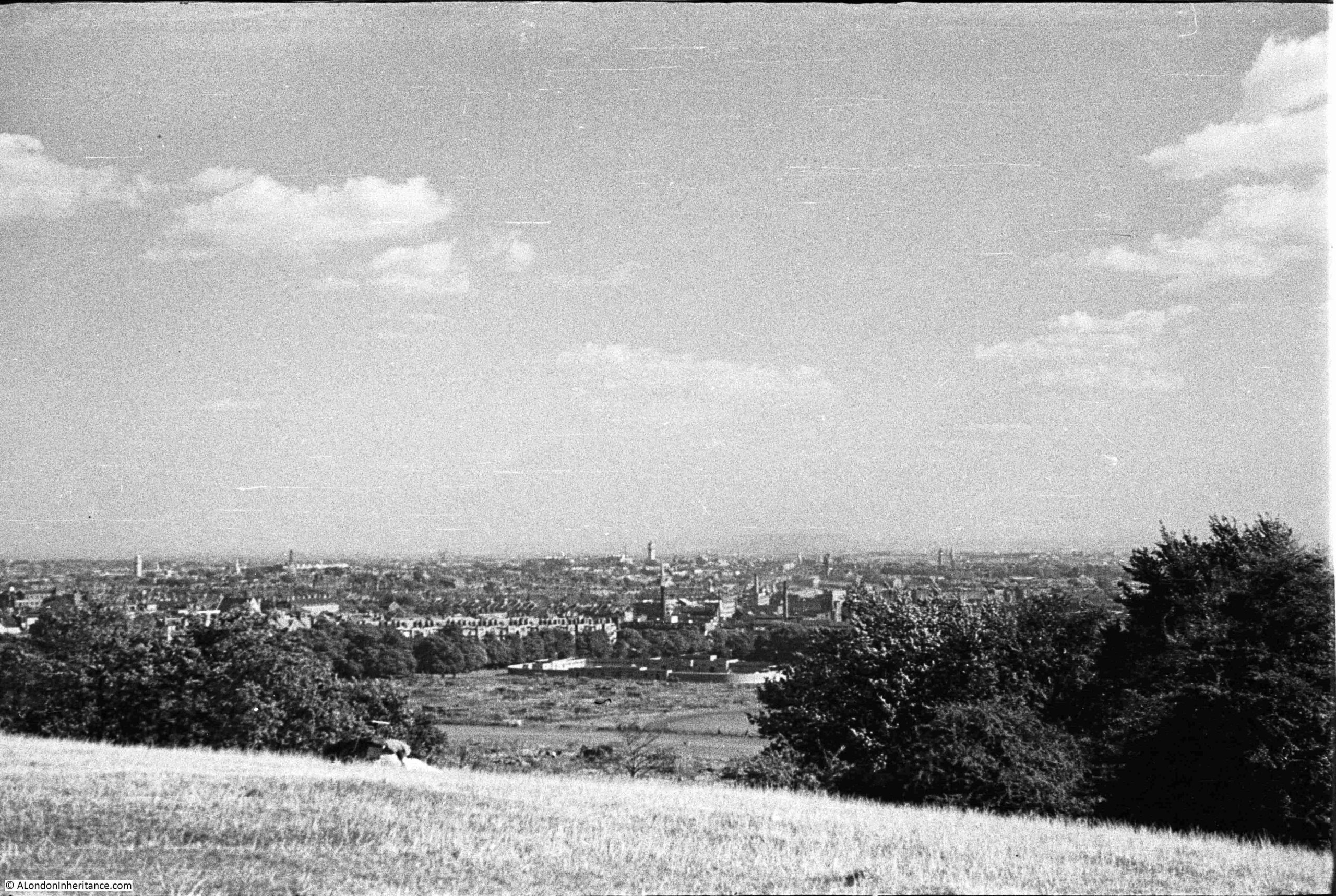
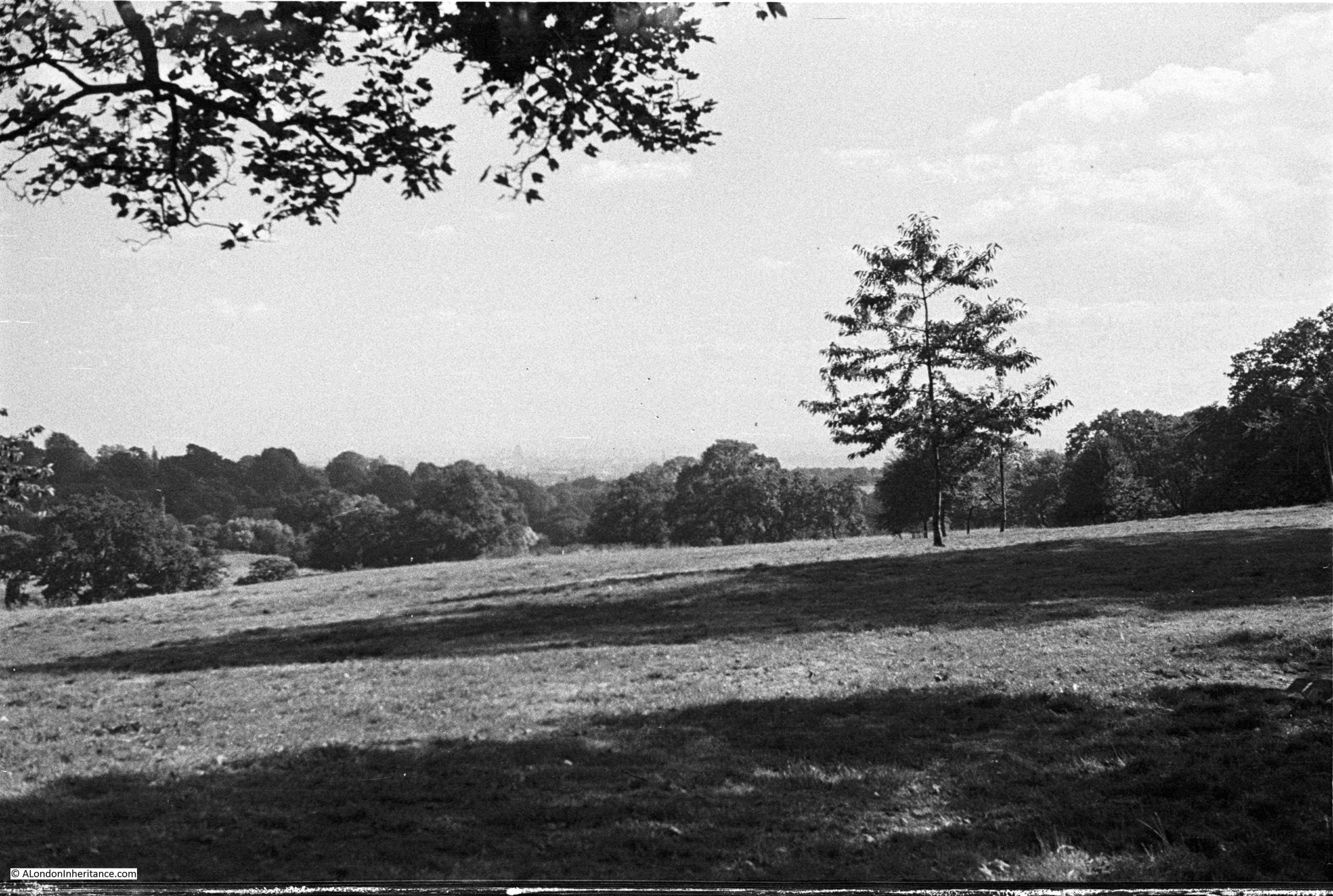
Looking east towards Highgate:
The same view in September 2025:
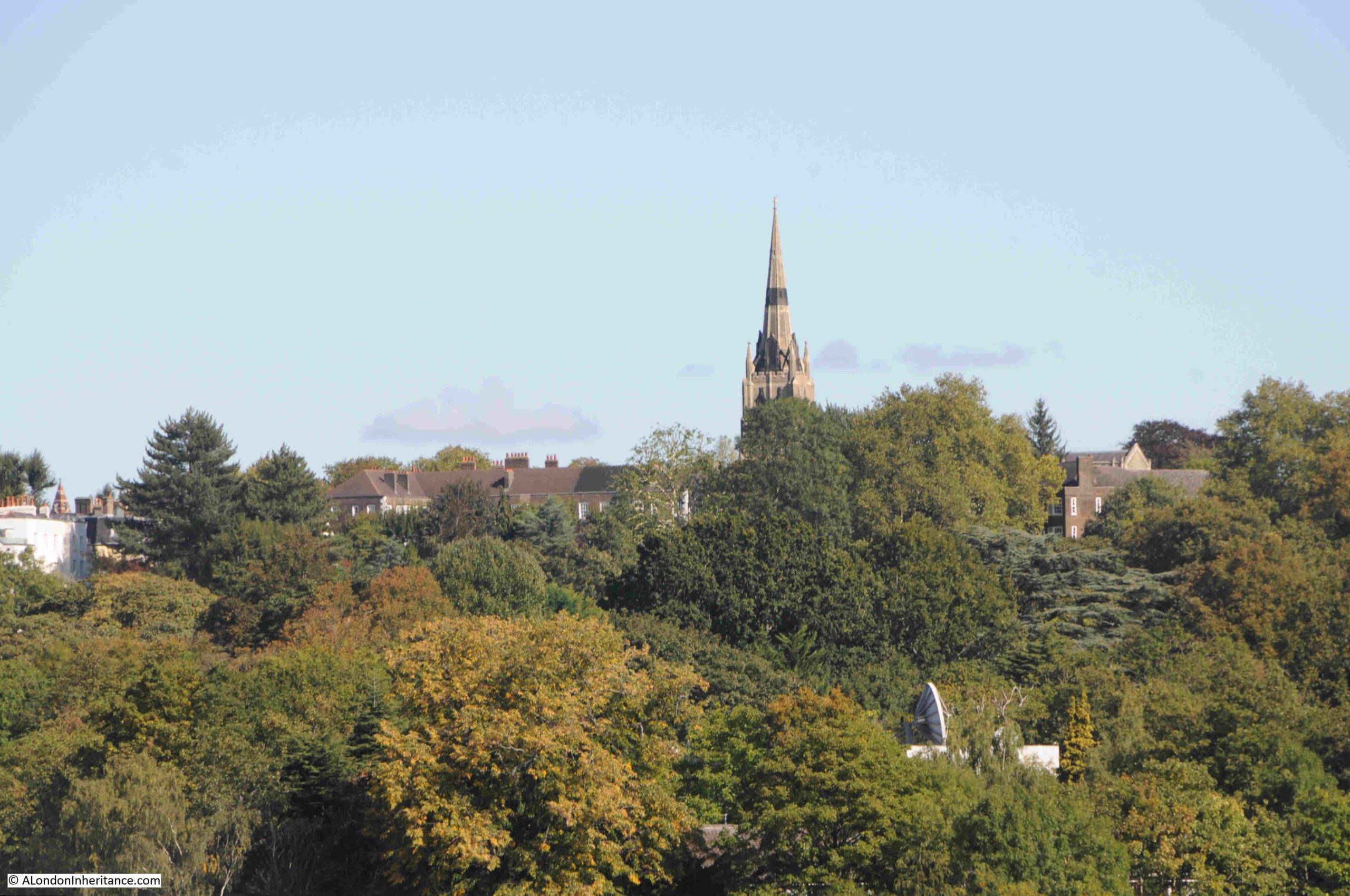
In both photos (a bit hard to see in my father’s photo due to the resolution of the film) you can see the spire of St. Michael’s, Highgate, the church that stands higher than any other church in London.
A close-up of the church from Parliament Hill, and hidden in the trees just below, someone seems to have a strangely large satellite dish:
Looking to the south-east:
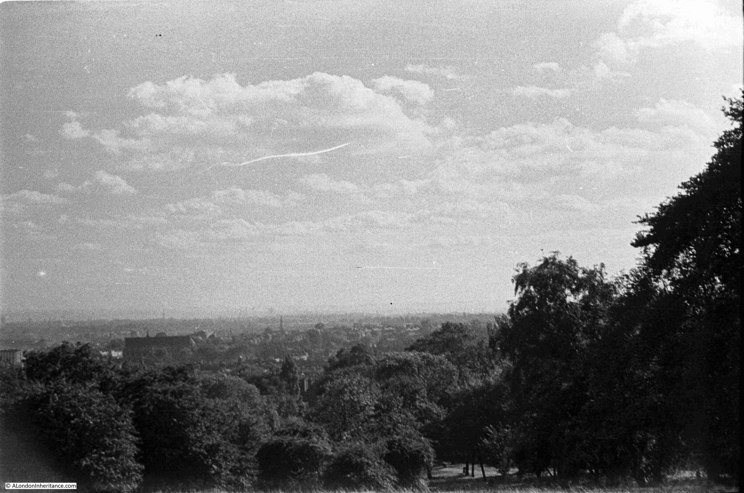
Looking over the city in August 1947, hardly a tall building in sight:
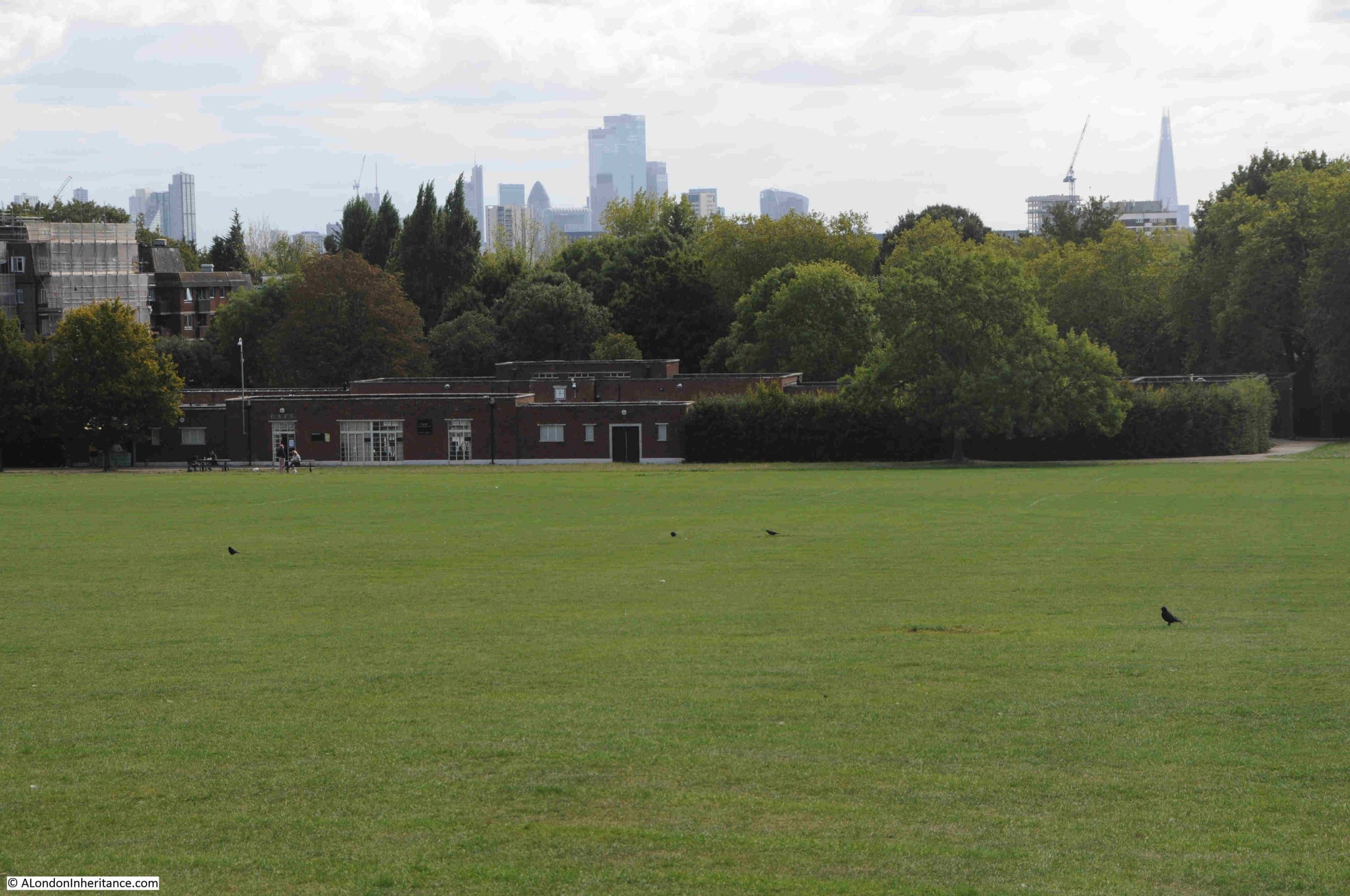
In the above photo, look between the trees and below the hill are open fields, Parliament Hill Fields. At the end of these fields are some low rise buildings. These are the Parliament Hill Fields Lido:
Parliament Hill Fields Lido was opened on 20 August 1938, and the following is a typical newspaper report on the opening of the Lido, part of a scheme by the London County Council for Lido’s across London:
“NEW £34,000 LIDO FOR LONDON – BATHING POOL TO HOLD 2000. With the opening of the new L.C.C. lido at Parliament Hill Fields on Saturday, another important link in the programme of providing London with a chain of modern swimming pools will be completed.
Since Mr George Lansbury, when first Commissioner of Works, gave London its first lido in Hyde Park in 1930, the popularity of these pools has increased enormously.
After Hyde Park came the first lido to be designated as such at Victoria Park built in 1934-35. Records show that in the height of the summer as many as 25,000 people bathe there on a Sunday morning.
The Parliament Hill Lido covers an area of approximately two and a half acres. It is 2ft 6inches deep at the shallow and 9ft 6 inches at the deep end, and holds 650,000 gallons of water, which will be completely filtered and purified every five hours. There are to be fixed and spring diving boards, foot and shower baths, and accommodation is planned for a maximum of 2024 bathers at any one time.
There are two terraces for spectators, and a café available for bathers and spectators alike. The lido had cost approximately £34,000.
The scheme originally approved by the L.C.C. also provided for lidos at Charlton Playing Fields at a cost of £25,000, Battersea Park, £40,000, Ladywell Recreation Ground, £27,000 and Clissold Park, £25,000.
The one at Charlton is nearing completion. The others will be undertaken by convenient stages with a view to the cost being distributed over a reasonable period.
Set among the trees, the lidos of London are vastly different from the cheerless, old-fashioned type of swimming bath. It would seem that they will ultimately render the old baths obsolete.
Including the two lidos already opened, the L.C.C. has eleven open-air swimming pools in London. These were patronised by over 1,000,000 swimmers in a year. Taking the lidos of Hyde Park and Victoria Park alone, the attendances in 1937 were: Children: 62,922, Adults: 175,379, Spectators: 93,731.”
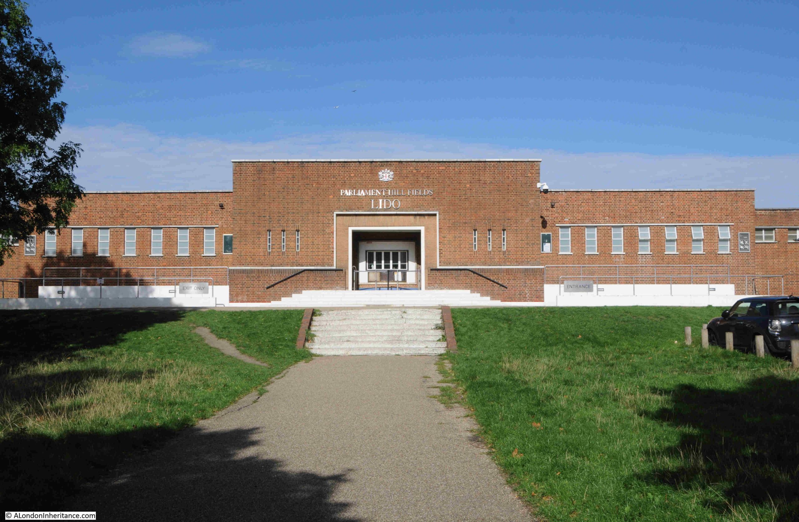
The entrance to Parliament Hill Lido:
Returning to the top of the hill:
Parliament Hill and the fileds below, have long been a place to visit. The above photo shows a couple of children, and earlier photos in the post show people looking at the veiw, and more children playing football.
It was also a very popular place on public holidays, for example om the 11th of June 1892, the Hampstead and Highgate Express reported that: “PARLIAMENT HILL FIELDS – There were some thousands of holiday-makers in these picturesque fields on Whit-Monday. The International Band performed a selection of music in the afternoon, and in the evening Mr. Blake’s band similarly ministered to the enjoyment of the public. Cricket and lawn tennis were in full operation, and attracted large numbers of spectators.”
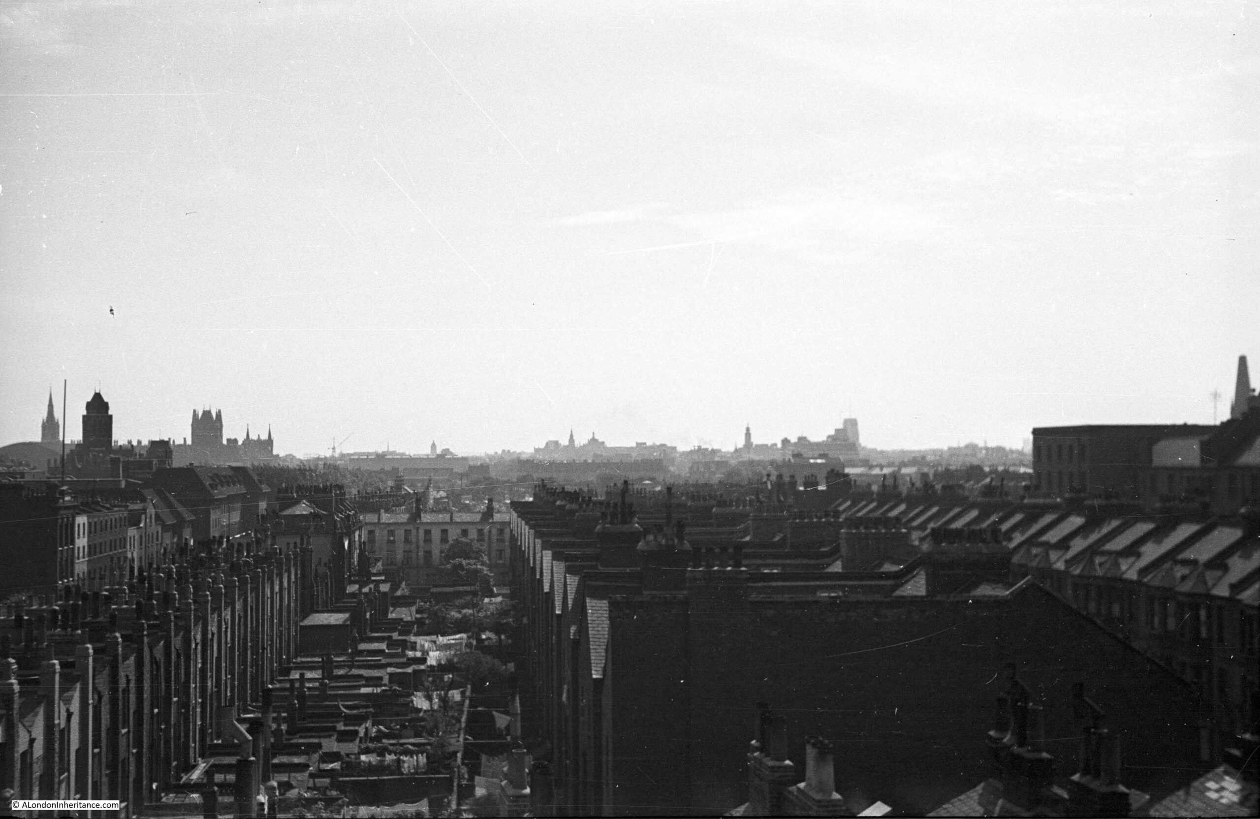
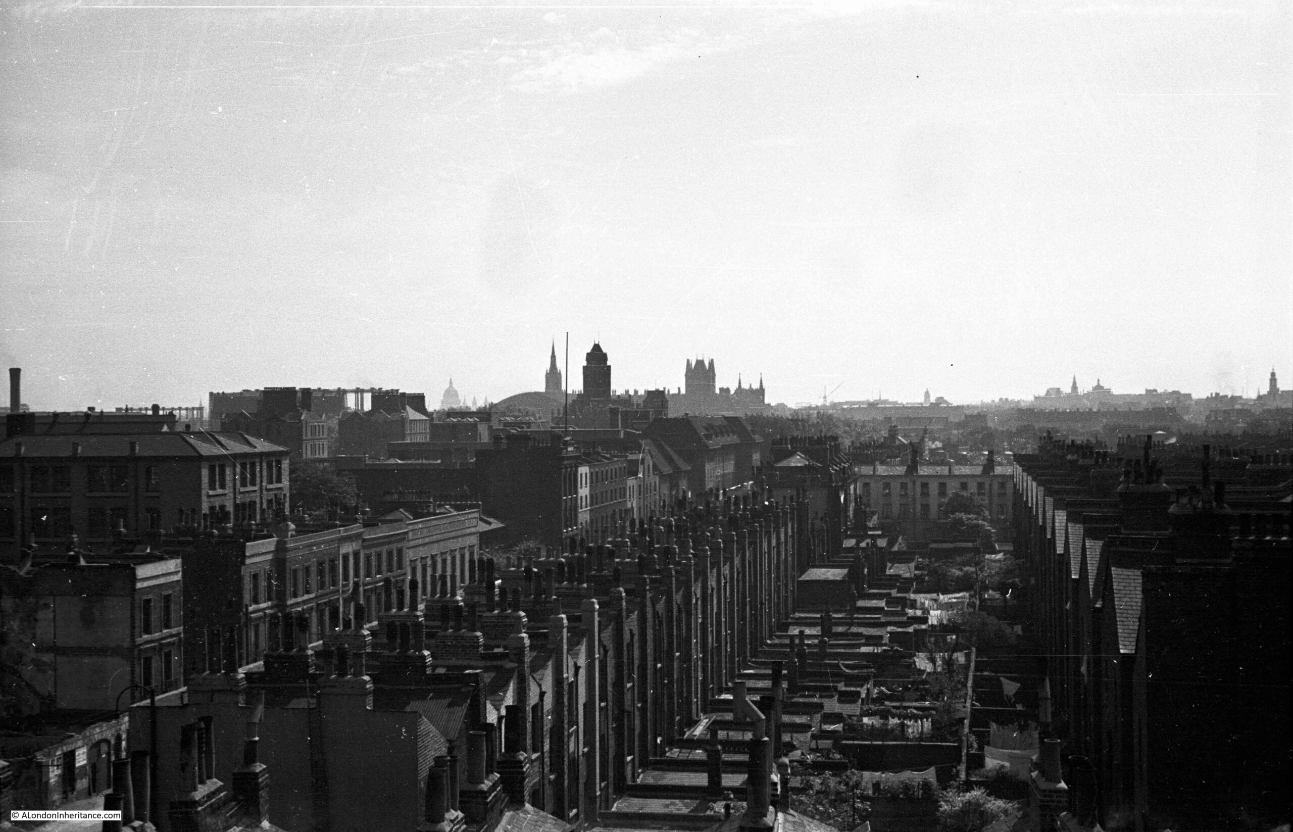
In 1947, the view from Parliament Hill was less obscured by trees than it is today, There were few stand out features as building height was much lower than it is today. The photos by my father were also made using the lower quality of film available post-war to the amateur photographer, and although taken using a Leica camera and Leica lens, enlarging the photos to look at distant features does not reveal much detail.
Comparing 1947 with today, shows just how the city has grown upwards:
The Parliament Hill viewing point today:
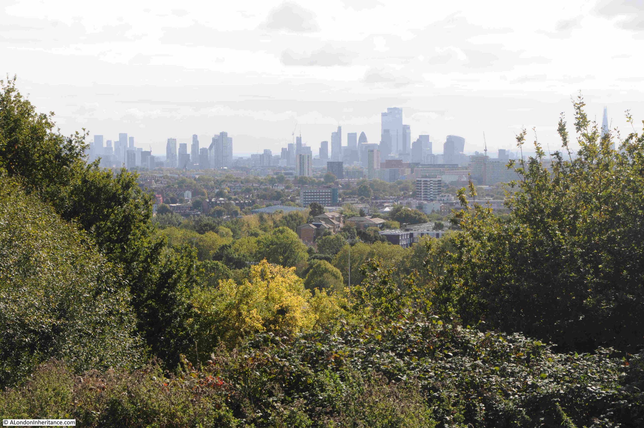
The view towards the towers of the City of London:
The Shard, with the dome of St. Paul’s Cathedral to the lower left of the Shard:
The BT / Post Office Tower, and to the lower left of the tower is the Victoria Tower of the Houses of Parliament. It must have been in this direction that the Gunpowder Plotters were looking, expecting to see an explosion – if the stories of one of the origins of the name Traitors Hill is true:
In the middle of the above photo, in the distant haze, is the radio and TV tower at Crystal Palace.
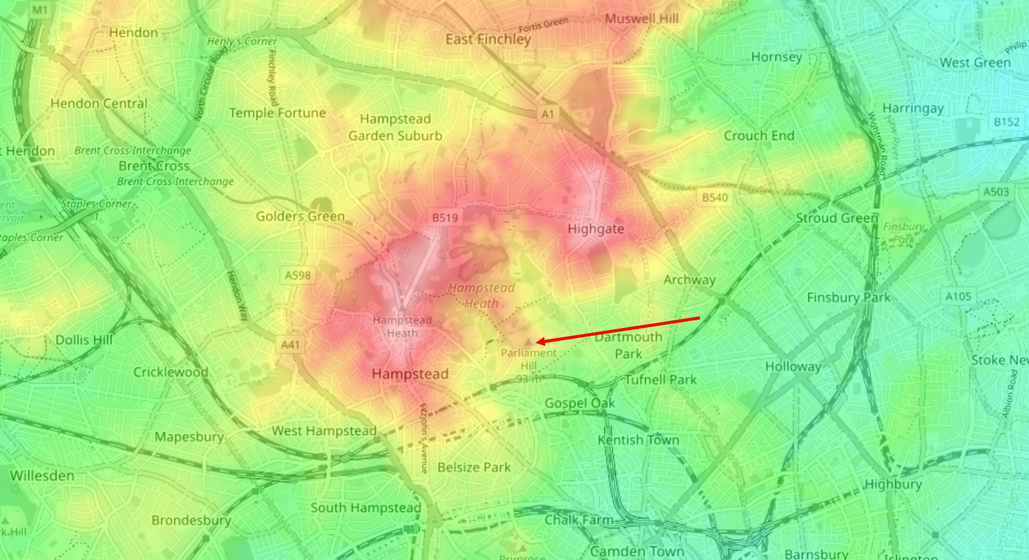
We can see why Parliament Hill is such a good place for a view by looking at a topographic map of the area.
In the following extract from the excellent topographic-map.com the high ground of Hampstead and Highgate is shown in reds and pinks, with the surrounding low ground in yellow and green.
I have marked the location of Parliament Hill with a red arrow, and as can be seen, it is on a small promontory, extending south from the higher ground of Hampstead Heath. To the right is the higher ground of Highgate, as illustrated by photos earlier in the post showing the spire of St. Michael’s, Highgate:
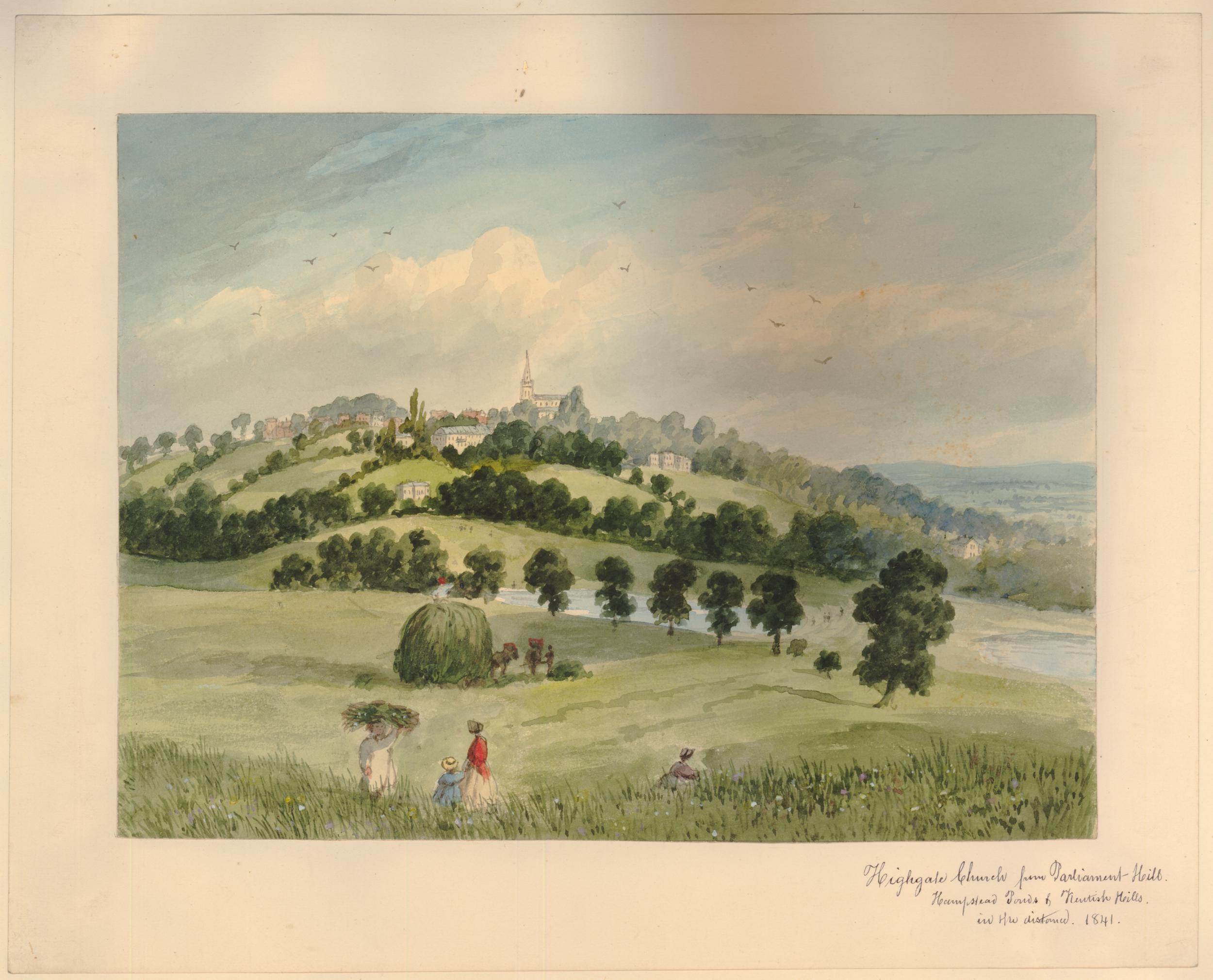
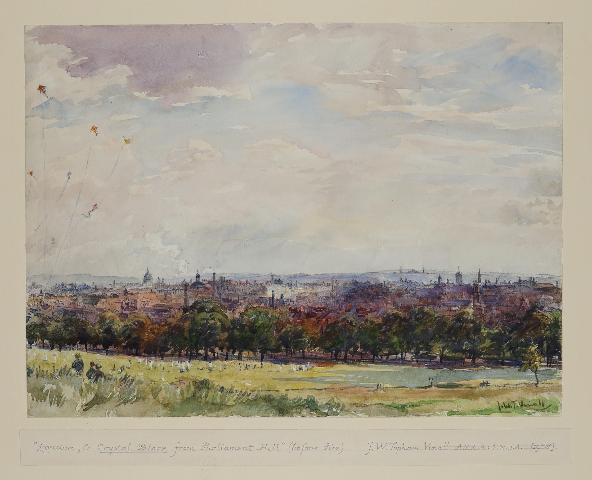
Parliament Hill as a viewing point and open space, has been photographed and painted for many years.
Looking up at the viewing point on Parliament Hill in 1947:
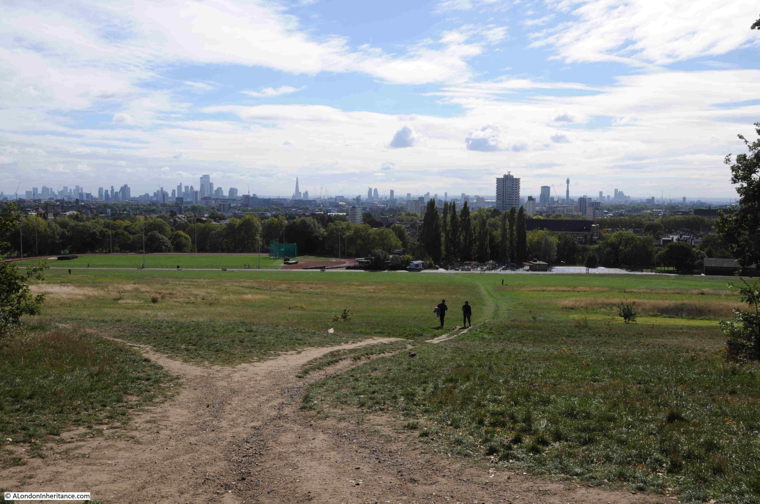
The tress just below the viewing point at the top of Parliament Hill obscure the full view, and you need to move left and right to view different parts of the city below.
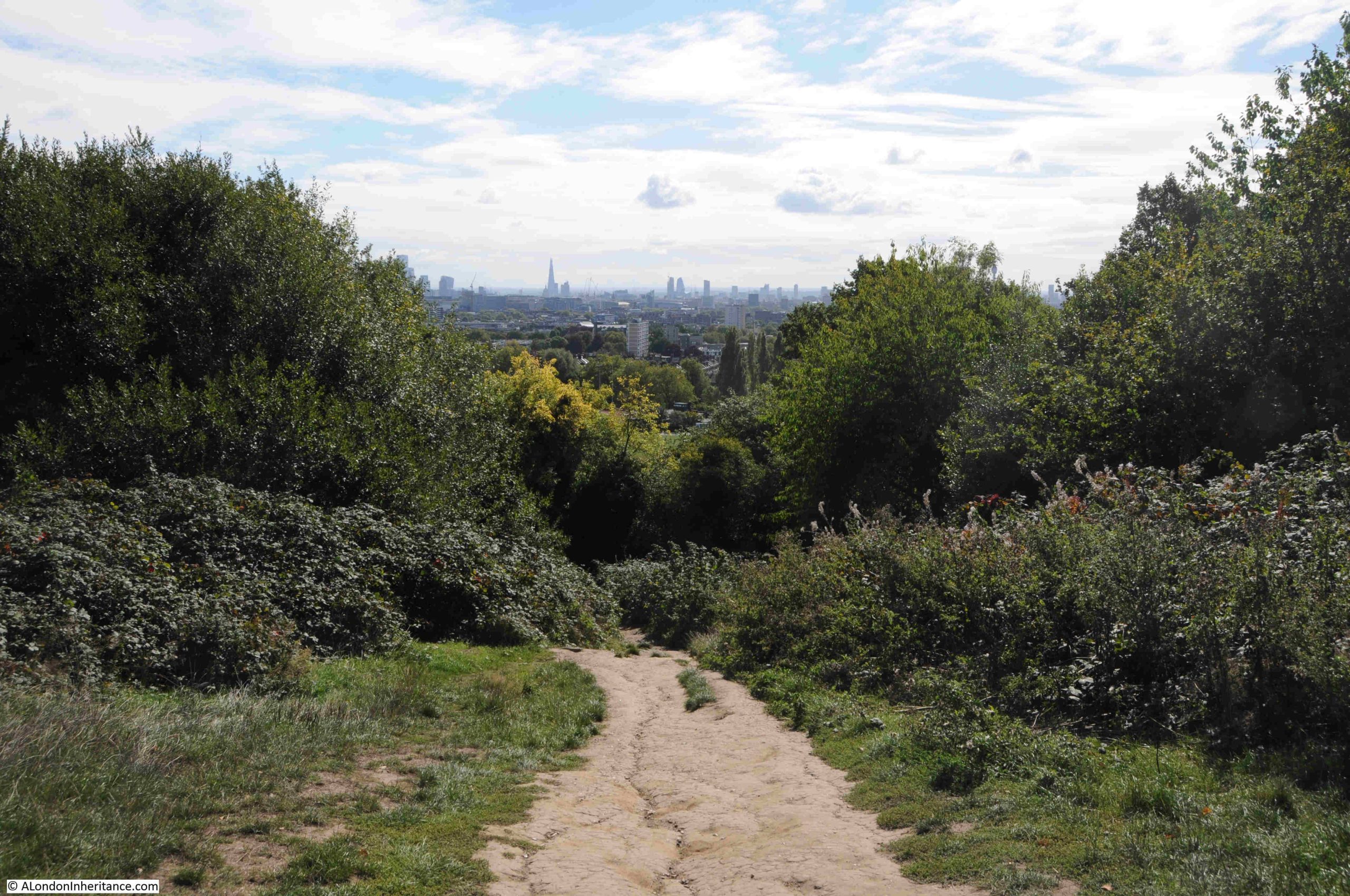
Fromn the viewining point, there is a path that leads through the trees and bushes to a lower point, which does though provide a full panorama of the view to the south.
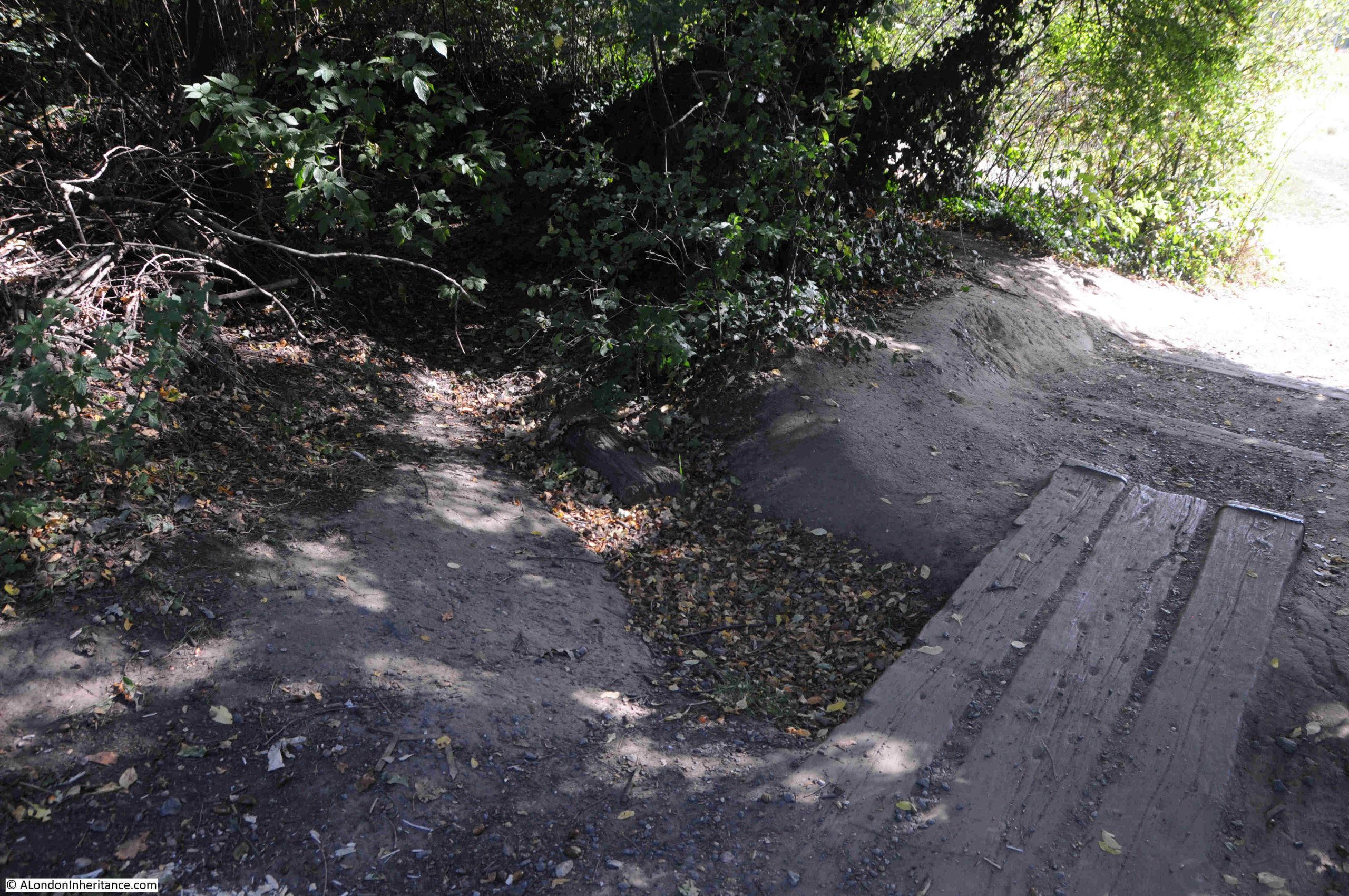
Descending through the trees:
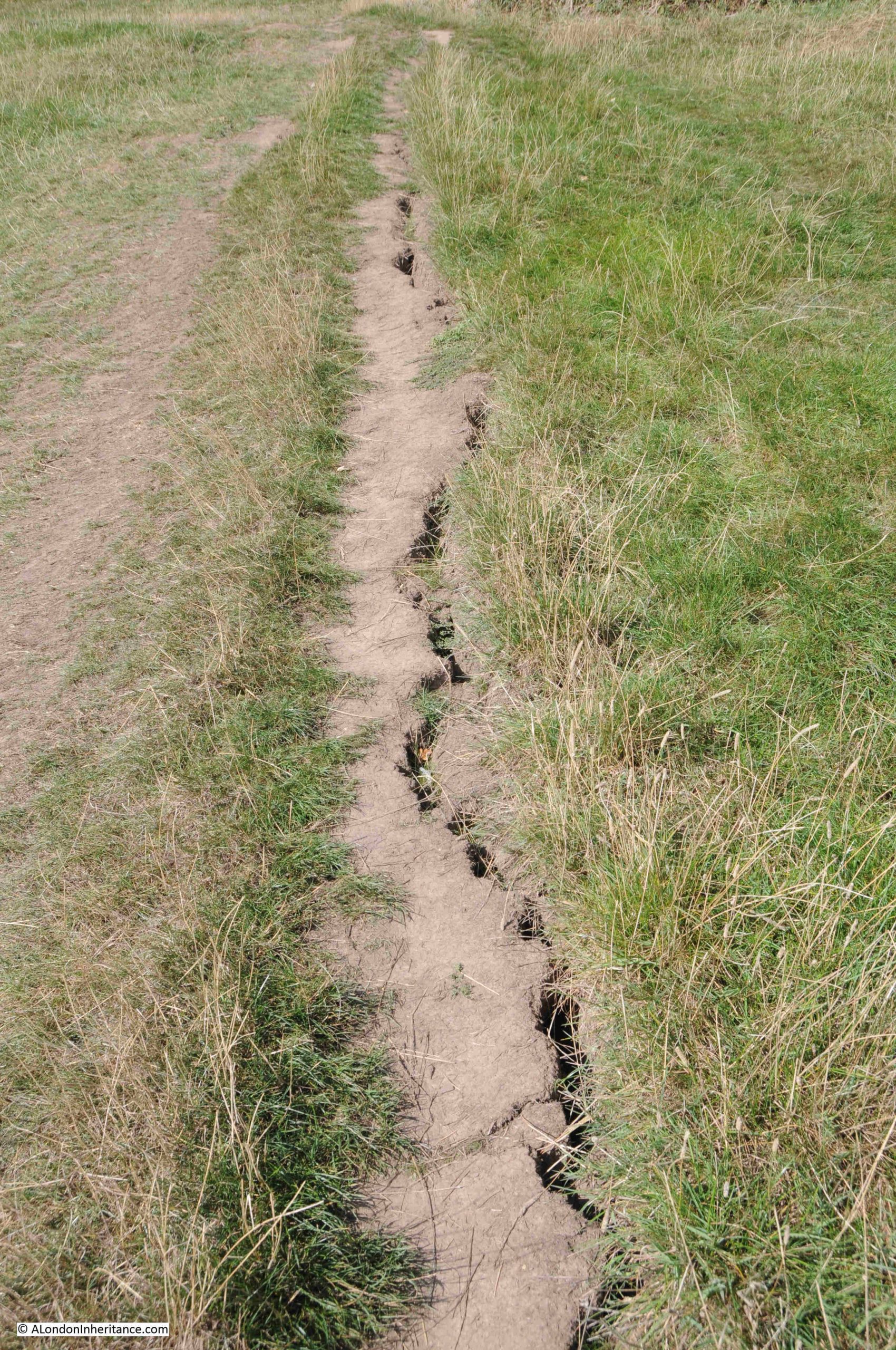
In the middle of the treeline, there is a dried up stream bed, and just to the side an area that is still damp and muddy – one of the many springs to be found in the area:
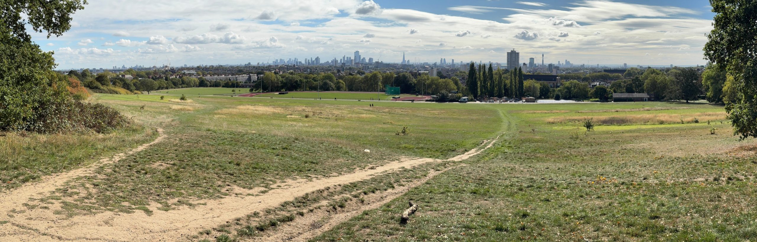
Once through the trees, the full panaorama opens up:
Click on the following panorama to enlarge:
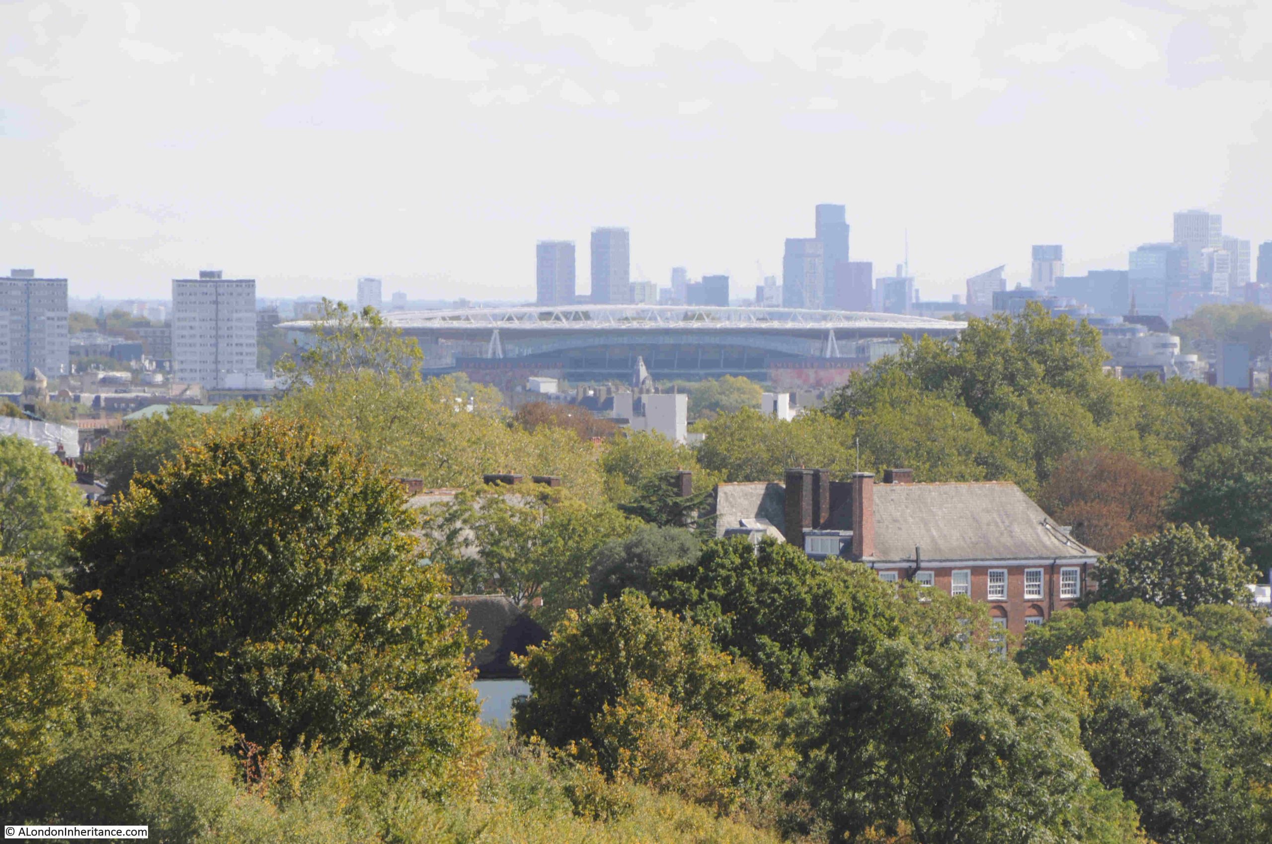
As well as the view to the south, looking to the east we can see the Emirates Stadium:
Walking down the hill into Parliament Hill Fields, there is evidence of a long hot, dry summer:
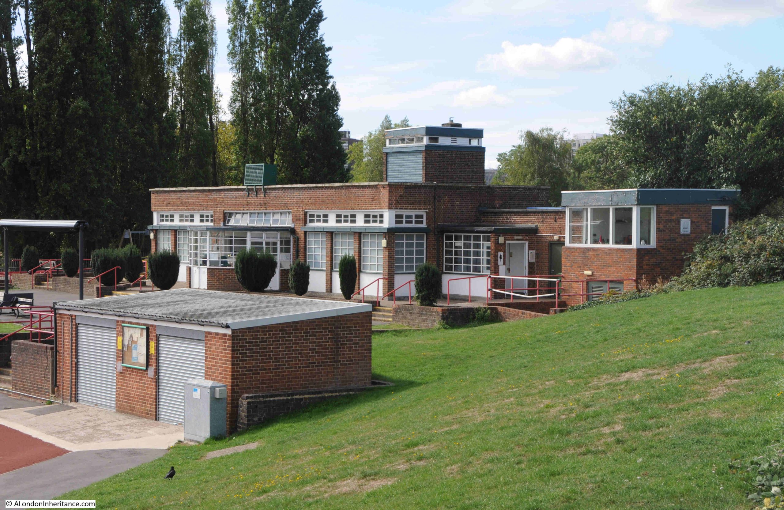
At the base of the hill, as well as the Lido, there is an athletics track. The track itself has recently been refurbished, and I believe that that the original facility dates from 1938, and this is when there were newspaper reports of the “opening of the new L.C.C. track at Parliament Field”, and the brick build and design of the buildings facing onto the track are of a similar design and material to those of the Lido:
That Parliament Hill survives today as a public open space is down to a campaign in the 1880s.
In the later part of the 19th century, the hill was at risk of development. Houses had been springing up in the desirable areas around Hampstead, Highgate and Parliament Hill, and what the press called “The Battle of Parliament Hill” was a campaign to keep the hill free of housing, and retained as a public space.
This came about as a result of the Hampstead Heath Enlargement Act of 1886. The aims of the act was described in the Pall Mall Budget of the 20th October 1887:
“In the first place, the object sought for is the enlargement of Hampstead Heath, but is in reality the preservation of it. The actual proposal was the acquisition of the open space known as Parliament Hill, which, of, course, would, to that extent, be an enlargement of Hampstead Heath. But the point to be most insisted upon is that if Parliament Hill be not acquired Hampstead Heath would be spoiled. For one thing, half its beauty will be destroyed; but it is not the aesthetic consideration that we wish now to place in the forefront, although the destruction of all Coleridge saw ‘looking down from Hampstead Heath’ would of itself be no mean loss. More important, however, than a supply of food for the aesthetic sense, is a supply of fresh air for the lungs, and if Parliament Hill were once to be covered in bricks and mortar the health giving quality of Hampstead Heath would be destroyed.”
Parliament Hill was purchased for the public in 1887 for £300,000.
There is an ancient tumulus on the northern side of the hill, which has been excavated, but nothing was found within.
A child did find what was classed as treasure trove on the hill in 1892, reported from the time as “A small boy called Haynes has been the lucky finder of treasure, including coin and antique silver vessels, while playing with a toy spade in Parliament Hill fields. Valued at £2,000, the treasure trove has formally been taken over by the Crown and the lad’s compensation will be the bullion value of the articles only.”
Parliament Hill has also attracted myths and theories about the use of the place in antiquity. In the book Prehistoric London – It’s Mounds and Circle by E.O. Gordon (1932), Gordon claims the hill as an ancient meeting place and also places the hill at the northern corner of a triangular alignment of key London mounds:
With the view across London, and across to the hills in the south, Parliament Hill has long been a place where people would stand and look, a place to look across to the hills that surround London to the south, and it is a special place, although probably not in the way E.O. Gordon thought about the place.
Parliament Hill or Traitors Hill – both names have their origins in events in the 17th century, and in the late 19th century the Parliament Hill was saved from the bricks and mortar spreading across London, so we can continue to stand and gaze across the city to this day.
A recent birthday present was some tickets to go up Lift 109, the lift that goes up one of the chimneys of Battersea Power Station to get a view from the top.
This blog is not usually about this type of place to visit, but I love a high view of London, and I have not been to Battersea Power Station since it opened following many years of reconstruction.
The blog is about how London changes and adapts, so that does give me an excuse to show the fantastic view from the top of the chimney, and to look at how the old power station has been transformed.
To start the sequence of change, here are a couple of photos taken by my father in the early 1950s showing the majority of the power station complete, with just the final south east chimney to be built (from this post back in 2015):
A 2014 image of the power station, from the same viewpoint as the above photo, with the gas holder still on the right, which would soon be demolished:
When the early 1950s photos was taken, the power station only had three chimneys. Power stations are frequently built using a modular approach so that the site can start generating electricity as soon as possible and capacity added when there is sufficient demand and an economic justification. This approach was used in the 1930’s and continues to this day.
Battersea “A”, the first phase of the power station consisted of the right hand side of the building as seen from the north bank. Construction of this part of the building started in 1929 and the station was operational soon after. The Sir Giles Gilbert Scott brick exterior work was finished in 1933.
Work on Battersea “B”, the left side of the building commenced in 1944 with the fourth chimney completed in 1955 when the power station reached the configuration that was to last until closure.
The same view in 2015:
In the above photo, the south west chimney has been demolished. The chimneys were considered unsafe and not easy to strengthen and repair, therefore all four chimneys would be demolished and rebuilt, using new materials, but to an identical design so the visual appearance of Battersea Power Station would be the same.
In 2016, the new south west chimney had been built, and the other three had been demolished:
In the above and below photos you can see the new apartment buildings under construction between the power station and the railway line to Victoria Station:
In the above and below photos, you can see through into the interior of the power station, which at the time was a hollow shell:
I have loads more photos showing Battersea Power Station as was, but cannot quickly find them. I have tens of thousands of photos, all stored in folders dated with when I copied or scanned the photos to the computer – not at all efficient for finding a specific place.
Fast forward though to March 2025, and this is Battersea Power Station today (taken from alongside the river at Battersea, the fourth chimney is there, just not from this perspective:
Time to head to the top of the chimney, and the viewing platform can just be seen at the very top of the chimney on the right of the front of the power station in the photo above.
The lift is branded as Lift 109 as it takes you 109 metres up. Passing through the ticketing area, there are several displays about the history of the power station along with a few relics from the control room where you can pretend to switch electricity to parts of London once served by the station.
Then up a lift and 39 steps to the base of the chimney, where you get in the glass circular lift that takes you to the top and just above the chimney:
At the top:
I had been waiting to book the visit for some guaranteed sunny weather, and when the sun was in the south and highest in the sky, and on reaching the top, the view really did not disappoint. Looking east along the Thames, with the edge of the chimney at the bottom of the photo:
I find high view points fascinating for a number of reasons:
They provide a view of the layout of the wider city that you cannot get a street level. The way the Thames curves on its route through the city and the way the Thames has created low ground occupied by the city, surrounded by high ground to the north and south.
The distance and relationship between landmarks looks very different when viewed from a height rather than at street level.
How the height of the city is changing. From ground level it is often hard to appreciate the number, clustering and relative height of the buildings that are springing up all the time – for example in the above photo the new apartment towers in Vauxhall can be seen along the Thames on the right.
Despite the height, small details can be seen, including their relationship with the surrounding landscape – there are some examples of this in the photos below
In the following photo, the eastern end of the Churchill Gardens estate is in the lower left corner, and up a bit on the left is the red brick Dolphin Square estate. The tower on the right of the photo is the St George Wharf Tower, the first apartment tower built in Vauxhall. This tower blocks the view of the towers on the Isle of Dogs around Canary Wharf, a few can just be seen to the left of the tower. On the left is the Walkie Talkie building, then the Shard and in the semi-foreground directly below the Shard is Millbank Tower:
A bit to the right, and more of the Vauxhall towers appear:
Then with more of the Vauxhall towers, we get the south west chimney. The American Embassy is in the left-middle of the photo, the building with the ornate decoration across the whole of the façade:
View to the west – a very different low-rise view. Chelsea Bridge crosses the Thames and Battersea Park is the open space on the left:
Royal Hospital Chelsea:
In the river in the above photo, just to the right of the barge with the crane, is one of the Thames Tideway (super-sewer) work spaces, built into the river. Work is now complete, and the work space has been transformed into an open space accessible from the path along the embankment.
The workspace covers the deep shaft that is below the surface down to the sewer, and it was one of the drive locations for tunnelling, and is now one of the combined sewer outflow interceptor points, where sewer flows will be diverted into the new tunnel.
The view from above shows an interesting relationship between this new space and the Royal Hospital, as it appears to be at the end of the wide drive up to the centre of the Royal Hospital, and terminates this drive, in the river (although the busy embankment roads are between).
This new space is now open, and according to the project’s website “Parts of the new space here will be ‘floodable’ at high tides, giving Londoners the first opportunity of its kind to dip their toe in a cleaner River Thames.” I think I will wait a while before dipping my toes in the river.
View to the south, with the southern two chimneys of the power station:
In the above photo, there is a glass roof in the middle of the core part of the power station. This is above an atrium which is part of the 500,000 sq. ft. of Apple’s London offices. Along with Apple, there is other office space, including flexible rent space. Surrounding the top are apartments.
There is currently a two bedroom apartment in the power station for rent at £7,000 per month.
To the south east of the power station, there is still open space, which will presumably be home to new apartment buildings in the coming years:
Views to the south were challenging for the camera, as the sun was very bright. I was looking for the 719 feet Crystal Palace transmitter tower, and by chance it appeared in the left of one photo. If you watch free to air TV or listen to VHF FM or DAB radio in London, your signal is almost certainly coming from this tower:
Looking back to the east in the following photo, the Barbican towers can be seen in the background on the left, in front of which is the Shell Centre tower on the Southbank, and just below the Shell tower is County Hall. In the middle is the Southbank Tower at 55 Upper Ground, and to the right of this is One Blackfriars, with its distinctive bulge half way up the tower:
Moving slightly to the right, and the old NatWest tower in the City appears to the right of the following photo. Slightly to the left of this tower, and between two smaller towers is the brick tower of Tate Modern, the old Bankside Power Station by Sir Giles Gilbert Scott, who was also the Consultant on the exterior design of Battersea Power Station – London’s two great brick cathedrals of power:
The London Eye and Palace of Westminster, with the Victoria Tower on the right and Elizabeth Tower on the left. Further to the left, part of Westminster Abbey can be seen, with the octagonal Chapter House:
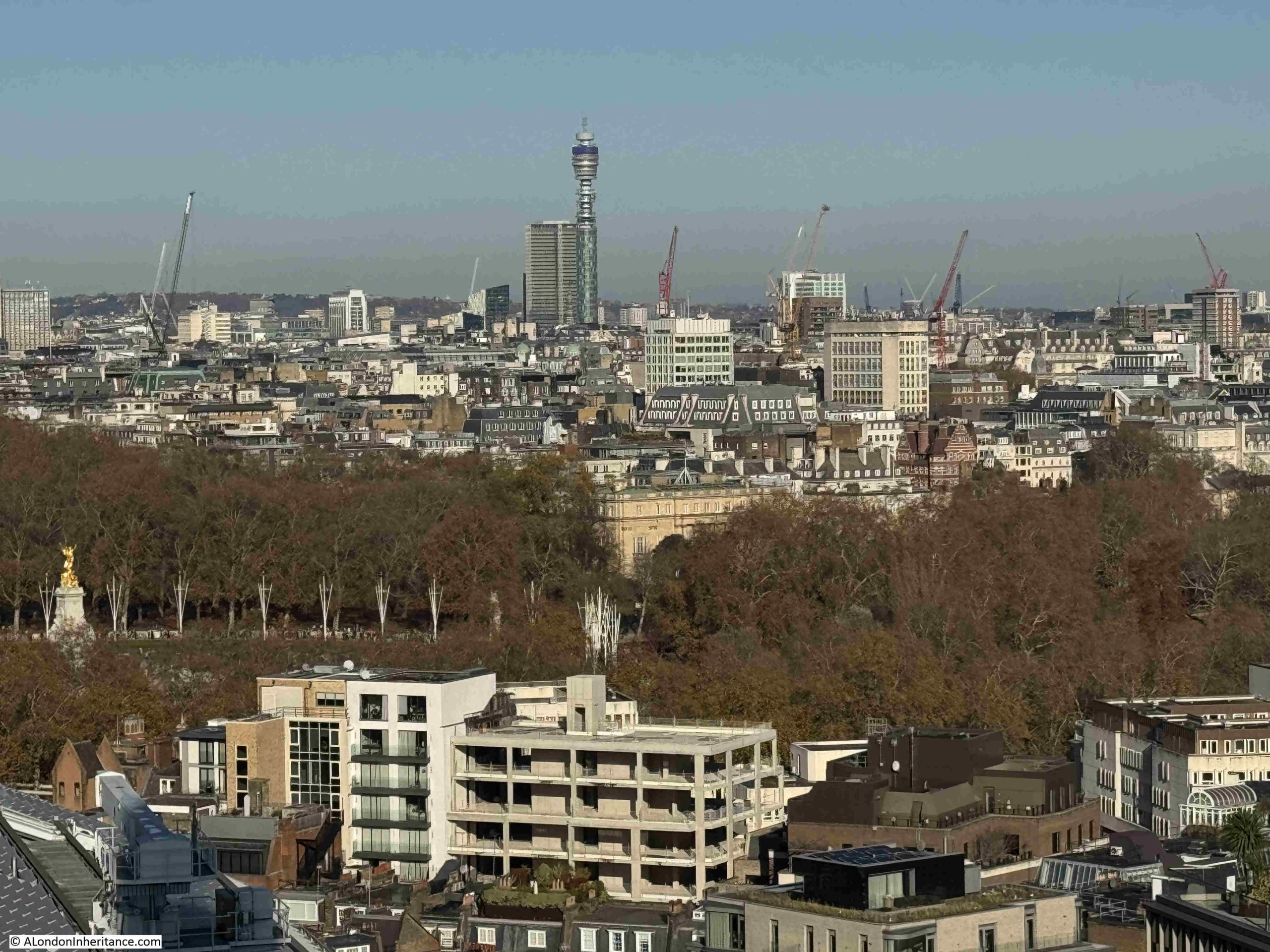
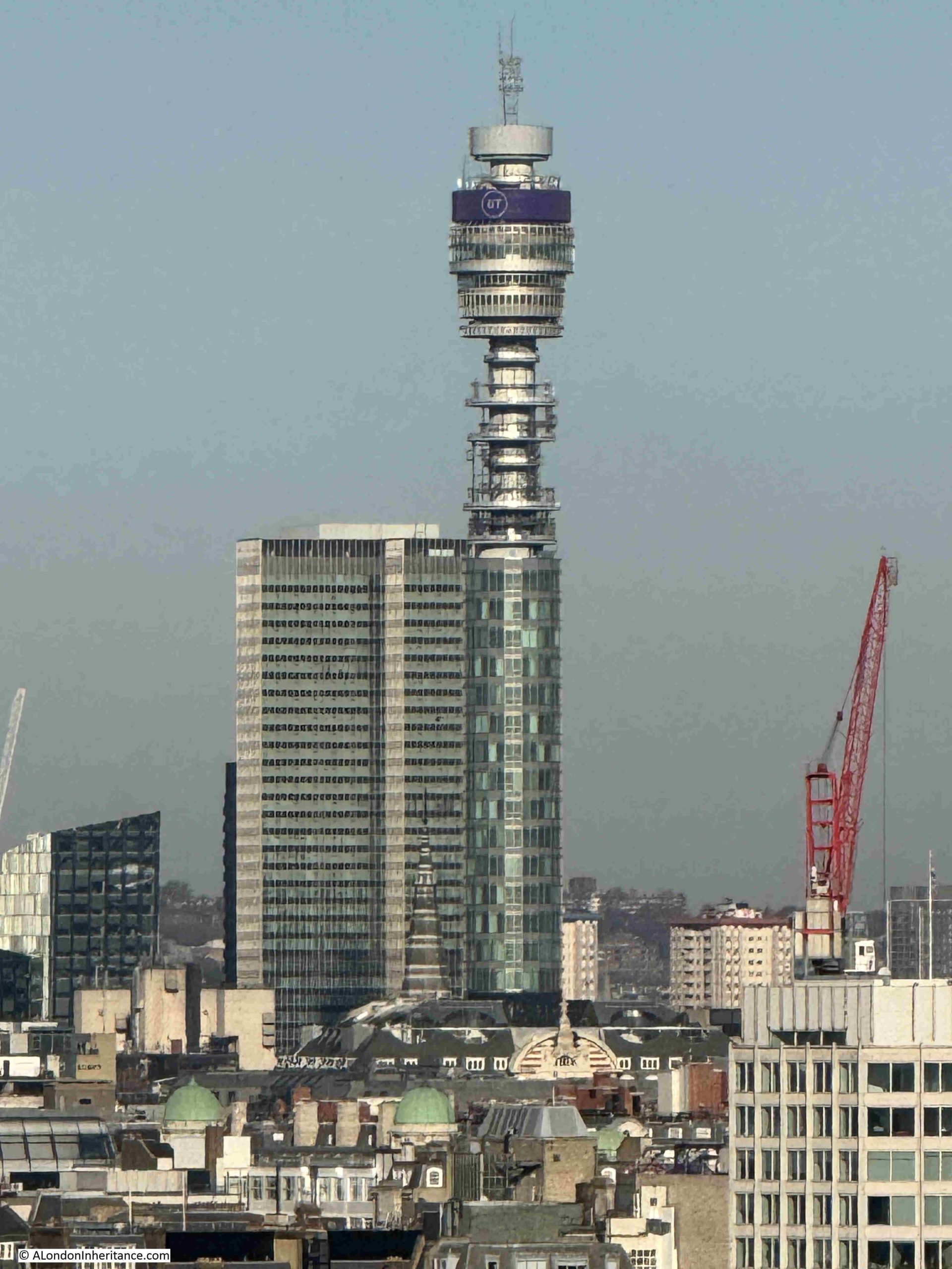
New buildings at Victoria in the foreground, with the BT Tower in the background. To the left of the BT Tower is the 1970 Euston Tower, at the time London’s tallest office block, and from 1973 it was the home of Capital Radio:
Camden Council have just approved the plans for a £600 million redevelopment of Euston Tower, so this building will look very different in coming years.
The engine shed over Victoria Station, with one of the angular buildings which seem to be a design feature of recent Victoria developments:
The rail bridge over the river, tracks leading up to Victoria Station, and train depot / parking area:
Look to the right of the train depot area, and the benefit of a high view can be seen, with the view of the two parallel housing blocks of the Peabody Avenue estate – the 1870s estate with a length of 300 metres. The two long, parallel rows of this development are really clear from this perspective.
The Natural History Museum is in the centre, slightly to the right, of the following photo:
And moving slightly to the right, along the centre is the Victoria and Albert Museum, and just behind, covered in scaffolding, is the Queen’s Tower of Imperial College:
In the above photo, the Wembley Arch can be seen in the distance, the photo below shows a close up of Wembley, with the dome of the Royal Albert Hall to the lower right:
Across the Thames is an estate that had a key relationship with Battersea Power Station. In the lower part of the following photo are the light brown buildings of the Churchill Gardens Estate:
In the centre of the estate is a fascinating industrial relic of the link between Battersea Power Station, and the Churchill Gardens Estate:
The tower is the most visible part of a highly complex system, that took hot water from Battersea Power Station, pumped it under the Thames through specially constructed pipes, stored water in the tower, then distributed it across both the Churchill Gardens and Dolphin Square estates for heating and hot water.
The system is described in considerable detail in a book published in 1951 for the Festival of Britain by the Association of Consulting Engineers. A large book that celebrates the work of civil engineering and construction across a wide range of projects.
The introductory paragraph to the section on the Churchill Gardens project provides an excellent description:
“In the ancient City of Westminster, almost within the shadow of the Houses of Parliament, so severely damaged by German bombers in 1942, great blocks of new flats are rising to meet the needs of London’s teeming millions, thousands of whom are still living in bomb-shattered houses built a century ago.
It is perhaps indicative of Britain’s will to survive and to surmount her economic troubles, that this great new housing estate, together with, it is expected an existing group of flats – probably the largest in Europe – is to have complete space heating and water heating by means of a district heating plan, thus banishing the dust and drudgery of the open coal fire, and the nuisance caused by the delivery and removal of fuel and ash for each block of flats. This plant is unique in two respects: it’s the first public heat supply in London, and it is also London’s first district heating plant wherein the heat is the by product of electricity generation. By this means the thermal efficiency of electric generating stations may be raised from its present figure of 25 per cent, to a figure approaching 75 per cent, for stations generating both electricity and heat.”
The section in the book is titled “District Heating Scheme, Pimlico Housing Estate and Dolphin Square”, as at the time the book was put together, the estate had not yet been given the name of Churchill Gardens.
The water sent from Battersea Power Station was up to a maximum of 200 degrees Fahrenheit (93 degrees Celsius) and was stored in the tower, or to use its correct name, the “Hot Water Accumulator” before being distributed across the estate.
The following diagram shows the concept from power station on the left to estate on the right via the Thames, which from the diagram, looks a very trivial barrier to cross with pipes:
I did not measure the amount of time, but you get around 10 to 12 minutes at the top of the chimney – plenty of time to take a good look at the view, but at the end it was time to take a look inside the power station building:
The public areas are within the old turbine halls of the two halves of the station, with the central boiler house (again in two parts as the station was built in two halves at two different times) now office space with apartments at the top.
The space is basically a Westfield or Airport shopping centre, with the only industrial relics of the buildings’ purpose being found in the roof space:
As the power station was built in two different halves, there were also two separate Control Rooms – A and B.
Control Room B sort of remains, but is now a bar:
To get an impression of what the Control Room looked like, you need to walk to the back of the bar, and providing the tables lining the viewing space at the end are free, you can see some of the original equipment:
The “B” side of the station was built after the war, a time when money and materials were in short supply, so the decoration of Control Room B was very basic.
I guess there is a certain industrial feel to the design, but this is really brand driven retail space:
And you need to look up to see any relics from the buildings past:
The view from the waiting area for Lift 109, which is in the pre-war “A” side of the power station, so the stone work along the walls is more ornate:
Looking down into the entrance of the building from the river side of the power station:
The large, green equipment in the centre of the floor is a 66 kilo volt circuit breaker dating from around 1955, which was part of the station switchgear – one of the very few items of equipment from the operational station left on display:
The purpose of the circuit breaker was to automatically cut of electricity if a fault in the circuit was detected, to prevent further damage to the electricity distribution network.
There were a number of these circuit breakers at Battersea, each built within a brick compartment with steel doors, so that if a circuit breaker caught fire, the fire would be prevented from spreading.
As we have seen at Heathrow in the last few days, electrical distribution equipment can at times catastrophically catch fire.
Outside the power station, there is a long walking / viewing , seating area on the top of the pier that coal barges once moored up against:
It was here that the distinctive cranes that once transferred coal between river and power station were located. These were removed when development work started, with the intention that they would be restored and replaced, however I believe they are currently in bits in an outside storage area – not in Battersea:
Reflection of the power station in an adjacent apartment block, with a randomly placed bit of equipment from the old power station:
My photos earlier in the post showed all the chimneys being replaced, and in the garden at the front of the power station is a small part of one of the original chimneys – a segment from the 1933 north west chimney:
Along the western side of the building, with on the right apartment blocks with shops and restaurants along ground level:
Towards the rear of the power station is Prospect Place, designed by the California based architectural practice of Gehry Partners, founded by Frank Gehry:
South east brick work and chimney:
It was interesting to see the transformation of Battersea Power Station. My preference would have been for alternative uses than just retail in the public space, however in reality there was no other option than funding the considerable reconstruction of the building – which had been out of use for decades – than by building apartments, offices and retail.
There had been many schemes before the current development, none of which had resulted in any work in restoring the building, and no public or private money was being made available to create a transformation such as has resulted at Bankside Tate Modern.
Whilst the chimneys are new, they are to the original design, and the good thing is that the shell of the building is fundamentally as it was – a temple to 20th century electricity generation – I just wish that there was more about this in the building, in addition to the small display at the start of Lift 109, and a couple of bits of switchgear. Control Room A should have public access rather than being a private event space, and the cranes should be restored and installed alongside the river as a starter.
Giving more prominence to the heritage of the building would help increase footfall across the site, which is probably part of the thinking behind Lift 109, as visitors to this will probably also use the restaurants and shops.
Lift 109 though is brilliant, the view from the top provides a very different perspective of London. Unless you can get to the top of one of the new apartment buildings around Vauxhall, there are no other high places to view the city from this part of London, and on a sunny day, London looks glorious – as does the brickwork of this temple to power:
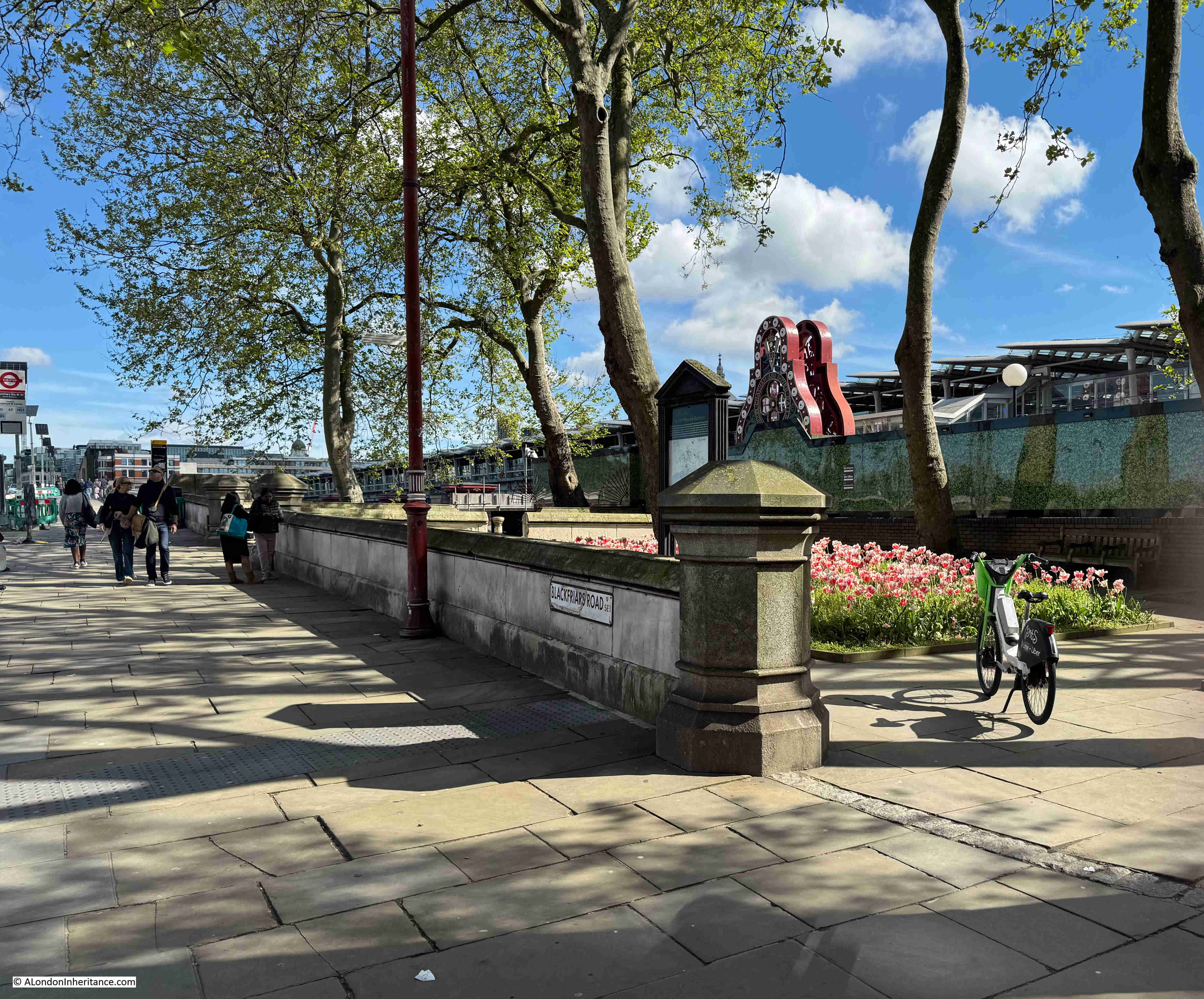
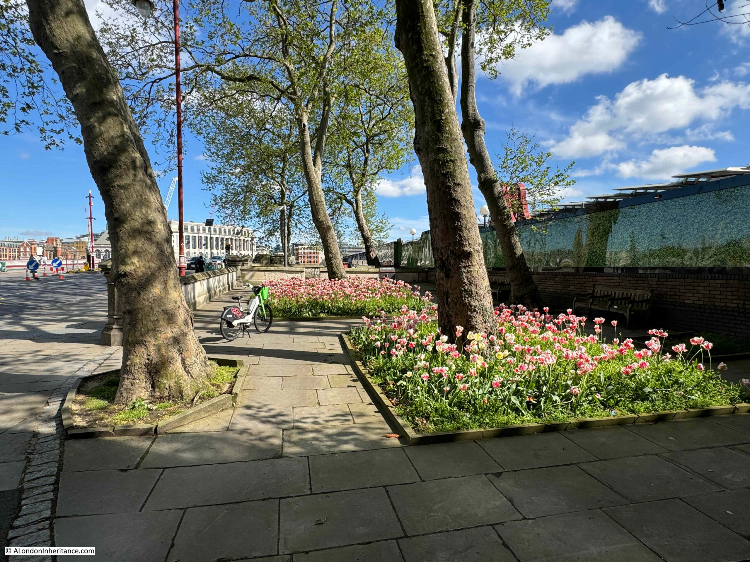
If you walk to the southern end of Blackfriars Bridge, on the eastern side of the bridge there is a small garden, and it is a perfect example of how places in London can tell multiple stories, and for the garden the story is of the engineer John Rennie, the Albion Mill, a unique view of London, as well as the price of grain and flour in London.
This is Rennie Garden alongside the path that runs up to, and along the eastern side of Blackfriars Bridge:
This is a very small garden and consists of a few trees and two blocks of planting:
Which really look good, and bring a splash of colour on a sunny May morning:
The gardens were created in 1862 by the Corporation of London and named the Rennie Garden after the engineer John Rennie.
The following extract from the 1894 edition of the Ordnance Survey map shows the gardens (ringed in red), as a very small patch of public gardens squashed between the railway and the road, both of which were running on to the bridges which crossed the Thames (‘Reproduced with the permission of the National Library of Scotland“):
In the above map, some stairs can be seen running down to the foreshore from the north of the gardens. The stairs are still there today, however they now lead down to the walkway along the side of the river:
There are though stairs on the other side of the river wall which lead down to the foreshore. This is not a historic set of stairs and they seem to have been built around the same time as the bridge.
So why are the gardens named after John Rennie, and what is the connection with a mill, the price of flour and a view of London?
John Rennie was the architect of London Bridge (the version of the bridge that was later demolished and moved to Arizona in the US). After Rennie’s death in 1821, the bridge was built by his son, also named John, who continued his father’s practice as a civil engineer.
According to “A Biographical Dictionary of English Architects” by H.M. Colvin, (1954), John Rennie (1761 to 1821) “was the younger son of a Scottish farmer, and was born in Phantassie in East Lothian on June 7th, 1761. As a child he showed a remarkable aptitude for mechanical pursuits, and he afterwards found congenial employment with a millwright. His earnings enabled him to study at Edinburgh University for three years before establishing himself as a millwright and general engineer. In 1784 he went to Birmingham in order to assist Boulton and Watt in designing and executing the machinery for the Albion Flour Mill ay Southwark”.
And that is the connection between John Rennie and the gardens, as they are on part of the site of the Albion Flour Mill, the first steam powered flour mill in London and at the time of completion, the largest in the world.
The Albion Flour Mill, Blackfriars Bridge is shown in the following print, with the edge of the bridge (the version before the Blackfriars Bridge we see today) at the right edge of the print:
Before the Albion Mill, there had been a number of much smaller mills scattered across London and the counties surrounding the city, using a range of power sources such as wind and water.
The introduction of steam power rendered all these other mills redundant as the Albion Mill could process large quantities of grain with a reduced level of manpower. Being next to the river enabled both coal and grain to be delivered directly to the mill.
Newspapers reported on the opening of the Albion Mill, and the following from the 10th of April 1786 is typical “A few days since the Albion Mill, on the Surrey side of Blackfriars Bridge, commenced working. This mill, the largest in the world, has been erected by the proprietors for the beneficent and salutary purpose of supplying this great metropolis with flour, and of course reducing the price of bread, the greatest blessing the poor can experience on this earth. The machinery is worked by the operation of steam, and we are happy to say, there is every reason to expect it will amply fulfil the intent, and fully reward the ingenuity and public spirit of those gentlemen who have risked their money in this arduous and laudable undertaking”.
As well as being the first use of steam power in London to produce flour, the Albion Mill’s name was associated with a panoramic drawing made from the roof of the building “London from the roof of Albion Mills”.
The panorama as a form of painting and exhibition was invented by a Scottish painter, Robert Barker. One of the 19th century accounts of the history of the panorama claims that Barker had been imprisoned for debt in Edinburgh in 1785. “His cell was lighted by an air-hole in one of the corners, which left the lower part of the room in such darkness that he could not read the letters sent to him. He found, however, that when he placed them against the part of the wall lighted by the air hole the words became very distinct. the effect was most striking. It occurred to him that if a picture were placed in a similar position it would have a wonderful effect. Accordingly on his liberation he made a series of experiments which enabled him to improve his invention, and on June 19, 1787, he obtained a patent in London, which established his claim to be the inventor of the panorama”.
To display his new invention, Barker raised enough money to build “an entire new Contrivance or Apparatus for the Purpose of displaying Views of Nature at large by Oil-painting, Fresco or any other mode of painting and drawing”. This was to be found next to Leicester Square, with a small entrance from Cranbourn Street.
Barker gave his display the name “Panorama”, and once inside, spectators would stand on a raised circular platform in the centre of a round building. They were about 30ft away from the circular wall on which was painted the scene to be viewed, stretching for the full 360 degrees around the spectators.
After entering in the dark, light was then let in from the roof, and it was focused on the scene painted on the surrounding wall – the panorama.
The lighting and the quality of the painting on the wall gave the effect of standing in the middle of the real scene that was portrayed around the wall.
To keep paying spectators returning, Barker regularly changed the panoramas on display, and they were not limited to landscapes. One very popular panorama was of the Naval Grand Fleet lying at Spithead, with Portsmouth and the Isle of Wight in the background.
Robert Barker’s panoramas were very successful and always drew a crowd wherever they were on display. He opened panoramas in France, Holland and Germany, and the panoramas on display in Leicester Square would also go on tour around the country, as the following from Aris’s Birmingham Gazette on the 22nd of October, 1798 illustrates:
“By particular Desire of a Number of Families of Distinction in Birmingham and its Environs; the PANORAMA, Union-street, or perspective VIEW of the GRAND FLEET at Spithead, will continue open till Saturday next, the 27th instant, on which day it will positively and finally close, in order to embark for Hull, where it is engaged. That part of the public who have not yet had an opportunity of seeing the Grand Exhibition, will do well to take the present Opportunity of seeing the Wooden Walls of England before their Departure. Admittance One Shilling.”
After completion, the Albion Mill was the highest building between St. Paul’s Cathedral and Westminster Abbey, so it was the ideal location from where to make another panorama, and to do this Barker sent his 16 year old son up to the roof of the mill in the winter of 1790 to 1791 to paint the view for the full 360 degrees – a vast panorama of London at the end of the 18th century.
The British Museum have a copy of the panorama from the roof of Abbey Mill in their collection, and it is available for use under a Creative Commons license, so although today I cannot get to the same height and specific location from where the panorama was made, below is a very rough comparison of the early 1790s with the view of London today.
Looking to the north and we can see St. Paul’s Cathedral, spires of the City churches, and the Blackfriars Bridge on the left:
To the west:
To the south-west:
A very different view today:
To the south:
To mirror the above view, I would be looking straight at the Rennie Garden as in the photos earlier in the post.
As with Robert Barker’s other panoramas, the View from the Roof of Albion Mill also travelled across the country, and internationally, so for example, in 1796 it was on display in Philadelphia in the US, where you could walk in to see the view of London for half a dollar.
The panorama was also printed onto single sheets to give an idea of the view of London:
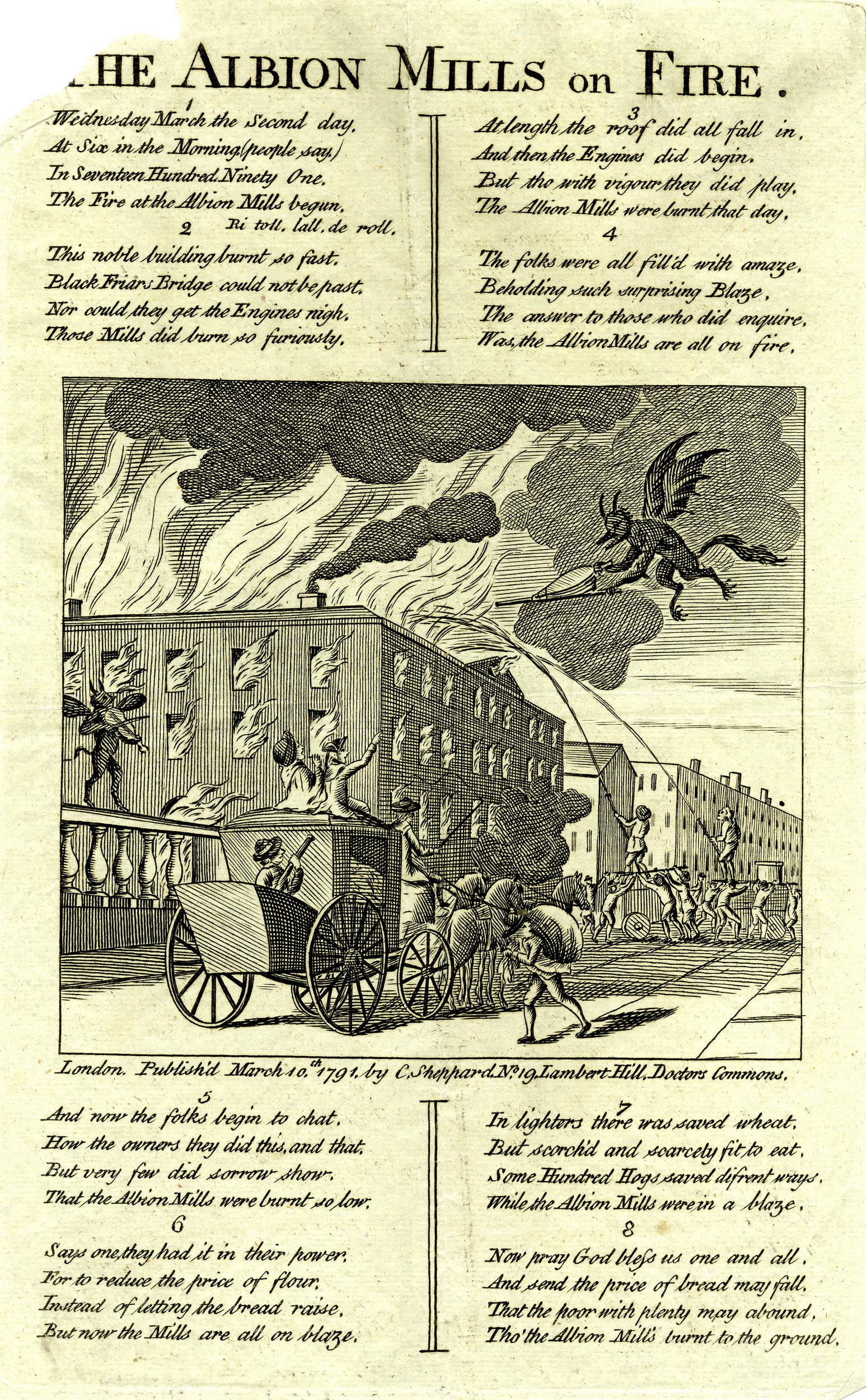
The Albion Mill did not last for long as in March 1791, a couple of months after the panorama was completed, the entire building burnt down.
The following report from newspapers of the time covers the fire, and also provides a possible cause:
“Yesterday morning, soon after six o’clock, a most dreadful fire broke out in the Albion Mills, on the Surrey Side of Blackfriars Bridge, which raged with such unbaiting fury, that in about half an hour the whole of that extensive edifice, together with an immense quantity of Flour and Grain, was reduced to ashes; the corner wing, occupied as the house and offices of the Superintendent, only escaping the sad calamity from the thickness of the party wall.
It was low water at the time the fire was discovered, and before the engines were collected, their assistance was ineffectual; for the flames burnt out in so many directions, with such incredible fury, and intolerable heat, that it was impossible to approach on any side till the roof and interior part of the building tumbling in completed the general conflagration in a column of fire, so awfully grand as to illuminate for a while the whole horizon.
The wind being easterly, the flames were blown across Albion place, the houses on the west side of which were considerably scorched, and the inhabitants greatly alarmed.
In the lane adjoining the Mills one house was burnt to the ground, and others considerably damaged. The Accident is supposed to have been occasioned by the Machinery having been overheated by Friction.
Another circumstance has been mentioned, that might operate either as an original or secondary cause in producing the above catastrophe:- A quantity of Grain that lay contiguous to the Machinery had been damaged by the late Floods, and was Yesterday Morning observed to have acquired such a degree of Heat, as made some of the Workmen conceive that it might be dangerous to put the Mills in motion. The Remark was not attended to, and the Consequence has been what we have related.”
So after 5 short years the Albion Mills had completely burnt down.
The following print shows the mill on fire, attempts to pump water from the river at low tide, into the fire, and watching crowds lining the side of Blackfriars Bridge:
The total loss of the Albion Mill was estimated by the companies that had insured the mill at around £90,000. There were also concerns about the loss of a large quantity of grain, and what this would do to the price and availability of flour. The proprietors of the mill were able to assure concerned Londoners that whilst a large quantity had been lost at the Albion Mill, they still had large quantities at other grain stores.
There were many though, who celebrated the loss of the Albion Mill, and a number of satirical prints were published about the fire:
In the above print, the dejected owners can be seen in the boat at lower left. In front of the building there are two barges on the river. The left barge is filled with sacks labelled Pot80 (potato), and the barge on the right with sacks of Indian Wheat. These sacks were implying that the flour produced at the mill had been adulterated. A number of demons can be seen rejoicing at the fire.
The opening of the Albion Mill had a very serious impact on all the millers in London and the counties surrounding the capital. The use of steam power had allowed the mill to produce flour quickly and efficiently, and the impact of this resulted in the closure of many other mills.
As an example of both the impact of the working Albion Mill, and the after effects of the fire, the following is from the Hampshire Chronicle on the 14th of March 1791:
“The Berkshire millers are sensibly affected by the late fire at the Albion mills, but not with grief. Many of them, who gave over working two years since, have again set their wheels in motion.
The flour-mills at Blackwall, Poplar, Limehouse, Rotherhithe, and many other places, which have stood still upwards of these three years, have also begun working again, owing to the Albion mills being burnt down.”
The price of flour had increased during the time of the mill’s operation. In the five years prior to opening, the average price of flour had been 44 shilling, 6 and a quarter pence. During the years the mill was in operation, the average price had increased to 45 shillings and 2 pence. A small increase, but still an increase.
It was argued that the increase in price was down to two bad harvests and that there had been a scarcity of wheat throughout all of Europe.
The following print also had a celebratory theme to the fire at Albion Mills, with a demon playing a fiddle on Blackfriars Bridge as the mill burns, whilst another demon fans the flames:
The following print is titled “A New Dance, as it was performed with Universal Applause, at the Theatre Blackfriars March 2nd 1791” and shows a celebrating crowd on the bridge, and three men dancing in the foreground. The man on the right has a sheaf of papers over his shoulder on which is written “Success to the Mills of Albion but no Albion Mills”:
One of the main complaints against the Albion Mill was that by being able to process so much grain and flour, and by forcing so many other mills to close, it was becoming a monopoly. These allegations may have had some truth, as soon after the fire, it was reported that:
“However well or ill informed the charge of monopoly against the Albion Mill Company may have been, the destruction of their mill has been followed by an almost immediate fall of three shillings per quarter in the price of wheat. This is proof that they were generally considered as having it in their power to keep up the price artificially.”
There were proposals to rebuild the mill in the years following the fire, however permission was not granted for the project, and houses were later built on the site of the Albion Mill.
I always find it surprising how you can take one very small spot in London, in this post, Rennie Garden at the southern end of Blackfriars Bridge, and find layers of history, and so many other connections. The story of John Rennie, a leading mechanical engineer in the later decades of the 18th century, the first steam driven mill in London, the story of the panorama and a unique and innovative view of London in the late 18th century, and the price of grain and flour.
One of the problems with using the Internet whilst working on the computer is the risk of being distracted. Often whilst researching and writing a post, if I am looking at online resources such as old newspapers or library materials, I will find a new subject completely different to what I should be concentrating on.
YouTube is another terrible distraction. I often have a music playlist running in the background, but then start looking at the videos, and London spotting has been a way of trying to justify this distraction.
I know it is an age thing, but the period from around 1976 to the late 1980s were definitely one of the most creative periods. I started to see bands whilst still at school, with the first being the Canterbury band Caravan back in May 1974. Incredibly they are still going and we saw them last year at the Union Chapel in Islington.
My first big concert was seeing Yes at Queens Park Rangers Loftus Road stadium back in 1975. Since then, it has been so many bands at so many venues, and many are still touring today, and so far next year, Squeeze and Human League are booked.
Whilst music films / videos had been around for many years, from the late 1970s they became almost an essential media format to go with any band or song aiming to make an impression.
Many of these had an element filmed in London, and they show not just a band, but also a city as they both were around 40 years ago.
So for today’s Christmas Eve post, a brief selection of videos with views of London, in no particular order, starting with one which by chance I saw being filmed.
Altered Images – Happy Birthday (1981)
I was in Blackfriars when this was filmed, and saw the external sequence of the video which had a table set up for a birthday party between the road and rail bridges at Blackfriars. The video was made 42 years ago, and the tree at the opposite side of the river is in the video and can still be seen today.
The Clash – London Calling (1979)
The video to go with London Calling was recorded on a dark and wet night on a boat or pier on the south bank of the river next to the Albert Bridge:
The Specials – Ghost Town (1981)
A brilliant song which is really evocative of the early 1980s. There are shots of the City, around the Bank of England, the towers in the Barbican, and along London Wall, with much of the video being shot in east London around the docks, and through the Rotherhithe Tunnel. The video features Terry Hall who sadly died a year ago in December 2022.
Ultravox – Vienna (1980 / 1981)
Whilst much of the video was shot in Vienna, early parts of the video were shot in Covent Garden, for example starting at 52 seconds you can see St. Paul’s, Covent Garden in the background:
Dexys Midnight Runners – Come On Eileen (1982)
The video was filmed around Kennington. The shop at the beginning of the video is number 151 on the corner of Brook Drive and Hayles Street. The pub in the background starting at 1 minute 32 seconds is the old Two Eagles on the corner of Austral Street and Brook Drive. The pub is now flats.
Katrina & The Waves – Walking On Sunshine (1985)
Much of the video for this song was filmed in east London, in the old warehouses in and along Wapping High Street and Wapping Wall. There is a segment in the video which starts at 39 seconds, which features in my Wapping walk, where the band are in St. John’s Churchyard by Wapping High Street.
The Human League – Love Action (1981)
The church used in this video was St Saviour’s in Warwick Avenue, and the main entrance to the church on Warrington Crescent can be seen starting at 1 minute, 4 seconds. The entrance looks almost exactly the same today.
I cannot work out where the flats were. Apparently in south London and almost certainly long demolished.
Human League – (Keep Feeling) Fascination (1983)
The house that has been painted orange in this video was part of an estate that would soon be demolished. The house was at the corner of First Avenue and Third Avenue in Plaistow, east London. The scenes of the band playing were recorded in a studio.
Whilst the houses in the video have long been demolished, the street layout is today the same, and for nerdy location spotting, the large BT manhole cover in the pavement at the corner can just be seen in the video and is still on the pavement today.
Pet Shop Boys – West End Girls (1984)
This video starts off in Wentworth Street in east London and ends in Leicester Square with a number of locations used throughout the video including Waterloo Station, with the old W.H. Smith shop featuring.
Depeche Mode – Just Can’t Get Enough (1981)
The external scenes in this video almost look like an after thought. Whilst nearly all the video is filmed in a studio, there are a couple of “blink and you miss it” moments when there are shots on the South Bank. The first at 1 minute 42 seconds, in the Undercroft with Hungerford Bridge just visible in the background, and at 2 minutes 58 seconds, the stairs that were at the Belvedere Road side of the Royal Festival Hall, with the windows of the old Down Stream building of Shell Centre in the back ground.
The Communards – Don’t Leave Me This Way (1986)
At the very start of this video there are shots around Battersea Power Station, an area that looks very different today:
ABC – When Smokey Sings (1987)
As with many other videos, this one solved the problem of what do you do with a long instrumental section at the start of the track, by driving around London, before the video heads to the studio for the rest of the track.
The Stranglers – Strange Little Girl (1982)
Strange Little Girl by the Stranglers by contrast was all filmed on the streets of London, starting at Liverpool Street Station before the rest of the video being mainly around Cambridge Circus and Leicester Square.
Queen – A Kind of Magic (1986)
Queen were one of the more innovative bands at using video, and it probably helped that they had sufficient budget to create these, although the video for Bohemian Rhapsody was probably a gamble at the time, but turned out to be one of the more remarkable of this new type of media.
Queen’s A Kind of Magic was filmed in the Playhouse Theatre, which is tucked in between Charing Cross Station and Craven Street / Northumberland Avenue.
The theatre was derelict at the time, having closed as a BBC studio in 1976. I was working across the river on the South Bank in the 1980s and saw a fire at the theatre at one point, although I do not think it caused too much damage.
The theatre was also at risked of demolition, however a year after Queen filmed in the theatre, it was restored and reopened, and is still a working theatre today.
The Verve – Bitter Sweet Symphony (1997)
Whilst my preferred period is from 1976 to the late 1980s, there is obviously much brilliant music both before and after. One example that makes use of London’s streets is Bitter Sweet Symphony by The Verve.
Almost the whole of the video is Richard Ashcroft walking along Hoxton Street, bumping into people as he goes. The video starts off on the corner of Hoxton Street and Falkirk Street, and he walks north along the eastern side of the street. The Golden Fried Chicken in 1997 is now Hoxton Chicken and Pizza.
Fat Les was a band put together by Keith Allen, Alex James of Blur and artist Damien Hirst. Vindaloo was created as the unofficial song for the 1998 World Cup.
The video was a brilliant parody of Verve’s Bitter Sweet Symphony, also filmed along Hoxton Street, and starting at the same junction with Falkirk Street.
Unlike the Verve’s video, where Ashcroft walks alone for the majority of the video, in Vindaloo, a large group quickly forms, with Keith Allen playing a prominent role. The group is good for a bit of people spotting.
Wilko Johnson and Roger Daltry – Going Back Home (2014)
Wilko Johnson (of the brilliant Dr. Feelgood) and Roger Daltry of the Who released an album with the same name in 2014.
The video that went with the title track is a really clever combination of old and new film of both Johnson and Daltry, but also from the 1970s with some scenes which I find very familiar.
The video includes scenes of the elevated section of the M4 in west London, the old Shell Haven refinery at Canvey Island (where Dr. Feelgood originally formed), along with Southend including the Kursaal.
The Human League video used a street before demolition. The Divine Comedy used a hospital shortly before demolition for the video to go with National Express.
The video was filmed in the old Joyce Green Hospital in Dartford, Kent (which hopefully is close enough to greater London to be included in this post):
The Kinks – Come Dancing (1982)
Come Dancing by the Kinks was also filmed at site which has since been demolished, with the Ilford Palais being used for the dance hall shots.
Many of the external shots were filmed around Hornsey, where Ray Davies had a studio. Starting at 53 seconds is the shop Keevans, which was on the corner of Hillfield Avenue and the High Street. The shop is now a hair and beauty salon, but the building to the left in Hillfield Avenue is recognisable due to the distinct decoration around the windows and doors.
Cathy Dennis – Waterloo Sunset (1997)
Cathy Dennis did a rather good version of the Kinks song Waterloo Sunset, and in the video to go with the song, she is being driven around London in a black cab, with old and current scenes of London in the background. The video has a twist at the end when the cab driver is revealed.
Blur – Parklife (1994)
The video for this song was mainly filmed on the Greenwich Peninsula.
The terrace of houses that feature in the video are next to the Pilot pub (see my post here about the pub and the terrace). The video was made before the Millennium / O2 Dome was built and in the background we can see some of the area, including one of the old gas holders.
Amy Winehouse – Back to Black (2007)
Many of the street scenes in this video with Amy Winehouse are in Stoke Newington, with the cemetery shots being set in Abney Park Cemetery. A brilliant song by an artist who died far too young.
Lily Allen – LDN (2006)
This is a brilliant song and video. The video follows Lily Allen walking through the streets of London as the words and song contrast both positive and negative views of the city.
The following words from the song “When you look with your eyes everything seems nice, But if you look twice you can see it’s all lies.” are a lesson for how to walk around the streets of London. Not necessarily in a negative way, but to see what is really happening, what is driving change, and the problems that London has, as does any large, complex city (the song starts at 42 seconds).
Ray Davies and Chrissie Hynde – Postcard from London
To end on a suitable video, this is Postcard from London by Ray Davies of the Kinks and includes Chrissie Hynde of the Pretenders. The track was a Christmas charity single by Davies and has scenes of Christmas in London.
That is just a brief sample of the many music videos that have featured London in one way or another. Just another way in which the city has featured in popular culture.
And with that selection of some of the songs that distract me when I am trying to work at the computer, it just leaves me to wish you a very happy Christmas, however you celebrate (or not), and a peaceful few days between Christmas and the New Year.
The area to the north of St. Paul’s Cathedral was destroyed during the war, mainly due to the use of incendiary bombs on the night of the 29th of December 1940. The destruction covered ancient streets such as Paternoster Row and Paternoster Square, and the shells of buildings were demolished and removed leaving a wide open space ready for new development.
The site was redeveloped during the 1960s, with the pre-war streets and original architectural styles being ignored, with an office complex built which followed a number of post war City planning themes which I will come on to later in the post.
The 1960s development was not popular, obstructed key views of the cathedral and tended to separate the cathedral from the area to the north. The buildings were not that well maintained and by the late 1980s the area was not an attractive place to work, or walk through, and did nothing to enhance the cathedral just to the south.
In the early 1990s, a proposed Masterplan was published by “Masterplanners” Terry Farrell, Thomas Beeby and John Simpson & Partners, and Design Architects Robert Adam, Paul Gibson, Allan Greenberg, Demetri Porphyrious and Quinlan Terry.
I have a copy of the Masterplan and it is fascinating to compare the original proposals with the site we see today. Not quite so architecturally ornate as the Masterplan, but very similar to what was originally proposed, and (in my view) a significant improvement on the 1960s development.
The following image is from the Masterplan and shows a “View of Paternoster Square looking south-east to the dome of St. Paul’s Cathedral”. The image is by Edwin Venn.
As with City developments such as the Barbican and Golden Lane estates, the damage inflicted on the City during the last war created the large area of space which could take a major, transforming development, rather than the simple rebuild of individual buildings.
The following photo is one of my father’s, taken from the Stone Gallery of St. Paul’s Cathedral:
The shell of a building at the bottom left is the Chapter House of the Cathedral.
The circular features between what was Paternoster Square and the remains of the Chapter House are the outline of water tanks that were placed on site during the war to provide supplies of water for firefighting.
The following extract from Bartholomew’s 1940 Reference Atlas of Greater London shows the area to the north of the cathedral. In the map, a Paternoster Square can be seen. In the above photo, this is the rectangular feature at top left, with roads on all sides, but not a building in sight.
As well as Paternoster Square, the map shows a network of streets such as Ivy Lane, Three Tuns Passage, Lovells Court and Queens Head Passage.
Running across the area was Paternoster Row, and the following photo from the book, the Queen’s London, published in 1896, shows the view along Paternoster Row, a narrow street but with substantial 19th century City office buildings on either side.
In the following photo, the dense network of streets and buildings to the north of the cathedral can be seen:
Another of my father’s views from the Stone Gallery, looking slightly above the earlier photo, with a bus running along Newgate Street. The Paternoster Square developments would occupy the area to the south of Newgate Street.
The same view today, showing the buildings of the Paternoster Square development:
The area, and street names are of some considerable age. The first written records of the streets date from the 14th century, with Paternosterstrete in 1312 and Paternosterrowe in 1349.
From the early 19th century onwards, the area was home to many publishers, stationers and book sellers. Much of the stock held by these businesses contributed to the fires started on the 29th of December 1940.
Harben’s Dictionary of London references a Richard Russell dwelling there in 1374 and described as a “paternosterer”, and that paternosterers were turners of beads, and gave the street its name.
Harben also states that “A stone wall was found under this street at a depth of 18 feet running towards the centre of St. Paul’s. A few yards from this wall in the direction of St. Martin’s-le-Grand wooden piles were found covered with planks at a depth of 20 feet”, and that under Paternoster Square, “Remains of Roman pavements and tiles were found in 1884”.
W.F. Grimes’ book, about his post war excavations across the City, “The Excavation of Roman and Mediaeval London” records his limited excavations across the area in 1961 to 1962, and that much of the Paternoster area “was not available for examination because the cellars had retained their bomb rubble and the sites around Paternoster Square had become a garage and car parks.”
In the limited excavations that did take place, Grimes found evidence of ditches and post holes, possibly where the wooden piles were found in the 19th century. He concludes that the area was probably occupied by timber framed buildings rather than stone.
The main discovery on the site was a hoard of about 530 coins, “mainly barbarous copies of coins of the Gallic Empire of the late third century A.D.”
The limited excavation took place prior to the 1960s development of the site. This create a dense cluster of office blocks between the cathedral and Newgate Street, which can be seen in the following photo, to the right of the cathedral:
The 1960s development of the site was based on the plans by architect and planner Lord Holford who was commissioned by the City Corporation to advise them on architectural policy, and the development of buildings within the “orbit of the dome of St. Paul’s”.
Lord Holford’s plan for the site followed post-war thinking about the City’s redevelopment. This included the separation of traffic and pedestrians, with vehicles having priority at ground level, and pedestrians moved to elevated walkways.
The original street plans were rejected in favour of a rigid matrix of building blocks, which resulted in a horizontal slab of blocks with the 18-storey office tower Sudbury House being the highest.
Lord Holford’s explanation of his approach to the design of the site was that “there is more to be gained by contrast in design, than from attempts at harmony of scale or character of spacing” (I think this is the design approach used for the current developments between Vauxhall and Battersea Power Station).
Not all of Holford’s ideas were implemented, and many of the buildings were by other architects, so the new development ended up as a rather uninspiring addition to the land north of the cathedral.
The following photo shows the 1960s office block immediately to the right of the old St. Paul’s Chapter House:
In the following photo, the Chapter House is the older building in dark brick behind the tree, and the new lighter red brick building to the right occupied the site of the 1960s office block seen in the above photo:
The following photo shows one of the access ramps that took pedestrians up to the pedestrian area. To the right is the lower vehicle route, with access to car parking:
I may be completely wrong, but I vaguely remember there being a pub on the upper pedestrian area, which had an outside area with a view over the surrounding streets.
The 1960s development took no regard of the views of the cathedral just to the south.
This is the view to the northern entrance to the cathedral, with only a small part visible through a tunnel that takes a pedestrian walkway through an office block:
In the Masterplan, the proposed redevelopment delivers this alternative view of the same part of the cathedral:
And whilst the buildings are less ornate than originally proposed, the view today is much the same as in the Masterplan, also with a café, on the site of the walkway:
The caption to the following illustration reads “St. Paul’s Church Yard will be re-aligned and the Cathedral gardens re-laid and enclosed”:
The gardens were re-laid and enclosed, and new office blocks occupied the space to the north, and whilst these were very different to the 1960s versions, they were not quite as ornate as the Masterplan envisaged:
The objectives of the Masterplan were to:
Restore views of St. Paul’s Cathedral from Paternoster Square at ground level and on the skyline, respecting St. Paul’s Heights and Strategic Views
To create buildings that are in harmony with St. Paul’s Cathedral
To restore the traditional alignment of St. Paul’s Church Yard and the Cathedral Gardens creating an enhanced public space
To re-establish a traditional street pattern and return pedestrian routes into the site to ground level
To create a new, traffic-free, public open space allowing ease of access, especially for the disabled
To follow the City tradition of classical architecture, using traditional materials such as stone, brick, tile, slate and copper
To be flexible enough for key corners, outside the Planning Application site to be integrated at a later date
To create a thriving new business community in the best traditions of City life
To create a much-needed, new shopping area in the heart of the City, with a variety of shops, restaurants and entertainment, linked into St. Paul’s Underground Station
To create new open public spaces for relaxation and enjoyment by office workers, visitors and shoppers alike
It is interesting to compare the development today with these objectives.
There was an intention to follow the City tradition of classical architecture, and this could be seen in the illustrations of the planned buildings, such as the following example showing “the frontage of the new buildings on Newgate Street”:
The frontage along Newgate Street today is comprised of standard office block design, without the classical architecture proposed in the Masterplan.
The title of the following illustration is “A Meeting Place – Paternoster Square will provide a social focus for the City, a place to meet friends and colleagues, to browse or to use the health club”:
This approach can be seen across the Paternoster Square development, but in less ornate settings. Whilst the buildings do not have the same classical architectural styling, they do make use of stone, and there is a considerable amount of brick throughout the site which is a pleasant change from the glass and steel of many other recent City developments:
Whereas today, Paternoster Square is at a single level, in the Masterplan it was intended that there would be steps leading down to a Lower Court, so whilst the plan did away with the upper pedestrian and lower vehicle levels of the 1960s development, it did retain different levels, but for pedestrians. The Lower Court:
The plan was that Paternoster Row would become almost a continuation of Cheapside.
Cheapside was, and to an extent still is, the main shopping space of the City, and the One New Change development has enhanced this, but in the Masterplan, shopping would continue from Cheapside, across the road into Paternoster Row, and the underground station, which today is reached via a separate access point to the edge of the development, would have been integrated into the plan, as shown in the following illustration:
The St. Paul’s Chapter House was reduced to a shell of a building, as shown in my father’s photo, however it was restored and survived the 1960s redevelopment, and was included in the Masterplan, where it can be seen in the centre of the following illustration.
To the left of the Chapter House is a rather ornate three storey gateway into Paternoster Square, which today has been replaced by Temple Bar.
Temple Bar was included as an option in the Masterplan, which is described as “currently in a state of decay in a Hertfordshire Park”.
As mentioned earlier, the central Paternoster Square was intended to be multi-level, and in the following illustration, there is a rather impressive Loggia (an outdoor corridor with a covered roof and open sides), that would have provided a lift down to the Lower Court, would provide shelter, and would mark the access point to the Lower Court:
A key aim of the Masterplan was to bring life back to the area, and one of the ways to do this was via retail, and the plan stated that “Paternoster Square will be established as one of the foremost shopping areas in central London. There will be more than 80 shops, including a quality food hall or department store”.
The approach to retail included a Shopping Avenue, which was a covered route between the Lower Court and St. Paul’s Underground Station:
Shops would also line the new Paternoster Row:
And along the route of the old Ivy Lane, there would be Ivy Lane Arcade “designed in the tradition of famous London arcades. It will attract specialty shops such as jewelers and galleries”:
And shopping around Paternoster Square and Lower Court:
The Paternoster Square estate does have some shopping, but far less than was intended in the original Masterplan. There is no lower court and no covered shopping avenues.
Most of the shops are either restaurants, bars or take away food and coffee shops, aimed at local office workers and at the number of visitors who pass through as part of a visit to the area around St. Paul’s Cathedral.
There are also many other differences. Whilst the overall concept appears the same, the classical building style is now very limited as is the overall decoration across the buildings and ground level pedestrian spaces.
In 1995, the owners of the land commissioned Whitfield Partners to deliver a Masterplan for redevelopment, and it is the outcome of this plan that we see today. Similar in concept, but different in implementation.
The Paternoster Square development today has a large central space, is pedestrianised, and some of the pedestrian walkways do roughly align with some of the original pre-war streets.
The objective of bringing life back to the area has been achieved, and during the day it is generally busy with local workers, visitors and tourists, and on a summer’s afternoon, the bars and restaurants are particularly busy.
The central square features a 23.3 metre tall column, which conceals air vents to the parking space below the square:
The Masterplan by Farrell, Beeby and Simpson included a Loggia which would have provided a lift down to the Lower Court, and mark the access point to the Lower Court.
Whilst the Loggia and Lower Court were not part of the implemented Masterplan, there is a covered way along the northern edge of the square which has similarities to the original Loggia:
In the above photo, two groups of tourists with guides can be seen to the right. Between them is the artwork “The Sheep and Shepherd” by Elisabeth Frink. This came from the earlier Paternoster Square development as it was installed on the north side of the estate in 1975 when it was unveiled by Yehudi Menhuin.
It was moved to the high walk outside the Museum of London in 1997 prior to demolition of the 1960s estate, then returned to Paternoster Square in 2003.
The Sheep and Shepherd stands where Paternoster Square joins to Paternoster Row (which, as far as I can tell is very slightly north of the street’s original alignment).
Looking through the Loggia that was built as part of the new development:
Rather than lots of classical decoration to the buildings, there is a “Noon Mark” on one of the buildings to the north of the square. In strong sunlight, at midday, the shadow indicates roughly the day of the year:
A key point with the development is the height of the buildings. In the 1960s development, there were office blocks that ran both parallel and at right angles to the cathedral and views of the cathedral were limited.
With the new development, building heights are lower and allow views of the cathedral. As can be seen in the following photo from the north west corner of Paternoster Square, the new buildings are just slightly higher than the original Chapter House (the older, dark brick building to the right of the column):
Whilst a number of the walkways do roughly align with the original streets, Paternoster Square is in a different place to the original square, which would have been to the northwest of the current square, to the right of the building in the following photo, which does retain some classical styling at ground level, but is a modern building above:
This is the view from the western end of Paternoster Lane towards the central square. This stretch of walkway is almost exactly on the original route of Paternoster Row:
Sometimes it seems as if all the large sculpture across London’s streets is there to hide an air vent. This is the purpose of the column in the central square and also the purpose of a work of art on the corner where Paternoster Lane meets Ave Maria Lane:
This is a 2002 work by Thomas Heatherwick, and consists of sixty three identical isosceles triangles of stainless steel sheet welded together.
Round to the front of St. Paul’s Cathedral, and to the north of the large open space in front of the cathedral is an office block with shops at ground level which follows the alignment of the old street St. Paul’s Churchyard:
The following photo is taken from Cheapside looking towards the cathedral and Paternoster Square development, and may offer a clue as to why the implemented Masterplan is different to the Masterplan of Farrell, Beeby and Simpson:
To the right of the above photo are two sides of an octagonal building. It can be seen in the following extract of the photo of the 1960s estate:
One of the entrances to St. Paul’s Underground Station is just to the right of the building in the photo, and the building is either part above, or extremely close to, the underground station.
I have no evidence to confirm this, however it may be that the estate we see today was down to cost.
Whilst the initial planning permission did not include the octagonal building, the Masterplan did. It would have been demolished and the entrance to St. Paul’s Underground Station would be integrated into one of the new buildings as can be seen in one of the earlier pictures. The proposed lower shopping arcade would also have led into the underground station.
I imagine that anything involving changes to an underground station incur significant extra planning time and costs.
The overall Paternoster estate, whilst aligning with the original Masterplan, does not have the level of classical architecture proposed in the plan, or the split level with the lower court.
All this extra work would have incurred cost, and in so much of the built environment, decisions often come down to cost.
Having said that, compared to the 1960s development, Paternoster Square is a very considerable improvement.
It integrates well with the cathedral to the south, recreates alignments close to some of the original streets, certainly has brought life back into the area from what I recall of the previous development, and is a generally pleasant space to walk through.
Reading the Masterplan though, it is interesting to speculate what might have been, if this plan had been adopted.
You may be interested in the following posts about the area around St. Paul’s:
I will take any opportunity to view London from a high point, and just before last Christmas there was a tour of St Mary Islington, which included a climb up the tower to look at the view of London from the point where the tower meets the spire.
I could only make the late afternoon tour, however this provided a view of London after dark, which is always impressive. Hopefully I can return for a daytime tour, and if you are interested in the tour of this historic church, I have put a link at the end of the post to where I found out about these tours.
St Mary Islington is in Upper Street, and is a short walk from Angel underground station, continuing past Islington Green. As you walk along Upper Street, the spire of St Mary’s is a landmark on the right of the street:
Then the full front of the church comes into view, which is easier to see in winter when there are no leaves on the trees between church and street:
The church we see today dates from two distinct periods. The front façade of the church (except for the portico and columns), the tower and steeple date from the 18th century, however the body of church is from the mid 20th century.
The church was bombed in September 1940 when a bomb landed on the nave, which suffered substantial damage. The tower and steeple survived. The church was rebuilt in the early 1950s to a design by the architectural partnership of Seely & Paget.
The new nave of the church was built on the same outline as the original, and walls lined with tall windows to allow a large amount of natural light into the nave of the church. From the churchyard we can see the new nave and the original tower and steeple:
As with the majority of London churchyards, St Mary’s has been cleared of gravestones and has been converted to a garden. The churchyard was closed to new burials by the 1852 Burial Act which applied to churches in the metropolitan London area. As with so many London churches, St Mary’s had been taking very many burials over the centuries, and with Islington’s rapidly growing population, it was impractical to continue to use the churchyard, even without the 1852 Act.
Thirty acres of land was purchased in East Finchley for the use of St Pancras and Islington for burials.
The gardens at the rear of the church on a sunny December afternoon:
Looking back towards Upper Street, with the church on the right, and as with many London churchyards, when they were converted to gardens the gravestones were moved to the edge and form parallel rows along the external wall:
There is a named grave of a significant Islington resident next to the front of the church, just behind bus stop N on Upper Street. This is the grave of Richard Cloudesley:
Richard Cloudesley was born around 1470 and died in 1517. He was an Islington resident and landowner. In his will he left two “stony fields” covering an area of around 14 acres, and these became part of a charitable trust which is still in existence and today is simply known as the Cloudesley.
The fields were rented out and generated an income, however with the northwards expansion of London during the early 19th century, the land was becoming valuable for house building, so in the 1830s, the trust began selling leases to parts of the lands, and what would become the Cloudesley Estate began to be built.
Whilst much of the land and houses have been sold, the Cloudesley charitable trust still owns around 100 properties, and the income from these continues to support the aims of the trust, which includes the health needs of Islington residents, along with a grants programme which helps maintain and repair Church of England churches in Islington.
The grave in the above photo is not where Richard Cloudesley was originally buried. His body was taken from an unknown location in the churchyard, and reburied in the current position in 1812. The grave was originally more ornate than we see today, however being so close to the church it suffered from bomb damage in 1940, and in 2017 the Cloudesley charity provided funding to repair and restore the grave.
The tower of the church supports a spire – the most visible feature in the surrounding streets:
The spire has an interesting history, as in 1787, during repairs to the tower, it was decided to install a lightning conductor on the spire. Rather than construct scaffolding around the spire, the church contracted a basket maker by the name of Thomas Birch, who charged the church £20 to effectively build a wicker casing which fully enclosed the spire. Inside this wicker casing was a set of stairs that allowed workmen to reach the full height of the spire.
Although Thomas Birch was paid £20 by the church, he found another way of making more money and he advertised the spiral staircase as a means for the public to reach the top and see the view. Apparently charging for the climb and view raised a further £50.
What is not clear from the above print is where someone climbing the spire could have looked out through the wicker and see the view, whether they had to climb the full height and peer out over the top of the wicker, which would have been an experience not for those with a fear of heights.
The site of St Mary’s has been the site of a church for very many years.
It is in a key position. Upper Street has long been an important road from the City of London to the north, and the church is alongside this road.
There is very little evidence to confirm, however there may have been a church on the site in Anglo-Saxon times. Evidence for this seems to be mainly based on the parish of St Mary the Virgin being established in the year 628 by the Archbishop of Canterbury.
There was an 11th century church built on the site, and we were shown a stone with a zig-zag pattern in the crypt which apparently dates from the 12th century church.
The next church on the site was built in 1483, and this version of the church would last until the mid-18th century.
John Rocque’s map of 1746 shows the church (circled in the following extract), at a time when Islington was still mainly rural with buildings extending along Upper Street and Lower Street (now Essex Road), gardens, and the wider countryside being fields.
The view is looking across Upper Street towards the church, and shows a cow and sheep being herded along the street. Islington at the time was known as a place where cows were kept with their milk being sold in the City, and Upper Street was also used as a route to Smithfield Market.
There appear to be two houses attached to the west front of the church, facing Upper Street. It is not clear when these were built , or there original purpose, however around 1710 rooms in these buildings were used to provide a school.
If the 1750 date is correct, then the church in the above print is the 1483 version of the church. By 1750 it has fallen into a poor state of repair, and an Act of Parliament was approved to demolish and rebuild the church.
Funds for the new church were gathered by a tax on local land and property owners.
The tower in the above print looks reasonably substantial and this appears to have caused a problem when attempts were made to demolish the church. The first attempt to take down the tower was by the use of gunpowder, which did not work, so a large fire was built in the foundations of the tower, which apparently worked.
A new church was built by a Lancelot Dowbiggin. He was a joiner, and may have been local as he was later buried in the churchyard. This latest version of the church did not include the portico and the colonnades, which can be seen in the second photo in the post, and when viewed from a distance do look a bit as if they have been stuck onto an earlier church. These additions were made in 1902.
It was Dowbiggin’s church that survived until the bombing in September 1940, and his tower remains to this day.
The mid 18th century rebuild of the church included a new set of bells which were cast in the 1770s. These are still in use in the church and were renovated and rehung in 2003. The walk up the tower passed the entrance to where the bells are hung, unfortunately being dark, they could not be seen.
Time to have a look inside the church, but before I walked in, I noticed the following poster adjacent to the entrance to the church:
A lovely bit of graphic design, but the reason it really caught my eye was the similarity to the design on the spine of a series of books produced from the late 1940s to the early 1950s.
This was the County Books series, a wonderful set of detailed, illustrated descriptions of English Counties published by Robert Hale Limited of Bedford Square. Each book was written by an author who knew the area.
I have the six books covering London, along with books for a couple of surrounding counties, and the following shows the spine of the book on the left and the main cover on the right. As can be seen “The County Books” graphic at the top of the spine is the same as in the poster outside St Mary’s:
I cannot find out who designed the covers for the Robert Hales County Books, but they all have an identical cover design, with only the name of the county, the author and the picture changing from book to book.
Walking into the church, and we can see that this is not an old design, and how the large windows of Seely & Paget’s design let in a large amount of natural light, even on a late December afternoon. The following photo is looking from the entrance towards the altar:
The following photo is from near the altar looking back towards the entrance:
Due to the degree of bomb damage, there are very few original features to be seen in the church.
As well as the portico and colonnades built on the front of the church in 1902, the work also provided a new font for the church, and the original 18th century font was moved to the crypt, and it was this that saved the font in September 1940.
The 1902 font was destroyed and as part of the 1950s rebuilt of the church, the 18th century font was moved from the crypt, back up to the main church:
And the Arms of George III, which had been hung in St. Mary’s in 1781 were recovered from the ruins of the church, restored and returned to the new church:
My first visit to the church was during the early afternoon, during daylight, as the tour was late afternoon and after dark, so I left the church for a couple of hours then returned for the tour which took in the main body of the church and the crypt, before heading up the tower, the top of which was reached by a very narrow set of steps.
The view on reaching the top of the tower was well worth the climb. This is the view looking to the City of London on the right, with the Isle of Dogs and the towers surrounding Canary Wharf on the left:
I had set-up the camera with hopefully the right settings to take photos at night, at the top of a tower with a narrow walkway and a light breeze, whilst avoiding any camera shake, and for most of the photos this seems to have worked.
A close-up view looking towards the City of London, with the Shard to the right:
And zooming into Canary Wharf and surrounding buildings, showing how large parts of the Isle of Dogs is now covered in tall towers, brightly lit at night:
Looking towards the south and west, the purple light of the London Eye can be seen on the left edge of the photo, and towards the right is the BT Tower. Upper Street is the road, and to the right of centre is the long roof of the old Agricultural Hall:
The following photo is looking north, with Upper Street running up towards Highbury Corner. Just to the right of the far end of the street are the blue lights of the Union Chapel. I believe the yellow lights on the horizon are those of the Emirates Stadium.
A final look over towards the City, with one of the stone decorations on the top of the tower in the foreground:
The photos hopefully provide an impression of the view from the tower, however looking at the view from a narrow walkway at the top of the tower, with the spire disappearing into the darkness above certainly adds to the experience.
I understand that there may well be more tours in the future. They are led by Clerkenwell and Islington Guides, and I found out about the walks from their newsletter which can be subscribed to from the home page of their website, here.
Pratt Street is a short walk from Camden Town underground station. It was one of the first streets in this area of Camden when development started in the late 18th century with construction of Pratt Street starting in 1791.
The street was named after Charles Pratt, the 1st Earl of Camden (also the source of the name Camden as he was the owner and developer of the land that we now know as Camden).
Charles Pratt’s use of the name Camden came from his ownership of Camden Place in Chislehurst, Kent. The building is still there, however is now part of a golf course.
Pratt Street still has some original terrace houses, but there has also been considerable redevelopment over the 200 years of the street’s existence.
My visit to the street was not really about the history of the street, but to find one key building at the junction of Pratt Street and Royal College Street. The following map shows Camden Town Station (dark blue circle) and the location of the subject of today’s post, along Pratt Street, in the red circle.
After National Service, my father worked as a Draughtsman for the St. Pancras Borough Council Electricity and Public Lighting Department. The part of the council that had responsibility for the generation and distribution of electricity to the borough, along with installation and maintenance of street lighting.
This role would transfer into the London Electricity Board (LEB), which was part of the nationalisation of the electricity industry by the Electricity Act of 1947, which created 15 area electricity boards across the country. These boards were under the control of the British Electricity Authority, which also had responsibility for electricity generation, a role that would later become the Central Electricity Generating Board.
The building my father worked in during the late 1940s and early 1950s was at the junction of Pratt Street and Royal College Street, and is still there today:
In 1951 he took some photos from the roof of the building. I have emailed the present owner of the building a couple of times over the last few years (one of the privatised electricity utilities), to see if they would give me access to the roof, but have not received a reply – probably one of those weird requests that is easier to ignore.
So I cannot do “now and then” photos for this week’s post, however the following photos give an idea of what the north west London skyline looked like in 1951, the local street corner, and those who worked in the office.
The first photo is looking west:
The tower is that of the Greek Orthodox Church of All Saints. I suspect my father took this photo in portrait format to include the aircraft trails in the sky. These were reminiscent of the type of circling, multiple trails that he recorded seeing in the sky as a child during the war.
The Greek Orthodox Church of All Saints is on the junction of Pratt Street and Camden Street and the tower looks the same today:
The church is Grade I listed, and opened as a Greek Orthodox Church in 1948 to serve the large Greek Cypriot community then based around Camden. It had originally opened as the Camden Chapel in 1824 as part of the Camden family’s development of the area. It would later become dedicated to St. Stephen, then becoming All Saints, a dedication which the Greek community preserved when taking over the church.
The next view is looking roughly to the south:
And a second photo taken a little further to the east:
I have marked up some of the key feature seen in the above view, in the following photo:
St Paul’s Cathedral can be seen in the distance. To the right is the curved outline of the end of the roof of the St Pancras Station train shed (is that the correct term?), with to the right St Pancras Station (click on the photos to bring up larger views).
In the foreground of the photo, Royal College Street is on the left and the back yards of the houses between Royal College Street and College Place (off the photo to the right) run between the terrace houses that line these streets.
A close up look to show these yards and occupants must have been taking advantage of some good weather as a number have their washing out:
In the following map, the building in Pratt Street is at top left, marked by the red dot. The long red arrow points to St Paul’s Cathedral, showing that it just grazes the edge of St Pancras Station (green arrow), to confirm that the train shed is that of St Pancras.
To the left of the photo, I have marked a number of Gas Holders.
Between the tracks leading into St Pancras and Kings Cross Stations there was, at the time of the photo, a London, Midland and Scottish Railway Coal Depot, and also a large gas works. The location of the gas holders of the gas works are shown in the following extract from the 1940 edition of the Bartholomew Atlas of Greater London:
The following photo is from the 2016 post and shows the gas holders across a rather bleak, bomb damaged view:
Back to Pratt Street, and this is the view looking north towards the hills of Hampstead and Highgate:
Behind the building in which my father worked was a yard used for storage of electrical cables:
The houses on the right in the above photo appear to have suffered wartime bomb damage, and a quick check with the London County Council bomb damage maps show that these buildings were indeed damaged during the war.
The bomb damage map also shows there was a terrace of bomb damaged houses on the site of the building my father worked in, so this confirms the building still there today in Pratt Street was built in the late 1940s, or 1950.
There is still a yard behind the building, although there appears to have been considerable additional building on the site, as it continues to be part of London’s electrical distribution network.
As well as the view across the city, my father took a couple of photos looking down at the junction of Pratt Street and Royal College Street. The first shows a horse and cart turning into Pratt Street (the white lines are damage to the original negative):
The second shows a traffic collision where the driver of a trader’s vehicle had obviously turned out of Pratt Street without seeing the car that was already travelling along Royal College Street:
At the top of both photos, Pratt Street continues onward after crossing Royal College Street, and on the corner is a pub. To the right of the pub is open space, and the London Bomb Damage Maps confirm that the houses on the site, next to the pub, had been damaged beyond repair.
The pub is still on the corner, and is still called the Golden Lion, a name it has retained since opening around 1850:
Strangely, the location of the pub looks similar in 2022 as it did in 1951, as in 1951 there was a bomb site to the right, and in 2022 the space is again empty as the ATS tyres, brakes and batteries garage that was on the site has been demolished.
The building has large glass windows, and there was a reason for this. My father worked as a draughtsman in the drawing office. His role was to create the plans and drawings for the electrical infrastructure that supplied power across the City.
This included cable runs along the streets, electrical substations etc. He was one of a number of people with the same role. This was long before drawings and plans could be created and edited on a computer. In 1951, they were all drawn by hand.
The photos show the benefit of the large, almost south facing windows. They let in a large amount of natural light, which was needed for the level of detail that was being created in the drawings.
Today, the windows all have blinds drawn, so if the same type of work is being carried out, those responsible will be sitting in front of large computer screens with no need for natural light.
Before the availability of electronic calculators, the slide rule was used for calculations:
Either resting eyes after a period of intense concentration, or after a lunchtime visit to the Golden Lion:
Tea break:
Where today, those who need to map the streets are probably carrying around an iPad or similar device, back in the early 1950s it was a pen, pencil and notebook, and I have a couple of my father’s old notebooks which he used out on the streets before transferring to drawings when back in the office.
He covered much of London, and in the above example, the left page covers Belgrave Square whilst the right shows the area around Grosvenor Gardens with Victoria Street, Buckingham Palace (B.P.) Road and Ebury Street. The markings are for the position of electric street lamps. The red line across the plan indicates that the transfer to a working plan had been completed.
It would have been good to have taken photos from the roof of the building in Pratt Street. I am sure that the view is rather different now, and on the off chance that someone reads this who works for the company now occupying the building – my email is always open for an opportunity to visit.
Back in July, I wrote three posts about a walk through the City of London to photograph the pubs. The majority were closed, and being a weekend, the City was quiet. A couple of Monday’s ago I had to be in Clerkenwell, so as usual, I took the opportunity for a walk, this time through the City.
In decades of walking London, I have never seen the City of London as it is today. Offices empty, shops closed, the streets deserted.
The pandemic will pass, but it will be interesting to see whether the City of London will return to a pre-COVID city, or perhaps changes in working patterns will result in a different city.
The following graph shows usage on the London Underground.
The graph shows that after the initial lock down, there was a gradual increase in use, however the graph is now on a downward trend as a second wave arrives.
Interesting that the peaks are the weekends, so as a percentage of the equivalent week, the reduction is not as bad as weekdays, however they are still very low, with the weekend of the 24th and 25th October coming in at 37% and 41% for the two days.
The Monday I was walking through the City, underground usage was 32% of the equivalent day pre-COVID.
London bus travel has returned to a slightly higher level, but is still averaging 56% of pre-COVID usage, and the initial growth in use has stalled and possibly reducing as shown in the following graph:
The drop to zero is the period when Transport for London introduced the middle-door only boarding policy, with no requirement to touch in, so obviously lost any meaningful passenger number data.
I started on the south bank of the river as I had been looking at alleys in Bankside and at 10:20 on a Monday morning, walked across a very quiet Millennium Bridge:
10:45 – standing on the steps of St Paul’s Cathedral, looking down Ludgate Hill:
St Paul’s Cathedral has reopened to visitors and a security tent has been erected on the steps:
Waiting for the visitors:
If you want to avoid crowds, now is probably a good time to visit the cathedral, although the Whispering Gallery and the Golden Gallery at the very top are currently closed.
10:50 on a Monday morning and Paternoster Square:
10:57, and looking down Cheapside from the junction with New Change:
Many of the City’s streets have been closed to traffic, made into one-way streets, and have additional pedestrian and cycle spaces. Cheapside is now closed as a through road with the exception of cycles.
11:18, the Bank junction:
The view looking down Old Broad Street, now a single lane street for one way traffic, with the other lane now allocated for cycle lanes.
I am unsure of the changes being made to the City’s roads. Cycling is far better than traffic, there is no doubt about that, however ever since I started working in London in 1979, the city has been busy and noisy. Busy pavements and busy roads with red busses, black cabs and general traffic, and it is that which makes a city live. Without people, without busy roads, the city feels very hollowed out.
I downloaded the spreadsheet and created the following graphs.
The first graph shows the number of bicycle hires each month from the start of 2019 till the end of September 2020.
Whilst in the summer of 2019, bicycle hires peaked once at just under 1.2 million a month, in 2020, they have been running just under the same number for about 4 months which shows a sustained increase in cycling, rather than just a single peak.
The data also includes the average hire time, and throughout the whole of 2019 and early 2020 this averaged just under 20 minutes, since April of this year average hire times increased significantly, although they now appear to be falling back.
I could not find any 2020 data on taxi usage in London, but this must also be a trade that is suffering significantly.
The following graph shows the number of licensed taxis in London from 1965 to the end of 2019 (in thousands):
The DfT spreadsheet is missing data for some years between 2020 and 2019, but the trend is clear.
There was a continuous rise in the number of licensed taxis from 1965, which flattened off from 2010 and now appears to be decreasing possibly due to the rise of private hire vehicles using apps such as Uber. Plotting the number of private hire vehicles in London on the same graph as licensed taxis shows the impact that this new form of transport must be having (left hand column in thousands):
Private hire vehicles are the orange dots, and the DfT spreadsheet only has data on these from 2005, but the rapid rise in numbers in the last few years is clear, and there is now over a 4 to 1 ratio of private hire vehicles to licensed taxis.
It will be interesting in the years ahead to watch how road usage in the city changes.
Back to walking the City of London.
Many of the take away food shops were closed. Those that were open were frequently empty:
11:45 Gresham Street:
Photography helps to record change, and I have been photographing the closed shops in the City to return to later and see how many have reopened. It is also important to remember that behind each closed shop, there are multiple jobs and lives that are suffering financial impact.
12:15 An empty Pret:
The main visible sign of work in the City of London seems to be road works, clsoing roads, diversions and making space for cycle lanes and pavement widening.
12:30 The North Wing entrance to the City of London Corporation offices:
12:42 Empty space between the office blocks
Looking east along London Wall.
Looking west along London Wall:
The majority of the city office blocks were open, but there appeared to be very few people working in them. Most entrance foyers just had reception and security staff pacing up and down, waiting for the visitors that will not be arriving.
At the start of Aldersgate Street:
The Old Red Cow – Long Lane. The interior of the pub is a small space and a sign on the window states that the Old Red Cow is now closed “until normality ensues once again”.
Costa – Long Lane. I suspect that the hi-vis workers from the nearby Crossrail works are helping to keep this coffee shop open.
Ask for Janice bar and resturant – Long Lane. Closed until “this is all over”.
15:15 Old Bailey
Closed shops in Old Bailey. Two of the hardest hit industries – travel and hospitality:
15:28 City Thameslink Station
WH Smith store temporarily closed in the station entrance:
Fleet Street – old Vodafone shop up for sale.
Fleet Street has many closed take away food shops. Itsu:
Sainsbury’s Local – Fleet Street, temporarily closed
A hopefully temporary halt to fresh Mexican food:
Along with Thai food:
A number of shops and takeaways have been boarded up, adding to the impression of a City and business model in trouble.
Photographing the signs that will one day be a distant memory:
Just outside the border of the City of London, Simmons Bar closed and boarded.
The City without people is really a collection of buildings without purpose, and this is probably the City of London until next Spring. It will be fascinating to watch how the City develops next.