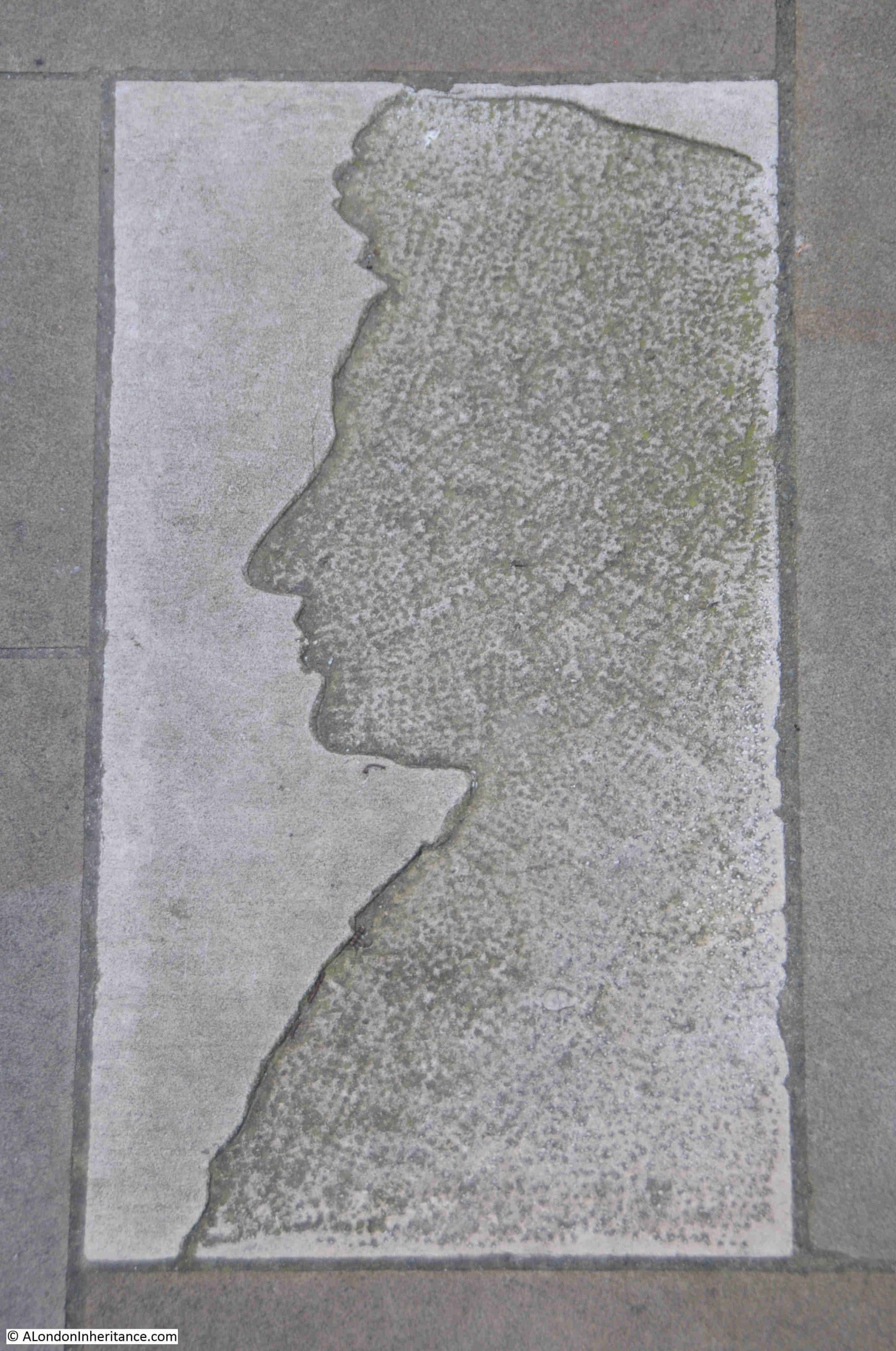
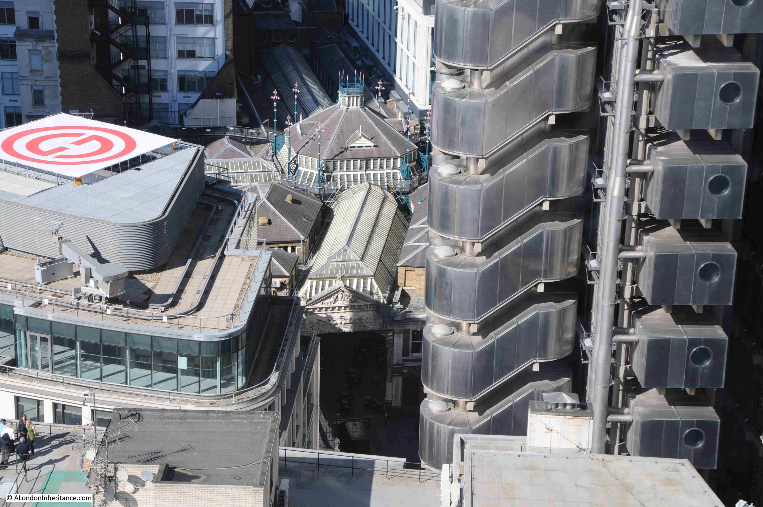
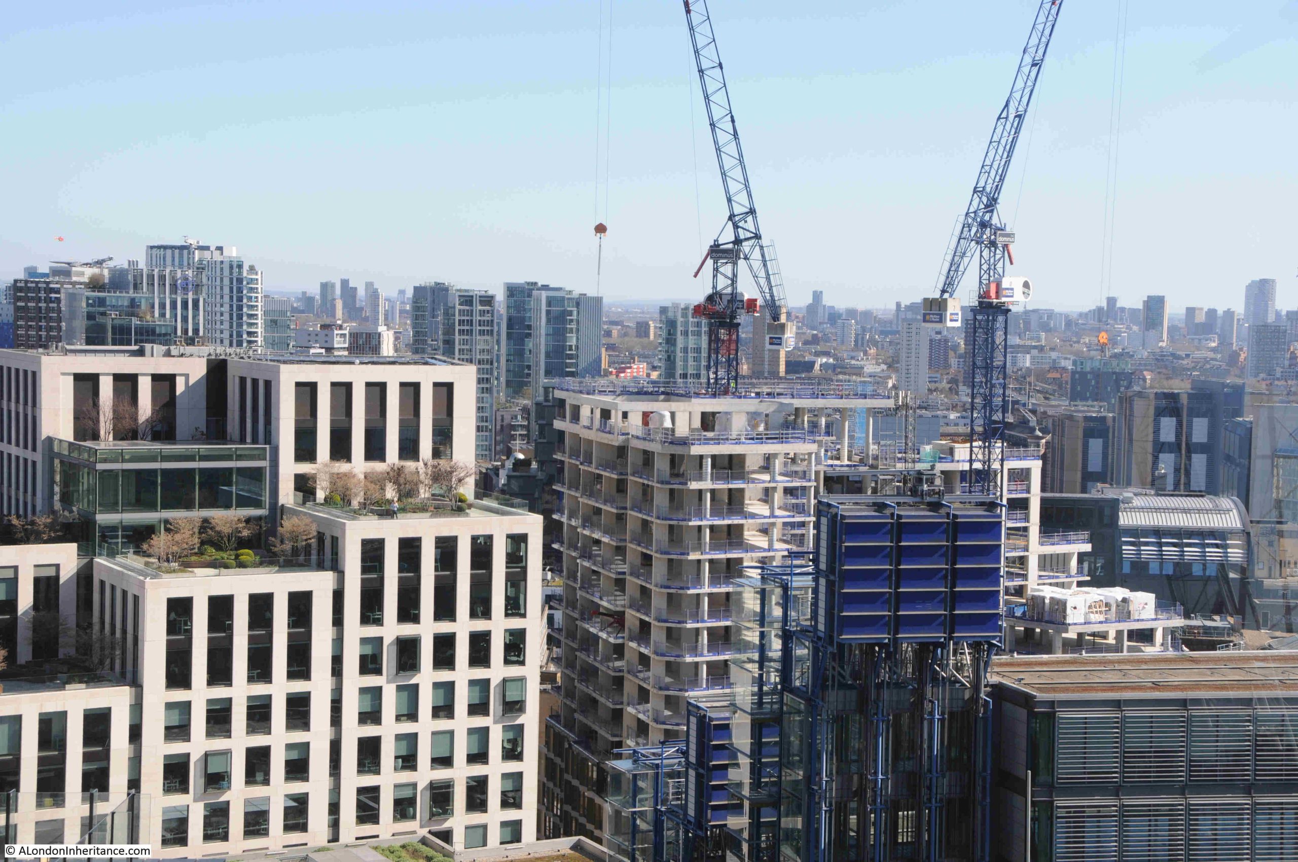
This week’s post is rather short as I had to finish it quickly ready for the site to be migrated to the new hosting provider. In the post, I first trace the location of one of my father’s 1980s photos, and then look at another of the resources available if you are interested in researching the history of London.
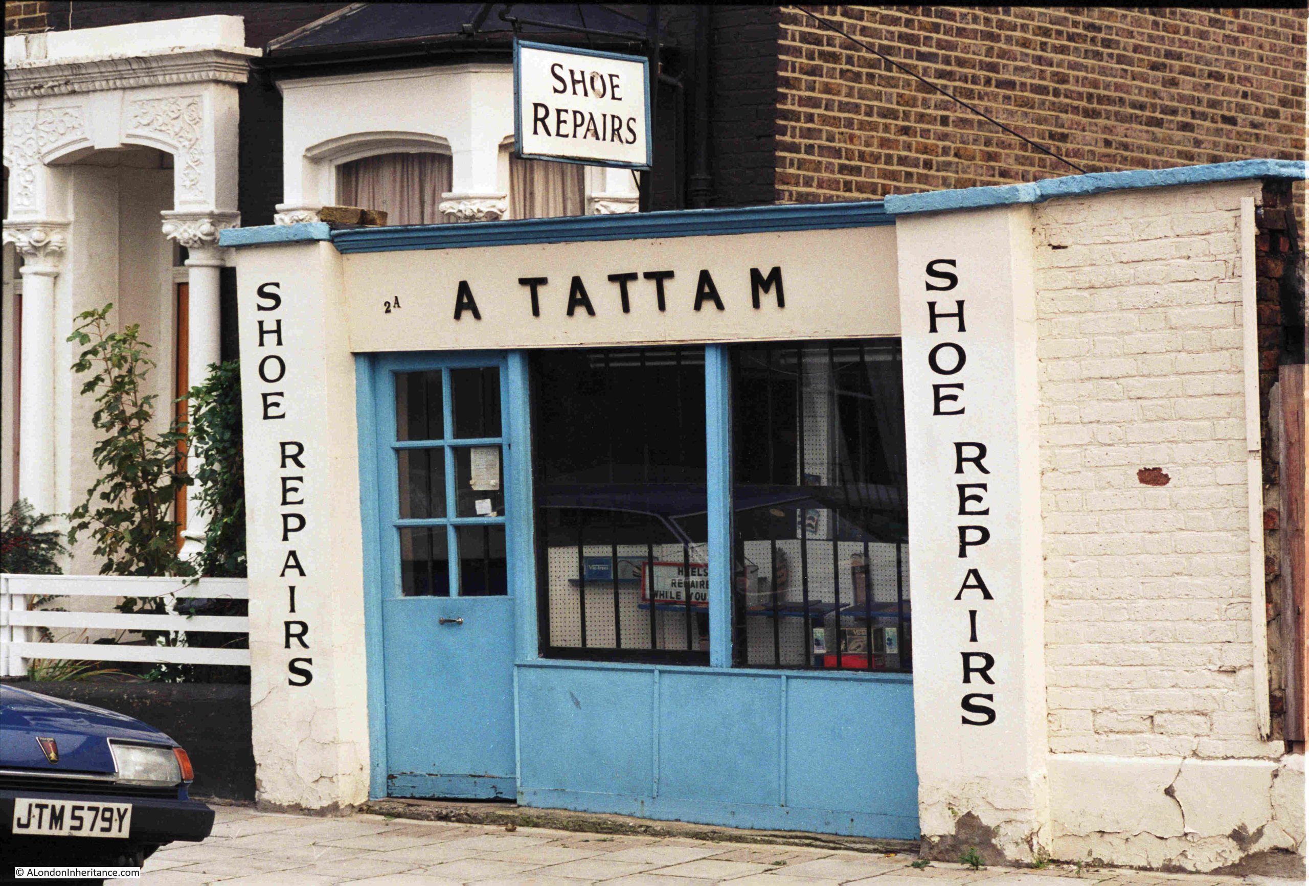
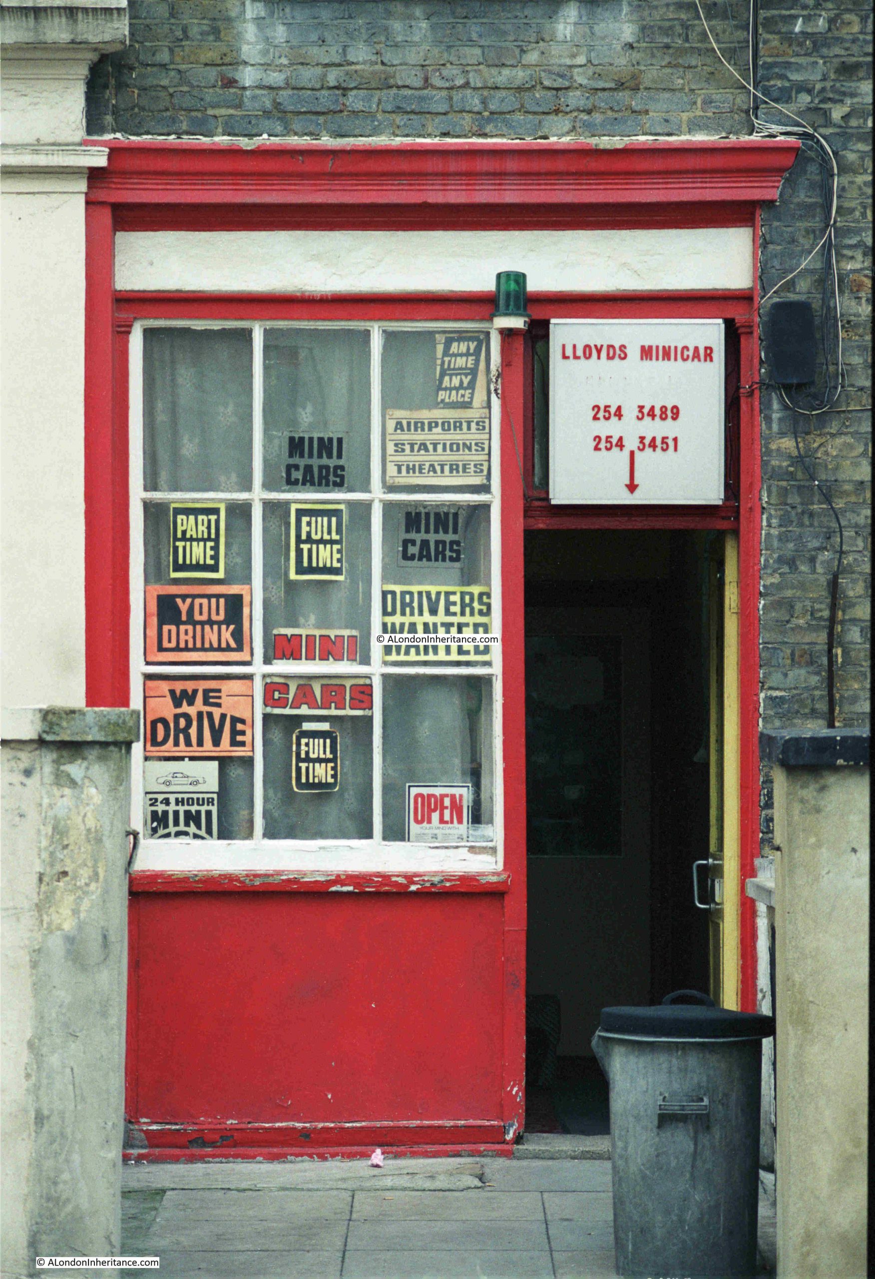
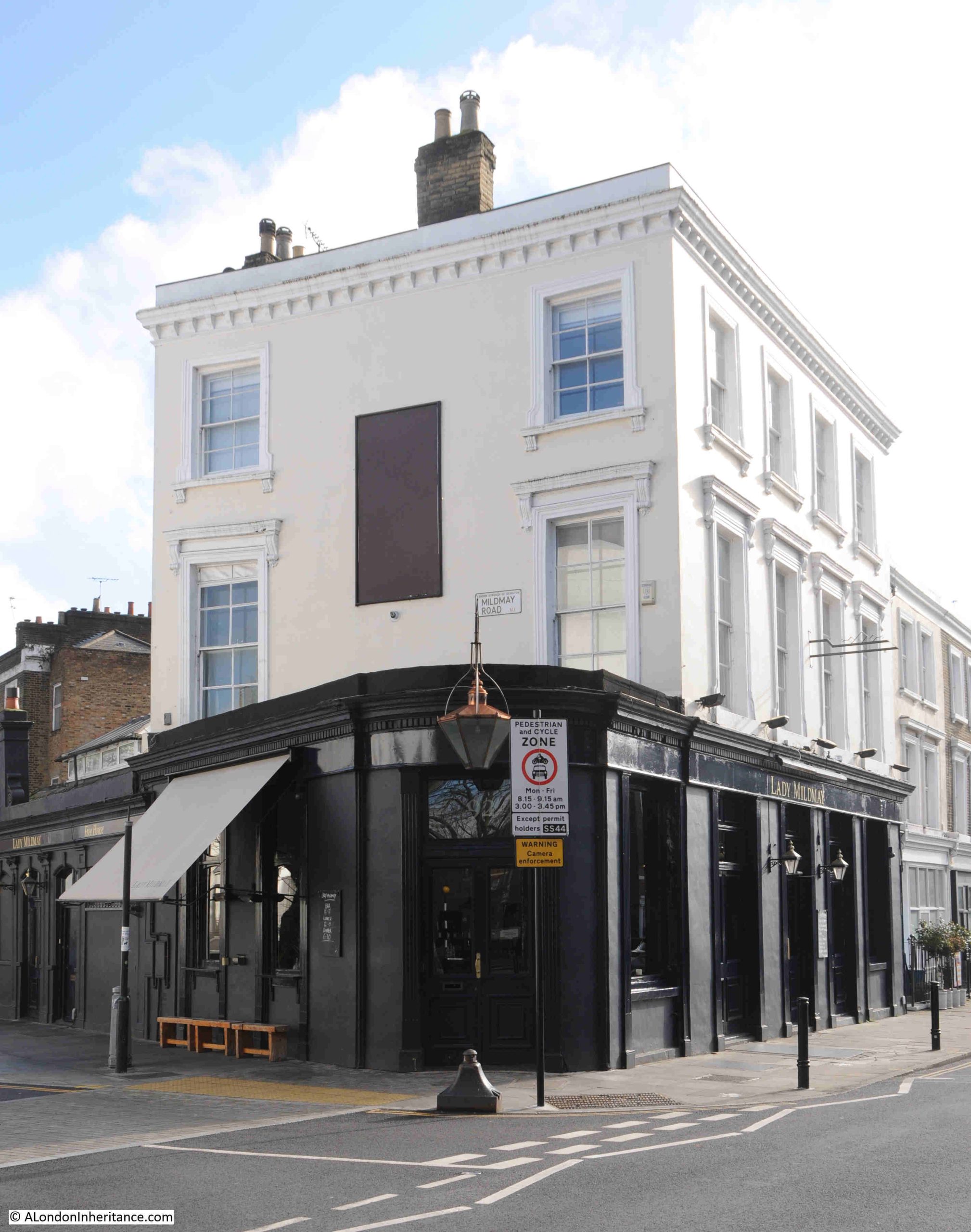
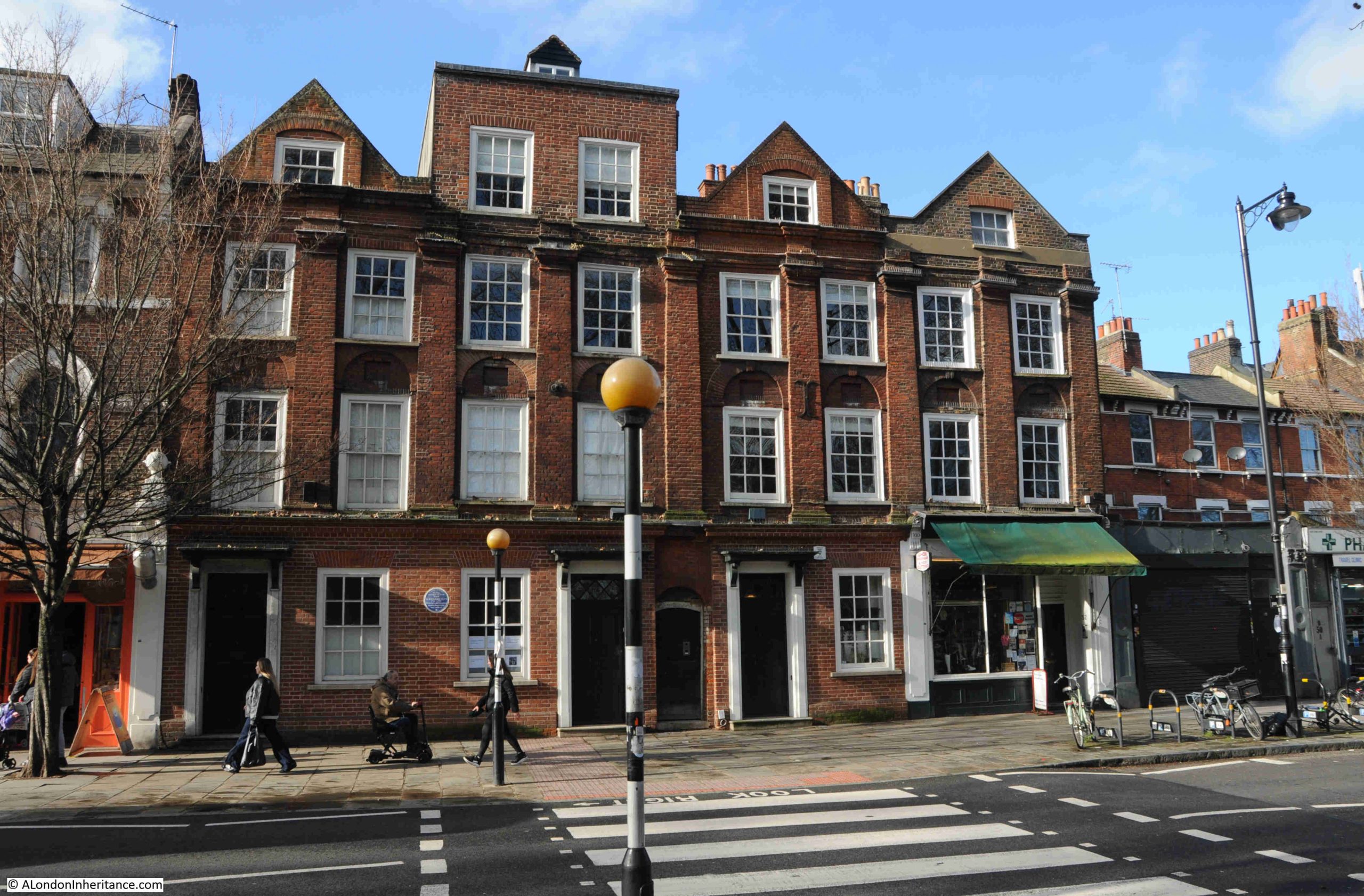
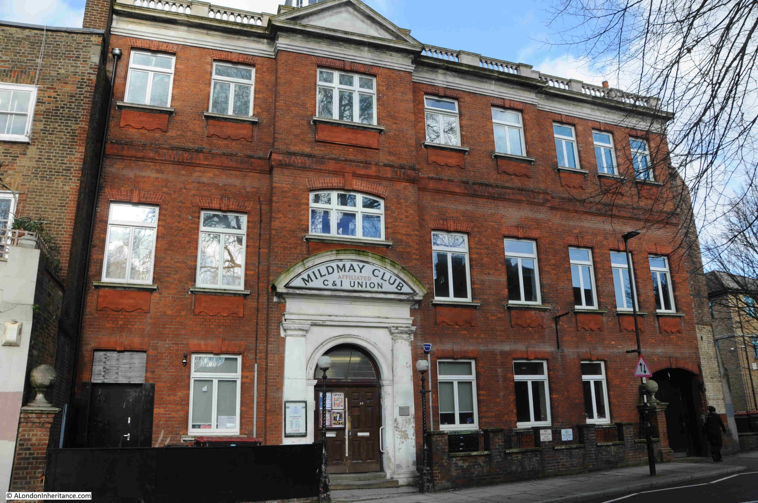
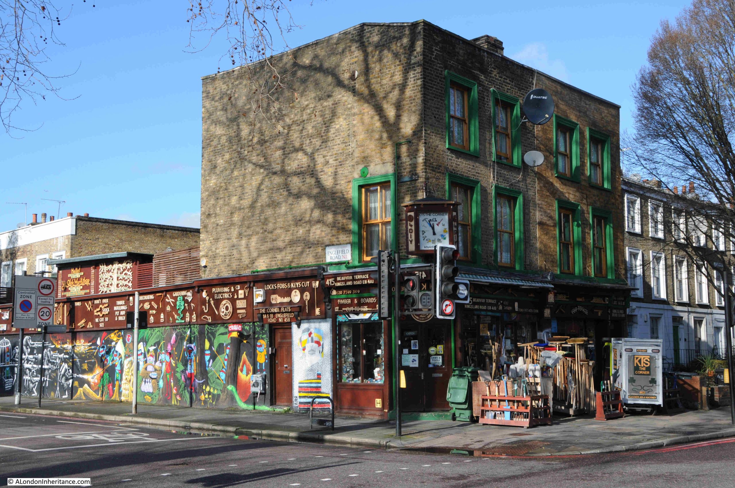
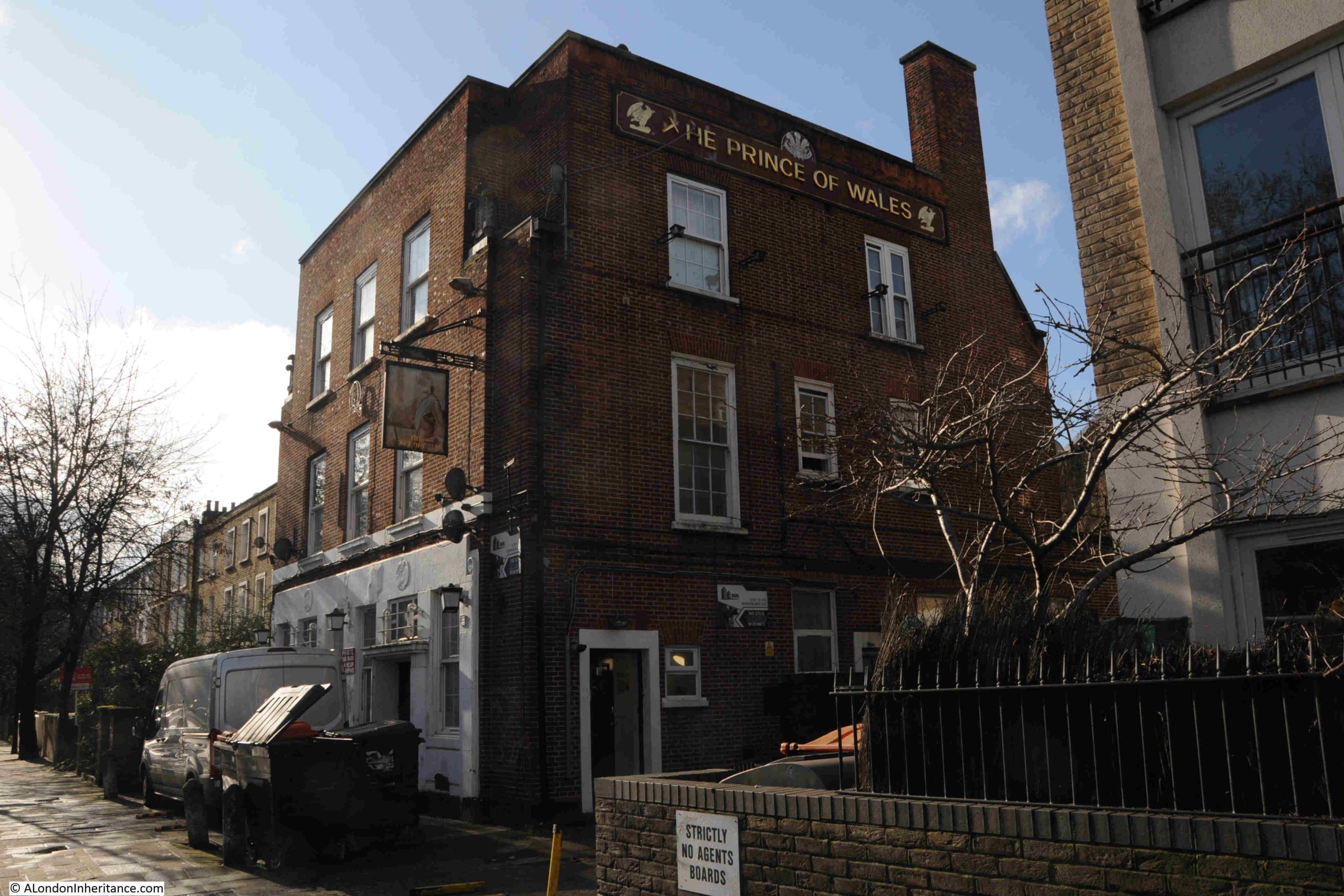
A. Tattam – Shoe Repairs
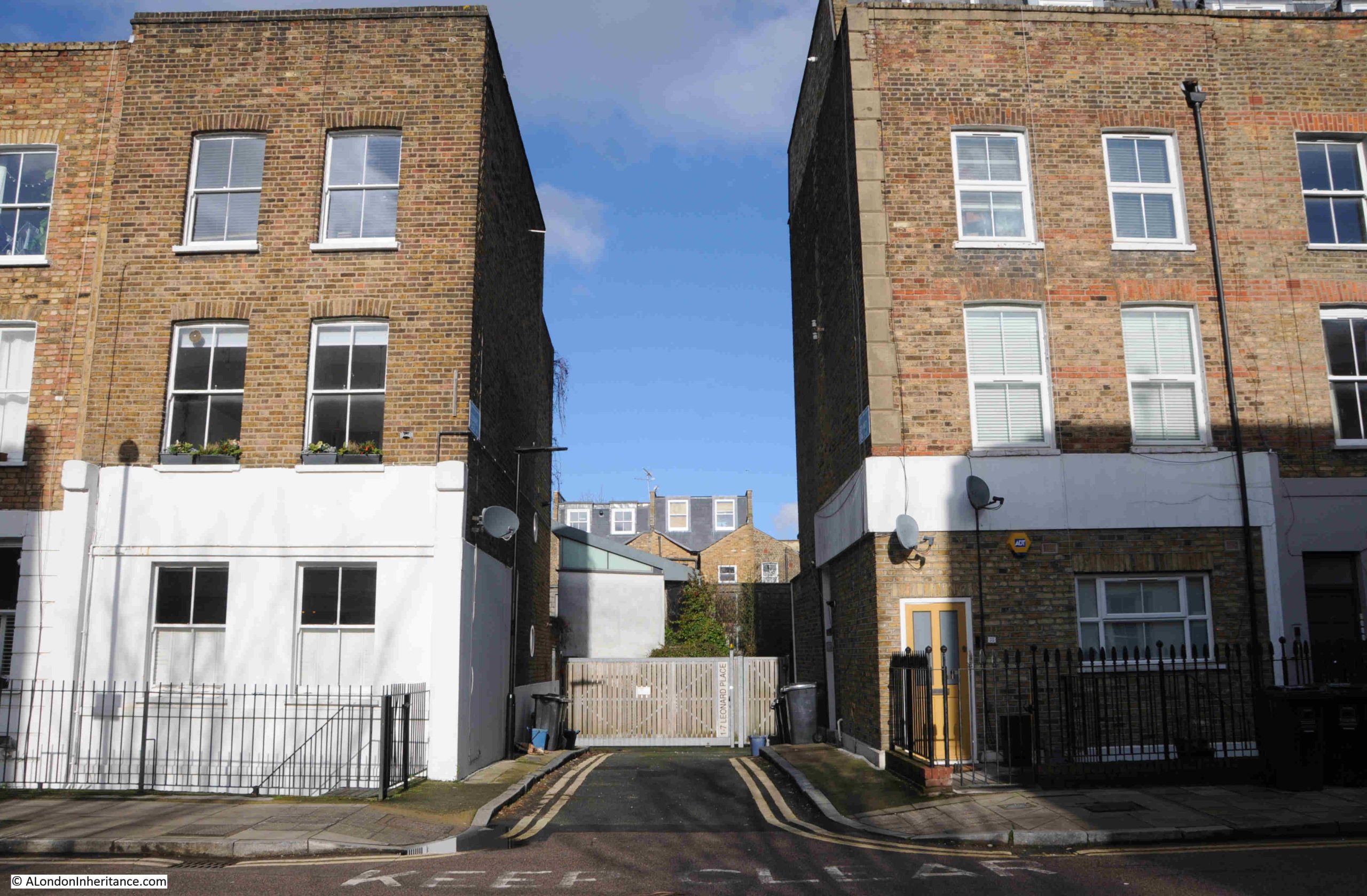
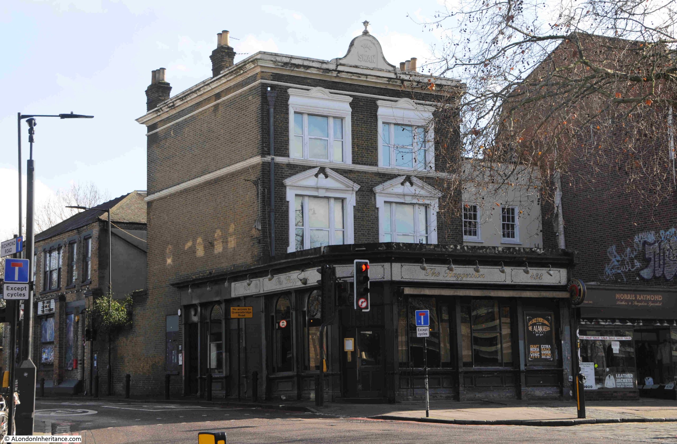
Whilst many remain, there were once far more small, independent businesses to be found across the streets of London, and in the mid 1980s you could have had your shoes repaired at A. Tattam in Brodia Road, Stoke Newington:
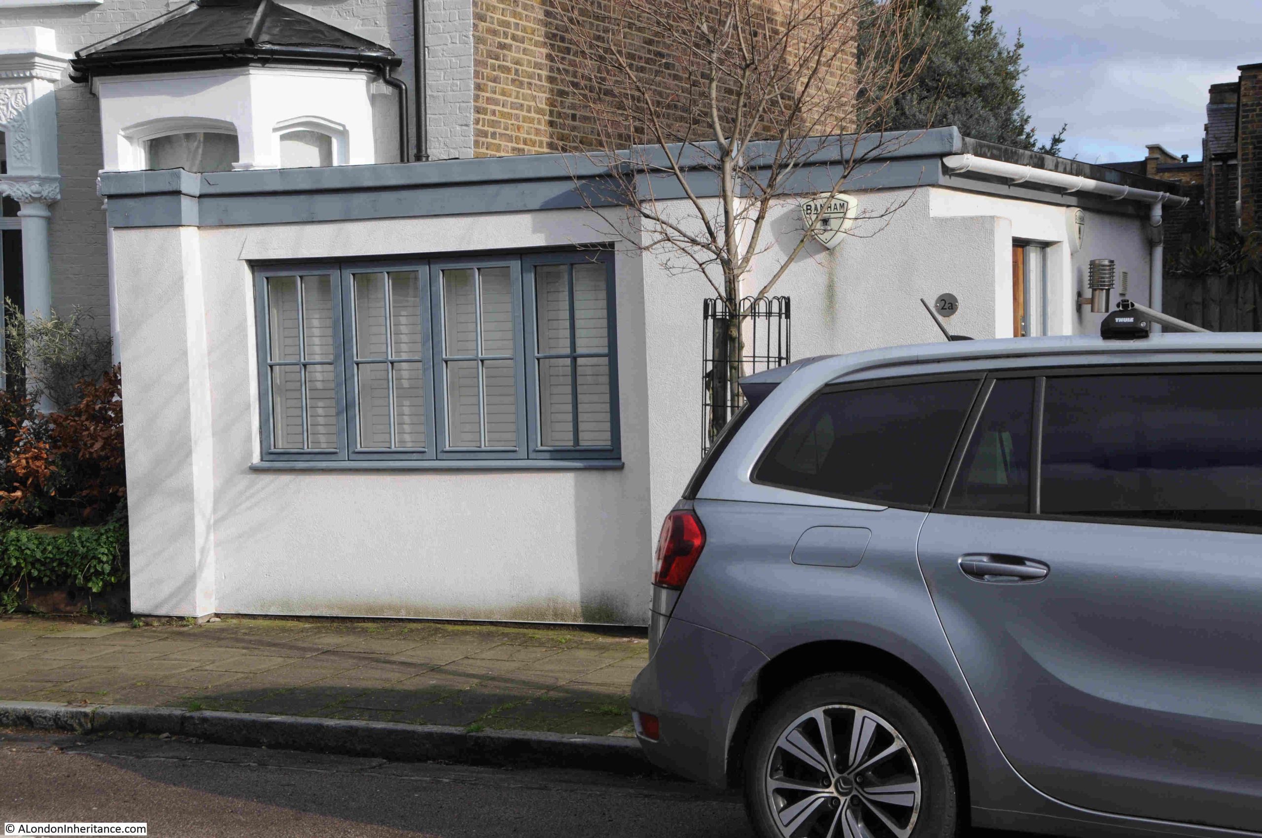
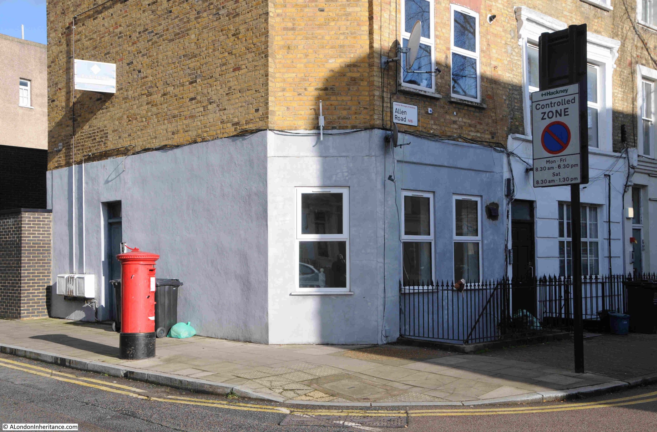
The same location, forty years later:
I was initially not sure when the business closed, but it had been operating out of this small building for many years.
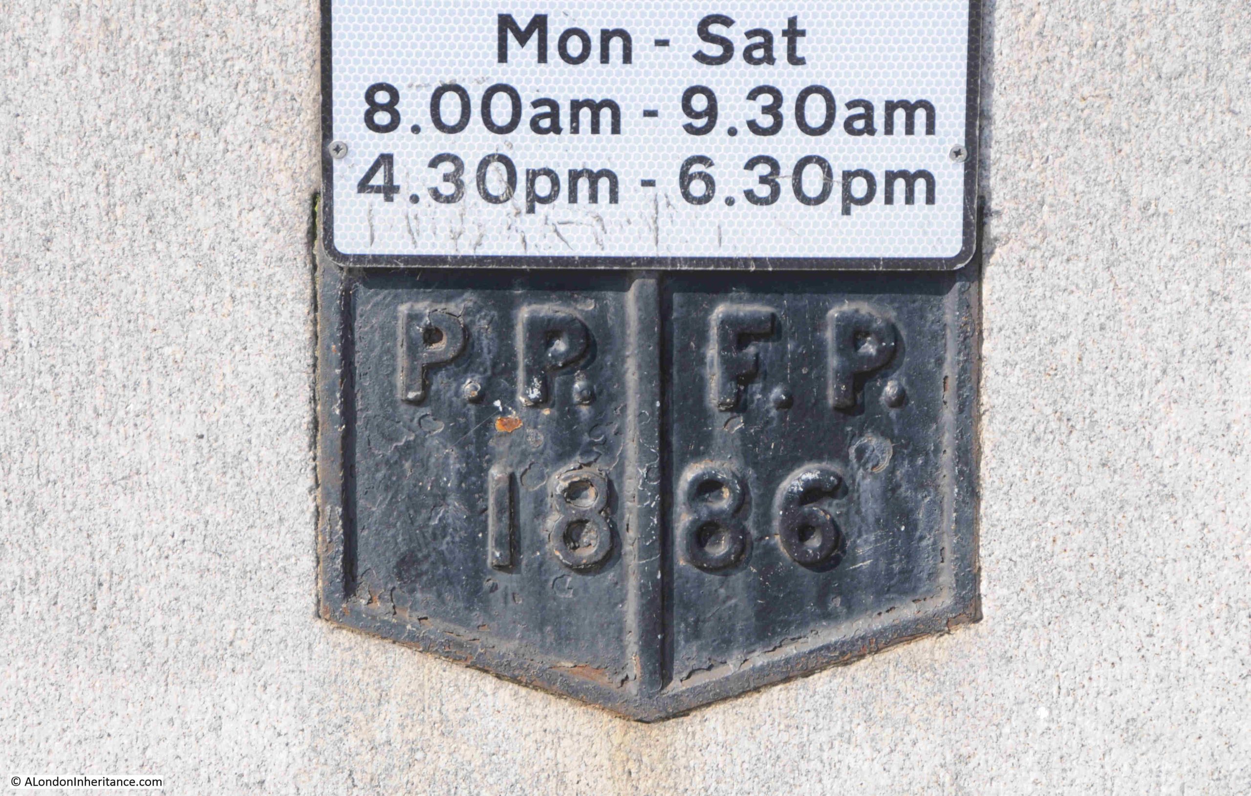
The Hackney Museum have an online image of a shoe mangle, made between 1900 and 1935. The object history states that it was “Mangle used for leather at Albert Morris Tattam Shoe Repairs which was based at 2A Brodia Road, Stoke Newington.”.
I have emailed Hackney Museum to find out whether the first four digits of the object number – 1991, is the year when the object became part of the museum’s collection. If so, then this would confirm roughly when the business closed.
There is also an early 20th century sewing machine from A. Tattam, with object number 1991.1005, which can be viewed here.
Apart from these two objects, I can find no other references to the business.
A. Tattam was Albert Morris Tattam, and there is a reference to a marriage of an Albert Tattam of Hackney in 1936.
There is also a record of the death of an Albert Morris Tattam in Gravesend in 1990.
In the 1939 register, there is a record of an Albert Morris Tattam living at 59 Windus Road, Stamford Hill, Hackney. His profession is given as Boot Repairer Master, and he is living with his wife Rose.
The 1939 register gives a date of birth of 3rd of January 1914, which is the same date as in the record of death, and in the record of marriage, Rose is listed, so this is the same person.
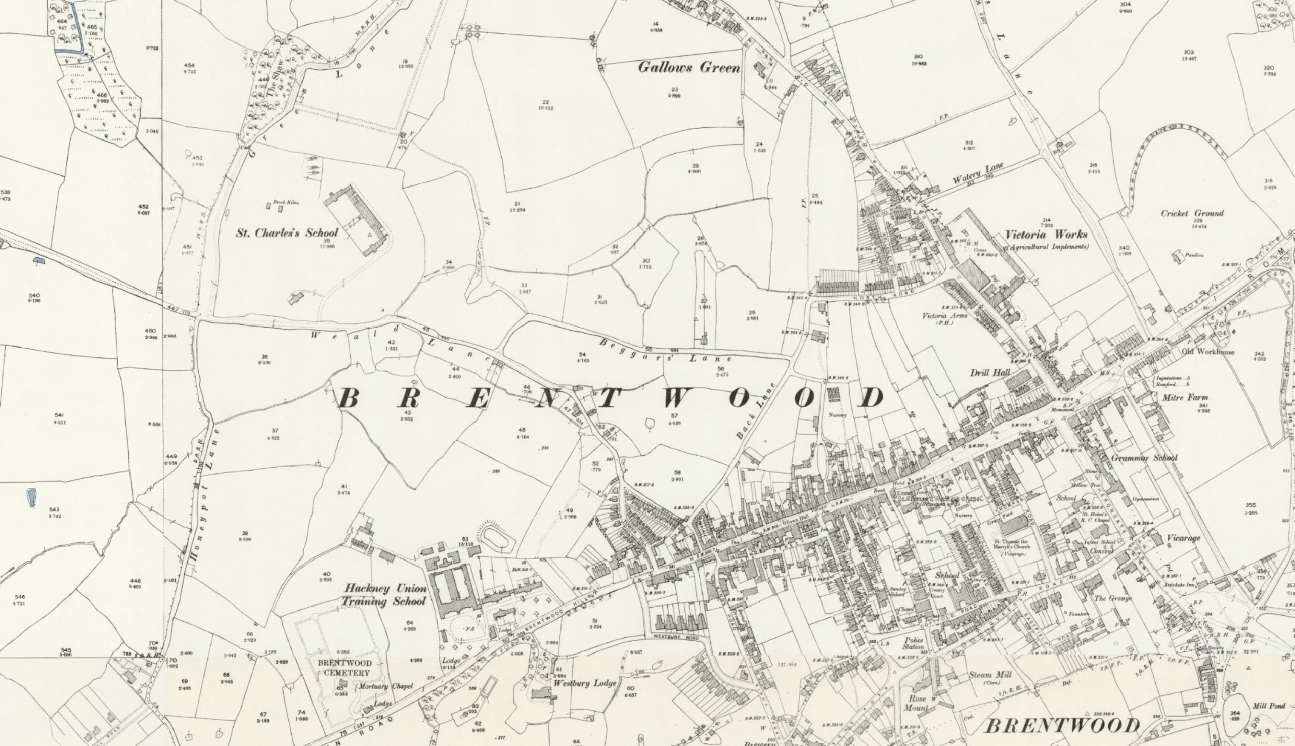
In the 1921 census there is an Albert Tattam, aged 7 years and 6 months living at St Charles House, Brentwood, Little Warley, Essex. This would be the age of Albert who was born in 1914. He was living there with his older brother George Tattam who was aged 10.
Against both boys is the note of “Father Dead”, and they are classed as an “Inmate”. I suspect that given the year, their father must have died in the First World War, and they are living in a children’s home.
St Charles House was also known as St Charles School and was an orphanage for Roman Catholic boys, established around the year 1884.
The following extract from the OS map shows the town of Brentwood early in the 20th century. St. Charles School can be seen in the fields to upper left:
So, he was born in 1914 in Hackney. By the time he was aged 7, he was living with his brother George in a children’s home in Brentwood. His father may have died during the First World War. I can find no record of his mother. He married Rose Whiteland in 1936, and in 1939, he is living at 59 Windus Road and listed as a Boot Repairer Master. The house at this address is a short 15 minute walk from his shoe repair business in Brodia Road.
He was still working in his Brodia Road business in 1985, as there is an entry for him Kelly’s Post Office Business Directory, where he is listed as a Shoe Repairer.
He died in Gravesend in 1990. Whether he retired to the town, or whether he was visiting, there is no record. The probate record has a residence of Stamford Hill listed, so I suspect he was visiting, and still lived at Windus Road.
He would have been of the age to have served in the Second World War, but I cannot find any records of military service, which is more to do with information freely available online rather than the lack of any service.
Just as I was completing this post, I received an email back from Hackney Museum with the following:
“1991 is when the item was added to our collection. I’ve had a quick look at our paperwork and we actually received the shoe mangle and sewing machine in late July 1990. Albert Morris Tattam (1914-1990) and his wife Rose Elisabeth both died in 1990, Rose on 28 March and Albert on 12 June, so we received the items about 6 weeks later. As they married in 1936, I can’t quickly and easily find any records of them having children so I cannot say for certain if the Tattam who donated the items to us was a child or a relation.
However for your purposes, 12 June would be the final day of Albert trading. As the items were donated to Hackney Museum so quickly afterwards, I can only assume that there wasn’t somebody to take over the business.”
I wonder how many pairs of shoes he repaired for Hackney residents during his working life, and how many times he walked between his home in Windus Road and workplace at Brodia Road:
The small premises of A. Tattam today appears to be a single residence as it has a house number and an entrance.
It is fascinating to be able to trace a small part of the story of those who have lived and worked in London, and put some context to photos of a very different city.
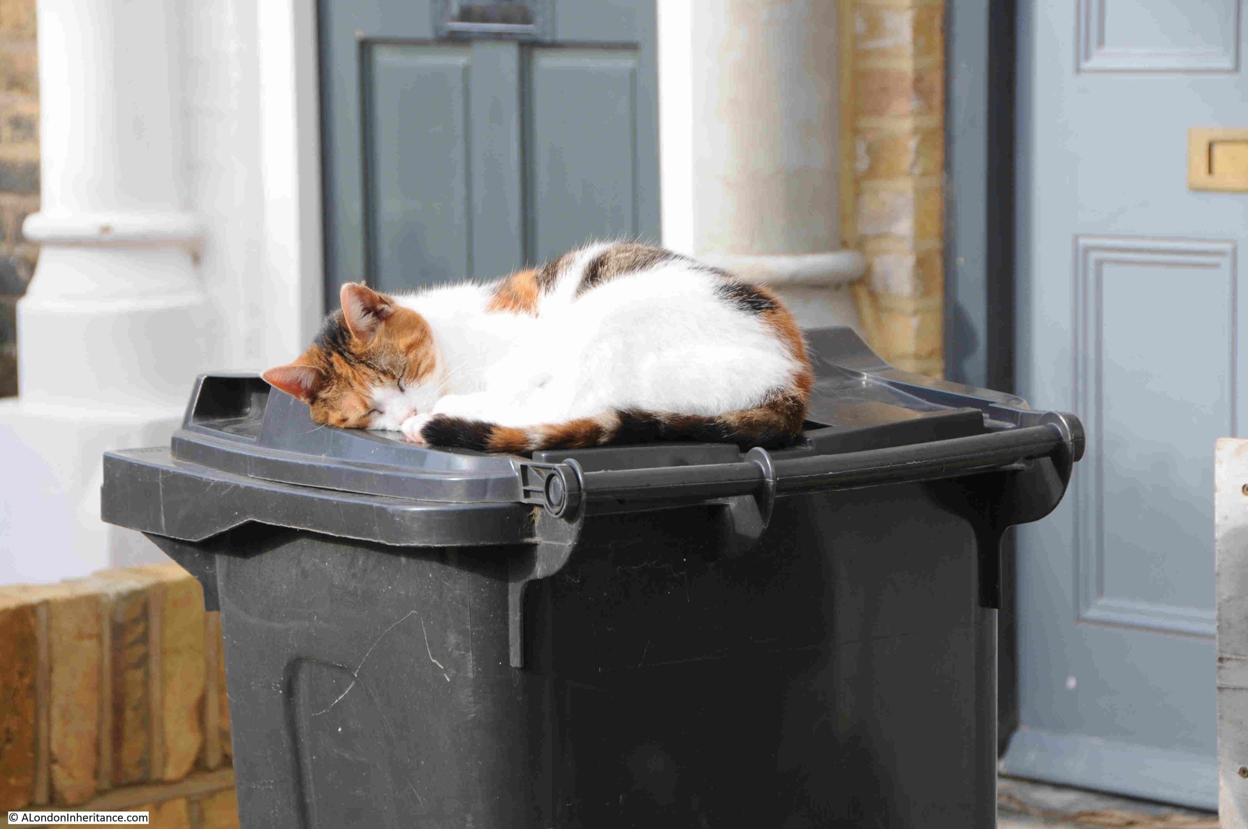
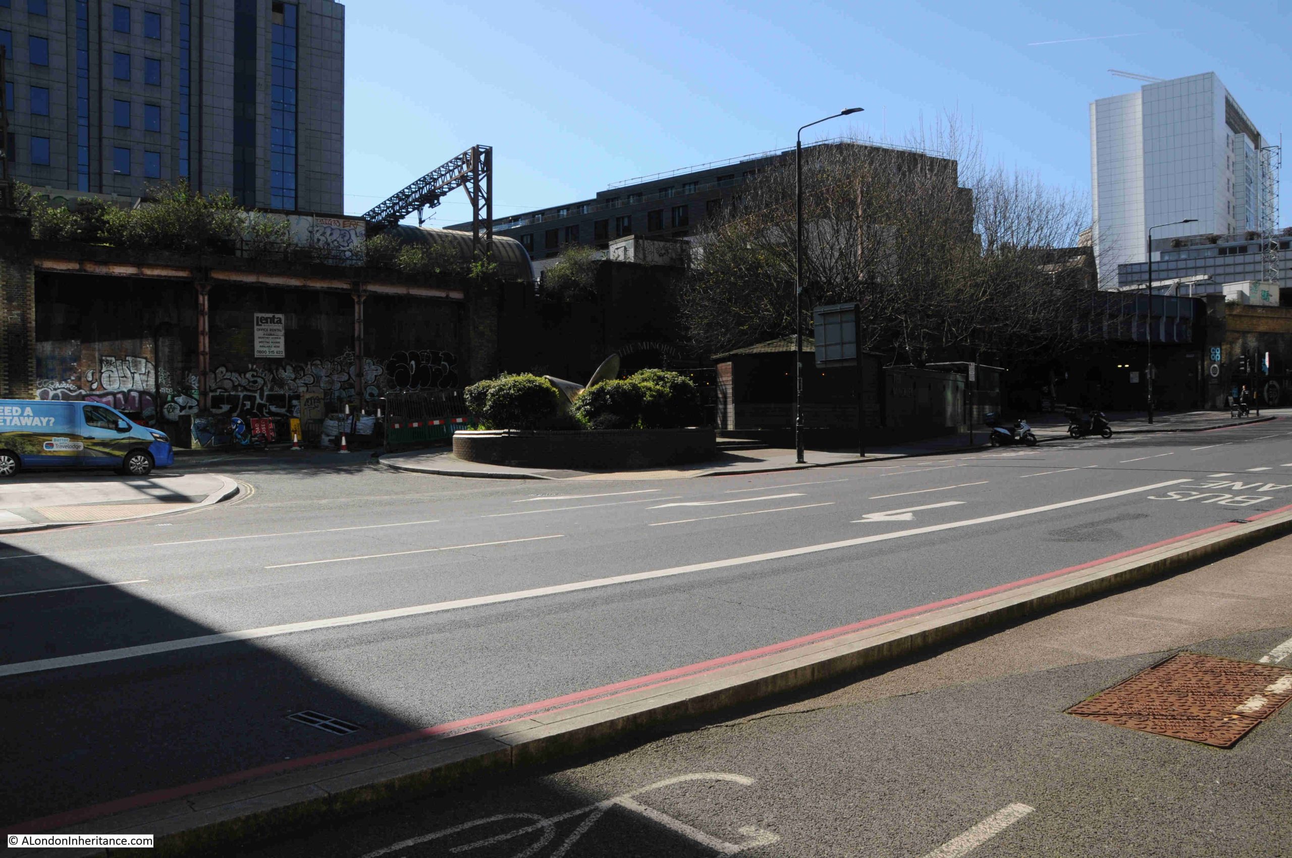
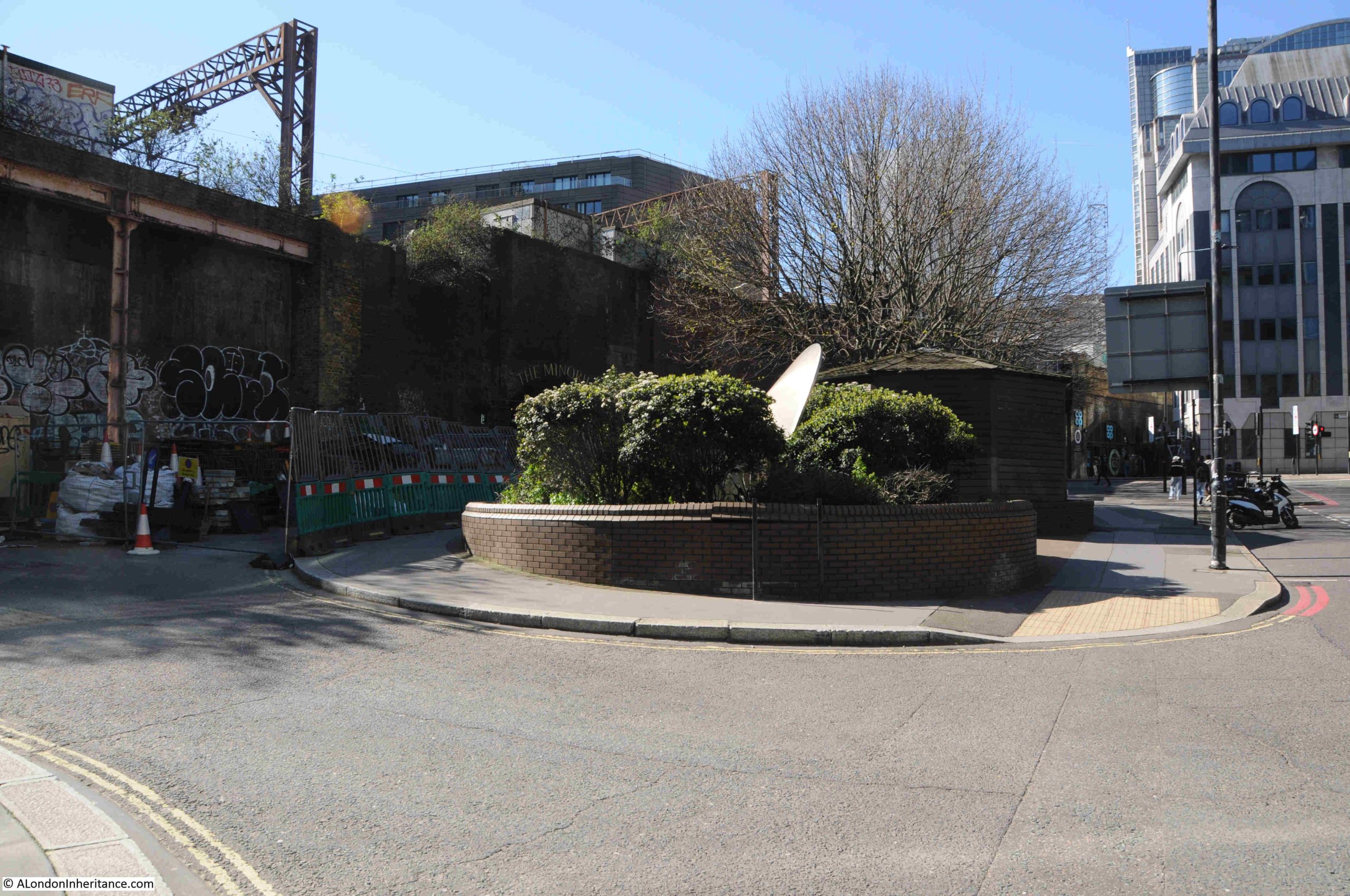
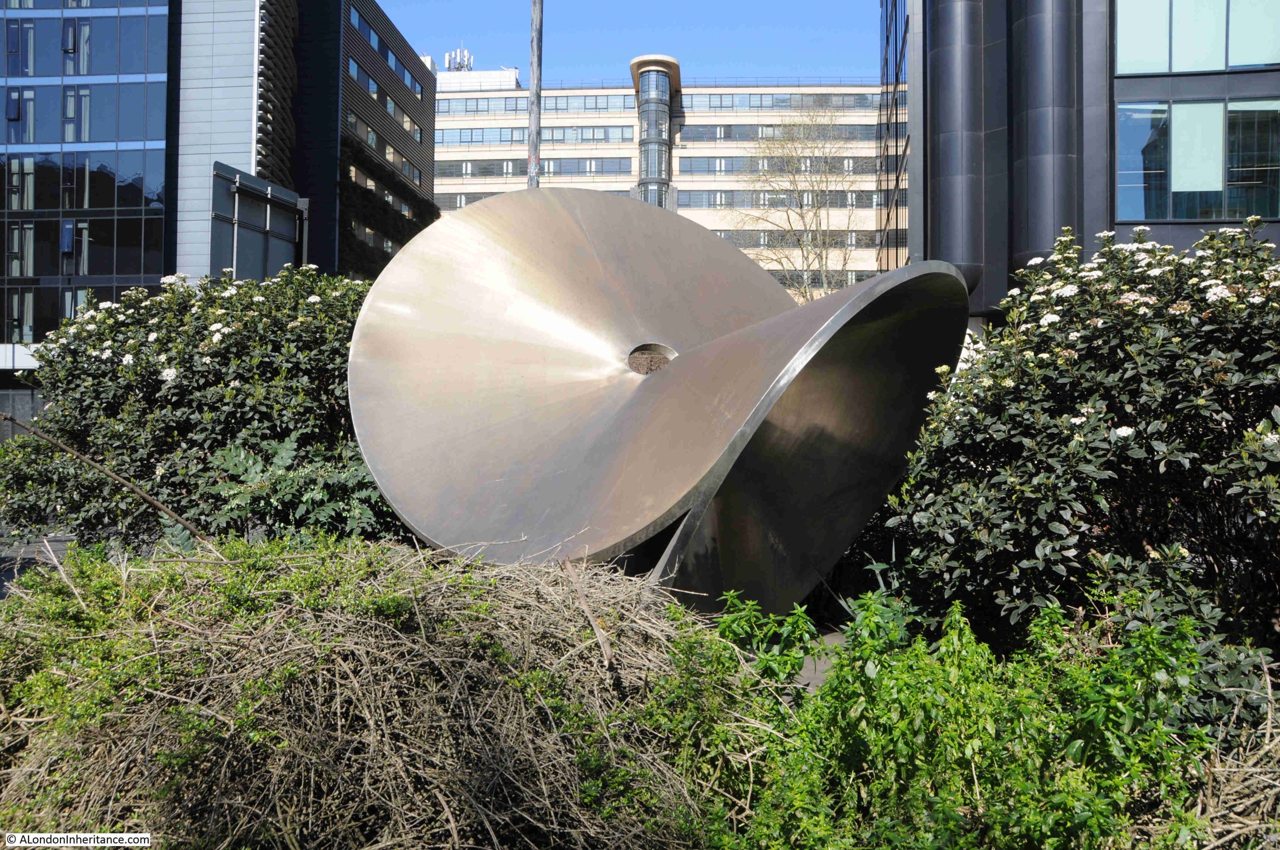
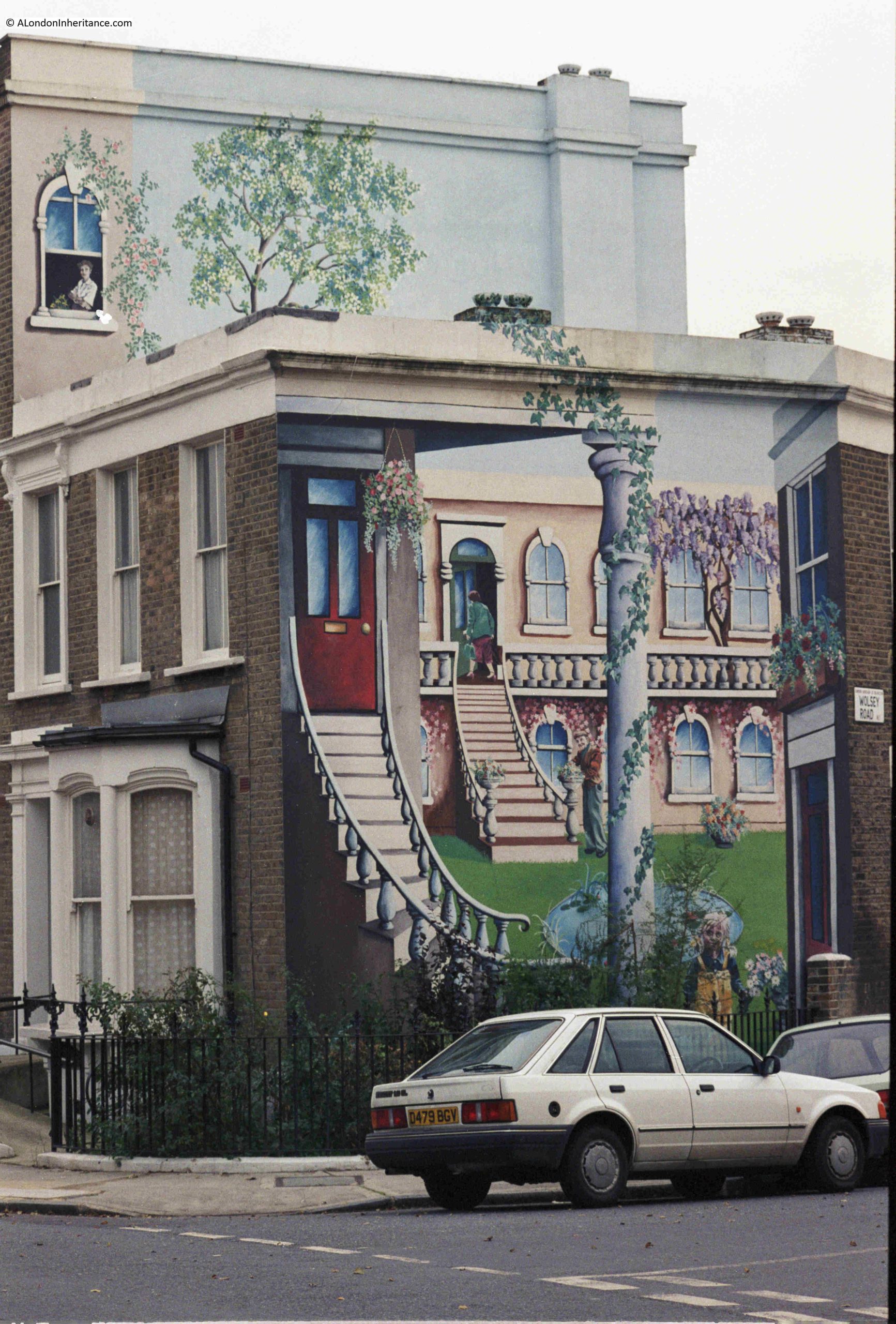
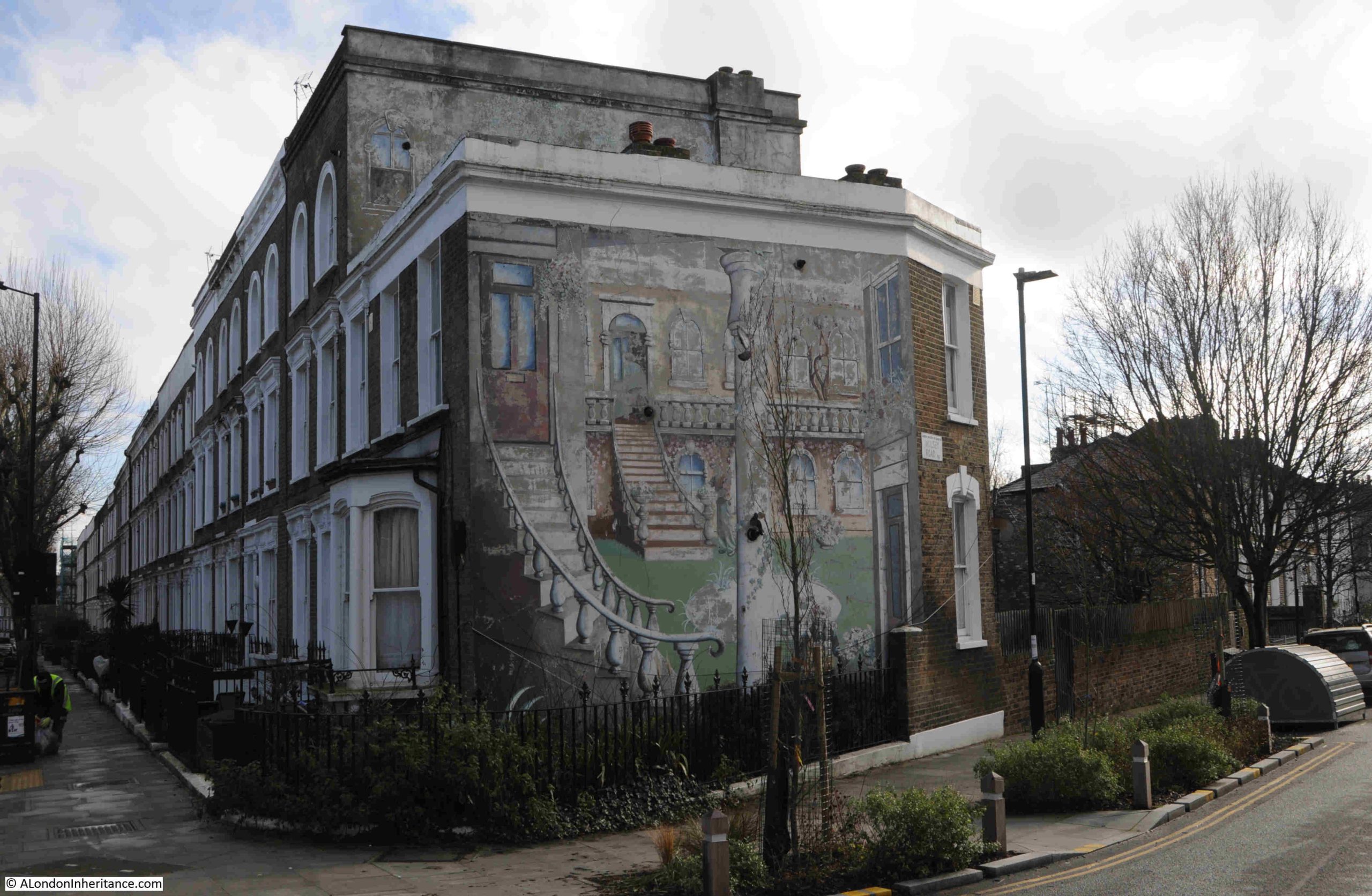
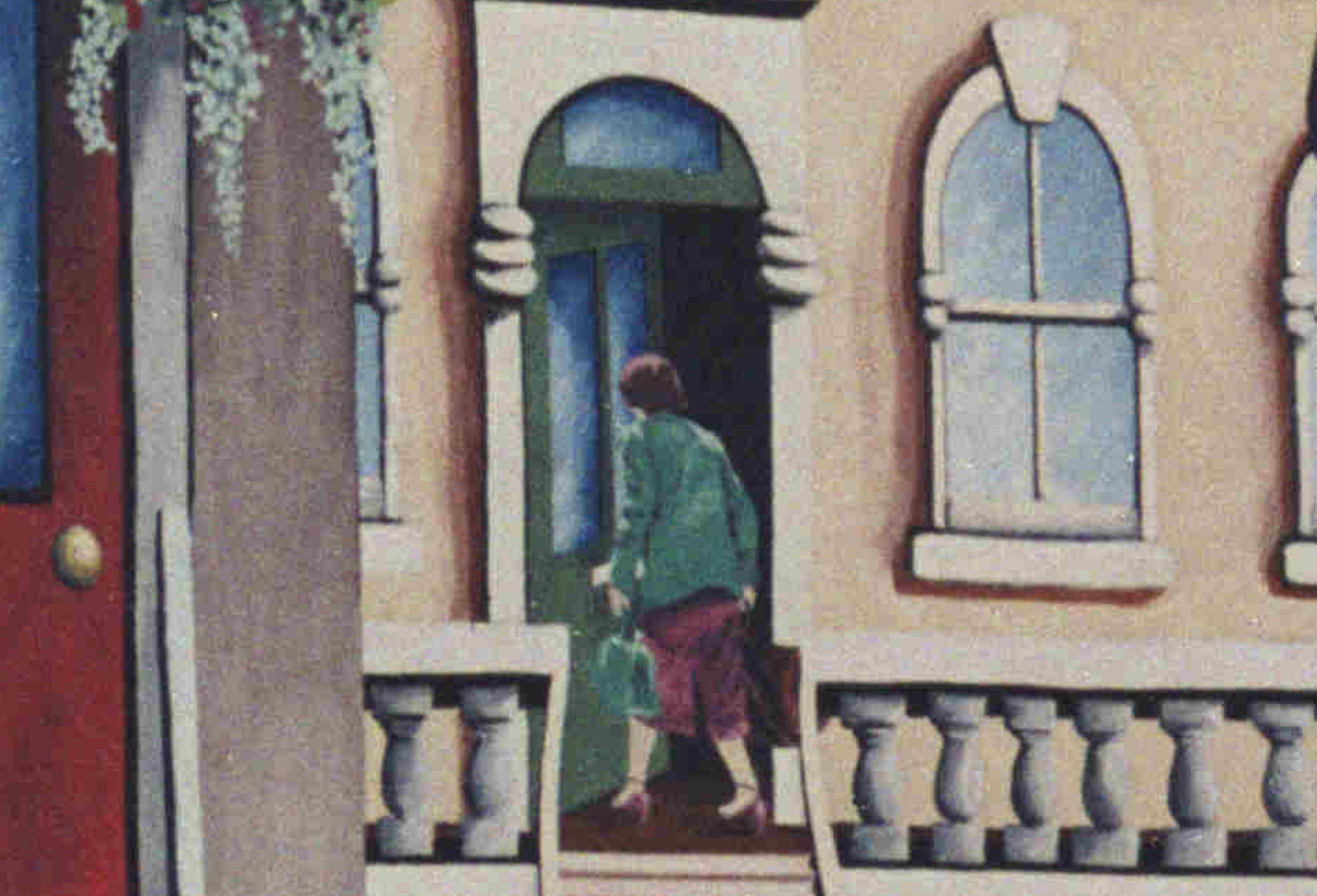
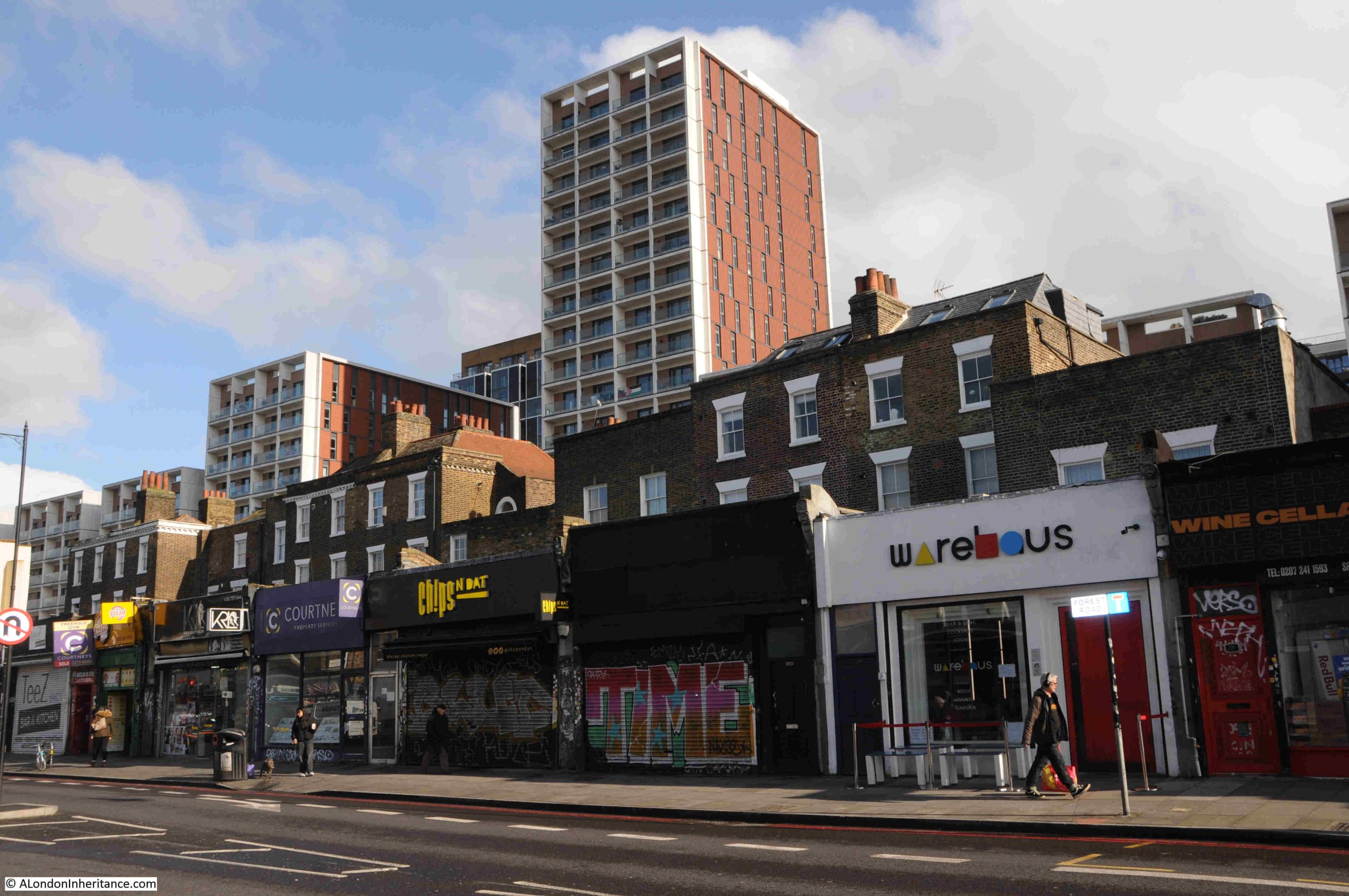
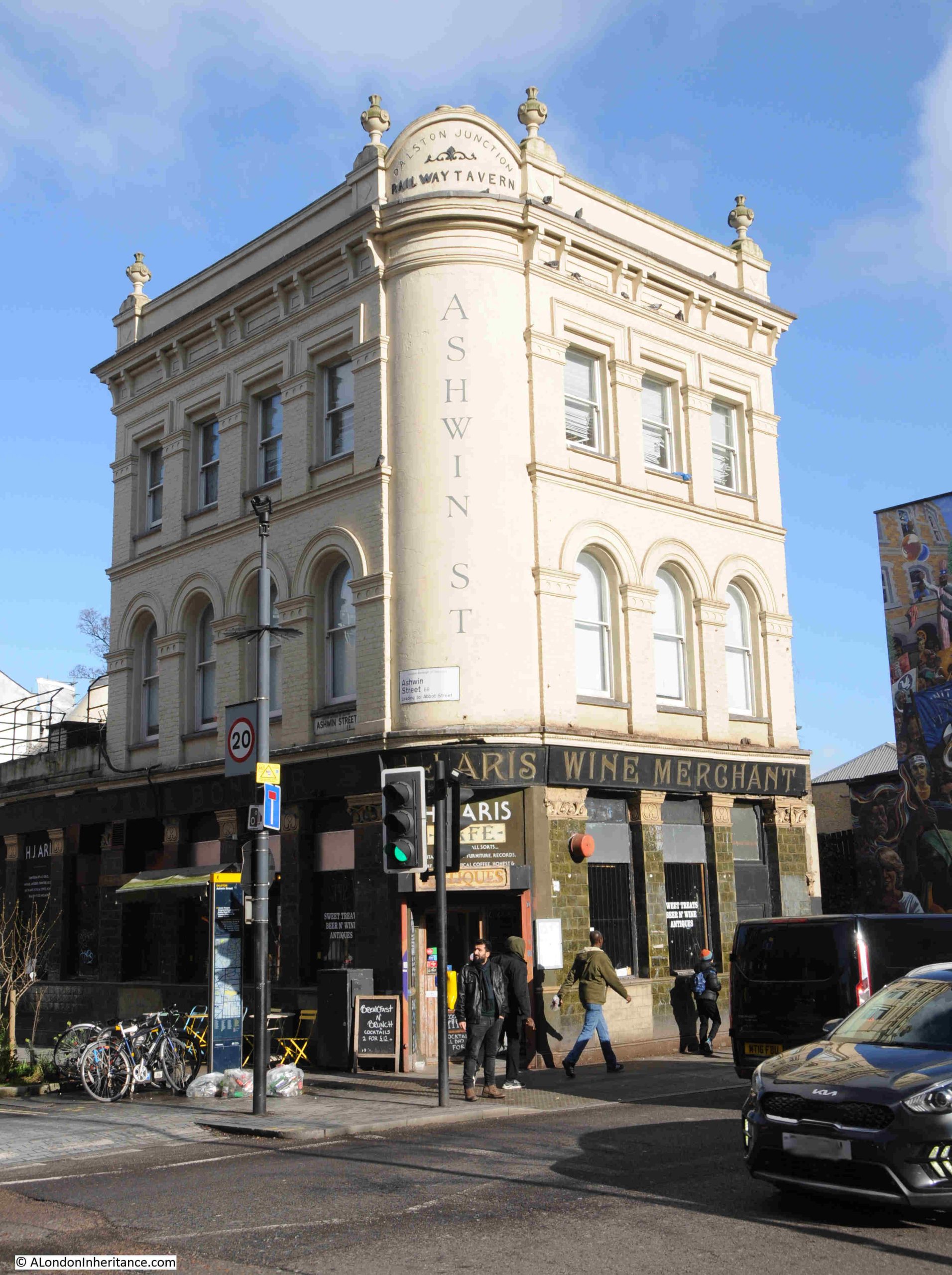
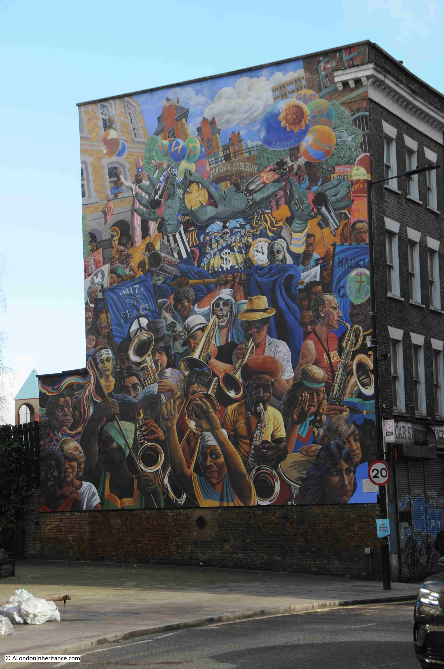
There is much to discover in the local area, but this has to be a short post, so a short distance away from Tattam’s business, I found a cat enjoying the warmth of an early spring day:
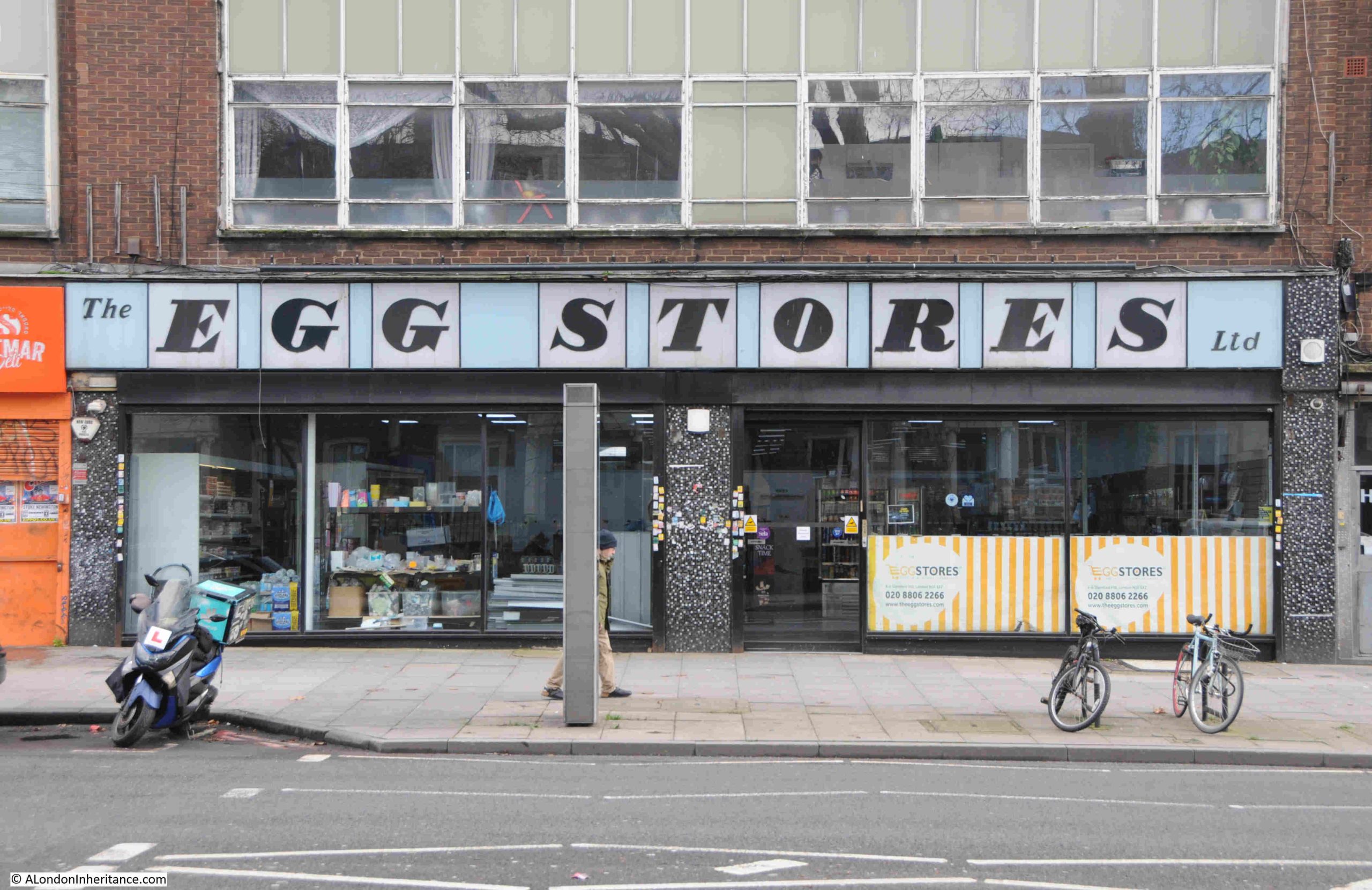
And whilst walking along Stamford Hill towards Stoke Newington Station, I found a shop with a wonderful typeface used for the shop’s name:
In the 75th anniversary year of the Festival of Britain, the typeface does remind me of the type of lettering, use of colour, and layout used during the festival, and the Egg Stores does appear to date from 1951 (although I have also read that it dates from 1948), so perhaps the festival was the inspiration.
The Egg Stores was an egg dealing business, selling white shelled eggs to the Jewish community.
The shop is now a Kosher Supermarket, and the shop sign is an example of what can be done when some design effort is put into a such a common feature of a busy street.
In the Spring issue of their publication, they included a review of my blog. This was not expected, and for clarity, as it is important to me, anything I feature on the blog is because it is of interest to me. I do not feature anything for financial gain, an offer to publicise the blog etc. Having said that, it was really good to receive a review in such a publication.
In the same post I featured the Archaeology Data Service, and the review in London Archaeologist mentioned:
“As well as London Archaeologist, the blogger recommended delving into the ADS for more information on particular sites, However, it’s a shame that there was no mention of the Layers of London website where articles can perhaps be found more easily if one is curious about certain areas.”
I have long found Layers of London really useful, so to correct my omission from my Resources series, this is the Layers of London website, found at the following link: https://www.layersoflondon.org/
Layers of London has been developed by the Institute of Historical Research, and uses a comprehensive collection of maps as the basis on which an equally comprehensive collection of information has been added.
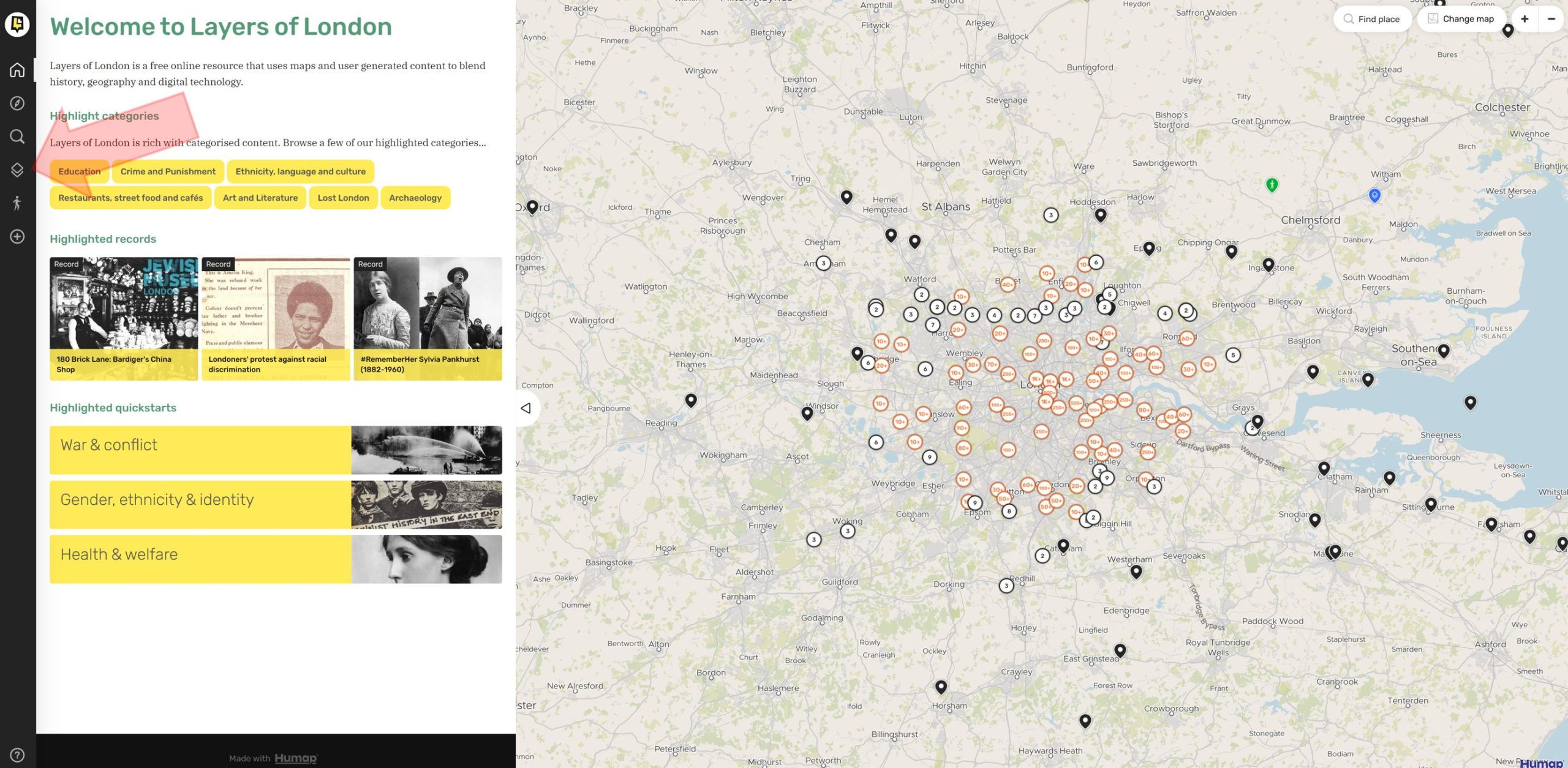
The above image is of the home page, and at top right you will see “Explore the map” which is perhaps the quickest way to start looking at what is available. This will bring up the following page, which has the base map shown, overlaid with circles containing numbers. You can zoom into the map for greater detail, and the numbers in the circle refer to the number of records available for that locality.
Just exploring these records reveals the wealth of information available.
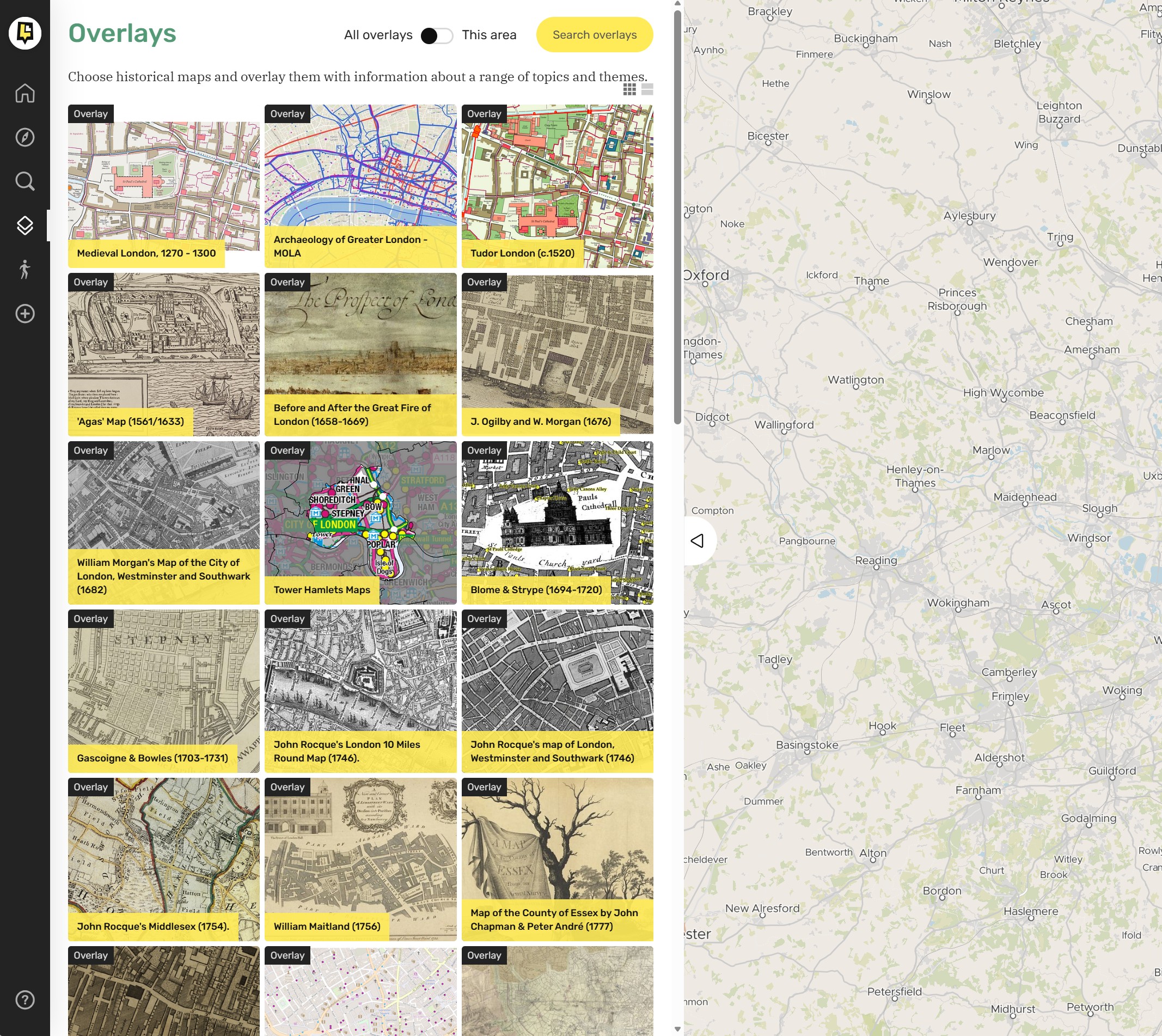
In the above image, I have added a red arrow on the left pointing to an icon in the tool bar to the left of the screen. Clicking on this icon brings up the Overlays page:
Where a long list of the maps available are listed, including, for example, the Agas map, Inland Revenue Valuation Surveys, Bomb Damage maps, Geology and US Spy Satellite images from 1973, as well as maps such as J. Ogilby and W. Morgan map of 1676, Horwood’s map of 1799, and Greenwood’s map of 1828.
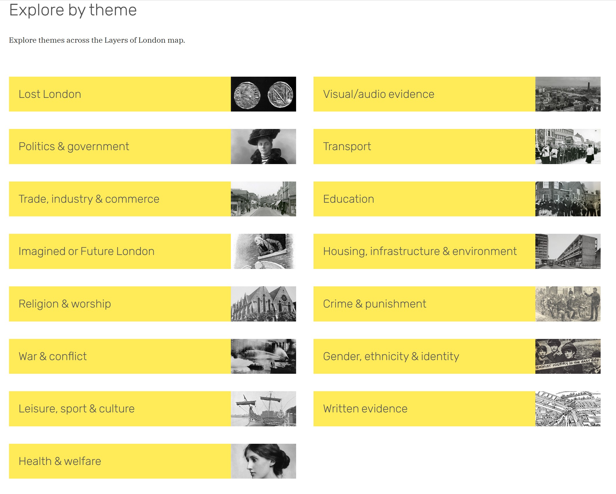
It is also possible to explore by theme, as shown in the following window:
It is also possible to make your own contributions to the resources on the site. This page has more information, including a link to a helpful User Guide as well as some YouTube videos: https://www.layersoflondon.org/get-involved
There is a wealth of information on the Layers of London website, and it is very easy to spend quite a few hours exploring the history of the city, and if you have not found the site before, I hope you will find it to be a fascinating resource.
Hopefully, by the time you read this, or by next Sunday’s post, the blog will be on a new, far more stable home.
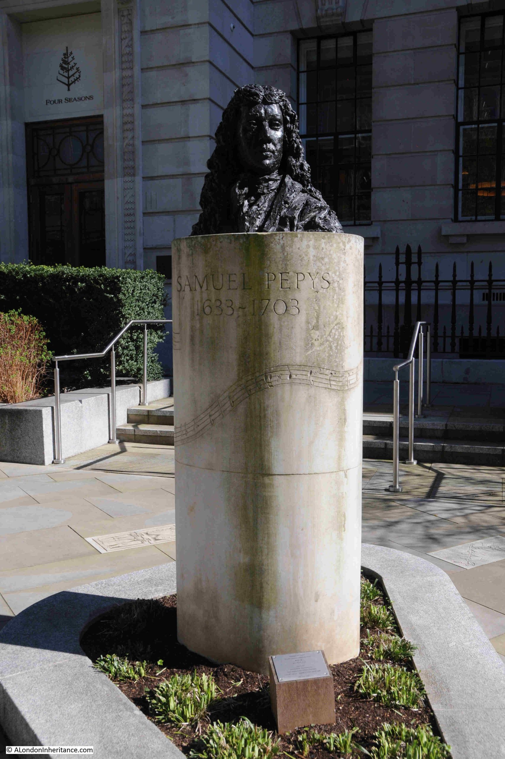
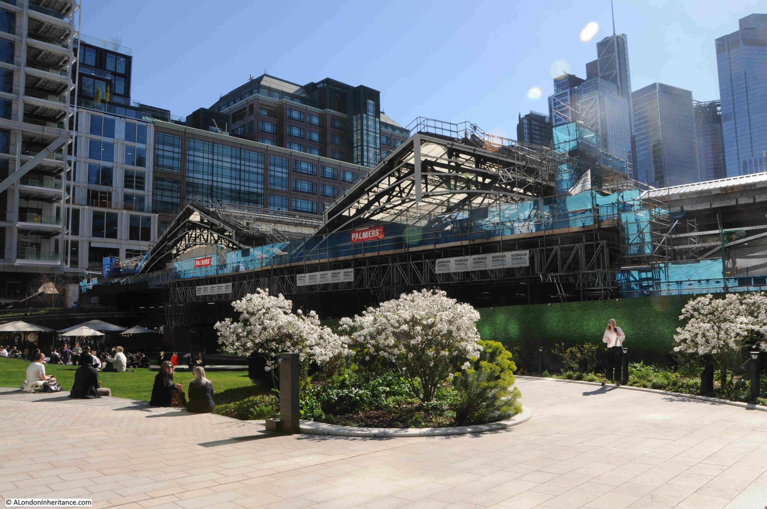
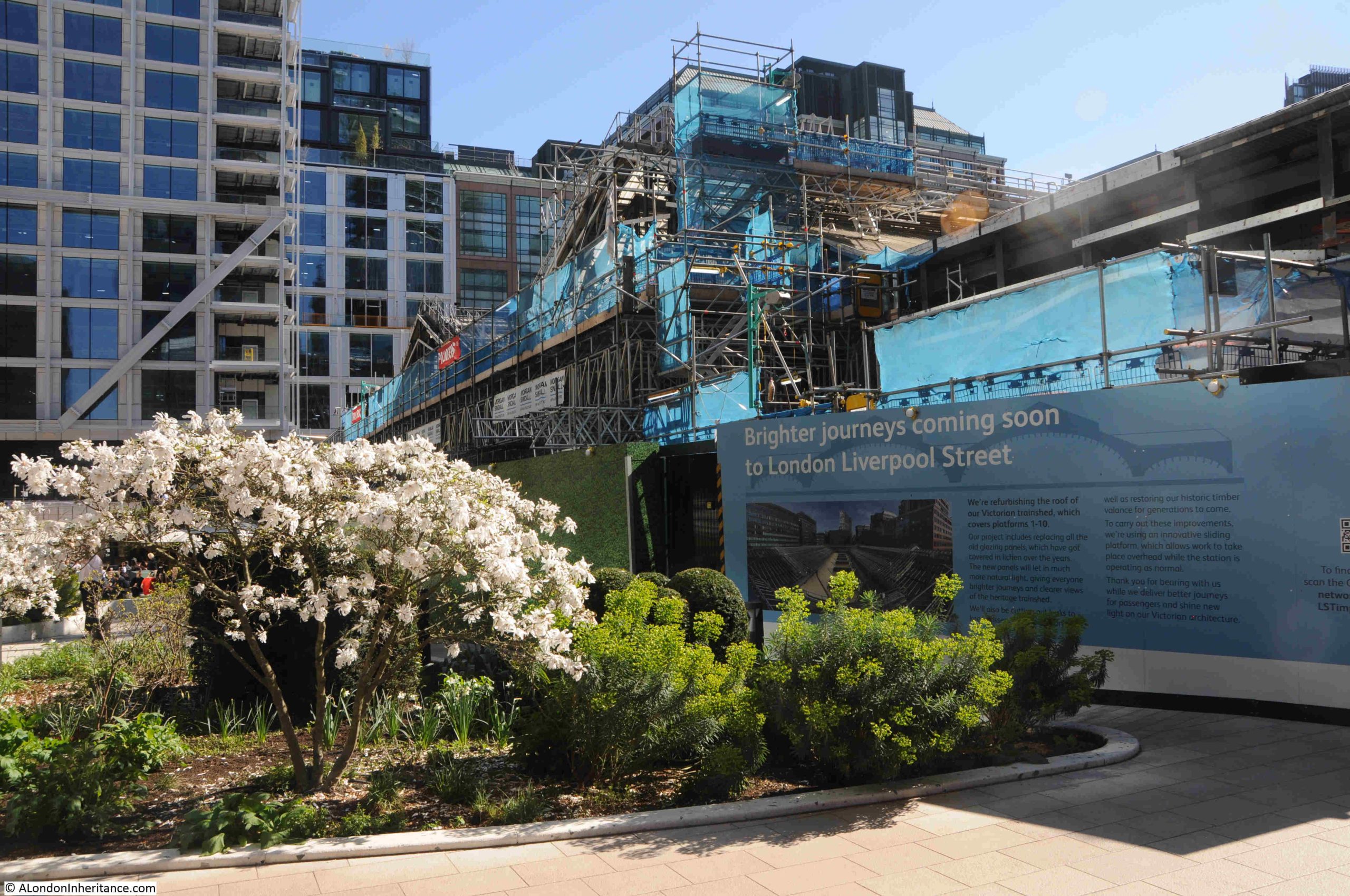
This is the post that should have appeared last Sunday, the 3rd of May, which was the 75th anniversary of the official opening of the Royal Festival Hall on the 3rd of May 1951.
Unfortunately, on Friday 1st of May, my web site went down again, coming back online on Sunday afternoon. I wont go into the issues with my current hosting provider (to keep my blood pressure down), but in the next couple of weeks I plan to move to an alternative, and hopefully better performing hosting platform.
So on the 75th (and one week) anniversary of the opening ceremony of the Royal Festival Hall, this post looks at the construction and opening of this South Bank icon.
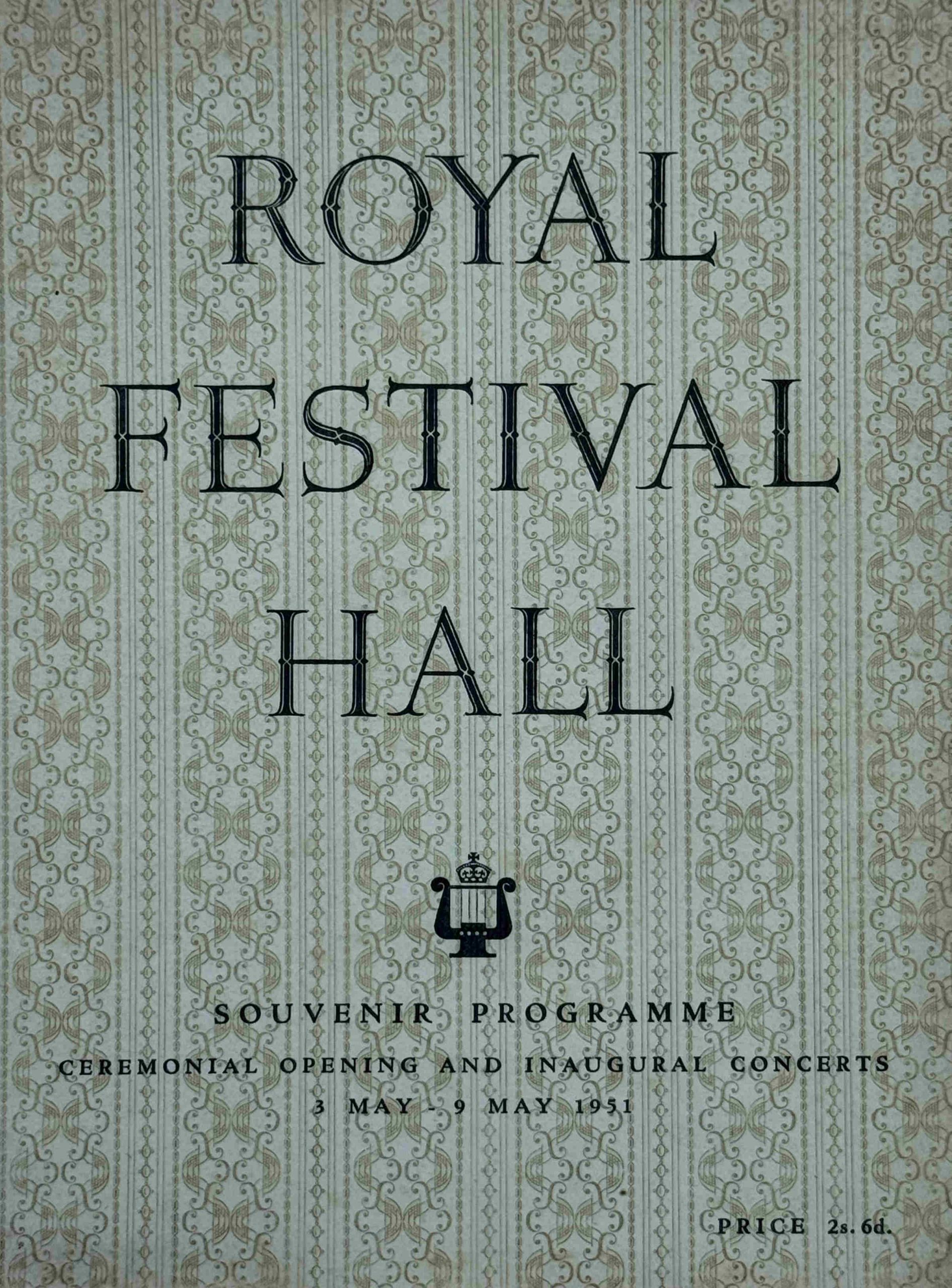
If you attended the opening ceremony, then you may have purchased this souvenir programme of the event:
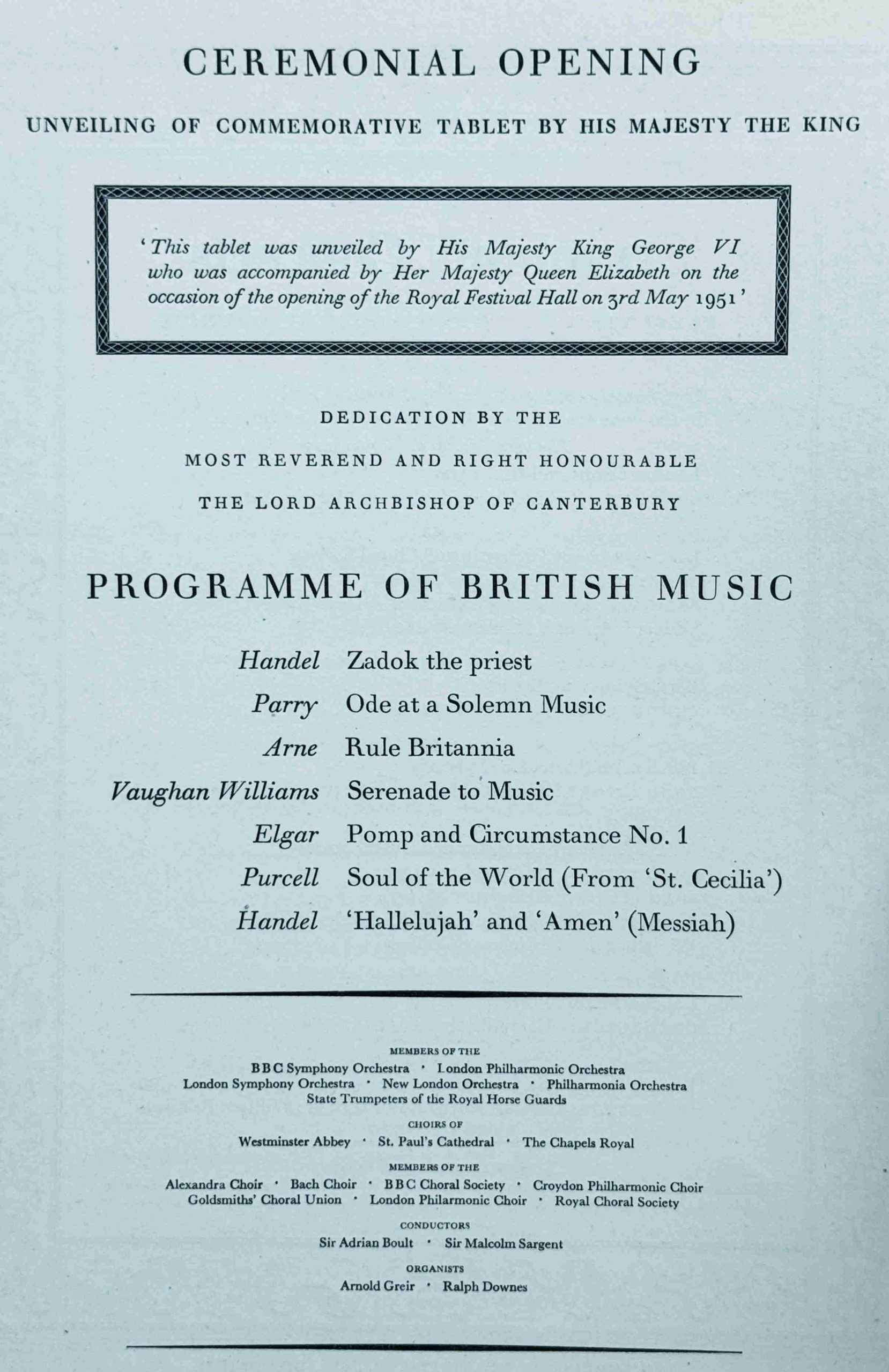
The foundation stone of the Royal Festival Hall had been laid on the 12th of October 1949 by Prime Minister Clement Attlee, and less than two years later the building would host the King and Queen and other members of the Royal family, with the King unveiling a commemorative tablet in the foyer.
There was then a service of dedication led by the Archbishop of Canterbury, followed by the first of a short series of inaugural concerts.
The works performed on the 3rd of May 1951 are shown in the following page from the souvenir programme:
The London County Council had arranged the week of inaugural concerts, and for the coming months there was “a full programme of Festival concerts, ballet, song recitals and light orchestras throughout the summer season and autumn. A season of ballet from July 26 to September 1 will be presented by International Ballet, who are planning imaginative productions of both new and familiar ballets in settings devised specially for the hall”.
The souvenir programme was a comprehensive booklet on the inaugural concerts, with biographies of the conductors along with comprehensive programme notes, which included extracts from the musical score, taking the audience through some of the intricacies of the work, and how some of the instruments in the orchestra had key parts.
It was a programme written for an audience with a serious interest in classical music.
At the back of the souvenir programme were a number of pages of adverts, from companies who had some part in the design, construction and fitting out of the Royal Festival Hall.
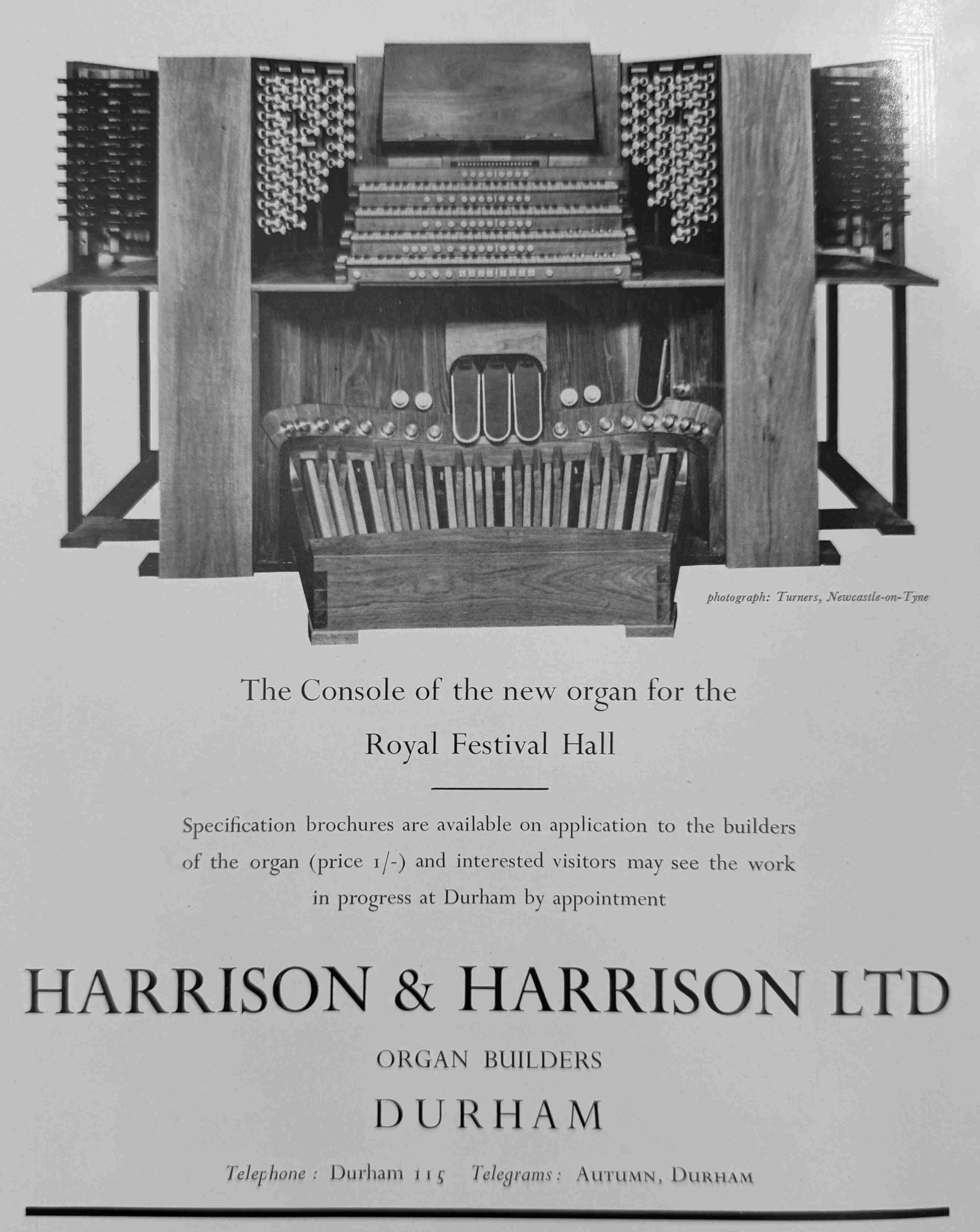
Adverts were a common part of the guide books for each of the Festival of Britain locations, and today, looking through these adverts is a rather depressing experience, as they are a list of all the British industries and manufacturing companies that have either closed or been taken over during the last 75 years, however there is one company associated with the Royal Festival Hall that is still in operation:
Harrison and Harrison were Thomas Hugh Harrison, who was born in 1839, presumably in St. Pancras as he was the son of Thomas William Harrison of St. Pancras who had a company manufacturing parts for organ buildings.
The firm of Harrison and Harrison dates from 1872 when Thomas Hugh Harrison set up a manufacturing business in Durham, where the firm was based in 1951, and where it is still repairing and building organs today.
Regarding the Royal Festival Hall, on the website of the company, there is the following: “A hugely influential event was the building of the organ in The Royal Festival Hall in 1954. This landmark instrument, which was restored by H&H in time for its sixtieth anniversary, introduced the British organ world to the classical influence of the continental Organ Reform Movement”.
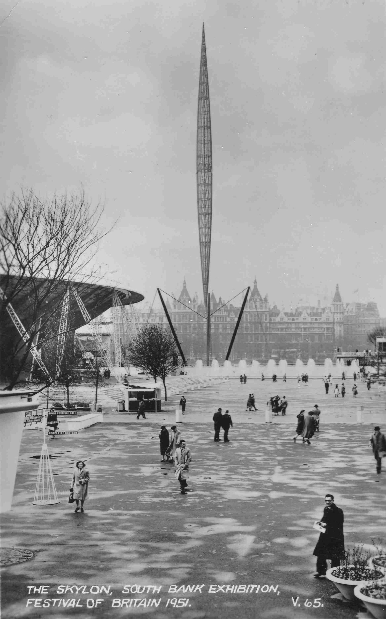
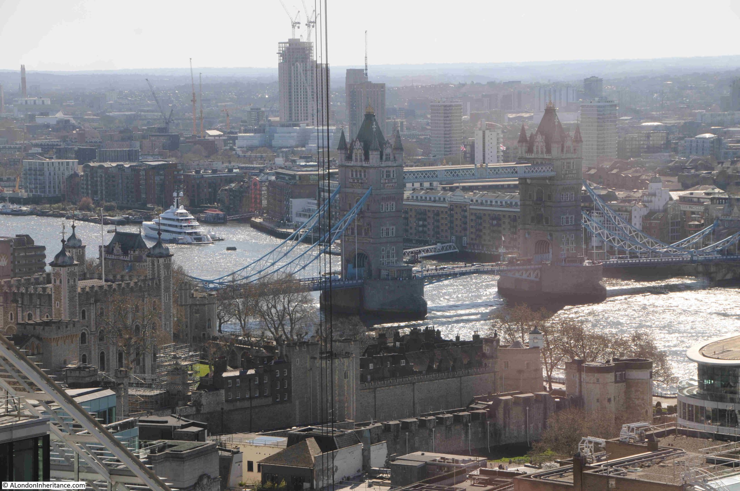
The Festival of Britain on the South Bank opened on the day after the inaugural concert, and the site was already generating some excitement. The South Bank was lit up, and it must have been quite a sight after wartime blackouts and post war austerity, as this article from the May 2nd issue of the London Daily News indicates:
“London’s famous skyline shines bright for the Festival; London’s river picks up the gleam. On the South Bank floodlights and search lights on the exhibition buildings make a blaze of reds, blues and yellows. Against the shadowy Shot Tower is the brilliance of the Royal Festival Hall. Then the Skylon points its finger to the night sky. Above Hungerford Bridge are the illuminated flag-masts of the Bailey footbridge.”
The Skylon was already attracting unwanted interest, as at the start of May:
“Students using grappling irons and nylon ropes, scaled the 295 feet high Skylon on the London south bank exhibition site at midnight and tied to a pole 50 feet from the top, a University of London Air Squadron scarf.
One of them said that five students entered the site late last night and two climbed the Skylon with the nylon ropes 120 feet and 220 feet long and climbing equipment which they had specially made. It was intended to fix the scarf to the lightning conductor but the frailty of the structure at the top made this too hazardous.
The scarf was taken down by workmen.”
Getting within 50 feet of the top was an achievement, not sure I would have wanted to try such a climb:
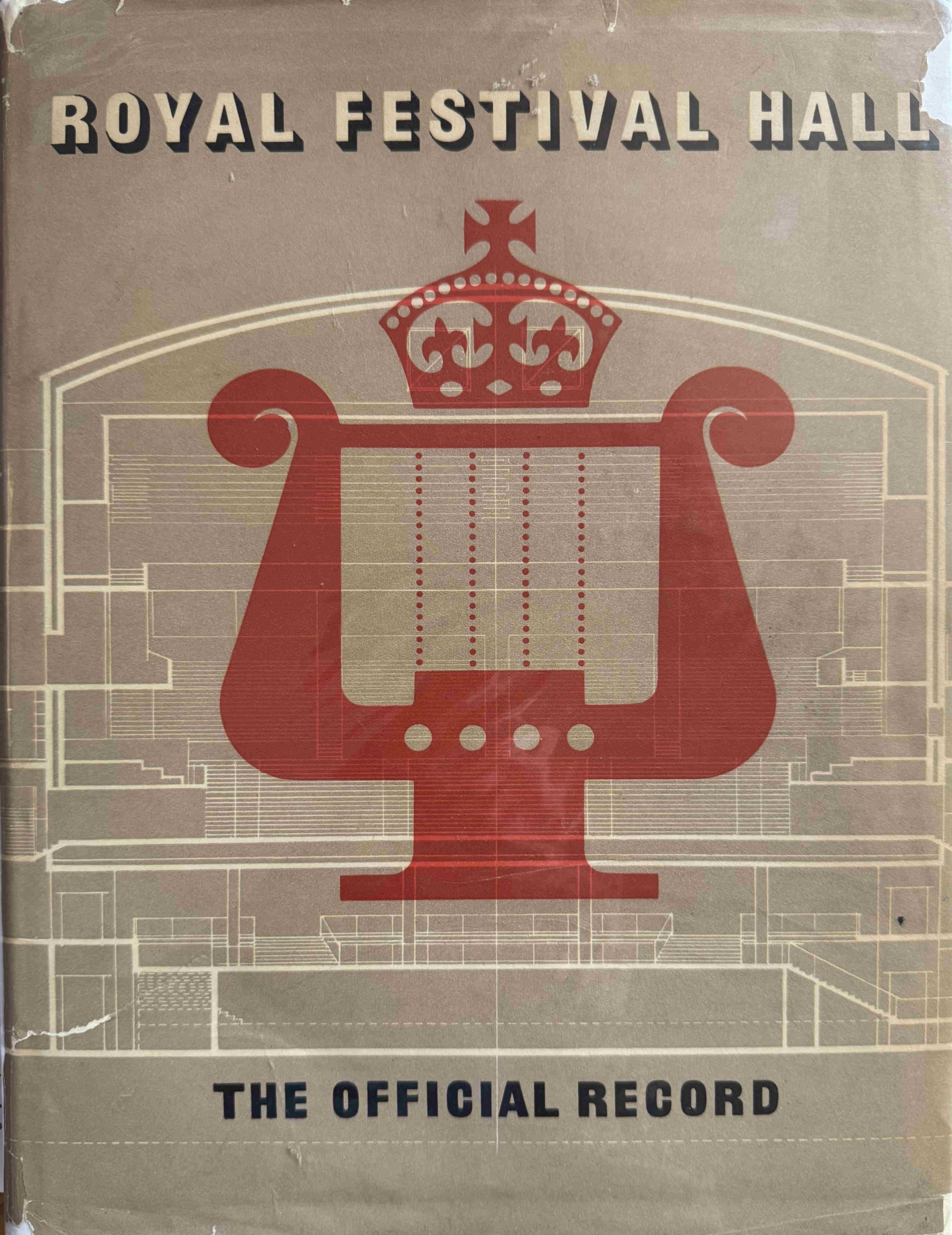
As well as the souvenir programme, the London County Council had also been involved with the publication of the Official Record of the Royal Festival Hall:
Having the Royal Festival Hall on the South Bank was part of the London County Council’s, 1943 County of London Plan, which proposed that the South Bank should become a cultural centre, with a river walkway, public space, offices and homes.
The state of the South Bank was described in the plan as follows:
“It is one of the great anomalies of the capital that while the river, from Westminster eastwards, is lined on the north side with magnificent buildings and possesses a spacious and attractive embankment road, the corresponding south bank, excepting St. Thomas Hospital and the County Hall, should present a depressing, semi-derelict appearance, lacking any sense of dignity and order appropriate to its location at the centre of London, and fronting on to the great waterway. This gloomy aspect is intensified to-day by war damage.”
So it was in need of serious improvement.
Across the Festival of Britain site, the London County Council were responsible for the Royal Festival Hall as well as the new river wall and walkway, and their funding, design and construction, was why they survived, whilst the rest of the festival site was demolished soon after the closure of the festival.
A paragraph in the Forward to the Official Record provides a view of the challenge and intentions:
“The Royal Festival Hall is the only building of such magnitude and importance to have been completed in London since war began in 1939; and it is the first new concert hall the capital has had for much longer than that. This building is of great size and complexity – for it is much more than a concert hall – built on difficult terrain and conditioned in its design by the need for utmost economy in the use of steel and other scarce materials, has had to be planned and produced to an inexorable time-schedule and with a vital and uncomfortably close completion date always in mind. Yet the Council has been at pains to provide a building which is everything that careful planning and anxious forethought could make it, and which has been designed to be worthy of the unique occasion of its inception as well as the longer term use for which it is mainly intended.”
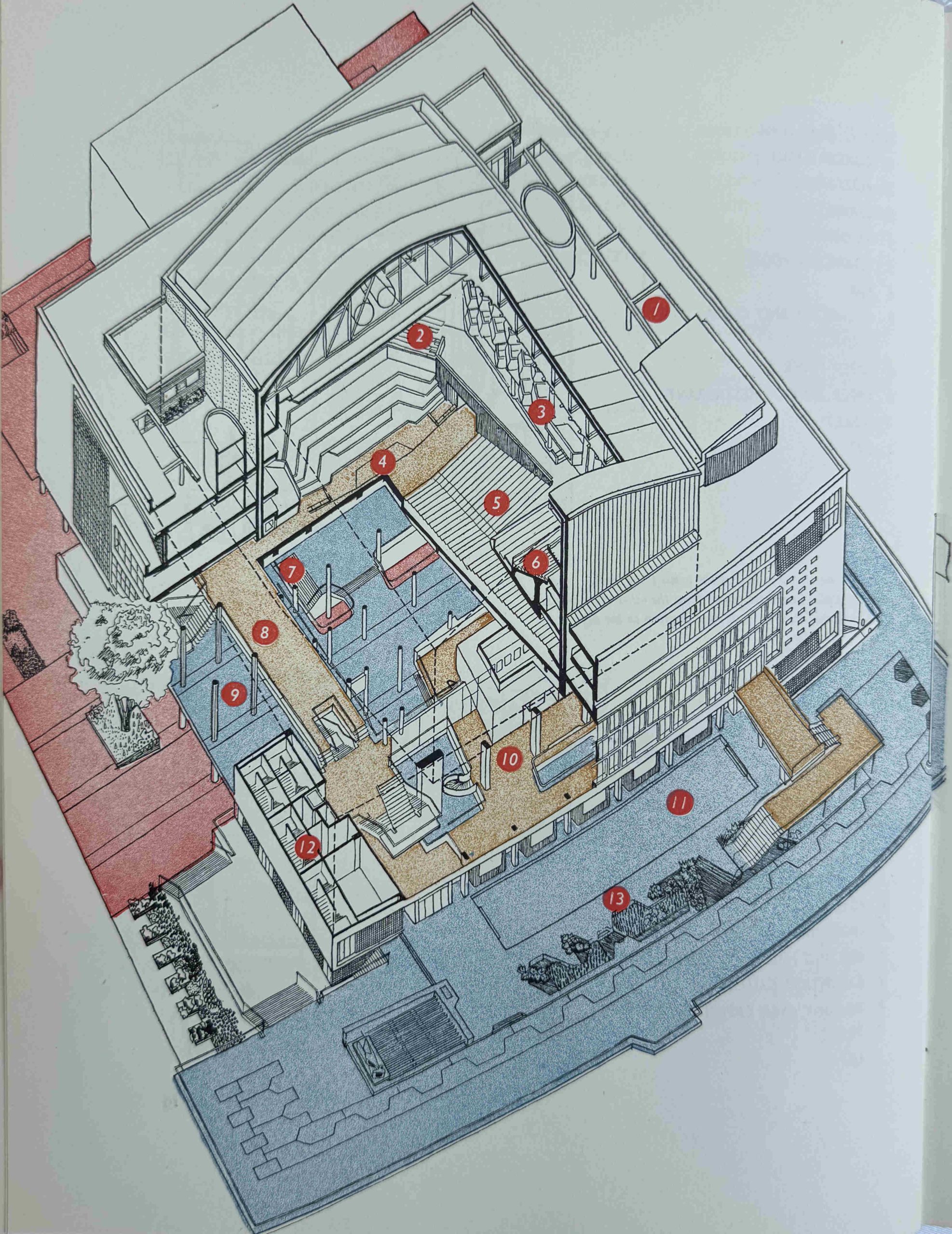
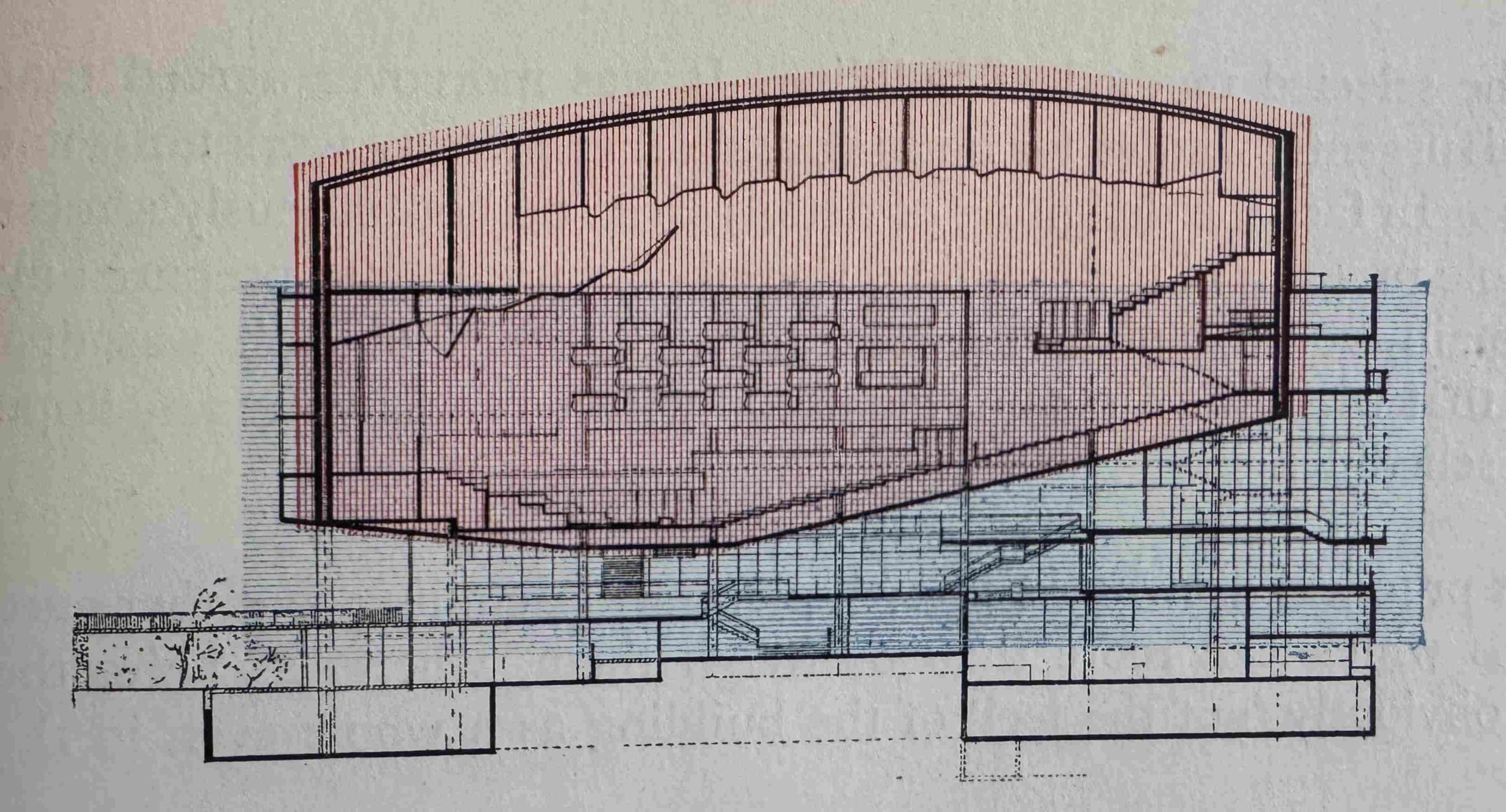
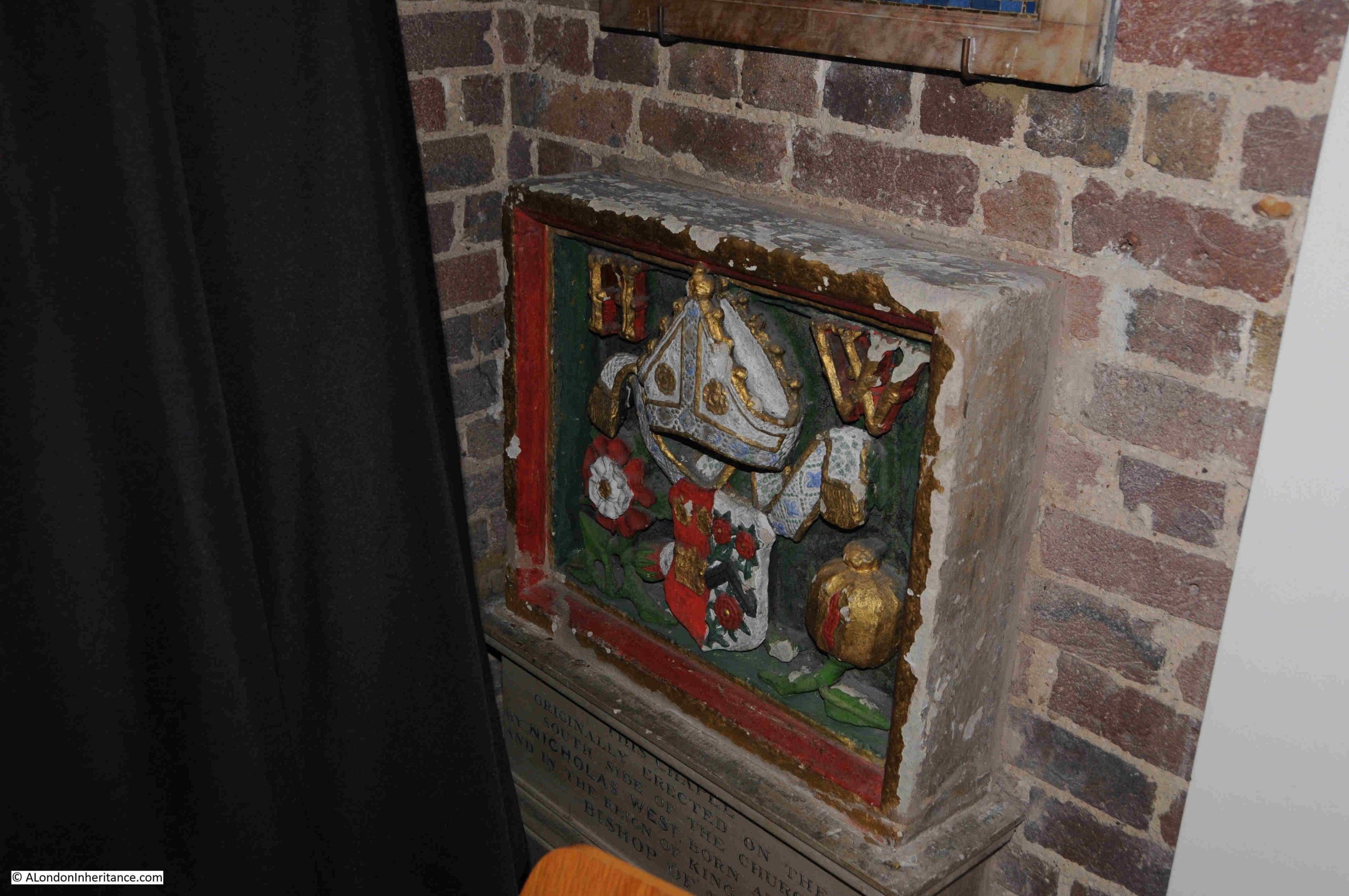
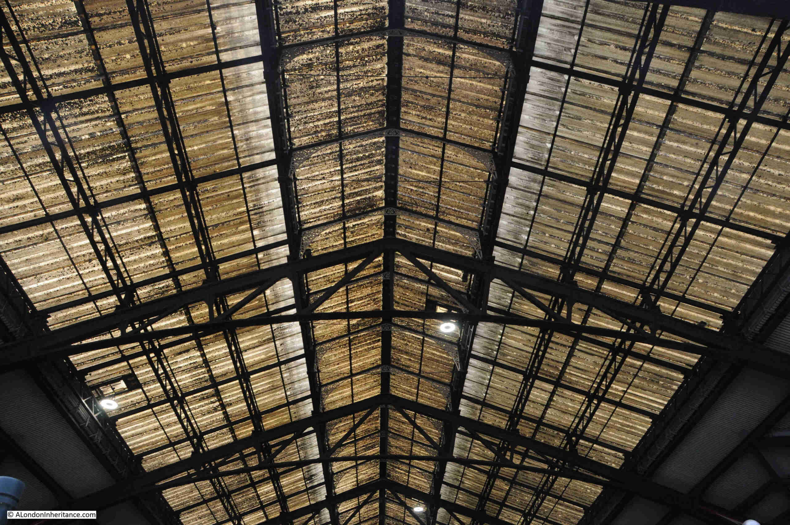
There are a small number of photos in the book, and a large number of drawings, including the following view of the external and internal parts of the building:
The numbers refer to: 1 – Roof Garden, 2 – Choir, 3 – Boxes, 4 – Orchestra, 5 – Stalls, 6 – Grand Tier, 7 – Entrance Staircase, 8 – Side Promenade, 9 – Main Foyer, 10 – Restaurant, 11 – Terrace Restaurant, 12 – Escape Stairs, 13 – Terrace.
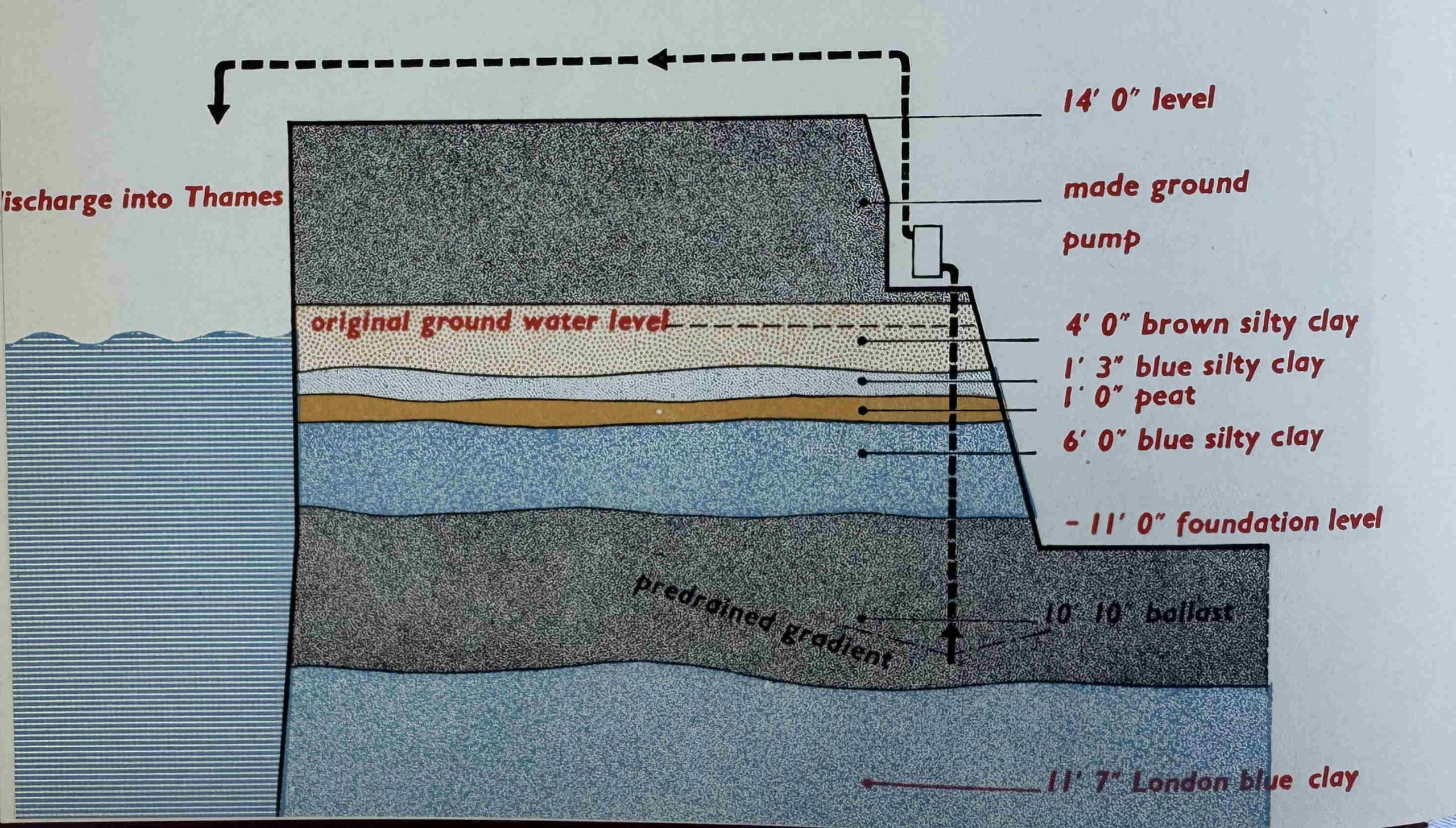
The paragraph from the forward hinted at the challenges of building on the South Bank. A major challenge was water, as the ground where the Royal Festival Hall was to be built was saturated, and ground water height varied with the tide in the Thames.
The options were either pumping or freezing the ground, and the solution taken was:
“To sink a sort of subterranean fence round the whole building site, some 350 steel pipes a yard apart , driven 20 feet down with their tops connected up to suction pumps. When the pumping began, water was thrown out at a rate of 150,000 gallons an hour, but when the general water level was reduced to that of the pipe ends, half that ejection rate served to keep all the excavations comfortable de-watered and workable down to 20 feet below the surface”.
A diagram from the book showing the layers of strata, with the excavation for the building on the right and the River Thames on the left:
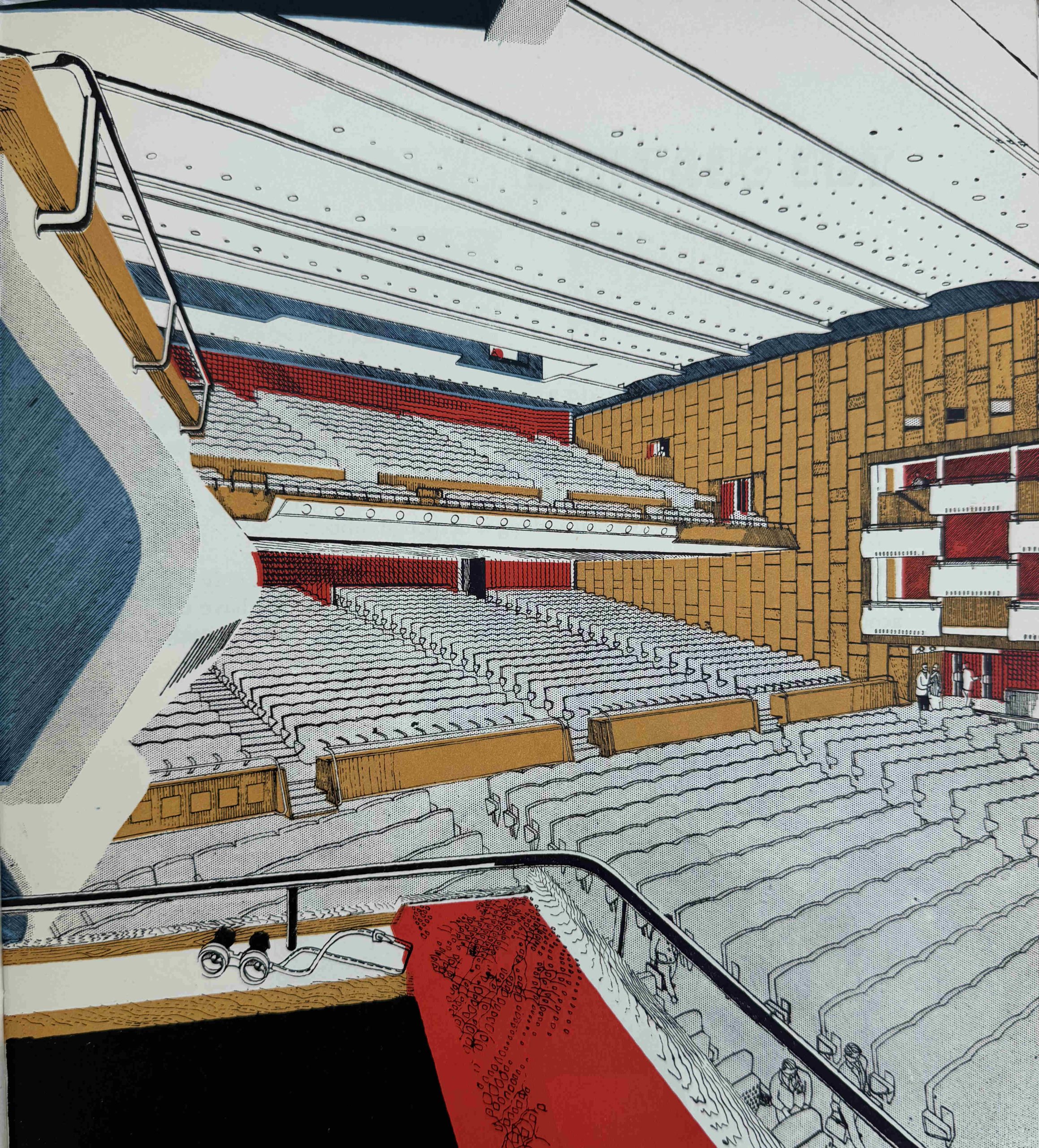
The Official Record looked at the Auditorium:
“Heart and kernel of the whole concert hall building is of course the great auditorium itself, the vivifying principle that alone gives validity to the outer parts and members of its body that encircle it in protective, ordered complexity. So it is the auditorium that will here be more critically judged than anything else, more keenly discussed and therefore longest remembered.
All else is but accessory and ancillary to this one essential element; the elegant restaurants and terraces, the foyers and bars and all the rest – mere handmaidens in helpful, agreeable attendance.
Spatially the auditorium is immediately satisfying, probably partly because one unconsciously realises that it is so exactly shaped for its particular job. Nothing has been done in the way of embellishment to detract from this obvious functional fitness, and indeed one guesses – and again correctly – that such decoration as there is is all calculated to promote the prime purpose of the Hall: the hearing of good music.”
One of the features of the seats in the auditorium was the use of sound absorbing glass fibre in the pads of the seats, to eliminate the sound of a seat tipping as well as to create the effect where an empty seat had the same acoustic properties as an occupied seat.
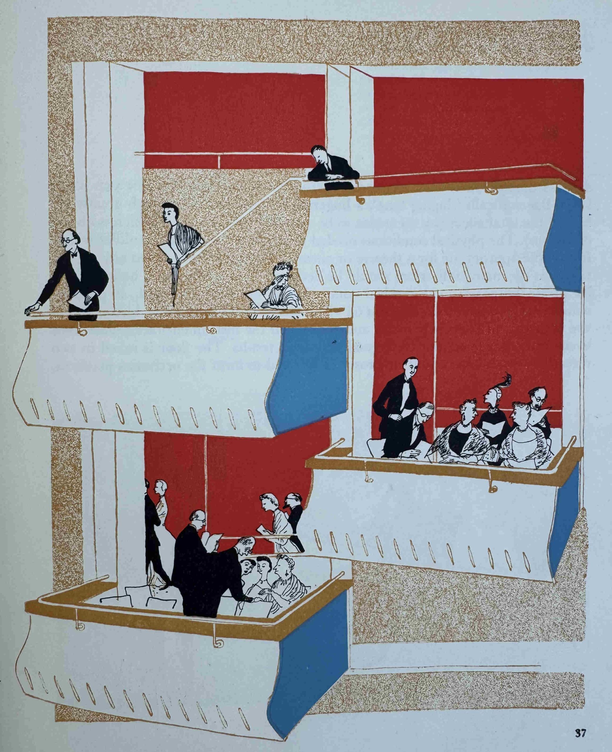
Boxes lining the walls of the auditorium:
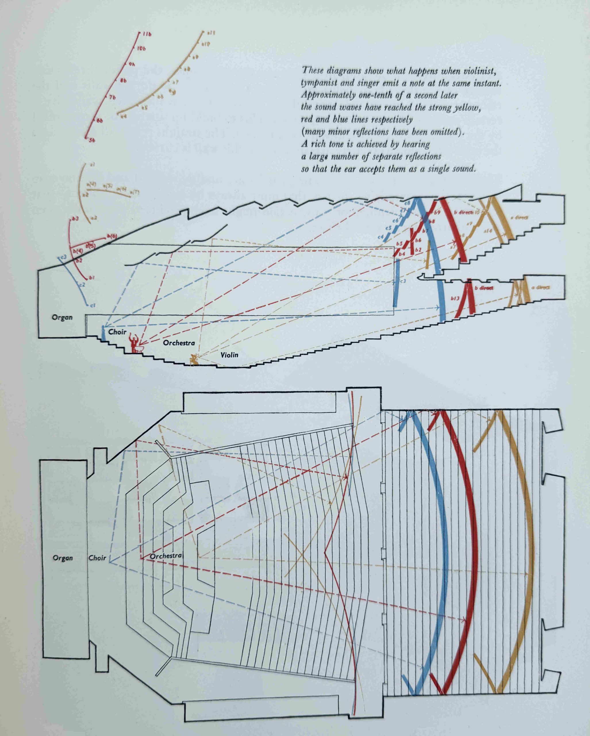
There was a considerable amount of research into the acoustic properties of the auditorium:
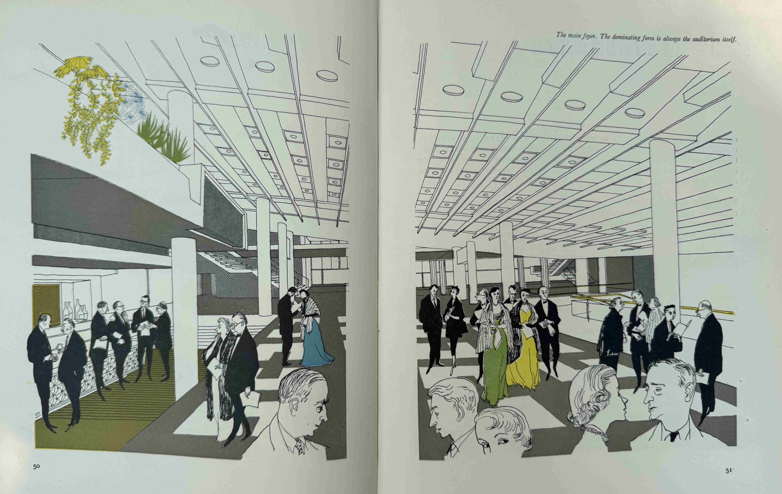
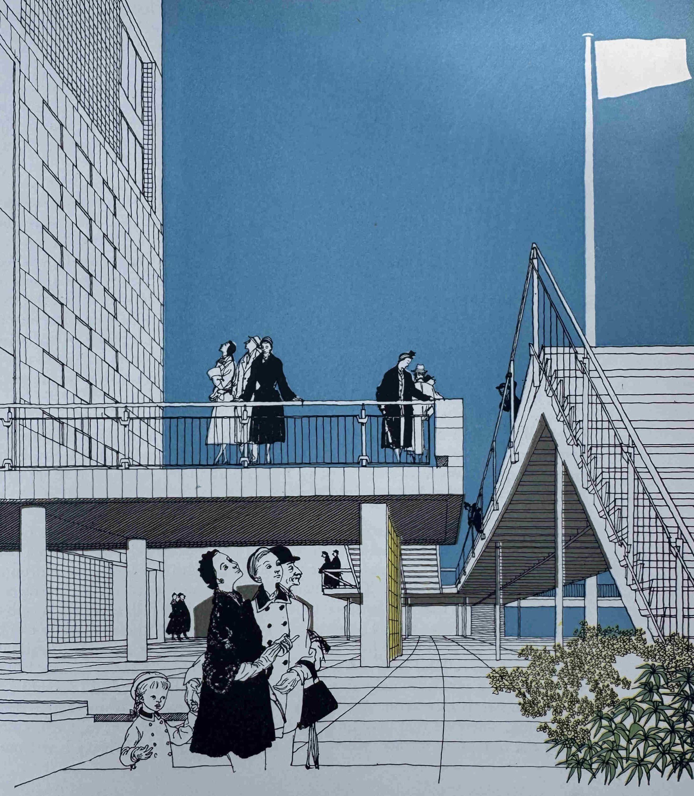
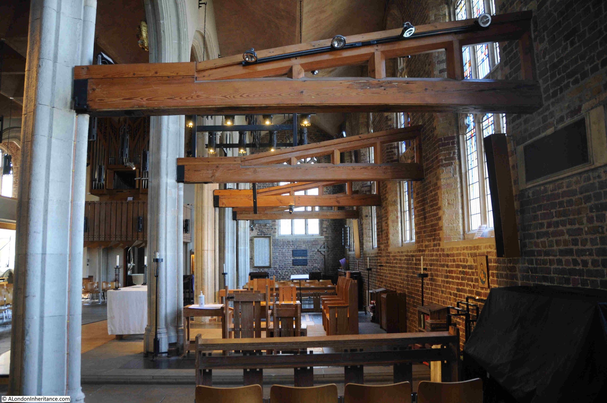
One of the unique features of the Royal Festival Hall is that when you enter the building and stand in the foyer, it is not immediately obvious where the auditorium is located. The foyer presents a wide open space, with thin columns supporting the structure above, with only bars and reception desks in view.
The auditorium is suspended above the foyer, a design that needed a clever means of support with four stairwells at each corner constructed within a bastion to support the auditorium. The following image from the book shows how the auditorium is almost a capsule suspended within the overall building:
The main foyer, with one of the bars to the left. The sloping floor of the auditorium forms the ceiling:
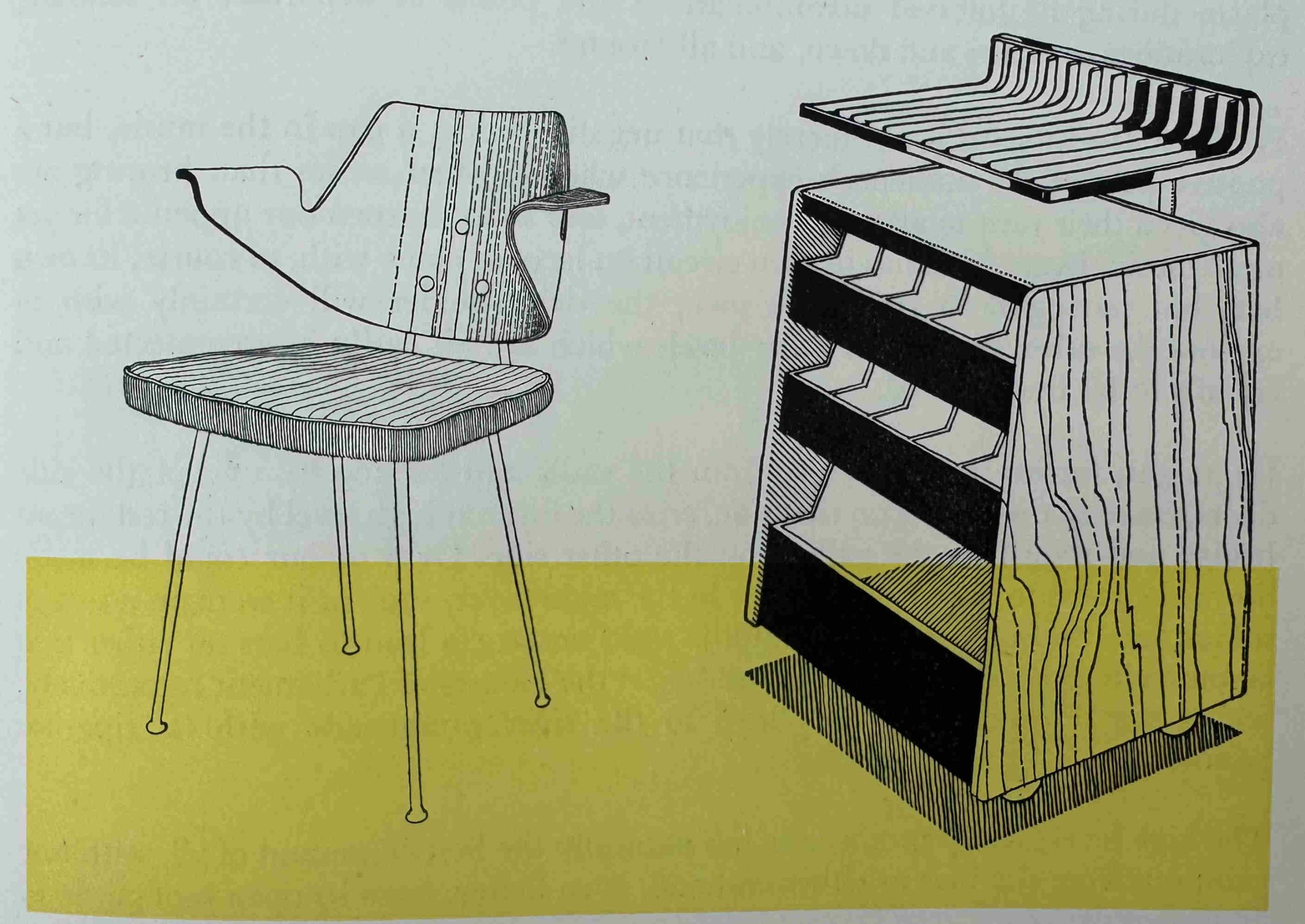
One of the themes of the Festival of Britain was the use of new designs for even the most basic of functions, and in the restaurants of the Royal Festival Hall, this included newly designed chairs, with a rubber cushioned seat, and a dumb waiter made out of tubular metal, timber and aluminium:
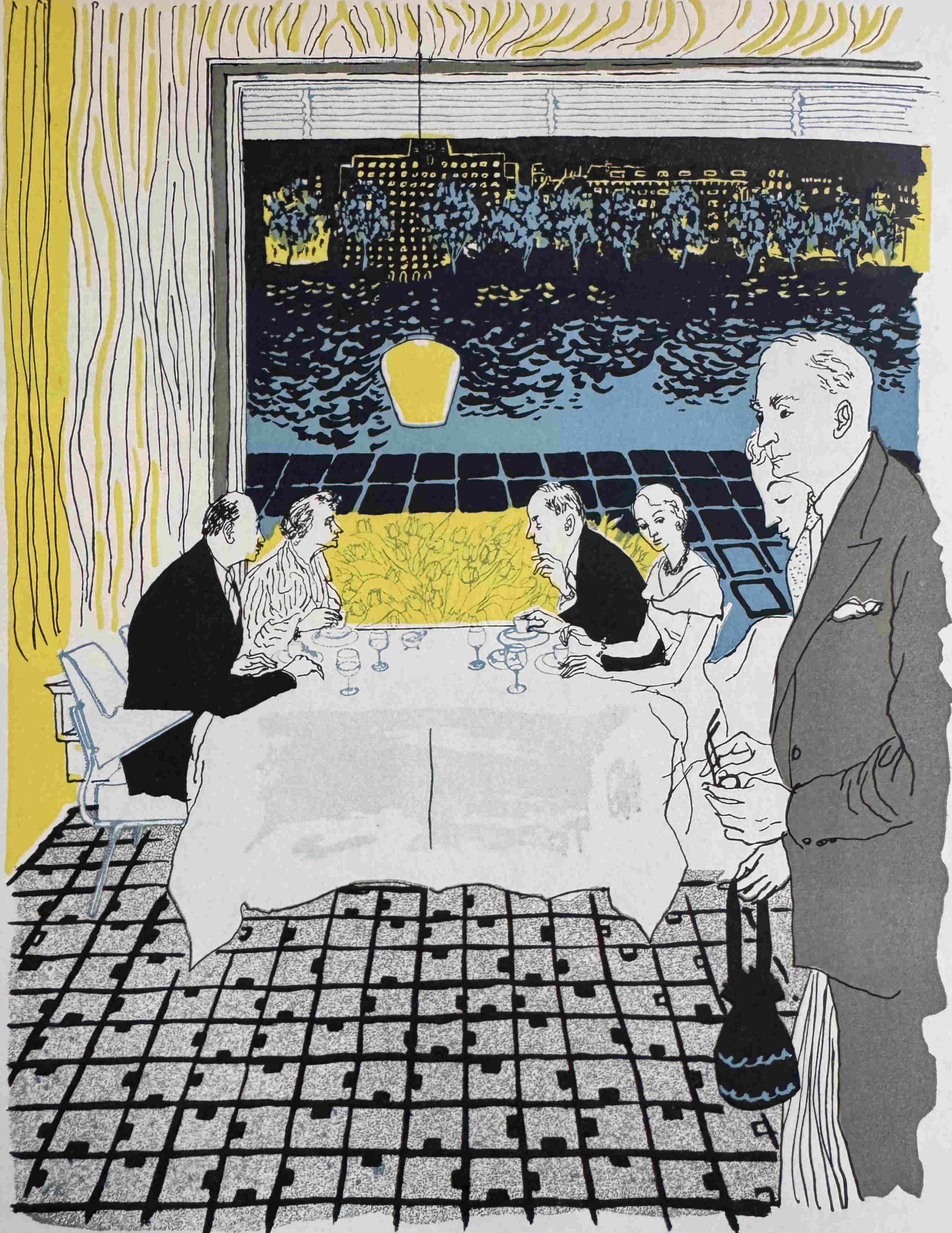
The auditorium was by far the most important feature, but restaurants were also an important part of the overall visitor experience, and for those dining in the restaurant with a window seat: “At night a new prospect is revealed as the lights shine across the river”:
Design of the terraces and gardens around the hall were just as important as the interior, and long before the large terrace that we see today was built in front of the hall, there was a lower and smaller upper terrace “from which there is a magnificent view of the river and the northern embankment”:
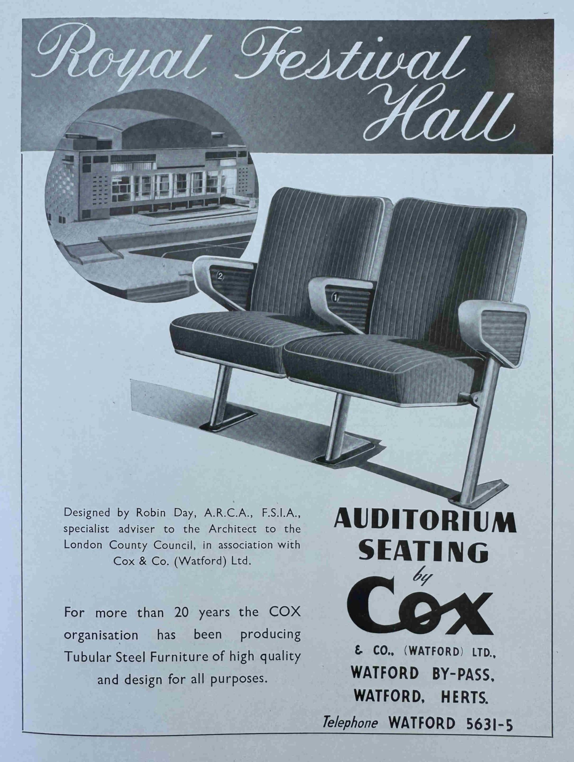
As with the souvenir programmes, in the official record of the Royal Festival Hall, there were a number of adverts for companies involved in many aspects of the building, including Cox & Co of Watford, who were responsible for the auditorium seating:
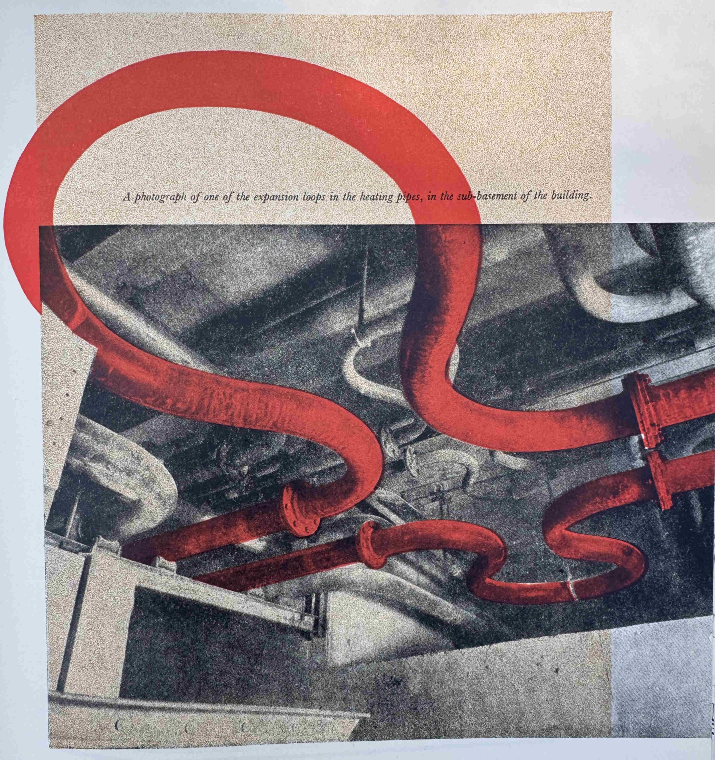
One of the aims with the design of the Royal Festival Hall was to make use of the latest technologies available for building such a concert hall. As well as theatre and sound technologies, this also included air conditioning and heating systems, and the following photo from the book shows heating pipes which threaded through the building:
One of the challenges with designing and building so quickly, along with the use of new technologies was that the design had to change as construction progressed.
The installation of air conditioning, heating pipes and electrical cables required the drilling of unplanned holes in the buttresses of the hall that gave support to the auditorium as well as many of the walls.
As well as the design of the interior, the importance of the auditorium, and the use of the latest technologies, one of the other key features of the Royal Festival Hall was its location on the South Bank, directly overlooking the Thames, and the building was intended to present an impressive view:
As mentioned earlier in the post, the South Bank was in a dismal state, and the LCC plan proposed significant new buildings along the South Bank which would mirror the buildings along the North Bank, and the above image shows how the Royal Festival Hall was intended to be the first part of this.
This is an issue I have with the South Bank today. The walkway is lined with trees and especially when they are in leaf, they do obscure much of the view of the Royal Festival Hall from the north bank.
Trees are key in the built environment. Not only do they improve the visual aspect, they also provide shade, have a cooling effect etc. however, for the short space of the walkway in front of the hall, removing the trees would restore the view of the Royal Festival Hall as was intended by the designers and developers.
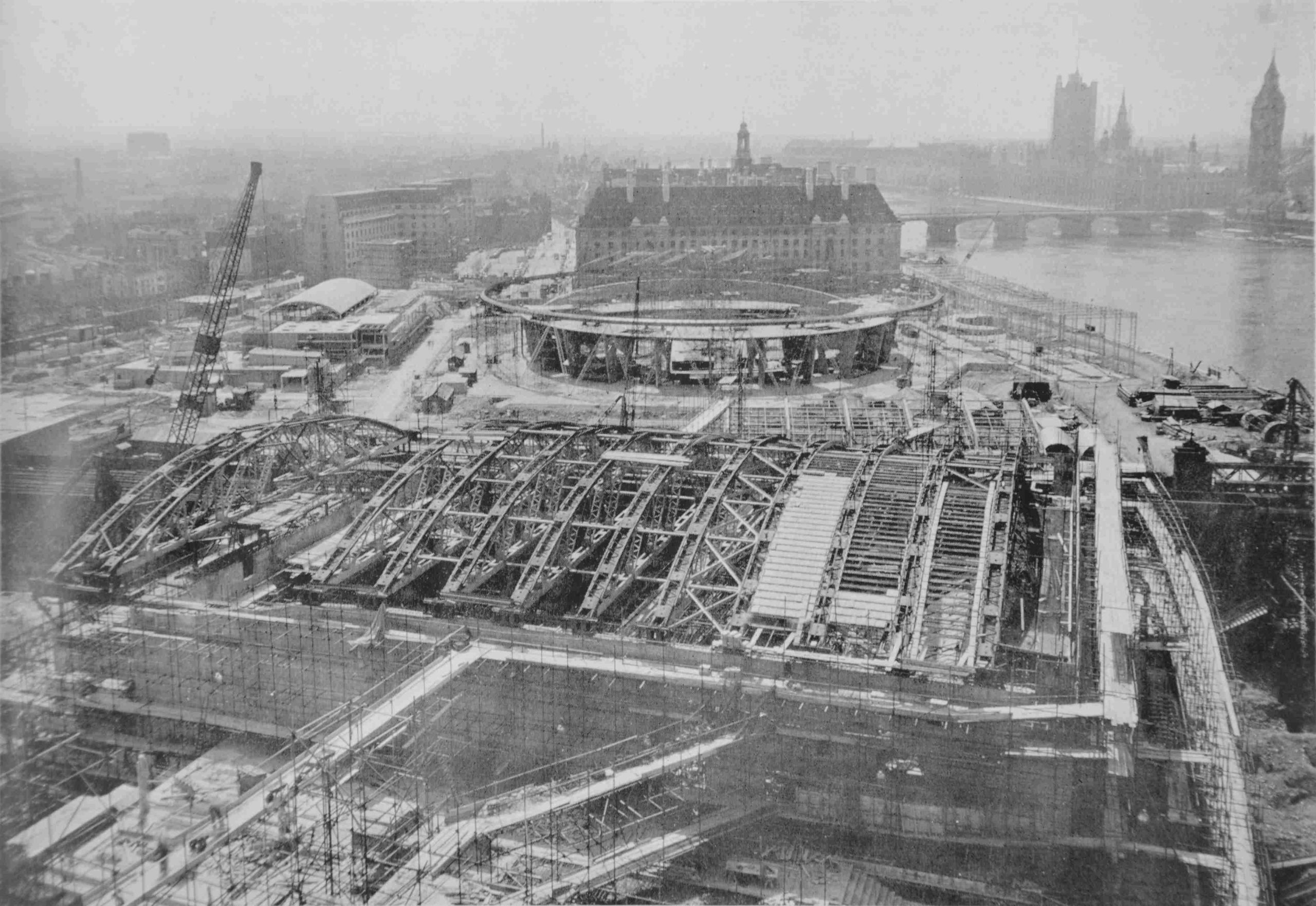
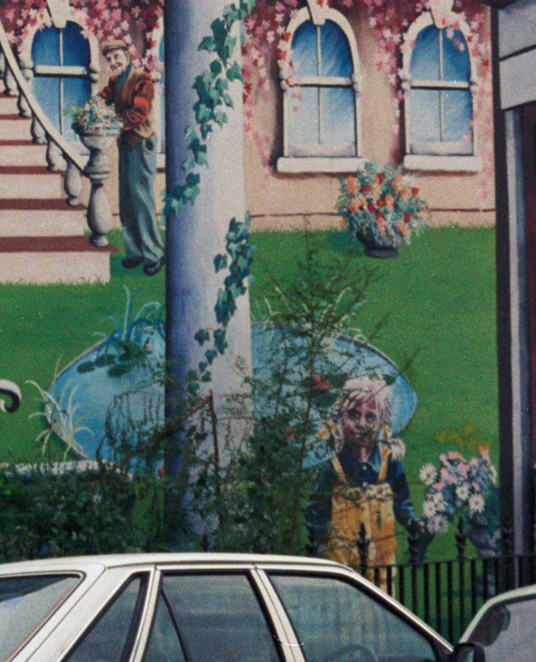
My father took a whole series of photos of the South Bank showing the area before it was cleared ready for the build of the festival, and then construction.
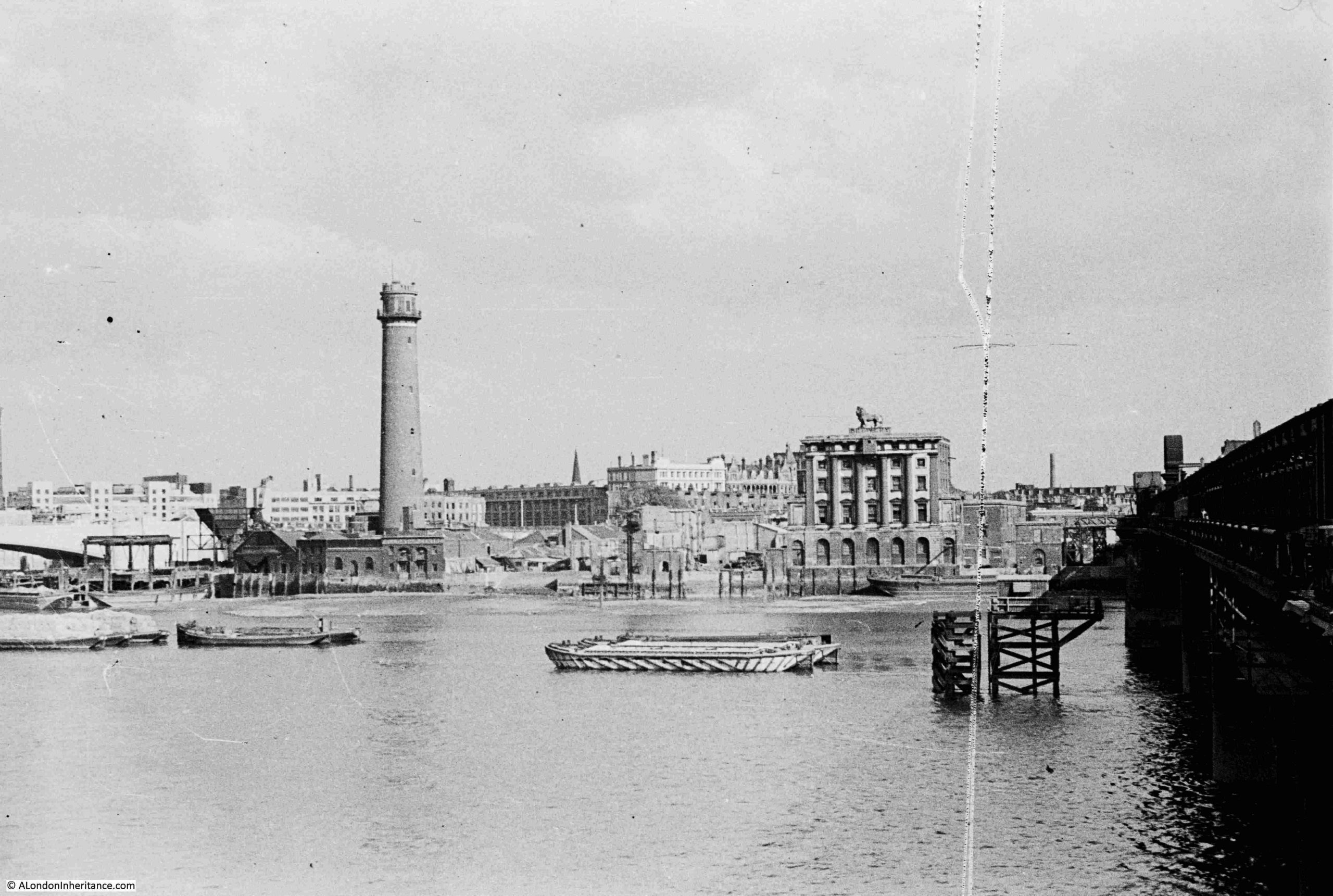
The first of his photos is from 1947 and shows the site prior to demolition. The Royal Festival Hall would be built on the site of the lion Brewery, which is to the right, with the Coade Stone Lion on the top:
A view on the South Bank. The large building is the Lion Brewery after the Lion had been removed:
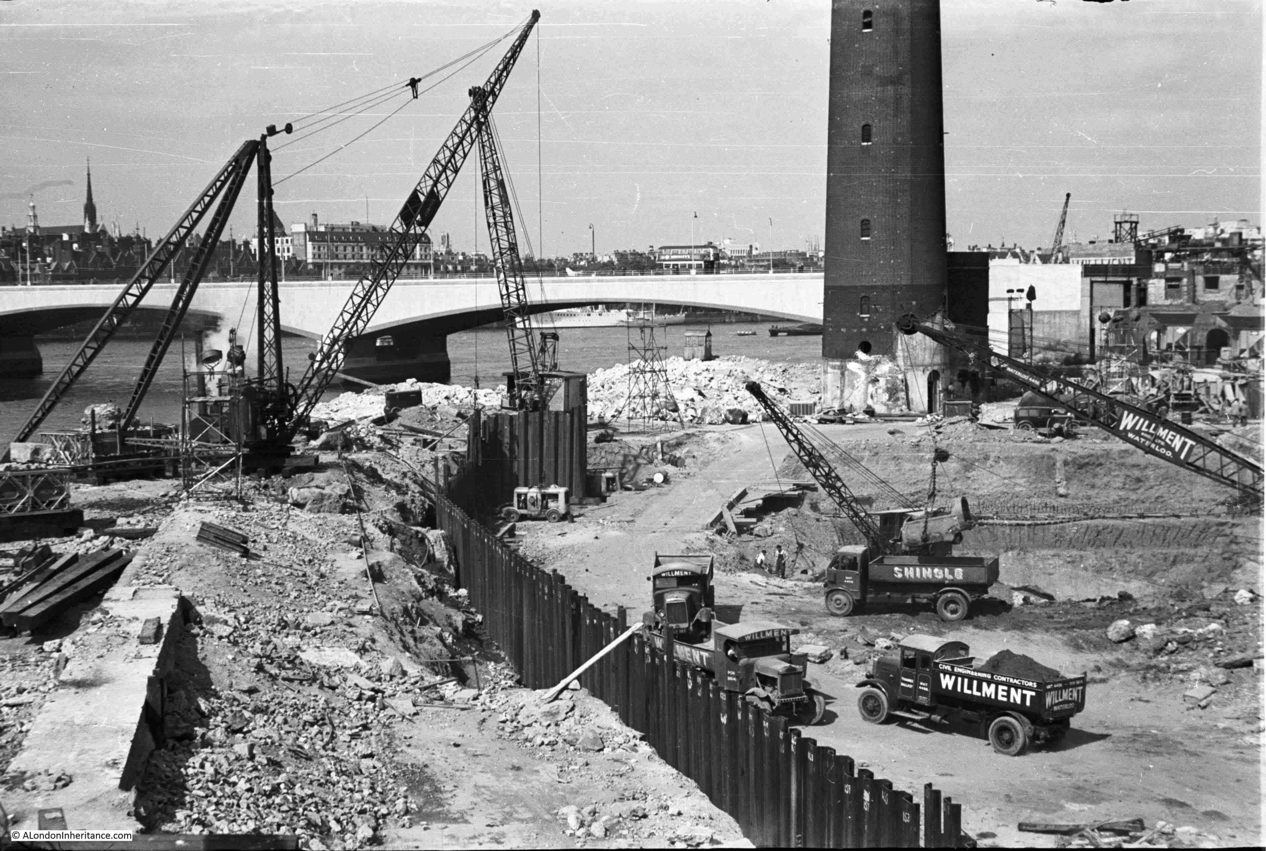
Building the foundations of the Royal Festival Hall:
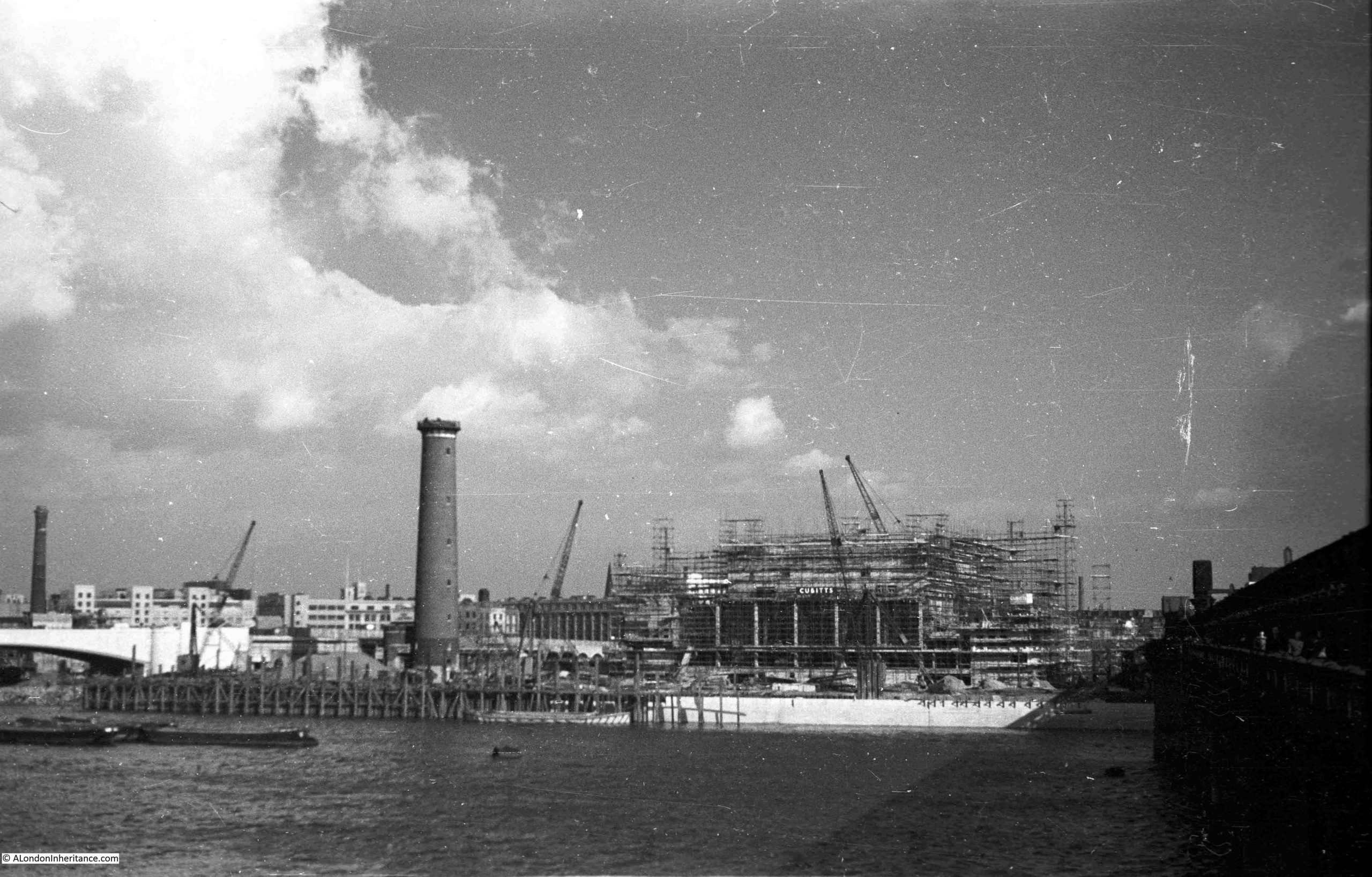
The Shot Tower is the tall tower in both photos:
Looking across the site, the tall houses in the background were in Howley Street, which has long gone, replaced by the slip road that runs between Belvedere Road and the roundabout at the southern end of Waterloo Bridge:
The above image gives an indication of the depth of the foundations.
One of the objections to the Festival of Britain was the impact it would have on both materials and workers, who were also desperately needed for post war reconstruction of the homes, offices and factories that has been destroyed by bombing, and general deterioration since the 1930s.
There was a wonderful book published specially for the Festival of Britain by the Association of Consulting Engineers. The book is a comprehensive exploration of many large infrastructure and construction projects in which the association’s members were involved. The book included a section on the Royal Festival Hall, with a detailed description of the design, construction and challenges.
The following image from the book shows the Royal Festival Hall in the foreground, with the build of the Dome of Discovery in the background, with the rest of the site being built around. The image provides an idea of the sheer scale of the construction of the Festival of Britain site on the South Bank:
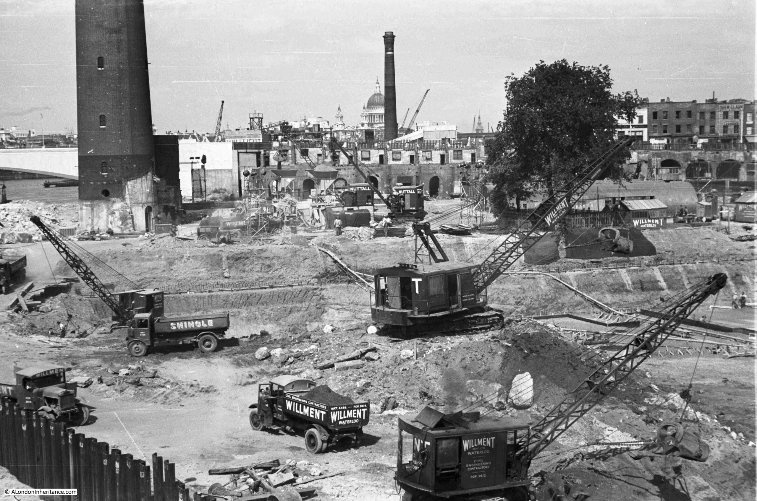
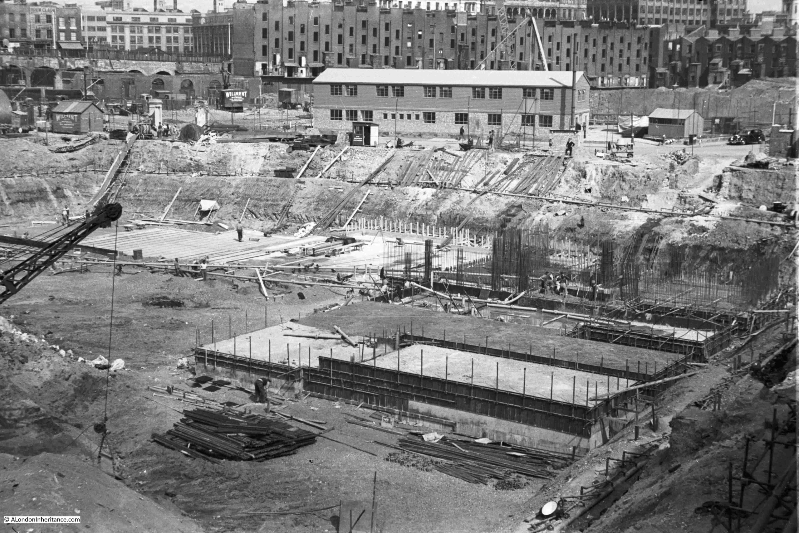
Back to my father’s photos, and this one shows the build of the Royal Festival Hall well underway:
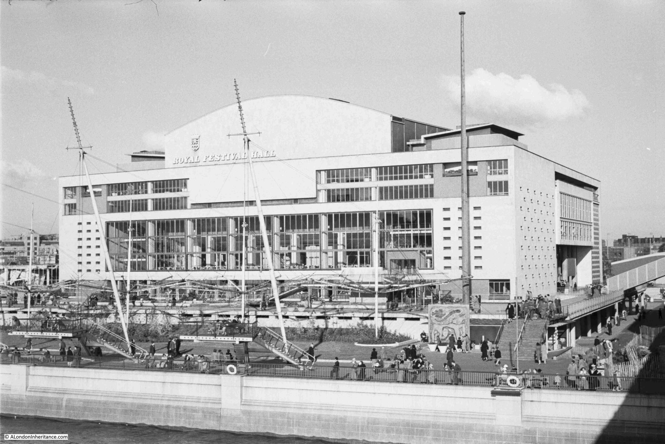
And finally it has been completed:
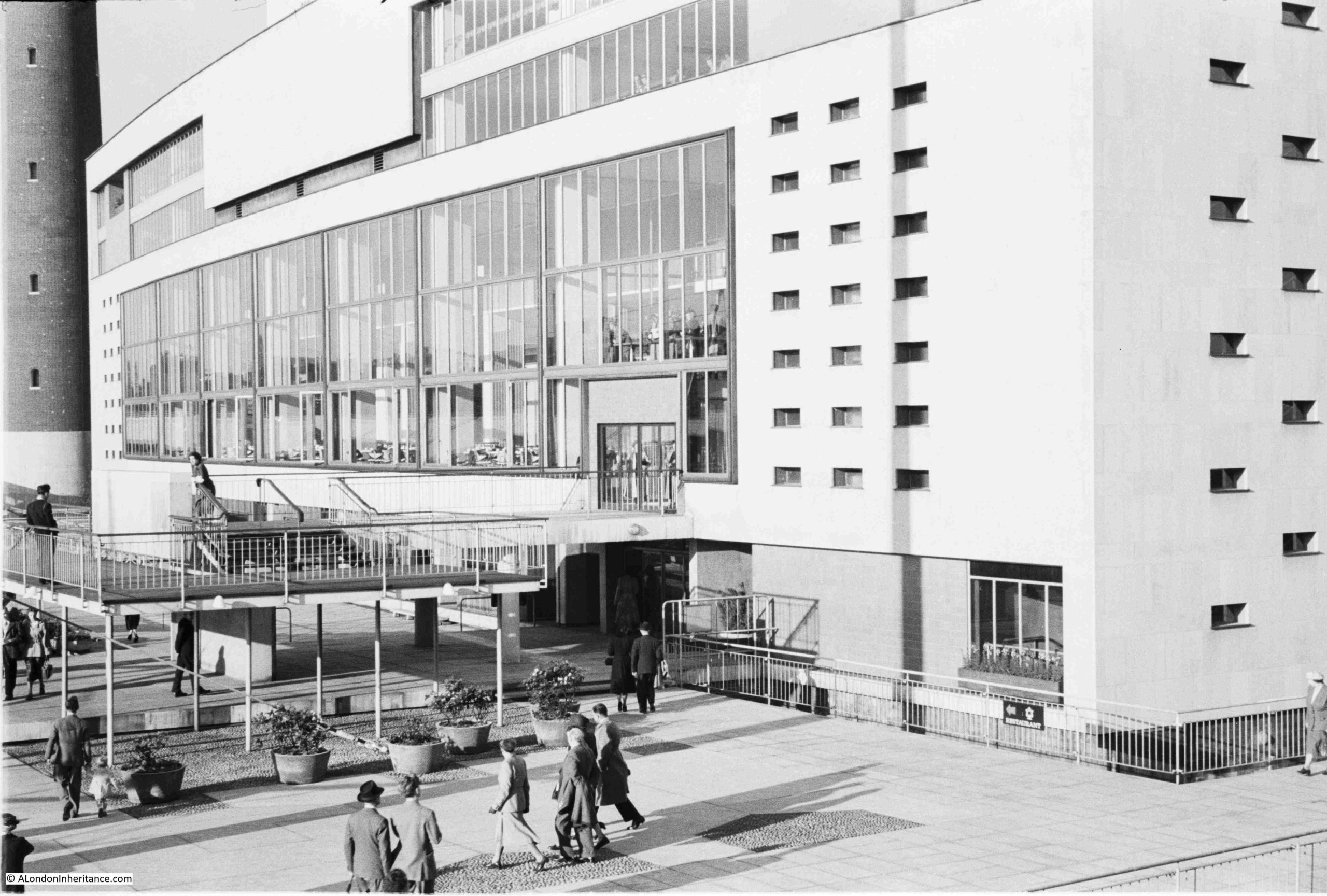
Photo showing detail of the terraces at the front of the building, much the same as the print from the official record shown earlier in the post:
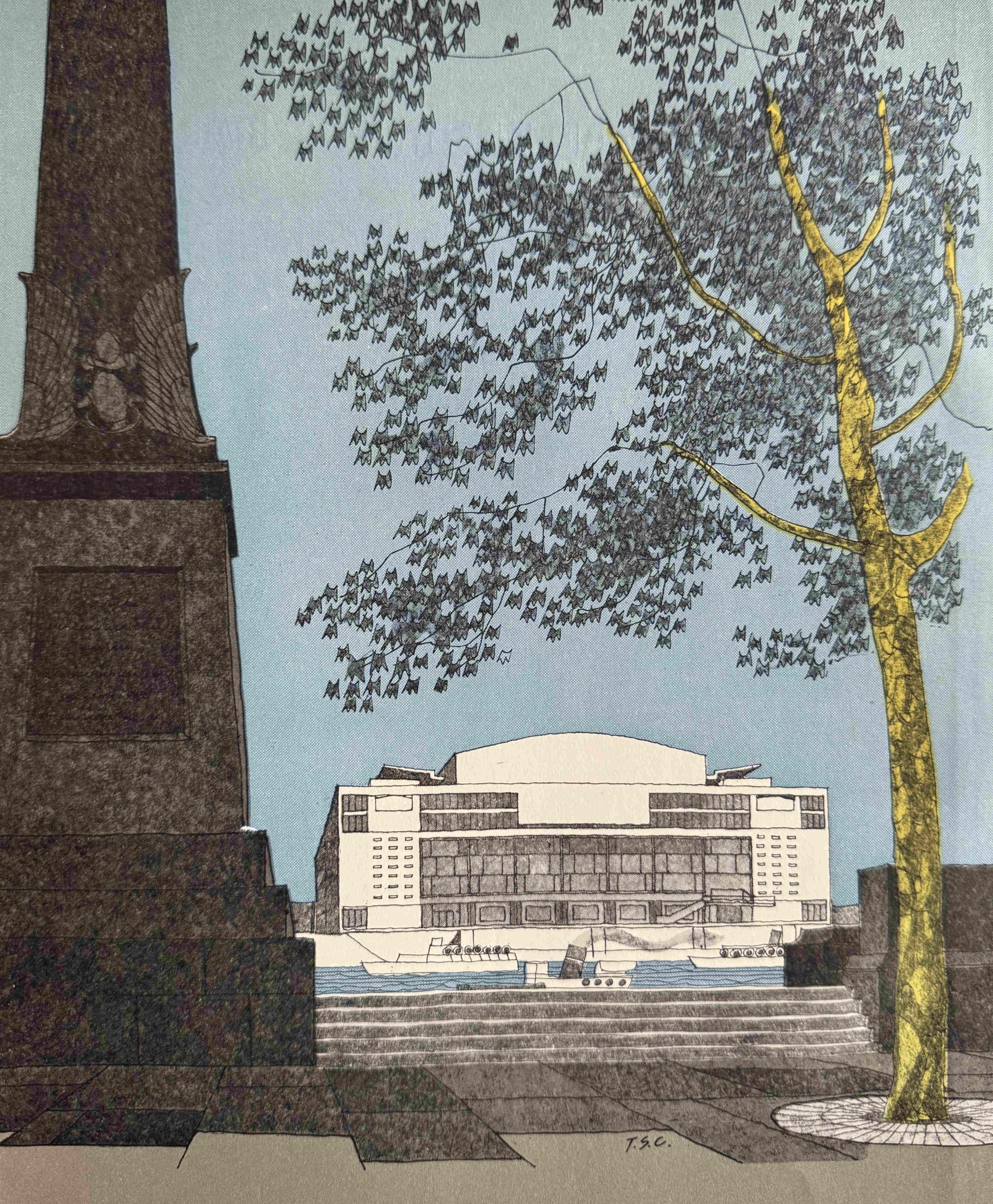
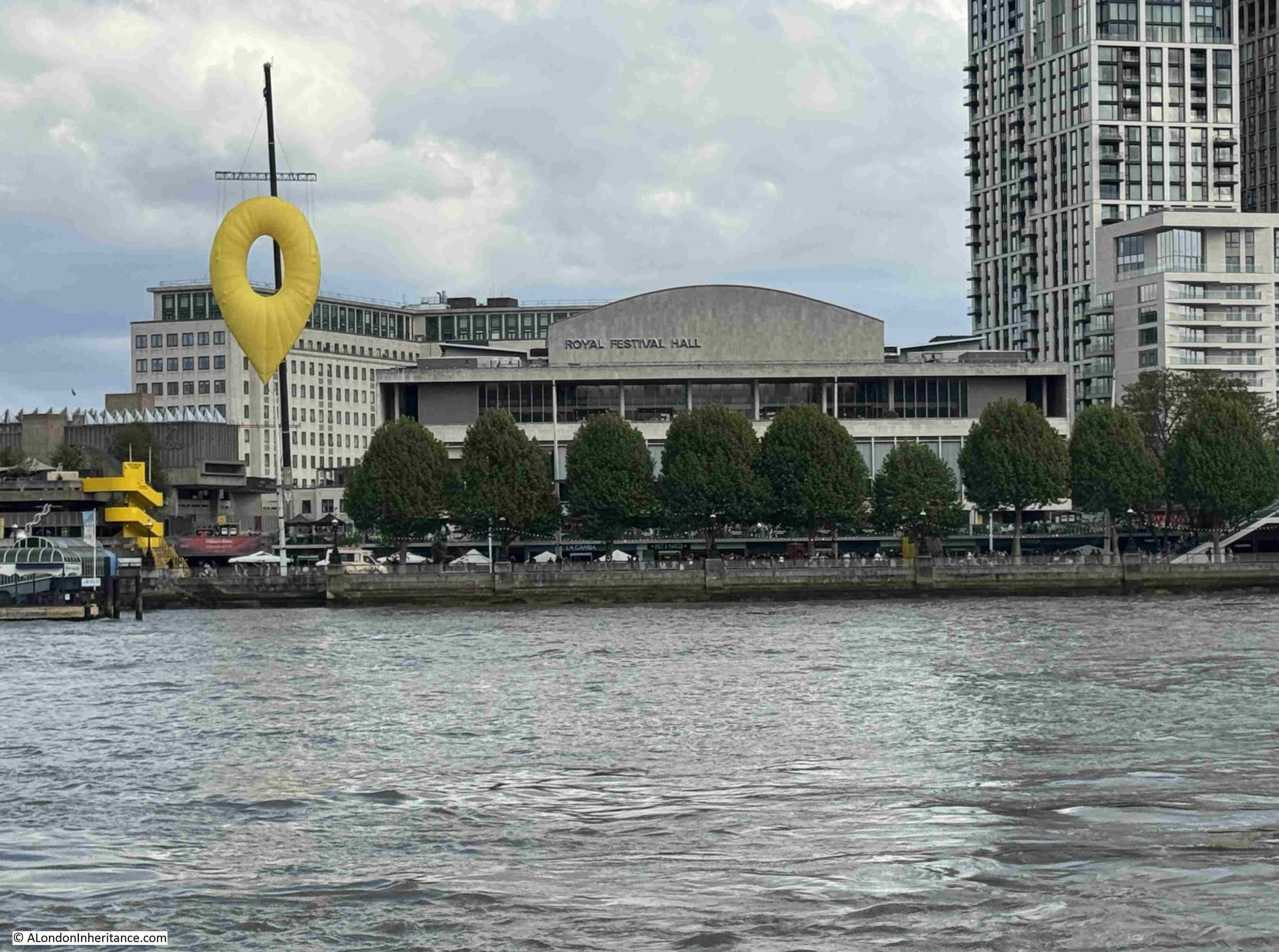
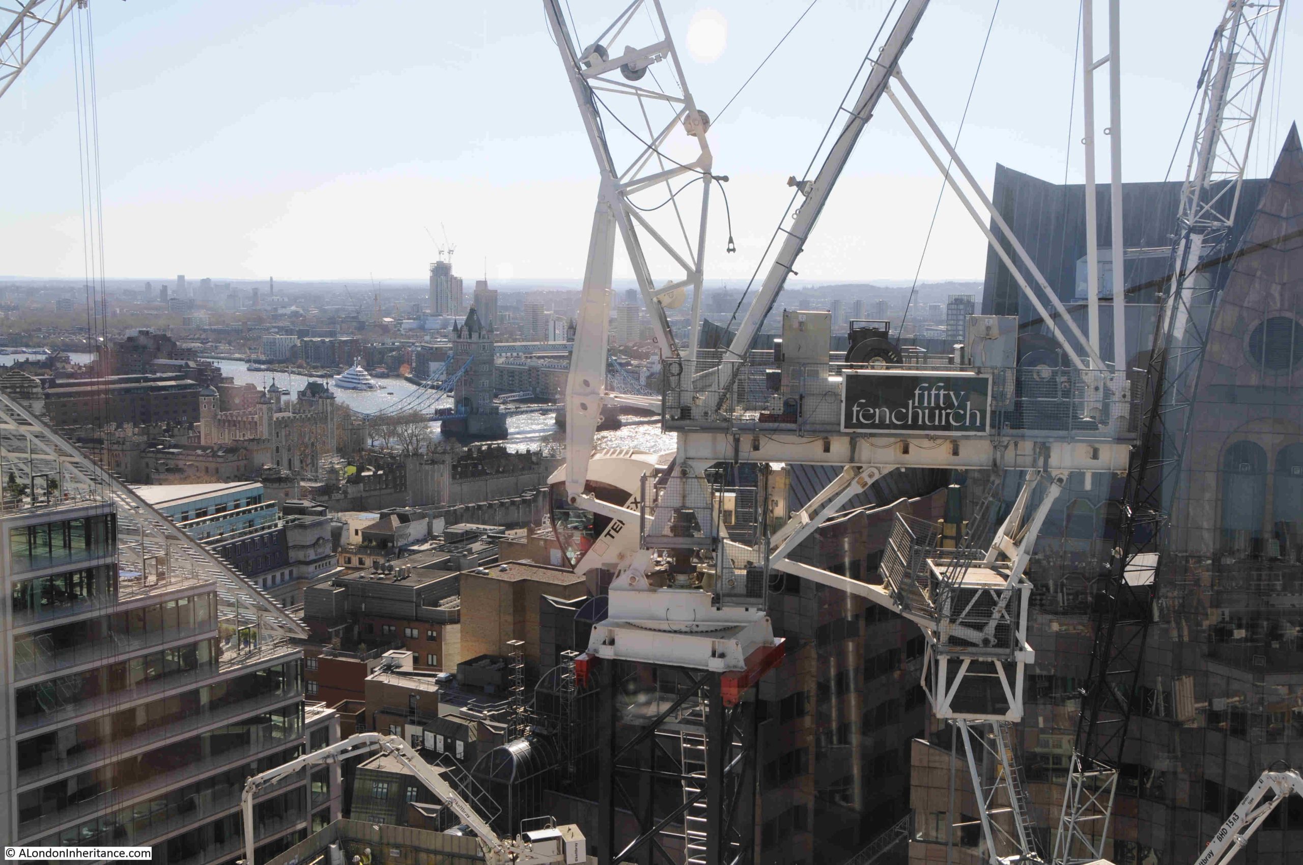
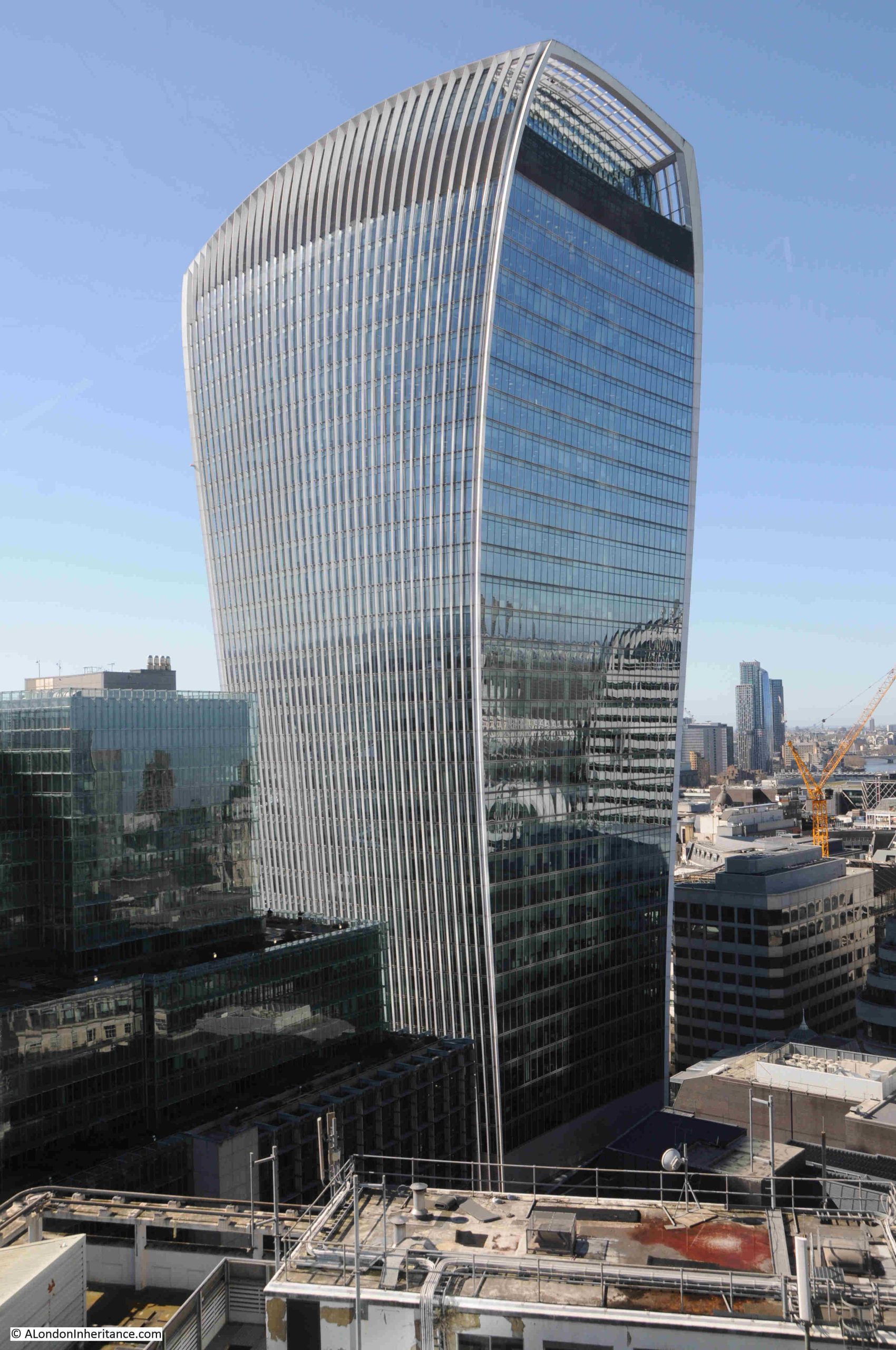
The Royal Festival Hall on the 3rd of May 2026, on the 75th anniversary of the opening ceremony:
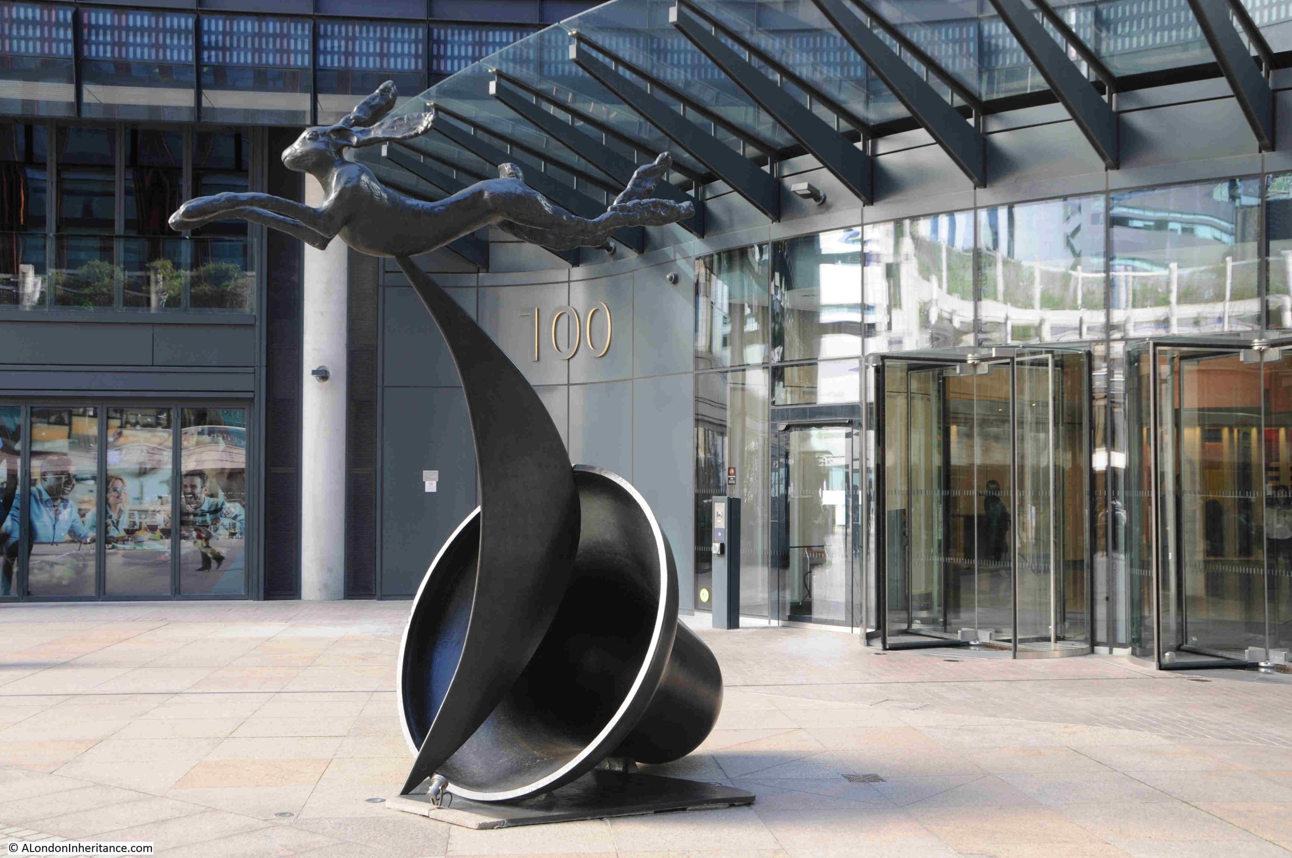
The large yellow object on the left is a work called Pin Drop by Carson McColl and Gareth Pugh, created as part of the 75th anniversary and is “reimagining the iconic Skylon for the digital age”.
The Royal Festival Hall is a result of a 1943 LCC plan, as well as using the South Bank for the 1951 Festival of Britain.
A wonderful building, but what I find really remarkable is the speed at which it was built. Just over three years from design to the opening ceremony.
The Festival of Britain, which opened to the public on the 4th of May 1951, was though much more than just the South Bank.
If you would like to explore the festival in more detail, you may be interested in the following posts:
The Festival Of Britain – Maps, Football, Guidebooks. Science And Abram Games is a look at some of the publications that went with the festival as well as the Exhibition of Science at South Kensington: https://alondoninheritance.com/eventsandceremonies/abram_games/
Hopefully the site will be up and stable if you would like to read these, and all being well will be on a far more stable hosting platform in the next couple of weeks.
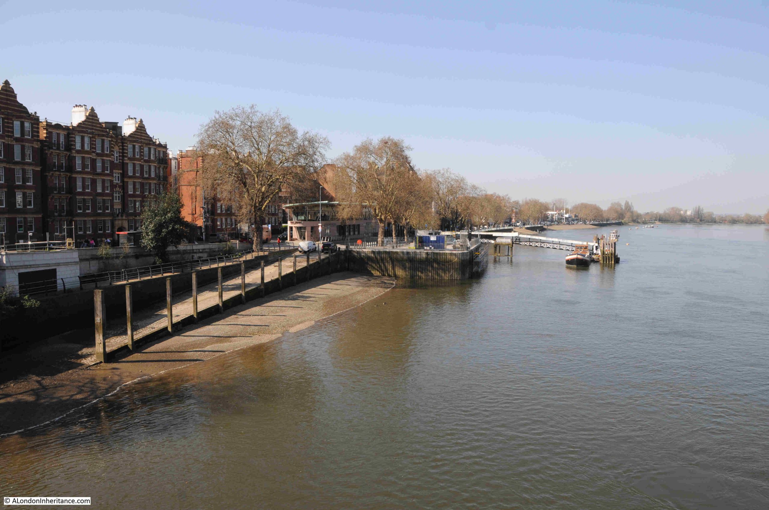
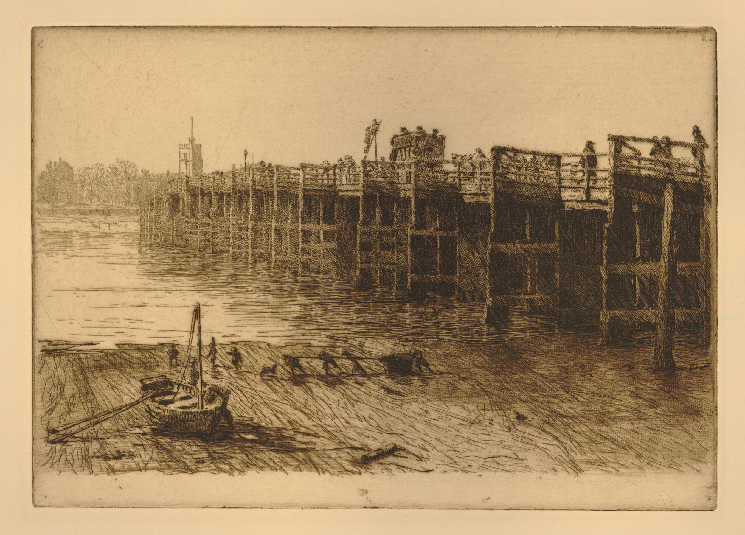
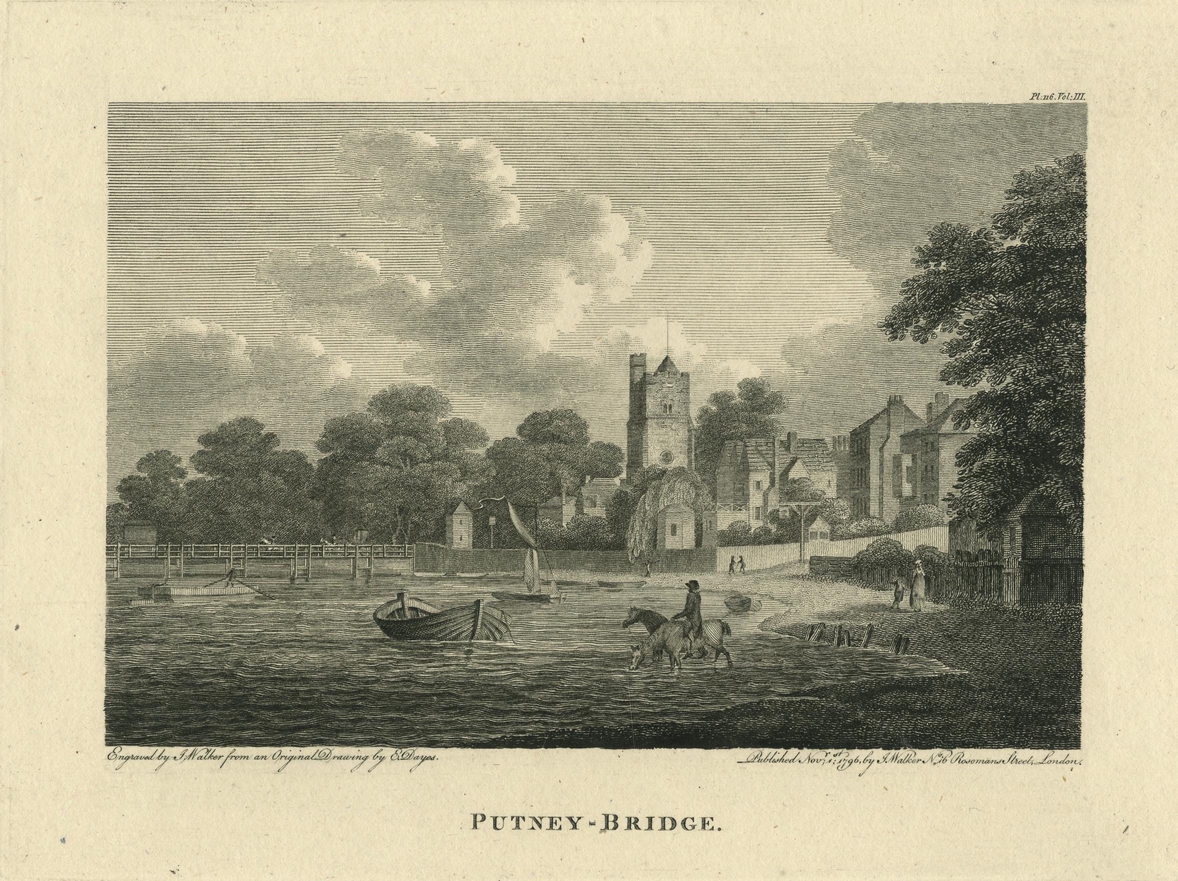
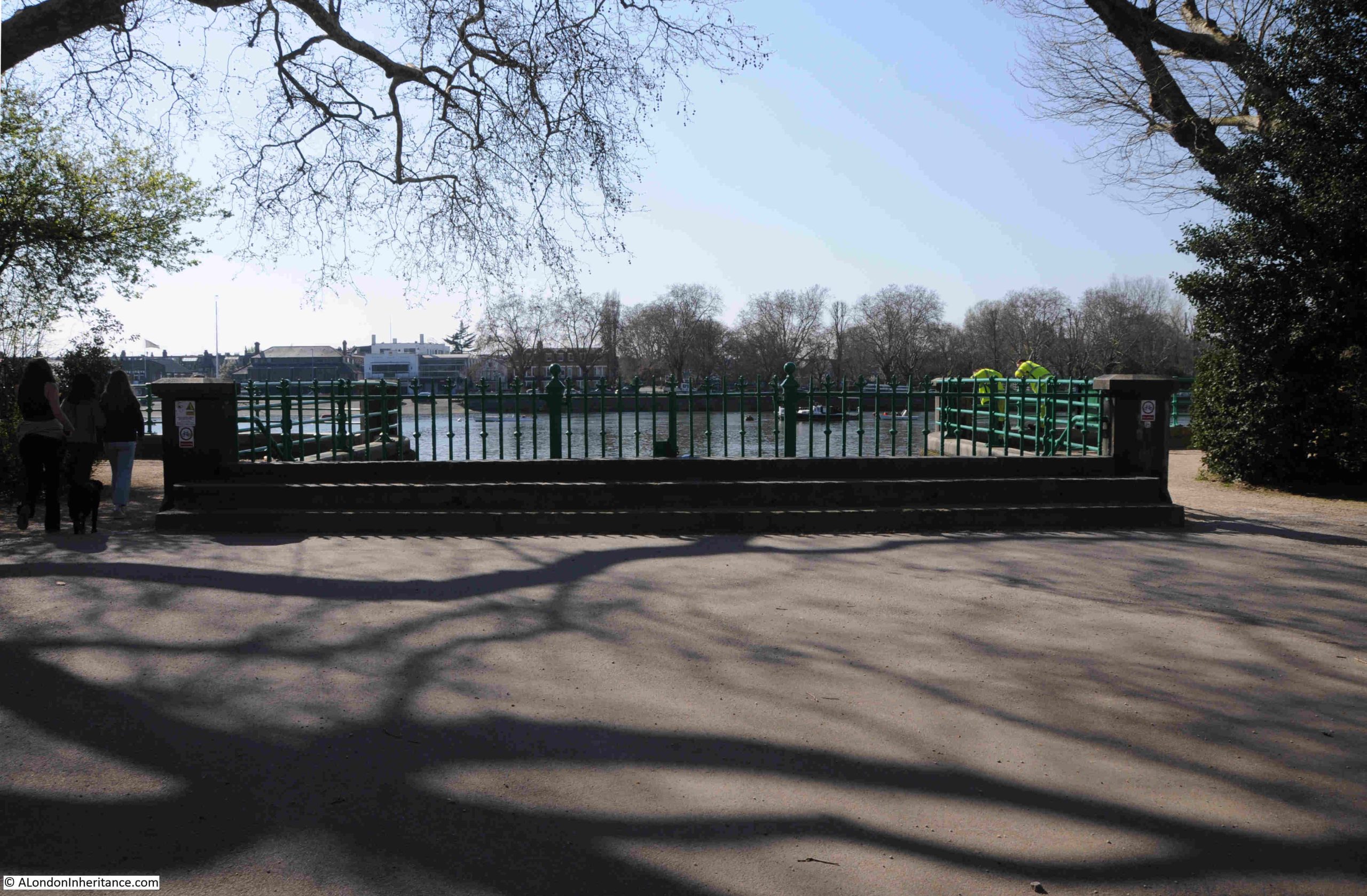
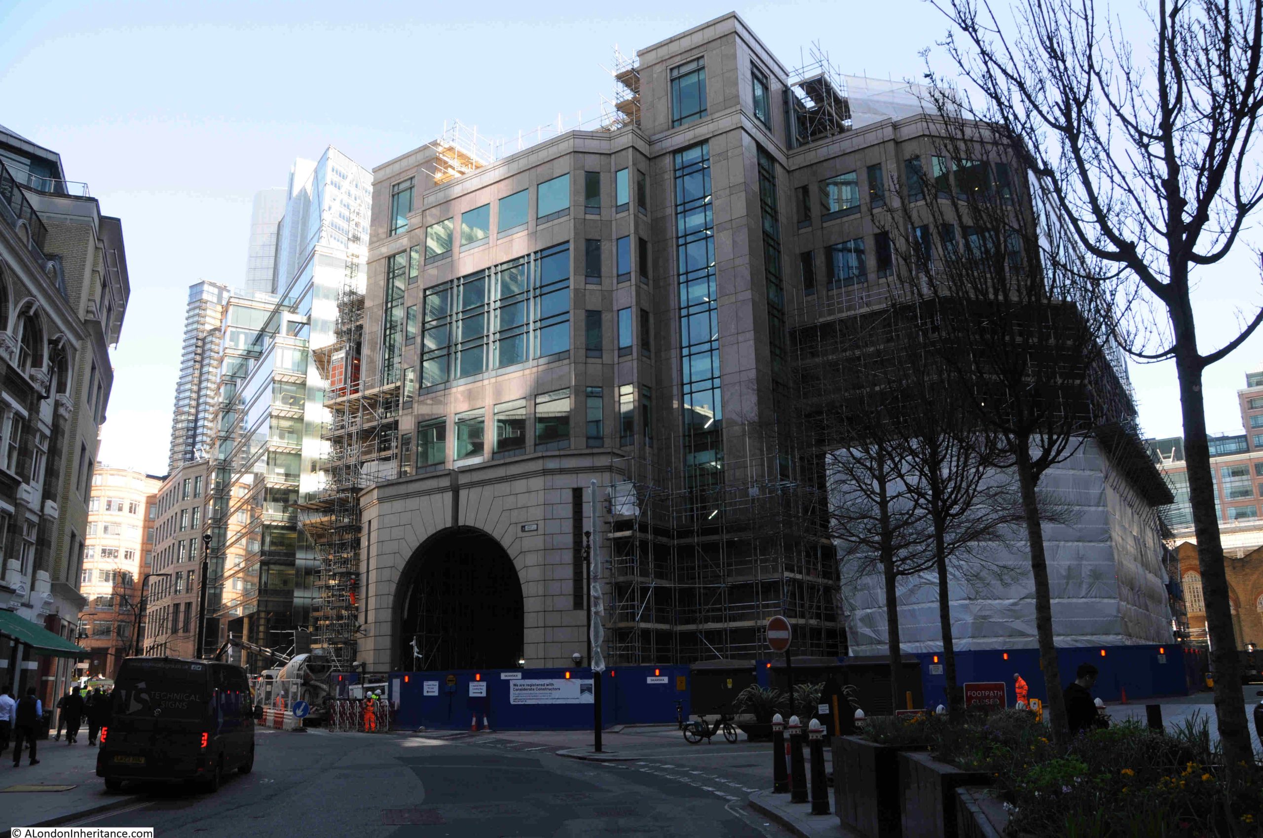
A couple of week’s ago, I wrote a post about the Putney Debates at St. Mary’s Church in Putney. Whilst there, I also wanted to find the location of some Thames stairs, as part of my long running attempt to visit the site of all the river stairs on the tidal Thames.
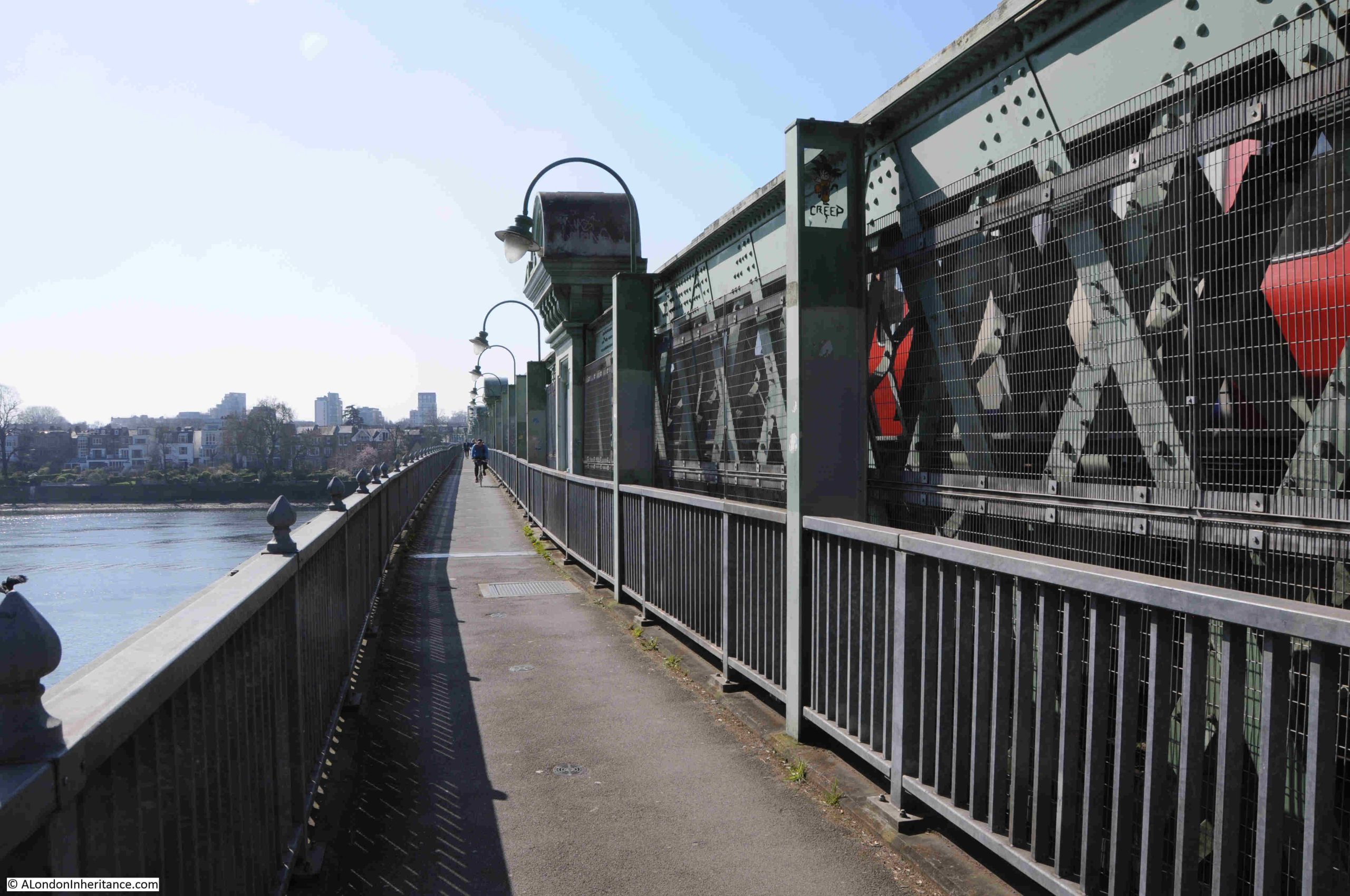
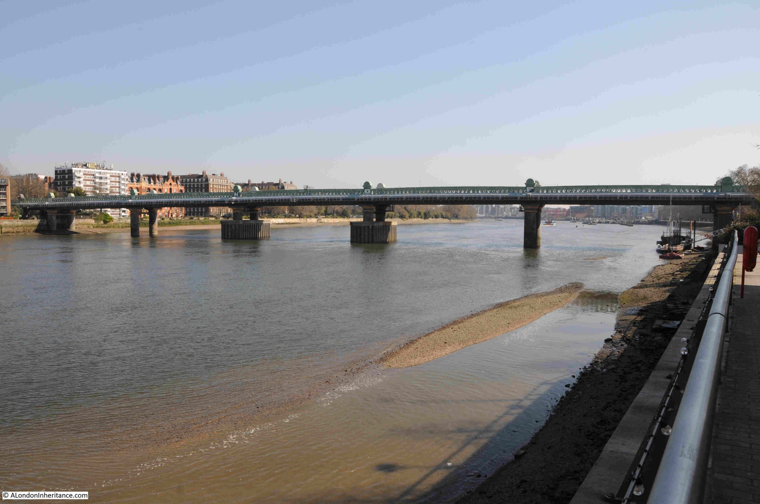
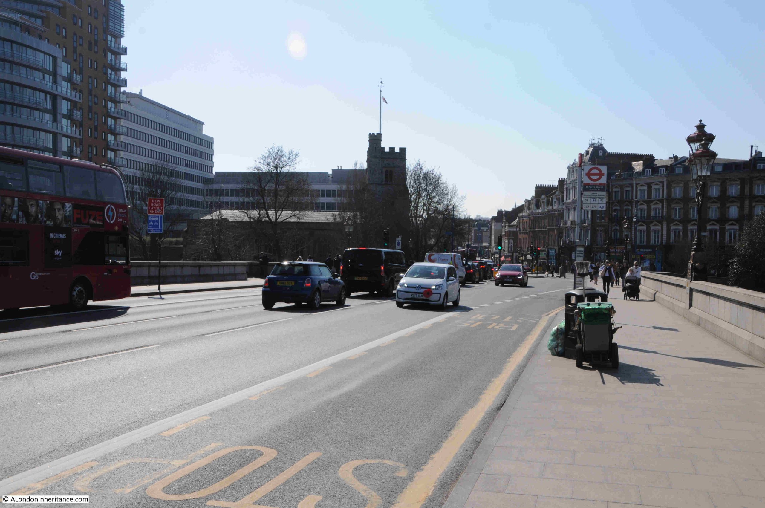
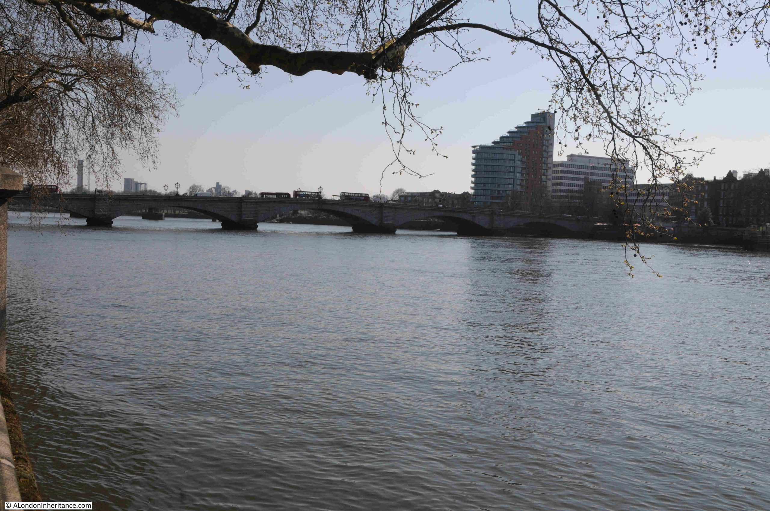
It was also an opportunity to have a walk around the area, and after arriving at Parsons Green station on the District Line, I headed south as I wanted to cross the river by a route I had not taken before, the walkway along the side of Fulham Railway Bridge:
The walkway is along the eastern side of the bridge, and brings back memories of the walkway that once ran along the side of Hungerford railway bridge, however this walkway looks to be better maintained.
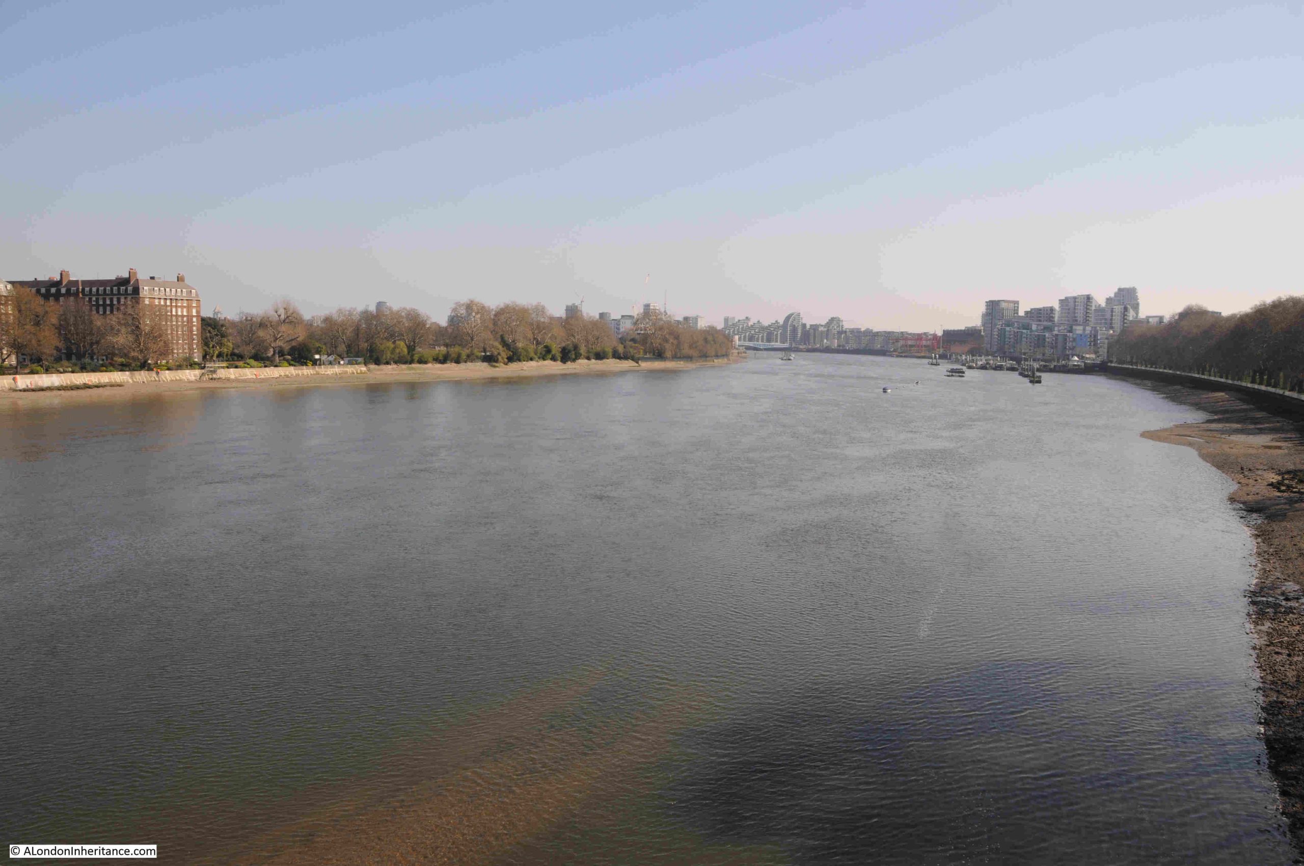
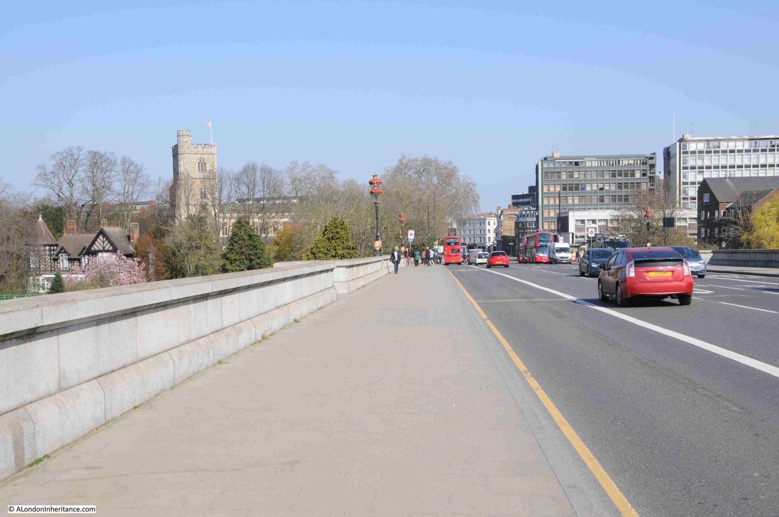
From the walkway there is a good view of the river to the east. The large building on the left is one of the large blocks of flats which seem to be a feature of this part of the north bank of the river around Fulham, and the trees on the left are part of the grounds of the Hurlingham Club:
The bridge was built to allow the extension of the District Railway, and the following report from the St. James Budget on the 19th of January 1889 provides a wonderful description of how places like Putney were being transformed, and it starts with a reference to the Civil War debates:
“THE NEW WIMBLEDON AND FULHAM RAILWAY – Saturday, September 18th, 1647 – ‘After a sermon in Putney Church, the great General Cromwell, many great officers, field officers, inferior officers, and adjutators met in the church; debated the proposals of the army towards a settlement of this bleeding nation; altered some things in them; and were very full of sermon which had been preached by Mr. Peters’. So it is recorded in authentic history.
Ten years ago it was not difficult to imagine Putney as the headquarters of Cromwell. Ten years ago the District Railway had not been extended to Fulham and quant old relics of the past had not been pulled down. Ten years ago Fairfax House, in which Queen Elizabeth used to lodge, was still standing, and the straggling old high street, with its curious cottages, had not disappeared. Ten years ago the ‘early clerk’ was a rara avis in Putney, and ‘villadom’ had not become aggressive. But the opening of Putney Bridge Station inaugurated a new style of things, and the old Putney was well nigh improved off the face of the earth.
Since that a further extension of the railway has been in progress, and the early part of this year will see Wimbledon in direct communication with the aristocratic west and with all parts of the District and Metropolitan system. The present terminus to the District Railway in the south is at Putney Bridge, on the Fulham side of the Thames; but the opening of the new branch will carry the rails across the Thames to Putney proper, where a station is being established to serve the purpose of both the District and South-Western systems. Thence the line will pass through West Hill and Southfields in the Wandsworth District, and, skirting Wimbledon Park with its expansive lake, will for the present come to a stop at Wimbledon Junction.”
This article is interesting for several reasons. I really like the historical links, it demonstrates how what had been villages around London were being rapidly transformed in the later part of the 19th century, and it highlights the part played by the rapidly expanding rail network.
I also like the term “villadom” which probably describes the suburban houses that were rapidly taking over what had been the fields surrounding Putney and Fulham.
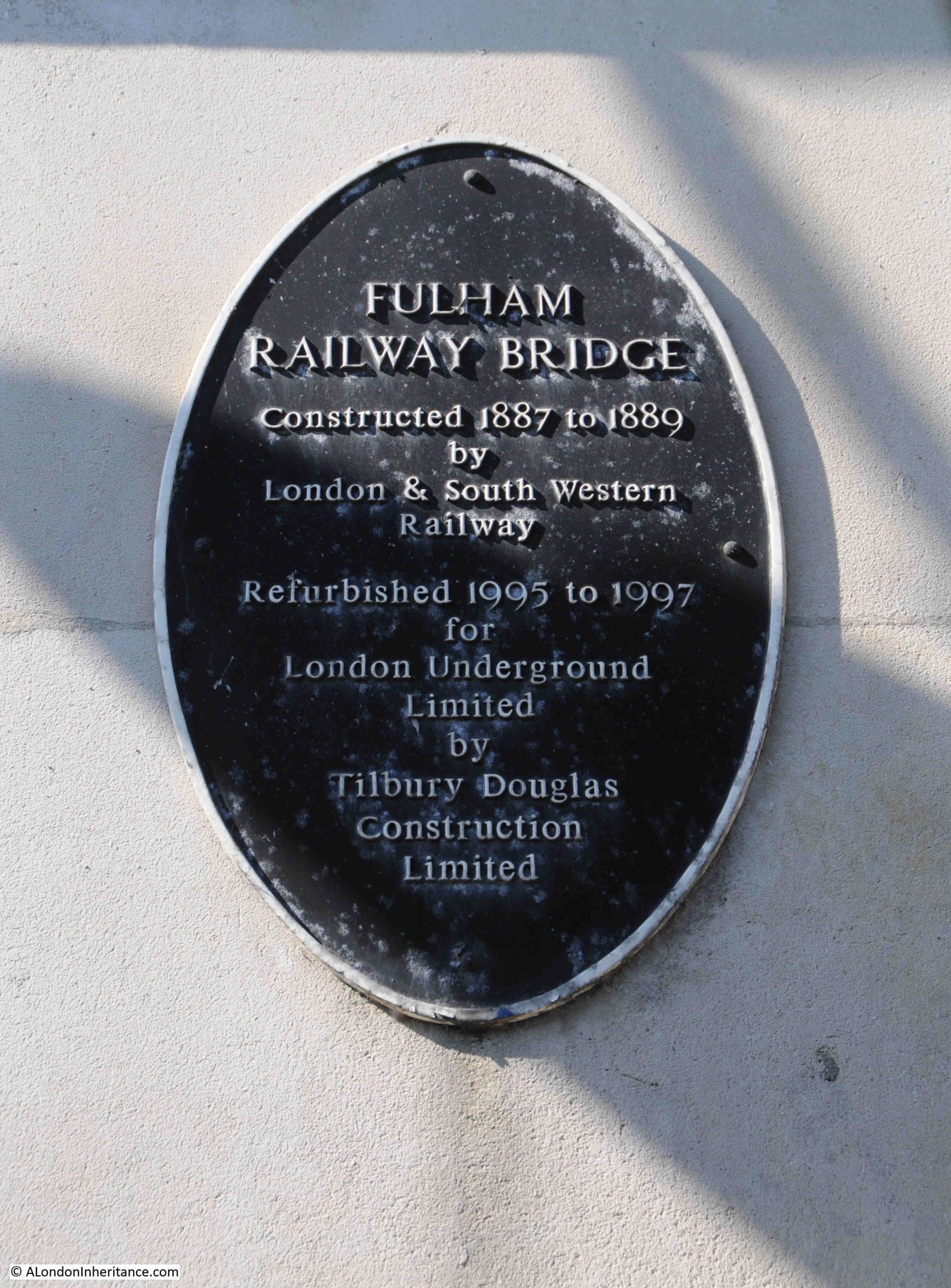
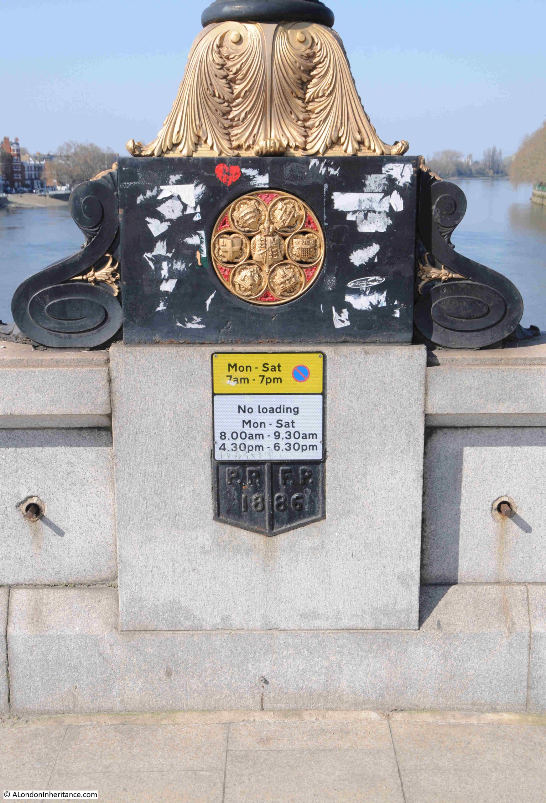
There is a plaque on the bridge alongside the walkway that records the construction and later refurbishment of the bridge:
The bridge was designed by William Jacomb, who had been an assistant to Brunel, and Jacomb created a rather graceful structure across the river, however the large concrete cutwaters around the central columns, which were added later to protect the bridge against any accidental collisions, slightly detract from the architect’s original intentions:
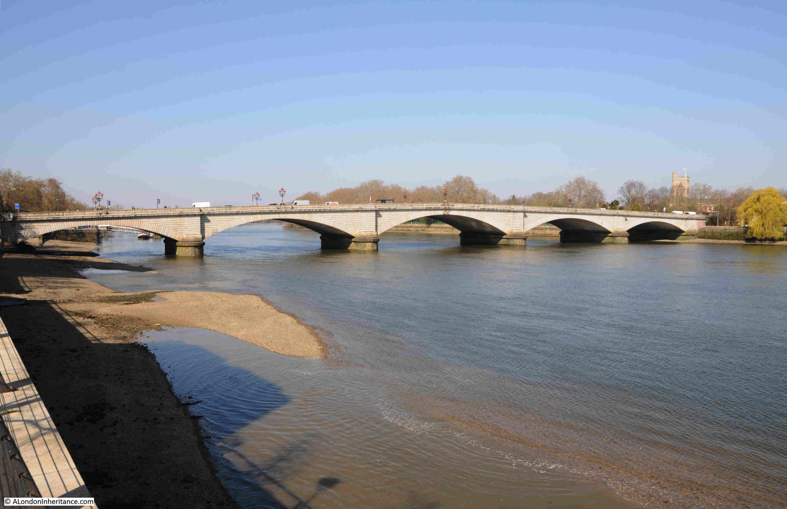
Just to the west of the railway bridge is Putney road bridge:
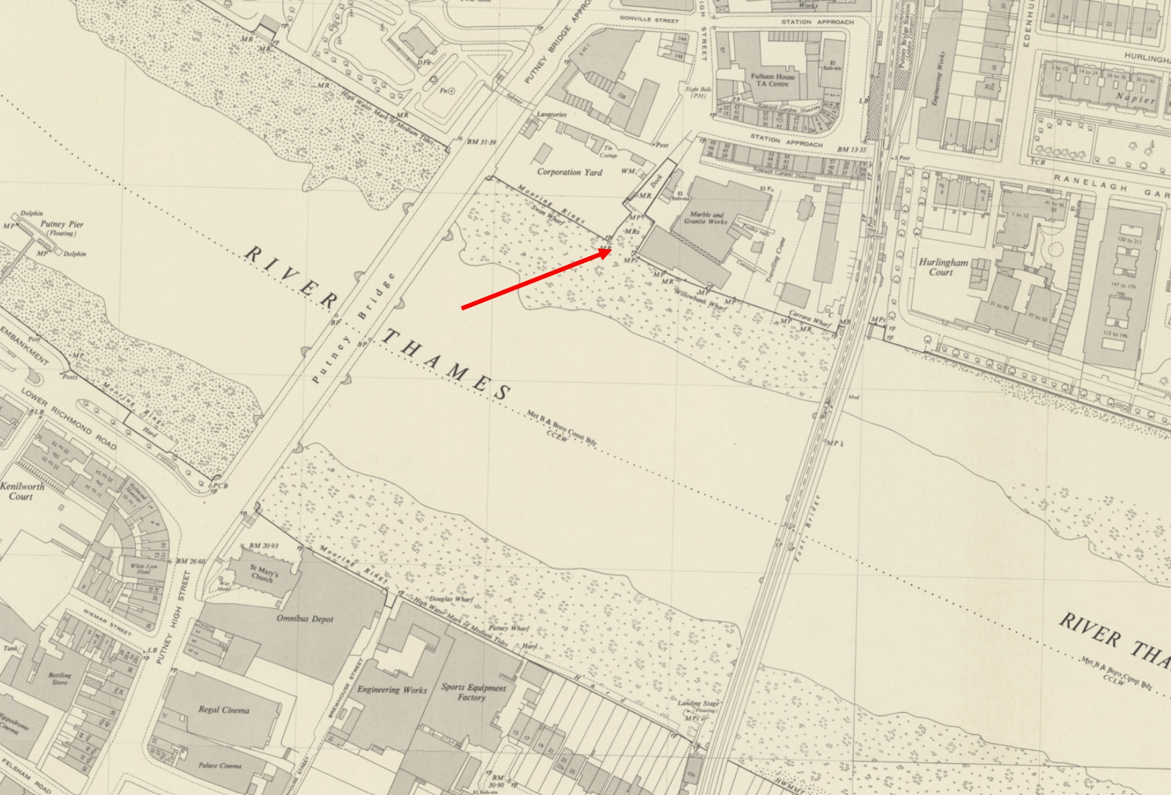
As with so much of the river, there was a reasonable amount of industry along the banks, and on the north, Fulham bank of the river, there was Swan Wharf and Draw Dock, which was used by the local corporation as a place where barges could be loaded with rubbish and transported down river to landfill sites around Rainham. The Draw Dock is highlighted by the red arrow in the following map, with Swan Wharf to the left (‘Reproduced with the permission of the National Library of Scotland“):
To the right of the Draw Dock was the granite, marble & mosaic works of Fenning & Co.
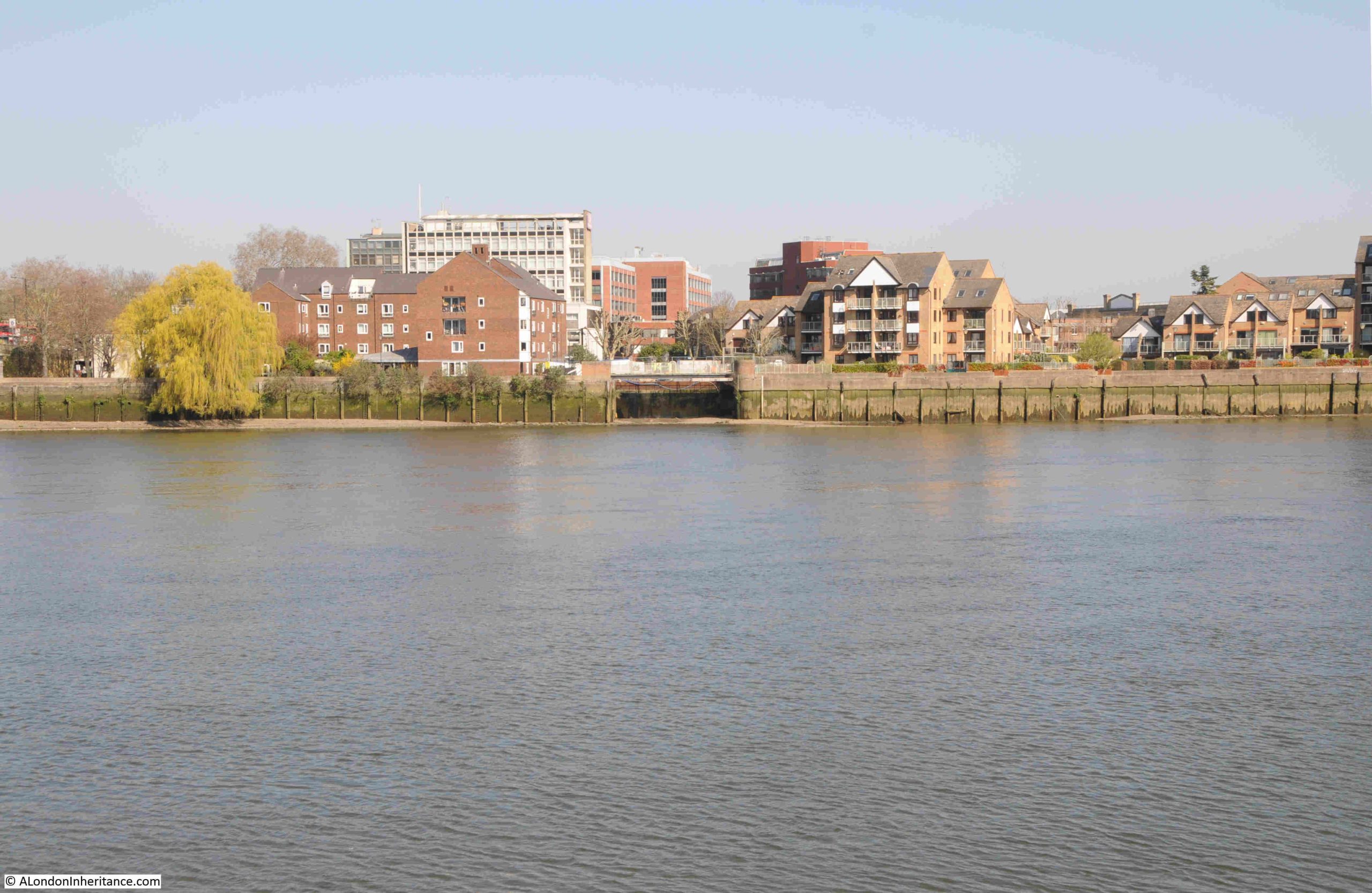
Whilst the corporation yard and granite works have been replaced by residential, the entrance from the river to the Draw Dock remains, although it extends no further back than the cut in the embankment seen in the centre of the following photo:
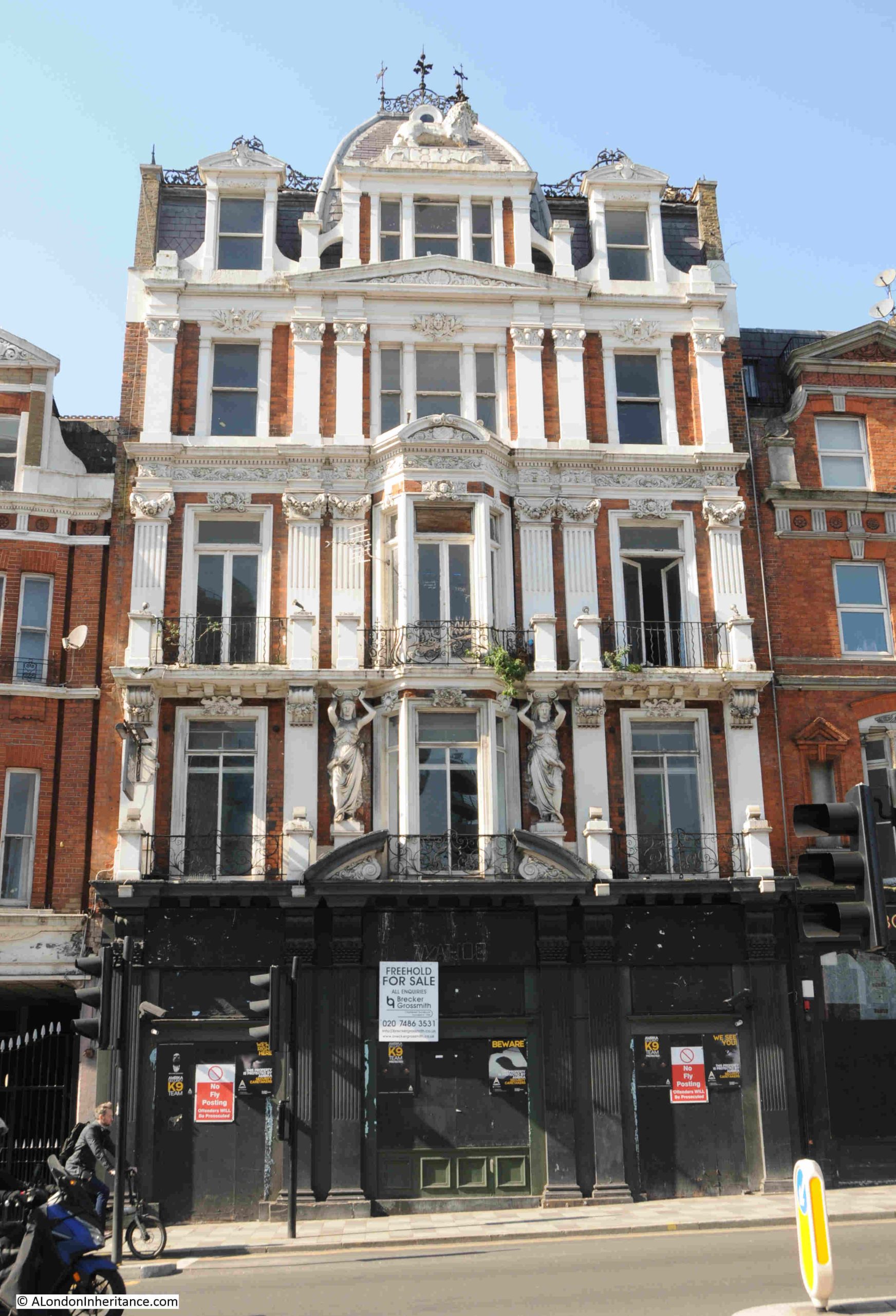
From the location of the above photo, I walked up to the church featured in the previous post on the Putney Debates. Directly opposite the church, on the approach road to the bridge, is a rather magnificent late 19th century pub:
This is the Grade II listed White Lion Hotel and Public House, which dates from 1887.
The date of construction is within the same couple of years as that of the railway bridge and the extension of the District railway to Putney, and is another example of how Putney was being transformed.
An 1888 advert for the White Lion provides an overview of the business when it opened:
“THE NEW WHITE LION HOTEL, PUTNEY – The above Newly Built Hotel when completed will afford unusual accommodation for Boating Parties, Families and Commercial Gentlemen. It contains Sixteen Spacious Bedrooms, Three Bathrooms, and Sitting Rooms, Magnificent Billiard Room with Two of Messrs. Cox and Yeoman’s Tables, fitted with the latest improvements, Bowling Saloons, Spacious Dining and Grill Room and also a Large Room for Banquets and Public Dinners.”
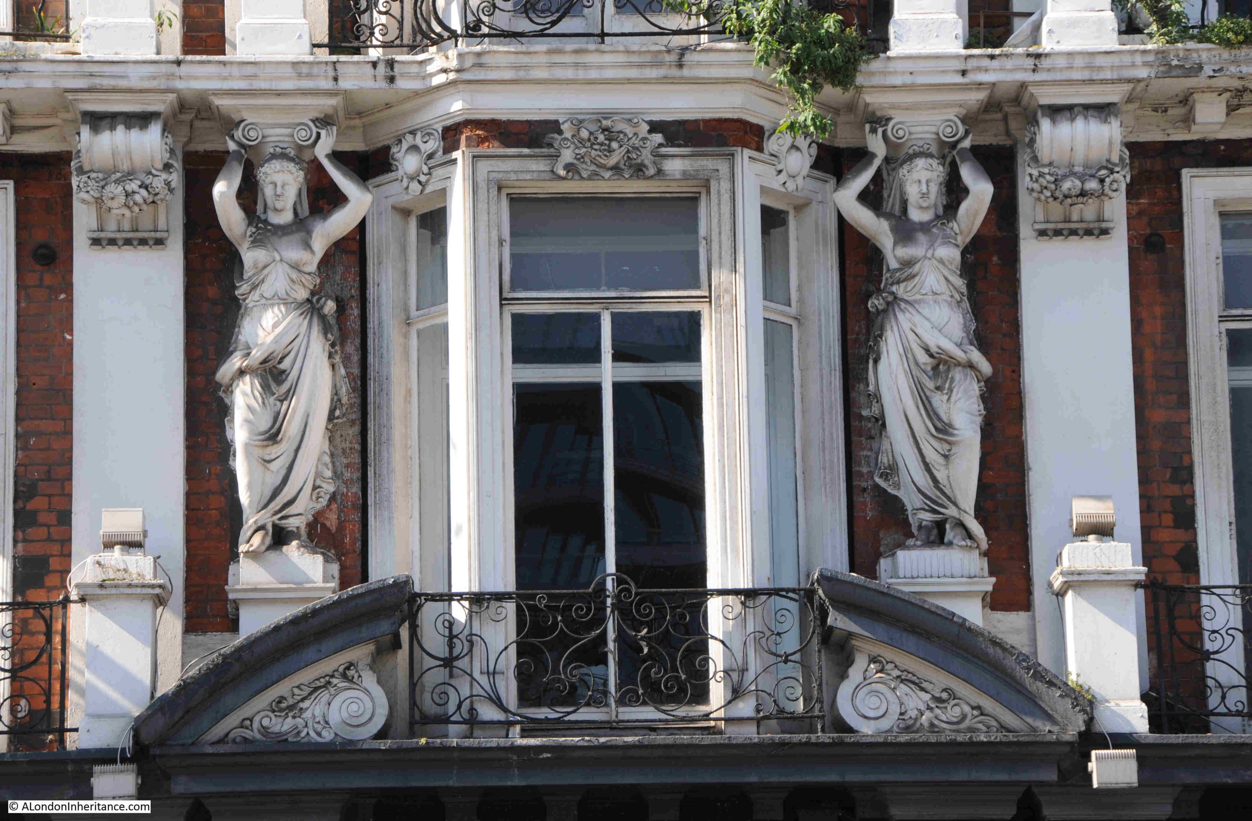
There are not that many pubs where you can see two large Caryatids supporting the upper floors:
The White Lion was built on the site of a previous pub with the same name, as being at the southern end of the bridge, and opposite the church, was a good location.
There are plenty of references to the pub going back to the early years of the 18th century, and it would be interesting to know if it was here when Cromwell was in the church opposite.
As is still the case, it is generally only bad news that makes the media, and the following example of a tragic accident in the White Lion in January 1750 again highlights the almost casual nature of death across London in previous centuries:
“On Tuesday last a melancholy accident happened at the White Lion at Putney, where some Officers being quartered, a Pair of Pistols belonging to one of them lay on the table where two Sons and a Daughter of Mr. Barnsley were playing; one of the Boys, about six years old (who was the eldest) taking up a Pistol, clapped it to his sister’s forehead, saying ‘I’ll shoot you’, and so indeed he did.”
I have left out the rest of the description of the accident as 18th century newspapers did not leave out any graphic details. There was no report of any action against the Officer who had left a loaded pistol out in a public space and it was just regarded as a tragic accident.
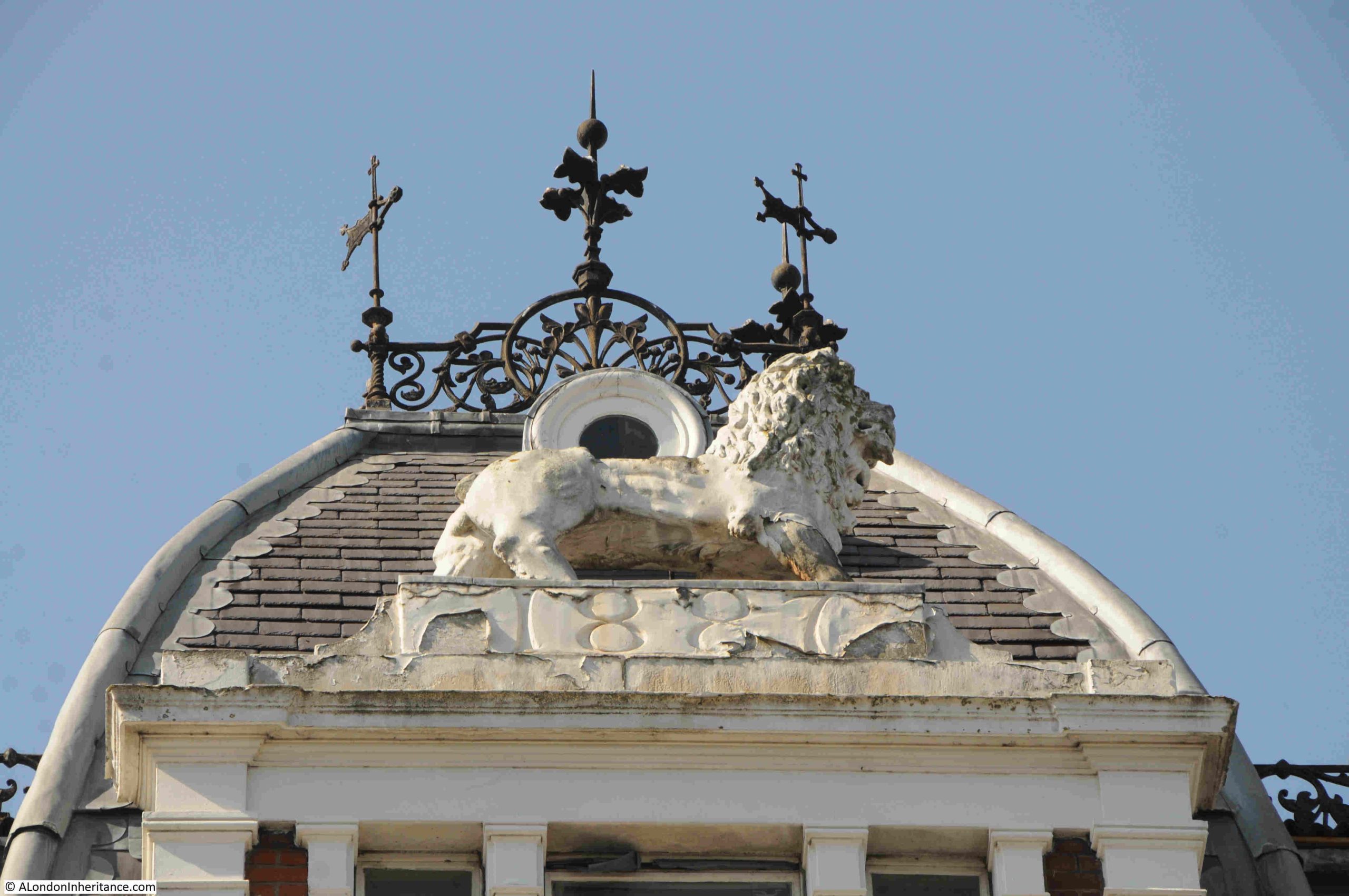
At the top of the building there is a large White Lion, and the date of construction:
I cannot find when the White Lion closed. It has been through the chain pub branding of Slug and Lettuce and Litten Tree. It has been an Australian themed bar and a sports bar, but the building seems to have been empty since 2012 / 2013.
The Historic England assessment record states that it is in poor condition, of medium vulnerability, there is slow decline and no solution for the building is agreed, so not a very promising future.
It is the type of pub that Wetherspoons would typically take over and restore, however there is already a Wetherspoons, the Rocket, in a brand new building just to the east of the church.
Hopefully there will be a future use for this wonderful building.
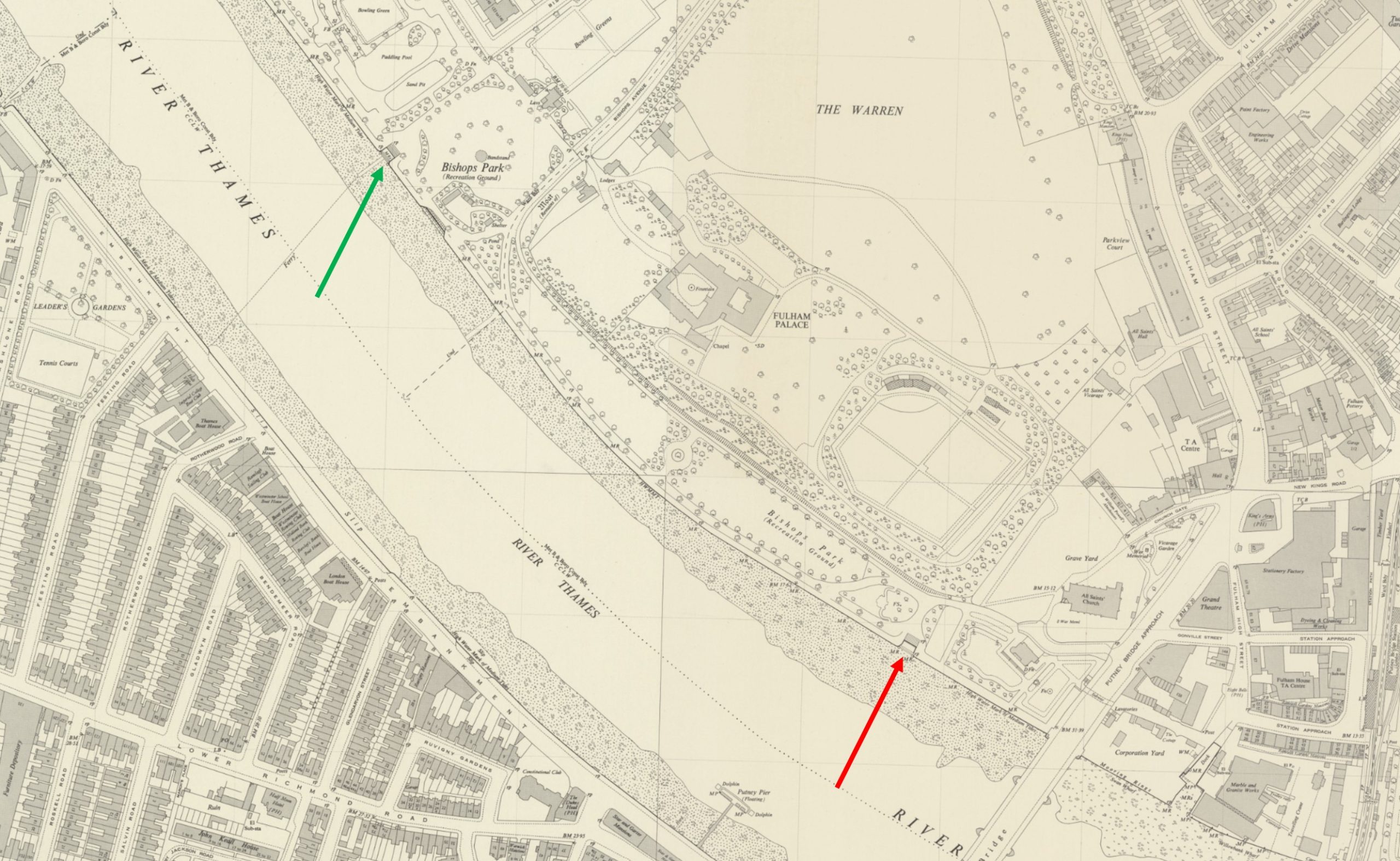
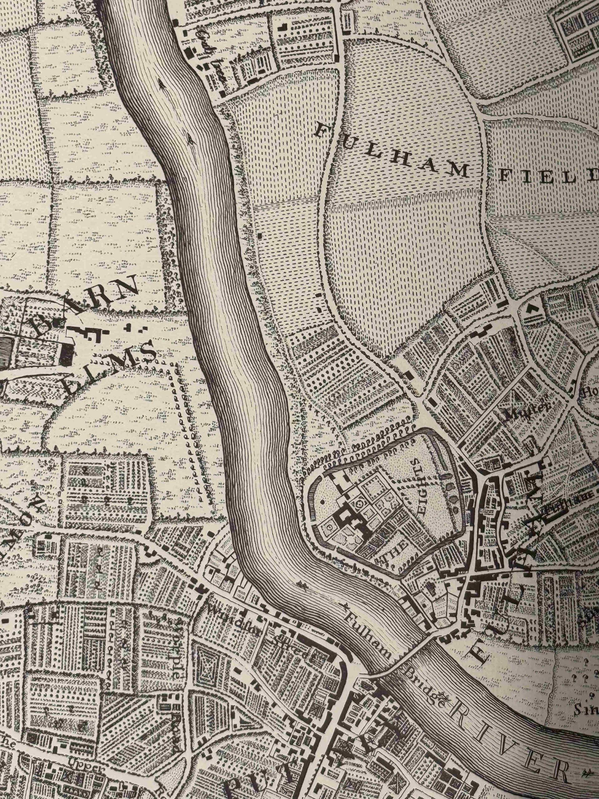
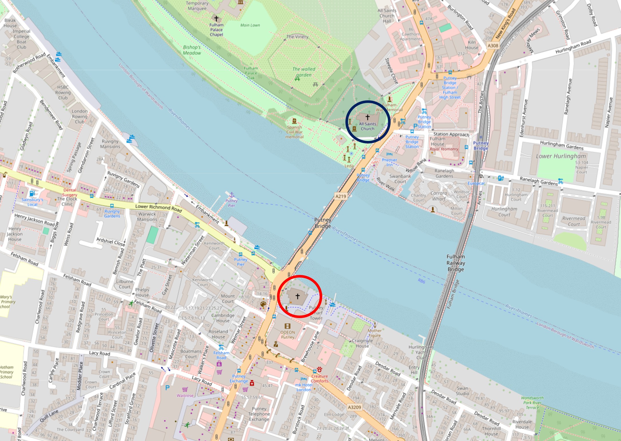
One of my aims was to visit two Thames stairs listed in the Port of London Authority records of access points to the river. I have highlighted them in the following map. The red arrow is pointing to Bishops Park Lower Stairs and the green arrow to Bishops Park Upper Stairs (‘Reproduced with the permission of the National Library of Scotland“):
Seen from Putney, Bishops Park Lower Stairs are on the left of the following photo. The church on the right is All Saints, Fulham:
A close up of Bishops Park Lower Stairs:
As I mentioned in my last past on the Putney Debates, churches are often seen adjacent to important crossings or boundaries, and at either end of Putney Bridge, there is All Saints Fulham and St. Mary’s Putney, as shown in the following photo:
The first bridge across the river was opened in 1729, but there had been a ferry crossing here for many previous centuries, so whilst today the churches are at either end of the bridge, they would previously have been at opposite ends of the ferry crossing, when perhaps it would have been important for a quick prayer before braving a crossing by water.
The first bridge was of wooden construction. There was much opposition from the watermen operating the ferry, as the bridge would have destroyed their business. Compensation and pensions were needed to address the waterman’s complaints.
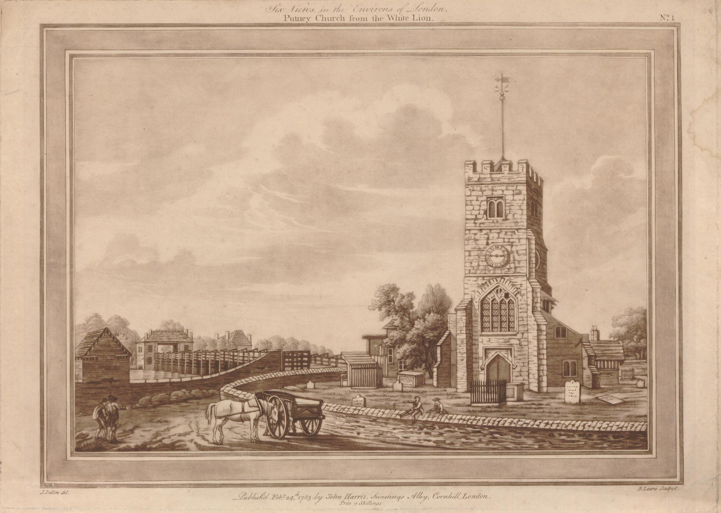
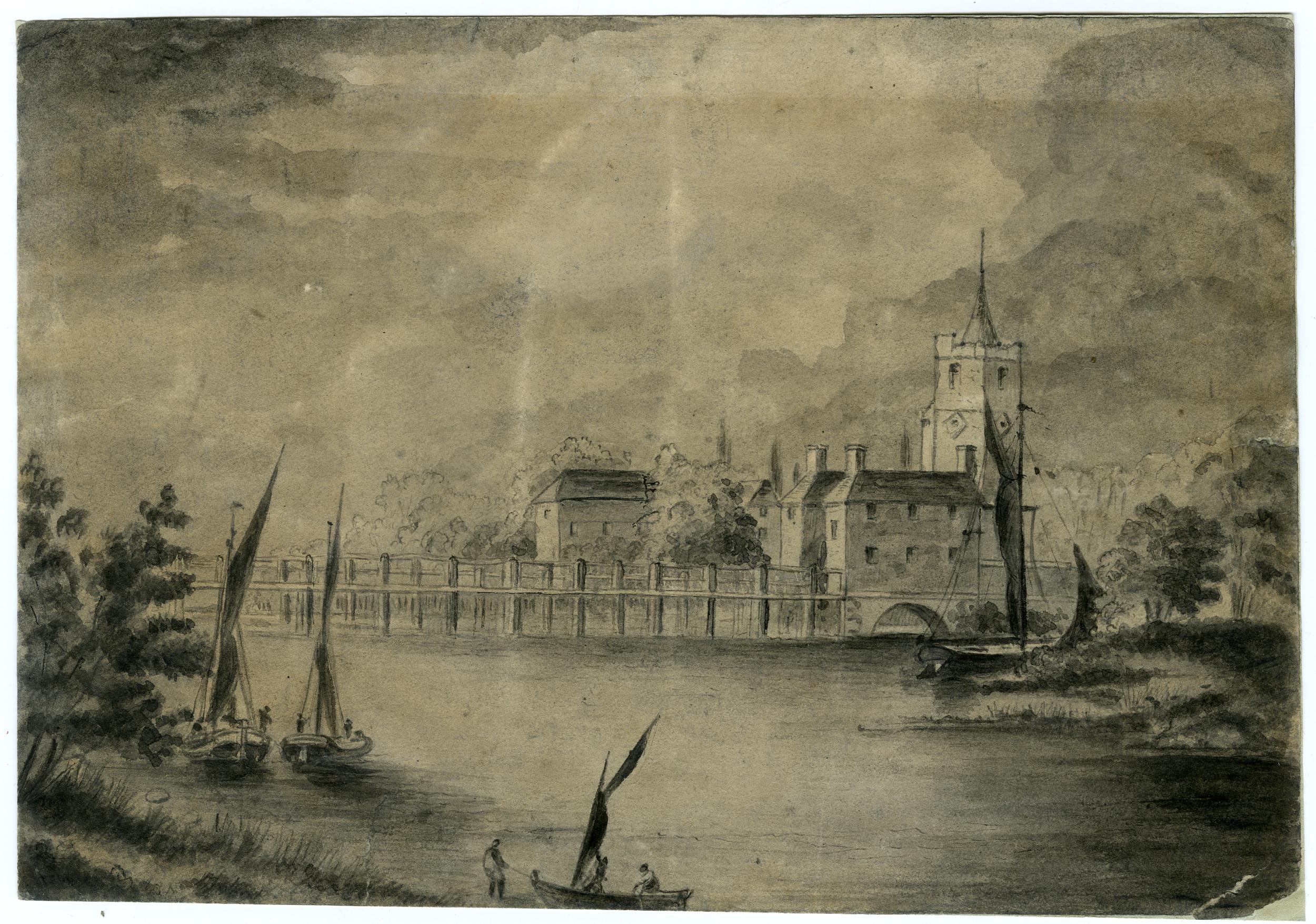
The churchyard of St. Mary’s was originally much larger than we see today. When the wooden bridge was built, the road curved around the larger churchyard to access the bridge, as can be seen in the following print, which was published in 1783 and titled “Putney Church from the White Lion”, again confirming the existence of the pub long before the 1897 building we see today:
The Port of London listing does not include any access points along the Putney side of the river, which is strange as there are a number of slipways, although some are quite recent such as the slipway in the following photo. Where the slipway reaches the higher point, which then extends into the river, was one of the construction sites for the Thames Tideway Tunnel:
The point in the river opposite the Tideway Tunnel site is where the University Boat Race starts.
Looking towards Putney on a busy Putney Bridge:
The view in the opposite direction towards Fulham:
In the early 18th century, there were no bridges between London Bridge and Kingston, so if you needed to cross the river, you would have needed a Waterman.
In 1726, the organisation to construct the bridge was put in place, as reported in the Flying Post on the 19th of May, 1726: “London, May 19. Above 180 Persons of the Nobility, Gentry &c. are particularly named to be Commissioners, or a Body corporate, for building a Bridge cross the Thames, from Fulham in Middlesex to Putney in Surrey.”
The references to Middlesex and Surrey recall the original counties that much of modern day Greater London were once part of.
Construction began in March 1729 as reported: “The building of the new Bridge over the River Thames from Fulham to Putney was begun yesterday in Presence of the Commissioners appointed for that work, and the Scaffolding in Fulham side was great part finished, as was that on the Side of Putney this day; and the first pile is to be drove tomorrow; several hundred men are employed in the great undertaking.”
The bridge was in use by the end of the year, and on the 11th October, the Kentish Mercury was reporting that: “The New Bridge over the River Thames from Fulham to Putney is so near finished that the wood work almost joins the brick and stone-work at each end; and the top being for the most part covered, several persons passed over yesterday; and ’tis reckoned that before Christmas, coaches and carriages may pass. ‘Tis no small surprise to see so great a Work complete in so short a time.”
The bridge was a toll bridge. The following print shows the toll gate at the Fulham end of the bridge. There also appears to have been a toll gate at the Putney end:
I cannot find a list of the tolls, but did find the following report on the lengths that the staff of the toll gate would go to, in order to bring those who tried to avoid the toll to justice. On the 3rd of June, 1754:
“Yesterday morning, about Four o’clock, two Gentlemen in a Coach attempted to go through the Toll-Gate at Fulham Bridge, without paying the Toll, but were prevented by the Toll-Man, upon which one of the Gentlemen jumped out of the coach, ran up to the man, and with great Imprecations swore he would shoot him, at which time he snaped a Pistol against the Man’s Breast, and afterwards beat him over the Head with the But-End of it in a barbarous Manner. Mr. William Low, master of the Gate, seeing his Servant so cruelly used, pursued the Gentlemen to London, where he had one of them apprehended, and being carried before Henry Fielding, Esq. he was by him committed to New Prison.”
View of the Fulham end of the bridge, with the toll gate looking a bit smaller than in the previous print. It is easy to work out which end of the bridge is shown, as the church at the Fulham end had a small turret protruding above the tower:
It is interesting to see in these prints how the river had a natural foreshore leading up to the land, long before we built large embankments to hold back to river.
In the above print there are a couple of horses drinking in the river. Just above and to the right of the horses is what I thought may have been a gallows, but looking closely at the print there is a sign hanging from the wooden structure, so this may have been the sign of a pub alongside the Fulham end of the bridge.
The first wooden bridge survived for a remarkably long time, and was not replaced by the current stone bridge until 1886, when the Sir Joseph Bazalgette designed bridge of Cornish granite opened.
At the centre of the bridge:
Where a plaque shows the 1886 date of the bridge and the boundaries of the two parishes of Putney and Fulham:
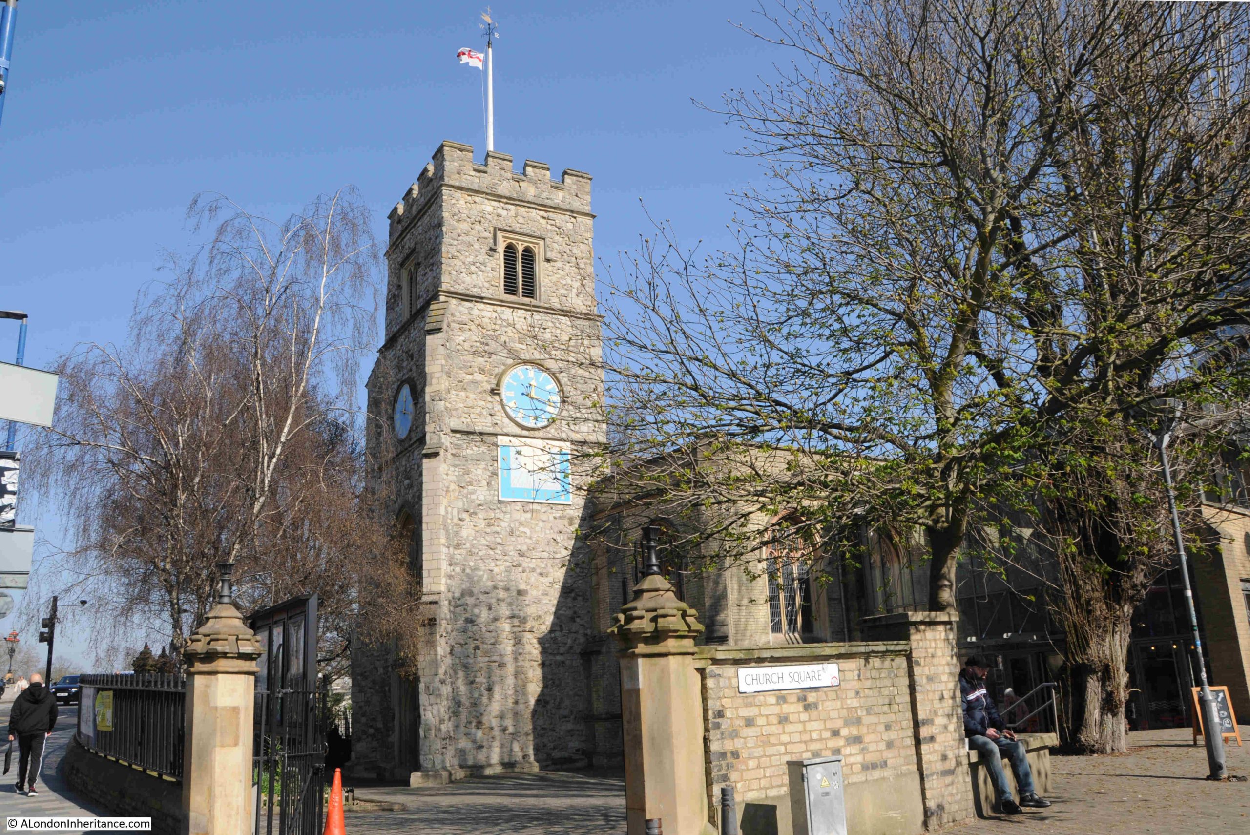
Close to the northern end of the bridge is All Saints, Fulham:
One of the comments to my post on the Putney Debates mentioned All Saints, and that it was a location from the film the Omen, for the scene where the vicar is spiked by the lightning conductor.
On the bright spring day of my visit, the church did not have any of the sinister atmosphere of the Omen.
The church tower still retains the small turret seen in many of the prints of the bridge:
The church tower is the oldest part of the church. The first mention of the church dates from the 13th century, and the dedication to All Saints appears in the mid 15th century when the tower was being built.
In the 1880, the same decade as the railway was extended across the river, that the White Lion Hotel was being built, and the author of the earlier newspaper article complained about the aggressive “villadom“, the church was considered too small for the growing population, and was also subject to flooding from the Thames, so the original church was demolished (except for the tower), and a new, much larger church built to a design by the architect Sir Arthur Blomfield.
The interior of the 1880 church:
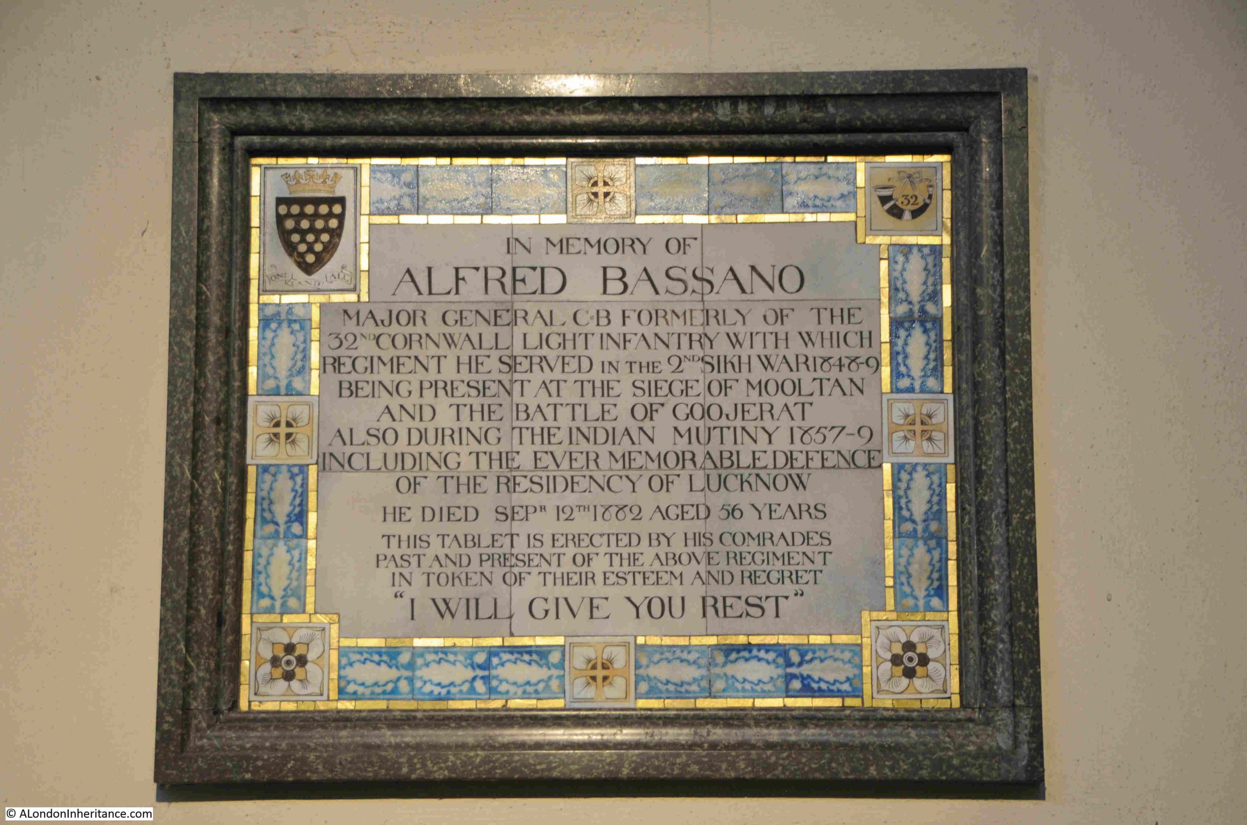
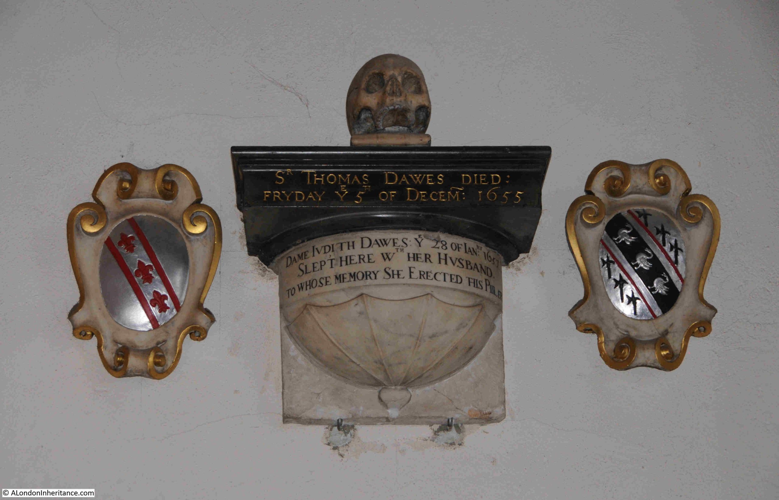
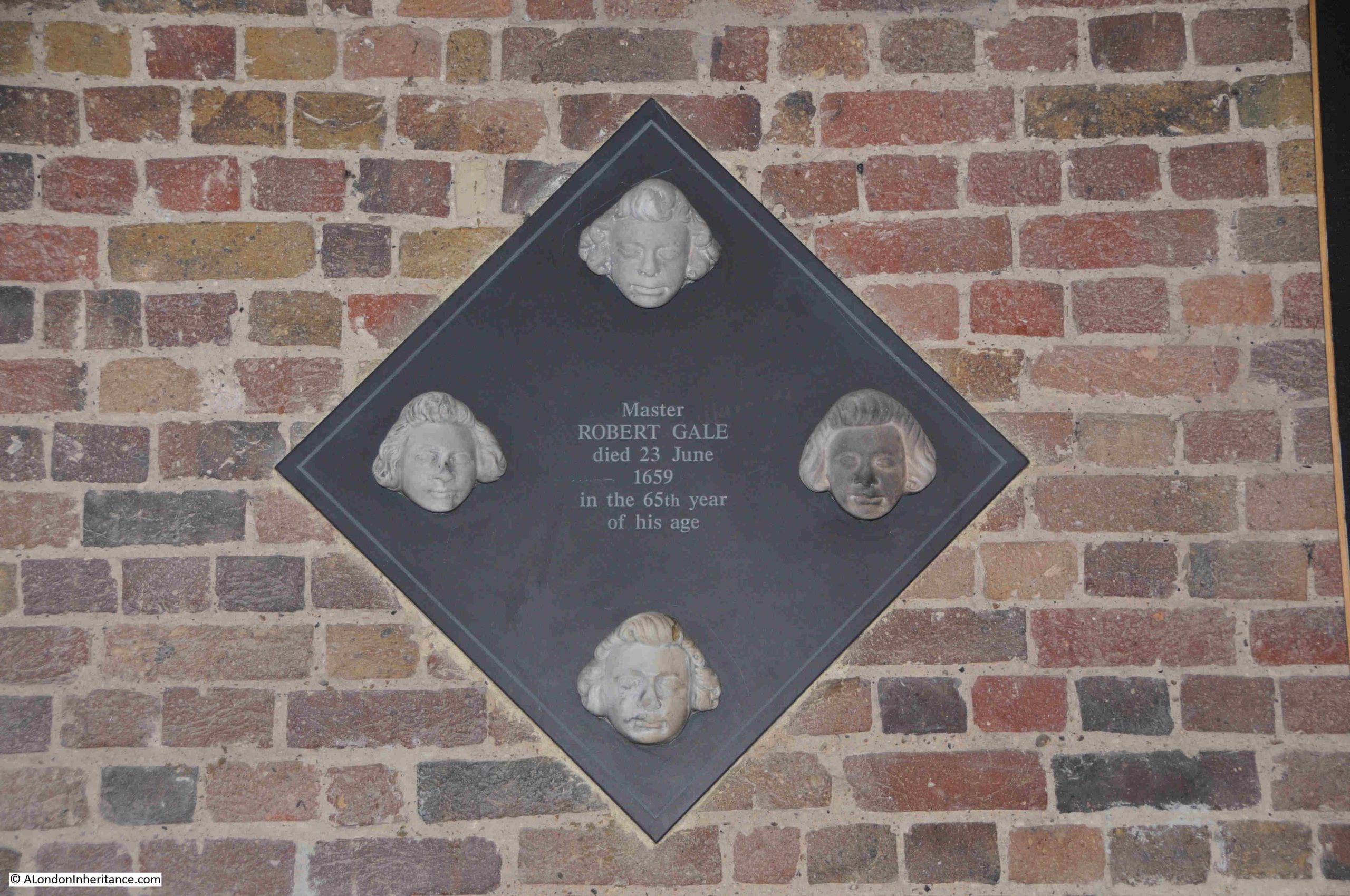
There is a mix of memorials in the church, including ones from the current version of the church, such as the tablet erected for Alfred Bassano, who must have had a fascinating life in military service:
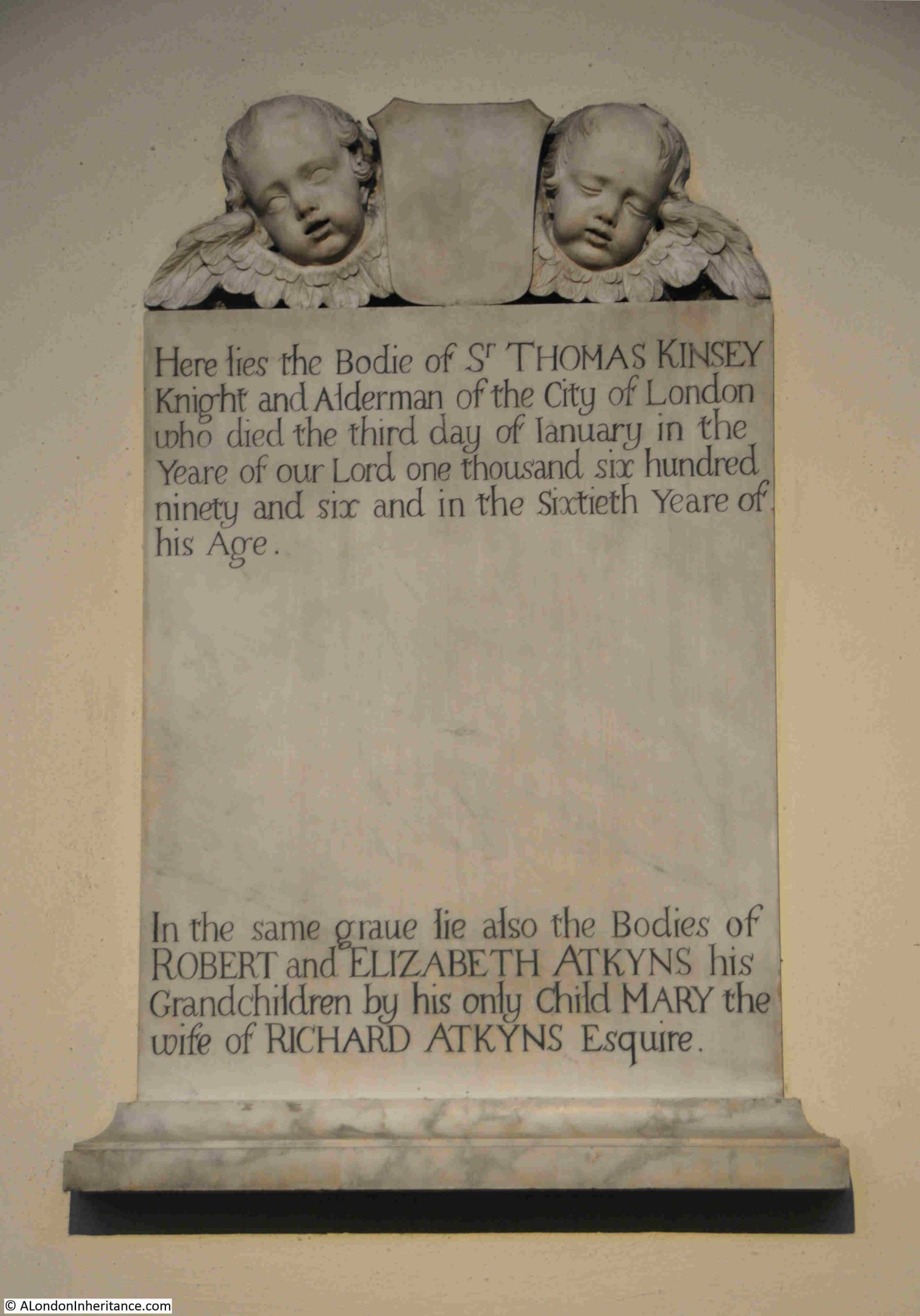
Along with memorials which must have come from the original church, including that of Sir Thomas Kinsey, who was an Alderman of the City of London and who died on the 3rd of January 1696 at the age of 60. He must have grown up during an interesting time in London, with the Civil War and the restoration of Charles II when Thomas Kinsey was aged 24:
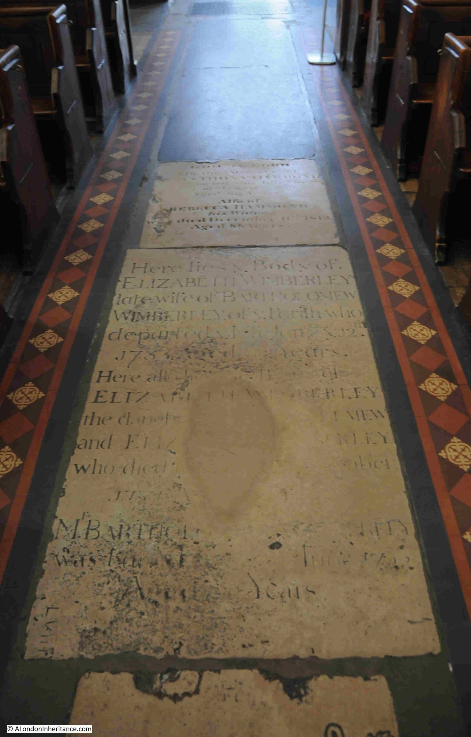
To prevent flooding, the new church was built three feet higher than the original church, so I wonder whether the floor level of the interior of the church is the same or also raised by three feet.
These memorials in the floor pre-date the current church, so either the interior floor level is the same, or these have also been raised by three feet:
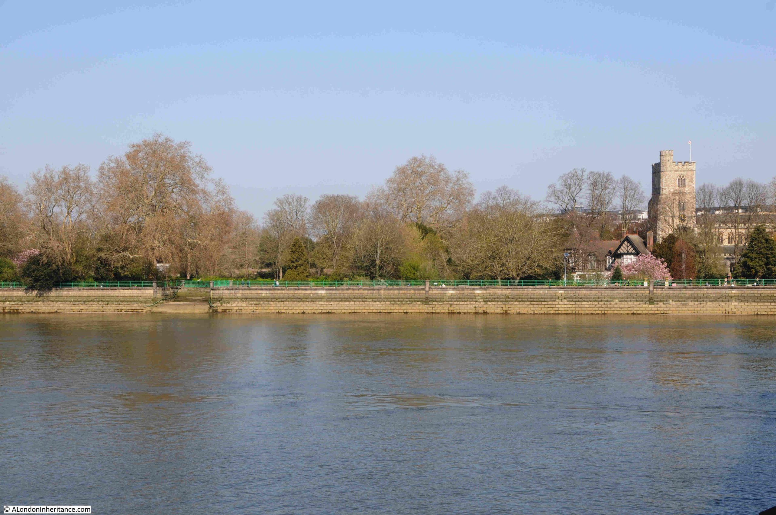
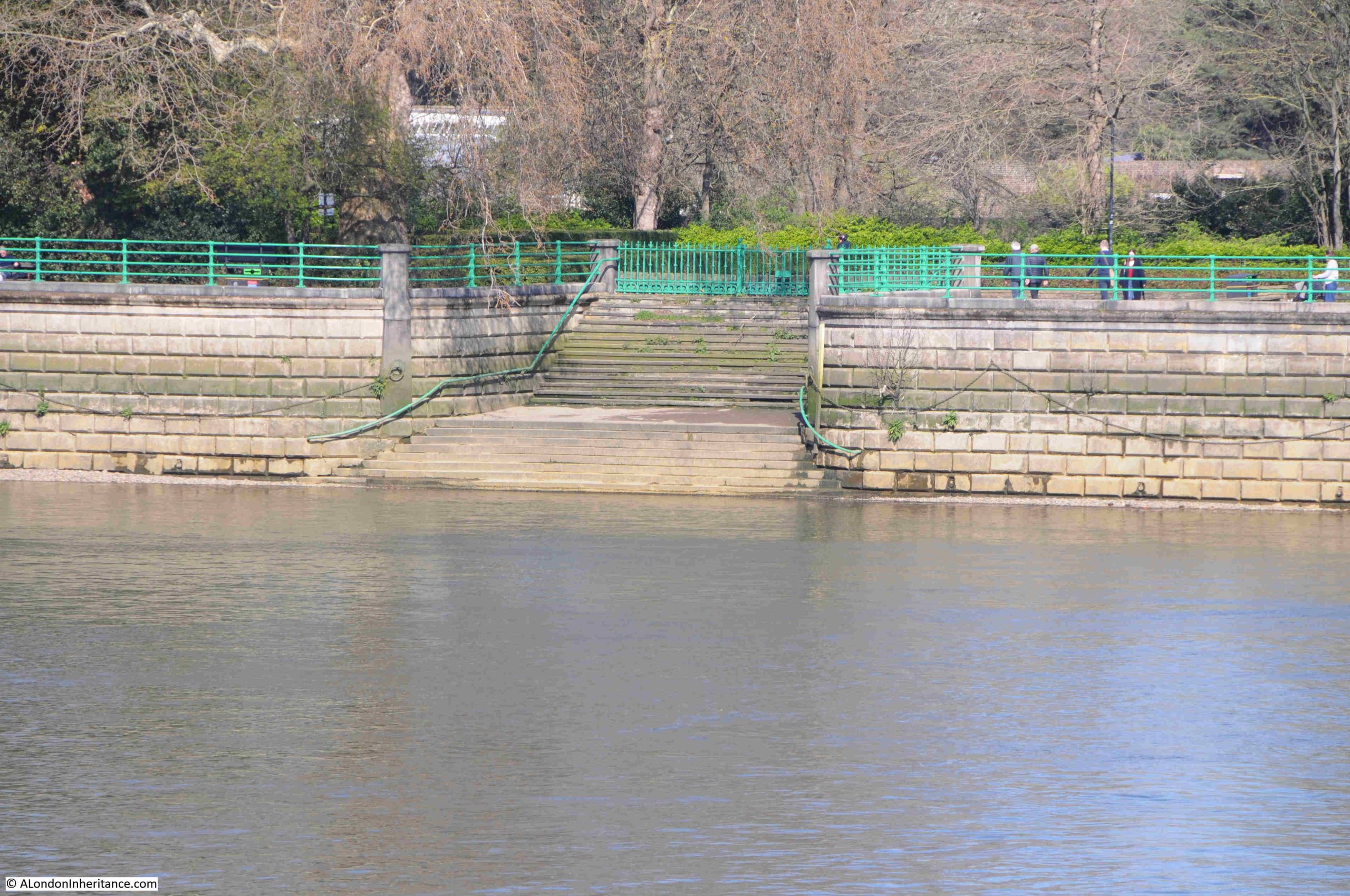
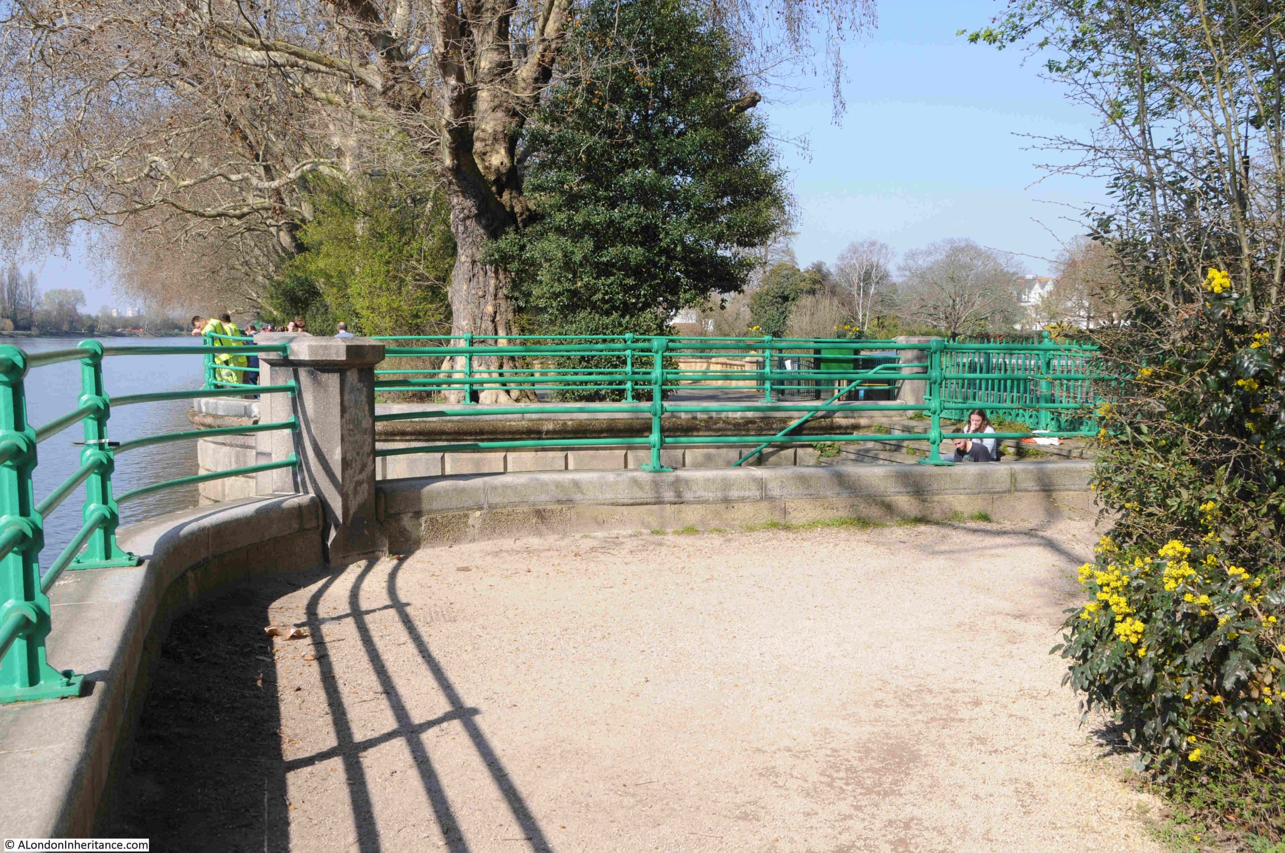
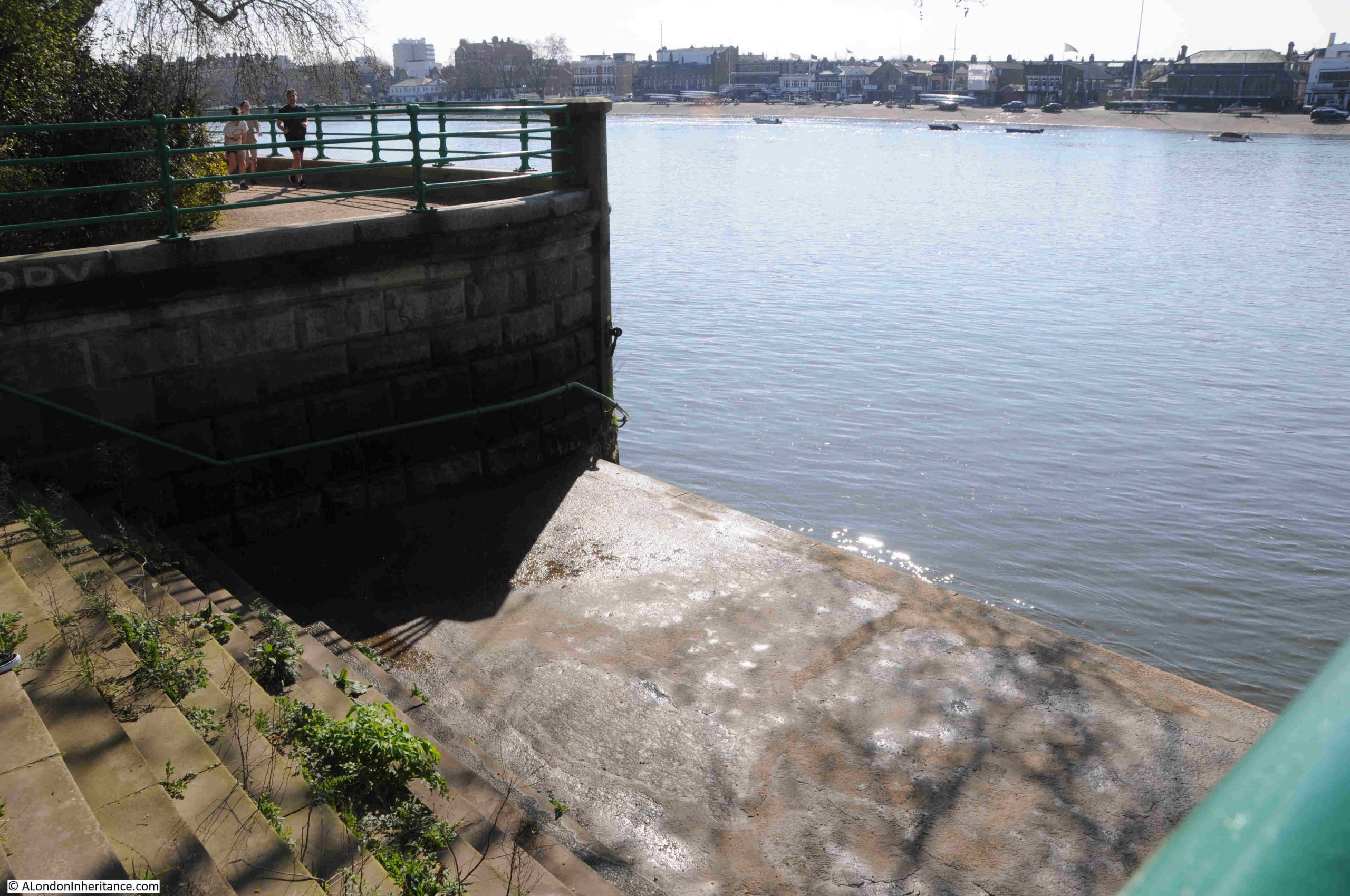
Back outside and this is Bishops Park Lower Stairs:
I can find very little about these stairs, both Bishops Park Upper and Lower Stairs.
The name Bishops Park refers to the park around Fulham Place, the home until 1973 of the Bishops of London.
In the following extract from Rocque’s map of 1746, the original Putney Bridge (labelled as Fulham Bridge), can be seen to lower right. Fulham Palace is the area with the enclosure to the upper left of the bridge:
The names of both Fulham Bridge and Putney Bridge were both used to name the bridge, with Putney winning out in later years.
There are no obvious stairs shown in the map along the whole of the river.
I would have assumed that the Bishops of London would have made considerable use of the river as a means of travelling to and from Westminster and the City of London.
In the following extract from the same map, there are two breaks in the enclosure around the palace facing on to the river, but there is no indication that there were any stairs facing these openings.
There had been an embankment along the river to prevent flooding, and the large river wall that we see today, and along which there is a walkway that follows the river, was built by Joseph Mears between 1889 and 1893, so perhaps the stairs date from this period.
The lack of any obvious early stairs may have been because the previous embankment provided a more accessible way of reaching the river rather than a large, stone river wall, so the two stairs were added to provide access. I just have no proof, one way or the other.
The Port of London Authority listing provides no information as to their age.
Looking back to Putney Bridge:
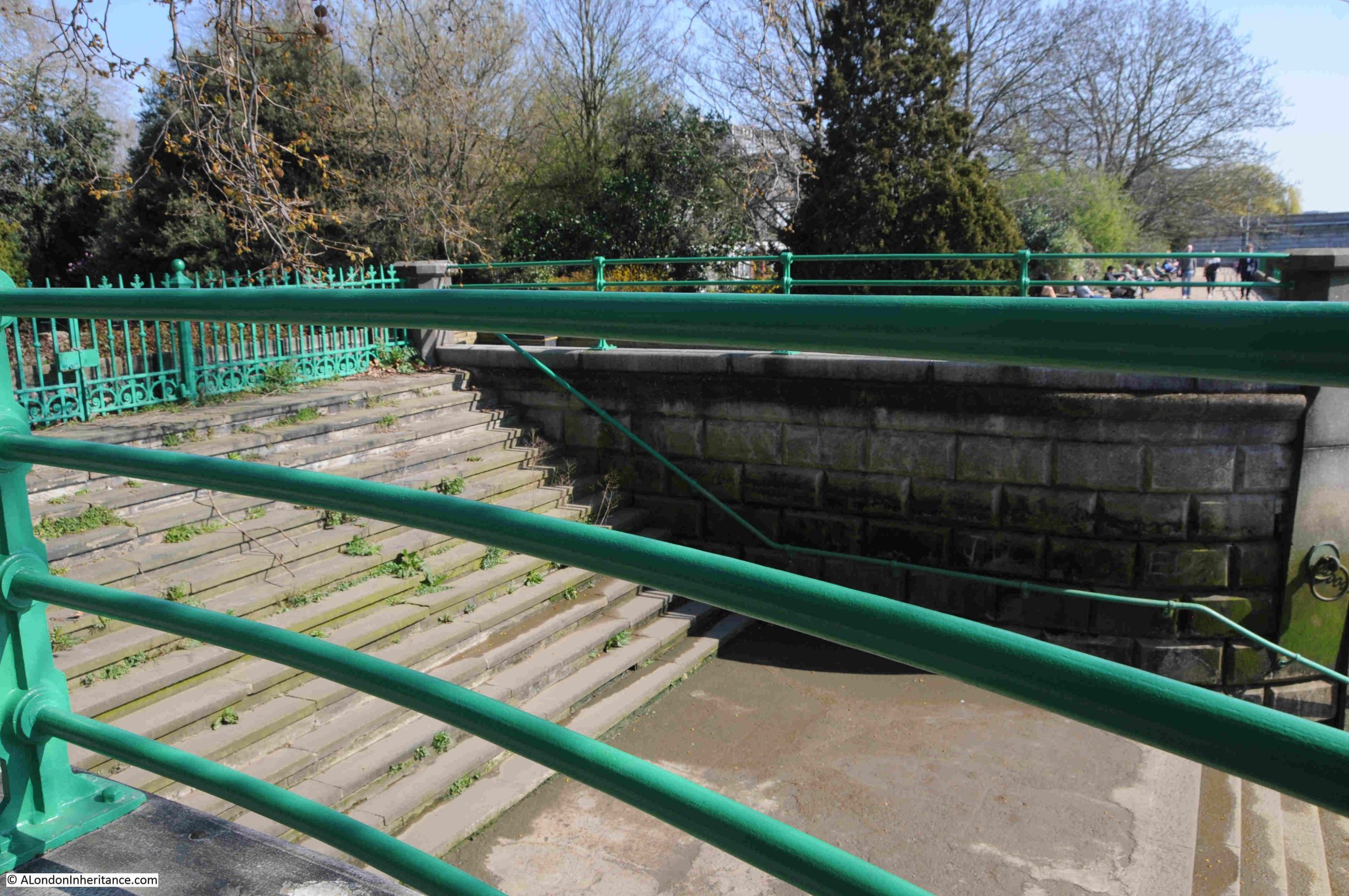
Continuing further along the walkway, and I reach Bishops Park Upper Stairs:
These are of the same design as the Bishops Park Lower Stairs, and again must have been part of the original construction of the river wall.
Both sets of stairs are surrounded by railings, and have a locked gate to the stairs facing the park:
Both are substantial, wide sets of stairs, and are in good condition:
Frustrating that I could not find any detail as to the age or use of the stairs, but it is good to see that these large flights of stairs down to the river are there, and in good condition.
From here, I continued my walk to Hammersmith Bridge, as there was one more set of Thames stairs to find, and there is much to discover along this part of the Thames. The subject of a future post.
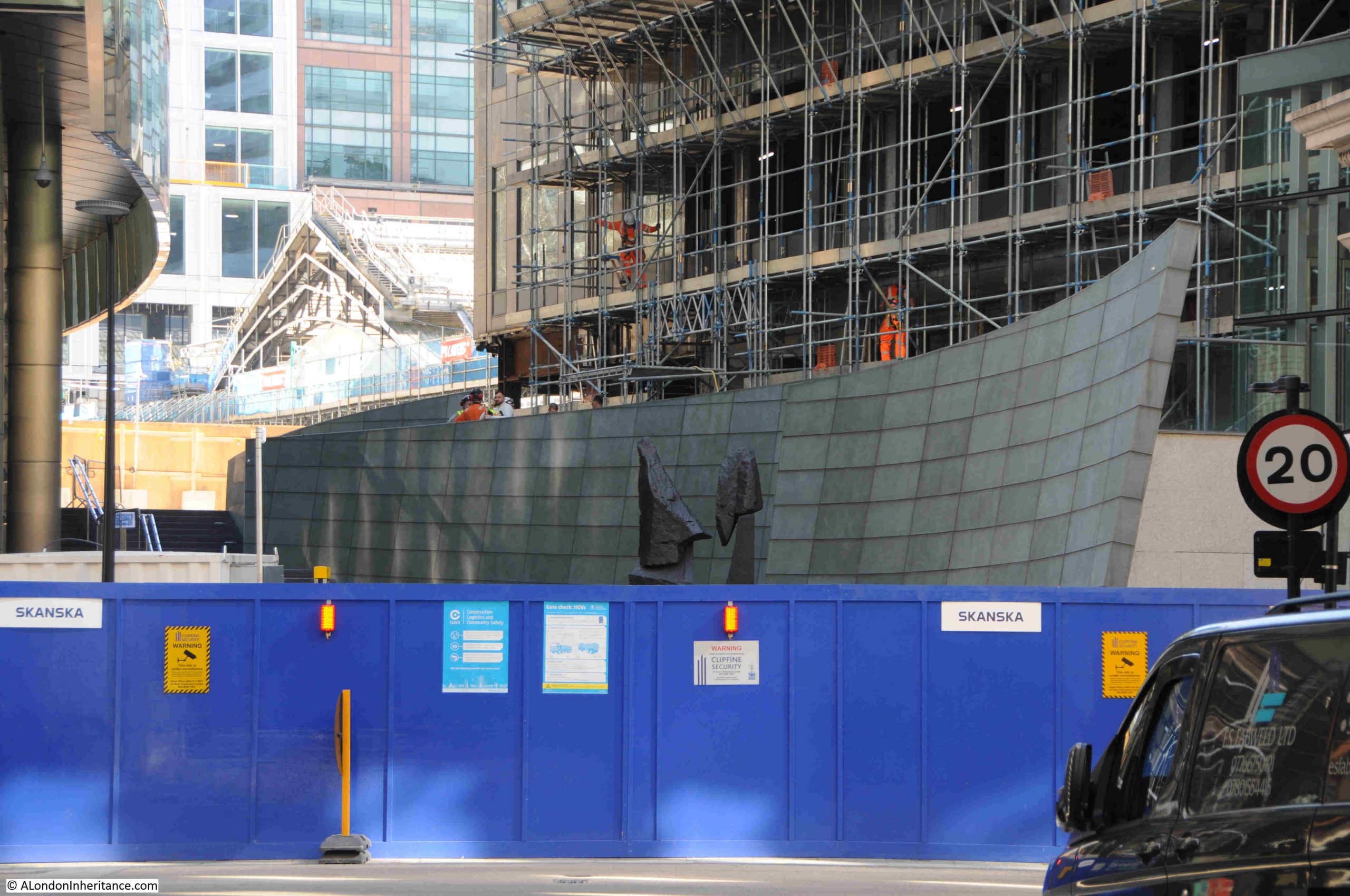
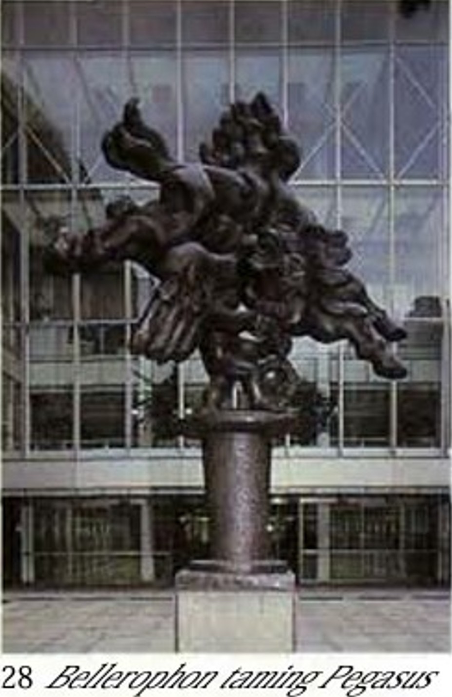
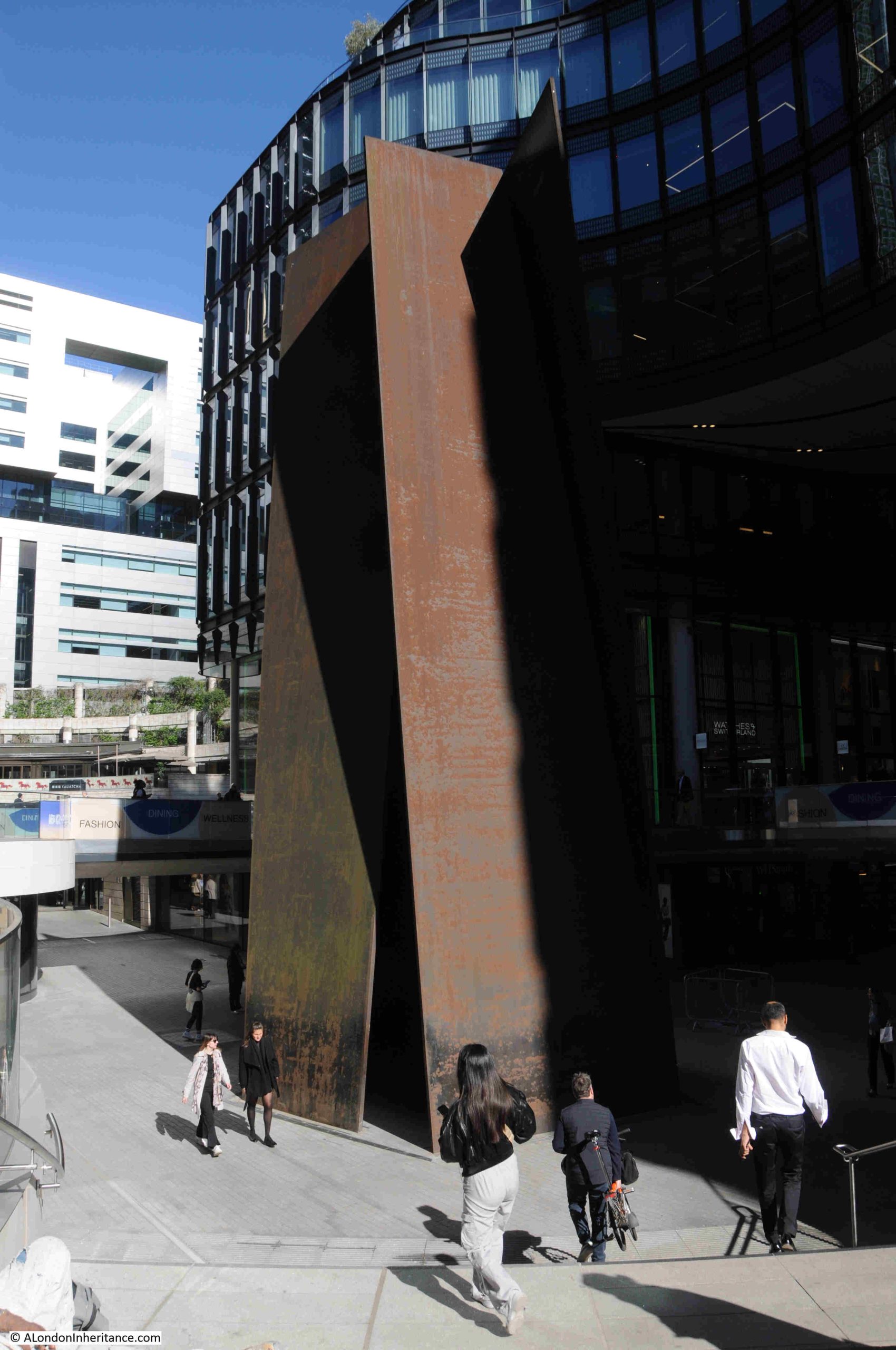
I have written a number of posts about the Barbican, mainly exploring the area before the Barbican was built, a place of historic streets which had been there for several hundred years, all lost in one night of bombing. It would have been a fascinating place to explore.
Despite the loss of these streets, the Barbican estate is still a fascinating place to explore, not just for the architecture, the overall design of the estate, the views that suddenly open up, and the careful use of construction materials, but also for what can be found on a casual wander.
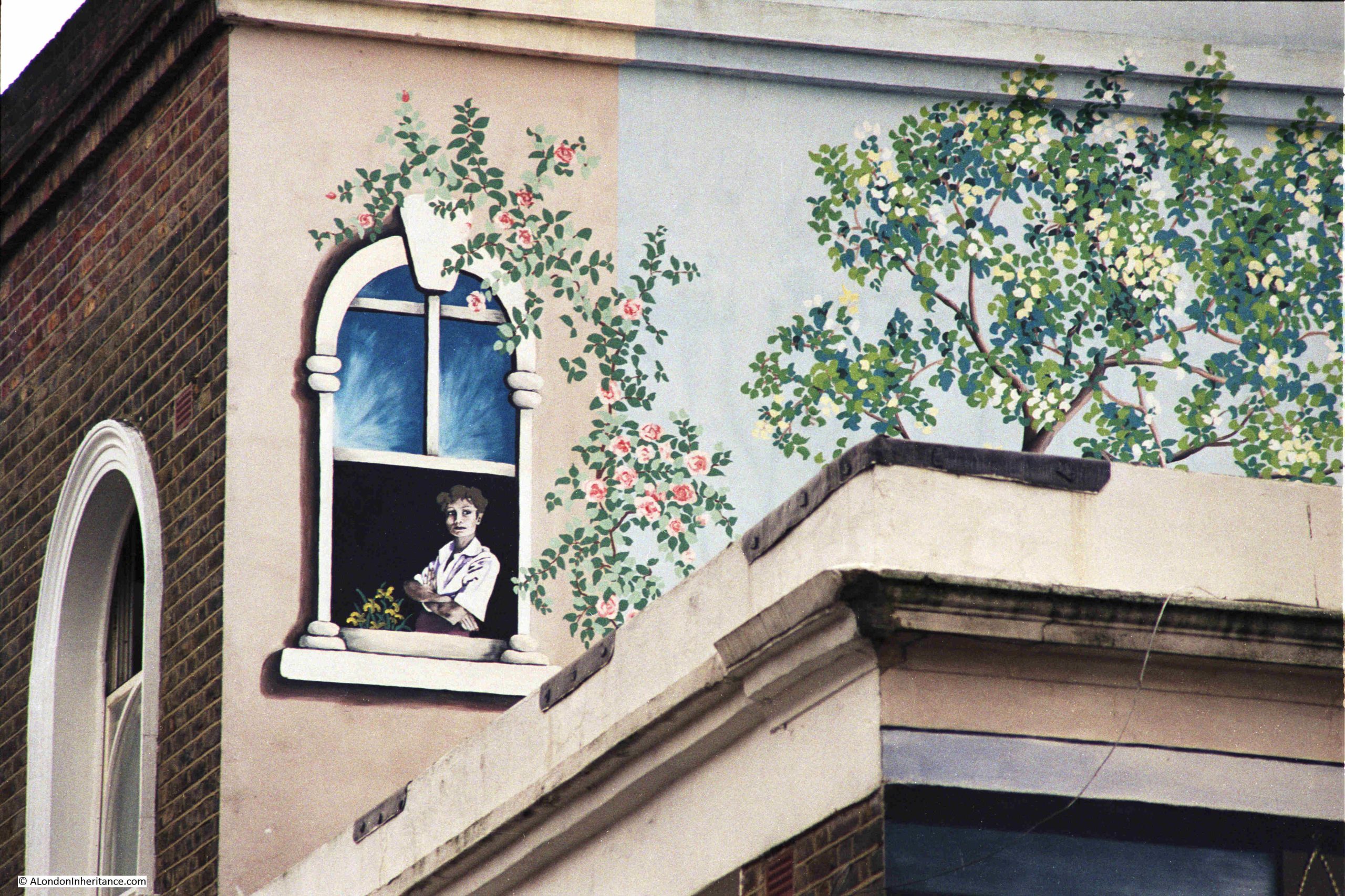
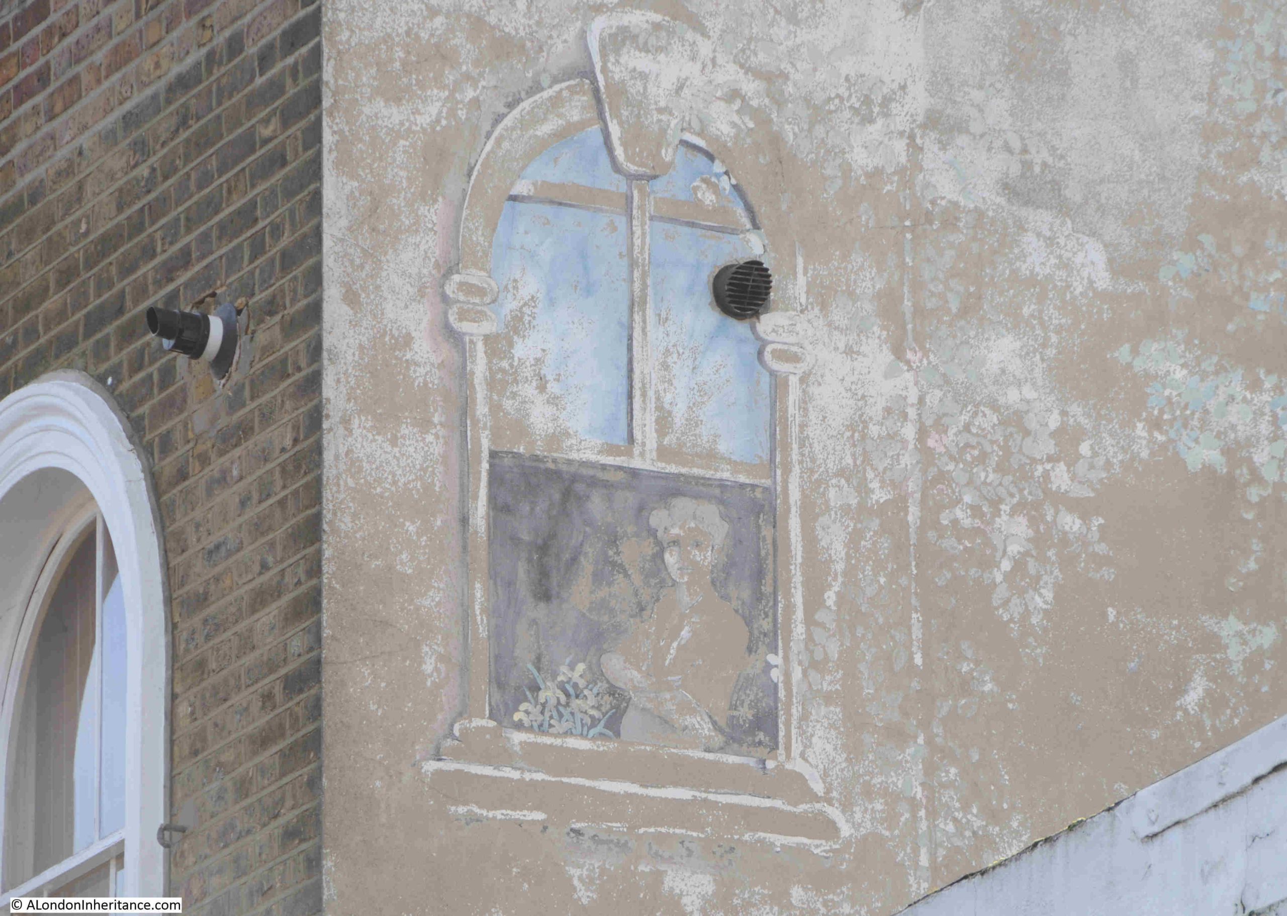
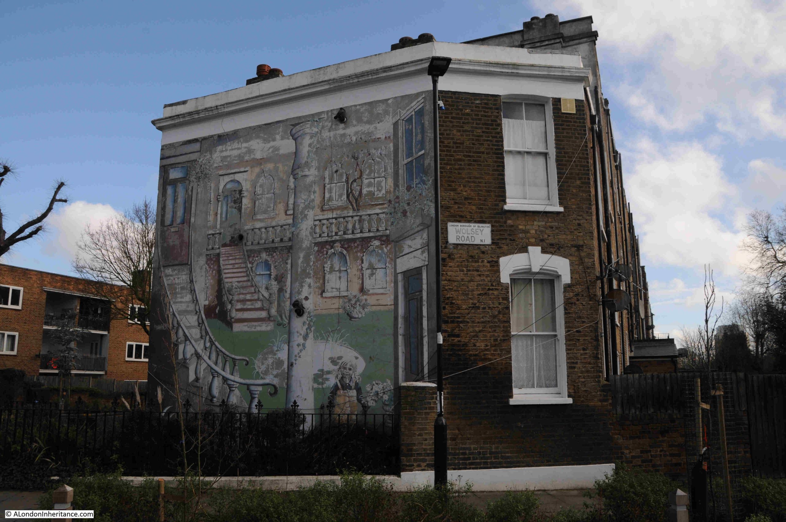
This post looks at four things which can be found during a casual wander of the Barbican estate. Objects which tell some of the Barbican’s story, development of the estate, and of the local area and the City of London, with the first being a set of remarkable murals:
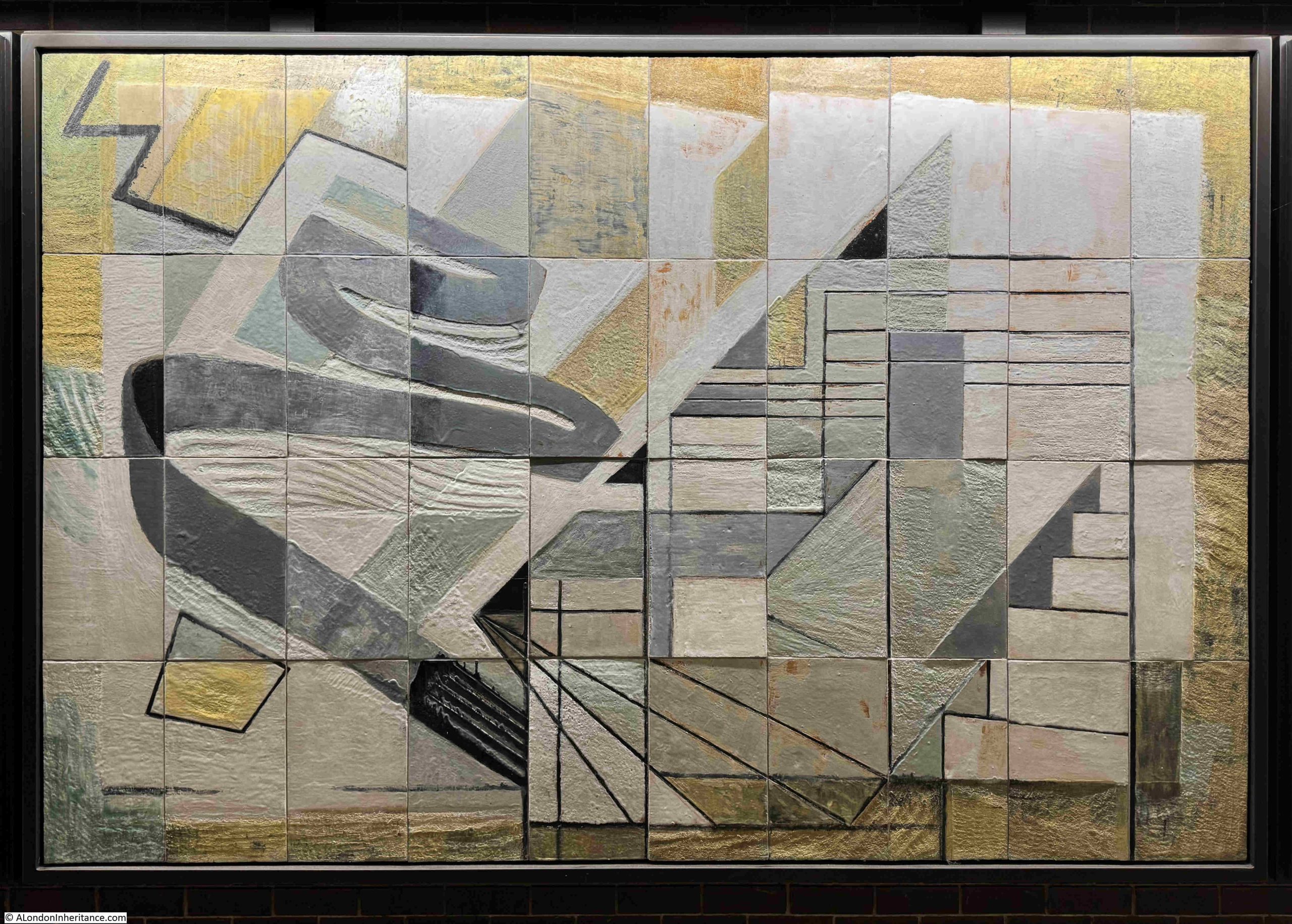
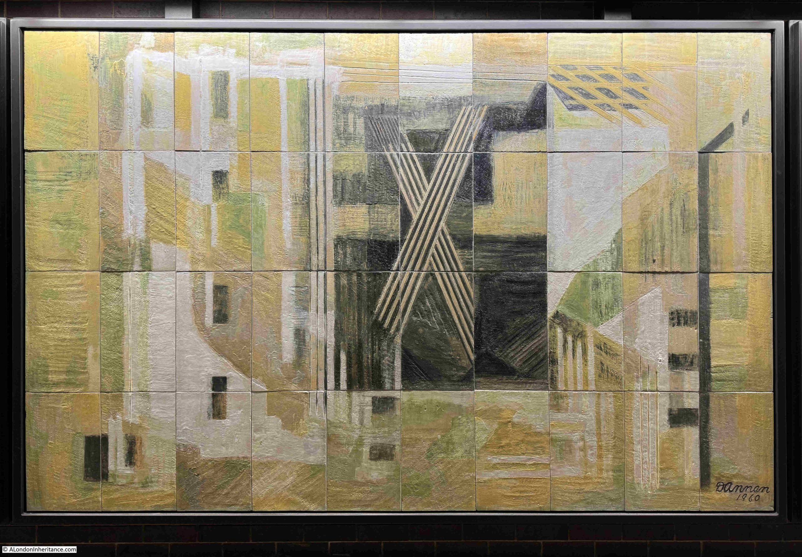
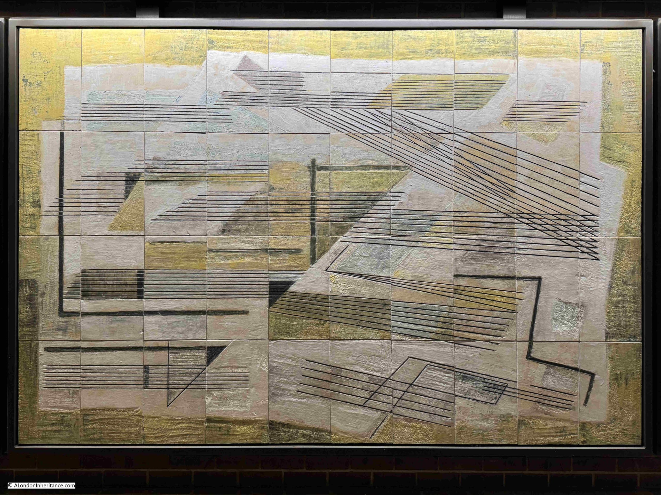
Dorothy Annan Murals for the Central Telegraph Office
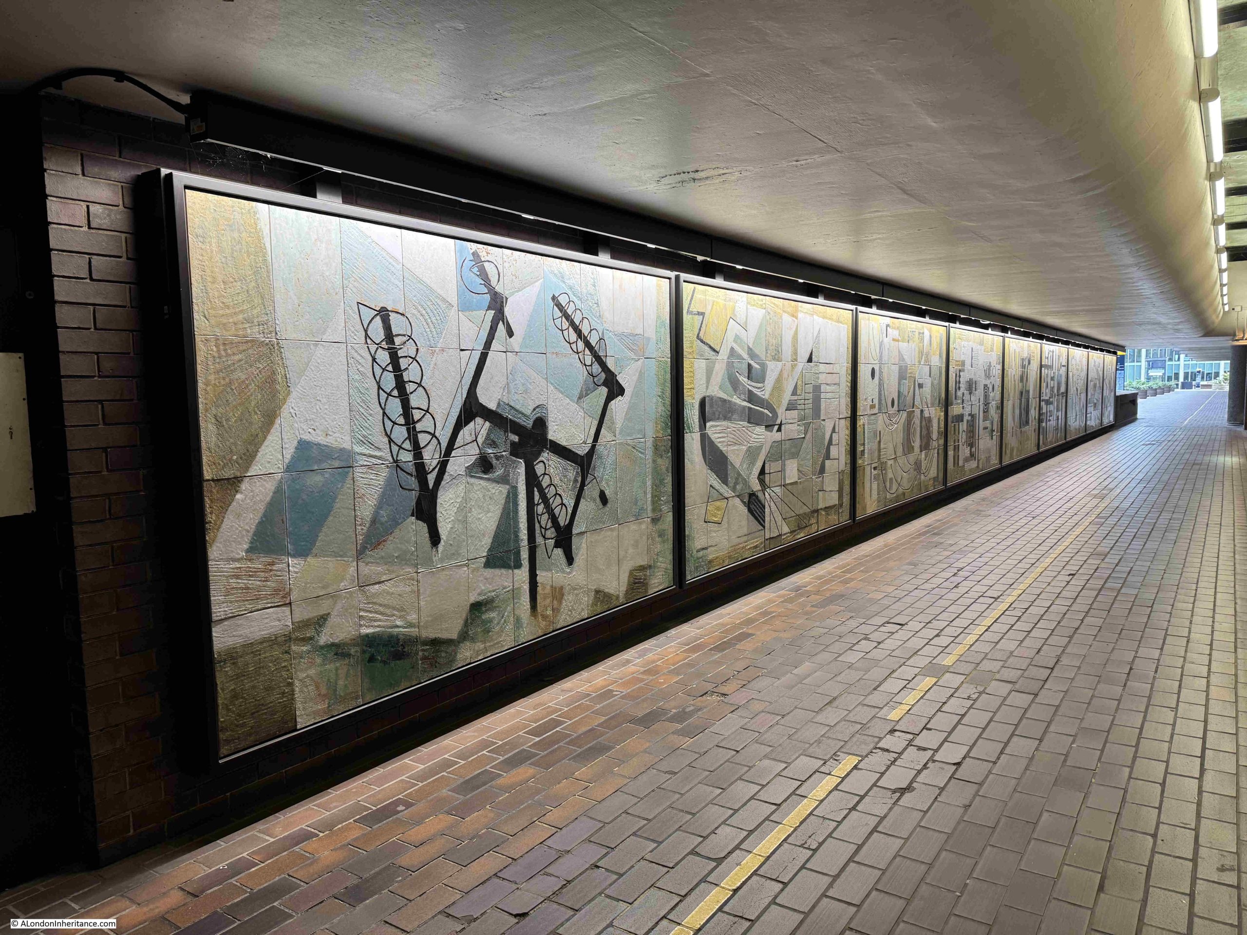
A walk along the covered section of the Cromwell High Walk reveals a set of nine abstract murals covering subjects which can be rather hard to decode.
They were created by Dorothy Annan around 1960 for the Central Telegraph Office of the General Post Office in Farringdon Street. A building that on completion was London’s largest telephone exchange.
This was a time when there was an optimistic view of the march of technology and the benefits that would come from the expanding capabilities and use of communications technologies.
Dorothy Annan was born in Brazil in 1908, and initially educated in France and Germany, but had moved to England at some point in the late 1930s/ 1940s.
She worked in a number of tactile mediums such a pottery, mosaics, and, as can be seen in the Barbican, murals, which were created by hand scoring the design into tiles of wet clay. These were then fired, decoration and coloured glaze were then added, the tile was fired again, and the individual tiles were then assembled to create the completed mosaic.
As the building on which the mosaics were to be mounted was a telephone exchange, the subject of the mosaics was the technologies used by the General Post Office, and which Dorothy had seen during a number of visits to Post Office sites.
British Telecom, as the telephony and data services of the General Post Office had become, were transforming their technology in the late 20th and early 21st century. Where large buildings were once needed to house large exchanges made of electro-mechanical equipment to switch telephone calls, the move to digital switching, along with the gradual reduction in the number of phone calls and the rise of the Internet, resulted in British Telecom having buildings with no future use, one of which was the Central Telegraph Office in Farringdon Street.
The site was sold to Goldman Sachs who had no interest in retaining the murals. Efforts by English Heritage, the Twentieth Century Society and the City of London Corporation resulted in their move to the Barbican. This retained the murals in the City of London, and on public display.
A walk along the panels, starting with:
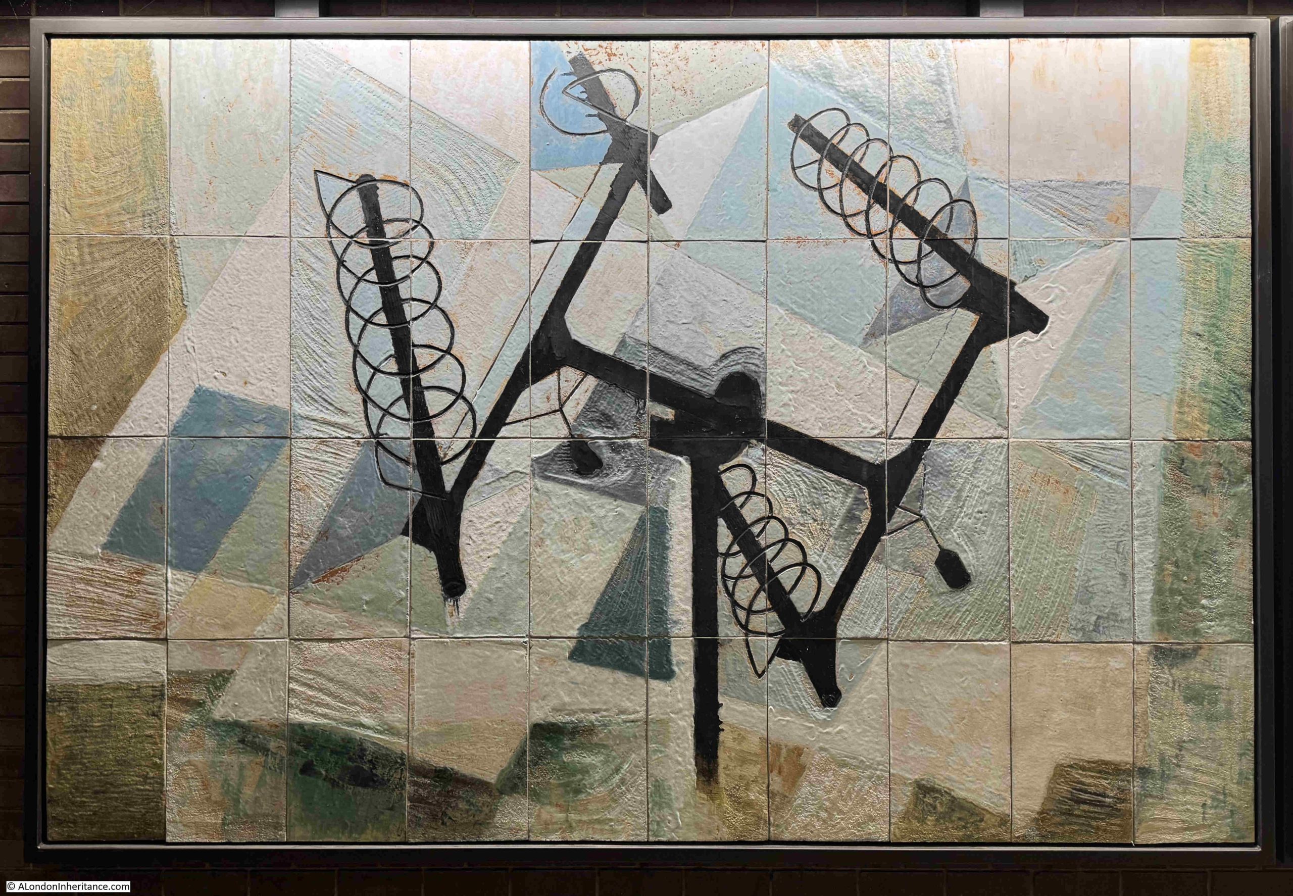
Radio Communications and Television
This mural shows four helical radio antennae’s mounted on a frame. It is not clear from the mural, but often this combination would have a rotator at the centre, which would allow the antennae’s to be rotated and elevated.
I like the detail in the mural, such as the two black objects extending backwards at either end of the central pole. These would have been counterweights to balance the weight of the four antenna, which was essential to prevent any damage to the electric motor in the rotator.
They were often used for satellite communication or providing radio links at events such as outside broadcasts.
An extra element to my interest in these murals is that I worked with many of the technologies that they depict (although some are just about recognisable due to their very abstract nature).
At the age of 16, I started a Post Office Telecommunications apprenticeship in the late 1970s, and many of these technologies shown from 1960, were still in use, including:
Cables and Communication in Buildings
The murals were made at a time when copper cables were the primary method of connecting telephone, telex and early data services. For example, each residential telephone would have its own pair of copper wires connecting the phone to the exchange.
Large businesses would often have their own private telephone exchange, so a smaller number of copper cables would be required to connect to the public exchange, but in a place such as the City of London, the very large number of telephones, and associated services, would require a vast network of cables connecting from the end user device through a local connection point where smaller cables were connected to large cables, which then headed to the telephone exchange.
One of the Post Office Training Centres for apprentices was at Bletchley, where the wartime code breaking had been carried out. These were residential courses of three or four weeks and whilst a new training building had been built, you slept in the old huts with meals in the canteen which had been used during the war.
One of the skills taught was how to joint these cables together, how to connect to a frame in an exchange, to learn the colour code of individual wires, and to recognise individual wires when presented within hundreds, all bound within a single cable.
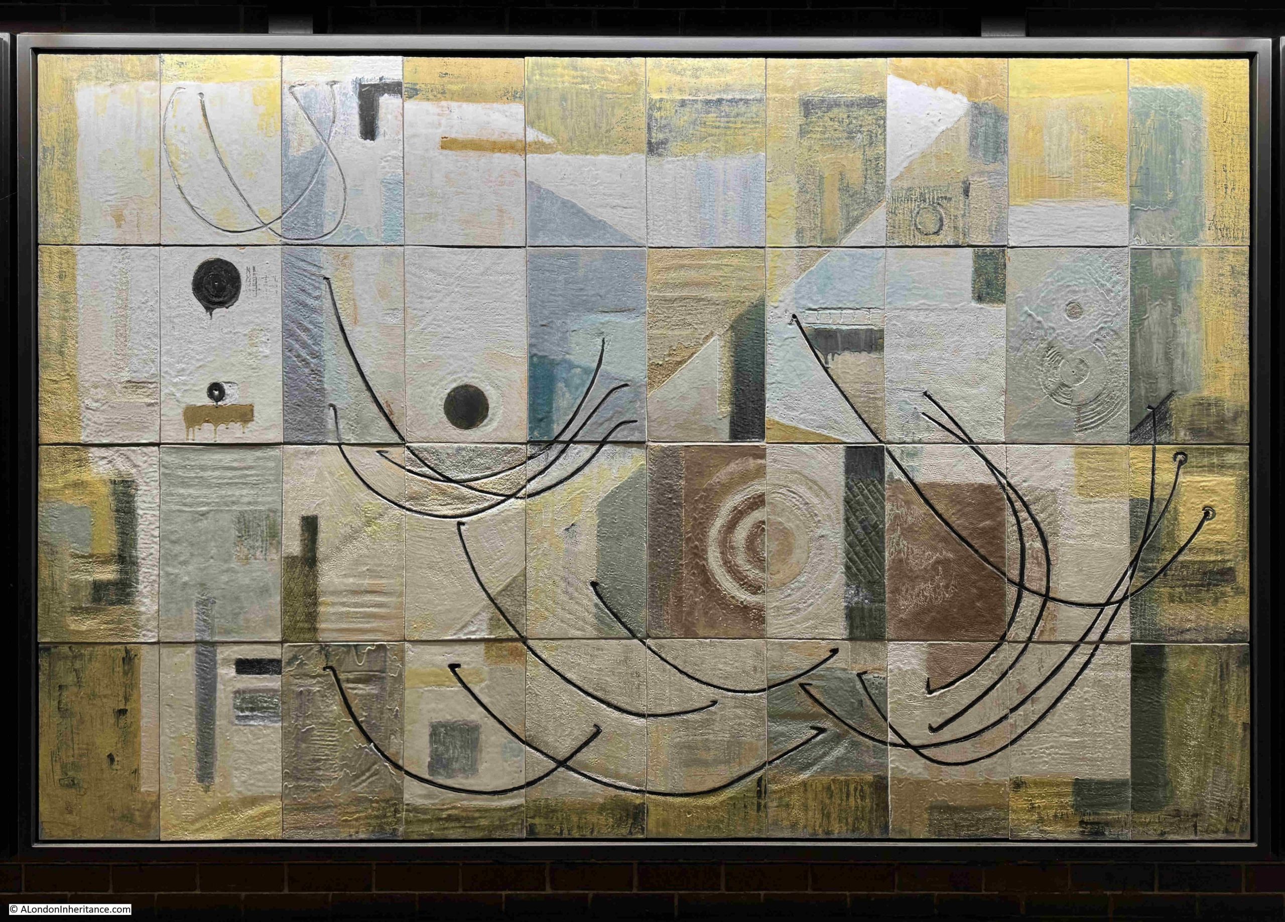
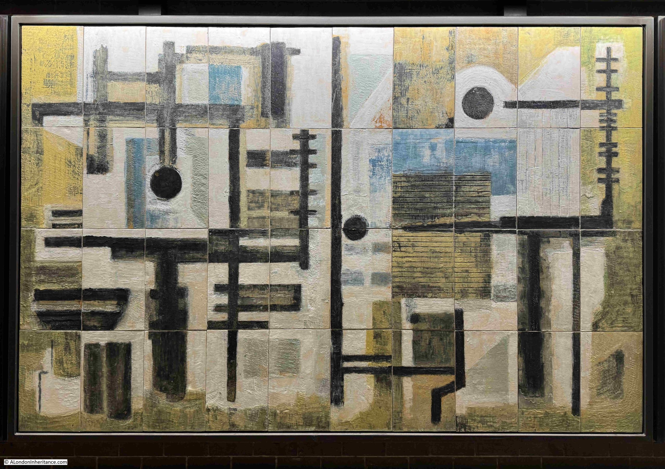
Test Frame for Linking Circuits
A Test Frame was a place where individual pairs of wires could be patched and tested, for example, if you had a fault on your telephone, the wires could be patched through to a test frame allowing the circuit between the exchange and your home to be tested.
Frames were also used to connect different cables and between cables and different equipment units,
The patch cables which interconnected different cables and equipment are, I assume, the black lines shown in the mural.
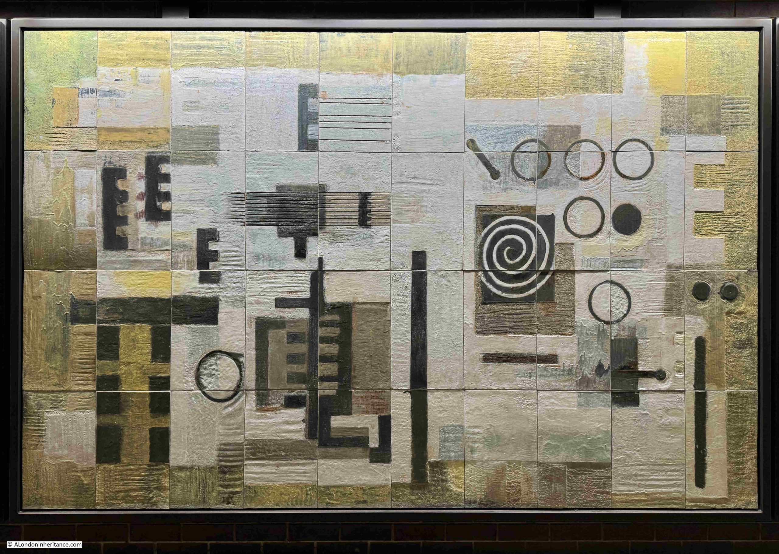
Cables in the telephone exchange entered the building via a:
Cable Chamber with Cables Entering from Street
All the cables from the customers in the area served by a telephone exchange, along with cables connecting an exchange to other exchanges, would run under the streets and enter the telephone exchange via a below surface level cable chamber.
In the above mural, we can see circles on the right. I assume these are the cable ducts which lead from the chamber into the street, and through which the cables are run.
To lower left of centre, there are two vertical black lines, each of which have several. short black lines projecting from them.
These are cable trays seen from the side.
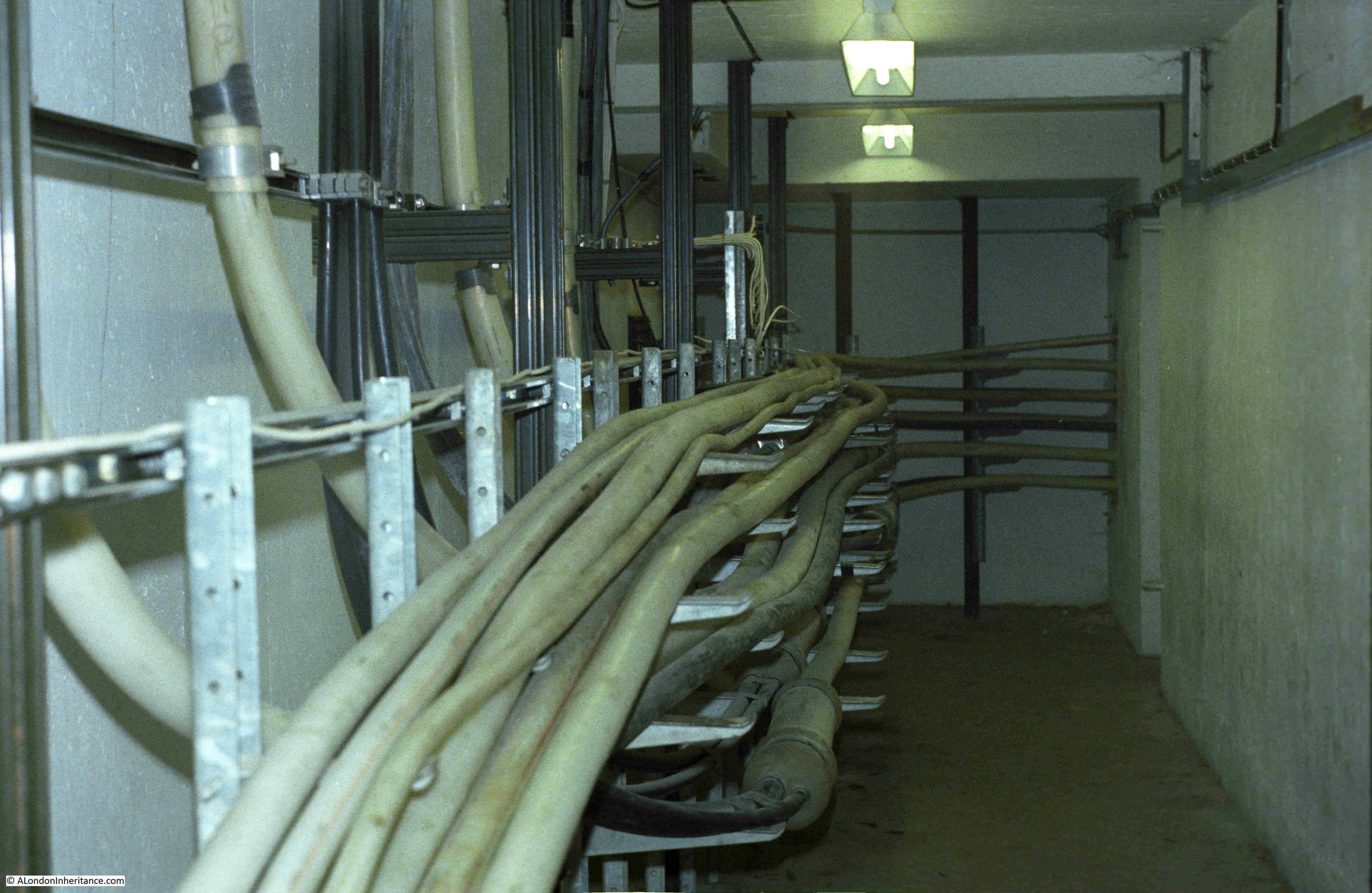
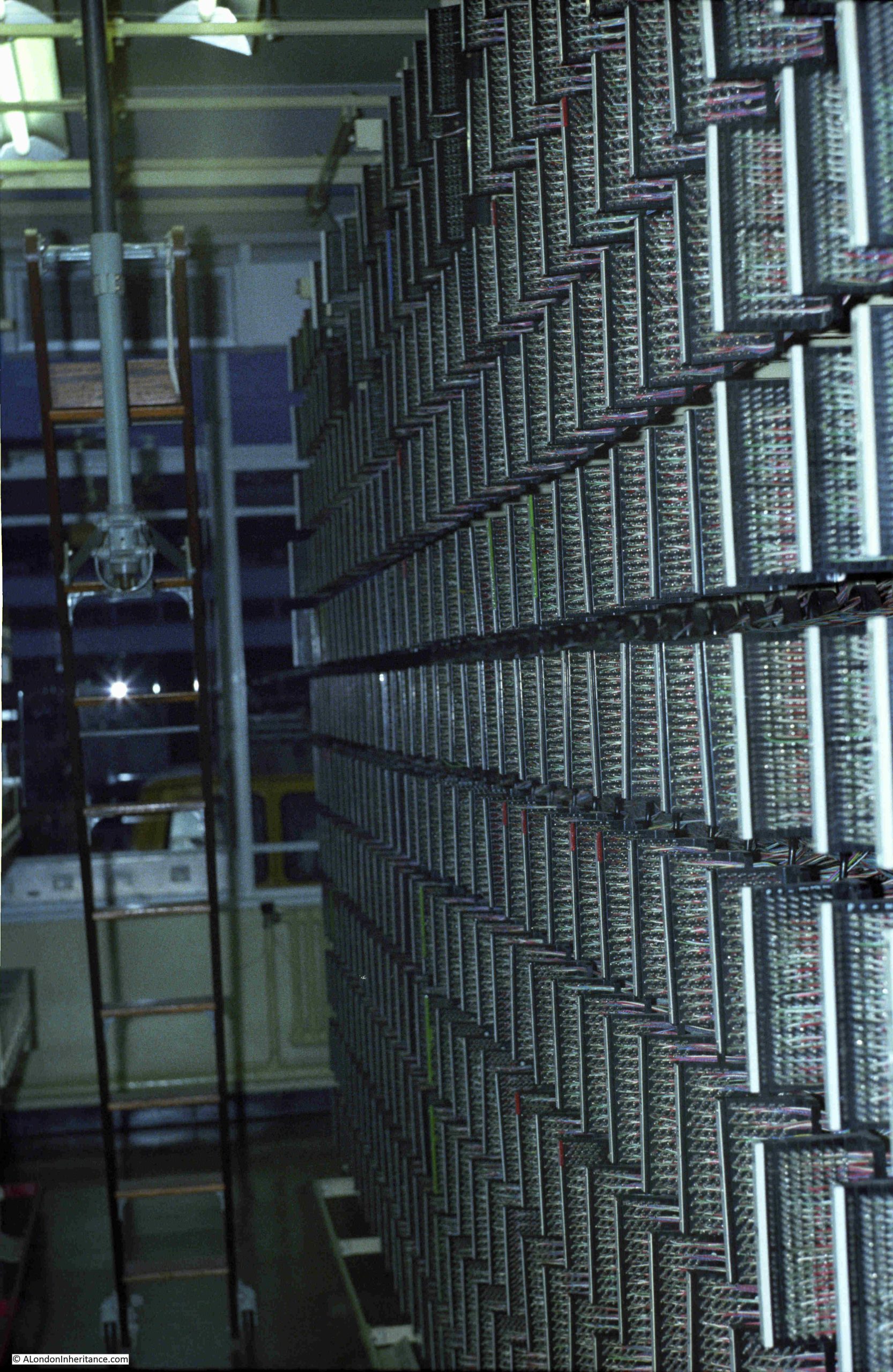
I did take some photos of some of the smaller exchanges I worked in, in the late 1970s. The following photo shows a cable chamber:
I did not photo the point where the cables entered from the street, but you can see how they run along the cable trays, where they are routed through the chamber and head off to the equipment and distribution frames in the rest of the building, including a:
Cross Connection Frame
A Cross Connection Frame is where cables can be connected to different bits of equipment, or where equipment is connected to other equipment.
One type of Cross Connection Frame was the Main Distribution Frame. This is where all the cables coming in from the street would have their individual wires mounted on a connection block. This would allow a jumper cable to then connect them to the appropriate service.
For example, the copper cable from your home would be connected via one or more local connection points (such as the green boxes you occasional see open along the streets, with someone working on the hundreds of wires within) to the main distribution frame. From here a jumper would connect your phone to the equipment that provides the initial dial tone, ringing voltage and connection to the equipment that routed your calls.
Distribution frames were often difficult to work on, as hundreds of short metal termination poles projected from each block, and if you pulled your hand out too quickly from between blocks, you could risk a very nasty scrape across the back of your hand – as was graphically illustrated during health and safety films shown in the early part of the apprenticeship.
In the above mural, there is a white vertical structure on the left. This is the frame of a cross connection frame. The four black rectangular blocks represent the termination blocks on which wires would be connected and then patched.
The following is a photo I took of a main distribution frame:
Power and Generators
Your home telephone was once a key part of your ability to communicate, whether just a chat with friends and family, or in the extreme, a call to the emergency services.
Even if there was a power cut, the traditional dial telephone would still work, as the power to the phone was supplied from the telephone exchange, which had banks of batteries to provide power whilst generators started up to provide a continuous source of electricity in the event of a power cut.
Today, the majority of home telephone services are connected to the broadband router, so if your home electricity is out – so is all your communication options, apart from mobile services, which have a much shorter battery backup in their local base stations.
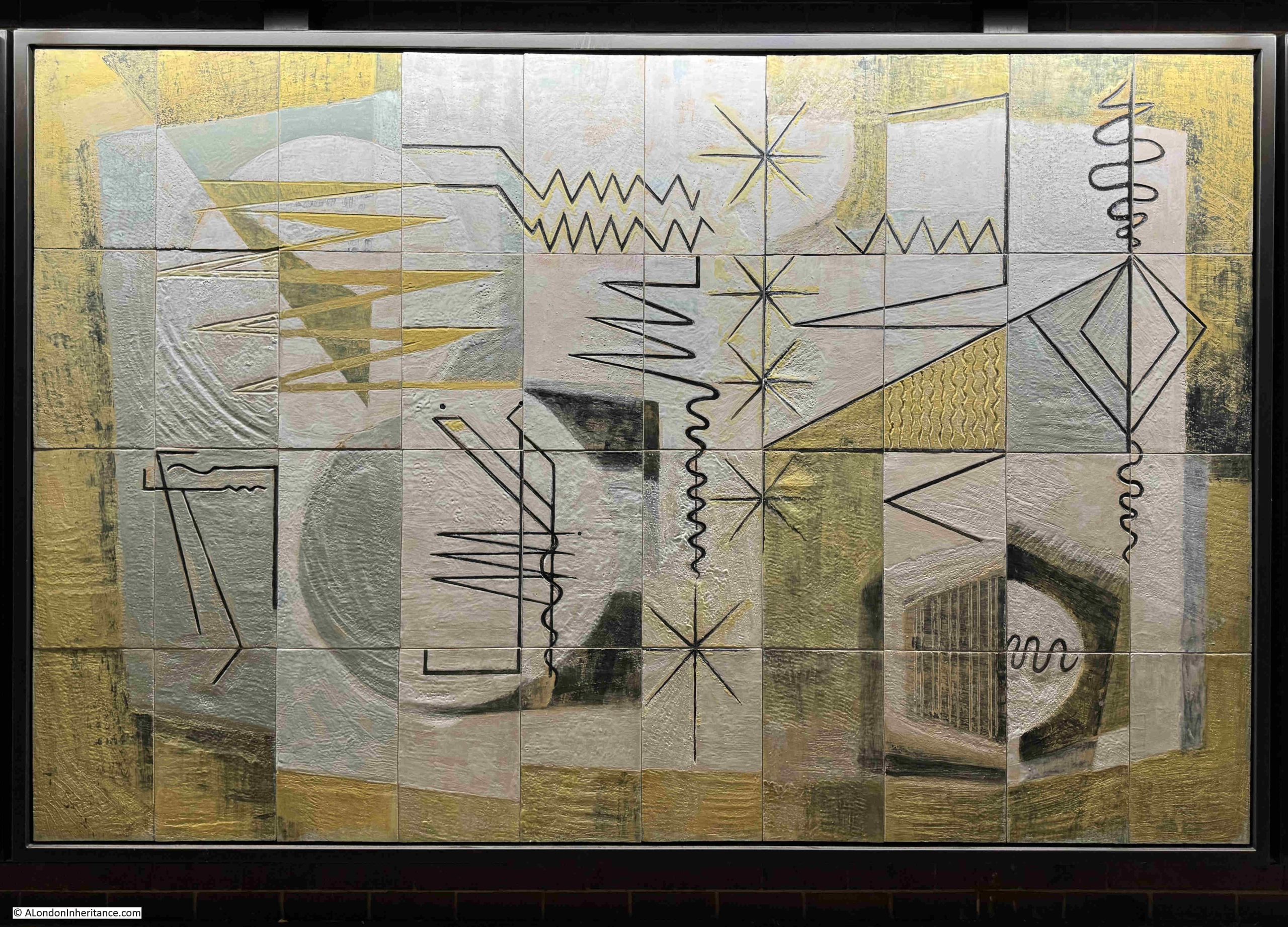
Within a telephone exchange, there was a range of equipment to test nearly all aspects of the technology used. One of these test methods involved:
Impressions Derived from the Patterns produced in Cathode Ray Oscilloscopes used in Testing
A Cathode Ray Oscilloscope was a device that used a cathode ray tube (basically the same device that produced a picture in old, pre-flat screen TVs), and in test equipment such as an Oscilloscope a cathode ray tube was used to draw a picture on a screen showing information about the voltage, frequency etc. of the signal being tested.
These are, I assume, the squiggly lines in the above mural. At the lower right corner, there is part of a round circle with the line of a sine wave (a line that goes up and down at a regular frequency). This shows what an oscilloscope screen would have looked like.
Whilst in central London, the majority of cables carrying telephone (and now broadband services) are routed underground, in suburban and rural areas, a different method was used:
Lines over the Countryside
Walk along a suburban street, and you will see poles distributing wires to individual houses. In many rural areas, these wires are carried for considerable distances above ground along a route of poles, as the above mural illustrates.
Training at Bletchley involved how to climb poles and work at height.
It started with short poles, where you were a couple of feet off the ground, and learnt how to use the belt which wrapped around you and the pole, and allowed you to lean back and work with both hands on the junction box at the top of the pole, as well as providing a degree of fall prevention if you slipped.
You then moved to the full size poles where apprentices, in varying degrees of confidence, cautiously made their way to the top, to the encouraging shouts from the instructor of “if you are going to fall from there, you might as well go a bit higher”.
When not on the residential training course as Bletchley, training involved being rotated through many different departments – from poles and holes, to exchange maintenance.
The pole and holes experience often involved the experienced employees you were paired with, taking great pleasure in getting you to climb the highest poles in the area.
Lines over the Countryside provided a means of connecting rural areas.
If you wanted to make a telephone call abroad, then your call would be routed along;
Overseas Communication Showing Cable Buoys
The earliest cables carrying telegraphy traffic were laid below the sea in the 1850s. Telegraphy was the transmission of a very simple data signal rather than voice, using codes, such as Morse code.
These initially used copper wires, but today a web of fibre optic cables connects the world, supporting vast amounts of data with almost instantaneous transmission over long distances,
Special ships lay cables across the seas and oceans, and when they are brought ashore cable buoys are often used to mark their route before final installation.
Overseas communication cables are now an utterly essential part of global life and the economy and any damage to these cables could severely impact a country – as demonstrated by the news of recent Russian interest in cables around the coasts of the UK.
Click here for a fascinating map of the global network of submarine cables, they are one of the hidden wonders of the world, and whether you are speaking to a relative in New Zealand, watching a news report on TV news from Dubai or Brazil, checking share prices in New York, or dependent on where you are reading this post, the data will have been carried over a a submarine cable.
The survival and display of these murals is brilliant, but it is from a time when there was pride in the activity being carried out in a building, or the associations that a company occupying a building had within their wider field.
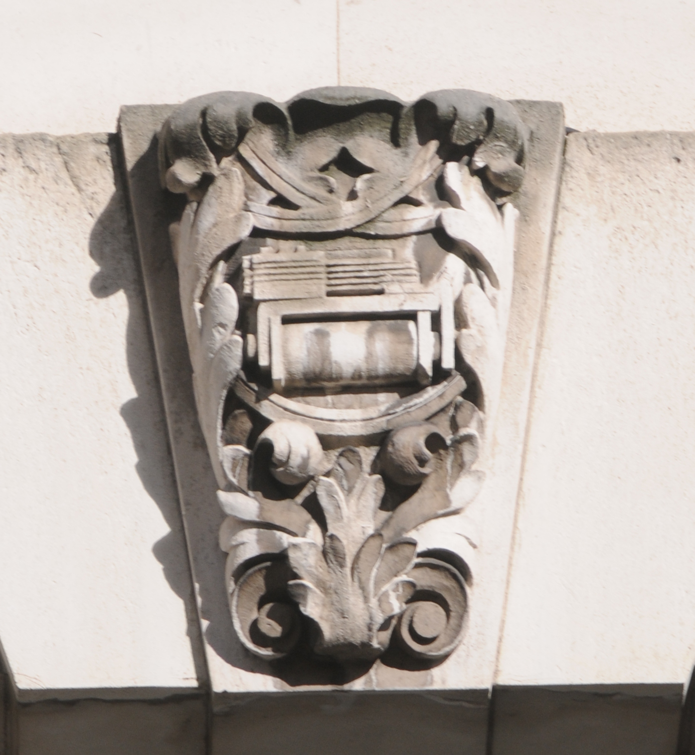
This telephone exchange, opened in 1933, has a series of carvings running along the façade of the building that illustrate the technologies of the time.
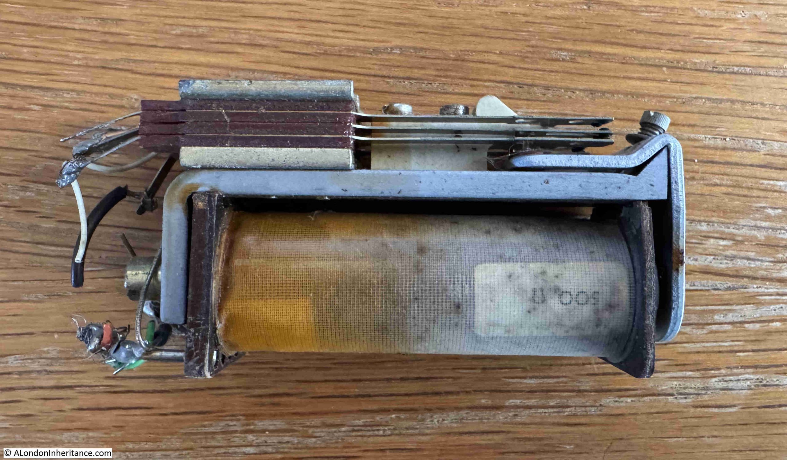
One of these is a Post Offive Type 3000 Relay:
This type of relay was still the heart of the electro-mechanical telephone switching systems when I started my apprenticeship. A very slow phase out started in the early 1980s when the digital switching system System X started to be rolled out.
I kept a Type 3000 relay from the late 1970s, and as can be seen from the photo below, it is identical to the relay shown in the 1930s carving in Queen Victoria Street:
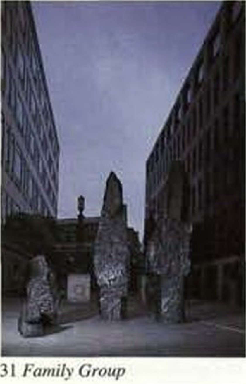
There is still more to discover around the Barbican, as a short distance from the murals is:
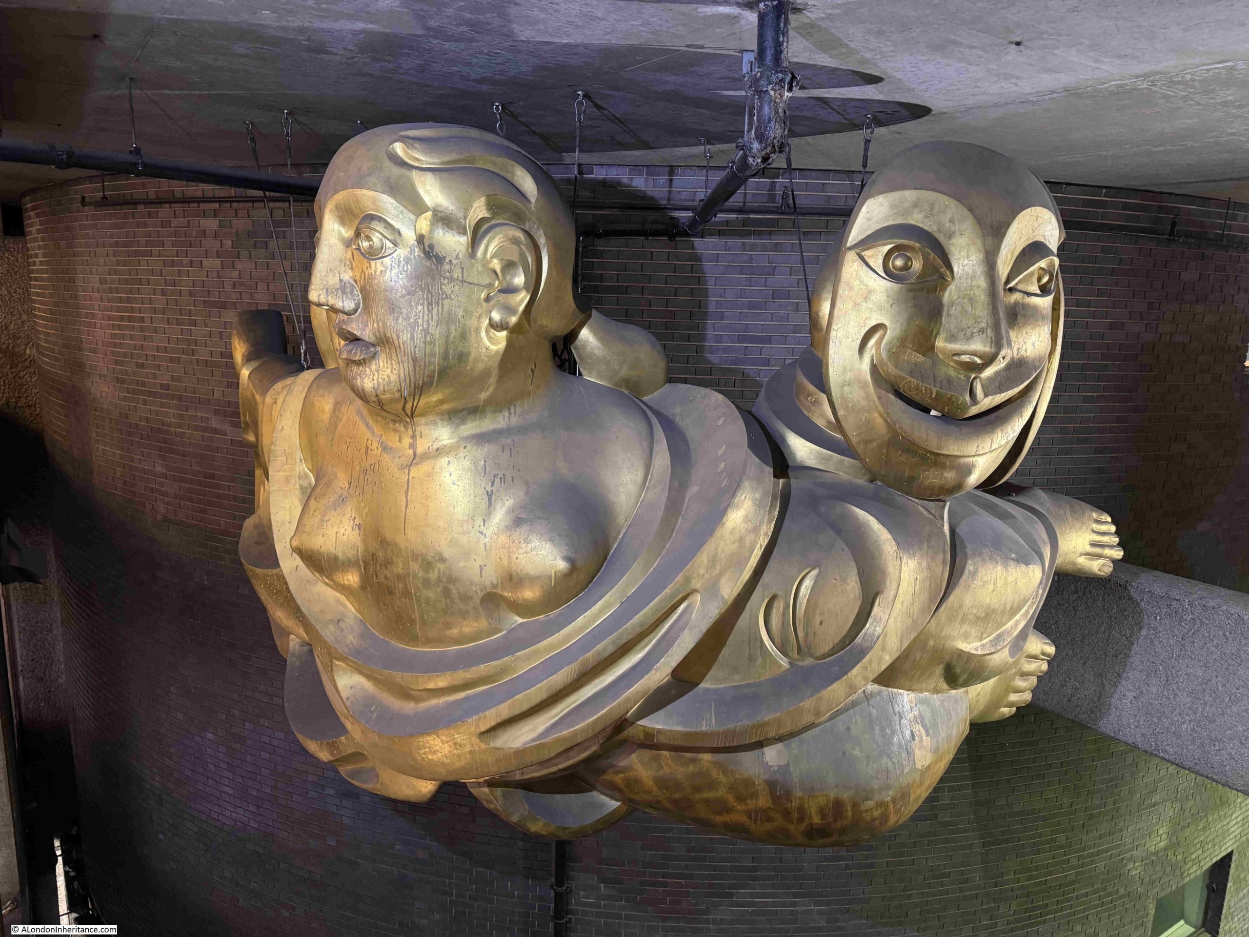
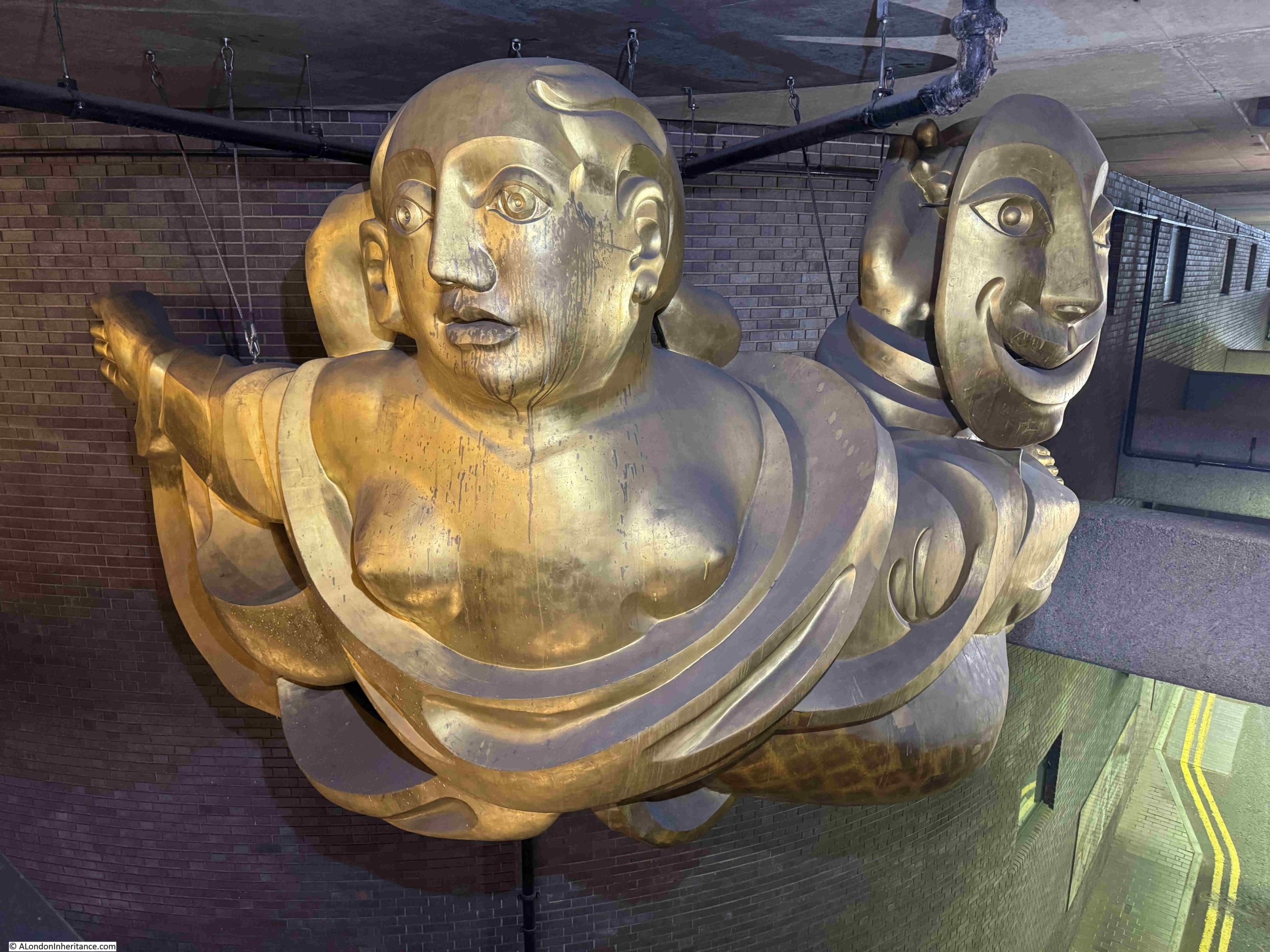
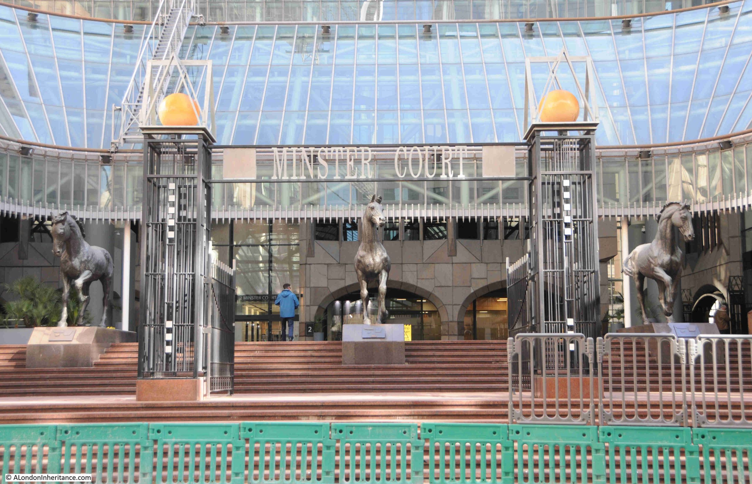
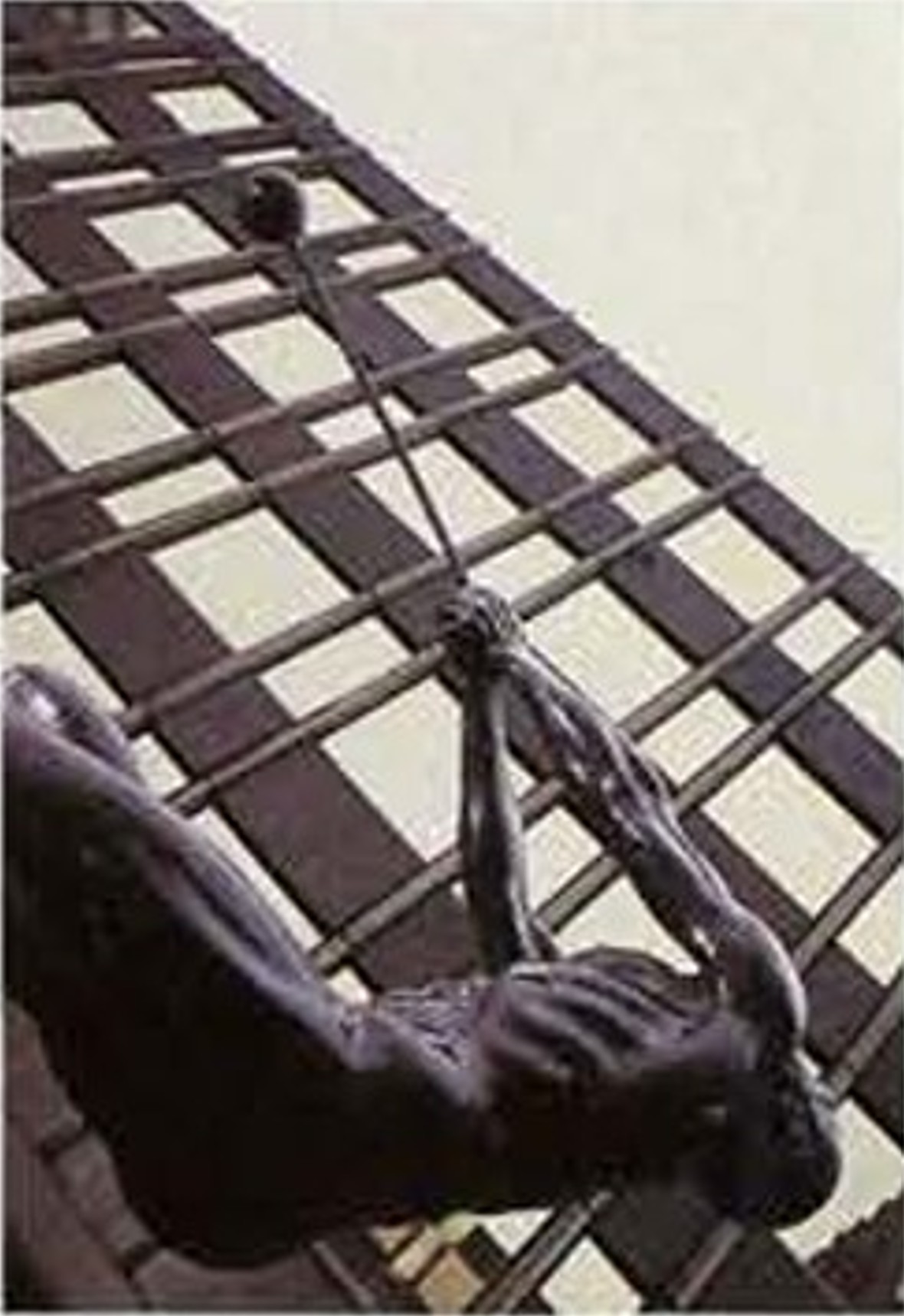
The Barbican Muse by Matthew Spender
A short walk from Dorothy Annan’s Murals, at the northern end of the walkway under Gilbert House, is a sculpture made from polyurethane, glass fibre and gold leaf, titled the Barbican Muse, and created by Matthew Spender in 1994.
The work shows a reclining figure, which holds the masks of comedy and tragedy. It apparently has the nickname Zoe, after the name of the Cambridge student who posed for the work.
For a first time visitor, the Barbican estate is not that easy a place to find you way around, however the Barbican Muse is there to help, as the figure’s right arm and hand is outstretched, pointing in the direction of one of the entrances to the Barbican Centre, as can be seen to the left, in the following photo:
There is nothing to inform the visitor that the sculpture is helpfully point the way, and I assume it is not an urban myth that has grown up about the work, but if you find yourself in front of the sculpture, and want to get in to the Barbican Centre – follow the outstretched arm.
A short distance back along the walkway under Gilbert House is the:
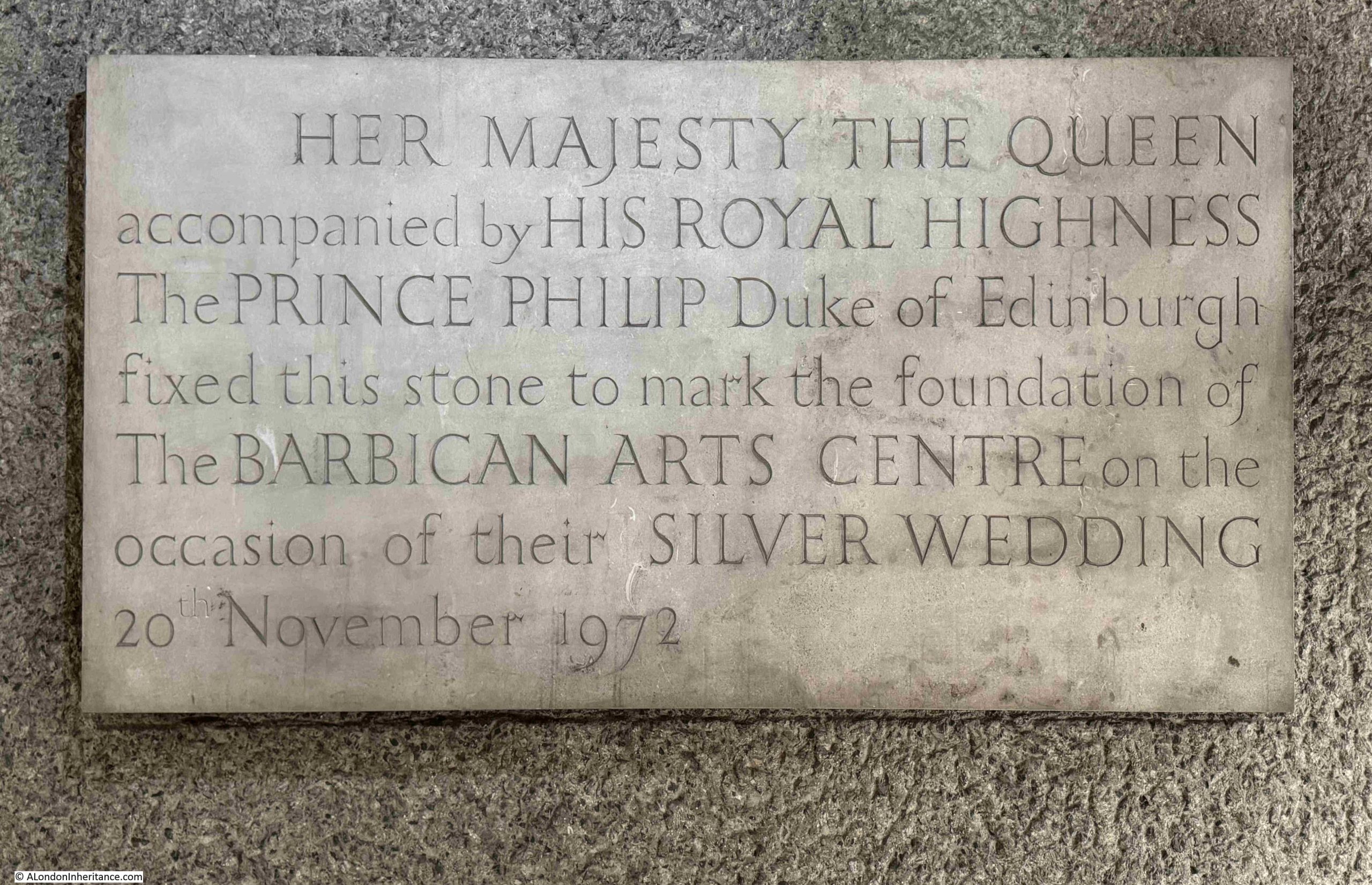
Foundation Stone of the Barbican Arts Centre, 20th November 1972
The Barbican estate was built and opened over a period of time from the 1960s to the 1980s.
Whilst it is a major residential development, it also consists of the City of London School for Girls, the Guildhall School of Music and Drama, the Barbican Conservatory, and the Barbican Centre.
The Barbican Centre is referred to as the Barbican Arts Centre in the above plaque, and on the 20th of November 1972, the Queen unveiled the foundation stone for the new Barbican Arts Centre.
The Queen returned almost ten years later on the 3rd of March 1982, to officially open the centre.
There is a news film from the time showing the unveiling and a brief walkabout through the Barbican estate, which at the time was still in the process of construction. The film shows completed blocks as well as places where construction was underway.
An interesting snapshot of the Barbican’s development, marked by the foundation stone we can walk past today:
For the next bit of Barbican history, we need to walk into the Barbican Centre, where there is a:
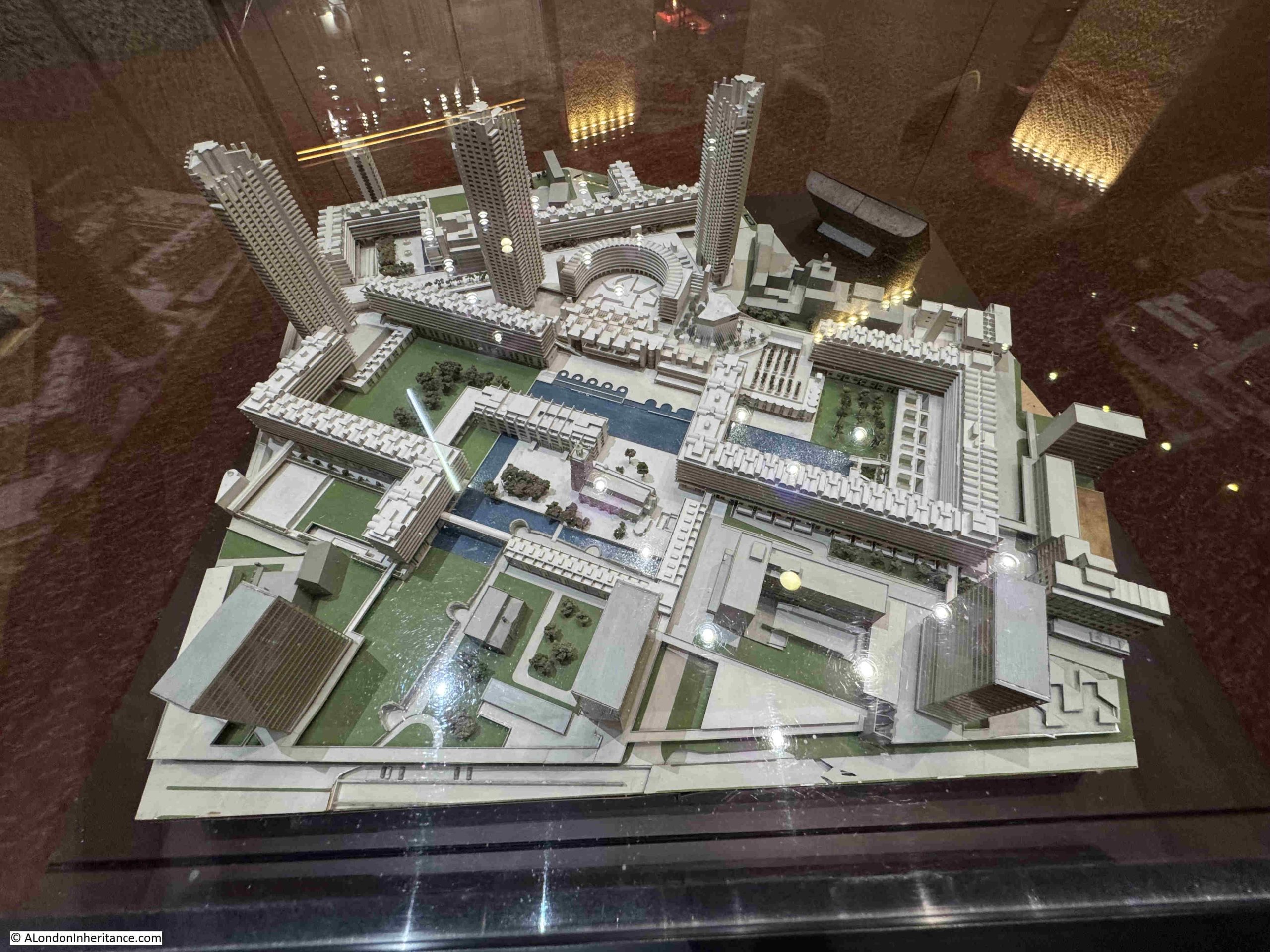
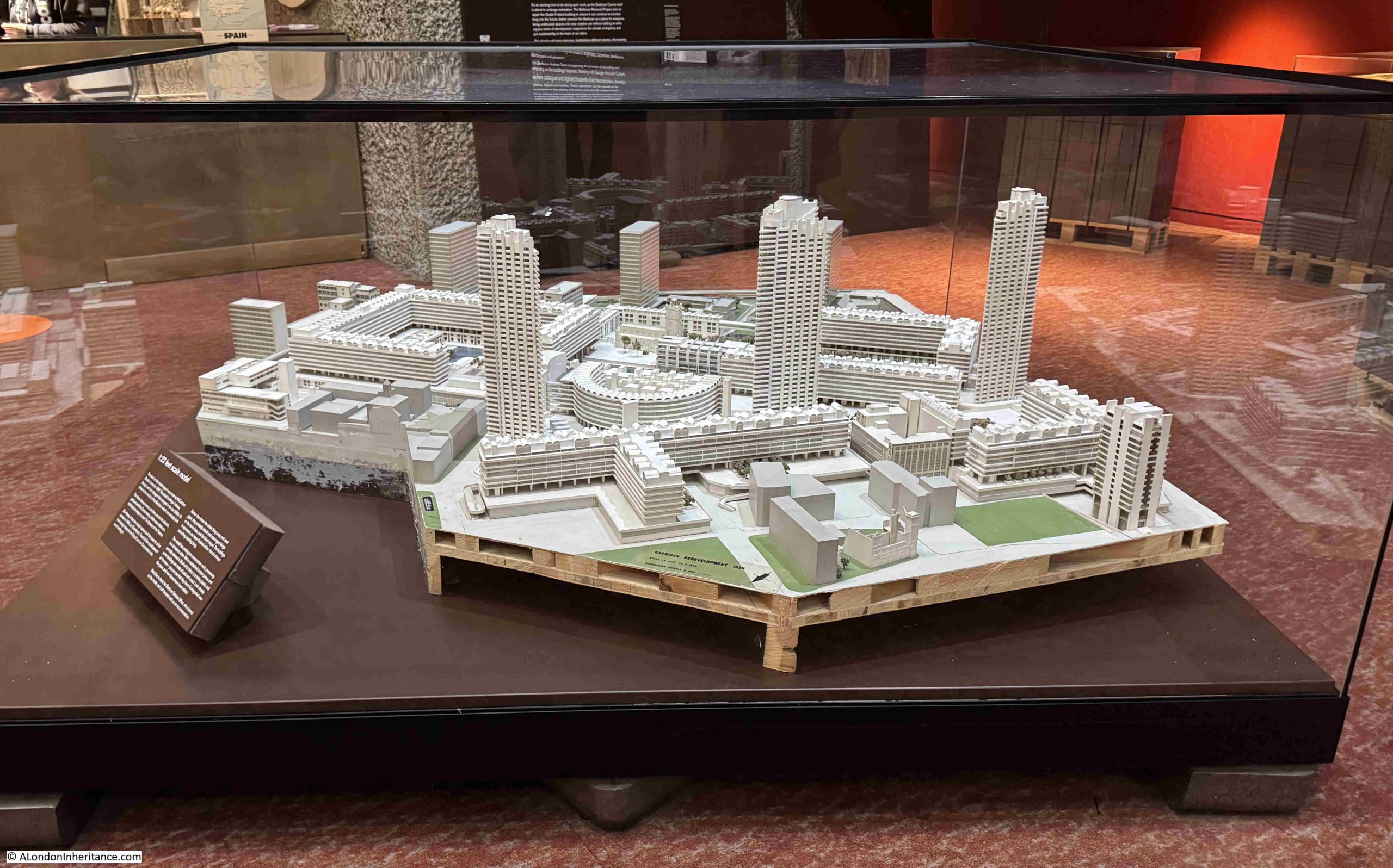
1:22 Feet Scale Model of the Barbican
Next to entrance to the shop in the Barbican Centre is a wonderful model of the whole Barbican complex:
A label on the model states that it dates from 1959, however many of the features are as they were designed and built in the following years, and an information panel provides the theory that the model was created in 1959 for the architects Chamberlain, Powell and Bonn to show their ideas to the Corporation of London, and in the following years, the model was modified to show the estate as it developed.
A view of the Barbican estate from the south:
The model shows not only the Barbican estate, but also the 1950s / 1960s developments that included London Wall. This really was a huge development site, and prior to the Barbican had also included the Golden Lane estate to the north (but which is not included in the model).
The model is a snapshot of the area as it was when substantially finished, and if the model shown above was updated today, there are some features which would change.
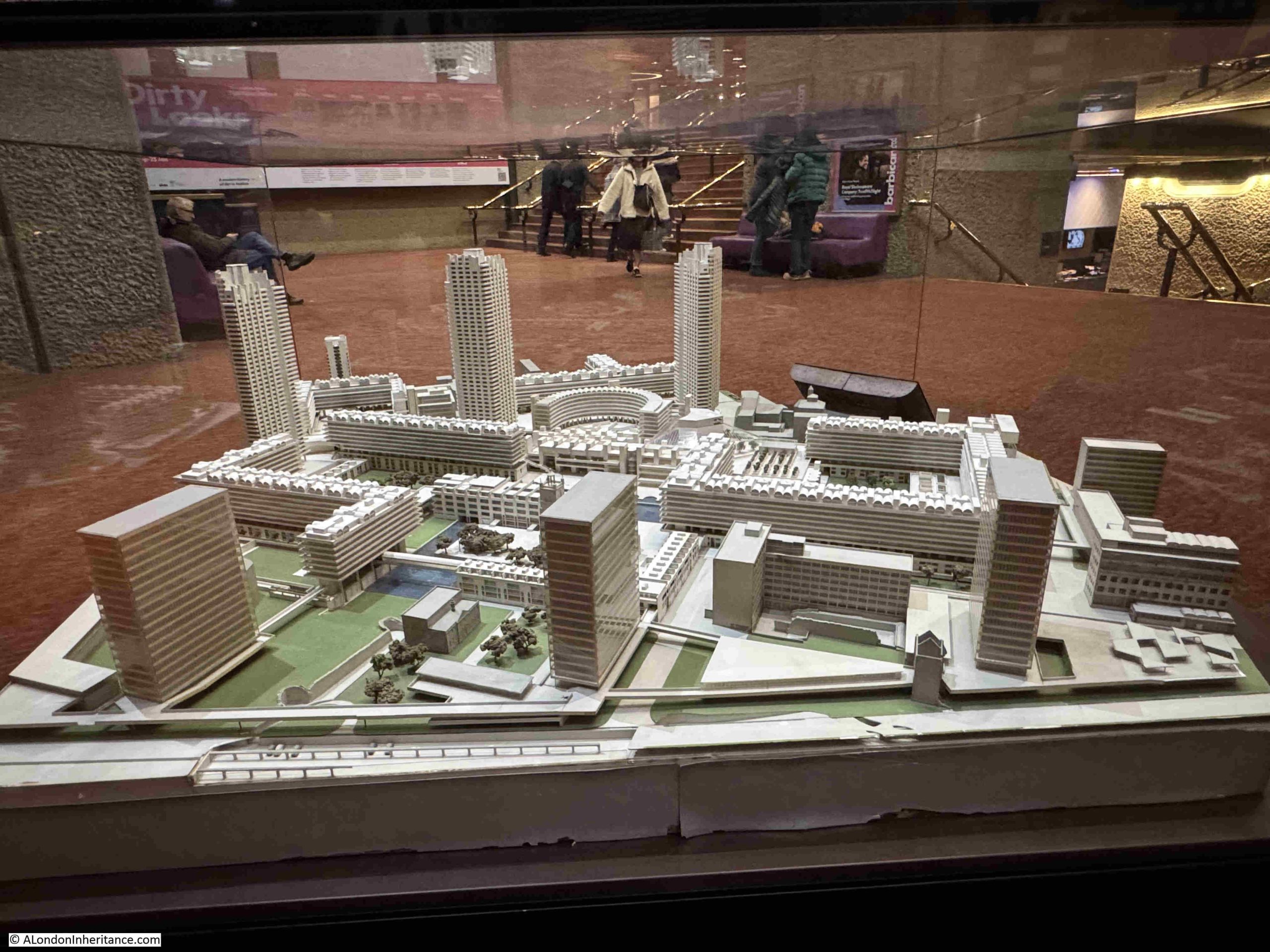
I have taken the view of the model as shown in the above photo, and added some labels to explain some of the features and changes outside the main Barbican development:
At the lower part of the model is London Wall, a dual carriageway that was opened in 1959, and intended to be part of a northern ring road around the City between Aldgate and Holborn. The original London Wall ran slightly to the north, and the new route was moved south to free up space.
There are even little model cars in the car park which is shown below London Wall (and which is still a car park).
Moving London Wall a bit to the south created the space for the office blocks that can be seen lining London Wall. Of these, only Bastion House remains, and is under threat following the move of the Museum of London which was in the lower left corner of the model, and the opportunity to redevelop this entire site.
To the right of Bastion House is Bastion 14, one of the medieval bastions on the alignment of the Roman wall , and if you look a bit further along the wall, there is another bastion just visible, which is by Barber-Surgeons Hall, which is a slightly different design to the one that would be built in the 1960s.
Moving to the right is Roman House, one of the first office blocks to be built in the post war redevelopment of the area. The building is still there, but is now residential.
A bit further to the right is the tower of the church of St. Alphage, which was earlier part of the hospital of Elsyng Spital.
Lee House and Moor House have been demolished, and as well as this line of office towers along the northern side of London Wall, there were also identical towers along the southern side.
Walking around the model, and we can see the view of the Barbican Estate from the north:
If you look to the right of centre of the lower edge, there is a ruined church. These are the ruins of the church, which was completely rebuilt and is now the Jewin Church, part of the Presbyterian Church of Wales.
The model provides a fascinating snapshot of the Barbican when substantially complete, and also when the office blocks lined London Wall.
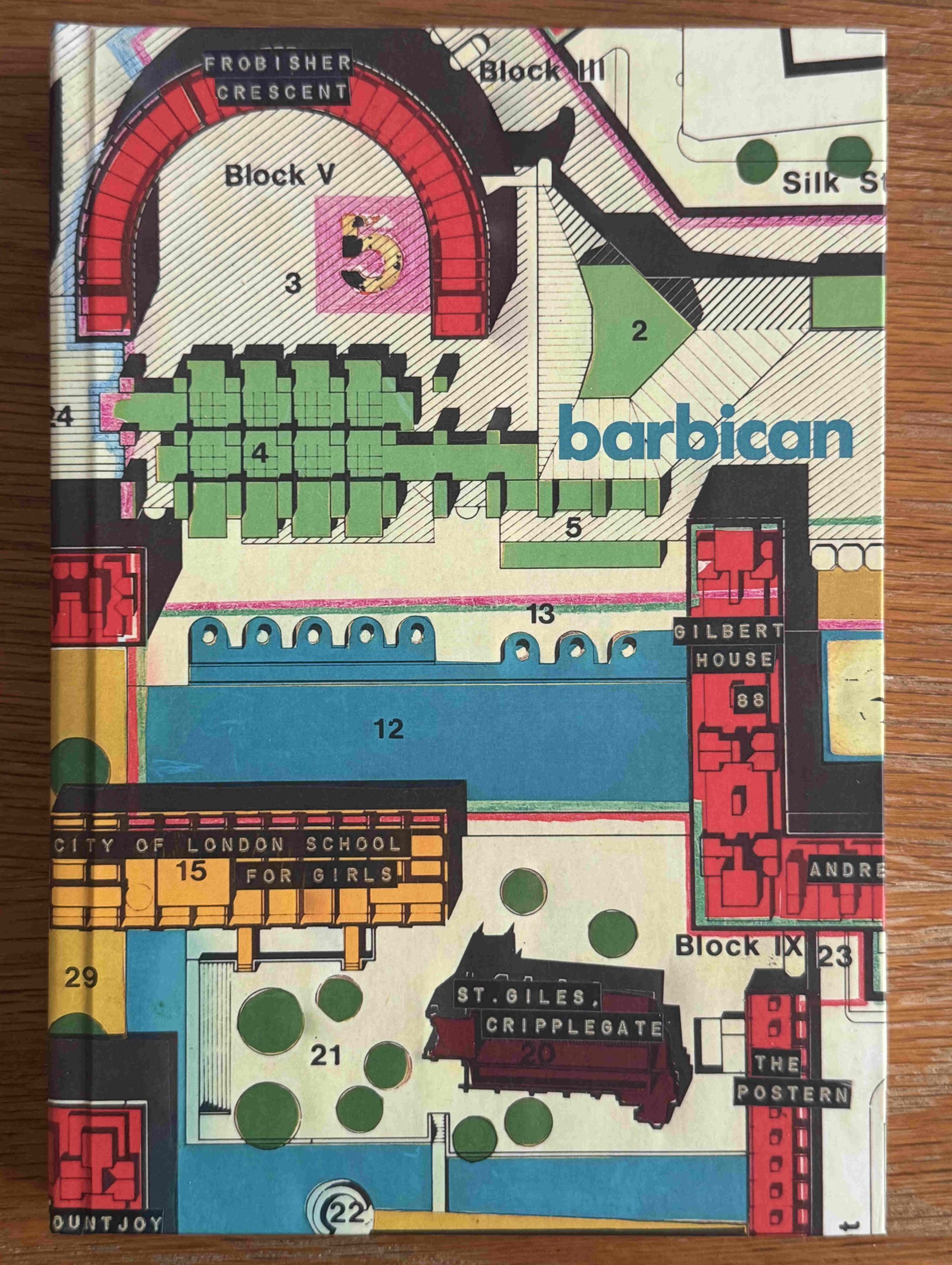
If you like notebooks, and a part plan of the Barbican, then from the model, head into the shop. This is what I did when I purchased the following notebook with a cover of the Barbican Redevelopment Roof Plan from 1966:
The Barbican is a fascinating place for a walk. Not just for the architecture and landscape design of the place, but also for what can be found as you navigate the walkways.
In the middle of the 17th century, Putney was a small village to the west of London with a population of around 900. A bridge had not yet been built across the Thames, but a regular ferry did provide a means of crossing between Fulham and Putney. Close to the river and ferry crossing was a church, the parish church of St. Mary’s, and in 1647 the church was the location of one of the many key events of the Civil War.
Rather than the violence of battle, St. Mary’s was the location of a debate, between members of the Army Council and representatives from within the Regiments of the New Model Army. A debate that became known as the Putney Debates, an event that would probably have been a footnote in the history of the mid-17th century, had it not been for the actions of one man in writing down the first three days of the debates, and a chance find of this record almost 250 years later.
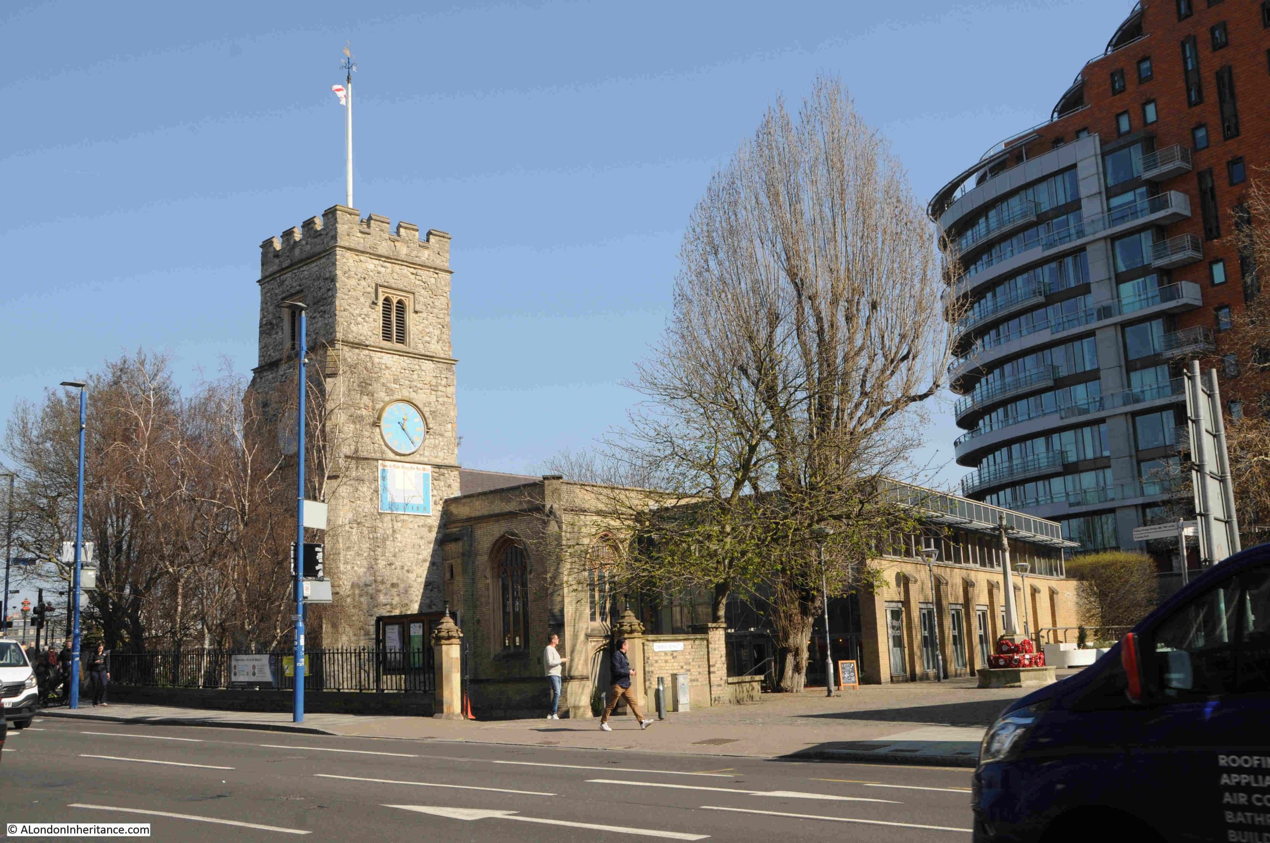
St. Mary’s Putney in March 2026:
A church has been here since at least the 13th century, when there was a written mention of the church in 1292, and the location follows the historic trend of locating churches next to key crossing points.
You can see this around the City of London, with the number of churches located next to the old gates of the City wall such as St. Giles Cripplegate and St Botolph Without Aldgate, as well as river crossings where St Andrew, Holborn is alongside what was the approach from the west, to the crossing of the River Fleet.
By 1647, the Civil War appeared to be over, with the New Model Army’s victory at the Battle of Naseby in June 1645, the Siege of Oxford in April 1646, with Charles I managing to escape and joining a Scottish Army, who handed Charles I back to Parliament in January 1647 in exchange for an initial £100,000.
The first half of the 17th century was a time of radicalism, religious dissenters, new ideas and thought about the role of Parliament, the Monarchy, individual liberty, religious toleration etc. and many of these streams came to a head by 1647.
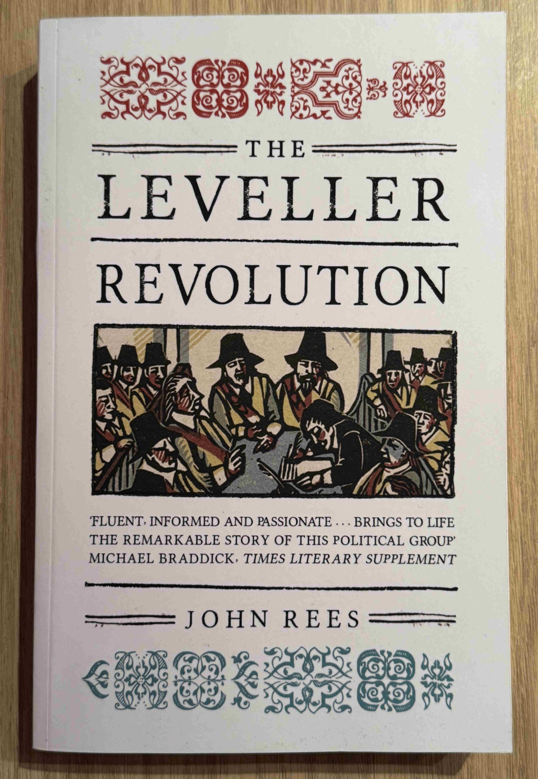
There were Levellers (whose views included religious tolerance and equality of all before the law), and Fifth Monarchist Men, a stream of Protestants who believed that the Kingdom of God would arrive at the end of four earlier kingdoms, the Babylonian, Persian, Greek and Roman kingdoms, with the execution of Charles I signalling the end of the Roman kingdom.
There were those who wanted Charles I to be brought to trial, and there were those (including Cromwell), who wanted an agreement that was more compatible with the King, where he would continue to have a role, although much reduced.
Charles I was being held captive at Hampton Court and there were many discussions about what to do with him. Cromwell was communicating with the King to try and find a way forward, but this led to complaints from the Army that Cromwell was more in favour of Charles I than his own soldiers.
Parliament was also concerned about the continued existence of the New Model Army. The army would require continued funding, and could also become a threat to Parliament, as the army was a more radical organisation.
Regiments within the Army included agitators who would spread and campaign for radical causes. Many of these were aligned with prominent radicals in the City of London.
In October 1647, agitators within five cavalry regiments of the New Model Army published “The Case of the Armie Truly Stated”. The document criticised senior officers within the Army (including Cromwell), for negotiating with Charles I, and also demanded what at the time were radical causes; democracy, equality before the law, extension of the vote, and for soldiers to receive the pay that was owed to them.
A sense of the contents of the document can be gained from the title and opening paragraph:
“The case of the Armie truly stated,: together with the mischiefes and dangers that are imminent, and some suitable remedies, humbly proposed by the agents of five regiments of horse, to their respective regiments, and the whole Army. As it was presented by Mr. Edmond Bear, and Mr. William Russell, October 15. 1647. unto his Excellency, Sir Thomas Fairfax. Enclosed in a letter from the said agents : also his Excellencies honourable answer thereunto.
Whereas the grievances, dissatisfactions, and desires of the Army, both as Commoners and Soldiers, hath been many months since represented to the Parliament; and the Army hath waited with much patience, to see their common grievances redressed and the rights and freedomes of the Nation cleared and secured; yet, upon a most serious and conscientious view of our Narratives, Representations, Ingagement, Declarations, Remonstrances, and comparing with those the present state of the Army and Kingdome, and the present manner of actings of many at the Head Quarters, we not only apprehend nothing to have been done effectually, either for the Army or the poore oppressed people of the nation, but we also conceive, that there is little probabillitie of any good, without some more speedy and vigorous actings.”
A large contingent of the Army were based around Putney, and the church had already been used for meetings. Churches were good for meetings because they offered a large space, and were also a religious building, and prayer was often a key part of meetings and debates held by members of the Army and the radicals.
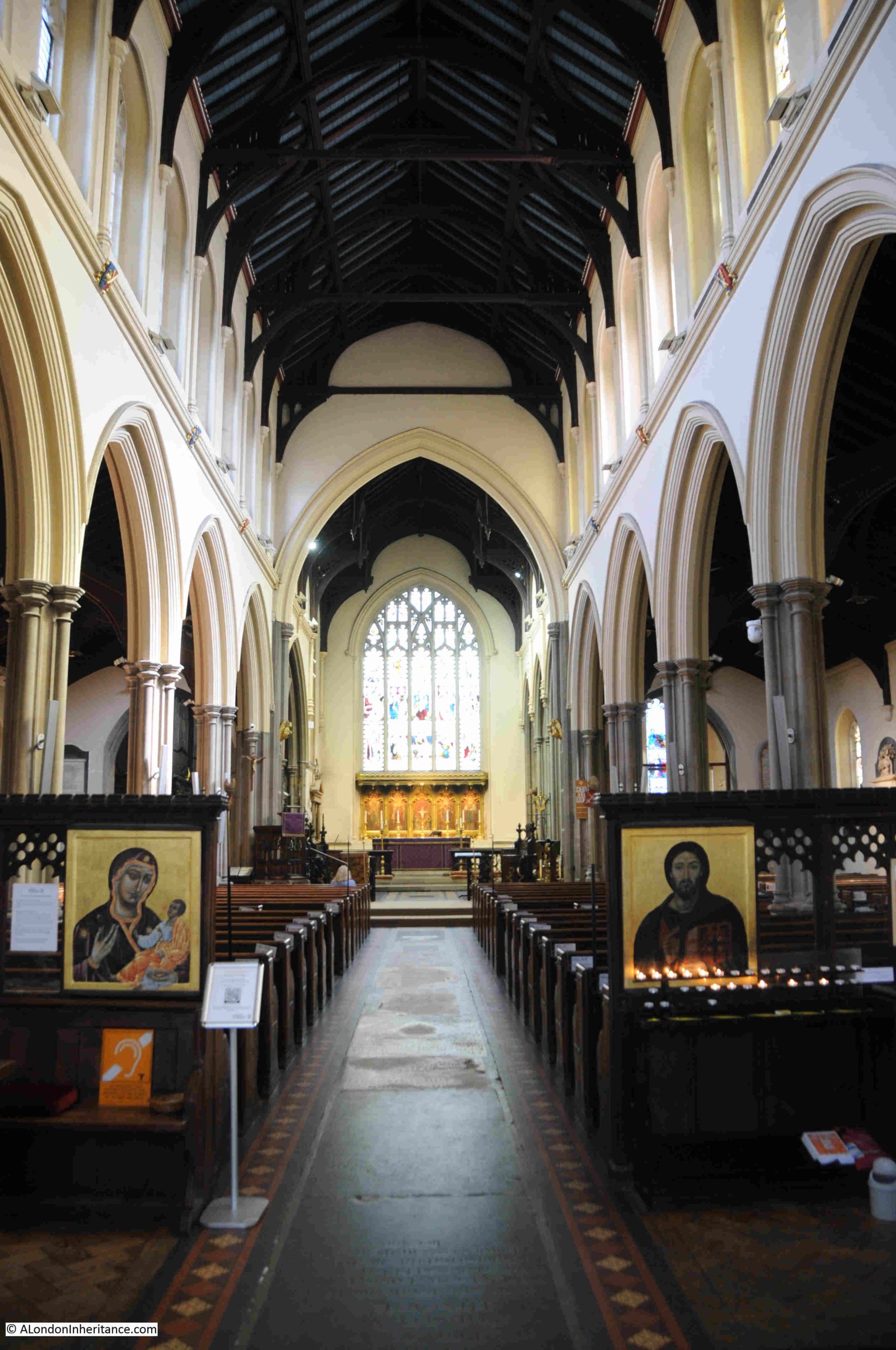
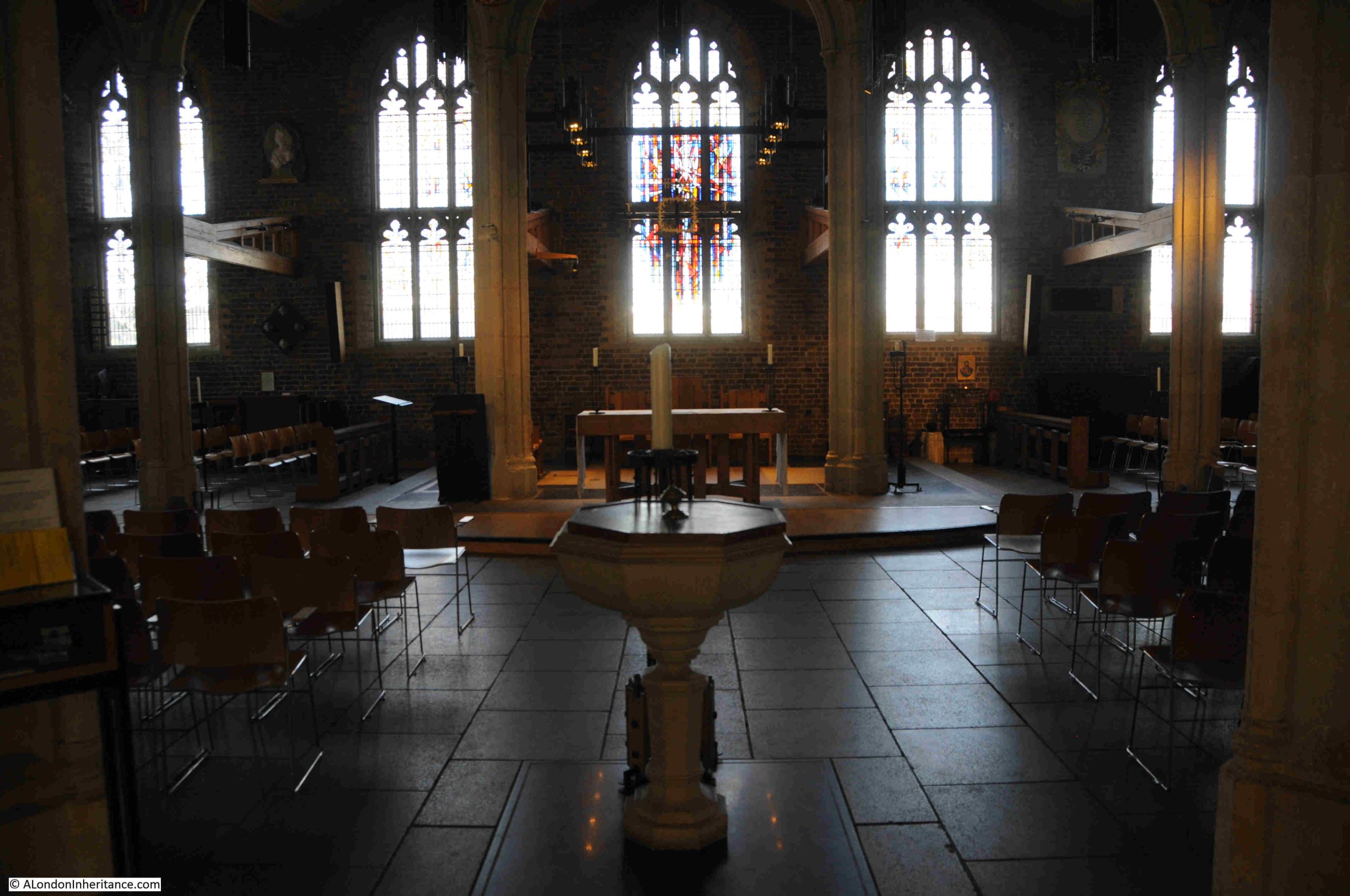
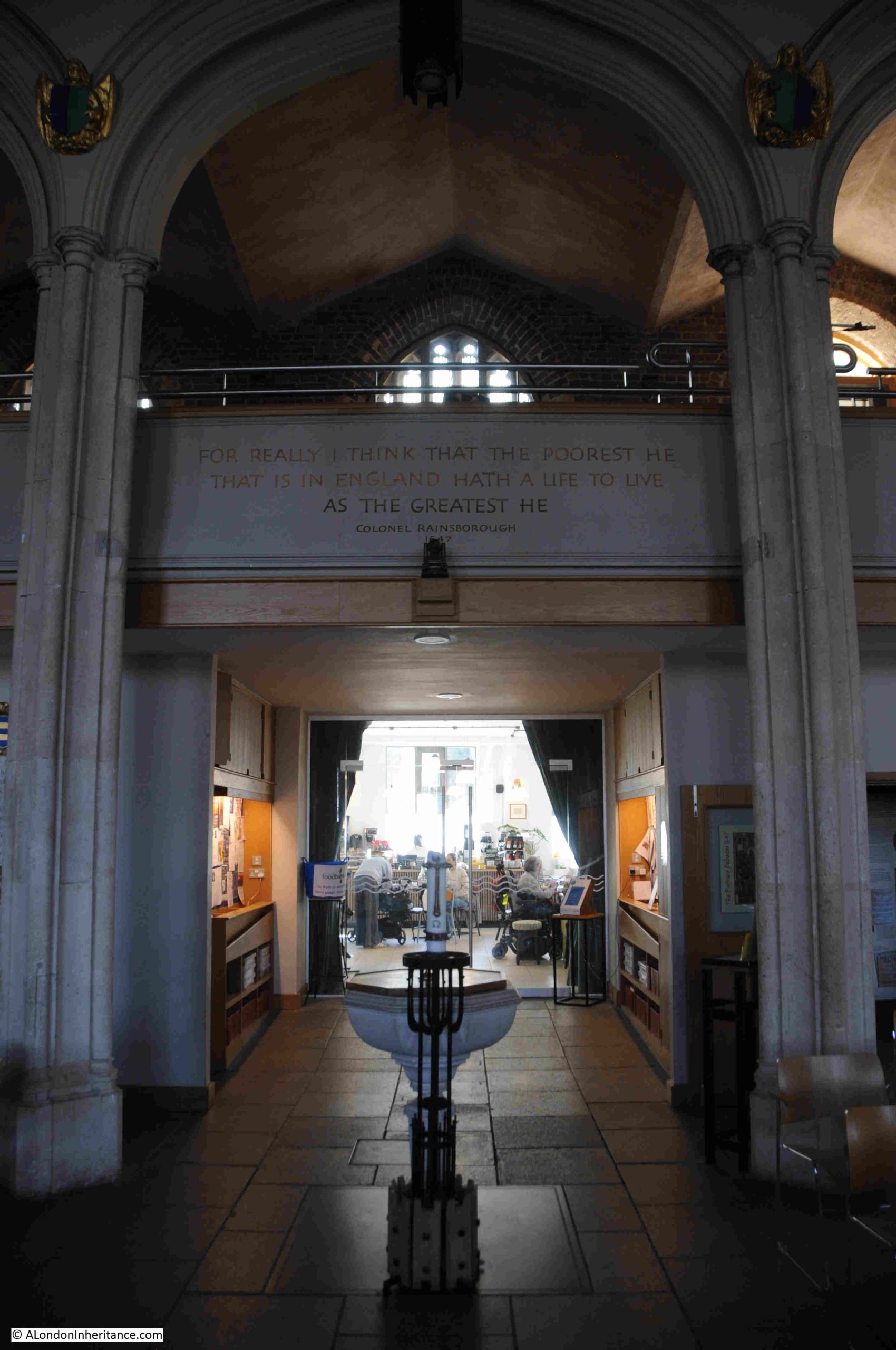
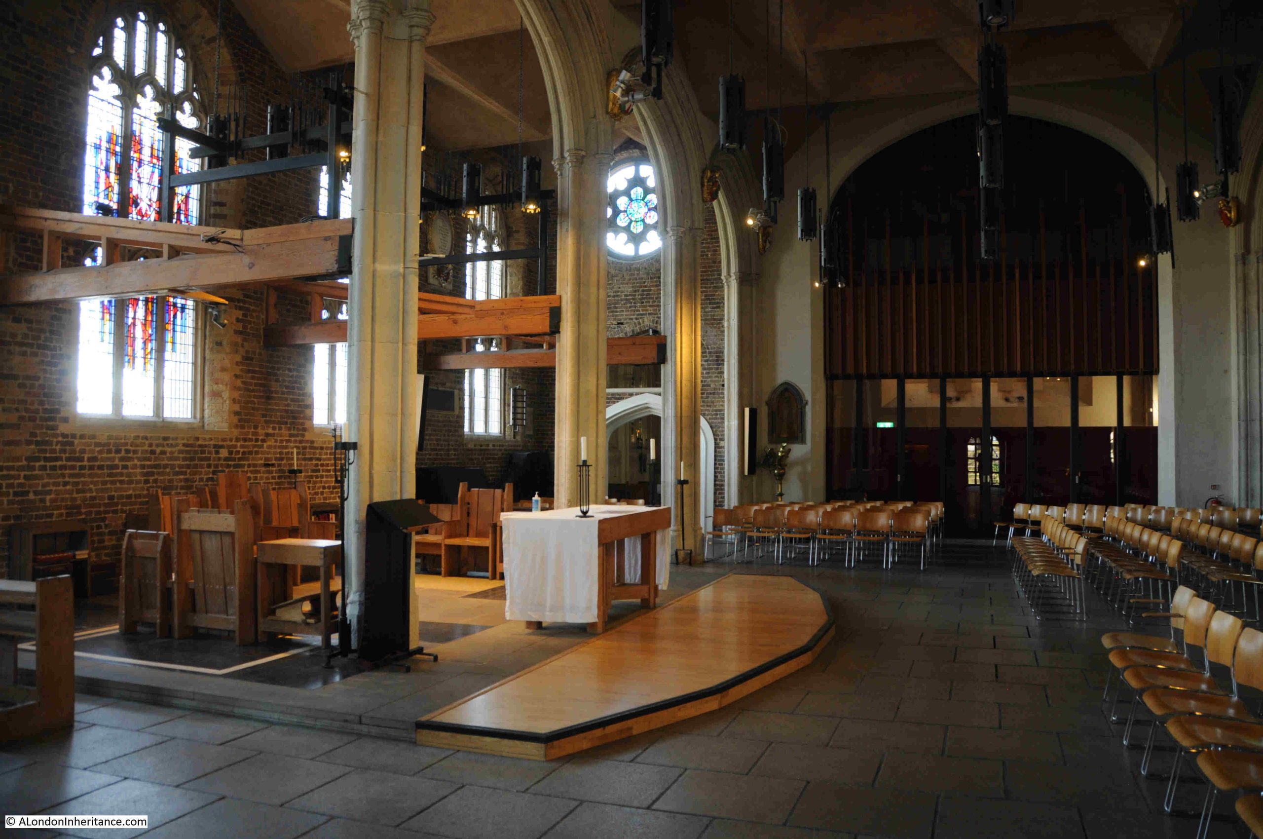
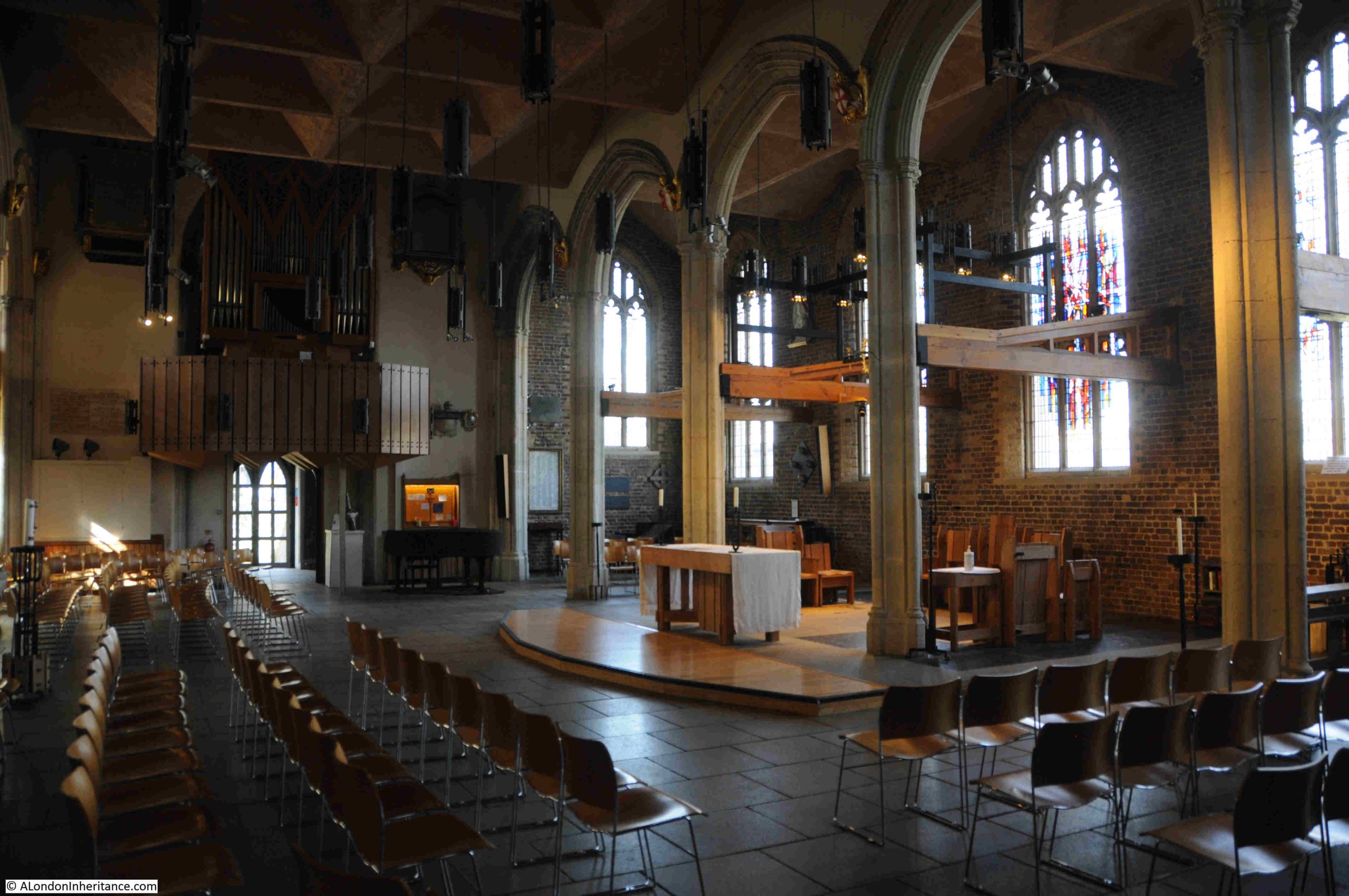
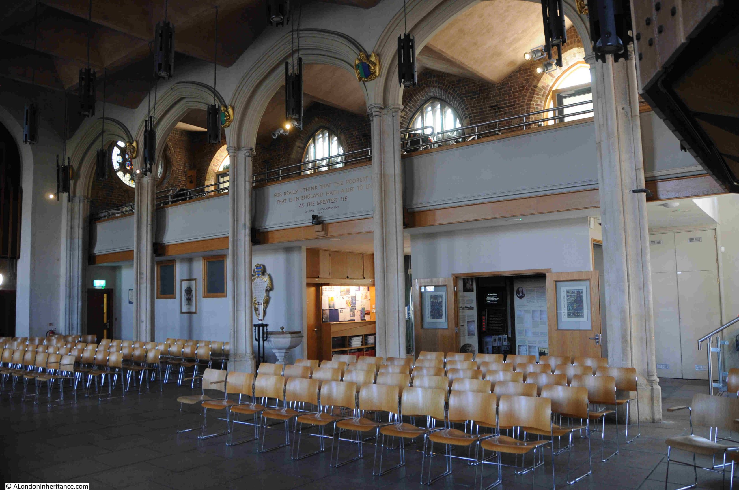
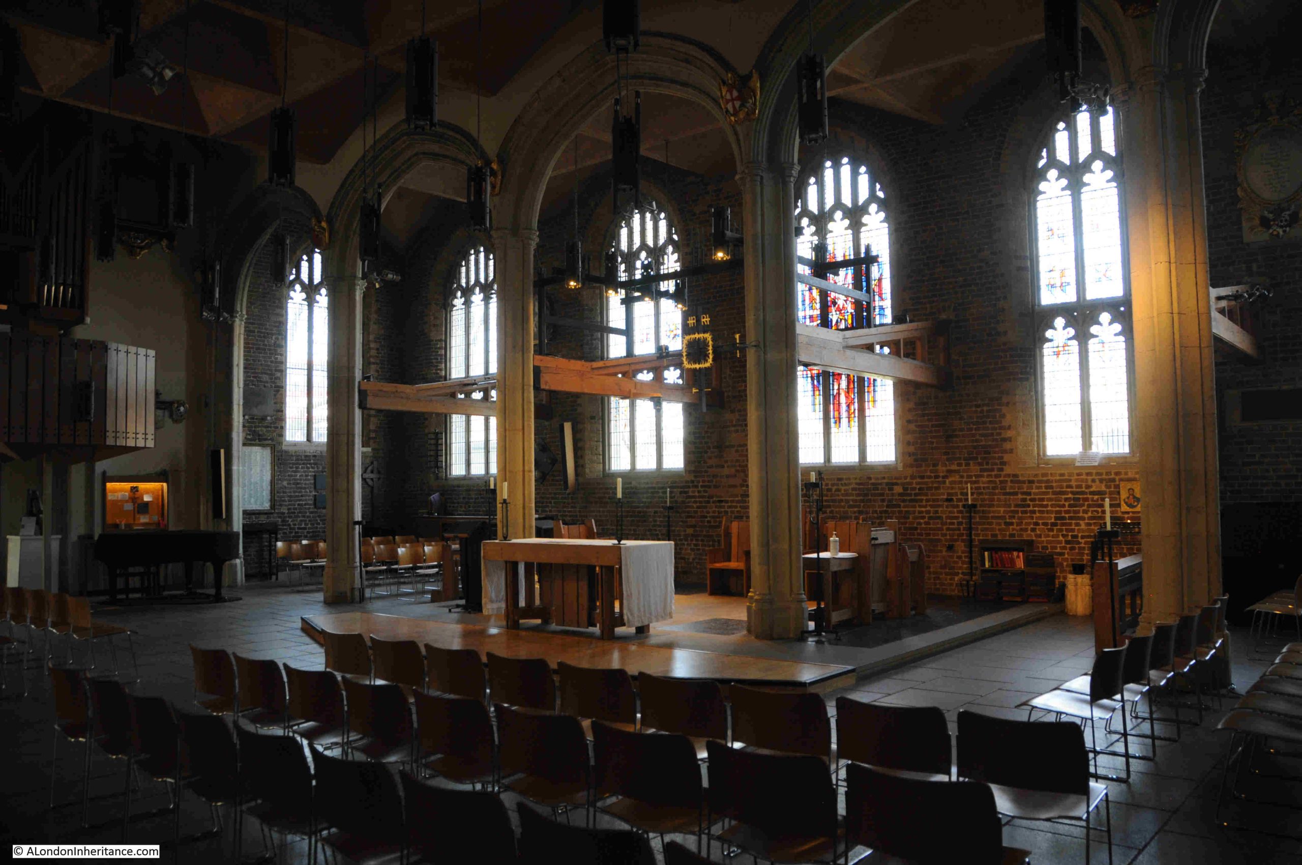
Today, access to St. Mary’s is via the new building to the side, which has a café on the ground floor. Walking through the café and turning left into the church provides the following view:
On walking into the church, was I looking at the same church that Oliver Cromwell would have seen back in 1647?
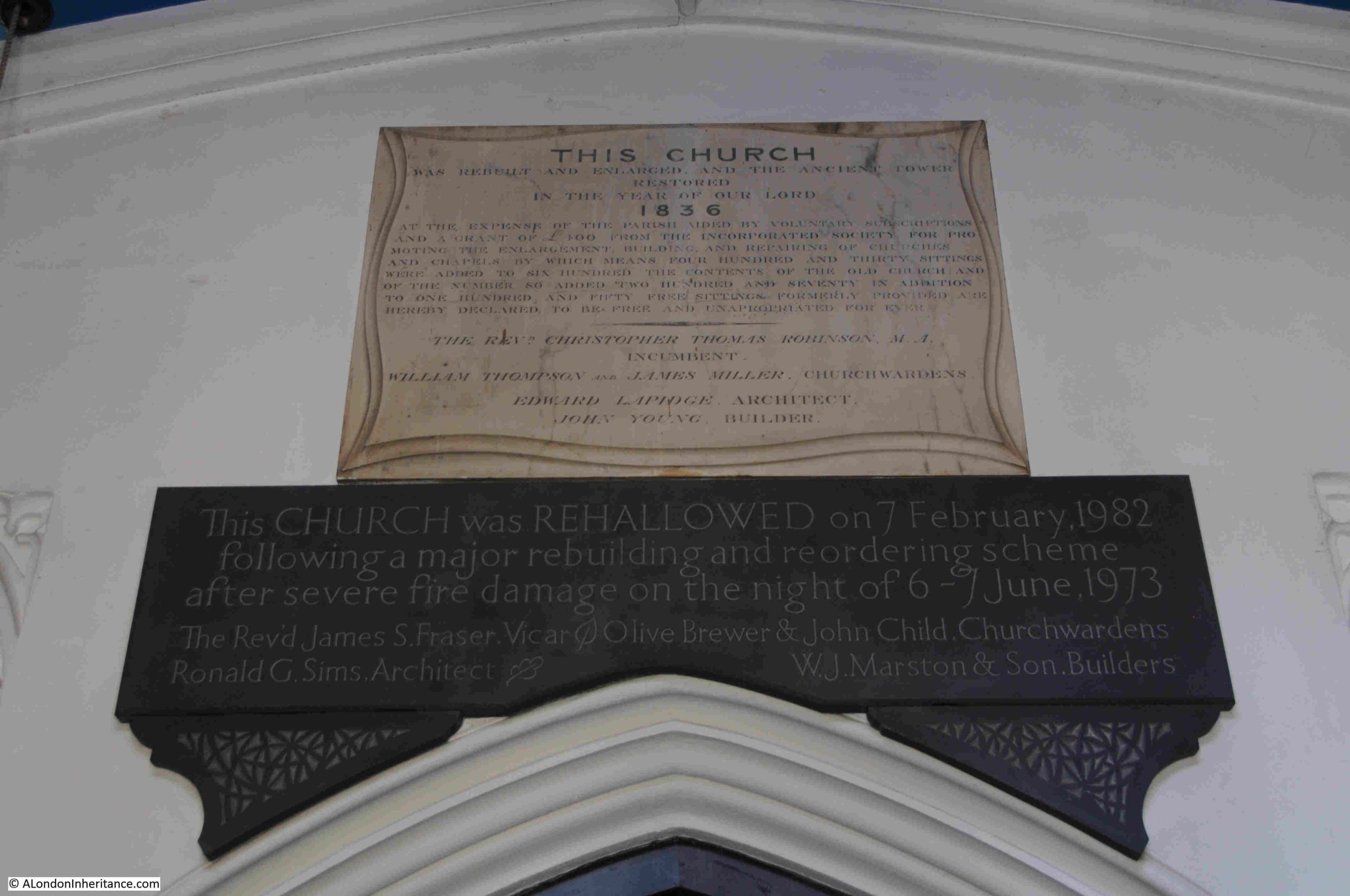
Unfortunately not. The church was enlarged and substantially rebuilt in 1836, and in 1973 an arson attack destroyed much of the church, requiring a significant rebuild, which was completed nine years later when the church was re-hallowed on the 6th of February 1982.
Although it is a very different church, it is still the place where the debates where held, and a place where Oliver Cromwell, senior officers and members of the New Model Army, religious and political radicals, argued and debated on the future direction Parliament and the country, religious freedoms and the fate of the King.
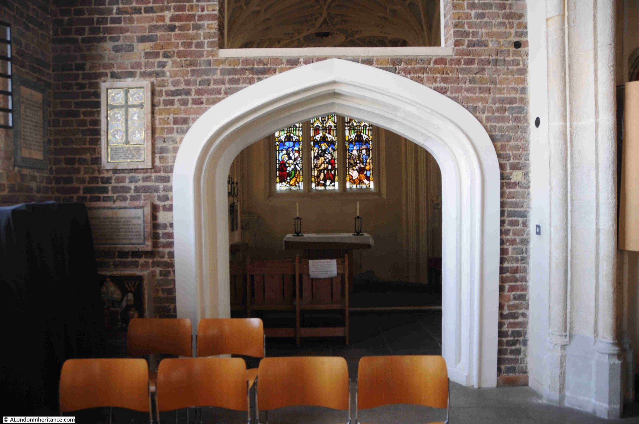
Inside the church, looking back towards the café entrance:
One of those involved in the debates was Colonel Thomas Rainsborough.
Rainsborough was born in Wapping in 1610, the eldest son of William Rainsborough who was a member of the Levant Company, who gained their charter from Elizabeth I in 1592, with the right to trade with the Ottoman Empire, and neighbouring states in the eastern Mediterranean.
Thomas Rainsborough would also become a member.
At the start of the Civil War, Rainsborough was appointed Captain of one of the ships of the Navy. The Navy had sided with Parliament, and during the Civil War, the Navy’s main roles were supporting coastal towns and cutting off supply routes to Royalist forces, and one of his successes during this period was the capture of a ship carrying supplies and reinforcements to the King.
He transferred to the Army and in May 1645 became a Colonel in the New Model Army and was part of a number of battles and sieges, including the siege of Oxford, the base of Charles I which surrendered in June 1646, and the siege of Worcester, which surrendered the following month.
Rainsborough was a supporter of the Levellers, and also opposed negotiations with the king. In the Putney Debates he was frequently in opposition to the views of Oliver Cromwell and Henry Irelton, a Major-General in the New Model Army, supporter of Cromwell, and who was married to Bridget Cromwell, Oliver Cromwell’s eldest daughter.
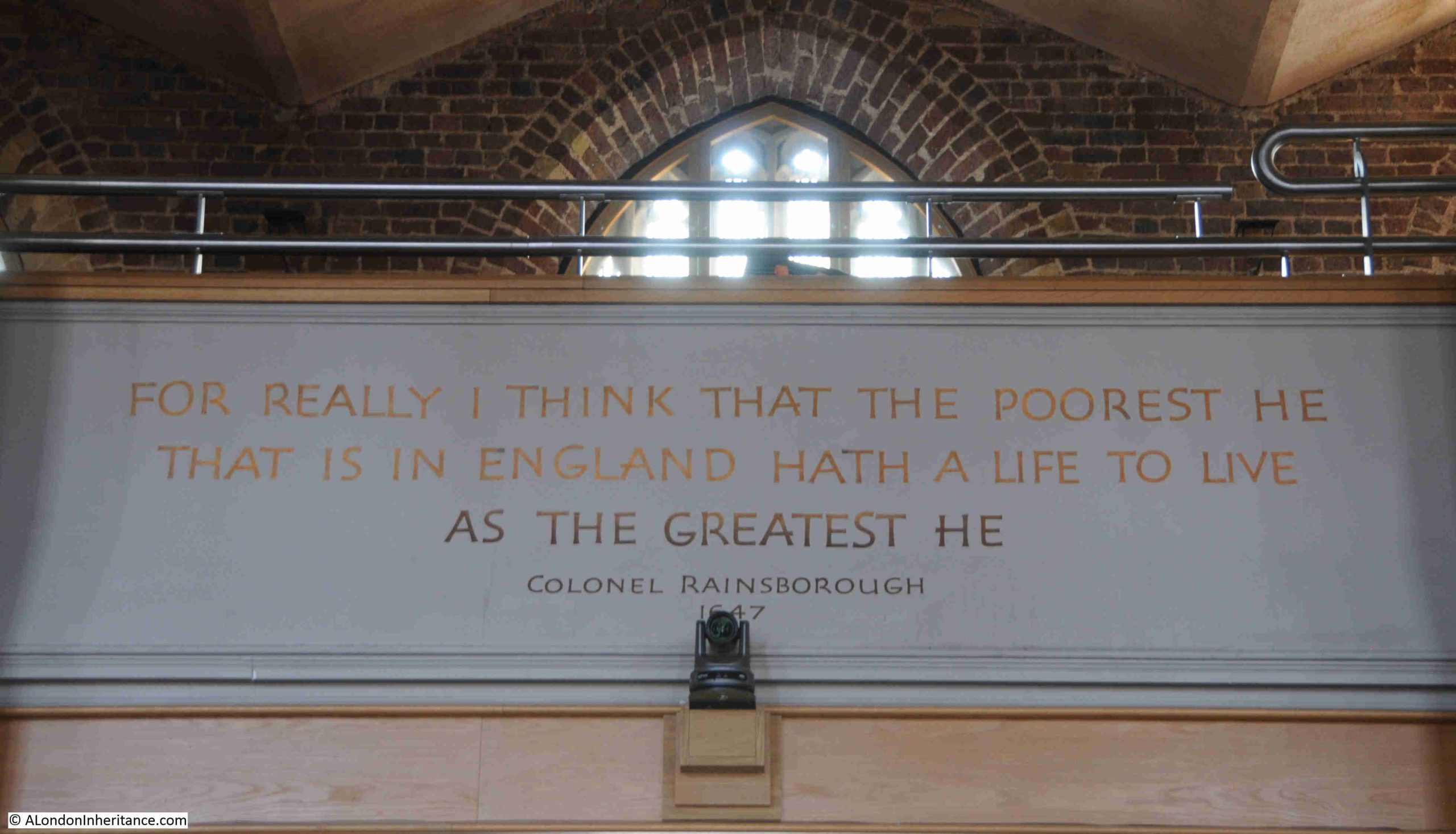
A quote from one of Rainsborough’s arguments at the Putney Debates is above the entrance to the church from the café, as can be seen in the above photo, with a close up shown below:
The phrase (in bold) is from the following part of one of Rainsborough’s arguments:
“I desired that those that had engaged in it [might be included]. For really I think that the poorest he that is in England hath a life to live, as the greatest he; and therefore truly, sir, I think it’s clear, that every man that is to live under a government ought first by his own consent to put himself under that government; and I do think that the poorest man in England is not at all bound in a strict sense to that government that he hath not had a voice to put himself under; and I am confident that, when I have heard the reasons against it, something will be said to answer those reasons, insomuch that I should doubt whether he was an Englishman or no, that should doubt of these things.”
A very clear argument for equality and democracy, and good to see these words from Thomas Rainsborough are on display in the church where the debates took place, with the caveat that it was a view of equality and democracy in the mid 17th century.
There was no argument for equality of men and women, or for women to be able to vote on who represented them in Parliament, and the debates also included arguments for how far democracy should go, for example that the poor and servants should be excluded. As representatives of the army, there was general agreement that soldiers should be given the vote.
Whilst we should not compare the middle of 17th century with today, the Putney Debates were a step in the right direction.
The interior of the church today – a very different place to when Rainsborough was part of the Putney Debates, Cromwell was here, along with other senior members of the army and representatives and agitators from the regiments:
The church is Grade II* listed, and the following from the Historic England listing provides an idea of just how much the church was changed in 1836 and 1837:
“This involved alterations to the tower, widening the nave, the addition of expanded aisles in yellow stock brick and the addition or replacement of windows in the Perpendicular Gothic style. In addition, the galleries in the aisles and west end of the church which had originally been installed in the early part of the C17 were replaced, a single-storey vestry added in the south-east corner and the Bishop West chapel moved from the south to the north aisle.”
The rebuild after the 1973 arson attack further changed the church, as follows:
“As well as installing a new roof, Sims moved the altar and sanctuary to a central location on the north side of the nave, installed a glazed meeting room in the former chancel and added an organ loft in a gallery in front of the tower. The C19 pews were replaced with chairs.”
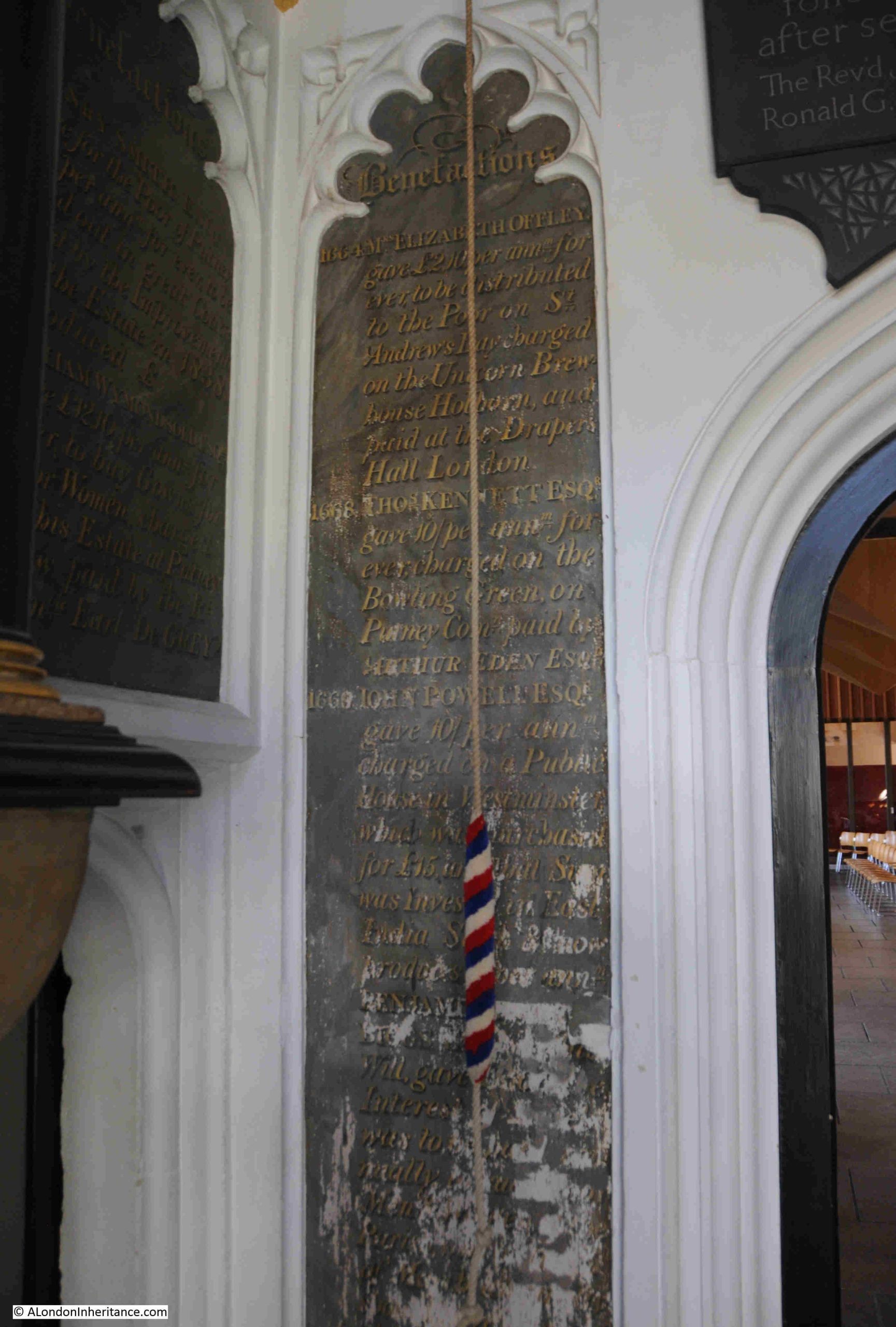
17th century benefactors to the parish are recorded in the church, and these included Elizabeth Offley, who in 1664 gave a regular sum of money to be distributed to the poor on St. Andrew’s Day, the sum was charged on the Union Brewhouse in Holborn, and was paid in at Drapers Hall, and in 1669, John Powell gave a sum of £10 per annum, charged on a public house in Westminster:
The following plaques in the church record the 1836 rebuild and enlargement of the church (top), and the lower plaque records the rebuild after the 1973 fire:
The fact that Thomas Rainsborough’s argument, as well as a record of the rest of the first three days of the Putney Debates survives is down to the original record, and a later discovery.
The Putney Debates were recorded by William Clarke, who probably had the help of a number of assistants with recording the live debates.
The Clarke Papers, published by the Camden Society in 1891 provide some background:
“William Clarke who was probably born about 1623, was admitted a student of the Inner Temple in 1645. When the New Model Army was organised, John Rushworth was appointed Secretary to the General and Council of War, with William Clarke and another assistant as subordinates. Clarke acted as secretary to the commissioners who negotiated the surrender of Oxford in June, 1646, and to those who tried to arrange terms between Parliament and the Army in July 1647. He seems to have taken part in the invasion of Scotland in July 1650, and from the autumn of 1651 to the Restoration was Secretary to to Army of Occupation in Scotland.
Not long after the Restoration, Clarke was knighted and, on 28th January 1661, appointed Secretary at War. Sir William Coventry described him to Pepys as one of the ‘sorry instruments’ by whom Monck was lucky enough to effect great things.
Clarke accompanied Monck to sea in 1666, and was mortally wounded in the battle with the Dutch off Harwich on the 2nd of June 1666. He was buried in the chancel of Harwich Church.”
Following Clarke’s death, his books and papers were left to his son George Clarke, who preserved the archive, and would go on to bequeath his father’s archive along with his own library to Worcester College, Oxford.
And there they remained until the later years of the 19th century when a young historian by the name of Charles Firth, who would later become the Regius Professor of History at Oxford University, found a set of manuscripts laying in a cupboard at Worcester College.
Firth edited the manuscripts for the Camden Society (now the Royal Historical Society), and they were published, almost 250 years after the original debates, with Clarke’s record of the arguments of radicals, agitators, the commanders of the New Model Army, and those with opposing views on the future of King Charles I.
Another view of the church, looking towards the organ loft above the door, which was part of the post 1973 fire restoration:
The views of many of the agitators influenced the Putney Debates, but they would grow as the Civil War ended, the Commonwealth was established after the end of the Second Civil War and the execution of Charles I resulted in the country becoming a Republic, with Cromwell being given the role of Lord Protector, with the considerable powers that the role included.
To show how agitators viewed the evolution of the Commonwealth and the role of Cromwell, we can look at the role of Edward Sexby, one of those at the Putney Debates.
Sexby served in Cromwell’s regiment at the start of the Civil War.
During his time in the army, he helped to spread Leveller ideas, and helped to set up the Council of Agitators, which brought together like minded representatives from across the army with a view to petition for soldiers rights.
Sexby was the main representative of the Leveller contingent at the Putney Debates, where he argued for the rights of all men, and strongly argued against Cromwell’s dealings with Charles I.
During the Commonwealth, Sexby viewed Cromwell’s role as Lord Protector as being against the principles on which the Civil War had been fought.
Sexby tried to organise with those he viewed would be against the Protectorate. He was nearly arrested in 1655, but escaped to Europe. He was involved with plots to assinate Oliver Cromwell, and also published a phamplhet titled “Killing no Murder”, in which he argued that the killing of a tyrant (as he viewed Cromwell), was justified.
The plots to assassinate Cromwell failed, and Sexby returned to England in 1657 to try and organise new conspiracies against Cromwell, however he was arrested, imprisoned and interrogated in the Tower of London, where he died in January 1658 of fever, before he could be brought to trial.
Part of the church that probably would still be recognised by those who attended the Putney Debates is Bishop West’s Chantry Chapel:
Bishop West was Nicholas West, who was born in Putney in 1461 to Katherine and Robert West who may have been a fishmonger.
He attended Eton College and Cambridge, became chaplain to Henry VII, was Dean of Westminster in 1510 and Bishop of Ely in 1515.
His legacy to the church in the village of his birth was the chapel, built at some point between the years 1515 and 1530.
The chapel was originally on the south side of the church, but as part of the 1836 rebuild and restorations, the chapel was moved to the north.
The arms of Bishop West, which include a Bishop’s Mitre and the Tudor Rose:
Looking along the north side of the church:
There are not that many monuments in the church, presumably the 1836 rebuilt and the 1973 fire resulted in the loss of many of these.
The monument to Sir Thomas Dawes (died 1655), and his wife Dame Ivdith Dawes (died 1657):
Sir Thomas Dawes was an important land owner in Putney, but lost most of his lands, and suffered imprisonment and heavy fines during the Civil War and Commonwealth.
The 17th century clerics heads are the only items remaining from the monument to Robert Gale who died in 1659:
Robert Gale was chaplian to the Countess of Devonshire, who was a supporter of the Royalist cause.
In her house at Roehampton, she arranged meetings with other Royalist supporters, and also wrote letters in code to Royalists in exile in Europe (Robert Gale was one of those who helped her with her letters), and on the restoration of the monarchy, Charles II was a visitor to Countess Devonshire at Roehampton.
A look towards the south of the church, with the entrance / exit to the café in the centre:
There is a small exhibition about the Putney debates in the alcove behind the two doors to the right of the above photo, and at the top of each column is the figure of an angel. There is no mention of these figures in the Historic England listing so I have no idea of their age:
A final view of the interior of the church, an unusual layout with the altar in the centre, towards the northern side of the church. I suspect that this layout would have been approved by many of those attending the debates. There were no alter rails around the alter, or any other form of separation with the congregation and the act of service would have been visible to all:
The main issue that the army command and the agitators within the regiments failed to agree on was how far across society should the ability to vote be granted.
The Leveller position put forward by the agitators was that all freeborn English men should be granted the vote, whilst the army command, including Cromwell, went only as far as land owners being given the vote.
A compromise was reached that all soldiers who served in the army and had fought for Parliament should be given the vote. Maintaining army discipline seems to have been the main reason why the army command agreed to this compromise.
The Putney Debates also seem to have changed Cromwell’s opinion regarding Charles I. The agitators did not agree that negotiations should continue with the king, and argued that he should be put on trial. Again, to keep the army onside, after the Putney Debates, Cromwell appears to have hardened his attitude towards Charles I.
The “Agreement of the People” that came out of the Putney Debates was to be put to a mass meeting of the army, however Cromwell along with other senior members of the army were concerned about the growing influence of the Levellers within the army, so they disbanded the Army Council before the mass meeting could be arranged, and ordered the agitators and other representatives of the soldiers to return to their regiments.
Three separate, smaller meetings were then arranged with the regiments, however all these plans were thrown into disarray when Charles I escaped from Hampton Court, an action which brought together the New Model Army against a common enemy, and which would lead to the Second Civil War.
Although St. Mary’s is now a very different church to the one in which the Putney Debates were held due to the 1830s restoration and enlargement and the rebuild following the fire of the 1970s, it on the original site.
During my visit, whilst the adjoining café was busy, for the time that I was having a good look around the church, I was on my own, and it was easy to imagine a smaller church, full of the victors of the first civil war, each expecting the outcome of the previous years of fighting to be the opportunity to progress their own deeply held views.
Whilst Cromwell asserted his control over the army, his position during the Commonwealth as Lord Protector was seen by those who were agitators as almost becoming like a king.
Many of the ideas about the freedom to vote, religious tolerance and rule by an elected Parliament rather than a hereditary monarch would come into being over the following centuries and the 17th century began the transition from a late medieval to the modern world.
William Clarke’s record provides us with a view of how these ideas were being discussed and argued, in a church by the Thames in Putney.
I have read a number of books over the last months about the Civil War, and the ideas that were part of the radical thinking of the period. Three excellent books that cover Cromwell, the Civil War and the Levellers are:
The Leveller Revolution by John Rees:
Along with The Making of Oliver Cromwell and Commander in Chief Oliver Cromwell, both by Ronald Hutton:
I will feature more books in future posts about this fascinating period in history.
This week, I am continuing my walk around parts of the London Borough of Hackney, searching for the location of some 1980s photos, and looking at how streets which are today mainly long rows of residential homes, were once far more diverse.
I am in Allen Road, Stoke Newington, and in the mid 1980s, at number 33 Allen Road, was a scrap metal dealer:
Today, the scrap metal dealer’s business is now residential:
The signage on the scrape metal dealer advertised that there was a drive-in yard to the side, and this is what made number 33 the perfect location for such a business, as it was the only building in Allen Road with a large yard at the back.
The entrance to the yard today:
Today, the yard has been filled in with residential properties, following that modern London approach, where any available space or building is converted to residential.
In the following extract from the 1969 revision of the OS map, I have marked number 33, the scrap metal dealers with the lighter blue circle, just to the right of the middle of the map. I will cover the other circled buildings later in the post (‘Reproduced with the permission of the National Library of Scotland“):
You can that to the left and behind number 33 is Leonard Place, which was the yard of the scarp metal dealers. The impact of this yard was to shorten the gardens of the houses to the right of number 33, far shorter than the rest of the houses on the street.
This yard behind these houses is shown in earlier maps of Allen Road, so must have been part of the original construction of the street, during the mid 19th century expansion of north London.
Use of one of these north London 19th century terrace houses as a scrap metal dealer was not that common, but there were many small industrial business to be found among the terraces.
Number 33 had been built as a general shop, which was a typical use for this type of house, a corner shop among the terraces, although it is not clear why Leonard Place was built to the side and rear. Its only original purpose or impact seems to be depriving the street of another terrace house, and a row of houses to have smaller back gardens than their neighbours.
Confirmation of use as a shop can be found in newspaper references, for example with the following from the Hackney and Kingsland Gazette on the 25th of October 1907:
“General, double fronted shop, genuine business, one change 17 years, well fitted, no reasonable offer refused, good cause for selling. 33 Allen Road, Stoke Newington”
The terrace houses that spread across north London during the 19th century, were meant to be the homes of the middle class, professional trades people etc. and by the time of the 1921 census this still applied to the majority of homes in Allen Road, where 577 people were recorded as being in residence.
Number 33 however was home to three different families, a total of ten people:
There was the Forsyth family, consisting of Thomas (aged 32), Julia, his wife (aged 25 and from Ireland), and their son Michael (aged 1). Thomas was a Compositor, a job that involved setting the type for a printing press.
Arthur Mead (aged 24), his wife Maud (aged 19), and their daughter Irene Francis, who had been born in the same year as the census. Arthur was a bricklayer for a builder in Lower Edmonton.
The final family were the Payne’s, consisting of Harry Joshua (aged 30), his wife May Beatrice Lilian (aged 29), their son Henry George (aged 2) and daughter May Patricia Lilian (aged 1). Harry was a General Labourer.
As number 33 seems to have been quite a crowded home for three families, I suspect that as it had a business on the ground floor, it was not considered by purchasers as being to the same standard as the other terrace homes on the street which occupied the whole house, so number 33 became a multi-occupancy house.
Whilst residents could work across London, with the expanding train, underground, tram and bus networks doing their best to keep up with the rapid growth of housing; shopping, schooling and socialising would generally be a local activity, and all these streets had shops and pubs, to an extent which seems remarkable compared to the streets we see today.
Allen Road is not a particularly long road, but it had four pubs.
In the map earlier in the post. the red circle on the right is around the Prince of Wales. I cannot find exactly when, but the Prince of Wales has been demolished and replaced with a new residential block.
Then the green circle is around the Allen Arms, which closed in 1993 after a fire, and is now residential.
The Stack Rock at number 48, the purple circle. An unusual name for a pub, but the name did appear in several newspapers, for example in 1897, the landlord was advertising a concertina competition. Not sure when the Stack Rock closed, but again it is now residential.
The dark blue circle is around the Shakespeare, at number 57, which of the original four, is the only pub still open on Allen Road:
The Shakespeare once had an ex Arsenal and England player as landlord. Lionel Smith became landlord of the pub in September 1960, after he had retired from football.
He played for Arsenal between 1939 and 1954, with a break during the war, playing as full back, which probably accounts for the fact that during his time with the club, he had never scored a goal.
He played for England between 1950 and 1953, then after leaving Arsenal, he was a manager of Gravesend & Northfleet between 1955 and 1960, when he retired and took over the Shakespeare.
Opposite the Shakespeare is number 50, another corner shop:
I believe at some point, this was a fish and chip shop, but in the 1921 census it was a green grocers, run by Marks and Marie Rwaries, who had both been born in Russia. They lived in the building along with their five children, all girls.
Today, number 50 is a coffee shop.
If you look to the right of the corner building in the above photo, there are two ground floors painted with bright white paint. The one on the left is number 54, and I think that back in the 1980s, the was L. King’s shop:
I am not 100% sure, but the photo is in the right place in the strip of negatives, and the moulded decoration to the sides and along the top of the shop are the same as on the building today. These moulded decorations are called Pilasters (thanks to “Chase” for his comment on a previous post). An amazing transformation when you consider the white fronted residential ground floor today, compared to a working, local butcher, 40 years ago.
There are still a few shops on Allen Road, but the majority have been converted to residential. A couple still show their early origins, with number 62 displaying signs for Harvey’s Snack Bar and Light Refreshments. The later seems to be written over the former name:
The brown circle, to the left of the map earlier in the post, shows the location of another closed business, where at number 72, on the corner with Milton Grove, was once a Post Office:
To the left of the corner post office building in the above photo can be seen typical 19th century shop fronts, although all these are now residential.
The painted sign advertising the Post Office is on the rounded corner to the building, which again, has also been converted to residential:
There are two other photos on the strip of negatives that should be in Allen Road, but I could not find, or be sure of their location. The first has no identifiable features:
The second photo should be at the junction of Allen Road and Milton Grove according to the photo’s location on the negative strip and relation with other photos:
This is the corner building today:
The corner building has been considerably rebuilt, but it is the numbers that confuse as the florist is at number 75, whilst number 75 today is the house to the right.
I did have a walk around the surrounding streets, but could not find a number 75 on a corner, which looked as if it may have once been a shop.
Whether the corner of Allen Road is the correct location, the florists is another example of the number and varied type of shops that could once be found along these mid 19th century streets.
Their loss over the last 40 years has been down to many factors. Demographics, growth in the number of large chain supermarkets offering a single place for the majority of shopping, car ownership, online delivery services, and probably the major cause, the number of developers looking to turn shops and pubs into residential. For a business with declining sales, and the challenge of making a profit, the sale of the property, or hand back of the lease, was often the best way out.
Industrial premises such as the scrap metal dealer have generally closed or moved further out of London. It is still reasonably common to find car repair businesses among residential streets.
Allen Road was a normal residential street in north London, and it had four pubs. This was probably the right number to serve residents of Allen Road and surrounding streets in the 19th century, when a pub was the main place to socialise and there were no alternative entertainments such as the cinema or TV at home.
Today, the Shakespeare is the one surviving pub. Shops mainly gravitate to busier streets such as Kingsland Hight Street, Stoke Newington Road and Green Lanes.
All part of the continuing evolution of London’s street, but I cannot help thinking that for both residents and just walking the streets, they have lost some local community and character as these places disappear.
And if you know anything about Lloyds Minicars or Le-Jardin Flowers as seen in the photos above, I would be grateful for comments.
I am not very good at completing a series of posts on a specific subject, but today I have managed to complete the series on the 1994, Department of Planning of the Corporation of London booklet with the title of “Late 20th Century Sculpture in the City of London”.
The aim of the booklet was to highlight the increase in number and diversity of type, and how public sculpture added to the interest and enjoyment of public spaces, and I started the series of posts to see if I could find all those listed in 1994, or whether some had been lost in the past 32 years.
I completed the majority of sites in the first two posts, but I still had those in the east of the City and around the Broadgate development left to find, so on a day with some lovely sunny weather, I set out to find sites 26 to 38 as shown in the following map from the booklet:
In this post, they are in the order I walked rather than the numerical order as in the map, but I have given the numbers for each sculpture so you can find the location on the map, and I am starting with:
Minster Court is a rather distinctive office complex, and becoming more unique as surrounding offices are rebuilt as glass and steel.
Minster Court consists of three interconnected office block, built between 1987 and 1993 and designed by architects Gollins, Melvin and Ward Partnership.
As well as their overall design, a distinctive feature is the rose coloured Brazilian marble which covers the buildings, giving them a dark pinkish colour.
The main entrance from Mincing Lane is up a flight of steps to a wide open space, where the three bronze horses stand on plinths looking down the steps.
The sculpture, Althea Kathleen Wynne was born in 1936 and died in 2012. The three horses at Minster Court demonstrate her claim that she had been “deeply influenced by my love of early classical sculpture”, and that the “Greeks also had an understanding of animals from which I draw some of my inspiration”, which can clearly be seen in her Minster Court horses:
A plaque on one of the plinths records the name of the sculptor and also the layout of the three buildings, with arrows which I assume point to the entrances, although it may be a challenge to find those entrances given that there are no other reference points such as streets:
The Three Bronze Horses by Althea Wynne are a stand out feature of Minster Court, and hopefully the three buildings have a long term future, although the size of the land they occupy must be a tempting opportunity for another large, tall City tower.
The next location is:
36. Seething Lane Gardens, Samuel Pepys, Karin Jonzen, 1983
Seething Lane Gardens are the latest iteration of gardens that have stood on this space. The original gardens were closed in 2012 as part of the redevelopment of 10 Trinity Square, and reopened in 2018 as an enlarged garden following the inclusion of a closed service road into the re-landscaped space.
The bust of Samuel Pepys was moved to the centre of the garden as part of the redevelopment, and he can be seen on a pillar, at the centre and end of the path leading from Seething Lane:
The bust of Pepys is by Karin Jonzen, who has a Swedish name as she was born in London in 1914 to Swedish parents:
A sculptor all her life, although during the Second World War, she worked in Civil Defence as an ambulance driver based in Spitalfields.
The link between Samuel Pepys and Seething Lane Gardens is that in July 1660, the Pepys household moved into a house which was part of the Navy office buildings in Seething Lane, roughly on the spot of the gardens.
As part of the redesign and redevelopment of the gardens, sculptor Alan Lamb designed a number of stones which are set in the walkways throughout the gardens, with each stone depicting something relevant to Pepys life in London.
The following photos show just a few of these brilliant stones, starting with a map of London, including St. Paul’s Cathedral as it was before the 1666 Great Fire of London:
And the Great Fire is also illustrated on one of the stones:
One of Pepys’s responses to the Great Fire is shown in a rather brilliant paving slab.
As the fire raged across the City, Pepys recorded in his diary “And in the evening Sir W. Pen and I did dig another, and put our wine in it; and I my Parmazan cheese, as well as my wine and some other things.”, and the Parmazan cheese, wine bottles and some papers are shown in a box on a paving slab:
As well as the Great Fire, the other significant event in both Pepys and the life of London in the 1660s was the Plaque of 1665, and this is also illustrated in a couple of the paving slabs:
In the above illustration, a plaque doctor is shown wearing what at the time was believed to be a protective form of clothing. He is carrying an hour glass, which I assume is a reference to time. Next to him is a skull and crossbones on top of a spade, which could refer to the burial of the dead, and at his feet is a rat, which carried the fleas that transmitted the plaque, and a detailed illustration of one of the fleas is shown in another paving slab:
The Navy Office building:
Trinitas and the illustration of a ship is probably a reference to Pepys involvement with Trinity House:
As you walk out of the gardens towards the south, there is a paving stone that looks as if a large part of the top layer of the stone has been worn away, however the image is meant to be viewed as you enter the gardens, so turning round reveals a profile of Pepys in stone:
When you look north along Seething Lane, with the gardens to your right, it is hard to imagine just how much redevelopment took place before the new gardens opened.
In 2015, Museum of London Archaeology carried out a major excavation of the site, and their finds included “chalk-walled cellars, cess pits, animal remains and a well, perhaps the well that Pepys himself used.”.
Their news release about the excavation included a photo showing the site excavation below street level, with the extensive brick walls of the cellars of the buildings that once occupied the site.
I have no idea if they are, however I really do hope that those brick walls shown in the MOLA photo were left in place and are still below Seething Lane Gardens for future generations to discover.
To find the next sculpture, I headed south to try and find:
37. Tower Place, Bowring Building, The Hammer Thrower, John Robinson, 1973
After a look around Tower Place, I could not find any evidence of the Hammer Thrower.
The Hammer Thrower dates from 1973 and was part of the previous office development across the site which stands to the south of All Hallows by the Tower, and to the west of the Tower of London.
This is Tower Place today:
The 1994 booklet “Late 20th Century Sculpture in the City of London” includes the following image of the Hammer Thrower:
I cannot find out what happened to the Tower Place Hammer Thrower, but assume it was moved or lost when the previous development was demolished to make way for the new, although I doubt the sculpture would have been destroyed.
There is another Hammer Thrower by John Robinson, in Melbourne, Australia, which looks to be identical to the copy that was in Tower Place. The Melbourne sculpture can be seen by clicking here. There is another copy of the work in the atrium of the United States Sports Academy in Daphne, Alabama.
From Tower Place, I headed to:
38. Goodman’s Yard, Vortex
The listing in the booklet does not include the name of the sculptor or the date of commission / installation, just the location of Goodman’s Yard and the name of the work, Vortex.
Goodman’s Yard is the street that runs between the Minories and the junction of Mansell Street and Prescot Street, just north of the railway viaduct from Fenchurch Street Station.
Vortex is rather well hidden, but in the centre of the following photo, there is a round feature, filled with bushes:
Once you get up close, a small part of Votex can be seen between the bushes:
The best view of Vortex is from the side away from the street, where there is a gap in the bushes, and Vortex can be seen with the rather wonderful Ibex House in the background:
The City of London Corporation does not have any information on the sculptor or the date of Vortex, and I cannot find anything online.
To illustrate my concerns about the errors and hallucinations of AI, I put the following into Google’s search box “who created the vortex sculpture in goodman’s yard London” as I was trying to find any information on the work. At the top of the search results was Google’s AI overview, pasted below:
Google’s AI has confused the Goodman’s Yard Vortex with another work of the same name.
You will see in the answer that Google is referencing IanVisits website, but if you look at the page, it is about a totally different work, but with the same name, and in IanVisits page (click here to visit), there is no reference to Goodman’s Yard, so Google’s AI has incorrectly joined the other Vortex with the one in Goodman’s Yard.
I did wonder whether there was a Goodman’s Yard north of Spitalfield’s Market, but could not find one, and the other Vortex is in Lamb Street.
What make this worse is that Google’s AI attributes this answer to IanVisits, which is a really good, accurate website, so if you just read the AI answer rather than dig a little deeper, and check the page, you would assume it to be true.
Anyway, AI rant over, and from Goodman’s Yard, I headed to the next location, and walked through Aldgate Square, next to St. Botolph Without, which illustrated just how good the City can look on a sunny day in the spring:
From Aldgate Square, I continued north to find:
34. Cutlers Gardens, The Cnihtengild, Denys Mitchell, 1990
The Cnihtengild is a magnificent work in Devonshire Square, and although it has moved around the local area since 1990, it is now in a very prominent position:
The work was unveiled on the 21st November 1990 by Sir Alexander Graham, the Lord Mayor of London at the time, and was created by blacksmith Denys Mitchell, who worked in Kelso, Scotland.
It was commissioned by Standard Life who originally had offices next to the work.
The Cnihtengild from the side:
The coat that is draped over the horse has blue glass roundels which were made by glass artist Bibi Smit.
To the rear, at the base of the horse is a plaque:
The plaque reads:
“King Edgar (959-75) granted this derelict land to thirteen knights on condition that they each perform three duels, one on land, one below ground, one on the water. These feats having been achieved the King gave the knights, or cnihtengild, certain rights over a piece of land from Aldgate to the place where the bars now are, towards the east, on both sides of the lane, and extended it towards the gate now known as Bishopsgate in the north to the house of William the First, and in the south to the Thames as far as a horseman riding into the river at low tide can throw a lance.”
This story comes from what appears to have been a grant of land in the 10th century to a guild of English “cnihtas”, a middle English word , with several possible meanings including a boy, a servant or attendant, or a male of high military rank.
The land that the guild held rights over was roughly the area of Portsoken ward, which John Noorthouck in “A New History of London Including Westminster and Southwark”, (1773) wrote that:
“This ward is recorded to have been a guild granted by King Edgar, between 7 and 800 years ago, to 13 valiant knights; and was then named Knighten guild: which grant was afterward confirmed by a charter or deed of Edward the confessor.”
The guild held the land until 1115, when the descendants of the knights gave the land to the priory of the Holy Trinity within Aldgate, which was located around St. James’ Passage which is just to the east of St. Botolph without Aldgate.
The Cnihtengild is a wonderful sculpture, and the story behind the sculpture provides a link back to London in the late Anglo-Saxon period.
Continuing a little further north to the very modern development of Broadgate to find:
33. Broadgate, Bishopsgate, Woman’s Head, Bruce McClean, 1993
This work is alongside Bishopsgate by bus stop H, and is formed from bent metal rods, and painted in multiple colours.
It is the work of Bruce McClean, a London based Scottish sculptor who was born in 1944, and it was made by the company Welding Mobility Ltd in West Drayton from a scaled down plastic model.
What is strange about this work is that the name has changed. The 1994 booklet refers to the work as “Woman’s Head”, and it is a forms a modernist outline of a woman’s face, however the stone set below the work confirms the date and the sculptor, but uses the name EYE-I which is the name that every other reference to the work also uses:
Image from the booklet showing the sculpture and confirming the name used in the list:
Whether the name used in the booklet was just a working name when the sculpture was being created, and it was not updated when installed with the final name, or whether there was a name change, I have no idea.
It is an interesting and colourful work, in a very different style to the majority of other works of sculpture across the City of London, which adds interest to the City’s streets.
The remaining works from the list are within the Broadgate development, so from Bishopsgate, I headed in between the office blocks.
32. Broadgate, Exchange Square, Broadgate Venus, Fernando Botero, 1989
You cannot miss this large work, which can be found in the Exchange Square – a unique City square as it is at the end of the Liverpool Street train shed, and provides an elevated look down onto the station’s platforms.
I have photographed this sculpture before, but when I arrived in March 2026, Broadgate Venus had gone, with hoardings and fencing lining the area where she was to have been found:
Broadgate Venus is a 5 tonne patinated bronze, created for Broadgate in 1989 by the Columbian artist and sculptor Fernando Botero, who specialises in large, exaggerated figures.
As with so much of the City, there is a considerable amount of building and refurbishment work going on around Broadgate, and I hope that Broadgate Venus has just been moved temporarily, whilst work along the eastern side of Exchange Square takes place.
Exchange Square on a sunny, March day:
From Exchange Square you can view the work being carried out on the roof of Liverpool Street Station, which includes replacing all the glass panels, and restoring the wooden valance, which is the decorative wooden panels hanging down from the roof of the station at the Exchange Square end of the sheds.
As can be seen in the following photo of the roof from a couple of years ago, it certainly does need a clean up and should look much better when the new glass panels are fully installed:
This is where the number sequence gets out of order, as in the 1994 booklet, Rush Hour is listed as being at 1 Finsbury Avenue, however it is now in Exchange Square.
The title of the work, and its appearance should be self explanatory and is appropriate given its location, as it shows a group of City workers hurrying home after work.
It was created by the American Sculptor, George Segal, who appears to have created similiar works for other cities.
31. Broadgate, Exchange Square, Family Group, Xavier Corbero
Family Group on the map, is shown to the west of Exchange Square, but this area was also protected by hoardings, and from Exchange Square there was no view of this work.
To get to the next location, I walked along Appold Street which runs along the western side of Broadgate, and I found Family Group peering just above a blue hoarding:
Whilst the booklet does not provide a date, Family Group appears to date from 1991, and is made from basalt stone by the Catalan artist Xavier Corbero, who was an important Spanish sculptor, working until his death in 2017, and was known for monumental public sculpture.
The booklet shows Family Group as it will hopefully be seen again when surrounding building works are complete:
28. Broadgate, Bellerophon taming Pegasus, Jacques Lipchitz, 1966
This work should be somewhere withing the Broadgate complex, however the location shown on the map is within the large area of building works on the western side of Broadgate, so I did not have any luck in finding the sculpture, which is probably somewhere within or around the building shown in the following photo:
The following photo from the booklet shows what Bellerophon taming Pegasus looked like in the early 1990s:
Whst is unusual about this work is that the booklet dates it to 1966, much older than the other works around Broadgate, and older than the Broadgate development, so it was at another location.
Hopefully it will reappear within Broadgate.
30. Broadgate, Hare and Bell, Barry Flanagan
Hare and Bell is in the centre of the Broadgate Complex, and a leaping hare, frequently above a bell, was a common theme of many of Welsh sculptor Barry Flanagan’s work.
In most of the hare and bell works, a bell is sitting on three posts, with the open end of the bell facing the ground, with a hare leaping over the top. In the Broadgate example, the bell is on its side, with the hare flying above.
The work is in an interesting location, sitting within a square of office buildings , opposite the almost brutalist semi-circle of restaurants and bars:
The City of London Corporation booklet does not include a date for Hare and Bell, however there is an excellent website on the work of Barry Flanagan run by his estate, and the website provides the date of 1988 for Broadgate’s Hare and Bell:
Close to the Hare and Bell is the following:
27. Broadgate, Fulcrum, Richard Serra
Fulcrum is probably the largest of the 38 sculptures listed in the 1994 booklet. It looks big from ground level, but much of this area has two walking levels among the office blocks, and walking to the edge and looking down the steps reveals the size of this sculpture:
The sculpture is 55 feet tall, and is the work of American sculptor Richard Serra, who seems to have specialised in large works consisting of sheets or blocks of steel.
The booklet does not include a date for Fulcrum, but it seems to have been installed in 1987, and has changed position very slightly since the original installation, which included lowering the work as surrounding offices were being redeveloped.
29. Broadgate, Ganapathi and Davi, Stephen Cox
This is the one that got away.
As can be seen in the map from the booklet, number 29, Ganapathi and Davi, is shown as being to the south of Exchange Square, and after as much walking as possible given building works in the area, I could not find it.
It seems to have been relocated to the north of Exchange Square, on the opposite side of Primrose Street in Broadgate Plaza.
The stone for this work came from Mahabalipuram in Tamil Nadu, India, and the name comes from the Indian elephant god Ganesha, and Devi, a female Hindu goddess.
Note that in the booklet, the last part of the name is spelt Davi, whilst the correct spelling is Devi, as confirmed on the sculptor’s, Stephen Cox website, which also states that the work dates from 1988.
When I am next in the area, I will photograph the work and add to the post.
Near Liverpool Street Station, Infinite Accumulation, Yayoi Kusama, 2024
The purpose of this post has been to revisit the snapshot of sculpture in the City of London, as it was in 1994.
It has been good that the majority of works are still to be found, over 30 years later, and what is also encouraging is that whilst walking the streets of the City, other works have been added since the 1994 publication.
One of the recent additions is Infinite Accumulation by Yayoi Kusama, which was installed in 2024 after works for the Elizabeth Line had completed outside Liverpool Street Station, a short distance away from the Fulcrum sculpture. The work was commissioned as part of the Crossrail Art Foundation’s public art programme:
Yayoi Kusam is a Japanese artist who is known for her works consisting of massed, repeated polka dots, and Infinite Accumulation is 10 metres high, 12 metres wide and 100 metres in length, so is one of the largest works in the City.
Completing the List
There are three I have so far missed from previous posts:
23. London Wall, The Gardener, Karin Jonzen, 1972
The Gardener is in the space between Brewers Hall and London Wall, and was commissioned by the Trees, Gardens and City Open Spaces Committee of the Corporation of London.
The Gardener is shown kneeling down on the ground, with one hand on his knee and the other is smoothing the ground having planted a bulb.
This is the third work by Karin Jonzen in the 1994 booklet, as she was also responsible for the bust of Pepys in Seething Lane as well as Beyond Tomorrow in Guildhall Plaza.
25. Royal Exchange Buildings, Paul Julius Reuter, M. Black, 1976
The statue of Paul Julius Reuter is appropriate for the centre of the City of London, as the company he founded was instrumental in providing the City with what was needed to grow into a global finance and trading centre – news and information.
The wording on the plinth reads:
“Paul Julius Reuter. Born 1816 Kassel, Germany. Died 1899 Nice, France. Founded the world news organisation that bears his name in No. 1 Royal Exchange Buildings in the City of London, near this site, on 14 October 1851”.
Paul Julius Reuter was a German immigrant to London. In Germany he had been running an early form of financial news service which relied on the telegraph and even carrier pigeons, to distribute financial information such as the prices of stocks.
In 1851, he set-up an office in the City of London, and using a new telegraph cable between London and Paris, started transmitting stock market quotations and news between the two cities.
Reuter established the company known as Reuters, and as submarine cables and radio services allowed global communication, Reuters built a global network of journalists providing news and financial information, so as the plaque states, he was “First to spread world news worldwide”.
Reuters struggled somewhat in the early years of the 21st century, and in 2008, Reuters merged with the Canadian media organisation Thompson, to form Thomson Reuters.
Reuters had a presence close to St Bride’s, with offices at 85 Fleet Street, in the building designed by Sir Edwin Lutyens, and completed in 1938 for the Press Association.
Summary
It has been an interesting exercise to walk the City to find the 38 works, to see what has survived, what has been lost or moved.
Many works are still in prominent positions, however some, such as Vortex in Goodman’s Yard are semi-concealed and do not look as if they are cared for, or in a location which attracts any attention
The City of London Corporation booklet is a unique record and the Corporation does not appear to still be publishing such booklets. They do have a Sculpture in the City Family Trial, which is a multi-media app that can be downloaded to a smart phone.
There is also the Sculpture in the City initiative which is an annual event that installs sculpture across the City, but these tend to be temporary works rather than permanent, which were the type featured in the 1994 booklet.
To summarise my three posts, tracing the works listed in 1994, the following table lists all 38. If there is nothing in the Comments column, then the work is still in the location in the original booklet, otherwise I have added a comment:
If you want a theme for a walk, then locating these works makes a really enjoyable walk around the City.
Back in October, in a post on two London churches and a Battersea Gas Holder (no connection between them – just some random features of London), I wrote about All Hallows Staining and the 50 Fenchurch development. I was rather frustrated that you could not get a view of the tower of the church on stilts as the main development went on around the ancient remains of All Hallows Staining.
A comment from a reader (thanks Brian J) informed that a view of the building site and the church was available from the viewing area at 120 Fenchurch Street – one of the new public viewing spaces on top of a recent City development.
The Garden at 120, to give the space its correct name, has been on my list of places to visit, but stupidly I had not made the connection between the viewing area and the building site directly in front.
I fixed that last week, with a visit to explore another view across the City.
The Garden at 120 is free, does not require a ticket and following a very brief wait in a small queue, the inevitable security check, then the lift took me to the 15th floor, which leads directly out to the viewing area:
The above view is of the south facing part of the viewing area, which also runs around all four sides.
The weather was superb, however I immediately found some problems with taking photos through glass panels looking south, with the sun shining directly into the panels – lots of reflections and strange optical effects, which can be seen in the following photo looking directly down onto the tower of All Hallows Staining:
It is just possible to see the tower, standing isolated in the middle of an extensive building site, with the large round metal excavation support struts supporting the retaining walls around the excavation. A view from another angle:
The development in front of 120 Fenchurch Street is Fifty Fenchurch, and when complete will be a 36-storey building, so will be much taller than 120 Fenchurch Street and will block part of the view to the south from the 15th floor garden.
As with almost all new towers in the City, Fifty Fenchurch will also include a public viewing gallery, but strangely this will be at level 10 rather than the roof or upper floors of the building, so the viewing gallery will be lower than the Garden at 120.
The current upper level of Fifty Fenchurch – the inner concrete core, which still has someway to go:
If you have a head for heights, then a job as a crane operator must provide some fascinating views of both construction sites and the wider area, although I would not fancy the climb up the ladders within the central frame to reach the cabin:
Tower Bridge:
Immediately to the west of 120 Fenchurch Street is Fountain House:
Fountain House was built between 1954 and 1958 to a design by W.H.Rogers and Sir Howard Robertson (Consulting). It was the first London building constructed to the tower and podium formula where a large podium occupies the full area of the plot of land, with a much small central space occupied by a tower block. I have written about the building in this post.
It will probably not be there for much longer, as the City of London Corporation has approved a new development with two new towers, one of 31 storeys and the other with 34, and on the 17th floor there will be a publicly accessible external garden terrace, so there will be three public viewing terraces all next to each other, so visitors to one, will be able to look across to visitors at the other two.
The development replacing Fountain House will also be much taller than 120 Fenchurch Street, so with Fifty Fenchurch to the south, Garden at 120 will be slowly surrounded by higher blocks.
Another building, also with a public viewing gallery is the Walkie Talkie, or more officially. 20 Fenchurch Street. The plan for the replacement of Fountain House implies that the following view of the Walkie Talkie will be obscured from the Garden at 120:
In a few years, you will be able to spend an entire day out visiting the four public viewing terraces all within a short distance along Fenchurch Street.
View towards the west with a small stretch of the Thames from Blackfriars Railway Bridge up to Waterloo Bridge:
There is another viewing gallery in the above photo, just to the left of the yellow crane, is the Blavatnik Building of Tate Modern, and on the 10th floor is a viewing gallery:
The following photo illustrates how the scale of the modern City has grown exponentially from the historic City, and how historic buildings are reduced to filling in the ever decreasing gaps.
The Lloyd’s of London building is on the right, with the blue cranes along the roof, and the tall tower in the centre is the recently completed One Leadenhall:
If you look to the lower left of One Leadenhall and the Lloyd’s of London building, you will see a very different structure – the roof of Leadenhall Market:
Although a market has been at the site for centuries, the current market buildings date from 1881, and the height and footprint of buildings in the City has grown so much in the following 145 years, at a scale that, whilst Victorian architects and builders were ambitious, would probably have been beyond their imagining.
There is a brief sequence early on in the 2013 Star Trek film – Into Darkness, where a bomb explodes in an underground facility in the City, and the CGI generated view of the City still shows St. Paul’s Cathedral, but it is surrounded by incredibly tall towers, much higher than we see in the City today.
The film is based in 2259, in 233 years time, and based on the rate of growth since the current Leadenhall Market buildings were completed, the CGI in Star Trek will probably be an accurate vision of the future London.
More of the Lloyd’s of London building – watching the blue crane along the top slowly moving along the roof line was interesting:
St. Paul’s Cathedral and the Post Office / BT Tower:
St. Paul’s Cathedral also has a couple of viewing galleries, including the Golden Gallery at the top of the dome, and from the Garden at 120 you can look across at other people enjoying the view of the city:
Because The Garden at 120 is on the 15th floor of, by recent standards, a relatively modest building, as you walk to the north of the garden you are looking between gaps in much taller buildings, although this does provide some interesting compositions, where other buildings are framed between towers, including this view of the Gherkin – 30 St. Mary Axe, a building which does not have a viewing gallery at the top, although it did have a bar at the top, which offered good views across London. The bar closed at the start of the year for renovations:
Through another gap we can see Christ Church Spitalfields and the chimney of the old Truman brewery:
The Whitechapel building stands out on the corner of Whitechapel High Street (the road to the left of the building), and Mansell Street:
Looking down to a very small part of Fenchurch Street, at the junction with Fenchurch Place, we can see a small part of a terrace of 19th / early 20th century offices, with the distinctive brick built East India Arms pub on the corner:
View to the east:
The office and residential towers of Canary Wharf and the Isle of Dogs:
On the horizon, looking to the south, there are two tall radio masts. The one on the left is at Crystal Palace. The mast to the right is at Beaulieu Heights, next to South Norwood Hill:
I find it fascinating to see how far you can see from height, and zooming in between these two masts is the following view:
I have no idea what the shadows are on the distant horizon. I did wonder if it was Croydon, however checking on a map, and Croydon is further to the right, and following the line between the two masts from Fenchurch Street, there are no significant clusters of buildings, so I have idea what they are.
I have not mentioned the Garden part of the name of the Garden at 120.
The garden is around the central core of the roof space, with a walkway around the perimeter.
The garden was designed by landscape architects Latz+Partner, and does consist of a good amount and variety of plants. View along the walkway on the eastern side of the roof, with planting on the left:
Having various forms of planting seems to be a core part of the majority of proposals for new towers in the City.
Fifty Fenchurch will include a public roof garden and winter garden at level 10, whilst the Fountain House replacement will have an external garden terrace.
Whilst this may be viewed as greenwashing, it does follow the approach of Fred Cleary, who campaigned and worked for much more planting, flowers and gardens as part of the post war redevelopment of the City, and as described in his 1969 book “The Flowering City”.
The southern side of the Garden at 120, with the main viewing area looking south and planting to the right:
Back on ground level, I walked across to the east of the Fifty Fenchurch building site, next to the tower of All Hallows Staining and looked back at the building with the Garden at 120 on the roof:
There are a growing number of places across London to look across the city from above, and each offers a different perspective of an ever changing city.
It is also interesting to visit these places across the years to see the rapid change taking place, and the view from the Garden at 120 will change significantly in the coming years when Fifty Fenchurch and the Fountain House site developments are completed.
Firstly, thanks to the comments to last week’s post regarding the artist who created the mural, along with some additional background. In this week’s post, I am walking the very short distance along Mildmay Road from the mural featured in last Sunday’s post, to Newington Green, to find the site of another of my father’s 1980s photo’s, this time, the Nobody Inn:
The Nobody Inn was the name of the pub at the south eastern corner of Newington Green, between Mildmay Road and Mildmay Park.
The pub was built in the 1850s and was called the Clarendon, until the name change to the Nobody Inn, which I believe occurred in the early 1980s, but cannot find firm confirmation of this. The Nobody Inn reverted back to the Clarendon around 2012, then had the name the Dissenting Academy, which was in use in 2014, but is now the Lady Mildmay.
One of the first records of the pub I can find is from 1858, when it was referenced in an advert for a house to let, with the Clarendon being given as the point of contact for further information.
The pub then has occasional references in the London press, with the pub being for sale in 1866, and is advertised with the benefit that “The premises are on the high road from the City to the Green Lanes, and are passed by throngs of pedestrians and others, whose numbers no doubt will be considerably increased by the opening of the new Alexandra and Finsbury Parks”.
In 1902, Mrs Sarah Courtin, the landlady of the Clarendon (which in this report was also called a Hotel), had reported a preacher of the Mildmay Mission to police for playing or causing to be played an instrument in the street, to her annoyance.
And throughout 1971, the Clarendon had a regular advert in the London Evening News, that “The Clarendon, Newington Green, offers the finest varied family entertainment each night from Tuesday to Sunday at normal pub prices”.
The 1980s Nobody Inn:
The pub as it is today, but now called the Lady Mildmay. The large panel on the side of the pub which had the image of the man knocking on a door, with the Nobody Inn name is still on the side of the pub – it would be interesting to know if the 1980s image is still there, and it was just painted over:
It is interesting as to why pubs change names. Sometimes it is to change the image of a pub that had problems under previous owners, or to make the image of a pub more contemporary, or to make the pub more relevant to the local area, which I assume is the reason for the current name of Lady Mildmay.
The Mildmay name comes from Henry Mildmay, who became the owner of a large estate at Newington Green which had been owned by the Halliday family. There were no sons to act as an heir to the Halliday family, and the daughter married Henry Mildmay. taking the estate with her.
The Mildmay name is still to be found in the area including street names of Mildmay Road, Mildmay Grove and Mildmay Park, built over the old Mildmay estate.
I cannot find any origin to the Nobody Inn name. It could just be a joke with the joining of two words Nobody and Inn. There is another pub with the same name, the rather excellent Nobody Inn in Devon, however they do not give any origin of their pub’s name.
Newington Green is a fascinating, historic area, and with a number of surrounding streets, is part of the Newington Green Conservation Area.
The following photo is looking south across the central space, and the pub can be seen at the south east corner, just to the left of centre:
Newington Green seems to have been formed from a small clearance in the forests that once occupied this part of north London. The first reference to Newington Green dates to 1480, when the sides of the space were occupied by small cottages.
Henry VIII may have had a hunting lodge alongside the green, and in the 16th century a large house called Bishop’s Palace was built at the north east corner of the green, and was probably owned by the Earl of Northumberland after receiving the land from Henry VIII.
Too much “may” and “probably” in the last paragraph, but what is clear is that by the middle of the 18th century, Newington Green was a well defined square, with roads along each side, and seven roads / tracks leading into the green.
Houses and small holdings / gardens also surrounded the green on all four sides, and the forests that once surrounded Newington Green had been cleared with fields covering the wider area. The New River was also to be found just to the west, as shown in this extract from Rocque’s 1746 map of London:
This small hamlet offered a place of sanctuary to religious dissenters after the Restoration of the Monarchy when Charles II became king.
Charles II had initially tried to accommodate those who had different religious views to the Church of England, however the Bishops and Parliament were trying to push through legislation that would outlaw any dissenting religious practices, and later small rebellions hardened Charles II views towards those outside of the established church.
The 1662 “Act for the Uniformity of Publique Prayers and Administration of Sacrements” was passed on the 19th of May, when Charles II was travelling to Portsmouth to meet Catherine of Braganza, his new Portuguese, Catholic bride.
When the Act came into force on the 24th of August 1662, 936 parish ministers, which included a third of the clergy in London, left their parishes, in the so called “Great Ejection”, as they could not follow the religious practices detailed in the Act.
Another act aimed at dissenters in 1662 was the “Act for Preventing the Frequent Abuses in Printing Seditious, Treasonable and Unlicensed Books and Pamphlets, and for Regulating of Printing and Printing Presses”. This act made the printing and distribution of any publication supporting dissenters or against the king and the church, a criminal offence, up to the level of treason.
As the Monarch was head of the Church of England, any dissent or rebellion against the church was also seen as being against the Monarchy.
A small hamlet, surrounded by fields just outside London would therefore have been a rather attractive place for those who did not conform to the practices and beliefs of the Church of England,
A number of Dissenters went to Newington Green, where they could practice in secret, and in 1667, Charles Morton set up a school for Dissenters in Newington Green, one of the pupils being Daniel Defoe, the writer and Presbyterian.
Morton’s school survived to 1686, but with mounting legal actions, mainly due to teachings at the school, Morton left Newington Green and moved to America, where he taught at Harvard, and became the school’s first vice-president.
There is plenty of evidence of Newington Green’s association with Dissenters, and one that is still in use today is the Meeting House on the north side of the green:
Whilst Newington Green had been a centre for Dissenters during the Civil War and Commonwealth, and in the years following the restoration of the monarchy, from 1660 dissenting religious practice was mainly carried out in secret, however towards the end of the 17th century, Parliament and the Monarchy started to adopt a slightly more tolerant approach.
The 1688 Toleration Act, which was “An Act for Exempting their Majestyes Protestant Subjects dissenting from the Church of England from the Penalties of certaine Lawes” made it easier for Dissenters to practice more openly, and in 1708 the Newington Green Meeting House was built.
There are reminders of two other prominent dissenters who attended the Meeting House in Newington Green, and I will find them as I walk around the square.
Along part of the western side of the square there is a terrace of houses, believed to be the oldest terrace in London.
The terrace of brick houses in the following photo are all Grade I listed, and the Historic England listing states that “These houses are extremely rare survivals of pre-Restoration and pre-Great Fire town houses, and are thus one of the most remarkable groups of seventeenth-century buildings in London”:
They are dated to 1658, the same year in which Oliver Cromwell died, so only just pre-restoration as detailed in the listing.
There is a blue plaque on the wall towards the left of the terrace. This is to Dr Richard Price who lived in the terrace:
Dr Richard Price was a prominent dissenting minister, who had been born in Llangeinor, Wales. His father had also been a dissenting minister.
He moved to London after the death of his parents, where he attended a dissenting academy in Moorfields.
His association with the Newington area came in 1744, when Price became family chaplain to George Streatfield at Stoke Newington.
Richard Price married Sarah Blundell in June 1757, and shortly after, they moved into the terrace in Newington Green, where he became a minister at the meeting house, a role he continued with for much of the rest of his life.
It is easy to see why both Parliament and the Monarchy were always concerned about Dissenters. Richard Price was a supporter of both the American and French revolutions, with a 1789 sermon titled A Discourse on the Love of our Country, which defended the French Revolution. He was also friends with some of the leading figures involved with the founding of America, including Thomas Jefferson and Benjamin Franklin.
One of his religious objections to many of the practices and teachings of the Church of England included a rejection of the Trinity (the concept that God exists as three distinct identities – the Father, the Son (Jesus Christ) and the Holy Spirit).
Outside of religion, he also worked on, and wrote about statistics, including an Essay on the Population of England, and in 1771, concerned by the actions of successive governments which continued to increase the national debt, he published an “Appeal to the Public on the Subject of the National Debt“.
Richard Price died in 1791. He wife Sarah had died five years earlier in 1786. They are both buried in Bunhill Fields. The sermon at the funeral was given by another prominent dissenter and natural philosopher (an 18th century version of a scientist), Joseph Priestly.
Further along the western side of Newington Green is another interesting building. This was the home of the China Inland Mission:
The name still visible through the trees, just above the arch of the main entrance:
The China Inland Mission was formed in 1865 by James Hudson Taylor, and as the name implies was formed to send missionaries to China so they could spread the gospel and Christianity, and convert the Chinese.
An 1866 newspaper account of the organisation provides a good impression of their approach and challenges:
“The tidings received from China during the past year have been somewhat chequered. Some of our friends there have had serious attacks of illness; but the Lord has graciously restored them to health. Among the native converts, some have caused sorrow rather than joy, and a few have had to be excluded from the privileges of church fellowship. Others, however, who have backslidden, have been restored through the Lord’s goodness; and from time to time, we have had the great jot of hearing of the conversion of heathen Chinese – male and female, young and old – and of their admission into the ranks of the Lord’s redeemed people.
One sign of great promise is the love and zeal prompting some members of the church to spend almost all their spare time in evangelistic efforts. Support for three of these for one year, to enable them to devote all their time to the work, has been kindly sent out by the Foreign Evangelist Society, which has thus rendered us important aid, and the labours of one of them, Fong Nong-kwe, in a village called K’ong-p’o, have been followed by marked encouragement.
Nine persons have, through his efforts, professed to receive the Lord Jesus, and four of them have already been baptized. Another of these evangelists, Vaen Kyiseng, appears to be a very dear and earnest Christian man, his young wife is also spoken of as a very devoted Christian, and a valuable helper among her own sex.”
It was not easy work for the China Inland Mission. The organisation lost 58 missionaries, who were killed during the Boxer rebellion of 1900. A 1935 report illustrates more of the significant challenges they faced:
“CHINA INLAND MISSION – With the loss of missionary lives and the recent kidnapping of the British ship in the China Seas with so many children returning to the Chefoo Schools, the name ‘China Inland Mission’ has been more prominent than usual in the public eye.”
By the start of the Second World War in 1939, the organisation had 1,300 missionaries working in China and approaching 200,000 Chinese had been baptized.
The aftermath of the war, and the communist take over of China in 1949 made it increasingly difficult for the China Inland Mission to operate, and all missionaries were recalled from the country in 1950.
The focus of the organisation changed to other countries in the region, including Thailand, Malaysia, Japan, Philippines and Indonesia, and this change in direction resulted in the name being changed in 1964 to the Overseas Missionary Fellowship.
In 1994, the name was updated to Overseas Missionary Fellowship International.
Today, their UK offices are in Manchester, and the building on Newington Green provides student accommodation, operated by Sanctuary Students, who, on their website state that the building is Grade II listed, however on the Historic England listing database, I cannot find any reference to the building being listed. It is though an interesting building, and with a history that shows how 19th century British Christians tried to spread the religion across the distant regions of the world.
From the streets around Newington Green, we need to head into the central green space to see a sculpture, that, for a brief period after it was unveiled in 2020, was probably the most talked about work of art in London.
This is the sculpture commemorating Mary Wollstonecraft by Maggi Hambling:
Despite only living to the age of 38 (she died from badly managed complications after child birth), Mary Wollstonecraft’s achievements and challenges were many, and she had a remarkable life.
Mary was born in Spitalfields in April 1759. Her father was reasonably prosperous, but he squandered their money and was also abusive. Mary also had a very limited education, with her brother being given a much more comprehensive education. An attitude towards the education of girls that resulted in her first publication “Thoughts on the Education of Daughters”.
Her links to Newington Green only lasted a few years. Sometime around April 1784 she moved to Newington Green and set up a small children’s day school, along with her sisters Everina Wollstonecraft and Eliza Bishop, and her friend Frances Blood. Mary had helped Eliza separate from her disastrous marriage to Meredith Bishop.
Mary had help from Hannah Burgh, the wife of the prominent dissenter James Burgh, who ran an academy for dissenters, and who also had an extensive library to which Mary had access.
The school took up to 20 children, and along with taking in lodgers, provided just enough funding for the women to survive.
Not long after the establishing the school Frances Blood moved to Lisbon with her husband Hugh Skeys, and soon after Mary visited Frances in Lisbon to support her during child birth,. Frances died a short time after through complications.
Returning to Newington Green, the school soon closed, and her sisters moved away, leaving Mary alone and with significant financial challenges.
With very few options open to her, Mary then took a job as a Governess for Lord and Lady Kingsborough in Cork, Ireland, a role she appears to have hated, found frivolous, and she was fired within a year.
Returning to London, she turned her skills towards writing and it was in 1787 that her book “Thoughts on the Education of Daughters” was published by the radical publisher Joseph Johnson, and it was at dinners arranged by Johnson that Mary was to meet many other radical thinkers.
Mary saw the French Revolution as a way of establishing a more equal society. The author Edmund Burke published in 1790 “Reflections on the Revolution in France” which condemned the social changes resulting from the revolution, and to oppose Burke’s views, Mary published “A Vindication of the Rights of Men” in support of the ideals of the revolution, although she did change her mind after witnessing the corruption and guillotining of so many people after the initial revolution.
After arguing for a more egalitarian society in her book on the Rights of Men, Mary’s next step was to argue for equality of the sexes, with the 1792 publication of “A Vindication of the Rights of Woman”, which argued for the same education and opportunities for women as given to men, and that women should have the opportunity to contribute equally to society.
The plinth supporting the sculpture has a quote from the book on the Rights of Women: “I do not wish women to have power over men; but over themselves”.
In 1793, Mary had a relationship with the American Gilbert Imlay, and in the following year gave birth to her first child.
Imlay was unfaithful throughout their brief relationship, which drove Mary to an attempted suicide by throwing herself off Putney Bridge, fortunately being rescued by a Thames Waterman.
During her relationship with Imlay, he had also sent her to Scandinavia to try and recover a ship that had been stolen from him by a Norwegian sea captain (and Imlay had another affair whilst Mary was trying to do this for him). She used her experiences in Scandinavia to publish “Letters Written During a Short Residence in Sweden, Norway and Denmark”.
Leaving Imlay, Mary then developed a relationship with the radical philosopher, William Godwin, who was opposed to marriage, but did marry Mary when she fell pregnant with his child.
After a long labour, Mary gave birth to her daughter also called Mary, on the 30th of August 1797, who would go one to write the novel Frankenstein, under the name of Mary Shelley, after her marriage to Percy Shelley.
Mary should have had a midwife, however a surgeon badly managed minor complications following childbirth resulting in acute haemorrhaging and infection, and Mary died on the 10th of September 1797, at the young age of 38.
The sculpture commemorating Mary Wollstonecraft seems to have generated very polarising views from the day it was unveiled.
The artist Maggi Hambling said that the work is intended to personify a spirit, the naked everywoman emerging from a swirl of female forms, and that if the figure at the toped were clothed then it would have given her an identity:
Throughout her 38 years, Mary experienced so many challenges, but maintained her belief in an egalitarian society, and in equality of the sexes.
Her dissenting beliefs make Newington Green a good place for the sculpture and whatever your views on the sculpture, the good thing is that it has brought the name of this remarkable woman to much greater public awareness.
There is a final building associated with dissenting views to be found at Newington Green. As you leave the square at the north east corner, along Matthias Road, you will find the Grade II listed Mildmay Club:
The building dates from 1900 to 1901, and was constructed for the Mildmay Radical Club, which had been founded in August 1888, and was located in Newington Green Road.
The club, like many similar clubs aimed at the working class, was a place of radical politics and social campaigns, and also ran an extensive range of social activities for members, which at their peak, reached around 3,000.
Meetings at the club tended to be based around a lecture or talk on a subject related to the politics of the club, so, for example, on the 29th of January 1903 it was reported that “Last night a public meeting in favour of taxing land values was held in the large hall of the Mildmay Radical Club. The meeting was convened by the Political and Educational Council of the Club in conjunction with the English League for the Taxation of Land Values”.
The concern was that “To all who lived in suburban districts in London, the simple justice of it appealed to all occupiers quite independent of party. It seemed an elementary principle of justice that when public improvements were being made that were going to benefit all, that all should to some extent contribute towards those improvements, But here they had landowners who, especially in London more than anywhere else, got the benefit of these improvements in the increased value of property, and yet as local ratepayers they did not contribute one farthing towards the expenses. The whole cost was thrown on the occupiers of the houses.”
An example of the social events arranged by the club was on the 1st of May 1907, when the Political and Educational Council of the Mildmay Radical Club and Institute arranged an evening “Soiree and Dance” to celebrate the completion of their winter programme of events.
The event was attended by 150 “members, friends, with their wives, sweethearts, sons and daughters”. and dancing was led by “Mr. J. Pennell, the popular and respected instructor to the Mildmay Elementary Dancing Class, who had been invited by the Political and Educational Council to undertake the duties of M.C. and thanks to his energy several extra dances were added to the programme, to the delight of the company”.
The singing and dancing went on till midnight when the evening broke up “with many regrets at its termination”.
The club also arranged many educational visits, not just to radical events, but across London so that members could learn more about the history of the city, and how the city operated. Visits included lecturers at Westminster Abbey and tours to many of the halls of the City Livery Companies.
The radical aspect of working men’s clubs lasted until the First World War, following which their influence and involvement in political causes started to decline, and they became more places for social and entertainment events.
In 1930, the Mildmay Radical Club dropped the radical to become the Mildmay Club to emphasise the non-political status of the club, and the club continues to operate to this day, with a members bar, pool and TV room, and two large halls where entertainment events are regularly hosted.
Newington Green is a small square in north London, but it has a long and fascinating place in the history of religious dissent and radical politics in London and the country, and evidence of this can be found with a walk around the green, as well as a view of the oldest terrace of houses in London.
A couple of weeks ago, my post was about His and Hers Hairdressers in Middleton Road, Hackney. After finding the location of my father’s mid 1980s photo of the hairdresser, I continued on towards Newington Green, where one of the approach roads is Mildmay Road, and at the junction of Mildmay and Wolsey Roads, is the location of another of my father’s 1980s photos, this time of a rather wonderful mural:
The mural is remarkable, not just for the subject, the colour and the detail, but also for the three dimensional affect the mural achieves, and that it extends not just along the end wall of the two storey house, but continues across to the third storey of the adjacent house.
The forty years between the above photo and the mural today, have not been kind to this wonderful artwork, and in 2026 we see a very faded mural, with much of the colour and detail gradually disappearing:
I cannot find any information as to the exact date of the mural, who created the work, and any meaning behind the image, and why on this particular building.
Comments with any information would be greatly received.
In the 1980s photo, we can see details which raise questions, for example there is a green door reached by some stairs leading up from the grass. The door is partly open, and a woman carrying two bags is going through the doorway.
Why is the woman there, who is she, was she a resident of the house, creator or sponsor of the mural?
There is also a man at the base of the stairs, and a girl stands on the edge of the grass, holding a bunch of flowers, and looks out towards Mildmay Road. Were they also part of the same family?:
My father’s second photo of the mural was a close up of the part of the mural on the upper floor of the adjacent house, where a woman is looking out of an open window. I wonder if she is the same woman who was going in through the green door?
Forty years later, and this section of the mural exists in outline only, with just some of the blue sky in the upper part of the window remaining:
In Wolsey Road we can see that the three dimensional aspect of the mural is still clear. The mural covers a flat wall, and as well as the individual elements of the mural, the two sets of stairs, and the column, the two windows on the right of the mural are painted in such as way as to give the impression that they are on an angled wall:
After forty years, the mural is faded, flaking and losing colour, but enough remains to show what it was like when created, as my father’s 198o’s photos confirm.
The mural is an example of what can be found whilst walking the streets of London, and the pleasure of wandering along London’s ordinary streets is a message I hope I have been able to get across in the last couple of posts on my search for some 1980s photos – The Flower Sellers and London Fields and His & Hers Hairdressers, Middleton Road, Hackney, and is a theme I want to continue in this week’s post, with no deep historical insights, just some views of the streets as I walked up from Middleton Road to Mildmay Road.
The route took me along Kingsland Road, where at the junction with Englefield Road is KTS DIY, a family run business, which according to their website has been there since 1973:
The clock on the corner of the building:
The store stocks a phenomenal range of DIY, building and household maintenance and cleaning equipment. The window display is just a very small part of what can be found inside:
Mops and brooms in the February sunshine on Kingsland Road:
Opposite KTS DIY is the Haggeston, a pub which also has regular live music:
The current name of the pub dates from around 2009, and the original name of the pub was the Swan, as still displayed along the top of the building:
The Swan probably dates to the late 18th century. It was mentioned in an advert in the Morning Advertiser on the 15th of August 1807, an advert for the lease of a house, which gives a good impression of what this now densely built up area was like at the start of the 19th century:
“A neat, genteel brick-built detached dwelling house, with garden, and most pleasantly situated in the fields, near the Swan, Kingsland Road, an easy and pleasant walk from the Royal Exchange, and completely screened from the dust of the public road.”
It is good to know that back in 1807, advertisers of property used the same underestimates of distances in their adverts, as I am not sure the two and a third miles from the Swan to the Royal Exchange could be called and “easy and pleasant walk” for all.
The advert also demonstrates how pubs were used as a local reference points for many forms of public notice.
Further along Kingsland Road, and I am not sure what has happened to the windows on the first floor of this building:
As with the mural on Mildmay Road, along Kingsland Road is the gradually fading sign of the Prince of Wales:
Despite closing around 26 years ago and converted to residential, the Prince of Wales name is still displayed at the tope of the building, a 1930 rebuild of the previous pub on the site:
A short distance further along Kingsland Road is another closed pub, the Lamb, which dates from the early 19th century. The building is now a nightclub:
There were many pubs along Kingsland Road, reflecting both the importance of the road and density of the housing that was built in the fields to east and west of the road in the 19th century.
Kingsland Road is also home to terrace houses built during the late 18th and early 19th centuries. These were fine houses at the time, and frequently ground floor shops were added at a later date, built over the gardens that separated the house from the street:
The two semi-detached houses in the centre of the following photo are late 18th / early 19th century and are Grade II listed. At the time of the listing (1975), the building housed a factory, but now looks to ne residential, with shops taking up the space in front of the ground floor of the building:
The two larger buildings behind the shops in the following photo are also Grade II listed and date from the late 18th century. One can imagine how impressive these buildings appeared, before the shops and when the whole façade was visible from the street:
A slight detour down Dalston Lane from Kingsland Road is the old Railway Tavern, so named because it was almost opposite the original Dalston Junction station building, which has been rebuilt as part of a residential development.
The Railway Tavern is now a café / antique store:
The reason for the slight detour down Dalston Lane is to find another 1980s mural, however unlike the mural in Mildmay Road, this one is in a far better condition:
This is the Hackney Peace Carnival mural. The design dates from 1983 when it was created by Ray Walker to celebrate the Greater London Council’s Peace Year, and it was completed in 1985 after being finished by Ray Walker’s wife Anna Walker along with Mike Jones, following the death of Ray Walker in 1984.
Ray Walker is shown in the mural to the lower left:
And Anna Walker is at lower right:
The excellent condition of the Dalston Lane mural compared to the Mildmay Road mural, when they are around the same age, is mainly down to the significant 2014 restoration of the Hackney Peace Carnival mural.
The 1980s seemed to be a prolific period for murals across the streets of London and GLC initiatives such as the 1983 Peace Year were responsible for a number of these, another of which was in Greenwich and was the Wind of Peace mural in Creek Road:
The Wind of Peace was commissioned by the London Muralists for Peace initiative, and painted by artists Stephen Lobb and Carol Kenna. It replaced an earlier mural showing the river and the land alongside the river in Greenwich.
From Dalston Lane, I then returned to Kingsland Road, and headed up to Mildmay Road via Boleyn Road, to find the mural at the start of today’s post.
A short post, with no maps, no deep dive into the area’s history, but I hope it demonstrates why walking the streets of London can be such as pleasure.