Monthly Archives: April 2023

Shenfield Street, Hoxton at the Coronation

Before heading to Shenfield Street, a quick advert. I am still working on a couple of new walks for 2023, which should be ready in a couple of months, however I have set some dates for a limited number of my walks exploring Wapping, the Southbank and the Barbican.

If you would like to explore these areas, including the locations of many of my father’s photos, they can be booked here.

For this week’s post, I am in Hoxton, looking at how Shenfield Street was decorated for the Coronation – the 1953 rather than the 2023 Coronation. This is a series of photos of the street taken by my father. One of the photos includes something that enabled much of his photography across London, and wider afield.

This is Shenfield Street, looking west towards the junction with Hoxton Street, on Sunday the 31st of May, 1953, two days before the Coronation on the 2nd of June:
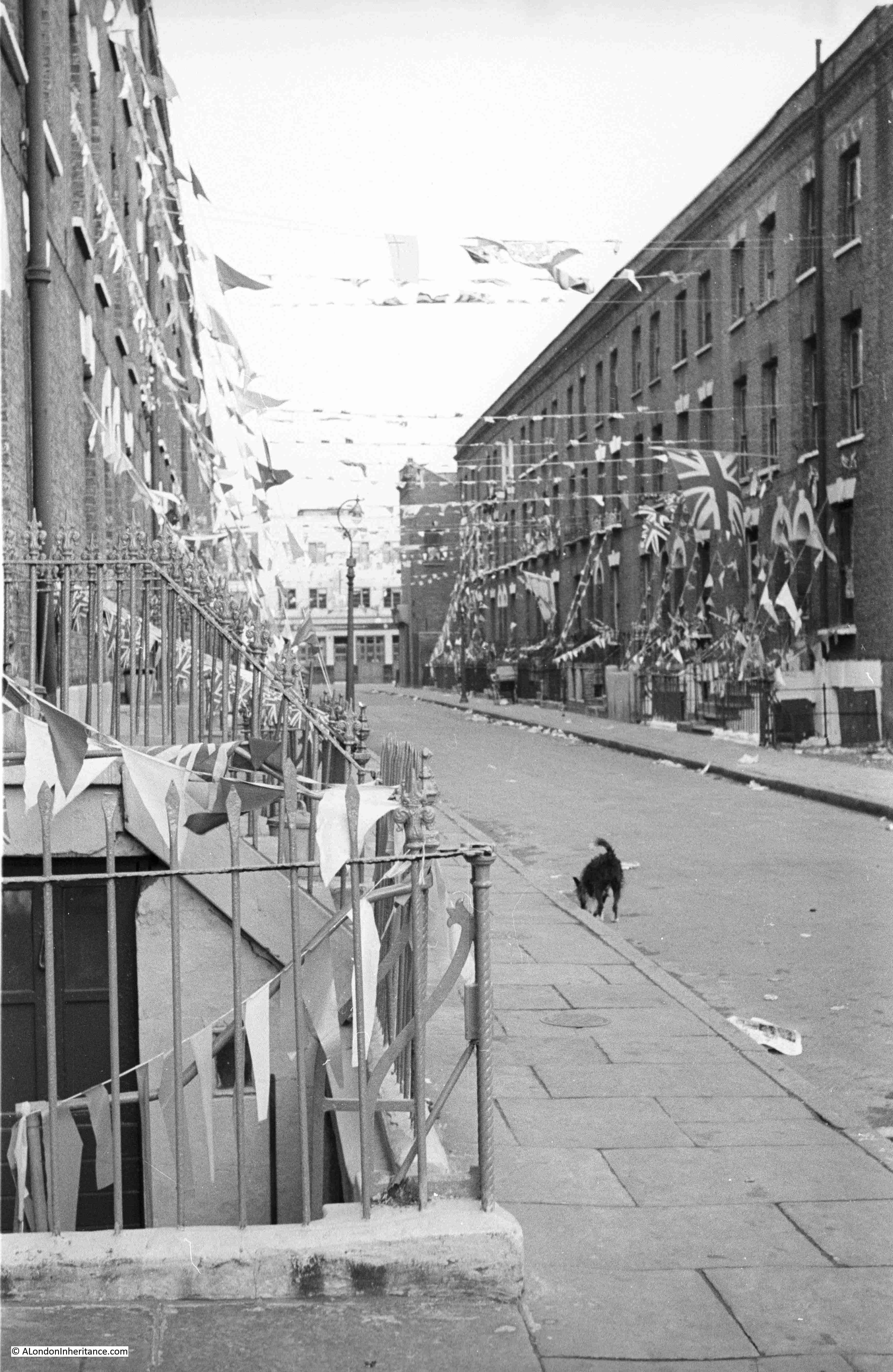
Shenfield Street

This is the same view today, at the end of April, just over a week before the 2023 Coronation:
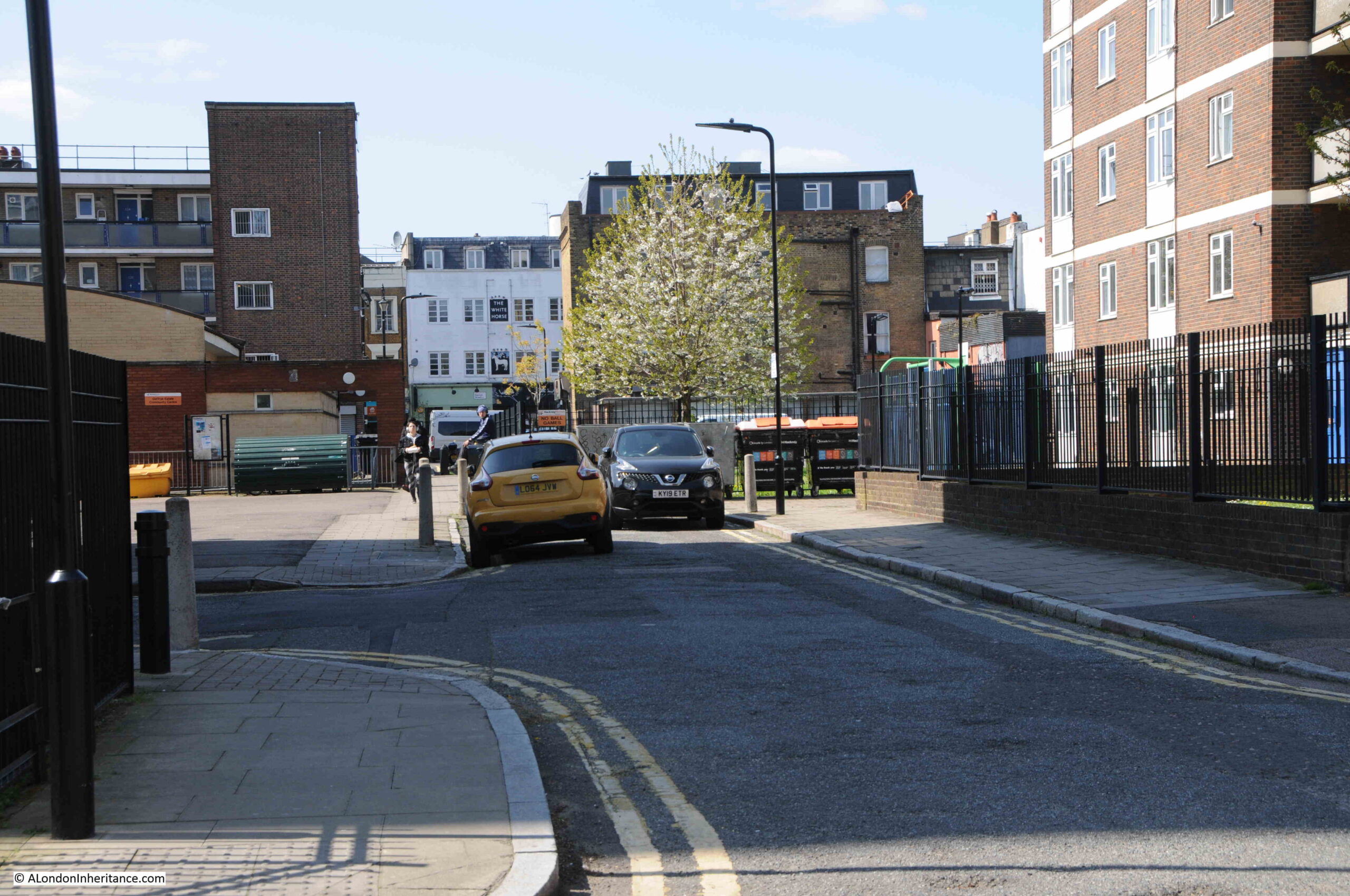
Shenfield Street

The white building at the end of the street in both of the above photos is the White Horse pub. Open at the time of my father’s 1953 photos, but closed in 2023, having closed as a pub in 2013.

In the 70 years since the last Coronation, Shenfield Street has changed beyond recognition. Once a street lined with terrace houses, they have all since been demolished, to be replaced by the Geffrye Estate.

In the following map, Shenfield Street runs across the middle of the map, with Hoxton Street on the left and Kingsland Road on the right. In 1953, Shenfield Street provided a route between the two streets to left and right, but today is blocked for traffic, with only a pedestrian route through as shown by the grey section as the street approaches Hoxton Street (Map © OpenStreetMap contributors):
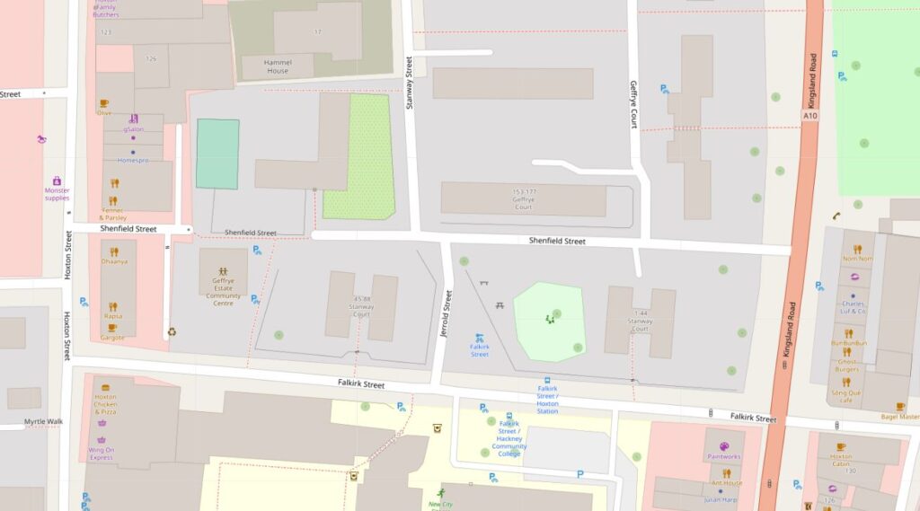
Shenfield Street

Construction of the street seems to have started in the late 18th century, however in 1799 as shown in the following extract from Horwood’s 1799 map of London, it was then called Essex Street, and is shown running across the centre of the following extract from the map:
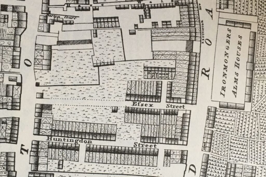
Essex Street

The map shows that building started from the Kingsland Road end of the street, and the houses then constructed appear to be densely built terrace houses, which I assume are the same houses that were still to be found in 1953.

The name change is interesting. I cannot find the source of the name Essex Street, or when it was changed to Shenfield Street. Essex Street was still in use in 1915, but had changed by 1945, when Shenfield was recorded in the LCC Bomb Damage Maps.

Street names were often changed to avoid confusion when there was another local street with the same name, however the nearest Essex Street seems to have been leading off from the Strand, a distance from Hoxton.

Shenfield was an interesting choice for the new name of the street, as Shenfield is a town in Essex, probably now better known as the eastern end of the Elizabeth Line. So by choosing Shenfield there was a continuation of the Essex connection.

The following map extract is from 1957, and shows Shenfield Street with terrace housing lining the street as in my father’s photos. There is another Essex connection in the map. Towards the right of Shenfield Street, there is a small stub of a street heading north called Tiptree Street. Tiptree is another small town in Essex, some distance towards the northern part of the county, and no connection with Shenfield, so I have no idea why the two streets were given these names (‘Reproduced with the permission of the National Library of Scotland“).
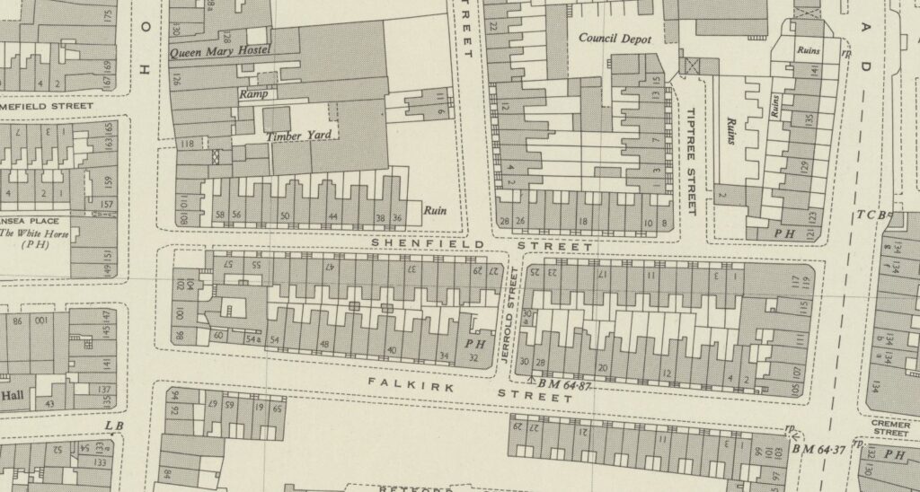
Shenfield Street

My father took five photos of Shenfield Street, and I have located the position from where he took each photo, and the direction of view in the 1957 map (the first photo at the top of the post is the lower right photo):
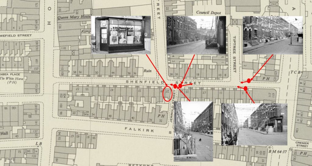
Shenfield Street

At top left of the above map is a photo that you may recognise as it has been in the header of the home page of the blog since I started in 2014, however I have never been sure of the location. I knew it was around Hoxton, but not exactly where. I will show later how I confirmed the location, that the café decorated for the Coronation was at 27 Shenfield Street, at the junction with Jerrold Street:
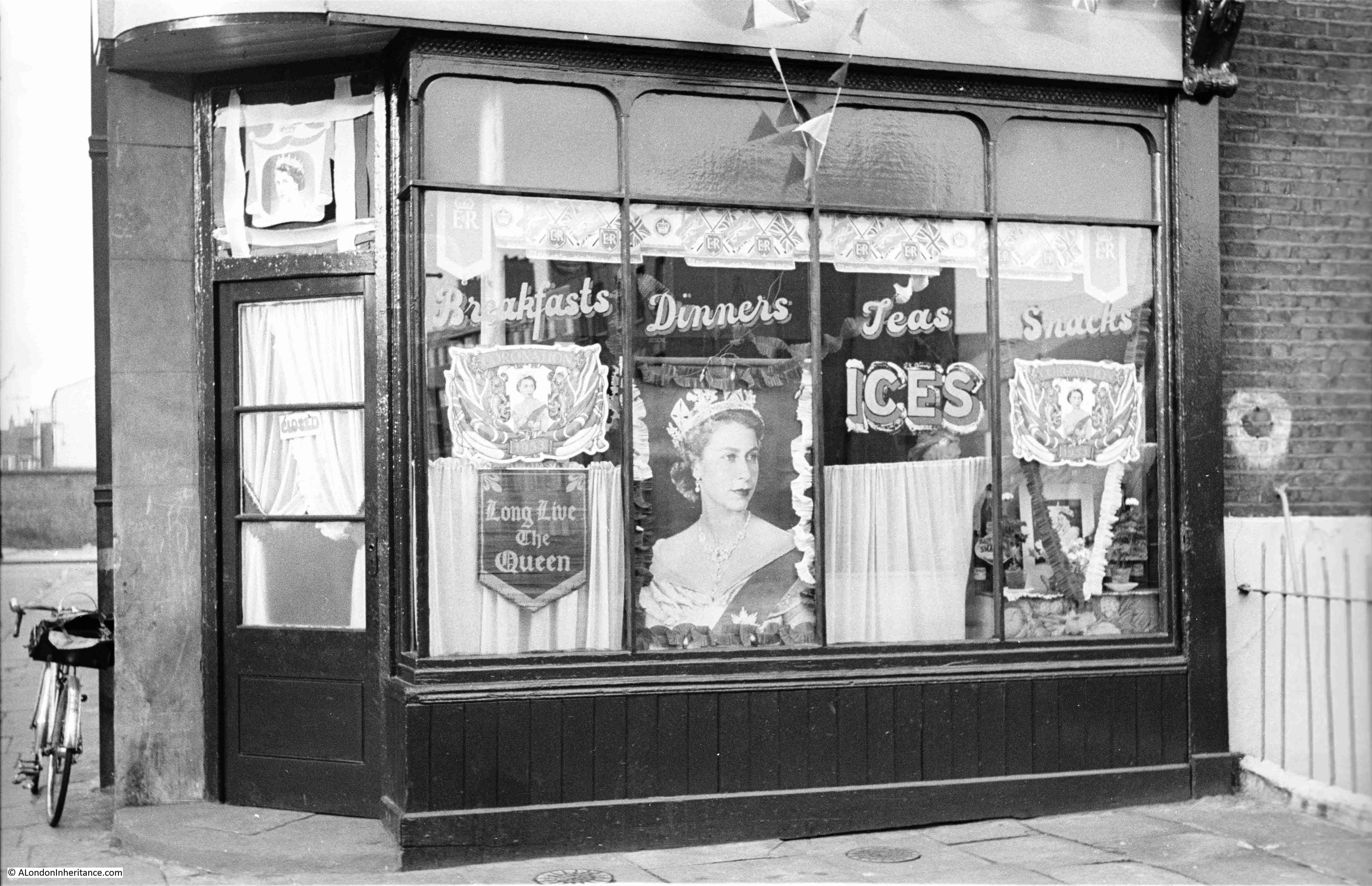
Shenfield Street Cafe

The photo is special for me, as it is the only London photo that shows my father’s bike, which is propped up against the wall to the left of the café. The bike took him all over London whilst taking these late 1940s and early 1950s photos, as well as youth hosteling across the country and to Holland.

The café does appear to have been well kept, and the lettering on the windows advertising Breakfasts, Dinners, Teas and Snacks is rather ornate.

Jerrold Street still exists, however at the junction with Shenfield Street, the corner where the café was located has been cut to form an angled entry to Jerrold Street, so in the following photo the café would have been in the roadway and pavement leading back from the drain cover that can be seen in the road:
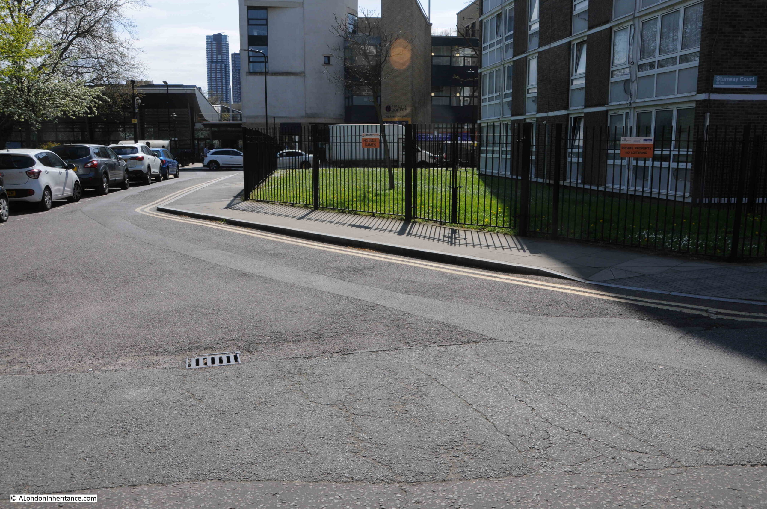
Shenfield Street

To the right of the café photo in the above map, is the following view, looking towards where Shenfield Street meets Kingsland Road. The photo was taken from the opposite side of the Jerrold Street junction, and the shop on the immediate right of the photo is at number 25 Shenfield Street:
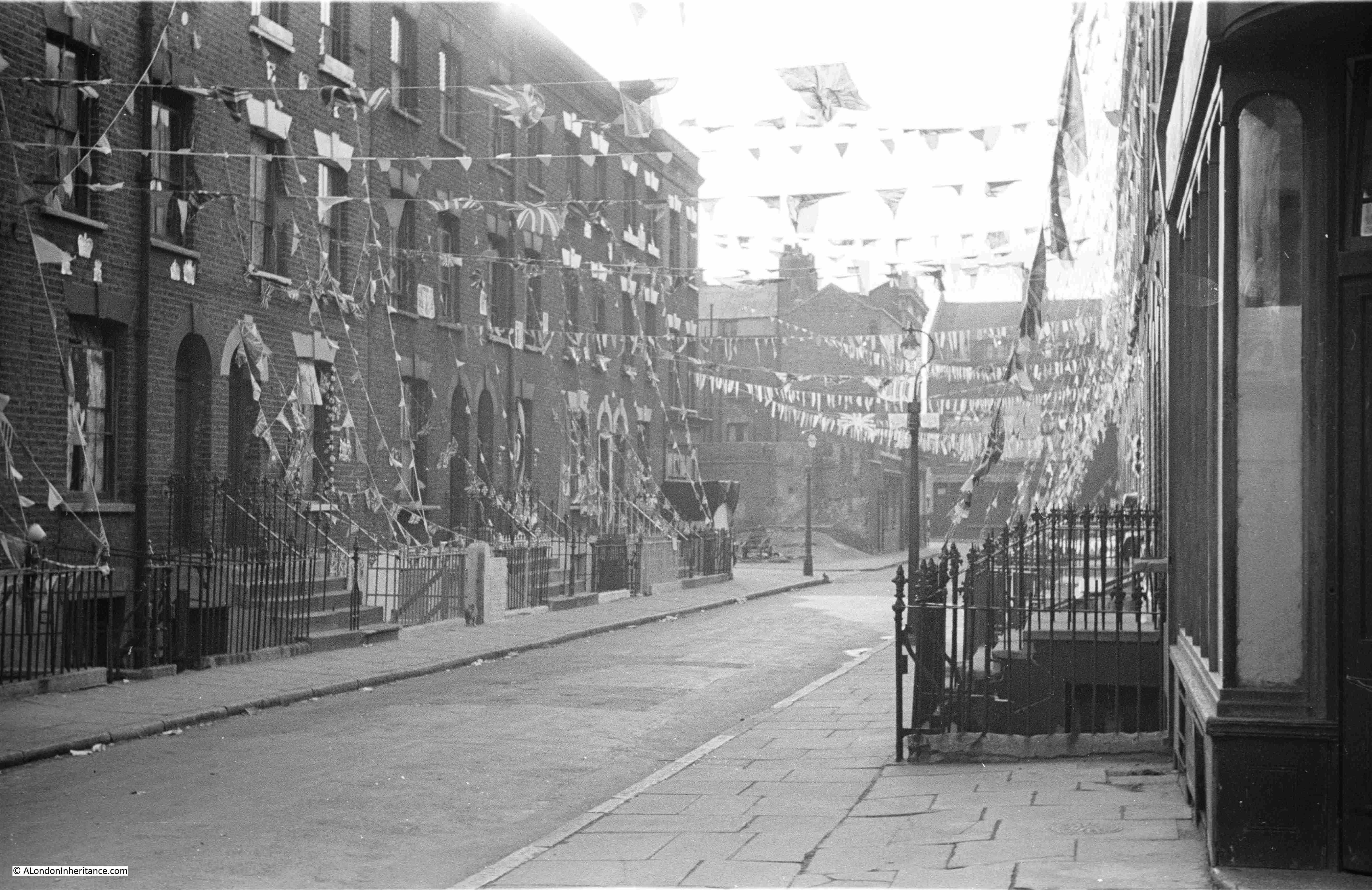
Shenfield Street

In the above photo, Tiptree Street is along the street on the left, just after the lamp post, where Tiptree Street runs to the left.

The same view in 2023:
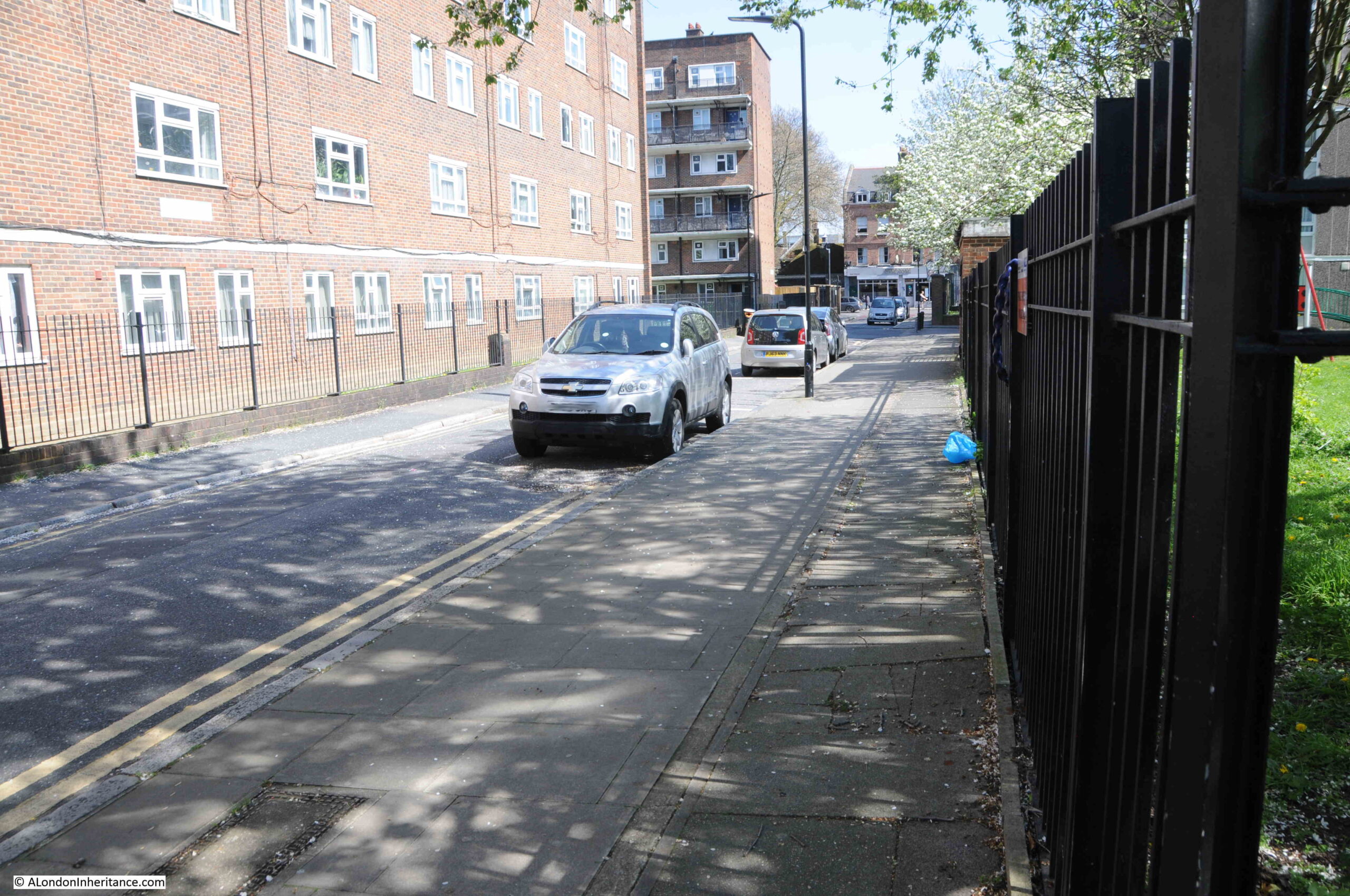
Shenfield Street

The location of the following photo, and direction of view, is at top right in the above map, it is looking towards the western end of Shenfield Street. The street which is running to the right, immediately in front of the location of the photo is again Tiptree Street:

Shenfield Street

The same view today, with not so much a street, rather an entrance to the estate leading off to the right, where Tiptree Street was once located:
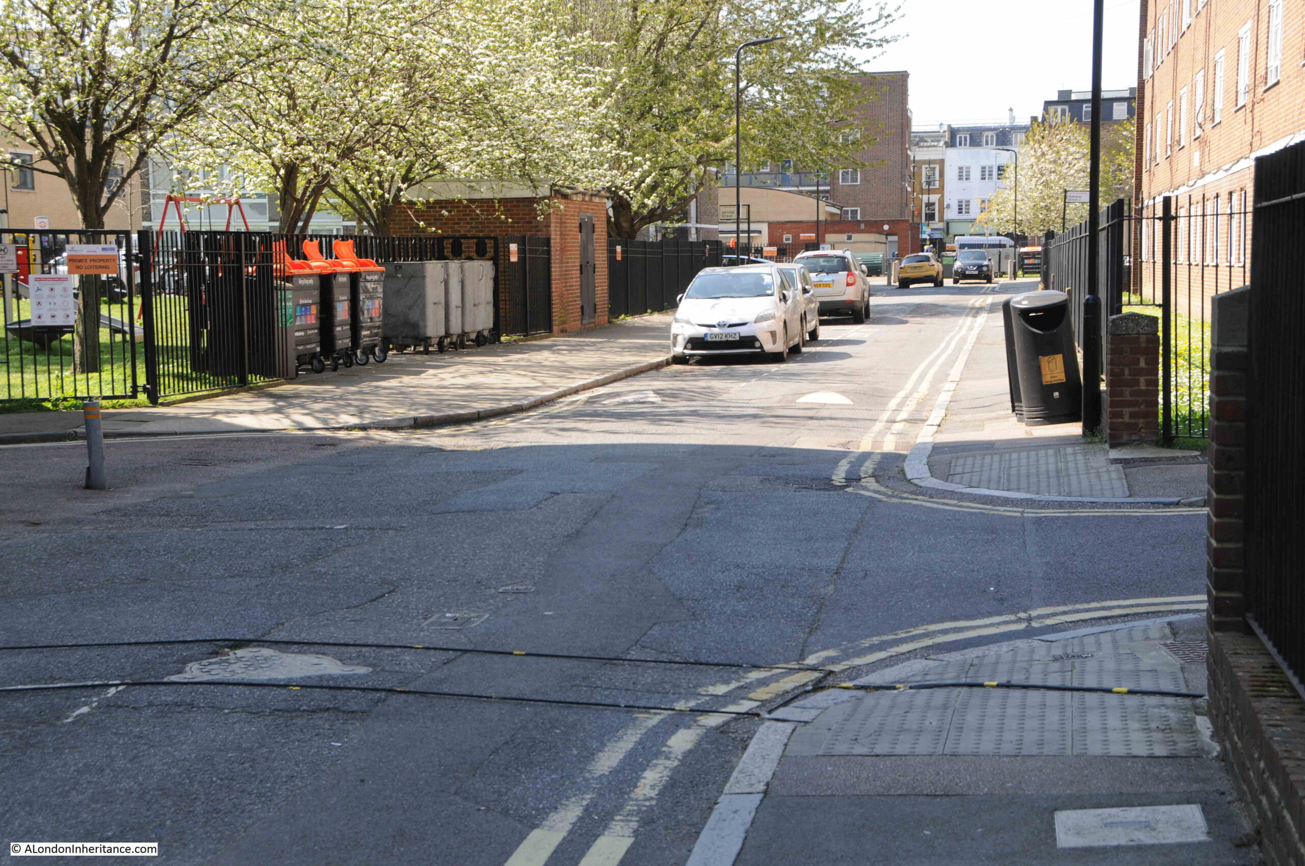
Shenfield Street

It was this photo that allowed the location of the café to be identified. I have circled the location of the café in the following copy of the photo:
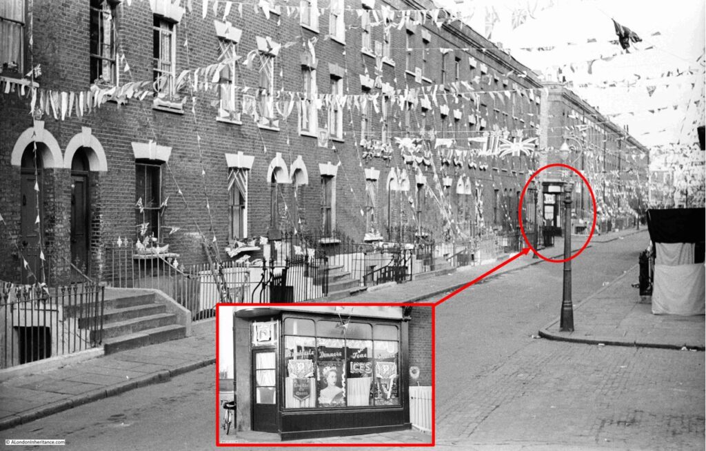
Shenfield Street

From the outside, the houses lining Shenfield Street look in a reasonable condition. Although there was significant bomb damage in a number of surrounding streets, Shenfield Street survived relatively unscathed, except for one house that was lost.

In Charles Booths poverty map, at the end of the 19th century, the street was classed as “Poor 18s to 21s a week for a moderate family”. In the following extract from the map, Essex Street as it was at the time of the survey, also has black lines running along the street, which means “Lowest Class, Vicious Semi-Criminal”:
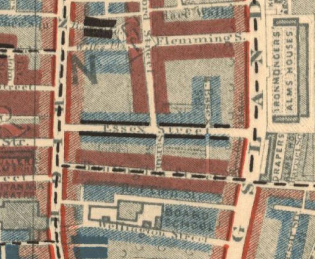
Essex Street

A newspaper report from the 26th September 1922 offers a view of the conditions within the street:

“CROWDED STREET OF DOLE-DRAWERS. Amount Received Exceeds Pre-War Earnings. Every household in Essex Street, Hoxton is in receipt of relief from the Shoreditch Guardians, and the total so received is said to exceed the pre-war earnings of the whole street.

Probably one of the most congested streets in Shoreditch, Essex Street has several houses which are shared by six or seven families, and in one or two instances the number of people in each dwelling reaches 30.

Paper serves for glass in many of the windows.”

So the problem with the houses was not necessarily their construction, rather overcrowding and landlords who probably did not bother which much maintenance.

Another report from August 1939 shows how important it was (and still is), to have green, open space locally available:

“Novelty of Grass – Child Wedged In Railings. Three year old Lillian Turner always likes to visit her grandmother because in the backyard of her L.C.C. flat off Walmer Gardens, Hoxton, there was a patch of grass. She rarely sees grass, for there is none near her own home in Shenfield Street, Hoxton.

While her mother went upstairs to chat with her grandmother yesterday, Lillian ran out to the grass patch. She tried to squeeze through some railings to get to it, but became wedged by the shoulders.

Men passing tried to release her, but were afraid of hurting her and sent for the fire brigade. In a couple of minutes, six firemen with a fire pump and an ambulance arrived, but as they did so, Mrs. Turner managed to release her daughter, unhurt but suffering from shock.”

From the above description, you can understand why post war estate planning, such as the Geffrye Estate which was built following the demolition of the houses along Shenfield Street, included plenty of green space scattered across the estate.

The above two news reports also shrink the period for the name change from Essex to Shenfield Street to between 1922 and 1939.

The following photo is from the lower right position in the above map. Tiptree Street is the street leading off at the right. There is what appears to be an old shop on the corner at number 8, however most of the front of the shop appears bricked up and there is some strange contraption in front of the shop:
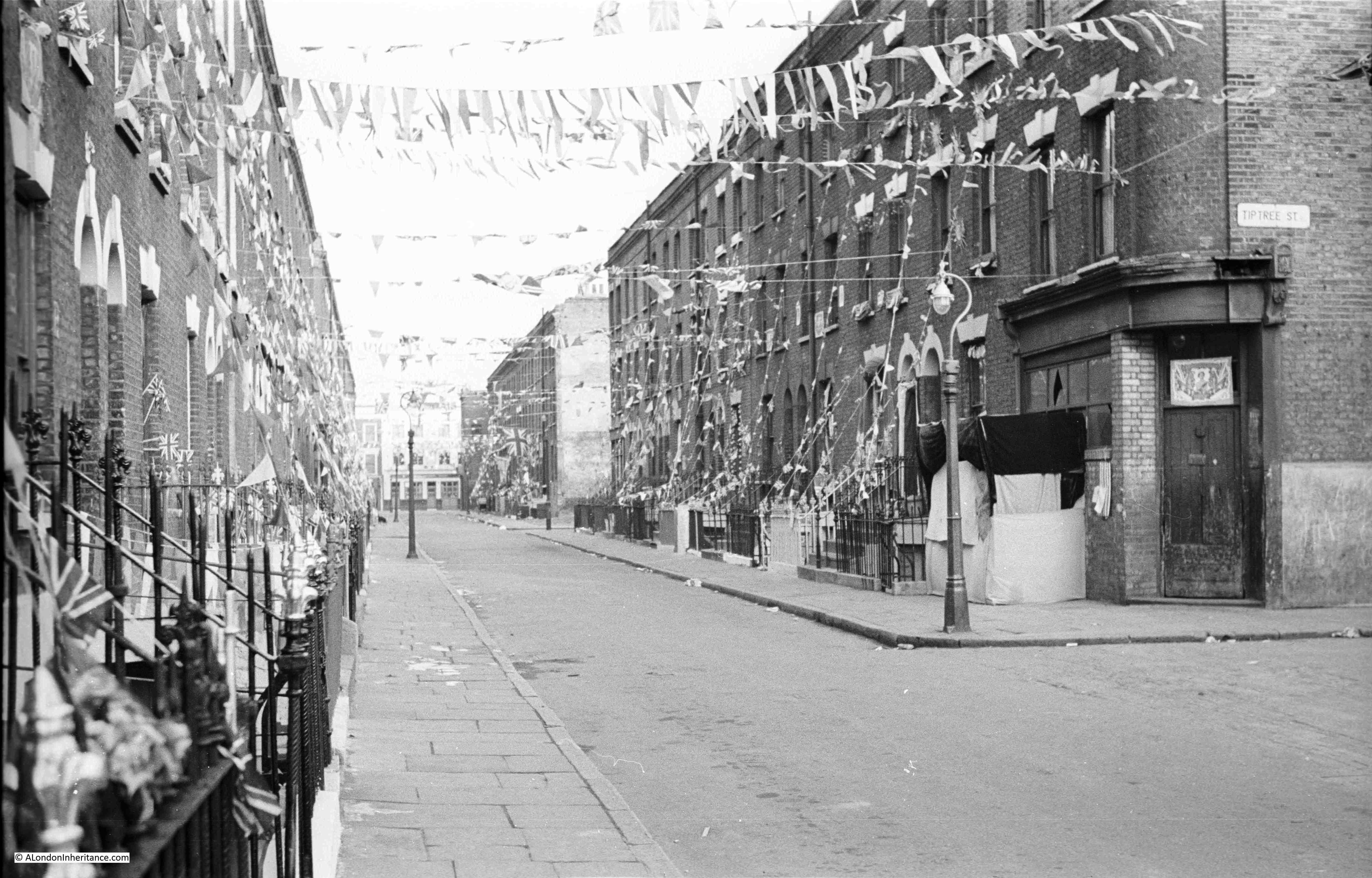
Shenfield Street

Look along the terraces of houses on the right, and half way along there is a light coloured wall. This was an internal wall of a house that was demolished following bomb damage.

The same view in 2023, with what was Tiptree Street on the right, and the location of the old shop was on the patch of grass:
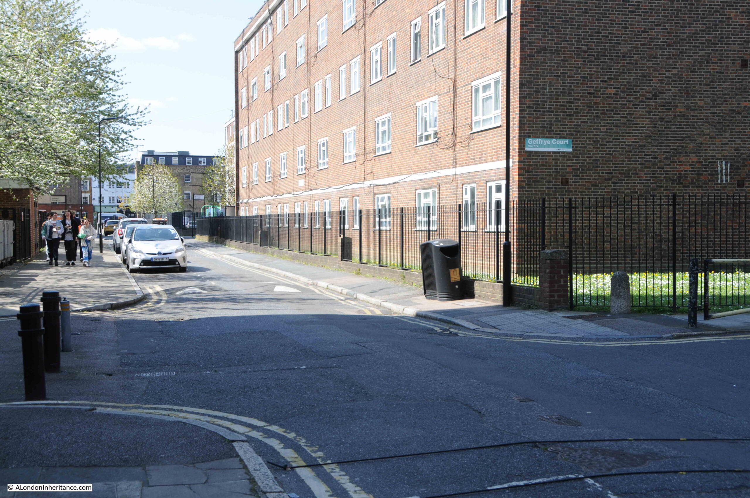
Shenfield Street

This is the view looking down what was Tiptree Street, today access to the Geffrye Estate without any apparent naming:
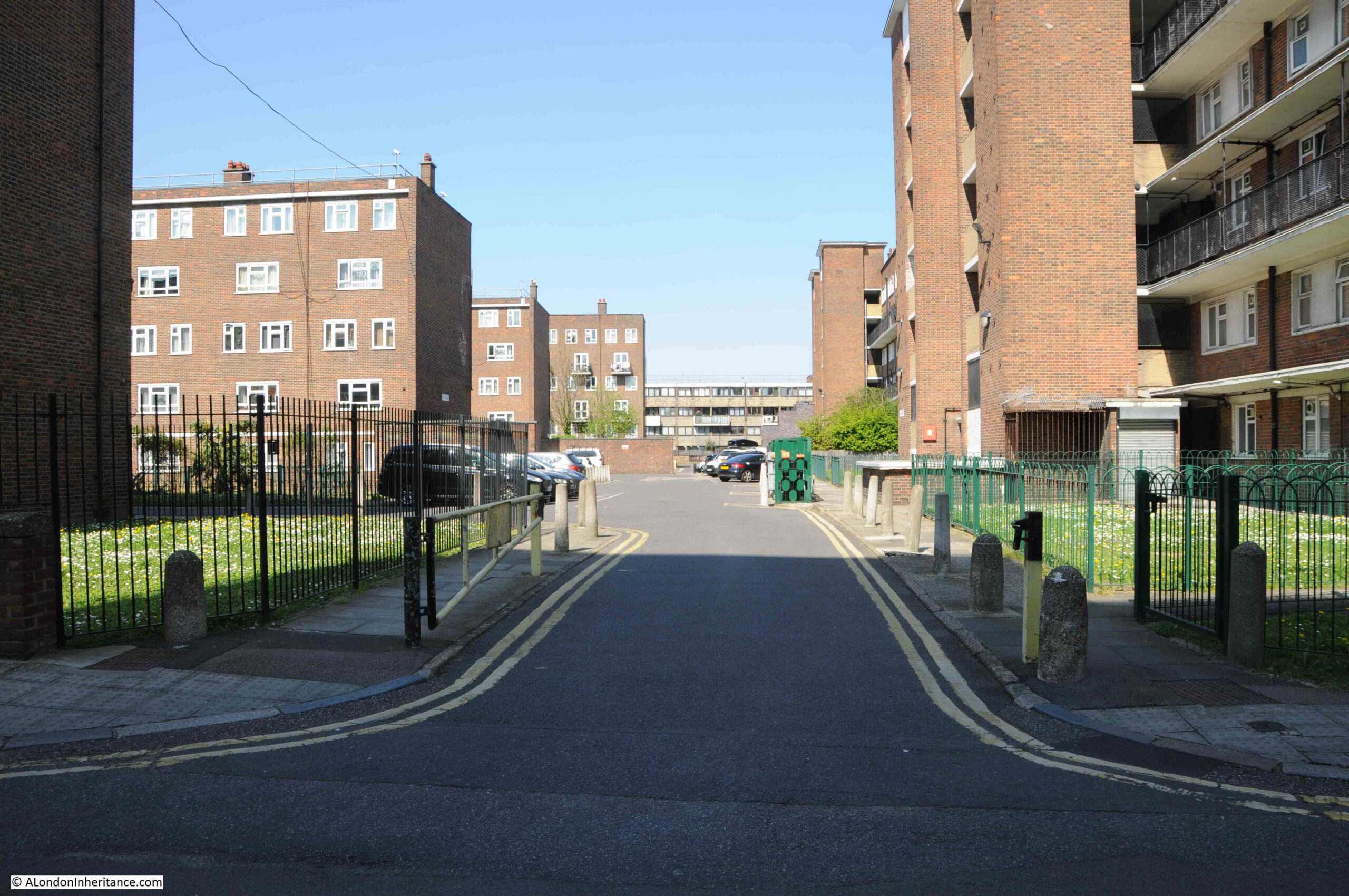
Geffrye Estate

Tiptree Street was originally lined with similar terrace houses to those in Shenfield Street. The terrace that was on the left survived the war, however only a single house survived on the right with the rest destroyed by bombing.

The whole area to the north and south of Shenfield Street is now part of the Geffrye Estate, which I again assume was built during the late 1950s / early 1960s. The estate consists of Geffrye Court, Stanway Court and Monteagle Court, as shown in the following estate map:
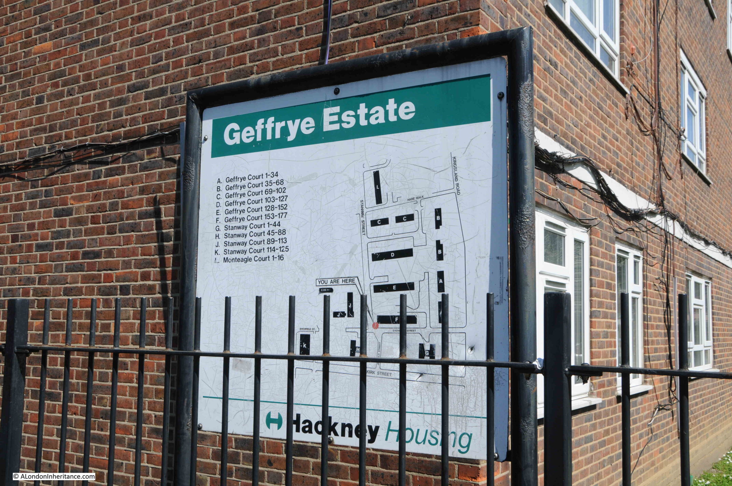
Geffrye Estate

The name of the estate is interesting, and I am surprised it is still in use. I assume it is named after Sir Robert Geffrye who was twice Master of the Ironmongers Company as well as Lord Mayor of the City of London. Geffrye’s financial bequest enabled the Ironmongers Almshouses to be built, which are on Kingsland Road, just north of where Shenfield Street meets Kingsland Road.

The almshouses were purchased by the London County Council in 1911 to save the green space surrounding the buildings, as this space represented a significant part of the green space in the area.

It then became a museum by the name of the Geffrye Museum, however is now called the Museum of the Home.

Sir Robert Geffrye made some of his money from his involvement in the transatlantic slave trade through his investments in the Royal African Company.

Hackney Council have him as a contested figure in their Review, Rename, Reclaim initiative, and the council supported the Museum of the Home in a consultation as to whether a statue of Geffrye at the museum should be removed. The results of the consultation where that it should, however the museum trust decided to retain the statue.

There does not appear to be any mention on the Council’s Review, Rename, Reclaim web pages about renaming the Geffrye Estate.

Going back to the OS map of the street, and where Shenfield Street meets Kingsland Road, and on the northern corner there was the PH reference for a pub. This was the old Carpenters Arms which was demolished at the same time as the rest of the street in preparation for the construction of the Geffrye Estate. The corner where the pub was located is now an area of green space with a block of flats behind as shown in the following photo:
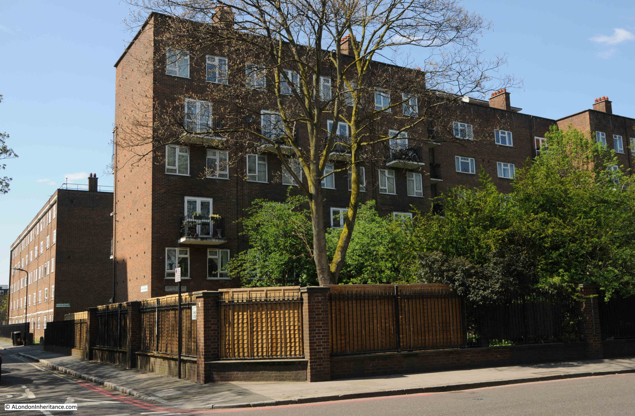
Geffrye Estate

Shenfield Street today is so very different to 1953. I suspect that there must have been a street party along the street, for the street to be so decorated.

The houses in the 1953 photos look substantial and well built houses, although they were probably poorly maintained and in need of much modernisation. The problem with much of this type of housing was very poor maintenance and over crowding. With some care and updating, they could have been retained and would now form a rather impressive street.

Retaining the street would probably not have achieved the number of individual homes that the Geffrye Estate now provides, or the ability to include green space across the estate, a much needed improvement as green space was so very limited in this area of pre-war Hoxton.

I was planning to use Census data to map who lived in Shenfield Street to each of the houses, as using the OS map, the number of each house is easily identifiable in the photos, although I ran out of time – perhaps I will revisit in a future post.

You may also be interested in a couple of other posts showing Coronation decorations in London in 1953, including Whitecross Street and Ivy Street. Also, this post looked at Coronation Day in London.

alondoninheritance.com

Lincoln’s Inn Fields and the Rye House Plot

The first of my walks “The South Bank – Marsh, Industry, Culture and the Festival of Britain” for 2023 is now available. Details and booking on this link.

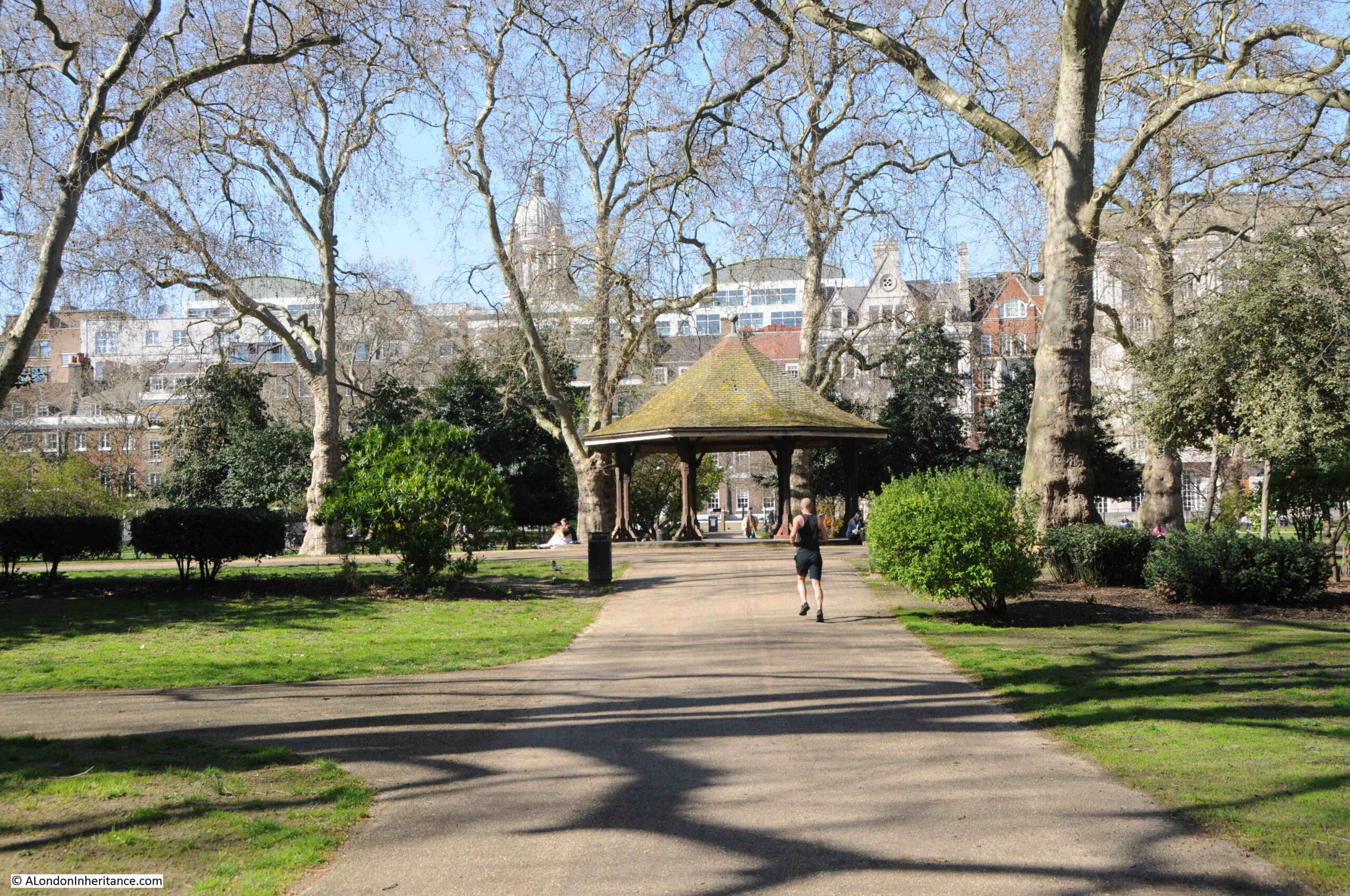
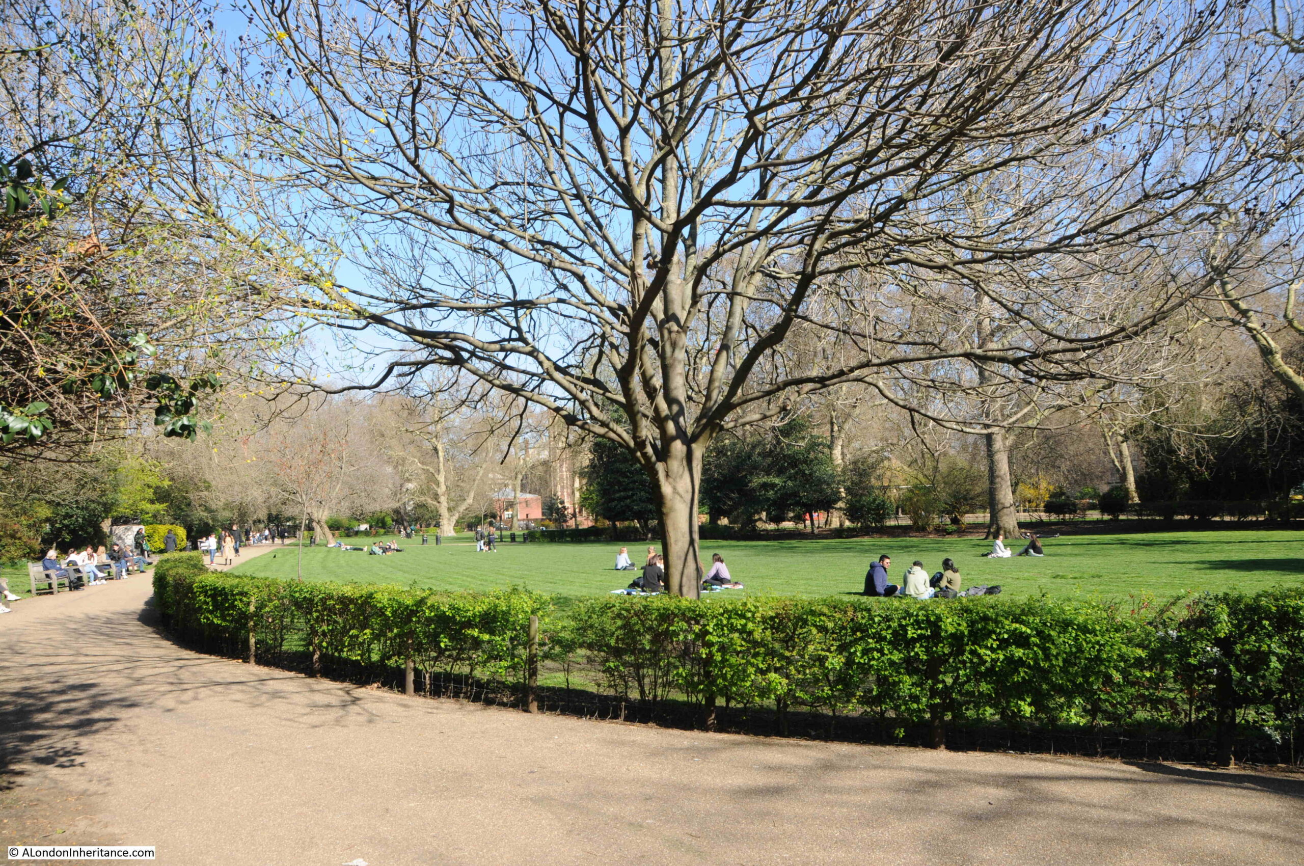
Turn south from Holborn, or east from Kingsway, away from these busy streets, and through some side streets you will find Lincoln’s Inn Fields:

Lincoln's Inn Fields

Lincoln’s Inn Fields is a wonderful open space, and was looking good during my visit on a sunny spring day. Immediately to the west of Lincoln’s Inn, after which the space takes its name, it has been an open space for a considerable time.

View looking to the east with the buildings of Lincoln’s Inn on the eastern border:

Lincoln's Inn Fields

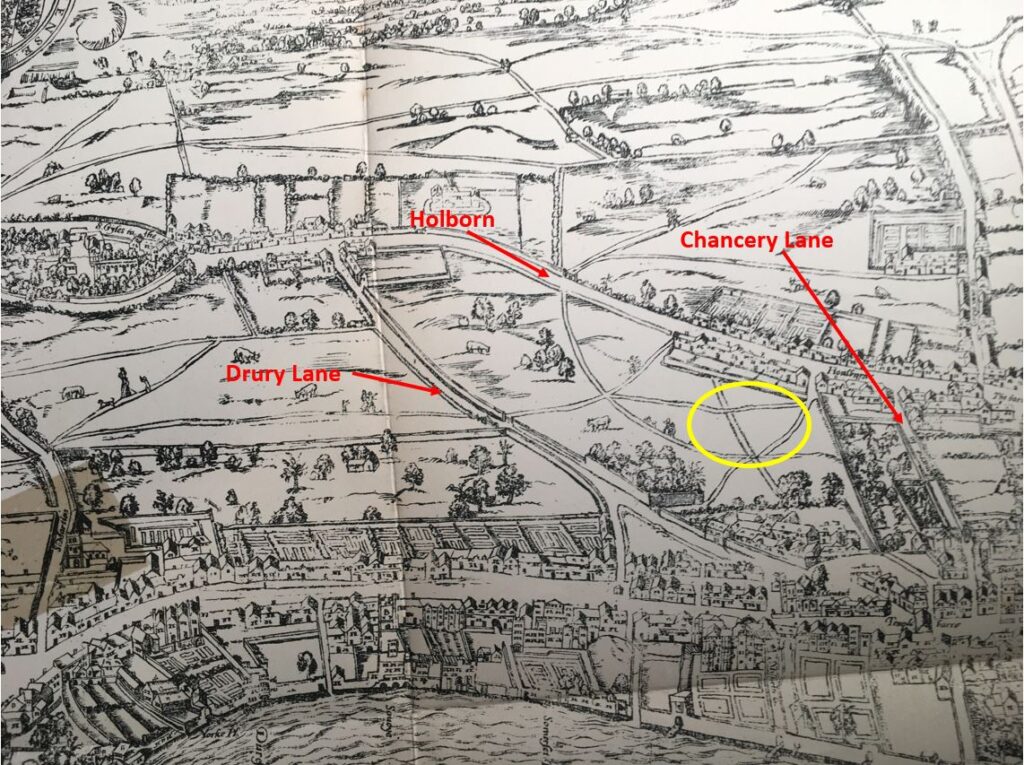
In the 1561 Agas map of London, the area now occupied by Lincoln’s Inn Fields was still open space. Although it is very difficult to be precise about the location on the Agas map, due to the accuracy of the map, perspective and scale, it is possible to roughly locate the position by comparing with other streets, which I have marked in the following extract with the yellow oval showing the very rough location of what would become Lincoln’s Inn Fields:

Lincoln's Inn Fields

The map shows footpaths across the fields, limited building to the north along Holborn, and the building and gardens that then lined the length of the Strand.

The fields were named Cup Field and Purse Field and at the time of the Agas map, they were pasture lands owned by the Crown.

Lincoln’s Inn were concerned about the growth of the city around their buildings and objected to any building on the two fields. In the 1630s, the fields were sold to William Newton of Bedfordshire. He managed to reach an agreement to start the building of houses with Lincoln’s Inn and also secured a royal licence to develop the land.

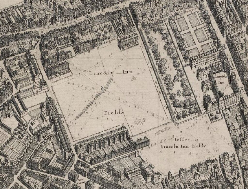
These agreements included leaving the area that is now Lincoln’s Inn Fields as an open space, to the west of Lincoln’s Inn, and by 1660, Lincoln’s Inn Fields was in existence as an open space, and was surrounded by buildings on three sides:

Lincoln's Inn Fields

The map shows that on the north and south sides of the Fields, the streets had not been fully completed with housing lining just part of the boundary.

The map also shows that in 1660 there was an area of open space at the south east corner called Little Lincoln’s Inn Fields.

The west side of the space had started to be developed in 1638, and development of the north and south sides started in 1657 when Sir William Cowper, James Cowper and Robert Henley purchased Cup Field. This was just three years before the date of the above map, which explains the partial development of the north and south sides of the fields.

The new owners also had the open space leveled, grassed over, trees planted, and gravel walks laid out. Again, the outline of these can be seen in the 1660 map, and the design was apparently the work of Inigo Jones.

Although the intention must have been to create a pleasant open space for the owners of the new houses along the edge of the fields, in the late 17th and early 18th centuries, Lincoln’s Inn Fields did suffer from crime and much anti-social behaviour.

For example, from the Kentish Weekly Post on the 23rd of February 1732: “At night, one Mr. Henshaw, of Gray’s Inn, returning home over Lincoln’s Inn Fields, was attacked by two Street Robbers, who took from him 3 Guineas and a Half, 4 Shillings in Silver, and a Gold Headed Cane; a Light appearing at a Distance, they made off and he had the Fortune to save his Gold Watch.”

The comment about the light appearing at a distance shows just how dark places such as Lincoln’s Inn Fields must have been, without the level of street and general lighting we have now. There would have been no lights across the field, and any lights from the surrounding houses would have been very dim.

Whilst these crimes must have had a terrible impact on the victim, the sentences on those who carried out the crime were often very severe, as indicated by this report from 1733: “George Richardson, John Smithson and Laurence Grace, who were executed at Tyburn on Saturday last, for robbing a Gentleman in Lincoln’s Inn Fields, of his Hat, Wig, and Half a Guineas.”

The same newspaper report also stated that in the same sessions at the Old Bailey which had condemned the three from Lincoln’s Inn Fields, Francis Corcher received the death sentence for robbing an Agate Snuff-Box set in Gold, and of a separate robbery of a Gold Watch and 5 shillings in Hyde Park.

The fields were known as “the head-quarters of beggars by day and of robbers at night”, and there were “idle gangs of vagrants” who went by the names of the “Mumpers and Rufflers”.

A number of those convicted of theft were executed in Lincoln’s Inn Fields in the 17th century.

To try and address the level of crime in the fields, in 1734 the residents applied to Parliament for an Act which would allow them to raise a rate on the residents surrounding the fields, and this would be used to enclose the square, provide keys for the residents only, pay for watchman and a “scavenger” who would ensure the fields and surrounding streets were kept clean.

The railings were put up around the square in 1735.

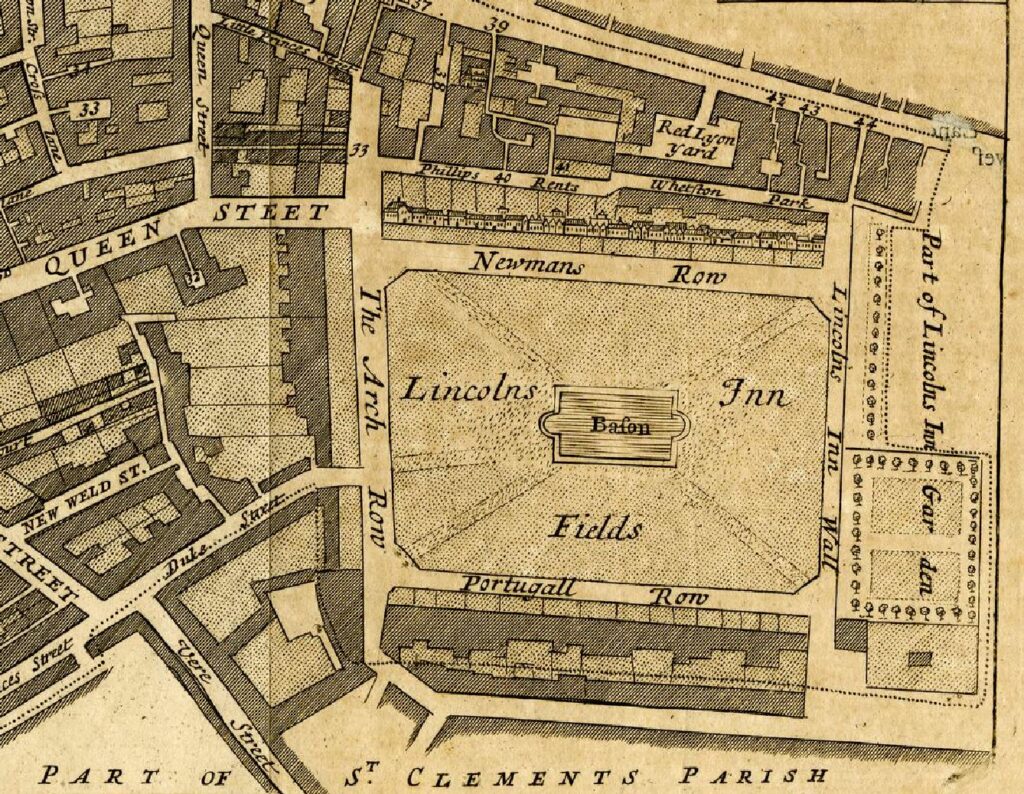
By 1755, development of the north and south sides had been completed, joining the houses along the west of the fields. To the east of the fields, the land was part of Lincoln’s Inn, and the “Little Lincoln’s Inn Fields” shown in the 1660 map had been built over, as shown in the following parish map:

Lincoln's Inn Fields

Today, the streets surrounding the central space also go by the name of Lincoln’s Inn Fields, however back in 1766 they had individual names: Newmans Row, The Arch Row, Portugal Row and Lincoln’s Inn Wall.

Newmans Row remains as a short street from the north east corner of the fields up to the alley that leads to High Holborn.

Lincoln’s Inn Wall describes the wall to the east of the street, separating off Lincoln’s Inn.

The Arch Row and Portugal Row also have interesting stories to tell about their naming, but I will leave these to a future post, as I run out of time within the constraints of a weekly post.

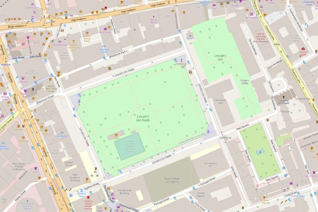
The following map shows the area today, with Holborn to the north, Kingsway to the west and Lincoln’s Inn to the east (Map © OpenStreetMap contributors):

Lincoln's Inn Fields

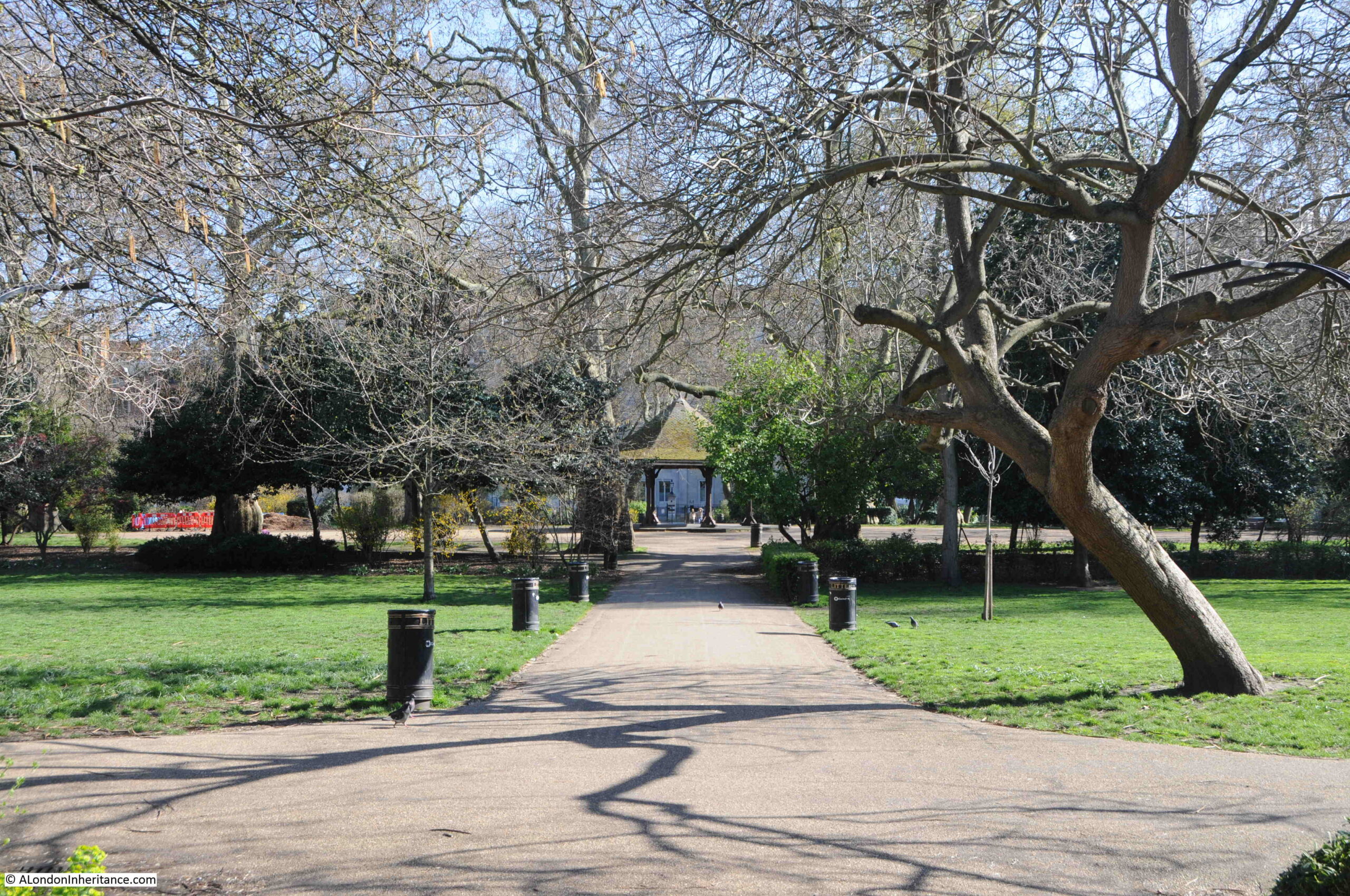
Walking from the south, into Lincoln’s Inn Fields, and there is a shelter in the centre of the space:

Lincoln's Inn Fields

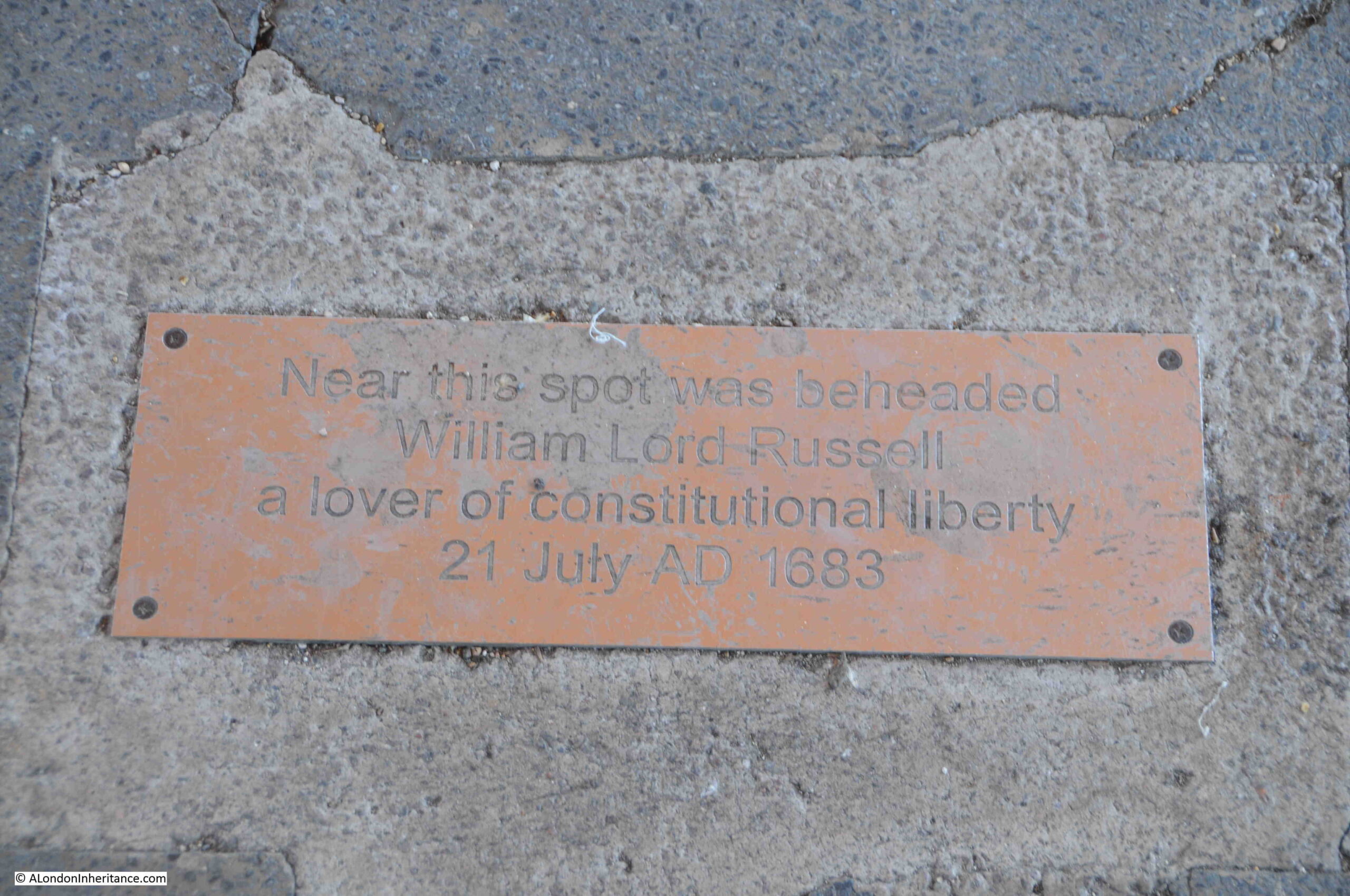
In the middle of the shelter, there is a plaque on the floor, recording that “Near this spot was beheaded William Lord Russell a lover of Constitutional Liberty 21 July AD 1683”:

William Lord Russell Rye House plot

Surprising that such an execution took place in Lincoln’s Inn fields, however I have read that in central London, you are never further than around 500 yards from a place of execution. It would be interesting to test this out.

Who was William Lord Russell and why was he executed?

He was born on the 29th of September 1639 as the second son of Sir William Russell, the 5th Earl of Bedford.

He became an MP after standing for the  family borough of Tavistock at the general election of 1660. His Parliamentary records state that he was a rather inactive member, only being a member of two committees, one looking at the drainage of the fens, and the other looking at turning the Covent Garden precinct into a parish. He would have had an interest in Covent Garden as his father owned much of the land.

Although he was member for Tavistock, apparently he never visited the town.

William Lord Russell was a Whig – a political party / faction that opposed the principle of absolute monarchy and of Catholic emancipation. Whigs were supporters of the primacy of Parliament.

His work in Parliament did increase, with more activity within various committees and debates, and he also became the member for both Bedfordshire and Hampshire. Even with the election standards of the time, it was rare for a member of Parliament to represent two counties, and he eventually settled for just Bedfordshire.

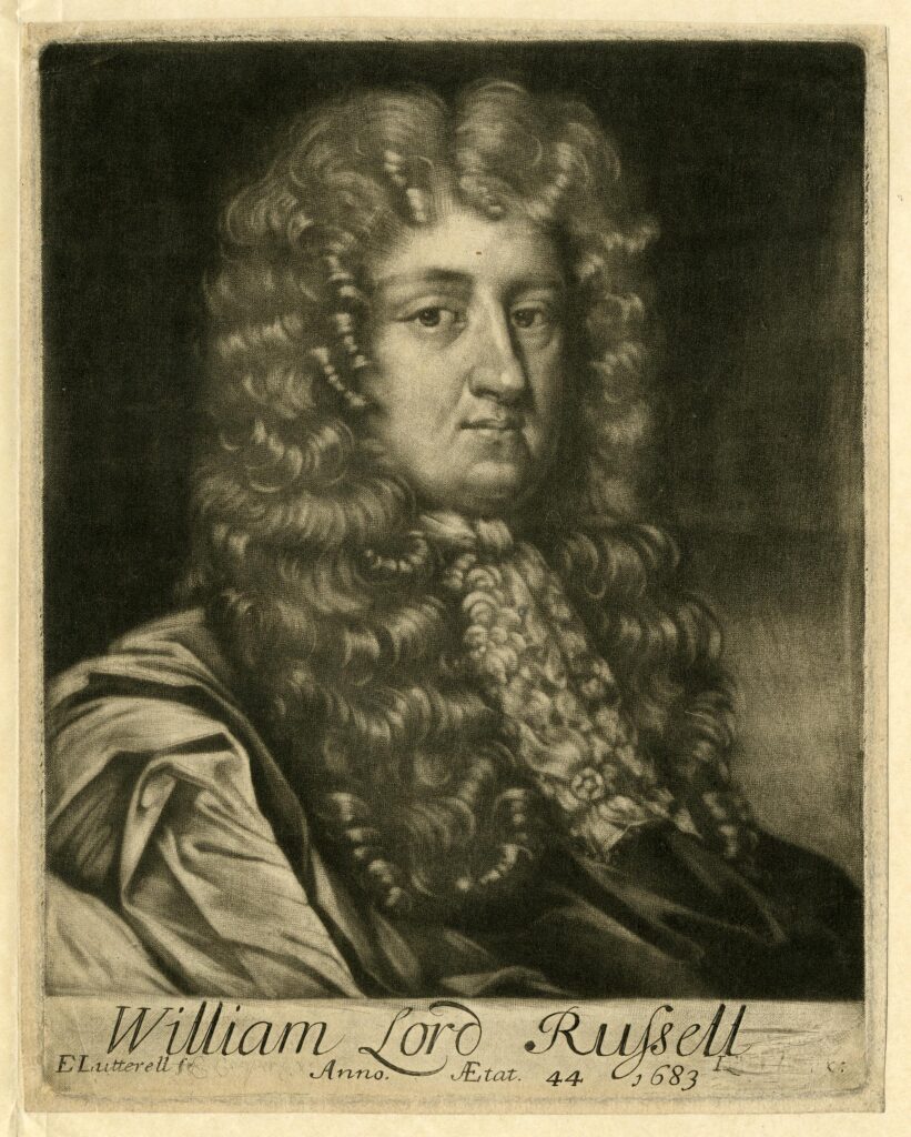
William Lord Russell (© The Trustees of the British Museum):

William Lord Russell Rye House Plot

It was his views on Catholicism and the Crown that would lead to his death sentence.

Charles II was on the throne, however on his death it was expected that James, the second surviving son of Charles I would become King.

James was a Catholic, and a grouping within the Whigs were strongly opposed that a Catholic could become King, and that as James had a son, it would be the start of a Catholic line of monarchs.

This opposition by the Whigs led to the Rye House plot, which was a plot to murder Charles II and his brother James, Duke of York when they returned from Newmarket to London in March 1683.

The name of the plot comes from the building in which some of the plotters met, and where the King was expected to pass at the time of the attempted assassination. Rye House was near Hoddesdon in Hertfordshire. Following the assassination, an uprising in London was planned.

There was very flimsy evidence as to the seriousness of the plot, who was involved, and whether it would have succeeded. Apparently Charles II returned to London earlier than planned which was the story put about to explain the failure of the plot.

Despite limited evidence and whether or not the plotters would have gone through with their plans, Charles II wanted everyone involved with the plot aggressively caught, tried and punished. This seems to have been due to Charles II determination to destroy Whig opposition in revenge following Whig efforts to exclude his brother James from the line of succession.

William Lord Russell was one of those caught up in the conspiracy. He was put on trial, where he would admit only that he had not given information about one of the conspirators, rather than having been an active participant in the plot.

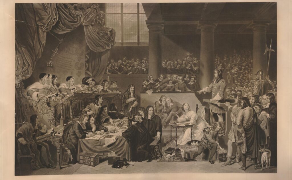
The following print shows the trial of William Lord Russell. He is standing at the witness stand on the right. His wife is at the small table in front of him, taking notes and looking up at her husband (© The Trustees of the British Museum):

William Lord Russell Rye House Plot

Despite his protestations of limited involvement in the plot, and that it does not seemed to have been a well planned activity, he was sentenced to death.

Print from 1796 showing William Lord Russell’s last interview with his family (© The Trustees of the British Museum):

William Lord Russell Rye House Plot

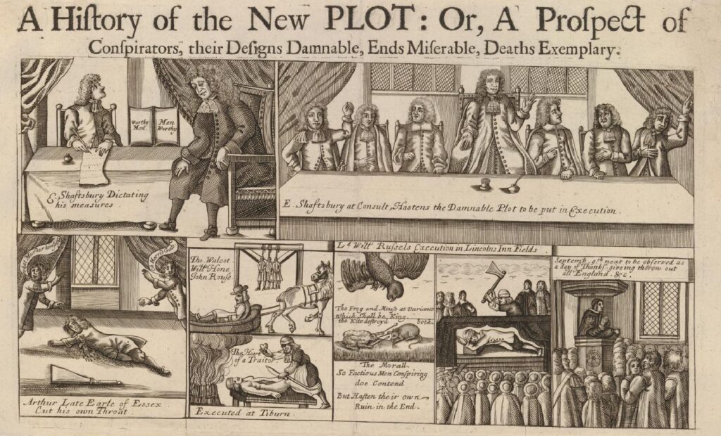
A number of pamphlets were published at the time, about the Rye House Plot, and the fate of the alleged conspirators. One of these graphically shows some of their fates (© The Trustees of the British Museum):

Rye House Plot

The images at the top show the 1st Earl of Shaftesbury, who was known to be one of the leading conspirators against a Catholic succession if Charles II died, and the spiritual leader of the Rye House plot. When the king had been ill, Shaftesbury had already convened a number of people sympathetic to the cause to discuss what should be done when the King died, and that an uprising should take place to enable Parliament to make the decision on the succession.

Shaftesbury’s attitudes to Charles II and his brother James led to him fleeing the country to the Netherlands at the end of 1682, however the journey had an impact on his health and he died in Amsterdam on the 21st of January 1683.

At lower left is Arthur, Earl of Essex who committed suicide in the Tower of London by cutting his throat. The two figures are saying that he murdered himself of horrid guilt.

The next panel to the right is showing Thomas Walcott and John Rousee being executed at Tyburn (I cannot tie down the second name to one of those executed at Tyburn). They were sentenced to be hung drawn and quartered, and the lower drawing showing “the heart of a traitor”.

To the right is a drawing showing a mouse and a frog arguing whilst a kite descends on both. The text reads:

“The Frog and Mouse at variance which shall be king. The Kite destroyed both. The Morall. So Factious Men Conspiring do Contend. But Hasten their own Ruin in the End.”

Then there is a drawing of William Lord Russell’s execution at Lincolns Inn Fields, and finally at lower right “September, 9th next to be observed as a day of Thanksgiving throughout all England.”

The drawings show only a small proportion of those executed, imprisoned or exiled in what was a very revengeful approach to sentencing. It took two strokes of the executioners axe to kill William Lord Russell, however perhaps one of the worse examples is that of Elizabeth Gaunt.

Elizabeth and William Gaunt were London Whigs and were active in the dissenting politics of the time. In 1683 she was living in Old Gravel Lane, Wapping.

James Burton was alleged to have been present when the Rye House plot was being discussed. As a result, Burton had been outlawed, and Elizabeth helped him escape to the Netherlands, by providing him with money and a boat from Wapping to Gravesend, from where to took a boat to Amsterdam. You can imagine him sneaking down one of the Thames Stairs in Wapping, late at night, to make his escape.

Burton later returned to the country as part of the Monmouth rebellion. He was captured whilst again trying to escape to the Netherlands, and to avoid a death sentence, he gave evidence that Elizabeth Gaunt had helped him escape following the earlier plot.

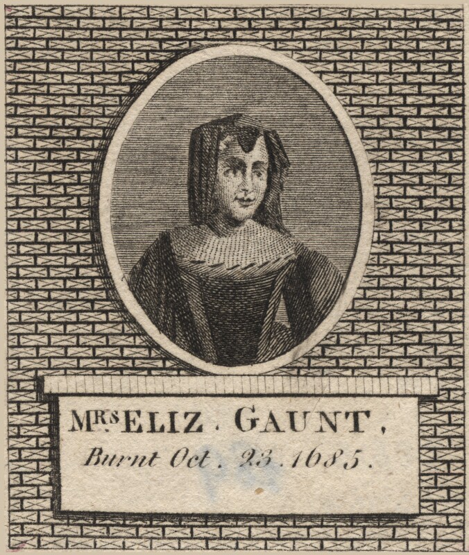
Elizabeth Gaunt was tried, and sentenced to death by being burned at the stake at Tyburn. She was burnt to death on the 23rd of October 1685. Such was the vindictiveness against anyone involved, however remotely, in the plot, she was not strangled before being burnt, as was the usual custom.

James Burton was from then on known as someone who would incriminate anyone, even those who helped him, in an attempt to save his own life.

The sentences passed seem to have been to act as a deterrence to would be conspirators, and also to anyone who may help a conspirator.

Elizabeth Gaunt was the last woman to be executed for a political offence (© The Trustees of the British Museum).

Elizabeth Gaunt

Although the Rye House plot failed, the ultimate aim of the conspirators did succeed.

James did become King James II on the death of his brother, Charles II.

James II and his wife, Mary of Modena had a son, confirming fears that the country would have a Catholic line of kings. A group of Protestant Earls, Viscounts and a Bishop invited William of Orange to the country to take the crown. William was married to Mary, the daughter of James II.

This resulted in the Glorious Revolution, where William of Orange and Mary jointly reigned, James II fled to France, the threat of a Catholic succession was removed and England had a Protestant monarch – all the aims of the Rye House conspirators.

And today there is a reminder of the plot with a simple plaque on the floor of the shelter at Lincolns Inn Fields.

Looking along the northern side of the fields – hard to believe that this was the site of a number of executions:

Lincoln's Inn Fields

The public were not allowed in the fields after the railings were put up in 1735, however by the middle of the 19th century there was public campaigning to open up the field – this being such a large area of green, open space in a very built-up part of the city.

The London County Council purchased the field in 1894 from the Trust that had been maintaining the fields, and they were opened up to the public. The railings were removed in 1941 due to the need for iron for wartime weapons manufacturing. A real shame as these were over 200 years old.

New railings were installed in the 1990s, and the fields also had a tennis and netball courts and putting green built in the south-western corner. The central shelter was also built, which at times has been used as a bandstand.

A neat row of bins line the path to the shelter:

Lincoln's Inn Fields

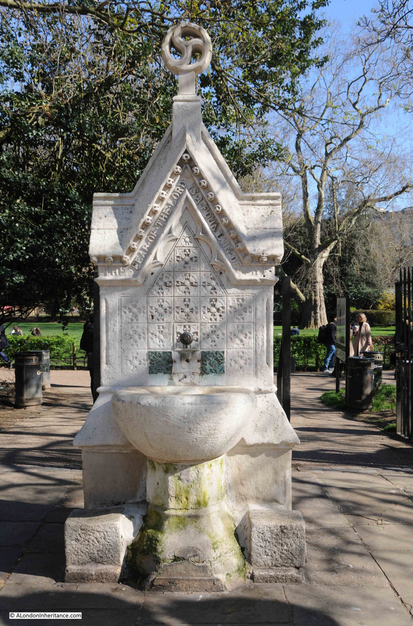
As befits such a place, there are a couple of 19th century monuments around Lincoln’s Inn Fields, including this drinking fountain, with the following religious message around the upper part of the fountain “The fear of the Lord is a fountain of life”:

Lincoln's Inn Fields

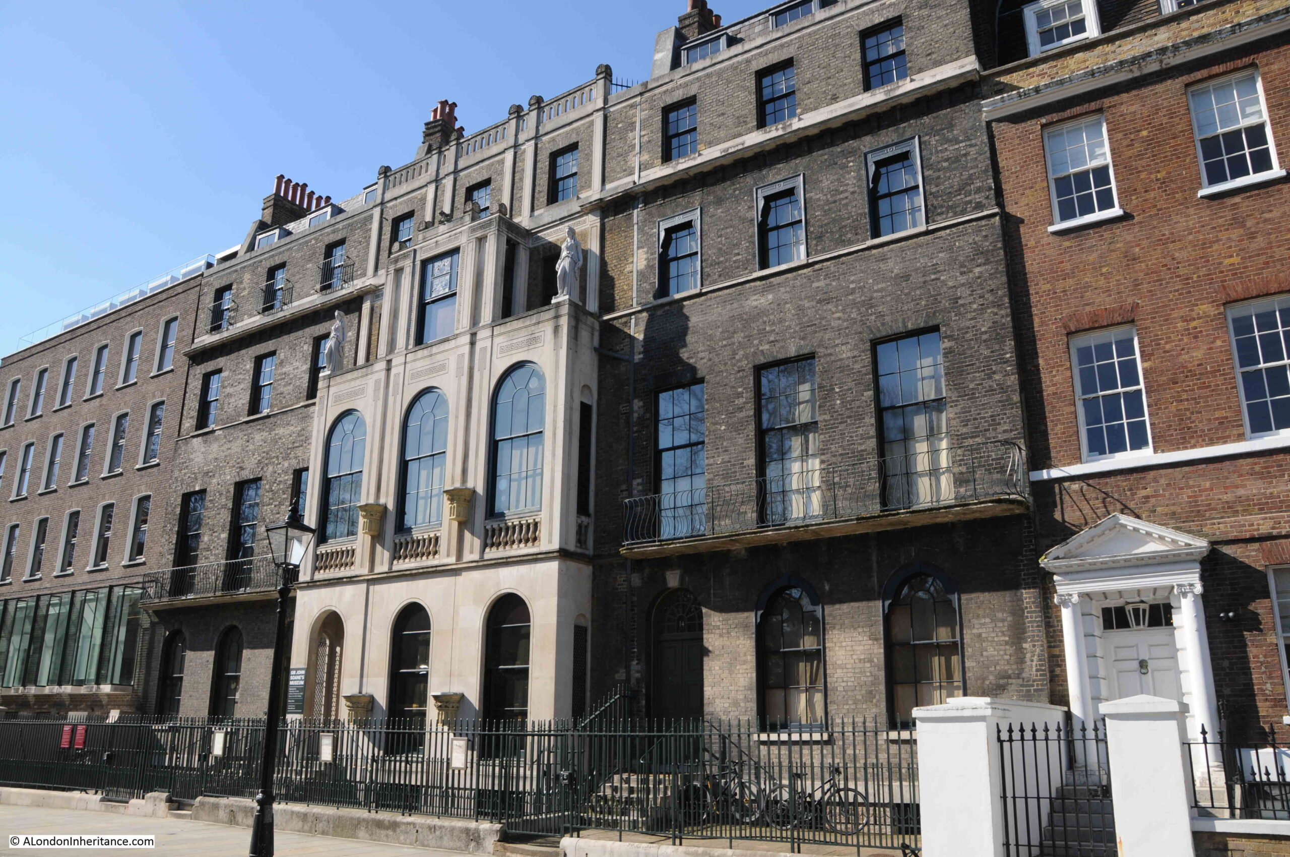
Along the north of Lincoln’s Inn Fields is the house and now museum of Sir John Soane:

Lincoln's Inn Fields

Sir John Soane, who was the architect of the Bank of England, moved into Lincoln’s Inn Fields in 1794, having rebuilt the house which he had purchased a couple of years earlier.

He eventually acquired numbers 12 to 14, the three houses in the above photo with the same darker grey brick and architectural style, although Soane added the façade to number 13, the central house which he completed, along with a rebuild in 1813.

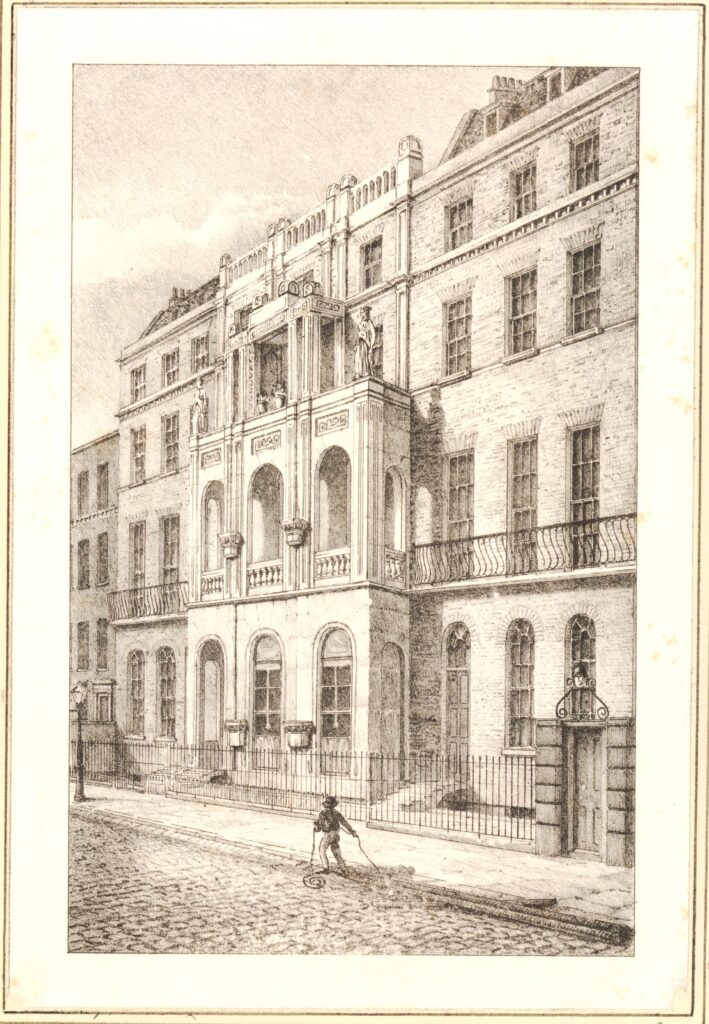
Sir John Soane’s house at it appeared in 1836 (© The Trustees of the British Museum):

Lincoln's Inn Fields

Soane was a collector, and during his life he amassed a very large collection of sculpture, furniture, antiquities and paintings.

He died in 1837, and following an Act of Parliament he had obtained in 1833, the house and his collection was held in a trust, and opened to the public as a museum, which continues to this day, with many of the exhibits being as organised by Sir John Soane.

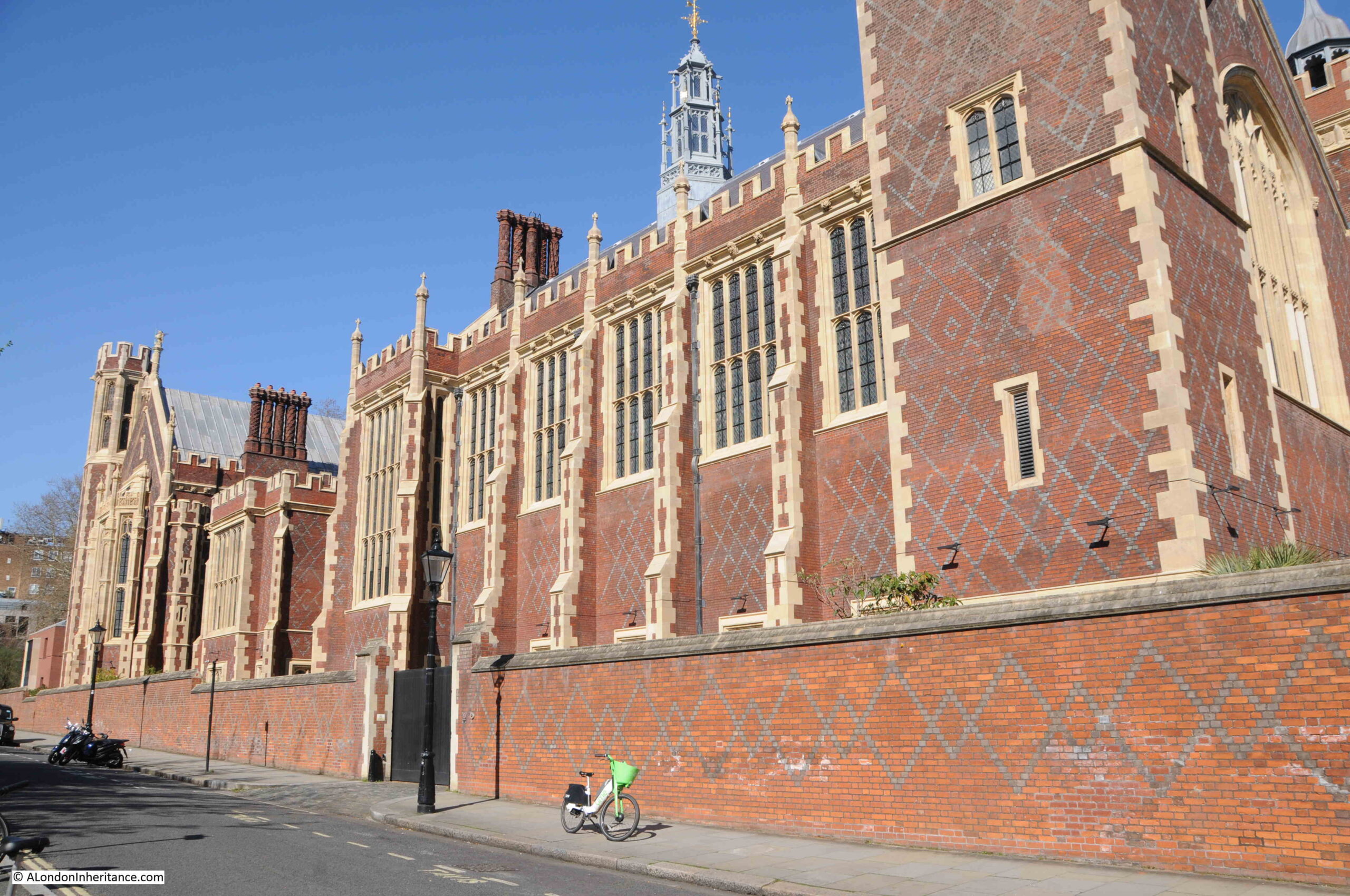
Along the western side is Lincoln’s Inn:

Lincoln's Inn Fields

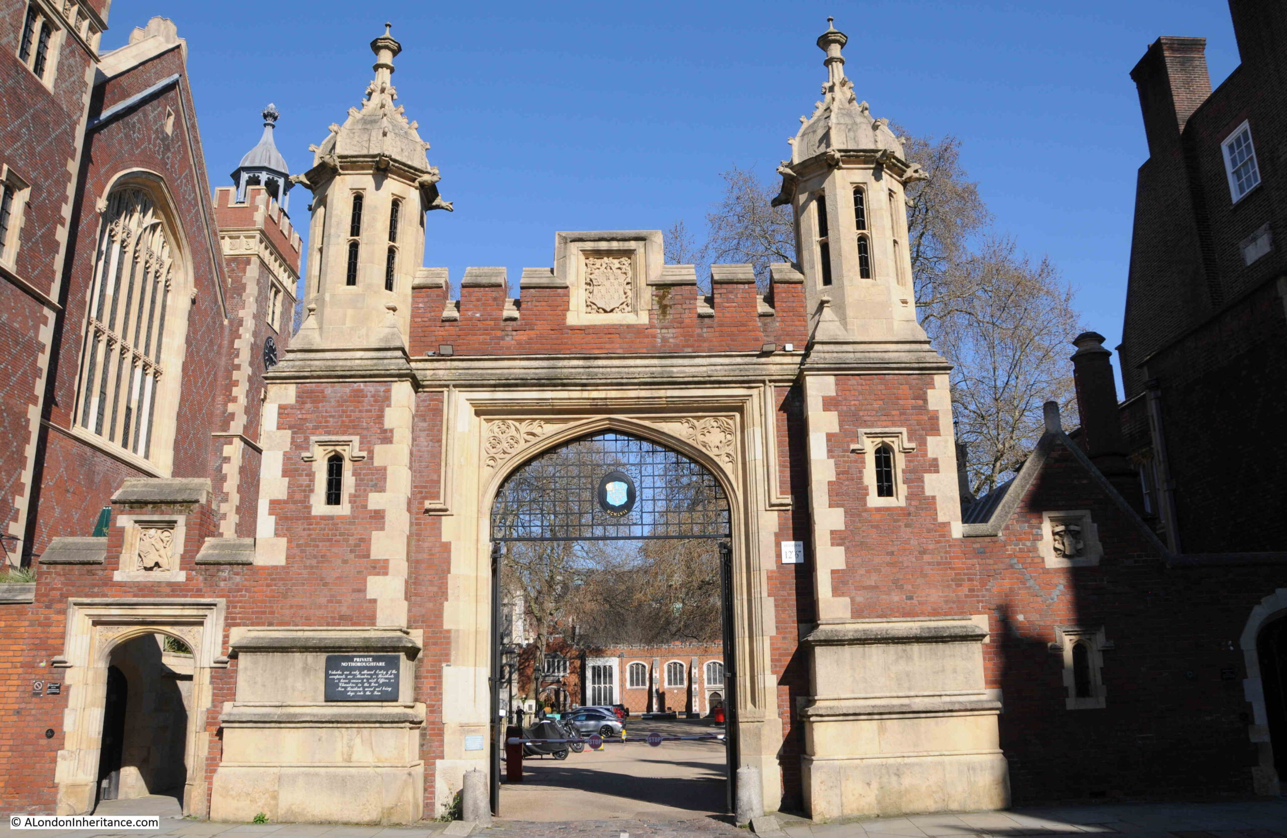
With the gateway into this side of Lincoln’s Inn. Both the above and below buildings are not that old, but I will save these for a future post on Lincoln’s Inn.

Lincoln's Inn Fields

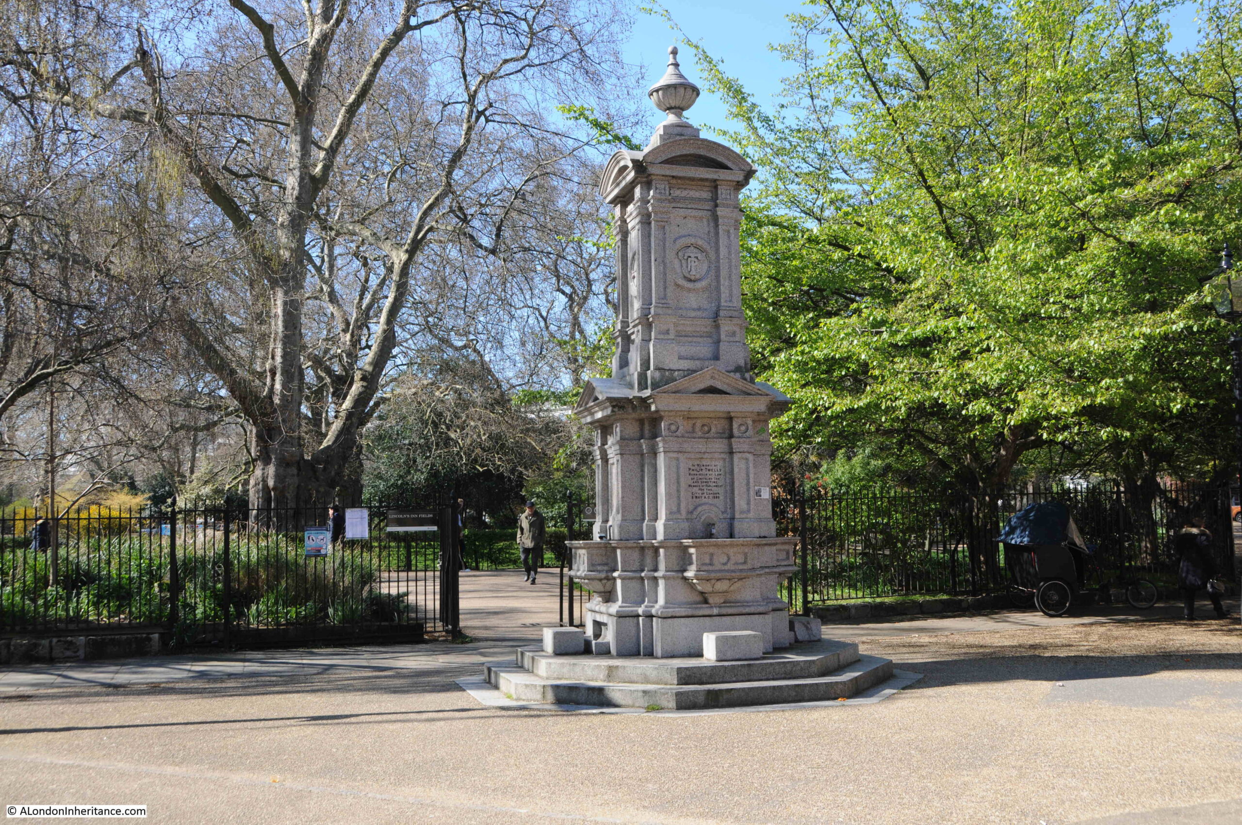
Another 19th century drinking fountain at the opposite corner of the fields to the first. This one is in memory of Philip Twells, who was a Barrister at Lincoln’s Inn, as well as being the MP for the City of London.

Lincoln's Inn Fields

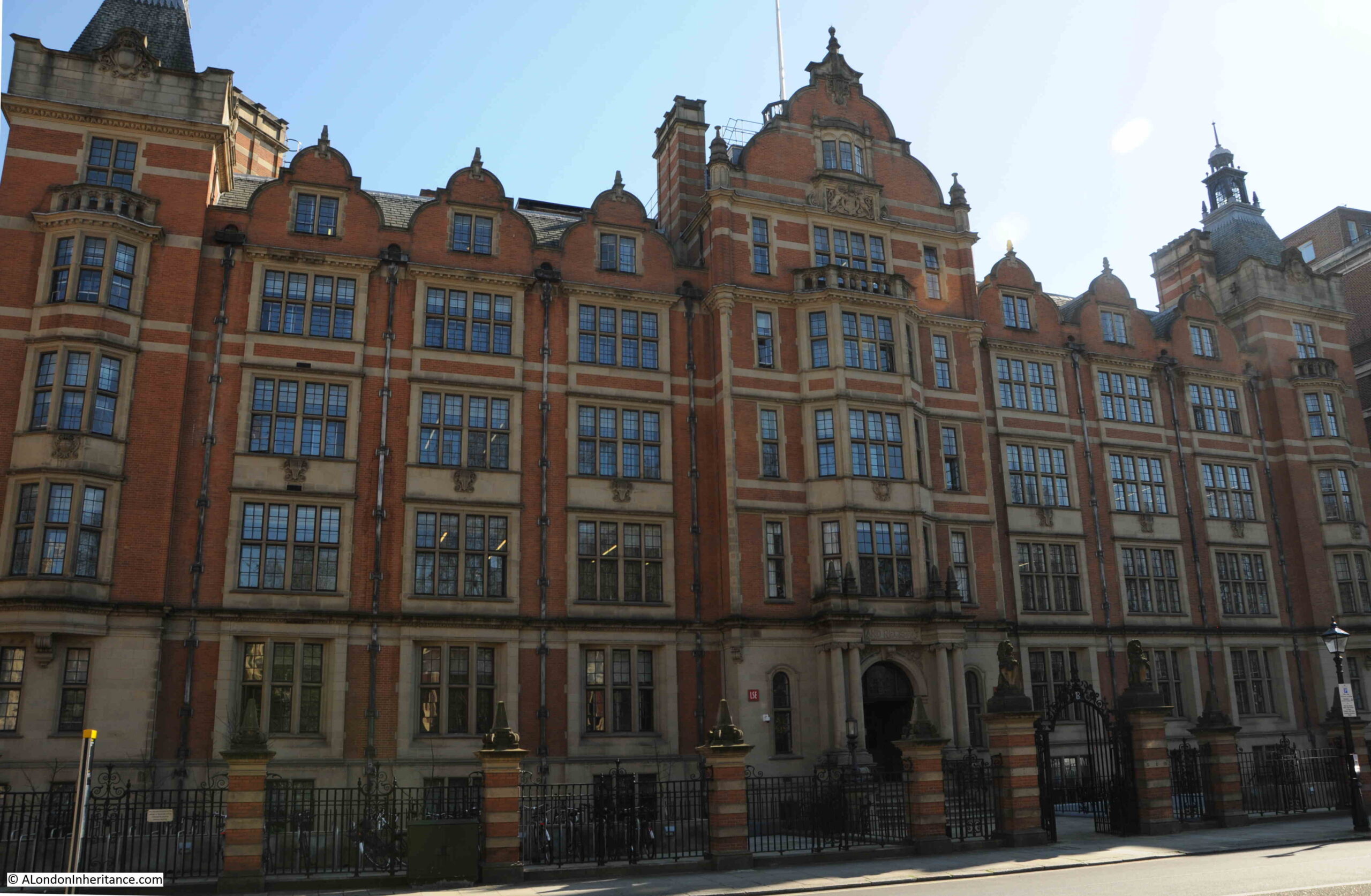
On the south eastern corner of Lincoln’s Inn Fields is this fine building. Once the home of the Land Registry, it is now part of the London School of Economics:

Lincoln's Inn Fields

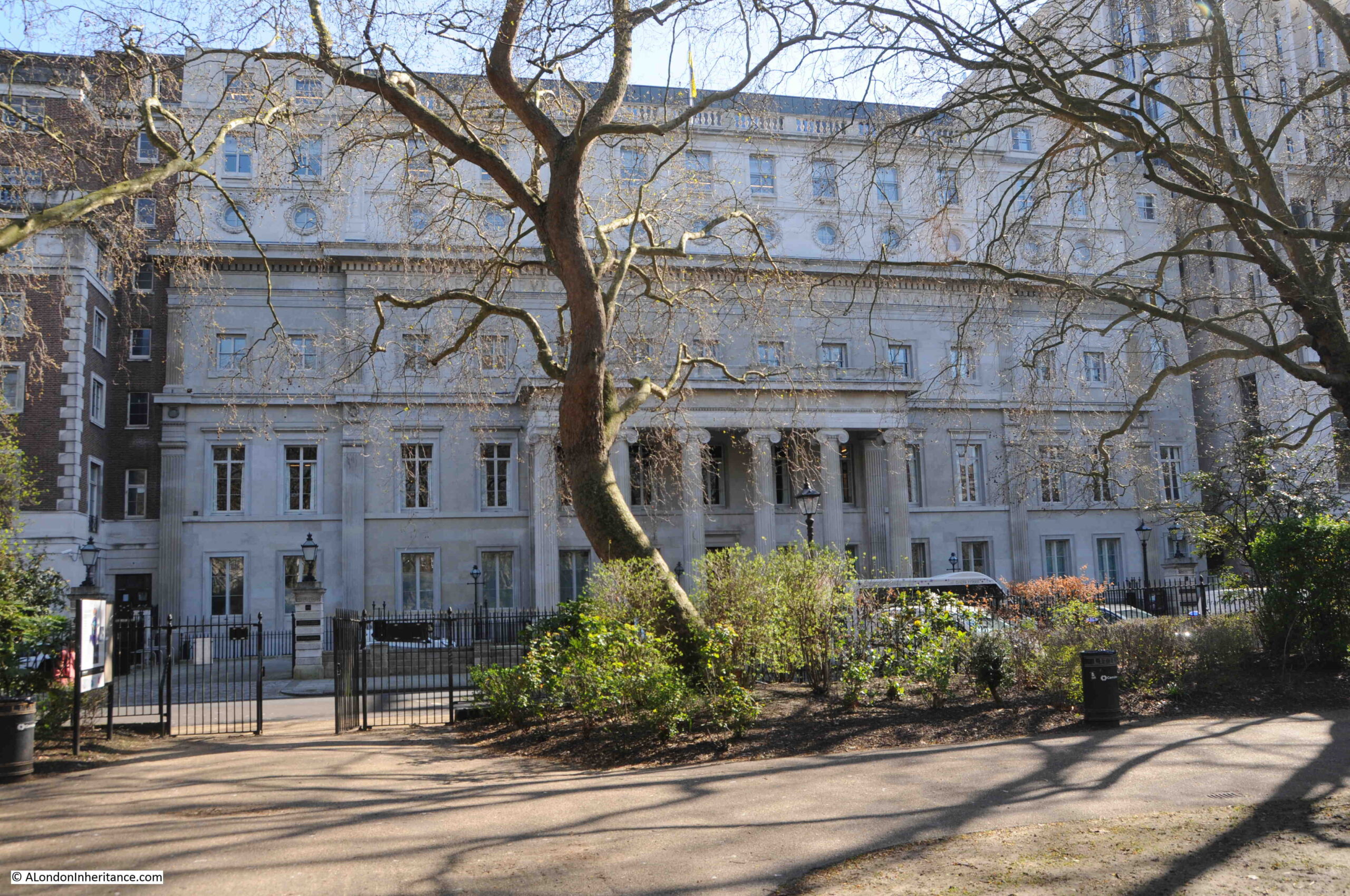
Also along the south side of the fields is the building of the Royal College of Surgeons:

Lincoln's Inn Fields

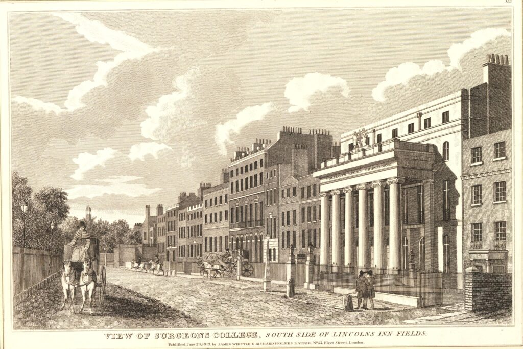
The Royal College of Surgeons received their new Royal Charter in 1800, and built their new home in Lincoln’s Inn Fields. The building was bombed during the last war and was rebuilt, so is not fully an original.

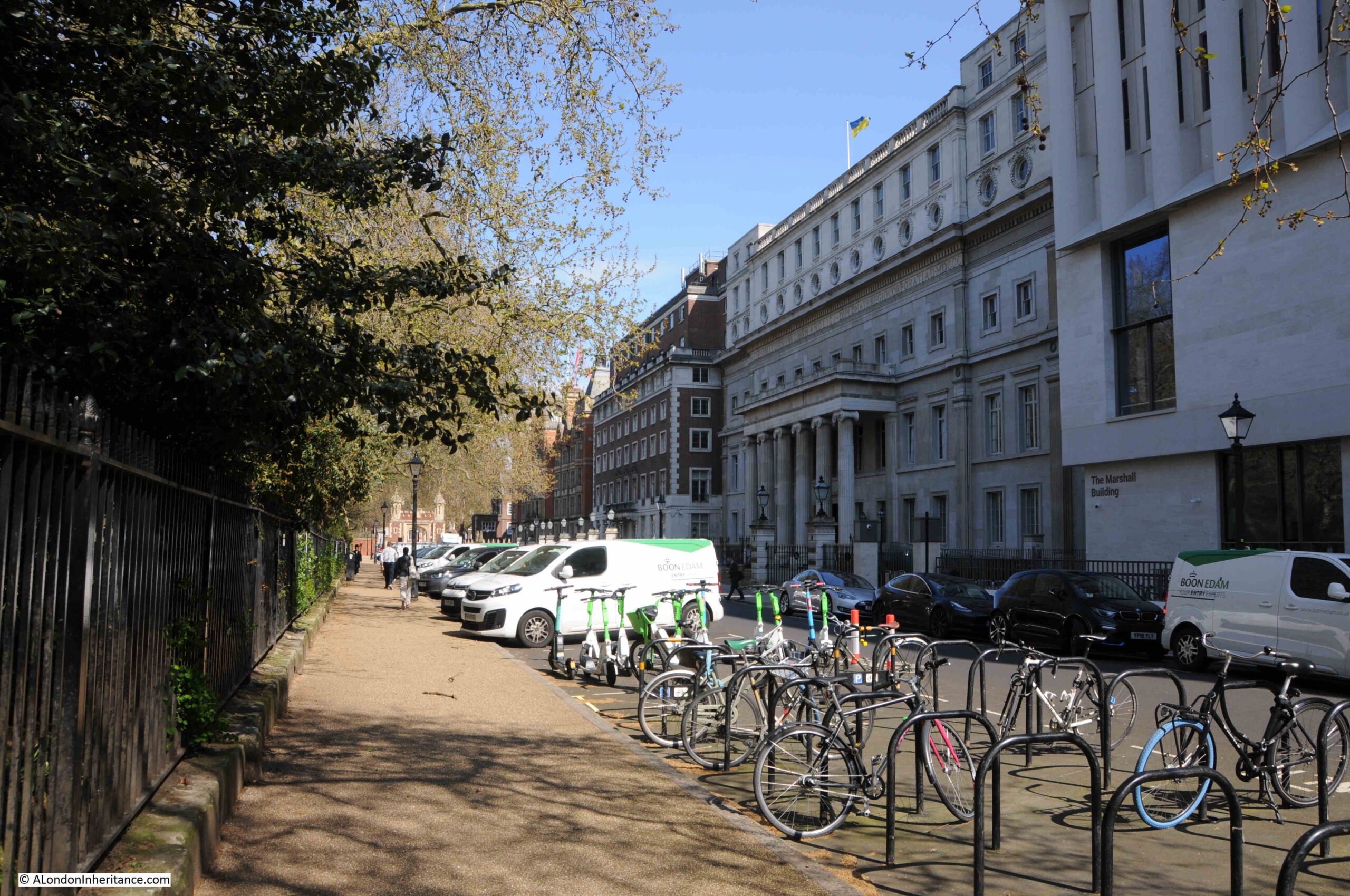
The following print, dated 1813, shows the view along the southern side of Lincoln’s Inn Fields and shows how the post war rebuild of the Royal College of Surgeons building included additional floors at the top of the building (© The Trustees of the British Museum):

Royal College of Surgeons

The same view today, where the horse and carriage has been replaced by cars, vans and bikes:

Lincoln's Inn Fields

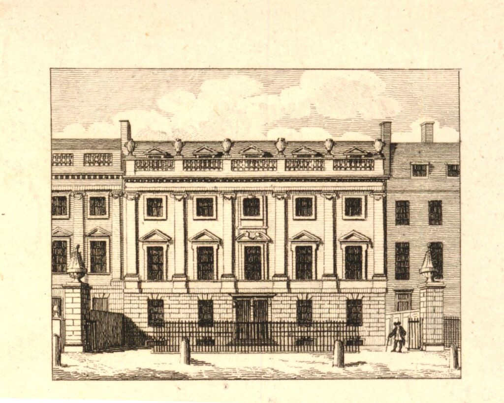
Almost all the buildings of Lincoln’s Inn Fields have been rebuilt since the original construction around the fields. There is one building that dates from the very first period of building, and this is Lindsey House, which was built between 1640 and 1641 (© The Trustees of the British Museum):

Lindsey House

Lindsey House looks very much the same today:

Lindsey House

Lindsey House has been attributed to Inigo Jones, however there is no firm evidence from the time to confirm this, but the style is typical of Jones’ work.

Whilst the exterior has changed little since construction in the mid 17th century, the interior is very different as in 1752 the house was divided in to two, and this work incolved the loss of much of the interior.

I had planned to cover more about the buildings that line Lincoln’s Inn Fields, however, as usual, I ran out of time. It is a lovely place to be on a sunny spring or summer day, and there is much to discover, including the simple plaque on the floor of the shelter, a plaque which hints at the politics and religious conflicts of the 17th century, and how vindictive the state could be to those who it considered a threat.

alondoninheritance.com

Ely Place and St. Etheldreda​

Walter Thornbury’s opening description of Ely Place in Old and New London is a perfect summary: “A little north of St. Andrew’s, Holborn, and running parallel to Hatton Garden, stand two rows of houses known as Ely Place. To the public it is one of those unsatisfactory streets which lead nowhere; to the inhabitants it is quiet and pleasant; to the student of Old London it is possessed of all the charms which can be given by five centuries of change and the long residence of the great and noble.”

From St. Andrew’s church, cross the approach to Holborn Viaduct, then across Charterhouse Street, we can see the entrance to Ely Place:

Ely Place

Thornbury’s description hints at the long and complex history of the street and surroundings, and the gatehouse at the entrance to Ely Place confirms that this is not a normal London street.

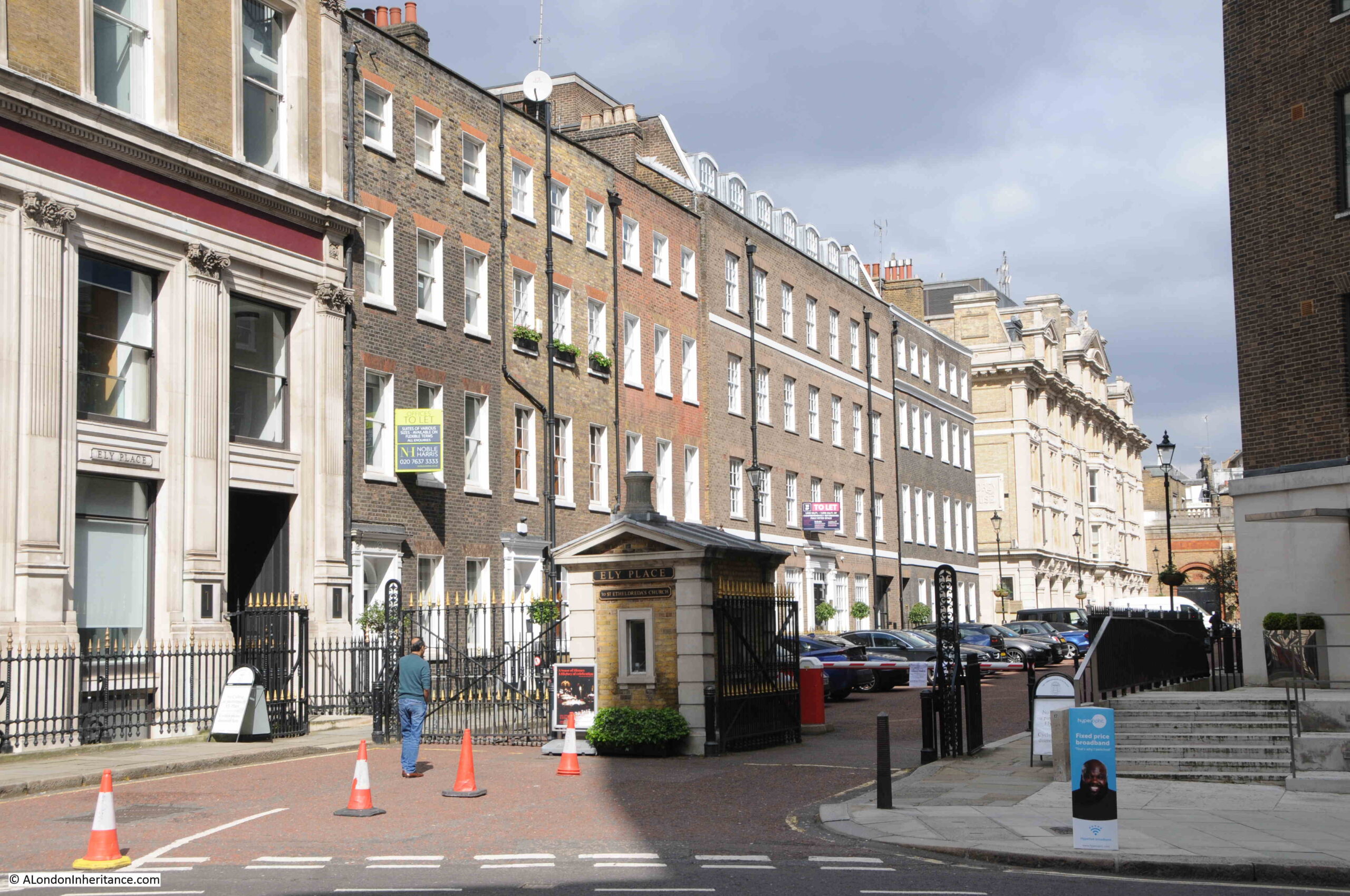
Much of the street remains lined with houses from the 1770s development of Ely Place, although many have been modified and restored, and there was considerable bomb damage to the area during the last war, however the view still demonstrates what a fine late 18th century London terrace would have looked like:

Ely Place

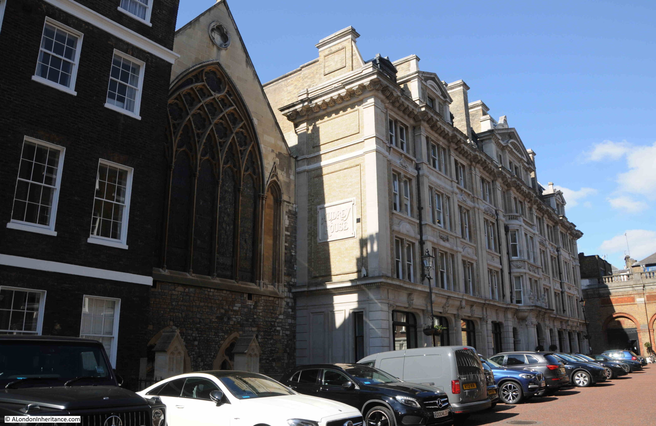
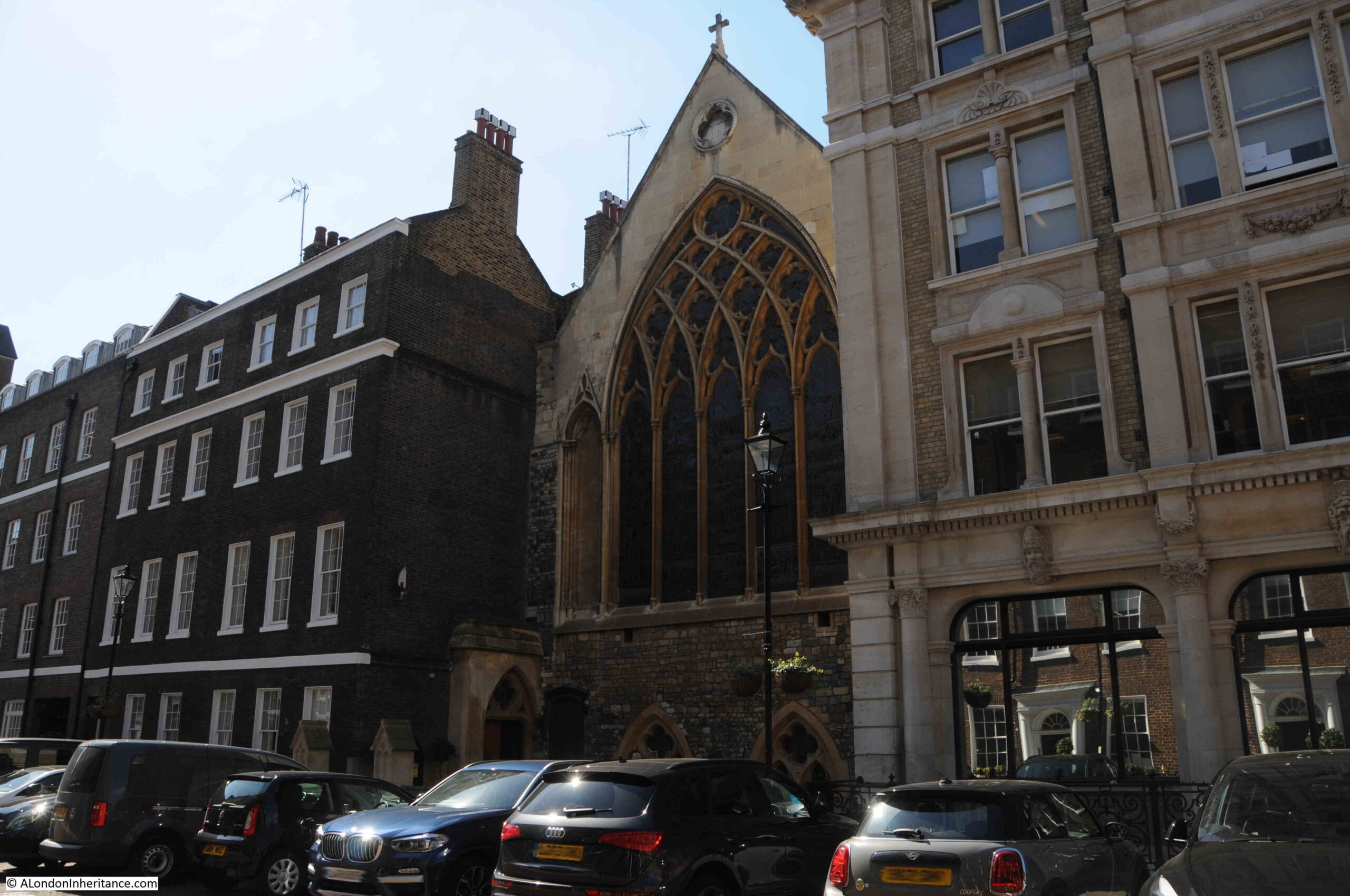
Along the western side of Ely Place is a curious indentation in the terrace, and here we can see the church of St. Etheldreda, with to the right Audrey House, which according to the Camden Council “Area Appraisal and Management Strategy” is 19th century. I assume late 19th century (Audrey was another version of the name of Etheldreda):

Ely Place

View looking south. The terrace house immediately to the left of the church has a strange ground floor, which I will discover soon:

Ely Place

As Thornbury hinted, Ely Place has a very long history.

In the 13th century, the land appears to have been in the possession of John de Kirkeby, Bishop of Ely, as on his death in 1290, he left the land and nine cottages to his successor Bishops of Ely.

It was normal in the medieval period for important figures in the church to maintain a residence in London. This was so they had somewhere to stay when visiting the city, where they could entertain, and to ensure that although they might be representing places far across the country, they could still have a presence close to the centre of royal and political power.

The Bishops of Ely originally had a house in the City of London, however there seems to have been a falling out with Hugh Bigod who was the Justiciary of England in the mid 13th century, and who tried to deny them access to their property in the Temple. It may have been this event which either gave John de Kirkeby the idea, or he was persuaded, to leave the land following his death to the Bishops.

The Bishops won a legal case to continue use of their City house, but following the bequest of such a large area of land, in the still semi-rural area to the west of the City, it must have seemed a good idea to build a new London home for the Bishops of Ely.

The Bishops than started the development of the land, into a property suitable for use as their London home. A chapel to St. Etheldreda was probably one of the first buildings on the site, along with the bishop’s house. William de Luda, the bishop that followed John de Kirkby purchased some additional land and houses and left these to the Bishops of Ely on his death.

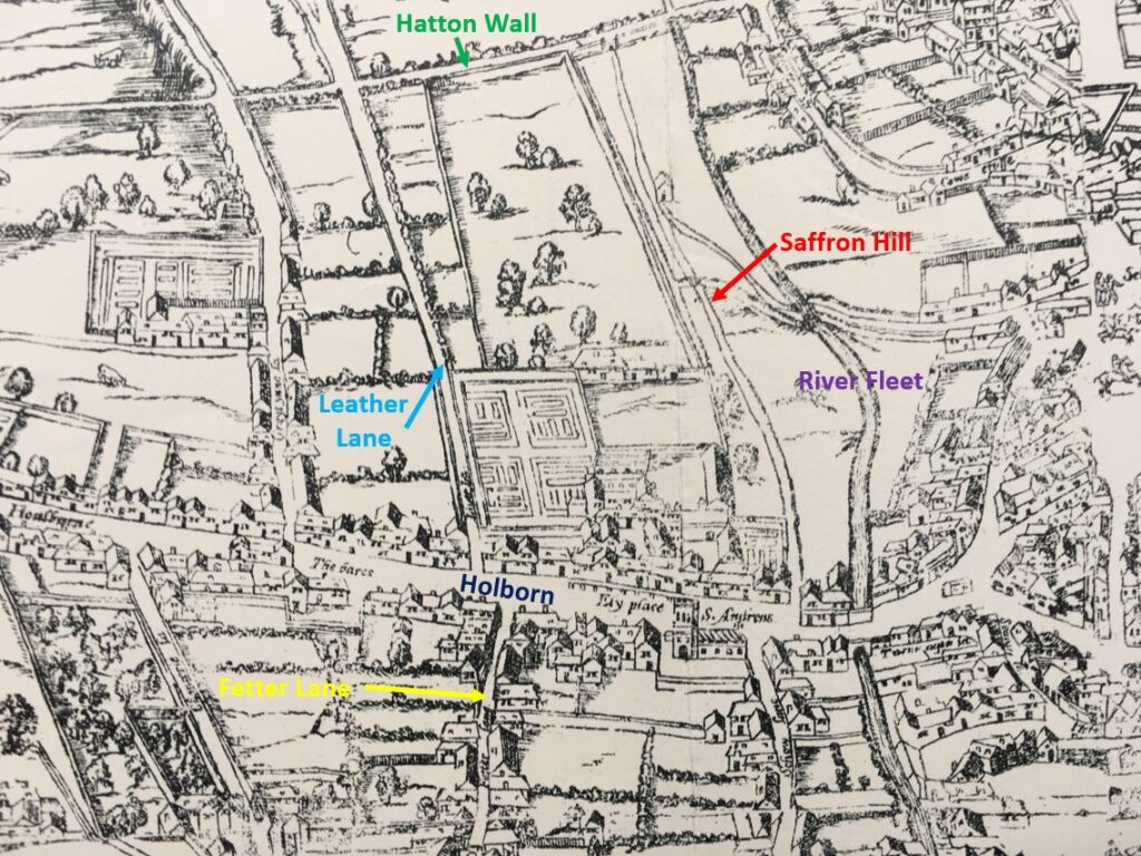
The house and grounds were continuously added to, and developed during the 14th century, and we can get an idea of the size of the place from the so called Agas map from around 1561:

Ely Place

I have marked the streets that formed the boundaries to the Bishop’s land, Holborn to the south (you can see the name Ely Place and St. Andrew’s church just to the right of where I have marked Holborn).

Saffron Hill is to the east, then just a lane winding along the top of the bank down to the River Fleet. Hatton Wall formed the boundary to the north and Leather Lane (identified using its earlier name of Lither Lane) to the west. To confirm locations, I have also marked Fetter Lane in yellow to the south of Holborn.

The house and chapel were in the southern part of the estate, with gardens and extensive grounds up to Hatton Wall.

The quality of the fruit from the gardens must have been well known as Shakespeare has Richard III saying to John Morton, the Bishop of Ely:

“When I was last in Holborn,
I saw good strawberries in your garden there
I do beseech you send for some of them.”

Ely House also appears in Richard II, where the dying John of Gaunt includes the following well known lines:

“This royal throne of kings, this scepter’d isle,
This earth of majesty, this seat of Mars,
This other Eden, demi-paradise,
This fortress built by Nature for herself,
Against infection and the hand of war,
This happy breed of men, this little world,
This precious stone set in the silver sea,”

John of Gaunt did stay in Ely House from 1381 until his death in 1399. His London residence at Savoy Palace had been destroyed during the Peasants Revolt. John of Gaunt was one of those that the leaders of the revolt demanded to be handed over for execution.

Other visitors to Ely House included Henry VII who attended a banquet in 1495 and Henry VIII with Catherine of Aragon, who both attended the final day of a five day “entertainment” in November 1531. A prodigious amount of food was recorded as being consumed during the five days.

The extract from the Agas map shown above dates from around 1561, and the grounds of Ely House would soon start to be developed.

Queen Elizabeth I required that the Bishop of Ely lease part of the grounds to her Chancellor, Sir Christopher Hatton in 1576.

Hatton started the developed of the land, which included construction of a new house for him in the gardens. The lease would stay in the Hatton family until 1772 when the last Lord Hatton died. It then reverted to the Crown.

In the years of Hatton ownership, Ely House had a varied history. During the Civil War the house was used as a prison for captured Royalists, as well as a hospital for injured soldiers. The Bishops of Ely returned in 1660 to part of the property, but by then much had been developed and was held by the Hatton family.

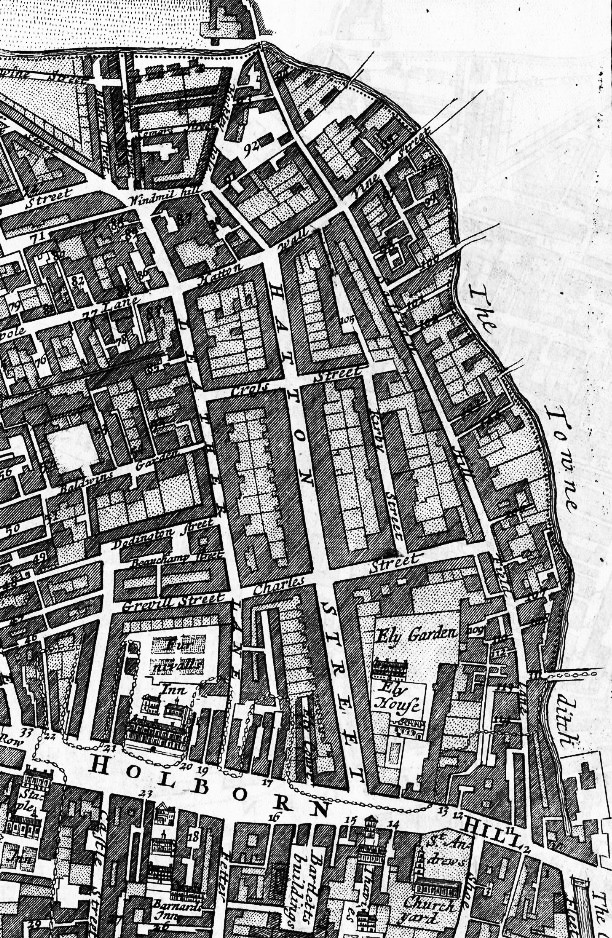
We can get an idea of the development of the area in the years before the death of the last Lord Hatton from the following extract from a map of St. Andrew’s parish, dated 1755:

Ely Place

We can see a considerably reduced Ely Garden just to the north of Holborn Hill, with Ely House marked, and the chapel just below the word House.

Hatton Street (now Hatton Garden) had been built, and housing and streets had been constructed up towards Hatton Wall at the north, to Leather Lane in the west and Saffron Hill to the east. The banks of the fleet had also been built on by 1755, and the words “The Town Ditch” rather than River Fleet give some idea of the state of the old river by the middle of the 18th century.

The Bishops of Ely finally left the property in 1772, when they were given Ely House in Dover Street. This probably worked well as the above map extract shows, the area was heavily developed, and the house and grounds were in a state of disrepair.

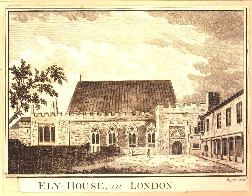
The following print issued in 1810, but probably drawn in the second half of the 1700s is recorded as showing Ely House in London  (© The Trustees of the British Museum):

Ely Place

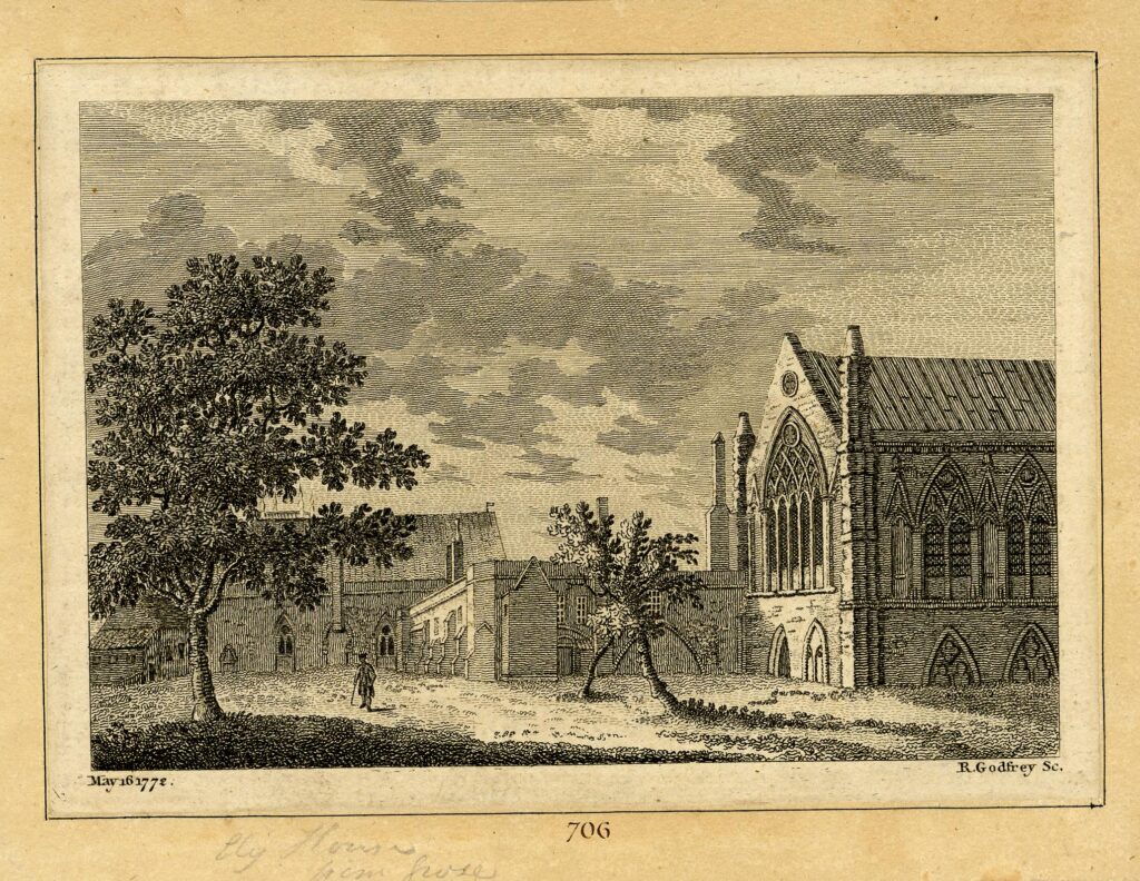
The view of the house in the above print does not look too much like the house shown in the parish map extract, however the following print dated 1772 from Grose’s Antiquities of England and Wales provides a better view as this shows the chapel on the right and house in the background, in the correct orientation as shown in the parish map  (© The Trustees of the British Museum):

Ely Place

The parish map implies that there is an open space between the house and chapel, however in the above two prints, the two buildings appear to be connected.

The old chapel on the grounds of Ely House is the only structure remaining from the time when the Bishops of Ely owned the site. Today, recessed slightly from the street, the chapel is now the church of St. Etheldreda.

It is shown in this 1815 print, with the two late 18th century terraces on either side  (© The Trustees of the British Museum):

St. Etheldreda

The lower part of the church appears to have changed since the time of the above print. The original entrance looks to have been up some steps from the street and there seems to be two doors through into the church.

Today, if I have understood the layout of the church correctly, the altar would be behind these doors, so the church now has a different entrance, shown in the photo below:

St. Etheldreda

Today, the entrance to St. Etheldreda is through a door into the ground floor of the terrace house on the left of the church. From here, the door leads through to a corridor that runs along part of the south wall of the church:

St. Etheldreda

The church is dedicated to St. Etheldreda, and this dedication can be traced back to the Ely heritage of the church.

An 1825 newspaper description of Etheldreda provides some background:

“This day, October 19th, is the anniversary of St. Etheldreda; she was a Princess of distinguished piety, and daughter of Aunas, King of the East Angles, and Heriswitha, his Queen, and was born in the year 630, at Ixning, a small village in Suffolk; at an early age she made a vow of perpetual chastity, which is recorded she never broke, though she was twice married, first to Thombert, an English Lord, and afterwards to Egfrith, king of Northumberland, in 671. Having lived twelve years with this King, she retired from the world, and devoted herself to God and religious contemplation, erecting an Abbey at Ely, of which she became superior, and where she spent the remainder of her days.”

There appears to have been a bit more to her “retiring from the world”. She had married Egfrith when he was aged 15, but by age 27 he wanted a more normal marital relationship. Egfrith tried to bribe Etheldreda, but she was standing firm and left him, becoming a nun at Coldingham, before going on to found an abbey at Ely.

Ely Cathedral was dedicated to Saints Peter, Etheldreda and Mary in 1109, and the Bishops of Ely carried the dedication to Etheldreda to their chapel in London.

Along the corridor is the entrance to the crypt:

St. Etheldreda

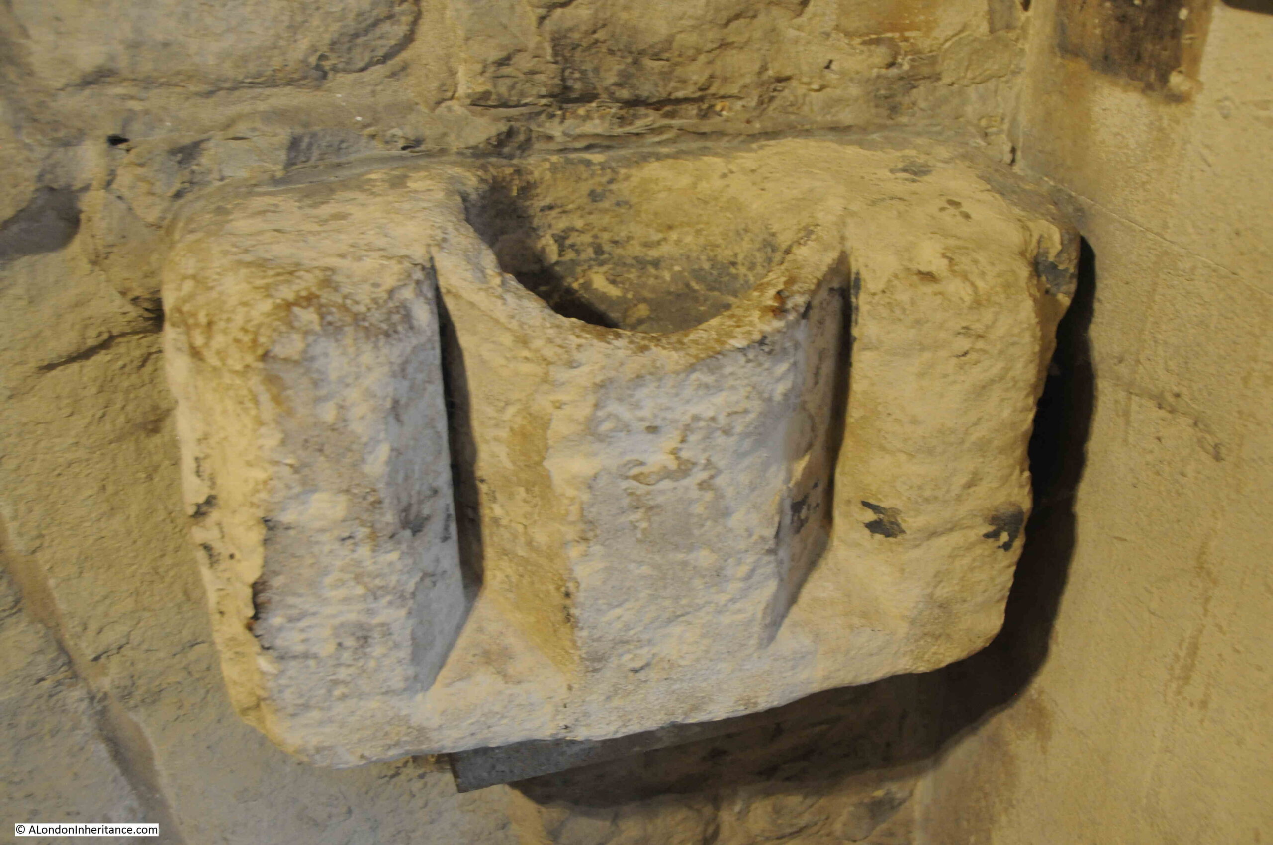
But before looking at the crypt, there is an interesting feature just to the right of the door:

St. Etheldreda

There was an article in a 1926 edition of the Illustrated London News, which discussed the Roman City. The article states that “Equally curious is the fact that digging has revealed only the slightest signs of Christian worship in Roman London, although it is known that there was a Christian community in Londinium, and that it was ruled by a Bishop as early as the third century. The chief ‘clue’ is at St. Etheldreda’s Church, Ely Place. It is a curiously archaic bowl shaped font of limestone of similar form to the two which are preserved at Brecon Cathedral. it was found buried in the undercroft.

Of the St. Etheldreda’s font, Sir Gilbert Scott said ‘You may call the bowl British or Roman, for it is older than the Saxon period’; and some support to this statement is provided by the fact that Roman bricks have been found on the site.”

A quick Google for the Brecon fonts shows these to be Norman, not early Christian, and the main font in the church does look like the Brecon font, so I have no idea whether this feature on the wall is the one referred to in the article, whether the article is right, and whether St. Etheldreda had, or has an early Christian font.

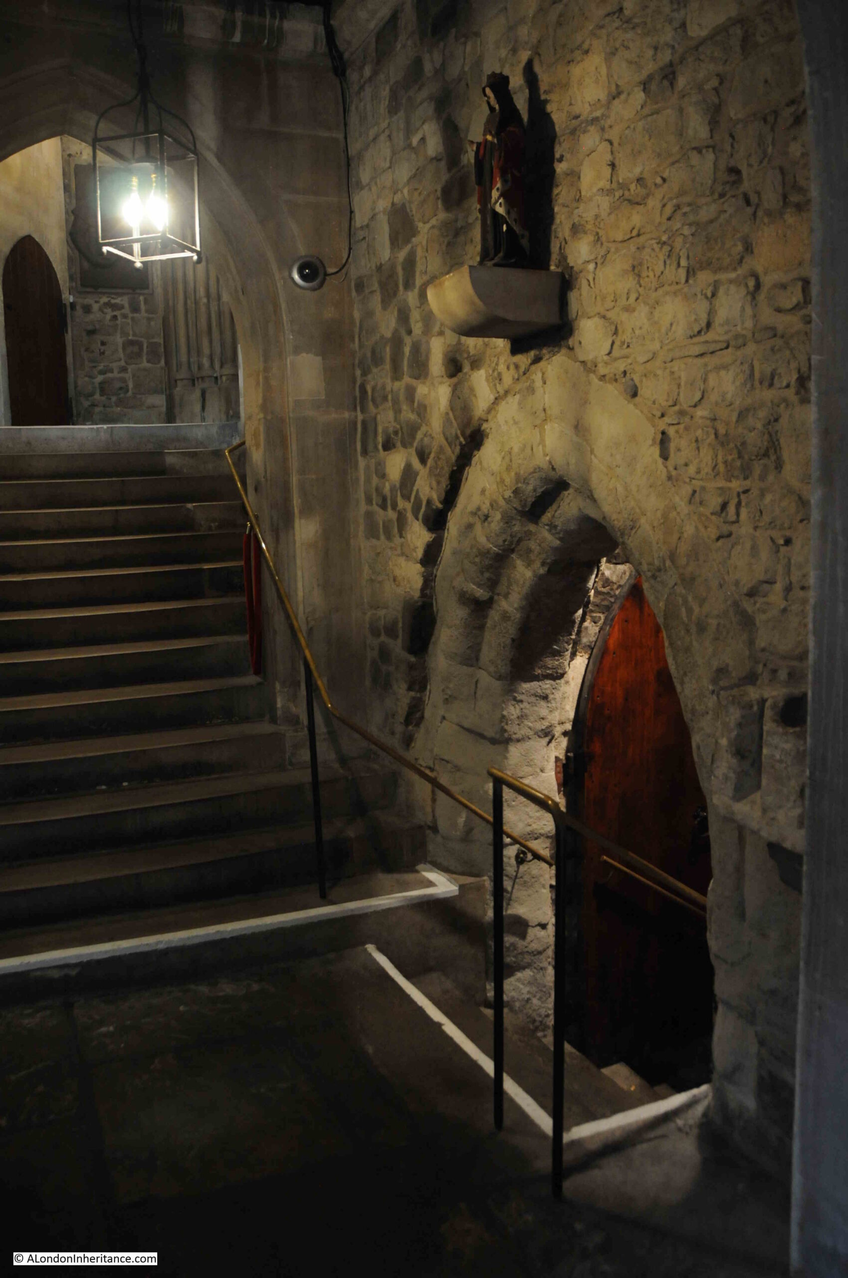
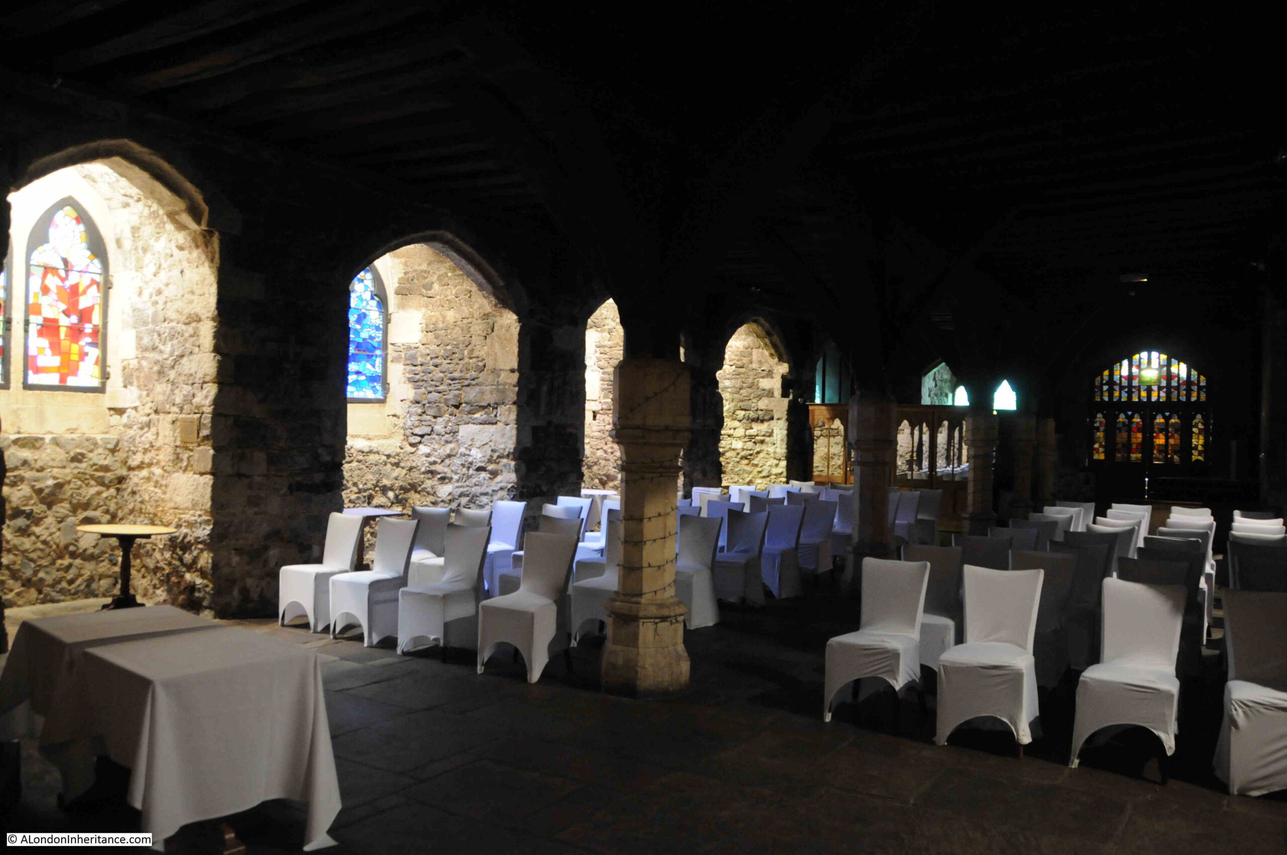
A walk down into the crypt reveals a dimly lit space, presumably with seating laid out for a function such as a marriage:

St. Etheldreda

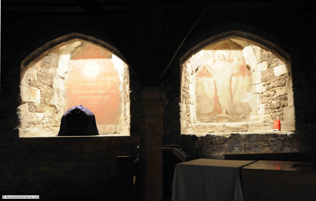
Niches in the walls with religious symbolism:

St. Etheldreda

The crypt is very different to how it was many years ago. In May 1880, members of the St. Paul’s Ecclesiological Society visited St. Etheldreda’s and their description of the church includes some history on the crypt:

“The members of the St. Paul’s Ecclesiological Society held their second afternoon gathering for the present summer on Saturday, and inspected the chapel of St. Etheldreda, in Ely-place, Holborn. At the construction of the chapel, which was formerly the private chapel of the Palace of the Bishops of Ely, was fully explained by Mr. John Young (the architect under whom the fabric has recently been renovated throughout), who discoursed on its early history and on the salient points of its chief architectural features, its loft oak roof, its magnificent eastern and western windows, full of geometrical tracery, its lofty side lights, its ancient sculptures, and lastly its undercroft or crypt, which till very lately was filled up with earth and barrels of ale and porter from Messrs. Reid’s brewery close by.

Removing the earth from the crypt, it may be remembered, there were discovered the skeletons of several persons who had been killed 200 years ago by the fall of a chapel in Blackfriars, and were here interred.

The ‘conservative’ restoration of the fabric – in the general plan of the late Sir George Gilbert Scott, had been frequently consulted – was much admired by the ecclesiologists.”

The fall of a chapel in Blackfriars occurred on the afternoon of Sunday 26th of October 1623, when around 300 people had assembled to hear a Catholic sermon by the Jesuit preacher, Robert Drury, at the French ambassador’s residence.

As it was a Catholic sermon, the congregation of people was considered illegal.

The roof of the hall in which the sermon was underway collapsed and around 100 people were killed. Rather than any sympathy, anti-Catholic feeling at the time unleashed a religious riot at the site of the tragedy.

I understand that the skeletons of those who died at Blackfriars, and were buried and subsequently discovered in St. Etheldreda’s were reburied, and still rest in the church.

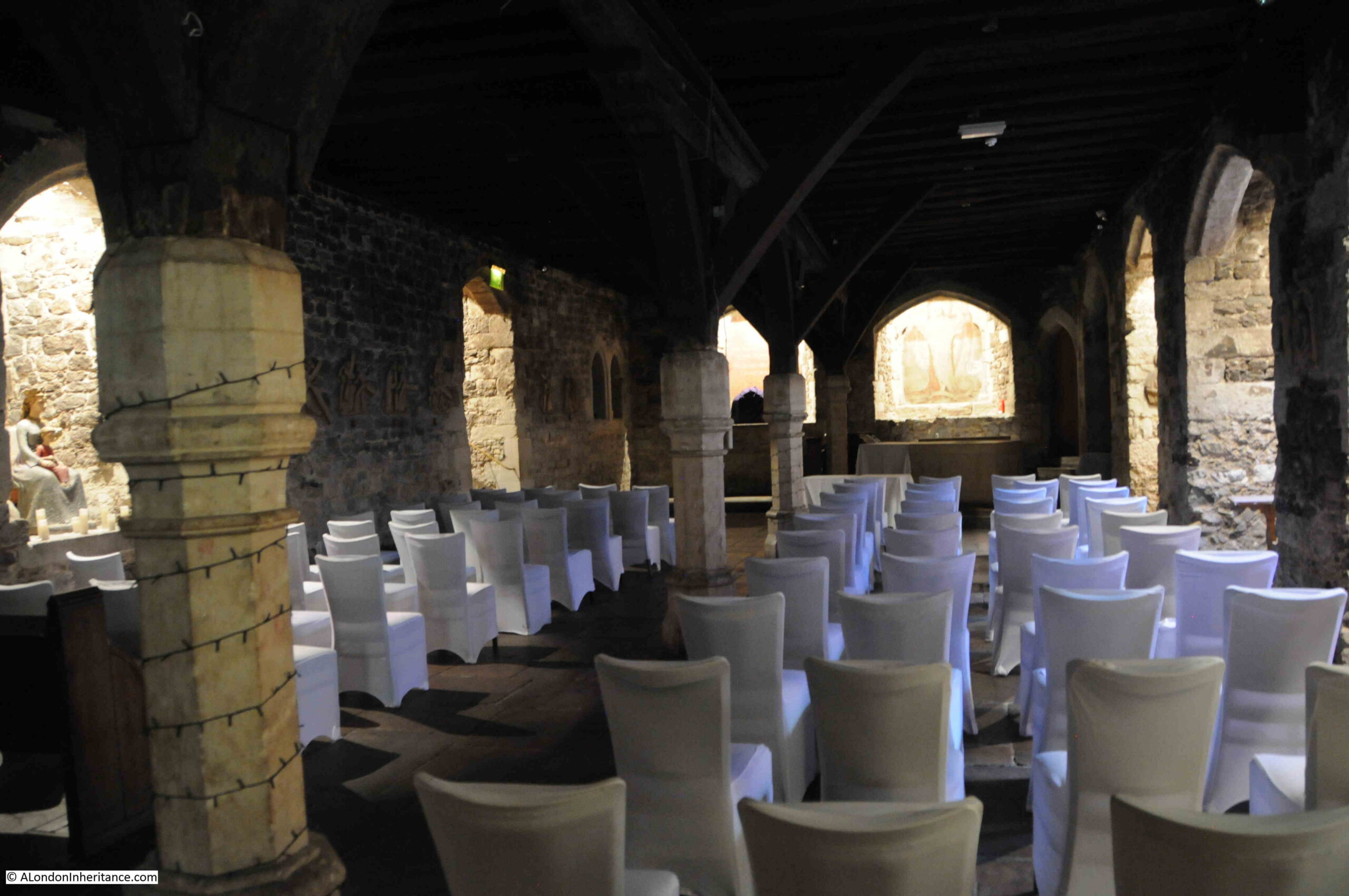
View from the rear of the crypt:

St. Etheldreda

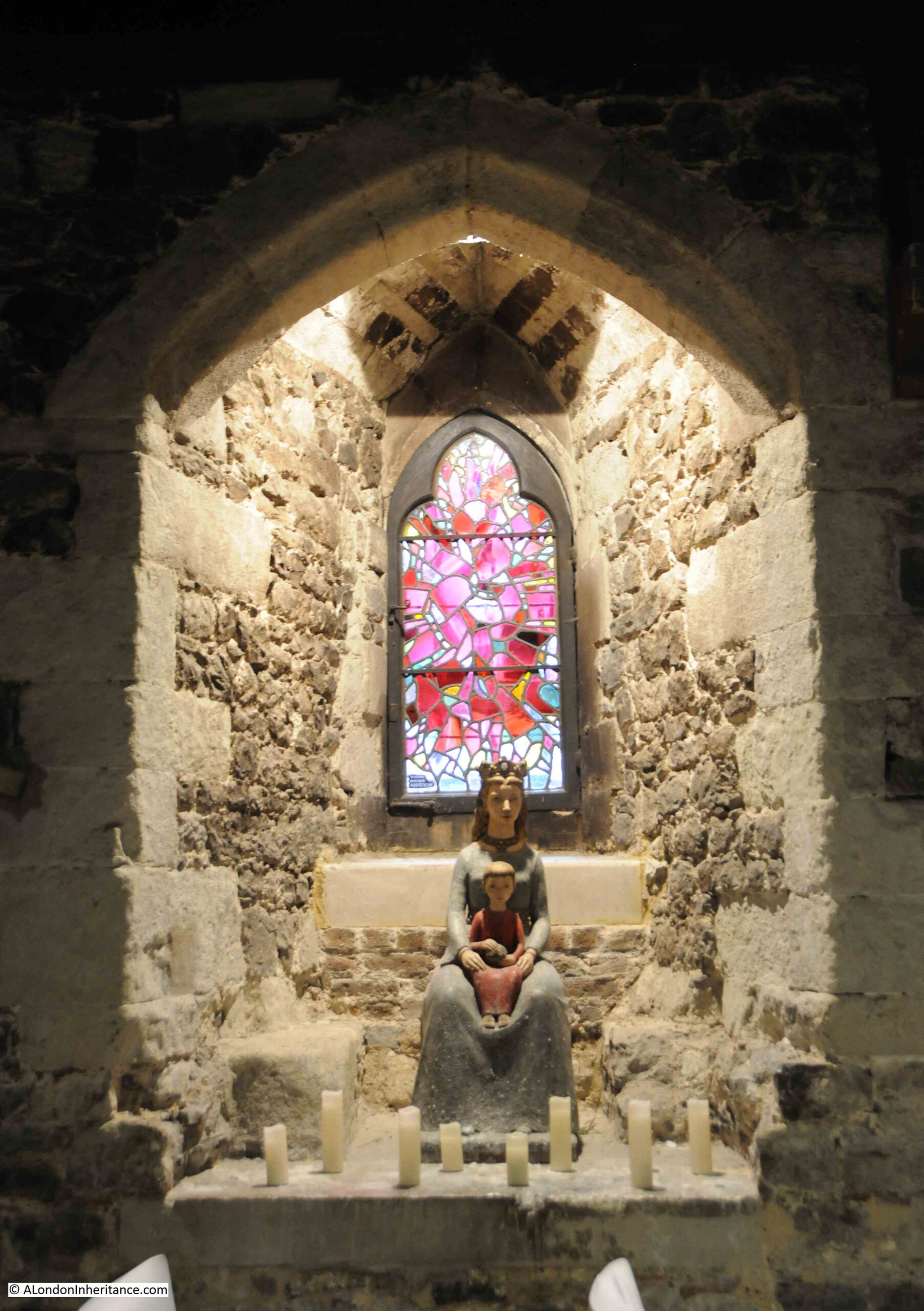
One of the niches that line the crypt walls:

St. Etheldreda

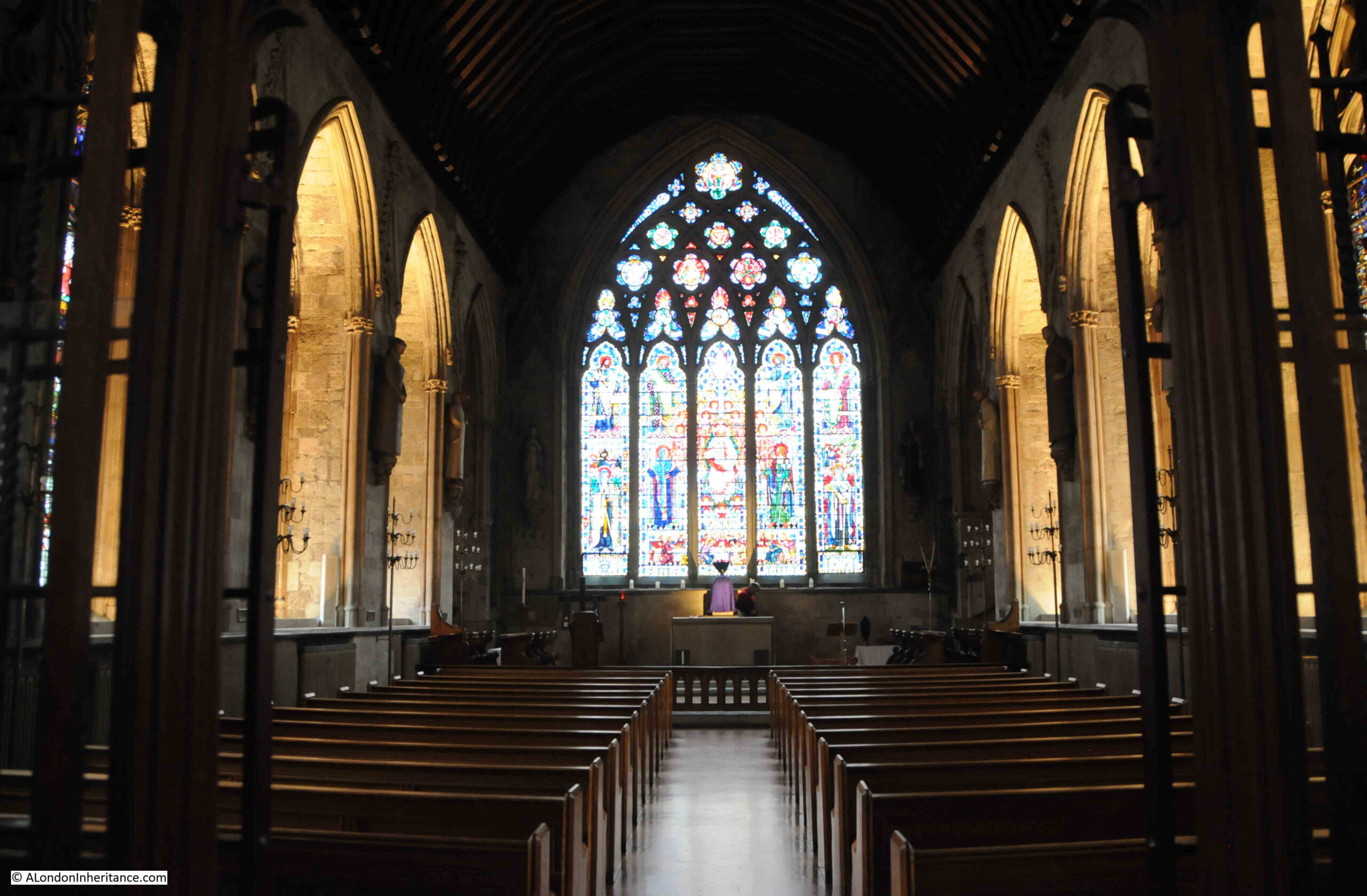
The church above is a lovely space. I do not know if this is the normal form of lighting, but it added to the impression of the age and history of the church. Very different to the typical brightly lit London church:

St. Etheldreda

St Etheldreda was caught up in the religious changes brought about by Henry VIII and the dissolution of the monasteries.

The mass which had been celebrated by the Bishops of Ely in the Church of St Etheldreda since it was first built in the 13th century, was abolished, and the Book of Common Prayer became the standard for religious services.

Apart from a short period of five years when the Catholic Queen Mary was on the throne, the Catholic service was banned, and anyone participating in, or preaching a Catholic service would be treated as a criminal, with a death sentence often the result.

A special allowance was made in 1620 when the Spanish Ambassador, the Count of Gondomar, moved into Ely Place. Due to his position as Ambassador, and the custom that the ambassadors residence and grounds are considered part of the country they represent, which in the case of Spain was a Catholic country, Catholic services were allowed to be held in St. Etheldreda’s. 

When Gondomar was recalled to Spain, his replacement was not allowed to take up residence at Ely Place, and permission for Catholic services was removed.

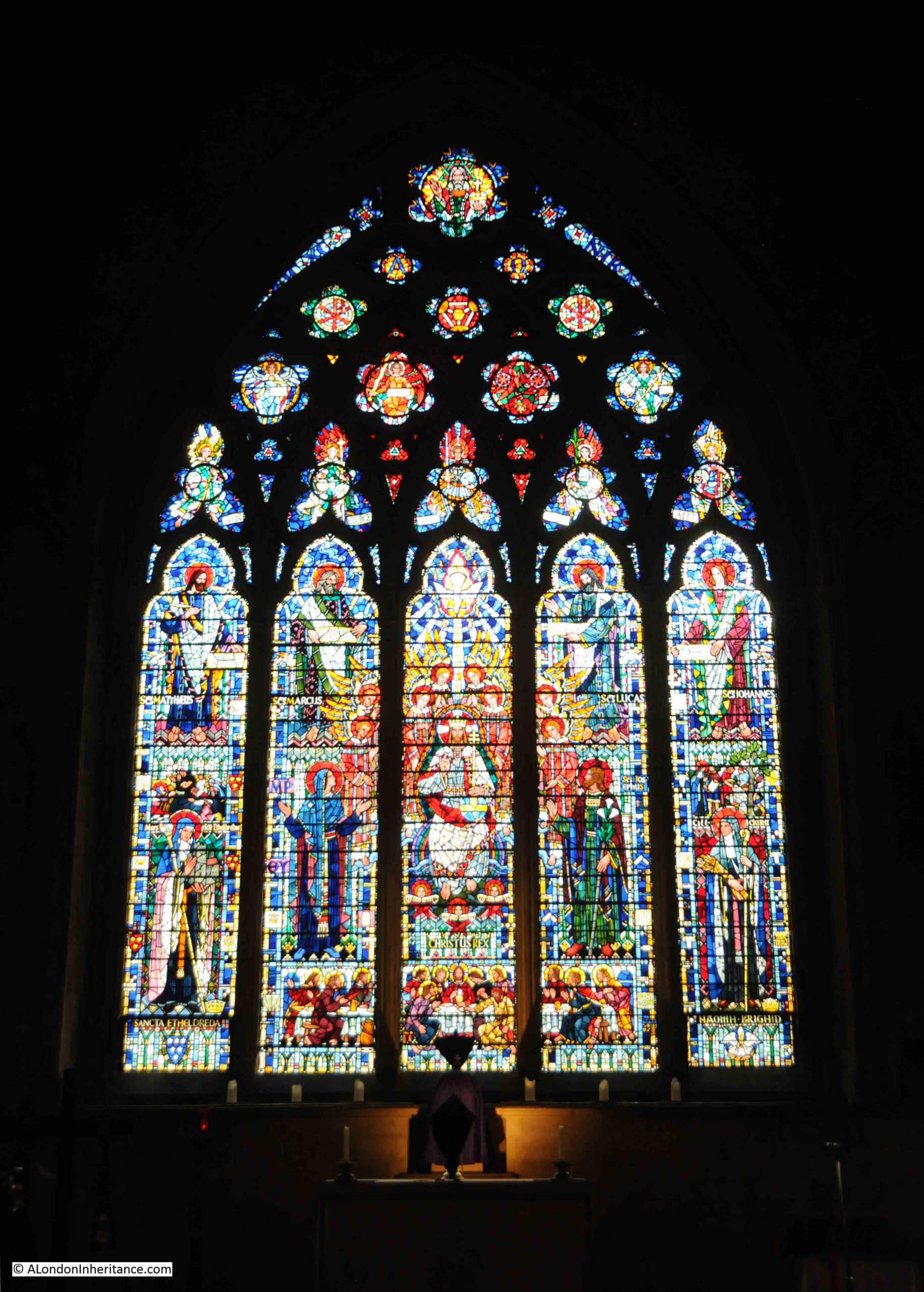
Detail of the stained glass above the altar:

St. Etheldreda

The church was included in the use of Ely house and grounds as a hospital and prison during the Civil War.

Anti-Catholic feeling can be seen in the treatment of the uncle of Sit Christopher Wren. Matthew Wren was Bishop of Ely and tried to restore the grounds of Ely Place from the Hatton family, however he was reported for his “Popish ways” and imprisoned in the Tower of London. When he was finally released, the land which he had tried to restore had been built over and was very much as shown in the earlier parish map extract.

The change to the way that the State viewed the Catholic faith started in 1829 when the Catholic Emancipation Act was passed. This Act allowed Catholics to have their own churches, and for the Catholic mass.

In 1843, St. Etheldreda’s church opened as a Welsh language church, however the church reverted to the Catholic faith in 1873 when the church was purchased by the Rosminians – a Catholic congregation also called the Institute of Charity.

The church has featured in commemorations of Catholics who had been executed in earlier centuries. In 1912, it was reported that “Several hundreds of ‘the faithful’ marched in procession on Sunday afternoon from Newgate to Tyburn, along the route followed by the Catholic martyrs in a less tolerant age. The pilgrimage is the third of its kind, having been inaugurated three years ago.

Following the Crucifix, which was held aloft by Father Fletcher, came 150 men who marched in front of 190 women, most of whom recited prayers along the route.

The first stop was at the church of St. Etheldreda, the ancient church of the Bishops of Ely at Holborn. Thence the procession, the numbers of which increased with every mile covered, visited in turn the Catholic Church in Kingsway and St. Peter’s, Soho, and finished up at the Convent, near Tyburn.”

A sign today outside the church states that it was returned to the Old Faith in 1874 and that it continues in the care of the Rosiminian Fathers.

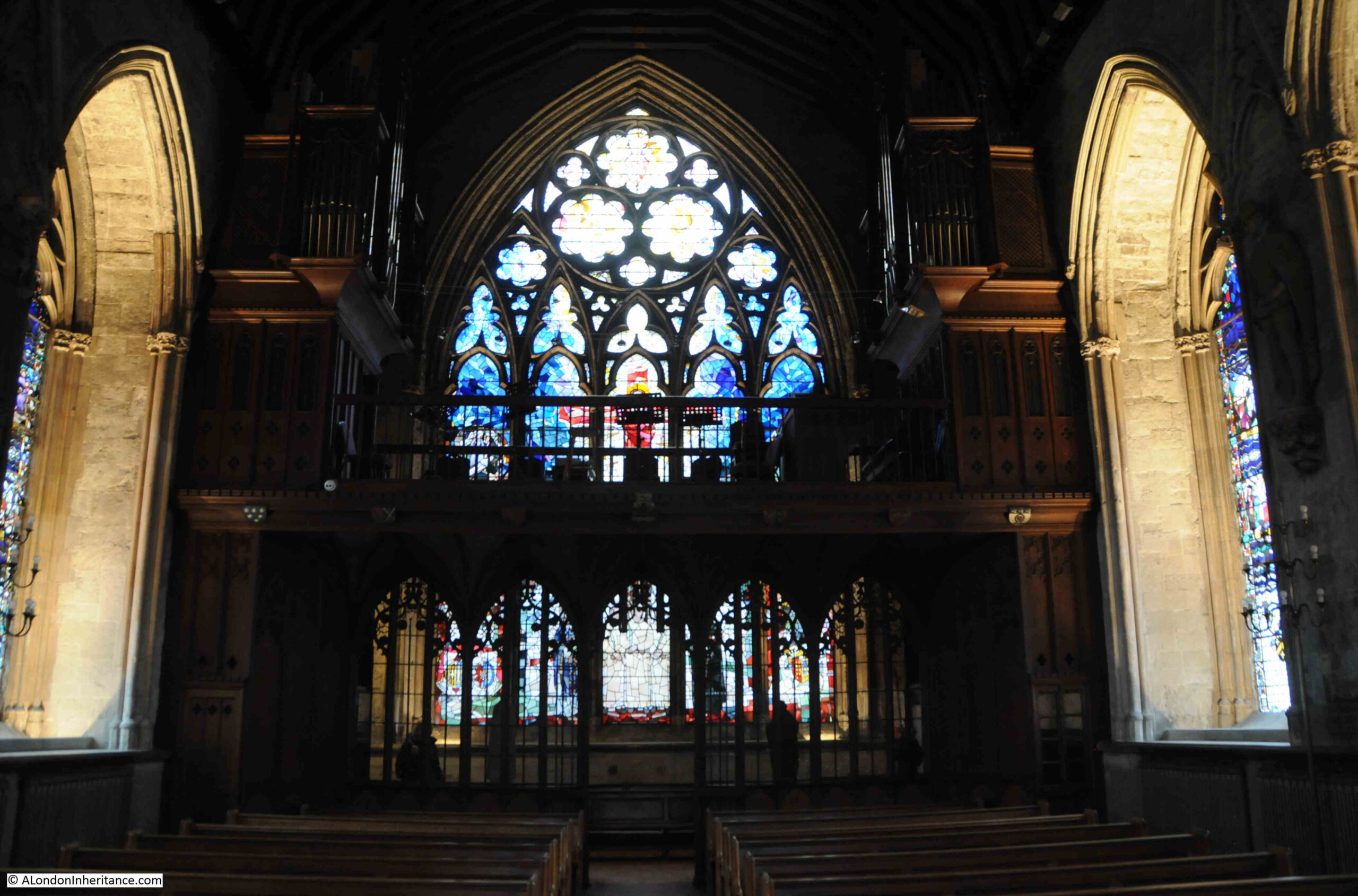
View towards the rear of the church:

St. Etheldreda

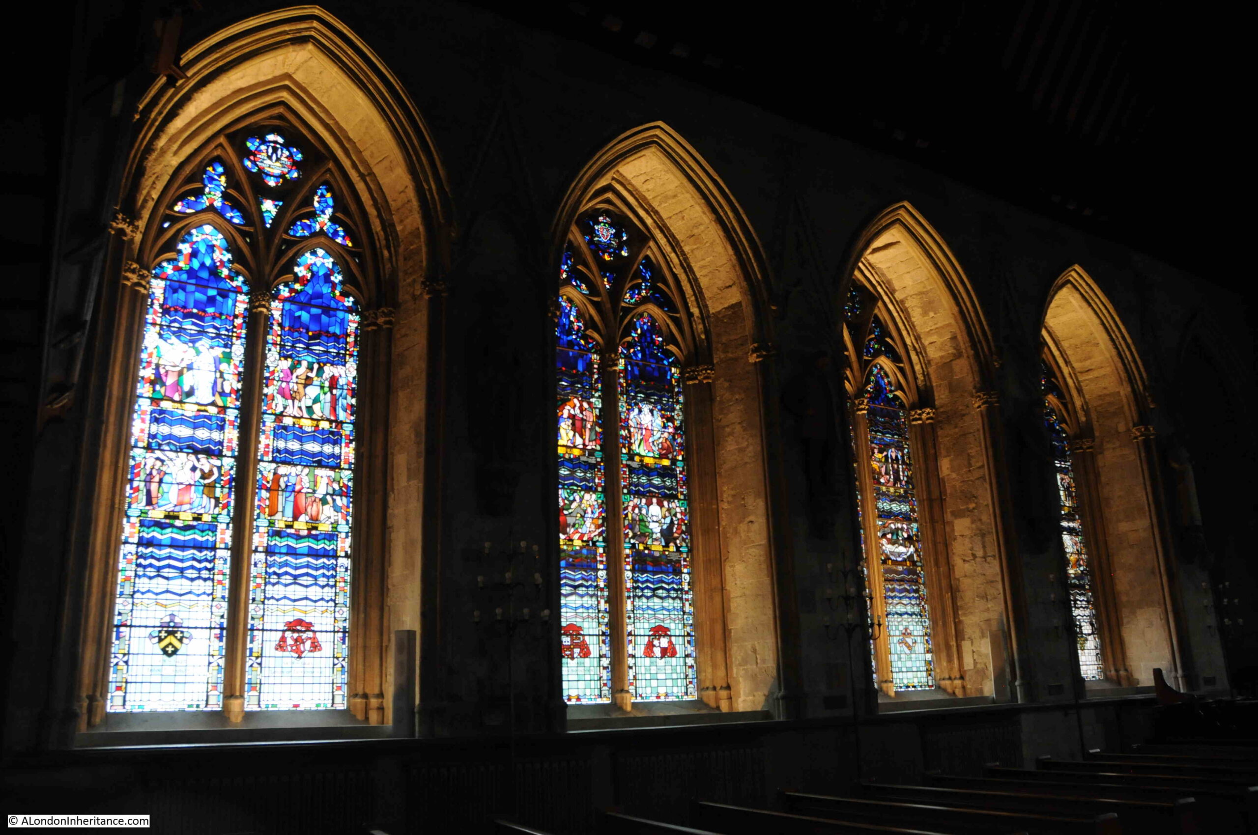
Side windows of stained glass:

St. Etheldreda

St. Etheldreda’s was badly bombed during the last war. There was significant damage to the roof and all the original stained glass was lost. When one bomb fell, there were people sheltering in the crypt, luckily there were no casualties.

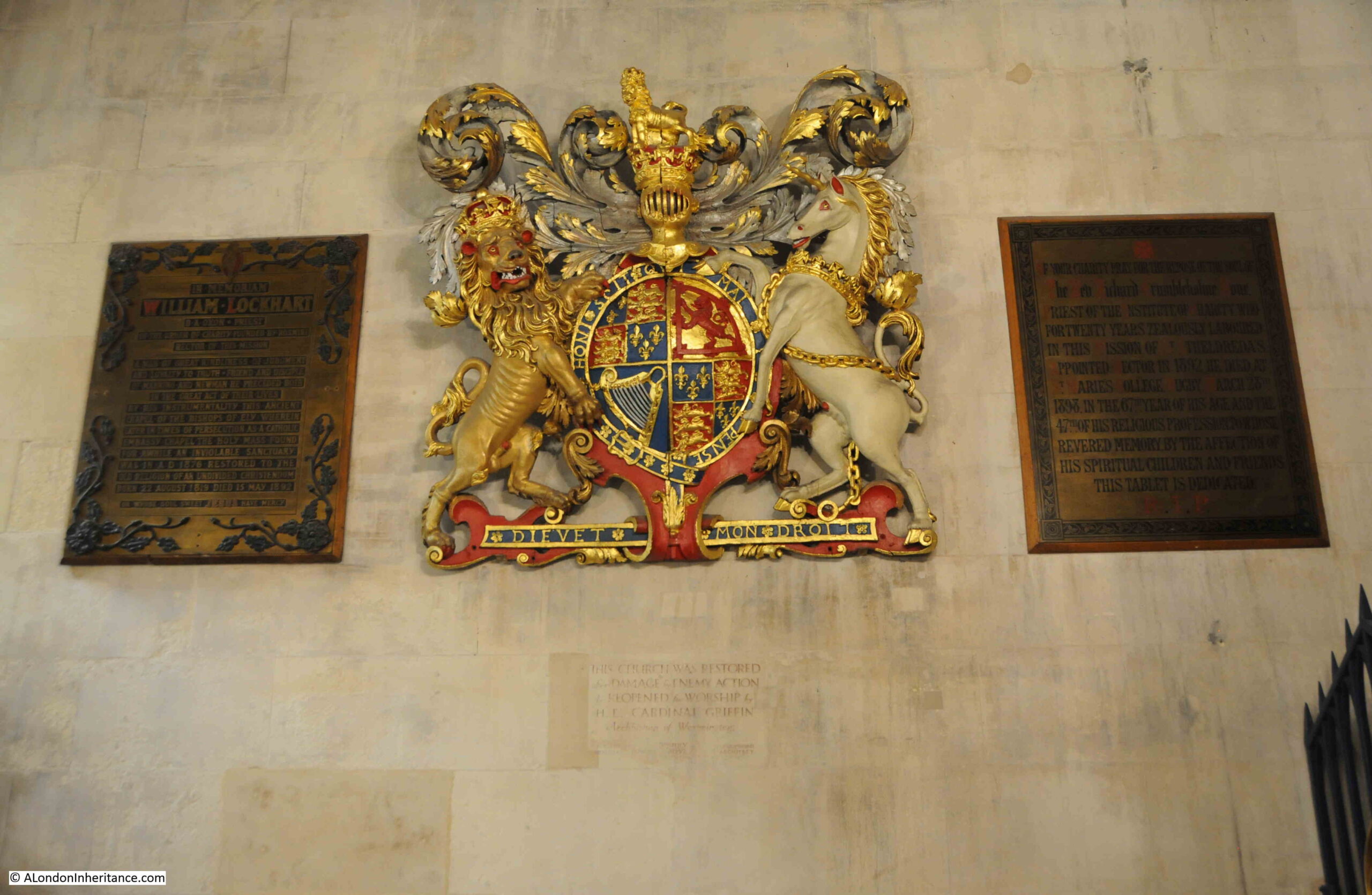
The church was restored over the following years, and officially reopened on the 2nd of July, 1952 as commemorated by a plaque embedded in the wall under the Royal coat of arms:

St. Etheldreda

Walking back outside, and along the corridor there must have once been a café on the other side of this door, with an old Luncheon Vouchers sticker on the door:

St. Etheldreda

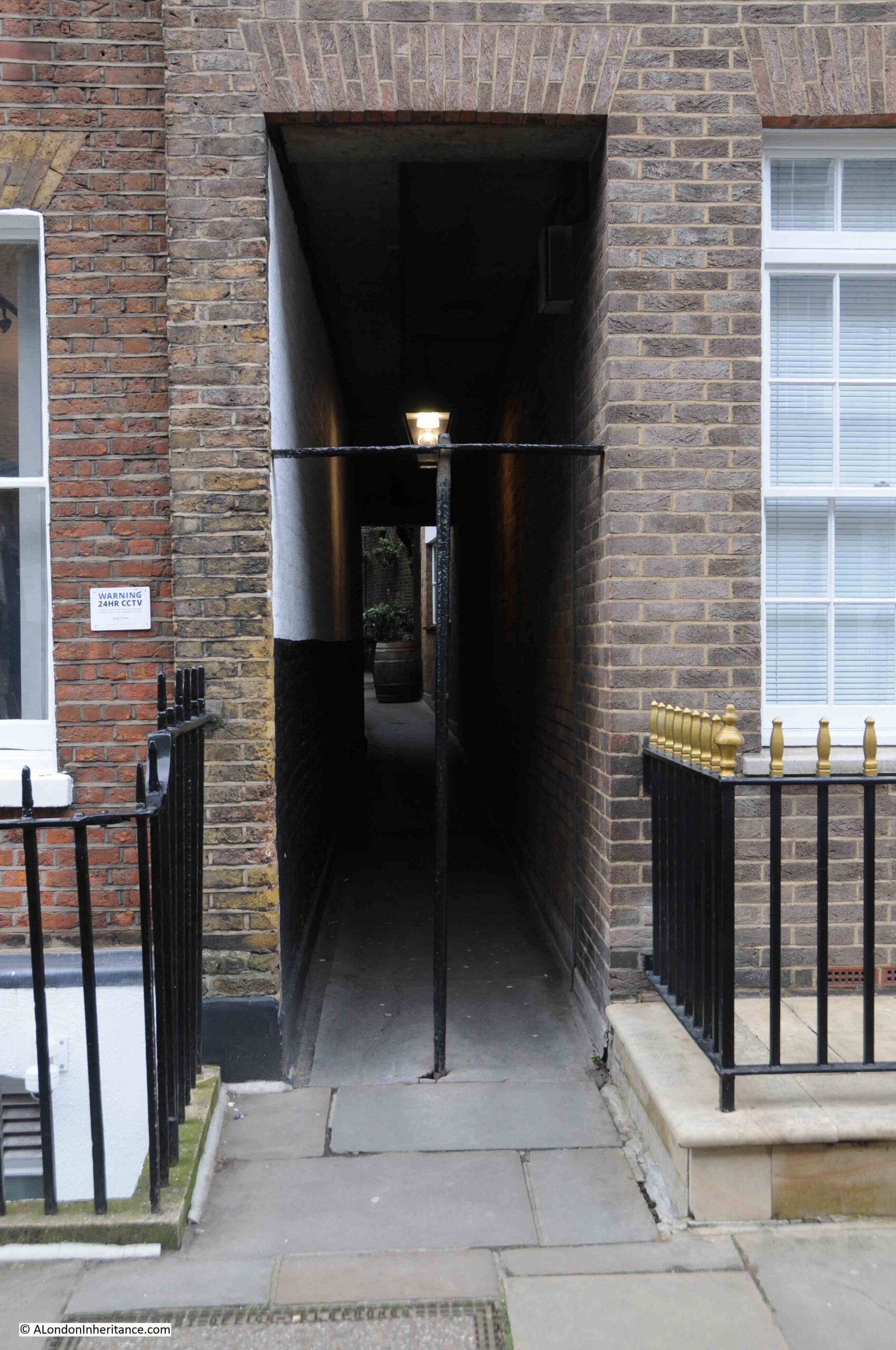
Back in Ely Place, and it is officially a dead end, although there is a doorway through to Bleeding Heart Yard, which the general walker is encouraged not to use:

Ely Place

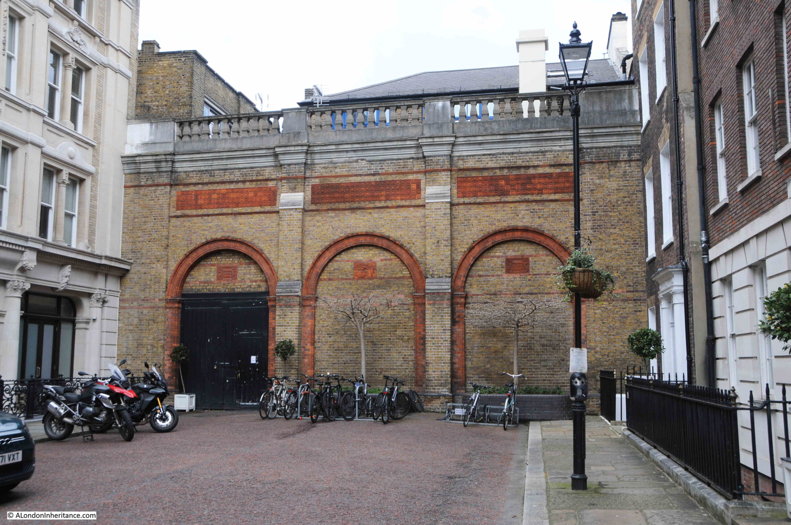
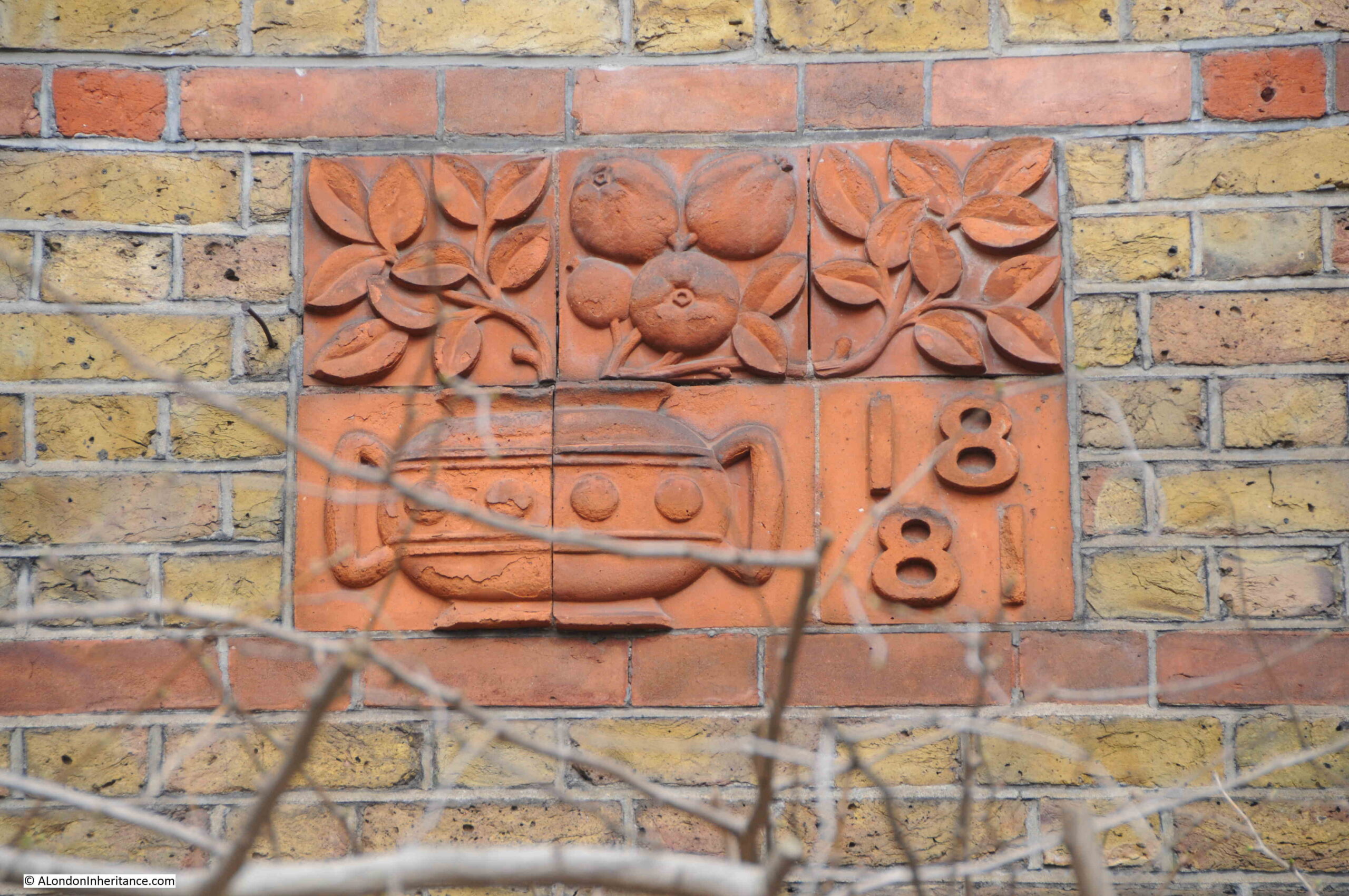
There is some rather wonderful tiling on the blank arches at the end of the street which presumably also records the date when this wall was built:

Ely Place

On the western side of Ely Place is an entrance to Ely Court:

Ely Court

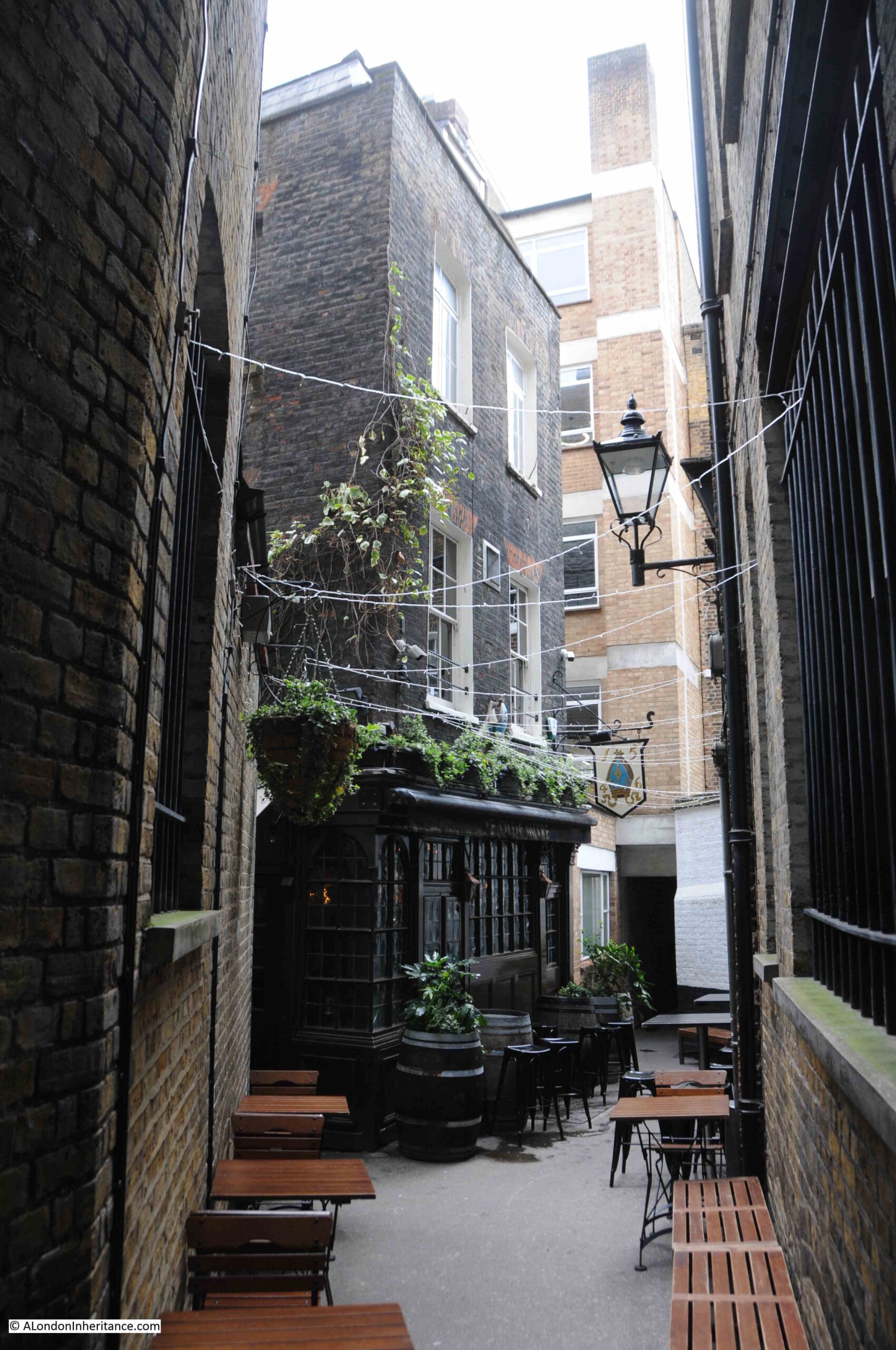
Along the alley is the pub Ye Old Mitre:

Ye Old Mitre

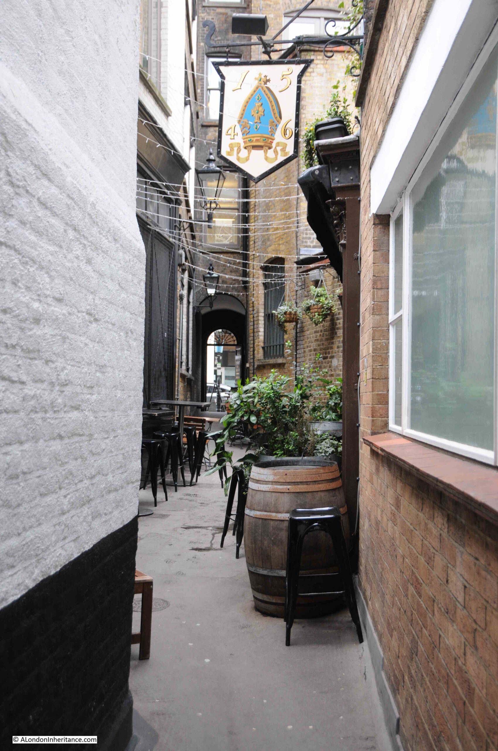
The Mitre (a bishops hat) is believed to have been founded in 1546 for the servants at the Bishop of Ely’s house, although the present buildings are later. The Grade II listing of the building states that it is “Circa 1773 with early C20 internal remodelling and late C20 extension at rear”, and that “near entrance glazed in to reveal trunk of what is believed to be a cherry tree, marking the boundary of the properties held by the Bishop of Ely and Sir Christopher Hatton”. There are also stories that Sir Christopher Hatton and Queen Elizabeth I danced around the tree, however I always find such stories somewhat doubtful.

The Mitre seen from further along the alley shows the late 18th century origins in the architectural style of the building:

Ye Old Mitre

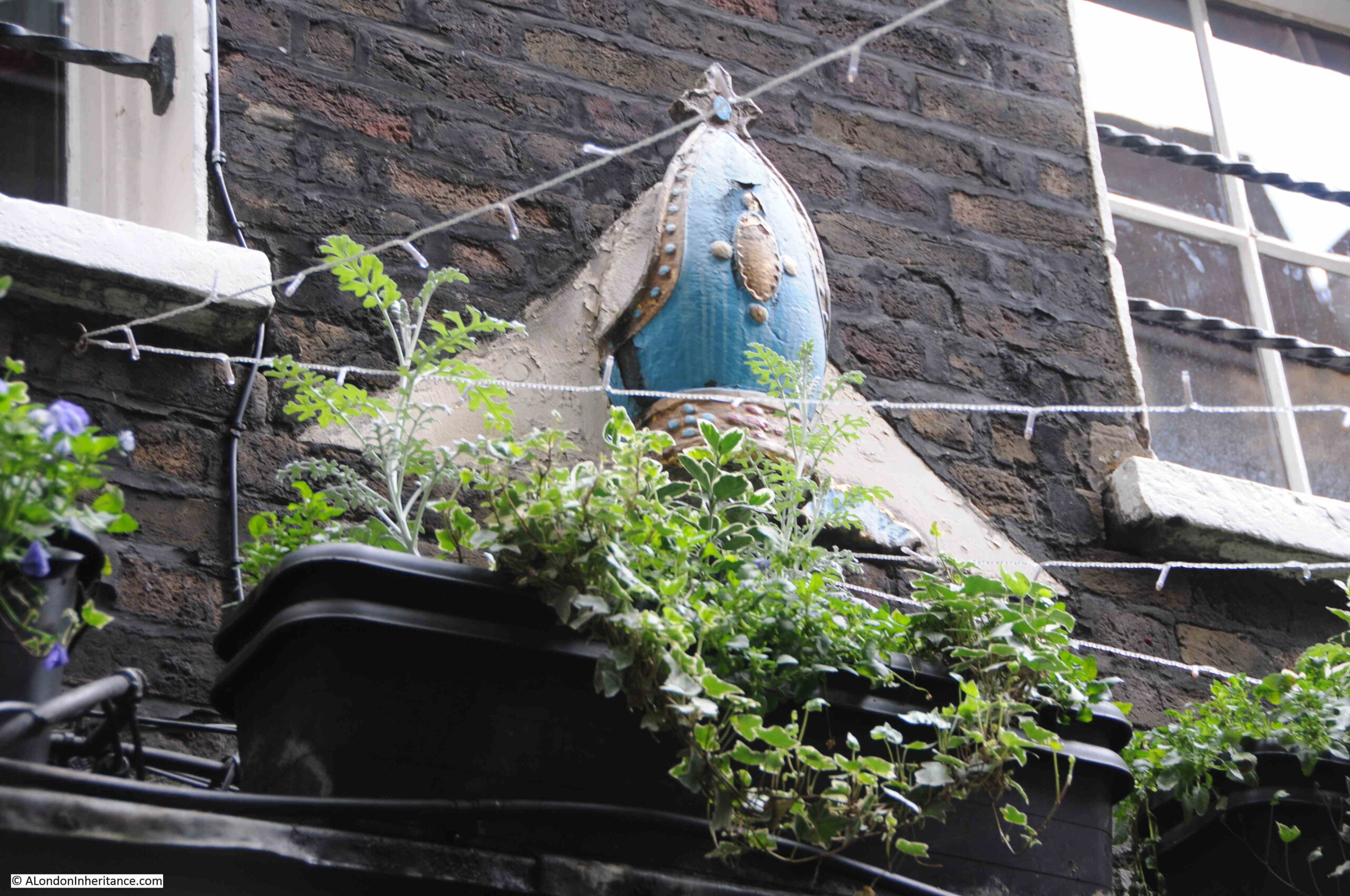
On the front of the building is a mitre, and I have read some sources that state that this is from the original Ely House, however I can find no early source for this, and it is not stated in the Historic England listing details so I am dubious that it is from the original house:

Ye Old Mitre

Again, only a very brief description of a place with so much history, and a church that tells much about the state and country’s attitudes to the Catholic faith over the last five hundred years.

Ely Place was once a part of the church of Ely in London. Many of the rights associated with such a status have been removed over the last couple of hundred years, however it is still a very distinctive place, and the street and St. Etheldreda are well worth a visit.
You may also be interested in my post Ely Cathedral and Oliver Cromwell, when I visited Ely to find the location of some of my father’s photos from 1952.

alondoninheritance.com

The 611 Trolleybus to Highgate

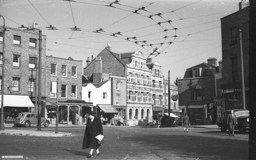
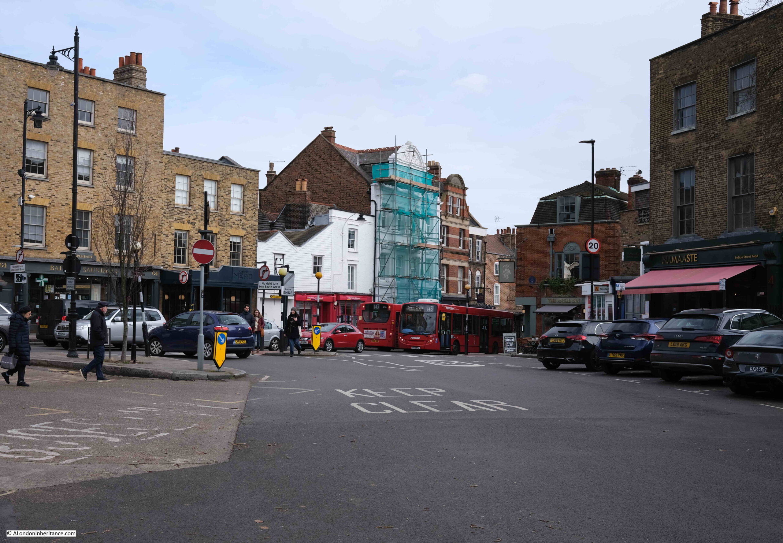
The following photo shows the junction of South Grove and Highgate High Street. The photo is one of my father’s and was taken in 1948:

Trolleybus

The same view, 75 years later, in 2023:

Trolleybus

It is remarkable that in 75 years, the buildings have hardly changed. There is now far more traffic, but perhaps the most significant change is the network of cables that were strung across the street in the 1948 photo.

The cables were to provide power for the trolleybuses that once ran up Highgate Hill.

London had both trolleybuses and trams. The key difference is that trams ran on rails, whilst trolleybuses ran on normal pneumatic rubber tyres and did not need tracks running along the road. They were therefore more flexible in movement, within the constraints of the overhead cables which provided the electrical power supply.

The photo was taken where South Grove meets Highgate High Street, and where the layout of the streets and space available provides a turning point for the trolleybuses at the Highgate end of the route.

One of the reasons for using a trolleybus rather than a tram was the steep street that is Highgate Hill. The increase in height from Archway up to the point of the photo is 226 feet in a distance of 0.7 of a mile.

The rubber tyres of a trolleybus provide a much better grip than the metal wheels and tracks of a tram, which may well have had problems trying to maintain grip whilst ascending or descending Highgate Hill.

It was the 611 trolleybus that served Highgate. The route of the 611 was between Highgate and Moorgate, with stops as follows::

  • Moorgate: Finsbury Square
  • Highbury Station
  • Holloway: Nags Head pub
  • Archway Station
  • Highgate Hill: Salisbury Road
  • Highgate Village: South Grove

During Monday to Friday, the 611 ran at a frequency of one every 5 minutes, with one every 4 minutes at peak times. On Sunday’s the longest time between 611 arrivals was 6 minutes, so it was a well served route, and ran from just after 7 in the morning until just after 11 at night.

It is a shame that my father did not take a photo of the 611 arriving and turning at the location of the photo. I do not know why he took the photo. It may have just been the architecture of the buildings and general street scenes, rather than a trolleybus, which would have been a normal sight across London in 1948.

Again, a theme throughout this blog is that it is the normal, everyday things that we take for granted, and are the things that will disappear and are worth a photo.

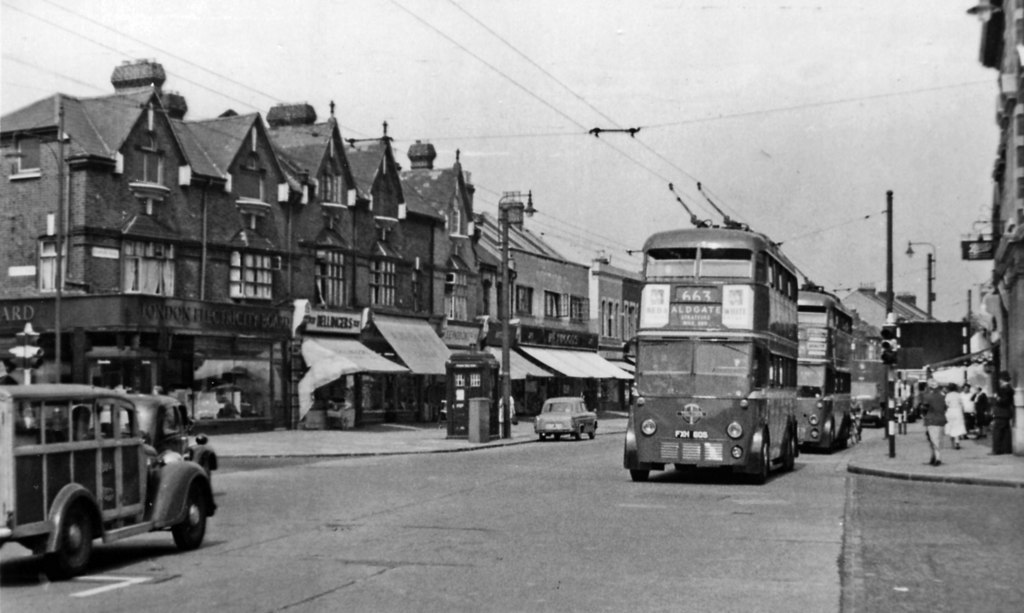
What did a trolleybus look like? I have not yet found a photo of one whilst scanning my father’s photos, but have found one on the Geograph site. The following photo was taken on the Romford Road at Manor Park, Ilford, and shows “two westbound trolley-buses, the front one being on Route 663”:

Trolleybus
Attribution: Ben Brooksbank / Romford Road at Manor Park, Ilford / CC BY-SA 2.0

As can be seen from the above photo, a London trolleybus looked very much like a normal bus, but with the addition of the booms on the roof which took electrical power from the overhead wires. It was basically an electrically powered bus, and would be considered very environmentally friendly by today’s standards.

The trolleybus did not need the tracks in the street, which was a significant cost advantage for both the original construction and ongoing maintenance.

The trolleybus could move within the constraints of the booms, which rotated on the roof allowing the trolleybus to move around obstructions. Whilst this was a significant benefit in avoiding death and injury to pedestrians, it could also result in problems whilst manoeuvering, as this article from the Holloway Press on the 22nd of February 1952 demonstrates:

“Trolleybus Jammed: The crews of two L.T.E. breakdown vehicles worked for two hours on Saturday evening to free a No. 611 trolleybus which became jammed against scaffolding in Holloway Road, near Ronalds Road.

The crowded trolleybus driven by Mr. Thomas Kenefick of Lambton Road, Upper Holloway, collided with the scaffolding outside Messrs. G. Hopkins and Sons, engineers, after swerving to avoid a boy stepping off the pavement. The force of the impact burst the near-side tyre and smashed paneling on the top deck. Nobody was injured.”

The first London trolleybus service commenced in 1931, and a programme of replacement of trams by trolleybuses began, as they were far more economical and as illustrated by the newspaper article above, were a safer alternative when running along busy streets.

Trolleybuses lasted longer than trams on London’s streets, but from 1954, London Transport started to replace trolleybuses with diesel buses, and the last trolleybus ran on the streets of London on the 8th of May, 1962.

The Illustrated London News reported on the last day of the trolleybus: “The last 100 of the 1700 trolleybuses that once ran in London made their final runs on May 8th, before being honourably discharged. The changeover in South-West London began in 1959. London’s last trolleybus arrived at Fulwell, greeted by a large crowd at midnight.”

The last trolleybus service on the 611 route between Moorgate and Highgate ran on the 19th of July, 1960, after which diesel buses would take passengers up and down Highgate Hill.

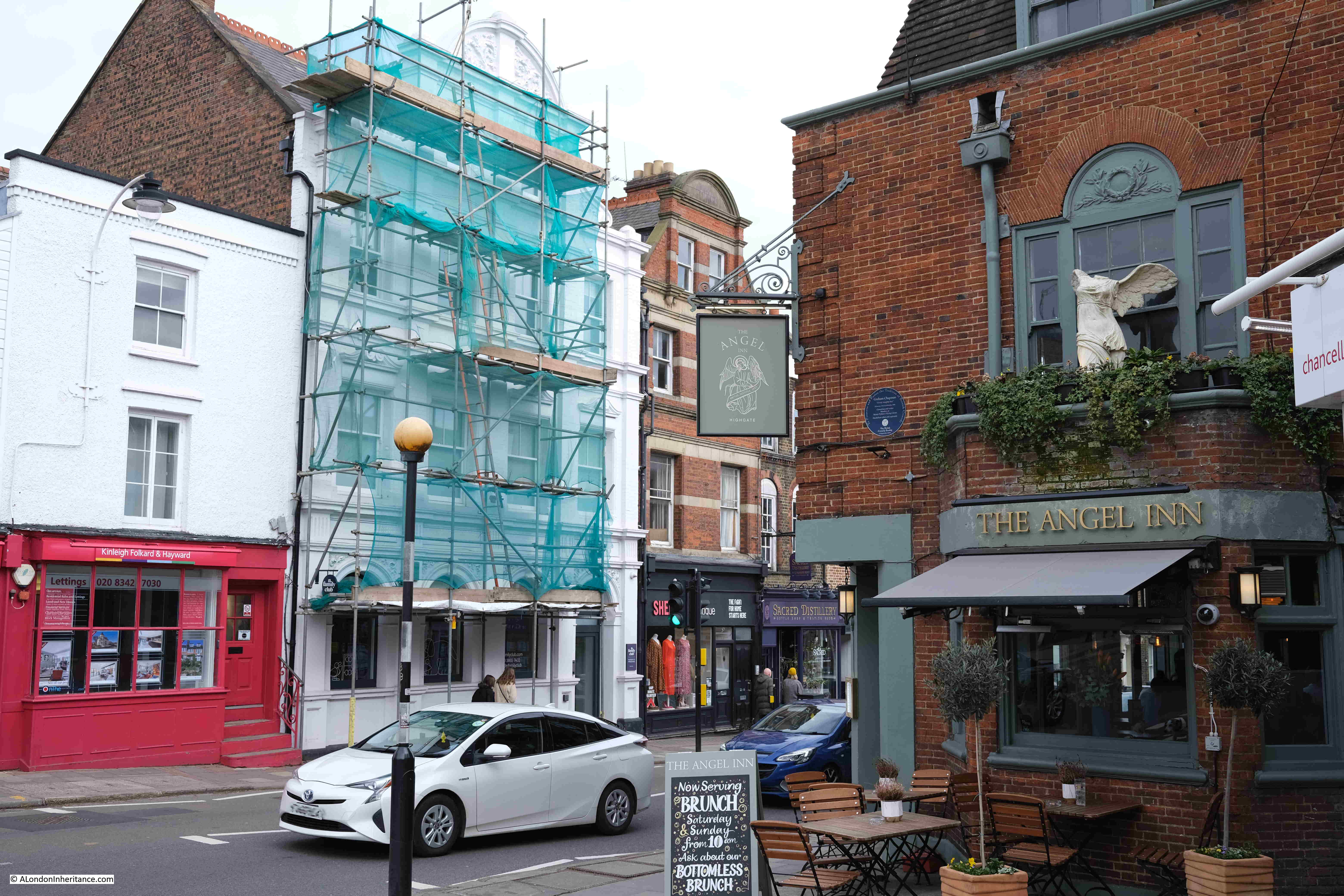
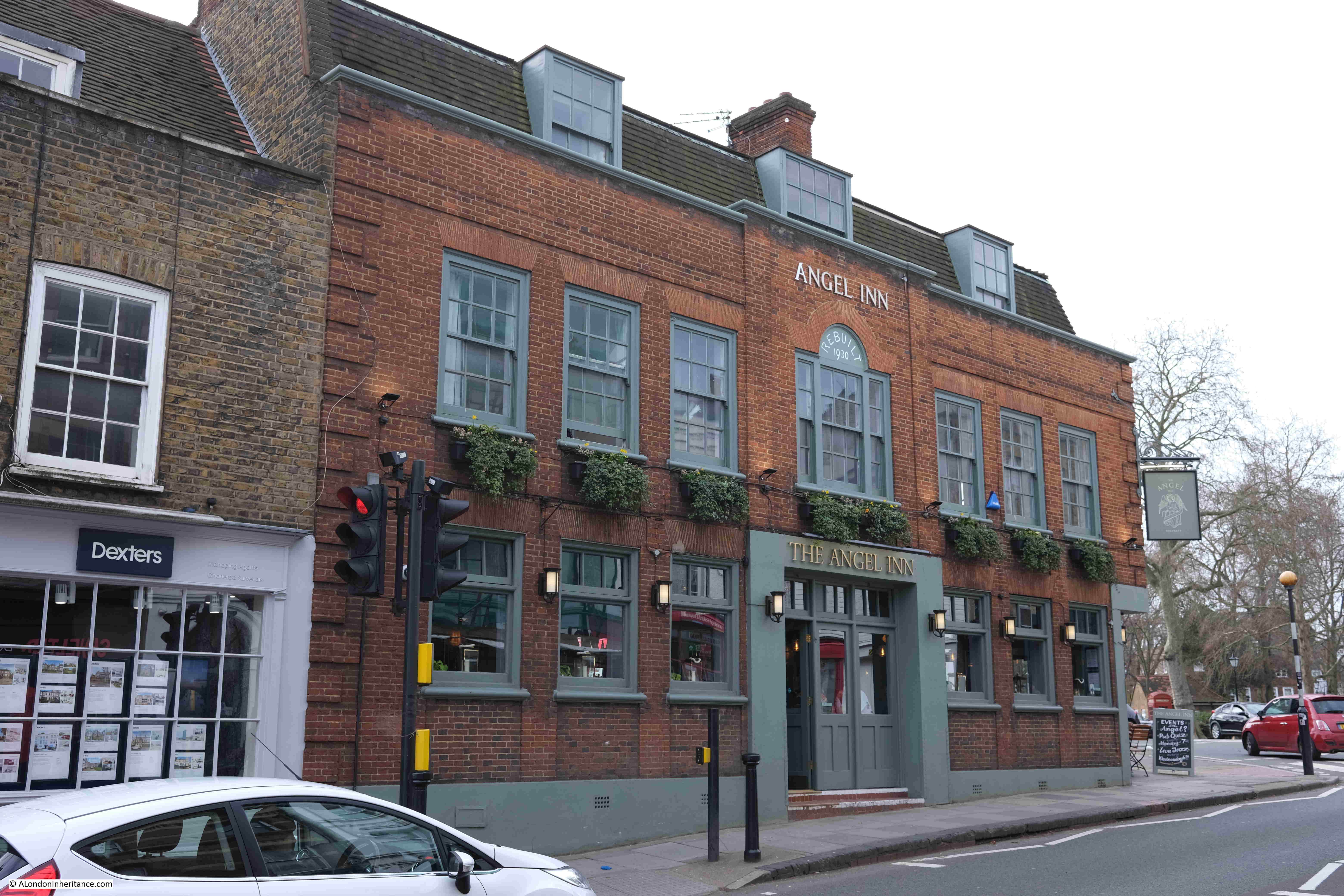
In my father’s photo, there is a pub on the corner, as the street disappears down towards Highgate Hill. The pub is the Angel Inn:

Angel Inn Highgate

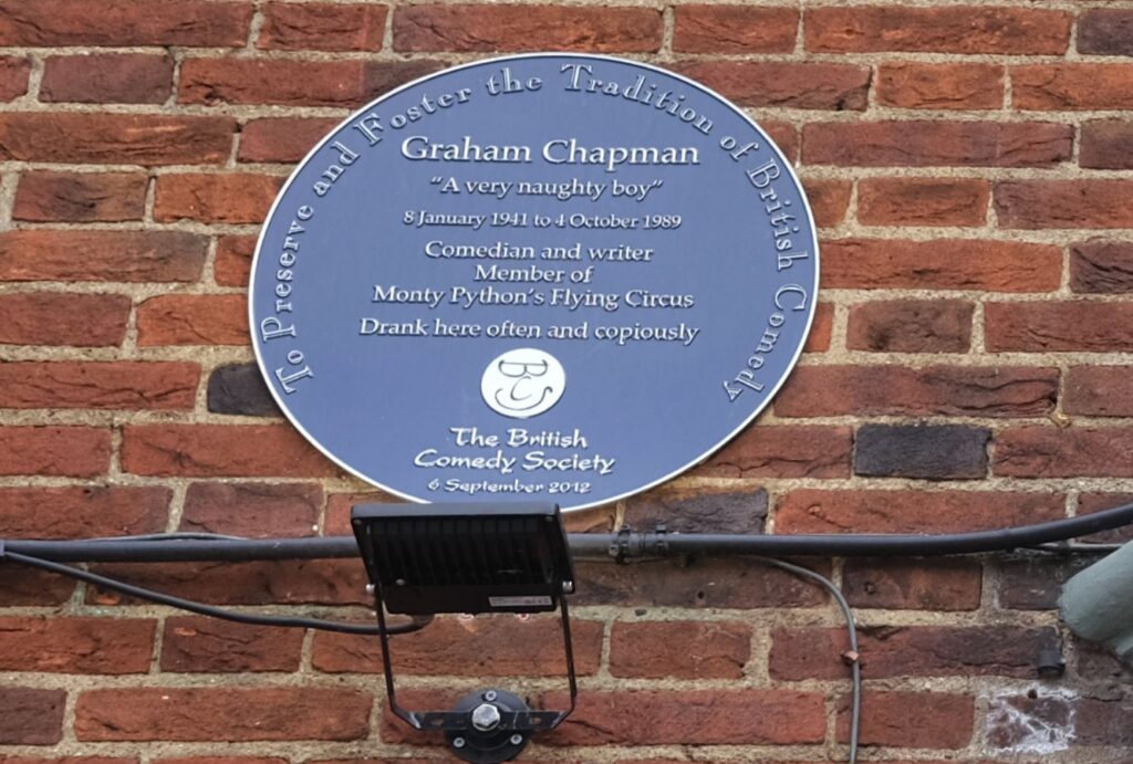
The pub has an interesting plaque which states that Graham Chapman of Monty Python’s Flying Circus “Drank here often and copiously”:

Angel Inn Highgate

The Angel Inn is a very old establishment, although the current building is relatively modern. The photo below shows the frontage of the Angel Inn on Highgate High Street:

Angel Inn Highgate

There has been a building on the site from at least the fifteenth century, when it was known as the Cornerhouse. From 1610, and probably earlier, it was a coaching inn, and continued in this use for the next few centuries. There is a cobbled yard round the back of the Angel where horses would have been stabled.

The earliest written reference I could find mentioning the Angel was from the Oxford Journal on the 28th of June, 1755, when “On Sunday last, about five o’Clock in the Afternoon, the Roof of the Angel Inn in Highgate was split by the Thunder and Lightning, which was very violent about that Neighbourhood.”

The Angel was completely rebuilt between 1928 and 1930 which explains why this old establishment has such a modern appearance.

The previous version of the Angel was from around 1880, when a new façade had been added to a late Georgian building.

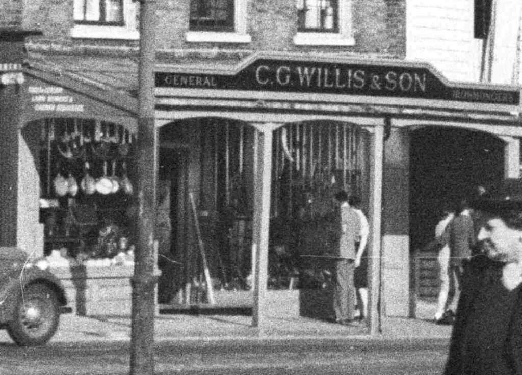
Back to my father’s 1948 photo, and I love enlarging, and looking at the detail of some of these photos. Looking across the street, we find C.G. Willis & Son, General Ironmongers who appear to have an array of pans hanging outside the shop. The shop is now a Cafe Nero:

Highgate shop

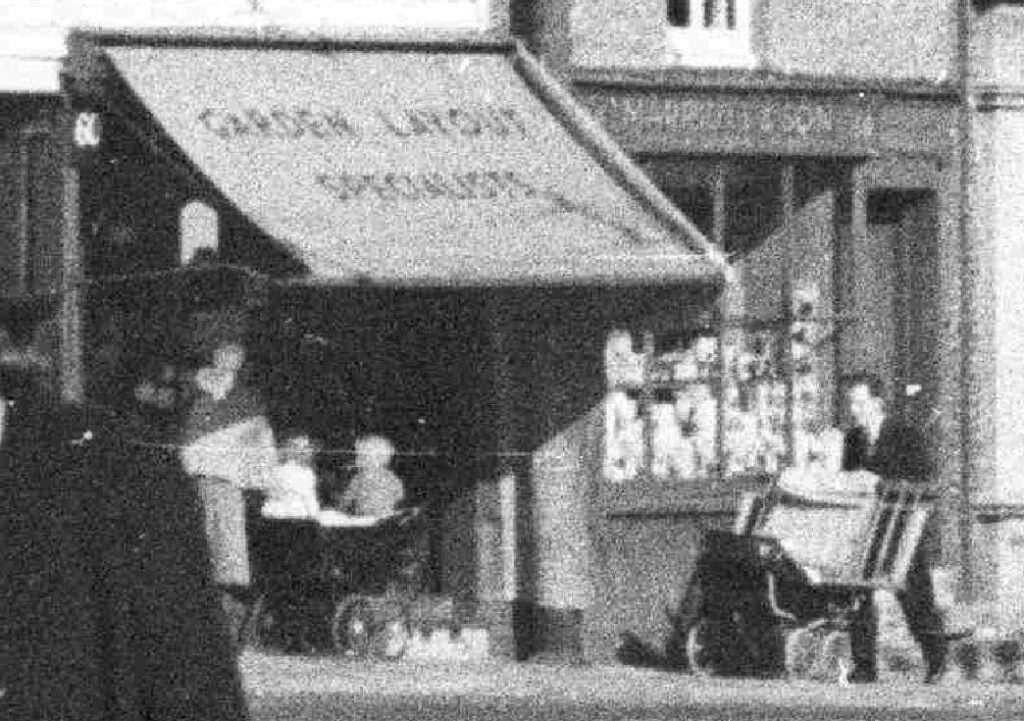
To the right of the above shop, was Garden Layout Specialists, with a couple of small children in a pram parked outside:

Highgate shop

Garden Layout Specialists was an interesting name, and presumably refers to some type of shop selling gardening supplies. The shop is now an estate agents.

As with the above two shops, the 611 trolleybus has disappeared from the streets of Highgate.

Bus route 271 was introduced to replace the 611 trolleybus. The 271 covered much of the same route, starting from Moorgate, and later being extended to Liverpool Street.

The 271 ran until a couple of months ago, when it was replaced by the 21 and 263 routes. These two existing routes were part diverted from their original route to cover for the closed 271. All part of TfL’s gradual reduction in the number of bus routes across the city.

So there are still buses running up and down Highgate Hill, however for some exercise, and a view of some interesting buildings, it is well worth a walk up Highgate Hill.

For more of my father’s photos of Highgate, see this post on Highgate’s pubs, history and architecture.

alondoninheritance.com

1953 – A London Year Book

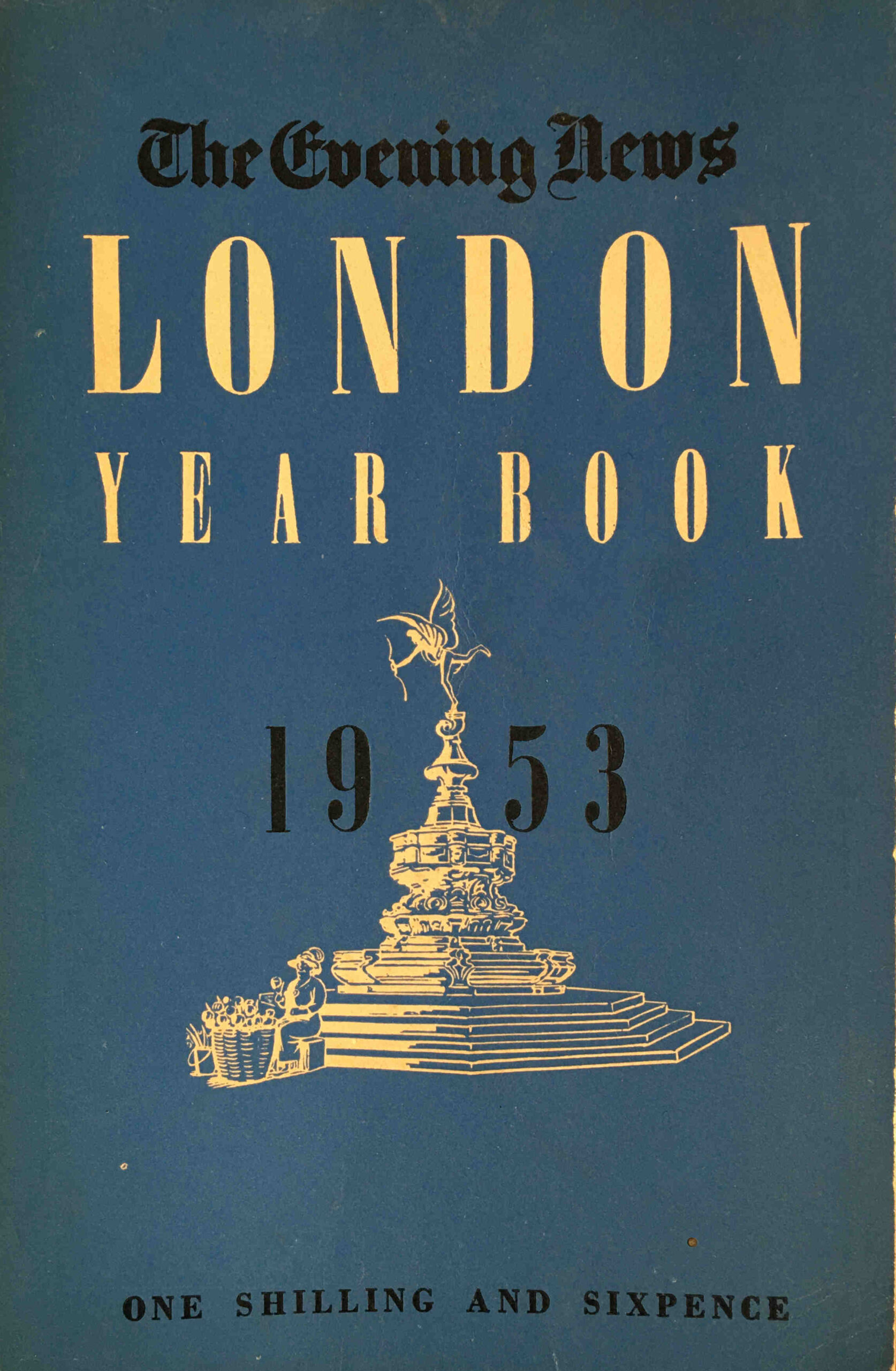
Seventy years ago, the Evening News published the London Year Book 1953.

London Year Book

Despite its small size (7 by 4.5 inches), it was packed with information about London. Statistics, stories and facts, then and now photos, lists of events and dates, 192 packed pages on the city. The book claimed to have “10,000 facts and the answers to the many questions on Britain’s capital which are constantly being asked”.
As with 2023, 1953 was also a Coronation year, and in an article looking at the accommodation of Coronation visitors, the following new challenge is identified in estimating the numbers who would visit the city “Circumstances have changed considerably since the last Coronation in 1937. There is an unknown factor in the development of television services, which will take the brilliant panoply of the Coronation procession right into the home.”

Organisers were expecting records to be broken, with more than 150,000 overseas visitors arriving in London for the Coronation. In the same period in 1952, the city had 47,624 visitors from overseas, so 1953 would see at least a trebling in numbers.

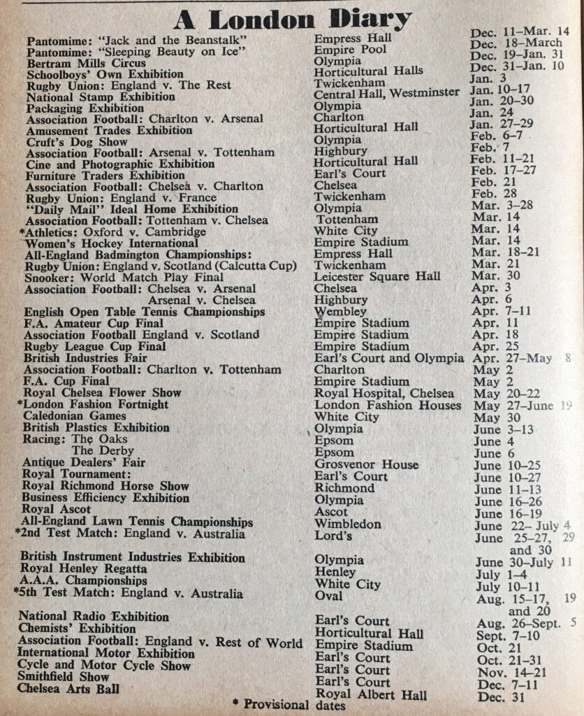
As well as the Coronation, there were many other events in London during 1953, and the book included the following London Diary listing with a rather diverse set of events:

London Year Book

The Empire Stadium and Empire Pool were at Wembley, and the Empress Hall was at Earls Court. The football matches listed are only for teams who were in Division 1 (now the Premier League), so in 1953 London only had four teams, Charlton, Arsenal, Chelsea and Tottenham. Today, all these teams are still in the equivalent of Division1 with the exception of Charlton who are now in Division 1 (which in 1953 would have been Division 3).

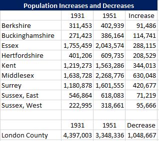
The Year Book included a large and diverse range of statistics that show London in 1953, and how the city had changed. One of these was a table of population increases and decreases covering London and the surrounding counties, between 1931 and 1951:

London Year Book

London was a smaller entity in 1953 than it is today, boundary changes in the following years would increase the size of the city and take land from some of the surrounding counties, however the table does show some significant changes.

Between 1931 and 1951 the population of London declined by 1 million people. Much of this was due to wartime damage across London. Large areas of residential streets had been bombed and rebuilding was still to come.
Comparison of London with the surrounding counties shows that whilst the population of London decreased significantly, there were large increases in the surrounding counties. Some of these populations would later be taken back within London (for example parts of Essex and Middlesex), however the table really illustrates the impact the war had on the population of the south east of the country.

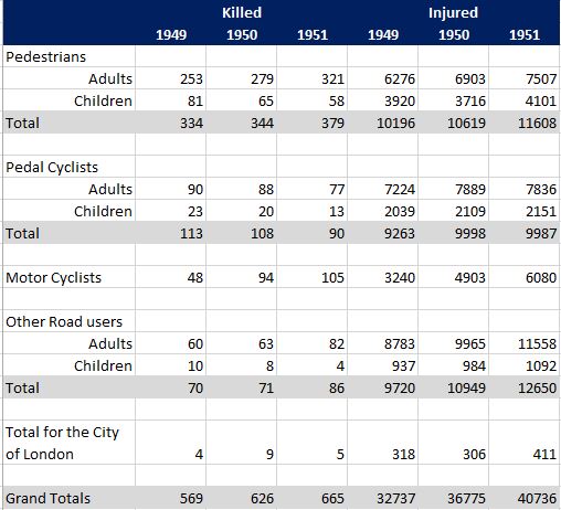
Another set of statistics shows the number of people killed or injured on the city’s roads:

London Year Book

The figures in the above table show just how dangerous the city’s streets were seventy years ago. In 1951 a total of 665 people were killed and 40,736 injured. Compare with the latest set of figures from Transport for London, and their “Casualties in Greater London during 2021” data release reports that in 2021, 75 people were killed, 3,505 seriously injured and 23,092 slightly injured – a significant reduction over the past 70 years.

This again is across a wider area than 1951, with a higher population and more traffic on the roads. The TfL data release does consider that COVID may have led to a reduction in traffic, however the figures for 2021 were part of an ongoing reduction in deaths and casualties across the city streets.

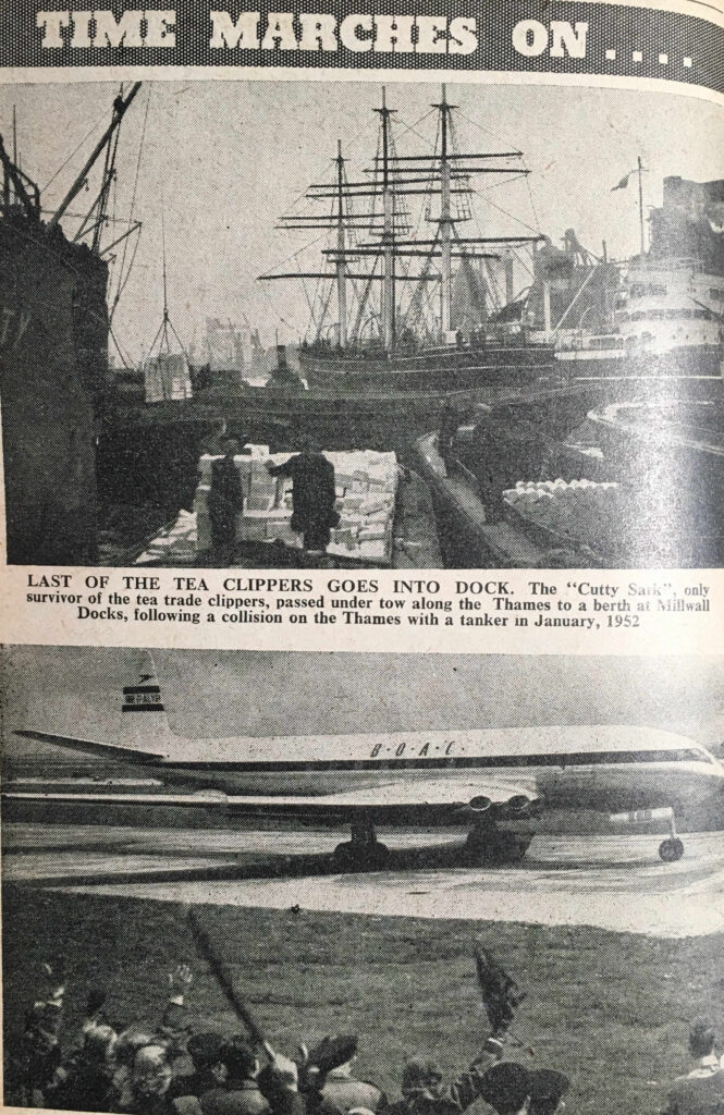
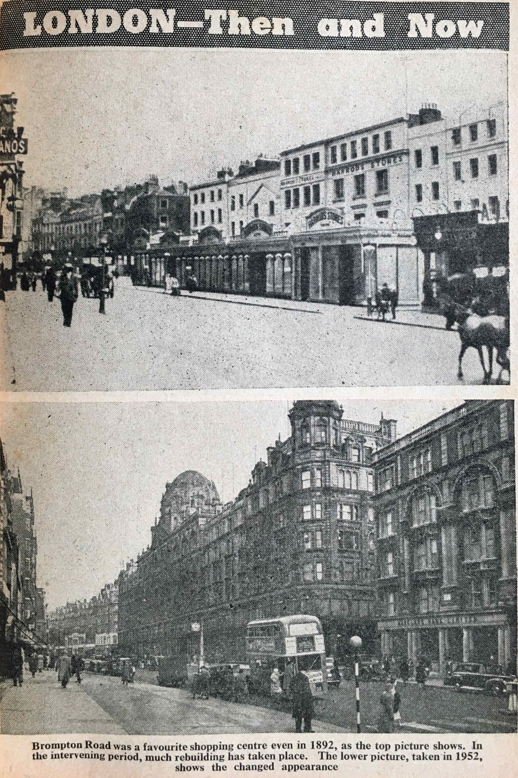
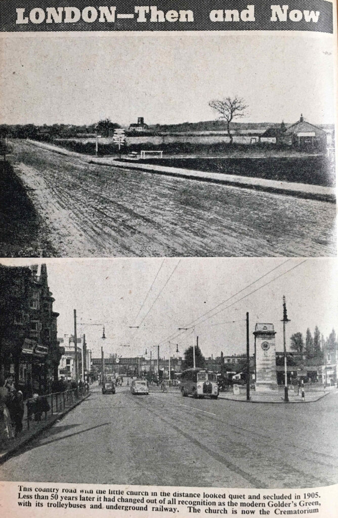
The Year Book includes a series of “Then and Now” photos, which illustrated how the city had changed. Along with photos under the heading of “Time Marches On….” which illustrated the many aspects of the city that were changing and developing.

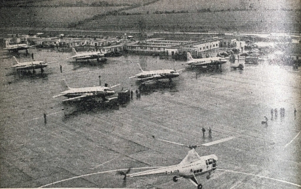
The first compares two methods of global transport, with a photo of the Cutty Sark under tow to a berth in Millwall Docks, following a collision on the Thames with a tanker, in 1952. This is compared with the latest form of global travel with the De Haviland Comet, the world’s first jetliner service taking of from London Airport on a flight to Johannesburg.

De Havilland Comet

The excitement of the crowds in the bottom of the photo as they wave off the de Havilland Comet would be short lived. The first production release of the Comet suffered a number of fatal crashes. Design problems and structural issues would be identified and would result in redesigned versions of the aircraft, however by the time they were in production, other aircraft companies such as Boeing had jumped ahead.

The aircraft in the above photo with the registration G-ALYP was one of those that crashed. This happened on a flight back to London from Singapore. Soon after taking off from Rome, the aircraft exploded and debris fell into the Mediterranean, killing all 35 people on board.

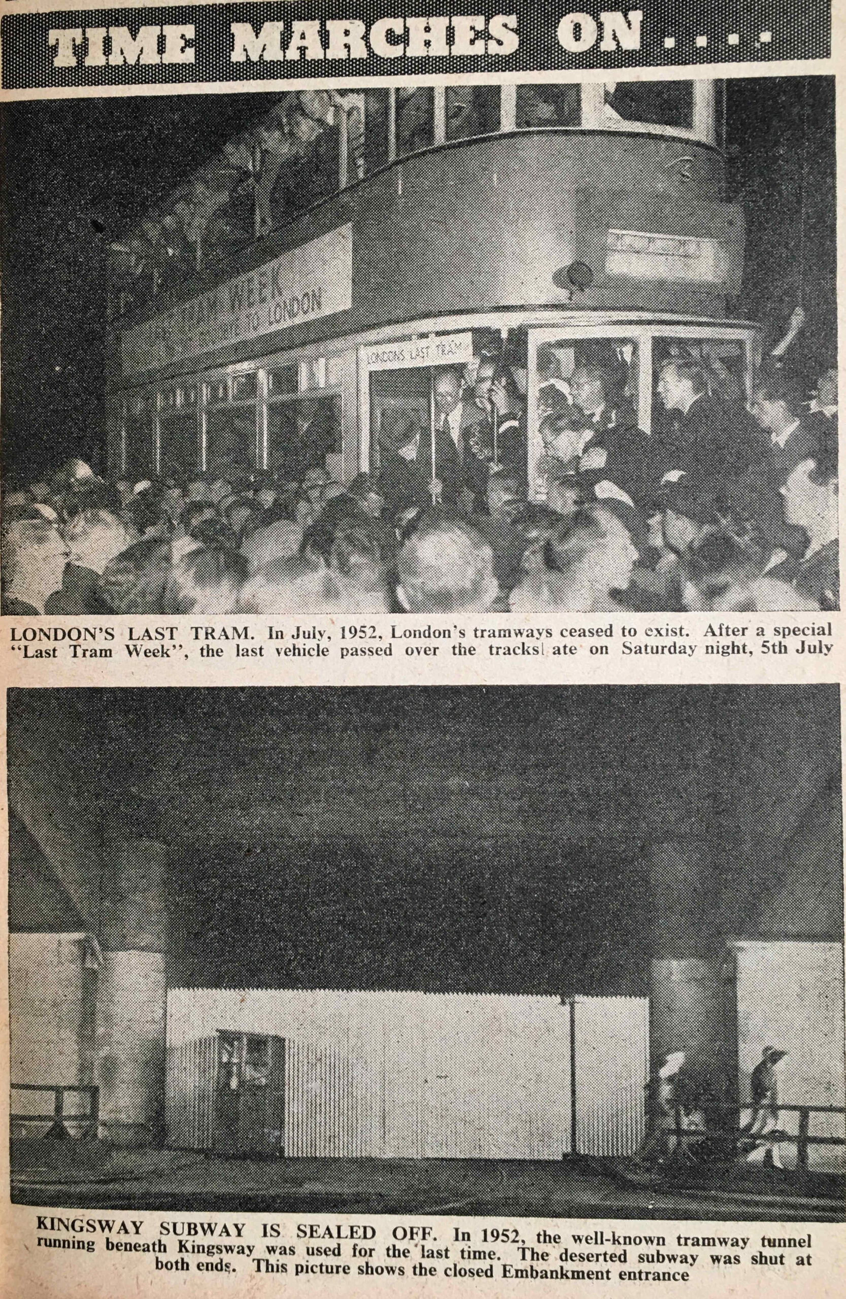
Another changing form of transport was the London tram, with the last tram on the 5th of July 1952 being featured. My father also took some photos during “Last Tram Week” which are in this post.

Londo's Last Tram

The above photo shows the sealed off entrance from the Embankment to the Kingsway tram subway, which was made redundant following the closure of the tram network.

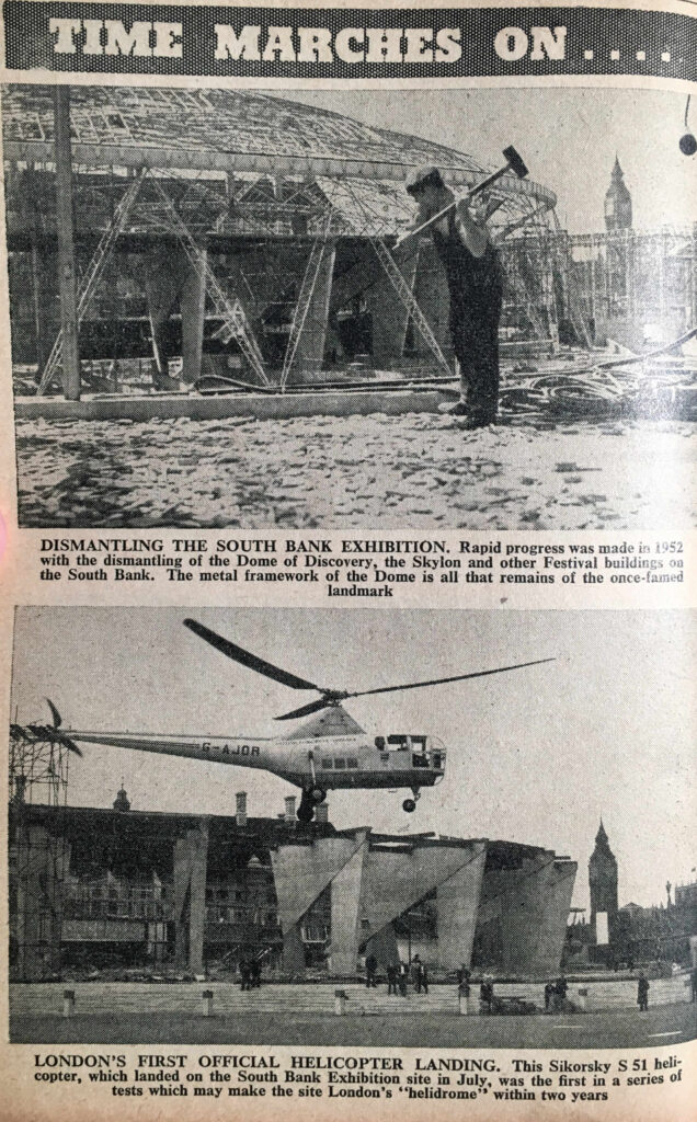
The majority of the buildings of the Festival of Britain on the Southbank had been demolished by 1953 and the Year Book includes a photo of the site, with the remains of the Dome of Discovery in the background (see this post for photos of the Festival of Britain site before demolition):

Dome of Discovery

The above photo shows parts of the concrete supports to the Dome of Discovery with County Hall in the background. The focus of the photo is on the helicopter landing on the Southbank site, which was the first of a series of tests to enable the site to become a “helidrome”.

The site did become the Waterloo Air Terminal, offering check-in services and coach travel to Heathrow Airport. There was a limited helicopter service for a period offering faster travel to Heathrow (see this post for more on the Waterloo Air Terminal).

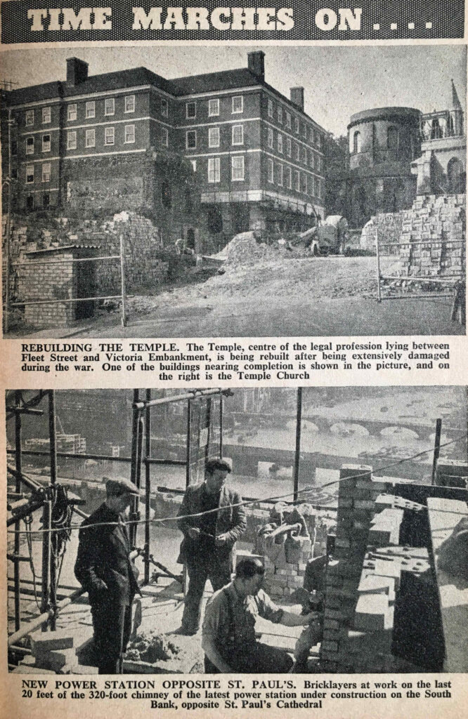
Some photos under the “Time Marches On” theme also showed the repair of wartime damage, as with the Temple Church:

Temple and Bankside Power Station

And the above photo shows bricklayers at work on the last 20 feet of the 320 foot chimney of the new Bankside Power Station – from the days when most protective headgear in construction work seemed to consist of a flat cap.

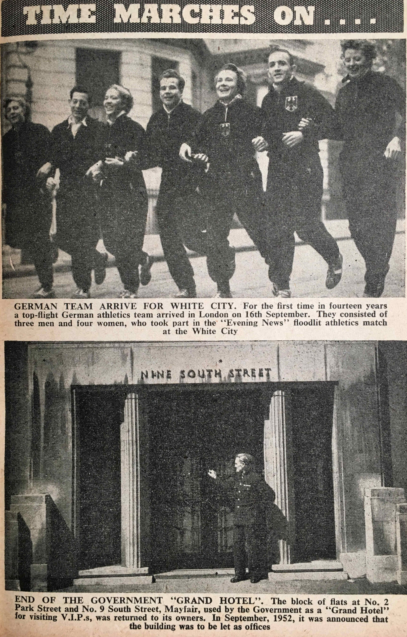
Time Marches On also applied to reconciliation with Germany, as in the following photo of the first time that a “top-flight German athletics team” arrived in London since before the war:

White City

And the above photo highlights the return of one of the many London buildings used by the Government during and after the war.

London Transport

Several pages in the London Year Book were devoted to London Transport, with the following introduction to how London’s public transport system had been organised up to 1953:

“London’s transport system was first united under the name London Passenger Transport Board in July 1933, when 170 different undertakings were taken over, including the Metropolitan Railway, the London County Council Tramways, the Central London Railway, and the London General Omnibus Company.

The first regular London bus services was inaugurated in 1829, when George Shillibeer began a service with a single horse-bus running through the streets of London. In 1856 an Anglo-French company, known as the London general Omnibus Company, began operations, an organisation which grew to become the largest of its kind in the world.
L.P.T.B. ran London’s transport until 1st January 1948, when under nationalisation it became the London Transport Executive.

Today, the London transport area is 1,986 square miles, roughly one twenty-fifth of the whole of England. it covers two counties and parts of seven other counties, as well as serving parts of a tenth county. The estimated population of this area is 9,800,000.”

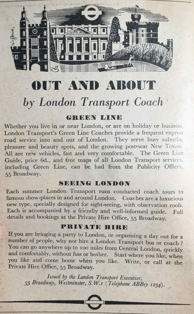
Part of this extensive network, and one that served the counties around London was the coach service, with Green Line providing timetabled services to places around London, as well as sight-seeing and private hire coaches:

London Year Book

The London Year Book includes the passenger journeys made in 1950:

London Year Book

The Year Book appears to have used the term Railways for the Underground network. For comparison, from the last reporting period, from the London Datastore, comparison figures are:

  • Buses: 1,490,700,000
  • Underground: 748,300,000

The use of buses shows a considerable drop over 70 years, however the figures come with the caveat that the scope of central buses in 1950 and the bus network today may be very different.

Underground journeys do show an increase of over 100 million, which sounds about right given the enlargement of the underground network over the last 70 years.

The London Year Book includes a number of statistics that show the scale and complexity of the Underground network, including:

  • 106 lifts are maintained at 37 stations
  • The longest railway station escalator in the world is at Leicester Square Station with a vertical rise of 80.75 feet
  • The shortest escalator is at Chancery Lane Station with a vertical rise of 15 feet
  • 106 lifts are maintained at 37 stations
  • The deepest lift shaft ay 181 feet is at Hampstead Station
  • The shortest lift shaft at 30 feet 6 inches is at Chalk Farm Station
  • There are 1,150 automatic ticket machines in use which issue 85 per cent of all tickets and use more than 15,000 miles of paper a year

The Year Book identifies a number of “London Transport Records”:

  • Highest point on the road is a country bus and coach route at Botley Hill, Warlingham, Surrey
  • Deepest point is in the railway tube 67 yards south of Waterloo Station , where the tunnel is 67 feet below ground
  • longest continuous tunnel in the world runs from just south of East Finchley Station to Morden Station via Bank on the Northern Line. 17 miles 528 yards in length, it has been in use since 1939
  • Longest railway journey direct is from Liverpool Street to Aylesbury at 41.8 miles
  • Longest railway journey changing once is from Epping to Aylesbury at 58.8 miles
  • Longest Green Line Coach route is the 716 Hitchen to Chertsey at 66 miles
  • Shortest bus route for Central buses is the 249 which runs from Upminster Station to Corbets Tay at 1.3 miles

What I did find strange was the statement that the deepest point in the tube network is just south of Waterloo Station, where the tunnel is 67 feet below ground, however in the previous statistics it states that the deepest lift shaft at 181 feet is at Hampstead.

I assume the deepest point just south of Waterloo Station is referring to depth below sea level. Hampstead Station is at a height of 351 feet above sea level, with the area around Waterloo Station at around 3 feet above sea level, so the statement about the tunnel south of Waterloo being the deepest is correct, relative to sea level.

There is a list of the longest bus routes on the network:

  • On summer Sundays: 112 from Palmers Green to Hampton Court (22.3 miles)
  • On winter Sundays: 59 from West Hampstead to Chipstead Valley (22 miles)
  • On weekdays: 25 from Victoria to Hornchurch (19.6 miles)
  • On country buses: 414 from West Croydon to Horsham Station (32.6 miles)

The oldest bus route in 1953 was the one running between Shepherds Bush and Liverpool Street Station. It was founded in 1866 and in 1953 was route 11, this number being in use from 1905. Today route 11 runs between Fulham Town Hall and Appold Street where it terminates two stops after Liverpool Street Station.

The change from Shepherds Bush, first to Hammersmith seems to have happened around 1970, then to Fulham around 1994.

The challenge with full comparisons between 1953 and 2023 are the significant changes to the transport network, as well as where and how people liver and travel.

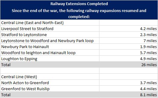
For the underground network, completely new underground lines would be constructed in the decades after 1953. The war had put a hold on expansion of the network, and the Year Book identifies the sections where work had recommenced and been completed:

London Year Book

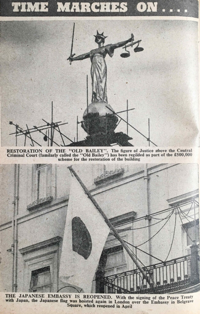
Back to some of the photos in the book, and under the “Time Marches On….” category, there is a photo of the figure of Justice above the Central Criminal Court / Old Bailey, to highlight the major restoration of the building:

Old Bailey

Which is followed by a photo of the Japanese flag in front of the Japanese Embassy, following the signing of the peace treaty with Japan, and the restoration of relations between the two countries.

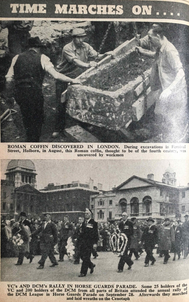
The following photo shows a Roman coffin discovered during excavations in Furnival Street, Holborn. The years following the war were a time of significant reconstruction in the City, and although much was discovered, I have always wondered how much archaeology was lost.

Roman Coffin

The above photo shows a rally of holders of the Victoria Cross and the Distinguished Conduct Medal in Horse Guards Parade.

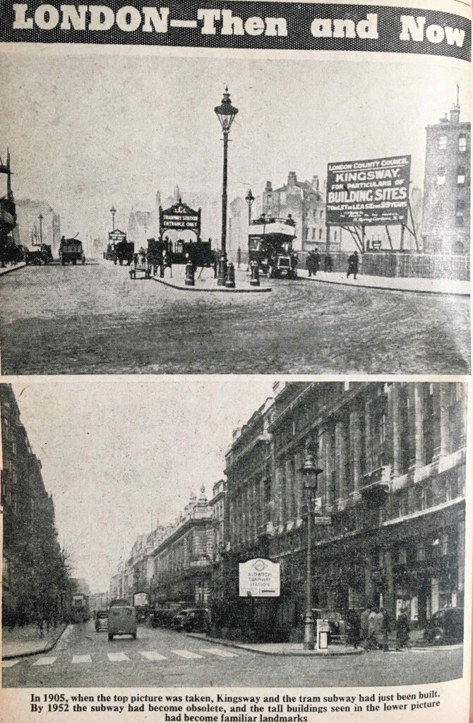
The “Then and Now” theme continues with two photos showing Kingsway. In the top photo, taken in 1905, the Kingsway tram subway had just been completed. By the time of the second photo in 1952, the subway had become redundant and the right side of the street had been developed.

Kingsway

Supplying London with Electricity

The London Year Book includes a few pages on the supply of electricity across London. This was a time when electricity generating stations were operating across London, and the use of coal was one of the major causes of air pollution.
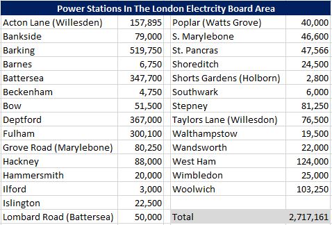
The following table lists the locations of power stations across London, along with their generation capacity in kilowatts:

London Year Book

My grandfather worked in the St. Pancras power station up until 1948.

Note that the Bankside figure is for the original power station on the site, not the power station that was being constructed (see this post on Building Bankside Power Station).

As with the London transport system, the post-war period had seen the consolidation of electricity supply in London, and the Electricity Act of 1947 formed the British Electricity Authority which consisted of fourteen individual electricity boards across the country, with the London Electricity Board serving London.
Bringing together the electricity supply industry was also aimed at standardising electricity supply. The early 1950s was not a time when you could have taken your mobile phone charger (assuming there could have been such a thing), and simply plug it in to any electricity socket in the city.

There were still many non standard electricity supplies, and the Year Book records some figures in the change over of consumers’ supply, with 6,112 consumers having been transferred from Direct Current (DC) supplied to Alternating Current (AC) – the supply type we use today, as well as 1,337 consumers from non-standard to standard AC supplies.

These changes were part of creating the world we take for granted today, where standard electricity supplies resulted in standard appliances, lower costs and easier availbility.

There was still much change to complete however, as the Year Book records there were still 155,998 DC services being provided.

Over the coming decades, all the power stations within London would close down as larger power stations were built along the Thames, out towards the estuary, and London was integrated into the wider country grid. In turn, these stations along the Thames would also close.

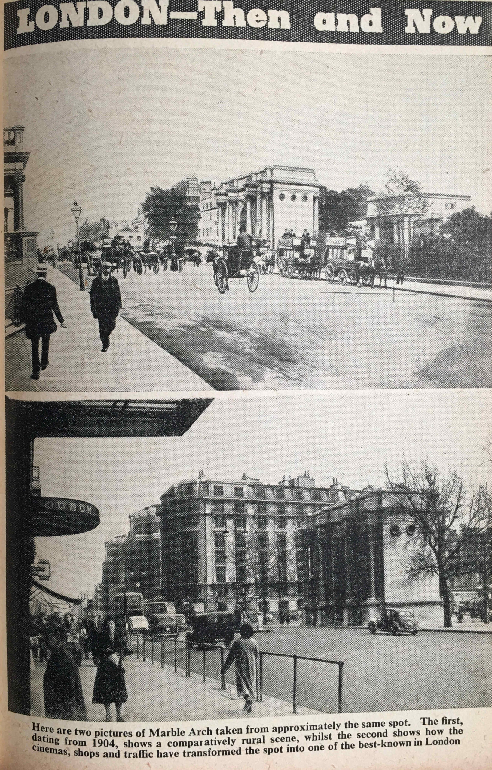
Back to “Then and Now”, and two photos showing Marble Arch, the top photo from 1904, and the second showing how the area had been developed by 1953:

Marble Arch

Two photos showing Swiss Cottage, showing that the “place has changed surprisingly little during the last sixty years”. The view of Swiss Cottage is a bit different today.

Swiss Cottage

Brompton Road, before and after redevelopment, including the construction of Harrods:

Brompton Road

The Post Office and London Telecommunications

Some of the statistics in the London Year Book show numbers and technologies that would change beyond all recognition in the years between 1953 and 2023, for example, in 1953:

  • Number of telegrams delivered: 5,885,300
  • Number of telephones: 1,755,919
  • Number of telephone calls: 1,730,000,000
  • International (radio) calls: 249,000
  • Telephonists: 16,117
  • Number of letters and packets posted: 2,737,394,100
  • Letters and packets at Christmas: 83,745,200
  • Number of pillar and other post boxes: 11,688
  • Number of postmen: 32,195

The telegram has disappeared, there are probably still a high number of telephones, but more mobile phones, with many of the traditional land lines not being used. Although there were sub-sea telephone cables in 1953, radio was still being used to put through international calls, for example from the very tall radio masts that were at Rugby, alongside the M1.

The job of a telephonist is now redundant, and I suspect many of the telephone calls and letters have been replaced by messaging and email applications.

In 1953, the Internet and mobile phone would have been more science fiction than reality.

Many of those telephones would have been installed across the expanding city suburbs, and the following “Then and Now” photo from the London Year Book illustrates how the city had expanded during the first half of the 20th century.

The photo at the top shows the rural area in 1905 that would become Golder’s Green, shown in the lower photo:

Golders Green

Although London was building and expanding at a rapid pace, there was still a reasonable amount of green space across the city, as listed in the following table, although east London was very poorly provided for compared to the rest of the city:

London Year Book

The Airports of London

The Year Book provides some details on the airports and airlines serving London.
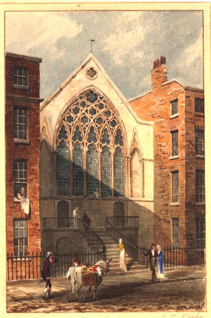
At the time, the London Year Book records that British airliners flew the equivalent of five times around the world every day, and during a year carried over a million passengers.

The heaviest traffic was between London and Paris, with during the summer fifteen flights a day on the route. The longest route served by a London airport was to Tokyo. There were sixteen flights a week to New York.

Three airports serviced London.
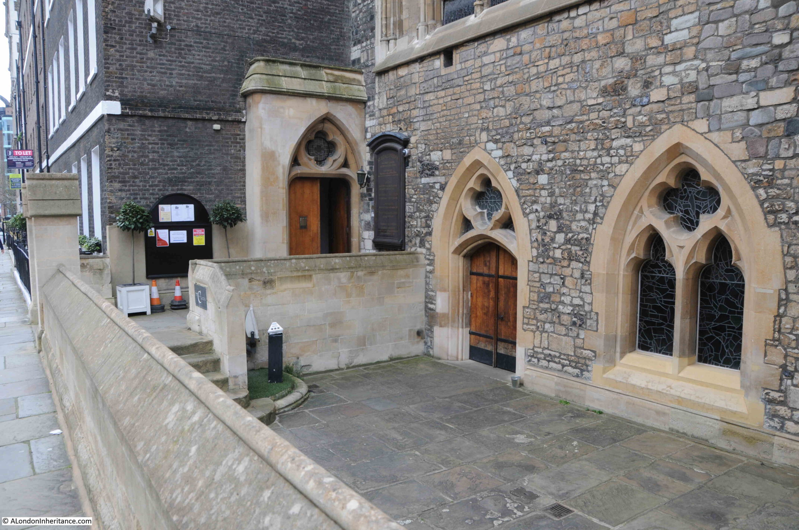
The main airport was London Airport, the site that would become Heathrow. In 1953 23 airlines used London Airport, carrying around three quarters of a million passengers in a year. London Airport had “long range radar apparatus, which is able to pick up aircraft flying at more than a hundred miles away”.
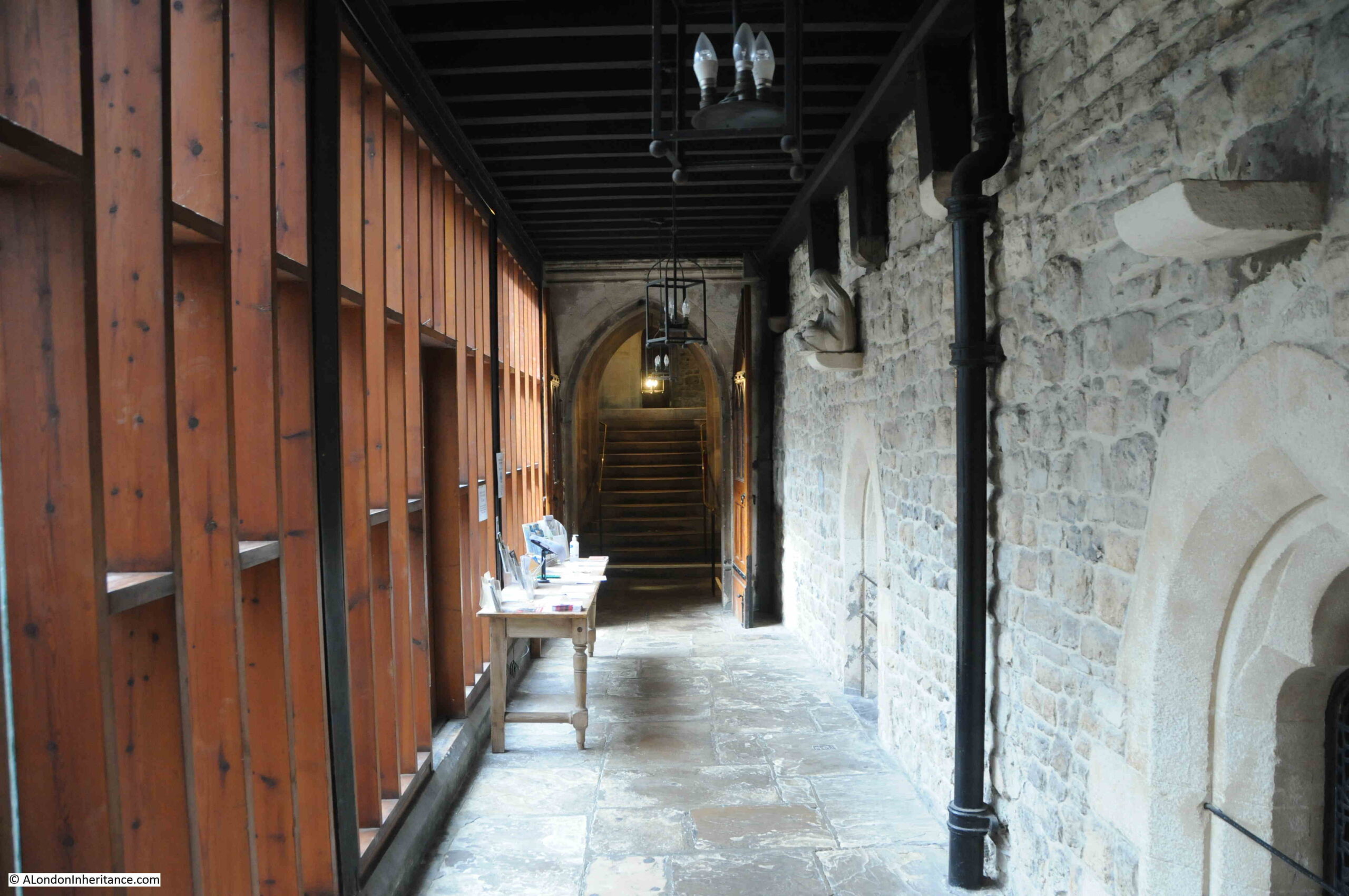
The central passenger terminals and tunnel between airport and roads were in the plans, but had yet to be constructed.

Northolt was the second of London’s airports, originally the busiest airport in the country, until being overtaken by London Airport, but in 1953 it was still a busy place, as shown by the following photo of Northolt:

Northolt Airport

The third London airport was at Croydon, which by 1953 was mainly serving charter aircraft, and handling around 9,000 passengers a year.

Back to central London, and the following photo shows the “basket race”, when market porters ran around a track whilst carrying a large number of baskets on their heads.

Covent Garden

The following photo is accompanied by the text “The three London buses which made a 12,000 mile tour of America and Canada are seen in this picture after they had arrived back in Britain in August 1952. Large crowds gathered on Horse Guards Parade for a ‘welcome home’ ceremony.”

London buses

I suspect that the buses are the ones that were sent to America and Canada to advertise the Festival of Britain. London buses had also be sent across Europe to advertise the Festival.

I covered earlier the power stations across London that generated electricity for the city. There was a more polluting industry that provided energy for London, and the following photo shows hot coke being guided through a retort at the Beckton Gas Works.

Beckton Gas Works

Prior to the discovery of natural gas in the North Sea, gas was produced from coal, an incredibly dirty and polluting process.

As with electricity, the production and distribution of gas had been consolidated into the North Thames Gas Board, that as well as serving London, provided for customers out to Bracknell, High Wycombe and Marlow in the west, and Southend and Shoeburyness in the east.

In the year 1950 to 1951, 367,084,958 therms of gas were sold, with 4,528,789 tons of coal being carbonised to produce the gas.

As well as 1,937,155 tons of coke, this process also produced 227,000 tons of tar, 6,500,000 gallons of Benzole and 111,000,000 gallons of ammoniacal liquor – a highly polluting process.

Crime and Policing

The City of London Police had a strength of 616 officers in 1951. They dealt with a range of crimes, and those classed as larcenies (robbery, theft by a servant, theft of motor vehicle, fraud etc.) totaled 2,506 in 1951.

The following table shows the type and numbers of offences against the person and property:

London Year Book

Motoring offences across London were rising rapidly, probably due to increased car ownership. In 1949 there were a total of 77,326 offences, rising to 89,002 in 1951.

Some other statistics from London policing:

  • There were 138,745 registered aliens across Greater London in 1951
  • 19,820 firearms certificates were issued during 1951
  • There were 8,038 licensed premises in the ‘off’ and ‘on’ trade
  • There were 19,727 arrests for drunkenness in 1951
  • 404 men and 14 women were charged with begging. 247 men and 134 women were charged with sleeping out
  • 1,076 persons were recorded as missing during 1951
  • Police rescued 24 people from drowning, however 83 bodies were recovered including that of one child

The early 1950s were a time when the police used the BBC to broadcast messages and appeals, and in 1951, 172 messages were broadcast on behalf of the Metropolitan Police, of which 84 were successful.

The police were probably involved with maintaining order at football games, and one featured in the Year Book shows “Ditchburn pushes the ball off the head of Souden in the Spurs v. Manchester City match at Tottenham on September 1st, 1951” – although according to the 11v11 website, on September 1st 1951, Spurs were playing Newcastle away, with Newcastle winning 7 – 2, so I have no idea which game is captured in the photo.

Spurs v Manchester City

The London Year Book included a number of adverts, including one showing the story of Arding & Hobbs at Clapham Junction:

Arding & Hobbs

The Civil Service Stores in the Strand:

Civil Service Stores

Although the Civil Service Stores as a business closed many years ago, the building can still be seen. It has been modified a number of times, although the clock is still a feature on the corner of the building:

Civil Service Stores

And an advert for London Stadiums Ltd. who ran greyhound racing at Wandsworth, Park Royal and Charlton Stadiums:

Wandsworth Stadium

The London Year Book covers far more than I have been able to write about in this post. In the introduction, the editor claims that “we think it will help to solve problems and settle arguments, and believe it will prove of real help to everyone living in, or interested in, the world’s greatest city”.

The intention was that the London Year Book would become an annual publication. As far as I know it was only published in 1953 and 1954.

So much of what is covered in the 1953 London Year Book seems like another world, and London certainly has changed considerably in the last 70 years. Reading through the book, it suddenly occurred to me that years I remember really well and are so familiar are actually closer to 1953 than to 2023.

For example, 1983 was only 30 years after 1953, but is now 40 years ago. In 1983, I was in my 4th year of my first full-time job in London, and;

  • Blue Monday by New Order, Sweet Dreams by the Eurhythmics and Lets Dance by David Bowie were in the music charts.
  • The Falklands War was the previous year, and in June 1983 Margaret Thatcher won a large majority, helped by victory in the Falkland’s.
  • ARPANET (the US Advanced Research Projects Agency Network) was configured to use the protocol that would become the Internet, a technology that would transform so much.
  • The one pound coin was introduced.
  • The comedy series Blackadder was first shown on TV.
  • The Campaign for Nuclear Disarmament march in London had over a million people protesting against the deployment of US nuclear cruise missiles in the UK. They would arrive at Greenham Common in November.
  • An IRA car bomb killed six people when it exploded outside Harrods.

All the above events were much closer to 1953 than they are to today.

As the title above many of the photos in the London Year Book confirms: “Time Marches On…..”

alondoninheritance.com