Monthly Archives: August 2020

The View from the O2

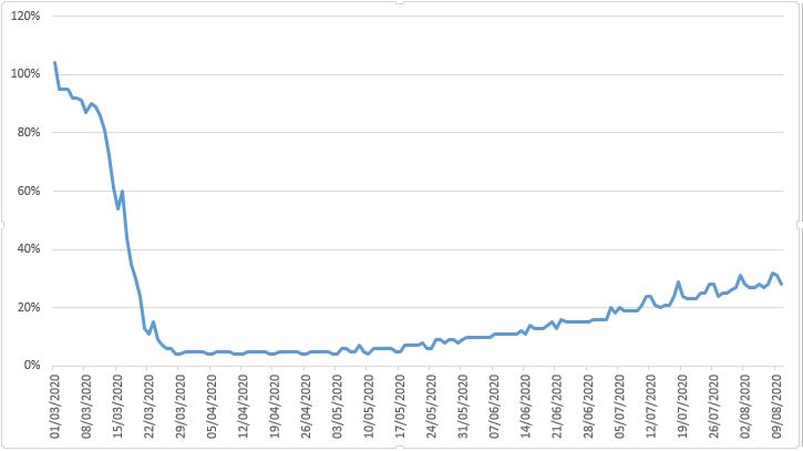
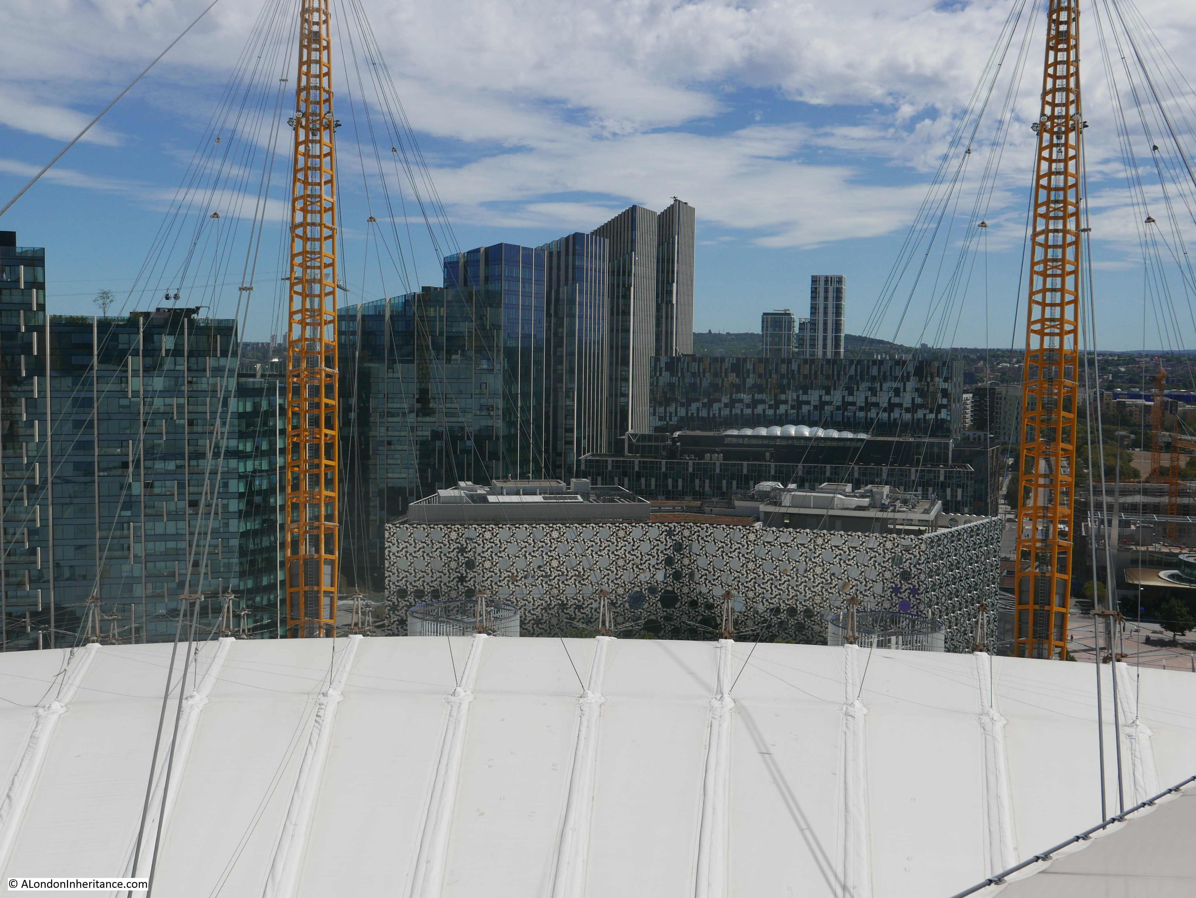
A few weeks ago at the start of August, I walked up to the top of the O2 / Millennium Dome. It was my second walk to the top, the first visit had been brought for me as a present a couple of years ago, and this second visit was to take my 12 year old granddaughter as it was something she has wanted to do for some time, and with the reopening of the site, it seemed the ideal time to visit.

I will also take any opportunity to walk up to a high point, as these provide the perfect location to get a different perspective of London, which is sometimes difficult from street level.

This is not a blog that focuses on commercial / tourist experiences, so I will not be covering these aspects, just what can be seen from the top, and what it tells us about the way the city is changing. There is significant change to be seen as the Greenwich Peninsula is in the process of having almost all of its industrial history demolished.

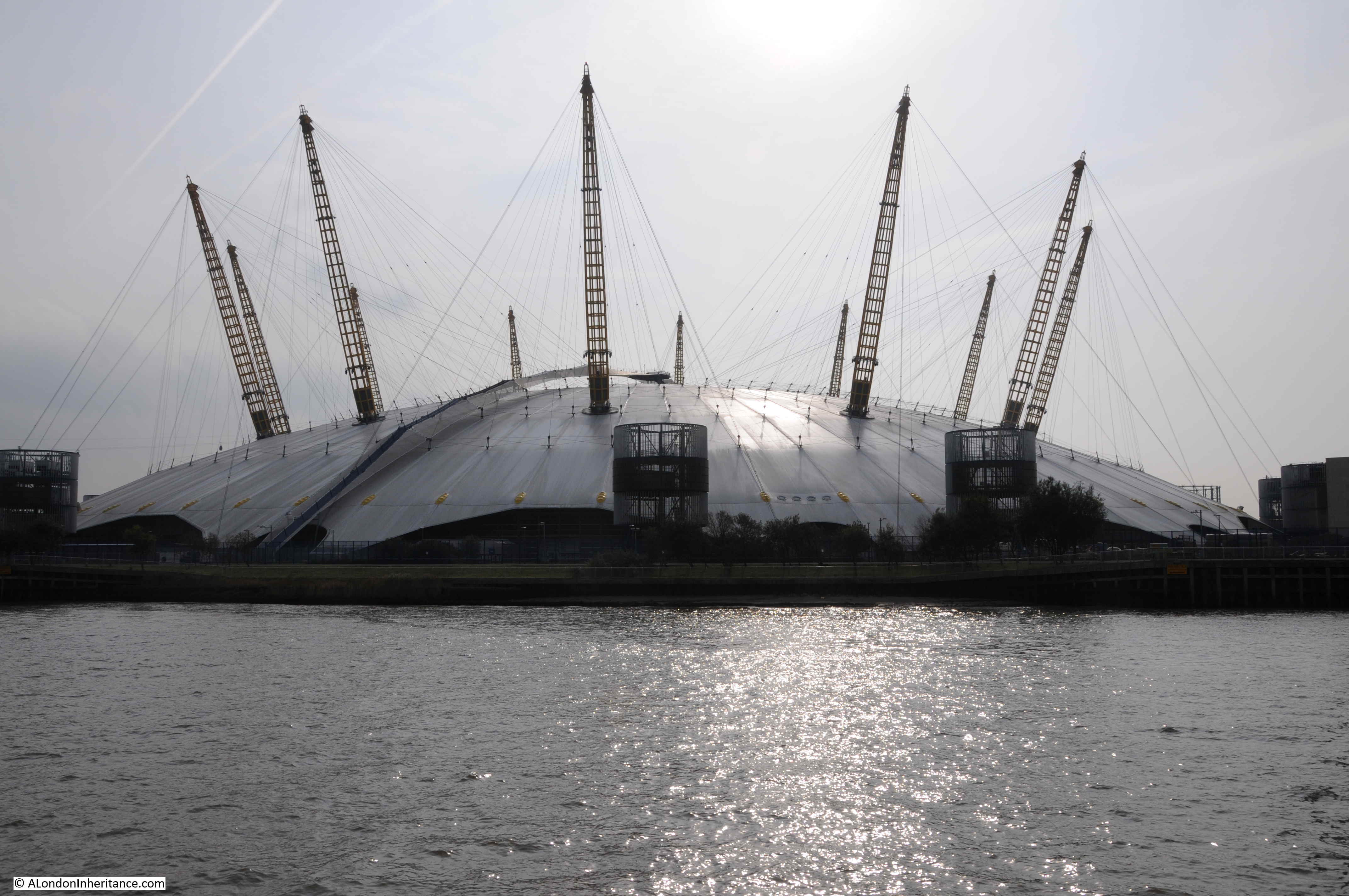
The O2 Dome photographed from the river a couple of years ago. The walkway to the top can be seen, suspended above the material of the roof of the dome.

O2

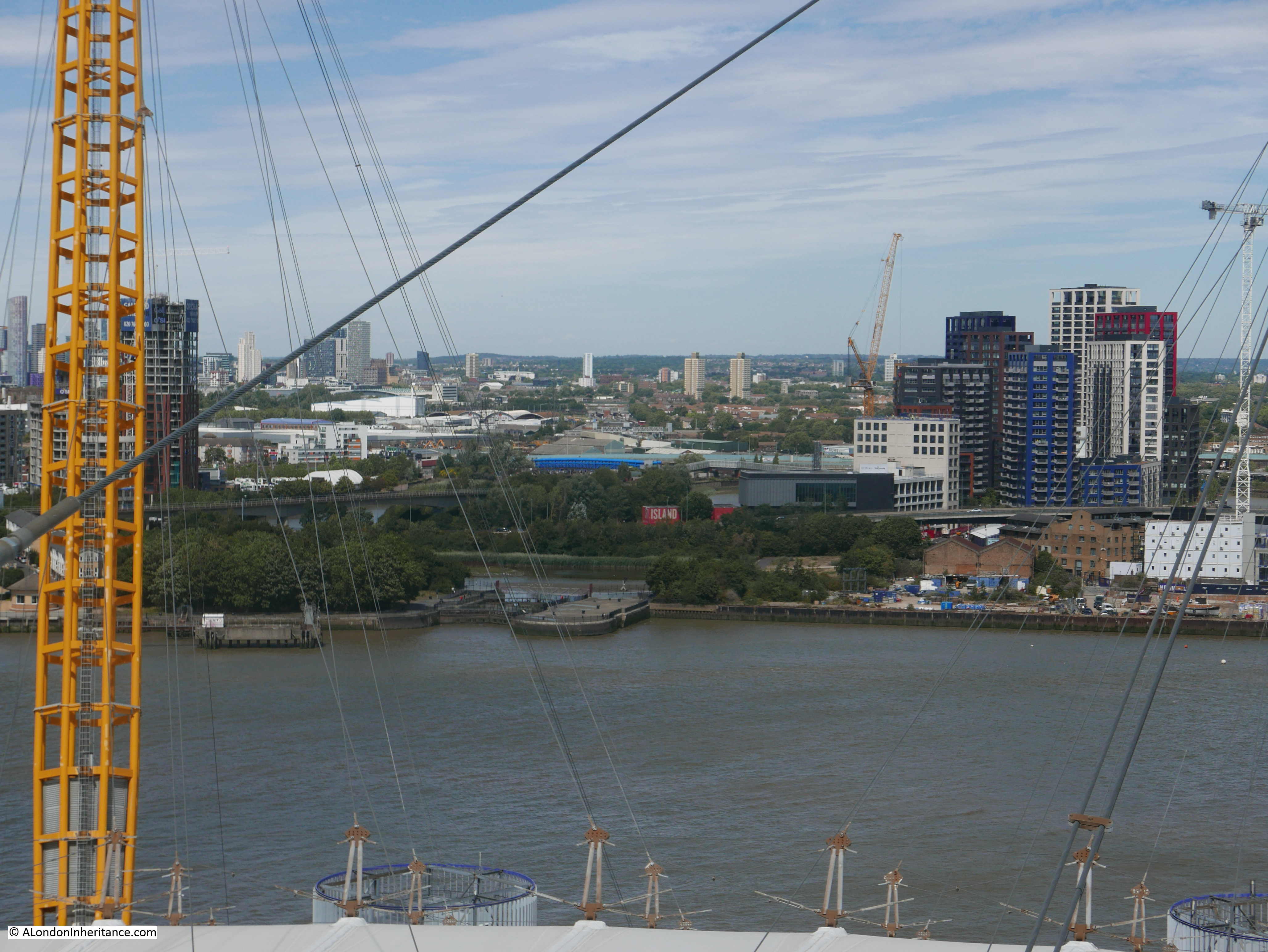
The weather on our visit was really good. Perhaps a bit too warm for such a climb, but the views from the top were worth the effort. The following photo is looking roughly north east, across the River Thames. An area of water can be seen. This was the Royal Victoria Docks.

O2

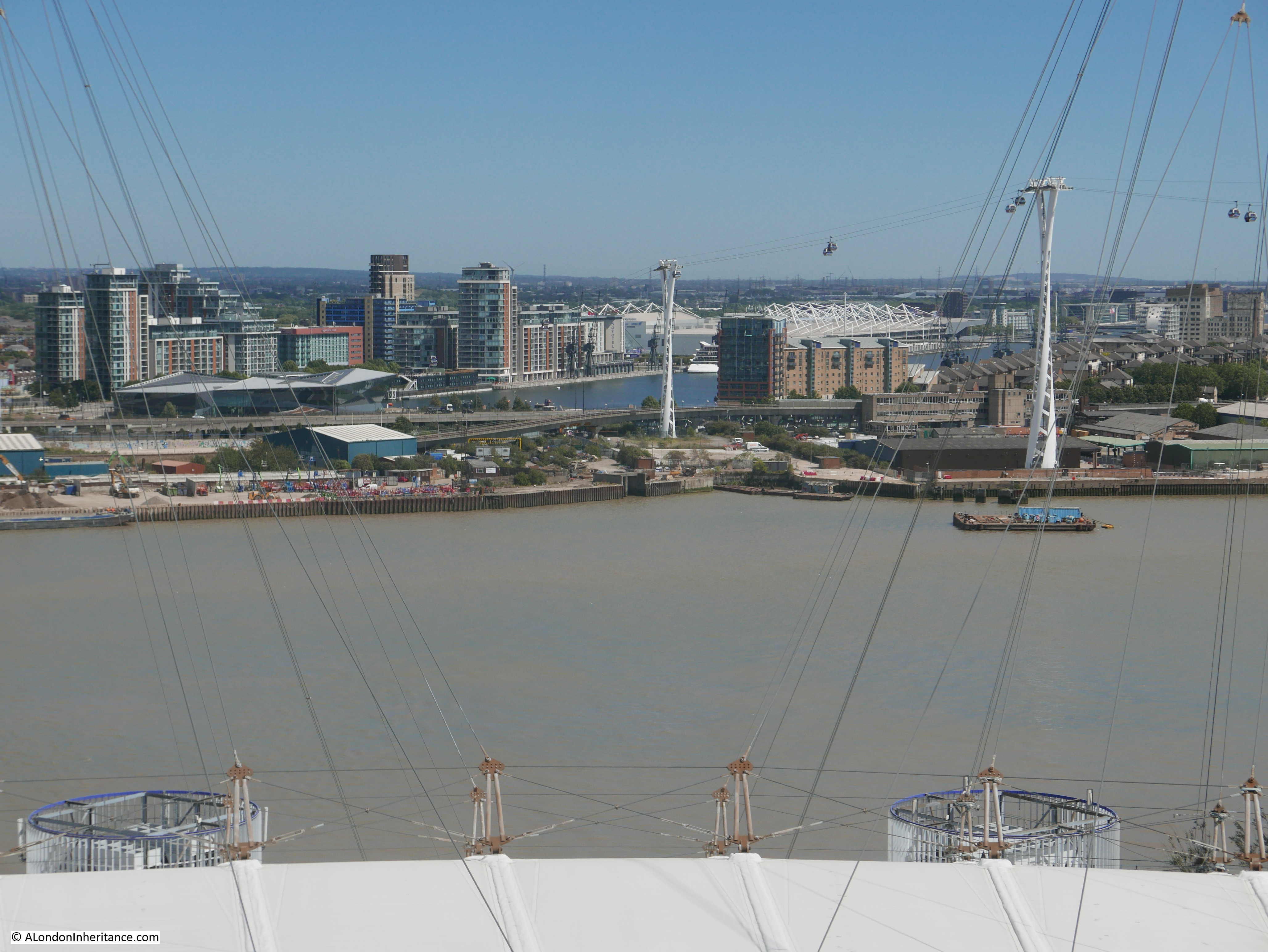
On the far right of the photo can just be seen the old Millennium Mills building. The building with what appears to be white scaffolding along the roof line is the Excel exhibition centre, the location of the London Nightingale Hospital.

Two of the towers carrying the cable car across the river can be seen, and to the left of the water of the Royal Victoria Docks is a low, angular building with glass sides. This is the Crystal, a building which may play an important part in the future life of the city.

The Crystal was built in 2012 by the German engineering company Siemens. It was intended to be a location for some of the company’s staff, as well as being an exhibition centre and demonstration capability on the technology that would drive future cities.

The Crystal was designed and constructed to show how future buildings could be environmentally friendly and sustainable, and use recycled rain water to drinking water, used heat pumps to draw heat from the environment to heat the building in winter and cool the building in summer. Building management technologies, and sensor systems to adjust the building’s environment to the number of visitors.

Unfortunately, the building did not attract the number of visitors expected, so the original exhibitions closed, and the building is now owned by the Great London Authority and used as an events and exhibition space.

City Hall on the south bank of the Thames, just to the west of Tower bridge is the current base of the Mayor of London, and the “head office” of the Greater London Authority (GLA). The building is leased and currently costs the GLA £11.1 million a year in rental costs. The GLA can exit the lease in 2021, and the Mayor has proposed a move to the Crystal building as this is already owned by the GLA and will make substantial savings of rental costs.

Whilst I can understand the reasons, and the financial benefits make absolute sense, it does seem a shame that the symbolic location of the GLA will relocate from a prime position in central London, to a location that will only really be seen by those working at the GLA, or visiting exhibitions at the Excel.

Turning a bit further round to the north, and we can see the entrance to Bow Creek.

O2

Bow Creek is where the River Lea runs into the River Thames. The Lea is a significant river and runs through Bedfordshire and Hertfordshore before reaching greater London, through numerous twists and turns, diversions and reservoirs. Water from the River Lea was taken to feed into the New River when additional capacity was needed over and above that available from the original springs.

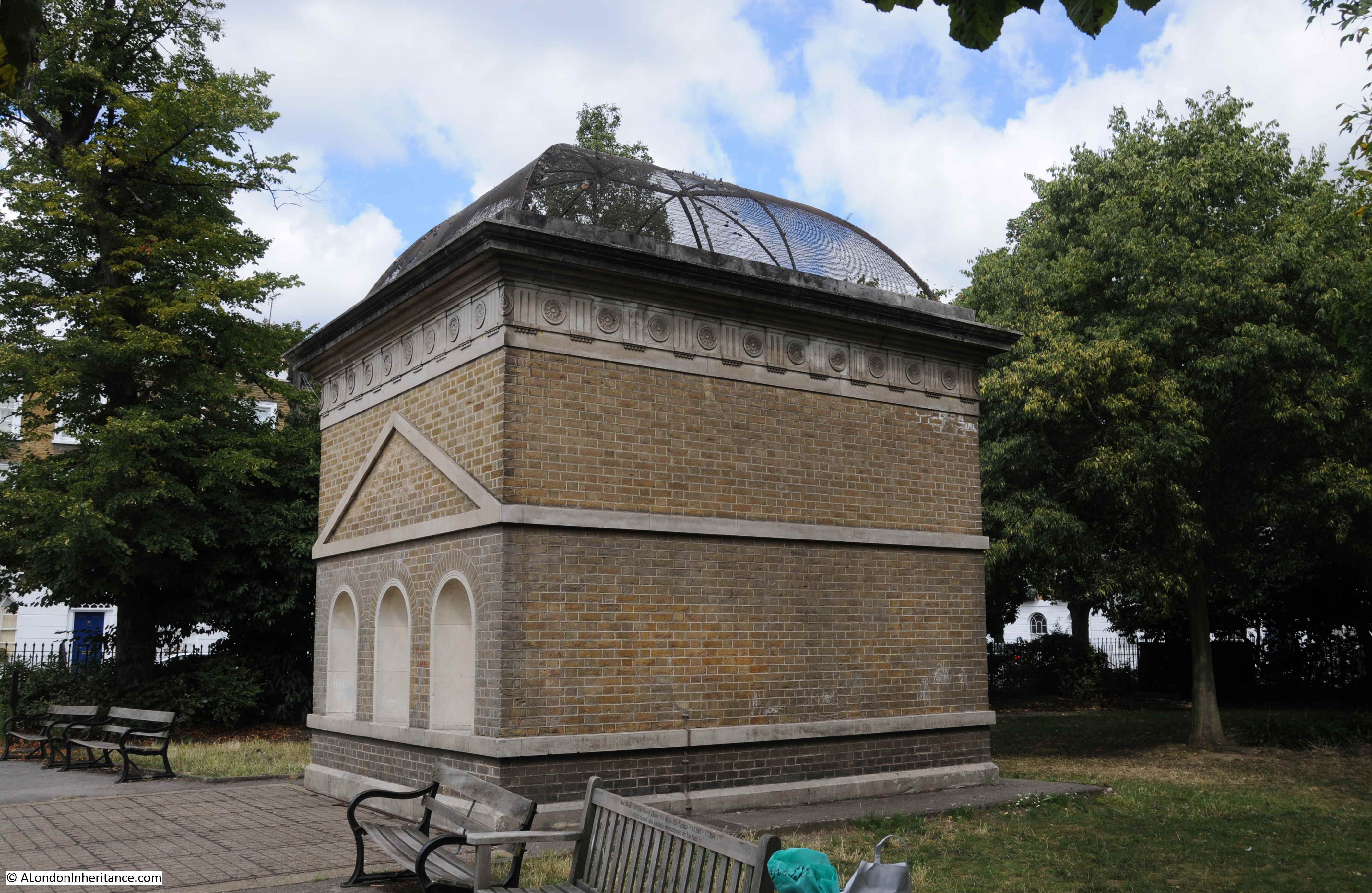
To the left of the point where the Lea meets the Thames is a small brick building, with a rather unusual structure on the end. This is London’s only Lighthouse.

O2

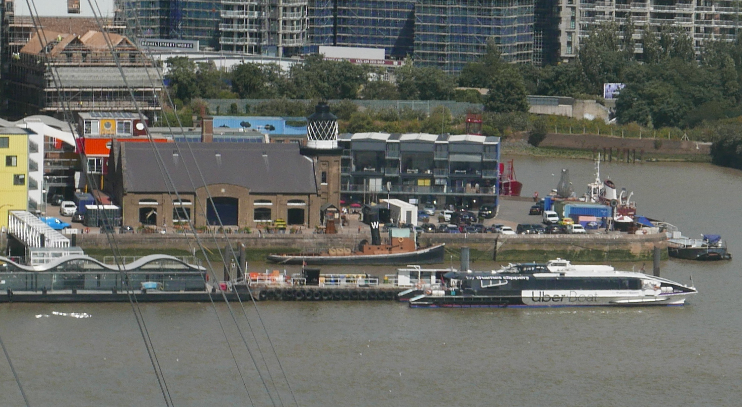
Built between 1864 and 1866, it was not that sailors on the river needed a visible navigation sign to find the entrance to the Lea in thick river fog, it was built as a place to test out lighting systems and measure their effectiveness and efficiency, so that the best systems could be installed in the lighthouses around the coast of the country.

The lighthouse is at Trinity Buoy Wharf. Now used for weddings, office space and a rather nice cafe after a long walk. The site was owned by Trinity House and as well as testing equipment at the lighthouse, the area was used for the storage and maintenance of buoys and navigation markers that were used in the waters under the responsibility of Trinity House.

It would have been fascinating to see a light from the lighthouse sweeping the dark, misty waters of the Thames when tests were underway.

Now looking to the north and we can see a cluster of different coloured towers.

O2

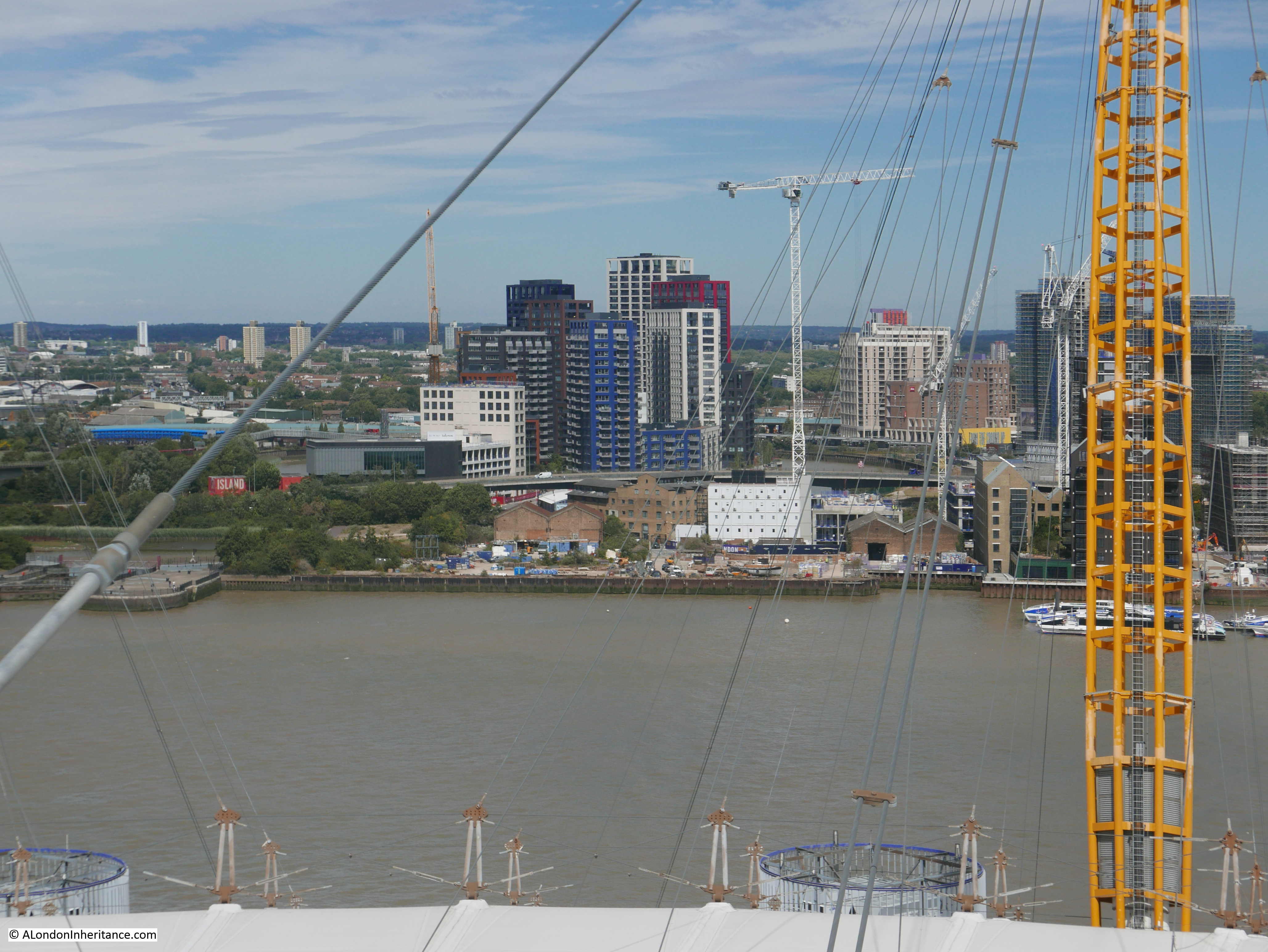
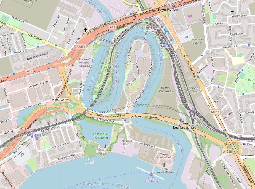
These apartment towers form City Island, a recent development that sits on the small peninsula of land in one of the meanders of the Bow Creek. The following map extract shows the area where the apartment blocks have been built, with the River Lea / Bow Creek passing on three sides (Map © OpenStreetMap contributors).

O2

A location map at the entrance to City Island shows how the buildings have been packed into this small area of land. Note the thick red line at the top of the map.

O2

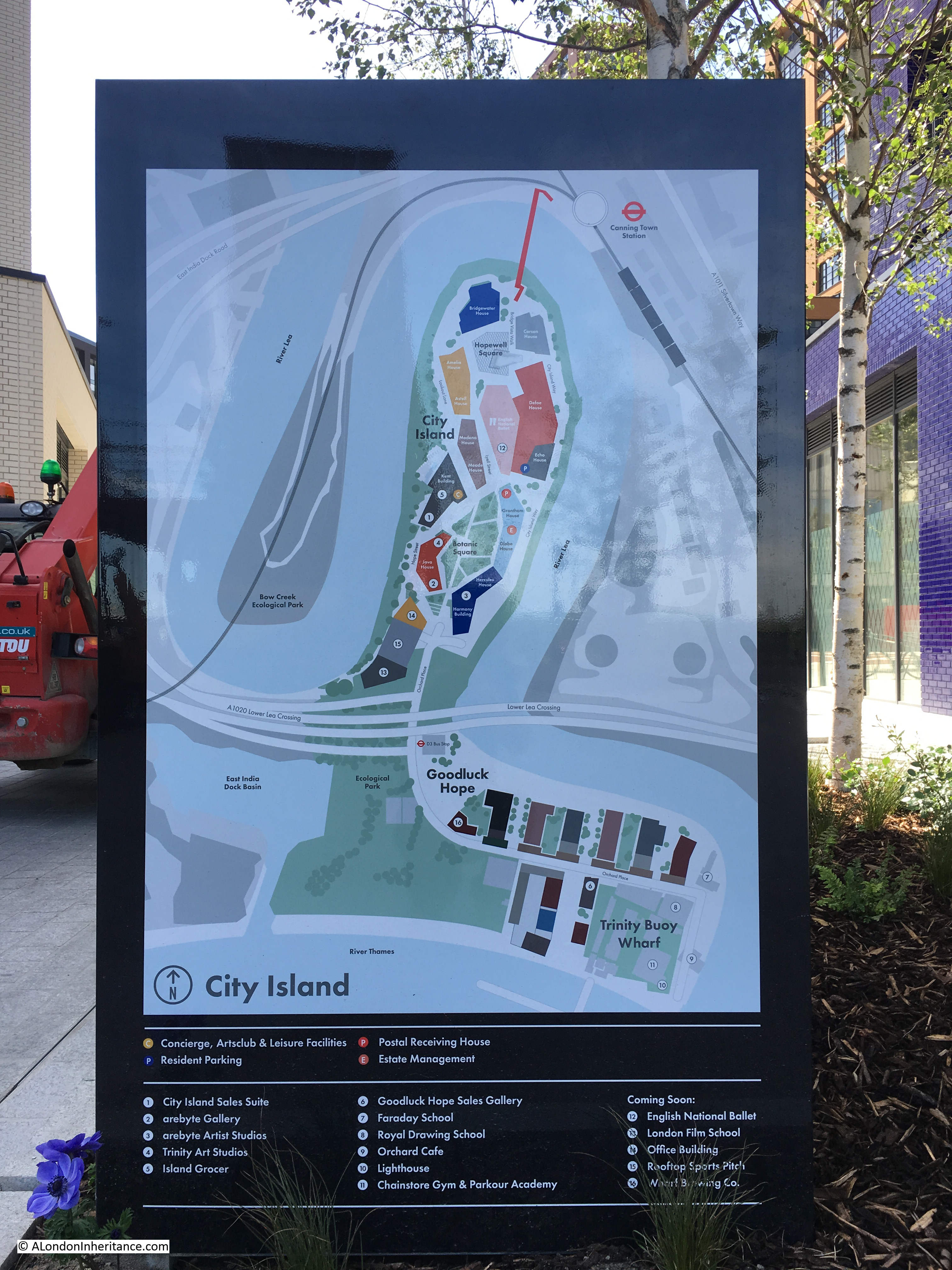
The shape of the peninsula and the lack of access apart from the roads to the south meant that those living at City Island had very limited public transport options, so a foot bridge was constructed at the northern end of the peninsula (the thick red line) to connect City Island to Canning Town Station.

The view from the northern end of the footbridge looking into City Island.O2

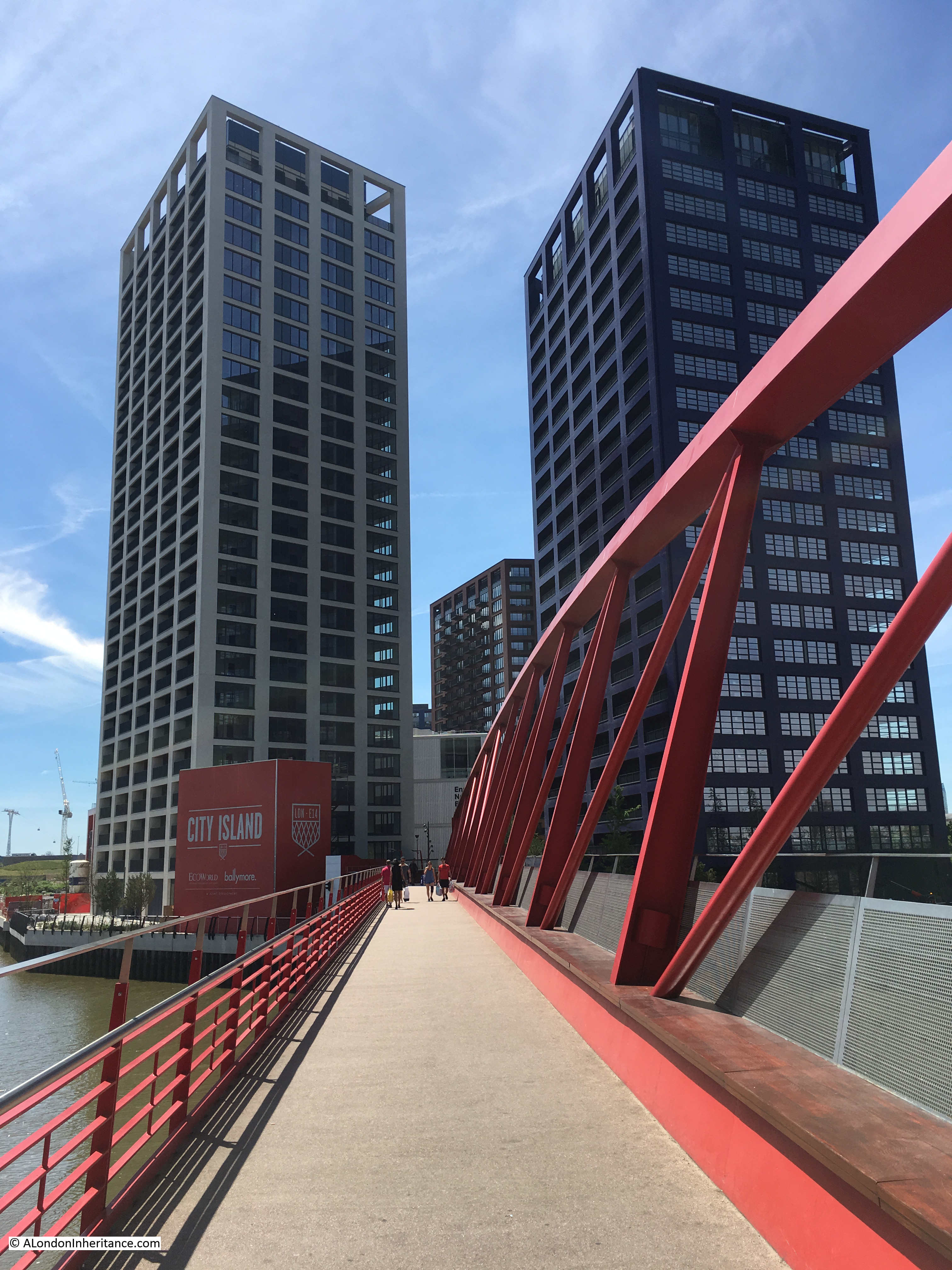
Slightly to the west of City Island, there is an old locked entrance to the river with a small patch of water behind.

O2

This is all that remains of the East India Dock complex. The section that remains is the basin between the river and main docks, which are now filled in and built over.

I find it interesting that the buildings that now occupy the old East India Docks are today some of the largest Data Centres, supporting major Internet hubs. From places that once moved physical goods, the same space is now being used for one of the 21st century’s most important commodities – data.

Just to the west there are two buildings with solid lines down their facade, and to their left another building with a broken line running down the balconies, all giving the impression of a vertical line facing Greenwich.

O2

These three towers form the Elektron Buildings. The individual names of the towers from left to right are the Elektron Tower, Neutron Tower and the Photon Tower. The towers were built on the southern part of the old Brunswick Wharf Generating Station, and the names of the towers are meant to reflect this electrical history.

The broken brown line running up the balconies of the tower on the left is meant to show the route of the Greenwich Meridian, however the tower is offset a couple of metres to the west, so the prime meridian defined by Sir George Airy in 1851 passes just to the east of the block. This is probably fortunate (or possibly planned) for the tenants as when the meridian laser shines from Greenwich to mark the route of the meridian, it passes just to the east of the tower. If the tower has not been in its current position, it would have blocked the laser.

Just to the right of the right tower of the three, the ArcelorMittal Orbit at Stratford can be seen , along with (to the right), the towers that are springing up around Stratford.

Moving further to the west and there is a building in the centre of the following view with satellite dishes on the roof.

O2

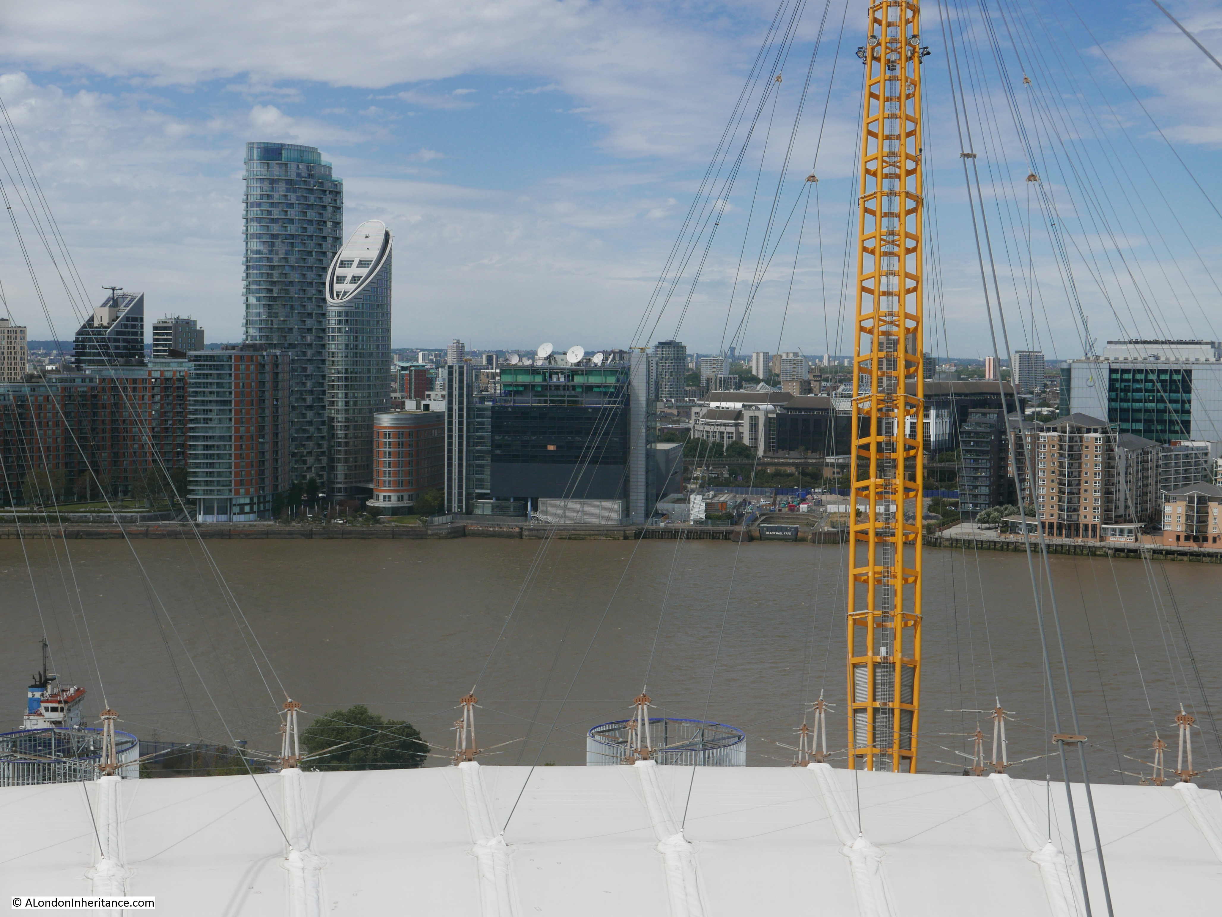
I had a meeting in this building in the early 1990s. It was almost the only building here, and was surrounded by an expanse of derelict buildings, and spaces in the process of being cleared.

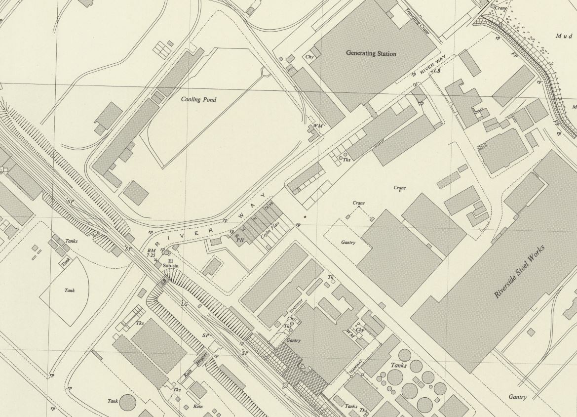
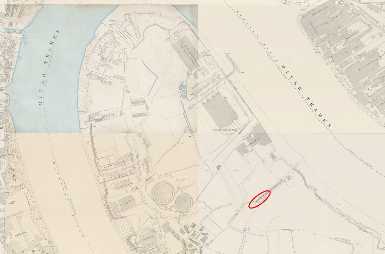
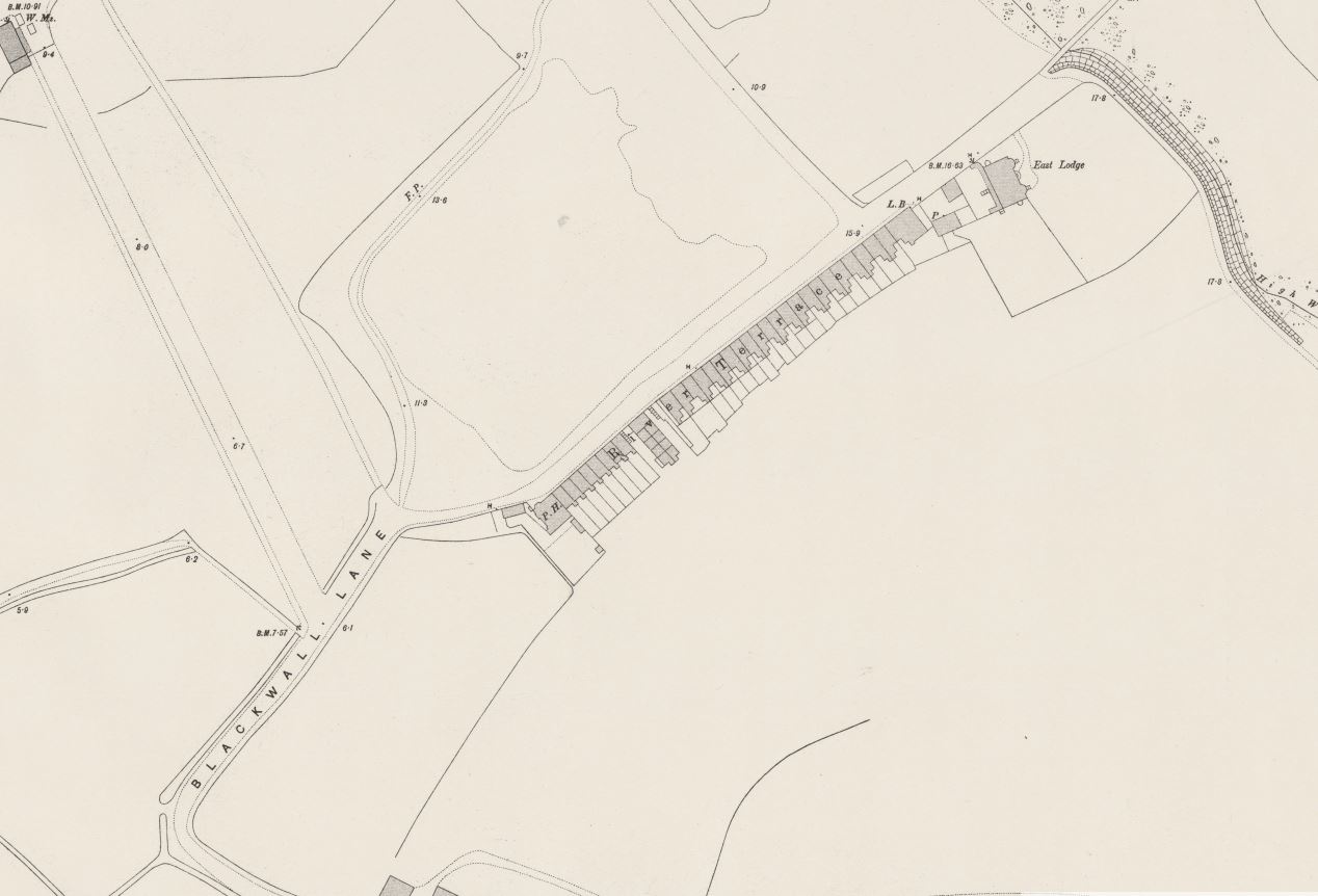
But again, there are reminders of the old industries that once lined the river here. In the following extract from the above photo, look to the right of the photo and there is an entrance from the river with Blackwall Yard written on the river facing side.

O2

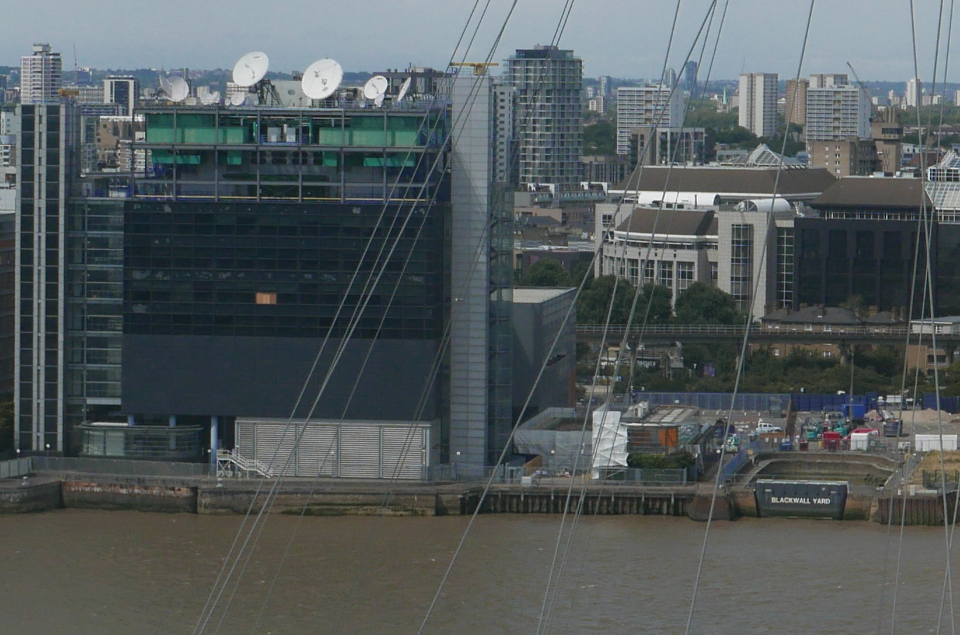
This was part of the Graving Dock on the right of the cluster of docks and launching sites in the centre of the following extract from the 1893 Ordnance Survey map (‘Reproduced with the permission of the National Library of Scotland’).

O2

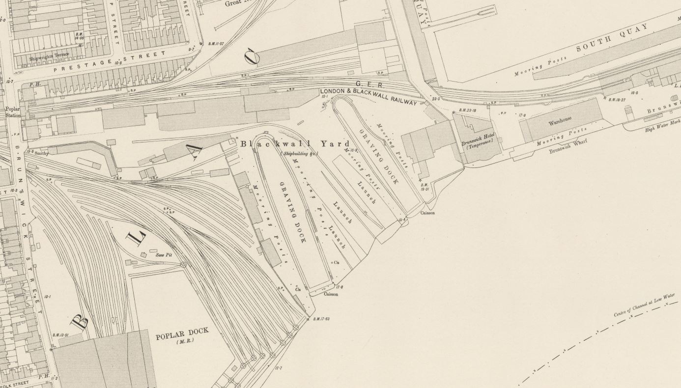
Surprising that this small part of what was once a complex web of docks, railways and warehouses survives.

Continuing towards the west, and the tower blocks that form the Canary Wharf complex come into view, however tower block development along the edge of the Greenwich Peninsula is starting to block the view across the river.

O2

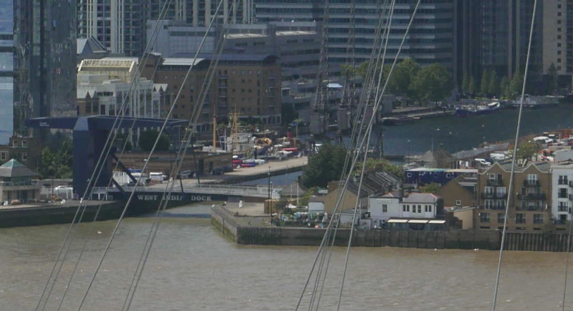
Slightly further to the west and we can see the entrance to what was the South Dock on the Isle of Dogs.

O2

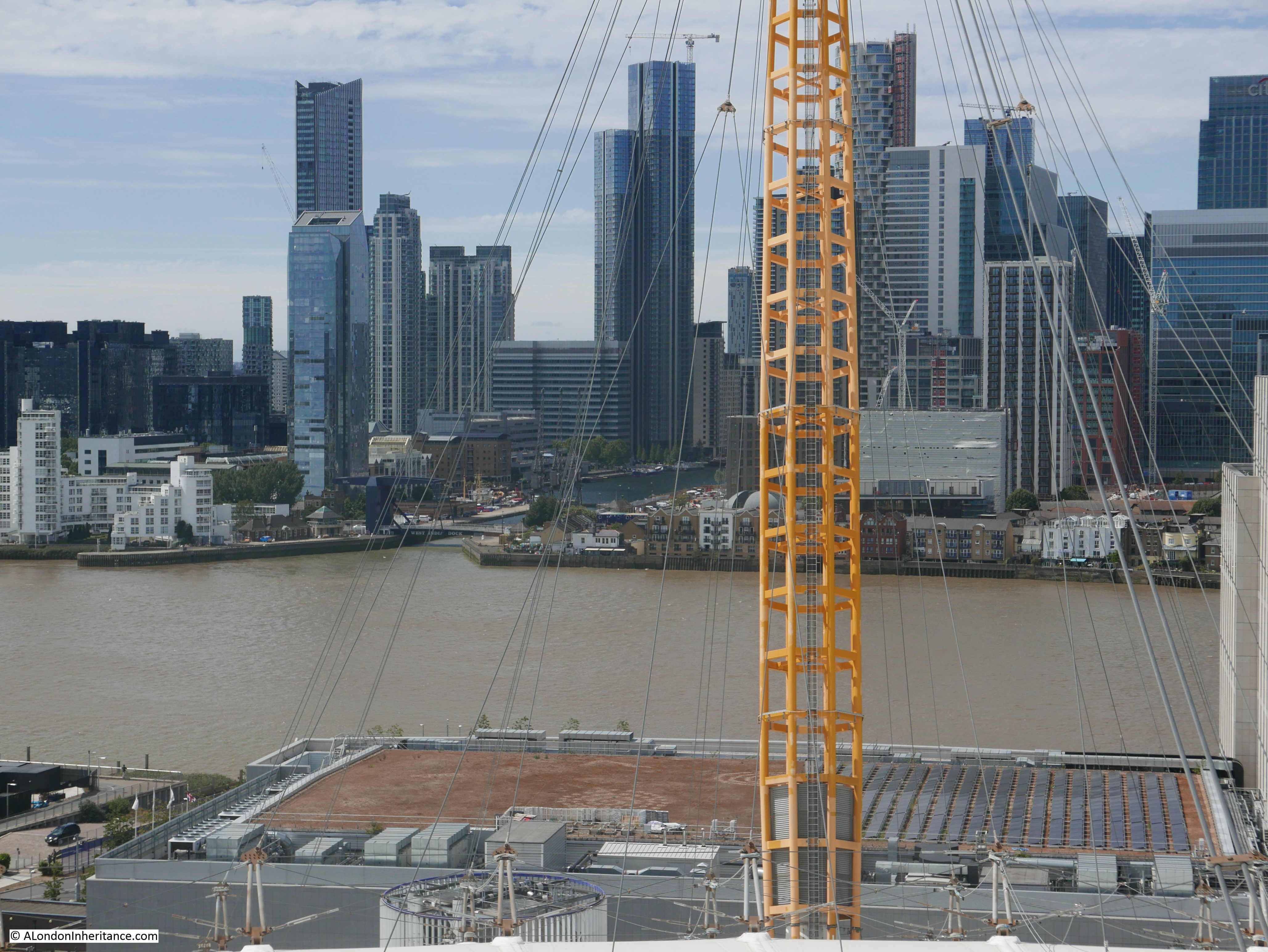
An enlargement from the above photo showing the dock entrance. The first white building to the right of the entrance is the Gun pub.

O2

The view is now turning to the south west, and on the western edge of the Greenwich Peninsula is one of those strange oddities that were built here when I suspect someone was trying to find how to make money out of all the empty space. The green space is the Greenwich Peninsula Golf Range.

O2

In the lower right hand corner, the upturned electricity pylon created by Alex Chinneck as an artwork for the 2015 London Design Festival, can be seen.

In the far distance, the TV and Radio mast at Crystal Palace can just be seen. Getting up this high also shows why the mast was placed at Crystal Palace. As well as being a site with the space for a mast, it is already a high point overlooking much of the lower land of greater London.

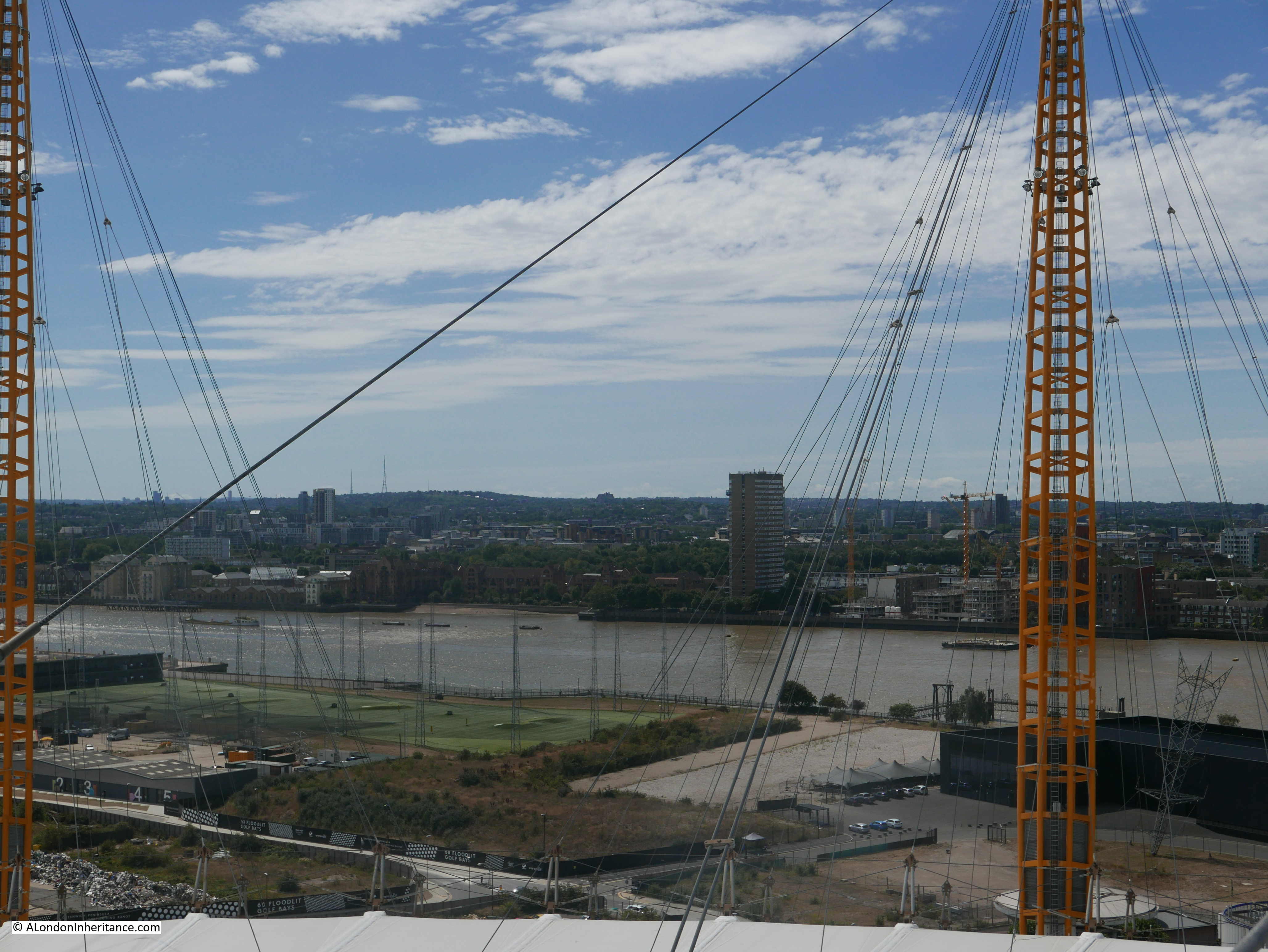
Looking further south, and we can see where the river turns to pass the southern tip of the Isle of Dogs.

O2

To the left of the golf driving range is yet another large building site with the next part of the peninsula’s transformation about to be constructed.

Although there are already many new tower blocks here, the Greenwich Peninsula is only at the start of a transformation which will significantly change the above view, and indeed nearly all the views from the O2.

The Greenwich Peninsula Masterplan shows the developments planned for the area, with a dense cluster of towers transforming the area beyond all recognition.

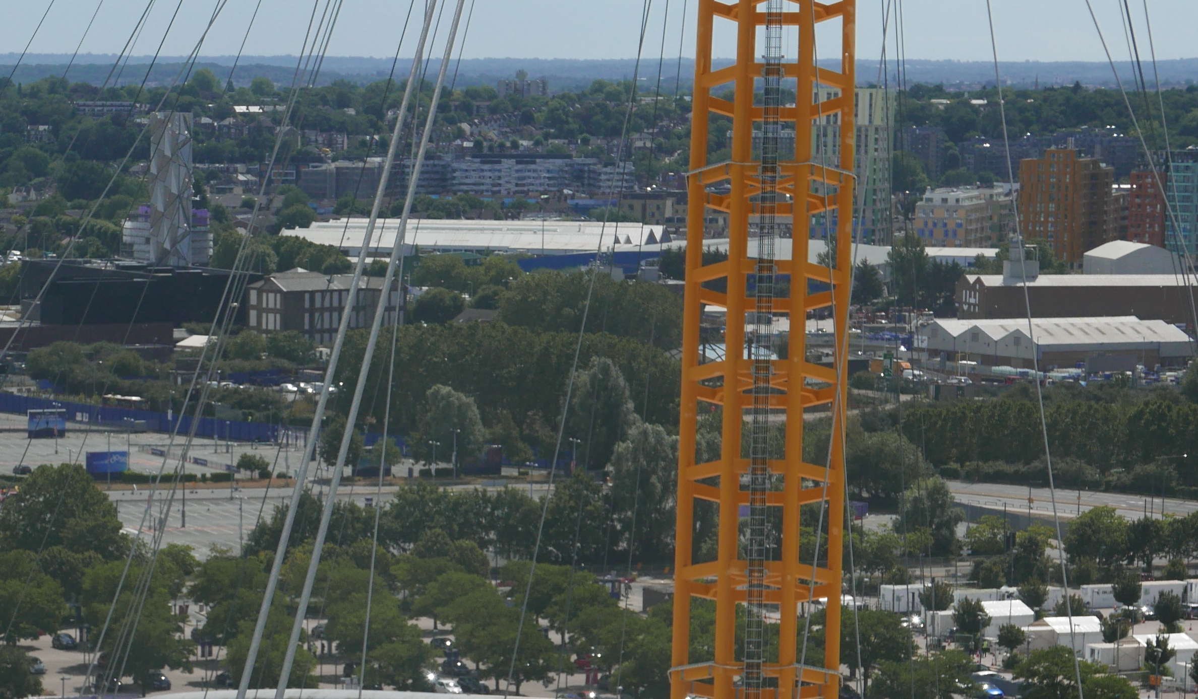
The view below is looking to the south. Much of the area closest to the dome is covered with car parking space, used for the big events at the dome, however compare with the Greenwich Peninsula Masterplan and this view will look very different.

O2

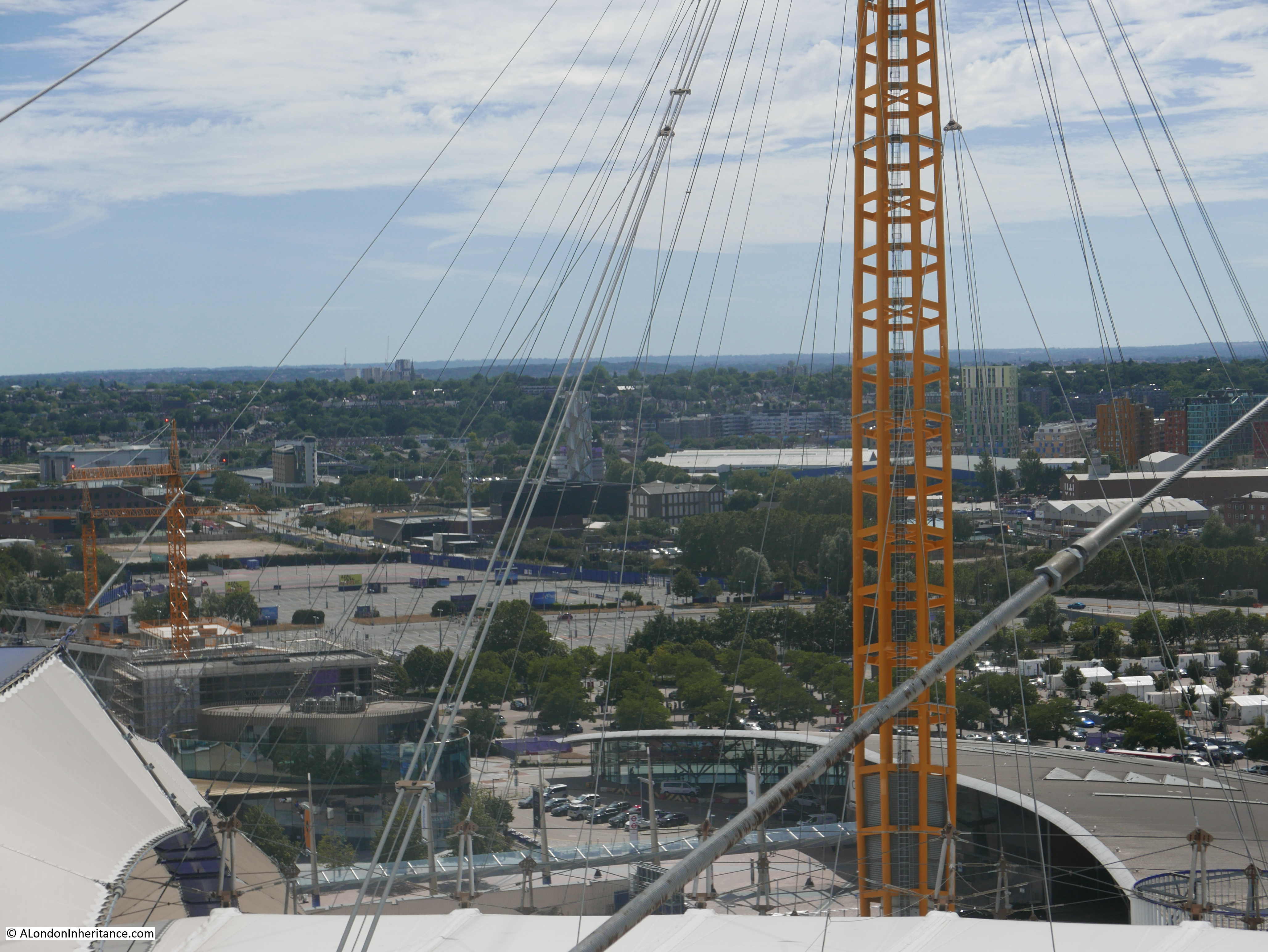
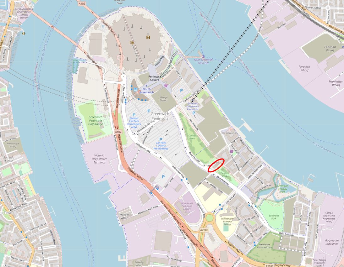
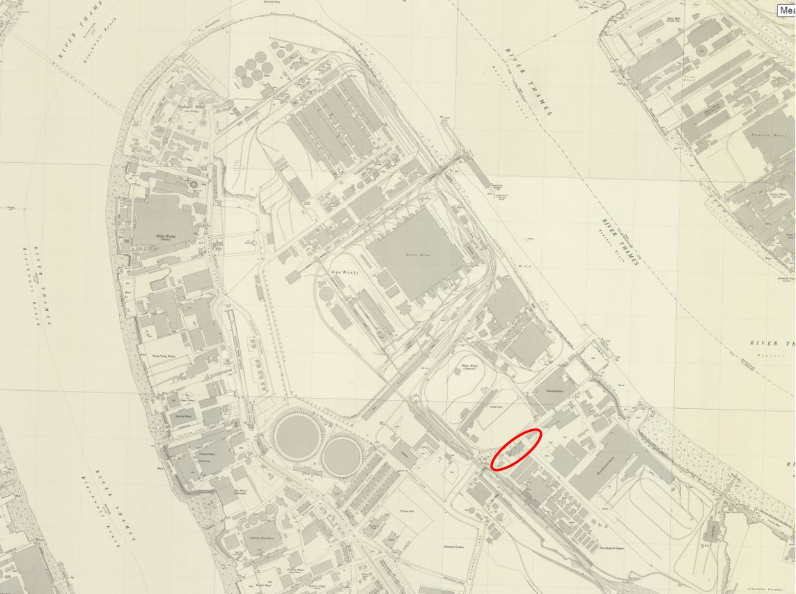
The above view also shows how the industrial history of the Greenwich Peninsula is continuing to be demolished. The photo below is an extract of the above photo and shows nothing remarkable.

O2

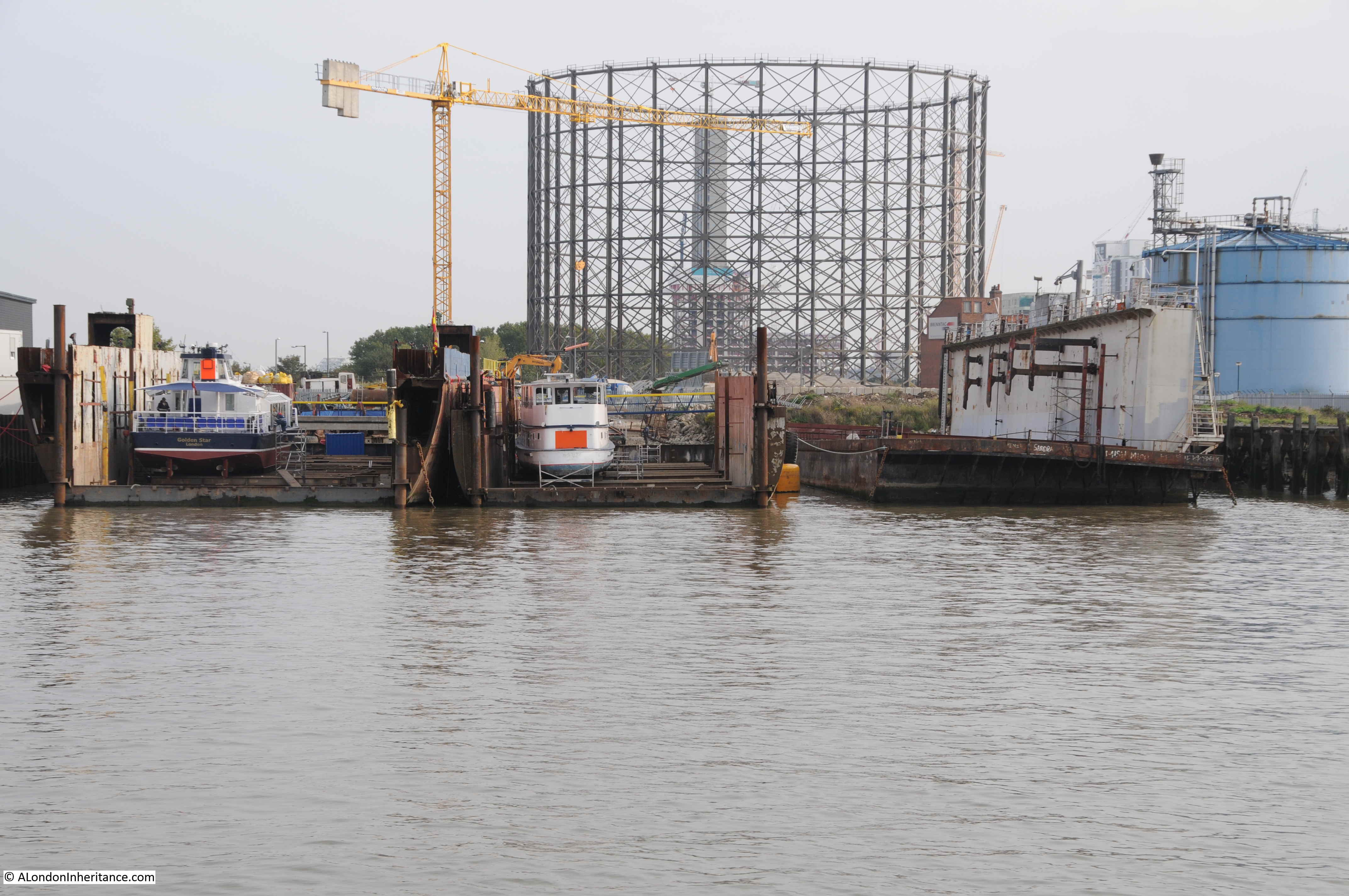
My first climb up the dome was a few years ago (family present) and in the following photo showing roughly the same view is the outer framework of large gasholder.

O2

The gas holder was demolished earlier this year and was originally one of a pair dating from the late 1880s / early 1890s. The gas holder in the above photo is number 1. The larger number 2 gas holder was demolished in 1985 and will be the site for the Silvertown Tunnel workings and entrance, with construction expected to start this year with completion around 2025.

The Silvertown Tunnel is another of the construction projects that will be transforming the Greenwich Peninsula. The tunnel is being financed through a Private Finance Initiative (PFI) model. When open, a toll will be charged for using either the Blackwall or the Silvertown Tunnels which will be used to pay the PFI charges. The tunnel developers take the risk with construction costs, however Transport for London take the risk with usage and whether this will be sufficient to cover the PFI costs.

in 2015 I photographed the gas holder from the river. In the foreground were dry docks for the Thames tourist boats. These will also, or perhaps already have gone.

O2

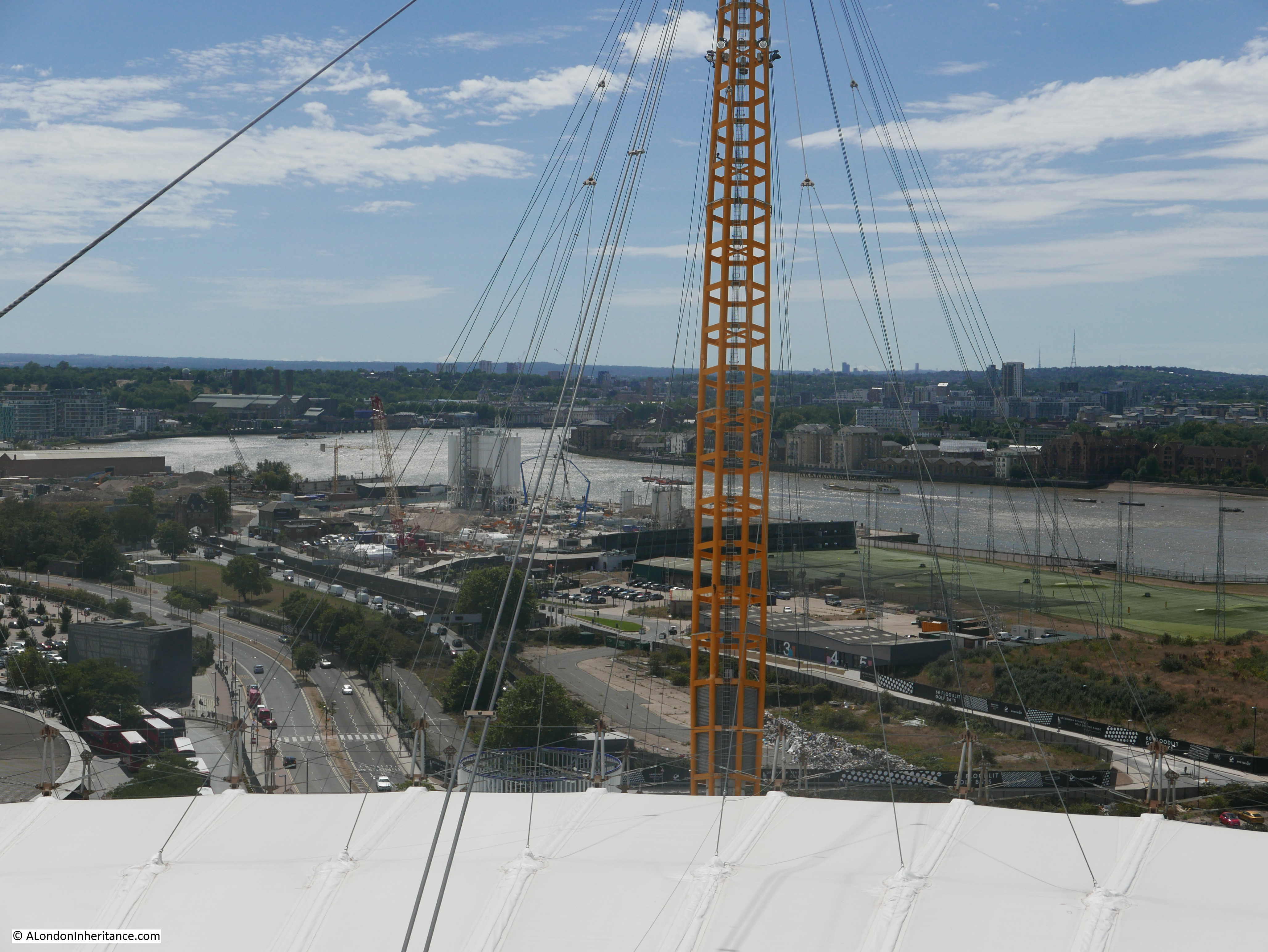
Still looking to the south, and there are several features in the following photo:

O2

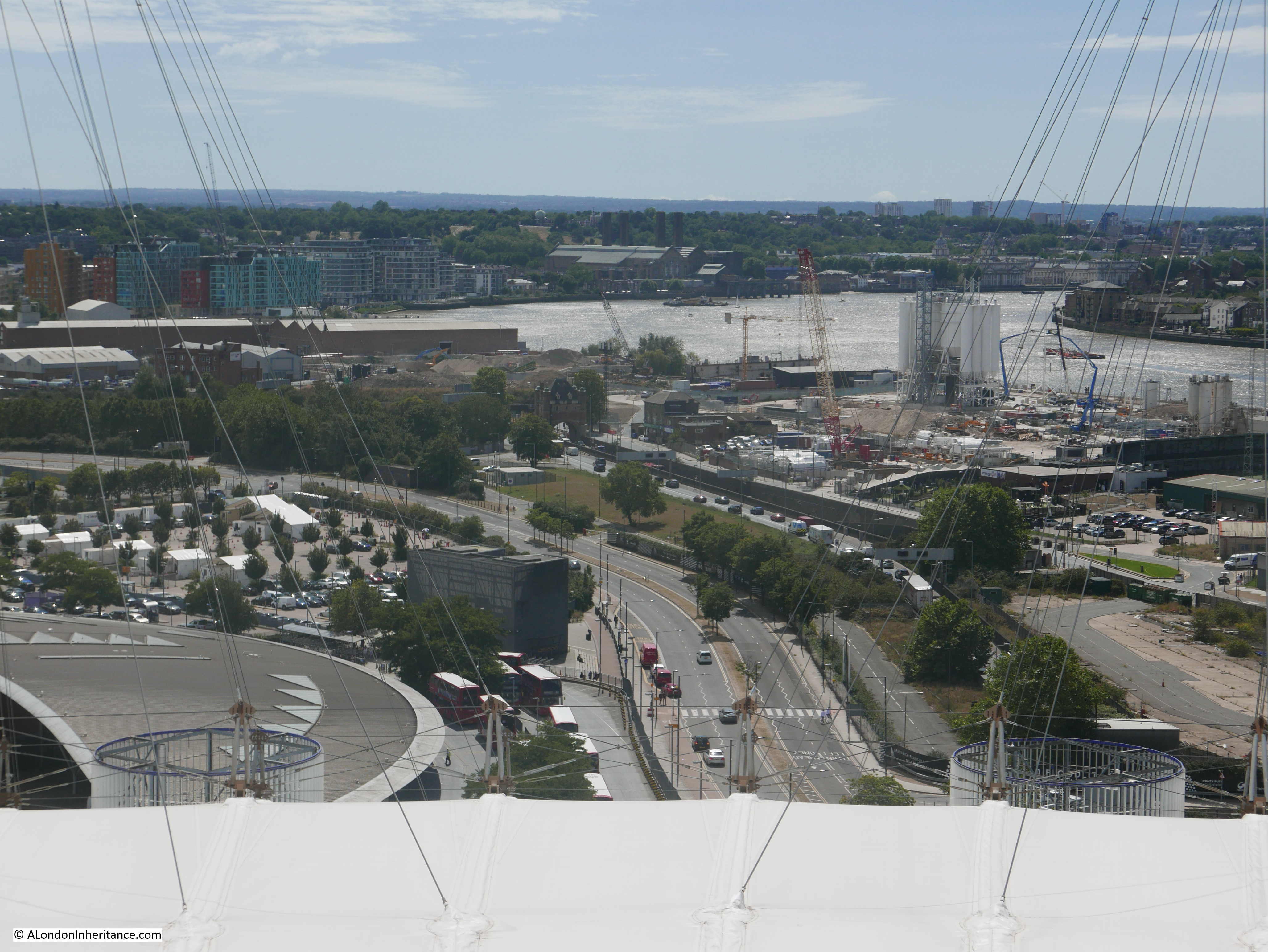
In the middle of the photo is the entrance arch to the Blackwall Tunnel. This can be seen in the following extract from the above photo:

O2

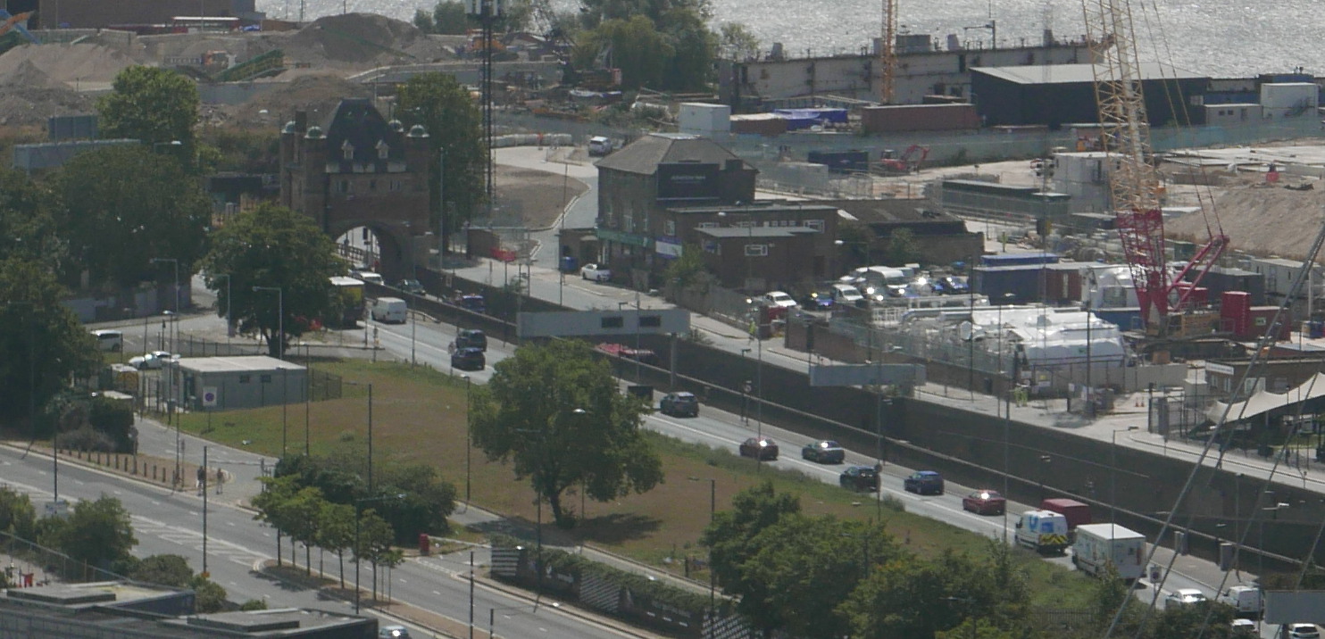
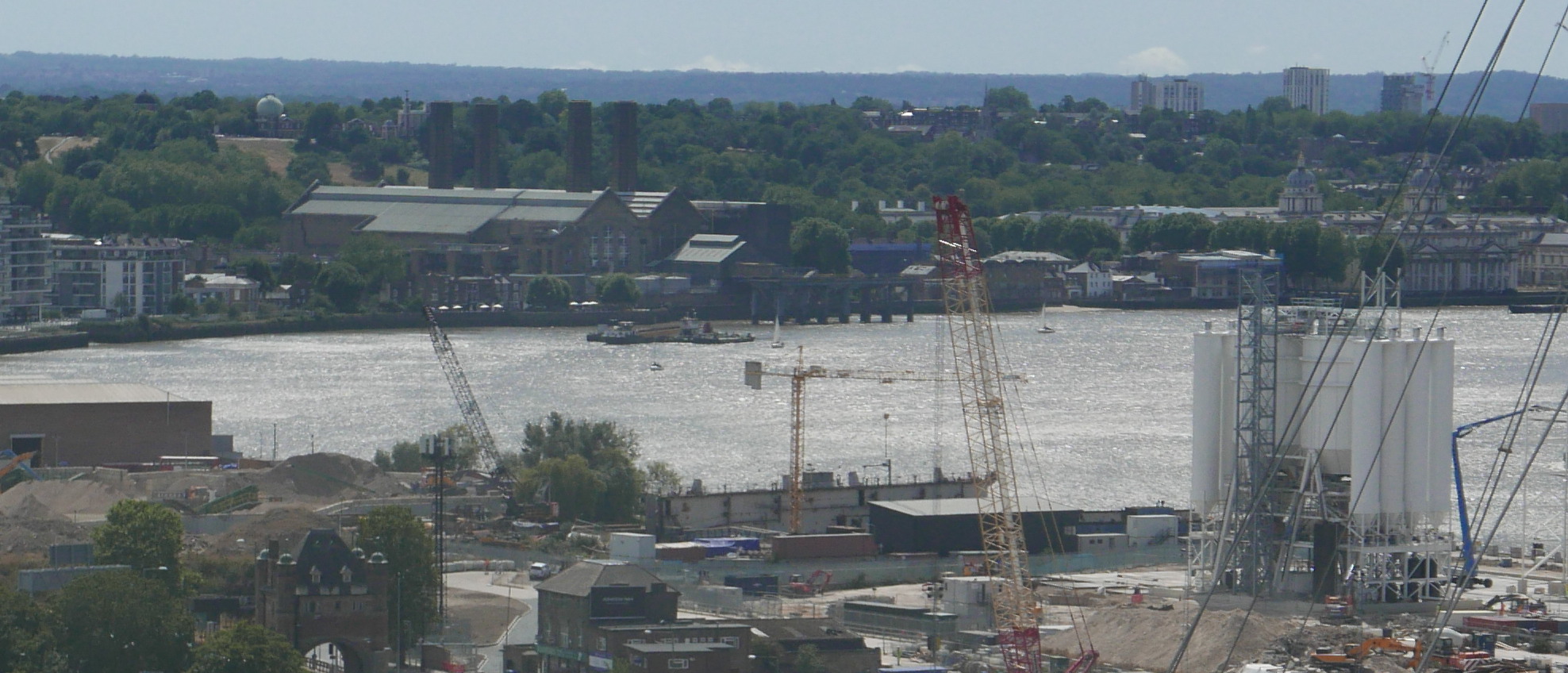
And in the distance (see photo below) we can see Greenwich Power Station, used by TfL to provide backup power to the Underground network. On the hill behind the power station, the Royal Observatory can just be seen, and on the right of the photo, the towers of the old Royal Naval College.

O2

These sights will be disappearing from the top of the O2 Dome as the towers planned for the western edge of the peninsula are built.

The eastern edge of the peninsula perhaps provides some indication of what the western edge will look like in the years to come. Development along the eastern edge has already progressed and now consists of multiple apartment towers of differing designs.

O2

The Greenwich Peninsula is a great place to watch the eastwards march of development along the Thames.

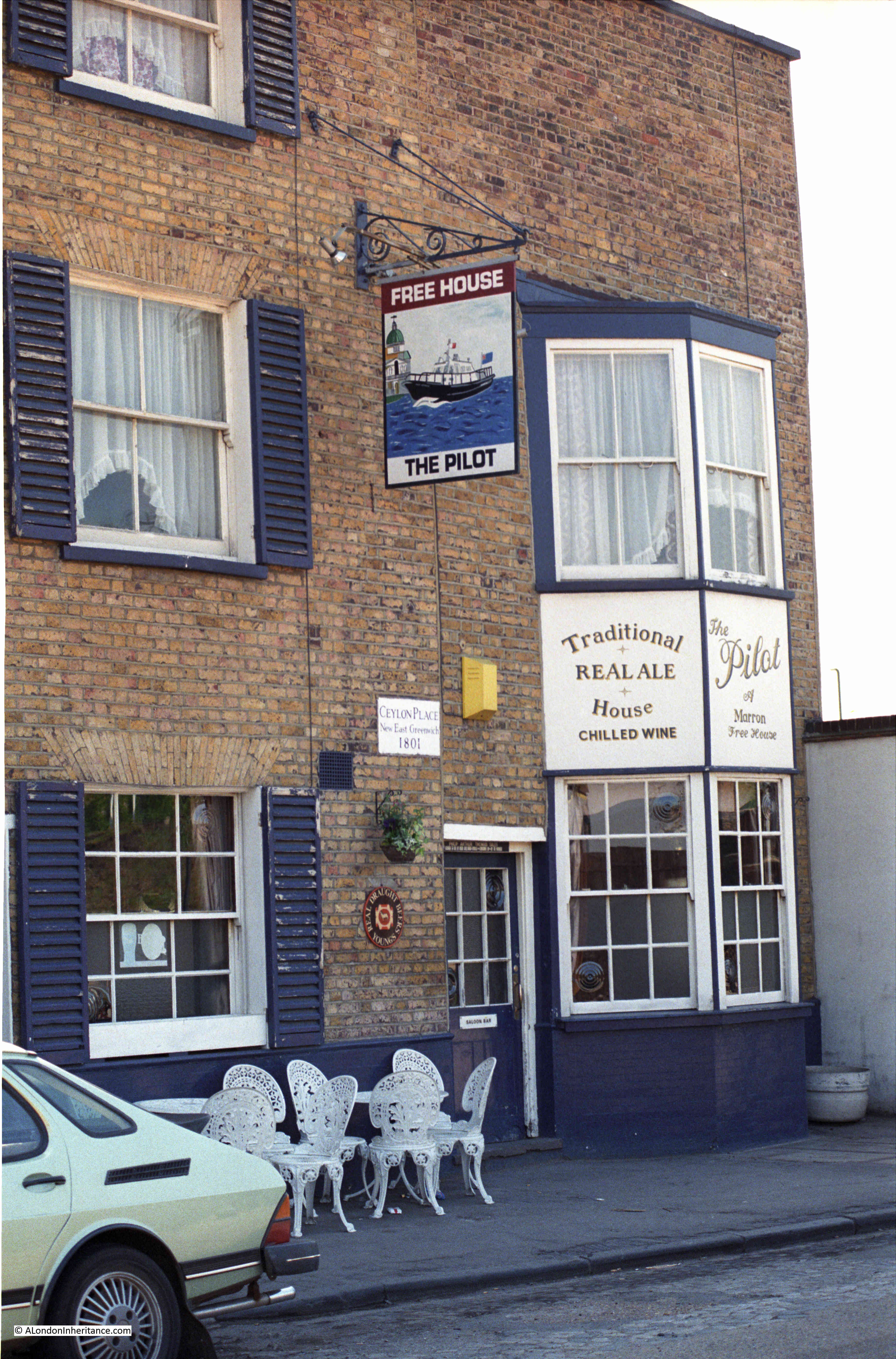
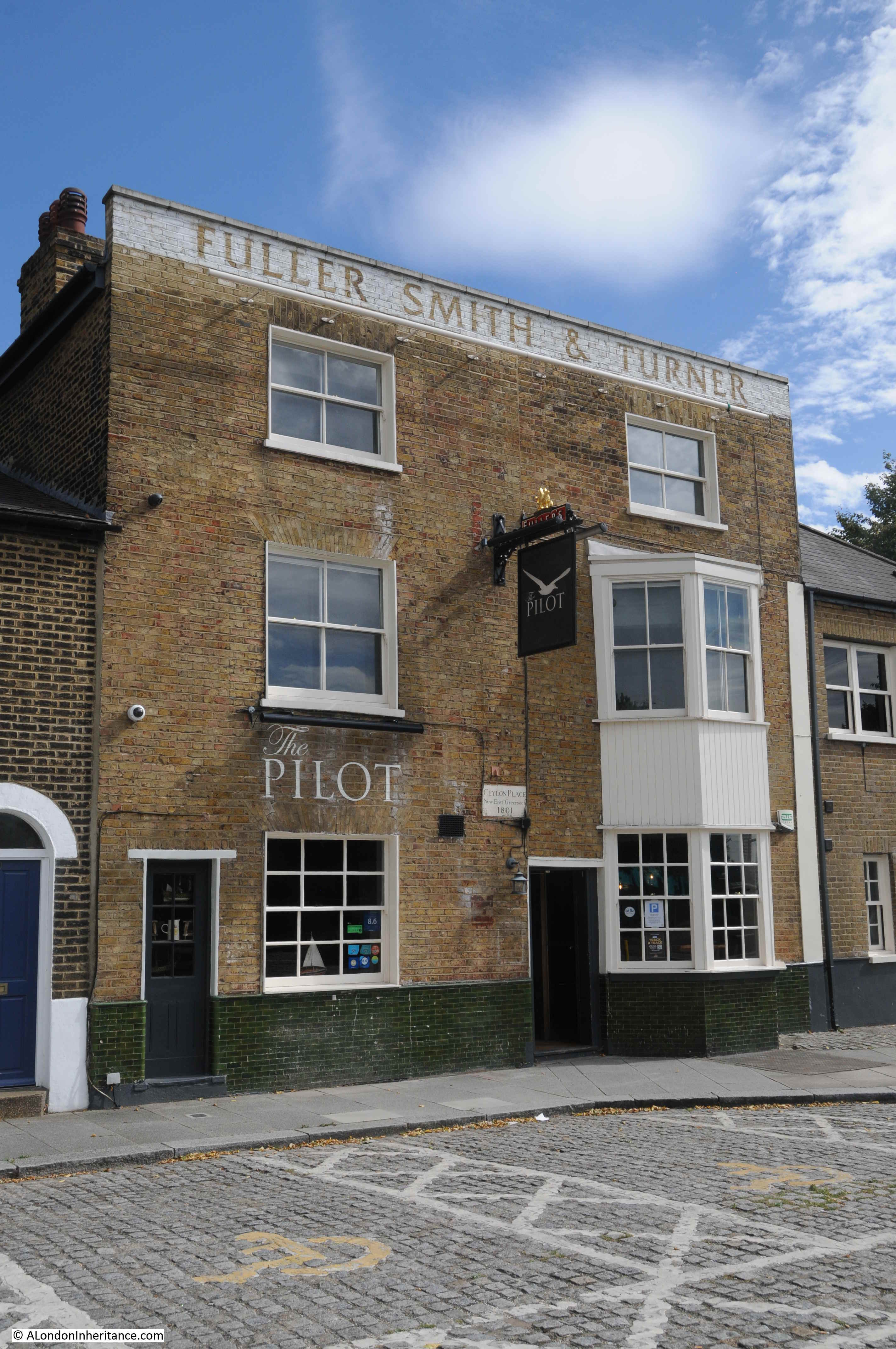
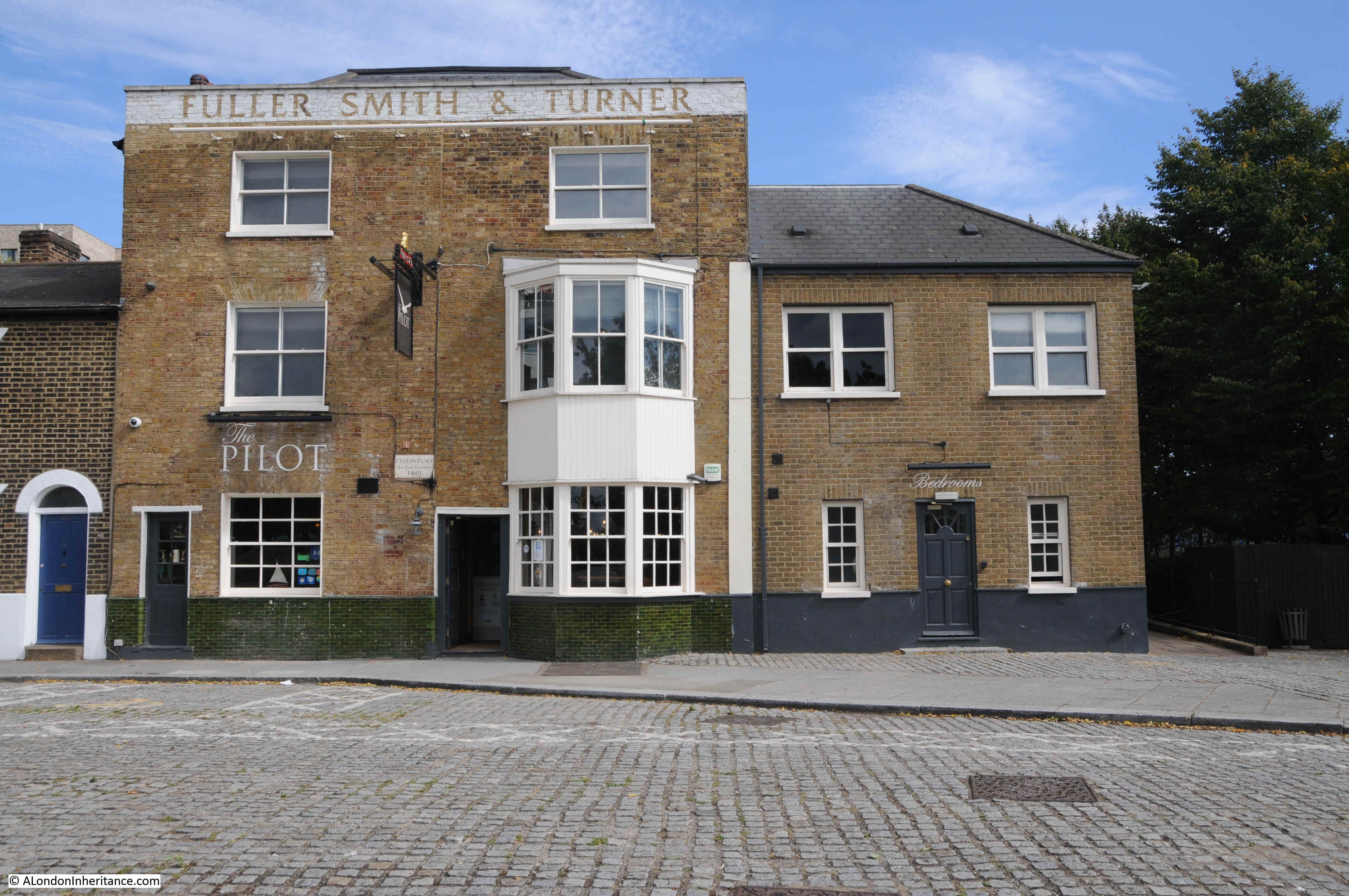
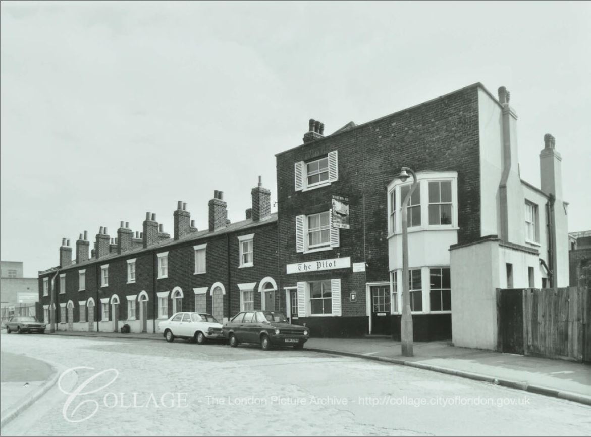
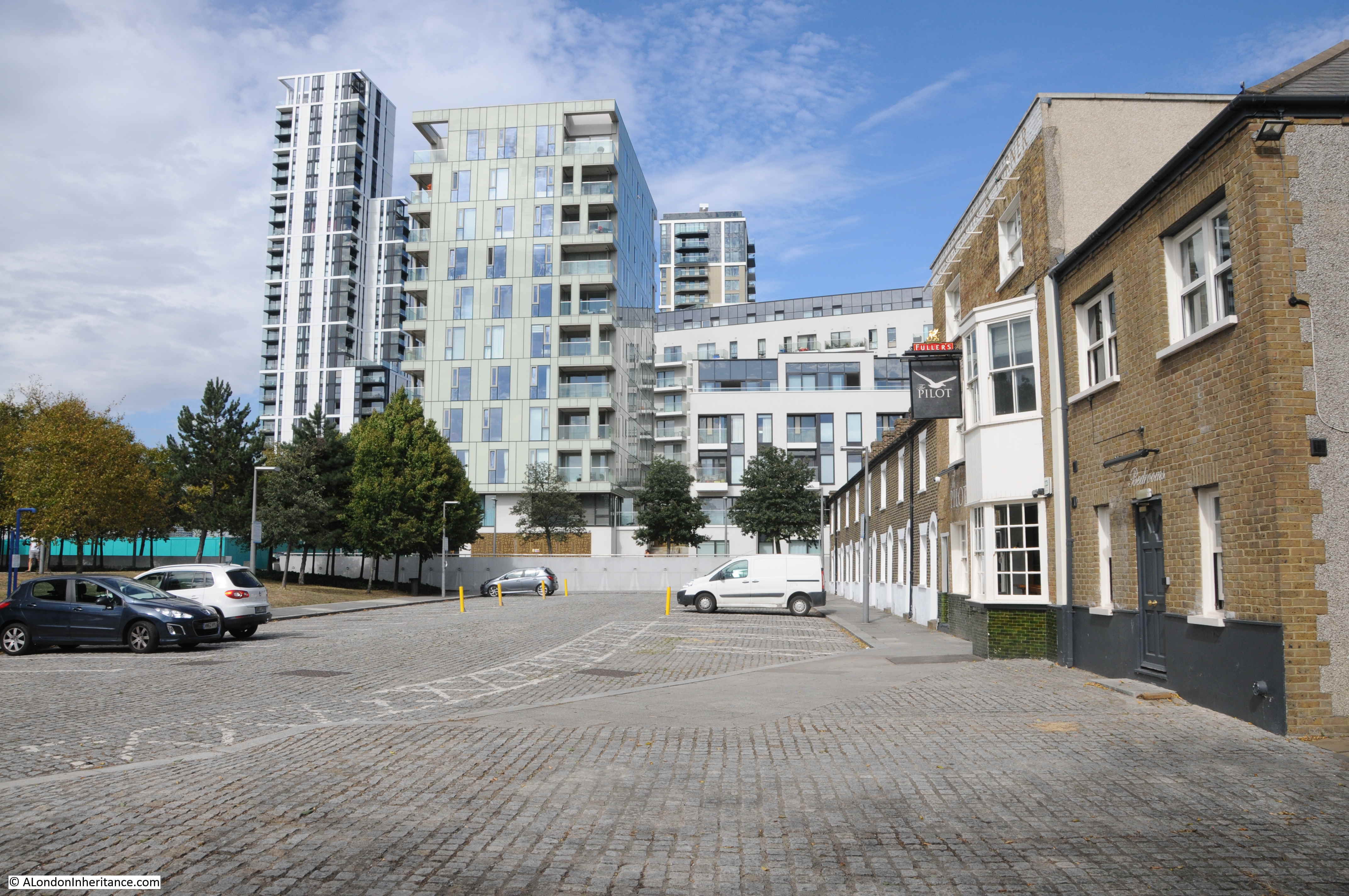
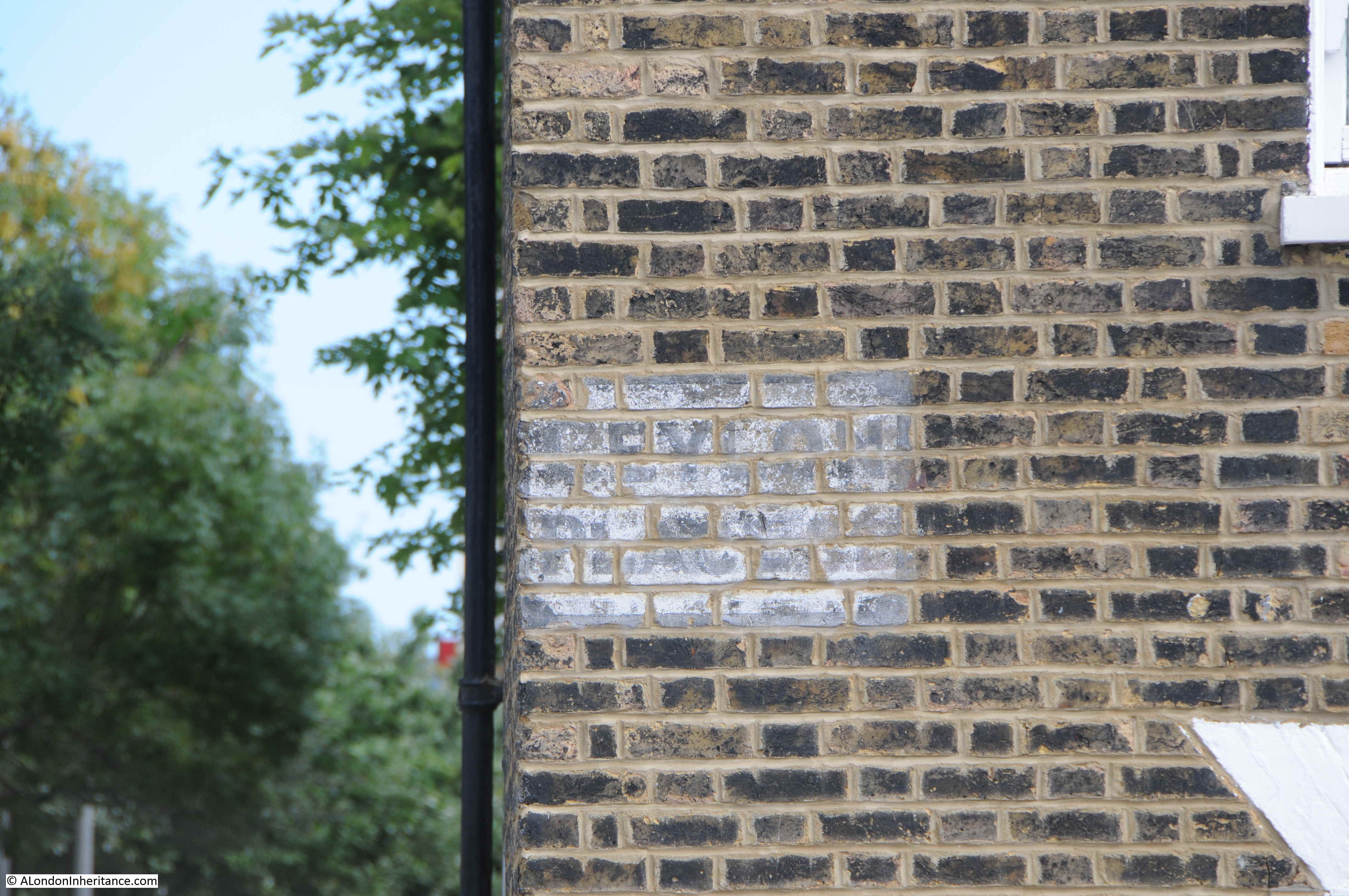
The peninsula will soon be a completely different place if all the proposed towers and associated buildings are built. There will be very little evidence of the peninsula’s industrial past, and what remains, such as the Pilot pub, will be very out of place.

My granddaughter really enjoyed the climb of the O2 Dome, and the views of London from the top. Hopefully she will be back at some point in the future to compare the view then, with her photos taken in August 2020.

For further information on the Greenwich Peninsula I can recommend the Greenwich Industrial History Society, and any of the books and articles by Mary Mills.  “Greenwich Marsh – The 300 years before the Dome” provides a fascinating account of the history of the place.

alondoninheritance.com

Vale of Health

The Vale of Health is a rather unique place. To the north of Hampstead, the Vale of Health is a small enclave, surrounded on all sides by the heath and accessible only via a single road.

In the following map, the Vale of Health is in the centre of the map, with the blue for a pond on the eastern edge, surrounded by the green of Hampstead Heath, with a single road leading down from East Heath Road (Map © OpenStreetMap contributors).

Vale of Health

I had a recent visit to the Vale of Health, the reason being was to track down the location of some photos my father had taken of the general area, and a couple of photos showing the lost Vale of Health Hotel.

The first photo was a general view from the higher ground on the left, as you arrive on the single road that leads into the Vale of Health:

Vale of Health

Although my father’s photos were taken in winter and mine in summer, so in my photos the trees are in leaf, the area is far more wooded today than it was, and the higher viewpoint for my father’s photo is today in among the trees and bushes with no clear view, so my comparison photo was slightly lower down, however the first houses along the road into the Vale of Health can still be seen:

Vale of Health

For his second photo from the same spot, may father turned a little to the left. Much the same view, however a large house on the left of the street comes into view.

Vale of Health

Again showing how much more overgrown this area is today, in the following photo the house is still there, but almost completely hidden by tree growth.

Vale of Health

The Vale of Health is a really unusual place. A single access road leads down into a cluster of houses, with a large pond to the east, and the whole place surrounded by the rest of Hampstead Heath.

The pond is a clue as to why the Vale of Health developed. Originally the area occupied by the Vale of Health was wet and marshy. The springs that pop up around the heath fed into this hollow of land. The area was originally called Hatches or Hatchett’s Bottom, and was also referred to as Gangmoor.

The history of the area really starts with the City of London’s insatiable thirst for clean water. In the 16th century, three reservoirs had been built on the heath to provide water for London, however demand kept growing as the population expanded.

in 1692 the Hampstead Water Company was formed and the Corporation of the City of London granted the company leases on the Hampstead Heath reservoirs.

Demand exceeded the capacity of these reservoirs, so in 1777 the Hampstead Water Company drained the marshy area that was Hatchett’s Bottom and formed a new pond to store and supply water for the City. During the 19th century the Hampstead ponds continued to supply water to the City, but by the mid 19th century, water was only used for non-domestic purposes as the quality was rather poor, described as “somewhat disagreeable to the taste and small and was rather turbid; the sediment deposited was considerable, and contained numerous living organic productions”.

The way that land was given over to ownership and house building on Hamsptead Heath was rather complicated. Long before the heath had the protection it does today, it was open for encroachment and squatting, and frequently those encroaching on the heath, could stay providing they paid a fee to the Lord of the Manor.

Applications for the use of “waste land” were made to the Manor and if approved these were allocated on the basis of a “copyholder” where if the person who was allocated the land died, or sold the land, the person inheriting or buying the land had to pay a “fine” to the Lord of the Manor.

One of the early allocations of land, around 1770, was to a Samuel Hatch, which could be why the area was originally named Hatches or Hatchett’s Bottom.

After the new reservoir or pond was constructed in 1777, more applications for grant of waste land were made. Three cottages for the parish poor of Hampstead were built – the choice of area aware from Hamsptead possibly because the land was cheap and Hatchett’s Bottom was not yet an area where the wealthy aspired to live.

Houses continued to be built, and the area started to change into a desirable residential location. Surrounded by the heath, away from the noise and traffic of Hamsptead, Hatchett’s Bottom was starting to be a desirable location, however the name was probably associated with the marshy ground before being drained for the pond, and the location for parish poor houses so perhaps a new name was required.

The name Vale of Health starts to appear at the start of the 19th century.

There are many theories as to the source of the name, however it is probably simply down to a new name to differentiate the place from earlier conditions and usage.

Although the Vale of Health started to be used from around 1801 onward, the name Hatchett’s Bottom would still be used for several decades after.

Houses continued to be built in the Vale of Health, and the Hampstead Heath location meant that the Vale of Health attracted those who left the city on weekends and Bank Holidays to find somewhere for fresh air and entertainment, and it was the location of one of these places that I went looking for next.

The following photo is my father’s photo of the Vale of Health Hotel. A large 4 storey building facing onto the pond. The view is across an area used as a fairground, and for the storage of fairground rides when not in use. The wooden frame nearest the camera has the words “dodgem cars” just above the top of the fence.

Vale of Health

Roughly the same view today. I should have been a little further back, but this would have taken me into the trees and bushes.

Vale of Health

In the 2020 photo, there is a high wooden fence blocking off the area that was used for fairground storage. The Vale of Health Hotel has been replaced by a high block of flats. The terrace of houses on the right are the same in both photos.

The Vale of Health was a focal point for summer weekends and Bank Holidays when thousands of Londoners would stream up to the heath to escape the city. The hotel offered rooms, bars, food, and verandas overlooking the pond. The area behind the hotel was used as a fairground. The Era on the 17th April 1909 had a small article about the fair:

“In the Vale of Health: Harry Cox, the local showman, proudly boasts that he never exhibits his show concerns away from the Heath. By the side of the Vale Waters you will find him ready to entertain you. Here you will see steam roundabouts, boats, swings, shooters and variety stalls. Harry Cox, Vale of Health Perpetual Pleasure Fair is the great central constellation around which many lesser lights live and shine”.

The following article from the Hampstead and Highgate Express reviewing the April 1888 Bank Holiday Monday on the heath provides a good impression of what it must have been like, and what went on across Hampstead Heath and in the Vale of Health:

“BANK HOLIDAY ON HAMPSTEAD HEATH. On Easter Monday there were probably not far short of 80,000 visitors to Hampstead Heath. The weather was not all that could have been desired, but remembering what a comparatively few days ago it was since the Heath was covered white with snow, the holiday makers may be congratulated that at the beginning of April they were able to get as much outdoor fun as they did.

The fineness of the early morning led many to start from town soon after breakfast to spend a long day on the people’s favourite and beautiful Heath. Trains, tram-cars and omnibuses brought them up in goodly numbers from all parts and ‘all the fun of the fair’ had commenced when at about half past ten, down came a heavy shower of rain from a sullen-looking sky, threatening to spoil the whole day’s proceedings. Fortunately, however, this proved to be but a passing shower, and thenceforth for several hours fairly fine weather prevailed.

By midday the people were swarming onto the Heath, and for a long time it seemed as if the metropolis was sending all its juvenile population especially in this direction. There was plenty of amusement to be found of the kind in which the Cockney holiday-makers most delight on such occasions. Swings, skipping, pony and donkey riding, peep-shows, and exhibitions of curiosities with numberless coconut shies and try your strength apparatus, were in full operation, as to refreshments, tea and coffee stalls, fried fish establishments, and fruit and ice barrows offered their attractions, and by no means in vain, to the ruralisers around with sharpened appetites.

Conjurers, men on very high stilts, a fire-eater, and Punch and Judy also attracted very large crowds, and numerous pennies, and the swings and steam round-about in the Vale of Health did see a large amount of business.

In spite of some horse-play, especially in the Vale of Health, the holiday makers as a whole, behaved themselves well, and only one or two police charges arose out of the day’s holiday”.

The article mentions the “horse-play” around the Vale of Health and it does seem to have been the location of petty crime – perhaps the large numbers of people attracted to the steam fair was the ideal location for crimes such a pick-pocketing. A report in 1885 regarding the August Bank Holiday mentions the arrest of one William Mitcham, aged 16 from Gunn Street, Spitalfields, who was charged with being a suspected person loitering in the Vale of Health for the purpose of committing a felony by picking pockets.

Another of my father’s photos providing a clearer view of the Vale of Health Hotel:

Vale of Health

From roughly the same position today, but again showing how much the trees and undergrowth have claimed back the area which presumably was once relatively clear due to the crowds of people that once attended the fair here.

Vale of Health

To confirm the name, the following is an extract from the above photo, showing the name on the corner of the signage along the roof line.

Vale of Health

The Vale of Health Hotel was demolished around 1962. The Vale of Health was also changing character. No longer the focal point for large numbers of potentially rowdy bank holiday visitors, the area was changing to a rather expensive enclave of housing. A 1962 newspaper article sums up these changes in an article titled “Vale of Wealth”:

“Van horses-what else? There is, of course. Battersea Park, and some people will never forgive Herbert Morrison – Lord Morrison of Lambeth – for setting that up in perennial competition with the old three-times-a-year tradition of the Hampstead Heath Fair.

That fair, in any case, is not what it used to be, what with the etiolated gaieties of the pin-tables. And even the Vale of Health hotel is under threat of being pulled down and made into something rather different.

So Battersea can go on with no serious challenge from the old traditional site. There is, indeed, some rebuilding there and some old Hampsteadians tend to call it now the Vale of Wealth”.

The brick building seen in my 2020 photos on the site of the old Vale of Health Hotel are the flats that were built on the site. They look rather bland from the landward site of the Vale of Health, but walk around the pond and they look very different.

In the following photo, looking across the pond, which was once the Hampstead Water Company  reservoir, built after the 1777 draining of the marshy Hatchett’s Bottom, the new flats are within the mainly white coloured building.

Vale of Health

The Vale of Health Hotel once faced onto the pond, with verandas around the lower floors providing a lovely location for drinking and eating with a view across the pond.

The following photo from the LMA Collage archive shows the view across the pond to the Vale of Health Hotel, with the fair ground set up to the right of the hotel in the space shown in my photos being used for the storage of fair ground equipment. Comparison of the photos also shows how densely the trees have grown up around the pond.

Vale of Health

Image credit: London Metropolitan Archives, City of London: catalogue ref: SC_PHL_01_143_80_3444

A walk around the pond, and the Vale of Health is a lovely way to spend a Sunday morning. There is a walking route around the unbuilt parts of the pond, starting by the road leading into the Vale of Health.

On the north east side of the pond, this is paved and is one of the many walking routes across the heath, which on a Sunday morning seems to be mainly used by joggers and the occasional dog walker.

Vale of Health

Island in the middle of the pond:

Vale of Health

View across to the western edge of the pond:

Vale of Health

The rear of the flats occupying the site of the Vale of Health hotel. The corner of the block behind the tree is the same corner with the name of the hotel on the top corner of the hotel.

Vale of Health

There is a street leading to a dead end that runs in from where the rear of the hotel used to stand. The street also leads to the place where the fair ground equipment was stored in my father’s photo. Although the site of the hotel now has a different use, the area for the fairground is still used for the storage of fairground equipment.

Vale of Health

At the top of the street is a brick terrace called Byron Villas, built in 1903. This terrace of houses occupies the spot of another tavern / smaller hotel that once serviced the needs of visitors to the heath. The blue plaque records that the novelist and poet D.H. Lawrence lived in one of the houses in 1915.

Vale of Health

The oval plaque on the following building records that newspaper founder and editor Alfred Harmsworth, Lord Northcliffe lived in the house between 1870 and 1873.

Vale of Health

There is a single road in the Vale of Health, conveniently called Vale of Health. Even the spur down to where the old hotel was located has the same name.

Maps show what looks like a road called East View where the fair ground equipment store is located, however in reality, this is a small footpath between the front of the houses and the fairground land.

As well as the single road, there are a couple of alleys alongside the rear of the houses.

Vale of Health

House in which Leigh Hunt, the English critic, essayist and poet lived for a time in the Vale of Health.

Vale of Health

The Vale of Health is a rather unique area. A small collection of houses embedded in Hampstead Heath, accessed via a single road.

When the new flats were being built on the site of the Vale of Health hotel, there were considerable difficulties with the amount of water that was continuously seeping into the foundations, so perhaps the marshy hollow of Hatchett’s Bottom is still there below the surface,

alondoninheritance.com

Pubs of the City of London, July 2020 – Part 3

I have finally completed the write up of the third and final part of my walk to find the pubs of the City of London in July 2020. At the end of the last post, I had reached 26 Furnival Street, and my final set of pubs runs from Farringdon Street to Aldersgate Street via Smithfield.

Before starting with the first pub of this final stage, the following map brings together all the pubs that I walked to in the City of London. Clicking on the appropriate marker will take you to the pub in the appropriate post.

Error: The map ID (4) does not exist


From Furnival Street at the end of part two, I walked east to Farringdon Street to find the:

Hoop and Grapes – Farringdon Street

The Hoop and Grapes is an early 18th century pub squeezed between two buildings of much more recent construction.

pubs

The pub was built on a part of St Brides churchyard that was remote from the church,

The pub was near the Fleet prison and the course of the River Fleet. The Hoop and Grape’s website claims that the pub was the site of “Fleet Weddings” which is entirely possible. Fleet weddings were weddings performed outside of the normal process for conducting weddings. They were held when couples did not want to hold a wedding at their home church, when they had to be held quickly, or with some secrecy. An article from the May 1867 edition of the Cornhill Magazine provides some background to Fleet weddings:

“In the days of which we are writing, a large number of dissolute clergymen were to be found within and about the Fleet Prison. Some of these were confined in the prison itself; other of them, although also detained for debt, being privileged to reside within the local of the Fleet. These men discovered in the recent order of the Ecclesiastical Commissioners the means of their own pecuniary benefit.

They at once espoused the cause of candidates for clandestine matrimony, and undertook to meet the popular demand. They began to marry couples on application, without notice and without publicity, the only requirements being the payment of fees; and the amount of these fees was permitted to vary, according to the pecuniary capacities of the applicants for matrimony, although, as we shall hereafter see the parsons invariably secured as large a remuneration for their services as possible.

The marriages were at first often solemnized in the Fleet Chapel; but the Act at length put an end to their celebration there, and henceforth they took place in various brandy shops and other places in which the parsons lodged, or still oftener in certain taverns which came to be known as regular marriage houses, the landlords whereof derived their profits from matrimony just as they did from malt liquors. In many cases rooms were especially fitted up for the performance of the marriage ceremony, and these apartments were often dignified with the title of ‘chapel’ the name of a saint being sometimes prefixed to the word chapel in the ordinary manner. As soon as the Fleet became associated in the public mind with clandestine marriage, it was voluntary resorted to by many abandoned clergymen”.

So the next time you drink at the Hoop and Grapes, remember the many clandestine marriages that probably took place within the building.

The Hoop and Grapes had a special licence for many years, allowing the pub to open between two and five in the morning for the convenience of printers who worked in nearby Fleet Street. The licence only allowed the pub to serve those working in the newspaper trade, and other trades which involved night or early morning working, such as London’s markets. Pubs that held these special licences often were not too careful in checking that their customers worked in the allowed trades.

In March 1894, the landlord of the Hoop and Grapes was fined £5 for serving persons who were not connected with the newspaper or market trades.

The Hoop and Grapes was under threat of demolition in the 1990s, when the buildings surrounding the pub had already been demolished. The building was saved and Grade II listed in 1991. The Historic England listing states that the pub was built for a vintner around 1720 and converted to a public house in 1831, and that brick vaults in the basement are thought to be part of 17th century warehousing vaults built in connection with the formation of the Fleet Canal.

Full view of the Hoop and Grapes:

pubs

Leaving behind the Hoop and Grapes, I cut through from Farringdon Street to Limeburner Lane, then up Old Bailey to find:

The Viaduct Tavern – Newgate Street

The Viaduct Tavern was undergoing some external renovation and would have been open under normal circumstances.

pubs

The Viaduct was built between 1874 and 1875 with latter interior changes between 1898 and 1900 by Arthur Dixon. Without the scaffolding, the Viaduct is an impressive later Victorian, curved corner pub, and is Grade II listed.

There are a number of legends / urban myths about the Viaduct. It is claimed to be one of the most haunted pubs in the City, and also that the cellars were once the cells of Newgate prison, which was across the road. Even Google maps describes the Viaduct as “Pub in former jail”

Not something I believe as they look like normal beer cellars with racking for barrels and bottles, not cells. If they were I would also have thought they would have been part of the Historic England listing.

From the Viaduct, I walked up Giltspur Street to West Smithfield to find:

The Bishops Finger – West Smithfield

The Bishops Finger is on the west side of the street that circles round the central space in West Smithfield. A late 19th century building with some rather ornate decoration between the top two windows:

pubs

The Bishops Finger name dates from 1981. The pub had been purchased by Shepherd Neame in the 1970s, and the change in name was to name the pub after one of their leading beers.

The pub had originally been called the Rutland and had also been the Rutland Hotel.

Above the first floor window on the right is the year 1890 which dates the construction of the building, however there must have been a previous establishment called the Rutland on the site prior to the 1890 build. Newspaper reports of a Rutland in West Smithfield include an advert on the 19th October 1864 in the Clerkenwell News for “Girls (Two clean, respectable), wanted, 16 or 18 , used to a Coffee House, must be able to wash. The Rutland, Smithfield”.

So the Rutland was probably a coffee house before changing to a hotel and pub which may have been when the new building was built. The name Rutland may have come from the old English county of Rutland.

The Duke of Rutland was a frequent exhibitor of cattle at Smithfield and the Rutland Agricultural Society were frequently involved with Smithfield, promoting the agricultural produce of their county.

The pub sign today, reflecting the pub’s current name:

pubs

Sign in the window summing up the position of City of London pubs in July 2020:

pubs

According to the Bishops Finger’s website, they are still closed, so not yet back to normal.

West Smithfield is ringed by a number of pubs in addition to the Bishops Finger. The proximity of Smithfield Market would have generated large amounts of business for these establishments.  Across the central space from the Bishops Finger is:

St Barts – West Smithfield

I was not sure whether to include the St Barts. It is not a traditional pub, but as it occupies such a prominent position in West Smithfield I have included it in the post.

pubs

Named after the local hospital, the St Barts is owned by the Hush Heath wine estate in Tonbridge, Kent. It seems to be more of a wedding venue, and available for event hire, with operation as a walk in pub during the week. Before being called the St Barts, it was a business known as Jamies Bar, however I believe the building was originally a bank.

On the corner facing Smithfield is the date “Erected 1885”, which gives a clear date for the building, however on the side of the building facing Long Lane are the words and date “Established A.D. 1825”, so I am not sure exactly what was here, and what was established in 1825.

Another pub that is only a recent pub is the:

Butcher’s Hook and Cleaver and Fuller’s Ale and Pie House – West Smithfield

I have bundled these together as although they look like very different pubs, they are both owned by Fuller, Smith and Turner and are effectively a single pub. The Fuller’s Ale and Pie House is the corner building and the Butcher’s Hook and Cleaver is the building on the immediate left.

pubs

They were both opened in 1999, with the corner building originally being a Midland Bank, and the building to the left were the offices of a meat wholesalers.

Walk into Cloth Fair, the street alongside the Fuller’s pub and there is an old pub:

The Rising Sun – Cloth Fair

The Rising Sun occupies a corner position on Cloth Fair, with the narrow Rising Sun Court running alongside the pub down to Long Lane.

pubs

The Rising Sun is an old pub that has kept its original name for the last couple of centuries. The earliest written reference I can find to the pub is from the Morning Advertising on the 29th December 1818, when the landlord of the Rising Sun, a Mr Swift was one of the stewards for the 25th anniversary celebrations of the Friendly Society of Licensed Victuallers.

A pub has probably existed on the site for several centuries, as a survey in 1616 recorded a pub called the Starre Tavern in the same location as the Rising Sun.

One of the more unusual references in newspapers to the Rising Sun dates from 1945. During the war, businesses bombed out of their normal building had to find temporary offices and in October 1945 the Maurice Dixon Musical Service, who provided orchestral services to theatres in the West End were advertising that their temporary address was the Rising Sun.

The pub sign of the Rising Sun:

pubs

The Rising Sun was closed in the early 1970s, but fortuently the pub was purchased by a brewery and opened later the same decade. The state of the Rising Sun in 1971 can be seen in the following photo from the London Metropolitan Archives, Collage collection. I suspect anyone seeing the pub at the time would not have expected it to survive.

pubs

Image credit: London Metropolitan Archives, City of London: catalogue ref: SC_PHL_01_022_71_1551

The Rising Sun is a lovely pub at any time of year, however my favourite time to visit is during a winters weekend evening when the streets around Cloth Fair are quiet and the light from the windows of this small corner pub offer a warm welcome.

The view from Rising Sun Court up to St Bartholomew the Great:

pubs

From Rising Sun Court I walked along Long Lane to find one of the few businesses that was busy – having just been allowed to open.

pubs

Further along Long Lane was:

Old Red Cow – Long Lane

The Old Red Cow is a lovely red brick building facing onto Long Lane. The lower left of the ground floor is an alley which leads through to the passages between Cloth Fair and Long Lane.

pubs

As with the Rising Sun, the Old Red Cow is an old pub. Although the current building dates from 1854, a pub with the same name had already been on the same site. The first reference I can find is from September 1803 when the Old Red Cow was one of the places involved with the trial of someone who was alleged to have stolen a parcel of valuable Spanish wool.

Facing onto Smithfield Market, the Old Red Cow was popular with market workers and the market must also be behind the source of the name of the pub.

Walking through the alley next to the Old Red Cow, I walked back into Cloth Fair to find:

The Hand and Shears – Cloth Fair

The area around Cloth Fair really does have some good pubs, and the Hand and Shears at the junction of Cloth Fair, Middle Street and Kinghorn Street is one of them.

pubs

The Hand and Shears was one of the pubs photographed by my father in 1952:

pubs

The Hand and Shears has a fascinating history, including involvement with the Bartholomew Fair held on the fields of Smithfield.

I have written a full post dedicated to the Hand and Shears which you can find here.

From Cloth Fair, I walked to Aldersgate Street, then south to St Martin’s-le-Grand for my final pub:

Lord Raglan – St Martin’s-le-Grand

The Lord Raglan is squashed between a couple of office blocks. It is a pub with a long history.

pubs

The current building dates from 1855 when the previous pub on the site became the Lord Ragland Hotel.

A pub has been on the site since at least the 16th century, when it was known as the Fountain. It later became the Bush, and then the Mourning Bush. The source of the name “Bush” is interesting as it dates from the times when many people were illiterate and picture signs directed people to the right place. The Globe in September 1903 referenced the pub in St Martin’s-le-Grand:

“And before inn signs became the heterogeneous, unmeaning medley of heroes and landowners heads, of blue boars and other heraldic monstrosities, there were two or three emblems which were the chosen sign of the the vintner’s and ale-seller’s trade. Some used chess-board pattern on their shutters and so became known as the Chequers, a name still used; but the common signs were the red lattice and the ivy bush. It is of course from this ancient vintner’s custom of hanging out a green bush as a sign that we get our proverb ‘Good wine needs no bush’

The bush was always of ivy, the custom thus preserving the association of ivy with Bacchus which takes us back to classical times. 

A tavern-keeper in Aldersgate Street, when Charles I was beheaded, painted his artificial bush black, and his house was long known as “The Mourning Bush’ at Aldersgate. To ‘beat the ivy-bush’ became a recognised slang phrase for the habit of tavern-frequenting.”

The article refers to the Mourning Bush being in Aldersgate, and this street name seems to have been used as well as St Martin’s-le-Grand as the pub was so close to the junction of the two streets and the site of the original City gate.

The pub changed name during the Crimean War to Lord Raglan.

Lord Raglan was Field Marshal FitzRoy James Henry Somerset, who in 1854 was commander in chief of the British troops during the Crimean War.

Lord Raglan now looks out over St Martin’s-le-Grand from the sign of the pub that bears his name.

pubs

The Lord Raglan ended my walk around the pubs of the City of London in July 2020.

When writing this post I checked the web site of many of the pubs I have covered, and a number of them are still closed, and there must be concern for the future of many of these institutions.

Train travel and passenger numbers on the Underground are still a fraction of their pre-March levels. The majority of City workers are still working at home, and I suspect this will be a long term trend.

I downloaded the latest transport data for London from the Government Statistics website. This has data comparing passenger numbers on each day as a percentage of the equivalent day in 2019. I created the following graph using the data in the spreadsheet from the 1st March 2020 to the 10th August 2020, showing the percentage against the equivalent day in 2019 for travel on the London Underground:

pubs

The graph shows that last Monday, the 10th August, travel on the Underground was still only 28% of the same day in 2019. The situation for London buses is better, but still very low compared to a normal day:

pubs

The drop to zero is the period when Transport for London introduced the middle-door only boarding policy, with no requirement to touch in, so obviously lost any meaningful passenger number data.

The graph shows that on Monday 10th August, bus passenger numbers were still just over 50% of the number on the equivalent day in 2019.

The Government site does not have London specific National Rail data, however it does have comparison data covering rail traffic across the country, so London will be included in these figures. Again up to Monday 10th August, however the last 7 days are provisional so will be updated with final figures. The graph does show a similar drop in rail usage, which if you have been to any of London’s main stations will be easily confirmed.

pubs

These graphs reflect not just the work at home approach, but also the loss of tourism in London, which will also drastically impact so many businesses and jobs across the city.

On the days I have been in the City over the last few weeks, it has been a shadow of its former self. The streets are quiet, many of the take away food shops are still closed, there are few workers in offices.

Businesses will realise that they do not need everyone in an expensive office, every day, indeed many of the large City financial companies have already announced that they do not expect staff to have to work onsite in the City, full time, in the future.

Technology has for some time enabled many office based jobs to be done from anywhere and the Covid pandemic has accelerated the deployment and take-up of this method of working. Workers will also realise they can make substantial savings in terms of the cost and time of travel.

There will always be a need for people to work together, in an office for specific activities, and it is essential that there is a level of human interaction. I suspect that numbers of City workers will gradually rise, but will never get back to pre-March levels. Many City workers will get to a mix of work from home and work from office.

The impact on the City of London will be interesting to see. Will there be sufficient business to support not just the pubs, but all the other businesses that rely on many thousands of commuters travelling into the City, five days a week.

Will the City need so many steel and glass office towers, and will some of the planned future towers be built?

I will aim to take a walk around the same pubs as I have covered in these three posts in five years time. I hope I will find they are all still in business.

alondoninheritance.com

Where the Victoria Line breaks through an Islington Square

Islington is full of wonderful squares. Created during the first half of the 19th century as London expanded over the agricultural fields that once characterised so much of Islington. Individual developers built terrace streets and often included squares where the houses benefited from a central garden.

These squares offered a peaceful place to live. Away from the traffic and noise of Upper Street and Essex Road, but still with easy travel into the heart of the city. One such square is Gibson Square, however the tranquility of Gibson Square was lost in 1970 when the Victoria Line burst through the surface of the gardens with a rather ornately designed ventilation shaft that now emits the noise of fans across the square.

Construction of the Victoria Line commenced in 1962 following completion of an earlier test tunnel. The line was opened in stages, with the Walthamstow Central to Highbury and Islington section opening in September 1968, with Highbury and Islington extending to Warren Street in December of the same year.

It was this second section to Warren Street that went underneath Gibson Square. The overall line included roughly 50 ventilation shafts, with a shaft being built at the half way point between stations. Gibson Square is roughly half way between Highbury and Islington and King’s Cross St Pancras Stations, so it was here that London Transport decided to build a ventilation shaft.

These were usually of a purely functional design, a concrete block of up to 50 feet high. The residents of Gibson Square were understandably not happy.

Many Islington Squares in the 1960s were run down, and the terrace houses were owned by landlords, only interested in maximising profit, rather than spending on the upkeep and improvement of their buildings. London Transport probably expected minimal opposition to their plans, however a determined group of local residents led a campaign against the ventilation shaft during the 1960s.

They took their protest to London Transport and the Ministry of Transport. They also had the surprising support of the architect Sir Basil Spence. Surprising as he was responsible for a number of buildings in the Modernist and Brutalist style, including the former Home Office building at 50 Queen Anne’s Gate and tower block of Hyde Park Barracks.

After many design iterations, a much smaller ventilation shaft was designed by the architects Raymond Erith and Quinlan Terry. Completed in 1970, the ventilation shaft looks like a small temple, with three niches facing into the park with a pediment above.

Gibson Square

Whilst the architectural style of the ventilation shaft blends in well, the sound emitted by the shaft probably does not. Walk into Gibson Square and the background hum of fans permeates the whole of the square. The following video clip gives an impression:

The Victoria Line cuts diagonally across Gibson Square. The line was constructed in the days before lasers would be mounted on buildings along the route to check for any impact from tunneling. and tunneling did cause some settlement to some of the houses.

The following map shows the route of the Victoria Line between King’s Cross St Pancras and Highbury and Islington stations. The line is shown by a light grey, dashed double line. I have marked Gibson Square by a red oval (Map © OpenStreetMap contributors).

Gibson Square

The gardens were taken over as a construction site for several years, but were restored by London Transport following completion of work on the ventilation shaft. This included the provision of new iron railings around the gardens to replace the chicken wire which had been there since the original railings were removed during the war.

View of the gardens looking south from the ventilation shaft:

Gibson Square

The land on which the square was built was held by the Milner-Gibson family who came from Theberton in Suffolk, hence the name of the street, Theberton Street which was the first to be built to the south of the square.

The majority of Gibson Square was completed by 1839 and by the mid 1840s the square had been finished in much the same way as we can see today.

The view looking north along the western side of Gibson Square from Theberton Street:

Gibson Square

The architect for much of the street was Francis Edwards, and it was his use of pavilion blocks at the end of each long terrace that give Gibson Square a distinctive appearance when compared to other Islington squares. An example of one of these pavilion style buildings is shown below:

Gibson Square

As with so many streets and squares, they were developed in stages, and by different builders and architects. Although Francis Edwards was responsible for much of the square, other designs were used, and this can be seen in the sudden change in style along a terrace:

Gibson Square

The following photo shows the view looking south from the north of the square. The building at the end in Theberton Street also makes use of the triangular pediment at the top of the facade with supporting dual pillars on either side.

Gibson Square

The feature is offset when looking down the centre of the street. I could not work out why. I did wonder if the street had been widened. It could be that the feature at the end is more central when walking on the pavement rather than in the road, or it could be just that Theberton Street was built first before Gibson Square was laid out.

The following photo shows one of the Pavilion style buildings at the northern end of Gibson Square. This block comprises three houses with architectural features on the facade to give the impression that this is a single house. The houses either side of the centre house have the same size windows as the rest of the terrace, however the central house has been given larger windows to help the illusion of a single house.

Gibson Square

The separate doors give the game away. The entrance door to the house on the right is on the side of the house facing the street at the top of Gibson Square.

The fields that Gibson Square was built on was part of a parcel of land that stretched further north, although the shape was rather elongated. Bounded to the east by a large saw mill that would later become the Post Office complex and current apartment, resturant and shopping space of Islington Square, and on the west by Liverpool Road.

The Milner-Gibson family built a second square on this land to the north of Gibson Square, and perhaps unsurprisingly called this second square, Milner Square.

To reach Milner Square there is a short stretch of road named Milner Place. The view from Milner Place looking south along Gibson Square:

Gibson Square

And looking north to Milner Square which is slightly offset to Gibson Square, with the central garden being visible from the eastern road from Gibson Square. The offset was down to the shape of the land available for building.

Gibson Square

Milner Place and Milner Square – preserving along with Gibson Square, the name of the Gibson-Milner family.

Gibson Square

Milner Square is very different to Gibson Square. Completed by the early 1850s by the architects Alexander Dick Gough and Robert Lewis Roumieu, the street presents a continuous terrace of houses with no features to break up the terrace. Even the chimney stacks are hidden from view.

Gibson Square

Unlike Gibson Square, Milner Square was completed to a single plan by the same architects. The terrace also wraps around the corners of Milner Square into Milner Place.

There were plans for a church to be built where part of the above terrace stands. To cater for the spiritual needs of the growing population of Islington, squares often had a church built at the same time. Local examples include Cloudesley Square and Thornhill Square, however for some reason, the Milner Square church was not built.

There are some features in the square which are not that obvious. If you look at the photo below, there is a silver car on the left of the photo, parked side on in the view. Behind the car there appears to be one of the many entrance doors that run at equal intervals along the terrace.

Gibson Square

However, this single door is not a door, rather is an entrance to a passage through to Almeida Street.

Gibson Square

Walking through the passage takes you into a very different place, compared to the regimented rows of terraces along Milner Square. Plants flow over the garden walls at the back of the houses on Milner Square.

Gibson Square

Looking back to Milner Square – one of those London passageways that will always look good at night, with a single lantern providing light to the 19th century passage.

Gibson Square

From the end of the passage, we can see the difference between the front and rear of the houses in Milner Square. The front facade was the expensive part, decorated with stonework, whereas at the rear of the houses, plain brick and no decoration.

Gibson Square

Both Gibson and Milner Squares went into decline after the last war, as did much of Islington. Reading through newspaper reports that mention the squares during the 1950s, 60s and 70s, they tell stories of those living in the squares being involved with thefts and prostitution. Even those who lived in the squares in full time jobs were involved in crimes, for example a porter who worked at Marylebone Station stealing from post bags.

The 1980s onward saw a gradual change in Gibson and Milner Squares as houses were renovated. Milner Square was one of Islington Council’s street renewal projects in 2008.

In May of this year, one of the houses in Gibson Square sold for £2,375,000.

Both squares tell the history of the northward expansion of London through Islington.

Gibson Square also has visible and audible evidence of the Victoria Line that passes below the square.

Gibson Square has one final link with London’s transport system. It is the destination of run number one in the “knowledge” qualification used by London’s taxi drivers. Run number one covers the route from Manor House Station to Gibson Square.

alondoninheritance.com

The Pilot and Ceylon Place, Greenwich

Thirty five years ago, my father was outside the Pilot in Greenwich. Located on the peninsular which now has the O2 Dome at the northern tip, the Pilot is one of the very few original buildings left after the recent and ongoing development of the Greenwich peninsula.

The Pilot pub in 1985:

Pilot

Last week I returned to the Pilot to take a comparison photo and for a beer. Although redecorated, and no longer a free house, the pub looks very much the same.

Pilot

The Pilot is at the end of a short terrace of houses, originally going by the name of Ceylon Place.

Pilot

The location of the Pilot, and the terrace is shown in the following map, marked by the red oval. The O2 Dome is at the top of the peninsula (Map © OpenStreetMap contributors).

Pilot

From the above map, it is hard to appreciate the level of development on the peninsula. The O2 Dome, or Millennium Dome as it was, kick started development of the area, and after a use was finally found for the dome as a major London concert venue, development on the peninsula has been a permanent activity, with apartment towers, offices and hotels of strange design rising from this once industrial landscape.

The Pilot and the terrace at Ceylon Place have are remarkable history, dating back to the early development of this part of Greenwich. The level, and type of change over the last couple of hundred years has been such that the pub and terrace have been surrounded by incredibly different landscapes.

We can explore these by looking at maps. The above map extract shows the area now dominated by the O2 Dome, and the associated developments, however, going back to 1951, and this was a very industrialised place. The Pilot and terrace is highlighted by the red oval in the following map extract (Following maps: ‘Reproduced with the permission of the National Library of Scotland’:

Pilot

There are a few other terraces, in addition to Ceylon Place, however the majority of the land is occupied by Gas Works, Tar Works, Electricity Generation, a Steel Works, and many other smaller industrial sites. The following map extract is an enlargement of the area around the Pilot and Ceylon Place, which are in the centre of the map.

Pilot

The pub and terrace face onto River Way which leads down to the Thames. A cooling pond occupies much of the space directly opposite. A railway runs to the west, Behind the terrace is a steel works.

Much of the development of the peninsular was during the later part of the 19th and early 20th century. If we go back to 1893, we can see the start of the industrialisation of the peninsular.

The Pilot pub and Ceylon Place can be seen, with a longer terrace that stretched to the east. Much of the immediate surroundings are open space, and the railway has not yet arrived. The area to the south are the Greenwich Marshes.

Pilot

Looking at an extract from the above map, we can see the terrace in 1893, with the Pilot (labelled P.H.) at the western end of the terrace as it still is today.

Pilot

At the eastern end of the terrace, there is a large building called East Lodge with open space leading down to the river and bays on either side – presumably bay windows to provide a good view of the Thames.

The majority of the terrace, and East Lodge would disappear in the coming years. By the 1913 Ordnance Survey map, East Lodge had gone. and by 1939 much of the terrace had also been lost, leaving only Ceylon Place we see today, and the Pilot pub.

In all this time, the Pilot has looked out over a very different landscape. Once surrounded by open space and marsh land, the Pilot was then surrounded by some of the most polluting industries to be found in London, then as industry in the area closed, the pub looked out on a derelict landscape.

Today, the Pilot looks out on yet another very different landscape. A ten minute walk from the O2 Dome, in the middle of a green space, and in the process of being surrounded by tower blocks of ever more outlandish design.

The Pilot and the terrace date from 1801. A plaque on the front of the pub to the upper left of the main entrance confirms the date, the name Ceylon Place and New East Greenwich which was the name given to the development, as it was expected to form the basis of a larger development.

The main body of the pub is original, however, as will be seen when comparing my father’s photo, and my photo below, a smaller extension to the right has been added. This now provides accommodation, so if you want to stay on the Greenwich Peninsular, there is an option with a pub attached.

Pilot

The London Metropolitan Archives Collage collection has a photo of the Pilot and terrace dating from 1979. The Pilot looks the same as in my father’s photo, with the same pub sign, however look closely at the terrace of houses and you will see three of these have their window and door bricked up. The 1970s and 80s were the time when industry in the area was in significant decline, and it is surprising that the terrace has survived to this day.

Pilot

Image credit: London Metropolitan Archives, City of London: catalogue ref: SC_PHL_02_0976_79_5000

The street in front of the pub and terrace now ends in a dead end, rather than running down to the causeway that ran into the Thames. Today, blocks of apartments now separate the Pilot and terrace from the river that for much of their time, must have been a significant influence on the lives of those who lived in the houses and drank in the pub.

Pilot

We can get a good idea of life in the terrace and pub by looking at old newspaper reports. When first built, the rear of the terrace looked out onto the Greenwich Marshes and a maze of ditches draining into the Thames, however in July 1857, the Kentish Mercury reported that:

“The inhabitants of Ceylon-place, East Greenwich complain of the very offensive state of the ditch at the back of their houses. They inform me that this ditch, like all other ditches on the Marshes, was formerly flushed out at every tide, but since Mr Wheatley has lately stopped up a sluice at the entrance to the ditch. The water is, therefore, become stagnant, and is certainly in an offensive state, and thereby causing the nuisance complained of”.

There were the day to day events that would have had significant personal impact, to those who lived in the terrace. On the 30th May 1840:

“POOR MAN’S LOSS – On Saturday evening last, as a poor labouring man was going home, after work, he lost the whole of his wages, amounting to 30s, besides some papers which, to the owner, are of consequence. The finder of the documents would be doing an act of great kindness by forwarding the same to No. 3, Ceylon Place, Greenwich”.

There was the type of crime common when drink was involved. In March 1903 the Woolwich Gazette reported that:

“Frederick Boos, a foreign seaman, of s.s. Hendon, was charged on Thursday at Greenwich  with assaulting a waterman, named Russell Lewis, of 6, Ceylon Place, East Greenwich. The victims head was bandaged and he said he was suffering from several bad cuts, said the prisoner hit him several times without any provocation. Boos alleged that the prosecutor had been making false statements about him and that he (Boos) was drunk at the time – Two months hard labour”.

The victim, Russell Lewis is recorded as being a waterman of Ceylon Place. Checking the census data reveals that this was a common occupation for those living in the terrace in the 19th century. In the 1871 census, there were several watermen, and watermen’s apprentices among the occupants of several of the houses.

Another mention of a Waterman living at Ceylon Place is from the Kentish Mercury on the 3rd April 1885: “A PUGILISTIC WATERMAN – Charles Watkins, waterman, of 8 Ceylon-place, East Greenwich, was charged on summons of assaulting another waterman named Richard Preddy. The complainant said he was sitting on a seat at the Anchor and Hope Wharf, waiting for a ship to come up the river. He heard footsteps and saw Mr Watkins, who pulled off his coat and wanted him to fight; he told him to put on his coat, when the defendant struck him in the face, and then they both fell over the seat”.

Charles Watkins was fined 20 shillings with 2 shillings costs for the attack.

The majority of the other inhabitants were recorded as being labourers. One, a Mrs Elizabeth Elliott, widow, aged 74 was on the Parish Poor Relief. This was a very working class terrace.

There were other professions, perhaps unexpected in such an industrial area. In 1901, a resident of Ceylon Place was up before the Lord Mayor:

“THE SERIOUS CHARGE AGAINST A GREENWICH MAN – At the Mansion House on Thursday last week, Charles Rayner, aged 23, described as a music-hall artiste of Ceylon-place, Greenwich was again before the Lord Mayor on the charge of being concerned with another man in stealing £10 from the Falstaff Restaurant, Eastcheap”.

Publican’s were in danger of prosecution if they continued to sell alcohol to those already drunk, and in July 1908, in an article entitled The Peril of the Publican, it was reported that:

“Mary Ann Millington of the Pilot public-house, Ceylon-place, East Greenwich, was summoned for selling intoxicating liquor to a drunken person, and for permitting drunkenness”.

Mary Ann Millington was fined 40 shillings.

When they were living in the terrace, Charles Watkins and Charles Rayner, would have looked out on a rapidly industrialising area, but they would have still been very familiar with the last of the fields and marshes on the peninsular, and the causeway down to the river at the end of the longer terrace would have probably been used by many of the watermen of Ceylon Place.

Looking north from the terrace, the view would have been of cooling ponds and gas works. Today the view is of a park.

Pilot

And replacing the electricity generating station, and steel works are now rows of apartment buildings, which also block off the direct access to the river that the watermen of Ceylon Place formerly enjoyed.

Pilot

At the eastern end of the terrace. an old, painted sign provides a faded view of the original name of the terrace.

Pilot

The view of the terrace hidden behind trees on the walk down from the northern tip of the peninsula:

Pilot

The park is now established, but all along the eastern edge of the peninsula, building is continuing and the park is fenced off from numerous building sites. The following photo is the view looking north from the same position as the above photo. Tall buildings can be seen in the distance, to the east of the O2 Dome, and the building sites to the right are fenced off, so many more tall apartment buildings will soon overlook Ceylon Place and the Pilot pub.

Pilot

The Pilot is a really lovely pub, with an open terrace at the rear which was perfect on a warm August afternoon.

The Pilot and Ceylon Place have been here for over 200 years. They were:

  • Built when much of the Greenwich Peninsula was still field and marsh
  • They saw the building off, and were surrounded by some of the most polluting industries in London
  • They saw the decline of these industries and the derelict state of the much of the peninsula
  • The Millennium Dome came to the end of the peninsula
  • They are now being surrounded by towers of apartment buildings, but with an open space providing a view to the north

I suspect one of the watermen, or a worker in the industries on the peninsula would never have guessed what the place would look like today, and likewise, we probably have no idea what the peninsula will be like in one or two hundred years time, but I hope the Pilot and the Ceylon Place terrace will still be there to see how this part of London develops.

alondoninheritance.com

A Roman Wall in a Car Park and a Pottery Kiln in Kensington

Part of the fun of exploring London is finding things in the most unexpected places. Objects that have survived for many years, long after they finished serving their original purpose, and where modern London has been built around them. I have two examples in today’s post, a Roman Wall in a car park and a Pottery Kiln in Kensington.

The Roman Wall in a Car Park

When the street London Wall was rebuilt after the war from Aldersgate Street to Moorgate, it was widened and built along a new alignment. At the time, the car was seen as the future of transport in London, hence the four lane London Wall, and to accommodate the cars that would need to be parked in the City, the opportunity was taken to build a new underground car park that now runs almost the entire length of the new alignment of London Wall.

When London Wall and the car park was being built in 1957 a length of 64m of Roman wall was discovered. Much of the wall was demolished, but a section was retained and occupies a couple of parking bays within the car park.

The part demolished appears to have been mainly medieval rebuilds of the wall, but there must have been Roman within this wall, and the foundations, so a sad loss.

Access to the London Wall car park is either through the main entrance near the Museum of London, or down one of the pedestrian entrances along London Wall. If you enter through the main entrance, it will be a longer walk, as the wall is towards the end of the car park, near Moorgate.

As you walk along the car park, the wall emerges between pillars 51 and 52:

Roman wall in a car park

In the following map extract, the red rectangle shows the location of the wall. The car park extends to the left along the full length of the section of London Wall shown in the map  (Maps © OpenStreetMap contributors).

Roman wall in a car park

Looking from the side, the wall is at an angle to the wall of the car park:

Roman wall in a car park

The alignment of the Roman wall in the car park seems to align with the remains of the Roman wall that can still be found in St Alphage Gardens. In the following map, the rough alignment of the wall in the car park is the solid line in the rectangle, the blue dashed line runs up to the wall remnants in St Alphage Gardens (the grey solid line):

Roman wall in a car park

The side of the wall facing into the car park is the side that would have faced into the Roman City. The side is well preserved and consists of Kentish ragstone with triple tile courses at the base and the next course up, with a double tile course towards the top of the wall.

Roman wall in a car park

The following photo shows the construction of the wall, with on the right, the Kentish ragstone with the layers of tiles, the first along the base of the wall, then the second and third layers further up the wall. To the left is what is left of the core of the wall which had a rubble fill.

Roman wall in a car park

This section of wall is important, as it is the only surviving section of Roman wall in this part of the city that does not have lots of Mediaeval and later additions.

Roman wall in a car park

View to show the location of the wall and the length of London Wall car park. The car park seems to be under the entire length of the newly built four lanes of London Wall, and also runs the full width of the street – a cut and cover car park.

Roman wall in a car park

View of the rear of the wall in the following photo. The external facing facade of the wall has been robbed, demolished or lost at some point over the previous 1500 years. The view does show how substantial the wall must have been.

Roman wall in a car park

The wall in the car park must have been typical of much of the wall surrounding the City. W.F. Grimes in “The Excavations of Roman and Mediaeval London” compares the wall as follows: “A fragment of wall seen and partly preserved beneath the new London Wall is identical in general character with lengths exposed on the eastern side of the city at the Tower of London”.

It is rather strange to be standing in the car park, with the traffic of London Wall overhead, looking at a well preserved section of the Roman Wall. Another out of place structure to be found in London is:

A Pottery Kiln in Kensington

Walk along Walmer Road, towards the south end of the street and the junction with Hippodrome Place, roughly half way been Holland Park and Latimer Road stations, and a rather strange shaped brick structure will appear, jutting out in a gap between two rows of modern terrace houses.

Roman wall in a car park

This brick kiln is all that remains of a pottery industry that existed in this area from the mid 18th century, to the 19th century. The shape of the kiln is known as a bottle kiln and is mainly a chimney to the kiln which would have been at the base of the structure.

The shape of the structure is to create an even airflow and remove smoke through the relatively small hole at the top, retain heat within the kiln, and to protect the interior of the kiln from external weather conditions.

Roman wall in a car park

The kiln in Walmer Road was in use in the mid 19th century, and was part of a factory making products such as flower pots and drain pipes.

Today the kiln sits alongside Walmer Road, in a gap between two rows of recent terrace houses (sorry for the poor photos – I was using my small compact camera and something seems to have gone wrong with the way it handles back lighting).

Roman wall in a car park

The plaque on the base of the kiln provides some background information:

Roman wall in a car park

The Hippodrome Race Course occupied much of the surrounding area for five short years between 1837 and 1842. The race course was not a success for a number of reasons, including one that justified the existence of potteries in the area.

The ground consisted of heavy clay, which was good for making pottery, but not for horse racing. Much of the area was also very poor, with slum housing and the inhabitants were not those that the owners of a race course wanted to have attending or around the race course.

Clay had been dug up within the area for many years with a record dating back to 1781 of a “brickfield of yellow clay covering some 17 acres”.

Charles Dickens refers to the area in an edition of Household Words, where he described the conditions and also referred to the area as being called the Potteries:

“In a neighbourhood studded thickly with elegant villas and mansions, viz., Bayswater and Notting Hill, in the parish of Kensington, is a plague-spot, scarcely equaled for its insalubrity by any other in London; it is called the Potteries. It comprises some seven or eight acres, with about two hundred and sixty houses (if the term can be applied to such hovels), and a population of nine hundred or one thousand.  The occupation of the inhabitants is principally pig-fattening. Many hundreds of pigs, ducks, and fowls, are kept in an incredible state of filth. Dogs abound, for the purpose of guarding the swine. The atmosphere is still further polluted by the process of fat-boiling. In these hovels, discontent, dirt, filth, and misery are unsurpassed by anything known even in Ireland. Water is supplied to only a small number of the houses. There are foul ditches, open sewers, and defective drains, smelling most offensively, and generating large quantities of poisonous gases; stagnant water is found at every turn; not a drop of clean water can be obtained; all is charged to saturation with putrescent matter. Wells have been sunk on some of the premises, but they have become in many instances useless, from organic matter soaking into them”.

Some local street names recall the history of the area. Hippodrome Mews is on the other side of the kiln. Hippodrome Place is at the southern end of Walmer Road, and a short distance further south is Pottery Lane.

A painting by Henry Alken (Junior), titled “The last grand steeplechase at the Hippodrome racecourse, Kensington” shows a smoking kiln in the background:

Roman wall in a car park

The size of the kiln is an impressive 7.5m high and 6m in diameter at the base. The kiln is Grade II listed. Similar kilns would have been scattered across many other areas of London. Wherever suitable clay existed, and there was a need for fired clay products, kilns would have been built.

Roman wall in a car park

The Roman wall in a car park, and the pottery kiln are two very different structures in very different places, but both help tell the story of London’s long history, and both are examples of what you can find in the most unexpected places.

alondoninheritance.com