Monthly Archives: November 2023

Euston Station and HS2 – A 2023 Update

In 2017, I photographed the area to the west of Euston Station, with a focus on  St. James’s Gardens, as this area was about to become the construction site for the expanded Euston Station, for the London terminus of HS2, a high speed railway that would run to Birmingham with branches to Manchester and the east Midlands.

Each year since 2017, I have made a return visit to the area around Euston Station, intending to photograph what was there before demolition, then the construction phase and finally the new Euston Station.

In recent years, the future of HS2 has been in doubt, and a couple of months ago, the Government announced that the northern sections would be dropped and that the London section between Old Oak Common and Euston Station would be paused.

In the latest HS2 6-monthly report to Parliament – November 2023, it was stated that delivery remains on track for “Old Oak Common in west London and Birmingham Curzon Street by 2029 to 2033”. There was no date given for completion of the section from Old Oak Common to Euston.

There is a list of all my previous HS2 posts at the end of this post, and after anticipating seeing a new station as the final post in this series, I now wonder whether I will ever get to see a new HS2 station at a redeveloped Euston.

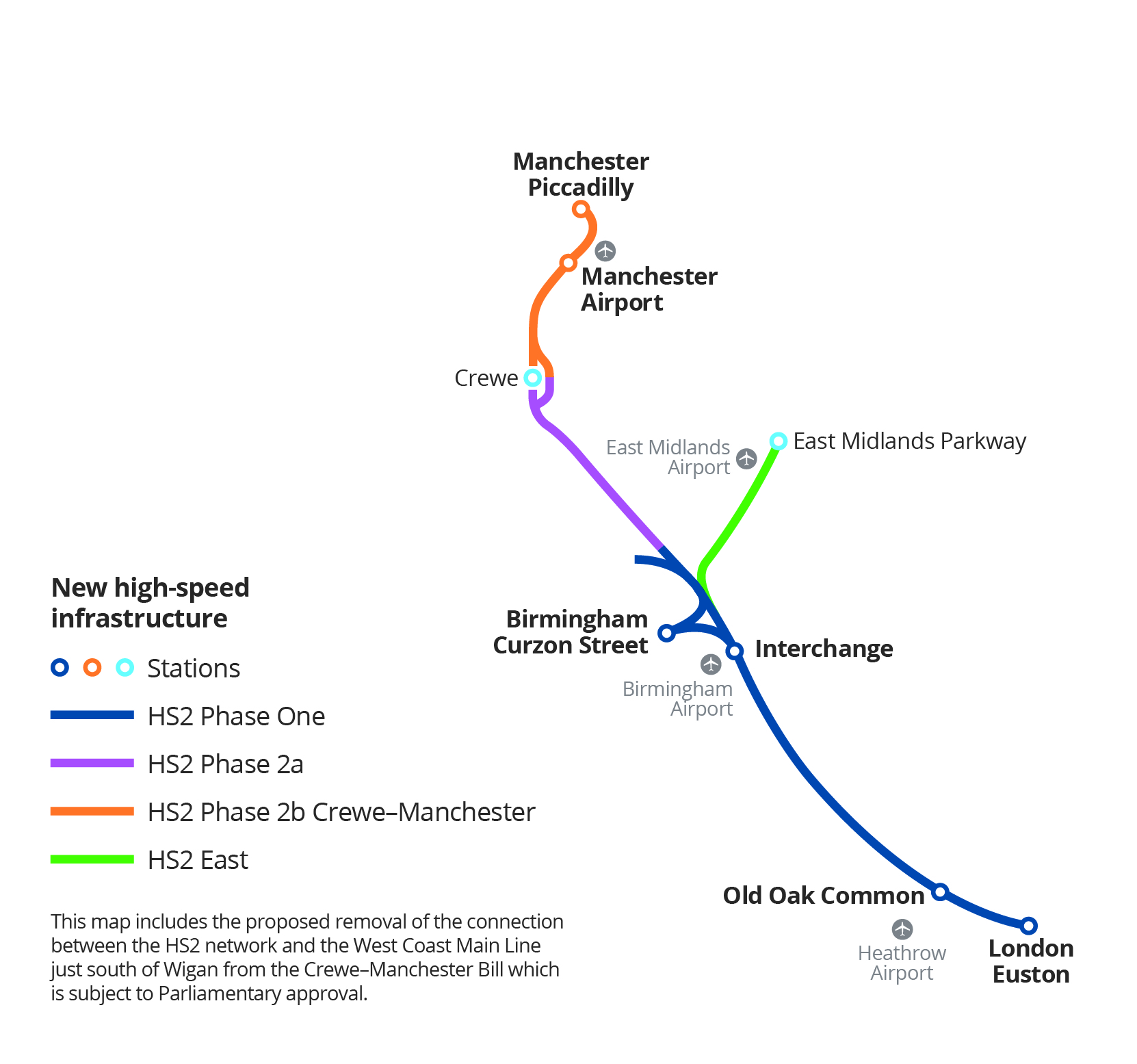
The following map from the Media section of the HS2 website shows the route as it was still planned in 2022:

HS2
HS2_print_Infrastructure map_post IRP_220607_jpg

As well as pausing construction of the section from Old Oak Common to Euston, the November report to Parliament stats that “we will not proceed with Phase 2a, 2b or HS2 East”.

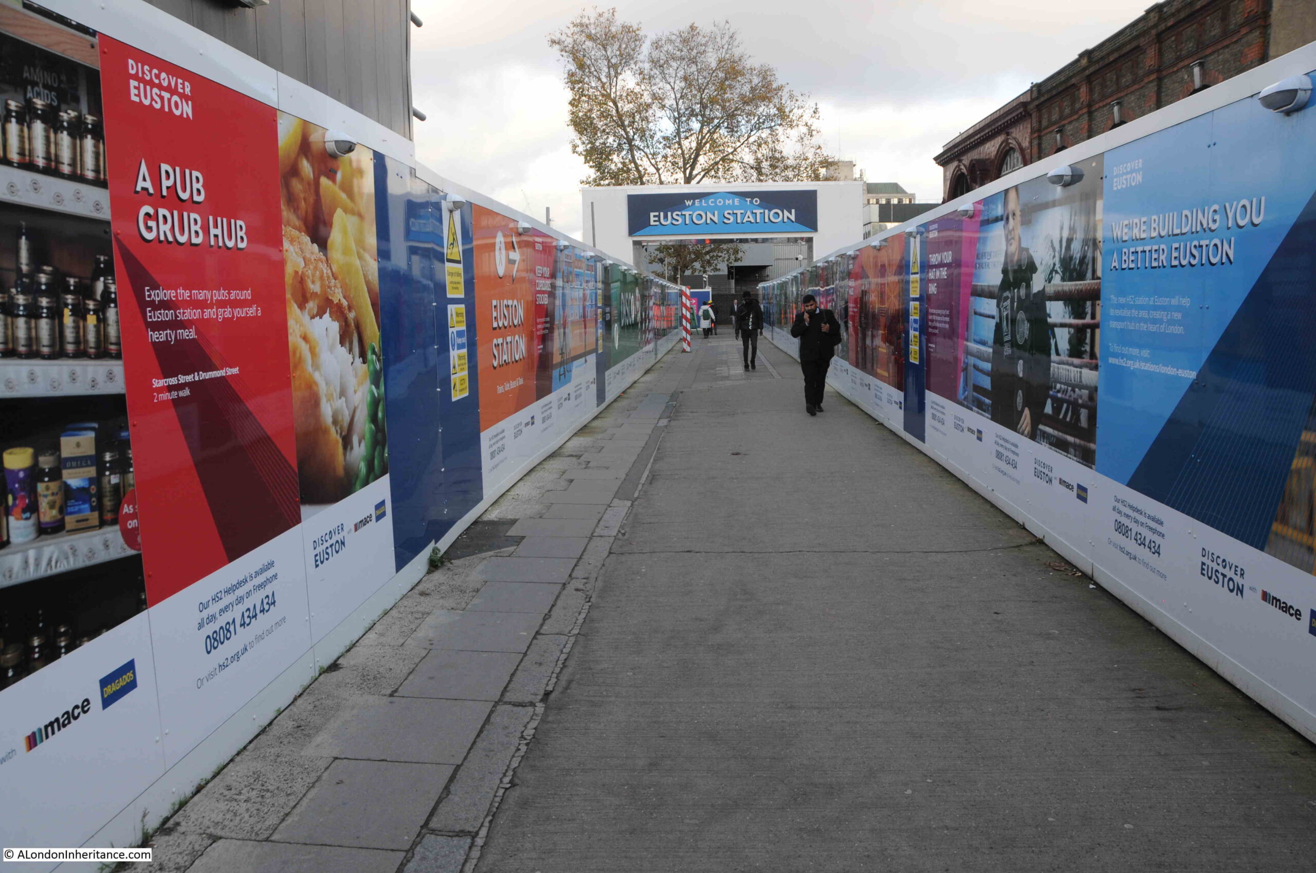
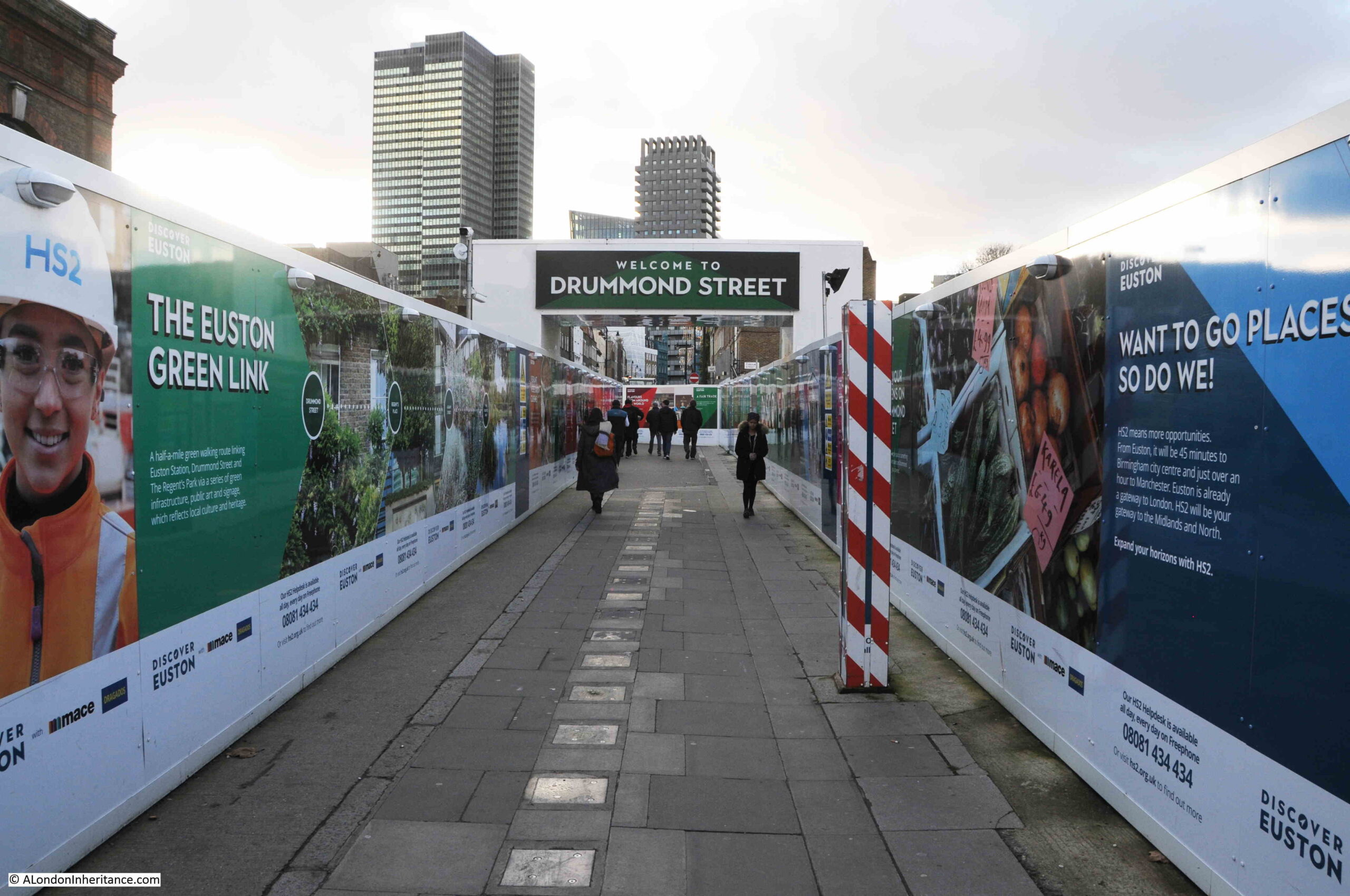
Much of the construction area is hidden behind panels, many of which have artwork and advertising that tells the story of what HS2 will bring to Euston, and the wider benefits of the project. Much of this now looks rather hollow and out of date, and includes the new Euston Station:

HS2

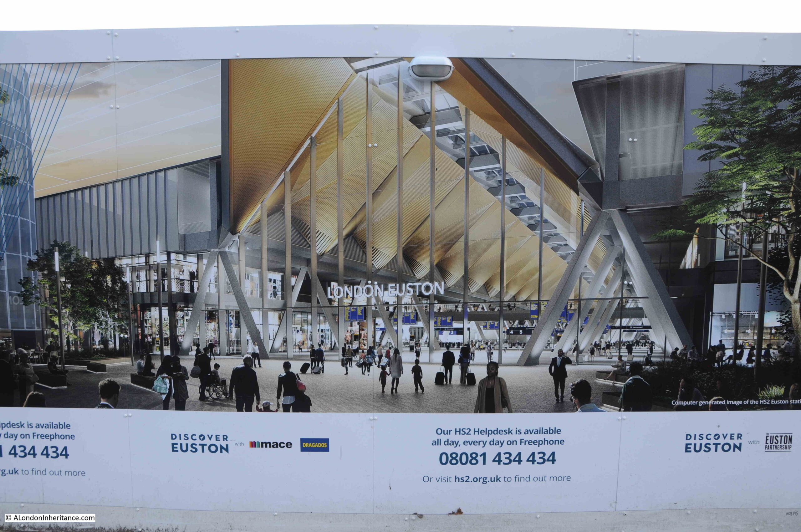
And as well as “building you a better Euston”, the following poster still states that HS2 will be “Connecting eight out of ten of Britain’s largest cities”, and will “More than double the number of train seats out of Euston in peak hours”:

HS2

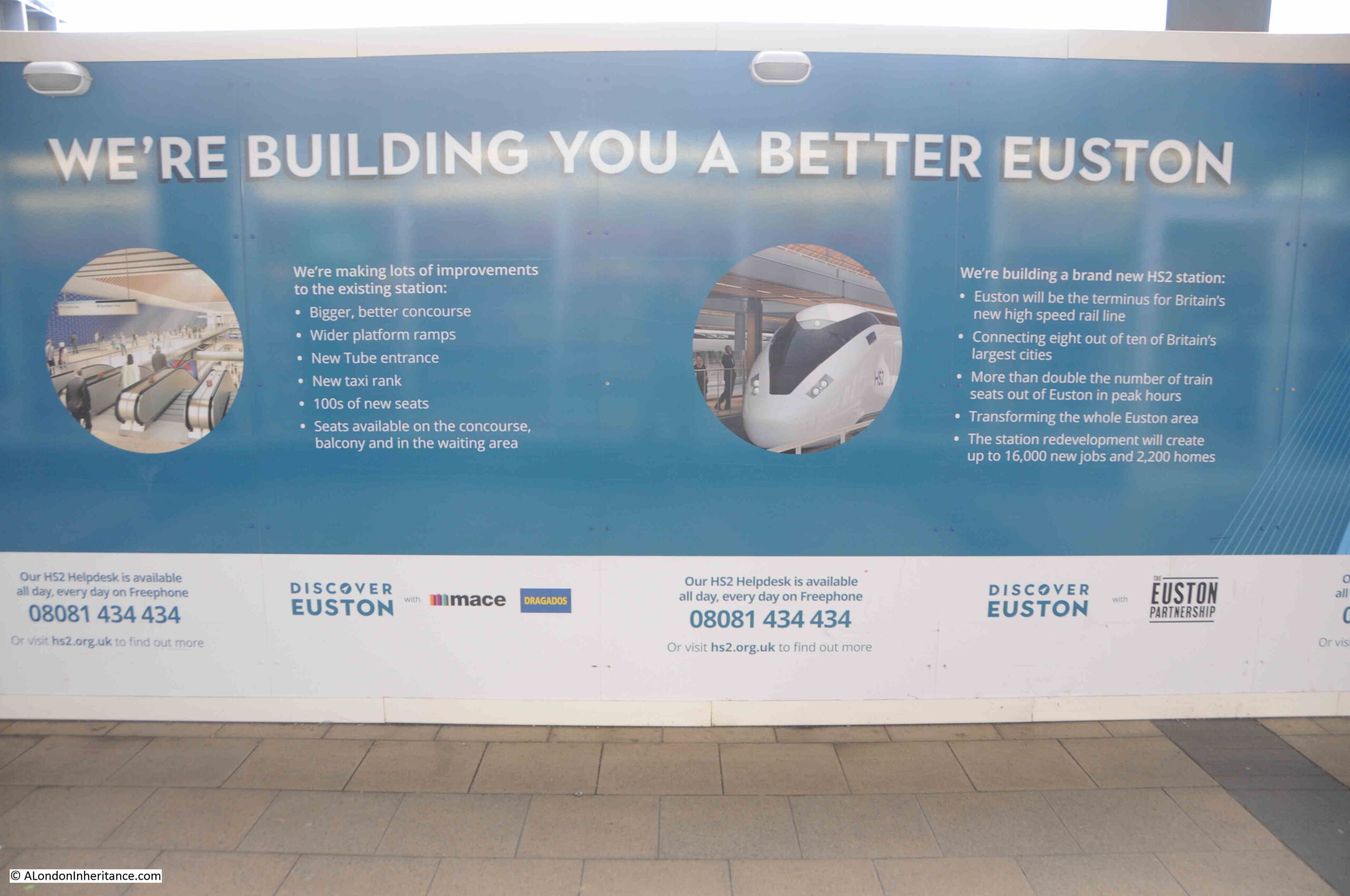
And that improvements to the existing station will provide a “Bigger, better concourse, 100s of new seats, wider platform ramps”.

Extension of HS2 from Old Oak Common to Euston has been “paused”, and the November report to Parliament states that:

“We are going to scale back the project at Euston and adopt a new development led approach to the Euston Quarter which will deliver a station that works, is affordable and can be open and running trains as soon as possible. We will not provide design features we do not need and will instead deliver a 6-platform station which can accommodate the trains we will run to Birmingham and onwards and which best supports regeneration of the local area. In this way we will attract private funding and unlock the wider land development opportunities the new station offers, while radically reducing its costs to the taxpayer.”

But the most scary part of the new plans for Euston is this sentence in the November report:

“At Euston, we will appoint a development company, separate from HS2 Ltd, to manage the delivery of this project. We will also take on the lessons of success stories such as Battersea Power Station and Nine Elms, which secured £9 billion of private sector investment and thousands of homes.”

Whilst economically, Nine Elms has been considered a success in bringing in considerable (mainly overseas) investment to develop the area, the Nine Elms development seems to have resulted in the random placement of individually designed tower blocks, without any apparent cohesive design for the area. The towers look as if they have been randomly dropped from the sky, with a height and density to maximise profit rather than to add character and improve a key part of London.

Is this the future for Euston? A station hiding underneath another vision of Nine Elms, delivering enough cash from developers to complete the section from Old Oak Common to Euston along with the new station, but with a focus on the needs of developers, rather than a new the design and build of a new station that could have served as the London terminus of a growing railway to the north of the country.

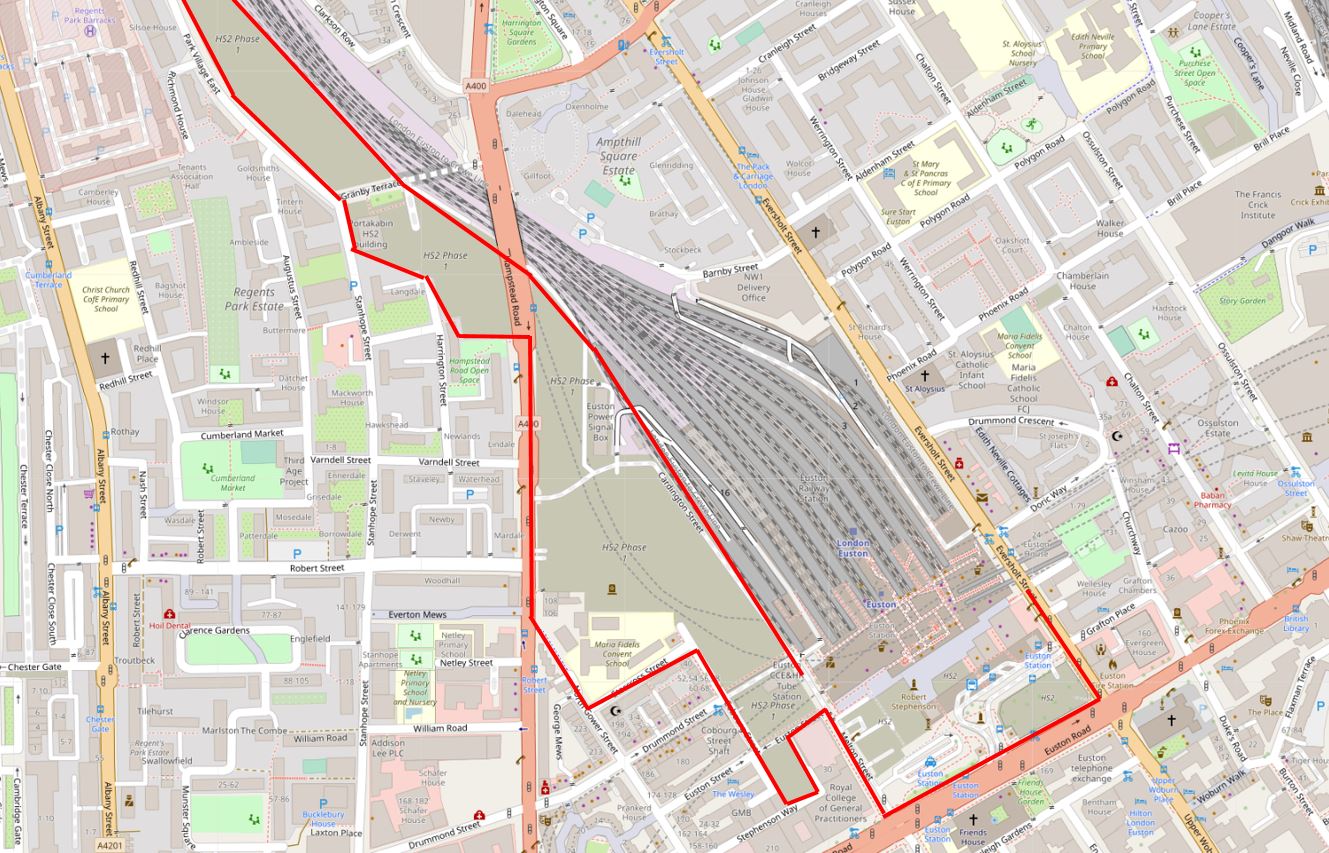
In the following map, I have added a red line to show the area which had been cleared for the new station, and the tracks leaving the station to head to Old Oak Common (Map © OpenStreetMap contributors):

HS2

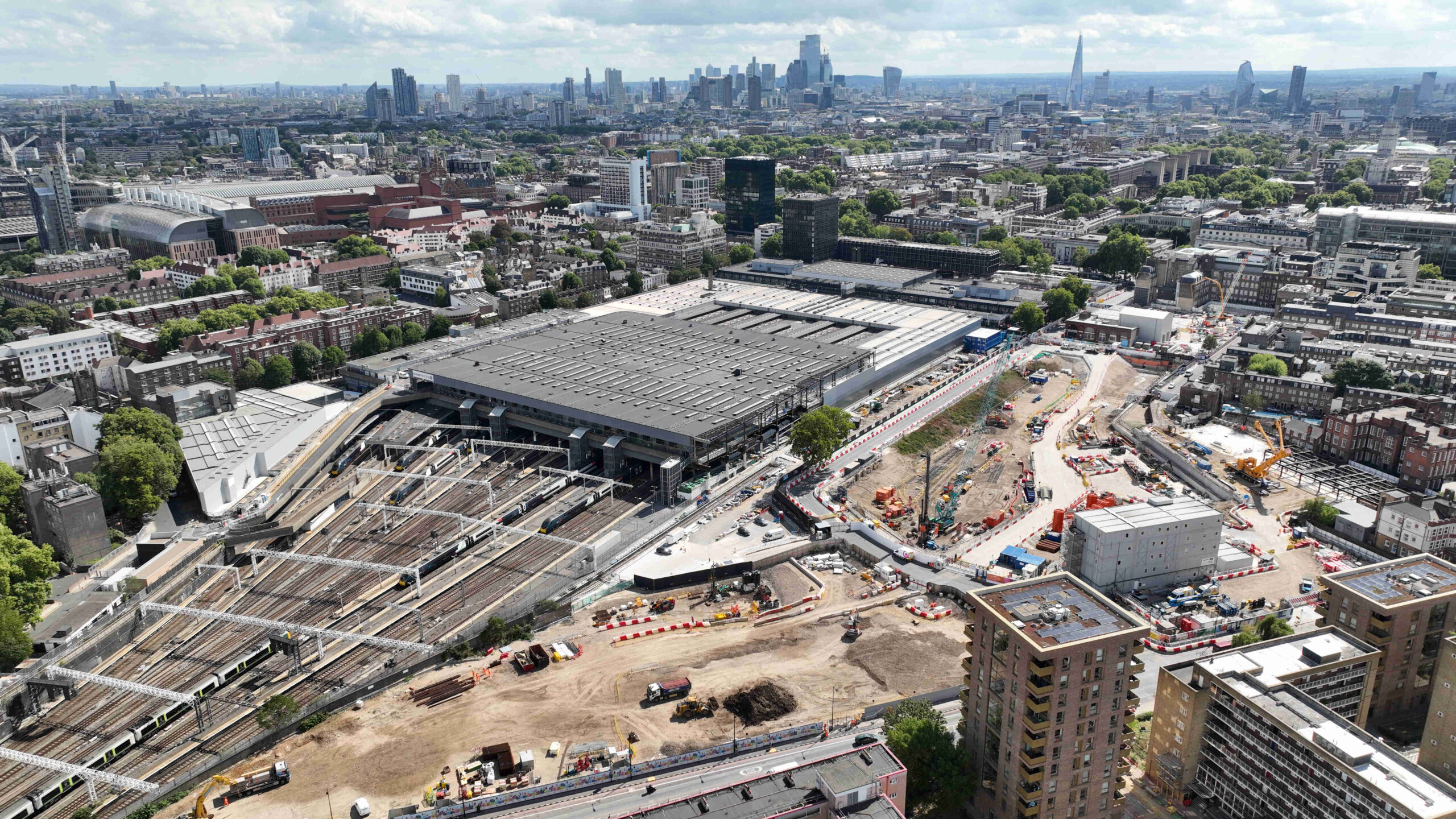
HS2 have a couple of photos in the Media section of their website which shows the scale of the site. The following is looking at the site from the north:

HS2
An aerial still of the HS2 Euston Station site, August 2022

And the following view is looking north, with Euston Station to the right:

HS2
An aerial still of the HS2 Euston Station site, August 2022

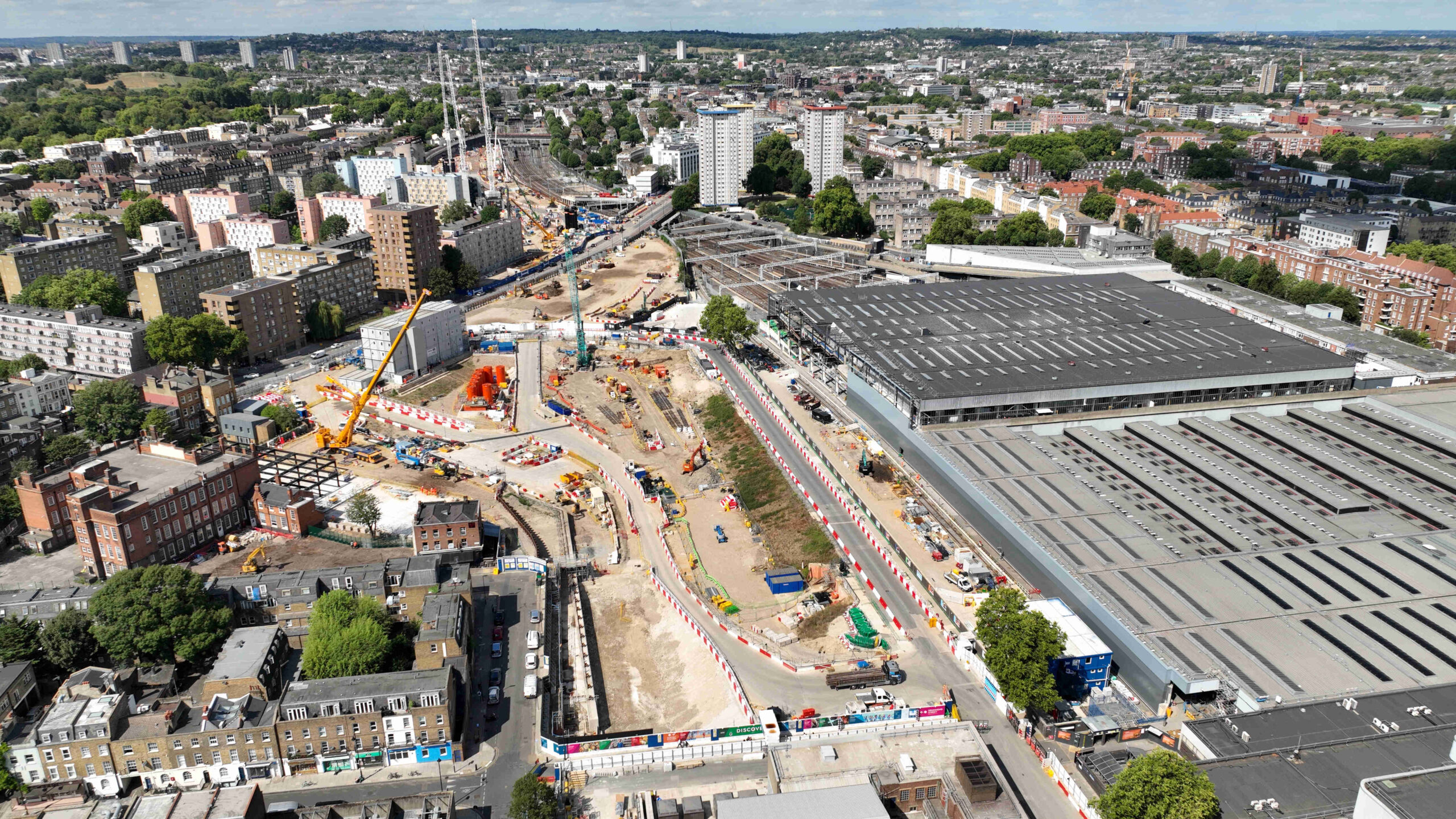
Both of the above photos are available to download from the Construction section of the HS2 media Gallery at this link.

I suspect that the main problem that HS2 has had is the name – High Speed 2.

The slightly shorter journey time from London cannot really justify the expense of the project, and the additional speed will only really benefit journeys much further north than Birmingham.

The main benefit that HS2 provides is extra capacity on existing rail lines, such as the West Coast Main Line (WCML).

Transferring high speed trains from the existing WCML onto HS2 would have released a significant amount of extra capacity which could have been used for freight, additional passenger train services between many of the places on the WCML route, as well as increasing the number of high speed trains.

However, calling the project Extra Capacity 1, or EC1 does not sound as exciting as HS2, although it would have been a better description of the real benefits.

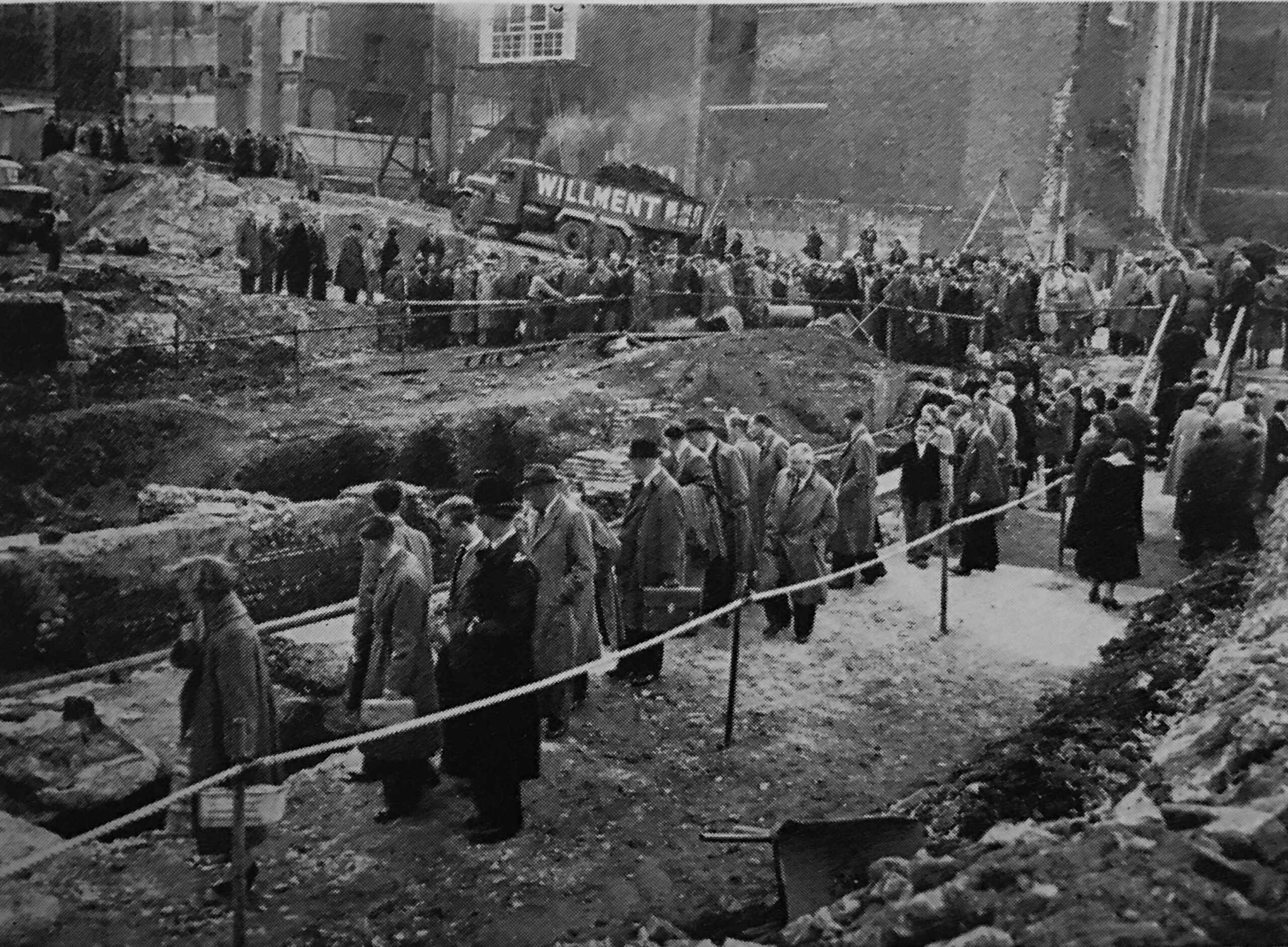
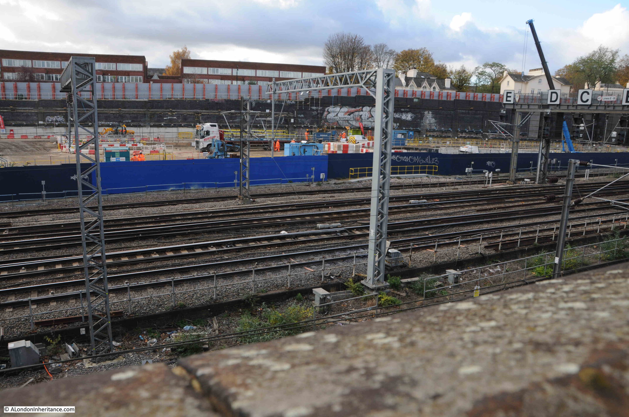
I started my 2023 walk on a weekday, when hopefully it would be clear how much work was still underway. My route started in Clarkson Row, just to the west of Mornington Crescent, as here you can just about see over the wall, across the existing tracks, to where new tracks will be run as the railway heads from Euston to Old Oak Common:

HS2

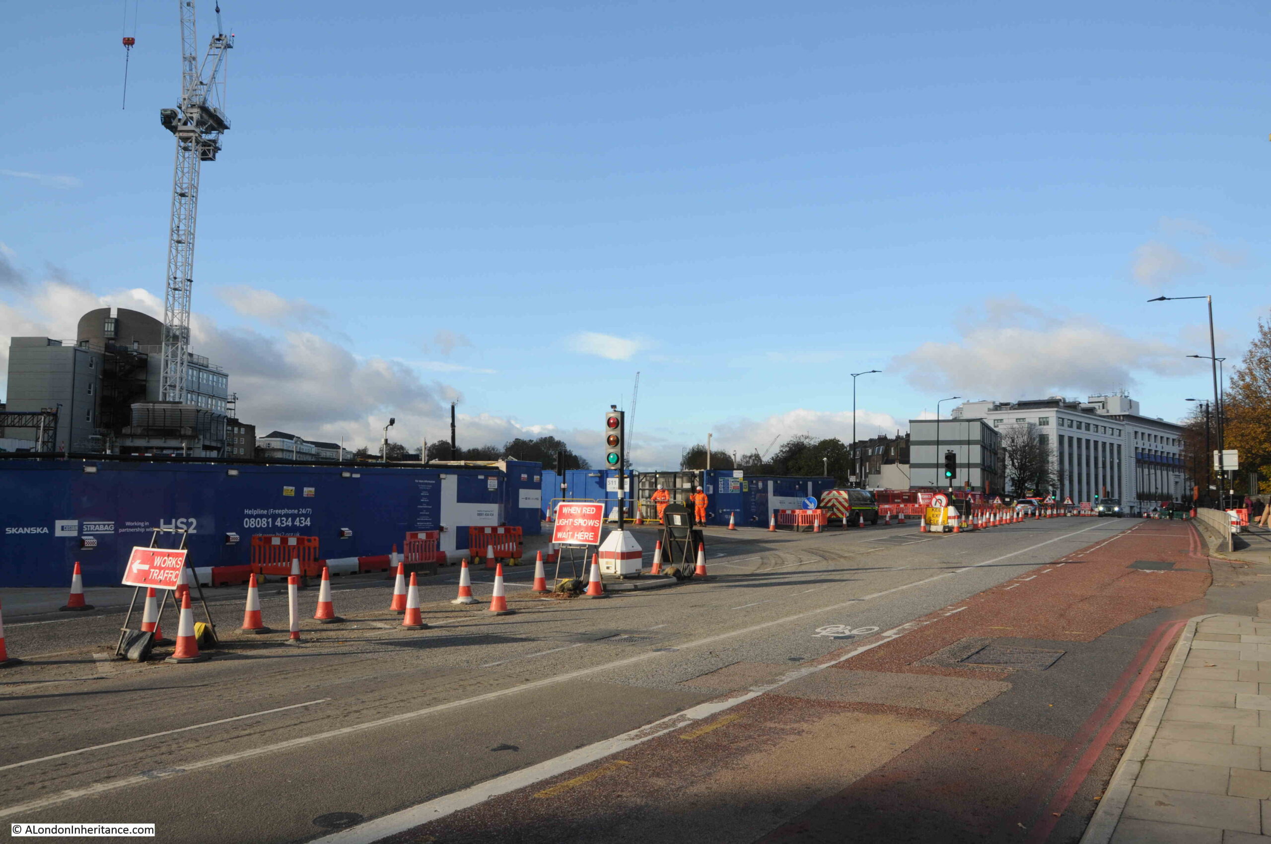
Heading along Hampstead Road, and this is the view along the street, back towards Mornington Crescent. The main entrance to the site to the west of Hampstead Road is here:

HS2

There was still work underway, however according to HS2 press releases, what is happening now around Euston is “enabling work” rather than construction works, and there were utility works on the street, so I assume this means minor, low cost works which may make the project easier to get underway if and when it restarts.

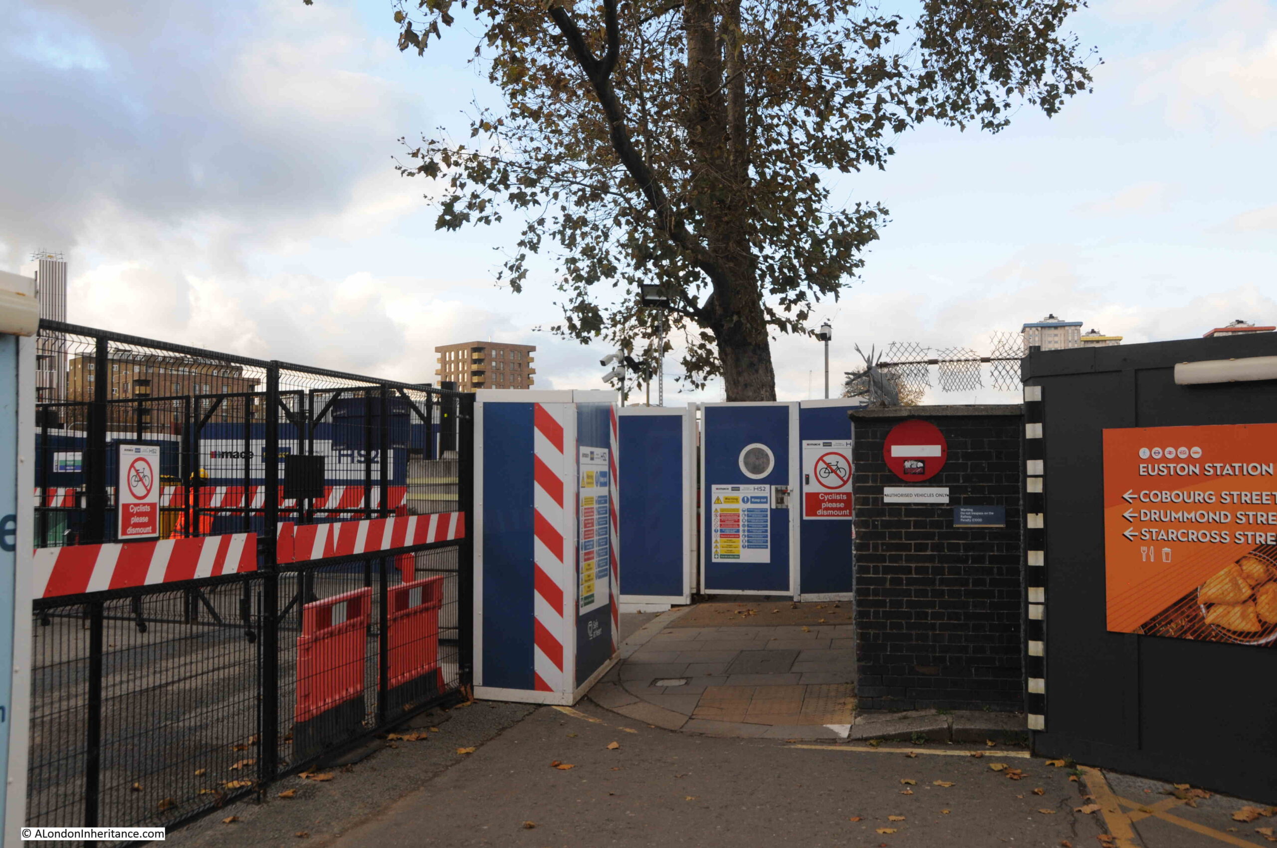
One of the entrances to the main Euston site:

HS2

Look back along the Hampstead Road:

HS2

This is the main entrance from Hampstead Road to the main site around Euston Station:

HS2

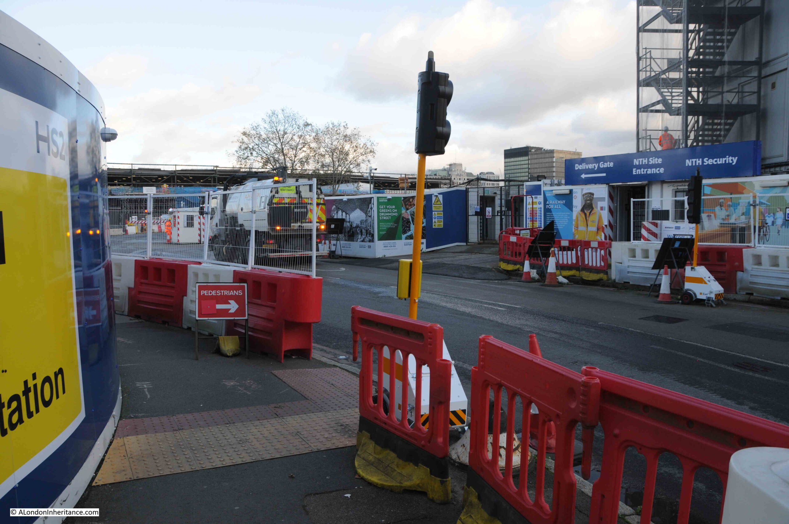
There appeared to be very little happening, and the only vehicle that was running through the site was a road sweeper.

There is no sign of any elements of a new station, and the appearance of the site was much the same as last year. Parts of the site which were open last year have now been fenced off, so the site appears more enclosed than a year ago, but again, not much happening within the site.

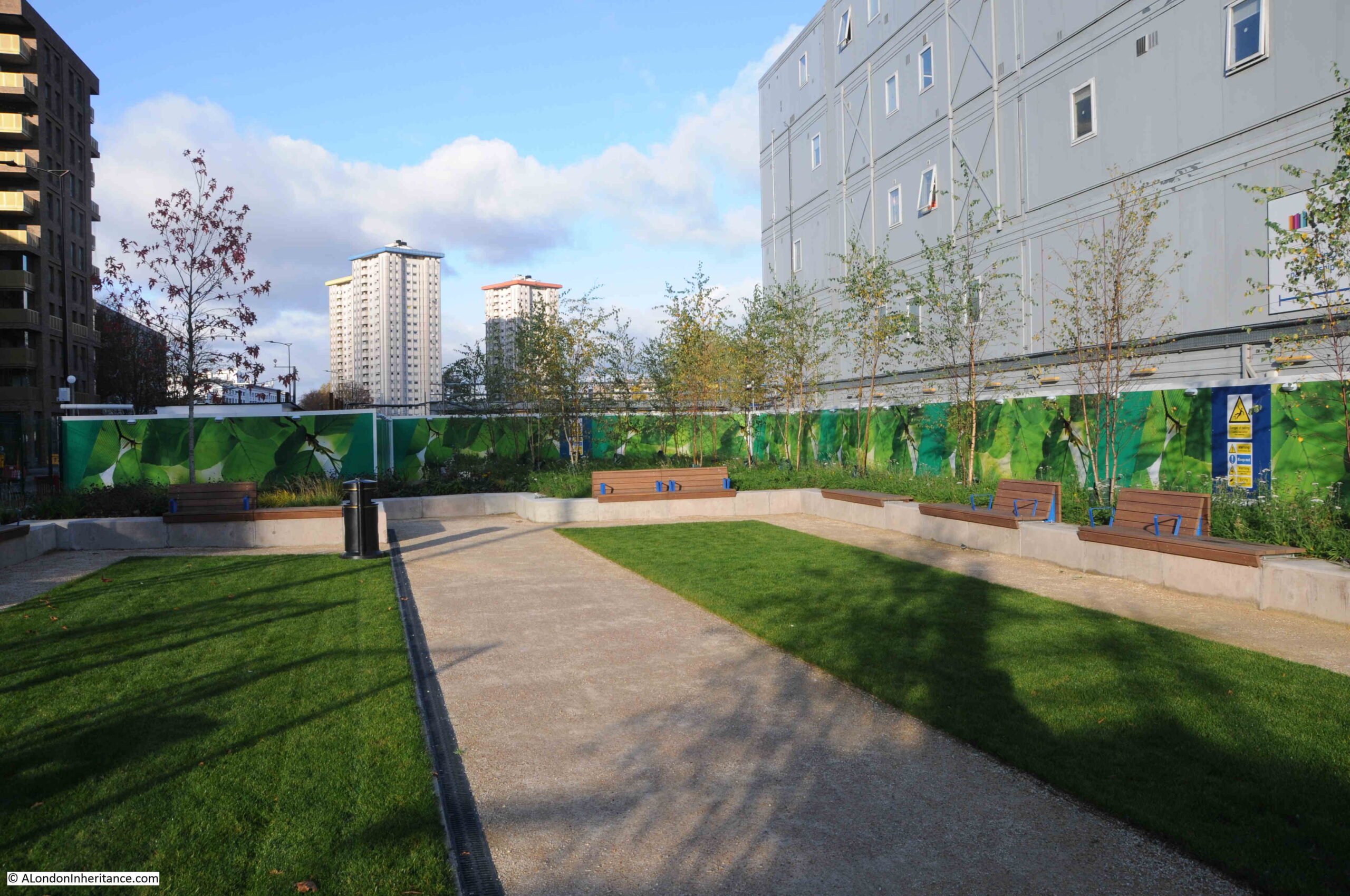
There are three places where there is a change to last year, the first is the National Temperance Garden, described as “a temporary green space for all to enjoy”. It has been built on the site of the old National Temperance Hospital, and this is the view of the garden from Hampstead Road:

National Temperance Garden

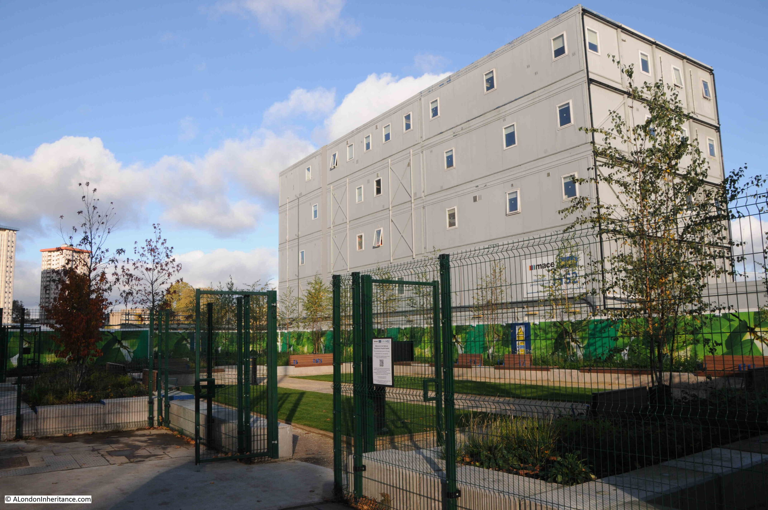
The large structure behind the gardens are offices and have been there for the last few years. The fencing between the gardens and Hampstead Road are standard HS2 Euston green security fencing and surround places on the site where there are no large panels.

Inside the gardens, which apparently has been “specially designed to be moved and re-used in the local area when the site closes”:

National Temperance Garden

These buildings were home to the Maria Fidelis School:

HS2

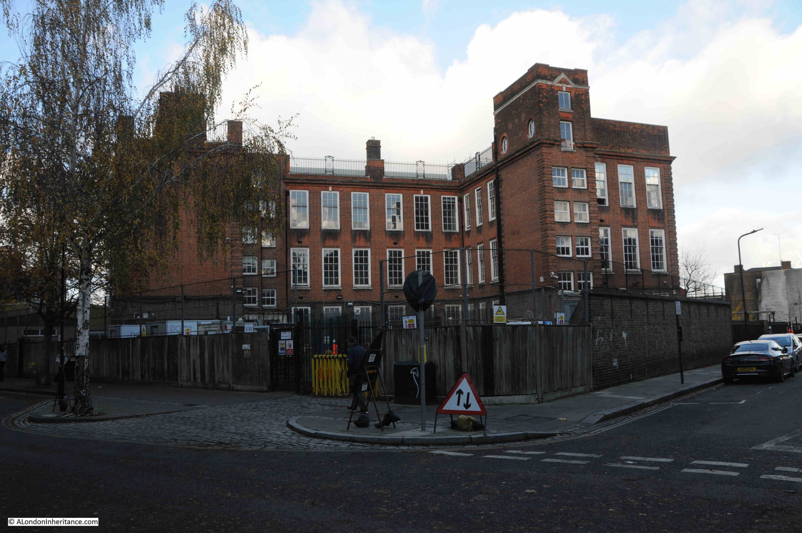
To free up the school site, HS2 have built a new school between Drummond Crescent and Phoenix Road, and the site in Starcross Street is now closed.

The school and a large new building behind the school are a new “Euston Skills Centre”, set-up to provide training to local people and thereby providing the number of trained workers that such a large project requires.

The Euston Skills Centre was handed over to Camden Council on the 20th of November, however given that work within Camden has now been paused it will be interesting to see what Camden Council does with the facility. Hopefully there are still plenty of training opportunities for Camden locals to work on the project from Old Oak Common northwards.

Between the skills centre and Starcross Street is the second of the places where there has been a tangible change, compared to last year.

This is another temporary open space, in the form of Starcross Yard:

Starcross Yard

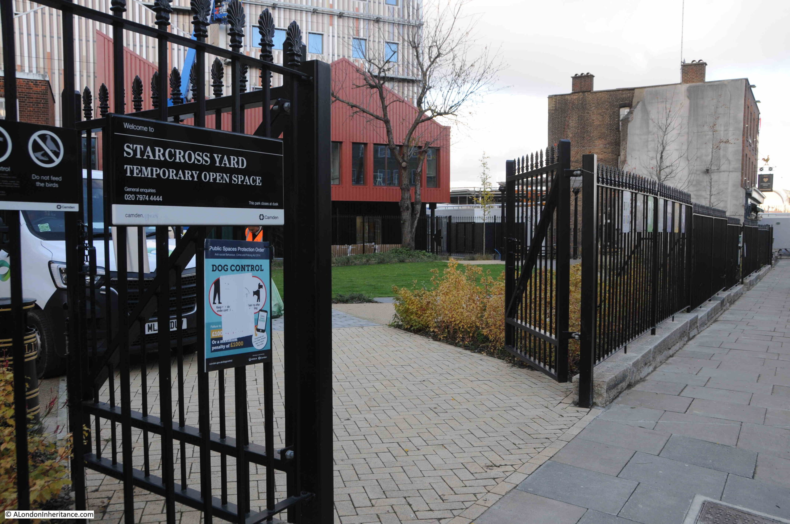
The theme for Starcross Yard is “echoes of place”, and within the space there are physical reminders of places from a surprisingly wide area, not just the HS2 construction site, or Euston.

To highlight these, there are information panels along the railings which tell of the “uncommon histories of people and space”.

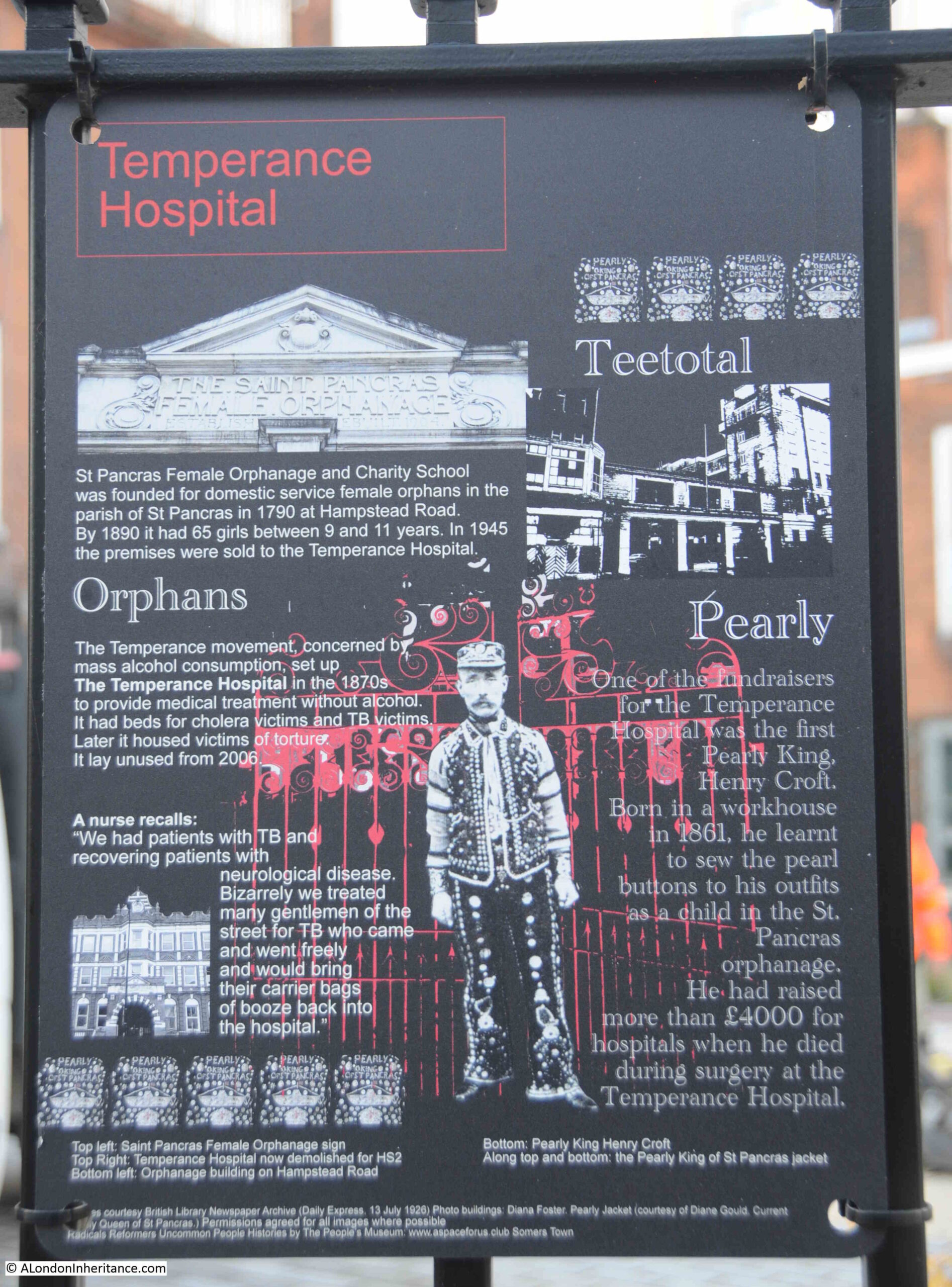
The first is the Temperance Hospital, which was demolished as part of the clearance of the HS2 construction site:

Starcross Yard

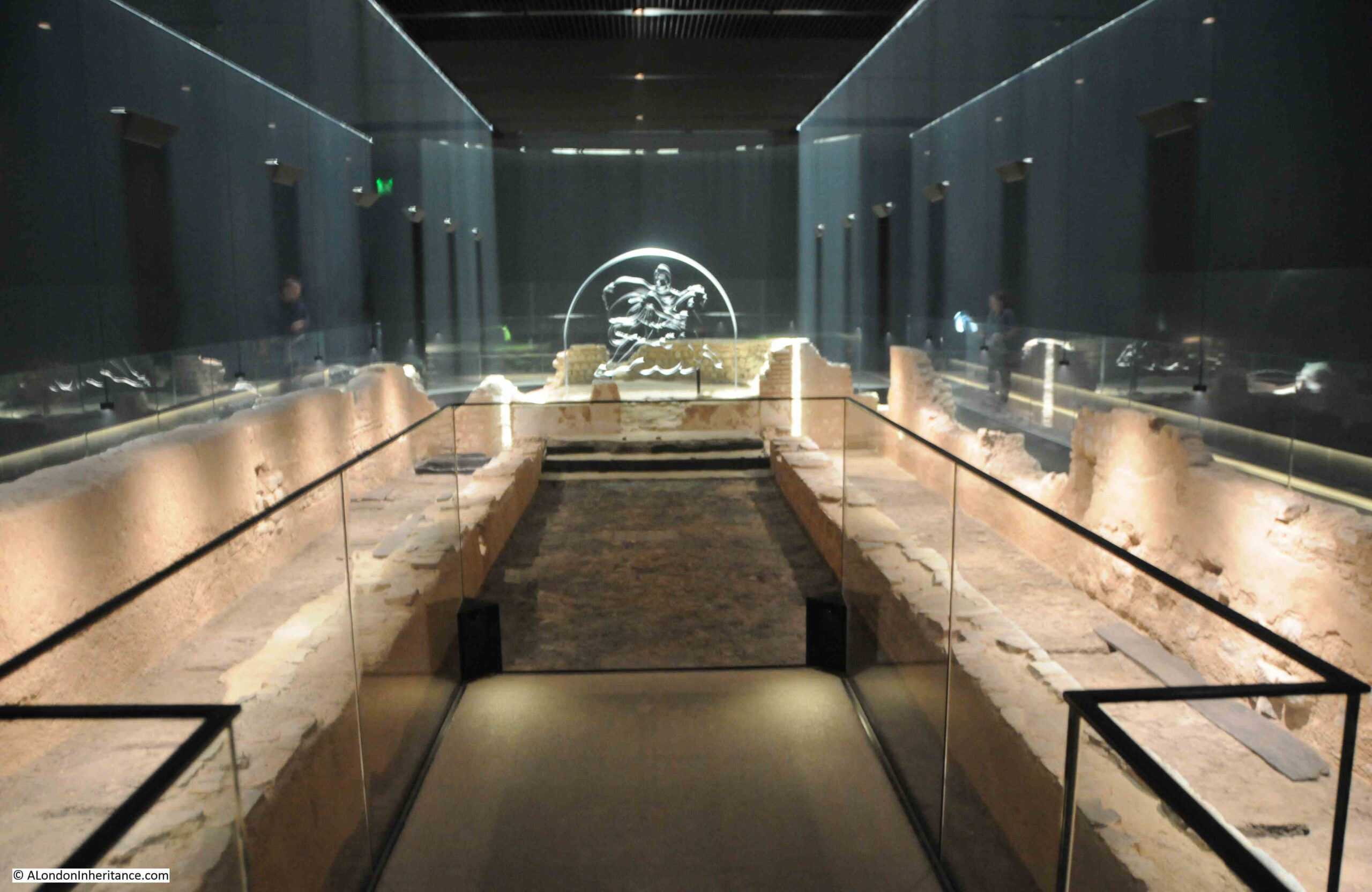
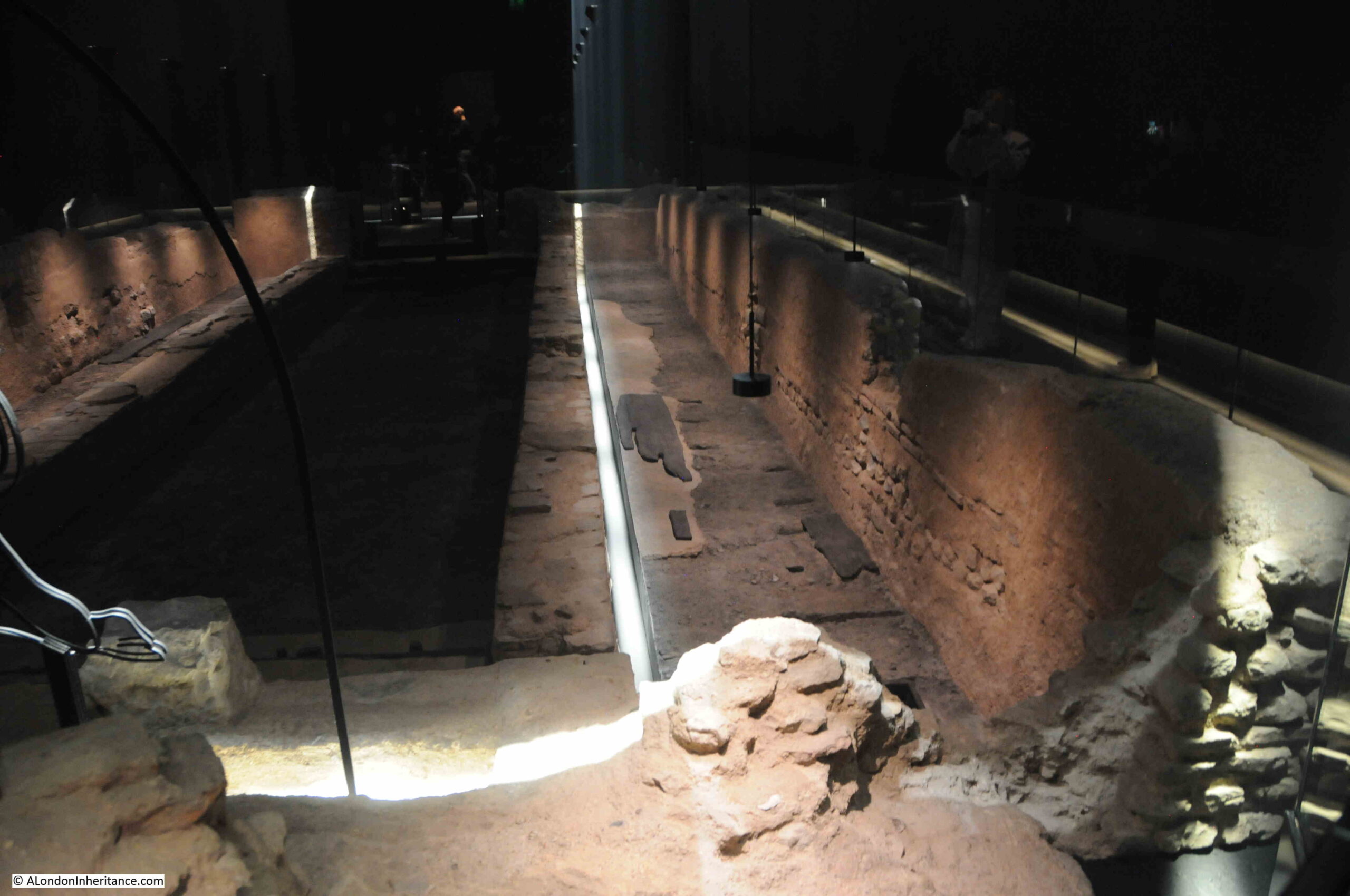
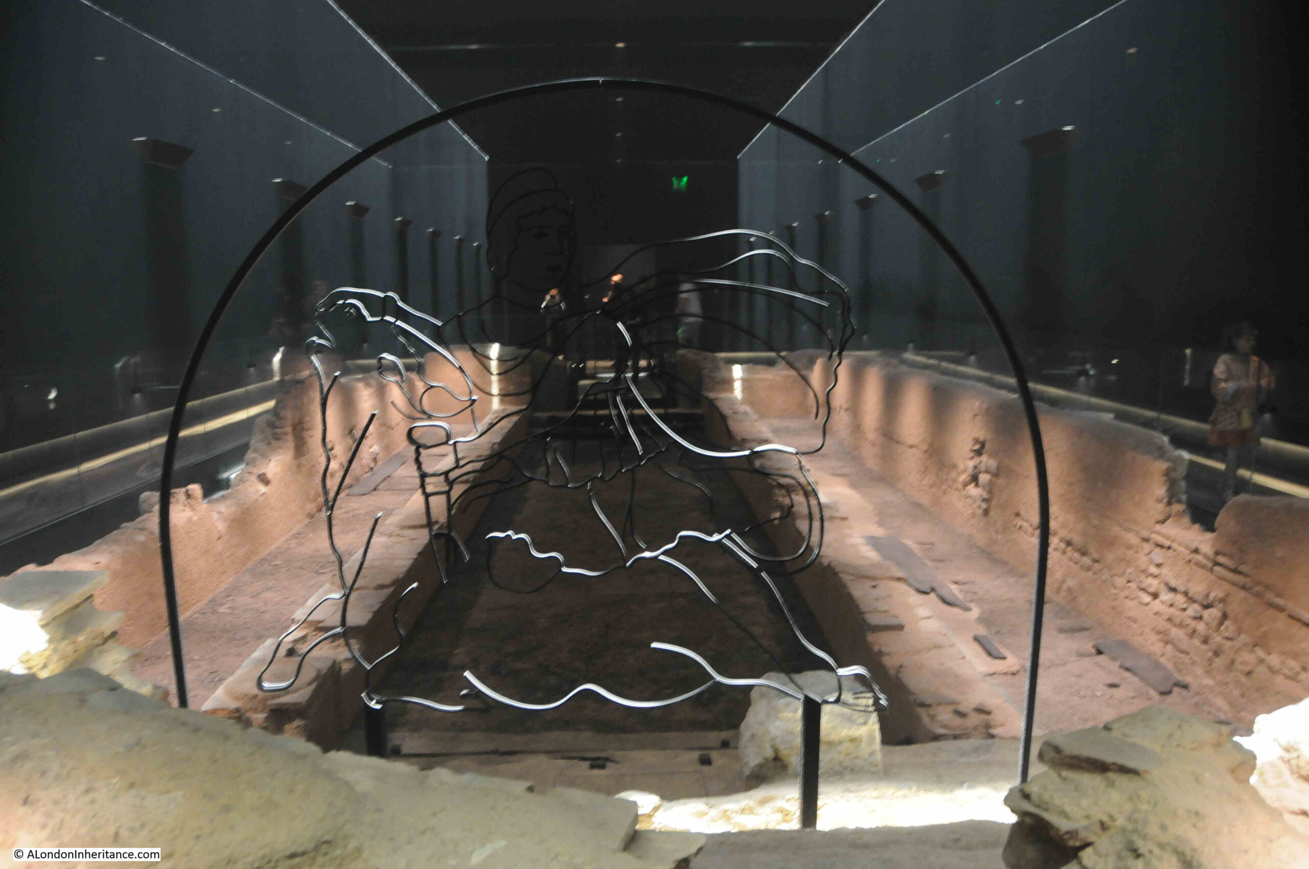
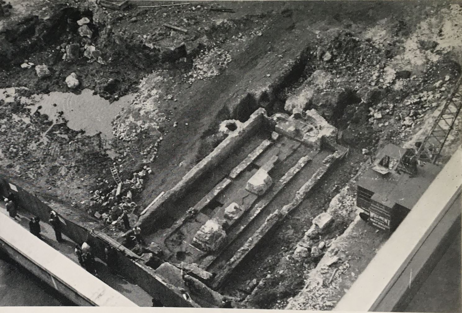
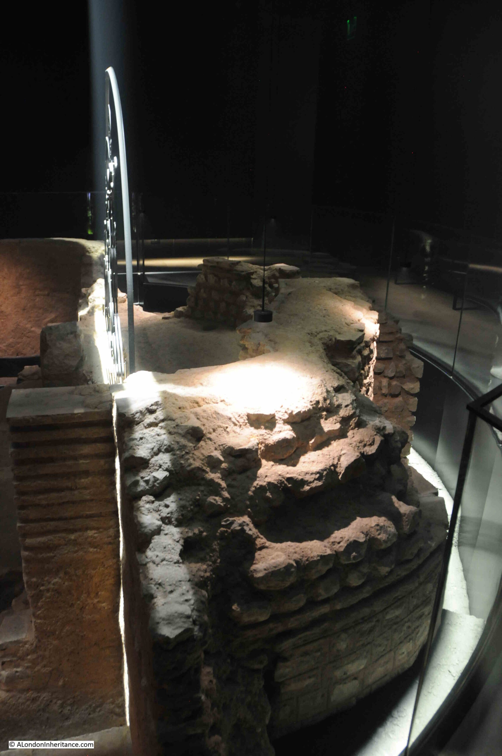
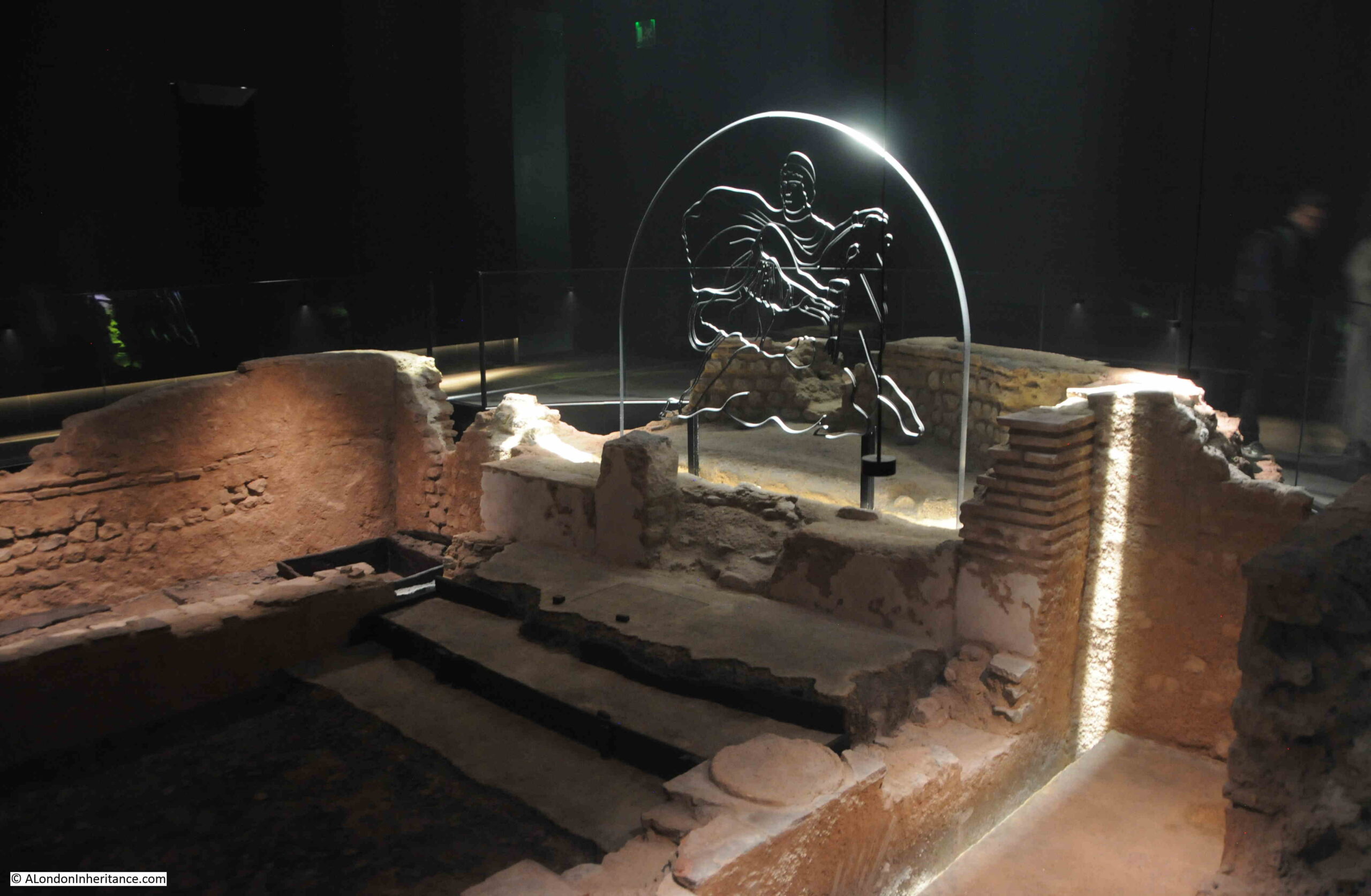
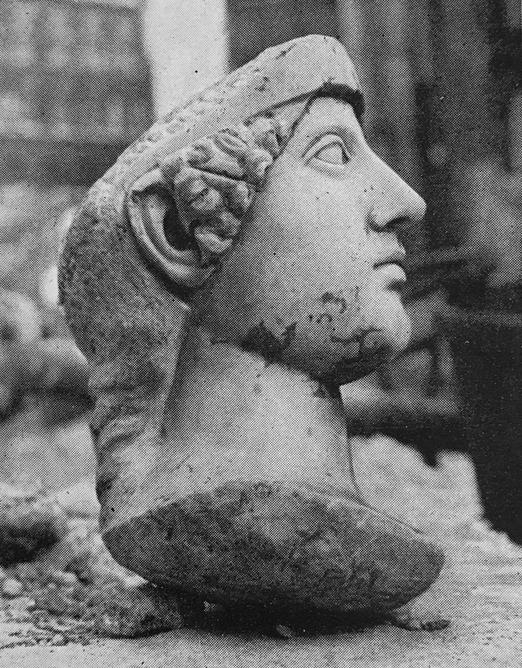
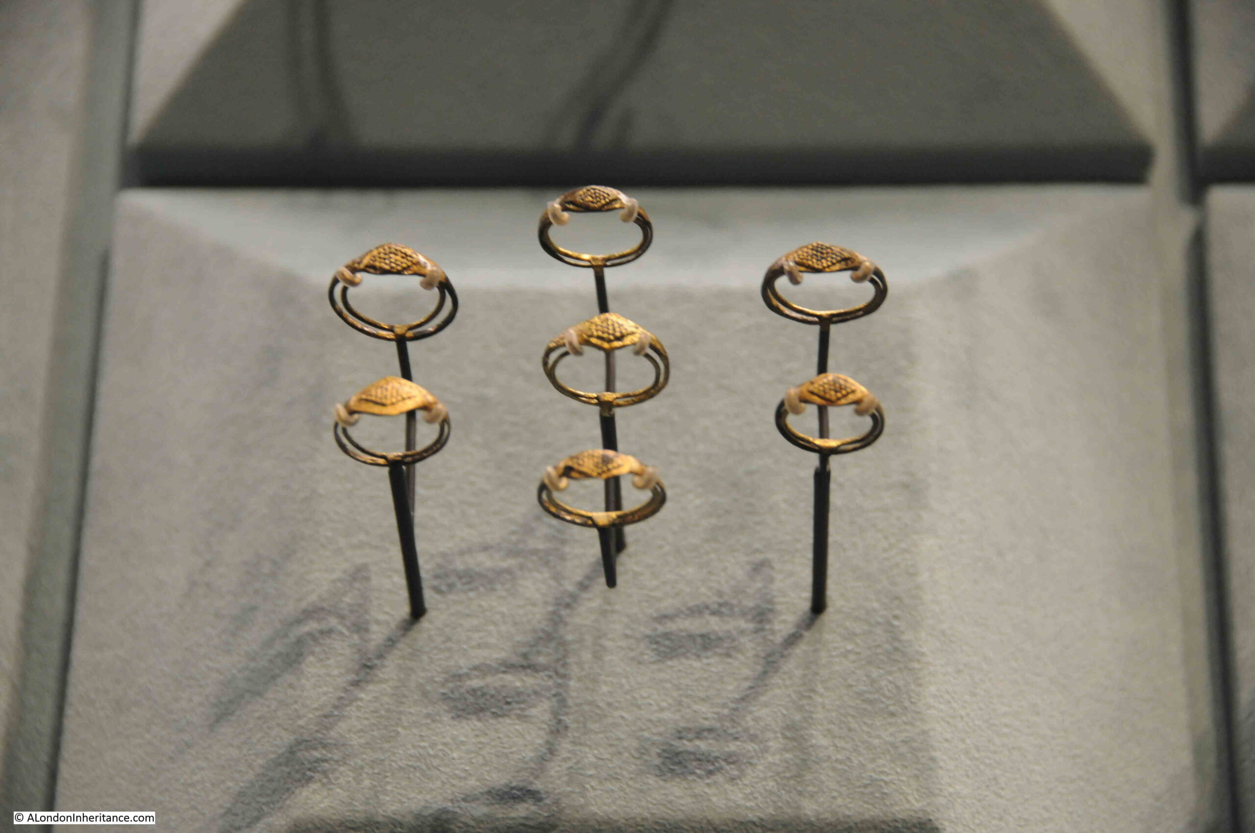
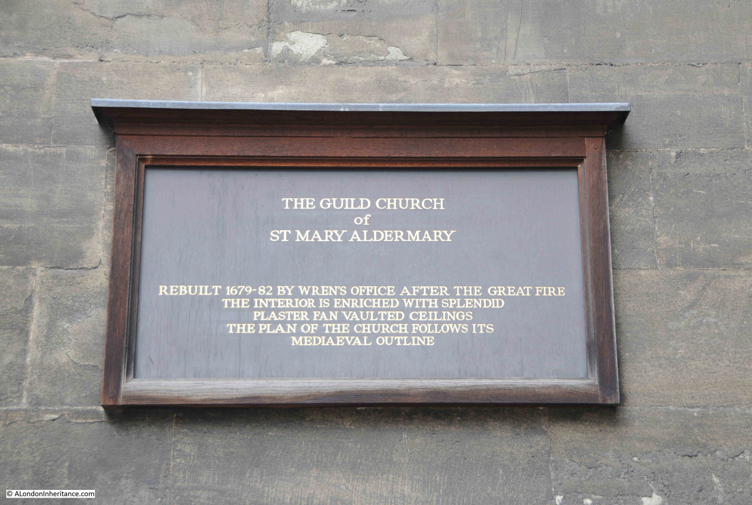
The second covers the St. James’s Burial Ground, which again was cleared as part of HS2 site clearances. The panel highlights the boxer Bill Richmond who was buried at St. James’s Burial Ground, and a number of others buried are also named, as well as many from the workhouse:

Starcross Yard

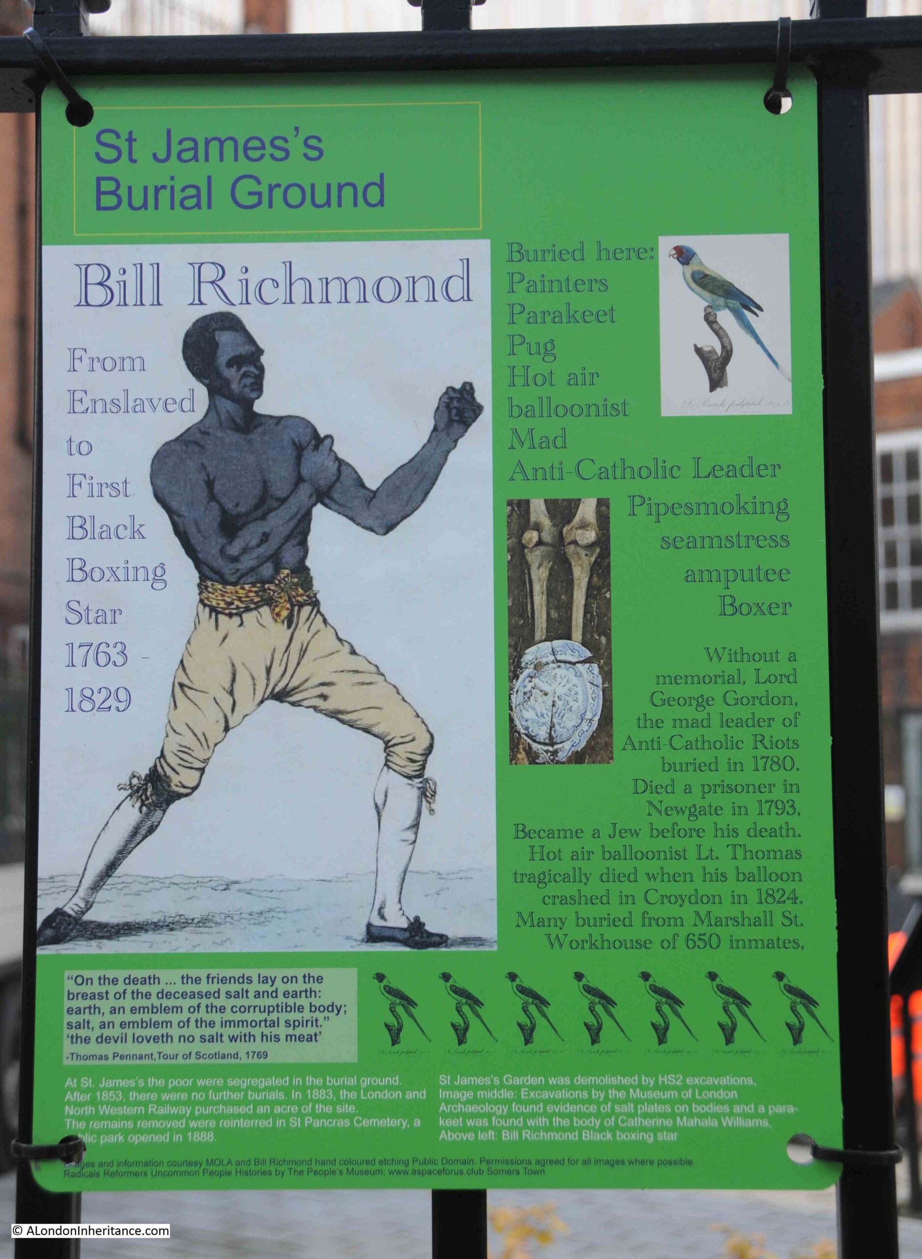
Railings from the old burial ground now form part of Starcross Yard.

The above two panels refer to places that have become part of the HS2 construction site. The rest of the panels cover people and places that are further away, and not part of HS2.

The first of these is the German Gymnasium which today can be found by the southern entrance to Pancras Square, between St. Pancras and King’s Cross Stations:

Starcross Yard

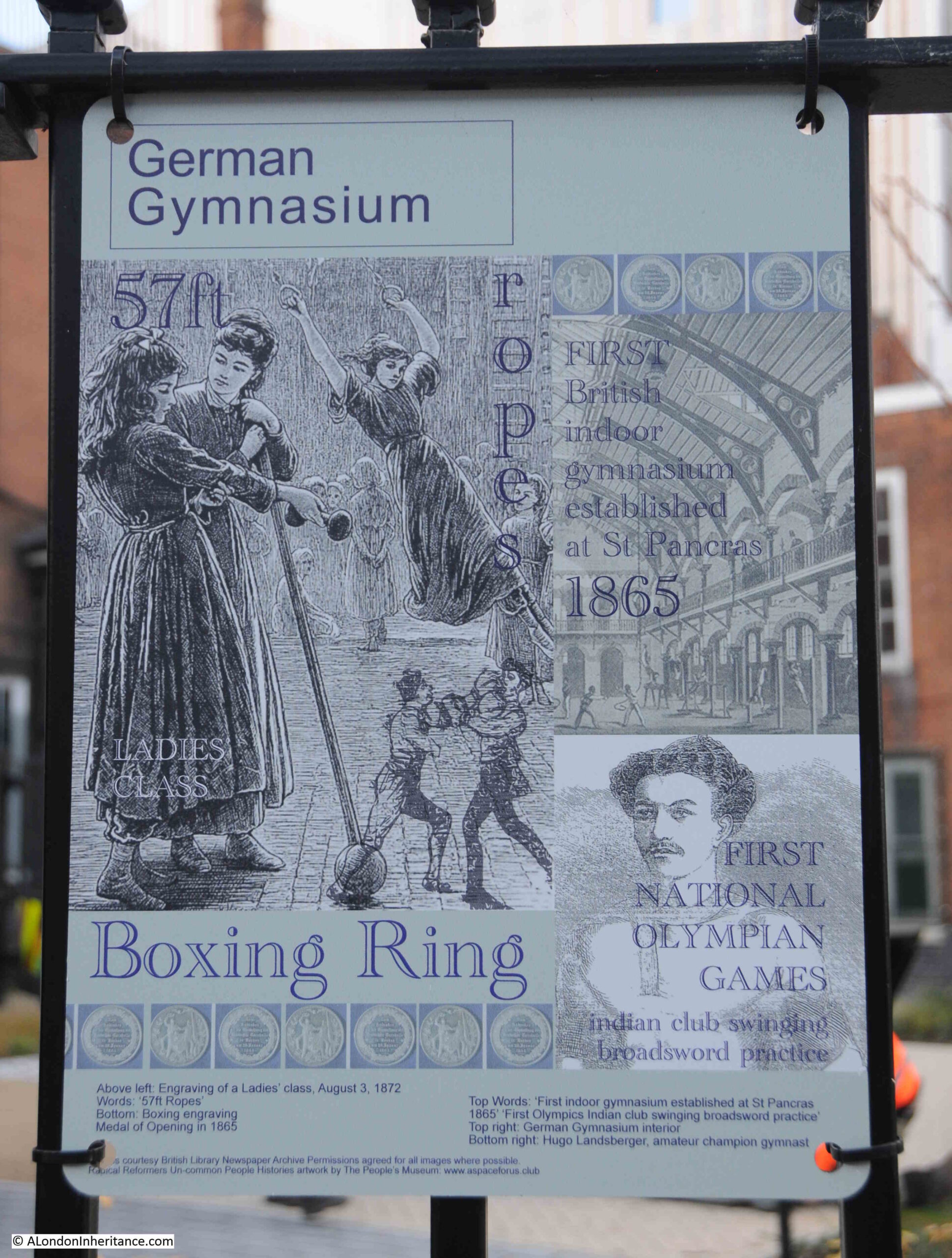
Poles from the German Gymnasium can now be found at Starcross Yard.

Next up is Cumberland Market:

Starcross Yard

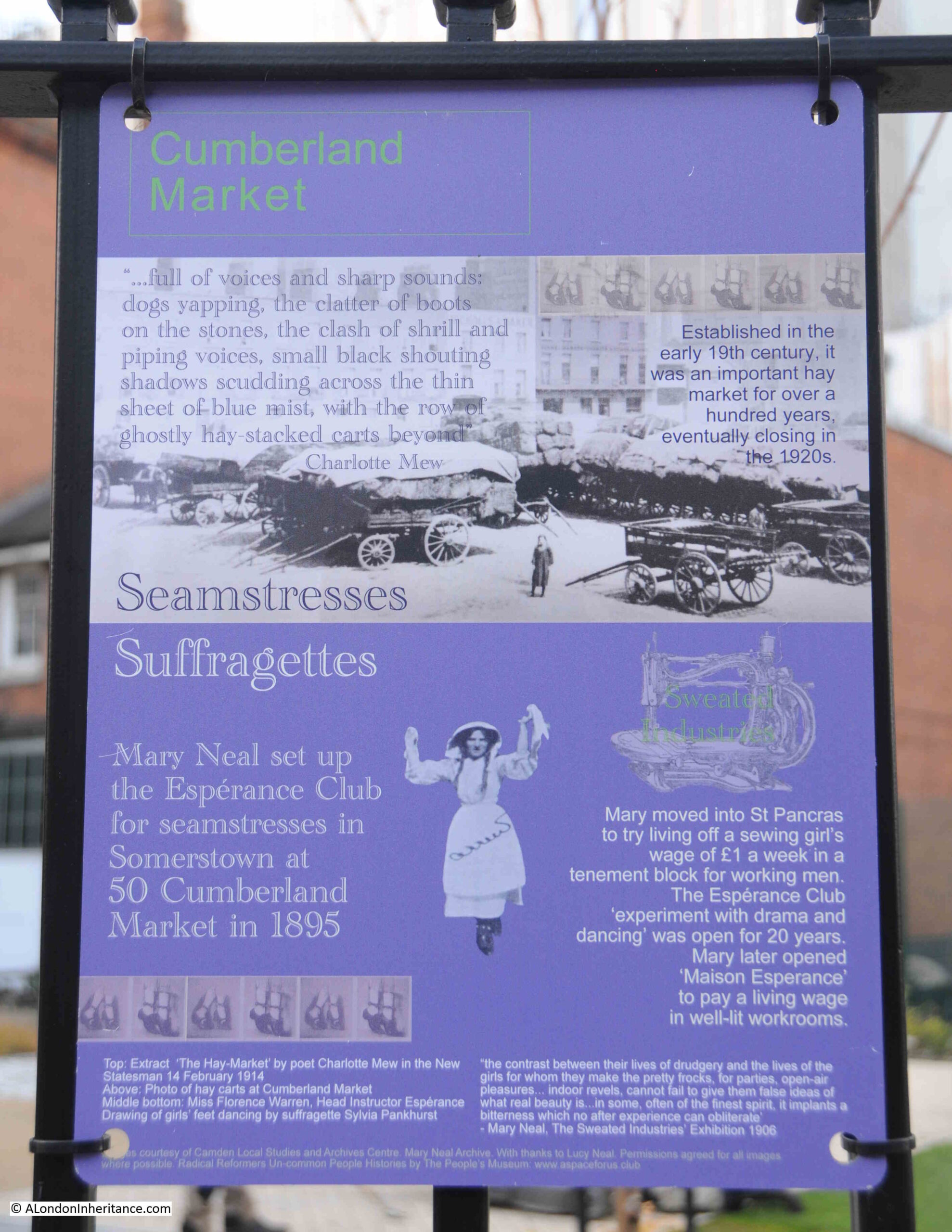
Cumberland Market was a short distance to the west of Euston Station, at the southern end of the Regents Park Basin, a small dock area off the Regents Canal.

My father grew up next to the Regents Park Basin, and I wrote about the area in this post. Starcross Yard has cobbles from Cumberland Market.

Next is St. Aloysius, a Somers Town Catholic Church:

Starcross Yard

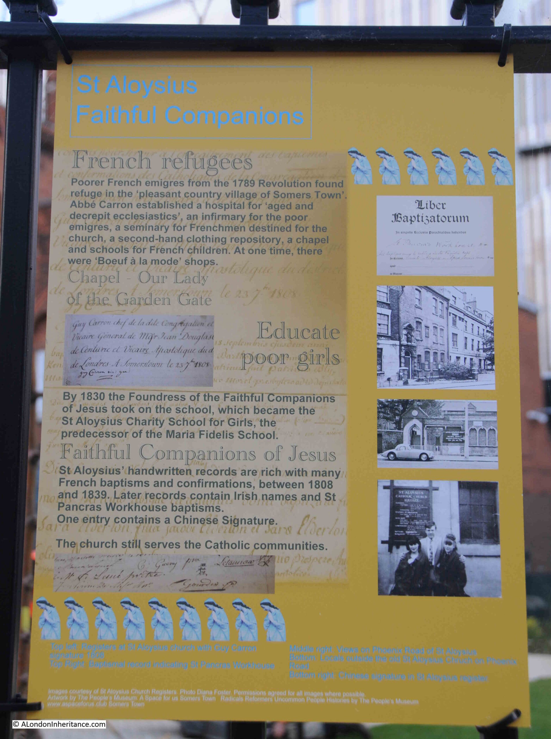
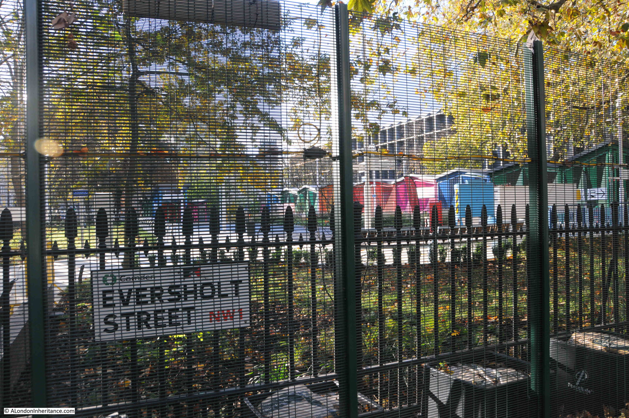
The church is still functioning, although a mid 1960s rebuild, rather than the buildings shown on the panel. The church can be found to the east of Euston station, in Eversholt Street.

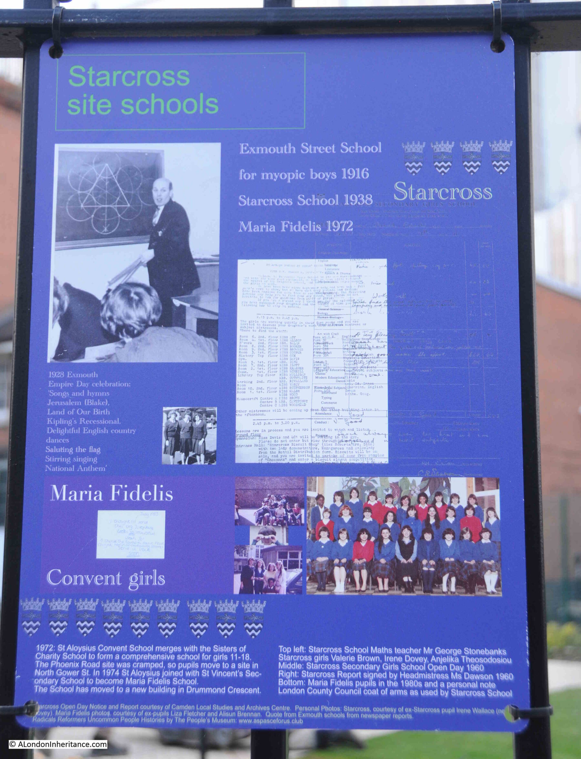
And the final panel covers the local schools, including the Maria Fidelis school, which is the large brick building beside Starcross Yard:

Starcross Yard

I rather like what they have done with Starcross Yard. Too often when large areas of London are redeveloped, there is nothing left to indicate anything about the people and places that once had a connection to the place.

Starcross Yard is temporary, and I hope whatever comes next retains this approach to the areas history.

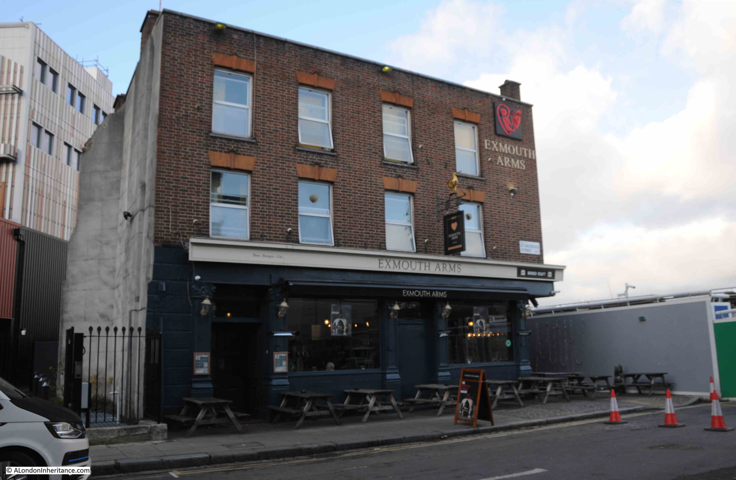
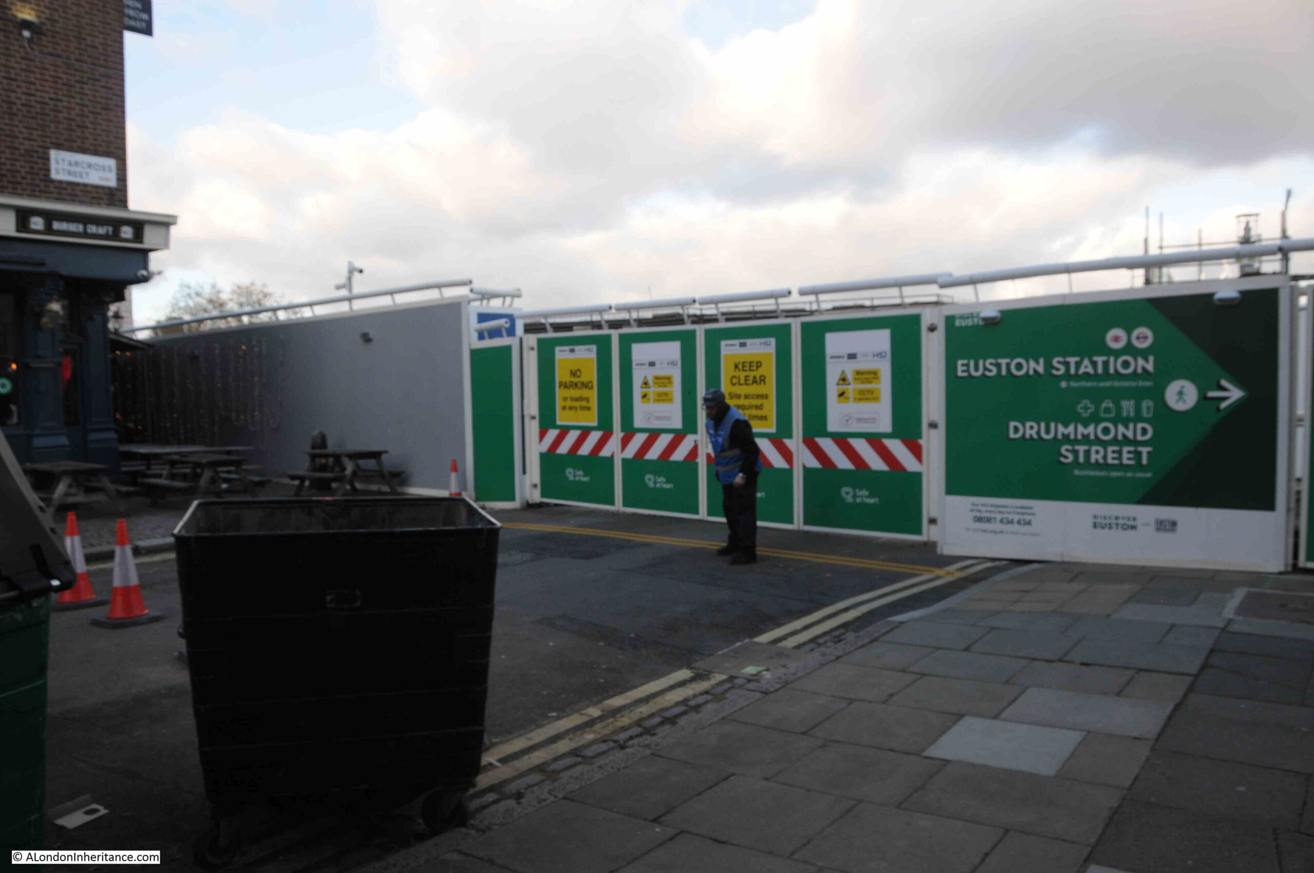
Meanwhile, at the end of Starcross Street, the Exmouth Arms are still open:

Exmouth Arms Starcross Street

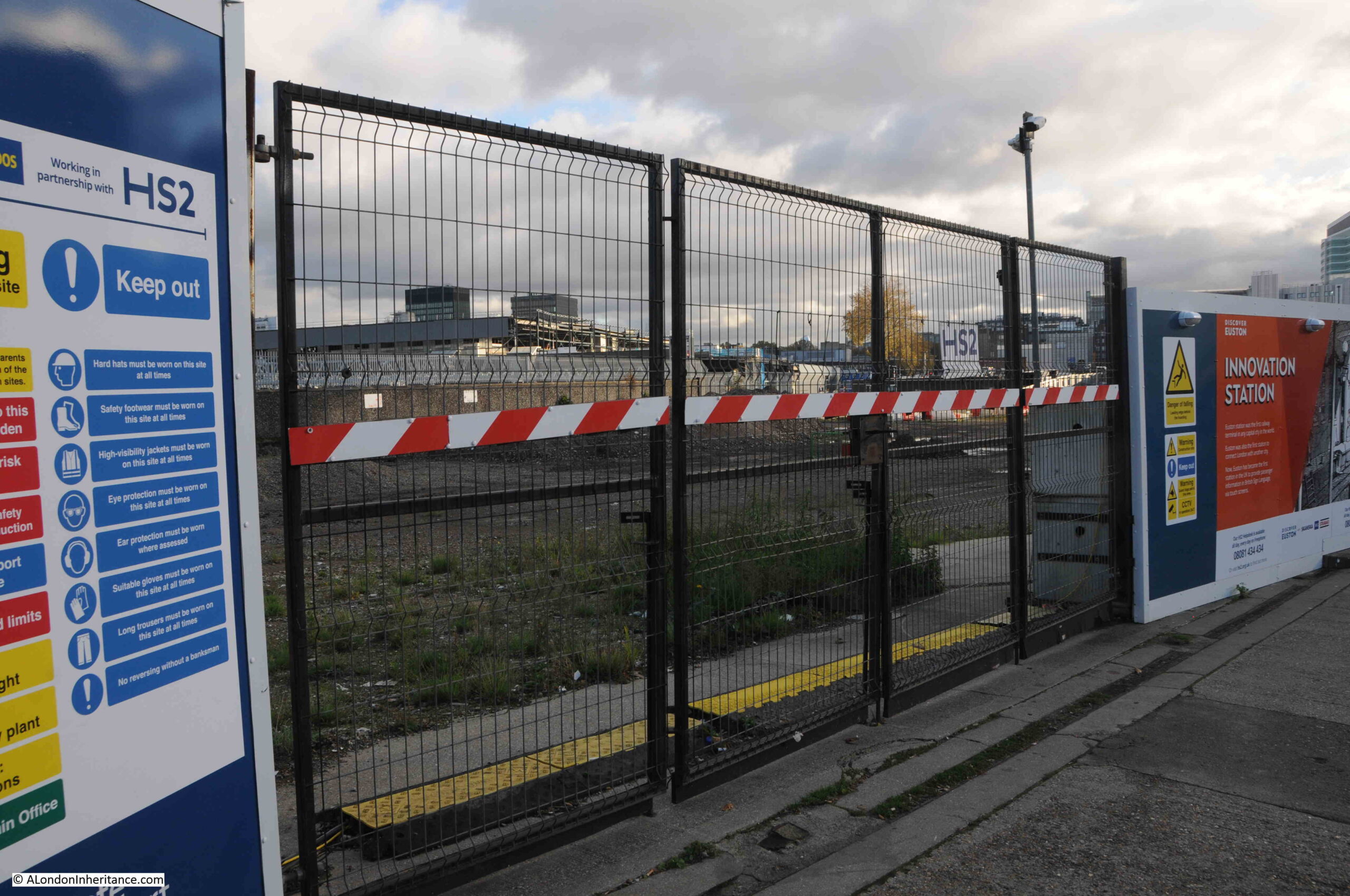
Next to the Exmouth Arms is another of the site entrances, guarded by a rather bored security person:

Starcross Street

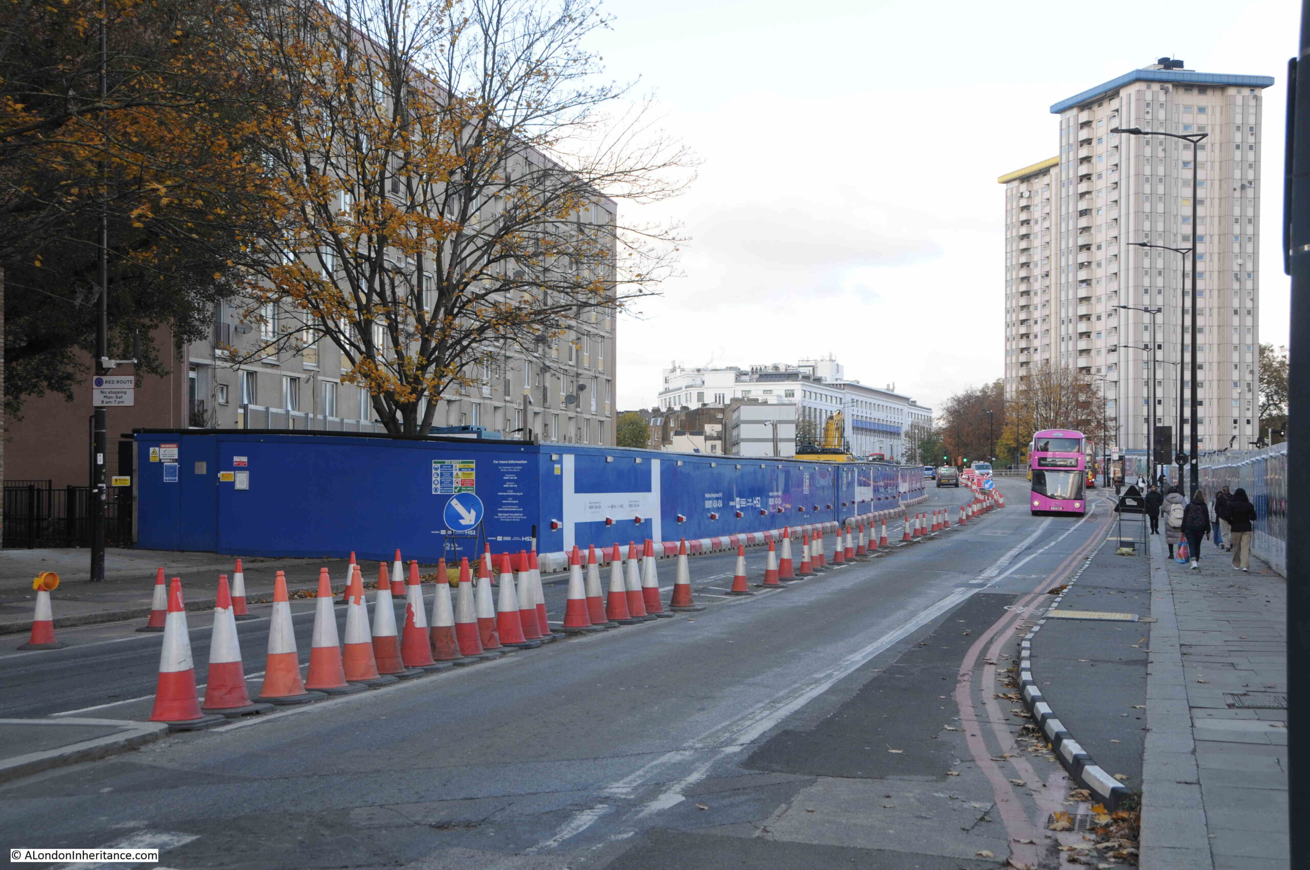
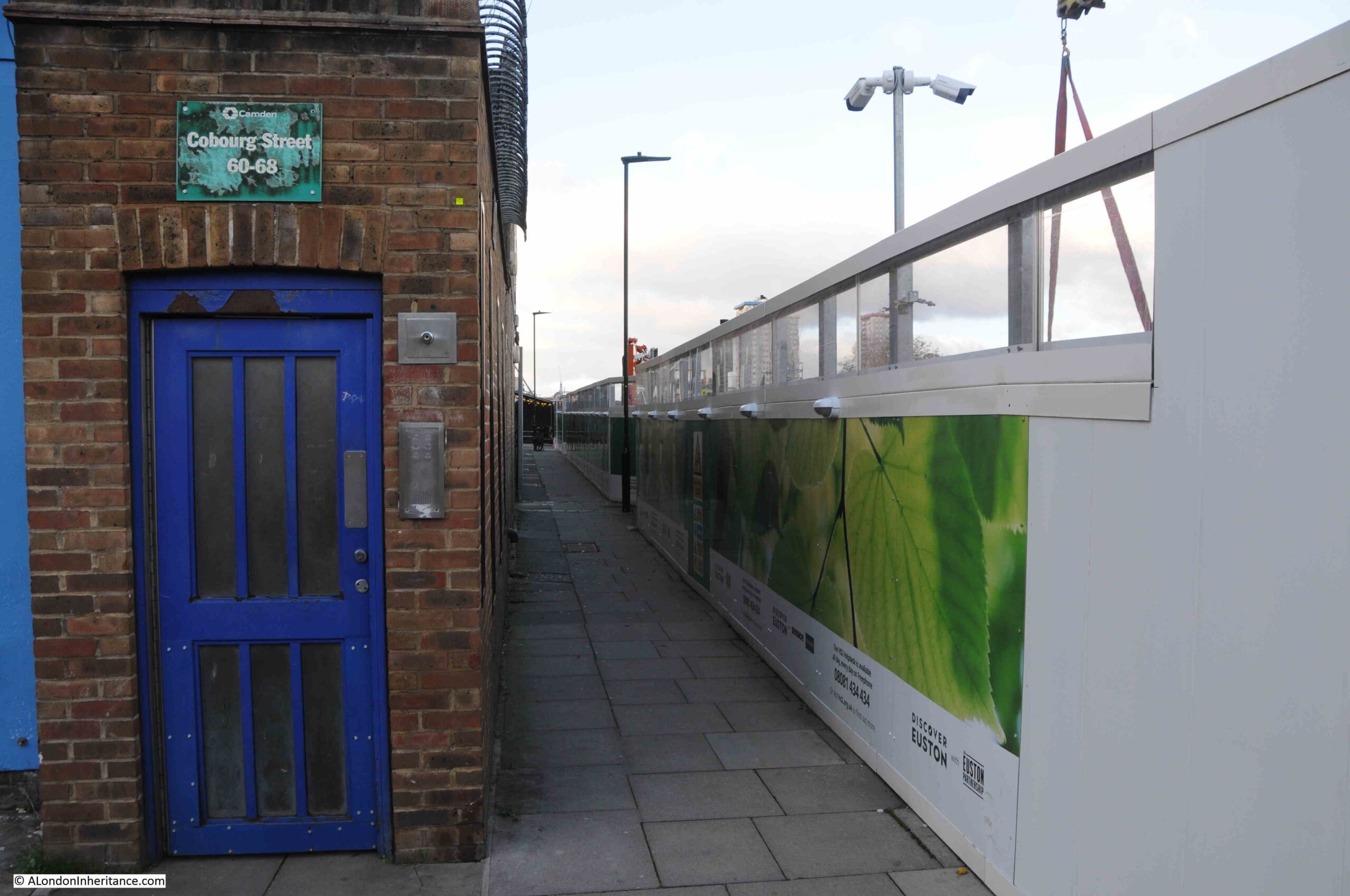
At the end of Starcross Street is Cobourg Street, although the road element of the street is now boarded off, with only the footpath remaining.

Cobourg Street crosses Drummond Street, and last year you could walk along this far stretch of Cobourg Street, but during my 2023 visit, the footpath was being fenced off:

Drummond Street

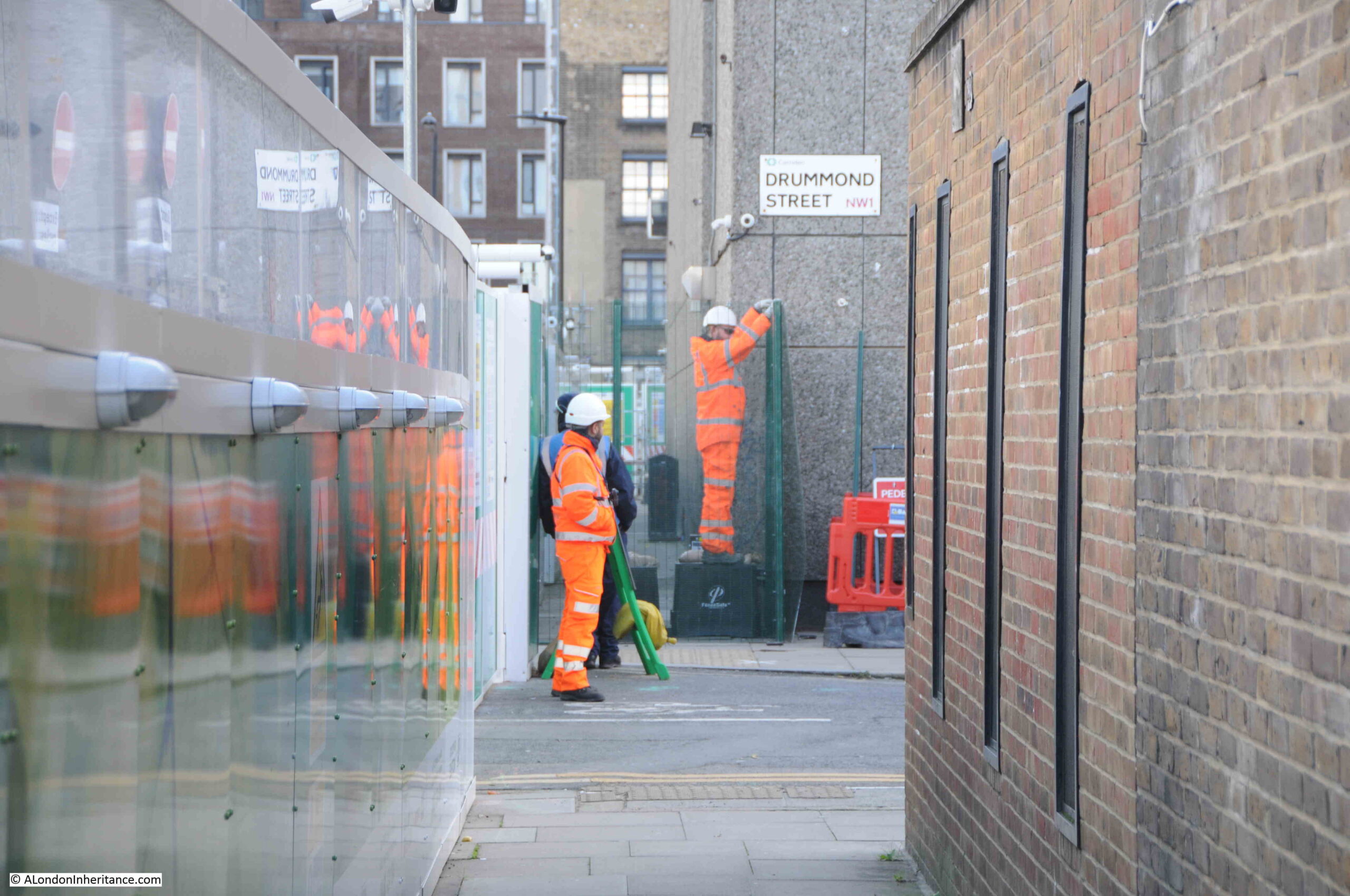
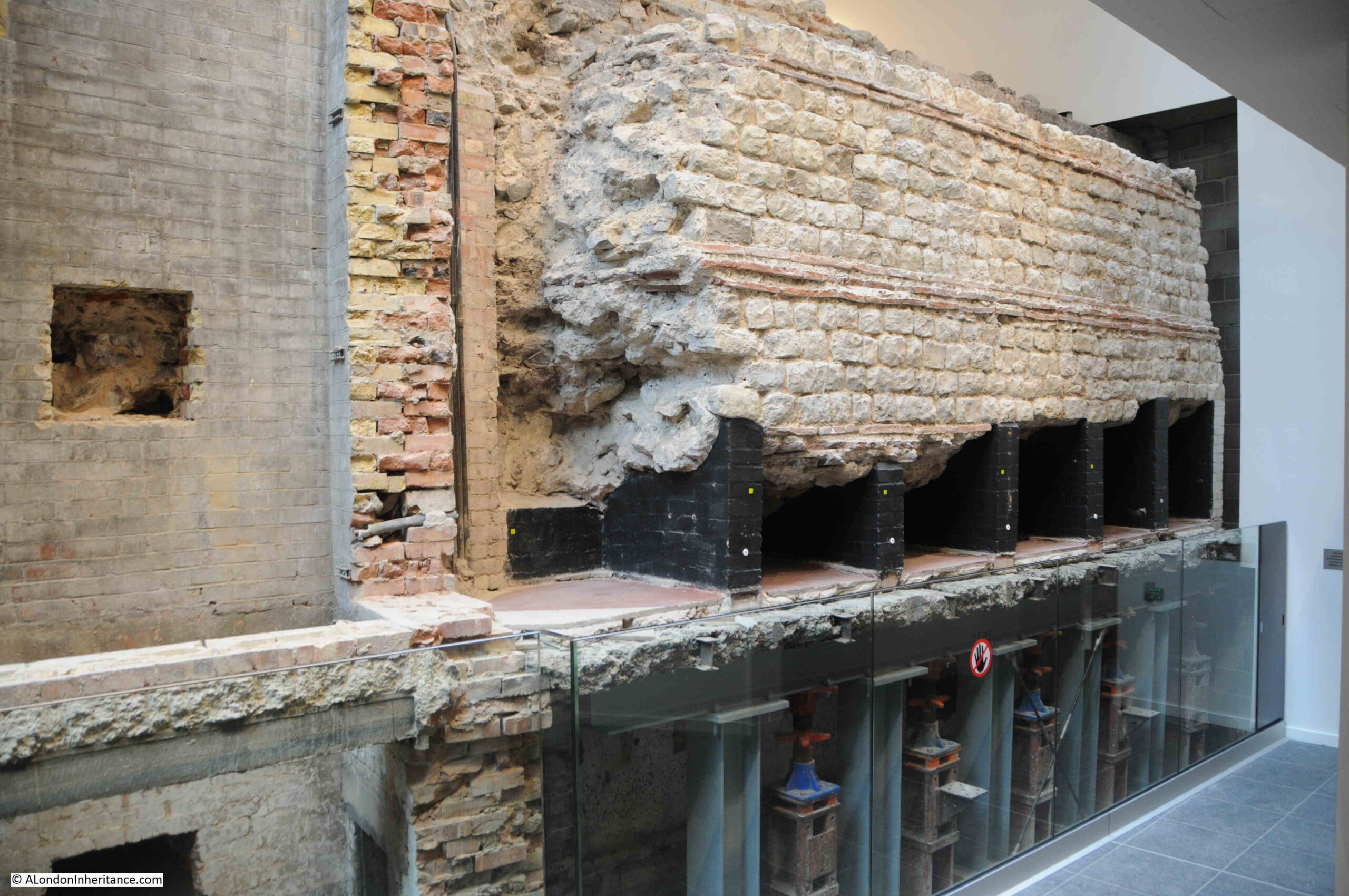
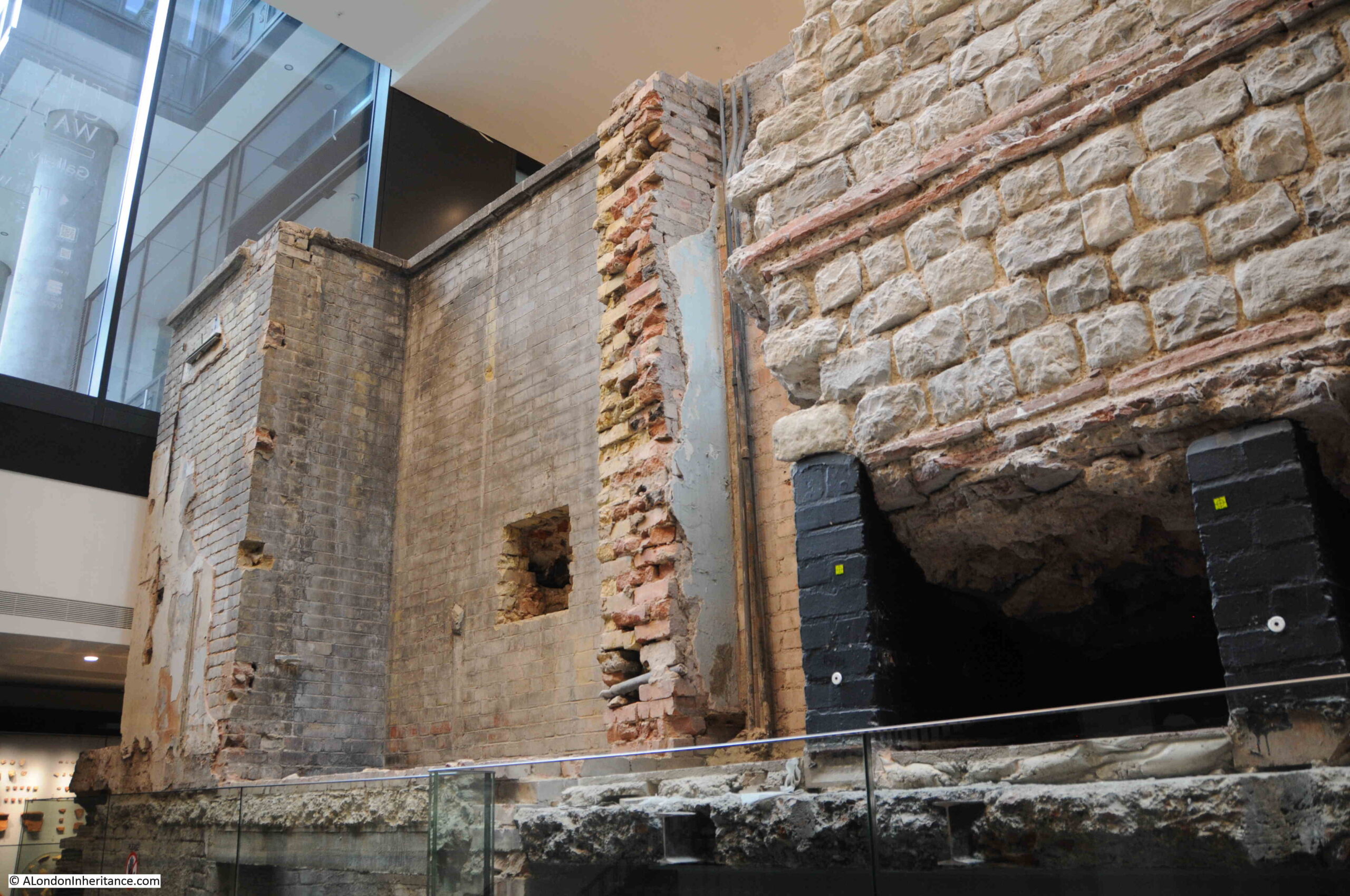
It seems to be a result of the “pause” in work of HS2 into Euston, that the whole site seems to be getting more enclosed and secure. I assume if you have a large area of open land sitting idle, you do not want the risk of anyone getting in.

This is the view back along Cobourg Street from Drummond Street towards the Exmouth Arms:

Cobourg Street

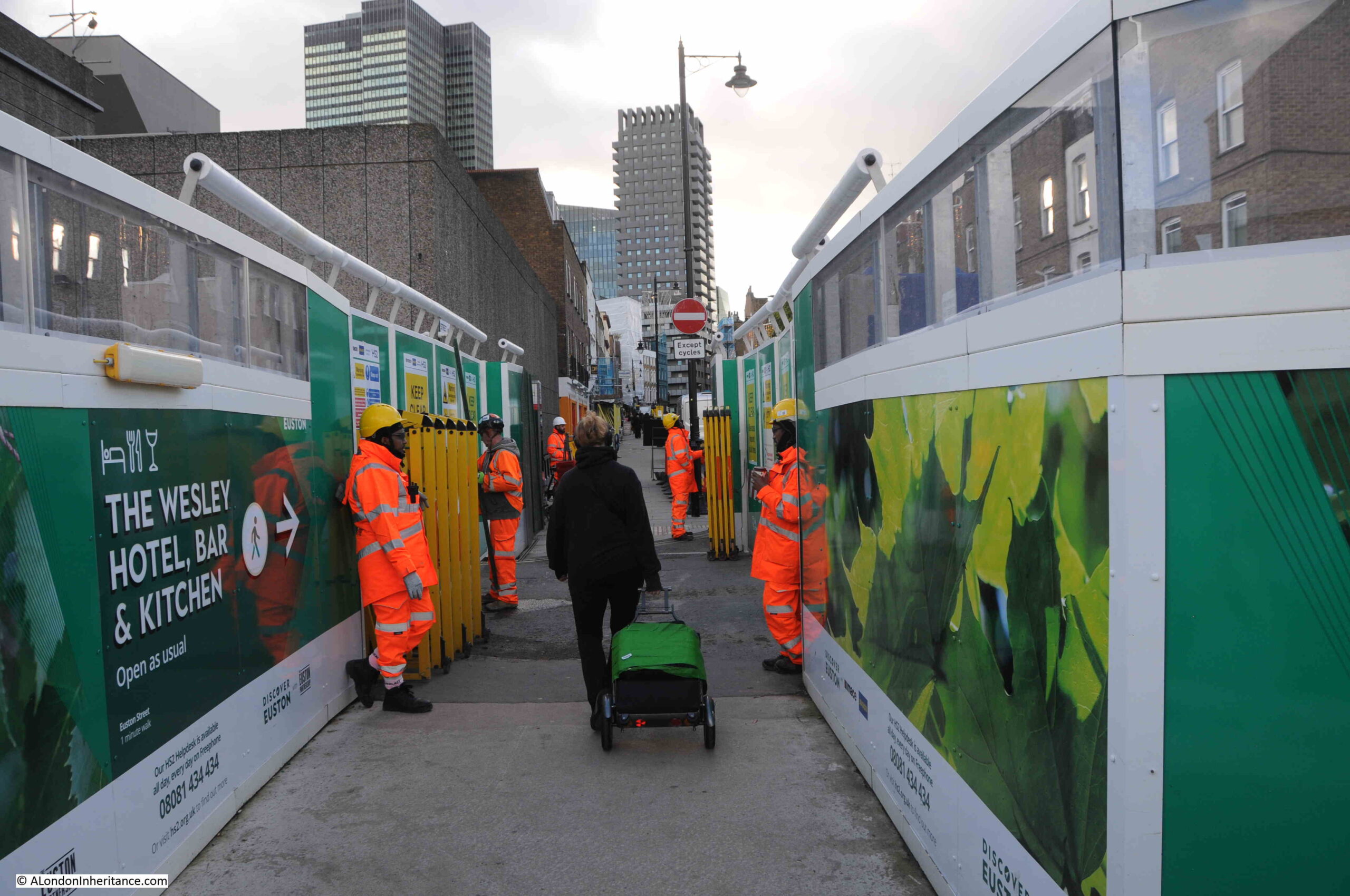
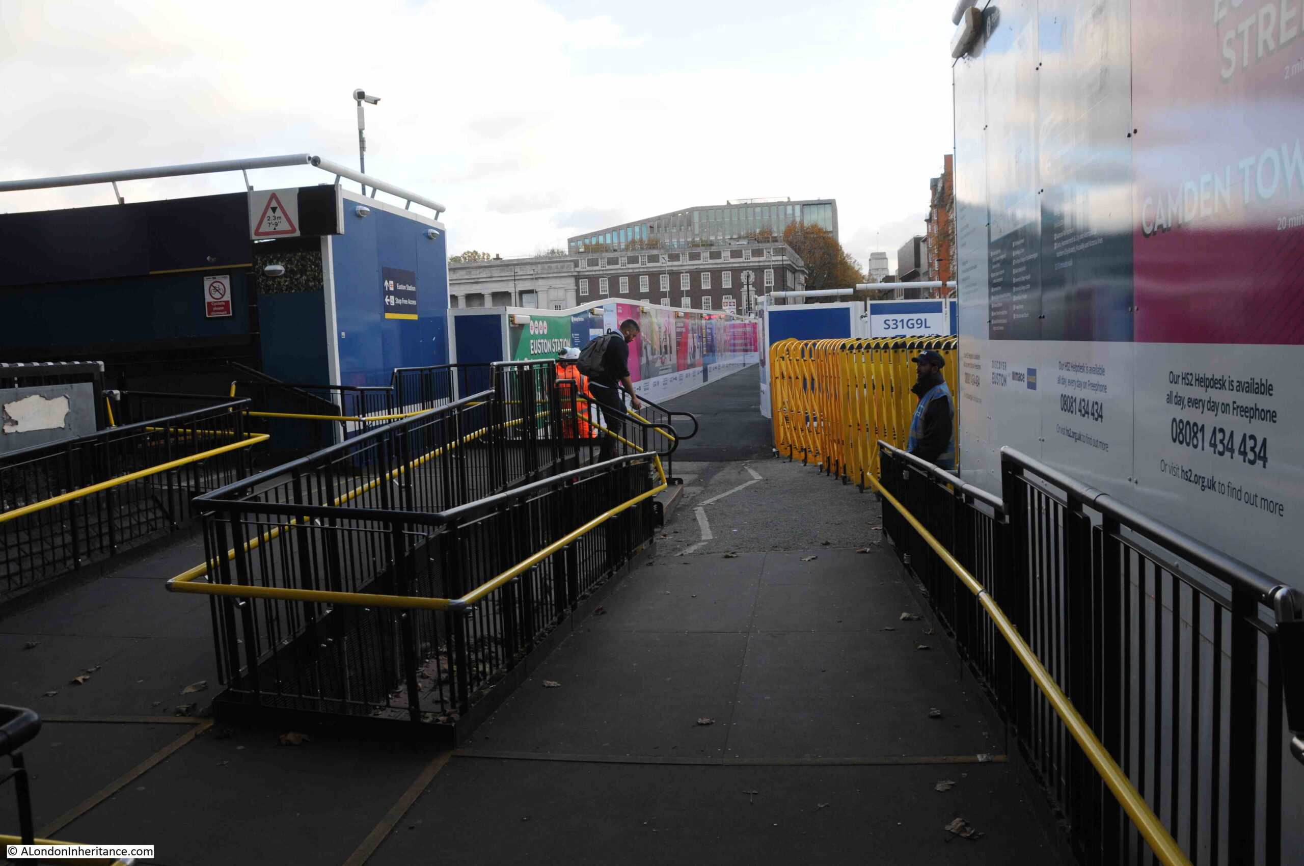
Where Drummond Street once ran all the way to the edge of Euston Station, it now stops at the junction with Cobourg Street, and continues on as a walkway, with the HS2 construction site on either side.

This is the view along the walkway, looking up towards Drummond Street:

HS2

And from the same location, looking towards Euston Station:

HS2

And back towards Drummond Street:

HS2

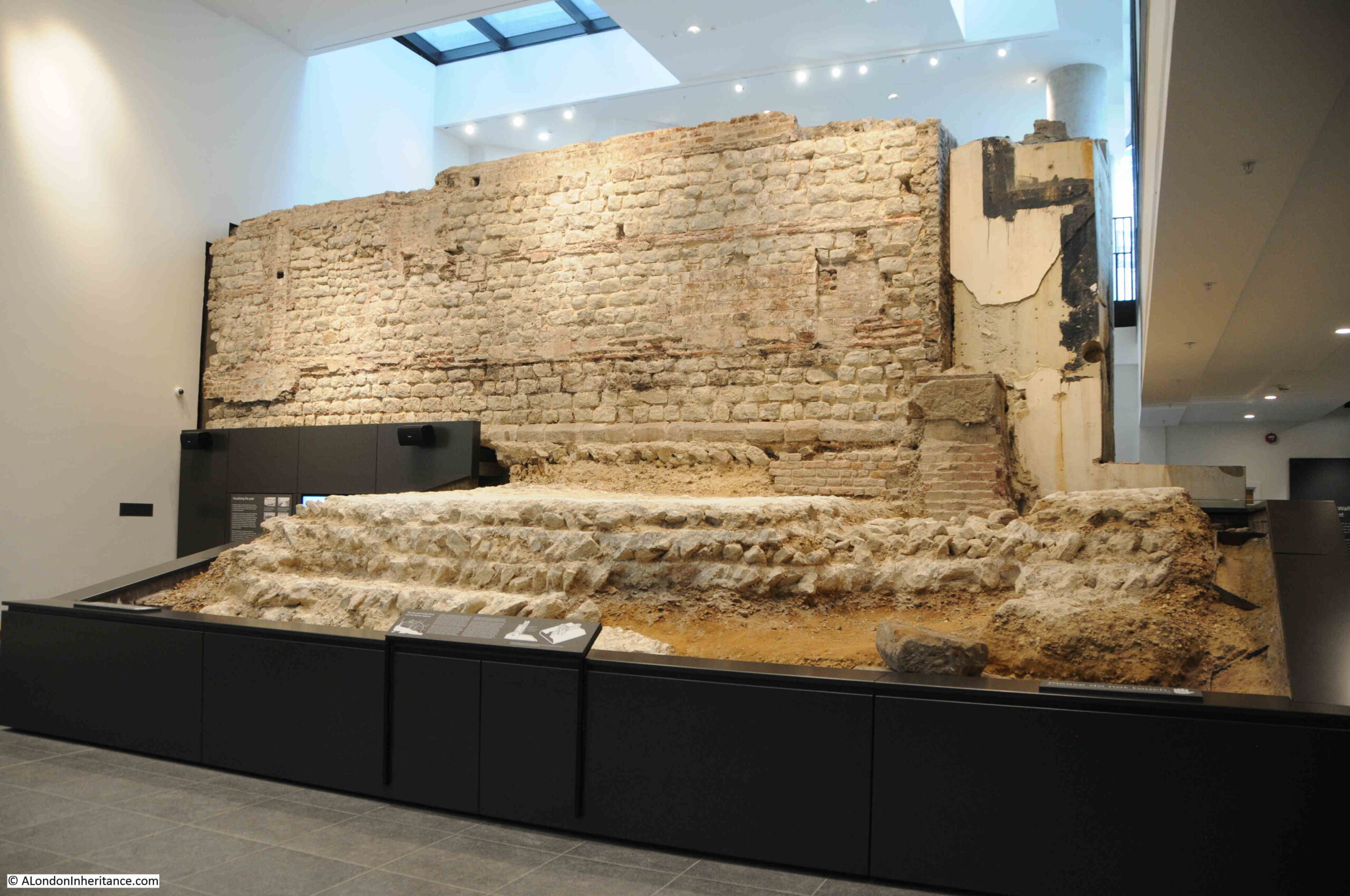
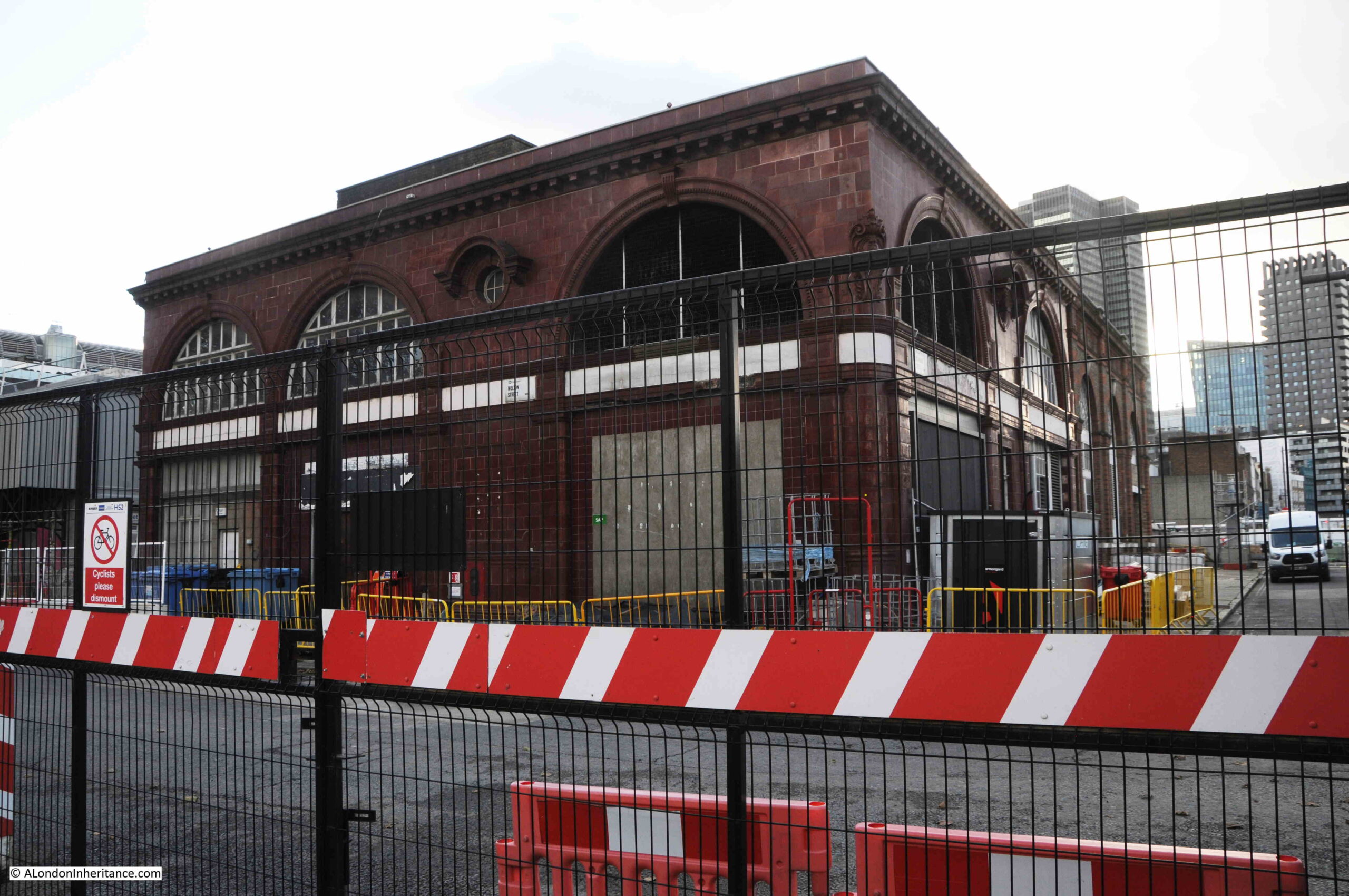
At the corner of where Drummond Street once met Melton Street is the original Euston station of the Charing Cross, Euston and Hampstead Railway (I wrote about a visit to the station and tunnels in this post):

Euston underground station

To the left of the underground station is another large area of cleared space, this was the area once bounded by Melton Street, Drummond Street, Euston Street and Cobourg Street, and was where the Bree Louise pub was to be found:

HS2

The following view is from the same position as the above photo, and is looking along where Melton Street ran into Cardington Street. It was a short distance along Cardington Street that St. James’s Gardens could be found. The tree is the only reminder of the trees that once lined part of the street and across the gardens.

HS2

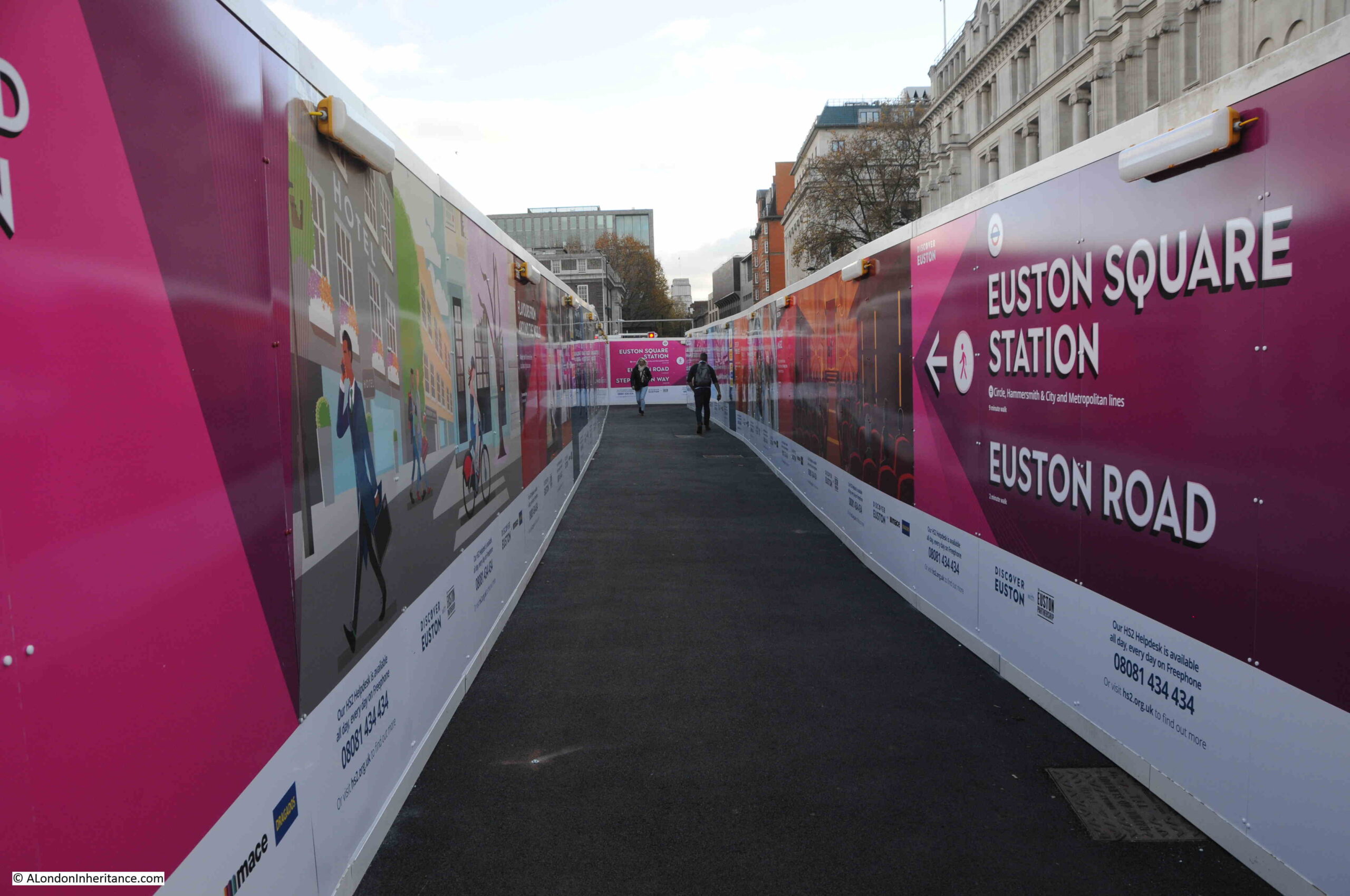
The view along what was Melton Street, with a walkway into Euston Station up the ramp to the left:

HS2

The walkway along what was Melton Street:

Melton Street

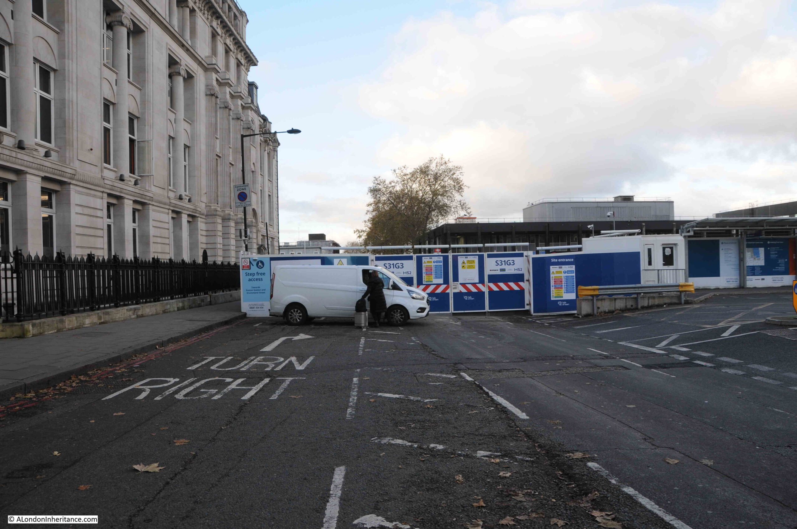
There is a small stub of Melton Street left, where it meets Euston Road, and again has a very quiet entrance to the HS2 construction site:

Melton Street

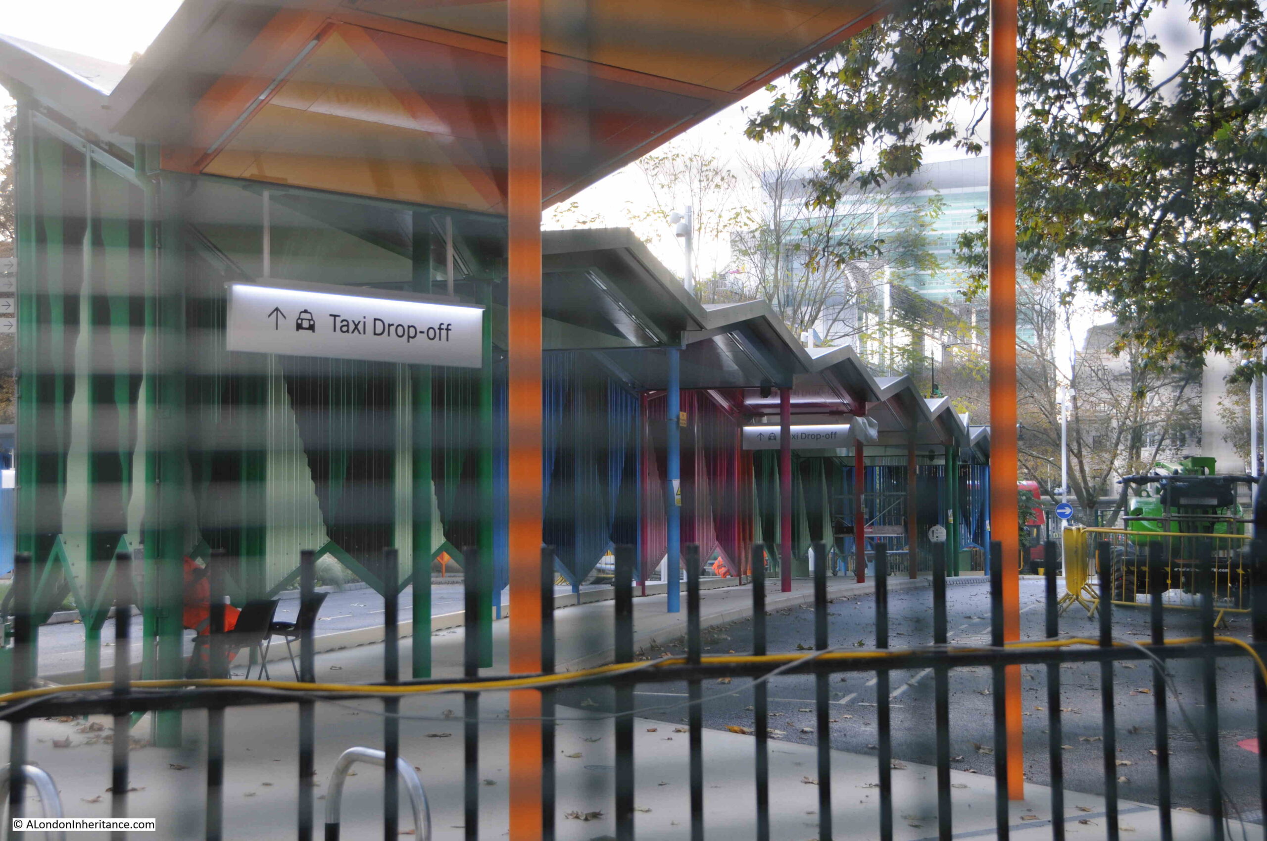
I then walked along Euston Road to find the third place where there is any tangible sign of a change. At the eastern side of the station is Eversholt Street, and in front of the station, and the bus stops, between Eversholt Street and Euston Road, one of the open spaces alongside Euston Road has been redeveloped:

Eversholt Street

The area is still secured by standard HS2 Euston green mesh fencing, but through it there appears to be a new taxi drop of point. It all looks finished, but no indication of when it will be opening:

Eversholt Street

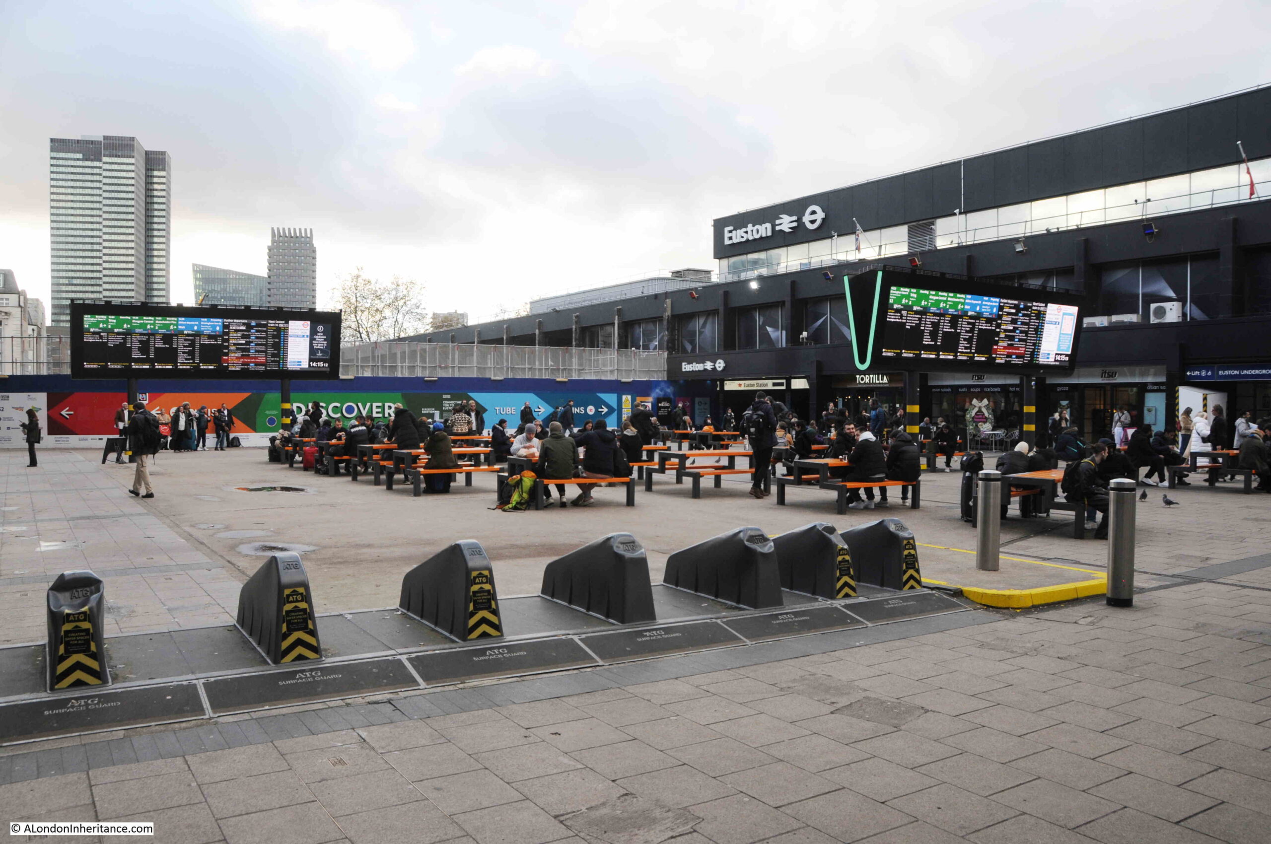
Then a walk to the open space in front of the station:

Euston station concourse

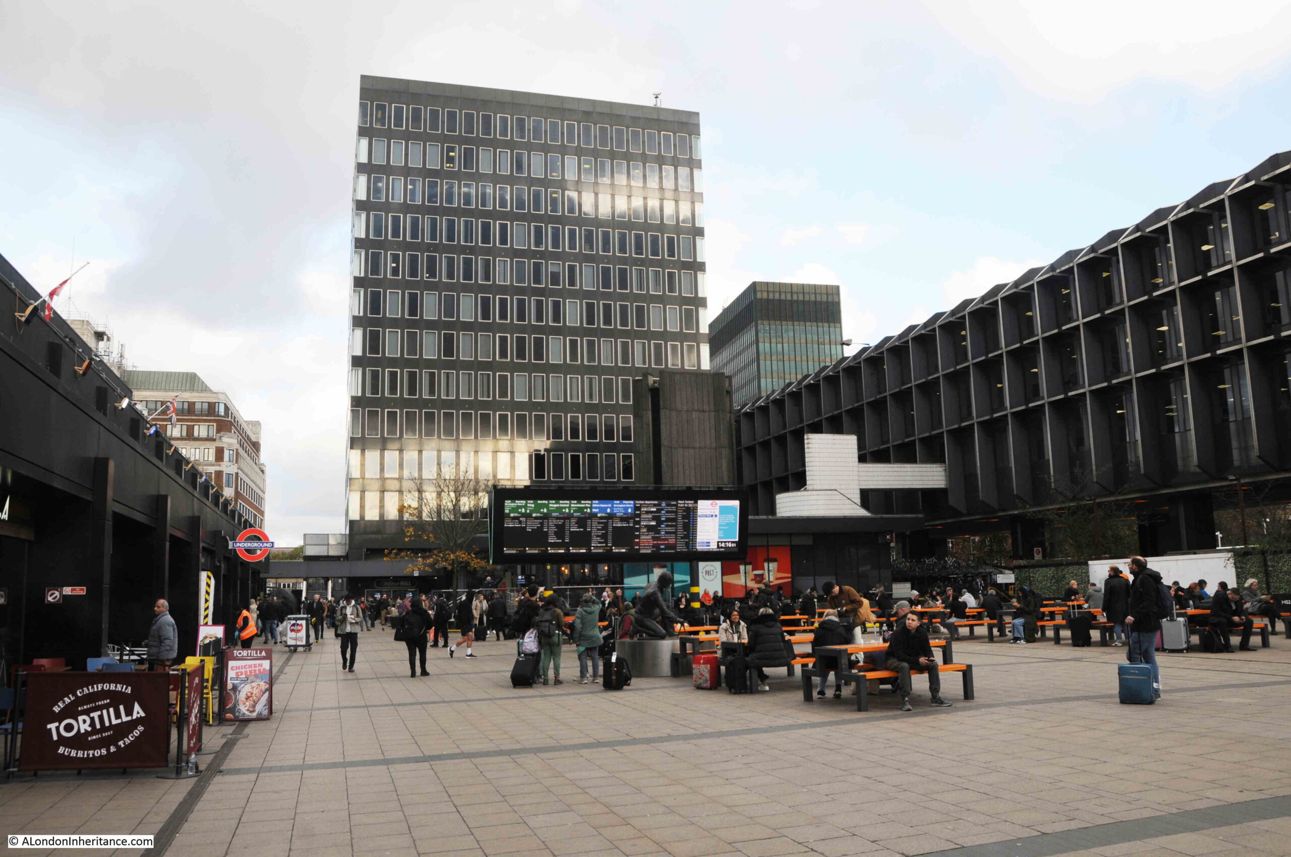
With a view in the opposite direction showing the office blocks between Euston Station and Euston Road:

Euston station

Returning to Melton Street, where there is a ramp leading to a walkway into Euston Station, this is the view, with a large open construction site behind the panels on the right:

Euston Station

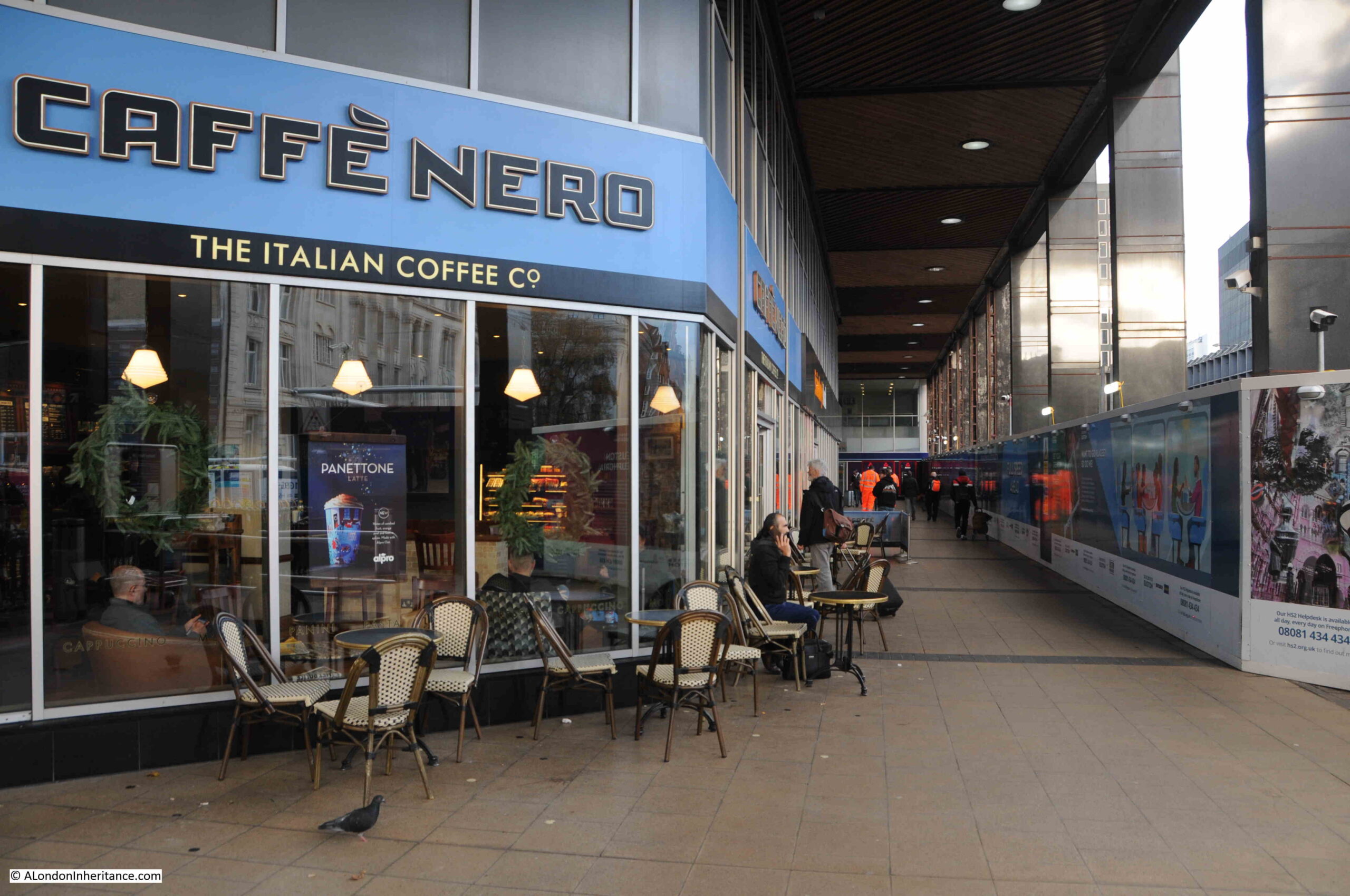
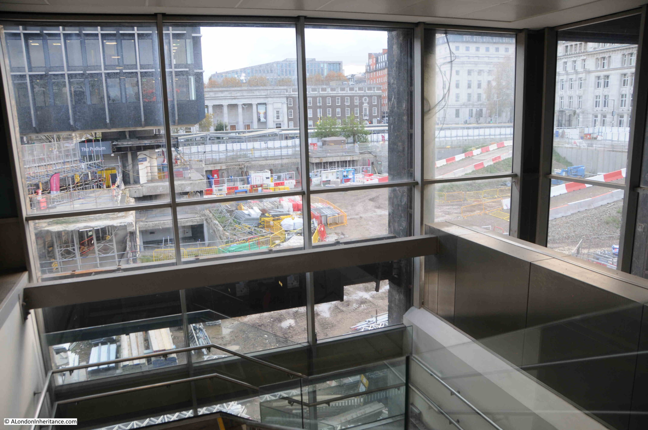
If you walk into Euston Station, up to the first floor area where there is a pub and food outlets, at the western end of this space there are stairs back down to ground level, and from here there is a view over the construction space in front of the station, with Melton Street to the right, and taxi ranks alongside Euston Road:

View from Euston station

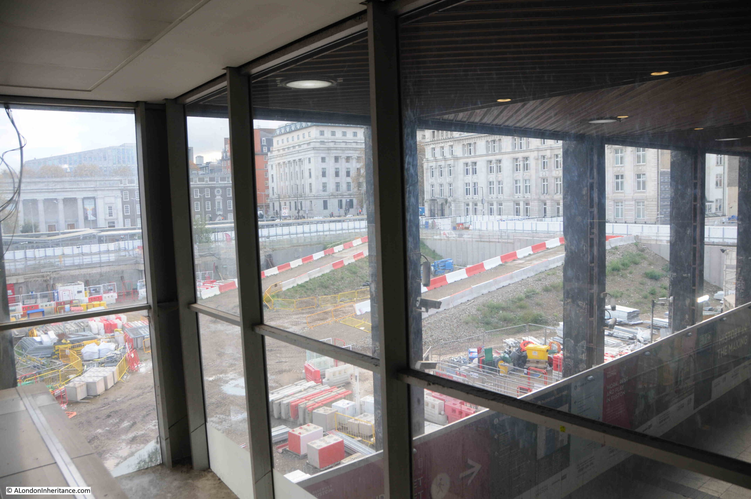
Not much happening in this large area:

View from Euston station

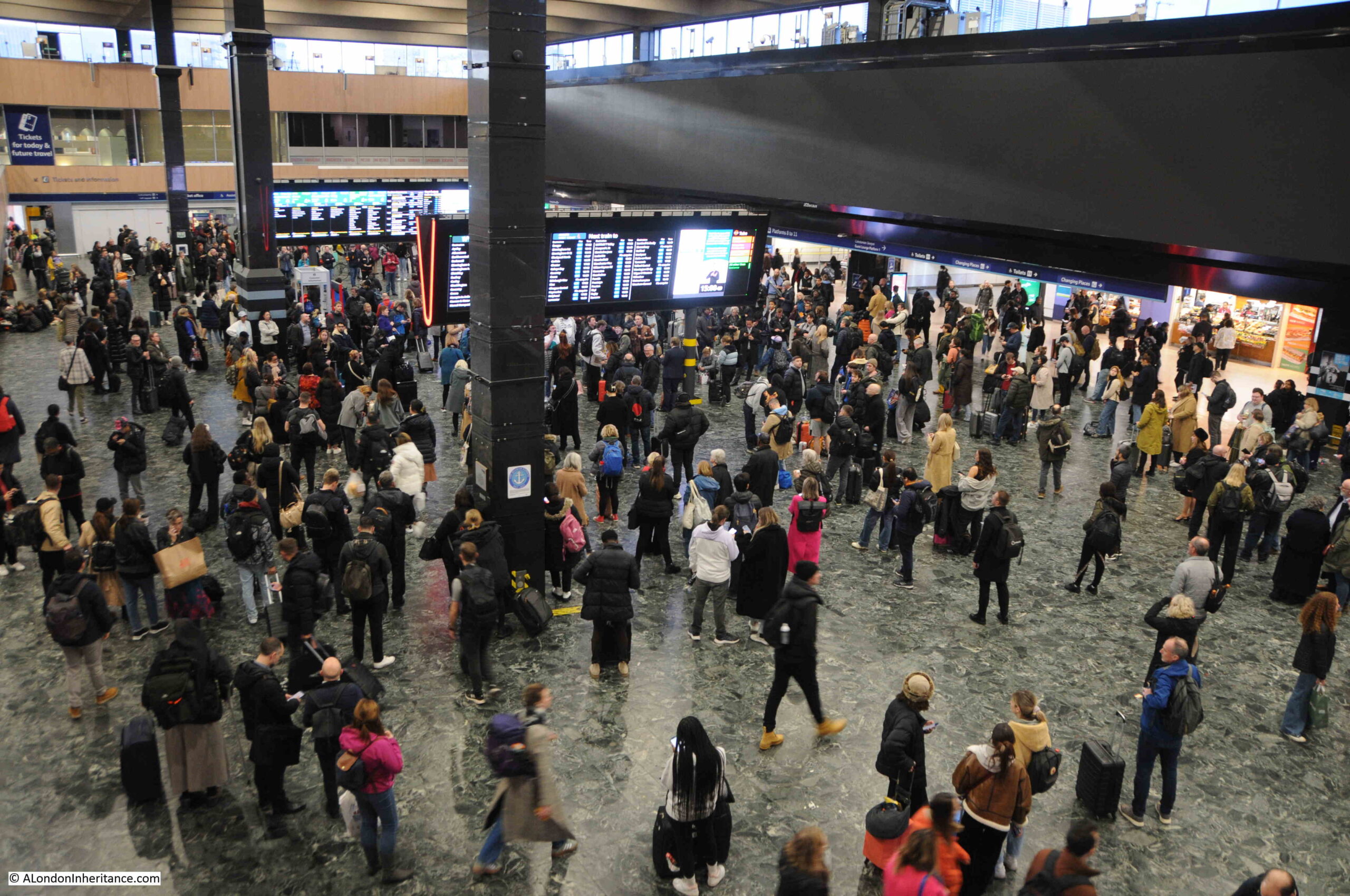
The station concourse:

Euston station concourse

That was the HS2 Euston construction site in 2023. Very little change compared to a year ago, with only two small gardens and a taxi drop off point the only external signs of change.

There were not that many construction workers around, and the perimeter of the site seems to be getting more secure, as if it is closing up for a long period.

HS2 seems to be a love / hate project, and whatever your individual views on the project, it does not give a good impression of the country when we seem unable to build major infrastructure projects such as HS2.

There is an interesting article on the London reconnections website, comparing the costs of infrastructure projects in the UK and other, comparable countries, and it is remarkable just how much extra, projects in this country are to build compared to others.

There are many complex reasons for this. Planning processes, funding complexity, objections to projects, long decision making, changes to decisions etc. all add to cost.

Although the Old Oak Common to Euston section has been paused, there will still be cost, at the very minimum the construction sites will need security, and I suspect it will take very many years before sufficient private finance is found to complete the project.

London Mayors and Government Ministers of all parties seem to like the phrase that “London is open for business”, a phrase which I find rather meaningless, but seems to translate as the city is open for anyone to purchase London’s assets, and this will probably be the way for Euston with offshore investment building up a new Nine Elms above a very slimmed down station.

Apart from the Silvertown Tunnel, HS2 is the only other major public transport infrastructure project in London.

Crossrail 2 has been “paused” since October 2020, and I doubt there will be anything for some decades to come.

Sorry to be so depressing on your Sunday morning.

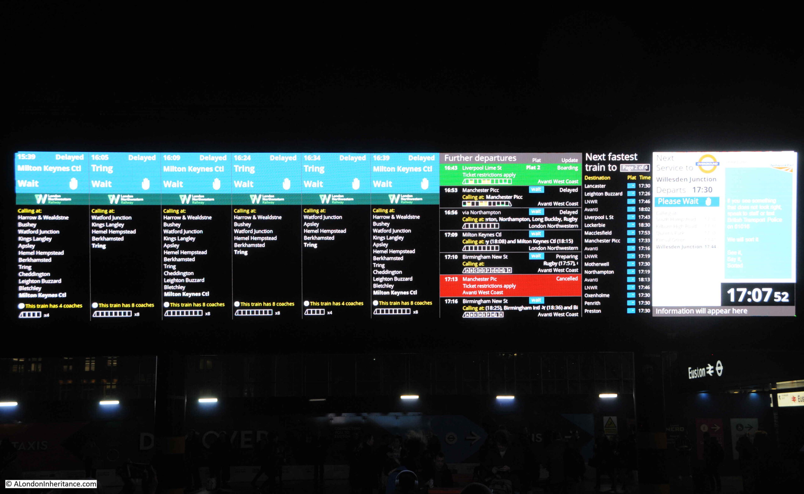
I stayed taking a few more photos as it got dark, and as I left the station, the new information board in the outside concourse mirrored my thoughts at the time about the future of Euston’s development, with almost every train being delayed:

Euston departure board

My visits to the Euston HS2 construction site for the past six years are covered in the following posts:

My first post was back in 2017 and covered St James Gardens, just before they were closed for excavation.

My second post in 2018 walked around the streets to the west of the station, as buildings began to close, and the extent of the works could be seen.

I then went back in 2019 as demolition started.

In 2020, demolition was well underway and St James Gardens had disappeared, and the associated archaeological excavation had finished

And in June 2021 I went back for another walk around the edge of the construction site.

Last year’s 2022 walk around the site is here.

I suspect the site will be much the same when I visit again later in 2024.

alondoninheritance.com

Trig Lane Stairs and Thames Foreshore Erosion

Trig Lane Stairs lead down to the Thames foreshore, just to the east of the Millennium Bridge. Today, the stairs connect the foreshore with the walkway that now runs along the edge of the river, with apartments and offices between the river and Upper Thames Street.

Back in 1949 it was a very different place, a mix of wartime bomb damage and with many of the warehouses remaining from the time when this section of the river was busy with the movement of goods between barges and warehouses.

This is one of my father’s photos from 1949. The wooden stairs of Trig Lane Stairs lead down to the foreshore, warehouses either side with an open space between (not bomb damage, but an open space for movement of goods), and one of my father’s friends standing on the stairs:

Trig Lane Stairs

I took the following photo from the south bank of the river. To the right of the Millennium Bridge, along the wall that runs alongside the river, you can see a dark rectangle, which is the entrance to Trig Stairs through the river wall, and the wooden stairs to the foreshore can just be seen below the gap:

Trig Lane Stairs

As with the edge of the Thames through most of London, this area has changed dramatically in the 74 years between the two photos.

The warehouses have been replaced with new buildings, with a single block covering the space behind the stairs and along where several warehouses once stood.

Walking along the edge of the river from the east, and the Trig Lane Stairs can be seen in the following photo, just behind the group of people on the foreshore:

Trig Lane Stairs

The entrance to Trig Lane Stairs in 2023:

Trig Lane Stairs

The stairs go up, before going down to the foreshore are an indication of the height of the river wall now needed to prevent any flooding at times of exceptionally high tide.

Once over the stairs, we can get a view of the wooden stairs going down to the foreshore:

Thames foreshore

And this was the same view in 1949:

Thames foreshore

In 1949 the warehouses were still in use, and the loaded barges which can be seen in the background are probably holding goods that are waiting to be moved to the warehouses as these were mostly used for import.

According to the 1953 edition of “London Wharves and Docks”, published by Commercial Motor, the warehouse to the left of the stairs in my father’s photo was the warehouse of Crown and Horseshoe Wharf, which traded in general goods, and specialised in canned goods and chemicals. The warehouse had storage space for 100,000 cubic feet of goods.

The warehouse on the right of the stairs was Sunlight Wharf, owned by LEP Transport, and in 1953 was described as “premises particularly suited for storage of canned goods, having large basement accommodation at average low temperature”.

One of my photos is of the last days of Sunlight Wharf and is in my post “Baynard’s Castle, A Roman Monument And The Last Working Crane In the City”.

The following extract from the 1951 edition of the OS map shows Trig Lane Stairs just below the centre of the map, at the end of Trig Lane (‘Reproduced with the permission of the National Library of Scotland“):

Trig Lane Stairs

According to “A Dictionary of London” by Henry Harben, the first mention of the name was as Trigge Lane in the 1603 edition of Stow’s Survey of London, and by 1677 it was Trigg Lane.

The first mention of the stairs was by John Strype, who published a new, expanded version of Stow’s Survey of London in 1720. Strype’s description of the stairs and lane was “Trig Stairs, so called from the Stairs on the Water side, which is indifferently well supplied by Watermen. The Lane is pretty open, reasonably well built and inhabited”.

Henry Harben states that the name came from John Trigge, the owner of property around the lane and stairs, and in the following centuries, the name has changed from Trigge to Trig. The “London Encyclopedia” (Ben Weinreb and Christopher Hibbert) also repeats the source of the name, and that “the Trigge family were local residents in the 14th and 15th centuries”.

The street Trig Lane has all but disappeared. It no longer runs from Upper Thames Street down to the stairs. Development over the last few decades has obliterated the original route of the street, but the name remains in an east – west street, which is mainly an access route to the rear of one of the buildings that now faces onto the river.

The current routing of Trig Lane can be seen in the following map  (© OpenStreetMap contributors):

Trig Lane

Having photos from 1949 and 2023, looking down from the stairs to the foreshore allows comparison of the foreshore, 74 years apart.

The following photo is an extract from the 1949 photo, looking at the area where a number of wooden structures can be seen:

Thames foreshore erosion

I have labeled what I assume is the top of the groyne line on the right. The groyne line is shown in the 1951 OS map, and apart from a gap opposite the stairs, it runs along the foreshore, a little distance out from the embankment.

The groyne line was probably a wooden wall used to retain the foreshore and create a reasonably flat surface on wich barges could be positioned and their cargo unloaded into the warehouses.

I have also labeled wooden posts that appear to be retaining a plank. There is a similar plank to the left and these two may have been where the groyne line returned to the river wall, or could have formed the edge to a causeway that ran out from the bottom of the stairs.

Looking at the same view today, and we can see just how much of the foreshore has eroded in the last seven decades:

Thames foreshore erosion

The groyne on the right, the top of which was visible in 1949 has now disappeared. The groyne on the left which was just below the foreshore is now fully exposed.

We can also see the wooden posts which were once retaining the planks along the edge of the causeway.

Comparing these two photos shows that at the location of the groynes, the foreshore has eroded a good two to three feet.

The Thames foreshore is a very fluid space, in all senses of the word.

Trig Lane and the stairs date from the 17th century, and are probably much older and even if the name Trig dated from around that time, there were probably stairs here much earlier as stairs were such an important part of access between the land and the river, and along this part of the river, there has been port infrastructure for so many centuries.

The London Encyclopedia has the same view as it states that the stairs were earlier known as Fish Wharf.

Excavation at Trig Lane between 1974 and 1976, prior to major development of the area revealed remarkable remains of the medieval waterfront with significant wooden revetments and other infrastructure of the port between the late 13th and mid-15th centuries.

The following is an extract from William Morgan’s map of London from 1682, and shows Trigg Stairs. To the left of Trigg Stairs is Paul’s Wharf which also had a set of stairs. I do not know whether it was an artistic interpretation of the scene, or whether it was fact, but the stairs by Paul’s Wharf had a large cluster of watermen’s boats, but none at Trigg Stairs:

Trig Lane Stairs

What I love above Thames stairs is not just the physical structure, but the stories you can find about what happened at the stairs. Just small glimpses, but they help with an understanding of what life was like at the boundary between river and City.

For example, from the Newcastle Courant on the 15th of July, 1721:

“Last Monday, Mr. Hargrave, who sometime ago killed one Capt. Wilkes, a half Pay Officer in Racket Court, Fleet Street, and fled, and coming off the water at Trig Stairs, drew his sword upon the Waterman, without any provocation, and stabbed him very dangerously in the Breast, for which he and his Companion were forthwith seized, and carried before the Lord Mayor, who committed them to Wood Street Compter”.

And from the Caledonian Mercury on the 1st of July, 1728:

“On Tuesday in the afternoon, a Barge Man was struck down by lightening as he was going up a ladder at Trig Stairs; and falling into the River, was drowned before any help could be got”.

From the Kentish Weekly Post on the 24th of January, 1759:

“A Journeyman Carpenter crossing the water from Trig Stairs, being a little in liquor, and imagining he was near the shore, jumped out of the boat and was drowned”.

The Reading Mercury reported on the 28th of July, 1783, that:

“The lighters of Mr. Rodbard, at Trig Stairs, Thames Street, having been lately frequently robbed, a guard was appointed to overlook them; and early yesterday morning three persons were discovered filling the corn into sacks, who being fired at by the guard, one of them was killed; the others immediately rowed off in a boat which they had stolen for the occasion, to Pepper Alley Stairs, where they escaped, leaving the body in the boat.”

The London Morning Herald reported on the 13th of October, 1837, that:

“Yesterday evening an inquest was held in the King’s Arms, Queenhithe, before W. Payne (City Coroner), on view of the body of Joseph Colcourt, a lighterman. It appeared from evidence that the deceased was in company with a boy bringing a barge down the river, on Wednesday morning last, about three o’clock, and had arrived alongside Trig Stairs, Queenhithe, when the barge struck against another which was moored off the stairs, and deceased, who was at the time standing on the gunwale, was, in consequence of the concussion, precipitated overboard, and sunk immediately. The boy made what efforts he could at the time to save him, but they were ineffectual. The tide was running down very strong, and it was impossible to render assistance. The body of the deceased was found next morning near to the spot where he fell in. Verdict – Accidental Death.”

Whilst all these stories are of assault, theft and accidental death (as today, the press only report the bad news), they are a common theme to all Thames stairs, and show the dangers of working on the river, of crossing the river, crime on the river, children also working in such dangerous conditions etc.

Standing at the stairs today, it is hard to imagine a guard firing and killing one of those trying to steal corn from barges moored by the stairs.

In Morgan’s map of London from 1682, the stairs were spelt Trigg, but by the time of Rocque’s map of London in 1746, the last “g” had been dropped, and they were just Trig Stairs, as they remain today.

Trig Lane Stairs

It is interesting how place names change, and I suspect that it was usually a gradual simplification of the name, so the stairs started with the name of a local land owner as Trigge, then Trigg and finally Trig, so the name ends with a spelling that more accurately mirrors how the name is pronounced.

The groynes today still seem to form a boundary between the water and the foreshore at a typical low tide:

Wooden structures in the Thames

I assume that the rubble behind the groyne may have been used as infill to build up the foreshore on the land side of the groyne to create a platform where barges could be moored on some reasonably level ground.

And today we can also see where the eastern groyne ends, there is a gap where the causeway would have extended, and the wooden posts along the side of the causeway now project above the surface. It could also have been where the groynes returned to the river wall. This shows just how much erosion the foreshore has suffered in the last 70 years:

Wooden structures in the Thames

View along the foreshore to the west:

Thames foreshore

And to the east – the large brick building at the end of the run of modern buildings is the only warehouse that remains from the pre-war period:

Thames foreshore

In the Port of London Authority book: “Access to the River Thames. A Port of London Authority GuideSteps, Stairs and Landing Places on the Tidal Thames” (published around 1995), Trig Lane Stairs is listed as having 9 stone steps and 18 wood steps, and that the condition was bad.

The stairs today have 16 steps. The stairs in the 1949 photo are longer as they went into the recess in the wall, so I do wonder if the stairs at the time of the PLA survey were the same as in my father’s photo, as they would probably have been in bad condition having been exposed to decades of Thames tides washing over them.

The PLA listing confirms that the stairs were in use in 1708, and at the time of the survey they were not in use.

The stairs today are in good condition, and whilst probably not in use as a landing place, they provide access to the foreshore:

Trig Lane Stairs

The following photo shows the view across the river to Tate Modern, the old Bankside Power Station:

Bankside Power Station

My father did take photos across the river from the top of the stairs at different times to the photos of Trig Lane Stairs.

The first shows dates from 1953 and shows the new Bankside Power Station when the first half had been completed and was in operation. The original power station is on the left, where the parallel rows of chimneys can be seen. I wrote about the view, along with other photos in the post Building Bankside Power Station.

Bankside Power Station

And this view from 1949 shows the original power station on the left, and the Phoenix Gas Works on the right. I wrote about this view, along with a wider view of Bankside in the post A Bankside Panorama In 1949 And 2017:

Bankside Power Station

Trig Stairs are in good condition, but the same cannot be said for the remains of the wooden structures on the foreshore, the groynes and the possible edges to a causeway leading out from the base of the stairs.

I suspect that erosion of the foreshore may have been speeding up over the last few decades, as the groynes and platform they protected are now not needed and are therefore not maintained, and that there are no obstructions along the foreshore or the river that would have slowed down water passing over the foreshore (for example, barges on the river and moored on the foreshore).

I doubt whether the remaining wooden structures below the Trig Lane Stairs will be there in another 74 years time.

alondoninheritance.com

The Temple of Mithras and Vine Street Roman Wall

The City of London has been occupied in one form or another for around 2,000 years, and those centuries of occupation have left their mark, whether it is in the pattern of the streets, pushing the embankment wall into the river and reclaiming parts of the foreshore, churches, rising ground levels, and the buried remains of buildings along with the accumulated rubbish, lost possessions, burials and industrial waste of the centuries.

In today’s post, I am visiting two places where the remains of Roman occupation are on display. two very different structures and methods of display, but each telling a story of London’s long history, and how these remains have survived, and their discovery, starting with:

The Temple of Mithras

The Temple of Mithras was one of the major post-war discoveries in the City of London as archaeologists rushed to excavate sites, although they had very limited funds and time.

The Temple of Mithras tells an interesting story of Roman occupation of the City, post-war archaeology, and how we value such discoveries.

The Temple of Mithras is now on display at the London Mithraeum, built as part of the construction of Bloomberg’s new European headquarters.

The remains of the temple have been displayed in a really imaginative way. Subtle lighting, a recreation of the sounds of activity in the temple during the Roman period and an image of the god Mithras overlooking the temple from the location of the apse and the block where the final altar in the temple was located.

The view on entering the Temple of Mithras:

Temple of Mithras

The Temple of Mithras was discovered in 1954 by the archaeologist W.F. Grimes.

The post-war bomb sites across the City of London offered a one off opportunity to excavate and explore for remains of occupation of the City from previous centuries, and in 1946 the Society of Antiquaries of London sponsored a short trial session, and then established the Roman and Mediaeval London Excavation Council in order to more formally establish a long term series of excavations.

These continued through to December 1962, with the majority being led by W.F. Grimes.

There were two main challenges to this work, both of which almost resulted in the failure to discover the Temple of Mithras – money and time.

The Excavation Council was able to raise funds from private donors, and in 1968 Grimes published “The Excavation of Roman and Medieval London”, a brilliant book providing an initial record of the work between 1947 and 1962. In the back of the book is a list of donors, which included the Government Ministry of Works (£26,300) and the Bank of England (£2,750) as the top two donors, down to two pages of donors who contributed £1. There were also a large number of donors who gave less than a £1, but were not recorded in the book.

By 1954, donor funds were growing short, and in the many newspaper reports of the discovery, it was reported that “Mr. Grimes had only found the temple because, after private subscriptions fell off, a grant from the Ministry of £2,000 a year had kept him going”.

There was also the challenge of time, and the walls of the temple were found towards the very end of the period agreed with the developer to excavate the site. Such was the importance of the find, that the developers allowed an extra two weeks for excavation.

At the temple today, there are two walkways along the sides of the temple, and at the end of these, we can look back at the interior of the temple:

Temple of Mithras

From the location of the apse, and where the altar was located:

Temple of Mithras

The area that was being excavated, and where the Temple of Mithras was found, was a large almost triangular plot bounded by Queen Victoria Street in the north, Budge Row to the south and Walbrook to the east. Budge Row sort of exists, but is now a covered walkway between two sections of the Bloomberg building, and appears to be called the Bloomberg Arcade.

The importance of the site was that it was part of the valley of the old Walbrook stream, and at the time, very little was known of the extent and nature of the stream and the surrounding valley.

Prior to the temple being found, work had focused on identifying the location of the stream, and sectional cuts were taken across the site which found that the Walbrook was in a shallow basin of around 290 to 300 feet across, and that the stream was around 14 feet wide and relatively shallow.

Excavations also found that the process of raising the land surface had started at a very early date, with dumping of material in the basin of the stream, mainly on the western edge of stream.

A number of timber deposits were found, mainly floors, and also contraptions such as guttering, all to deal with the wet conditions of the land surrounding the Walbrook stream.

There were very few stone structures, and apart from the temple, only one other stone building was found on the site, so although the site was in the centre of Roman London, it was very different to what could have been expected, with no concentration of stone buildings, and probably an area which had a stream running through, and was wet and marshy.

The main body of the temple was found to be rectangular and around 58.5 feet long and 26 feet wide, and consisted of a semi-circular apse at the western end.

In Grimes book, he mentions that the eastern end of the building consisted of a narthex or vestibule, which projected beyond the side walls of the building, and that part of this vestibule lay, and in 1954 at the end of excavation, remained under the street Walbrook. I need to find out if that is still the case, or whether it has since been excavated.

Photo from the book “The Excavation of Roman and Medieval London” by W.F. Grimes showing the Temple of Mithras as finally excavated. The photo was taken from the north east, so would have been next to the street Walbrook:

Temple of Mithras

The photo below is a view of the apse, which was at the western end of the temple, the upper right of the temple in the photo above:

Temple of Mithras

The excavated temple was opened to the public for a short period between excavation and the removal of the stones, and very long queues formed to get a glimpse of this Roman survivor:

Temple of Mithras

However, you can forget all the stories of polite British queuing, as the News Chronicle reported on Wednesday the 22nd of September 1954: “Sightseers Storm the Cordon. When darkness came, hundreds were still queuing. They got angry and dozens stormed through police barriers to see the Temple of Mithras.

Instead of the 50 to 500 people expected at the half acre bomb site near Mansion House, where last week a marble head of the god was unearthed, there were 10,000.

Police reinforcements were called as they milled around. At 6:30 when the site was due to close, thousands were still queuing. Then the contractors – who are to build London’s tallest office block on the site – decided to keep it open till seven.

There was an angry scene when the police announced half an hour later that no more people could be allowed. By then, darkness was falling and hundreds were still queuing. The disappointed crowd shouted ‘We’ve been waiting more than an hour’.”

Looking back at the apse:

Temple of Mithras

There were a number of finds at the site of the temple, including, Mercury, a messenger god, seated on a ram:

Temple of Mithras

Mable head representing the godess Minerva:

Temple of Mithras

And then there was the head and neck of Mithras. This was found by one of the excavators on the site, Mrs. Audrey Williams, and I found a photo of her, holding the head of Mithras, in the book “Buried London” by William Thomson Hill (1955):

Temple of Mithras

Audrey Williams was a highly experienced archeaologist, but was, and still is, rather unrecognised.

She was mentioned in some newspaper reports about the temple, a typical report being “Excavators were about to put aside their trowels when Mrs. Audrey Williams, second-in-command to Mr. W.F. Grimes, director of the London Museum in charge of the excavations, scraped the side of a marble cheek”.

There is a biography of Audrey Williams on the excellent Trowel Blazers site, which also records that it was Audrey who was on site every day, and her work makes up much of the archive as Grimes was also working on another site.

Mithras was one of many Roman gods, and the cult of Mithras started in Rome and eventually spread across the Roman empire. It seems to have attracted those who were administrators, merchants and soldiers within the empire, and meetings were held in temples, often below ground. Dark, windowless places, which the presentation at the London Mithraeum demonstrates well.

The location of the temple, on the banks of the Walbrook stream would have added an extra dimension to the place.

At the end of the time available for the excavation, there was concern about the future of the temple, and whether the cost of preserving or moving the temple would be supported by the Government. A solution was found thanks to the owners of Bucklersbury House, the building that would be constructed on the site, as reported in the Courier and Advertiser on the 2nd of October, 1954:

“The Temple of Mithras, recently uncovered in the City of London, is to be moved, brick by brick, and re-erected on a site 80 yards away.

A Ministry of Works statement yesterday said – It has been decided that the cost of preserving the remains of the Temple of Mithras in its present position, estimated at more that £500,000 cannot be met from public funds. Happily, however, Mr. A.V. Bridgland, and the owners of the site of Bucklersbury House, have made a most generous proposal, which the Government believe will be widely welcomed.

The temple is to be moved from its present low level and put up again in an open courtyard on the Queen Victoria Street front of Bucklersbury House site.

Estimated cost of the removal is £10,000 which is to be borne by the owner of the site.”

Photo from the book “Buried London” by William Thomson Hill (1955), showing the Temple of Mithras being rebuilt in its temporary location in October 1954 before being moved to Temple Court in Queen Victoria Street where it was put on open air, public display in the early 1960s:

Temple of Mithras

It is interesting to speculate just how original many of these early buildings remain.

Grimes, in his book states that the individual stones of the temple were not numbered, rather the walls were photographed and the rebuild of the temple was based on these photos.

The reconstruction in the London Mithraeum also used new mortar between the stones, but using a formula which would have been used at the time..

The Temple of Mithras remained in the open until the Bloomberg building was constructed on a large site, which included the location of the post-war Bucklersbury House.

The Temple of Mithras is not in exactly the same position as when discovered as it is a small distance to the west, but it is close enough, and at the level below ground to its original location.

There is also an exhibition of many of the finds from the site, including a steelyard balance and weights, used for measuring the weight of goods which would have been suspended from the hook on the right:

Temple of Mithras

And rings:

Temple of Mithras

The Temple of Mithras is well worth a visit. As well as the physical remains of the temple and finds from the site, the presentation as part of the London Mithraeum provides a good impression of how the temple may have been used, when it was sitting on the banks of the Walbrook, some 1800 years ago.

Details can be found at the site of the London Mithraeum, here.

There is a British Pathe film of the discovery here.

There is an absolutely fascinating lecture by Sadie Watson on the Return of the Temple of Mithras in London, part of the Gresham College series of lectures. It can be found here.

The Vine Street Roman Wall

The City Wall at Vine Street is the name of a new exhibition of part of the Roman London wall in the basement area of a new building complex that seems to consist of student accommodation and offices.

Although the name of the exhibition includes Vine Street, the entrance is at 12 Jewry Street. The overall building complex sits between Jewry Street and Vine Street.

After entering at ground level, a walk down to the lower level reveals the section of London wall:

Vine Street Roman Wall

The face of the wall in the above photo is the side that was on the inside of the City of London.

The presentation of the wall is really very good, because it shows not just the Roman wall, but also tells the story of how it has survived for so long.

Today, in preparation for a new building, the existing building on the site is usually fully demolished, down to a big hole in the ground. The new building is then constructed without any use of parts of the structure of the previous building.

This is starting to change, for example the old BT building on Newgate Street is being completely remodeled, and the building’s structural frame will be mainly retained in a building that will look completely different from the outside.

In the past, where there were existing walls, it was often very cost effective to incorporate these into a new building. I have written about a couple of examples in previous posts such as St. Alphage on London Wall, the Bastions and Wall between London Wall and St. Giles, Cripplegate, and the Roman Wall on Tower Hill, and it was only by being included in much later buildings that these earlier structures have survived.

The Roman Wall did continue in use during the medieval period, when medieval brick and stone work extended the height of the wall as the ground level in many parts of London was gradually rising, but it was becoming redundant.

The City was expanding outside the wall, so although parts were demolished and stones often reused as building material, other parts of the wall were built against, and included in new structures, and the section on display became part of a number of buildings on the site.

In the construction of a new building on the site in 1905, the wall was exposed, and thankfully it was preserved in the basement.

In the above photo, the black piers supporting the wall are from the 1905 construction, and underneath are jacks installed as part of the build of the current building on the site.

And to the left of the Roman wall in the above photo, and more clearly in the photo below, can be seen the walls of the last building on the site, and how they butted up to the Roman wall:

Vine Street Roman Wall

Walking to the other side of the wall and we are now presented with the wall that would have faced outside of the City:

Vine Street Roman Wall

And we can also see the remains of a bastion, a small building on the side of the wall, usually with a semi-circular end, that was used for defensive purposes:

Vine Street Roman Wall

As with the London Mithraeum, there is a large display of the many finds from the site and surrounding area:

Vine Street Roman Wall

The finds represent the whole period that the wall has stood on the site. As the level of the ground increased in height, centuries of London’s rubbish, broken pottery and china, accidently lost personal items, animal bones and the waste from industrial activities have all accumulated:

Vine Street Roman Wall

One of the finds is a bit of a mystery. It was found further to the south in 1957, during construction work in Crosswall. It appears to be a stele (an upright stone slab bearing a relief and / or an inscription, and often used as a gravestone):

Vine Street Roman Wall

It is believed to have come from the eastern Mediterranean and dating from around 200 BC, with the inscription perhaps being added a couple of centuries later.

It is unclear how the stone came to be in the City of London, and one of the theories put forward was that the stone was brought to London many centuries later during a Grand Tour, when those rich enough and still relatively young, would embark on a tour through the major cultural and historical centers of Europe and bring back artifacts from their travels.

The Vine Street Roman wall is also very well worth a visit. A different form of presentation to the Temple of Mithras, but it shows how the wall survived by becoming part of much later buildings.

Details can be found at the website of the Vine Street Roman Wall, here.

alondoninheritance.com

Christopher Wren, London Transport and St Mary Aldermary

Christopher Wren, London Transport and St. Mary Aldermary – there is an obvious link between two of those subjects, but London Transport looks out of place, hopefully it will become clear.

One of the pleasures of buying second hand books is not just the book, but what can be found in the book. A few years ago, I purchased the book “Wren and His Place In European Architecture” by Eduard Sekler.

There is no publication date listed in the book for the edition I found in the bookshop in Chichester, however at the end of the preface to the book, the date August 1954 is given, so the book possibly dates from the mid 1950s.

The purpose of the book was to “promote a better understanding of Wren’s work as an architect by relating it t contemporary architectural activity on the Continent and Wren’s own intellectual and spiritual background” – a task that it does rather well.

The bonus with the book, was what was tucked in between the pages, a small booklet published by London Transport in 1957:

Christopher Wren

The booklet was one of a number published by London Transport which had the underlying aim of encouraging people to get out and explore the city. and to “Make the most of your public transport”.

The Latin “Si monmentum requiris, circumspice” is taken from Wren’s tomb in St. Paul’s Cathedral, and which translates as “If you seek his monument, look around you”.

The use of the phrase on the tomb is meant to refer to the cathedral which Wren designed, but in this case, London Transport have admitted that this is freely translated to making the most of your public transport, presumably to explore London to find the many buildings designed by Christopher Wren which are also his monuments.

The London Transport booklet is a 19 page guide to the architecture of Christopher Wren, in and near London:

Christopher Wren

The booklet is organised into 7 chapters, which cover:

  • Chapter 1 – An overview of Christopher Wren
  • Chapter 2 – Architect, an overview of Wren’s work
  • Chapter 3 – St. Paul’s Cathedral
  • Chapter 4 – City Churches
  • Chapter 5 – Remnants, Wren’s churches that still survive although their fabric had been devastated by bomb damage
  • Chapter 6 – Secular Buildings, Including Chelsea Hospital, Morden College and the Royal Naval Hospital etc.
  • Chapter 7 – How to get there, underground stations, bus routes and trains to use to get to the places mentioned in the booklet

At the back of the booklet, there is a map showing Wren’s City Churches, along with Underground Stations, so the visitor could work out which station to use to visit some of Wren’s City churches:

Christopher Wren

It is a wonderful little booklet, and an example of when London Transport probably had more of a budget for publications and maps aimed at encouraging people to make more use of the city’s transport network.

This year would have been an ideal time for an updated booklet, as this year it is 300 years since Christopher Wren’s death in 1723.

At the start of the year, I had been intending to follow the advice of the booklet and visit all of Wren’s City churches for a series of blog posts, however time and poor planning has forced that idea to be abandoned, so to link the London Transport booklet with one of Wren’s churches, I had a look around a church I have not written about before – St. Mary Aldermary.

The church is located within a triangle of land, with Queen Victoria Street, Bow Lane and Watling Street forming the three sides of the triangle. The church is at a strange angle to Queen Victoria Street and is also hemmed in by surrounding buildings:

St. Mary Aldermary

A plaque on the church hints at why the church is positioned as it is, as it follows its mediaeval outline:

Christopher Wren

The plaque also states that the church was rebuilt between 1679 and 1682 by “Wren’s Office”. This is an interesting phrase as it does hint at the question of how much Wren was involved in the buildings attributed to him.

The amount of post Great Fire rebuilding, along with all his other building projects, interests and responsibilities must have meant that for many of his buildings, whilst he was probably responsible for the overall design, he had others working on the detail and overseeing the construction of the buildings.

The following photo is looking along Queen Victoria Street as it heads down towards Blackfriars. Part of the church can be seen on the right and a narrow building making use of a small plot of land between street and church can be seen in the middle.

St. Mary Aldermary

The following map is an extract from a map of Bread Street Ward and Cordwainer Ward, dated 1754 and for an edition of Stow’s Survey of London. The map shows St. Mary Aldermary in the centre, with Bow Lane at the front of the church and Watling Street to the right.

St. Mary Aldermary

The map shows the church within a typical City streetscape, surrounded by buildings, streets and narrow lanes.

The reason for the strange triangular plot of land on which the church sits today is down to the 19th century construction of Queen Victoria Street, when this wide street was carved through a dense network of streets, as part of Victorian “improvements” to the City, with the aim of providing a fast route from the large junction at the Bank, down to the newly constructed Embankment.

In Watling Street, the side of the church is more visible:

St. Mary Aldermary

Entrance to St. Mary Aldermary in Bow Lane:

St. Mary Aldermary

Due to the narrowness of the street, it is impossible to get a photograph of the church showing the front façade and tower. The following print from 1812 provides a view of the church which is impossible to get today:

Christopher Wren

The trees and railings have gone, as has the building on the left, however the rest of the church looks the same, the lower part of the church can be compared with my photo above.

In the above print, the body of the church is to the left and the tower on the right. The book on Wren in which I found the London Transport booklet, includes a floor plan of all of Wren’s City of London churches, and it is surprising just how much variety there is across his City churches.

The floor plan for St. Mary Aldermary from the book is shown below:

Christopher Wren

The floor plan clearly shows the location of the square tower at bottom left of the plan.

The church has a Gothic feel to the design, and according the Eduard Sekler, in the book on Wren, he had an “obligation to deviate from a better style”, because the patron who was funding the rebuild of the church insisted that it was rebuilt as an exact copy of the church that was destroyed in the Great Fire.

The book “If Stones Could Speak” by F. St. Aubyn-Brisbane (1929) states that the patron was a certain Henry Rogers, who had bequeathed £5,000 towards the expense of rebuilding, and it was his widow who insisted that the church was rebuilt as an exact imitation of the former church. It does not state why this was so important.

There appears to be no image of what the church looked like prior to the Great Fire, but it would seem that we are looking today on a church that is a replica of the one that stood on the site prior to 1666.

The church has a long history, with a church possibly being on the site from the 11th or early 12th centuries.

Looking through the entrance into the church from Bow Lane:

St. Mary Aldermary

The area of the church just inside the entrance is used as a café when services are not being conducted. It is a really good place for a drink and to sit down after some miles of walking.

As shown in the image of the floor plan, the church has three aisles. The central aisle is the highest and has a magnificent plaster fan-vaulted ceiling:

St. Mary Aldermary

View towards the altar at the eastern end of the central aisle:

St. Mary Aldermary

In the above photo, you can see that the rear wall is at a slight angle from the rest of the church, a feature which is confirmed by the floor plan shown earlier.

A look at the ceiling:

St. Mary Aldermary

The organ:

St. Mary Aldermary

The following photo shows the altar and reredos (the wooden screen at the rear of the altar). As can be seen, the wooden screen is at an angle to the rear wall, to allow the screen and altar to face directly down the centre of the church despite the angled rear wall:

St. Mary Aldermary

St. Mary Aldermary did not suffer too much damage during the last war, although much of the Victorian stained glass windows were lost.

There is an interesting set of stained glass at the end of the southern aisle of the church:

St. Mary Aldermary

At the bottom of the windows are three panels:

Christopher Wren

At the centre is an image of the church surrounded by the flames of the Great Fire. The windows to left and right record the rebuilding of the church by Christopher Wren and the amalgamation of parishes.

St. Thomas the Apostle was not rebuilt after the Great Fire and the parish was united with St. Mary.

St. John the Baptist was destroyed in the fire and the parish was united with St. Antholin’s Watling Street which was demolished in 1874 and these two parishes united with St. Mary Aldermary, so the church today is the sum of four parishes, which highlights just how many churches there were in the City prior to the Great Fire.

The Aldermary part of the name and dedication of the church is believed to come from “Older Mary” which has been assumed to indicate that it was the oldest church in the City to be dedicated to Mary, however this does seem unlikely, given that the church seems to date from around the late 11th / early 12th centuries, however given how long ago this was, and the lack of supporting documents, it is impossible to be sure.

There are a number of monuments remaining in the church, and one of the more ornate of these is to a Mr. John Seale who was apparently “Late of London Merchant”. I assume there should have been a comma between London and Merchant:

John Seale

City church monuments often tell stories of how those recorded travelled the world. This was off course only those who could afford to have monuments were those who were able to travel.

John Seale is recorded as being “Born in the Island of Jersey. resided many years in Bilboa in the Dominions of Spain”. He died aged 48 on the 11th of July, 1714, by when he had presumably moved to London.

The Seale’s appear to have been a long standing Jersey family, and the use of the first name of John stretched back several generations. The first John Seale was born in 1564 and as an adult was a Constable at St, Brelade, Jersey in the Channel Islands.

His son. also a john was also a Constable in Jersey. His son was also a John, and it was this John whose son was the John Seale buried in St. Mary Aldermary.

The buried John Seale also had a son called John who is recorded as being a London Merchant and Banker and who took on an apprentice from Westminster School in 1736.

The next John Seale would become a Baronet, and the Whig Member of Parliament in 1838, and although he had several children, including boys, none of them were called John.

The loss of the first name of John was only for one generation, and the name John Seale returned in 1843, and four generations later, John Robert Charters Seale is the current Seale Baronet.

A bit of monument trivia, but it is interesting that the dusty monuments in City of London churches still have traceable, living descendants.

The font, which according to the description of the church in “If Stones Could Speak”, dates to 1682, the same time as Wren’s reconstruction of the church. It was apparently a gift from one Dutton Seaman, when wealthy members of the parish would have been expected to contribute to the rebuilding and furnishing of their parish churches.

St. Mary Aldermary

St. Mary Aldermary is a lovely church, and a small bit of Gothic among Christopher Wren’s City churches. Back to the book “Wren and His Place In European Architecture” by Eduard Sekler, and as well as the London Transport booklet, there was also a photo of a bust of Wren. On the back were notes that it was by Edward Pierce, 1673 and that it was in the Ashmolean Museum in Oxford:

Christopher Wren

Christopher Wren had been knighted the year before the date of the bust, so perhaps this was to mark his becoming Sir Christopher Wren. The full bust can be seen in the Ashmolean’s imagae archive, at this link.

I have mentioned this in a previous post, but leaving bookmarks in books is something I have been doing for years, usually it is the latest London Underground map, museum or exhibition tickets etc. Hopefully something that a future owner of the book may find of interest.

I am very grateful to whoever left the 1957 London Transport guide to Wren in the city in the book.

alondoninheritance.com