Monthly Archives: September 2023

Cloak Lane Police Station

All my walks have sold out, however I have had a request to run the “South Bank – Marsh, Industry, Culture and the Festival of Britain” walk on a weekday, so have added a walk on Thursday, the 9th of November, which can be booked here.

I have now been writing the blog for nine and a half years, and it has changed the way I look at things when walking the streets of the city. I now take far more notice of all the little indicators to the history of an area, a street or a building.

Whether it is the way that streets dip and rise, and the sound of running water rising from below a drain cover, both hinting at a lost river, the way the shape of a building hints at an early street pattern before a Victorian road improvement, or the numerous plaques and architectural features telling of a building’s former use.

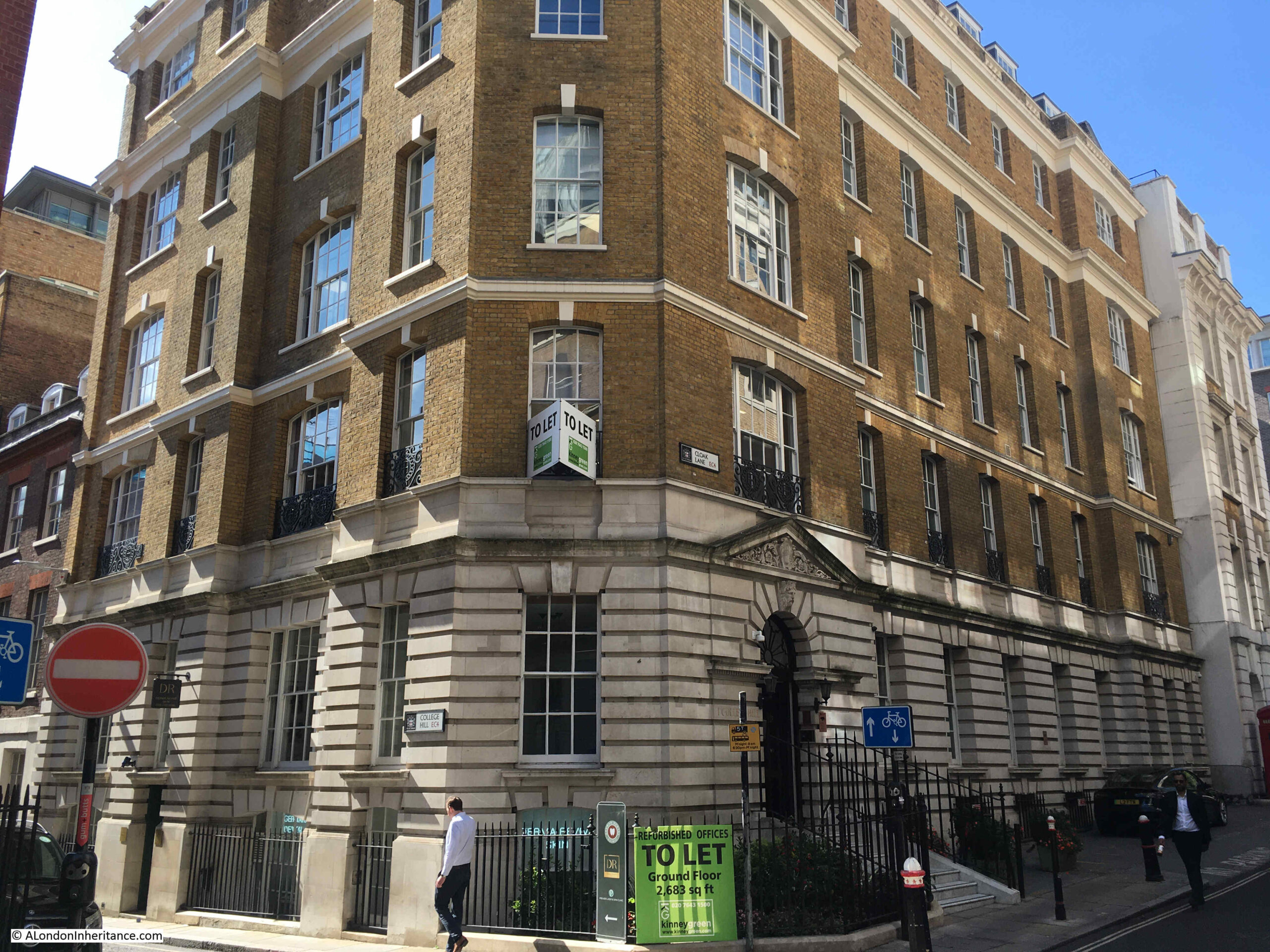
A typical example of this was when I walked along Cloak Lane in the City a couple of weeks ago. Although I have walked through the street numerous times over the years, I had not noticed this foundation stone on a building on the corner of Cloak Lane and College Hill:

Cloak Lane police station

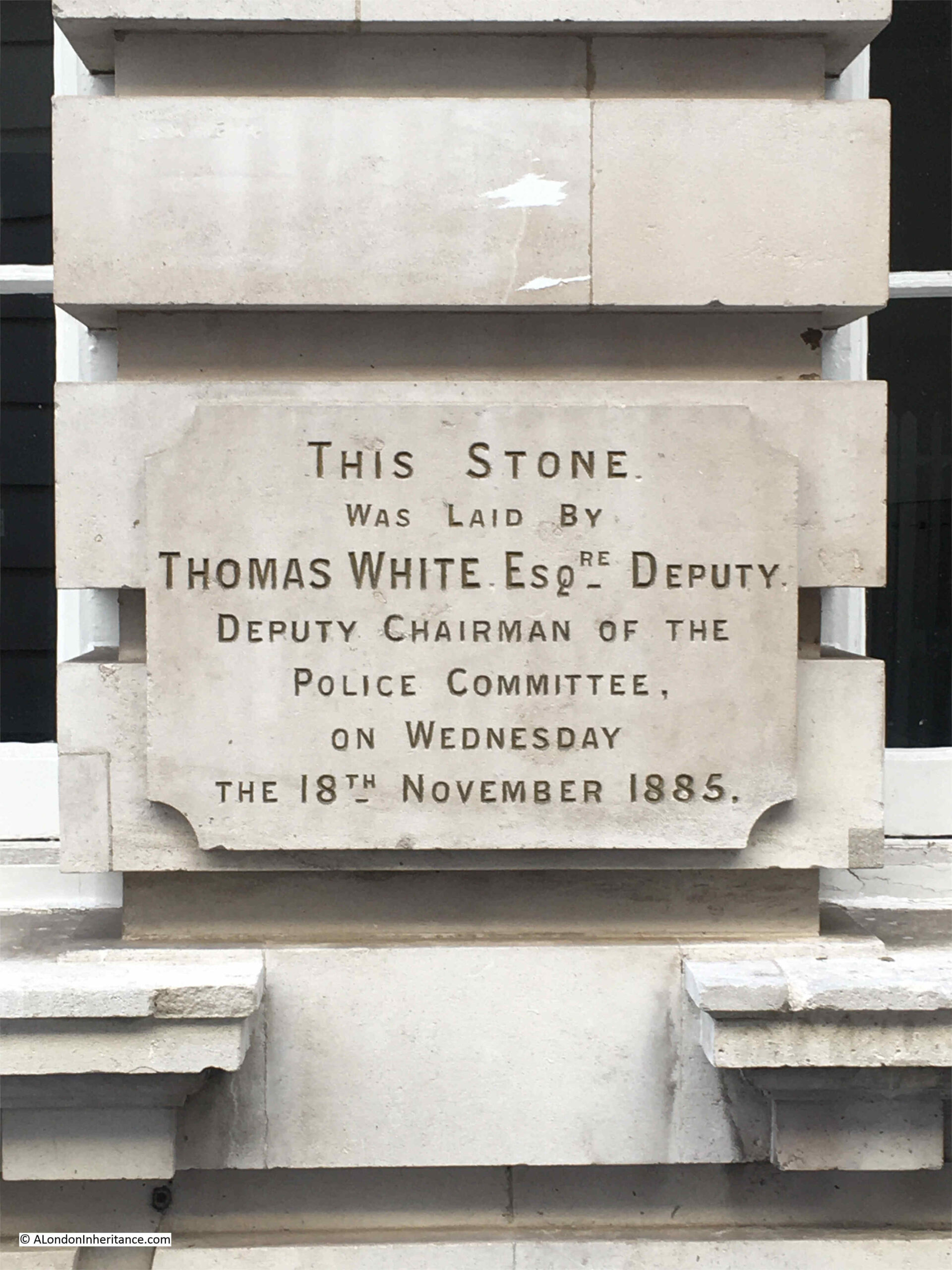
What caught my attention with this foundation stone is that it was laid by a Deputy Chairman of the Police Committee.

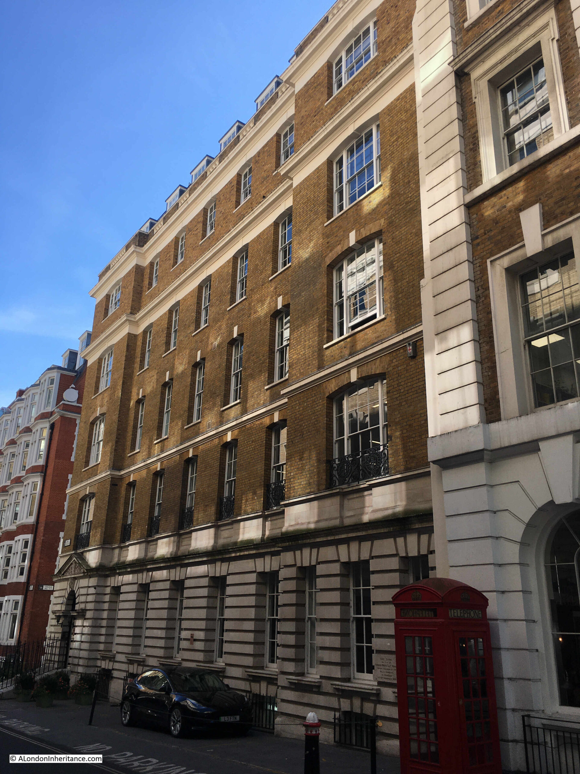
The building does not seem to have any current connection with the Police service and is now an office block, and appears to be on sale for offers in excess of £14.7 million.

The building looks as if it was once home to an institution of some form. Plainly decorated and mainly brick with stone cladding on the ground floor, the building still projects a strong, functional image onto Cloak Lane.

The foundation stone on the building is now the only reminder that this was built for the City of London Police and opened as Cloak Lane Police Station:

Cloak Lane police station

As the foundation stone records, Cloak Lane Police Station dates from 1885.

At the time, Cloak Lane was one of six police divisions across the City. They were centered on police stations at Cloak Lane, Minories, Bishopsgate, Bridewell Place, Snow Hill and Moor Lane.

The City of London Police came into being in 1839 when the City of London Police Act was passed on the 17th of August 1839. Before this act, policing in the City was built around a Day Patrol of Constables, and a Night Patrol which started with elected Ward Constables and Watchmen, with Watch Houses that later became the first Police Stations located across the City.

The 1839 Act provided statutory approval of the City of London Police, appointed a Commissioner of Police who was selected by the City’s Court of Common Council, and probably of more importance to the City of London, the Act ensured that the City’s police would be kept separate and not merged with the Metropolitan Police. A separation which continues to this day.

The City of London Police seems to have been funded by the Corporation of London, and funded by a police rate paid by the businesses and residents of the City.

There appears to have been some concern about the extra costs of the new building as in the City Press in 1885 there was the following: “There is every probability of an increase in the city rating, which is already exceedingly heavy. A new police-station is about to be erected in Cloak Lane which will involve an additional penny in the police rate, unless the cost of the building is spread over several years”.

I cannot find the exact date when the new station opened, however it appears to have been built quickly as by 1886 newspapers were starting to carry reports about events involving the station, including what must have been a most unusual use for the new police station:

“AN ADDER CAUGHT IN A LONDON STREET. There is now to be seen at the Police Station, Cloak Lane, City, an adder, about 15 inches long, which was seen in Cannon Street a morning or two ago basking in the sun on the foot pavement, although large numbers of persons were passing to and fro at the time.

A constable’s attention was drawn to the strange sight, and he managed to get it into a box and take it to the station. It is conjectured that it must have been inadvertently conveyed to town in some bale or other package of goods. The creature, which is pronounced to be a fine specimen, has been visited by large numbers of persons.”

I could not find any record of what happened to the adder after its appearance at Cloak Lane police station.

Cloak Lane is to the south of Cannon Street, and runs a short distance west from Cannon Street Station.

The building did suffer bomb damage during the war (although it is not marked on the LCC Bomb Damage Maps). A high explosive bomb did penetrate the roof and caused considerable internal damage. There are a number of photos of the damage in the London Picture Archive, including the photo at this link.

As a result of this damage, there may have been some repairs and rebuilding of the structure, and it is hard to be sure how much of the building is the original 1886 station.

The longest axis of the building is on Cloak Street, with the shortest axis running down College Hill as the building is on the corner of these two streets.

What is strange is that the main entrance to the building is on Cloak Lane, and the building was known as Cloak Lane police station, however as can be seen to the left of the door in the following photo, it has an address of 1 College Hill:

Cloak Lane police station

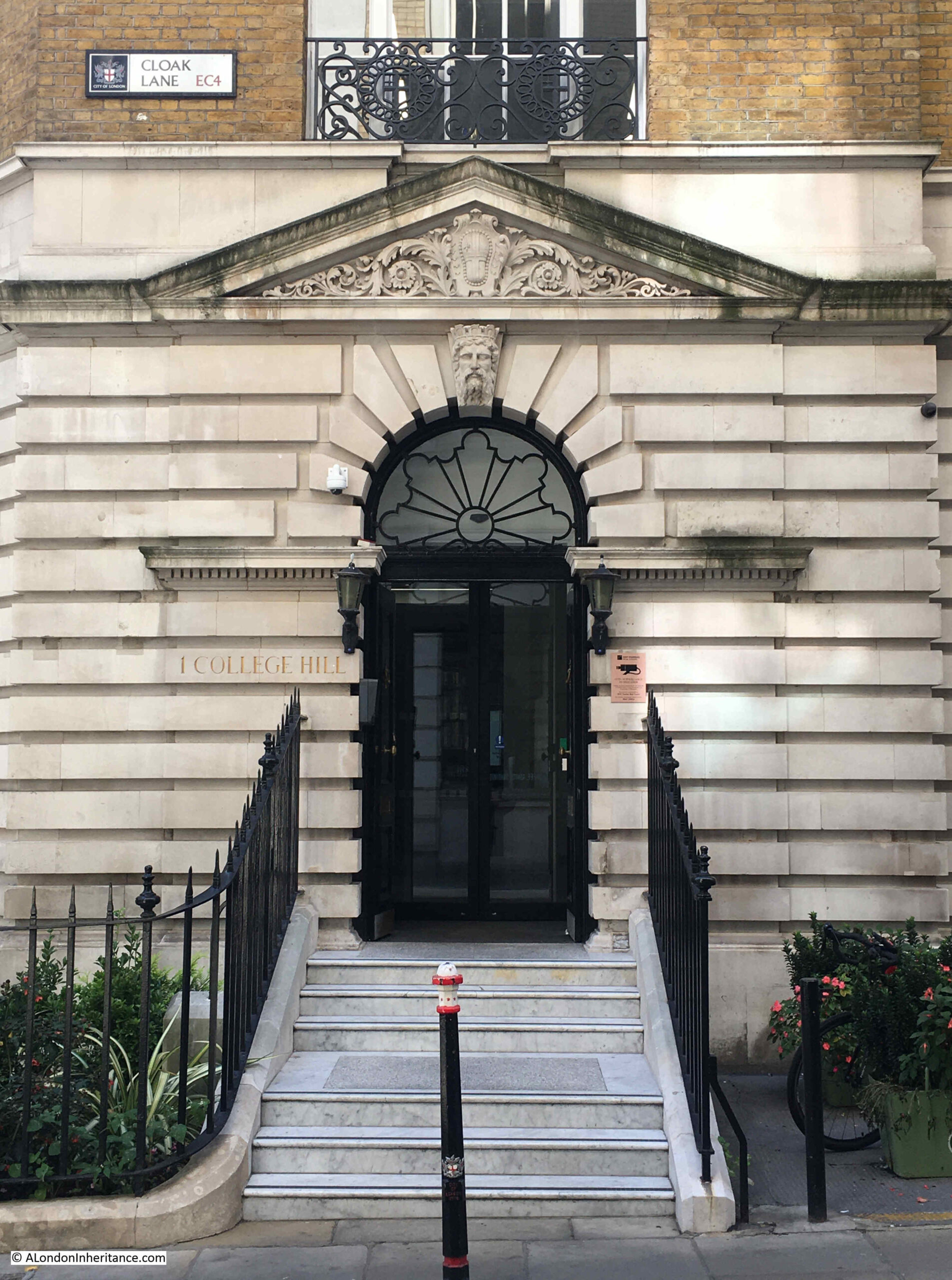
The arms of the City of London can be seen in the pediment above the door. I am not sure who the figure on the keystone is meant to represent, however it could be Neptune / Old Father Thames, as Cloak Lane police station covered the area along the river not far to the south of the building.

I find it fascinating to use these fixed points in London as a reference to finding out about life in the City over the years, and Cloak Lane police station tells us much about crime in the City of London.

Financial crime seem to be a feature of many of those of who found themselves in Cloak Lane police station. Probably to be expected given the businesses within the City. Two examples:

In September 1952, Colin Vernon Ley was awaiting trial, charged with “while being a Director of Capital Investments Ltd. he unlawfully and fraudulently applied £3,000 belonging to that body to his own use”.

The report of his arrest reads as you would perhaps expect of an arrest in the 1950s:

“At 6.45 p.m. yesterday, said the Inspector, I was with Detective Sergeant Reginald Plumb in Bruton Street, Mayfair, when I saw the prisoner outside the Coach and Horses public house.

I said to him ‘You know who we are, and I hold a warrant for your arrest issued at the Mansion House today.

I cautioned him, and he said ‘I suppose I have to come with you now’. At Cloak Lane Police Station, the warrant was read to him, and he said ‘You were in a position to prove it, no doubt before you got the warrant’. I was present when he was charged and he made no reply.”

On the 10th of October 1959, papers were reporting on the arrest of a solicitor for one of the largest, in value, financial frauds. Friedrich Grunwald, described as a 35 year old Mayfair solicitor was arrested and charged under the Larceny Act with the fraudulent conversion of £3,250,000 entrusted to him by the State Building Society to secure mortgages on properties owned by 161 companies. His arrest was described that:

“At a nod from a colleague, a bowler-hatted Detective-Superintendent Francis Lee, head of the City Fraud Squad, intercepted him on the Embankment near Temple Underground Station and escorted him to a car which drove to Cloak Lane police station”

In January of the following year, Herbert Murray, secretary and managing director of the State Building Society was also arrested and taken to Cloak Lane and would later appear in court with Grunwald.

The problem with using old newspapers for research is that there are so many random interesting articles to be found on the same page. If you have ever wondered why and when the Guards at Buckingham Palace moved into the secure area behind the railings, then on the same page as the above article there was:

“PALACE GUARD TO RETREAT BEHIND RAILINGS – Sentries at Buckingham Palace are to retreat behind the railings. They are making their tactical withdrawal to prepared positions to avoid clashes with sight-seers.

It will stop fashion photographers posing scantily dressed models under the men’s noses. It will stop those pictures of kindly small boys tie sentries undone bootlaces. Too often the boys tied the laces of both boots together.”

The River Thames features in a number of events that involved Cloak Lane police station. These normally involved some form of tragedy, due to the nature of police work, and the dangers of the river, such as in April 1924:

“POLICEMAN VANISHES – BELIEVED TO HAVE BEEN BLOWN INTO THE THAMES. Police Constable Albert Condery is believed to have met with a tragic death by being blown into the Thames during a storm last night.

It is learned that Condery, who has been in the City Police Force for 20 years, left Cloak Lane Police Station last night to go on duty at Billingsgate Market. He was seen there by the sergeant, but later he was missed, and his helmet was found floating on the Thames near the market. The body has not been recovered.”

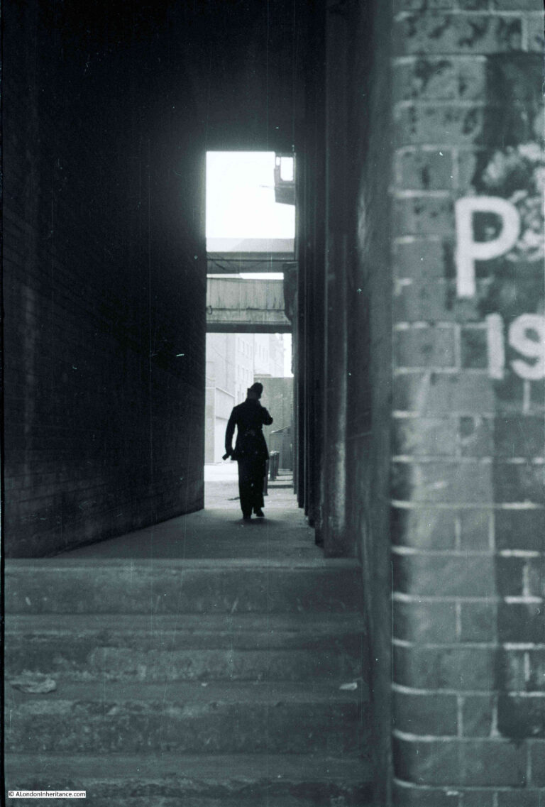
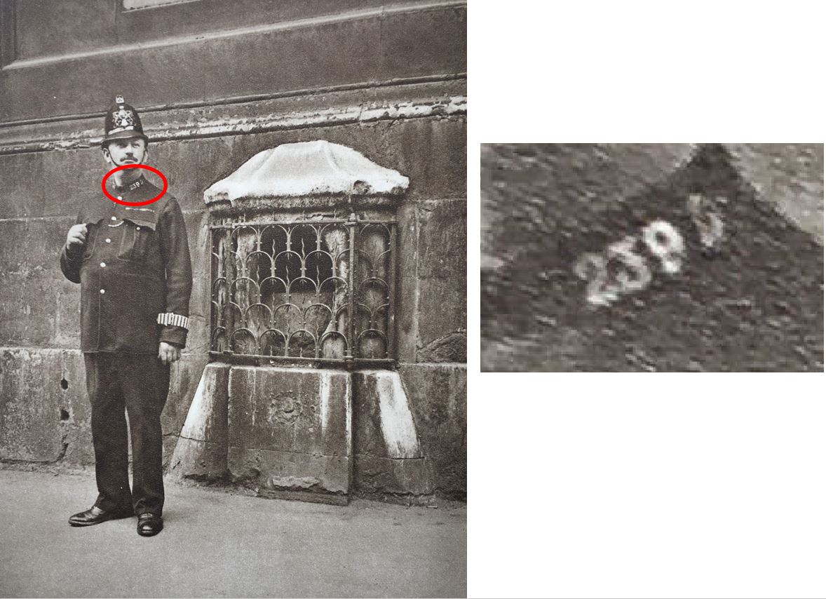
The above report was from a time when lone police officers patrolled the city’s streets. Although the following photo was taken by my father in Bankside, not the area covered by Cloak Lane, it does show the traditional image of a policeman patrolling their beat:

London policeman

There were many strange events across the City in which Cloak Lane was involved. In November 1902, papers had the headline “EXTRAORDINARY AFFAIR AT BANK OF ENGLAND – ATTEMPT TO SHOOT THE SECRETARY. A sensation was caused in the Bank of England yesterday by the firing of a revolver by a young man who had entered the library. As he seemed about to continue his firing indiscriminately the officials overpowered and disarmed him. The police were called in, and he was removed to the Cloak Lane Police Station.”

He was unknown by anyone in the Bank of England and whilst at Cloak Lane, he was examined by a Doctor, who came up with the diagnosis that “the man’s mind had given way at the time”.

In August 1891, there were reports of a “Raid on a Cheapside Club”, which officers from Cloak Lane had been watching for some time, with a couple of Detectives having infiltrated the club. Finally there was a raid, when: “A party of 14 plain-clothes officers made a descent upon the premises. At first, admission was refused, and the officers proceeded to smash the glass paneling in the upper portion of the door. Resistance being of course in vain, the door was thrown open, and the detectives rushing in, arrested everyone found in the establishment. twelve persons were taken into custody, and removed to Cloak Lane Police Station.”

The report does not mention why the club was illegal, however reports in later papers when those arrested were in court reveal that it was an illegal betting club, known locally as the United Exchange Club, held in the basement in Cheapside that had been home to the City Billiard Club.

Another view of the old Cloak Lane Police Station. College Hill is the street leading down at the left of the photo. Cloak Lane is where the longest length of the building can be seen, but strangely the address on the main entrance is 1 College Hill:

Cloak Lane police station

In 1914, two of the original six divisions were closed, and the City of London police force was reorganised into four Divisions. These were changed from numbered divisions 1 to 6 to lettered divisions A to D, with Cloak Lane becoming D Division.

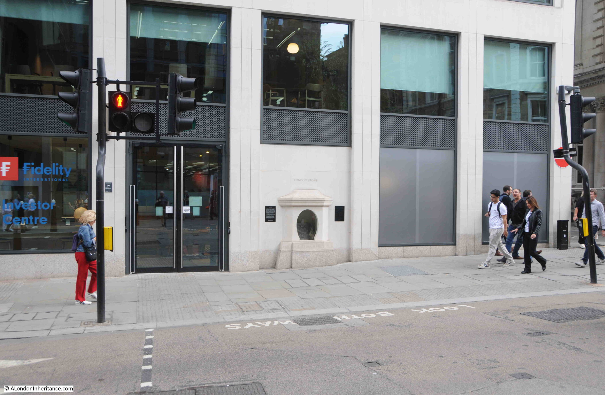
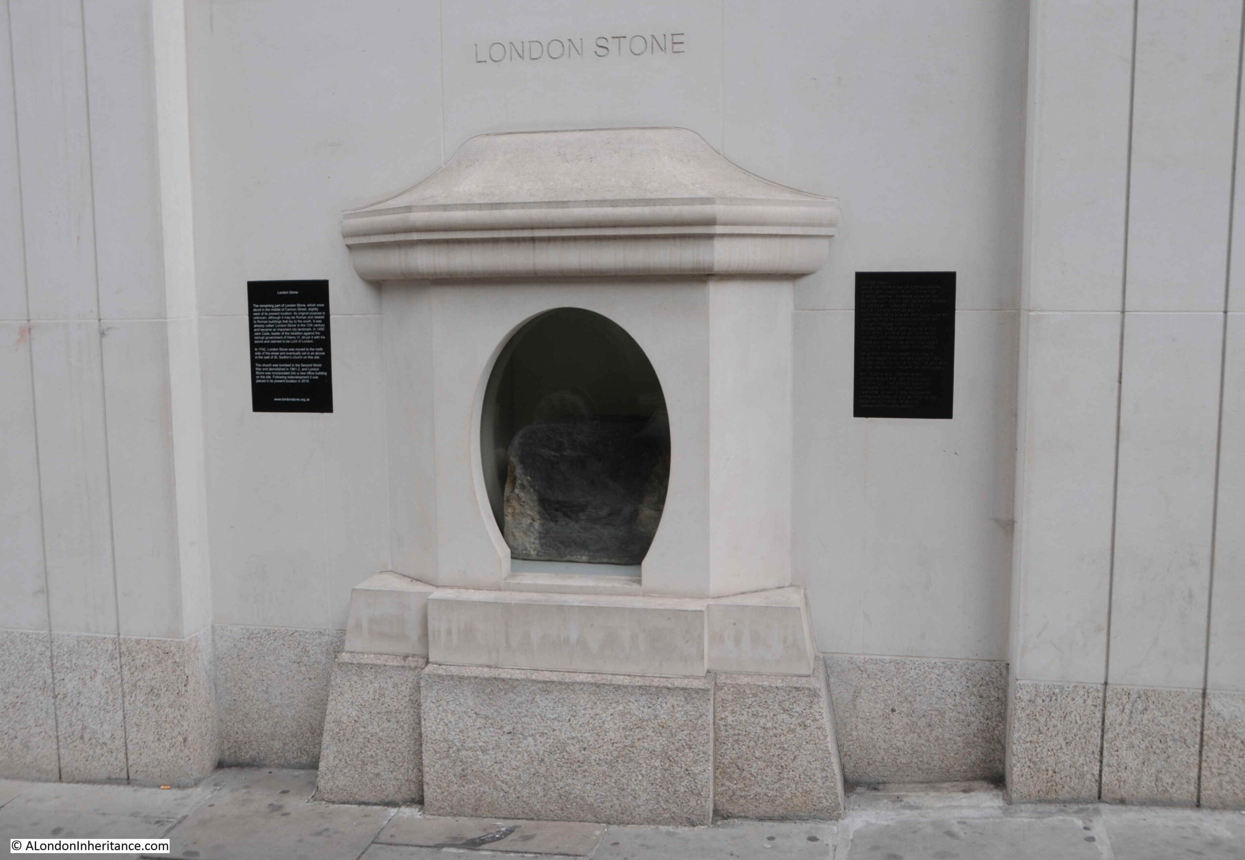
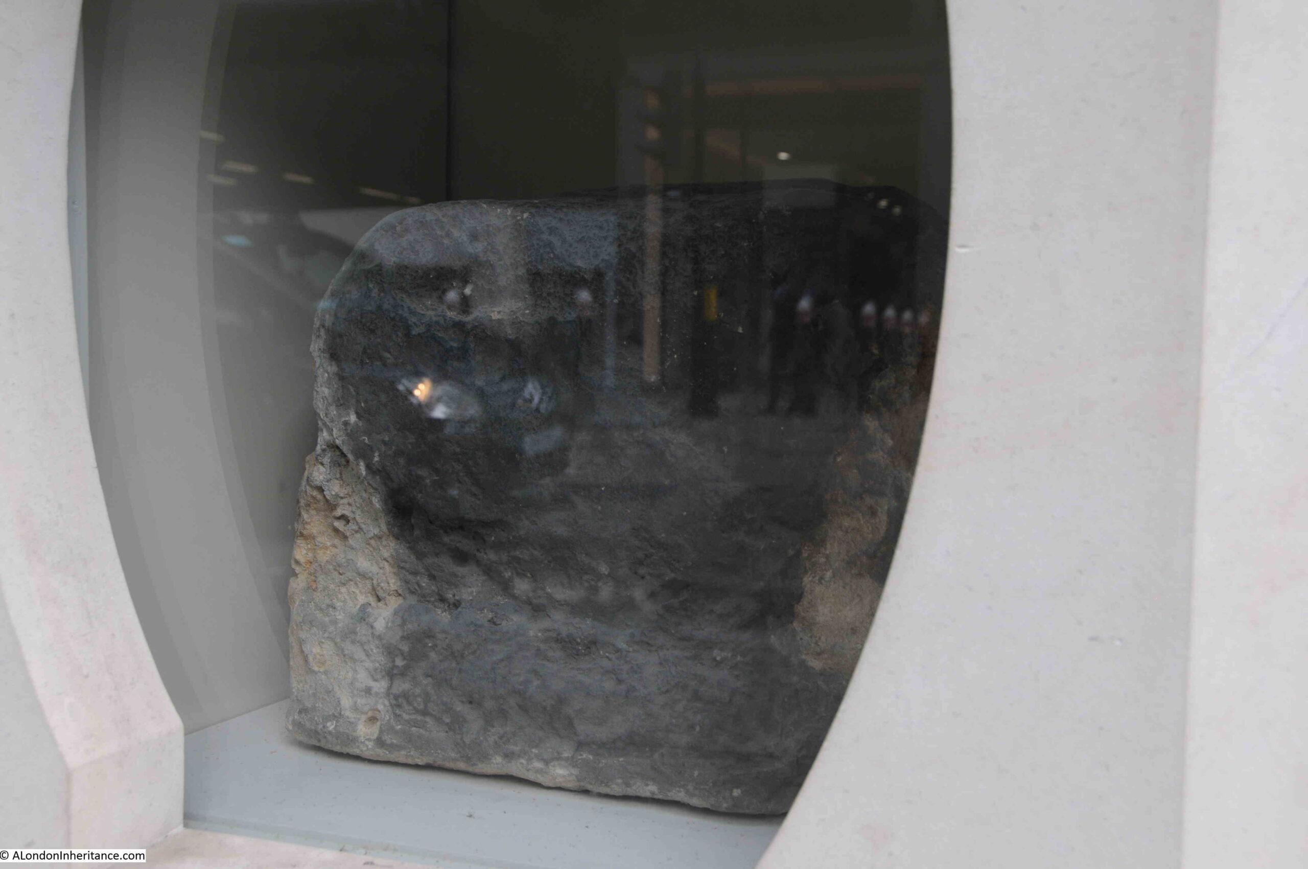
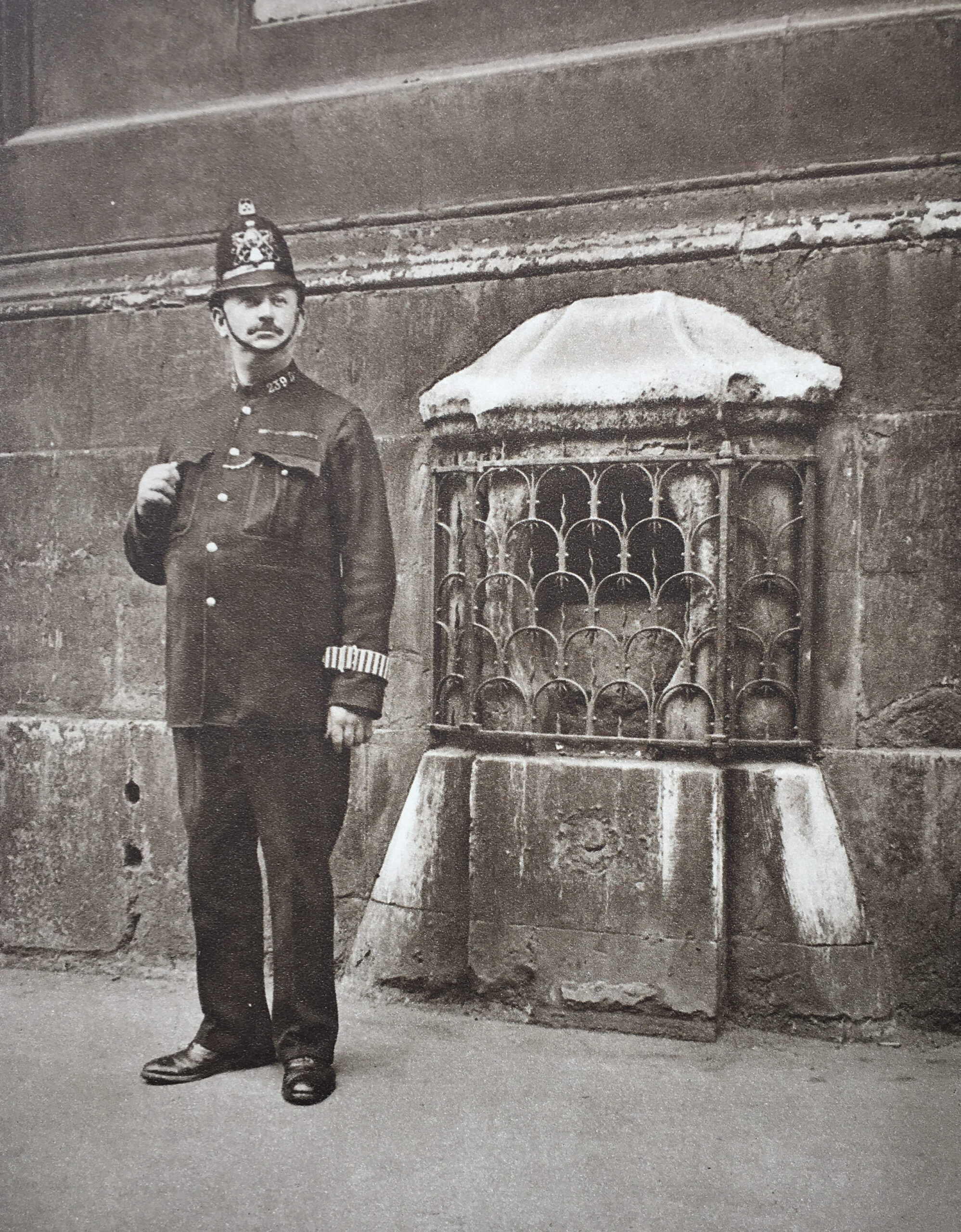
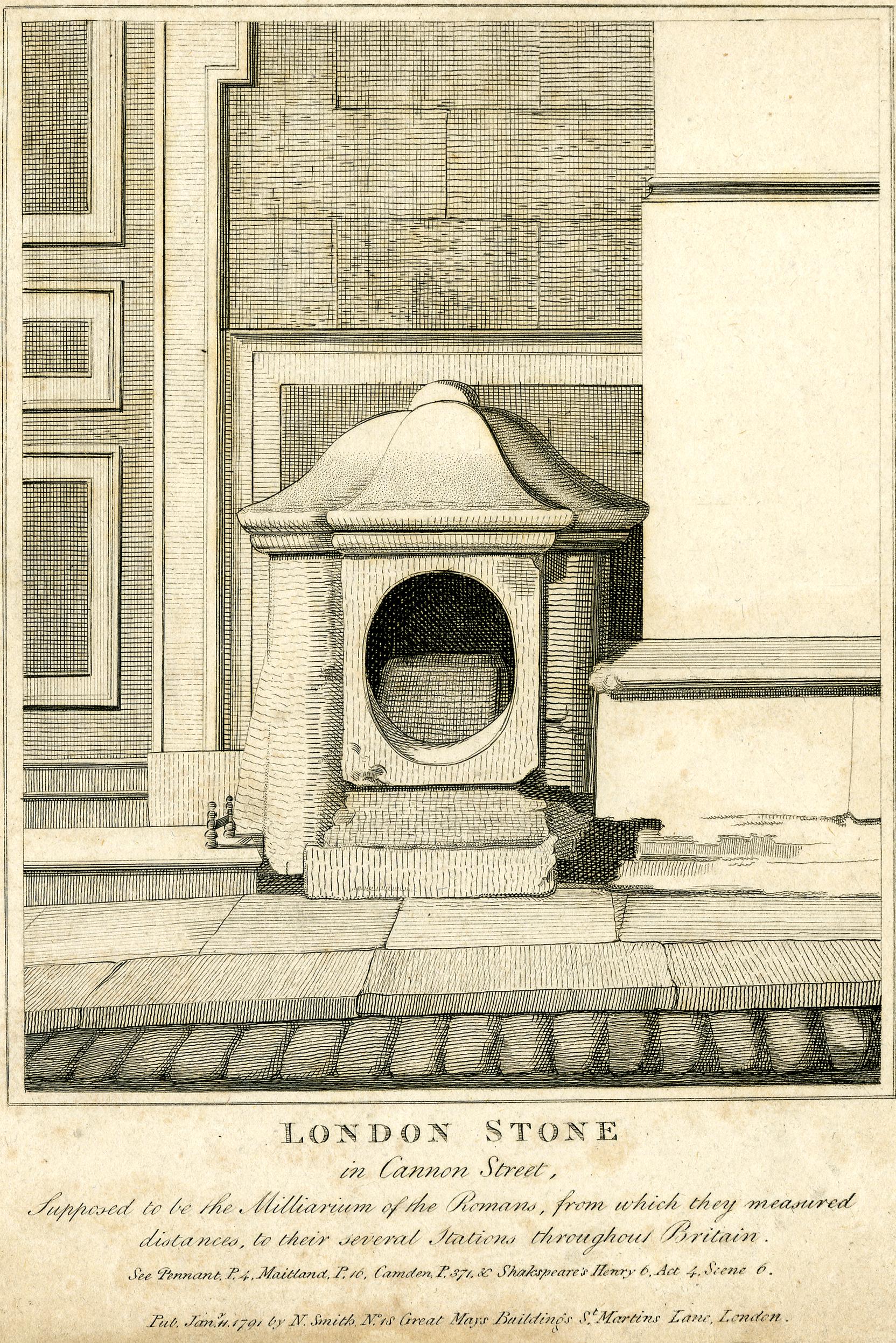
In last week’s post on the London Stone, I included a photo from the 1920s publication Wonderful London where a policeman was standing guard over the London Stone.

City of London police had their individual number, followed by a letter for their division on their collar, and looking at the collar number of the policeman shows he was from D Division based at Cloak Lane, which makes sense as Cloak Lane covered Cannon Street.

Cloak Lane Police Station survived until 1965, when it closed and Wood Street became the D Division police station.

The very last report mentioning Cloak Lane Police Station was from December 1965 when an article titled “Foolish Driver in The City” reported on a driver who was seen driving down Friday Street and only just stopping at the junction with Cannon Street. He was arrested on suspicion of being drunk and taken to Cloak Lane Police Station, where he “had to be supported by two officers because he was unsteady on his feet”.

And so ended 80 years of policing from Cloak Lane.

Wood Street (designed by McMorran and Whitby, and built between 1963 and 1966), and which took over from Cloak Lane is shown in the photo below:

Wood Street police station

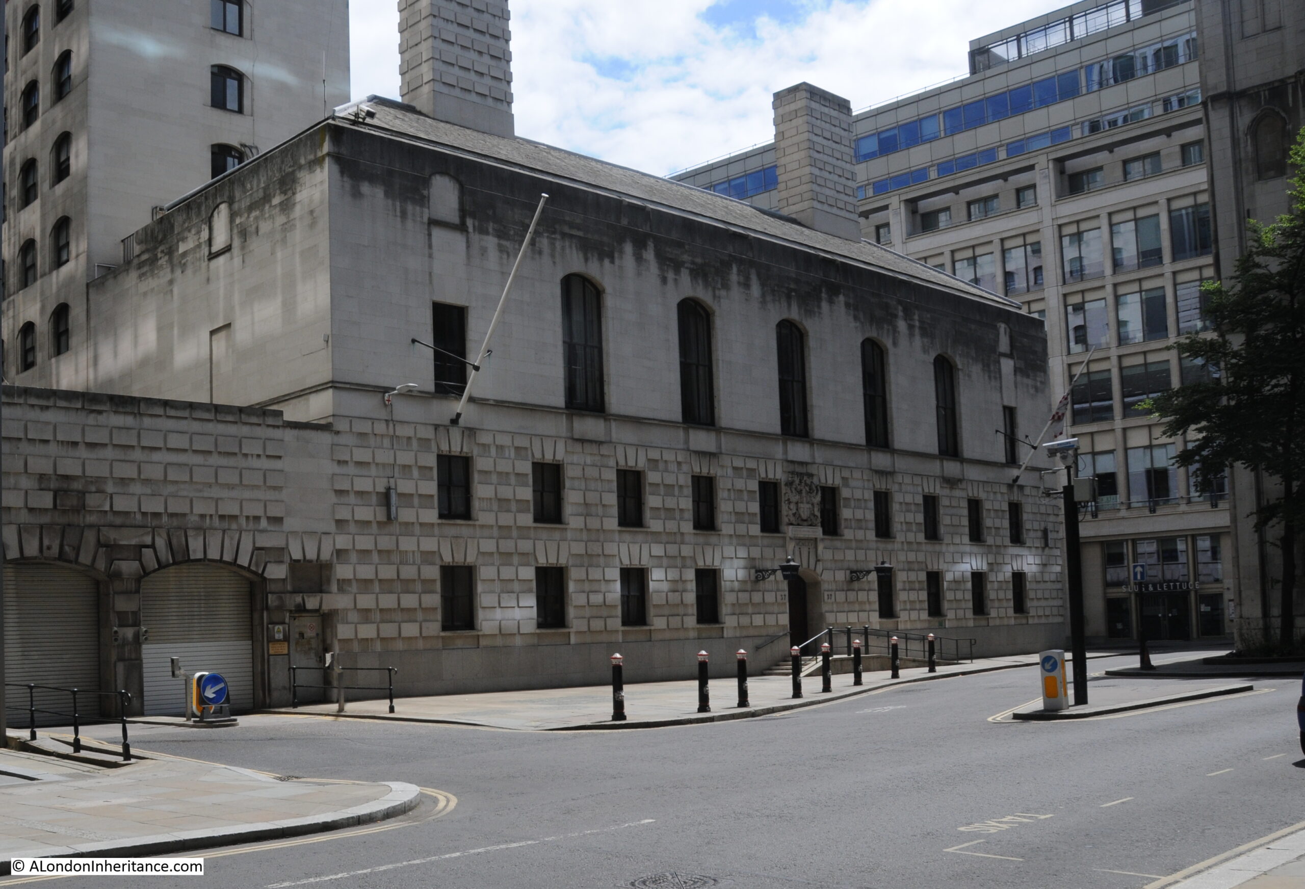
Wood Street Police Station has in turn been closed.

In the announcement from the Corporation of the City of London, it is stated: “The Grade II* Listed building has been sold to Wood Street Hotel Ltd (wholly owned by Magnificent Hotels) after it was declared surplus to operational requirements by the City of London Police. The developers have purchased the property on a 151-year lease and will turn it into a boutique 5-star hotel, subject to planning permission.”

The architects plans for the building can be seen at this link.

The only indication that the building on the corner of Cloak Lane and College Hill was a police station is the foundation stone laid by the deputy chairman of the police committee.

It now has a very difference use, and those who enter the building are now presumably doing so voluntarily, unlike very many of those who entered the building between 1886 and 1965.

alondoninheritance.com

Myths and Legends of the London Stone

Before taking a look at the long history of the London Stone, a quick advert as I have arranged some dates for my very last tours of the year, and the last ones until probably May of next year. I have included all my different tours, and it would be great to show you many of the stories and photos from the blog over the last nine years, at the actual sites.

Dates and links for booking as follows:

It would be wonderful to see you on a walk – now to the London Stone.

In its ability to attract myths and legends, the London Stone is far more powerful than its physical size suggests. A long time resident of the area around what is now Cannon Street Station, but with the distance of time, it is impossible to know the truth about the block of stone, which can now be found in a new housing with a glass front:

London Stone

The new housing for the London Stone was completed in 2018, along with the building of which the stone is part of the ground floor frontage onto Cannon Street:

London Stone

The plaque to the left records some of the key stories about the London Stone:

  • It may be Roman and related to Roman buildings to the south
  • It was already known as the London Stone by the 12th century
  • Jack Cade, the leader of a rebellion against the government of Henry VI in 1450 struck the stone with his sword and claimed to be Lord of London

The plaque on the right tells the story in braille which is rather good.

The previous building on the site was an early 1960s office building, which was demolished 2016, when the London Stone was moved to the Museum of London where is was put on temporary display, before being moved to its new home.

A view of the London Stone through the window at the front of the housing:

London Stone

The site was originally occupied by St. Swithin’s Church, however the church was destroyed by bombing in 1940. The stone walls of the church, with the London Stone, survived, and continued to stand on the site until being demolished for the 1960s office building.

Wonderful London has a photo of the London Stone in its housing on the front of St. Swithin’s Church, I doubt that the stone usually had a police guard:

London Stone

The Wonderful London description below the above photo reads: “Set in a stone casing in the wall of St. Swithin’s, Cannon Street, is this block of oolite, guarded by a grille. It was placed there in 1798, having been transferred from the other side of the road. Camden, the historian, 1551 – 1623, held that it was the milliarium, or milestone, from which distances were calculated on the main roads in days when London was Londinium Augusta. There was a similar stone in the Forum at Rome. If Camden is right, Roman lictors may have stood, like this policeman, in front of the stone 1,600 years ago”.

The text mentions that the stone is a block of oolite, which is a form of limestone, and was used in Roman London for building and sculpture, but may also have arrived in the City in the Saxon and early medieval period.

There was a large Roman building where Cannon Street Station now stands, so it may have formed some part of this building, or some of the decorative sculpture or statues that would have been part of the building.

There is no way to be sure.

The Roman milliarium or milestone story is repeated in multiple accounts of the stone. Sir Walter Besant in his 1910 book on the City of London includes the milestone story, but goes further by saying that some have supposed the stone to be the remains of a British druidical circle or religious monument. He quotes Strype as saying that Owen of Shrewsbury gave rise to the assertion that “the Druids had pillars of stone in veneration, which custom they borrowed from the Greeks”.

Besant also records that “Sir Christopher Wren was of opinion that ‘by reason of its large foundation, it was rather some more considerable monument in the Forum; for, in the adjoining ground to the south, upon digging for cellars after the Great Fire, were discovered some tessellated pavements, and other extensive, and other remains of Roman workmanship and buildings.”

The problem with all these stories about the original Roman use of the London Stone is that there is no firm evidence that it was a milliarium or milestone, when it arrived in the City, whether it was Roman, or the original use of the stone.

What seems to be certain is that the stone has long been in this part of Cannon Street. It was originally on the south side of the street and was also in the street, where it was an obstruction to the traffic flowing along the street.

The Wonderful London quote references that the stone was moved to St. Swithin’s Church, and guarded by a grill in 1798. This was urgently needed to protect the stone, as it appears to have been frequently under attack by those who used the street, as this report from several papers on the 2nd of July 1741 records:

“Thursday a Carman and a Drayman contending for the Way in Cannon-street, made a shift between them to throw down the little Building that covers London Stone (as ’tis call’d) and then pull the said Stone out of the Earth. this being presently known, great Numbers of People flocked to see it, and many curious Observations, Conjectures, and Prognosticks were believed by the Wiseacres present, on so extraordinary an Accident.”

The 16th century historian John Snow, who first published his Survey of London in 1598 included the following reference to the London Stone which explains how it was fixed in position, and why it was a significant obstruction for those who used Cannon Street:

“On the south side of this high street, near unto the channel is pitched upright a great stone called London stone, fixed in the ground very deep, fastened with bars of iron, and otherwise so strongly set, that if Carts do run against it through negligence, the wheels be broken, and the stone it self unshaken.”

The London Stone seems to have been a well known feature of Cannon Street, as it was often used as part of an address, such as in the following from an advert in the Kentish Gazette on Friday, November the 6th, 1795, where a contact was given as “Mr. Sergeant, Number 86, London Stone, Cannon Street”.

And on the 26th of February 1788 there was an announcement in the Kentish Gazette of the marriage at “St. Swithin’s, London Stone, of W.T. Reynolds’s Esq. of Great St. Helen’s to Miss Sands of St. Dunstan’s Hill”

The following print from 1791 shows the London Stone in a casing up against St. Swithin’s church, as although Wonderful London mentioned 1798 for the positioning of the stone against the church, it had been moved to this safe location some years earlier, and in 1798 the church went through a major set of repairs, which included proposals for the stone to be removed as a nuisance, however there were many objections and the stone was kept up against the front of the church © The Trustees of the British Museum):

London Stone

The above print repeats the milliarium story and provides sources from a number of historians, who, to an extent are repeating the same story, but not providing any firm evidence.

The print also includes a reference to Shakespeare’s Henry Vi, Act 4, Scene 6, and it is from this scene that Shakespeare amplified the story of Jack Cade’s association with the London Stone.

Jack Cade led a rebellion in 1450, from the south east of the country against the corruption, poor administration and the abuse of power by the King’s local representatives.

He led a large group of men from the south-east who headed into London in an attempt to raise their grievances, remove from power those they held responsible for corruption and abuse of power, and to reform governance.

Once within the City, the rebellion turned into looting, and the residents of the City turned on the rebels

The rebels were offered a pardon to return home peaceably. Cade as the leader was captured in a fight and died of his injuries as he was being returned to London for trial.

The connection between Jack Cade and the London Stone comes from the rebellion’s entry into the City of London. Cade pretended to use the name of Mortimer, (the family name of ancestors of one of Henry VI’s main rivals), and on reaching the London Stone, he struck his sword on the stone and according to Holinshed (a 16th century English chronicler), he exclaimed “Now is Mortimer Lord of this City”.

Describing the London Stone in Old and New London, Walter Thornbury embellished the story of Jack Cade by adding that “Jack Cade struck with his bloody sword when he had stormed London Bridge”.

This drawing from the late 18th century shows Cade in the act of striking the stone © The Trustees of the British Museum):

Jack Cade

There is no reason why Cade would have used the London Stone in such a way. It was not a tradition for Kings or Lord Mayors of the City to strike the stone for any form of recognition.

Accounts imply that Cade did do this, but it was Shakespeare who really amplified and spread the story, including Cade using the stone as a sort of throne from where he issued proclamations and judgments. All part of the myths surrounding the London Stone.

The above print of Cade does show the stone in the street, not against the church, which appears to have been its location until the 18th century.

The following early 19th century print shows St. Swithin’s Church with the London Stone in the centre of the church, at ground level, facing onto Cannon Street © The Trustees of the British Museum):

London Stone

Another view from the early 19th century which appears to show the housing of the London Stone in a rather poor state © The Trustees of the British Museum):

London Stone

The Illustrated London News on the 13th of March 1937, reported that the London Stone was to be moved to a worthier setting, that it would be moved into an arched recess higher up the church, and flood lit at night.

Unfortunently, these plans were not carried out due to the start of war in 1939.

The Illustrated London News did repeat one of the apparent myths concerning the London Stone, that it “is believed to have originally been a tall prehistoric menhir, and later a Roman milliarium or milestone”, so not just tracing the stone back to Roman origins, but attributing a very much earlier origin as a prehistoric standing stone.

As well as prehistoric origins of the London Stone, there are also a number of myths about spiritual associations with the stone, the position of the stone at a centre of the City, and that if anything ever happens to the London Stone, the City will fall.

The following saying which is alleged to date from the medieval period has been repeated in a number of books about London:

So long as the Stone of Brutus is safe

So long will London flourish

John Clark in Folklore, Vol. 121, No. 1 found that this saying only existed from 1862.

A Brutus Stone seems to have been found in a number of places, for example in the Dartmouth and South Hams Chronicle on the 4th of March 1898: “Mr. Page rather made fun of the Brutus Stone set in the pavement of the High-street in Totnes, and of the claim that it was the stone on which Brutus of Troy landed when he came to Britain.”

Kipling used the name London Stone for a poem published in the Times on the 10th of November 1923. The poem was an elegy on grieving for the dead, however the poem referred to the Cenotaph, rather than the stone in Cannon Street (although the name of the poem was changed in different publications, as explored by the Kipling Society).

Many of the stories associated with the stone are just that, myths and stories, and there is very little to confirm the history of the stone prior to the medieval period.

Wherever stones are found, from the complexity of Stonehenge to a single prehistoric standing stone in a field, they always attract myths and legends.

I used a reference from Sir Walter Besant’s 1910 book on the City of London earlier in the post, and opposite the page on the London Stone was this view looking west along Cannon Street towards St. Paul’s. Part of St. Swithin’s church is on the right, with the London Stone just out of shot:

Cannon Street

One hundred and thirteen years later the street is just as busy. Apart from St. Paul’s there is only one building that is in both views. In the photo below, on the immediate right is a building with distinctive arches over the windows. In the above photo, you can see the same building on the right, a little further down the street.

Cannon Street

The first written reference to the London Stone appears to be from the late 11th century, so the stone is old, but as to its origins and purpose, we can only make educated guesses, and whilst it has moved slightly around its current location in Cannon Street over the centuries, it has looked out on an ever changing street scene.

alondoninheritance.com

The Impact of the M25

The Impact of the M25 was the title of a 1982 report from the Standing Conference on London and South East Regional Planning.

I am sure that drivers have long had a love / hate relationship with the M25. When it is flowing well, it is a fast and efficient way around London, to reach different entry points to the city, or main roads and motorways spreading away from the city. At other times, it can be a car park, with a lane closure or accident quickly leading to miles of slow moving and stationary traffic.

The M25 is the latest in a series of attempts at moving traffic around the city. From plans in the 1940s by the City of London to circle the City with dual carriageways that became Upper and Lower Thames Street and London Wall, to the north and south circular, to the M25.

There is also a perception that London begins at the M25, and indeed with the recent expansion of the ULEZ zone, in some places such as near Waltham Abbey to the north, the ULEZ zone is up against the M25, as it is in the east, where to the east of Upminster the zone crosses the M25 to cover a small area of land around North Ockenden.

The M25 is closer to the centre of London in the north and extends further away around the southern stretch of the motorway. The following map shows the M25 as a complete ring around London ( © OpenStreetMap contributors):

Impact of the M25

The M25 is only there because of London. It was built to provide a route around the city without having to travel through built up and congested areas, and to offer a way for lorries and cars traveling from, for example, the midlands to the channel port at Dover, a fast route between the motorways that spread out from London.

However the M25, as indeed with any new road, has an impact far beyond the original intentions of improving traffic flow.

It will result in developments that aim to take advantage of the new road, it will open up areas for regeneration, it will generate new levels of traffic, and it will have an impact on the natural environment of the places through which the road is built.

Investigating the potential impact of the M25 was the aim of the 1982 report, to see what impact on the south-east this major new infrastructure project would have in the years ahead.

At the time of the report, the M25 was under construction, and the following map shows the expected completion dates of individual sections of the motorway from 1982 to 1986:

Impact of the M25

For nearly all post-war planning, the car and lorry were central to transport planning. This had started in the 1930s, and planning for post-war reconstruction in the 1940s expected a significant increase in personal car ownership and use for both work and pleasure purposes.

The cost of car travel would also gradually reduce compared to other forms of transport, and the report included the following graph, which shows that between 1971 and 1981, the costs of London Transport bus fares (1) and underground fares (2) had risen far more than both average earnings (5) and motoring costs (6):

Travel costs and wages

The report identified five major development implications that the M25 would result in:

  1. warehousing serving national and regional markets, for which the areas around Dagenham, Dartford, Grays and Redbridge are likely to be attractive;
  2. high-technology growth industries; which are likely to be attracted to towns just beyond the Green belt;
  3. offices which do not require a central London location. Increased demand in Romford, Croydon, Orpington, Hounslow, Uxbridge and Barnet is envisaged;
  4. hypermarket and superstore developments for which locations close to M25 junctions would be most attractive, but would also conflict with Green Belt policy;
  5. discount shopping stores, for which locations on major cross London routes such as the North Circular Road are likely to be attractive.

Much of the route of the M25 was through Green Belt, and the use of land close to the new motorway, would result in planning problems, and increase the value of land where development was permitted.

The route of the M25 through the Green Belt is shown in the following map:

Impact of the M25

Although there were a few very small exceptions, the M25 did not pass through Grade 1 and 2 agricultural land, although the report identified large areas of the highest quality land in east Hertfordshire, Essex, and north-west Kent, as shown in the following map:

Impact of the M25

Being close to the M25 could result in development pressures to these areas of high grade agricultural land, and these, along with the Green Belt were considered landscape constraints on where additional development could take place, and where proposals for development would threaten the natural environment and the production of food.

As well as agricultural land, a trip around the M25 provides an insight into the underlying geology of the land surrounding London. From the heathlands as you exit the M25 onto the M3, the flat, open lands of Essex as you exit onto the A13 and A127, and the chalk hills around the south of the M25.

Green Belt and agricultural land added to the policy constraints for land development around the M25, with Areas of Outstanding Natural Beauty and Special Landscape Areas also needing to be considered. The scope of these are shown in the following map from the report:

Impact of the M25

As well as natural and agricultural areas that were protected, there were also what the report classified as “Damaged Landscapes” which was land that had, or was being used as mineral workings, refuse tips, sewage works, electricity transmission installations and industrial development.

The report identified that some of these damaged landscapes, such as gravel working could be used for other purpose, such as recreational uses, but cautioned that areas used for refuse tips, mineral workings and sewage works would require very expensive restoration works.

The report also included “landscape under threat” which included deteriorating agricultural and woodland, as well as under-used open land close to urban areas (it is interesting that land always needs to be “used” and cannot just be left).

The areas of land included in these two categories are shown in the following map:

Impact of the M25

I well remember some of these “damaged landscapes”. As a child, an outing to Kent required a drive through the Dartford Tunnel, (which was built before the M25). On the approach to the tunnel from Essex, there were chalk quarries and cement factories on either side of the road.

These places were always coated in a thick grey dust, and I found a couple of photos on the excellent Geograph site showing the cement industry in West Thurrock:

West Thurrock cement industry
West Thurrock Cement Industry, 1974
cc-by-sa/2.0 – © Pierre Terre – geograph.org.uk/p/134125
West Thurrock cement industry
West Thurrock Cement Industry, 1974
cc-by-sa/2.0 – © Pierre Terre – geograph.org.uk/p/134155

The nearby Dartford Tunnels (now the Dartford Crossing with the addition of the bridge), is a major part of the M25, although not being officially part of it as the crossing still carries the designation of A282.

The first Dartford Tunnel was planned in the 1930s, and construction work did start, but was soon halted by the outbreak of the Second World War.

Work recommenced in 1959, and the first tunnel opened four years later in 1963. This was a single tunnel with two carriageways to carry traffic in both directions under the river. Crossing through the tunnel required the payment of a toll.

Traffic through the tunnel increased significantly and a second tunnel was planned, a key upgrade given that the M25 was also bang planned.

Money to fund the project was in short supply in the early 1970s, however funding was granted from the European Economic Community, allowing construction of the second tunnel to start in 1974, opening to traffic in 1980, with one tunnel being used for traffic from north to south, and the other tunnel used for south to north traffic.

Entrance to one of the Dartford Tunnels:

Dartford tunnel

Even the two tunnels were insufficient for the increasing volumes of traffic once the M25 had opened, and starting in the late 1980s, construction started on the Queen Elizabeth II bridge, which opened in 1991.

The bridge now takes traffic running from north to south, with the two tunnels carrying traffic from south to north.

View of the Queen Elizabeth II bridge from near the Swanscombe Peninsula:

Queen Elizabeth II river crossing

A journey across the Dartford Crossing, whether through the tunnels or across the bridge has always attracted a toll, which was originally used to cover the costs of construction. Toll booths once collected payment, however there have now been replaced by automatic number plate recognition, and online payment.

I found some figures for the tolls dating from the financial year 2016 – 2017, when the crossing generated almost £205 million, with £92 million coming from fines for unpaid fees, with a further £42 million of unpaid fines being written off as being unenforceable.

The latest traffic figures from National Highways shows that the Dartford Crossing carries more than 180,000 on its busiest days, with the highest amount recorded of 206,713 vehicles, on the 20th of February 2018.

The report tried to identify areas where there were a major development commitment. This data was dependent on local authorities, who provided data from different time periods and different classifications of development, but the plan attempted to identify the main sites and types of proposed developments:

Impact of the M25

Taking one area as an example, to the east, around the river crossing, large circles are shown to north and south of the river for industry and warehousing, with no identification of any planned shopping developments (shown as a small triangle in the above map).

This would change very quickly, with the Lakeside Shopping Centre being built in an old chalk quarry in the second half of the 1980s, in West Thurrock on the north side of the river, and the Bluewater Shopping Centre being built in the second half of the 1990s, again in a former chalk quarry, on the south side of the river.

The M25 provided a wide catchment area for these two shopping centres.

The area around the Dartford Crossing continues to be developed. The old oil and coal fired Littlebrook Power Station complex on the south side of the river next to the Dartford Cross has been demolished in recent years, and the area is now subject to major redevelopment with large numbers of warehouses which take advantage of easy access to the M25.

The M25 has also helped with the expansion of passenger numbers to London’s main airports, with both the M25, and motorways radiating out such as the M23 and M1 opening up large catchment areas for Heathrow, Gatwick and Luton airports.

Whilst the M25 has helped these airports attract passengers, the M25 has caused problems with any possible expansion of Heathrow, with the motorway being in the way of a number of possible options for an additional runway.

At the time of the report, there was an inquiry into the proposal to site London’s third airport at Stansted, and the report was sure that the M25 would have a positive impact on the development of Stansted, but would lead to greater pressures for development in the surrounding areas.

The report identified that the impact of the M25 would be major development pressures on many areas bordering the M25, whether retail, such as at Lakeside and Bluewater, warehousing and offices and residential developments.

As well as providing a simplified route around London, and between the major routes heading out of, and into London, the report highlighted the expected significant time savings.

The diagram below shows expected time savings based on a 1980 GLC Department of Planning and Transportation paper:

Impact of the M25

As an example, the diagram shows an expected time saving of 25 minutes between Brentwood in Essex and Heathrow, making flights from the airport a much easier option for those living in Essex. It would be interesting to see if these time savings were still achievable.

The extent of the impact of the M25 is shown in the following map, The M25 is the dark line circling the city. The inner and outer lines show the area within 10 minutes of the M25:

Impact of the M25

The report mentions that 10 minutes was an arbitrary figure, but was chosen to illustrate just how much of the wider area surrounding London was within a very short time of travel to and from the motorway.

The overall view on Development Pressures and Opportunities was summarised in the following diagram:

Impact of the M25

The diagram highlighted that the impact of the M25 would result in development pressures to places such as Chelmsford in Essex, as well as places much closer to the M25.

These pressures were despite limited development opportunities in many areas, with the Greater London Development Plan identifying that there were “no preferred industrial locations” in outer north-west London.

There was one area where development was encouraged, and it was expected that the M25 would help with opening up the area and attracting developers. This was the area to the east of the City, starting in the Docklands and spanning both sides of the river out to Basildon on the north and Medway on the south side of the river, as shown in the following diagram:

Impact of the M25

It was hoped that this area to the east of the City would ease the development pressures in the area from Watford in the north, down to near Gatwick, with the arrows on either side of the motorway in the diagram both pointing away from the area in the west, to the Docklands / Basildon / Medway area in the east.

Following completion of the M25, use of the motorway has expanded rapidly.

The Department for Transport has a number of automatic traffic counters located around the M25, and on many other major routes.

I took one of the counters which is located just east of the Holmsdale Tunnel on the M25, just by Waltham Cross as an example, and on an average day in the year 2000, there were 108,038 vehicles of all types travelling on both sides of the M25.

In 2022, this had grown to 142,242, over a 31% increase in traffic, and the 2022 average was still slightly below the pre-pandemic 2019 average of 146,475.

The 2022 number consisted of 298 two wheeled motor vehicles, 54 buses and coaches, 86,334 cars and taxis, 35,561 light goods vehicles and 19,995 heavy goods vehicles.

Whether this rate of increase continues remains to be seen. If it does, the M25 will resemble a car park with long queues more frequently than it does now.

The M25 is the busiest motorway in the country, and carries a large percentage of the country’s road traffic. The Department for Transport also provide traffic volumes for the five busiest road sections in the UK motorway network. Four of these are on the M25:

M25 traffic volumes

The table shows that the section between the M3 and the M40, which includes the sections running west of Heathrow, is the busiest part of the M25, and has four out of the five most heavily used sections of motorway in the country.

The fourth most congested section in the country is a section of the M60, to the south west of Manchester.

The 1982 report identified many of the development pressures that the M25 would bring to the areas surrounding the new motorway. Almost 40 years after completion, the M25 is a key part of south east England’s transport infrastructure, and the volume of traffic using the motorway continues to increase.

The M25 did reduce traffic volumes on London’s roads, and roads of the surrounding towns and villages, as traffic now had a more direct route to travel around, into or out of the city, however I suspect that with the general increase in traffic volumes, any initial reduction has probably been replaced by an increase.

Whether this continues to increase, whether the transition to electric vehicles will result in a change to traffic volumes, whether changing working patterns will have an impact, and how the M25 will continue to impact the surrounding areas remains to be seen.

What is certain is that the M25 is another example of how London impacts a much wider area than the central city.

And for another example of the impact of London, if you travel south on the M25, look to the left a short distance along from Junction 17 (providing you are not driving), and you will see the large construction site for HS2, at the point where the tunnels start as the railway heads north under the Chilterns.

It will be interesting to see how HS2 is viewed in 40 years time – and whether it has finally reached Euston.

alondoninheritance.com

Attenborough Jewellers and Pawnbrokers

In 1986, Attenborough Jewellers and Pawnbrokers had a shop at 244 Bethnal Green Road in east London:

Attenborough Jewellers and Pawnbrokers

In 2023, they are still in business, and have expanded to take in the ground floor of the building to the right:

Attenborough Jewellers and Pawnbrokers

It is unusual for the same business to be operating in the same place after almost 40 years, and Attenborough Jewellers and Pawnbrokers have been at the same site for much longer having first opened here in 1892.

Apart from the ups and downs of the economy, the business seems to have had a reasonably quiet 131 years of trading, apart that is from the risk that any business with high value goods has to run, such as reported in the Eastern Post and City Chronicle on the 23rd of October, 1920:

“RAID ON A JEWELLERS: A daring attempt was made on Tuesday night by several men attempting to obtain possession of some valuable jewellery on the premises of Messrs. Attenborough Jewellers and pawnbrokers of 244, Bethnal Green Road. The weapon used was a hammer, and the thick plate glass window was smashed. The thieves were disturbed by a passer by and made off without obtaining any booty.

An unemployment meeting was being held at the time at the corner of Bethnal Green Road.”

The last sentence of the above article is rather strange, and seems to try and link an unemployment meeting with the robbery.

The Attenborough website only mentions the business in Bethnal Green Road, however there have been a few other businesses with the same name and business description across London, so I do not know if they were once all part of the same business, or the naming is just a coincidence.

Attenborough Jewellers and Pawnbrokers appears to have had a branch on Oxford Street in 1940, as in the following article dated the 5th of February, 1940, it is the same name, and the same description of “jewellers and pawn brokers”:

“STANLEY HILTON THURSTON, the prisoner who escaped from Lewes Gaol on August 9 last year was recaptured dramatically in London to-day.

The man, for whom the police have been searching for almost six months, walked into a jeweller’s shop in Oxford-street and was endeavouring to make a transaction when suspicions were aroused, and the police were called.

When the police questioned Thurston, he vaulted the counter and ran into the street. He was chased by the young assistant at the shop, who leaped on his back and brought him crashing to the pavement. Four police officers held him down while a taxi was called to take him to the police station.

The manager of the shop – Messrs. Attenborough, jewellers and pawnbrokers, described Thurston as ‘a real tough guy’. Thurston, a native of Manchester was serving sentences of five years penal servitude for a jewel robbery and five years preventative detention as an habitual criminal when, with a companion, he made his daring escape.

They were mistaken for harriers when seen wearing singlets in Lewes High-street. Thurston posed as a runner when he escaped Liverpool Gaol in 1930.”

Other newspaper articles include a reference to another Attenborough’s shop, also a “jewellers and pawn brokers” at 193 Fleet Street. and also one in Brompton Road

As with the businesses with the same name across London, the Attenborough’s in Bethnal Green Road was both a jeweller and a pawnbroker, and the business still has the three gold balls of the pawnbroker on the front of the building:

Attenborough Jewellers and Pawnbrokers

The use of three gold balls as the symbol for a pawnbroker dates from the time when most people could not read, and a symbol was needed to show the location of a particular business.

The three balls seems to have a number of possible origins.

One origin is a story that Saint Nicholas gave three bags of gold to the three daughters of a poor man, providing them with the means to get married.

Another possible origin is that the sign was used by Lombard lenders, who were money lenders and early bankers who came from central and northern Italy. The name Lombard is associated in the City of London with Lombard Street, where Lombard merchants settled in the 12th century.

The association between Lombards and pawnbrokers is such that in a number of European countries variations of the name are used for a pawnbroker, for example Lommerd in the Netherlands.

Whatever the origins of the symbol, the practice of pawnbroking goes back many centuries, where you would handover something you owned for a cash sum, with the ability to retrieve the object following payment of the original sum of money, plus interest.

The pawnbroker was often the last resort for the poor, including those who worked and did not have enough money to last to their next pay day.

For the last few hundred years, pawnbroking has been a regulated activity. The Pawnbroker Act of 1785 brought in the licensing of pawnbrokers, with those operating in London having to pay a fee of £10, and those in the rest of the country £5 for their licence. The act limited the rate of interest they could charge to 0.5% with loans being limited to one year.

An interest rate of 0.5% did not go down well with those in the trade, and 15 years later in 1800, another Pawnbroker Act raised the maximum interest rate to 1.5%.

Various acts continued to modify the way the trade was conducted, with conditions being placed on the trade to protect the individual, for example that a pawnbroker could be fined if he traded with a person who was drunk.

Pawnbrokers have had something of a renaissance in recent years, and many have also tried to move their image upmarket, for example, with a trade in luxury watches.

Probably helped by the current cost of living, one major chain of pawnbrokers recently increased their profits by around 30%, and highlighted that “as continued momentum in our core pawnbroking business provides a robust revenue and profit foundation for the remainder of the financial year.”

I searched Google for the number of pawnbrokers in London and Yelp came up with a total of 203 (their page link on Google was “The Best 10 Pawn Shops in London” – written in the way that Google likes, but a rather strange name for a list of pawn brokers.)

Hopefully Attenborough’s will be in business at 244 Bethnal Green Road for a good many years to come.

The expansion of the Attenborough business between the 1986 and 2023 photos shows the occupation of the ground floor of the building on the right of the 1986 photo.

This is very typical of streets such as Bethnal Green Road, where buildings, many of which were probably once fully residential, have had their ground floors converted into shops, and these businesses expand and contract across neighbouring buildings over time:

Attenborough Jewellers and Pawnbrokers

There are also reminders of the once thriving pubs that catered for the inhabitants of Bethnal Green:

Attenborough Jewellers and Pawnbrokers

There are some lovely side street off Bethnal Green Road, such as where these small 19th century brick workshops can be found in Gibraltar Walk:

Attenborough Jewellers and Pawnbrokers

This area of east London is a magnate for murals, street art and graffiti, and there was much to be seen as I headed towards Liverpool Street Station:

Bethnal Green

Turville Street – this has covered up an area that was used for paste up advertising:

Bethnal Green

Braithwaite Street, E1:

Cold War Steve

On the corner of Braithwaite Street and Quaker Street there was a car wash business for several years. Today, there is a three piece artwork created by Cold War Steve:

Cold War Steve

Who continues the tradition of using art and satire to comment on the politics of the day:

Cold War Steve

It is always fascinating to explore the streets of Bethnal Green, and to find that Attenborough’s has expanded and continued in business since photographed in 1986.

The trade of a pawn broker has existed for very many centuries, and I suspect will continue to do so for a long time to come.

alondoninheritance.com