Monthly Archives: February 2024

10 Years of A London Inheritance

The last weekend in February marks the annual anniversary of the blog, and this year, 2024, it is ten years since my first post on A London Inheritance.

The blog started as a way to find and document the locations of the photos my father started taking in 1946, along with just generally exploring the city, and I hope it has kept true to this approach.

I have learnt so much about the city in the ten years, discovering the story of places that I have walked past for years, with the blog now providing the incentive to stop, explore and discover the history of places that I once took for granted.

I have also learnt so much from the comments to the posts, so thank you to everyone who has left a comment on a post – they are all read with interest.

And my thanks to you for reading the blog, to the thousands who subscribe to the Sunday morning post. I try to keep them below 4,000 words (which is probably too long), so sorry for some of the longer posts.

Readership has and still does, continually increase, and the blog is now getting well over 500,000 views a year – a figure that I could never have expected when I started back in 2014.

Thank You.

Walks

I started doing guided walks based on the blog a couple of years ago for a number of reasons.

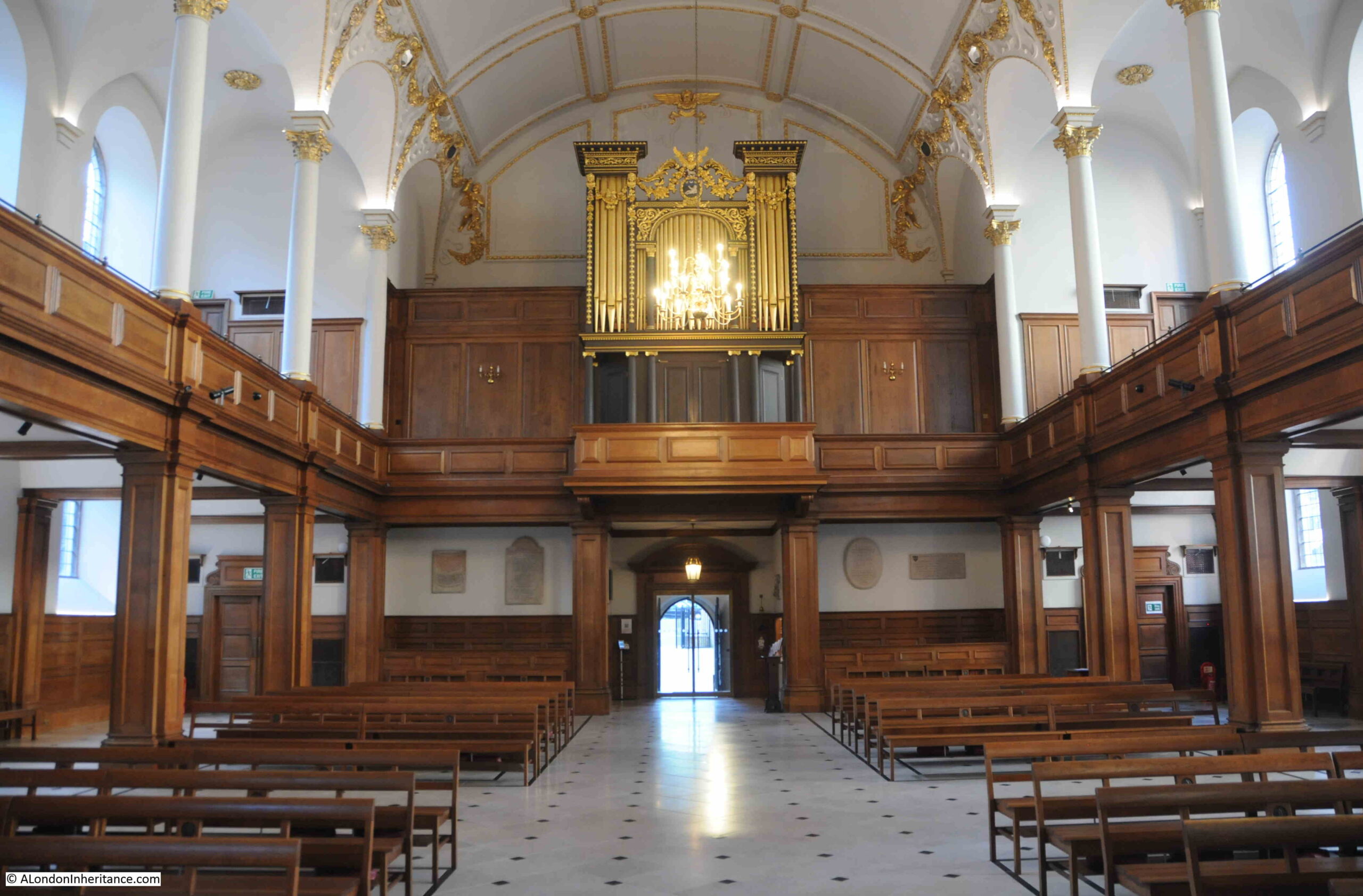
There are blog posts about individual stories or an area scattered across the ten years of posts. They do not come together to tell a comprehensive story of a specific area, such as Wapping, Limehouse, or the Southbank and Barbican, and the walks enable me to do this.

It is also brilliant to meet readers, and to show some of my father’s photos from the place where they were taken.

And again, I learn much from those who are on the walk.

I will be continuing walks this year, and hope to start a new walk in the coming months which explores an area of the City which could well be significantly redeveloped in the coming years, and is a place with a long and complex history, going back 2,000 years.

Walks will be advertised on the blog, but for early notification of new walks, you can follow on my Eventbrite page here.

A Look Back from 2014 to 2024

To record the fact that the blog has reached ten years of continuous Sunday morning posts, I thought I would take a look back through a sample of posts over the years.

It is a random sample, apart from the post for 2014, which has to be the post that started A London Inheritance (click on the headings to visit the post):

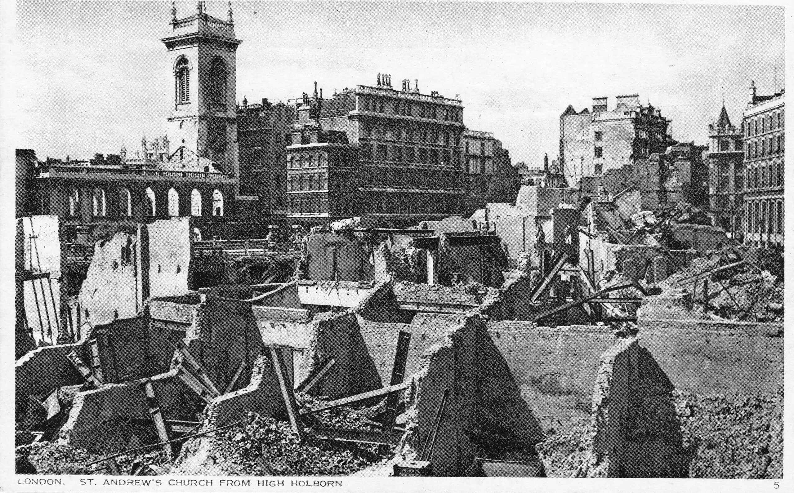
2014 – The First Bomb and a Church Shipped to America

My very first post started with a photo of a plaque put up by the Corporation of London recording the first bomb to fall on the City of London. It seemed an appropriate photo to start the blog, as so many of my father’s photos show the impact of the war on the city.

He grew up in London during the war. He was evacuated for a couple of weeks, however his parents wanted him to return home, and he left a written record of both the terror and excitement of growing up in London in wartime, and started taking photos in 1946.

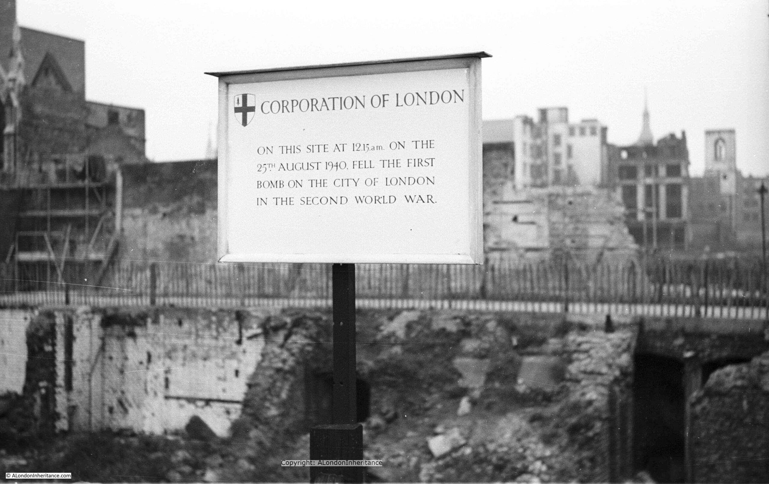
After this first attack on the 25th August 1940, heavy bombing started on Saturday September 7th and continued for the next 57 nights. London then endured many more months of bombing including the night of the 29th December 1940 when the fires that raged were equal to those of the Great Fire of 1666. Hundreds of people were killed or injured, damage to property was enormous and 13 Wren churches were destroyed. Or the night of the 10th May 1941 when over 500 German bombers attacked London. The alert sound at 11pm and for the next seven hours incendiary and high explosive bombs fell continuously across the city.

Behind the sign is a devastated landscape, not a single undamaged building stands, to the right of the photo, the shell of a church tower is visible. All this, the result of months of high explosive and incendiary bombing.

2015 – From the City to the Sea 

The Thames is the reason why London is located where we find it, and why it has developed into the city we see today, however with the closure of the docks and the industries that depended on the river, we seem to have lost that connection.

I had my first trip along the river from the City out to the sea in 1978, and since then it has been fascinating to watch how the river has changed. I also have a series of photos that my father took on a similar journey in the late 1940s. I am working to trace the exact locations and will publish these in a future post.

In 2015 I took the opportunity for another trip down the river aboard the Paddle Steamer Waverley, from Tower Pier out to the Maunsell Forts.

The Paddle Steamer Waverley is the last sea going paddle steamer in the world, built on the Clyde in 1947 to replace the ship of the same name sunk off Dunkirk in 1940. 

Five posts covered the journey from Tower Pier, out to the Maunsell Forts in the Estuary.

The following photo is from the return journey in the evening, with the ship about to pass through the Thames Barrier. Green direction arrows clearly point to the channel that should be used to navigate through the barrier. The office blocks on the Isle of Dogs can be seen in the distance:

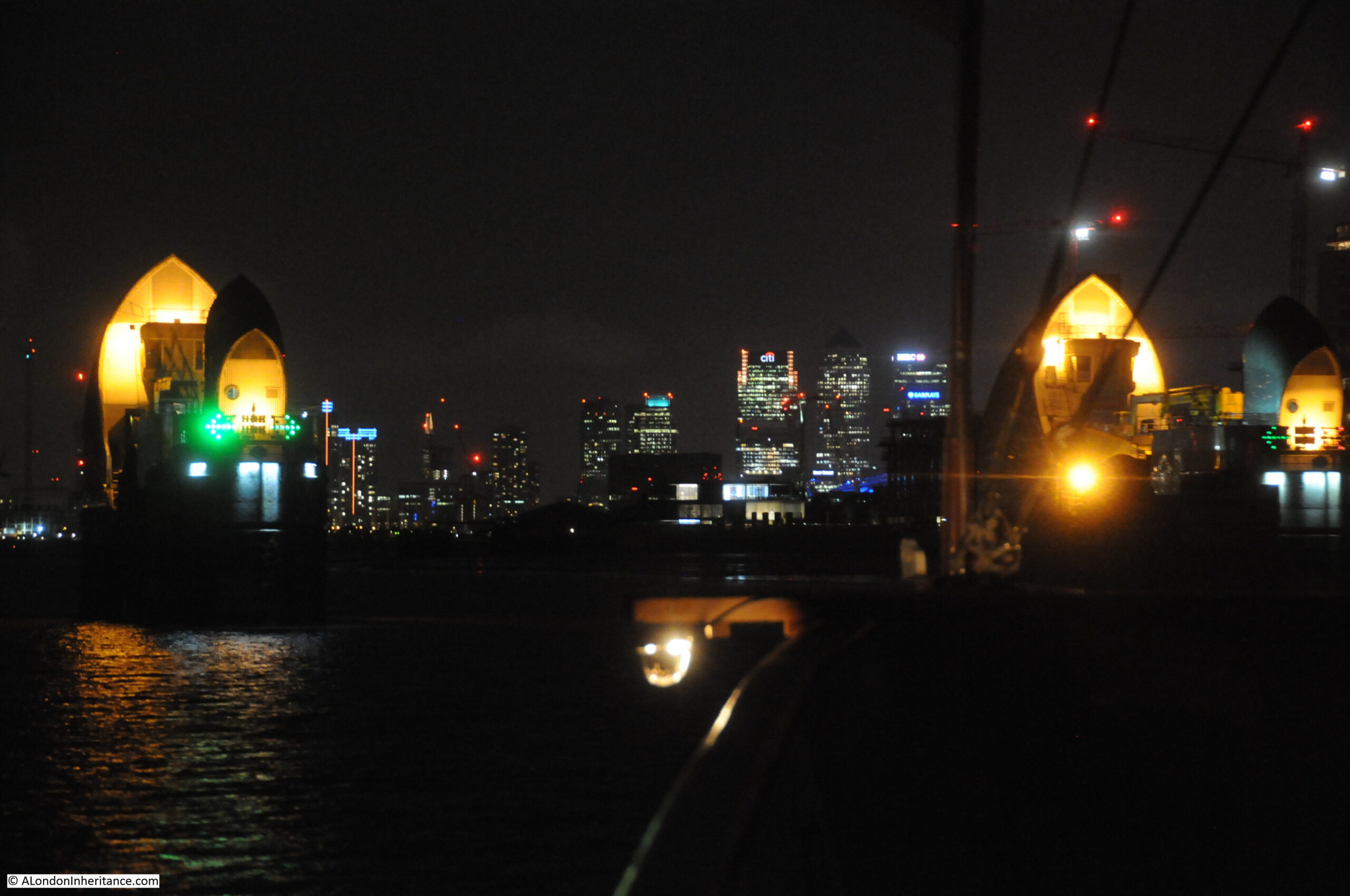
It really was an interesting journey, and the Waverly appears to be making a return visit to London later this year.

2015 – Swan Upping

In 2015, I went Goring lock, to see one of the stops in that year’s Swan Upping route.

This is my father’s photo of Mr. Richard Turk who was the Vintners Swan Marker and Barge Master. He held this position from 1904 to 1960. A remarkable period of time to hold the role and the changes he must have seen along the Thames as Swan Upping was performed each year must have been fascinating.

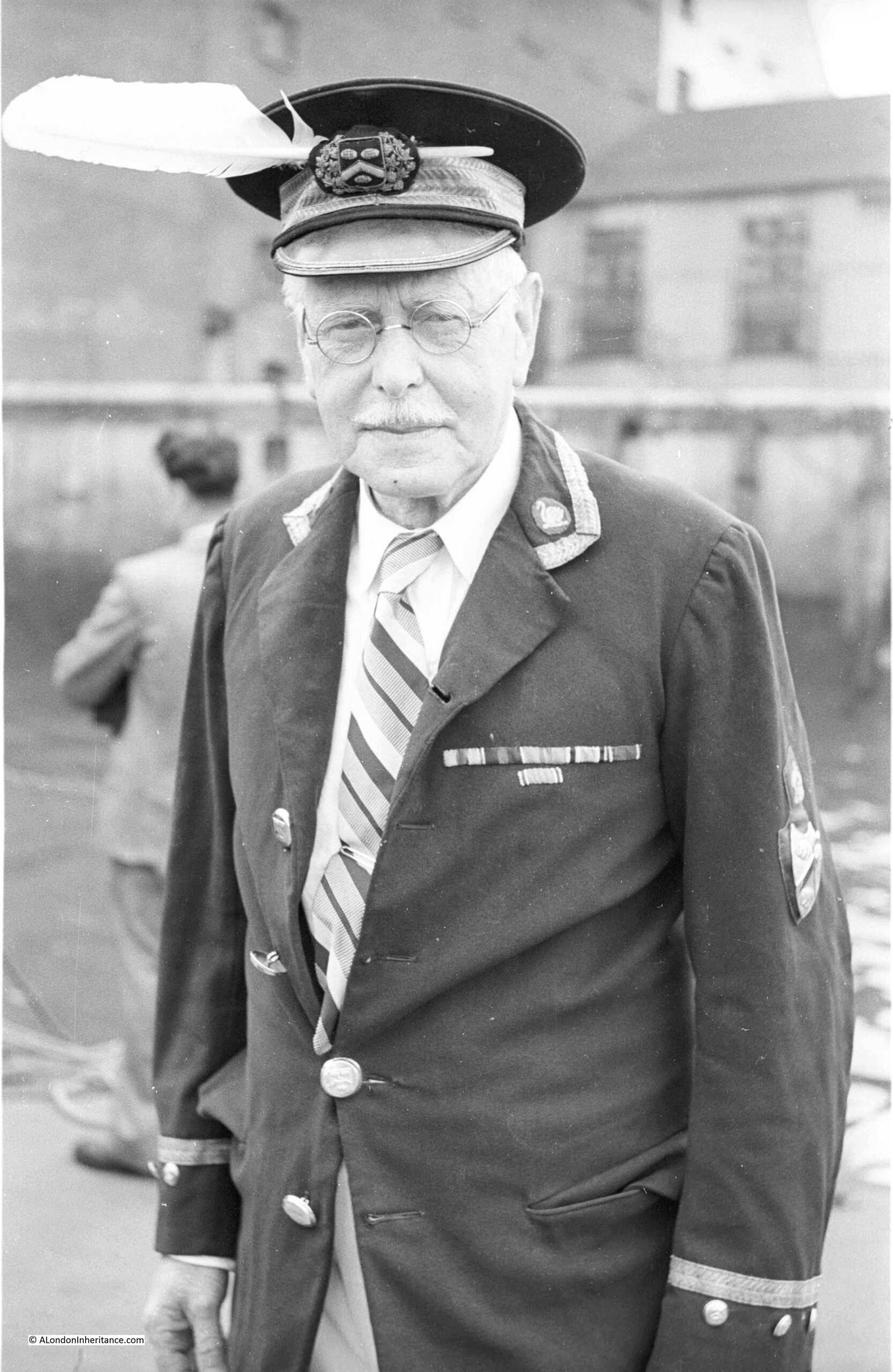
Swan Upping is an event which takes place in the third week of July each year. Dating back many centuries, the event has roots in the Crown’s ownership of all Mute Swans (which dates back to the 12th century), ownership which is shared with two of London’s livery companies, the Worshipful Company of Vintners and the Worshipful Company of Dyers who were granted rights of ownership in the 15th century.

Swan Upping is the annual search of the Thames for all Mute Swans, originally to ensure their ownership is marked, but today more for conservation purposes (counting the number of swans and cygnets, checking their health, taking measurements etc.), although the year’s new cygnets are still marked.

2016 – A Walk Round The Festival Of Britain

Throughout the last ten years, I have written a number of posts about the Festival of Britain, and in 2016 wrote several posts covering the Southbank festival site, the Lansbury Exhibition of Architecture in Poplar, the Pleasure Gardens in Battersea etc.

This was my father’s photo taken from the base of the Skylon, looking up at the structure:

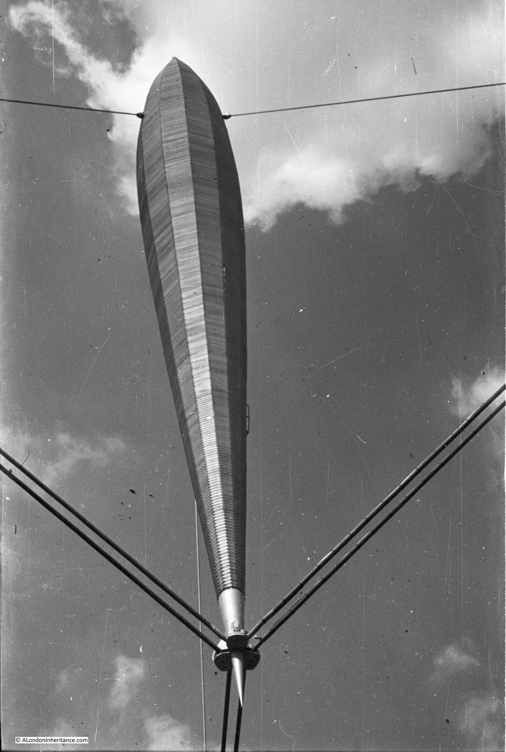
The design for the Skylon was the result of a competition for a “vertical feature” for the festival site. Of 157 entries, the design by Philip Powell and Hidalgo Moya along with the engineer Felix Samuely was chosen.

The main body of the Skylon was 250 feet in height, add in the suspension off the ground and the total height was 300 feet. Three sets of cables held the Skylon in a cradle at the lowest point, and half way up at the thickest point a set of guy wires held the Skylon in a vertical position.

Aluminium louvered panels were installed on the outer edge of the Skylon and lights were installed inside, so during the day, the Skylon would sparkle in sunshine and at night it would be lit from the inside.

The name for the Skylon was also chosen in a competition. The winning entry was from a Mrs. Sheppard Fidler and the name was a combination of Sky and the end of Nylon (the latest modern invention), which when combined gave the futuristic sounding name of Skylon.

2016 – Building the Royal Festival Hall

Another of my 2016 Festival of Britain posts was on the construction of the Royal Festival Hall, the only building that remains on the Southbank from the Festival. My father had taken a number of photos both before the site was cleared and during the building’s construction, including a series showing the foundations being prepared:

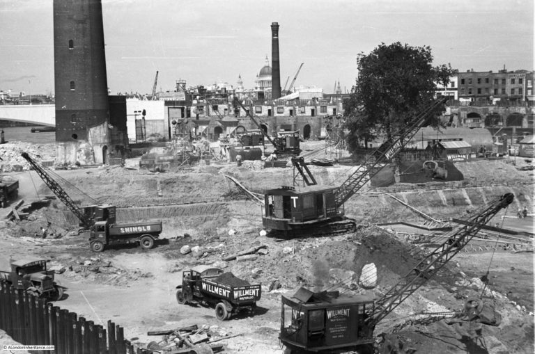
Work on the foundations started in May 1949 with bulk excavation of the whole area – as clearly seen in the photos above that my father took of the area. Bulk excavation was used as the easiest way to clear the area needed for the foundations. The centuries of previous construction on the site included the remains of the old water works along with the brewery which was built on a 6 foot thick mass concrete raft.

There was a large amount of work to prepare, which included sinking well points and then pumping out water which started on the 17th June 1949, when, within four days the ground water level was reduced to 13ft below the ordnance datum. A huge volume of water was extracted, with at the start of pumping 150,000 gallons of water per hour were being pumped out, and even after the site had been “de-watered”, pumping was still needed of 80,000 gallons per hour to keep the area of the foundations dry.

A total of 63,000 cubic yards of materials were removed for the foundations.

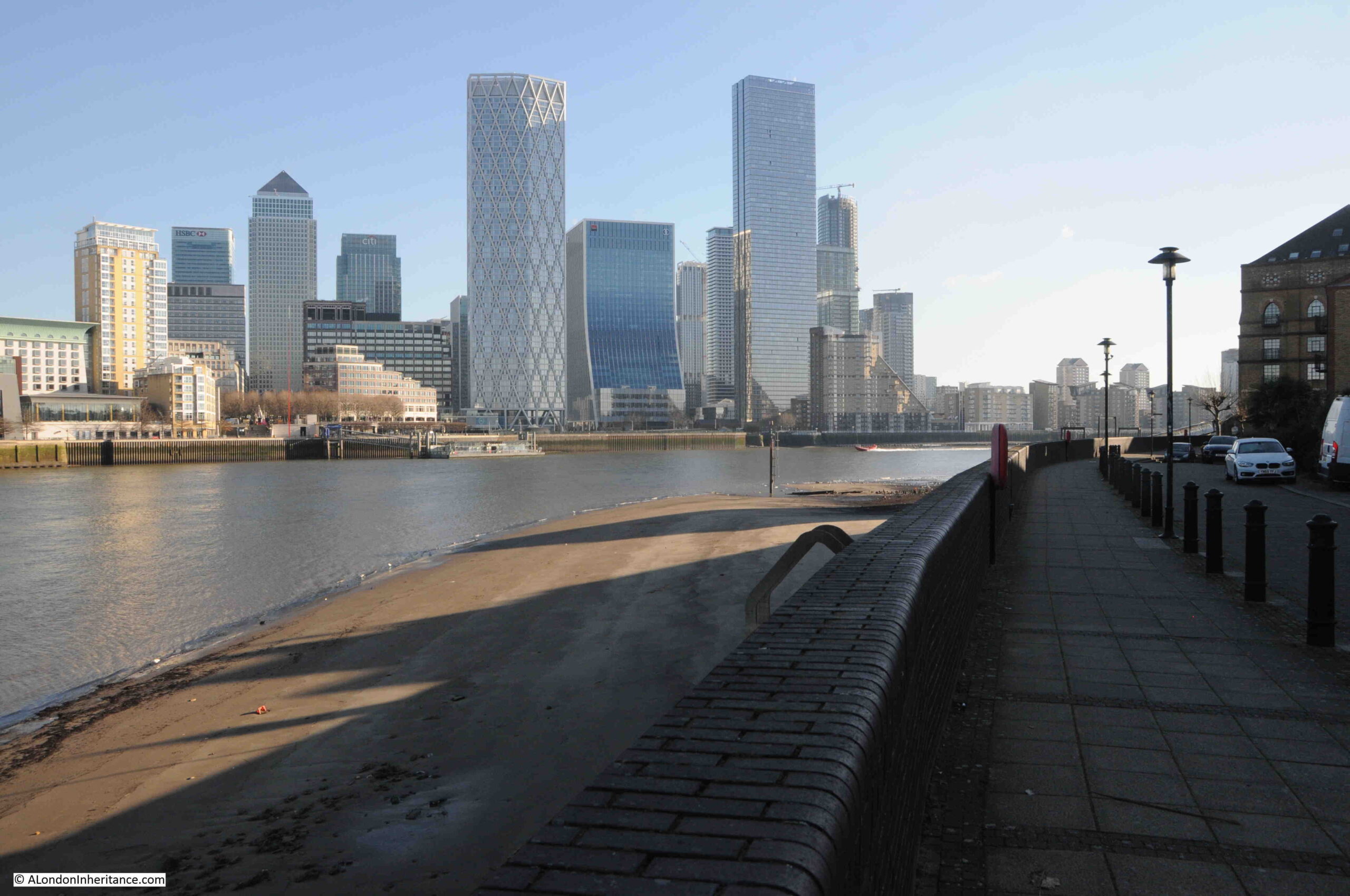
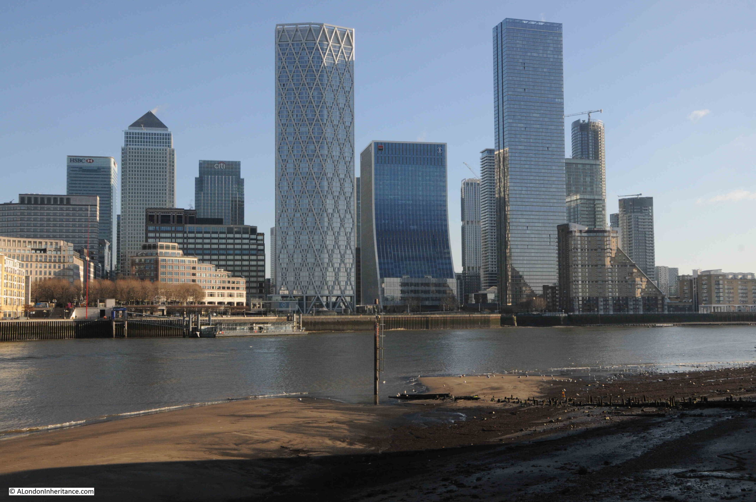
2017 – Flying Over London

I will take any opportunity to see London from a high point, including flying above the city, and in 1979 and 1983, I took a couple of flights in a vintage de Havilland Dragon Rapide, and I have published a number of posts with some of the photos from these flights, including this example:

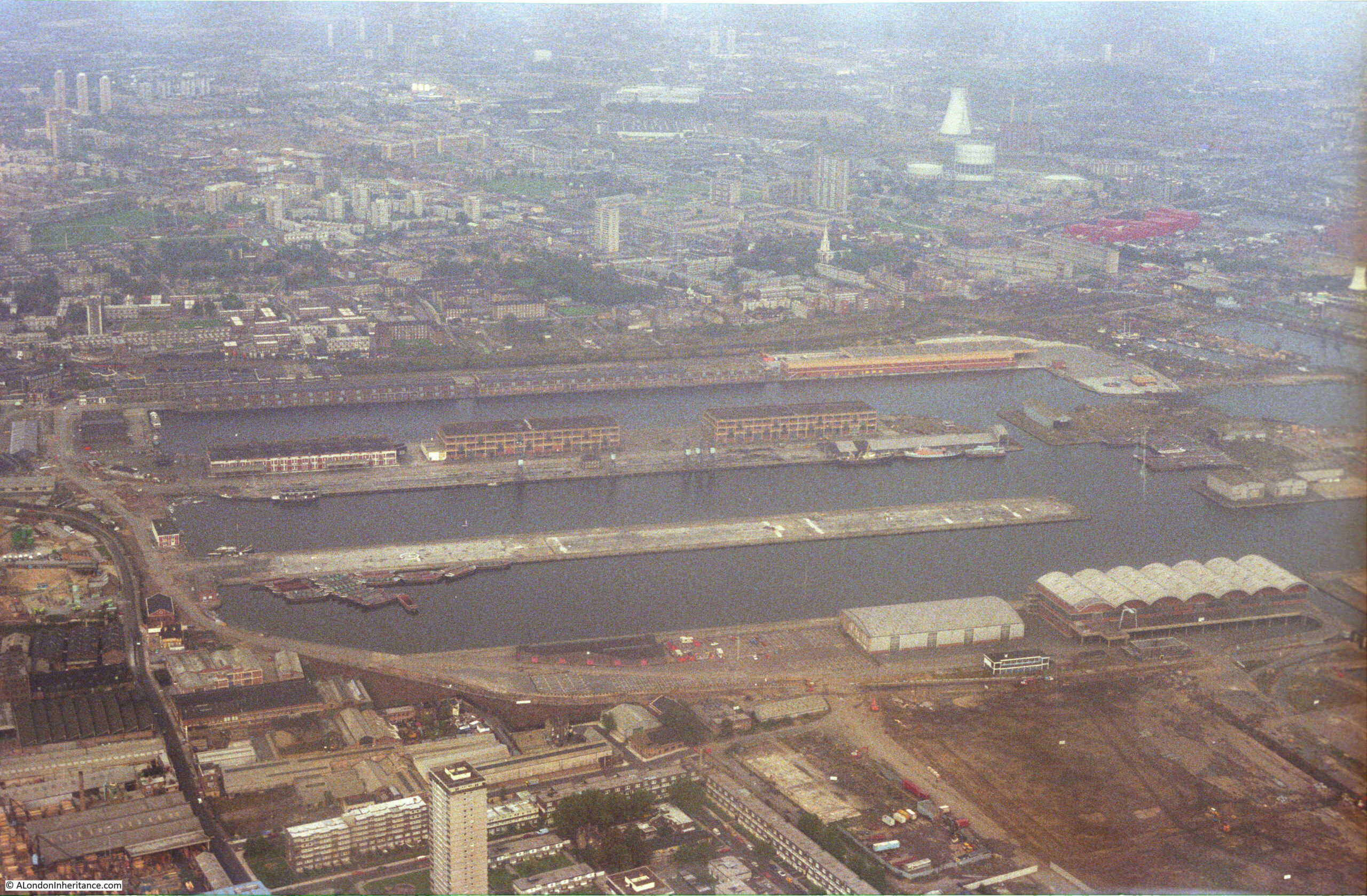
The above photo shows parts of Poplar at the top, and the northern end of the Isle of Dogs with from the top, the West India Dock (Import), the West India Dock (Export) and the South Dock. If you look just above the top dock, over to the right is the spire of a church, this is All Saints Church, Poplar. The Balfron Tower can be seen just behind the spire of  the church.

Hard to believe that this is now the Canary Wharf development and One Canada Square is now in the centre of these docks.

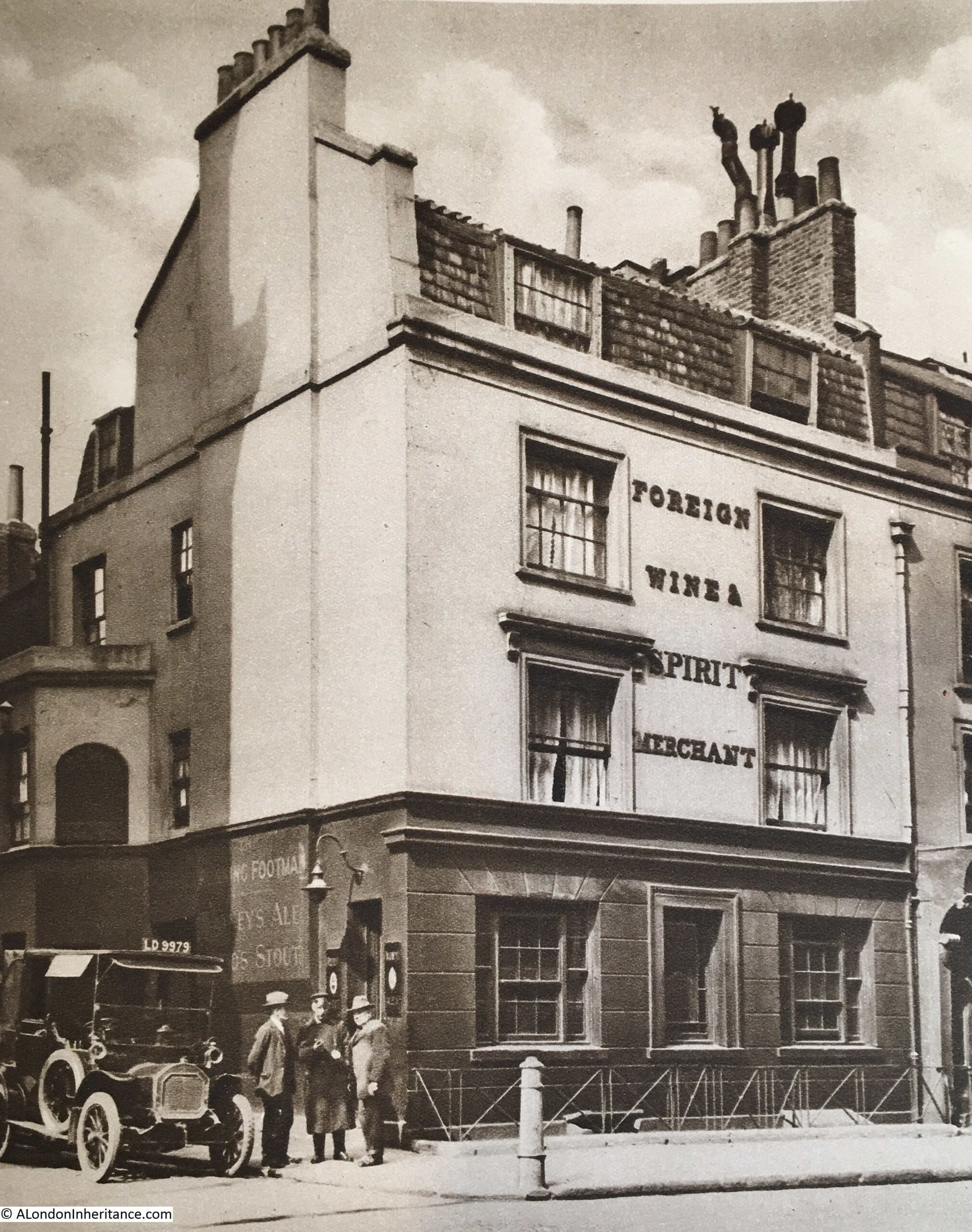
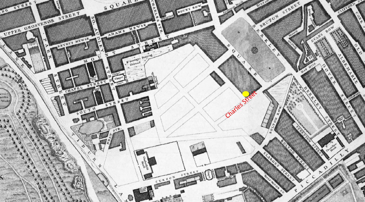
2017 – St. James Gardens – A Casualty Of HS2

In 2017, I started an annual post, recording the construction of the new HS2 station at Euston, starting with St. James Gardens, which would close soon after I had taken the photos in this blog post.

Before construction could start, the gardens, which had been a cemetery, needed to be excavated to remove the many thousands of bodies that were still buried beneath the grass, footpaths and gardens.

2017 – Clifton Suspension Bridge

As well as London, my father also took very many photos of places visited during Youth Hostel / cycling trips in the late 1940a / early 1950s with friends from National Service.

I have also been trying to visit all these locations.

One of the sites he photographed was the Clifton Suspension Bridge, and in 2017 I had the opportunity to look inside the hidden vaults beneath one of the abutments supporting the bridge, and I posted some of these photos, along with my father’s 1952 photos of this bridge.

Although the bridge is in Bristol, there is still a significant London connection, as recorded in this report on the bridge from 1864:

Mr. Brunel, as it happened, had been the engineer of Hungerford Bridge; and when, therefore, its chains had to be pulled down and to give place to the bridge of the Charing-cross Railway, it occurred to Mr. Hawkshaw to have them applied to the completion of one of Mr Brunel’s bridge designs. For such a purpose the money was soon forthcoming. A new company, under a new Act and presided over by Mr. Huish was started, with a capital of £35,000. The chains of Hungerford Bridge were purchased for £5,000; the stone towers built by Mr Brunel for the old company, for £2000. Two years ago the work of slinging these chains began and the bridge is now finished.

Hungerford Bridge was the bridge built across the Thames to the old Hungerford Market, on the site of Charing Cross Station, before the current railway bridge was built.

2018 – The Streets Under The HS2 Platforms And Concourse

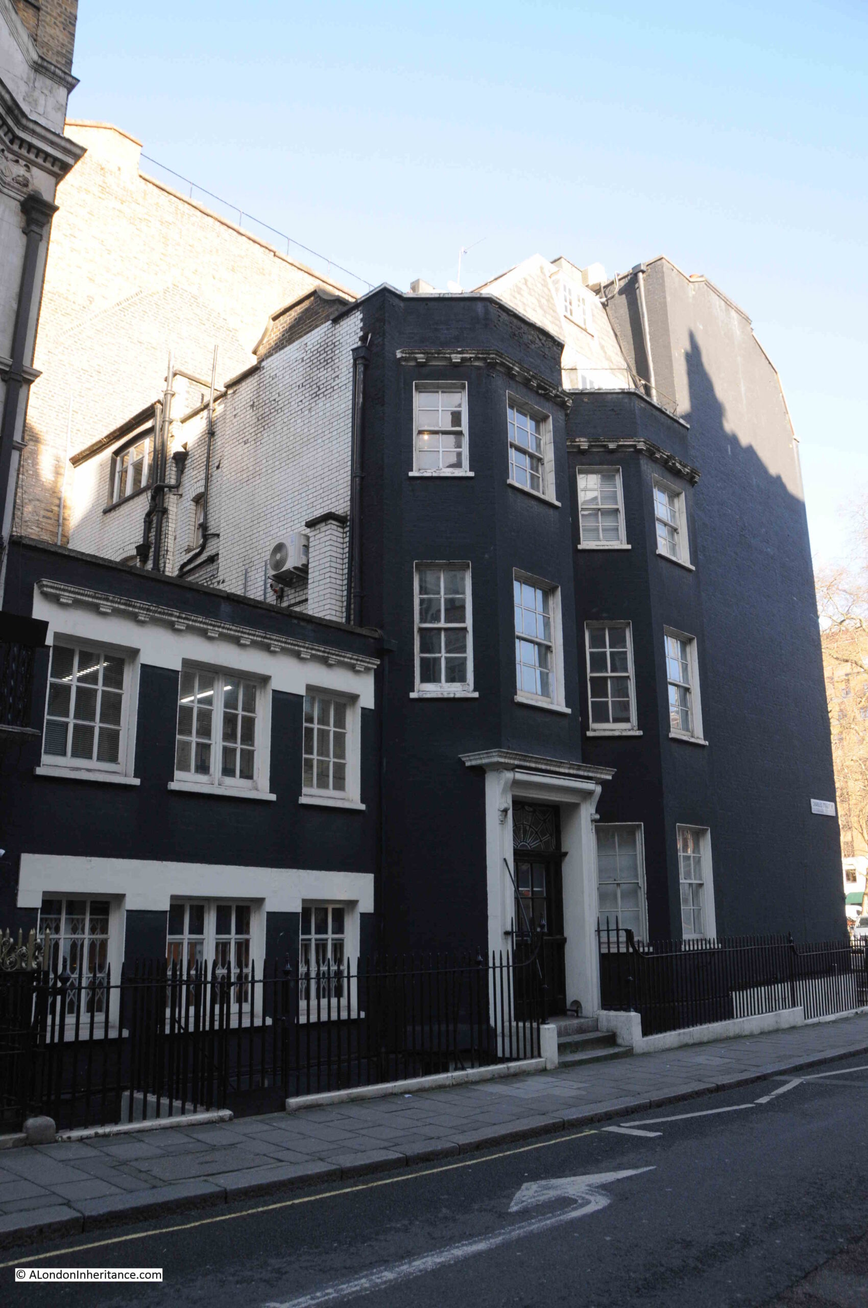
In 2018 I walked the streets to the west of Euston that would soon be demolished as part of the HS2 project. The following photo shows the Bree Louise pub, at the junction of Euston Street and Cobourg Street, which had closed not long before the photo:

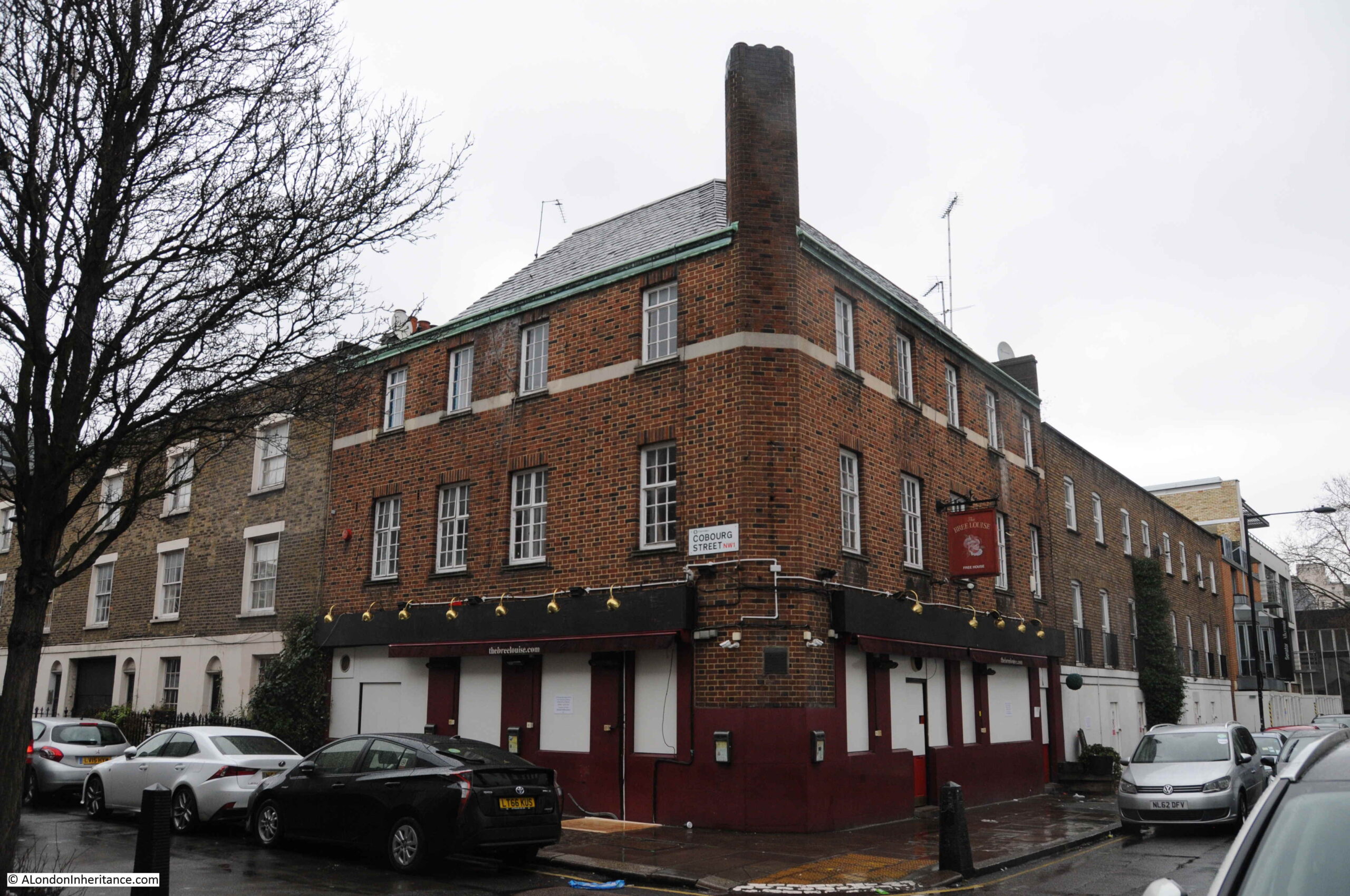
The pub dates from the early 19th century and was the Jolly Gardeners until being renamed by the most recent landlord as the Bree Louise, the name of the landlord’s daughter who died soon after birth.

The Bree Louise was a basic, but superb local pub and it was sad to see how quickly after closing at the end of January, the pub has taken on such air of being abandoned.

Everything in the above photo has now been demolished and is part of the HS2 construction site.

2018 – A Forty Year Return Visit To A Secret Nuclear Bunker

2018 included a rather somber post, describing a return to a location I was last at forty years earlier.

In the late 1970s, after leaving school, I started an apprenticeship with British Telecom (or Post Office Telecommunications as it was then). It was a brilliant three year scheme which involved both college and practical experience moving through many of BT’s divisions and locations. For a couple of months I was based at the telephone exchange at Brentwood, Essex. A typical day would involve maintenance and fault fixing on the telephone exchange equipment, however at the start of a day that would be rather different, the Technical Officer in charge was giving out jobs, and one job involved fixing a fault at a rather unique location – a secret nuclear bunker.

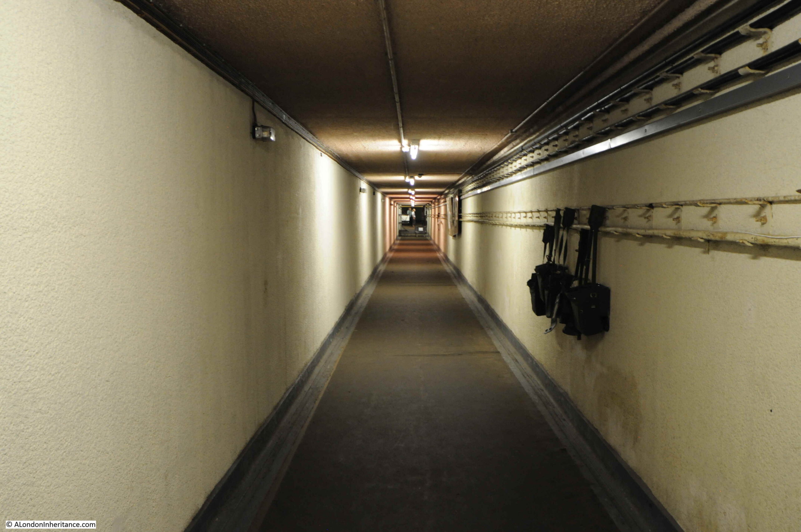
These were the years when a nuclear war was still a possibility, when the Government issued the Protect and Survive booklet, and in 1984 the BBC drama Threads appeared on TV – one of the most unsettlingly programmes I think I have ever watched.

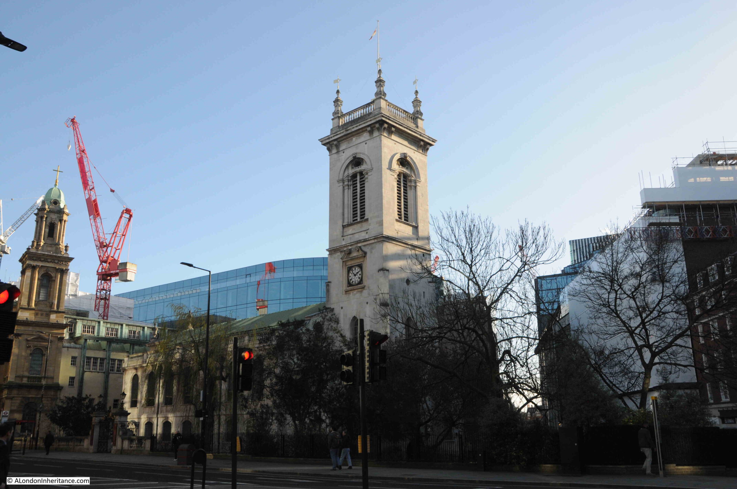
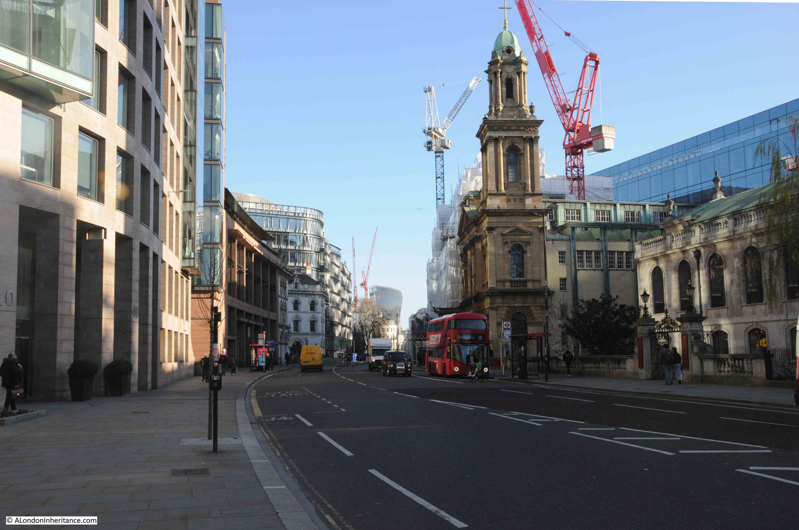
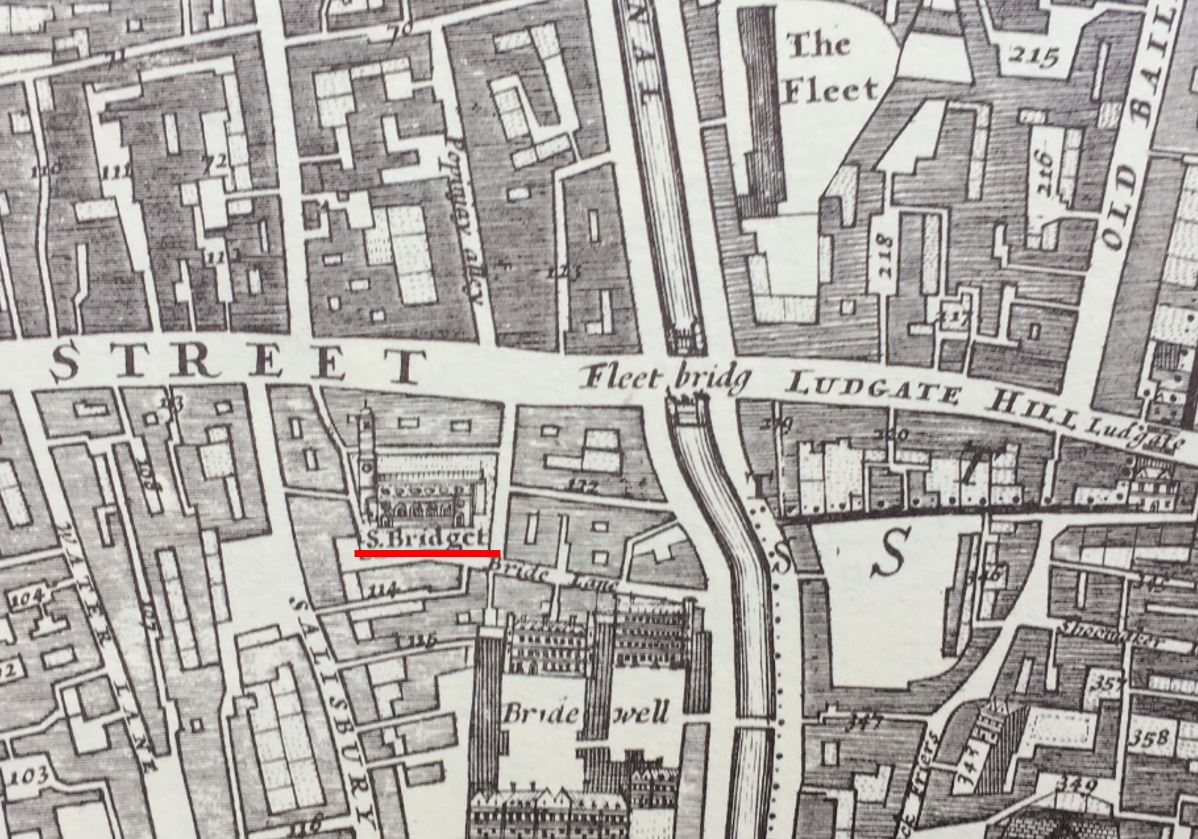
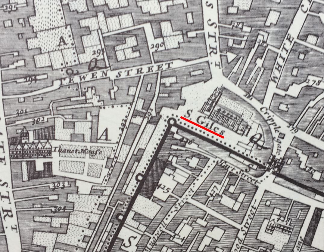
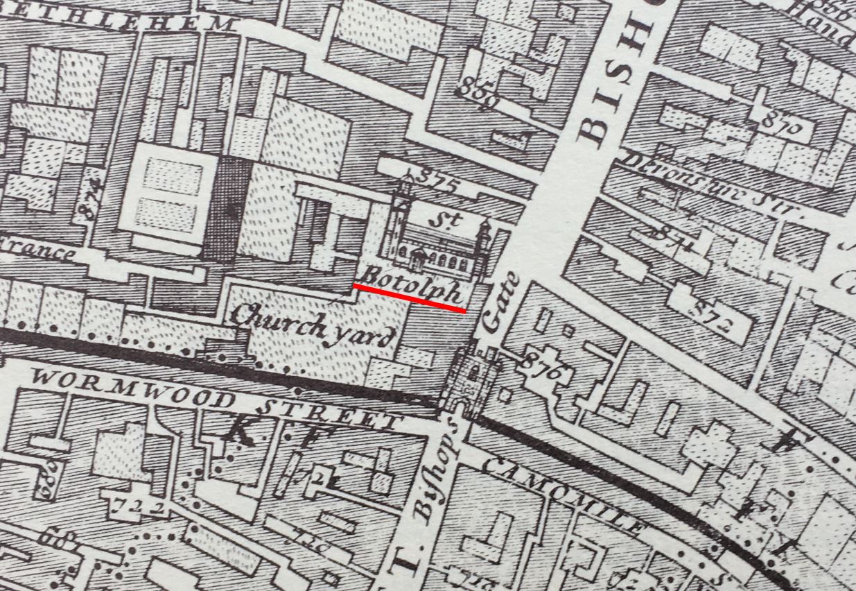
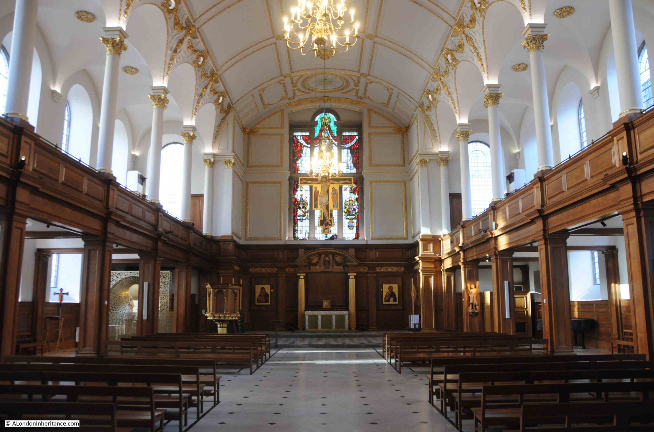
2019 – St Giles Cripplegate and Red Cross Street Fire Station

The subject of this post, was a photo taken in 1947, looking across a rather devastated landscape to the church of St Giles Cripplegate:

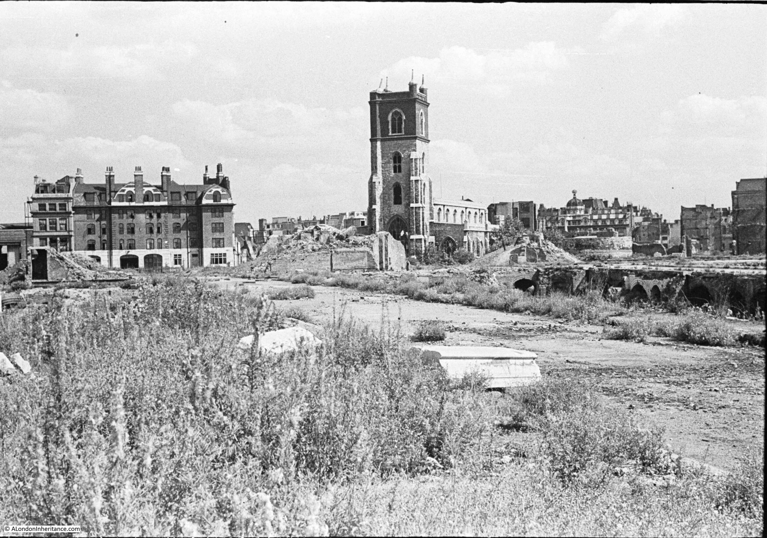
There are three main features in the photo, two of which survive to this day, although the area is now completely different following the development of the Barbican.

The church of St Giles Cripplegate is in the centre, the church looks relatively unscathed, however it suffered very badly and lost the main roof and contents of the church.

To the right of the church is a pile of rubble, and to the right of this, is the round shape of a Roman bastion, which can still be seen.

The large building on the left was the Red Cross Street Fire Station, demolished as part of the final land clearance in preparation for the build of the Barbican.

2019 – Crow Stone, London Stone and an Estuary Airport

In this post, I finally managed to get to a place I had been wanting to visit for years. It took a bit of planning, but took me to a location that still has evidence of the City of London’s original jurisdiction over the River Thames.

To the west of Southend, on the borders with Leigh, and by Yantlet Creek on the Isle of Grain, there is a line across the River Thames which marked the limits of the City of London’s power. Where this line touched the shore, stone obelisks were set up to act as a physical marker.

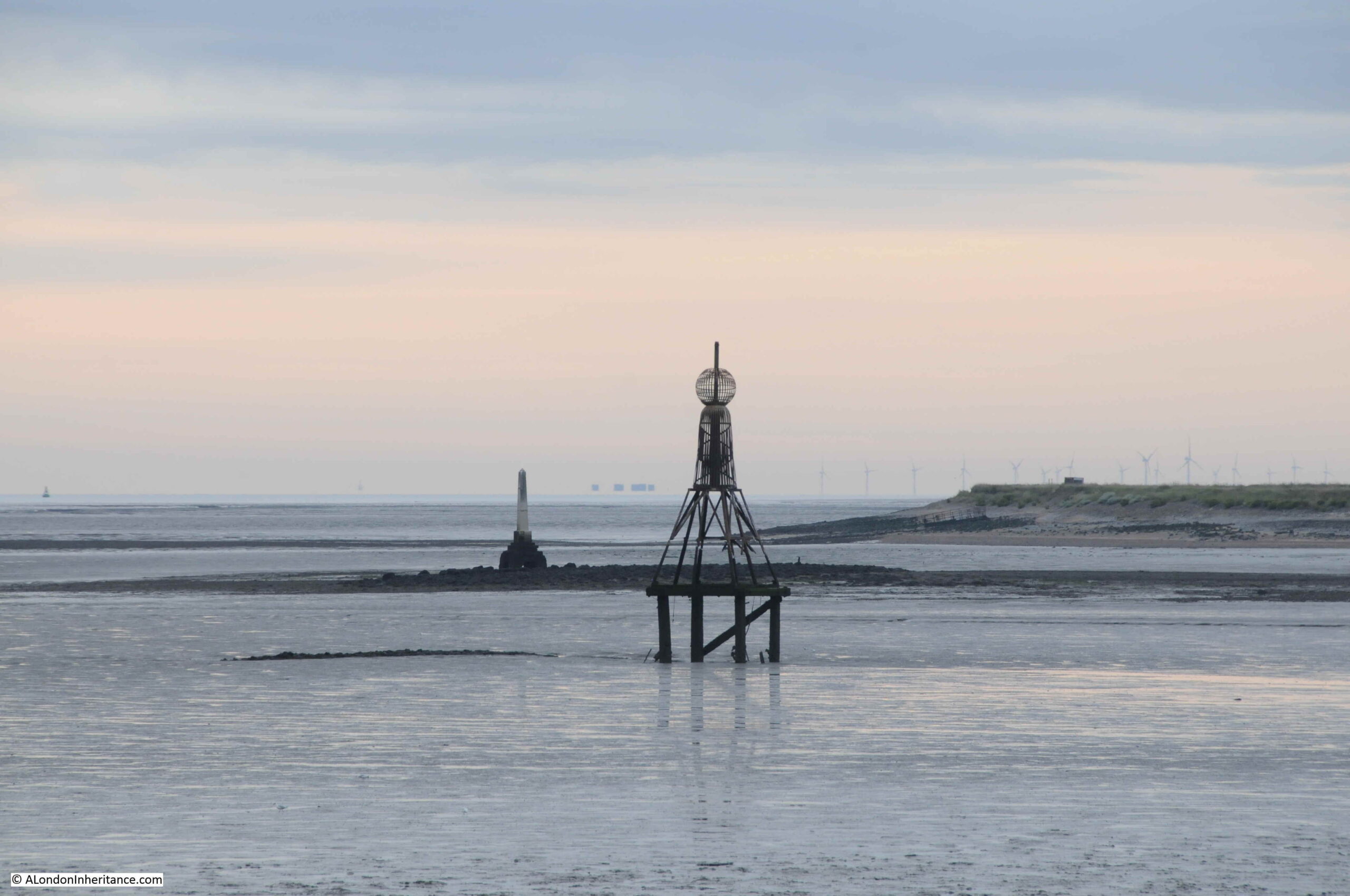
The above photo shows the London Stone at Yantlet Creek. The early 4 am start to get there was well worth it – standing at the London Stone at 6:45 as the sun rose over the Thames Estuary, in such an isolated location, was rather magical.

2020 – The House They Left Behind

One of 2020’s posts included a trip to Limehouse, to find the site of the following photo from1986, which shows the side of a building where the adjacent buildings have obviously been demolished. The building has “The House They Left Behind” painted in bold black letters on a white background, with below, the original build date and a restoration date of the year before the photo was taken.

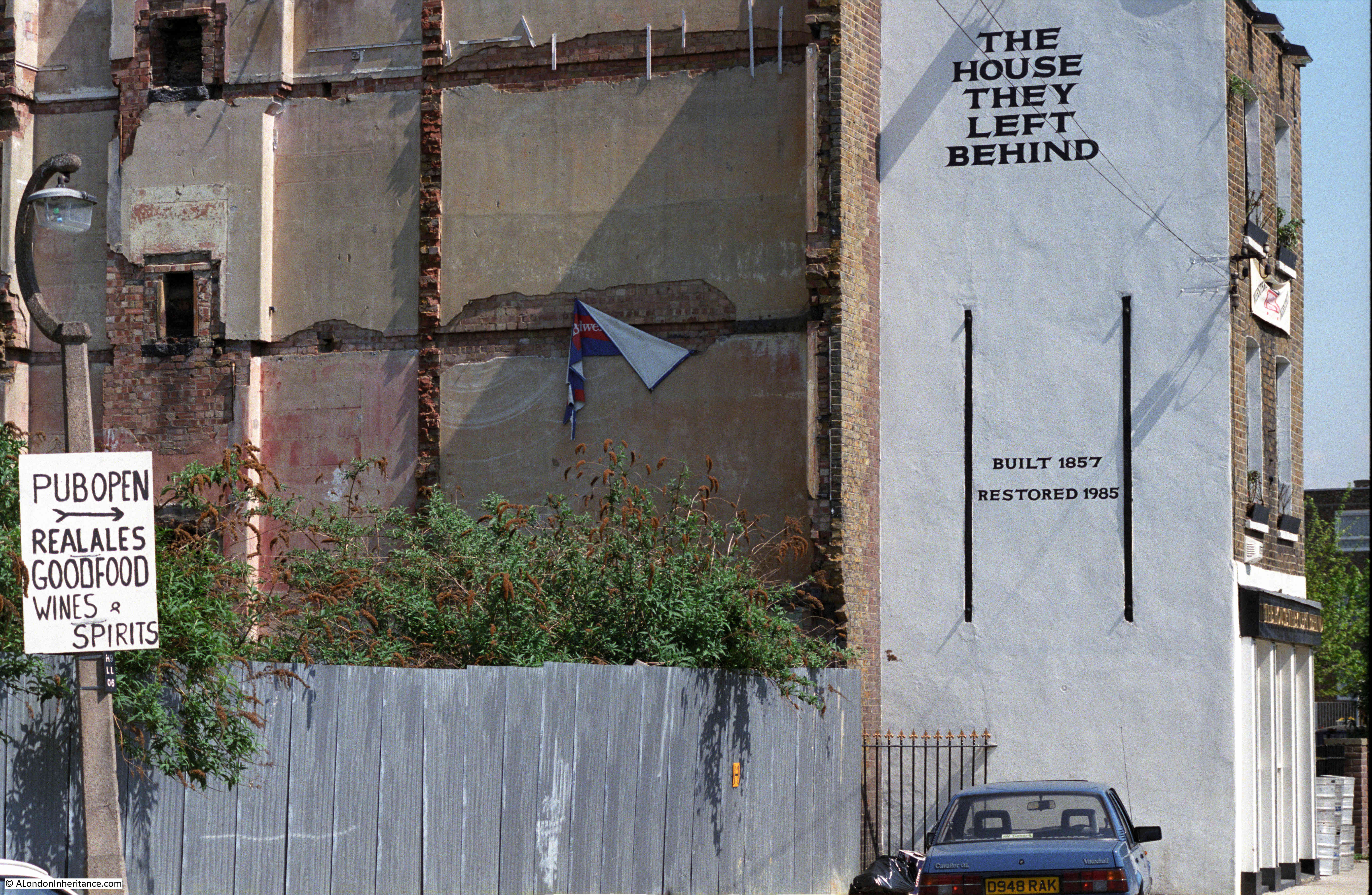
The pub was originally called the Black Horse, and was one of four in a small area of Narrow Street and Ropemakers Fields. Today, the only pub remaining is the Grapes.

The name change from Black Horse was to describe the position of the pub after demolition of every other building on Ropemakers Fields, and the Barley Mow Brewery, when the pub became “The House They Left Behind”. It is now residential.

2020 – A Very Different London

2020 was the start of COVID, with the first lockdown starting in March. London became a very differenet place, and the city is still reacting to the impact of the virus and lockdown.

The following photo was taken along a very quiet Cromwell Road,  with the Victoria and Albert Museum on the left:

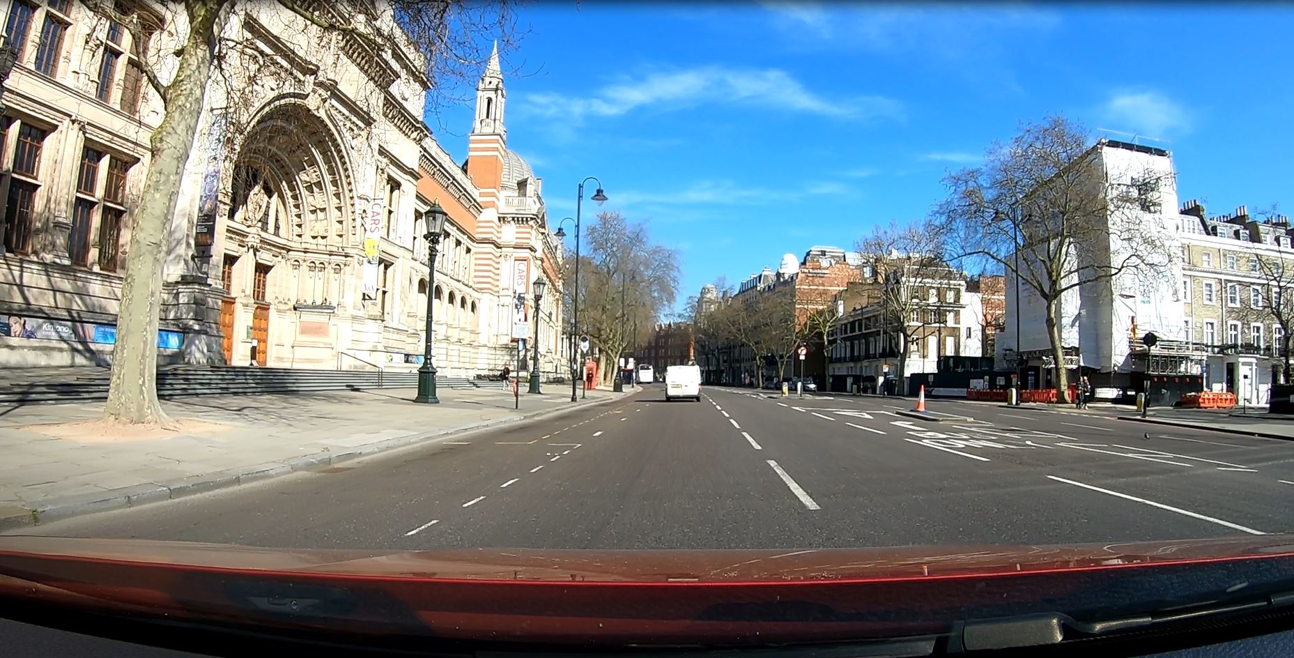
On the Monday afternoon before the first lockdown, I had to take a relative to Guy’s and St Thomas Hospital at London Bridge (fortunately nothing to do with the Coronavirus). The hospital had advised not to take public transport, so the only other option was to drive.

Although this was before the formal lock down and the direction to stay at home, I had already stopped walking around London and was missing the experience of walking the city, particularly as the weather was so good.

To take advantage of a drive up to London Bridge, I mounted a GoPro camera on the dash of the car and left it filming the journey there and back.

It was a London I had not seen before on a Monday afternoon, more like a very early Sunday morning. Very few people on the streets and not much traffic. I cannot remember driving in central London on a weekday without any queues. The only time I needed to stop was at traffic lights.

A frightening reminder of the impact of the virus.

2020 – Hidden London – Moorgate

The London Transport Museum have run a brilliant series of tours of the hidden side of London’s transport infrastructure, and in February 2020, on a chilly Saturday afternoon, I arrived at Moorgate looking forward to walking through the hidden tunnels of another London underground station.

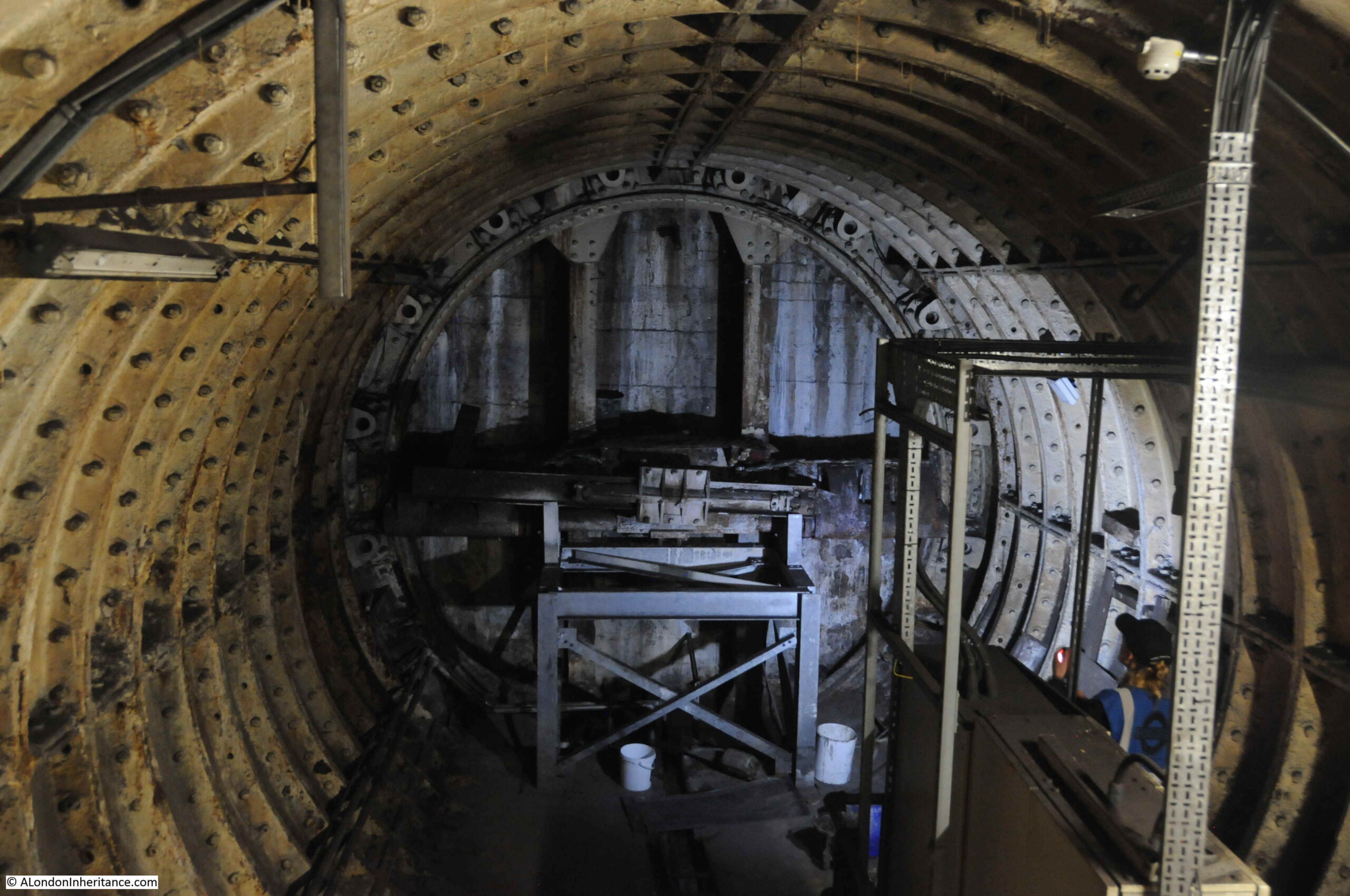
The above photo shows the remains of a Greathead Tunneling Shield at Moorgate. This was the invention of James Henry Greathead, who developed Brunel’s shield design, from rectangular, with individual moveable frames, to a single, circular shield. Screw jacks around the perimeter of the shield allowed the shield to be moved forward as the tunnel was excavated in front of the shield, with cast iron tunnel segments installed around the excavated tunnel immediately behind the shield.

Greathead’s first use of his shield was on the Tower Subway.

He died in 1896, before the Lothbury extension at Moorgate, however his shield design was so successful that it became the standard design for shields used to excavate much of the deep level underground system.

2021 – 74 Miles from London

This post started with an 18th century milestone to be found in Southampton, indicating that it is 74 Miles from London:

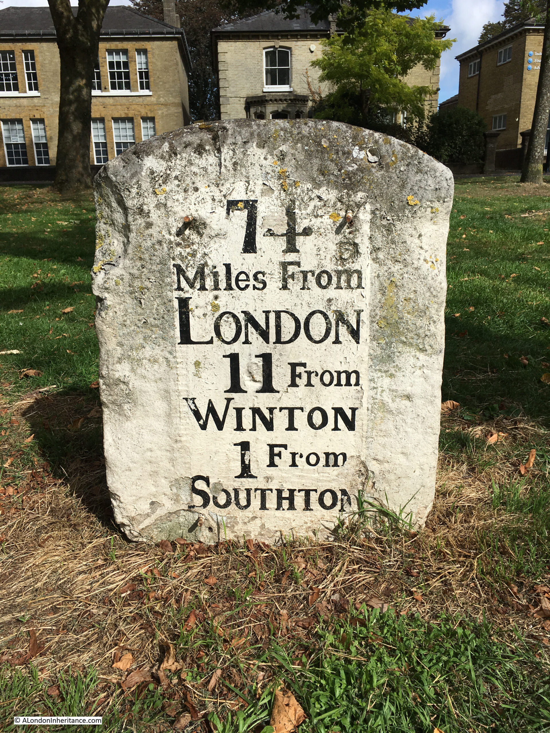
I have always been interested in London’s relationship with the rest of the country. Frequently, this is seen as a negative. The north / south divide, London getting the majority of available infrastructure investment, higher wages in the city etc.

London’s central role in the country started many hundreds of years ago with the founding of the Roman City of London, located on a crossing point on the Thames, and where the new city was accessible from the sea.

Roads spread out from London, and the city became a cross roads for long distance travel. This was accentuated with the city becoming the centre for Royal and Political power, the Law and also a centre for trade and finance.

Look at a map of the country today, and the major roads that run the length and breadth of the country still start in London (A1 – London to Edinburgh, A2 – London to Dover, A3 – London to Portsmouth, A4 – London to Bath and Bristol, A5 – London to Holyhead).

Many of these major roads have been upgraded and follow new diversions, but their general routes have been the same for many hundreds of years, and a milestone is an indication of the age and importance of the route.

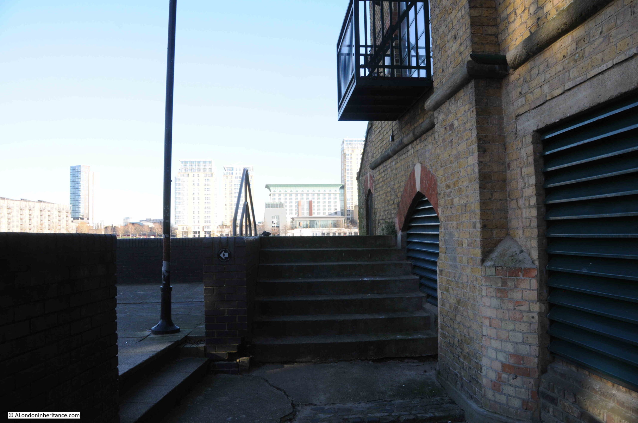
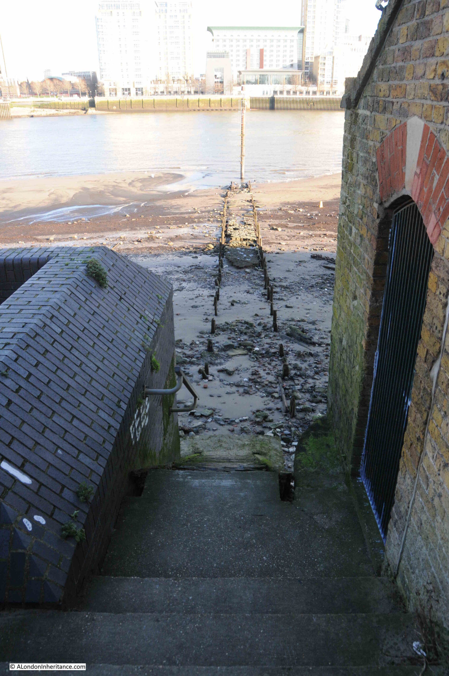
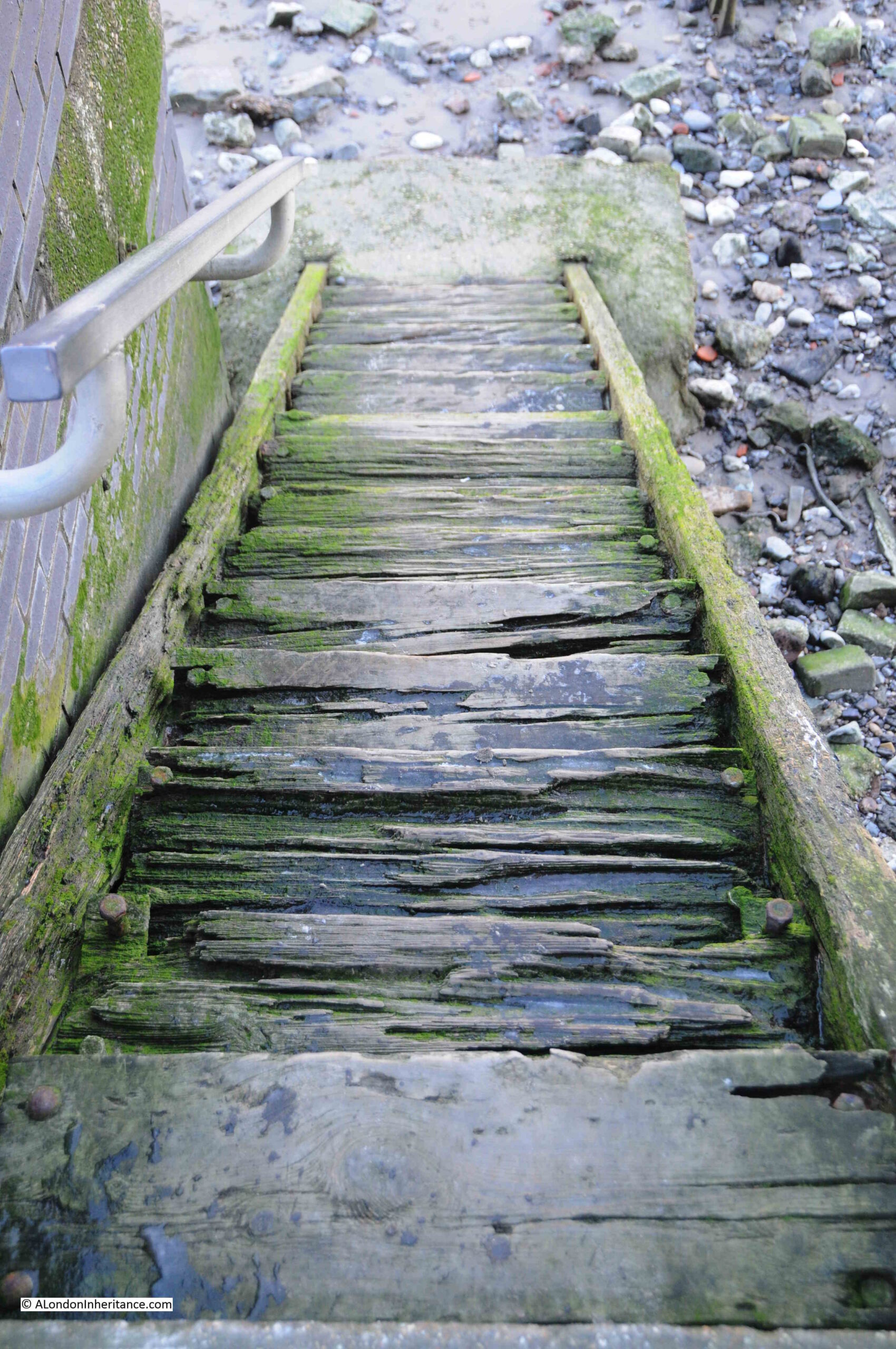
2021 – The Thames from Cherry Garden Stairs

The old stairs leading down to the River Thames have been a long running theme to the blog. These stairs mark a place that has been important for centuries, where access between the land and river was available.

My father took the following photo from Cherry Garden Stairs, Bermondsey, looking along the river towards the City, with the dome of St Paul’s Cathedral visible through Tower Bridge.

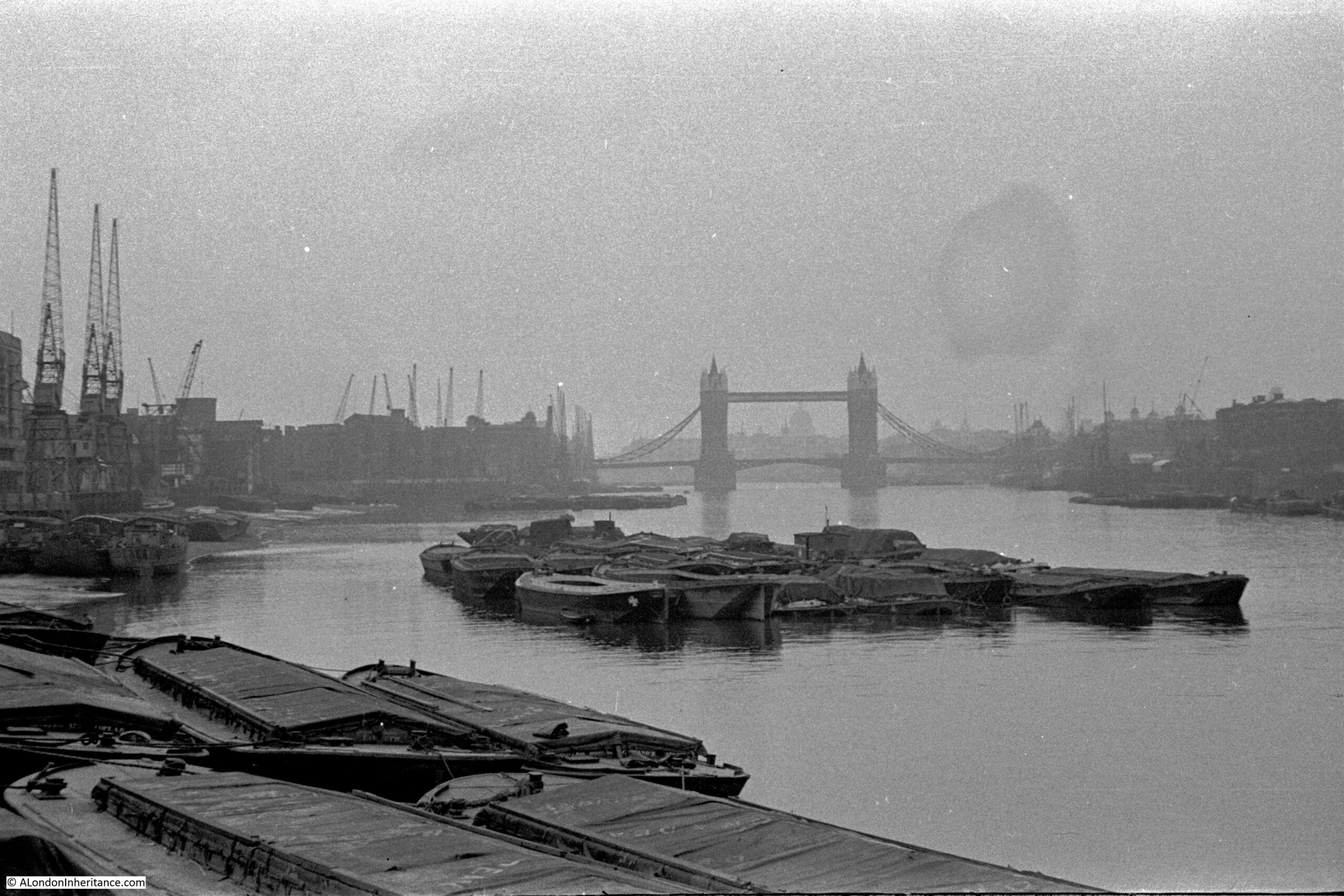
When the photo was taken, in 1946, the river bank was lined by warehouses, wharves and docks, with cranes along the river. A large number of lighters and barges are moored on the river, and directly in front of the camera, which would have been on the foreshore.

These stairs are very quiet today, however countless thousands of people have used these stairs to get to and from work, to take a Waterman’s boat, to leave London, to arrive in London, or to flee from the consequences of a criminal act, or to escape persecution.

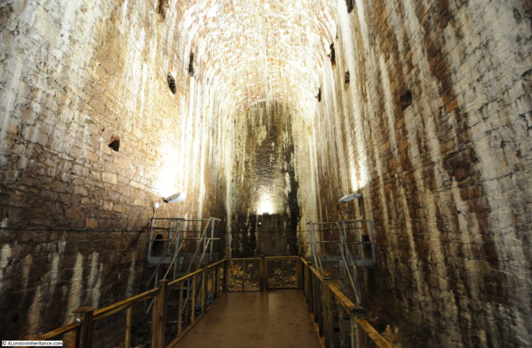
2022 – Tunnelling the Baker Street and Waterloo Railway

The route of the Baker Street and Waterloo railway ran beneath the Baker Street Station of the Metropolitan District Railway, by Regent’s Park and Crescent Gardens into Portland Place, through Langham Place to Oxford Circus (where the tunnels pass over those of the Central Line with a clearance of only 6 inches at one point), down Regent Street to Piccadilly Circus, along Haymarket and Cockspur Street to Charing Cross, along Northumberland Avenue, then under the Thames to College Street, Vine Street and Waterloo Station.

The majority of the tunnel went through London Clay and was a relatively easy construction project, however there was a challenge where the tunnel went underneath the Thames.

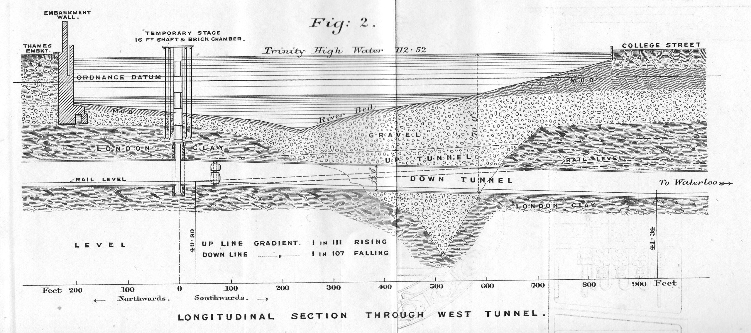
The above diagram shows the route under the Thames of the Baker Street and Waterloo railway, a depression in the London Clay and short distance of gravel through which the tunnel would need to run.

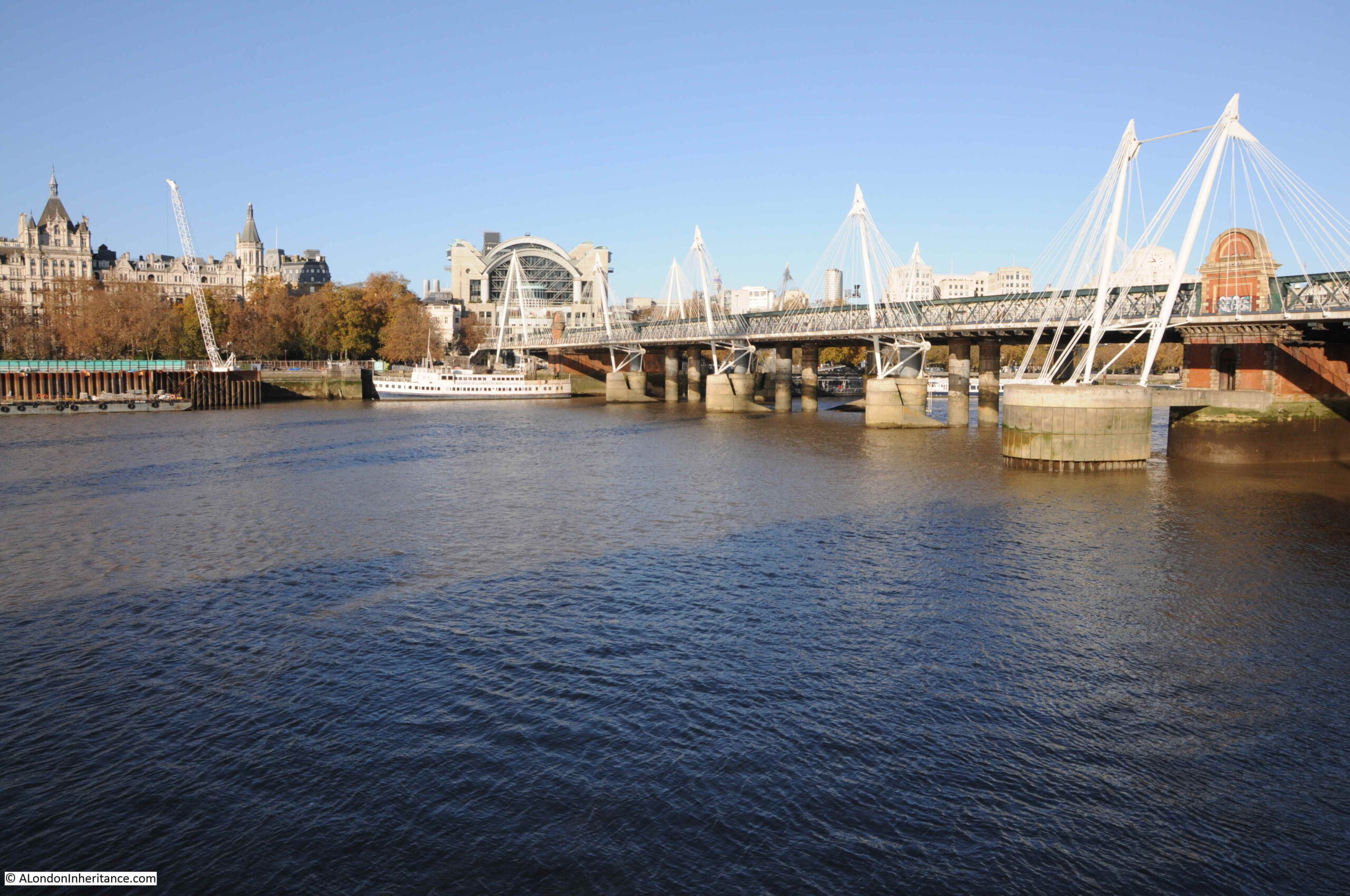
The tunnel passes under the river as seen in the following photo, and the blog post tells a story of the challenges of digging the tunnel in very difficult conditions.

2022 – The First East Ham Fire Station and Fire Brigade

My Great Grandfather was born in 1854, and as a young man, he went to sea and travelled the world.

He became a fireman in 1881, joining the Metropolitan Fire Brigade (MFB) at Rotherhithe, south east London, later moving to West Ham in 1886 as a Fire Escape man, where he remained for ten and a half years. At the time the MFB recruited only ex seamen and naval personnel as the Brigade was run on Naval discipline with a requirement for familiarity of climbing rigging and working at heights.

In 1896 he became the Superintendent of the new East Ham Fire Station, and in 2022, I completed one of the many tasks on my to-do list by visiting the site of the Fire Station in Wakefield Street, East Ham:

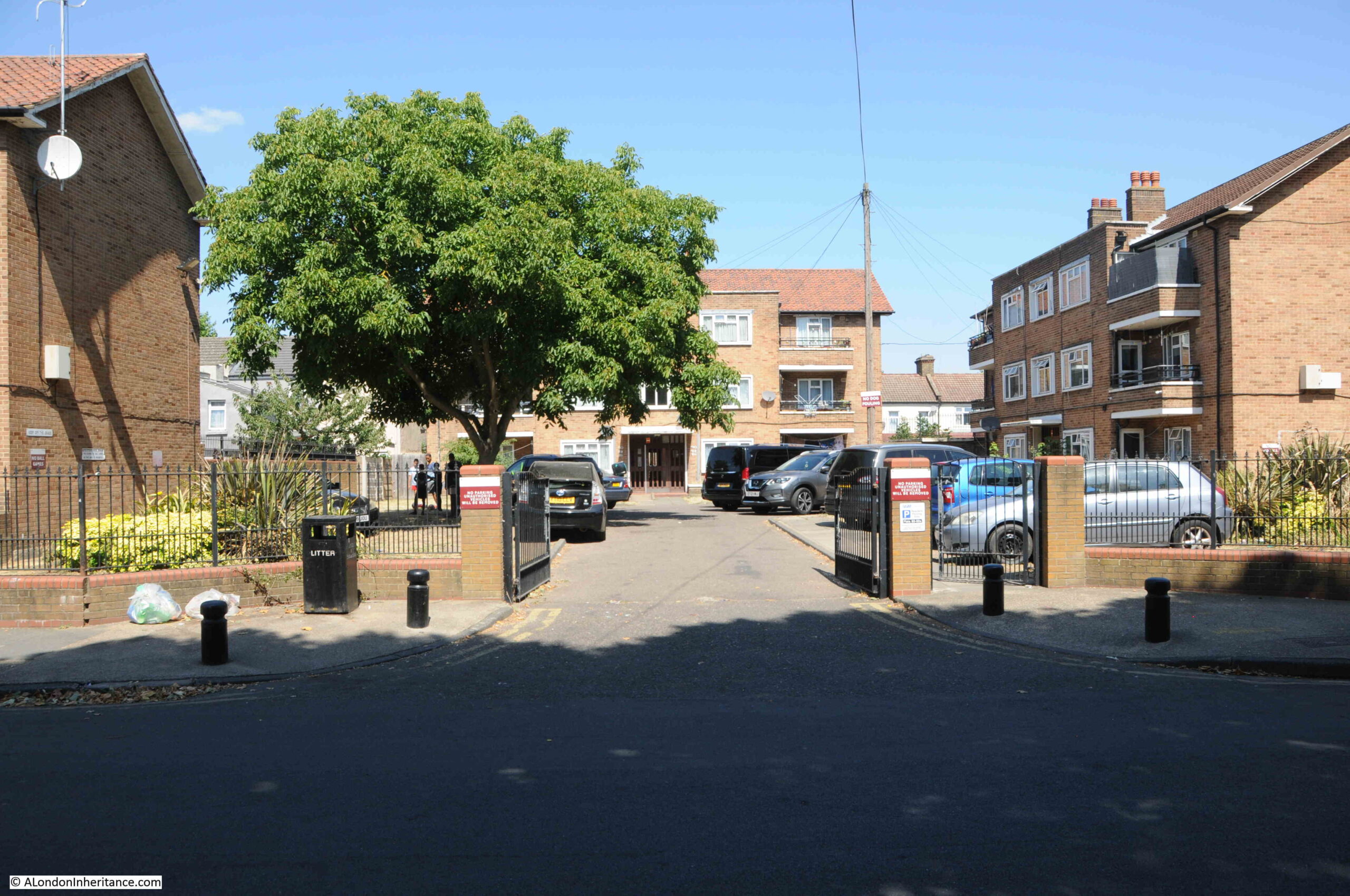
I cannot find the exact year when the fire station was demolished, it was at some point after 1917, and the location is now occupied by the flats shown in the above photo, but I did find lots of references to the fire station, and the work of the crews based there. which I wrote about in the post.

2022 – Eleanor Crosses – Grantham, Stamford and Geddington

One of the many historical journeys across the country that ended in London was that taken by the funeral procession of Queen Eleanor of Castile, a remarkable 13th century woman.

The procession started from the site of her death, in Harby, Nottinghamshire. On the journey to London a cross was built at each of the places where the procession stopped overnight, and in 2022 I followed the route through Lincoln, Grantham, Stamford, Geddington, Hardingstone, Stony Stratford, Woburn, Dunstable, St. Albans, Waltham and then into Central London at Cheapside, Charing Cross and finally Westminster Abbey, where her body was buried.

Geddington has the best preserved of all the remaining Eleanor crosses, which is located in an open space at the centre of the village:

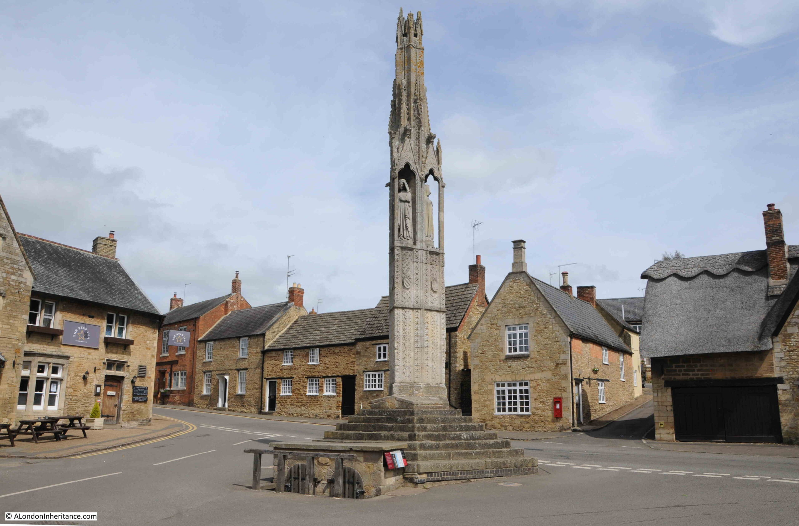
The procession arrived at Geddington on the 6th of December 1290. Geddington is a small village, and the reason for choosing the village as a stop is that a royal hunting lodge was close by, just north of the church. The lodge had been built in 1129 and was used by royal hunting parties in the local forests, indeed Edward and Eleanor had stayed at the lodge in September of 1290.

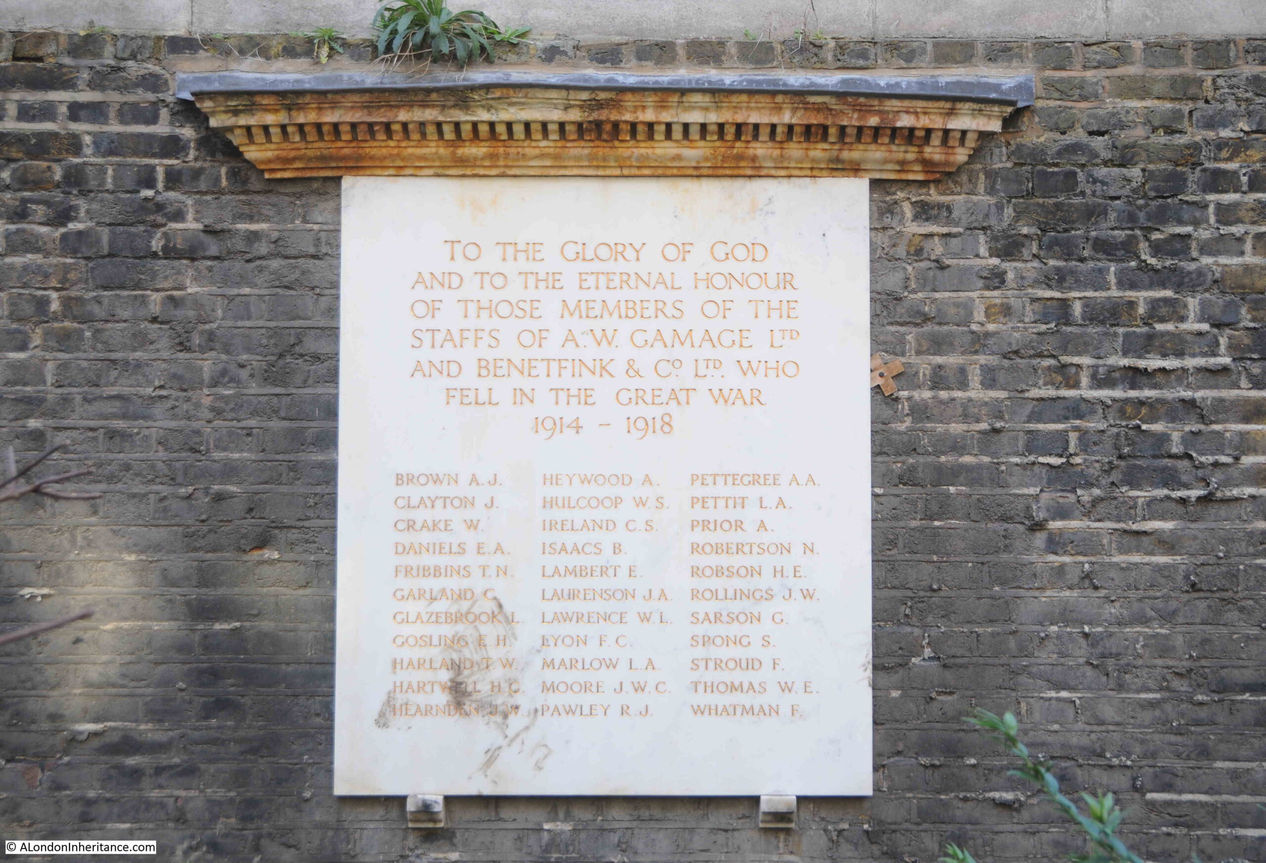
2023 – The Cyprus Street, Bethnal Green, War Memorial

One of my father’s 1980s photos was of the war memorial in Cyprus Street, Bethnal Green:

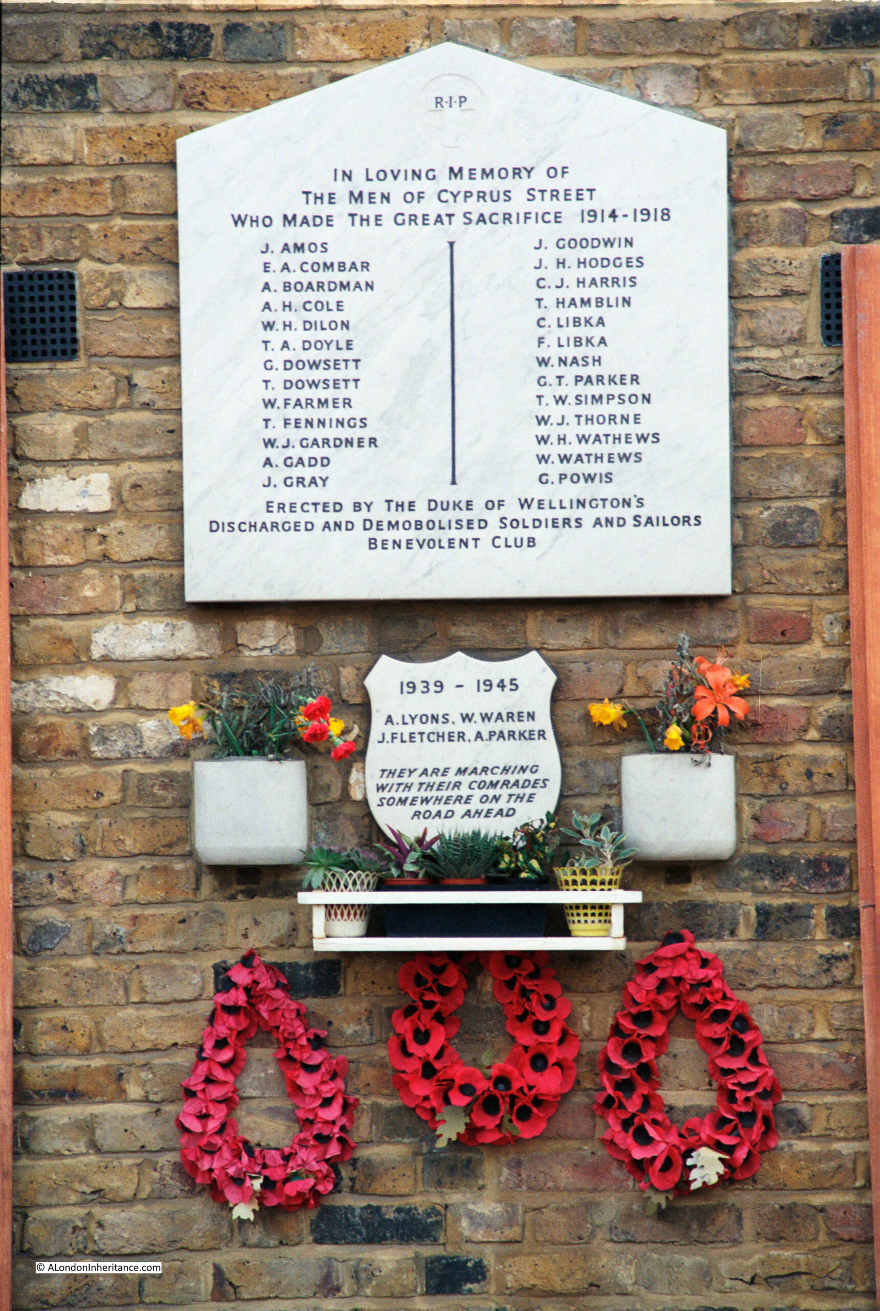
Forty years later, I went back to take a new photograph, and explore the story of the memorial and the names recorded.

The reference on the memorial to the Duke of Wellington’s Discharged And Demobilised Soldiers And Sailors Benevolent Club refers to the Duke of Wellington pub in Cyprus Street. The pub was built around 1850 as part of the development of Cyprus Street and surrounding streets.

The pub closed in 2005 and is now residential, but today still very clearly retains the features of a pub, including a pub sign.

The Most Read Post In 10 Years – London Streets In The 1980s

Variations of the search term “London in the 1980s” resulted in this post being the most read post on the blog in the last ten years, with people using search terms about London in the 1980s being regularly directed to the post from Google.

One of the photos featured in the post was this tribute to West Ham:

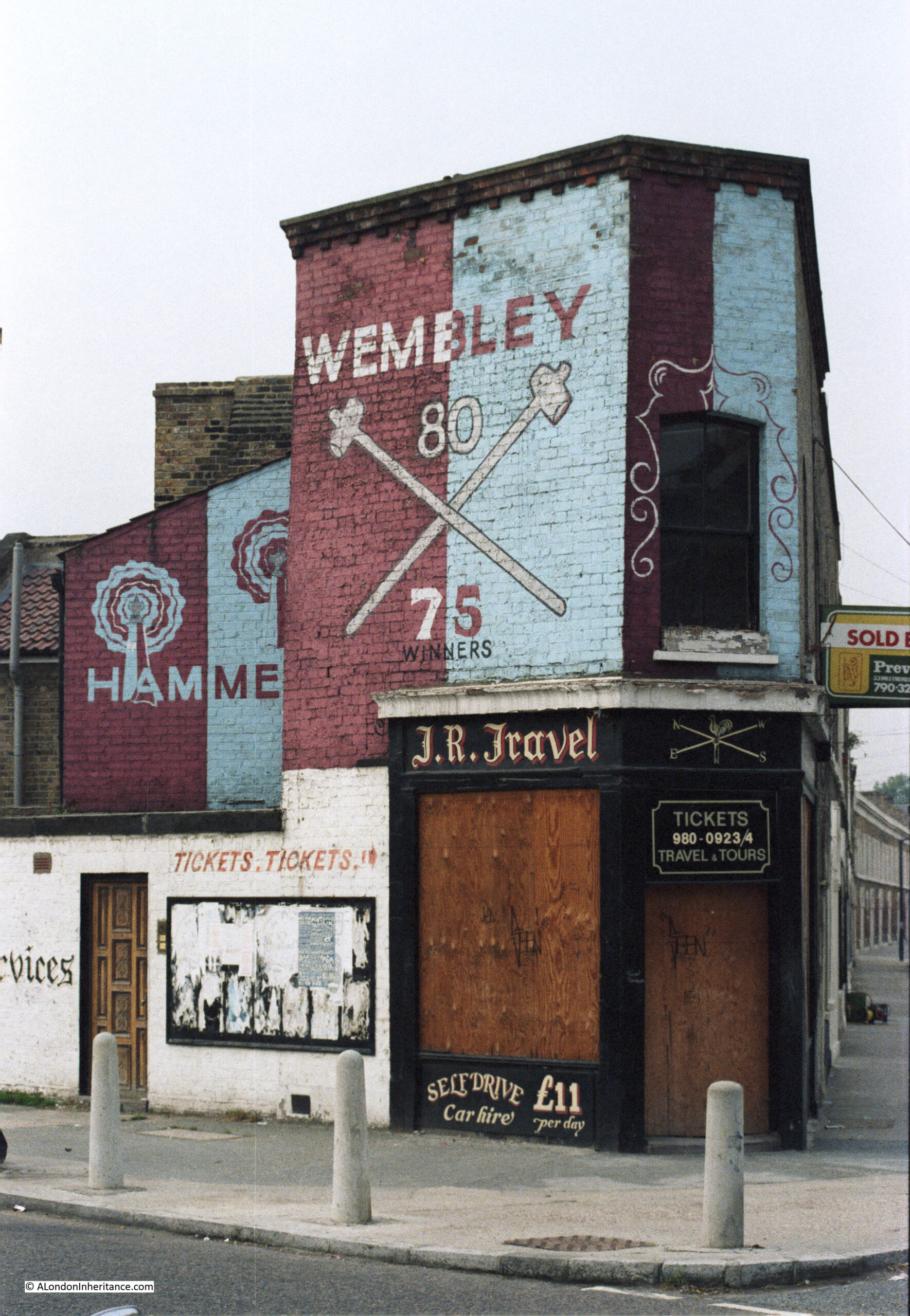
London has changed considerably since the 1980s, and will continue to change, it is the one constant throughout the whole of the city’s long history and it is fascinating to see how London has responded to so many internal and external factors over the centuries.

Thank you for reading the blog, and I hope the coming years continue to be of interest.

alondoninheritance.com

Churches at the City Boundaries – St Andrew, Holborn

This is the church of St. Andrew, Holborn, photographed in the low sun of a bright winter’s afternoon:

St Andrew Holborn

I will be exploring the church later in the post, but to start, let’s look at the location of St. Andrew, because I suspect the church is here due to its proximity to the River Fleet, and it is one of a number of London’s churches that are located at key boundaries, crossings and entry and exit points, of a much earlier City of London.

In the following photo, I am looking along Holborn Viaduct, towards the bridge over Farringdon Street, the old route of the River Fleet. Part of St. Andrew is on the right of the photo (the ornate tower is part of the City Temple Church, a much later Nonconformist church which is currently undergoing significant rebuilding works):

Holborn Viaduct

If we stand in what remains of the churchyard around St. Andrew, we can see that Holborn Viaduct is much higher than the churchyard, which marks the original surface level of the area. Today there are steps up from the churchyard to Holborn Viaduct:

St Andrew Holborn

And because of the height of Holborn Viaduct, a bridge is needed to take the street over Shoe Lane, which runs alongside the eastern boundary of the church, a view which again shows how surface levels have changed around the church:

St Andrew Holborn

A short walk east from the church, and we can look over the bridge down to Farringdon Street, a view which shows the height difference between the upper road, and the original route of the River Fleet (which would have been lower than the current road surface due to building over the original water course):

Holborn Viaduct

The bridge over Farringdon Street is part of Holborn Viaduct, the 427m long viaduct designed to provide a bridge over the valley of the Fleet River and a level road between Holborn Circus and Newgate Street.

The construction contract for Holborn Viaduct was awarded on the 7th May 1866 and on the 6th November 1869 it was opened by Queen Victoria. One of the many 19th century “improvements” to the City, designed to address growing congestion along the streets, and to build a City that mirrored London’s global position.

Before the construction of the viaduct, there had been a hill which ran down from Holborn, down to the original route of the Fleet.

To get the level street surface of Holborn Viaduct, with sufficient clearance for the bridge over Farringdon Street, the level of the street needed to be raised, and is why the street is now higher than the churchyard around St. Andrew’s.

The church also lost part of the churchyard, as the new Holborn Viaduct was much wider than the street running down the hill, that it had replaced.

Whilst Holborn Viaduct now carries the street over a large road below, there has long been a bridge here, earlier versions of stone and wood, that carried the road from Holborn towards the City, and we can get an idea of how this looked in the following extract from William Morgan’s map of London from 1682:

St Andrew Holborn

I have underlined the location of St. Andrew’s with a red line, and you can see it had a large churchyard up to what was then called Holborn Hill, indicating that this was a hill from the higher ground of Holborn, down to the lower lying River Fleet.

The river can be seen to the right of the church, with Holborn Bridge spanning the river. In the late 17th century, the wide channel of the Fleet down to the Thames became a smaller river running north, although by this time, and with all the surrounding building, it was more an open sewer than a river.

We can get an idea of the gradient of Holborn Hill from the following two prints.

In the first, from the early 1800s, we can see the church and the surrounding churchyard, was originally higher than the street, and you can see the slope of the street outside the church as it heads down towards where the Fleet was once located:

Holborn Hill

 © The Trustees of the British Museum Creative Commons Attribution-NonCommercial-ShareAlike 4.0 International (CC BY-NC-SA 4.0)

In the second print (from 1831), we are looking across Holborn Bridge (which was roughly at the level of Farringdon Street today), up Holborn Hill, with the tower of St. Andrew on the left:

Holborn Hill

 © The Trustees of the British Museum Creative Commons Attribution-NonCommercial-ShareAlike 4.0 International (CC BY-NC-SA 4.0)

The above two prints show just how significant the impact of the 19th century Holborn Viaduct was on the area, and in the above print, we can imagine the River Fleet flowing in the foreground, marshy land on either side, then a hill rising up to the church – it would have been in a very prominent position.

St. Andrew occupies a place that has been the site of a religious building for very many centuries. The church we see today is just the latest version of the church.

The first written records of a church on the site date back to the year 959, when a charter of Westminster Abbey refers to an “old wooden church”’ on the hill above the River Fleet.

There was probably a church on the site for some years before the first written record, and we can imagine the scene with a small wooden church sitting on the high ground at the top of a hill from where the land runs steeply down to the River Fleet. A river that would have been wider prior to the buildings shown in the 1682 map, and with marshy banks.

So if you were heading towards the City, St. Andrew’s would have been just before the road descended down a hill to the Fleet, and if you were leaving the City, as you walked up the hill from the Fleet, you would come to St. Andrew’s.

Perhaps if you were entering or leaving the City, crossing the boundary of the Fleet, you would have wanted to pray, perhaps to ask for protection on the next stage of your journey.

Despite the amount of building across London over very many centuries, we can still see churches at what were major boundaries between the original City of London, and the rest of the city and the wider country. Churches are one of the few fixed points in the City’s landscape that have not moved for often over one thousand years.

We can use Morgan’s 1682 map for a quick tour of these boundaries. Just to the south of St. Andrew is another crossing over the River Fleet, where Fleet Street crossed the river up to Ludgate Hill, and just to the west of the Fleet, the same distance from the river as St. Andrew, we find what was St. Bridget, now St. Bride’s, which does have Roman and early mediaeval features in the Crypt, hinting at the age of the site :

St Brides

Headimg back north, and just to the west of the entrance to the City through Newgate, we find St. Sepulcher:

St Sepulcher

We then come to Aldersgate, and just outside the gate we find St. Botolphs (there are three St. Botolphs outside the gates of the City of London. The relevance of the dedication will become clear later in the post):

St Botolphs

Following the route of the wall, and next to Cripplegate, we find St. Giles:

St Giles

On the approach to Bishopsgate, we find St. Botolph, which claims to have been built on the site of an earlier Saxon church:

St Botolph

St. Botolph is the patron saint of travelers, so a church dedicated to the saint would often be found where there are boundaries, or city gates, and another church dedicated to St. Botolph can be found just outside Aldgate, so three with the same dedication, to be found by gates in the old City wall:

St Botolph

Churches located at major boundaries, crossings, entry and exit points can be found south of the river, and in the 1682 map, close to the southern end of London Bridge, we find two churches, St. Olave’s on the right, and St. Savior’s, now Southwark Cathedral on the left:

London Bridge

There is no church just outside the old Moorgate. I suspect that this may have been due to the marshy nature of the fields outside this gate in early centuries, a moor which gave its name to the area we know today, and which was only drained in the 16th century.

So a church close to a gate into the City of London, or where you would have had to have crossed either the Thames or the Fleet is a feature we can still see today, although the gates or crossing points they marked (with the exception of the Thames) are long gone.

Now let’s walk back to the church, and to get an idea what the hill was like up from the River Fleet in the 18th century, this report from the 11th of February, 1743 gives an indication:

“It is hoped proper Care will be immediately taken to destroy this Gang of Thieves; who to the Number of 20 and upwards assemble every Night, and plant themselves on each Side of the Way, from St. Andrew’s Church to Holborn Bridge, commit all kind of Villainies, and make that Passage the most dangerous of any in the Town”.

You probably would have wanted to nip into St. Andrew for a quick prayer before risking the “Gang of Thieves” waiting for you as you walked down Holborn Hill.

No such dangers today, and as we walk towards the entrance to the church, there are two figures on either side:

St Andrew Holborn

The figures are not in their original location, they came from St Andrew’s Parochial School for children of the poor dating from the 1720s. The school was based in a Chapel of Ease built in Hatton Garden in the 1670s. The building is still there today, and I will return to it in a future post.

The interior of the church has white upper walls with gold decoration, and wood paneling around the columns and side walls on the ground floor, which lead up to a gallery with tiered seating on either side:

St Andrew Holborn

The interior of the church looks very new, and was the result of a rebuild by the architects Seely and Paget between 1960 and 1961 to repair the very considerable wartime damage to the church.

The church featured in one of a series of postcards called London under Fire, showing damage to the city. In the postcard, the church can be seen on the left. the roof gone and the interior gutted. The side walls and tower surviving. The result of an incendiary bomb falling on the church:

St Andrew Holborn

The full series of London under Fire can be found in this post.

The church we see today, and the walls and tower in the above photo are from Christopher Wren’s rebuild of the church between 1684 and 1690. The previous church escaped any damage from the Great Fire, however it was a 15th century rebuild of an earlier medieval church, and was in need of significant repair.

Looking up to one of the galleries that run either side of the church:

St Andrew Holborn

Today, St. Andrew is a non-parochial Guild Church, meaning that the church serves the local working population rather than any resident population, so you will not find a Sunday service held at the church.

The pulpit:

St Andrew Holborn

The interior of the church looking back towards the main entrance and the organ:

St Andrew Holborn

There are very few memorials in the church, perhaps because of the destruction of the interior during the last war. There are a few on the wall, on either side of the main entrance, including one that dates from 1722:

St Andrew Holborn

St. Andrew, Holborn does have a wide range of associations with people and events over the years.

In 1799, Marc Brunel, the father of Isambard Kingdom, was married in the church, and in 1817 Benjamin Disraeli, a future Prime Minister, was christened in the church at the age of 12.

Another story connects the church with the founding of the Royal Free Hospital. The story concerns a local surgeon, William Marsden, who found a young girl dying from exposure in the churchyard on a winter’s night in 1827.

Marsden tried to get the girl into a hospital, however none would accept her, and she went on to die. Hospitals at the time usually required a letter of recommendation from a subscriber to the hospital

Marsden was so appalled by the attitude of these hospitals, and the lack of any care for those who had no ability to pay, that he decided to open a new hospital for those who could not pay or provide a letter of recommendation..

Marsden had the support of the Cordwainers Company, and in April 1828 he opened the Royal Free Hospital in a small house in Greville Street, Hatton Garden (originally just the Free Hospital, with Royal added not long after through the patronage of the Duchess of Kent and Princess Victoria).

I could not find any reference from the time to the founding story of the discovery of the girl in the churchyard, however reports of annual general meetings of the hospital do confirm the aims of providing free care for those who could not afford to pay, and who could not get a letter of recommendation from a subscriber. For example, from the record of the 1837 anniversary dinner:

This institution has been established to afford immediate assistance to all applicants, but more particularly to meet the wants of the poor and diseased, whose wretched situation and circumstances render them, in most instances, unable to procure the recommendations required to obtain admission or assistance from the hospitals and dispensaries of the metropolis, and from which this institution differs in these important facts – that its doors are always open to the poor and afflicted, without any passport save their own infirmities.

No ticket or recommendation from a subscriber is necessary; poverty and disease are alone the wretched qualifications which entitle them to the benefit the charity is capable of affording.”

The Royal Free Hospital is now in Pond Street, Hampstead, and William Marsden would also found, in 1851, the Brompton Cancer Hospital, which would become the Royal Marsden Hospital.

St. Andrew’s has another connection with someone who would try and help the poor of the city.

Just inside the main entrance to the church is the tomb of Thomas Coram, the founder of the Foundling Hospital, which started out in a temporary building in Hatton Garden in 1741.

Foundlings were abandoned very young children, or the young children of single mothers or poor parents, who could not afford to bring up their child.

The Foundling Hospital deserves a full post, but in the entrance to St. Andrew’s, we can see Coram’s tomb. He was originally buried on the site of the original Foundling Hospital, but in 1955 his tomb was moved to St. Andrew’s when the hospital buildings in Berkhampsted (the location of the Foundling Hospital after moving from where Coram Fields is today) were demolished:

Thomas Coram

The font and pulpit from the Foundling Hospital chapel were also moved to St. Andrew’s.

Another survivor from another place at St. Andrew’s is a resurrection stone, showing Christ standing over the dead, as they rise from their coffins preparing for the final day of judgment:

St Andrew Holborn

The resurrection stone came from the entrance to a cemetery used by St. Andrew’s for burying the poor, located a short distance from the church with an entrance from Shoe Lane, ringed in the following extract from Morgan’s 1682 map:

St Andrew Holborn

Another survivor, very different, but no less interesting, is the war memorial from the stores of A.W. Gamage and Benetfink & Co:

Gamages

Not exactly what you would expect to find hidden in a City churchyard. Gamages was a large department store in Holborn and Benetfink were a Cheapside based ironmongers, taken over by A.W. Gamage in 1907.

Gamages closed in March 1972, and the war memorial was moved to St. Andrew’s churchyard.

I have no idea why it is in the churchyard rather than inside the church, however it is good that it remains in Holborn, and is the last trace of the Gamages company and department store to be found in Holborn.

As usual, a quick run through some fascinating history, and St. Andrew, Holborn is an interesting example of how churches were located at important boundary points, boundaries that are not (with the exception of the Thames) visible today.

We cannot get into the minds of mediaeval inhabitants of London, so it is difficult to fully understand the importance of a church at such a location, but given the number of churches through the City, it does show how important religion was, including at places where you were crossing a boundary, entering or leaving the City, crossing the Fleet or the Thames.

alondoninheritance.com

Horn Stairs, Cuckold’s Point and Horn Fair

If you wanted to visit somewhere in London on a very cold January morning, a bright day, but with ice having formed overnight on standing water, the last place you may think of is the Thames foreshore, however, on such a day, I went to one of my favourite places on the river – Horn Stairs and Cuckold’s Point:

Cuckold's Point

Horn Stairs and Cuckold’s Point are in Rotherhithe, opposite Limehouse and the north-eastern part of the Isle of Dogs, on the inside of a bend in the river where it curves past Rotherhithe.

I have marked the location with the red arrow in the following map  (© OpenStreetMap contributors):

Cuckold's Point

Cuckold’s Point is the area of the river / foreshore slightly to left and right of the arrow head in the above map, and where, when the tide is low, there is a broad beach of sand and mud running down to the water.

I was walking from the west, and there were some stunning views across the river, and as I reached the stairs, the outline of the causeway running from Horn Stairs could be seen, with a pole towards the end of the causeway:

Cuckold's Point

The steps over the river wall that lead to Horn Stairs:

Horn Stairs

From the top of these steps, we get a view of the remains of the causeway leading off across the foreshore from the foot of the stairs:

Horn Stairs

The upper part of the stairs, where they run over the river wall, are off concrete, with the main part leading down to the foreshore being a set of wooden stairs:

Horn Stairs

The upper part of the stairs look rather dodgy. From the top of the stairs it is difficult to tell how thick each of the steps is, and whether it will hold your weight if you walk down the stairs.

In the following photo of the top steps, you can see from the bolts on either side of each step, just how much appears to have eroded, or perhaps the wood has shrunk, also on the day I was at the stairs, there was ice in the hollows in each of the steps:

Horn Stairs

At the bottom of the stairs, we can see the remains of the causeway leading out towards the water:

Horn Stairs

The Port of London Authority (PLA) has very little information on the stairs in their listing of all the Steps, Stairs and Landing Places on the Tidal Thames (published around 1995), there is just a remark that the stairs are in “Reasonable” condition and that they were still in use.

The PLA does not record any early dates for when Horn Stairs were in use, and there are not that many references to the stairs, with Cuckold’s Point being the name used for any reference to the location.

In Rocque’s map of 1746, the stairs are not shown, but Cuckold’s Point is marked:

Cuckold's Point

The earliest written reference I have found was in a newspaper article on the 25th of October, 1832 when the name Horn’s Stairs were used in a legal action against the owners of the Eclipse, a steam packet which ran between London and Margate, and was accused of running down a barge off Horn’s Stairs.

The name of the stairs did often appear as Horn’s or Horns rather than the singular Horn, and one of the possible sources of the name could be a Horns Tavern which was to be found near the stairs – although an unresolved question is what came first, the tavern or the stairs.

The name Horn is used in the majority of references from the late 19th century onwards, as shown in the following extract from the 1896 revision of the OS map, where Horn Stairs can be seen bottom left (‘Reproduced with the permission of the National Library of Scotland“):

Cuckold's Point

In the above map, the causeway leading out from the stairs is labelled “Hard”, and would have provided a hard surface above the sand and mud of the foreshore, to walk to and from a boat at nearly all states of the tide.

Also in the above map a dotted line leading across the river to Limehouse Pier can be seen, and labelled as Limehouse Hole Ferry. This was a regular ferry that had run for a good few centuries between the two sides of the river. I wrote about the ferry in my post on Limehouse Hole Stairs and the Breach.

The fact that Horn Stairs does not appear in the 1746 map, and I can find no written references to the stairs earlier than 1832 does not mean that the stairs and a causeway have not been here for much longer.

The City of London Archaeological Society has a fascinating post on surveying stairs, which included a section on Horn Stairs, and in the post, 16th or 17th century hand made bricks were identified which may have formed an early hard standing on the foreshore.

The post can be found here.

Although I could not find the bricks exactly as shown in the photo in the City of London Archaeological Society’s post, (the foreshore is a constantly changing environment), I did find a number of this type of red brick, which can be seen in the photo below, to the right side of the causeway:

Cuckold's Point

At the end of the causeway, and at the point just before where the Thames will recede to at low tide, is a pole labelled as a navigation marker on the PLA chart for this section of the river. The marker has a light at the top of the pole to ensure the marker can be seen in the dark:

Cuckold's Point

At the end of the causeway:

Cuckold's Point

Looking back to the river wall and the stairs down to the foreshore, which is a distance of some 50 metres, and the dark colouring along the river wall shows how high the water is when the tide comes in along Cuckold’s Point:

Cuckold's Point

The naming of Cuckold’s Point is interesting, and the true source of the name cannot really be confirmed given the centuries that the name has been in use.

The word Cuckold means, according to the online Cambridge Dictionary “If a man is cuckolded, his wife has a sexual relationship with another man”, and the most repeated story about the use of the word Cuckold for the foreshore in Rotherhithe goes back to King John, who was on the throne between 1199 and 1216.

There are a number of variations to the story, but it generally goes that King John was hunting around Shooters Hill, Blackheath and Greenwich. He seems to have found himself in Charlton, and entered the house of a Miller, where he found the Miller’s wife alone.

The Miller soon returned home, but found his wife “in flagrante” with the King.

The Miller attacked the King intending to kill him, and to defend himself the King revealed who he was, and came to an agreement with the Miller that he could have all the land to the west that he could see from his house, which extended all the way to what is now Cuckold’s Point, where, at the time, there was a pole with a pair of horns mounted on the top.

The Miller, in some stories, also had to walk to Cuckold’s Point once a year, with horns on his head.

So the name Cuckold’s Point came from the position that the Miller had been put in by King John.

The King also gave the Miller the right to have a fair on the 18th of October, and this fair became known as the Horn Fair and was held in Charlton.

An early view of Cuckold’s Point can be seen in a painting by Samuel Scott in his work “A Morning View of Cuckold’s Point“, painted between 1750 and 1760:

Cuckold's Point
A Morning, with a View of Cuckold’s Point c.1750-60 Samuel Scott c.1702-1772 Presented by H.F. Tomalin 1944 http://www.tate.org.uk/art/work/N05450

Credit:  Samuel Scott, 1750 – 1760 , Tate (N05450), Photo: Tate released under Creative Commons CC-BY-NC-ND (3.0 Unported)

The challenge with confirming that this is Cuckold’s Point is that there are no features which can be found today, however there is a set of wooden stairs leading down to the foreshore, and the slope and shape of the foreshore is very similar to that of today.

The painting does though give a very good impression of what Cuckold’s Point probably did look like. There are two Waterman’s boats where the water meets the foreshore, and there is a third approaching the same point.

There are people on the foreshore walking down to the boats from the stairs, presumably either to meet the people arriving on the boats, or to take one of the boats along the river.

The ships on the foreshore are in the location of Mr. Taylor’s Yard, as shown in Rocque’s 1746 map.

The river appears to bend to the right, which indeed it does, as it heads along the eastern side of Rotherhithe towards Deptford.

The painting does provide some support to an alternative theory as to the name Cuckold’s Point. Just to the left of the stairs can be seen a wooden frame, and this is believed to show a ducking, or cucking stool, which was use to punish and humiliate women, who were labelled as a scold, or had committed some form of sexual offence, such as cheating on a husband.

As was usual, there was no similar punishment or humiliation for the man involved.

As the site of a cucking stool, where the wife of a cuckold would have been punished, this may also be the source of the name, however this story does not seem to have gained much support over the years.

The broad sweep of the foreshore at Cuckold’s Point, looking west along the river in the direction of the City of London:

Cuckold's Point

Standing at Cuckold’s Point on a cold January morning is a lonely experience. There is no one else around, and the river is also very quiet, with just the regular Thames Clippers causing a run of waves up to the foreshore.

These places were once busy, both along the rivers edge, the foreshore, and along the river, and it is fascinating to stand at these places, thinking of all the people that have stood in the same place, and the events that have taken place here.

I searched newspaper records for reports mentioning Cuckold’s Point for three decades in the first half of the 18th century, the 1720s, 30s and 40s and there are many references. The following is a sample of what went on around Cuckold’s Point in these years:

  • 17th June 1721 – On Thursday last in the Afternoon Mr. Bailey, a Coasting officer, and Mr. Purser, a Custom-House waterman, made a seizure in the River near Cuckold’s Point of 1900 Weight of Tea, artfully wrought up in the sides of a Mackerel Boat filled with Fish, and supposed to come of Ostend.
  • 11th of May 1726 – The Execution of Capt. Jeane, condemned at the late Sessions of Admiralty for the Murder of his Cabin Boy, is appointed for next Friday, he will be hanged in Chains over against Cuckold’s Point.
  • 6th of October 1736 – On Monday last a Fisherman caught in his Common Net, near Cuckold’s Point, a Salmon 38 inches long and about 17 inches round, and sold the same to Capt. Bond, who was in sight when the fish was caught, and was going on board the East-India Man at Gravesend. The Fisherman being unable to hold his net, begged assistance of a man in the Captain’s Boat, who accordingly went; but as he was helping he fell accidentally into the Thames, from whence it being low water, he took the Fish in his Arms and threw it into the boat. The Fish was sold for 36 shillings out of which the Fisherman gave the Waterman 6 shillings for his Trouble.
  • 23rd April 1737 – On Tuesday last, the Wind being very high, and the Tide rough, two boats, overladen with Passengers, were cast away between Cuckold’s Point and Deptford, and 17 persons drowned. Two other boats, near the same place, with 16 persons in them, and another at the Isle of Dogs, with six and a Waterman, overset, and seven of the former and all the layer were drowned,
  • 23rd October 1742 – Yesterday a new ship, of 220 Tons and 20 Guns, intended for the West India Trade, was launched at Mr. Taylor’s Dock at Cuckold’s Point, and named the Anna Maria (see earlier extract from Rocque’s map of 1746 for location of Taylor’s Dock)
  • 10th December 1743 – Last Tuesday upwards of 1000 Pairs of French Gloves with some Skins, were brought to the custom House. They were seized by Mess. Smith and Harris, Customhouse officers, as they were attempting to land them at Cuckold’s Point.
  • 4th February 1744 – On Tuesday 200lb of Cocoa Nuts, 200 Weight of Tea and 20 Pieces of Cambrick, with some Lace, were seized at Cuckold’s Point, and brought to the Custom House; This seizure is valued at £300. (Cambric is a finely woven, plain cloth that came from France)
  • 7th of March 1747 – Tuesday in the Afternoon as a Boat was going to Greenwich with six Passengers, it was overset near Cuckold’s Point by running foul of a Ships Anchor, by which accident Mrs. Sims and her Daughter, of St. Catherine’s Lane, were unfortunately drowned.
  • 27th of March 1749 – On Monday last thirteen prisoners were tried at Kingston in Surrey, three of whom were capitally convicted, viz. John Rayner, for Robbery on the Highway, Thomas Pattin and William Walker, two Watermen, for knocking down Mr. Alison, in a Boat on the River Thames, near Cuckold’s Point, and robbing him of a Silver Coffee Pot, a Watch, and a Guinea and Half in Money.

These quiet places along the Thames were once full of life, and also unfortunately, death.

Looking along Cuckold’s Point to the east and there is a pier that reaches out over the foreshore. This is where you can catch the Thames Clipper RB4 service that runs between this pier at the Doubletree Docklands Hotel, across the river to the pier at Canary Wharf – a brilliant way of crossing the river.

Cuckold's Point

A rather good example of historical continuity in London, the Thames Clipper RB4 service has almost exactly the same route as the old Limehouse Hole ferry that ran from Horn Stairs.

Some of the long length of the causeway still has a layer of stones that would have provided the hard surface to walk down to catch your boat:

Horn Stairs

I visited Horn Stairs and Cuckold’s Point in January, and this was probably the left over of some New Year’s Eve celebrations:

Horn Stairs

Returning to the story of the Miller and King John, one of the rights allegedly granted to the Miller was the right to hold a fair in Charlton.

Whatever the truth in the story of the Miller and King, a fair was held each year, on St. Luke’s Day, the 18th of October, and the following article from The Sun on the 20th of October, 1846 hints at the antiquity of the fair, and also provides a good overview of the event.

There is also a reference to Cuckold’s Point towards the end of the article, which I have highlighted in bold:

“HORN FAIR – This scene of popular amusement was held yesterday, according to ancient custom, in the healthful and pleasant village of Charlton.

In former times it was generally distinguished by riot and obscenity. Some of the worst class in London made parties to carry out the vulgar joke of cornuted husbands and wives (cornuted means to bear or have horns).

Horn Fair (the common name) is now changed to Charlton Fair, and the visitors, more enlightened that their ancestors, seldom indulge in those disorderly transactions which bore the stigma of indecency. It was formerly a mart for various forms of utensils made of horn, and tradition ascribes the origin to King John. An armour carried out by that licentious and infamous Prince with the wife of an honest miller was the foundation for the fair. John, surprised by the enraged husband, would have perished under the uplifted dirk of the miller, had he not saved his life by promising to redress the injury. The compensation was a grant of land the miller could see westward from the top of his mill. Agreeable to the royal donation, a fair was to be held annually, on St.-Luke’s-day, for ever.

Such is the oral account of the fair from year to year, and there is, we believe, at the present day, an aquatic custom at Cuckold’s-point, where it is said the mill stood, which bears out the story. The waterman, as he passes the stairs, or landing place, frequently tells his fare that a spider is crawling on his hat. The person naturally takes it off his head, and then Old Charon, with a laugh, requests he will put it on again, having properly paid his respects to the Horns at Cuckold’s Point.”

Note in the above article that the mill is described as being at Cuckold’s Point, however the majority of references refer to the location being in Charlton, and that Cuckold’s Point, where horns were mounted on a pole, was the place furthest west that the Miller could see from his place in Charlton.

The article also mentions that Horn Fair was held on St. Luke’s Day. The connection with St. Luke comes from ecclesiastical art, where St. Luke is often painted with an Ox, an example being this early 18th century print which shows St. Luke seated at a desk, with a winged ox with horns, behind him.

St Luke

 © The Trustees of the British Museum Creative Commons Attribution-NonCommercial-ShareAlike 4.0 International (CC BY-NC-SA 4.0)

There are very many references to Horn Fare, including some which describe events such as the following from 1742:

“Monday being St. Luke’s Day, a large Body of Cuckolds, both real and reputed, attended the King, the Miller, and his Wife, from the Sun Yard in Bishopsgate-street, to Horn Fair, held at Charlton in Kent, according to annual Custom.”.

In the 18th century, the Press Gang took advantage of Horn Fair, as this report from the 27th of October, 1746 explains:

“Last Saturday Night a large Press Gang, with Horns on, and Music playing before them, came through Greenwich, Deptford and Rotherhithe, &c. from Horn Fair, which drew a great many Sailors out of their Retreats to see the Procession, several of whom were pressed for his Majesty’s Service, and sent directly on board the Tenders in the River.”

The stairs today look almost like archaeological remains, washed from under layers of mud and sand by a strong tide, a bit like Seahenge, discovered in Norfolk in 1998. I checked on the Historic England directory, and the stairs are not listed, and it is unclear who, if anyone, is responsible for these features. Sadly, they will probably continue to erode away. A great loss for future generations.

Horn Stairs

Temporary structures were erected for Horn Fair, and we can get a glimpse of these from reports about the fair, including one from 1819 where there was an unexpected heavy snow fall, which caused much damage to the fair, including temporary structures for “The Freemasons Tavern” and “The Crown and Anchor”, which had apparently been “fitted up with great splendor , and the proprietor had omitted to take down his lamps and lustres” – which along with bottles, crockery, furniture etc. were all badly damaged by the snow.

The Horn Fair was abolished in 1872. By then Charlton had ceased to be the “healthful and pleasant village of Charlton“, and was being rapidly developed.

Horn Fair did not fit in with the Victorian narrative of improvement, and riotous assemblies such as fairs, were seen as a threat to those living nearby, to law and order, and to the social structures of the time.

In the Morning Advertiser on the 27th of February, 1872, in between lists of the prices of coal, hops, potatoes, the cattle market, and an article listing the days of the arrivals of the mail from Australia, New Zealand, the Falkland Islands, Mexico, Egypt (all symbols of a new Victorian London), there was a brief article reporting on the official abolition of the Horn Fair at Charlton and the Blackheath Fair, both of which had “survived all other suburban pleasure fairs”.

Chalk on the foreshore at Cuckold’s Point, left over from a time when chalk was used to build a flat platform on which barges could be grounded:

Horn Stairs

The wooden steps of Horn Stairs. The condition of the individual steps seems to get worse with height, with those at the very top appearing to be in very poor condition. I assume this is because those at the top are much more open to the atmosphere, are washed by the river rather than being covered, and suffer more wave action.

Horn Stairs

Horn Stairs and Cuckold’s Point are wonderful places to take in the river, views across to Limehouse and the Isle of Dogs (but walk down the stairs at your own risk !!).

It is a place with a long history, shared with the history of the river, and a connection with a Miller and King in Charlton, and a historic fair held in the “pleasant village of Charlton“, which does still have a Hornfair Road near the original location of the fair

What ever the truth of the story of the Miller, his Wife and King John, it is a fascinating part of London’s long history, and tells much about life in London over the centuries.

alondoninheritance.com

The Footman and Red Lion – A Tale of Two Charles Street Pubs

Charles Street is a typical Mayfair street. A varied range of architecture, a hotel, private houses, investment and wealth management companies, corporate offices, embassies, and much more hidden behind the facades of tall buildings that line the street.

I recently went for a walk along the street to find two pubs, the Footman and the Red Lion.

A photo of the Footman appeared in the 1920s three volume set of Wonderful London, when it was known as the Running Footman:

Running Footman pub

The following text is the commentary to the above photo in Wonderful London:

“THE RUNNING FOOTMAN, A PICTURE OF THE OLD MAYFAIR – Charles Street, off Berkeley Square, retains a pub named after that special kind of servant whose duty it was to run before the crawling family coach, help it out of ruts, warn toll-keepers, and clear the way generally. He wore a livery and usually carried a cane. The last person to employ a Running Footman is said to have been ‘Old Q.’ the Duke of Queensbery who died in 1810. The faded sign is fixed to the bay in the side street and appears here, over the taxi. The tavern is a bit of London from the days of ‘the Quality’, whose servants it served.”

Wonderful London has a rather rose tinted view of the role of a running footman. I suspect in reality it was really difficult and exhausting to keep ahead of a coach, and carry out any other manual activities such as lifting the coach out of outs.

I found an alternative description of the role of a running footman, which is probably more realistic:

“The Running Footman – men have adopted various inhuman methods to increase their self-importance at different epochs, but few more inhuman than that of the running footman, of whom Mr. John Owen writes in his new novel, published today under the title of ‘The Running Footman’.

This 18th century barbarism, whereby a man was forced to run 30 yards in front of his master’s coach for incredible distances, naturally resulted in the runners death from heart disease or consumption.”

The following print from 1741 is a satirical interpretation of the opposition methods in the parliamentary motion to remove Robert Walpole from office, and shows a Running Footman at the left of the print, running in front of a team of horses and the coach.

As described in Wonderful London, he is carrying a cane © The Trustees of the British Museum):

Running Footman pub

There was an interesting story of a Running Footman in the newspapers on the 5th of October, 1728, which hints at how fast they could run:

“A Foot Race of two Miles being Advertised to be Run last Thursday on the Marshes near Hackney River by young Women for a Holland Shift, as three were dressing in order to start, one of them was discovered to be a Running Footman to a Person of Quality, who seeing he was betrayed found means to re-mount the Horse he rode on with a Side-Saddle. The Mob understanding the matter pursued him in order to duck him in the River, but to make more speed, he dismounted, rid himself of his Petticoats, took to his Heels and got clear of them, after much more Diversion than the Race, which was afterwards run by the other two.”

The pub that is shown in the Wonderful London photo would only last for around another 10 years, as in the 1930s, the Running Footman would be rebuilt in the red brick style of pubs of the time, and it is this version of the pub that we find in Charles Street today, with the name truncated to just The Footman:

Running Footman pub

The shorter name is relatively recent as the pub also had the names “The Only Running Footman” and “I am the Only Running Footman”.

The original pub dates from the mid-18th century, and there are online references to the pub originally being called the Running Horse, although I cannot find any references from the late 18th century of a pub in Charles Street with this name.

The first newspaper references to the Running Footman date from the first decades of the 19th century, for example in May 1821 there were stables for sale in Charles Street, and the Running Footman was given as one of the places were details of the sale could be found.

The 1930s rebuild features an interesting extension to the roof, and the building is now taller than the rest of the terrace of which it was part:

Running Footman pub

The above photo shows the eastern end of Charles Street, with the southern end of Berkeley Square to the right.

Charles Street seems to have been laid out during the later part of the 17th century. Rocque’s map of 1746 shows the surrounding built area, the upper eastern part of Charles Street has been built, and a blank space with street outlines covering the area west and north of Charles Street. The yellow circle marks the location of the Running Footman:

Running Footman pub

Although the map shows street outlines, the layout today is slightly different, and Charles Street extends to the corner of the space occupied by the large house at left, where it turns north. It was here I was heading next to find another pub, and to look at the mix of architecture along the street.

The original build of Charles Street was mid to late 18th century / early 19th century, brick terrace houses, and over the following decades many of these would be combined and rebuilt to leave the mix of architectural styles and periods that we see today:

Charles Street

At the junction with Queen Street, there is an open space with a tree in the centre, with the street turning slightly to the north. This point was the original end of Charles Street as shown in Rocque’s 1746 map, so the street may have originally terminated here, before being extended on as development of the area completed.

Charles Street

And as we walk along Charles Street, we continue to see the mix of architecture, including where original terrace houses have been combined and a new stone façade has been built over the original brick:

Charles Street

On the house shown above, there is a London County Council plaque stating that Archibald Philip Primrose, the 5th Earl of Rosebery was born in the house in 1847:

Rosebery

He was Prime Minister in the years 1894 and 1895, and he was also Chairman of the London County Council in 1889 and 1890, then again in 1892, and Rosebery Avenue in Clerkenwell is named after him. Rosebery Avenue was one of the late 19th century major roads built across London to ease the growing congestion of the time, and that swept away many old street, courts and alleys.

Towards the western end of Charles Street, the street suddenly narrows as it turns to run along the northern edge of large, terrace houses. This change in the street marks the point where the original gardens of Chesterfield House (see the extract from Rocque’s map earlier in the post) extended, with the street turning along the north east corner of the old gardens:

Red Lion Pub Charles Street

At the end of the narrow section of Charles Street, where there is a sharp bend up towards Waverton Street we can see what remains of the Red Lion, the second pub I was looking for in Charles Street (the scaffolding is on the building opposite, not on the old pub):

Red Lion Pub Charles Street

The Red Lion is now a residential property, having closed as a pub in 2009.

The building still retains some of the features of a London pub on the facade facing the street, however the rest of the building is very different.

After closing as a pub, it underwent a very significant rebuild, both above and below ground to create a very different space behind the façade.

I would not normally put a link to the Mail Online in the blog, however this is where I found an article on the conversion of the building from pub to residential, which includes a number of photos of the interior of the building, which are hard to reconcile with the view when you stand outside, and shows what can be done if you have £25 million to spare (in 2009).

The article is here.

A look down Red Lion Yard at the side of the old pub shows the way that the building has been extended above ground, in addition to the two levels below ground which doubled the overall space:

Red Lion Yard

The article described the pub as a “dingy drinking establishment“. It did seem to have been left to run down over the last few years of being a pub, but in the few times I went in, it always seemed to be reasonably busy.

Unlike the Running Footman, the Red Lion was in a rather hidden part of the local streets, and it was a “local” pub so perhaps trade was not enough to keep the pub viable.

I suspect that when the company that owned the pub was offered a good sum of money, it was worth selling for development rather than retaining as a pub.

At the end of the alley leading into Red Lion Yard is this square of buildings, which again shows a level of redevelopment:

Red Lion Yard

Entrance to Red Lion Yard alongside the old Red Lion:

Red Lion pub Charles Street

Although the Red Lion is at the end of Charles Street, it is also in the southern edge of Waverton Street, with a short section leading up to Hill Street before continuing northwards. A short distance from the Red Lion in Waverton Street, significant development continues:

Charles Street

Looking back from in front of the Red Lion, along Charles Street. Again this narrow section of the street once had the gardens of Chesterfield House on the right:

Charles Street

Walking back along Charles Street, and this is Dartmouth House:

Dartmouth House Charles Street

Dartmouth House is another building which started off as part of a brick terrace of houses, but after combining individual houses, extending the resulting building and constructing a new stone façade, we get the building we see today.

the first recorded resident was the Dowager Duchess of Chandos in 1757, and for the following centuries the house has been occupied mainly by a succession of Dukes, Earls, a Dowager and a Marquis – or “The Quality” as Wonderful London and other early references to the role of a Running Footman would have referred to them.

Since 1926, Dartmouth House has been the headquarters of the English Speaking Union (ESU).

The ESU have published a brief history of the house, and within this they reference the River Tyburn and that the brook runs under Dartmouth House and caused serious damage to papers stored in the basement in the 1990s.

According to “The Lost Rivers of London” by Nicholas Barton and Stephen Myers the Tyburn runs slightly to the east and south. Under the south eastern corner of Berkeley Square towards Curzon Street, rather than running under Dartmouth House, however the basement of Dartmouth House is within what would have been the marshy area surrounding the Tyburn and any remaining springs, a high water table after heavy rains etc. could still result in basement flooding.

Just one of the ways in which the pre-built environment, when the area was all fields streams and ponds, occasionally still bursts through to the 21st century.

A house with a green City of Westminster plaque on the ground floor:

Charles Street

The plaque states that Lady Dorothy Nevill lived in the house from 1873 to 1913:

Charles Street

Born in 1826, she was the daughter of Horace Walpole and Mary Fawkener.

When she died in 1913, obituaries stated that she was one of the more important links between the Victorian and present eras, and that she had lived through the reigns of George IV, William IV, Victoria, Edward VII and George V.

Her obituaries stated that she was “profoundly conscious of the fact that she was connected in blood with many of the leading families in England; but unlike most British aristocrats (remarks the Times), though a keen Conservative in politics, fully alive to the changes that time had brought upon English Society.”

Her support of Conservative politics was such that she “was one of the two or three ladies responsible for the founding of the Primrose League; indeed it is said to have been first suggested at her luncheon table; and every year on April 19 her windows and balconies were covered with primroses”.

The Primrose League (named after the favourite flower of Benjamin Disraeli) was founded in 1883 and was a Conservative supporting, mass membership organisation, formed to promote the aims of the Conservative party across the country, and support the election of Conservative candidates.

The success of the league was such that in ten years, membership had reached over one million, and there were members across the country, including the industrial towns of the north.

There were however, many sceptical of the organisation, and the Edinburgh Evening News on the 2nd of February 1884 was reporting that:

“That latest of Conservative follies, the Primrose League, is pushing its way. A considerable number of people have joined it, and its organisors assert that it will in the course of time become a powerful element of Tory reaction. It has been decided to start a branch of the League at Birmingham, with a view of assisting the candidature of Lord Randolph Churchill.

A correspondent suggests however, that an institution like the Primrose League is more suited for the atmousphere of Belgravia than Birmingham.

It was established by some rather weak-minded Conservatives in the West End of London, and it is not likely that it will be largely supported by the artisans of Birmingham. The League intends to hold a great demonstration on April 19th, the anniversary of Lord Beaconsfield’s death. There is some talk of its members walking through the metropolis in a monster procession.”

Surprisingly, the Primrose League lasted until 2004, when it was disbanded.

Her obituary also remarked that “The Sunday luncheon parties at her little house in Charles Street were the meeting place of people of all kinds of opinion, drawn from many walks of life, though she herself was fond of saying that her society was exclusive, dull people being never admitted”.

I like the description of her house in Charles Street being described as “her little house”, but I suppose that all things are relative for “The Quality”.

Whilst many of the buildings along Charles Street have changed significantly since the street was first developed, there are some original houses, and some of these have had some rather strange additions, such as this terrace house with a stone bay window that looks as if it has been randomly stuck on the building:

Running Footman pub

At the Berkeley Square end of the street there is, what the Historic England listing describes as “Two full height canted bays of 3 sashes each per floor and a 2 storey 2 window extension to left hand”. This is the rear of the Grade II listed 52 and 52A Berkeley Square, which date back to around 1750 and form part of the first development along Charles Street:

Charles Street

Charles Street is an interesting little street. Many of the buildings have an aristocratic heritage, as does the origins of the name of the Footman pub.

It is brilliant that the Footman survives, and the loss of the Red Lion is a shame. I do not know the reasons for the pub’s closure, but I often wonder in the planning decisions for pub conversions, just how much consideration is given to the change in use, and the loss of a community asset.

These converted properties often become trophy assets that add very little to the area.

Theoretically, it should now be much harder to get planning permission for the conversion of a pub.

The London Plan, published by the Mayor of London, includes “Policy HC7
Protecting public houses”
which does appear to provide a strong framework for resisting the conversion of a pub to alternative uses, however I suspect there are always ways and means to get around such constraints.

On a positive note for the area, Charles Street is in the City of Westminster, which in the 2017 London Pubs Annual Data Note (part of the Greater London Authorities Cultural Infrastructure Report), and Westminster had the highest number of pubs of any borough in London with 430,

In second place was Camden with 230 and in third place was Islington with 215. Barking and Dagenham had the fewest number of pubs, with just 20.

I did not take any photos of the Red Lion when it was open, which I regret. You do not appreciate places until they are gone, and this is now one of the reasons why I probably take too many photos of even the most mundane street scene, as you know for sure, that within London – at some point it will have changed.

alondoninheritance.com