Monthly Archives: May 2019

Charing Cross Road, Sandringham Buildings and Newport Market

For this week’s post, I am in Charing Cross Road to track down a couple of photos I took in 1979, and a later “shop front” photo from 1986.

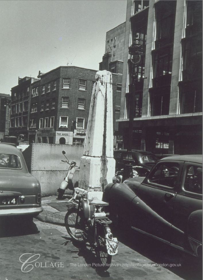
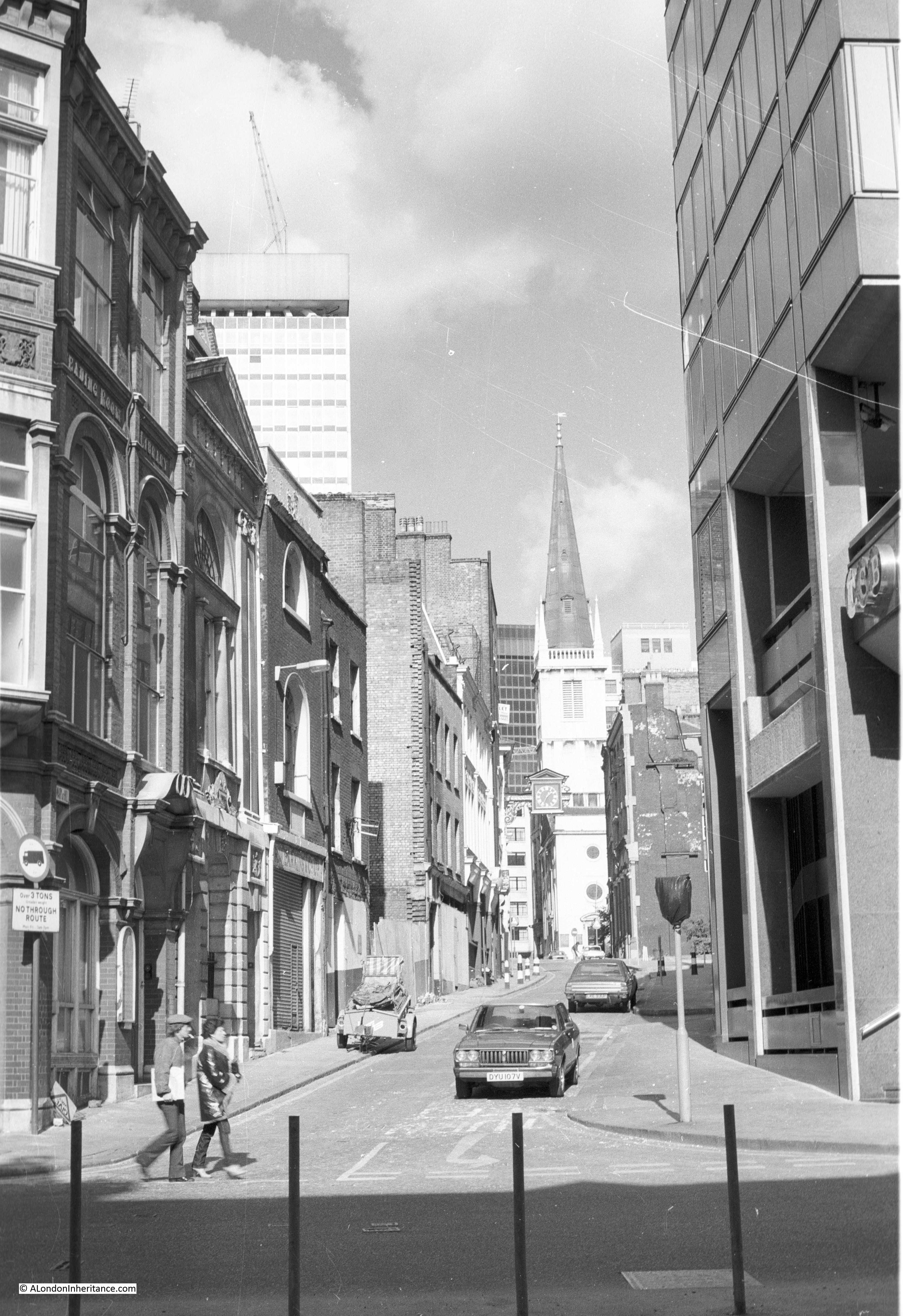
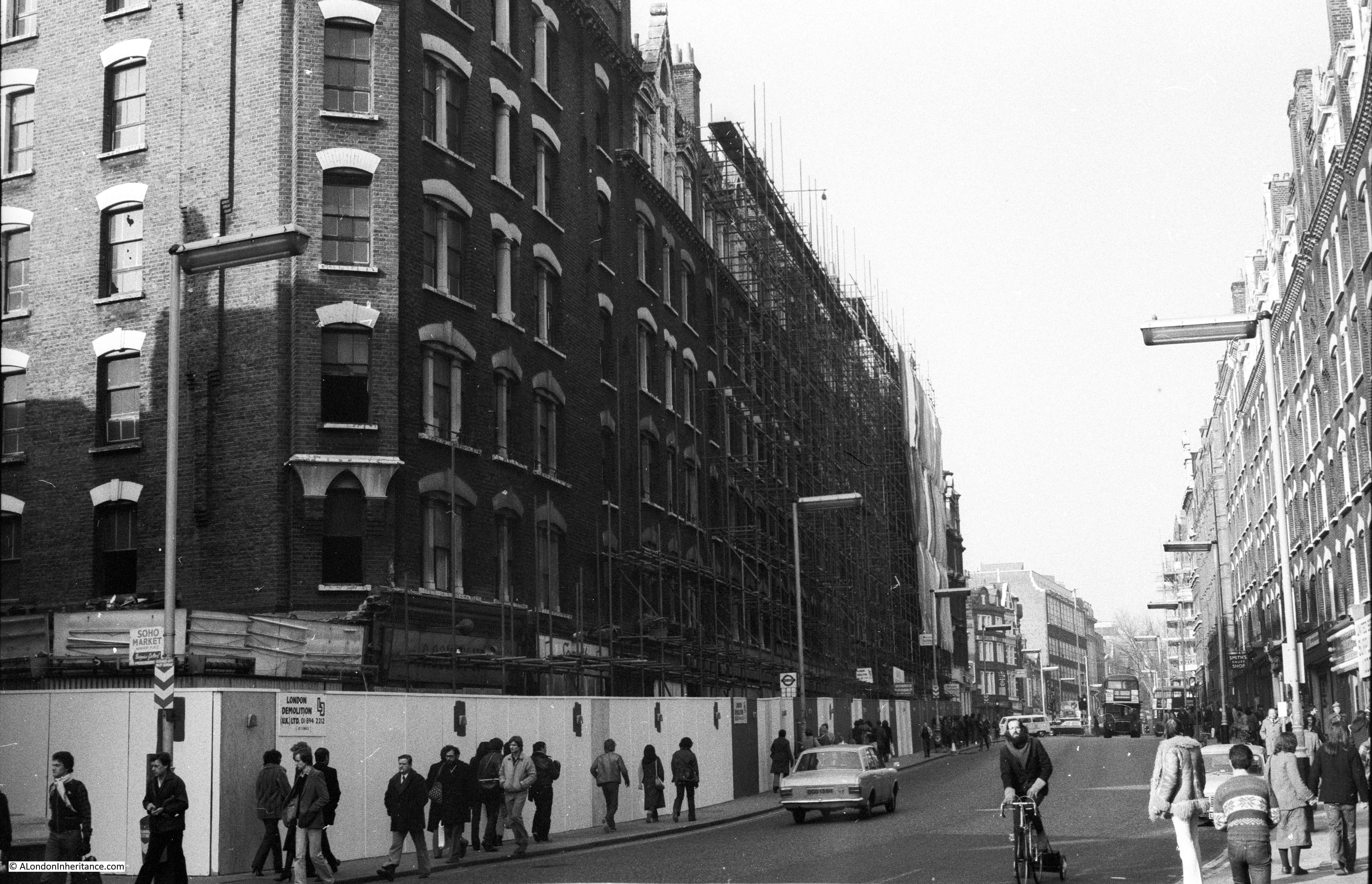
This was the view in 1979, looking north along Charing Cross Road, close to the junction with Great Newport Street.

Charing Cross Road

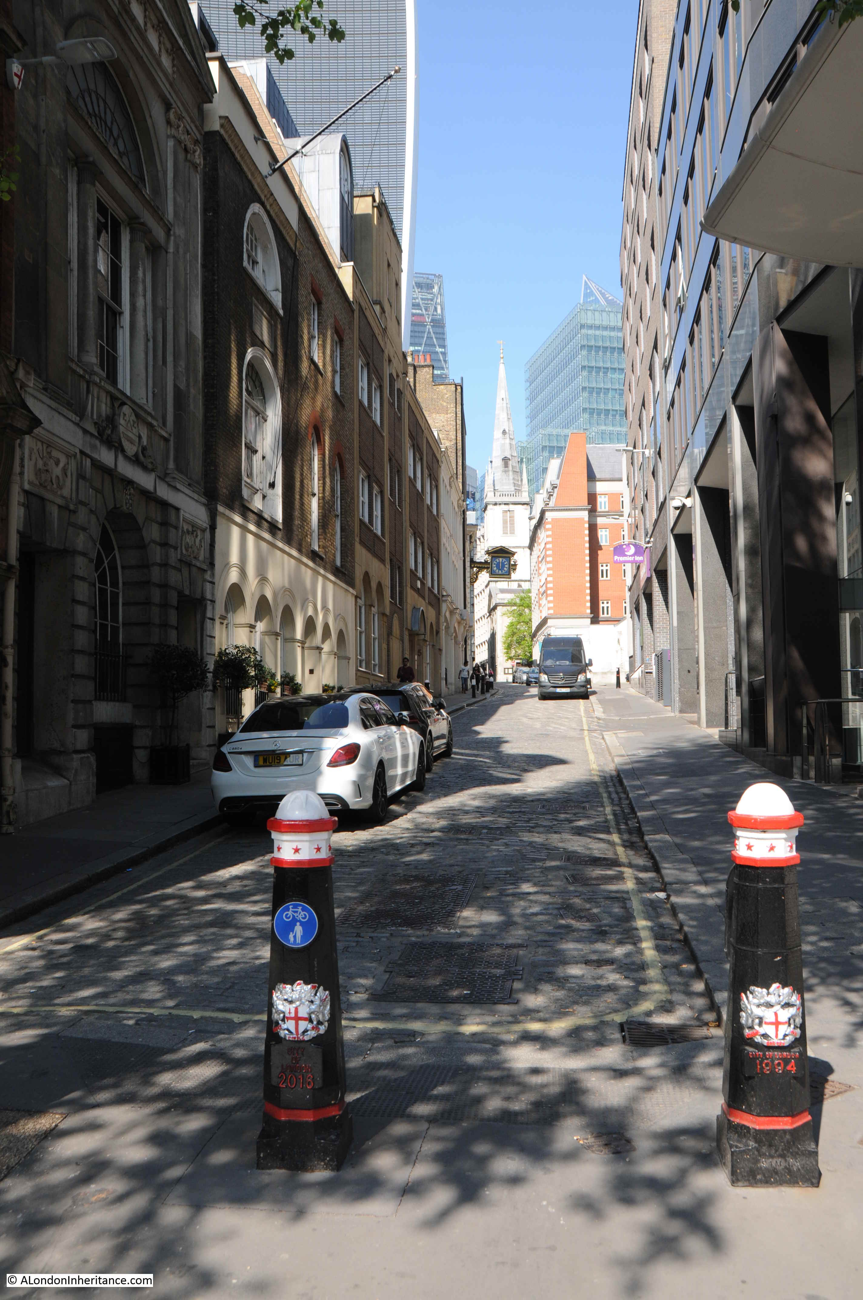
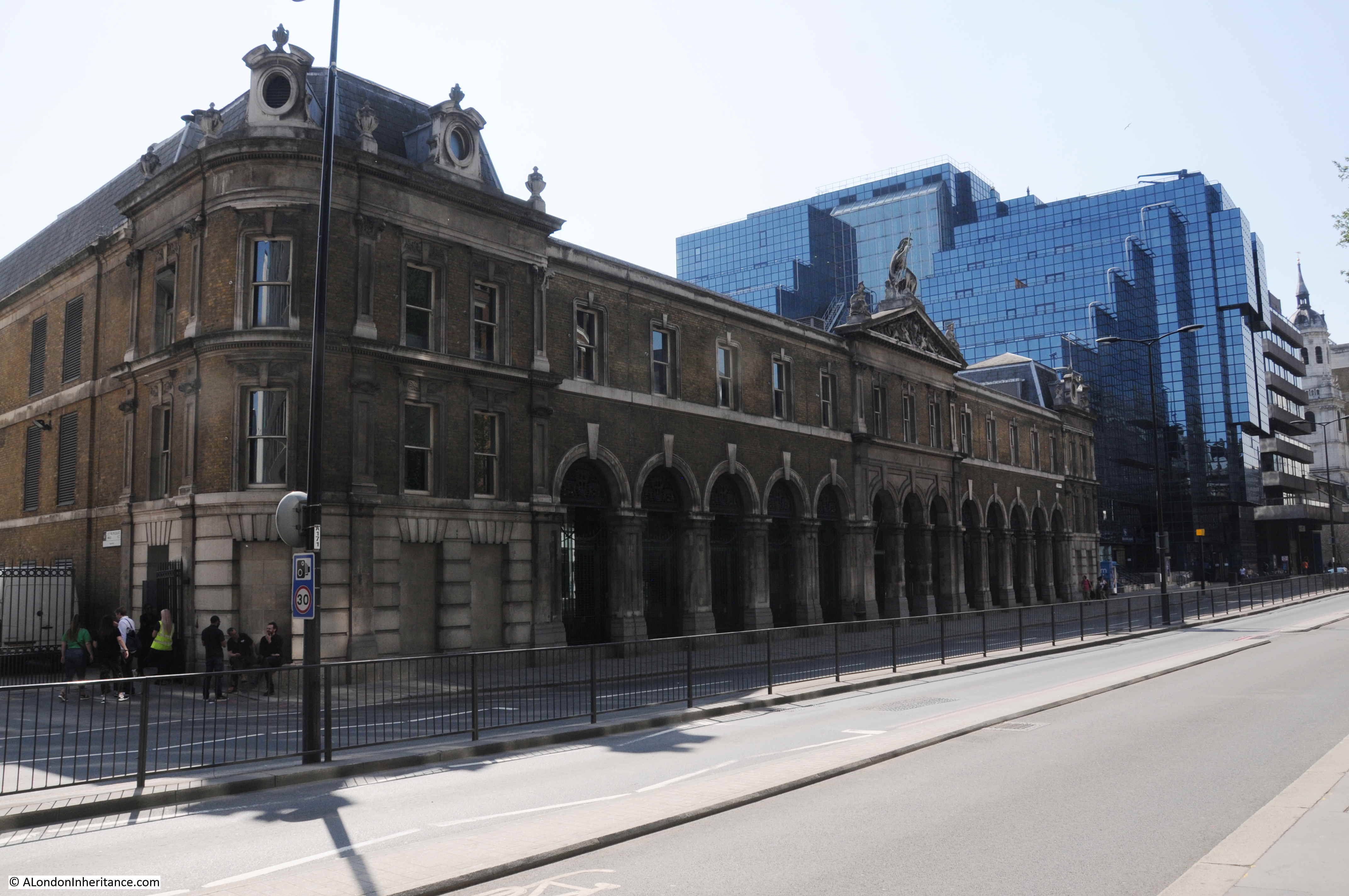
The same view in 2019:

Charing Cross Road

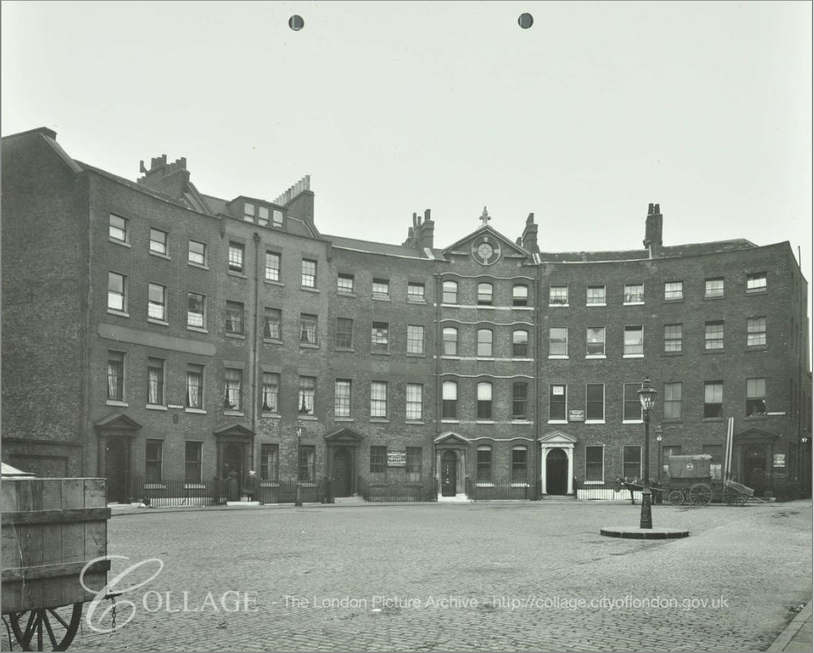
In 1979, there were two, almost identical buildings on either side of the street. Both of these were named Sandringham Buildings and were constructed when this length of Charing Cross Road was created. The building on the left in 1979 was replaced by the block we see today, running roughly the same length of the street and with a similar approach of shops on the ground floor and flats on the upper floors.

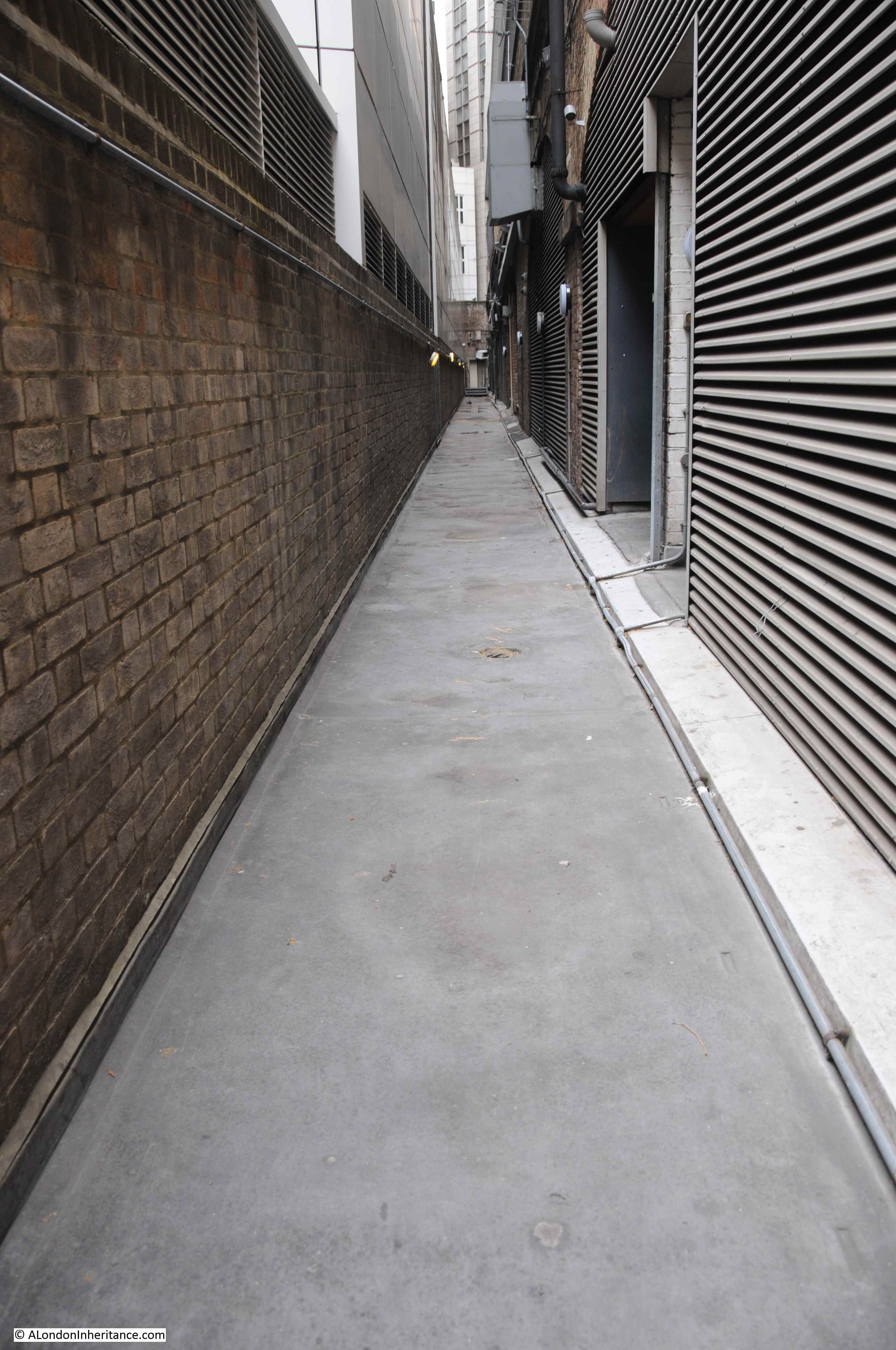
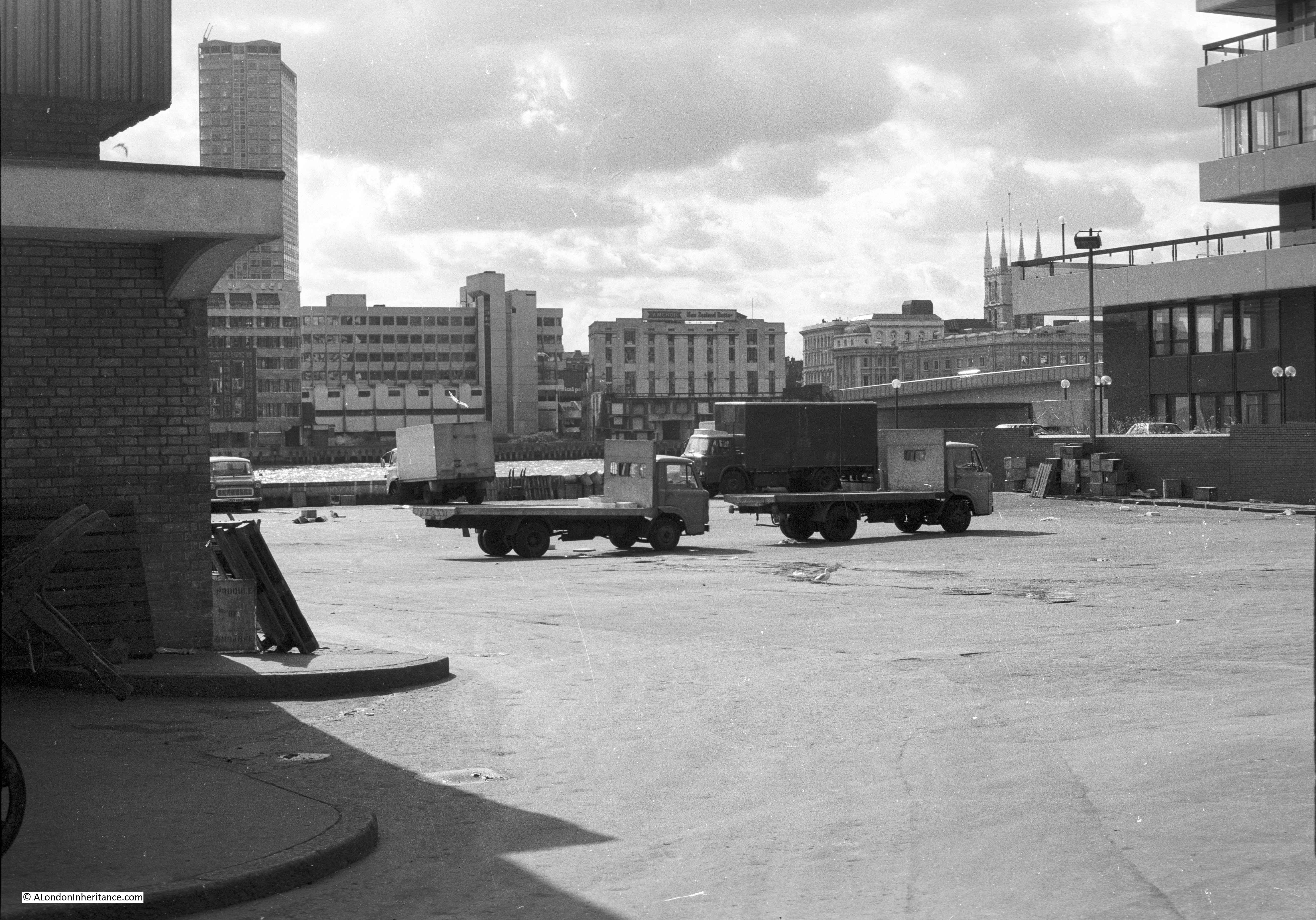
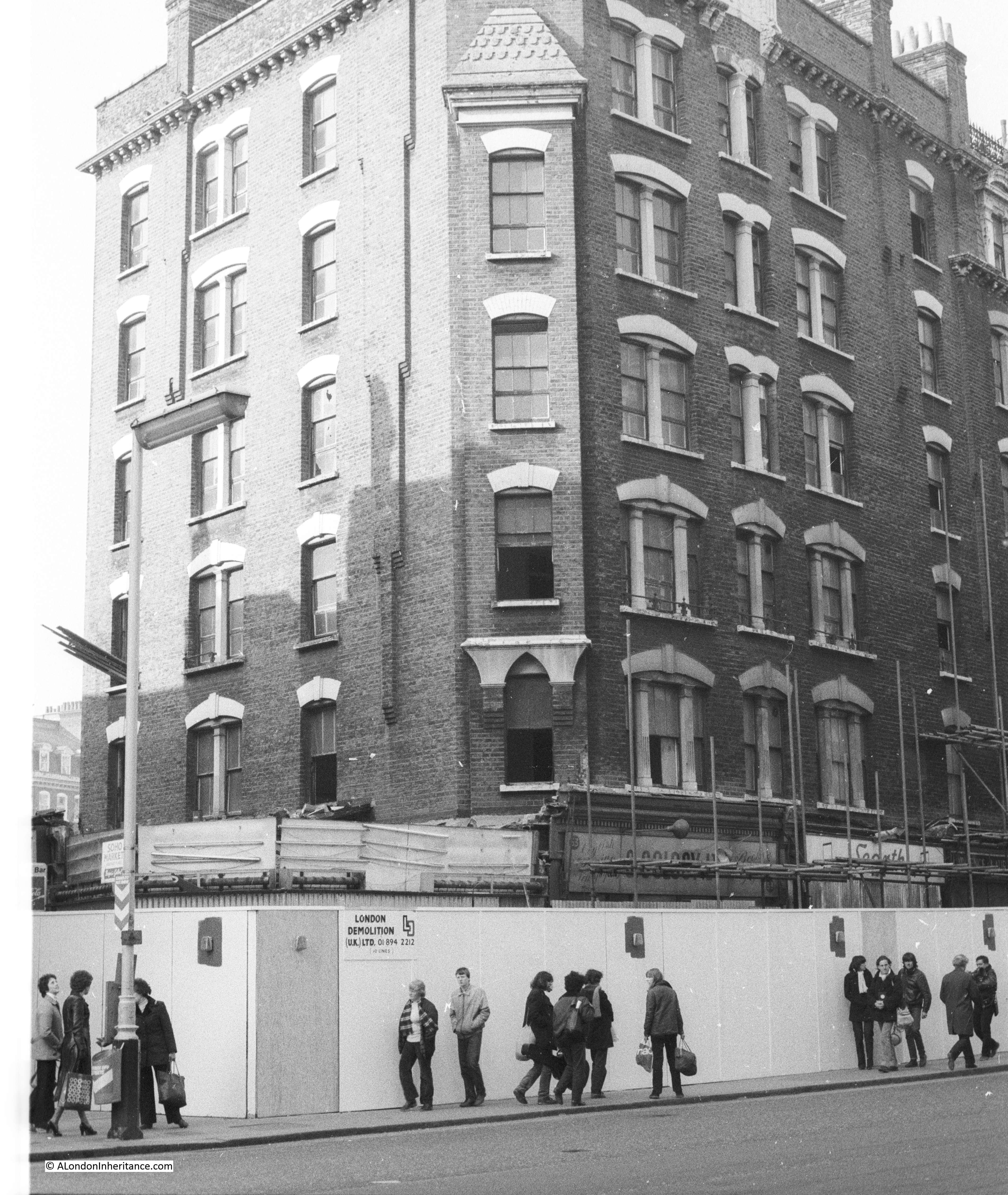
I took these photos specifically because of the impending demolition of the building – something I have always try to do when I see a building at risk. The following photo shows the corner of the block. The signs of the shops that once occupied the ground floor can just be seen behind the scaffolding.

Charing Cross Road

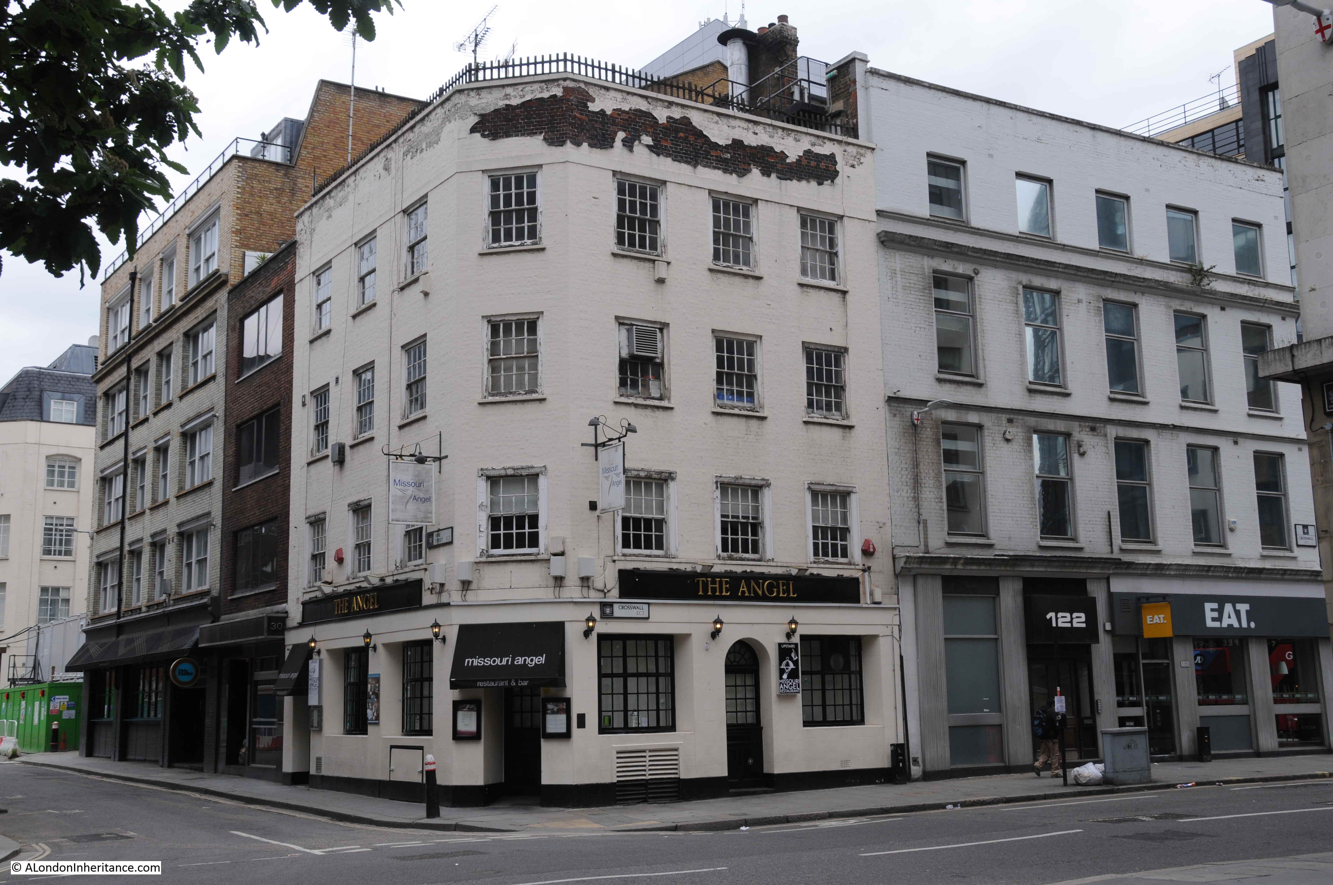
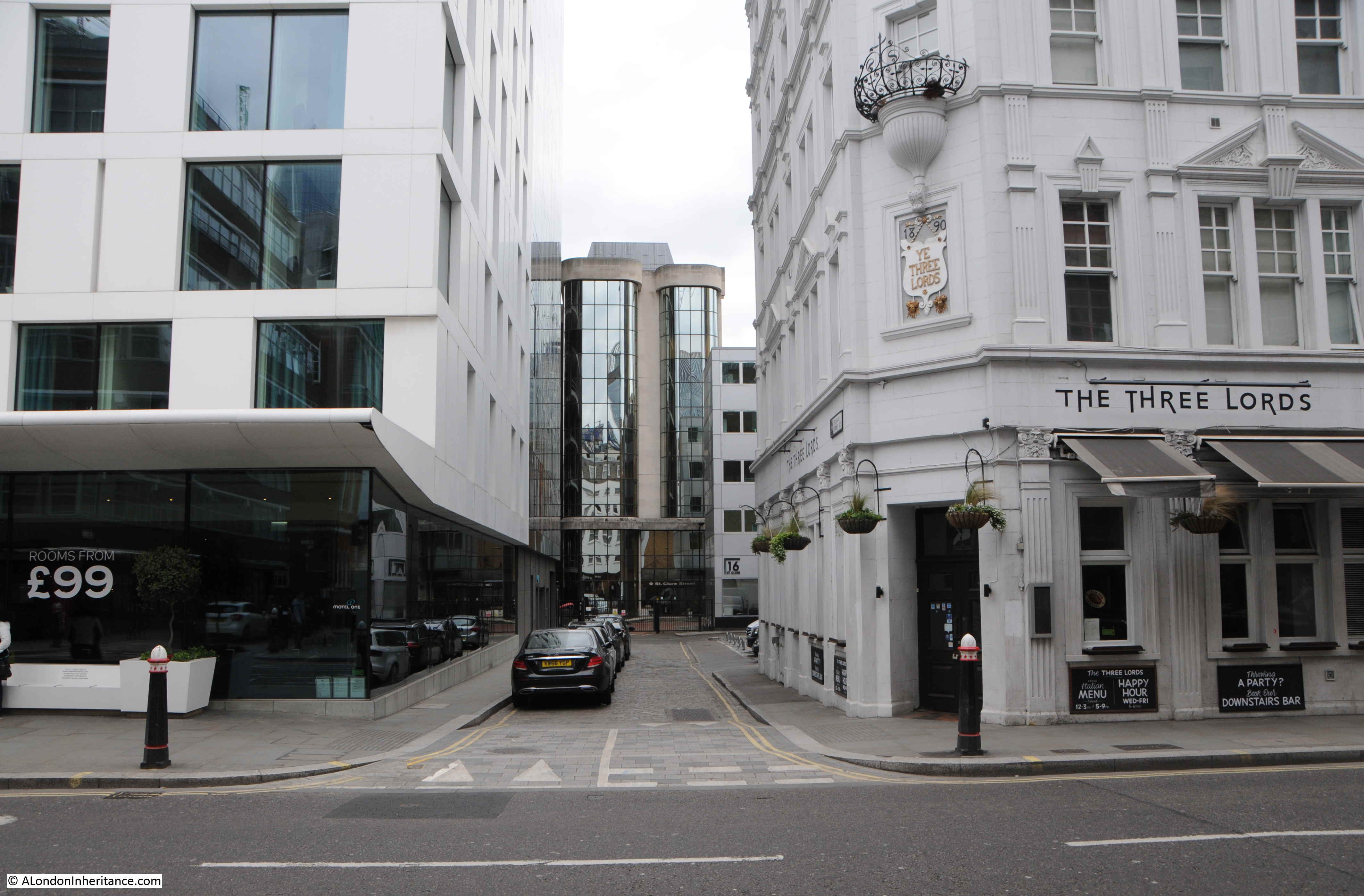
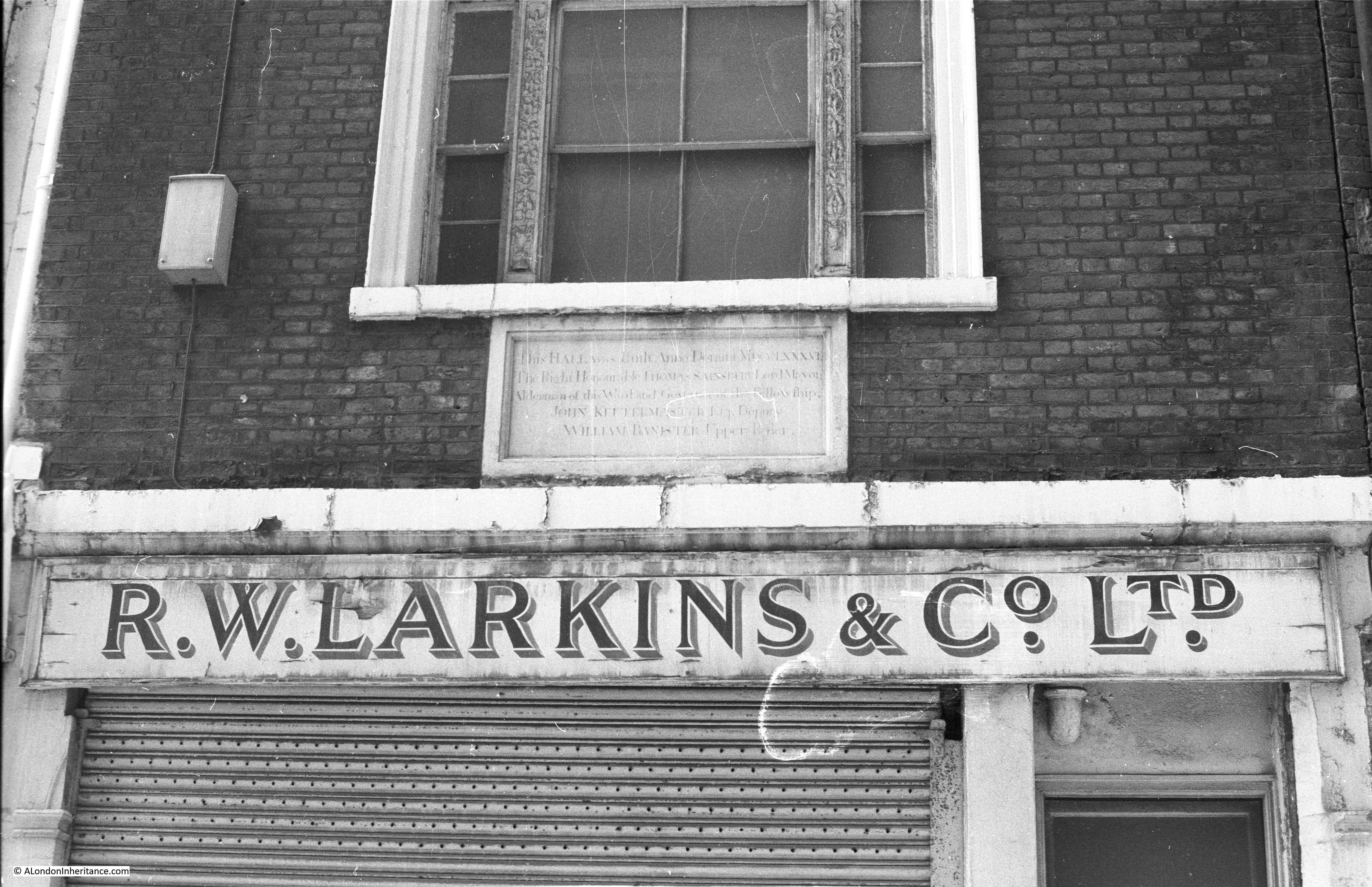
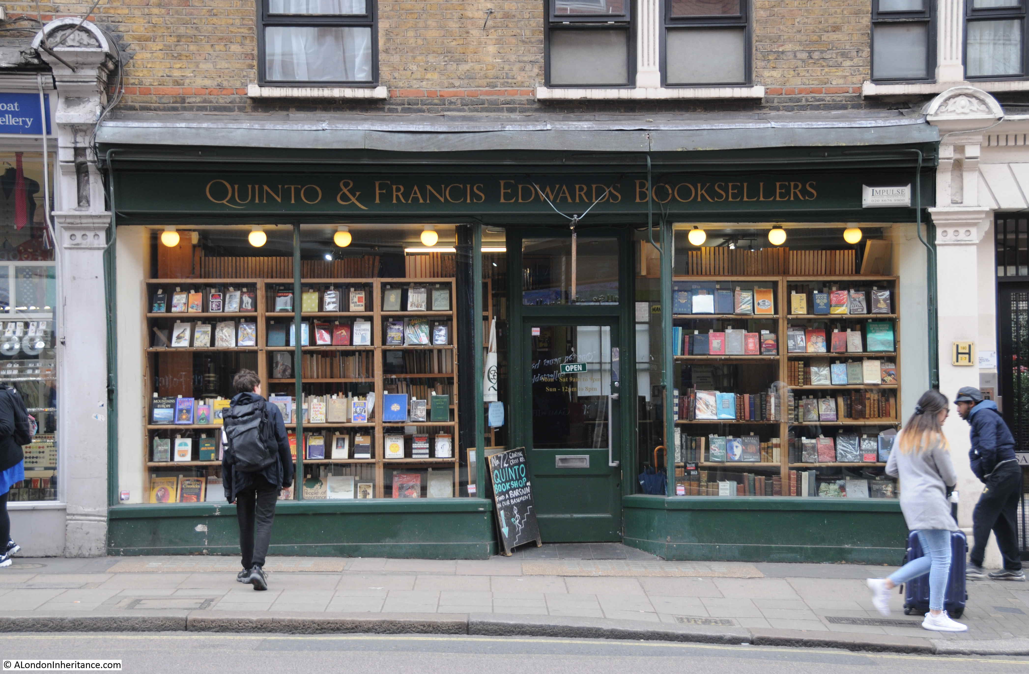
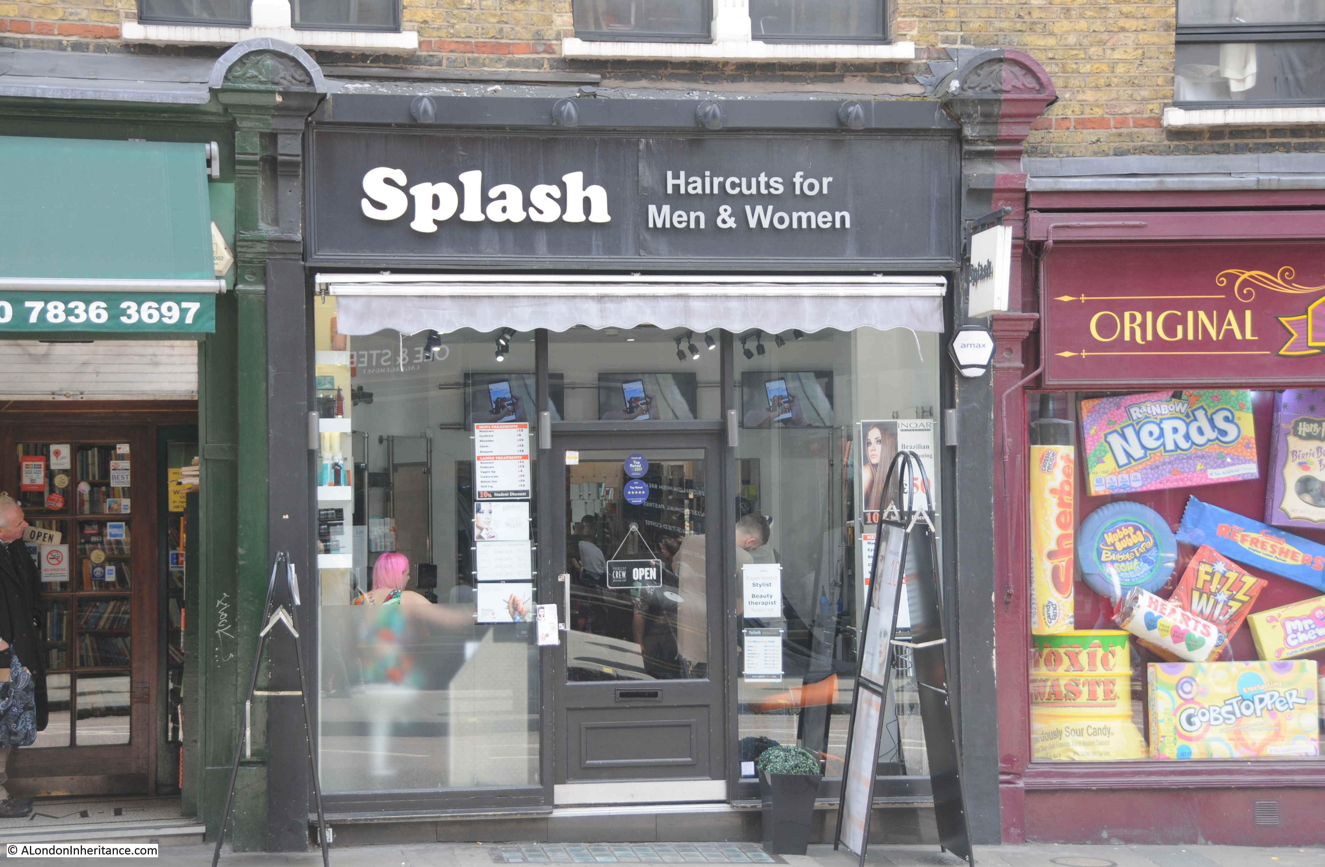
The other location I wanted to track down was this 1986 photo of a tobacconist at number 74 Charing Cross Road, one from a series of shop front photos in the area.

Charing Cross Road

The same location in 2019 – no longer a tobacconist.

Charing Cross Road

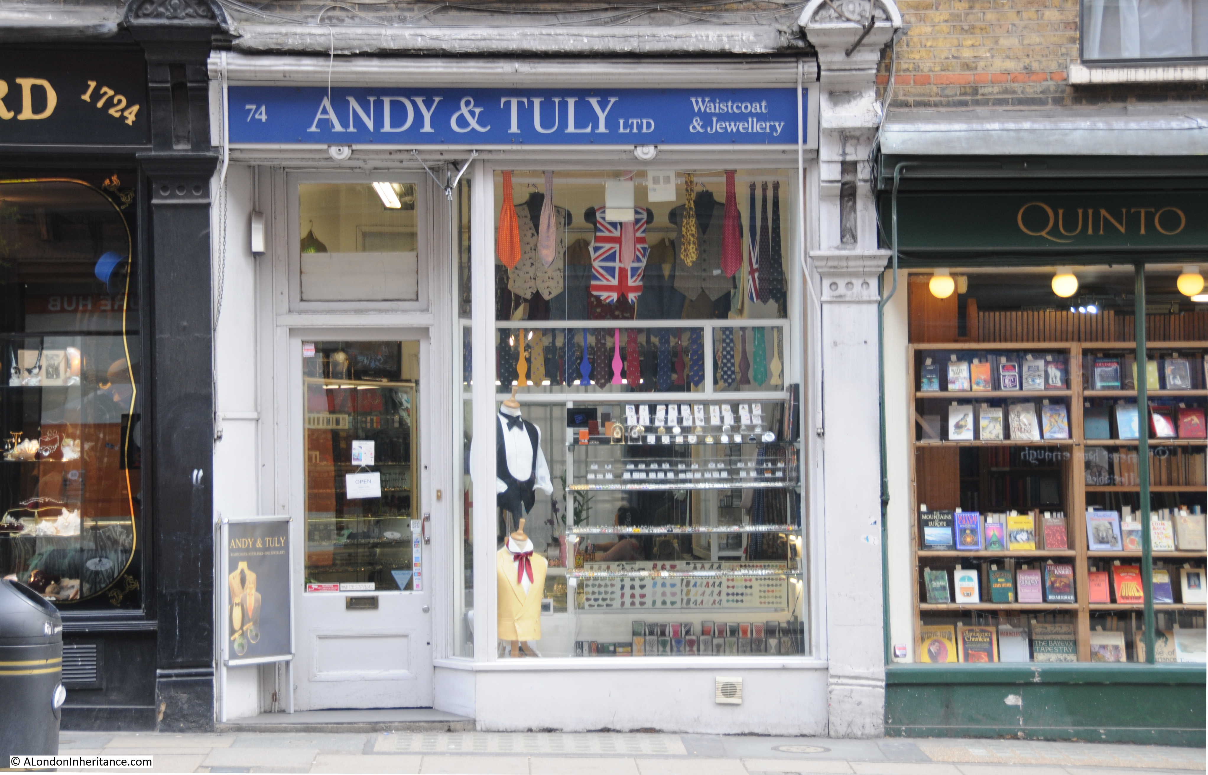
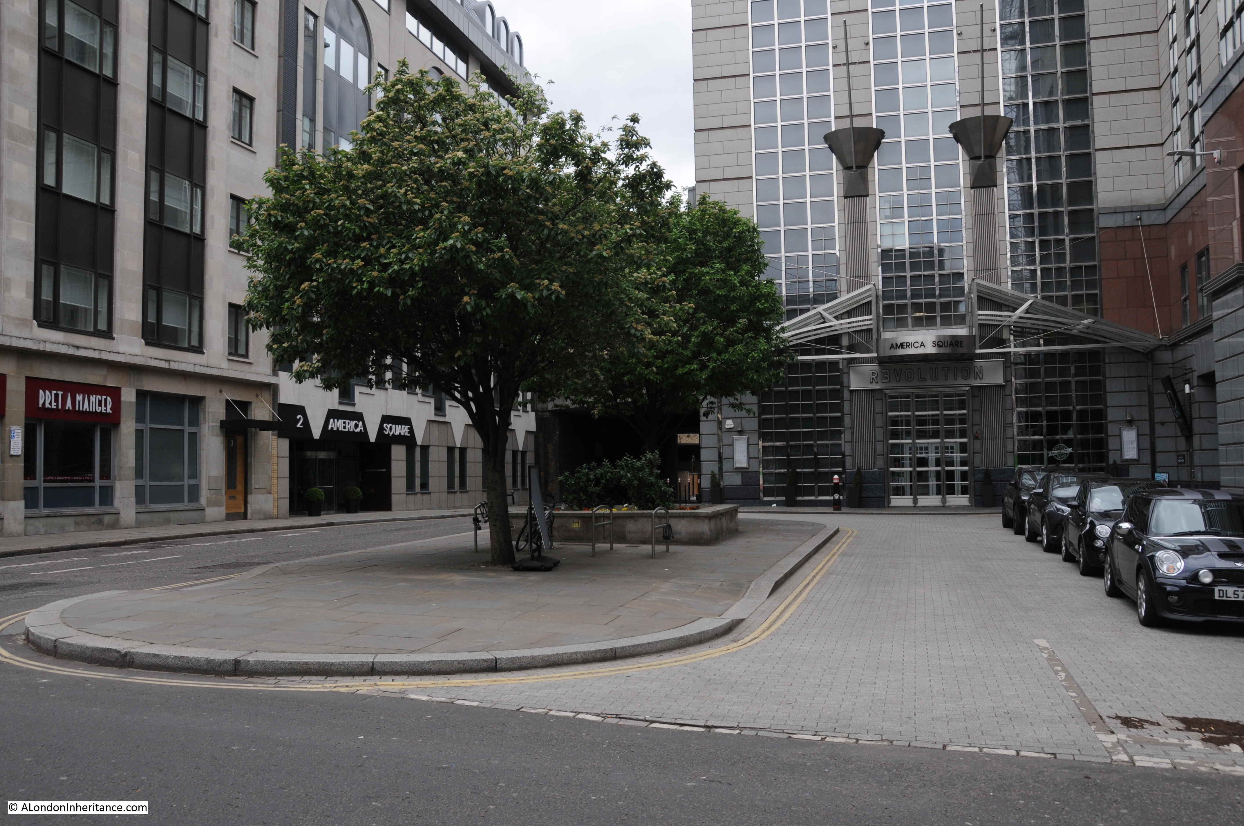
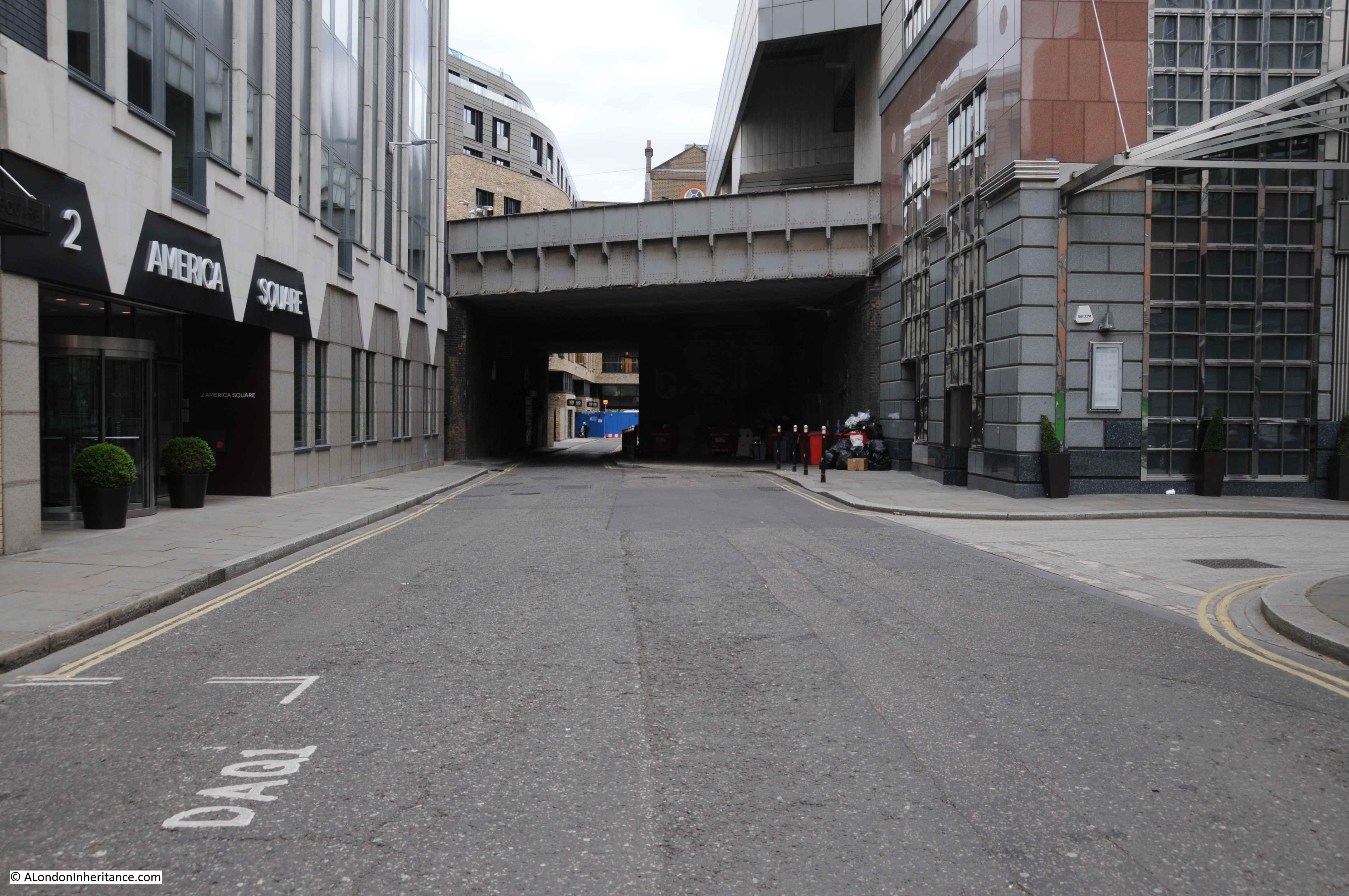
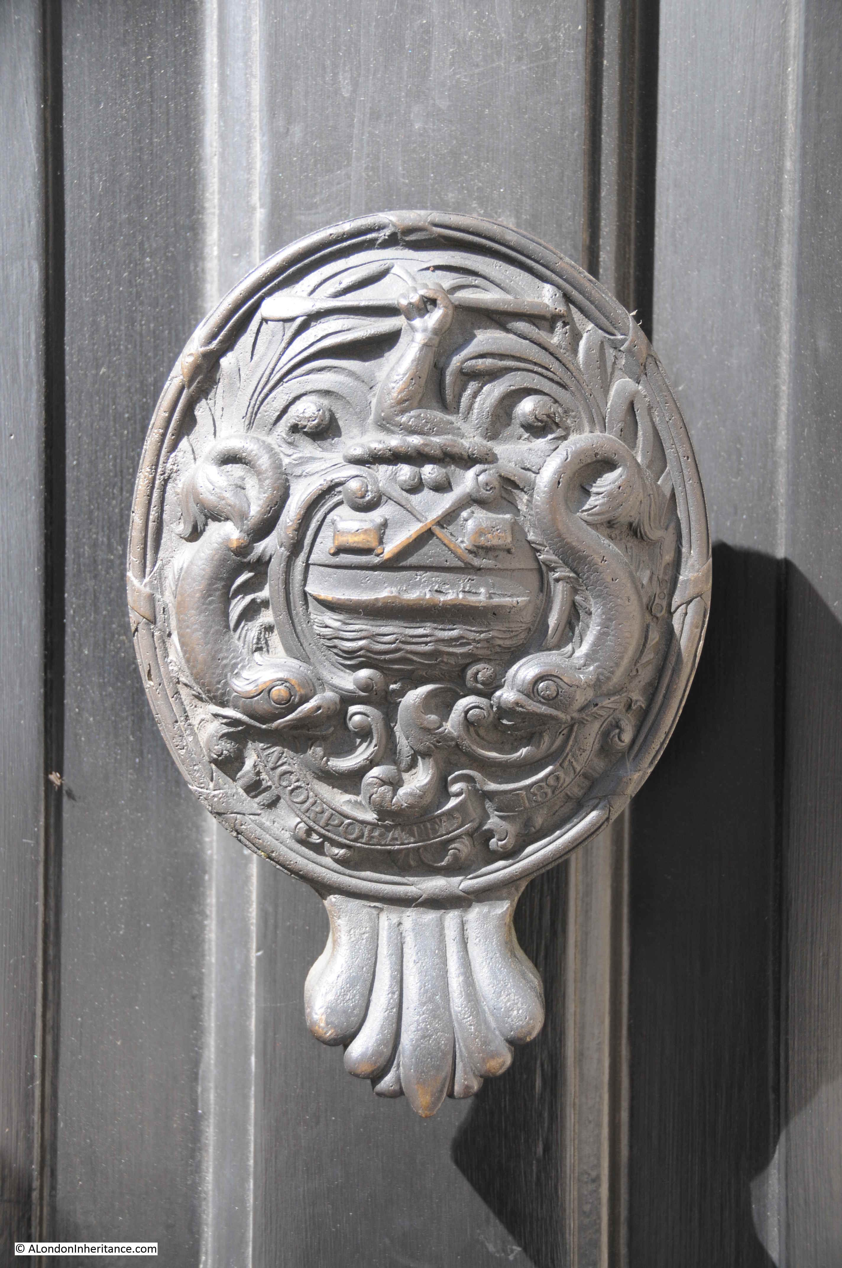
The shop is one of those along the ground floor of the remaining block of Sandringham Buildings, along the eastern side of Charing Cross Road. The history of Sandringham Buildings is integral to the reconstruction of the area that resulted from the development of Charing Cross Road.

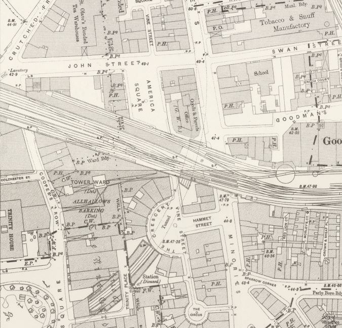
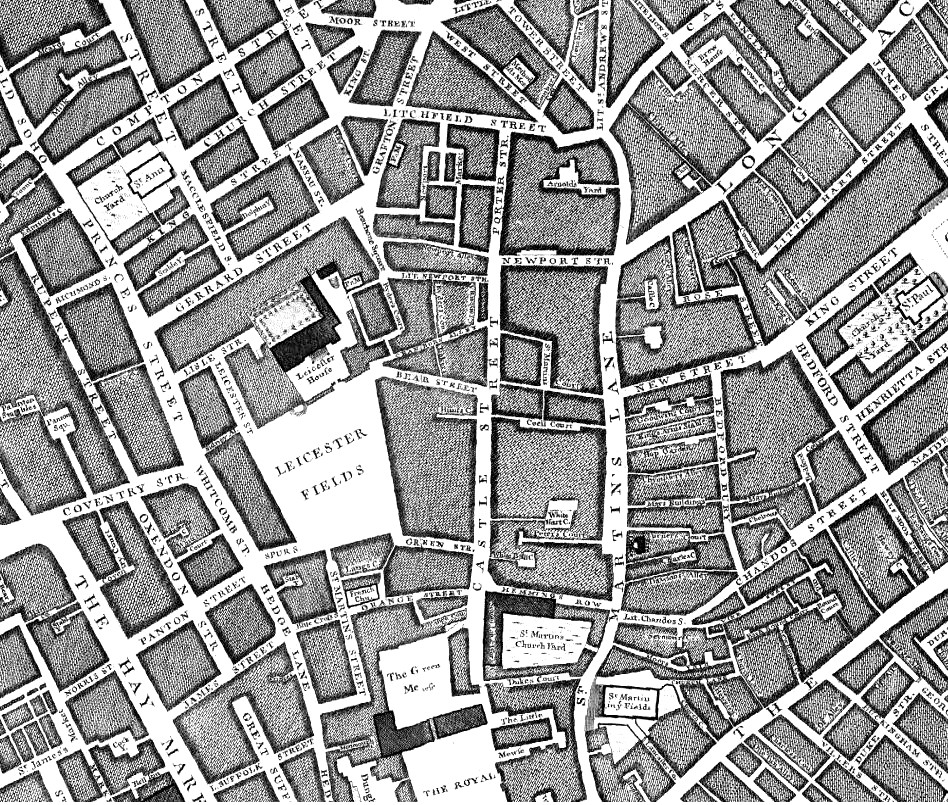
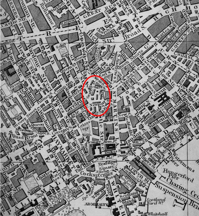
To understand how Charing Cross Road has developed, we can start with John Rocque’s map of London from 1746. Charing Cross Road does not yet exist as a through route from the junction of Oxford Street and Tottenham Court Road, down to the future location of Trafalgar Square. Part of the road that would become Charing Cross Road can be seen in the centre of the map, but named Hog Lane.

Charing Cross Road

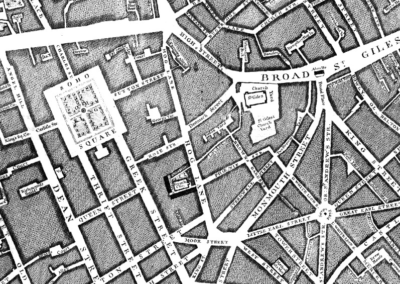
The name probably came from the location of a Pound at St. Giles (roughly around the junction today of Oxford Street and Tottenham Court Road), where animals were held as they were driven into London, as a stop before the final push into the City markets (I wrote more about Saint Giles Pound at this link).

Hog Lane ended just north of where Cambridge Circus is today.

Continuing south, there was no single street running the future route of Charing Cross Road. It was a maze of streets, alleys and courts. In the following extract from Rocque’s map, the future location of Cambridge Circus is in the middle of the top edge of the map, and the future location of Trafalgar Square is at The Royal Stables in the middle of the lower edge of the map.

Charing Cross Road

Charing Cross Road has long been known for bookshops. The most famous being Foyles at the northern end of the street, but with many other specialist, new and second hand bookshops lining the street as you walked south.

Many of these have closed over the years, but thankfully a few still remain, holding out against the wave of standardisation across London streets.

Charing Cross Road

Charing Cross Road

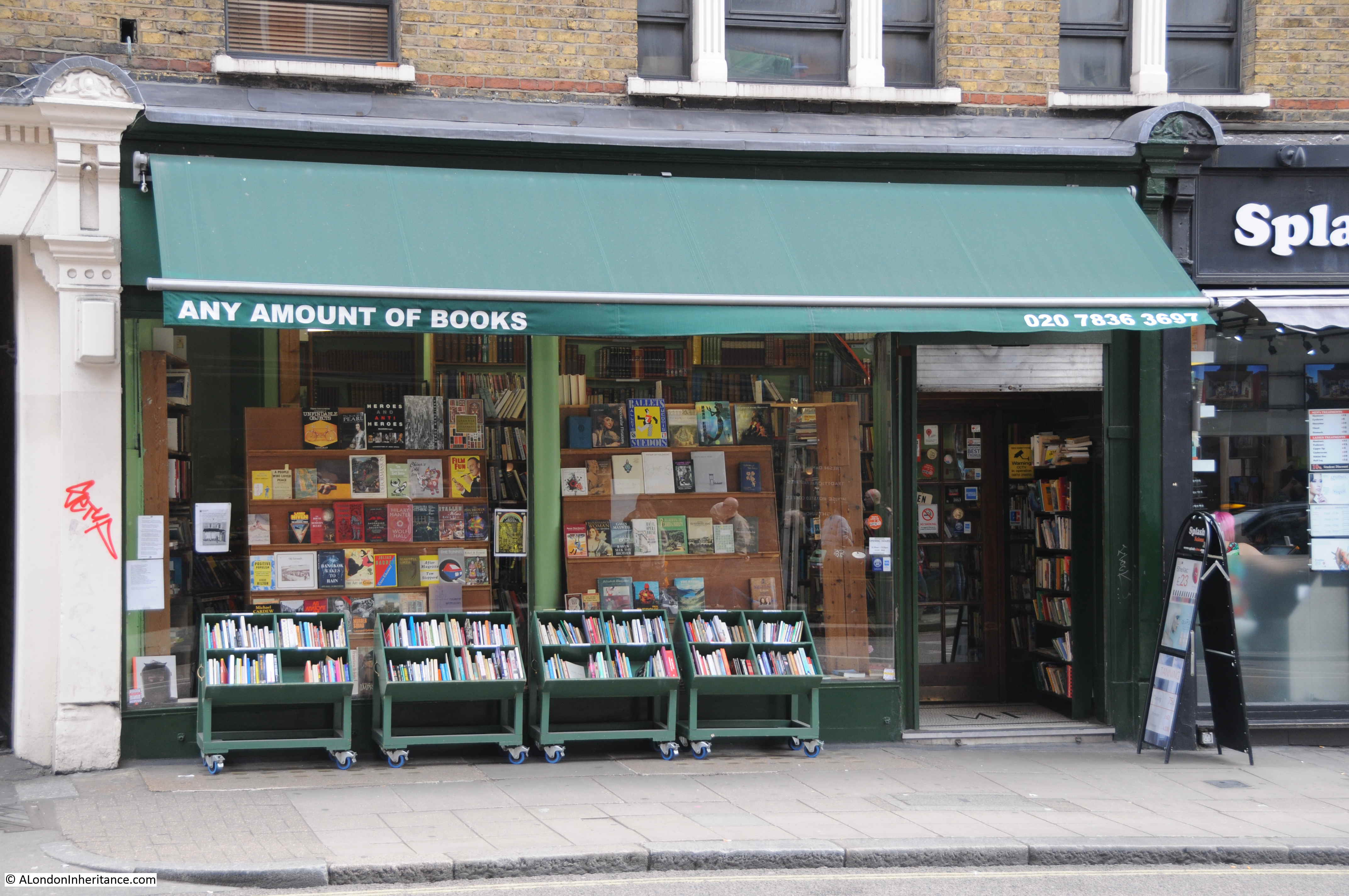
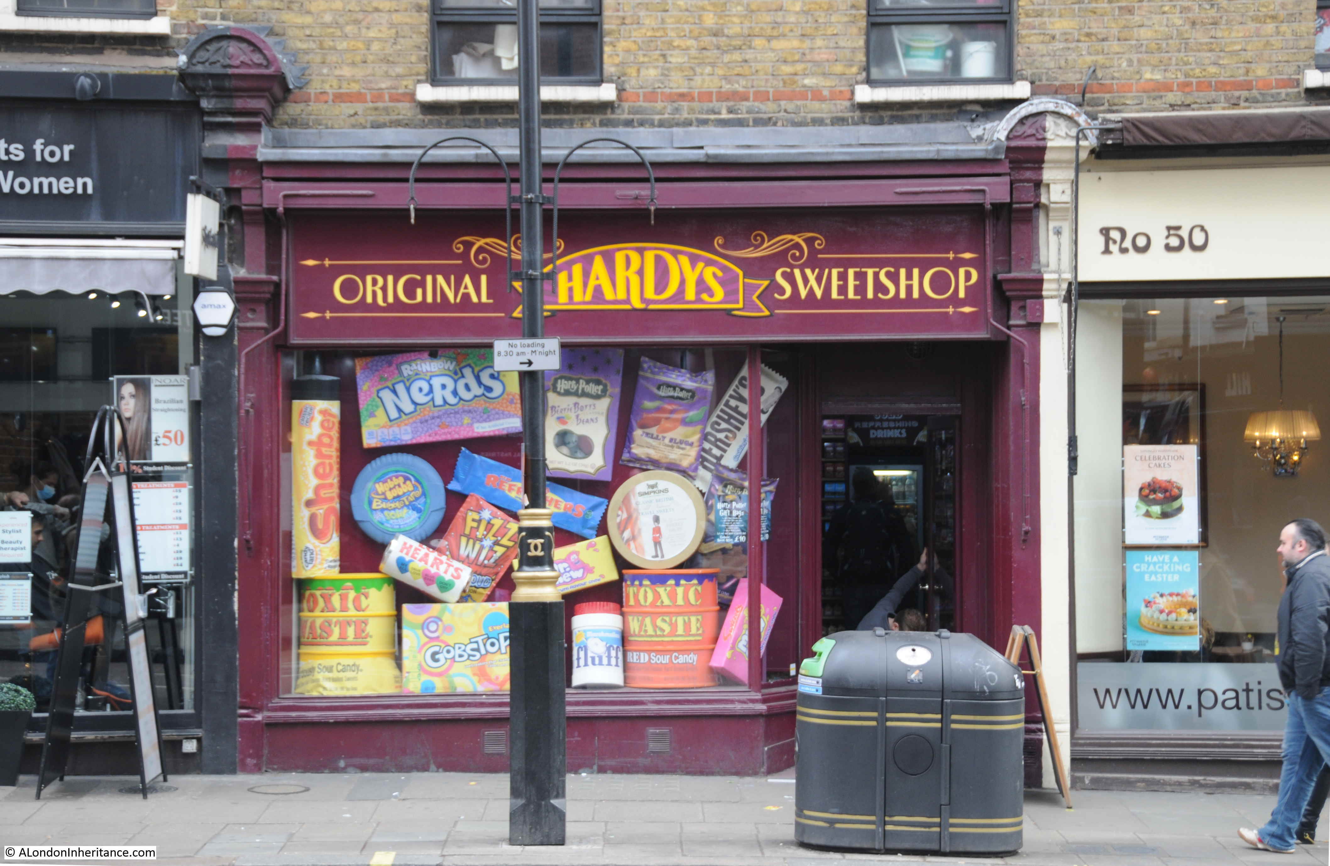
Other shops that fill the retail units along the ground floor of Sandringham Buildings.

Charing Cross Road

Charing Cross Road

The development of Charing Cross Road to a single street from Tottenham Court Road towards Trafalgar Square, and the development of Sandringham Buildings can be told through the story of Newport Market.

From the time of Rocque’s map, up to the mid 19th century, the area from what was Hog Lane, around what today is Cambridge Circus, and part of what is now Charing Cross Road to the south was a dense cluster of streets and buildings known as Newport Market.

In the following extract from Reynolds’s 1847 “Splendid New Map of London”, I have circled the area of Newport Market with a red oval. To the north is Crown Street, the new name for what was Hog Lane, and the street that will become the northern part of Charing Cross Road.

Charing Cross Road

Trafalgar Square has replaced the Royal Stables, but there is no single, direct street continuing from Crown Street down towards Trafalgar Square.

In 1654, Lord Newport purchased a block of land, which today covers the area from Little Newport Street up to the location of Cambridge Circus. He built a large house and gardens, which would remain until 1682 when the estate was sold and the house demolished. The land was then redeveloped by Dr. Nicholas Barbon who created Newport Market which consisted of a large central square and operated as one of London’s main meat markets.

By the mid 19th century, the area had degenerated considerably and was recorded as providing slum living conditions. An article in the London Evening Standard of the 26th August 1880 titled “Old Newport Market” records how the market had changed:

“Gone are the glories of Newport Market; gone the glory of its Butchers-row. Fashion has this many a year forsaken its uninviting neighbourhood. Beau and buck know no more of its unsavoury haunts. Filth and squalor reign supreme in its courts and passages. Poverty and vice find within its dingy precincts congenial shelter. The old Market, indeed, exists; its walls are still standing. But how changed, how utterly changed, out of all form and semblance. Its shops and sheds are stables and slaughter-houses, its stalls and stands bricked over and built upon. Its very identity is lost; merged, so to speak, in that of prince’s-row, the narrow lane – foul among the foul – that surrounds and gives access to it. Even the name has been taken from it and applied indiscriminately to the adjoining thoroughfare and the unwholesome butchers court that abuts the southern extremity.

The article then goes on to describe the remaining trades of the market:

“The semblance only, a shadow, as it were, of its former self. A score or so of stalls owned by good-natured Irish women, pipe-loving and rough-tongued. A few eager French women, basket-bearing and garrulous, bargaining for flabby lettuce, unhealthy looking endive and sun-stewed cress. The indescribably nasty row of butchers’; shops in the narrow alley on the right, these constitute the market of to-day, galvanised into fitful activity on Saturday and Saturday night.”

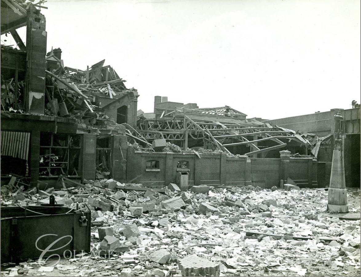
The need for a wide street, linking the junction of Oxford Street and Tottenham Court Road with Charing Cross and the station of the same name that had opened in the 1860s, was part of the 19th century construction across London of direct, wide streets that would address congestion problems and sweep away what were seen to be dense, slum housing.

Plans for Charing Cross Road developed during the 1870s, but there were challenges with land ownership, how much land could be purchased for the new development and the impact on those who lived in the houses that would be demolished. Newport Market was in the middle of the area planned for the extension and widening of the new Charing Cross Road, and the surrounding development.

Finally in 1882, plans were in place, and purchases of property made along the streets that would be demolished. The Illustrated London News on the 19th August 1882 reported:

“Steps have at length been taken for making, at all events, a beginning of a long-needed public improvement, a new thoroughfare between Charing-cross and Oxford-street. The materials of about forty houses about Newport Market have lately been sold by Messrs. Eversfield and Horne, the structures themselves are in process of demolition, and in the course of another month a large portion of the following streets will have disappeared:- Newport-court, Little Newport-street, Market-row, Market-street, Prince’s-row, Lichfield-street, Hayes-court, and Grafton-street.”

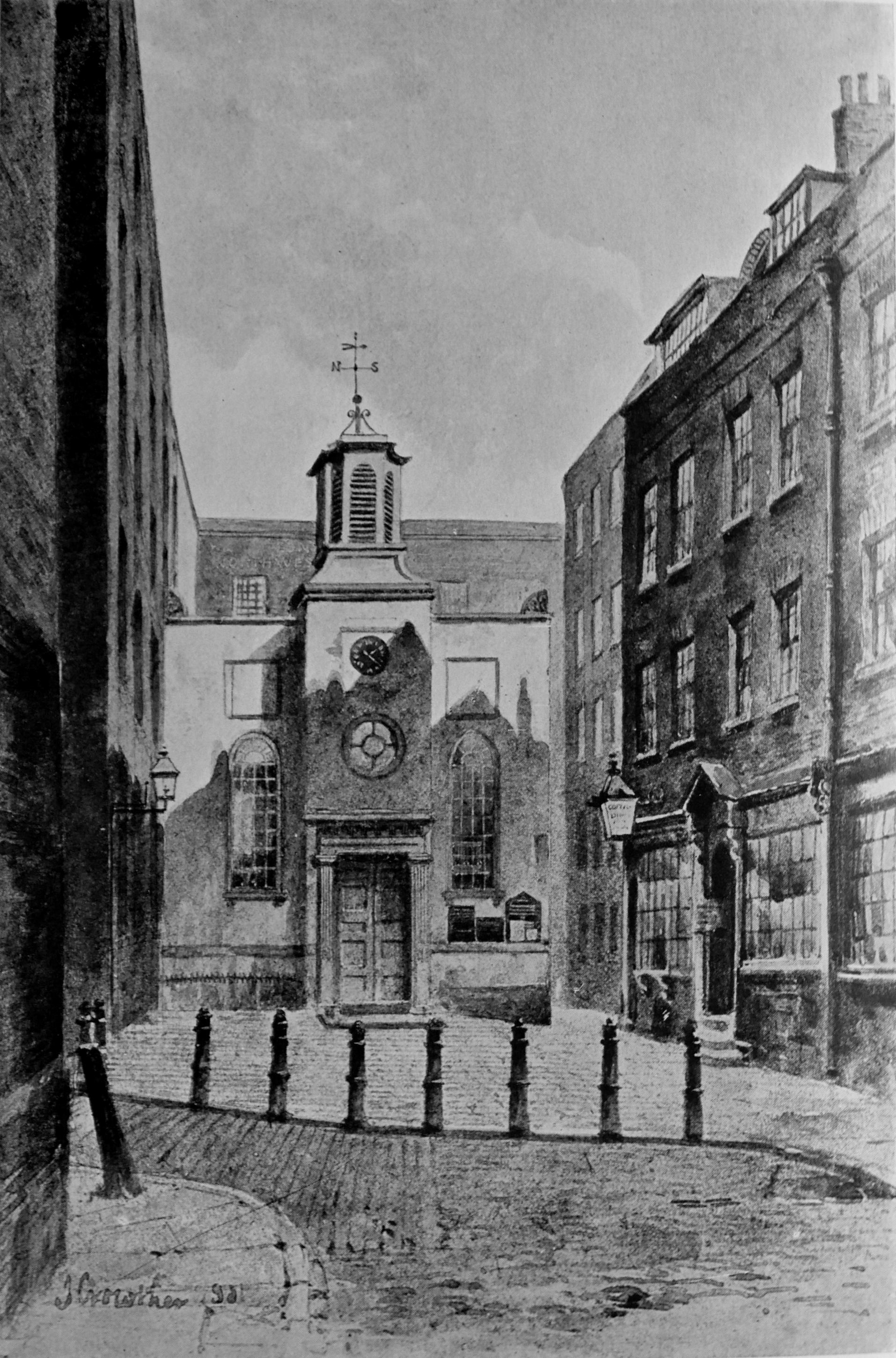
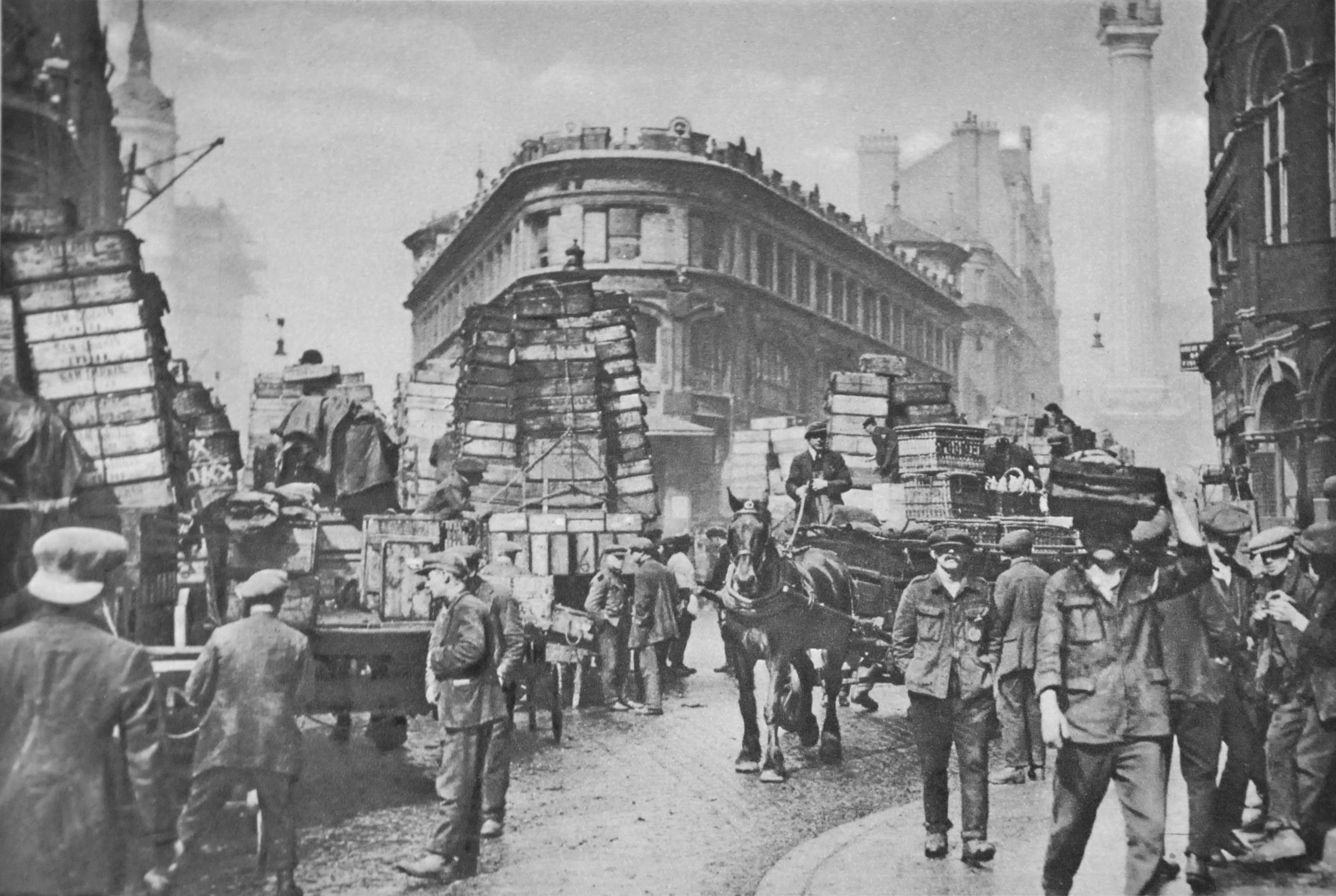
The last mentioned Grafton Street appears in one of the prints made in the early 1880s of Newport Market. The following print titled “North side of Newport Market Soho, Grafton St on the right”. The print is dated 1882, the same year as Grafton Street would be demolished – possibly a 19th century example of recording buildings and streets before their demolition.

Charing Cross Road

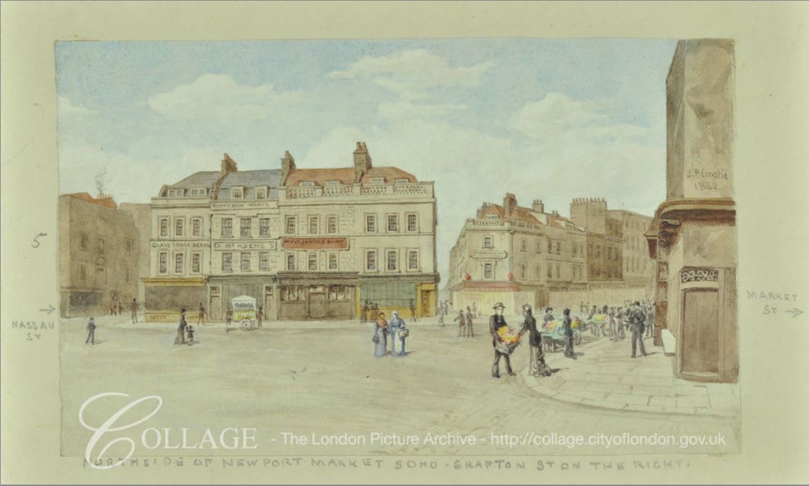
Image credit: London Metropolitan Archives, City of London: catalogue ref: SC_PZ_WE_01_0315

The above view shows a rather good looking location. Open space edged by some well constructed buildings with shops along the ground floor. What the area may have been like can be judged by some of the newspaper reports of the time, such as the following from the Illustrated London News on the 10th February 1872, regarding the remains of a statue of King George II in Leicester Square:

“When the statue was removed, having suffered too much ll-usage and some positive mutilation, the effigy of the horse remained, and became the target of frequent stone-throwing practised by the idle boys of Newport-market and its neighbourhood.

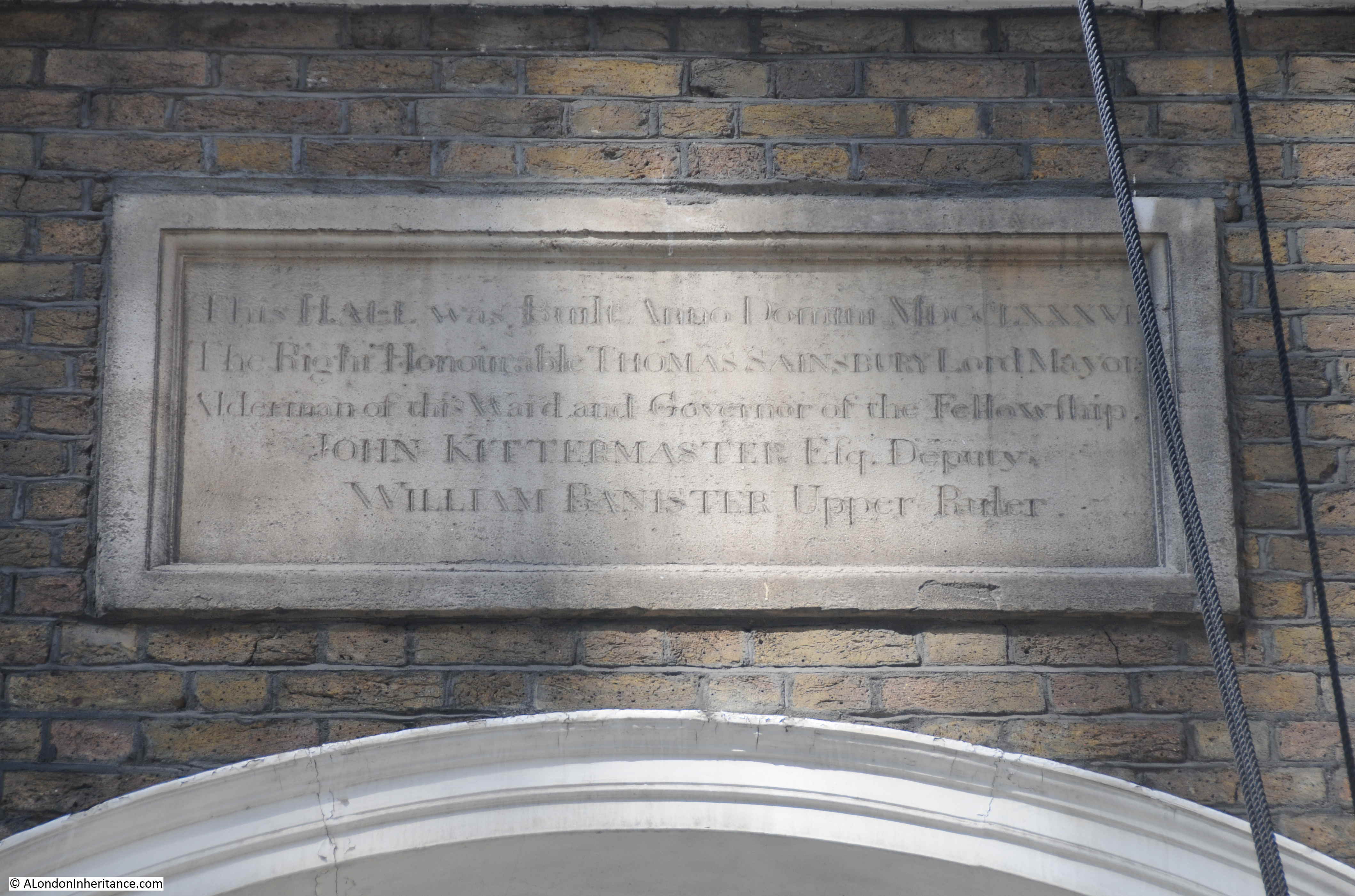
Returning to Sandringham Dwellings, the Metropolitan Board of Works were forced by the Government to construct dwellings for “2,000 people of the labouring classes”, in the area of Newport Market. Agreement to this allowed the Metropolitan Board of Works to commence demolition and the build of Charing Cross Road.

The dwellings for 2,000 people were comprised of the two blocks of Sandringham Dwellings that lined both sides of Charing Cross Road to the south of Cambridge Circus.

As was often the case with these new developments, it was probably not the displaced labouring classed that benefited from the new accommodation.

In the 5th September 1885 edition of the Illustrated London News, Police Superintendent J.H, Dunlap of St. James’s Division wrote “On the site of Newport Market, notorious for everything bad and disreputable, have been erected two splendid blocks of buildings for the accommodation of the working classes, one by private speculation and called Newport Dwellings, and the other by the Improved Industrial Dwellings Company, called Sandringham-buildings, a suite of erections of handsome elevation, with no appearance whatever of model buildings, having large shops on the ground floor, with the upper portion allotted in suites of two, three and four rooms. There is every possible accommodation and sanitary appliance. In these buildings, the Superintendent adds, he has sixty-seven police families, occupying 193 rooms.”

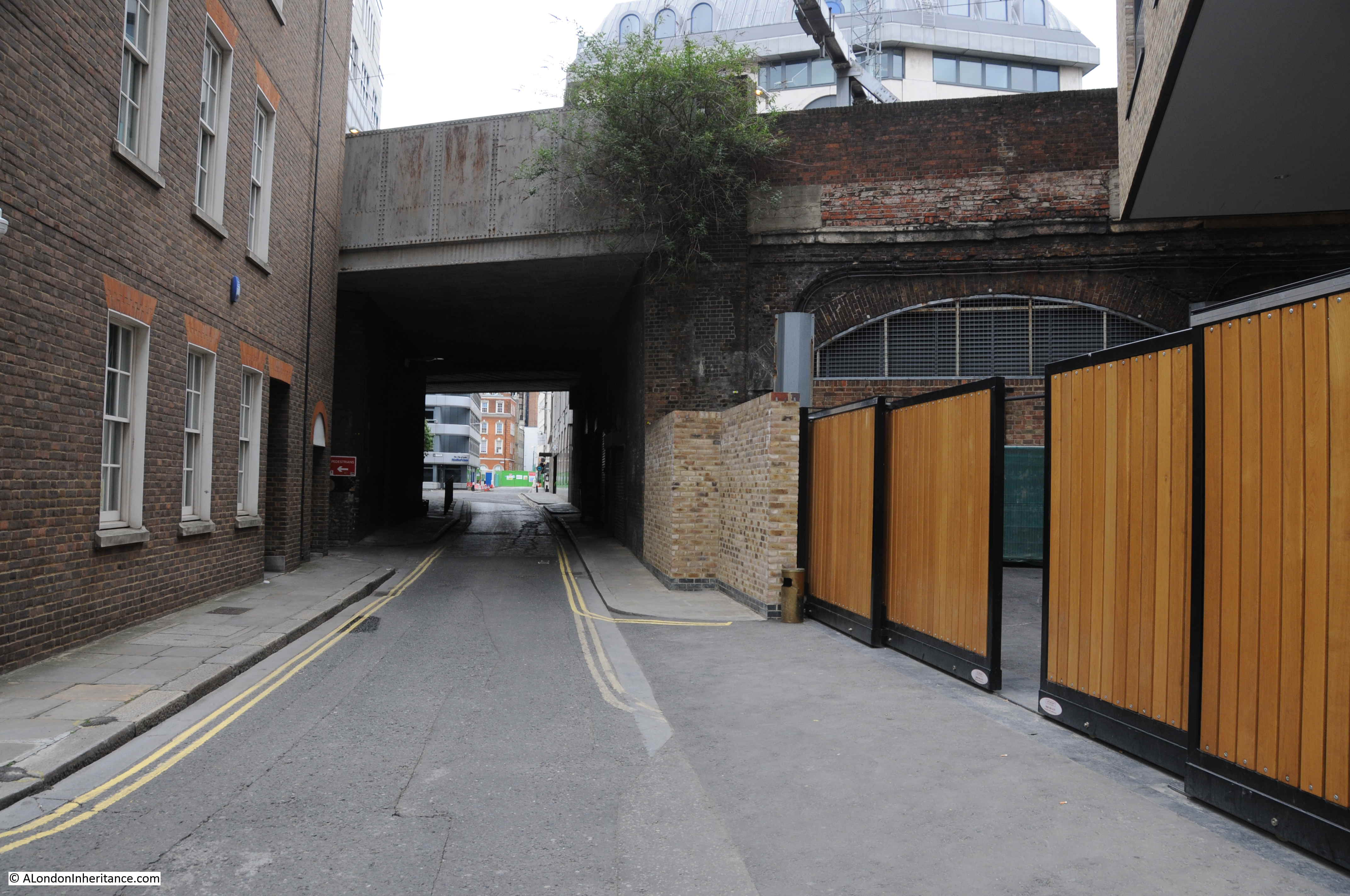
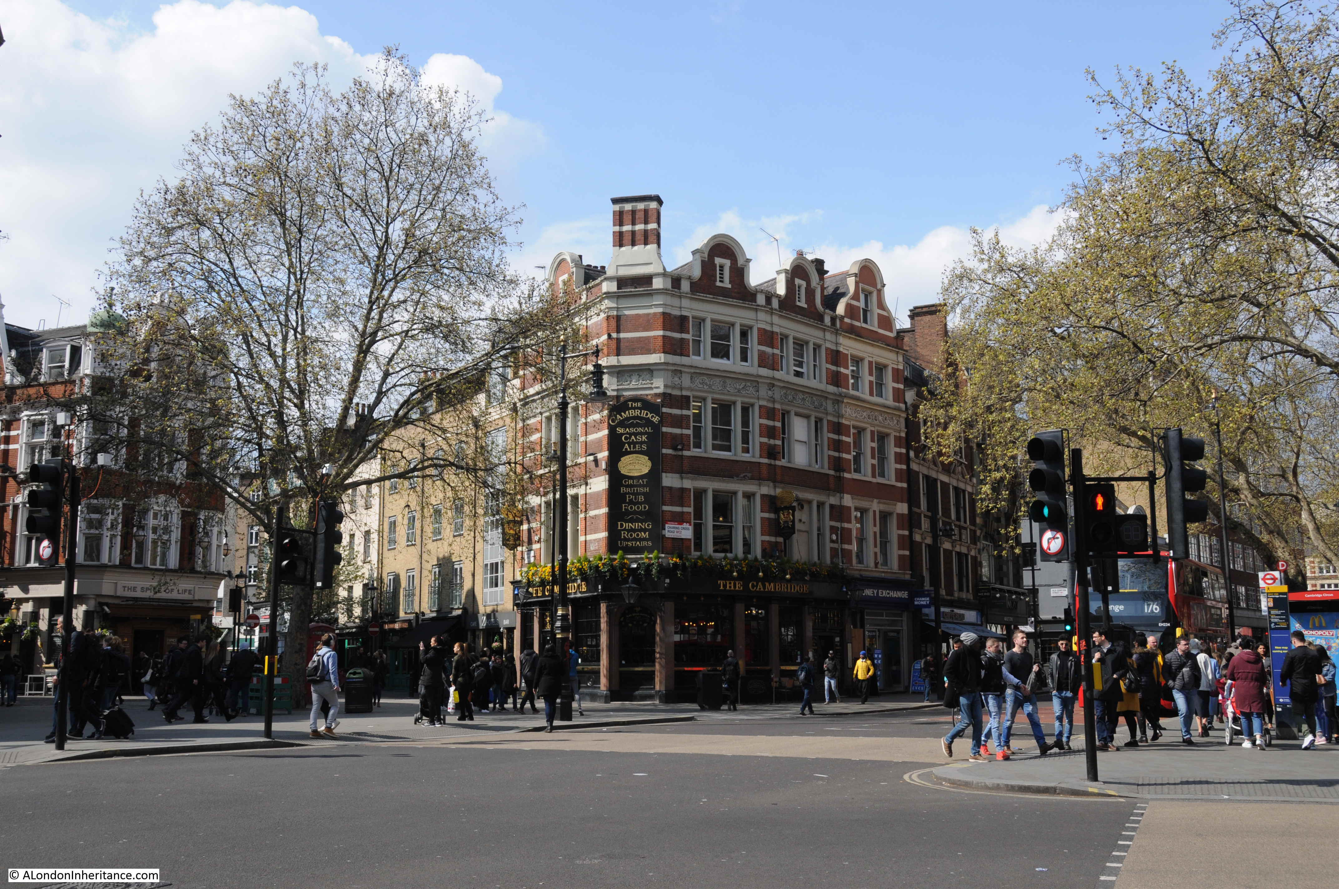
The following view of the remaining block of Sandringham Buildings is from the north, looking south along Charing Cross Road.

Charing Cross Road

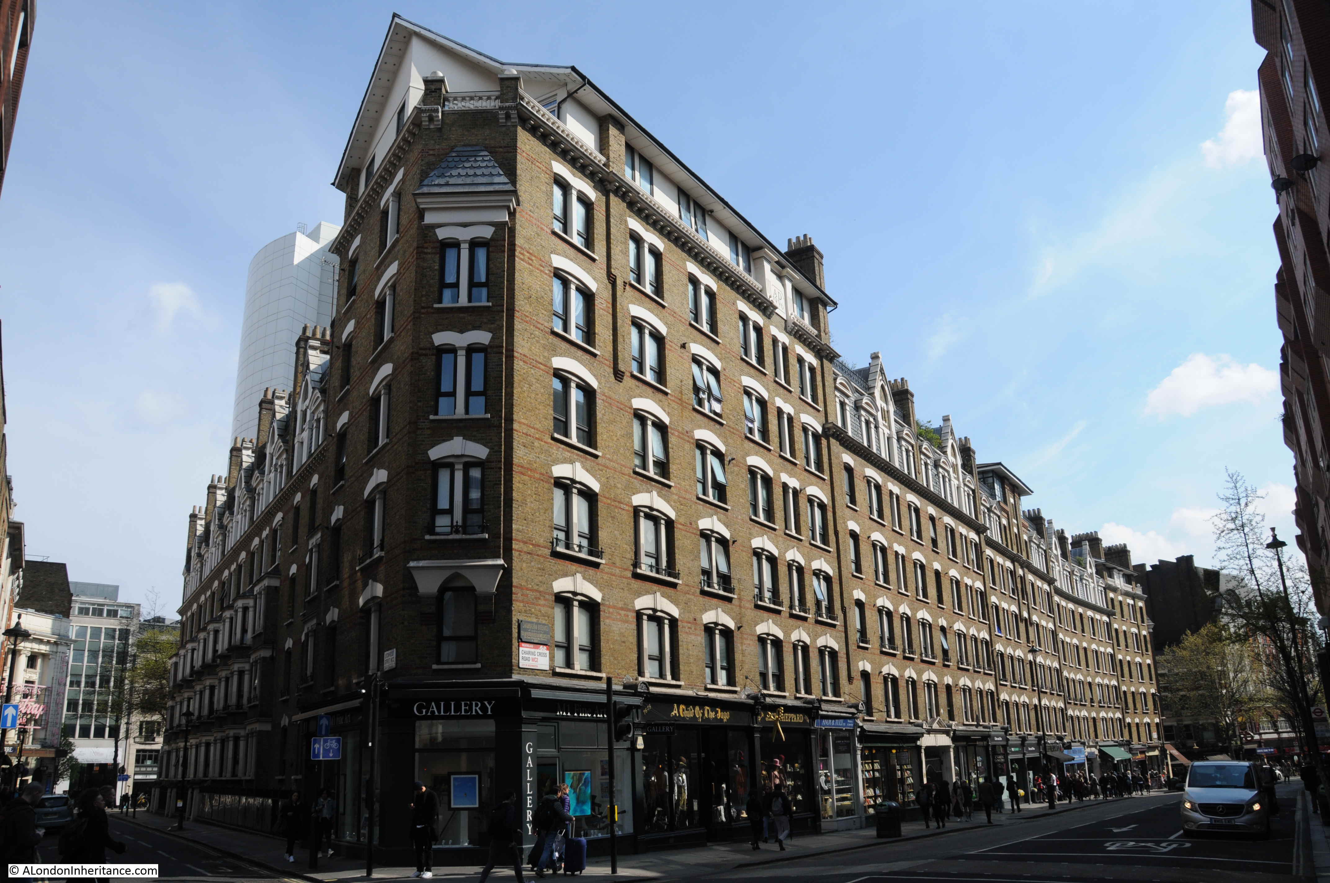
To show how identical the remaining block is with the demolished block opposite, compare the corner of the building with the corner photo I had taken in one of the photos at the start of the post.

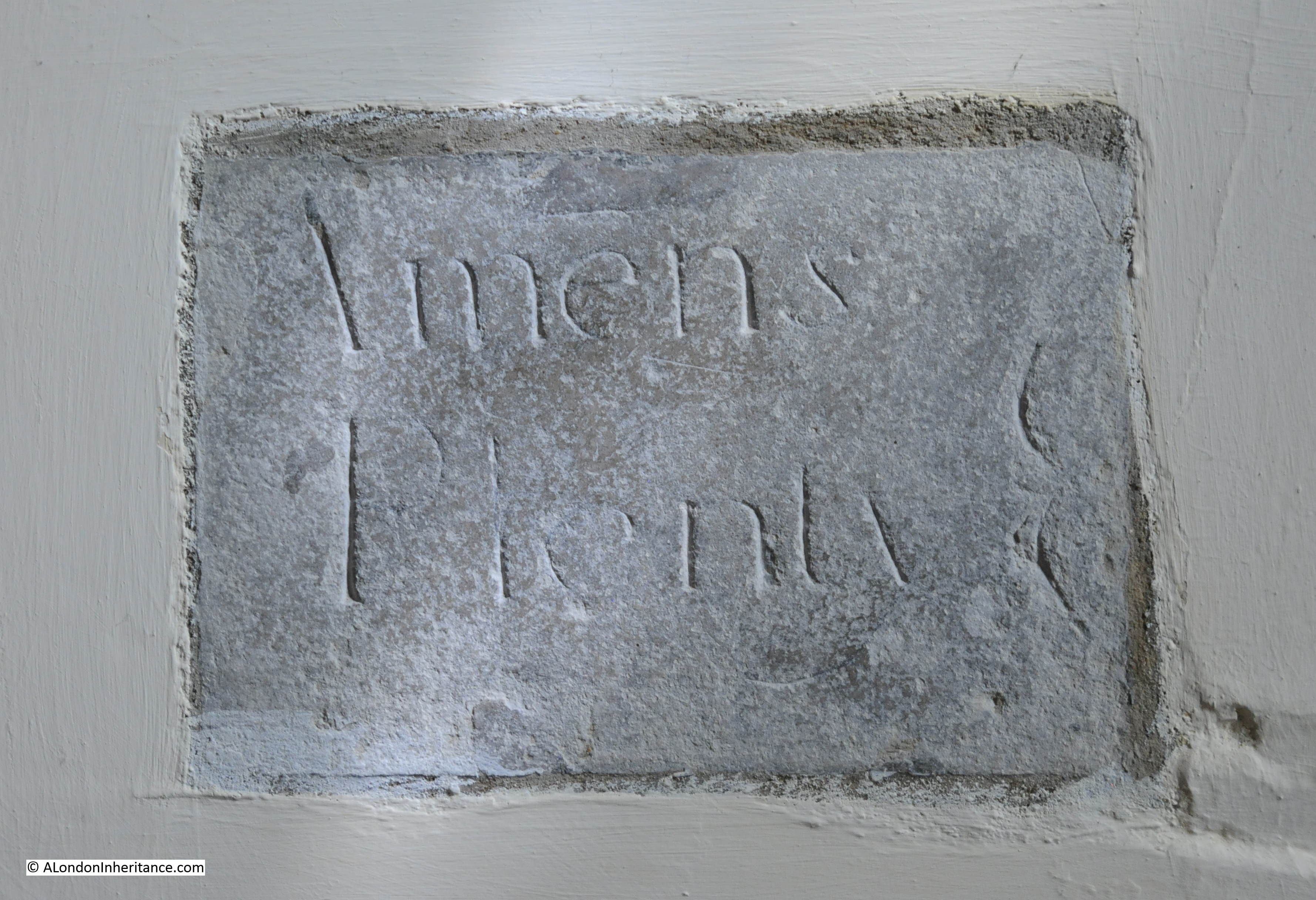
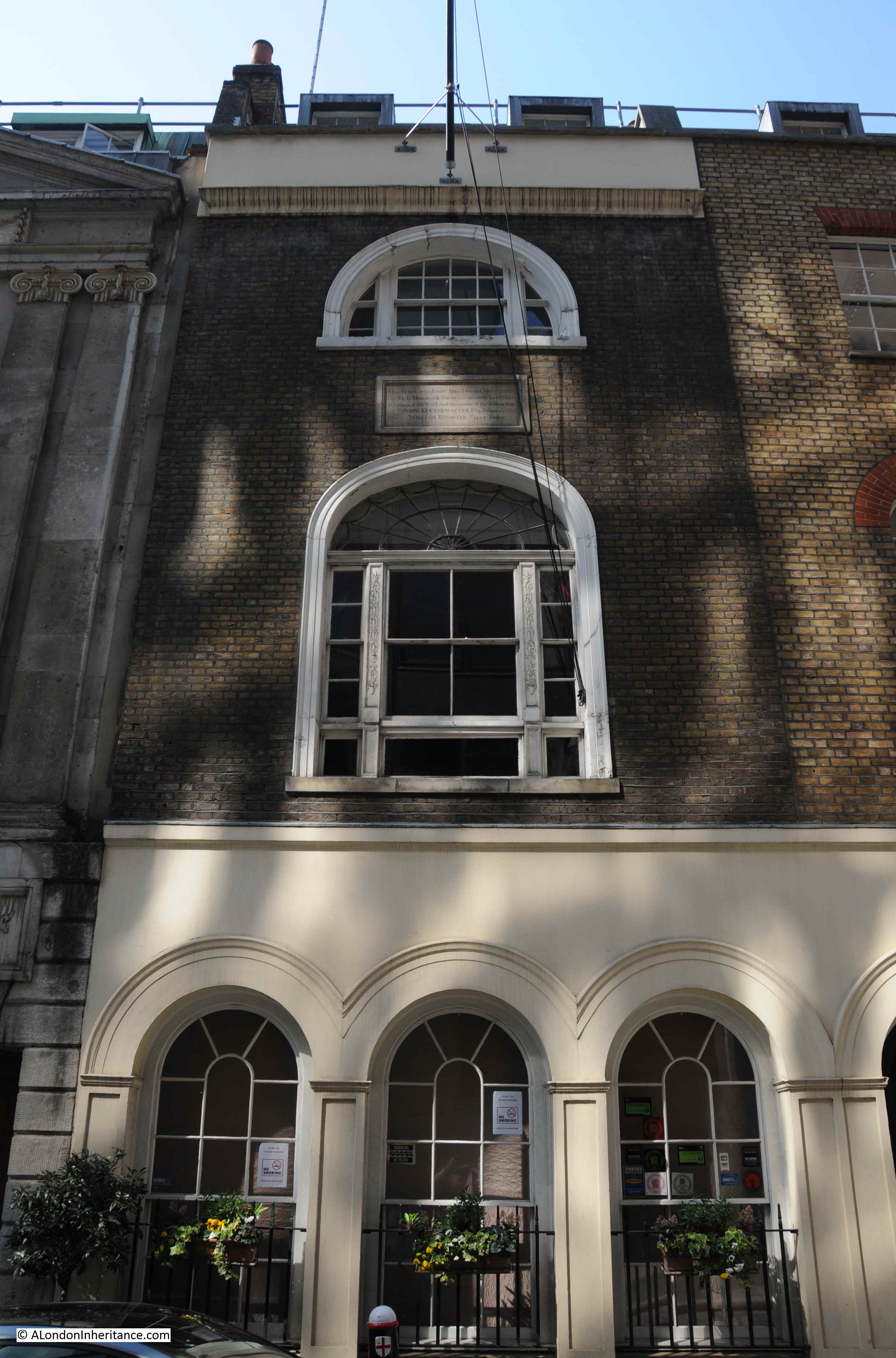
The name plaque recording that the building was erected by the Improved Industrial Dwellings Company can still be seen on the northern corner:

Charing Cross Road

Cambridge Circus is just under half way along Charing Cross Road from the north. It is at the point of intersection with Shaftesbury Avenue. it is named after the Duke of Cambridge who officially opened Charing Cross Road on Saturday 26th February 1887.

The Morning Post reported on the opening:

“The new line of thoroughfare formed by the Metropolitan Board of Works from Charing-cross to Tottenham-court-road, and designated Charing-cross-road, was on Saturday afternoon opened by the Duke of Cambridge. His Royal Highness was at one o’clock met opposite the church of St. Martin-in-the Fields by the members of the Metropolitan Board of Works, and thence drove along the new street to the circus forming the junction of the new thoroughfares.

Crowds had assembled on either side along the whole of the route, and at many points flags were flying from the windows of the houses. Upon reaching the circus the Duke of Cambridge alighted, and addressing those within hearing said – ‘I declare the new thoroughfare – Charing-cross-road – open for public use. I am happy to have the honour of assuring you and the other members of the board that all such improvements as these are of the greatest possible value (hear, hear). there is no question that the growth of this great metropolis has been such that the building of houses east and west through the town has gone on in a manner seriously injuring the public health, and anything the Metropolitan Board of Works or any other body can do to improve the locomotion in such a great city must be a benefit not only to the metropolis but to the country at large (cheers).”

The article also provides some statistics on the new road “The length of the new street is 966 yards, and its width generally 60ft. It widens to about 130ft at St. Martin’s-place but it is restricted at its entrance into Trafalgar Square to 45ft, between St. Martin’s Church and the National Gallery”.

The view across Cambridge Circus towards the Cambridge pub.

Charing Cross Road

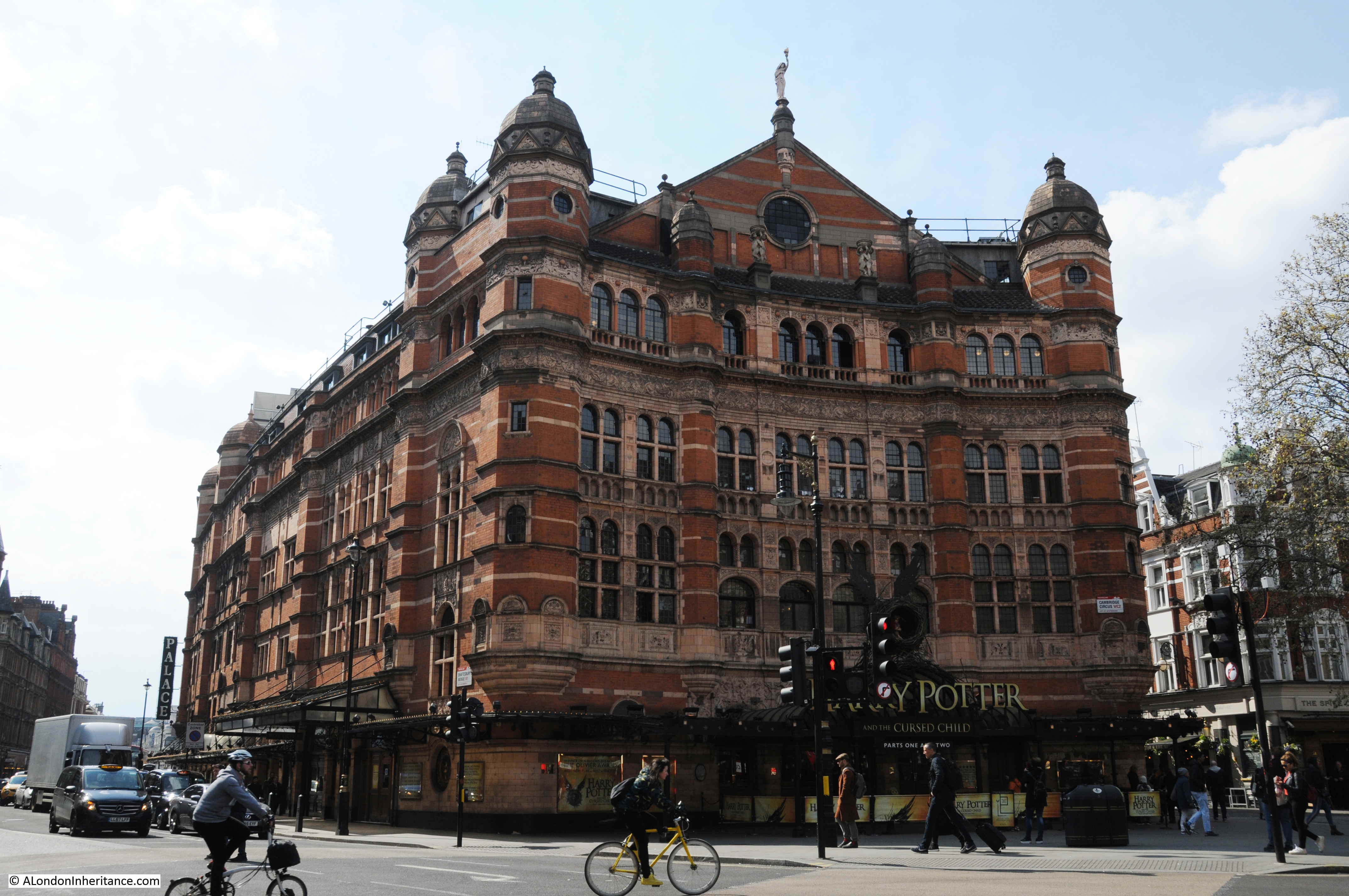
The most impressive building facing onto Cambridge Circus is the Palace Theatre, opened in 1891 for Richard D’Oyly Carte who intended the theatre to be the home of English opera and on opening the theatre was known as the Royal English Opera House.

Charing Cross Road

As always, there is so much to see and explore, and I am only touching on a brief part of the history of the street.

The Porcupine pub on the southern corner of Great Newport Street, the building dating from around 1865.

Charing Cross Road

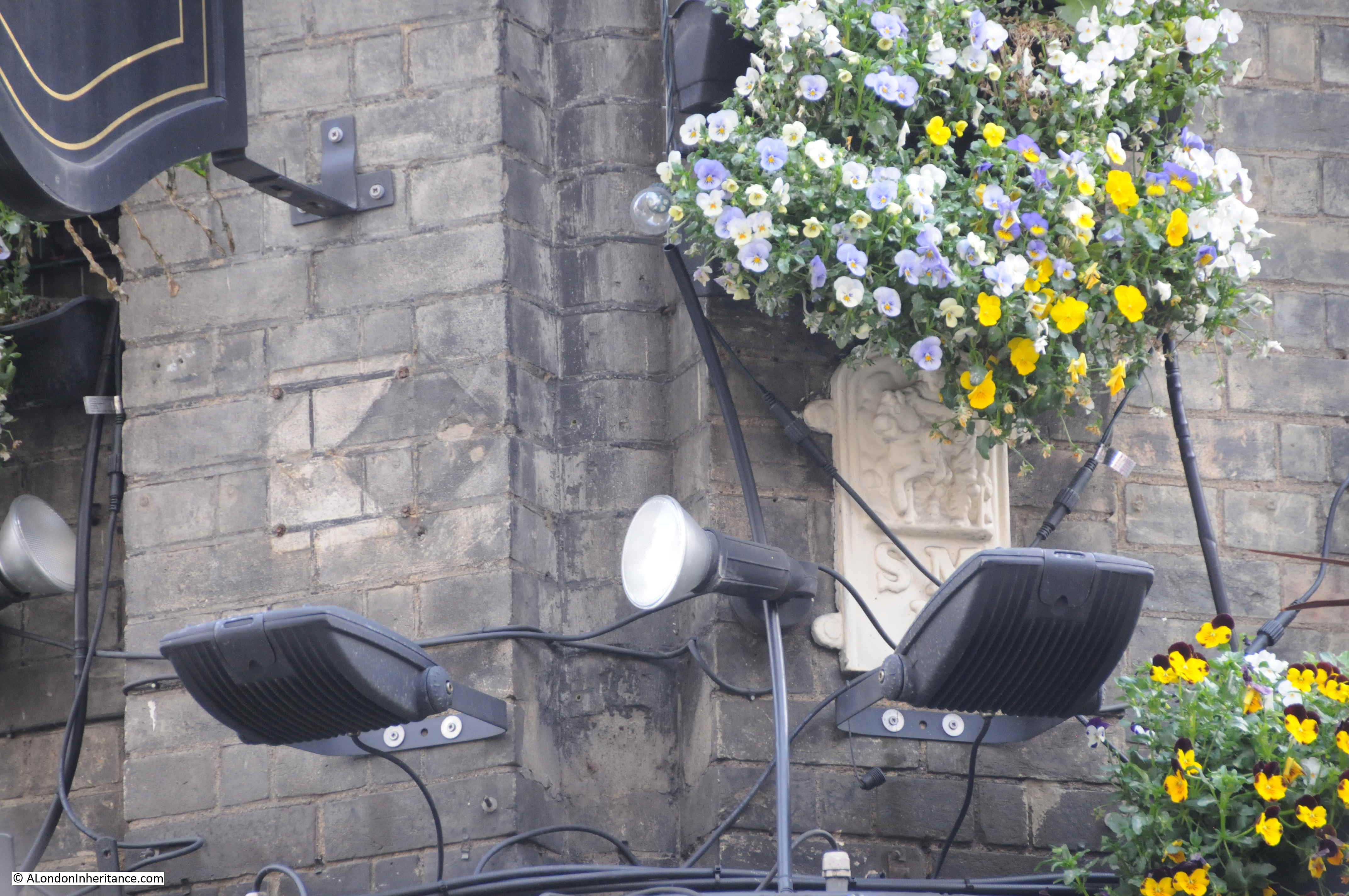
Look on the corner of the building, a boundary marker is partly hidden by the lighting and flowers.

Charing Cross Road

The old Tam O’ Shanter pub:

Charing Cross Road

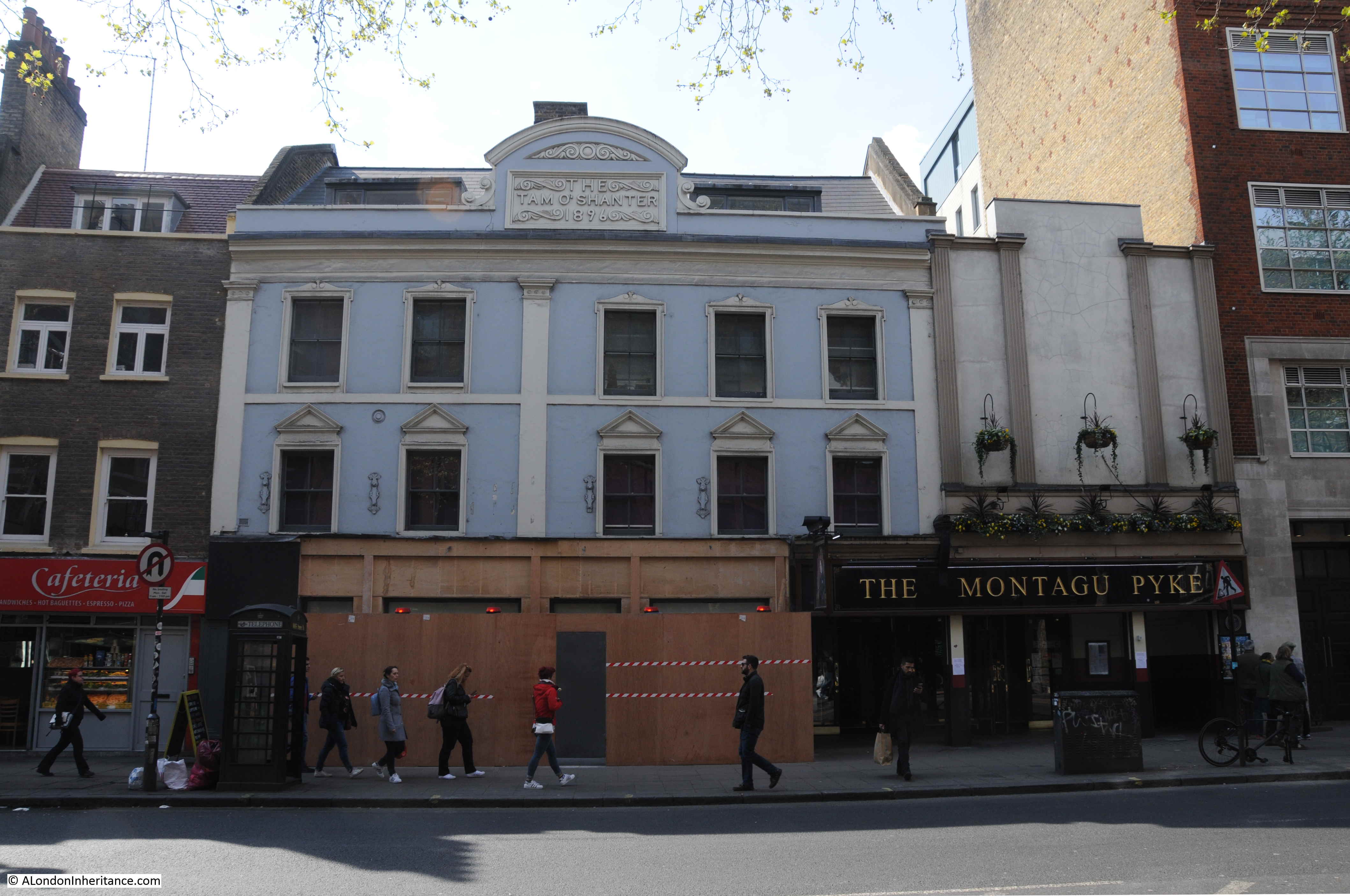
There has been a pub here since the mid 18th century, originally named the Bulls Head. The new building was part of the realignment and widening of Charing Cross Road and the new building dates from 1896, when the pub changed name to the name that still appears at the top of the building today. The Tam O’ Shanter closed as a pub in 1960.

Charing Cross Road is one of the locations where rumours of a hidden street below the surface persist. In the middle of Charing Cross Road, at the junction with Old Compton Street, there is a large grill on an island in the middle of the road.

Charing Cross Road

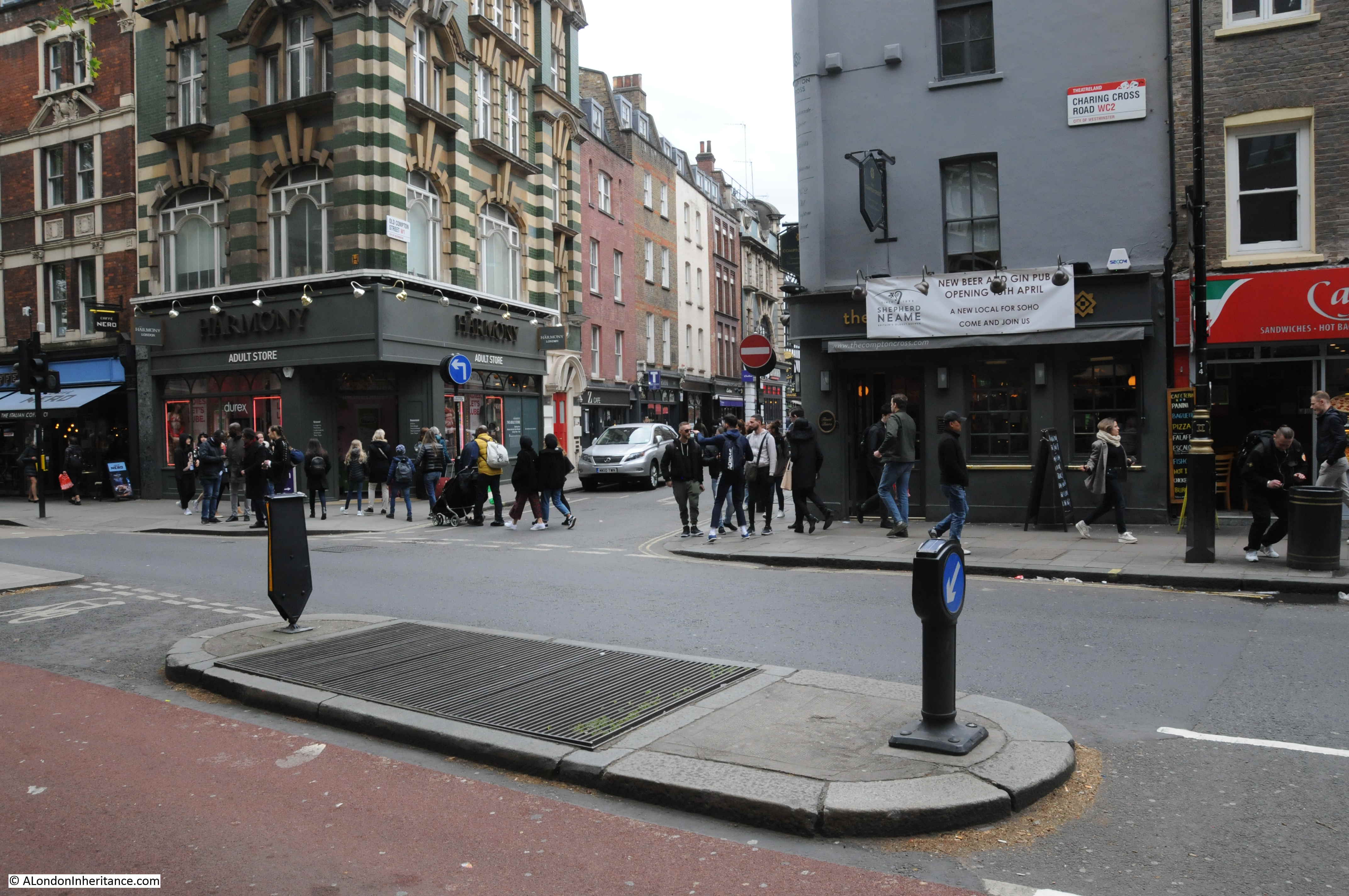
Peer down through the grill and you can see a couple of signs for Little Compton Street on the brick wall lining the tunnel.

Charing Cross Road

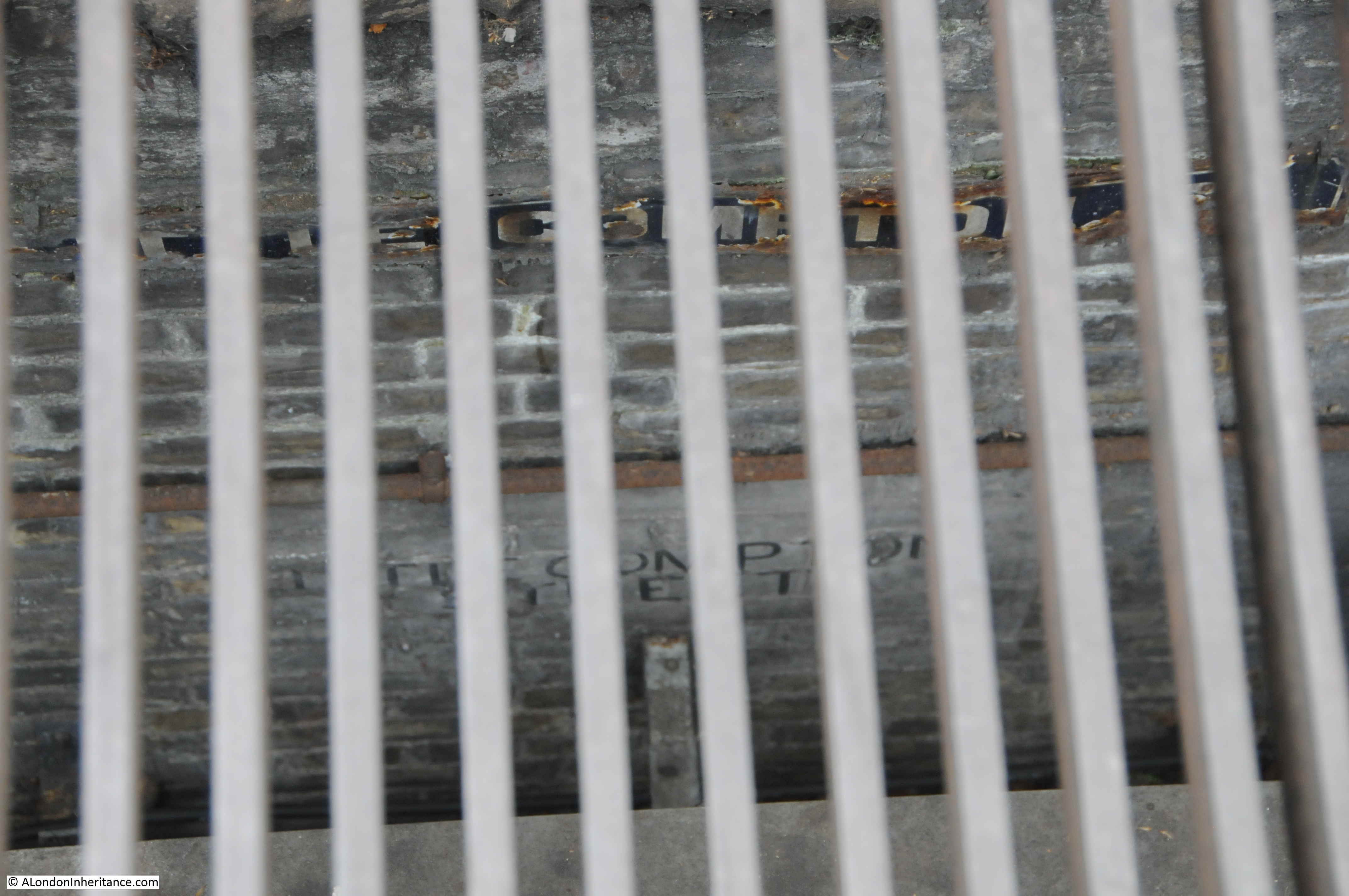
Personally I am not at all convinced that the wall and street signs are all that remains of a street from before the redevelopment of the area, now hidden below the surface.

For a start, in the 1746 map, Compton Street approaches from the west, and terminates at Hog Lane. In the 1847 map. Compton Street still approaches from the west, then Little and New Compton Street cross over and continue eastwards from what is now Crown Street. The wall below the surface is running north south, in the same direction as Charing Cross Road, not east-west as would be expected if this was a relic of Little Compton Street.

I am also not convinced that street levels along this part of Charing Cross Road changed this significantly during redevelopment to leave a substantial part of a wall buried below ground level.

Finally, the article I quoted earlier from the Morning Post on the 28th February 1887 probably gives the real reason; “A subway has been formed under the whole length of this street to receive the gas, water, and other mains, telegraph wires, &c.; it is placed under the centre of the carriageway, and is 12ft wide and 7ft, 9in. in height, formed of a semi-circular arch of brickwork.”

I suspect the street names may have been painted on the wall, or recovered from Little Compton Street and attached to the brick wall of the subway so that those working below ground, installing or repairing utility services would know where they were, as they worked their way, below ground, along the centre of Charing Cross Road.

As usual, I have only scratched the surface of the history of the area I visit to track down the location of our old photos of London. In a post a few years ago I wrote about Foyles and the College for the Distributive Trades to the north of the street.

Newport Market has long disappeared beneath Charing Cross Road and the buildings that now line the street, but the name can still be found in Newport Place, Little Newport Street and Great Newport Street – all references to Lord Newport who purchased the land in 1654 and who also gave his name to the market.

alondoninheritance.com

America Square

After finding the location of Holy Trinity for last week’s post, I walked to another location just off Minories which was my main reason for visiting the area. I wanted to find the location of the photo my father had taken of America Square in 1949.

America Square

The photo was taken at a bit of an angle and does not show the full view of America Square. The photo appears to be looking across to the far side of the square. There is an obelisk to the right, in front of a bridge, which carries the railway into Fenchurch Street Station which is to the right.

As could be expected, the area has changed significantly, and this is America Square in 2019:

America Square

The following photo shows where a street leading from America Square heads underneath the railway bridge. The obelisk would have been just in front of the bridge and to the right of the street.

America Square

America Square was built between 1768 and 1774 as part of a development which extended from America Square, south towards Tower Hill. The architect was George Dance the Younger who worked for the developer of the estate, Sir Benjamin Hammett.

The square consisted of 16 residential houses. The northern edge along what was John Street (now Cross Wall) was the only side of the square without any development.

The name America Square was a reference to American traders in the City of London, or possibly to attract these traders to purchase the houses.

The East London Observer on the 28th August 1915 provides some detail on the American association:

“America Square in John Street, Minories, in the middle of the last Century, wast the Rialto an open-air club of the officers of the beautiful sailing vessels from the States, which, for a time, outclassed the British commercial marine on the Atlantic, and filled the London and Liverpool Docks. The outbreak of the Secession Civil War brought many changes; the long blockade of the Southern Ports rid England for a full generation of a dangerous rival in international ocean trade. The ‘skimmers of the sea’ disappeared from the Atlantic or changed into armed blockade-runners and privateers; the dashing dandy Yankee and Charleston captains were improvised into Admirals of the improvised Navies of the North and the South, and found a seaman’s grave; the glory, bustle, gaiety and profusion of America Square departed.”

On an overcast Saturday morning in America Square, it was hard to imagine it as a place of ‘glory, bustle, gaiety and profusion’.

It is also hard to really appreciate how many people have walked the same streets over the centuries and the random events that connect London streets with the rest of the world. Newspapers from the last couple of centuries are full of the usual range of adverts, positions vacant, sales, passages on ships available, imported goods for sale, births, deaths and marriages etc. all with an address in America Square. On the basis that only bad news is salable news, there are also many stories of tragic and criminal events taking place.

The first reference to America Square in the newspapers is from the 16th February 1773 when John Stainbank, of America Square, Lead Merchant was included in the weekly list of bankrupts.

In the London Evening Standard of the 16th April 1863 there is a reference that a “Frederick Walker, a shrewd-looking young foreigner, was charged with robbing a hotel in America Square”.

One of the hotels in America Square was Kroll’s Hotel and an unfortunate resident was the main suspect in the Great Coram Street murder of Harriet Buswell at 12 Great Coram Street in December 1872.

Dr Henry James Bernard Gottfried Hessel was traveling from Germany to Brazil in the ship Wangerland when the vessel became stranded on the Goodwin Sands. The shipped was floated, but taken into Ramsgate for checks and repairs. Dr Hessel and his wife first stayed in a hotel in Ramsgate then traveled to Kroll’s Hotel in America Square.

In a case of mistaken identity, Dr Hessel was arrested and charged with the murder. The lack of any firm evidence, contradictory prosecution evidence and the support of those who knew Dr Hessel resulted in him being found not guilty, as the judge’s summing-up reported by the Morning Post on the 31st January 1873:

“This case has been most fully investigated here, and the witnesses on both sides have been subjected to a close and searching cross-examination, and I am satisfied that the witnesses who have spoken to the identity of Dr Hessel are entirely in error. But even supposing that their evidence had been stronger and free from discrepancies, i should have considered that the case on the part of the prosecution had been entirely destroyed by the evidence of the witnesses for the defence. It is therefore my duty, and a duty with which I discharge with great satisfaction to myself, to state that the prisoner is released, as far as I can see, and I can say that he leave this court without suspicion.”

Poor Dr Hessel – finding yourself stranded on a sandbank off the Kent cost resulting in an unexpected stay in a country which you did not expect to visit, then finding yourself on a charge of murder – a travelers nightmare.

The 1895 Ordnance Survey Map shows America Square, just above the railway shown running across the middle of the map.

America Square

Credit: ‘Reproduced with the permission of the National Library of Scotland’ 

America Square originally extended further south than its current boundary with the railway, however building of the railway in 1841 started the process of chopping bits of the square as the railway expanded.

The City Press on the 28th January 1860 reported that the London and Blackwall Railway Company had applied for an Act to enable them to provide additional station accommodation, along with other works on the northern side of the existing railway. The report stated that “The public ways proposed to the absorbed or partially interfered with by the scheme, are Gould-square, America-square, Hanover-court, the Minories. The railway is to be carried on arches through the City, and those arches which already span the public ways of Vine-street and the Minories will practically be widened by the addition of others at the side of them.”

The impact on America Square can be clearly seen in the 1895 Ordnance Survey map.

The London Metropolitan Archives, Collage collection has a number of drawings and photos that help tell the story of America Square.

The first is a drawing by Thomas Colman Dibden from around 1850, showing the square when it was still surrounded by the original 18th century houses. The obelisk features in the centre of the drawing, and supports a couple of lanterns hung on either side.America Square

Image credit: London Metropolitan Archives, City of London: catalogue ref: v9010129

The following direction of view of the following photo is very similar to my father’s photo, however the scene is very different.

America Square

Image credit: London Metropolitan Archives, City of London: catalogue ref: m0017453cl

The photo shows America Square in 1944, soon after being hit by a V1 flying bomb. The buildings on the eastern side of the square consisted of offices for the railway’s goods yards and a parcels office. Rubble was strewn across the square, but the obelisk has survived.

This explains the state of the buildings in my father’s photo, and possibly why he photographed the scene.

The following photo from 1957 shows the obelisk still in place, but looking in rather poor condition.

America Square

Image credit: London Metropolitan Archives, City of London: catalogue ref: m0026573cl

I could not find exactly when the obelisk was removed, and I assume it was destroyed. I suspect it was during the 1980s when the buildings on either side of America Square were developed.

There were many pubs around America Square, but they have now all disappeared. The building of one remains, directly opposite America Square on the junction of Crosswall and Vine Street.

America Square

This was the Angel and is shown in the 1895 Ordnance Survey map. The pub closed in 2006 and it is now a bar / restaurant called the Missouri Angel – continuing the American links of the area.

After exploring America Square, I walked under the railway to explore another part of George Dance 18th century development.

I always find the tunnels under London’s railways oddly fascinating. Look to the upper right and at the top of the wall is a street lamp with the red cross from the coat of arms of the City of London.

America Square

The streets on either side of the railway are tarmac, however the part of the street under the railway is still cobbled.

America Square

There are some interesting alleys leading off from the streets south of America Square:

America Square

Looking back through the tunnel under the railway towards America Square:

America Square

A very short distance south of America Square is the next part of George Dance and Sir Benjamin Hammett’s development that I wanted to find. If you go back to the 1895 Ordnance Survey map, you will see just below the railway is a semi-circular development called The Crescent.

In an area that consists of steel and glass office buildings from the 1980s onward, The Crescent is a rather unique place, not on any direct walking route, reached through a small street that leads from the Minories and from America Square.

America Square

The original buildings were badly damaged by bombing during the last war. The damage started with total destruction on the right and progressively reducing along the buildings to the left.

Pevsner’s guide to the City of London explains that there were originally 11 houses, and only numbers 6 to 11 can be seen today. Numbers 6 and 7 (the two on the left of the terrace) retain their original doorcases. The facades were extensively restored in 1985-6 when replicas of numbers 8 to 11 (the houses to the right) were built.

Although only two originals survive (with much restoration), it is good to see that George Dance’s crescent design can still be seen, having avoided being replaced by yet another glass and steel block.

The London Metropolitan Archive, Collage site includes a photo of the Crescent in 1913:

America Square

Image credit: London Metropolitan Archives, City of London: catalogue ref: SC_PHL_01_008_79_4342

There is still more to explore here. There is a remarkable section of the Roman wall in the basement of One America Square. It was excavated in the late 1980s, but had been found much earlier. The reference to America Square in the 1927 edition of London by George H. Cunningham records that “In 1908 a large portion of Roman wall was discovered here”. A topic for a future post with a bit of Roman wall exploration.

alondoninheritance.com

A City Relic In Deepest Hampshire

Do you ever wonder what happened to the contents of all the City churches that have disappeared over the centuries? Probably not, however this rather obscure interest took me recently from the Minories in the east of the City to a small village in deepest Hampshire.

The Minories is currently the name of a street leading from Tower Hill to Aldgate High Street. The name derives from the sisterhood of the “Sorores Minores” of the Order of St. Clare. The sisters of the order were known as Minoresses and their religious house as the Minories, and it was one of these houses or abbey that occupied the area to the east of the street currently known as Minories.

The abbey had an associated church, and following the dissolution, the church became the parish church  and was known as the Church of Saint Trinity, or Holy Trinity in the Minories. It is the later name that was most commonly associated with the church.

Holy Trinity was located at the end of a street leading from the Minories. The street is currently called St. Clare Street  (taking its name from the religious order).

The book “A History of the Minories” written by a vicar of the church and published in 1922 provides a fascinating history of the abbey and the church. It also includes a drawing of the church at the end of the side street leading from the Minories.

Minories

This is the same view today. The church was at the end of the street, with the front of the church just in front of the building that terminates the end of the street.

Minories

The 1895 Ordnance Survey map shows the location of the church, in the centre of the following map extract, at the end of what was then Church Street (now St. Clare Street).

Minories

Credit: ‘Reproduced with the permission of the National Library of Scotland’ 

A map of the same area today. I have marked where the church was located by a red rectangle  (© OpenStreetMap contributors) .

Minories

You will see on the 1895 map that there is a public house on the southern corner where Church Street meets the Minories. The building is still a pub – The Three Lords:

Minories

The current pub building dates from around 1890, however a pub with the same name has been on the site for much longer. The earliest newspaper reference I could find to The Three Lords dates to the 11th January 1819 when the Evening Mail reported on the arrest of a man for robbery. He was formerly a respectable man with carriage and servants, one of whom in 1819 kept the Three Lords and a pot from the pub was found in the room of the alleged thief.

The view from the far end of St. Clare Street looking back towards the Minories. The street is still cobbled.

Minories

Holy Trinity church was closed in 1899. One of the closures of City churches under the Union of Benefices Act of 1860 where churches were closed and their parish amalgamated with another parish (St. Botolph’s Aldgate for Holy Trinity).

Closure of churches was a very controversial act for the Vicars of the churches involved along with their parishioners. There is an interesting letter in the London Evening Standard on the 30th May 1893 from the Vicar of Holy Trinity. The letter addresses errors about the history of the church in an earlier article, and demonstrates the passion resulting from the way in which the closure was managed. It is a long letter, but provides some fascinating insight into a small parish at the end of the 19th century. It also demonstrates the interest of a parish vicar in their church. Frequently the image of the Vicar is of a remote character, mainly interested in the income that could be generated from the role.

The letter reads:

“HOLY TRINITY CHURCH, MINORIES – Under the above title an article has gone round the papers purporting to give particulars of my church and its past history, some extracts of which appeared in your Morning and Evening Editions of the 25th instant. Will you permit me, then, to say that none of the statements in that article are correct.

In the first place, the name of my church is not ‘St. Mary in the Minories’ but  Holy Trinity, Minories. Secondly, the mummified head which we have could not be that of the Duke of Norfolk, as the writer states, for that nobleman never had anything to do with the abbey or the church that I am aware of; but it may be the head of the Duke of Suffolk, to whom the abbey was given for a residence, by Royal letters patent, in the reign of Edward VI, and who, whilst resident there, was beheaded for attempting to place his daughter, Lady Jane Grey, upon the throne. The head was found in 1853 in one of the vaults, in a box of oaken sawdust, which, acting as an antiseptic, has marvelously preserved the skin of the face.

(The book “A History of the Minories” includes a rather gruesome photo of the mummified head)

Thirdly, the writer says that ‘the ancient Priory of Holy Trinity was founded by Matilda, Queen of Henry I, in 1108 whereas we know that the abbey (not priory) and its church was built in 1293 by Queen Blanche, widow of Henry le Gros, King of Navarre, who afterwards married Edmund, Earl of Lancaster. The arms of the Queen, with those of the Earl of Lancaster, are now in our vestry.

Fourthly, the writer states that on ‘the dissolution of monasteries by Henry VIII, the priory and its precincts were given to Thomas Audley, Lord Chancellor of England, who after pulling down the church, made the place his residence until his death in the year 1554’. These mistakes are even worse than the former ones, for Henry VIII gave the abbey to the Bishop of Bath and Wells (Dr. John Clerk) for a place of residence, where he died and was buried in the vaults of our church, though afterwards his body was, for some cause, removed to Aldgate Church. This was the man, who took to the Pope of Rome a copy of King Henry’s book against Luther, which led to that Sovereign receiving the title of ‘Defender of the Faith’, still used, though with a very different meaning.

The church was not pulled down on the dissolution of the abbey, but remained until 1706, when, being in a very dilapidated state, it was taken down and rebuilt from the ground with the exception of the north wall, upon which the chief monuments are placed.

Then the writer says that the parishioners of St. Katherine Cree, in 1622, obtained leave of Charles I to rebuild the priory church with the assistance of Lord Mayor Barkham.

From this it is quite evident that the writer of the article has mixed up our church and the abbey with another church and some priory. What in the world could see the parishioners of St. Katherine Cree have to do with Holy Trinity, Minories? Also, as the church was not rebuilt until 1706, Lord Mayor Barkham certainly did not assist to rebuild it in 1622, but Sir William Pritchard, who was Lord Mayor in 1683, purchased the abbey, and resided in it during his mayoralty, calling it, I believe, the Mansion House.

May I add that I was at first greatly opposed to the amalgamation of Holy Trinity, Minories, with St. Botolph Aldgate, and wrote a little history of the church in order to raise funds for its restoration, when the Charity Commissioners came down upon us and confiscated the church property devoted by the churchwardens to the maintenance of public worship, leaving them only thirteen pounds a year to pay the salaries of organist, pew-opener, bell-ringer, fire insurance, repairs, gas, coals, water, &c. ? Also they seized funds for giving every Christmas all the widows living in the parish five shillings, accompanied with coal and bread tickets.

This unrighteous impoverishment of the church led me to consent to the amalgamation scheme now about to take place, but I shall leave my parish and people with much regret.

I am, Sir, your obedient servant, Samuel Kinns, Vicar.”

I walked down St. Clare Street, to where the street takes a sharp right turn. In the following photo, the front of the church was just behind the gates, roughly in line with the red bin on the left.

Minories

Nearly all the buildings at this end of the street are relatively recent.

Holy Trinity, Minories closed as a church at the end of the 19th century, but the church survived as a parish hall until the Second World War when the building suffered severe bomb damage. A wall did remain until final clearance of the area in the late 1950s.

Taking the sharp right turn on St. Clare Street, in front of where the church was located, and there is one remaining building, an old warehouse that would have probably been around at the same time as the church.

Minories

Finally, getting to the theme of the post, does anything remain of the church?

The following drawing of the interior of the church from the book “A History Of The Minories London”, shows a pulpit on the left, where the rows of pews end.

Minories

The pulpit can still be seen today, but in a very different location to the Minories.

The church was closed in 1899, and in 1906 the pulpit from Holy Trinity, Minories was presented to All Saints’ Church, East Meon in Hampshire.

East Meon is a village in Hampshire, to the west of Petersfield in the South Downs. It is close to the source of the River Meon. In the following map extract, the location of the village is indicated by the red circle.  (Maps © OpenStreetMap contributors) 

Minories

Zooming in further and the following extract shows the village in the centre of the map, the River Meon flowing through the village, which is surrounded by countryside.

Minories

A couple of weeks ago, I headed out to East Meon to find Holy Trinity’s pulpit.

East Meon is best reached either via the A3, turning off near Petersfield, or from the A32 at West Meon. The final few miles of travel along either of these routes is along country lanes with very little traffic and the rolling hills of the South Downs on either side.

In the centre of the village is a finger post showing the nearest villages and towns and also signposting the village shop, school, village hall and car park.

Minories

The River Meon flows through the centre of the village.

Minories

The first view of All Saints’ Church, East Meon from the centre of the village. The church has a rather dramatic location, on raised ground overlooking the village, and with the towering Park Hill rising directly behind the church.

Minories

A closer view of the church.

Minories

The church was built between the years 1080 and 1150. Although with later renovations, repairs and changes, the layout of the church is the same cross-shaped design as when originally built. A central tower dominates over a nave, chancel and transepts which lead off either side from the base of the tower.

Major restoration was carried out during the early 20th century, and as part of this restoration, the Holy Trinity pulpit arrived in East Meon.

The main entrance porch to the church provides a superb view looking back over the village of East Meon.

Minories

On entering the church, the pulpit comes into view.

Minories

A close up view of the original Holy Trinity pulpit. At first sight, perhaps not very impressive, but it dates from 1706 and spent almost 200 years serving the parishioners of the Minories in the City.

Minories

This is the pulpit from which Edward Murray Tomlinson, the author of the book I have on my desk – A History of the Minories London – would have preached from during his time as a Vicar of Holy Trinity.

A brass plate on the door of the pulpit confirms the origin, and provides some background as to how the pulpit found its way from the Minories to East Meon.

Minories

The Rev. Edmund Murray Tomlinson who presented the pulpit to the church must have noticed a considerable difference between his 12 years as Vicar of Holy Trinity, Minories and his following 12 years as Vicar of East Meon.

The pulpit arrived at a time when the East Meon church was undergoing considerable renovation. The East Hampshire Chronicle on the 3rd November 1906 reported that the church had just reopened for public worship and that restoration had cost £1,130.

Restoration included major works such as the lowering of the floor to the original Norman level to reveal the “dignity of the massive Norman arches”. The article also references the arrival of the pulpit from Holy Trinity, Minories to confirm the facts given on the brass plate.

The interior of the church is fascinating, not just the architecture, but also the decoration and furniture of the church.

The church provides a home for the East Meon Millenium Embroidery. Started in 2002 and completed in 2008, the embroidery provides a wonderful snapshot of the village, created by local people. Unfortunately, no matter where I stood, I could not take a photo without a reflection in the glass.

Minories

Windows and Easter decorations:Minories

There is a strange stone set into one of the interior walls of the church. the words “Amens Plenty” inscribed.

Minories

The church guidebook provides an interesting local legend about the stone. It was lifted from the floor of the church in 1869 and underneath the stone was found the remains of four men. They were buried vertically which added to the mystery. The local legend is that they were four Parliamentary soldiers killed in the village before the Battle of Cheriton on the 29th March 1644. Cheriton is about 12 km to the north west of East Meon.

An interesting feature of the central tower is that access to the tower is via stairs up along the wall in one of the transepts, with a small balcony and doorway at the top of the stairs providing access to the tower.

Minories

Some very large capitals on the crossing arches that support the tower.

Minories

View along the central nave of the church with the Holy Trinity pulpit on the left at the end of the pews.

Minories

The church has two fonts. The first is a very plain stone font of unknown date. As with the Holy Trinity pulpit, churches seem to accumulate from other religious buildings and this font came from the ruined chapel of St. Nicholas near Westbury House in East Meon. Although being of unknown date, it looks very old.

Minories

The second font is much more ornate and has a more identifiable history. This is the Tournai font:

Minories

The font derives its name from the location of manufacture – Tournai in Belgium. It was delivered to the church in East Meon around the year 1150, and probably was a gift from Henry of Blois, the Bishop of Winchester. The fact that East Meon has such a font illustrates the importance of the church and village in the 12th century. There is another Tournai font in Winchester Cathedral.

Minories

The font is highly decorated, although this was rather difficult to photograph in the strong light streaming through the windows. Two sides of the font tell the story of Adam and Eve whilst the other two faces and the top of the font are covered in symbolic designs.

The following photo shows the west side of the font. The pillars are holding up the flat earth above which some rather strange monsters or dragons are carved.

Minories

The east side of the font relates part of the story of Adam and Eve. Rather difficult to see in the following photo, however the structure on the right is a representation of the Gates to Paradise. There is a figure to the left holding a large sword. The figure also has wings and is a representation of an angle who has expelled Adam and Eve from Paradise. Adam and Eve are to the left of the angel and are both trying to hold their fig leaves in place.

Minories

The font is a remarkable example of 12th century craftsmanship.

In the outside wall of the church, there are some gorgeous doors:

Minories

Minories

The central tower of the church. The spire dates from 1230 when the final additions were made to the church including the Lady Chapel and the south aisle.

Minories

Detail from the top of the tower. Wavy carving around the clock, open windows and along the wall of the tower.

Minories

The rear view of the church shown below includes the original chancel on the right, with the 1230 Lady Chapel on the left.

Minories

The straight line distance between the location of Holy Trinity, Minories and East Meon is not that far, only 88km, or 55 miles, but they are very different places and that difference must have been even more apparent in the 19th and early 20th centuries when the Vicar and Pulpit moved from the Minories to East Meon.

A modern day comparison of living in a village such as East Meon with living in the city is the difference in public transport. The bus stop timetable highlights the limited bus service to take residents to the nearest town.

Minories

Although the City still has a remarkable number of churches, so many have been lost over the years, from the Great Fire, the wave of late 19th century closures that included Holy Trinity, the Blitz and other occasional closures and parish amalgamation.

Church contents would have been lost through fire and bomb damage, but there must still have been a considerable amount sold or relocated to another church. The 1706 Holy Trinity pulpit is one item that can still be found, and continues to serve the same function as its makers intended over three hundred years ago.

alondoninheritance.com

A Walk in the City in 1980 and 2019

Last Sunday I was walking along the South Bank in 1980, for today’s post, I have crossed over the river for a walk in the City with a few of my photos, also from 1980.

I am starting on Lower Thames Street, opposite the old Billingsgate Market. This is the view looking up the street St. Mary at Hill.

Walk in the City

This is the same view 39 years later in 2019:

Walk in the City

The street is named after the church on the street, however it is not the church which can be seen in the distance – that is the church of St. Margaret Pattens which is across East Cheap which runs along the top of St. Mary at Hill.

The church after which the street is named is where the ornate clock overhangs the street. Although the street is named after the church, the tower and main entrance to St. Mary at Hill are on Lovat Lane. I visit the church in this post.

In 1980, the area around the street of St. Mary at Hill was still dominated by the Billingsgate fish market, which would not move from Lower Thames Street until 1982. The street still had some open spaces which had not yet been redeveloped following wartime damage, however the financial industry was expanding into the area as show by the relatively new TSB building on the right in the 1982 photo.

If you look at the 1980 photo above, a short distance along St. Mary at Hill on the left, by the trailer, half on the street, there is a shop with a plaque above the shop front.

In 1980 I photographed the plaque:

Walk in the City

In 2019, the plaque is on the same building, but has been relocated from above the first, to above the second floor window.

The ground floor is no longer a shop.

Walk in the City

The plaque reads:

“This Hall was built Anno Domini MDCCLXXXVI The Right Honourable Thomas Sainsbury, Lord Mayor, Alderman of this Ward and Governor of the Fellowship. John Kittermaster, Deputy. William Banister, Upper Ruler.”

Walk in the City

The building is part of Watermen’s Hall – the City hall of the Company of Watermen and Lightermen of the River Thames.

The main hall building is immediately to the left. The ground floor with the old shop was redeveloped as part of the hall complex in 1983.

The Worshipful Company of Watermen and Lightermen has its origins in an Act dating from 1555 when a form of licensing was introduced for watermen on the river between Gravesend and Windsor. The aim of licensing was to ensure a standard rate of fares for customers of watermen, rather than the free for all and often extortionate fares that had been charged.

Eight Watermen were appointed each year by the Mayor, and they had the responsibility to ensure the rules of the act were being carried out.

Lightermen were included with the watermen by an Act of Parliament in 1700, and in 1827 the company was incorporated as the Master, Wardens and Commonality of the Watermen and Lightermen.

The scope of the Company’s authority was reduced in 1859 when the western limit was moved from Windsor to Teddington (the tidal limit of the Thames), and in 1908 the licensing powers of the Company were transferred to the Port of London Authority.

The Company did not have Masters until 1827, prior to 1827 the company was administered by Governor, Deputy and Rulers – hence the titles used on the plaque.

The Armorial Bearings of the Company of Watermen and Lightermen on a rather lovely door knocker on the door of the building that in 1980 was occupied by the shop.

Walk in the City

The main Hall dates from around 1780 (the plaque dates the building of the hall to 1786), and is the only original Georgian Hall in the City of London.

Walk in the City

Armorial Bearings on the front of the Hall:

Walk in the City

Across Lower Thames Street and St. Mary at Hill is Billingsgate Market:

Walk in the City

This was still a working market in 1980 when I took these photos. I have more photos on another film which I have not scanned yet, but on this film I photographed some of the barrows by the side of the market.

Walk in the City

And the space to the right of Billingsgate Market which was used by vehicles carrying goods to and from the market. Unlike earlier years, Lower Thames Street was a major east – west route across the City so could not be blocked by market vehicles. The space provided a good view across the river – the tower of Southwark Cathedral can be seen on the right.

Walk in the City

This is roughly the same view today as the above photo. The space has been occupied for many years by office blocks.

Walk in the City

I want to include my next 1980 photo in a time sequence of photos showing the area outside Billingsgate Market, looking along Lower Thames Street and up Monument Street towards the monument to the Great Fire of London.

The first is from the book Wonderful London:

Walk in the City

The second is my father’s photo taken in 1949 (the majority of the buildings are the same as in the Wonderful London photo):

Walk in the City

My photo from 1980:

Walk in the City

And my latest photo from April 2019:

Walk in the City

This is an area that has changed significantly, both in the trades and business that occupy the area as well as the architecture that also has to change to accommodate the business of this part of the City.

In my father’s 1949 photo there is a rather ornate entrance on the right of the photo. This was the Coal Exchange and is shown in more detail in my post on Lower Thames Street and the view to the Tower of London.

To get to my next location, I walked west along Lower Thames Street and continued along the street as it changes name to Upper Thames Street.

It was across Upper Thames Street, from Broken Wharf, that in 1980 I photographed the solitary tower of St Margaret Somerset.

Walk in the City

The same view today:

Walk in the City

On first view, it may be thought that the tower of the church remains as the rest of the church was bombed in the last war, however St. Mary Somerset was the victim of population changes in the 19th century when the church was included in an 1860 Act of Parliament that allowed the demolition of a number of City churches.

The 19th century architect Ewan Christian campaigned for the tower to be preserved, so the tower is the only survivor of Wren’s post Great Fire of London rebuild of the church.

A church has long been on the site. In the 1917 publication London Churches Before The Great Fire, Wilberforce Jenkins describes the church:

“The Church of St. Mary Somerset, or Summers Hythe, was near Broken Wharf, on the north side of Thames Street. William Swansey is mentioned as rector in 1335, but the church must have been much older than the fourteenth century. In a deed of the twelfth century mention is made of a certain Ernald the priest of S. Mary Sumerset.

The church was burnt down in the Fire and rebuilt, the parish of St. Mary Mounthaunt being annexed. Nothing remains of the rebuilt church except the tower. A small piece of the churchyard may be seen fenced in.

In 1980 my photo shows a clear view of the tower from across Upper Thames Street however today, as part of the later 1980s building over Upper Thames Street, the view is now significantly obscured by building that covers over Upper Thames Street.

It is at this point that Upper Thames Street passes through a concrete box structure around which new buildings have been constructed. The street emerges by Puddle Dock.

Part of the small piece of churchyard mentioned in the 1917 book may still be seen today to the right of the tower.

A better view of the tower of St. Mary Somerset, and where Upper Thames Street disappears into a tunnel.

Walk in the City

To get to my next location, I walked up to Queen Victoria Street, to where Peter’s Hill crosses the street. This was my 1980 view up to St. Paul’s Cathedral:

Walk in the City

The same view today (although by mistake I took the photo in landscape rather than portrait to mirror my 1980 photo).

Walk in the City

Originally, in 1980, there was a set of steps leading up from Queen Victoria Street, then a reasonably flat stretch of pathway up to St. Paul’s Churchyard. The height different between St. Paul’s and Queen Victoria Street has now been smoothed with a gradual slope and smaller steps.

To prove that the photos were taken from roughly the same position, the building on the left is the College of Arms. Although in my 2019 photo this is mainly covered in sheeting, the single storey bay extension can be seen in both photos (although somewhat in the shade in my 2019 photos).

The buildings on the right have all changed since 1980, and unlike 1980, the walk heads onward across Queen Victoria Street to the Millennium Bridge and is a very busy tourist route. The main attraction seems to be the bridge’s appearance in one of the Harry Potter films judging by the couple of guided groups I walked past.

I also covered this area in my post on The Horn Tavern, Sermon Lane And Knightrider Court.

The City of London is ever changing, and it is almost to the point where you need to walk every few weeks to capture every change.

One change that has been underway for a while and has revealed, if only for a short time, a church that was once boxed in on all sides, is at the construction site for the Bank Underground Station improvements. The church is St. Mary Abchurch, enjoying its time in the sunlight, before disappearing again in a few years when construction on the station has completed and new buildings occupy the site.

Walk in the City

The City always looks fantastic in the sunshine. Deep contrasts of bright light and the dark shadows of the buildings often make photography difficult, however where it works, many buildings look stunning.

This is the wonderful 30 Cannon Street, a brilliant example of 1970s architecture.

Walk in the City

The building was constructed between 1974 and 1977 and designed by the architectural practice of Whinney, Son & Austen Hall. Originally built for the French bank Crédit Lyonnais, and was the first building of this type to be clad in double-skinned panels of glass-fibre reinforced cement which helped with the unique exterior design.

30 Cannon Street is Grade II listed, so hopefully is unlikely to be replaced by one of the glass and steel towers that are coming to dominate the City.

As with my South Bank walk, a series of random photos of London, but that is what I enjoy, walking the city and taking photos to tell the story of the city’s evolution.

alondoninheritance.com

London Protests – Extinction Rebellion

I take a lot of photos of London. As well as photos for the blog, I also take photos of buildings, street scenes, the river, views from the top of buildings, protests and demonstrations, and indeed as many events as I can fit in with work and other commitments. Probably far too many photos, however I have realised a number of things whilst working through my father’s photos.

I wish he had taken far more, there are so many other places that I would love to have seen how they looked after the war and in the following decades. The constraints of photographic film limited the number of photos that it was affordable to take.

It is also the ordinary scene that I find interesting. Not the carefully crafted photo, but photos which show normal, day to day events, street scenes, buildings etc.

Last Sunday’s post was an example. I started photographing London in the late 1970s and the photos of the South Bank in 1980 were just ordinary photos of an ordinary London day – however for me, they tell part of the story of how London continues to develop and change. Both physically, but also in the way London is used by people. I also wish I had taken more photos, but until the arrival of digital photography I was also limited by the cost of film and developing (and time).

On the same day as my walk along the South Bank, the Extinction Rebellion protests were underway, and as usual, I photographed the event, as I have with many other different protests and demonstrations over the years.

Whenever I photograph London, I try to take an impartial view. Whether a protest, or new buildings – it is the ongoing life and development of London that I find fascinating.

My father’s first photos of protests were taken in 1953, when the Association of Engineering and Shipbuilding Draughtsman marched through Oxford Circus:

London Protests

London is obviously a magnet for protests and demonstrations. The capital of the country, seat of government, assured media visibility for anything that happens in London, these and many other factors play a role in why many of these take place in London.

I have photographed many over the years, and to start, here is a view of the Extinction Rebellion protests in London, photographed on Saturday 20th April 2019.

Waterloo Bridge

Waterloo Bridge was blocked and had been closed off to traffic for a number of days:

London Protests

London Protests

The camps of people across the bridge included large numbers of plants.

London Protests

Catering:

London Protests

Lorry used as a performance stage:

London Protests

On top of the lorry:

London Protests

London Protests

Campaigning:

London Protests

Slogans on the side of the bridge:

London Protests

Meetings:

London Protests

London Protests

London Protests

On the Saturday the protest was lightly policed, this would soon change when the bridge was cleared.

London Protests

London Protests

London Protests

Compelling slogans:

London Protests

London Protests

Parliament Square

Up until recently the area around the Houses of Parliament were the scenes of pro and anti Brexit demonstrations with the world’s media occupying College Green. With the delay to October the media and demonstrators have left – almost certainly to return at some point later this year. For now, Parliament Square was also closed to traffic, with the Extinction Rebellion protesters occupying many parts of the square. It is perhaps not a surprise how much better the streets of London are without traffic.

London Protests

David Attenborough was a feature of the Parliament Square protests:

London Protests

As with Waterloo Bridge, the roads around Parliament Square were covered in chalked slogans and campaigning:

London Protests

London Protests

London Protests

Very relaxed scenes across the square:

London Protests

The People’s Podium:

London Protests

London Protests

In Broad Sanctuary, alongside Westminster Abbey:

London Protests

London Protests

Between Parliament Street and Square:

London Protests

There were other protests at Marble Arch and Oxford Circus – I ran out of time to get to these as I was also exploring some locations in the City for a future blog post.

Whether or not you agree with the method, the message was important, and as ever, London takes on the role of providing a stage for these events.

alondoninheritance.com