Monthly Archives: October 2022

The Changing Face of Leicester Square

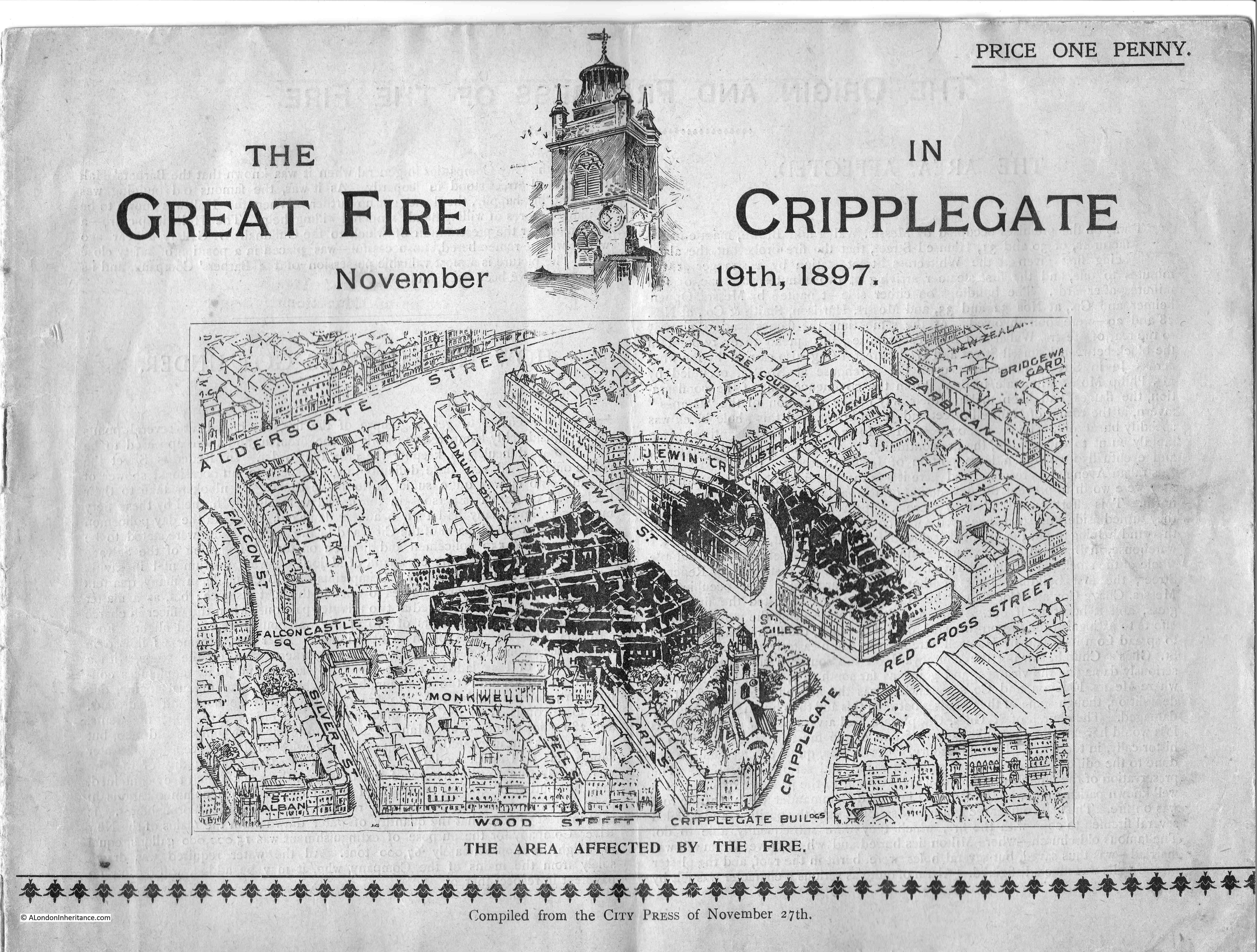
Leicester Square, along with Piccadilly Circus, are probably the best known locations in London’s west end. A hub of entertainment, hotels and the shops of global brands. Both major destinations for tourists, they are busy places during the day, and late into the night, however Leicester Square started off as a very different place. Part of London’s westward expansion, large houses, terrace houses and ornamental squares.

In the 16th century, this part of west London was all fields. Development of the square, and the source of its name, would come between 1632 and 1636 with the construction of Leicester House, on the northern side of where the square is located today, but at the time the house was built, it was surrounded by fields.

The house was built by Robert Sidney, Earl of Leicester, so as with so many parts of London’s expansion over the last centuries, the square has taken its name from the original aristocratic owner of part of the land, and initial developer.

Formation of the square, and building of houses along the sides of the square came in the late 17th and early 18th centuries, and by 1755 the square was developed as shown in the following map, where the square was then known as Leicester Fields, a name from when Leicester House was the only building in the area.

Leicester Fields

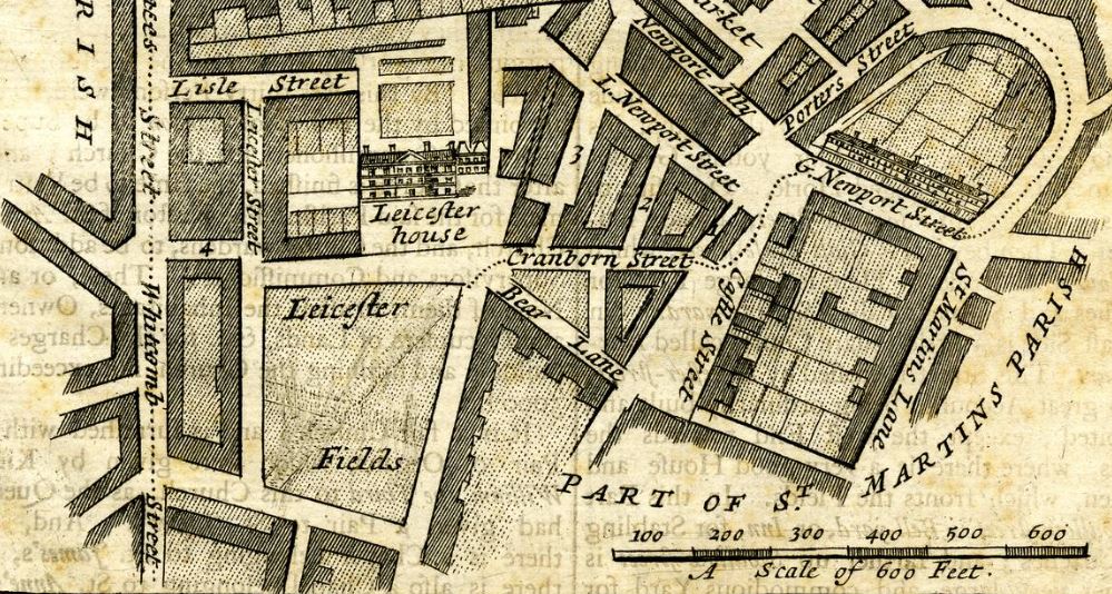
In the above map, Leicester House can be seen on the northern side of the square, with a large courtyard to the front of the house, and gardens to the rear. The fields surrounding Leicester House have been buried under the building of the early 18th century.

The following print from around 1720 shows the appearance of Leicester Square (© The Trustees of the British Museum):

Leicester Square

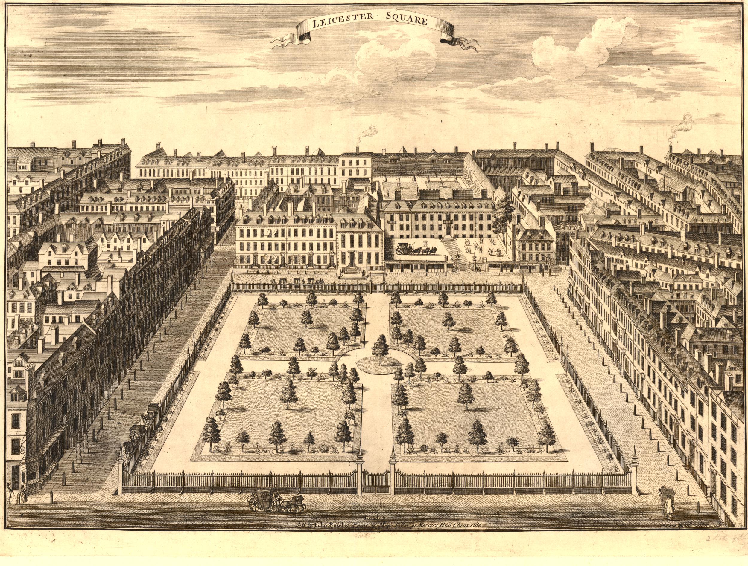
Leicester House can be seen set back from the street on the northern side of the square, and the sides of the square have been developed with the standard terrace housing of early 18th century London.

The central square has been laid out with formal gardens of grass and trees, with paths, and a tree in the centre of the square. This would be replaced with a statue of George I in 1747.

A close-up look at Leicester House shows a horse and coach at the front of the house, along with small groups of people who appear to be holding poles of some type, or perhaps rifles. Large gates protect the house from the street, and there are gardens, stables and outbuildings to the rear:

Leicester House

Leicester House went through a number of different residents, and perhaps the most important was the Prince of Wales who would later become George ll. He had been thrown out of the royal apartments at St. James’s Palace following an argument with his father, King George I, and moved in at the end of 1717.

George I died on the 11th of June, 1727. The Prince of Wales was away from London, but returned quickly to his home at Leicester House, and he was proclaimed King at the gates to his house – the only time that a new King or Queen has been proclaimed in what is now Leicester Square.

The King stayed in Leicester House until the end of 1727, whilst St. James Palace was being prepared for him.

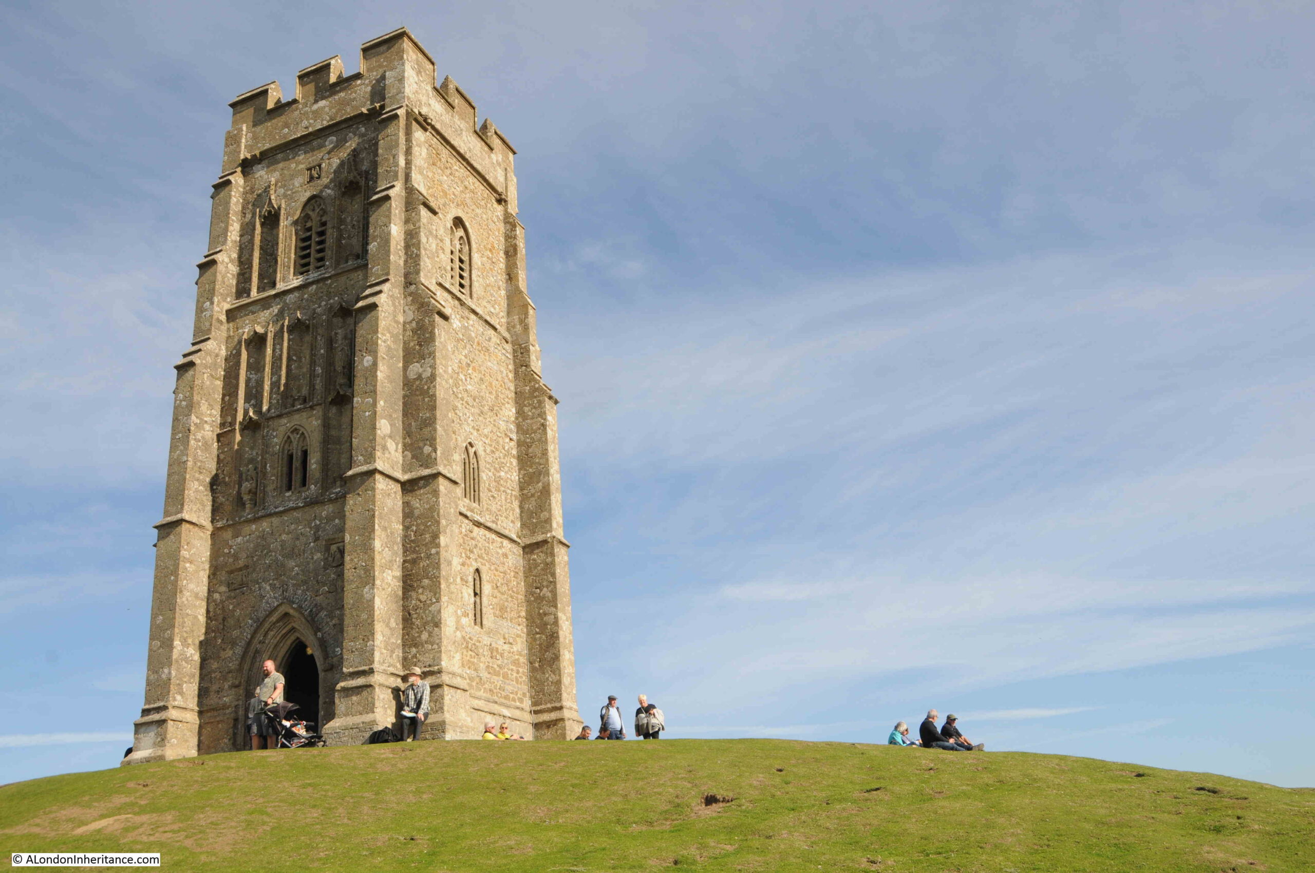
Leicester Square’s first experience as a place of exhibitions and entertainment seems to have been in 1774, when the naturalist Ashton Lever took over Leicester House and turned it into a museum, to house and display his large collection of natural history objects.

The collection remained at Leicester House until Lever’s death in 1788, when it was then moved to the Rotunda in Blackfriars Road.

Thomas Waring, who had worked for Ashton Lever remained at the house until 1791, and it is Waring that offers a clue as to what the people were doing in the early print of the house, where there are people holding what appear to be poles in the courtyard.

Waring was a founder member of the Toxophilite (Archery) Society, and meetings were held at Leicester House, so perhaps those standing in the courtyard were archers with their bows.

Leicester House was demolished around 1791 and 1792.

Following the demolition of Leicester House, the square would rapidly become a destination for entertainments. One major building specifically for this purpose was Wyld’s Great Globe, open between 1851 and 1862.

Constructed in the square by the mapmaker and former Member of Parliament. James Wyld, the purpose of the Great Globe was to show visitors the wonders that could be found across the world, with models, maps and lectures.

A view of the Great Globe, before galleries were constructed at ground level, linking the main entrances, is shown in the following print (© The Trustees of the British Museum):

Wyld's Great Globe

Wyld’s Great Globe was very popular and had very many paying customers. An impression of the educational approach of the Great Globe can be had from the following article in the London Sun on the 6th of June, 1854:

“WYLD’S GREAT GLOBE – Throughout the whole of yesterday, Mr. Wyld’s intelligent lecturer was unceasingly engaged in enlightening such of the public as sought here rather instruction than amusement, upon geographical features of the ‘Great Globe’, devoting, of course, as everybody now does, his chief attention to those parts which are rendered peculiarly interesting by the war with Russia. A brief summary of the Ottoman empire was very appropriately introduced, and served to place in a very clear light the momentous question which is now at issue,

The late discoveries in the Artic Regions likewise came in for a good share of notice; and the dry study of the globe itself, and of the various maps on the subject, was relieved by an inspection of a small, but valuable, collection of dresses, boats, and implements of war, of inhabitants of those unhospitable climes, and of birds and beasts which are found there. These articles are contained in a small anteroom which by clever illusion, is made to resemble a tent with the faint light which is only seen at the North Pole. The juvenile part of the visitors seemed to take an especial delight in examining the different objects in this little chamber.”

Although initially very successful, Wyld’s Great Globe suffered from local competition, and had to look at other forms of entertainment, and started to put on variety shows alongside the educational exhibitions and lectures.

One of the local competitors of Wyld’s was Burford’s Panorama which was located just north of the square, between Leicester Square and Lisle Street.

An idea of the panoramas available can be had from the following advert in the Illustrated London News on the 7th of June, 1851:

“BURFORD’S HOLY CITY of JERUSALEM and FALLS of NIAGARA – Now open at BURFORD’S PANORAMA ROYAL. Leicester Square. the above astounding and interesting views, admission 1s to both views, in order to meet the present unprecedented season. The views of the LAKES of KILLARNEY and of LUCERNE are also now open. Admission, 1s to each circle, or 2s 6d to the three circles. Schools half price. Open from 10 till dusk.”

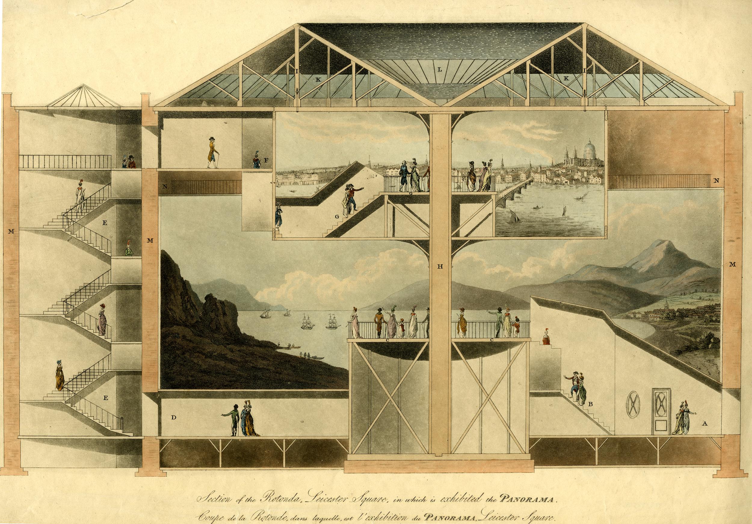
The following section view shows the interior of Burford’s Panorama, with the views being exhibited on the walls of the circular building (© The Trustees of the British Museum).

Burford's Panorama

Remarkably, the outline of Burford’s Panorama can still be seen today. On the 25th of March 1865, Father Charles Faure puchased the building that housed Burford’s Panorama. and the French architect, Louis Auguste Boileau transformed the building into a new church within an iron structure.

The new church opened in 1868 as Notre Dame de France, a French speaking church in London. The church has an entrance on Leicester Place, but it is only from above that we can see the circular form of the church, on the site of Burford’s Panorama.

Click this link to go to an aerial Google view where the outline of the Panorama can clearly be seen.

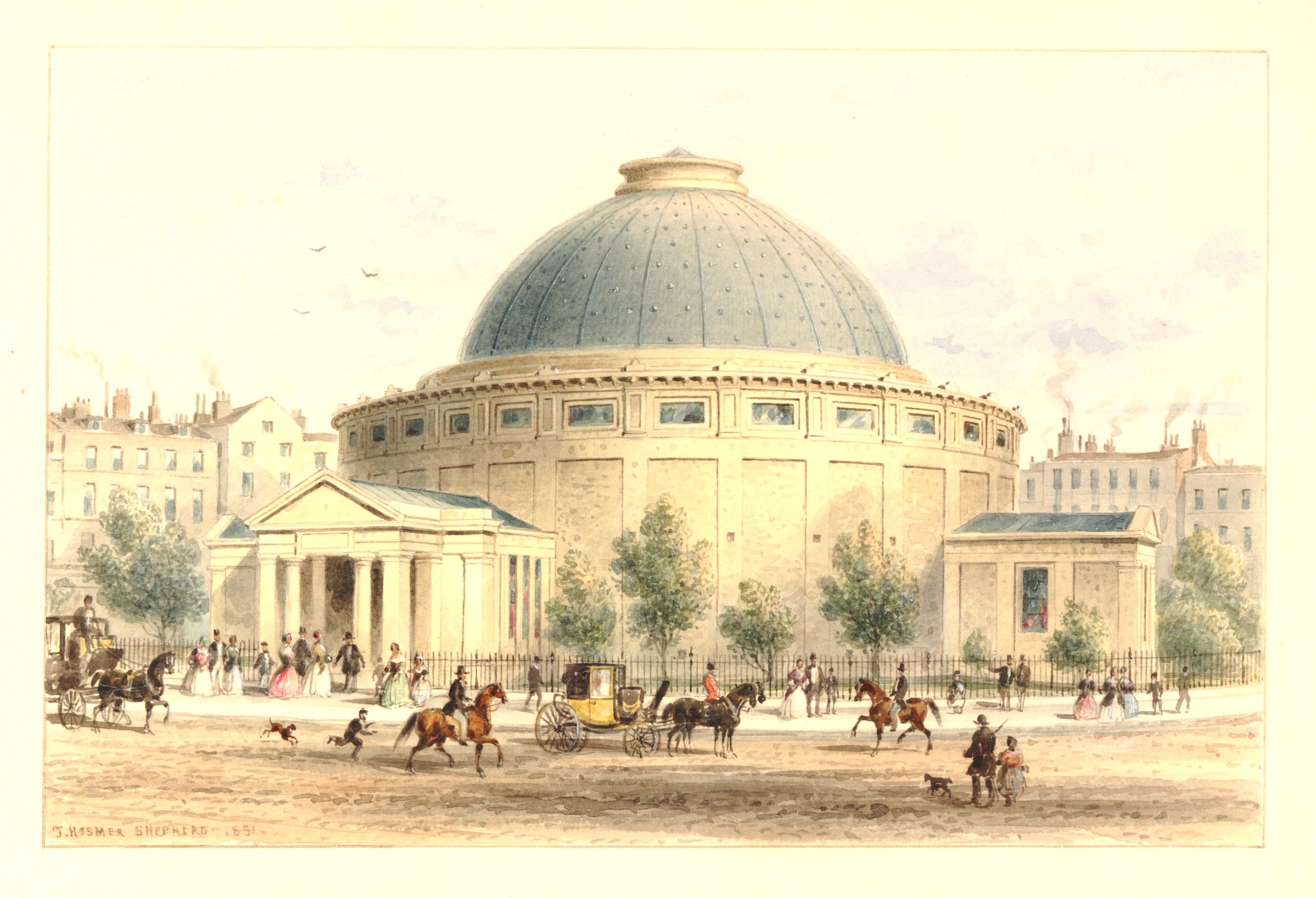
Another competitor to the Wylde’s Great Globe and Burford’s Panorama was the Royal Panopticon of Science and Art, also built in Leicester Square (© The Trustees of the British Museum):

Royal Panoptican of Science and Art

The Royal Panopticon of Science and Art opened on the 17th of March 1854, and held scientific and artistic displays and lectures. The Royal Panopticon was popular, often attracting up to 1,000 vistors a day, but did have problems from the day of opening. In their report after the opening, the owners wrote that:

“Since the opening of the institution, everything that had taken place out of doors militated against its success. First of all there was the war; next, the attractive novelty of Crystal Palace, and finally the cholera – all tending to keep the public from visiting the Panopticon, which, under all such disadvantages had nevertheless been successful to a degree greater than could have been anticipated by the council.”

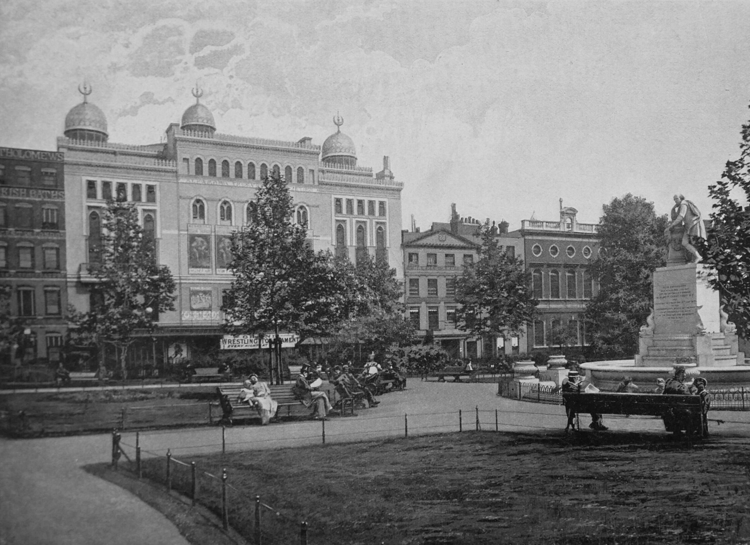
I suspect the owners were being a bit optimistic in their report, as the Royal Panopticon only lasted two years, closing in 1856, when the building became the Alhambra Theatre of Variety, which can be seen in the following photo from 1896 as the large building with domes on the roof. This version of the Alhambra was of a slightly more simple design, having been a rebuild of the original building which was destroyed by fire in 1882.The brick building to the right is Archbishop Tenison’s Grammar School, highlighting the different types of institution that have made Leicester Square their home.

Leicester Square

The Alhambra Theatre of Variety seems to have offered a wide variety of entertainments. The following rather cryptic advert from the Westminster Gazette provides details of what was on offer during the evening of the 3rd of October, 1893:

“Alhambra Theatre of Varieties – Open 7:30 – At 8:40 the Grand Ballet, FIDELIA. And at 10.30 CHICAGO, Grais’s Marvelous Baboon and Donkey (first appearance in England), Thora, the Poluskis, R.H. Douglas, The Three Castles, the Agoust Family, and the TILLEY SISTERS &c.”

The Poluskis were the Poluski Brothers, Will and Sam who were born in Limehouse and Shadwell. There is a recording of their act in 1911 online here.

The Agoust family were a family of jugglers and there is a video of their act here.

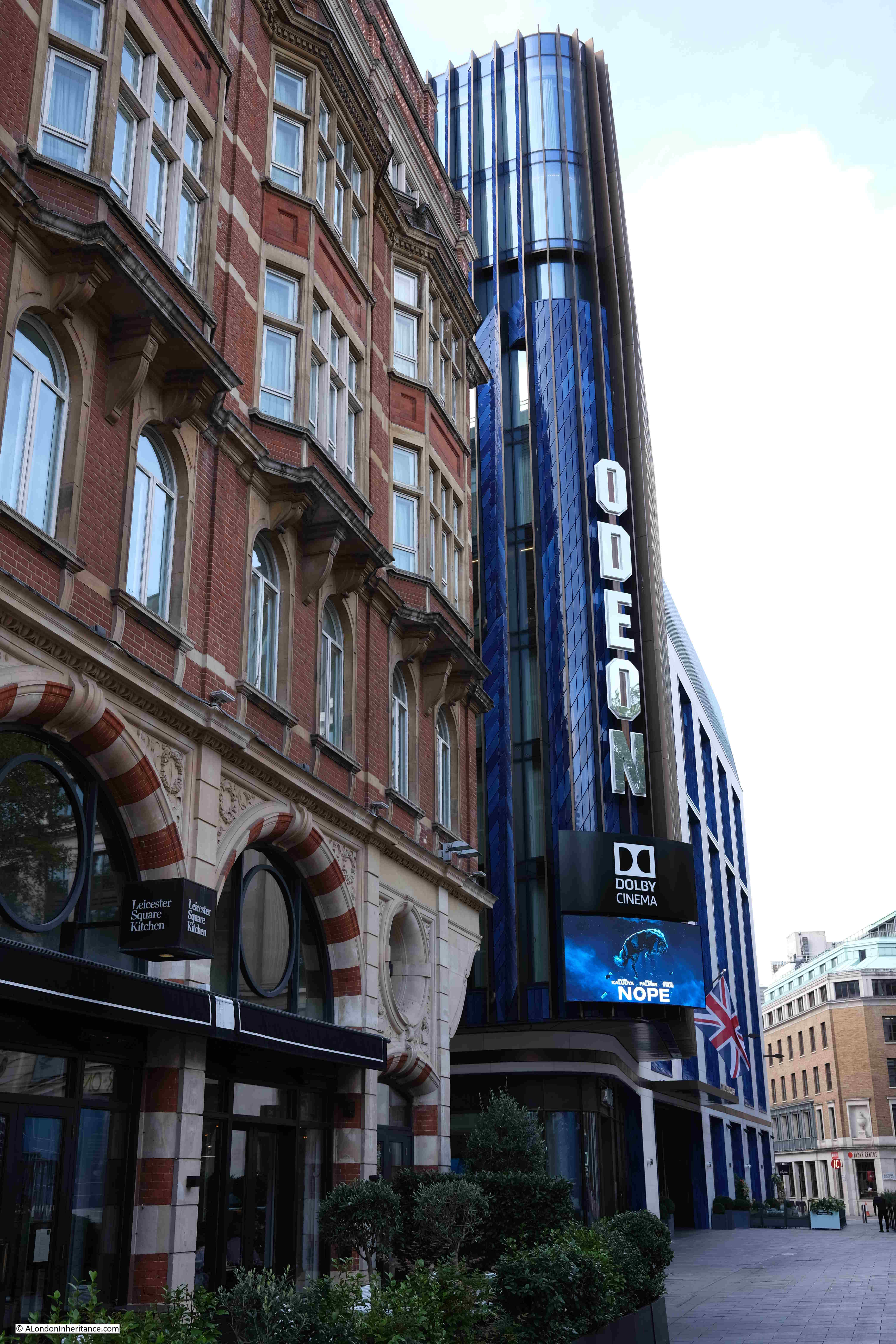
The type of variety acts that the Alhambra specialised in started to decline in popularity after the First World War. During the 1920s, the cinema began to capture the imagination of those looking for a night out in London, and in 1936 the Alhambra was demolished, to be replaced with the Odeon Cinema, which can still be found on Leicester Square.

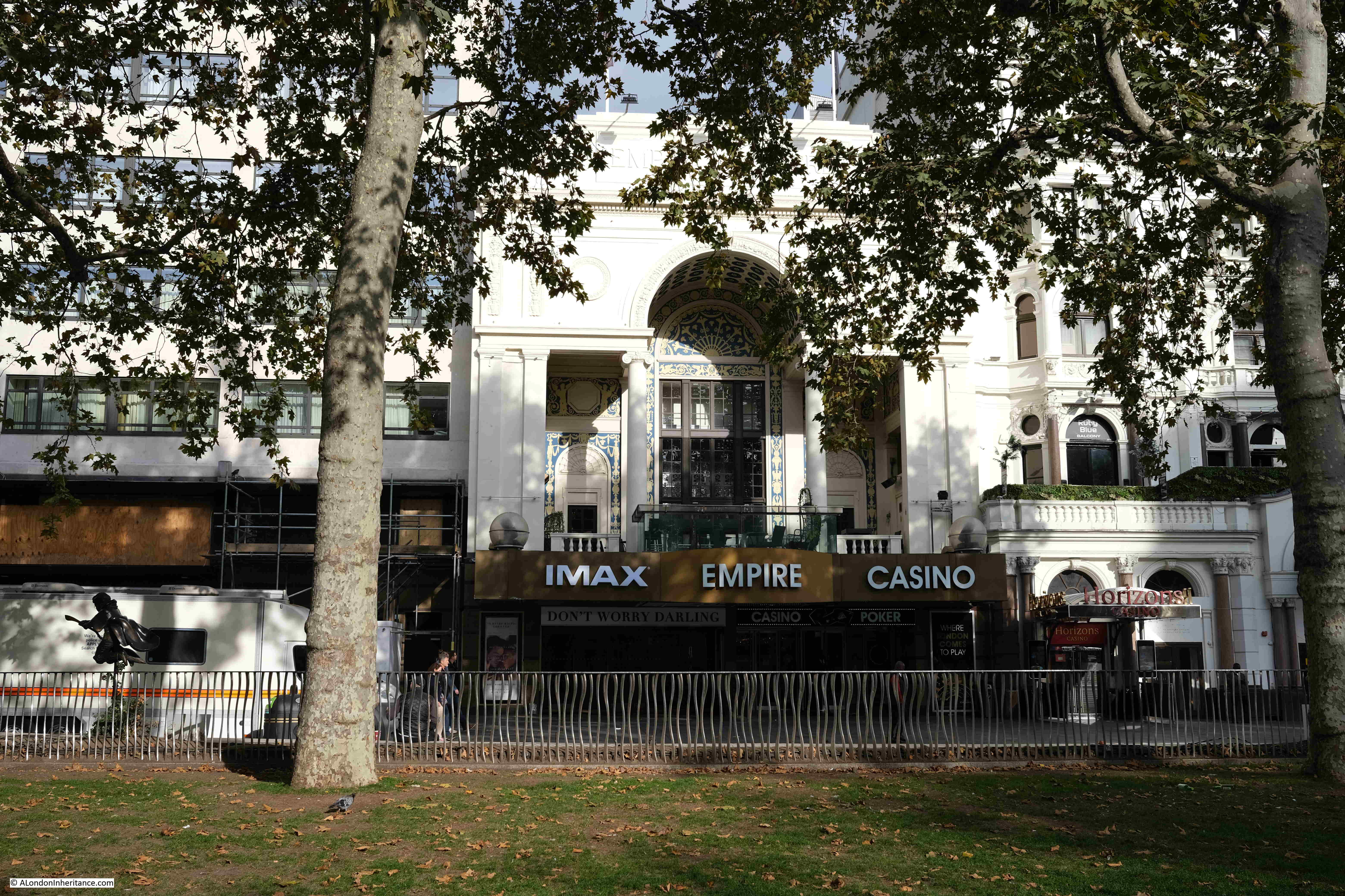
Another current cinema which followed a similar path is the Empire Cinema on the northern side of Leicester Square. Originally built as a variety theatre in 1884, the theatre started showing film in 1896, and over the following years started to offer a mix of live performance along with short films.

As with the Alhambra, variety theatre dropped in popularity during the 1920s, and in 1927 the majority of the Empire Theatre was demolished, and rebuilt as the Empire Cinema. The cinema has had a number of major upgrades over the years and it is still open as a cinema today.

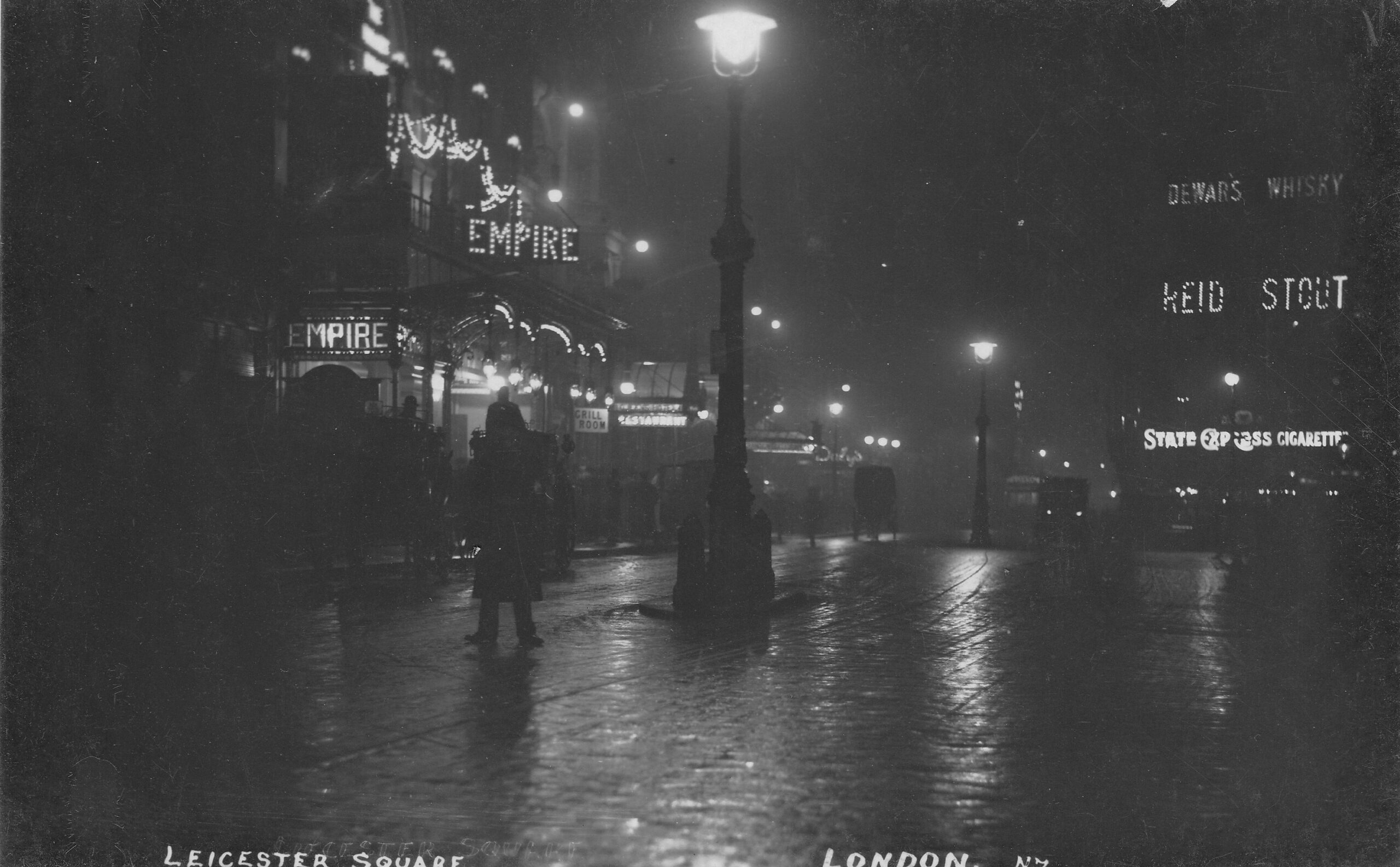
The following photo from the 1920s shows the Empire on the left, on a damp night in Leicester Square.

Leicester Square at night

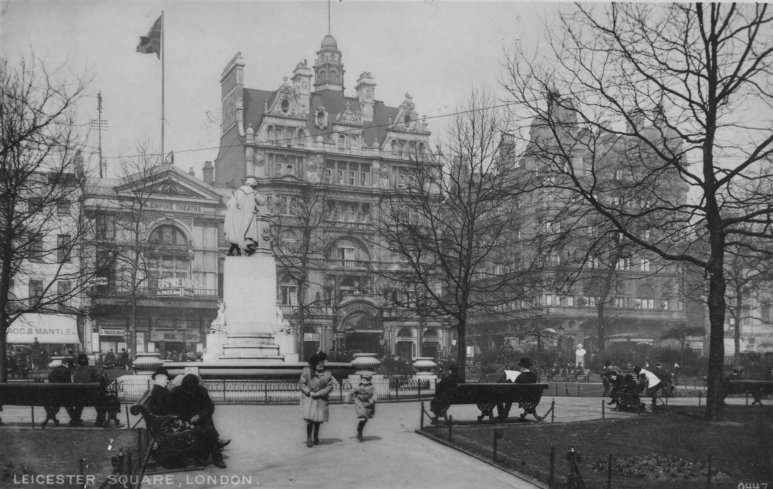
A view across the central square to the northern side of Leicester Square in the early years of the 20th century:

Leicester Square

That was a very quick run through of the history of Leicester Square. From the site of an aristicratic house surrounded by fields, to a typical London 18th century square surrounded by fine houses, which then became the site of 19th century entertainments, which have continued into the 20th and 21st centuries, with only really technology changes that have resulted in film replacing panoramas and variety theatre as the popular source of entertainment.

Time for a walk around the square. The view from the north-east corner:

Leicester Square

On the north-east corner of Leicester Square is Burger King, housed in a rather impressive building.

Burger King

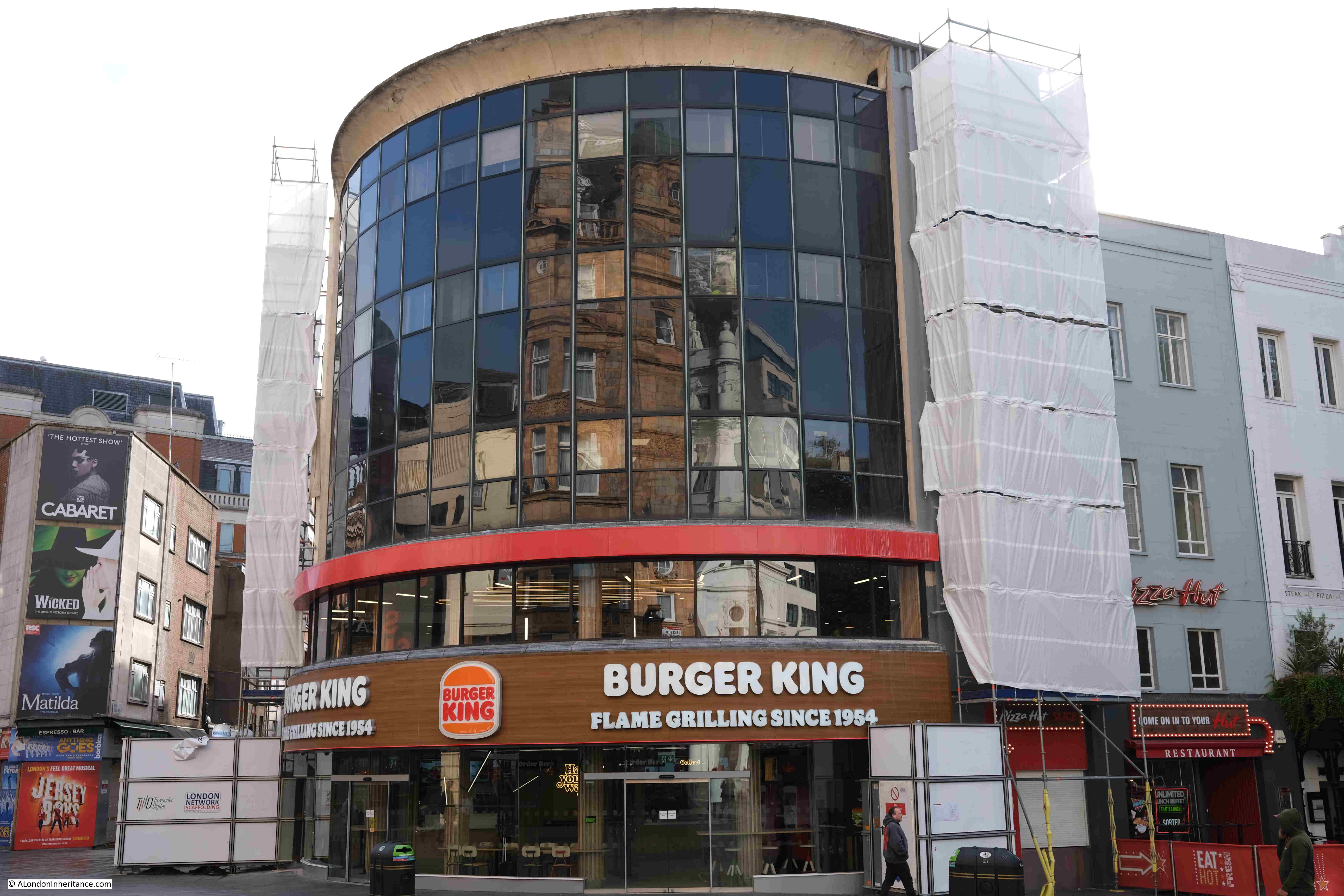
The building was originally the Samuel Whitbread pub, opened in December 1958, and was Whitbread’s attempt at reviving London’s post war pub trade. Designed by architects TP Bennett & Son, with four distinct interior spaces by designers Richard Lonsdale-Hands Associates.

The pub was very much a 1950s design, and during the 1960s it started to seem dated, and did not have the benefit of being a traditional London pub to help.

Whitbread sold it to Forte in 1970, who renamed it as the Inncenta, however by the late 1970s, the pub, along with much of Leicester Square was becoming rather squalid, and suffered from lack of investment.

The building may change again, as the owners, Soho Estates are looking to redevelop the building to make it more of a “destination” site in Leicester Square.

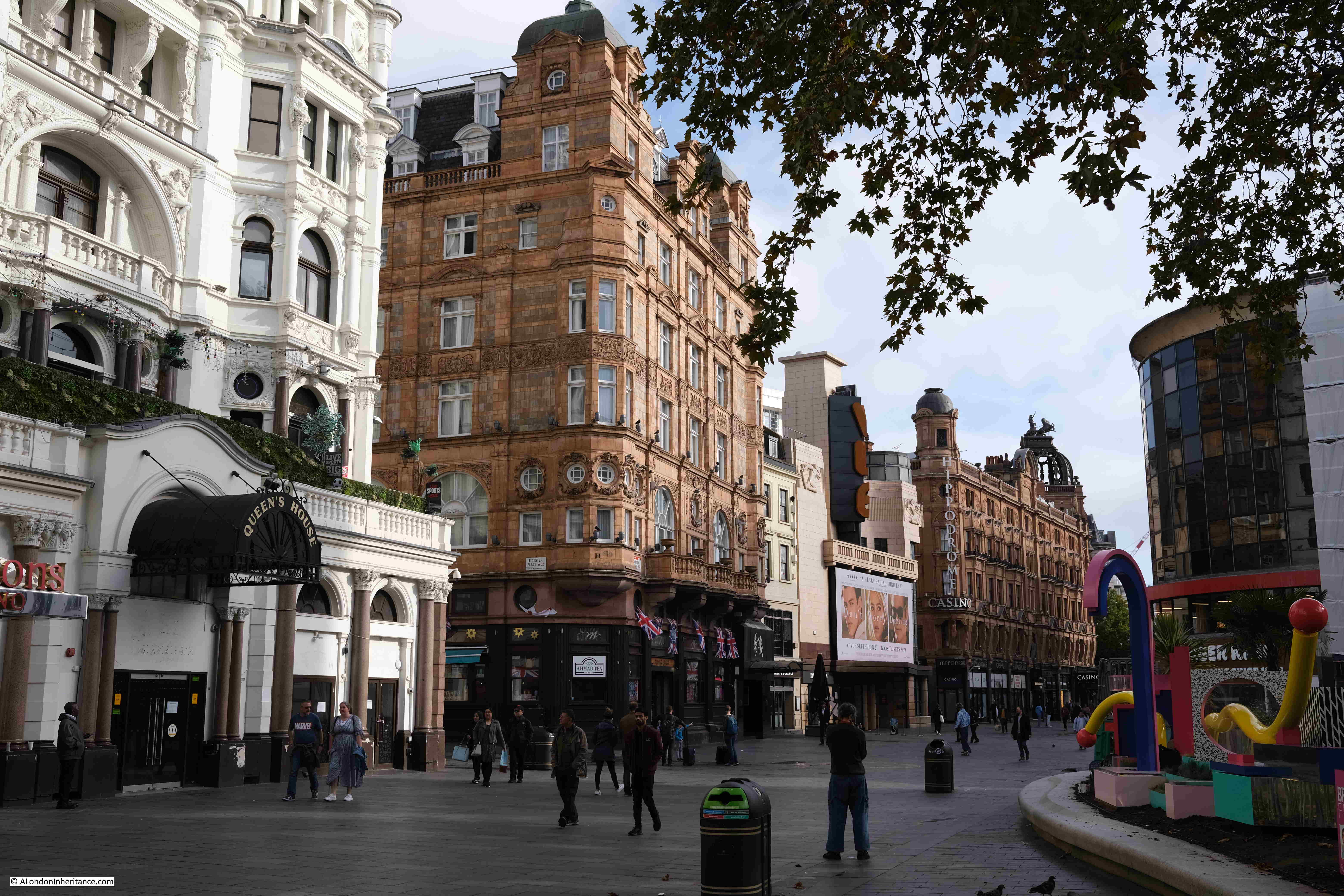
View of the north-east corner of Leicester Square:

Leicester Square

The Empire Cinema on the north side of the square, showing how buildings on the square have continued to adapt, as the site now has an IMAX cinema as well as a casino.

Empire Leicester Square

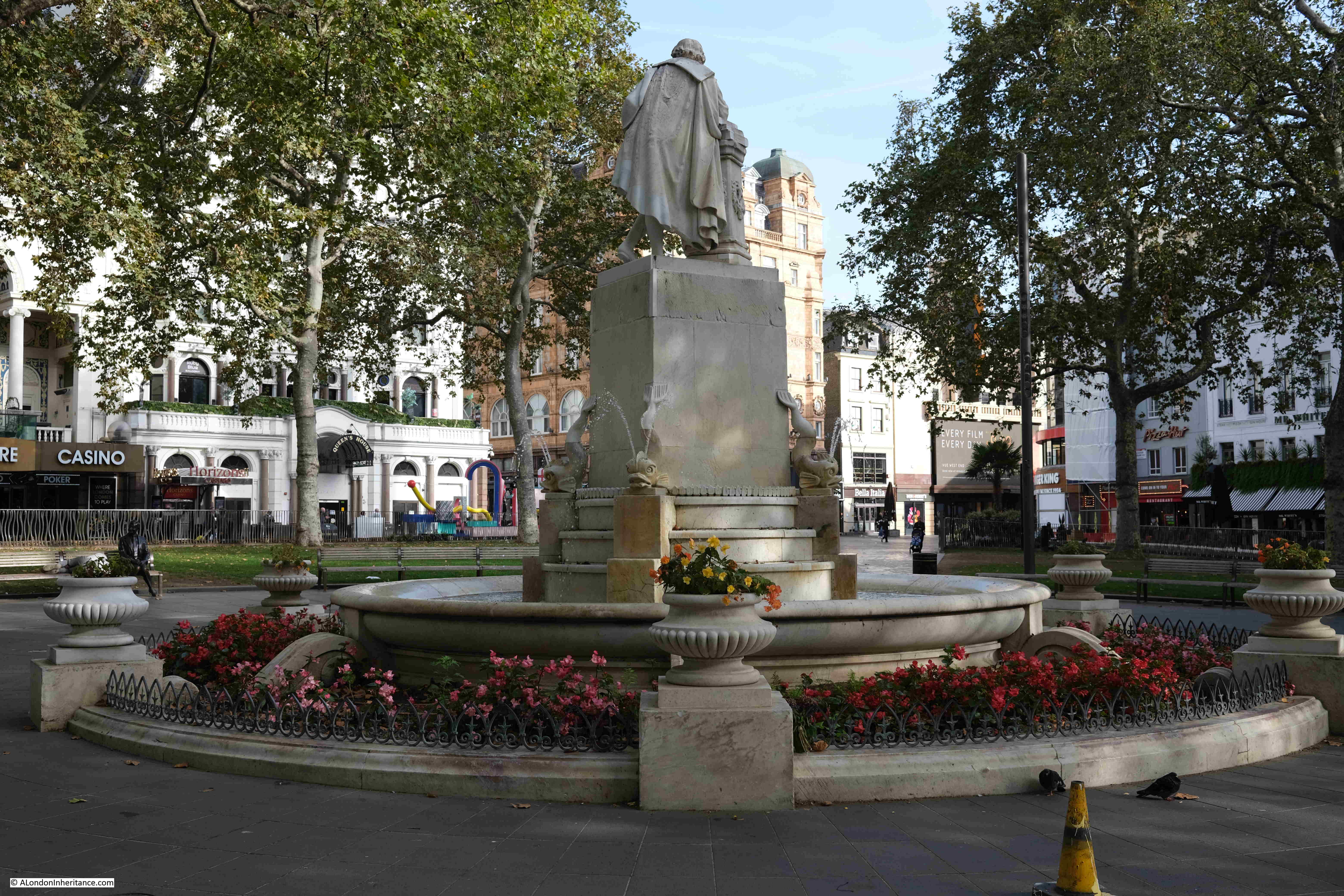
The above photo was taken within the central square, and the following photo is looking towards the central statue.

Leicester Square

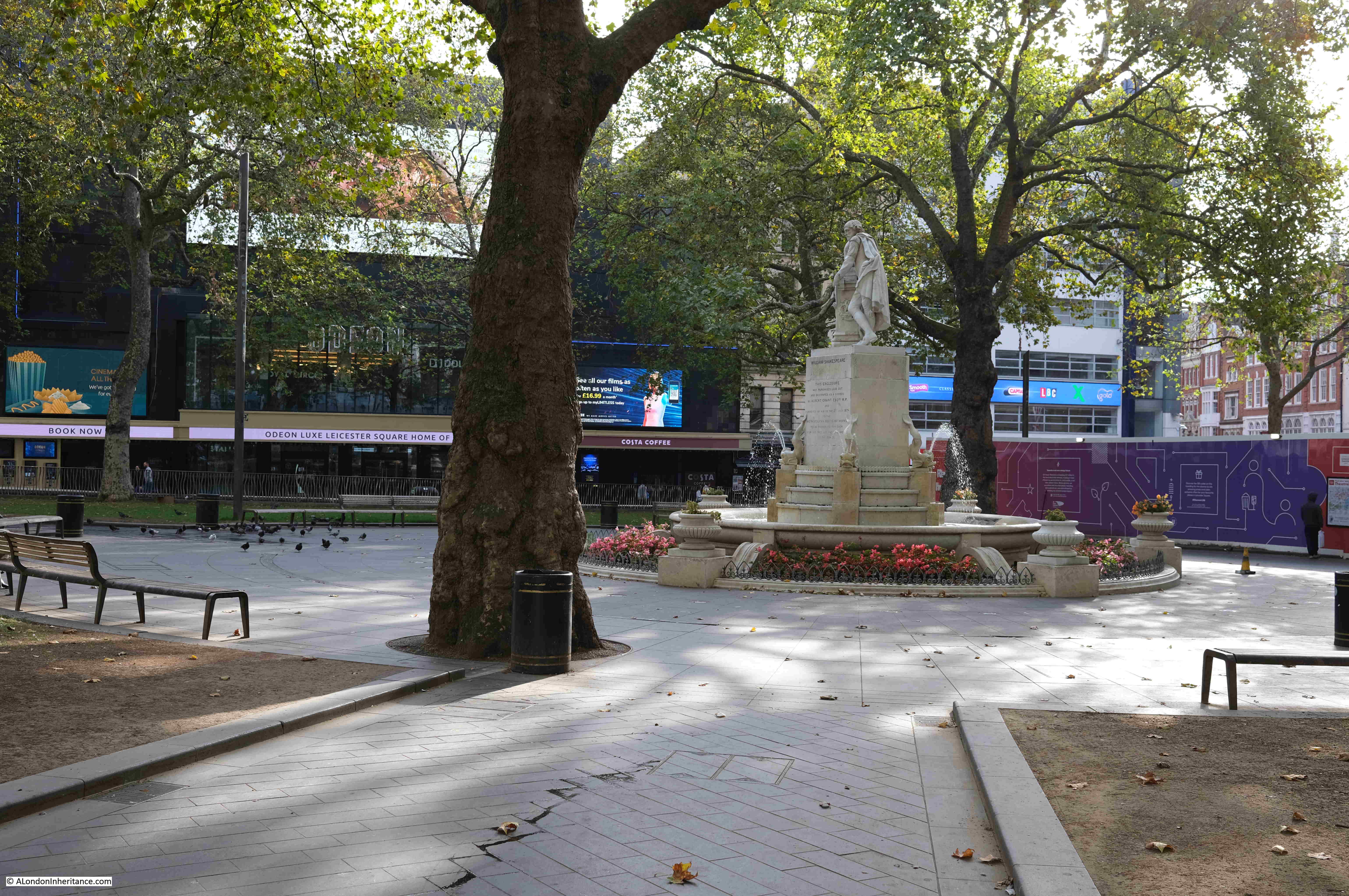
The gardens of Leicester Square are today rather basic. Surrounding trees with grass on the outer sides of the square. The square has been used for a number of commercial activities that take over the square. for example, in pre-Covid days, there was a Christmas Market across the square in the weeks before Christmas.

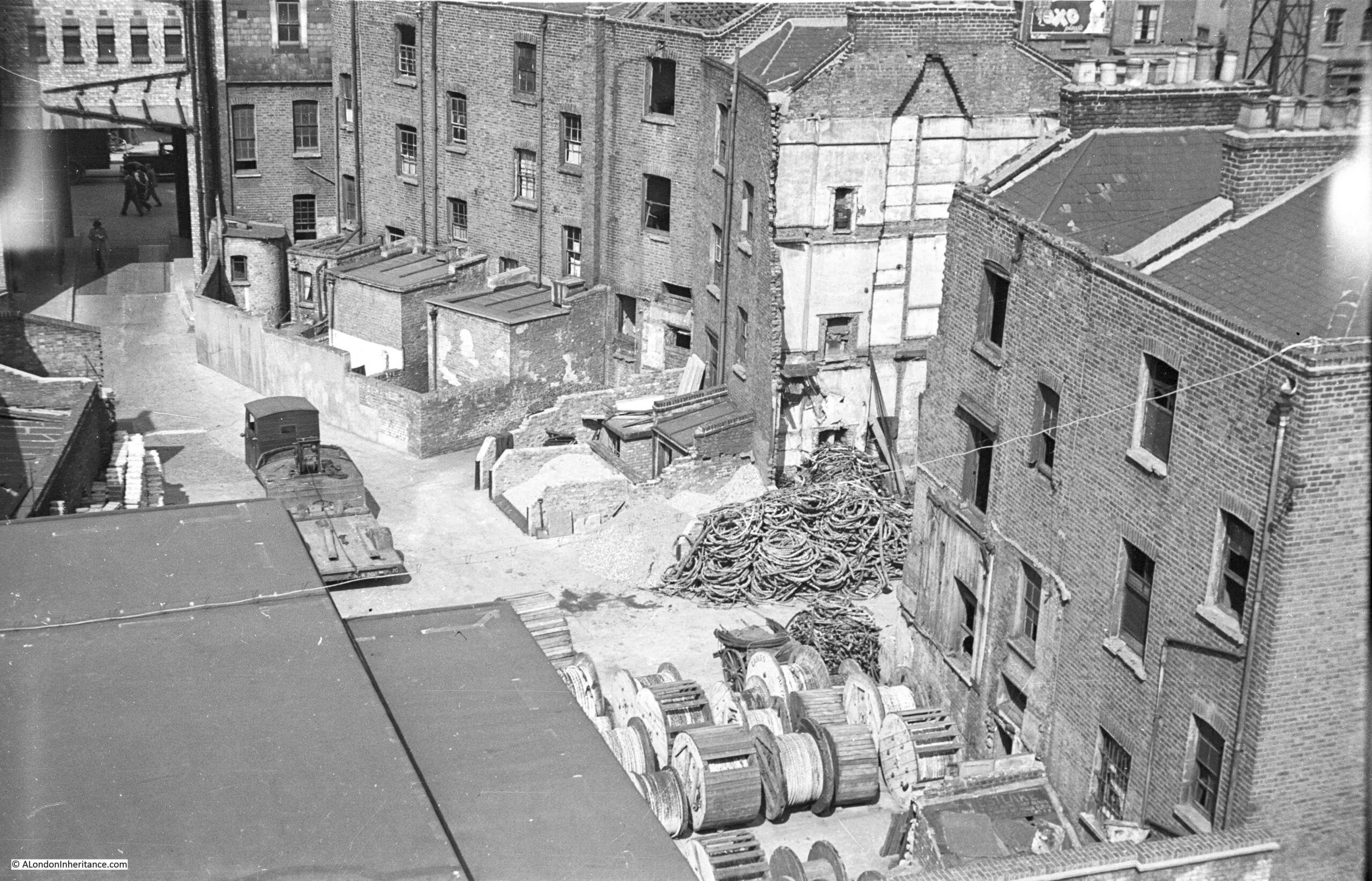
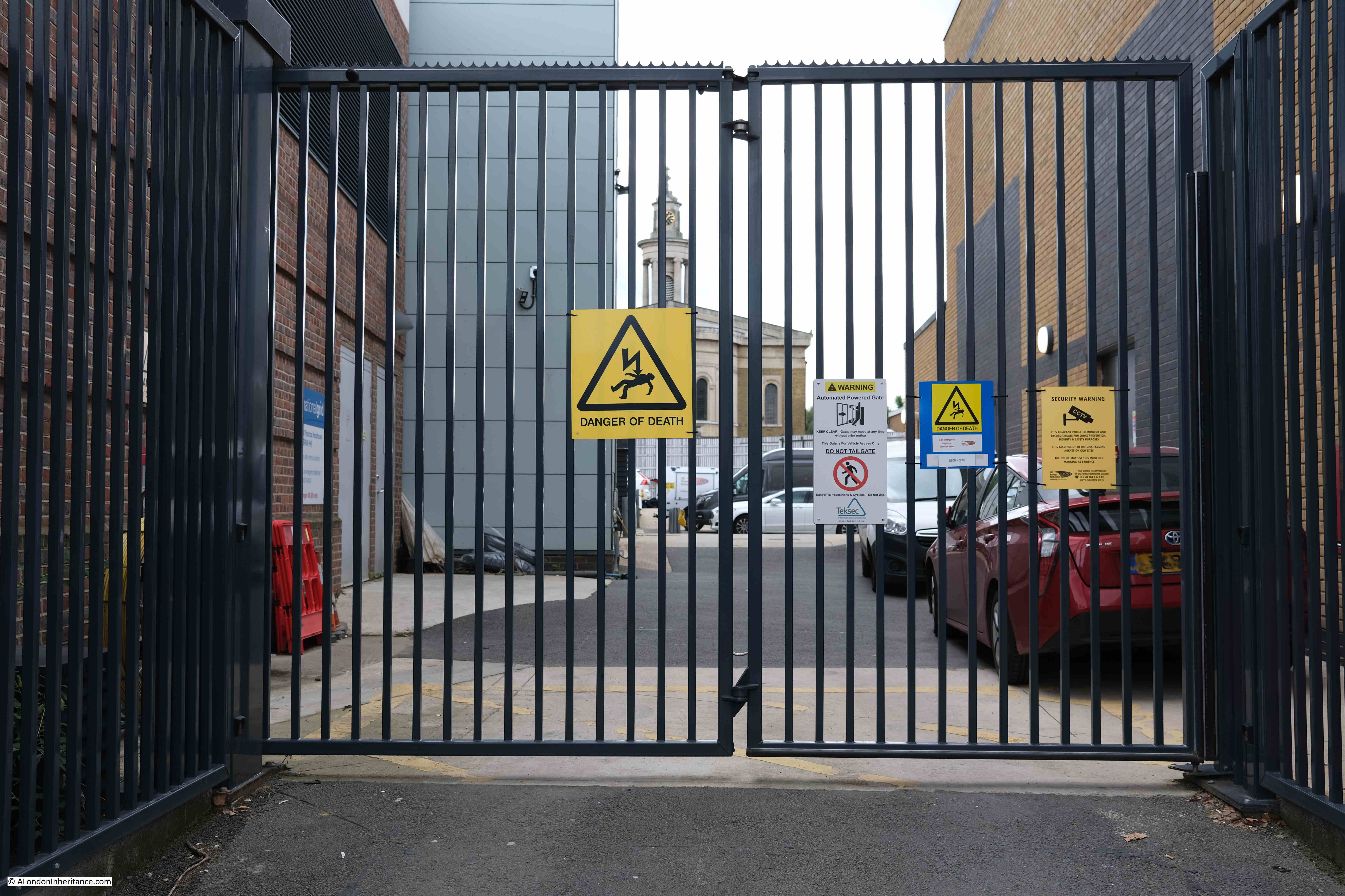
The square though does have a secret, as below the square is a key part of the West Ends electricity distribution infrastructure.

Leicester Square

Below the square is a large, multiple level, electricity substation. The substation basically takes high voltage feeds from the main distribution network, and “transforms” this high voltage down to the 240 volts that ends up in the sockets of local homes, businesses and shops.

Large devices called transformers perform this function, and earlier this year the third of three new transformers arrived at Leicester Square as part of an upgrade of the substation in order to support the increasing demand for electricity in the West End. The southern part of the square is still fenced off as part of this upgrade.

In the centre of square today, is a statue of William Shakespeare, with below an inscription that records that the square was purchased, laid out and decorated as a garden by Albert Grant, and conveyed by him to the Metropolitan Board of Works in 1874:

Shakespear statue Leicester Square

The Graphic on the 4th of July 1874 provides some more details on how and why this happened, after the demolition of Wyld’s Great Globe:

“Bit by bit the rusty iron railings were filched away, while the statue of King George II on horseback became a butt of practical jokers. On one occasion (and at considerable expense) some systematic wags bedaubed it with whitewash, and finally the horse and rider parted company, the latter lying prone in the mud. The old proverb that when matters come to their worst they must perforce mend. Leicester Square had attained its nadir when Sir George Jessel decreed that the freeholders were bound to restore the Square to its original state of respectability.

The freeholders were preparing to appeal this decision, the Board of Works were about to apply to Parliament for powers to purchase the site, when Mr. Albert Grant, MP for Kidderminster, appeared on the scene, and has since acquired the freeholder property. Mr. Grant resolved to make a most generous and patriotic use of his purchase, by laying out this hitherto desolate area as an open ornamental place, provided with walks, lawns and parterres of flowers. The whole of the works have been designed and completed under the superintendence of Mr. Knowles, the well-known architect; and on Thursday last Mr. Grant handed over this munificent present to the Metropolitan Board of Works, as trustees for the people of London.”

The statue of William Shakespeare dates from the 1874 restoration of the square by Albert Grant. It was sculpted in marble by Giovanni Fontana, and is modeled on Peter Scheemaker’s monument in Poets Corner at Westminster Abbey.

Shakespeare is pointing to the phrase, “there is no darkness but ignorance” which comes from the play “Twelfth Night” 

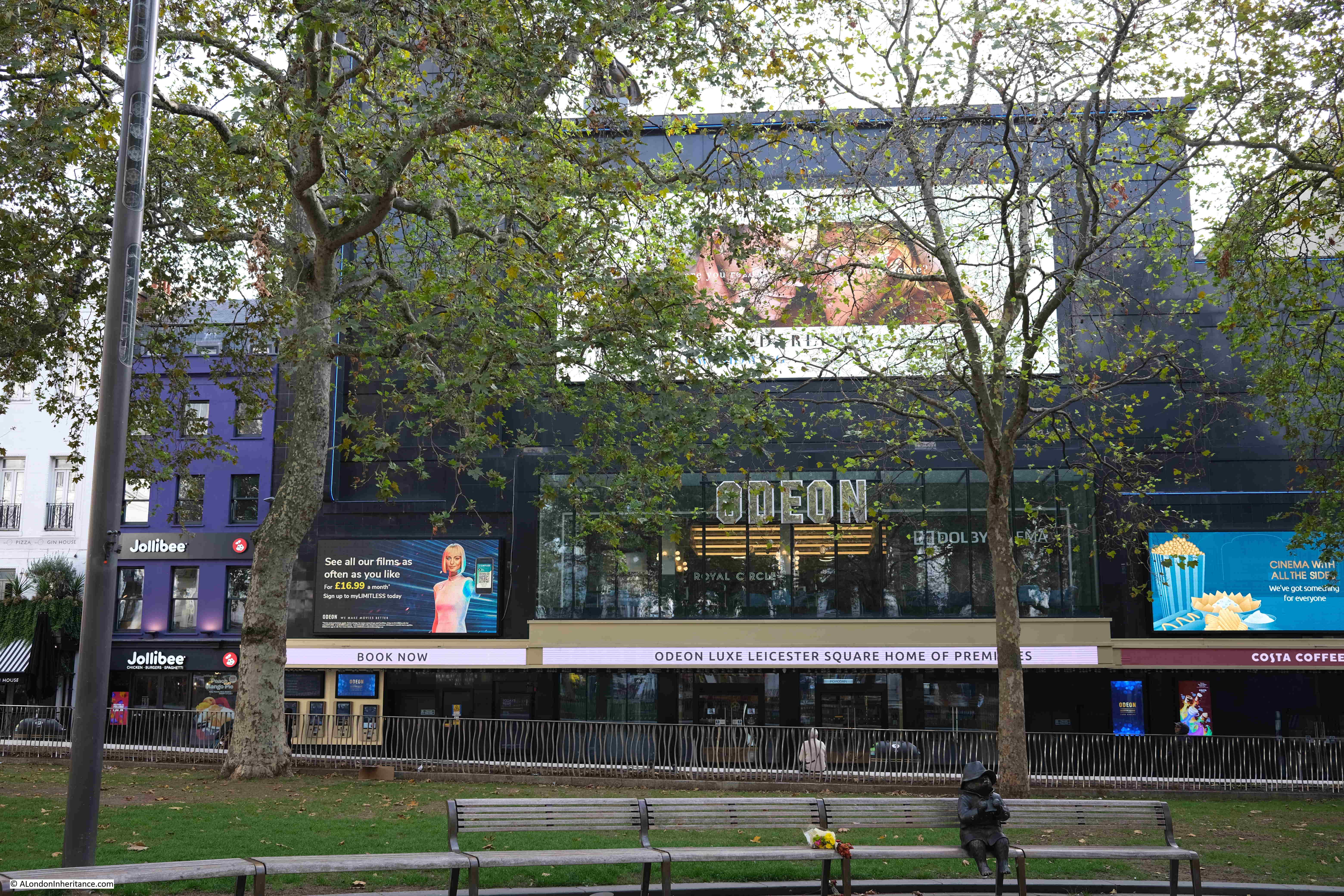
View from the square towards the Odeon Cinema:

Odeon Leicester Square

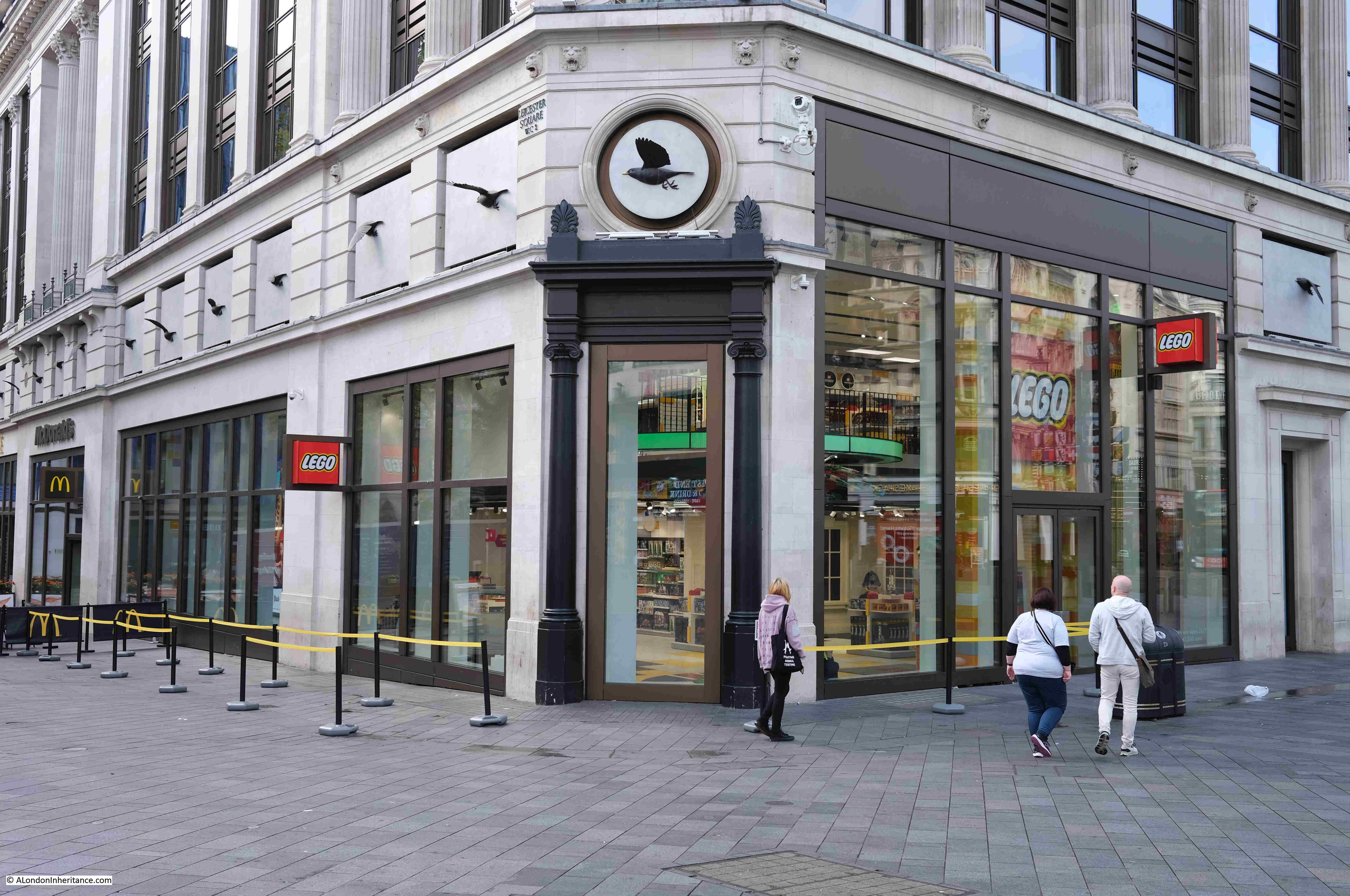
Leicester Square today is a major tourist destination, and therefore attracts major international brands. One such being Lego, who have a queuing system outside their store. This helps manage the numbers inside, but also enhances the image if you can show large queues wanting to get inside your store.

Lego Leicester Square

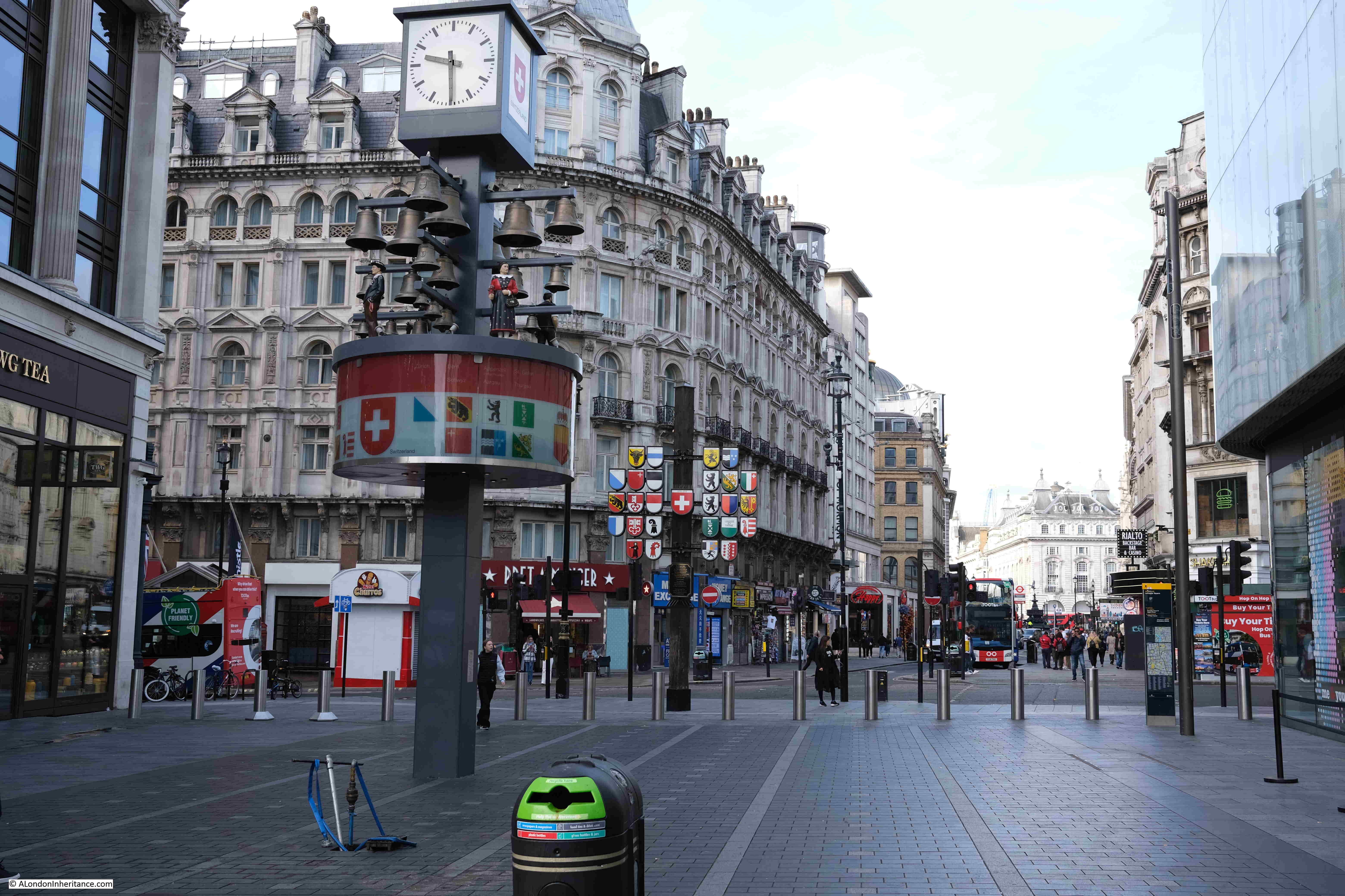
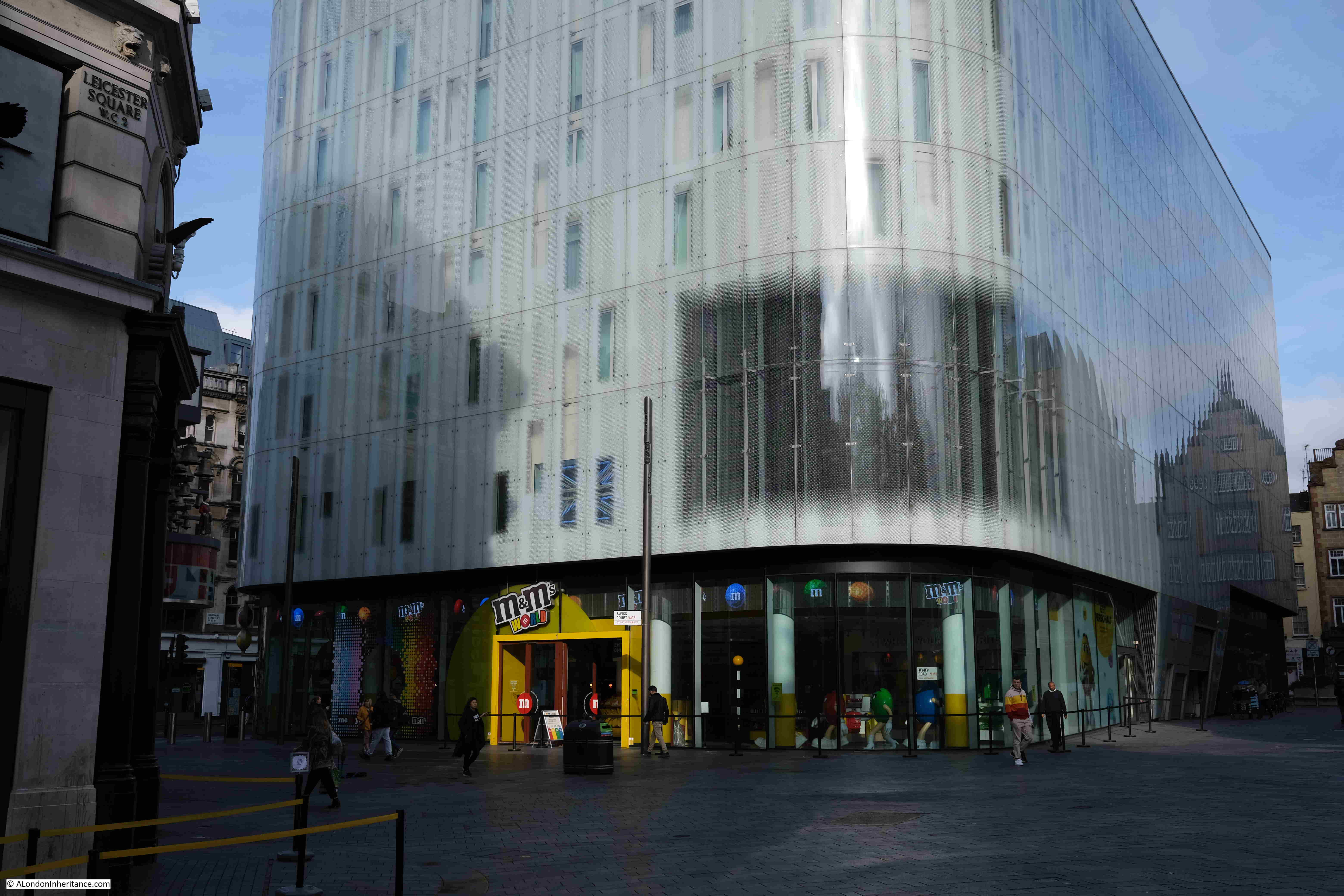
The view towards Piccadilly, with the Swiss glockenspiel, which was originally on the Swiss Centre, which was demolished in 2008. I have some photos of that which I still need to find and scan.

Swiss Centre

A hotel, and large store for M&Ms was built on the site of the Swiss Centre:

M&Ms Leicester Square

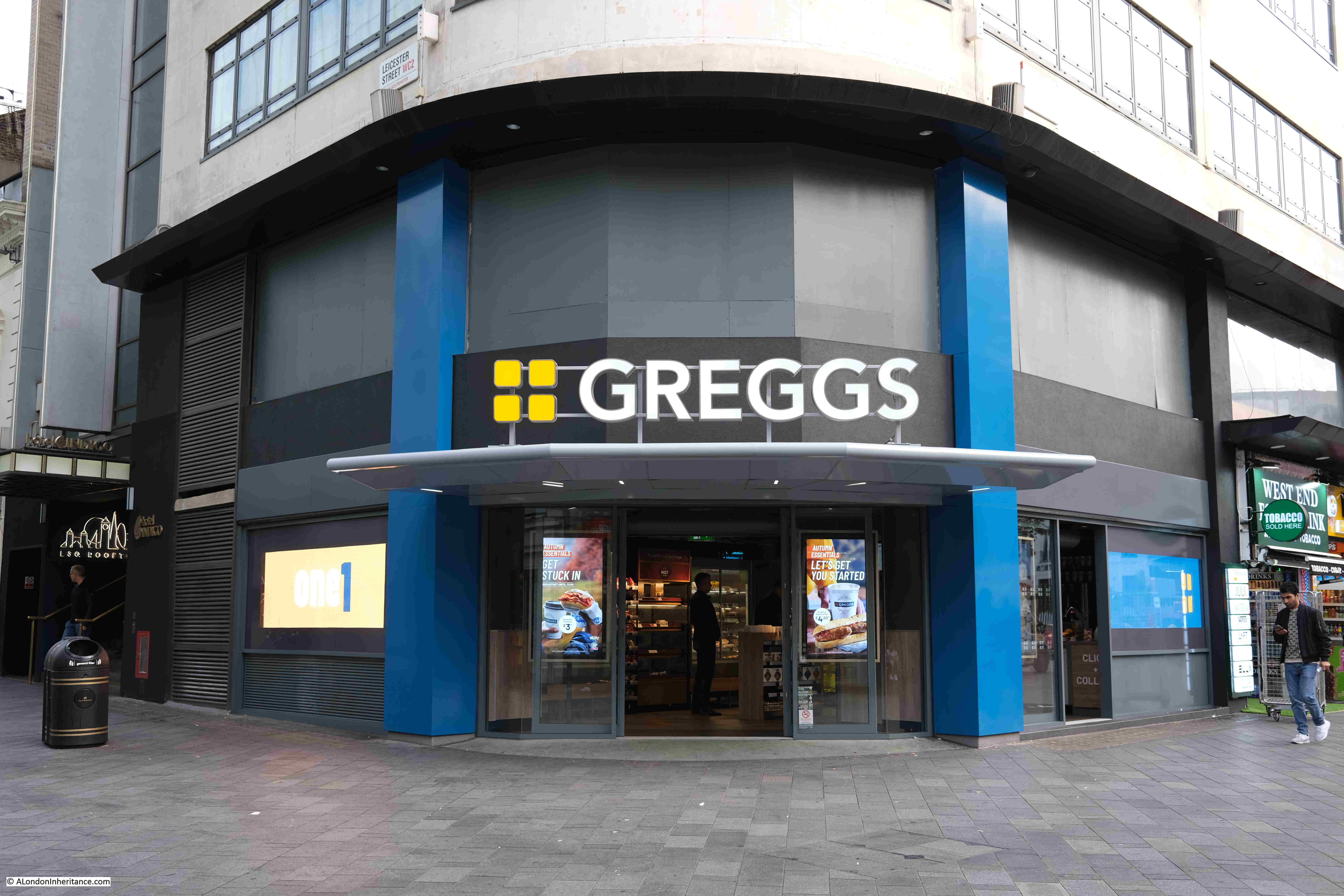
A recent addition to Leicester Square is a Greggs. Not a global brand, and I do find the thought of a Greggs in Leicester Square, alongside the flagship stores of Lego and M&Ms, rather amusing.

Greegs Leicester Square

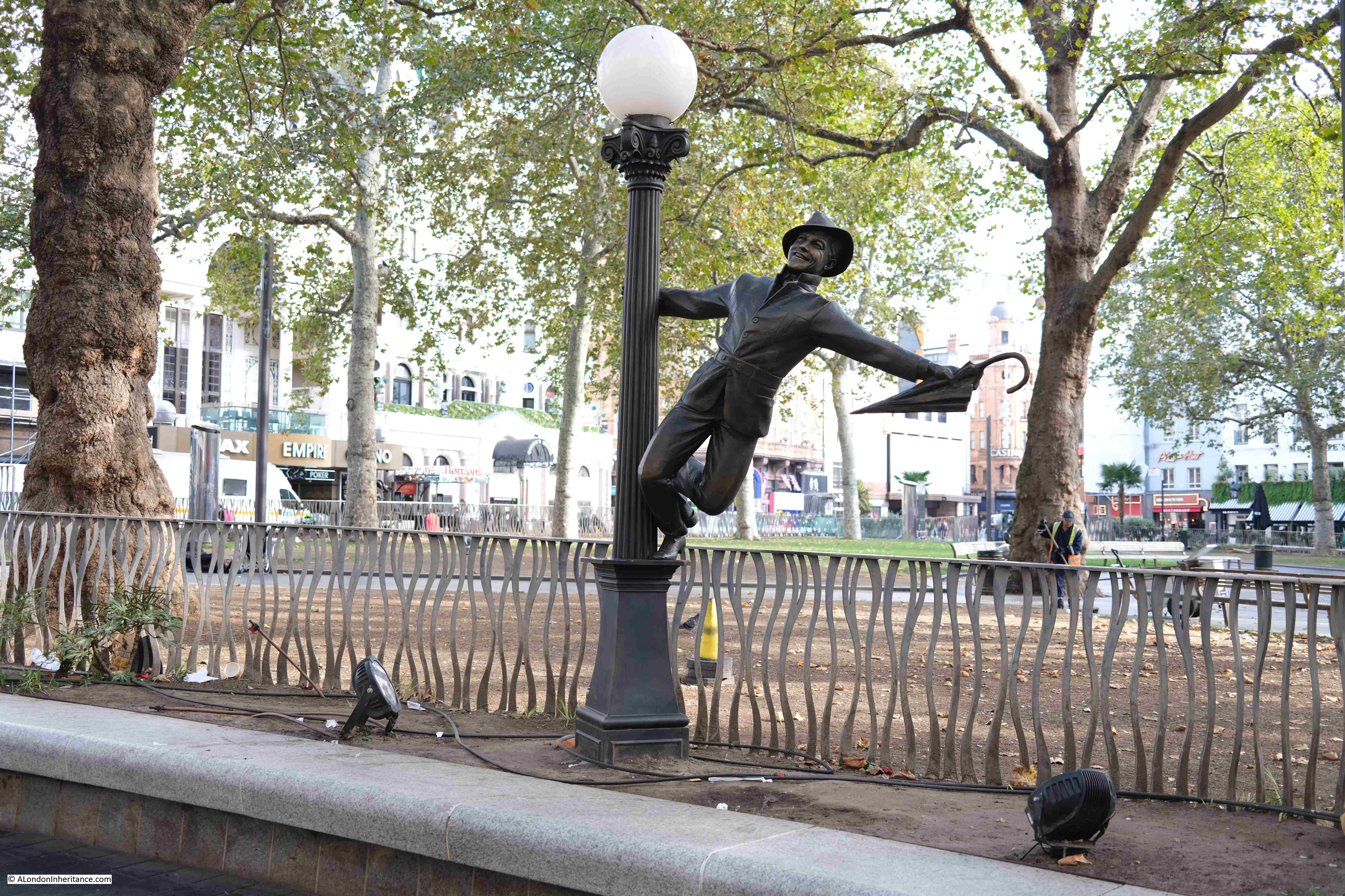
Around the square are various works of art that represent characters from films, including Gene Kelly in a scene from Singing in the Rain:

Leicester Square

The west side of the square with an All-Bar-One and a McDonalds. Just visible is a plaque between the two buildings.

Sir Joshua Reynolds

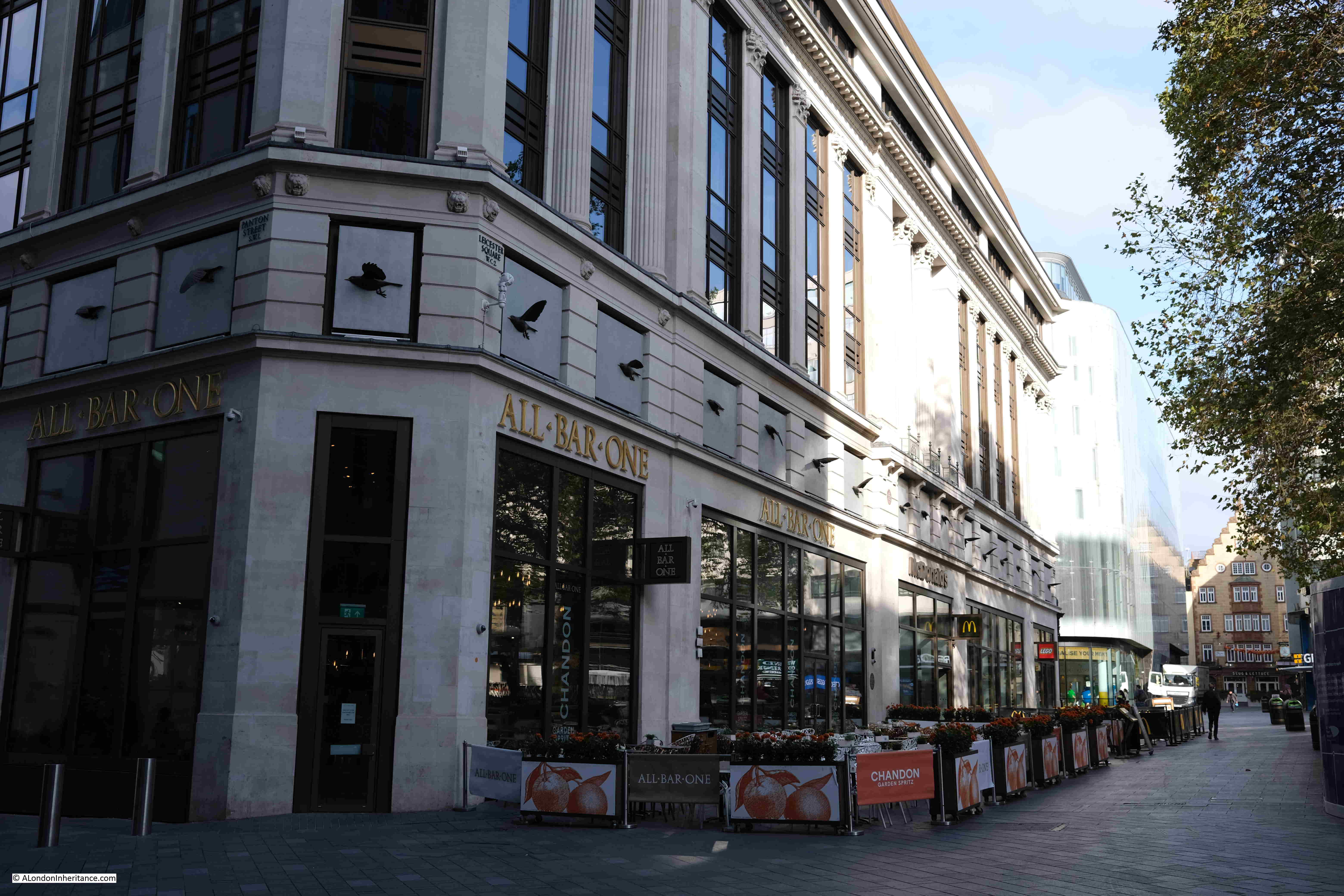
Which records that the portrait painter Sir Joshua Reynolds lived and died in a house on the site, as well as where numerous members of the aristocracy and society sat for Reynolds to have their portrait painted.

Sir Joshua Reynolds

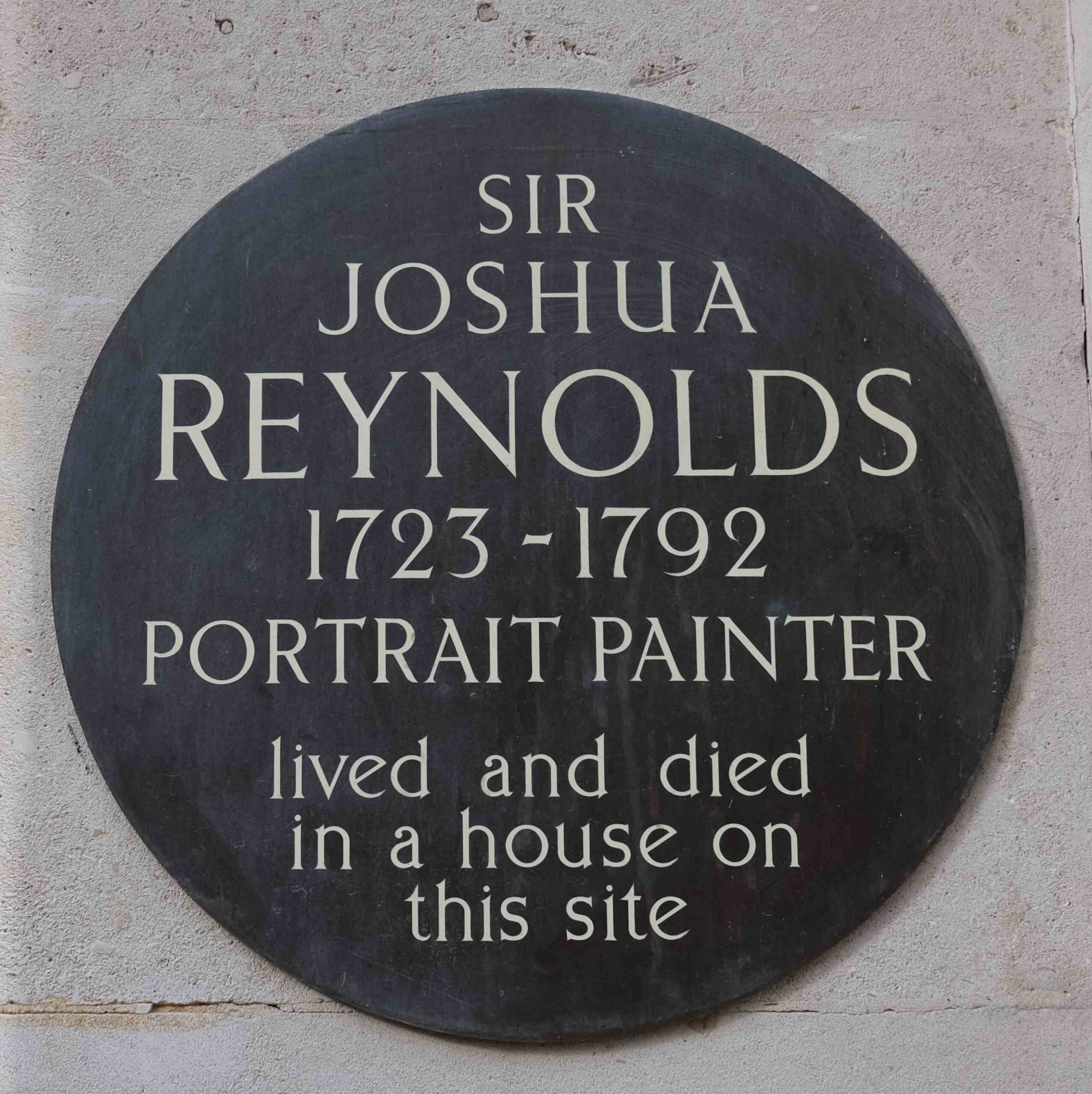
Reynolds was not the only artist who lived in Leicester Square. William Hogarth had his main home in the south-eastern corner of the square. This was his central London base, and his house in Chiswick was his country retreat.

The southern side of Leicester Square:

Odeon cinema

For many years there has been a theatre ticket centre on the southern side of the square, selling tickets for shows that evening, or the coming days.

Leicester Square ticket office

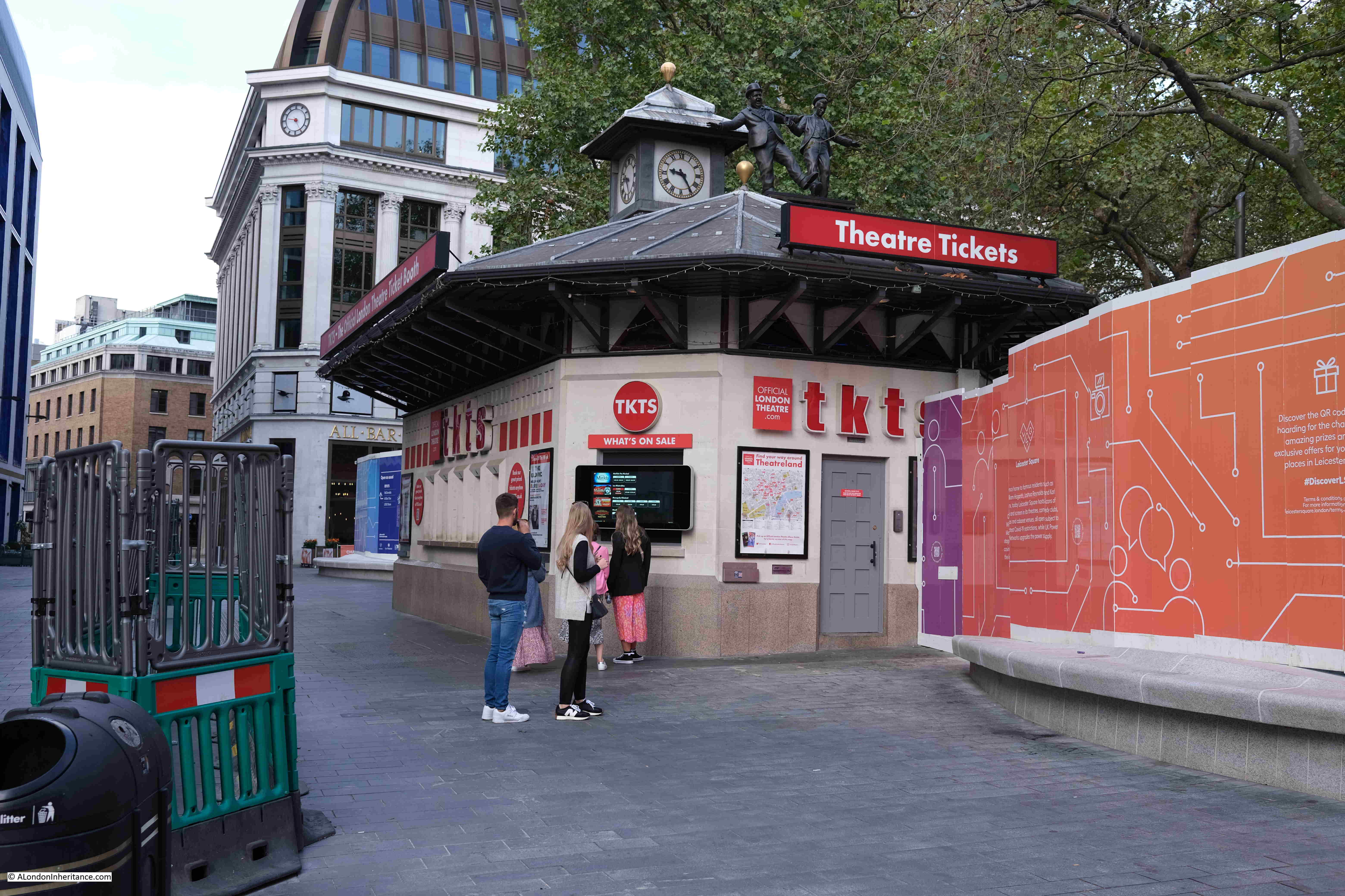
The hoardings on the right in the above photo are screening off the work site where upgrades are being made to the electricity substation below the square.

The eastern side of the square:

Capital Radio

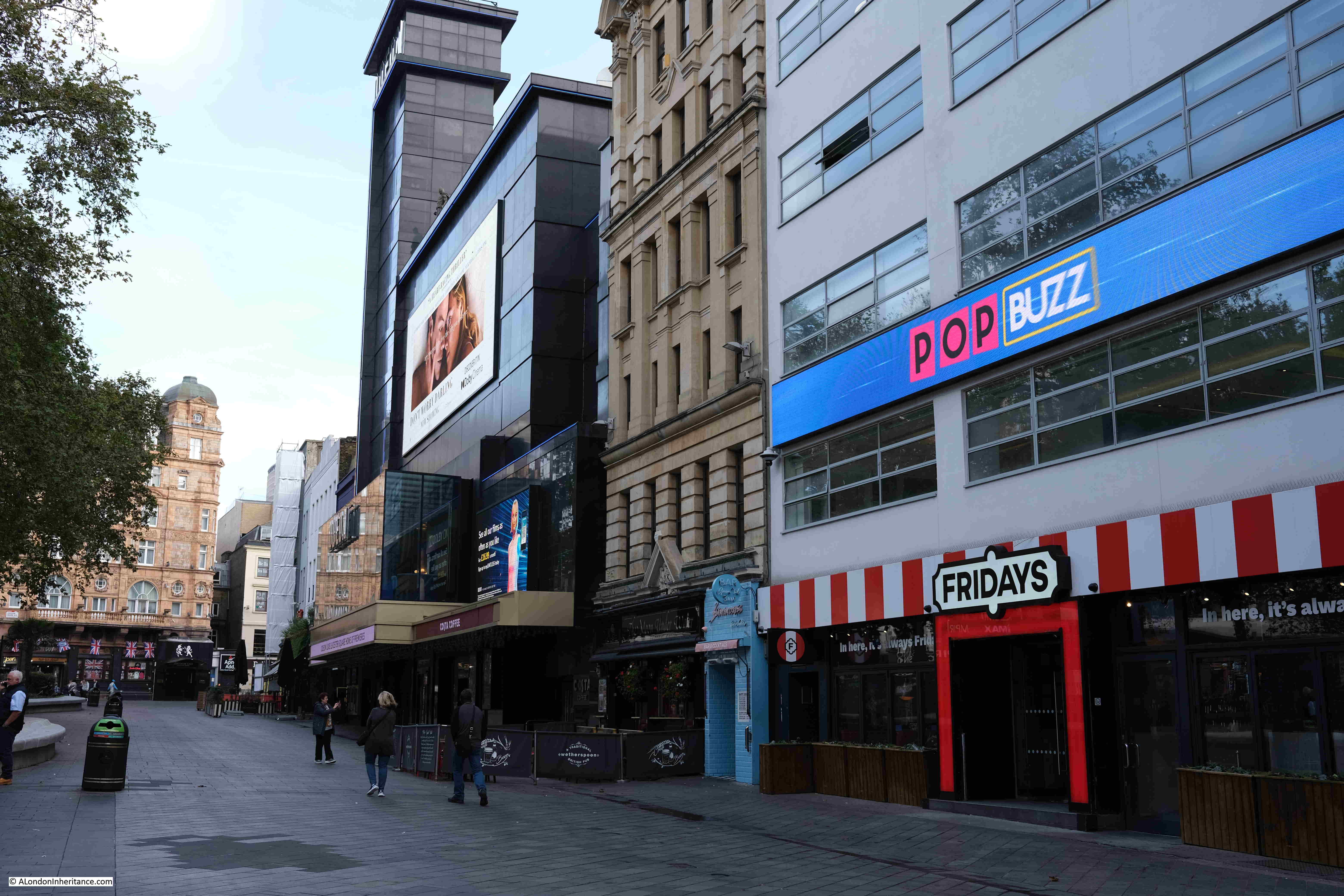
The building on the right is the offices of Global Radio, the company that owns radio stations such as Capital Radio and LBC – the two original London commercial stations that have since morphed into national brands.

The TGI Fridays on the ground floor was once the Capital Radio Cafe, which, and speaking from experience, was a perfect venue for early teenage children’s birthday parties.

Between TGI Fridays and the Odeon cinema, is Leicester Square’s only pub, Wetherspoons The Moon Under Water:

Moon under Water pub

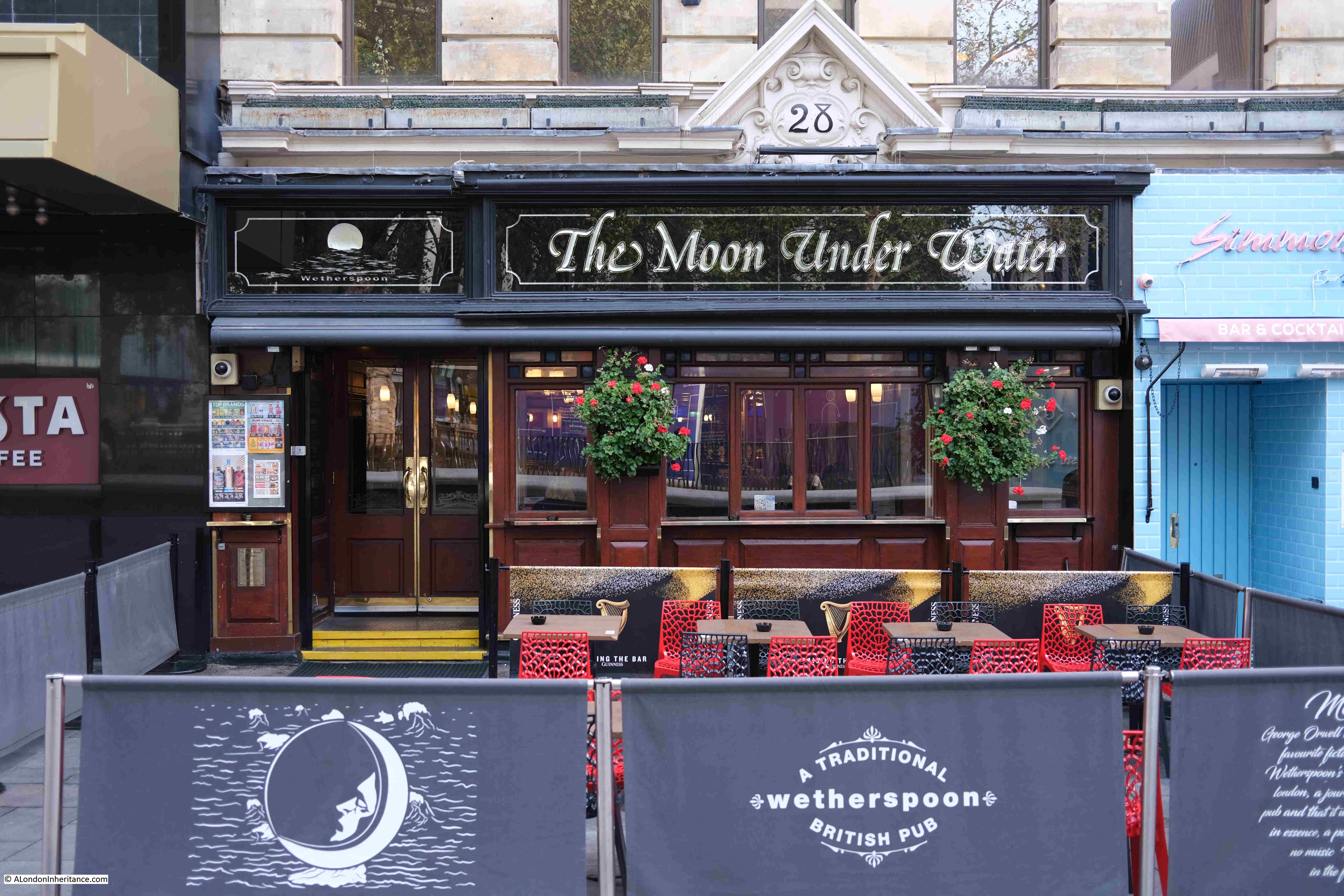
The pub dates from around 1992. Number 28 was one of the original Leicester Square houses that was demolished towards the end of the 19th century, and, following the mid 19th century approach to have exhibitions for entertainment, housed the Museum National of Mechanical Arts.

In the 1930s, number 28 was the site of the “400 Club” which was known as the club for the upper classes and aristocracy, with Princess Margaret becoming a regular client of the club in the 1950s. The Tatler would often have reports of who was to be seen at the 400 Club, and would include photos of men in Dinner Jackets and women in expensive jewelry.

That was a very quick tour of the history of Leicester Square. A square that started off as one of London’s typical residential squares, with fine houses and a central square, although with the unusual feature of Leicester House to the north.

A square that has quickly evolved into one of London’s centres of entertainment, starting with panoramas and scientific displays and lectures, which then became a home for variety theatre and then London’s hub for cinema, and which is where the majority of major films have their UK premier.

In the coming week, The Last Heist premiers at the Vue cinema in Leicester Square on Wednesday the 2nd of November, followed by Black Panther: Wakanda Forever at Cineworld on Thursday the 3rd.

However popular entertainment evolves in the future, I am sure that Leicester Square will play some part in being London’s West End hub.

alondoninheritance.com

The Broomway and a London Airport

I am fascinated by both London, and the impact that London has had on the wider country. Even some of the most remote parts of the surrounding counties have felt the threat of London’s continual growth, and the infrastructure needed to service the rapacious city. To find such a place, and to walk what has been called the country’s most dangerous footpath, took me to Wakering Stairs in Essex last Sunday morning at 7am, ready to walk the Broomway.

Wakering Stairs

The Broomway is an ancient footpath, several hundred years old, that links mainland Essex at Great Wakering with Foulness Island.

Foulness is now mainly Ministry of Defence property, although it does have a small community living on the island. The MoD have built a bridge connecting with the mainland, however before the bridge was constructed, the only way for residents to get to and from the island was via a boat across one of the creeks and channels that surrounded the island, or via the Broomway.

The shore facing the wider Thames Estuary / extreme southern part of the North Sea is extremely flat and extends a considerable distance from land. This has resulted in a large area of flat sands that are either covered by water, or as exposed sand, mud and low lying water, depending on the tide.

The part of the shore close to land is comprised of a black organic mud, that is very sticky, can drag down someone who walks into this area, and is very difficult to get out of.

Further out, there are reasonably stable sands, however these still have their dangers. It is these sands that offer a route to travel between the mainland and Foulness when the tide allowed, and was marked by poles of Broom and was used for centuries as a route to and from Foulness.

I have long wanted to walk the Broomway. I am reasonably good at planning routes which involve the tide, walking over tidal mudflats etc. however the Broomway is not a route I would take without an expert guide.

Tom Bennett is qualified in a number of outdoor activities, and offers guided walks along the Broomway. These sell out quickly, but a number of months ago I was able to book a walk in October, not my preferred month due to the risks of autumn weather, but in the end, it turned out to be a perfect day’s walking.

The route taken was between Wakering Stairs and Asplins Head, and the following map shows the location of these points, along with the location of Foulness, to the north-east of Southend (© OpenStreetMap contributors).

Foulness

This is not the full route of the Broomway which originally went all the way along the easterly coast of Foulness, and there were a number of access points between the Broomway and the land.

I photographed the map on an information panel at Wakering Stairs, where there are plenty of warnings about the dangers of the area. The map shows the Broomway running parallel, but a distance offshore, to Foulness, and also shows the full length of the path, and the points where it is relatively safe to travel through the dangerous areas of mud near land and reach Foulness.

Map of Foulness and the Broomway

The time needed to walk the whole footpath, and return along the same route is such that it is difficult to avoid the incoming tide, so the walk last Sunday covered half the route.

Standing at Wakering Stairs at seven in the morning, looking out over the mudflats is rather magical. The sun rising above the distant sea, the sounds of flocks of birds on, and flying above the mud flats:

Broomway

In the above photo, on the right, where the sea meets the sky, the Redsands Maunsell Fort can be seen.

So what is the London connection?

Maplin Sands is the name of the large area of sands offshore Foulness, and in the early 1970s, it was Maplin Sands and Foulness that almost became London’s third airport.

In the 1960s, London had two main airports, Heathrow and Gatwick. Air travel was growing rapidly, and this growth was expected to continue well into the future, so the search began for the site of a new airport.

In 1968 the Roskill Commission, also known as the Commission on the Third London Airport was formed, with the aim of investigating options, and making a recommendation for the location of the new airport. The commission was named after High Court Judge Eustace Roskill.

The locations were narrowed down to four, Cubington in Buckinghamshire, Foulness in Essex, Nuthampstead in Hertfordshire and Thurleigh in Bedfordshire.

The commission published their report in 1971, with a recommendation that Cubington in Buckinghamshire should be the site of the third London airport. The commission turned down the Foulness option mainly due to issues with accessibility, as Foulness was on an isolated part of the Essex coast, with no current, or easy to implement transport options. The commission feared that if transport options could be put in place, they would still be too far from central London, and airlines would continue to prefer Heathrow and Gatwick.

The Government turned down this recommendation, and went for Foulness which had been put forward in a separate report by Professor Colin Buchanan, a dissenting member of the Roskill Commission.

The reasons for this decision were the avoidance of significant impact to countryside and people, there was pressure from well funded groups opposing Cubington. Essex County Council were in favour of Foulness, and it was seen as a way to regenerate the area around Southend.

In the 1972-73 Parliamentary Session, the Maplin Development Bill was introduced and the Maplin Development Authority was set-up, which would have the responsibility for the development of the land, which, as well as the airport, would include a deep water port and new town, along with the transport links needed to connect the new airport to London, and the rest of the country.

The airport was supported by the then Conservative Prime Minister, Edward Heath, however it would not last long, with only minimal works to test whether the Maplin Sands could be reclaimed for the construction of the airport.

In March 1974 the Labour Party took over in Government, and commenced a review into the airport. In july 1974 the review was published and Peter Shore, the Labour MP for Stepney and Poplar announced that the Foulness / Maplin Airport project would be abandoned.

Back to the Broomway, and the walk over what could have become the third London airport, started at 7:30 am. The walk left Wakering Stairs and headed out, away from the coastline, and the dangerous mud. The following view is out on the Broomway, looking back towards Wakering Stairs:

Broomway

The above photo shows large expanse of sands and water with hardly any landmarks. The first we reached was a small patch of grass growing in isolation:

Broomway

To the south, Foulness is separated from the mainland by the Havengore Creek. Today, there is a bridge over the creek which is part of the upgraded roads along Foulness used by the limited number of occupants, and primarily by the Ministry of Defence (MoD).

In the following photo the Havengore Bridge can be seen in the distance as we walk over the sands where the creek flows into the sea.

Broomway

The island’s connection with the MoD starts in the mid 19th century when the War Office used sands to the south as an artillery range. The War Office tried to expand to the north and attempted to purchase Foulness Island from the Lord of the Manor, however he refused, although the War Office started to buy up any land or farms that became available.

When Alan Finch, the Lord of the Manor died in 1914, his half-brother inherited the estate and agreed to sell to the War Office, who then owned over two thirds of the island.

Since 1915, Foulness has effectively been a closed island. Mainly used by the MoD for weapons testing, but with a small community remaining and some farming.

The Essex Weekly News on the 18th of December 1914, described the island as:

“AN OLD WORLD PLACE – If Foulness island becomes simply a military area we shall see there after two thousand years an instance of how history repeats itself. The Romans selected Mersey Island further along the Essex shore as a military camp, and fortified it against invasions by Norsemen. Now another foe, equally barbarous again threatens us from the North Sea.

Foulness is very flat and scantily wooded, and but few farm houses and cottages are in view, although there is a population of about 480. The island was constituted a parish in 1550. The Parish Church erected in 1850 on the site of a series of wooden buildings, is dedicated to St Mary.

The nearest point on the mainland to Foulness is Great Wakering from whence as a spot known as “The Stairs” it is reached at low tide by a headway over the sands. Stubby tufts of broom stuck in the sand about thirty yards apart mark the way for the traveler. There have been some narrow escapes by those who have ventured along this wave-washed road; and indeed few experiences are more alarming than to find one-self along the ‘Broom-way’ as the road is called, a couple of miles from land in the dusk of a winter’s day with the tide beginning to race across the Maplins.”

Once out on the Broomway, it is easy to appreciate the risks whilst walking along this “wave-washed road”. You are separated from land by a dangerous area of mud. There are no visual reference points. The land is so flat that when the tide comes in, it does so rapidly. Not an incoming visible wave of water, rather a deceptive rise in the water level all around that cuts you off from the land.

The following view is looking out to sea from the Broomway. The sea is not visible, just an endless scene of sand and water until the horizon meets the sky:

Broomway

And in the following photo, looking back to land from the Broomway, which is now a narrow strip on the horizon, with the “Black Grounds” of dangerous mud separating you from the safety of the land.

Broomway

The military use of Foulness caused additional risk to those navigating the Broomway. The area was used for training and the test firing of guns and ammunition. This use continues to this day, and there are large warning signs at Wakering Stairs advising that “Do not approach any object or debris as it may explode and cause serious injury or kill”.

Newspaper reports illustrate the risk when the Broomway was in use by Foulness residents, as the following from the Southend Standard and Essex Weekly Advertiser on the 1st of December 1910 reports:

“FACING DEATH AT FOULNESS – EXCITING INCIDENT ON THE BROOMWAY: For a long time there have been many loud complaints from the people whose vocation causes them to use the road known as the Broomway from Wakering Stairs to Foulness Island, as to the serious danger which is caused by the gun practice from the Garrison at Shoeburyness.

On Tuesday last two people were driving across the Broomway when they had the narrowest of escapes from death, or serious disablement, by the bursting of a shell. They were in two traps, a few yards behind each other, and their attention was drawn to the gun firing which was going on from the Garrison. Naturally enough they felt no fear of danger, as the Broomway is on the edge of space allowed for practice is a mile or more away.

Several shots passed a safe distance away, but suddenly one great shell ploughed into the mud not more than thirty yards away and burst with a loud explosion. Vast quantities of mud and water were thrown out in all directions, and some of it, in great lumps, struck the two gentlemen who were driving, So great was the force of the explosion that a hole many feet long and deep, big enough to hold a wagon and team, was dug out. The horses were scared, and it was only with considerable difficulty that they could be prevented from bolting.”

The Broomway is only accessible from Wakering Stairs at the weekend as during the week, Foulness is still used for live firing.

Continuing the walk along the Broomway, and the most significant landmark on the sands comes into view. This is the Havengore Maypole:

Havengore Maypole

It is known as the Havengore Maypole as it marks a channel into Havengore Creek much further to the coast, and was once held in place by cables extending from the top of the pole to moorings in the sands, one of which can be seen to the left of the pole on the following photo:

Havengore Maypole

The Havengore Maypole is a significant marker in the wide expanse of featureless sand and water, however it was surprising how difficult it was to see from any distance. This is a problem with navigating the Broomway in that everything seems to blend into a featureless landscape, including the distant sea and land.

The weather on the day of my walk was really good. Clear skies, light wind and good visibility, however the Broomway is also at risk from sea fogs and mists which can roll in rapidly leaving a walker lost in a grey fog with no idea of the direction of travel.

There are stories of people being lost in fogs and walking out to sea rather than towards land.

The name Broomway comes from the use of sticks of Broom placed in the sands at regular intervals. By following these sticks, the traveler had confidence that they were on a safe route. They only then had the tide, fogs and the risk of an exploding shell to worry about.

There are very few of these markers left today, just the occasional base of a pole sticking out of the sands:

Broomway

For centuries the Broomway was the main route between Foulness and the mainland. There is written evidence of its existence back to the 16th century, and it is probably much older.

It was used by all manner of means of transport. Coaches, pony and traps, bikes, walkers. Newspaper reports of travel along the Broomway mention that the Postman had one of the most dangerous jobs as he had to travel the Broomway on an almost daily basis.

Even at low tide the sands are covered by pools of water and there are a number of larger channels of water to cross:

Broomway

Maplin Sands – Nothing but sand, water and sky, and somewhere in the distance is the sea with the returning tide:

Maplin Sands

After 5km of walking across the sands, we reached Asplins Head, the point where there is a causeway across the dangerous muds providing a safe route onto Foulness. The following photo shows the end of the causeway furthest from the land. It is a jumble of rocks and broken concrete.

If you look to the left half of the photo, where the sands meet the sky, you can make out a low wall. Apparently this enclosed an area that was used to test how fuel burnt with fuel being pumped into the space bounded by the wall and set on fire.

Asplins Head

The view towards Foulness showing the length of the causeway:

The view from Foulness along the Asplins Head causeway. The low wall of the circular enclosure for fuel testing can be seen on the sands to the left:

Asplins Head

Whilst the Broomway continues further than Asplins Head, continuing on the route at a reasonable walking pace, and being able to return to Wakering Stairs is a risk with the returning tide, so Asplins Head is as far as the walk took us along the Broomway.

After a short break, it was then a final 5km walk back along the Broomway to Wakering Stairs.

The Broomway is a fascinating walk. Despite the proximity of the MoD, and the use of the sands for weapons testing, Maplin Sands still feels very natural. Large flocks of wadding birds are further out on the sands, and the casts of lugworms are frequently seen on the sands.

The area had a lucky escape in the 1970s when plans to build the third London Airport on Foulness and Maplin Sands were cancelled.

The remote areas of the Thames Estuary have been the focus for a number of airport proposals over the decades. See my post on the Crow Stone, London Stone and an Estuary Airport for an example of the most recent proposals for an airport on the Isle of Grain and the Hoo Peninsula in north Kent.

Researching the history of the airport proposals, and at the time there was much support for an airport at Foulness, both within the local area, and from around London.

Two examples show very different reasons for supporting the proposals.

Toby Jessel, the MP for Twickenham was a vocal supporter of the Foulness airport. He had long been raising issues with the increasing number of flights at Heathrow, the disruption that noise caused to residents, and even the risk of an aircraft crash in heavily populated areas of London as the number of flights increased. He also saw Foulness as the option that would result in less damage to the countryside compared to the inland options.

There was also an article in the Stage and Television Today on the 19th of October 1972, which I found amusing as it relates to the opening of a club / disco in Southend that I frequented in the late 1970s – Talk of the South (better known as TOTS), and that its opening was down to the possibility of Foulness Airport:

“Southend, and more generally speaking the South of England, have been left out on a limb as it were as far as good cabaret facilities are concerned and it is fair to say that it was not without consideration of the new Foulness Airport, Britain’s new number one air terminal, that the idea of a delux cabaret club was formed.”

TOTS closed a couple of years ago, but it lasted for much longer than the airport proposals.

The Broomway is not a walk to take without the experience and skill needed to plan and navigate a path a long distance from shore, covering dangerous sands, and at risk of a rapidly incoming tide and changing weather conditions.

I booked my walk via Tom Bennett Outdoors, and his walks can be booked here.

alondoninheritance.com

Glastonbury

You may be wondering why a blog about London is featuring a post on Glastonbury. Long time readers will be aware that as well as London, my father also took many photos around the country, starting with a post National Service series of bike rides with friends. Starting from London, these journeys crossed much of the country, and one stop was in Glastonbury, to climb, and take some photographs of, Glastonbury Tor.

Glastonbury Tor

And as with the London photos, I am trying to work my way around the locations of these photos, although it is a much slower process. The above photo is of Glastonbury Tor and was taken on the 16th of August 1953, as are all the black & white photos in this post.

We visited Glastonbury on a sunny autumn day in 2022, and this was the first glimpse of Glastonbury Tor from a distance:

Glastonbury Tor

Walking through the town of Glastonbury towards the Tor:

Glastonbury Tor

The walk from the centre of Glastonbury took us along Chilkwell Street to Wellhouse Lane (wells are a feature of the legends of Glastonbury), where the south-western footpath to the top of the Tor starts. The Tor is managed by the National Trust who have created a path up the Tor to direct walkers and prevent erosion on the surrounding land.

Glastonbury Tor

The path continues to the very top of the Tor, with steps or a flat path, depending on how steep the ascent.

Glastonbury Tor

I thought it would be easy to recognise where I needed to take the “now” photos to compare with my father’s, however in many ways, the appearance of the Tor’s landscape is very different. In 1953 there was no path to the top of the Tor. It appears to have been grassland, grazed by cows, and I suspect there were very few walkers to the top of the Tor compared with today.

The above photo is my very rough comparison photo to the photo below. Very different cameras and lens used for the two photos result in a different perspective, however the shape of the ground can be compared. The construction of the path may have included flattening of the land around the path to create a smoother ascent.

Glastonbury Tor

At the top of the Tor is the tower of St Michael’s Church, the only part that remains of a church and monastic buildings that were on the top of the Tor. The tower dates from the 14th century, but with many later modifications and repairs.

Glastonbury Tor

The above photo is a 2022 comparison with the following 1953 photo:

Glastonbury Tor

In the above 1953 photo, the top of the Tor has a much more natural appearance. No footpath, although the grass leading up to the tower does look flattened. Cows are on the grass, and the tower is surrounded by railings, preventing access. This may have been down to the condition of the tower in 1953. Today the tower is open and you can walk through.

Glastonbury Tor is a remarkable geological feature. Rising around 520 feet above the surrounding landscape, the Tor dominates the area.

The low lying surrounding landscape, the Somerset Levels, is composed of layers of marl (a mixture of clay and lime), limestone and clays. Midford Sandstone forms the highest ground in the area, including that of the Tor. The surrounding landscape was originally much higher, however erosion over very many thousands of years has reduced the land to the height we see today.

The Tor is believed to have resisted much of this erosion due to a higher level of iron content in the sandstone, which produced a harder material, better able to resist erosion from wind and water.

The following map (from the excellent topographic-map.com) shows land height as different colours, with blue as the lowest height, up through green, orange, red and pink as the highest. The Tor can be seen in red in the centre of the map, showing Glastonbury as an island in much lower land:

Glastonbury Tor

Taking a much wider view of the area, Glastonbury is the area of green to the lower right of centre of the map. The Bristol Channel is the dark blue to the left of the map, and the lighter blue between Glastonbury and the Bristol Channel shows that parts of Glastonbury and the Tor were once an island in an area of low lying water and marsh, before much of this was drained.

Glastonbury Tor

The dark red feature to the north are the Mendip Hills, and to lower left, the red in the corner indicates the Quantock Hills. The whole of the light blue area in the above map once suffered frequent floods from the sea, and much was very marshy land, which has now mainly been drained leaving high quality agricultural land.

The views from the top of the Tor are superb. In the following photo the cathedral city of Wells, roughly five miles north of the Tor can be seen, with the cathedral standing out to the right. The tall feature in the background is a radio and TV transmitting mast on the higher land of the Mendips.

View from Glastonbury Tor

Wonderful views surround the Tor in all directions:

View from Glastonbury Tor

Looking south:

View from Glastonbury Tor

A circular plaque provides directions and distances to features in the distance:

View from Glastonbury Tor

The town of Glastonbury at the base of the Tor:

View from Glastonbury Tor

Compared to the quiet scenes in my father’s photos, on our visit there was a steady stream of walkers to the top of the Tor.

Glastonbury Tor

The history of the Tor is complex. There have been some Roman tiles found on the Tor, but no firm evidence of any occupation. There may have been a fortified structure on the top of the Tor around the year 500, and it is between the years 450 and 540 that the legends of King Arthur associate him with Glastonbury. whether he was a real person or an idea of the continuation of Romano-British culture after the Romans have left.

There appears to have been a small monastic settlement on the top of the Tor around the tenth century. Excavations on the Tor have found the top of a Celtic cross. The style of the cross is similar to others from around the 10th and early 11th centuries, and the standing cross may have been a feature at the top of the Tor.

The monastic community appears to have grown in size, and during the 12th and 13th centuries, a substantial community was established at the top of the Tor with a church occupying the highest point.

The original church was destroyed by an earthquake in 1275. Despite the substantial appearance of the church today, there are many fissures in the limestone below which somewhat weakens the foundations of buildings on the Tor. Excavations have found that previous builders have attempted to use old building material to plug these fissures.

The church was rebuilt at the end of the 13th century, and the present tower was added around the year 1360.

The niches on the tower for statues were added in the 15th century. Most of these have disappeared, however on the right is a statue of St Dunstan, and on the left is the lower part of a statue of St Michael.

Glastonbury Tor

There are a couple of reliefs on the tower, above the entrance arch. The relief on the left is that of an angel watching over the weighing of a soul, the relief on the right shows St Brigit milking a cow.

The following photo is looking through the entrance to the church within the tower. The view at the far end of the tower would have been into the nave of the church:

Glastonbury Tor

Walking through the tower and a look up reveals that the tower is open to the elements:

Glastonbury Tor

The church on the Tor was taken by the Crown during the dissolution of the monasteries by Henry VIII in 1539.

The Tor played a gruesome part in the dissolution. Richard Whiting, who was aged around 80 was the Abbot of Glastonbury Abbey, which was the last remaining of the Somerset monasteries during the dissolution.

On the 19th of September 1539, the royal commissioners arrived at Glastonbury without warning with the intention of finding treasure held by the Abbey and evidence against the Abbot for concealment of treasure.

The royal commissioners ransacked the Abbey and the Abbot’s rooms and papers. They spent time searching for treasure and eventually found a significant amount which was taken by the Crown.

Richard Whiting was taken to the Tower of London for interrogation, then sent back to Wells where a show trial took place and he, along with two others from the Abbey community, were found guilty.

On the of 15th November 1539, Richard Whiting, along with two of the Abbey’s monks, John Thorne, the Abbey Treasurer and Roger James, the Sacrist who had also both been found guilty, were taken on a hurdle through the streets of Glastonbury and dragged to the top of the Tor, where they suffered the barbaric execution of being hanged, disemboweled, beheaded and quartered.

Whiting’s head was stuck on a spike in front of the now closed Abbey.

Following the dissolution, the church on the Tor fell into gradual decay. Stones being removed for other building work, and left to the wind and rain blowing across the Somerset Levels.

The tower did survive, but has needed repair both to the structure and foundations due to ongoing erosion. By 1985, the foundations of the tower had been exposed by several feet, and hardcore and concrete was used to build up the area around the foundations.

The following photo from the Britain from Above website is dated 1946 and shows the railings around the church as in my father’s photo:

Glastonbury Tor

In the above photo, terraces can be seen running around the Tor. The origin and purpose of these terraces has never been fully explained. They could be due to natural dropping of the land, or possibly man-made terraces or strip-lynchets, which were created to support medieval agriculture by providing terraces of reasonably horizontal land on which to grow crops.

This may have been of importance to a growing monastic community, when much of the surrounding Somerset Levels were still marshy and had not be drained sufficiently to support farming.

There are also myths that the terraces were some sort of processional route to the top of the Tor, however there is no firm evidence to support this, and it is just one of the many myths associated with Glastonbury.

The top of the Tor is frequently the scene of numbers of people at solstice events, for example welcoming the longest day of the year, and the Tor features in many theories about earth powers and magic, for example with the Ley Line theory popularised by Alfred Watkins in his 1924 book “The Old Straight Track” where he wrote about his theories of prehistoric lines in the landscape that marked out long routes across the land, marked by key features such as standing stones, churches and landscape features.

One long Ley Line bisects the tower on the Tor and is named the St. Michael’s ley-line after the number of features along the route with a connection to St Michael.

There is no scientific prove regarding Ley Lines, and whilst Watkins saw them more a marking out of routes for travel, from the 1960s onwards they have taken on a more spiritual meaning as a route of earth powers.

The tower at the top of the Tor adds to this sense of difference to the Tor and to Glastonbury, and has long been a feature worth recording, for example it is seen in the following print of the view towards Glastonbury dating from 1655 (© The Trustees of the British Museum):

1655 print of Glastonbury Tor

Water adds to the sense that Glastonbury is a special place. Wells and springs have long featured around the base of the Tor, and the most well know Well is Chalice Well, which can be found a short distance from the Tor.

Chalice Well is spring that comes from deep underground and flows at a remarkably consistent rate of 25,000 gallons per day at a temperature of 11 degrees Centigrade. The well is also known by the name of Blood Well due to the red tinge to the water from its high iron content.

Myths around the well go back to some of the founding myths of Glastonbury when Joseph of Arimathea came to Glastonbury, perhaps with the chalice used at the last supper, or with vials of Christ’s blood, which some stories tell were put into the well.

Walking along Chilkwell Street (believed to be from Chalice Well Street), there are other flows of natural water running into drains:

Well

Although my father had not photographed the site of the Abbey, a visit was essential to understand more about the history and myth of Glastonbury.

The founding story about Glastonbury is that it was followers of Christ who had settled in Glastonbury and built the first church on the site in the first century AD.

A variation of these stories is that Joseph of Arimathea. who was entrusted with the Holy Grail, was passing through the land that would become Glastonbury. he set his staff on the ground whilst he slept, and the staff took root and burst into life and became the tree known as the Glastonbury Thorn.

There is obviously no way to know whether there is even a hint of fact behind these stories, and most of them seem to originate in the medieval period.

There does though appear to have been some form of monastic establishment at Glastonbury in the 7th century, and in that period it must have seemed a special place with the Tor rising high above the surrounding water and marsh covered land. The high ground of the Tor and around Glastonbury rising above the water is also why the name Isle of Avalon has also been used for the area around the Tor.

By the 10th century, Glastonbury was sufficiently important to have been the burial site of two Saxon kings, Edmund 1st and Edgar.

After 1066 , the Abbey came under Norman influence, but it was not until the 12th century, and Abbot Henry of Blois that Glastonbury Abbey became one of the major monastic sites in the country.

I mentioned the dissolution of the Abbey and the fate of the last Abbott, Richard Whiting earlier in the post. After the takeover of the Abbey by the Crown, it was given to the Duke of Somerset.

Stone was removed from the Abbey buildings and used in the construction of other buildings, hardcore for roads around Glastonbury, etc. and the buildings of the Abbey began a long decline into ruin.

The Abbey was originally a very substantial collection of buildings, and the remaining ruins provide a glimpse of the impressive size of the Abbey before the dissolution:

Glastonbury Abbey

The doorway in the following photo is the north entrance to the 12th century Lady Chapel. The Lady Chapel stands on the site of an earlier timber church that is claimed to have been founded by Joseph of Arimathea.

Glastonbury Abbey

There are bands of carvings around the doorway, with the outer most band displaying animals and figures in combat. the inner bands show biblical scenes from the Life of the Virgin Mary, which include St Bridget milking a cow (as can also be seen on the tower on the Tor).

View from inside the Lady Chapel looking along the full length of the old Abbey. The upper parts of the view date from mainly the 12th and 13th centuries. Below ground level is the late 15th century St Joseph’s Crypt.

Glastonbury Abbey

View towards the walls that once stood either side, and supported, the main tower of the Abbey:

Glastonbury Abbey

Just inside the two walls in the above photo is the relic of another of Glastonbury’s myths.

In 1184 much of the earlier Abbey was destroyed in a fire. King Henry II supported the rebuild of the Abbey, with the Lady Chapel and much of the church being completed by his death. The rest of the Abbey complex still needed to be rebuilt and royal funding dried up after Henry II’s death, and then the monks of the Abbey miraculously found the bodies of King Arthur and his queen, Guinevere.

Such a find raised the profile and importance of the Abbey, funds became available to complete the rebuild and by the end of the 13th century works were complete and the bodies of Arthur and Guinevere were reburied in a ceremony attended by King Edward I and Queen Eleanor.

Although the black marble tomb and bones were lost in the dissolution and subsequent ruin of the Abbey, the site where the bodies were reburied is marked today:

King Arthur's grave at Glastonbury Abbey

Whether the bodies were really those of Arthur and Guinevere is impossible to confirm, and it has always raised suspicion that the bodies were found just at the time that the Abbey was in urgent need of funds to complete rebuilding works.

Having the tombs of King Arthur and Guinevere in your Abbey does wonders for the institution’s prestige.

The site where the bodies were found is also marked by a smaller plaque which states that it stands at the “site of the ancient graveyard where in 1191 the monks dug to find the tombs of Arthur and Guinevere”.

Site of grave of King Arthur at Glastonbury Abbey

King Arthur and Guinevere’s black marble tomb was just in front of the high altar, which is marked out on the grass today. It must have been a really impressive sight.

Glastonbury Abbey High Altar

Impressive side walls to the nave of the abbey:

Glastonbury Abbey

I found a rather strange London connection at Glastonbury Abbey, in the Abbot’s Kitchen, one of the best surviving example of a monastery kitchen:

Abbot's Kitchen

The view inside the kitchen, which has been set-up to show what a medieval monastery kitchen may have looked like:

Abbot's Kitchen

There is a large window to the left of the above photo. At the base of the window a sloping wall runs down to the vertical wall, and along this there are a series of stones which have graffiti across them.

Rather than show the stones in a line as the detail is not that clear at a distance, I photographed each stone and stacked them above each other in the following image, where the top stone was on the left and bottom stone on the right:

Graffiti in the Abbot's kitchem

The top stone appears to have an incomplete date, possibly from the 18th century. The next two stones have a much clearer inscription of Piccadilly London.

I have no idea why there should be an inscription of Piccadilly London in the Abbots Kitchen in Glastonbury. Whether this was a tourist, or some other connection, it is very strange.

Leaving Glastonbury Abbey, the High Street probably has one of the more unusual range of shops for an English town. Shops selling crystals and stones, bookshops covering every form of mysticism and early religion, standing stones and stone circles, witchcraft and paganism. Shops with names such as the Goddess and Green Man sit opposite an estate agent.

At one end of the High Street there is a Market Cross. A Grade II listed 1846 cross that replaced an earlier 16th century cross that had fallen into disrepair:

Glastonbury Market Cross

The oldest building in the High Street is that of the Glastonbury Tribunal, a 15th century stone town house with an early Tudor façade. The building now houses the Glastonbury Lake Village Museum, which was closed on our visit, only being open at weekends:

Glastonbury Tribunal

Glastonbury is a remarkable town, it is the sort of place where you come away believing some of the myths and legends surrounding the place. Standing at the top of the Tor, imagining how it must have seemed centuries ago, with the Tor standing tall above the surrounding low lying Somerset Levels, covered in water it is easy to see how myths attached to the place.

The Tor is also a magical place to photograph, and for the best photographs of, and from the Tor, can I recommend the work of Michelle Cowbourne, who frequently posts incredible photos on her Twitter account @Glastomichelle and on her website.

alondoninheritance.com

The Great Fire in Cripplegate

Fires have been a risk within London for centuries. Streets full of houses, side by side with warehouses full of inflammable goods, industrial premises, and until recently, a lack of comprehensive measures to prevent fire. The 1666 Great Fire of London is the most famous, however there were many others. I have written about the 1861 Great Fire at London Bridge, and today I want to feature another fire, the 1897 Great Fire in Cripplegate.

I have touched on the fire in previous blogs in an area I have covered a number of times as my father took many post-war photos of the area where the Barbican and Golden Lane estates are located, and it is fascinating being able to peel back the many layers of history of a specific area.

For today’s post, I am really grateful to a reader, who came on one of my walks and then sent me a number of newspapers and special editions, printed at the time of the fire to provide a record.

The cover of the City Press “Record of the Great Fire in Cripplegate”:

Great Fire in Cripplegate

The cover of the booklet includes a map of the area affected, showing the buildings damaged by the fire in black. The map shows an area of busy streets with lots of housing, warehouses and industrial premises. This is so very different to the area today, which is now covered by the Barbican estate.

I have marked out the area of the Great Fire in Cripplegate within the dark blue lines in the following map. The church of St Giles Cripplegate (also shown in the above map) is within the red rectangle  (© OpenStreetMap contributors).

Map of the Great Fire in Cripplegate

The fire started in the premises of Waller and Brown at numbers 30 and 31 Hamsell Street, just before one in the afternoon. They were described as mantle manufactures, so presumably manufactured parts of, if not all of the components used in a gas lamp.

The report of the start of the fire states that most of the factory hands were out in the streets as it was lunch time, so perhaps someone had left a naked flame near some inflammable material as they went for lunch.

The fire spread quickly, with the buildings on either side of Waller and Brown’s building, soon being alight.

The report of the Great Fire in Cripplegate, and the photos which follow, mention lots of streets affected by the fire. Streets that had stood for centuries, but were lost under the Barbican development. I have plotted these streets in the following map, and marked the location of Waller and Brown’s building, the start of the fire, with a dark blue circle  (© OpenStreetMap contributors):

Map of the Great Fire in Cripplegate

The fire brigade were quickly onsite, with the nearest station being in Whitecross Street (which was just to the right of Redcross Street in the above map).

The fire spread very quickly as most of the buildings were warehouses full of highly inflammable goods, and the account of the fire describes warehouses being burnt to the ground very quickly.

The following photo shows the view from the top of the ruins in Jewin Crescent, looking towards the tower of St Giles Cripplegate:

Great Fire in Cripplegate

The following two photos are part of a two page spread which shows the devastated area between Hamsell Street and Well Street, looking south. Well Street to the left:

Great Fire in Cripplegate

And Hamsell Street to the right:

Great Fire in Cripplegate

Redcross Street seems to have formed a natural fire break. This was a major street in the area and one of the wider streets in Cripplegate unlike the rest of the streets that would be devastated by the fire.

The following photo was taken from the walkway underneath Gilbert House in the Barbican. Redcross Street ran left to right, from the corner of the building on the left (City of London School for Girls), across the water feature, and continuing underneath the buildings on the right. The fire started a short distance along the City of London School for Girls.

View of the Barbican from Gilbert House

The following two photos show the destruction along Jewin Crescent.

Great Fire in Cripplegate

Jewin Crescent started at where the City of London School for Girls in now located, ran along what is now the Thomas Moore Residents Garden, and rejoined Jewin Street under what is now Thomas Moore House (see map earlier in the post).

The following photo is looking across the residents garden, where Jewin Crescent occupied much of the space.

View of Thomas Moore Residents Gardens

As the fire occurred during the early afternoon of a working day, there were very many people in the area and large crowds soon gathered which were a problem for the firemen attempting to get to the streets on fire and at risk.

Police and firemen tried to keep the crowd in order, but with difficulties. The report states that this was much easier in Redcross Street due to the large number of showers of burning embers that would blow across the streets. There were several cases of people in the crowd being badly burned by these, and that “many had damaged headgear”.

By the end of the day, police were being brought in from all across the City, and by the evening there were estimated to be a combined force of 500 firemen and police officers both fighting the fire and managing the crowds.

There were complaints about delays in getting sufficient fire appliances to the scene, however the first two appliances arrived just after one in the afternoon, only minutes after the alarm had been raised, four more arrived eight minutes later and within 30 minutes there were 19 steamers (steam driven pumps) at the scene of the fire.

The following photo on the left is looking down Well Street from Jewin Street . A bit hard to see, but on the left edge of the photo there is a sign for “Cup of Tea 2d”. This was the site of the Cripplegate Restaurant at number 12 Well Street. The building on the right of the left hand photo is that of the Bespoke Tailoring Company.

Great Fire in Cripplegate

The above photo on the right shows the corner of Well Street and was occupied by London Hanover Stationers, as well as the Bespoke Tailoring Company – again, all buildings which would have had large quantities of inflammable materials.

The photo on the left in the following pair was taken from the western end of Jewin Crescent looking east. This was the edge of the devastated area. The building on the right of the left hand photo was that of Mr. M. Jacob, importer of straw goods. the building suffered considerable damage and again highlights that the area was one in which a small fire could spread very quickly due to the large amount of flammable materials.

Great Fire in Cripplegate

The photo on the right was taken on the Sunday after the fire and shows firemen continuing to damp down the ruins, with clouds of smoke and steam still rising.

The report into the fire mentions that the astonishing rate at which the fire spread was due to “the nature of the buildings, the stock they contained, the distribution of enclosed courts, numerous communications in party walls and the narrowness and relative positions of the thoroughfares”.

So although many of the buildings appear separate, with a wall between the neighbouring building, many walls between buildings had been knocked through, allowing the fire to spread without the firebreak of brick walls between buildings. There were also holes in the floors between floors, these were called well holes, and allowed the movement of materials between floors,

The following two photos are looking along Jewin Street. The photo on the left looking towards Aldersgate Street, and on the right, looking east from Aldersgate Street.

Great Fire in Cripplegate

In the photo on the left, the ruins of the Grapes Tavern can be seen on the left, and on the right of the left-hand photo are the premises of A. Bromet & Co, wholesale jewelers and C.W. Faulkner & Co. Publishers and Colour Printers.

The buildings in the right-hand photo were occupied by agents, who specialised in the import and export of goods, provision of raw materials to the businesses in the area, along with the sale of finished goods.

The following photo is the view across Well Street to Jewin Street, and looks similar to many of the photos of wartime damage in the same area. The photo was taken shortly after the fire, when many of the buildings had been demolished due to the dangerous state in which the fire left them.

Great Fire in Cripplegate

The following photo is looking west from near the tower of St Giles church. Jewin Street ran from the left, then under Thomas Moore House which is the building on the left. Well Street ran right to left, from Jewin Street, roughly at the end of the paved floor in the lower part of the photo:

View of the Barbican

The following photo shows the corner of Hamsell and Jewin Streets and shows a closer view of the Grapes Tavern on the ground floor of the corner building.

Great Fire in Cripplegate

The Grapes Tavern seems to have dated from the early 19th century. The first mention of the pub I can find dates from 1818 when it was called the Bunch of Grapes. It appears to have been rebuilt after the fire, and was finally lost when the area was bombed at the end of 1940.

The following photo from the report was titled “The Ruins of Hamsell Street”, and mentions that the remains of the lamp-post on the right was opposite the warehouse of Beardsworth and Cryer, manufacturers, which was totally burnt out, again a photo that looks as if it was of the bombed City.

Great Fire in Cripplegate

In the right hand photo of the following pair, the name Soley refers to Mr. George Soley who was a fancy box manufacturer:

Great Fire in Cripplegate

The photo on the left of the above pair was taken from St Giles Churchyard and is looking west. on the left is the medieval bastion that can still be seen today.

In the following photo, the bastion can be seen on the left. St Giles Church is on the right, and the old churchyard once surrounded the church, went beyond the bastion then ran onwards to the left.

View of Barbican bastion

The following two photos make up a two page spread, showing the area of Hamsell and Well Streets, with St Giles in the centre of the photo (split across the two pages).

In the first photo, Hamsell Street is the street in the foreground. On the right of the photo is a lower building compared to the ruins of the others in the view. This was the rectory of St Giles Cripplegate, and stood on what is today the paved area to the west of the church tower (see photo of that view today, above).

Great Fire in Cripplegate

The second part of the two page spread looking to the right of the church:

Great Fire in Cripplegate

Remarkably, there were few casualties and no deaths from the Great Fire in Cripplegate.

Some workers had narrow escapes, including having to scramble over roofs to reach buildings that were not yet on fire. A few firemen were injured, included a burn from falling cinders, and being cut by glass.

The Times newspaper started an appeal for funds to help workers who had lost their jobs as a result of the fire. The paper commented that “the most grievous feature of the calamity will depend upon the numbers of industrious people who will be deprived of work at the commencement of the winter season, and many of whom, as being skilled in a special industry which for a time will be almost entirely suspended, will find it difficult or impossible to find work elsewhere.”

The “Star’s” reporting on Saturday 20th November 1897 was very typical of newspaper reports of the fire – The Greatest Fire of Modern Times, Damage Estimated By Millions:

The Great Fire in the City

The fire was of such significance that an inquest was held in the following weeks. The inquest was opened on the morning of Monday the 6th of December 1897 in the Old Council Chamber of the Guildhall.

A jury was assembled from the wards of Aldersgate, Farringdon Within and Cripplegate. The following photo shows the assembled jury, looking very much a late 19th century jury that you would expect.

Great Fire in Cripplegate Jury

The jury was asked to provide their view on 11 specific questions relating to the fire, and in order to help them make their decisions, a large number of people were called to provide evidence. This included the owner of the business in which the fire started, a number of members of staff working within the building, the architects of the building, the District Surveyor of the northern district of the City, Professor Boverton Redwood, an analytical and consulting chemist to the Corporation of London, and members of the Fire brigade and of the New River Company.

I have written about the New River Company in a number of previous posts, and it was their water supply through the streets of Cripplegate that was essential in being able to fight the fire. It was estimated that 15 million gallons of water was drawn from the mains of the New River Company by the Fire Brigade during the battle to control the fire.

The questions asked of the jury, and their verdicts are as follows:

  1. Where did the fire originate? – The fire originated on the first floor of No. 13 Well Street E.C. in the occupation of Messrs. Waller and Brown.
  2. At what time? – At from a quarter to one to ten minutes to one on Friday November 19th
  3. What was the cause of the fire? – The ignition of a stack of goods near the well-hole on the first floor (a well hole was a hole in the structure of the building between floors)
  4. Was it from spontaneous combustion? – No
  5. Was it from a gas explosion? – No
  6. Was it accidently fire? – No
  7. Was it wilfully fired, and if so, by whom? – Yes, by some person or persons unknown (This was decided by sixteen to six of the Jurymen)
  8. Was there any delay on the part of the Brigade in arriving at the scene of the disaster? – There was no delay after reception of the call
  9. Were the appliances and steamers and the coal and water supply sufficient? – With regard to the appliances at the fire, yes; as regards steamers at the fire, yes; as regards the coal, no; as regards the water, yes
  10. What was the cause of the rapid spread and development of the fire? – The style and construction of the buildings, the narrowness of the streets, the late call and the further delay of fourteen minutes from the time of receiving the call to the first steamer to work
  11. Have you any general suggestion or recommendation to make as to the reconstruction of the buildings destroyed? – We recommend that this area should be so reconstructed as to have greater regard to the safety of the adjacent property, and that all new buildings of the warehouse class, match-board lining should be prohibited for walls and ceilings and that all ceilings should be plastered and covered with fire-resisting materials

So the jury found that the fire had been started on purpose, but could not identify who had started the fire, although this was not the unanimous conclusion of the jury.

The report included a number of recommendations for how the area should be rebuilt after the devastation of the fire:

Rebuilding Cripplegate

Recommendations included widening existing streets and building wider new streets. One recommendation included widening and extending Jewin Street all the way to Smithfield.

Rebuilding Cripplegate

However in late 19th century London, the commercial imperative was key, and the area was rebuilt to the existing street plan, and again lined with warehouses and other commercial premises.

In a similar commercial vein, the City Press publication included several pages of adverts where advertisers made use of the fire to show the benefits of their products and services.

Dawney’s Fireproof Floors apparently withstood the tremendous fire and proved to be absolutely indestructible in a six storied druggist’s warehouse:

Advert

John Tann’s “Anchor-Reliance” Safes were again triumphant during the fire, and their advert included a couple of photos with their safes shown in the ruins of the buildings in which they were once housed.

Advert

If they are related, the Tann family seem to have had two seperate companies selling safes, with Robert Tann’s “Defiance” safes collecting some testimonials from the Great Fire.

Advert

The advert on the right in the above pair, and the following advert show the growing use of steel and expanded metal in the construction of buildings. There were no claims as to their products use in Clerkenwell, so these adverts were showing how buildings could be built to have prevent the spread of fire. The following Expanded metal Company also advertised the use of expanded metal as a tension bond in concrete.

Steel would become the dominant structural material in buildings over the coming decades and is used in all new City buildings today.

Advert

Another two companies looking to capitalise on the fire were the National Safe Deposit Company, who included a letter from Frederick Newton & Co who had lost their building in the fire, but were relieved that all their key documents were held by the National Safe Deposit Company, along with the Union Assurance Society who provided insurance for Fire and Life:

Advert

Another safe company – Ratner Safe Co. Ltd, who included a letter from Holyman & Co who had two Ratner Safes, which preserved all their papers during the fire. Mason & Co who had their “Steam Joinery Works” in Myddleton Street, Clerkenwell, were advertising “High-class joinery for the trade” and were ready for “every description of repair”.

Advert

More successful safes, a bucket fire-extinquisher, office fitters and a Fire Surveyor and Assessor Claims:

Advert

Another advert for the use of metal in construction, with fireproof flooring, the use of steel joists and “metal lathing” which was advertised for use in floors, ceiling and partitions:

Advert

The area of the Great Fire in Cripplegate was rebuilt quickly, with the new buildings continuing the commercial and industrial use at the time of the fire.

A new fire station was built soon after the Great Fire, in Redcross Street.

The justification for the new fire station in Redcross Street can be seen in this article from Lloyds Weekly Newspaper on the 4th of December 1898, which shows that the warehouses were full of the same type of materials as during the 1897 fire:

“Hitherto Watling-street has been the chief City fire station, and the proposed change would be of great advantage, as the warehouses in the vicinity of Wood-street are filled, as a rule, with the most combustible materials. On the northern side the station would be of very great utility to the over-crowded districts of St. Luke’s and Shoreditch, where most houses are old and the danger of fire considerable.”

In a little over 40 years after the Great Fire in Cripplegate, the area would be devastated again during one of the most damaging raids of the Second World War, when on the night of the 29th December 1940, fires created by incendiary bombs caused fires that would again lay waste to the warehouses and commercial buildings of Cripplegate.

The Barbican would be the post-war answer to “executive” housing in the City of London, and would erase the streets and street names of centuries.

I have written a number of posts, which include my father’s post war photos, covering the streets mentioned in this post, and the land occupied by the Barbican Estate. A selection of these posts:

alondoninheritance.com

The View from Pratt Street, Camden

Pratt Street is a short walk from Camden Town underground station. It was one of the first streets in this area of Camden when development started in the late 18th century with construction of Pratt Street starting in 1791.

The street was named after Charles Pratt, the 1st Earl of Camden (also the source of the name Camden as he was the owner and developer of the land that we now know as Camden).

Charles Pratt’s use of the name Camden came from his ownership of Camden Place in Chislehurst, Kent. The building is still there, however is now part of a golf course.

Pratt Street still has some original terrace houses, but there has also been considerable redevelopment over the 200 years of the street’s existence.

My visit to the street was not really about the history of the street, but to find one key building at the junction of Pratt Street and Royal College Street. The following map shows Camden Town Station (dark blue circle) and the location of the subject of today’s post, along Pratt Street, in the red circle.

Pratt Street, Camden

After National Service, my father worked as a Draughtsman for the St. Pancras Borough Council Electricity and Public Lighting Department. The part of the council that had responsibility for the generation and distribution of electricity to the borough, along with installation and maintenance of street lighting.

This role would transfer into the London Electricity Board (LEB), which was part of the nationalisation of the electricity industry by the Electricity Act of 1947, which created 15 area electricity boards across the country. These boards were under the control of the British Electricity Authority, which also had responsibility for electricity generation, a role that would later become the Central Electricity Generating Board.

The building my father worked in during the late 1940s and early 1950s was at the junction of Pratt Street and Royal College Street, and is still there today:

Pratt Street, Camden

In 1951 he took some photos from the roof of the building. I have emailed the present owner of the building a couple of times over the last few years (one of the privatised electricity utilities), to see if they would give me access to the roof, but have not received a reply – probably one of those weird requests that is easier to ignore.

So I cannot do “now and then” photos for this week’s post, however the following photos give an idea of what the north west London skyline looked like in 1951, the local street corner, and those who worked in the office.

The first photo is looking west:

Pratt Street, Camden

The tower is that of the Greek Orthodox Church of All Saints. I suspect my father took this photo in portrait format to include the aircraft trails in the sky. These were reminiscent of the type of circling, multiple trails that he recorded seeing in the sky as a child during the war.

The Greek Orthodox Church of All Saints is on the junction of Pratt Street and Camden Street and the tower looks the same today:

Pratt Street, Camden

The church is Grade I listed, and opened as a Greek Orthodox Church in 1948 to serve the large Greek Cypriot community then based around Camden. It had originally opened as the Camden Chapel in 1824 as part of the Camden family’s development of the area. It would later become dedicated to St. Stephen, then becoming All Saints, a dedication which the Greek community preserved when taking over the church.

The next view is looking roughly to the south:

Pratt Street, Camden

And a second photo taken a little further to the east:

Pratt Street, Camden

I have marked up some of the key feature seen in the above view, in the following photo:

Pratt Street, Camden

St Paul’s Cathedral can be seen in the distance. To the right is the curved outline of the end of the roof of the St Pancras Station train shed (is that the correct term?), with to the right St Pancras Station (click on the photos to bring up larger views).

In the foreground of the photo, Royal College Street is on the left and the back yards of the houses between Royal College Street and College Place (off the photo to the right) run between the terrace houses that line these streets.

A close up look to show these yards and occupants must have been taking advantage of some good weather as a number have their washing out:

Pratt Street, Camden

In the following map, the building in Pratt Street is at top left, marked by the red dot. The long red arrow points to St Paul’s Cathedral, showing that it just grazes the edge of St Pancras Station (green arrow), to confirm that the train shed is that of St Pancras.

Pratt Street, Camden

To the left of the photo, I have marked a number of Gas Holders.

Between the tracks leading into St Pancras and Kings Cross Stations there was, at the time of the photo, a London, Midland and Scottish Railway Coal Depot, and also a large gas works. The location of the gas holders of the gas works are shown in the following extract from the 1940 edition of the Bartholomew Atlas of Greater London:

St Pancras gas holders

These gas holders featured on some other photos taken by my father.  These are some of the earliest photos and the negatives are not in the best condition and were probably from the winter of 1946/47. I wrote a post about them back in 2016 titled “St. Pancras Old Church, Purchese Street, Gas And Coal Works”, and the post can be found here.

The following photo is from the 2016 post and shows the gas holders across a rather bleak, bomb damaged view:

St Pancras gas holders

Back to Pratt Street, and this is the view looking north towards the hills of Hampstead and Highgate:

Pratt Street, Camden

Behind the building in which my father worked was a yard used for storage of electrical cables:

Pratt Street, Camden

The houses on the right in the above photo appear to have suffered wartime bomb damage, and a quick check with the London County Council bomb damage maps show that these buildings were indeed damaged during the war.

The bomb damage map also shows there was a terrace of bomb damaged houses on the site of the building my father worked in, so this confirms the building still there today in Pratt Street was built in the late 1940s, or 1950.

There is still a yard behind the building, although there appears to have been considerable additional building on the site, as it continues to be part of London’s electrical distribution network.

Pratt Street, Camden

As well as the view across the city, my father took a couple of photos looking down at the junction of Pratt Street and Royal College Street. The first shows a horse and cart turning into Pratt Street (the white lines are damage to the original negative):

Pratt Street, Camden

The second shows a traffic collision where the driver of a trader’s vehicle had obviously turned out of Pratt Street without seeing the car that was already travelling along Royal College Street:

Pratt Street, Camden

At the top of both photos, Pratt Street continues onward after crossing Royal College Street, and on the corner is a pub. To the right of the pub is open space, and the London Bomb Damage Maps confirm that the houses on the site, next to the pub, had been damaged beyond repair.

The pub is still on the corner, and is still called the Golden Lion, a name it has retained since opening around 1850:

Golden Lion, Camden

Strangely, the location of the pub looks similar in 2022 as it did in 1951, as in 1951 there was a bomb site to the right, and in 2022 the space is again empty as the ATS tyres, brakes and batteries garage that was on the site has been demolished.

Take a look at the home page of the pub for an indication of what the energy crisis is doing to their business.

Another look at the building in Pratt Street:

Pratt Street, Camden

The building has large glass windows, and there was a reason for this. My father worked as a draughtsman in the drawing office. His role was to create the plans and drawings for the electrical infrastructure that supplied power across the City.

This included cable runs along the streets, electrical substations etc. He was one of a number of people with the same role. This was long before drawings and plans could be created and edited on a computer. In 1951, they were all drawn by hand.

He also took some photos of his colleagues at work in the office on Pratt Street. These were part of an earlier post in 2014 on a march by the  Association of Engineering and Shipbuilding Draughtsman – the Trade Union that represented these workers.

Draughtsman

The photos show the benefit of the large, almost south facing windows. They let in a large amount of natural light, which was needed for the level of detail that was being created in the drawings.

Draughtsman

Today, the windows all have blinds drawn, so if the same type of work is being carried out, those responsible will be sitting in front of large computer screens with no need for natural light.

Draughtsman

Before the availability of electronic calculators, the slide rule was used for calculations:

Draughtsman

Either resting eyes after a period of intense concentration, or after a lunchtime visit to the Golden Lion:

Draughtsman

Tea break:

Draughtsman

Where today, those who need to map the streets are probably carrying around an iPad or similar device, back in the early 1950s it was a pen, pencil and notebook, and I have a couple of my father’s old notebooks which he used out on the streets before transferring to drawings when back in the office.

electrical norebook

He covered much of London, and in the above example, the left page covers Belgrave Square whilst the right shows the area around Grosvenor Gardens with Victoria Street, Buckingham Palace (B.P.) Road and Ebury Street. The markings are for the position of electric street lamps. The red line across the plan indicates that the transfer to a working plan had been completed.

It would have been good to have taken photos from the roof of the building in Pratt Street. I am sure that the view is rather different now, and on the off chance that someone reads this who works for the company now occupying the building – my email is always open for an opportunity to visit.

alondoninheritance.com