Monthly Archives: August 2018

Laystall Street, Giuseppe Mazzini And The School Board For London

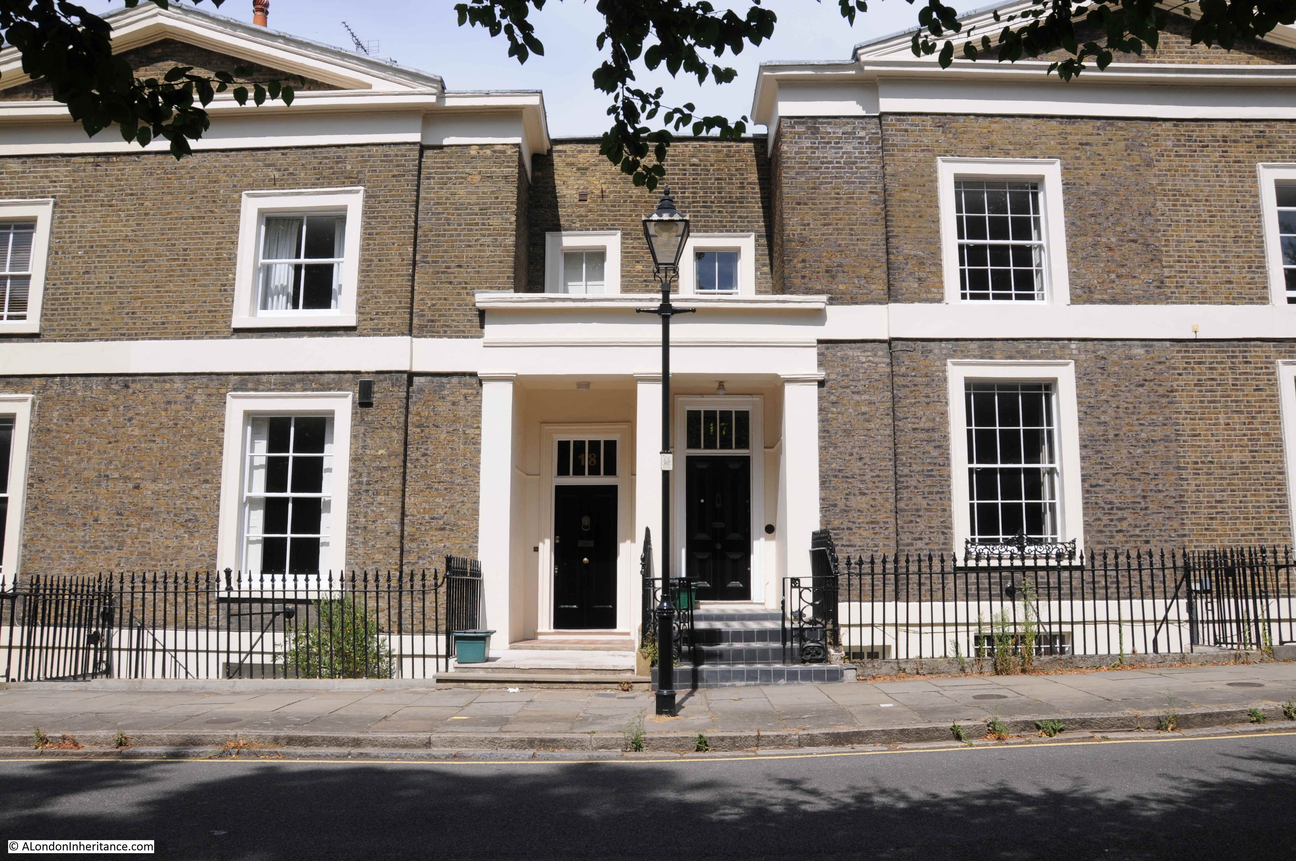
Laystall Street is a turning off Clerkenwell Road, slightly to the west of Leather Lane. A short distance along Laystall Street there is an unusual plaque on the first floor of one of the terrace houses.

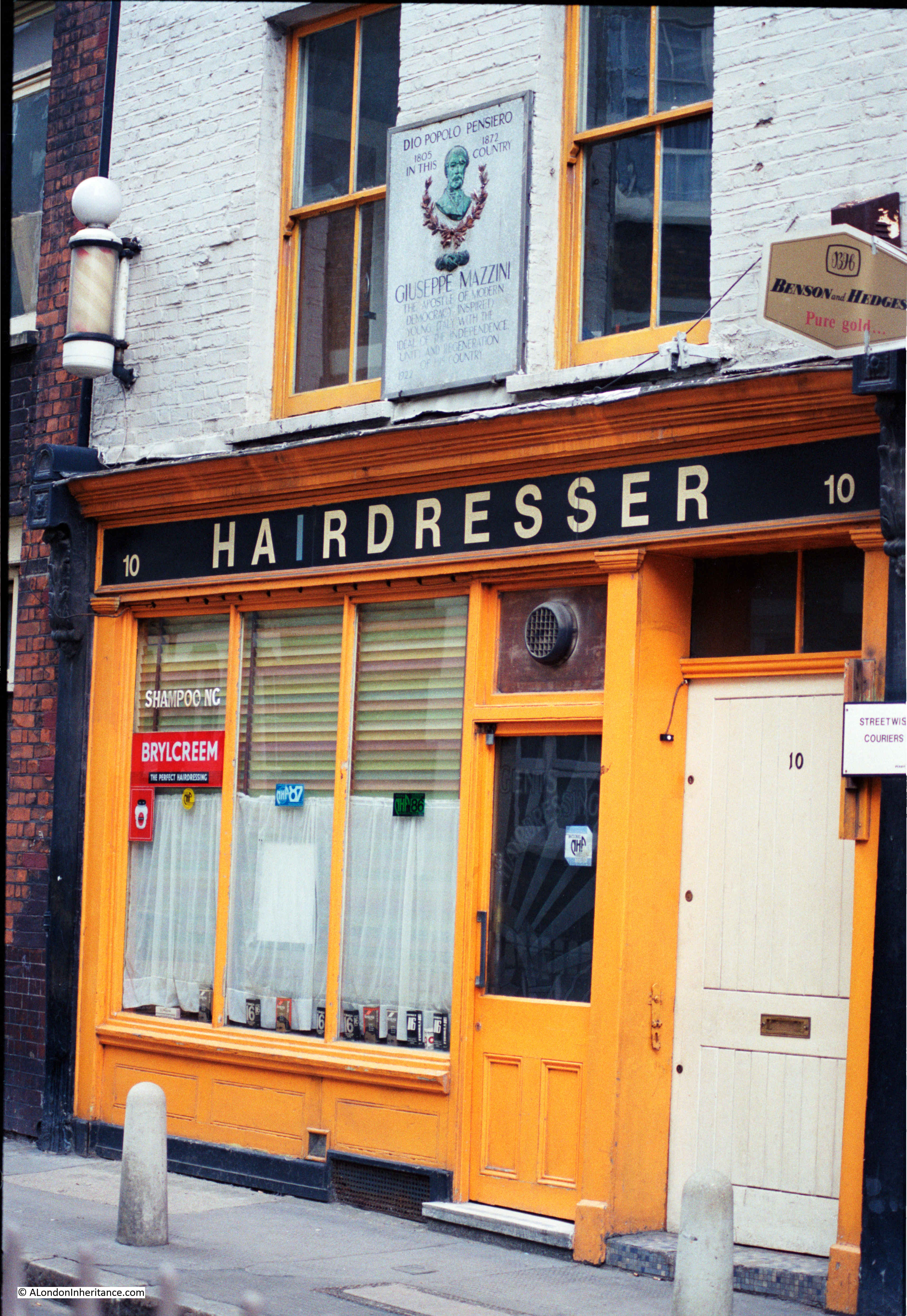
In 1986, the ground floor was occupied by a hairdresser:

Laystall Street

In 2018, the ground floor is now a model agency, but the same plaque can be seen on the first floor:

Laystall Street

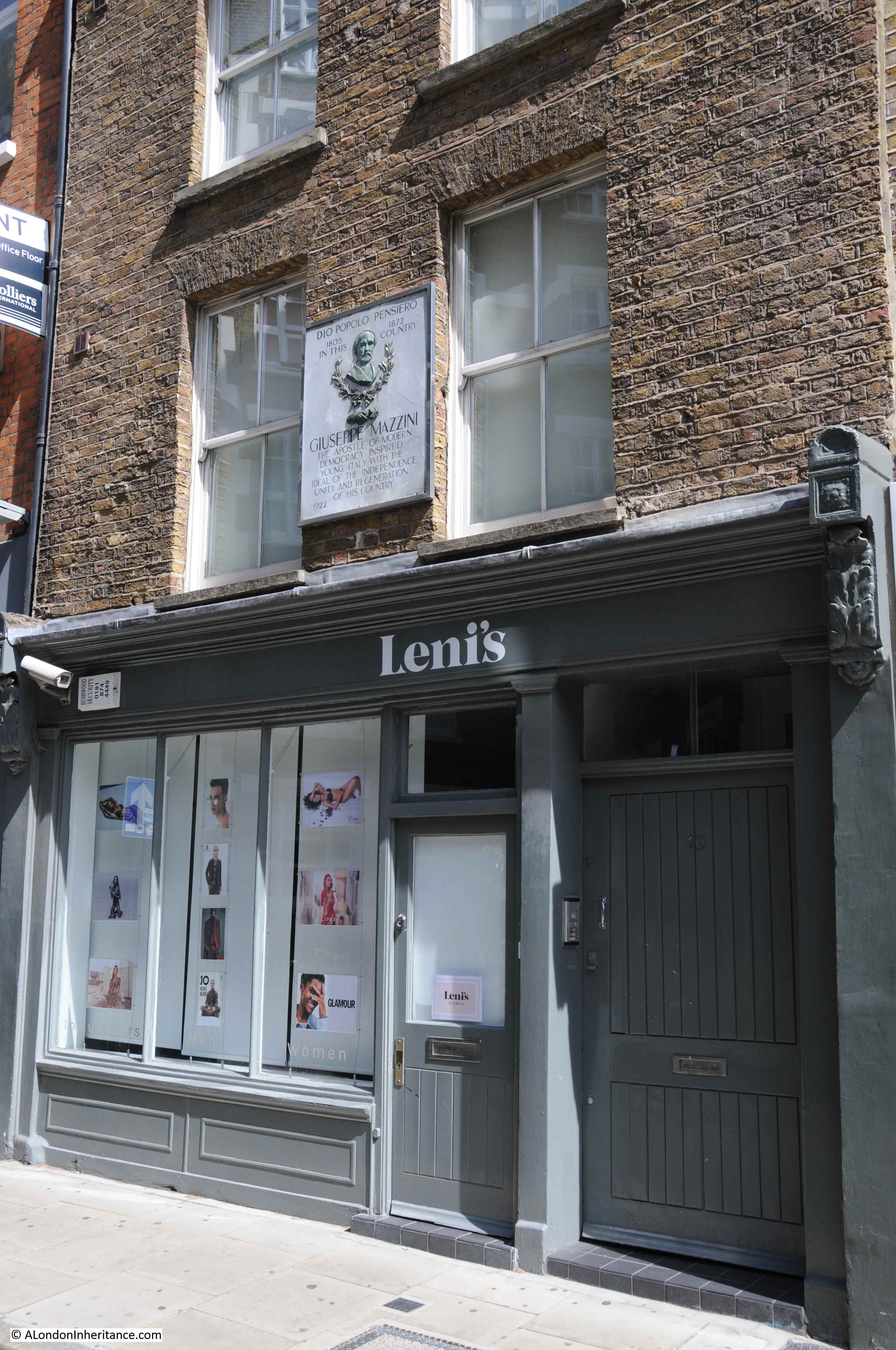
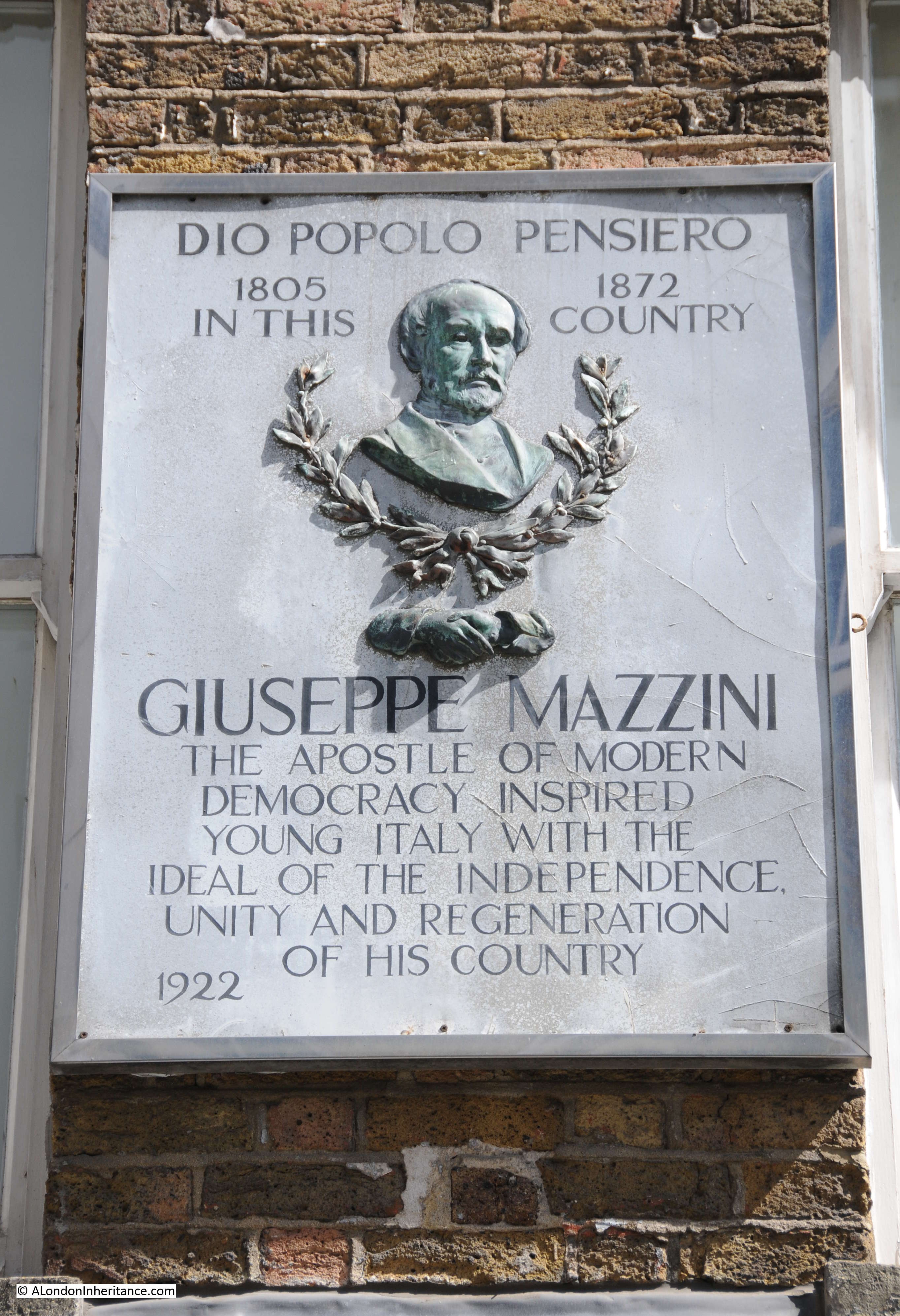
The large and rather ornate plaque is to Giuseppe Mazzini:

Laystall Street

Giuseppe Mazzini was born in Genoa, Italy in 1805 at a time when Italy consisted of several independent republics and city states, rather than as a unified country.

He qualified as a lawyer, but his main interest was republicanism and the unification of Italy into a single nation state.

He was involved with, and organised a number riots and attempted insurrections to try and bring about unification. He also formed a secret political organisation called Young Italy (as mentioned in the plaque) dedicated to the unification of the country.

His activities resulted in periods of imprisonment, exile from Italy and, in his absense, a sentance of death.

In the 1840s, 1850s and 1860s, periods in exile included London from where he continued to work in the cause of unification. The plaque in Laystall Street might be interpreted as indicating that he lived in the house whilst in London, however there is a Blue Plaque on the house at 155 North Gower Street which was his London residence, and he also spent some time close by in Hatton Garden.

The Laystall Street plaque is a record of “La Società per il Progresso degli Operai Italiani in Londra” (the Society for the Progress of Italian Workers in London).

Laystall Street and surrounding streets were once a centre for Italian immigrants and the area had a large Italian population.  The Society for the Progress of Italian Workers in London was founded in May 1864 under the joint presidency of Mazzini and Guiseppe Garibaldi (who also shared the same views on republicanism and the unification of Italy)

The aim of the society was to engage the Italian population of London in the unification cause. The club originally met in Mazzini’s house in Hatton Garden, before moving to Farringdon Road, before occupying 10 Laystall Street where the club would stay until 1930 when the society moved to Red Lion Street.

The plaque in Laystall Street is dated 1922, when the society had already been based in the building for many years. I cannot find any information as to why it is only to Mazzini, one of the founders of the society and does not mention Garibaldi.

The Red Lion Street premises were seized during the 2nd World War, but returned to the society after the war, who then changed their name to the Mazzini-Garibaldi Club.

Given the siezure of the premises of the society and the internment of many Italians as enemy aliens during the last war, it would be interesting to know if the Laystall Street plaque survived on the building during the war, or whether it was removed and reinstalled after the end of the war.

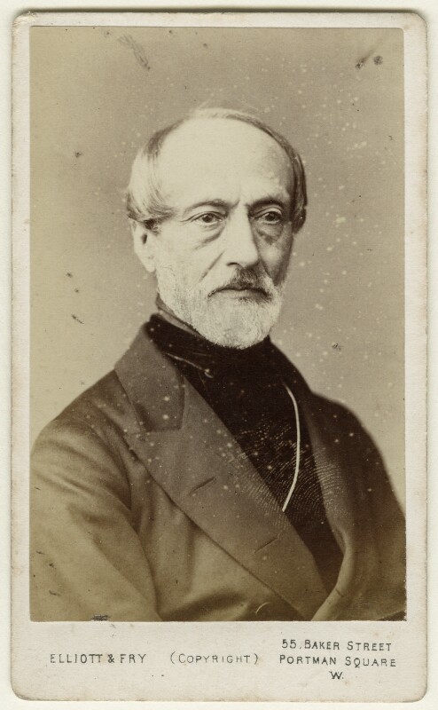
Giuseppe Mazzini photographed during one of his visits to London:

Laystall Street

Giuseppe Mazzini was involved in a notorious act of letter opening by the British Government. In 1843 Mazzini’s cause attracted the support of two officers in the Austrian Navy, who landed in the Kingdom of Naples to support some riots that Mazzini was organising. The two were immediately captured and executed. The Illustrated London News on the 12th May 1849 in an article about Mazzini reported that:

“He is well known to the English public, through the notoriety acquired by Sir James Graham in opening his letters in the English Post-office, and communicating their contents to the Austrian Government, which led to the death of the noble-hearted brothers, Bandiera,”

In describing them as “noble hearted”, the Illustrated London News appears to have had some sympathy for their cause.

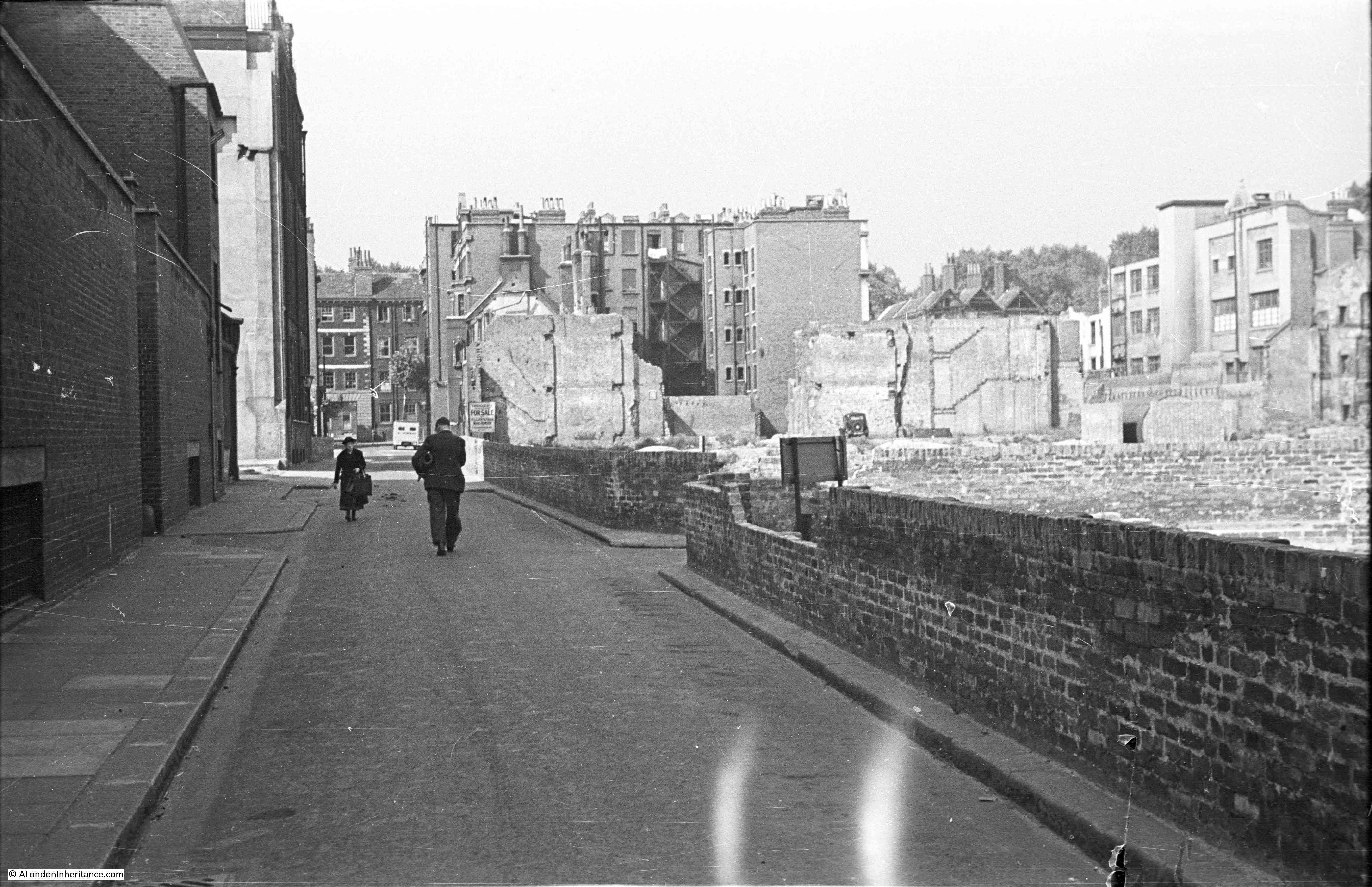
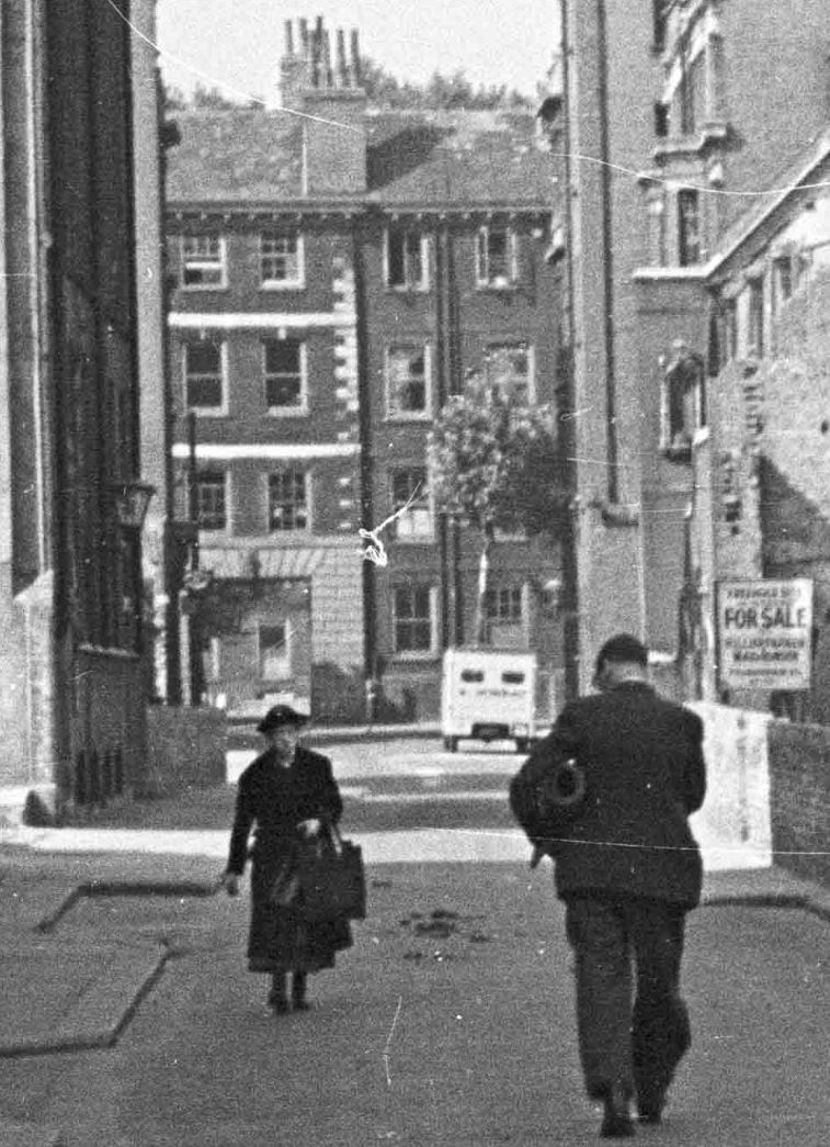
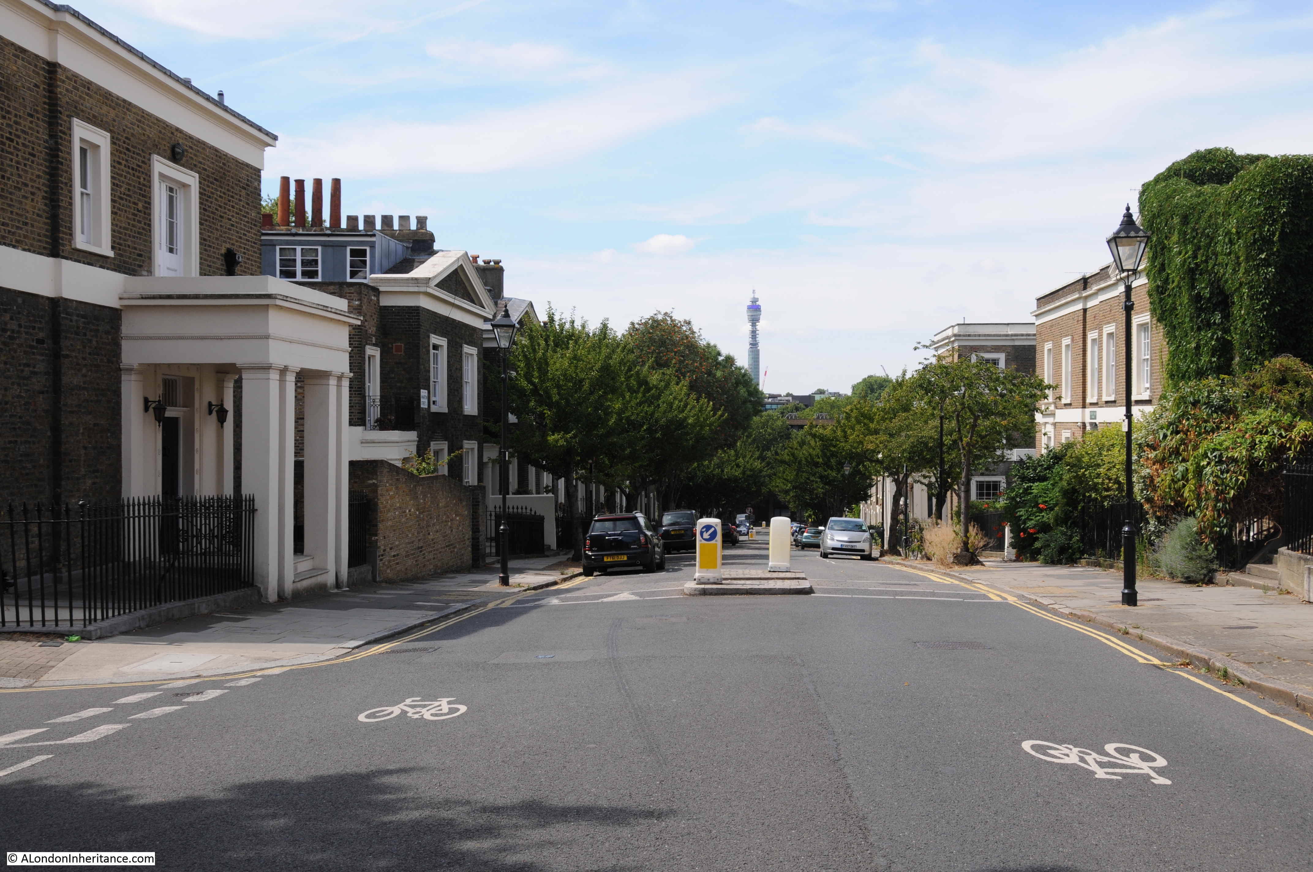
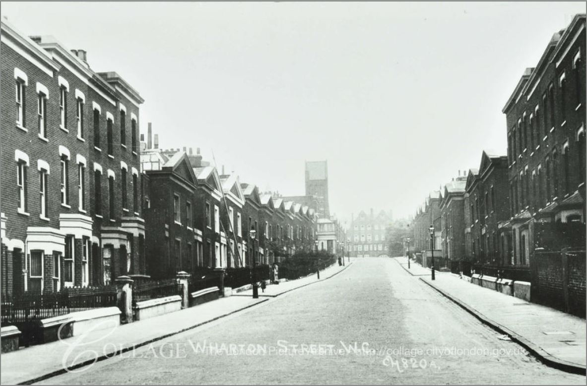
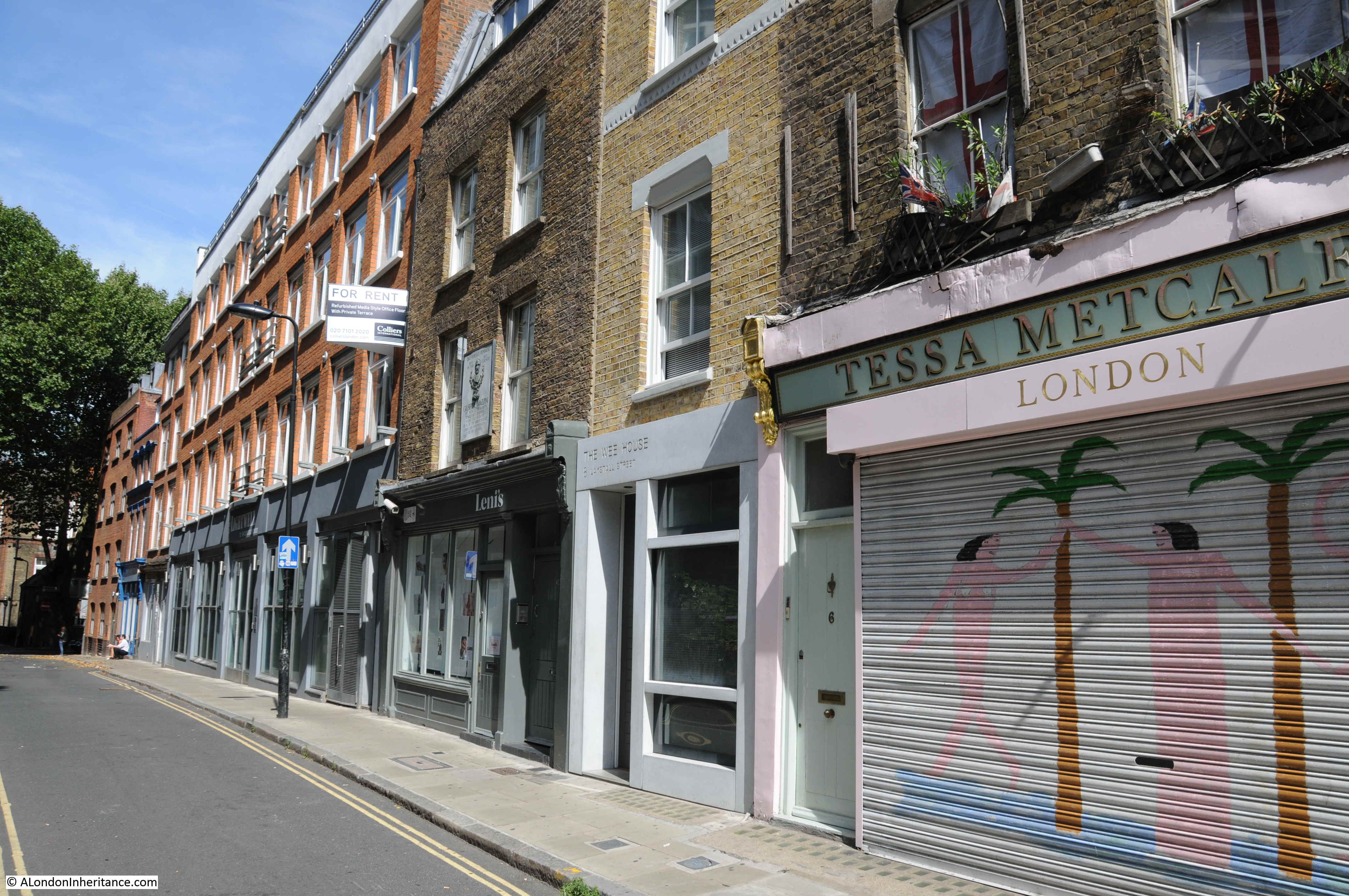
The view along Laystall Street from Clerkenwell Road:

Laystall Street

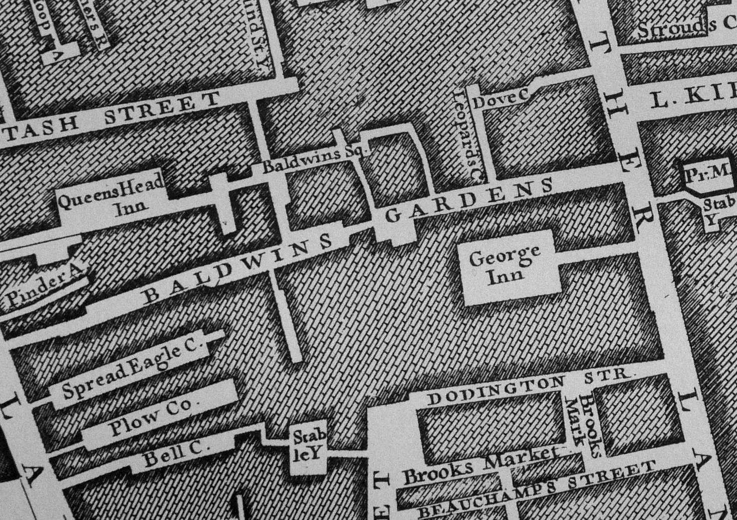
The source of the name Laystall Street is interesting. The word Laystall can refer to a place where rubbish or dung is deposited. It can also refer to a place where cattle are kept. This would imply an old source of the name, so I checked John Roque’s 1746 map of London.

The area around Laystall Street has changed singnificantly since 1746. Clerkenwell Road was not there, and the majority of streets have since changed their names.

Laystall Street is just to the west of Leather Lane, it has a slight turn into Clerkenwell Road, and then runs back at an angle of about 45 degrees to Clerkenwell Road.

In 1746, in the right place, with the right alignment was a street named Leicester Street (see the map extract below). Leather Lane is running from the middle of the map to the lower edge. Leicester Street is to the left of the map, running to the left edge from the junction of Leather Lane, Ayre Street and Windmill Hill).

Laystall Street

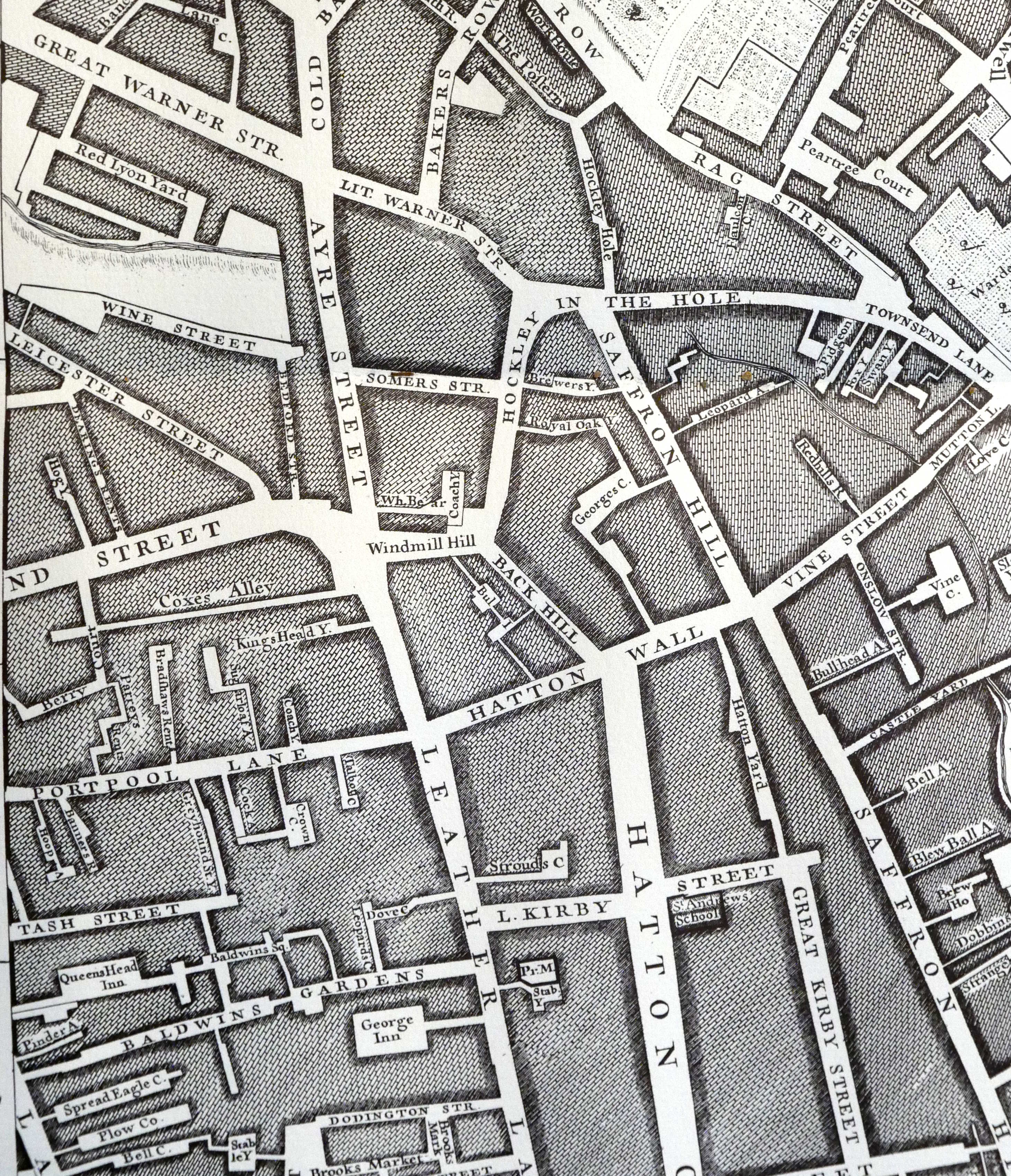
The words Laystall and Leicester sound similar, so perhaps Laystall was just a corruption of the street name in 1746, however the Encyclopedia of London attributes the name to the traditional meaning of a rubbish dump which was probably towards the Mount Pleasant end of the street as this was originally a lane that ran down to the River Fleet and the area was known as a rubbish dumping ground. Perhaps Roque has just recorded the incorrect name?

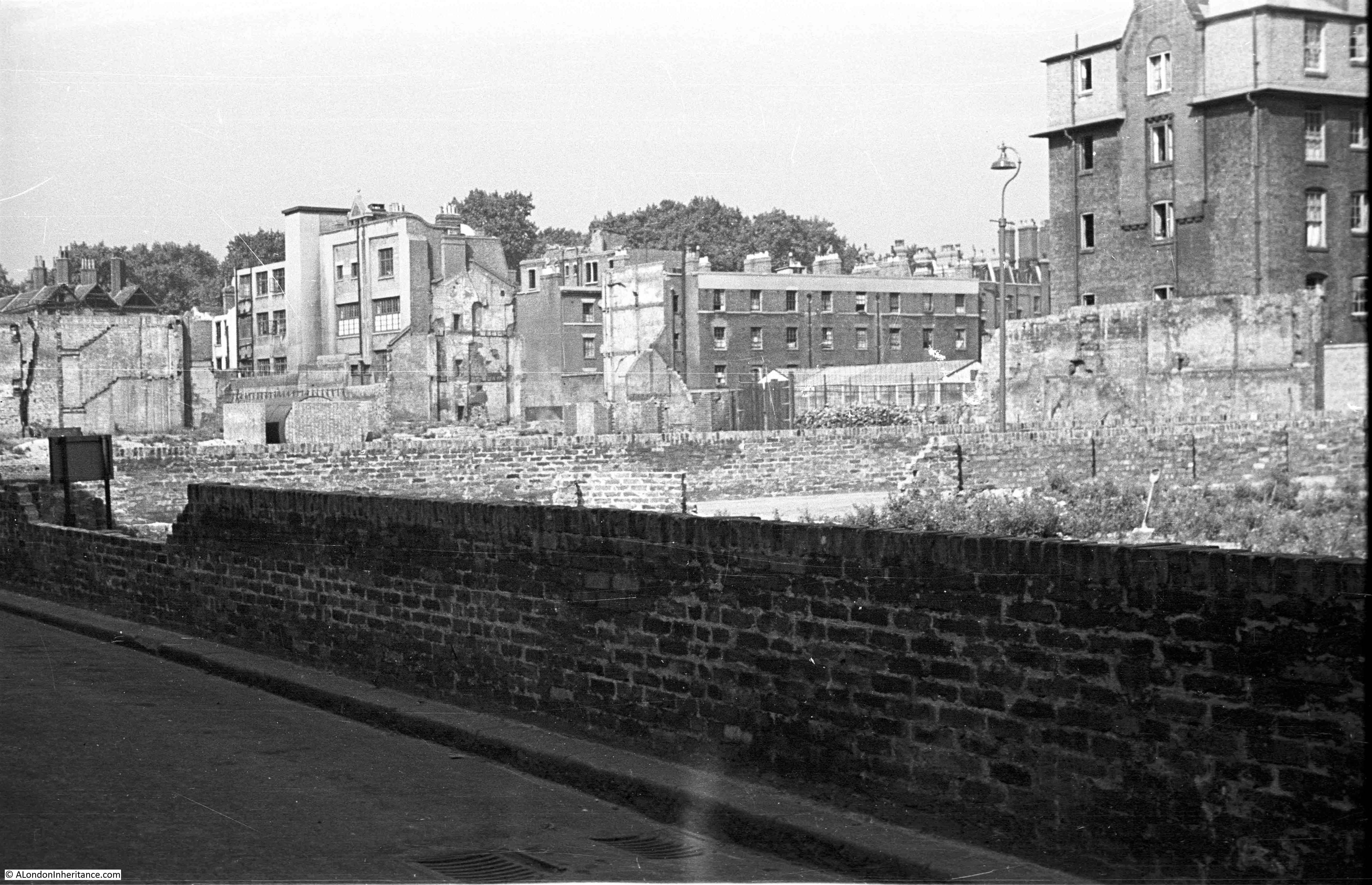
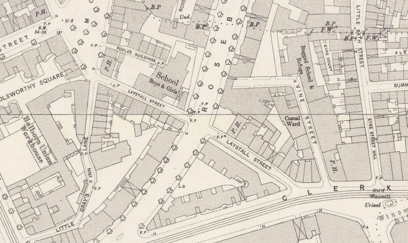
Laystall Street was cut in half in the early 1890s when Rosebery Avenue was built, and the area north of Laystall Street underwent considerable development with the demolition of the old Coldbath Fields prison and the construction of the Mount Pleasant Post Office.

The extract below from the 1895 Ordnance Survey map shows Rosebery Avenue newly completed, cutting through Laystall Street:

Laystall Street

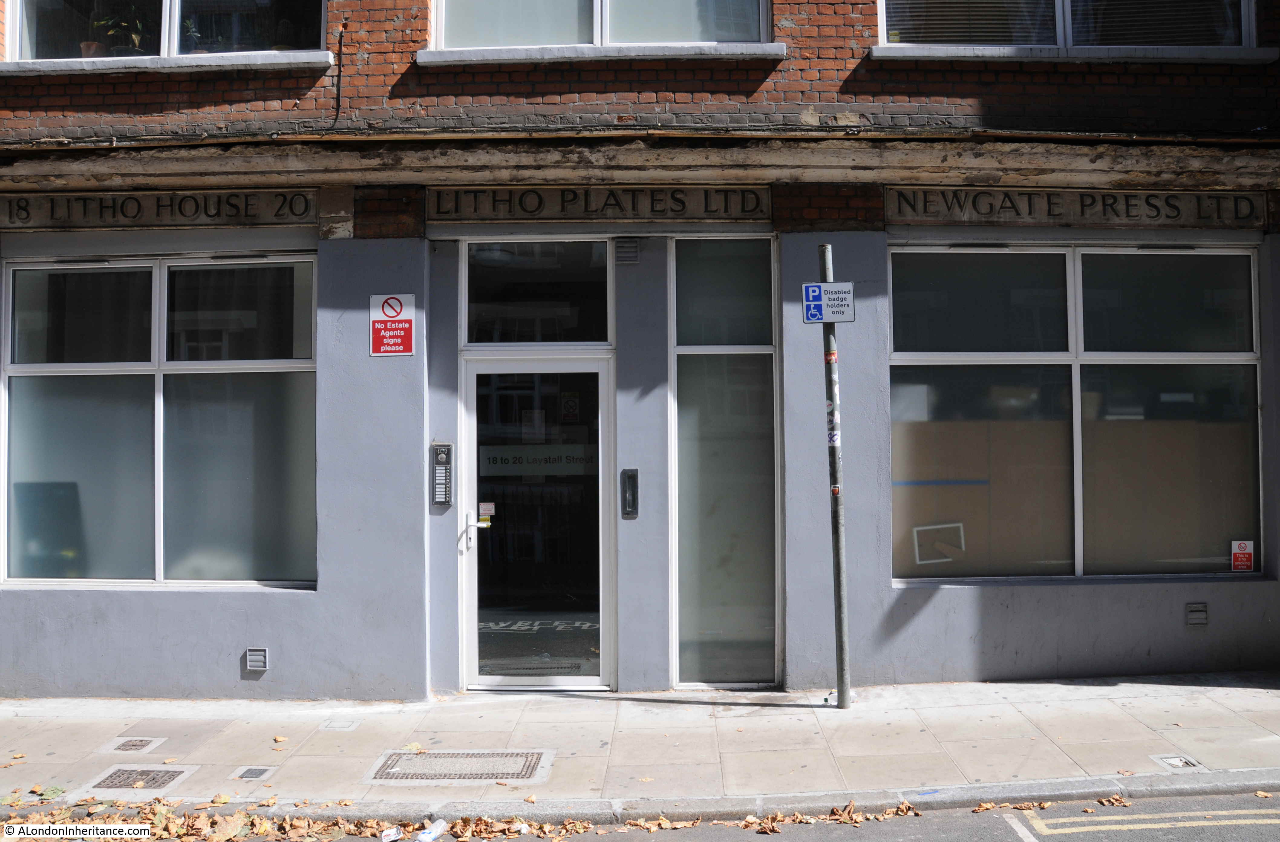
I walked further down Laystall Street. On one of the buildings there is the rather nice sign of the Newgate Press preserved:

Laystall Street

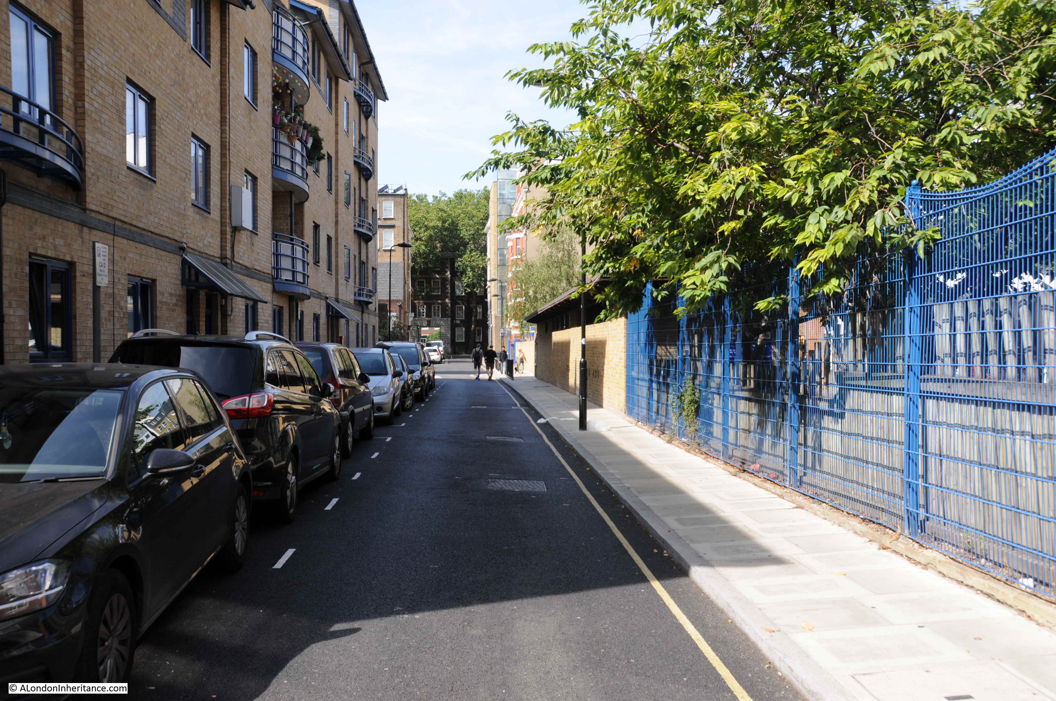
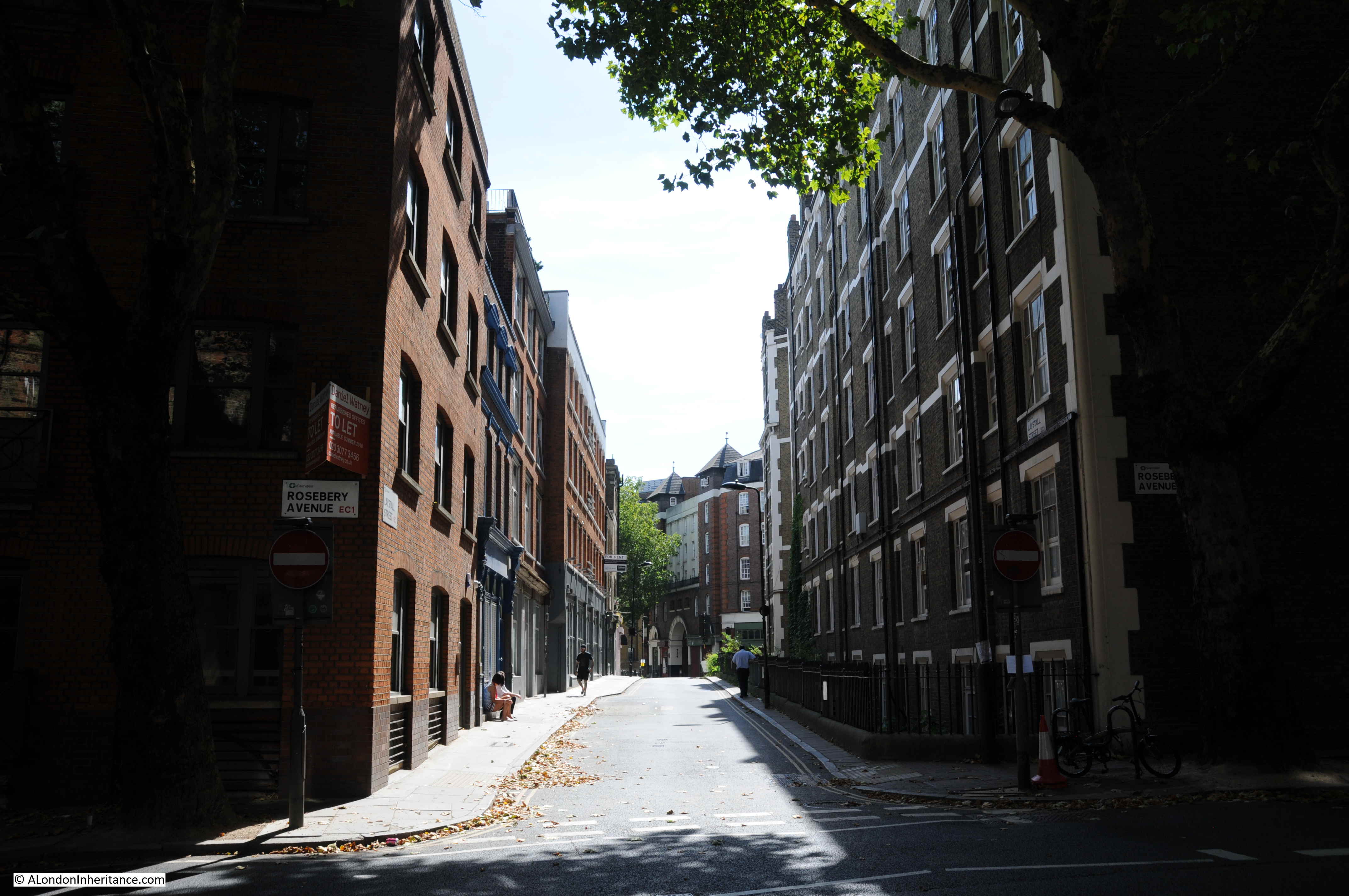
The view looking up Laystall Street from the junction with Rosebery Avenue:

Laystall Street

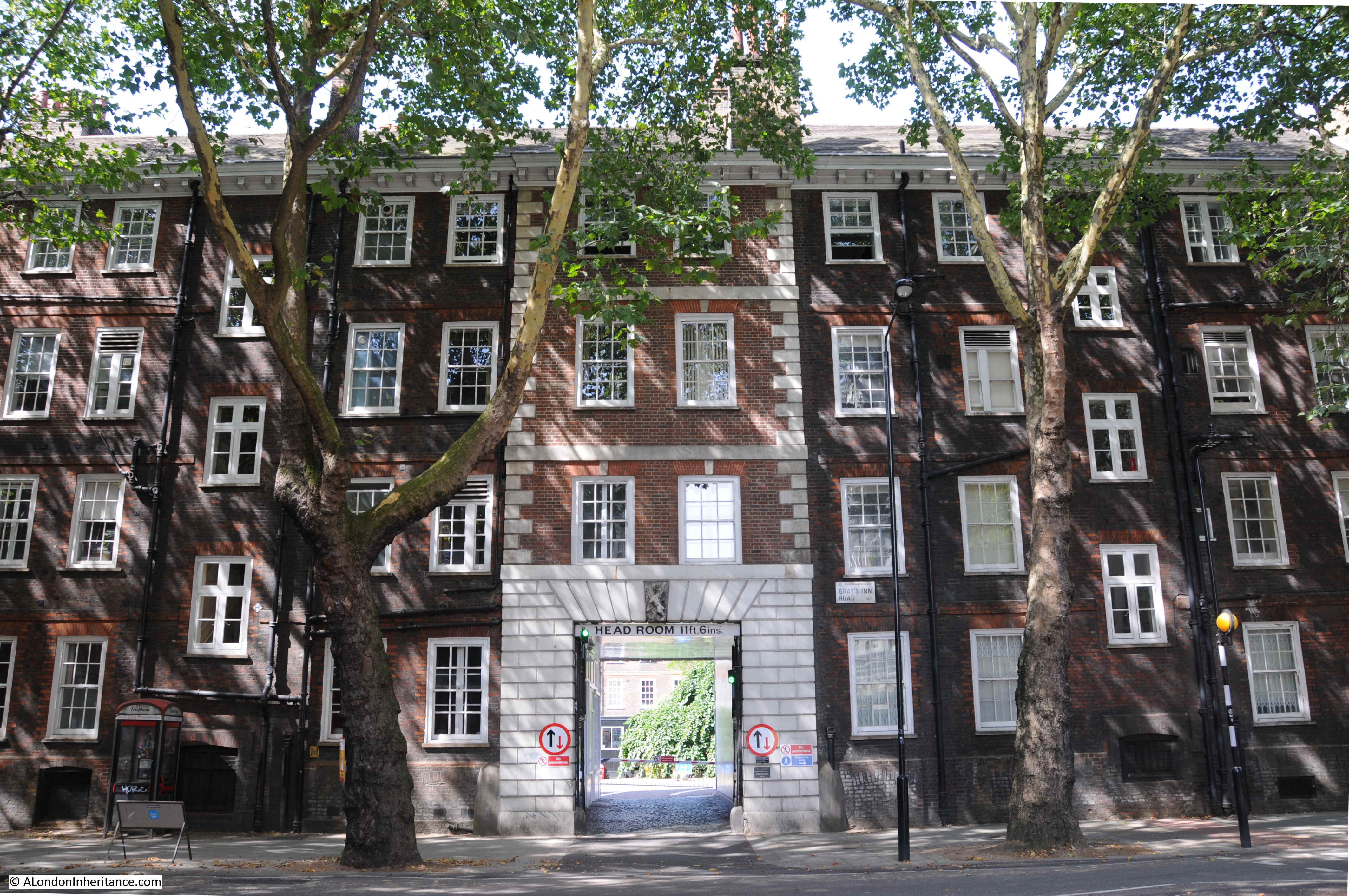
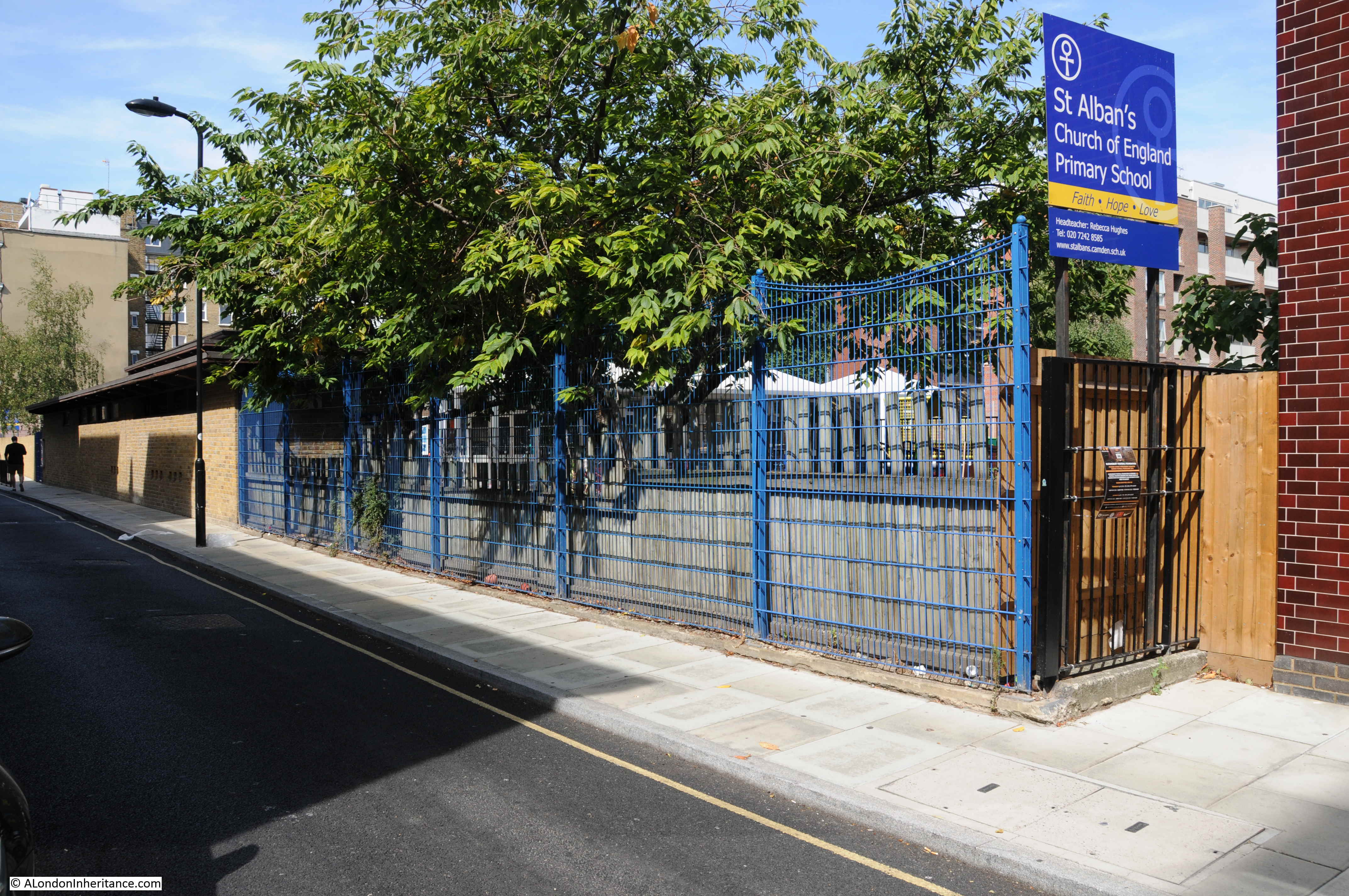
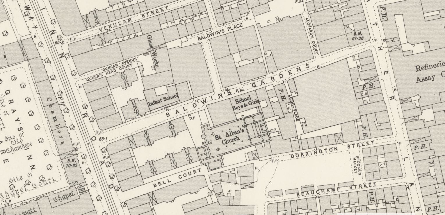
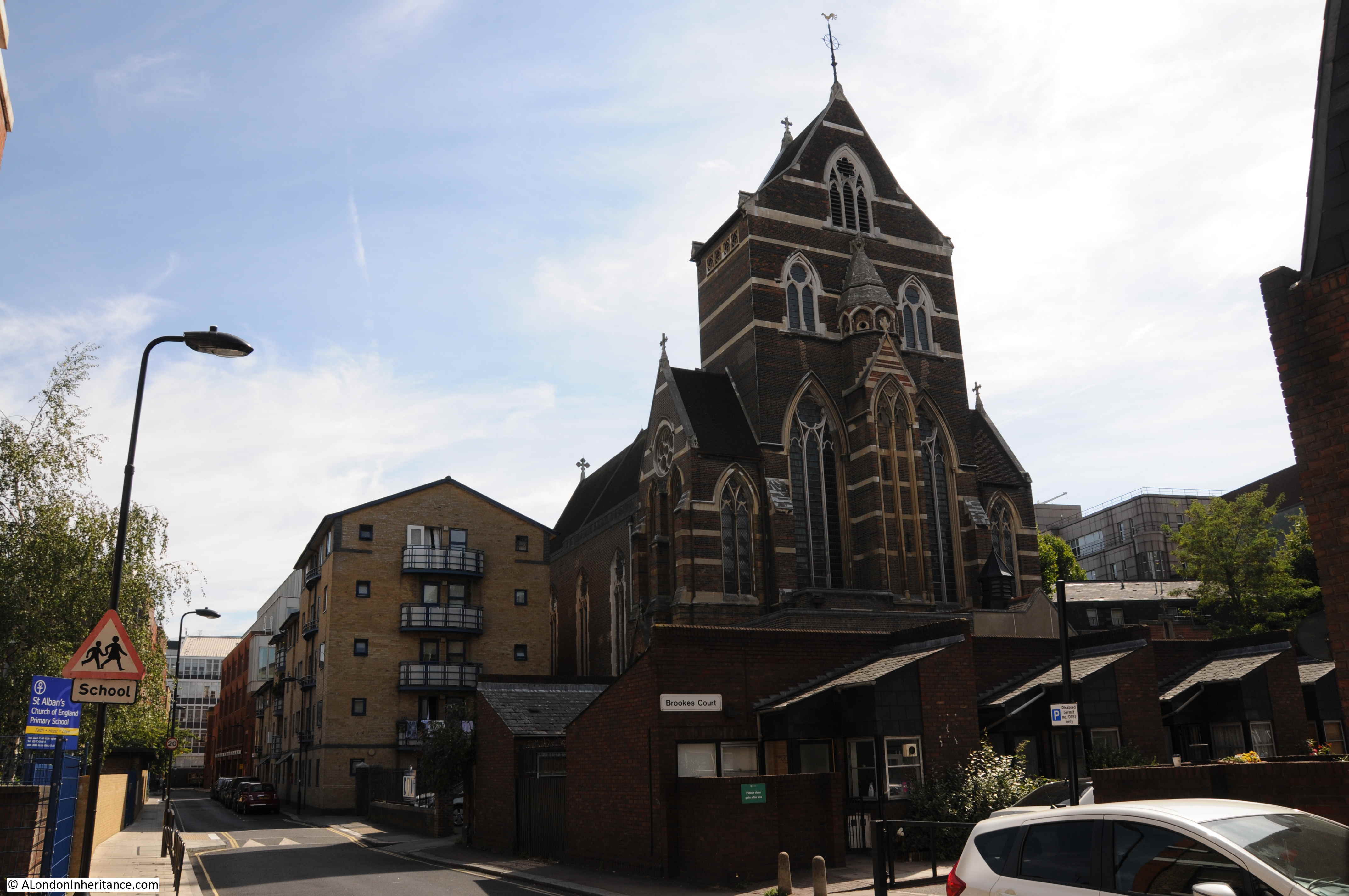
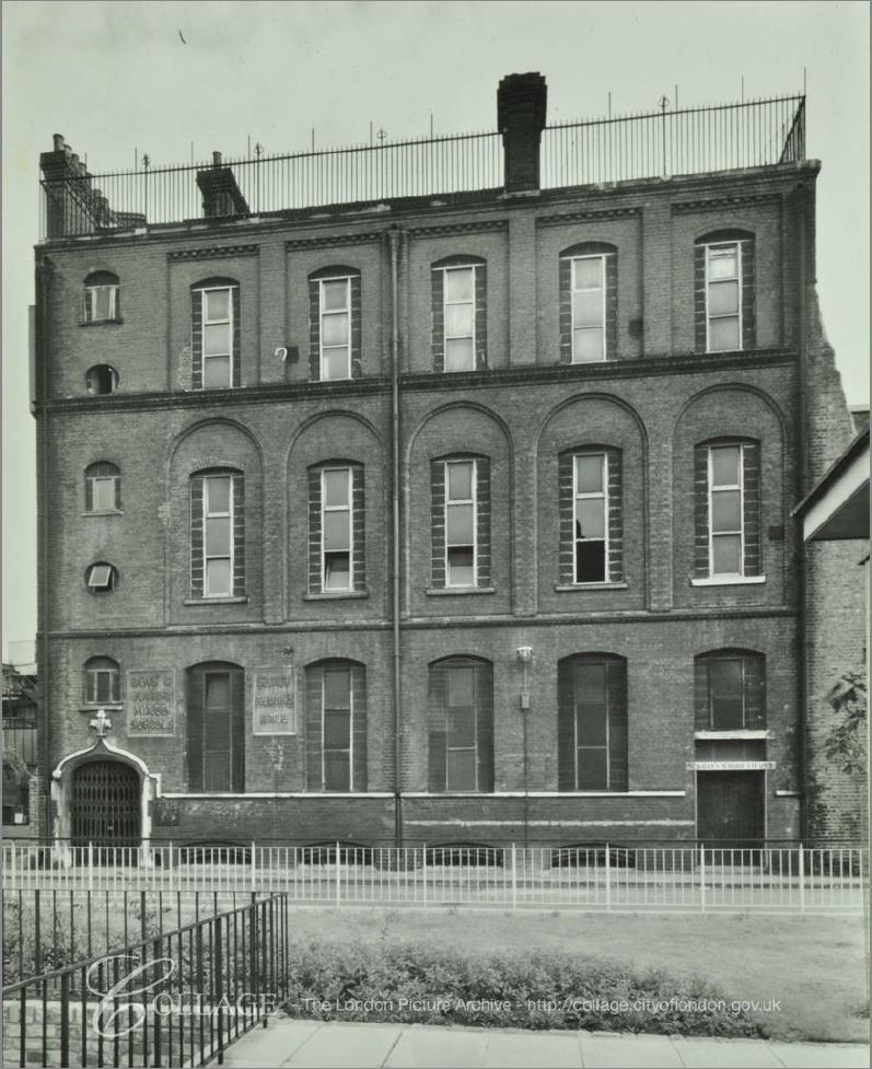
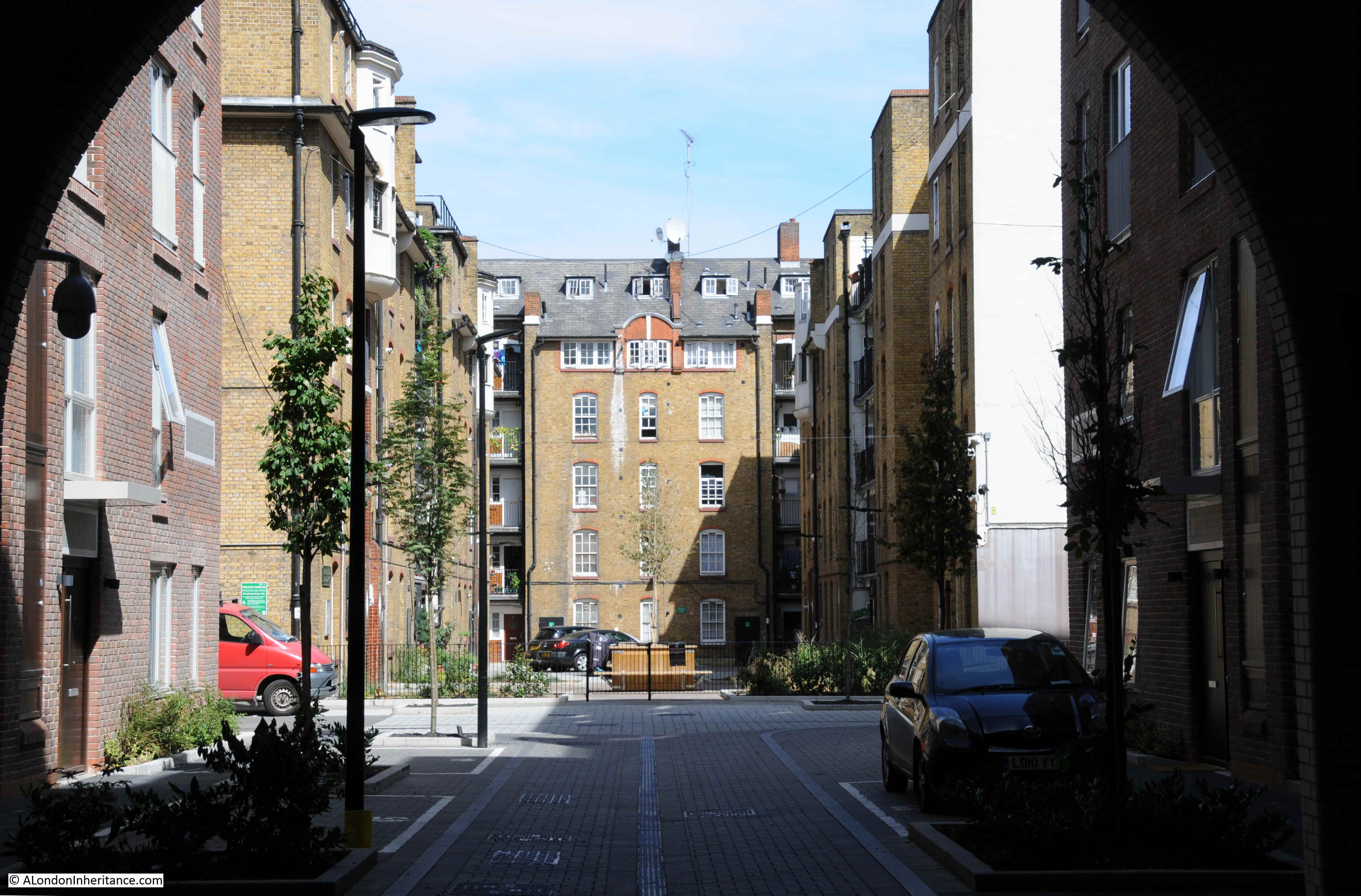
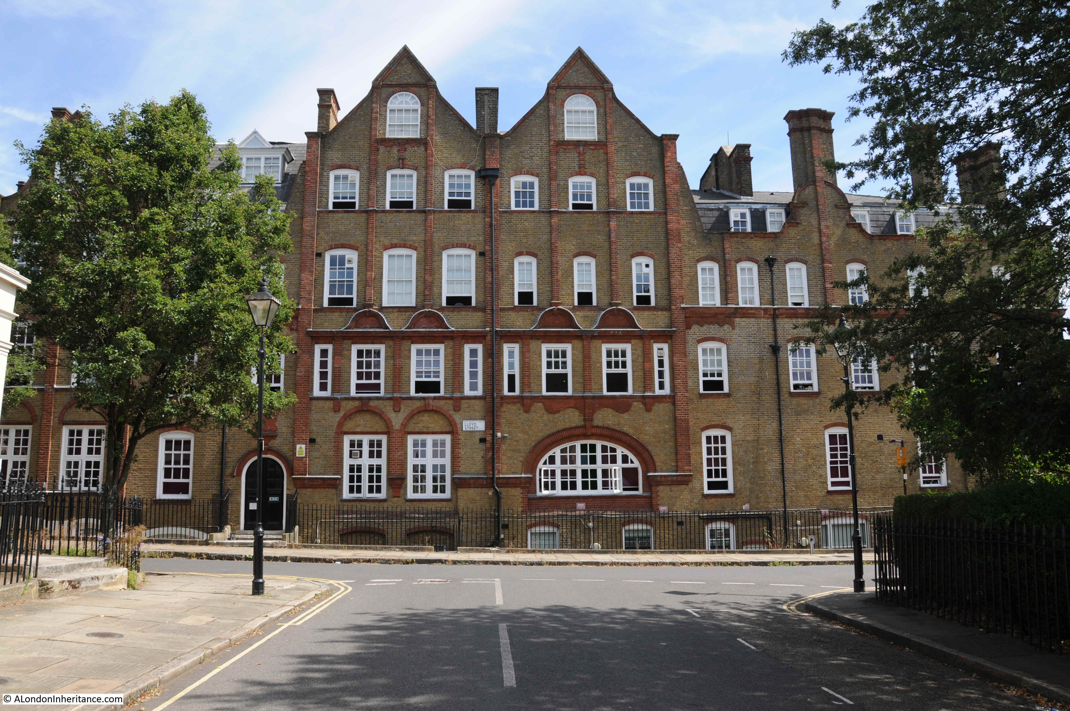
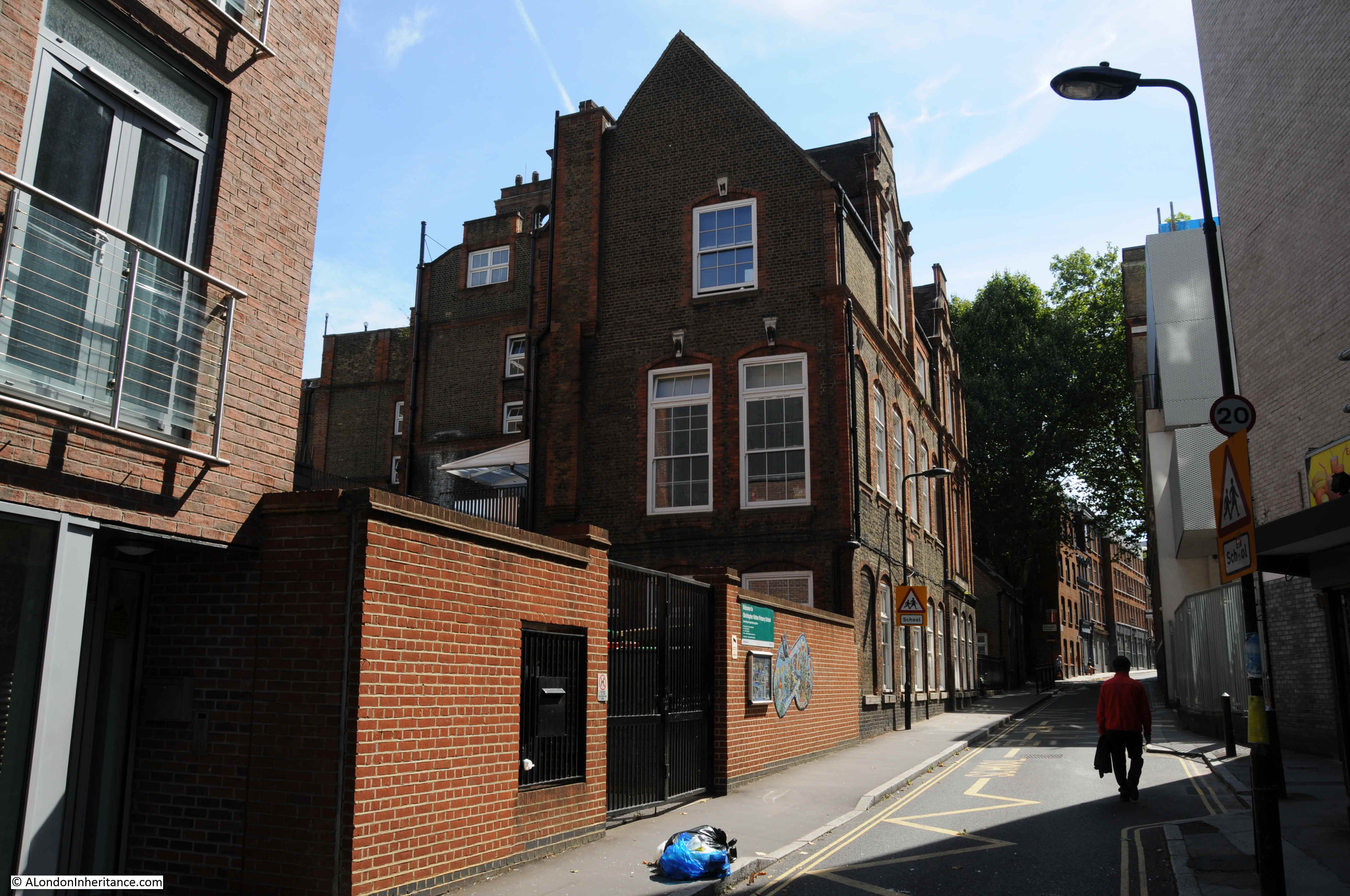
In the 1895 Ordnance Survey Map, there is a large school occupying the northern side of Laystall Street after it crosses Rosebery Avenue. The school buildings are still to be found:

Laystall Street

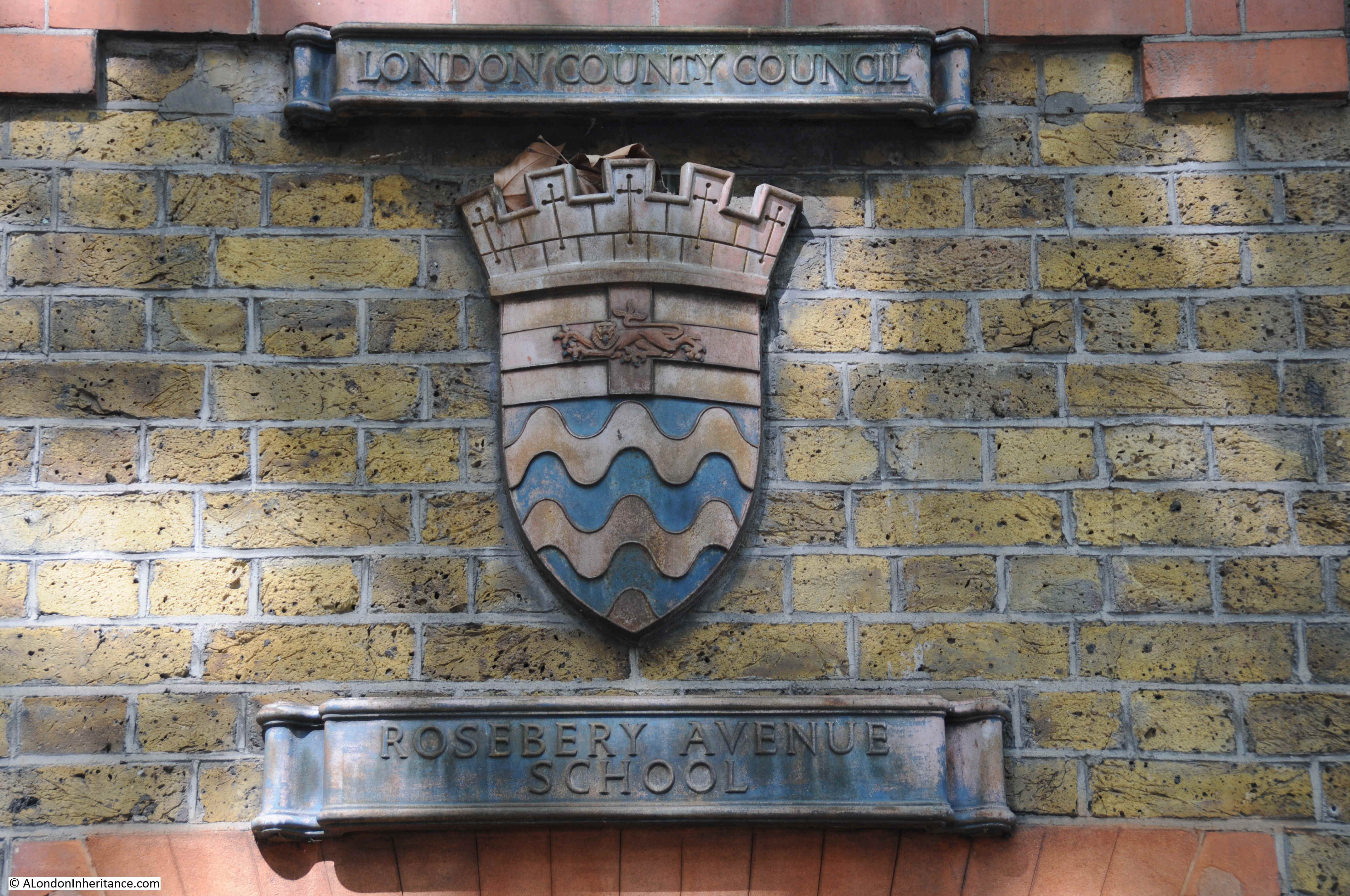
The school retains a very nice London County Council coat of arms with the name of the school below:

Laystall Street

The school also includes the following sign for the School Board for London:

Laystall Street

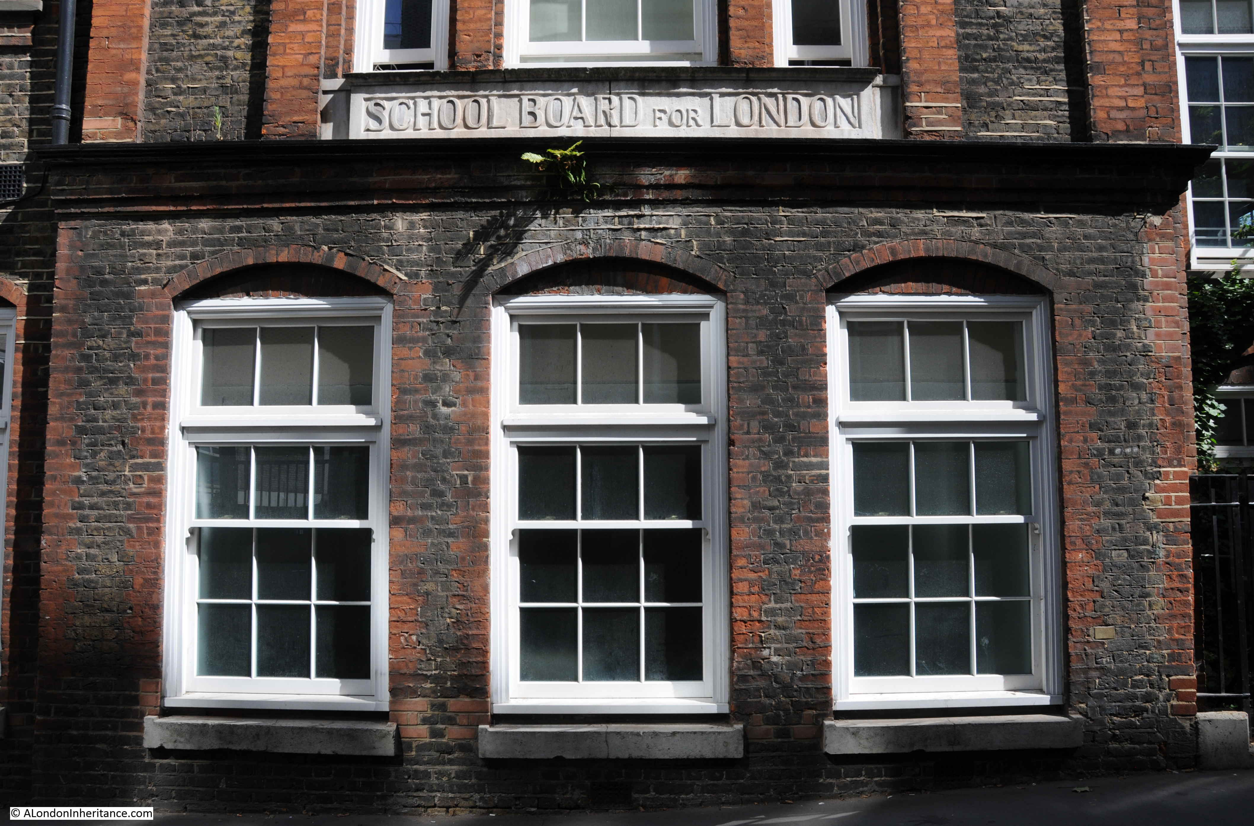
The above two photos show two of the key organisations responsible for the expansion of a structured education system across London.

The School Board for London was created by the 1870 Elementary Education Act to provide elementary school places for all poor children. It became the largest provider of school places across London.

The School Board for London was in operation between 1870 and 1903, when the London County Council took over responsibility for education across London.

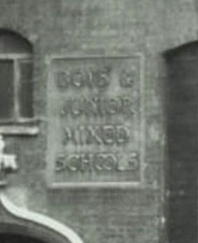
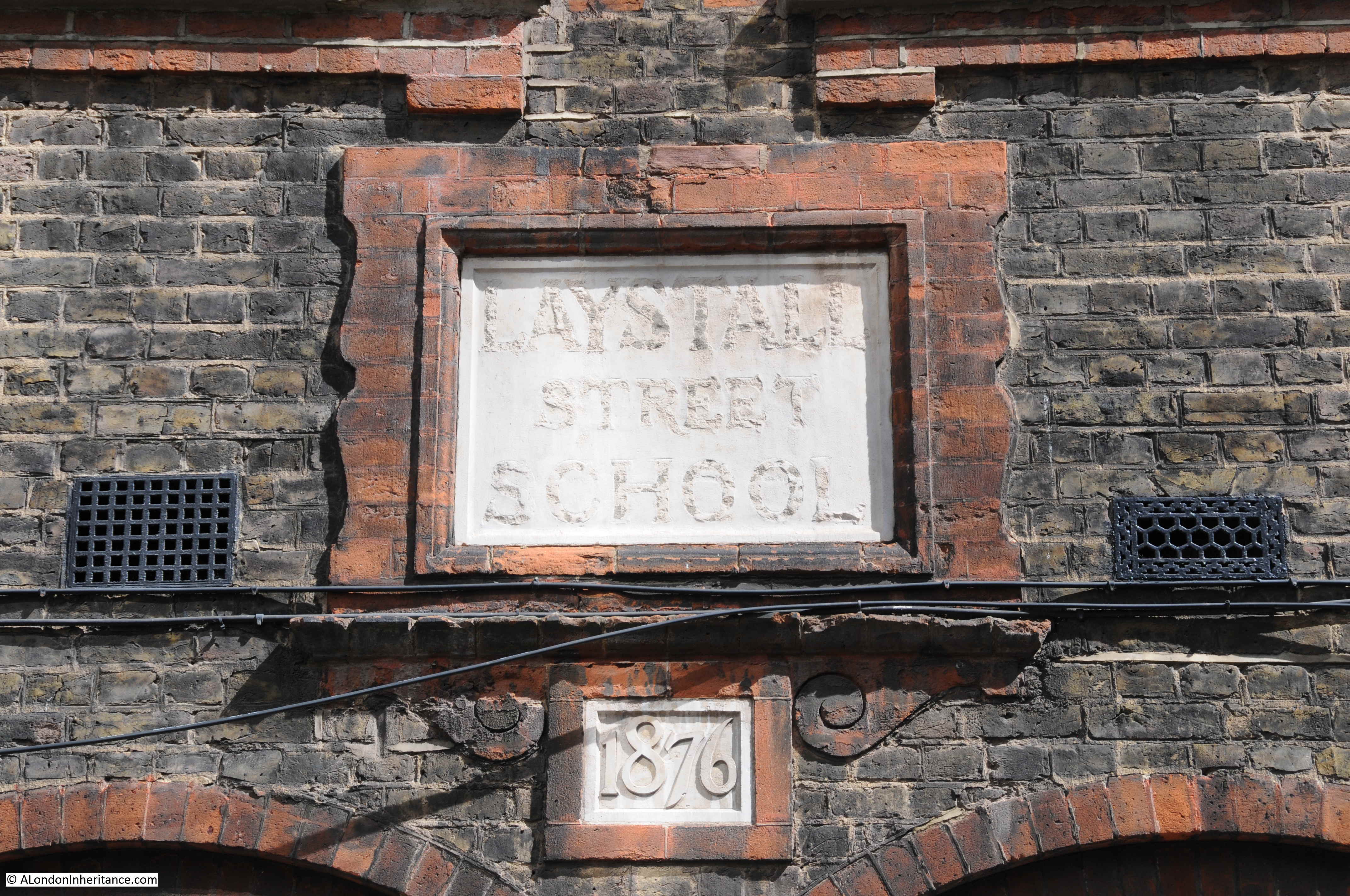
Another sign on the school building gives 1876 as the date of the school, six years after the Elementary Education Act, but also names the school as the Laystall Street School:

Laystall Street

The Illustrated London News on the 5th August 1876 provides a glimpse into the challenges of providing schools in central London:

“A board-school was opened, on Monday night, in Laystall-street, Gray’s Inn Road, by Sir Charles Reed. in the ‘block’ where the school is situated Sir Charles stated that places were required for 2075 children. The difficulty of getting a site in the metropolis was very great, and it was sometimes costly; but, cost what it might, the board must have a school placed in the particular locality in which it was required. He thought if his colleagues were to be blamed for anything it should be because of their tardiness in providing school accommodation in that district, which would have the additional provision given to it without injury to the other schools there. He saw a letter in a newspaper the other day in which the writer, speaking of the school board, said ‘Their present school in Laystall-street, which will open unblessed by us on Monday next, is within sixty yards of a church school.’ He (Sir Charles) believed the parents of that district would bless that school, and that would be quite enough. Sir Edward Currie also spoke, and stated that the site of the new school was the smallest and the most costly that the board had purchased in London. The school was intended to accommodate 502 children, at a cost of about £10 per head.” 

The original name was Laystall School, as Rosebery Avenue did not exist. It was built 14 years after the school was constructed.

The two signs also probably tell us how and when the name changed. The school was built in 1876 as the Laystall Street School by the School Board for London. In 1903 the London County Council takes over the school and it is probably then that the name also changes after the construction of Rosebery Avenue – a much larger street than Laystall Street (sorry, but I love these little connected details you can find across London’s streets).

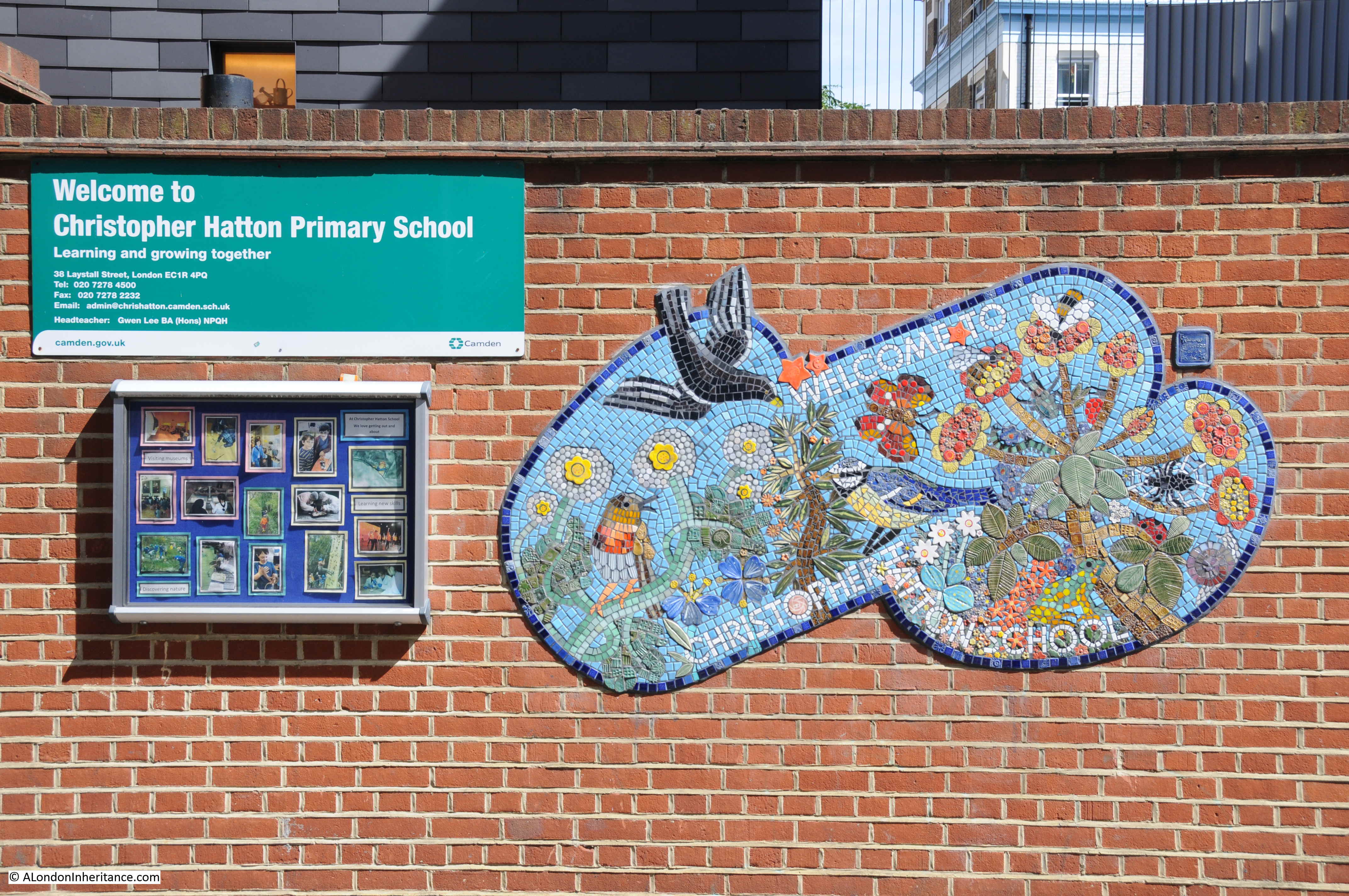
The school today is the Christopher Hatton Primary School, named after the Elizabethan politician who also gave his name to Hatton Garden.

Laystall Street

I always feel I never do justice to the history of the areas I cover in my posts, however it is fascinating what you can find in London’s streets and in Laystall Street there is an Italian nationalist, possible long lost rubbish dump that gave the name to the street, and a glimpse into the development of schools at the end of the 19th century – not bad for a short walk.

alondoninheritance.com

A Bombsite On Baldwin’s Gardens

Baldwin’s Gardens is a street that runs between Leather Lane and Gray’s Inn Road. If you take a walk along the street, you may be disappointed that the street does not live up to its name. Rather than finding any gardens, the walker will find flats, a church, school and other buildings lining Baldwin’s Gardens.

My father took the following photo of Baldwin’s Gardens in 1949. The view is looking down towards Gray’s Inn Road. In the early years of the war, the area suffered from the impact of several high explosive bombs and the effects of these can be seen to the right of the street.

Baldwin's Gardens

The same view today:

Baldwin's Gardens

The only identifiable feature in the above two photos is the building in Gray’s Inn Road visible at the far end of Baldwin’s Gardens (although it is slightly obscured by trees in the 2018 photo). This building is part of Gray’s Inn, and one of the entrances to Gray’s Inn Square.

I took the photo below at the end of Baldwin’s Gardens to show the building today with the central block and entrance to the gardens behind being the feature visible in my father’s photo.

Baldwin's Gardens

Detail from the 1949 photo shows the Gray’s Inn building:

Baldwin's Gardens

My father took a second photo looking slightly to the right of the first photo to show more of the bomb damaged area.

Baldwin's Gardens

Difficult to be precise regarding the exact location due to the level of change, however looking over to the right of Baldwin’s Gardens today, and the 1949 bomb site is now occupied by a Primary School.

Baldwin's Gardens

A clue as to what occupied the bomb site can be found in the extract from the 1895 Ordnance Survey map shown below from the National Library of Scotland. Baldwin’s Gardens run across the centre of the map. The upper left part of Baldwin’s Gardens is the bombed area in my father’s photo.

Baldwin's Gardens

Just above the letter B in Baldwin’s Garden, there is an Infant School. This is in the same location as the Primary School today. Below the word Baldwin’s is St. Alban’s Church and to the upper right of the church is a school for boys and girls.

The church of St. Alban is still alongside Baldwin’s Gardens as shown in the photo below. A large brick church, completed in the early 1860s.

Baldwin's Gardens

The Holborn Journal reported on the 28th June 1862 that the church was almost complete, apart from some internal decoration. The Holborn Journal appears to have appreciated the church as the article concludes with “Mr. Myers was the builder, and he appears to have done his work well.”

The second school on the map, marked for boys and girls has been lost although a plaque from the school can be found in the small yard between the church and Baldwin’s Gardens:

Baldwin's Gardens

Remarkably, I found a photo of this plaque when it was on the original school. The following photo is from the London Metropolitan Archive Collage site. It is titled “St Alban’s School, Baldwin Gardens: St Alban’s Hall.” The photo is dated 1956, confirming that the northern side of Baldwin’s Gardens appears to have suffered the worst bomb damage.

Baldwin's Gardens

Image credit: London Metropolitan Archives, City of London: catalogue ref: SC_PHL_01_144_56_3265

If you look to the lower left of the building there are two plaques on the wall. The one on the right is the St. Alban’s Hall, whilst the one on the left is the one that can been today as shown in my photo. The following is an enlargement of the plaque from the above photo to show it is the same:

Baldwin's Gardens

This is what I find so fascinating about walking London’s street – being able to find the traces of long lost buildings and activities and being able to trace them to their original place.

Baldwin’s Gardens schools seemed to have played a part in early teacher training. A newspaper article from 1875 comparing school education in the United States with that in the United Kingdom, and the approach to teacher training, writes: “But as early as 1811, the National Society in our own country had begun, in a rudimentary fashion, to train teachers at Baldwin’s-gardens school in London, and in 1817 the British and Foreign School Society followed with an organisation of their own for the same purpose.”

So perhaps this rather plain London side street was once a pioneer in the work of teacher training.

According to A Dictionary of London, published in 1918, the name comes from a Richard Baldwin who was a gardener to Queen Elizabeth the 1st and erected the street in 1589.

In “The London Encyclopedia” by Ben Weinreb and Christopher Hibbert, they confirm that the street was built in 1589, and add that it was on the site of Brook House, the mansion of Lord Brooke. Apparently it held the privilege of sanctuary and criminals fled to Baldwin’s Gardens to live without fear of the law. This privilege ended in 1697. The London Encyclopedia also states that “the area continued as a notorious slum, much frequented by criminals, and part of the locality known as the Thieves’ Kitchen, a training ground for young criminals.”

London by George H. Cunningham (1927) confirms the reputation of the area and adds that it was one of the most dangerous and disreputable of slums. This notoriety was removed in the building of St. Alban’s Church, and that “alterations and improvements have completely changed the appearance of Baldwins Gardens”

Baldwin’s Gardens featured in the 1746 map by John Rocque:

Baldwin's Gardens

A further insight into the area can be found in my post on the nearby Hole in the Wall Passage.

In the second of the 1949 photos, a large building can be seen on the right of the photo. This is part of the Bourne Estate, a housing development by the London County Council in the first decade of the 20th century. Part of the estate can be seen from Baldwin’s Gardens:

Baldwin's Gardens

To take a look at the estate, I walked out of Baldwin’s Gardens, a short distance north along Leather Lane to Pontpool Lane where one of the main entrances to the estate can be found:

Baldwin's Gardens

There was some damage to the estate during the war, however the majority appears to have survived. A rather impressive entrance archway leading through into the estate:

Baldwin's Gardens

Ever on the lookout for plaques on buildings, the building on the corner of Pontpool Lane and Leather Lane has a plaque with the date 1895, presumably the date the building was constructed (seen above the Greggs sign).

There is a second plaque to the lower left:

Baldwin's Gardens

The plaque states that the wall is the property of the London County Council.

Baldwin's Gardens

Leather Lane has a fascinating history which I hope to write about in the future, however to finish today’s post I did find a rather traditional hairdresser in Leather Lane. I always take a photo of these when I find them in London’s streets to continue the series of photos of London hairdressers started in the 1980s.

Baldwin's Gardens

Baldwin’s Gardens is an ordinary London side street, but one that was built by the gardener to Queen Elizabeth the 1st. It was the haunt of thieves and a dangerous place until the building of the church, and the street has been host to a junior school since the 19th century – rebuilt since the wartime destruction of the previous school. There is history to be found in every street.

alondoninheritance.com

LLoyd’s Dairy And The Lloyd Baker Estate

The fascination of walking in London is that you can turn off a busy street and discover a completely different place, somewhere with a very unique character and history. For this week’s post, I went to find if an old shop front had survived from the 1980s and found the unique Lloyd Baker Estate.

The following photo is one of my father’s photos from 1986. It shows the dairy shop of Lloyd and Son on the corner of River Street and Amwell Street.

Lloyd Baker Estate

Whilst Lloyd and Son ceased trading a number of years ago, their shop front has been retained and this is the view today:

Lloyd Baker Estate

Amwell Street runs from Rosebery Avenue in Clerkenwell to a short distance from Pentonville Road. Development of Amwell Street took place during the first couple of decades of the 19th century, partly on land owned by the New River Company.

The New River Company was the 17th century company formed to build an artificial river to bring in water from the north of London to feed the ever growing need for water of London’s rising population. The New River Head where the company’s reservoirs were located is a short distance from the location of the shop.

River Street was named after the New River and Amwell Street after Amwell in Hertfordshire through which the New River ran, and where some of the springs that fed the river were located.  The history of the New River Company, traces of the company around Clerkenwell and where the river can still be found are hopefully subjects for future posts.

The Lloyd’s Dairy business opened on the corner of Amwell Street and River Street in 1905. I cannot find the year when the business closed, but I believe it was in the late 1990s.

A side view of the shop in 1986:

Lloyd Baker Estate

The same view in 2017. The shop is now occupied by the saloon of BHC Hair.

Lloyd Baker Estate

A close up of the shop window in 1986. Piles of cereal boxes and the milk bottles used to advertise the business. On the far side of the shop are rows of tinned fruit and above are a couple of posters with a boy and girl advertising milk.Lloyd Baker Estate

The shop is located in the end building of a terrace of early 19th century houses. There were once so many corner shops across London. The majority do not retain their shop front, but it is still possible to see traces of the original shop on the corners of 19th century streets.

Lloyd Baker Estate

At the top of the brick walls on the corner of the building there is a layer of light coloured brick.

I found the following photo in the London Metropolitan Archives Collage archive showing the building in 1973. The reason for the lighter coloured brick layer is now clear, as it was once covered by a large advertising sign for the dairy.

Lloyd Baker Estate

Image credit: London Metropolitan Archives, City of London: catalogue ref: SC_PHL_01_080_73_10889

I had walked to find Lloyd’s Dairy from King’s Cross Road. The map extract below shows the location of the dairy marked by the orange circle in the top right. River Street runs from the location of the dairy to the top right. the old New River Company reservoirs were just below River Street.

King’s Cross Road is the orange road from lower centre to top left of the map. Much of the area between the location of the dairy and King’s Cross Road is occupied by the Lloyd Baker Estate.

Lloyd Baker Estate

If you follow King’s Cross Road from the lower centre of the map, pass Margery Street on the right, the next turning on the right is Lloyd Baker Street. On the corner of Lloyd Baker Street and King’s Cross Road is the Union Tavern:

Lloyd Baker Estate

A pub / tavern has been on the site since the early 18th century. In the book “The History of Clerkenwell” (1865), William Pinks writes:

“At the north-west corner is a respectable tavern known as the Union, which, a few years ago, had pleasant tea gardens in the rear of it. Formerly on the site was a public-house of low repute, distinguished as the Bull in the Pound, a resort of thieves and other vicious characters.”

Thankfully there were no thieves or other vicious characters when I stopped at the Union. There is a rather nice boundary marker on the King’s Cross Road side of the building to add to the collection:

Lloyd Baker Estate

The Fleet River ran along and slightly to the west of King’s Cross Road and the above ground evidence that a river once ran here in a valley can be seen looking up past the the Union, up Lloyd Baker Street where the land rises rather steeply (for central London) away from King’s Cross Road.

Lloyd Baker Estate

Lloyd Baker Street is lined with some rather uniquely designed villas.

The original ownership of the land between King;s Cross Road and Amwell Street was through a series of individual owners and the New River Company. In the late 17th century, a Dr William Lloyd became owner of part of the land. Ownership continued through a couple of generations of the Lloyd family to Mary Lloyd, a daughter of John Lloyd.

Mary married a Reverend William Baker who added the name Lloyd to his surname to form the hyphenated name Lloyd-Baker in the late 18th century.

William Lloyd-Baker started some development in the area, but it was not until around 1820 when major development of the area commenced with the next generation of the Lloyd-Baker’s.

Work started with the redevlopment of the Union around 1819 and then continued across the area between King’s Cross Road and Amwell Street, with work being mainly complete by the early 1840s. The Lloyd-Baker family continued to own the estate after construction had completed and the area was known as the Lloyd Baker Estate.

Architectural styles vary between reasonably traditional terrace housing and the villas which can be found in Lloyd Baker Street and Wharton Street.

Lloyd Baker Estate

The above photo shows the unique style of the villa and also the stepped layout of the buildings to accommodate the rising height as the villas ascend the street.

The development included a couple of squares. Granville Square between Wharton Street and Lloyd Baker Street, and at the top of the two streets, Lloyd Square. This is the view looking across the square from the top of Wharton Street.

Lloyd Baker Estate

Bordering Lloyd Square are more villas, but here the land is flat after ascending roughly 42 feet from King’s Cross Road (which I know is a trivial rise in height, but these are central London streets).

Lloyd Baker Estate

Ian Nairn in Nairn’s London described the area: “Lloyd Square has the tightness of the terraces loosened by being made up of linked pairs, each with a pediment, The sight of them dutifully climbing Lloyd Baker Street, two by two, is like a parody of the Greek Revival. But what you remember is half a doorway, someone’s curtains, the flicker of leaves in sunlight or wet bare branches. The underlying pattern is there all right, but it is never intrusive.”

Nairn provides a perfect description of the Lloyd Baker Estate. After the noise and traffic on King’s Cross Road, it is the quiet along with the flicker of leaves in the sunlight, and the doorways at different heights within a pediment that attempts to retain an impression of the same height for the two doorways.

Lloyd Baker Estate

William Pinks  wrote of Lloyd Square “This square, which is situated between Baker Street and Wharton Street and has a well kept enclosure in the centre, was erected about 1828.”

The well kept enclosure is now a very well maintained garden in the centre of the square:

Lloyd Baker Estate

The view along Wharton Street from Lloyd Square:

Lloyd Baker Estate

The eastern edge of Lloyd Square has a very different building to those lining the other three sides.

This is the House of Retreat built by the Sisters of Bethany in the first half of the 1880s. This side of the square was lined by the original villas, however the Lloyd-Baker family allowed these villas to be demolished for the House of Retreat.

Lloyd Baker Estate

This is the terrace of houses along one side of Lloyd Baker Street that leads from the square to Amwell Street, opposite the original Lloyd’s Dairy shop.

Lloyd Baker Estate

The southern side of Lloyd Square:

Lloyd Baker Estate

Corner building with the original, painted street name just visible on the first floor:

Lloyd Baker Estate

One of the problems I have when taking photos of buildings in London is that there are often cars lining the length of a street and obscuring the ground floor of a building. There are cars parked on the streets of the Lloyd Baker estate, but there are considerable lengths of the streets with no cars, and some lengths are protected by double yellow lines. It makes for a very pleasant set of streets to walk, and to admire the buildings along the streets.

King’s Cross Road and Amwell Street border the Lloyd Baker Estate. Both these streets run north to south, so there is no real reason for traffic to cut through the estate. This lack of traffic and nose to tail parked cars also contributes to the unique feeling of the estate.

As well as the streets leading of from Lloyd Square, a short distance down Wharton Street from the square, an alley leads into Cumberland Gardens. also part of the Lloyd Baker estate with the same distinctive buildings.

Lloyd Baker Estate

Tree lined Wharton Street:

Lloyd Baker Estate

Not all the Lloyd Baker Estate is original. I have already mentioned the House of Retreat on the eastern edge of Lloyd Square, there are other examples of later buildings. The map below is an extract of the 1895 Ordnance Survey map from the National Library of Scotland. In the centre of the map there is a church alongside Cumberland Terrace and facing onto Wharton Street and Lloyd Square:

Lloyd Baker Estate

This was built on one of the parcels of land not owned by the Lloyd-Baker family. I have not found any photos of the church, apart from the following photo (dated 1910) looking up Wharton Street towards Lloyd Square, where the tower of a large church can be seen on the left:

Lloyd Baker Estate

Image credit: London Metropolitan Archives, City of London: catalogue ref: SC_PHL_01_090_81_35_2380_37

The church closed in 1936 and Olive Lloyd-Baker purchased the land and built Archery Fields House on the site to maintain the appearance of the estate. This is Archery Fields House today:

Lloyd Baker Estate

The name of the house is a reference to the archery target ground that occupied part of Wharton Street in the early years of the 19th century, before the start of the main construction period of the Lloyd Baker Estate.

Another project that involved significant demolition of part of the estate was the construction of the original Metropolitan Railway, built between 1859 and 1862, which ran from Paddington to Farringdon. This involved demolition of houses at the King’s Cross Road end of Wharton and Lloyd Baker Streets. If you look back at the 1910 photo above, you can see houses on the right and left of the photo, closest to the photographer. These are houses built to replace those demolished during the construction of the railway.

Olive Lloyd-Baker was the last long term owner of the estate from the Lloyd-Baker family. She inherited the estate in 1924 and continued owning and managing the estate until her death in 1975. A life long spinster, Olive lived in the family home at Hardwicke Court, Gloucester. She was deeply involved in farming and agriculture and in 1966 was president of the Three Counties Agricultural Show. A local newspaper report describes Olive Lloyd-Baker as “A country woman with a practical experience in agriculture and with years of experience of managing property in Gloucestershire and London valued at about £1 Million, she is well equipped for the office.”

As well as the 10 acres of the London estate, Olive Lloyd-Baker owned 5,000 aces of country estate in Gloucestershire. The newspaper report also included a photo of Olive Lloyd-Baker in 1966:

Lloyd Baker Estate

After Olive’s death, the estate was broken up with Islington Council purchasing a large number of properties, others sold to private buyers, with the Lloyd Baker Estate retaining a much smaller number.

One of the buildings in Wharton Street with coloured doors, again showing the way the buildings manage the height change as the street descends towards King’s Cross Road.

Lloyd Baker Estate

One house of the pair has a blue plaque recording that Amelia Edwards, Egyptologist lived in the house.

Amelia Edwards was a 19th century novelist and author of travel books which she would also illustrate. After a visit to Egypt she became fascinated by the ancient history of the country and the threats to the archaeology and monuments that could be found across the country.

She wrote about her travels in Egypt and in 1882 also helped set-up the Egypt Exploration Fund to explore, research and preserve Egypt’s history. The fund is still going today as the Egypt Exploration Society, continuing to be based in London at Doughty Mews.

More descending doorways as the terrace runs along Wharton Street:

Lloyd Baker Estate

It was a fascinating walk around the Lloyd Baker Estate, and also finding Lloyd and Son’s Dairy shop front still in place in Amwell Street.

There is more to the estate than I have been able to cover in a single post. The now demolished church in Granville Square, the steps leading from Granville Square down to King’s Cross Road and their literary associations. The New River Company is also in the background to the areas history which I hope to explore in the future.

What I like about the Lloyd Baker Estate is that the buildings have been designed to work with the physical features of the land. Standing in these streets, it is easy to visualise the high ground where Lloyd Square now stands, with the land then descending down to where the River Fleet once ran just to the west of King’s Cross Road – all to be seen in the doorways as the terraces move up and down the street.

alondoninheritance.com

A Forty Year Return Visit To A Secret Nuclear Bunker

A rather somber post this week, following a return to a location I was last at forty years ago. In the late 1970s, after leaving school, I started an apprenticeship with British Telecom (or Post Office Telecommunications as it was then). It was a brilliant three year scheme which involved both college and practical experience moving through many of BT’s divisions and locations. For a couple of months I was based at the telephone exchange at Brentwood, Essex. A typical day would involve maintenance and fault fixing on the telephone exchange equipment, however at the start of a day that would be rather different, the Technical Officer in charge was giving out jobs, and one job involved fixing a fault at a rather unique location – a secret nuclear bunker.

I had just left school, so at the time this was a genuinely exciting experience as I headed out in one of BT’s yellow vans with a couple of other engineers.

I have always wanted to revisit the site and was in the area recently so I took the opportunity to return to what is now a tourist attraction as the Kelvedon Hatch Secret Nuclear Bunker.

The decades prior to the collapse of the Iron Curtain and the Soviet Union, and the very real threat of nuclear war now seem many years ago, however with recent international politics a visit to the secret nuclear bunker is a thought provoking and very real reminder of what the impact of such a war would be, and the futility of preparing for such an event.

The origins of the bunker are in the early 1950s when the Government realised there was an urgent need for an improved air defence system to provide an early warning system to detect incoming enemy aircraft. The scheme, code named Rotor consisted of a number of radar systems and bunkers built across the country. Small R1/2 bunkers were built at radar sites whilst a small number of much larger R4 bunkers were built, the bunker at Kelvedon Hatch being one.

The bunker was operational by 1953 and being used for coordinating air defence.

In the 1960s the role of the bunker changed from being an air defence operations centre, to an emergency regional seat of government for London. The assumption being that in the build up to a nuclear war, key members of government would leave London and head for the bunker, along with scientists and civil servants. Those safe in the bunker would monitor and attempt to coordinate what was happening on the surface, then weeks after the nuclear confrontation, would emerge from out of the ground and attempt to establish some form of government across what ever remained on the surface.

This was the role of the bunker during my visit to look at a fault on the telephone exchange deep underground.

By definition, a secret nuclear bunker is secret, so there is very little visible on the surface. The entrance to the bunker is through what was meant to look like a typical rural bungalow or farm building sitting on the side of the hill. This is the view on my recent visit – very similar to my first visit when we pulled up outside in the BT van.

secret nuclear bunker

To give an idea of the rural location of the bunker, it is marked with an orange circle in the following map. The M25 runs from lower centre to top left and the town in the lower right is Brentwood  (Map  “© OpenStreetMap contributors”).

secret nuclear bunker

The bunker was constructed by excavating a very large hole, laying a gravel base to act as a shock absorber then building the bunker with 10 foot thick concrete reinforced walls designed to withstand the blast from a nuclear weapon, with the walls surrounded by a wire mesh acting as a Faraday Cage to absorb the effects of an electromagnetic pulse which would have damaged the electronic devices within the bunker.

The excavated materials were then used to cover up the bunker and create a hill on top to provide further protection. The bunker was equipped with its own means of generating power, purifying air, maintaining temperature and had suppliers of water, and in the lead up to a war, would have been stocked with food to keep the inhabitants sustained during their weeks underground.

A plan of the bunker is shown in the following photo:

When operational, the bungalow acted as a guard house and it was through here that we entered to be checked and signed in ready to visit the telephone exchange. Today, there are no armed guard at the entrance. All you have to do is pick up the audio tour device.

The bunker is then entered through a long entrance tunnel that leads from the bungalow down to the base of the bunker. The view looking down:

secret nuclear bunker

The view looking back up:

secret nuclear bunker

At the end of the entrance tunnel are blast doors leading into the bunker. The entrance to the body of the bunker is also an L shape to deflect any blast that breached the doors.

secret nuclear bunker

Looking up at the three levels of the bunker:

secret nuclear bunker

The Kelvedon Hatch Secret Nuclear Bunker was decommissioned in the early 1990s. It was removed from the secret list, and the Government removed the majority of the equipment within the bunker. It was then sold back to the farming family from whom the land had originally been purchased, and they reequipped the bunker and opened for visitors.

This is the room I had come to see. The telephone exchange for the bunker that would connect the internal telephones with the outside world (on the assumption that there would still have been someone in the outside world able to answer a phone and that the infrastructure had not been destroyed).

secret nuclear bunker

The telephone exchange equipment is not original. It was a Strowger electro-mechanical exchange, before being replaced with an electronic exchange. A Strowger electro-mechanical exchange has been reinstalled – the same type of equipment that was in the bunker when I was there as an apprentice. If my memory of 40 years is right, it does look much the same as when I was there in the late 1970s.

I recall a few people around and some calls going through the exchange, but it was very quiet compared to what it would have been during a real event when up to 600 people would have been working in the bunker. The exchange room was the only one we went to – it was not the sort of place you could have wandered round for a look. When we had completed our work, it was back up the tunnel and out into daylight.

Many of the other rooms have been equipped to show what they would have looked like at the time. Here, teleprinters ready for sending and receiving printed information with the outside world.

secret nuclear bunker

The secret nuclear bunker was equipped with a BBC studio. From here, broadcasts would have been made to the general population above ground.

secret nuclear bunker

A few years ago, the BBC released the transcript of the announcement that would have been broadcast in the event of a nuclear war. The transcript starts:

“This is the Wartime Broadcasting Service. This country has been attacked with nuclear weapons. Communications have been severely disrupted, and the number of casualties and the extent of the damage are not yet known. We shall bring you further information as soon as possible. Meanwhile, stay tuned to this wavelength, stay calm and stay in your own homes.

Remember there is nothing to be gained by trying to get away. By leaving your homes you could be exposing yourselves to greater danger.

If you leave, you may find yourself without food, without water, without accommodation and
without protection. Radioactive fall-out, which follows a nuclear explosion, is many
times more dangerous if you are directly exposed to it in the open. Roofs and
walls offer substantial protection. The safest place is indoors.”

The full transcript is a rather sobering read and can be found as a PDF on the BBC’s website here.

In the late 1970s there was also considerable discussion in Government about how much preparation there should be, and how much the public should be informed about preparing for an attack. Tensions were heightened in 1979 with the Soviet invasion of Afghanistan.

As part of the planning to prepare the general population for an attack, the Protect and Survive booklet was written. This would have been distributed to all households across the country in a period of heightened tensions when a nuclear attack was seen as a possible outcome.

The booklet included advice on how to prepare for an attack and how to survive in the days after an attack.

The front cover of the booklet:

secret nuclear bunker

The front cover is from the Woodrow Wilson International Centre for Scholars and the full booklet is available as a PDF download at the URL in the following citation for the source:

Document-110193,   Author = Great Britain. Central Office of Information and Great Britain. Home Office,  Title  = Protect and Survive, URL  =  http://digitalarchive.wilsoncenter.org/document/110193

Institution = Woodrow Wilson International Center for Scholars publisher   = History and Public Policy Program Digital Archive

A film version of the booklet was also produced for broadcast on TV during the possible lead up to an attack. There is a copy on YouTube here.

The early 1980s also produced some landmark TV and films covering the impact of nuclear war. In September 1984, the BBC produced film Threads was shown on BBC2. A genuinely frightening portrayal of the impact of nuclear war on the city of Sheffield. A sample of the film can be found on YouTube here. I remember it as one of the most frightening programmes I have ever watched then or since on television.

Another example was the 1986 animated film of Raymond Briggs graphic novel, When the Wind Blows.

My just out of school, apprentice excitement at going to such a place as the secret nuclear bunker was most certainly taken back down to earth with the reality of what such a war would mean as depicted in the films mentioned above, as well as so many other books, films, and programmes of the time.

Continuing around the bunker, there is a re-creation of what the room may have looked like where plots would have been drawn on large maps showing where bomb blasts had taken place.

secret nuclear bunker

The position of the Kelvedon Hatch secret nuclear bunker as the regional headquarters for the Greater London area is shown in the following photo:

Continuing further down in the bunker and the air filtration plant. This would have taken in air from the outside and filtered to remove dust and radioactive particles.

secret nuclear bunker

The machine room where equipment maintained the air conditioning of the bunker.

secret nuclear bunker

There are a couple of rooms within the bunker where senior Government officials would have had their own room. One of which was available for the Prime Minister should they have been able to get out of London and into Essex in time.

secret nuclear bunker

The main operations room where representatives of Government departments, the armed forces, transport, energy etc. would have been represented.

secret nuclear bunker

Apparently some of the few items not removed by the Government when they vacated the bunker are the signs around the operations room indicating the working space for each of the Government departments.

secret nuclear bunker

The bunker also contained facilities to accommodate the staff who would have been based here during an attack.

secret nuclear bunker

Up to 600 people would have been based in the bunker in the event of a nuclear war. Whether they would have had any contact with the outside world during their time underground is questionable, and one can only imagine the scene that would have met them when they emerged onto the surface after weeks in the bunker.

It was interesting to return after 40 years. The world is now a very different place, but having places such as the Kelvedon Hatch Secret Nuclear Bunker available to visit are essential to provide a reminder of the real horrors of nuclear war.

Full details are on the web site of the bunker. Thanks to the owners of the bunker for letting me use my photos of the interior.

alondoninheritance.com