Monthly Archives: July 2019

Seven St Martin’s Place and London Hotel Growth

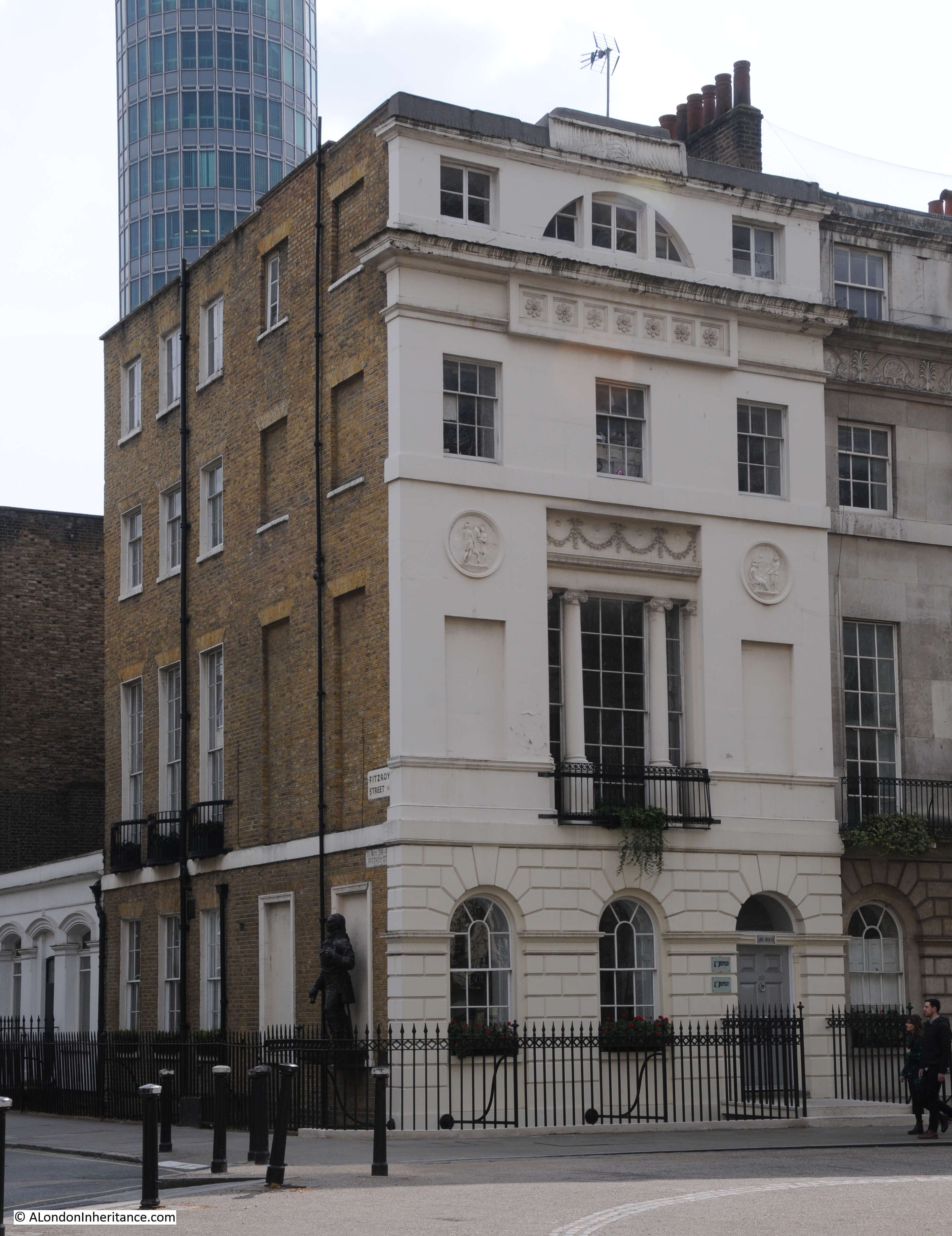
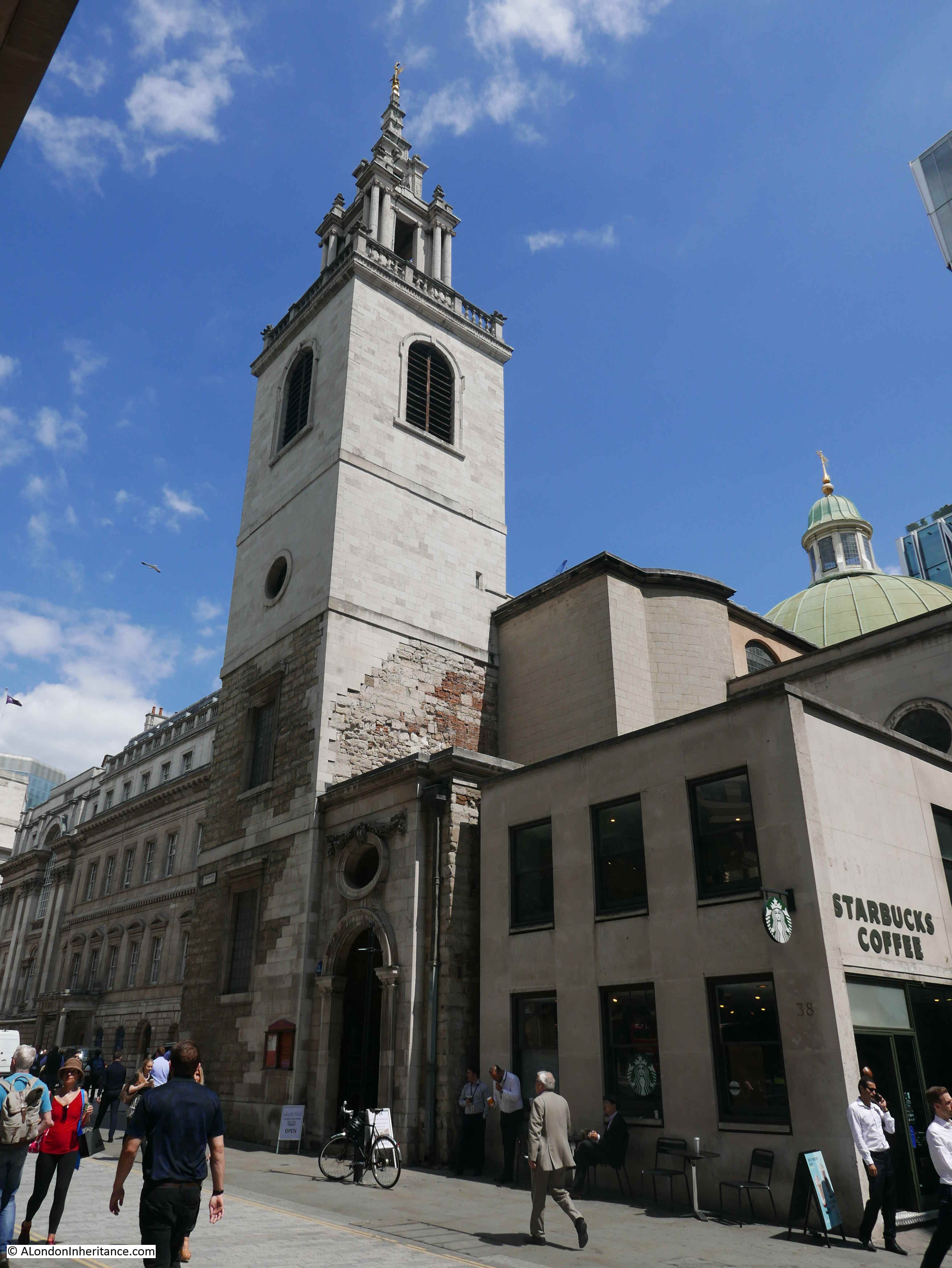
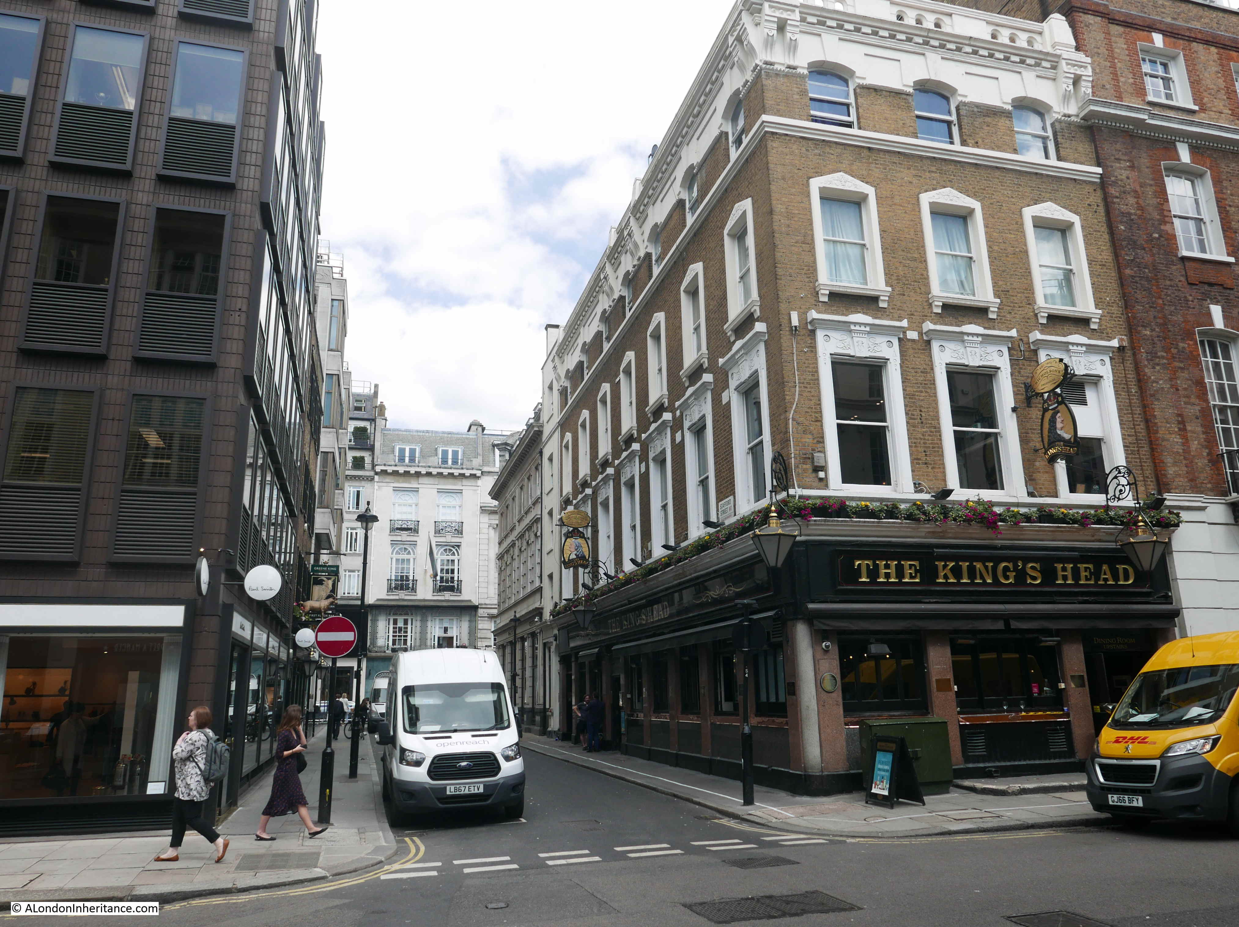
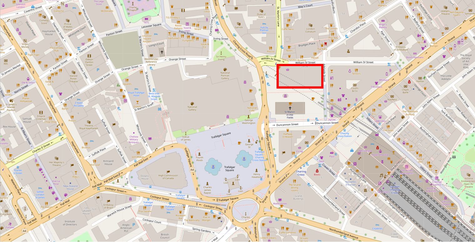
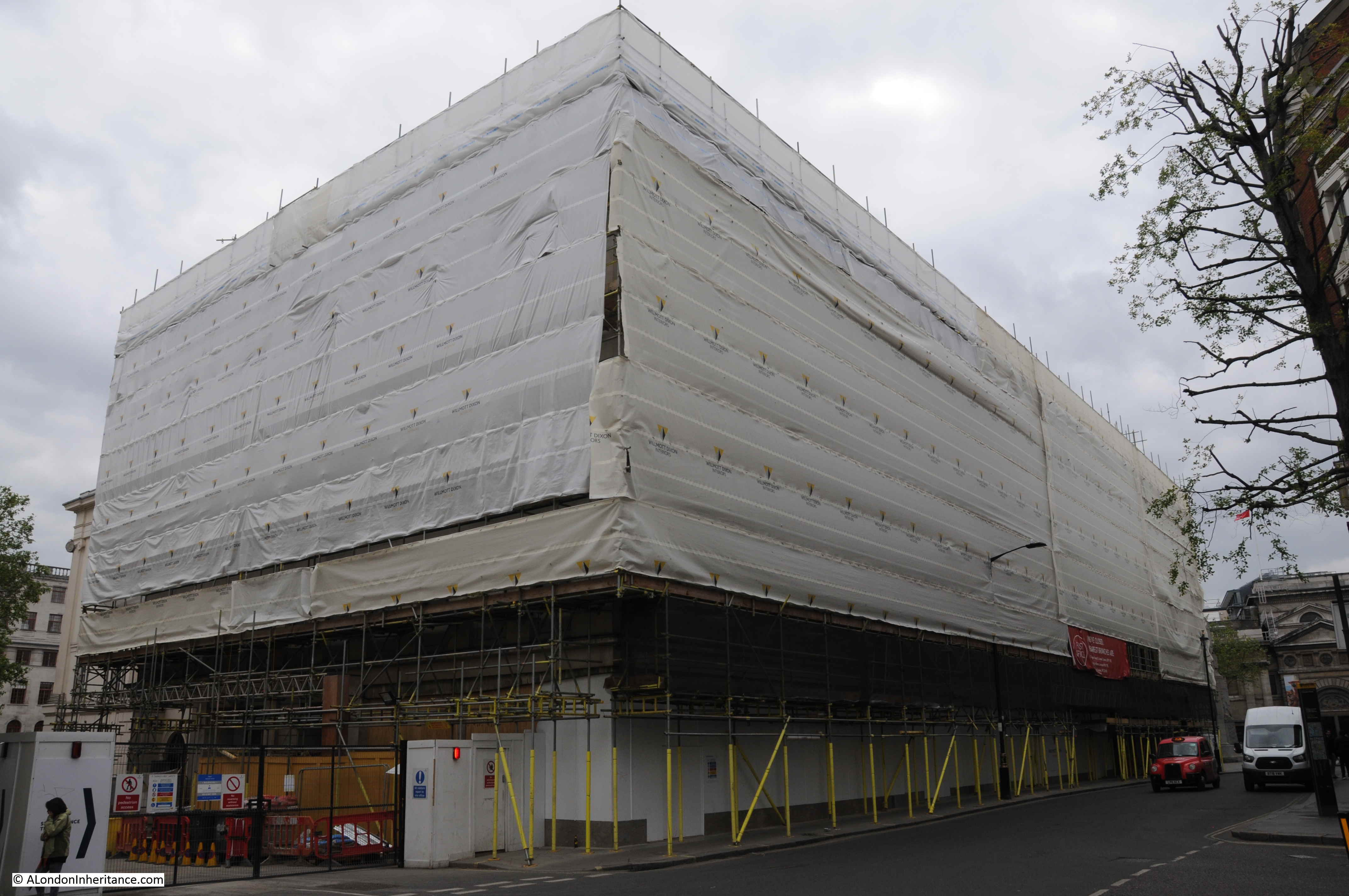
London changes at such a rate that it seems every time you walk down a street, there is new building work underway. I was recently walking down Charing Cross Road towards Trafalgar Square and saw scaffolding and sheeting around this building – Seven St Martin’s Place.

Seven St Martin's Place

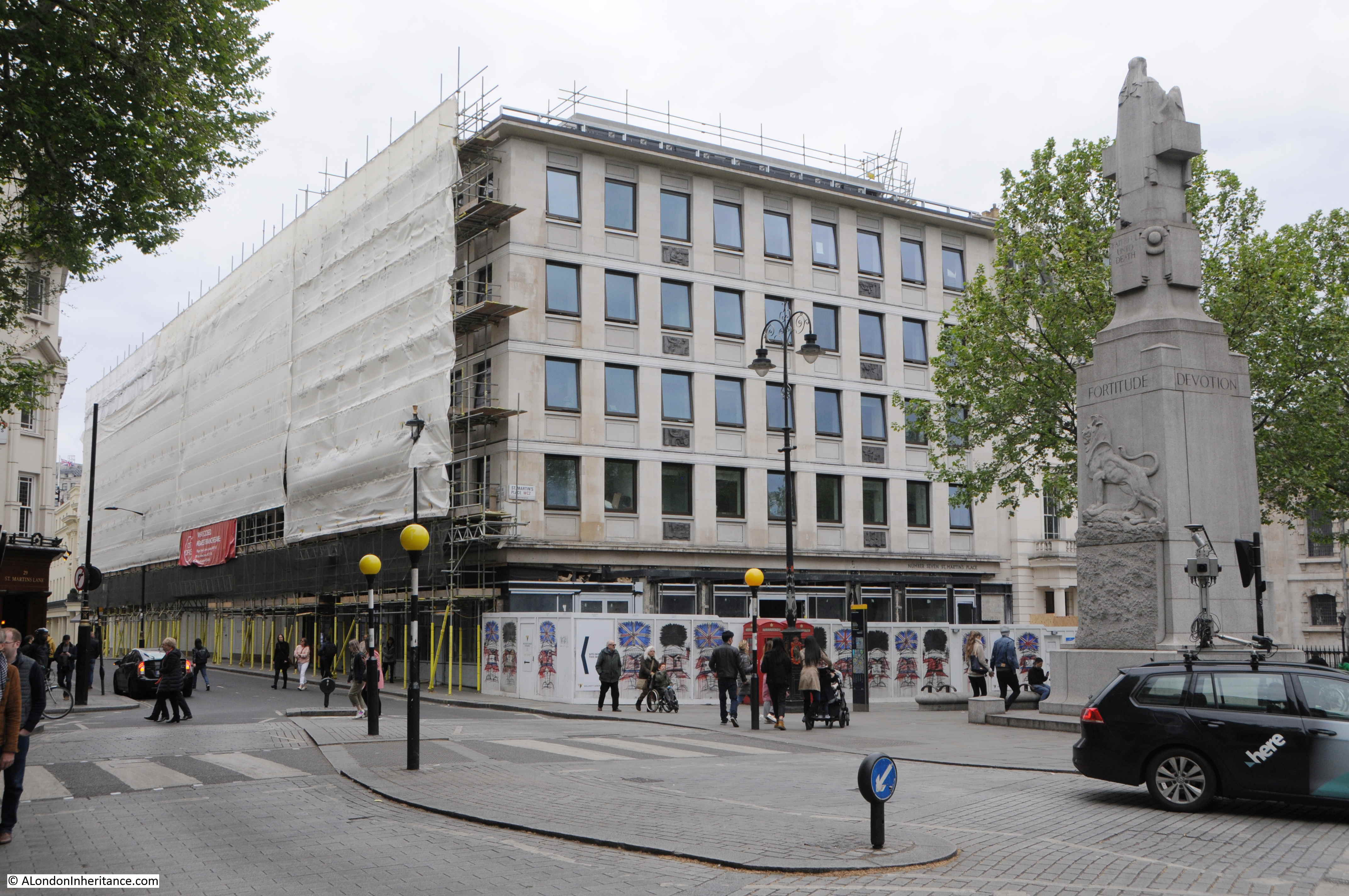
Seven St Martin’s Place is between the church of St Martin in the Fields and William IV Street and faces the Edith Cavell Memorial.

There is nothing very special about the building. It is a late 1950s office block with retail space along the ground floor. The company I worked for in the early 1980s had a couple of floors in the building.

What the building does have is a rather good location. Opposite the National Gallery, less than a minute’s walk from Trafalgar Square, at the southern end of Charing Cross Road and close to the Strand – a prime west London location.

The location of the building is shown by the red rectangle in the following map extract  (© OpenStreetMap contributors) .

Seven St Martin's Place

The reason for the building work at Seven St Martin’s Place is that the building is being converted to a hotel.

The City of Westminster planning decision approves a change of use for the first to fourth floors from offices to hotel accommodation along with extensions at the fifth floor roof level to create a new rooftop restaurant and bar with external terrace,

The existing ground floor retail units will be reconfigured and new retail space created, both at ground and basement levels.

The hotel will consist of 136 bedrooms and be operated by the Butterfly Hotel Group, a Hong Kong based hotel company.

The redevelopment of Seven St Martin’s Place mirrors so much other development across London, where almost any property that becomes available, or can be purchased, is converted to either apartments or hotels. Not in itself a bad thing, providing that residential apartments are affordable, which is rare, or that the diversity of use found across London streets is not restricted.

The planning decision states that whilst “Policy S20 of the City Plan July 2016” resists the loss of offices to residential use, there is no policy that resists the loss of office space to hotel use. Apparently because it is also another use that generates employment, so providing the proposal meets regulations such as noise control, light, appearance, access etc. there is no reason to turn down the application, although an additional Policy S23 does state that existing hotels must be protected and that there are no adverse effects on residential amenity.

I suspect that with the demand for hotel rooms in London, very few applications are turned down.

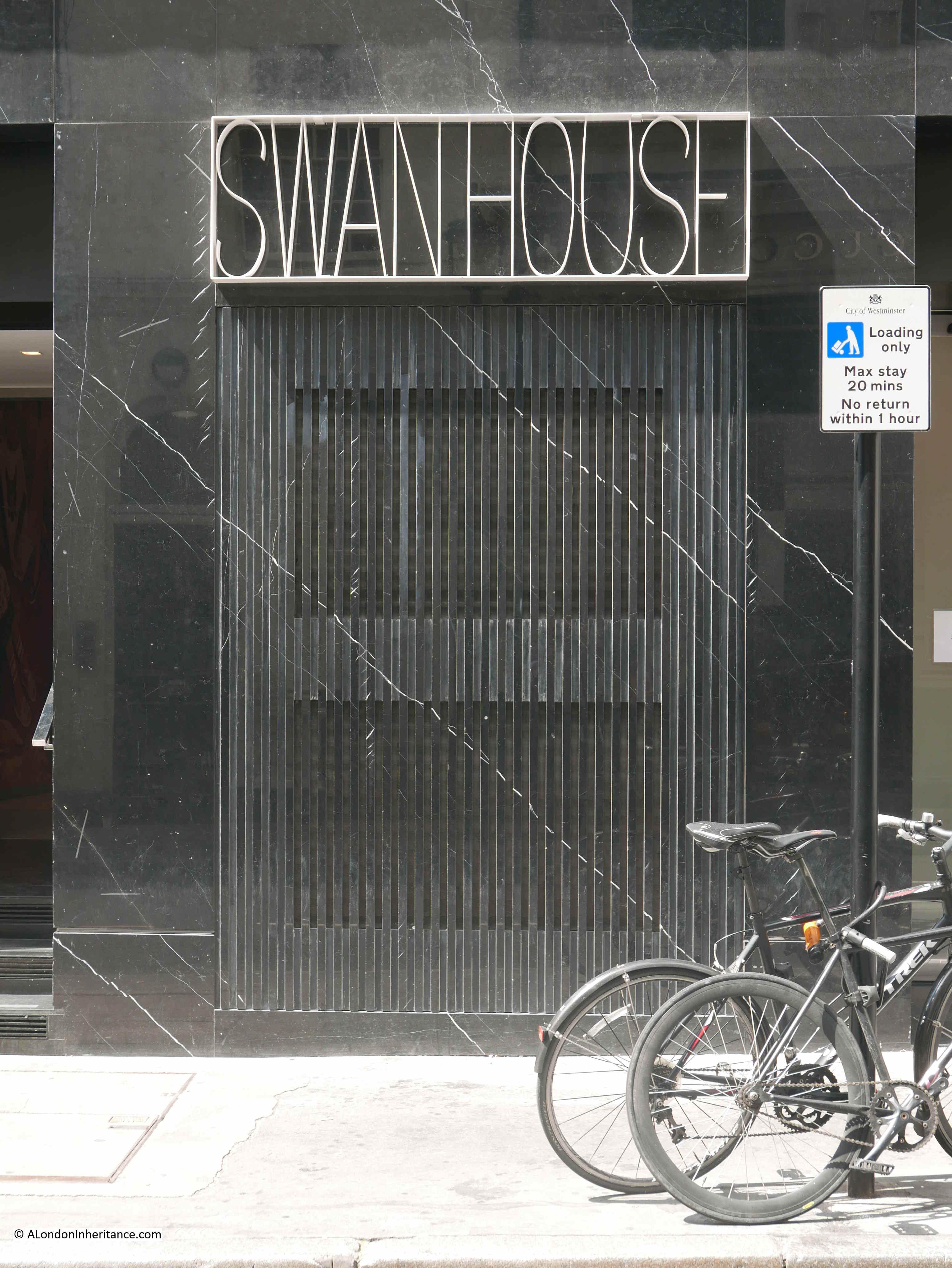
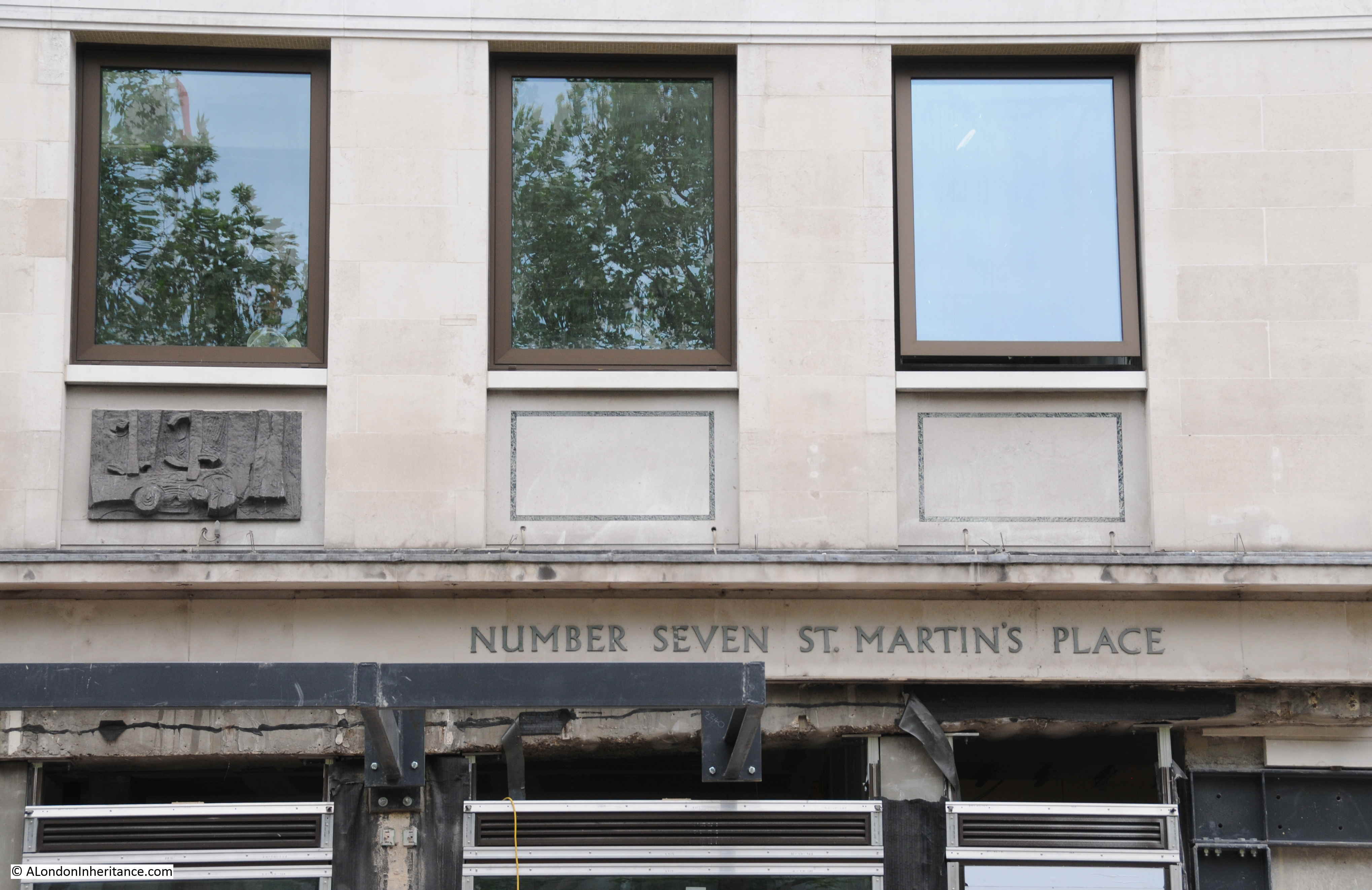
Building name above the original entrance to the building:

Seven St Martin's Place

The conversion of Seven St Martin’s Place did get me wondering about how many hotels there are in London and the level of growth as there does seem to be new hotels opening all the time, and at what point is saturation reached?

There are a number of reports available, and a report by London & Partners (the Mayor of London’s official promotional agency) titled “London Hotel Development Monitor – The Investment Hotspot” provides an overview.

The function of the agency is to promote London and the report is very much focused on promoting the city as a tourist destination and the opportunities for hotel development that tourism brings.

The report states that:

  • In July 2018 there were 140,000 hotel rooms in London
  • An additional 11,600 rooms were expected to be built by 2020
  • Room occupancy is significantly high. In 2018, 79.6% of rooms were occupied, slightly behind Dublin (82%), but higher than Dubai (76.4%), Paris (77.1%), Berlin (74.7%) and Rome (70.1%)

An earlier report stated that the City of Westminster had the most hotels, with 433, with Kensington and Chelsea being second at 189. The City of London had 68 hotels.

The report highlights the impact of the 2012 Olympics on the number of hotel rooms opened across London:

  • 2012: 8,133 new hotel rooms
  • 2013: 1,833 new hotel rooms
  • 2014: 5.442 new hotel rooms
  • 2015: 3,117 new hotel rooms

The money involved is significant with the report claiming hotel investment in 2015 was £3.9 billion.

This level of growth and investment is expected to continue. A working paper “Projections of demand and supply for visitor accommodation in London to 2050” (Greater London Authority – April 2017) provides a projection of visitor numbers to London over the coming decades, with International visitor growth expected to be:

  • 2015 – 18.581 million
  • 2020 – 19.992 million
  • 2025 – 21.215 million
  • 2030 – 22.439 million
  • 2036 – 23.907 million
  • 2041 – 25.130 million
  • 2050 – 27.332 million

Domestic visitors to London, staying overnight will also be growing significantly in the same period;

  • 2015 – 12.938 million
  • 2020 – 13.964 million
  • 2025 – 15.451 million
  • 2030 – 16.938 million
  • 2036 – 18.598 million
  • 2041 – 19.928 million
  • 2050 – 22.413 million

Projections are notoriously difficult to get right, but I suspect it is safe to assume that the number of hotels required in London will continue to grow significantly, and there will be many more redevelopments of existing buildings over the coming decades.

The closed Post Office on the ground floor of Seven St Martin’s Place – will this type of business ever return to the retail space of redeveloped buildings, with probably increased rents? The planning decision does confirm that space will be available for the Post Office should the company choose to return.

Seven St Martin's Place

The growth in hotels across London has been considerable, but to understand the impact on local communities, pricing pressure on the cost of housing, apartments and flats, costs for renting, we must also look at the growth of Airbnb in London, which has been dramatic over the last few years.

The Inside Airbnb site has some fascinating detail on the number and type of accommodation listed, cost, occupancy etc. The overview for London at the time of writing this post shows that for London there are:

  • A total of 77, 096 listings, of which;
  • 42,758 are entire homes or apartments
  • 33,594 are private rooms
  • 744 are shared rooms

The supporting data is downloadable. I was creating a graphic showing the number of Airbnb’s for each London borough, but ran out of time (I will add when complete), but for now, along with the new hotel being built, there are 9,411 Airbnb listings in Westminster.

The relative ease and low cost of global travel is driving the rise in tourism, and therefore the demand for accommodation in cities across the world. Other cities such as Venice and Barcelona are taking steps to control tourism, and the growth in Airbnb. These cities also have to manage the rise in tourists arriving by cruise ship – an issue which currently has minimal impact on London, apart from the occasional cruise ship moored by HMS Belfast or at Greenwich. Whilst these methods of travel do not require accommodation in the city, they do drive a high number of visitors who spend little in the host city.

Amsterdam is another city trying to manage ever increasing visitor numbers with a number of steps being taken including the Netherlands Tourist Board no longer actively promoting the country as a tourist destination.

The demand for land and buildings for hotel development is one of the many drivers behind the price of property across London.

In 2010, Seven St Martin’s Place was sold for £41 million and four years later in 2014 it was sold again, with the prospect of change of use to a hotel, for £65 million – a profit of £24 million in four years.

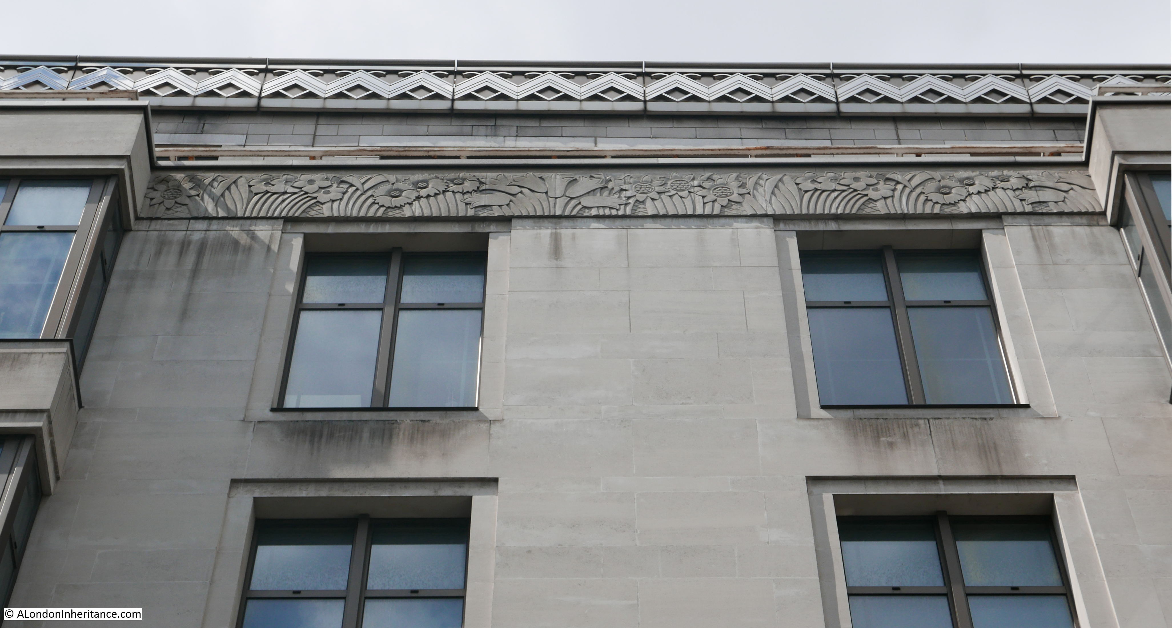
The facade of the building is relatively bland, however there is some interesting decoration on the side of the building facing the Edith Cavell monument. There are two vertical sets of, I am not sure what – artwork, carvings – one panel between each window, creating vertical columns of panels spaced between windows. See the photo at the top of the post for the location of these panels.

Close-up photos of these panels reveal some intriguing designs:

Seven St Martin's Place

Seven St Martin's Place

Seven St Martin's Place

Seven St Martin's Place

Seven St Martin's Place

Seven St Martin's Place

Seven St Martin's Place

Seven St Martin's Place

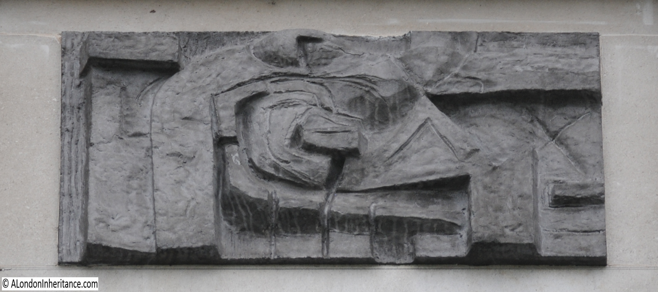
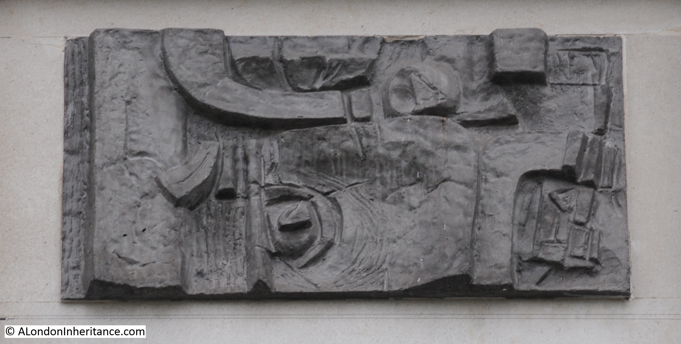
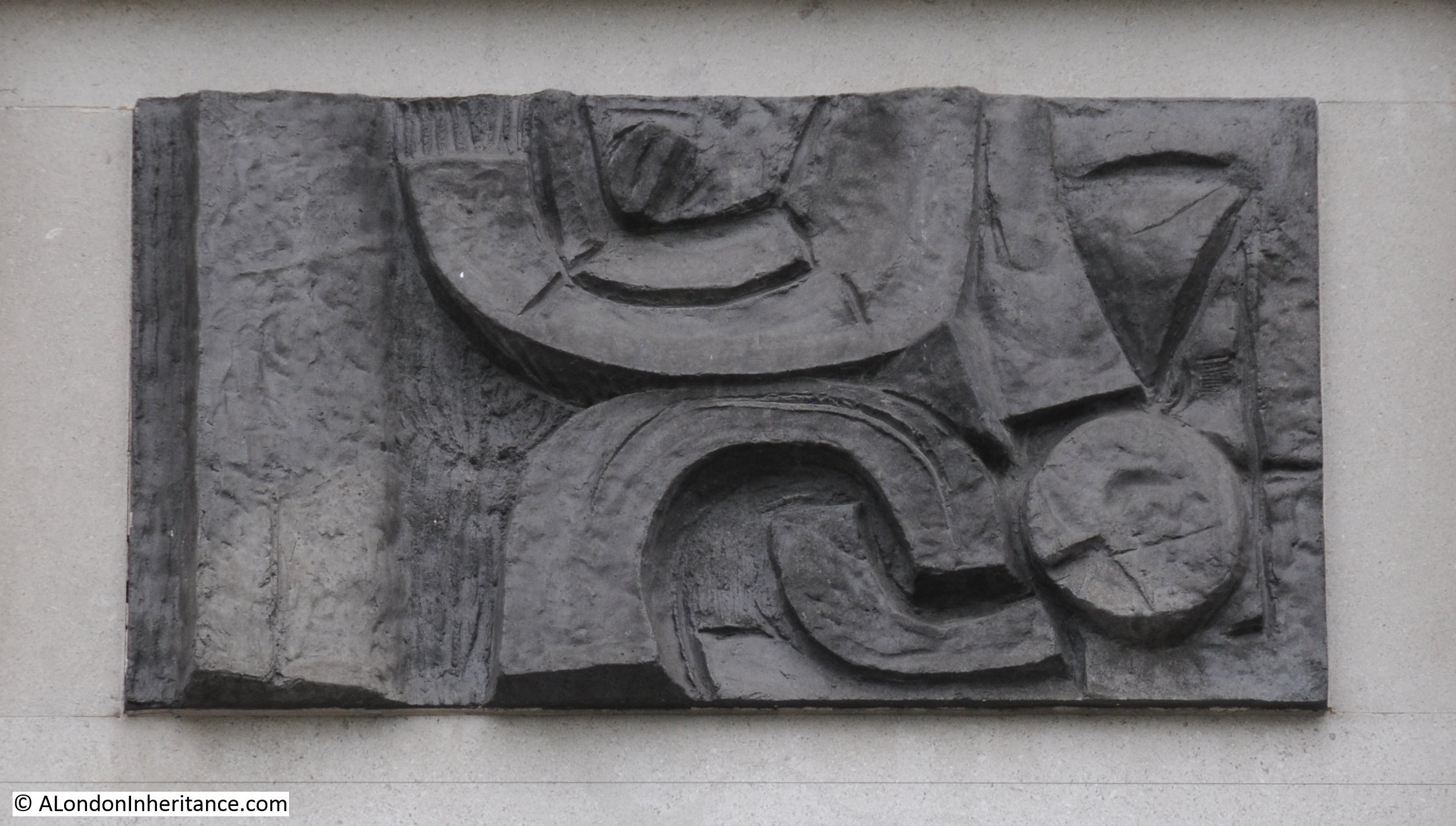
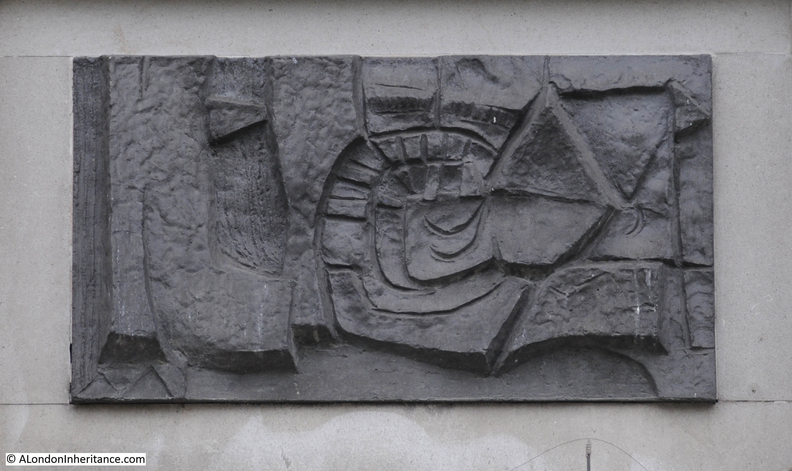
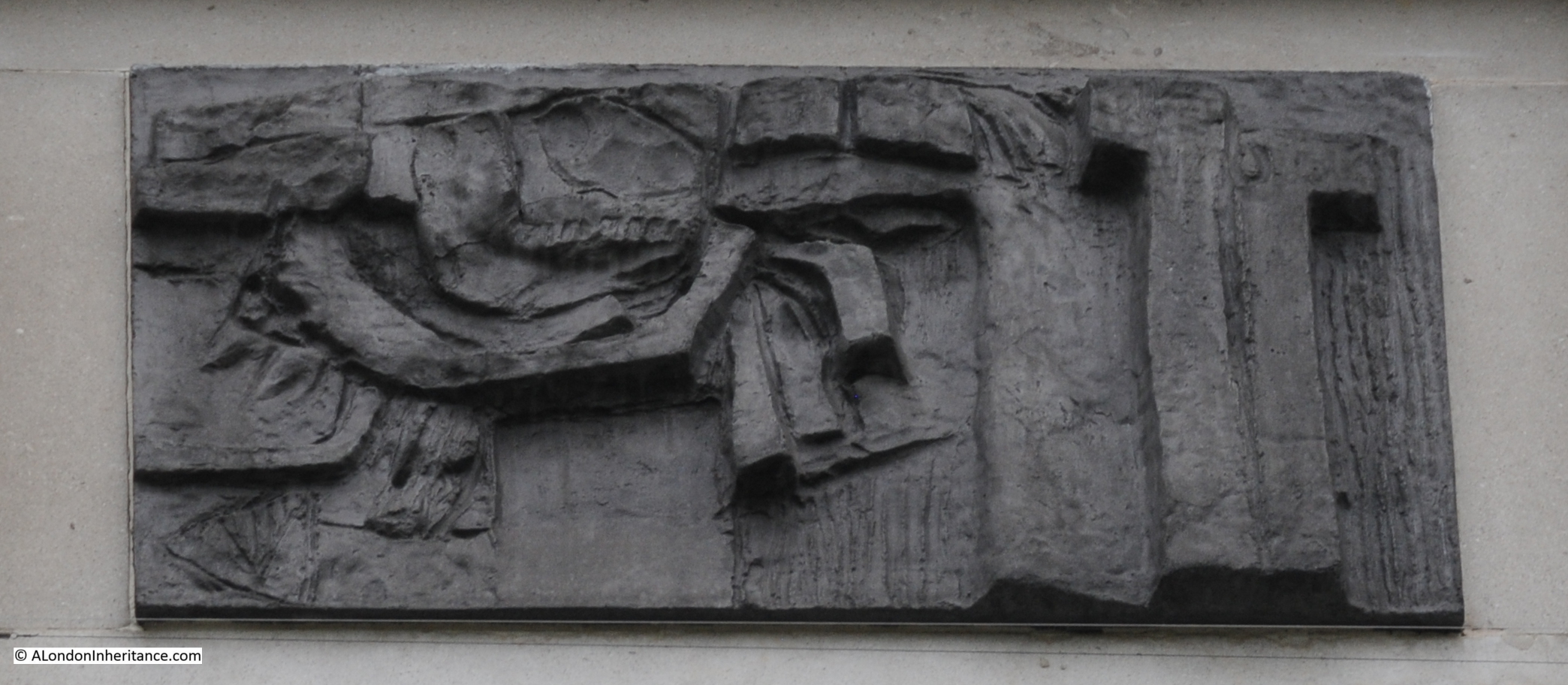
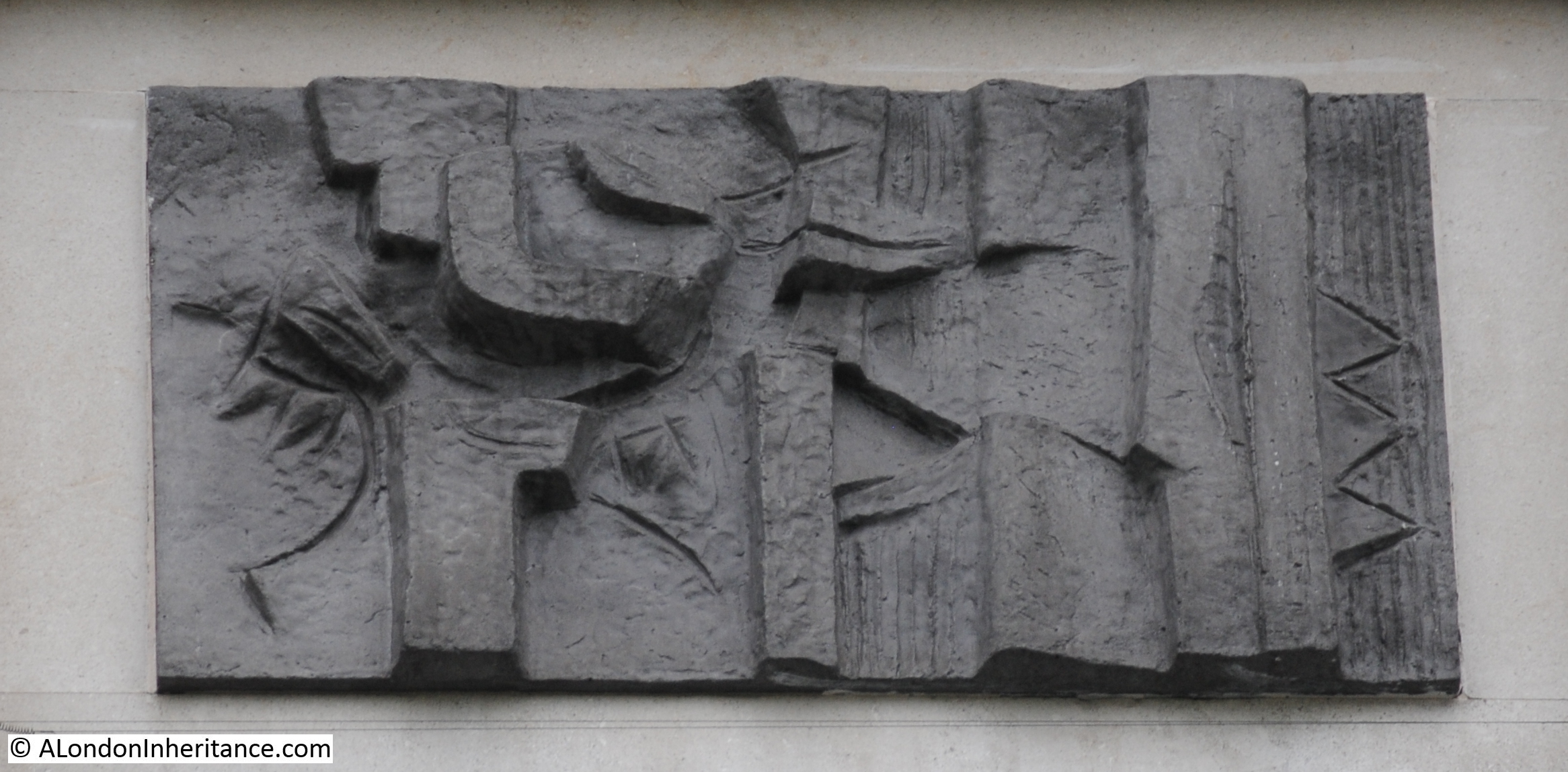
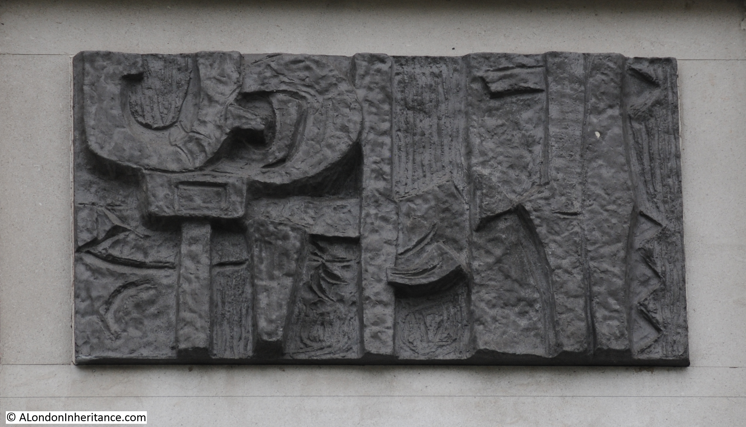
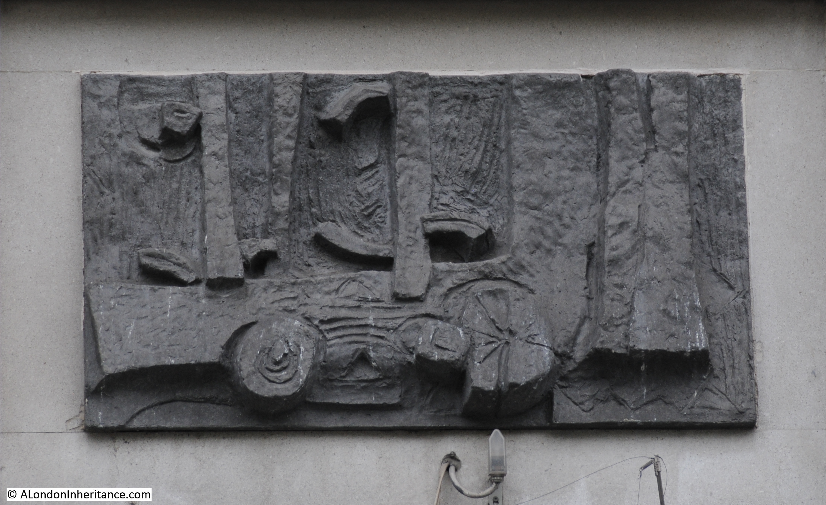
I have no idea as to the origin of these panels, or what they are intended to represent.

The building is not listed, and strangely the planning decision document which details the conditions of planning approval does not make any mention of these panels.

The drawings in the planning document appear to include these panels, so hopefully they will remain.

I have really tried to make out what these panels mean, but cannot find any reference, or looking at them, see any recognisable form or pattern.

I did wonder if put together they would make a map. I have written about the building at 111 Strand, where a map of the area has been carved into the Portland Stone across the 1st to 5th floor of the building.

To see if they made a map, or if there was any other meaning when the panels are combined, I put them together in the same order as they appear on the building:

Seven St Martin's Place

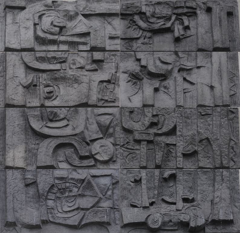
It does look as if the panels are meant to be combined. There are features that run from one panel to the adjacent. There looks to be a boarder around combined panels. On the far right of the panels, there are vertical wavy lines running down all four panels – could this be the River Thames?

Despite looking at these panels for ages, rotating the photos, trying different combinations, I cannot see any meaning – perhaps there is none. If anyone knows what they mean and who created them, I would be really interested to know.

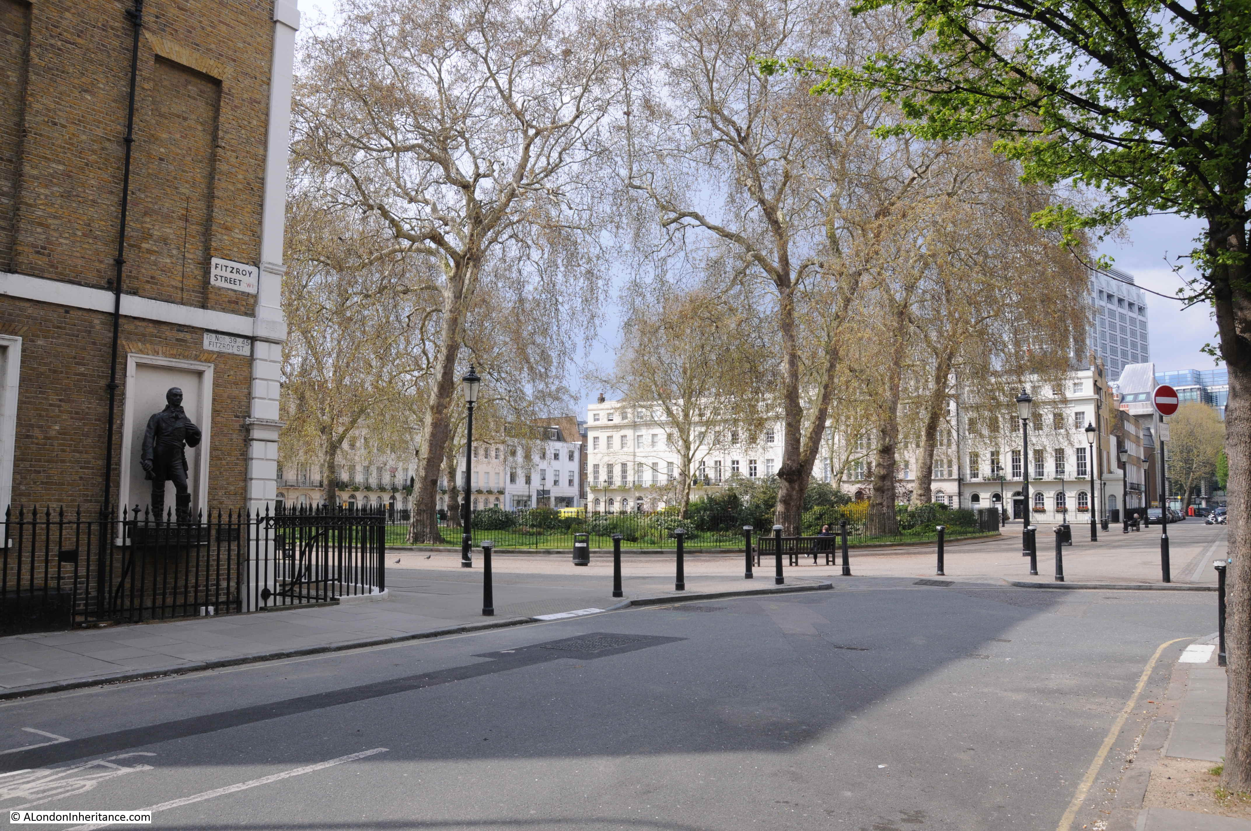
Although the focus of this week’s post was on the building, and what another hotel conversion means for London, I wanted to have a quick look at the history of the site.

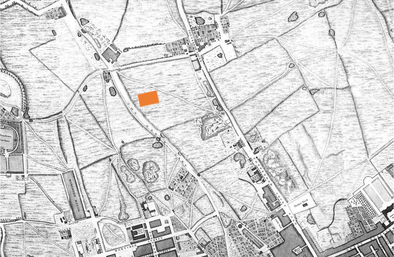
The area demands a full post, so this is a brief look. The 1895 Ordnance Survey Map shows the area as it was around 125 years ago:

Seven St Martin's Place

Credit: ‘Reproduced with the permission of the National Library of Scotland’ 

The street plan is much the same as today, but the block of land that is now occupied by Seven St Martin’s Place was St Martin’s Mews. The Vicarage remains to this day

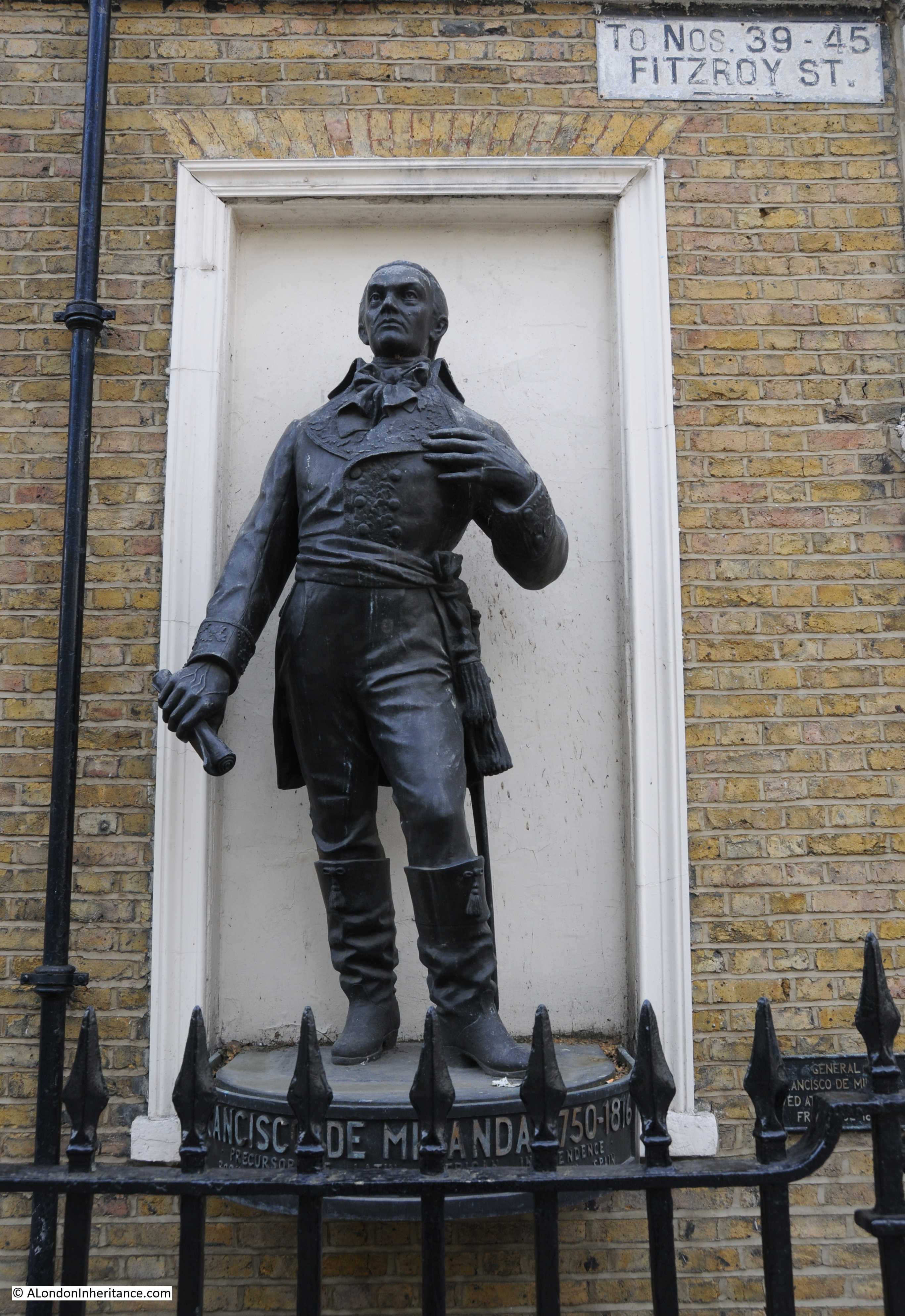
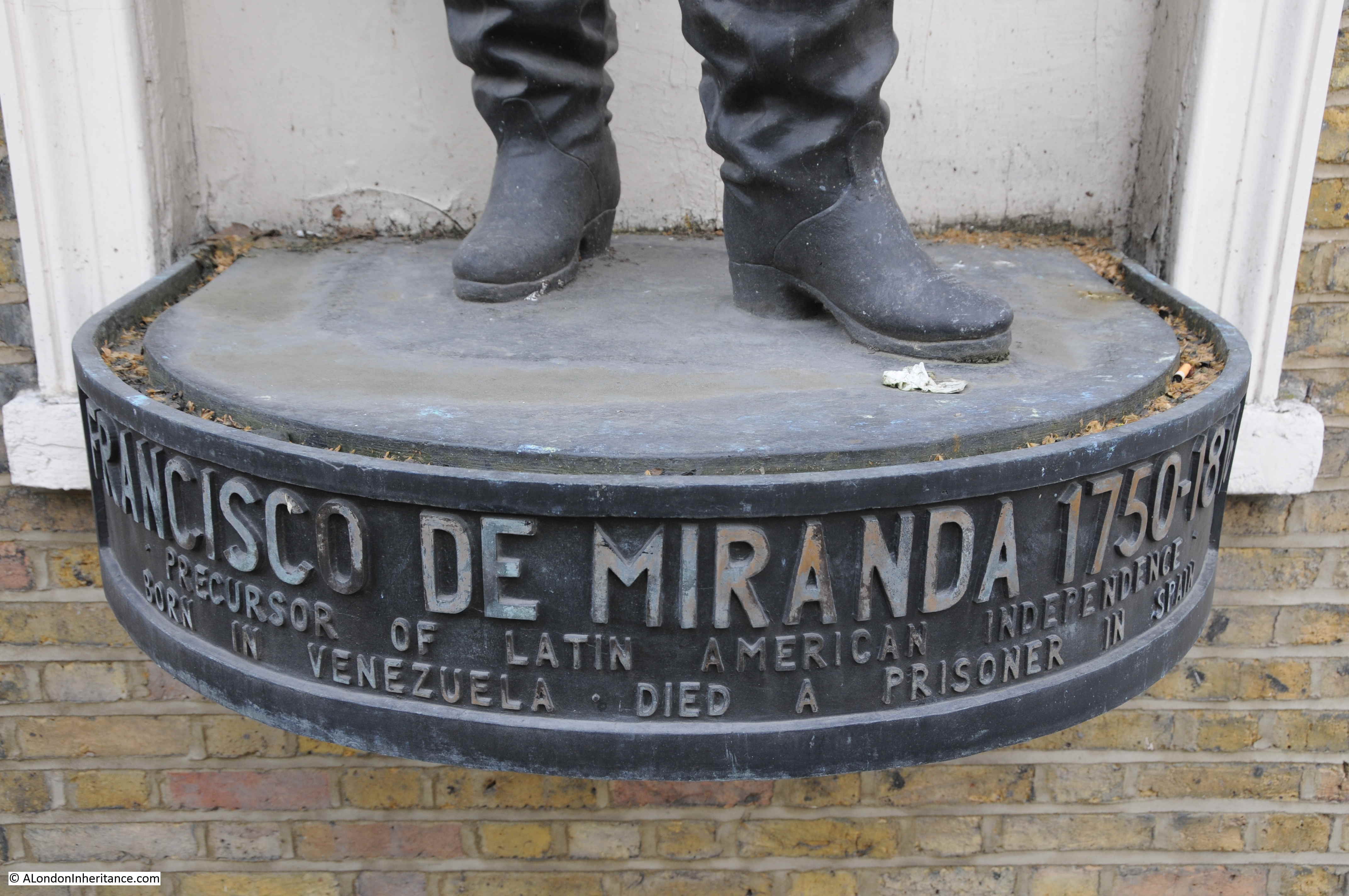
What is interesting is that the location now occupied by the monument to Edith Cavell, also had a statue in 1895, however it must have been different as the Edith Cavell monument was unveiled in 1920.

On July 18th 1902 a rather impressive statue to General Gordon, mounted on a camel was unveiled in the same position:

Seven St Martin's Place

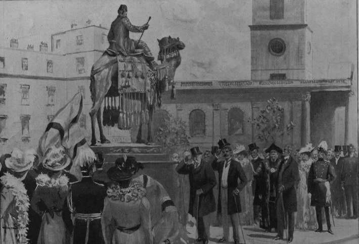
But this was seven years after the Ordnance Survey map – I could not find any reference to an earlier statue, but my research time was limited.

The London Metropolitan Archives Collage collection, as usual provided some views of the site prior to the construction of the building we see today.

This is the view of the building that occupied the site, note the entrance to the Mews. The photo is dated 1930 and I suspect are the same buildings that are shown on the 1895 Ordnance Survey map.

Seven St Martin's Place

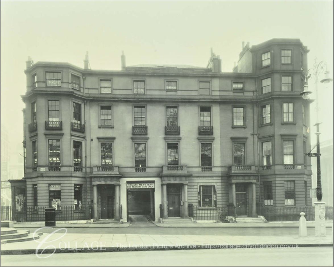
Image credit: London Metropolitan Archives, City of London: catalogue ref: SC_PHL_01_523_A7058

In the above photo, the darker section on the right of the block is the vicarage. This part of the block remains to this day and it is the lighter section on the left that was demolished to be replaced by Seven St Martin’s Place.

The following photo is a 1958 view of the building. As the 1895 map indicates, it was a collection of different buildings with a central mews.

Seven St Martin's Place

Image credit: London Metropolitan Archives, City of London: catalogue ref: SC_PHL_01_523_58_2190

As the above photo is dated 1958, it was either demolished soon after, or the references to the current building on the site being a late 1950s office block are wrong, and it is perhaps early 1960s.

The view of the building from William IV Street today, shrouded in sheeting as part of the building work.

Seven St Martin's Place

Changes to London are gradual, and normally it is only the historically or culturally significant buildings that get publicity when their use is changed, or they are threatened, but there are also so many changes involving rather ordinary buildings from the last half of the 20th century.

Hotels and expensive residential buildings appear to be the main drivers of development, however there still appears to be an expectation for plenty of office space. The 2017 London Office Policy Review for the Greater London Authority projects that office employment across the greater London area will rise from 1.982 million in 2016 to 2.861 million in 2050, so office space will continue to be required in larger volumes to accommodate this workforce.

So with the 2050 projections for both office space and tourism numbers – London is set for a considerable amount of development over the coming decades, and we will continue to see change whilst walking the streets of London, although I am not sure how much trust I would put in future projections.

alondoninheritance.com

Fitzroy Square

A few months ago, I wrote a post about the J.Evans Dairy in Warren Street. After walking along Warren Street I headed south along Fitzroy Street to have a look at Fitzroy Square, one of the many squares and gardens built as London expanded north and west during the 18th and early 19th centuries.

It was the weekend, so was quiet during my visit, but it was strange walking from the traffic of the Euston Road, to a peaceful square and the sound of birdsong.

Fitzroy Square

Fitzroy Square is south of Warren Street and Euston Road and to the west of Tottenham Court Road.

A large square with a central, circular garden. In the following map extract, Fitzroy Square can be seen in the centre (© OpenStreetMap contributors):

Fitzroy Square

Fitzroy Square was developed by Charles Fitzroy, the 1st Baron Southampton in the 1790s, when the east and south sides of the square were built. The northern and western sides to the square were added between 1825 and 1835.

The amount of building in this part of London during the later half of the 18th century and early 19th century must have been considerable.

John Rocque’s map of 1746 still shows the area as rural, consisting of large fields, some roads and tracks across the fields.

The following extract from Rocque’s map shows the area. I have highlighted the approximate location of Fitzroy Square with the orange rectangle.

Fitzroy Square

Tottenham Court Road is the road towards the right side of the map, running from top to bottom. The cluster of buildings towards the top of Tottenham Court Road is where the future junction with Euston Road would be located.

The following photo is from where Fitzroy Street joins Fitzroy Square. The two built sides of the square (eastern on the left and southern in the distance), were the first parts of the square to be developed, both to designs by the Adams brothers however the southern side of the street was very badly damaged during the last war and has since been rebuilt.

Fitzroy Square

The London Metropolitan Archives, Collage collection has a very similar view of the square to my photo above. The print below is dated 1800 and shows the square looking much the same as it does today, with the exception of the trees and plants in the central garden which originally appeared to be empty space.

Fitzroy Square

Image credit: London Metropolitan Archives, City of London: catalogue ref: SC_PZ_SP_02_122

Residents of city squares often wanted the central space kept free as there was concern about who could be hiding in the planting (worries about robbery and theft) , or that planting the central square would take away from the grandeur of the surrounding houses.

There is a newspaper report from October 1795 which states that “A new market for the sale of meat, vegetables &c. was on Saturday opened on Lord Southampton’s estate in the neighbourhood of Fitzroy Square”. Perhaps this is what the centre of the square was used for, however I would be surprised if such a market was allowed in the centre of the square as it would probably have had an impact on the perception of the square and the value of the properties.

Rather appropriately, the conservation body, the Georgian Group have their head office in one of the buildings along the eastern side of the square.

Horwood’s map of London from 1799 confirms that the southern and eastern sides of the square were developed first, with the northern and western sides developed later in the 19th century.

Fitzroy Square

Compare Horwood’s map of 1799 with Rocque’s map of 1746 and it shows how much building there had been in the 50 years between the two maps.

The street leading off Fitzroy Square from the south-east corner was Grafton Street, but is now Grafton Way, possibly renamed to avoid confusion with a Grafton Street that had already been built.

This is the northern side of Fitzroy Square, which was built between 1827 and 1828:

Fitzroy Square

There are a number of Blue Plaques across the square. On the building that houses the Mozambique High Commission, along the western side of the square, is a plaque recording that Robert Gascoyne Cecil, 3rd Marquess of Salisbury lived in the building. He was prime Minister for various periods between 1885 and 1902.

Fitzroy Square

Further along the western side of the square are two plaques on the same building that record George Bernard Shaw and Virginia Woolf living in the building (although not at the same time).

Fitzroy Square

View across the square from the south-western corner. When the trees are in full leaf they will obscure the new towers that hover behind Fitzroy Square and it is possible to imagine the square as it would have looked soon after completion.

Fitzroy Square

The gardens in the centre of the square are privately owned, belonging to those who own the freehold of the buildings that surround the square. The gardens are occasionally open during the Open Garden Squares Weekend.

The sculpture in the gardens, to the right of the above photo is titled  ‘View’ and is by Naomi Blake. It was installed to commemorate the Queen’s Silver Jubilee in 1977

The southern edge of the square was badly damaged by wartime bombing and a high explosive bomb fell on the north-west corner.

As with many open spaces in London during the war, it was used for temporary water storage, to be used in the event of fires, as bombing frequently reduced the supply and pressure of water from the underground pipes. A strange and tragic death was recorded in the Daily Mirror on the 4th July 1942 highlighting the dangers of these water storage installations:

“Nap – It Led To His Death: Giving evidence at a St. Pancras inquest yesterday on Frank Edgar Husson, 51, of Stanhope-street, St. Pancras, who was drowned in an emergency water dam in Fitzroy-square, Dr. jean Mary White suggested that Husson might have fallen asleep while seated on a girder and slipped into the water.

It was stated that Husson, a builder’s labourer, walked across a girder, and as he had ten minutes before resuming work after lunch, he might have sat on a girder. No splash was heard. A verdict of accidental death was recorded.”

During the war, The Sunday Mirror had a regular feature where men in the services would write in regarding someone they briefly met, and wanted to meet again. The Sunday Mirror promised that “We print each letter in the hope that the girl will recognise herself and, if she cares to, will write. We have the full names and addresses of each man.”

Fitzroy Square featured in one letter on the 30th March 1941 from a Corporal R. Stephens of the Coldstream Guards:

“During a London blitz I was walking in Fitzroy-square when a bomb hit a nearby building, and my friend and I made for a rush for the wreckage where a number of girls were sheltering in a basement. By this time the A.R.P. men were well on the job, and all the girls, with the exception of two, were escorted to nearby houses for shelter.

The two left behind accompanied my friend and I to a public shelter, having to fling ourselves flat several times while bombs fell perilously close.

I admired those two girls for their bravery, and one in particular fascinated me so much that I felt that I did not want to leave her.

But I was obliged to leave, without even plucking up enough courage to make a date with her, as I had to be back in barracks at midnight.

I am hoping though, that she will recognise herself, and will write to me.”

It is this sort of human detail that I find fascinating – so many millions of individual stories of those who have been in London over the centuries. I wonder if Corporal R. Stephens ever did find the girl he met in Fitzroy Square?

The western terrace of houses, dating from 1832 to 1835:

Fitzroy Square

On the south side of the square are numbers 34 and 35. On the step in front of the identical door are the words “Swiss House”.

Fitzroy Square

The Swiss House was a “Home for Aged Swiss” opened in 1936 by the Swiss Benevolent Society. an organisation that dates back to 1703 and set-up to provide aid to Swiss residents of London. The society is still in operation today (but not in Fitzroy Square).

In the centre of the southern terrace are two red doors, with a plaque in the middle recording the architect of the southern and eastern sides – Robert Adam.

Fitzroy Square

At the weekend, Fitzroy Square is quiet. Walkers through the square generally seemed to be heading to another destination, however the view across to the north side of Fitzroy Square caught the attention of a number of people who decided to sit and admire the view:

Fitzroy Square

Looking across to the eastern side of the square:

Fitzroy Square

The eastern terrace, along with the southern terrace, the first to be developed in the 1790s:

Fitzroy Square

One of the entrance doors in the eastern terrace, with some lovely detail in the fanlight:

Fitzroy Square

The photo below shows the south side of the square:

Fitzroy Square

The buildings at either end of the southern terrace were for a time occupied by medical institutions.

In 1929, the London Foot Hospital and School of Podiatric Medicine moved into number 33 Fitzroy Square (the building on the right of the terrace in the above photo), and in 1959, number 40 (the building on the left of the terrace), which had been the London Skin Hospital, also became part of the London Foot Hospital, where the hospital would stay until closure in 2003.

There is an interesting statue on the side of the building that was the London Foot Hospital:

Fitzroy Square

This is Francisco de Miranda:

Fitzroy Square

Francisco de Miranda was an interesting character. Born in Caracas, Venezuela on the 9th June 1756, he was originally an officer in the Spanish colonial armies, but seems to have been involved in almost any American (north and south) or European war in the later part of the 18th century and early 19th century.

He fought with the French during the American Revolutionary War, various battles across Europe for the French including the taking of Antwerp and at the siege of Maestricht, but was really interested in the independence of Venezuela, and his involvement with European Governments (apart from the Spanish) was with trying to gain support for this cause.

The reason for this statue on the corner of Fitzroy Square is that he had a number of stays in London, living for a time at 58 Grafton Way, which also joins Fitzroy Square at this corner.

There is a plaque adjacent to the statue which claims he lived here from 1802 to 1810, however from various other references this was not a continuous stay, and I am not sure if the period stated is correct.

His first visit to London appears to have been in the late 1780s when he was in London meeting Prime Minister William Pitt and looking for support against the Spanish in the independence of Venezuela.

Up until 1803 he had been in the Netherlands, before returning to France from where Napoleon expelled him in 1804 when he returned to London.

Along with his travelling the world and fighting battles, it also appears he was a bit of a philanderer. Whilst in London Miranda married Sarah Andrews, a Yorkshire farmers daughter. Sarah lived in London, caring for their two children whilst Miranda was away, so perhaps the period 1802 to 1810 refers to the time Sarah Andrews was in residence with Miranda making occasional returns to London.

1810 appears to be the year he left London for good as he returned to Venezuela to fight with the revolutionary forces and was briefly ruler, until being arrested by the Spanish in 1812. He was imprisoned in Cadiz until his death in 1816.

The base of the statue:

Fitzroy Square

There is a plaque commemorating his wife, Sarah Andrews, but not in London. In 1981 the Venezuelan Ambassador unveiled a plaque in her home village of Market Weighton in East Yorkshire. It would be interesting to know how a Venezuelan freedom fighter met a Yorkshire farmer’s daughter.

London has always been a place where those fighting revolutionary wars and independence for their home countries would seek temporary refuge. I have written about a couple of other examples, Giuseppe Mazzini in Laystall Street, and Sun Yat-sen in Gray’s Inn Place, and there are many more similar stories to be found all across London.

A final look back from the southern stretch of Fitzroy Street into Fitzroy Square:

Fitzroy Square

There is one significant difference between all the above photos and my usual photos of London streets – there are no cars.

The western, southern and eastern sides of the square are pedestrianised, with only the northern stretch of the square continuing as a traffic route. When you come across an area without any traffic, without parked cars lining the streets, it is very noticeable how much this improves the experience of walking through the city. Although there were few people walking through the square at the weekend, many of those who did would stop and look at the view, or sit for a while on the seats at the southern side of the square.

Obviously not practicable to extend this approach across large areas of London, but a bit more pedestrianisation really does improve London’s streets.

alondoninheritance.com

St Stephen Walbrook

I was in the City earlier this month and had a couple of free hours in the afternoon, so I headed to the church of St Stephen Walbrook, a church I have not been inside for a number of years.

The church is located just south of the Bank junction of Poultry, Princess Street, Threadneedle Street, Cornhill and King William Street. Located just behind the Mansion House, the church includes the name of one of the City’s lost rivers, and faces onto a street with the same name, Walbrook.

Walking down from the Bank junction, this is the view of the tower of St Stephen Walbrook:

St Stephen Walbrook

St Stephen Walbrook has a long history, however the church is not on its original site.

The River Walbrook originally ran slightly to the west of the street, and it was on the western side of the River Walbrook that the first church was established. Foundations of the original church were found during excavation of the site that today is occupied by the offices of Bloomberg, also the original location of the Roman Temple to Mithras.

According to Walter Thornbury writing in Old and New London, “Eudo, Steward of the Household to King Henry I (1100- 1135) gave the church of St Stephen, which stood on the west side of Walbrook, to the Monastery of St John at Colchester.”

The church probably dates from around the 11th century, but is probably older.

There is very little written evidence of this first church, however in the History of the Ward of Walbrook of the City of London (1904), J.G. White states:

“It possessed a Steeple with Bells and Belfry, as, from an inventory made, it appears that at the time of building the new Church, three bells, with their wheels, &c., were removed from the old building, and fixed in the new Steeple; also that it contained a belfry is evident from the fact that there is in the Coroner’s Roll for 1278 an entry, that on the 1st May in that year information was given that on the previous Sunday, about mid-day, William Clarke ascended the belfry to look for a pigeon’s nest, and in climbing from beam to beam he missed his hold and fell, dying as soon as he came to the ground. There was also a Chancel, there being in the year 1300 an Inquisition taken to enquire who was liable to repair the watercourse of the Walbrook over against the Chancel Wall of the Church.”

Around 1428, this original location of the church, and its associated graveyard was considered too small to support the parish, so a new location was required.

A plot of land was given by Robert Chicheley, a member of The Worshipful Company of Grocers, on the opposite side of Walbrook street, roughly 20 metres to the east of the original location, and the new church was built between 1429 and 1439.

This church would last just under 240 years as the church of St Stephen Walbrook would be one of those destroyed in the Great Fire of 1666.

Rebuilding commenced in December 1672, with Wren as the architect. St Stephen Walbrook was probably his local church as at the time he was living in Walbrook.

It was a difficult location for the new church as houses were built up against the church, including the area around where the tower would be built.

The area north of the church, now the site of the Mansion House was originally occupied by a market in fish and flesh know as the Stocks Market. Part of the original design for completion of St Stephen Walbrook was a colonnaded replacement for the pre-fire Stocks Market, which would have extended north from the church, This did not get built.

The church was ready to use in 1679, although the tower appears to have been completed later.

The following print from Old and New London shows the church soon after completion. The print also highlights the houses that clustered immediately around the tower.

St Stephen Walbrook

The above drawing from Old and New London is dated 1700, however I suspect this is wrong. The drawing shows the spire on top of the tower, however the spire was not added until 1713-1715.

Remove the houses in front of the church, and as the following photo demonstrates, the appearance of the church is much the same today. It was not possible to replicate the above drawing as the Mansion House presses in to the left of the church, occupying the space that was the Stocks Market.

St Stephen Walbrook

The following extract from a 1720 Ward map shows the church of St Stephen Walbrook, with the Stocks Market occupying the land to the north.

St Stephen Walbrook

Time for a look inside the church. A set of steps rise up from street level to the interior of the church.

St Stephen Walbrook

The interior of St Stephen Walbrook from the entrance:

St Stephen Walbrook

The interior has an unusual layout for a City church. The wooden reredos is at the far end of the church where the altar would traditionally have been located, however following restoration work carried out between 1978 and 1987, the traditional altar was replaced by a central circular altar carved from Travertine by Henry Moore.

St Stephen Walbrook

The new altar and additional restoration work throughout the church was commissioned and supported by the fund-raising efforts of Lord Peter Palumbo who was Churchwarden from 1953 to 2003.

Restoration work at the time was essential as the church was suffering from subsidence, possibly due to the long-term impact of the River Walbrook.

The location of the altar does prevent an ideal photograph of one of the main features of Wren’s designs – the large dome located above the central square of the church.

St Stephen Walbrook

Multiple references refer to the dome as being Wren’s practice for the dome of St Paul’s Cathedral, however whilst the overall shape is similar, a dome with lantern on top, the size and construction method is very different.

Whilst the dome of St Paul’s has the inner false dome, with the layer of supports between inner and outer dome to transfer the load of the large stone lantern through to the body of the cathedral, the dome of St Stephen is a much more straightforward construction, however that does not detract anything from the beauty of a magnificent dome, designed in the 17th century on a City parish church.

The following drawing from 1770 shows a view of the interior of the church, with below a cut away diagram of the dome’s construction and a floor plan of the church.

St Stephen Walbrook

The interior of the church also shows another of Wren’s innovations. Rather than the weight of the dome being carried on a large pier at each corner, there are three slender columns at each corner. These have the effect of opening out the corners, rather than these spaces being occupied by a large load bearing pillar.

Note in the floor plan above that the tower is missing. The tower was added after the church had opened, and perhaps Wren’s idea was to have a rectangular church with no tower, where the dome rising above the church would have been the dominating feature.

When the exterior of the church is viewed today, the dome of the church is somewhat hidden to the rear with the tower dominating – perhaps not Wren’s original intention.

Whilst many writers praised St Stephen Walbrook as one of Wren’s best City churches, there were other views, for example in Curiosities of London (1867), John Timbs writes:

“This church, unquestionably elegant, has been overpraised. The rich dome is considered by John Carter to be Wren’s attempt to ‘set up a dome, a comparative imitation (though on a diminutive scale) of the Pantheon at Rome, and which, no doubt, was a kind of probationary trial previous to his gigantic operation of fixing one on his octangular superstructure in the centre of the new St Paul’s’. Mr J. Gwilt says of St Stephen’s ‘Compared with any other church of nearly the same magnitude, Italy cannot exhibit its equal, elsewhere its rival is not to be found. Of those worthy notice, the Zitelle at Venice (by Palladio), is the present approximation in regard to size, but it ranks far below our church in point of composition, and still lower in point of effect.’

Again, had its materials and volume been as durable and as extensive as those of St Paul’s Cathedral, Sir Christopher Wren had consummated (in St Stephen’s) a much more efficient monument to his well-earned fame than this fabric affords.”

The church suffered significant damage during the war. the following photo shows the interior of the church with parts of the dome collapsed onto the floor of the church.

St Stephen Walbrook

Image credit: London Metropolitan Archives, City of London: catalogue ref: M0019488CL

A view of the damage to the dome can be seen in the following drawing by Dennis Flanders in June 1941.

St Stephen Walbrook

Copyright: © IWM. Original Source: http://www.iwm.org.uk/collections/item/object/9354

Dennis Flanders was a freelance artists who recorded bomb damage to London. He sold some of his work to the War Artists Advisory Committee, including the drawing of St Stephen’s.

Another drawing purchased by the War Artists Advisory Committee was the following by Ian Strang, dated 1945.

St Stephen Walbrook

Copyright: © IWM. Original Source: http://www.iwm.org.uk/collections/item/object/25791

Note the temporary wooden cover in the place of the dome.

In the foreground are the foundations of the bombed buildings that occupied the space now occupied by the Bloomberg building. Excavation in the space during 1954 would reveal the Roman Temple of Mithras.

There is a wonderful model of the church to be seen inside the church:

St Stephen Walbrook

The model allows the overall design of the church to be appreciated, not easy when viewed from outside.

Looking at the model, the tower and buildings along the front of the church do look separate to the main body of the church (the smaller building to the right of the row on the front is a Starbucks).

Remove the tower and the buildings along the front and the church would be of rectangular design with a magnificent dome dominating the view of the church – perhaps Wren’s original intention.

The spire on top of the church is very similar to two other City churches, St Michael Paternoster Royal and St James Garlickhithe, which is shown in the following photo taken by my father in 1953.

St Stephen Walbrook

The spire was added to St Stephen Walbrook between 1713 and 1715, and the spires to the other two churches were added in the same period. They are possibly to a design by Hawksmoor.

Looking back towards the entrance to the church with a rather magnificent organ case above the door. This dates from 1765.

St Stephen Walbrook

There are a number of monuments on the walls of the church, including the following to Samuel Moyer dated 1716:

St Stephen Walbrook

Many of these tablets provide an insight into the dreadful child mortality rates of earlier centuries, even for those who were affluent.

The tablet states that Samuel Moyer was a Baronet. He must have had money as the tablet states the family spent the summer at their home at Pitsey Hall in Essex and the winters in the parish of St Stephen Walbrook.

A Baronet, who could afford homes in Essex and London still suffered numerous child deaths, Of their eleven children, eight died in their minority, with only three daughters surviving to “lament with their sorrowful mother, the great loss of so indulgent a father”.

It was not just the high rates of child mortality, but also what this level of child-birth did to women. The risks to women during childbirth were very high, and for Rebeckah Jollife, Moyer’s wife, surviving eleven must have been traumatic.

Also, with eleven births, for a significant period of her life, Rebeckah must have been in a state of almost continuous pregnancy.

St Stephen Walbrook also has a rather nice sword rest dating from 1710. This apparently came from the church of St Ethelburga.

St Stephen Walbrook

Back outside the church and this is the view of St Stephen Walbrook from the south.

St Stephen Walbrook

Today, a Starbuck’s occupies the corner space between tower and body of the church.

The dome of the church and lantern is just visible from the street.

The side view of the church shows the rough building materials used in the construction of the church – probably because other buildings were up against the side of the church so there was no need for expensive stone dressing to the side walls.
St Stephen Walbrook

Close up view of the dome and lantern:

St Stephen Walbrook

A longer view looking along Walbrook from the south. The Bloomberg building is on the left:

St Stephen Walbrook

This is such a fascinating area. In the above photo, the River Walbrook once ran roughly from where I am standing to take the photo, up and parallel to the existing street. The original church was on the left, prior to moving across the street and the river. The Roman Temple of Mithras is under the Bloomberg building on my left.

St Stephen Walbrook still dominates the northern part of the street, however if you walk along the street, look behind the tower and admire Wren’s dome.

alondoninheritance.com

The Goat Tavern, Stafford Street

Hardly a week goes by without news of another London pub closing. Business rates, sudden increases in rent, demographic changes, or just the land becoming more valuable through a one-off payment for redevelopment, all conspire to an ongoing reduction in the city’s pubs.

It was therefore with some relief that I found the subject of this week’s post still there, serving as a traditional pub, and on the day of my visit, doing rather well.

This is my father’s 1952 photo of The Goat Tavern in Stafford Street:

Goat Tavern

The same view in July 2019:

Goat Tavern

The distinctive feature of a goat still projects proudly from the front of the building. Shutters still flank the windows. I suspect that since 1952 the interior of the pub may have converted from separate Public and Saloon bars to a single bar, hence the change of the ground floor frontage to the street where the two original doors have been replaced by a single door.

The Goat Tavern is in Stafford Street, a street just north of Piccadilly. Stafford Street runs between Old Bond Street and Dover Street, crossing Albemarle Street. I have ringed Stafford Street in the following map extract  (© OpenStreetMap contributors):

Goat Tavern

Stafford Street was built in 1686, part of London’s westerly expansion when a number of the old large private house and grounds lining Piccadilly were demolished to be replaced by the streets we see today.

Clarendon House and grounds originally occupied the space now occupied by Stafford Street, Albemarle and Dover Streets. Built in 1667 by Edward Hyde, Earl of Clarendon who fled abroad soon after completion of the house. He had occupied senior positions at court and was influential in arranging Charles II marriage to Catherine of Braganza. He was blamed, probably unfairly, for a number of state problems, including the failure of Catherine to bear children.

He died in 1674, and the house and grounds were sold to Christopher Monk, the 2nd Duke of Albemarle in 1675. The property was sold again in 1683 to Sir Thomas Bond, who demolished the house, and Dover, Albemarle, Old Bond, Stafford and Grafton Streets were laid out (which gives an indication of the size of the property as it stretched all the way from Piccadilly to where the northern edge of Grafton Street is today).

The street is named after Margaret Stafford, one of Sir Thomas Bond’s partners in the development.

Albemarle Street is named after the 2nd Duke of Ablemarle, Old Bond Street after Sir Thomas Bond and Grafton Street after the 2nd Duke of Grafton who purchased part of the still undeveloped land at the north of the old Clarendon property and completed Grafton Street. Dover Street is named after Henry Jermyn, Baron Dover, also one of Sir Thomas Bond’s partners in the development.

Not one of the new streets laid out on the site of the original Clarendon House was named after either the house, or Edward Hyde, the Earl of Clarendon. Although after his death his body was returned from France and buried in Westminster Abbey, his reputation must still have been tarnished which prevented his title or name being used to name any of the streets built on his former property.

The Goat Tavern dates from this original development as the first public house on the site dates from 1686, but I cannot find any references as to the origin of the name.

The London Encyclopedia states that the Goat Tavern was rebuilt in 1958, however looking at my father’s photo and the view of the Goat today, there does not appear to be much of a change, apart from the ground floor facade, and probably the interior of the pub, so this may be a reference to when the new facade was created, rather than to a rebuild of the building.

The ground floor facade of The Goat Tavern:

Goat Tavern

As with the majority of other London pubs, the Goat Tavern supported a number of functions, not just drinking. Clubs met at the pub, it was used for sales and auctions, and inquests into local deaths were all held in the Goat – a good example of why these establishments were called Public Houses.

Rather strangely for a pub in this location, the Goat Tavern seems to have had a naval connection. The pub’s entry in “The London Encyclopedia” states that Lord Nelson and Lady Hamilton met here.

The pub was also a meeting place and unofficial club for naval officers. Meeting at the pub was banned during the 1st World War as the authorities were concerned that naval officers meeting in a London pub would divulge operational details, putting ships and sailors at risk of enemy action. There is a reference to this in The Bystander on the 7th April 1937:

“The coming-of-age dinner of the Goat Club the other night, with Admiral of the Fleet Sir Reginald Tyrwhitt as guest of honour, must evoke for large numbers of chaps the agreeably eighteenth century air of romance surrounding the Goat Club’s foundation. Most people know how, in 1915, when the Admiralty prohibited naval officers in uniform from visiting licensed premises, the lady of the Goat Tavern in Stafford Street, Piccadilly, known to all and admired by every ward and gun room in the entire Navy as ‘Bobby’, wrote to Their Lordships asking if she mightn’t form a club to keep ‘my huge family’ together; how Their Lordships gracefully bowed to the lady’s wishes; and how the Goat Club started in Regent Street, to the great content of 2000 officers of H.M. ships of war and, undoubtedly, to the great vexing of an almost equal number of enemy spies.”

Remarkable to imagine that this pub, tucked away north of Piccadilly, was once known throughout the navy, with officers meeting in the pub and enemy spies trying to discover naval secrets from drunken sailors.

An event in 1822 provides an indication of how those employed as servants were treated, from an advert in the Morning Advertiser on the 9th May 1822:

” FIVE POUNDS Reward – LEFT, about Four o’clock this afternoon in the tap-room of the Goat, Stafford Street by a servant, who will have to make the amount good, a SMALL PARCEL, containing eight Table-spoons, and twelve ditto Desert ditto, cypher E.B. Whoever has found and will bring the same to Mr. Lilford, at the bar of the said house, shall receive the above reward.”

I bet the five pounds reward was also deducted from the servants pay if the missing items were returned.

In the 1952 photo, the pub only had the statue of a goat on the front of the building. In 2019, the pub has both a statue of a goat and also a pub sign.

Goat Tavern

The following is an extract from my father’s 1952 photo. The goat is a different model to the one we see today, and the platform on which the goat stands states that the pub had been licensed for over 100 years.

Goat Tavern

Stafford Street is a relatively short street of around 105 metres, however according to the 1895 Ordnance Survey map, there were 3 pubs in Stafford Street at the end of the 19th century (I have a theory which I have not had the time to either prove or disprove that the decades either side of the year 1900 were London’s “peak pub” period).

I walked along Stafford Street to see if the other two pubs were still in existence.

On the corner of Stafford Street and Ablemarle Street is The King’s Head in a rather nice 19th century building.

Goat Tavern

The next pub should have been on the corner of Stafford Street and Dover Street, however the ground floor is now occupied by a shop.

Goat Tavern

This was the Duke of Ablemarle pub, a pub that appears to be from the original building of the streets, however closed in 2006.

The LMA Collage archive has a photo of the Duke of Ablemarle as it appeared in 1944:

Goat Tavern

Image credit: London Metropolitan Archives, City of London: catalogue ref: SC_PHL_02_0963_F2333

If you look above the shop today, the black panel that extends along the length of both sides of the building has the pub name, the year 1686 as the year the pub was established, along with other typical pub wording.

Goat Tavern

The style and state of this writing gives the impression that this is of some age, however looking at the photo of the pub in 1944, the pub has the black panel extending along both sides with the pub name in large letters, however I cannot see the writing that appears today.

It had either been covered in the 1944 photo, or had been added after 1944 – I suspect the later.

The ground floor of the old Duke of Ablemarle in Dover Street.

Goat Tavern

Given how fast pubs have been disappearing in central London, two out of three remaining in a relatively short street is a good result.

None of the original buildings from the 17th century development of Stafford Street remain, although looking at the building that was the Duke of Ablemarle pub, I would not be surprised if there was part of the original corner building remaining in the existing structure.

The majority of the buildings look to be 20th century, although the King’s Head pub is 19th century.

There is a variety of architectural styles and use of materials in the buildings that line the street today. Some having some rather nice features, often hard to see.

On the corner of Stafford Street and Old Bond Street is Swan House.

Goat Tavern

The ground floor is currently a Saint Laurent shop, but along Stafford Street is a rather nice building name:

Goat Tavern

And if you peer at the top of the building, there are some not easy to see features:

Goat Tavern

Further down is Stafford House:

Goat Tavern

Stafford House gives the impression that one architect has designed the ground and first floors, then a second architect has completed the second and third floors to a completely different design.

The Goat Tavern is a lovely pub with a fascinating history. I hope the Goat continues to stand proudly overlooking Stafford Street for many years to come.

alondoninheritance.com