Monthly Archives: December 2017

Trafalgar Square, New Year’s Eve, 1981

In my last post of the year, I revisit an earlier New Year’s Eve celebration in London, but can I firstly wish you all a very Happy New Year for 2018 and thank you for reading my posts and your feedback over the past year – it is so very much appreciated.

New Year’s Eve in London has become a very organised event. Large areas of central London are closed, tickets must be purchased, and sell out very quickly, security will, understandably, be very tight. This is all very different to my first experiences of New Year’s Eve in London. In the late 1970s and 1980s we would occasionally spend the evening out and about, wandering the streets, pubs, clubs of the West End and celebrating midnight with thousands of people in Trafalgar Square.

One year I took my camera with me and recently I found some of the negatives. Many had camera shake a I was trying to take hand held photos at night and using a film camera. I still have to find some of the other negatives of photos taken whilst walking the streets, however here is a set of photos taken in the crowd in Trafalgar Square on New Year’s Eve, 1981.

New Year's Eve

Trafalgar Square was then the centre of New Year’s Eve celebrations until the focus moved to the Embankment with the firework displays along the Thames.

My memory of these nights in London are probably influenced by the passage of time and alcohol on the night (the reason why I only risked taking my camera along on one New Year’s Eve), however I remember the very large crowds that assembled in Trafalgar Square ready for midnight and so many people walking the streets before and after midnight, usually with bottle or cans in hand.

New Year's Eve

This was only 36 years ago, but it feels like a different world. If you compare these photos with those of the crowds in London tonight there is one very big difference – in 1981 there was not a single mobile phone in sight. Tonight the glow of mobile phone screens taking photos of the fireworks, selfies etc. will be seen across the crowds.

There was also minimal security, I do not remember seeing many police around and those that were visible would not be armed.

I do not remember any road closures (although the roads around Trafalgar Square probably were closed), however there was hardly any traffic. I do remember the freedom to wander the streets into the early hours and the alcohol induced friendliness of everyone on the streets – probably one of the few times Londoners will talk to so many strangers.

There was also a need to be careful – as when any such large crowd assembles there were rowdy elements, those who had been drinking too much and for too long, and crime such as pickpocketing – but at the age I was then it was all a big adventure.

New Year's Eve

Some detail from the above photo – if it could be climbed then it would be climbed:

New Year's Eve

The only organised facilities that I remember were some first aid facilities around the base of Nelson’s Column:

New Year's Eve

I have no idea how many people there were in Trafalgar Square, however you had to get there well before midnight to get in the centre of the square. Crowds would stretch along all the roads leading into Trafalgar Square. In the following photo the sea of heads can be seen stretching off into the Strand.

New Year's Eve

I am not sure what time we got home that night, but after midnight, celebrations continued for many hours in the streets across the West End.

New Year's Eve

New Year’s Eve in Trafalgar Square could not compete with the massive firework display along the river tonight, however I suspect that the New Year’s Eve fireworks are aimed just as much for TV viewers around the world as they are for those standing along the Embankment, as London competes with other global cities.

With the now ubiquitous mobile phone, they will also probably be one of the most photographed large events in London.

alondoninheritance.com

The Temple Church

I had not been in the Temple Church for over 45 years. It is a place I have wanted to visit again, however until this summer, I had not made the effort to turn off Fleet Street and walk down the alley when the church was open.

The time of my last visit was as a small child, on one of the many London walks with our parents. My memories of the church are of a dark, mysterious interior – a black and white vision of the church. memories probably distorted by a child’s view and the passage of time.

Finally, this year, on a glorious summer day (good to remember just after the shortest day of the year), I did turn off Fleet Street and walk down the short alley to the Temple Church to see if it was the same as the vague memories of my only other visit.

The entrance to the alley that leads to the church is through a stone archway that occupies one half of the ground floor of a four storey building. On leaving the archway and entering the open alley we are in a place that is very different from the noise and traffic of Fleet Street, just a short distance behind:

Temple Church

The initial view of the round tower, probably the most distinctive feature of the church:

Temple Church

All that remains of the churchyard on the northern side of the church:

Temple Church

The round tower:

Temple Church

The Temple Church was built by the Knights Templar in the 12th century and the round tower was consecrated by Heraclius, the Patriarch of Jerusalem in 1185. The design of the round tower was intended to resemble the Church of the Holy Sepulchre in Jerusalem.

The chancel was added in 1240.

The Temple Church is a Royal Peculiar, this is a church that belongs directly to the monarch, rather than belonging to a diocese as with a parish church. The lead member of clergy in the Temple Church is called the Master of the Temple, a reference to the head of the order of the Knights Templar.

Despite the 12th century origin of the church, it has undergone so much “restoration” over the centuries, including major 19th century works, that there is a very little of the original church left. The Temple Church was also very badly damaged during the last war which required considerable restoration and rebuilding work.

Writing in The Bombed Buildings of Britain (the Architectural Press) in 1942, John Summerson stated “The Temple Church is a building which has suffered such dreadful ‘restoration’ that hardly one visible stone of it can be certified as older than the first half of the 19th century”.

The church did escape the Great Fire in 1666, but soon after in 1682, according to “The New View of London” by Edward Hutton, published in 1708 the Temple Church was “beautified, and the curious wainscot screen set up. The south-west part was, in the year 1695, new built with stone. In the year 1706 the church was wholly new whitewashed, gilt, and painted within, and the pillars of the round tower wainscoted with a new battlement and buttresses on the south side, and other parts of the outside were well repaired.”

More repairs were carried out in 1737 to the north and eastern sides of the church and in 1811 more general repairs were made.

More extensive repairs were carried out in 1825 to the south side of the church and the lower part of the round tower and the earlier wainscoting was removed. Further repairs and restoration began in 1845 to remove much of the earlier “beautification” and included the lowering of the pavement back to its original level. The whitewashing was also been removed.

19th century repairs including refacing much of Temple Church using Bath stone.

One of the few parts of the Temple Church which does appear to be part of the early build of the church is the magnificent western doorway to the round tower. The difference in colour shows the difference between original and Victorian restoration – the lighter coloured three outer pillars on each side are Victorian, the inner columns are original.

Temple Church

Walking out of the alley, into the large open area at the southern side of the church provides a good view of the round tower:

Temple Church

And of the whole southern facade of the church which includes the day to day entrance into the building:

Temple Church

This southern view of the church was not always so open, and highlights the last time the church suffered major damage and later restoration. There is a stone plaque among the paving slabs recording the loss of the Lamb Building that had been built in 1667 and was destroyed in 1941:

Temple Church

The Lamb Building as it was in the 1920s is shown in the photo below. A wonderful building, damaged to the point where it could not be rebuilt. The photo also highlights how close buildings were constructed up again the Temple Church.

Temple Church

The following photo is looking across from Middle Temple and shows the Temple Church in the centre between the large hall on the right and the buildings on the left. Both the Temple Church and the hall have lost their roofs and have been reduced to shells of buildings with only their outer walls remaining.

Temple Church

(Photo used with permission from London Metropolitan Archives, City of London. Catalogue reference M0019522CL)

The problem I find when researching these posts is that I almost always find related interesting topics to read more about. For the Temple Church, I was looking in the Imperial War Museum archives and found a couple of paintings of the Temple Church made by artists working under the War Artists Advisory Committee (WAAC).

The WAAC was formed in 1939 and led by the National Gallery Director, Kenneth Clark. The aim was to create an artistic record of the war, and during the course of the conflict over 400 artists had worked on the project, creating around 6,000 works of art.

I plan to write a future post on the War Artists Advisory Committee – it is a fascinating body of work and portrays a different aspect of the war across London to the photographic record.

The first picture (© IWM (Art.IWM ART LD 1510) is by Henry Samuel Merritt and shows the badly damaged round tower and workers clearing rubble from around the building:

Temple Church

The second picture (© IWM (Art.IWM ART LD 4899) by Norma Bull shows the stone effigies of knights on the floor of the round tower. The remains of the damage caused by the bombing and fires can be seen including the broken metal railings around the effigies and cracked and broken tiling:

Temple Church

These pictures illustrate the level of post war rebuilding that was needed to restore the church to the standard we see today.

Having walked around the outside of the church it was time to take a look inside and see if the church resembled my black and white memories of the church from my first visit.

Walking through the door revealed a very different church, bright, colourful and showing the incredible amount of effort that went into restoring the church from the wartime shell.

This is the view looking along the chancel:

Temple Church

From the opposite side of the chancel:

Temple Church

On the floor of the round tower are the effigies of knights that I remember from my first visit and probably most captured a childhood imagination:

Temple Church

The effigies are of knights from the 12th and 13th centuries, some are identified, other are not, and are labelled as “Effigy of a Knight”:

Temple Church

The effigies suffered significant damage in 1941. The roof of the round tower collapsed onto the floor below and fires consumed all the woodwork in the church. As with the rest of the church, the effigies also required significant post war restoration.

Some of the effigies are named, although most of the reference books I have read covering the Temple Church refer to the naming as “said to be” so I suspect that due to the centuries that have passed, the periodic restoration and rebuilding of and within the church, we cannot really be sure that the effigies are named correctly.

These two are both identified as William Marshall, the 13th century first and second Earl’s of Pembroke:

Temple Church

The first Earl of Pembroke worked between King John and the Barons during the negotiations that ended with the Magna Carta. His son, the second Earl of Pembroke was one of the Surety Barons at Runnymede. They were both buried under the round tower.

The rebuilt roof of the round tower:Temple Church

Standing by the interior side of the western door, this is the view down the length of the church, through the round tower and the chancel:

Temple Church

The following 1870 drawing from a similar viewpoint to the above photo shows that the post war rebuilding was faithful to the building as it was before the war:

Temple Church

There are a number of carved heads in the triangular spaces (spandrels) either side of the top of the arches around  the edge of the round tower.

Temple Church

There are differing opinions as to whether any of these are original or later recreations. Simon Bradley and Nikolaus Pevsner writing in “London: The City Churches” state that the heads were renewed by Robert Smirke during one of the 19th century restorations.

Temple Church

Whatever their actual age, they do recreate typical medieval grotesques, caricaturing people, animals and mythical beasts.

Temple Church

Including combinations of people and animals with this rather painful looking biting of an ear.

Temple Church

The font is not that old, dating from around 1840:

Temple Church

This is the tomb of Edmund Plowden:

Temple Church

Plowden was born in 1519 and was a notable English Lawyer. As well as through the legal profession, his connection with the Temple Church was his role as Treasurer of the Temple Church from 1561 to 1570. He died in 1585 and following his directions, he was buried in the Temple Church.

The tip of the nose on the following figure on the side of Plowden’s monument indicates many years of rubbing by visitors to the church:

Temple Church

The post war rebuild of the Temple Church was significant, but was mainly completed by the mid 1950s, with stained glass being completed towards the end of the decade.

There is a carved record of the rededication of the church in 1954 in the Chancel:

Temple Church

Three of the stained glass windows at the eastern end of the chancel. These windows were made by Carl Edwards between 1957 and 1958. The summer sunshine really highlighted the colour and the delicate and intricate nature of these windows:

Temple Church

There is a door at the base of the round tower with steps that lead up to the triforium which runs around the circumference of the round tower.

Temple Church

The view from the round tower triforium, looking through the three arches that lead into the chancel:

Temple Church

Whilst there is very little left of the original church, and the building has been through so many restorations and rebuilds, perhaps the key point is that whilst the fabric has changed, Temple Church maintains the original layout, which includes the important and rare round tower. The Temple Church also provides a tangible link with the Knights Templar (who have been the subject of some fantasy writing and theories over the years), along with the Magna Carta and the legal profession of the surrounding Inner and Middle Temple.

I found the Temple Church to be very different to my distant memories of the place. Far from having a dark, black and white interior, the church is bright, colourful and fascinating.

alondoninheritance.com

Gresham Street And St. Lawrence Jewry

I did not immediately recognise the location of this week’s post. I knew it was in the City of London, but I could not place the curve of the street or the church tower. It was finally the buildings on the right and the church tower that resulted in  me standing in Gresham Street, by the junction with Foster Lane.

Gresham Street

And this is the same view on a late autumn afternoon in 2017:

Gresham Street

The two photos help illustrate the many subtle changes that have taken place in the City, and what buildings did, and did not survive post war reconstruction.

The building that initially helped me to identify the location is the large building on the right of both photos. This is the hall of the Goldsmiths’ Company. The building is the third Goldsmiths’ Hall on the same site. The Goldsmiths’ Company moved to this location in 1339 and the current hall dates from 1835. The hall avoided the complete wartime destruction of many of the surrounding buildings, however the south west corner of the building was damaged by a direct hit.

The building next to Goldsmiths’ Hall is the Wax Chandlers Hall. As can be seen this was completely destroyed during the war apart from the granite ground floor outer walls. Rebuilding of the hall was completed in 1958 with the granite frontage being retained and brick used for the new upper floors. As with the Goldsmiths’ Hall, this is a historic location for the Wax Chandlers as they have occupied the site since 1501.

The church tower is that of St. Lawrence Jewry. The church was almost completely destroyed in December 1940, apart from the tower and the outer walls. The church had lost its steeple, which is one of the reasons I did not immediately identify the church.

Gresham Street has also undergone some subtle changes. Today, standing outside Goldsmiths’ Hall we can look directly down to St. Lawrence Jewry. This was not the case when my father took the original photo as there were some curves in the street and a building in front of the church tower.

Gresham Street has been through post war widening and straightening. The following map shows the area today. There is only a slight curve in the street by the junction with Aldermanbury.

Gresham Street

If we go back and look at John Rocque’s map of 1746 we can see that the street had a more pronounced curve at the junction with Aldermanybury and it is here that post war straightening has slightly changed the street. Gresham Street also had different names.

Gresham Street

During the 19th century, many of the City’s streets were widened, straightened and what were smaller individual streets were joined into single, longer streets.

Gresham Street was one of these, created in 1845 from Cateaton Street and Lad Lane. The new street was named after Sir Thomas Gresham who was the founder of the Royal Exchange and Gresham College, which started in Bishopsgate Street in 1597 before moving to Gresham Street in 1843 – it has been at Barnard’s Inn Hall near Chancery Lane since 1991.

It is interesting that the street alignment and the buildings blocking the front of St. Lawrence Jewry were much the same in my father’s post war photo as they were in 1746.

This is the full view of Goldsmiths’ Hall on Gresham Street. The main entrance is along Foster Lane. This is the only building to survive intact from before the last war along this stretch of Gresham Street up to the church of St. Lawrence Jewry,

Gresham Street

The front of the Wax Chandlers Hall is in the photo below. The granite frontage is the only part that survives from the original pre-war building. The hall dated from the 1845 creation of Gresham Street as the earlier hall occupied land to the north of the existing hall, which was used in the extension of Gresham Street.

Gresham Street

The following print from 1855 shows the Wax Chandlers hall in 1855, not long after it was built. The ground floor is the same as in the building today, however the upper floors are very different as a result of the post war rebuild of the bombed building.

Gresham Street

Walking down Gresham Street I came up to the church of St. Lawrence Jewry, the church tower in the distance in my father’s photo.

Gresham Street

In the original photo, the church had lost the spire on top of the tower, indeed only the tower and surrounding walls had survived the bombing and resulting fires.

The first church on the site was around the 12th century. The dedication is to St. Lawrence, a 3rd century martyr who was burnt to death on a gridiron in Rome. The reference to Jewry is that the church was originally in the part of the City occupied by the Jewish community.

The symbol of the gridiron on which St. Lawrence was killed is used on the weather vane of St. Lawrence Jewry:

Gresham StreetThe church was one of many destroyed in the Great Fire of 1666 and a new church was built by Wren in 1671 to 1677. The new church cost £11,870 and was the most expensive of the City churches built after the Great Fire.

The rear of the church from the junction of Gresham Street and King Street:

Gresham Street

This 18th century view of the church from King Street shows that the post war rebuild of the exterior was faithful to Wren’s original design:

Gresham Street

This print from 1811 is interesting, it includes the small church yard in what is now the large open space in front of the Guildhall, and the text also mentions the church being in Cateaton Street.

Gresham Street

The interior of the church:

Gresham Street

Looking towards the organ at the rear of the church:

Gresham Street

The roof:

Gresham Street

The interior of the church today is very different from the pre-war church. City churches tended to be very ornate with lots of wood panelling. The following print shows the organ case of the pre-war St. Lawrence Jewry:

Gresham Street

This is the vestry of the pre-war St. Lawrence Jewry – the ceiling was painted by Isaac Fuller II and carved plaster and dark wood paneling produced a very ornate room:

Gresham Street

As mentioned earlier, the interior of the church was completely destroyed by the fires caused by incendiary bombs during the raids on the 29th December 1940.

My father’s photo only shows the tower from a distance with the loss of the spire being the only visible damage, however the following photo shows the interior of the church – open to the sky, the interior completely destroyed and a single monument surviving on the wall.

Gresham Street

Within the church is a small display showing some of the artifacts rescued from the bombed church. This includes the cups shown in the photo below to show the damage that was caused by the intensity of the heat.

Gresham Street

A plaque on the wall of the church commemorates the post war reconstruction:

Gresham Street

The destruction of the interior required new furniture which was donated by the City Livery Companies. Items for the church also came from other churches. Many of the pews came from Holy Trinity Marylebone and the font which dates from 1620 was a post war relocation from Holy Trinity Minories.

Gresham Street

The church in late afternoon autumn light:

Gresham Street

Gresham Street

The church has lost its churchyard and bombing destroyed the majority of the interior monuments, however a few monuments and gravestones are preserved, including this 18th century monument to several members of the Heylyn family.

Gresham Street

St. Lawrence Jewry once had a small churchyard as shown in Rocque’s map and one of the 18th century prints shown above. The area between the church and the Guildhall was also built up with only a street running from Gresham Street up to the main entrance of the Guildhall.

This area is now a large open space, as shown in the following photo. I am standing at the edge of the church in what was once the churchyard.

Gresham Street

The Guildhall also suffered extensive damage during the same raids that destroyed St. Lawrence Jewry – that is another story for the future. The following postcard shows the buildings on the left between the church and the entrance to the Guildhall.

Gresham Street

On the north east corner of the church is an old, hardly readable wooden sign that reads “Church entrance in Gresham Street”. It looks very old, but I cannot believe it is pre-war as being wood I doubt it would have survived the fires.

Gresham Street

Gresham Street and St. Lawrence Jewry were my last locations to visit after a walk from Canary Wharf, through Shadwell and Wapping to the City, to visit sites for a couple of my posts over the last month, and a few more for future posts. Very different start and end points, but both with so much to tell of London’s history, however at this point, the main thing on my mind was finding a local pub.

alondoninheritance.com

Curzon Square, Curzon Place And Seamore Place

For this week’s post I am on the edge of Park Lane, in Pitt’s Head Mews between Green Park and Hyde Park, at the bottom of the steps leading up to Curzon Square, or what in 1951 was called Curzon Place:

Curzon Square

Despite redevelopment of the buildings on either side of the steps, they are still there, although now with a slight curve in the steps as they lead up to Curzon Square, and with new stone steps, replacing the originals which had probably seen over a century of use:

Curzon Square

Pitt’s Head Mews was once full of stables, however today the part of the street that runs up to Park Lane has been completely redeveloped. On the left is the London Hilton Hotel which was built in 1963 on an extensive area between Pitt’s Head Mews and Hertford Street that was destroyed during the blitz.

The stairs are not that visible, tucked away between the two buildings on the right in this view standing in Pitt’s Head Mews looking up to Park Lane

Curzon Square

Today, the steps lead up to Curzon Square, however as can be seen in the sign on the left of the 1951 photo, the area at the top of the steps was then called Curzon Place. This is not the only name change.

The following drawing from the book London – Alleys, Byways and Courts by Alan Stapleton, published in 1924 includes this drawing of the steps, looking much as they did when my father took the 1951 photo, however note the caption to the drawing and the sign in the drawing to the top left of the steps – when this was drawn in the 1920s, the area at the top of the steps was called Seamore Place:

Curzon Square

Curzon Street originally ran straight into Park Lane. The following map extract from 1832 shows Curzon Street along the middle of the map. Curzon Place is the small area of open space just above the letter ‘M’ in Mews.

Curzon Square

By 1895 the area had been redeveloped and Curzon Street was now blocked off from Park Lane. At the end of the street, it turned left into Seamore Place. You can just see the steps leading into Pitt’s Head Mews at the lower right corner of Seamore Place in the following map. At the time this was the shortest route into Curzon Street from the south.

Curzon Square

The buildings at the end of Curzon Street were demolished in 1937 which returned the direct access to Park Lane that Curzon Street had in the 1832 map. Seamore Place appears to have been renamed Curzon Place around the 1937 changes.

At the top of the steps, we are greeted with this view of Curzon Square:

Curzon Square

There does not appear to be much written about Curzon Square / Seamore Place, however whilst reading the book by Alan Stapleton which included the drawing shown above, I did find the following:

“Seamore Place consists of old-fashioned mansions, but No. 8 was the home of the ‘gorgeous’ Lady Blessington, with whom live here, her daughter and son-in-law, Count d’Orsay. Here nightly, met all the fashion, celebrities of all nations, and travellers from all countries.

Haydon said, ‘Everyone goes to Lady Blessington’s. She has the first news of everything and everybody seems delighted to tell her. She is the centre of more talent and gaiety than any other woman of fashion in London.

She began to edit her ‘Book of Beauty’ here. Willis described her as ‘a woman of remarkable beauty’ and ‘one of the most lovely and fascinating women he had ever seen.”

The Wallace Collection includes the following painting of Lady Blessington, by Thomas Lawrence in 1822 – an early 19th century celebrity:

Curzon Square

Edward Walford writing in Old and New London also includes the following description of Seamore Place;

“Seamore Place is the name of a row of handsome but old fashioned mansions, which occupy a sort of cul de sac at the western end of Curzon Street. They are only nine in number, and their chief fronts look westward over Hyde Park. in one of them, Lady Blessington with her daughter and her son-in-law Count D’Orsay, resided during a part of her widowhood, from about 1836 to 1840, surrounded by all the fashionable butterflies of the world whose admiration she so much courted.”

The last time that Curzon Square became well known was in the 1970s. The building shown below is part of 9 Curzon Place. It may look to be a Georgian building of blackened London brick, however the interior of the house was completely gutted just after the last war. The building was converted into 12 apartments and major changes were made including putting a lift shaft up through the central staircase.

Curzon Square

The American singer Harry Nilsson owned one of the flats on the top floor, and it was in this flat that firstly Mama Cass Elliot of the band the Mamas and Papas died in 1974 of a heart attack.

This was followed in 1978 by the death in the same flat of Keith Moon, the drummer with The Who, who died of an overdose of Heminevrin which he was taking to help with the symptoms of alcohol withdrawal.

9 Curzon Place was part of a redevelopment of Curzon Square that ended in 2002 and saw the square pedestrianised, along with an underground car park. I believe it was at the time of this redevelopment that the name changed from Curzon Place to Curzon Square.

The entrance to 9 Curzon Square:

Curzon Square

The view from Curzon Street looking past 9 Curzon Square. At the far end the steps down to Pitt;s Head Mews can be seen:

Curzon Square

Curzon Square today appears to be much quieter than when Keith Moon and Lady Blessington called this part of London home.

I am pleased though, that despite development of the square, the steps – although of recent materials – are still in the same place as when my father photographed them, and Curzon Square is another location I can tick off in the search for all his London photos.

alondoninheritance.com

Hardinge Street, Johnson Street And Ratcliffe Gas Works

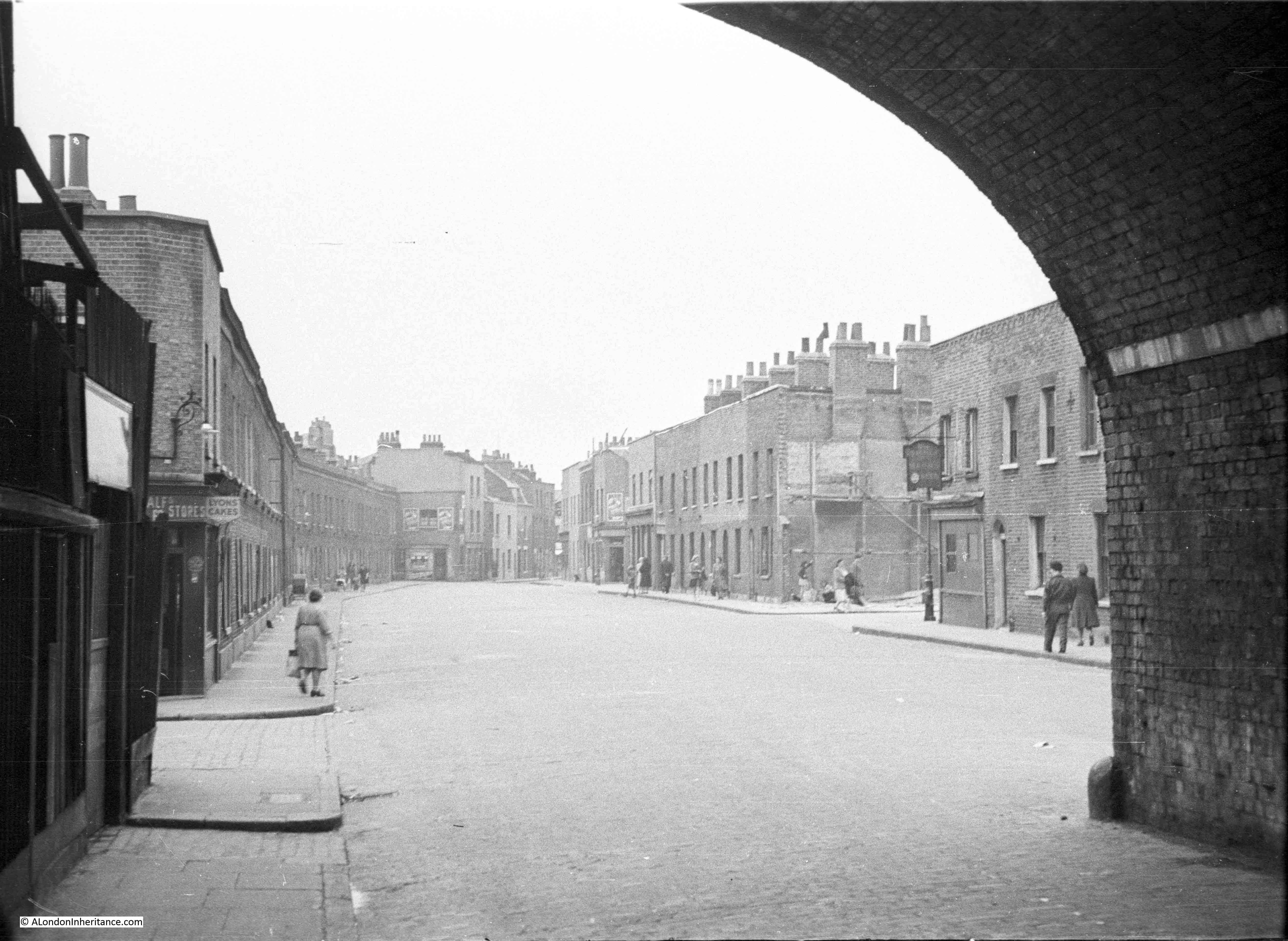
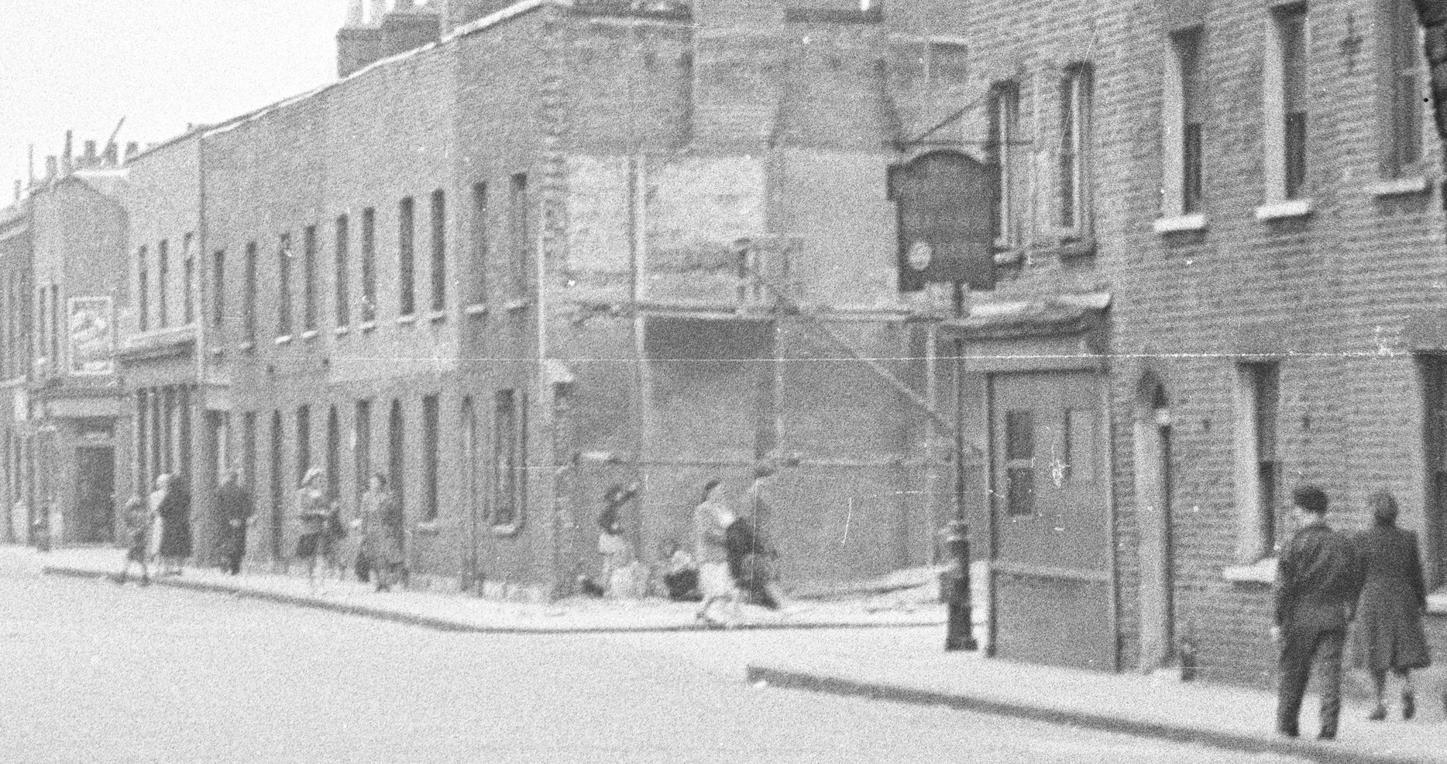
For this week’s post, it was a short walk after leaving last week’s location at Westferry Road, to find what remains of a street my father photographed in 1949. When sorting through his photos this was one location I was doubtful I would find. I did not recognise the scene and there were no clues to place the photo, apart from being taken from within what looks like a railway arch. I published the photo in one of my mystery location posts in 2015 and was really pleased when it was identified as Hardinge Street, just off Cable Street, a third of a mile east of Shadwell Station.

Hardinge Street

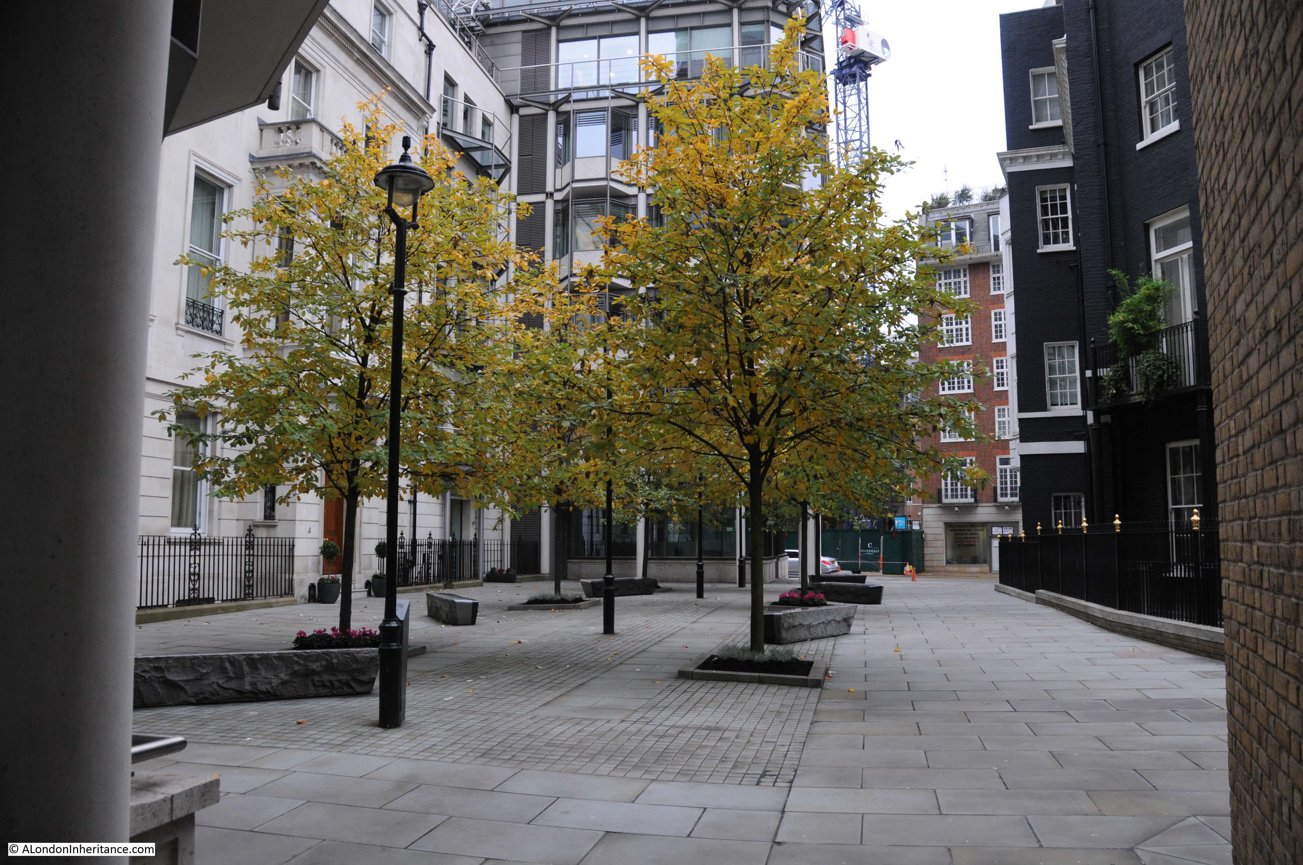
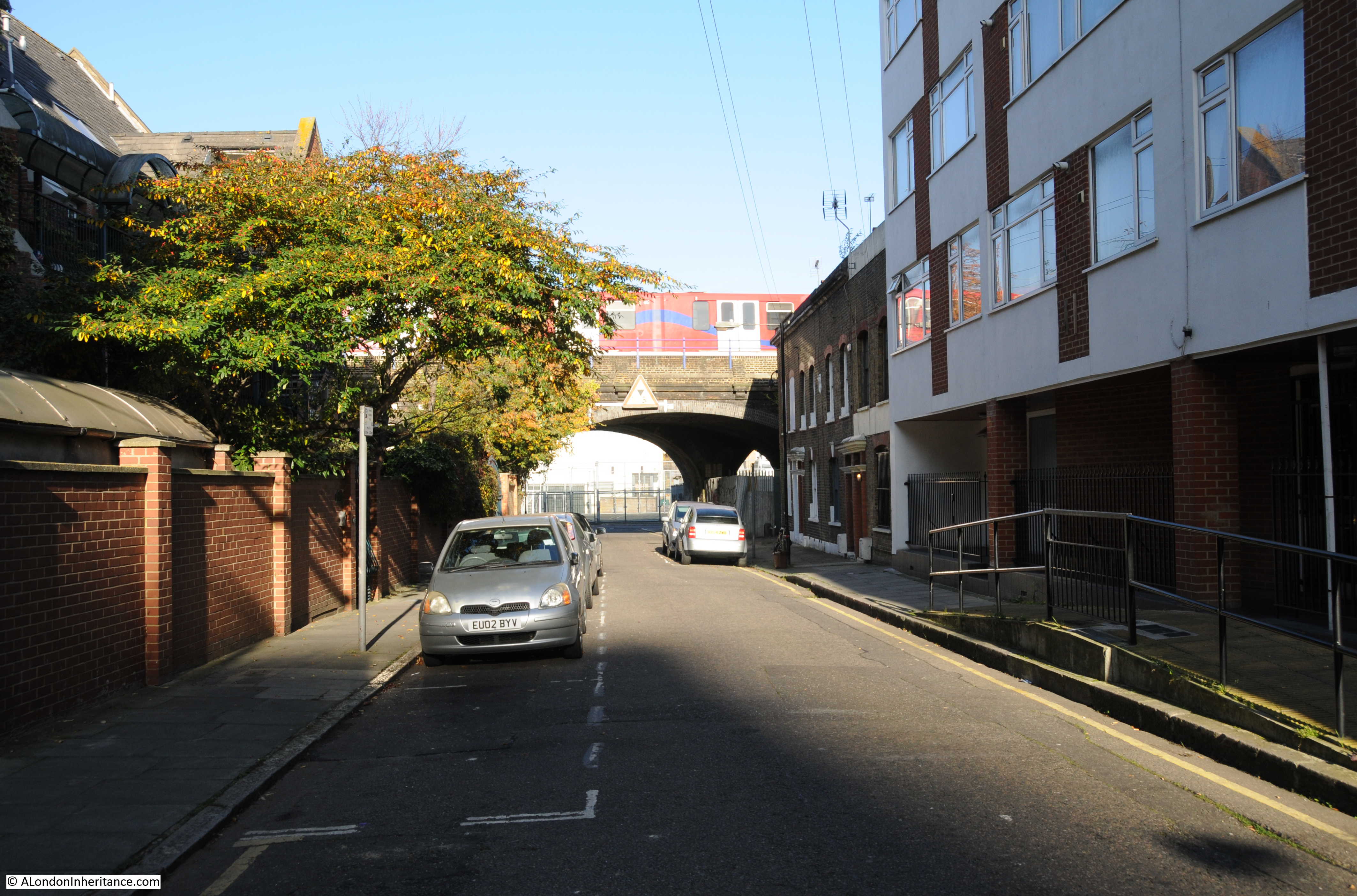
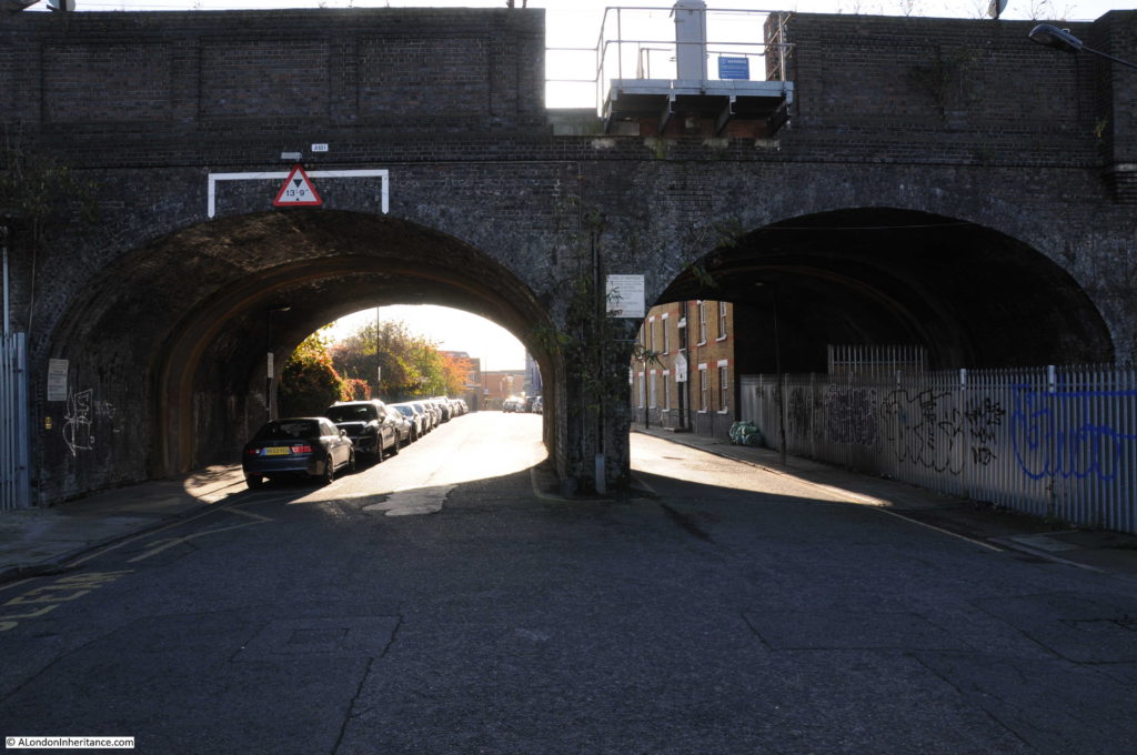
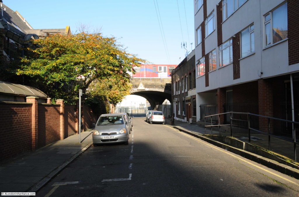
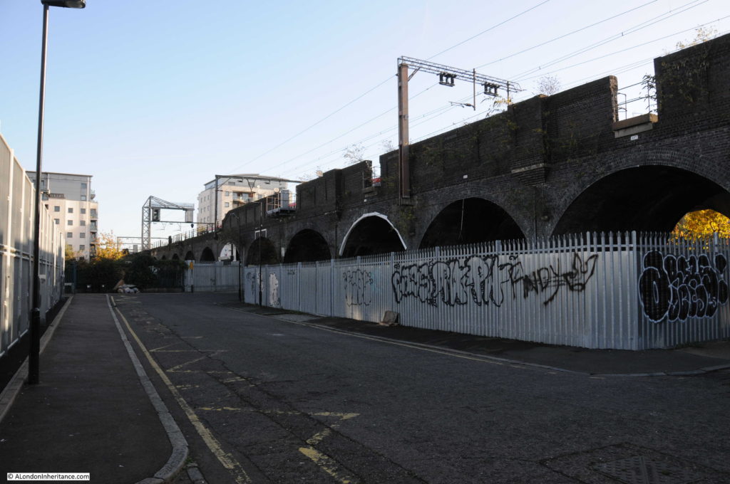
And this is the view from the same location today:

Hardinge Street

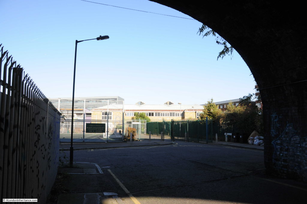
Hard to believe that this is the same place, however there are a number of clues. In addition to the obvious railway arch, in both photos the left hand section of the arch is fenced off, it was probably some form of workshop or storage area in 1949. There is access from the street to the fenced off area in both photos, and just past this there is another street leading off to the left.

There are also the sort of small details I love finding. On the pavement and kerb edge of the street, just before the street on the left there is a manhole cover on the pavement and a drain cover next to the kerb in the street. These are in the same locations in both photos – when the street above changes, often the utilities below the streets follow the same routes for decades.

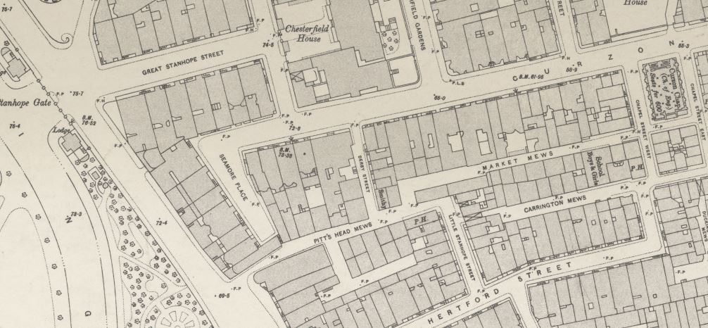
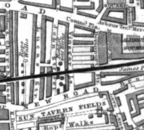
Hardinge Street is one of the many streets that ran between Cable Street and Commercial Road. The following extract from the 1895 OS map shows Cable Street along the bottom, Commercial Road along the top and in the centre of the map, Hardinge Street running between the two.

Hardinge Street

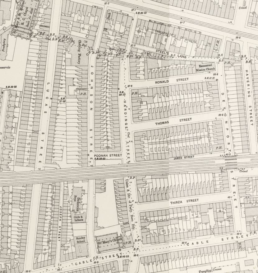
The railway, built in the late 1830s that runs into Fenchurch Street can be seen cutting Hardinge Street in two.

The streets are densely packed with houses, as can be seen in my father’s photo. The street on the left is named as Poonah Street in the map. The streets running off to the right can be seen in both map and photo.

Perhaps surprising is that the street looks intact after the heavy bombing east London suffered during the war. I checked the London County Council Bomb Damage Maps and the houses in my father’s photo are coloured yellow – “Blast damage, minor in nature”. the only exception is on the right side of the photo, the building on the corner of the street leading off to the right, there appears to damage and scaffolding. This building is coloured orange for “General blast damage, not structural”. A bomb must have fallen in the street leading off to the right as in the map there is a row of houses on both sides of the street coloured purple for “Damaged beyond repair” and black for “Total destruction”. It is the blast from this bomb that must have caused the blast damage to Hardinge Street.

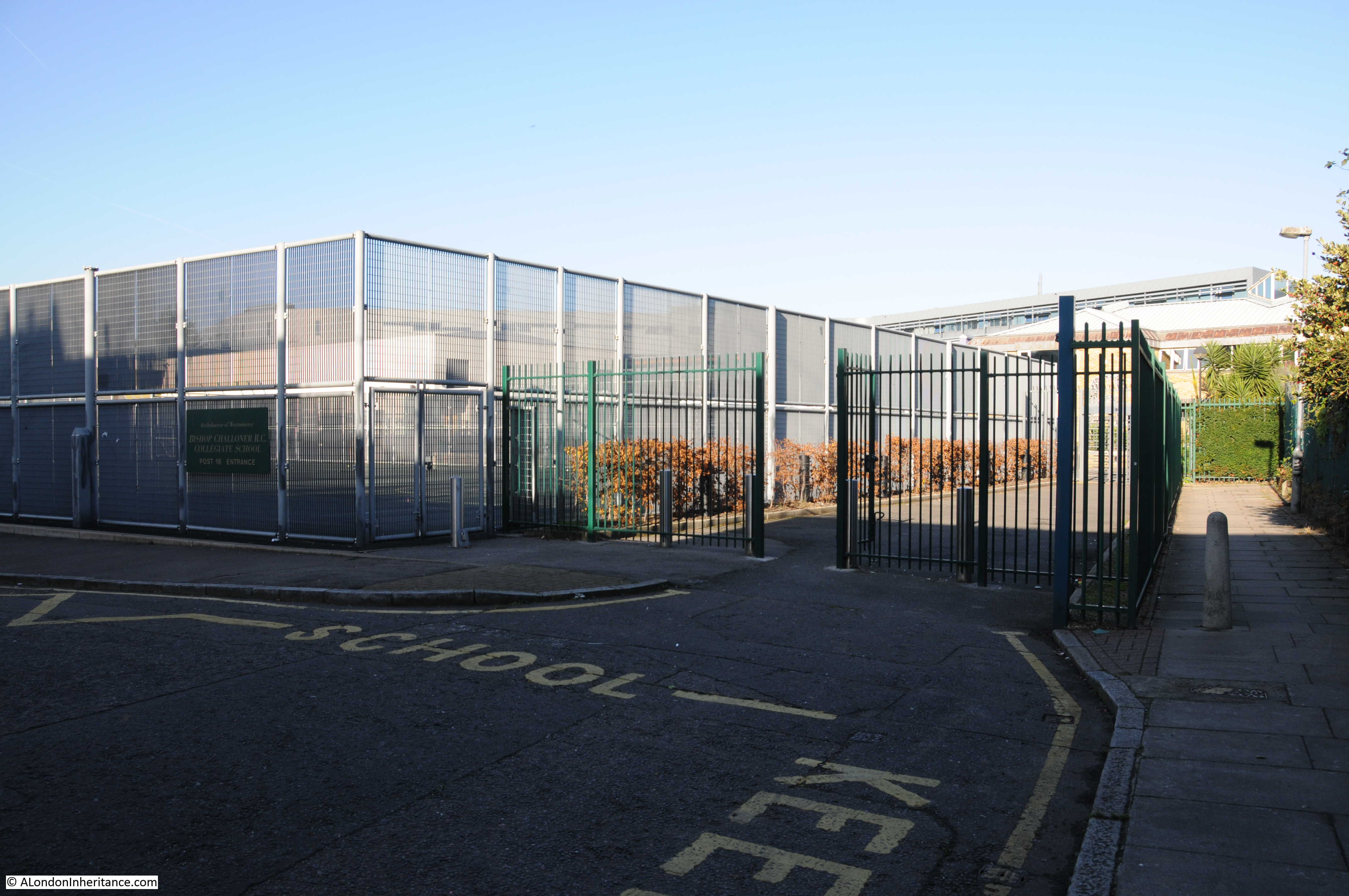
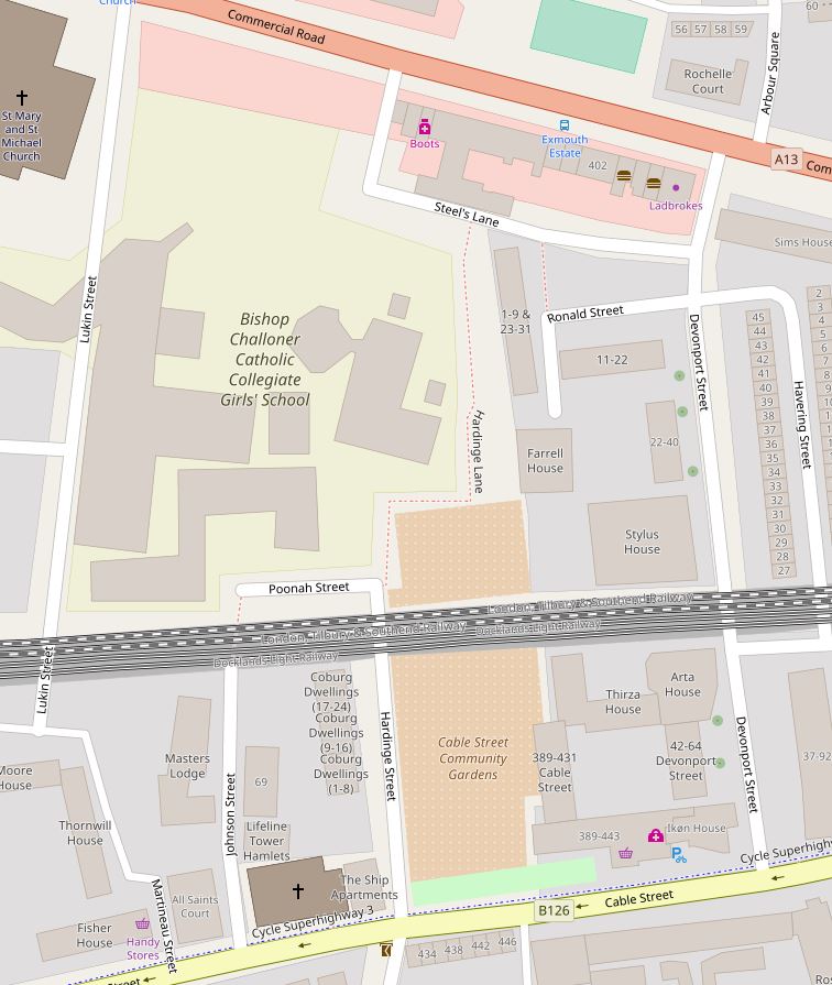
The fate of Hardinge Street is very different either side of the railway.  To the north, the view in my father’s photo, all the buildings, Hardinge Street and most of the side streets have all been demolished and replaced with the Bishop Challoner School. The map extract of the area today shows roughly the same area as the 1895 map and highlights how significantly the area has changed.

Hardinge Street

It is fascinating to trace the history of the area. Hardinge is an unusual name. I could not find any reference to why the street was given this name, however Poonah Street gave me a clue.

Poona was the name given by the British to the Indian city of Pune during the 19th century – I suspect the ‘h’ at the end was added as the pronunciation of the word probably ended with ..ah.

Following the Indian connection, Henry Hardinge, 1st Viscount Hardinge was Governor General of India between 1844 and 1848, so I suspect that when the street was redeveloped at some point between the 1850s and the 1895 OS map, it took the name of a Governor General of India.

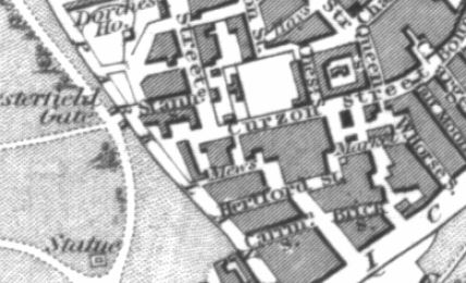
Why do I say redeveloped? This is an extract from an 1844 map of the same area.

Hardinge Street

The name Cable Street had not extended for the full length of the street covered today – in 1844 this section was called New Road. What would become Hardinge Street is again in the centre of the map, but in 1844 was called Vinegar Lane. The railway is in the same position and comparing the map with later maps, Devonport Street on the right is the only street that has survived with the same name from 1844 to 2017. John Street on the left is now Johnson Street and next left, Lucas Street is now Lukin Street (and today follows a different route south of the railway).

To the left of Vinegar Street can be seen the Ratcliffe Gas Works along with the round symbols of gas holders. By 1895, the gas works had been demolished, Vinegar Street became Hardinge Street and the area was full of densely packed housing, corner shops and pubs.

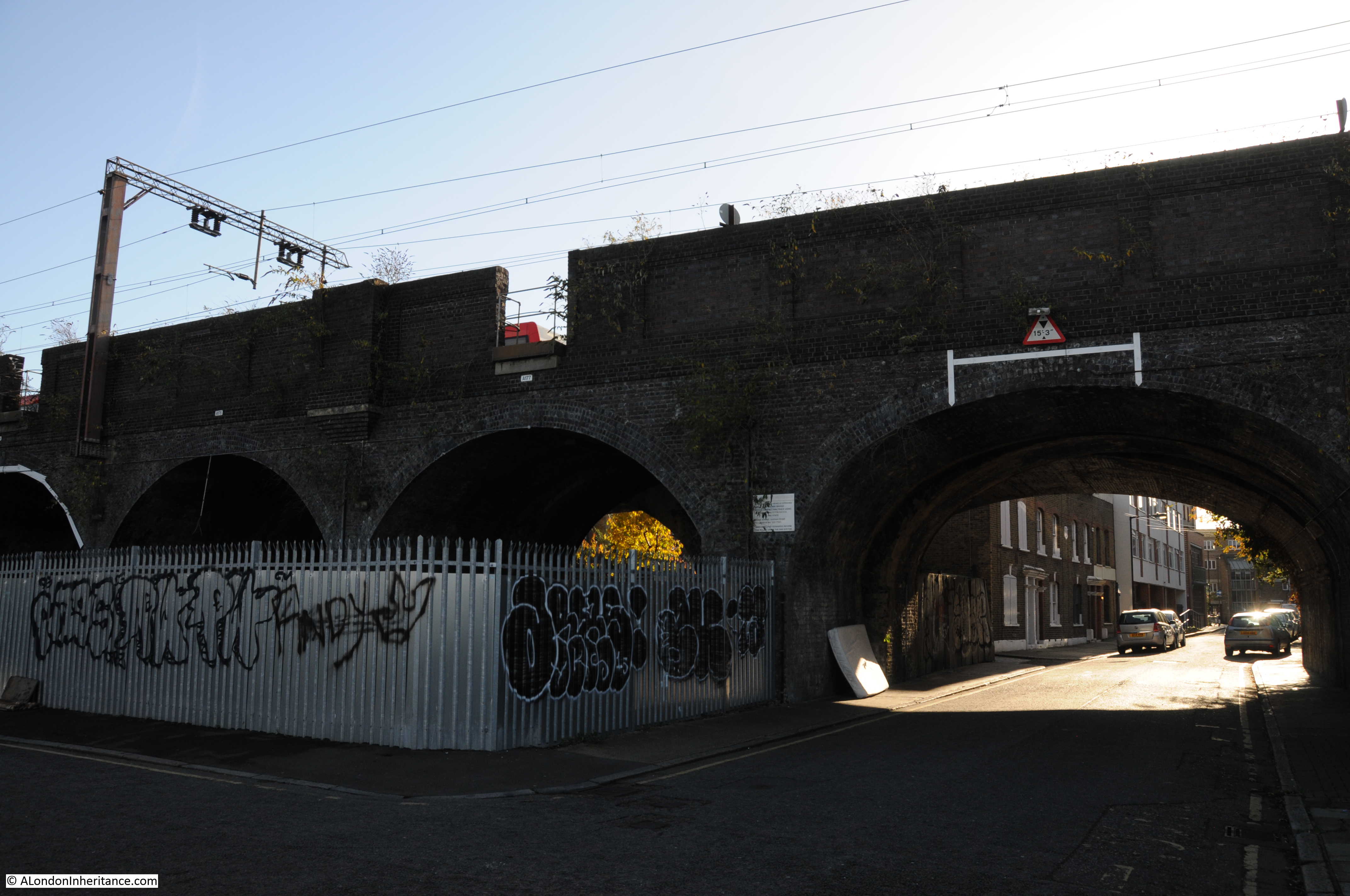
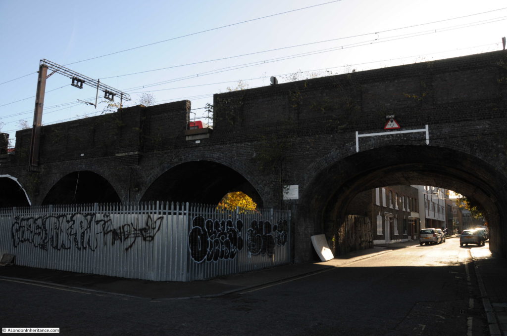
Time for a walk around the area. The following photo is looking south, through the arches to the southern end of Hardinge Street. The location of my father’s photo and my later photo is just inside the arch to the right, up against the metal fencing.

Hardinge Street

This is looking at the corner of Poonah Street and Hardinge Street. In the 1949 photo this was the location of the corner shop.

Hardinge Street

A footpath can be seen to the right of the above photo. Although Hardinge Street as a road has now been cut off from Commercial Road, a footpath runs along the side of the school up to Steel’s Lane (another survivor from the 1895 map) and then to Commercial Road. The footpath is called Hardinge Lane, retaining the name, but Lane reflecting the loss of the through street.

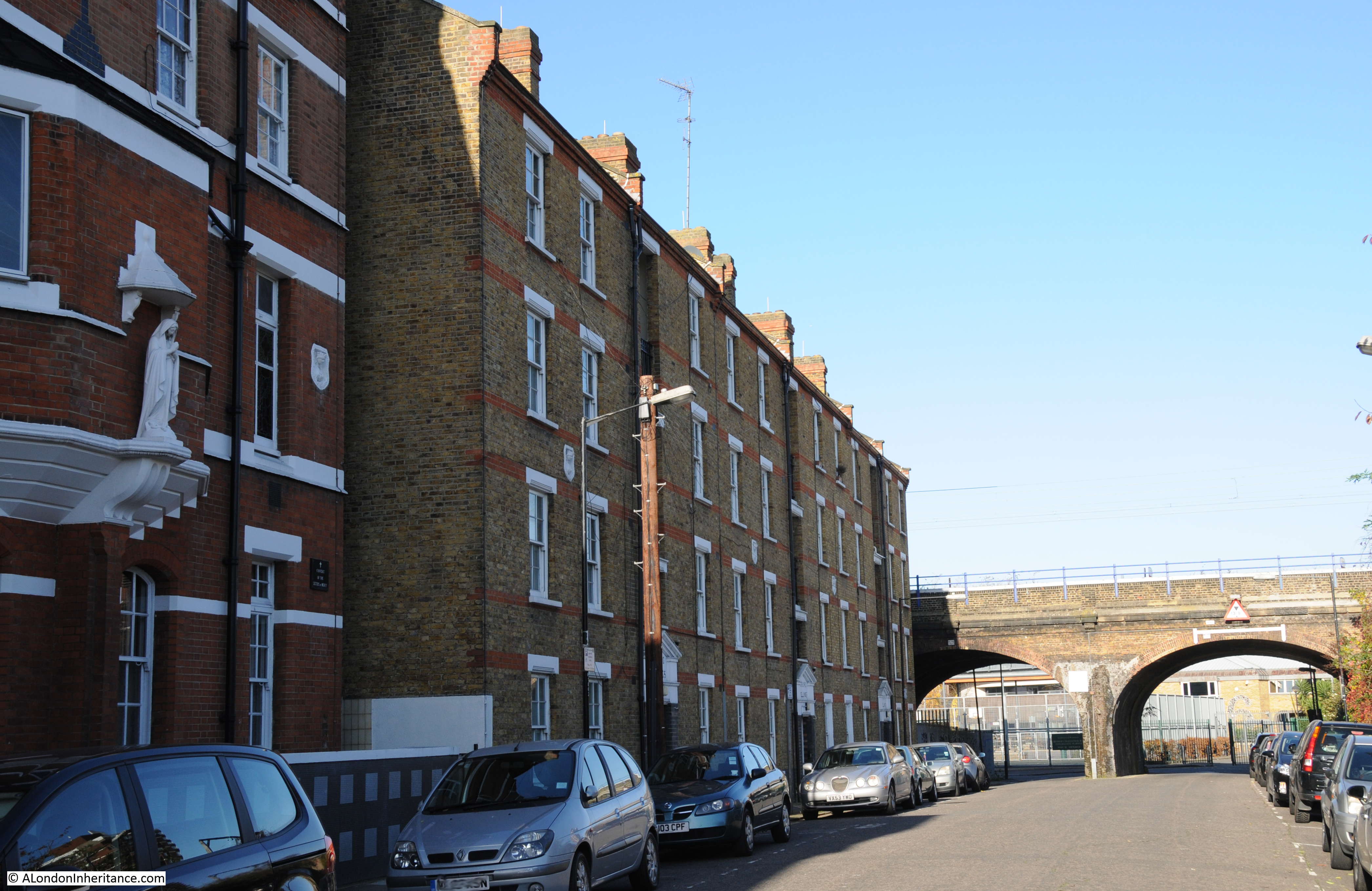
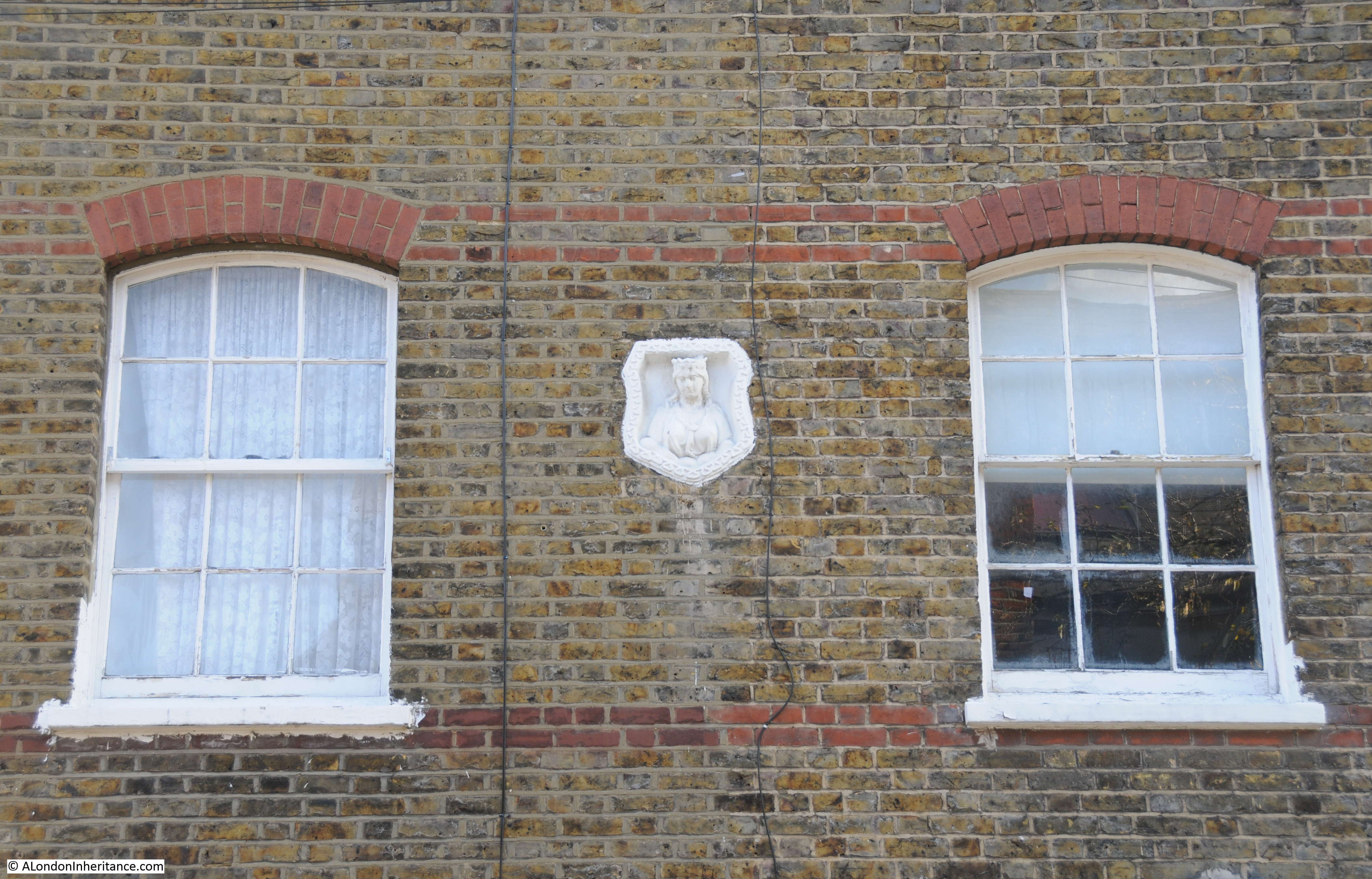
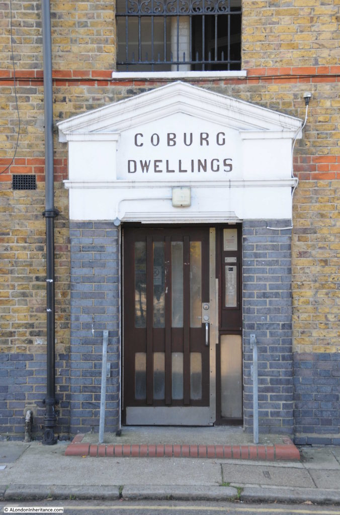
Walking back under the rail bridge, south towards Cable Street, on the western side of Hardinge Street are Coburg Dwellings. The building dates from 1904 and was constructed by the Mercers Company. The name comes from the region of Germany where Queen Victoria’s husband, Prince Albert was born.

Hardinge Street

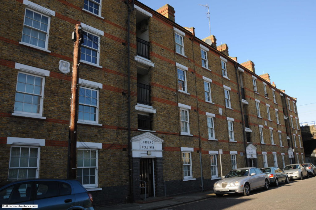
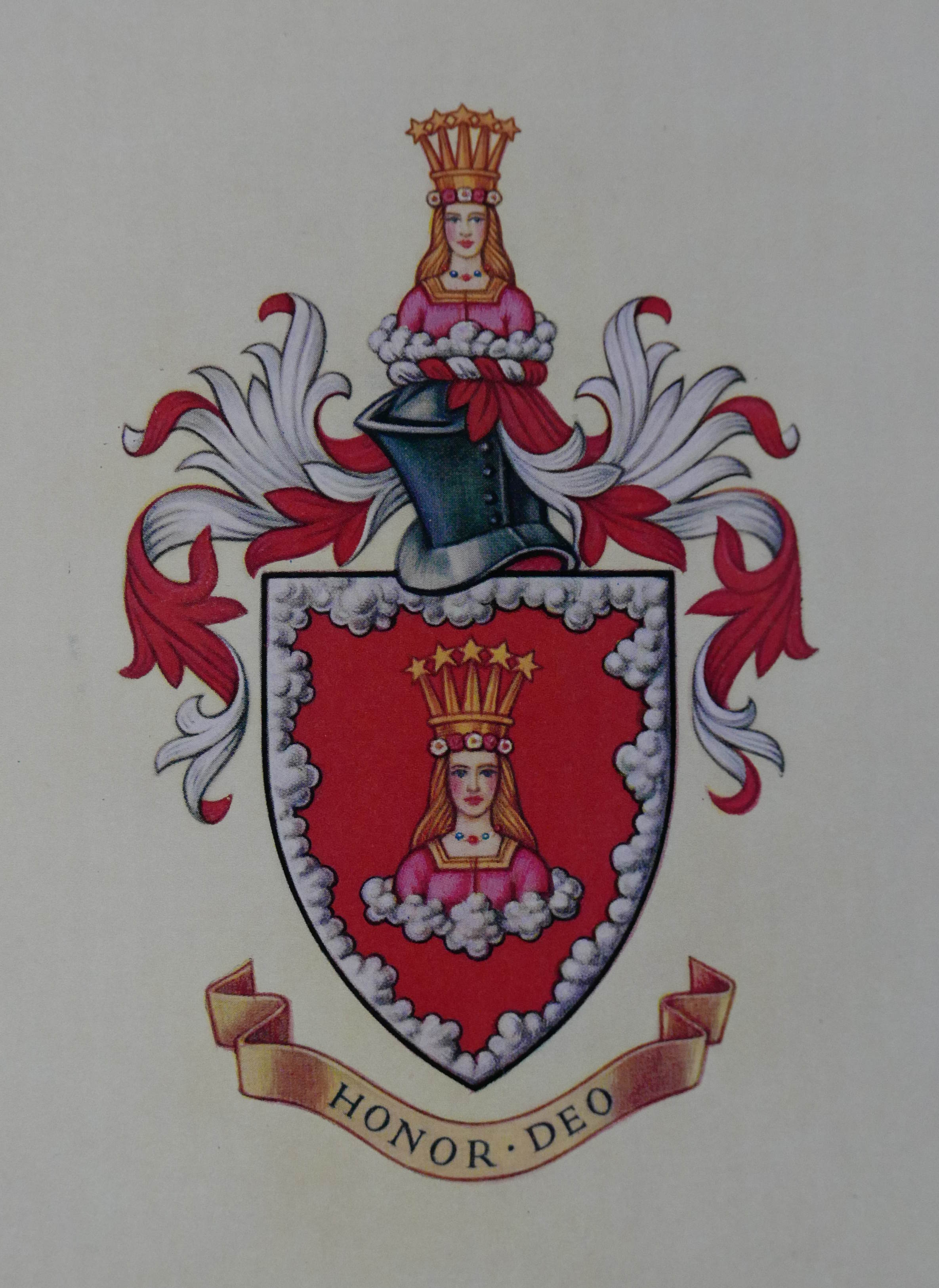
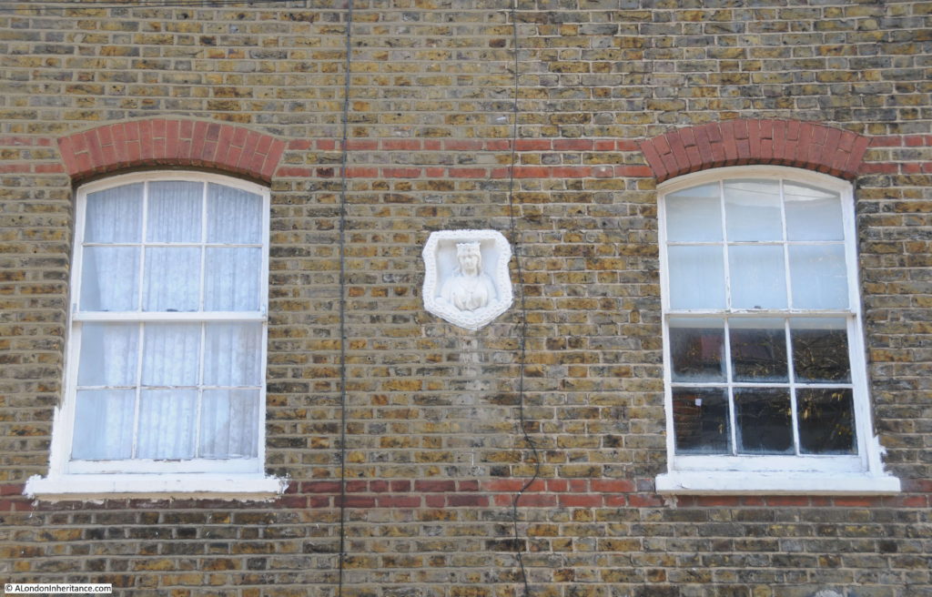
In the above photo, there are a number of white plaques between the first and second floors of Coburg Dwellings. These are Mercers’ maiden property marks to show that the land and buildings belonged to the Mercers Company. A Mercers’ maiden in close up:

Hardinge Street

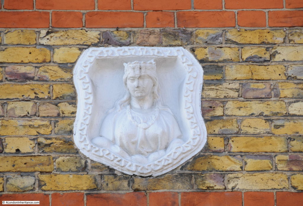
The Mercers Company is one of the oldest of the City’s Companies. The earliest mention of the Mercers is the appointment of the fraternity in 1190 as patrons of the Hospital of St. Thomas of Acon, On the 13th January 1394 the “men of the Mistery of Mercery of the City of London” were incorporated by royal charter.

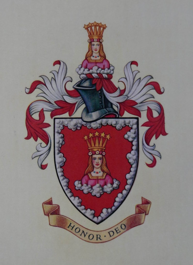
The Virgin is part of the Armorial Bearing of the Mercers Company and was used for the Maiden property marks on Mercers’ buildings. Many of these can still be found across London.

The Armorial Bearings of the Mercers Company:

Hardinge Street

One of the entrances to Coburg Dwellings:

Hardinge Street

Another Maiden mark is on the building to the left of Coburg Dwellings, built as a Convent for the Sisters of Mercy:

Hardinge Street

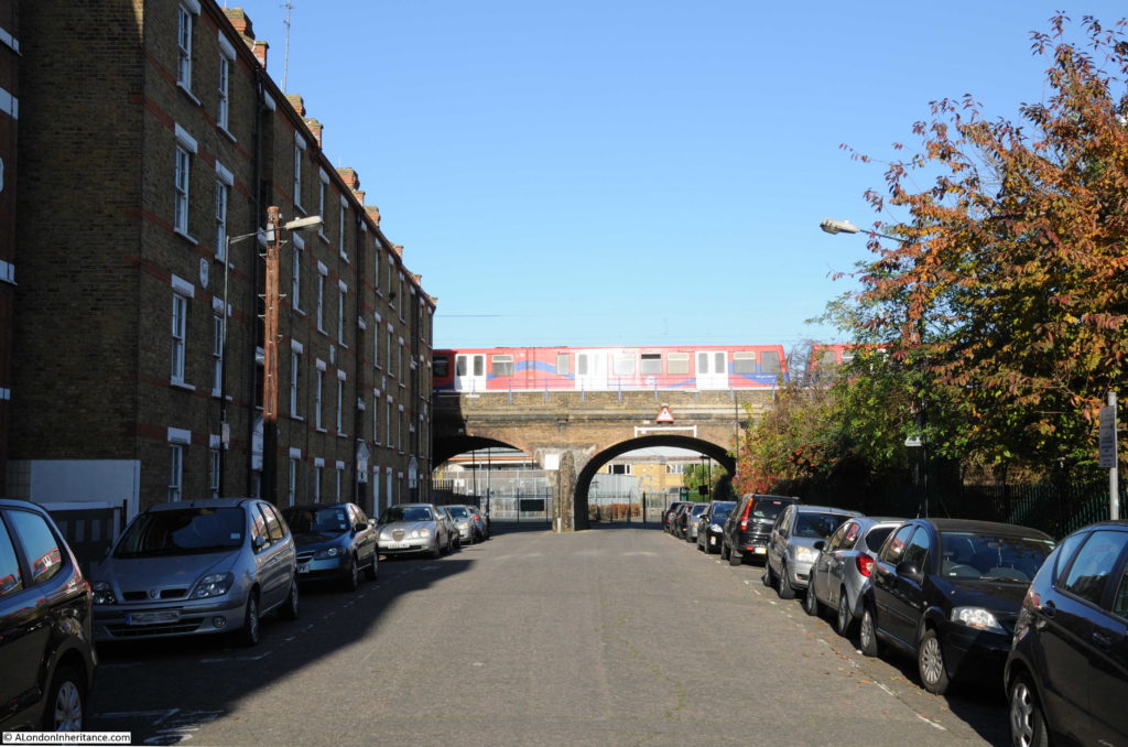
Looking up towards the railway arches. As I explored the area there were frequent DLR and mainline trains passing over Hardinge Street:

Hardinge Street

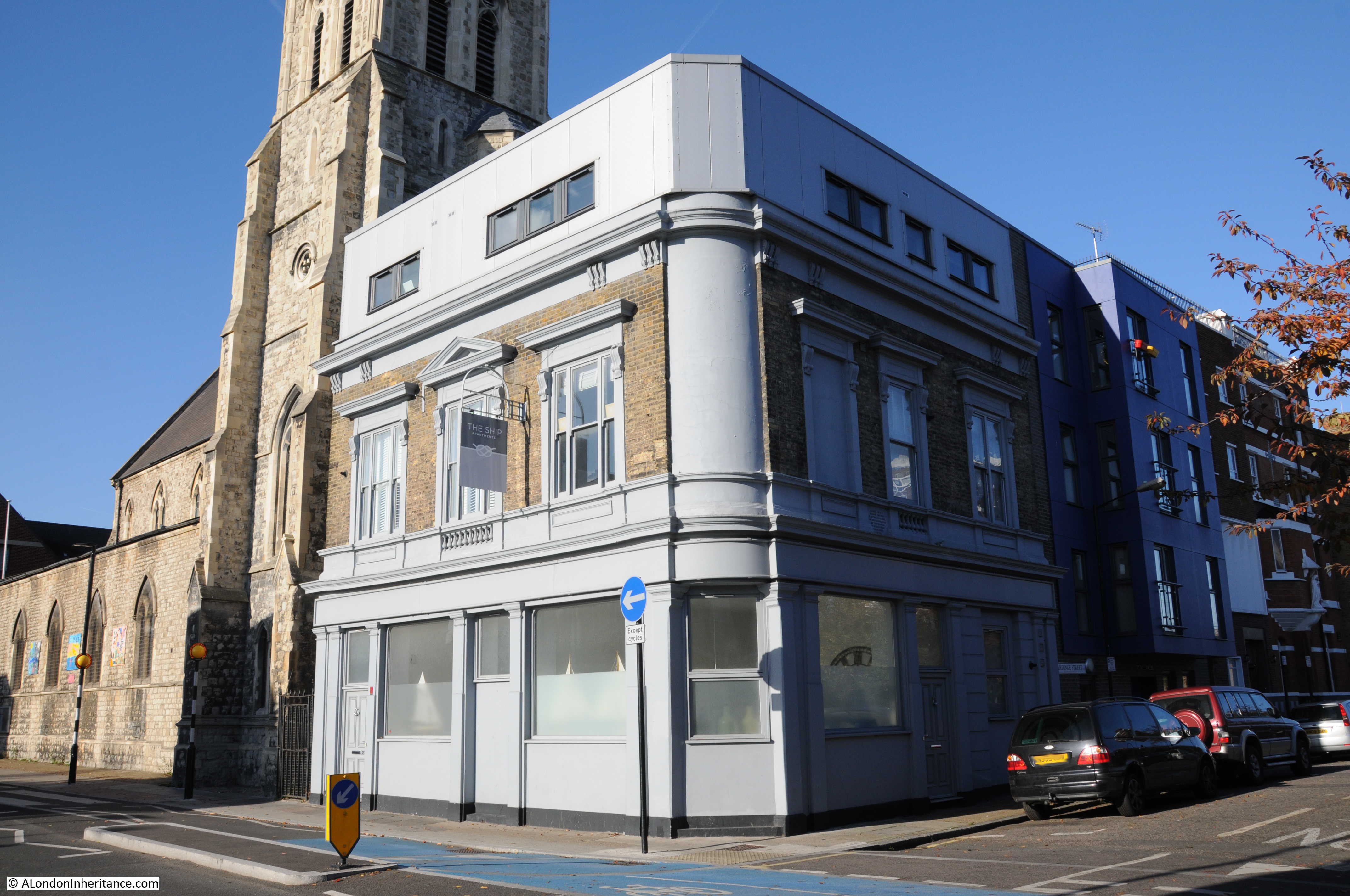
On the corner of Hardinge Street and Cable Street is the building that was once the Ship pub:

Hardinge Street

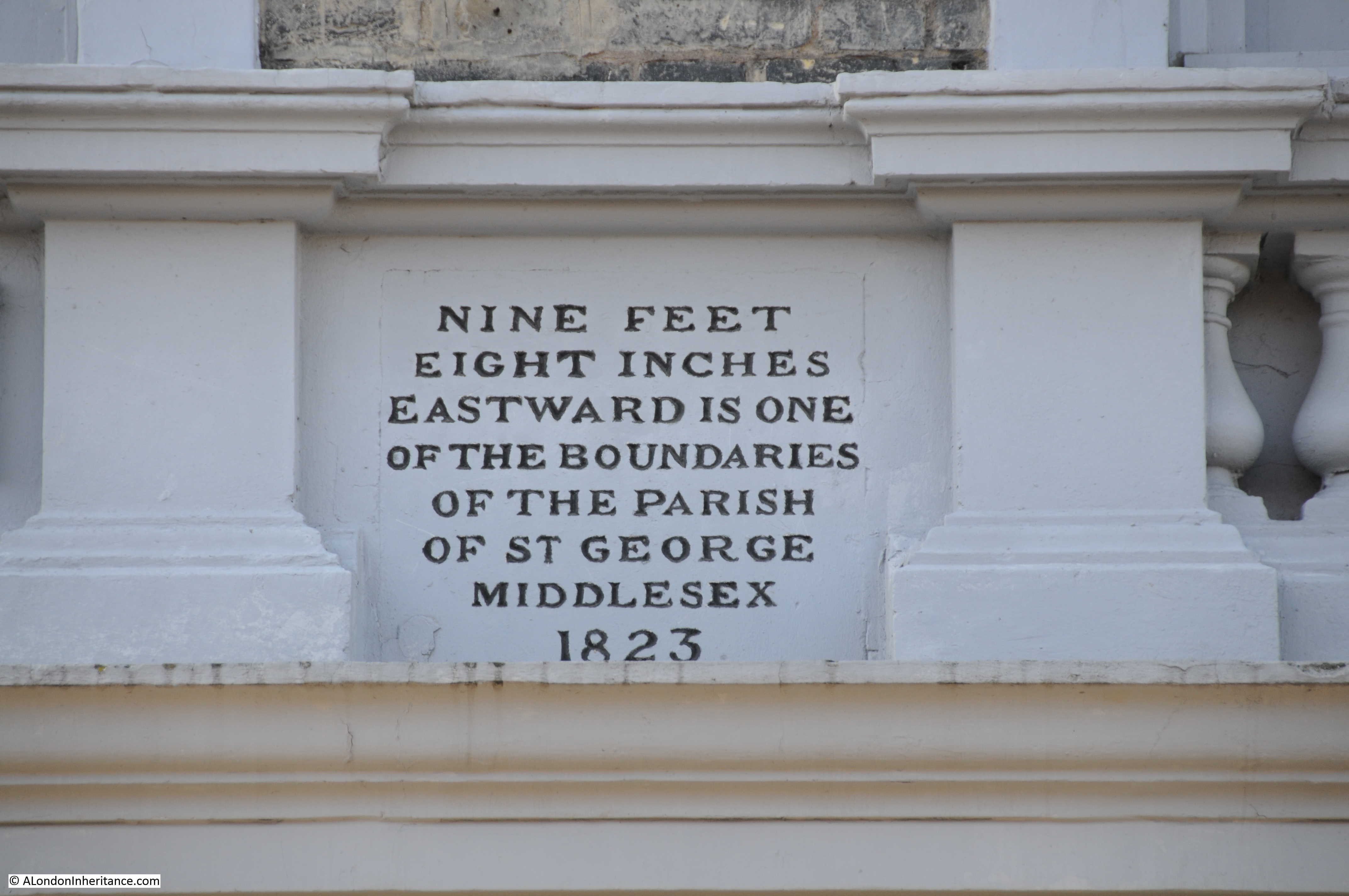
The pub closed in 2003 and has since been converted into flats with an additional floor added to the top of the building. Fortunately a boundary marker from 1823 (which probably dates the construction of the pub) remains on the Hardinge Street side of the pub, between the ground and first floors:

Hardinge Street

Newspapers during the 19th and early 20th century included the usual adverts for staff at the Ship and also using the pub as a contact address for sales, however in 1893 there is a report which would have made the landlord very unpopular with the residents of Hardinge and Cable Streets:

“At the Thames Police court, London, on Wednesday, William Williams of the ‘Ship’ public-house, Cable-street, St. George’s was summoned at the instance of the Excise Commissioners, for diluting beer. and for not entertaining his permits in the spirit stock-books, and for not cancelling said permits, whereby he had rendered himself liable to penalties amounting to £200. The defendant pleaded guilty. Mr Mead fined him £35 for the dilution and £5 each for the other two summonses.”

His fines seem light compared to what the maximum penalty could have been, however I can imagine the reception he received back at the pub after having been convicted of diluting the beer.

The church seen next to the pub is St. Mary, Cable Street. A relatively recent church having been consecrated on the 22 May 1850 to serve the growing population as the district developed.

After the church, I turned into Johnson Street. This street runs back up to Poonah Street to take me back to the location of the original photo. This is the view looking down Johnson Street:

Hardinge Street

The 1844 map had the location of the Ratcliffe Gas Works on the right of Johnson Street, filling in the area between Johnson Street and Hardinge Street, although there does look as if there was a narrow line of buildings along Hardinge Street.

When the use of gas for lighting and power started, the small scale of production and lack of large distribution systems meant that gas works would be built to serve a local area, very much within the centre of the area they were serving, even if that meant building a gas works in the middle of housing, or either side of a railway viaduct.

Gas works were dirty and dangerous places and would also produce fumes and smells that would blanket the local area. The following extract from the Essex Standard on the 31st October 1834 reports on an explosion at the Ratcliffe Gas Works:

EXPLOSION OF THE RATCLIFFE GAS-WORKS. On Tuesday morning, about five o’clock, a terrific explosion was heard to proceed from the Ratfcliffe Gas Works, which caused the greatest consternation and alarm in the neighbourhood. The inhabitants rose from their beds in all directions, and on proceeding to the spot, it was discovered that one of the large gasometers had burst at the back of the factory, adjoining Johnson Street and had carried away the outside case or vat in which the gasometer was placed, besides forcing down a brick wall, several feet in thickness, the materials of which were thrown in every direction. 

It appears that the gasometer contained at the time of the accident not less than 16,000 feet of gas, and owing to the chive hoop, which binds the bottom of the tank giving way, the pressure became so great on the other parts of the gasometer, that it gave way, and sank with a tremendous crash on one side, forcing the gas out at the top, and splitting the massive timbers which composed the case, and the large upright beams which supported the whole fabric. Heavy pieces of timber were reduced to splinters and others forced to a considerable distance. A ponderous wheel, by which the gasometer was suspended, was hurled into the yard, a distance of 50 feet, and fell by the side of a man employed on the premises, who narrowly escaped destruction. 

A stable by the side of the gasometer was blown in and reduced to ruins, the corn-bin, rack and everything were displaced, but singularly enough a horse within escaped unhurt.

After the explosion the place presented one mass of ruins – bricks, iron and wood lying about Johnson-street and the factory-yard in every direction. The damage is estimated at upwards of £20,000, but it is gratifying to add that no lives were lost, nor was any person injured; but if the explosion had taken place a few hours later, there is no doubt that a great many would have been killed, as Johnson Street is a very populous and much frequented thoroughfare, and several labourers were generally kept employed about the tank which burst.

Another gasometer only five feet from the other remained uninjured, which is accounted for by the great strength of the outer casing, which is formed of wrought iron, braced by large girders. A gas light in a lamp close to the tank was blown out; a circumstance which prevented the contents of the gasometer from being ignited, and probably saved property to a large amount from destruction.”

There are many other reports in the papers during the 19th century of the terrible fumes and smells that would come from the gas works, and of injuries to workers including the death of a worker during the construction of a new gasometer.

These were not good places to have in built up areas and the proximity to a busy rail viaduct cannot have helped. As can be seen in the 1895 OS map, the gasworks had been closed as part of the redevelopment of the area.

At the top of Johnson Street is this row of houses that have survived from the 19th century redevelopment of the area:

Hardinge Street

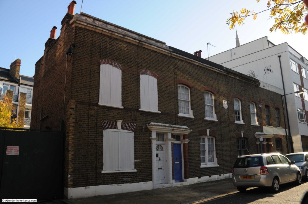
Again with a Mercers’ Maiden to show ownership. I assume that the Mercers owned the block of land that formed a rectangle between Hardinge Street, Cable Street, Johnson Street.

Hardinge Street

At the top of Johnson Street at the corner with Poonah Street:

Hardinge Street

The photo below is looking along Poonah Street towards the junction with Hardinge Street. In the above and below photos, the metal fencing that formed a boundary in the Hardinge Street arch can also be seen running along Poonah Street and to the arch in Johnson Street.

The Mercers Company owned the land before the railway was built and I suspect that the fencing shows the boundaries of the Mercers land as it is aligned with the buildings in Johnson and Hardinge Streets. This would explain why part of the area under the arch in Hardinge Street is fenced off – a reminder of land ownership from long before the railway was built, and that continues to this day.

Hardinge Street

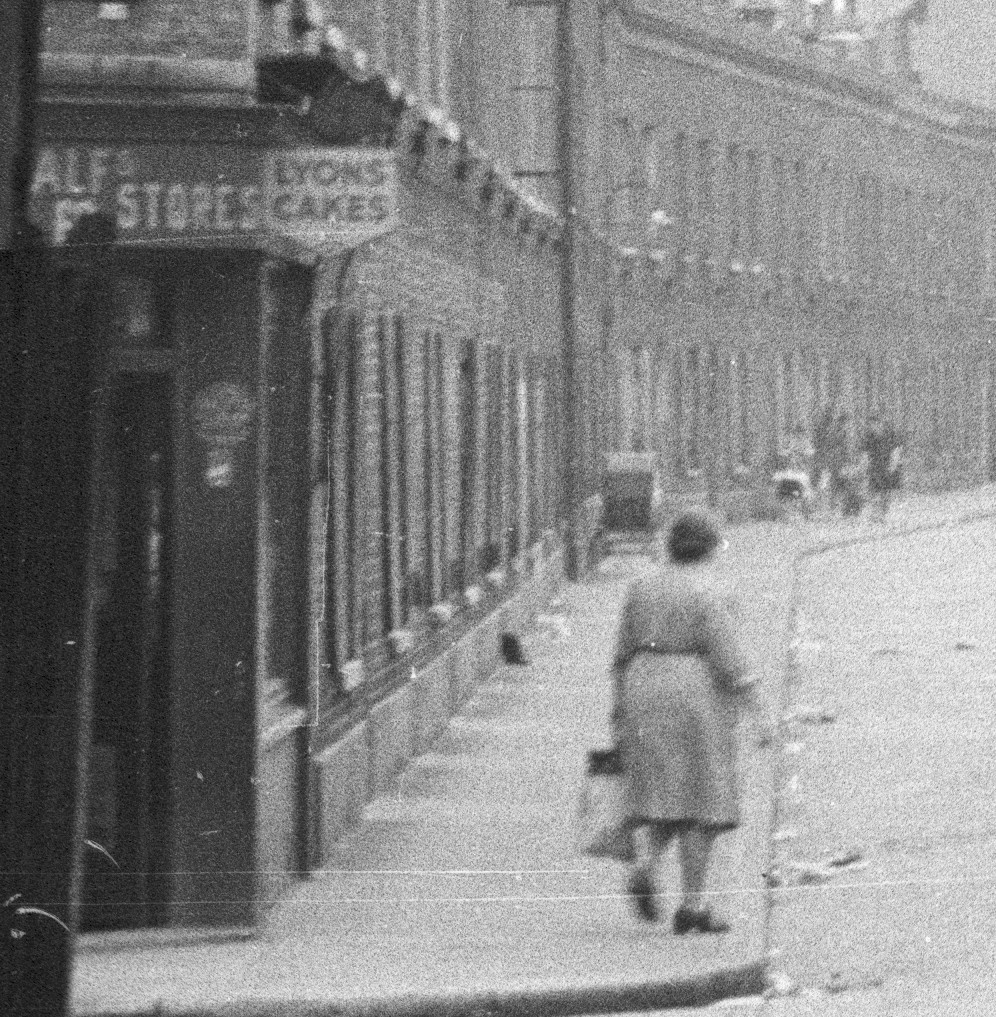
To finish of this week’s post, here are a couple of extracts from my original high-resolution scan of the negative. I find the detail in these photos fascinating and as a reminder that it is not just the buildings that have long since disappeared, but also the people who made this area their home.

The following extract shows the left side of Hardinge Street. A woman with a shopping bag has possibly just been shopping in the shop on the corner of Poonah Street and Hardinge Street.

There is a large pram parked outside the terrace of houses and further along what could be two women, a small child between them and a pushchair.

Hardinge Street

And on the right of Hardinge Street, there is a pub on the corner, people walking along the pavement and what looks to be a couple of children underneath the scaffolding on the corner of the house.

Hardinge Street

Hardinge Street along with Emmett Street and Westferry Road in last week’s post have changed dramatically over the past seventy years. The people in the original photos, outside the newsagent in Westferry Road and those in Hardinge Street could probably never have imagined how much their streets would change.

I wonder what the next seventy years will bring?

alondoninheritance.com