This week, I am continuing my walk around parts of the London Borough of Hackney, searching for the location of some 1980s photos, and looking at how streets which are today mainly long rows of residential homes, were once far more diverse.
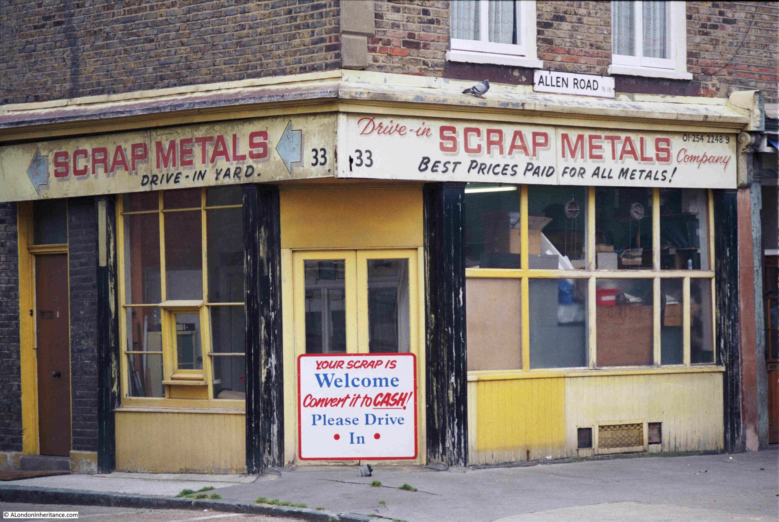
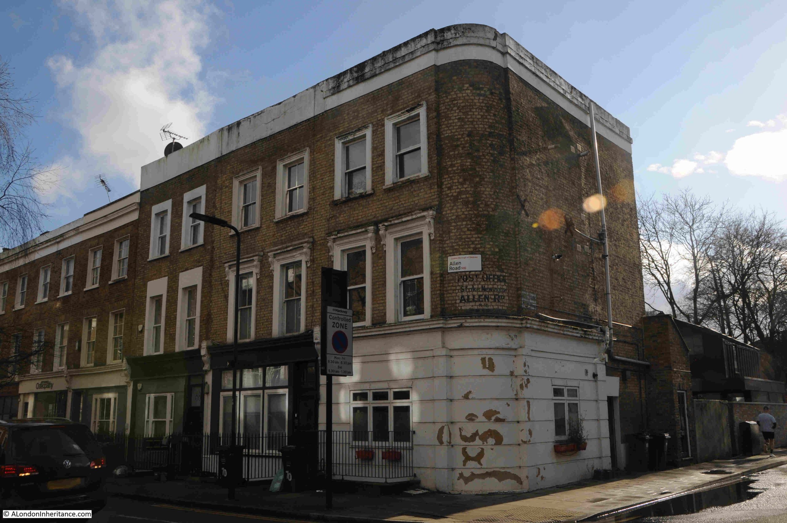
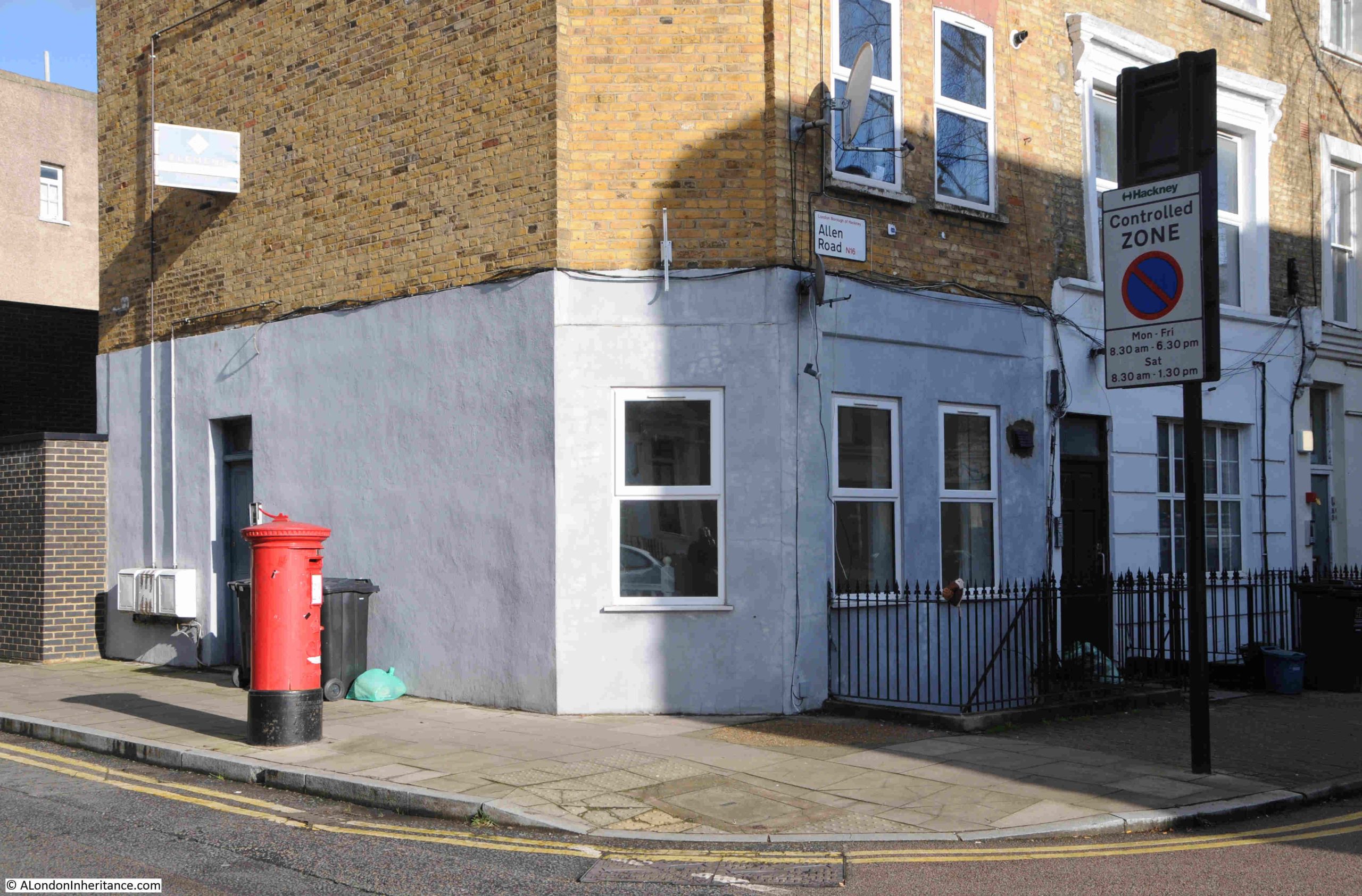
I am in Allen Road, Stoke Newington, and in the mid 1980s, at number 33 Allen Road, was a scrap metal dealer:
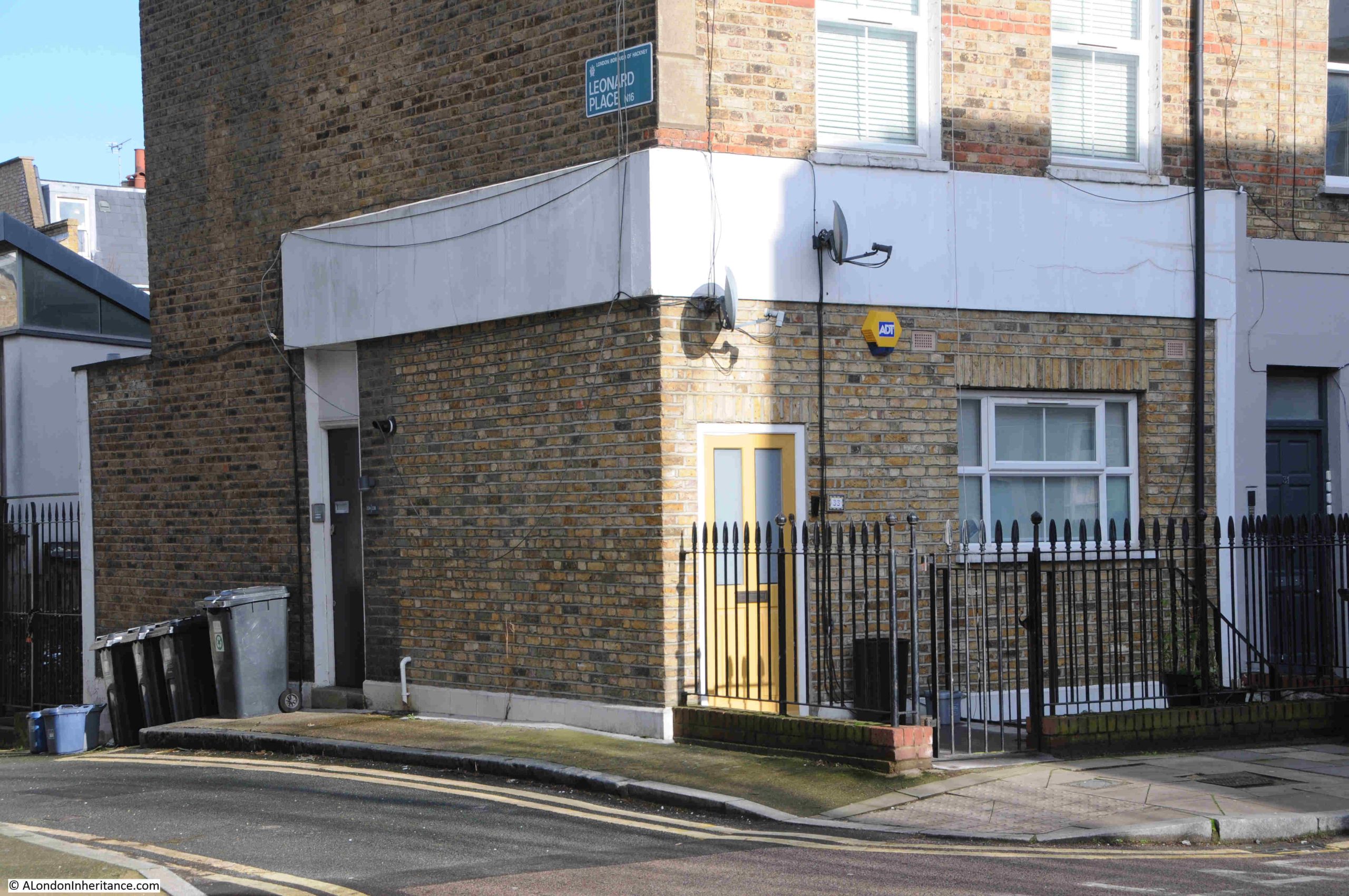
Today, the scrap metal dealer’s business is now residential:
The signage on the scrape metal dealer advertised that there was a drive-in yard to the side, and this is what made number 33 the perfect location for such a business, as it was the only building in Allen Road with a large yard at the back.
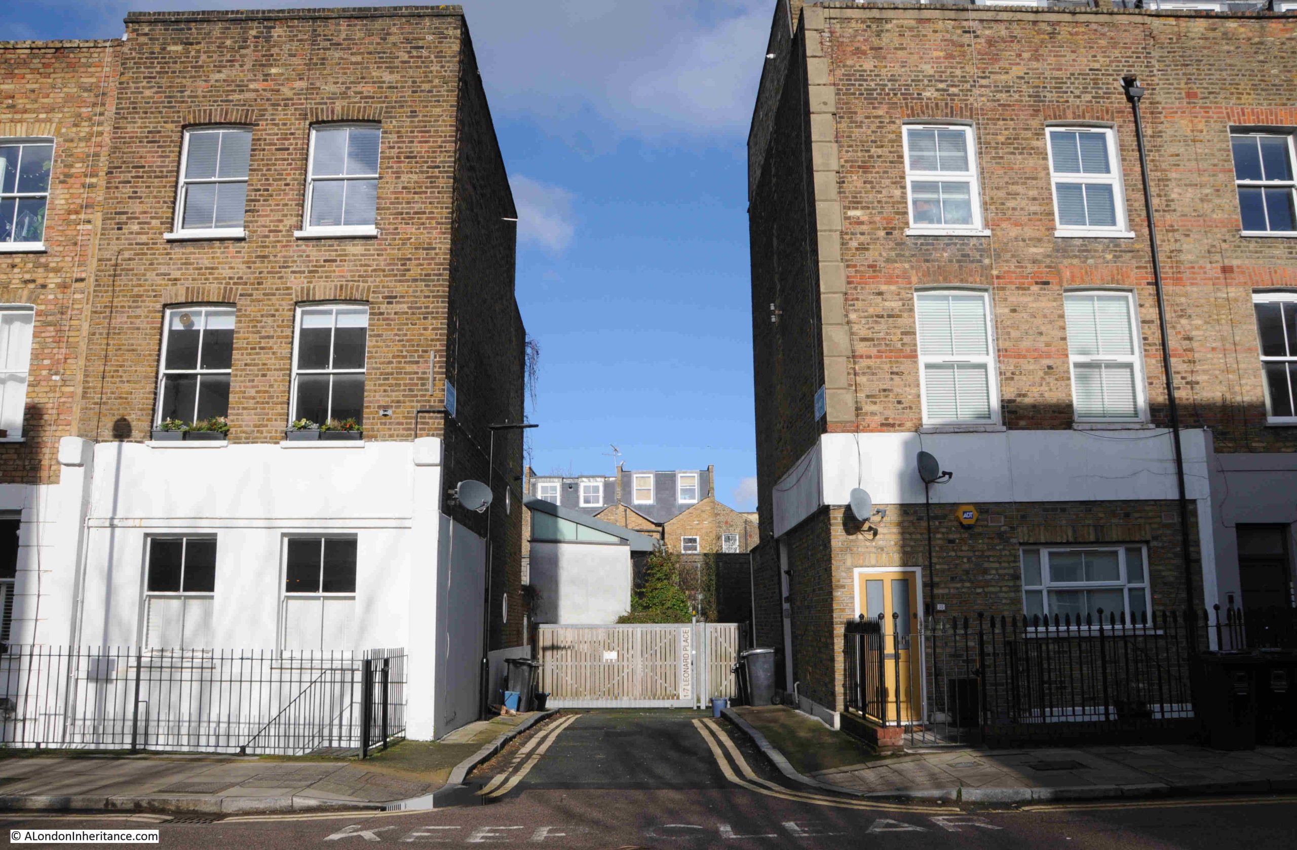
The entrance to the yard today:
Today, the yard has been filled in with residential properties, following that modern London approach, where any available space or building is converted to residential.
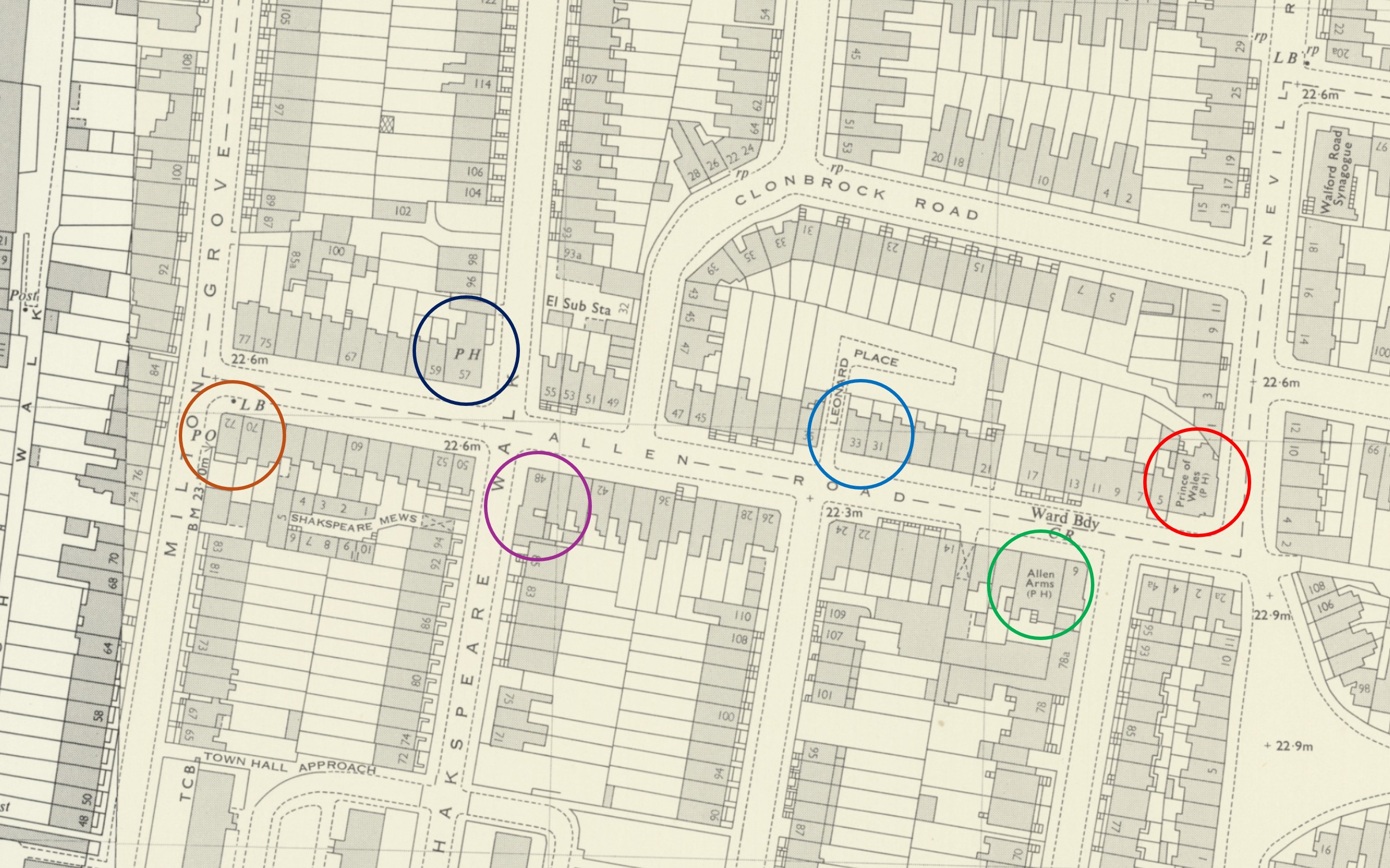
In the following extract from the 1969 revision of the OS map, I have marked number 33, the scrap metal dealers with the lighter blue circle, just to the right of the middle of the map. I will cover the other circled buildings later in the post (‘Reproduced with the permission of the National Library of Scotland“):
You can that to the left and behind number 33 is Leonard Place, which was the yard of the scarp metal dealers. The impact of this yard was to shorten the gardens of the houses to the right of number 33, far shorter than the rest of the houses on the street.
This yard behind these houses is shown in earlier maps of Allen Road, so must have been part of the original construction of the street, during the mid 19th century expansion of north London.
Use of one of these north London 19th century terrace houses as a scrap metal dealer was not that common, but there were many small industrial business to be found among the terraces.
Number 33 had been built as a general shop, which was a typical use for this type of house, a corner shop among the terraces, although it is not clear why Leonard Place was built to the side and rear. Its only original purpose or impact seems to be depriving the street of another terrace house, and a row of houses to have smaller back gardens than their neighbours.
Confirmation of use as a shop can be found in newspaper references, for example with the following from the Hackney and Kingsland Gazette on the 25th of October 1907:
“General, double fronted shop, genuine business, one change 17 years, well fitted, no reasonable offer refused, good cause for selling. 33 Allen Road, Stoke Newington”
The terrace houses that spread across north London during the 19th century, were meant to be the homes of the middle class, professional trades people etc. and by the time of the 1921 census this still applied to the majority of homes in Allen Road, where 577 people were recorded as being in residence.
Number 33 however was home to three different families, a total of ten people:
There was the Forsyth family, consisting of Thomas (aged 32), Julia, his wife (aged 25 and from Ireland), and their son Michael (aged 1). Thomas was a Compositor, a job that involved setting the type for a printing press.
Arthur Mead (aged 24), his wife Maud (aged 19), and their daughter Irene Francis, who had been born in the same year as the census. Arthur was a bricklayer for a builder in Lower Edmonton.
The final family were the Payne’s, consisting of Harry Joshua (aged 30), his wife May Beatrice Lilian (aged 29), their son Henry George (aged 2) and daughter May Patricia Lilian (aged 1). Harry was a General Labourer.
As number 33 seems to have been quite a crowded home for three families, I suspect that as it had a business on the ground floor, it was not considered by purchasers as being to the same standard as the other terrace homes on the street which occupied the whole house, so number 33 became a multi-occupancy house.
Whilst residents could work across London, with the expanding train, underground, tram and bus networks doing their best to keep up with the rapid growth of housing; shopping, schooling and socialising would generally be a local activity, and all these streets had shops and pubs, to an extent which seems remarkable compared to the streets we see today.
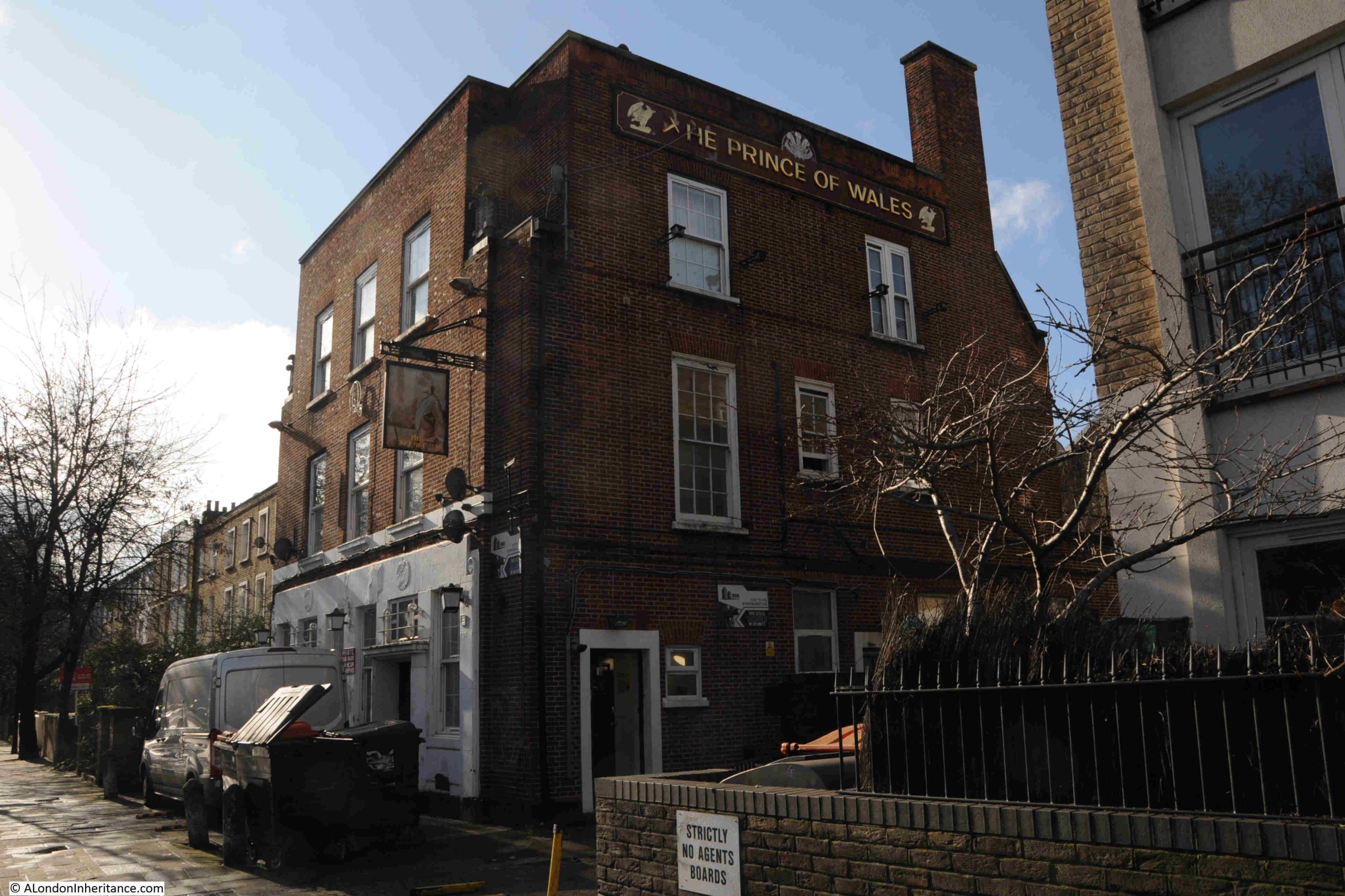
Allen Road is not a particularly long road, but it had four pubs.
In the map earlier in the post. the red circle on the right is around the Prince of Wales. I cannot find exactly when, but the Prince of Wales has been demolished and replaced with a new residential block.
Then the green circle is around the Allen Arms, which closed in 1993 after a fire, and is now residential.
The Stack Rock at number 48, the purple circle. An unusual name for a pub, but the name did appear in several newspapers, for example in 1897, the landlord was advertising a concertina competition. Not sure when the Stack Rock closed, but again it is now residential.
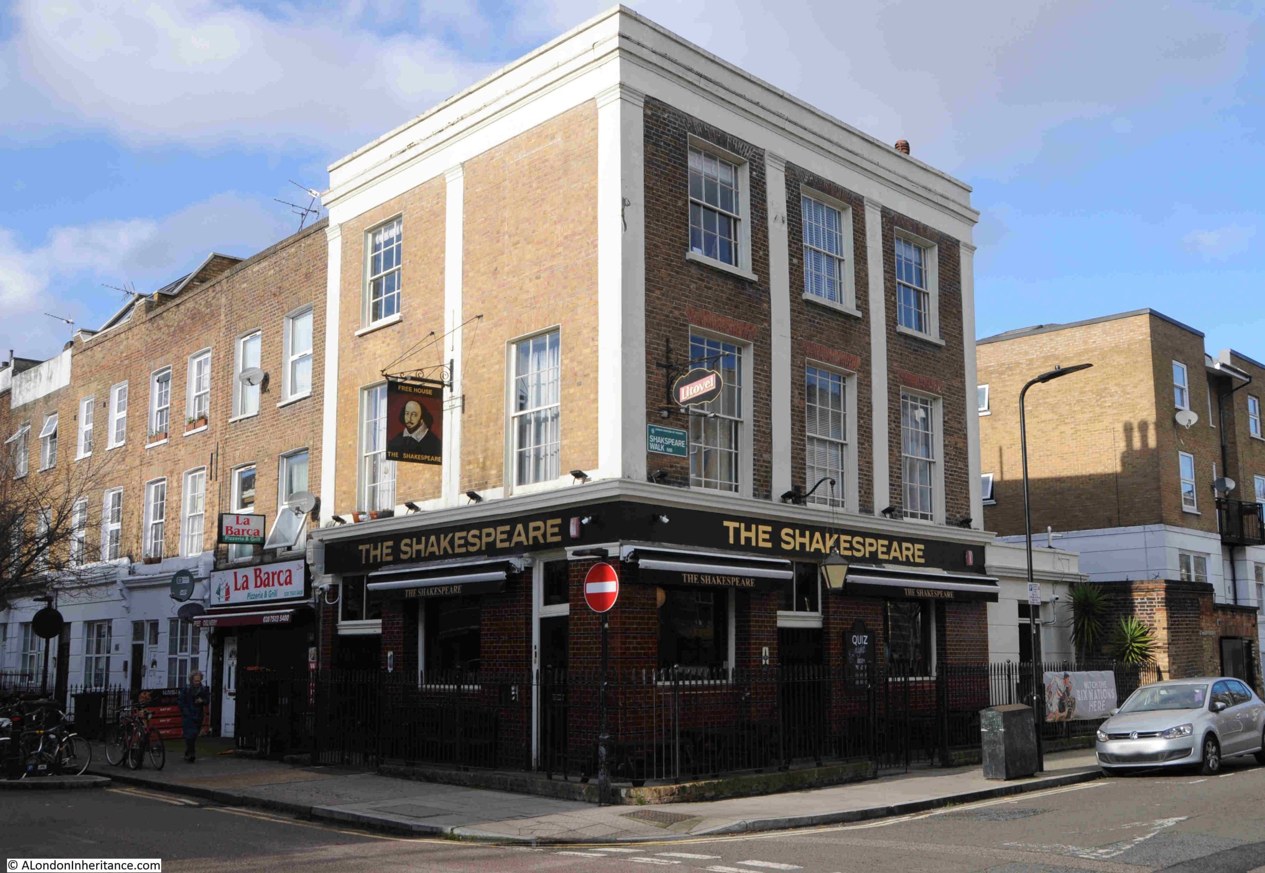
The dark blue circle is around the Shakespeare, at number 57, which of the original four, is the only pub still open on Allen Road:
The Shakespeare once had an ex Arsenal and England player as landlord. Lionel Smith became landlord of the pub in September 1960, after he had retired from football.
He played for Arsenal between 1939 and 1954, with a break during the war, playing as full back, which probably accounts for the fact that during his time with the club, he had never scored a goal.
He played for England between 1950 and 1953, then after leaving Arsenal, he was a manager of Gravesend & Northfleet between 1955 and 1960, when he retired and took over the Shakespeare.
Opposite the Shakespeare is number 50, another corner shop:
I believe at some point, this was a fish and chip shop, but in the 1921 census it was a green grocers, run by Marks and Marie Rwaries, who had both been born in Russia. They lived in the building along with their five children, all girls.
Today, number 50 is a coffee shop.
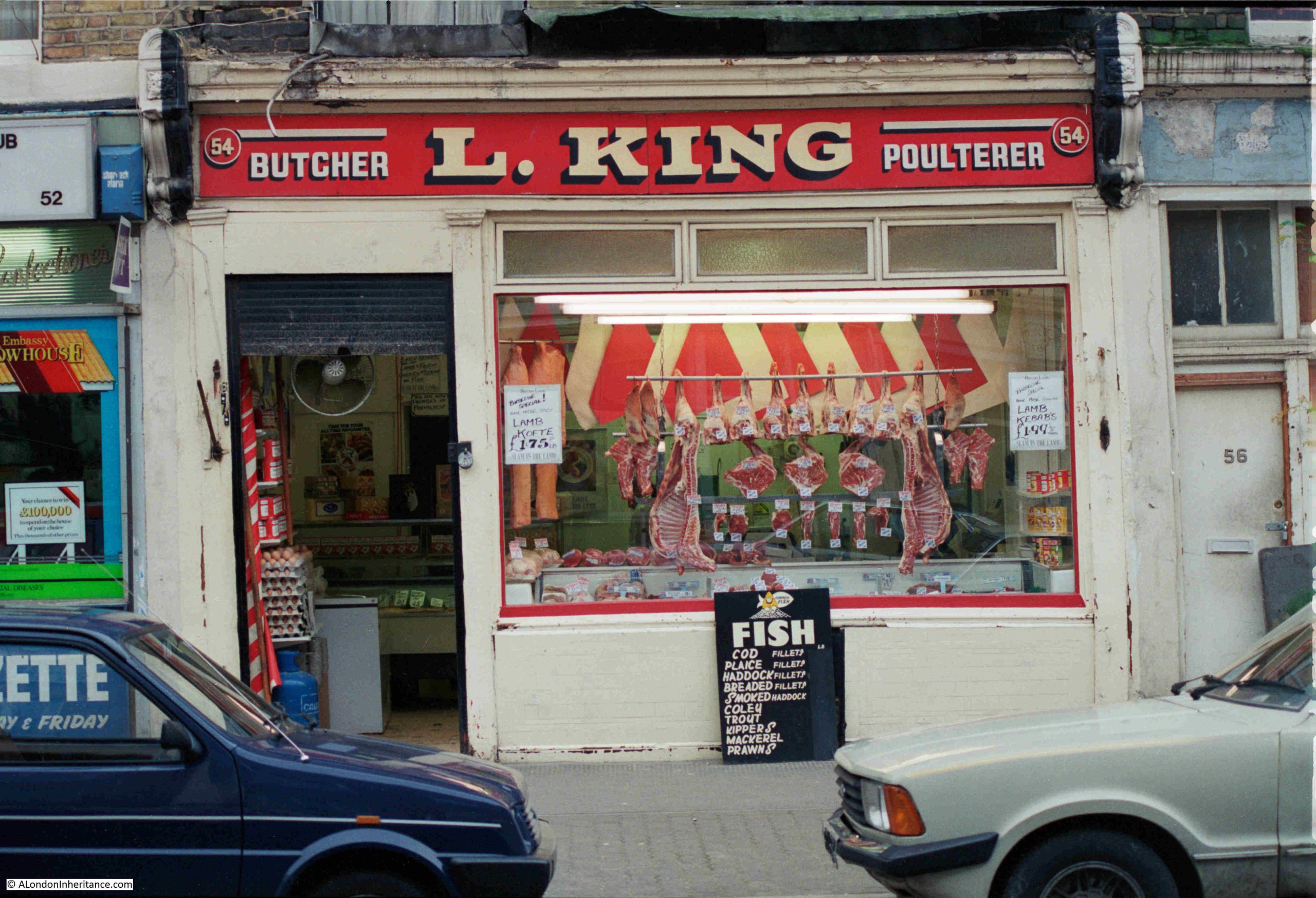
If you look to the right of the corner building in the above photo, there are two ground floors painted with bright white paint. The one on the left is number 54, and I think that back in the 1980s, the was L. King’s shop:
I am not 100% sure, but the photo is in the right place in the strip of negatives, and the moulded decoration to the sides and along the top of the shop are the same as on the building today. These moulded decorations are called Pilasters (thanks to “Chase” for his comment on a previous post). An amazing transformation when you consider the white fronted residential ground floor today, compared to a working, local butcher, 40 years ago.
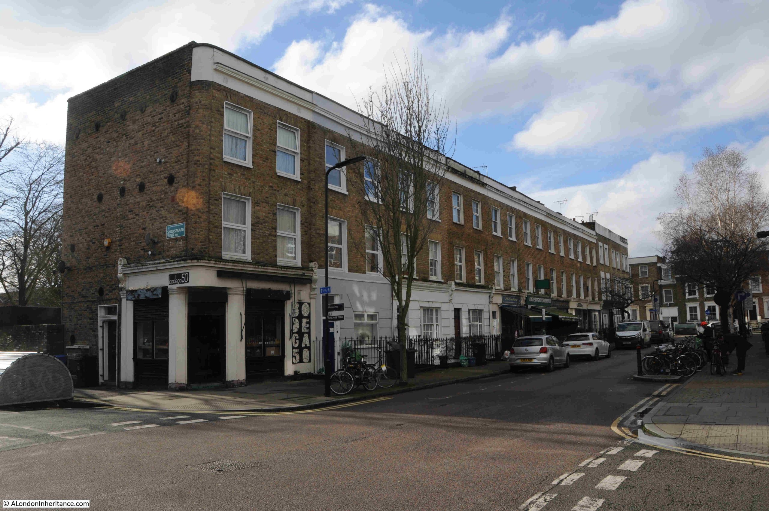
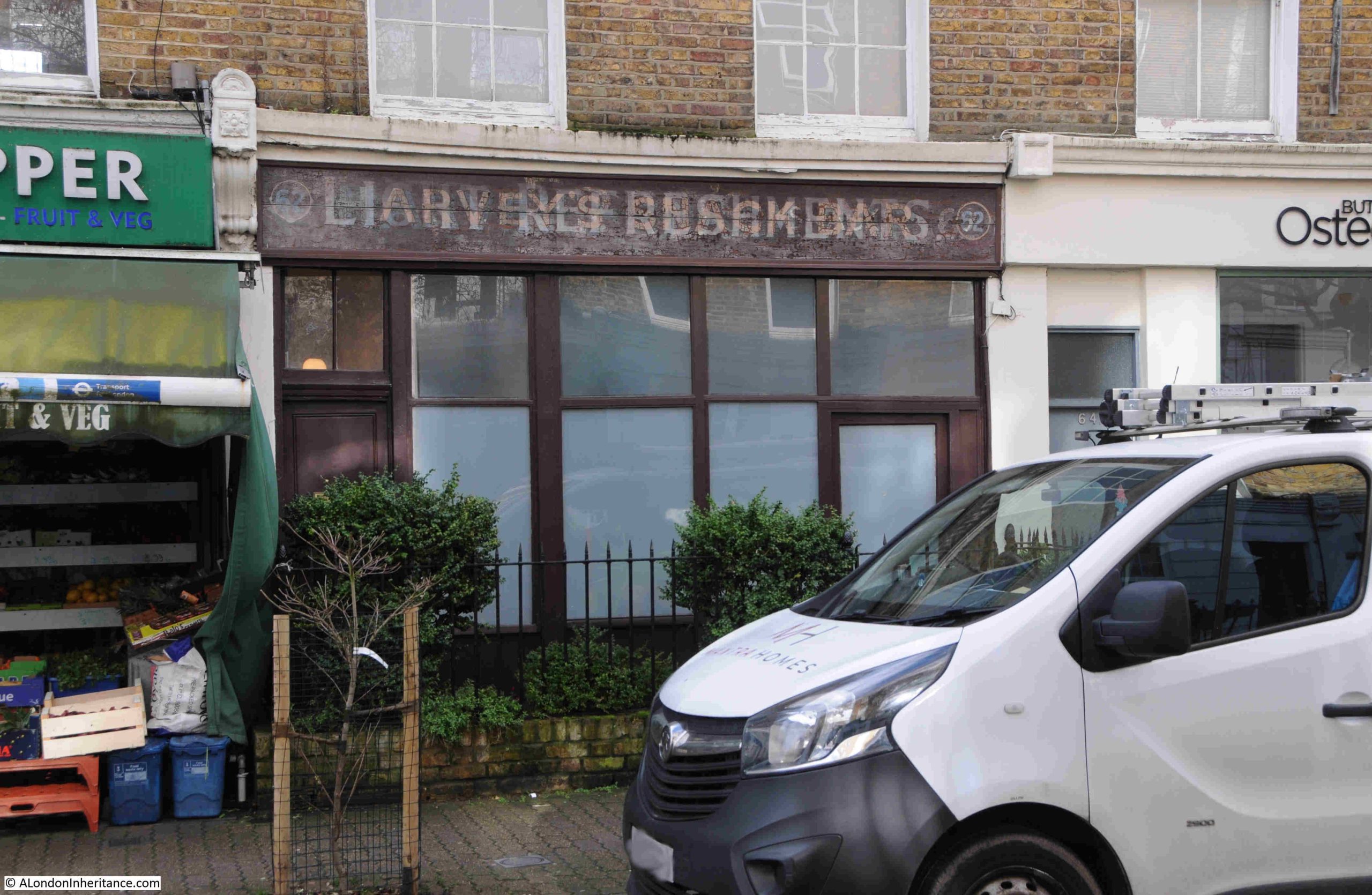
There are still a few shops on Allen Road, but the majority have been converted to residential. A couple still show their early origins, with number 62 displaying signs for Harvey’s Snack Bar and Light Refreshments. The later seems to be written over the former name:
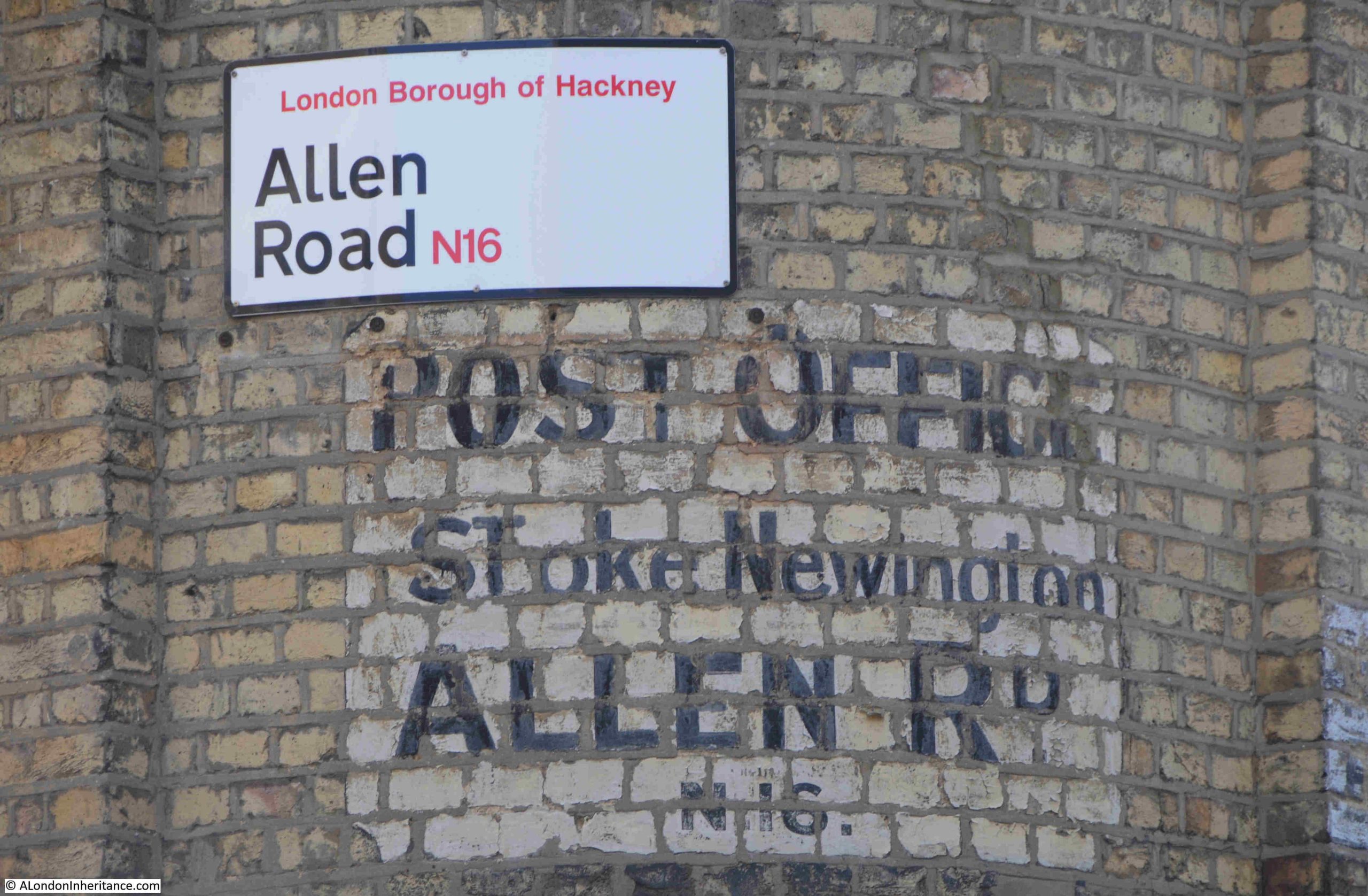
The brown circle, to the left of the map earlier in the post, shows the location of another closed business, where at number 72, on the corner with Milton Grove, was once a Post Office:
To the left of the corner post office building in the above photo can be seen typical 19th century shop fronts, although all these are now residential.
The painted sign advertising the Post Office is on the rounded corner to the building, which again, has also been converted to residential:
There are two other photos on the strip of negatives that should be in Allen Road, but I could not find, or be sure of their location. The first has no identifiable features:
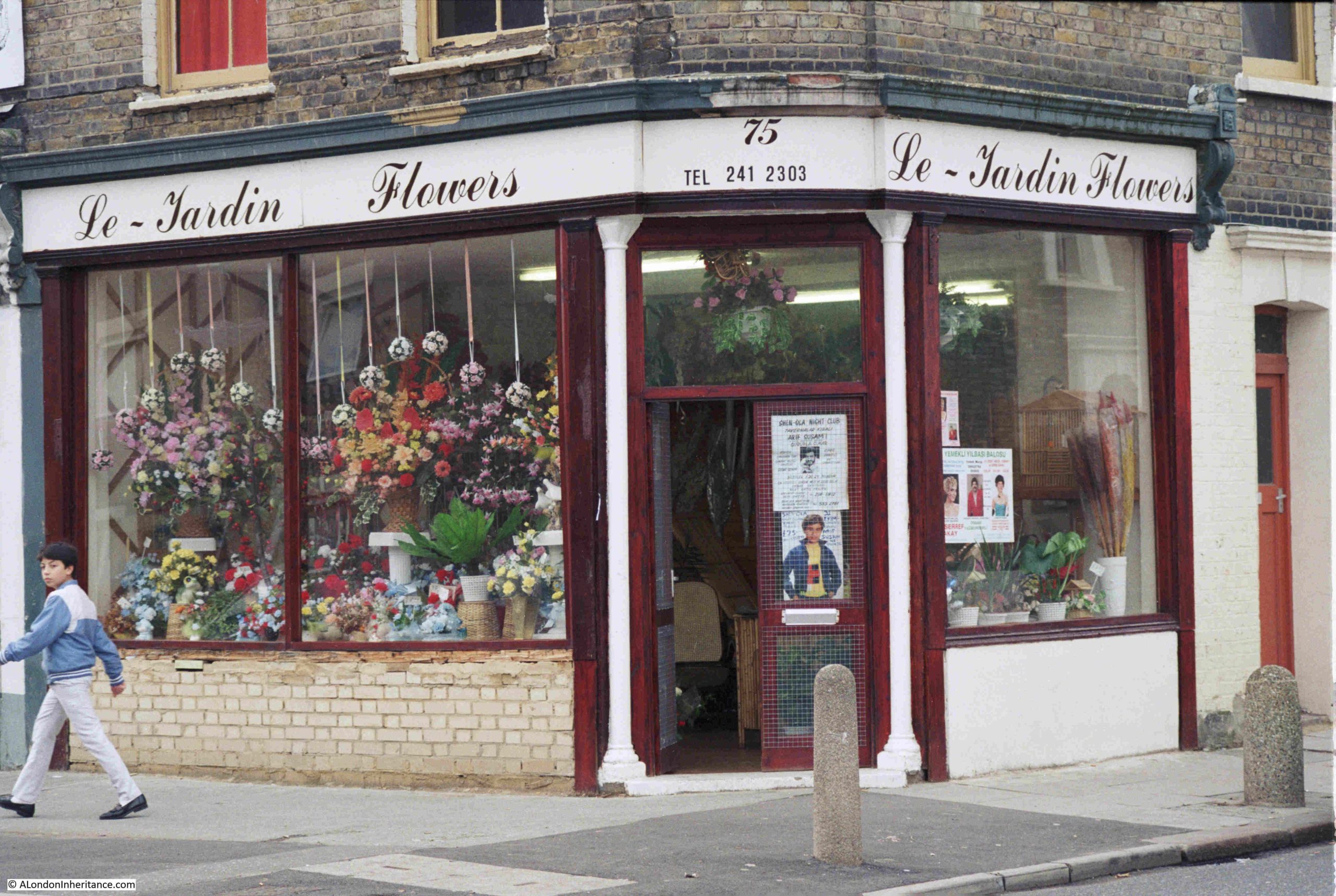
The second photo should be at the junction of Allen Road and Milton Grove according to the photo’s location on the negative strip and relation with other photos:
This is the corner building today:
The corner building has been considerably rebuilt, but it is the numbers that confuse as the florist is at number 75, whilst number 75 today is the house to the right.
I did have a walk around the surrounding streets, but could not find a number 75 on a corner, which looked as if it may have once been a shop.
Whether the corner of Allen Road is the correct location, the florists is another example of the number and varied type of shops that could once be found along these mid 19th century streets.
Their loss over the last 40 years has been down to many factors. Demographics, growth in the number of large chain supermarkets offering a single place for the majority of shopping, car ownership, online delivery services, and probably the major cause, the number of developers looking to turn shops and pubs into residential. For a business with declining sales, and the challenge of making a profit, the sale of the property, or hand back of the lease, was often the best way out.
Industrial premises such as the scrap metal dealer have generally closed or moved further out of London. It is still reasonably common to find car repair businesses among residential streets.
Allen Road was a normal residential street in north London, and it had four pubs. This was probably the right number to serve residents of Allen Road and surrounding streets in the 19th century, when a pub was the main place to socialise and there were no alternative entertainments such as the cinema or TV at home.
Today, the Shakespeare is the one surviving pub. Shops mainly gravitate to busier streets such as Kingsland Hight Street, Stoke Newington Road and Green Lanes.
All part of the continuing evolution of London’s street, but I cannot help thinking that for both residents and just walking the streets, they have lost some local community and character as these places disappear.
And if you know anything about Lloyds Minicars or Le-Jardin Flowers as seen in the photos above, I would be grateful for comments.
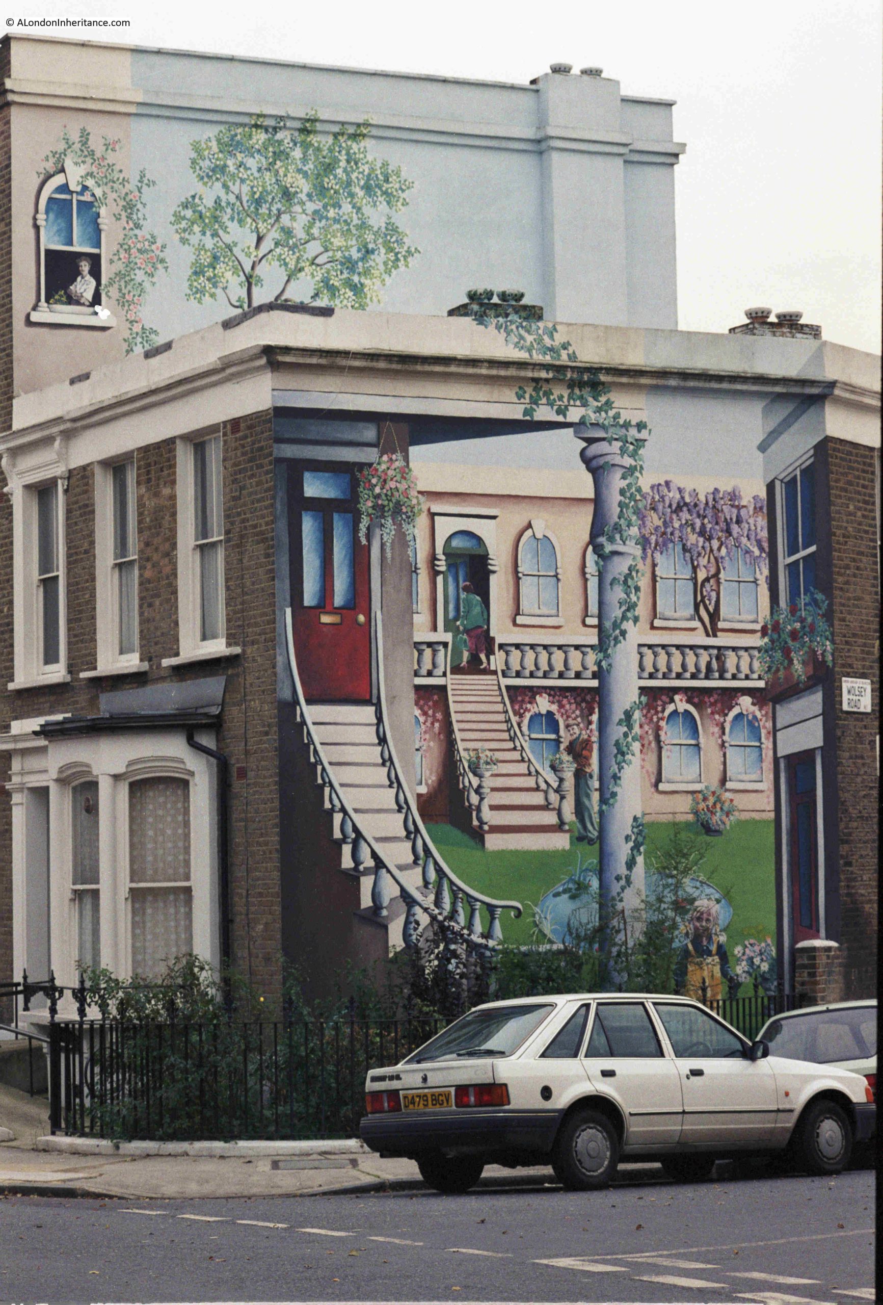
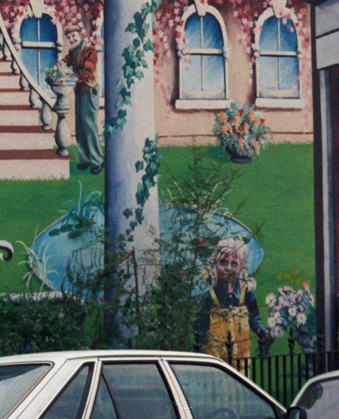
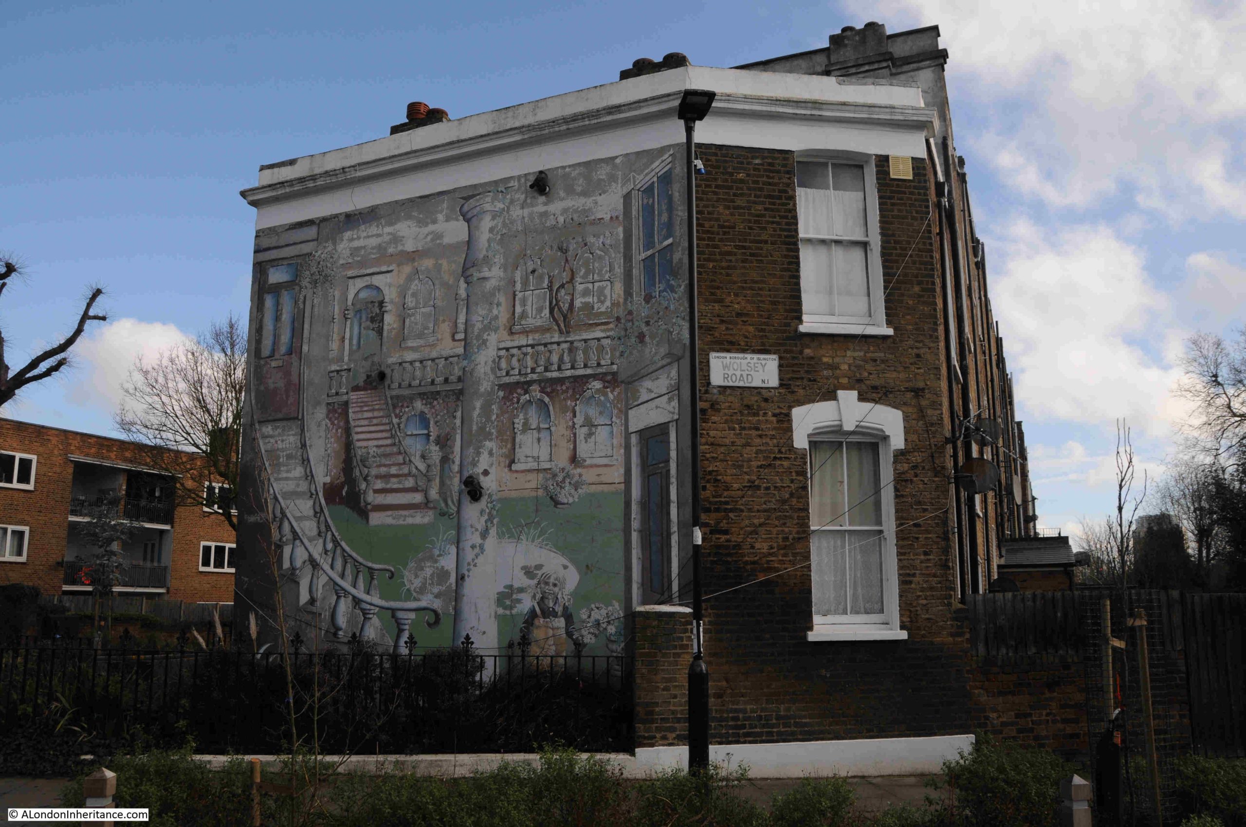
A couple of weeks ago, my post was about His and Hers Hairdressers in Middleton Road, Hackney. After finding the location of my father’s mid 1980s photo of the hairdresser, I continued on towards Newington Green, where one of the approach roads is Mildmay Road, and at the junction of Mildmay and Wolsey Roads, is the location of another of my father’s 1980s photos, this time of a rather wonderful mural:
The mural is remarkable, not just for the subject, the colour and the detail, but also for the three dimensional affect the mural achieves, and that it extends not just along the end wall of the two storey house, but continues across to the third storey of the adjacent house.
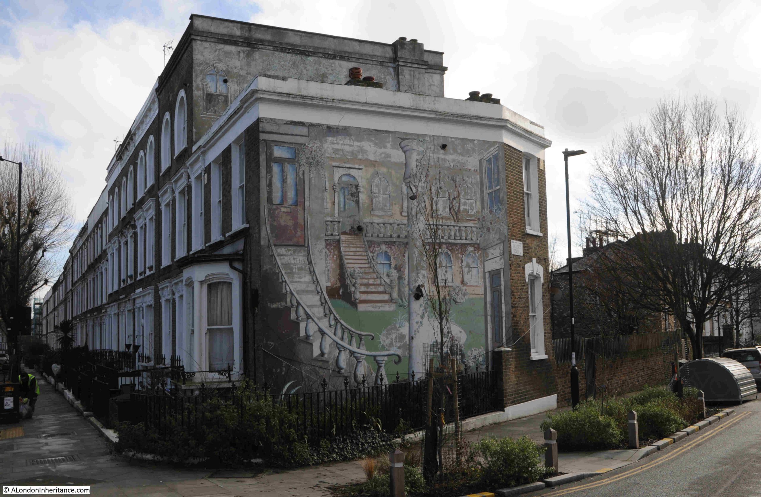
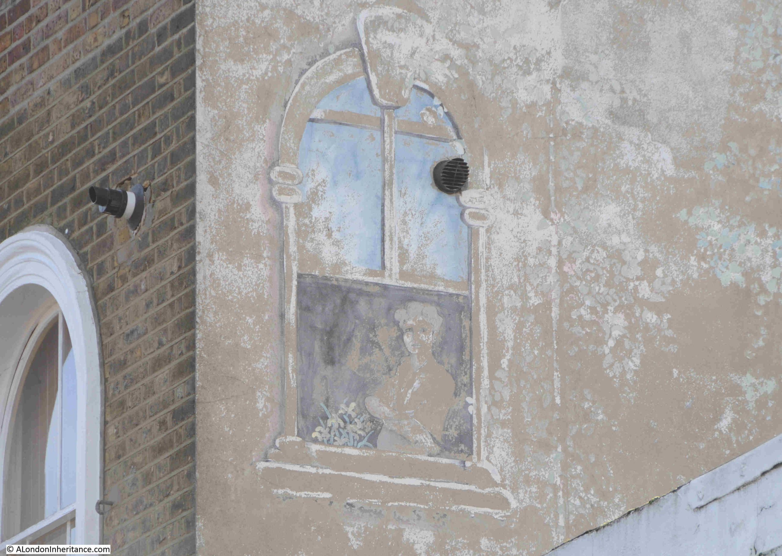
The forty years between the above photo and the mural today, have not been kind to this wonderful artwork, and in 2026 we see a very faded mural, with much of the colour and detail gradually disappearing:
I cannot find any information as to the exact date of the mural, who created the work, and any meaning behind the image, and why on this particular building.
Comments with any information would be greatly received.
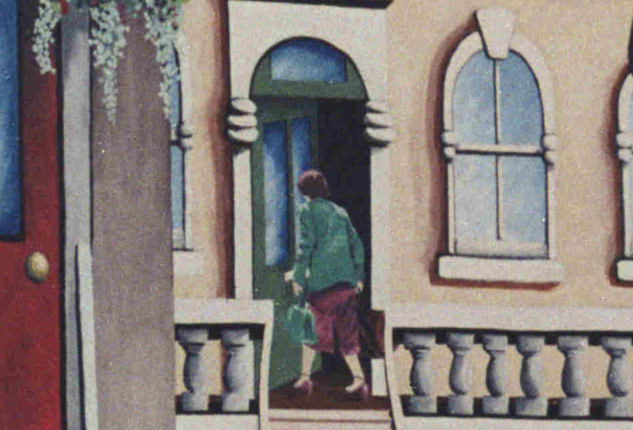
In the 1980s photo, we can see details which raise questions, for example there is a green door reached by some stairs leading up from the grass. The door is partly open, and a woman carrying two bags is going through the doorway.
Why is the woman there, who is she, was she a resident of the house, creator or sponsor of the mural?
There is also a man at the base of the stairs, and a girl stands on the edge of the grass, holding a bunch of flowers, and looks out towards Mildmay Road. Were they also part of the same family?:
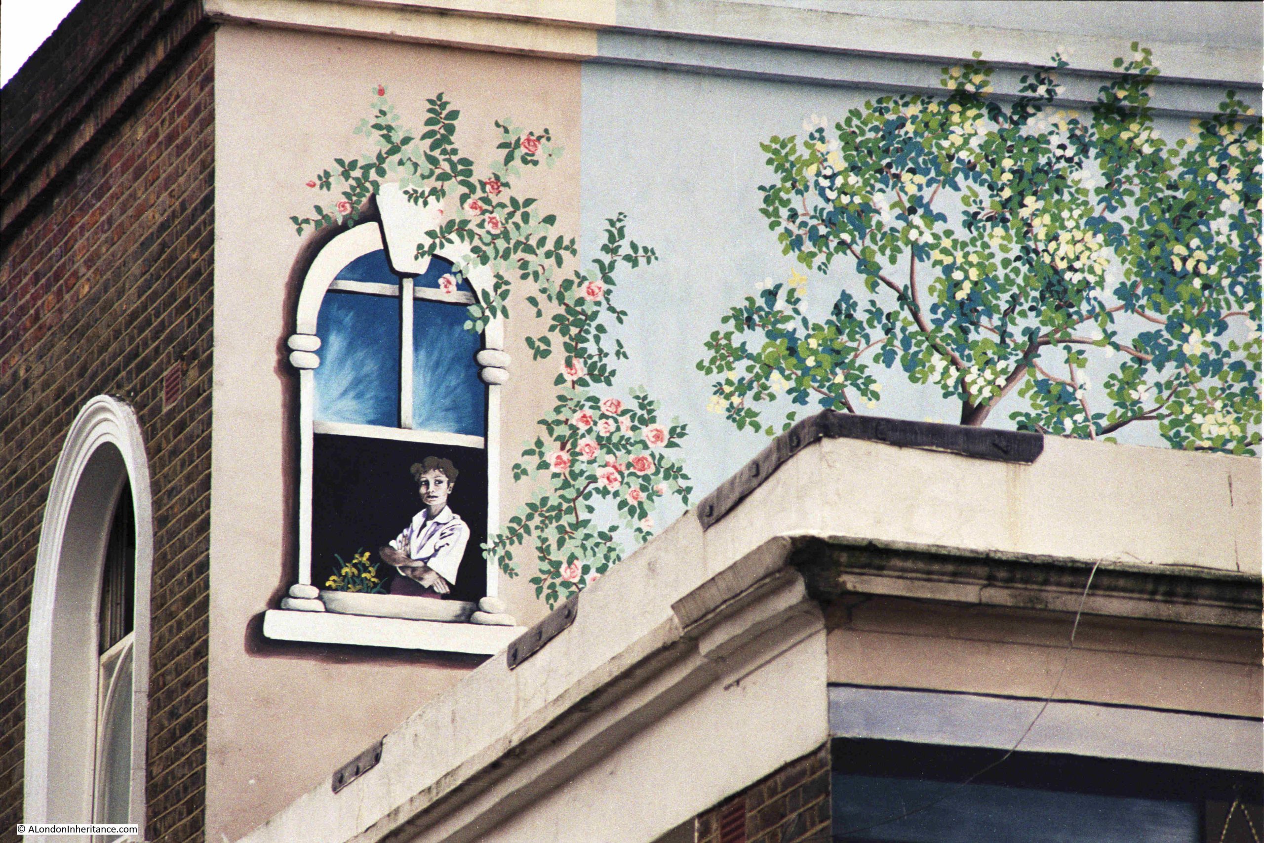
My father’s second photo of the mural was a close up of the part of the mural on the upper floor of the adjacent house, where a woman is looking out of an open window. I wonder if she is the same woman who was going in through the green door?
Forty years later, and this section of the mural exists in outline only, with just some of the blue sky in the upper part of the window remaining:
In Wolsey Road we can see that the three dimensional aspect of the mural is still clear. The mural covers a flat wall, and as well as the individual elements of the mural, the two sets of stairs, and the column, the two windows on the right of the mural are painted in such as way as to give the impression that they are on an angled wall:
After forty years, the mural is faded, flaking and losing colour, but enough remains to show what it was like when created, as my father’s 198o’s photos confirm.
The mural is an example of what can be found whilst walking the streets of London, and the pleasure of wandering along London’s ordinary streets is a message I hope I have been able to get across in the last couple of posts on my search for some 1980s photos – The Flower Sellers and London Fields and His & Hers Hairdressers, Middleton Road, Hackney, and is a theme I want to continue in this week’s post, with no deep historical insights, just some views of the streets as I walked up from Middleton Road to Mildmay Road.
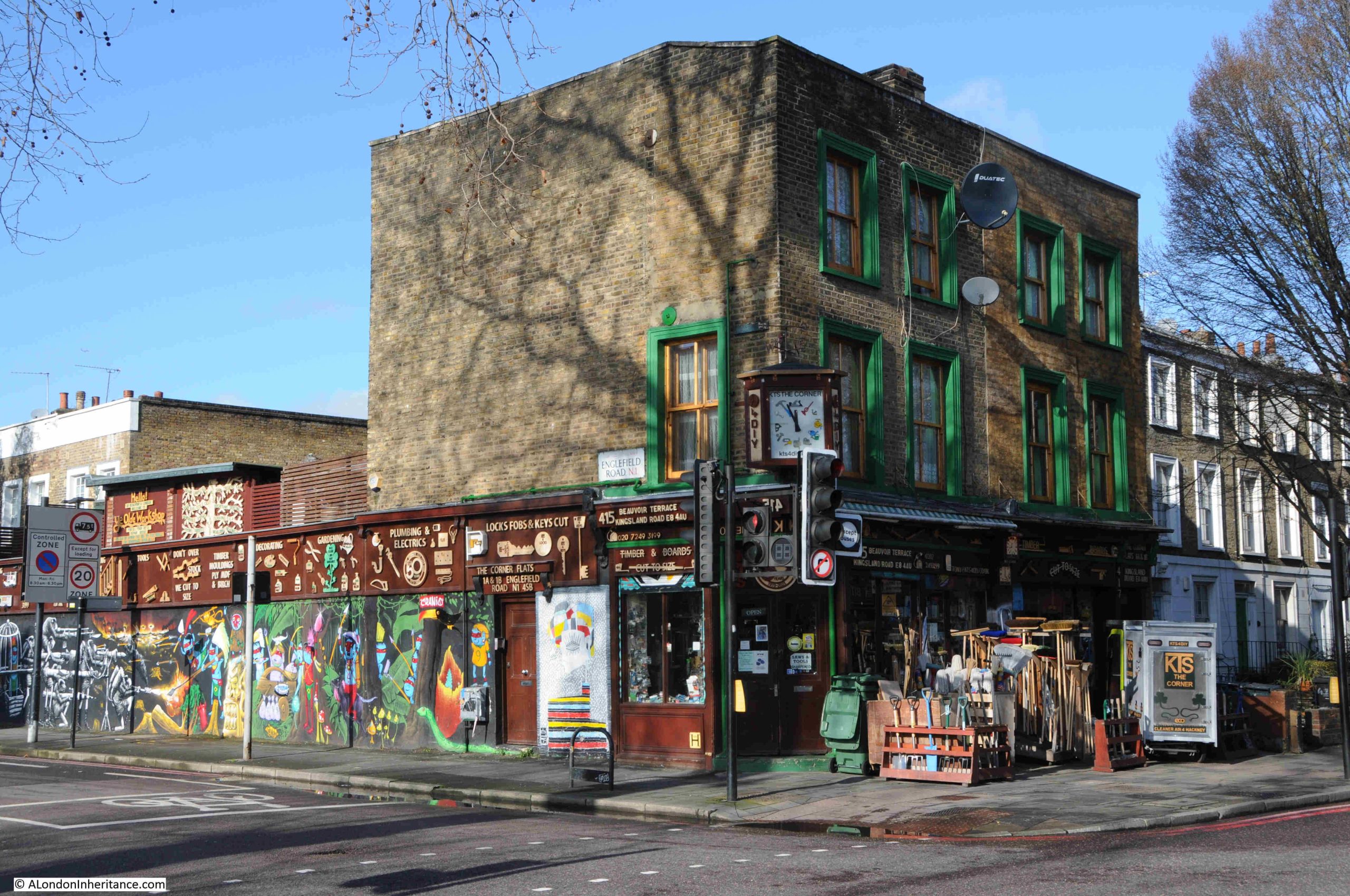
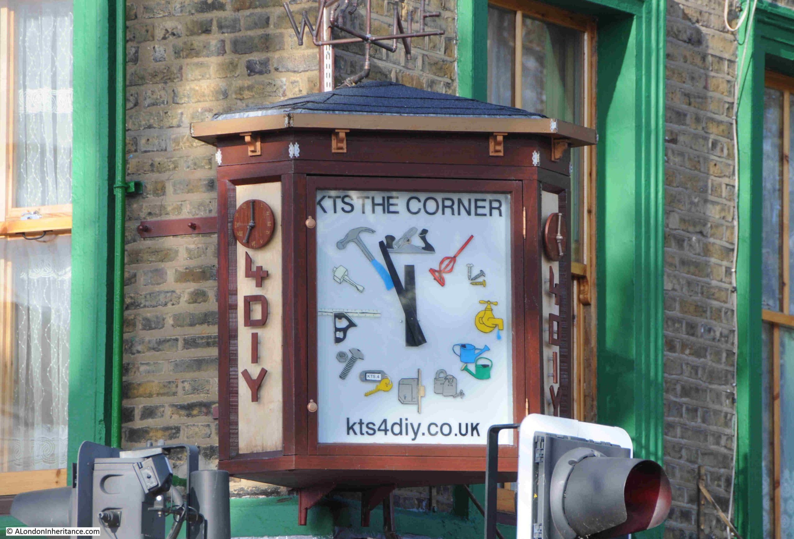
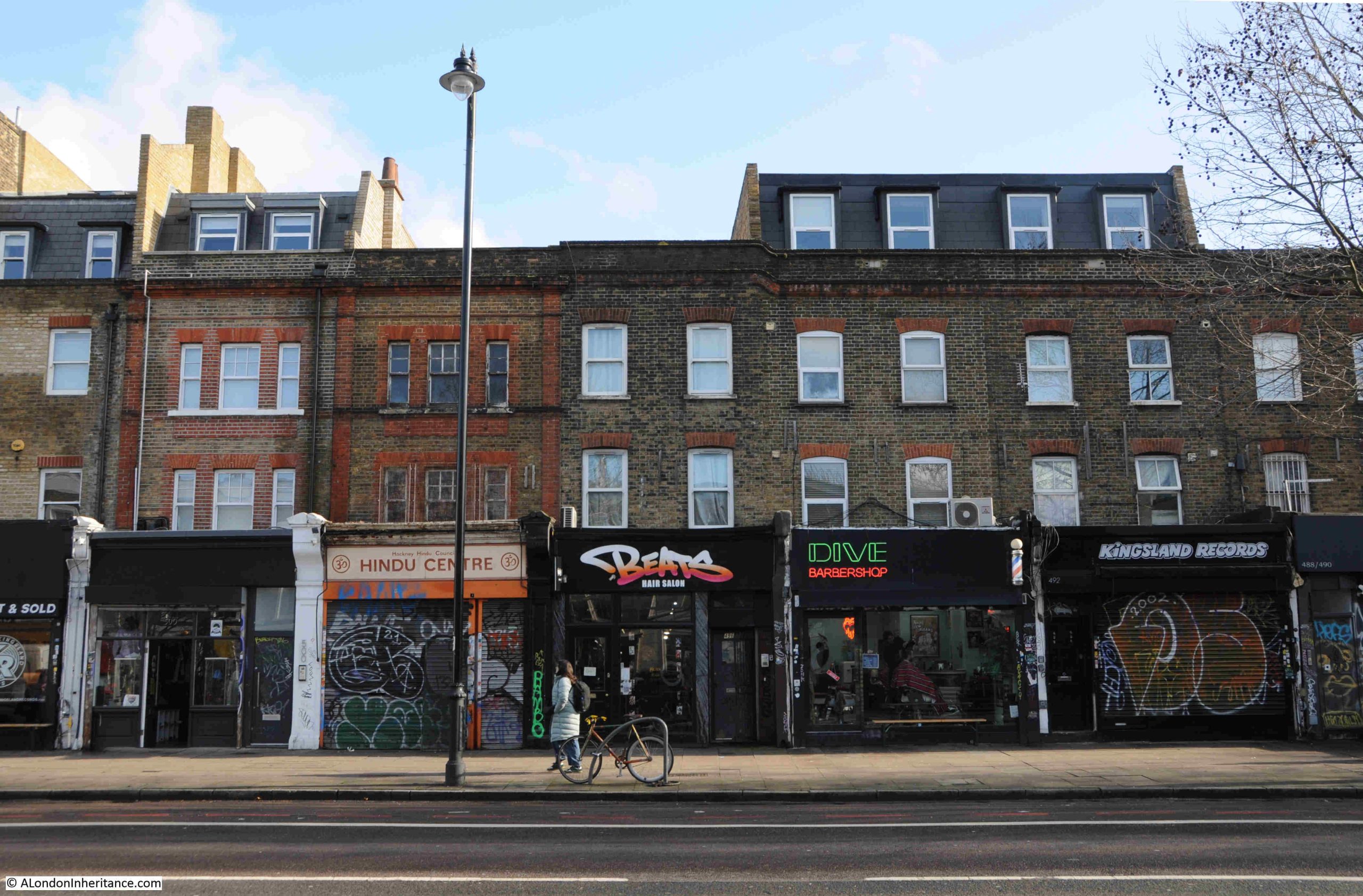
The route took me along Kingsland Road, where at the junction with Englefield Road is KTS DIY, a family run business, which according to their website has been there since 1973:
The clock on the corner of the building:
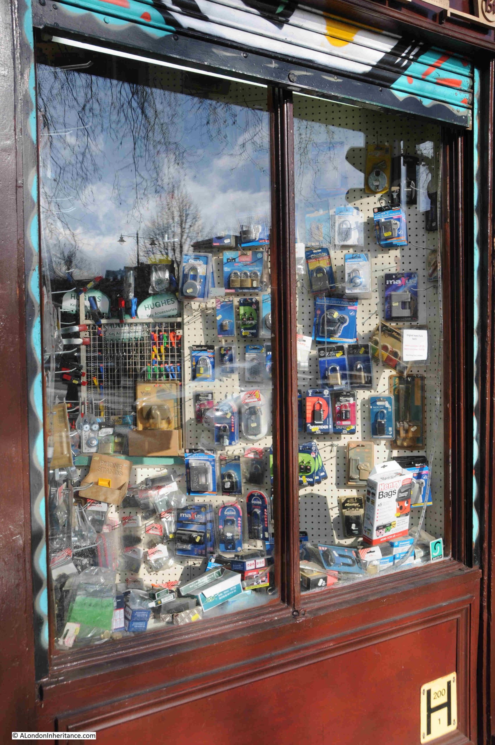
The store stocks a phenomenal range of DIY, building and household maintenance and cleaning equipment. The window display is just a very small part of what can be found inside:
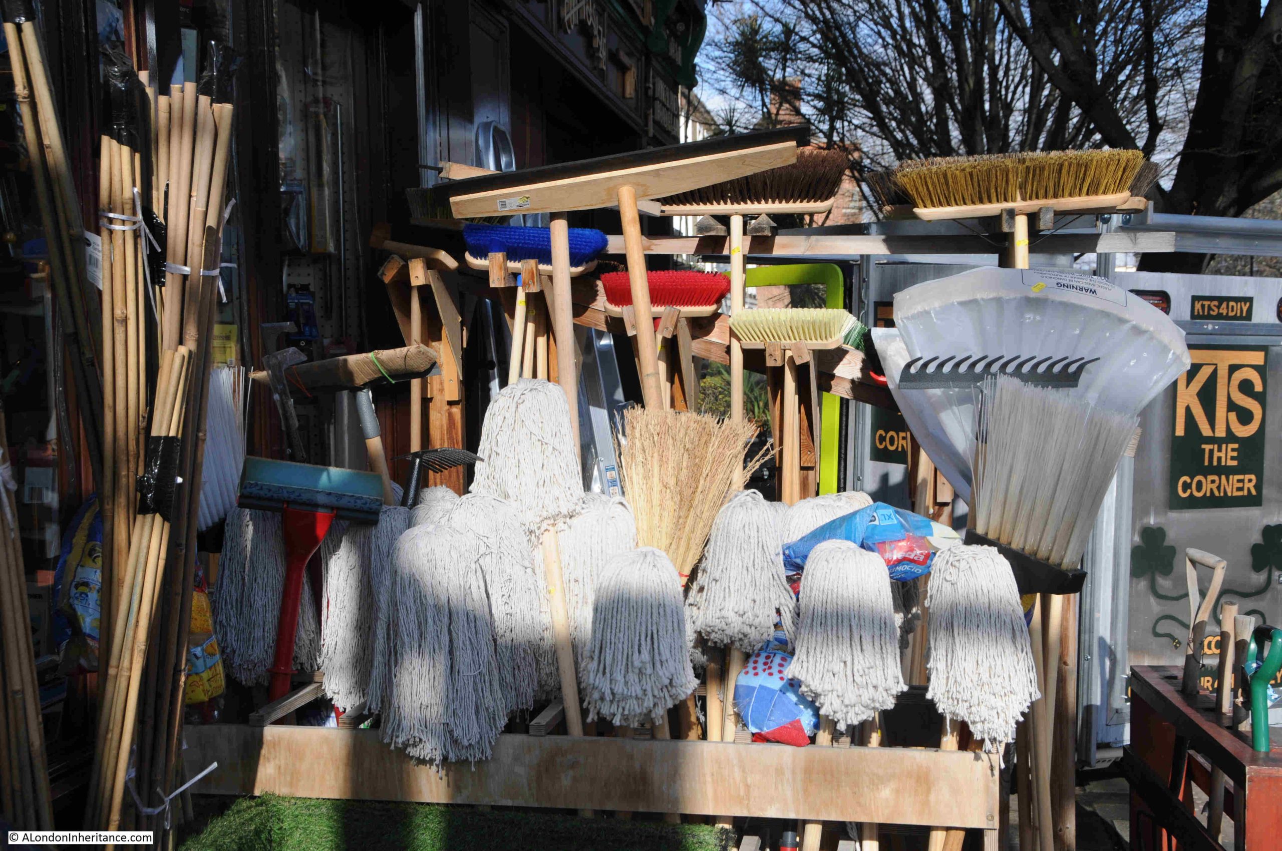
Mops and brooms in the February sunshine on Kingsland Road:
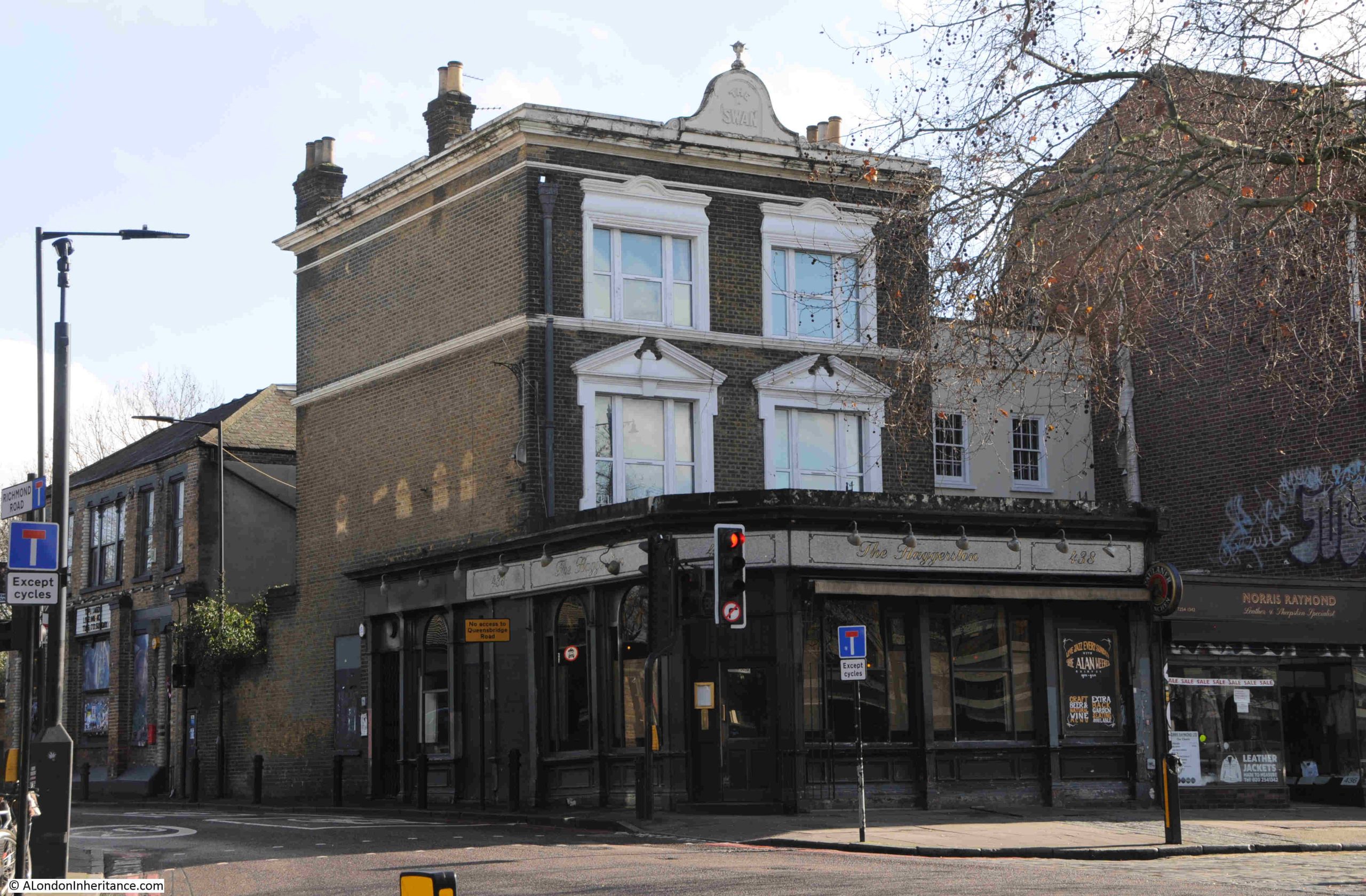
Opposite KTS DIY is the Haggeston, a pub which also has regular live music:
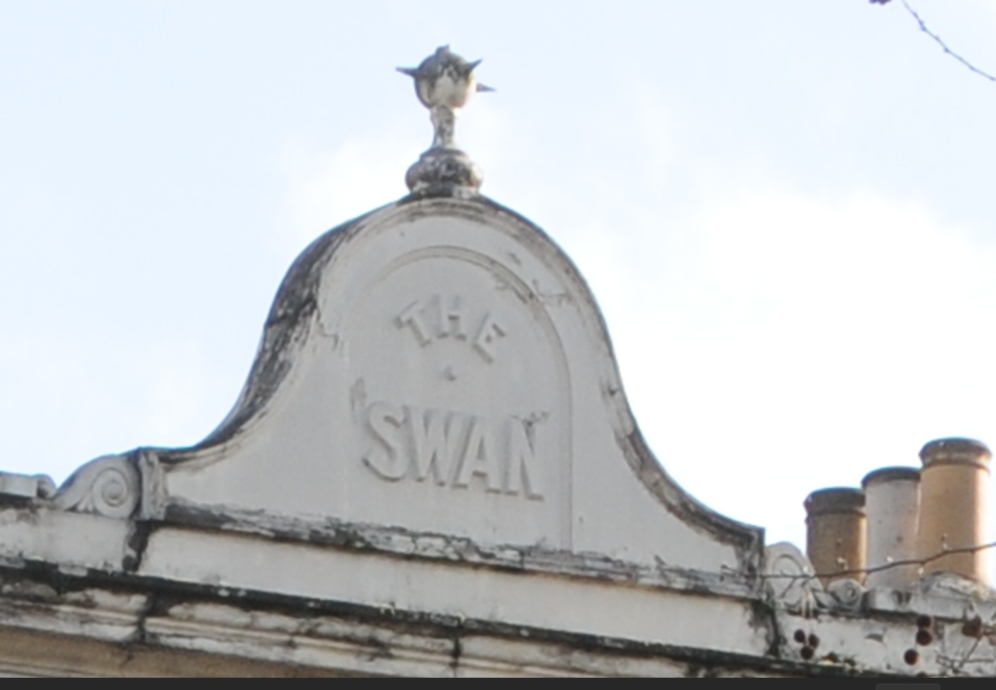
The current name of the pub dates from around 2009, and the original name of the pub was the Swan, as still displayed along the top of the building:
The Swan probably dates to the late 18th century. It was mentioned in an advert in the Morning Advertiser on the 15th of August 1807, an advert for the lease of a house, which gives a good impression of what this now densely built up area was like at the start of the 19th century:
“A neat, genteel brick-built detached dwelling house, with garden, and most pleasantly situated in the fields, near the Swan, Kingsland Road, an easy and pleasant walk from the Royal Exchange, and completely screened from the dust of the public road.”
It is good to know that back in 1807, advertisers of property used the same underestimates of distances in their adverts, as I am not sure the two and a third miles from the Swan to the Royal Exchange could be called and “easy and pleasant walk” for all.
The advert also demonstrates how pubs were used as a local reference points for many forms of public notice.
Further along Kingsland Road, and I am not sure what has happened to the windows on the first floor of this building:
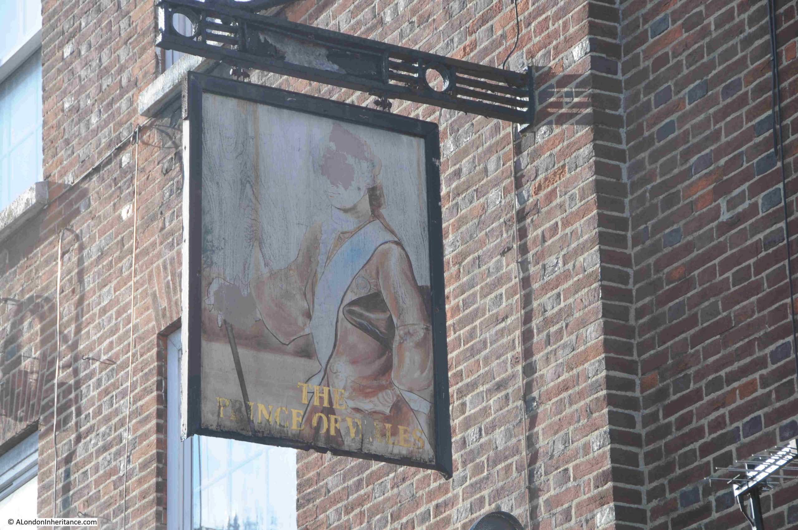
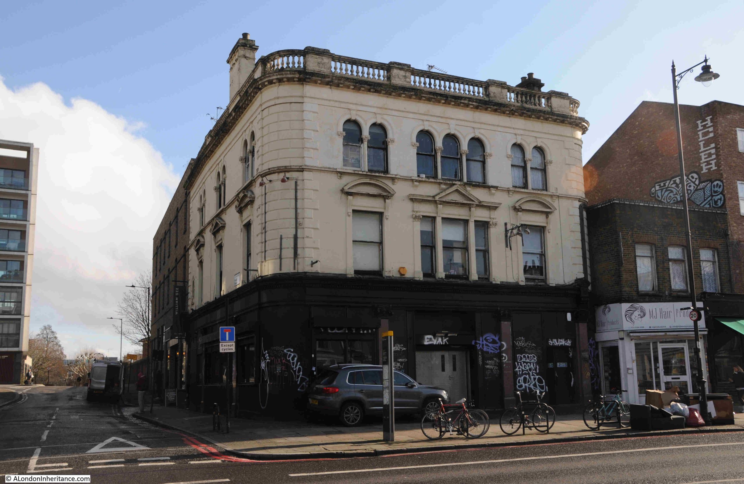
As with the mural on Mildmay Road, along Kingsland Road is the gradually fading sign of the Prince of Wales:
Despite closing around 26 years ago and converted to residential, the Prince of Wales name is still displayed at the tope of the building, a 1930 rebuild of the previous pub on the site:
A short distance further along Kingsland Road is another closed pub, the Lamb, which dates from the early 19th century. The building is now a nightclub:
There were many pubs along Kingsland Road, reflecting both the importance of the road and density of the housing that was built in the fields to east and west of the road in the 19th century.
Kingsland Road is also home to terrace houses built during the late 18th and early 19th centuries. These were fine houses at the time, and frequently ground floor shops were added at a later date, built over the gardens that separated the house from the street:
The two semi-detached houses in the centre of the following photo are late 18th / early 19th century and are Grade II listed. At the time of the listing (1975), the building housed a factory, but now looks to ne residential, with shops taking up the space in front of the ground floor of the building:
The two larger buildings behind the shops in the following photo are also Grade II listed and date from the late 18th century. One can imagine how impressive these buildings appeared, before the shops and when the whole façade was visible from the street:
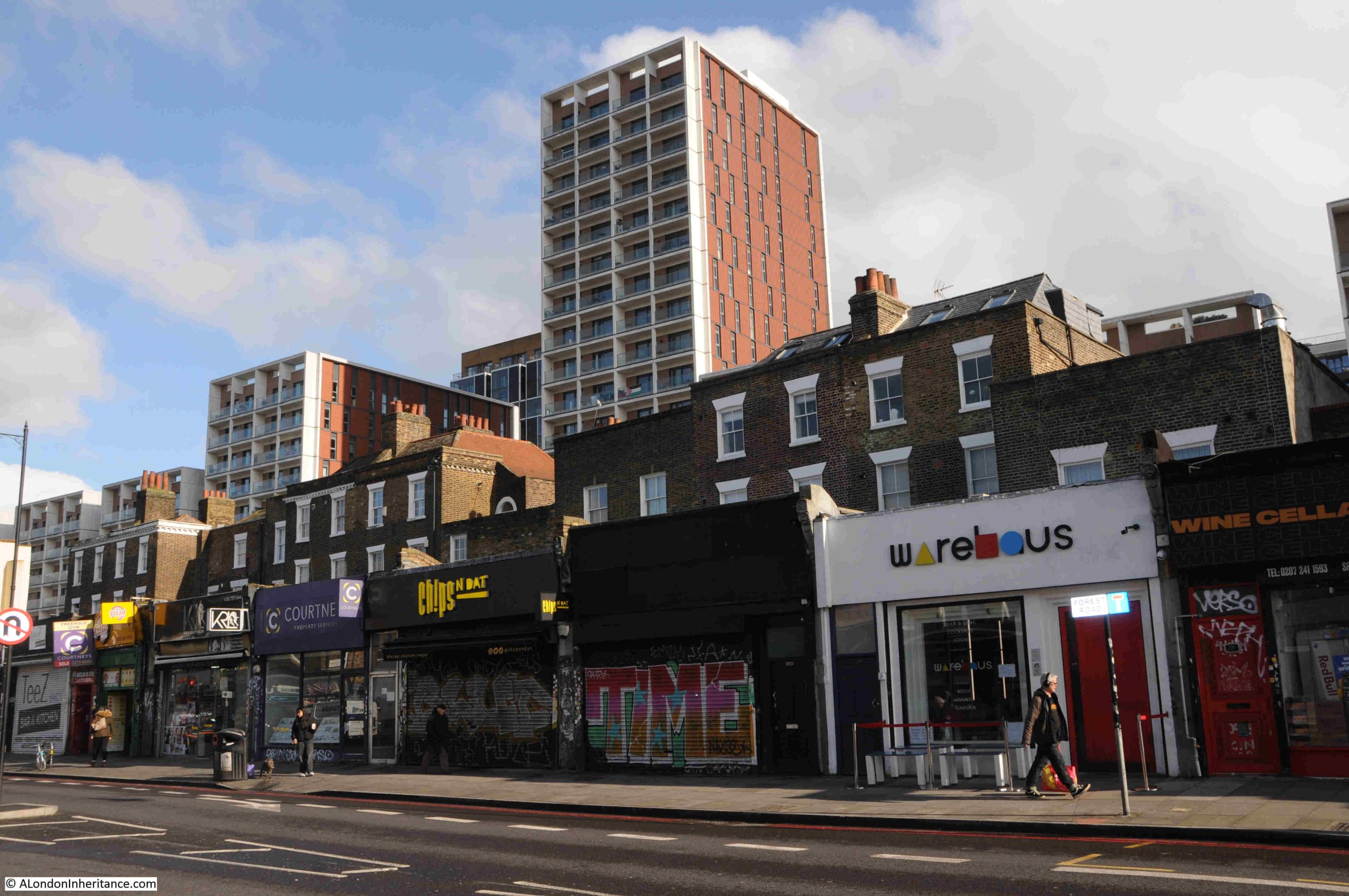
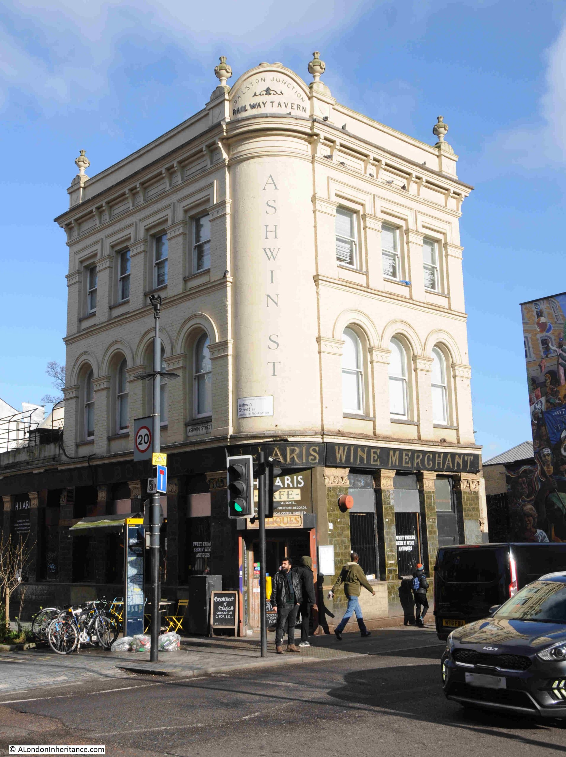
A slight detour down Dalston Lane from Kingsland Road is the old Railway Tavern, so named because it was almost opposite the original Dalston Junction station building, which has been rebuilt as part of a residential development.
The Railway Tavern is now a café / antique store:
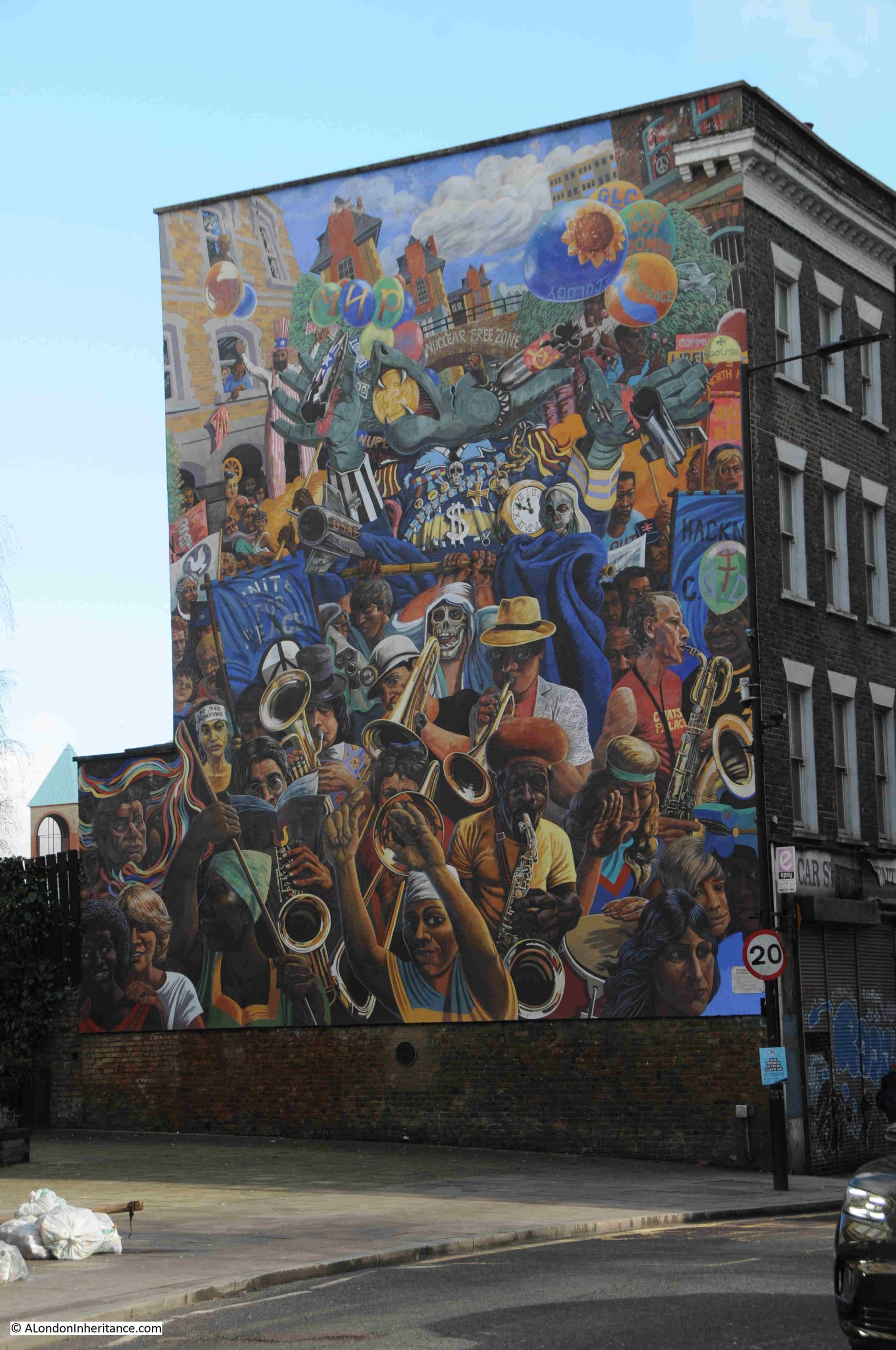
The reason for the slight detour down Dalston Lane is to find another 1980s mural, however unlike the mural in Mildmay Road, this one is in a far better condition:
This is the Hackney Peace Carnival mural. The design dates from 1983 when it was created by Ray Walker to celebrate the Greater London Council’s Peace Year, and it was completed in 1985 after being finished by Ray Walker’s wife Anna Walker along with Mike Jones, following the death of Ray Walker in 1984.
Ray Walker is shown in the mural to the lower left:
And Anna Walker is at lower right:
The excellent condition of the Dalston Lane mural compared to the Mildmay Road mural, when they are around the same age, is mainly down to the significant 2014 restoration of the Hackney Peace Carnival mural.
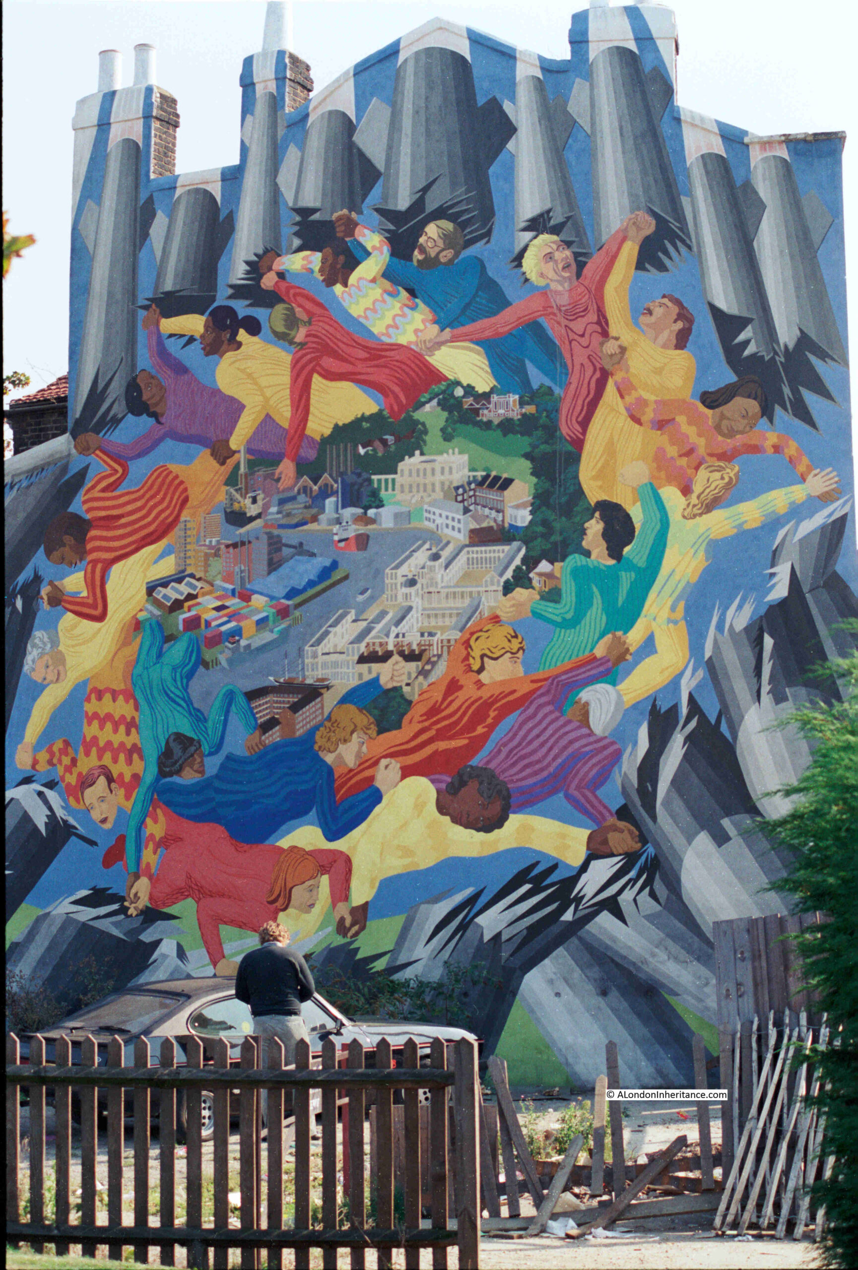
The 1980s seemed to be a prolific period for murals across the streets of London and GLC initiatives such as the 1983 Peace Year were responsible for a number of these, another of which was in Greenwich and was the Wind of Peace mural in Creek Road:
The Wind of Peace was commissioned by the London Muralists for Peace initiative, and painted by artists Stephen Lobb and Carol Kenna. It replaced an earlier mural showing the river and the land alongside the river in Greenwich.
From Dalston Lane, I then returned to Kingsland Road, and headed up to Mildmay Road via Boleyn Road, to find the mural at the start of today’s post.
A short post, with no maps, no deep dive into the area’s history, but I hope it demonstrates why walking the streets of London can be such as pleasure.
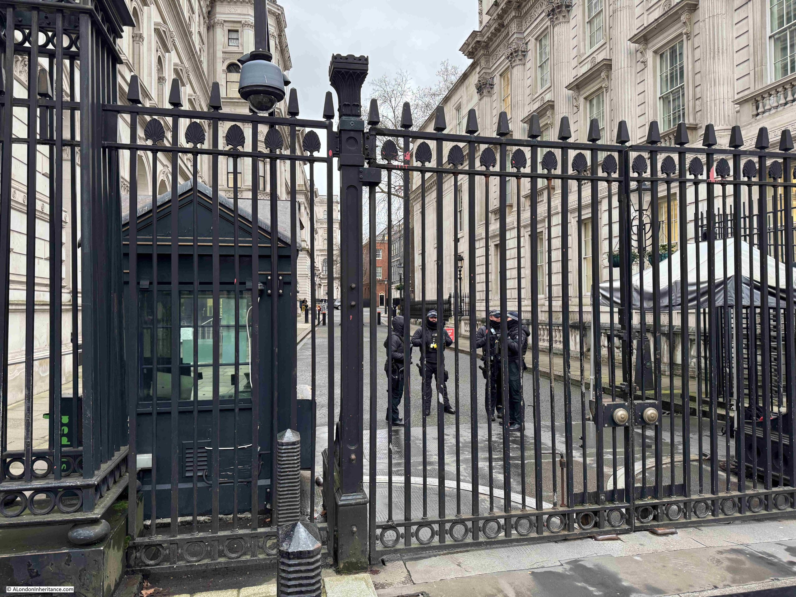
Along with streets and places such as Piccadilly, Leicester Square, and Oxford Street, Downing Street is probably one of the more recognisable London street names, not just in the United Kingdom, but across the world, given the number of tourists who peer through the gates that separate Downing Street from Whitehall.
Number 10 Downing Street has been home to the Prime Minister (or more correctly the First Lord of the Treasury) since 1735, when the house was given to Sir Robert Walpole.
There have been many gaps in occupancy by Prime Minsters, however a central London house was considered a benefit of the role. It was only in the early 20th century that it became a full time residence of Prime Ministers.
Security has long been an issue. It was not so long ago that the public could walk down the street, with the street finally being closed to the public in 1982, and in response to ever growing threats, security measures such as physical defences and armed police have been added and enhanced.
So today, this is the best view of the street for tourists and members of the public who do not have official business in any of the buildings and institutions that line Downing Street:
The street has seen so many Prime Ministers, newly elected, arrive in an atmosphere of enthusiasm and expectation, only to leave having been rejected either by the electorate, or through the actions of their former colleagues.
For a rejected Prime Minister, perhaps the most difficult way to leave is when you have been rejected by former colleagues. Those who once supported and worked with you, and with whom you had a shared vision of the future.
Whilst this must be incredibility frustrating, it is not as bad as the treachery of the person who was once the land owner and who gave his name to the street, who through his treachery, condemned former colleagues to the worst death penalty that the State could impose, convicted of being a traitor and being hung, drawn and quartered.
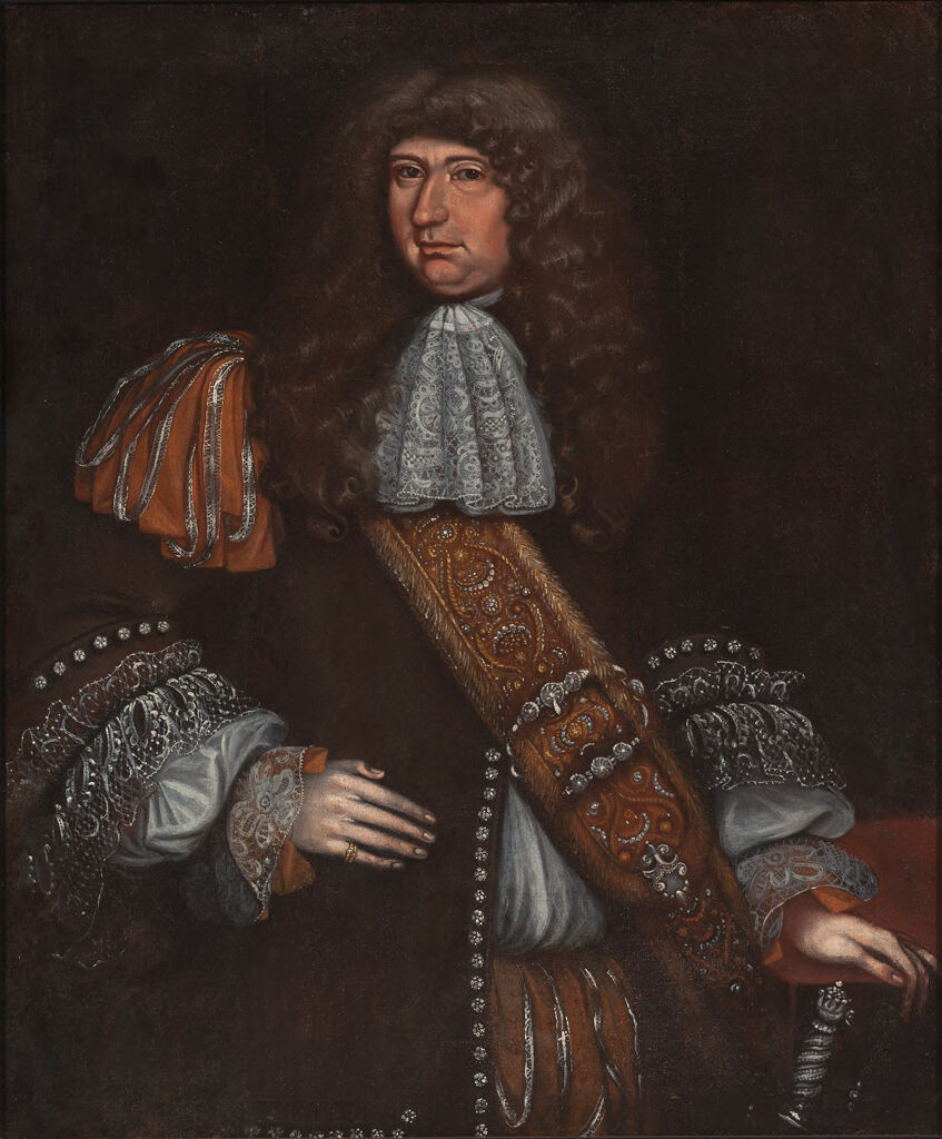
For this, we have to go back to the Civil War, Commonwealth and Restoration of the 1640s, 1650s and early 1660s to explore the work of Sir George Downing:
The source of the above paining is from the Harvard Art Museum, and the image title is “Portrait of a Man, probably Sir George Downing (1624-1684)”. It is often difficult to be absolutely certain of those depicted in paintings of some age (see my recent post on the Gresham’s).
The record for the painting states that on the stretcher is written “Sir George Downing Bart./ born August 1623–Embassador [sic]/ to the States General 1659-Son of/ Emmanuel Downing & Lucy Winthrop/ 4th daughter of Adam Winthrop-/ The nephew of John Winthrop/ Governor of Massachusetts–His/ diplomatic services…[illegible]… are well known to history.”, which does add some confidence that this is Sir George Downing.
George Downing was born in Dublin around 1623 or 1624, His father was Emanual Downing, a Barrister and Puritan, and his mother was Lucy Winthrop, the sister of John Winthrope who was the Governor of the Massachusetts Bay Colony, an English settlement on the east coast of America which had been founded in 1628.
This family relationship with Massachusetts resulted in the family moving to the colony in 1638, where they settled in Salem.
Harvard College had been founded by the Massachusetts Bay Colony on the 18th of October 1636, and was the first college set-up in the American colonies.
The name Harvard comes from John Harvard who was an English Puritan minister and benefactor of the college, which included leaving his library of 400 books and half of his estate to the new college.
George Downing attended Harvard College, and was one of the first group of nine who graduated from the college in 1642.
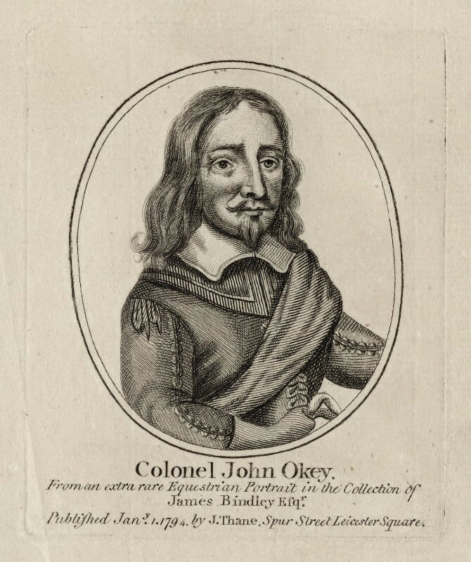
After Harvard, Downing moved to the West Indies where he became a preacher, and in the early 1640s he returned to England, where he found the country in the middle of a Civil War, and he quickly aligned with the forces opposing King Charles I, joining the regiment of Colonel John Okey as a chaplain.
Downing was fully supportive of the actions of Cromwell and the New Model Army in the defeat of the Royalist cause, and he was recognised and promoted quickly to become Cromwell’s Scoutmaster General in Scotland, a role that was basically the head of a spying and intelligence operation, attempts to infiltrate Royalist plots and to turn Royalist supporters to the Republican cause.
During the years of the Commonwealth in the 1650’s, Downing’s skills became valuable in the diplomatic service, and he became the Commonwealth’s ambassador to the Netherlands, where he also developed a network of spies, and passed information on Royalist plots back to John Thurloe, who was Cromwell’s main spymaster.
The later part of the 1650s were a difficult time for the Commonwealth, the main issue being what would happen to the Commonwealth after the death of Oliver Cromwell. Who would succeed Cromwell, how would such a decision be made, could Cromwell take on the role of a monarch and make the head of the Commonwealth a hereditary title?
Downing supported and urged Cromwell to take on the role of a monarch along the lines of the old constitution that had existed before the execution of King Charles I.
To those holding senior positions in the army and the Commonwealth, it must have seemed that the Commonwealth was in a strong position, the country would remain a Republic. Monarchist plots and uprisings had been supressed, and the future King Charles II seemed to be in a weak position in exile on the Continent.
It was then surprising how quickly after Cromwell’s death, that the whole structure of the Commonwealth collapsed so rapidly, and King Charles II was restored as the monarch of the United Kingdom in 1661, just three years after the death of Oliver Cromwell.
George Downing had been watching how sentiments towards the monarchy were changing and started to plan how he would survive and prosper after the restoration.
This involved actions such as ingratiating himself within the court of the future Charles II, passing information on to the Royalists and claiming that he had been drawn in to the Republican cause rather than being an active initiator of the Civil War and the execution of King Charles I.
Whilst Downing had supported the trial and execution of the former king, he was not a judge or participant in the trial, and did not sign the execution warrant of the king:
Which is an important lesson if you are involved in any plotting or support of a controversial cause – never leave anything in writing.
Despite his involvement and support of the Republican cause, Downing’s efforts to show support for the monarchy were such that after the restoration of the monarchy, he was knighted, and continued in his role as the ambassador to the Netherlands, and it was in the following couple of years that he was to really show his ruthless streak and what he would do to further his own power, position and wealth.
Regicides
After the restoration, the monarchy turned their anger on those who had been involved in the trial of King Charles I, who had signed his execution warrant, or who had had a significant role in his execution.
Known as the Regicides, those who had been responsible in some way for the execution of the King were exempted from the Indemnity and Oblivion Act of 1660, an act that gave a general pardon for all those who had committed a crime during the Civil War and the Commonwealth (other than crimes such as murder, unless covered by a licence from the king, witchcraft and piracy were also not covered by the general pardon).
A number of the Regicides had already died, including Oliver Cromwell and Henry Ireton. Others gave themselves up in the hope of a fair trial and avoidance of a traitors death, whilst others fled abroad in fear of their lives.
Three of those who fled, and who would meet their deaths through the actions of George Downing, were:
John Okey had been born in St. Giles, and like many others who were part of the Parliamentary / Republican / New Model Army forces opposing the king during the Civil war, Okey had enlisted in the army, rising through the ranks to become a major, then a colonel, of a regiment of dragoons (mounted infantry).
George Downing had joined Okey’s regiment as a chaplain, and was well known to Okey.
When Charles I was brought to trial, Okey was one of the 80 who were actively involved in the trial, and attended on most days, and the action that would infuriate the restored monarchy was that he was one of the 59 who had signed the warrant for the execution of the king.
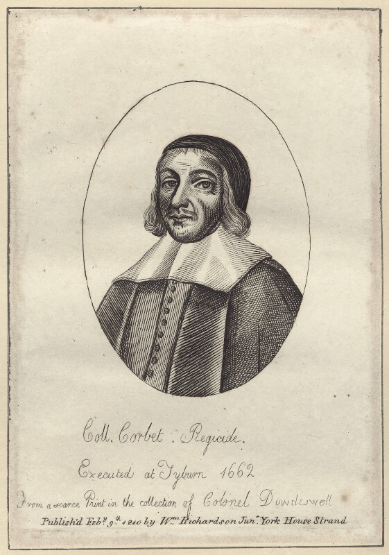
Miles Cobet was the MP for Yarmouth and also a Lawyer.
The print of Corbet shown above has the abbreviation Coll. in front of his last name. This may have been an honorary titles, as he did not serve during any military actions during the Civil War. He was though one of the founders of the Eastern Association, which was a military alliance formed to defend East Anglia on behalf of the Parliamentary forces, and he also served as an army commissioner in Ireland, responsible for overseeing the affairs of the army, and with allocation of land within Ireland to soldiers as reward for their service, and often in lieu of wages.
His role in the trial of Charles I was as part of the High Court of Justice, and as one of those who signed the execution warrant.
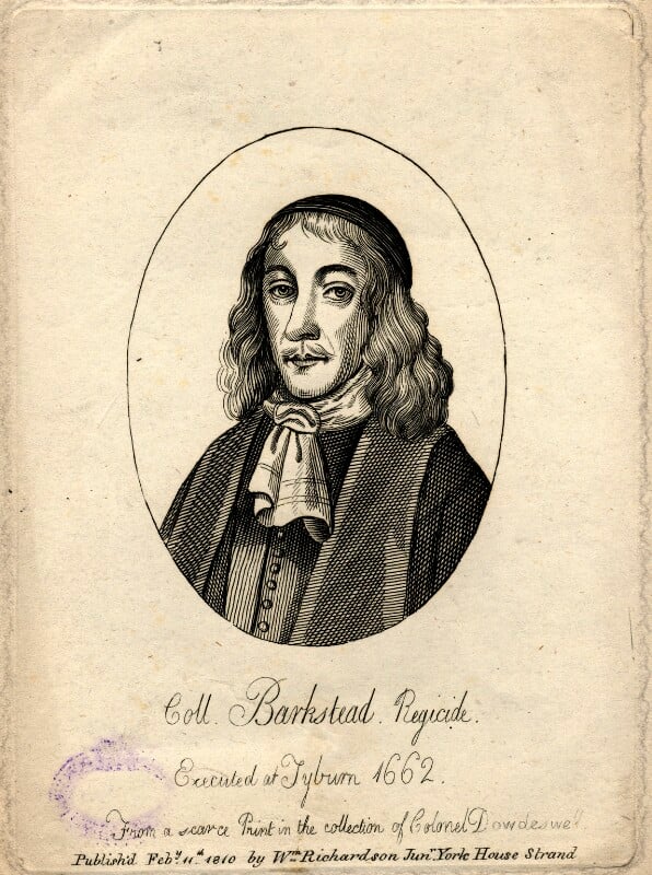
John Barkstead was originally a goldsmith in the Strand, but who joined the Parliamentary forces, becoming a captain of a foot company in the regiment of Colonel Venn. He was Governor of Reading for a short time, commanded a regiment at the siege of Colchester, and was appointed as one of the judges at the trial of Charles I.
He also signed the Warrant for the Execution of Charles I.
He was appointed Lieutenant of the Tower of London, but used this position to further his own wealth by extorting money from prisoners and generally running a cruel regime.
He was rumoured to have hidden a large sum of money in the Tower of London, and in 1662, Samuel Pepys wrote in his diary that he was busy in a discovery for Lord Sandwich and Sir H. Bennett of the cellars of the Tower for this hidden money.
By signing the warrant for the execution of the King, Okey, Corbet and Barkstead had also signed their own death warrants, as this would be their fate – a public traitors death in London.
Escape and Capture
In fear of their lives, with the restoration of the monarchy, Okey, Corbet and Barkstead fled to Europe, with Okey and Barkstead making their way to Hanau in Germany, where they were accepted by the town and given a level of protection. Corbet had made his way to the Netherlands where he was in hiding.
For Barkstead, Hanau seemed a natural, long term home, as the town was well known for the manufacture of jewellery, and Barkstead’s background as a goldsmith in the Strand would come in use.
As Hanau seemed to be a long term home for Okey and Barkstead, they wanted their wives to join them, and a plan was put together for them to meet their wives in the Netherlands, from where they would all travel back to Hanau.
They believed that they would be safe in the Netherlands and had assurances that Downing had not been given any instructions to hunt for them. The Netherlands was also known for tolerance and for putting commerce before any other concern.
They travelled to Delft, and met up with Corbet, who was keen to meet with some friends after his time in hiding.
Downing meanwhile had been putting together plans for how he would find and capture any regicides that were living or passing through the Netherlands. He was worried about the repercussions of capturing any regicides and transporting them back to London without the approval of the Dutch, and he had problems with getting an arrest warrant from the Dutch authorities.
After much persuasion, Downing received a blank arrest warrant, which he would be able to use against any of the regicides that he could discover in the Netherlands, and it would soon be put into use.
Through Downing’s network of spies, he discovered that Okey, Corbet and Barkstead were all in Delft, and just as they were about to split up, Downing and his men pounced on the house, and found the three sitting around a fire, smoking pipes. and they quickly rounded up the three regicides. They had their hands and feet manacled and were thrown in a damp prison cell, whilst Downing finalised their transport back to England.
Whilst they were in captivity, the three were visited by Dutch politicians who assured the three that they would be freed, however Downing used his skills to threaten and bully the Dutch on the possible consequences of such actions, and the Dutch conceded, and let Downing continue to hold the three and arrange their transport.
Another challenge was the Bailiff of Delft who was not cooperative and threatened to derail Downing’s plans. Downing’s response to this was another indication that he would do anything to have his way. He made inquiries about the bailiff and learnt that “he was one who would do nothing without money”, so Downing offered him a bribe – a reward if he would keep the prisoners safe until they were finally in Downing’s hands.
There were other problems. The magistrates of Amsterdam sent a message to the authorities in Delft that they should “let the Gates of the prison be opened and so let them escape “.
The bailiff warned Downing that the “common people might go about to force the prison and let them out”, and the authorities in Delft made efforts to provide counsel for the regicides.
Downing finally received an order from the Dutch authorities addressed to the bailiff in Delft to release the prisoners to Downing. The bailiff was concerned that there would be a rising “if there were but the least notice of an intention to carry them away”.
Downing had already arranged for an English frigate to be available, and with the aid of some sailors from the frigate, and a small boat, he:
“resolved in the dead of the night to get a boate into a litle channell which came neare behinde the prison, and at the very first dawning of the day without so much as giving any notice to the seamen I had pro vided . . . forthwith to slip them downe the backstaires . . . and so accordingly we did, and there was not the least notice in the Towne thereof, and before 5 in the morning the boate was without the Porto of Delft, where I delivered them to Mr. Armerer . . . giving him direction not to put them a shoare in any place, but to go the whole way by water to the Blackamore Frigat at Helverdsluice.”
The Frigate Blackamore carried the three prisoners back to England, where they were imprisoned in the Tower awaiting a trial, which was not really a trial as in the view of Parliament and the Monarchy, they had demonstrated their guilt by fleeing the country. The trial was a formality to confirm they had the right people.
Having been found guilty of treason, on the 19th of April 1662, the three men were transported from the Tower to Tyburn, each tied to a separate sledge as they were drawn through the crowds, with much mocking abuse from Royalists. Barkstead left the Tower first, a place where he had once been the Lieutenant, and raised his hat to his wife who was waving from a window.
On arriving at Tyburn, each man gave a speech to the crowd, and were then put on a cart under the gallows. When they were ready, the cart was pulled away, and they hung for 15 minutes, before being taken down, and were then drawn and quartered, all in front of a large crowd.
Barkstead’s head was placed on a spike overlooking the Tower of London, mocking his former role at the Tower.
Before his death, Okey had sent a message of obedience to the restored monarchy, and as a reward for this, his family were allowed to bury his mutilated body in a vault in Stepney, however a large crowd gathered around Newgate where his body was being held, and fearing that this was a show of support for a traitor, the King swiftly changed his mind, and Okey’s body was hastily buried in the grounds of the Tower of London.
After the Regicides
Downing appears to have shown very little if any remorse or regret for his actions in the capture and execution of his three former colleagues, especially Okey, in whose regiment Downing had once served during the Civil War.
He acquired large estates and properties across the country and in London. He was one of the four Tellers of the Receipts of the Exchequer. He inspired the Navigation Act: “the foundation of our mercantile marine, and consequently of our navy, and consequently of our colonies and spheres of influence. He was also the direct cause of the Appropriation Act, an Act indispensable in every session, for government at home and one which has been appointed by all our self-governing colonies,” and he was instrumental in persuading the Dutch to exchange New Amsterdam, their colony on Long Island, for the British colony of Surinam in South America. New Amsterdam was then renamed as New York.
George Downing owned land near Westminster, and when the leaseholder died in 1682, Downing developed a cul-de-sac of more than twenty plain, brick built, three storey terrace houses, and he petitioned Charles II for permission to name this new street Downing Street.
Royal approval was granted, but he did not live to see the completion of the street as he died in July 1684 when he was 60, two years prior to work was finished.
The general view of Sir George Downing was that whilst clever, quick to action, ambitious and a very hard worker, he was also self serving, would shift his allegiance depending on changes in political and royal power, and as demonstrated with Okey, Corbet and Barkstead, this would also include the betrayal of his former friends and colleagues.
After the restoration, there were many who recognised Downing’s true character. After the capture of the regicides, Samuel Pepys’s wrote in his diary:
“This morning we had news from Mr. Coventry, that Sir G. Downing (like a perfidious rogue, though the action is good and of service to the King, yet he cannot with any good conscience do it) hath taken Okey, Corbet, and Barkestead at Delfe, in Holland, and sent them home in the Blackmore.”
Downing – a name associated with self perseveration to the extent that former colleagues and the cause for which they all worked, were betrayed, and now recorded in the name of the street where the Prime Minister resides.
Sources: I have been reading a number of books about the Civil War recently which I will list in a future post. My main source for the actions of Downing in the Netherlands and the capture of Okey, Corbet and Barkstead is from “Sir George Downing and the Regicides by Ralph C. H. Catterall in The American Historical Review, Vol. 17, No. 2 (Jan., 1912), and published by the Oxford University Press“.
Resources – The World Turned Upside Down
As today’s post is the first of a new month, it is a post where I cover some of the resources available if you are interested in discovering more about the history of London.
As today’s post has been about the fate of three of the regicides involved with the trial and execution of King Charles I, and George Downing, who supported both the Parliamentary cause and then swiftly converted to support the monarchy, today’s resource is a brilliant website full of resources covering everything Civil War, and events in London played a very significant role, not just during the Civil War, but the lead up to, the causes of the war, the Commonwealth and Protectorate, the people, politics and religion, the restoration and later impact.
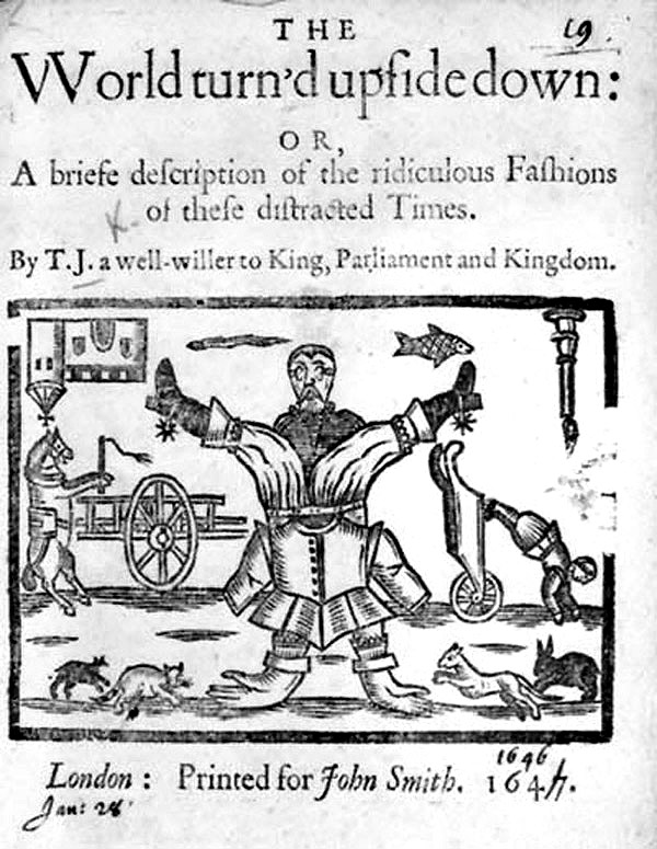
The name of the website comes from the title of an English ballad published in the mid 1640s, when Parliament was implementing policies that tried to ban the more traditional celebrations of Christmas that the more Puritan and to an extent Baptist members of Parliament believed were associated with the Catholic religion, and that Christmas should be a more solemn event, without the drinking, feasting and joyous elements of the traditional Christmas:
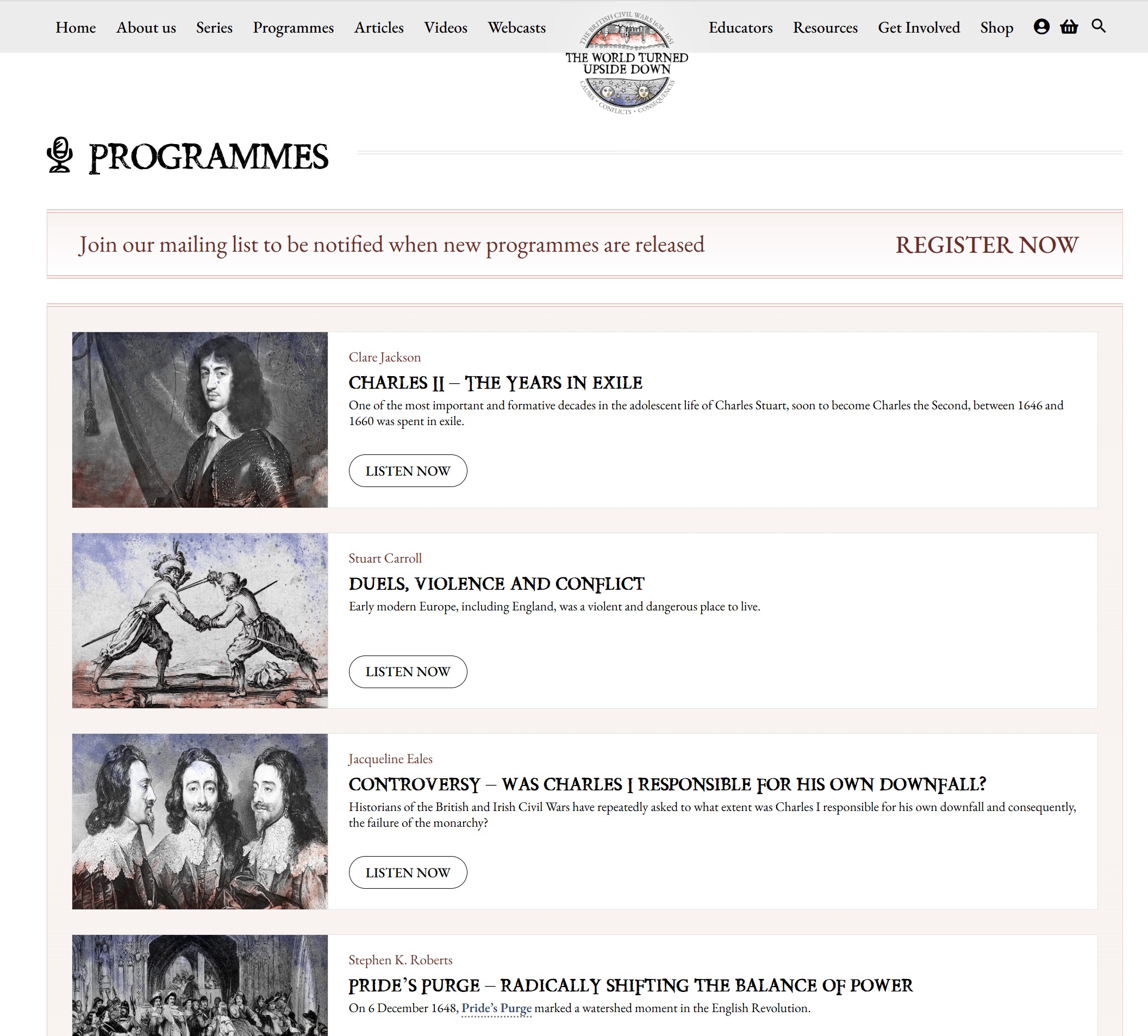
The standout feature of the website are the podcasts. There are currently 112 on the site with more being gradually added (you can sign up for alerts). Each podcast explores a different aspect of the Civil War and is by an expert in the subject.
For each podcast there is also a transcript, glossary, timeline, maps and further reading.
The first four podcasts in the list are shown in the screenshot below:
There is so much in the news about the destructive elements of social media, AI and the Internet, but the World Turned Upside Down is one of those sites that restores your faith in what the Internet can deliver when a community of real experts put together such a resource – which is freely available.
Even if you have only a passing interest in the mid 17th century and the Civil War, the site and podcasts are well worth a visit, and again, the link to click for the site is: The World Turned Upside Down
Following last week’s post on London Fields, for this week’s post I am again in search of another of my father’s 1980s photos, also in Hackney, but this one, judging by other photos on the same strip of negatives, seems to be from 1986.
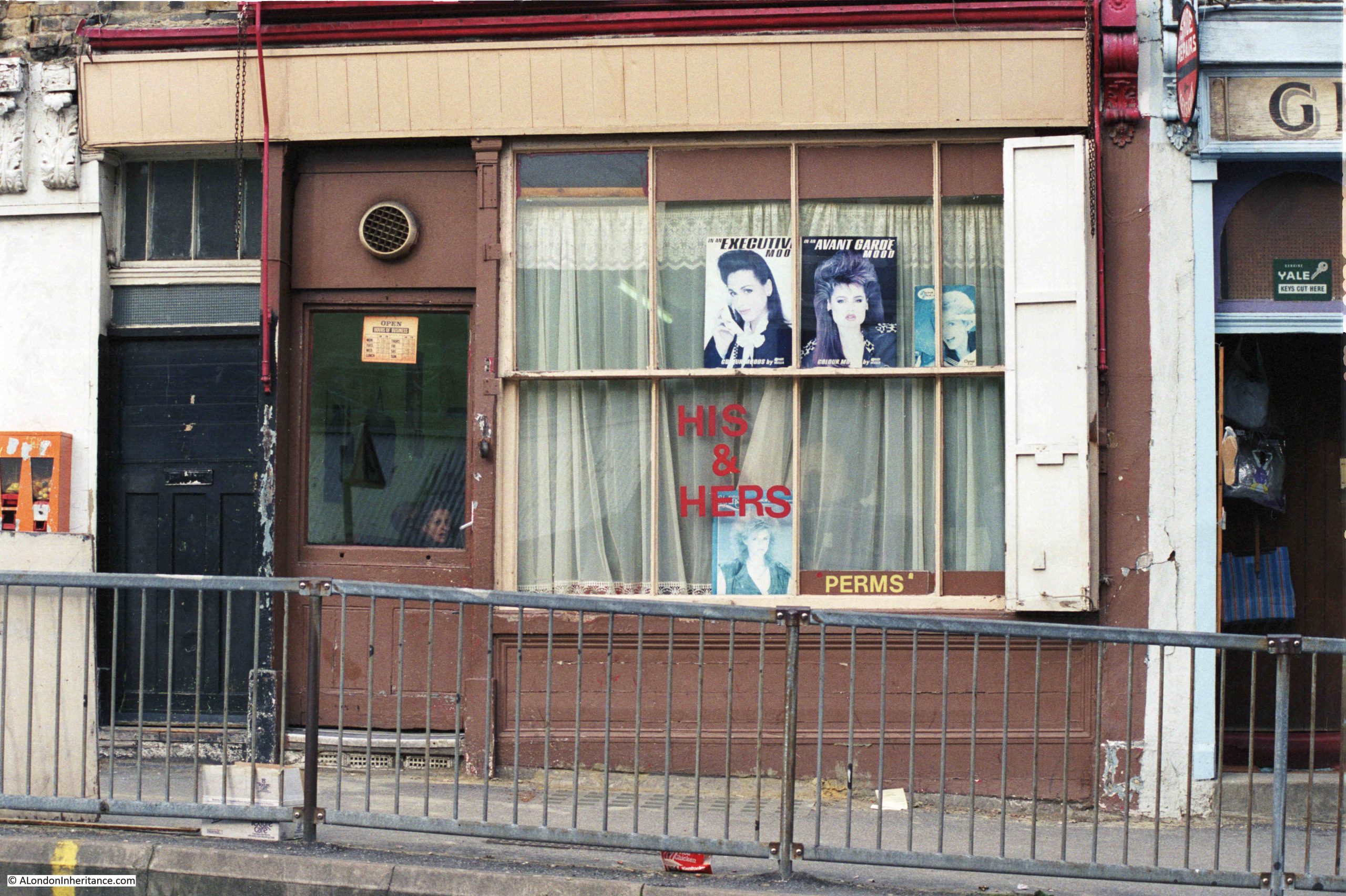
This is His & Hers Hairdressers at the Kingsland Road end of Middleton Road:
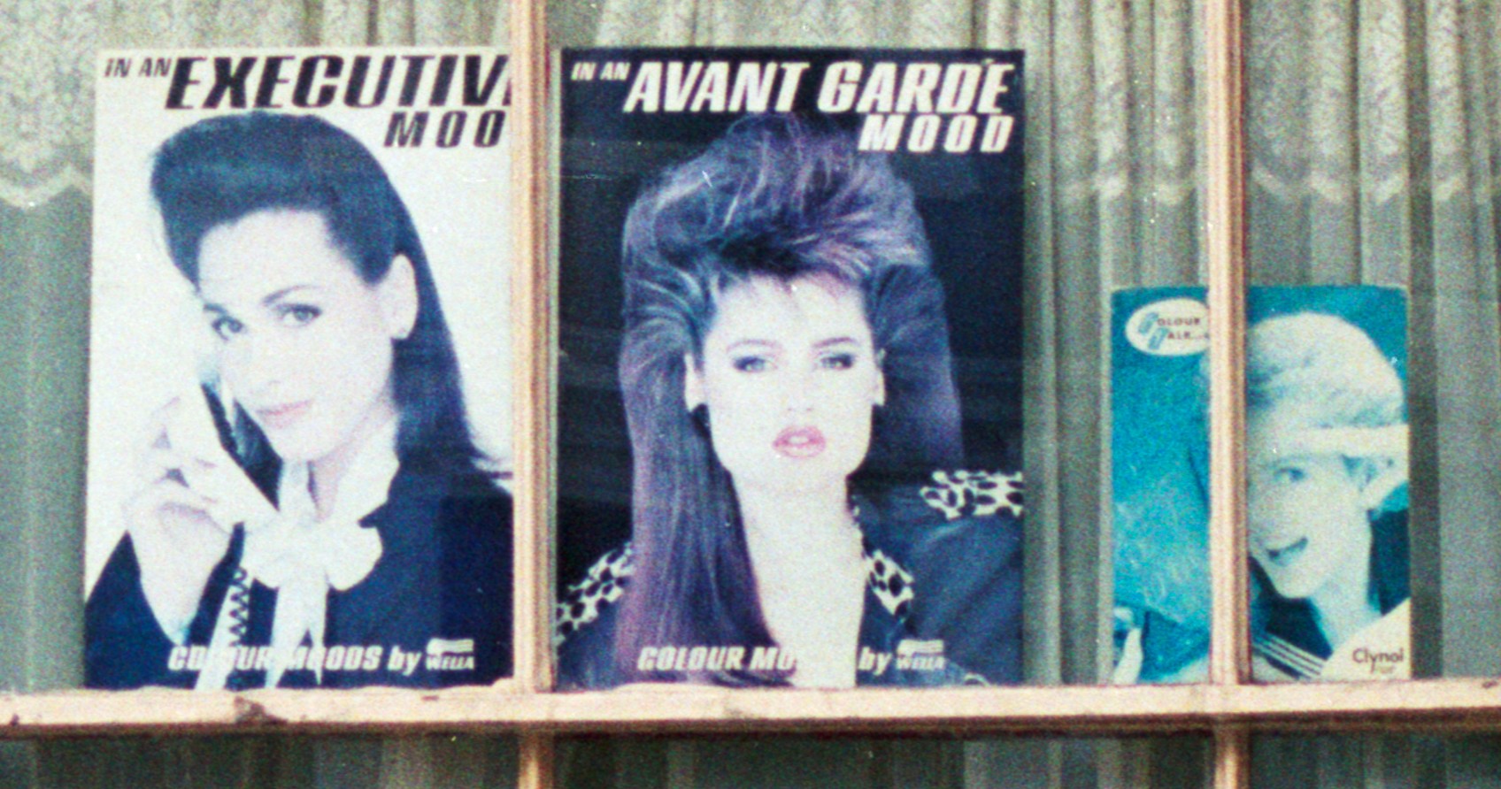
The photo is typical of the many small businesses that occupied run down Victorian shops in the 1980s, and for a hairdressers of that decade, the shop has the obligatory display of hair style photos.
This is the same shop, forty years later in 2026:
With photos of hairdressers, you can normally tell the decade of when the photo was taken by the photos in the windows, and His & Hers had photos of 1980s big hair:
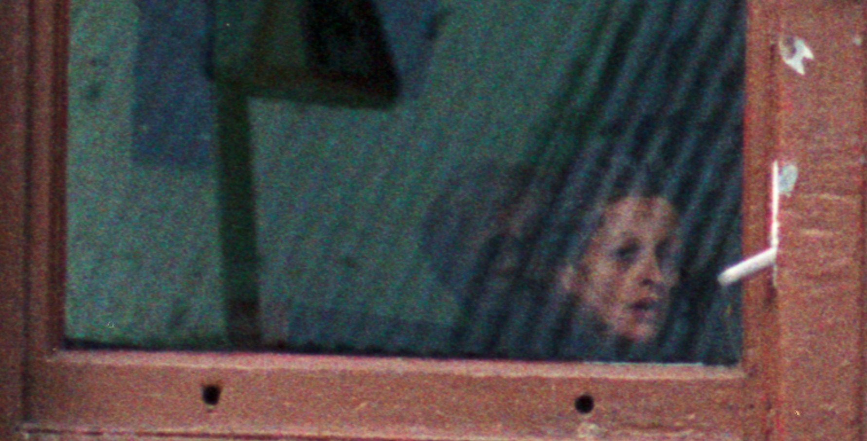
Small details in the photo, such as the person inside, probably wondering why my father is taking a photo:
On the wall to the left of the shop, something that was once a common sight:
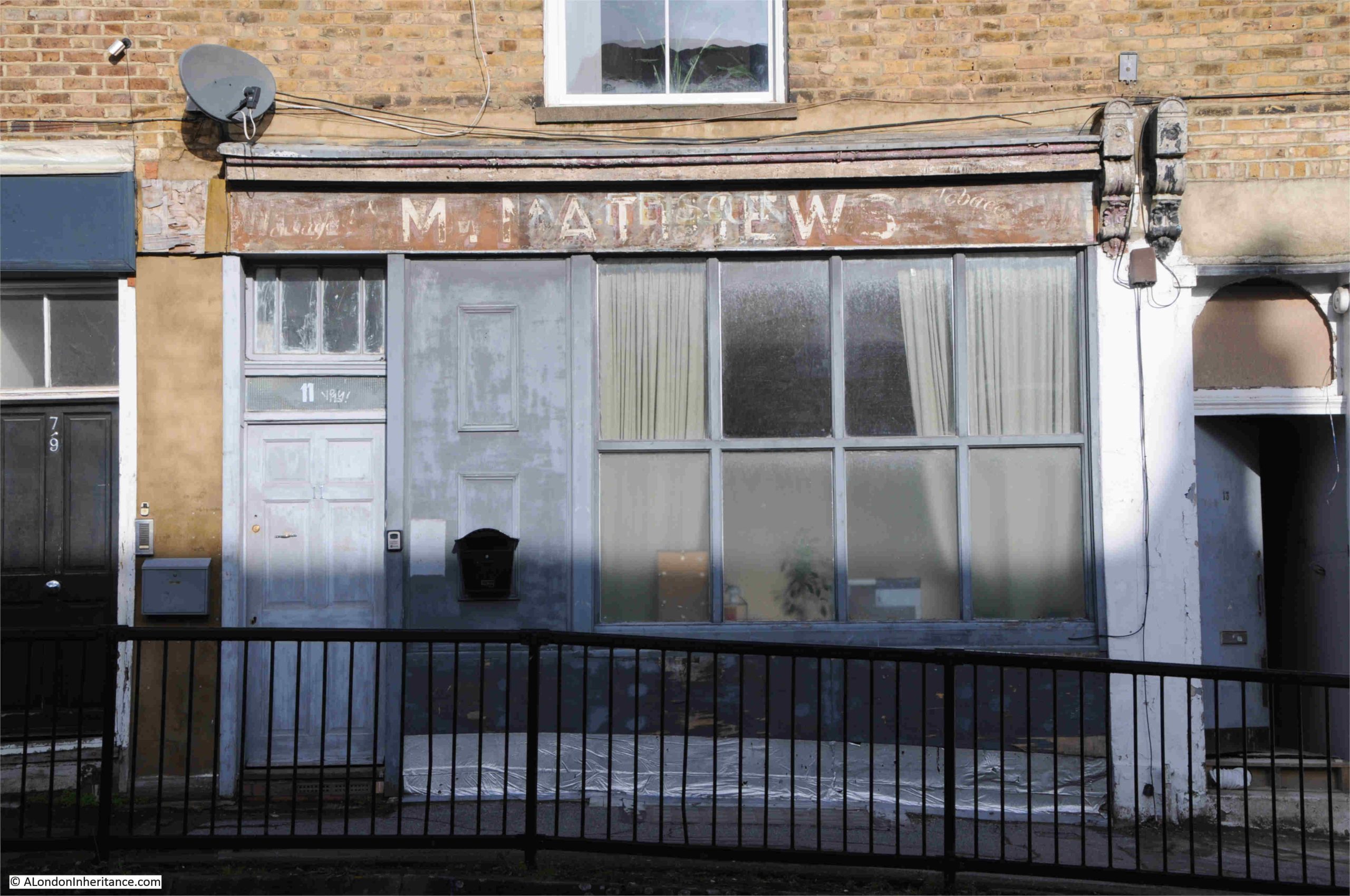
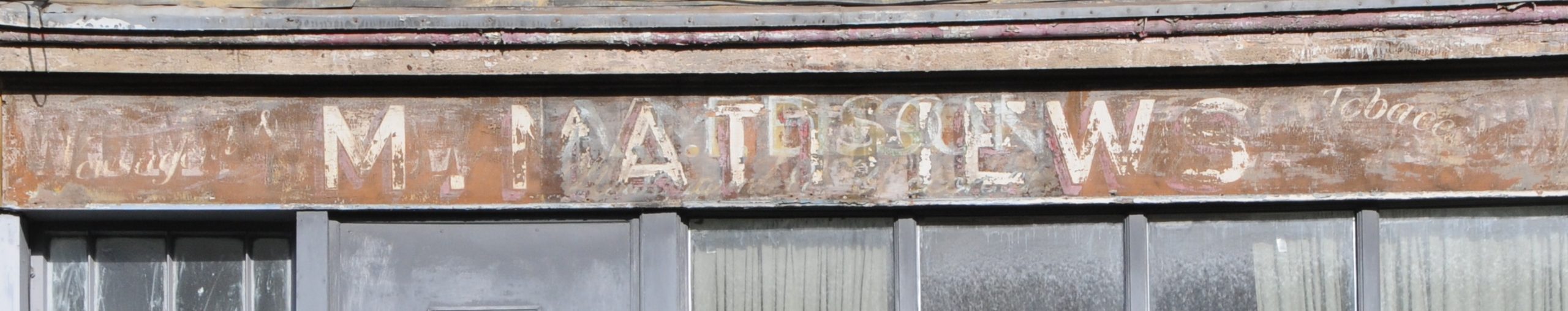
And there are details in the 2026 photo, where an earlier shop sign has been exposed:
If you go back to the 1986 photo, there is wooden boarding across the location of the above sign, so I suspect this was covered up in 1986 and dates from an earlier business.
M. Matthews is the central name. There does appear to be a shadow name, but this also looks like M. Matthews, so perhaps an earlier version of the same name. To the right is the word Tobacco, and a bit hard to make out, but to the left the letters do seem to form Newsagent.
I cannot find a reference to an M. Matthews, but the ground floor of the building has always been a shop, and searching through Post Office directories, I found that in 1899 the shop was a Confectioner, run by Miss Elizabeth Winstone, and in 1910 it was still a confectioner, but now run by Mrs Matilda Watkins.
A jump from being a Confectioner, to a Newsagent and Tobacconist, but who also probably continued to sell confectionary does seem like a natural evolution of the shop.
I have no idea when the shop changed to a hairdressers, or when His & Hers closed. In the 1986, the ground floor occupied by the hairdresser does seem to have undergone some structural alteration, as above the windows and doors, there is the full width of the panel over the name sign, and this can also be seen in my 2026 photo, where the name sign extends over the windows and two doors.
The ornate carvings typical of the sign endings on Victorian shops can also be seen in the 1986 photo, although the one of the left had been removed by 2026.
This is probably the result of the building being converted from a shop occupying the full width of the ground floor, to a building where the first and second floors became separate residential accommodation, hence the door on the left, and the door to the shop being the one on the right.
Today, the old shop on the ground floor also appears to be residential.
The shop was built in the mid 19th century as the fields and nurseries of Hackney were covered in new homes.
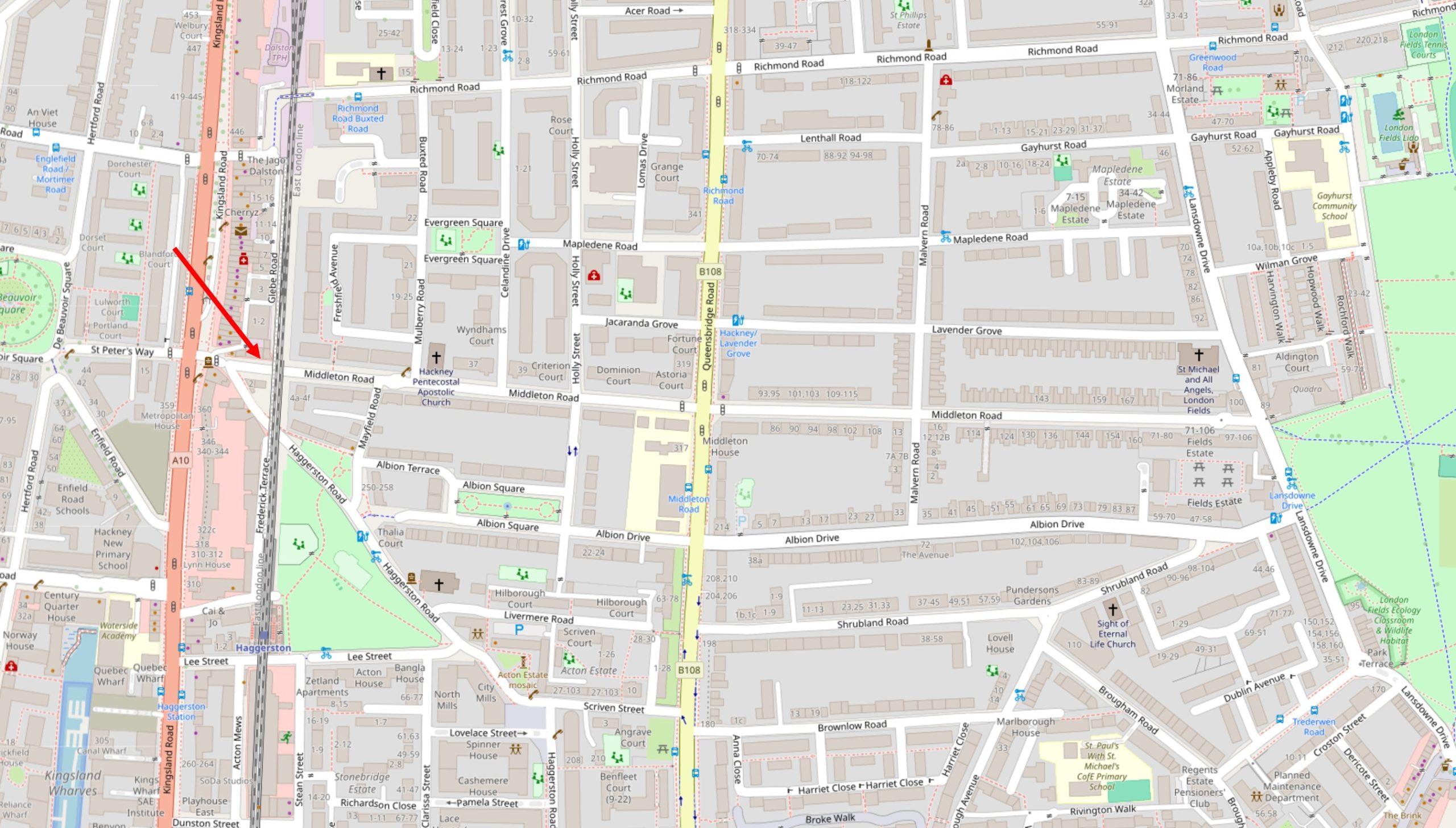
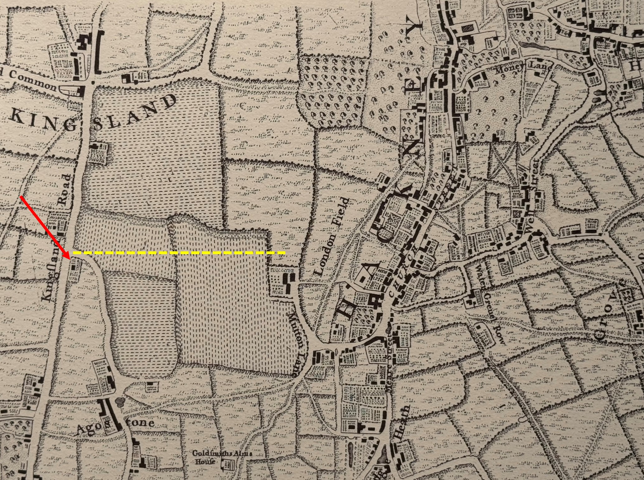
In the following map, I have marked the location of the shop with the red arrow on the left. The darker road running vertically just to the left is Kingsland Road, and to the right of the map is the edge of London Fields. Middleton Road is the street with the Hairdressers, and which runs from Kingsland Road to London Fields.
Nearly all of the straight streets in the map are Victorian housing, serving the growing numbers of middle class workers of London with aspirational new homes.
The shop was part of a street design where small businesses were distributed across new residential developments, so that people who moved out to these new homes would have access to the necessities of life within local walking distance, and this included pubs.
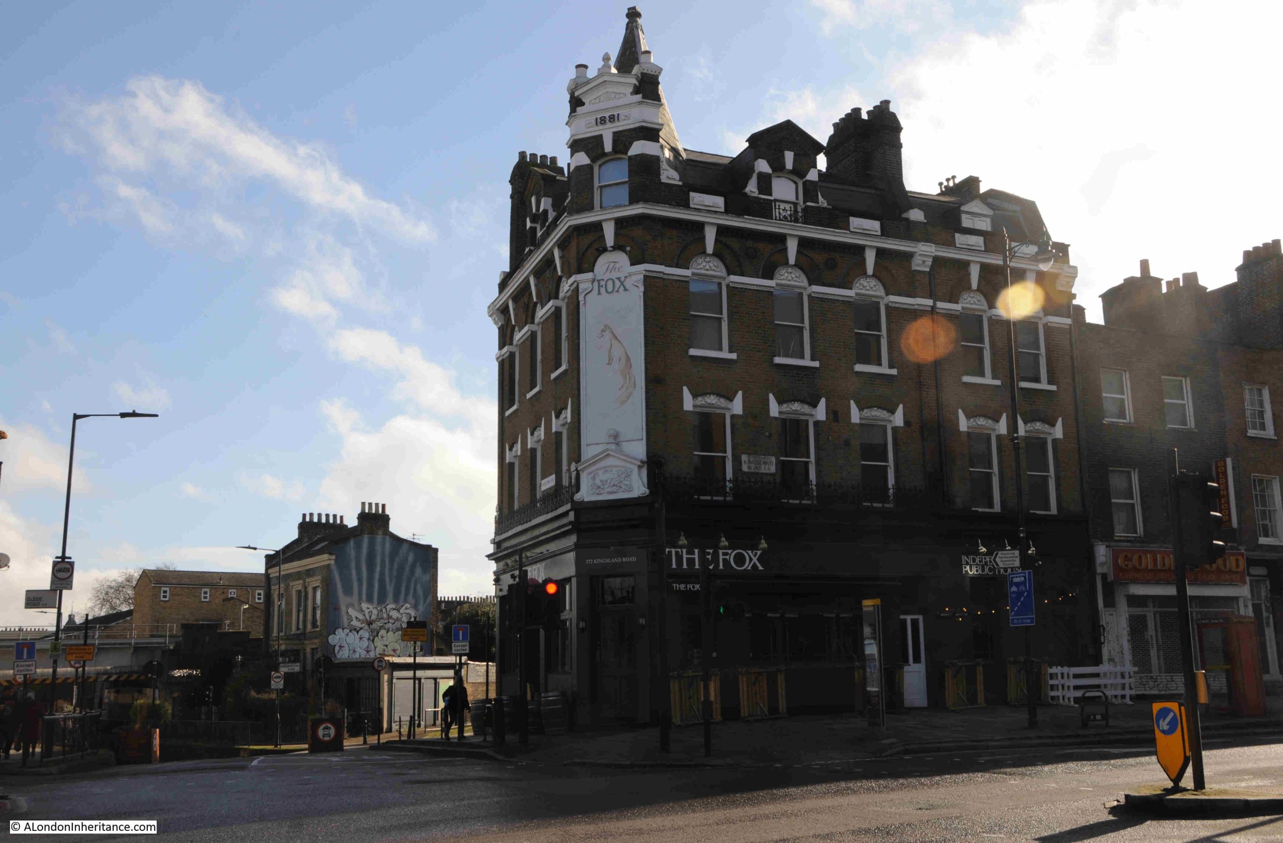
On the corner of Middleton Road and Kingsland Road is the Fox – a rare example of a London pub that closed in around 2018, but has recently reopened (I believe with the upper floors converted to residential):
At the very top of the corner of the building is the date 1881, and this is from when the current building dates, although there has been a pub on the site for a number of centuries.
The earliest written refence I can find to the Fox is from 1809, when on the 21st of July, there was an advert in the Morning Advertiser for the auction of five, neat, brick built dwelling houses between Kingsland Green and Newington Green. Details about the properties to be auctioned could be had from Mr. Taylor at the Fox, Kingsland Road.
When the 1809 advert appeared, much of the area surrounding the Fox was still farm land and nurseries, but the pub was here because Kingsland Road was an important road to the north from the City and would have been busy, with many of those using the road in need of refreshment.
Search the Internet for stories about the Fox, and a story about the pub being used to stash part of a £6 Million Security Express robbery in 1983, by Clifford Saxe, one of the robbers and landlord of the Fox is one of the common stories from recent years.
I cannot find a firm reference from the time that it was the Fox, an account of the robbery from the Sunday Mirror on the 1st of July 1984 on wanted criminals who were living in Spain referenced that “It claimed Saxe, 57, formerly landlord of an east London pub was the brains of the gang”. Presumably that east London pub was the Fox, but again I cannot find a direct reference from the time.
In the following extract from Rocque’s 1746 map, I have marked the location of the Fox with a red arrow. The yellow dotted line shows the route of the future Middleton Road, running from Kingsland Road to the edge of London Fields, over what was nursery land, and by 1823 would be known as Grange’s Nursery:
The 1881 rebuild of the pub must have been to transform the premises that had once been surrounded by fields, to an establishment suitable for the large population who occupied the terrace streets by then covering the fields.
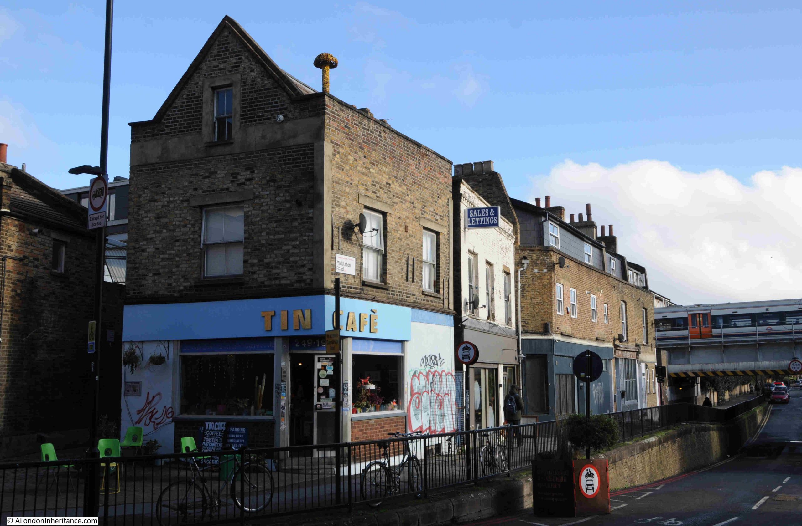
The population growth of Hackney mirrors this housing development. In 1801 the population was 12,730, and a century later in 1901, Hackney’s population had grown to 219,110, and this new population needed local shops, and the confectioners / newsagents and tobacconists / hairdresser shop was part of a terrace of shops at the end of Middleton Road, with the following photo being today’s view of this terrace:
In 1899, this terrace consisted of (number 11 in bold is the shop that is the subject of today’s post):
Number 1: John Biddle – Fishmonger
Number 3: Mrs Stark – Baby Linen
Number 5: John Edward Stark – Tobacconist
Number 7&9; Benjamin Wilkinson – Chemist
Number 11; Miss Elizabeth Winstone – Confectioner
Number 13: Robinson Locklison – Laundry
By 1910, the terrace consisted of:
Number 1: Walter Hart – Fried Fish Shop
Number 3: James Arthur Mullett – Grocer
Number 5: William Leigh – Hairdresser
Number 7&9: Benjamin Wilkinson – Chemist
Number 11: Mrs Matilda Watkins – Confectioner
Number 13: John Hart – Bootmaker
The above two lists shows that in the eleven years between the two, there was a high turnover in owners and types of shop. Number 1 had changed from a Fishmonger to a Fried Fish Shop, illustrating the rapid expansion of this type of take away food across London, from what is believed to be the first such shop in east London in 1860.
Number 1 is still supplying food, as today it is the Tin Café.
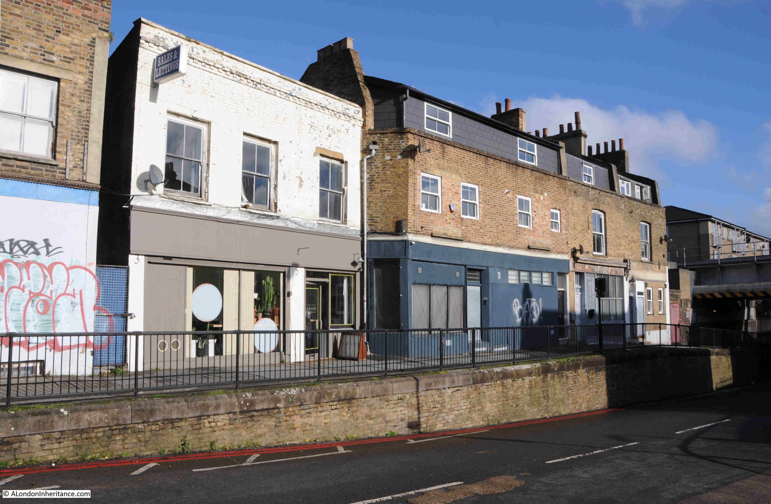
The only business that is the same is the Chemist of Benjamin Wilkinson. At number 13 in 1910 was John Hart, a Bootmaker. In 1986 it was a shoe repair shop, just visible to the right of the photo at the start of the post, so in the same type of business.
Another view of the terrace, number 3 to 13:
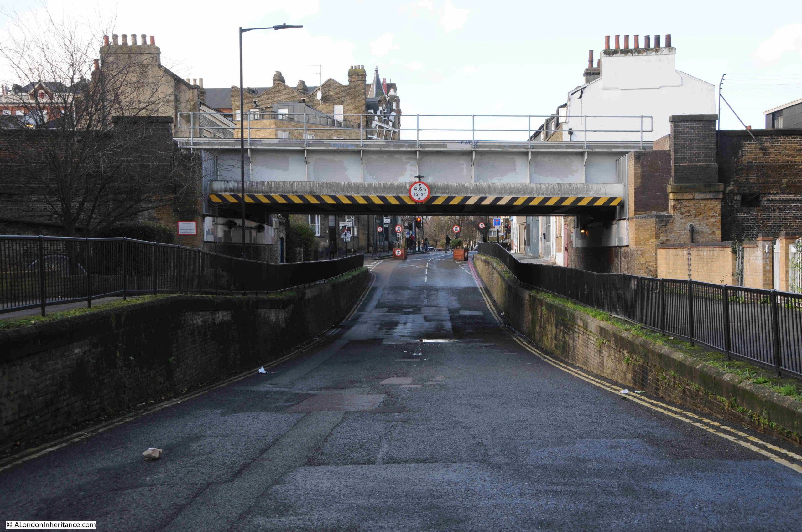
Just visible to the right of the above photo, and in an earlier photo with a train, is a bridge, which adds an unusual feature to this end of Middleton Road.
Walking along Middleton Road, under the bridge and looking back, this is the view:
The bridge carries what is now the Windrush Line over Middleton Road, and the reason for the large dip in the road is because the railway is carried on a viaduct, which runs parallel to Kingsland Road, and needs to run as a level structure, so where the railway carried by the viaduct runs across a road, the runs needs to be lowered to pass under the viaduct.
This railway was built as part of the North London extension of the London and North Western Railway, and the following extract from Railway News on the 3rd of December 1864, when the viaduct was nearing completion, explains the benefits and route of this railway:
“The London and North Western reaches the City by means of the North London extension, but the undertaking may be considered as that of the North Western.
The City extension runs from Kingsland to Liverpool Street, Bishopsgate, and is now rapidly approaching completion. The advantages of this line are very considerable.
The station is within a short distance of the Royal Exchange, the Bank of England and many offices in which the chief monetary transactions of the City are conducted. Five or seven minutes walk will bring you to Threadneedle-street, Moorgate-street, or Gracechurch-street, and all the other busy thoroughfares, lanes and courts hard by – no small consideration to the thousands of railway travellers who come from the North daily within that important radius who are anxious to economise time.
Further, this line shortens the distance between all the stations on the North London line, from Camden to Kingsland and the City by no less than five miles. At present time the North London, on leaving Kingsland, goes by Hackney, Bow, and Stepney, describing nearly three-quarters of a circle before it reaches Fenchurch Street. This detour, with its super abundant traffic and crowded junctions, with therefore be avoided by all coming west of Kingsland to the City.
The extension is about 2.5 miles in length, and proceeds almost in a direct line from its junction with the North London proper to Bishopsgate, With the exception of a cutting near the starting point it passes all the way on a brick arch viaduct which has all but been finished. Running parallel with the Kingsland-road.”
The line would go on to terminate at Broad Street Station, next to Liverpool Street.
This railway helped with the construction of the houses across the fields of Hackney, as for workers to move to Hackney, they needed an easy form of transport to their place of work, and the new railway extension was ideal. For the residents of Middleton Road, Haggerston Station was a short walk south along Kingsland Road. The station opened on the 2nd of September 1867.
Bells Weekly Messenger on the 9th of September 1867 described the new station: “NEW STATION, NORTH LONDON RAILWAY – A large and commodious new station was opened on Monday on the North London Railway, in Lee-street, Kingsland Road. The new Haggerston Station commands the neighbourhood, and also the Downham-road and De Beauvoir Town, which places are situated too far from the Dalston Junction to profit by the latter.”
The line closed in 1986 (Haggerston Station had closed in 1940 due to a number of factors including wartime economy measures and bomb damage to the station).
The station and railway along the viaduct reopened in 2010 as part of London Overground, and in 2024 the railway was renamed as the Windrush Line.
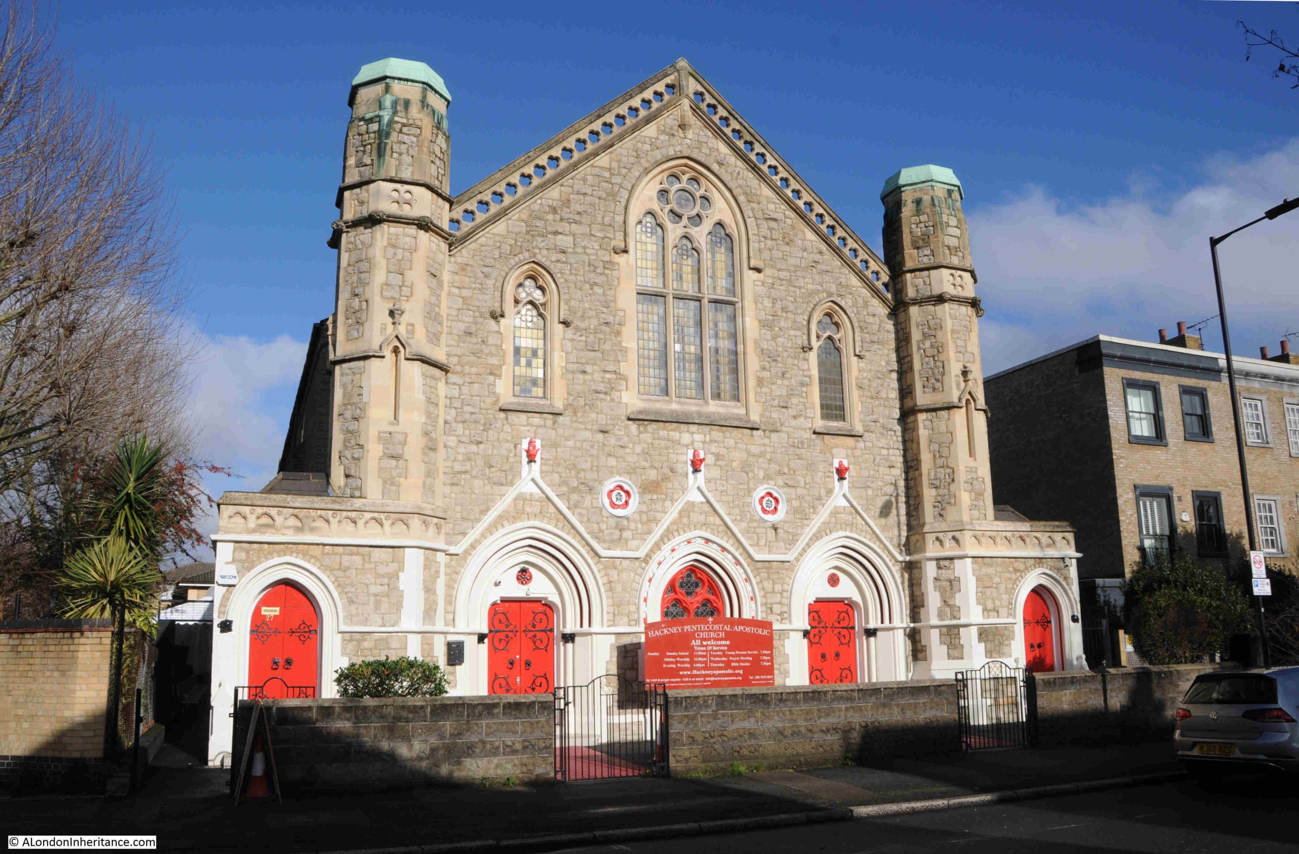
So this small part of London had shops, a pub and a station connected to the City. The other important attribute of a Victorian city was a church, and In Middleton Road is the 1847 Middleton Road Congregational Church, now the Hackney Pentecostal Apostolic Church:
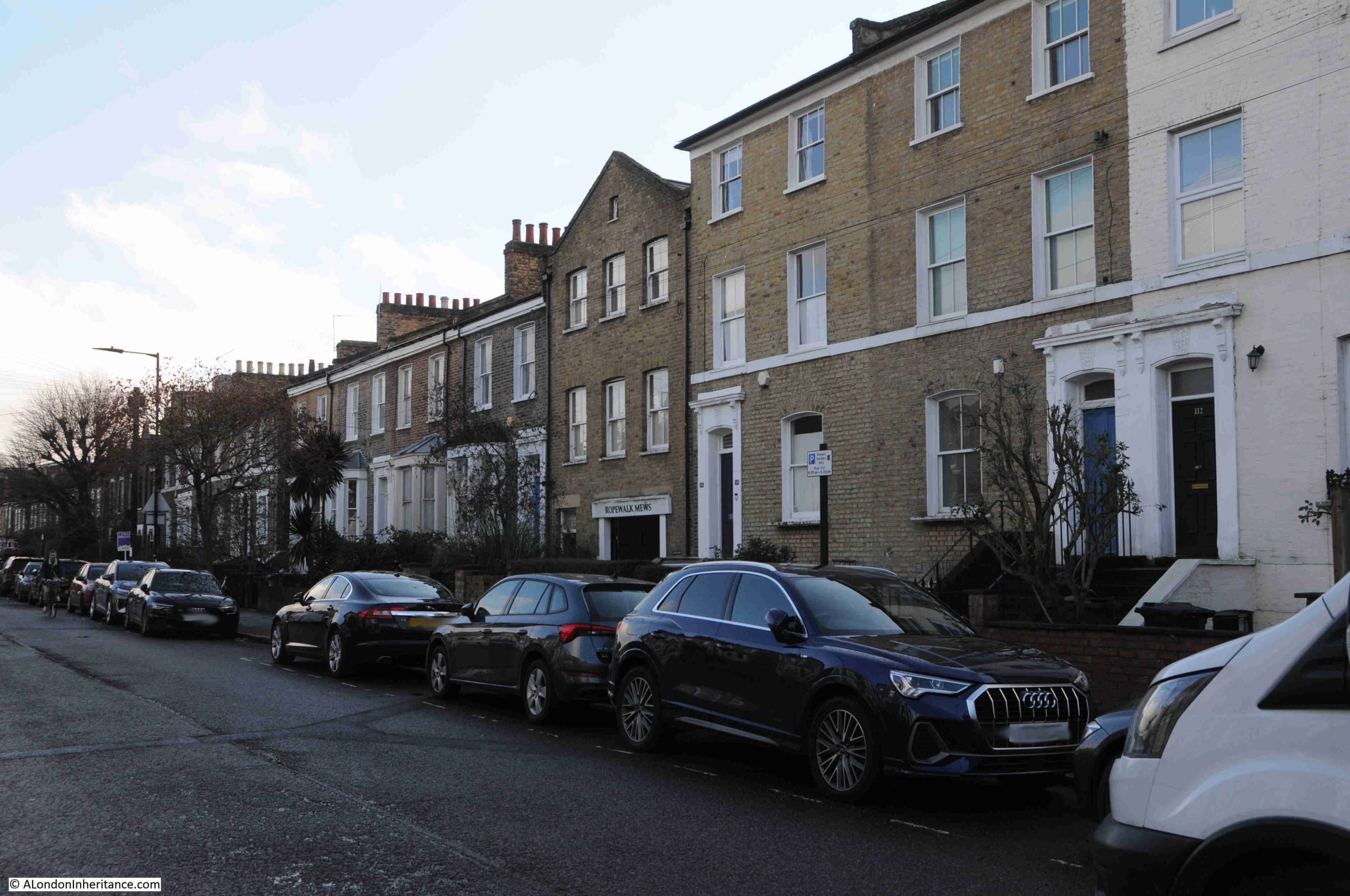
Middleton Road is mainly comprised of terrace houses, but there are some interesting exceptions, such as the building in the middle of the following photo:
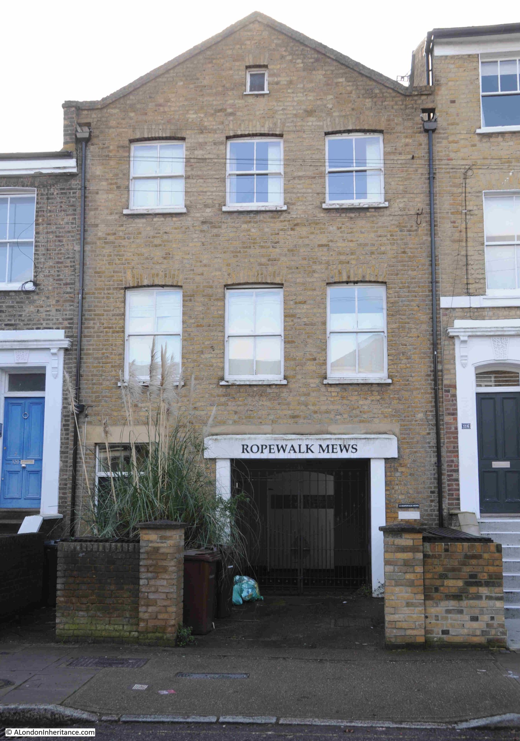
Which has an entry to the rear of the building named Ropewalk Mews:
I cannot find the reason for this name, and why the building is very different to the terrace houses that occupy the street.
A ropewalk was / is a long length of land or covered space, where the individual strands of a rope could be laid out and then twisted to form a continuous length of rope.
London had plenty of ropewalks, but these were usually close to the Thames, as the main customer for the ropes produced would have been the thousands of ships that were once to be found on the river.
Rocque’s map of 1747 does not show a ropewalk, although the map does identify ropewalks in other parts of London. In 18th and early 19th century maps of the area, the land is shown as agricultural and a nursery, no mention of a ropewalk.
It may have been that there was a small ropewalk here to produce rope to be used in the bundling of produce from the nursery, but I cannot find any confirmation of this.
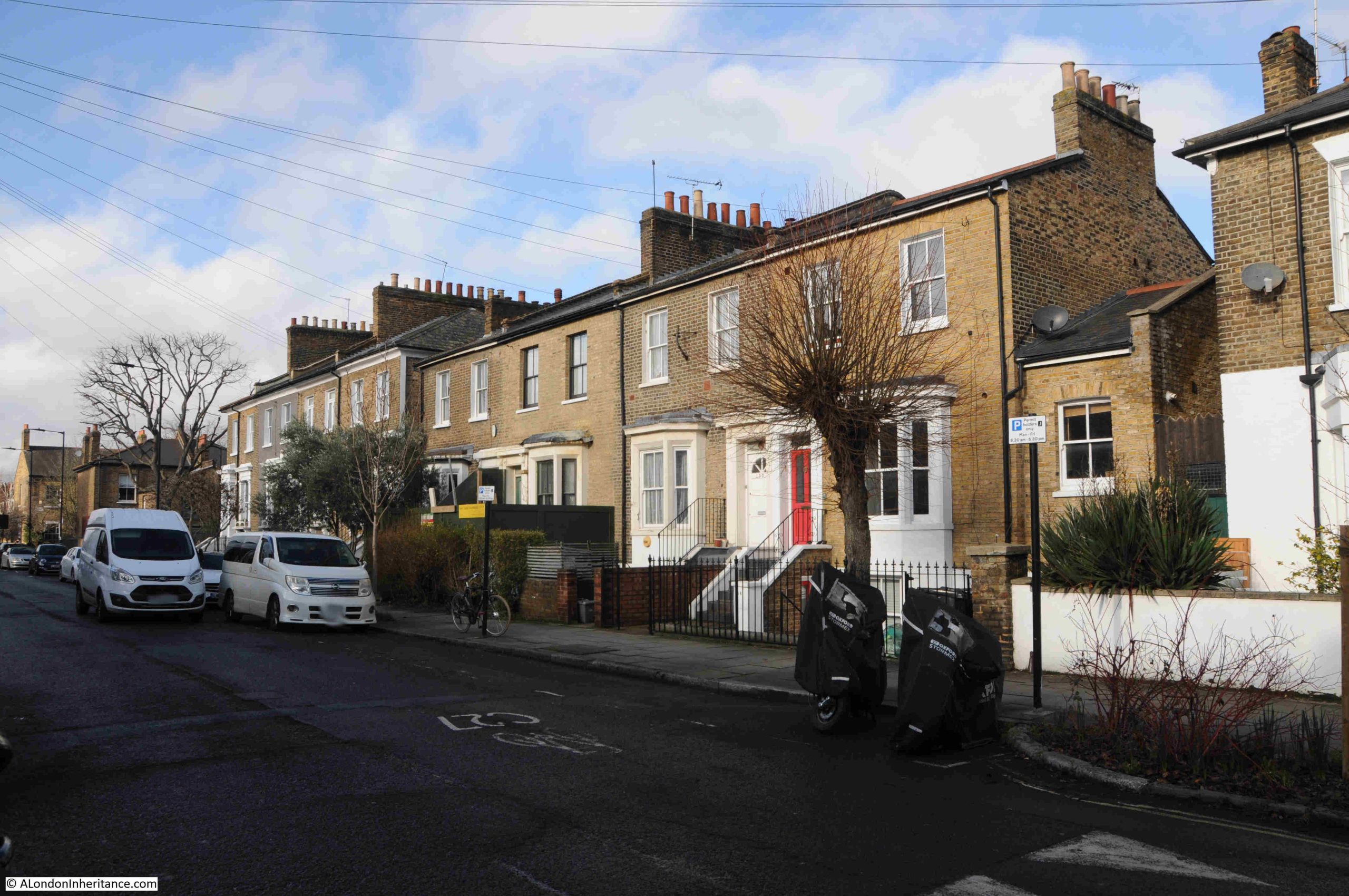
One of the architectural developments that was seen in Victorian houses of the mid 19th century was the bay window, which was a way of breaking up a terrace, and a change from the Georgian emphasis on an unbroken terrace of flat, uniform walls facing onto the street. We can see this development in the terrace houses of Middleton Street:
Another change was the semi-basement, where the ground floor is slightly raised, and reached from the streets by steps, allowing the upper part of the basement to just poke above ground level, with a space between basement window and the retaining wall to the street. This development allowed natural light into the basement, and again we can see this in the above terrace.
The 1881 census provides a view of the employment of those who moved into Middleton Road. There were a very wide range of jobs, including: Bank Clerks, Decorators, Commercial Travellers, Commercial Clerks, Boot Makers, Locksmiths, Plumbers, Stock Brokers Clerks, Stationers Assistant, Printers, Teachers, Newspaper Advertising Agents, Drapers, Draughtsmen, Watchmakers, etc. All the vast range of trades and employment types to be found in the rapidly expanding Victorian London of the late 19th century.
Where a job was listed such as a Bootmaker, these were frequently not an individual worker, rather an employer, for example at number 33 Middleton Road was George Clarke, a Bootmaker who was listed as employing 25 men and two boys.
Some of the residents had private means, for example at Oxford Cottage in Middleton Road was Fanny Smyth, listed as a widow, with her occupation as “income from interest of money”. What is fascinating about the 19th century census is how frequently people would marry later in life, and in Fanny Smyth’s household were three children, two daughters aged 31 and 21 and a son of 28, all listed as single.
Many of the houses in Middleton Road also had a Domestic Servant, again confirming that these new streets were occupied by the new middle class.
Whilst in 1881, the majority of people who lived in Middleton Road were listed a being born in Middlesex, (the historic county that from 1965 is now mainly part of Greater London), there were a very significant number of people from the rest of the country, and a small percentage from Ireland. Throughout much of the 19th century, London was expanding both in terms of employment and residents, by attracting people from the rest of the country.
More of the homes in Middleton Street in which the Bank Clerks, Decorators, Commercial Travellers etc. of 1881 would live:
Middleton Road is a perfect example of the mid 19th expansion of London, as the fields of Hackney were taken over by the houses of the growing middle class.
The shops and pub at the Kingsland Road end of the street are a perfect example of how local shops were planned as part of this expansion, and for decades served the needs of the local community.
One can imagine the early morning being busy with the working residents heading to the train station to travel into the City for their work, and in the evening, a busy pub, with the option of a stop off for fish and chips after the pub, then heading back to your terrace home in Middleton Road.
When writing these posts, I often have music on in the background, and for this post it was YouTube, as it has a random playlist based on what I have listened to before, and a track I have not heard for many years came up, the 1982 Lucifer’s Friend by the Rotherham / Sheffield band Vision.
The His & Hers Hairdressers was photographed in 1986, and the track by Vision is a perfect example of brilliant 1980s music, including the type of hair styles that you may have been able to get in His & Hers:
David Bowie Centre and V&A East Storehouse
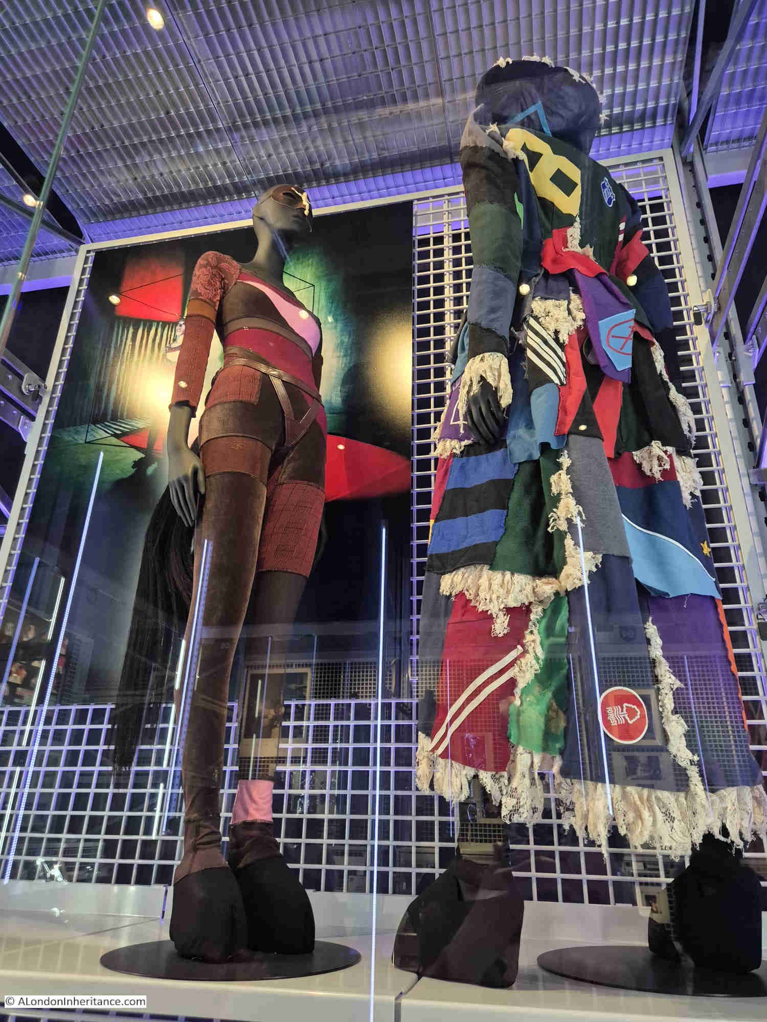
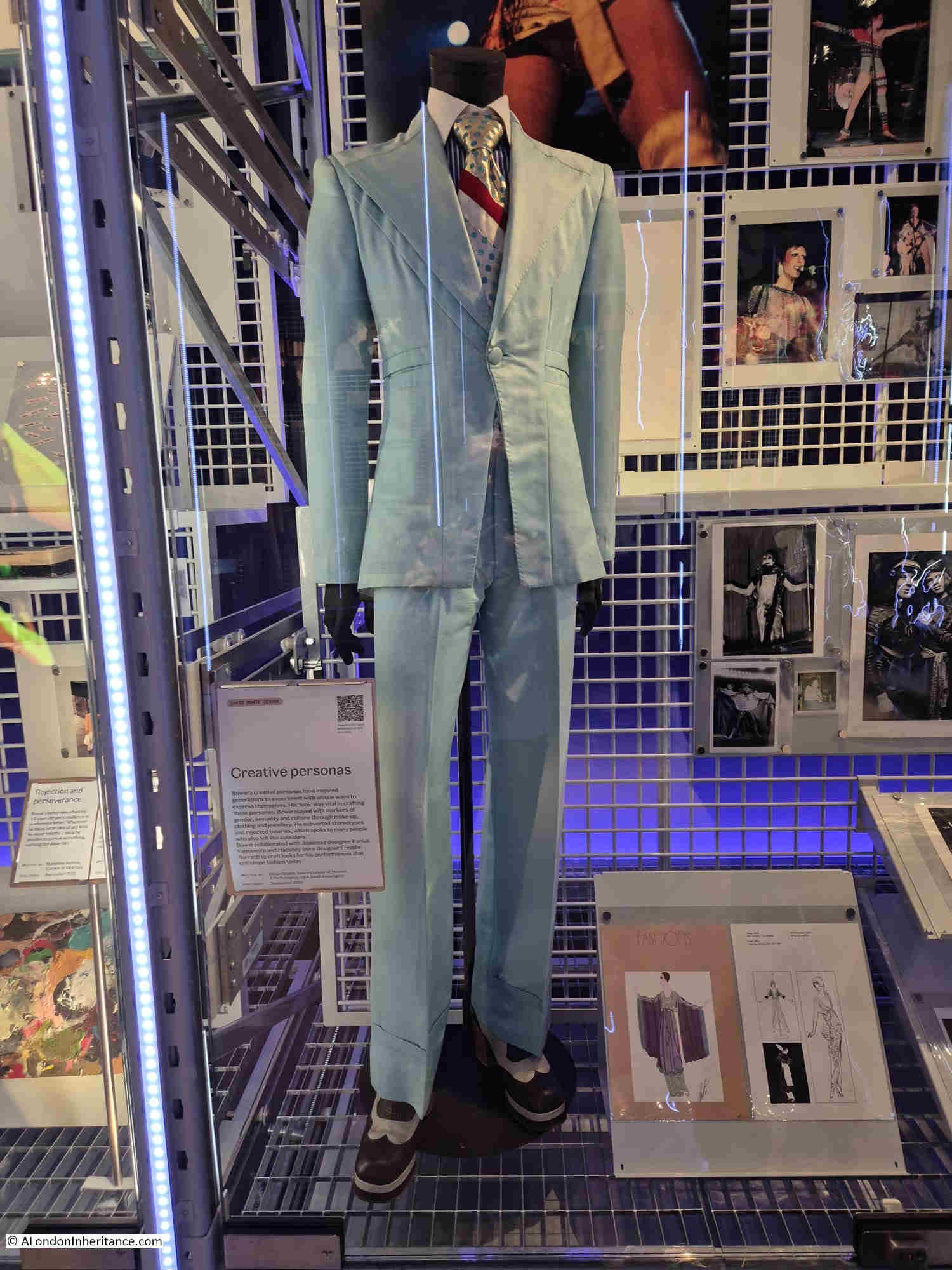
Last week, we went to have a look at the small David Bowie exhibition, which forms part of the David Bowie archive held by the V&A. It is located at the new V&A East Storehouse at the Queen Elizabeth Olympic Park:
It is a small, but interesting exhibition of some of the costumes worn by Bowie, photos, song lyrics, ideas for films, plays etc.
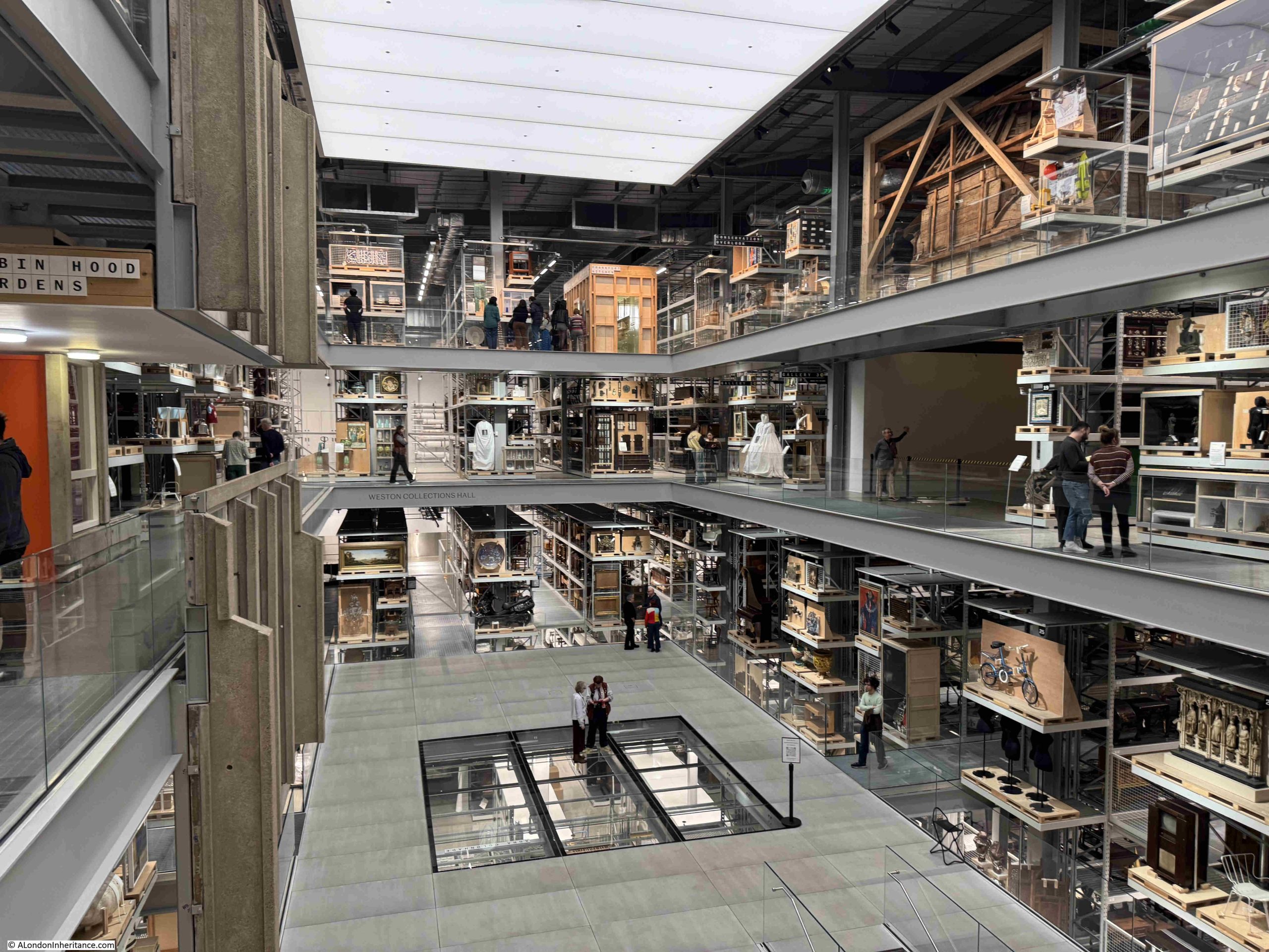
The Bowie exhibition and archive is a small part of the Storehouse, which is home to a vast collection of items not on display in the main museums.
You are free to wander around the walkways on several levels between racks of items collected over very many years:
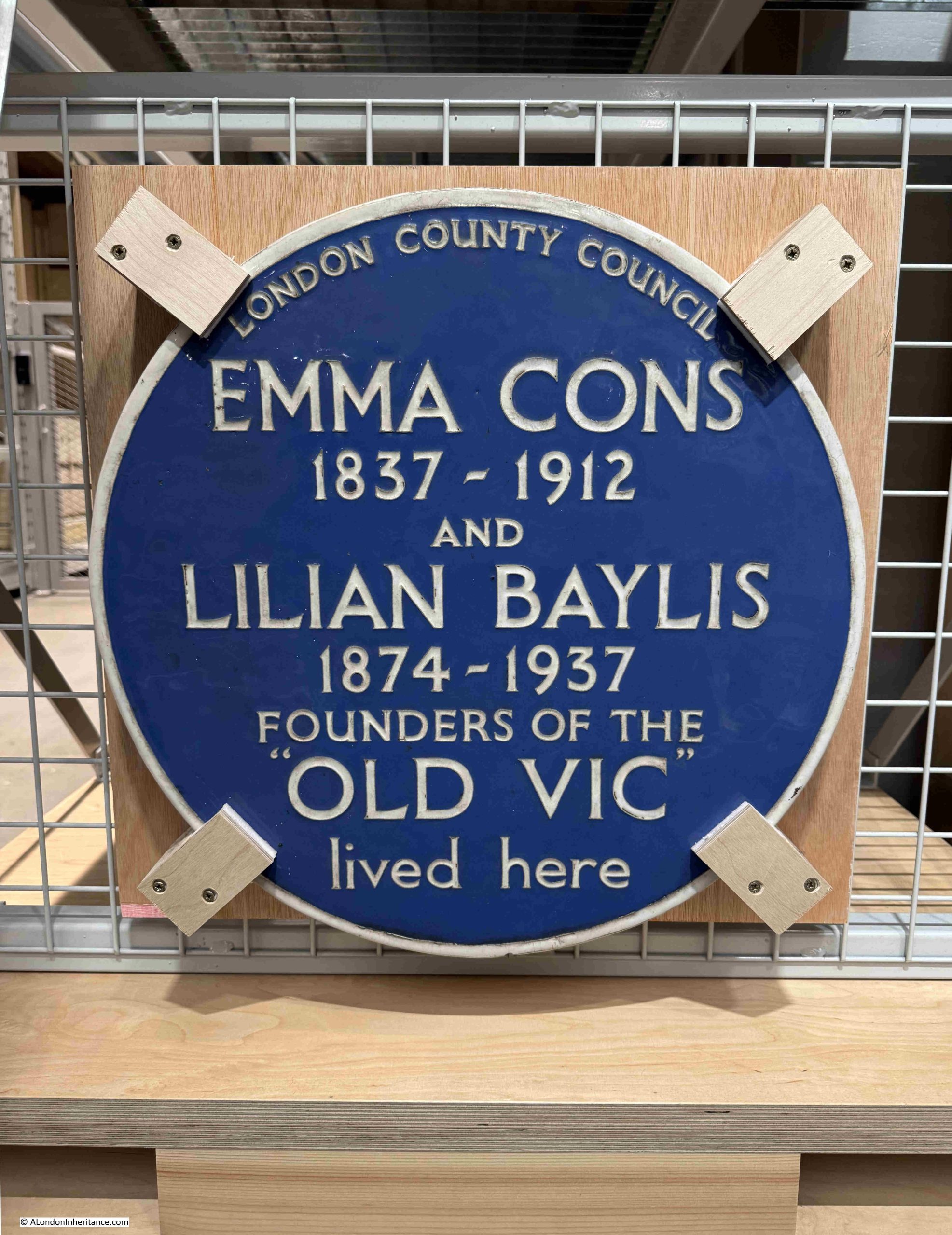
There were a number of London related items on display, for example a London County Council plaque recording that Emma Cons and Lilian Baylis lived here:
The plaque dates from 1952 and was installed on the house at 6 Morton Place, Stockwell. The house was demolished in 1971 and the plaque was saved with the intention that it would go on display in the V&A Covent Garden Theatre Museum. The Theatre Museum closed in 2007, and the plaque is now on display the V&A East Storehouse.
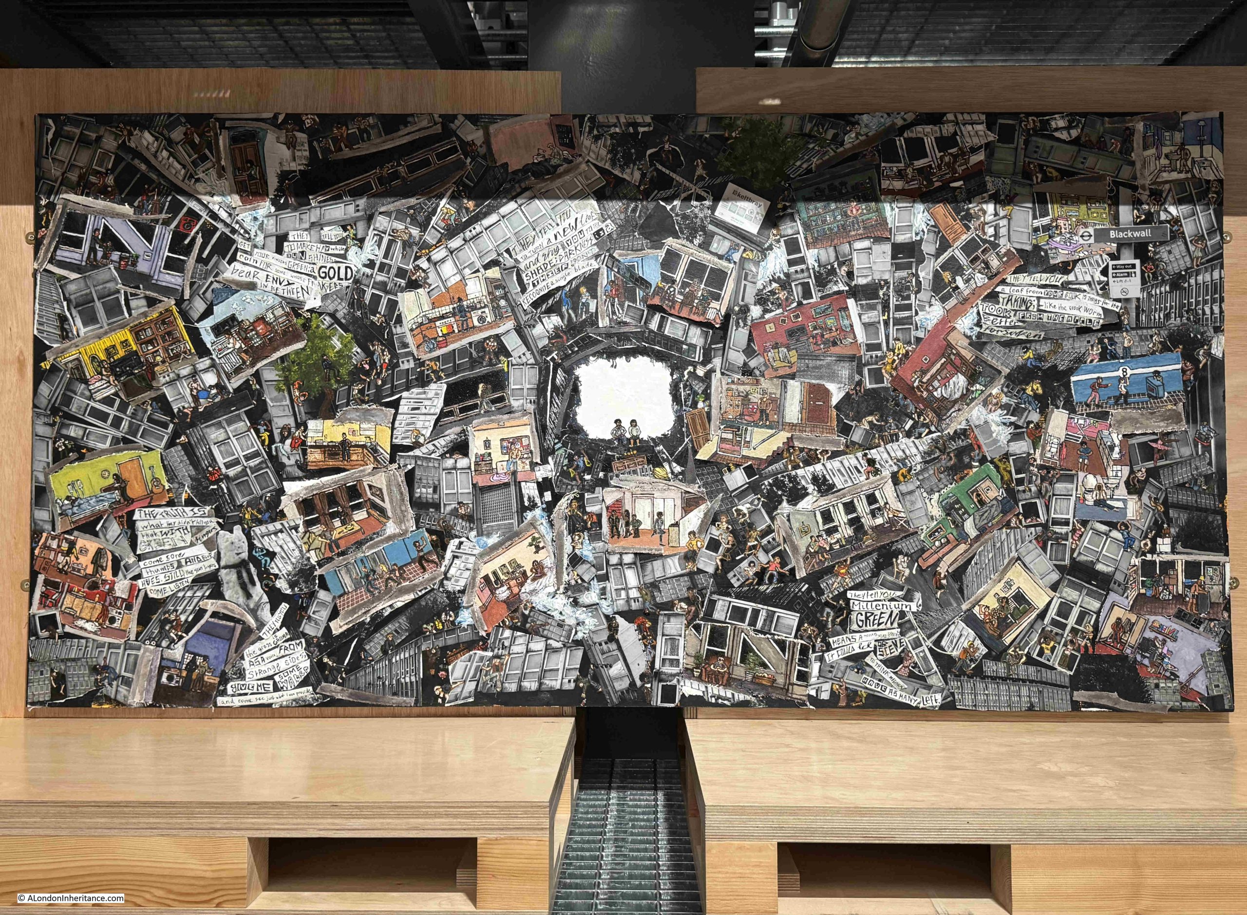
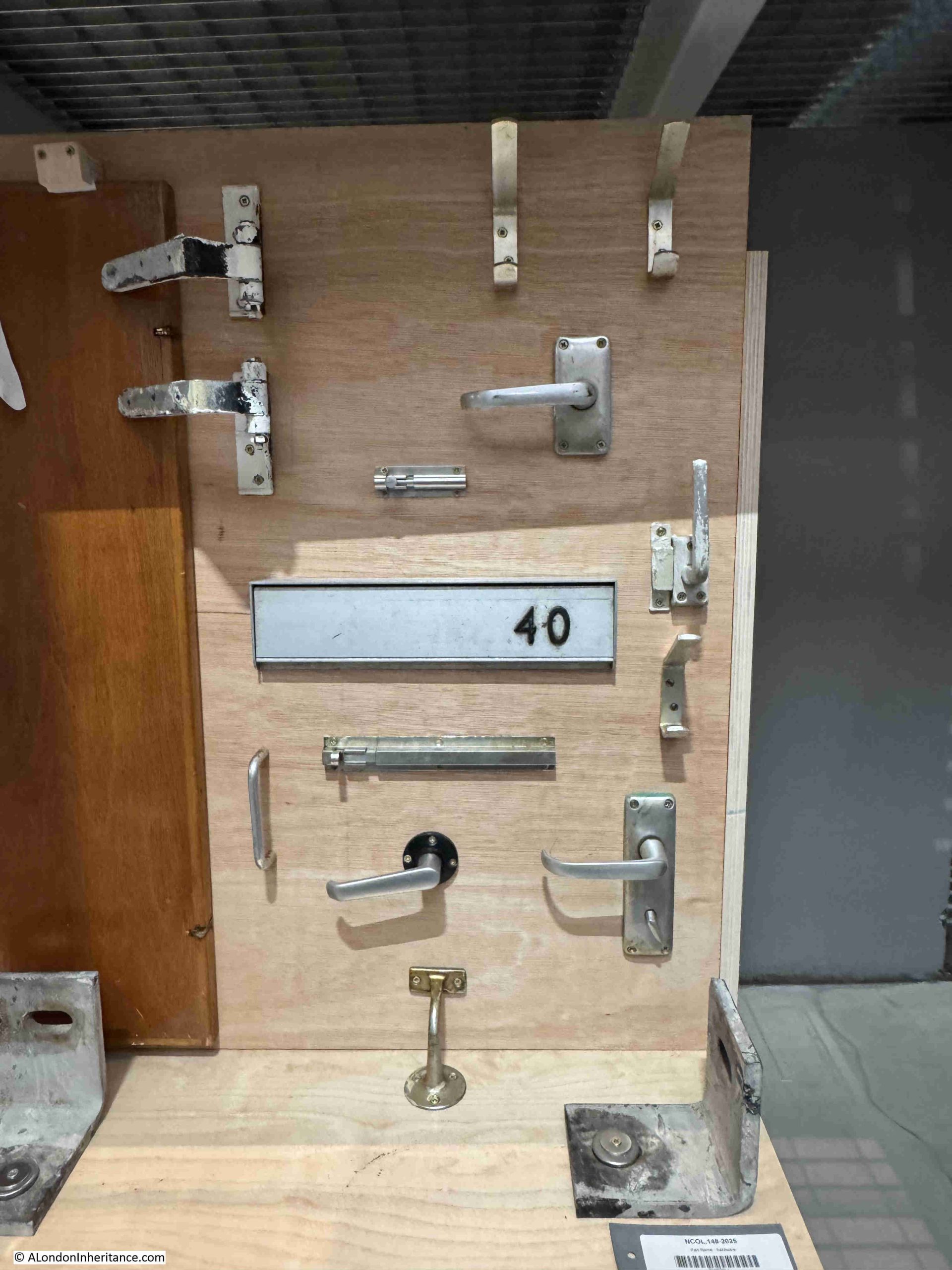
The V&A also has a number of items relating to Robin Hood Gardens, the social housing estate in Poplar, east London, including a section of the west block, to preserve the architectural vision.
One of the items on display is a collage from the Robin Hood Gardens Project:
And some of the fittings from Robin Hood Gardens:
The V&A East Storehouse is a fascinating way to display part of the collection that would not normally be on display in the V&A museums, and is well worth a visit.
London has always changed. Buildings have been constructed then demolished. New streets built, others widened and some built over and lost. Individual building plots have been consolidated and replaced with much larger buildings. As well as covering larger plots of land, buildings across the city have also grown taller, although it is only in the last few decades that the city has become home to a growing number of very tall towers.
London has always been a city where you can walk down a street after a space of a few months, and find a familiar building demolished, with a new building, frequently of a very different design and materials, being constructed on the same site.
Patterns of ownership change, ways of working change, new space is needed, older buildings become expensive to maintain, planning regulations change, new materials make very different designs possible and architectural styles change.
London has been through two major reconstructions caused by very tragic events. The need to rebuild after the 1666 Great Fire of London, and again after the bombing of the Second World War.
But there is also continuous change, and this has long fascinated anyone who has lived, worked, or just visited London, and there have been many approaches to documenting this change.
One such approach is the book “London Rebuilt, 1897 – 1927” by Harold Clunn and published in 1927.
The book documents the changing city over a period of thirty years from 1897 to 1927. In many ways this is an arbitrary period of time, and the author admits that he was aiming for the first three decades of the 20th century, however there were so many changes at the end of the 19th century that the last three years of the previous century were taken into the account.
The book could have begun much earlier, as the 19th century was a period of extensive change, with the Victorian transformation of London responding to the city’s growth as a world city, exponential increase in trade, commerce, industry and population, and Victorian attempts to improve living conditions, sanitation, traffic routes and roads, along with the introduction of new utilities such as gas and electricity.
But again, London is always changing, so a book covering any period would always be an arbitrary choice of dates.
The book consists of chapters focussing on different areas across the wider city, and each chapter includes a written description along with a number of photos, many showing before and after views.
As well as the physical aspect of the city, there are other changes.
The way people dress, the number of people on the streets, traffic, the gradual change from horse drawn transport to the use of the motor vehicles.
Clunn’s book provides a fascinating glimpse into London in the first decades of the 20th century.
In many ways, streets that we would easily recognise today, but also streets that have changed dramatically in the past 100 years.
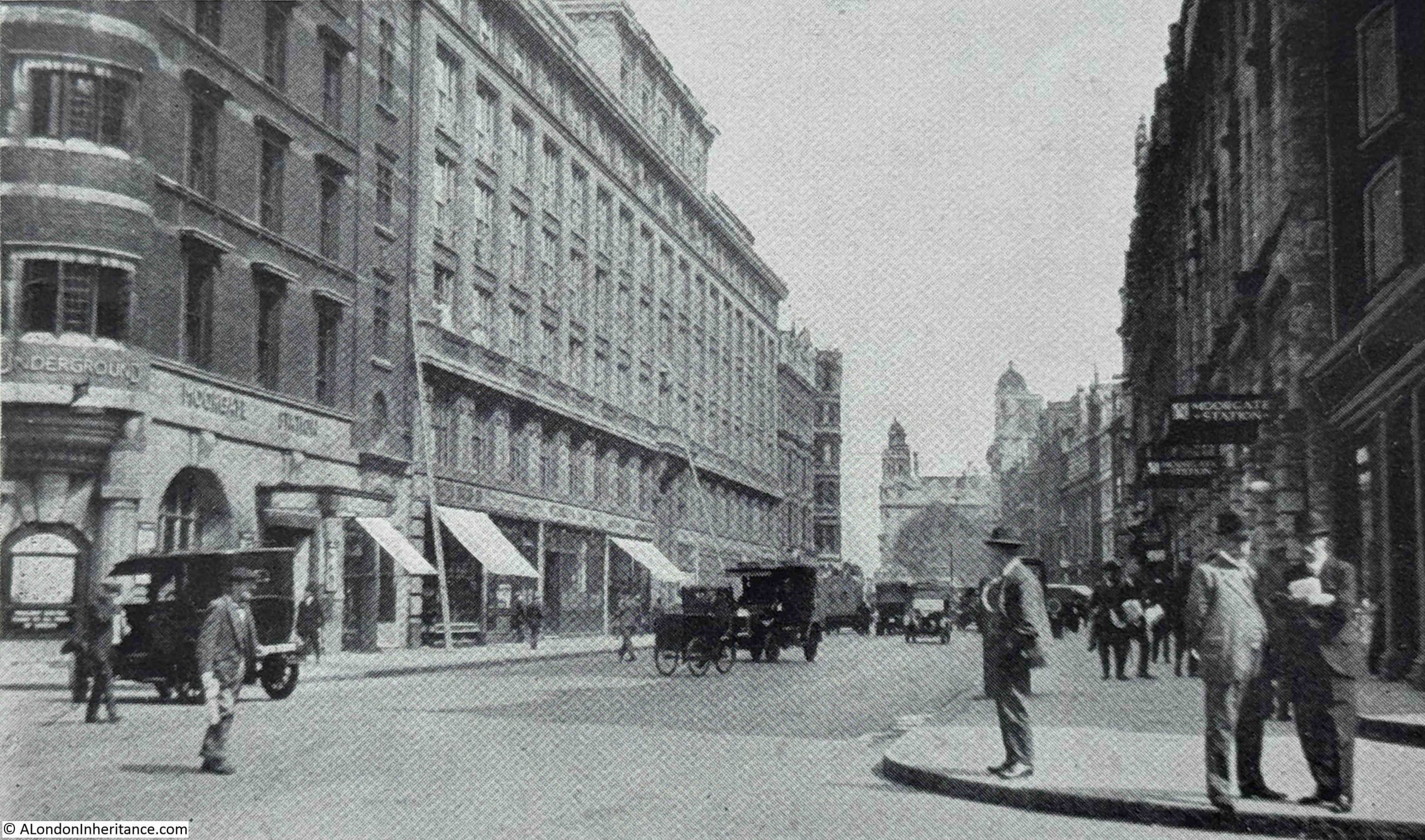
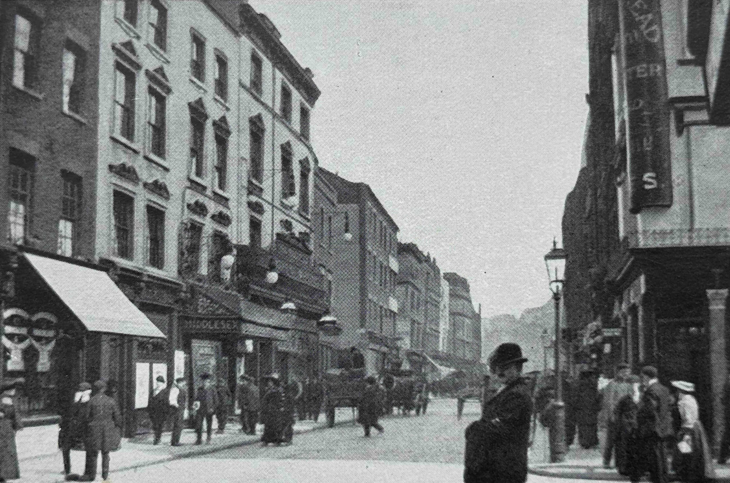
So in this post, we will travel back to the early years of the 20th century and explore the streets of the city, starting with Finsbury Pavement as it appeared in 1901 before the start of reconstruction:
Finsbury Pavement was the street that ran to the west of Finsbury Circus, between London Wall and Ropemaker Street. A large block of land to the west of Finsbury Pavement was demolished and rebuilt, and this work included upgraded entrances to Moorgate Station.
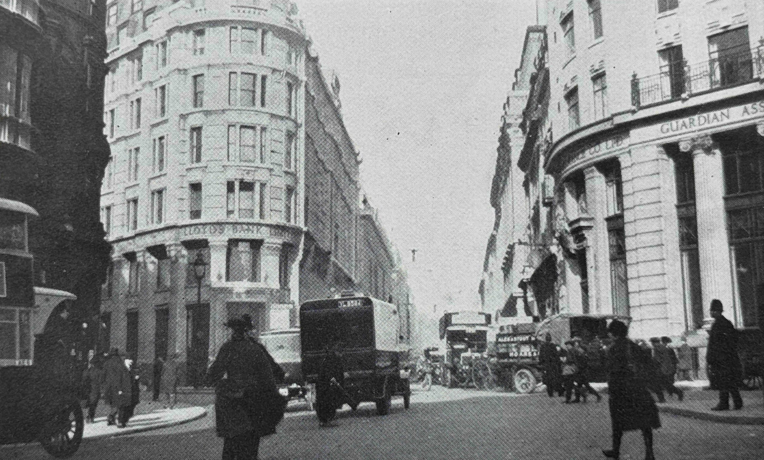
Today, Finsbury Pavement is known as Moorgate. The following photo is from the mid 1920s and shows the street rebuilt, and new entrances to Moorgate Station can be seen to the left and right:
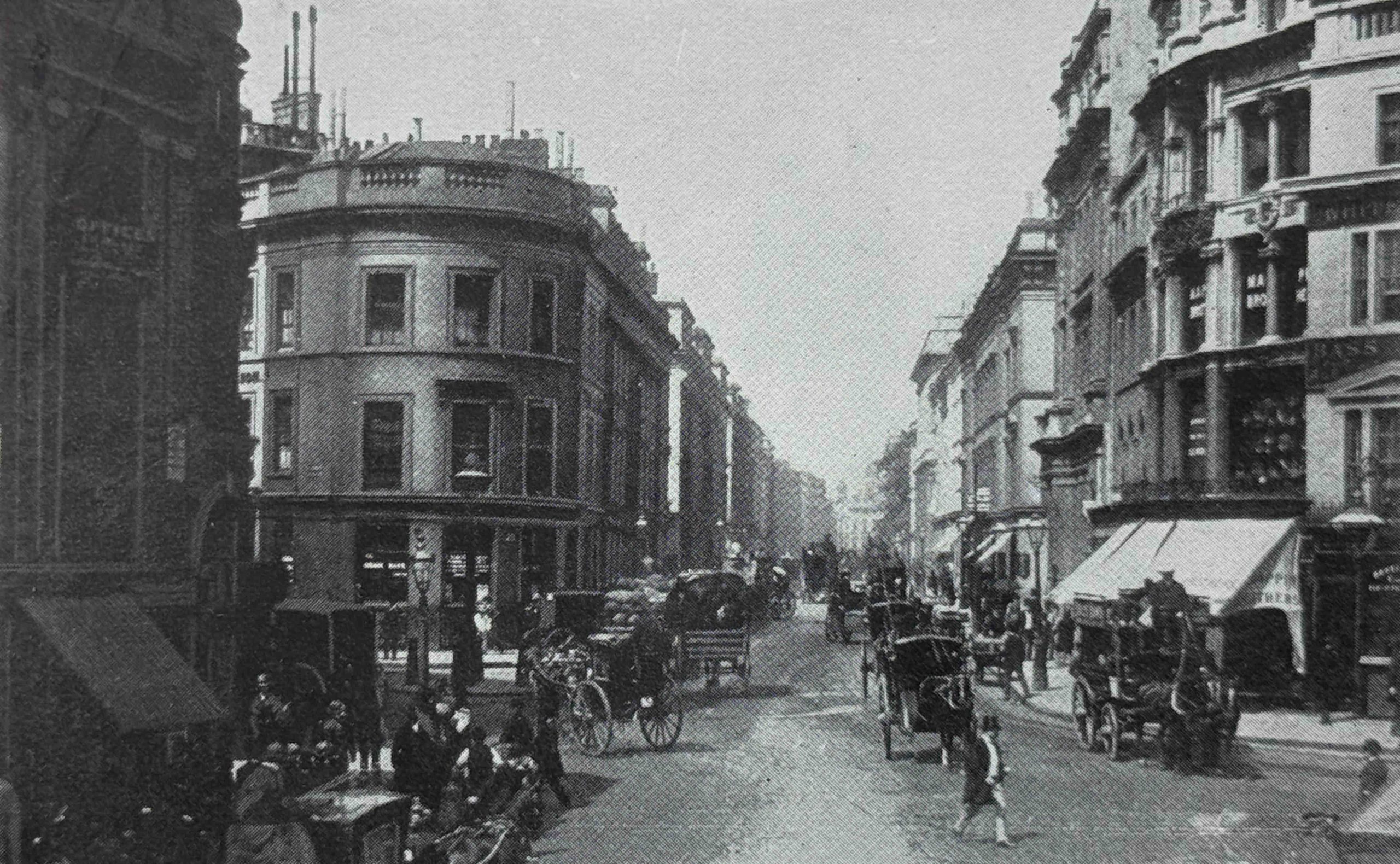
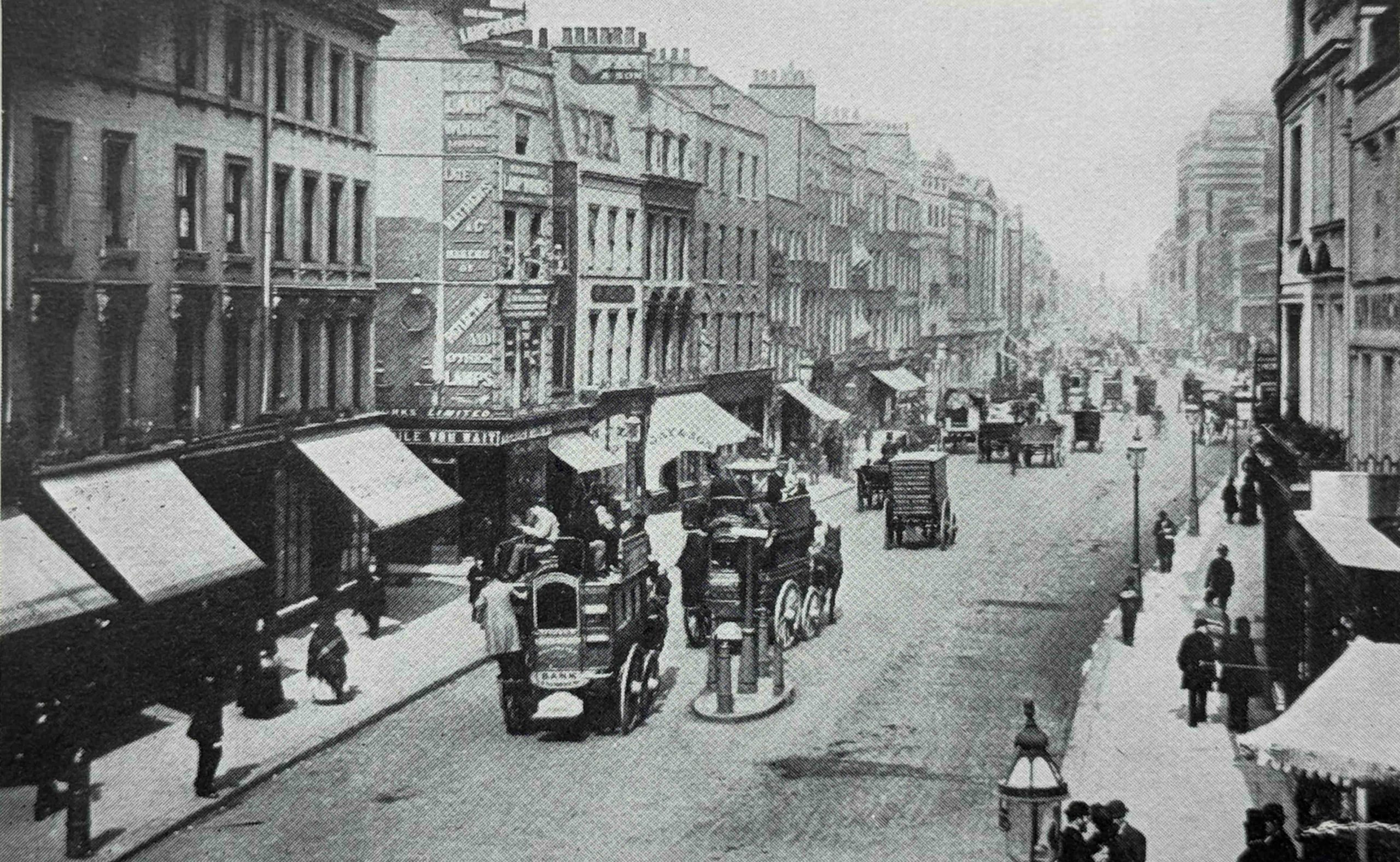
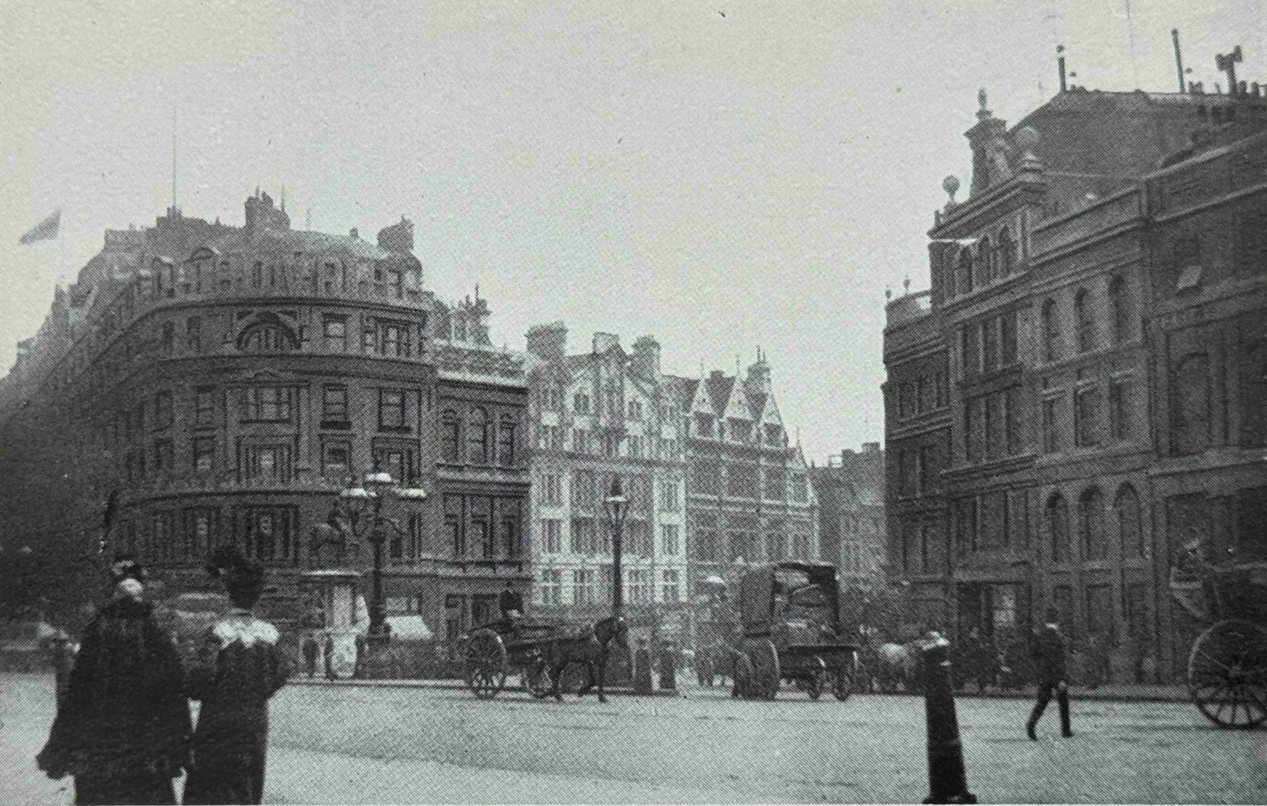
This is King William Street around 1890:
The rebuilt King William Street shows how buildings were increasing in height amd becoming more imposing. We can also see the start of the transformation of vehicles types with horse drawn in the above photo and just over 30 years later, a motor driven lorry van be seen in the foreground:
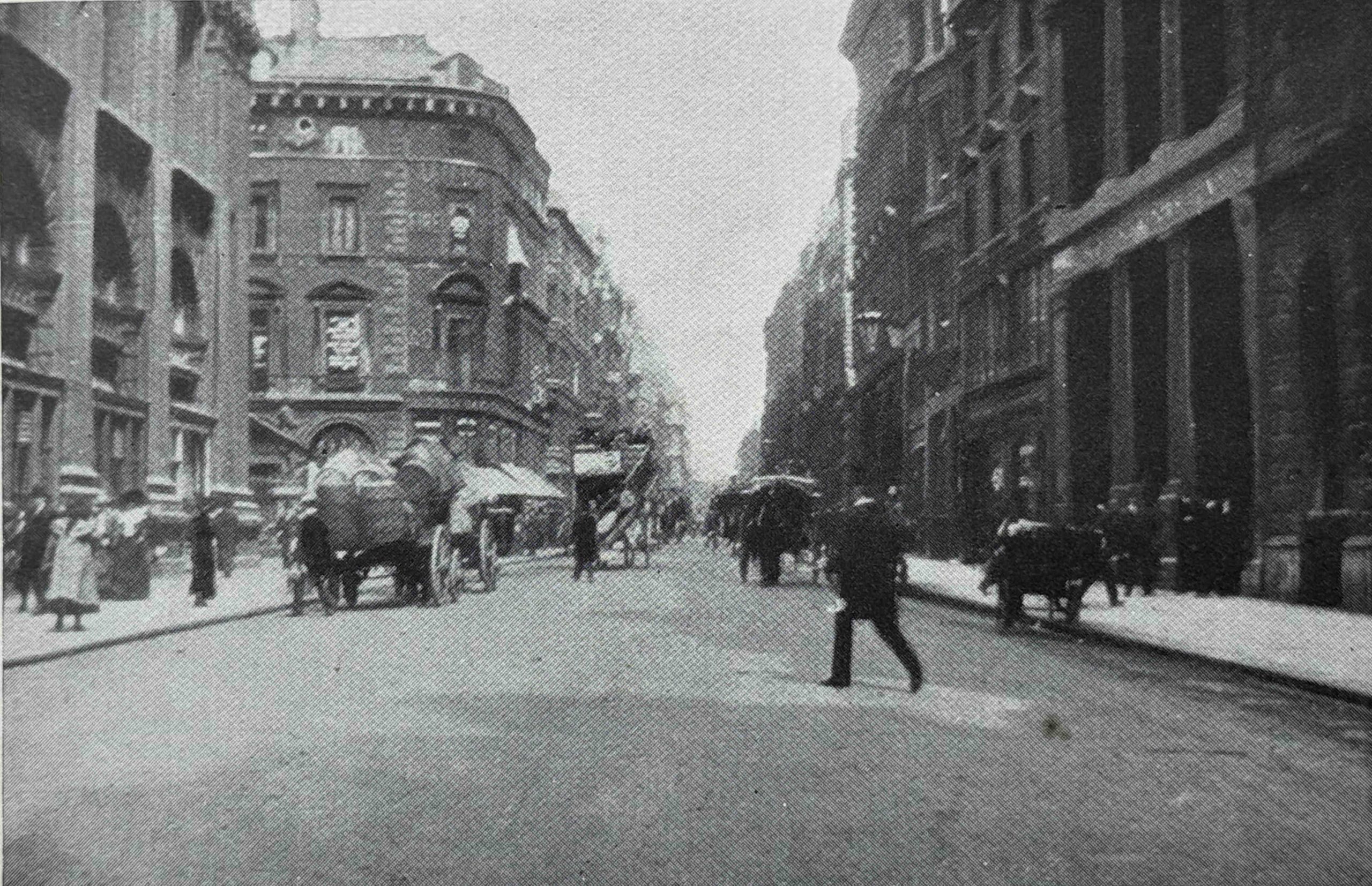
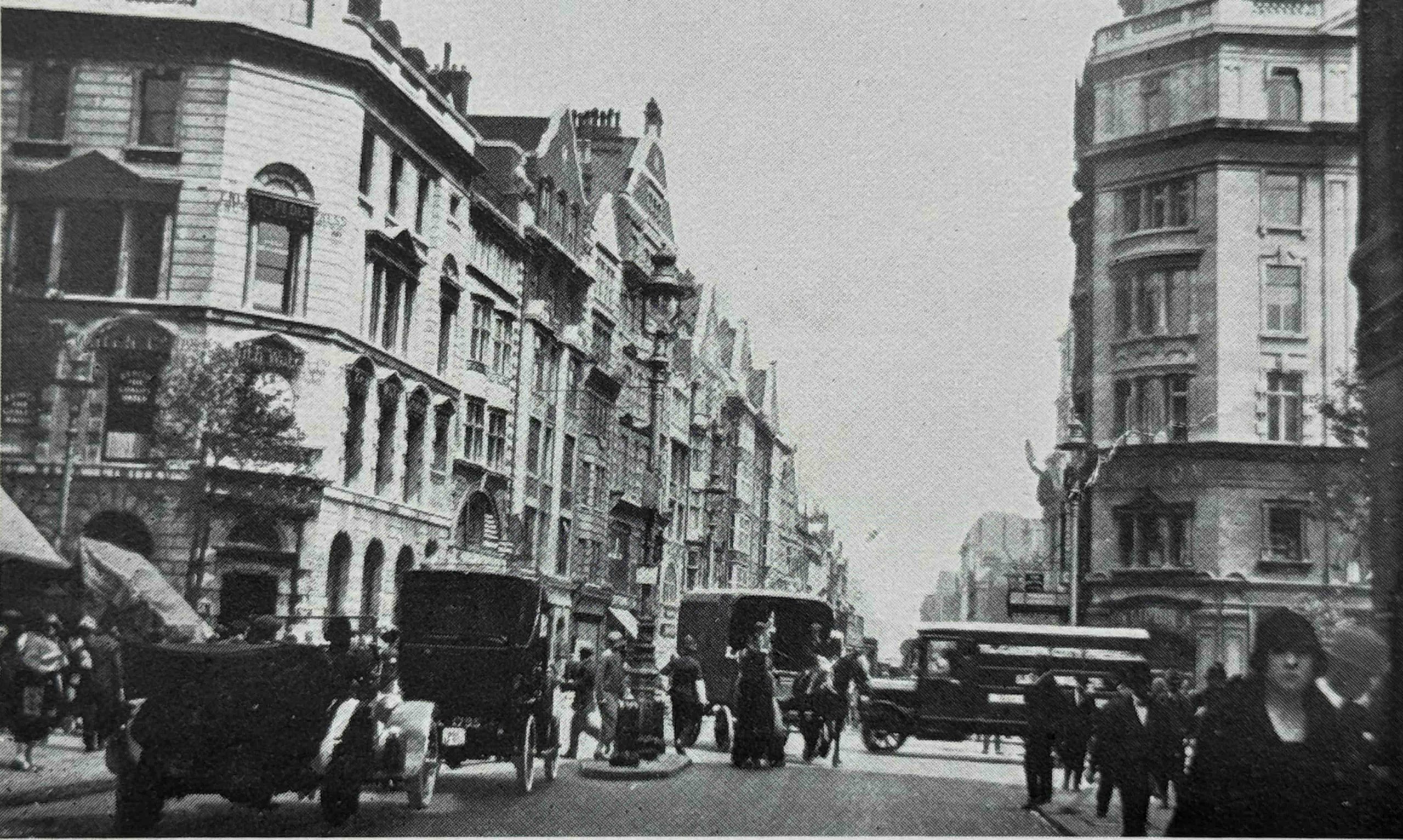
This is a 1901 view along Cornhill from the Royal Exchange:
Twenty five years later, Cornhill is still a busy street with a number of buildings of recent construction, made obvious by their clean appearance. Not yet darkened by the smoke of the city:
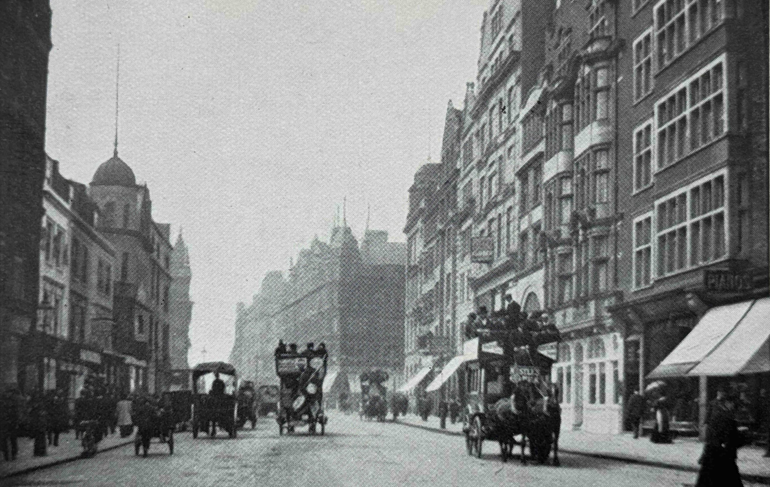
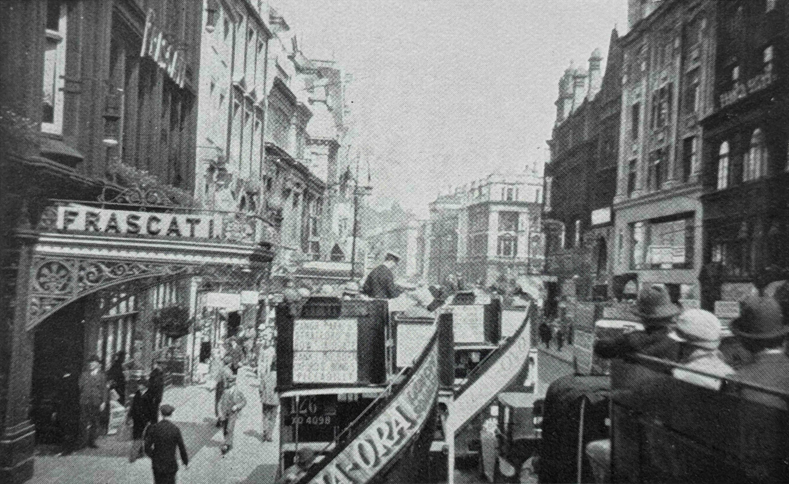
Many of the photos in the book appear to have been taken from the top of the open top buses that carried Londoners along the street. The following image is one example, and is looking along Fleet Street from Ludgate Circus:
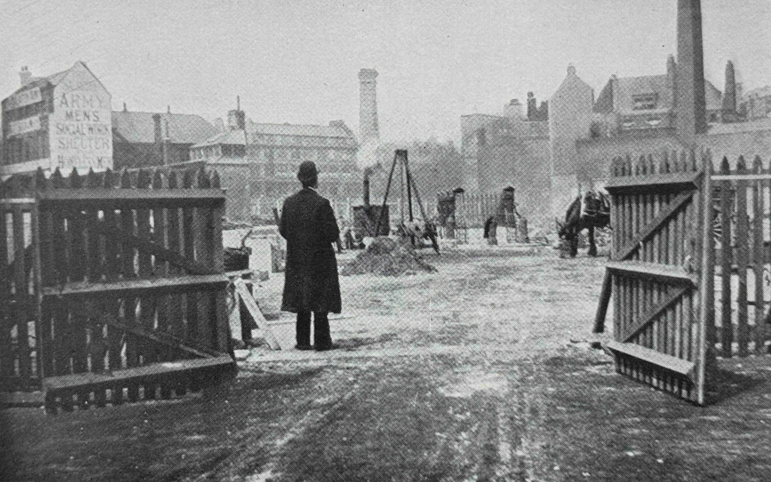
As well as the replacement of individual buildings, the late 19th and early 20th century saw large areas of London completely rebuilt. One of these was around Kingsway and Aldwych, and the following photo shows a large open space where the construction of Kingsway was underway in 1904:
Little details in these photos help to add to the character of London at the time. To the left of the above photo is a painted sign on the end of a building wall for the “Army Men’s Social Work Shelter”.
It is hard to make out the words at the top and bottom of the text on the building, but I think the word at the top is Salvation, as this building was probably one of the many Salvation Army Men’s Social Work Shelters across London, and indeed across the major cities of the country.
These institutions provided cheap overnight lodgings and food for the homeless, and in 1900, over 4,000 men were taken in nightly from the streets. Each person had to pay a charge of one penny, so it was not an absolute charity, and the Salvation Army established a three stage work programme, which had a very questionable outcome.
Stage one was work and accommodation in their city institutions. Stage two was their transfer out to the Salvation Army farm in Hadleigh, Essex for “outdoor work”, and stage three was their transfer to an overseas colony.
Hadleigh Farm is still run by the Salvation Army.
One wonders how voluntary this progression through the three stages was, particularly the transfer to an overseas colony.
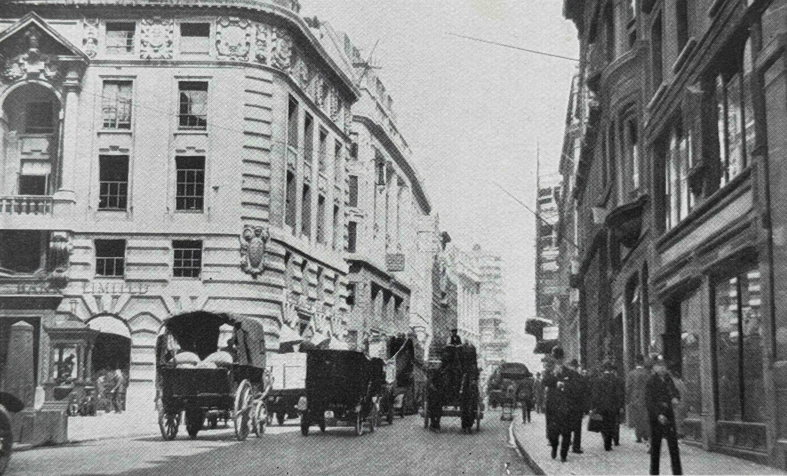
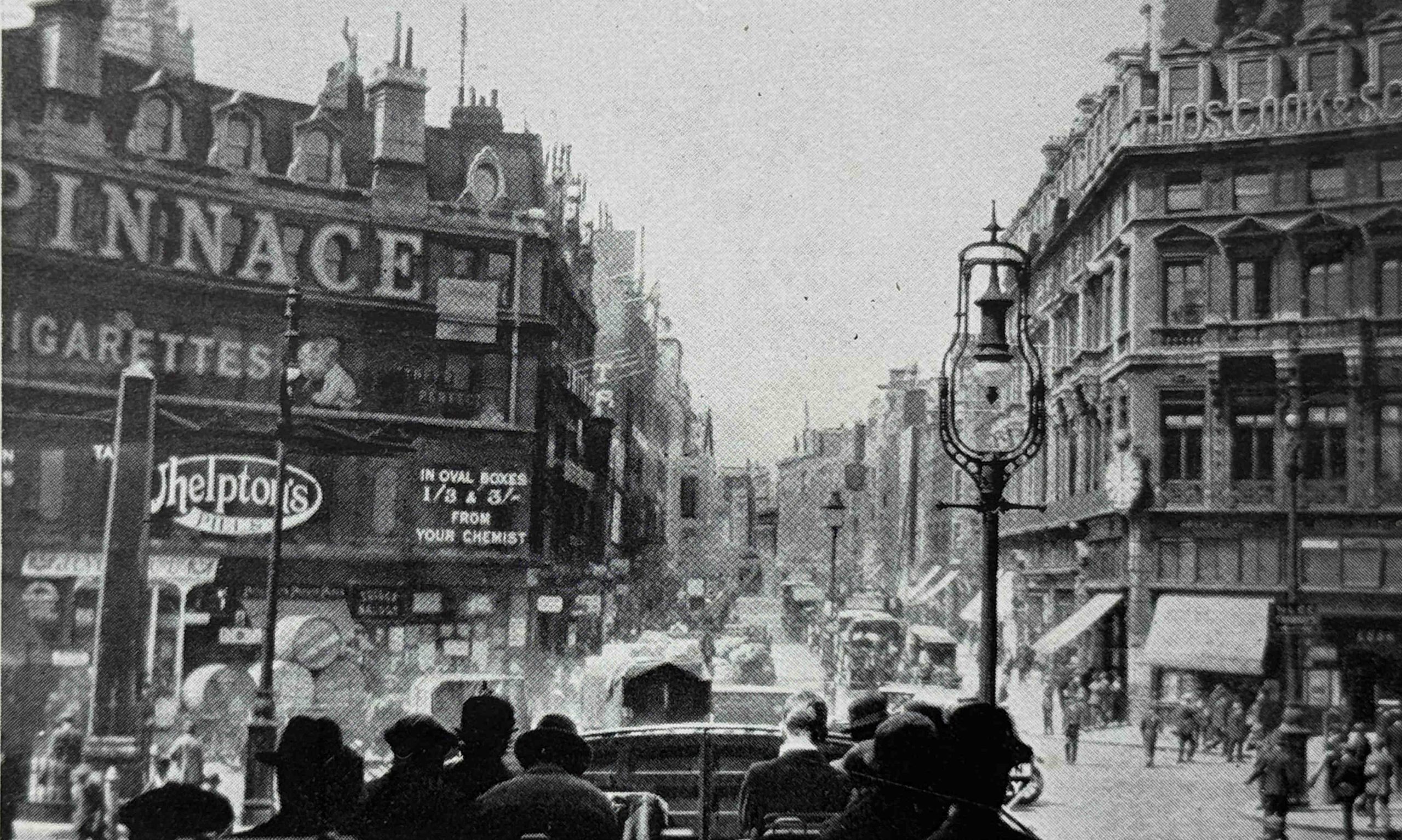
The following photo is a 1920s photo of Kingsway, looking north from Aldwych. The book does not explain whether there is any relevance between the photo above and the photo below:
In the centre of the above photo can be seen the “LCC Tramway Station Entrance”:
The following photo is on a different page, but has the same title as the above photo “Kingsway, looking north from Aldwych”, but now with a date of 1906:
If they are of the same view, then there had been a remarkable transformation in thirty years. Kingsway was a new street, planned during the late Victorian period, along with other major road schemes such as New Oxford Street and Shaftsbury Avenue, with an aim to relieve the growing amount of traffic congestion across the City.
The above photo also shows an entrance to the tramway station.
It was not just streets and buildings that were redeveloped. The following photo shows the reinstatement of the lake in St. James’s Park:
The reason for the reinstatement was that after the outbreak of the First World War, the lake in St. James’s Park was dried out, and a series of temporary buildings erected in the site, presumably in someway connected with the war effort.
In 1922 the huts were demolished and the lake was restored, however the lake had been left dry for so long that many of the repairs were inadequate, water started leaking out, and the lake almost completely dried up again.
More repairs were made, the lake refilled and restored to become the familiar part of the park that it had been.
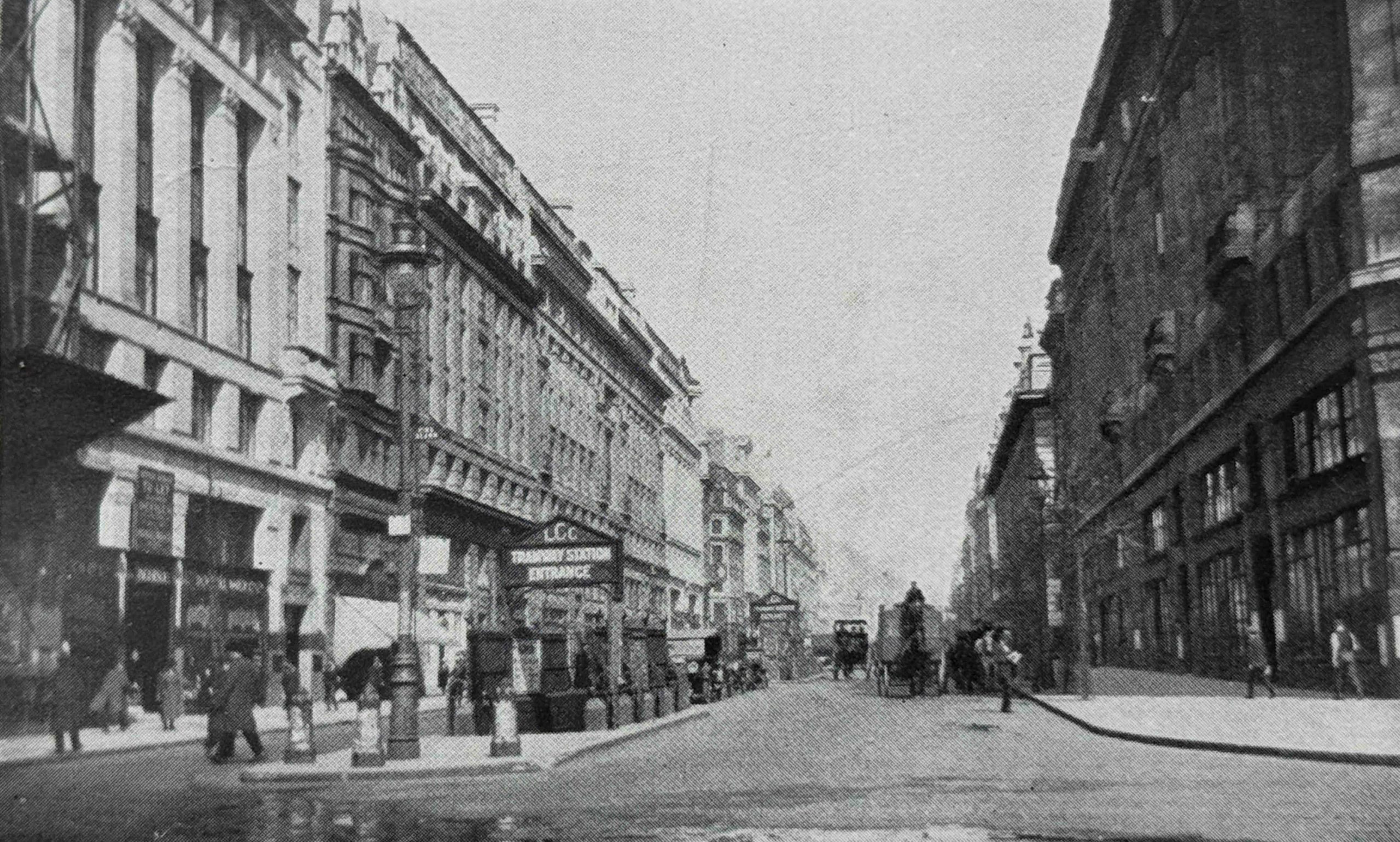
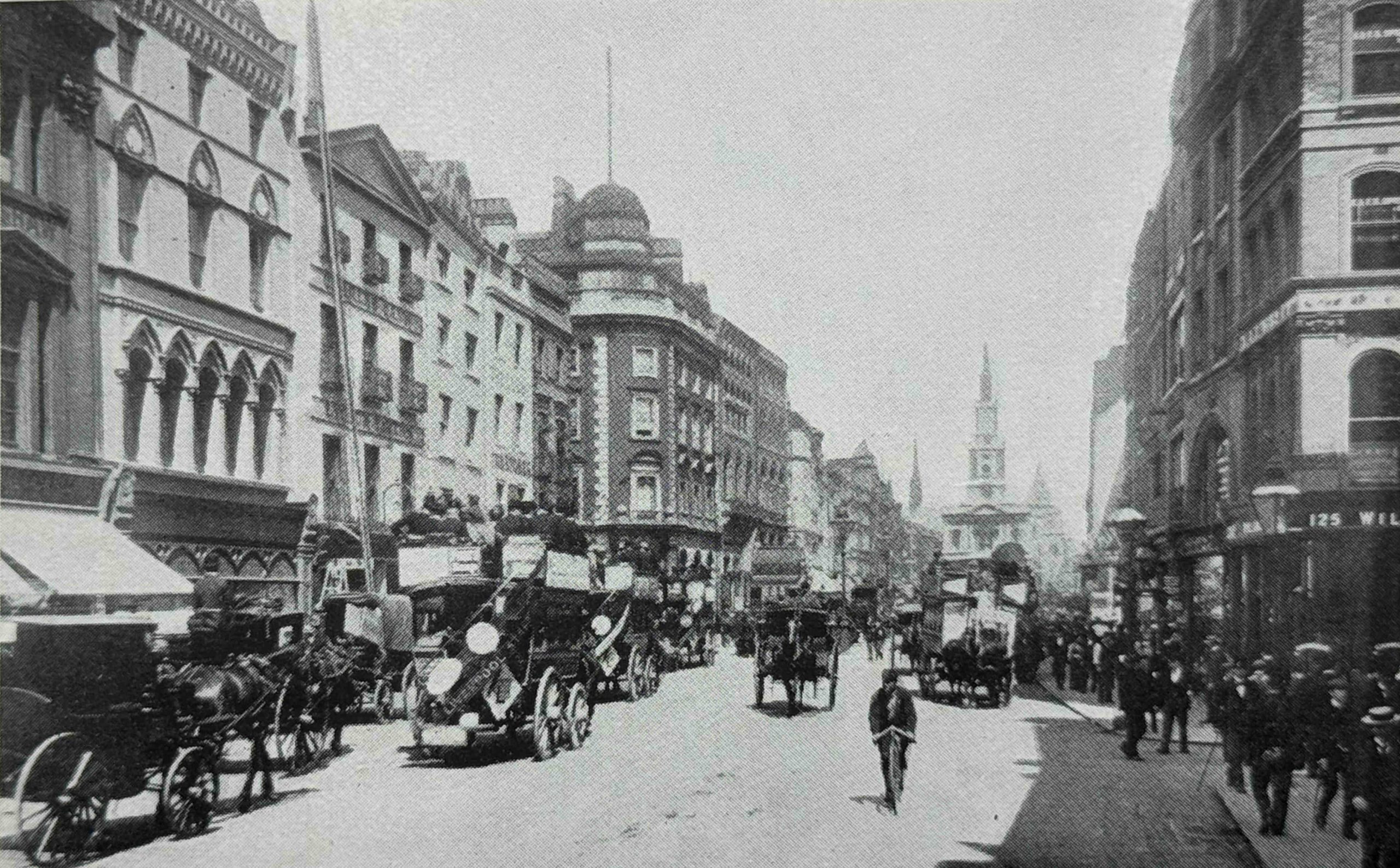
This is the “old” Strand, looking east from Southampton Street:
And the “new” Strand, again looking east from Southampton Street:
The above two photos again show the transformation of traffic from horse drawn to motor, and we can also see how smaller plots of land were being converted into larger plots for larger buildings.
The two photos above seem to be of the same view, as the church steeple can be seen at the end of the street, although it is very faint in the above photo.
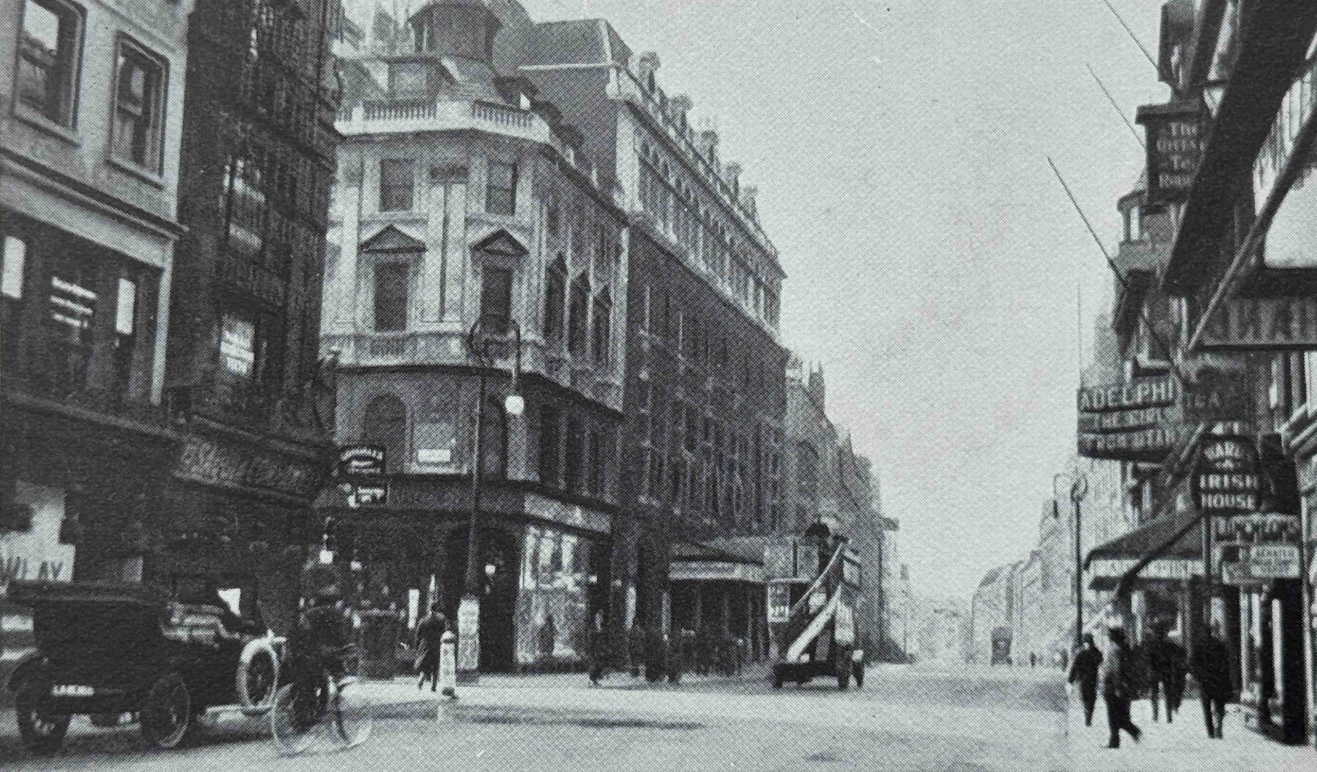
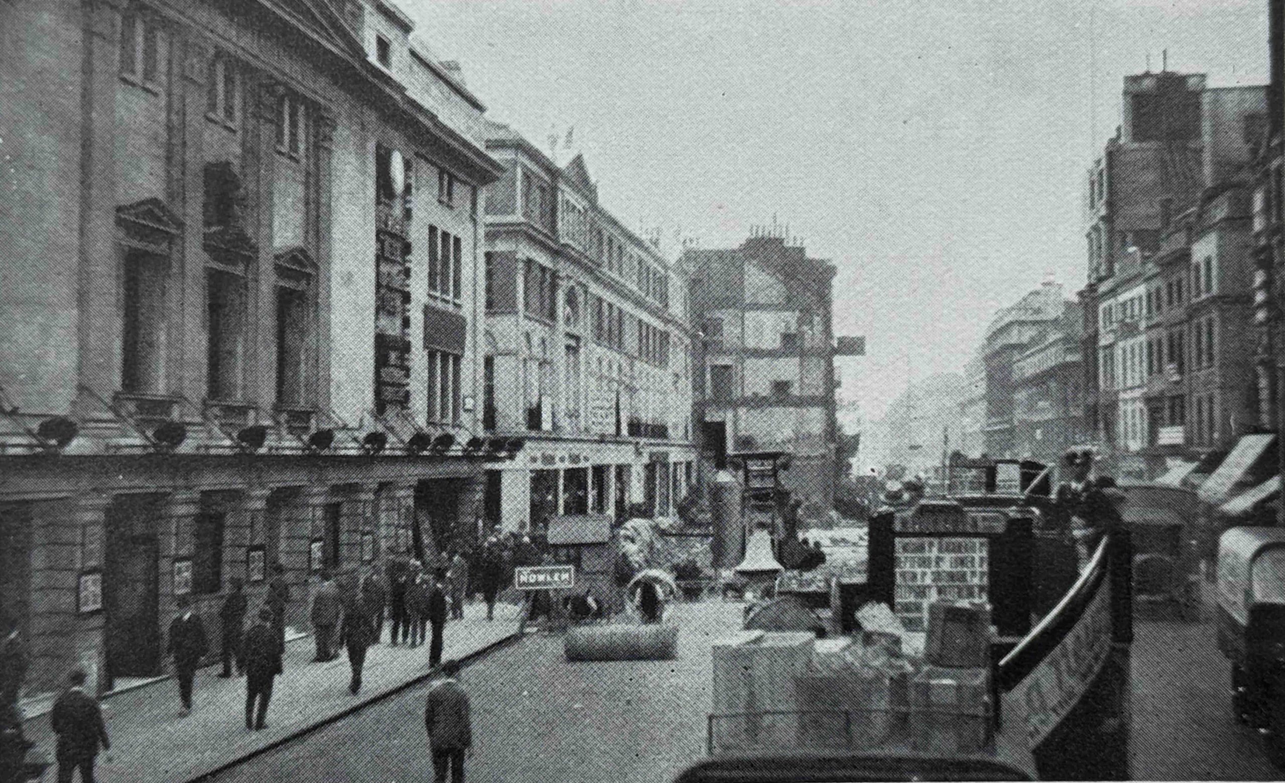
The following photo has the title “The Old Tivoli Theatre, demolished in 1914”, and is a view along the Strand, with the Adelphi theatre on the right and Adam Street on the left:
And the following photo shows the “New Tivoli Cinema and the widened Strand, looking west”:
The Tivoli Cinema is the building on the left of the photo. It opened on the 6th September 1923 with music hall artiste Little Tich, so despite the book calling it a cinema, it was also continuing to operate as a theatre.
The demolition and new build of the Tivoli was part of the scheme to widen the Strand, and the end of another building which will soon be demolished as part of this scheme can be seen further along the street.
The Tivoli was closed on the 29th September 1956, demolished and a new Peter Robinson store built on the site, which in turn was demolished in the late 1990s, with the office block we see today then being built on the site.
In the above photo, the building to the right of the Tivoli, on the left of the street, the building with the arch above the second floor remains to this day.
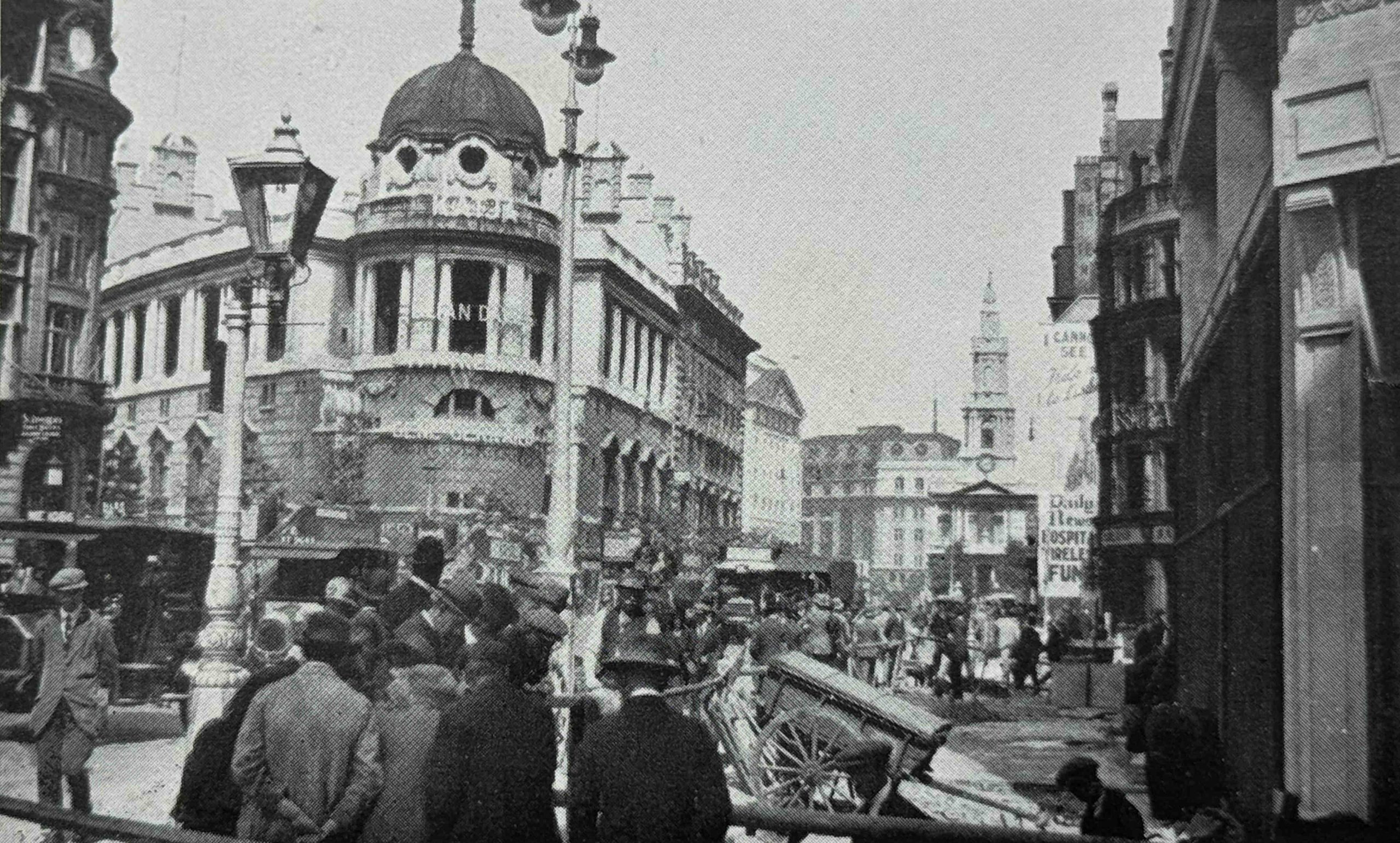
Staying in the Strand, this is the “Old Strand, looking east from Savoy Street”:
The same view in the 1920s:
It is interesting how new builds often retain features from the previous building on the site, for example the dome on the top of the corner building on the left in the above two photos.
Another soon to be demolished entertainment building was the old Middlesex Music Hall in Drury Lane, shown on the left of the following photo:
Old High Holborn, looking east from Southampton Row:
New High Holborn, again looking east from Southampton Row:
There is a single horse drawn vehicle in the above photo, with the rest being motor vehicles, where in the “old” photo it was all horse drawn. Street lighting has also changed from smaller lights on the side of the pavements, to taller lights in the centre of the street, and again, the later buildings are of a more substantial build.
Many of the rebuilding works were aimed at improving traffic flow across London. Many streets still had what were described as bottle necks, where the width of the street would reduce, and many works of the late 19th early 20th century were aimed at eliminating these.
The following photo shows the “High Holborn Bottleneck”:
The “Oxford Street Bottleneck Near Tottenham Court Road”:
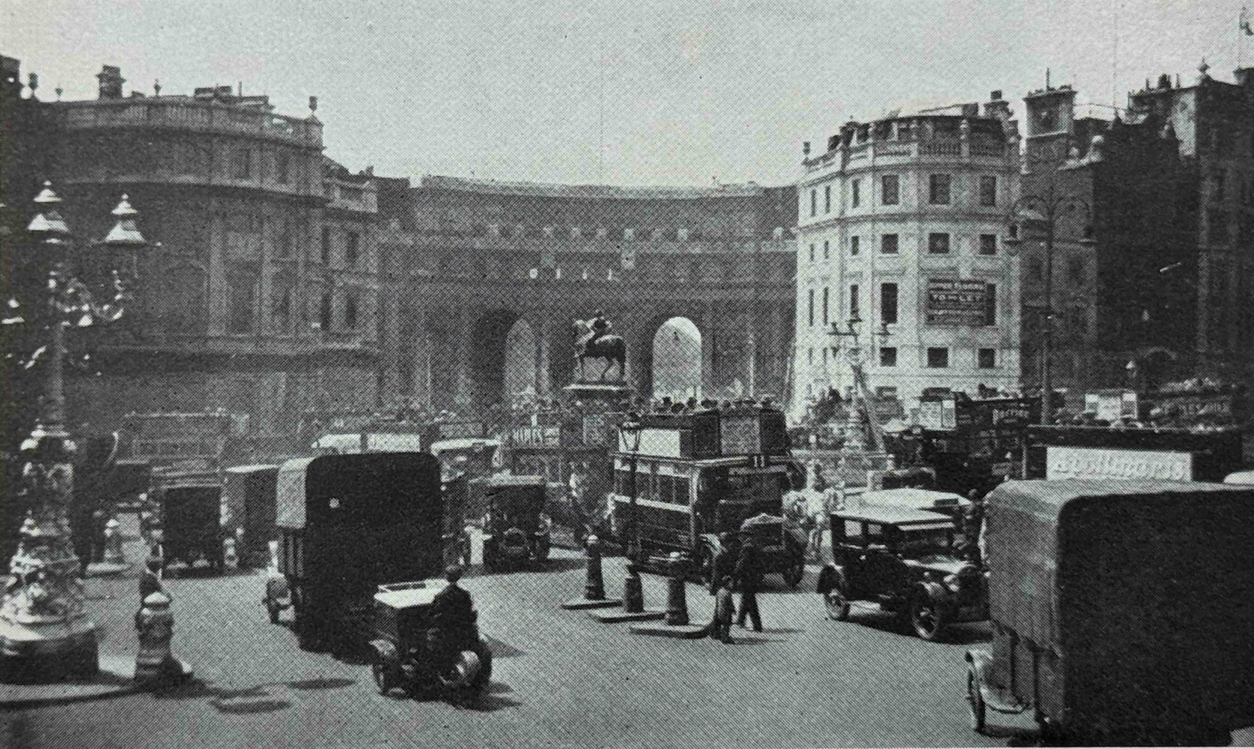
The following photo is titled “Charing Cross in 1904, prior to the construction of the Admiralty Archway”:
And then “The New Admiralty Archway, Charing Cross”:
There do appear to be a number of errors in the labelling of some of the photos in the book, so I am not sure how much either Harold Clunn, or his editor checked. In the above two photos, the first is labelled “Charing Cross in 1904, prior to the construction of the Admiralty Archway”, and the reference to Admiralty Archway implies that the archway would be built somewhere in the scene in the old photo, however the “prior” photo is looking down Whitehall (the buildings on the left are still there), the photo is not looking down the Mall, which is the location of the Admiralty Archway.
The following photo is much earlier than the date range in the book’s title of 1897 to 1927. This is the old His / Her Majesty’s Theatre on the corner of Haymarket and Pall Mall, which had been destroyed by fire in December 1867, so the photo must be from 1867 or earlier:
The fire was significant, with the Illustrated London News reporting on the fire on the 14th of December 1867 that “The spacious and beautiful opera house at the corner of Haymarket and Pall Mall, called Her Majesty’s Theatre, and formerly the King’s Theatre, was entirely destroyed, in less than an hour, by a fire which broke out on Friday night about eleven o’clock”.
The His / Her Majesty’s Theatre dated from 1791, and was the second theatre to have been built on the site. It occupied a large plot of land. After the fire, the remaining walls were demolished, and the new His Majesty’s Theatre that we see today was built, but only on part of the plot of the old theatre.
For some of these photos, I did get a chance to do a photo of the site today, to show a Then and Now comparison.
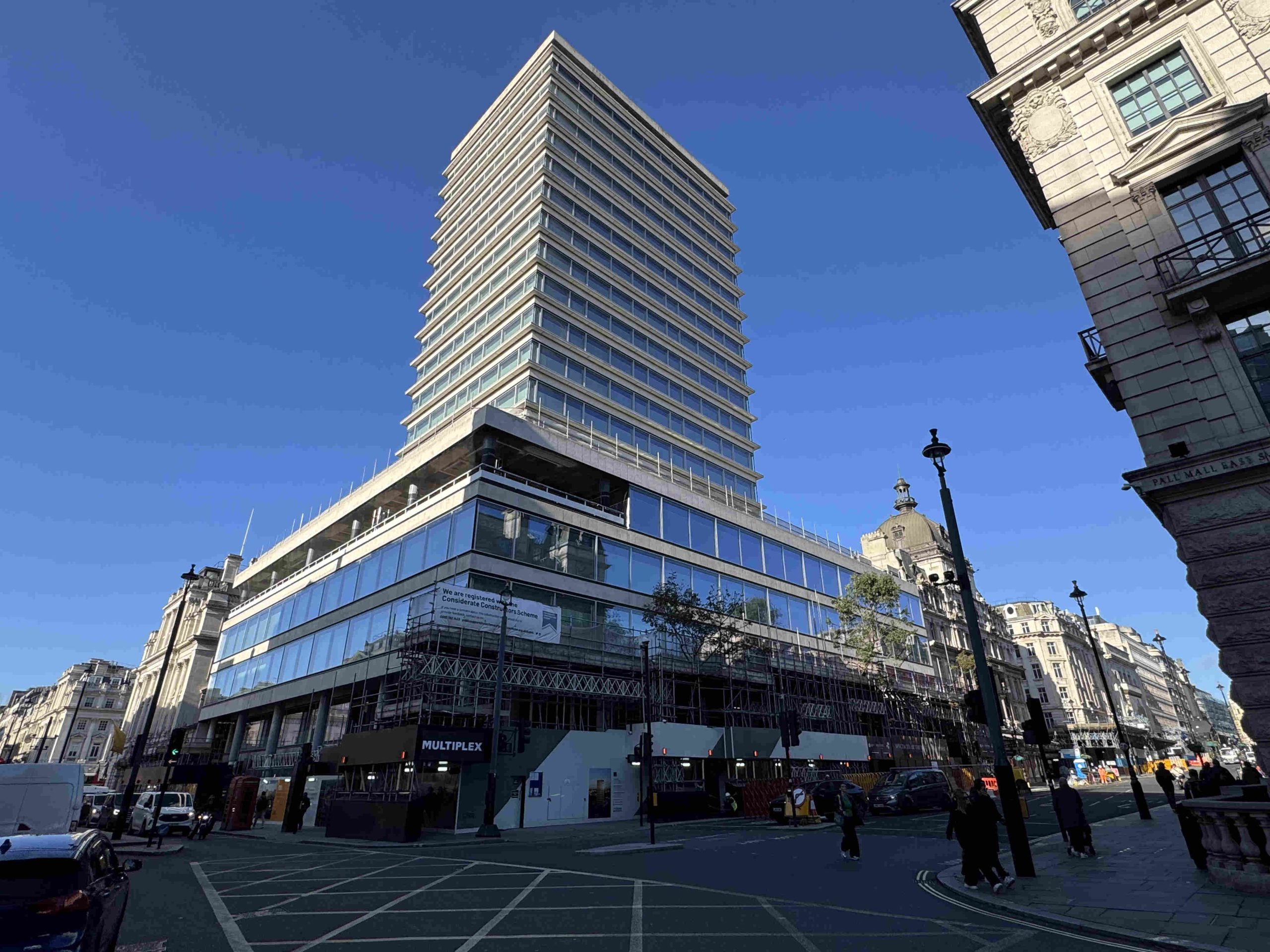
The following photo shows the site of the original His Majesty’s Theatre as it appears today:
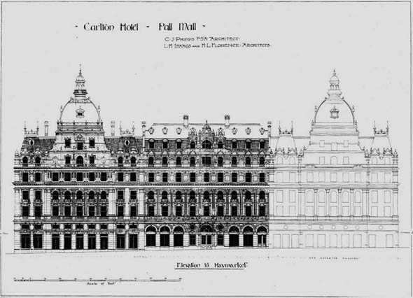
To the left of the new version of the theatre (which can be seen to the right of the glass fronted building), the Carlton Hotel was built. The following drawing shows the elevation of the hotel facing onto Haymarket, with the rebuilt His Majesty’s Theatre in outline on the right (which can still be seen in the above photo):
The hotel suffered bomb damage during the last war. It was later demolished, and New Zealand House, which remains to this day, was built on the site – the glass fronted lower floors and tower.
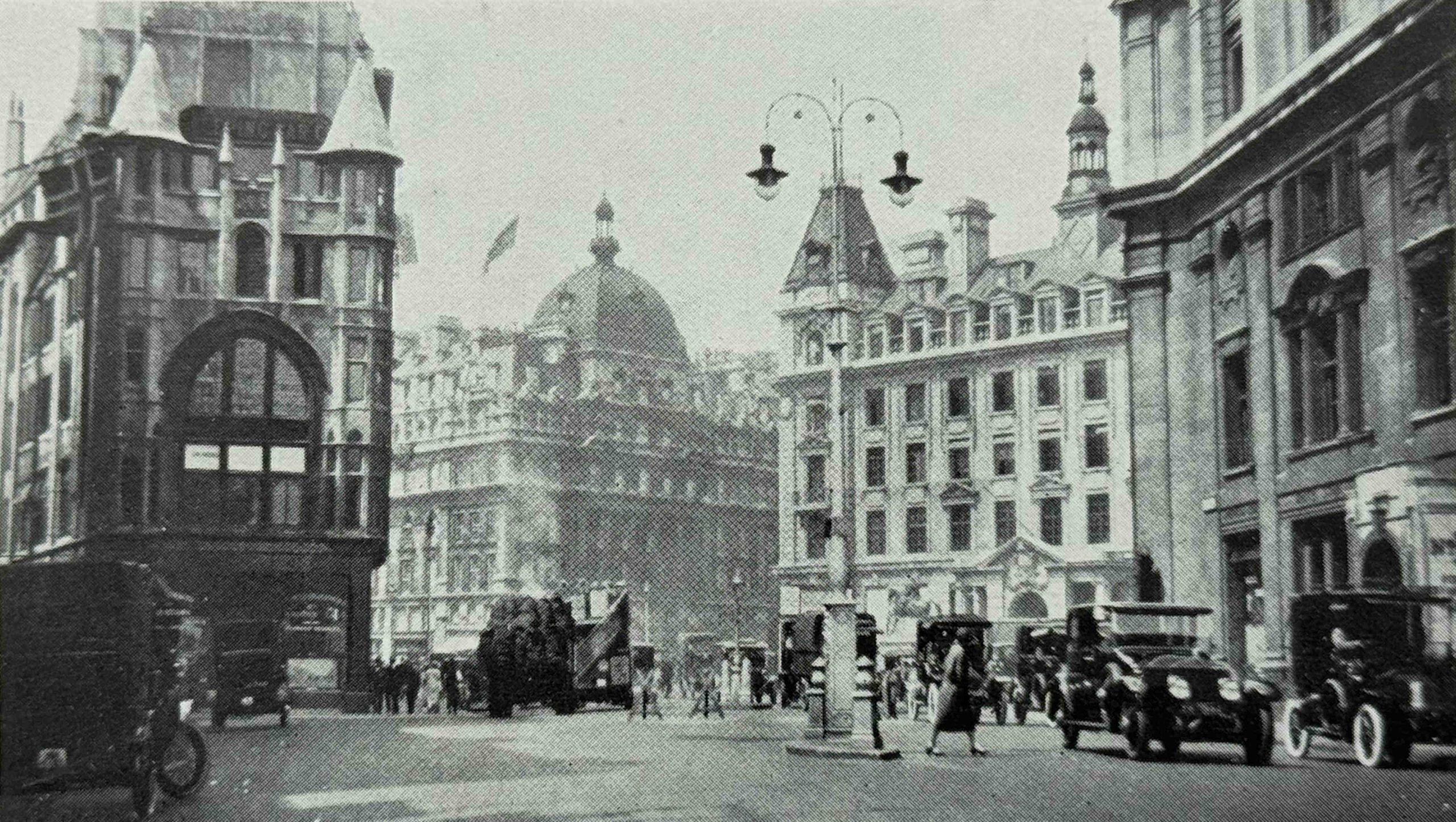
The following photo shows the “Carlton Hotel and the Kinnaird House, Haymarket and Pall Mall”:
The above photo was taken in Cockspur Street, just after leaving Trafalgar Square. The building on the left is still there, as is the second building on the right. The Carlton Hotel is the building in the middle, furthest from the photographer, and the large dome on the roof is the same as that shown in the plan for the hotel.
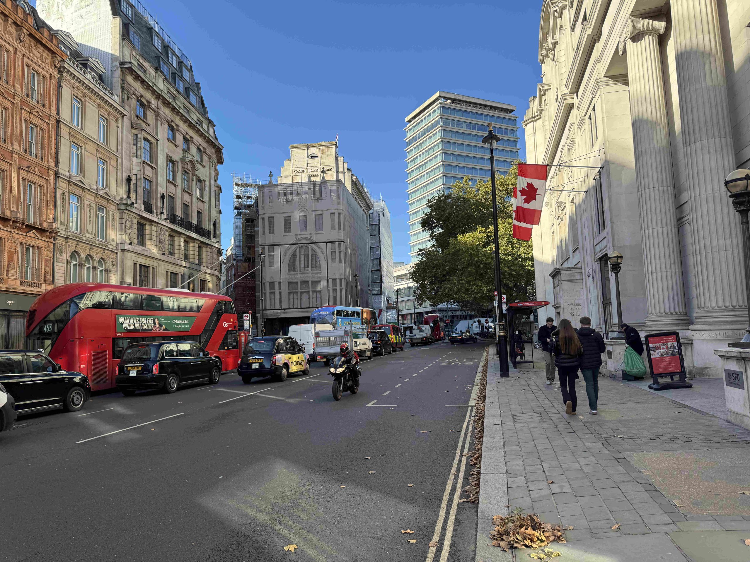
In the following photo of roughly the same view today, the building on the left, covered in scaffolding, with an image of the building along the front, is the ornate building on the left in the above photo. The tower block in the background is where the Carlton Hotel was located:
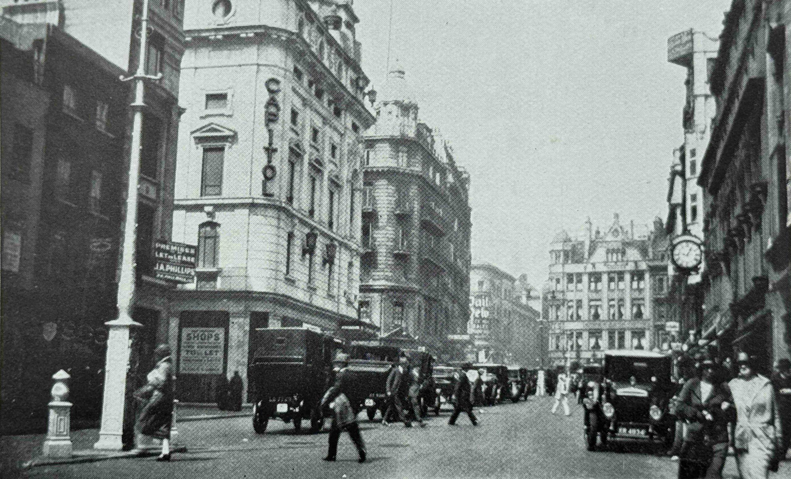
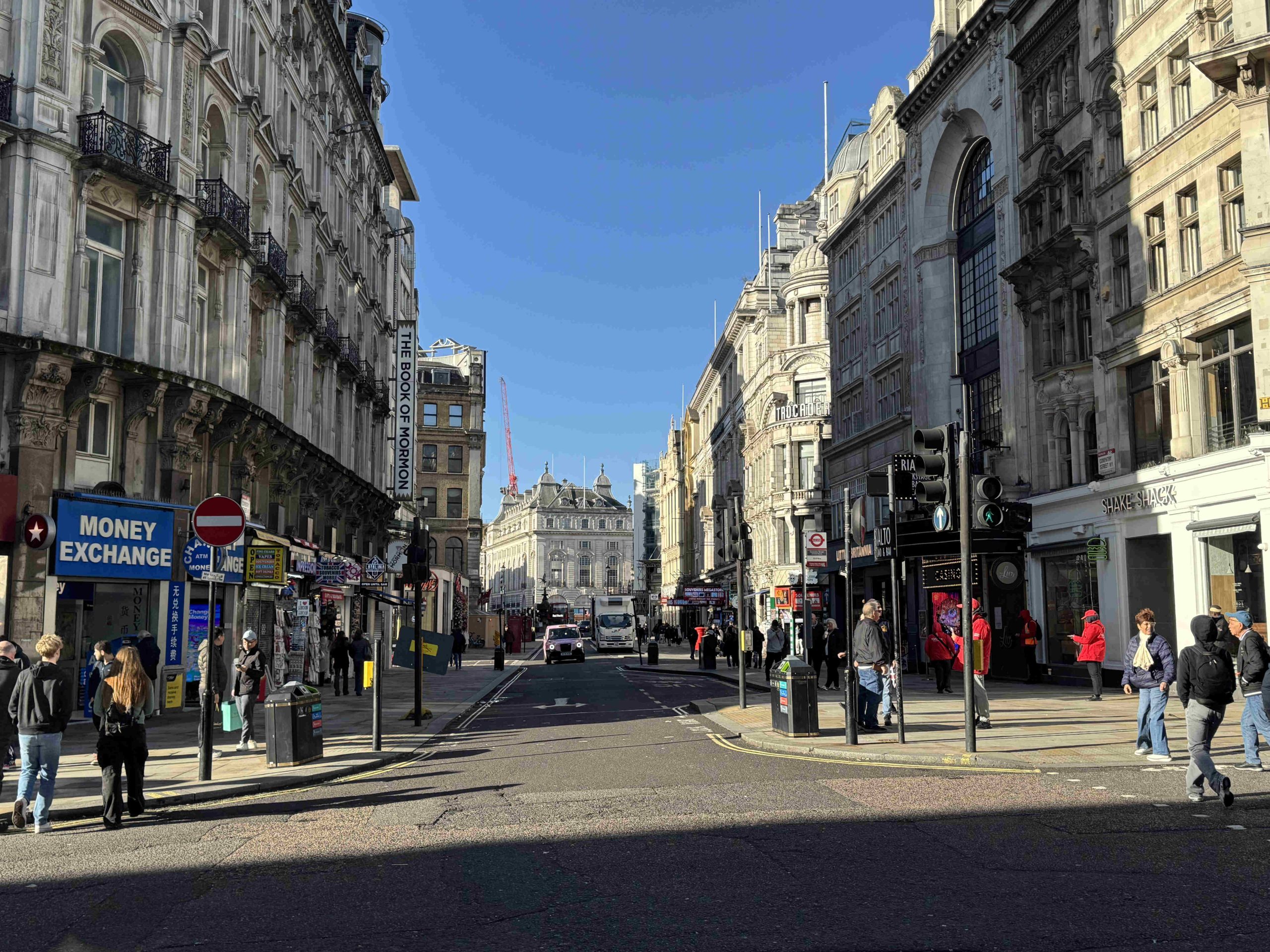
In the following photo we are still in the Haymarket, and the view shows the “Haymarket, looking north showing the Capitol Cinema and Haymarket Hotel”:
The photo was taken a short way down Haymarket, and the first street leading off to the left is St. James’s Market. It is from the 1920s as we can now see a large number of motor vehicles in the street.
The Capitol Cinema was formerly named the Capitol Theatre, and opened on the 11th of February 1925, so just before the book was published.
The Capitol had a relatively short life as in 1936, most of the theatre was demolished, and reconstructed as the Gaumont Theatre, which in turn was significantly rebuilt in 1959, reopening as the Odeon, Haymarket in the basement of an office block. The Odeon closed in 2000, but the office block still remains on the site.
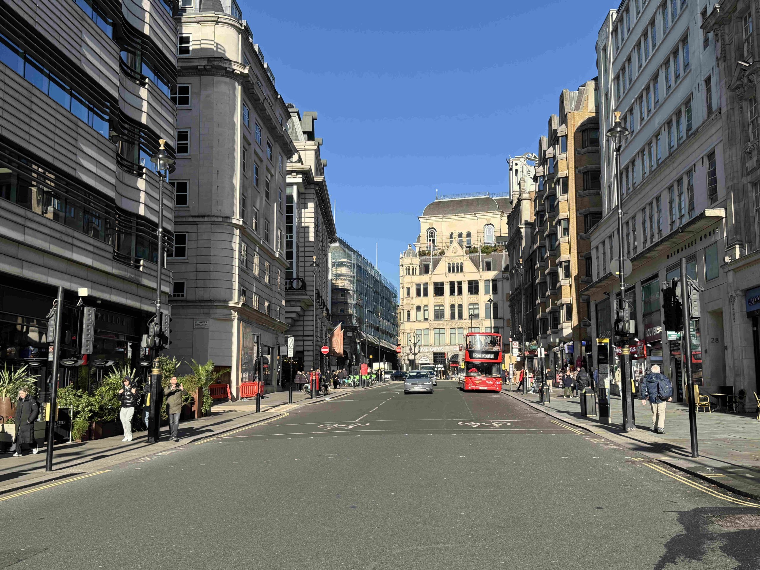
The building at the far end of the street, with the triangular shaped top to the façade is still there in Coventry Street, and the ground floor now houses a Five Guys, the following photo shows the same view today, with the old Capitol theatre building on the left, and the triangular shaped upper floor building at the end of the street:
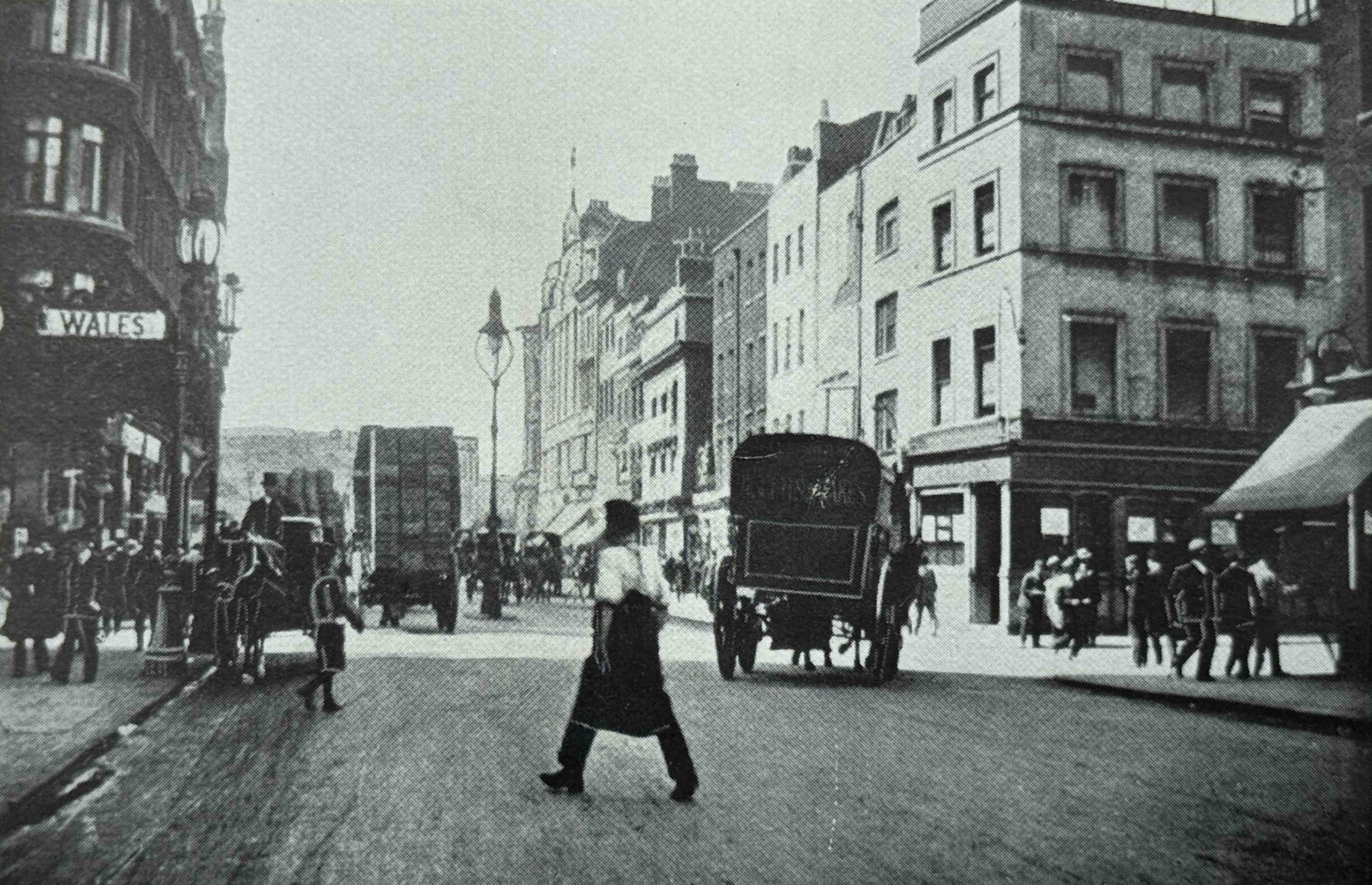
And heading up to Coventry Street, this is Coventry Street in 1904, looking west:
In the above photo there is a sign for “Wales” on the left, and this is the Prince of Wales Theatre, so the street on the right is Rupert Street and Piccadilly Circus is in the distance.
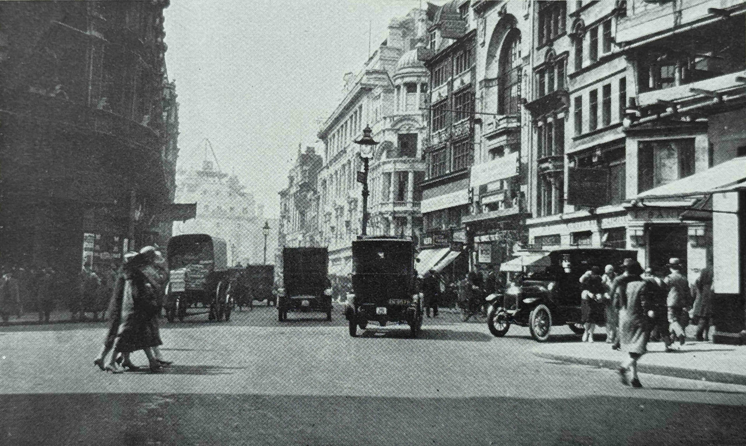
The following photo is of the same view, but I think was taken further back towards Leicester Square, as the building with the arch on the façade is still there today and is the Rialto:
In the 1904 photo of Coventry Street, on the right you can see some of the late 18th century houses surviving from the first stages of development of the area. These had been demolished by the 1920s, and replaced with the larger buildings, many of which survive today, including the building on the right with the dome on the corner just below the roofline, which is the Trocadero.
Also in the above two photos we see the transition from horse drawn vehicles to motor vehicles.
The following photo shows the same view today, with the arch of the Rialto still to be seen on the right:
These photos provide a brief example of how London has changed over the years.
We could step back into many of the 1920s photos, and instantly recognise the majority of the buildings. What has changed, and is not really visible in these photos, is the change in the businesses that occupy the street facing ground floor.
Just taking the above photo, today the majority of businesses on the ground floor are focused on the tourist trade, with restaurants, take-aways, foreign exchanges, the American Sweet Shops and Souvenir Shops that pop up and disappear rapidly across so much of the West End of the city.
London Rebuilt focused on three specific decades, starting at the end of the 19th century, and up to the late 1920s, however, as discussed at the start of the post, change in London is continuous, and any book, blog post, photo etc. will only show a snapshot of the city at a specific time.
In just a few years, the view can change dramatically, and that is the only thing which is certain for any city such as London – there will always be change.
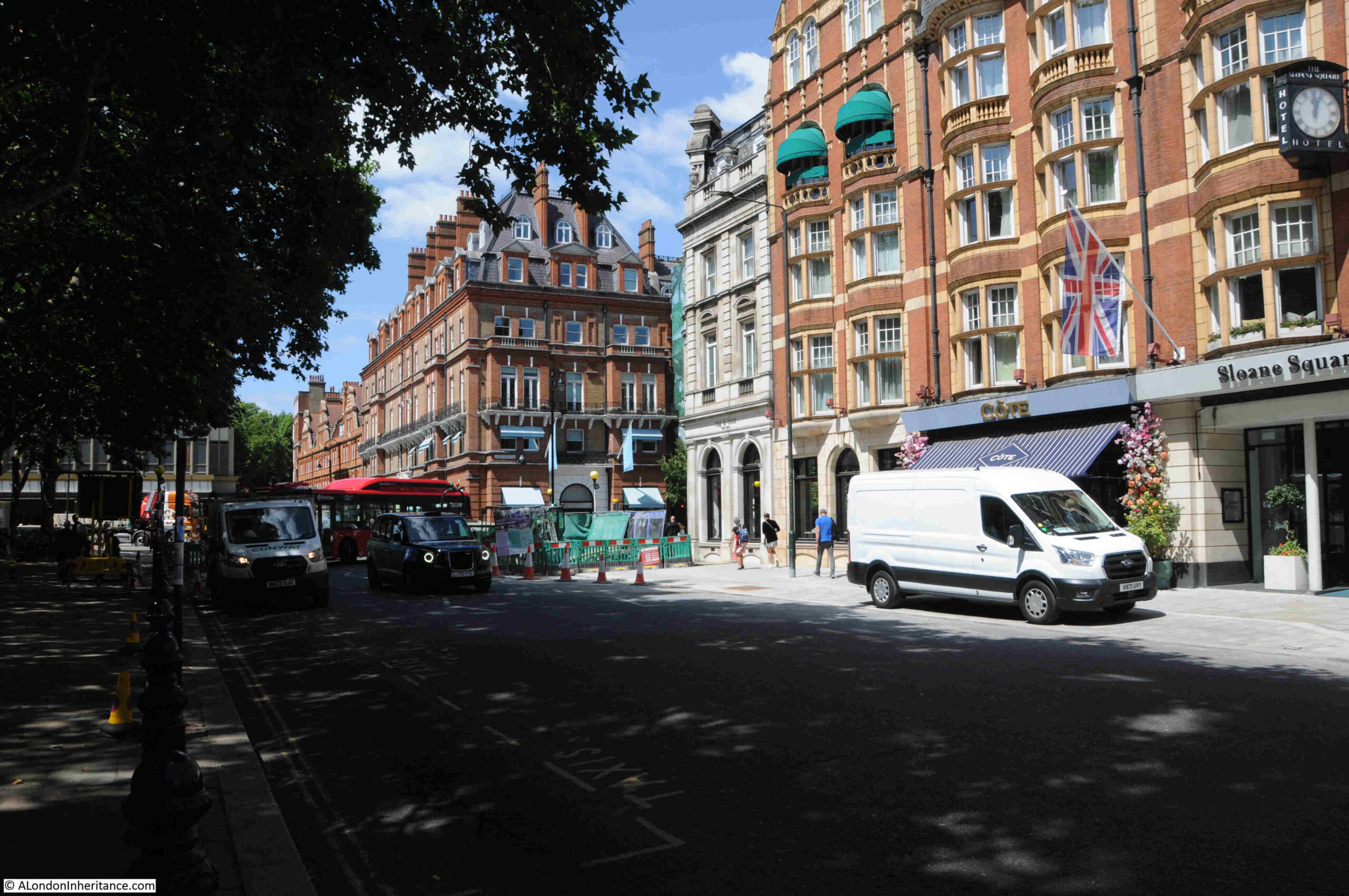
Sloane Square is a relatively recent development in London’s long history, but the square is typical of how London’s squares have developed, from fields and tracks, to being enclosed and lined with terrace houses and small shops, then large buildings with hotels, restaurants and department stores.
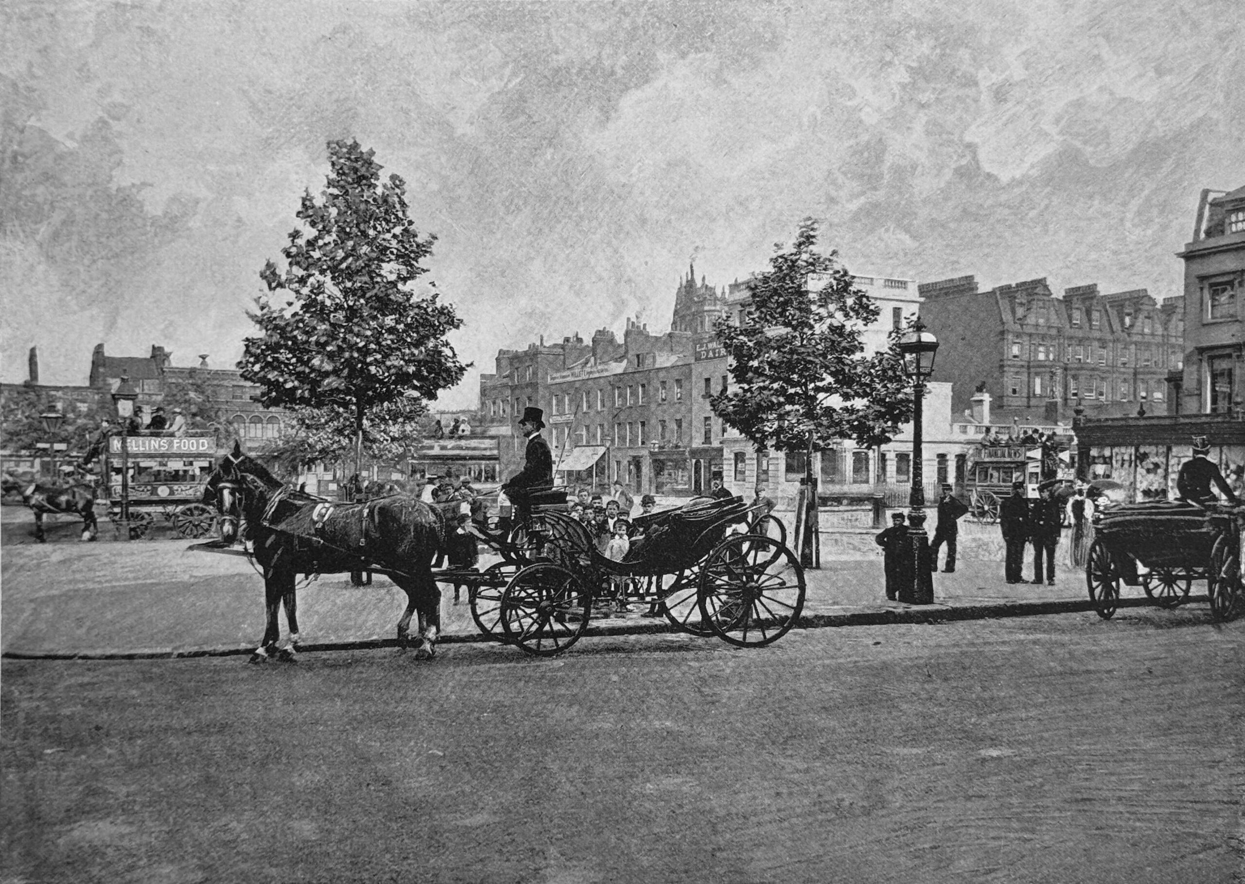
The following photo of Sloane Square is from the book, the “Queen’s London”, which shows London at the end of the 19th century, and the photo is of the square in the 1890s:
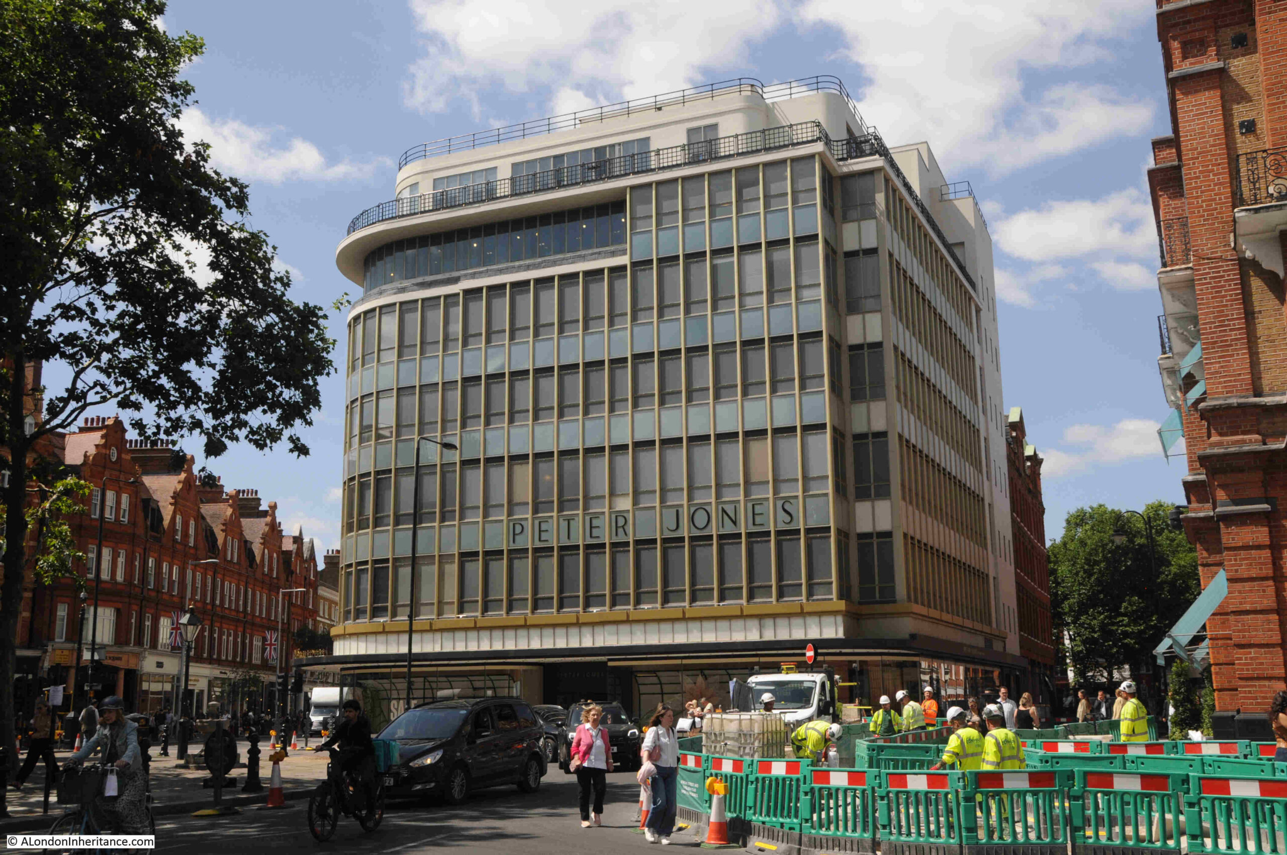
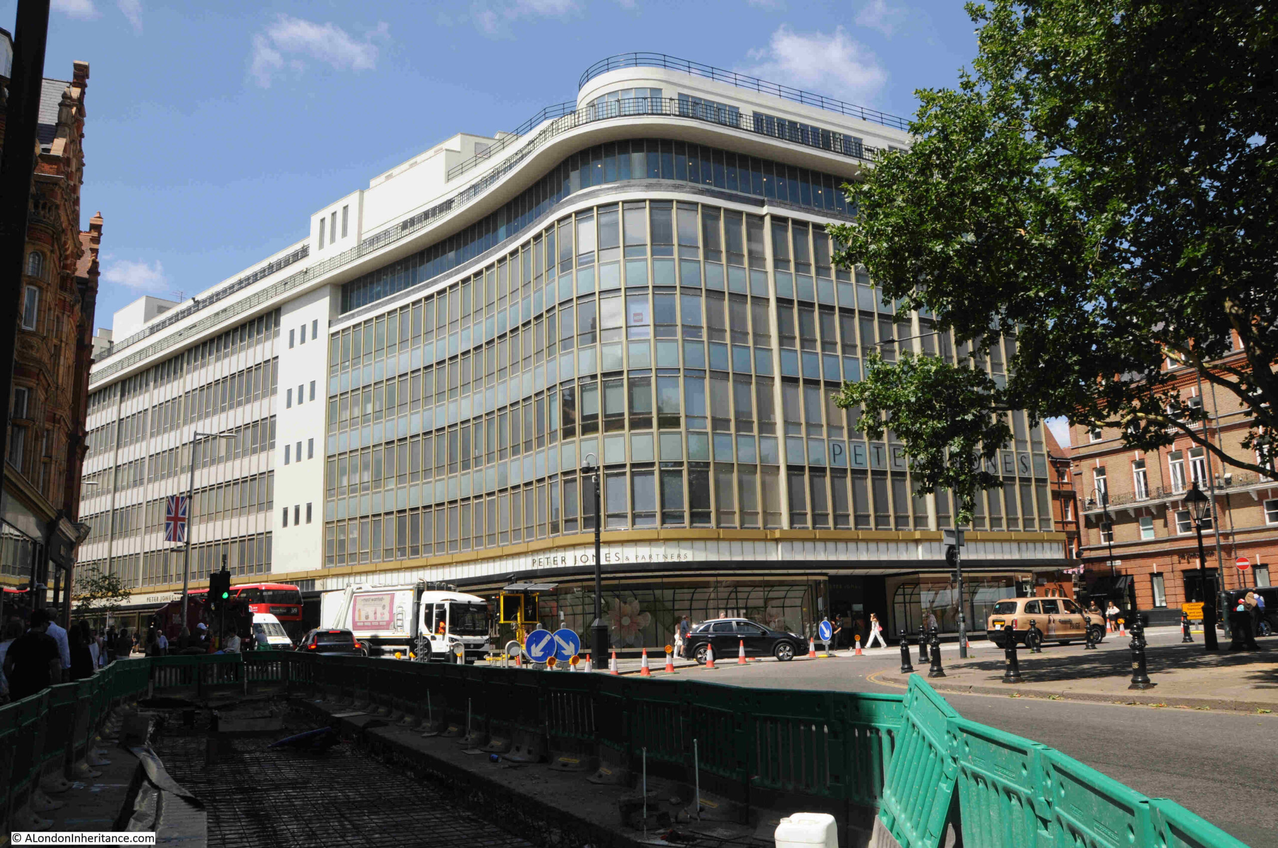
Slightly over 40 years later, the first part of the new Peter Jones department store was built, so within 40 years, architectural styles in Sloane Square changed from the above late Victorian photo to the 1930s building that we see on the western side of the square today:
Peter Jones was the son of a Welsh hat maker. He moved to London in 1867, and unlike many of his fellow countrymen who were involved in the dairy trade, Peter Jones opened a shop in 1871 in Chelsea, having gained retail experience in the first four years of his time in the city.
His first shop was in Draycott Avenue, but within a few years he had moved to King’s Road, where the street meets the western side of Sloane Square, and after buying up more property to form a large plot, his expanded red-brick department store was a major, successful retail enterprise serving the prosperous area around Sloane Square.
When the store was run by Peter Jones, it was very successful, however after his death in 1905, another successful retailer, John Lewis, was determined to buy the store to help with his London expansion, resulting in his purchase of the store, along with the adjacent buildings owned by Peter Jones, in December 1905.
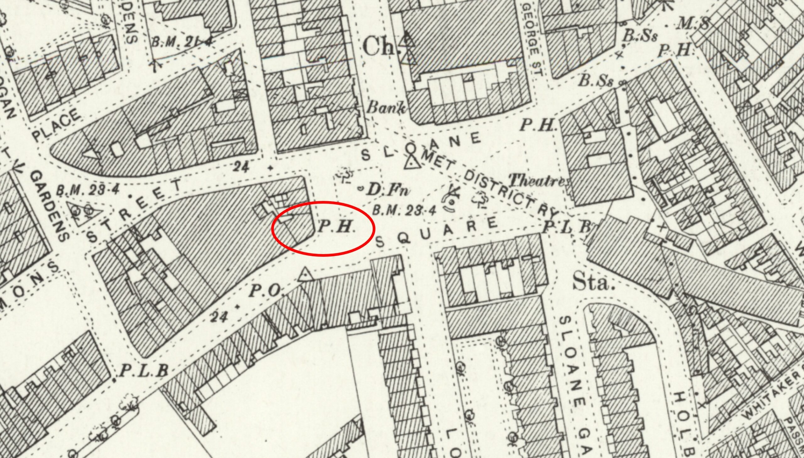
I believe that the early decades of John Lewis ownership was the only time that the company owned a London pub. This was the Star and Garter, on the corner of King’s Road and Sloane Square, and whilst in the early years the Peter Jones store was making a loss, the pub was making a considerable profit.
In the above OS map from the late 1890s, I have outlined the Star and Garter in a red oval. The Peter Jones store is the large block to the left of the pub.
Today, the Peter Jones store occupies the entire block, with the new building covering much of the space with the exception of an area from the north west corner, and along part of the northern side of the block.
The following photo shows the Peter Jones store curving from Sloane Square and down along King’s Road. The Star and Garter was where the curved corner of the building is today:
The building today is Grade II* listed. It was designed by William Crabtree, To maximise the amount of glass along the façade of the buildings, the external wall is not load bearing, and can therefore be of glass, with an almost continuous run of glass along the ground floor to maximise display space.
It must have been an impressive building when it first opened, so very different to the majority of architecture in the surrounding area in the 1930s.
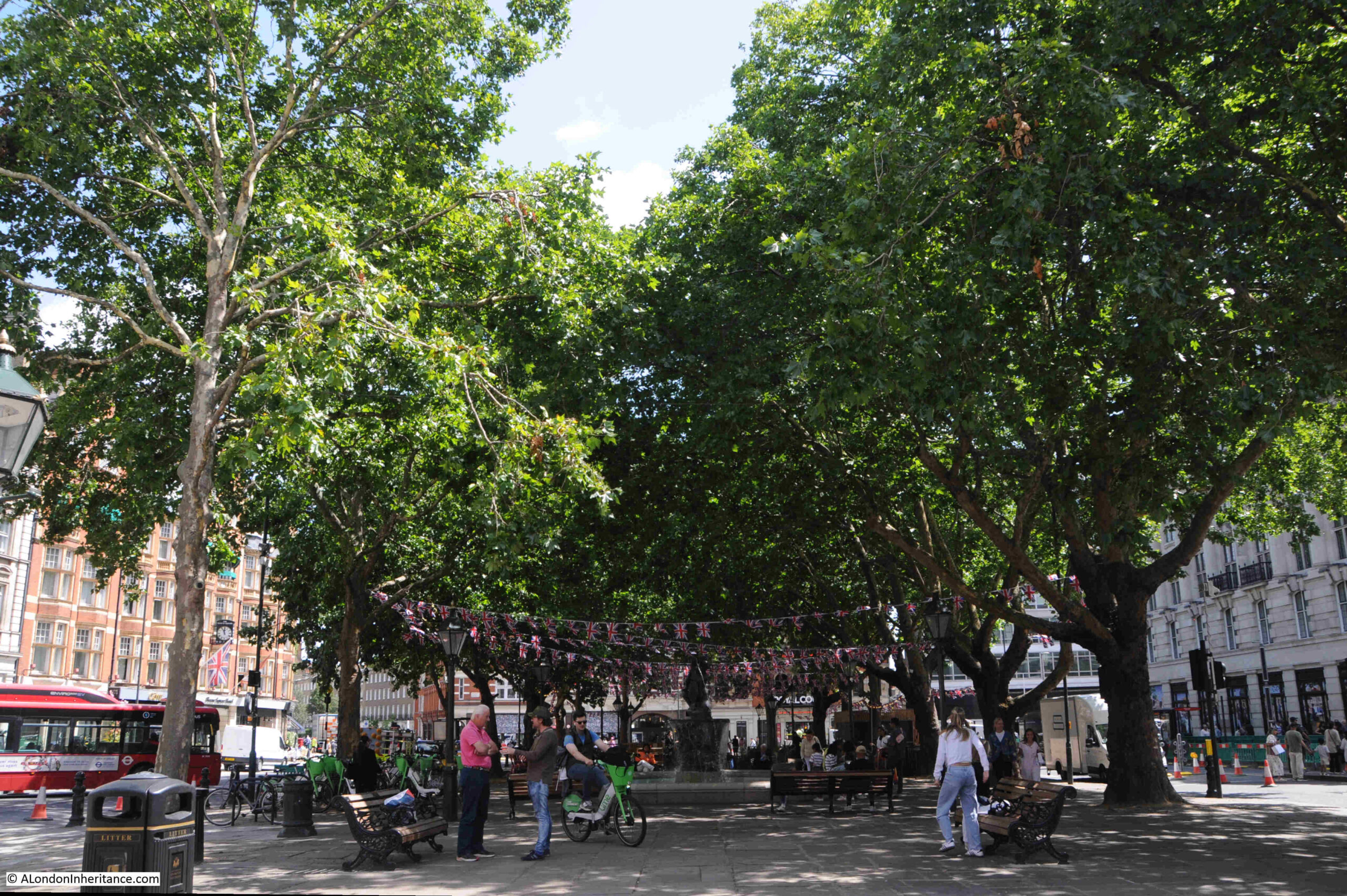
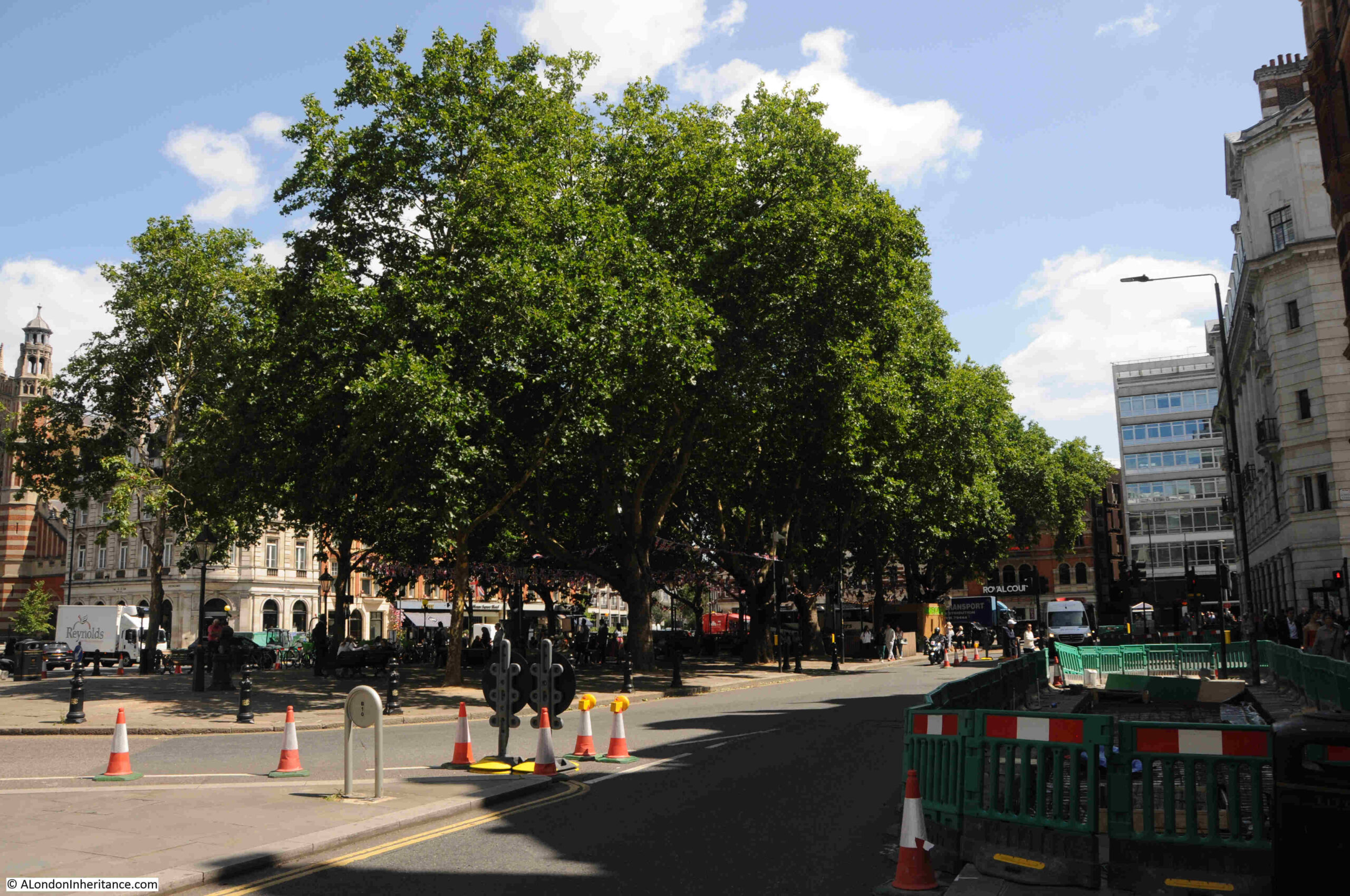
As the name implies, there is a central square within Sloane Square:
Sloane Square is named after Sir Hans Sloane, land owner and Lord of the Manor of Chelsea.
The square was laid out in 1771 when the fields of what had been a very rural area, were enclosed, and building started soon after, with houses built around the square under the direction of architect and builder, Henry Holland.
During the later part of the 19th century, and early 20th century, the original houses around the square were gradually demolished and consolidated into larger plots of land, with the large buildings we see today built along the four side of the square.
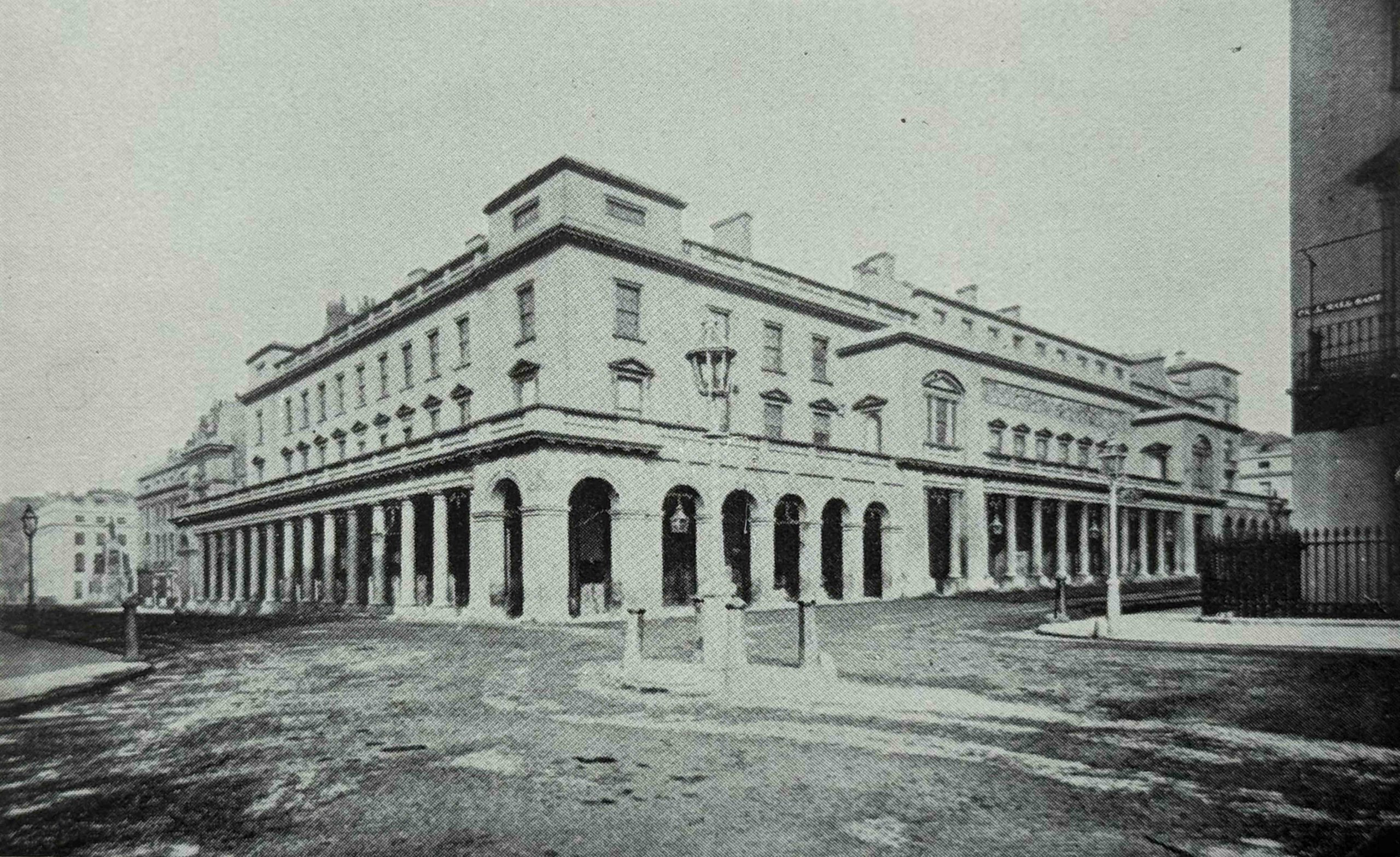
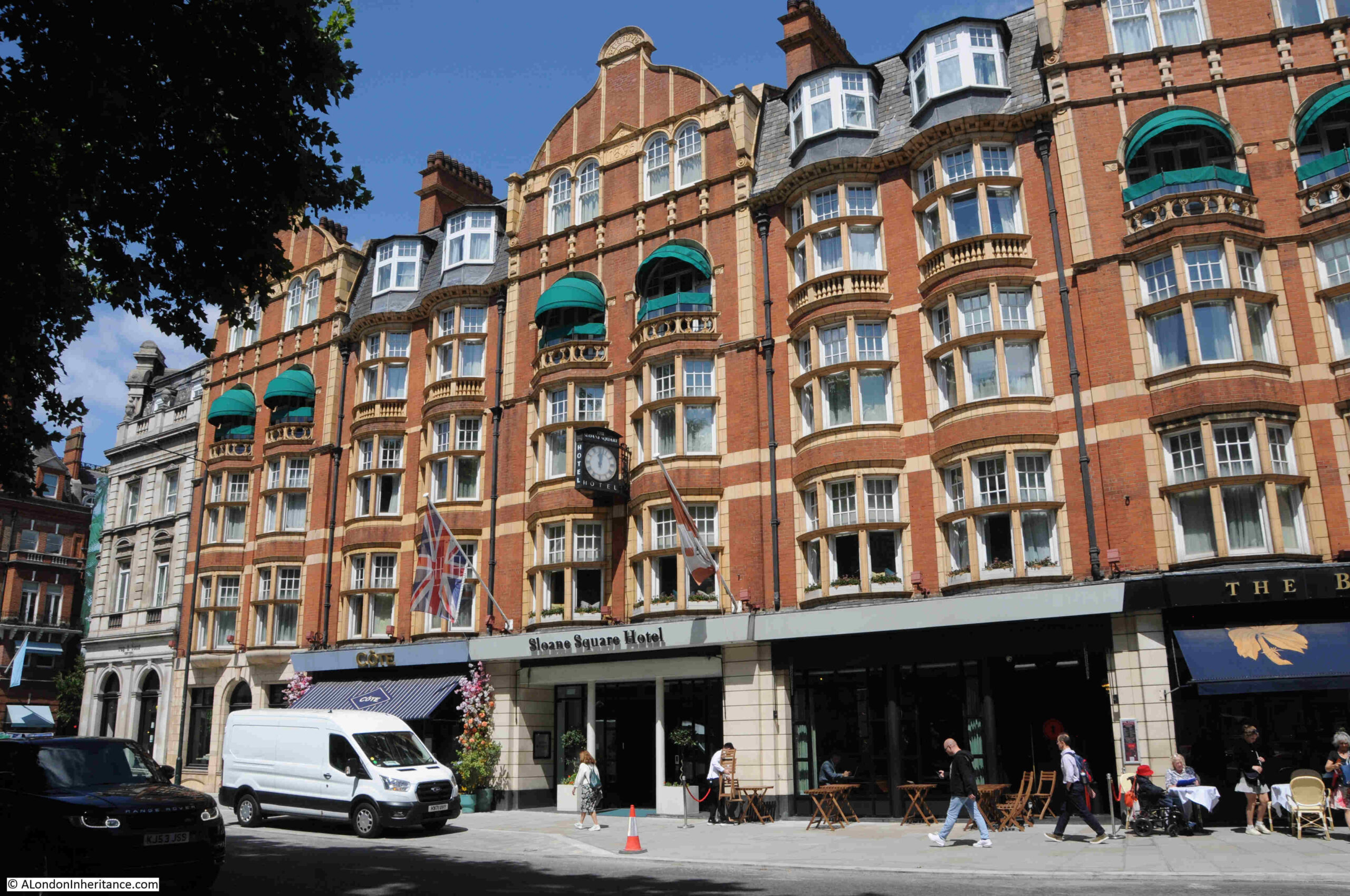
Typical of these changes was the construction of what is now the Sloane Square Hotel, with the red brick building being built in two phases between 1895 and 1898:
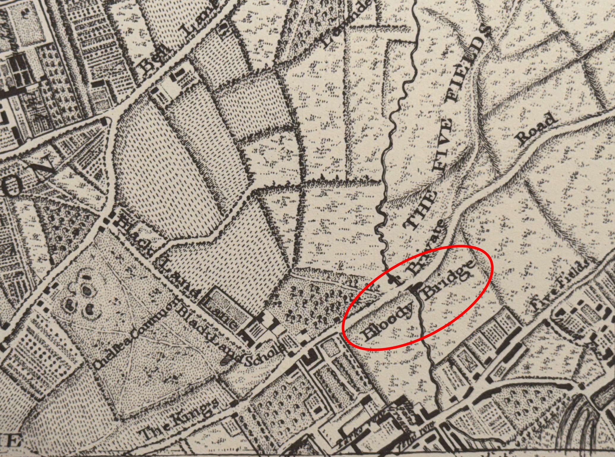
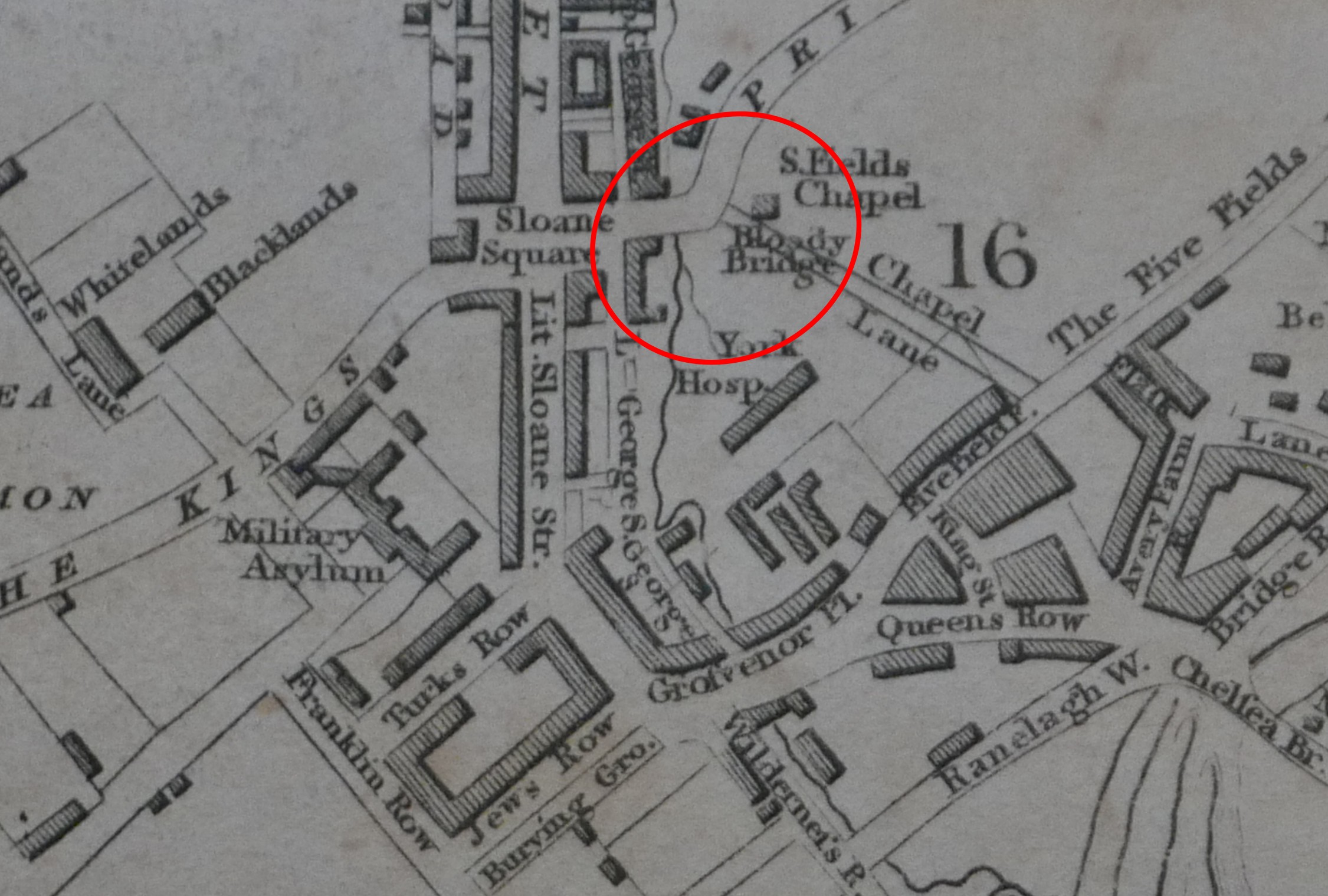
Part of the title to this week’s post is the “Bloody Bridge”, and this name tells some of the story of the area before Sloane Square was developed.
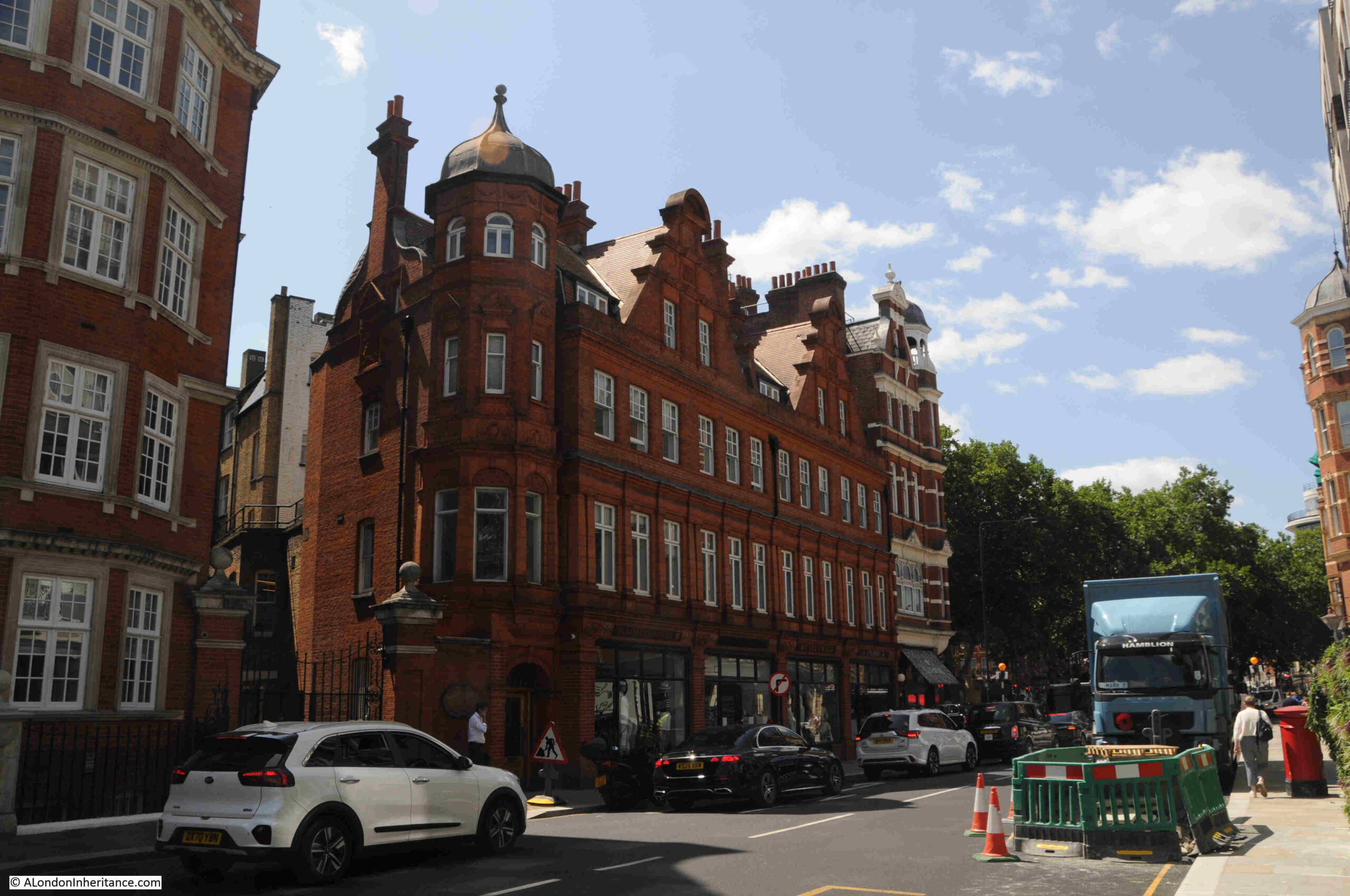
The following photo shows the north east corner of Sloane Square:
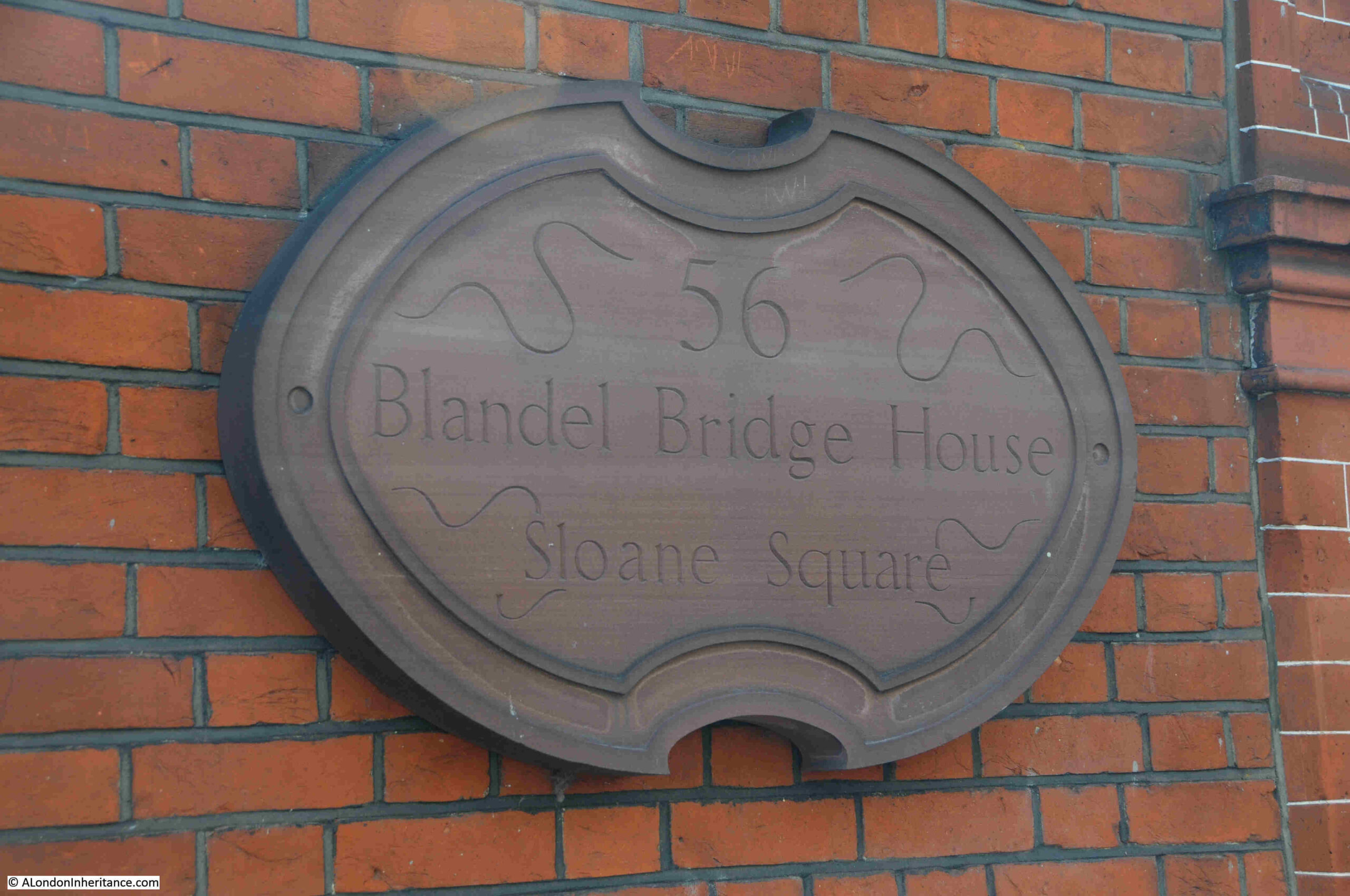
At this corner, Sloane Square leads off in to Cliveden Place, and a short way along, on the right is the following name plaque:
The plaque is on the wall behind the man with the white shirt, just above the bonnet of the white car in the following photo:
Blandel Bridge House is named after a bridge over the lost River Westbourne, a bridge that was once more commonly called the Bloody Bridge.
We can see the location and name in a couple of old maps, for example in Rocque’s 1746 map, showing the area before Sloane Square:
I have circled the name and location of the Bloody Bridge, and we can see the River Westbourne running through fields, then crossing under the bridge, before heading south.
The future location of Sloane Square is just to the left of the bridge.
Also, look at the length of the road that runs over the Bloody Bridge. It is called “The King’s Private Road”. Today, to the left it is King’s Road (which retains the original name, but drops the “private”), and to the right it is Cliveden Place and Eaton Gate / Square, although this part of the road has been much straightened out as the area was developed.
The road was named the King’s Private Road as it was, a private road for the King. This had been a footpath across the fields until King Charles II transformed the footpath into a road suitable for carriages, to form part of a route between Westminster and Hampton Court.
In 1731, copper tokens or tickets were issued to those who were allowed the privilege of travelling along the King’s Private Road. These tokens had “The King’s Private Road” on one side, and on the other an image of the Crown, along with the letters G.R. as at that time, George II was on the throne.
It would continue to be a private road all the way to 1830, when it was opened up as a general road, with no tokens or permissions being required.
The Bloody Bridge was still marked on maps in the early 19th century, as this extract from Smiths New Plan of London, published in 1816 shows:
In the above 1816 map, we can see that the Westbourne is on the edge of new development which is centred around Sloane Square.
How did it get the name Bloody Bridge? The official name seems to have been Blandel Bridge, as the name plaque in the previous photo still records today. The name Bloody Bridge seems to have a been a popular renaming of the bridge given the amount of murders and robberies that took place in the area. The name seems to have been first used in the mid 16th century, at the time of Elizabeth I, however with such a local name, and the distance of time, it is impossible to be sure when the name was first used.
Despite being the King’s private road, serious crime at the Bloody Bridge continued into the 18th century, with a couple of examples, first from 1748, when “four gentlemen coming from Chelsea, the King’s Road, in a coach were attacked near the Bloody Bridge by two highwaymen. They all getting out of their coach and drawing their swords, the highwaymen made off without their booty.”
And from 1753, when on the 17th of September, “Mr. Crouch, cook to the Earl of Harrington, who was attacked about nine o’clock at night by two villains, and, on making resistance, fired two pistols at him; and though he wounded one of them, yet having overpowered him, they took his watch and money, and then stabbed him with a knife, and beat him with their pistols till he was dead”.
The road must have been so dangerous, that in 1715, the local inhabitants petitioned the Government to organise patrols along the road from Chelsea to St. James’s.
Many 19th century reports, state that the Bloody Bridge name was because of the crime in the area, and that it was also a corruption of the name Blandel Bridge, so if that is correct, and Bloody Bridge was first used in the mid 16th century, Blandel Bridge was a name that must have already been in use, and therefore an older name for the bridge.
It is good that that the name of the bridge survives as the name of the building, near the site of the bridge, and the River Westbourne, which is now carried in the sewers beneath the streets, although it does sort of make an appearance, as the sewer which the Westbourne became, is today carried across the platforms of Sloane Square station:
Prior to the development of the area, the fields were once markets gardens, sheep and cattle grazing etc. and it seems that those who worked these fields and gardens were given access to the King’s Private Road, however in the time of George I (1714 to 1727), the overly zealous King’s Surveyor attempted to restrict local workers access to the road. With the support of Sir Hans Sloane, who pointed out to the Treasury that farmers and gardeners of the area had since “time out of mind” been the owners and occupiers of the land bordering the King’s private way and had been accustomed to use it for “egress and regress” to their lands, carrying their ploughs along it and conveying their crops to market.
The king relented, and allowed locals to have access, and it seems that around this time the old wooden bridge over the Westbourne was replaced with a stone bridge, but as shown in the above maps, the Bloody Bridge name continued to be in use.
Sloane Square station, through which the Westbourne runs todays, was built by the Metropolitan District Railway Company, and opened in 1868.
In the following image from Britain from Above, we can see the curved roof over the station platforms running down from the centre of image, above which we can see Sloane Square:
The image is dated 1928, so the original buildings that occupy the site of the 1930s Peter Jones building can be seen at the top of the square.,
From the station, head a little to the right along the lower edge of Sloane Square to the corner where a street runs to the right, and the old Bloody Bridge was located just off Sloane Square along this street.
Returning to Sloane Square, and in the central square is the Grade II listed Venus Fountain dating from 1953, and by Gilbert Ledward R.A.
The base of the fountain has a relief depicting Charles II and Nell Gwynn seated by the Thames. The relief shows Charles II picking fruit from a tree, while his mistress Nell Gwynn fans herself. The relief also includes Cupid who is ready with two arrows, and there are swans along the Thames.
Gilbert Ledward’s view apparently was that it was rather appropriate to show the king and his mistress at a place where they must have travelled along several times, along his private road.
The central square also includes a Grade II listed war memorial, unveiled on the 24th of October, 1920:
The Historic England record for the war memorial states that the architect is unknown, and newspaper reports of the unveiling also do not mention the name of the architect, however they do state that it was London’s first war cross, and was swiftly followed by one in Hackney. The early 1920s were a time when hundreds of war memorials were being unveiled across London and the rest of the country.
There are a number of plaques set among the paving slabs around the war memorial, including a plaque to Captain Julian Gribble who was awarded a Victoria Cross. His plaque is part of the “London VC Pavement Project”, a 2013 initiative by the Government to honour VC recipients:
Captain Julian Gribble was leading D Company of the Royal Warwickshire Regiment, when in March 1918 he was ordered to hold the crest of Harmies Ridge until further orders, while troops on either side withdrew.
His Company was soon surrounded, but they continued fighting and he was “last seen emptying his revolver into enemy troops at a range of only 10 to 12 feet.”
D Company’s stand allowed the troops on either side to withdraw, and Captain Gribble did survive this last battle. He was badly concussed by a wound to the head, and was taken to a German hospital for prisoners of war at Hameln. He was soon though removed to a prisoner of war camp at Carlsruhe, where conditions were not good.
He learned that he had received the VC in July 1918. His health though deteriorated, and he was suffering from double pneumonia. Before he could be repatriated after the end of the war, he died on the 25th of November, 1918, just hours before the camp was evacuated, at the age of 21
The Imperial War Museum Collection also includes a couple of photos of Sloane Square.
The first shows temporary buildings set up for the YMCA in the central square during the First World War (source, IWM Collection, Image: IWM (Q 28737):
For some strange reason, I do love shops with awnings over the pavement.
The second shows Flying Officer Harold Lackland Bevan buying flowers for his bride to be from a flower seller in Sloane Square in March 1943 (source, IWM Collection Image: IWM (D 12864):
Looking back from the war memorial to the west of the square, with Peter Jones in the distance:
There are two more listed buildings around Sloane Square. The first is the Grade II Royal Court:
The Royal Court theatre owes its existence to a small theatre in nearby Lower George Street. The current building on the eastern side of Sloane Square was opened on the 24th of September, 1888 as the New Court Theatre, and was designed by Walter Emden and Bertie Crewe.
The Royal Court was the first theatre in London to stage a suffragette themed production, when in April 1907 “A play has been successfully produced at the Court Theatre, Sloane Square, in which a suffragette heroine and 50 suffragettes as supernumeraries demonstrated with the enthusiastic support of the audience”.
The theatre closed in 1932, and the building served as a cinema between 1935 and 1940, and then suffered some bomb damage.
The interior of the theatre was reconstructed after the war and the theatre reopened in 1952.
Strangely, the history of theatre on the theatre’s web site starts in May 1956, when John Osborne’s “Look Back in Anger” opened at the theatre. The only mention of anything prior to 1956 appears to be the state of the drains in the early 1900s, and the creaking of the seats in 1906.
The interior of the theatre has been refurbished and upgraded a number of times, but the façade facing onto Sloane Square looks much as it did when the original theatre opened in 1888.
In the above photo, the entrance to Sloane Square station is on the ground floor of the new block immediately to the right of the theatre. The original station building having been demolished many years ago. Had it survived, it may well have also been listed.
The other listed structure is not a building, but a “Pair of K6 Telephone Kiosks outside the Royal Court Theatre“:
The telephone kiosks are Grade II listed, with the listing stating that they are “Telephone kiosks. Type K6. Designed 1935 by Giles Gilbert Scott. Made by various contractors. Cast iron. Square kiosk with domed roof. Unperforated crowns to top panels and margin glazing to windows and door.”
There are no payphones in either of the kiosks, and the sign on the door states that “This kiosk is protected for future generations”, along with a web link to where you can adopt a kiosk, and from there, there is another link to where you can purchase a K6 telephone kiosk for a starting price of £3,200 plus VAT and delivery.
It is interesting that both the telephone kiosks and the Royal Court Theatre are equally Grade II listed.
View looking across to the central square from the south west corner of Sloane Square:
Sloane Square has given the term “Sloane Ranger” to the English language, a term that describes an upper middle class, or upper class person, usually young and financially well off, and who have a similar approach to fashion and life.
Prior to the marriage of Sarah Ferguson and Prince Andrew, there were many newspapers descriptions of the bride as follows:
“Miss Sarah Ferguson comes from that well-heeled, rather old fashioned slice of young society known as Sloane Rangers.
Sloane girls’ hallmarks are pearls, Liberty frocks, sensible shoes and cashmere sweaters, their spiritual home the Sloane Square area of London. They speak in cut-glass accents and signify agreement by a drawn out ‘Okay, yah’.
Sloane Rangers may work in the City, but their roots are in the huntin’ and shootin’ countryside where they attend hunt balls and show jumping trials. On such occasions they brush with royalty.
Lady Diana Spencer was the definitive Sloane.”
According to the Sunday Express on the 7th of March 1993, Sloane Rangers were in shock over rumours of the closure of Peter Jones, their mecca on a Saturday morning for a wax jacket and pearls.
The origin of the term Sloane Ranger seems to be in the mid 1970s, and appears to have been used first in print in an article in Harpers & Queen in October 1975 by Peter York.
However there are other candidates for the origin of the phrase including Martina Margetts, a Harpers sub-editor, or it could be Fiona Macpherson, also a Harpers editor. There is also a claim that journalist Julian Kilgour used the term Sloane Ranger to describe his wife, in November 1974.
Whatever the source of the term, it does describe a certain social set, once based around Sloane Square. I am not sure what Sir Hans Sloane would have thought of his surname being put to such use.
The southern side of Sloane Square:
The northern side of Sloane Square:
Sloane Square again shows how much history you can find in a small part of London.
And if you walk along the King’s Road of today, it is so named just because Charles II, and the kings that followed until the 19th century, wanted their own private route from St. James’s Palace and Westminster to Hampton Court, and the Bloody Bridge shows how dangerous and violent parts of London once were.
Charterhouse Street runs along the northern edge of Smithfield Market. St. John Street is one of the streets that turns off north from Charterhouse Street, and from the junction, we can look up St. John Street, to the point where the street widens out, and there is a tree in the centre:
The following photo shows this relatively large area of open space, with the widened street passing either side of a central tree and bike racks:
I mentioned in the post on Blackfriars a couple of weeks ago how streets often retain the outline of what was there many years ago, and so it is with this space in St. John Street:
As it was in this space that Hicks’s Hall was built, and in Rocque’s 1746 map of London, we can see the building in the middle of the space, opposite Peter’s Lane and St. John’s Lane, showing that Hicks’s Hall was where the tree and bike rack are located today:
Hicks’s Hall was the first, dedicated Middlesex Sessions House. A place where a court sat, and criminal trials took place.
Hicks’s Hall was built in 1612 by Sir Baptist Hicks, a rich silk merchant, who lived in Soper Lane in the City, as well as having a house in Kensington.
There was a need for a dedicated Sessions House, as prior to the construction of Hicks’s Hall, Middlesex magistrates had used a number of local Inns, places which were not ideal to carry out a trial and to dispense justice.
An account of the opening of Hicks’s Hall reads: “Sir Baptist Hicks, Knight, one of the justices of the county builded a very stately Session House of brick and stone, with all offices thereunto belonging, at his own proper charge, and upon Wednesday, the 13th of January, this year, 1612, by which time this house was fully furnished, there assembled twenty-six justices of the county, being the first day of their meeting in that place, where they were all feasted by Sir Baptist Hicks, and then they all with one consent, gave it a proper name, and called it Hicks’s Hall, after the name of the founder, who then freely gave the house to them and their successors for ever. until this time, the Justices of Middlesex held their usual meeting in a common inn, called the Castle (Smithfield Bars).”
Numerous trials of many different types of criminal cases were held at Hicks’s Hall, and just a brief search of newspaper records reveals hundreds of reports. The following are a small example as crimes also illustrate life in the city. They are all from the 50 years from 1700 to 1750:
24th January, 1723 – This Day, Mr. Ogden was tried at Hicks’s Hall for Cursing the King, which was plainly proved, but some of the evidence disposed that he was very much in Drink, and that he was esteemed a person very much effected to His Majesty, and often drank his Health. The Jury, after a short stay, brought him in Guilty
21st October, 1727 – Two Men who had been convicted at Hicks’s Hall of a Misdemeanour in assaulting the Countess of Winchester in her Coach at Chelsea, with intent to Rob, and were sentenced to be whipt from Westminster Hall Gate to the end of Cabbage Lane in Petty France for the same (the sentence was not carried out as there appears to be a problem with the way the trial was carried out).
15th April, 1730 – On Thursday at the Sessions at Hicks’s Hall, a Soldier having made Oath directly contrary to what he had sworn before, was taken into custody, and a Bill of Indictment for Perjury ordered to be brought against him
24th May, 1733 – On Thursday at Hicks’s Hall, one Dwyer an Irishmen, and a Serjeant in the French Army, was convicted on several Indictments, for seducing Men to list themselves in the Service of the King of France; the Fact was proved very plain upon him, and the Court upon an Indictment sentenced him to pay a Fine of 1s and to suffer one year’s Imprisonment, and upon further Indictment a Fine of £50 and to find Sureties for his good behaviour for five years
21st December, 1734 – Yesterday eight Butchers, who exposed to Sale on the Lord’s Day quantities of Beef and Mutton in a Place called Cow-Cross, near Smithfield, were by the Court of Justices at Hicks’s Hall fined 13s, 4d each, and some of them for a second offence, £1, 6s, 8d and were severely reprimanded by the Justices for such vile practices, and acquainted, that if they ever did so again, the Punishment would be more severe
13th July, 1745 – Last Tuesday three Master Barbers were committed to Clerkenwell Bridewell by the Justices at Hicks’s Hall, for exercising their trades on the Lord’s Day and refusing to pay the fine
Hicks’s Hall from Old and New London. The print is recorded as being of the hall in 1750:
Thousands of cases were tried at Hicks’s Hall, and these were mainly of local crimes, however Hicks’s Hall was also used for trials of national importance and notoriety, for example when Hicks’s Hall played a prominent part in the actions of King Charles II against those who were responsible for the death of his father, King Charles I.
The trial of twenty nine of these Regicides (the Commissioners who had signed the warrant for the King’s execution, or who had a major part in his trial or execution) commenced at Hicks’s Hall on Tuesday the 9th of October 1669, and ended at the Old Bailey on Friday the 19th of October 1660.
Just ten days, including a weekend, which was not long for the trial of 29 people who were charged with crimes that carried some of the most extreme punishments, however I suspect there was little doubt as to the outcome.
The full account of the trial was published in a book which recorded the details of the trial, exchanges between prosecution and those charged, words of the Judge, background to the trial, a brief biography of those charged etc.
The long Preface to the books make an interesting read. It provides a whole range of justifications as to why the crimes committed by the Regicides were against the unity of the country, Christian religious principles, and the preface also tries to explain how those accused could have found themselves in such a position.
The following couple of paragraphs from the Preface are perhaps just as relevant today, as it was then:
“But let us examine a little into this Mystery of Enthusiasm and see by what means People arrive to this high Degree of Infatuation, and what are the several Steps which they take towards it.
The main Foundation of it is, no doubt, a large Stock of Pride, and a singular Fondness, which Men are apt to have for their own Sentiments and Opinions. Nothing is more common than for Men of this Spirit to run into Parties and Factions, and struggle hard for Superiority.”
To set the scene, the book also has a “Summary of the Dark Proceedings of the CABAL at Westminster, preparatory to the Murder of His Late Sacred Majesty, taken out of their own Journal-Book”.
The trial commenced at Hicks’s Hall on Tuesday the 9th of October 1660. The Court was directed by a large number of the great and the good, those who supported the restored Monarchy, including the Lord Mayor of the City of London, the Lord Chancellor of England, the Lord Treasurer of England, Dukes, Earls, Knights, Baronets and Justices.
A jury of 21 was sworn in consisting of Baronets, Knights, Esquires and Gentlemen.
To open the trail at Hicks’s Hall, the Lord Chief Baron, the head of His Majesty’s High Court of Exchequer spoke to the Jury.
Much of his speech was about the position of the King. That the Law Books describe the King as “the Lieutenant of God”, that the “King is immediate from God and hath no superior”, and that “If the King is immediate under God, he derives his authority from no body else; if the King has an Imperial Power, if the King ne Head of the Commonwealth, Head of the Body Politick, of the Body Politick owes him Obedience, truly I think it is an undenied consequence he must needs be Superior over them”.
Basically, although this was a trial, there could only be one outcome, and that those involved in the execution of King Charles I were automatically guilty, as only God was superior to the King.
The book also includes a brief biography of all those on trial. These are fascinating as they show the contempt in which the regicides were held. Below is a sample from the biographies from four of those on trial:
Colonel Thomas Harrison was the Son of a Butcher or Grasier at Newcastle-under-line in Staffordshire. After he had been educated in some Grammar Learning, he was placed with a Hulk, or Hulker, an Attorney in Clifford’s Inn, and when out of his Time became a kind of Petty-fogger. But finding little Profit arise from that, he took Arms for Parliament at the Breaking-out of Rebellious War, and by his Enthusiastical Preaching, and great Pretence to Piety, he so far recommended himself to the deluded Army, that he was advanced from one Post to another till he became a Major. He was Cromwell’s great Friend and Confident in all his Designs
Col. Adrian Scroop was descended of a Good family in Buckinghamshire. He was a great Puritan, and Stickler against Episcopacy, which made him take Arms against the King. Though he was no Parliament Man, yet he was drawn in, as he pretended by Oliver Cromwell, to be One in the Black List for Trying the King.
Mr. John Carew was born in Cornwell, of a very ancient family there, but had the Misfortune to be educated in Factious Principles, and was, like Harrison, a Fifth Monarchy Man, as appears in his trial. This made him an utter Enemy, not only to the King, but to all Government as a single Person, so that Oliver’s Usurpation was as hateful to him as the Royal Sovereignty, which he had destroyed
Gregory Clement is hardly worth mentioning. He was at first a Merchant, but failing in that, he sought to thrive by a New Trade in Bishops Lands, wherein he got a considerable Estate. He was turned out of the Rump-Parliament for lying with his Maid at Greenwich, but was taken in again when they were restored after Oliver’s Interruption. His guilty Conscience, and his Ignorance, would not suffer him to make any Plea at the Bar, or any Speech or Prayer at the Gallows
Poor old Gregory Clement seems to have been singled out for special contempt.
John Carew was considered especially dangerous as he was described as a Fifth Monarchy Man. Fifth Monarchists were a non-conformist religious sect that believed the killing of King Charles I marked the end of the fourth monarchy (the rule by kings), and would herald in the fifth monarchy when rule would be by Saints and by those “saved”, and would lead to the Second Coming.
The above four examples of those on trial were all found guilty and were all executed along with other Regicides during three very bloody days at Charing Cross::
Colonel Thomas Harrison was hanged, drawn and quartered at Charing Cross on the 13th of October, 1660
Col. Adrian Scroop was hanged, drawn and quartered at Charing Cross on the 17th of October, 1660
Mr. John Carew was hanged, drawn and quartered at Charing Cross on the 15th of October, 1660
Gregory Clement was hanged, drawn and quartered at Charing Cross on the 17th of October, 1660
Others on trial at Hicks’s Hall and then at the old Bailey had a mix of sentences ranging from execution, life imprisonment down to a limited term of imprisonment.
Hicks’s Hall is also shown in William Morgan’s 1682 Map of London:
But why was there an open space in St. John Street allowing Hicks’s Hall to be built in 1612?
I suspect to answer that question, we need to go much further back in history, to the founding of the Priory of the Order of St John of Jerusalem in 1144 when 10 acres of land was granted to Jordan de Bricet in Clerkenwell. The following map from my post on the Priory and St. John’s Gate shows the boundary of the Priory.
So if there was a gatehouse here, there would probably have been some degree of open space in front of the gatehouse, and this would have been where Hicks’s Hall was built centuries later, and is still a wider open space in the street today, with a tree in the centre.
Looking back at the location of Hicks’s Hall, and the possible location of a Gatehouse to the Priory of the Order of St John of Jerusalem is to the right of the tree:
Hicks’s Hall was used as a Session House until the late 1789s. By which time it was in a very poor state, was a bit on the small side for the work being conducted in the building, and the location of the building in the middle of St. John Street was not ideal, given the increase in traffic along the street since the building had originally been constructed.
Hicks’s Hall had been an important building in London, for as well as being a place where criminal cases were tried, it was also one of the places in the city from where distances were measured, and Hicks’s Hall was the measuring point for many places to the north of the city.
There is an interesting story from 1773 which shows how Hicks’s Hall was an important landmark, and also a staggering example of endurance and long distance travel.
On Monday the 29th of November 1773, Mr Foster Powell set off from Hicks’s Hall to deliver a letter to a Mr. Clarke, a watchmaker in York. Rather than travel on a horse, Foster Powell walked the entire route, including the return.
Staring at Hicks’s Hall, on the first day he covered the 88 miles to Stamford, on the second the 72 miles to Doncaster. On day three, Wednesday he set off from Doncaster and arrived in York in the afternoon where he delivered the letter. He then went to the Golden Anchor for some refreshment and an hour and a half of sleep, then later the same afternoon he set off for the return journey.
He reached Hicks’s Hall on the Saturday at four in the morning, having covered 394 miles in slightly over 5 days.
Foster Powell was known for his long distance walks, and it was reported that on many of these, locals would try and keep up with him on the route, but no one could for anything more than a couple of minutes. Off his other walks, one was a bet that he could not walk from London to Canterbury and back within 24 hours. He manged the return journey in 23 hours, 53 minutes, winning a bet of 100 Guineas.
At some point in the 1780s, Hicks’s Hall was demolished. It was because of the state of repair, size and location, and also because a new Middlesex Sessions House had recently been completed, and to find this building we need to take St. John’s Lane, the street opposite the location of Hicks’s Hall.
Walk down this street, and through St. John’s Gate:
Turn left on reaching Clerkenwell Road, and a short distance along, the following building can be seen on the northern side of the street:
The building is the Grade II* listed Old Sessions House, and a walk up from Clerkenwell Road to Clerkenwell Green provides a view of the front of the building. A far more impressive and substantial building than its predecessor, Hicks’s Hall, appears to have been:
Following my post on Archway last week, where the Arms of the old county of Middlesex can still be seen on the bridge, the Arms can also be seen on the pediment above the columns at the front of the Middlesex Sessions House:
Although the Sessions House at Clerkenwell Green was a completely new building, for some years after the transfer to the new building, it was also known as Hicks’s Hall, as this image from 1805 shows by the title of the print:
Credit: London Museum. Used under Creative Commons Licence CC BY-NC 4.0
The use of the name Hicks’s Hall for the new Middlesex Sessions House seems to have been common until the late 1840s, with the last newspaper report I could find of a trial using the name Hicks’s Hall being in 1848.
Many reports from the time recorded that the new building included a “fine Jacobean chimney piece” from the old Hicks’s Hall. The following inscription was apparently on the chimney piece: “Sir Baptist Hicks of Kensington in the county of Middlesex, knight, one of the justices of the peace of this county of Middlesex of his worthy disposition and at his own proper charge built this session house in the year of our Lord 1612 and gave it to the justices of the peace of this county and their successors for the sessions house for ever, 1618”.
The new building is Grade II* listed, and I can find no reference to the chimney piece in the listing.
I find it strange that, although the space occupied by the original Hicks’s Hall remains, I could not find any plaque recording that the building once stood in St. John Street.
Given that it was the first dedicated Sessions House for the County of Middlesex, that it was a place where lots of trials took place, and where many of those involved in the execution of King Charles I started the trials that would lead to executions and life imprisonment for many, the site of Hicks’s Hall must deserve some form of site record.
Highgate Archway, or just Archway as it is now more commonly known, carries Hornsey Lane over the A1, Archway Road, one of the major routes connecting London with the rest of the country. The A1 starts at the roundabout at the old Museum of London site, alongside London Wall, and ends in Edinburgh, and at 410 miles in length, it is the longest, numbered road in the country.
The Archway bridge looking north:
And looking south. a view which shows how the road descends in height as it heads towards the Archway pub and Archway underground station – the bridge has given its name to a small part of north London:
The land either side of the bridge carrying Hornsey Lane over the A1 is, according to the Ordnance Survey map, around 100m above sea level, so standing on the southern side of the bridge, we can see the A1 heading towards the junction around the Archway Tavern, with a good view of the towers of the City in the distance, with the Shard to the right:
Follow Hornsey Lane to the left, and it joins Highgate Hill. opposite Waterlow Park, and Highgate Hill is the reason why the Highgate Archway was built.
Early in the 19th century, Highgate Hill was one of the main routes running north from the city. It was a steep hill, in a variable condition, and at the top, Highgate Hill, as its name suggests, ran through the village of Highgate.
Traffic levels were increasing, and a need to bypass Highgate was seen as the best approach of addressing the challenges of the hill, avoiding Highgate village, and supporting increasing traffic volumes.
The following extract from the excellent Topographic Map website shows why the new route was needed, and why the location for the Highgate Archway was chosen:
The orange and red are increasing height, and the greens and blues are descending hights.
The orange, red and pink to the left of centre is the location of Highgate. Highgate Hill runs up this increasing height.
Highgate Archway is marked with the black arrow. Archway Road runs to the east of Highgate, cutting across the lower land height, and where Hornsey Lane runs to Highgate, it is along a short, high spur of land which follows Hornsey Lane. The Highgate Archway bridge was needed to carry Hornsey Lane as Archway Road cut through this short, high spur of land.
At the beginning of the 19th century, much of the land was still fields, so building the new road to the east, avoided Highgate Village, reduced the height and rate of ascent of the road, cut through the short amount of high ground and provided a much wider road to carry increasing levels of traffic.
The following extract from Rocque’s map of 1746, shows the area in the mid 18th century. Highgate village is to the left, with Highgate Hill running up to Highgate from Upper Holloway.
I have marked with the arrow where the bridge is located today, with Hornsey Lane having already been in existence for some centuries. The red dashed line shows the route of the new road, Archway Road, from the current location of the Archway Tavern (at the bottom of the line), up to the point where today it meets Shepherds Hill / Jackson’s Lane:
The Highgate Archway bridge that we see today, is the third of the three plans for carrying Hornsey Lane over Archway Road. The first was a failure, the second worked reasonably well, and the third has lasted well over a century.
A bill was before Parliament in early 1810 for the construction of a new road and a tunnel taking the new road under Hornsey Lane.
The proposal for a tunnel came from the mining engineer Robert Vazie. This consisted of new approach roads and a tunnel with a total length of around 2,000 yards of which 211 yards was in the tunnel. A company was formed to deliver the new road and tunnel, with the ability to raise capital of £40,000 and to borrow up to £20,000.
The capital and borrowing was to be repaid by a toll charged to use the new road. Tolls of 6 pennies for a horse and vehicle, 3 pennies for a horse, 2 for a donkey and 1 penny for someone on foot.
Robert Vazie already had some difficult experience with constructing tunnels, as he was the first to work on a Rotherhithe tunnel, when in 1805 he started construction of a tunnel underneath the river – the Thames Archway Tunnel. Two years later, Vazie had not made that much progress. Sand and quicksand were making it very difficult to build a stable shaft and then tunnel out towards the river. The Directors of the Thames Archway Tunnel brought in the Cornish mining engineer Richard Trevithick, who made far more progress than Vazie, but continued to experience problems with quicksand and the river bursting through into the tunnel, to such an extent that the project had to be abandoned, and the Rotherhithe Tunnel had to wait for the Brunel father and son to build a tunnel between the north and south banks of the Thames.
Vazie’s Highgate Tunnel project also came to grief. The following is from the London Morning Chronicle on the 29th of January, 1812:
“THE TUNNEL – Between four and five o’clock on Monday morning, the Highgate Tunnel fell in with a tremendous crash, and the labour of several months, was in a few minutes, converted into a heap of ruins. Some of the workmen, who were coming to resume their daily labour, describe the noise that preceded it like that of distant thunder. It was the Crown Arch, near Horney Lane, that first gave way, and the lane, in consequence, fell some feet deep, and instantly became unpassable. The houses in the vicinity felt the fall like the shock of an earthquake. The number of persons whom the fineness of the weather attracted on Sunday to inspect the works, were not less than 800. How providential that the fall was reserved for a moment when no person was on the spot, to suffer by an accident, which has reduced this Herculean task to a heap of ruins.”
The collapse of the tunnel seems to have been caused by an economical approach in the materials used to line the tunnel, as on the 22nd of April, 1812, the following article appeared in the London Chronicle:
“The falling in of the Highgate Archway, which had been anticipated by the workmen for nearly a fortnight previous to the catastrophe, is considered to have originated in too economical a regard to the quantity of bricks used in the arch, and the quality of the cement uniting them. This accident, though a partial evil, will be evidently a public advantage, since it is now wisely determined by the proprietors to reduce their tenebrious tunnel to an arch of about 30 feet in length, which will be under and will support Hornsey Lane.”
The tunnel had many detractors, some had concerns with the proposal for a tunnel, other had concerns about the economic impact that the tunnel would have on the trade in Highgate, particularly for the inns that lines the road through Highgate, and attracted business from coaches, and travellers along the route.
Such were these concerns, that a comic opera was put on at the Lyceum Theatre, with the title “Highgate Tunnel or The Secret Arch”, which included a general battle between the Victuallers of Highgate and the Tunneleers. There was a sub-plot of an intrigue between Jerry Grout, described as a “bricklayer, lover and tunneleer”, and Patty Larkins, the daughter of the landlord of the Horns on Highgate Hill.
Following the collapse of the tunnel, plans were quickly revised, additional capital was raised by the company, and the architect John Nash was brought in to design a bridge rather than a tunnel, and to supervise the works.
Nash’s design was modelled on a Roman aqueduct, with two tiers of arches, and constructed of stone. The following photo from “The Queen’s London”, shows Highgate Archway as designed by John Nash:
When open, Archway Road was a toll road, however initially the amount of tolls collected were only just about enough to cover the maintenance of the bridge and road, but with increasing traffic volumes, tolls increased, but the action that allowed all the shareholders and loans to be fully repaid, was the sale of land alongside Archway Road for building. This land had originally been part of the purchase of land for the project, but its sale solved the profitability problem.
The road was freed from tolls on the 30th of April, 1876 when all debts had bee repaired, and the road and bridge were vested with the parishes of Hornsey and Islington.
Whilst Nash’s bridge was a success unlike the earlier tunnel, it had problems as traffic increased ober the 19th century. The central arch was only 18 feet wide, and acted as a choke point on the Archway Road. There were also plans for a tramway along the Archway Road, and a widening of the road and the bridge was essential for trams to run.
In the early 1890s, the London County Council Improvements Committee called for proposals for a replacement bridge along with widening of the Archway Road.
Then as now, there were discussions about cost, and finally the cost for the new bridge was shared between the Ecclesiastical Commissioners (£1,000) as they were freeholders of Highgate Woods, and owned nearby estates of land, Middlesex County Council and Hornsey Local Board (each to cover a quarter of the costs) and the London County Council would cover the rest of the costs, which were estimated at £28,000.
The Middlesex Coat of Arms remain on the bridge today as a reminder of the old county that part funded the structure:
The design of the new bridge was down to Sir Alexander Binnie, the engineer to London County Council.
The bridge had to accommodate five major water mains of the New River Company, who had a reservoir right next to the western side of the bridge, as well as gas mains of the Gas Light and Coke Company.
The plan of the new bridge from the London County Council book “History of London Street Improvements” (1898):
The design was selected in 1896, the contract for construction was signed with Charles Wall of Lots Road, Chelsea on the 13th of July, 1897.
Nash’s earlier bridge was demolished by the end of 1897, and work began on the new bridge in the following year., with the bridge being officially opened in July 1900.
Although the bridge did not open until 1900, and work commenced in 1897, the bridge displays the date 1897, to recognise Queen Victoria ‘s Diamond Jubilee of that year:
There was no formal opening of the new bridge. On the 28th of July 1900, Princess Louise (the sixth child of Queen Victoria) was unveiling a statue in Waterlow Park, and “on her return from the park, the Princess Louise was driven over the new Highgate Archway, and was enthusiastically received by the large crowds which had assembled along the line of the route. Without any formality beyond that of the royal drive across it, Highgate Archway was thrown open to the public on Saturday.”
The view looking across the bridge from the east, towards Highgate:
The cutting providing the route nortth for Archway Road, and the bridge carrying Hornsea Lane across Archway Road has been a success, in bypassing Highgate, and providing additiona road capacity.
Sadly though, for almost the whole time that the new bridge has been in place, it has been a place where people have tragically committed suicide by jumping to the road below.
There are frequent news paper reports over the decades of the bridge’s existence of suicides, and the Office for National Statistics has a record of deaths from the bridge over the last few years, with two between 2008 and 2012, and three between 2013 and 2017.
In 2018, plans were finalised for fencing around the sides of the bridge to try and prevent suicides. The above photo shows this fencing lining the two sides of the bridge, and the following photo shows the fencing looking south, with the towers of the City in the distance:
Other plans were put forward for fencing that blended in with the overall structure, but the solution we see today was installed.
Looking from the northern side of the bridge:
And to the east along Hornsey Lane:
I mentioned earlier that the new bridge had to accommodate a number of large water mains as the bridge was adjacent to a reservoir of the New River Company.
This was a logical place to locate a reservoir as height for the storage of treated water provides back pressure to distribute water to consumers. The water starved grass of the reservoir can be seen in the following photo looking west from the bridge towards Highgate. The road is wet, as the day of my visit to Archway coincided with the only bit of rain in several weeks:
The lamps to the side of the bridge were modelled on those on the Embankment:
It is not just the bridge which is high, the approach of Archway Road to the bridge is also high, and walking back towards Archway underground station, St. Paul’s Cathedral came into view (it is hidden by trees from the bridge), and I looked to be almost at the same level as the dome:
The higher ground behind the cathedral looks to be around Beckenham and Bromley, and illustrates how central London is at a low point, along the river, with high ground to north and south.
At the southern end of Archway Road is the 1888 Archway Tavern:
An earlier version of the Archway Tavern, with John Nash’s Highgate Archway to the right is shown in the following print, from Old and New London and is dated 1825. A rural scene that is hard to imagine today.
fIn the above print, the little hut to the right of the print is where tolls were taken for those using the new route.
It is interesting to compare prints with photos to see how realistic prints were.
If you compare the above print with the photo of John Nash’s bridge from the Queen’s London, earlier in the post. you will see that the road leading up to the bridge has a slope upwards in the photo, whereas in the above print, it looks like a flat stroll up to the bridge.
The Highgate Archway was an early bypass, taking traffic away from Highgate Hill and the village of Highgate.
The original plan for a tunnel was a failure. The double layered bridge by John Nash worked well for much of the 19th century, but as traffic volumes grew and the tram network was extended, the central arch was far too narrow, resulting in a replacement bridge designed by Sir Alexander Binnie. and which opened in 1900. This is the bridge we see today, the last of three plans to cross this busy road.
I have written about the area between the Strand and the Embankment in a number of previous posts. It is a fascinating place of alleys, steep streets to the river, and a place where we can still find features that are reminders of long lost landscapes.
One such feature can be found at the southern end of Essex Street, where the street appears to come to an end, with a large gap in the building at the end of the street framing the view towards the Embankment:
The archway through the building at the end of Essex Street leads to a set of stairs down to what would have been the level of the Thames. The archway in the 1920s from the book Wonderful London:
I love the details in these photos. There appears to be a child at lower left of the arch, who looks like they are holding a small dog or cat.
At first glance, the arch and surrounding building looks the same as the photo from 100 years ago, however looking closer and there are differences. The brickwork in the semi-circular area below the two round windows and above the entrance appears far more recessed in the 1920s than it does today, and along the wall between first and second floors there appears to be a white decorative band protruding from the brickwork which is not there today, so I suspect there has been some rebuilding / restoration of the building and arch.
A look at the London County Council Bomb Damage Map shows that there has indeed been some considerable post-war rebuilding, as the building surrounding the arch at the end of Essex Street is coloured deep purple, indicating serious damage.
A look through the arch in 2025:
The following photo from the the book “The Romance of London” by Alan Ivimy (1940), where the scene is described as “Water Gate, at Essex Street, Strand. This opening at the bottom of the street, which gives a view of green trees, is the old Water Gate, built into the surrounding houses, of Essex House, and the only survival of that great mansion”:
Essex House was one of the large houses that once lined the Strand, each with gardens leading down to the banks of the Thames. These houses would typically have their own access to the river as the river was frequently the fastest and safest method of travelling through London.
The caption in Alan Ivimey’s book is rather ambiguous as it states that the opening is the old water gate. It does not specifically state that the surrounding structure is the original water gate.
The houses lining the Strand often did have a feature where their private access to the river was located, as the view of these from the river would have acted as a location marker as well as a symbol of status, where a large, decorated structure acting as their gate to the river would have impressed visitors and those travelling along the Thames.
The arch was described as a Water Gate in the many illustrations of the feature that have appeared over the last couple of hundred years, including this print from 1848, where the Water Gate is described as the “stately portal with large columns to either side”:
So is the arch a survivor from the time of Essex House? Any thoughts that this may be a historic survival are quickly dashed when looking through the Historic England listing.
The arch is Grade II listed, however the listing text states that it is a “Triumphal” gateway built in 1676 by Nicholas Barbon to terminate his Essex Street development, and to screen his development of a commercial wharf below. The listing also confirms that there was bomb damage, and the surrounding buildings date from 1953.
Looking through the arch, we can see the steps leading down to Milford Lane:
Through the arch and down the stairs, we can look back at the rear of the 1953 building, the stairs and the arch. The view shows how the height difference between the streets leading down from the Strand, and what was the foreshore of the Thames have been managed, where the ground floor from this angle is the basement from Essex Street:
Although the building was bombed in the 1940s, and rebuilt in the 1950s, this view still looked very similar to the 1920s:
So, although the arch has frequently been called the Essex Street, or Essex House Water Gate, it appears that the feature dates from Nicholas Barbon’s development of what had been the Essex House gardens, into Essex Street. It was bombed in the last war, restored and rebuilt, and the building surrounding the arch dates from the 1950s.
I mentioned at the start of the post how features such as the arch can act as reminders of a long lost landscape, and to see how this works, we need to follow a series of maps.
In the above map, we can see Essex Street running slightly north west from the water gate (red arrow), up to the Strand. In the area between the arch / water gate, we can see part of the Victoria Embankment gardens to lower left, and on the right are Temple Gardens.
Going back to William Morgan’s 1682 map of London, and we can see the area soon after Nicholas Barbon’s development, with the red arrow marking the water gate:
There are 343 years between Morgan’s map, and the area today, and the street layout is almost identical, with Essex Street running to the north west, up to the Strand. The same two streets running east and west about two thirds up the street, and Milford Lane (blue arrow) running from the west to the south of the stairs in almost exactly the same alignment as today.
Morgan’s map shows a gap between the buildings at the end of Essex Street, where the arch is today. The map appears to show an open gap, with no arch, or floors above the arch. Whether this was an error in the map, whether the arch had not yet been built, or whether Barbon initially only put pillars on the building to the side of the gap as decoration, without an arch, would require much more research, but the key point is that the gap leading from Essex Street was there in 1682.
The 1682 map shows the stairs to the river, Essex Stairs (yellow arrow). These were not the stairs that lead down through the arch, but stairs at the end of what must have been a flat space between the water gate and the river, probably Barbon’s wharf development that the building and arch at the end of Essex Street was intended to screen.
To see how rapidly this area had changed, we can go back just five years from the above map, and the 1677 Ogilby and Morgan’s map of London.
In the extract below, we can see that Essex House, along with ornate gardens between the house and the Thames were still to be found. The red arrow marks the location of the water gate / arch we see today:
Essex House can be seen close to the Strand, opposite the church of St. Clements.
Essex House was originally Exeter House as it was the London residence of the Bishop of Exeter who had been granted the site in the reign of Edward III.
The house and grounds were taken during the Reformation, after which it was purchased by Thomas Howard, the fourth Duke of Norfolk, who was arrested in the house and in 1572 he was beheaded for his part in the conspiracy of Mary Queen of Scots. The house was then owned by the Earl of Leicester, and became Leicester House. After his death, the property passed to his son-in-law, the Earl of Essex during the reign of Elizabeth I, and the house became Essex House.
Originally facing directly onto the Strand, by the time of the above map, we can see that houses and shops had been built between the house and the Strand, reflecting the slow decline in the importance of the large houses built along the Strand.
The house was pulled down around 1682, the same year as the map of William Morgan, however it is always difficult to be sure of exact publication dates, when the streets were surveyed for the map etc.
This may also answer why the gap of the water gate is shown without an arch as the William Morgan map may have used the plans for the area, rather than as finally built.
The 1677 map shows some interesting comparisons and features:
comparing the shoreline between the Thames and the land in the 1677 and 1682 maps, and after Bourbon’s development, an area of the foreshore appears to have been recovered – Barbon’s wharf development as mentioned in the Historic England listing
this would then put the current arch / water gate at the location of the original stairs at the end of the gardens, to the river
the slight north west angle of the gardens is roughly the same as the alignment of Essex Street today, so as we walk along Essex Street, we are walking along what must have been the central pathway through the gardens of Essex House
although not named in the map, Milford Lane is running to the east of Essex House, in the same alignment as the lane today (although in 1677 it did not have the bend round the base of the stairs. Milford Lane once formed the boundary between Essex House and Arundel House to the west
An extract from the 1677 map is shown below, covering the boundary with the Thames:
There are two boats moored at the end of the stairs down to the river at the end of the gardens of Essex House, where the water gate stairs are today.
There are two other sets of stairs shown on the map. On the left, there is a cluster of boats around Milford Stairs – named after the lane on the east of Essex House, and a lane we can still find today.
On the right there is a large cluster of boats around Temple Stairs.
Three stairs in a short distance shows just how many stairs there once were between the land and the river. Many still survive, but stairs such as Milford, Essex and Temple have disappeared beneath the land reclamation for the Embankment.
Temple Stairs appear to have been of a rather ornate stone design. The following print shows the Great Frost of the winter of 1683 / 4:
Temple Stairs are on the left edge of the print, and they appear to be a stone, bridge like structure, probably over the most muddy part of the foreshore, with a set of steps then leading down to the river, where a passenger would take a boat to be rowed across or along the river.
The print has a pencil note “Taken from the Temple Stairs”, but other British Museum notes to the print state that the print is from near the Temple Stairs.
The following photo was taken from the southern end of Milford Lane, where it joins Temple Place:
The above photo is looking across what was Nicholas Barbon’s wharf development, which the houses at the end of Essex Street were meant to screen, and before Barbon’s work, this would have been the Thames foreshore, with the stairs leading down from the gardens of Essex House to the river, where the gap of the water gate can be seen.
In the following photo, the entrance to Milford Lane is on the right, behind the red phone box. The building on the left is Two Temple Place:
Two Temple Place gives the impression of being of some considerable age, however it is built on what was the Thames foreshore, and dates from the early 1890s, when William Waldorf Astor commissioned the gothic revivalist architect John Loughborough Pearson to create the building.
One of the stand out features is the gilded weather vane, made by J. Starkie Gardner, a representation of Christopher Columbus’ ship, the Santa Maria:
The water gate is today an interesting architectural feature at the end of Essex Street. Perhaps more importantly, it is reminder of a long lost landscape, which dates from Essex House and the gardens which led down to stairs to the Thames. After the demolition of Essex House, Essex Street was built on the same alignment as the gardens, and the stairs then led down to Barbon’s commercial wharf on what had been the Thames foreshore.
Today, the 19th century Embankment has further separated Essex Street and the stairs from the river, and Two Thames Place is a symbol of late 19th century building on the recently reclaimed land of the Embankment.
The stairs are also a reminder of a time when there were very many stairs along this part of the river, important places in the daily lives of many Londoners.
I often get asked about resources to research and discover London’s history, so I plan to add a resources page to the blog / website, and to build up to that I am starting a monthly addition to a blog post covering one specific resource. This month it is the London Topographical Society, and is at the end of the post, but first, a visit to Stoke Newington Church Street, to find the site of a photo taken by my father, 40 years ago in 1985:
This is the building in 2025, with the same ghost sign on the front, along with a second on the side of the building, which seems to be advertising the Westminster Gazette and Criterion Matches, there may be something else there as well, but the signs shows how new advertisements resulted in the overpainting of earlier adverts:
The signage on the front of the building also shows evidence of earlier changes and additions, but looks much as it did 40 years ago:
The ladder at the ground floor shop was a nice bit of symmetry with the sign above, as it was being used by a sign writer to add the name of the business. Good that these are still done manually.
Walker Brothers (their name is top right on the front of the building) presumably had a shop in the building, selling and repairing fountain pens, including those made by Watermans (bottom right panel), who are still in business today.
Interesting that the word Fountain is abbreviated to Fount, presumably to get all the text on the sign at the right size to be seen.
There was very little to be found about the company, and they do not appear to have advertised, or been mentioned in the newspapers in the British Newspaper Archive.
The building is Grade II listed, and dates to early 18th century, indeed there are a number of listed buildings in Stoke Newington Church Street, which tells a story of the age of this street.
Much of this area is of 19th century and later development, so why is there an early 18th century house in Stoke Newington Church Street?
To answer that, we can look at Rocque’s 1746 map of London, and we can see the street running left to right across the centre, from what is now Stoke Newington High Street on the right, to Newington Common on the left, which is now part of Clissold Park. The small river running to the left, and around Newington Common was the New River, bringing water in from Hertfordshire to the New River Company reservoirs at north Clerkenwell:
The wavy line of another stream can be seen in the upper half of the map, crossing the road at Stamford Bridge (hence the name), and then flowing south, heading towards the River Lea.
This was the Hackney Brook, one of London’s many lost streams and rivers, and a stream that was covered up during the mid 19th century, effectively becoming part of the sewer network.
We can see that in 1746, there were houses lining the street, including the house with the Fountain Pen sign we see today, and these houses had gardens extending behind them, with the rest of the map being fields.
Newington Church Street is therefore a street with some history, an interesting walk, with a number of other ghost signs, but in this post I want to look at some of the buildings, and what could be classed as modern day ghost signs.
I am starting on the corner of Stoke Newington High Street and Stoke Newington Church Street, where we find the Three Crowns:
The pub’s website claims that a pub has been here since the 1600s, with an original name of Cock and Harp, changed to the Three Crowns to represent England, Scotland and Ireland for James 1.
How far back in the 1600s is unclear, however there was a building on the site in Rocque’s 1746 map, and it would be the logical location for a pub, on the junction with a major road leading out of London, and the only significant set of buildings between Hoxton to the south and Tottenham to the north.
Surprisingly, the pub, and its rather decorative Saloon Lounge are not listed:
Another ghost sign:
This sign is not old, rather it is part of the Stoke Newington Heritage Mural project, and the poem that makes up the words across the wall is by children of the William Pattern Primary School.
I mentioned that there were what might be classed as modern ghost signs along the street. The first of these is above the middle (light blue) shop in the following photo:
A clock, presumably paid for, supplied by BASF when Church Street Electronics (television and audio) occupied the shop. BASF still exist as a chemicals company, and back in the 1970s / 80s made and sold cassette tapes. I remember them as being one of the more expensive, but better quality cassette tapes, and which did not jam in my Sharp cassette player in the car:
A short distance along is Stoke Newington Fire Station, and on the lower right of the building is a sign:
Proudly proclaiming that this is the G.L.C. London Fire Brigade:
The G.L.C. or Greater London Council was dissolved in 1986, so this sign is at least 39 years old, and interesting to see its survival on an official and still working building. I wonder if the phone to the left still works? In the days before the mobile phone, if you saw a fire, you could run to your nearest fire station, and use the phone on the wall outside to contact the fire brigade.
I do not know whether it is correct to call the clock and the GLC sign, ghost signs, but there are interesting reminders of the continuous change across London’s streets. I hope they both survive for many years to come. There are many similar examples to find across the streets of London.
Another traditional painted ghost sign, above a Gail’s bakery – a shop that is often used as an indicator of gentrification:
One of the entrances to Abney Park Cemetery is on Stoke Newington Church Street – a cemetery that deserves at least a couple of posts to do it justice:
The Clarence on the corner of Stoke Newington Church Street and Bouverie Road:
Not as old as the Three Crowns, the pub has the date 1860 on the side, and the date would seem right as I cannot find any earlier records of the pub, and it was probably built as the streets north of Stoke Newington Church Street were being developed, providing an increasing population and customers for the pub.
One of the newspaper reports mentioning the Clarence in the years after it opened, dates from the 26th of August, 1876. It reports that Charles Howard, a teetotal Police Detective, amused himself for a few nights by watching the pub, and seeing four Police Constable drinking outside of the pub, one of them from a pewter pot.
Howard took out summonses against them for drinking an intoxicating drink whilst on duty, however the case was thrown out by the magistrate as it was impossible to prove whether the Constables were drinking alcohol, or water or ginger beer.
Charles Howard had to pay a guinea costs, and I bet he was not popular with his work colleagues.
Further along is this lovely red brick pub – the Red Lion:
There appears to have been a pub on the site since the end of the 17th century, however the pub we see today dates from the 1920, when Lordship Road alongside was widened.
I generally do not trust AI, but results can be interesting to follow up. When I Googled the Red Lion, Google’s AI summary included the following: “some accounts suggest its original name was “The Greene Dragon”.
I always try to get references from the time, or from books and journals rather than Google, but I searched the British Newspaper Archive for the Greene Dragon, and found the following from the 22nd of October, 1773:
On Wednesday Night as Mr. Smith, a Barbados Merchant in Winchester Street, was going in his chariot to his house in Tottenham, he was stopped by a single Highwayman, who demanded his Money, putting a pistol into the Carriage and threatening to shoot him on not complying with his demand. Mr. Smith, not delivering the Cash immediately, the Fellow snapped his Pistol, which missed fired; the Gentleman’s Footman then prepared to fire at the Highwayman, which the later perceiving, discharged another Pistol at him, but missed; the Servant then discharged a Blunderbuss, when one of the Balls went through the Highwayman’s Arm, and entered his Heart, upon which he dropped from his Horse, and expired immediately. Mr. Smith called at the Green Dragon, Newington, and desired that the Body might be fetched thither, till the Coroner can sit upon it.
Yesterday Afternoon the Coroner’s Inquest sat on the Body of the Highwayman who was shot, at the Green Dragon at Stoke Newington, and brought in their Verdict, killed by Mr. Smith’s Servant in defending himself.
The above Highwayman was lately Coachman to Heaton Wilkes, Esq; had a Letter of Recommendation to that Gentleman, and Advertisement for a Service, and but Sixpence in his Pockets.”
The attempted robbery must have taken place on Stoke Newington High Street as Mr. Smith was going in his “chariot” to his house in Tottenham.
If the Green Dragon was the original name for the Red Lion, then it is interesting to wonder why the body was not taken to the Three Crowns rather than the pub that was a distance along Stoke Newington Church Street.
I have no firm evidence that the Red Lion was the Green Dragon (one of the problems of the time available for a weekly post), but it is an interesting story of life in the area in the 18th century, and the story of a rather inept Highwayman.
One of the pleasures of walking London’s streets is finding unique shops such as Bridgewood & Neitzert, Violin Dealers, Makers & Repairers:
These two houses are interesting for a number of reasons:
They are set back from the street, there are no shops projecting from the ground floor towards the pavement, and there is a plaque about an earlier building on the site:
They are Grade II listed, and according to the listing information, were built in 1717 (so were on Rocque’s 1746 map earlier in the post – they must have looked out on a very different view of Stoke Newington when built), and if you look at the photo of the two houses, the listing states that they were each served by a “ two-storey wing housing coach house, kitchens and servants’ quarters”. These two kitchens and servants wings are the two storey buildings on each side of the main house, now with shops on the ground floor running up to the pavement.
These two houses did have shops on the ground floor, part of 19th century additions to houses that lined the busy street, and these two shops were removed in 1993, revealing the houses we see today, and as they would have been (along with many others on the street), when first built.
The story of these houses is one of the transformation of London’s streets as the city expanded. When they were built, Stoke Newington Church Street was a single street, houses along the street, with gardens to the rear, then fields.
As the area was built up during the 19th century, these once grand country houses changed to houses of multiple occupancy, and had shops built in the space between the ground floor and the street. This has always been a busy street, so the added footfall of having a shop in a rapidly expanding part of London, made the benefit of building a shop considerable.
Many of these shops survive across London, and indeed are interesting 19th century survivors, but it is good to see these two houses, with their shops removed to see what the street would have looked like for much of the 18th and early 19th century.
The two storey house next to the two large houses, again Grade II listed and 18th century, but with the addition of a 19th century shop:
John’s Garden Centre closed in 2017, and the site has remained empty since. If you look at the first floor, the windows have metal shutters, and there is a heavy metal support for the upper floor wall, so it looks as if there are some structural problems, which probably explains why it has been empty for so long.
Hopefully its listing should help ensure the building is preserved, although sometimes listed building are left to decay until the point of no, financially viable, repair.
Another closed store is the Haikksun Chinese Resturant:
You would not realise to look at the building today, but it is Grade II listed, along with the building on the left and the terrace to the right.
The building is mid 18th century, and again the ground floor shop was added in the 19th century. At least the old house looks in better condition to that behind John’s Garden Centre.
We then come to Stoke Newington Town Hall & Assembly Hall:
There is far more to be written about the evolution of the street, residents, Abney Park Cemetery, Hackney Brook and the surrounding area, but now I want to introduce a new feature to the blog, a first Sunday of the month feature on resources.
As I mentioned at the start of the post, I frequently get asked for recommendations to research many different aspects of London’s history, so this feature will cover societies, websites, books, mapping etc. etc. and I will eventually bring them together in a single Resources page.
For the first of this series, can I introduce you to the London Topographical Society:
Resources: The London Topographical Society
I will point out that for anything I feature, there is no commercial aspect or benefit for me. It is my choice of what is featured, and I get no benefit of any kind (this is important to me so readers know that whatever I feature and write about is my choice, and there is no external influence or financial benefit for anything across the blog). The only commercial element are my walks, and the money from these is used to fund the costs of the blog.
I have been a member of the London Topographical Society for several years, and they are a wonderful source of publications and information regarding the history and development of London.
Their 1900 prospectus included the following statement:
And that is what they basically still do today. There is an annual society publication for members – an incredibly well researched and comprehensive hardback book on an aspect of London’s history, as well as two newsletters a year, and this is why I am somewhat biased in featuring the society first, as I have just started writing for them, and I have an article in the May newsletter (again, no commercial benefit for me in any form):
The London Topographical Society have a comprehensive set of publications available to purchase (members get a 25% discount), as well as information on their website to help with researching London’s history.
The annual subscription is currently £20 a year, and I have no idea how they publish an annual book of such a depth of research and quality of publication, free to members, at this subscription level.
If you are interested in London’s history, joining the London Topographical Society is probably one of the best £20 you can spend.
Their website with details of the society and how to join is here: