Category Archives: London Canals

Quentin Blake Centre for Illustration and New River Head

House of Illustration is a small arts and education charity dedicated to the art of illustration – an art form that can be found on almost every aspect of modern life. Originally based in King’s Cross, the charity is moving to a very historic location and transforming into the Quentin Blake Centre for Illustration.

Quentin Blake has been one of the most prolific and high profile illustrators of the 20th and early 21st centuries, with his work across many forms of illustration, including illustrating the works of the author Roald Dahl.

The new location for the Quentin Blake Centre for Illustration will be at New River Head in north Clerkenwell / Islington, the site of the reservoir that terminated the first man made river bringing supplies of water to the city of London in the early 17th century.

Having been empty for many years, the base of the early 18th century windmill, the engine house and coal store at New River Head will be sensitively transformed over the coming year into the new centre. This transformation will ensure that these buildings are preserved and after being hidden away for so many years, will be given a new life hosting one of London’s small, but so important charities and exhibition spaces. The centre will also eventually be the home for Quentin Blake’s archive.

So why is this the subject of this week’s blog post? A while ago, a colleague from the Clerkenwell and Islington Guide (CIGA) Course was offered the opportunity to visit the site and create a walk that would illustrate how water has been key to the area’s development, and to visit the interior of the windmill and coal stores and the exterior of the engine house before work begins to create the new centre. 

Offered the opportunity to be involved, it took about a second to say yes, and for one week only there is a series of walks exploring the Fluid History of Islington, which, with the support of the Quentin Blake Centre for Illustration, includes access to the base of the early 18th century windmill, the coal stores and around the outside of the engine house at New River Head. I will be guiding on some of these walks, and colleagues from CIGA will be guiding the rest.

This is a unique opportunity to explore how water has influenced the development of the area, see these historic buildings up close, and learn about their future use.

The full set of walks are available to book here

As an introduction to the walk, the following illustration is the proposed plan of the new Quentin Blake Centre for Illustration.
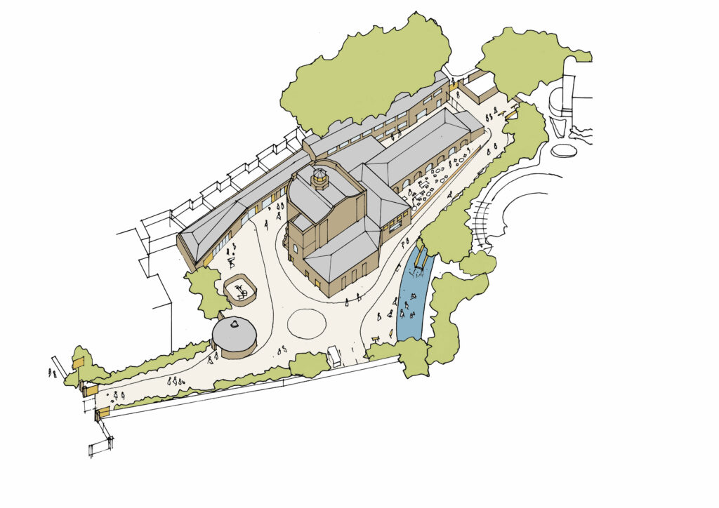
Quentin Blake Centre for Illustration

Credit: Quentin Blake Centre for Illustration, Tim Ronalds Architects

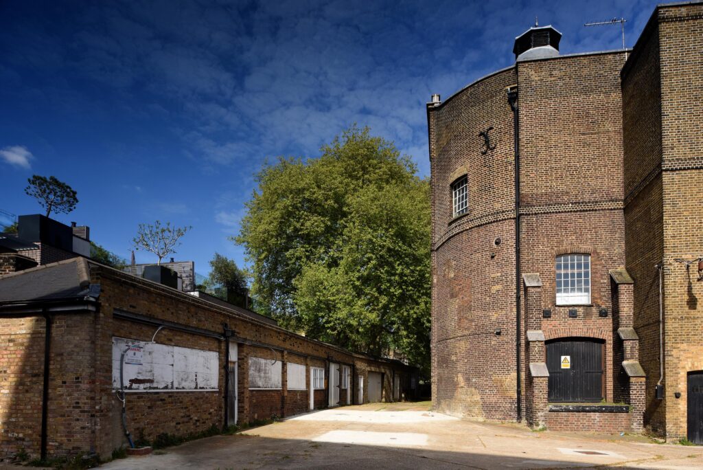
In the above plan, the round building to the lower left is the base of the early windmill. I took the following photo of the building on a recent visit:
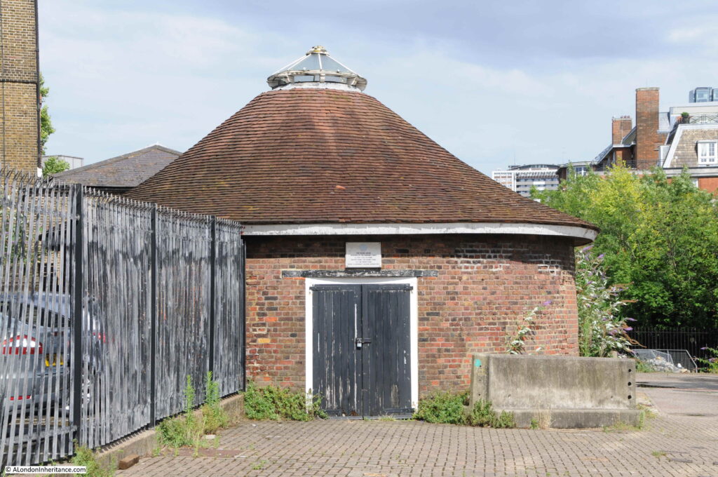
Quentin Blake Centre for Illustration

The large building to the right is the old engine house. The interior will not be open for the visit as it is currently difficult to navigate, however we will walk around the outside of the building and talk about the part the engine house played in the development of New River Head and London’s water supply, along with the future of the site.
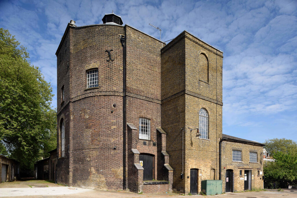
Quentin Blake Centre for Illustration

Credit: New River Head © Justin Piperger

The old coal store forms the longer building to the right, and will be open during the visit:
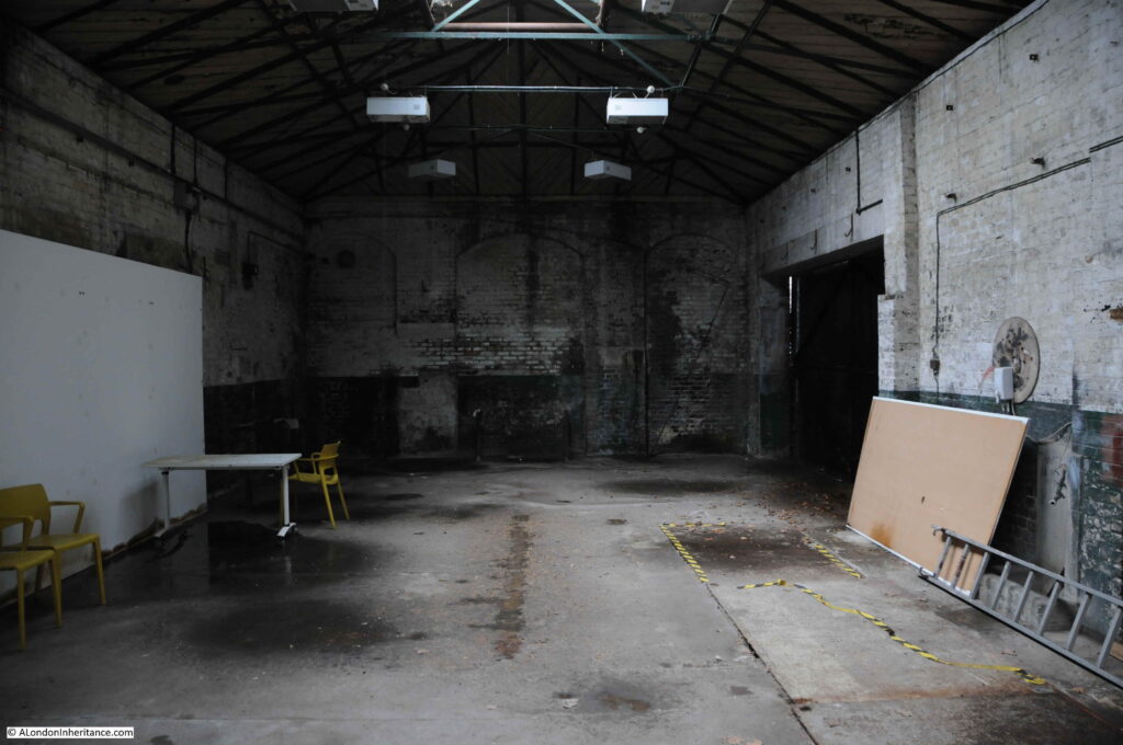
Quentin Blake Centre for Illustration

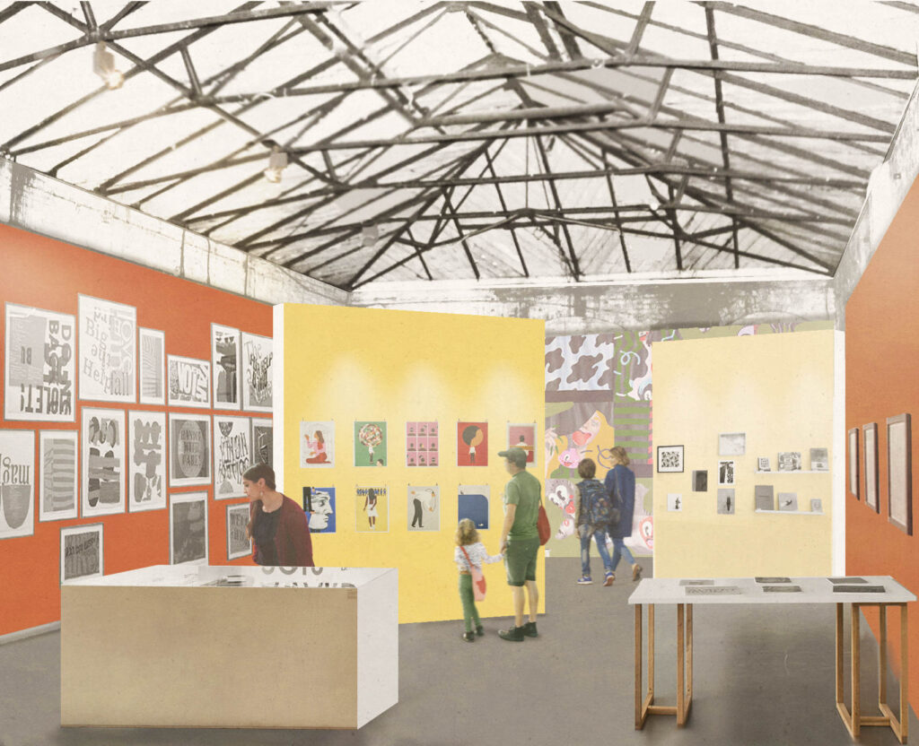
As can be seen from the following illustration, when transformed to a new exhibition area, the fabric of the building will retain its industrial heritage:
Quentin Blake Centre for Illustration

Credit: Quentin Blake Centre for Illustration, Tim Ronalds Architects, Prospective Gallery

The location for the new Quentin Blake Centre for Illustration is at a place that played a key part in the supply of clean water for London’s growing population for a considerable period of time.

The New River and reservoirs at New River Head were the first serious attempt at bringing significant volumes of water into London from a distance, and avoiding the need to draw water from the Thames, which by the end of the 16th century was not exactly a healthy source of drinking water.

The New River dates to the start of the 17th century, a time when there was a desperate need for supplies of clean water to a rapidly expanding city. Numerous schemes were being proposed, and the build of the New River tells the story of how the City of London, Parliament, the Crown and private enterprise all tried to gain an advantage and ownership of significant new infrastructural services, the power they would have over the city, and the expected profits.

The New River proposal was for a man-made channel, bringing water in from springs around Ware in Hertfordshire (Amwell and Chadwell springs) to the city. A location was needed outside the city where water from the New River could be stored, treated and then distributed to consumers across the city.

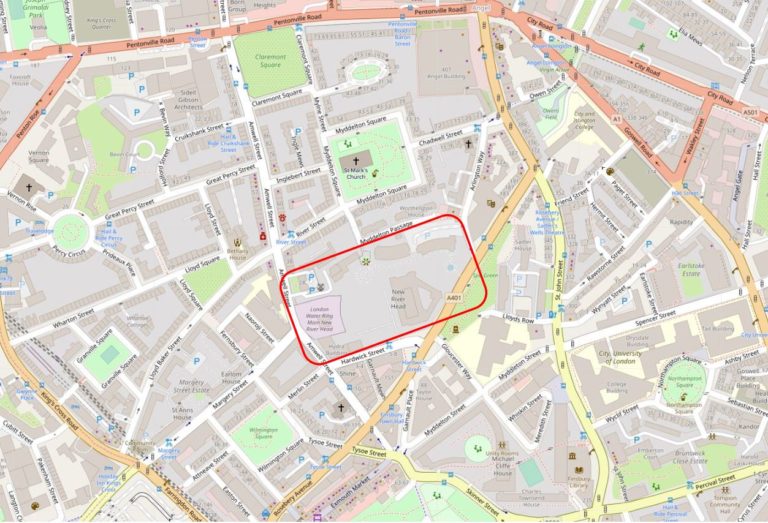
The site chosen, called New River Head, was located between what is now Rosebery Avenue and Amwell Street. The red rectangle on the following map shows the area occupied by New River Head (Map © OpenStreetMap contributors).
Quentin Blake Centre for Illustration

The story of the New River dates back to 1602 when a former army officer from Bath, Edmund Colthurst who had served in Ireland, proposed a scheme to bring in water from Hertfordshire springs to a site to the north of the city.

As a reward for his military service, he was granted letters patent from King James I, to construct a channel, six feet wide, to bring water from Hertfordshire to the city.

Colthurst’s was not the only scheme for supplying water to the city. There were a number of other private companies, and the City of London Corporation was looking at similar schemes to bring in water from the River Lea and Hertfordshire springs.

Whilst Colthurst’s project was underway, the City of London petitioned parliament, requesting that the City be granted the rights to the water sources and for the construction of a channel to bring the water to the city.

In 1606 the City of London was successful when parliament granted the City access rights to the Hertfordshire water, a decision which effectively destroyed Colthurst’s scheme, which collapsed after the construction of 3 miles of the river channel.

It was an interesting situation, as Colthurst had the support of the King, through the letters patent he had been granted, whilst the City of London had the support of parliament.

The City of London took a few years deciding what to do with the water rights granted by parliament, and in 1609 granted these rights to a wealthy City Goldsmith, Hugh Myddelton. He was a member of the Goldsmiths Company, an MP (for Denbigh in Wales), and one of his brothers, Thomas Myddelton was a City alderman and would later become Lord Mayor of the City of London, so Myddelton probably had all the right connections, which Colthurst lacked.

Colthurst obviously could see how he had been outflanked by the City, so agreed to join the new scheme, and was granted shares in the project. Colthurst joining the City of London’s scheme thereby uniting the rights granted by James I and parliament.

Work commenced on the New River in 1609, but swiftly ran into problems with owners of land through which the New River would pass, objecting to the work, and the loss of land. A number of land owners petitioned Parliament to repeal the original acts which had granted the rights to the City, however when James I dissolved Parliament in 1611, the scheme was given three years to complete construction and find a way to overcome land owners objections, as Parliament would not be recalled until 1614.

There were originally 36 shares in the New River Company. Myddleton had decided to enlist the support of James I to address the land owners objections, and created an additional 36 new shares and granted these to James I who would effectively own half the company.

in return, James I granted the New River Company the right to build on his land, he covered half the costs, and Royal support influenced the other land owners along the route, removing their objections, as any further attempts to hinder the work would result in the king’s “high displeasure”.

The New River was completed in 1613. It was a significant engineering achievement. Although the straight line distance between the springs around Ware and New River Head was around 20 miles, the actual route was just over 40 miles, as the route followed the 100 foot height contour to provide a smooth flow of water, resulting in only an 18 foot drop from source to end.

The New River Head location was chosen for a number of reasons. A location north of the city was needed to act as a holding location, from where multiple streams of water could then be distributed through pipes across the wider city.

The location sat on London Clay, rather than the free draining gravel found further south in Clerkenwell, and it was also a high point, with roughly a 31 meter drop down to the River Thames, thereby allowing gravity to transport water down towards consumers in the city.

The site already had a number of ponds, confirming the suitability of the land to hold water.

By the end of the 17th century, London had been expanding to the west and developement was taking place around the area now called Soho, including Soho Square.

The challenge the New Rver Company had with supplying water to London’s expanding population was down to having sufficient volumes of water available, and with maintaining water pressure.

The City of London was much lower than New River Head, and water pressure was generally good, however further to the west of the city, the land was higher, and the difference in height between places such as Soho and New River Head was insufficient to provide a good supply to new developments.

This is when the windmill appeared. The New River Company built a new reservoir at Claremont Square, towards Pentonville Road. This new reservoir provided extra storage capacity, and was also higher than New River Head, thereby able to deliver water at greater pressure.

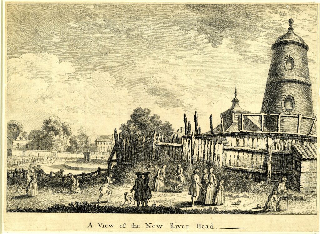
A method was needed to pump water to the new reservoir and the method chosen was a windmill. This was in operation by 1709, but was never very efficient and the top of the windmill was severely damaged by a storm in 1720. Newspaper reports of the storm refer to “the upper part, quite to the brickwork, was blown of the Windmill at New River Head”

The storm also damaged large numbers of ships anchored in the Thames, and: “The Horse-Ferry boat, that passed to and fro from Greenwich to the Isle of Dogs was lost and is not yet found, and the Storm was so violent as to lay the Isle of Dogs under Water by the beating of Water over the Banks”

The following print shows the windmill in the 1740s with the sails and top section missing after the storm  (© The Trustees of the British Museum):
Quentin Blake Centre for Illustration

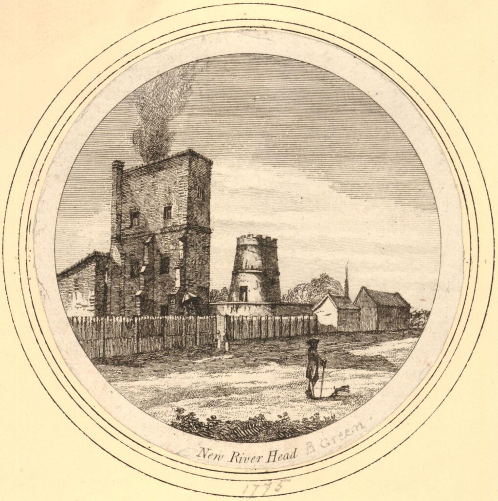
By 1775, the top of the windmill appears to have been castellated. The first engine house is in operation to the left. The engine house replaced the windmill and later horse power by providing the power for the pumps.  (© The Trustees of the British Museum):
Quentin Blake Centre for Illustration

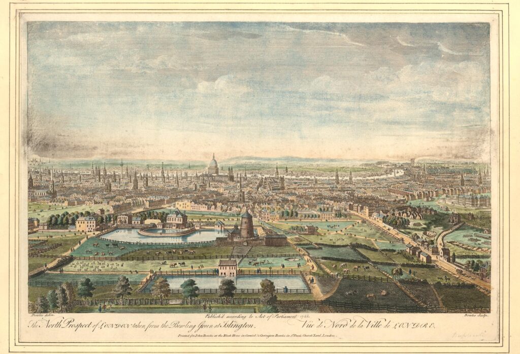
The following print from 1752 shows the New River Head complex with the remains of the windmill after the 1720 storms  (© The Trustees of the British Museum).
New River Head

To the lower left of the windmill is a small building that would have housed the horse-gin, used between the storm and the installation of the steam engine to power the pumps, pumping water to the reservoir which can be seen in the lower part of the view.

If you look closely between the reservoir and the windmill, you can see what appears to be a couple of pipes running between the windmill and a building on the edge of the reservoir from where water is pouring into the reservoir.

Although now reduced to just the base, it is remarkable that part of the windmill has survived over 300 years, and it is the base of the windmill that we will see inside during the walk.

After the storm, a “horse gin” was employed which consisted of a small building adjacent to the windmill that provided room for a horse to walk in a circle whilst harnessed to a wheel. The rotation of the wheel was transferred to the pumps to provide the power to move water from New River Head to the higher reservoir.

Later in the 18th century, this was replaced by a steam engine. Whilst we will not be able to go into the engine house, we will walk alongside to explore the history of the building:
Quentin Blake Centre for Illustration

Credit: New River Head © Justin Piperger

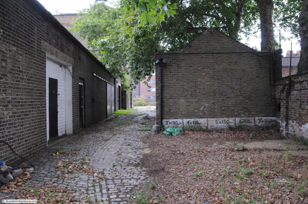
Behind the engine house is a coal store used to store the fuel for the steam engines in the engine house. The following photo shows the coal store buildings on the left, with a storage area marked with dimensions on the right:
New River Head

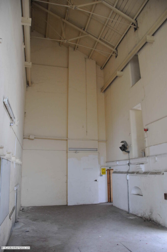
Some photos of the interior of the engine house:
New River Head
New River Head
New River Head
New River Head
New River Head

New River Head would continue to play a part in the supply of water into the 20th century.

Reservoirs eventually built at Stoke Newington were of the size needed for London’s ever growing population, and the New River would come to terminate at these reservoirs rather than continuing on to New River Head.

The central Round Pond was drained in 1913. The remaining filter beds had disappeared by 1946, and New River Head became the head offices of the Metropolitan Water Board, along with supporting functions including a large laboratory building.

New River Head continues to be a key part of London’s water supply with one of the shafts to the London Ring Main on the site. The shaft is one of the 12 main pump out shafts across the ring main where water is taken out and distributed locally.

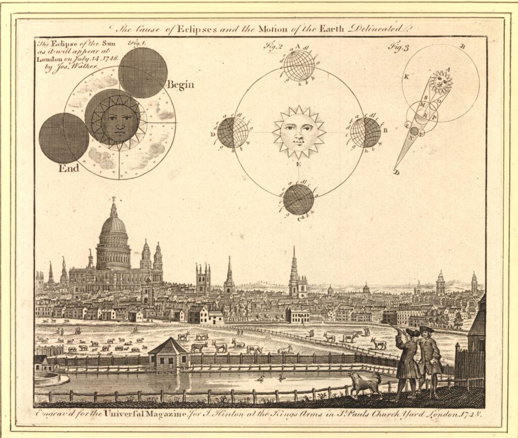
New River Head appeared in a 1748 print with astronomical drawings describing an eclipse of the sun. New River Head is at the bottom of the print, then fields and with the City in the distance  (© The Trustees of the British Museum).
New River Head

One of the two characters at bottom right is using a telescope, presumably to observe the eclipse which took place on the 14th July 1748.

The above print is the type of find that sends me searching for something that is not really related to the subject of the post, however as New River Head is in the view, there is a tenuous link.

The 1748 eclipse was an event well publicised in advance, and numerous papers published recommendations on how to view the eclipse, which sound very similar to what we would do today (apart from the candle).

1. Make a pin-hole in a piece of paper, and look through it at the eclipse. Or,

2. Hold a piece of glass so long over the flame of a candle, till it is equally blackened; and then the eclipse may be viewed through it, either with the naked eye, or through a telescope. Or,

3. Let the sun’s rays through a small hole into a darkened room, and so view the picture of the eclipse, upon a wall, or upon paper. Or,

4. Transmit the image of the sun through a telescope, either inverted, as usual on a circle of paper or pasteboard.

In London the eclipse would start at four minutes past nine in the morning and end at ten minutes past twelve. The eclipse was partly visible, however for much of the time it was obscured due to what were described as “flying clouds”.

I can guarantee that there will not be an eclipse at New River Head during the week of the walks, however the walks will provide a unique opportunity to view some of the buildings that contributed to the development of London’s water supply, learn about their future use, and to hear how water has influenced the development of Islington.

The walks can be booked here.

alondoninheritance.com

Limehouse Cut and Angel Underground Station

Before starting on this week’s post on the Limehouse Cut and Angel Underground Station, can I thank you for all the feedback following last Sunday’s post. It is really appreciated.

I also hope that if you receive my posts as a subscriber, this one does reach you. For the last few days there has been a rather obscure error message in the component that links the blog with the WordPress tool that manages e-mail subscriptions. The hosting company is investigating, so my apologies if it does not reach you automatically.

You may well be wondering what on earth brings the Limehouse Cut and Angel Underground Station together in one post. I can assure you there is a common theme linking these two locations, which I hope will become clear as you read through the post.

Limehouse Cut

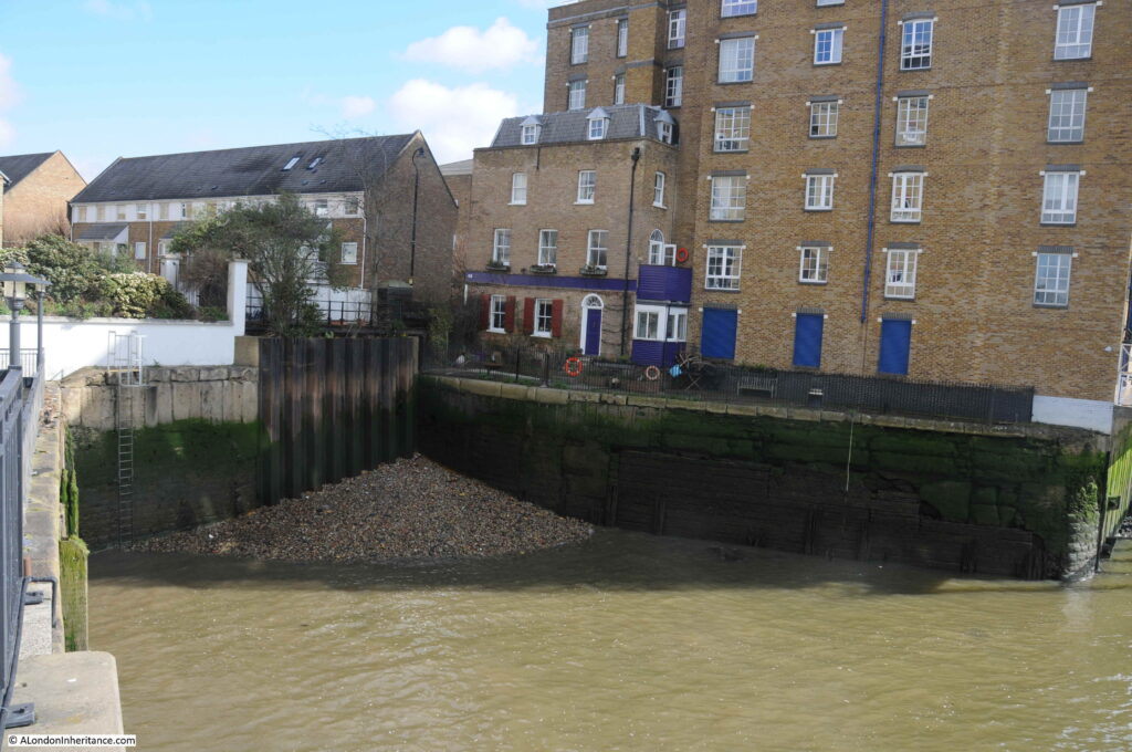
If you walk east along Narrow Street in Limehouse, over the bridge that crosses the channel from Limehouse Basin to the Thames, then turn towards the river along the Thames Path, and at the end of the new apartment buildings that go by the name of Victoria Wharf, you will find a short channel in from the river:

This was the original river entrance where the Limehouse Cut connected to the River Thames.

The Limehouse Cut was opened in 1770 to provide a direct route between the River Thames and the River Lea at Bromley-by-Bow.

The River Lea entered the Thames to the east of the Isle of Dogs, so the Limehouse Cut provided a much shorter route for barges heading to the City and east London by avoiding the need to travel around the full loop of the Isle of Dogs.

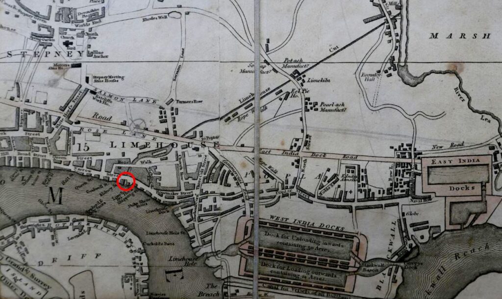
The following extract from the 1816 edition of Smith’s New Plan of London shows the Limehouse Cut running as an almost straight line from the River Lea at top right to the Thames, where I have marked the point where the Limehouse Cut connects to the river with a red circle – this is the short channel in my photo above.

The area to the lower left of the Limehouse Cut was mainly open space, with a limited number of buildings and streets, however this would be changing very soon.

Soon after the 1816 map was published, another canal was built to help with transport across the city. The Regent’s Canal ran from Limehouse and headed north to loop around north London, allowing goods to be transported from the river to the north of the city, thereby avoiding the congested road system.

Part of the Regent’s Canal included a large basin, an expanse of open water just before the point where the Regent’s Canal entered the river. There were warehouses around the basin, and barges would gather, waiting to transit to the river when tides allowed the locks to be open.

The Regent’s Canal Basin, and the entrance to the river was built immediately to the west of the Limehouse Cut.

For eleven years between 1853 and 1864, the Limehouse Cut was diverted into the Regent’s Canal Basin, however after 1864 the original entrance was back in use, with a new bridge carrying Narrow Street over the canal. This would last for another 100 years.

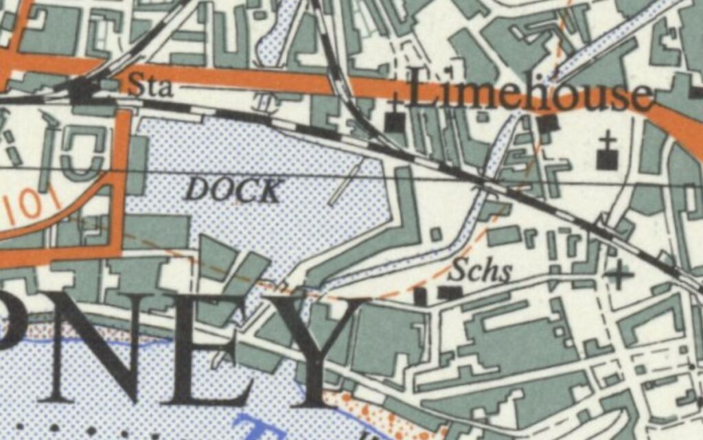
The following extract from the 1955 revision of the Ordnance Survey map shows the Limehouse Cut running from top right down to the River Thames, with the Regent’s Canal Basin immediately to the left, labelled as “Dock” (‘Reproduced with the permission of the National Library of Scotland’).

By 1968 industrial activity in the area had been in long decline as was trade on the Regent’s Canal and Limehouse Cut. The entrance to the river was again closed, and the Limehouse Cut diverted into the Regent’s Canal Basin that was renamed as the Limehouse Basin.

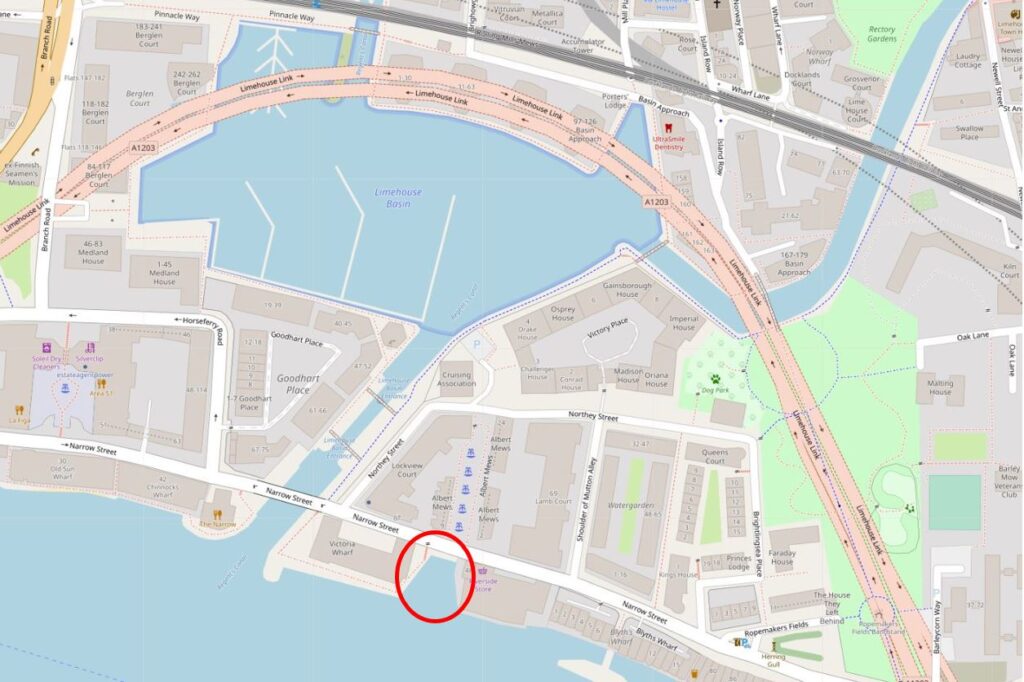
The following extract is from a map of the area today. Limehouse Cut is coming in from top right and diverting straight into Limehouse Basin, I have again circled the original entrance with a red circle (Map © OpenStreetMap contributors).

The pink road that appears to loop across the north of the Limehouse Basin is in reality underground as this is the Limehouse Link Tunnel.

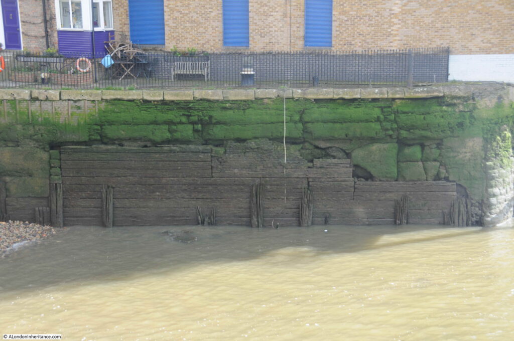
The following view is looking across the old entrance to Limehouse Cut. The wooden boards may well be the original planks that lined the entrance to the canal.

A couple of high explosive bombs landed in the immediate vicinity so the area surrounding the wooden planks may well be repaired bomb damage.

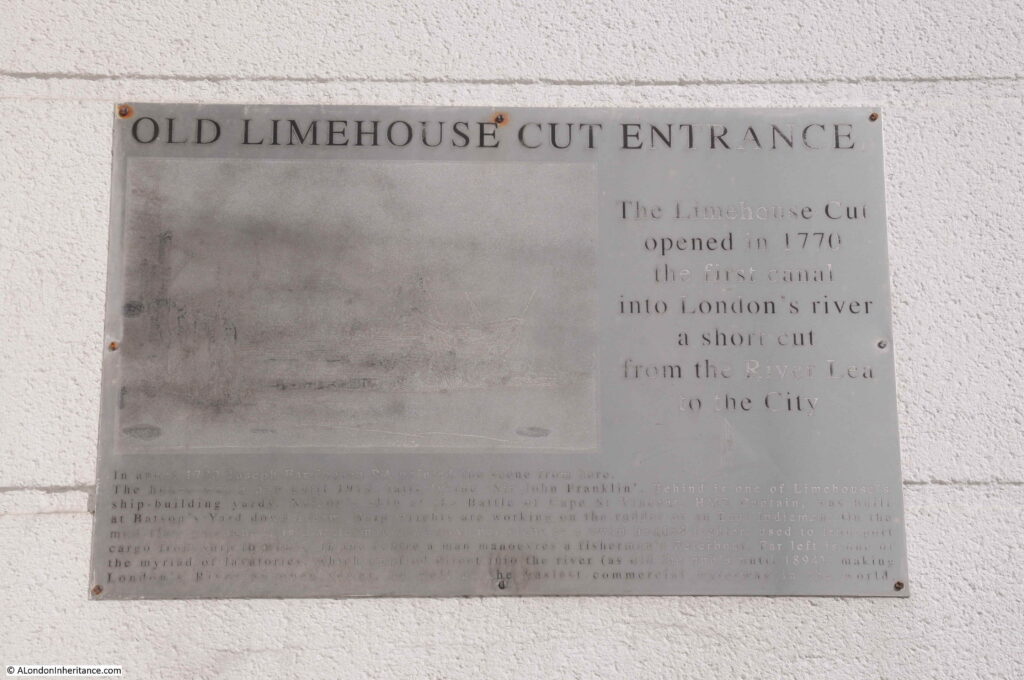
A very faded information board at the old entrance to the Limehouse Cut:

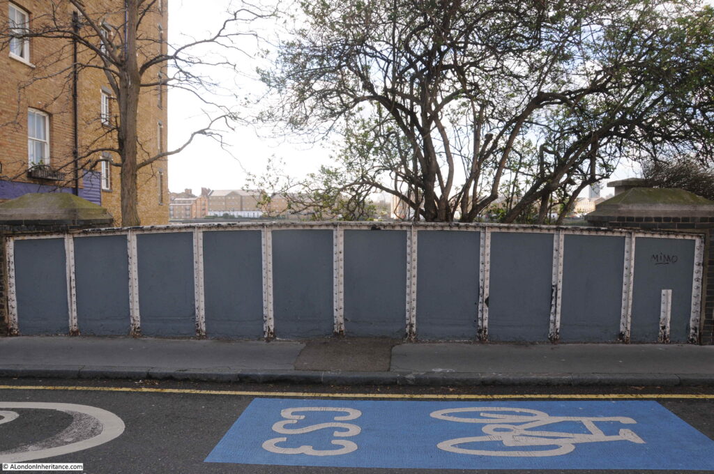
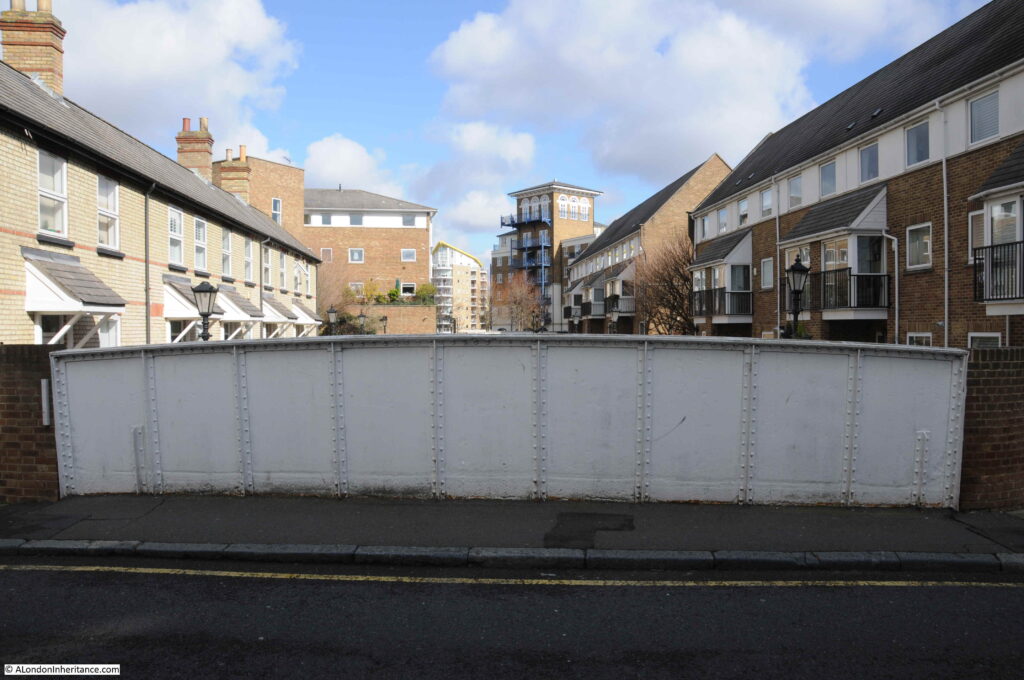
Between 1853 and 1864, the Limehouse Cut had been diverted to the Thames via the Regent’s Canal Basin. In 1864, the original entrance was restored, and a new wrought iron girder bridge was installed to carry Narrow Street over the Limehouse Cut. This 1864 bridge remains in place, although because of the filled in entrance, the bridge is not that obvious apart from the iron side walls as the street is carried over the Limehouse Cut. This is the view from Narrow Street looking south towards the Thames:

The view looking north:

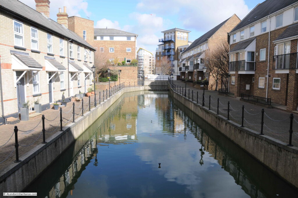
Looking over the northern edge of the bridge, we can see the section of the Limehouse Cut that was originally the lock that controlled access between the non-tidal canal and the tidal river. Much restored late 19th century lock keepers cottages line the western side of the old lock (to the left in the photo below):

The old Regent’s Canal Basin, now the smaller Limehouse Basin, today hosts a marina, and provides links with the River Thames, Regent’s Canal and via the Limehouse Cut, the River Lea, and are all really interesting walks.

The old Limehouse Cut entrance is evidence of the canal’s original 1770 route into the River Thames for one of London’s early transport systems.

Angel Underground Station

Today, the entrance to Angel Underground Station is on the corner of a modern brick office block, facing onto Islington High Street. It has not always been in this position.

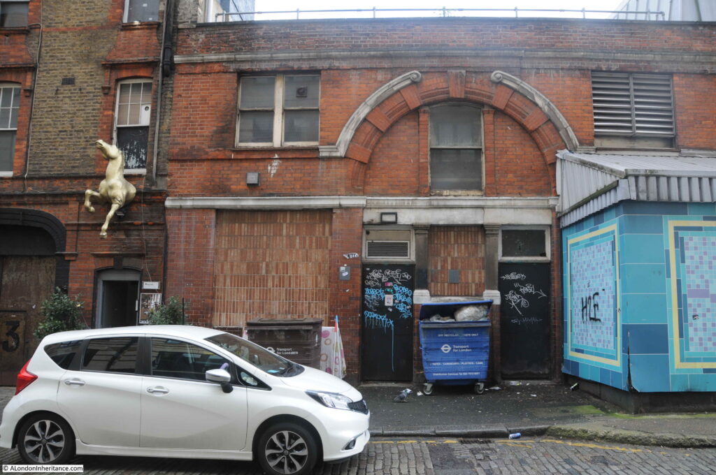
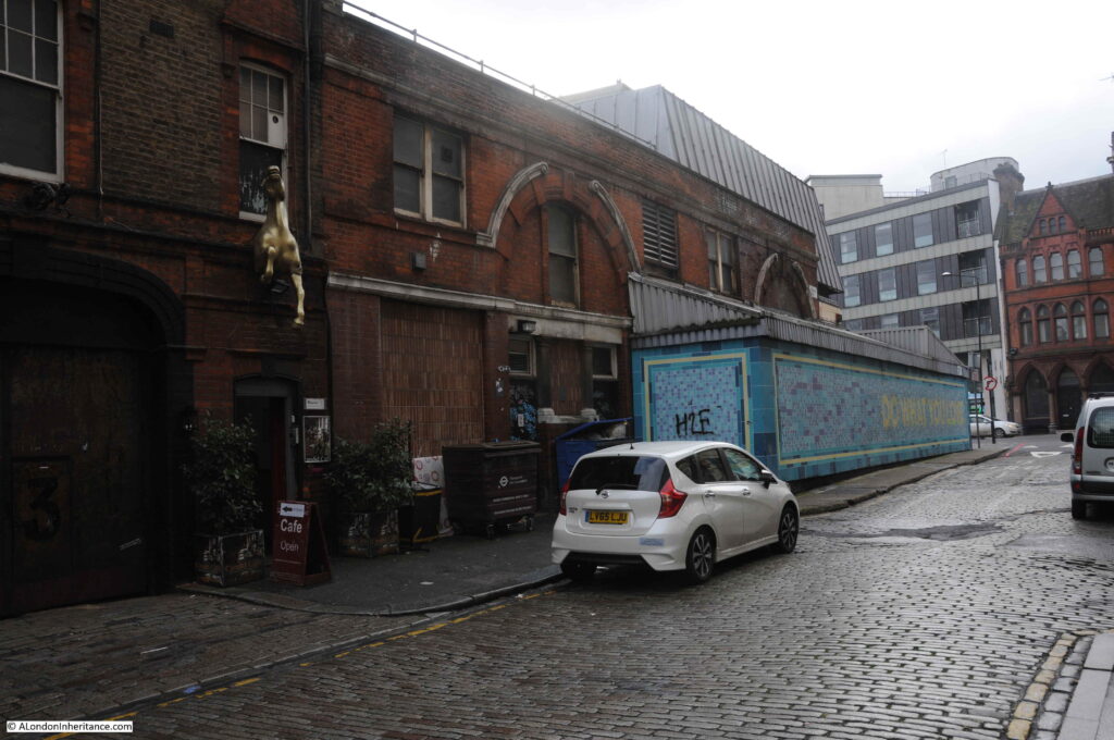
To find the original station, you need to walk south to the junction of Islington High Street with Pentonville Road, and walk a short distance along City Road and on the left is a rather strange looking building:

This is the original Angel Underground Station.

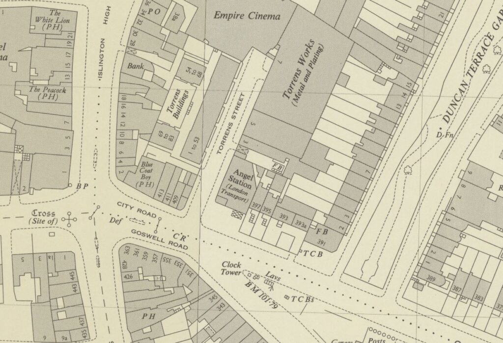
The Angel Station opened in 1901 as part of the City and South London extension from Moorgate. Six years later in 1907, the line was extended on towards Euston station. Today, Angel Station is on the Bank branch of the Northern Line. The following extract from the 1954 Ordnance Survey Map shows the original station in the centre of the map, on the corner of City Road and Torrens Street. This is the station building photographed above (‘Reproduced with the permission of the National Library of Scotland’).

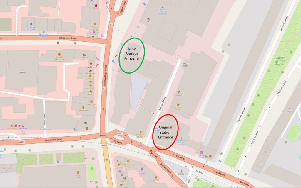
The location of the old and new stations can be seen in the following map (Map © OpenStreetMap contributors):

When Angel Station was built, it had a narrow central platform, with both tracks running either side of the platform. Whilst this was probably fine for the short period of time before the line was extended, it was a rather dangerous place when the platform was crowded, and busy trains ran in both directions.

The following clip is from the 1989 BBC film Heart of the Angel (link at the end of the post), showing the crowded platform.

From the same film is a clip of the 1989 entrance to the station, looking down City Road and is on the right of my photo of the station at the top of this section of the post.

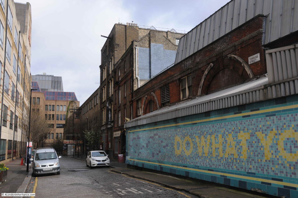
The platforms were also served by lifts from the ground level building. The exterior cladding around the original brick building was a later addition to provide extra space. The view down Torrens Street with the station on the right:

By the late 1980s, the station had a long history of overcrowding along the narrow single platform. It would frequently be rather chaotic when two trains pulled in, with passengers leaving both trains onto a narrow platform full of passengers waiting to get on the trains.

The lifts were also relatively small for the number of passengers at busy times and would also frequently break down. At the end of the 1980s a major rebuild of the station began.

A new tunnel was excavated to take the northern branch, thereby separating the northern and southern tracks so each could have their own platform. The southern branch today occupies the space of the original tunnel so has a rather wide platform compared to a normal station, as the platform occupies the space of the original platform and the northern tracks.

Escalators were installed to avoid the use of lifts, and these took passengers between the platforms and the new station entrance on Islington High Street.

The new station opened in 1992, leaving the original station building to sit on the corner of City Road and Torrens Street.

Crossrail 2 includes a station at Angel, and the complete eastern side of Torrens Street, including the original station building, was designated in the safeguarding map of sites for Crossrail 2 construction and operation.

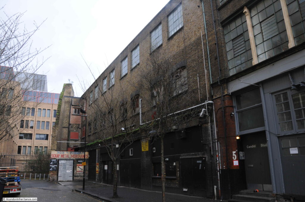
The following view looks along Torrens Street at the buildings included in the safeguarding map.

The buildings along this side of the street are an interesting mix of old warehouses.

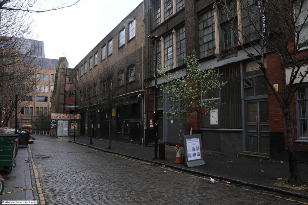
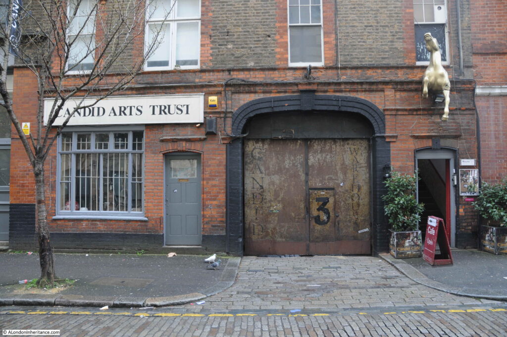
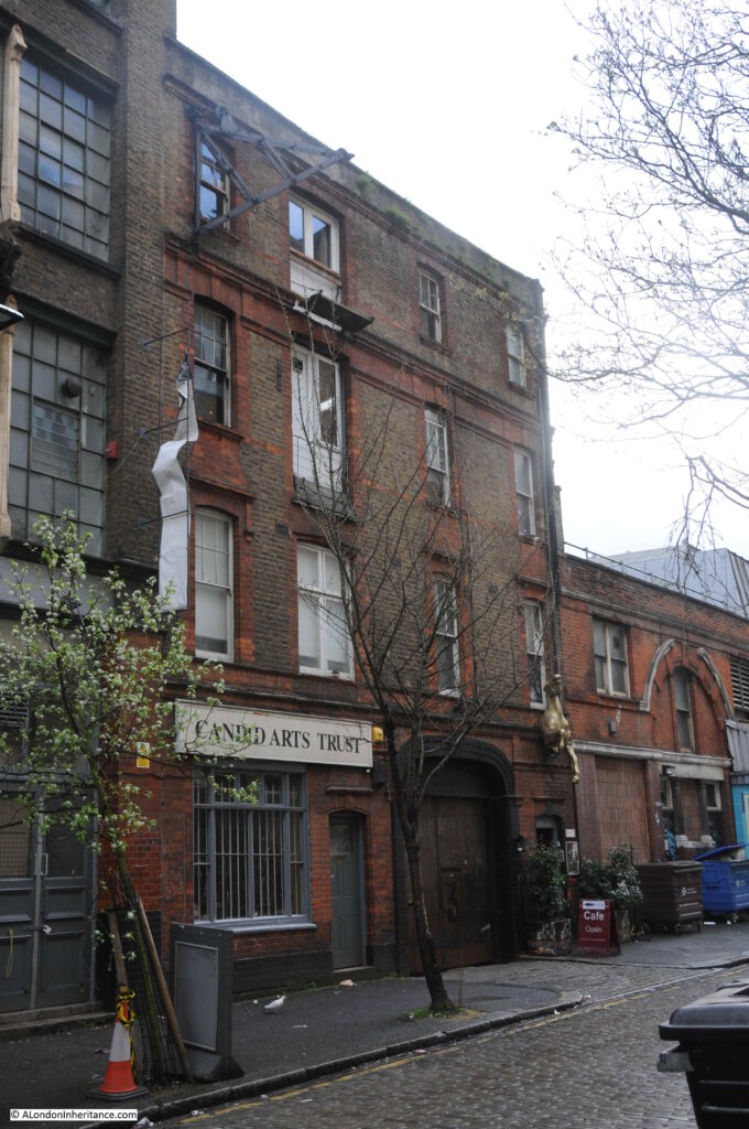
Candid Arts Trust occupies a 19th century warehouse:

And at the end of the street is an early 20th century building that was constructed on the site of a smithy and may have been used to stable horses, however it would be occupied by a metal working and plating company.

And there is still evidence of this activity:

The building is now occupied by the “Islington Metal Works” – run by a hospitality company and the site is used for Wedding Receptions, Corporate and Christmas events.

The link between these two very different sites, in different parts of London is hopefully now clear; that they are the redundant entrances to once busy transport links that have now been diverted.

The entrance to the Limehouse Cut was once a busy route for barges moving between the Lee River and the River Thames, with the Limehouse Cut now diverted into Limehouse Basin.

The original entrance to the Angel underground station has now been closed for some thirty years, with passengers now diverted along escalators rather than lifts to the new station entrance on Islington High Street, with a considerably improved and safer platform layout at the station.

There are many examples of these across London where the ever changing transport system adapts to changing technology, different patterns of use and improvements.

A film was made for the BBC 40 Minutes series in 1989 documenting 48 hours in the life of the Angel station.

Heart of the Angel was made by the BAFTA award winning director Molly Dineen, and it is a very honest portrayal of a station struggling to cope with the numbers of passengers using the station and the creaking infrastructure supporting the station.

if you have a spare 40 minutes, it is well worth a watch and can be found here.

alondoninheritance.com

A Return To Bermondsey Wall – Bevington Street, George Row And Bridge House

A couple of months ago, I featured a photo that my father had taken in Bermondsey. He had written the following notes to explain when and where the photo was taken “Flockton Street looking south from Bermondsey Wall. 19th century slum dwellings ravaged by the blitz – Summer 1948”. When I visited what remains of Flockton Street I was doubtful that this was the right location. Many features of the existing streets and in the photo did not line up.

I am really gratefull to a number of readers who identified the correct location as being Bevington Street in Bermondsey, and that a couple of the features in the original 1948 photo can still be seen to confirm. A quick look at Google Streetview clearly showed the location, however I was not content just to use Streetview as the purpose of this project is to revisit and photograph from the same viewpoints as in my father’s photos, so a couple of weeks ago I took another walk to Bermondsey to photograph Bevington Street – a location I have walked past a number of times, but for reasons I will explain later in the post, I was looking in the other direction.

My revisit also enabled the location of another photo to be confirmed, and I also found the location of a building photographed for the Wonderful London series of books published in 1926.

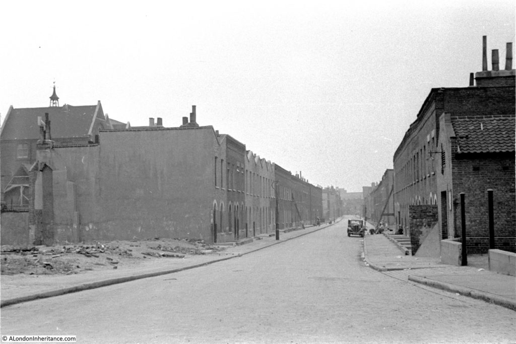
This is the view of Bevington Street from Bermondsey Wall photographed by my father in 1948:

Bermondsey Wall

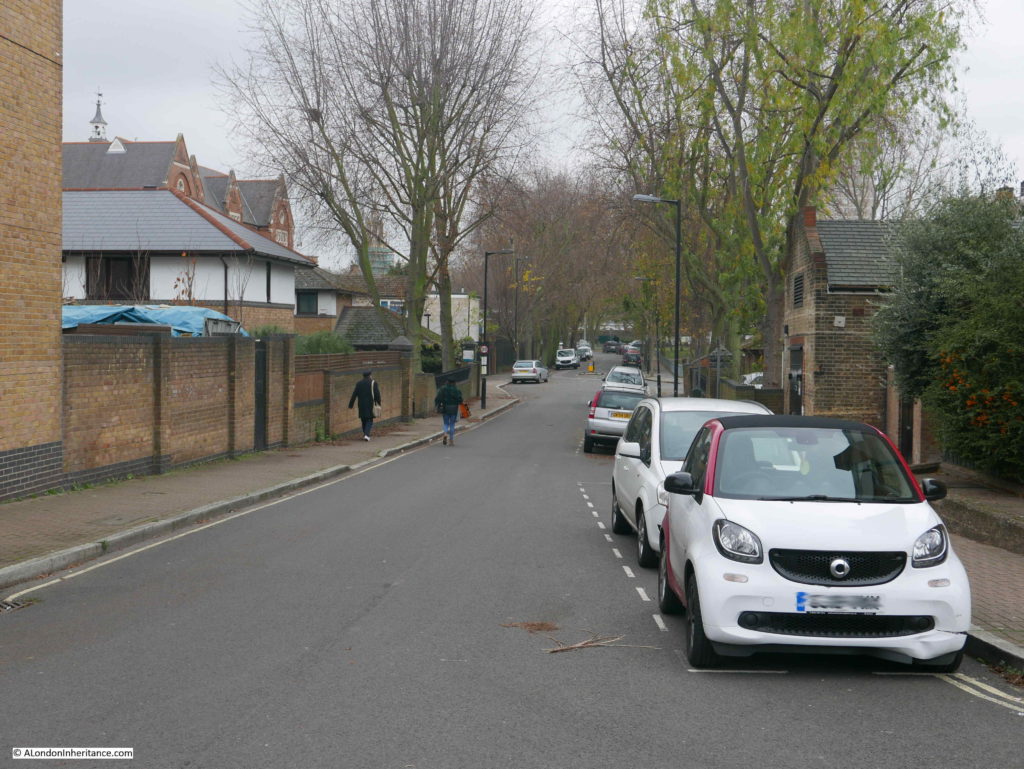
And this is the same view today:

Bermondsey Wall

There are only two features that remain the same, but serve to confirm the location. The school on the left and the small brick building on the right which now appears to house an electrical substation – remarkable that in all the redevelopment of the area this small building has survived.

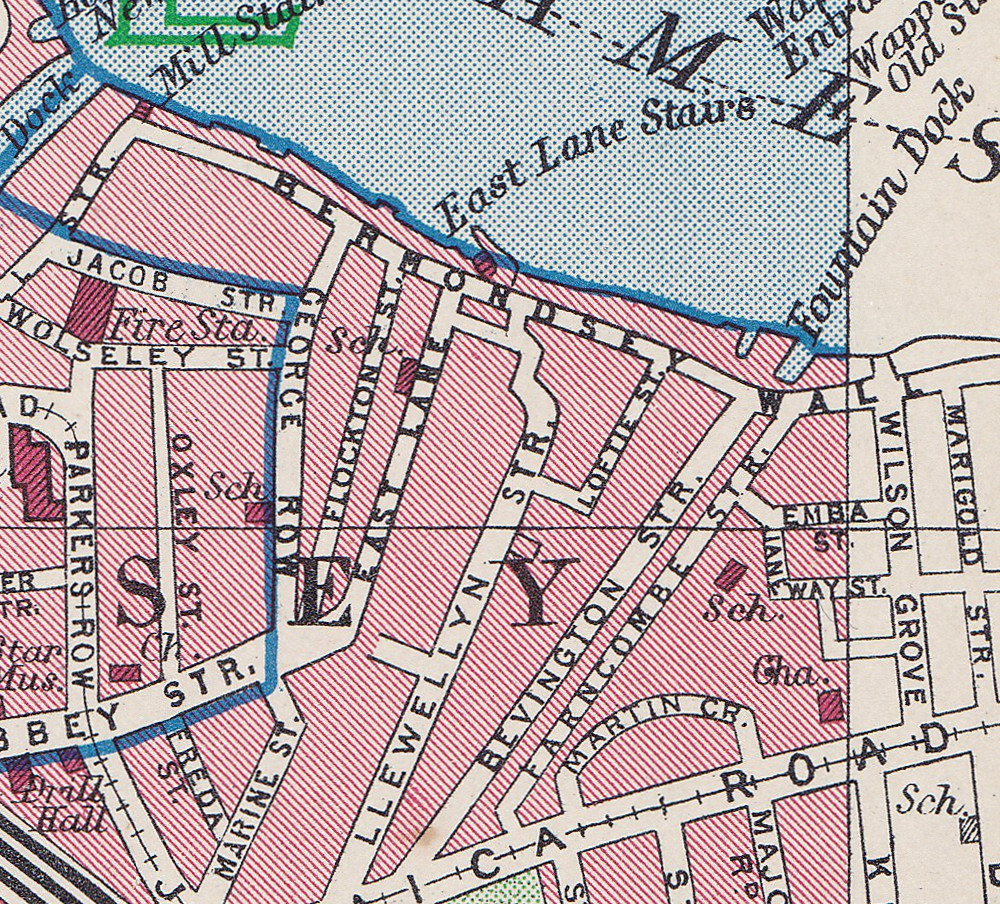
So where is Bevington Street? The following extract from the 1940 Bartholomew’s Atlas of Greater London shows the location. Bevington Street can be seen just to the right of the large Y. The school is further to the right, just across Farncombe Street.

Bermondsey Wall

Flockton Street, the wrongly identified location can be seen to the left, leading off from Bermondsey Wall, so these streets are very close. I suspect my father wrote up his notes for the photos after developing the negatives and looking at his route on the map, accidentally picked the wrong street.

I have used this 1940 map as it helps to explain a feature that can be seen today.

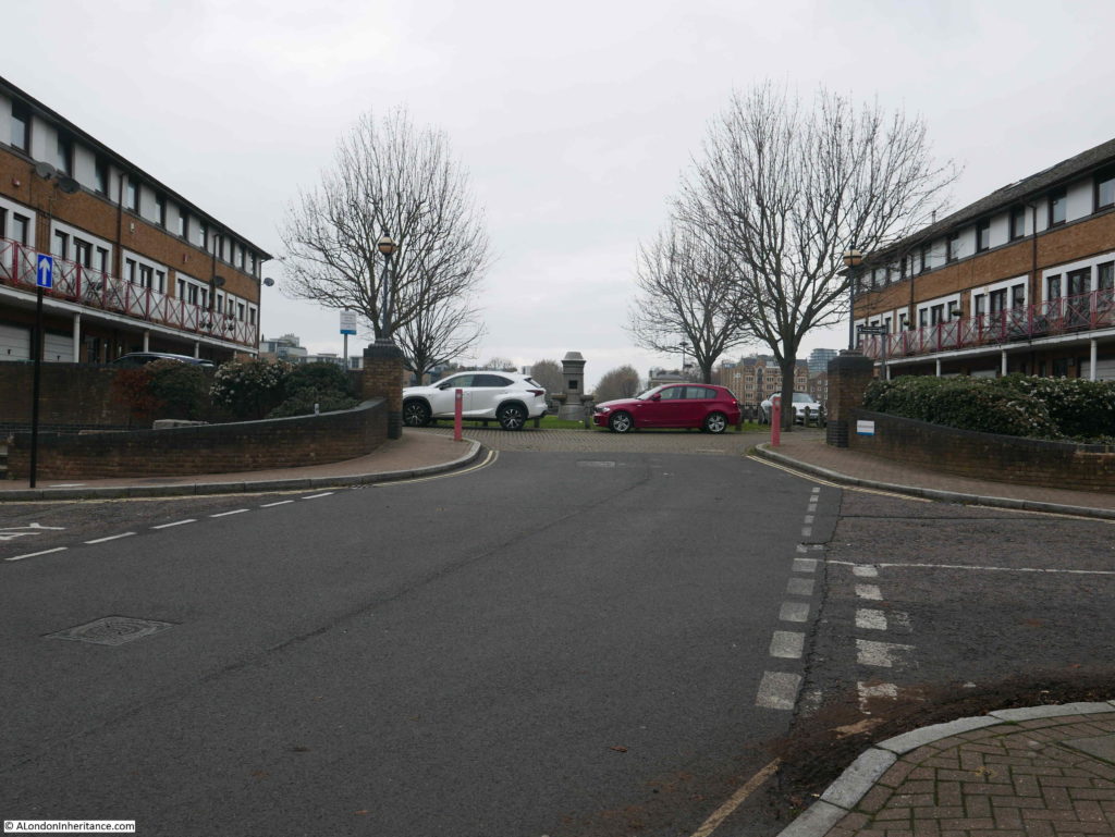
Bevington Street ends at Bermondsey Wall, and directly across from Bevington Street, between Bermondsey Wall and the River Thames is Fountain Green Square. The following photo is the view from the end of Bevington Street, looking across Bermondsey Wall to Fountain Green Square.

Bermondsey Wall

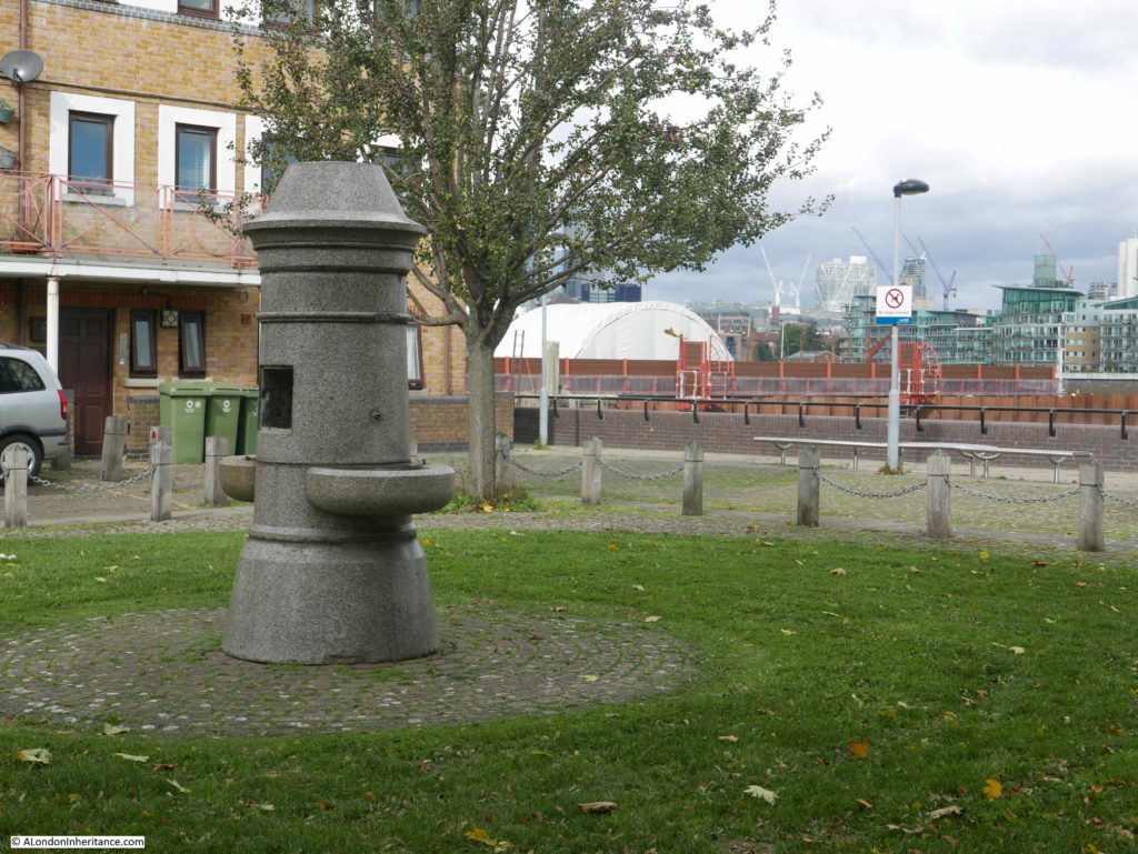
The name is very appropriate as there is a central green with a stone fountain in the centre. New housing is arranged around two sides of the green and the River Thames is alongside the far side of the green.

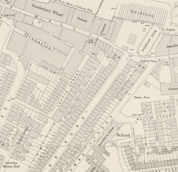
Looking back at the 1940 map and there is a feature here called Fountain Dock. The 1895 Ordnance Survey Map provides some additional detail and shows the shape and location of Fountain Dock.

Bermondsey Wall

Credit: ‘Reproduced with the permission of the National Library of Scotland’ 

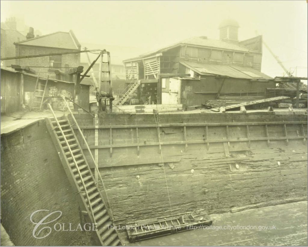
The Southwark Council Conservation Area Appraisal (February 2013) confirms that the site of Fountain Green Square was the site of Fountain Dock, and that the dock was one of the few dry docks that operated along this part of the river.

Checking the overlay feature on the National Library of Scotland site, the dry docks appears over the easterly part of the green and partly under the houses on the eastern edge of the green, rather than occupying the full space of the green.

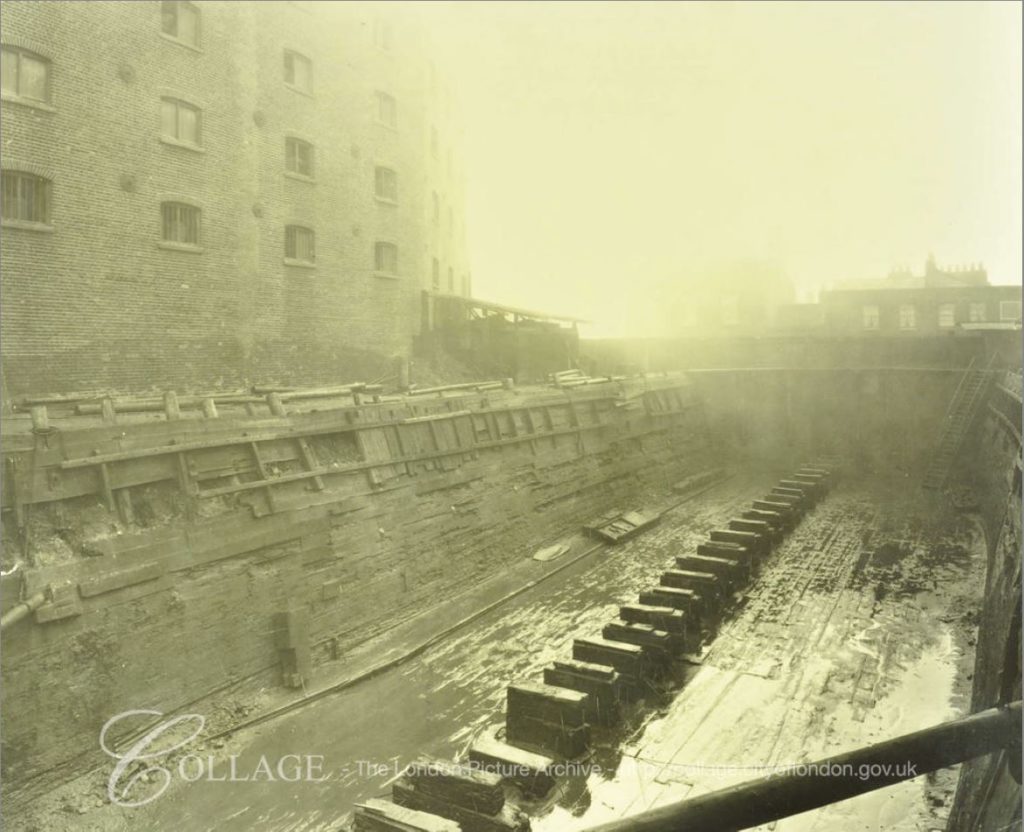
I checked the London Metropolitan Archives, Collage site and there are two photos from 1929 that show the dry dock. The first is looking from the north west corner of the dock, back towards where Bermondsey Wall runs right to left.

Bermondsey Wall

Image credit: London Metropolitan Archives, City of London: catalogue ref: SC_PHL_02_0912_A52734

The second photo, also from 1929, is looking from the south east corner of the dock, towards the river and the direction of the City.

Bermondsey Wall

Image credit: London Metropolitan Archives, City of London: catalogue ref: SC_PHL_02_0912_A5273

These photos from 1929 show Fountain Dock much as it must have been in the 19th century. Dry docks are important as they allow the hull of a ship to be inspected and worked on. The ship was moved into the dock, gates to the river closed and water pumped out from the dock, so somewhere alongside there must have been a building that housed the pump.

In an advert for the dry dock in Lloyd’s List on the 13th May 1893, the dimensions are given as a length of 161 feet and depth of 16 feet. The dock was owned by Mills & Knight who also owned the larger Nelson Dry Dock in Rotherhithe.

In addition to numerous adverts for the dry dock, 19th century newspapers included reports of accidents at the dock, as well as ships for sale. It appears to have been standard practice to offer a ship for sale when the ship is in dry dock for repair. The earliest example I could find was from the Shipping & Mercantile Gazette on the 27th August 1850, when the following ship was in Fountain Dry Dock and advertised for sale:

“The A1 Liverpool-built Barque BRAZILIAN, 345 tons, now lying in the Fountain Dry Dock, and ready for inspection; is in the course of re-coppering, &c., and, if not sold within a reasonable time, will be sent out again by her present owner. Length, 107 feet; breadth, 23 1-10 feet; depth 13 3-10 feet; carries a large cargo at an extraordinary light draught of water, and shifts without ballast”.

The following photo is the view taken from roughly the same viewpoint as the above photo. Today there is a fountain in the centre of the green.

Bermondsey Wall

The 1895 Ordnance Survey Map does not show a fountain, so I do not know if the fountain was moved here when the green was created to provide some relevance to the name. I doubt the fountain was here originally as it looks of rather fine construction to have been in such an industrial area – however I also do not know how Fountain Dock was named.

The origin of the name Bevington Street is interesting. When looking for this street on the 1895 OS map, whilst the street is there, in 1895 is was named Princes Road. It had changed to the current name sometime between 1895 and the 1940 map.

Although I have not been able to find any written confirmation of this, I suspect the name change may have been in the first decade of the 20th century. Bevington probably refers to Colonel Samuel Bourne Bevington. 
When Bermondsey Borough Council was formed in 1900, Samuel Bevington was the first mayor and he was reelected the following year. He came from the family that had established  Bevington and Sons, a company that manufactured leather products at Neckinger Mills in Abbey Street, Bermondsey. He was also a Colonel of the West Surrey Regiment, Justice of the Peace, on school boards and coming from a Quaker background, used family money to support a number of philanthropic activities.

Samuel Bourne Bevington died on the 14th April 1907 leaving a considerable estate to the value of £133,195. His will included money to provide income for four men and four women over the age of 60 who had been engaged in the leather trade.

Because of his role in the leather trade in Bermondsey, that he was the first mayor of Bermondsey Borough Council, and his other activities, I suspect that after his death, the council looked at ways to commemorate him, and one of the ways within their power was to rename one of the local streets, so Princes Road became Bevington Street.

There is much else of interest to be seen from the junction of Bevington Street and Bermondsey Wall.

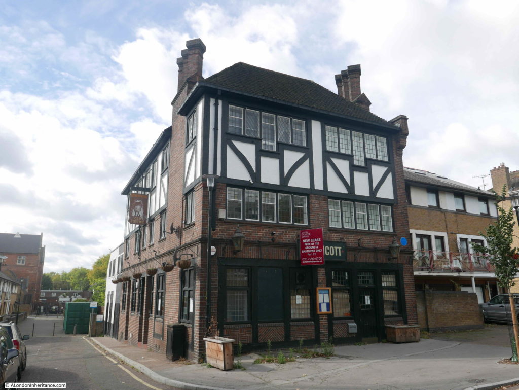
A very short distance to the east along Bermondsey Wall is a rather unique, listed pub – the Old Justice.

Bermondsey Wall

The pub, as with so many London pubs, has closed, however the building is Grade II listed.

The reason for the listing is that the pub is a rather well preserved example of a style of pub design from the inter-war period. The majority of Victorian London pubs were small and focused on drinking. The design initiatives after the First World War, focused on improving the pub environment, the provision of space for other activities apart from basic drinking, for example with the provision of restaurant space and a function room.

The Old Justice was designed by Sidney C Clark in 1933 for the Hoare & Co brewery. It followed a mock Tudor design that was frequently used on many pubs of the period.

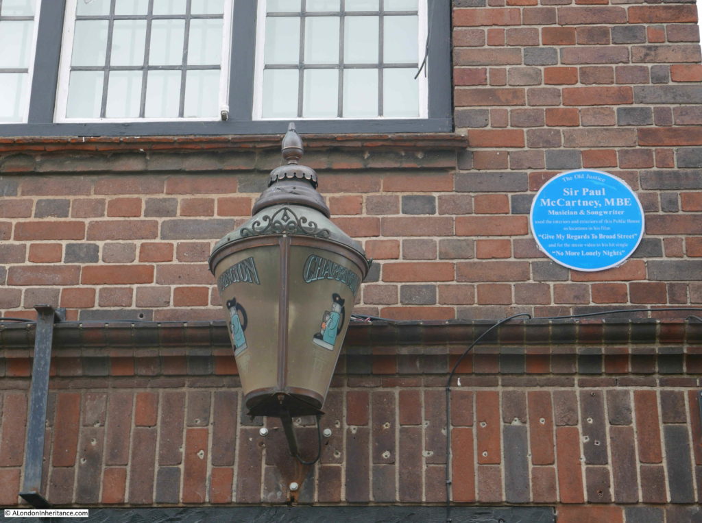
Hoare & Co were taken over by Charringtons and the pub has a pair of Charrington lanterns on the frount, these probably date from the 1960s.

Bermondsey Wall

Alongside one of the lanterns is a plaque recording that Sir Paul McCartney used interiors and exteriors of the Old Justice as locations in his film “Give My Regards To Broad Street” and in the music video to “No More Lonely Nights”.

As well as the pub, the film also has some fascinating shots of the front of the warehouses along the Thames in Bermondsey.

I looked in through the windows of the Old Justice and the interior looks to have been reasonably well gutted, although the wooden paneling remains on the walls and the fireplace is still intact.

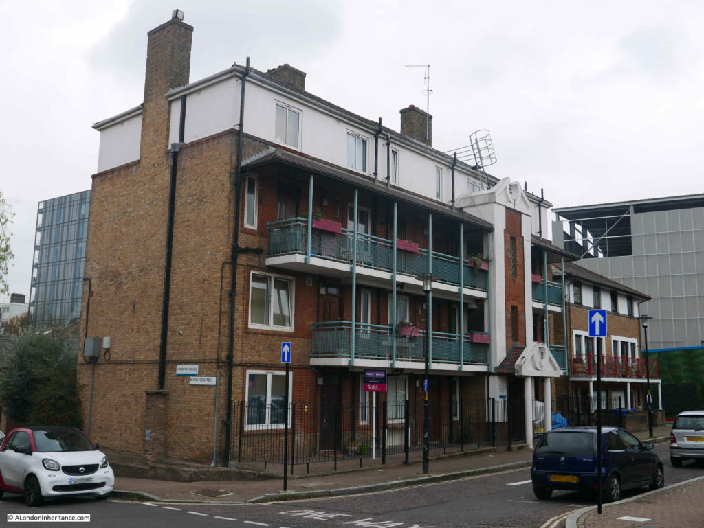
The Old Justice is just to the east of the junction of Bevington Street and Bermondsey Wall. To the west is another building that is earlier than the majority of buildings in the area. This is Fountain House:

Bermondsey Wall

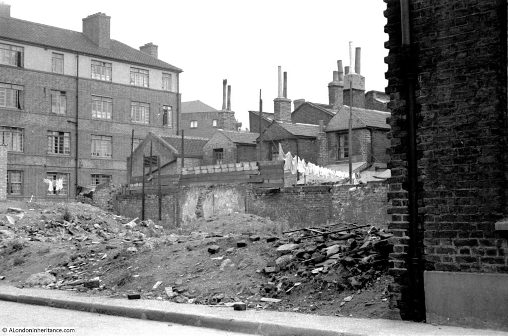
I am not sure when Fountain House was constructed, or whether the name is original. however it did feature in another of my father’s photos of Bermondsey. I have now been able to identify the following photo as having been taken in Loftie Street, which runs parallel to part of Bevington Street.

Bermondsey Wall

The rear of Fountain House is on the left of the photo, but what confirmed the location was the rear of the electrical substation building that was one of the surviving features in the photo of Bevington Street. The rear of this building can be seen in the above photo, to the right of Fountain House.

The houses are the rear of the houses that front onto Bevington Street. Washing is hanging to dry at the rear of one house, and I am fascinated by the height of the chimneys on these houses.

What must be the remains of a bomb site is to the front of the photo.

I tried to take a photo from a similar position today, but it was not easy with the buildings and fences that now occupy the area, however in the following photo, the rear of Fountain House can be seen, and just to the right, a small part of the top of the rear wall of the electrical substation building is just visible.

Bermondsey Wall

There was one additional place I wanted to track down. When I was looking for Flockton Street, I walked along George Row, which runs parallel to the original route of Flockton Street. The name George Row was familiar and I recently remembered where I had seen the name.

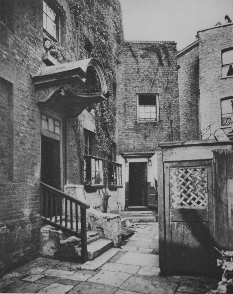
In 1926 a three volume set of photos and articles titled “Wonderful London” was published and the first main photo in volume 3 was titled “The Bridge House In George Row, Bermondsey”.

Bermondsey Wall

The caption with the above photo read:

“Bermondsey has had its royal palace dating perhaps from Edward the Confessor, and it was only in 1805 that the North Gate of its Abbey was taken down. The building in the photograph is called the Bridge House, since it stands where a bridge was built over one of the creeks that entered the river and made, with what is called St. Saviour’s Dock, Jacob’s Island. This was a densely populated quarter a hundred years ago, and its many canals and ditches had a Dutch air, according to the chroniclers”.

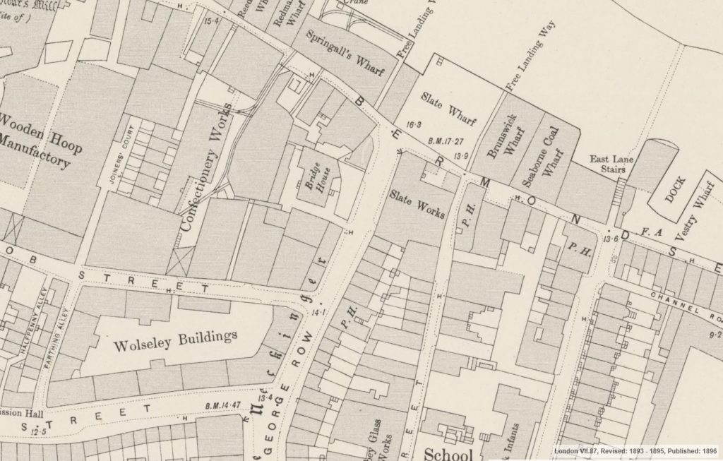
George Row today is a wide street that runs from Jamaica Road down to Bermondsey Wall. There are no buildings that look like the above photo and I was doubtful that I could find the location, however I turned to the 1895 Ordnance Survey map, and at the northern end of George Row, close to the junction with Bermondsey Wall, there is a building clearly labelled Bridge House. The map also shows the steps leading down from the building with what appear to be steps leading down from the building on the eastern side and sidesteps on the western side. This would confirm that the photo from Wonderful London was taken of the eastern face of the building.

Bermondsey Wall

Credit: ‘Reproduced with the permission of the National Library of Scotland’ 

It was easy now to find the location of Bridge House, the map overlay feature helped confirm exactly where to look. Bridge House was not directly on George Row. In the above map there is a space, which appears to be open space between the building and street, and this configuration remains today.

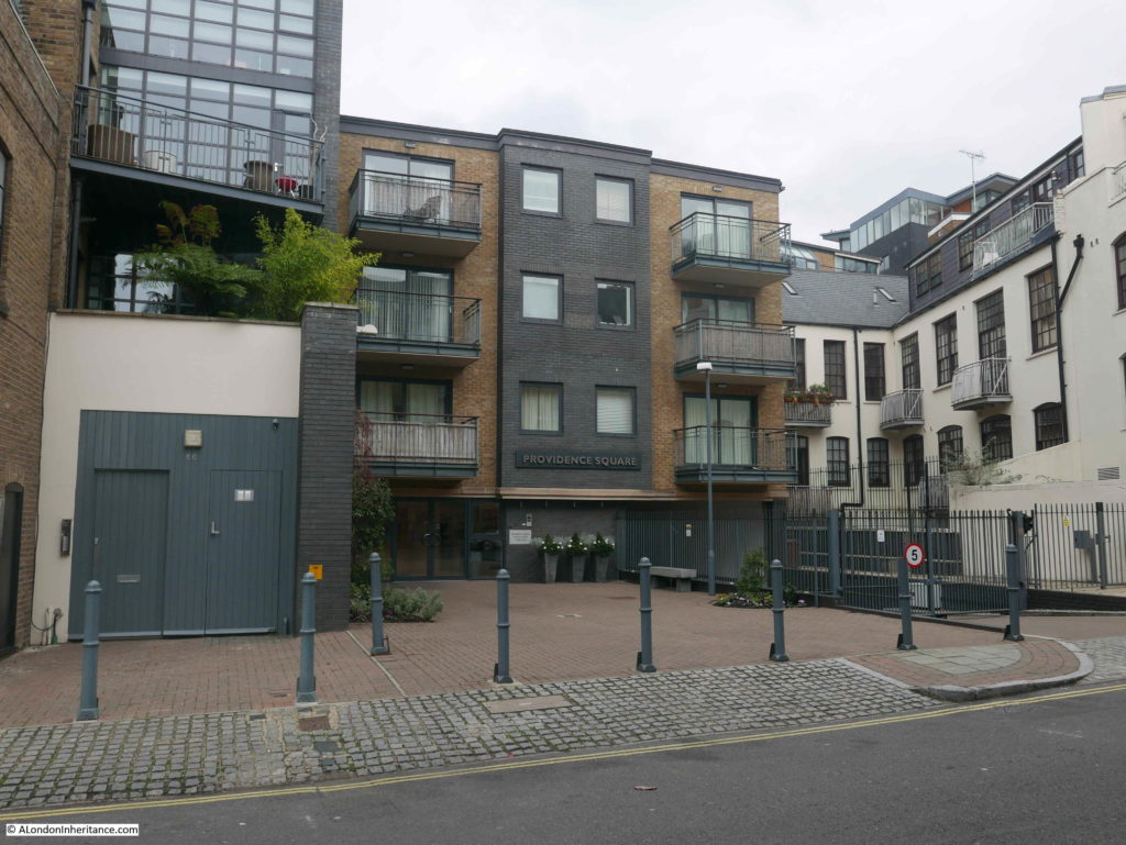
The following photo shows the location of Bridge House today, with a 4 storey block of flats – Providence Square – now standing in what appears to be almost the same footprint of Bridge House.

Bermondsey Wall

It would be interesting to know why the new building did not extend to George Row. Developers tend to maximise the amount they can build and make use of every available bit of space and the area between the building and George Row serves no apparent purpose.

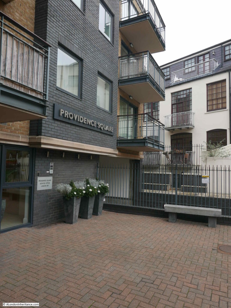
I walked up to the edge of the building to take a photo from roughly the same position as the photo from Wonderful London.
Bermondsey Wall

The caption to the photograph in Wonderful London explains the source of the original name for the building: “The building in the photograph is called the Bridge House, since it stands where a bridge was built over one of the creeks that entered the river and made, with what is called St. Saviour’s Dock, Jacob’s Island”.

There are no signs of the creek today, however maps provide some indications.

In the 1895 Ordnance Survey map the word Neckinger can be seen running alongside George Row. This refers to the River Neckinger. I have read many different accounts of where the Neckinger entered the River Thames, most claim that St. Saviour’s Dock was the main estuary of the Neckinger into the Thames, however this was always low lying marsh land, and there have been many canals and ditches built in this area (I mentioned the 19th century walled drain in my post on Flockton Street, and the outline of this drain can still be seen running across the street).

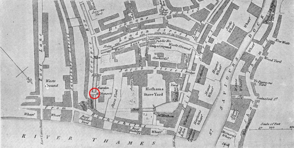
The book “Bermondsey, Its Historic Memories And Associations” written by E.T. Clarke and published in 1902 provides a location for the creek and bridge. The book includes the following map of the area.

Bermondsey Wall

The so called Jacob’s Island is in the centre of the map, bounded by the Thames at the bottom of the map, St. Saviours Dock to the right, a canal running alongside London Street to the top, and on the left, a canal running along the full length of George Row.

Based on the locations of streets that can still be found today, I have circled in red the bridge that gave Bridge House its name.

This is pure speculation, but it may be that Bridge House is the rectangular building on the above map to the lower right of the red circle.

I do not know when this canal or extension of the Neckinger was filled in – it had disappeared by the time of the 1895 map, but it is interesting that the open space between George Row and the building that now occupies the location of Bridge House would have been where the canal ran.
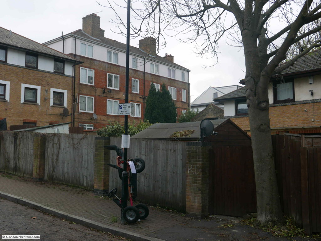
Finding the location of Bridge House helps to understand how this area has developed over the centuries. Fountain Green Square provides a link to the dry dock that once occupied the site, and Bevington Street records the first mayor of Bermondsey and the leather industry of area.
Finding Bevington Street means I can tick off another of my father’s photos from 70 years ago. My thanks again to everyone who identified the correct location of the photo.

alondoninheritance.com