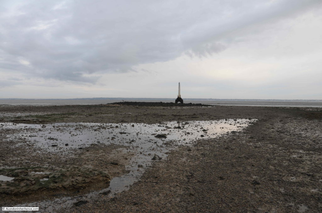
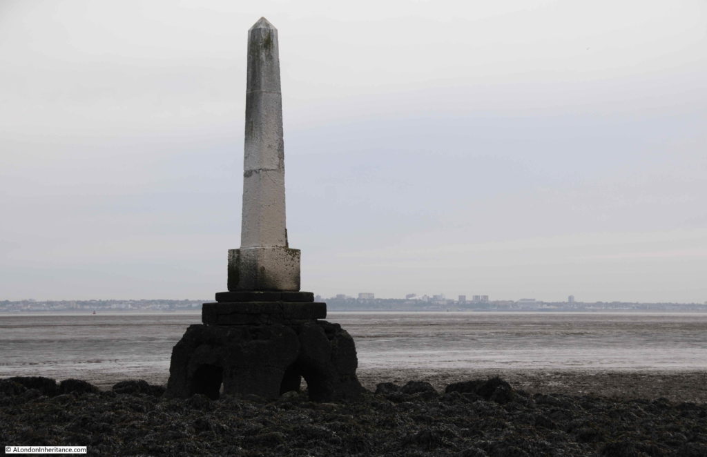
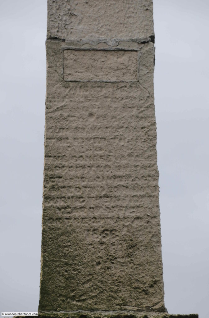
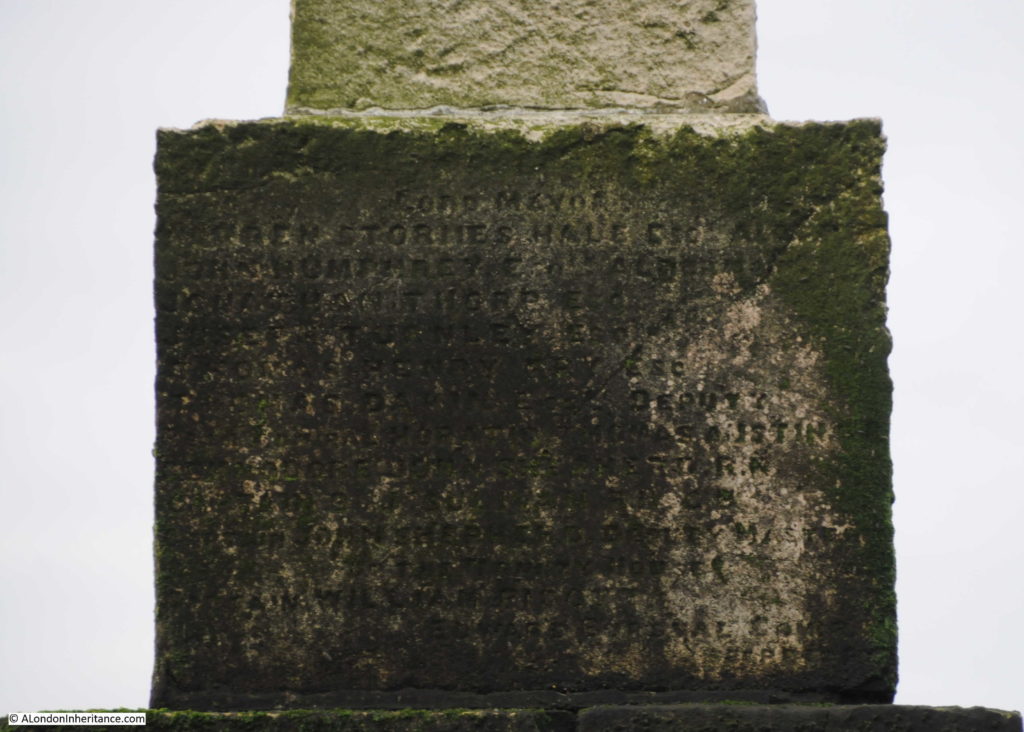
Monthly Archives: September 2019

London Stone Upnor, Rochester Castle and Cathedral and Cooling Church

A couple of week’s ago, I wrote about the Crow and London Stones that marked the boundary on the Essex and Kent coasts of the City of London’s jurisdiction over the River Thames.

The City of London also claimed part of the River Medway. This ran from the southern end of Yantlet Creek to a point at Lower Upnor just to the east of Rochester. Lower Upnor also has stones marking the City’s claim, so I went to find these stones, and also took the opportunity to visit a number of other sites in north Kent, and understand how London has influenced the development of this part of Kent.

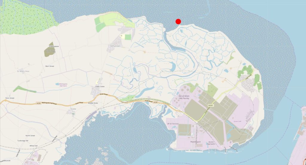
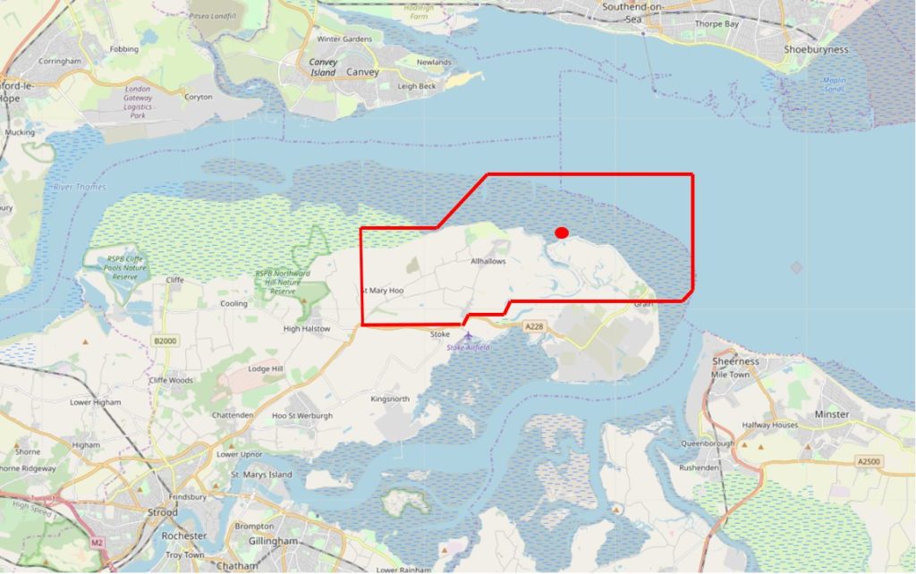
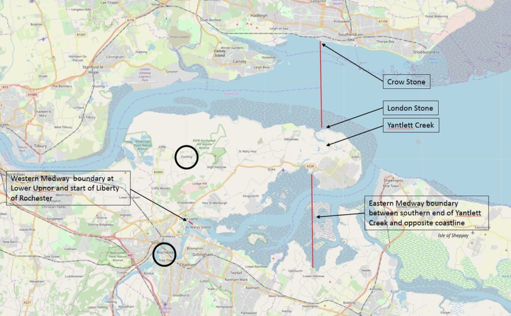
The following map shows the City’s boundaries on the River Thames and River Medway, and the other places I will visit in this post (Map © OpenStreetMap contributors)..

Rochester Castle

The upper red line shows the City of London’s boundary between the Crow Stone at Southend and the London Stone at Yantlet Creek at the Isle of Grain.

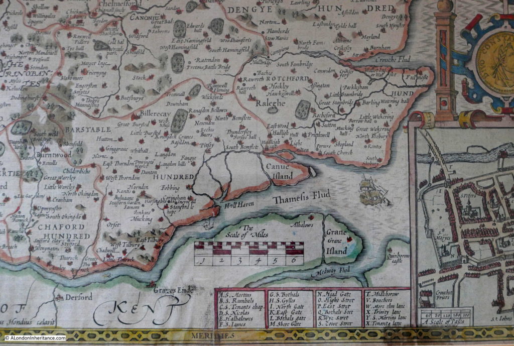
Yantlet Creek did provide a navigable route between the Thames and Medway, and it is this short cut that seems to have formed the basis for the City’s claim over part of the Medway.

The eastern boundary on the Medway was from the southern end of Yantlet Creek to the opposite shore, as shown by the lower red line.

The western boundary on the Medway was at Lower Upnor, a short distance before Rochester, see the short red line on the map. This was where the City of London’s claim over the Medway met the Liberty of Rochester.

The lower black circle on the map highlights the location of Rochester which I will visit in this post, and the upper black circle covers the church of St James at Cooling which I will also visit.

Lower Upnor London Stone

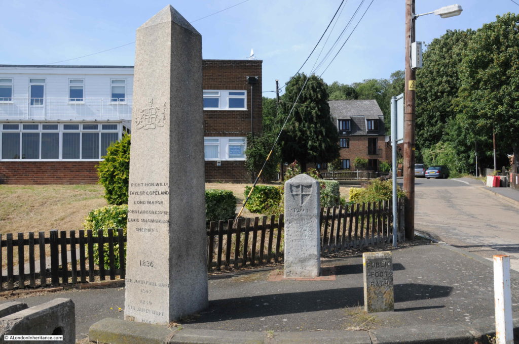
My first stop was at Lower Upnor to find the City of London’s boundary stones:

Rochester Castle

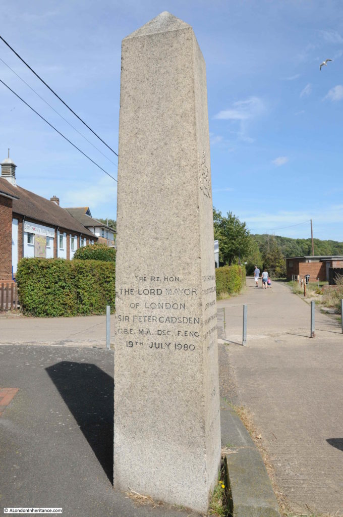
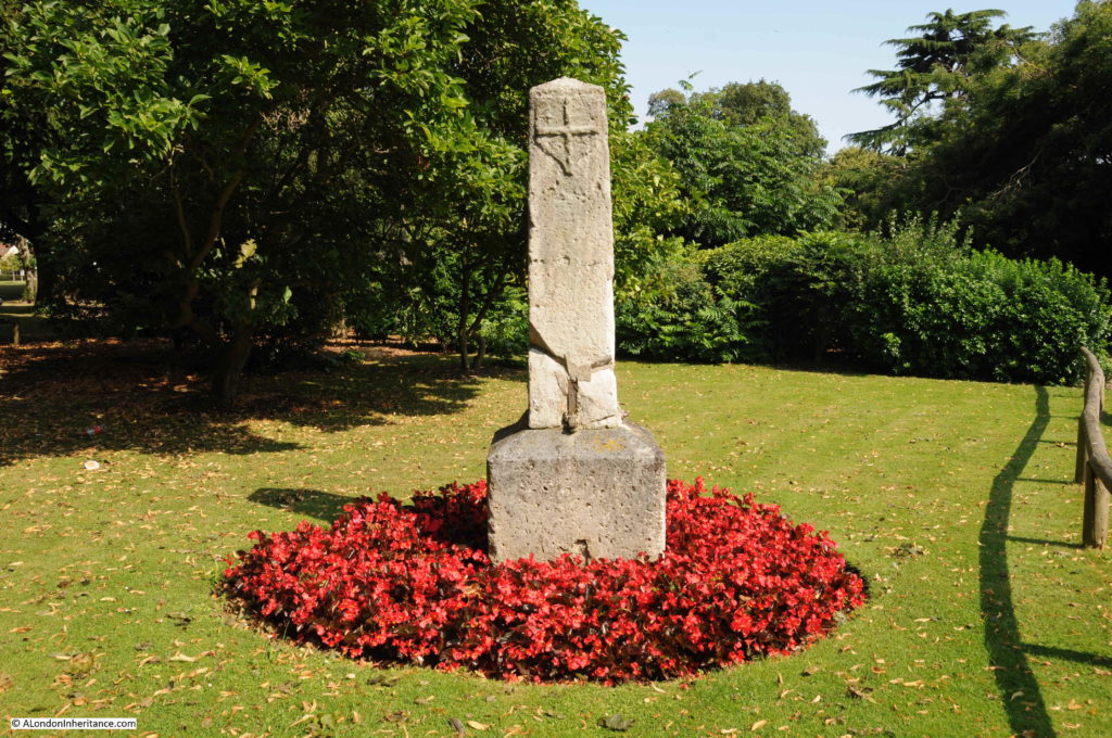
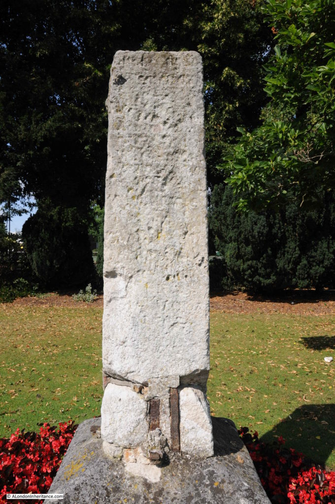
There are two stones marking the City of London’s western boundary at Lower Upnor, on the roadway alongside the River Medway. The smaller stone to the right in the above photo is a footpath marker.

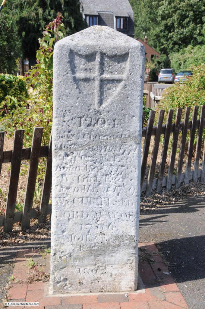
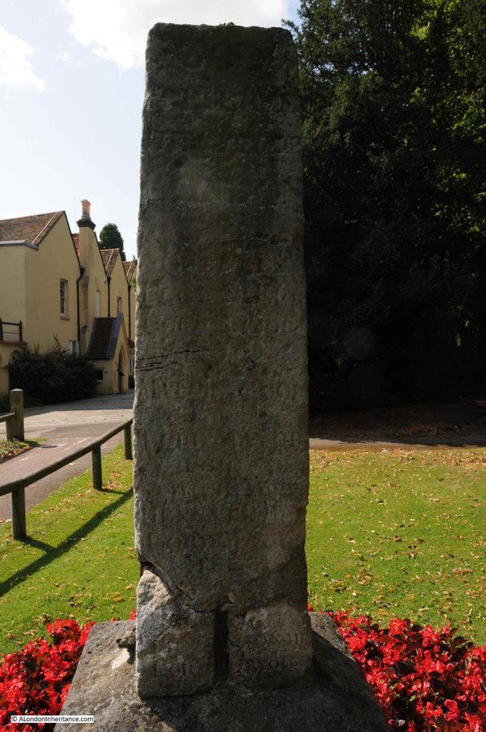
The stone at the rear is the older of the boundary markers and is believed to date from the 18th century.

The year 1204 is carved at the top of the stone. The refers to the original charter which granted rights over the River Thames, given by King John to the City of London, although the charter was dated a couple of years before 1204.

Rochester Castle

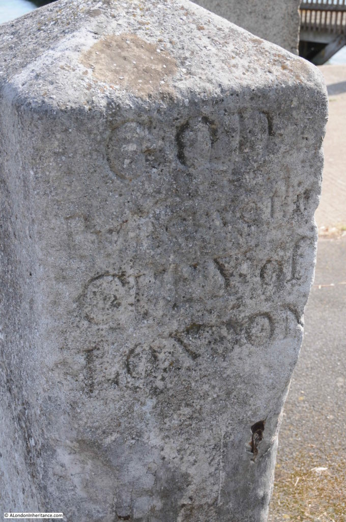
The City of London’s crest is also on the front of the stone, and on the rear is the legend “God Preserve the City of London”.

Rochester Castle

This section of the Medway has a rather strange history, and at times it was a very contentious issue that the City of London regarded the stretch from Yantlet Creek to Lower Upnor as within their jurisdiction.

As one point, a local landowner’s name was carved into the boundary marker stone to replace the City’s claims. This was discovered on one of the routine visits of the Lord Mayor to the stone, to re-assert the City’s claims.

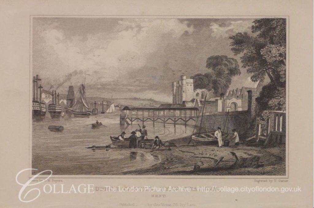
The following print is dated 1830 and is titled “View of Upnor Castle near Chatham, Kent, with boats on the River Thames and figures on the river bank in the foreground“.  Upnor Castle is further to the west of the boundary stone, close to Rochester, yet the print references this being on the River Thames.

Rochester Castle

Image credit: London Metropolitan Archives, City of London: catalogue ref: k124617x

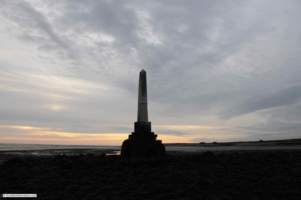
Although in Southend, the older stone was removed when a replacement was installed, at Lower Upnor, the new 1836 pillar was installed adjacent to the 18th century pillar which was left in place.

Rochester Castle

The visits of the Lord Mayor of the City of London to the Lower Upnor stones seem to be even more theatrical than their visits to the stones at Southend and Yantlet. Possibly this was down to the dubious claim of the City of London over the waters of the Medway, and therefore the need to make this claim very visible and impressive to the citizens of Rochester.

The following text is part of a report from the Illustrated London News on the 21st July, 1849 detailing the visit of the Lord Mayor and representatives of the City to Rochester and Lower Upnor. The report lists the number and roles of City representatives who attended the ceremony at the boundary stone and illustrates the impression the event must have given to the people of Rochester.

The City representatives had already been to Southend, and on the ship across from Southend to Rochester (during which there had been dancing), we now join them in Rochester:

“Shortly after ten o’clock, the Mayor and Corporation of Rochester proceeded to the Crown Hotel; and the Recorder having briefly stated the object of their visit, introduced severally to the Lord Mayor, the members of the Corporation. His Lordship expressed the gratification he felt at receiving the Mayor and Corporation of Rochester; and, after a brief address, invited them to dine with him that evening, and then introduced the members of the Corporation of London.

At the conclusion of the visit, the Lord Mayor and Lady Mayoress, accompanied by their guests, proceeded on board the steamer down the Medway, and shortly after anchored opposite Cockham Wood, near Upnor Castle, where the City boundary-stone is erected. The Lord Mayor and Aldermen landed, attended by the civic officers, and a procession was formed in the following order:-

  • Police Officers
  • Six Watermen in state liveries, with colours
  • The Band
  • The Lord Mayor’s Bargemaster in state livery, bearing the City Colours
  • City Marshal in uniform
  • The Engineer of the Thames Navigation and Port of London Committee
  • The Water-Bailiff
  • The Sword-bearer
  • The Right Hon, the Lord Mayor
  • The Aldermen (seniors first)
  • The Sheriffs
  • City Officers
  • Six Watermen in state liveries, with colours
  • Police Offices

Having made the circuit of the stone three times, his Lordship directed the City colours and the state sword to be placed thereon, asserting his right to the jurisdiction, as Conservator of the River Thames and waters of the Medway, by charter, prescription, and usage confirmed to, and enjoyed by, the City of London from time immemorial; and directed the Water-Bailiff, as his sub-conservator, to have the date of his Lordship’s visit duly inscribed on the stone. His Lordship then gave as a toast, the ancient inscription on the boundary-stone, ‘God preserve the City of London’. The band played the National Anthem, amidst the shouts of a large number of spectators who had assembled to witness the ceremony, and who were delighted by a distribution of wine, and some coin being scattered amongst them. 

The colours were placed upon the stone by Mr J. Bishop of St. Benet’s Hill, Doctors’ Commons.

The civic party returned to the steam-vessel, which then continued its progress down the Medway. On arriving off Sheerness, the company went on board Her Majesty’s ship Ocean, the guard-ship. where they were received with great courtesy; the Lord Mayor’s band, which accompanied them on board, playing the National Anthem and Rule Britannia. The Lord Mayor having also visited the Wellington, by steamer returned up the Medway, and reached Rochester in time for his Lordship to receive his guests at the Crown Hotel, facing the bridge.”

No idea how much these visits must have cost, however the expenditure in re-asserting the City’s rights must have been considerable.

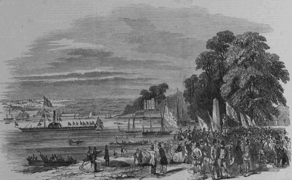
The following print shows the City of London’s party at the Lower Upnor boundary stone. Upnor Castle is in the near distance. The steam-ship Meteor is lying offshore.

Rochester Castle

This print is titled “The distribution of money”, part of the ceremony at the boundary stone as money was distributed to the local citizens, although it seems to be basically throwing coins into a fighting scrum of people.

Rochester Castle

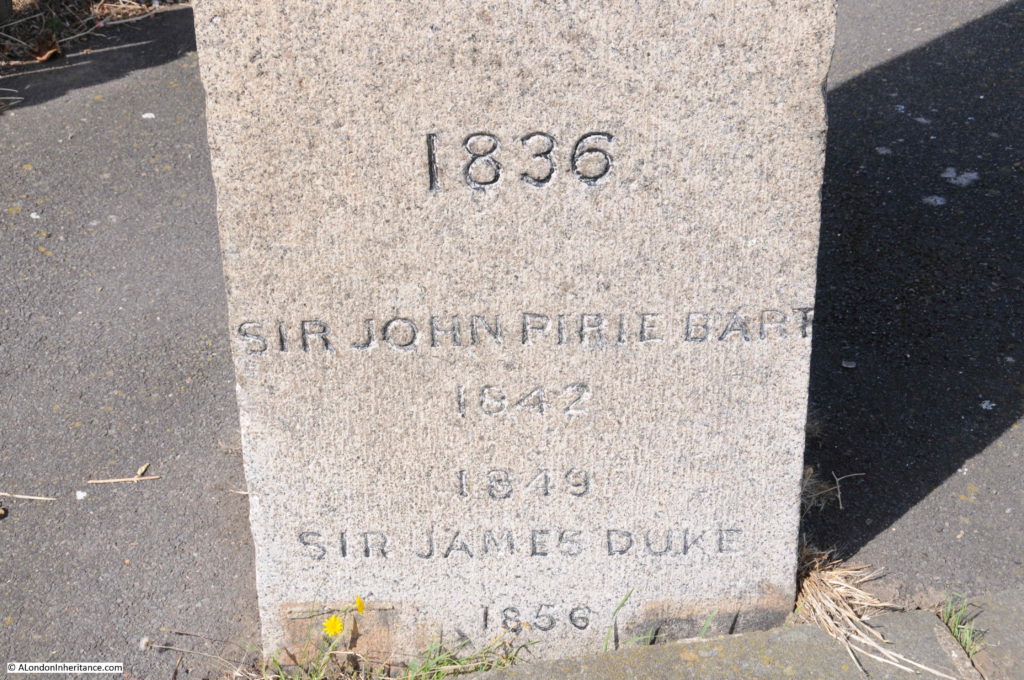
The visit in 1949 was by Sir James Duke, the Lord Mayor of the City of London between 1848 and 1849. In the report above, the water-bailiff is instructed to have the date of the Mayor’s visit carved on the stone, and we can still see this today towards the base of the pillar.

Rochester Castle

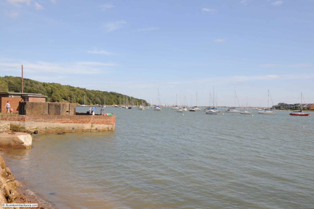
The following photo shows the view eastwards from the pillar along the River Medway in the direction of Yantlet Creek. It was these waters over which the City of London claimed jurisdiction.

Rochester Castle

These stones, along with the stones at Southend and Yantlet Creek mark the eastern boundaries of the City of London’s claimed jurisdiction.

Whilst I can understand the City’s claim along the River Thames, standing at Lower Upnor and looking out over the River Medway, the City’s claim over this river does seem rather stretched and I am not surprised that the regular visits to reinforce the claim were as theatrical as the 1849 description.

I suspect that whilst the civic authorities in Rochester participated, they were not particularly happy with the City of London approaching almost up to their town.

To follow in the Lord Mayor of London’s footsteps, it was to Rochester that I headed next.

Rochester Castle and Cathedral

Rochester is a lovely town, and one that I have not visited enough. An impressive Norman Castle and a beautiful Cathedral, along with a High Street of historic buildings make this a place worth spending more than a few hours exploring.

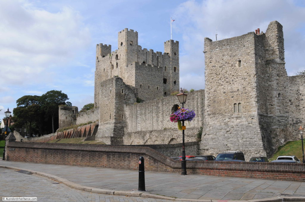
At the north western tip of the town is Rochester Castle, despite being almost 1,000 years old, it is still a domineering structure, built to overlook the River Medway and river crossing. This is the view of the castle from in front of the Cathedral.

Rochester Castle

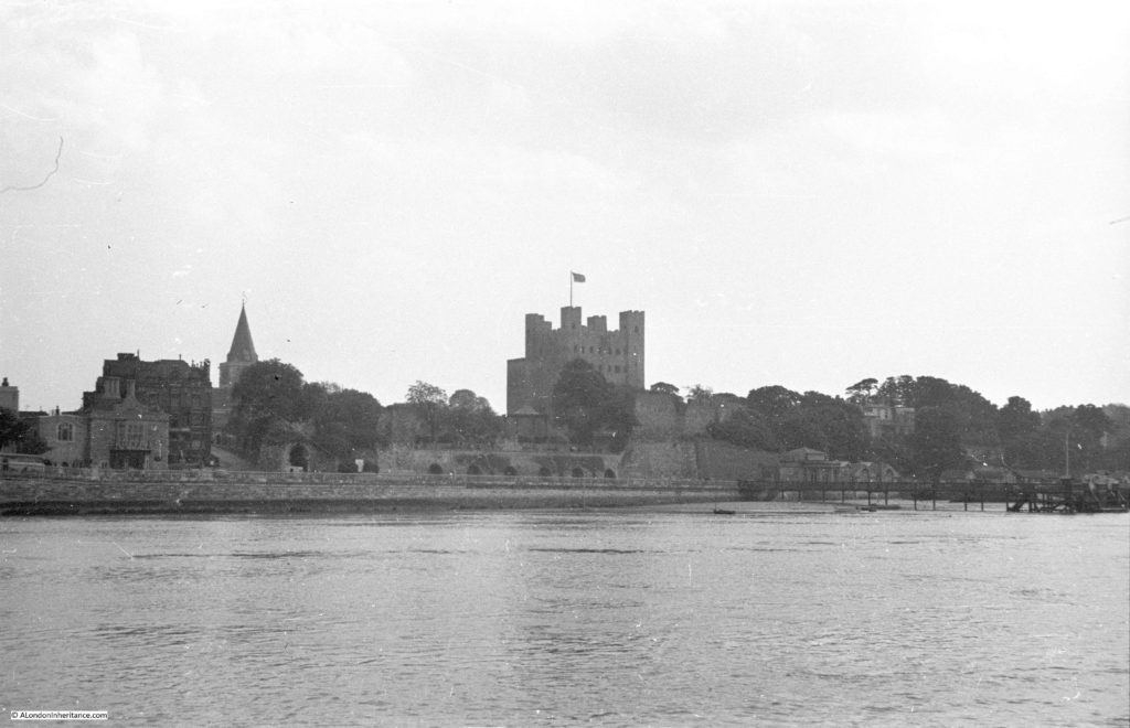
As well as wanting to explore the town, I had a specific reason to visit Rochester as my father had taken a photo of the castle in 1952 from across the river. I could not get to the same place as there was construction work along the road from where the following photo was taken, however it does show how the castle appeared to anyone travelling along the river, and the nearby river crossing.

Rochester Castle

The original castle was constructed during the 1080s by Gundulf, Bishop of Rochester, and consisted of an earth mound and timber ring work fortification. The Great Keep dates from the 12th century when Henry I granted the castle to the Archbishop of Canterbury, on condition that the Archbishop constructed a stone castle.

Bishop Gundulf has a London connection as he was appointed by King William I to oversee the construction of the White Tower at the Tower of London.

Rochester dates from Roman times when it was the town of Durobrivae, built on an important crossing over the River Medway for a road from London to east Kent. The Norman fort was constructed for the same reasons as the Roman town, in that it protected the route from London to Dover, the channel ports and therefore to the Continent.

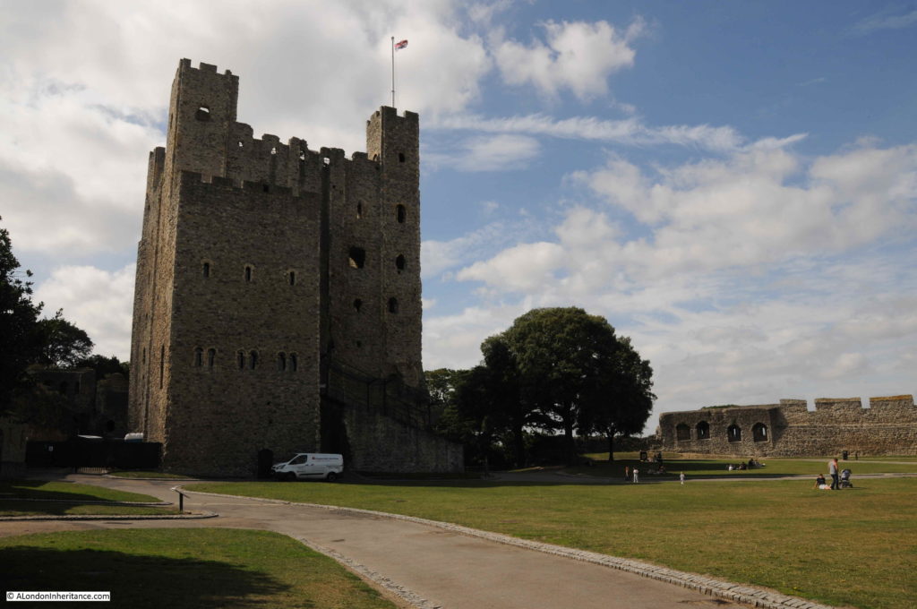
The Great Keep is today still a remarkable structure and apparently is the tallest such building in Europe.

Rochester Castle

Rochester Castle was involved in a couple of sieges during the 13th century. Firstly when the castle was occupied by William de Aubigny and Robert Fitzwalter, as part of the Baron’s revolt against King John. The castle was put under siege by King John who ordered that tunnels were dug under the castle walls and keep. Fires were then set to burn the timber props within the tunnels leading to the destruction of part of the castle walls and a corner of the keep.

The second siege was when the castle was held by Royalist forces in support of King Henry III , who were defending the castle during the second Barons Revolt when Simon de Montfort, Earl of Leicester attempted to take the castle.

The defenders held out to the point where Simon de Montfort had to withdraw.

From the mid 16th century, the castle started to fall into decline, as a defensive position adjacent to the Medway river crossing was by now redundant. Stone was robbed from the castle to build nearby Upnor Castle (which was needed to defend Royal Navy moorings on the River Medway from attack by French ships). A later fire and general deterioration furthered the decay of the castle, until it was purchased in 1884 by the Corporation of Rochester and it was opened to the public.

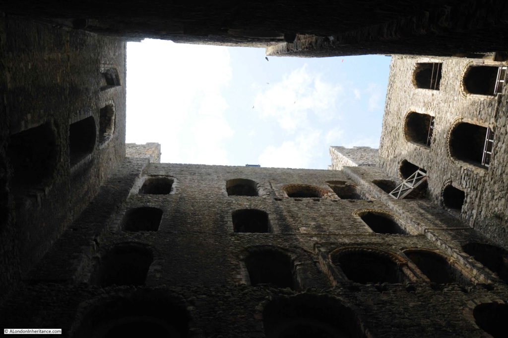
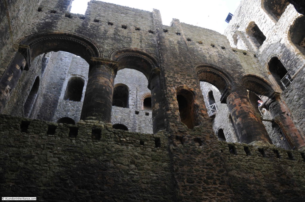
The interior of the keep is today open to the elements and consists of the surrounding walls and a central wall that divided the keep into two sections.

Rochester Castle

Although only the walls remain, it is very clear from the architecture, carvings, holes cut into the walls to support floors etc. that this must have been an incredibly impressive structure.

Rochester Castle

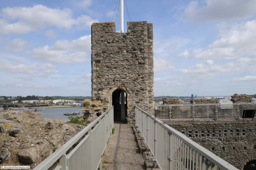
Walkway along the top of the castle:

Rochester Castle

Which provides some brilliant views over the surrounding countryside.

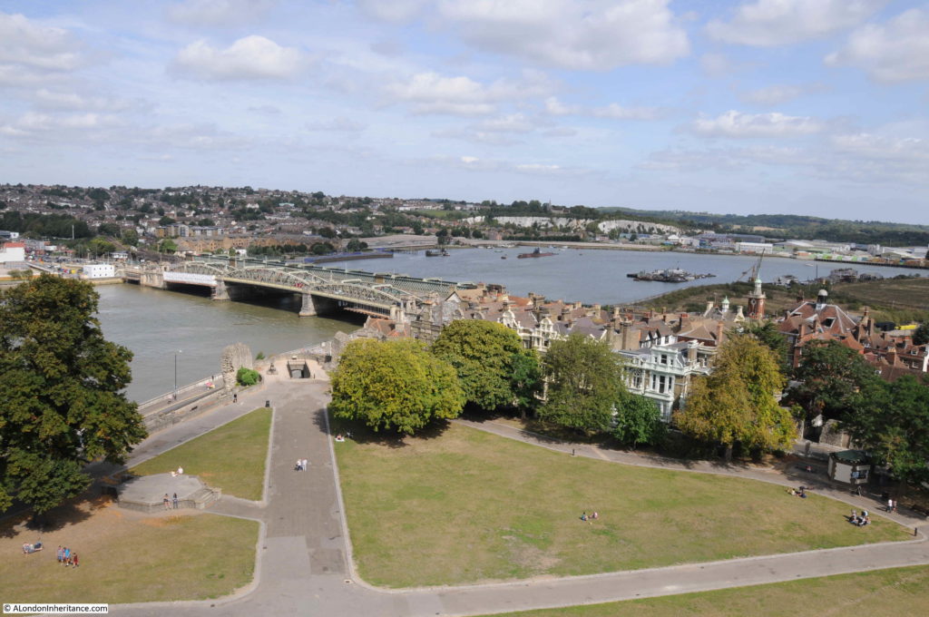
In the photo below is the key river crossing over the River Medway. A crossing here dates from Roman times when the road from London onward to Canterbury and the channel ports crossed the river at this point. The importance of the crossing is the reason for Rochester’s location and the justification for the castle, built to defend the crossing.

Rochester Castle

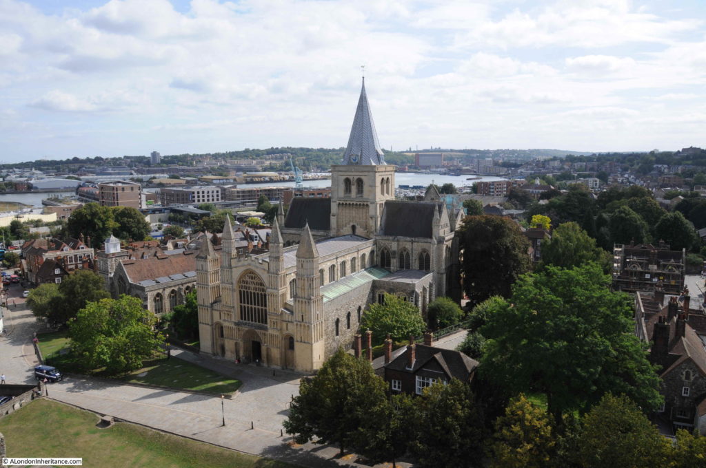
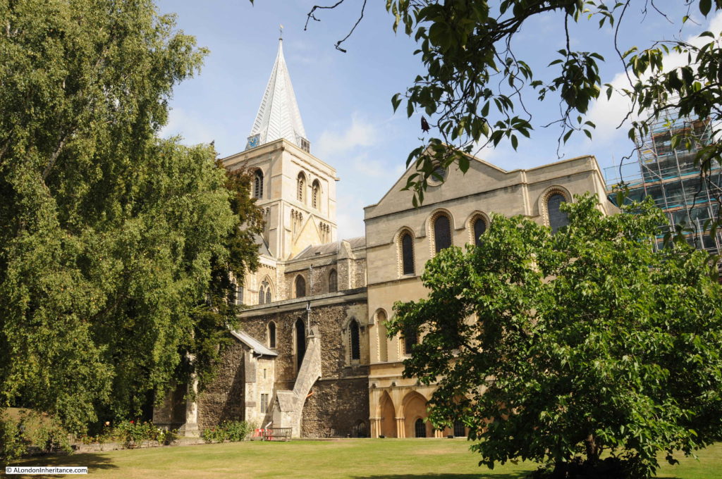
The castle provides some magnificent views of Rochester Cathedral, which was my next stop in my exploration of Rochester:

Rochester Castle

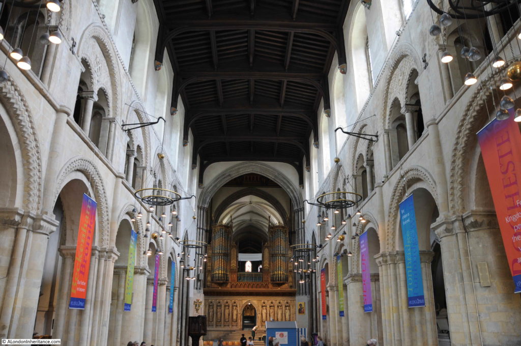
On walking into the Cathedral I was greeted with a rather surprising sight. The nave had been taken over by a mini golf installation, arranged for charity, and there were families with children playing golf in a most unusual setting. The following photo is the view along the nave, above the heads of the golf players.

Rochester Castle

The earliest church in Rochester dates from 604, when King Ethelbert donated land for a church.

Building of the Cathedral we see today was commenced in 1083 by the same Gundulf, Bishop of Rochester who was responsible for the construction of the first castle.

The nave was the first part of the Cathedral to be completed, with consecration of the cathedral in 1130 in front of King Henry I.

The cathedral was badly damaged during the sieges of the castle in the 13th century, and there was further restoration work and building during the following centuries. The cathedral was damaged again during the Civil War by Parliamentarian soldiers.

George Gilbert Scott carried out major restoration work during the late 19th century and the present tower and spire were dedicated in 1904.

Rochester Castle

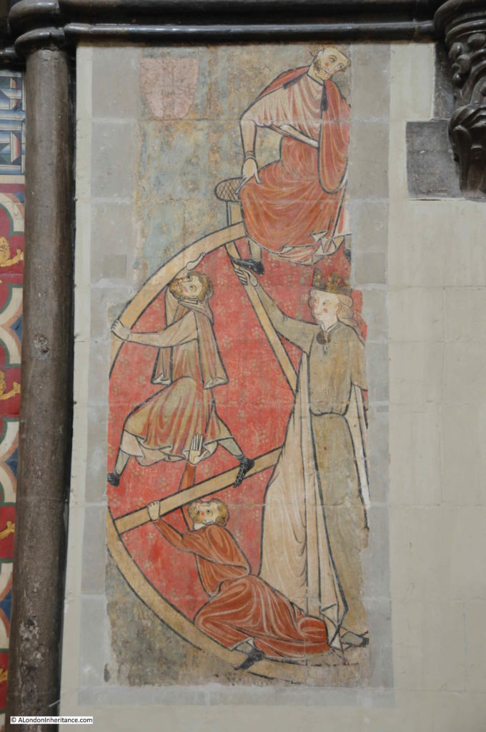
Rochester Cathedral has a remarkable wall painting, only part of which survives. This is the Wheel of Fortune dating from the 1200s.

Rochester Castle

The missing part of the painting was destroyed during the Civil War. It was then covered by a Pulpit and only discovered again during 19th century restoration work.

The Wheel of Fortune was a common medieval representation of how a rise in status in society could just as swiftly be followed by a fall. The women in the middle, controlling the wheel is Fortuna. The three men holding on to the wheel represent those at different levels of success within life. The man at the top of the wheel is wealthy and powerful.

The two men on the left are working their way up in life, starting from the lowest level of society at the bottom of the wheel.

The man at the top of the wheel is sitting down, an indication that he has reached the peak of society, however he is looking to the right, possibly where a warning to the powerful would be seen. Based on similar representations, on the right of the painting there would have been a man falling to the bottom of the wheel – a warning that no matter how rich and powerful you become, the risk of a fall to the lowest levels of society are always lurking in the background.

A powerful Medieval representation, but one that is also very relevant today.

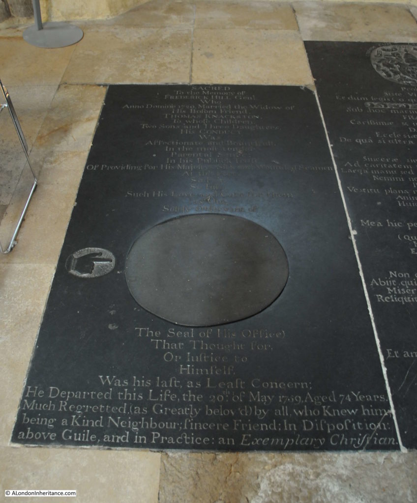
There are numerous interesting memorials across the cathedral. This one was unusual with a hand originally pointing to the seal of office of Frederick Hill, who was responsible for “Providing for His Majesty’s Sick and Wounded Seamen at this Port. So Fair, So Just, Such His Love and Care for them”. A reminder of Rochester and nearby Chatham, along with the River Medway’s part in supporting the Royal Navy over the centuries.

Rochester Castle

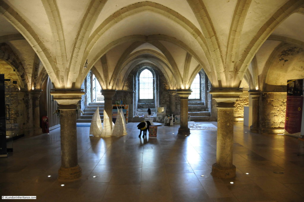
Part of the Crypt:

Rochester Castle

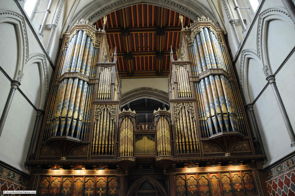
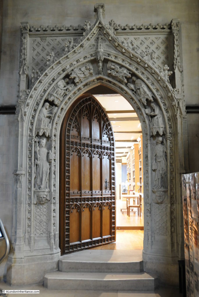
This remarkable door is the entrance to the Cathedral Library.

Rochester Castle

When Henry VIII dissolved the priory attached to the cathedral, the books in the library were taken into the King’s own collection, and then into the Royal Collection and the British Library, however a number of the books have since returned to the library at Rochester.

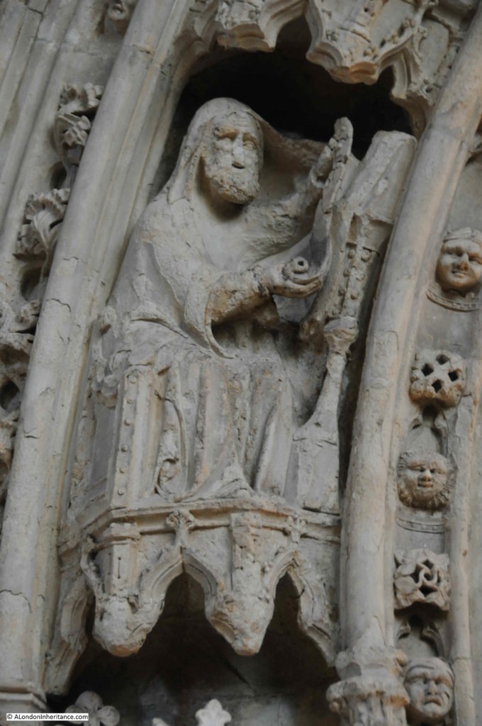
The detail of each carved figure is fascinating, and show the level of craftsmanship that went into the Cathedral in the 14th century.

Rochester Castle

Gardens to the south of the cathedral mark the original location of the priory attached to the cathedral, and the chapter house.

Rochester Castle

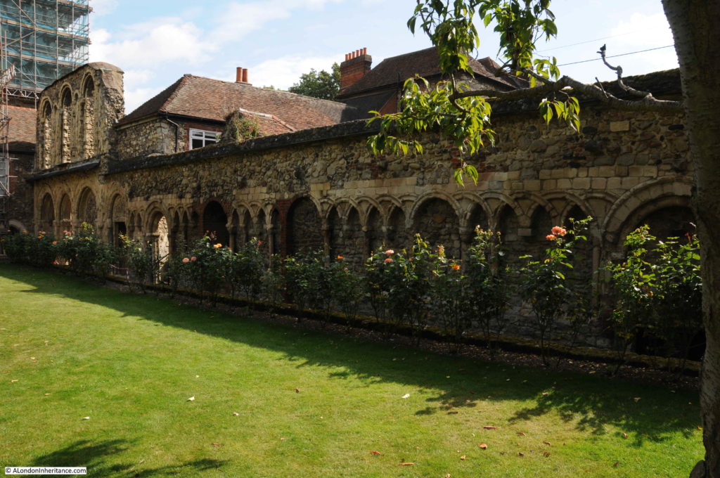
Original 12th and early 13th century walls surround the gardens.

Rochester Castle

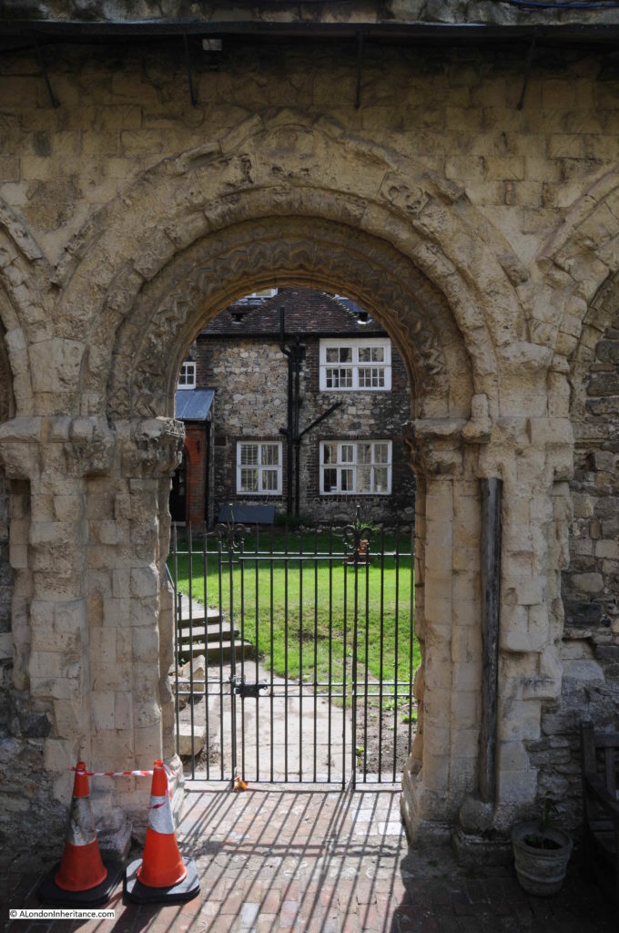
This archway originally led to the 12th century Chapter House. After the dissolution, the chapter house had briefly become part of a Royal Palace for King Henry VIII, however the roof was later removed and it fell into decay.

Rochester Castle

Although worn by centuries of weathering, it is still evident how ornate and carefully carved these walls, arches and doorways were from the 12th and 13th centuries.

Rochester High Street

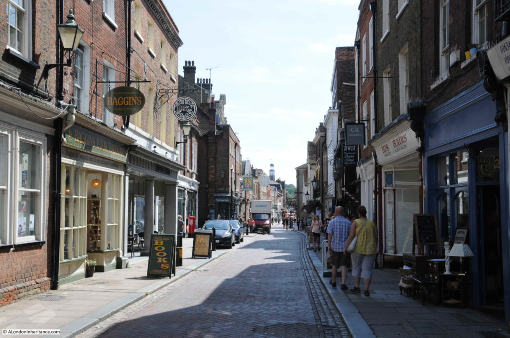
Rochester High Street retains the look and feel of an important, provincial town. A straight, relatively narrow road runs along the centre of the High Street, leading originally from the crossing over the River Medway (there is now a wider road bypassing the centre of the town).

The High Street is lined by a variety of architectural styles from the last few centuries and the buildings support a variety of shops and businesses, fortunately, many still local.

Rochester Castle

In the above photo, on the left, is the type of shop that always damages my credit card. Baggins Book Bazaar is one of the most remarkable second-hand bookshops I have been in for a long time. A standard shop front, but once inside, the bookshop extends a long way back and offers multiple levels stacked high with books – I came out with several.

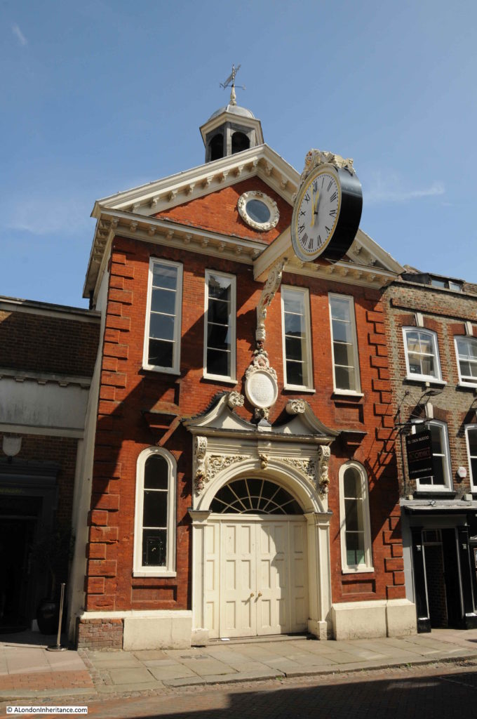
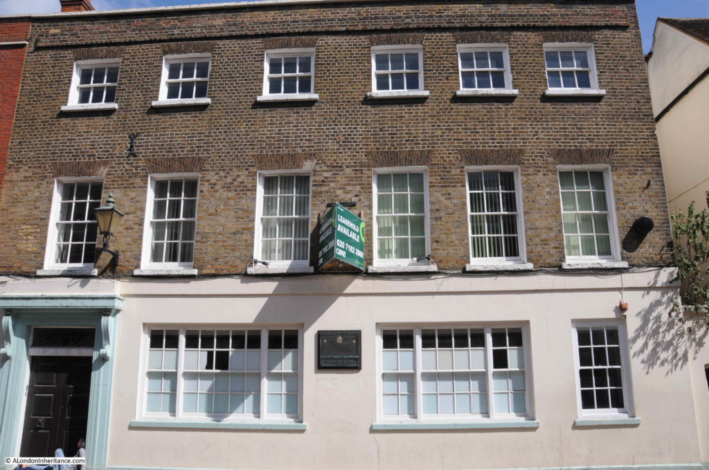
The building in the following photo was erected in 1706 “at the sole charge and expense of Sir Cloudsley Shovel” who represented Rochester as MP during three Parliaments in the reign of King William III and one Parliament during the reign of Queen Anne.

Rochester Castle

The following rather plain looking building has an interesting history.

Rochester Castle

The building has the name Abdication House and the plaque on the front provides the background as “King James II of England stayed at the house as a guest of Sir Richard Head before embarking for France on the 23rd December 1688 when he finally left England”.

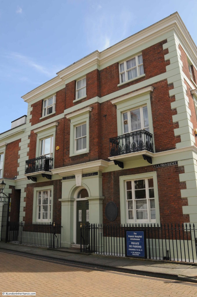
The following building is the site of the French Hospital Almshouses.

Rochester Castle

The Almshouses were founded in 1718 for “poor French protestants and their descendants residing in Great Britain”.

This was a quick run through Rochester High Street – there are many more buildings that tell the history of the area and the importance of Rochester as a town. The above examples – King James II before leaving for France, and the almshouses for protestant refugees arriving from France highlight Rochester’s’ role as a gateway town, where people would leave and enter the country, with one of the main roads to London running through the town providing easy access to the capital, alongside the River Medway.

There was one final place that I wanted to visit whilst in this part of Kent.

St James Church, Cooling

North of Rochester on the Hoo Peninsula is the village of Cooling and it was St. James Church that was my intended destination.

Rochester Castle

Cooling church was the inspiration for the setting of the encounter between Pip and Magwitch in the opening of Charles Dickens book Great Expectations. In the book Dickens describes the area:

“Ours was the marsh country, down by the river, within, as the river wound, twenty miles of the sea.”

The river is still visible from the churchyard, flat fields and marshes provide an unobstructed view, although the traffic and business on the river is now very different to anything that Dickens could have seen, or expected.

Rochester Castle

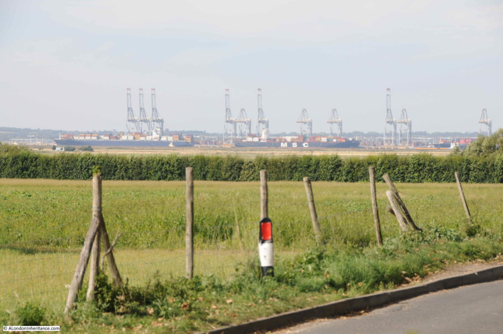
The large container ships docked at the new London Gateway port are clearly visible to the north. A very different form of transport to Dickens’ time, but the river is still a major artery for seaborne trade in and out of the country.

My visit was during a warm and sunny day, very different to the “bleak place overgrown with nettles” on a “raw afternoon towards evening” as described in Great Expectations. It must be a very different place on a late winter’s afternoon, with rain and wind blowing in from the east, along the Thames estuary and across the Hoo Peninsula.

Among the graves surrounding the church are a tragic collection of small graves that were well-known to Dickens.

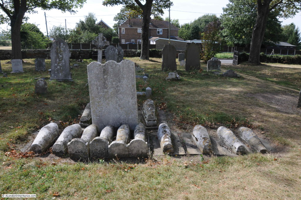
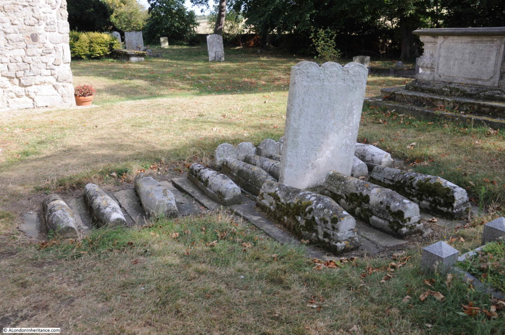
These are the graves of babies and children from the Baker and Comport families who died between 1771 and 1779. Three of the children died around the age of one month. The graves are a very visible demonstration of the dreadful infant mortality rates that must have inflicted terrible anguish on parents in the centuries before the standards of health we perhaps take for granted today.

They are lined up in what Dickens described as ” little stone lozenges each about a foot and a half long, which were arranged in a neat row beside their (parents) graves”.

Rochester Castle

Ten smaller graves are on one side of the headstone and three larger graves are on the other side.

Rochester Castle

The church of St. James’ Cooling dates from the 13th century. It is no longer an active church, and is in the care of the Churches Conservation Trust

The interior of the church is open and the white walls provide an impression of light and space. The following photo is looking along the nave, with the 13th century font in the foreground.

Rochester Castle

The pulpit dates from the 18th century, and in common with nearly all churches, there was 19th century restoration work, the majority of the church dates from between the 13th and 15th centuries.

Rochester Castle

The wooden door on the right of the photo below is around 500 years old, and there are benches that possibly date from the 14th century.Rochester Castle
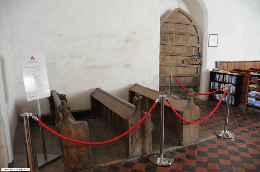
The Churches Conservation Trust now offers the opportunity to stay overnight at St James Church, Cooling on one of their “Champing” experiences. I would rather like to do that on a wet and windy night.

This has been a very quick tour of a number of fascinating sites, and I have not been able to do justice to them in a single post, but there is a theme to these sites.

It is how London’s influence extends far wider than just the City. The boundary markers at Lower Upnor tell of how the City of London tried to exert authority over a much wider area than just the River Thames.

Rochester is a town that probably owes its existence to being on the site where the road from the channel coast and Canterbury to London crossed the River Medway. A crossing that dates back almost 2,000 years to the time of the Roman occupation of Britain.

The exception is St James, Cooling, however the church connects in some ways to the River Thames as the church has seen the changes in river traffic over many hundreds of years.

alondoninheritance.com

Emerson Stairs, Bankside

The south bank of the River Thames has changed dramatically over the years, from an industrial environment, to one of leisure, culture and expensive housing. For much of the south bank, from Westminster Bridge to Tower Bridge, there is very little evidence of these pre-war industries, and their close relationship with the river.

As with much of the Thames as it if flows through the city, this stretch of the river was lined with numerous stairs, providing access to the river from the streets and buildings that ran alongside. It is still possible to find many of these, but there is one lost set of stairs that are the subject of this week’s post – searching for Emerson Stairs in Bankside.

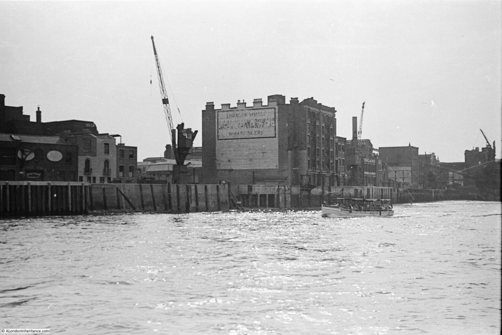
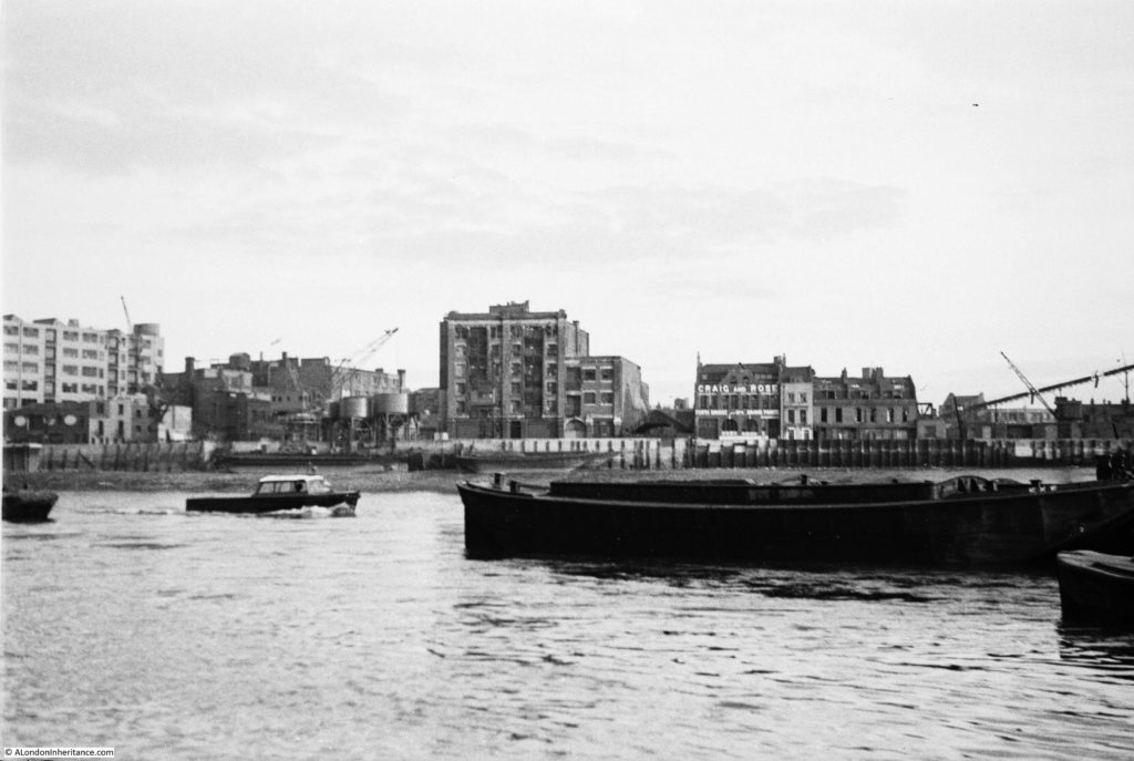
This is one of my father’s post war photos of the south bank:

Emerson Stairs

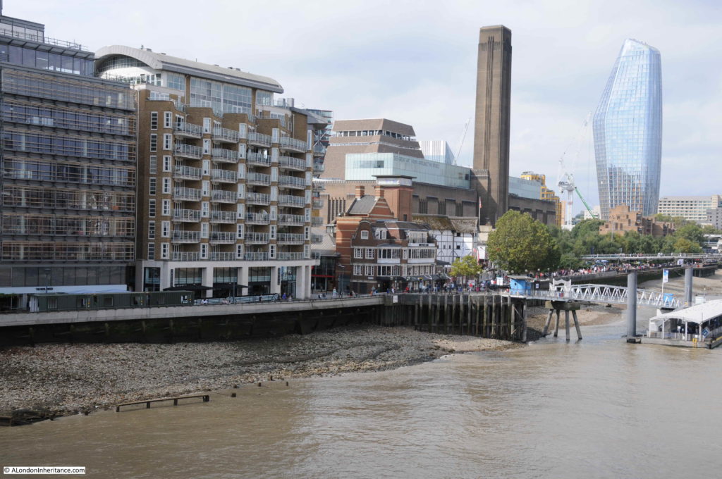
At first glance, there is not much in the above photo to identify the location today, but there are many pointers which I will explain as I work through the post, but as a starter, this is the same scene today:

Emerson Stairs

The perspective is slightly different between the two photos, as my father was in a boat on the Thames, and I was standing on Southwark Bridge, but the area covered is much the same in the two photos.

The main clue to the location in the original photo is on the sign on the large building in the centre of the photo, which in fading lettering identifies the name as Emerson Wharf.

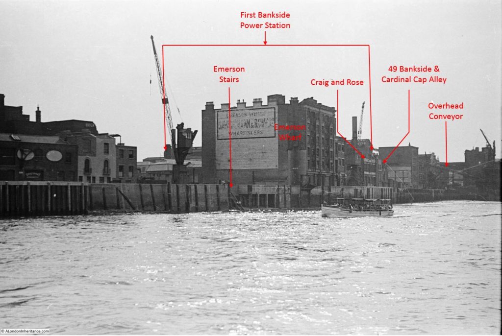
This building is on the site that would become the Globe Theatre, and in the following photo I have added some of the key landmarks and features visible in the photo:

Emerson Stairs

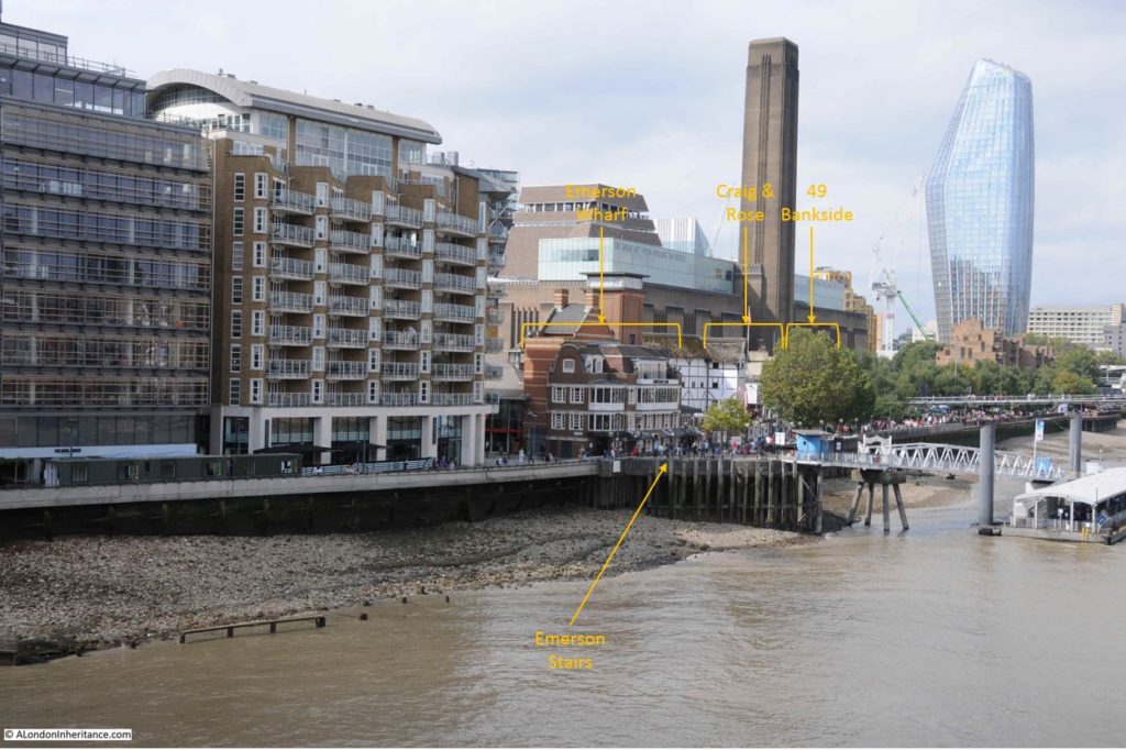
And in the photo below I have added the location of the original buildings to the 2019 photo:

Emerson Stairs

The only features that remain today are the old houses at 49 Bankside and on the opposite side of Cardinal Cap Alley, although these are behind the trees in the 2019 photo.

The original Bankside Power Station, which was a longer, but thinner building to the 1950s replacement (now Tate Modern) is behind Emerson Wharf, and all the infrastructure between power station and river, including the coal conveyor belt which can be seen in the original photo, have long gone.

One of my many side projects is tracing all the Thames stairs, and in the centre of the photo there is a new one for me to add to the list.

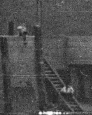
Just visible are a set of stairs leading down from the river, from a small cut into the embankment, and there appears to be a couple of  people sitting on the stairs looking out over the river. I have labelled the stairs in the original photo above.

The following photo is an enlarged extract from the original photo showing the stairs (the best quality image I could get from a 72 year old 35 mm negative):

Emerson Stairs

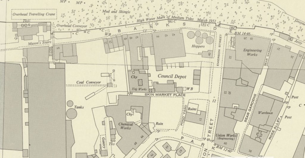
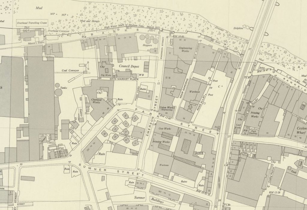
The map below is an extract from the 1951 edition of the Ordnance Survey map for the same area as in the photo.

Emerson Stairs

Credit: ‘Reproduced with the permission of the National Library of Scotland’ 

The river and “mud and shingle” of the foreshore runs along the top of the map.

Bankside Power Station is the large block towards the left of the map running from top to bottom. The words “overhead conveyor” on the map between power station and river refer to the conveyor partly visible in my father’s photo.

Bankside runs along the river’s edge from left to right.

To the right of centre of the photo there is a street running from Bankside down to the bottom of the map – this is Emerson Street. Look where Emerson Street meets Bankside, then just above, to the left, there is a small cut into the embankment, and the symbol of some stairs reaching down to the river.

These are the same stairs as seen in my father’s photo – Emerson Stairs, leading from the junction of Emerson Street and Bankside, down into the river.

The 1950 edition of the Survey of London – Volume XXII Bankside – provides a source for the name Emerson Street and the associated stairs:

“During the reign of Elizabeth, part of Axe Yard was the property of the Emerson family, William Emerson, died in 1575. His monument in Southwark Cathedral has the succinct epitaph ‘he lived and died an honest man’. His son, Thomas (died 1595) founded one of the parish charities and gave his name to Emerson Street.”

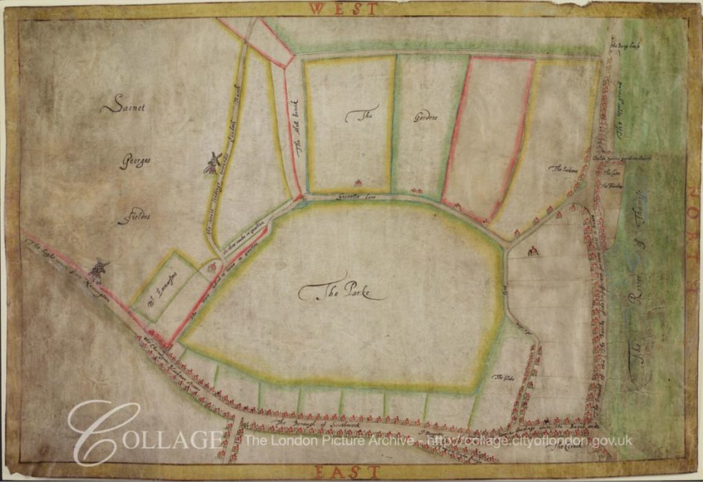
There is a plan of Bankside, dating from 1618, drawn to support a lawsuit over access to Bankside, and in the left of this plan there is a rectangular plot of land labelled ‘Mr Emmerson’s’. The River Thames in the plan is on the right, with Bankside running from top to bottom of the map alongside the river.

Emerson Stairs

Image credit: London Metropolitan Archives, City of London: catalogue ref: COL_CCS_PL_01_205_26

There is though a bit of a mystery concerning the location and name of the stairs.

I could not find too many mentions of Emerson Stairs. The following newspaper report (London Evening Standard, 6th August 1880) is typical of the few references I could find, where the stairs are used as a reference point on the river:

CORONERS’ INQUESTS – Mr W. Carter, Coroner for the eastern Division of Surrey, held an inquest at the Woolpack, Gravel-lane, yesterday, on the body of John Thomas Glue, 16 years of age. who was drowned  in the Thames on Friday last while bathing off Old Barge House Stairs, Upper ground-street, Blackfriars. Thomas Style, who accompanied the deceased for the purpose of bathing, said the deceased swam out some ten or eleven yards, and suddenly called out that he had the cramp, and cried for help. he tried to turn, but was carried down by the rapidity of the current, and sunk under a barge that was moored close at hand. There were a number of others in the water, but at too great a distance to render him any help. Witness packed up the deceased’s clothing and handed them to the police – G.J. Jeffery, Fireman No. 91. picked up the body between Southwark bridge and Emerson Stairs and gave it into the charge of Police-constable 103 M. who had it conveyed to the mortuary.”

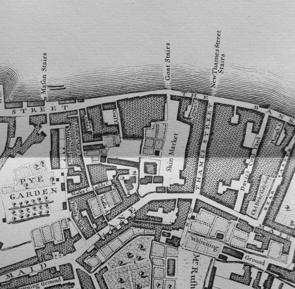
Stairs leading down to the River Thames have often been in existence for many centuries, so I checked John Rocque’s map of London from 1746. The map extract below shows roughly the same area, but where Emerson Street was located in the 1951 map, there is a street named Thames Street, with a set of stairs at the end of the street called New Thames Street Stairs.

Emerson Stairs

So was this the original name of the street and stairs?

Emerson Street is the name on the 1895 Ordnance Survey map, however earlier than this, there seems to be a dual use of Emerson and Thames Street back to around 1880, with Thames Street being the name used prior to 1880.

An example of the use of Thames Street is from multiple reports on the 13th December 1845 about a very high tide that caused significant damage all along the Thames:

“LAMENTABLE EFFECTS OF THE HIGH TIDE – The publicans in Thames Street, Bankside, and so on to Westminster and Lambeth, had their cellars filled with water. The Commercial Road, Lambeth and Belvidere-road, were all under water, and in the later road the cellars were filled. Searle’s the boat builders premises, the glass house and wharfs between the latter place and Bishop’s-walk were flooded to a depth of several feet. the road to Lambeth Church was impassable. The tide rushed under the gates of the Archbishop’s Palace, filling the gardens and approaches to the house. In Fore-street, High-street, and Ferry street, the licences victuallers and other have sustained great losses, and the landlady of the Duke’s Head, in Fore-street estimates her loss at £200.”

So, my assumption was that during the 1880s, Thames Street was renamed to Emerson Street, with the stairs also taking on the Emerson name.

I then checked the Layers of London website to overlay the Rocque map on the 1950s Ordnance Survey map to confirm, but here it got confusing.

The overlay of these maps appeared to show that Thames Street and New Thames Street Stairs were a short distance to the west of Emerson Street and Stairs. Indeed, the road at the south of Emerson Street, Park Street also looks to be in a slightly different position when comparing the two maps.

Returning to a slightly wider view of the Ordnance Survey map, and comparing with the Rocque map, the position of Emerson Street and Thames Street appear the same. The alignment of Maid Lane, and its future name of Park Street look roughly the same, leading down to what would become the junction with Sumner Street.

Emerson Stairs

Credit: ‘Reproduced with the permission of the National Library of Scotland’ 

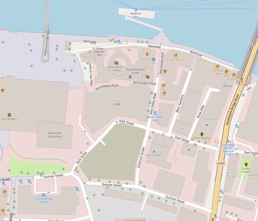
And comparing with the street layout of today, this looks the same, however Emerson Street has undergone yet another name change. The section north from Park Street to Bankside is now called New Globe Walk – a relatively recent name change to go with the build of the Globe Theatre on what was Emerson Wharf (Map © OpenStreetMap contributors).

Emerson Stairs

So I suspect that Thames Street and New Thames Street Stairs changed name to Emerson Street and Emerson Stairs at some point in the 1880s. They were the same streets, and the mapping between the Rocque and Ordnance Survey maps on the Layers of London site is slightly out at this point – which is only to be expected given the lack of precise mapping and recording techniques available to Roqcue in the mid 18th century.

The name Emerson Street is retained on the southern section from Park Street to Sumner Street, so a reference to the 16th century Thomas Emerson can still be found in Bankside.

There is a report of an inspection by the St. Saviours Board of Works into the condition of Thames stairs and landing places in November 1866. This report includes Thames Street Stairs, but also lists all those within their responsibility and provides names of some that remain, and some lost:

“The committee had made an inspection of the following water-side passages or ways in the district through which the board possessed a right of way – viz: Primrose-alley, St. Mary Overie’s Dock, St. Mary Overie’s Stairs, Horse-shoe-alley Stairs, Rose-alley, Bankside, Thames-street Stairs, Mason’s Stairs, Love-lane Stairs, Clark’s-alley, Rennie’s gateway, Marygold Passage and Stairs, Bull-alley Passage and Barge-house Alley and Stairs, in most of which obstructions, nuisances, &c, existed, which required to be attended to. Referred back to the committee.”

The list of names gives an indication of the number of stairs and alleys there were leading to the river, and there are some intriguing names, Obstructions and nuisances also lets the imagination roam over what river side life was like, and the activities that went on at these stairs and passages, on the border between land and river.

The references I have found name the stairs Thames Street Stairs, rather than New Thames Street Stairs as referenced in Rocque’s map. The use of the word “New” in 1746 is either an error, or implies these stairs replaced a previous set of stairs with the same name – one for my endless list of things I still want to research.

So what does the area look like today?

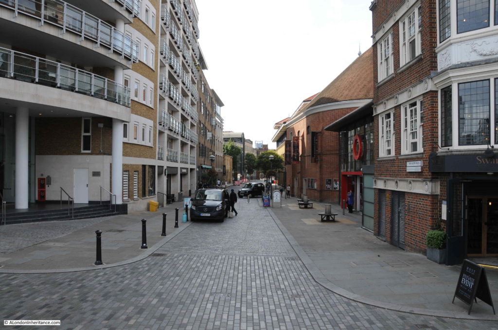
The following photo is from Bankside, looking down New Globe Walk / Emerson Street / Thames Street.

Emerson Stairs

Part of the street now has restricted vehicle access and the Globe Theatre now occupies the space on the western corner.

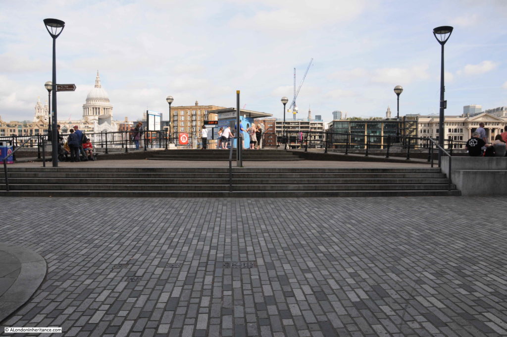
This is the view looking up towards the river at the junction of New Globe Walk / Emerson Street / Thames Street with Bankside. The stairs would have been roughly in front of where the red life buoy can be seen.

Emerson Stairs

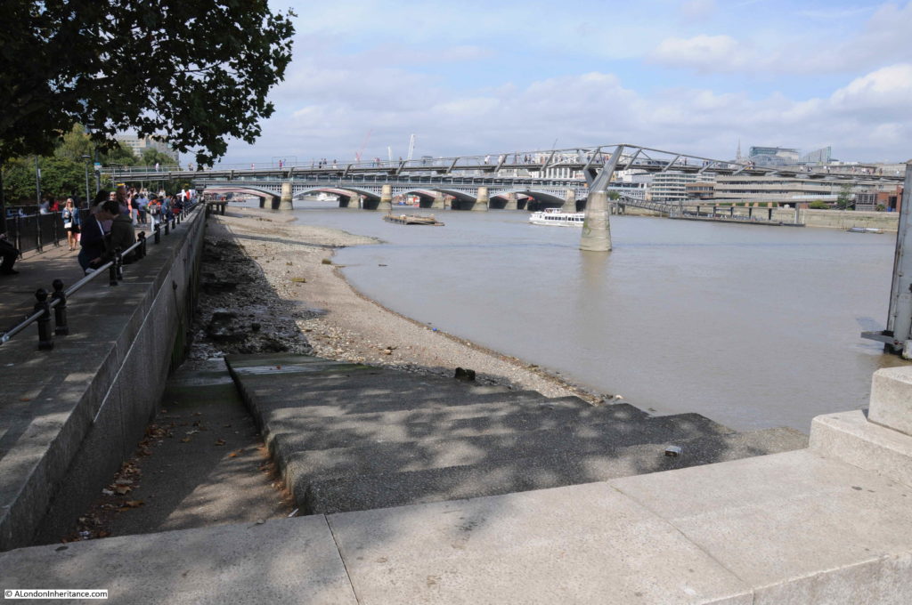
The stairs were located where Bankside Pier now stands. The pier is directly opposite New Globe Walk and provides access to the passenger ferries that run along the Thames, so although the stairs have disappeared, the same location continues to be used as a means of accessing craft on the river.

Although Emerson Stairs have gone, there are still stairs down to the river at Bankside. A short distance to the west from Bankside Pier are these stairs leading down to the foreshore.

Emerson Stairs

These are new stairs, built as part of the re-development of Bankside, however there is perhaps a historical reference for these stairs.

Looking back at the Rocque map, and just to the west of New Thames Street Stairs are Goat Stairs. Align these with Maid Lane in 1746 and Park Street in 2019 and they are in a similar position (although perhaps a bit too far to the west, depending on the accuracy of the 1746 map).

Goat Stairs are not found on the Ordnance Survey maps, so these were lost much earlier, however the new stairs are a good reminder of the old stairs that once connected Bankside with the river.

Emerson Stairs

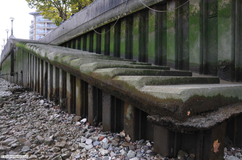
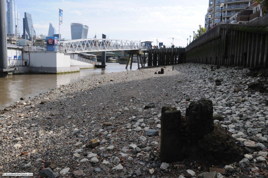
From the foreshore by the stairs we can look back at Bankside Pier, the location of Emerson / Thames Street Stairs.

Emerson Stairs

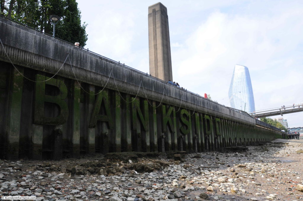
Invisible from the walkway along the river, but visible down on the foreshore, the word BANKSIDE calls out to those on the river and on the opposite shore.

Emerson Stairs

The history of the stairs that line the River Thames is fascinating. I have written about a number before including Alderman Stairs, Old Swan Stairs and Horselydown Old Stairs.

I can now add Emerson Stairs / Thames Street Stairs to the list, and I have many more to go.

Stairs are simple structures, but it is their role as a reference point on the river, and a route crossing the boundary between land and river that is so fascinating.

There are numerous stories about events at these stairs, a couple of which I have already mentioned. Many stories highlight a tragedy and the challenges of life in London – such is the nature of news reporting. One particular report from the 29th May 1842 demonstrated the impact on women of the daily struggle to support a family, and how this came to a tragic conclusion at Thames Street Stairs:

” SUICIDE – On Friday a suicide was committed at the Thames Street Stairs, Bankside, by a respectable married woman, named Firmin, the wife of a lighterman, residing in the Commercial road, Lambeth. Her husband, having occasion to go to work about three o’clock in the morning, left the deceased in bed, and soon afterwards she got up, and having dressed herself, went to the above stairs, and getting on to some barges alongside threw herself into the river. A watchman on the opposite side immediately gave an alarm, and the body was got out of the water, but life was quite extinct. The deceased had been married about twenty two years, and was the mother of eighteen children. Not the slightest reason can be assigned for the committal of the rash act.”

I suspect the reason for the so called ‘rash act’, may have been the challenge of providing for and supporting the family mentioned in the second to last sentence – the stress of supporting a family with eighteen children on a lighterman’s wages must have been enormous.

One final point before finishing this post, the 1950’s Ordnance Survey map shows a number of circles marked “hoppers” in the space between the Emerson Wharf building and Emerson Street.

These are not visible in my father’s photo which was taken in 1947, but they were installed a couple of years later as shown in the photo below taken by my father in 1949 from the north bank of the river, which also provides a good view of the river facing side of Emerson Wharf (the hoppers are slightly left of centre).

Emerson Stairs

I suspect that when the hoppers were added, there was an expectation that industrial life would continue as it had done, however changes in river usage, and the closure of industry along the river in the decades following my father’s photo would end with the scene we see today with the Globe Theatre occupying Emerson Wharf, and the Bankside Pier providing access to the river, in place of Emerson Stairs.

alondoninheritance.com

Cripplegate Institute and Jewin Crescent

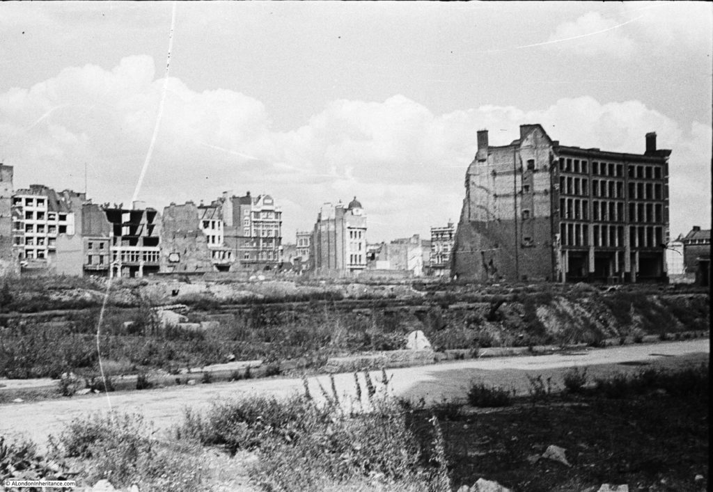
For this week’s post I am back in the Barbican, exploring Cripplegate with another of my father’s photos showing the area in 1947.

The church of St Giles provided a very clear landmark in last week’s photo, but when I first scanned the photo for this week’s post, there were no obvious landmarks or points of reference to help with identification.

Cripplegate

I always look for any building that may still be there today. In the above photo, all the buildings in the foreground have been demolished, apart from one, which looks badly damaged and will also probably be demolished.

There is the paved surface of a street just above where my father was standing.

Many of the buildings in the background do appear damaged, although there are a couple that appear to have minimal if any damage, so could possibly remain today if they were not demolished for the Barbican development.

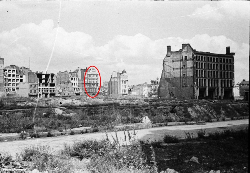
One building had a rather distinctive design, and also looked in good condition. I have marked this building in the photo below:

Cripplegate

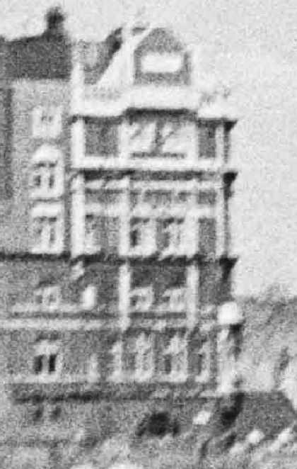
An enlargement from the original photo showing the distinctive features of this building:

Cripplegate

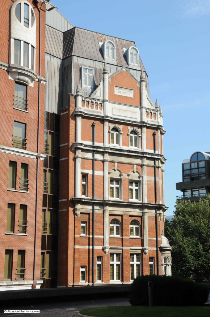
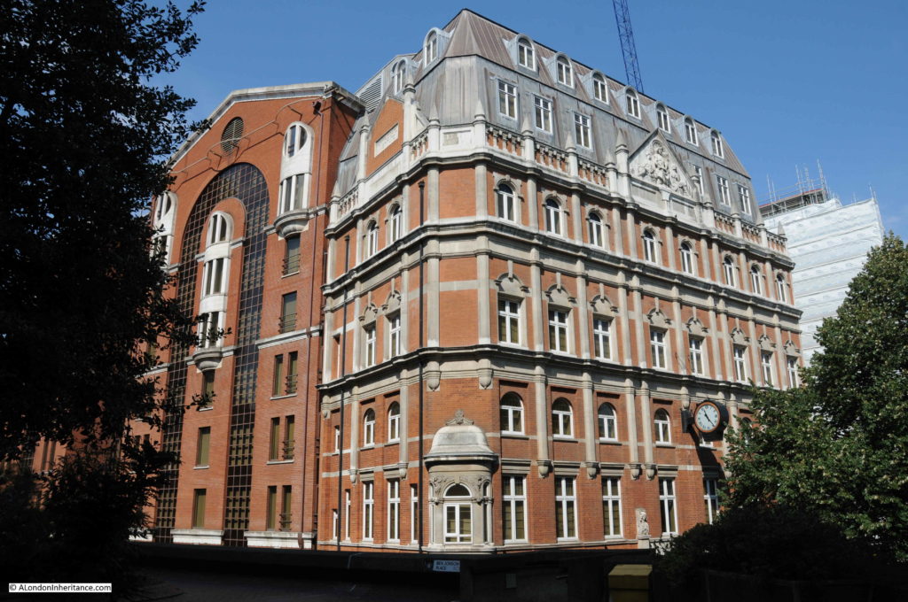
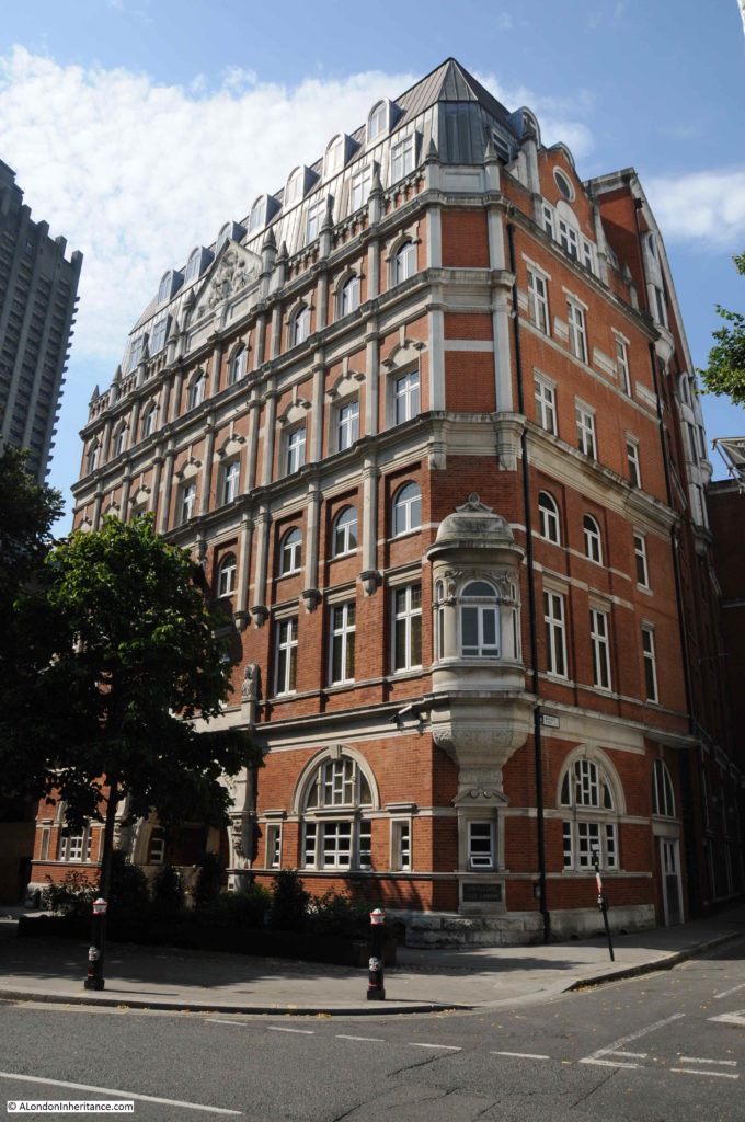
After much checking on Google StreetView, followed up by walking the area, I found the same building. It now has a roof extension, but the external features are identical to those in the 1947 photo. This is the building of the old Cripplegate Institute on the corner of Cripplegate Street and Golden Lane.

Cripplegate

I now needed to track down where my father was standing, and the location of the building in the cleared area. As ever, the Ordnance Survey maps held by the National Library of Scotland provided further evidence.

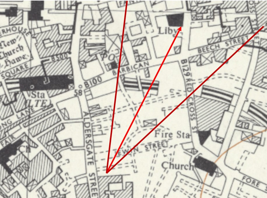
The following extract is from a post war Ordnance Survey map.

Cripplegate

Credit: ‘Reproduced with the permission of the National Library of Scotland’ 

St Giles church is shown to the bottom right. The Cripplegate Institute is marked as a Library (it served multiple purposes which I will explain later in the post) towards the top of the map.

In the centre of the map, there is an empty area, with hashed lines for streets. This is the area demolished after the fires and bombing of the war.

There is one building still marked, a rectangle on what was Jewin Crescent, just above the ‘F’ of Fire Station. Could this be the large building in my father’s photo?

Between where my father was standing and the derelict building, there appears to be two streets. The first is easy to see, the second is a little distance back. This second street cannot be Jewin Crescent as it is not up against the derelict building. I therefore suspect that my father was standing at roughly the point marked where my red lines converge in the map extract.

This street, next to where my father was standing, was Edmund Place.

The alignment of the derelict building and the Cripplegate Institute / Library look right (centre arrow) and the arrows at the side show the approximate field of view in the 1947 photo.

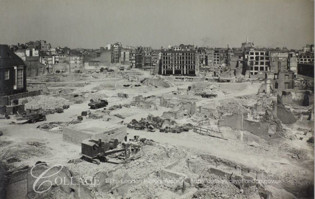
I found some more evidence to confirm from the London Metropolitan Archive, Collage collection. In the following photo we can see the same derelict building that appears in my father’s photo, however now we can clearly see the crescent shaped street, and the location of the building at a street junction, exactly as shown in the map extract.

Cripplegate

Image credit: London Metropolitan Archives, City of London: catalogue ref: M0020321CL

It is hard to imagine just how densely built these streets were prior to the destruction of 1940. My father’s photos show large areas of empty space, occupied only by cellars, low walls and the remains of paved streets.

Jewin Crescent was a relatively narrow street with tall buildings on either side. It was originally named simply “The Crescent”, but took on the name jewin Crescent in 1878.

The destruction of 1940 was not the first time that fire had damaged a large area of Cripplegate. On the 19th November 1897, another large fire destroyed much of Cripplegate. The following text is from the start of an article from the London Daily News on the 22nd November 1897 titled “The Terrible Fire – Acres of Ruins – Plans To Relief Sufferers – Four Thousand Persons Out Of Work – Narrow Escape of Firemen”  which gives some idea of the scale of the fire:

“Yesterday crowds of persons from all parts of London  visited the scene of the disastrous fire in the City to view all that remained of the warehouses and factories which were burned out on Friday. The police, who were again on duty in strong force, had the greatest difficulty in keeping the people back from the approaches to the ruined district, and all traffic in Aldersgate Street had to be suspended. It now appears that the thoroughfares affected more or less by the fire are seventeen in number, as follows: Hamsell-street, Well-street, Jewin-street, Jewin-crescent, Redcross-street, Monkwell-street, Edmund=place, Bradford-avenue, Australian-avenue, Nicholl-square, maidenhead-court, Fore-street, Paul’s Alley, Wood-street-square, Falcon-square, Hart-street and Peel-street.

It was on Saturday definitely discovered that the fire broke out at 15, Well-street, in the occupation of Messrs. Lewis and Company, ostrich feather dealers, and not at 30 and 31 Hamsell-street, as at first reported. This mistake is, however, explained by the fact that the rears of these two premises occupied by Messrs. Waller, Brown and Co., mantle manufacturers, and Messrs. Lewis, the former firm carrying on business in the top portions of the two houses. The fire, which it has now been ascertained was undoubtedly caused by an explosion of gas, broke through the premises of the firms in Hamsell-street, and it was in consequence of this that the flames spread with such rapidity along the two streets.

Of course, in some of the above mentioned street only a few of the houses have been touched but Jewin-crescent, Hamsell-street, Well-street, and the greater part of Jewin-street have been wholly destroyed.”

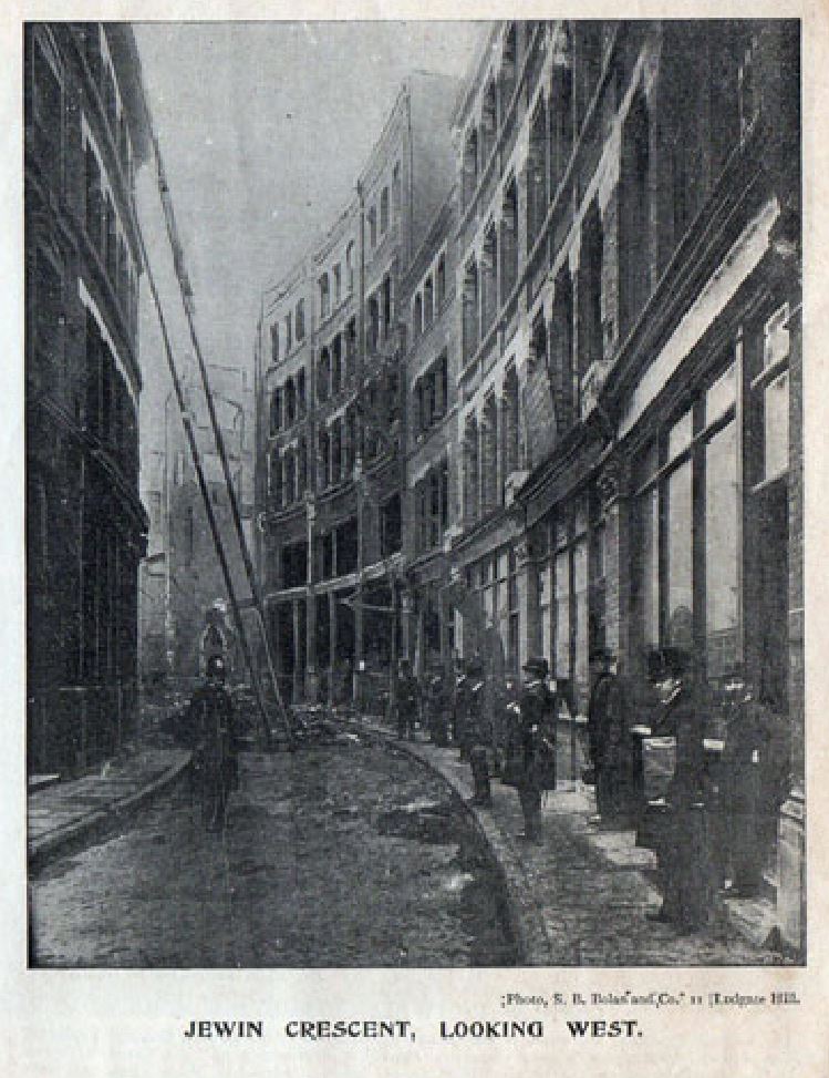
The City Press published a special supplement on the fire, showing the level of destruction across the street. One photo shows Jewin Crescent.

Cripplegate

(reproduced from Grace’s Guide under Creative Commons Attribution ShareAlike Licence)

If you look in the above photo, there is a building on the right of the street that looks very similar to the building in my father’s 1947 photo, however counting the windows in the 1897 photo, it is not exactly the same, although it appears to be in the right position on Jewin Crescent.

I suspect that it was this building, but rebuilt and modified after the 1897 fire, as I did find a later view of the building, and it is identical to that in my father’s photo.

Cripplegate

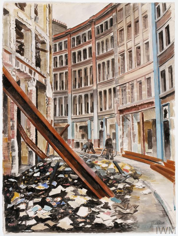
Jewin Crescent, London EC1 (Art.IWM ART LD 1202)

The above drawing is by Roland Vivian Pitchforth, one of his works for the War Artists Advisory Committee and is looking west along Jewin Crescent. At the end of the view, on the right of the street is a building that looks identical to that in my father’s 1947 photo.

Both the 1897 photo and wartime print provide a good impression of Jewin Crescent. A narrow, curving street, lined on both sides by tall shops, factories and warehouses. I suspect the building in the 1897 photo was modified or demolished after the fire, and a new building of similar style constructed on the same plot of land, but with changes to the floor layout and windows.

The area where Jewin Crescent and the 1947 building were located is so very different today.

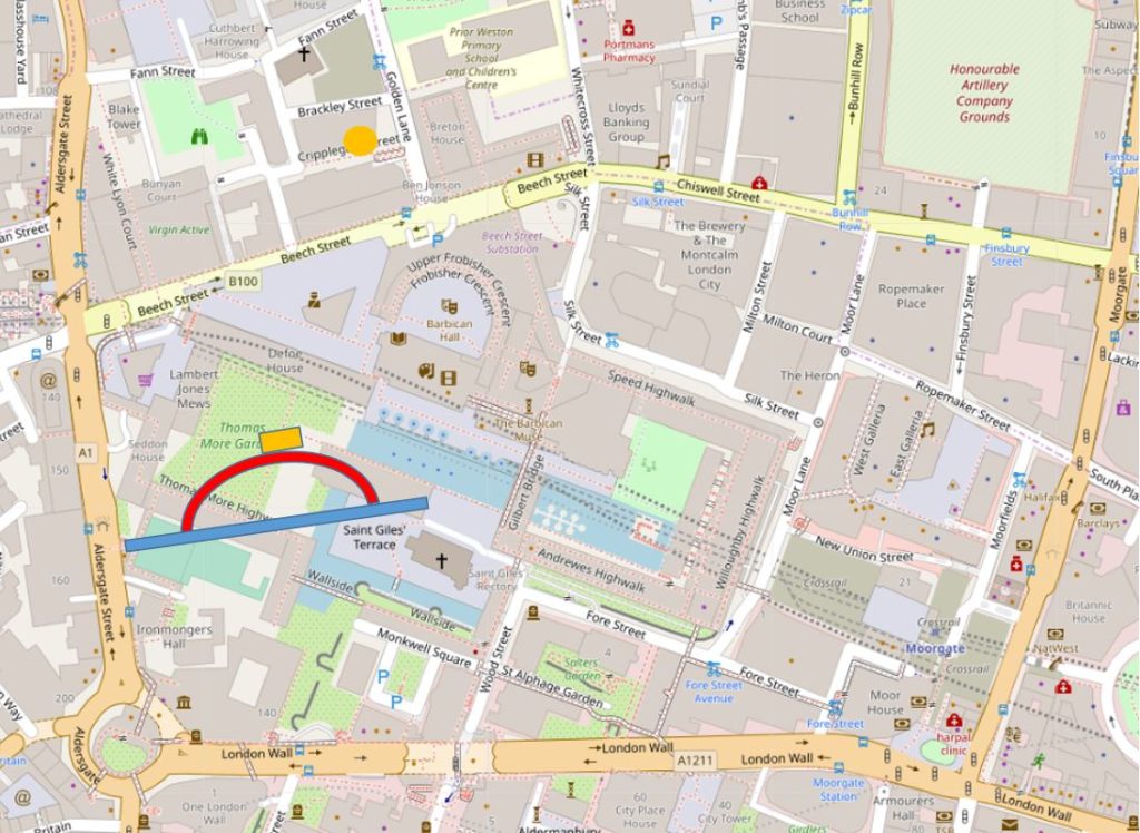
I have marked on the following map extract the approximate locations of Jewin Crescent (red line), Jewin Street (blue line), and the building on Jewin Crescent seen in my father’s photo (orange rectangle), in what are now Thomas More Gardens. The Cripplegate Institute is the orangae circle (© OpenStreetMap contributors).

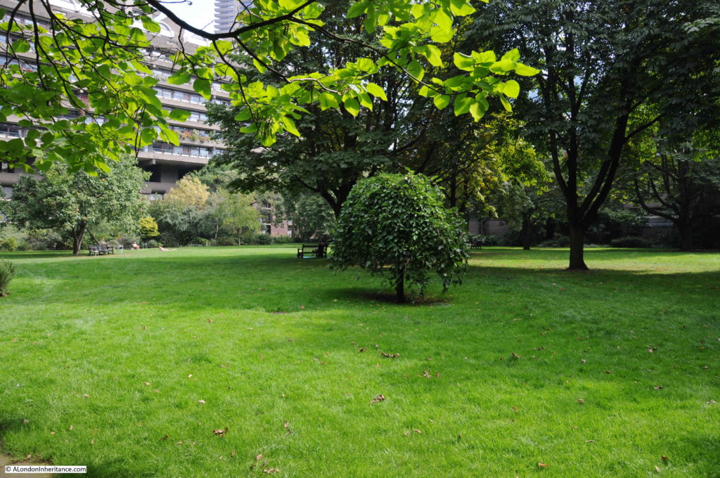
The following photo shows Thomas More Gardens today. The left part of the 1947 building would have been in the middle of the photo, leading off to the right.

Cripplegate

The same location could hardly be more different. Instead of a densely built, narrow street, which must have been busy with workers and the movement of goods on a work day, Jewin Crescent is now covered by grass, and is a peaceful place surrounded by the buildings of the Barbican estate.

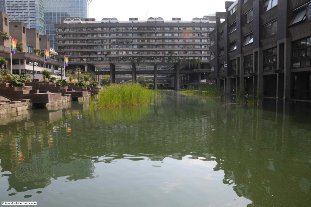
As an aside, a lower level view from around the gardens, provides some interesting perspectives of the Barbican’s architecture. In the following photo, it is clear to see how Gilbert House traverses the lake, held high above the water by a series of (at this distance) surprisingly slender pillars.

Cripplegate

Returning to the building that initially helped me to identify the location, the Cripplegate Institute building is hard to photograph from the south as there is a raised walkway and buildings of the Barbican estate which obscure a full view of the south facing side.

The main part of the building faces onto Golden Lane. The following photo shows the part visible in the 1947 photo, with the main facade on the right.

Cripplegate

The Cripplegate Institute provided a of range educational and cultural services to the residents and workers of the area. A good description of the scope of services offered by the institute, and the very high level of usage of these services is well described in an article from the Shoreditch Observer, dated the 7th November 1908:

“CRIPPLEGATE INSTITUTE – Cripplegate demonstrated its warm interest in its foundation institute on Wednesday night by attending the 12th anniversary conversaxione in strong force. Close upon 400 guests accepted invitations, and they were received in the handsome gold-and-white theatre hall by Mr. B.T. Swinstead, the chairman of the Governors and a member of the Corporation, many of whose members greatly assist the work. The prizes won in the various classes were presented by Deputy and Sheriff Baddeley, and the chairman, in referring to the work of the Institute, said that in the lending part of the library, in which there were 52,000 volumes, some 1,500 books were issued daily, while the average attendance in the newsroom was 5,000 per day.

A special feature was made of the St. John Ambulance and Nursing classes for men and women, and it was hoped to make the Institute the centre for first aid and nursing work in the City. The penny dinner-hour concerts had been attended by 13,284 persons during the year, and over forty societies and clubs had their headquarters in the building. An excellent musical and dramatic entertainment followed.

Owing to the tremendous pressure on the various departments of the Institute, the governors are considering the question of adding another storey to the building, to accommodate the physical drill and other sections of the educational and recreative work.”

The last paragraph explains how the building came to look as it does today. The original building was smaller and of plainer design. The majority of the features we see on the building today, are from the addition of an extra storey.

Some of the figures quoted in the article are remarkable – 1,500 books issued daily, and 5,000 people using the newsroom a day. The institute must have provided much needed services for those living and working in the area.

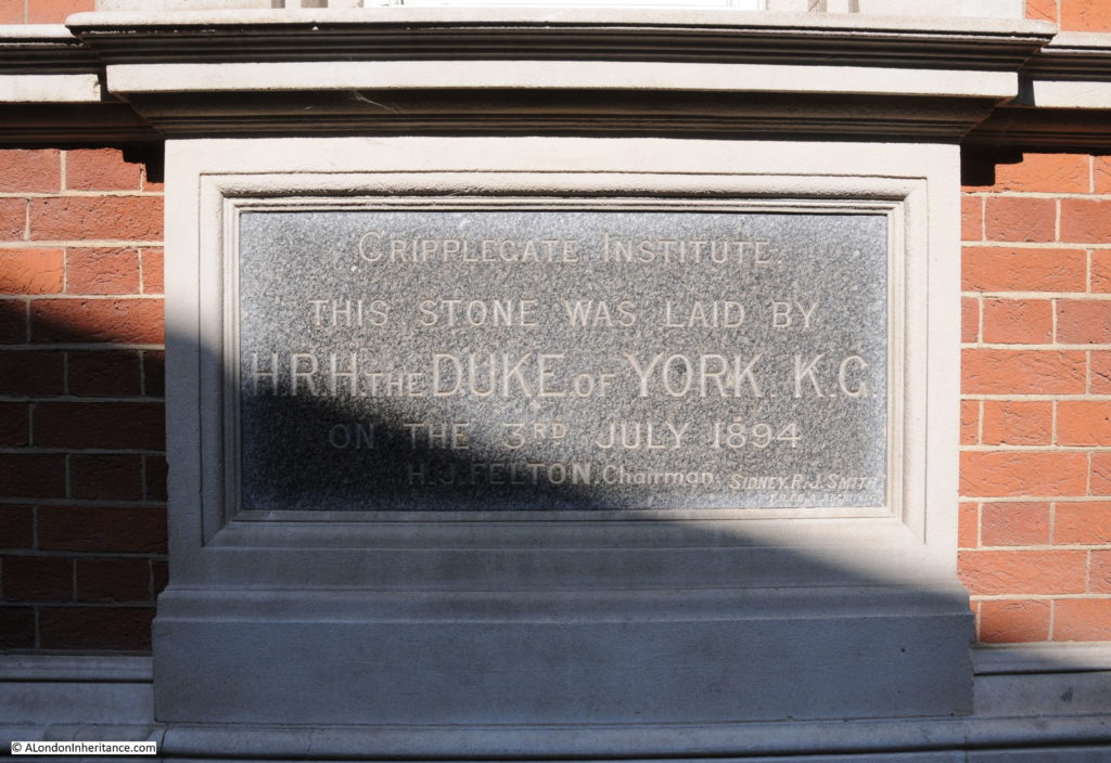
The Cripplegate Institute opened in 1896, however the foundation stone was laid by the Duke of York two years earlier in 1894:

Cripplegate

The laying of the foundation stone was a typically ceremonial event, with an honour guard from the Honourable Artillery Company, and a band from the same regiment providing the music.

The speeches included very clear references to why such an institution was needed and to the literary importance of Cripplegate:

“The great increase in English literature which had taken place during recent years rendered it most necessary that every effort should be made to place some of that knowledge within the reach of those who were unable to provide themselves with books, either for recreation or instruction, and it was a very natural feeling that the ward of Cripplegate, where Milton and Defoe and other noted authors lived and worked should endeavour to place our literature at the disposal of even the very poorest of our fellow citizens by means of free libraries such as that institute could afford.”

The Duke of York was presented with an inscribed trowel – given the amount of foundation stones laid over the years, I imagine that in some Royal collection somewhere, there must be thousands of trowels, collected from a couple of centuries of foundation stone ceremonies.

The Cripplegate Institute was largely funded by the Cripplegate Foundation, a charity formed in 1891 by the London Parochial Charities Act based on the charitable assets of St. Giles Without Cripplegate, with original gifts dating back to 1500.

The Cripplegate Institute closed in 1973, and the building reopened soon after as the Golden Lane Theatre. The theatre presented a number of professional productions, but was also a focal point for amateur, educational, theatre and dance groups to put on productions.

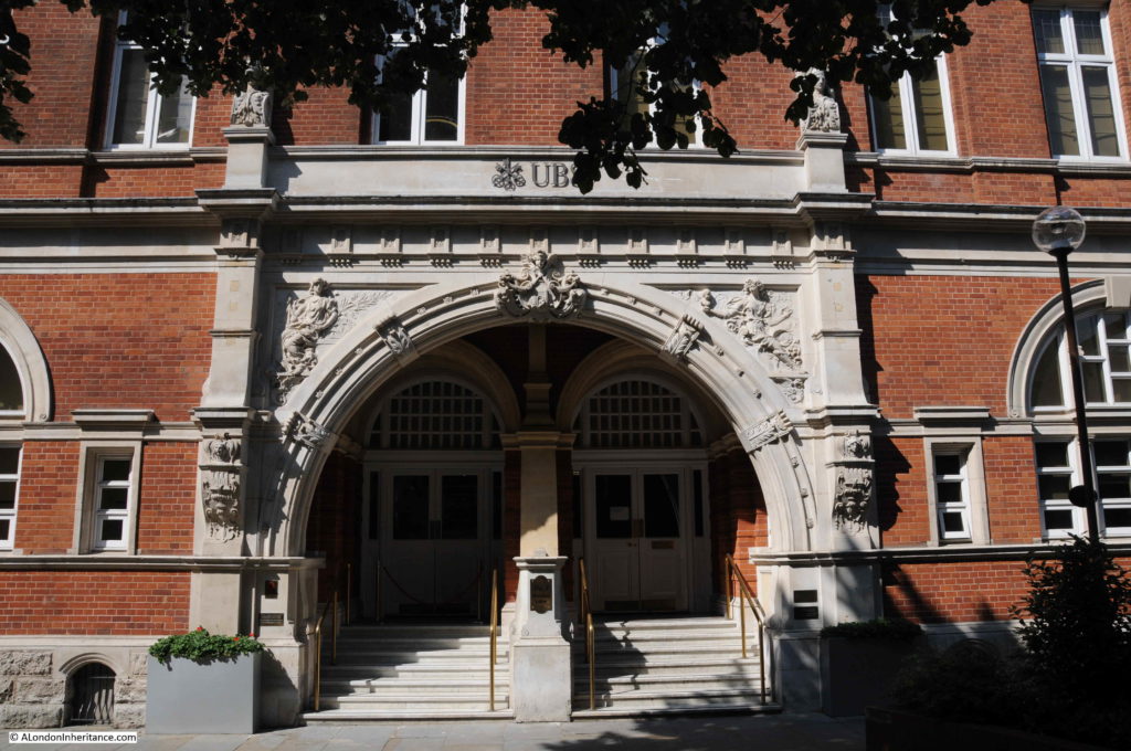
The Golden Lane Theatre closed around 1988 and the interior has since been converted into office space, and is currently occupied by the Swiss bank UBS.

Cripplegate

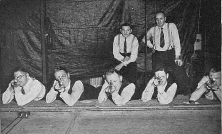
I suspect it disappeared during the office conversations, but the facilities of the Cripplegate Institute included a rifle range, and in 1940, when the possibility of a German invasion seemed very real, workers were encouraged to sign up for rifle training. 400 workers from the City of London trained at the Cripplegate Institute. Hopefully for the photographer, their guns were not loaded.

Cripplegate

View of the old Cripplegate Institute building from slightly further along Golden Lane, at the junction with Brackley Street.

Cripplegate

When I first scanned the 1947 photo, I was really not sure that I would be able to track down the location, but starting with the Cripplegate Institute I now know the buildings and street in the photo and roughly where my father was standing when he took the photo.

The development of the Barbican means that it is impossible to take a view of the same scene today, but it is brilliant when walking around the Barbican Estate to think about what was here before, and the fascinating history of this area.

alondoninheritance.com

St Giles Cripplegate and Red Cross Street Fire Station

This coming Saturday, the 14th September, I will be at Barbican@50, which is taking place from 12 to 6pm at the church of St Giles Cripplegate, Fore Street, Barbican EC2Y 8DA

The Barbican@50 fair is organised by local residents to celebrate the Estate’s 50th birthday.

I will be featuring photographs taken by my father in 1947 across what is now the Barbican and Golden Lane Estates, and how they relate to the locations today, as seen in my latest photographs.

You will also be able to pick up a historical adventure map from Tales of Cripplegate, and learn more about events in the area’s past and those who lived and worked there, with a history exhibition by Rebecca Walker of Ancestreemakers and free local history tours led by Peter Clarke, also of Ancestreemakers.

The tours start from the main door at St Giles’ Church at 1.30, 2.30 and 4pm.  Each tour lasts around 30 minutes and follows an accessible route.

There is more at the fair – exhibitions by local artists, book-signings, and refreshments.

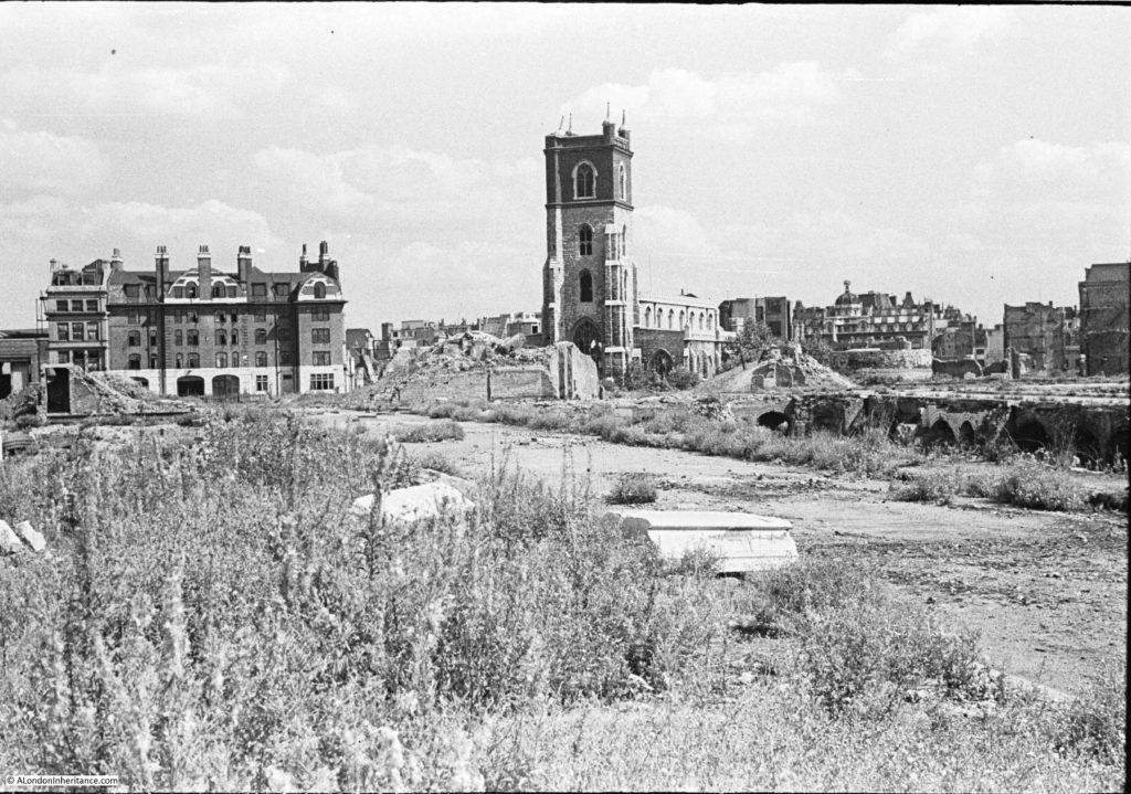
One of the photos I will have on display is the subject of this week’s post, taken in 1947, and is looking across a rather devastated landscape to the church of St Giles Cripplegate.

St Giles Cripplegate

There are three main features in the photo, two of which survive to this day, although the area is now completely different following the development of the Barbican.

The church of St Giles Cripplegate is in the centre, the church looks relatively unscathed, however it suffered very badly and lost the main roof and contents of the church.

To the right of the church is a pile of rubble, and to the right of this, is the round shape of a Roman bastion, which can still be seen.

The large building on the left was the Red Cross Street Fire Station, demolished as part of the final land clearance in preparation for the build of the Barbican.

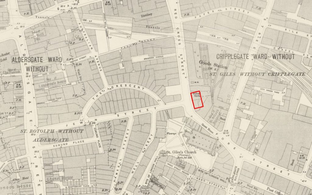
The following map extract is from the 1895 Ordnance Survey map. The fire station was yet to be built, and part of the site was occupied by a girls school, so I have marked the location of the fire station with a red rectangle. St Giles Cripplegate is just below, on the opposite side of Fore Street.

St Giles Cripplegate

Credit: ‘Reproduced with the permission of the National Library of Scotland’ 

Locating the fire station and church on the map allows the streets to be identified, and if you look at my father’s photo, he was standing to the left of a street. the buildings have disappeared, but the paved surface of the old street remains.

This was Jewin Street which ran from Aldersgate Street to Red Cross Street, where the junction was directly opposite the fire station.

If you also look at the 1947 photo, in front, and to the left of the fire station is what looks to be a door frame, surrounded by a pile of rubble. This was all that remained of one of the first houses on Jewin Crescent, or The Crescent as it was labelled in the 1895 map.

The development of the Barbican obliterated all the original streets, and the only points of reference that remain to this day are the church and Roman bastion.

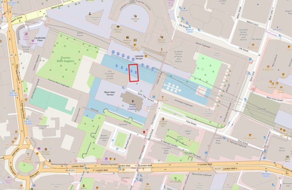
In the following map extract showing the Barbican today, I have marked the location of the old Red Cross Street fire station with a red rectangle  (© OpenStreetMap contributors).

St Giles Cripplegate

There does not seem to be a consistent usage of the street name Red Cross Street, as Redcross Street is also used. The London Encyclopedia attributes the naming of the street to a red cross which probably stood outside a house belonging to the Abbot of Ramsay, with a first mention in the 13th century.

In A Dictionary of London by Henry Harben (1918) the first mention of the street is as Redecrochestrete in 1274. The entry for the street also mentions a Redcrosse tavern. The Dictionary also provides a similar source of the name as the London Encyclopedia “the names of the street and of Whitecross Street were derived from the armourial bearings of the Abbey of Ramsey and of the Priory of the Holy Trinity respectively, who both possessed houses in these street. But it seems more probable that the name was derived from the Red Cross standing at the north end of this street, whether a house bearing this sign or an actual wayside Cross, it is not easy to determine.”

Stow, writing in his Survey of London in 1603, described Red Cross Street – “In Red crosse street on the west side from saint Giles Churchyard be many fayre houses builded outward with divers Alleyes turning into a large plt of grounde, of olde time called the Jewes Garden, as being the only place appoynted them in England, wherein to bury their deade, till the year 1177”

The burial ground for the Jews is the source of the name Jewin Street.

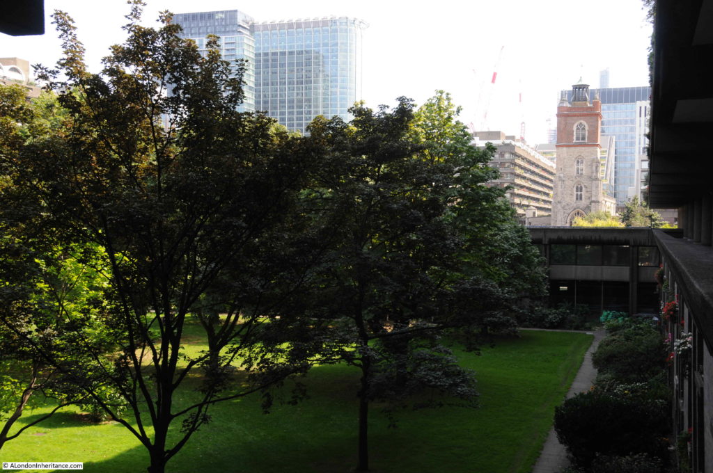
The building of the Barbican means it is impossible to take any form of meaningful equivalent photo of the same scene today. The nearest I could get (shown in the photo below), was from alongside Thomas More House, however to get the angle correct, I should have probably been standing in the tennis courts to the south of Thomas More House, however there is no view of St Giles Cripplegate from that location today.

St Giles Cripplegate

The majority of the destruction of the area now occupied by the Barbican and Gold Lane estates occurred on the night of the 29th December 1940, with the fires created by incendiary bombs causing much of the devastation.

I wrote about this night attack in my blog post on “The Second Great Fire Of London” and in that post included part of an account of the night by Commander Firebrace of the London fire Brigade detailing his experiences at Red Cross Street fire station:

“In the control room a conference is being held by senior London Fire Brigade (LFB) officers. How black – or, more realistically, how red – is the situation, only those who have recently been in the open realise.

One by one the telephone lines fail; the heat from the fires penetrates to the control room and the atmosphere is stifling. earlier in the evening, after a bomb falls near, the station lights fail – a few shaded electric hand lamps now supply bright pin-point lights in sharp contrast  to a few oil lamps and some perspiring candles.

The firewomen on duty show no sign of alarm, though they must know, from the messages passing, as well as from the anxious tones of the officers, that the situation is approaching the desperate.

A women fire officer arrives; she had been forced to evacuate the sub-station to which she was attached, the heat having caused its asphalt yard to burst into flames. It is quite obvious that it cannot be long before Redcross Street Fire Station, nearly surrounded by fire will have to be abandoned.

A few minutes later L.F.B. officers wisely evacuate Redcross Street Fire Station, and now the only way of escape for the staff and for the few pump crews remaining in the area lies through Whitecross Street”.

The high wind which accompanies conflagrations is now stronger than ever, and the air is filled with a fierce driving rain of red-hot sparks and burning brands. The clouds overhead are a rose-pink from the reflected glow of the fires, and fortunately it is bright enough to pick our way eastward down Fore Street. Here fires are blazing on both sides of the road; burnt-out and abandoned fire appliances lie smouldering in the roadway, their rubber tyres completely melted. the rubble from collapsed buildings lying three and four feet deep makes progress difficult in the extreme. Scrambling and jumping, we use the bigger bits of masonry as stepping stones, and eventually reach the outskirts of the stricken area.

The fire station did survive the war, and bomb damaged was repaired, but the remains of the buildings around Redcross Street, Jewin Street and Jewin Crescent had already been demolished during the war to make the area safe, leaving the exposed cellars, foundations, paved streets and piles of rubble shown in the 1947 photo.

I did get a surprise when researching this post, when looking through newspaper references to Redcross Street fire station as I found a report dating from April 1938 of the death of a distant relative – “A fireman who received a violent electric shock when he cut a cable while fighting a fire in Camomile-street E.C. on Tuesday, died in St. Batholomew’s Hospital. He was a 31 years old member of the Redcross-street Station. The fire, which started in the upper floor of a warehouse, was confined to the building.”

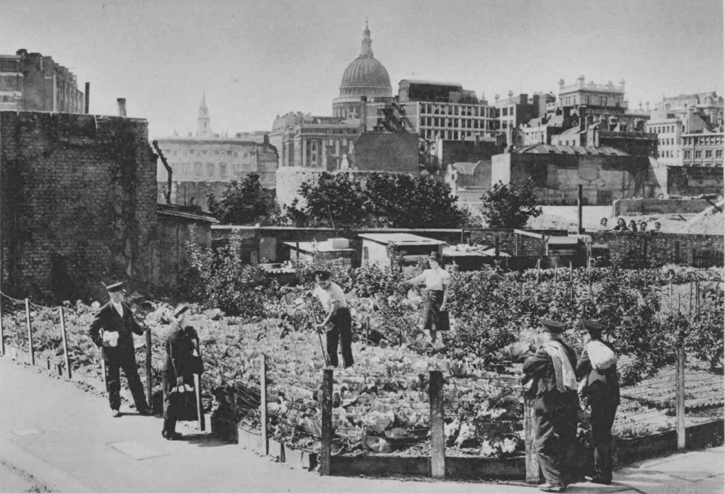
After the destruction of 1940, the firemen of Red Cross Street started a large vegetable plot on the land directly opposite the fire station alongside Jewin Street. The following photo from 1944 shows the firemen at work. The Roman bastion is visible behind the small trees, directly below the dome of St Paul’s.

St Giles Cripplegate

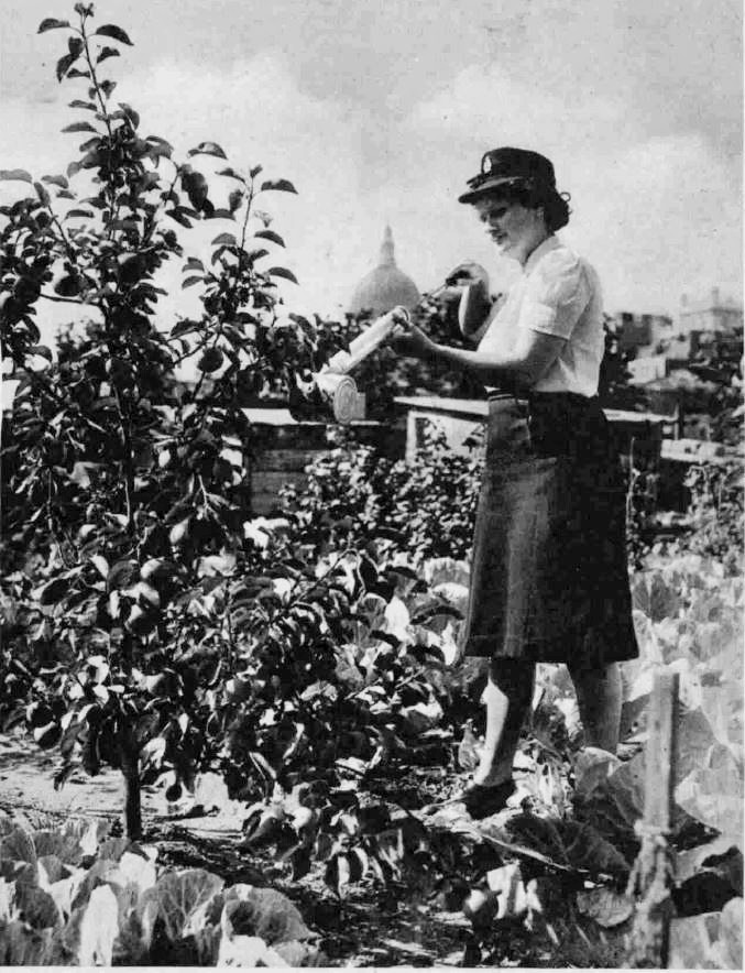
Growing apple trees in the vegetable plot:

St Giles Cripplegate

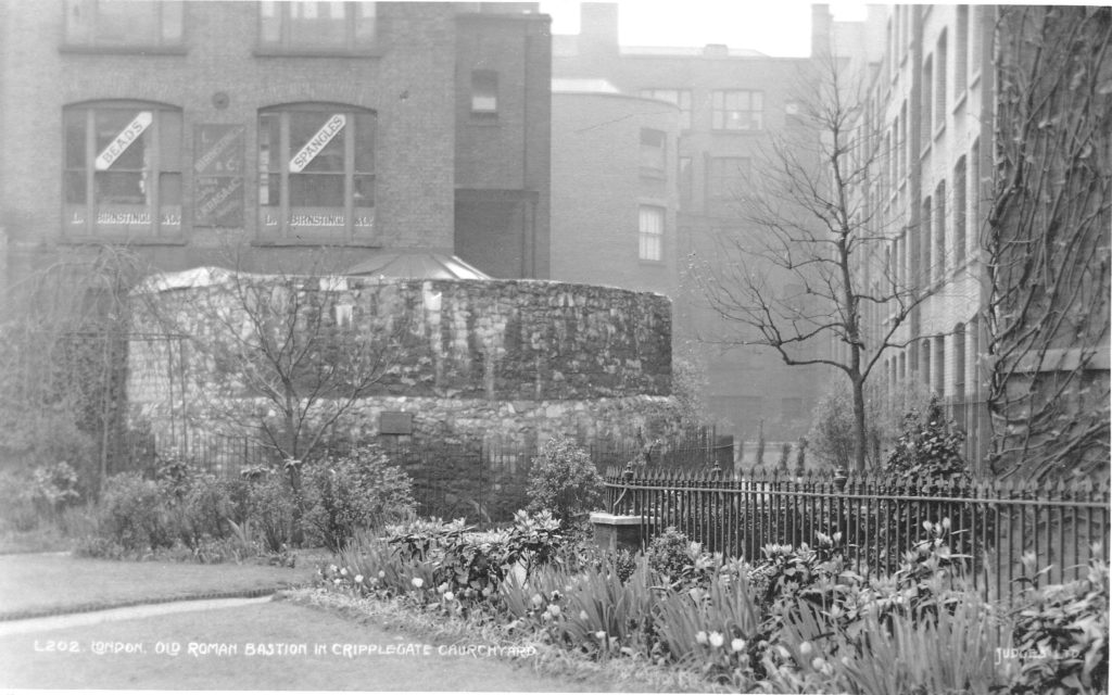
The Roman bastion shown to the right of the 1947 photo, survived the bomb damage and the development of the Barbican. It had been at the corner of the churchyard of St Giles Cripplegate, and before the war was surrounded outside of the churchyard by office buildings and warehouses. The following pre-war postcard shows the Roman bastion at the corner of the church yard.

St Giles Cripplegate

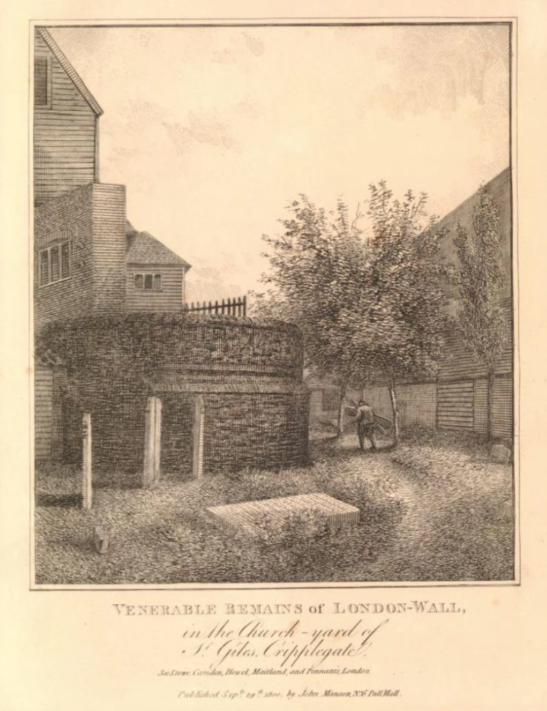
This rather rural looking print from 1800 shows the bastion and the “Venerable Remains of London-Wall in the church yard of St Giles Cripplegate”  (©Trustees of the British Museum).

St Giles Cripplegate

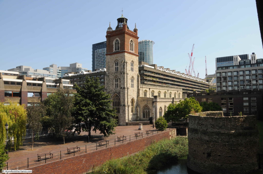
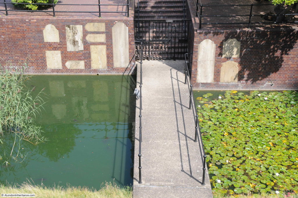
Today, the church yard has disappeared and the Roman bastion is separated from the church by a stretch of water, which gives the appearance of a moat separating these two survivors.

St Giles Cripplegate

A year after my father took the photo at the beginning of this post, the following  report appeared in the London Letter section of the Scotsman newspaper on the 30th August 1948:

Heart of the City – Even in the sun to-day the ruined area around St Paul’s presented a melancholy sight. Few of the millions who travel to and from the City each day can be aware of the ruins through which it is possible to walk for half and hour without coming to an intact building. There is little sign of new building. The only structure – a giant marquee used for the Honourable Artillery Company’s Ball by Finsbury Pavement – is now being dismantled.

By the shell of St Giles’s Cripplegate, office workers stop each day to inspect the excavations where shards of pottery, pieces of bone, and splinters of horn are daily coming to light. Nearby, where office buildings once stood, message boys now play cricket, their pitches fast becoming a riot of coltsfoot, cornflowers, rosebay and hollyhocks.

In St Giles’s Churchyard, this growth has been halted by firemen from the Red Cross Street fire station, who have been growing peas and potatoes by shattered tombstones.

The ruins extend to Smithfield, where a shabby board announces this was the site of the Old Red Cow.”

The years immediately after the war were a time for excavations around Cripplegate and the Roman bastion and remains of the Roman wall were excavated by the Roman and Medieval Excavation Council, under the direction of W.F. Grimes, Keeper of the London Museum.

As has probably been the problem with all archaeological excavations, the full funding needed for the work (estimated at £3,000) was not available, and the sum of £1,500 was allocated. It seems to have been a rather blunt approach to excavation as reports of the dig talk about modern building tools being used, with the roar of pneumatic drills rising from the trenches all day long.

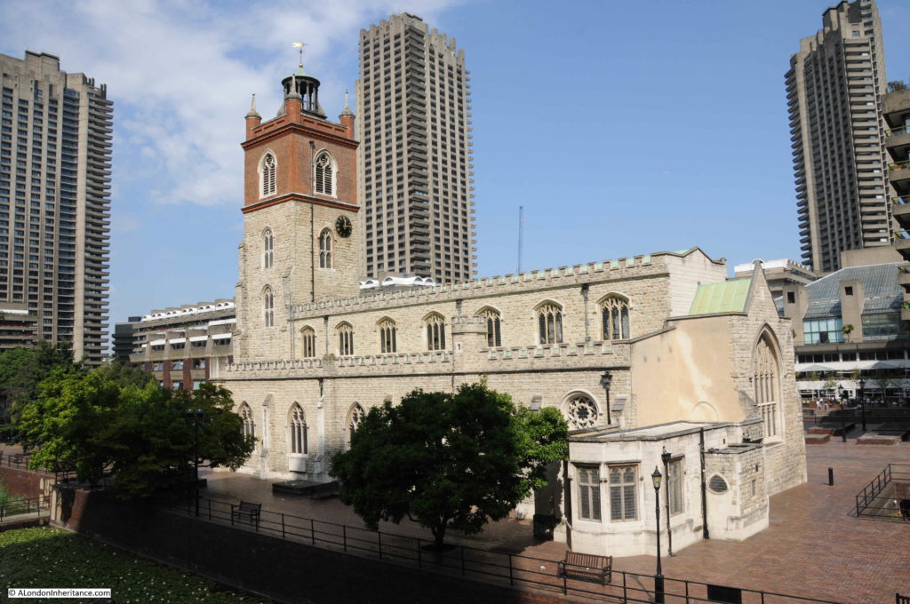
The area around St Giles Cripplegate probably very rarely hears the sounds of pneumatic drills these days, but the church has lost its churchyard, is separated by water from the Roman bastion, the surrounding street network has long disappeared, and the church is dwarfed by the surrounding buildings.

St Giles Cripplegate

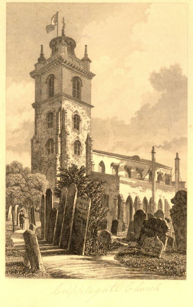
It was so very different in 1830, the date of the following print, when the church was surrounded by a traditional grave yard  (©Trustees of the British Museum).

St Giles Cripplegate

Many of the gravestones can still be found in the area around the church, as shown in the following photo where a sample are embedded in the wall that separates the water from the higher ground where the church is located.

St Giles Cripplegate

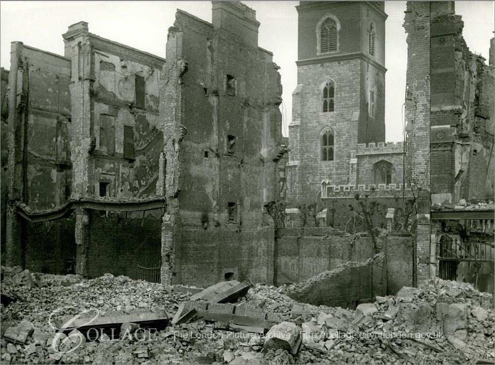
The following photo shows the wartime damage to the buildings south of the church, in the space now occupied by the Wallside building, and facing onto Wood Street Square and Hart Street. The square and street are now under the Wallside building.

St Giles Cripplegate

Image credit: London Metropolitan Archives, City of London: catalogue ref: M0019965CL

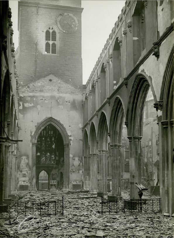
Whilst the tower and walls of St Giles Cripplegate survived, the interior and roof was completely destroyed, demonstrating that the destruction around the Barbican was the result of fires rather than high explosive bombs (many did fall on the area, but the majority of the damage was caused by fire).

The following photo taken in the days following the raid on the 29th December 1940, show the damage to the interior of the church.

St Giles Cripplegate

Image credit: London Metropolitan Archives, City of London: catalogue ref: m0017971cl

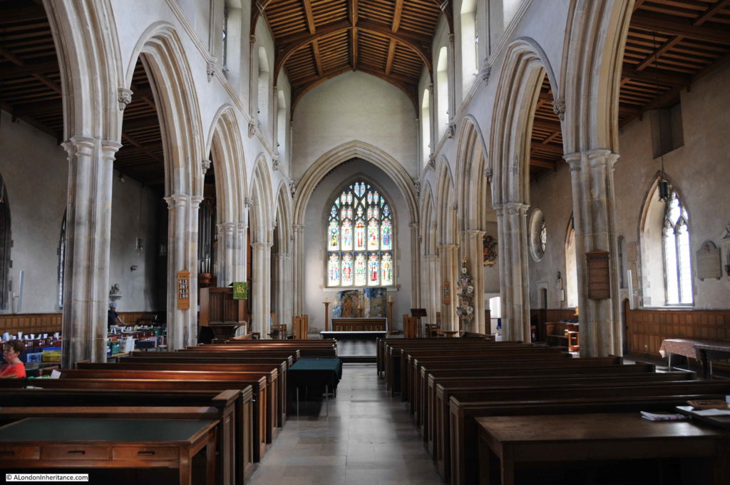
It is hard to imagine this level of damage when standing in the church today:

St Giles Cripplegate

The full name of the church is St Giles without Cripplegate, referring to the fact that the church was outside the original City walls – confirmed by the nearby location of the Roman wall showing that the church is indeed north of the wall.

There may have been a church here in Saxon times, and the first stone church dates from 1090.

The church has been through a number of rebuilds over the centuries. The distinctive tower with a stone lower section and brick upper section dates from 1682, when the upper section of the original stone tower was removed, and 15 feet of brick tower added.

The church was severely damaged by fires in 1545 and 1897, but escaped the Great Fire in 1666.

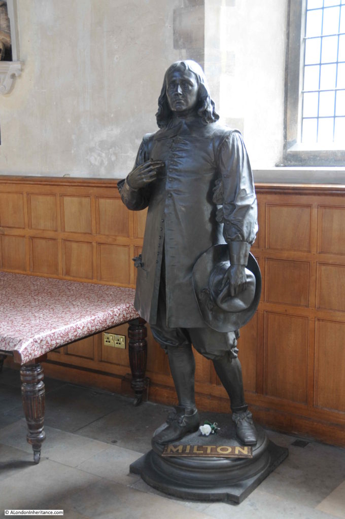
St Giles Cripplegate claims to be the burial-place of the poet Milton and a life-size statue of Milton watches over visitors to the church:

St Giles Cripplegate

The Milton statue dates from 1904 when it was unveiled by Lady Alice Egerton as part of the reconstruction work after the 1897 fire.

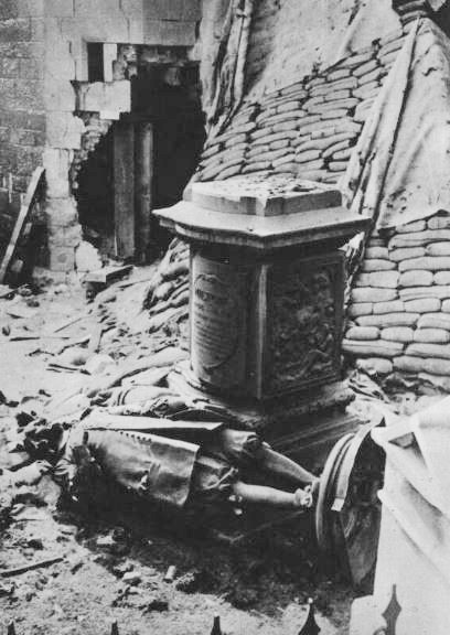
The statue had a rather close shave on the 29th December 1940:

St Giles Cripplegate

Newspaper reports of the unveiling of the Milton statue also included a rather gruesome story about Milton’s body dating from 1790, when:

“There are probably many who will be surprised to hear that the body of Milton was once on view at the charge of threepence a head within a few yards from the site chosen for this splendid tribute to his memory. It was in 1790 after a little carousal, that two overseers and a carpenter entered the Church of St Giles Cripplegate, where Milton lay buried, and, having discovered the leaden coffin which contained his body, cut open its top with a mallet and chisel. When they disturbed the shroud, the ribs fell. Mr Fountain confessed that he pulled hard at the teeth, which resisted until someone hit them with a stone. Fountain secured all the fine teeth in the upper jaw, and generously gave one to one of his accomplices. Altogether the scoundrels stole a rib-bone, ten teeth, and several handfuls of hair; and to crown the diabolical business, the female gravedigger afterwards exhibited the body to anyone willing to pay threepence for the spectacle.”

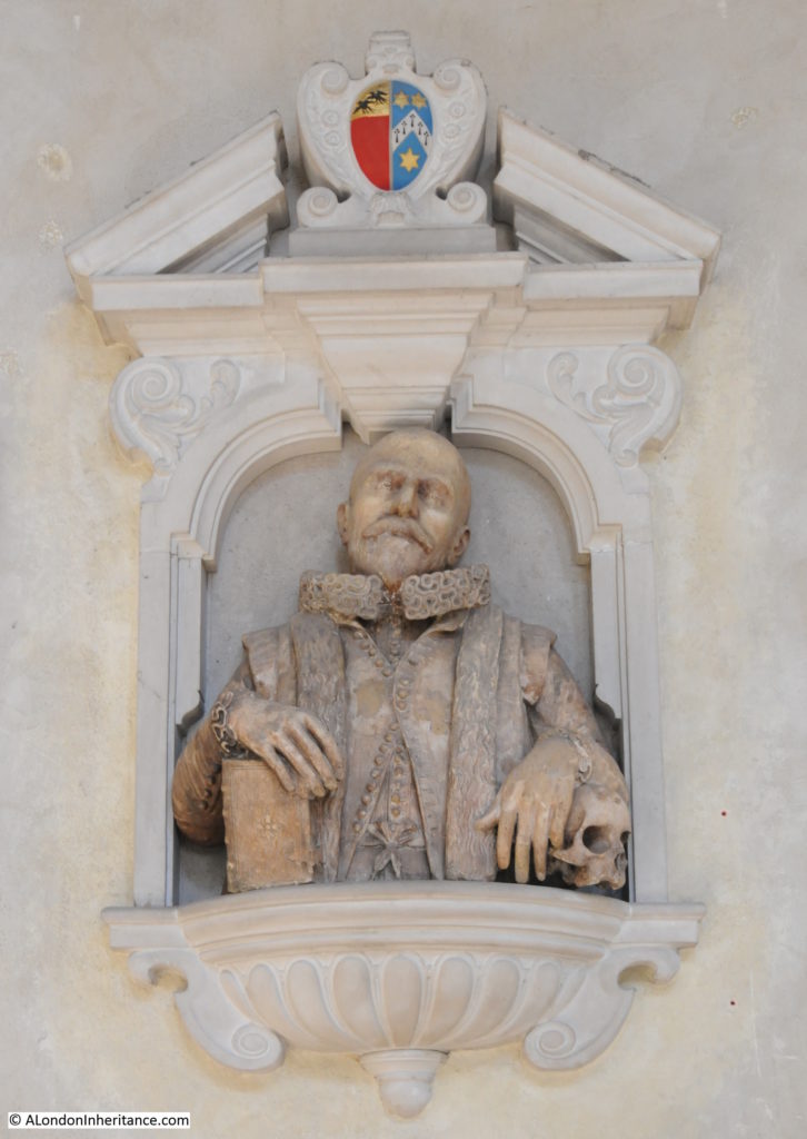
St Giles Cripplegate is also the burial-place of the late 16th / early 17th century map maker John Speed.

St Giles Cripplegate

John Speed was a member of the Merchant Taylors Company, and it was this company that restored Speed’s memorial after being badly damaged in 1940.

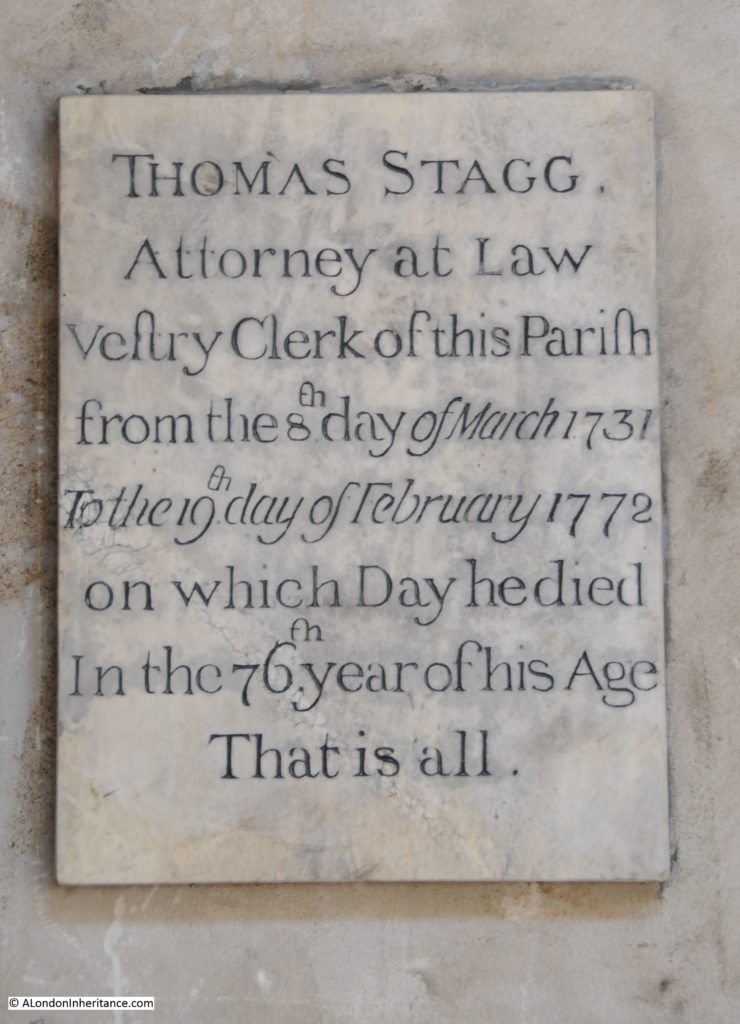
Whilst Milton and Speed have some rather impressive memorials, there is one in the church that is much more modest.

St Giles Cripplegate

“That is all” sums up the memorial to the life of Thomas Stagg who was vestry clerk of the parish from 1731 to 1772. There are many other historical names who have an association with the church, including Oliver Cromwell who was married in St Giles Cripplegate in 1620.

The view along the southern aisle of the church, Milton’s statue on the left:

St Giles Cripplegate

This has been a brief description of a very historic area. I will be exploring more of the streets and buildings covered by the Barbican and Golden Lane estates, and the streets that have disappeared, during the coming weeks, and showing many more of my father’s photos of the area at the Barbican@50 event on the 14th September at St Giles Cripplegate.

alondoninheritance.com

Crow Stone, London Stone and an Estuary Airport

A couple of weeks ago, I finally managed to get to a place I have been wanting to visit for years. It took a bit of planning, but took me to a location that still has evidence of the City of London’s original jurisdiction over the River Thames.
To the west of Southend, on the borders with Leigh, and by Yantlet Creek on the Isle of Grain, there is a line across the River Thames which marked the limits of the City of London’s power. Where this line touched the shore, stone obelisks were set up to act as a physical marker.

These stone markers are still to be found, so I set out to visit both stones, and to explore the history of the City of London’s jurisdiction over the river, up to the estuary.

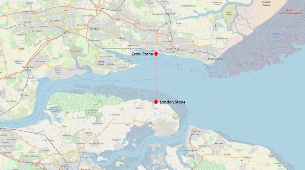
The following map shows the location of the stones and the imaginary line across the River Thames. Map extract (© OpenStreetMap contributors).

London Stone

The City of London’s claim to the river this far out to the estuary, appears to date from around the late 12th century when the City of London purchased the right from Richard 1st in 1197.

This gave the City of London the ability to charge tolls, control activities such as fishing on the river and exercise other legal powers over river use, including navigation of the river. This control extended from the line between Southend and the Isle of Grain in the east, to Staines in the west. The City of London also tried to control part of the River Medway from where the southern end of Yantlet Creek reached the Medway, to Upnor on the boundary with Rochester.

The exact powers of the City and their ability to apply them to the River Thames and Medway were frequently in dispute, but the City continued till the 19th century to claim control, including renewing the stone markers as evidence of their rights.

My first visit was to the stone on the north bank of the River Thames.

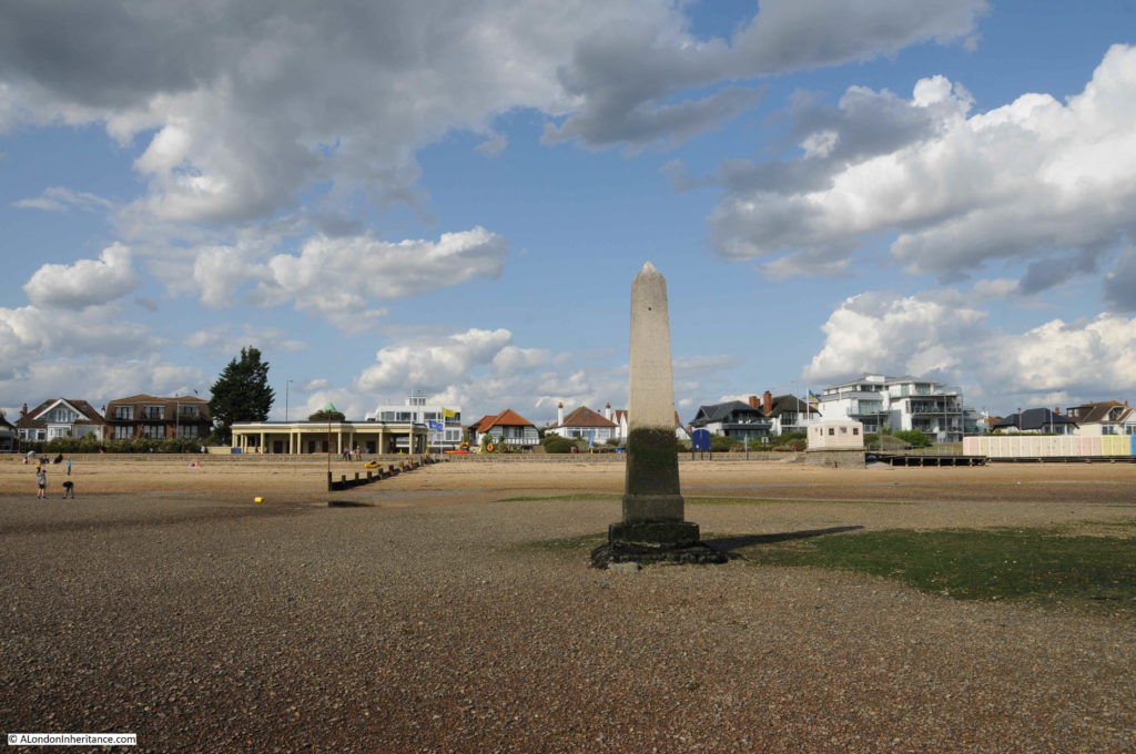
The Crow Stone

The Crow Stone is easy to visit. To the west of Southend, on the boundary with Leigh on Sea and where the road that runs along the sea front turns inland at Chalkwell Avenue.

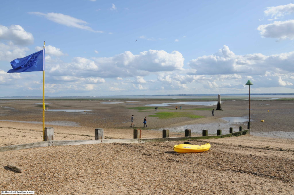
Walk over the embankment that forms the sea wall between beach and road, and providing you have timed the tide correctly, the Crow Stone can be seen a short distance out from the beach, and an easy walk over stones and gravel.

London Stone

A short walk out to the stone, over a very firm layer of stone and gravel, with small pools of water the only indicators that this area was not long before, covered by the river.

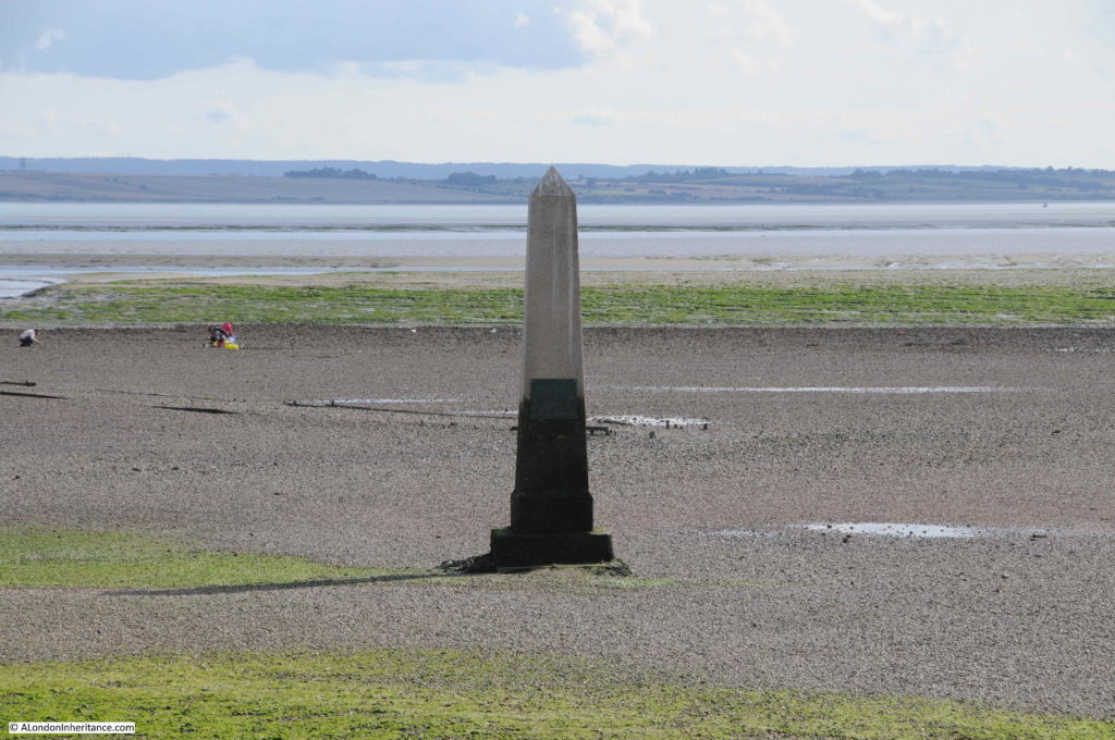
The green algal growth on the Crow Stone shows the tidal range of the river.

London Stone

It is very doubtful whether there were stone markers here dating back to the original purchase of the right by the City of London. The earliest tangible evidence is of a stone dating from 1755, although there may have been an earlier stone that had disappeared, prior to the mid 18th century replacement.

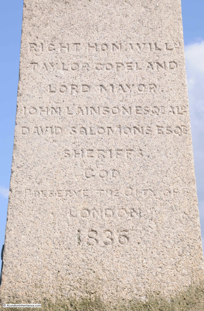
The current stone dates from the mid 1830s. The date on the stone is 1836, but a plaque on the stone erected by the Port of London Authority states 1837.

The view back towards land, showing the gradual rise in height as the shoreline reaches up to the land.

London Stone

Carved on the Crow Stone are the names of the Lord Mayor, Alderman and Sheriff, although this adds further confusion as to the date the stone was erected, as the Lord Mayor named on the stone, William Taylor Copeland, was Lord Mayor in 1835.

London Stone

The City of London, via the Lord Mayor and Alderman, would demonstrate their control of the river by visits to inspect the condition of the stones. These visits were major events, and the Illustrated London News describes a visit to the Crow Stone in 1849:

“CONSERVANCY OF THE RIVERS THAMES AND MEDWAY – The assertion of the Conservancy jurisdiction of the Lord Mayor over the River of Thames, and the Waters of Medway, or the View as it is technically termed, is a septennial custom attended with some interesting customs and celebrations, which falling due this year, has just contributed to the convivial memorabilia of the present Mayoralty.

This, by the way, is termed the Eastern Boundary of the jurisdiction, whilst the view from Kew to Staines is the western.

The jurisdiction appears to have been immemorially exercised over both the fisheries and navigation of a large portion of the Thames by the Mayor and Corporation of London; and we find an order dated 1405, issued from Sir John Woodcock, then Lord Mayor, enjoining the destruction of weirs and nets from Staines to the Medway, in consequence of the injury they did do the fishery and their obstruction to the navigation.

The portion of the river over which the jurisdiction of the River extended seems to have always been much the same. The offices of Meter and Conservator are asserted from Staines to the mouth of the Thames, by the formerly navigable creek of Yantlet, separating the Isle of Grain from the mainland of Kent, and on the north shore by the village of Leigh, in Essex, placed directly opposite and close to the lower extremity of Canvey island.”

These visits by the Mayor and Alderman seem to have been a good excuse for a party. The Illustrated London News goes on to describe the visit to the Crow Stone:

“THURSDAY, JULY 12, The company assembled on board the Meteor steamer, engaged for the occasion, moored off Brunswick Wharf, Blackwall. There were present the Lord Mayor and Lady Mayoress and a large party.

The steamer left Blackwall at about half-past eleven o’clock, and having received on board the Royal Marines band at Woolwich, the Meteor proceeded on her passage to Southend, the civic party being liberally welcomed with salutes and other respectful demonstrations.

At about three o’clock the Meteor arrived at Southend Pier, where the Lord Mayor, lady mayoress, and a large portion of the company landed. The Lord Mayor, attended by the Aldermen, the Town Clerk and Clerk of the Chamber, and some of the civic authorities, proceeded in carriages towards Leigh, nearly opposite to which the boundary stone is situated.

Here, by direction of his Lordship, the City colours and state sword were placed upon the stone, and after asserting his rights as Conservator of the River Thames, on behalf of the City of London, by prescription and usage from time immemorial, the Lord Mayor directed the Water Bailiff, as sub-conservator, to cause his name and the date of his visit to be inscribed on the boundary stone. The Lord Mayor then drank ‘God preserve the City of London’, the inscription on the ancient stone, and after distributing coin and wine to the spectators, the civic party returned to the steamer.

The stone itself was in the water, so that it had to be reached in boats. the scramble for the money was a rumbustious affair.”

The Lord Mayor’s order to the Water Bailiff to have his name and date of visit inscribed on the stone was carried out and the name of Sir James Duke (Lord Mayor between 1848 and 1849) can still be seen on the Crow Stone, along with the name of previous and following visits.

London Stone

An illustration of the 1849 visit to the Crow Stone – it must have been quite a sight:

London Stone

Note that in the above illustration, the man carrying what I assume to be the colours of the City of London is standing on a smaller pillar, adjacent to the Crow Stone, and it was this stone that I wanted to find next.

The earliest known boundary marker stone on the north bank of the Thames at Southend dates from 1755. It was removed from its original position next to the 1836 stone in 1950, when it was relocated to Priory Park in Southend, so that is where I headed to next.

The original Crow Stone:

London Stone

This stone really does look like it has spent 200 years standing in the Thames Estuary, being battered by the wind and waves, and the daily movement of the tides.

The plaque on the current Crow Stone states this older version was erected on the 25th August 1755 by the Lord Mayor. The earliest written reference to the stone that I can find is from the Chelmsford Chronicle, dated the 18th July 1788, which carries a report of a body, sewn in a blanket, being found near the Crow Stone, washed up on the tide. It was assumed that the body was that of someone who had died on a ship and was buried at sea.

This report does confirm that the name Crow Stone was being used in the 18th century.

The stone in Priory Park has words carved into the stone, but these are very hard to read due to over 250 years of weathering, although as shown in the above photo, the cross from the coat of arms of the City of London is still clear, at the top of the stone.

London Stone

Wording is carved onto multiple sides of the stone, and at the base of the stone is either evidence of repair work, or possibly the original fittings that held the stone onto a base.

London Stone

So, Southend has two stones, one dating back to 1755, that mark the limit of the City of London’s jurisdiction over the River Thames. I next wanted to see the stone on the opposite side of the river.

The London Stone, Yantlet Creek

Marking the southern end of the line across the Thames from the Crow Stone is the London Stone by Yantlet Creek on the Isle of Grain.

The Isle of Grain is the eastern most section of the Hoo Peninsula in north Kent. The Isle was originally an island, with Yantlet Creek forming the western boundary. Parts of the creek have now silted up, so whilst difficult to get to (apart from the road on the southern edge of the peninsula), the Isle of Grain is not strictly an island.

The London Stone is not easy to get to. There are no footpaths to the stone, to the east of the stone is a large danger area as the land was once a military firing range. The south of the island has the remains of old power stations and new gas storage terminals.

The only route that I could see that worked was from the west, then across Yantlet Creek at low tide. The following map shows the Hoo peninsula on the left, the Isle of Grain to the right, the red dot marks the location of the London Stone, and just to the left of the London Stone is Yantlet Creek. Map extract (© OpenStreetMap contributors)

London Stone

Free time and tide times do not conspire to make life easy, so a couple of weeks ago I was on the edge of Yantlet Creek at 6:15 in the morning, ready to get across to the London Stone, and back again before the tide came in too far. The low tide was just before 7, so hopefully I had plenty of time to get across, look around the London Stone, and return before the water started to rise along Yantlet Creek.

The early 4 am start was well worth it – standing at the London Stone at 6:45 as the sun rose over the Thames Estuary, in such an isolated location, was rather magical.

London Stone

As can be seen in the map at the start of the post, the Hoo Peninsula and the isle of Grain are very undeveloped, apart of the south of the isle where large gas storage holders can now be seen, and where coal fired power stations once operated.

The Yantlet Creek has long been a key point of reference on the River Thames, and there are numerous newspaper reports using Yantlet Creek as a reference for an event on the river, and the change in regulations that apply when crossing the line between Yantlet Creek and Southend.

For example, in April 1880, the Shipping and Mercantile Gazette had a report on the option for ships to change their navigation lights as they passed Yantlet Creek “Masters will not, probably, take advantage of the permission, when inward-bound, on reaching Yantlet Creek, at which point the river regulations come into force, of taking in their sea lanterns and exhibiting others”. The emphasis of the article was that whilst legally ships could switch to using lights with less visibility when passing Yantlet Creek, they would probably prefer to keep their sea lights on, which provided visibility of up to two miles – probably a wise move on a congested river at night.

Yantlet Creek was once a more significant feature than today, when it provided a navigable route between Thames and Medway, and turned the Isle of Grain into a true island.

The following map extract is from John Norden’s 1610 map of Essex. The map does show part of the northern coast of Kent along the Thames, and the Hoo Peninsula be seen, with Yantlet Creek running between Thames and Medway, cutting of the Grane Island from the rest of Kent.

London Stone

The 1610 map also shows Alhalows, and it was from here that my walk to the London Stone commenced.

From the end of Avery Way there is a bridleway that runs up to the sea wall.

London Stone

The bridleway runs over an area of flat pasture, with a herd of cows who look as if they are surprised to see someone at this time of the morning.

London Stone

At the end of the bridleway, the land rises up to a footpath which runs along the top of the sea wall.

London Stone

Although again, the cows do not seem happy to let me through.

London Stone

Whilst the majority of the land is pasture, just before reaching the sea wall, there is a wide, water filled ditch with reeds that runs parallel to the sea wall.

London Stone

Up on the sea wall, looking out to the estuary.

London Stone

The Hoo peninsula and Isle of Grain are important habitats for birds. The RSPB has a reserve on the west of the peninsula at Cliffe Pools, and as I walked along the footpath, numerous birds flew up from the surrounding grassland, and there was the constant sound of birds on the mud flats of the estuary.

My first sight of the London Stone, to the left of the navigational marker at the entrance to Yantlet Creek.

London Stone

Looking back over the Isle of Grain to large gas holders:

London Stone

A better view of the London Stone as I get towards Yantlet Creek.

London Stone

I like the above photo as it shows four ways in which the Thames Estuary has been used over the years. Closest is the navigational marker for the entrance to Yantlet Creek, further back is the London Stone.
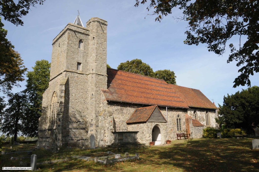
Look between the London Stone and the navigation marker and you can just see the Shivering Sands, World War 2 sea fort. To the right of the navigational marker are the wind turbines of the Thanet wind farm. The photo also highlights the isolation of the London Stone.

As I walked around to the edge of the Yantlet Creek, it was starting to look worryingly wide.

London Stone

In the grass adjacent to the creek is a stone with a rectangle where a plaque may once have been fixed.

London Stone

I only found one reference to this in the wonderful Nature Girl blog, where there is a reference to this being a memorial to a young boy who drowned in the bay, and there having been a copper plaque on the stone.

A reminder that no matter how calm the estuary appears, this is always a dangerous place to venture.

The point where Yantlet Creek narrows and heads inland between the isle of Grain and the Hoo Peninsula:

London Stone

It was here that I was able to find a way down the embankment, which was muddy, covered in seaweed and rather slippery, but I was able to cross over to the opposite shore.

It was still a short time to go before low tide and water was running out from Yantlet Creek towards the estuary. The above view also shows how deep the water will become when the tide comes in, and the flat nature of the mud flats mean that the tide can come in very rapidly and without too much warning.

The shore opposite was sand and stone, and provided a firm walking route to the London Stone, without having to leave the shore. The shore line curved round to what looked like a low peninsula with my destination at the tip.

London Stone

The London Stone is a short distance out from the beach along which I had been walking. It had been built on a raised platform of stones, with a raised level of stones providing an easy walk out to the London Stone without having to venture into the surrounding mud.

London Stone

Walking up to the London Stone. The obelisk is mounted on a square stone, which in turn sits on a plinth.

London Stone

The view above is looking out over the Thames Estuary with the coast and buildings of Southend in the distance. It is just over 4 miles from here to Southend.

Most of the references I have read about the London Stone assume it is dated to 1856, and there is a very eroded date on the obelisk that looks like it could be 1856. There may also have been a previous stone marking the location. An article in the City Press from September 1858 provides some more background:

“THE NEW CONSERVANCY BOARD OF THE RIVER THAMES – During the past week, the Conservators of the River Thames visited the eastern limits of the Thames Conservancy and limits of the Port of London. The jurisdiction of the Conservancy extends to the eastward as far as the line drawn from Yantlet Creek , on the Kent shore, to Crow Stone, near Southend on the Essex shore, and the Port of London extends eastward as far as a line from near the North Foreland, on the Kentish shore, to the Naze of Harwich, on the Essex shore.

The ancient boundary stone near Yantlet Creek was found completely embedded in sand and shell. The Crow Stone on the Essex side, having been comparatively recently placed there, is a prominent object, and is discernible at a great distance. 

It is the intention of the Conservators, we understand, to place a new stone on the site of the ancient stone at Yantlet.”

This article mentions the Thames Conservancy – this was the body who took over responsibility for the Thames from Staines to the Southend – Yantlet line from the City of London in 1857 under the Thames Conservancy Act. The article also mentions the Port of London, who have a far wider remit, extending much further out into the Thames Estuary – a responsibility carried out to this day by the Port of London Authority.

The article also mentions the ancient boundary stone being found embedded in sand and shell.  I did wonder if it is still there, buried under the stones that support the London Stone we see today.

As with the Crow Stone, the London Stone has carved text, however erosion makes it almost impossible to read, however I suspect that it is a list of names from the City of London responsible for the erection of the new stone.

London Stone

Supporting the obelisk, there is a square block of stone, with one side being carved with names. Despite at times being below the waterline, this block is easier to read, and contains a list of names of City Aldermen and Deputies. At the top of the list is the name of the Lord Mayor, Warren Stormes Hale, who was Lord Mayor of the City between 1864 / 1865.
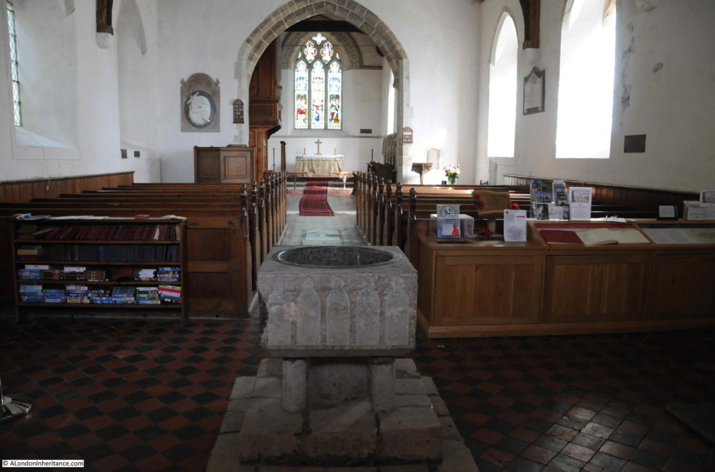
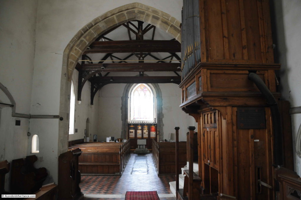
London Stone

The name of a Lord Mayor from 1864 / 5 adds further confusion to dating the London Stone, as we now have:

  • References to the year 1856 as the date for the stone (for example English Heritage Research Report Series no. 16-2014)
  • A newspaper article from 1858 stating that the ancient stone is covered and that a new stone is needed
  • The name of a Lord Mayor from 1864/5 carved onto the base of the stone

So I am still not sure exactly when the London Stone was erected within a time range of 1856 to 1865.

Only the original Crow Stone at priory Park is Grade II listed. It appears the later Crow Stone and the London Stone are not protected, so over time they will gradually erode from the effects of weather and estuary water.

It really was a wonderful experience standing at the London Stone as the sun rose over the Thames Estuary, but it could have all been so very different.

Inner Thames Estuary Airport

The expansion of London’s airports has been rumbling on for decades, with an additional runway at Heathrow seeming to be the industry preferred selection, but one that was politically unacceptable.

The Thames Estuary has always been looked on as a potential site for a new airport. The estuary being just close enough to serve London, but remote enough to take away the noise of flights from over the city and suburbs, along with providing large areas of land for expansion.

One of the earliest was the 1970s proposal for an airport on Maplin Sands off the coast of Essex.

During his time as Mayor of London, Boris Johnson proposed and strongly supported the concept of an inner Thames Estuary Airport covering much of the isle of Grain, parts of the Hoo Peninsula, and the waters off the peninsula.

Plans were developed by the architect Sir Norman Foster, which proposed a massive airport in the estuary consisting of multiple runways, airport buildings and transport links to London and the rest of the national transport infrastructure. See illustrations of the airport here.

The illustrations show the airport, but the land on the rest of the peninsula appears untouched and ignore the amount of other infrastructure that would be required to serve the airport, and which would have obliterated the rest of the Hoo Peninsula.

I have added the outline of the airport to the following map. The red dot is the position of the London Stone, so where I was standing would have been in the middle of aircraft stands and gates, with multiple runways on either side. Map extract (© OpenStreetMap contributors)

London Stone

Thankfully, the inner Thames Estuary Airport option was excluded from a shortlist of options by the 2014 Airports Commission report, chaired by Sir Howard Davies.
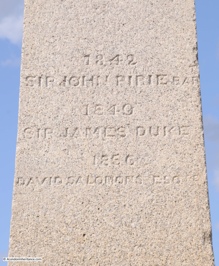
One of the reasons for excluding the airport given in the report was the rather pointed:

  • There will be those who argue that the commission lacks ambition and imagination. We are ambitious for the right solution. The need for additional capacity is urgent. We need to focus on solutions which are deliverable, affordable, and set the right balance for the future of aviation in the UK
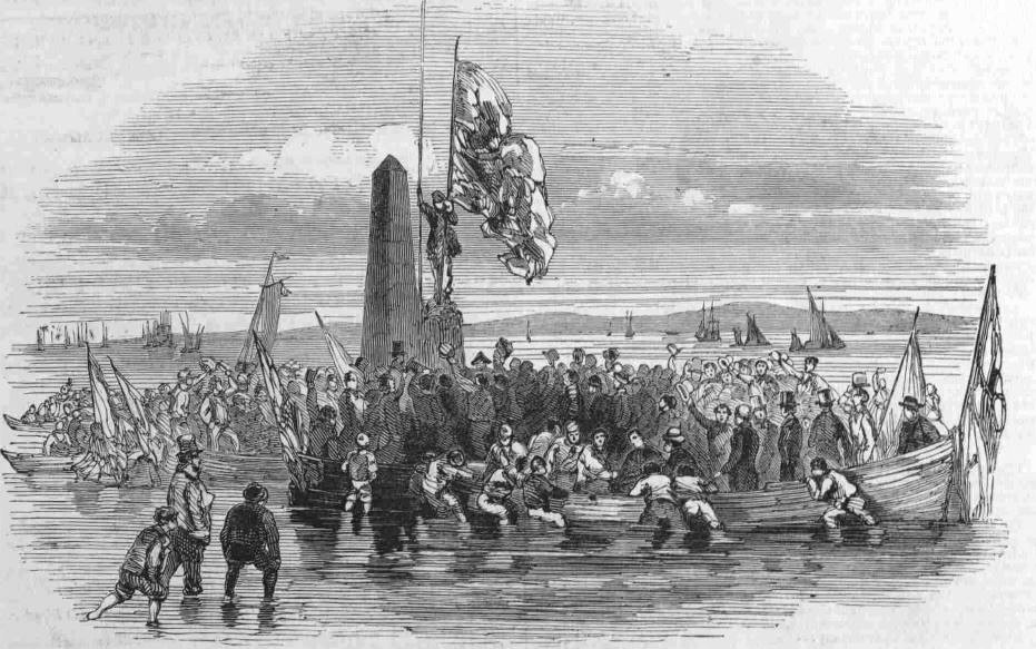
However given current politics, i would not be surprised if the proposal for an airport on the Isle of Grain and Hoo Peninsula gets resurrected.

Standing by the London Stone, as the sun rose, the distant sounds of the estuary, birds calling over land and water, it becomes very clear that an airport here would be a disaster.

I hope the following video provides an impression of this unique site.

The Crow Stone and London Stone are reminders of the City of London’s historical reach outside of the city, which as well as the Southend – Yantlet line also reaches out to Staines in the west, and included part of the River Medway. This post has been rather long, so I will cover the other stones at Upnor (River Medway) and Staines in future posts.

If you decide to visit the London Stone, then do so at your own risk and do not use this post as a guide – the estuary is a dangerous place.

alondoninheritance.com