Monthly Archives: May 2023

Paternoster Square – Destruction and Development

The area to the north of St. Paul’s Cathedral was destroyed during the war, mainly due to the use of incendiary bombs on the night of the 29th of December 1940. The destruction covered ancient streets such as Paternoster Row and Paternoster Square, and the shells of buildings were demolished and removed leaving a wide open space ready for new development.

The site was redeveloped during the 1960s, with the pre-war streets and original architectural styles being ignored, with an office complex built which followed a number of post war City planning themes which I will come on to later in the post.

The 1960s development was not popular, obstructed key views of the cathedral and tended to separate the cathedral from the area to the north. The buildings were not that well maintained and by the late 1980s the area was not an attractive place to work, or walk through, and did nothing to enhance the cathedral just to the south.

In the early 1990s, a proposed Masterplan was published by “Masterplanners” Terry Farrell, Thomas Beeby and John Simpson & Partners, and Design Architects Robert Adam, Paul Gibson, Allan Greenberg, Demetri Porphyrious and Quinlan Terry.

I have a copy of the Masterplan and it is fascinating to compare the original proposals with the site we see today. Not quite so architecturally ornate as the Masterplan, but very similar to what was originally proposed, and (in my view) a significant improvement on the 1960s development.

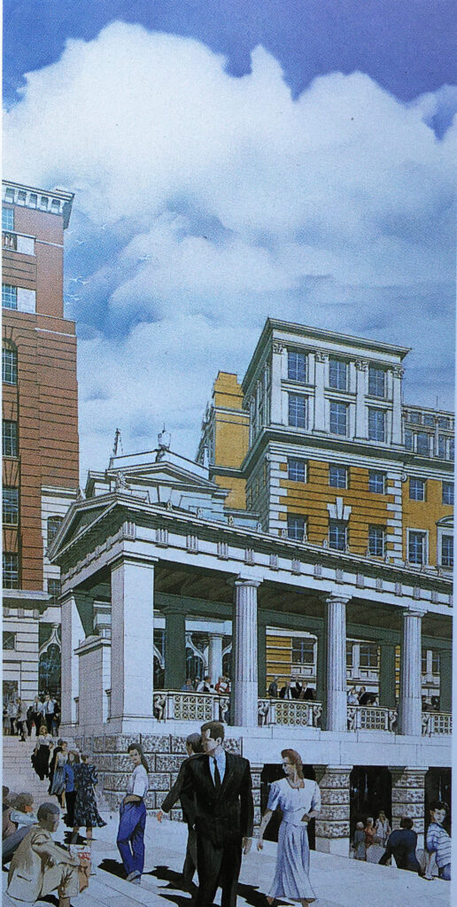
The following image is from the Masterplan and shows a “View of Paternoster Square looking south-east to the dome of St. Paul’s Cathedral”. The image is by Edwin Venn.
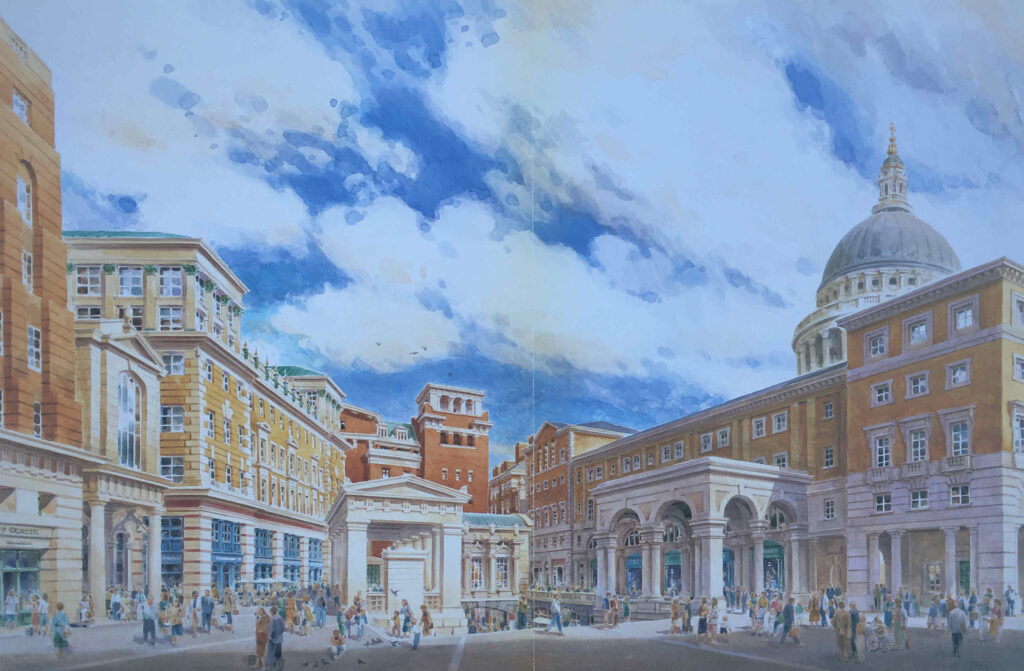
Paternoster Square

As with City developments such as the Barbican and Golden Lane estates, the damage inflicted on the City during the last war created the large area of space which could take a major, transforming development, rather than the simple rebuild of individual buildings.

The following photo is one of my father’s, taken from the Stone Gallery of St. Paul’s Cathedral:
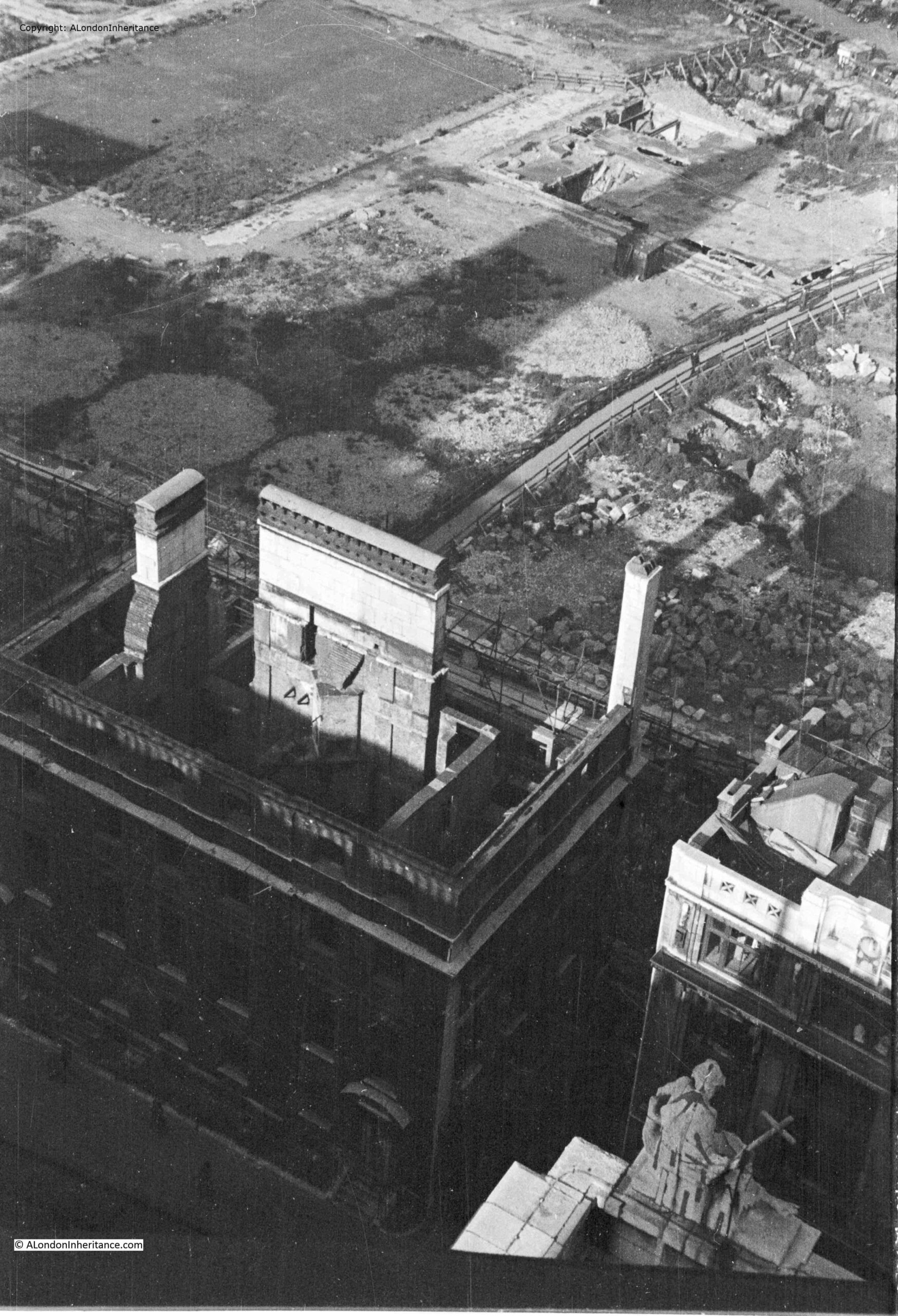
View of bombed Chapter House

The shell of a building at the bottom left is the Chapter House of the Cathedral.

The circular features between what was Paternoster Square and the remains of the Chapter House are the outline of water tanks that were placed on site during the war to provide supplies of water for firefighting.

The following extract from Bartholomew’s 1940 Reference Atlas of Greater London shows the area to the north of the cathedral. In the map, a Paternoster Square can be seen. In the above photo, this is the rectangular feature at top left, with roads on all sides, but not a building in sight.

Map of pre-war St Paul's and Paternoster Row

As well as Paternoster Square, the map shows a network of streets such as Ivy Lane, Three Tuns Passage, Lovells Court and Queens Head Passage.

Running across the area was Paternoster Row, and the following photo from the book, the Queen’s London, published in 1896, shows the view along Paternoster Row, a narrow street but with substantial 19th century City office buildings on either side.
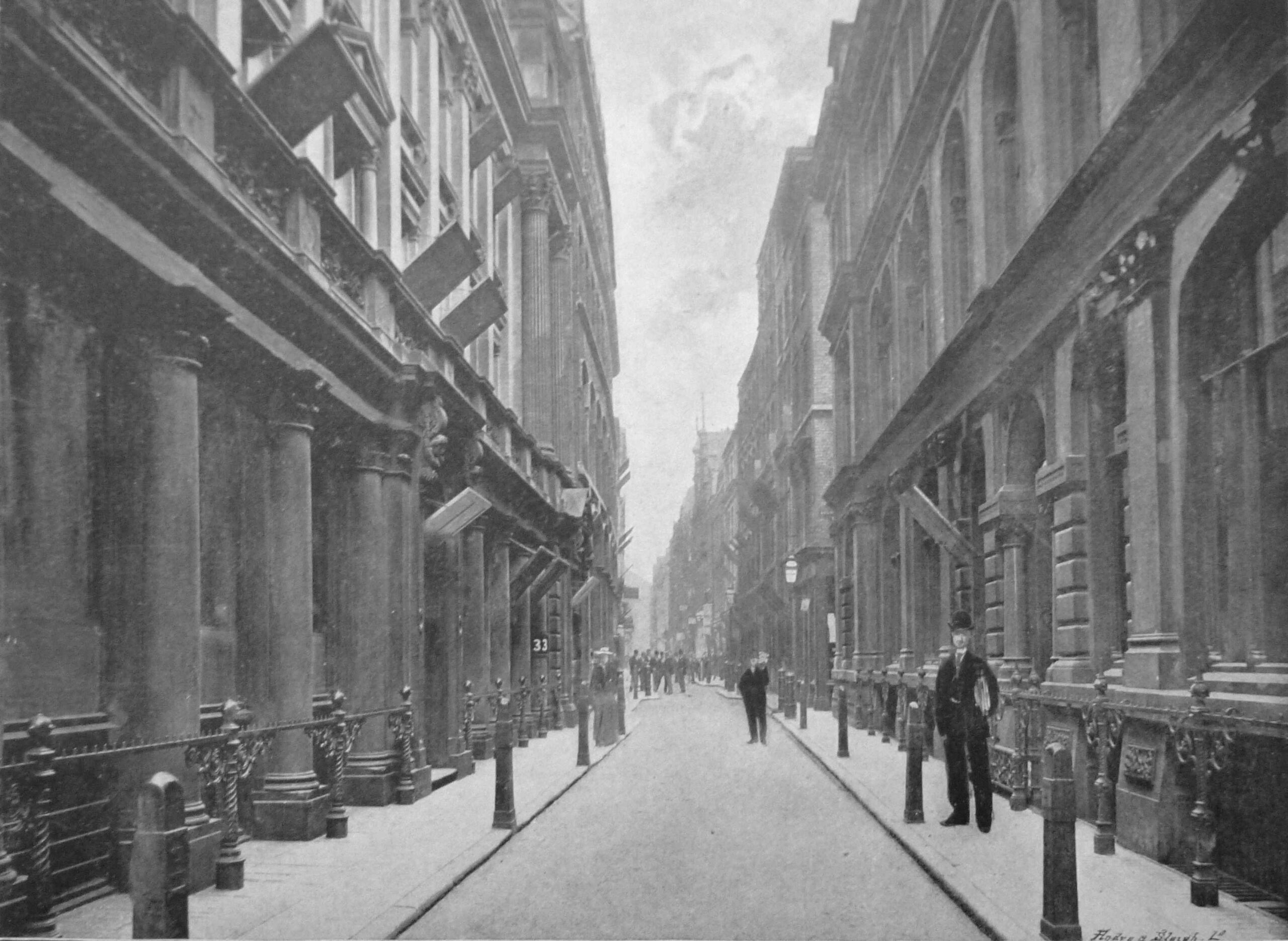
Paternoster Row

In the following photo, the dense network of streets and buildings to the north of the cathedral can be seen:
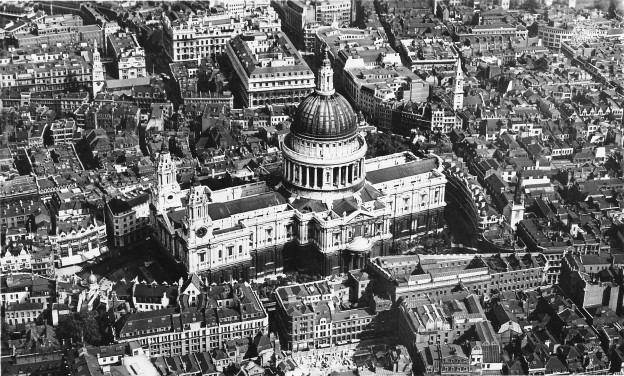
St Paul's before the war

Another of my father’s views from the Stone Gallery, looking slightly above the earlier photo, with a bus running along Newgate Street. The Paternoster Square developments would occupy the area to the south of Newgate Street.
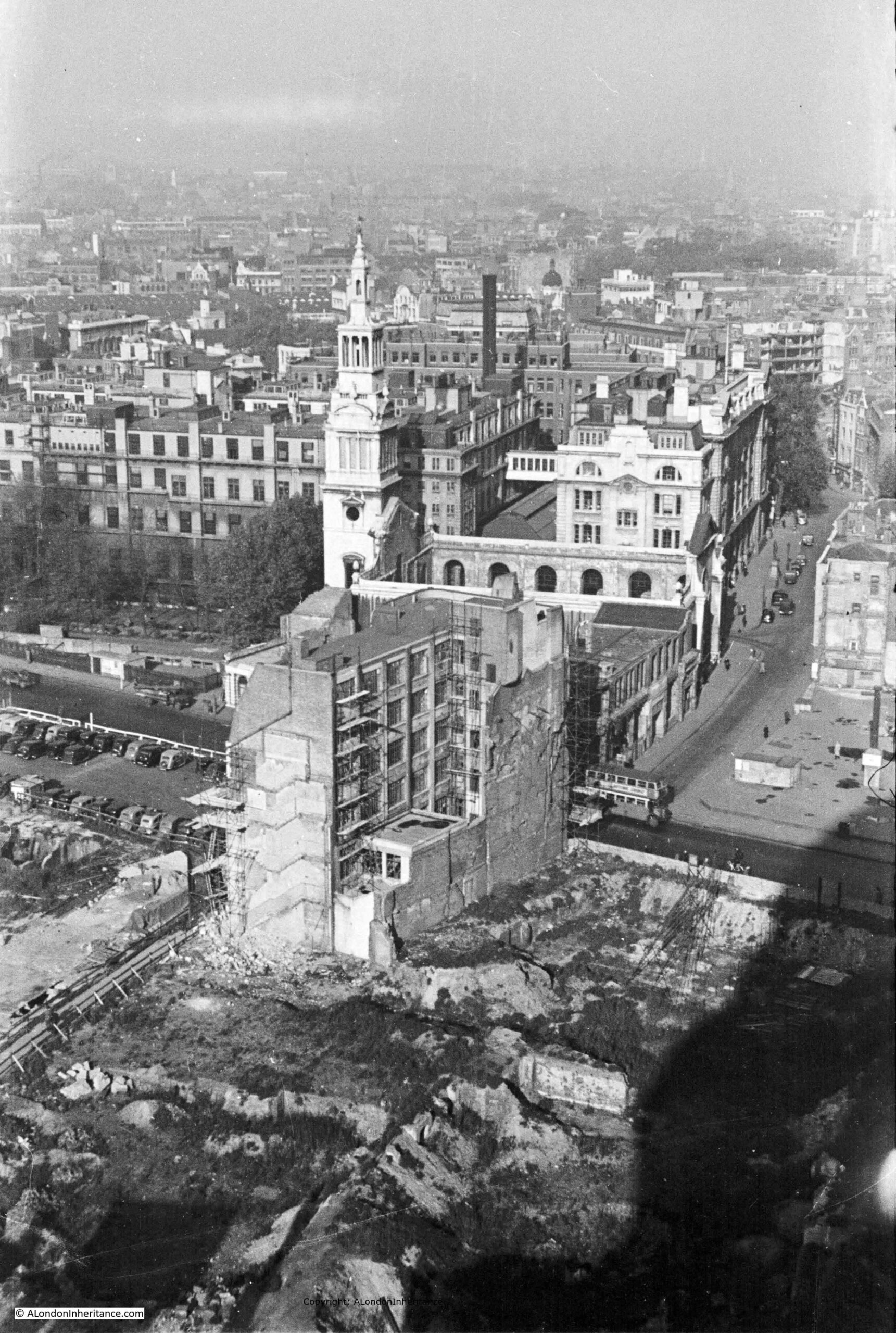
View from St Paul's of bombed landscape

The same view today, showing the buildings of the Paternoster Square development:
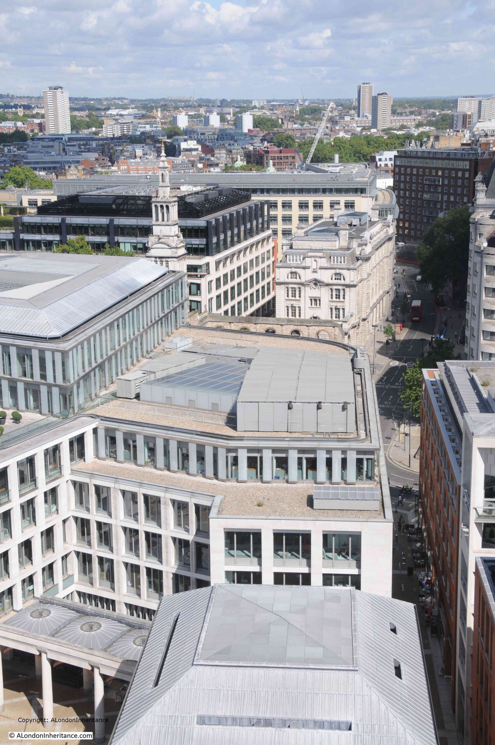
Paternoster Square

The area, and street names are of some considerable age. The first written records of the streets date from the 14th century, with Paternosterstrete in 1312 and Paternosterrowe in 1349.

From the early 19th century onwards, the area was home to many publishers, stationers and book sellers. Much of the stock held by these businesses contributed to the fires started on the 29th of December 1940.

Harben’s Dictionary of London references a Richard Russell dwelling there in 1374 and described as a “paternosterer”, and that paternosterers were turners of beads, and gave the street its name.

Harben also states that “A stone wall was found under this street at a depth of 18 feet running towards the centre of St. Paul’s. A few yards from this wall in the direction of St. Martin’s-le-Grand wooden piles were found covered with planks at a depth of 20 feet”, and that under Paternoster Square, “Remains of Roman pavements and tiles were found in 1884”.

W.F. Grimes’ book, about his post war excavations across the City, “The Excavation of Roman and Mediaeval London” records his limited excavations across the area in 1961 to 1962, and that much of the Paternoster area “was not available for examination because the cellars had retained their bomb rubble and the sites around Paternoster Square had become a garage and car parks.”

In the limited excavations that did take place, Grimes found evidence of ditches and post holes, possibly where the wooden piles were found in the 19th century. He concludes that the area was probably occupied by timber framed buildings rather than stone.

The main discovery on the site was a hoard of about 530 coins, “mainly barbarous copies of coins of the Gallic Empire of the late third century A.D.”

The limited excavation took place prior to the 1960s development of the site. This create a dense cluster of office blocks between the cathedral and Newgate Street, which can be seen in the following photo, to the right of the cathedral:
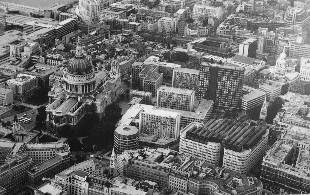
1960s Lord Holford development

The 1960s development of the site was based on the plans by architect and planner Lord Holford who was commissioned by the City Corporation to advise them on architectural policy, and the development of buildings within the “orbit of the dome of St. Paul’s”.

Lord Holford’s plan for the site followed post-war thinking about the City’s redevelopment. This included the separation of traffic and pedestrians, with vehicles having priority at ground level, and pedestrians moved to elevated walkways.

The original street plans were rejected in favour of a rigid matrix of building blocks, which resulted in a horizontal slab of blocks with the 18-storey office tower Sudbury House being the highest.

Lord Holford’s explanation of his approach to the design of the site was that “there is more to be gained by contrast in design, than from attempts at harmony of scale or character of spacing” (I think this is the design approach used for the current developments between Vauxhall and Battersea Power Station).

Not all of Holford’s ideas were implemented, and many of the buildings were by other architects, so the new development ended up as a rather uninspiring addition to the land north of the cathedral.

The following photo shows the 1960s office block immediately to the right of the old St. Paul’s Chapter House:
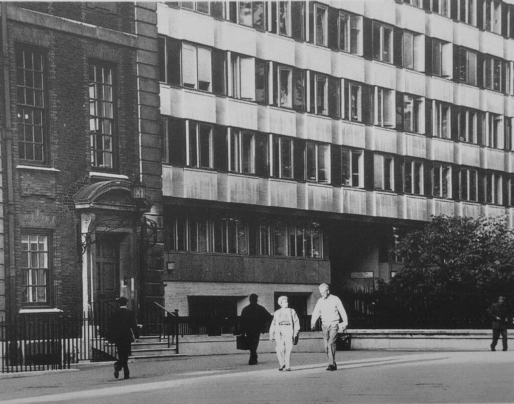
1960s Lord Holford development

In the following photo, the Chapter House is the older building in dark brick behind the tree, and the new lighter red brick building to the right occupied the site of the 1960s office block seen in the above photo:
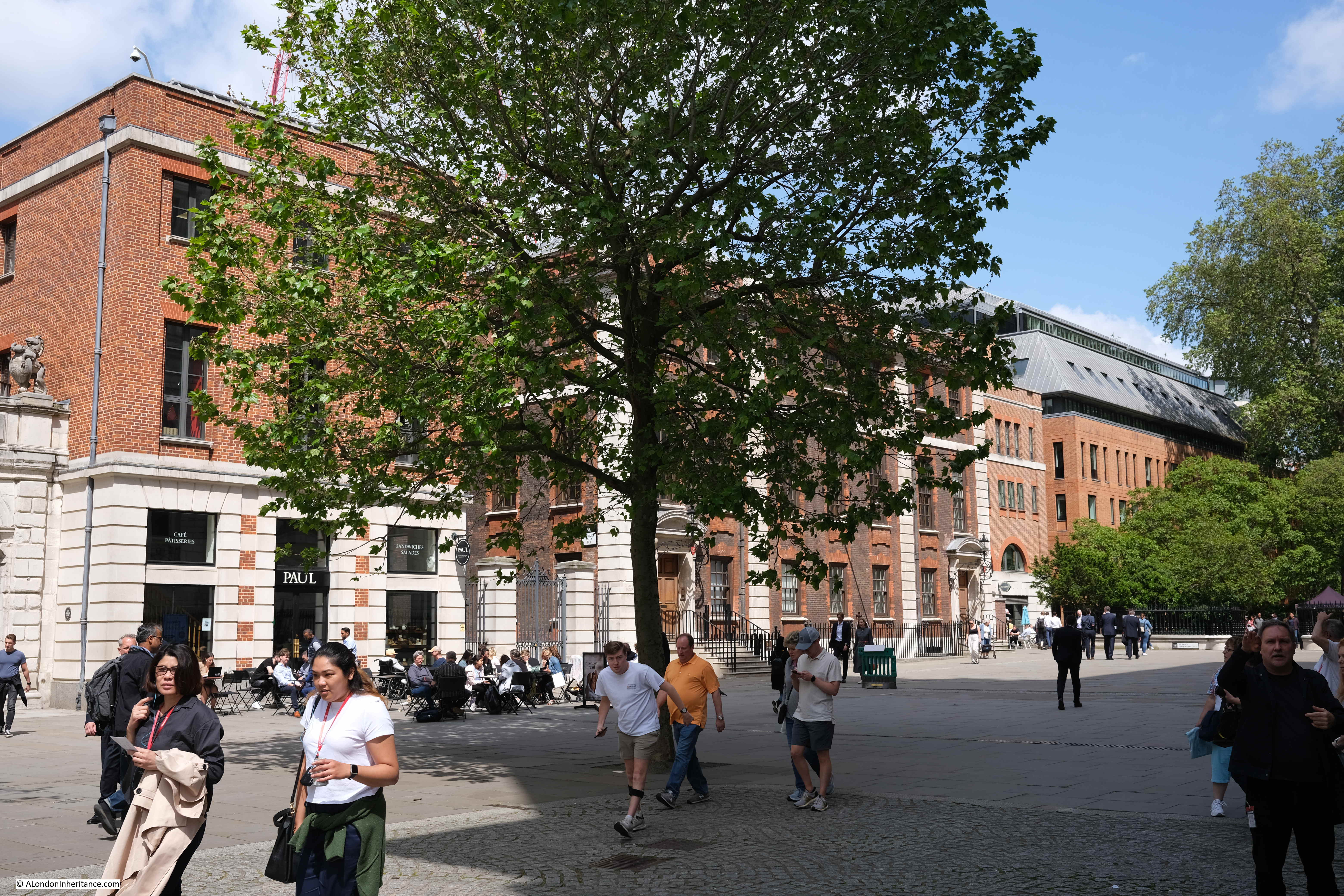
St Paul's Chapter House

The following photo shows one of the access ramps that took pedestrians up to the pedestrian area. To the right is the lower vehicle route, with access to car parking:
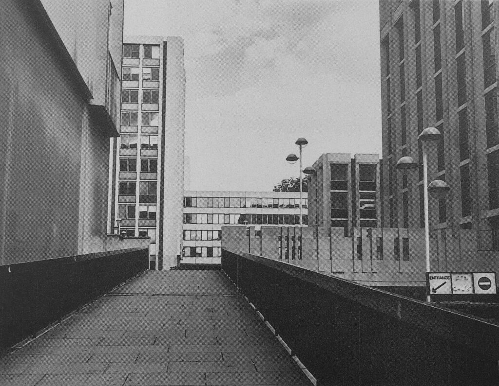
1960s Lord Holford development

I may be completely wrong, but I vaguely remember there being a pub on the upper pedestrian area, which had an outside area with a view over the surrounding streets.

The 1960s development took no regard of the views of the cathedral just to the south.

This is the view to the northern entrance to the cathedral, with only a small part visible through a tunnel that takes a pedestrian walkway through an office block:
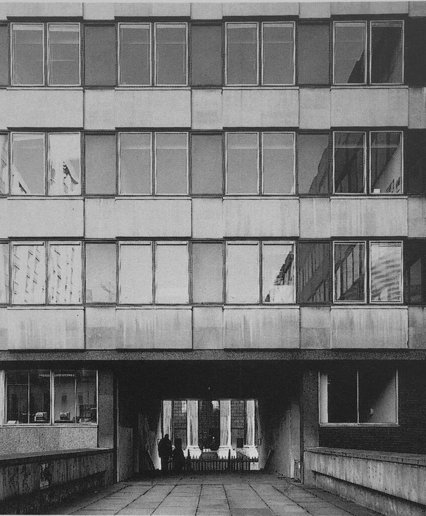
1960s Lord Holford development

In the Masterplan, the proposed redevelopment delivers this alternative view of the same part of the cathedral:
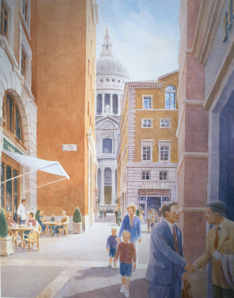
Paternoster Square

And whilst the buildings are less ornate than originally proposed, the view today is much the same as in the Masterplan, also with a café, on the site of the walkway:
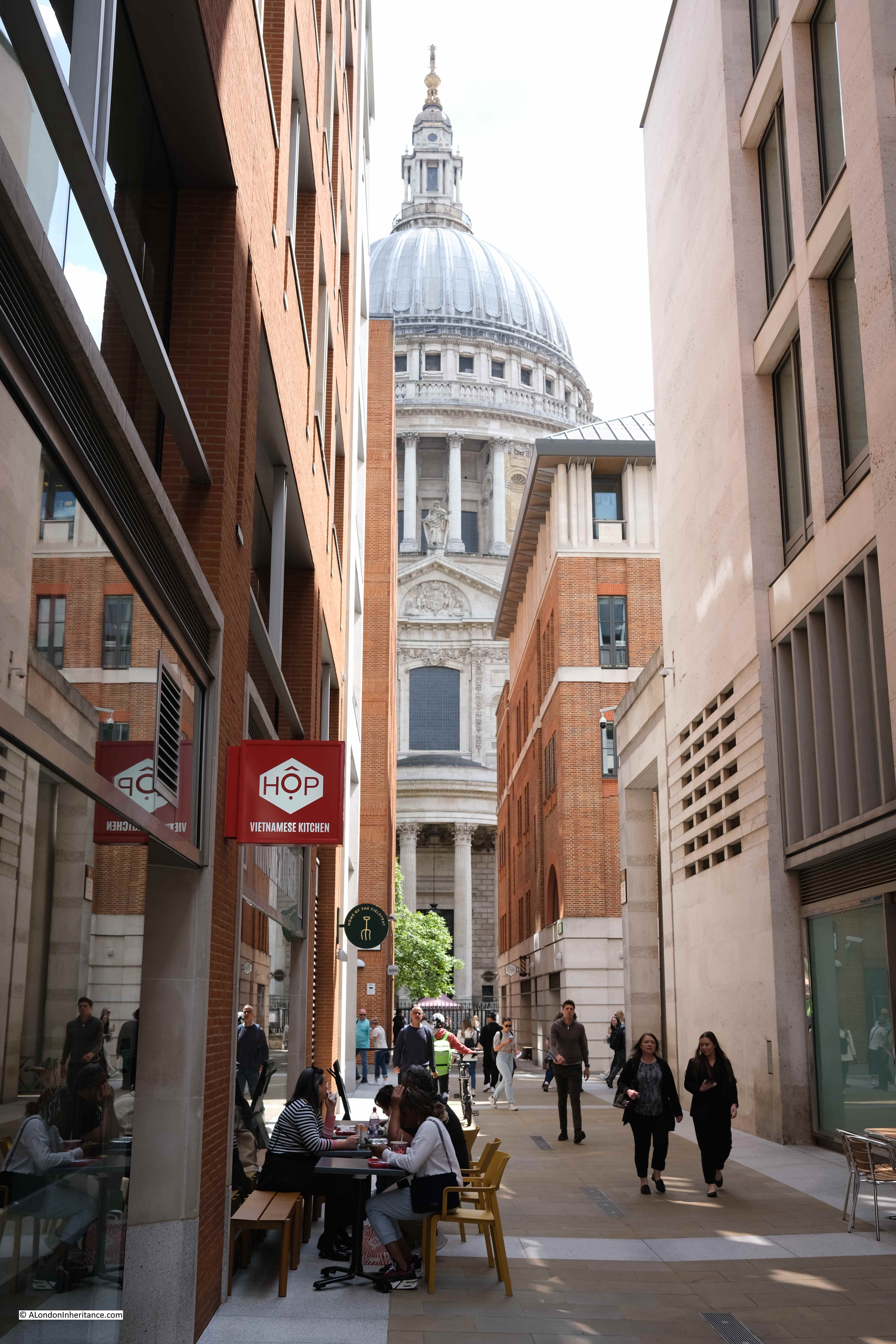
Paternoster Square

The caption to the following illustration reads “St. Paul’s Church Yard will be re-aligned and the Cathedral gardens re-laid and enclosed”:
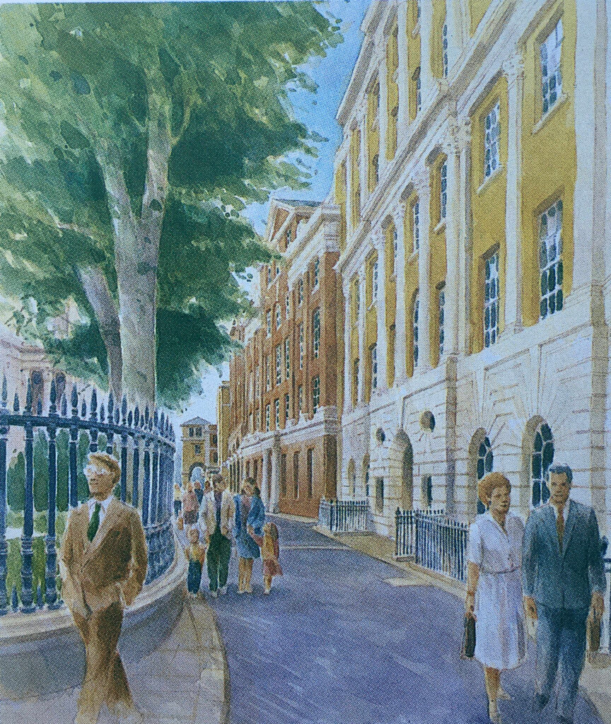
St Paul's Churchyard

The gardens were re-laid and enclosed, and new office blocks occupied the space to the north, and whilst these were very different to the 1960s versions, they were not quite as ornate as the Masterplan envisaged:
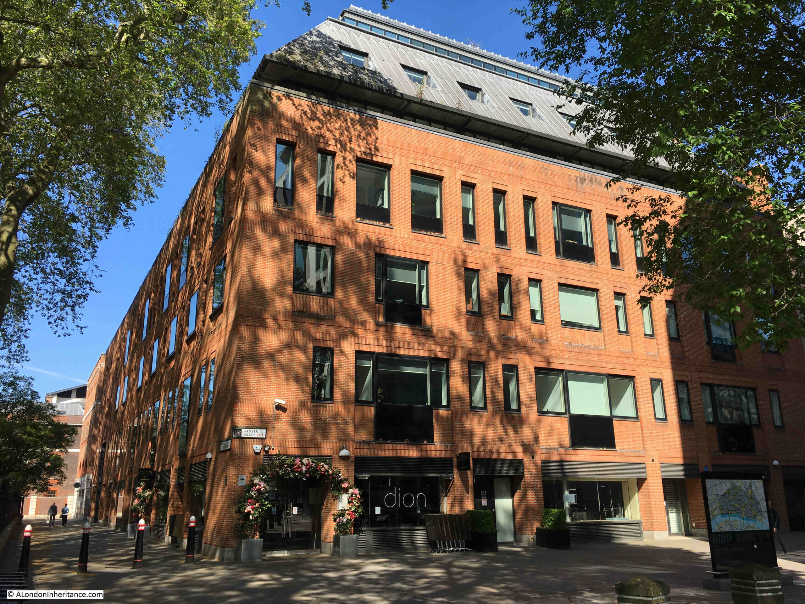
St Paul's Churchyard

The objectives of the Masterplan were to:

  • Restore views of St. Paul’s Cathedral from Paternoster Square at ground level and on the skyline, respecting St. Paul’s Heights and Strategic Views
  • To create buildings that are in harmony with St. Paul’s Cathedral
  • To restore the traditional alignment of St. Paul’s Church Yard and the Cathedral Gardens creating an enhanced public space
  • To re-establish a traditional street pattern and return pedestrian routes into the site to ground level
  • To create a new, traffic-free, public open space allowing ease of access, especially for the disabled
  • To follow the City tradition of classical architecture, using traditional materials such as stone, brick, tile, slate and copper
  • To be flexible enough for key corners, outside the Planning Application site to be integrated at a later date
  • To create a thriving new business community in the best traditions of City life
  • To create a much-needed, new shopping area in the heart of the City, with a variety of shops, restaurants and entertainment, linked into St. Paul’s Underground Station
  • To create new open public spaces for relaxation and enjoyment by office workers, visitors and shoppers alike

It is interesting to compare the development today with these objectives.

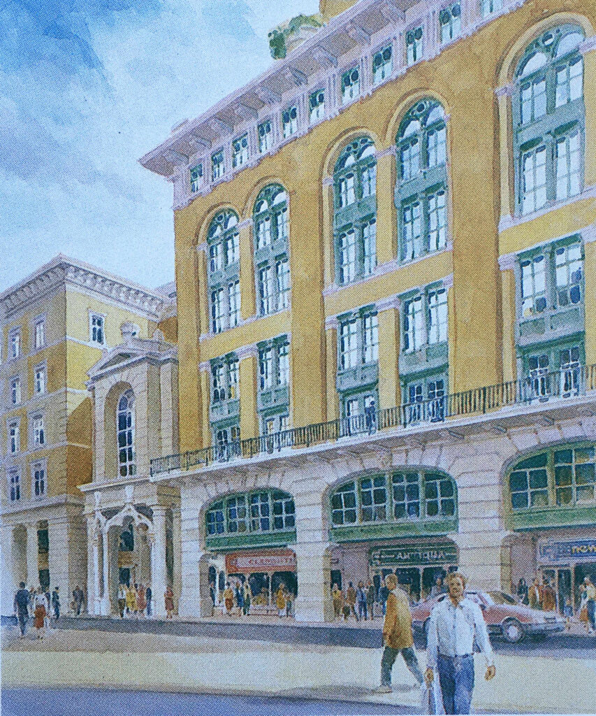
There was an intention to follow the City tradition of classical architecture, and this could be seen in the illustrations of the planned buildings, such as the following example showing “the frontage of the new buildings on Newgate Street”:
Paternoster Square

The frontage along Newgate Street today is comprised of standard office block design, without the classical architecture proposed in the Masterplan.

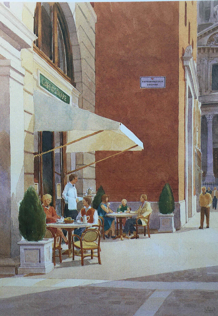
The title of the following illustration is “A Meeting Place – Paternoster Square will provide a social focus for the City, a place to meet friends and colleagues, to browse or to use the health club”:
St Paul's Cathedral

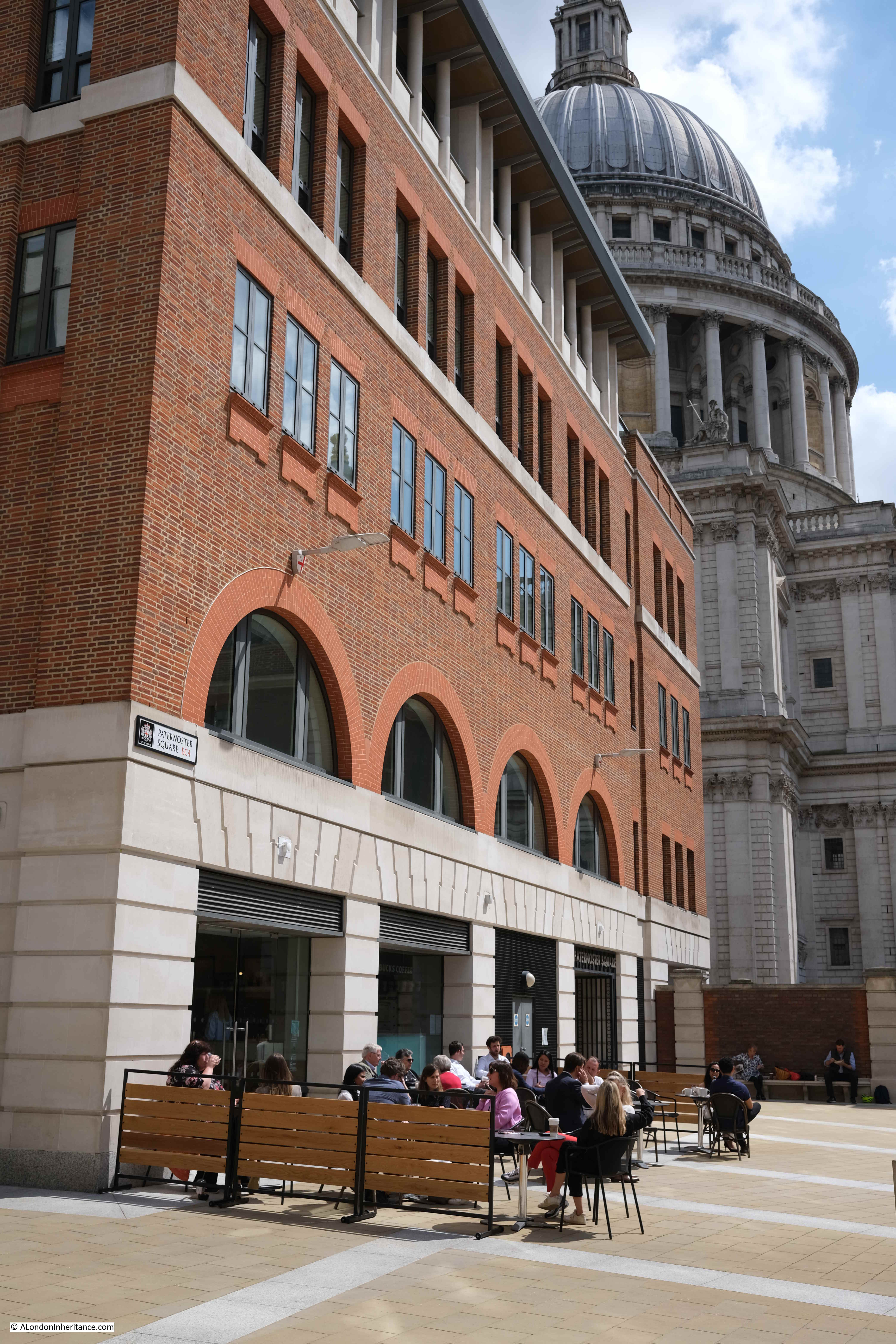
This approach can be seen across the Paternoster Square development, but in less ornate settings. Whilst the buildings do not have the same classical architectural styling, they do make use of stone, and there is a considerable amount of brick throughout the site which is a pleasant change from the glass and steel of many other recent City developments:
St Paul's Cathedral

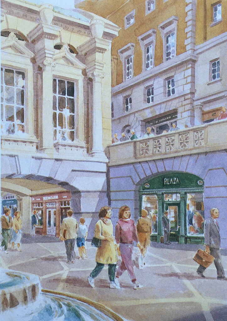
Whereas today, Paternoster Square is at a single level, in the Masterplan it was intended that there would be steps leading down to a Lower Court, so whilst the plan did away with the upper pedestrian and lower vehicle levels of the 1960s development, it did retain different levels, but for pedestrians. The Lower Court:
Paternoster Square

The plan was that Paternoster Row would become almost a continuation of Cheapside.

Cheapside was, and to an extent still is, the main shopping space of the City, and the One New Change development has enhanced this, but in the Masterplan, shopping would continue from Cheapside, across the road into Paternoster Row, and the underground station, which today is reached via a separate access point to the edge of the development, would have been integrated into the plan, as shown in the following illustration:
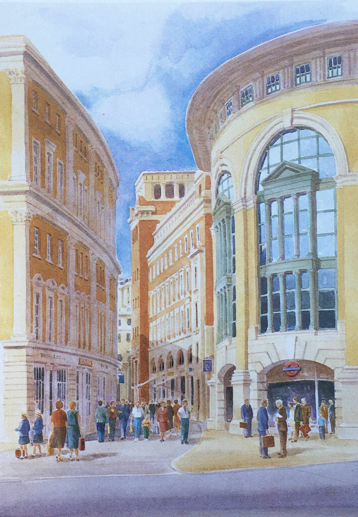
St Paul's Underground Station

The St. Paul’s Chapter House was reduced to a shell of a building, as shown in my father’s photo, however it was restored and survived the 1960s redevelopment, and was included in the Masterplan, where it can be seen in the centre of the following illustration.
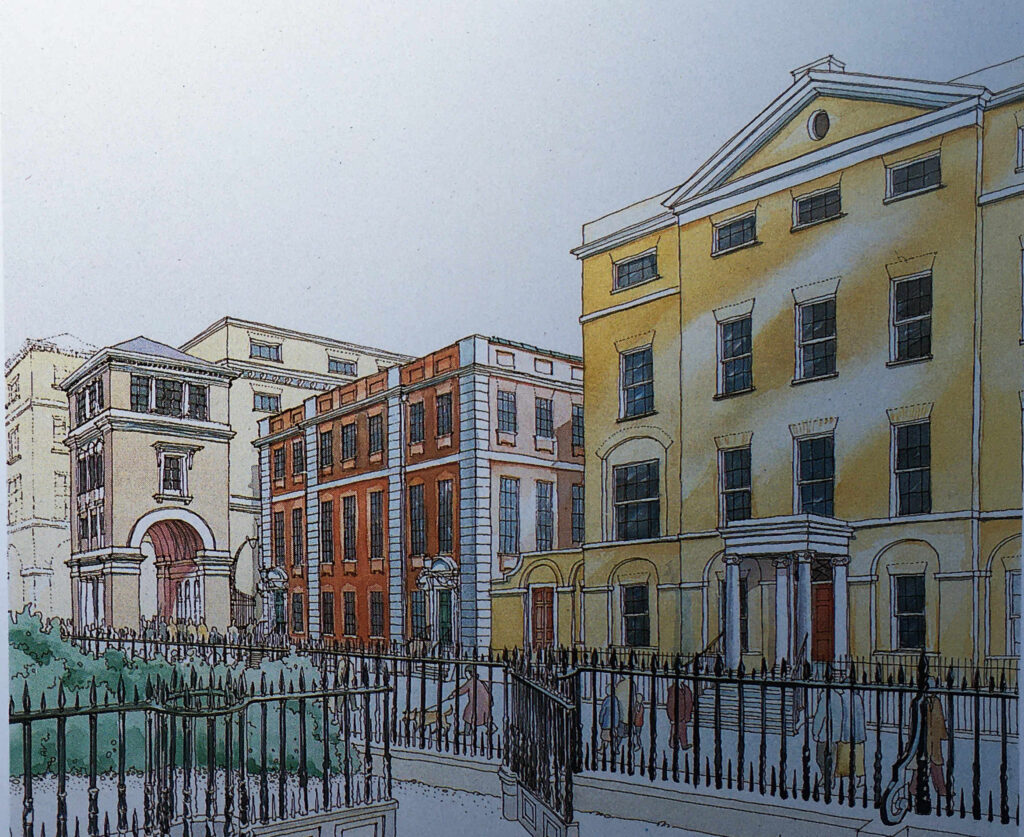
St Paul's Chapter House

To the left of the Chapter House is a rather ornate three storey gateway into Paternoster Square, which today has been replaced by Temple Bar.

Temple Bar was included as an option in the Masterplan, which is described as “currently in a state of decay in a Hertfordshire Park”.

As mentioned earlier, the central Paternoster Square was intended to be multi-level, and in the following illustration, there is a rather impressive Loggia (an outdoor corridor with a covered roof and open sides), that would have provided a lift down to the Lower Court, would provide shelter, and would mark the access point to the Lower Court:

Loggia

A key aim of the Masterplan was to bring life back to the area, and one of the ways to do this was via retail, and the plan stated that “Paternoster Square will be established as one of the foremost shopping areas in central London. There will be more than 80 shops, including a quality food hall or department store”.

The approach to retail included a Shopping Avenue, which was a covered route between the Lower Court and St. Paul’s Underground Station:
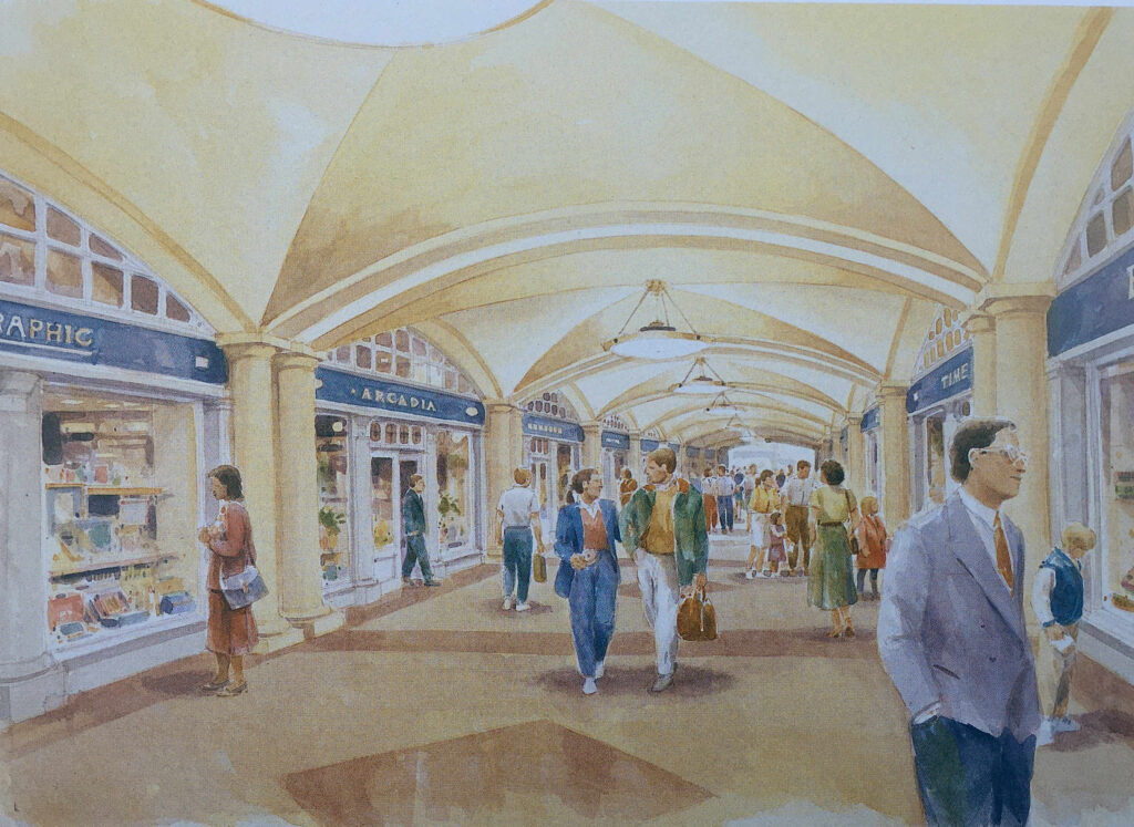
Shopping Avenue

Shops would also line the new Paternoster Row:
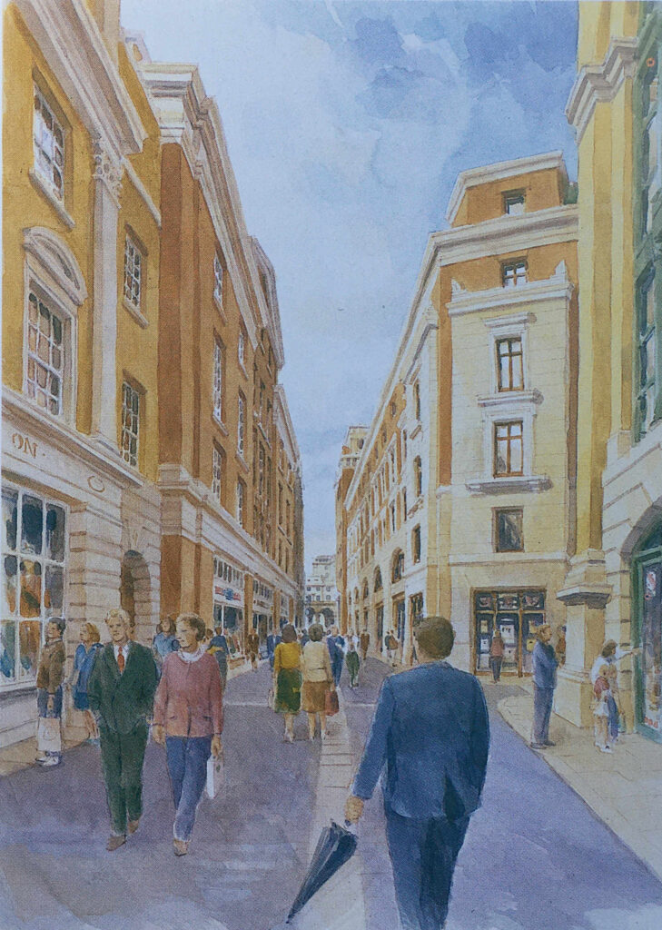
Paternoster Square

And along the route of the old Ivy Lane, there would be Ivy Lane Arcade “designed in the tradition of famous London arcades. It will attract specialty shops such as jewelers and galleries”:
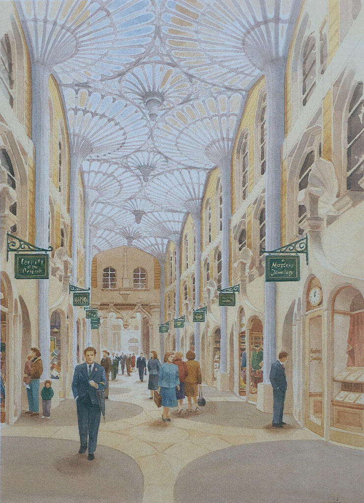
Paternoster Square

And shopping around Paternoster Square and Lower Court:
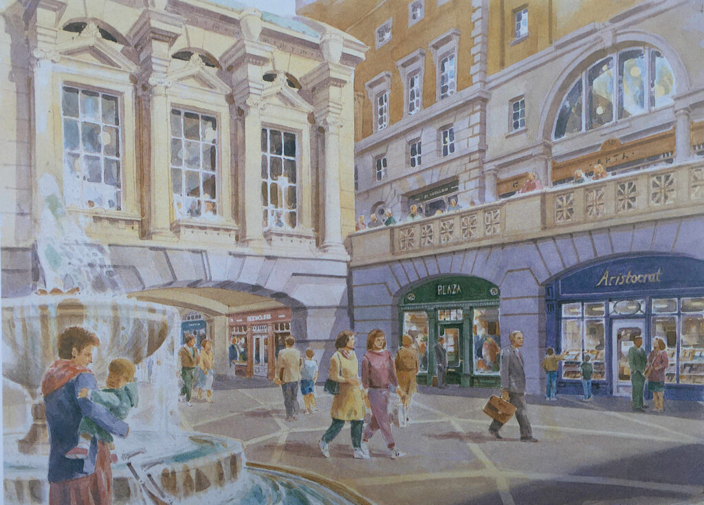
Paternoster Square

The Paternoster Square estate does have some shopping, but far less than was intended in the original Masterplan. There is no lower court and no covered shopping avenues.

Most of the shops are either restaurants, bars or take away food and coffee shops, aimed at local office workers and at the number of visitors who pass through as part of a visit to the area around St. Paul’s Cathedral.

There are also many other differences. Whilst the overall concept appears the same, the classical building style is now very limited as is the overall decoration across the buildings and ground level pedestrian spaces.

In 1995, the owners of the land commissioned Whitfield Partners to deliver a Masterplan for redevelopment, and it is the outcome of this plan that we see today. Similar in concept, but different in implementation.

The Paternoster Square development today has a large central space, is pedestrianised, and some of the pedestrian walkways do roughly align with some of the original pre-war streets.

The objective of bringing life back to the area has been achieved, and during the day it is generally busy with local workers, visitors and tourists, and on a summer’s afternoon, the bars and restaurants are particularly busy.

The central square features a 23.3 metre tall column, which conceals air vents to the parking space below the square:
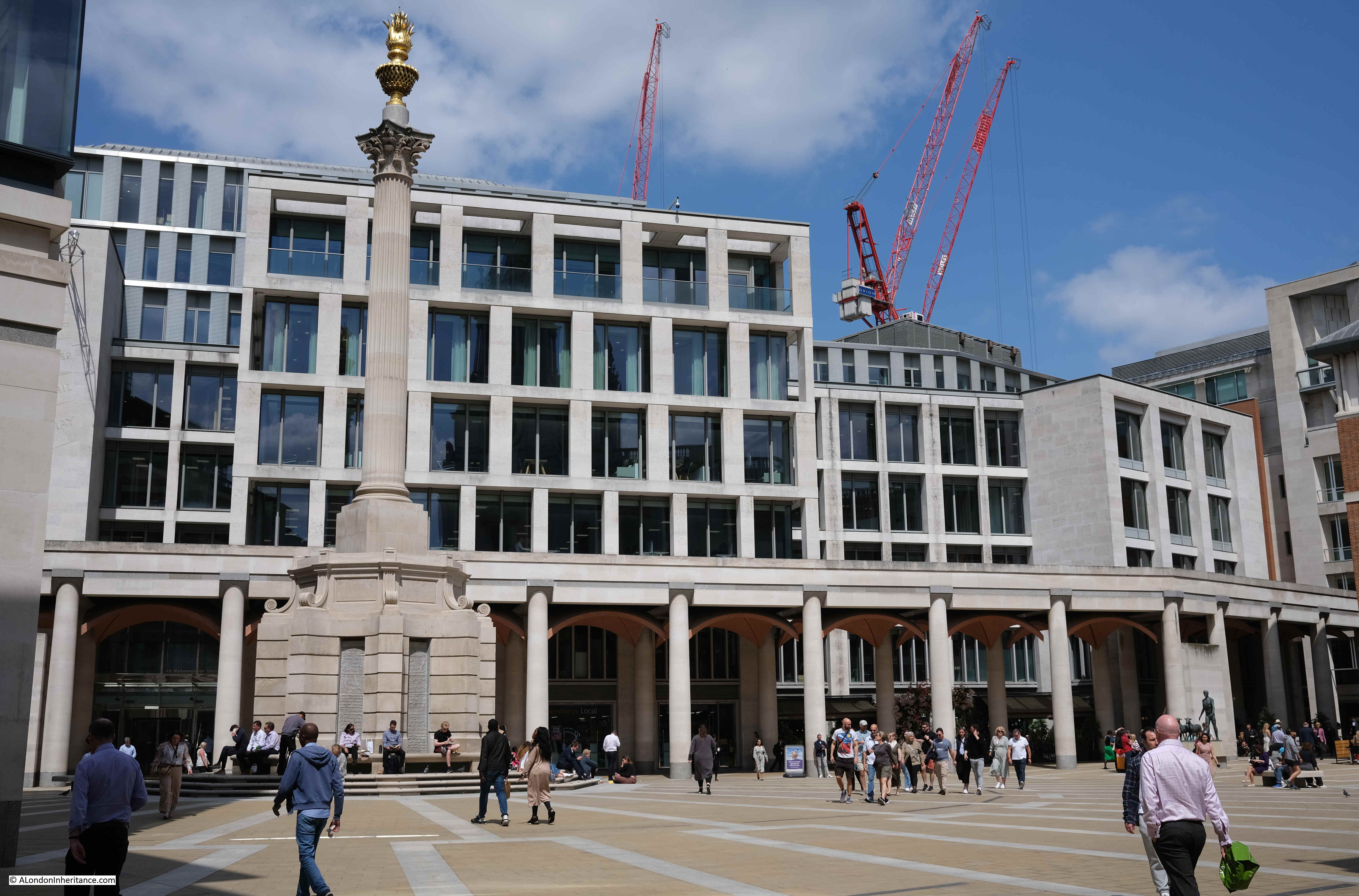
Paternoster Square

The Masterplan by Farrell, Beeby and Simpson included a Loggia which would have provided a lift down to the Lower Court, and mark the access point to the Lower Court.

Whilst the Loggia and Lower Court were not part of the implemented Masterplan, there is a covered way along the northern edge of the square which has similarities to the original Loggia:
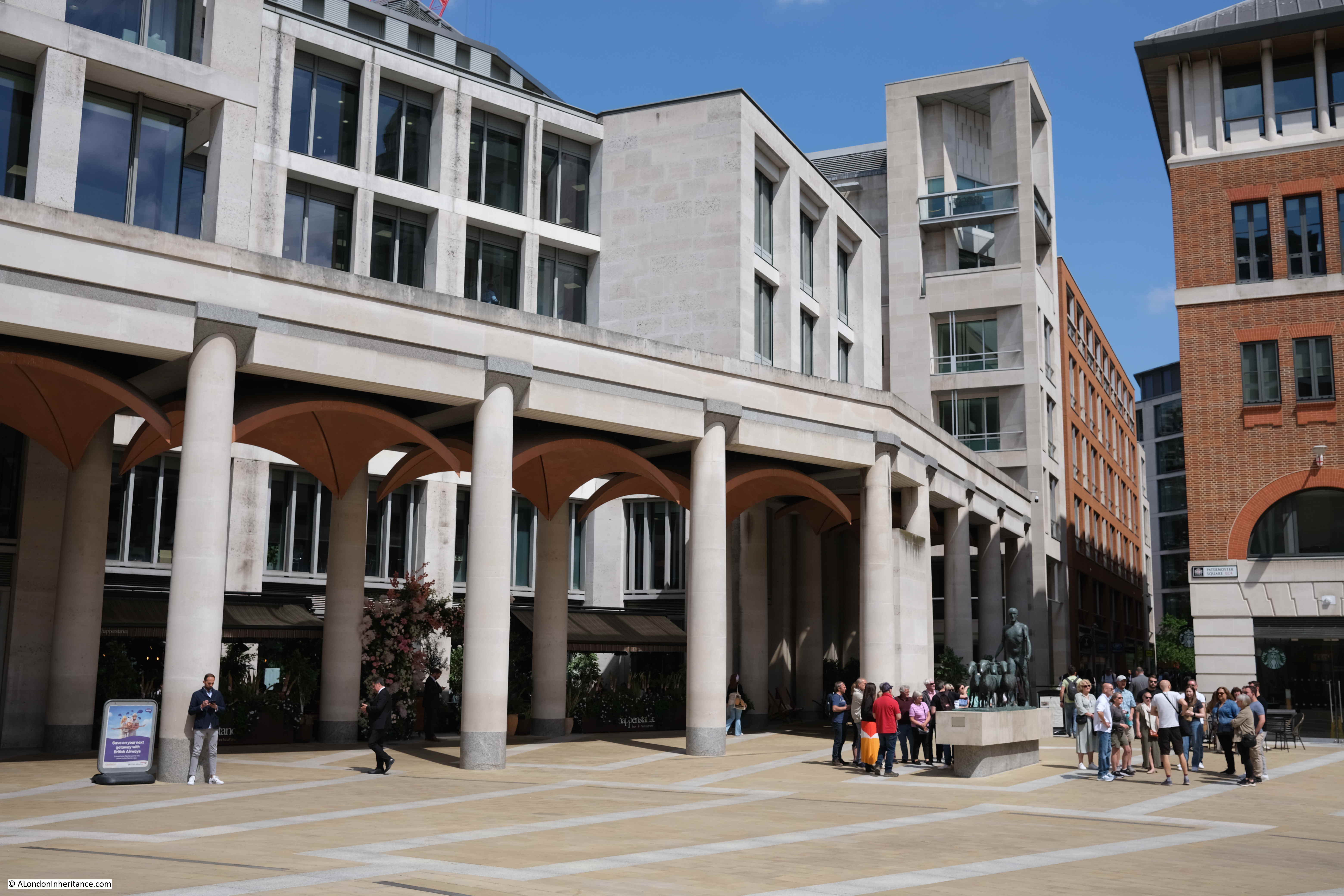
Paternoster Square

In the above photo, two groups of tourists with guides can be seen to the right. Between them is the artwork “The Sheep and Shepherd” by Elisabeth Frink. This came from the earlier Paternoster Square development as it was installed on the north side of the estate in 1975 when it was unveiled by Yehudi Menhuin.

It was moved to the high walk outside the Museum of London in 1997 prior to demolition of the 1960s estate, then returned to Paternoster Square in 2003.

The Sheep and Shepherd stands where Paternoster Square joins to Paternoster Row (which, as far as I can tell is very slightly north of the street’s original alignment).
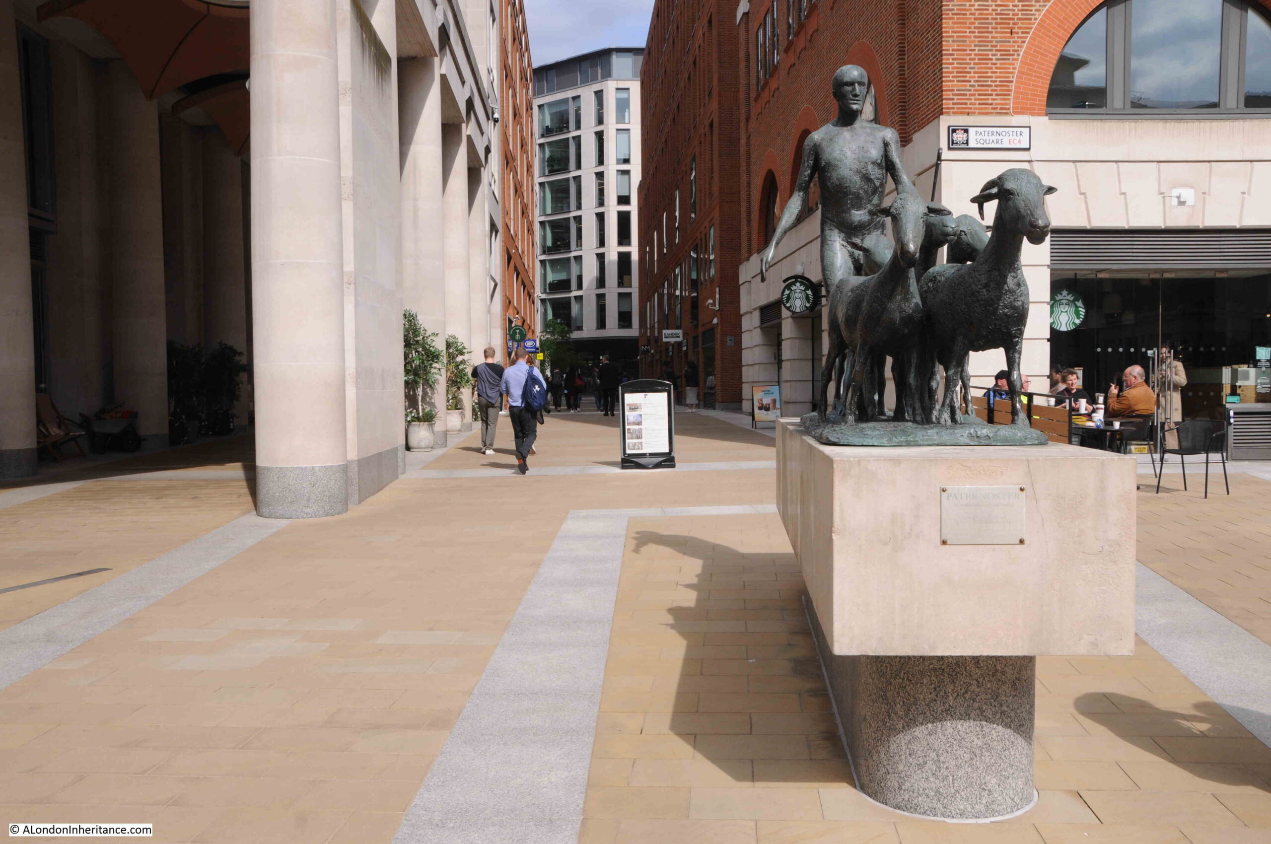
The Sheep and Shepherd

Looking through the Loggia that was built as part of the new development:
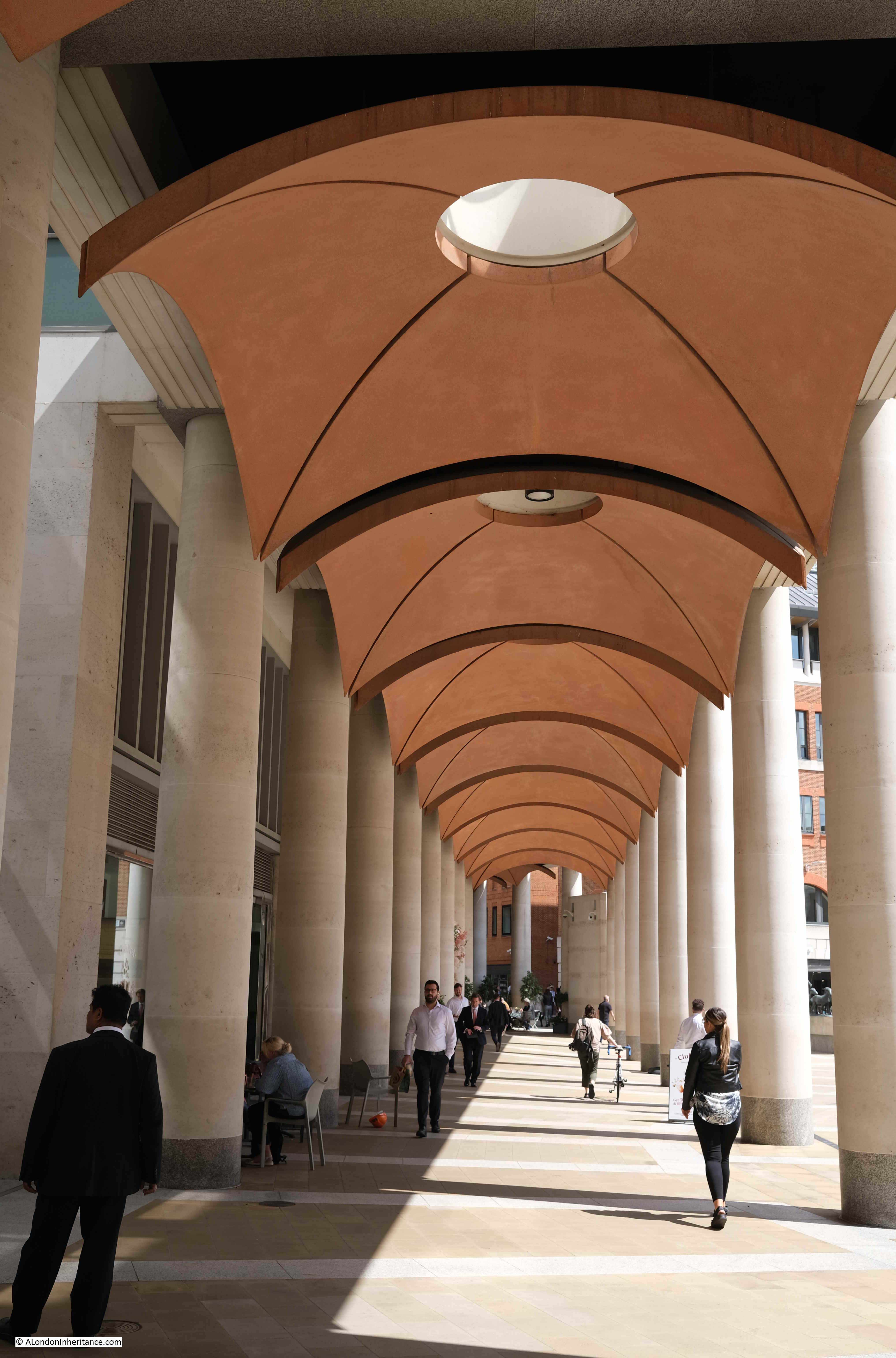
Paternoster Square

Rather than lots of classical decoration to the buildings, there is a “Noon Mark” on one of the buildings to the north of the square. In strong sunlight, at midday, the shadow indicates roughly the day of the year:
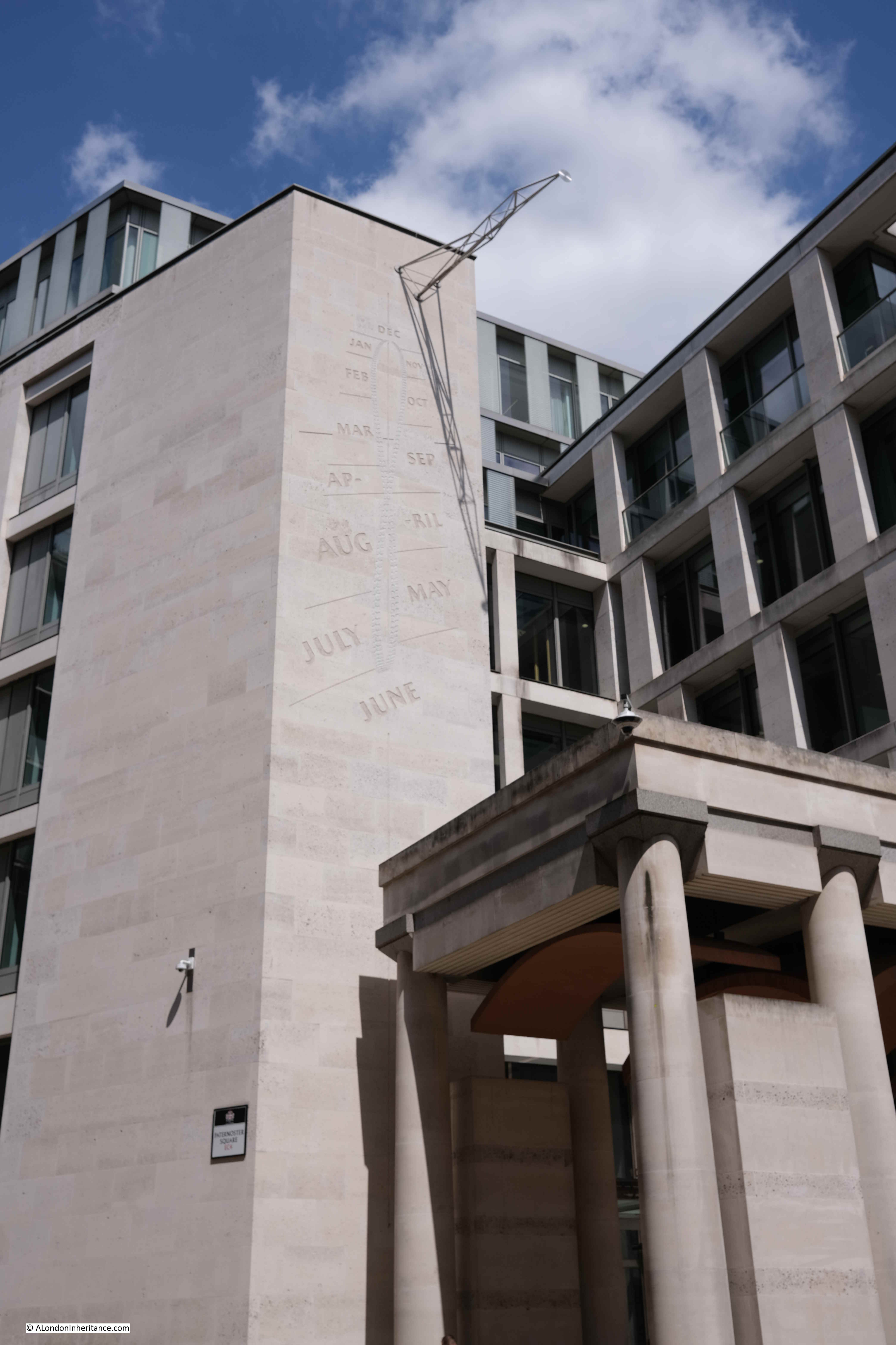
Noon mark solar clock

A key point with the development is the height of the buildings. In the 1960s development, there were office blocks that ran both parallel and at right angles to the cathedral and views of the cathedral were limited.

With the new development, building heights are lower and allow views of the cathedral. As can be seen in the following photo from the north west corner of Paternoster Square, the new buildings are just slightly higher than the original Chapter House (the older, dark brick building to the right of the column):
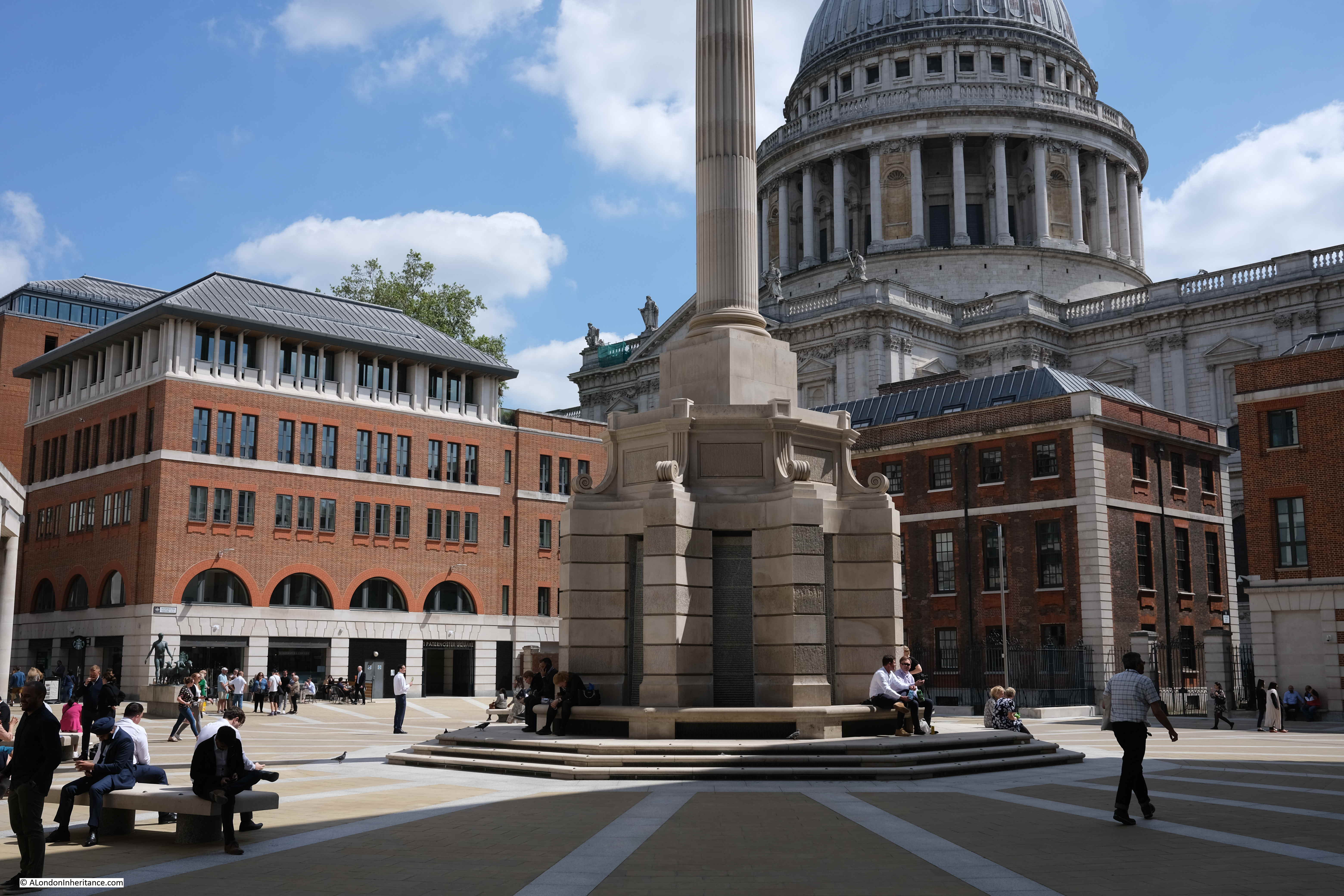
St Paul's Cathedral

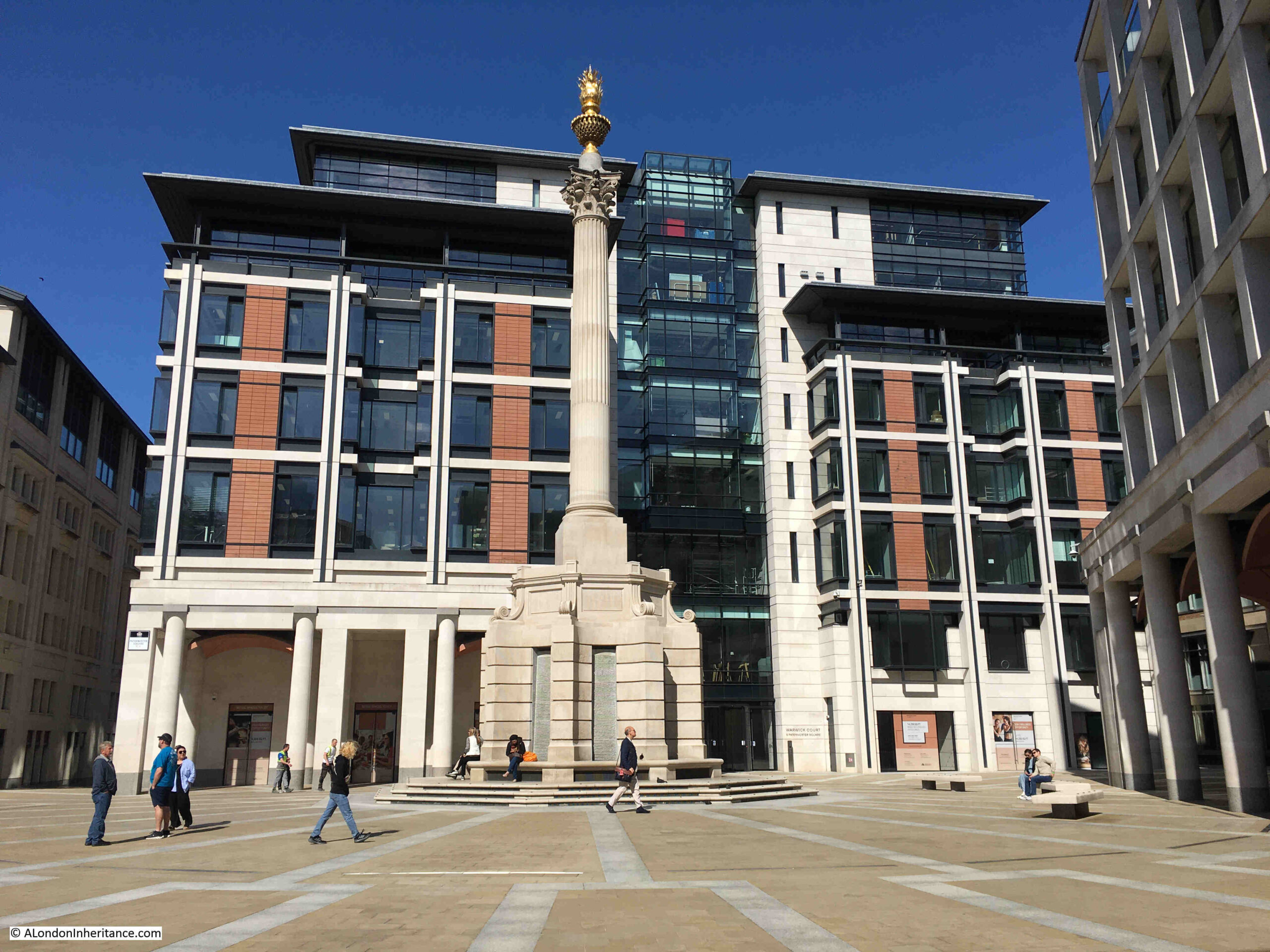
Whilst a number of the walkways do roughly align with the original streets, Paternoster Square is in a different place to the original square, which would have been to the northwest of the current square, to the right of the building in the following photo, which does retain some classical styling at ground level, but is a modern building above:
Paternoster Square

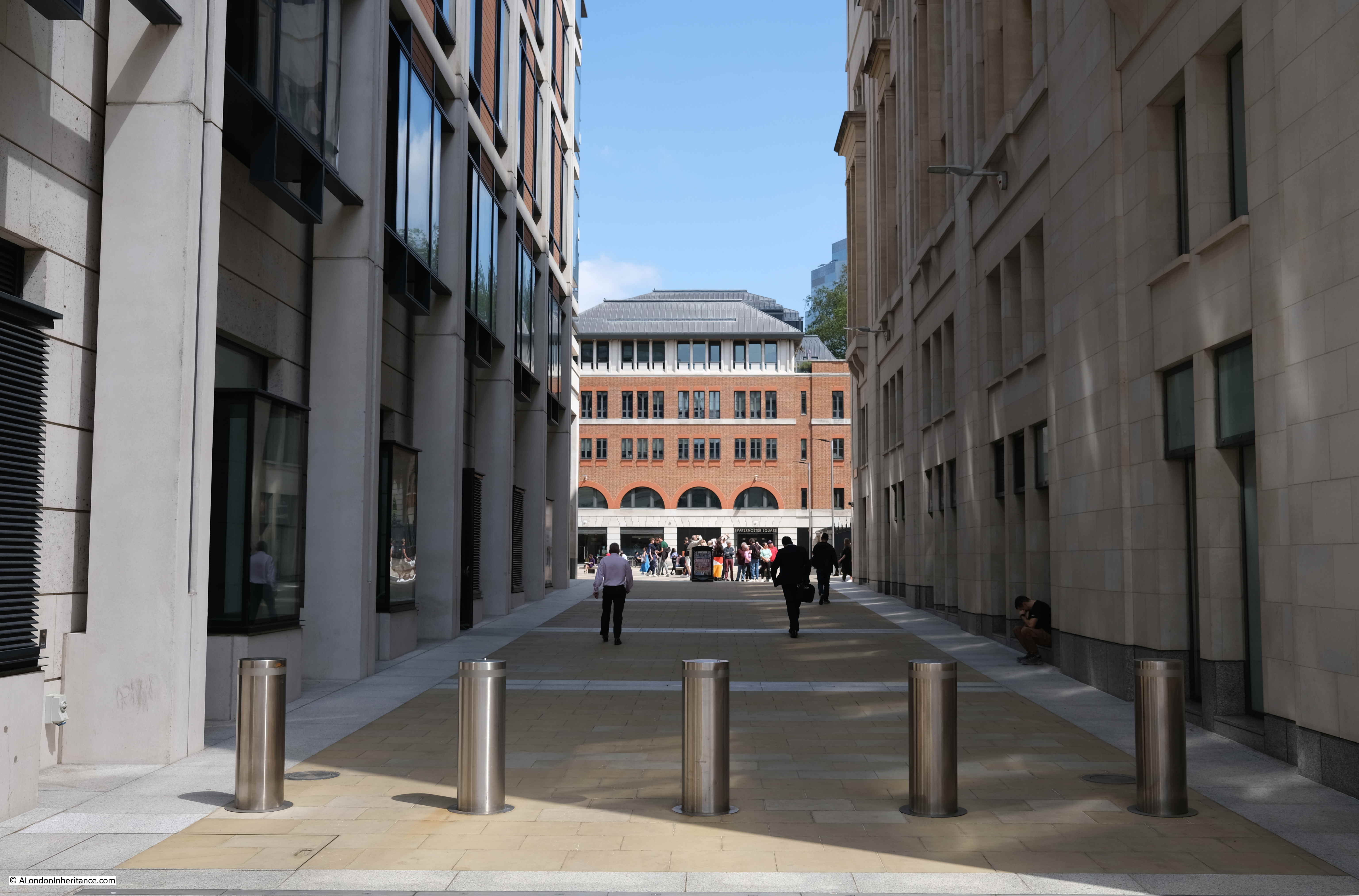
This is the view from the western end of Paternoster Lane towards the central square. This stretch of walkway is almost exactly on the original route of Paternoster Row:
Paternoster Lane

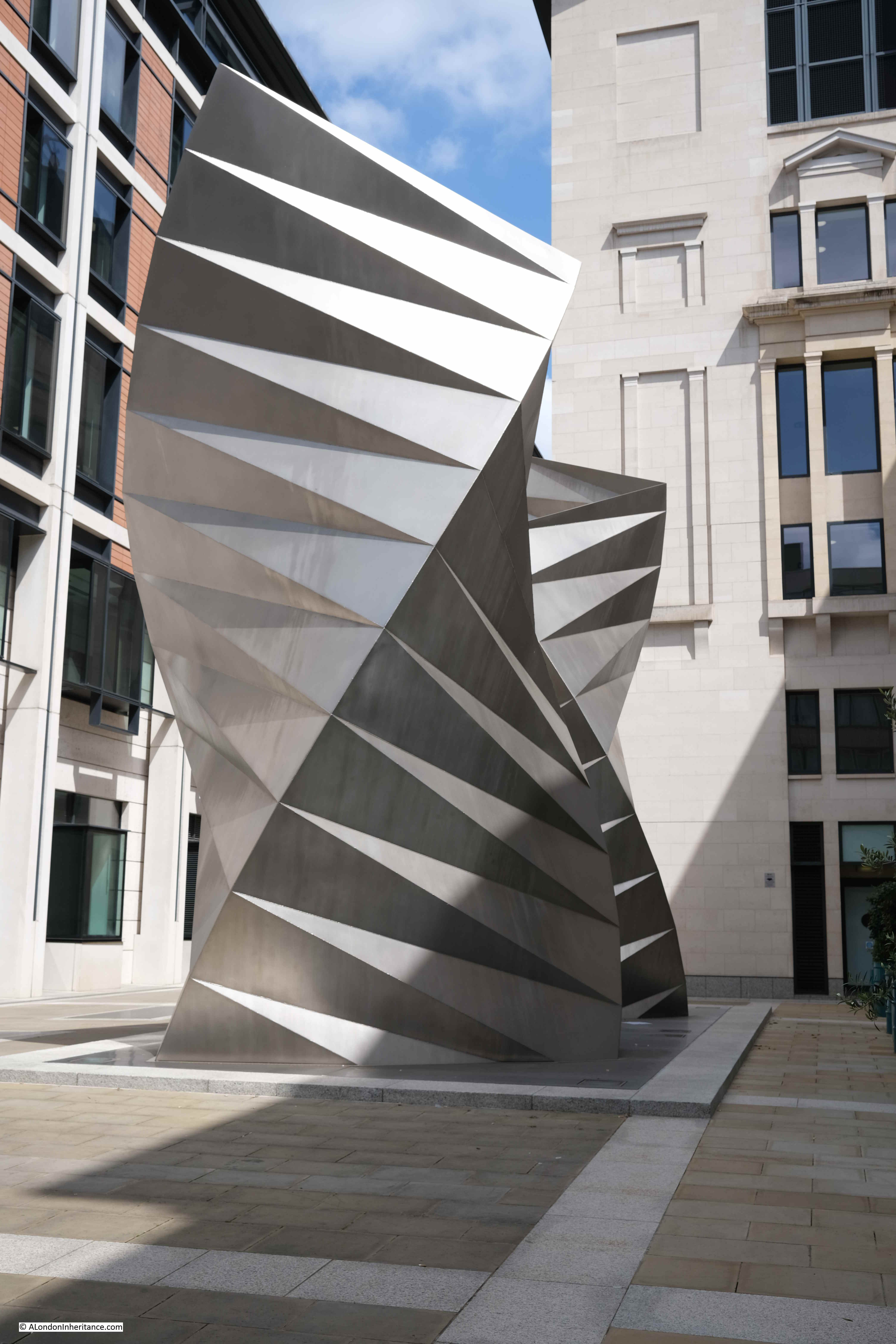
Sometimes it seems as if all the large sculpture across London’s streets is there to hide an air vent. This is the purpose of the column in the central square and also the purpose of a work of art on the corner where Paternoster Lane meets Ave Maria Lane:
Thomas Heatherwick

This is a 2002 work by Thomas Heatherwick, and consists of sixty three identical isosceles triangles of stainless steel sheet welded together.

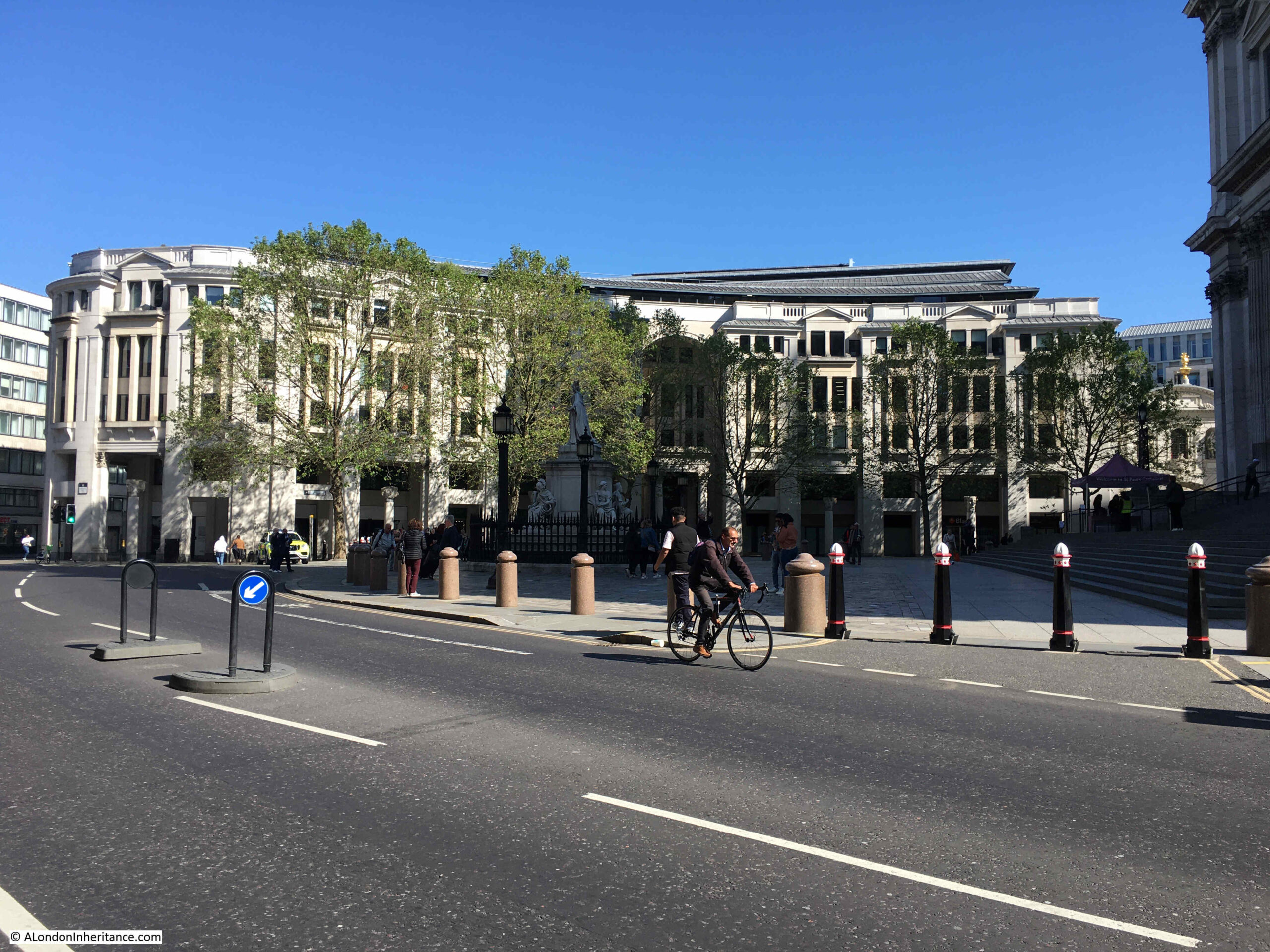
Round to the front of St. Paul’s Cathedral, and to the north of the large open space in front of the cathedral is an office block with shops at ground level which follows the alignment of the old street St. Paul’s Churchyard:
St Paul's Churchyard

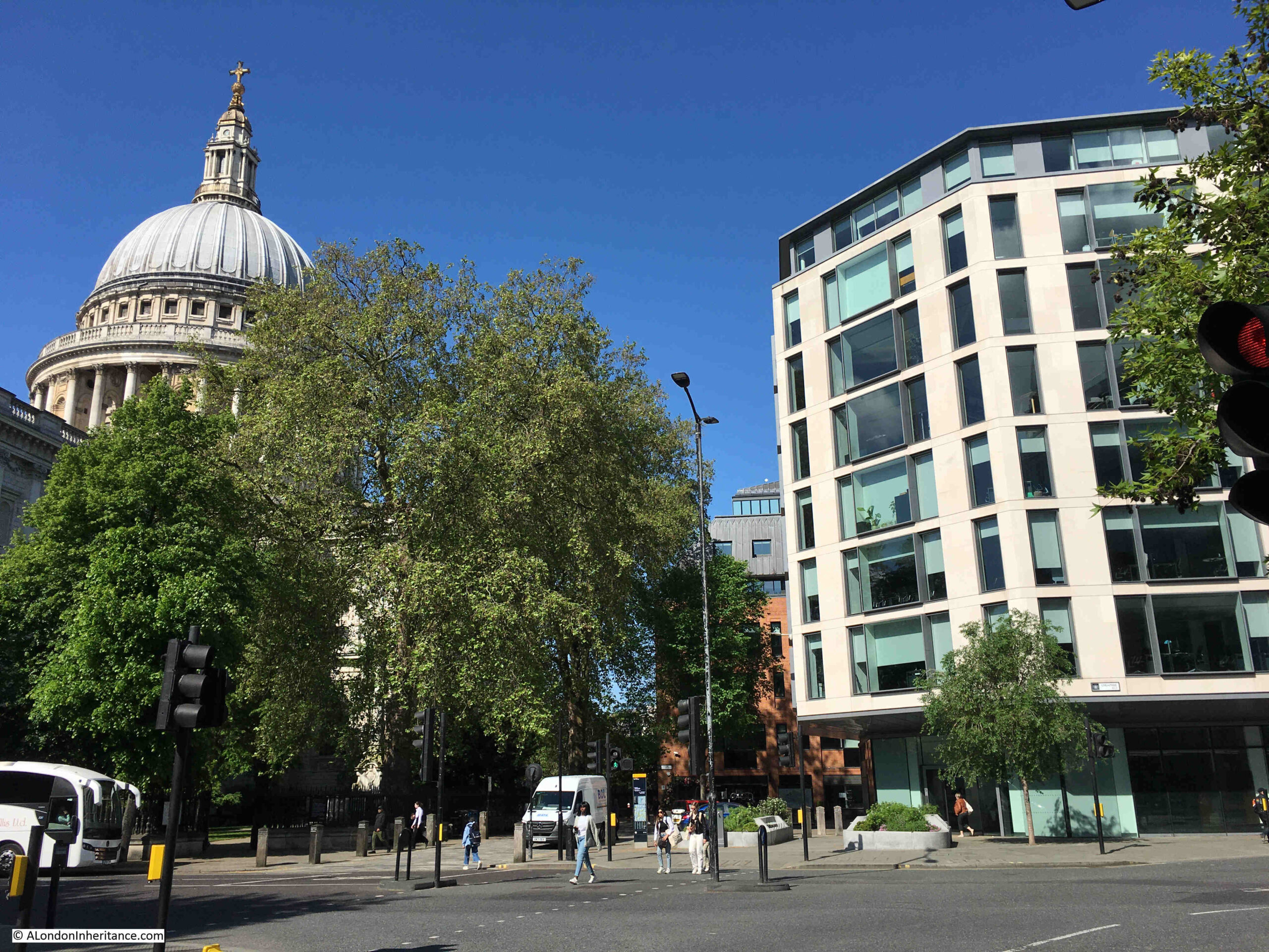
The following photo is taken from Cheapside looking towards the cathedral and Paternoster Square development, and may offer a clue as to why the implemented Masterplan is different to the Masterplan of Farrell, Beeby and Simpson:
St Paul's Underground Station

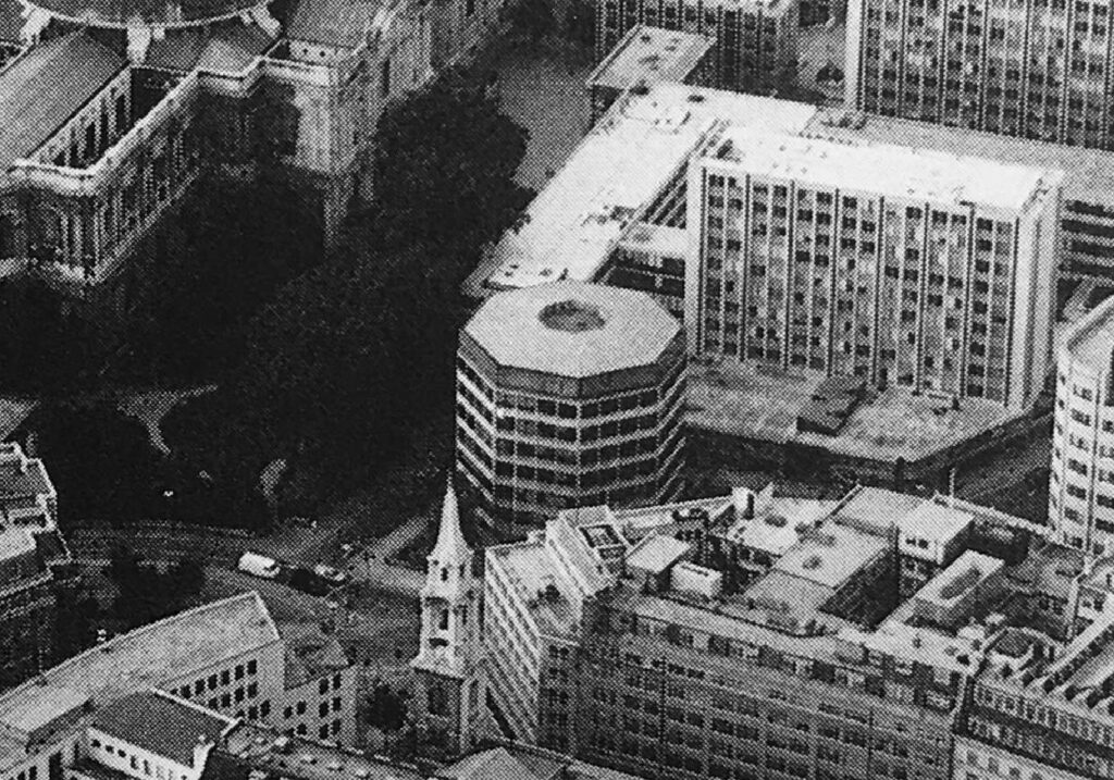
To the right of the above photo are two sides of an octagonal building. It can be seen in the following extract of the photo of the 1960s estate:
St Paul's Underground Station

One of the entrances to St. Paul’s Underground Station is just to the right of the building in the photo, and the building is either part above, or extremely close to, the underground station.

I have no evidence to confirm this, however it may be that the estate we see today was down to cost.

Whilst the initial planning permission did not include the octagonal building, the Masterplan did. It would have been demolished and the entrance to St. Paul’s Underground Station would be integrated into one of the new buildings as can be seen in one of the earlier pictures. The proposed lower shopping arcade would also have led into the underground station.

I imagine that anything involving changes to an underground station incur significant extra planning time and costs.

The overall Paternoster estate, whilst aligning with the original Masterplan, does not have the level of classical architecture proposed in the plan, or the split level with the lower court.

All this extra work would have incurred cost, and in so much of the built environment, decisions often come down to cost.

Having said that, compared to the 1960s development, Paternoster Square is a very considerable improvement.

It integrates well with the cathedral to the south, recreates alignments close to some of the original streets, certainly has brought life back into the area from what I recall of the previous development, and is a generally pleasant space to walk through.

Reading the Masterplan though, it is interesting to speculate what might have been, if this plan had been adopted.

You may be interested in the following posts about the area around St. Paul’s:

Post War London from the Stone Gallery, St. Paul’s – The North and West

Post War London from the Stone Gallery, St. Paul’s – The South and East

Operation Textiles – A City Warehouse In Wartime

alondoninheritance.com

Bread Street – A Devastated City Street

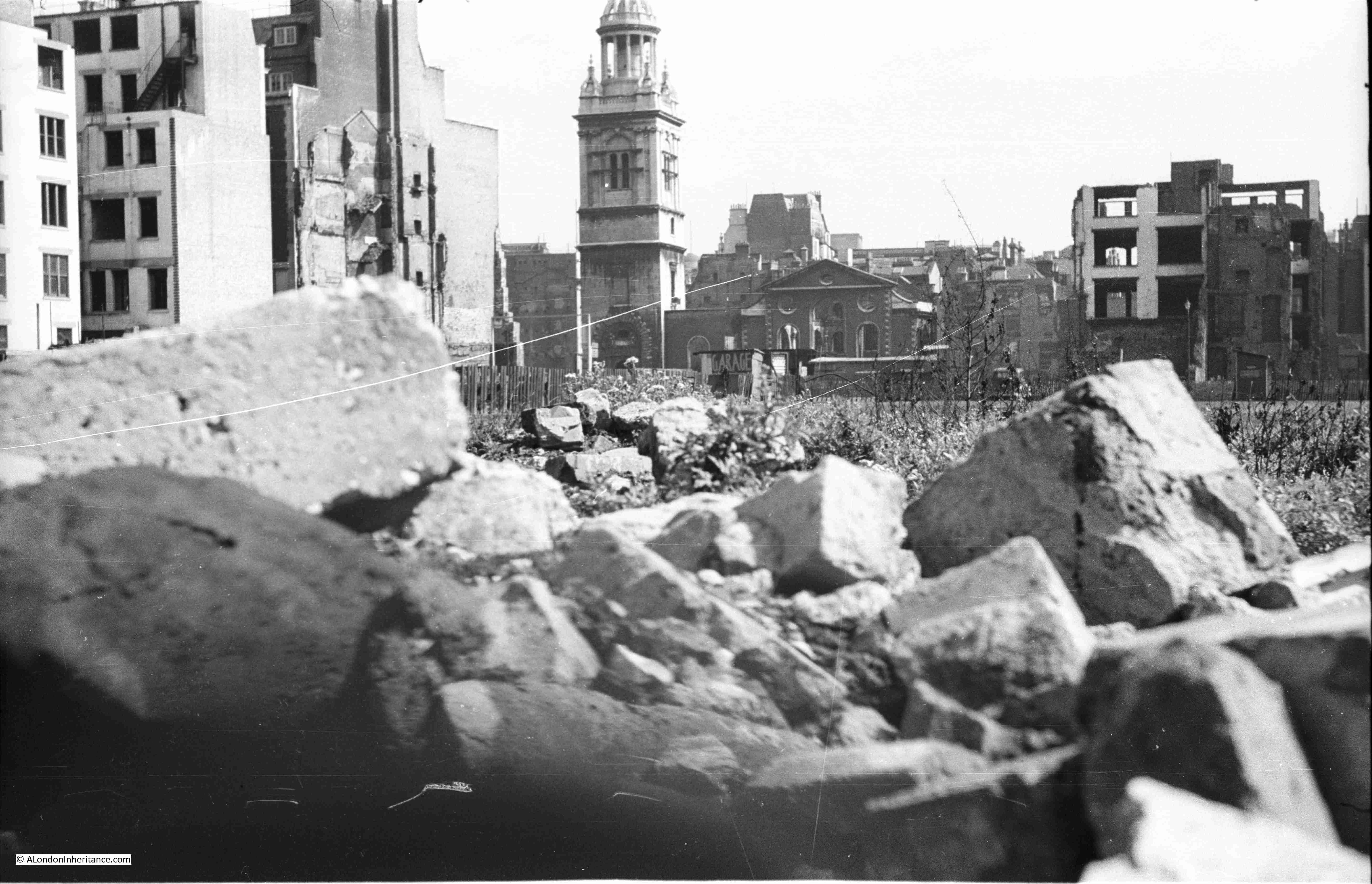
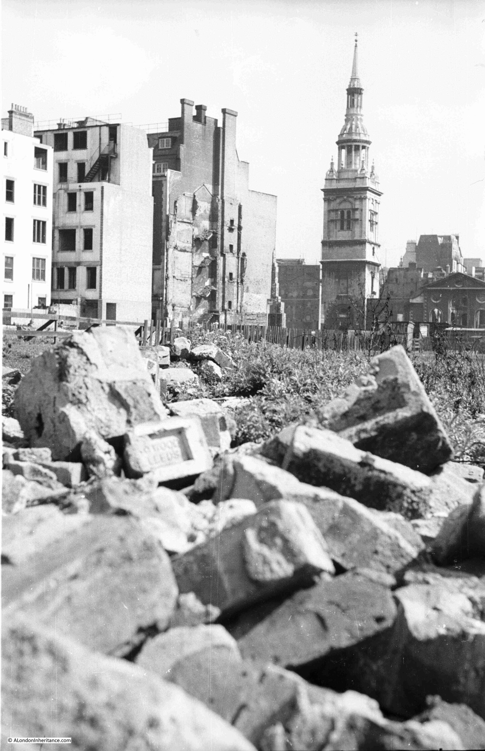
To start this week’s post, I have two photos taken by my father when he was standing where the One New Change development is located today, just to the east of St. Paul’s Cathedral:
Bread Street

The church in the background is St. Mary-le-Bow:

Bread Street

Despite the considerable building activity of recent decades, many of the City of London’s streets still have buildings dating from the late 19th and early 20th centuries, however some streets have absolutely nothing of any age, with all buildings of recent construction.

One of these is one of the streets that should have been in the two photos above, between the photographer and the church, and this street is Bread Street.

Bread Street runs south from Cheapside, just to the east of St. Paul’s Cathedral. It crossed Watling Street and Cannon Street to terminate on Queen Victoria Street,
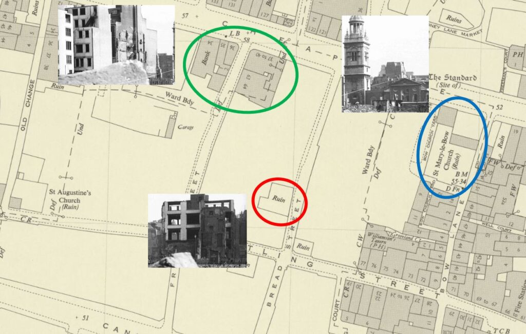
The upper section of the street is in my father’s two photos, and in the following map extract from the 1951 Ordnance Survey map, I have marked the key features which can be seen in the two photos, and are also shown on the map (‘Reproduced with the permission of the National Library of Scotland“):

Bread Street

Bread Street is to the right of the red circle, which surrounds a feature marked as a “ruin”, which the photo confirms.

A few buildings still stand around the junction of Friday Street and Cheapside, and St. Mary-le-Bow is marked as a ruin, which the photos confirm where the main body of the church can be seen as an empty shell. The tower of the church is marked by a solid square on the map, confirming that the tower is still standing and survived without significant wartime damage.

In the above map, apart from the ruin, this part of Bread Street is completely empty, as is much of the surrounding land, although as can be seen, many buildings to the right survived, including those along Bow Lane, many of which can still be seen today.

The name of the street does appear to refer to bread. Harben’s Dictionary of London quotes “So called Stow says, of bread in olde times sold for it appeareth by recordes, that in the yeare 1302, the bakers of London were bounden to sell no bread in their shops or houses, but in the market”.

This was a time when one of the main London markets operated in and around Cheapside and the surrounding streets, and there are other streets off Cheapside that still refer to the products sold, such as Milk Street and Honey Lane.

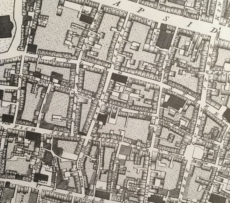
Richard Horwood’s map of 1799 provides an impression of the street at the end of the 18th century. In the following extract, Bread Street is running from the junction with Cheapside at the top of the map (just to the left of the letter P), down to Upper Thames Street, with the last section named Bread Street Hill, referring to the drop in height as the street headed down towards the Thames.

Horwood's map

The section of Bread Street in my father’s photos is that between Cheapside and Watling Street.

The map shows that in 1799, the street was lined with individual houses, with some courts and alleys leading off from the street.

Although the area was devastated by wartime bombing, Bread Street had already suffered a number of significant changes.

Continuing south after the junction with Watling Street and in 1799 we came to a junction with Basing Lane and Little Friday Street. Both of these streets were lost when Cannon Street was extended up towards St. Paul’s Churchyard.

The construction of this major road extension in the mid-19th century, along with the construction of Queen Victoria Street, split Bread Street and separated it entirely from Bread Street Hill, which in turn cut-off Bread Street from easy street access to the Thames, and which no doubt was used to transfer the products needed for baking bread.

My father’s photos were taken from near Friday Street, which has disappeared entirely under the One New Change buildings. Bread Street survives, but the bombing shown in the two photos explains why the street is as we see it today. A street without any buildings of any age, with the majority built during the last few decades.

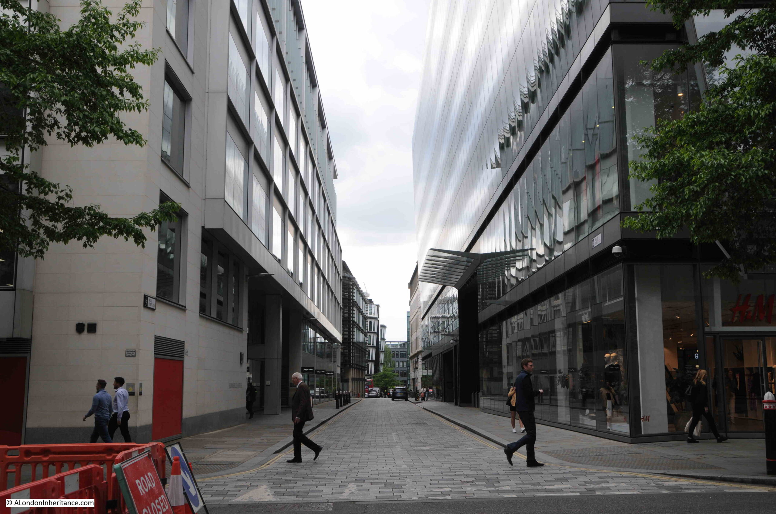
The view looking south along Bread Street from the junction with Cheapside:

Bread Street

One New Change is the large building to the right of the above photo, a building which stands over nearly all of the land seen in the foreground of my father’s photos.

Much of One New Change is a large shopping centre:

Bread Street

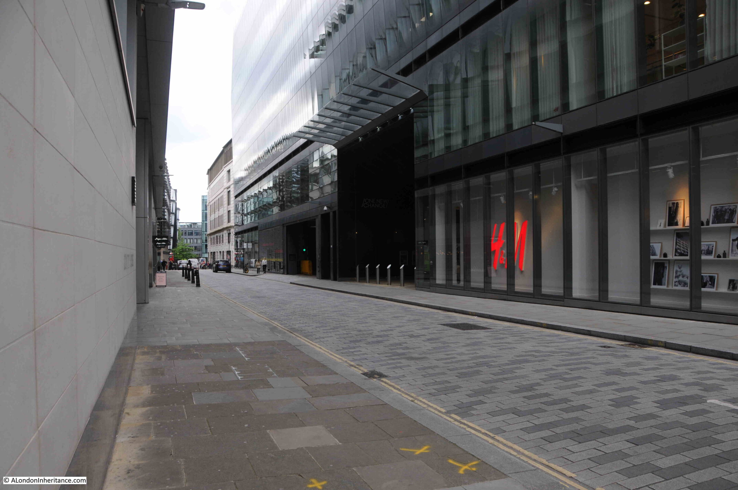
Looking south along the street:

Bread Street

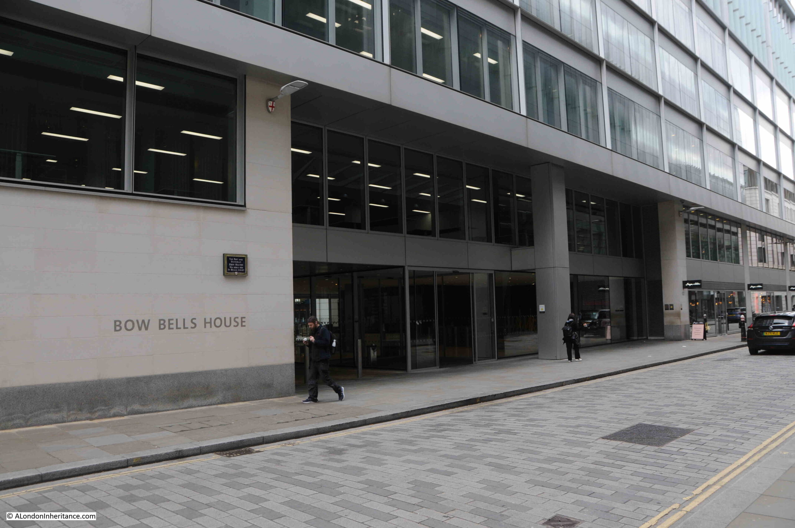
Between Bread Street and St. Mary-le-Bow is Bow Bells House, a 215,000 square foot office building, constructed in 2007:

Bow Bells House

As Bow Bells House dates from 2007, it shows that many of these new buildings are second or third generation buildings after the devastation of war.

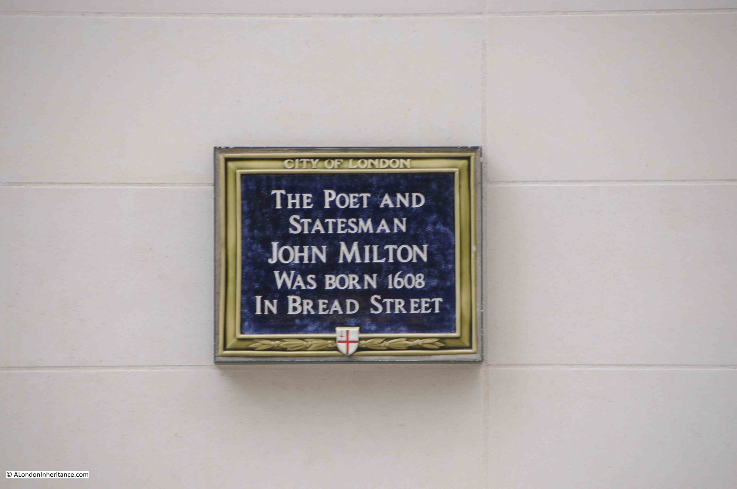
On the wall of Bow Bells House is a City of London blue plaque, recording that the poet and statesman John Milton was born in Bread Street in 1608:

John Milton

Milton’s most well known work is the poem Paradise Lost. He was born in the street to reasonably affluent parents, his father, also John Milton and mother Sarah Jeffrey.

The street that John Milton would have known was lost during the 1666 Great Fire of London, so wartime bombing was the second time in the life of the street that it has been devastated, and put through a complete rebuild.

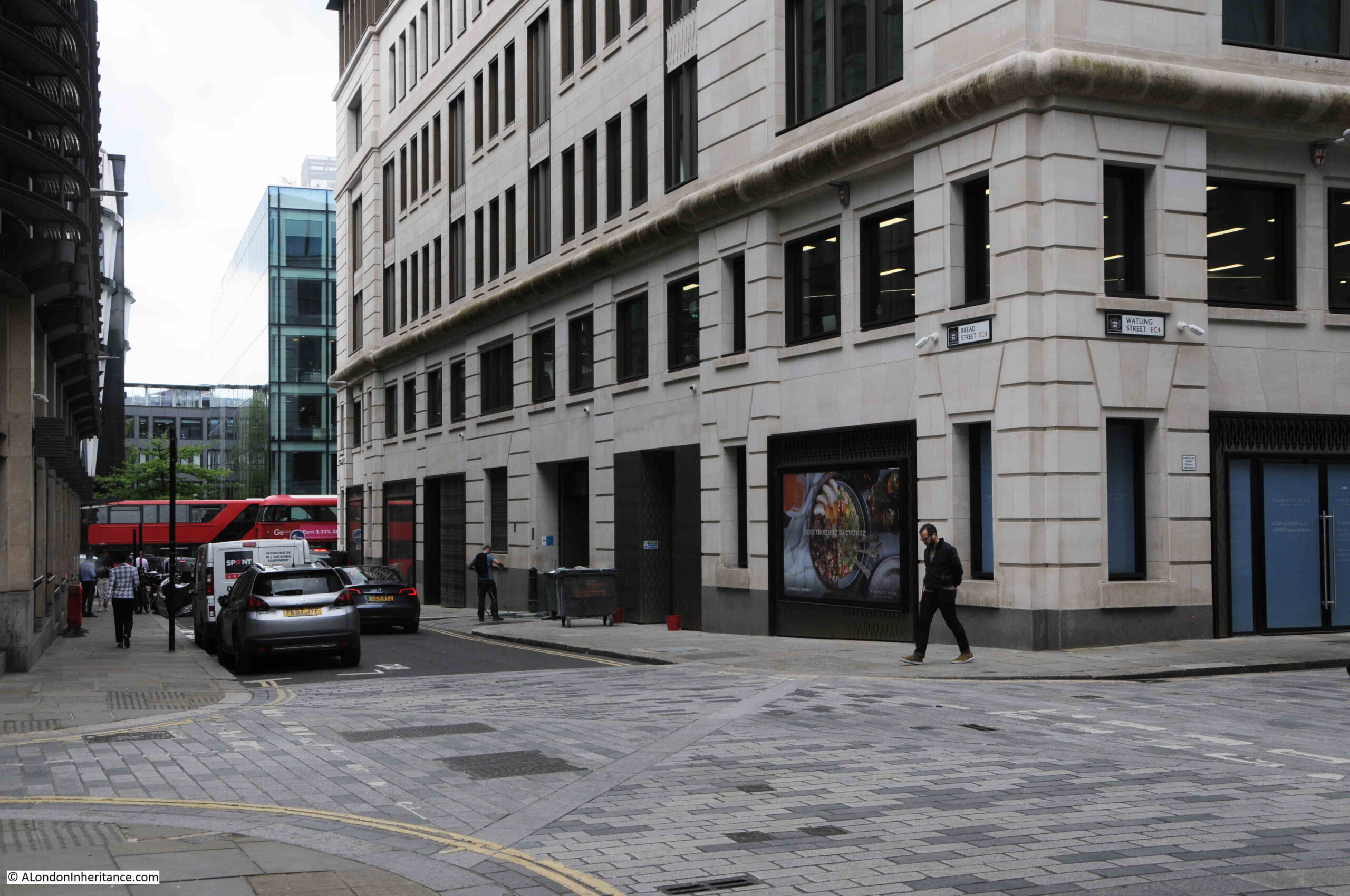
In the following photo, I have reached the junction with Watling Street:

Bread Street

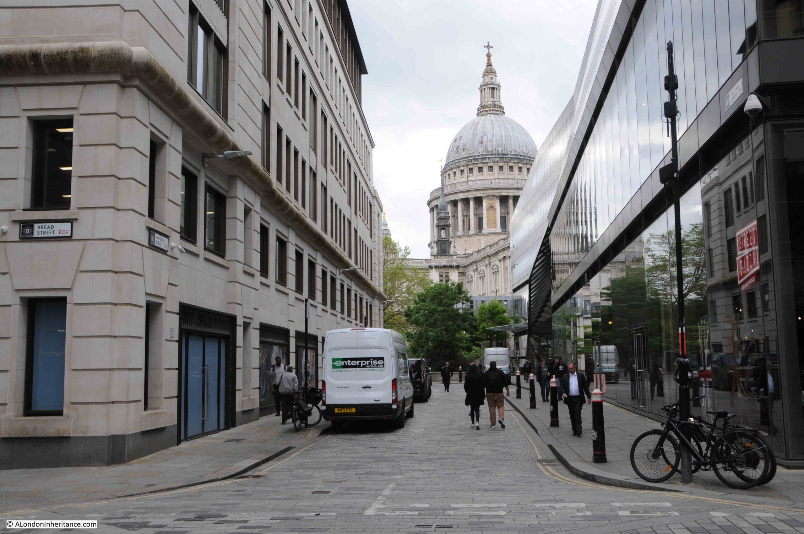
Looking along Watling Street towards St. Paul’s Cathedral:

Watling Street

Watling Street is perfect example of why some city streets look as they do. In the above photo, I am looking along the final length of Watling Street as it approaches St. Paul’s Cathedral, and as with Bread Street, all the buildings are new.

However, walk a short distance east along Watling Street, and look back towards the cathedral, and this is the view:

Watling Street

Some new buildings, but many pre-war buildings remain, and perhaps this view hints at what Bread Street could have looked like before the war.

It is perhaps hard now to realise just how much whole areas of the City were devastated in the early 1940s, and how the buildings that once lined entire streets disappeared almost overnight.

But it does help explain why many of the City streets are as they are, with some streets lined with pre-war buildings, and others, even different lengths of the same street, consisting of entirely modern buildings.

alondoninheritance.com

Prudential Building and Furnival’s Inn

A quick advert – if you would like to explore Wapping or the Barbican, there are only a few places left on my upcoming walks:

All other walks have sold out.

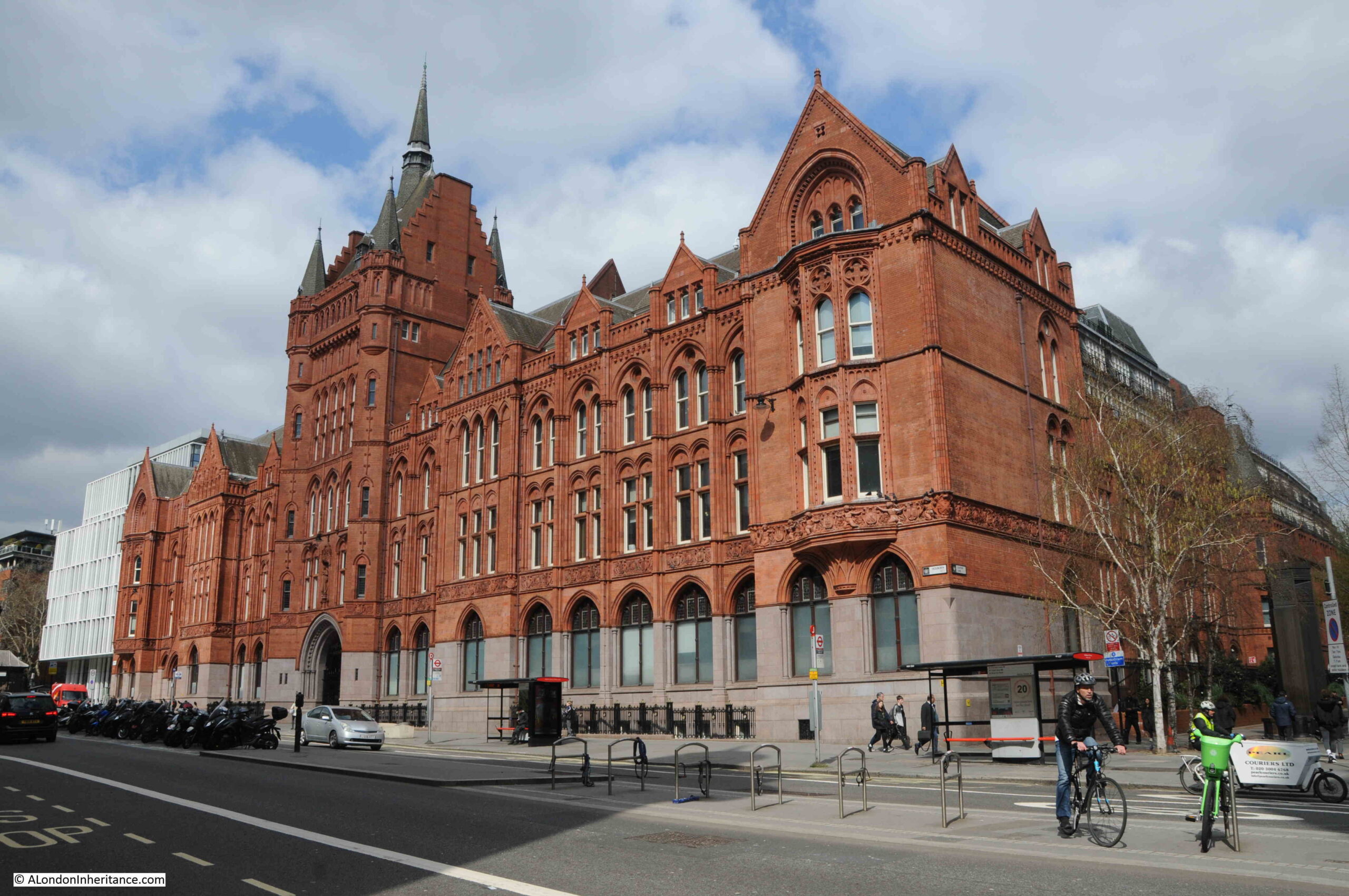
Walk along Holborn and one of the most impressive buildings you will see is the old head office of Prudential Assurance:

Prudential building Holborn

The Prudential moved into their new office in 1879, which was quite an achievement given that the company had only been founded 31 years earlier in 1848.

The building exudes Victorian commercial power and was a statement building for the company that was at the time the country’s largest assurance company.

The lower part of the building uses polished granite, with red brick and red terracotta across all upper floors. If you stare at the building long enough the use of polished granite gives the impression that there has been a large flood along Holborn, which has left a tide mark on the building after washing out the red colour from the lower floors.

The building is Grade II* listed and was designed by Alfred Waterhouse with help from his son Paul. After Prudential initially moved into the building, constriction continued as could be expected on a building of this size which extends back from Holborn for some distance. The front range facing onto Holborn was completed between 1897 and 1901.

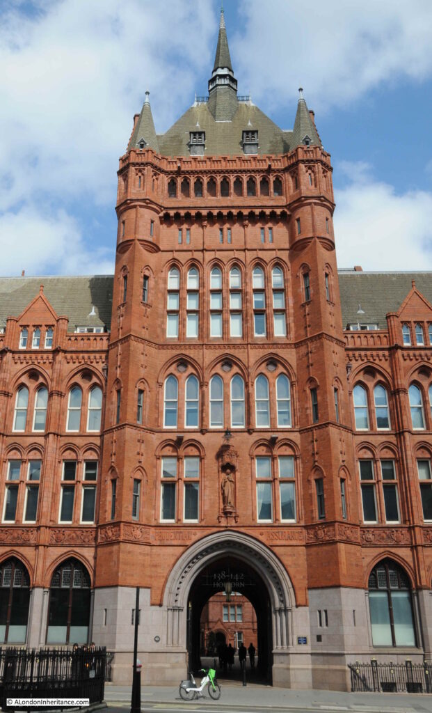
In the centre of the façade is a tower, with a large arch leading through into inner courtyards around which are further wings of the building:

Prudential building Holborn

Alfred Waterhouse was born in 1830 in Liverpool. His father was involved in the cotton trade, working as a cotton broker. The family had quite an influence on the future, with one of his brothers founding an accountancy firm that would eventually become PriceWaterhouse, and a second brother, Theodore, starting a legal company that became Field Fisher Waterhouse (the company has since dropped the Waterhouse name).

After attending a Quaker school in Tottenham, Alfred Waterhouse started work in Manchester where he worked on a number of private residences and public buildings, however he first major commission came when he won a competition for the Assize Courts in Manchester in 1858.

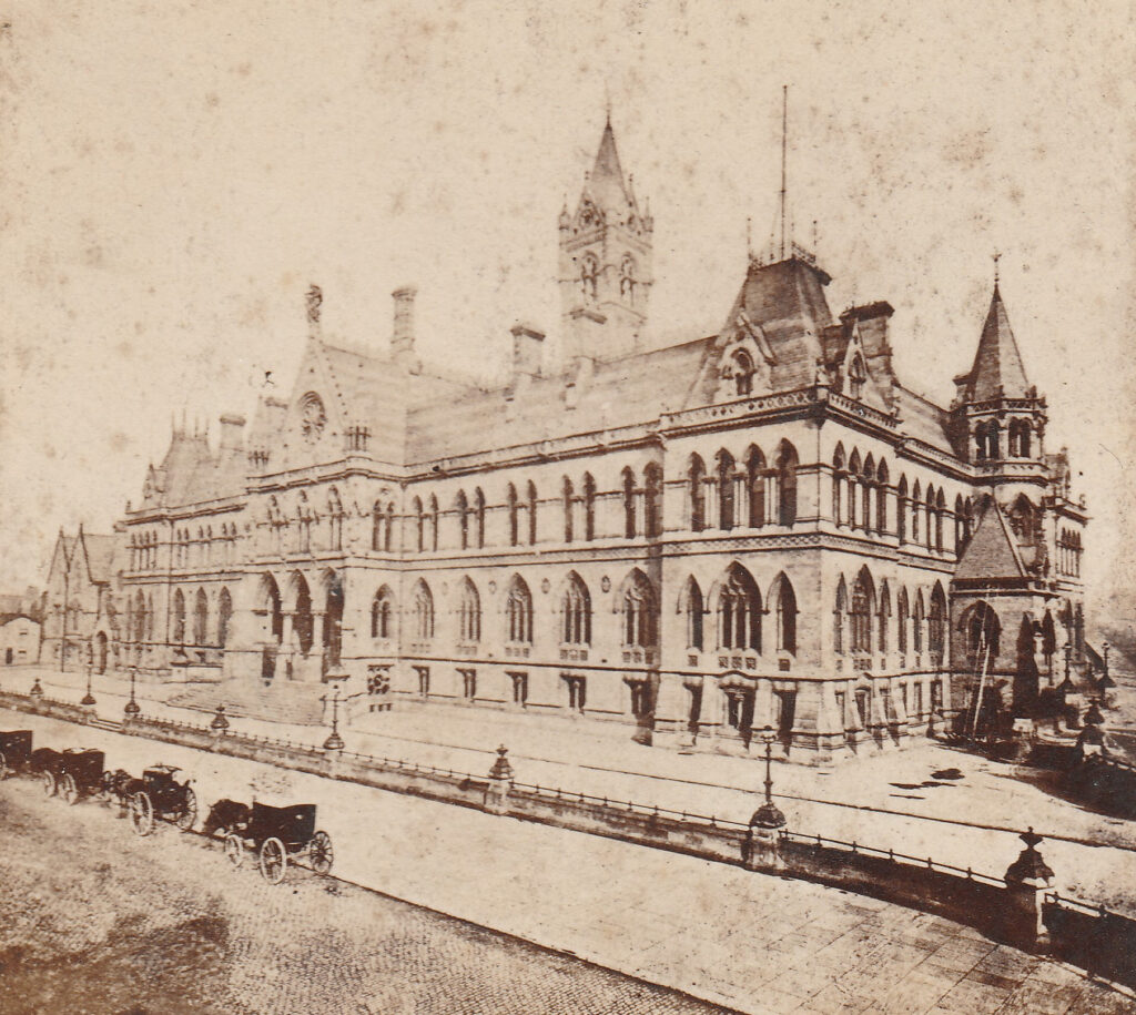
The Assize Courts were badly damaged by wartime bombing, and were condemned by the post-war decision not to rebuild. The Gothic style of Waterhouse’s work was not in fashion with architectural styles of the 1950s and 60s.

The following photo of the Manchester Assize Courts shows what an impressive building it was, and the similarities with the Prudential Building (Attribution: Old stereoscope card, Public domain, via Wikimedia Commons):

Manchester assize courts

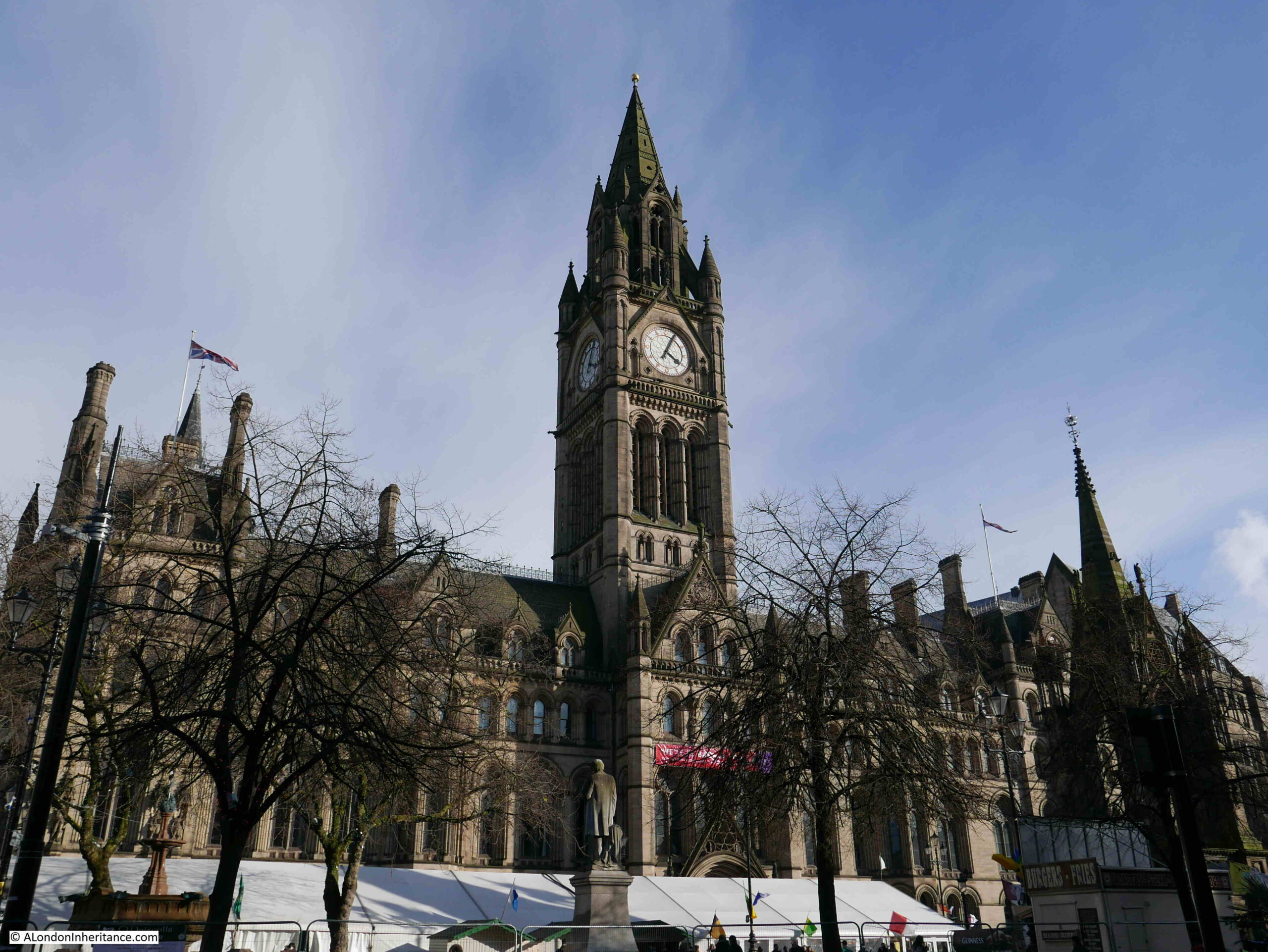
His other work in Manchester included Strangeways Prison (now just HM Prison Manchester), and Manchester Town Hall, which did survive wartime bombing of the city, and still looks glorious today. Again, the same Gothic style and parallels with the Prudential building can be seen:

Manchester town hall

Waterhouse moved his architectural practice from Manchester to London in 1865.

He lost out on a competition to design the Law Courts in the Strand, but did win the competition for the Natural History Museum in Kensington, which again follows a similar style to his previous works, although with the museum, at the centre of the wide façade is the main entrance, which has two smaller towers on either side of the central block.

The Natural History Museum also displays a move from Gothic to Romanesque as an architectural style.

The design of the new building was considered such a success by Prudential that they commissioned Alfred Waterhouse and his son Paul to design a further 21 office buildings for the company in cities across the country. Some of these, such as in Southampton, can still be seen.

Waterhouse died in 1905, just a few years after Queen Victoria, and his Gothic designs with large buildings often including central towers have come to be symbolic of a style of Victorian architecture, that ended at the very start of the 20th century.

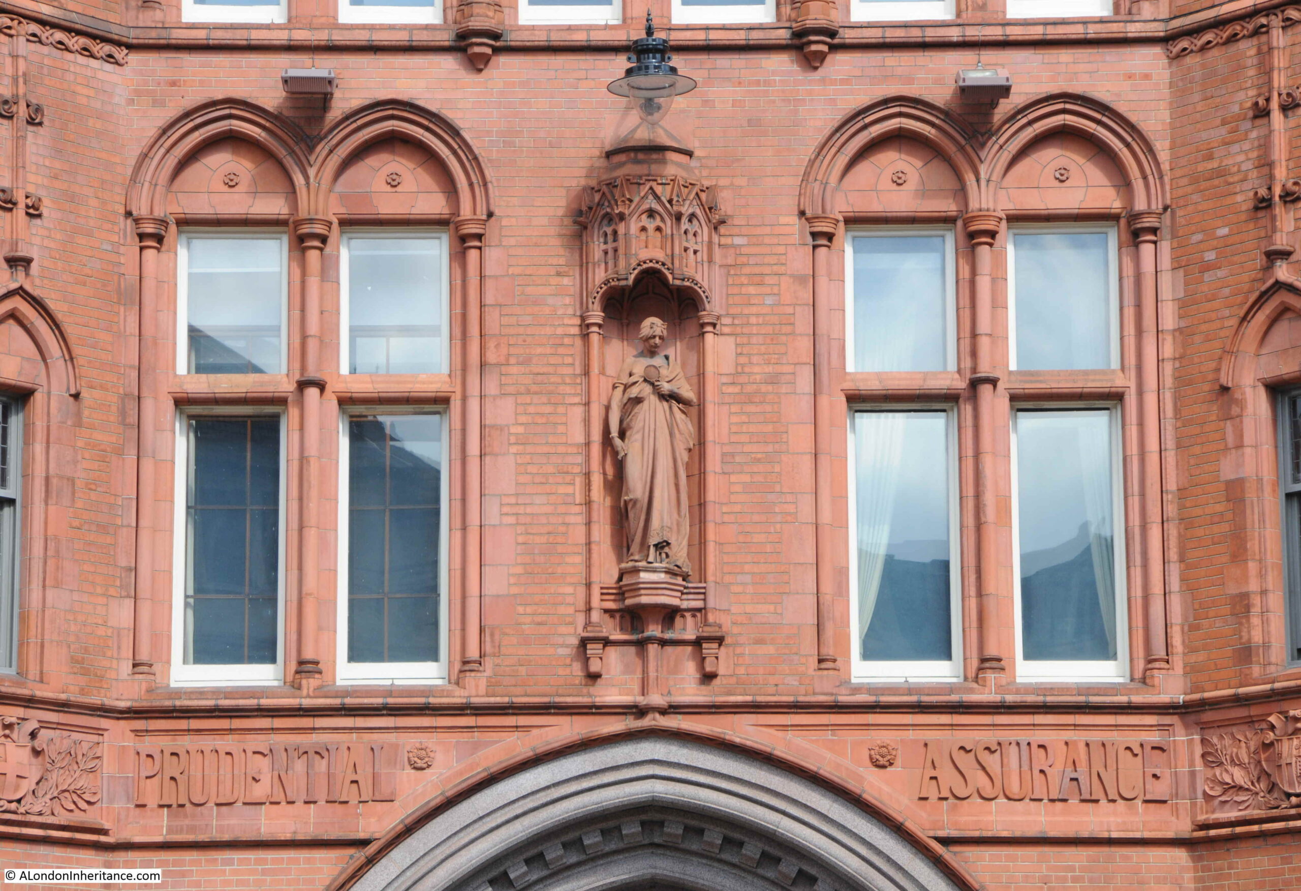
The Prudential adopted the figure of Prudence in 1848 as the symbol for the company. Prudence was said to have the qualities of memory, intelligence and foresight, enabling a prudent act to consider the past, present and future.

The figure of Prudence can be seen in a niche above the main entrance into the building and was the work of the sculptor Frederick William Pomeroy:

Prudential building Holborn

The Prudential Mutual Assurance Investment and Loan Association was founded in 1848 in Hatton Garden, and their target market was the sale of life assurance and the provision of loans to the emerging Victorian middle and industrious classes.

The company advertised the sale of shares in January 1849 to raise capital, and their advert gives an idea of the financial products that were starting to become widely available in the middle of the 19th century:

“The following important new features and advantages in Life Assurance, now introduced by this Association, are earnestly impressed on the attention of the public, particularly of the industrial classes, viz :-

  1. To enable members subscribing for £20 shares, payable by small monthly or quarterly instalments, to securely invest their savings and participate in the whole amount of profits, or in the case of death their representatives to receive the amount of each share in cash.
  2. To enable Members to purchase real or other property, by advances from the Association on such property.
  3. To grant members loans on real or other security.
  4. To create by periodical subscriptions an Accumulating Fund, the profits arising from which to be from time to time divided amongst its members.
  5. To afford an opportunity to a borrower of securing his surety from future payments in case of his (the borrower’s) death.
  6. Life Assurance in a reduced scale for the whole life or term of years, on lives, joint lives, or on survivorship.

The comment “payable by small monthly or quarterly instalments” is reminder of the method used by the company to collect payments, with the “Man from the Pru” becoming the term for an insurance salesman who calls door to door to collect regular payment for Prudential’s products.

The Man from the Pru was also the title of a 1990 film which was based on the true story of a Prudential employee who was convicted of the murder of his wife.

He was found guilty and sentenced to death, however employees of the Prudential raised several hundred pounds and the case went to appeal and he was found not guilty, mainly due to very flimsy evidence being presented.

Immediatly after being acqutted, he continued his employment with the Prudential.

The “Man from the Pru” operated across the country, and was supported by company offices in multiple towns and cities.

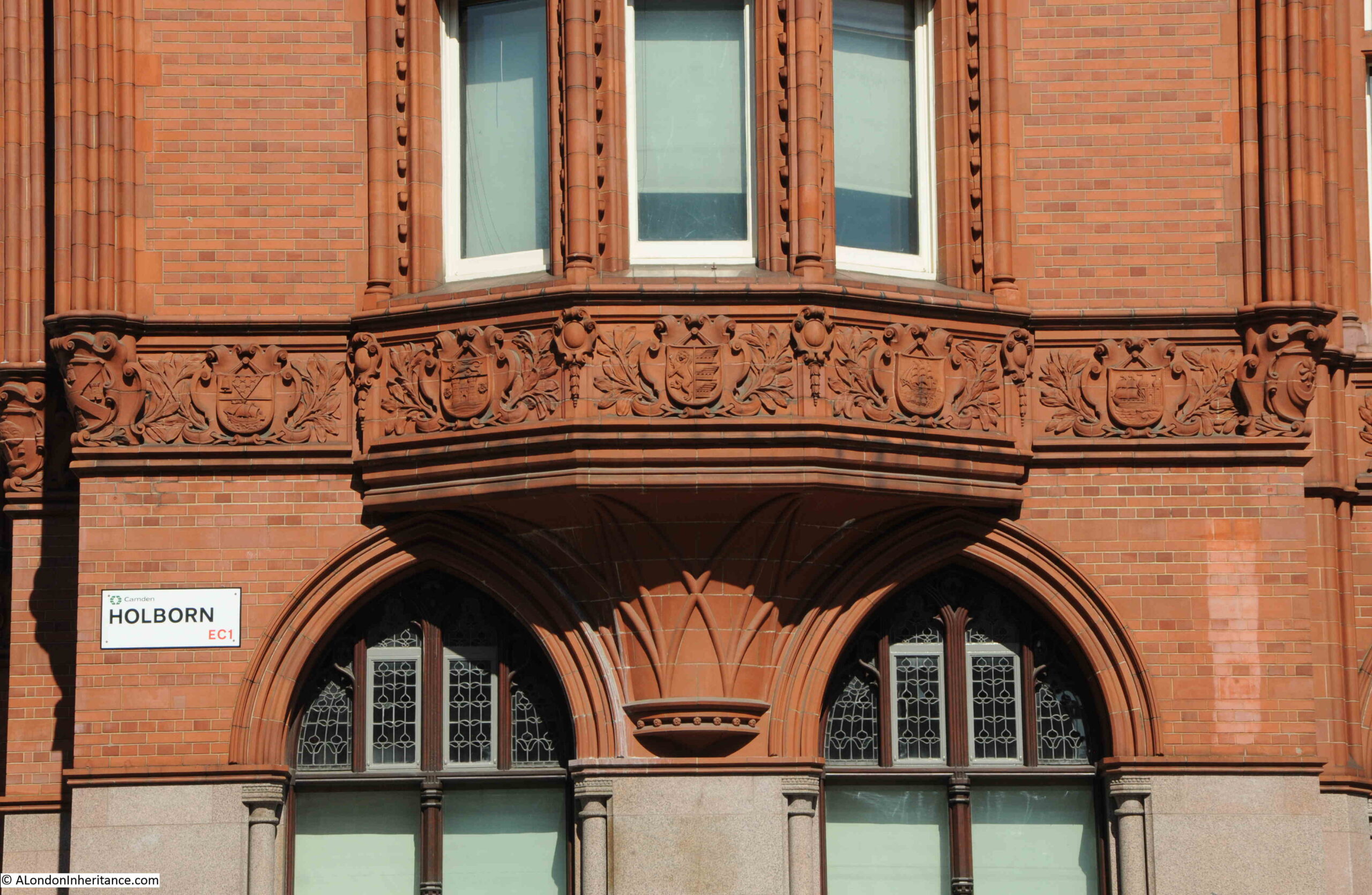
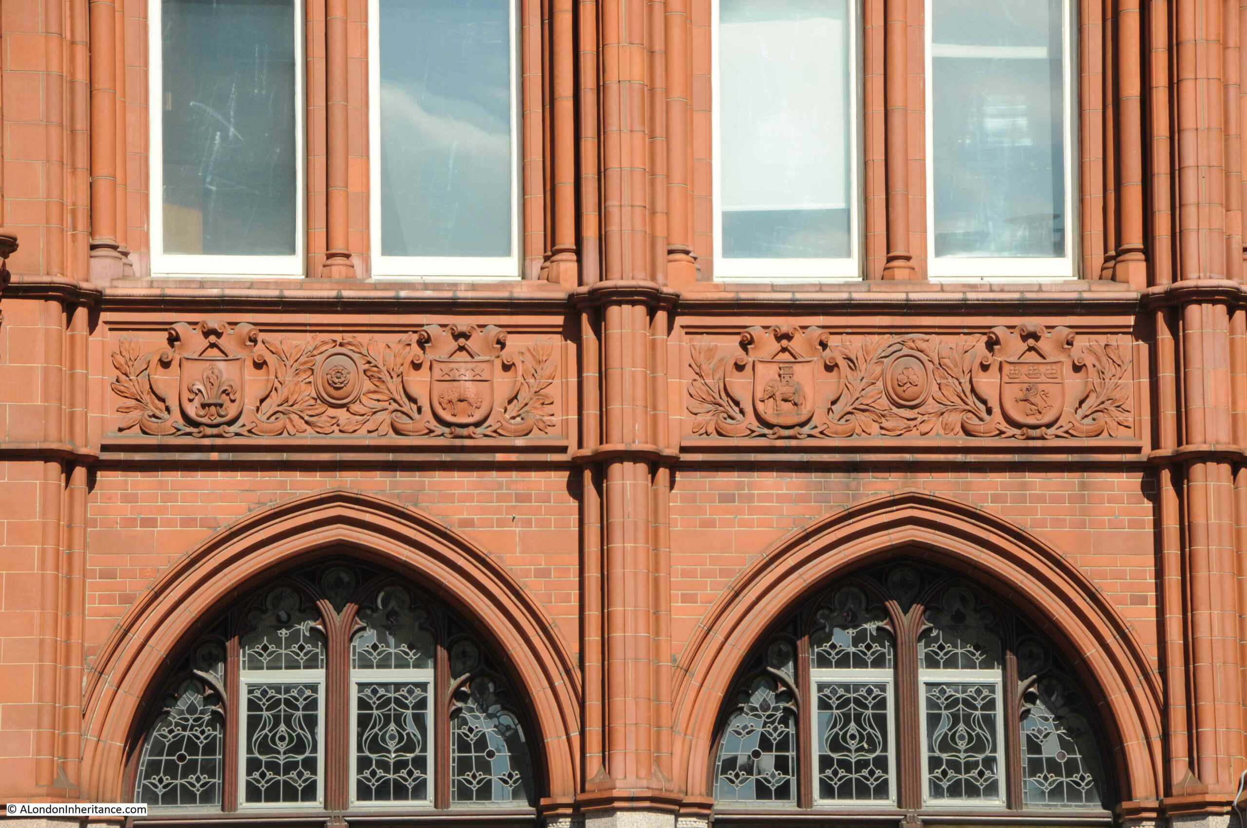
There is a frieze along the façade of the Prudential building, which includes coats of arms of many of the places where the company had an office:

Prudential building Holborn

I have been able to identify a few of these arms. In the above photo, the arms of Belfast is at the left, then could be Norwich, although the castle should be above the lion, on the right is Bristol.

In the photo below, Leeds is second from left, then Coventry:

Prudential building Holborn

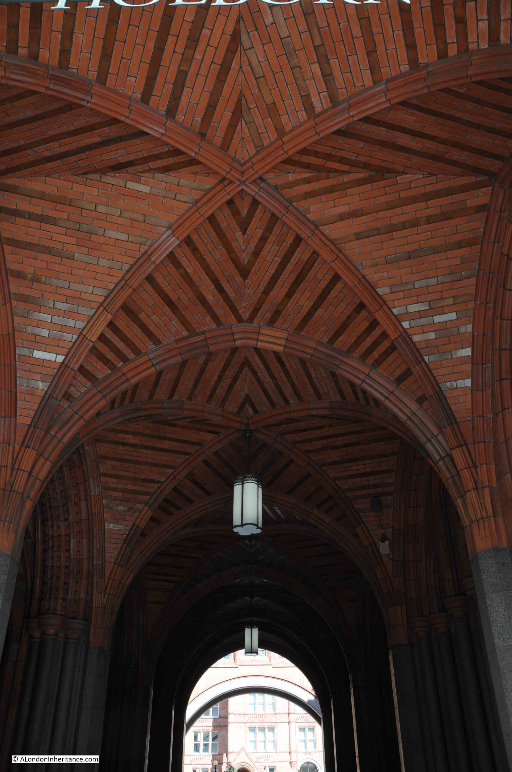
Look up when walking in through the main entrance, and admire the incredible brickwork:

Prudential building Holborn

When built, the Prudential building was very advanced for its time. There was hot and cold running water, electric lighting, and to speed the delivery of paperwork across the site, a pnematic tube system was installed, where documents were put into canisters, which were then blown through the tube system to their destination.

Ladies were provided with their own restaurant and library, and had a separate entrance, and were also allowed to leave 15 minutes early to “avoid consorting with men”.

The façade onto Holborn is just part of the Prudential complex as it extends some considerable way back from the street. The size of the building was not just because of the number of workers, but was also to enable storage of the sheer volume of paperwork resulting from insuring almost one third of the UK population at the peek of the Prudential’s size.

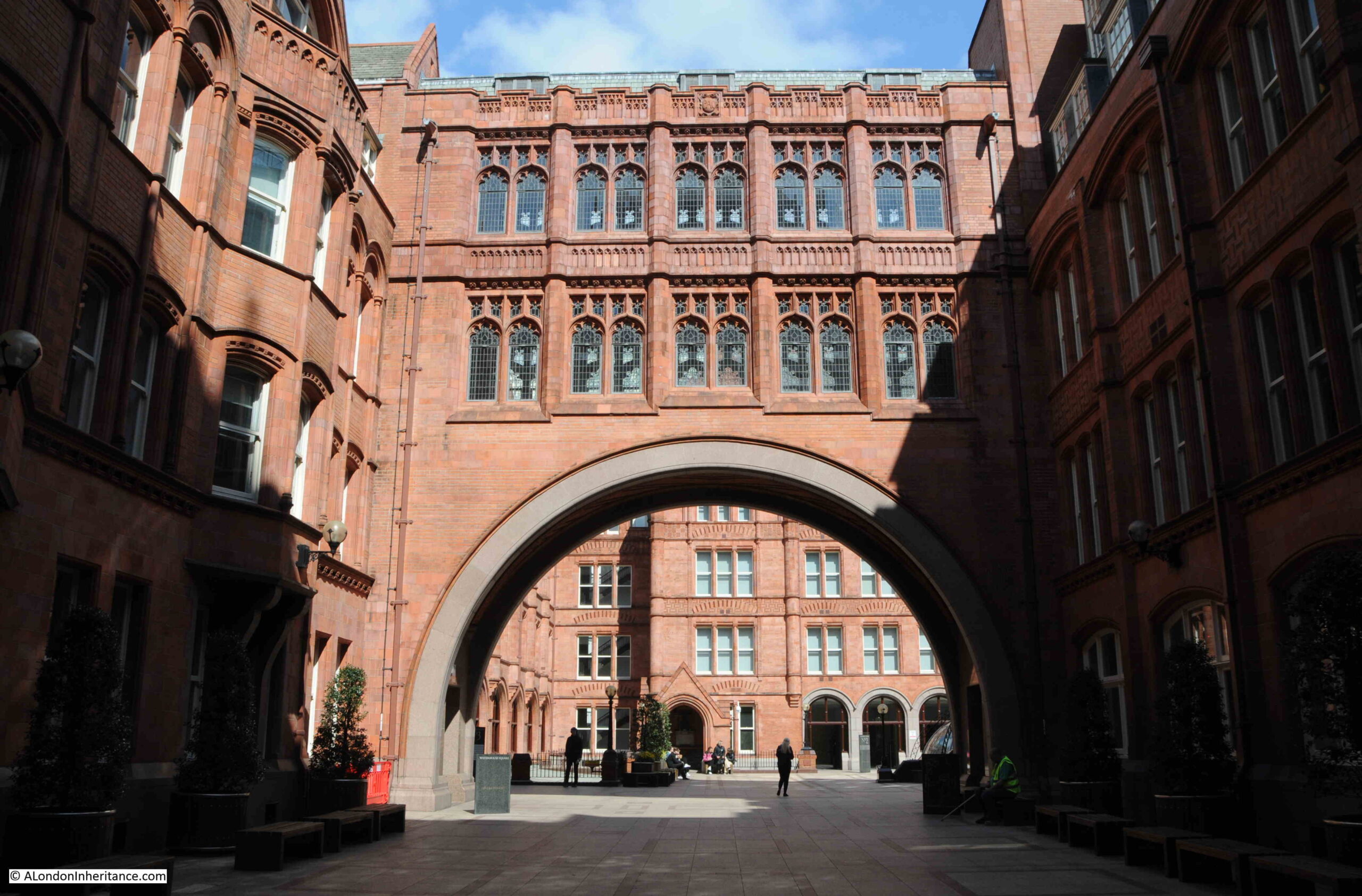
Walking through the main entrance and there is a small open space, where we can see a connecting bridge between wings of the complex, with ornate windows above a large arch:

Prudential building Holborn

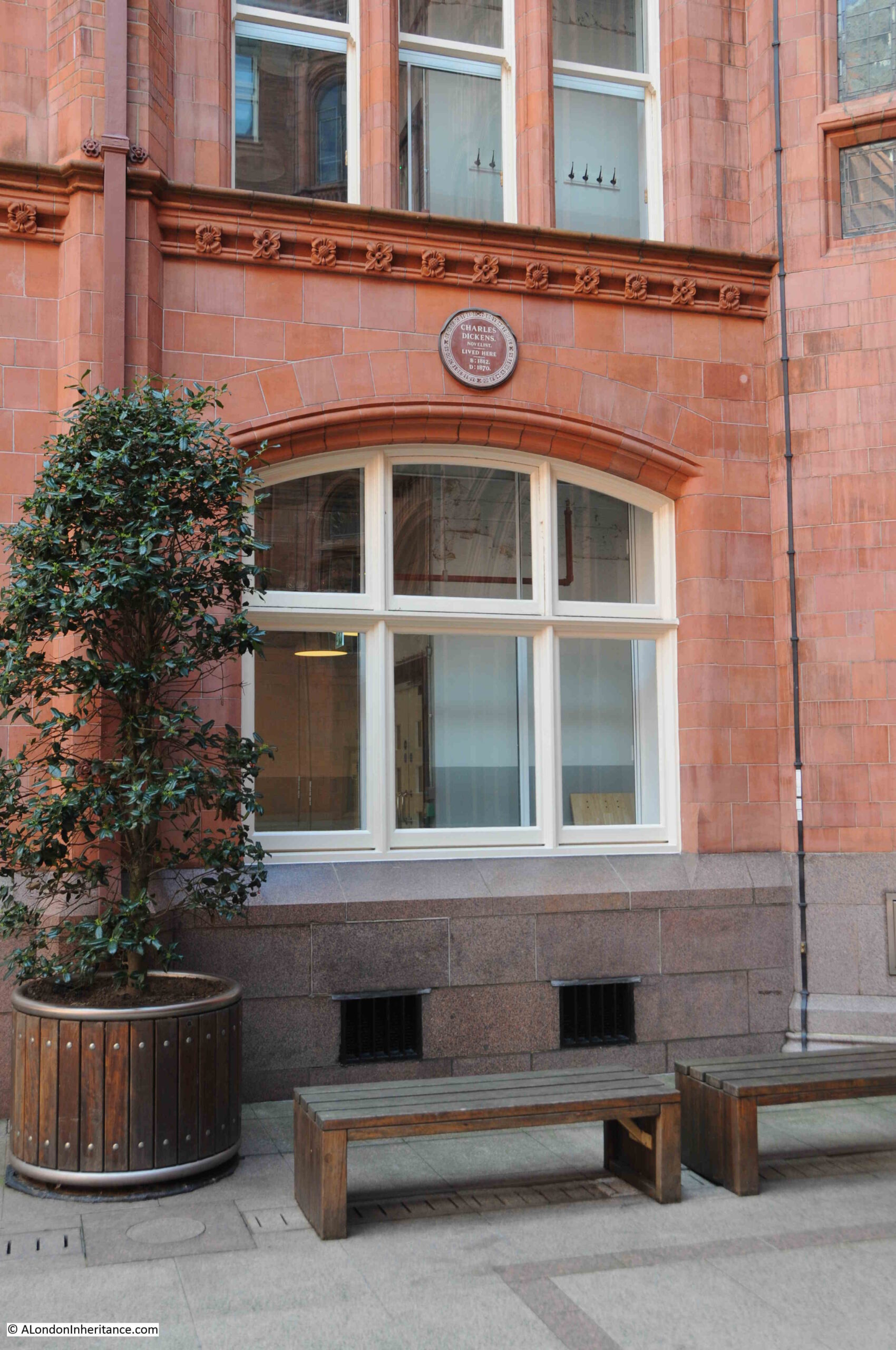
There is a plaque on the wall, recording that Charles Dickens lived here. He lived here between 1833 and 1836 when the site was occupied by Furnival’s Inn, more of which later in the post:

Prudential building Holborn

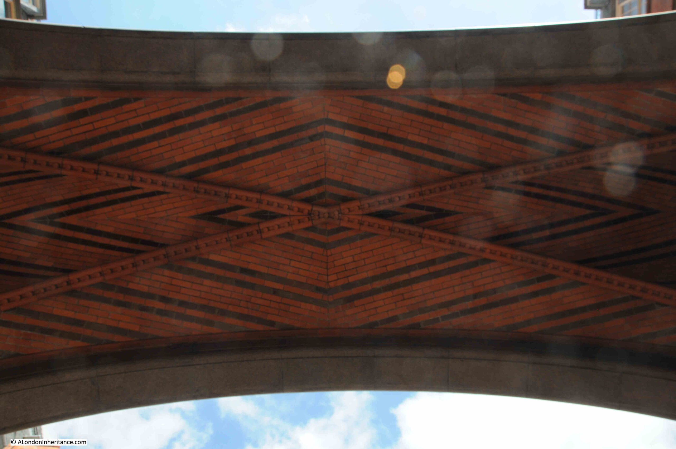
More stunning brickwork in the arch over the entrance to the courtyard at the back of the complex:

Prudential building Holborn

The overall Prudential site was expanded and remodeled during the years of their occupation.

Being an information intensive business, their building needed to adjust to changing technology, and methods of recording and storing data.

In the 1930s the interior of the original blocks were rebuilt with large open plan floors in the art deco style in order to accommodate punch card machinery.

There was another major refurbishment in the 1980s which completed by 1993, but by then the Prudential’s days in their Holborn office complex were numbered. Departments had been moving out of central London for a number of years, for example their Industrial Branch administration had moved to Reading in 1965.

In 1999, the Prudential’s Group Head Office relocated to Laurence Pountney Hill.

Since 2019, the Prudential has been focused on Asia and the Far East. The UK businesses were transferred to M&G which today is a completely separate company to the Prudential, although Prudential still retain a head office in London and are quoted on the London Stock Exchange.

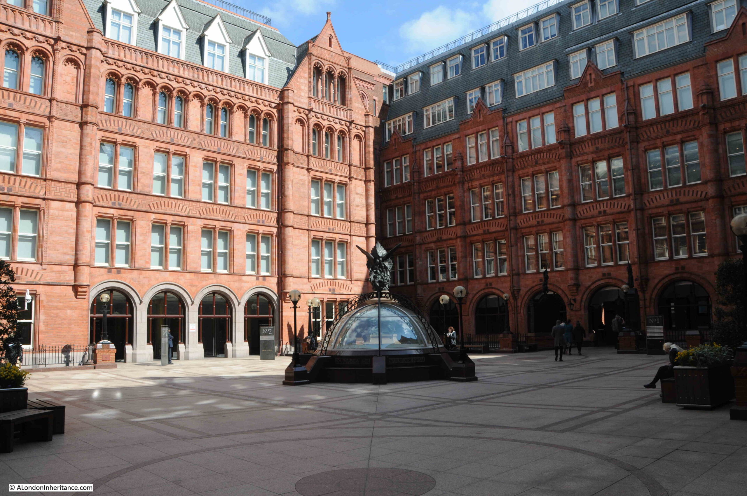
The following photo shows the rear courtyard of the complex, now named Waterhouse Square after the original architect of the buildings. The dome in the centre provides natural light to the space below:

Prudential building Holborn

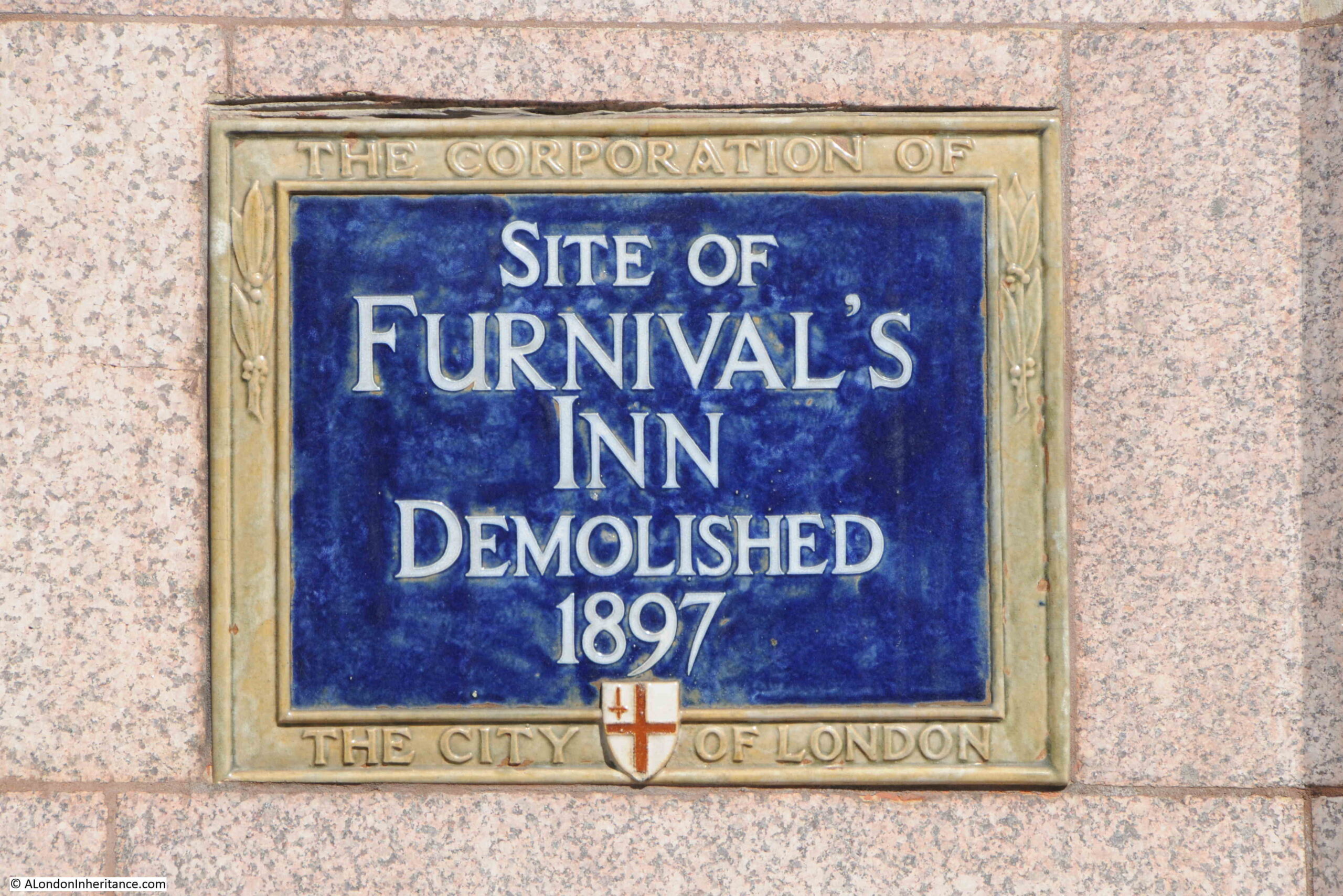
But what was on the site before the Prudential building? To discover that, we need to look at the Corporation of London blue plaque to the right of the main entrance from Holborn:

Furnival's Inn

The plaque records that the Prudential building is on the site of Furnival’s Inn, which was demolished in 1897 to make way for the Prudential building.

The name comes from William de Furnival who, around the year 1388, leased part of his lands in Holborn to the Clerks of Chancery, who prepared writs for the King’s Court, assisted by apprentices who received the first stages of their legal training at the Inn.

By the 15th century, the Inns of Chancery had become a type of preparatory school for students, and by 1422, Furnival’s Inn was attached to Lincoln’s Inn, who later in 1548 took on a long term lease.

Furnival’s Inn was described as the equivalent of Eton with Lincoln’s Inn being King’s College at Cambridge. At the end of each year, Lincoln’s Inn would receive students from Furnival’s who had received their training, and reached the standard required to move up, and receive the next stage of their training, along with the greater freedoms that an Inn of Court could offer.

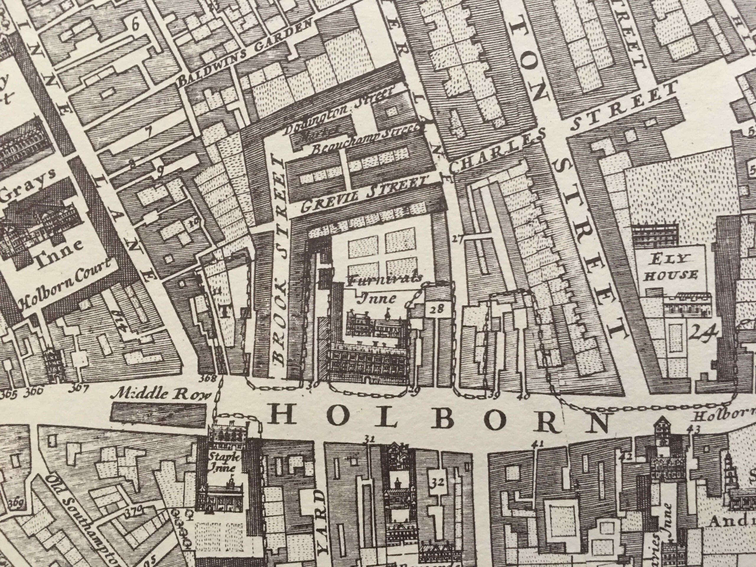
The scale of Funival’s Inn can be seen in the following extract from William Morgan’s 1682 map of London, where the inn can be seen in the centre of the map:

Furnival's Inn

Furnival’s Inn occupied much of the space currently occupied by the old Prudential buiding. The map also includes some of the many legal institutions based in this part of Holborn. Part of Grays Inn can be seen to the left, and below and to the left of Furnival’s Inn is another Inn of Chancery, Staple Inn.

To the right of the map is Ely House which I wrote about in a post a couple of weeks ago.

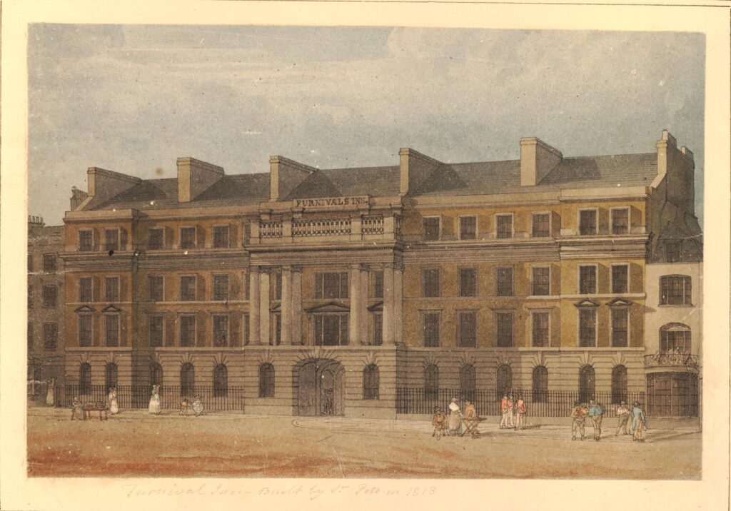
As with the Prudential building, Furnival’s Inn had a very impressive front onto Holborn. This is from the early 19th century (the following prints are © The Trustees of the British Museum):

Furnival's Inn

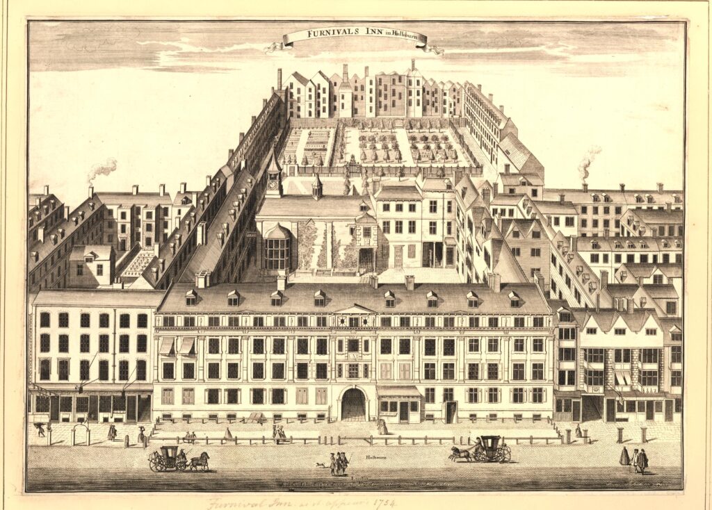
This drawing from around 1720 shows the scale of Furnival’s Inn:

Furnival's Inn

As with the Prudential building, Furnival’s Inn had a central entrance from Holborn. Once through this entrance, there is an inner courtyard surrounded by buildings, and behind this courtyard is a garden, again surrounded by buildings.

The following print is from 1804 and shows part of the inner court:

Furnival's Inn

By the 17th century, the Inns of Chancery had begun to turn into societies for the legal profession, and Furnival’s Inn became residential, offices and dining clubs.

Their use as places of training and education for students before they transferred to the Inns of Court had been reducing over time and by the 19th century, Furnival’s Inn had ceased to exist for its original purpose, with only what were classed as “6 ancients and 16 juniors”.

It was dissolved in 1817, and when Lincoln’s Inn did not renew their lease a year later, some of the buildings were sold off and demolished, with apartments and a hotel occupying part of the site.

Parts of the old Furnival’s buildings were still used by those in the legal profession, and there were a number of adverts and articles in the press from solicitors based in the buildings, for example in 1880 a solicitor J.C. Asprey who had an address of 6 Furnival’s Inn was advertising for any claimants to the estate of a deceased resident of Hackney.

Final clearance of the site ready for the Prudential removed the last of the Furnival buildings and name from the site, however the Prudential building retained a similar layout with a large façade along Holborn, with inner courtyards surrounded by buildings.

Whilst the architecture and brickwork of the Prudential building is impressive, the drawings of the interior of Furnival’s Inn show a place which had evolved over time, with buildings that were probably put up at different times and for different purposes, which must have been an interesting place to explore.

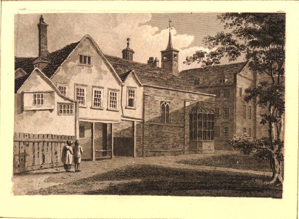
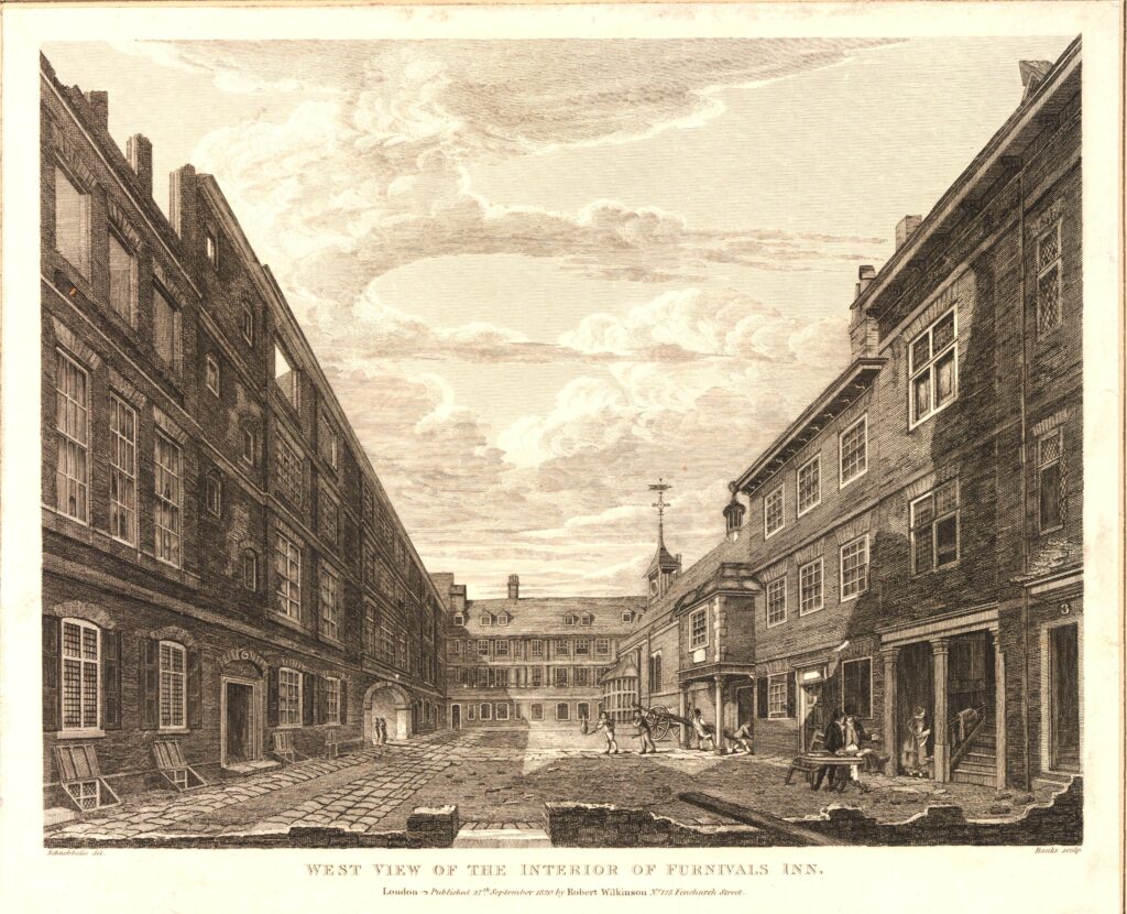
The following print is dated 1820, just after the Inn had ceased to function as an inn of Chancery. On the range of buildings to the left, an open arch can be seen which leads through to Holborn, and at the far end on the right is a building which looks as if it could have been a central hall, with a large bay window looking out onto the courtyard.

Furnival's Inn

After the Prudential left the building, work was done to extend at the rear and refresh / build new, along part of the western side of the building. The streets, part of which are pedestrianised, surrounding three sides of the complex are called Waterhouse Square.

The building is now used by multiple companies as office space, but I understand is still owned by the Prudential.

Fascinating to think that, whilst the buildings have changed across the centuries, this part of Holborn has been occupied by the buildings of only two institutions across almost 700 years – Furnival’s Inn and the Prudential.

alondoninheritance.com

Hook New Town – A London County Council Plan

It is the late 1950s, and you are a resident of the village of Hook in north Hampshire. Surrounded by countryside, London seems some distance away, although the village has a direct railway route to Waterloo, and the A30, then the main road from London to the south west runs through the village.

Although London is roughly 40 miles to the east, decisions made in London, by the London County Council threatened the village of Hook and the surrounding countryside with the imposition of a New Town that would bring thousands of people and dramatically change the whole character of the place.

I have long been fascinated by the impact that London has on the rest of the country. There are many different examples of this, one of which was the post-war move of population from the city to the surrounding counties, and the development of new towns.

The proposals for Hook New Town did not make it through to construction, however they did raise significant concern in the area affected, and they also show L.C.C. thinking about how new towns should develop, and how people would want to live in the second half of the 20th century.

The London County Council were supporters of the New Town movement, and although their plans for Hook did not get implemented, they published their design work in 1961, and in the forward of the book, “The Planning of a New Town”, Isaac Hayward, Leader of the Council, wrote “I believe that Britain still needs more new towns, and the Council publishes this book in the hope that the Hook studies will be useful to those who have the good fortune to be called on to plan them.”

The L.C.C. had been searching for a site for a new town, able to support a population of 100,000 for two years before finally deciding that Hook was the best location and met their key requirements, which were:

  • Does not have a high agricultural value
  • Can be adequately drained
  • Sufficient water for the town could be produced
  • Excellent road and rail communications
  • Attractive to industrialists, whom it was hoped, would move out of London to the new town

The last requirement was considered to be the most important.

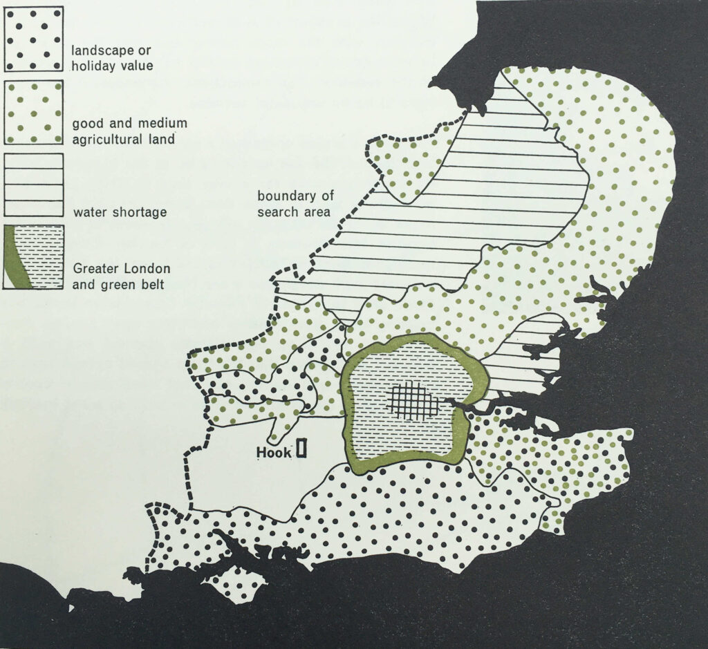
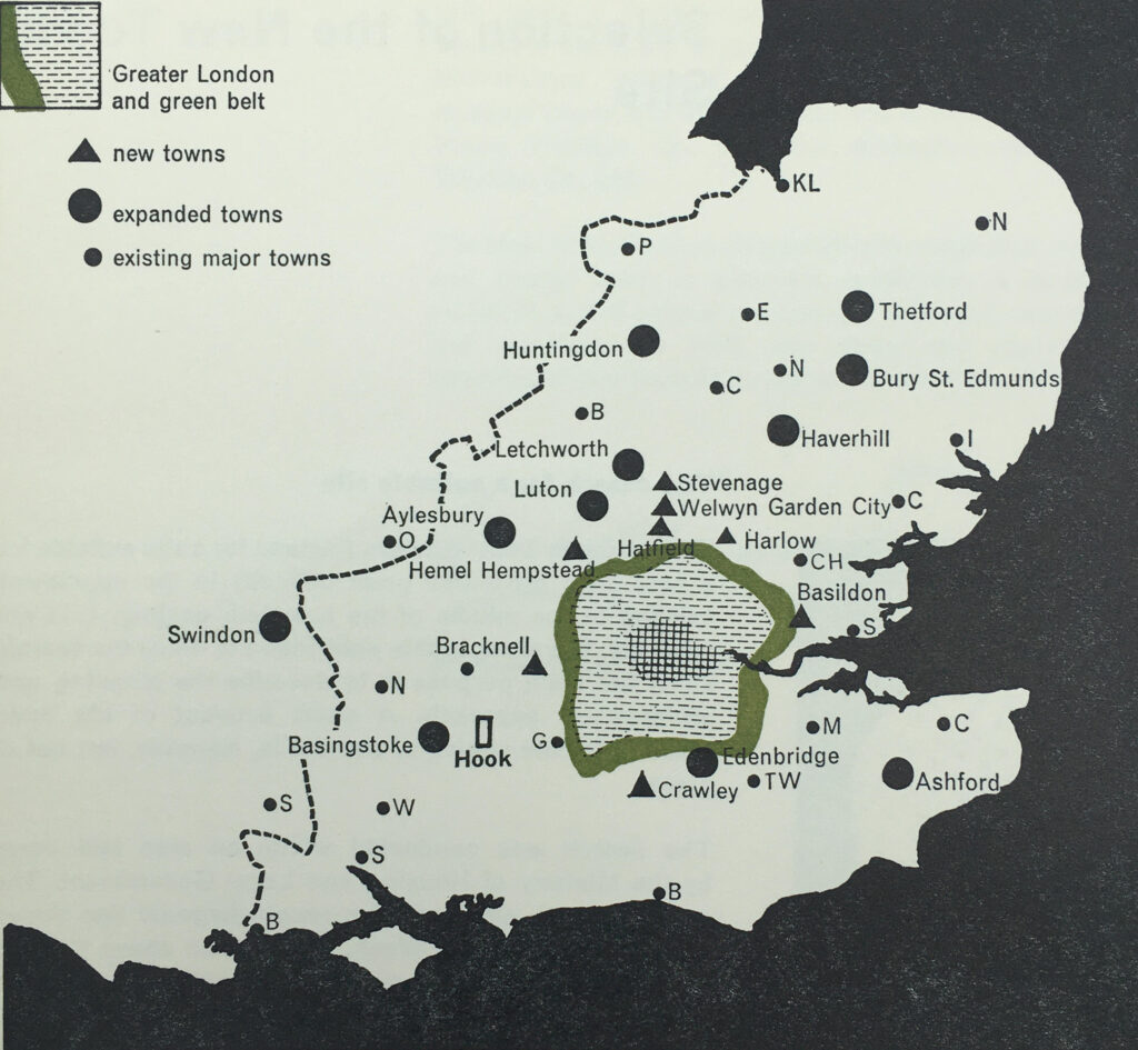
The search area had been south east of a line drawn between the Wash and the Solent. Above this line, the L.C.C. considered that a town would come under the “pull of Birmingham”, but south would be under the “pull of London”. An interesting example of just how far the L.C.C. believed came under London’s influence.

The following map from the book shows the search area limitations and the location of Hook:

Hook new town

The site also had to take into account the location of other new and expanded towns. The post-war period had seen considerable growth across the south east of the country, mainly driven by the shift of population and industry from London to the surrounding counties.

As well as the criteria listed above, the search also had to ensure that the new town was not too close to other new and expanded towns and would not merge into other centers of population.

The following map from the book shows the new and expanded towns surrounding London, with the new towns of Basildon, Harlow, Welwyn Garden City, Stevenage, Hemel Hempstead, Bracknell and Crawley, all orbiting just outside London’s green belt.

Hook new town

Transport links were also important, but not for commuting into London. Whilst Hook had a good rail connection into London, planning for the new town made clear that it was not intended to be a dormitory town, with large numbers of residents commuting into the city.

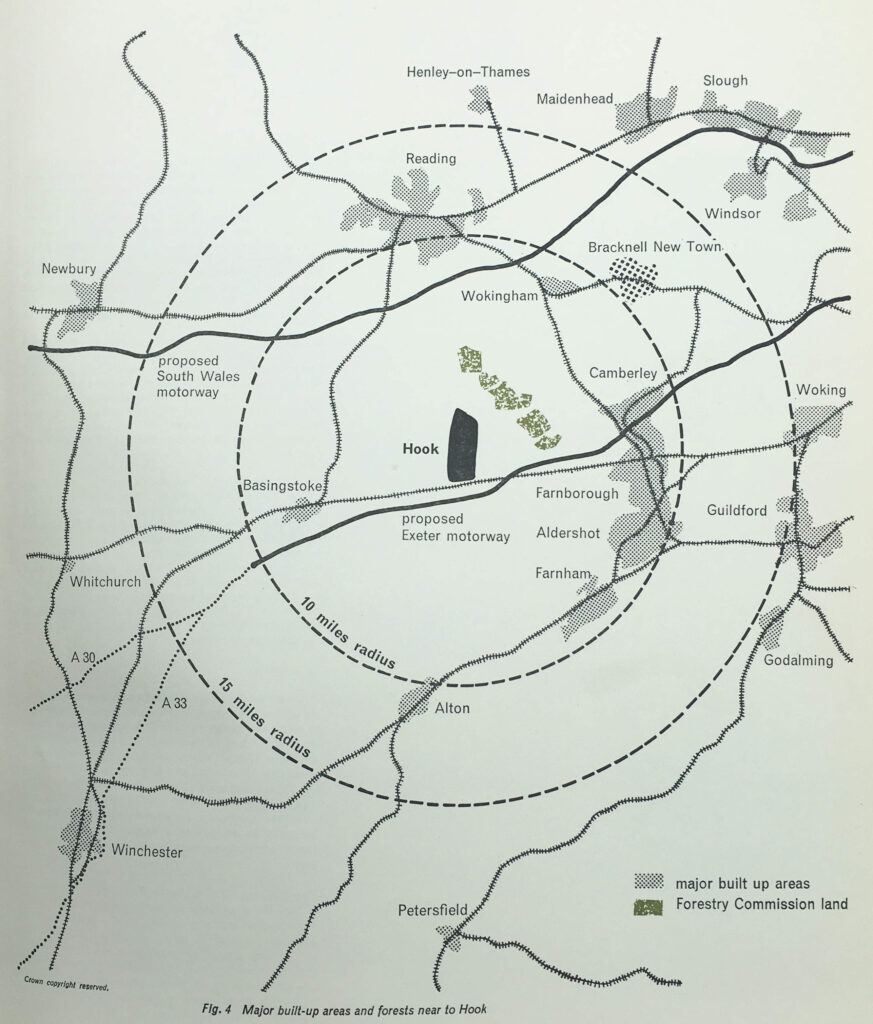
Good transport was a requirement to attract industrialists to the new town, and Hook had the benefit of being close to two new proposed motorways.

As well as new towns, post war planning included the web of motorways that now reach out from London. Two proposed at the time of the Hook plan, and shown on the following map were the “South Wales Motorway”, now the M4, and the “Exeter Motorway”, now the M3.

Hook new town

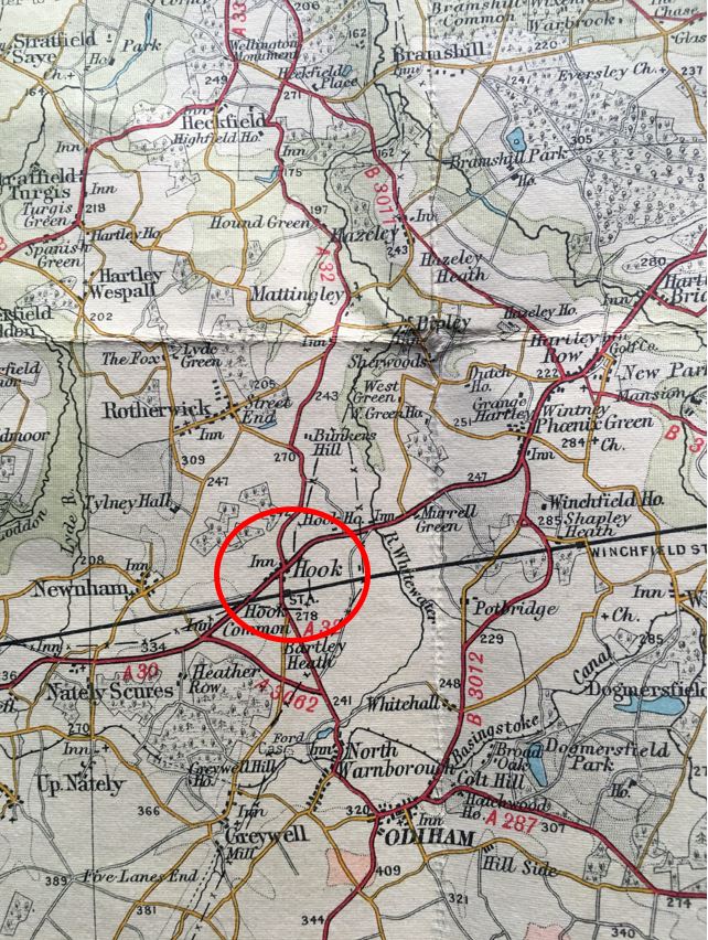
To get an idea of the rural location of Hook, the following map is an extract from a pre-war Bartholomew’s map of Berkshire and Hampshire, and shows Hook circled:

Hook new town

At the time, Hook was a very small village. A couple of old coaching inns which had served traffic on the A30 which ran through the village, and limited development along the line of the A30.

The coming of the railway to Hook had led to some expansion, and the village has seen much larger development in the last few decades, and now has a population of around 8,200.

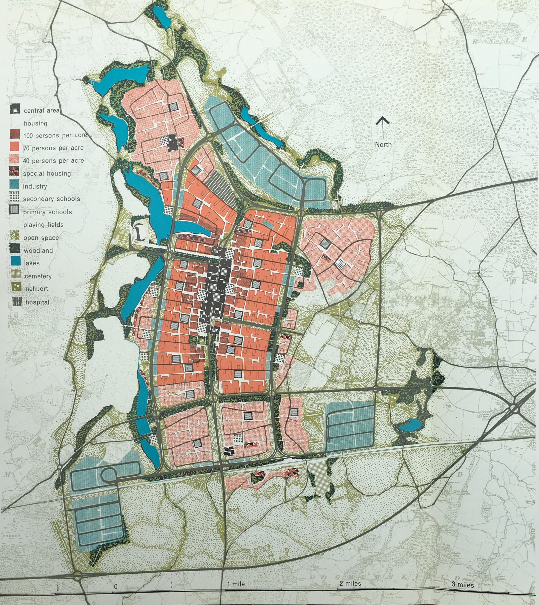
The L.C.C. plan for Hook covered a 50 year period of development, and the layout of the town after 50 years, with the full population of 100,000, with surrounding industrial zones is shown in the following Master Plan:

Hook new town

The key to the left of the above shows how the site would be used. A central core area, with reducing density of people per acre as you move from the centre. Industrial, green space and lakes surrounding the core.

The plan had a 1950s view of what the future could look like, as the town also had a heliport.

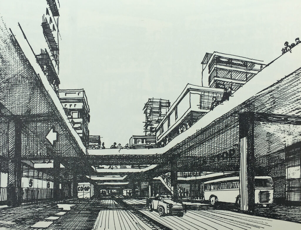
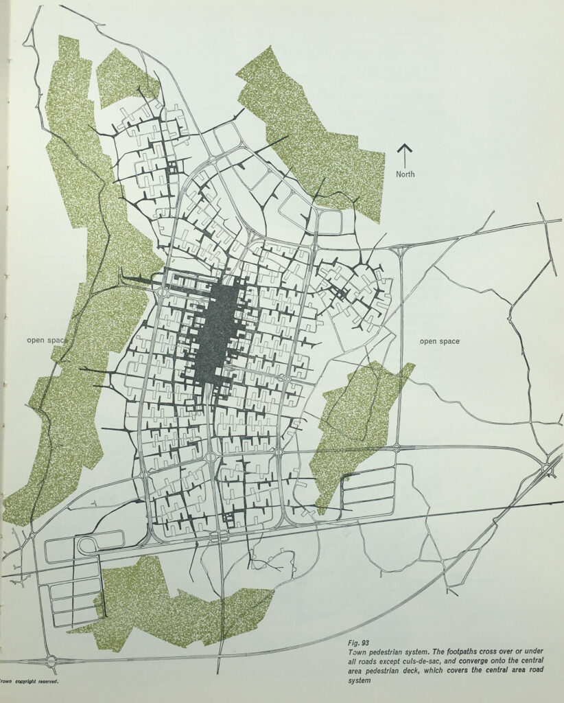
The plan for Hook included some of the ideas from post-war development of the City of London. The plan included the separation of pedestrian and vehicle traffic, and the central core of the town was to be built on a platform, free of vehicles, but containing under it and on its approaches, provision for the movement and parking of 8,150 vehicles.

To allow pedestrians to walk freely and safely around the town, a system of pedestrian ways was important, and the following map shows the pedestrian system, with footpaths crossing over or under all roads, and converging on the central pedestrian deck which covers the central area road system.

Hook new town

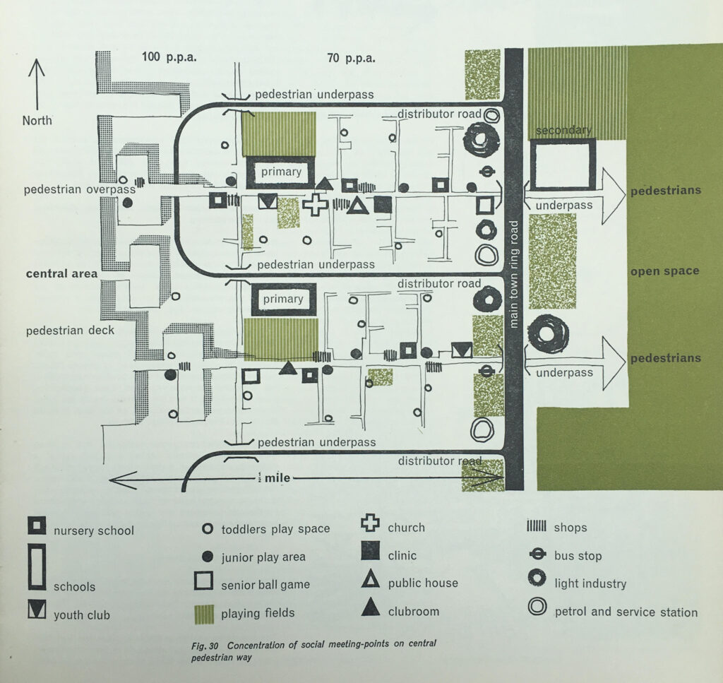
The new town was intended for young families which is illustrated in the design of some of the areas. The following plan shows the concentration of social meeting points on the central pedestrian way, and shows a remarkable number of primary schools, play space and play areas, and a repeated pattern of pubs, churches, clinics, bus stops, light industry and petrol stations, which would replicated in the same pattern across the central pedestrian way.

Hook new town

Where car parking was provided within the residential areas, the intention was to try and hide the cars as much as possible, and as the following drawing shows, car parking would be within a lowered area, with banking and planting helping to keep the roofs of cars below eye level:

Hook new town

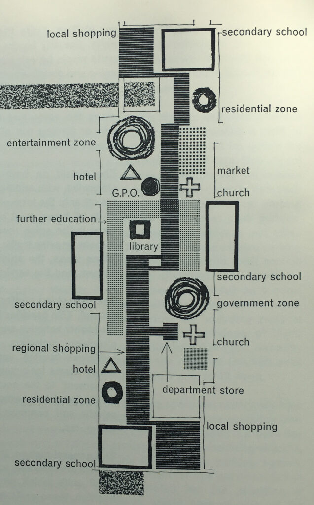
The central pedestrian area was elevated above the traffic and parking areas, and included secondary schools, local shopping, entertainment and government zones, a department store, church, library and post office:

Hook new town

The book has a large number of drawings illustrating what Hook New Town would have looked like. and the following drawing shows the central pedestrian deck as seen from the spine road:

Hook new town

The plans for some of the areas were very forward thinking, but it must be very questionable whether these plans were cost effective, and whether any consideration was given to their ongoing cost and maintenance.

For example, the intention was that the pedestrian deck would be traffic free, however there was a recognition that the businesses and institutions on the pedestrian deck would need servicing with delivery of goods, collection of refuse, how would an ambulance get to the pedestrian deck etc.

The planners ideas included the possible use of electric trolleys to provide transport along the pedestrian deck, and to move goods between the service areas at ground level and the pedestrian deck, hoists could be installed in the communal and service areas and operated by “the local authority or some other central management organisation”.

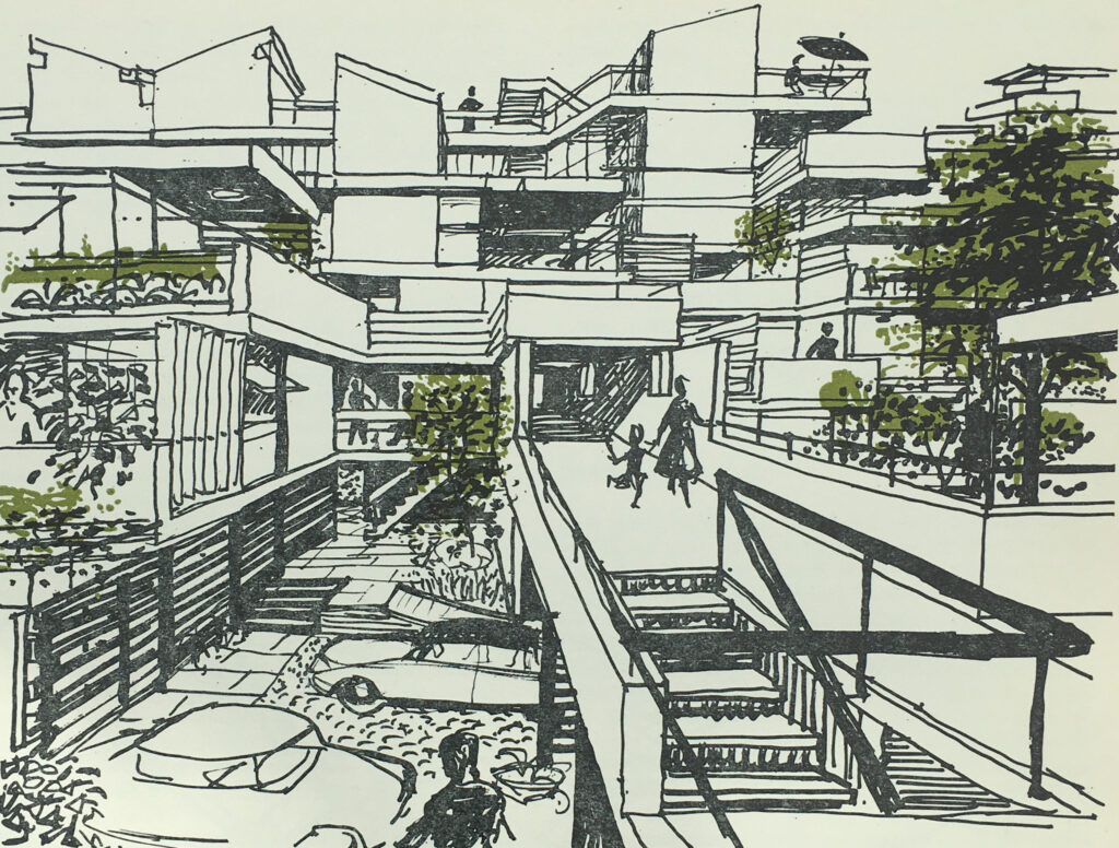
The new town would not have the type of high rise housing that was being built across east London, but would have low rise housing, which would include gardens, off-ground outdoor rooms and pedestrian walkways to separate pedestrians from the streets and parking below:

Hook new town

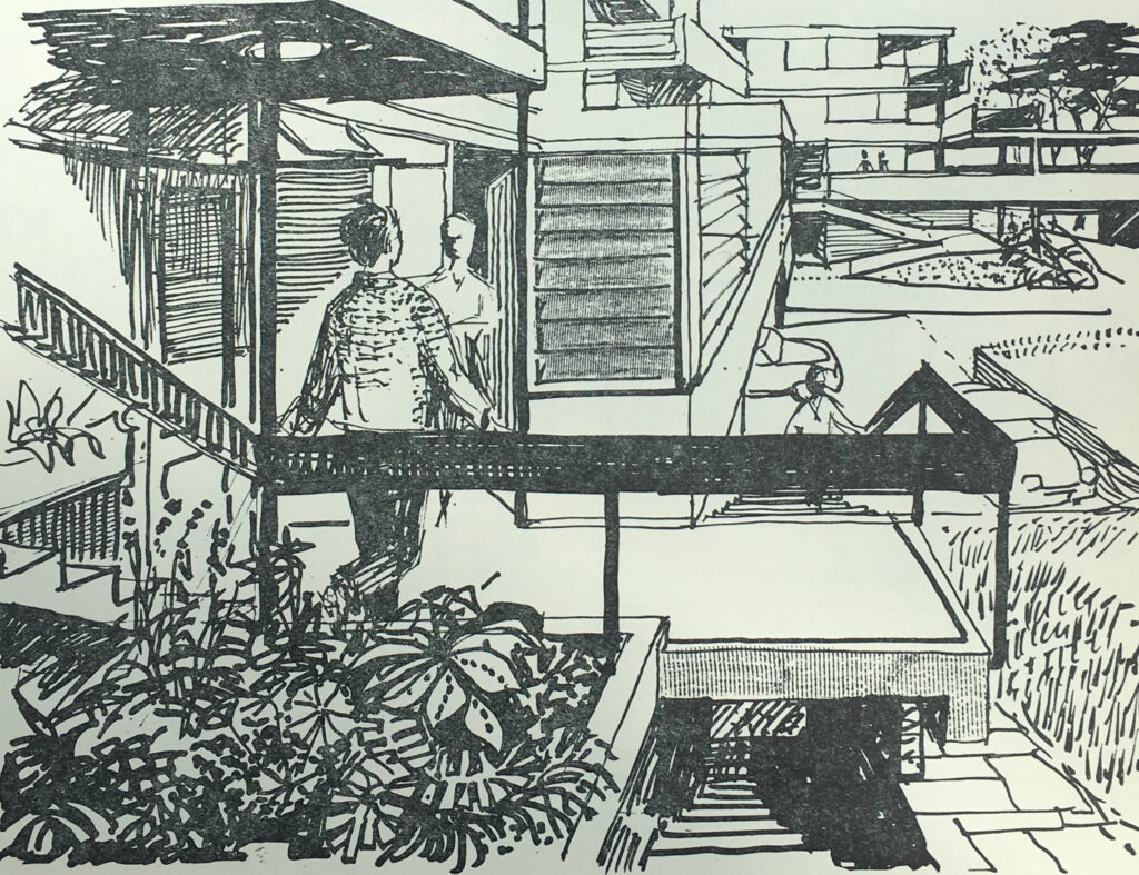
Upper level gardens and off-ground rooms:

Hook new town

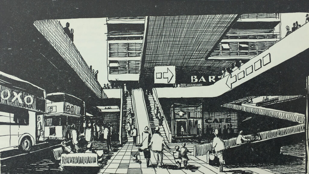
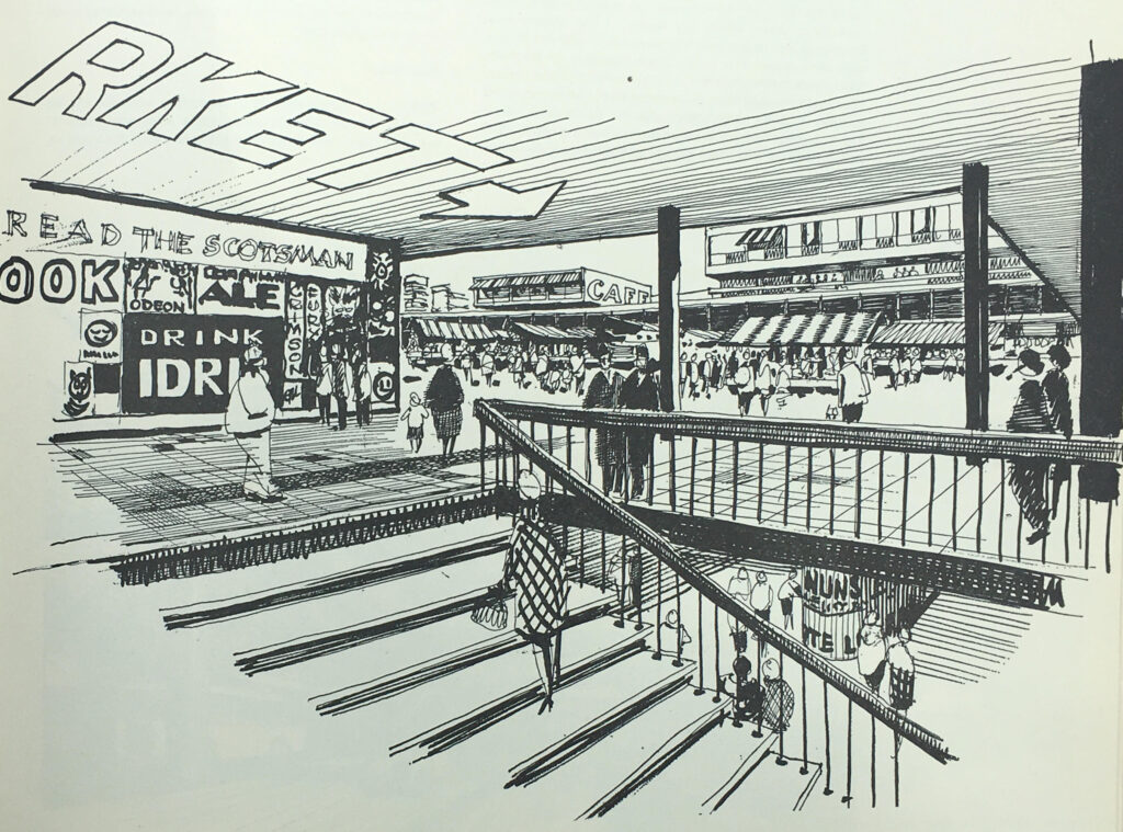
The elevated central pedestrian deck was incredibly ambitious. In the following drawing, the ground level bus stops are shown, with ramps, escalators and lift up to the pedestrian deck:

Hook new town

Once on the deck, there were shopping areas, along with other functions such as the entertainment and government zones, library, and a wide central space which would host a market:

Hook new town

I am not aware of any new town that had such a central pedestrian deck. New towns such as Bracknell and Basildon had central pedestrian areas, with facilities such as shops and council offices, but these were not on fully raised platforms, and transport services such as bus stations would be located at the edge of the pedestrian area.

The book demonstrates the difference in costs for Hook compared to other new towns.

The book identifies the costs for the Hook development of major roads, intersections, distributor roads, bridges, viaducts etc. as £8,707,700, whilst for the same services in an existing new town, the costs would be £3,146,900, so Hook would have cost an additional £5,560,800 – a huge amount which must have been difficult to justify.

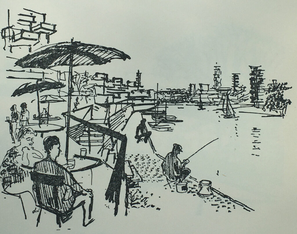
The intention with Hook is that the area immediately surrounding the town would offer opportunities for relaxation, sport, hobbies and access to the countryside.

One drawing shows Lakeside Recreation:

Hook new town

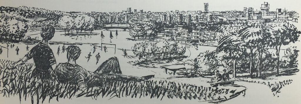
And the following drawing shows “Major open space seen against compact housing”, where a couple are relaxing on a small hill, overlooking a football game, with lake and surrounding trees, and the town across the lake:

Hook new town

The book has lots of data covering population size, age distribution, numbers employed, persons per household and mix of households etc.

Where possible, data from other new towns, or national data was used to model what could be applicable for Hook.

Some of the data provides a snapshot of the country in the late 1950s, and also how much aspects of the country would change in the following decades.

One table covers the manufacturing industries that could be attracted to a new town at Hook, with easy access to the planned M3 and M4. These were:

In the following years, many of these industries would be moving overseas to country’s with cheaper production, others would simply become redundant.

To justify the selection of the above industries as possible candidates to move to Hook New Town, the table includes figures to show how many were currently employed in these industries across the country. For example, there were:

  • 9,000 people employed making tents and flags
  • 108,000 people employed making hosiery
  • 17,000 people making corsets
  • 4,000 people making cork stoppers
  • 8,000 people making fountain pens and propelling pencils

The proposals also estimated that when the town was fully built and occupied after 50 years, employment would be split 50 / 50 between manufacturing and service industry jobs.

The London County Council’s proposals for a new town during the 1950s were met with delay and a lack of decision making. The Conservative governments during the 1950s were not really supportive of the New Towns movement, as they required state funding and their development was managed through non-elected Development Corporations.

The L.C.C. approach to various Ministers of Housing and Local Government were met with supportive noises, but no real action that would support the L.C.C. proposals.

A decision of sorts was finally made in August 1957 when the L.C.C. proposal was agreed in principle, however there would be no special funding from the exchequer, and the proposal was subject to agricultural considerations and the general economic environment.

On the 22nd of October 1958 a meeting was held in County Hall between representatives of the London County Council and Hampshire County Council, during which the L.C.C. communicated the decision to Hampshire, without the opportunity for any discussion.

After the decision was made public, it was met by a huge amount of resistance from the residents of Hook, local farmers, landowners, civic groups and local councils. Even within London there was opposition, with the London evening papers asking why Londoners would want to move out to Hampshire, and whether the new towns were forcing those living in London to move out to these new developments.

Hampshire County Council refused any cooperation with the London County Council.

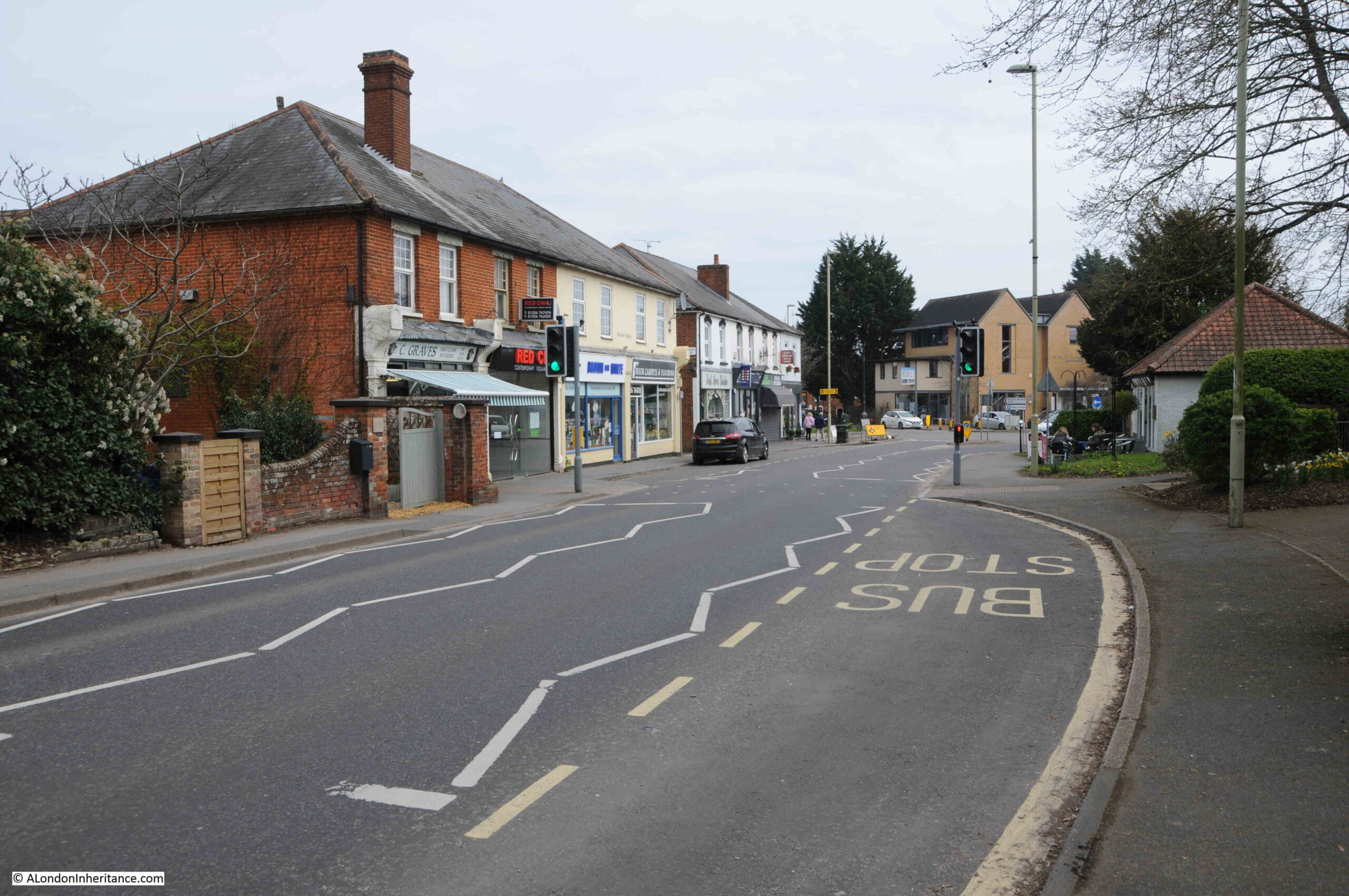
The appropriately named London Road, the old A30, the main street running through Hook today:

Hook London Road

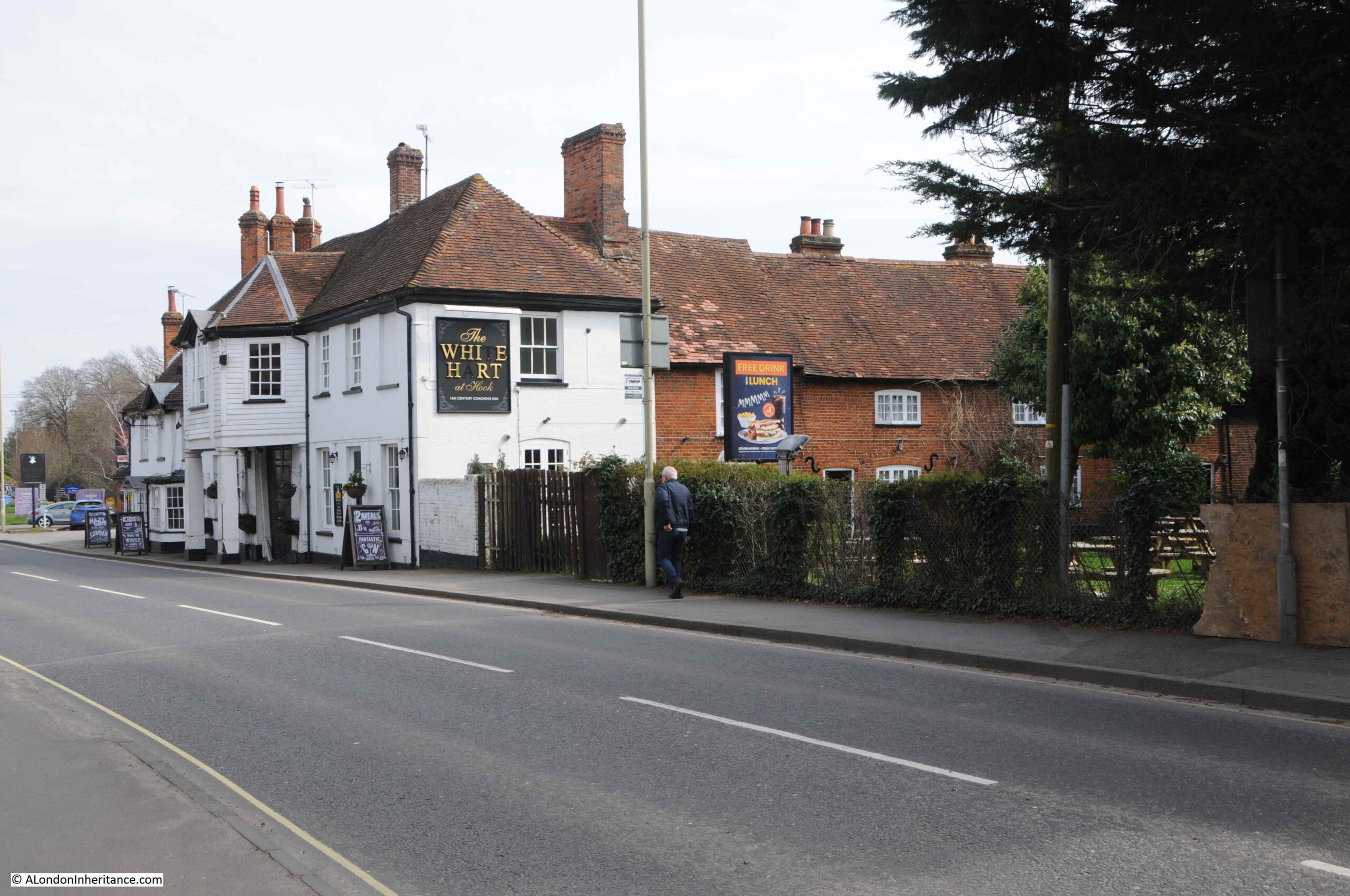
The historic importance of the road running through Hook can be understood through the Grade II listed White Hart Hotel:

Hook the White Hart

The listing states that the White Hart is “C18, early C19. Old Coaching Inn, with buildings around a yard: the front (Early C19) of 2 storeys in 2 sections”.

The local newspapers of the time were full of objections to the new town. A few articles mentioned that it was the London County Council’s intention to clear much of Wapping and Hoxton and relocate people to Hook.

There were also alternative suggestions as to were a new town should be located with the Aldershot area proposed due to the significant Army landholdings in the area. It was believed that the Army could release a large proportion of this land, however the Army objected.

The following article is from the local paper with a very long title of Reading Mercury Oxford Gazette Newbury Herald and Berks County Paper, on the 8th of November 1958:

“HOOK NEW TOWN PLAN – That Hook New Town would cover eleven square miles, absorb a seventh of Hartley Wintney Rural District and involve an expenditure of about £7 million for land purchase, were estimates given at a special meeting of the Council. The general feeling was that Aldershot and Farnborough were far more suitable areas for such mammoth development.

The Parish Council, although obvioulsy entirely opposed to the new town plan, accepted a warning from Mt. T. Chapman Mortimer to await further information before formally registering opposition.

It was agreed to write to the Rural Council and say that the new town proposal was viewed with considerable alarm and to ask for further information.

Mr. D. Franklin, chairman, said that in Bracknell New Town area the value of properties had fallen sharply. Houses within the town area were razed to allow for new building and roads.

Mr. A.R. Wright thought the site was not far enough from London. It was ludicrous to put a town as big as Aldershot and Farnborough combined in a position where many of the residents would go daily to work in London and so aggravate the traffic problems in the district, and it was criminal to put 60,000 people on the fringe of Britain’s third ranking airport.

Wapping and Hoxton were the areas which the L.C.C. proposed to clear, said Wing Commander L.H. Cooper and he visualised dockers going up daily to their work.

Hartley Wintney shopkeepers are struggling to keep their businesses going, said Mr. Wright, and the new town would have a superb shopping centre with super-markets. It would be like having Knightsbridge on your doorstep, he said. It could mean many Hartley Wintney traders losing their businesses.”

The above article is typical of the many news reports of the time. There appeared to no one in the area who was in favour of Hook New Town.

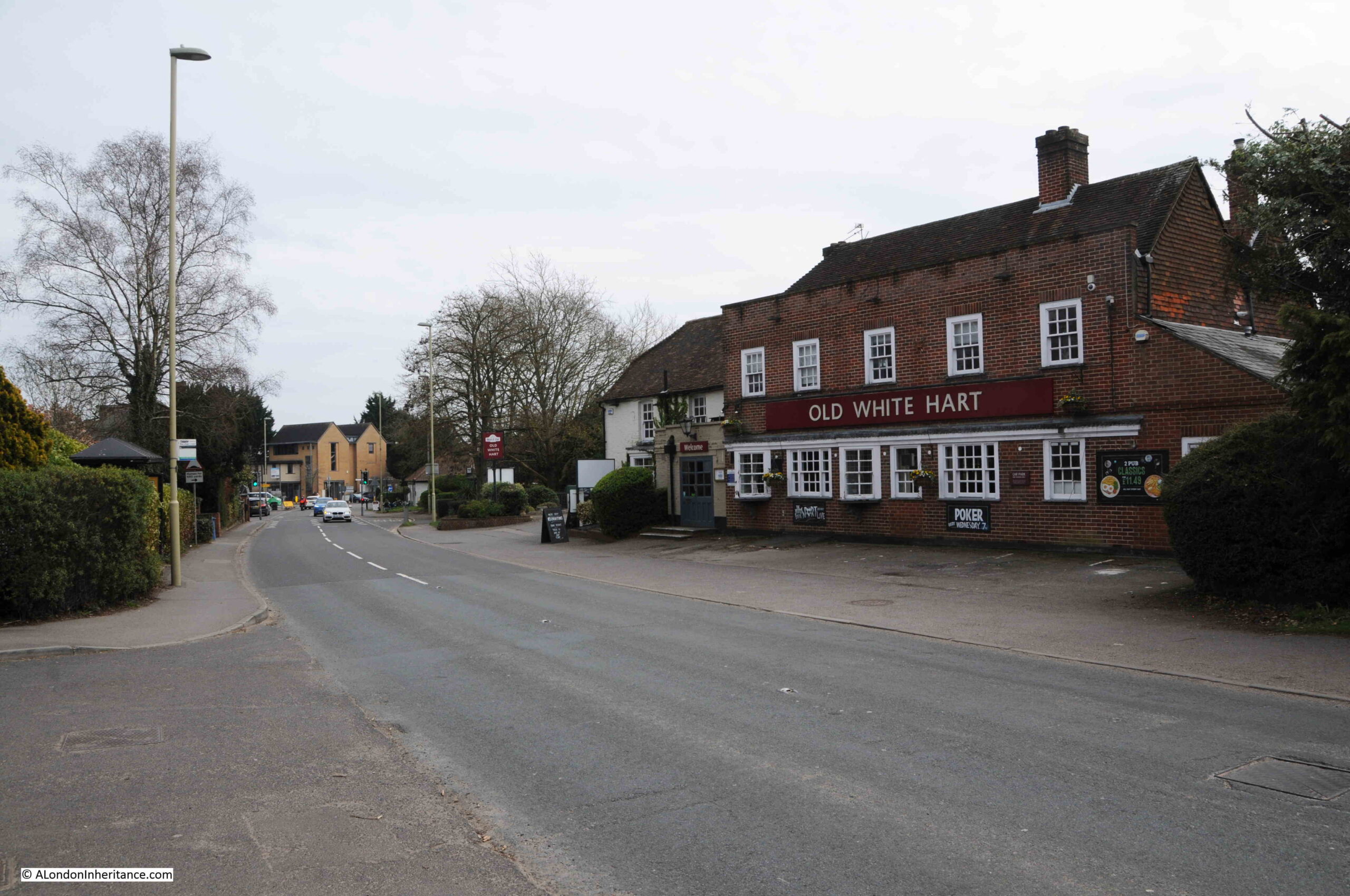
The Old White Hart, another of the pubs in Hook on what was the A30 through the village:

Hook London Road

Throughout the time that the proposal for Hook New Town was being progressed, Hampshire County Council was trying hard to avoid any involvement.

The Aldershot News reported on the 13th of February 1959 that: “Hook new town not abandoned – The Hook new town project has not been abandoned according to an L.C.C. spokesman, who this week told the Aldershot News that the Council’s Housing Committee is giving careful consideration to the position now that Hampshire County Council has said it cannot consider the establishment of a new town anywhere in the county.”

The Evening News reported on progress on the 10th of December 1959, and commented that: “Investigations have been somewhat delayed at the outset by the unwillingness of Hampshire County Council to join them, the committee added, various details will require further consideration.”

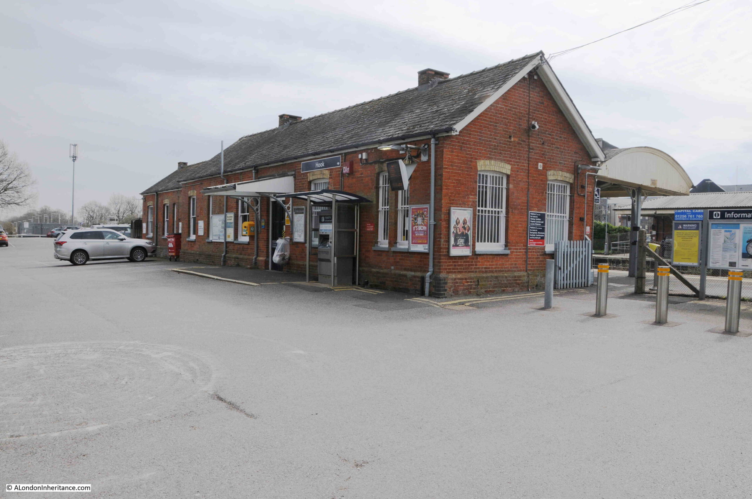
The station at Hook:

Hook railway station

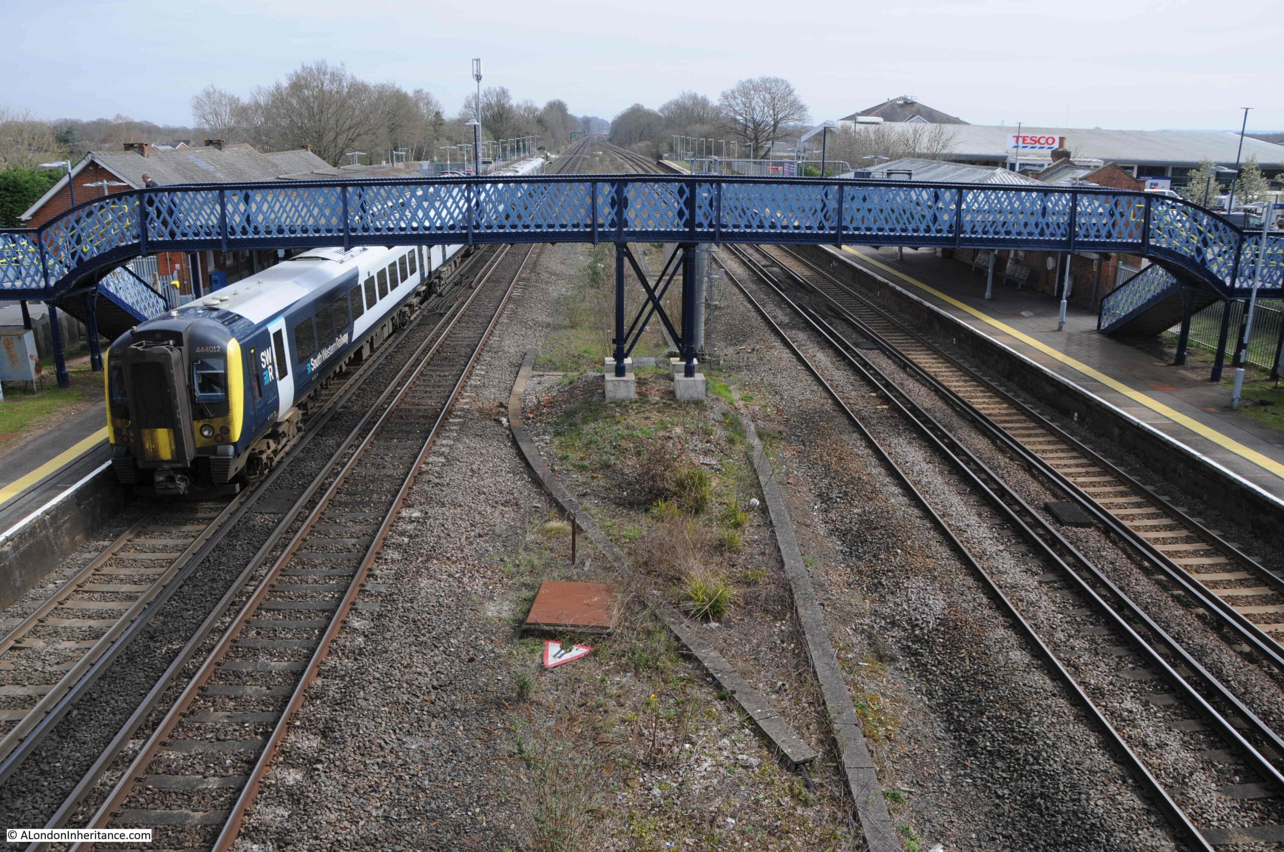
Hook is on the mainline into Waterloo Station, which was one of the benefits identified by the L.C.C., as well as the two proposed motorways, the future M3 which would run to the south, and the M4 which would run to the north.

Hook railway station

The London County Council’s proposals for Hook New Town finally came to an end in 1960. There was much local opposition, and the county council has simply refused to get involved.

There was still pressure for large amounts of housing in the area around London, and Hampshire County Council, came to an agreement where this could be built, as reported in the Hampshire Telegraph and Post on the 17th of May, 1960: “Three Hampshire Towns May Expand – Proposals for the expansion of three towns in North Hampshire to accommodate overspill population in London received overwhelming support from Hampshire County Council at its meeting in Winchester on Monday.

The proposals envisage the development of Basingstoke to take 50,000 overspill population, the expansion of Andover to take 15,000 overspill and Tadley, near the Aldermaston Atomic Research Establishment, to take about 15,000.”

So Hook survived. It would grow in the following decades, but would not see migrations of people from Wapping and Hoxton. Today, the population of Hook is under a tenth of the level that the L.C.C. planned for the new town.

Emphasis shifted to the continued development of Basingstoke. It would be fascinating to know if, and how many, residents of Wapping and Hoxton did relocate to Basingstoke, or any of the other new towns.

New towns had an extraordinary impact on the villages that they took over. To get an impression of this, we can look at Bracknell, a new town that was developed in Berkshire, not that far from Hook.

The proposal for transforming Bracknell came in the immediate post-war planning for new towns, when the existing market town was identified as a new town in 1949. It would develop over the following decades.

Bracknell, as with Hook, was on a railway line into Waterloo, and was between the proposed M3 and M4 motorways.

The population of Bracknell today is around 118,000 so is probably around the size that Hook would have have achieved.

The town was designed following similar principles to Hook, but the central shopping area was not elevated. Housing was developed in community areas, traffic was directed around the central core, there was plenty of parking, new industrial areas were built around the town to encourage local jobs rather than the town acting as a dormitory for London.

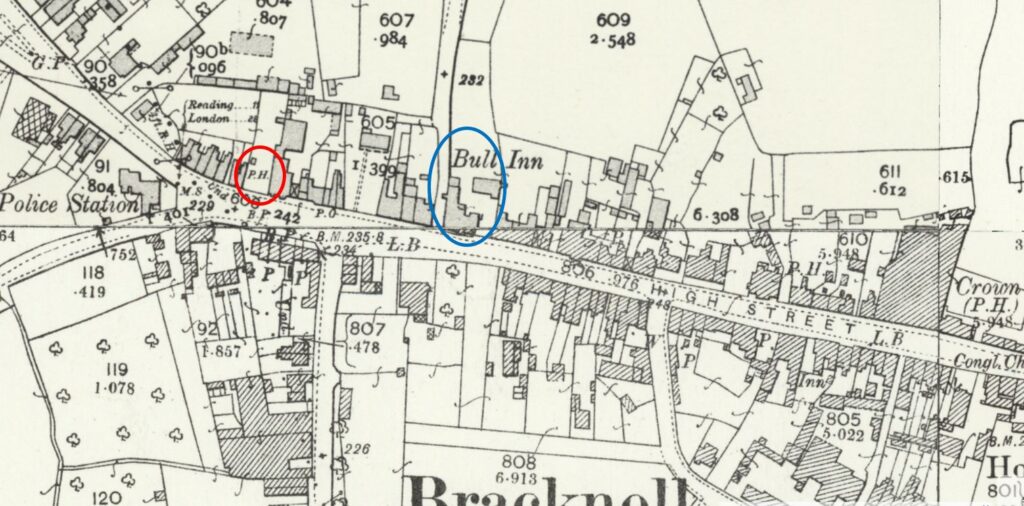
The 1898 Ordnance Survey map shows the central High Street of Bracknell. It had not changed that much by the time it was declared a new town  (‘Reproduced with the permission of the National Library of Scotland“):

Bracknell New Town

Nearly every building along the High Street in the above map was demolished to make way for a new shopping centre at the core of the new town, and as the news report quoted above from the 8th of November 1958 stated “Mr. D. Franklin, chairman, said that in Bracknell New Town area the value of properties had fallen sharply. Houses within the town area were razed to allow for new building and roads”.

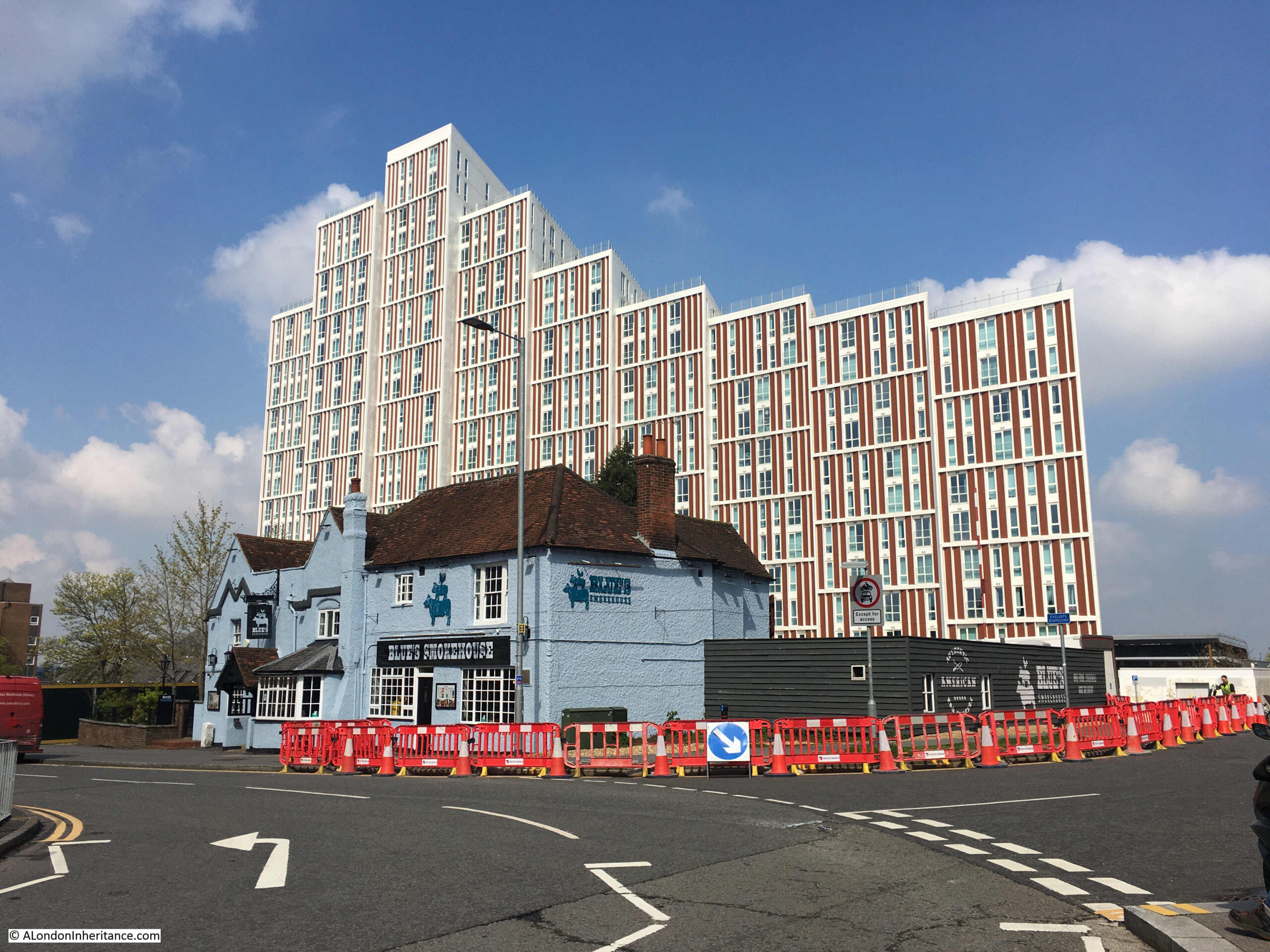
In the above map I have circled in red the PH symbol for a pub, which was preserved during construction of the new town, and we can still see the pub today:

Bracknell New Town

The block of flats behind the pub is recent, and was built on the site of a large office block which had been part of the new town development.

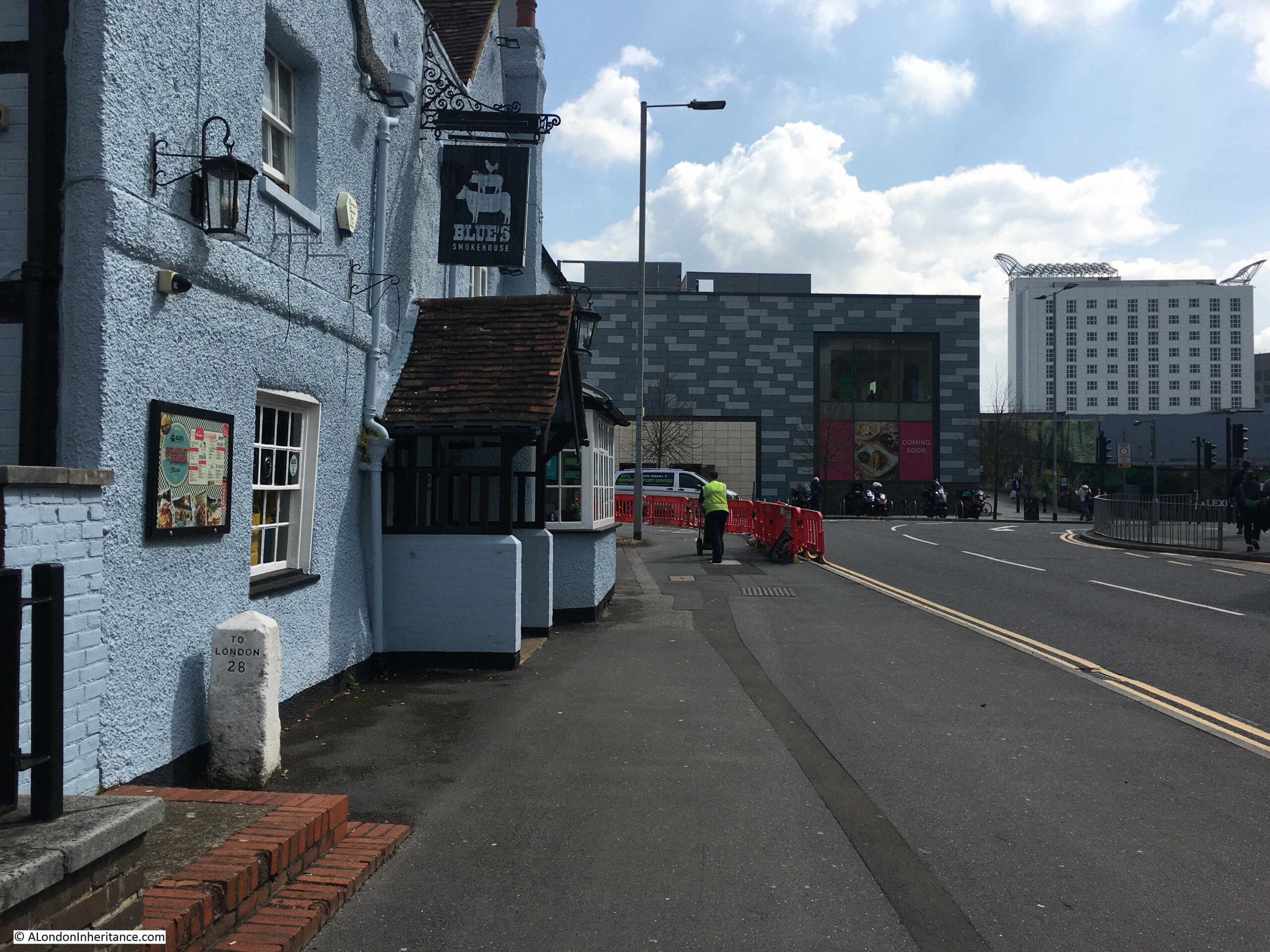
To the left of the entrance into the pub is a milestone that confirms that this was on one of the roads between London and Reading:

Bracknell New Town

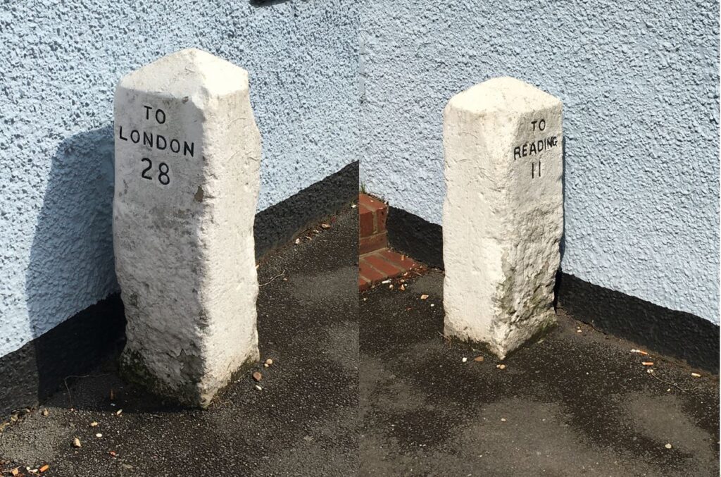
The milestone confirms 28 miles to London and 11 to Reading, the same distances as shown in the map above:

Bracknell New Town

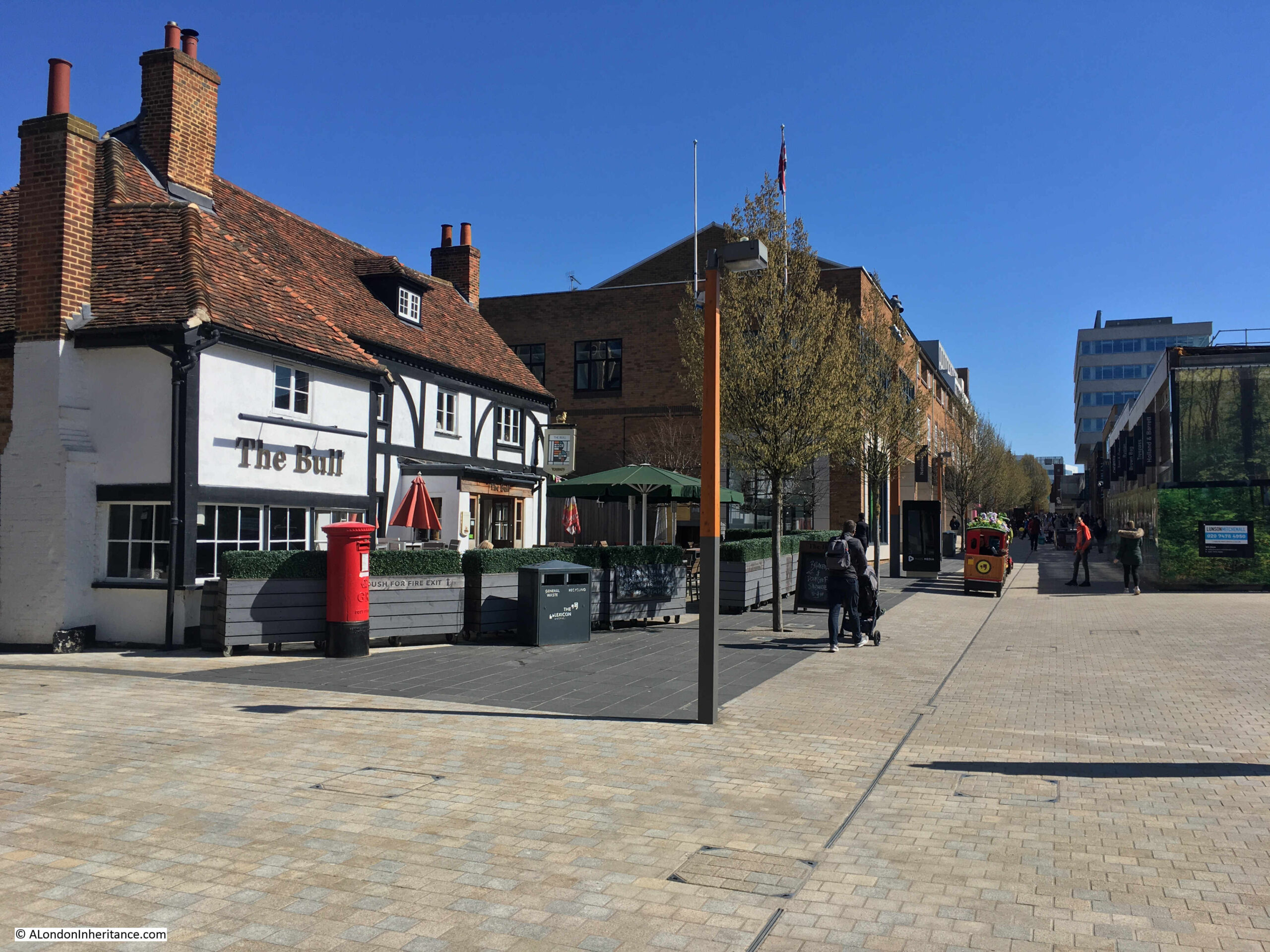
Walking along the route of the old High Street, now the pedestrian route into the main shopping centre, we come to the pub marked by the blue circle in the above map. The pub is still to be found, with the same name, but surrounded by a very different scene. This is the Bull:

Bracknell New Town

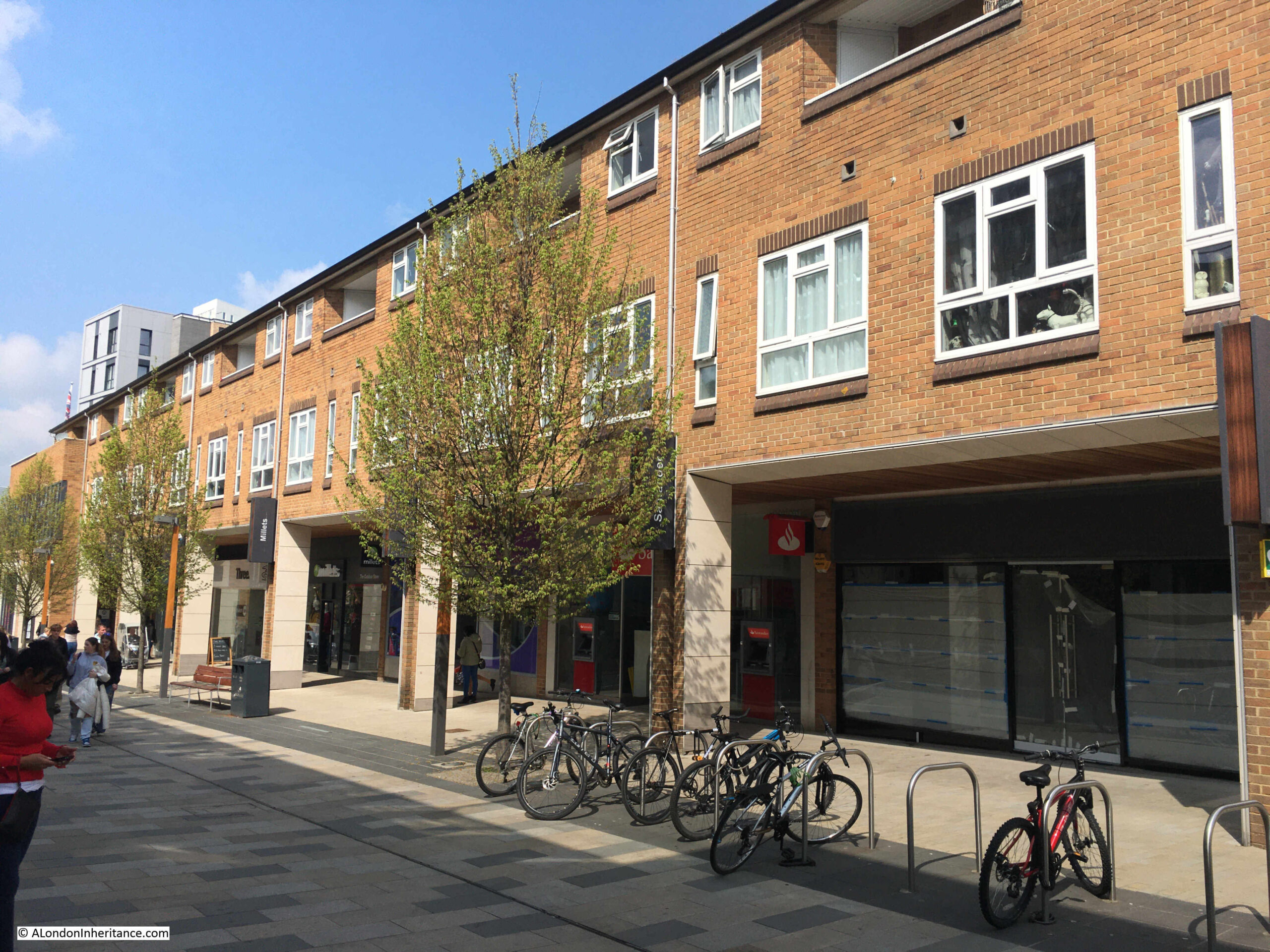
Original new town design for shops at ground level and flats above:

Bracknell New Town

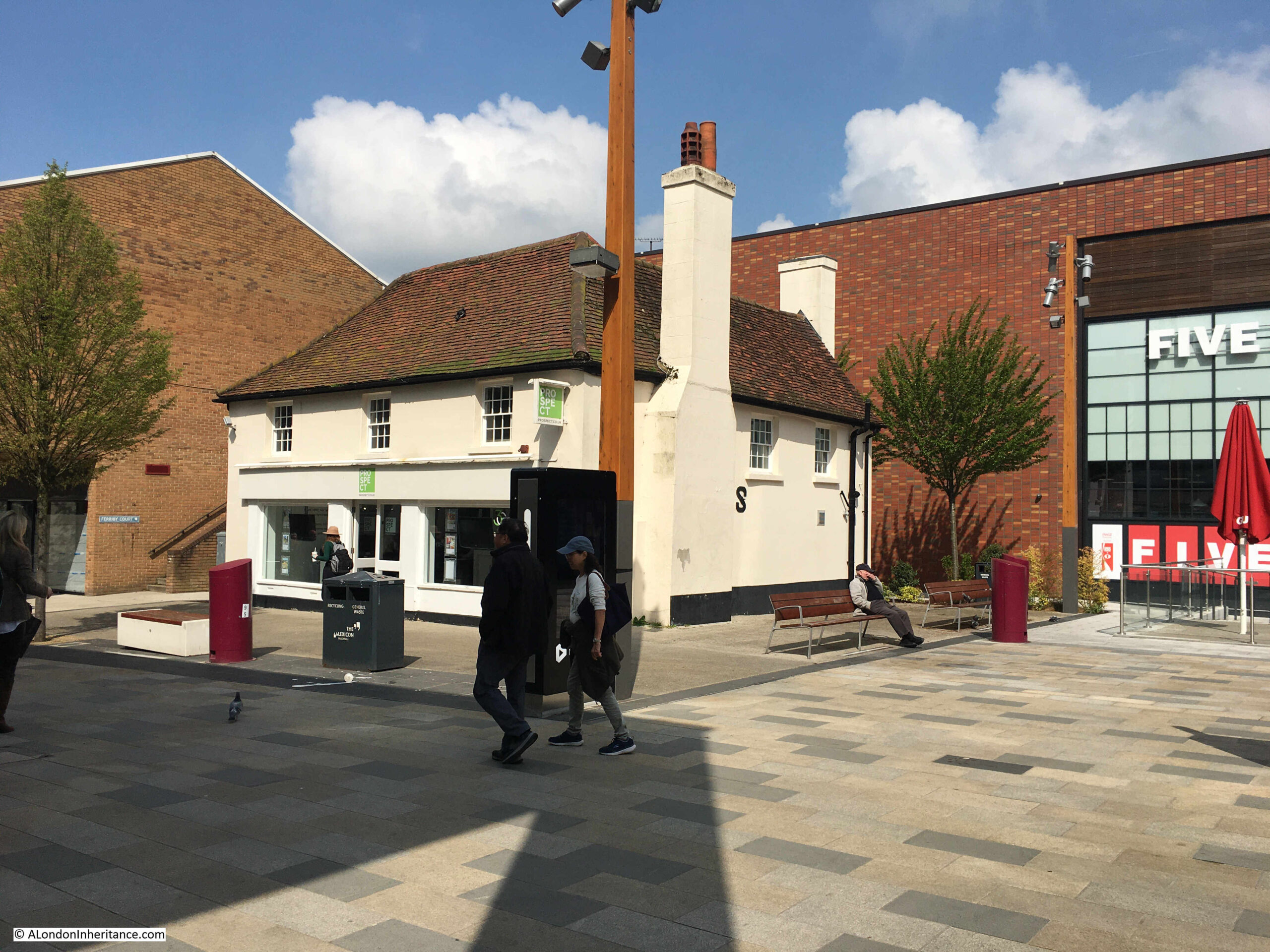
Another building remaining from the original High Street:

Bracknell New Town

View along what was the High Street, now completely transformed:

Bracknell New Town

One of the problems for new towns is the need for constant reinvention. Bracknell was built with a central shopping centre that by the start of the 21st century was looking rather dated.

The shopping centre was also lacking any local character, and was the same as any other mid 20th century shopping centre. Whereas towns with a traditional High Street can evolve, a large shopping centre cannot easily do this, with large amounts of space dedicated to shops.

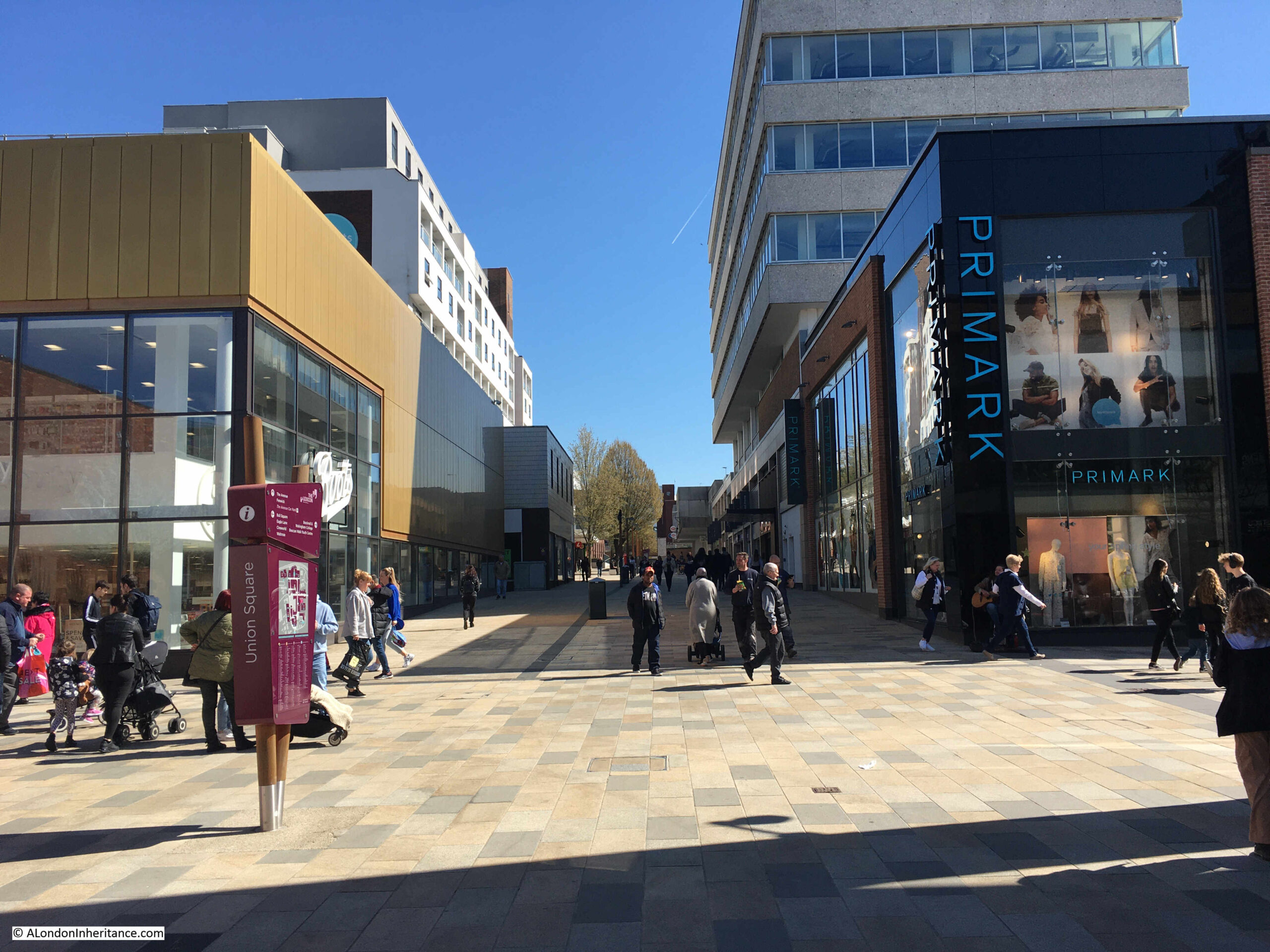
To try and address this, the central area of Bracknell recently went through a major redevelopment, with large parts of the original new town development demolished and replaced with a new design,

This is the view looking north from the original High Street, looking through into what were the fields behind the High Street. The view is the recent development. replacing the original new town build.

Bracknell New Town

The proposals for Hook show the influence of London on the counties around the city, and in the 1950s the London County Council considered the area south of a line between the Wash and the Solent as within the pull of London.

That description fits the map, where London sits at the centre, with a system of new and expanded towns circling around the central city, and the new towns we see today, such as Bracknell, show what could have become of the area around Hook.

alondoninheritance.com