Monthly Archives: August 2016

Winchester and Stonehenge

For this week’s post in my August journey around the country, I am visiting two historic locations that are day trips to the west of London, Winchester and Stonehenge. Winchester on the side of the M3 heading down towards Southampton and Stonehenge on the road to the west country, the A303.

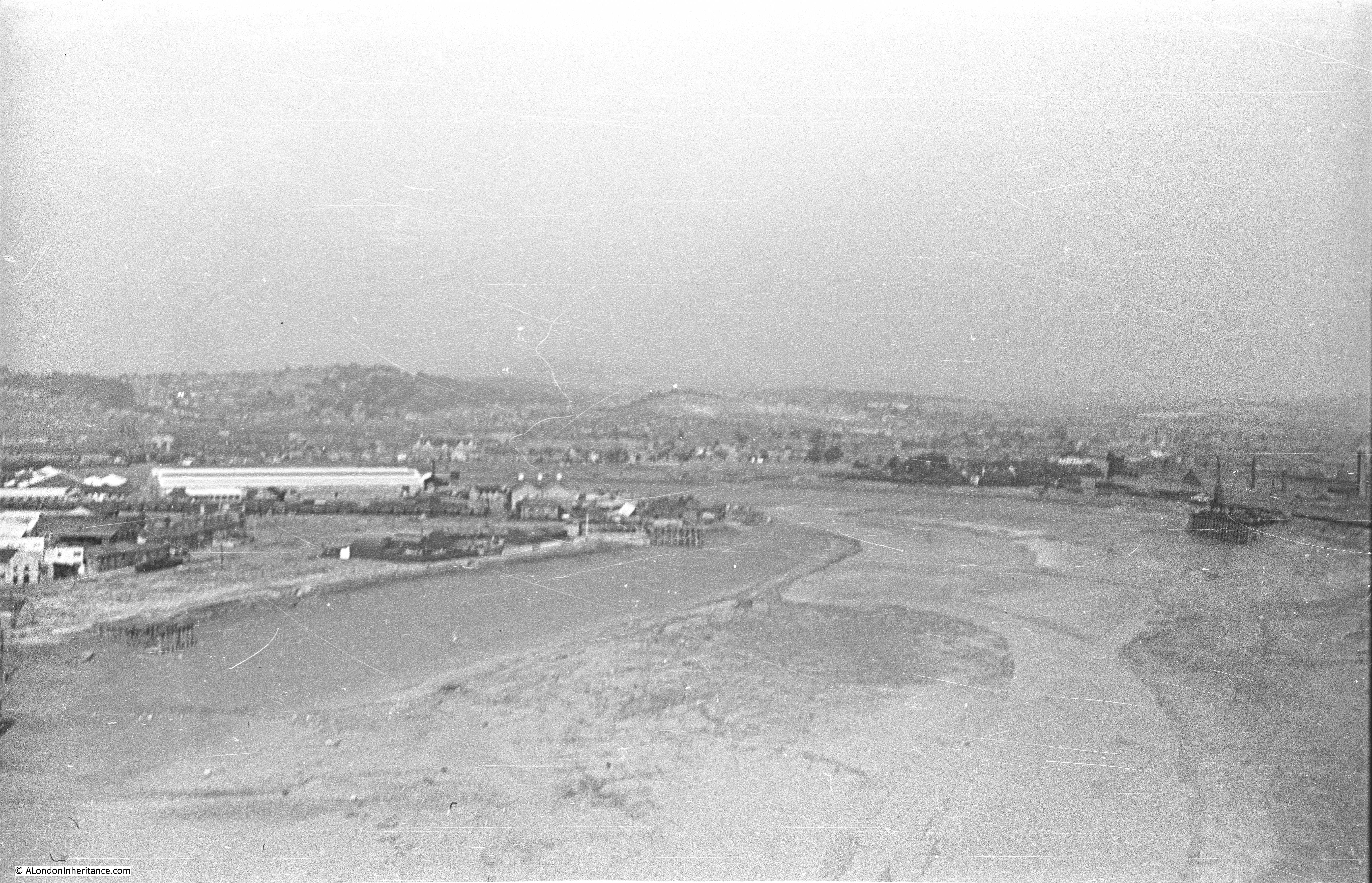
My first stop is at Stonehenge. The following photos were taken by my father in 1949. Whilst the stones are the same today, the environment is very different. When these photos were taken, visitor numbers were very low and the visitor had free access to walk among the stones. The two roads that ran either side of Stonehenge were quiet without the long queues of traffic that are a feature of most summer weekends.

Winchester and Stonehenge 1

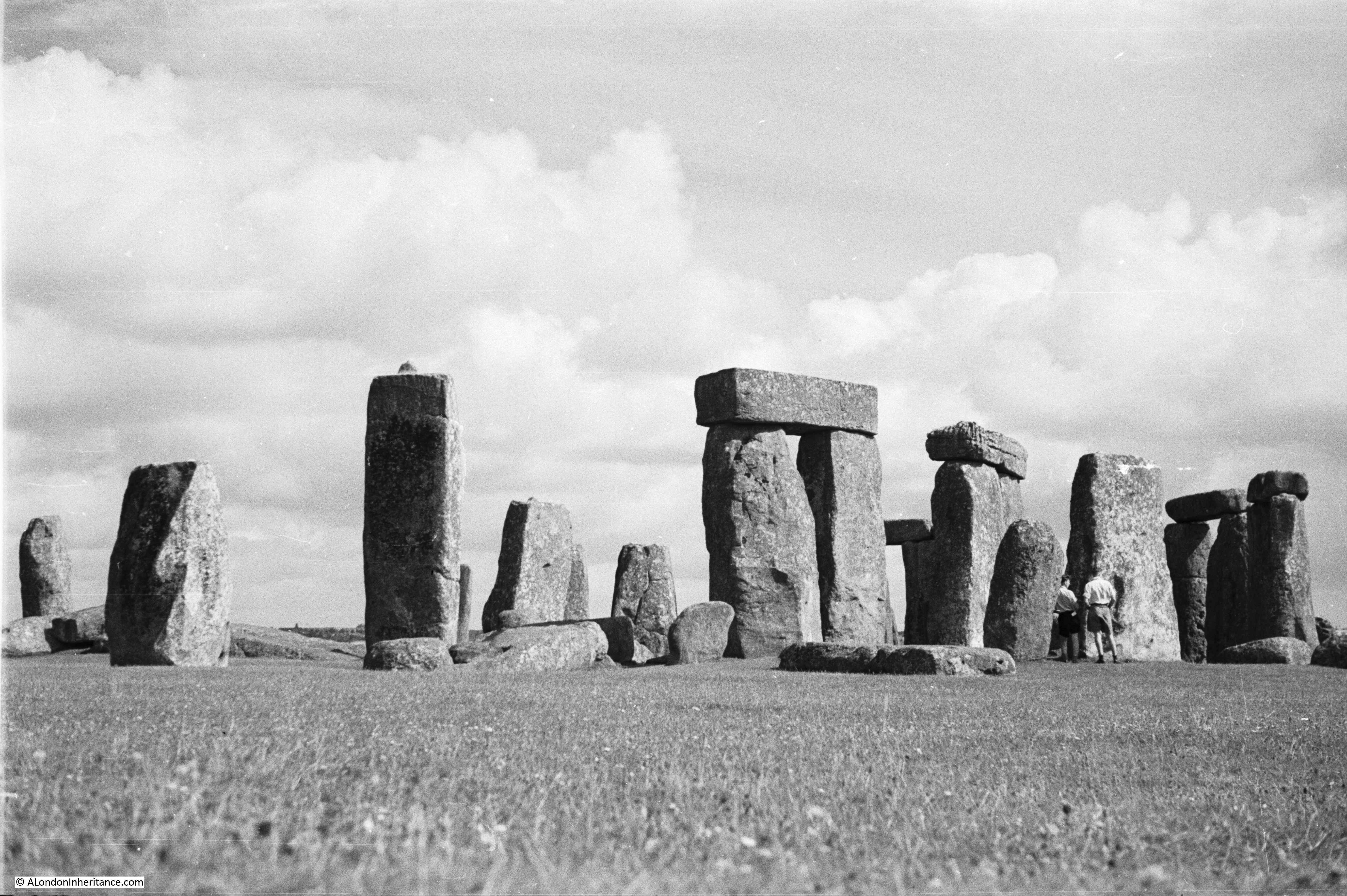
I must admit I did not revisit Stonehenge for this post, having last been there a number of years ago. Today, it is only possible to walk among the stones during specific events and for the general visitor the view is limited to a path that runs a short distance around the stones.

Stonehenge is always busy with coaches of visitors providing a continuous stream of people to walk around the circle. Whilst fully understandable that the protection of the stones required their separation from those who have come to visit, it must have been much more of an experience being able to walk among and admire the size and positioning of these stones, without crowds and without the thunder of traffic on the adjacent road.

Winchester and Stonehenge 2

Stonehenge has seen recent improvements. One of the roads that passed either side of the stones, the A344, has been closed and is returning to grassland. The visitor centre has been relocated some distance away, thereby helping provide the stones with some of the original sense of how they stood in their landscape. This still leaves the heavy traffic on the A303. Tunnels and alternative routes for removing the A303 from the landscape have been proposed and discussed for years, but nothing ever seems to get to the point of general agreement as to the best route, financed and into construction. If the Government wanted to get on with some infrastructure investment then a long tunnel to take the A303 away from the Stonehenge landscape must be a good option.

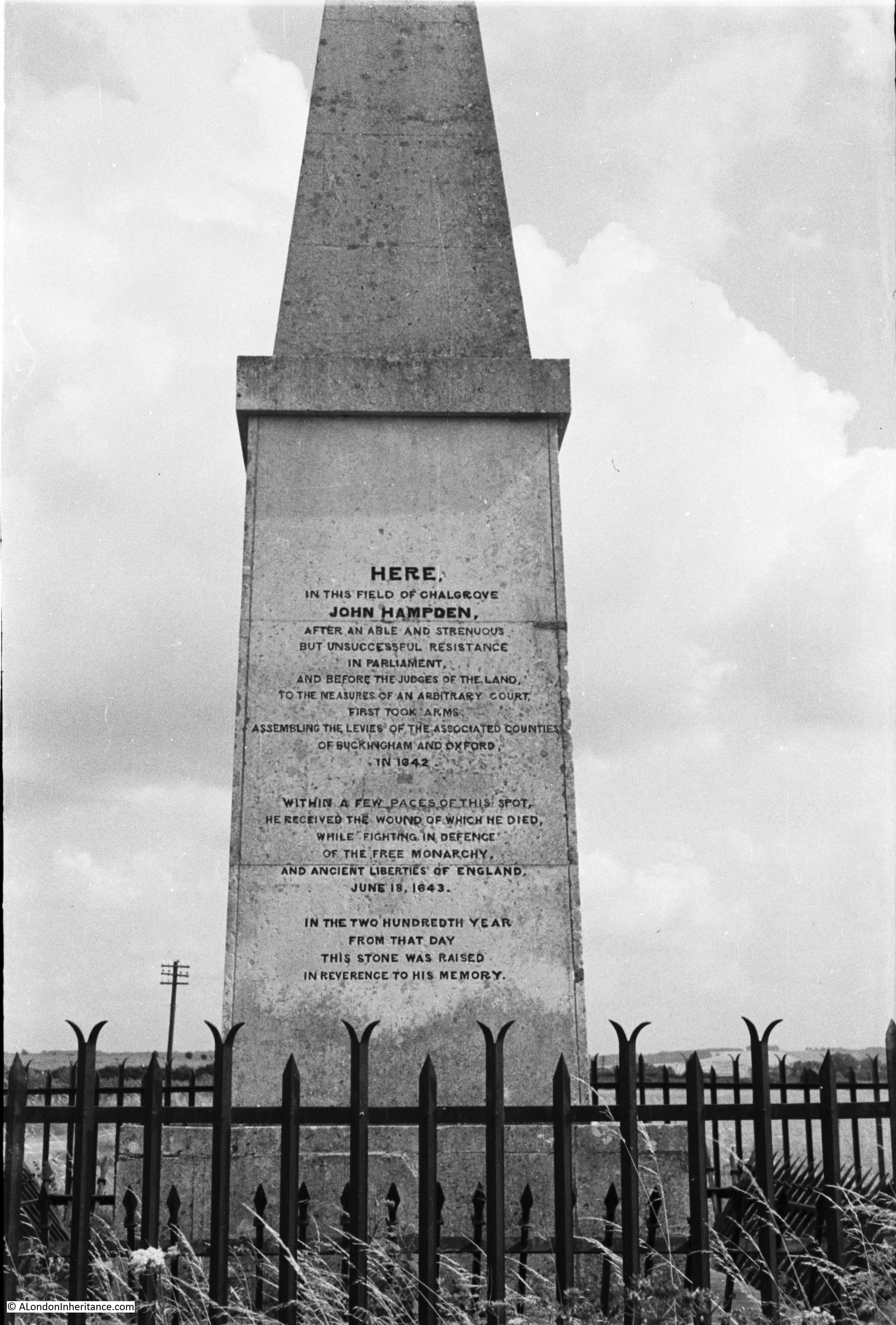
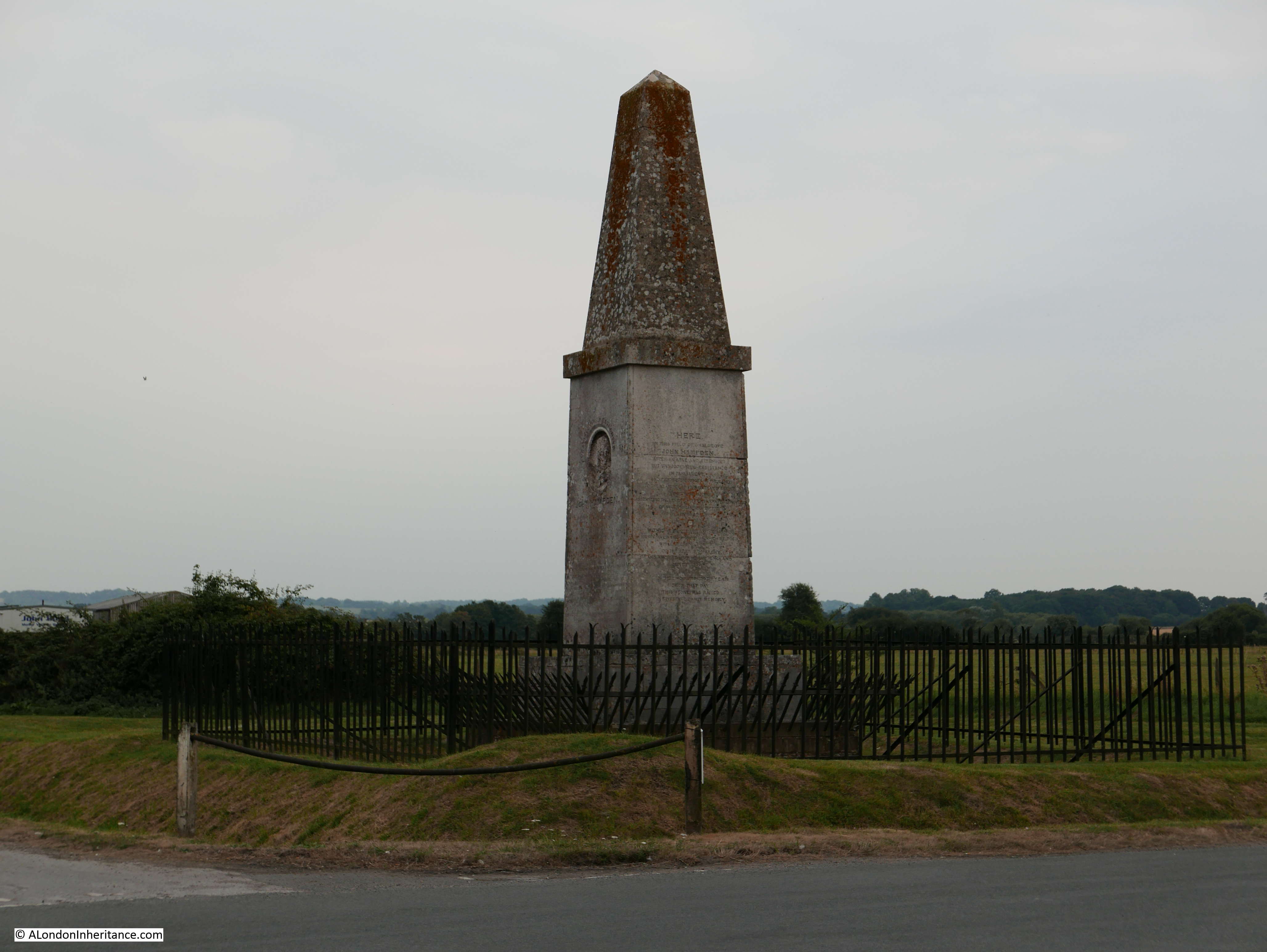
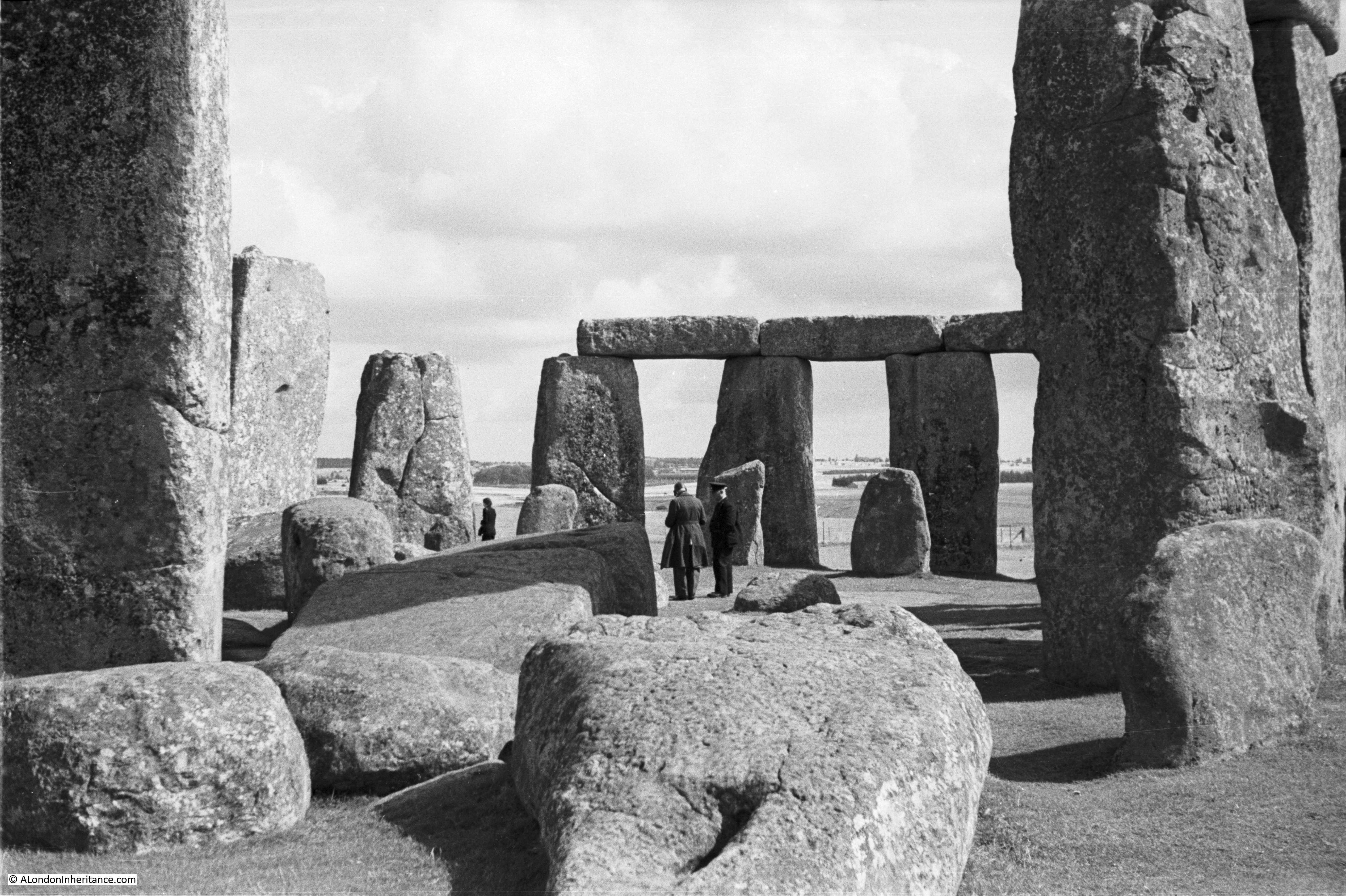
I have been trying to work out who the two people in the following photo could be. The man on the right could be a chauffeur judging by his clothing, the man on the left looks to be wearing a long coat and some form of leather hat.

Winchester and Stonehenge 8

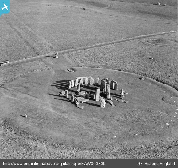
The following photo from Britain from Above taken in 1946 provides a view of a quieter Stonehenge than today, however a solitary coach on the now closed A344 provides an indication of what is to come.

EAW003339

There are numerous theories as to the original purpose of Stonehenge – astronomical calendar, religious or ceremonial site however I suspect we will never know for sure.

The history of the next place is relatively recent when compared with the age of Stonehenge. It is though well documented. This is Winchester, reached from London via Waterloo if travelling by train, or the M3 by car.

Winchester has a long history. A Roman town, Venta Belgarum, occupied an earlier settlement. An Anglo-Saxon Minster was built on part of the area now occupied by the Cathedral from the 7th to the 11th century with a new cathedral being built in the 11th century, the Cathedral that with subsequent rebuilding and alterations forms the current Winchester Cathedral.

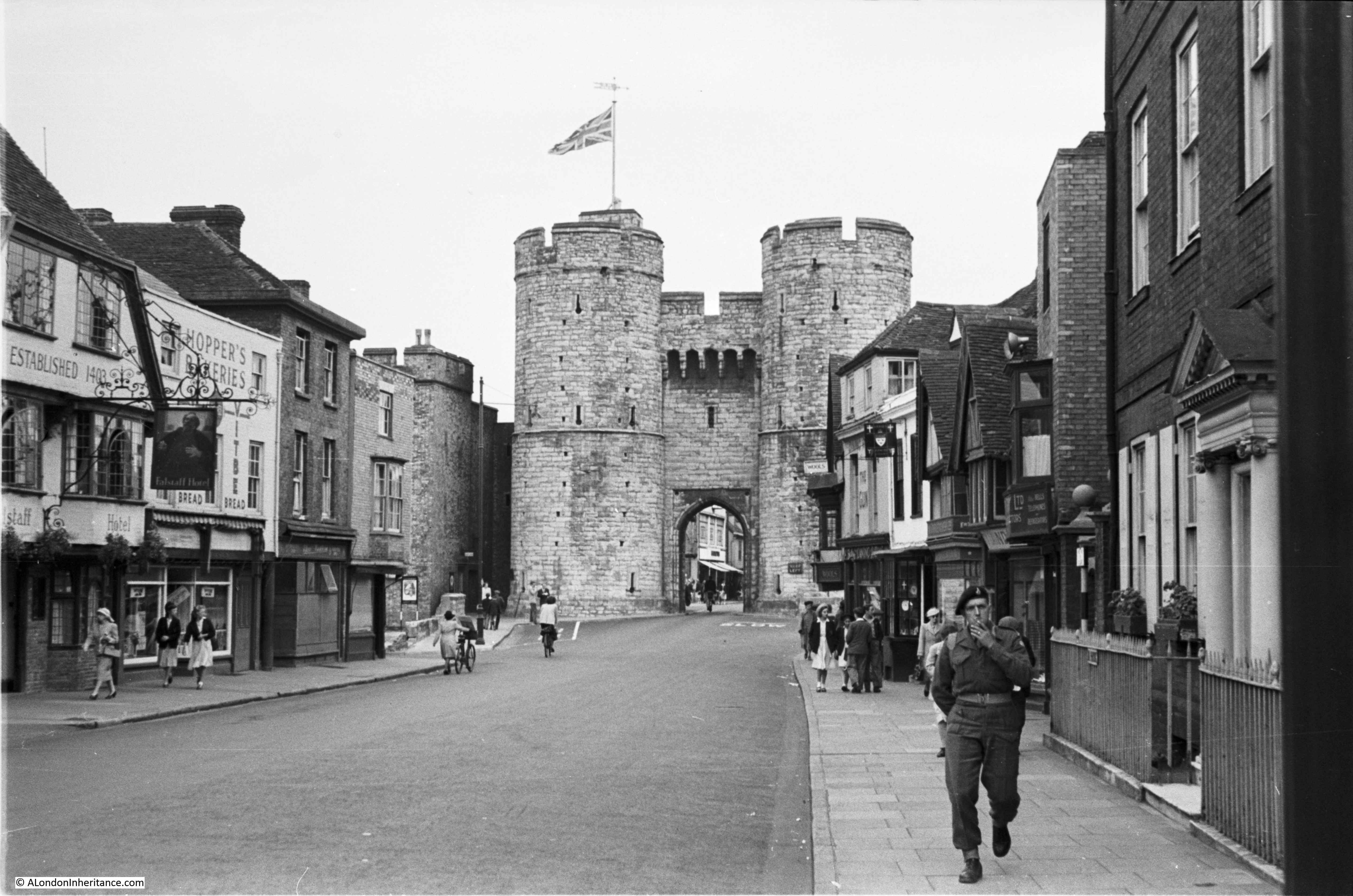
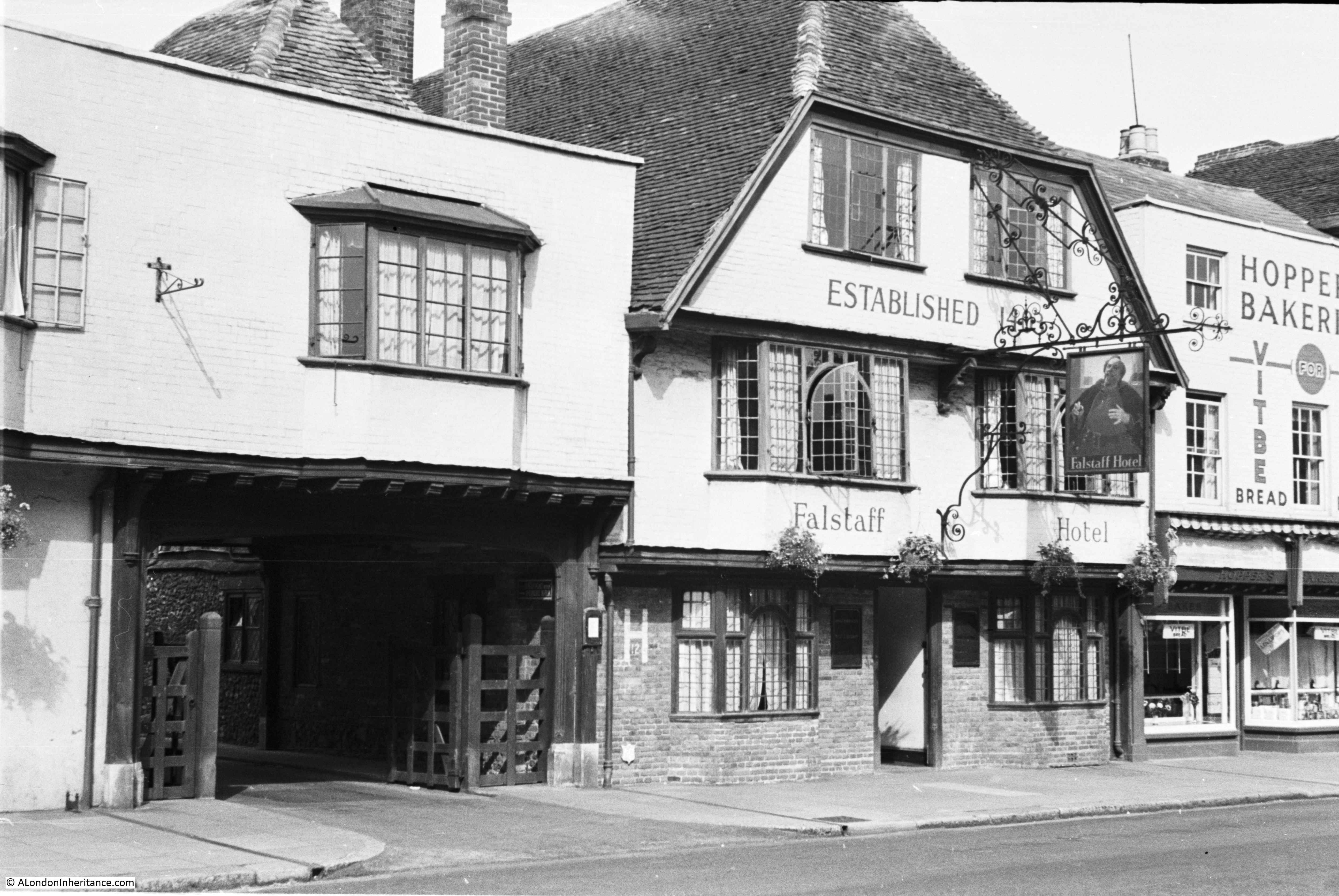
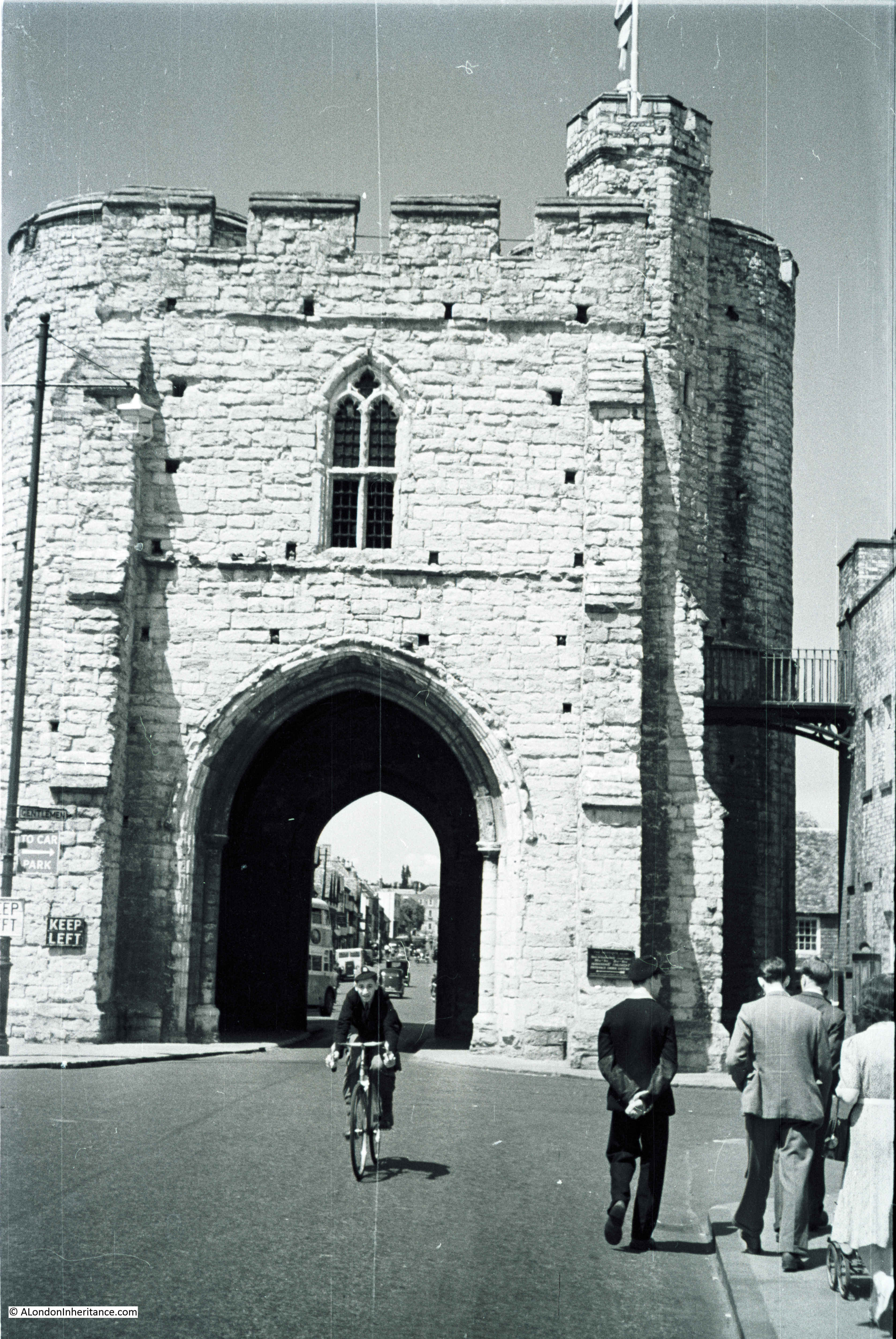
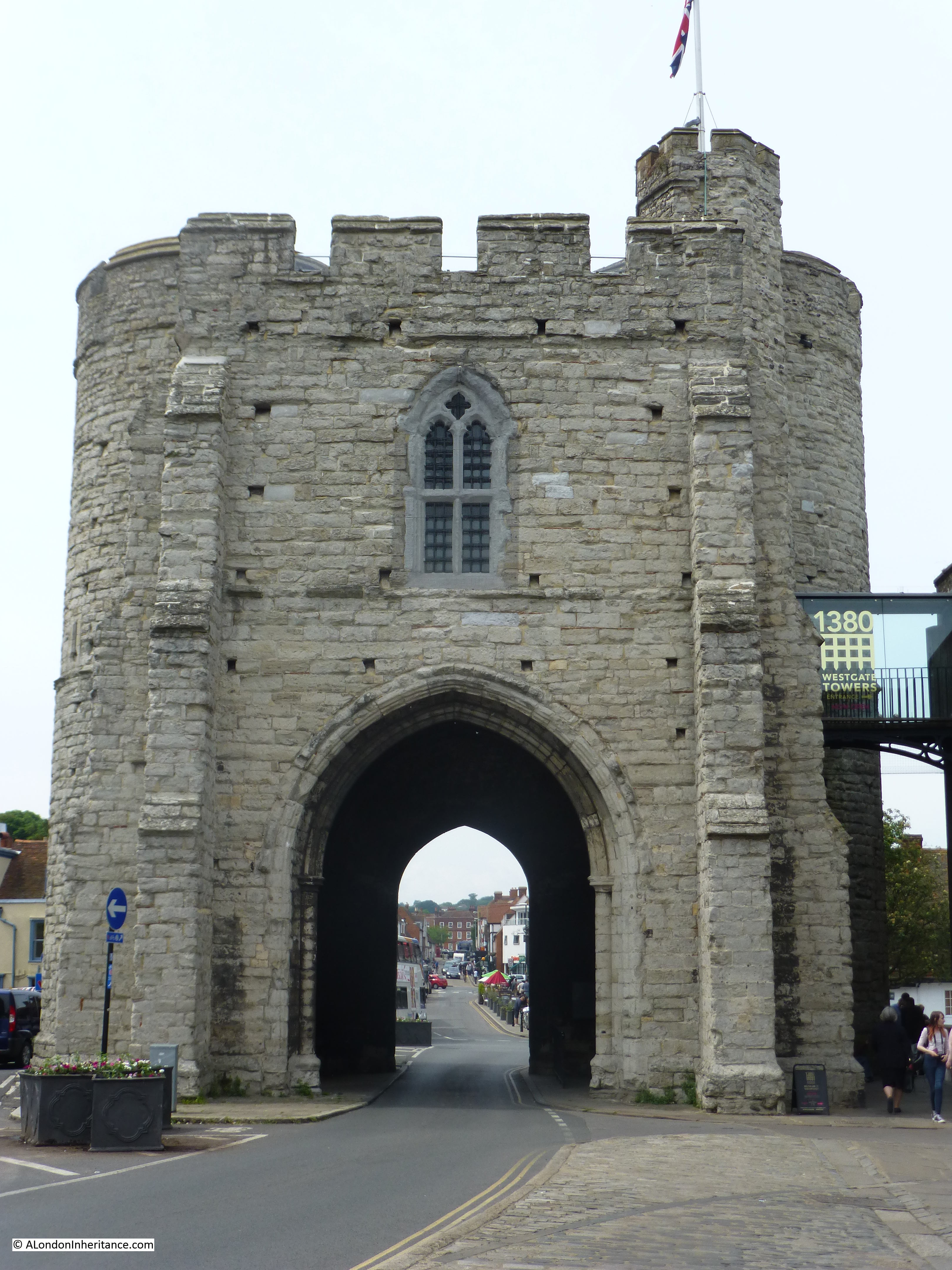
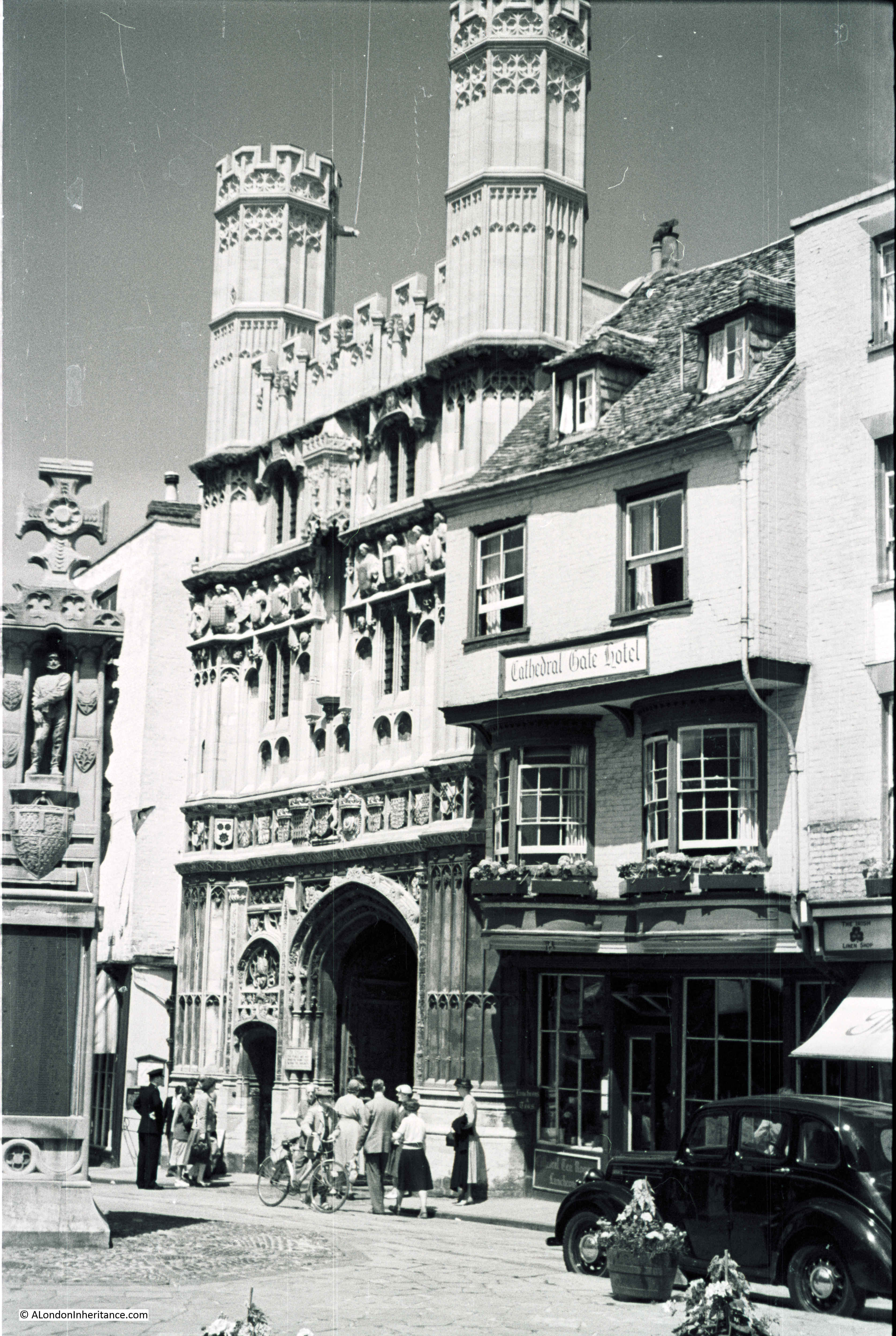
For my brief tour of Winchester, I will start at the far western end of the High Street at the West Gate – my father’s original photo:

Winchester and Stonehenge 7

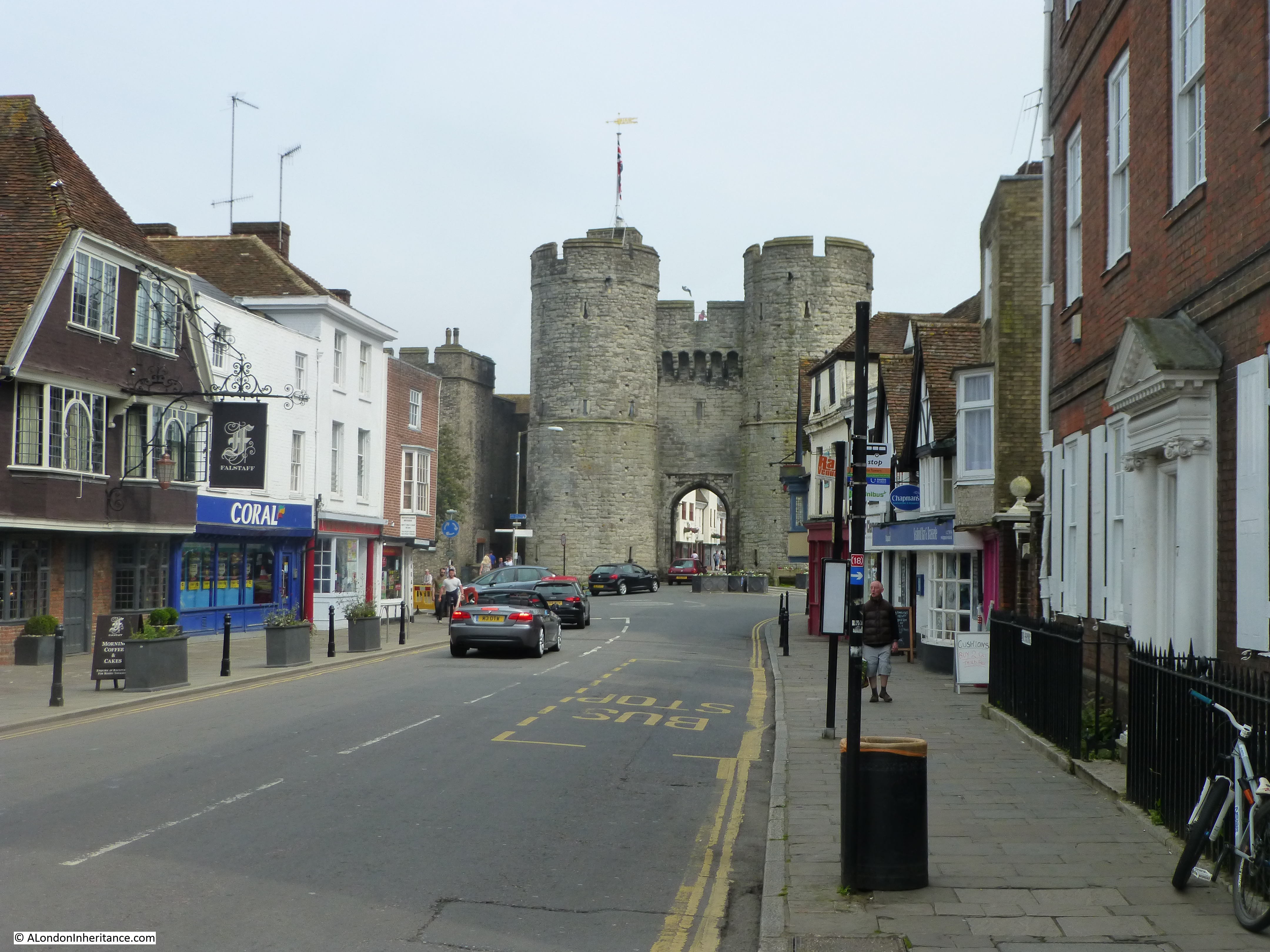
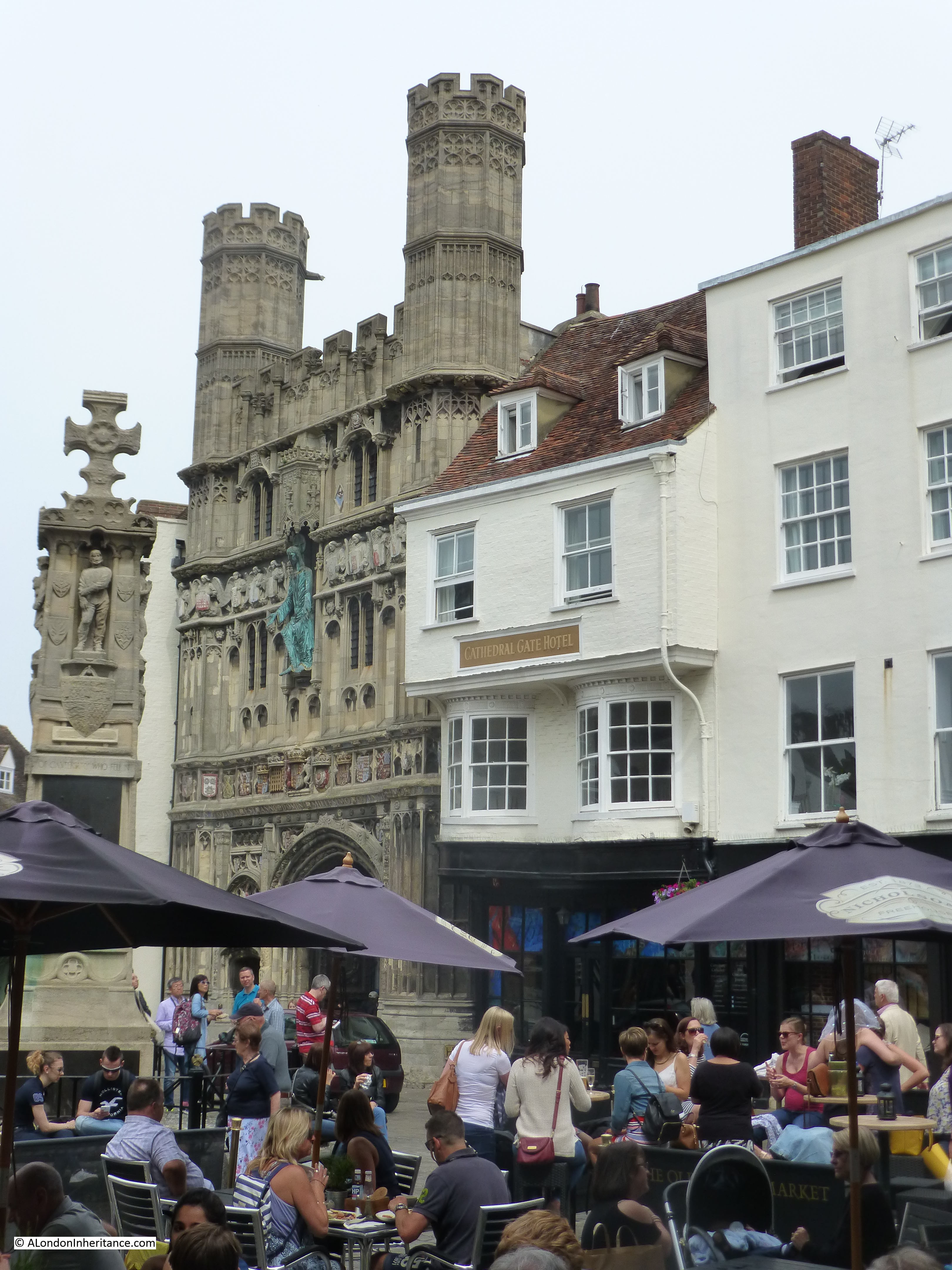
The West Gate today. Originally, all traffic would pass through the West Gate and whilst this worked when there was little traffic of limited width, it would not be a suitable route into the centre of Winchester for today’s traffic. The buildings to the left of the gate were demolished and the road now bypasses the gate leaving it as the pedestrian route into the centre of the city.

Winchester and Stonehenge 16

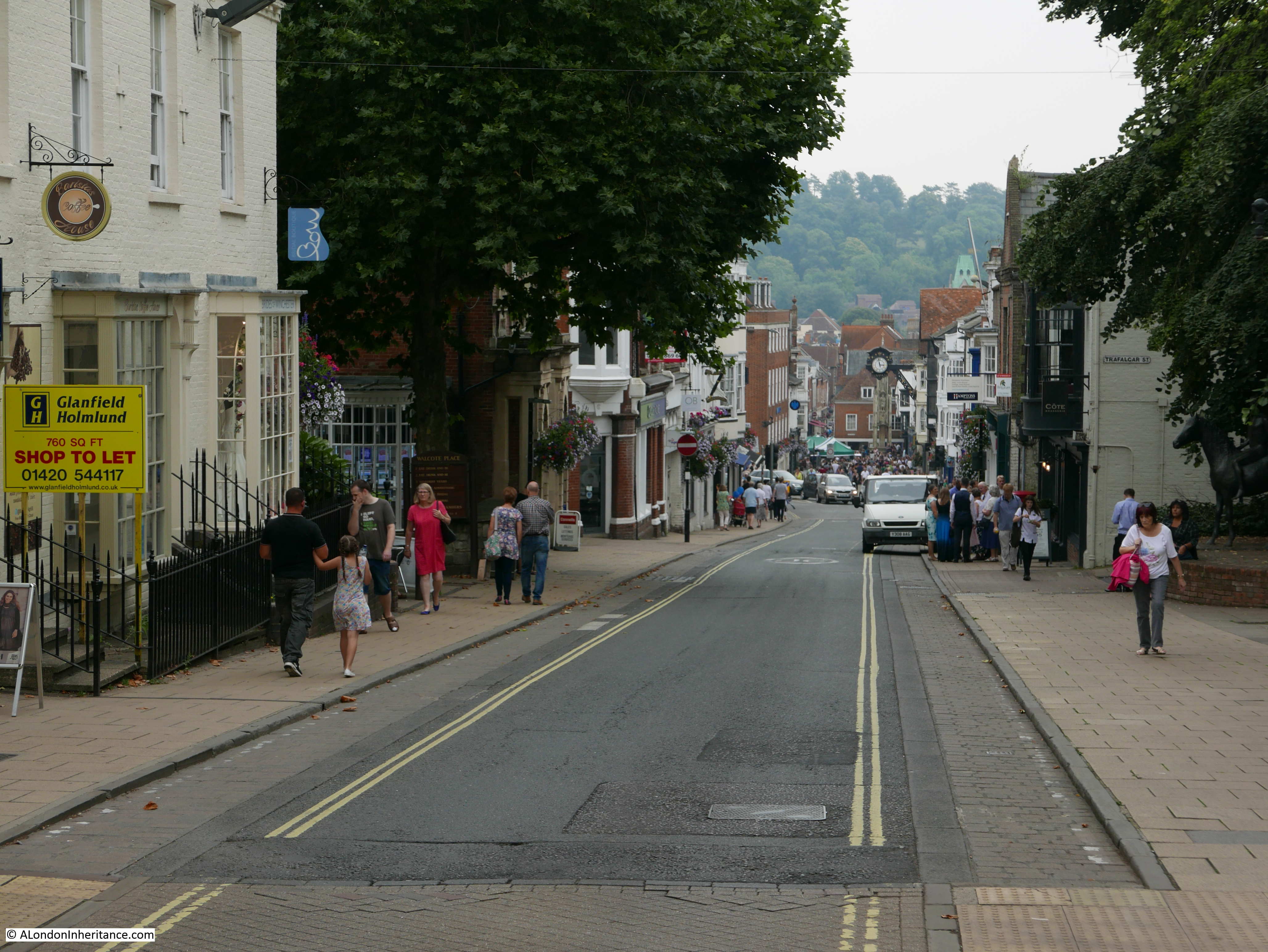
Passing through the West Gate and we can look down Winchester High Street. The landscape descends down to the River Itchen that flows through the city at the far end of the High Street.

Winchester and Stonehenge 28

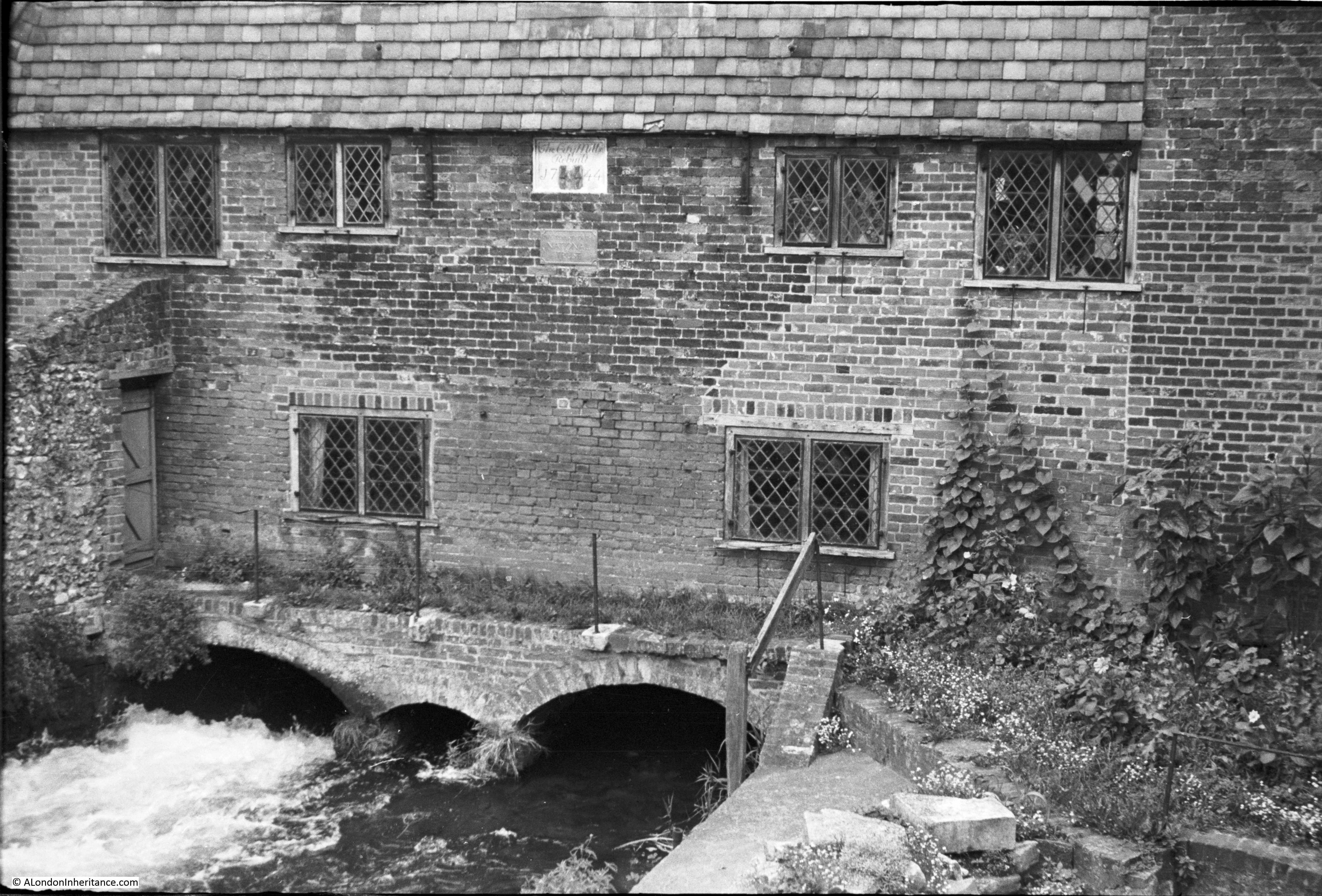
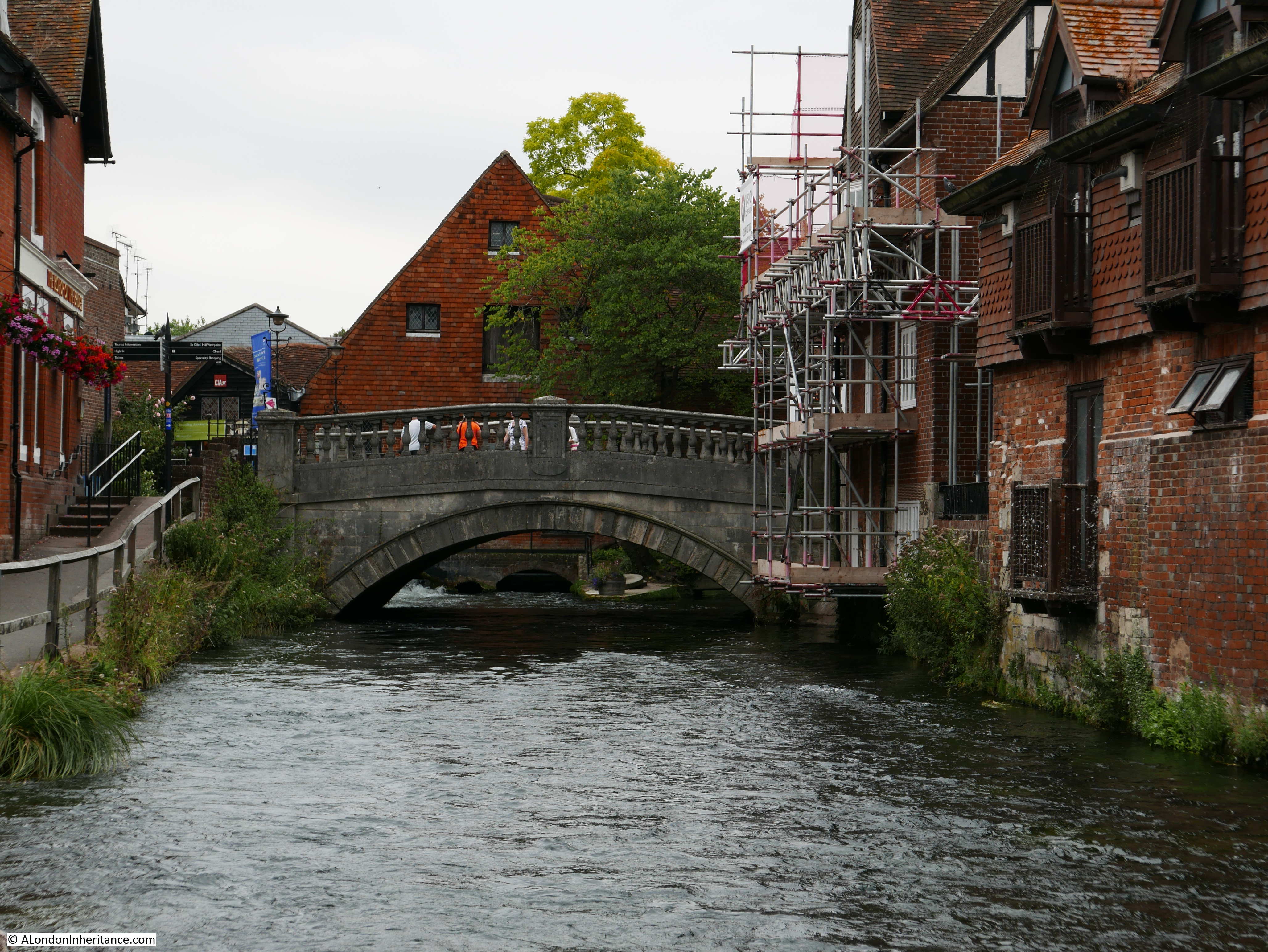
And it is the River Itchen that we meet now, passing underneath the Winchester City Mill. A mill was recorded on the site in Saxon times and it appears that a mill has operated on the site for the majority of the years since. The present building was constructed in 1743.

The Mill became the first Youth Hostel of the London region of the Youth Hostel Association in 1931, continuing as a hostel till 2005 when the mill was restored to working order and is now run by the National Trust.

My father and his friends used Youth Hostels as they cycled around the country, so I am almost certain that he stayed here on his journey through Winchester. The National Trust web page for the mill has some accounts from people who stayed at the youth hostel during the 1940s – the link to the page is here.

Winchester and Stonehenge 4

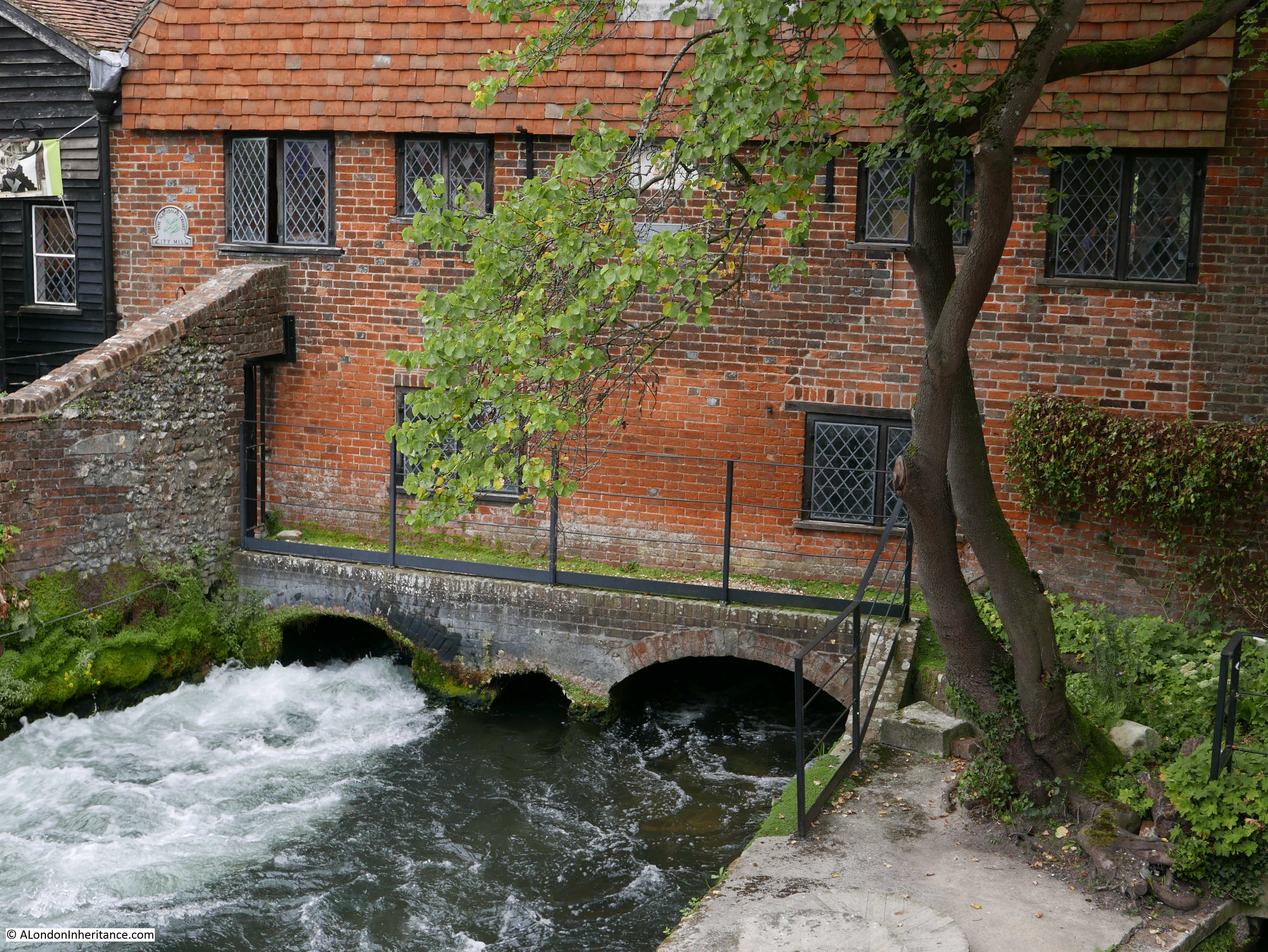
The same view today – not much has changed.

Winchester and Stonehenge 12

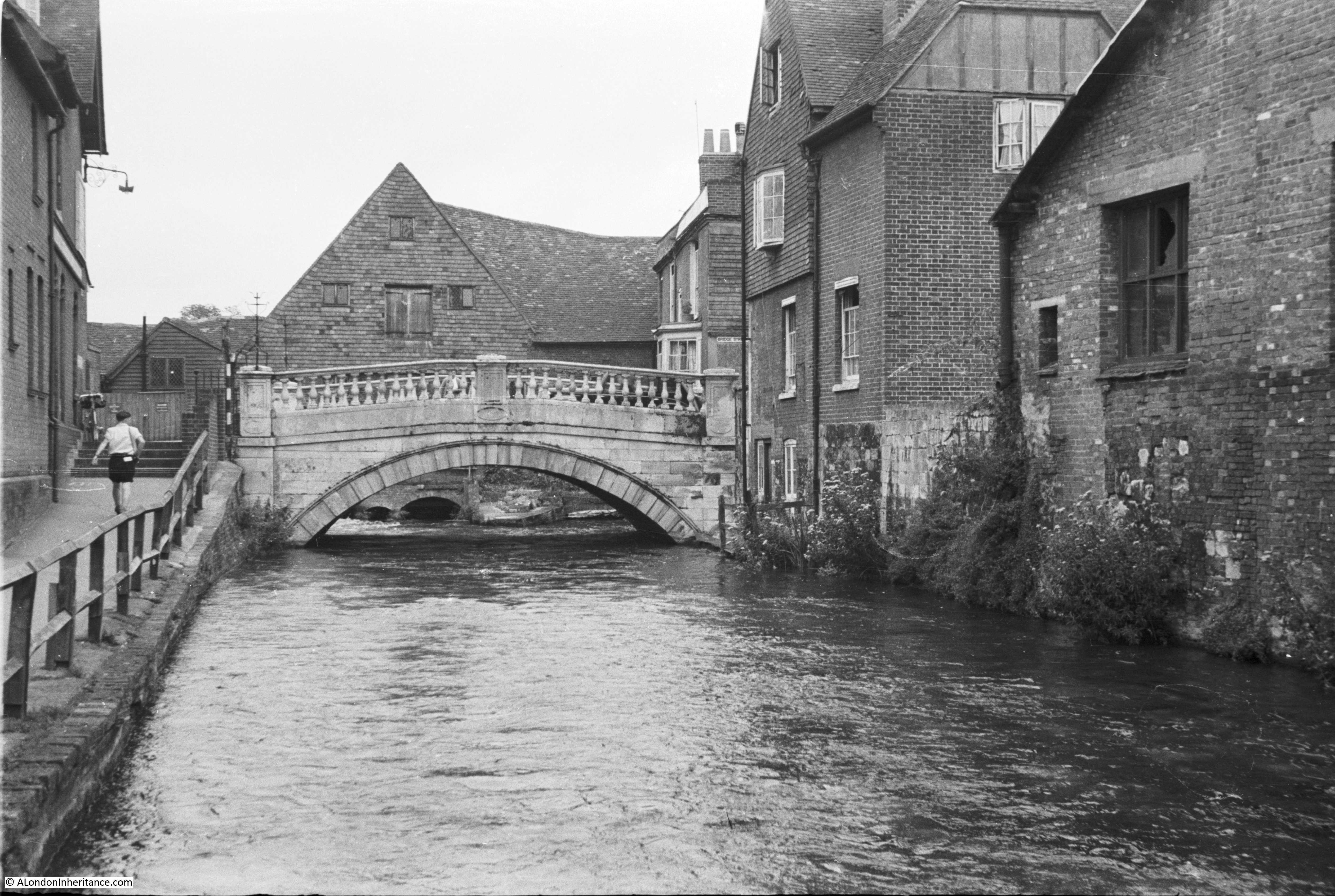
In the following photo, the bridge is from where the above photos were taken. The mill is the building behind the bridge so this is a short distance further along the River Itchen looking back at the mill.

Winchester and Stonehenge 3

The same view today.

Winchester and Stonehenge 11

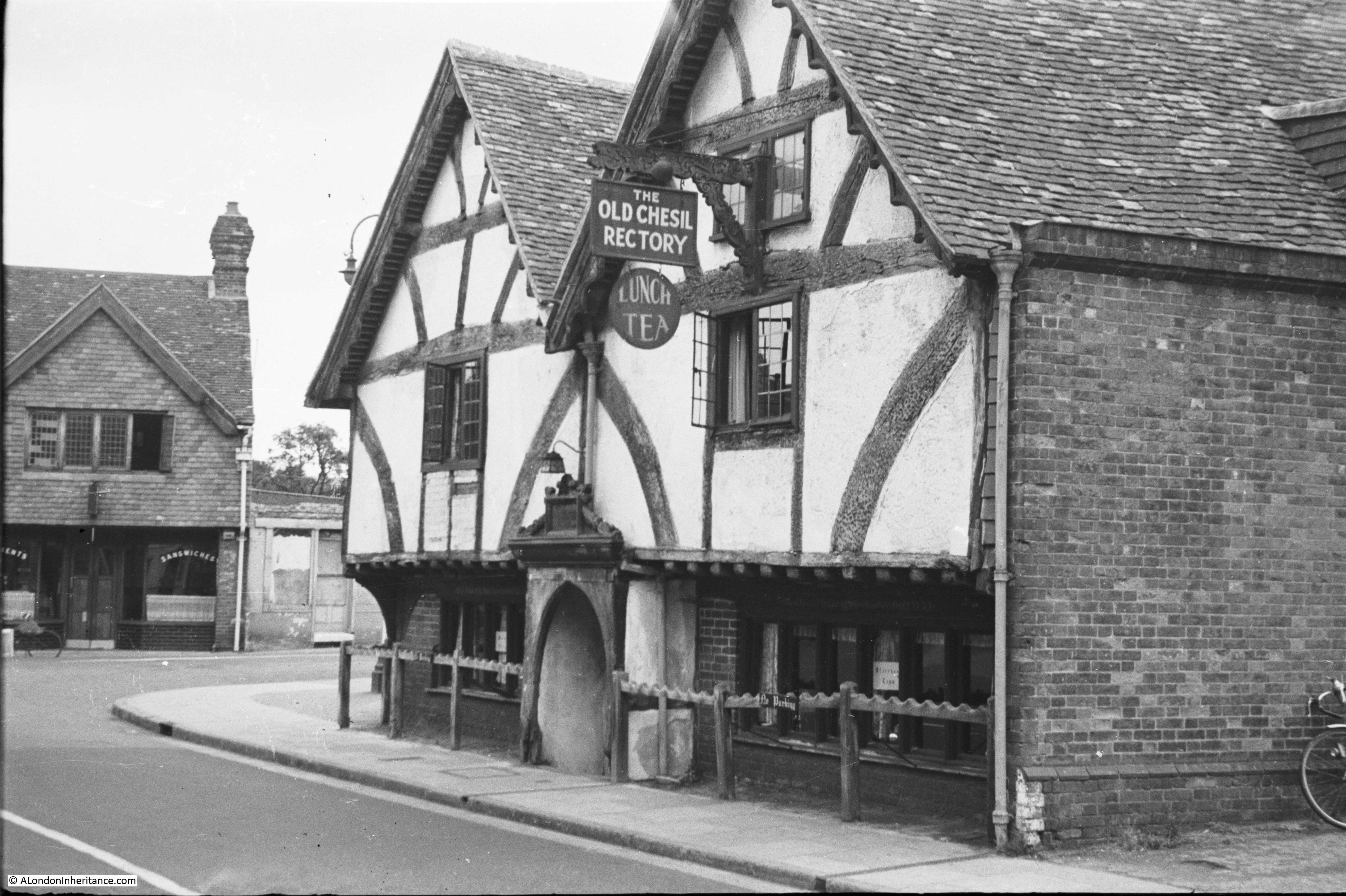
A short distance from the mill is the Old Chesil Rectory. Originally built by a wealthy Winchester merchant, the building was constructed between 1425 and 1450 and in 1949 was a restaurant serving lunch and tea.

Winchester and Stonehenge 5

The building is still a restaurant, but has dropped the “old”  and is now simply The Chesil Rectory and appears to be very popular as we tried to get a table on Saturday lunchtime but they were fully booked for the whole weekend.

The front of the building looks much the same, however in 1949 the side of the building running to the right appears to have been all brick, presumably covering the original wall that has now been exposed.

Winchester and Stonehenge 13

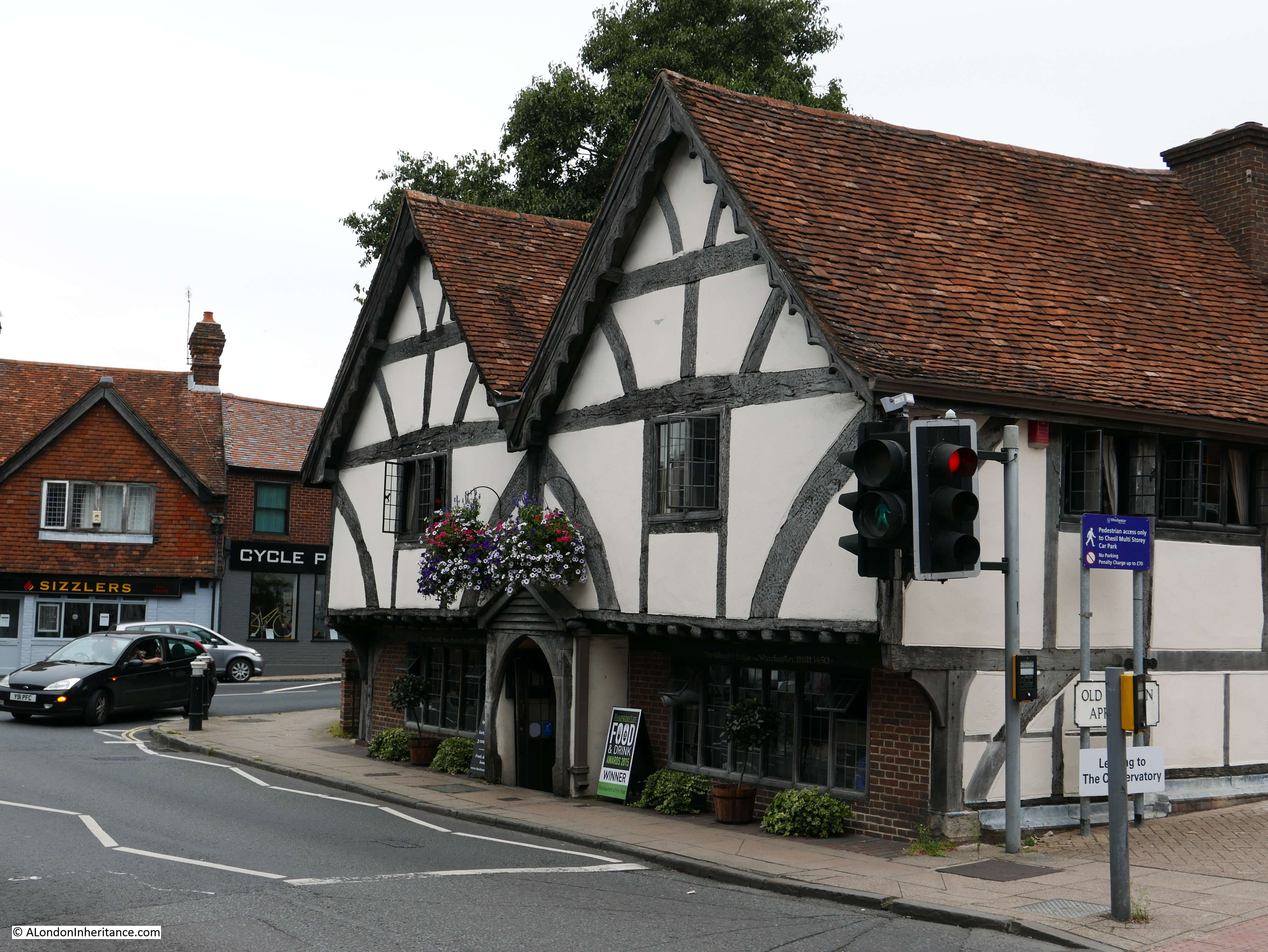
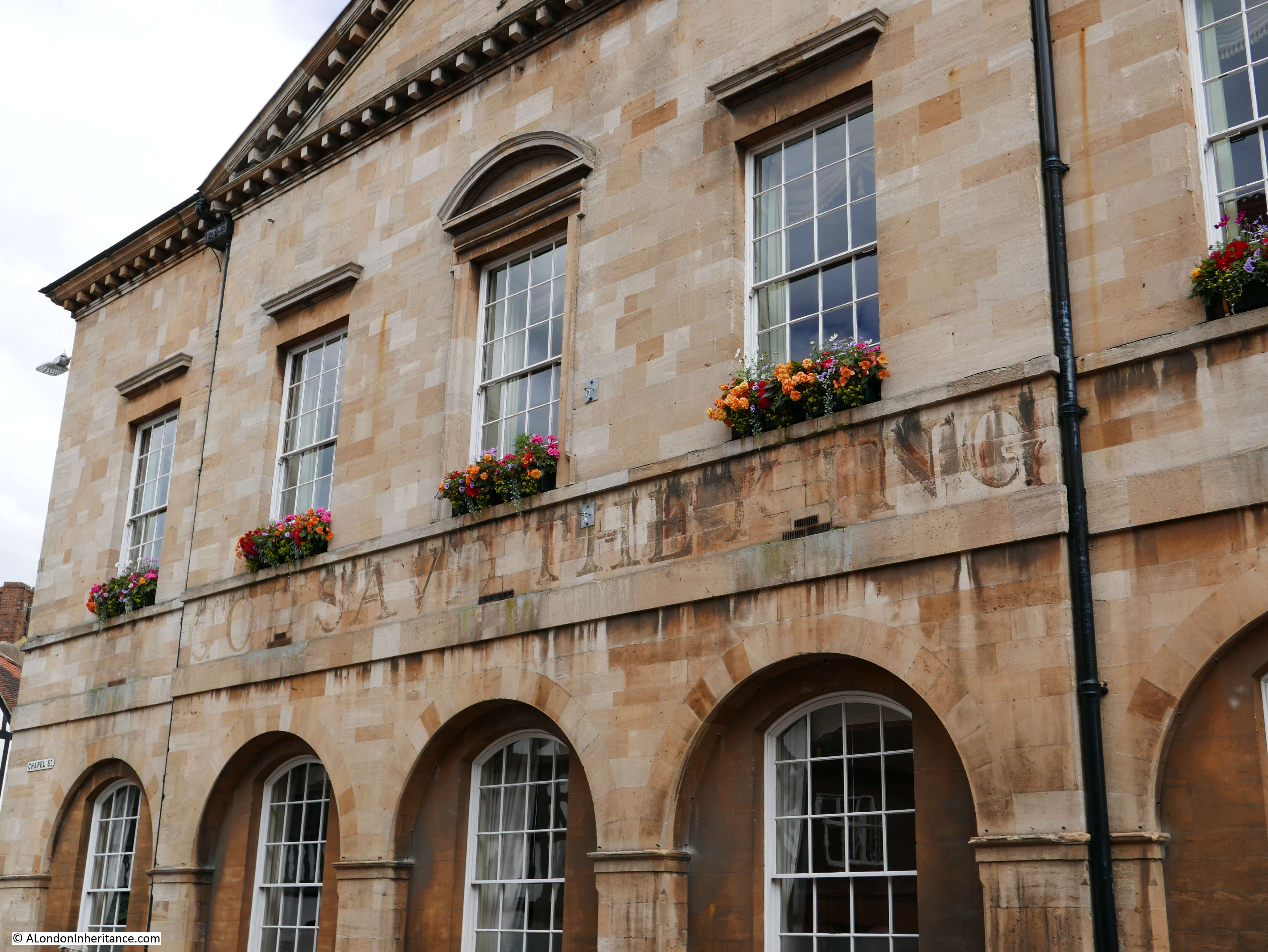
As with much of Winchester outside of the pedestrianised High Street there is considerable traffic and I had to wait several minutes to get a clear shot of the front of the Chesil Rectory. It must have been a much more enjoyable experience to explore towns and cities without the high levels of traffic that we have today.

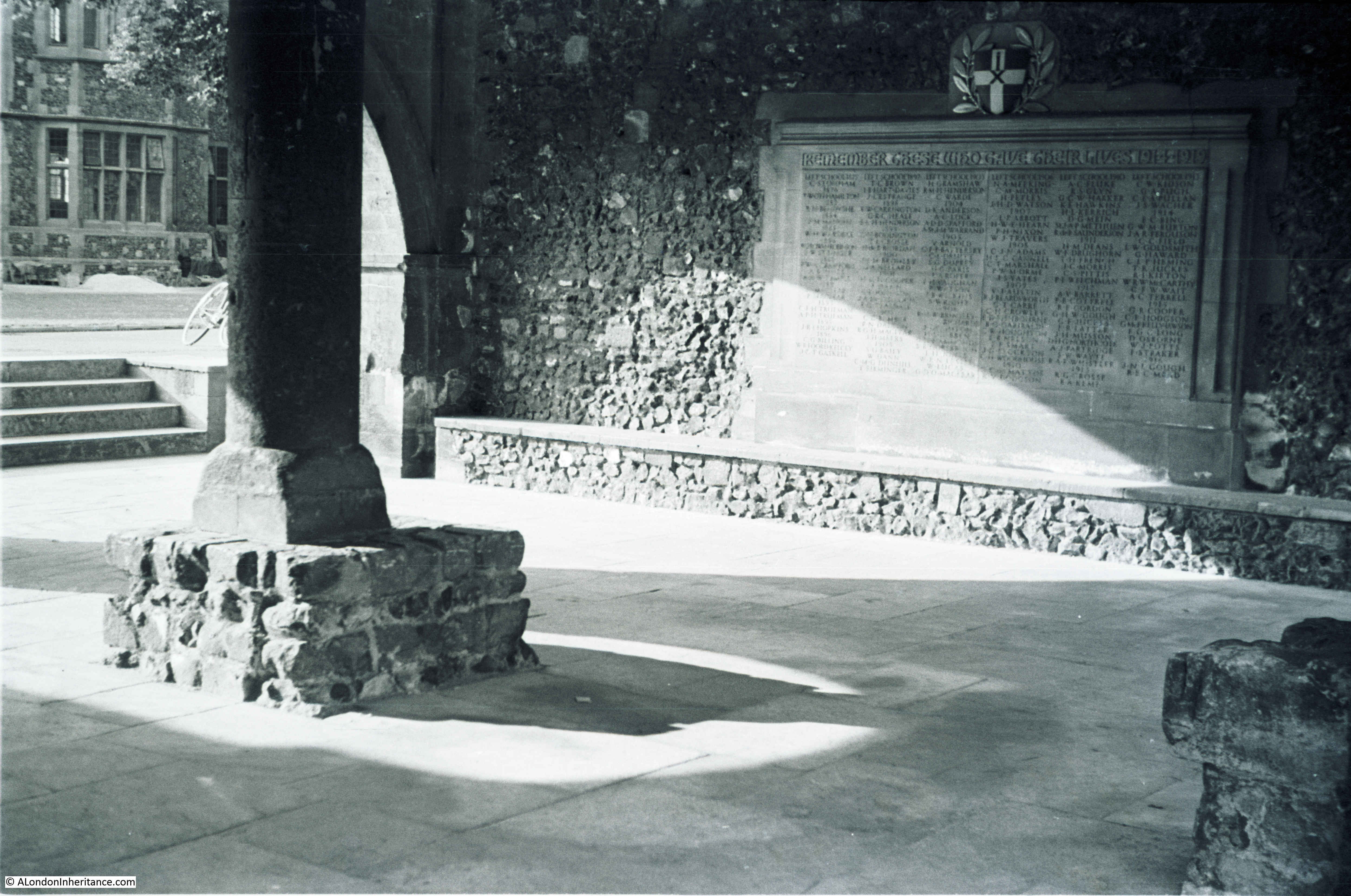
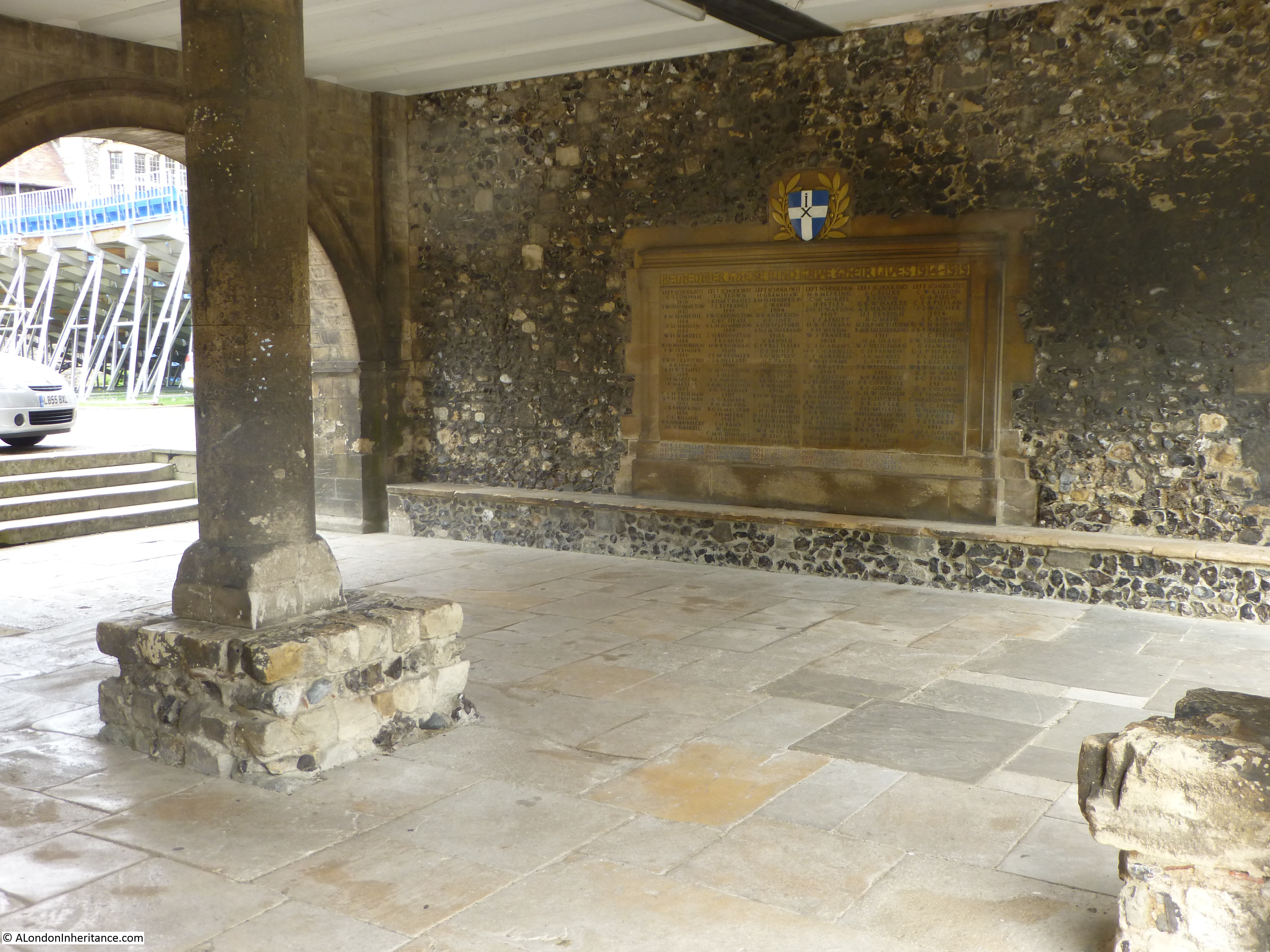
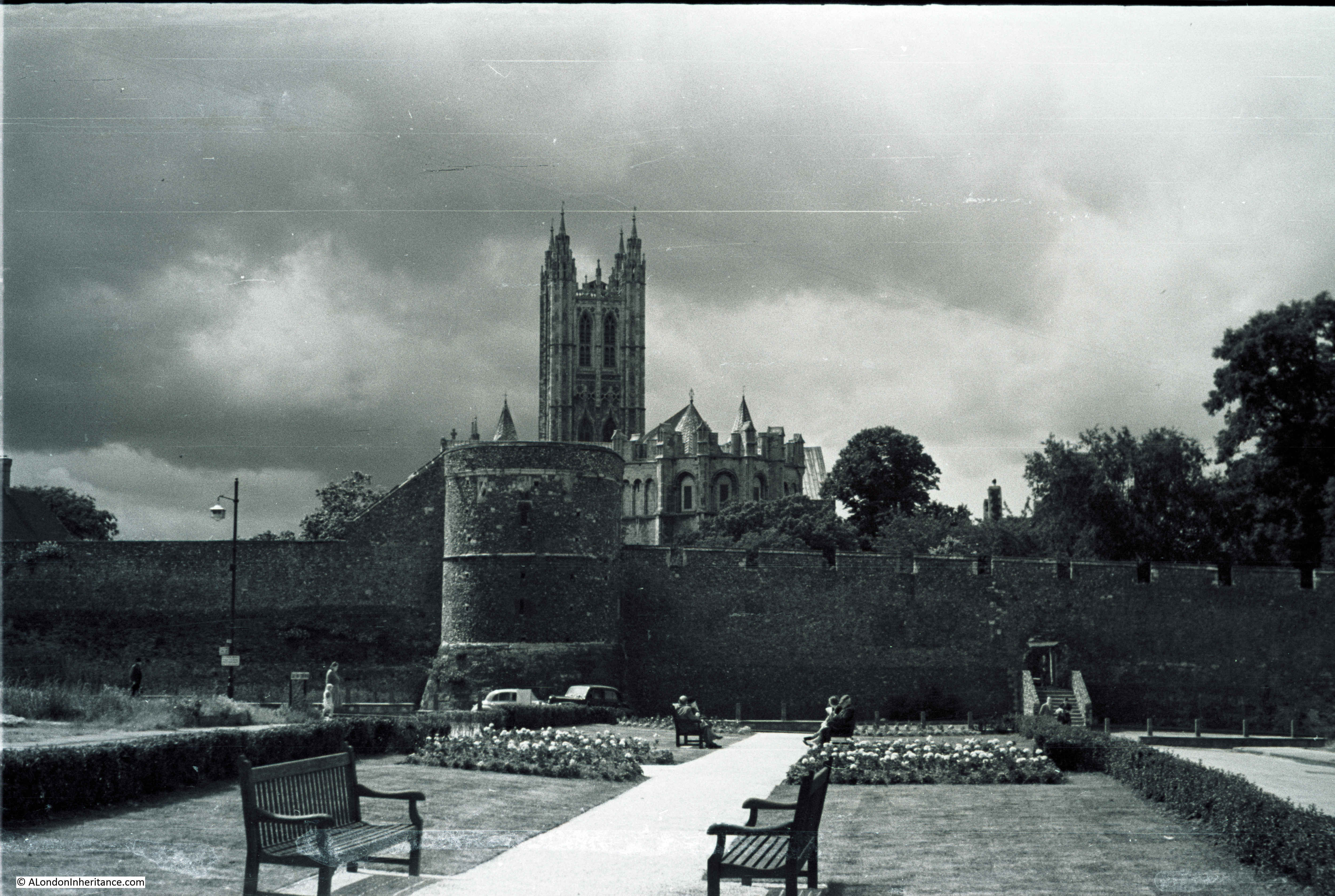
The next stop is back up the High Street where we can turn off one of a number of side streets to reach the Cathedral. This was the view looking down towards the main entrance with the war memorial in the foreground in 1949.

Winchester and Stonehenge 6

The same view today – the trees on either side have grown considerably in the 67 years between the two photos.

Winchester and Stonehenge 14

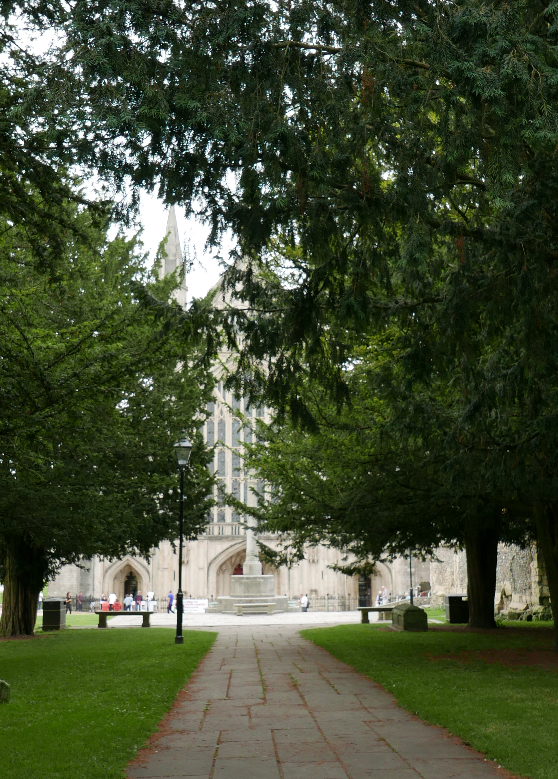
Walking down towards the war memorial I moved from under the trees to get this view of the Cathedral. The large west window was destroyed by Parliamentary soldiers in the Civil War, but later rebuilt using the shattered glass collected from around the Cathedral.

Winchester and Stonehenge 15

The church in Winchester has a long history. the first church (the Old Minster) was built by King Cenwalh in 648 with building of the Norman Cathedral that forms the core of the current building starting in 1079 with the Old Minster being demolished in 1093 when the new cathedral was consecrated. The Cathedral has been through a number of changes, additional development, damage during both the dissolution and the Civil War and major work on the foundations to prevent serious damage to the fabric of the building in the early 20th century.

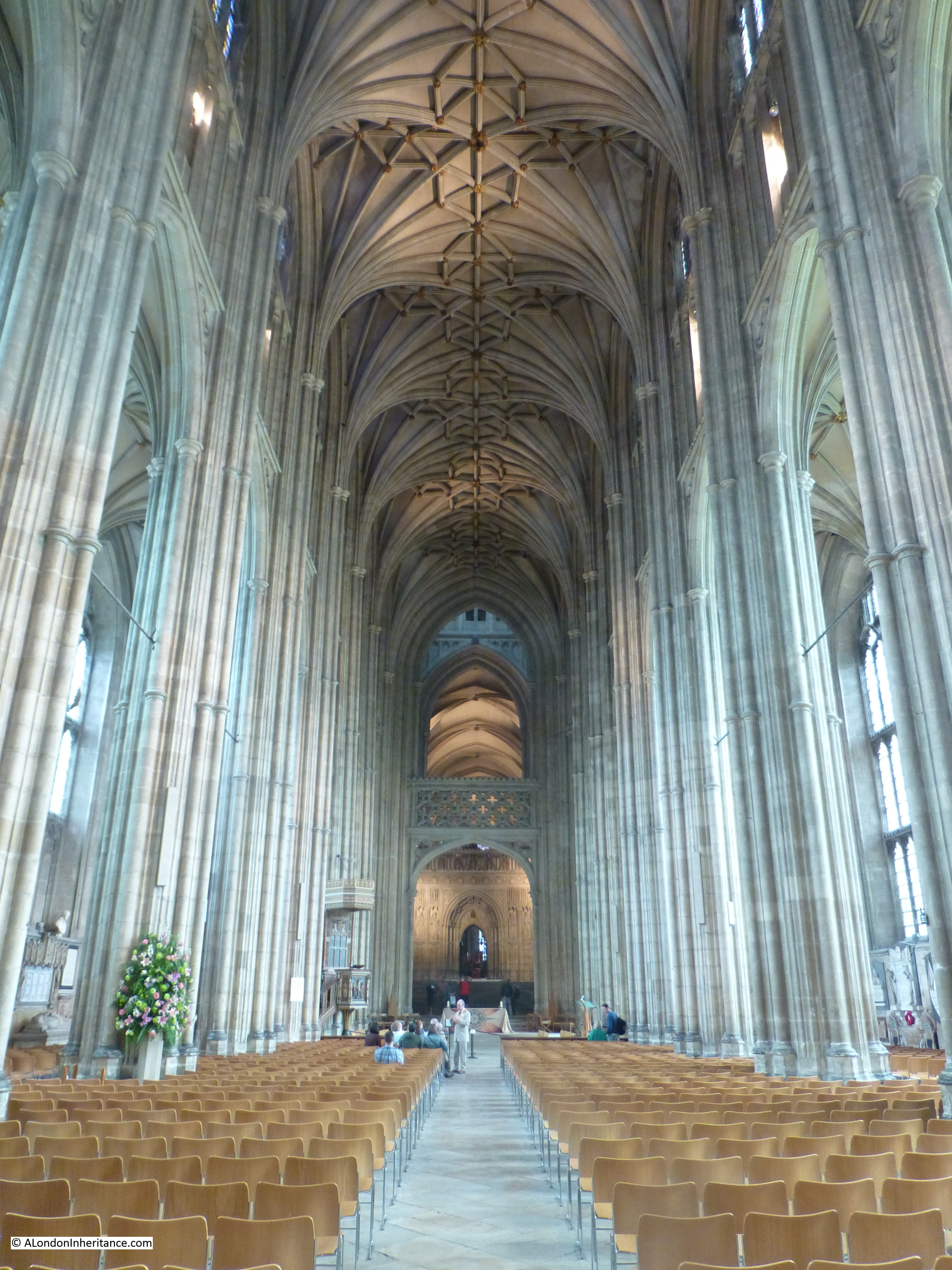
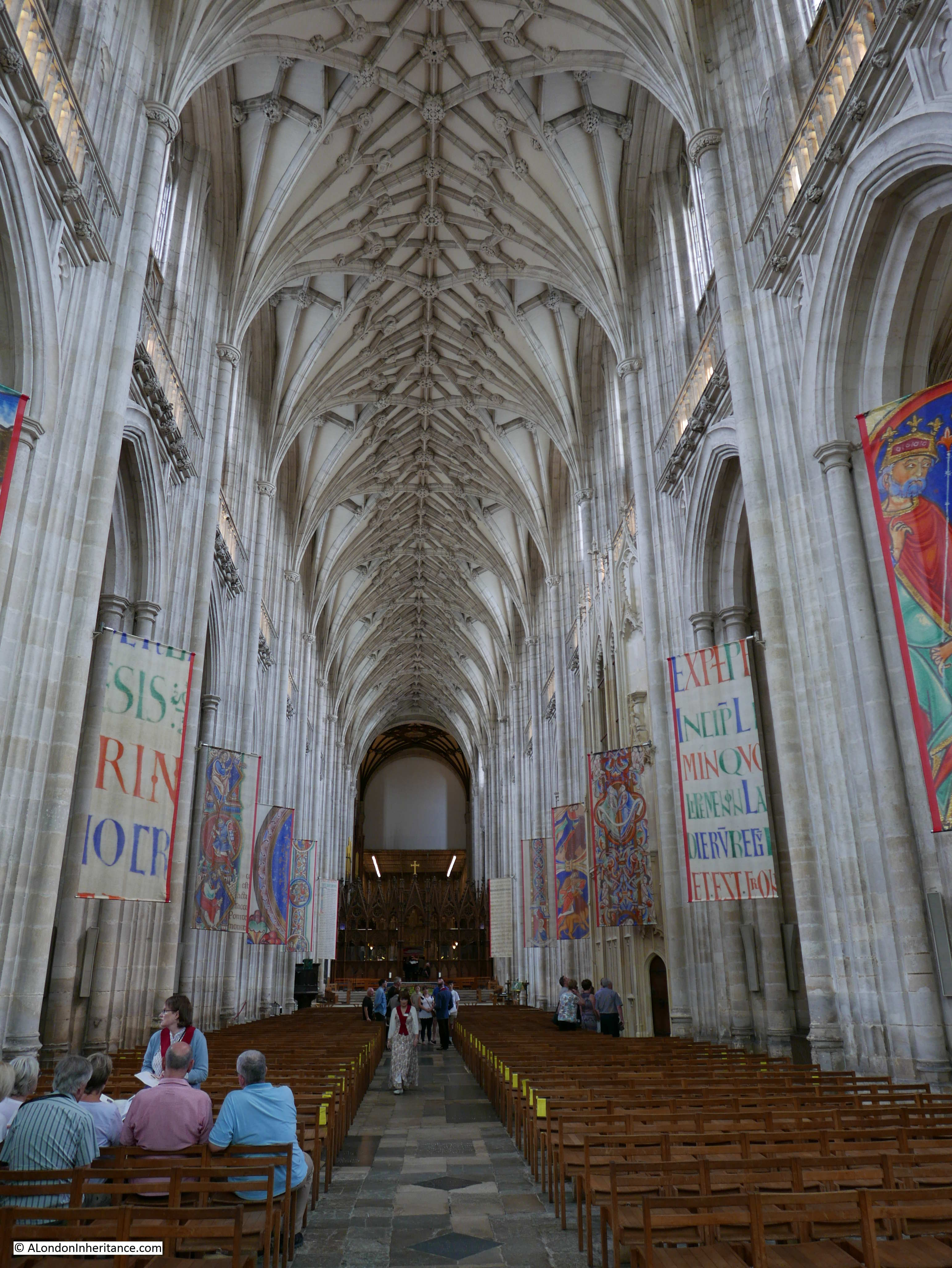
On entering the cathedral today, the first view is of the nave:

Winchester and Stonehenge 26

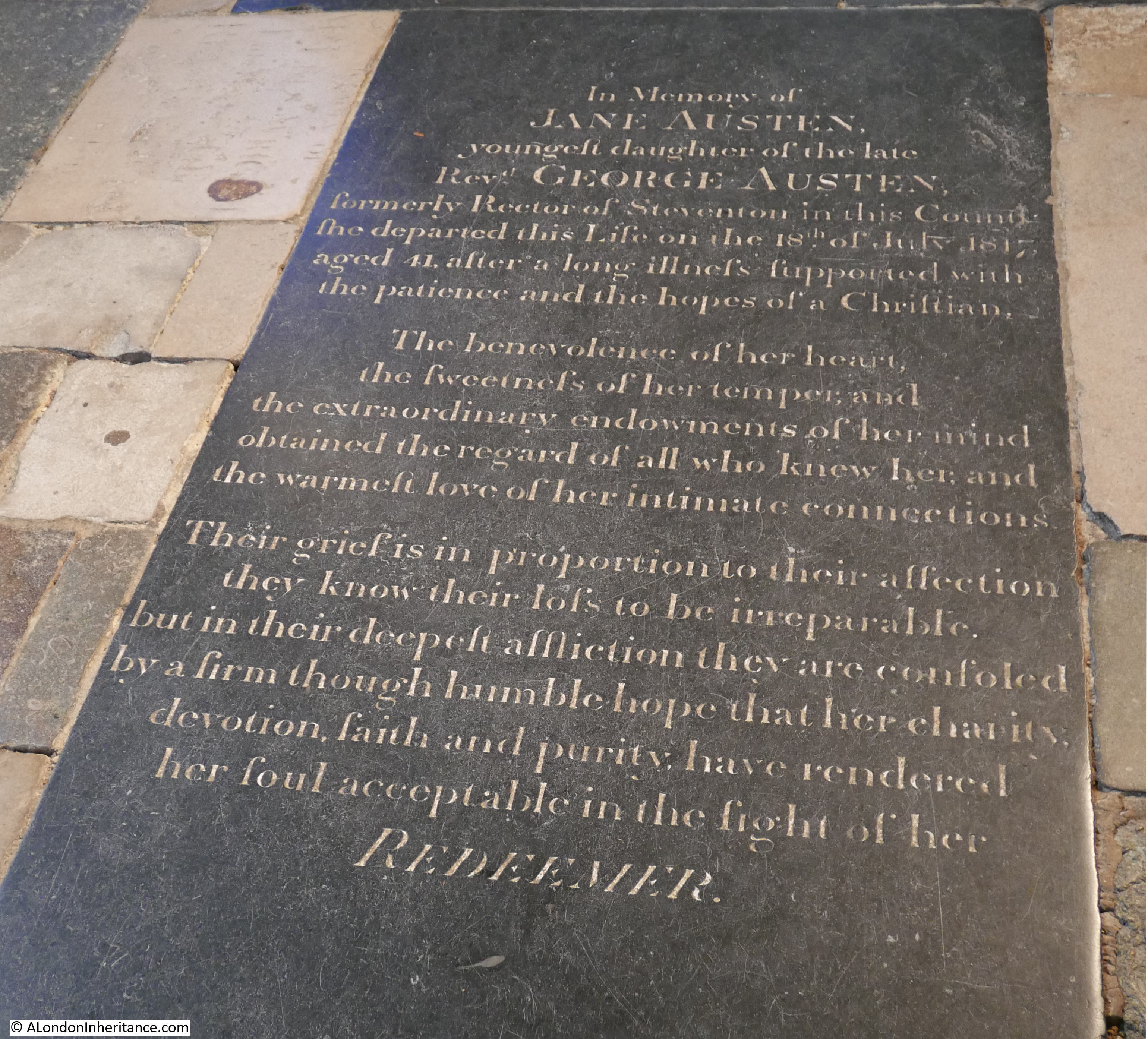
To the left of the nave is the grave of Jane Austen who died in Winchester in 1817. The gravestone makes no mention of her achievements as an author apart from the reference to “the extraordinary achievements of her mind”.

Winchester and Stonehenge 17

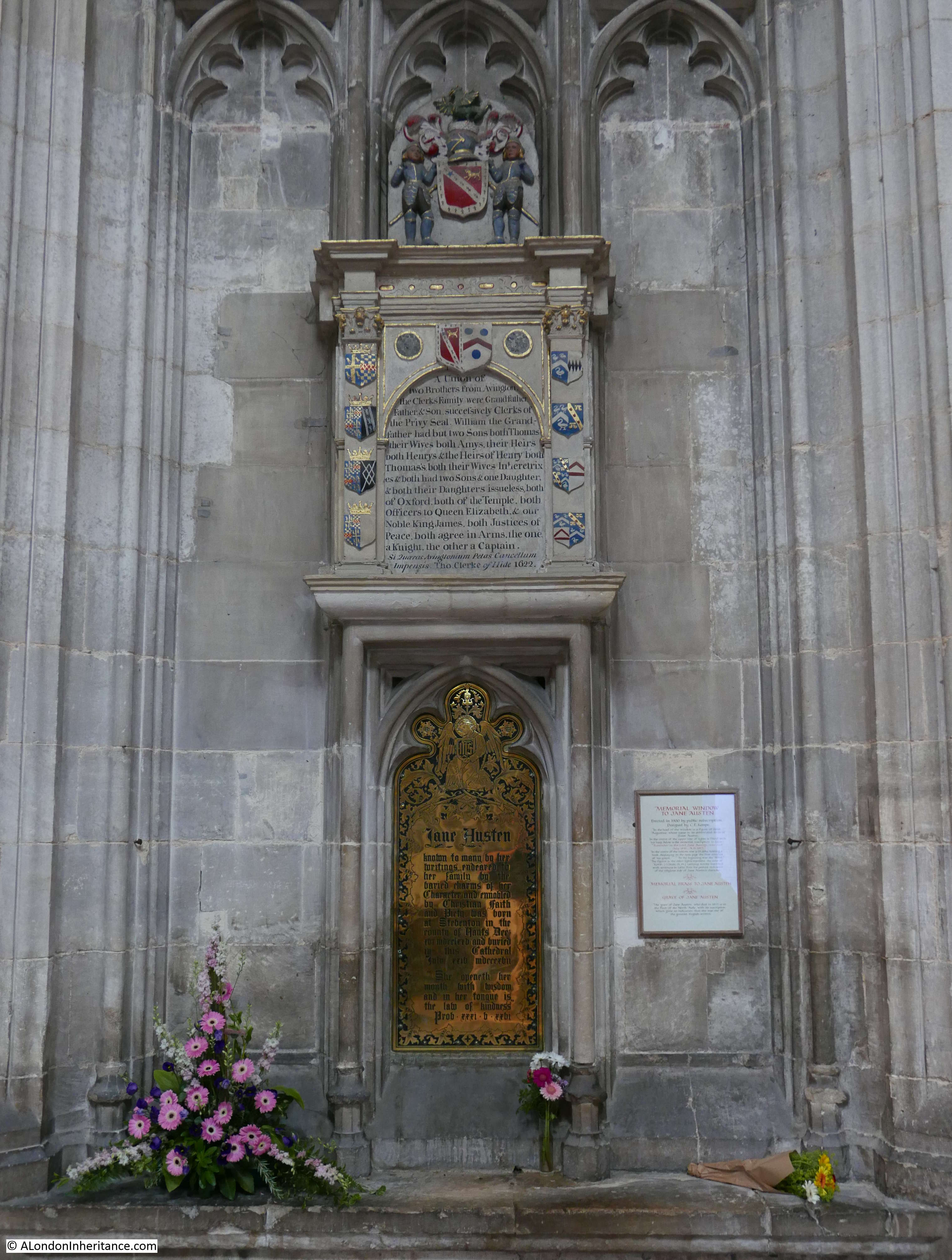
Perhaps to rectify this omission, a memorial was erected in 1900 and paid for by public subscription – the text starts with “known to many by her writings”.

Winchester and Stonehenge 18

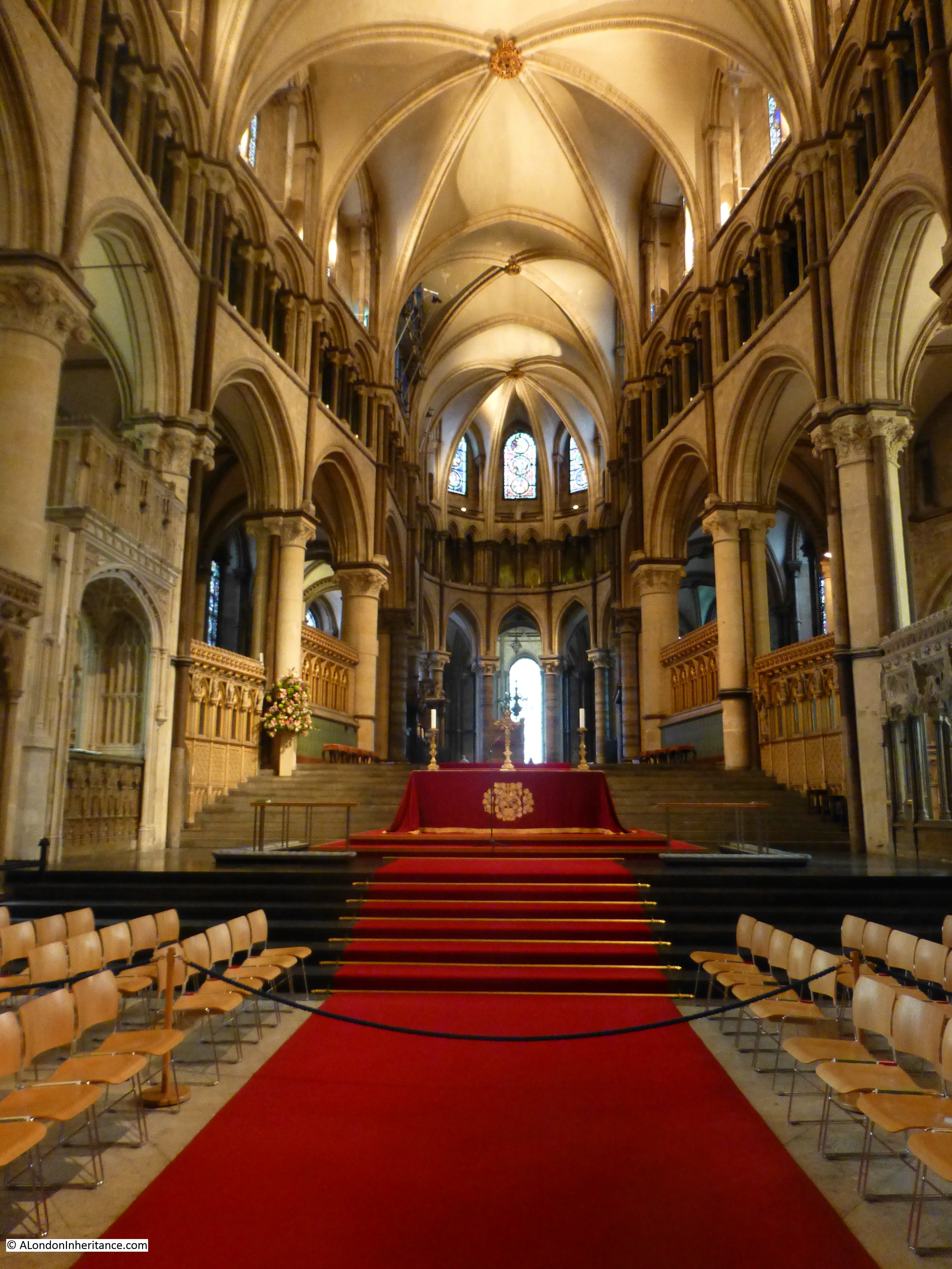
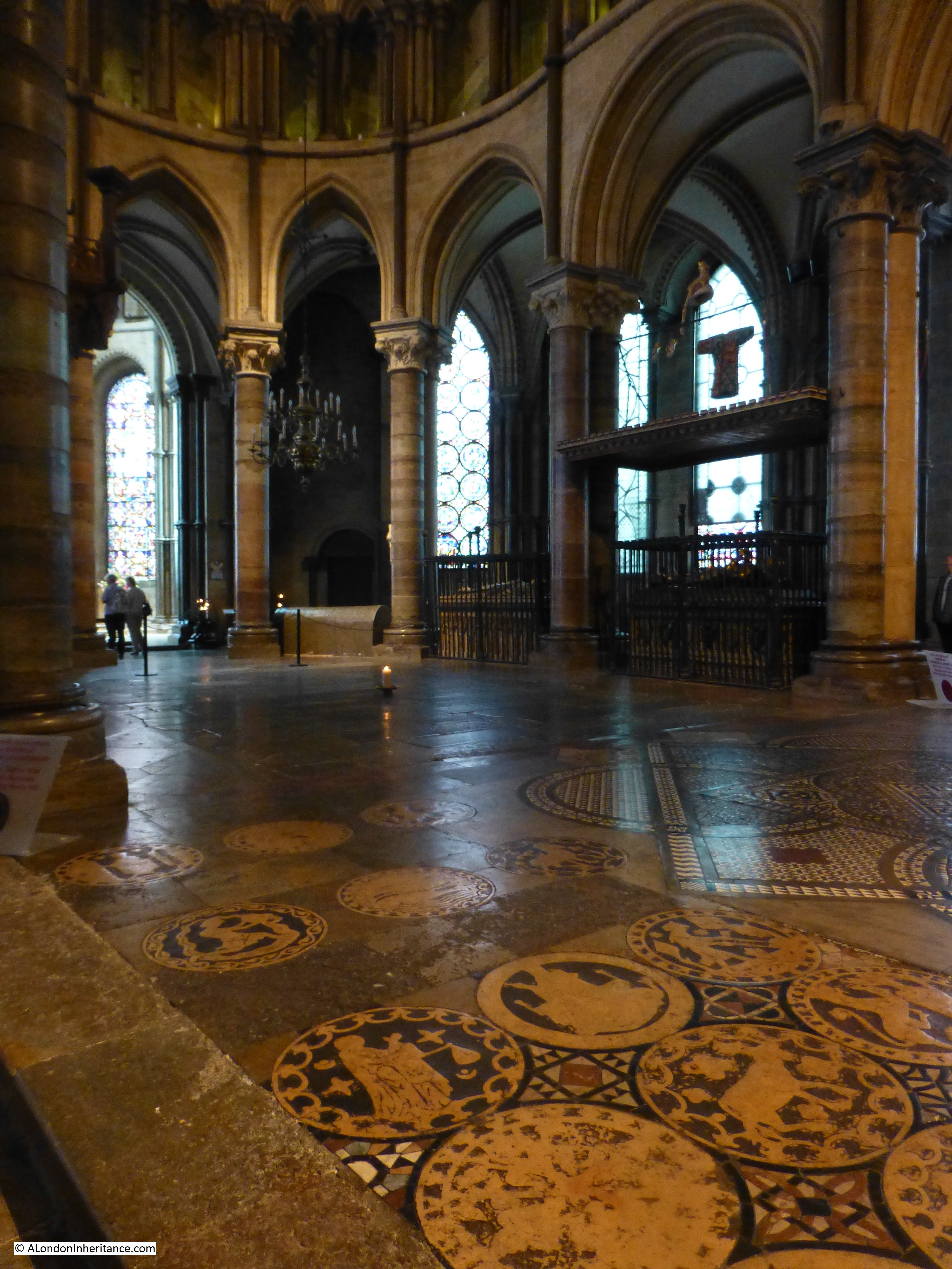
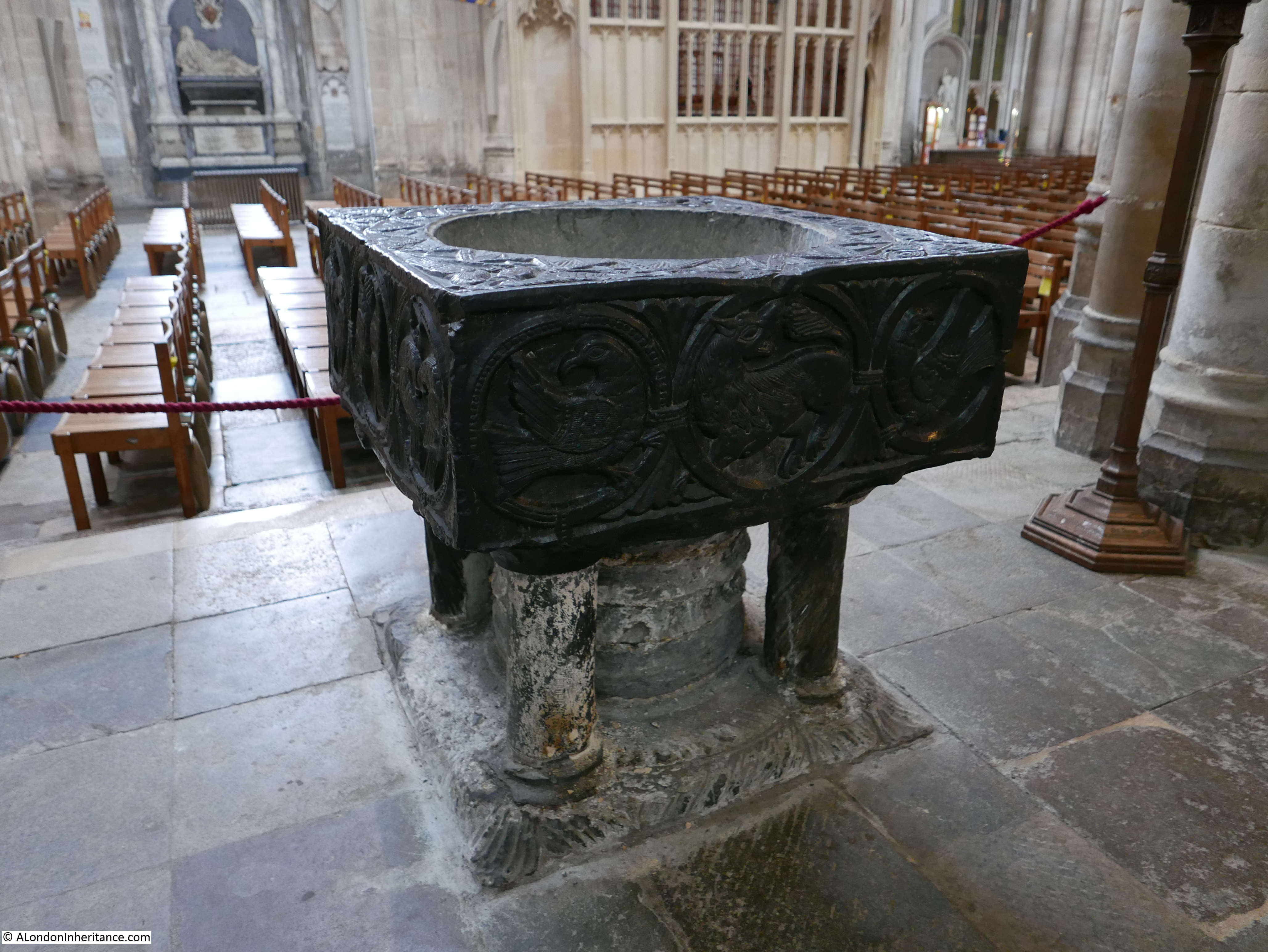
Walking round Winchester Cathedral, there are so many survivals from the Cathedral’s long history. Here, the mid 12th century font made from black Tournai marble:

Winchester and Stonehenge 19

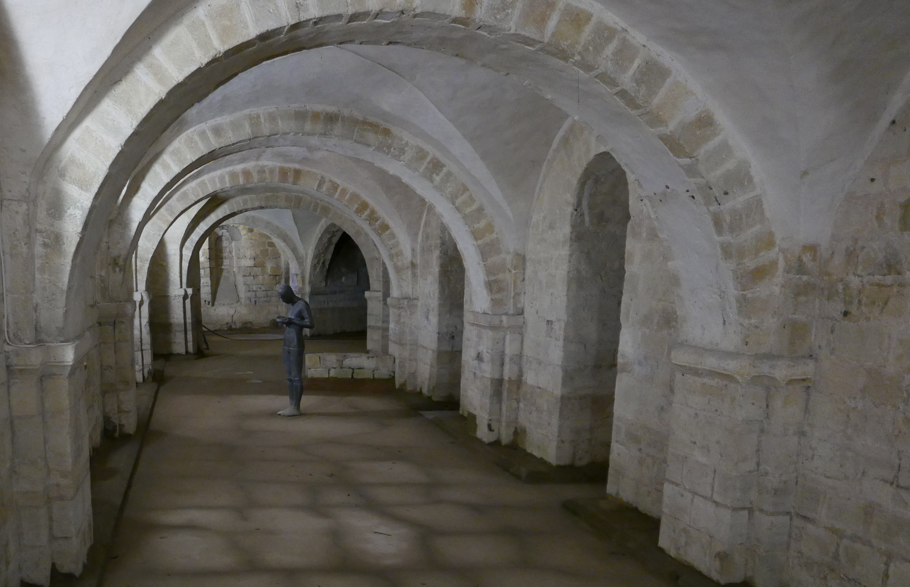
The crypt of the Cathedral has an Anthony Gormley sculpture of a life-size figure of a man contemplating water held in his cupped hands. The crypt is from the earliest phase of the Cathedral having been built in the 11th century. The crypt also suffers from the geological conditions of the ground in the centre of Winchester as during periods of heavy rain the crypt will flood, often up to the knees of the statue. The ground water under and around the Cathedral caused considerable problems during the early part of the 20th century.

Winchester and Stonehenge 30

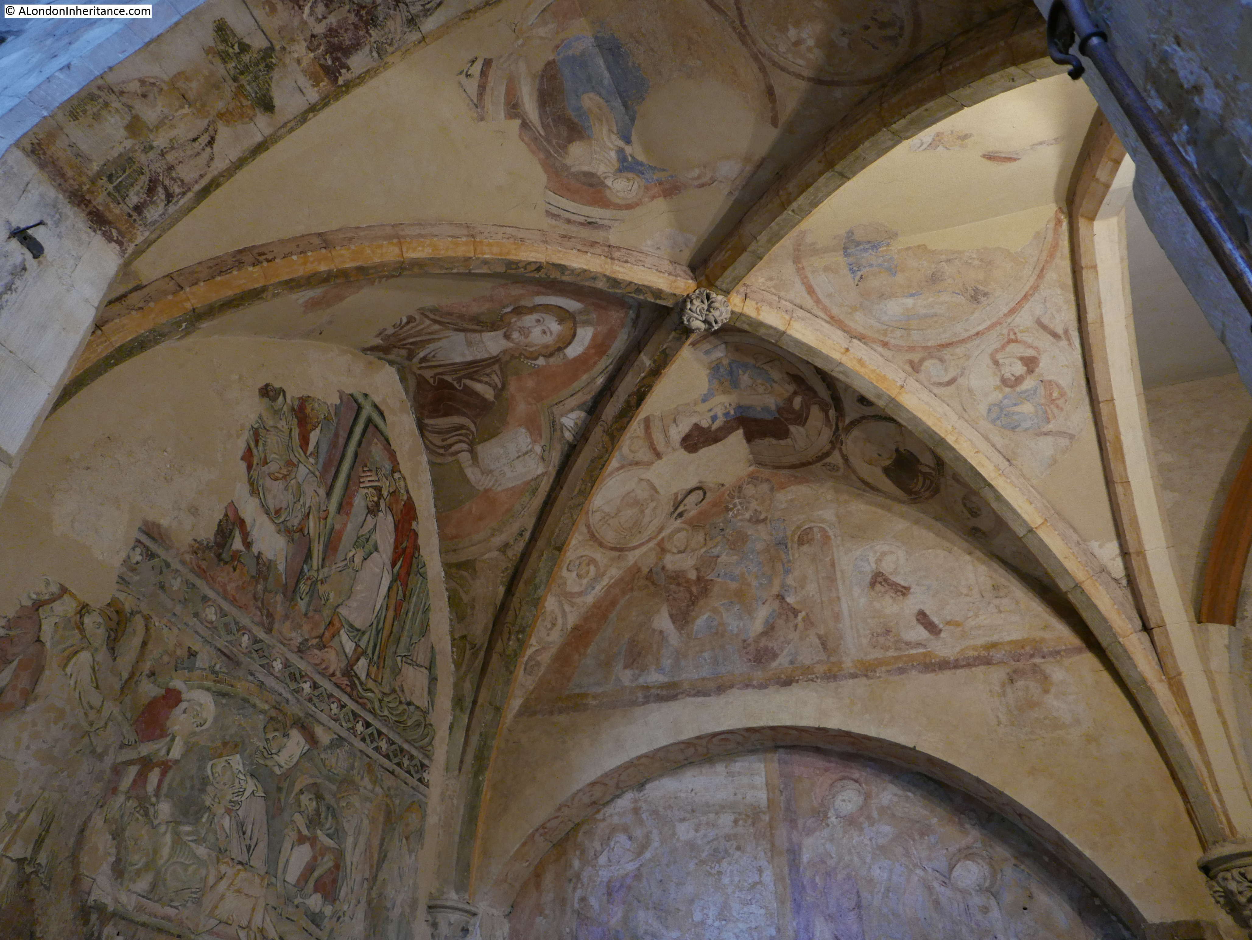
It is possible to see the colour with which churches were decorated prior to the dissolution during Henry VIII’s reign. Some of the original 12th century wall paintings and 13th century painting on the ceiling remains:

Winchester and Stonehenge 21

The Great Screen built between 1470 and 1476. The statues across the screen are late 19th century replacements as the originals were destroyed in 1538 during the dissolution.

Winchester and Stonehenge 22

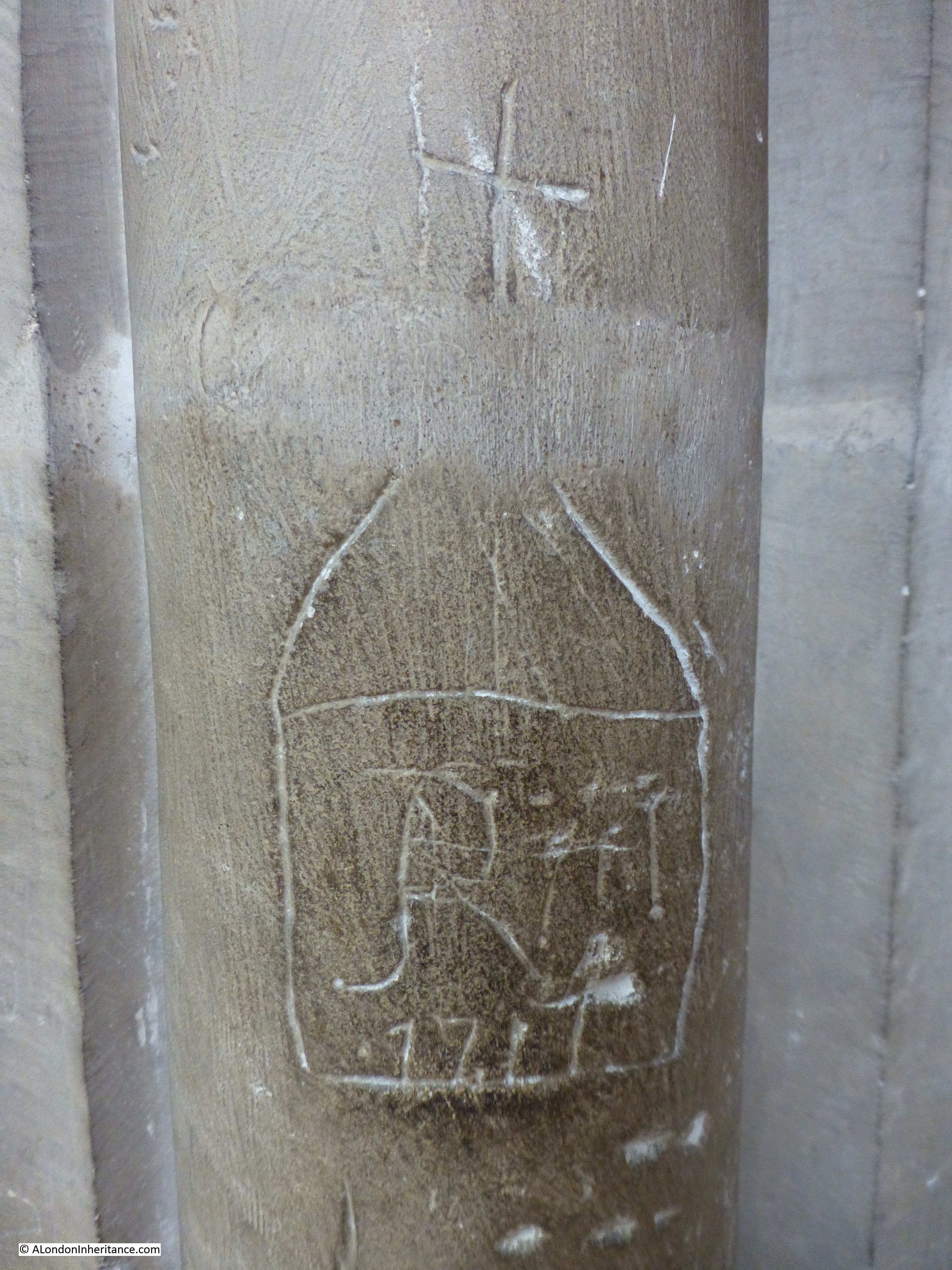
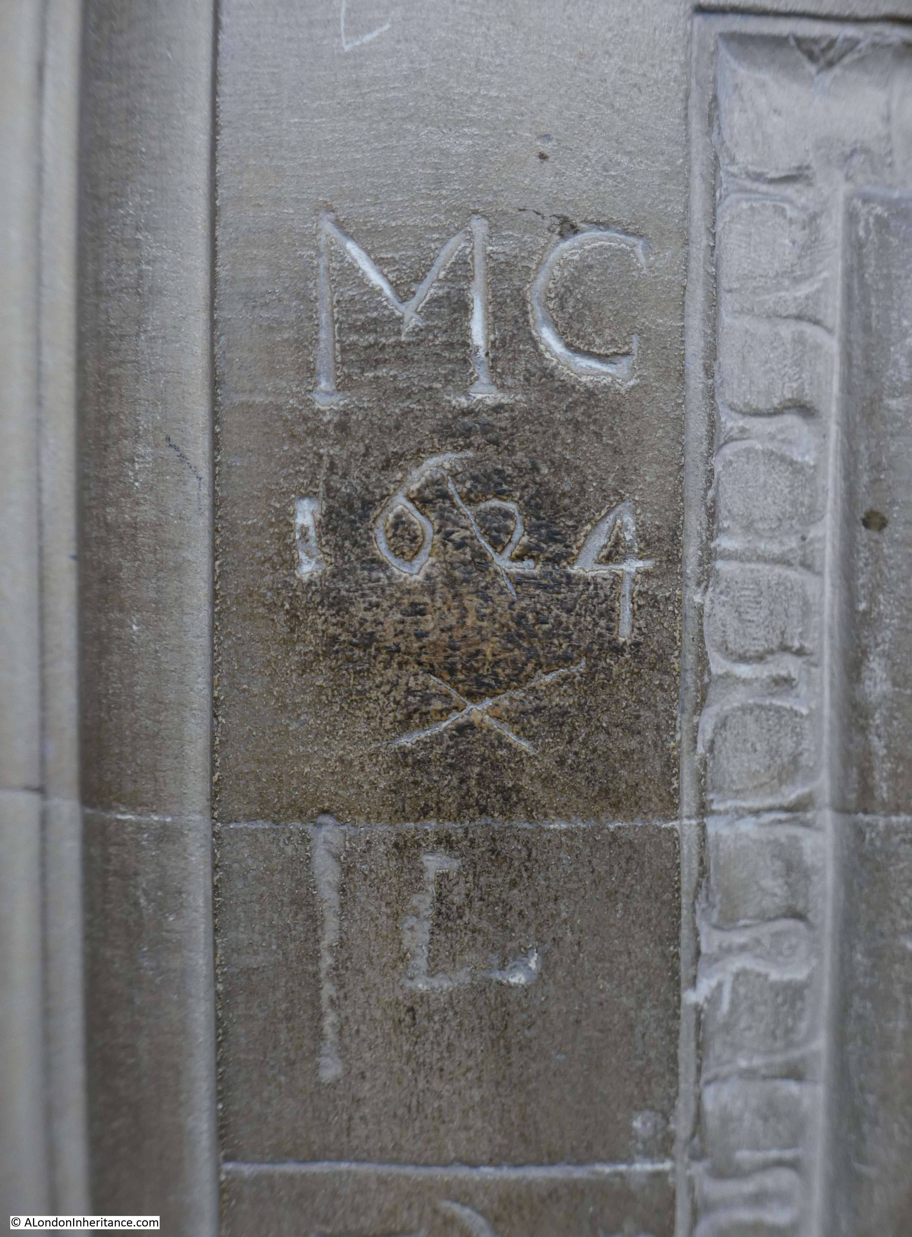
As with so many public buildings of this age, many of the monuments, walls and pillars are covered in early graffiti. I wonder who MC was and what he was doing in the Cathedral in 1624?

Winchester and Stonehenge 23

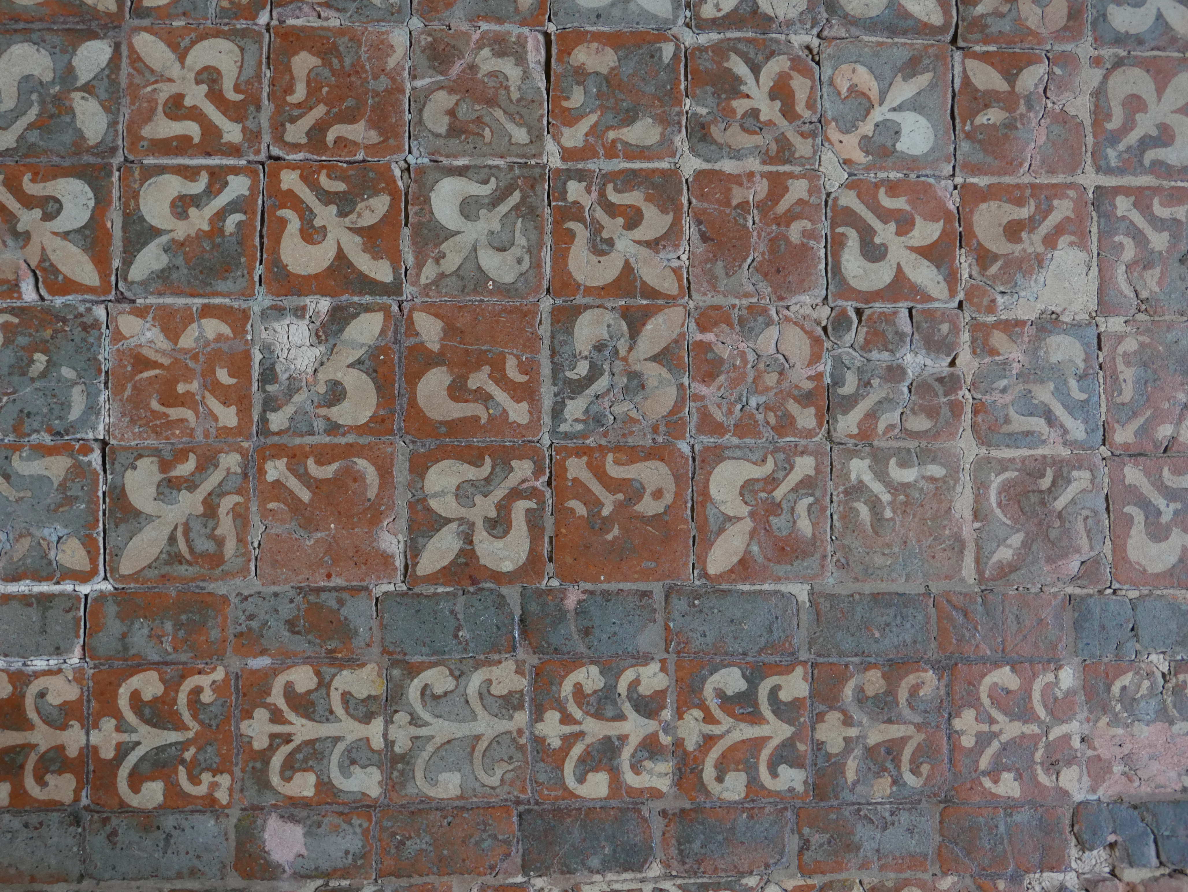
Winchester Cathedral also has the largest and oldest area of floor tiling to survive in England, mainly from the 13th century. Walk on these and think about who could have walked the same way in the previous 800 years.

Winchester and Stonehenge 24

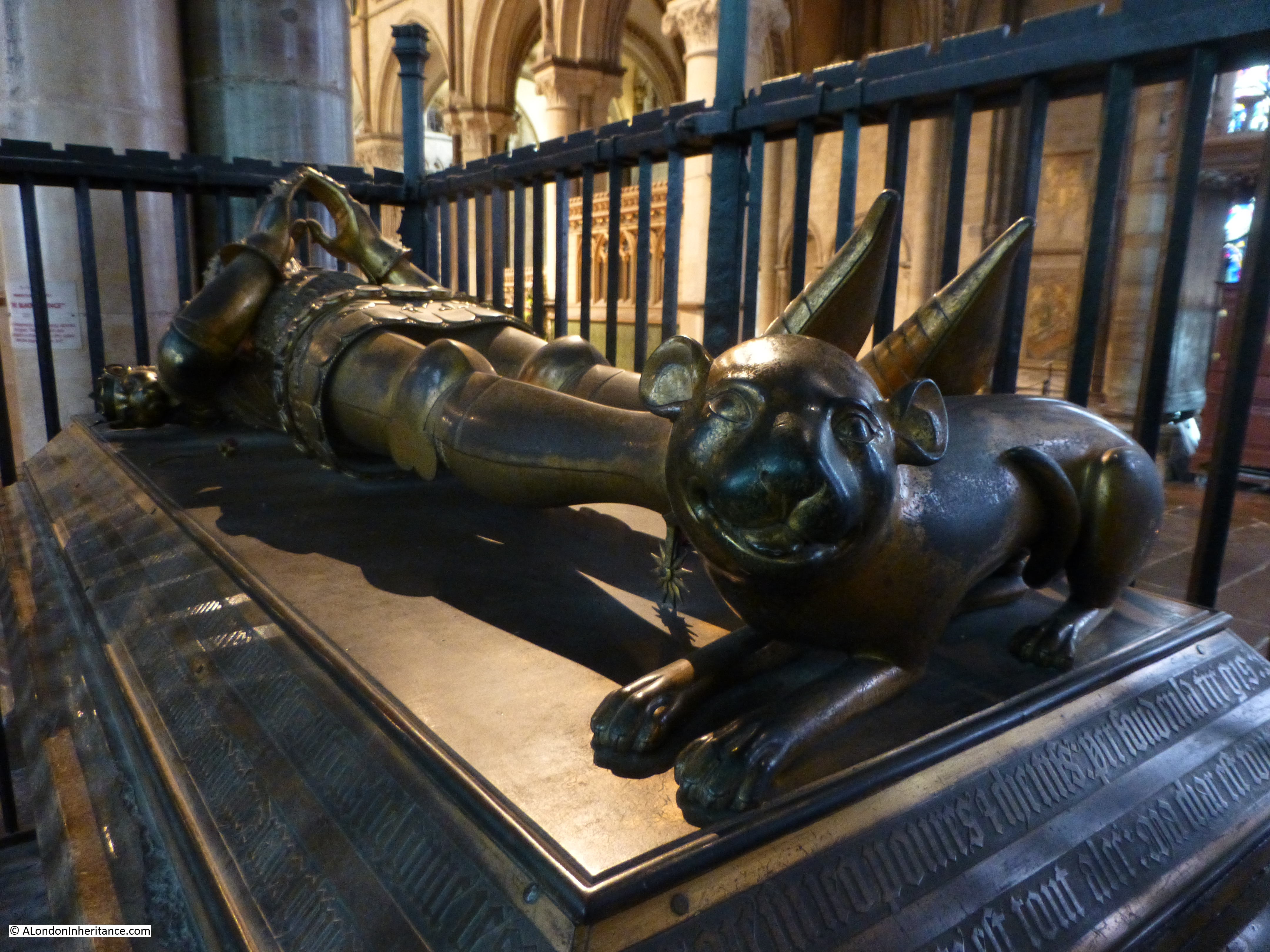
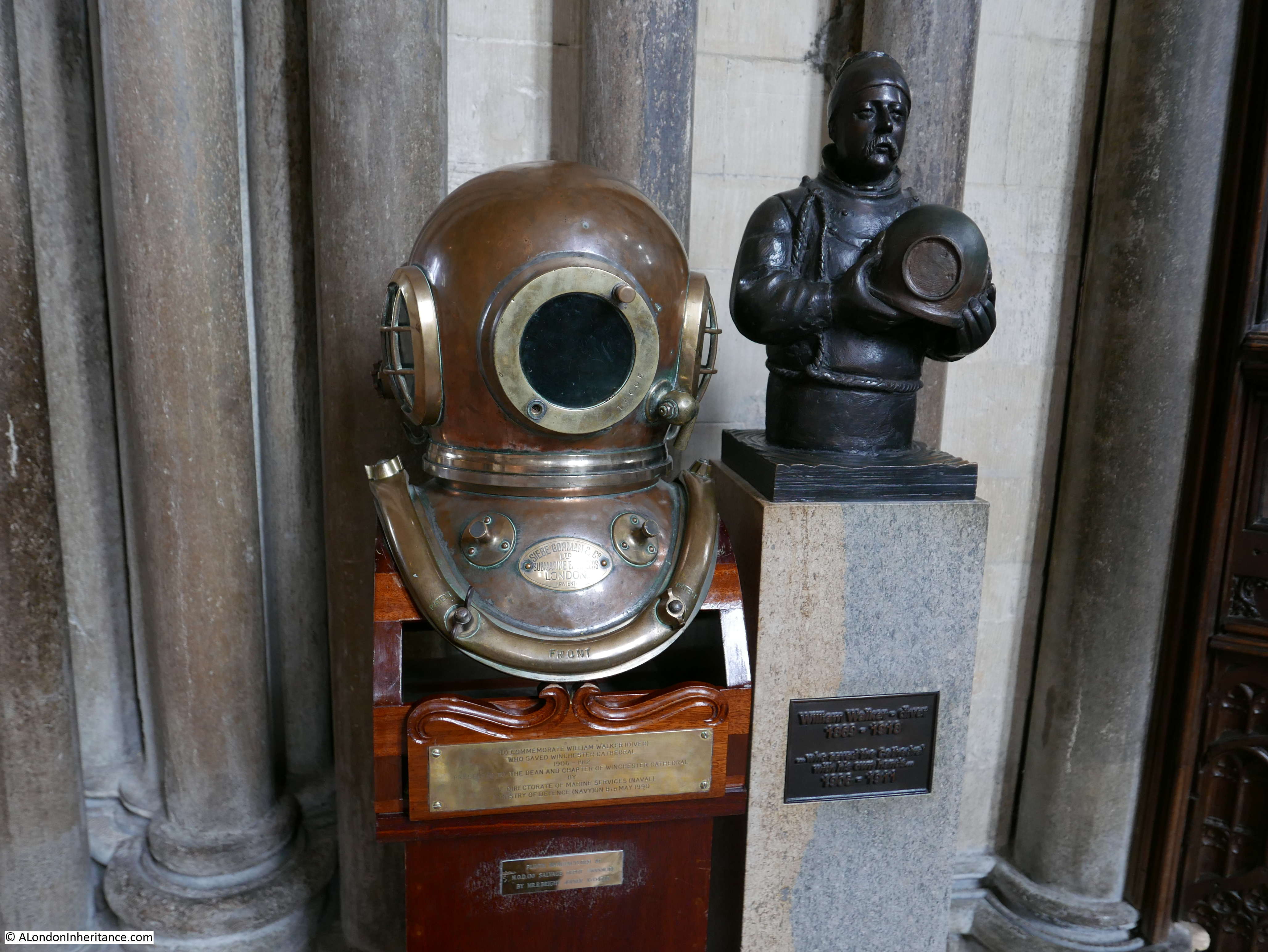
There is a most unusual monument in the Cathedral, perhaps the last place you would expect to find a diving helmet. This is the memorial to the diver William Walker who is honoured for saving the Cathedral at the start of the 20th century when It was found that the wooden foundations of the Cathedral were rotting and the building was starting to subside.

The centre of Winchester, including the Cathedral is within the valley of the River Itchen as we saw earlier in this post. The Cathedral is built on a peaty soil and there is a very high water table (as mentioned earlier which also causes the crypt to flood).

The plan to stop the subsidence was to dig down and fill trenches under the walls with concrete, however due to the high level of ground water, as the workmen dug down, the trenches filled with water. The only way to attempt the work was to call in a deep-sea diver who could excavate the trenches and fill with concrete. This is where William Walker, an experienced deep-sea diver from Portsmouth Dockyard was called in.

Walker worked for 5 years in very difficult conditions, often at depths of up to 20ft and with limited visibility due to the mix of water and peat. When all the trenches had been excavated and filled with concrete, the water could be pumped out and the rest of the workmen could fill with concrete bags, concrete blocks and bricks.

The work was completed in 1911 and the Cathedral was saved, mainly due to the efforts of William Walker. He would die in 1918 due to the flu epidemic that spread through the country, however he is remembered by this very fitting memorial in the Cathedral that he played such a crucial role in protecting.

Winchester and Stonehenge 25

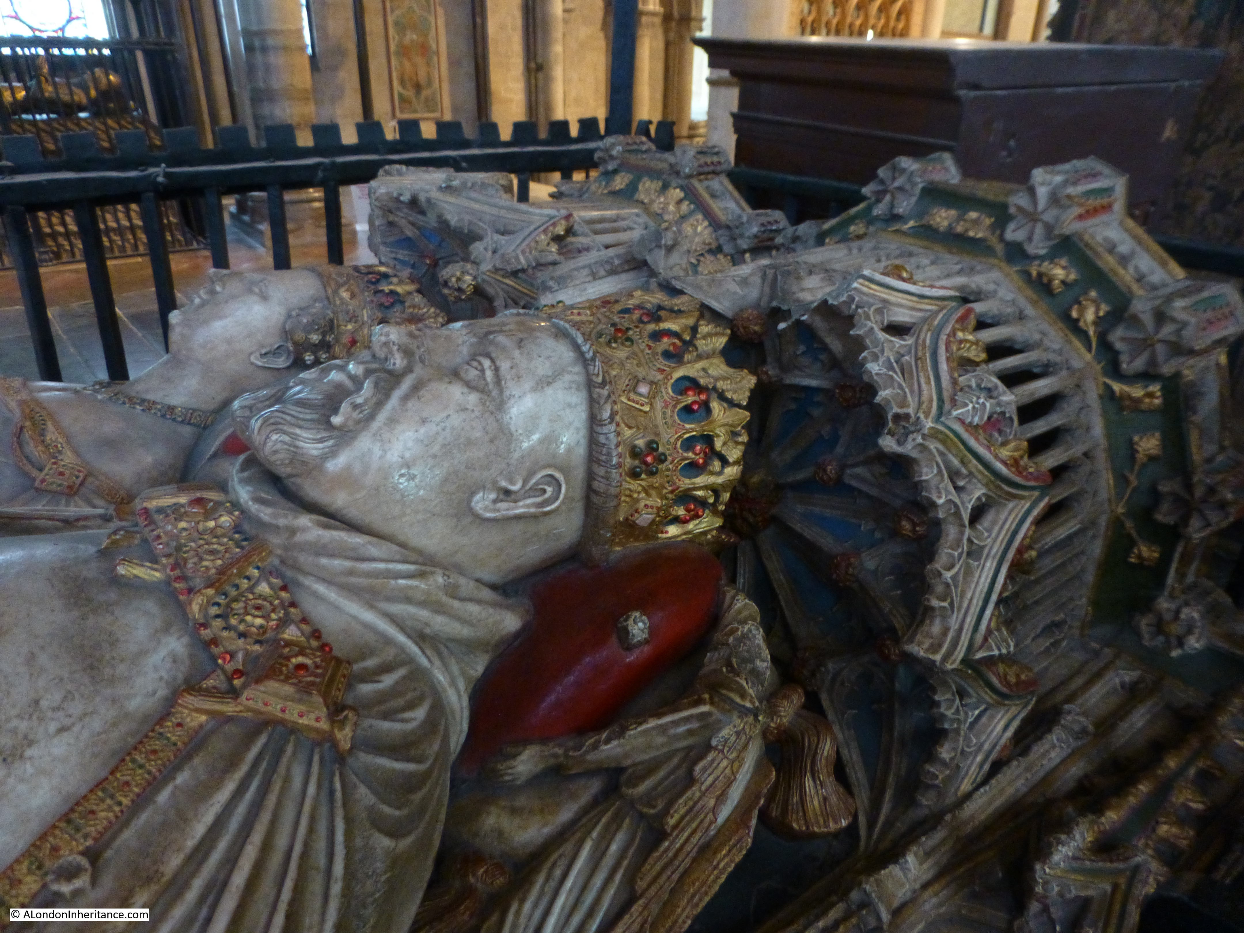
There are so many graves and tombs across the Cathedral of significant age. This one from the 12th century which may contain the remains of Henry of Blois, Bishop of Winchester from 1129 to 1171. The use of “may” in the information panel is an indication of the problem of really knowing the history of so many tombs in a building of this age and history.

Winchester and Stonehenge 29

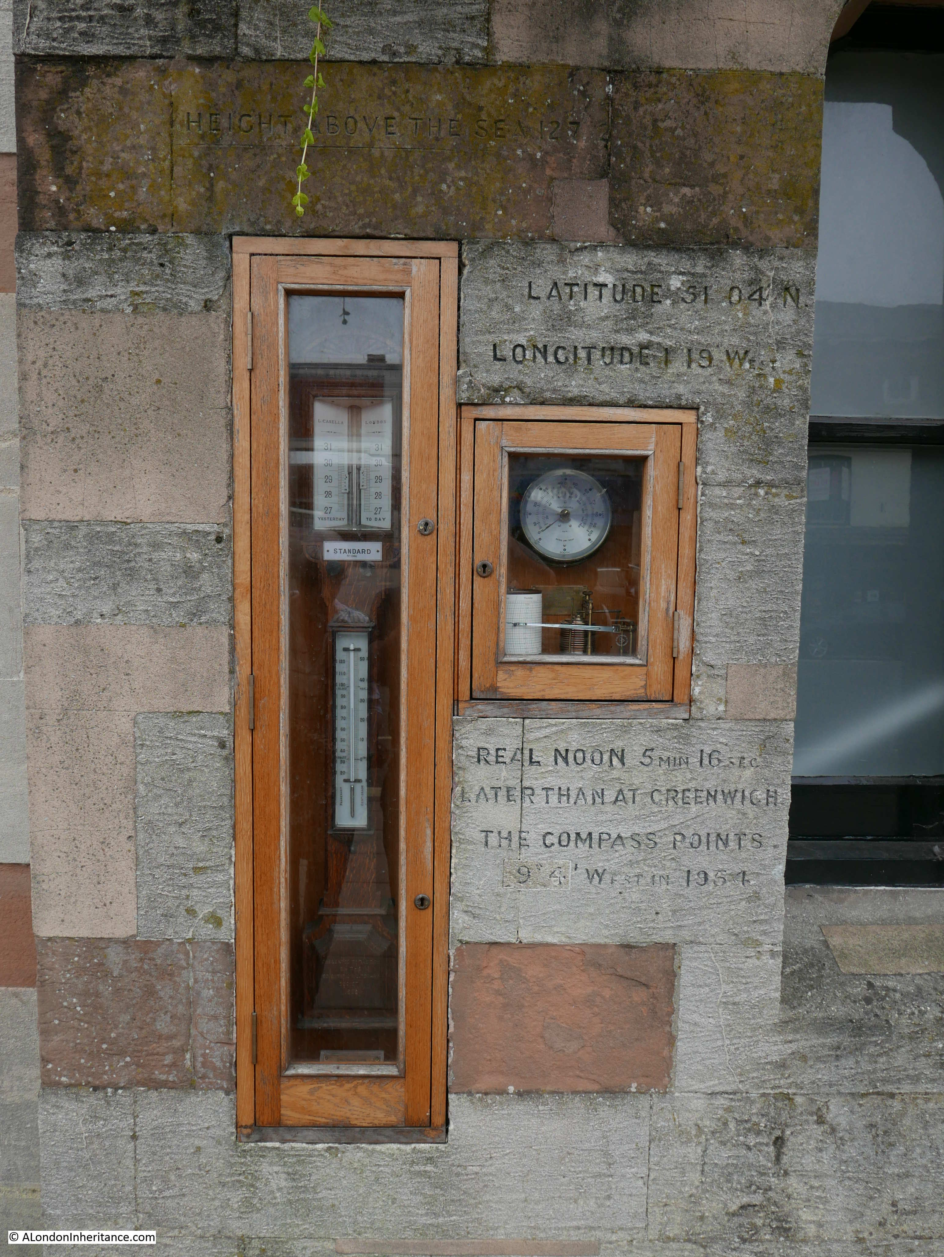
Leaving the Cathedral, I found the following whilst walking past the Guildhall. I have not seen such instruments and inscriptions before mounted in such a position. The latitude and longitude are given and below the window with the barograph the inscription reads that in Winchester real noon is 5 minutes and 16 seconds later than at Greenwich – an indication that as you move further west from the Greenwich Meridian, the sun is directly over head later as you travel further west. Below the reference to real noon is information that the compass points slightly west of north and at the top along the greenish coloured stone is the height above sea level.

Instruments in the windows provide the temperature, wind speed and direction and the barograph records the pressure. The reference to the compass points and the magnetic deviation states this was in 1954 so this installation may well date from then. No idea why it is here, but I really like this.

Winchester and Stonehenge 27

That is the end of my brief visit to Winchester and Stonehenge in 1949 and 2016 – as usual I left Winchester with the feeling that I had only just started to understand the city and its history. Winchester is back on the list for a future visit.

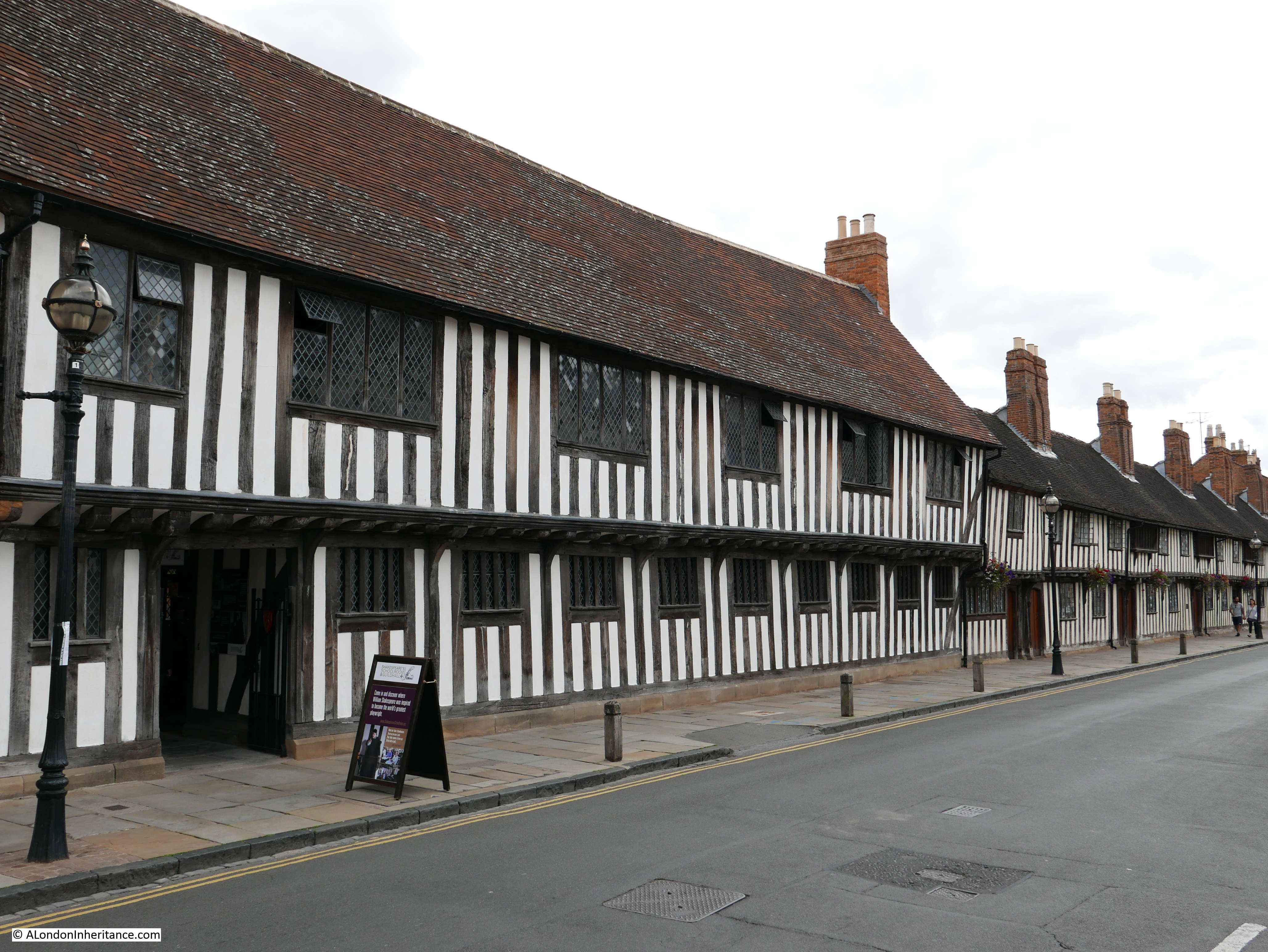
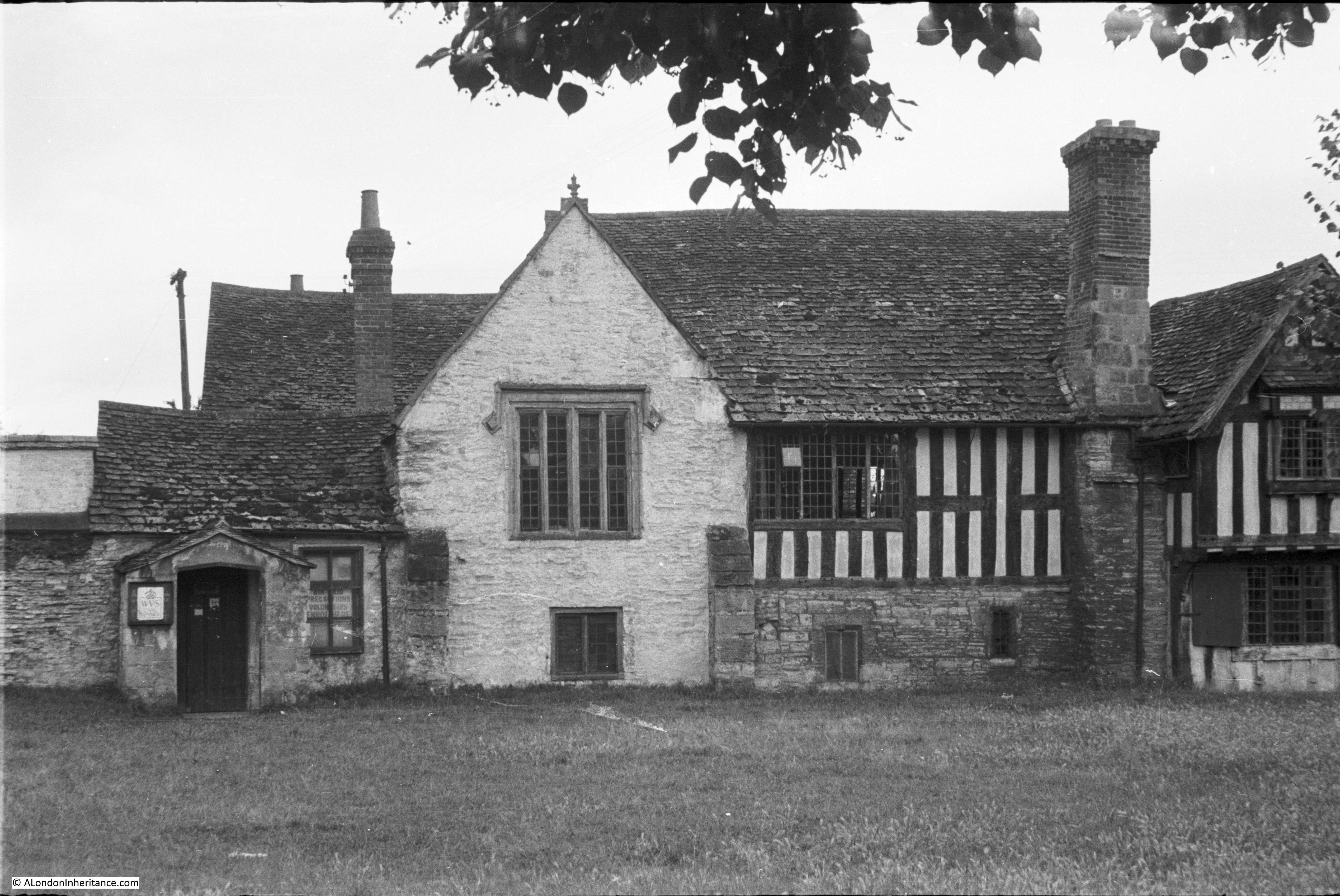
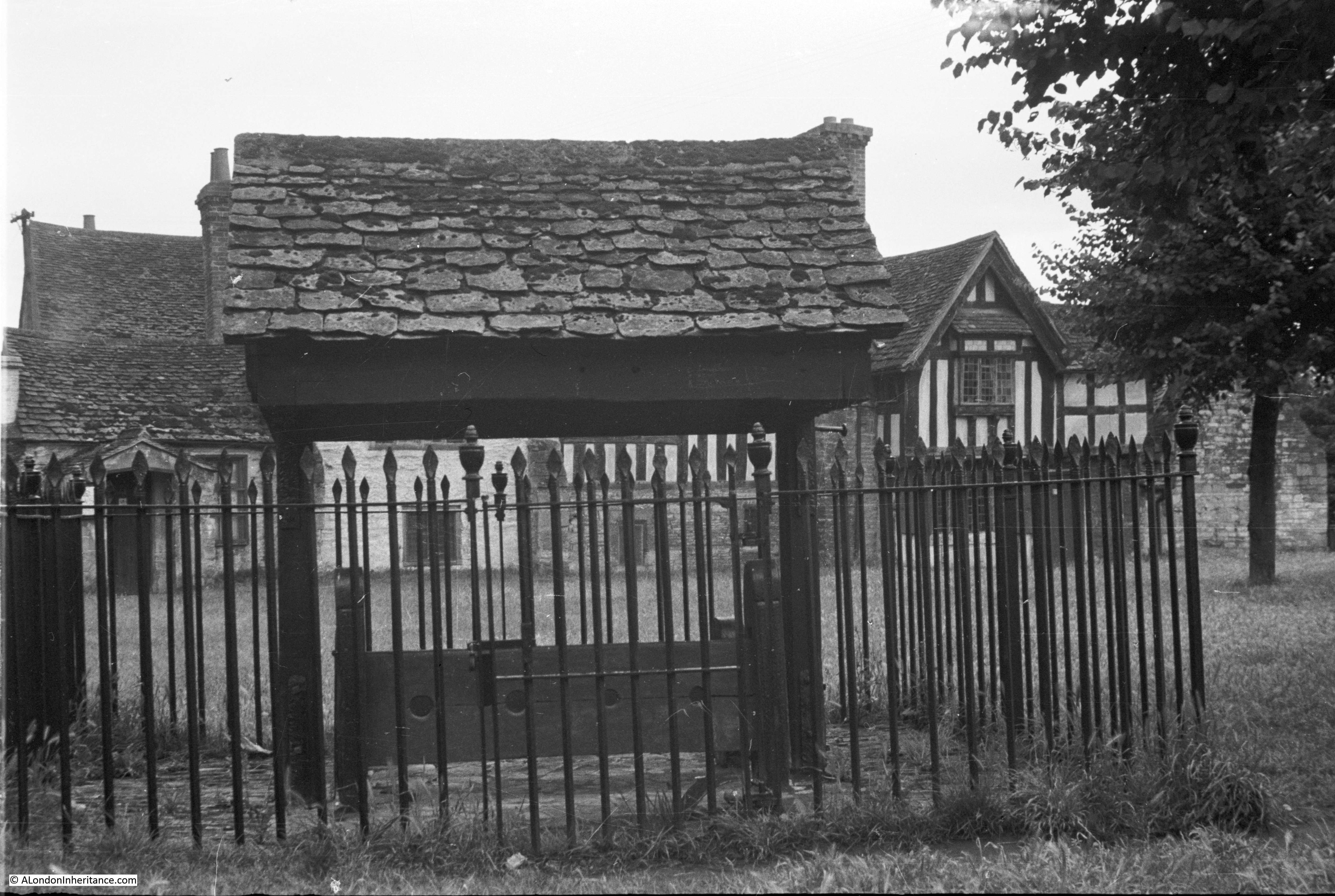
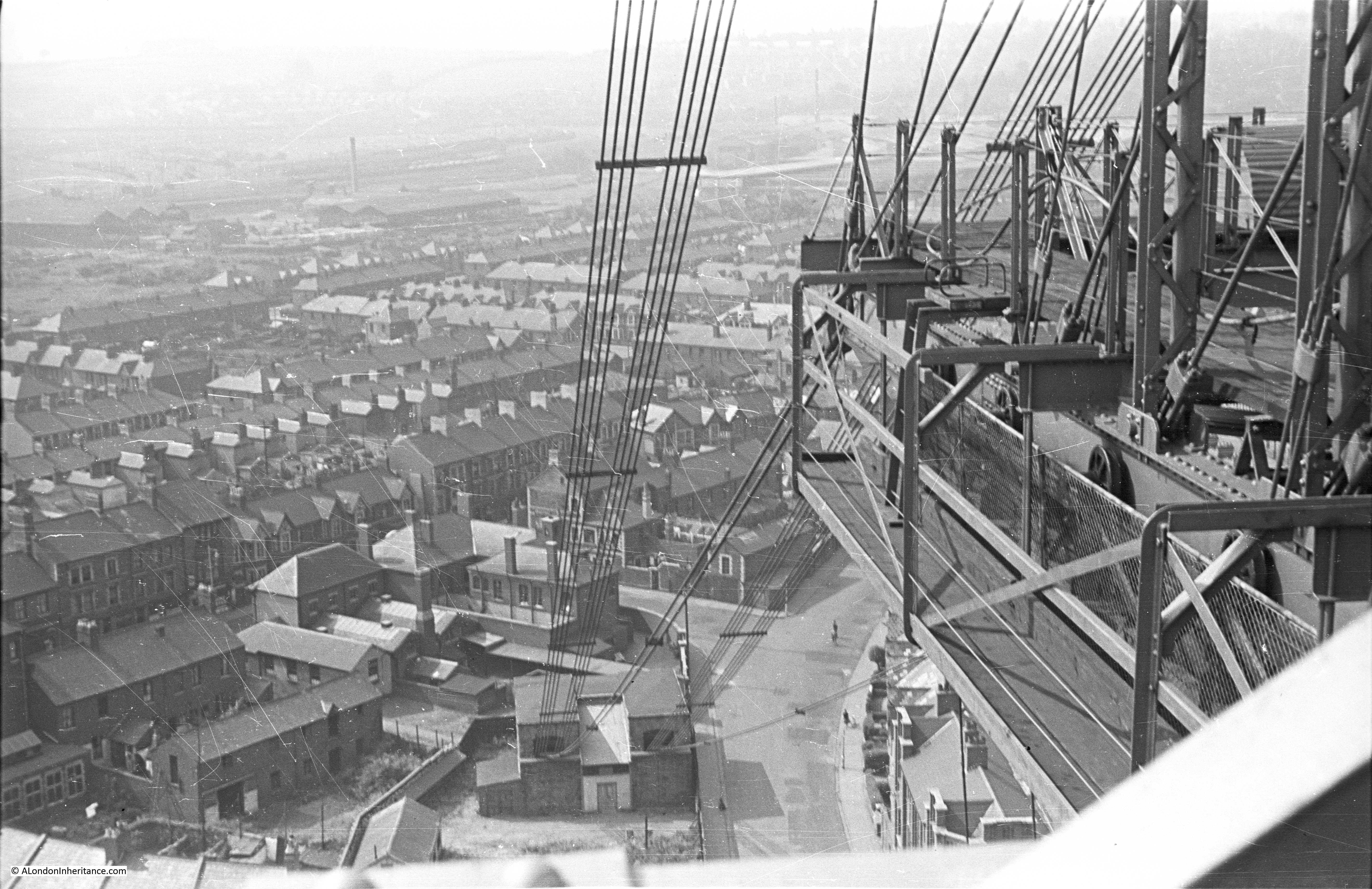
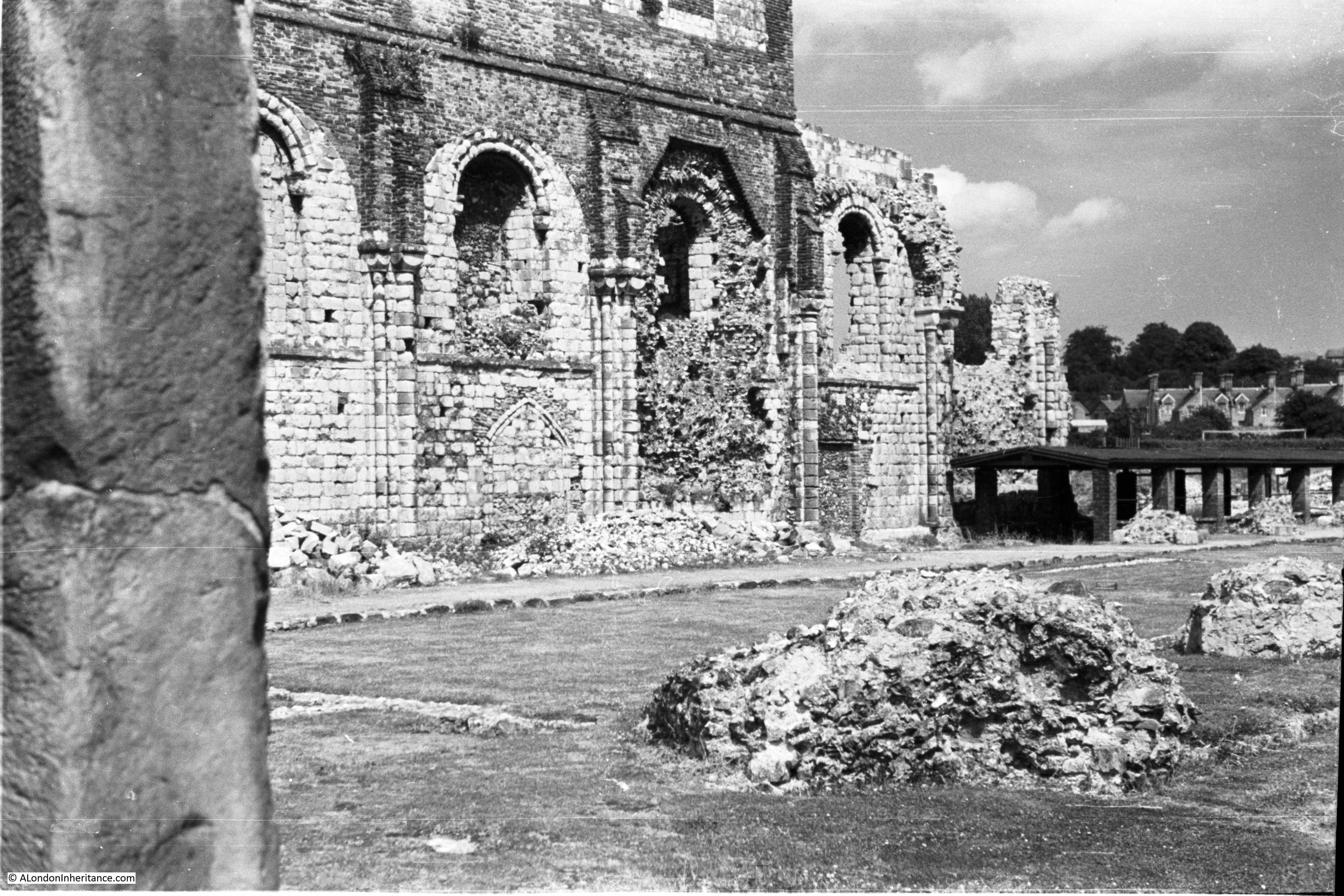
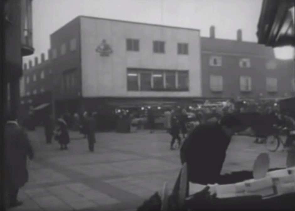
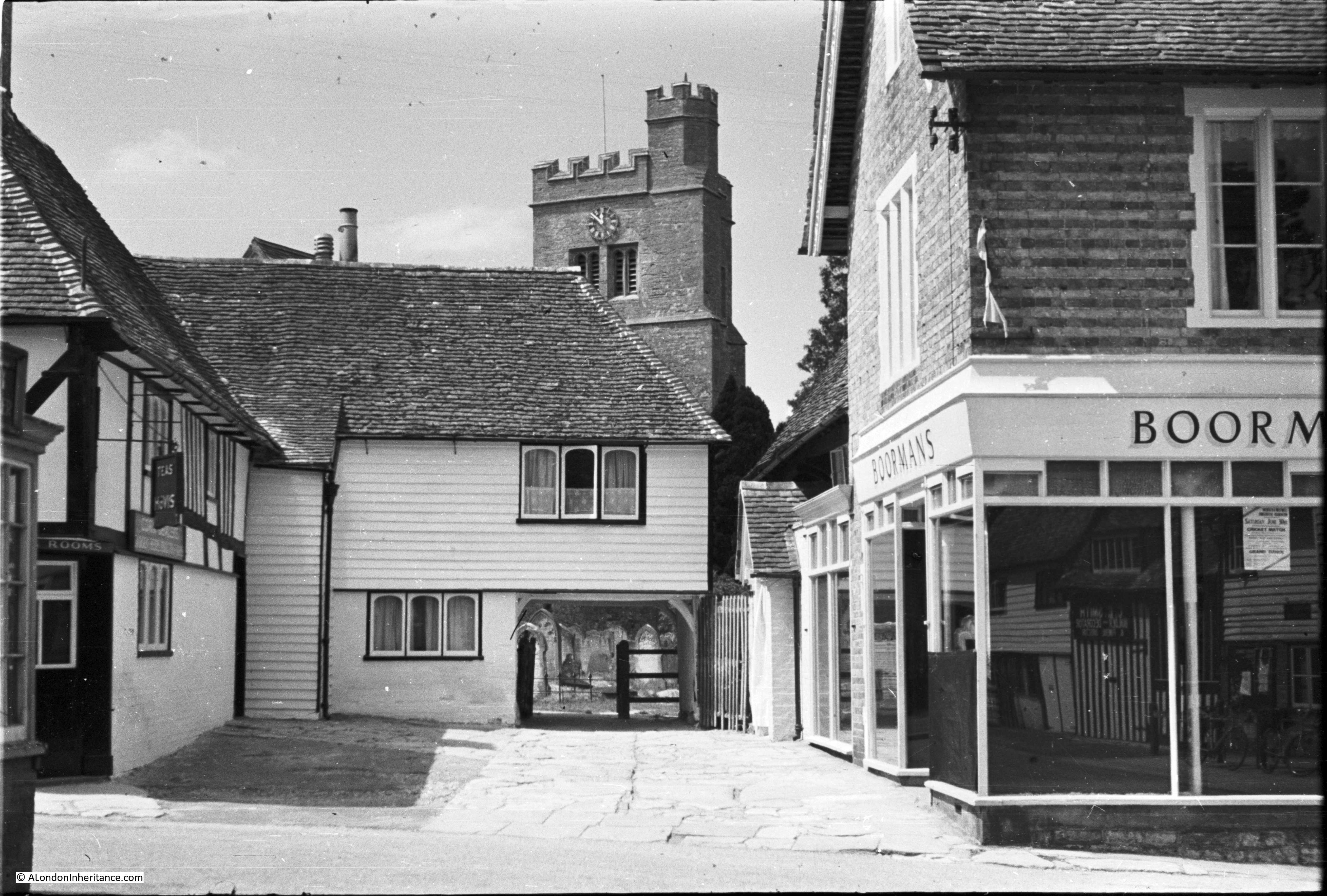
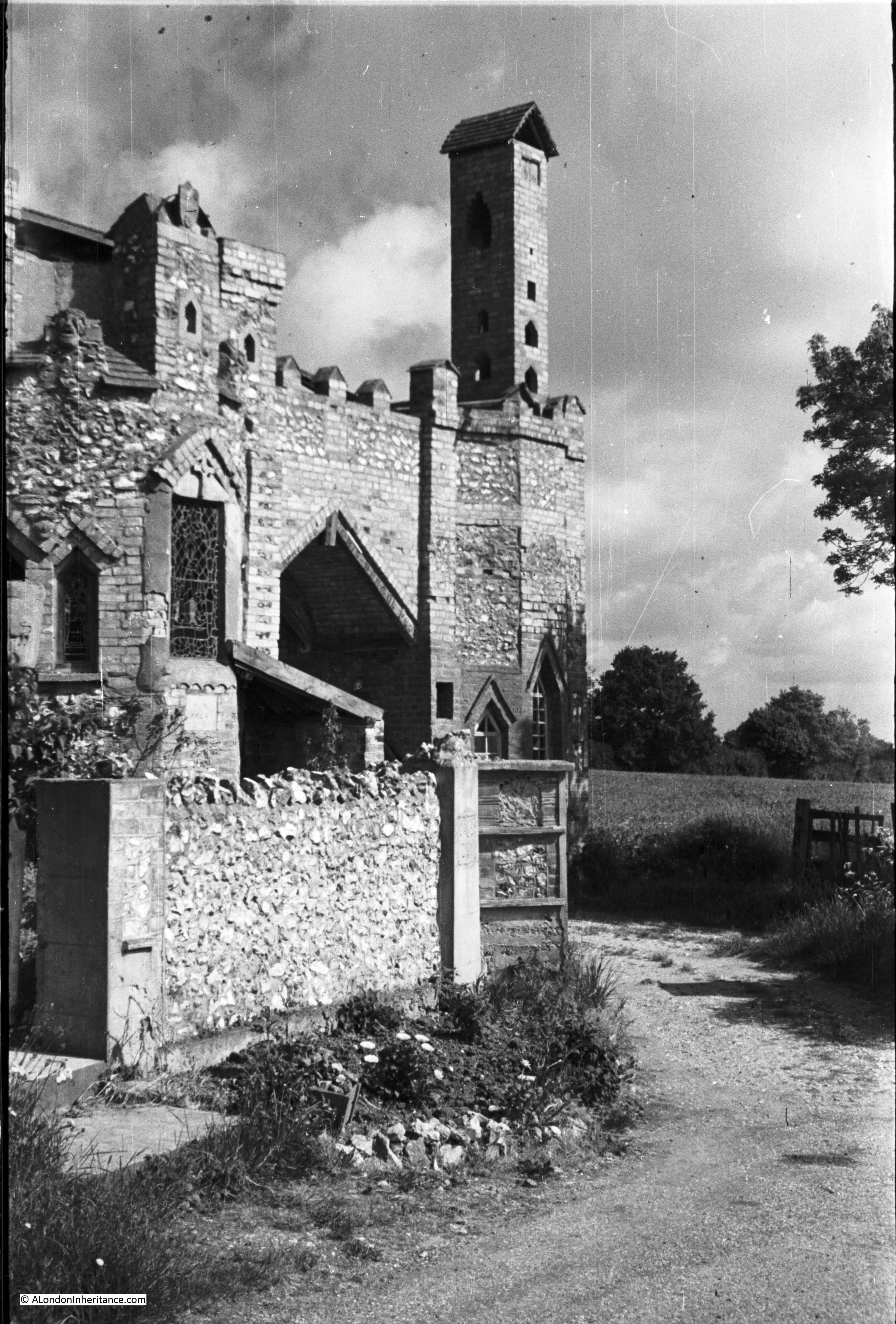
To end the post, here are two photos that are on the same strip of negatives as some of the Winchester photos and which I have been unable to locate. I am really grateful to Nick who identified the unknown location at the end of last week’s post as the Almonry Museum at Evesham, Worcestershire.

The first photo appears to be the entrance to a town / village church. The building on the left appears to be a Tea Rooms judging by the signs. The sign in the shop window on the right is advertising a Cricket Match and Grand Dance, but the rest of the text in not readable.

Winchester and Stonehenge 9

I am really not sure what this building is, but the tall chimney like structure is very distinctive.

Winchester and Stonehenge 10

Any help with identifying the above would be really appreciated.

alondoninheritance.com

On The Road To Stratford-Upon-Avon

Having left South Wales for last week’s post, this week I am back in England and on the road to Stratford-upon-Avon. Not using the M40 which was many years in the future when my father took these photos, rather following the lanes that threaded through Berkshire, Oxfordshire and Warwickshire.

I can track the route he took as I have many of the Ordnance Survey maps that he used and marked with the routes taken, although there is one map missing for this journey.

Cycling out from London, along the A4 through Slough and Maidenhead, then taking the lanes to Henley-on-Thames and through Watlington to reach the first photo of a monument at Chalgrove in Oxfordshire.

Stratford Upon Avon 22

This is the monument to John Hampden, probably born in London in 1595, he became one of the Parliamentarians who resisted Charles I’s demands for payment of the Ship Money Tax in 1635 and later demanded that the King handover control of the Tower of London to Parliament. He fought on the side of Parliament during the English Civil War having raised a regiment from his tenants in Buckinghamshire and Oxfordshire.

In June 1643, the Royalist and Parliamentary forces faced each other across the Oxfordshire countryside with the Royalists based in Oxford and the headquarters of the Parliamentarians in Thame.

Prince Rupert, the nephew of Charles I, had word that a pay wagon was travelling to Thame and saw an opportunity to inflict damage on the Parliamentary forces. He left Oxford on the 17th June 1643 with a force of 2,000.

Skirmishes with small Parliamentarian outposts at Tetsworth and Postcombe were followed by a victory at Chinnor where 50 Parliamentarian soldiers were killed and 120 captured. The rumored pay wagon had heard the fighting and headed away from the town.

The Parliamentary army was gathering to the south and met the Royalist forces at Chalgrove in the fields surrounding the monument. John Hampden was shot and seriously wounded not far from where the monument now stands and was taken back to Thame where he died of his wounds on the 24th June. The Royalists achieved a significant victory at Chalgrove and Prince Rupert returned to Oxford.

The monument was unveiled on the 18th June 1843, two hundred years after the battle. Paid for by subscription, the names of the subscribers are recorded on the monument along with an effigy of John Hampden and his coat of arms.

I found the monument late one evening when it was getting dark. There is some light industry in the area now, however at this time in the evening it was quiet, and looking over the fields on a summer’s evening it is hard to imagine the fighting that took place here on a summer’s day in 1643.

The monument is well-preserved in the centre of a road junction and is surrounded by iron railings and a large ditch.

Stratford Upon Avon 23

Leaving Chalgrove, the route then disappears onto Ordnance Survey map 158 which I do not have, before returning onto map 145 covering the area around Banbury, where we leave Banbury on the A422 to head to Stratford-upon-Avon. Passing through the village of Wroxton, we find the Wroxton Guide Post at the side of the road.

Stratford Upon Avon 10

The Guide Post dates from 1686 and is a marker on one of the routes from Wales and the west to London. Allegedly used by salt merchants, the route follows the A422 down to Wroxton where is breaks from the road and heads to the south of Banbury. The 1946 edition of the Ordnance Survey one inch map for the area shows the Salt Way marked.

The top of the guide post was originally a sundial and around the middle of the post are carved hands pointing to the towns along the adjacent roads. If you look at my father’s photo you can see that the guide post was in need of some repair with initials being carved on the stone as well as general deterioration.

The guide post was restored in 1974 and still looks in good condition with the directions and carved hands clearly visible.

The Wroxton Guide Post today:

Stratford Upon Avon 17

Directions are given on three sides of the post. I do like the two hands pointing to London and Stratford-upon-Avon (thereby just maintaining a tenuous connection with London for this week’s post). The fourth side records the name of Mr Francis White who, although very little is known about him, was responsible in some way for the funding or provision of the guide post.

Stratford Upon Avon 18

Photo of part of the 1946 edition of the Ordnance Survey one-inch map, the Banbury edition, number 145. Banbury is the edge of the town seen in the lower right edge with Wroxton just to the left on the A422. The Salt Way is as the very bottom right corner, my father drew two red circles around this and there is a note of XP in purple ink pointing to the Guide Post just to the left of Wroxton. There are also purple arrows showing the route he and his friends cycled on the way to Stratford-upon-Avon.

Stratford Upon Avon 24

The A422 is the road that runs from Banbury at lower right up towards the left. If you follow the A422 away from Wroxton, there is a sharp turn to the left, followed by a sharp turn to the right then passing a place called Sun Rising. This is Edge Hill where the height drops dramatically, I can imagine the name is due to the view of the light across the land as the sun rises as the view from here is impressive.

My father took the following photo from the point at the top of the hill where the road is just about to turn to the right and the view is of flat land stretching away towards the north-west and towards Stratford-upon-Avon.

Stratford Upon Avon 9

Although the road today follows exactly the same route, I did not stop to take a comparison photo. There are no paths or walkways along the edge of the road which is up against the walls on either side. The road is also very busy and standing on the road at a bend was not the wisest thing to do. Also, trees have now grown which sadly completely obscures the view.

Another view from the top of Edge Hill on a summers day in 1949.

Stratford Upon Avon 8

Edge Hill has also given its name to another battle from the Civil War. This was the first skirmish between the Royalist and Parliamentarian forces and took place on the 23rd October 1642. The Royalist forces was based at Edge Hill with the Parliamentarian forces on the plain below. The Royalists attacked from Edge Hill and the battle took place across the land in the above photo.

If you look back at the extract from the Ordnance Survey map, the marker for the battle on the map is ringed in blue and red circles. Much of the land where the battle took place is today owned by the Ministry of Defence and so is not easy to visit.

Leaving Edge Hill, the A422 runs directly to Stratford-upon-Avon.

Known around the world as the birthplace of William Shakespeare, Stratford-upon-Avon is now a major tourist destination with 4.9 million visitors each year and generating £28 million for the local economy each month, and being in Stratford-upon-Avon on a summer’s weekend it is easy to see how.

Stratford-upon-Avon is also the home to the Royal Shakespeare Company, with the Royal Shakespeare Theatre being a major landmark alongside the River Avon. Two of my father’s photos showing the theatre with a couple of small boats passing on the Avon.

Stratford Upon Avon 2

Stratford Upon Avon 1

The view from roughly the same position today. The theatre went through a major rebuild between 2007 and 2010 which accounts for the changes to the theatre. The boats on the Avon are also a little different.

Stratford Upon Avon 11

If you are a tourist in Stratford-upon-Avon you head to the birthplace of William Shakespeare.

John Shakespeare was a glover, but also traded in wool and corn. He bought the main part of the house which is now the birthplace in 1556. John was married to Mary Arden and their eldest son, William Shakespeare was baptised on the 26th April 1564 (his date of birth is not known but must have been a few days earlier).

Shakespeare’s birthplace in 1949:

Stratford Upon Avon 6

And from exactly the same position in 2016:

Stratford Upon Avon 15

Stratford-upon-Avon is much busier today:

Stratford Upon Avon 25a

A short walk away from Shakespeare’s birthplace, at the junction of Wood, Windsor, Greenhill and Rother Streets was the Old Thatch Tavern:

Stratford Upon Avon 7

And here it is today, still a pub, with the same name and looking much the same, although the door on Greenhill Street has disappeared along with the plaque above which would have been interesting to read. The pub is Grade II listed and dates from 1470.

Stratford Upon Avon 16

This is Harvard House at 26 High Street:

Stratford Upon Avon 3

Dating from 1596 when the house was built by Thomas Rogers, the grandfather of John Harvard who was one of the benefactors of Harvard University in the US. John was one of the members of the Massachusetts Bay Colony in the 17th century and on his death left a considerable sum of money and his library of books to the colony’s college which was renamed in his honour. The house is now owned by Harvard University, and is cared for by the Shakespeare’s Birthplace Trust. Note the small stars and stripes symbol on the left of the building in the above photo.

That also explains why the American flag is hanging from the building today.

Stratford Upon Avon 12

View down Church Street:

Stratford Upon Avon 4

And the same view today:

Stratford Upon Avon 13

The buildings to the left of the above photos and in the photos below are Shakespeare’s Schoolroom and the Guildhall, where Shakespeare went to school and saw actors performing at the Guildhall.

Stratford Upon Avon 5

And the same view today:

Stratford Upon Avon 14

If you look at my father’s photo above, there is a sign at the side of road in front of the entrance. The sign reads “No waiting this side today”. Although the sign has gone, on the wall of the building to the left there is still the following sign. No idea why you could not stop here on even dates, but good to see this sign is still here which is probably associated with the sign on the road in 1949.

Stratford Upon Avon 21

Stratford-upon-Avon is full of well-preserved timber-framed buildings. There is hardly a street in the centre of town without examples:

Stratford Upon Avon 20

I started this post with a reference to the English Civil War with the John Hampden monument and the battles at Chalgrove and Edge Hill. Stratford-upon-Avon also records the impact of the Civil War across this part of the country with this plaque on the side of the Town Hall.

Stratford Upon Avon 26

The Town Hall also has a very interesting ghost sign running along the front of the building just below the flower boxes, the outline of the original painted words of “God Save The King”. The King in question was George III who was the monarch at the time the new town hall was built and the sign dates from this time.

Stratford Upon Avon 27

And here we finish a brief journey from Chalgrove, through Wroxton, along the A422 to drop down over Edge Hill and into Stratford-upon-Avon.

While the story of Shakespeare is well-known and with major tourist attractions both in Stratford-upon-Avon and Bankside in London, it was interesting to discover more about the Civil War through the Hampden monument in Charlgrove and Edge Hill – this period in British history does not get that much attention these days. The guide post in Wroxton is also a wonderful reminder of the old roads and tracks that crossed the country.

Again, another post that has just scratched the surface, but hopefully has provided an insight into the road leading to, and the town of Stratford-upon-Avon.

And finally…..on the same strip of negatives as the Stratford-upon-Avon photos are the following two photos which I have been unable to locate. I assume they are in the same area as the architectural style is right, however being on the same strip of negatives does not guarantee this. In the window on the right of the entrance door in the photo below, there is still the wartime sign “Air raid precautions volunteers enrol here”. Any information as to the location would be really appreciated.

Stratford Upon Avon 28 Stratford Upon Avon 29

alondoninheritance.com

Newport Transporter Bridge – 1947 and 2016

After last week’s visit to Canterbury, I am continuing my travel around the country during the month of August, visiting some of the places my father photographed, and for this week I have travelled to the other side of the country to Newport in South Wales to visit the wonderful Newport Transporter Bridge. Looking at it today and back in 1947 when my father visited during National Service in the army when he was based a short distance away in Chepstow.

The Newport Transporter Bridge is a fully working bridge that uses a gondola to carry people and vehicles over the River Usk whilst providing a very high bridge clearance to allow shipping to continue to pass underneath, something that would not have been possible with a traditional bridge design.

So what does a transporter bridge look like? The following photos are my father’s from 1947 and my 2016 photo showing the transporter bridge from the east side of the River Usk. In both photos, the gondola is docked at the left side of the bridge, I will show this in more detail later.

Newport Transporter Bridge 11

Newport Transporter Bridge 34

The Newport Transporter Bridge was opened in 1906 to provide access from the city to a new steelworks being built on the east side of the Usk and to avoid the existing congested crossing of the Usk further upstream.

The challenge with providing a crossing was the need to provide sufficient clearance for shipping with the very large tidal range of the Usk. Newport was a very industrial city during the 19th and first part of the 20th century with many industries related to steel, shipping and with a large docks so there was a large amount of shipping needing to move up the river past the proposed location of the bridge.

In the next photo, we can see the western side of the transporter bridge in 1947 taken in Brunel Street which ran straight up to the bridge.  The West of England Tavern is the building on the left and the bus is a number 9 to the docks.

Newport Transporter bridge 2

The same view today. Brunel Street has been separated from the bridge by the new A48 ring road around the southern end of Newport. The pub is still there, however no more buses to the docks.

Newport Transporter Bridge 33

A view further back from the junction of Brunel Street and Alexandra Road.  The houses on the left are still there. I did try and take a photo from the same spot, however there is now a large tree in the gap between the houses which totally obscures the view of the bridge.

Newport Transporter Bridge 1

The majority of the design of the Newport Transporter Bridge was by the Frenchman Ferdinand Amodin who was a specialist in the design of suspension bridges and who had already worked on a transporter bridge near Bilbao in Spain. Amodin, along with Robert Haynes, the Borough Engineer of Newport were appointed as the joint engineers for the new bridge in 1901.

It was Robert Haynes who had spotted the designs that Amodin had worked on for transporter bridges and encouraged the council to support this form of river crossing as the only realistic method.

The contract to build the bridge was awarded to Alfred Thorne of Westminster (just managed to maintain a London connection in this post !) with work commencing in 1902 and the bridge opening in 1906.

The design of a transporter bridge consists of a large structure across the river at a height to provide sufficient clearance above the high tide state of the river. A tower is located on each bank with a high level span between them. This carries a walkway and also a “traveller” from which is suspended the gondola. The traveller is pulled along the high level span by a cable connected to a motor near ground level.

As the gondola is suspended from the traveller, as the travaller is pulled back and forth along the high level span, so the gondola carrying people and vehicles also crosses the river. A simple design, but one needing a complex bit of engineering to implement.

The Newport Transporter Bride in operation:

1947 view looking up one of the towers.

Newport Transporter Bridge 25

Thanks to Newport City Council and the Friends of Newport Transporter Bridge, the bridge is open and working from Wednesday to Sunday during the spring and summer period and a £3 ticket provides unlimited crossings on the gondola plus access to the high level walkway – incredibly good value (and you get a really good ticket).

Newport Transporter Bridge 50

Getting up close to the bridge and you realise what a wonderful example of very early 20th century engineering this is. Some key statistics:

  • The main span of the bridge is 197m
  • The height from the water level at high tide to the bottom of the span crossing the river is 54m and the top of the towers are 74m above road level.
  • The overall distance between the anchorage of the anchor cables on each side is 471m
  • The weight of steel in the span crossing the river is 548 tonnes which carries a traveller of 16 tonnes and the gondola and steel suspension cables with a combined weight of 34 tonnes
  • The anchor cables are attached to masonry anchorages that each weigh 2236 tonnes
  • The traveller and gondola are pulled across by two 35 brake horse power electric engines

My father climbed the bridge in 1947 and took the high level walkway across the river. This photo shows the western end of the bridge with the anchor cables running down to their anchorage points.

Newport Transporter Bridge 28

Another view from the top of the bridge showing the bridge structure and Brunel Street below,

Newport Transporter Bridge 21

I have to admit that I attempted the climb, but it was a very hot day, I made the mistake of carrying my camera bag and iPad with my father’s photos on and we had already been for a walk so I only made it just over half way up before the direct sun started to take its toll.

The following photo shows the cables running down to the anchorage points today.

Newport Transporter Bridge 49

Looking along the high level span across the river.

Newport Transporter Bridge 22

1947 view of the gondola crossing the River Usk.

Newport Transporter Bridge 18

And a similar view today. The blue building in between the two legs of the opposite tower is the motor house. From here, cables run up to the top of the bridge and attach to the traveller.

Newport Transporter Bridge 45

Another 1947 view of the gondola as it crosses the river.

Newport Transporter Bridge 19

There is only one other transporter bridge in operation in Great Britain. A transporter bridge which opened in 1911 to roughly the same design still runs across the River Tees in Middlesborough. The original transporter bridge near Bilbao designed by Ferdinand Amodin is still in operation along with a single bridge in France and two bridges in Germany.

Looking from the top of the east tower across to the city of Newport.

Newport Transporter Bridge 9

Looking out from within the steelwork.

Newport Transporter Bridge 17

A series of views from the west tower looking over the city of Newport as it was in 1947.

Newport Transporter Bridge 5

Newport Transporter Bridge 6

Newport Transporter Bridge 8

My view across the city of Newport today. I could not get an identical view to the above photos as standing on the stairway up the tower with a camera, bag and trying to see an iPad screen in direct sunlight was not that easy – I should have printed the photos.

Newport Transporter Bridge 43

1947 photo from midway along the top of the bridge looking north with the River Usk at low tide. The edge of the steelworks is on the eastern bank of the river. This was the main justification for building the bridge and can be seen on the right.

Newport Transporter Bridge 7

The view today. The new bridge across the River Usk can be seen in the distance. This, along with the change in industry on the east bank of the river meant that the transporter bridge was no longer the main route across the river, however it is now grade 1 listed and maintained by Newport City Council so hopefully its future is assured.

Newport Transporter Bridge 44

1947 view of the east bank of the river. The buildings are part of the Orb Steelworks, opened in 1899 by Wolverhampton based John Lysaght Ltd. Prior to the opening of the transporter bridge, workers from the west side of the Usk had a four mile walk to reach the steelworks.

Newport Transporter Bridge 4

View from the transporter bridge walkway looking south, with the south east bank of the river on the left of the photo. It was on the river wall in the photo that the first photo of the transporter bridge at the top of this post was taken. I assume that the photo was taken at the weekend as there is a cricket match being played in the field.

Newport Transporter Bridge 14

Looking a bit further to the right with the docks starting to come into view.

Newport Transporter Bridge 32

The same view today from half way up the west tower. The far electrical pylon on the left in the photo below looks to be the same as in the above photo. These two photos also highlight the tidal range of the River Usk. The above photo looks to be low tide and the photo below is getting on for high tide and this rise in the water level had to be accommodated in the height of the transporter bridge so that shipping could still pass underneath at high tide.

Newport Transporter Bridge 48

Further to the right with a view of the docks.

Newport Transporter Bridge 15

The same view today.

Newport Transporter Bridge 47

The end of the docks. the city of Newport is to the right.

Newport Transporter Bridge 16

As my father took photos when it was low tide, he was able to photo the top of the foundations supporting the towers. The state of the ground on the riverbank required significant foundations and for each leg of the towers, the foundation was 6m in diameter with a depth on the east bank of 26m and 24m on the west bank.

Newport Transporter Bridge 12

The scale of the transporter bridge is very impressive and is difficult to appreciate in photographs. The following photo is looking up the stairway of the west pier. It is these steps that provide access to the high level walkway.

Newport Transporter Bridge 41

Boarding the gondola. This has space for four cars and covered seating on either side for foot passengers.

Newport Transporter Bridge 36

Leaving the east bank of the river. The ride across is remarkably smooth. A slight bump as the gondola arrives at the landing point, however the trip across is fast and smooth.

Newport Transporter Bridge 38

The operating position on the gondola.

Newport Transporter Bridge 39

Looking up from the gondola to the traveller. The steel cables running up from the gondola attach to the traveller and as the traveller is pulled along, the gondola smoothly follows.

Newport Transporter Bridge 40

The gondola halfway across the river.

Newport Transporter Bridge 37

It is really good to see the Newport Transporter Bridge still in full operation and I can only hope that Newport City Council continue to have the funds to support this wonderful example of early 20th century engineering.

The link to the Newport City Council page on the transporter bridge is here, and the Friends of the Newport Transporter Bridge can be found here.

If you happen to be in South Wales, stop off at Newport and see one of the last examples of this method of crossing a river in action.

alondoninheritance.com

Canterbury – 1948 and 2016

As covered in my recent posts, one of the aims of the Festival of Britain was to show that after a long period of war, austerity and rationing there was a brighter future ahead. The other impact of the period since 1939 had been the lack of any opportunity for holidays, to travel and to explore either Great Britain or abroad. The only travel came with being in the armed forces or the associated war effort with the dangers and hard work that these activities involved.

If you were young in the late 1940s and early 1950s travel options were limited, foreign holidays were still some years in the future, British holiday camps were being converted back after years of war use and for most people, any spare cash was in short supply. A relatively cheap option was touring the country by foot or cycling and in this period, membership of organisations such as the Youth Hostel Association and the Cyclist Touring Club reached their peak.

This was the option taken by my father, cycling across both Great Britain and Holland with friends and staying at Youth Hostels. National Service also took him out of London and whether cycling across the country or in the army during National Service, his camera was always with him during this time.

For the month of August, I am going to leave London and return to a sample of the places he visited, and for this week’s post we have travelled into the county of Kent to explore the city of Canterbury.

Canterbury is best known for the Cathedral and the murder of Thomas Becket in the 12th century after which Canterbury was a destination for pilgrims with Geoffrey Chaucer’s Canterbury Tales telling a series of tales by each of the pilgrims on their way from London to Canterbury in the 14th century.

It is an old city, the foundation of the See of Canterbury by St. Augustine dates from the year 597 with an earlier Roman town (Durovernum Cantiacorum) occupying the site of an even earlier settlement.

A city wall surrounded the centre of Canterbury, originally the walls of the Roman town with many changes to the build and configuration of the walls and gates in the following centuries. Today, large sections of the wall remain, and it is on the road approaching one of the gates that we will stop and compare the scene.

This is St. Dunstans Street looking towards the Westgate. I will not put any text between these two photos as close together it is possible to see how remarkably similar the view is between 1948 and 2016 – 68 years since my father took the original photo.

Canterbury 13

Canterbury 19

On the left is the Falstaff Hotel. Hopper’s Bakeries next to the Falstaff is now a Coral betting shop. At the end of the street is the Westgate, one of the gates that connected the roads leading into Canterbury with the centre of the city.

Architecturally, the scene has not changed. One difference is the amount of street furniture that now seems to clutter all streets, no matter what town or city you visit. Compare the pavements of the two photos and the empty pavements of 1948 look much better, they are easier to walk and do not detract from the surrounding buildings.

There is a member of the armed forces in the 1948 photo. A few years after the war and it was still very common to see people in uniform walking the streets of the country’s towns and cities.

Another view of the Falstaff Hotel.

Canterbury 14

Canterbury 20

I much prefer the earlier colour scheme to that used today and the sign hanging from the hotel in 1948 was much more representative of the hotel name, Falstaff being Shakespeare’s cowardly knight who spends too much time eating and drinking. Dating from the 15th century and originally called the White Hart the coaching Inn changed to the current name in 1783. The original entrance on the left of the 1948 photo which would presumably have led back to a yard and stables area in now the main reception for the hotel.

At the end of St. Dunstan Street is the Westgate, which has the distinction of being the largest intact city gatehouse in England and the remaining gate of the seven that originally provided access through the city walls. The Westgate dates from around 1380 and is in excellent condition so must have been repaired many times over the intervening centuries but is still a fine example of a medieval gatehouse.

Canterbury 15

Canterbury 21

Pass through the gate and into St. Peter’s Street and this is the view of the Westgate from the other side.

Canterbury 6

Canterbury 22

Canterbury is a wonderful city for walking. The Cathedral and the surrounding streets attract the majority of a very busy tourist trade, however walk down the many side streets with names such as Beer Cart Lane and a quieter Canterbury can be discovered.

The architectural writer, Ian Nairn visited Canterbury in 1960 as part of a trip to a number of British towns and cities for a series of articles for the Listener magazine. These were later published in book form as Nairn’s Towns. He describes Canterbury as the “Happy City”, praising the post war reconstruction of parts of the town with the rebuilt St. George’s Street being described as “a real attempt to match old and new honestly and sensitively” and that “St. George’s Street is not a collection of masterpieces, it is just a street where every building is decent“. The damage to Canterbury was due to the so called Baedeker raids when towns and cities were chosen for their historical and cultural significance with the Baedker name coming from the Baedeker range of guide books. Although there was damage to much of Canterbury and many lives were lost, there was no damage to the Cathedral.

When Nairn returned to Canterbury in 1967 he criticises some of the reconstruction that had been carried out since his earlier visit, and walking round some parts of Canterbury today it is easy to see why, however these areas are the exception and Canterbury is an example of what towns could be like with careful planning.

Walking up from Westgate and taking one of the side streets to the left we approach the Cathedral. In front of the entrance to the Cathedral precincts is the Buttermarket, a small square at the junction of Sun Street, Mercery Lane and Burgate. Writing about his wartime visit to Canterbury, the journalist H.V. Morton wrote in his book “I Saw Two Englands” – “Old streets, like Mercery Lane, cannot have changed much since the Middle Ages in appearance or in their function. They exist to sell cheap souvenirs which prove that the purchaser has been to Canterbury. These shops sold leaden medallions of the head of St. Thomas; now they sell postcards and ash-trays emblazoned with the city arms“. Canterbury has always been a city of pilgrimage and tourism.

On one side of Buttermarket is Christchurch Gate, the entrance to the Cathedral precincts. Originally built between 1504 and 1521, the main changes to the gates were the removal of the tops of the towers in 1803 and the earlier removal of the statue of Christ and the original wooden doors in 1643.

The tops of the towers were rebuilt in 1937 (you can see that they still look very new with sharp edges in my father’s photo from 1948) and the statue of Christ was replaced in 1990, you can see the empty place in the 1948 photo and the new statue in my 2016 photo.

This was the scene in 1948, looking across the square at the Christchurch Gate entrance to the Cathedral and on the right the Cathedral Gate Hotel with a war memorial on the left. My 2016 photo follows.Canterbury 5

Canterbury 17

I could not get to exactly the same spot for my 2016 photo as this corner of the square is now covered in tables from the adjacent pub, so the above photo is the nearest I could manage without upsetting too many people drinking and eating. Again, there has been hardly any change in the buildings, the main change is the degree that tourism and the numbers of people visiting Canterbury has impacted the town, however it must bring some prosperity to the town and critically important funds to maintain the Cathedral.

My father did not take any photos of the inside of the Cathedral, however a visit to Canterbury is not complete without a visit to the Cathedral. A church has been on the site since St. Augustines arrival in 597 with the earliest parts of the current Cathedral being built in 1077 and continuing to grow over the following centuries. The nave was completed by the end of the 14th century, the south-west tower in the 15th century and the duplicate of the south-west tower being added in 1832.

Walking into the Cathedral and looking along the length of the nave there is a forest of columns leading the eye to the far end of the church.

Canterbury 28

The High Altar with the Trinity Chapel at the back.

Canterbury 26

The Trinity Chapel, built over 800 years ago for the shrine of St. Thomas Becket which stood where the single candle burns today. The shrine was in this position from 1220 to 1538 when King Henry VIII ordered its destruction.

Canterbury 25

Within the Trinity Chapel are the tombs of King Henry IV who died in 1413.

Canterbury 24

And the Black Prince who died in 1376.

Canterbury 23

Looking around the Cathedral and there are carvings from across the centuries. If this happened now we would call it vandalism, but seeing a carving made by an individual over 300 years ago provides a link with whoever stood here tracing this out in the fabric of the building.

Canterbury 27

My father walked the grounds of the Cathedral which cover a wide area and includes the King’s School and it was whilst walking around the grounds of the school that I found the location of the following photo of the King’s School war memorial.

Canterbury 12

The same location today. Apart from the car and the scaffolding seen through the arch to the left, the scene is the same across the 68 years. Look at the square base to the round pillar on the left – the same flints can be seen within the stonework.

Canterbury 18

My father also took the following photo within the King’s School grounds, however despite a long walk around the grounds I could not find the location, although I am sure it is still there. It will have to wait for a return visit.

Canterbury 4

Outside the city walls is St. Augustine’s Abbey, founded at around the same time as the Cathedral and continuing as a Benedictine Monastery until the dissolution in 1538. During the following 400 years the Abbey buildings were used for a range of different purposes, including a brewery, were part sold, some building were destroyed and finally some considerable damage by bombing in 1942.

A number of the buildings are now used by the King’s School with the rest now under the care of English Heritage.

I ran out of time to visit the Abbey, although my father did visit and took these photos in 1948 and I suspect the Abbey is still much the same.

Canterbury 3

Canterbury 2

Canterbury 1

In two of my father’s photos from Canterbury were the following of a locomotive. This is the Invicta built by Robert Stephenson in 1829 to run on the Canterbury and Whitstable Railway.

Canterbury 10

The Canterbury and Whitstable Railway was the first railway in the world to provide a regular, steam powered passenger service. It opened in 1839 and was also known as the Crab and Winkle Line as it also provided a route for the produce from the fishing town of Whitstable to be taken into the centre of Canterbury.

Canterbury 9

The Invicta was fully restored in 1977 and is now in a much more secure location, on display in the Canterbury Heritage Museum.

There is much to see in Canterbury and during a day visit I did not get the opportunity to photograph all the locations in my father’s photos. Too much time spent walking the centre of the town, exploring the Cathedral and the grounds of the Cathedral and school, finding an excellent second hand bookshop and last, but by no means least, an excellent pub.

I will need a return visit to photograph the locations of the following.

The city walls:

Canterbury 7

A wider view of the city walls, gardens and cathedral tower.

Canterbury 8

Mound and 19th century monument in the Dane John Gardens. The mound is the site of a Norman motte and bailey castle.

Canterbury 11

The Canterbury Heritage Museum. The building in its current form dates from 1373, having been a medieval alms house from about the year 1200. The museum is still much the same as in 1948 and is now the home of the Invicta locomotive.

Canterbury 16

Canterbury is a fantastic city to explore. With some exceptions, the centre of the city has not suffered the level of post war destruction or out of place architecture that has turned many other towns across the country into identical shopping centres. Canterbury is still a town with its own identity.

I still find it strange to stand in almost the same place as my father did 68 years ago and photograph much the same scene as in many of the photos of Canterbury.

Finding out about each of the above photos identified several individual topics that could each fill a large post, for example, the history of the Invicta and the Canterbury and Whitstable Railway is fascinating.

As I found out, Canterbury requires more than a single day to explore and I will be returning to find the sites I did not get to and to discover more of what Ian Nairn called – the Happy City.

alondoninheritance.com

The Exhibition Of Architecture – The Final Chapter

My last post on the Exhibition of Architecture was rather long and there were still a number of things I wanted to include on the subject, so here is my very final post on the Festival of Britain.

Firstly, a couple of stills from a children’s film made in 1956. The film is “One Wish Too Many” and many of the external shots were filmed in and around the Lansbury estate. The film tells the story of a boy who finds a magic marble with rather unpredictable results.

The film can be found here. In my last post I mentioned the pole mounted scene of people around a model of the Skylon. This appears in the film and a still showing the pole is below:

Lansbury Estate 54

The Chrisp Street market also features in the film:

Lansbury Estate 55

One Wish Too Many is a fascinating film to watch for a glimpse of the area as it was 60 years ago, and to see how life in Poplar was portrayed in film.

As well as the Exhibition of Architecture at Lansbury, the Council of Architecture advising the organisers of the Festival of Britain recommended that there be an award for “contributions to civic or landscape design, including any buildings, groups of buildings or improvement to the urban or rural scene“.

The idea of an award was approved and entries were invited. There were challenges with getting a sufficient number of entries as building work had to have been started by the end of the war with completion in time for the award judging and the Festival of Britain. The initial end date for entries of September 1950 was extended to March 1951 to provide additional time.

Winners of the award would receive a plaque with the festival symbol. There are a number of these that can still be seen today, one being at White City Underground Station. The plaque at the station is shown in the photo below. The plaques were made by Poole Pottery and consisted of a matt blue slip covering the base of the plaque with the festival symbol, festival year and lettering around the edge of the plaque raised, and painted white.

Lansbury Estate 34

White City station was designed by A.D. McGill and Kenneth J.H. Seymour for Thomas Bilbow of London Transport. This station served the nearby White City Stadium and therefore had to manage large crowds. The station had extended platforms and a separate “rush hall” providing additional space into and out of the station when there was an event on at White City Stadium. Additional space to the right of the main entrance provided accommodation and working space for train crews.

White City Station as it is today. The festival plaque is just to the left of the main entrance.

Lansbury Estate 33

There were 19 winners of the festival award. As well as White City, other London winners included:

  • in Pimlico, Chaucer House, Coleridge House, Shelley House and Pepys House with the hot water accumulator fed from Battersea Power Station
  • the Somerfield Estate in Dalston
  • Newbury Park Bus Station
  • Heath Park Estate, Dagenham

Winners outside of London included an Old People’s Home in Glasgow and a School in Stevenage. It would be an interesting exercise to track down the 19 winners and see if the buildings are still there along with their plaques and how their 1951 design has survived over the past 65 years.

Back in Poplar, it is always interesting to walk an area – there is always much to find.

At the junction of Chrisp Street and Susannah Street there is the mosaic from the entrance of a branch of “Burton – the Tailor of Taste” that was originally at this location.

Lansbury Estate 56

Almost directly across Chrisp Street from the above mosaic is this giant mural created in 2014 by the street artists Irony and Boe on one of the 1960s buildings between the market and the East India Dock Road. A giant chihuahua welcoming drivers heading into London.

Lansbury Estate 57

On the opposite side of the East India Dock Road to Chrisp Street is this statue to Richard Green.

Green owned a shipyard in Blackwall. He support the Poplar Hospital, a Sailors Home, he founded the Merchant Service training ship, HMS Worcester and was active in forming the Royal Naval Reserve. He died in 1863, the year 1866 on the plinth refers to the year in which the statue was erected on this spot.

Lansbury Estate 58

What caught my eye with this statue are that on either side of the plinth are some carvings of ships associated with Richard Green. On the western facing side of the plinth is a frigate under construction for the Spanish Government at Green’s yard.

Lansbury Estate 59

And on the east facing side of the plinth is the first ship sent from Green’s Blackwell boatyard to China.

Lansbury Estate 60

Further along East India Dock Road, on the Lansbury side are two buildings that were on the original Lansbury guidebook map (see my previous post). The first is the Queen Victoria Seamen’s Rest – marked number 9 on the map. Originally established as the Seamen’s Mission of the Methodist Church in 1843 with buildings in the adjacent Jeremiah Street, the present buildings facing onto the East India Dock Road are the 1950’s extension to the original buildings. Still in operation and providing support and accommodation to ex-seamen, ex-servicemen and others in need of accommodation.

Lansbury Estate 61

Next along are the buildings marked as number 11 on the map. At the time they were Board of Trade Offices but are now flats. The cream coloured paint, fine weather and style gives the buildings an appearance of colonial architecture.

Lansbury Estate 62

As with the other Festival of Britain guide books, the one for the Exhibition of Architecture has a fascinating selection of adverts related to the subject of the exhibition.

I find these interesting for a number of reasons – the subject of the advert, the company, the advertising style and the use of colour. Here are a selection from the guide.

The first is for the company G.N. Haden, a firm of electrical and mechanical engineers who worked on a couple of the Lansbury sites, however the advert is for the district heating system in Pimlico that used hot water from Batterea Power Station. G.N. Haden went through a number of mergers until eventually becoming part of Balfour Beatty.

Lansbury Estate 38

The Manor Fields private estate in Putney, built by Laing. The estate still looks much the same today.

Lansbury Estate 41

The Dome of Discovery on the South Bank was the largest aluminium building in the world at the time of the festival. British Aluminium was the country’s largest producer and as the process of producing aluminium consumed large amounts of electricity, plants would make use of new hydro-electric and nuclear products over the coming years, however global over production and higher production costs in the UK caused continual problems and the company was purchased and split over time between a number of global producers and private equity. None of the original production plants remain.

Lansbury Estate 40

Sissons – Hull based paint manufacturers. Cannot find too much about them, however I believe they were finally integrated into Akzo-Nobel and all the Hull based manufacturing operations closed.

Lansbury Estate 39

Dunlop – probably better known for the company’s tyre production, Dunlop was a major British multi-national, however lack of innovation with tyre products allowed competitors to gain market share with new products. Production and quality issues, debts from failed global partnerships resulted in a common story for British industry during the final decades of the 20th century of company break-up, ongoing selling through a number of owners and closure of plants and parts of the business. How different it must have seemed in 1951.

Lansbury Estate 37

Creda and Simplex, both at the time owned by the conglomerate TI (Tube Investments).

TI went through a range of difficulties resulting in the sale of individual businesses and brands. Creda was still operating as a brand, but is now integrated into Hotpoint. The advert features the Creda Comet “the last word in electric cookery”.

Lansbury Estate 36

Broadcrete lighting columns made by Tarslag who as the name implies were mainly a road surfacing company. Soon after this advert appeared, Tarslag sold the designs of the Broadcrete lighting columns to Concrete Utilities – an established company already producing concrete lamp posts and the Broadcrete designs soon stopped production so I suspect they are now rather rare. Concrete Utilities, now known as CU Phosco continues as a UK manufacturer of lighting equipment, however now producing metal products rather than concrete. Much of the street lighting across London is manufactured by CU Phosco.

Tarslag was eventually purchased by Tarmac.

Lansbury Estate 47

I am not sure whether the Tarslag Broadcrete lamp-post is a fitting conclusion to my series of posts on the Festival of Britain, but it does highlight how the optimistic view of the future presented during the festival would change dramatically over the coming decades.

I realise I have only been able to scratch the surface of this subject, not just about the Festival, but also how the Festival reflected the country as it was at the start of the 1950s – both London and the country have changed dramatically in the 65 years since.

There are many excellent books on the Festival of Britain – see the end of this previous post for a list.

Thank you for putting up with my interest in the Festival of Britain, starting next week, a completely different series of posts.

alondoninheritance.com