Monthly Archives: November 2021

Early 20th Century London in Photos

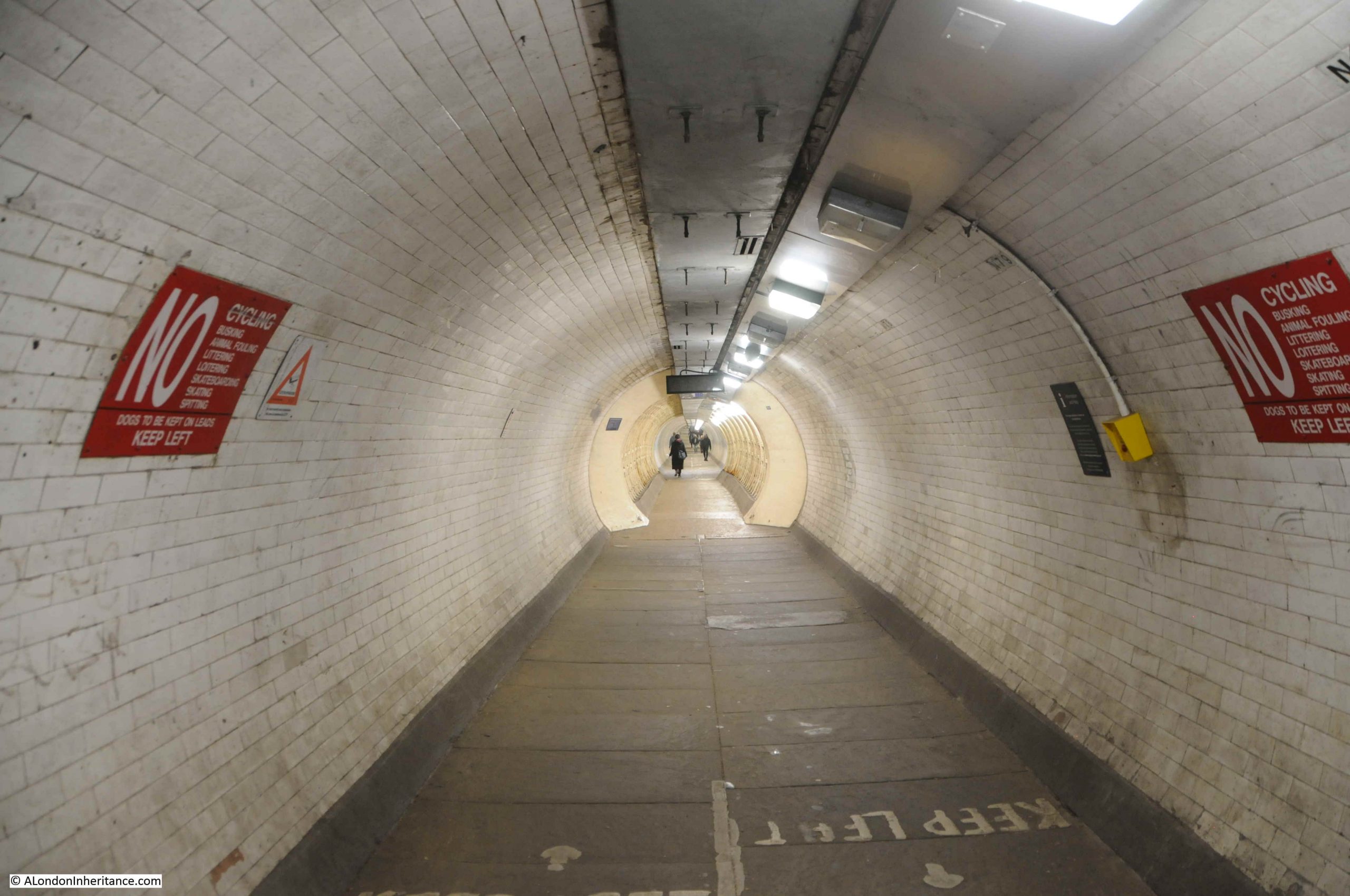
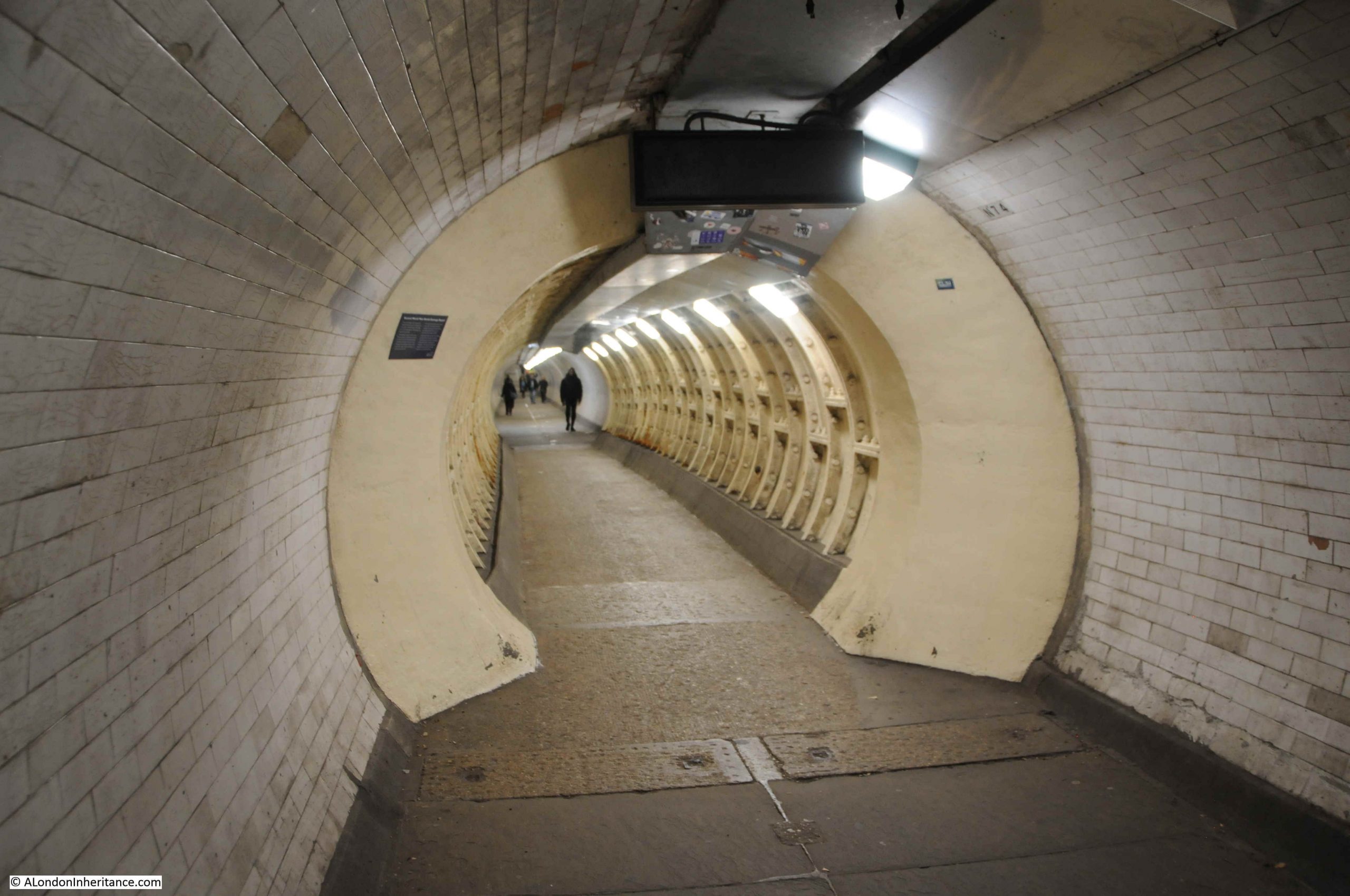
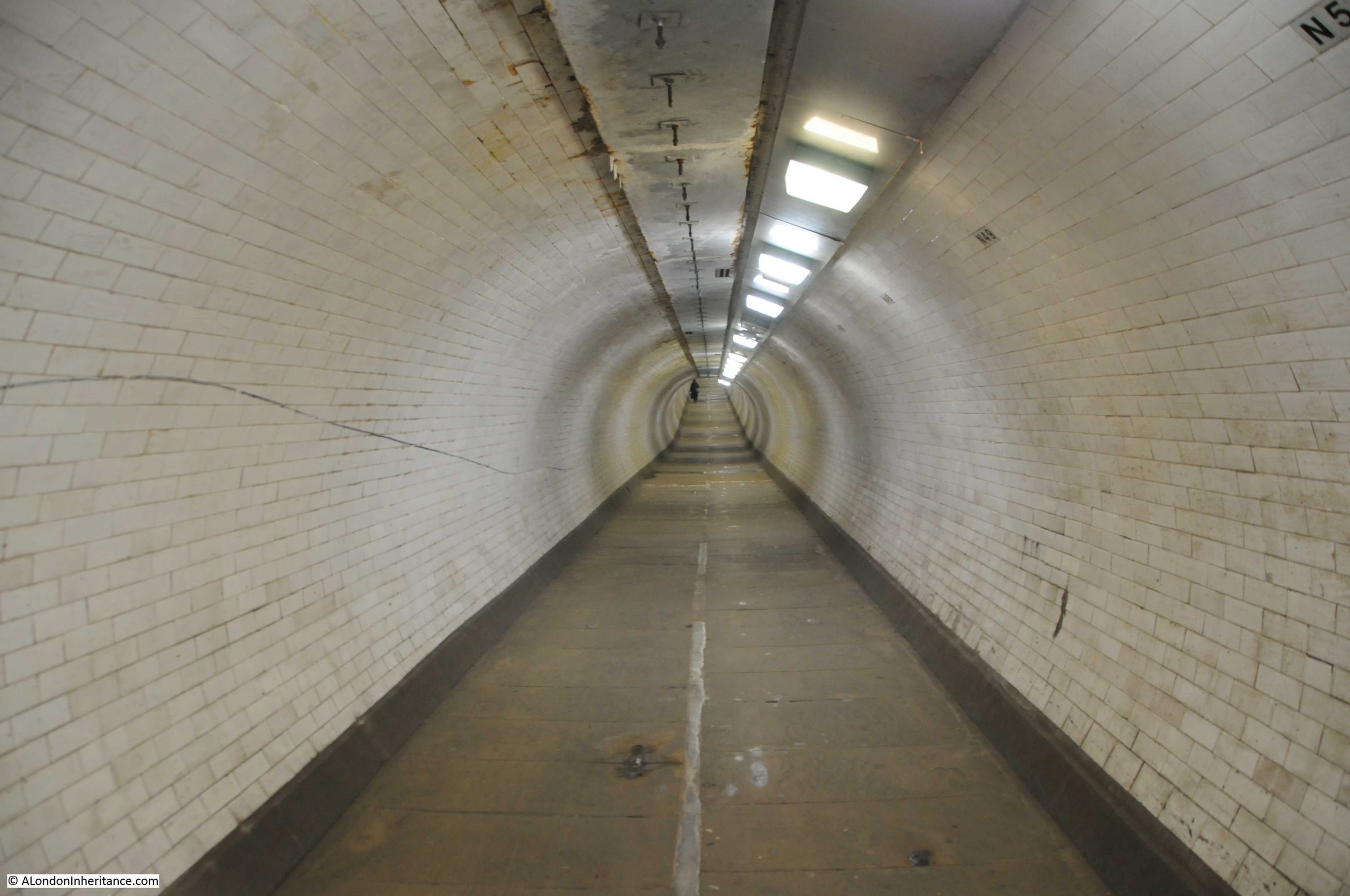
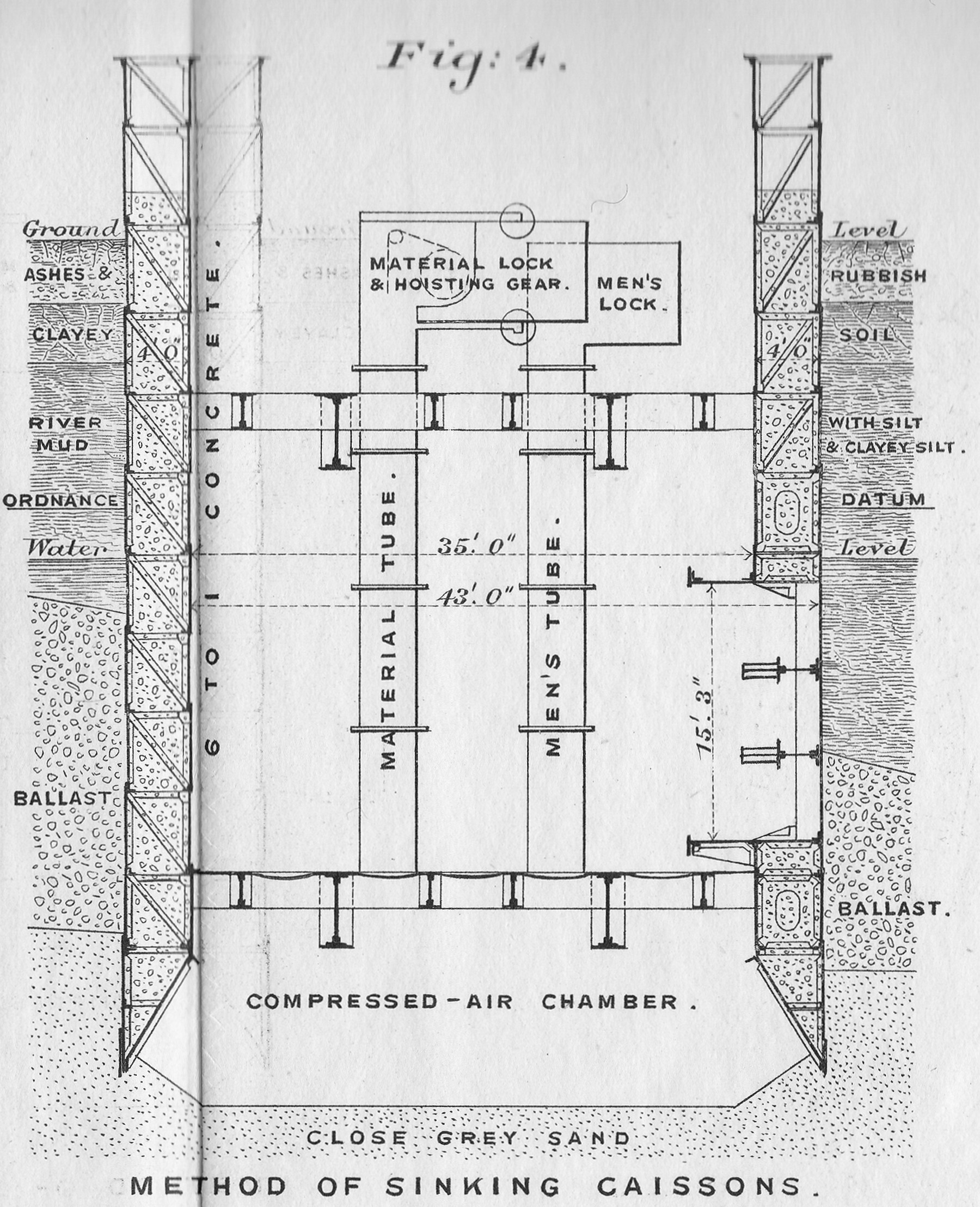
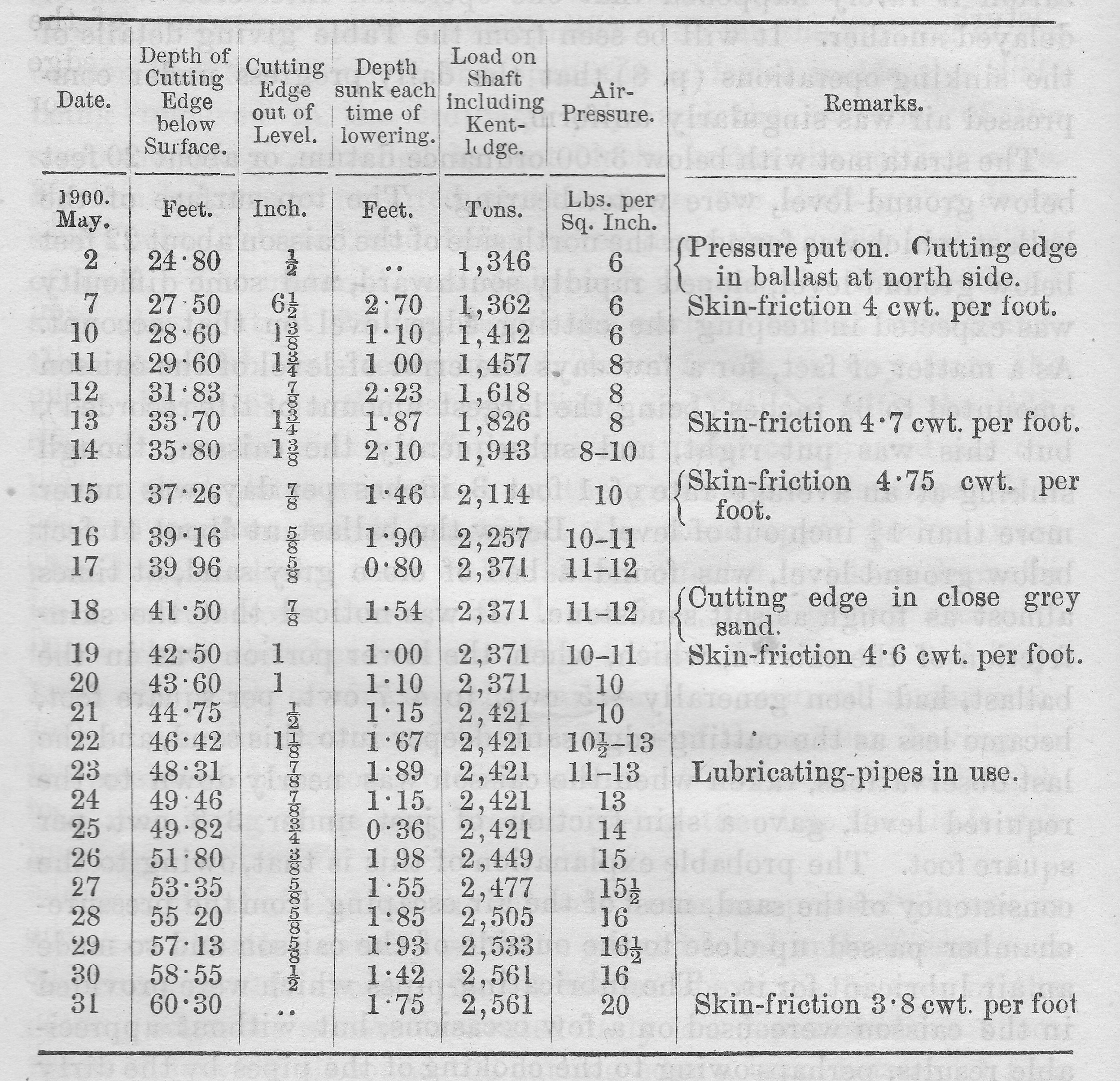
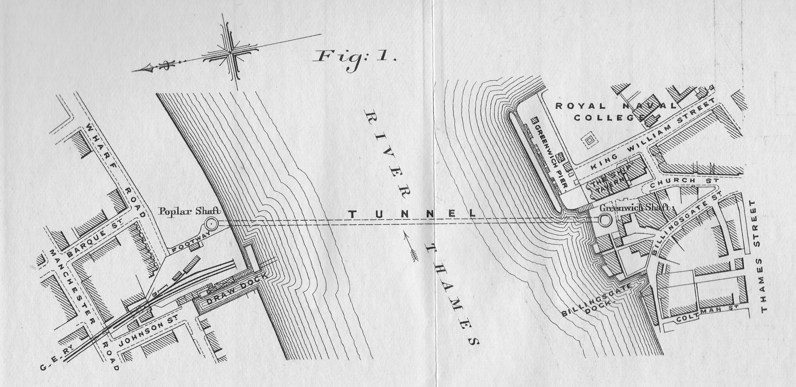
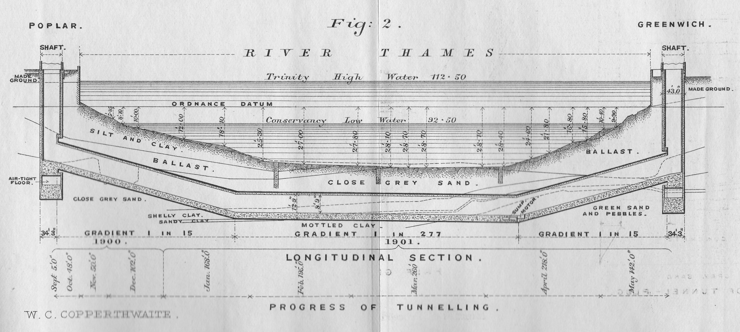
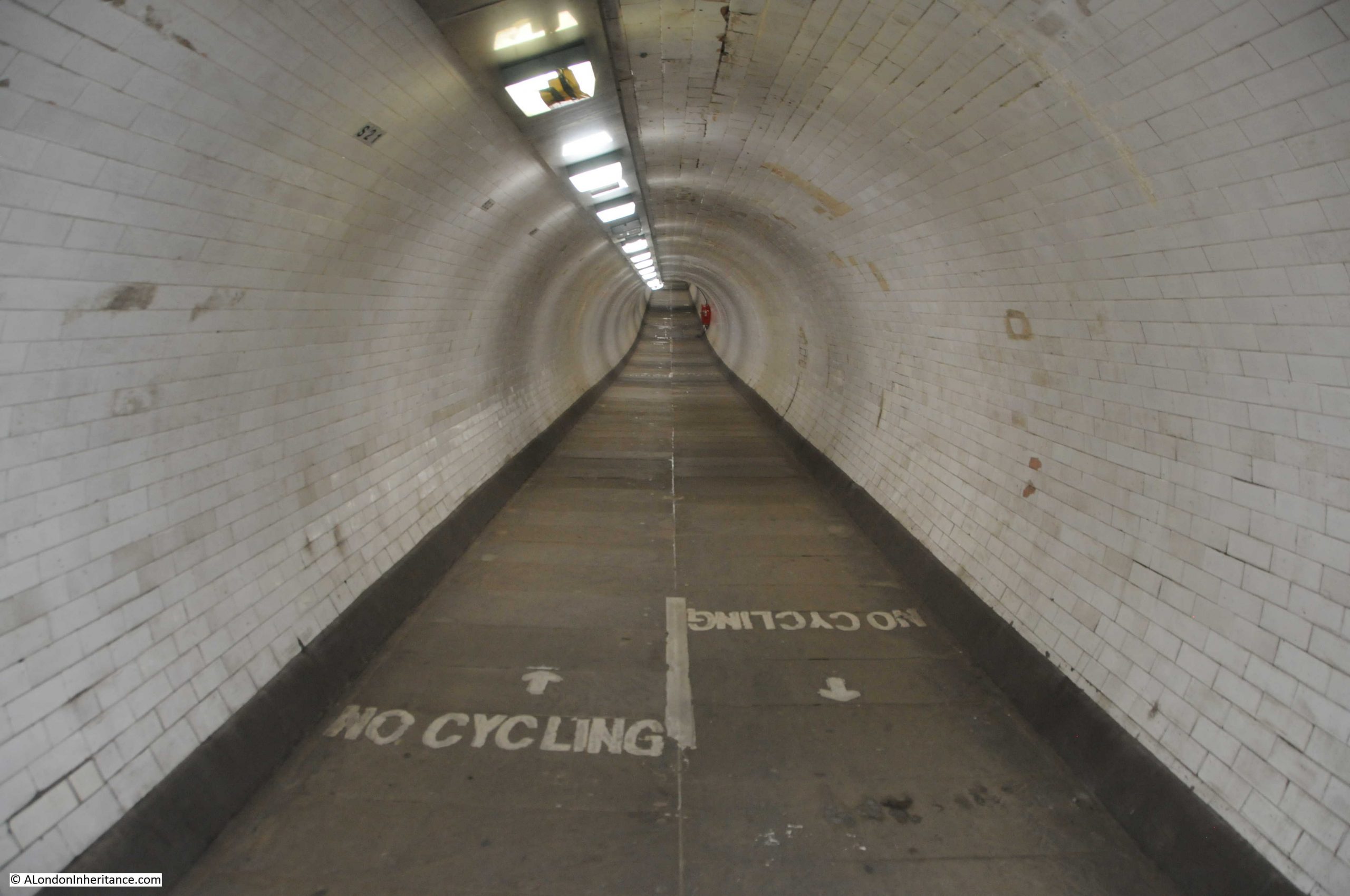
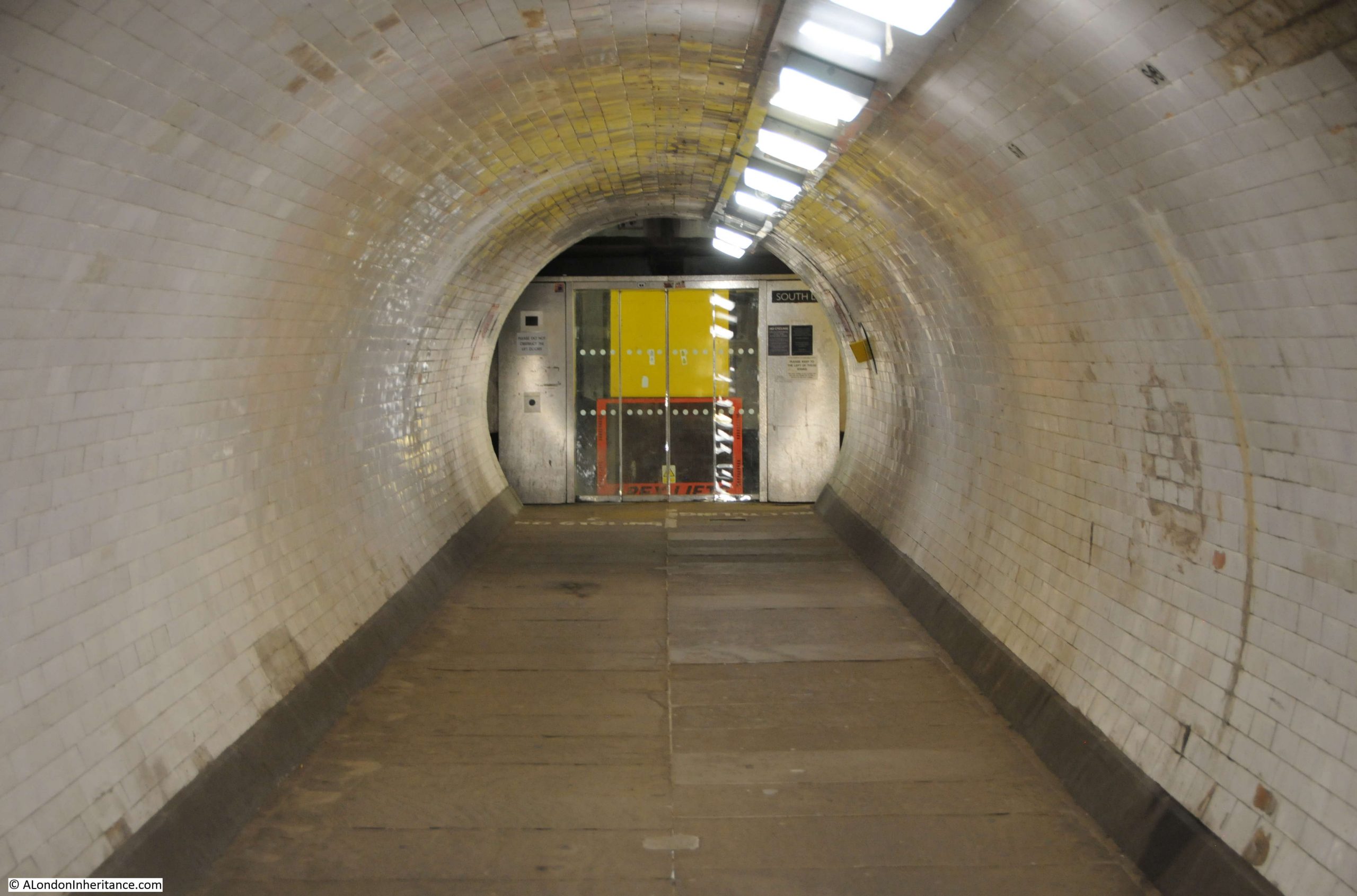
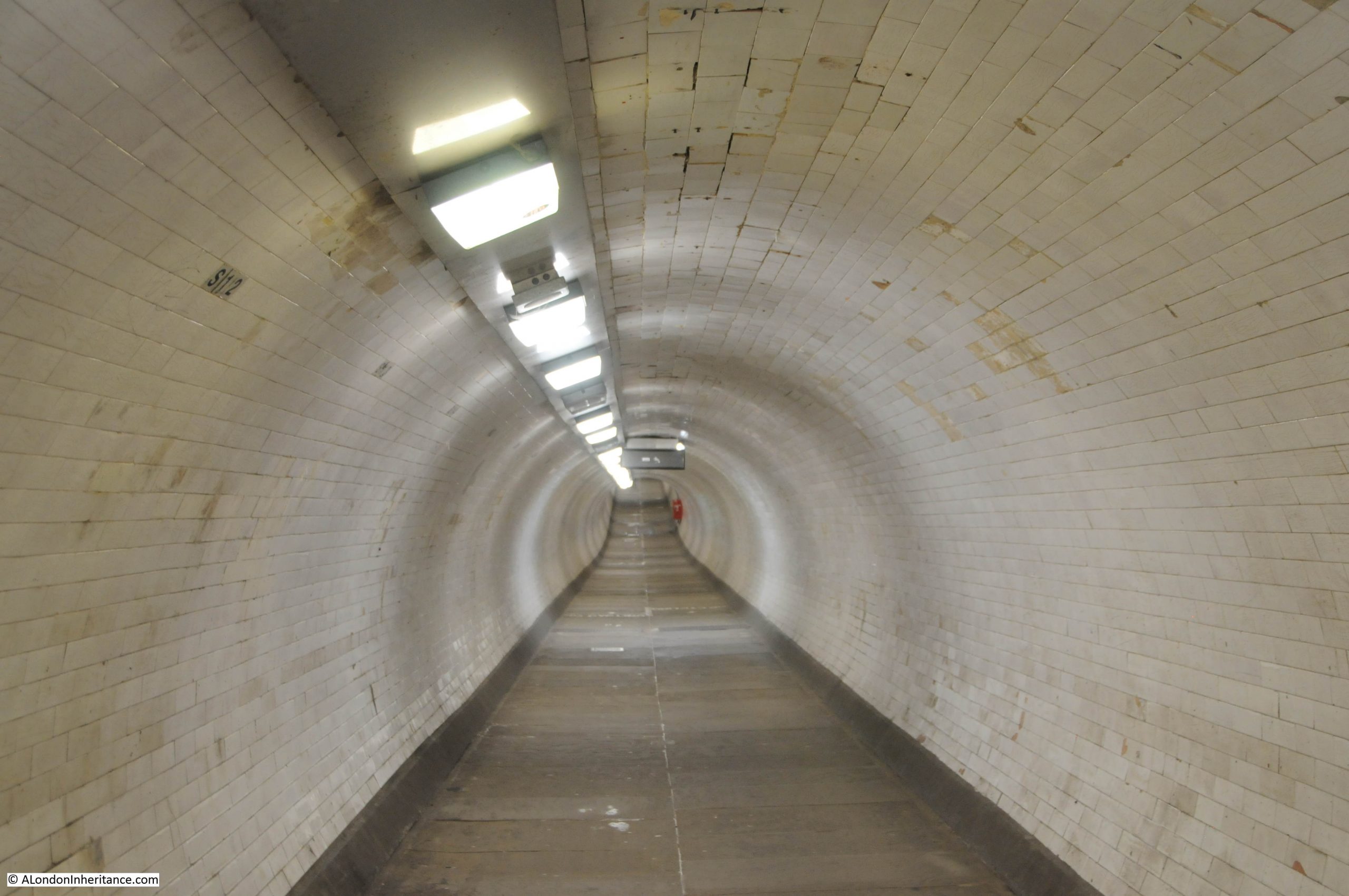
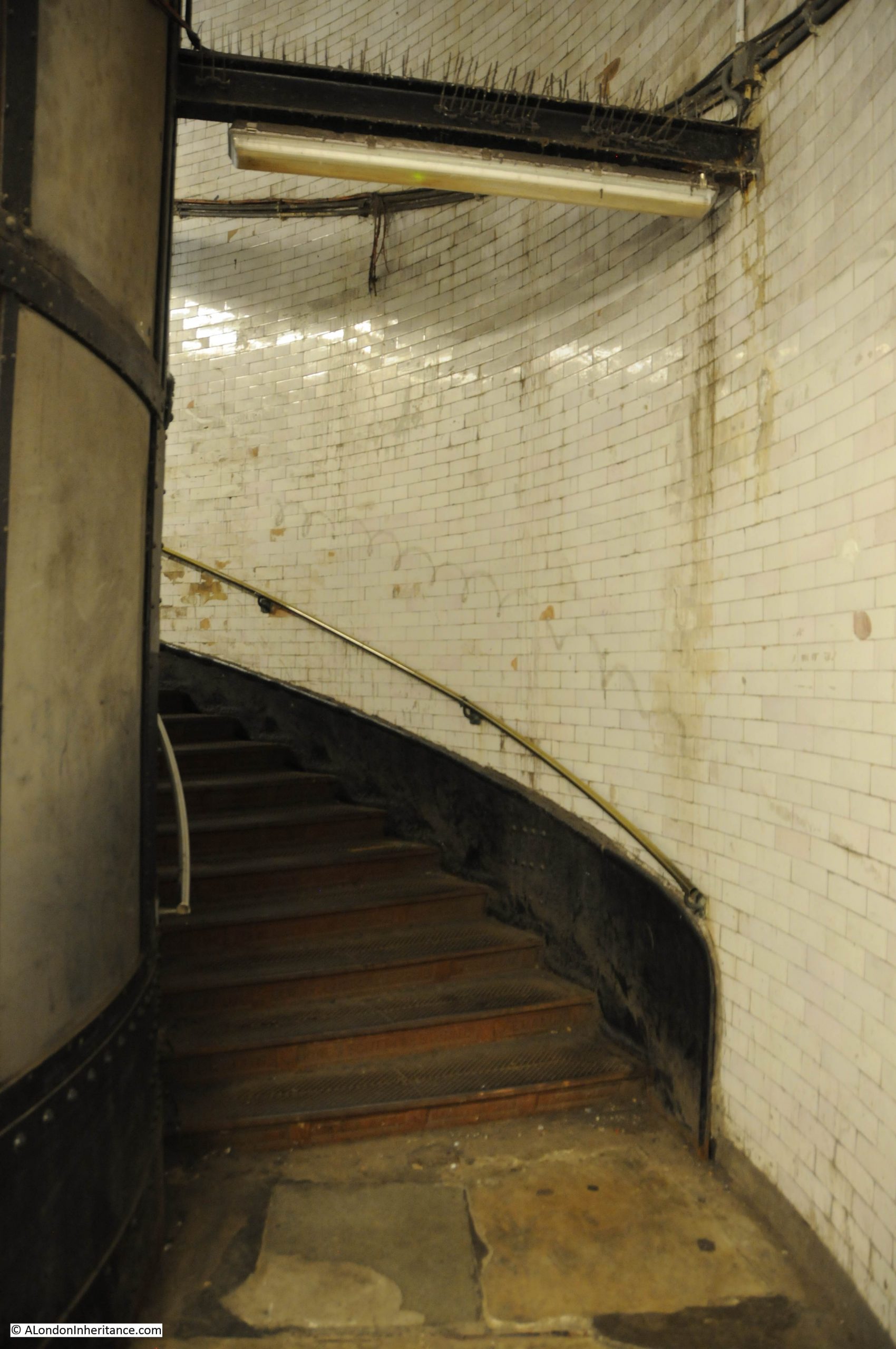
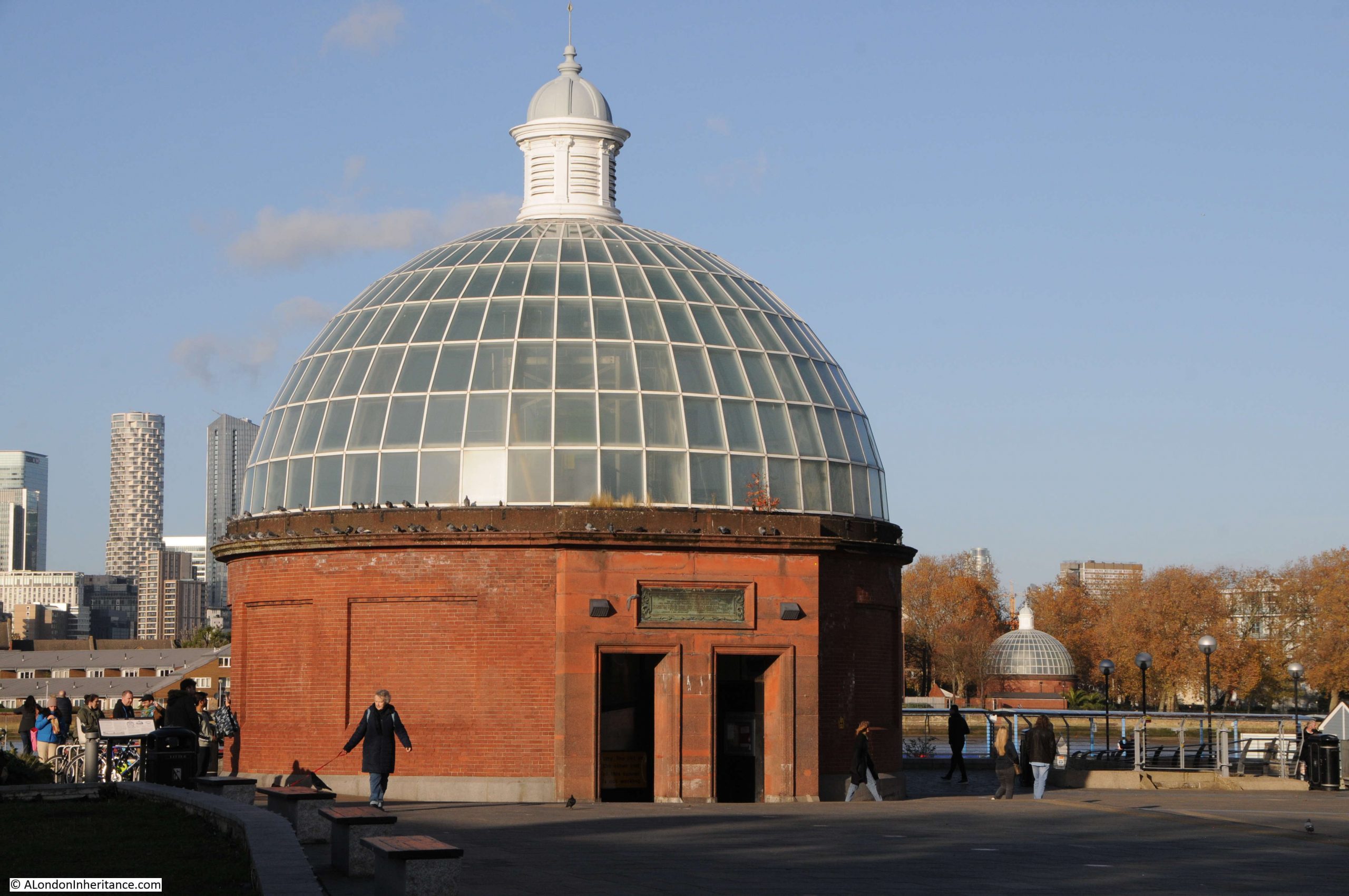
Firstly, thanks for the comments on last week’s post on the Greenwich foot tunnel. Some brilliant personal memories of the tunnel, and the important part it has played in the life of those on either side of the river.

Today is one of those Sunday’s where I ran out of time to research and complete the planned post, so the location in east London will have to wait, and for this week, a photographic tour of London in the first decades of the 20th century from the late 1920s book Wonderful London.

Always good to start with a tour of some pubs, and this is the Running Footman, on the corner of Charles Street and Hays Mews, near Berkeley Square.

The building in the view above would not last much longer. originally dating from 1749, the pub was rebuilt in the 1930s using the type of brick construction typical of many pubs of the 1920s and 30s.

Wonderful London described the source of the name as “named after that special kind of servant whose duty it was to run before the crawling family coach, help it out of ruts, warn toll-keepers, and clear the way generally. He wore a livery and usually carried a cane”.

The 1930s pub is still open, but with a shorter name of just The Footman.

Another pub is the Grenadier in Wilton Mews, near Upper Belgrave Street:

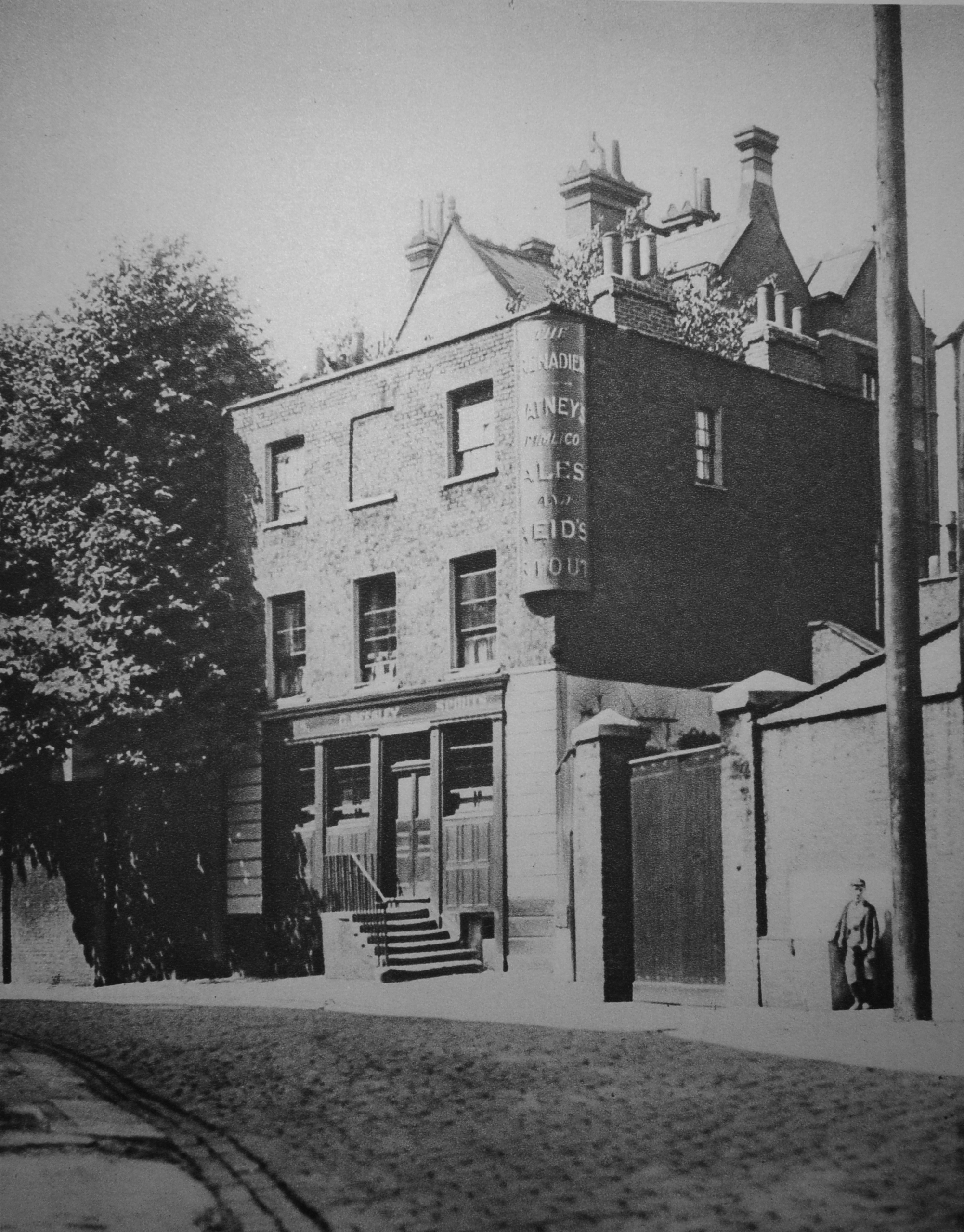
Wonderful London expects that “At any moment it would seem that an ostler with striped waistcoat and straw in mouth might kick open the door and walk out of the place. Just past the wooden gate by the little boy is a doorway in the wall leading to Philips Terrace”.

I took a very similar photo back around 1972. I had been given a birthday present of a book about haunted London and the Grenadier was described as one of the most haunted pubs so it was on the agenda for a family walk where I used my Kodak Instamatic 126 camera. I still have to find and scan the negative.

I did revisit the pub a couple of years ago when writing about Old Barrack Yard and the Chinese Collection. The Grenadier looks much the same, however the tree which had not yet been planted when the Wonderful London photo was taken, now obscures much of the the early 20th century view.

That’s two pubs which can still be found today, and to add a third, this is the Bull’s Head at Strand-on-the Green:

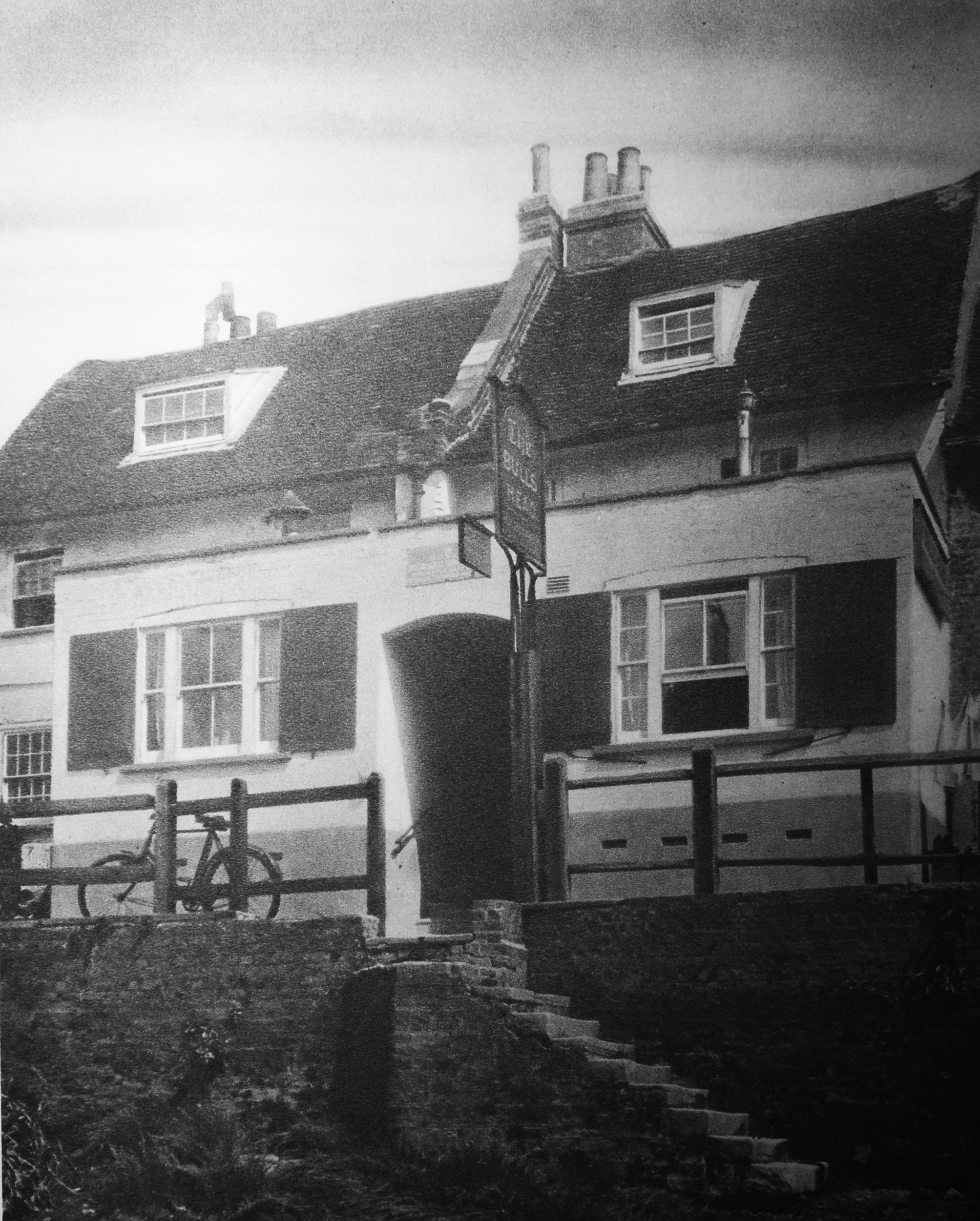
The Bull’s Head is in a wonderful location. Facing the River Thames (behind the photographer in the above photo) and next to Kew Railway Bridge. Wonderful London claims the following “An old river tavern, probably built in the 16th century. There is a tradition that Oliver Cromwell, while campaigning in the neighbourhood, held a council of war here. There is also a record that in 1708 a certain John Newall, presumably the landlord, was so unfortunate as to have his malt house burn down. But beyond these slender records the history of the Bull remains obscure”.

The building is Grade II listed, and the pub’s website also mentions the Oliver Cromwell story, along with the statement that the evidence for his stay is disputed. Whether Cromwell visited the Bull’s Head, or not, it is still a pub in a lovely location as Strand-on-the-Green is a brilliant place for a river walk.

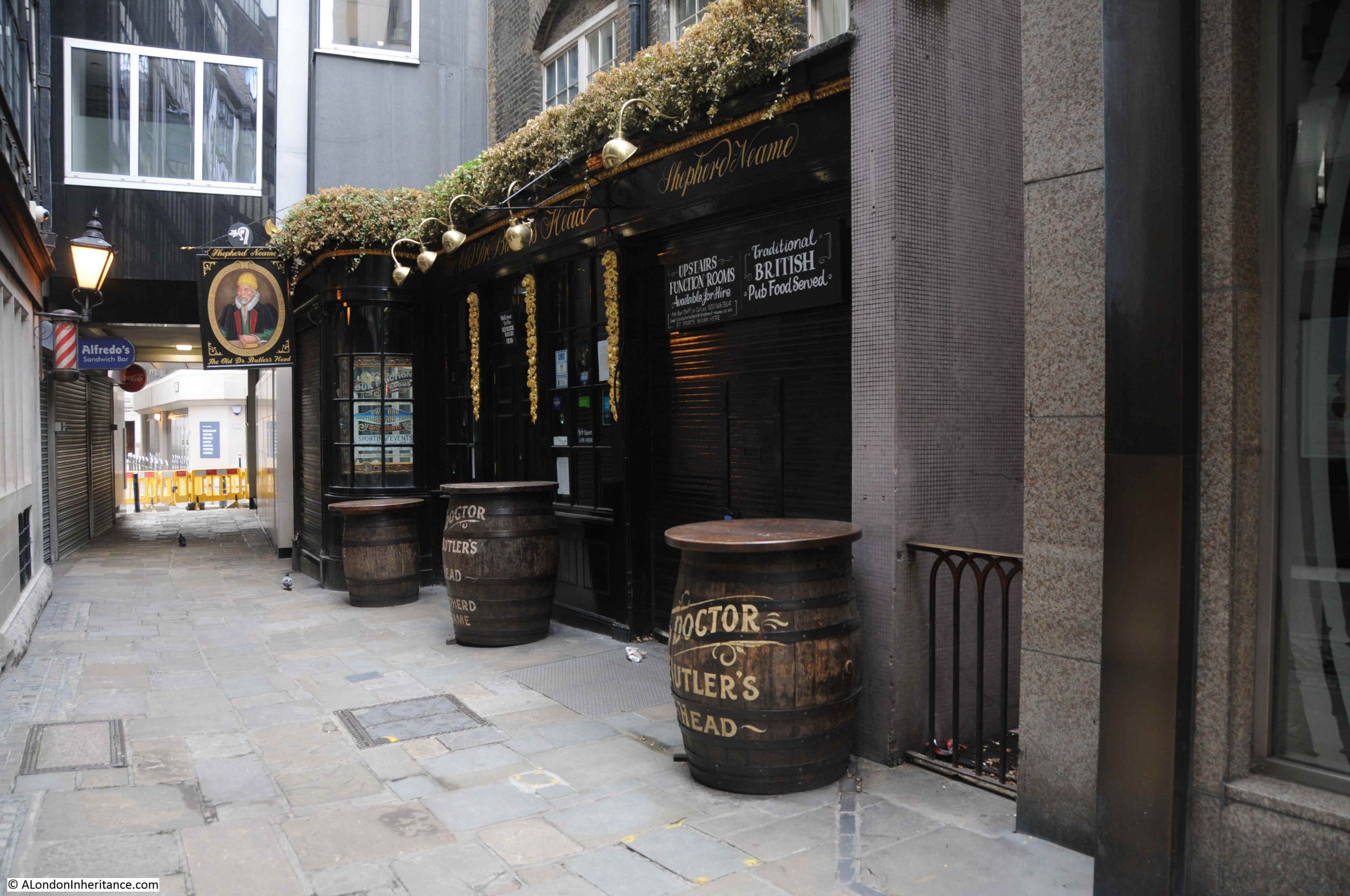
The next pub is the Old Doctor Butler’s Head in Mason’s Avenue in the City of London:

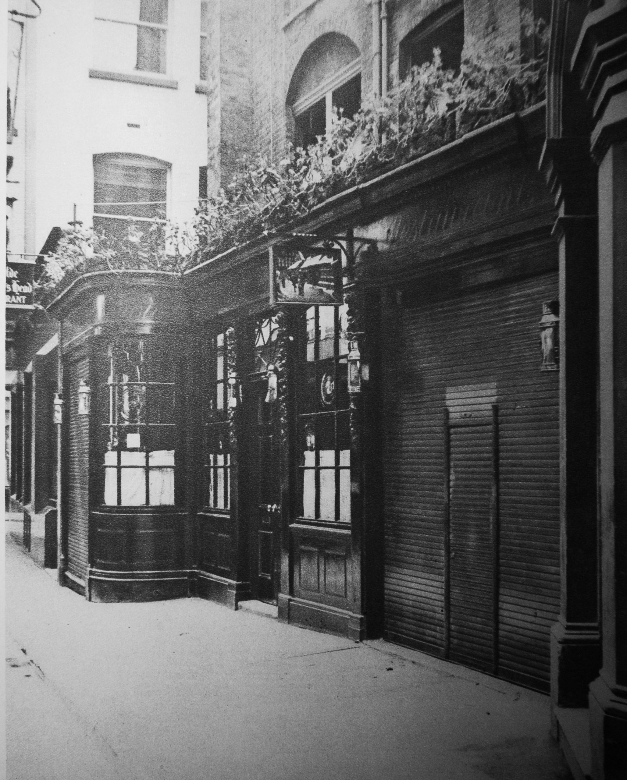
I wrote about this pub last year when I walked round all the pubs in the City of London in July 2020. This is the photo of the pub from the post:

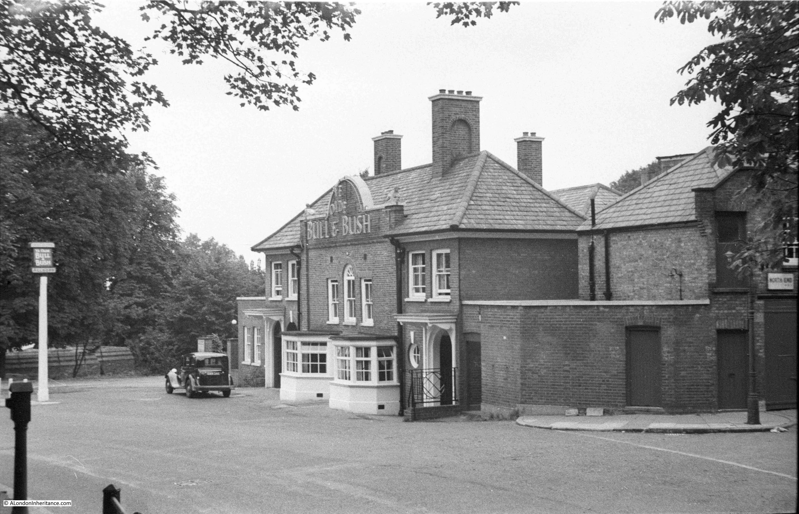
Off to Hampstead now to find the Bull and Bush:

My father photographed the Bull and Bush in 1949, when it faced directly on to the road, and you could pull up outside and nip in for a quick drink:

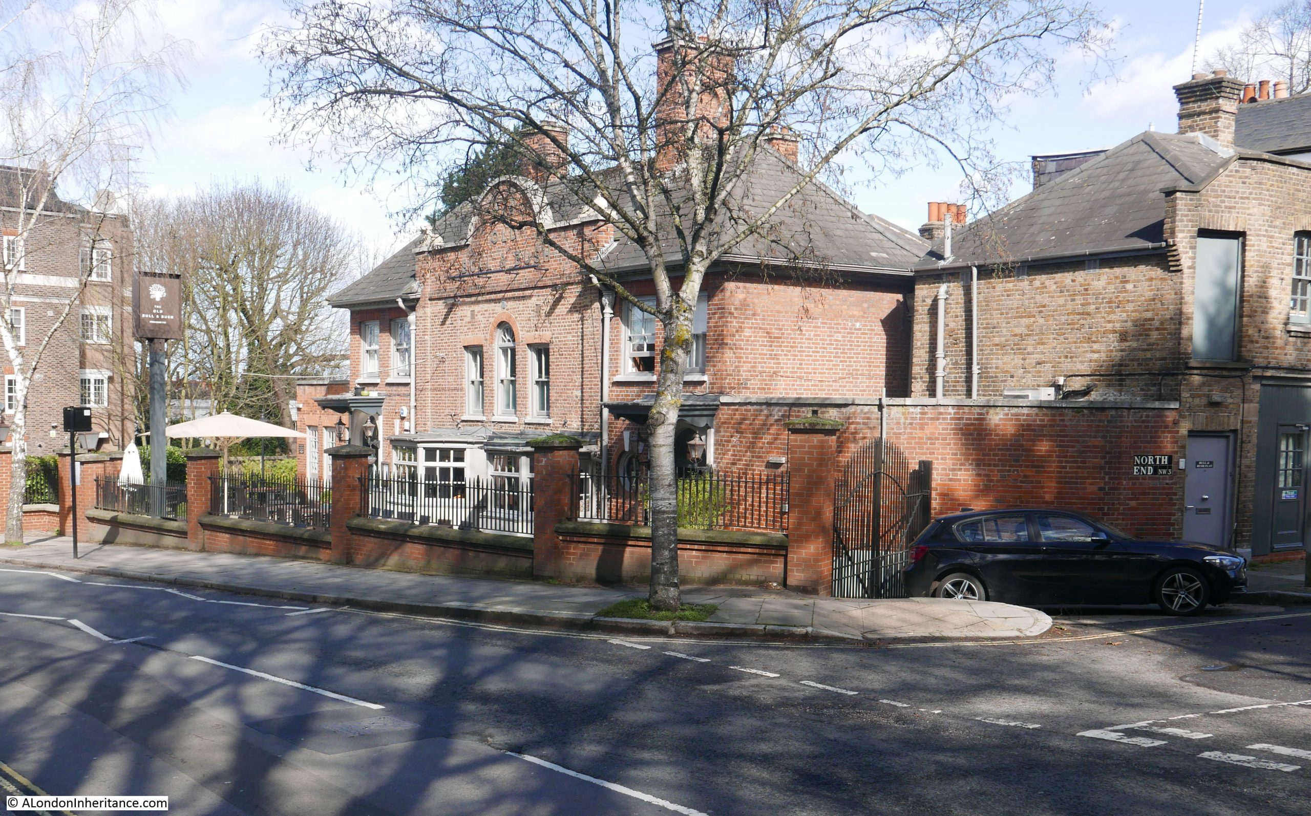
I photographed the pub for a blog post on the Bull and Bush, 70 years after my father had taken the above photo. The building is still much the same, although there is now a pathway and brick wall separating the pub from the road:

All the above pubs are still open, not a bad record considering the rate of closure in recent years, however they were well known pubs in the early 20th century, and 100 years later are still well known and therefore probably profitable.

One pub that did not survive is Jack Straw’s Castle, also in Hampstead:

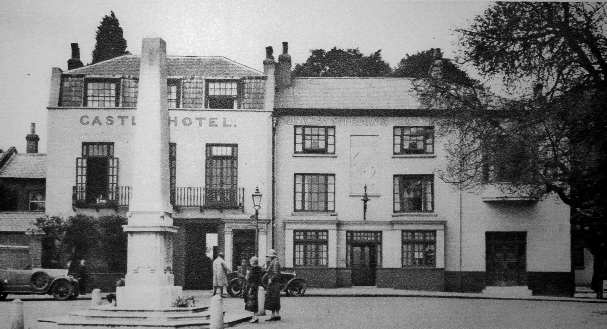
My father photographed the pub in 1949 after bomb damage had left the building in a very sorry state:

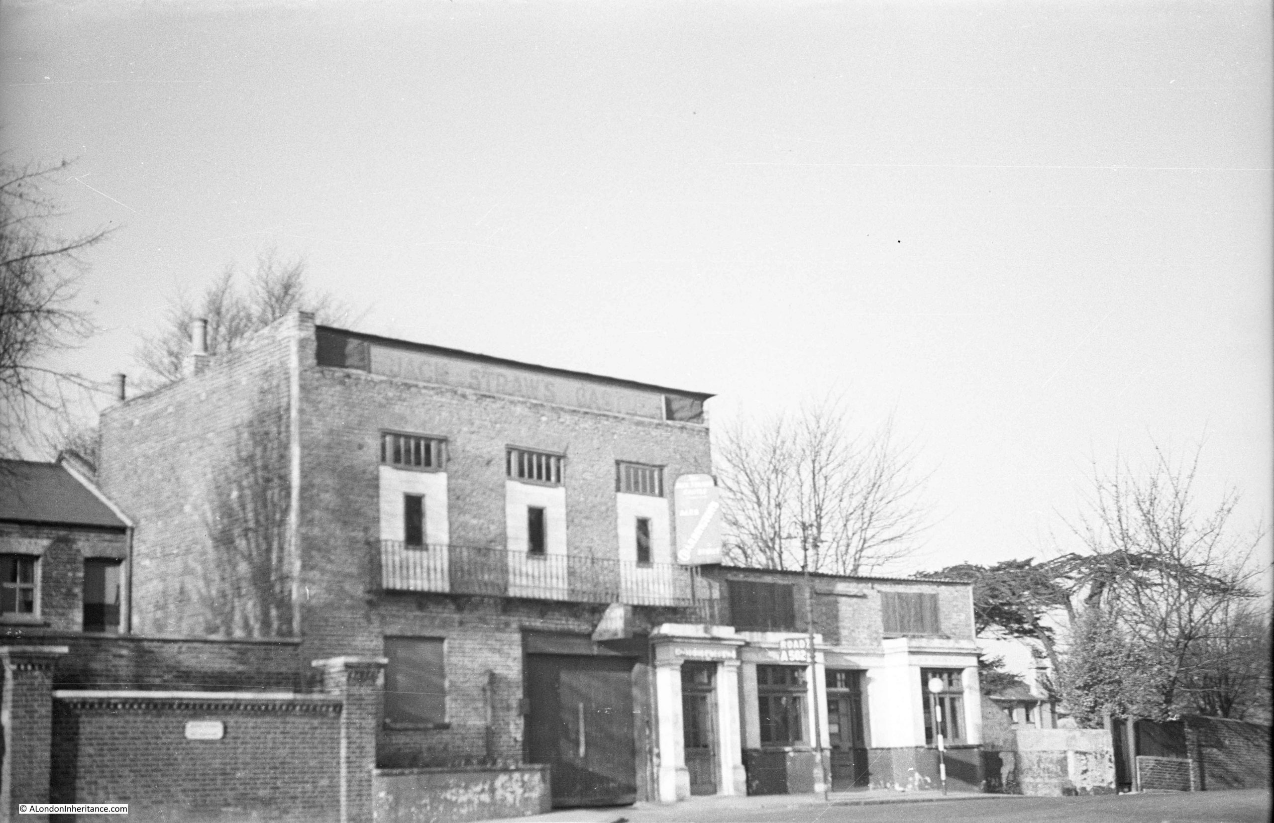
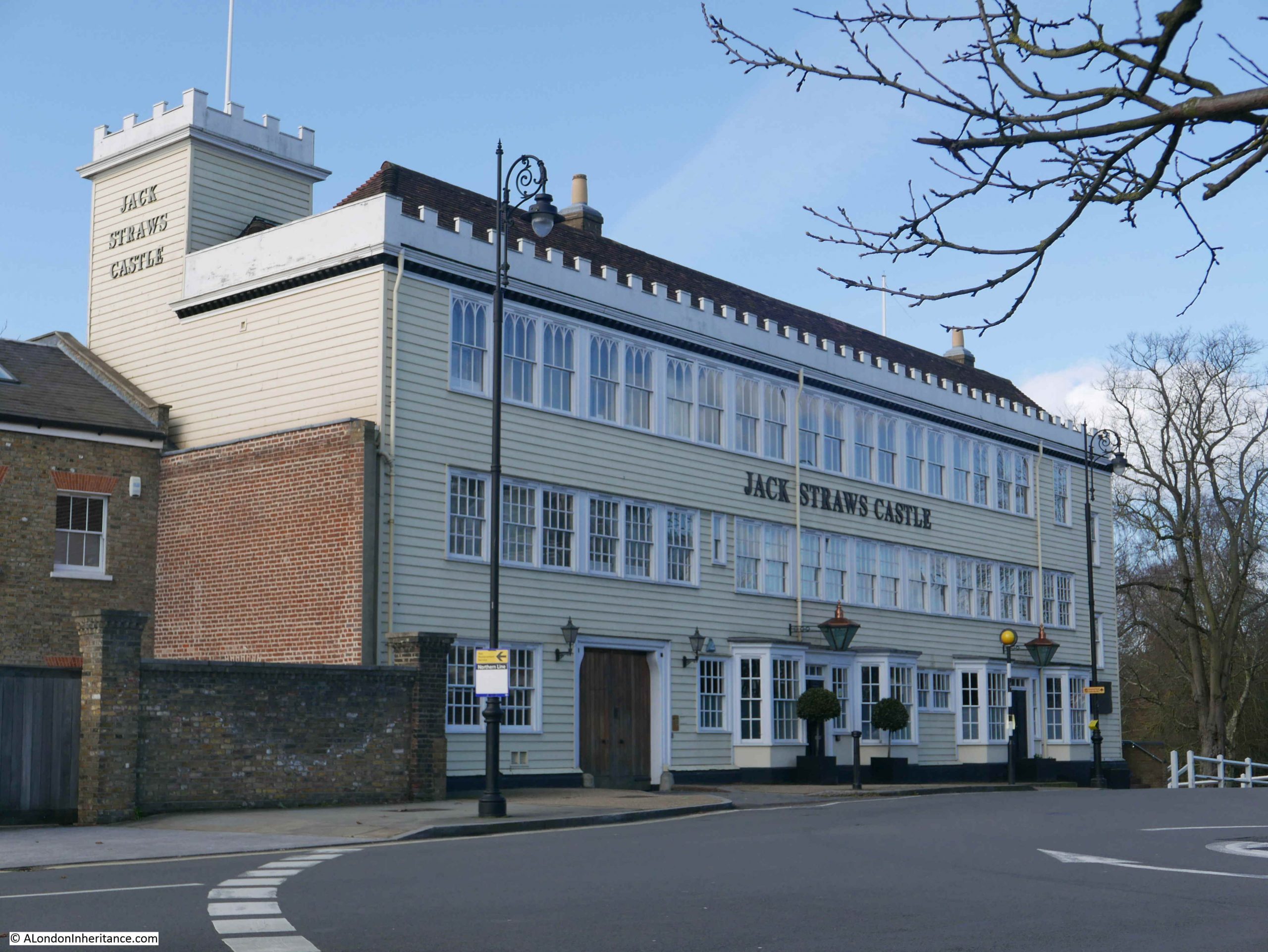
The building was demolished and rebuilt in 1964 as a pub, to a rather striking design by Raymond Erith, however it is no longer a pub, having been converted into apartments and a gym. The building is Grade II listed which has helped to preserve key features of Erith’s design, despite developers trying to push the boundaries of how much they could change.

I wrote about Jack Straw’s Castle here, and this is the view of the 1964 building today:

Moving on from London pubs, and in the first years of the 20th century, this is Strand Lane which leads down from the rear of King’s College down to Temple Place.

The view gives the impression of being of the type of slum housing that would be demolished, however the house with the alley has been restored over the years, and still survives, including the ornate iron balcony on the first floor. The high wall on the left, and building on the right also remain, including the iron bars protecting the windows.

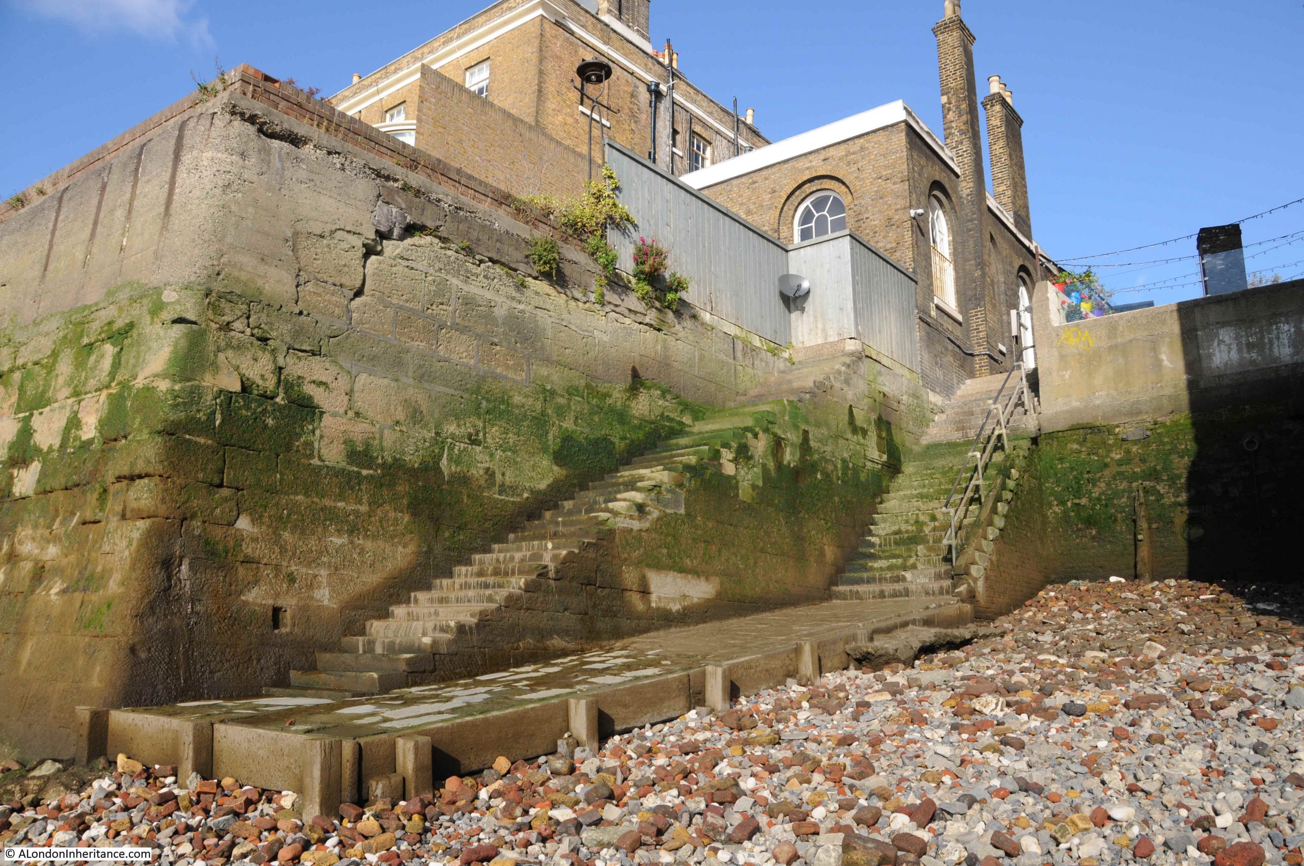
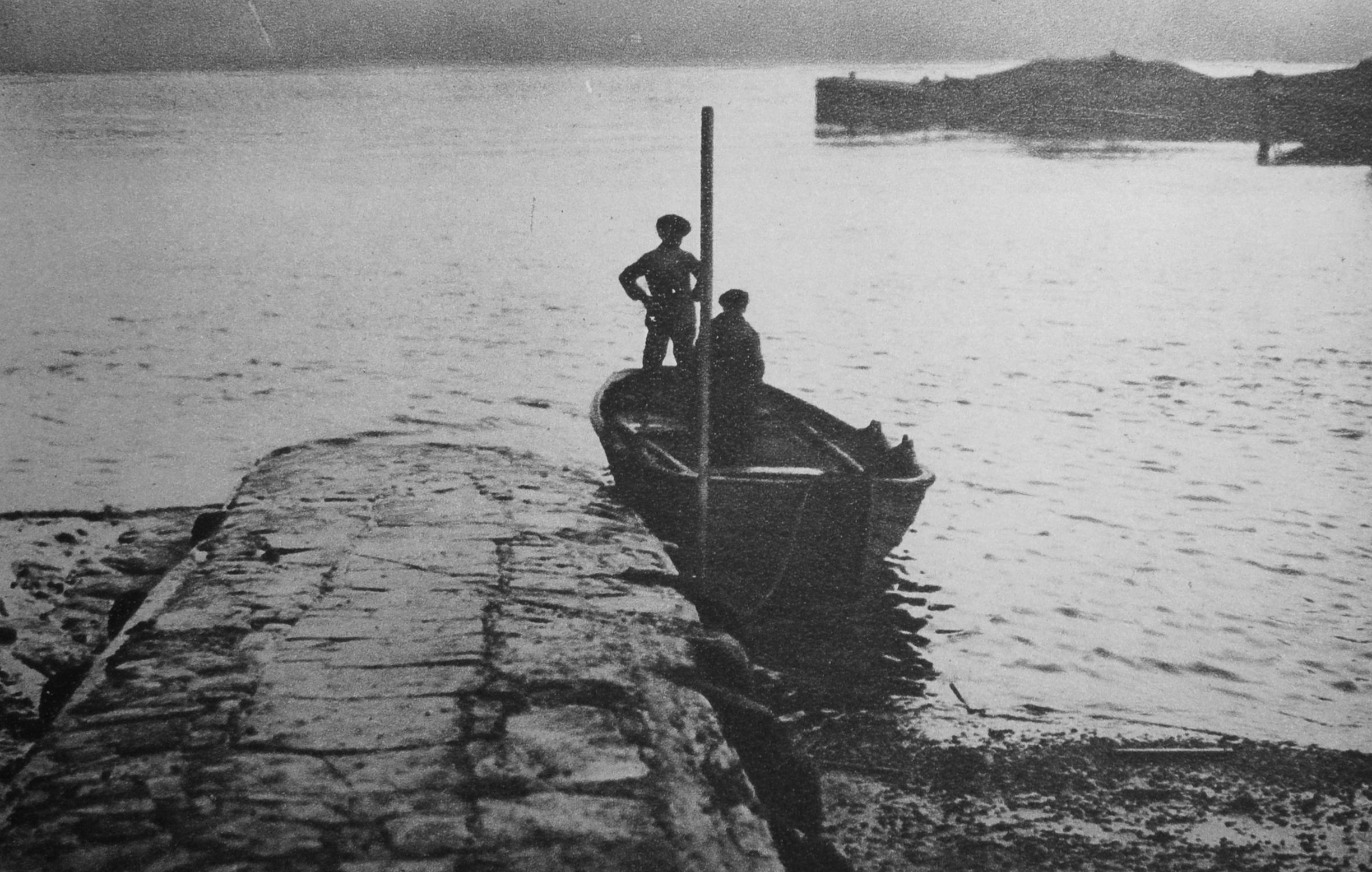
Just proving there are still places in London where you can imagine being back in the 19th century. Another place that has survived are the stairs leading down to the river at Wapping Old Stairs:

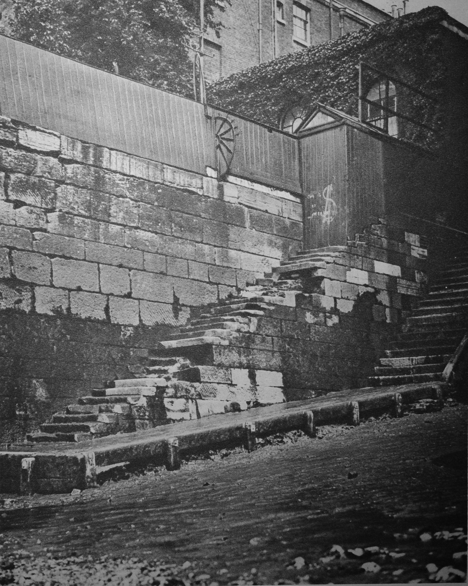
Even in the first decades of the 20th century, these stairs were seen as a historical location, as Wonderful London describes “the old riverside annex to the city of the days of the East Indiamen and Nelson’s Ships, has gone and there is little beside these old stairs – leading down to a muddy beach at low tide – left of this, once one of the liveliest spots in the country”.

Much the same description could apply to the stairs today. The following photo is from a post describing the story of these historic river stairs:

The following two photos are titled “Present-day scenes on historic Thames-side sites”

The description from Wonderful London that goes with the two photos is as follows “The upper photograph shows Ratcliffe Cross stairs, an ancient and much used landing place and point of departure of a ferry. There is a tradition that Sir Martin Frobisher took boat here for his ship when starting on his voyage to find the North-West Passage. Ratcliffe Cross is the old name for the thoroughfare leading to this landing stage, whence Butchers Row meets Broad Street, Shadwell and Narrow Street, Limehouse.

Shadwell (lower view) is next to Wapping, and its name is supposedly derived from (St) Chad’s Well. It was once famous for its rope-walks”.

Ratcliffe Cross stairs are sort of still there, as there is still river access where the stairs were located. They are today where Narrow Street curves to a dead end just before the Limehouse Link Tunnel. Ratcliffe Cross stairs are on the list for a future post, as these old river stairs have a really fascinating history.

The Sir Martin Frobisher mentioned as using Ratcliffe Cross Stairs was a 16th century sailor and privateer who made a number of attempts at discovering the north-west passage across the north of Canada from Atlantic to the Pacific. As well as allegedly using the stairs, another connection with London is that he was buried at the church of St Giles, Cripplegate, and is why Frobisher Crescent in the Barbican is so named.

The next photo is in the east of the City where “In Houndsditch, where bargains are driven for inexpensive clothes”:

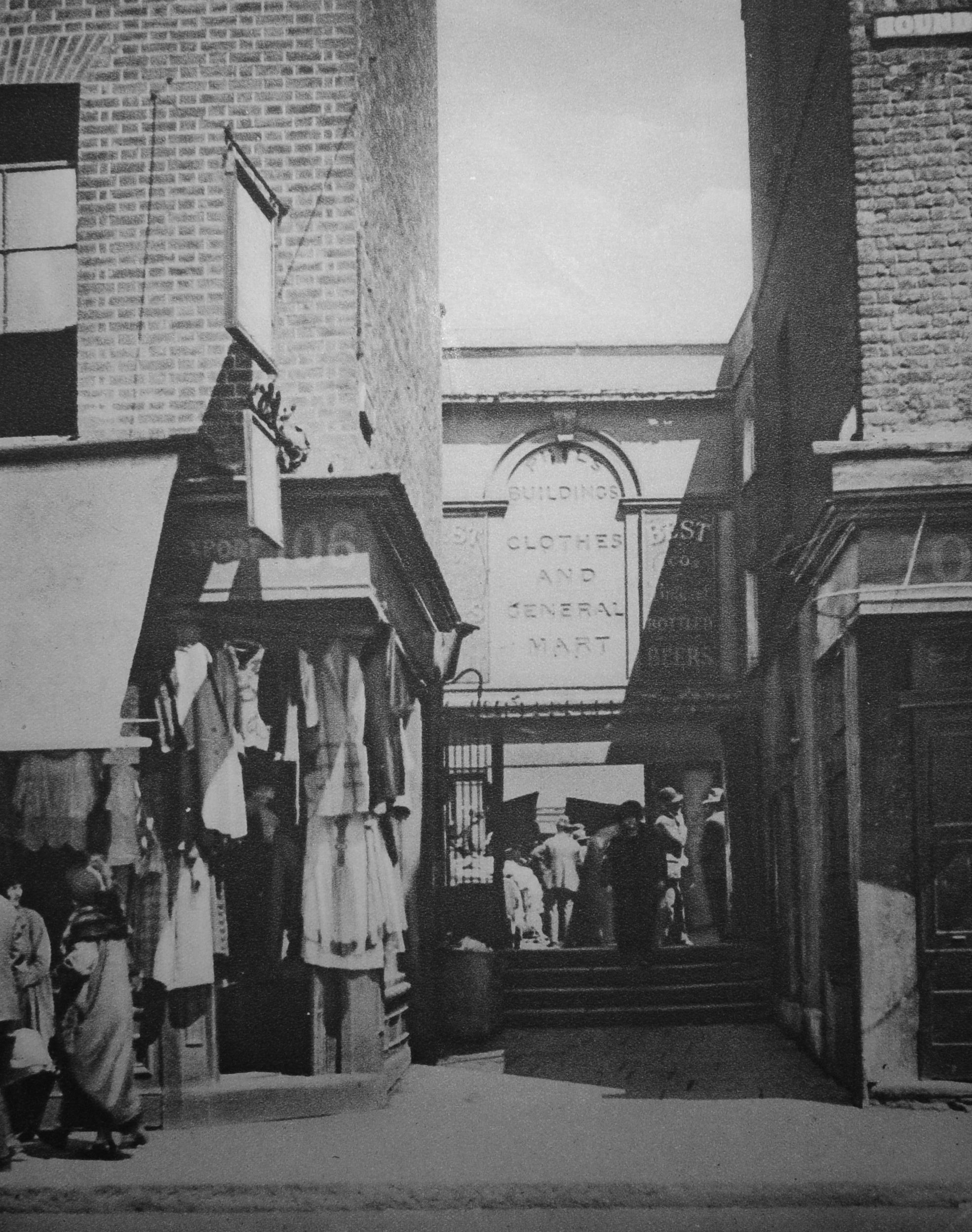
Houndsditch was the location for shops and a market selling every conceivable item of clothing, both new and secondhand. The name came from the ditch that once surrounded the City wall, and was frequently used as a dump for everything, including dead dogs.

Houndsditch continued discount trading into the 1980s, and if you listened to either Capital Radio or LBC during the late 70s / early 80s there were frequent adverts for the Houndsditch Warehouse where “five floors of bargains can be found at our store”. The street is very different today.

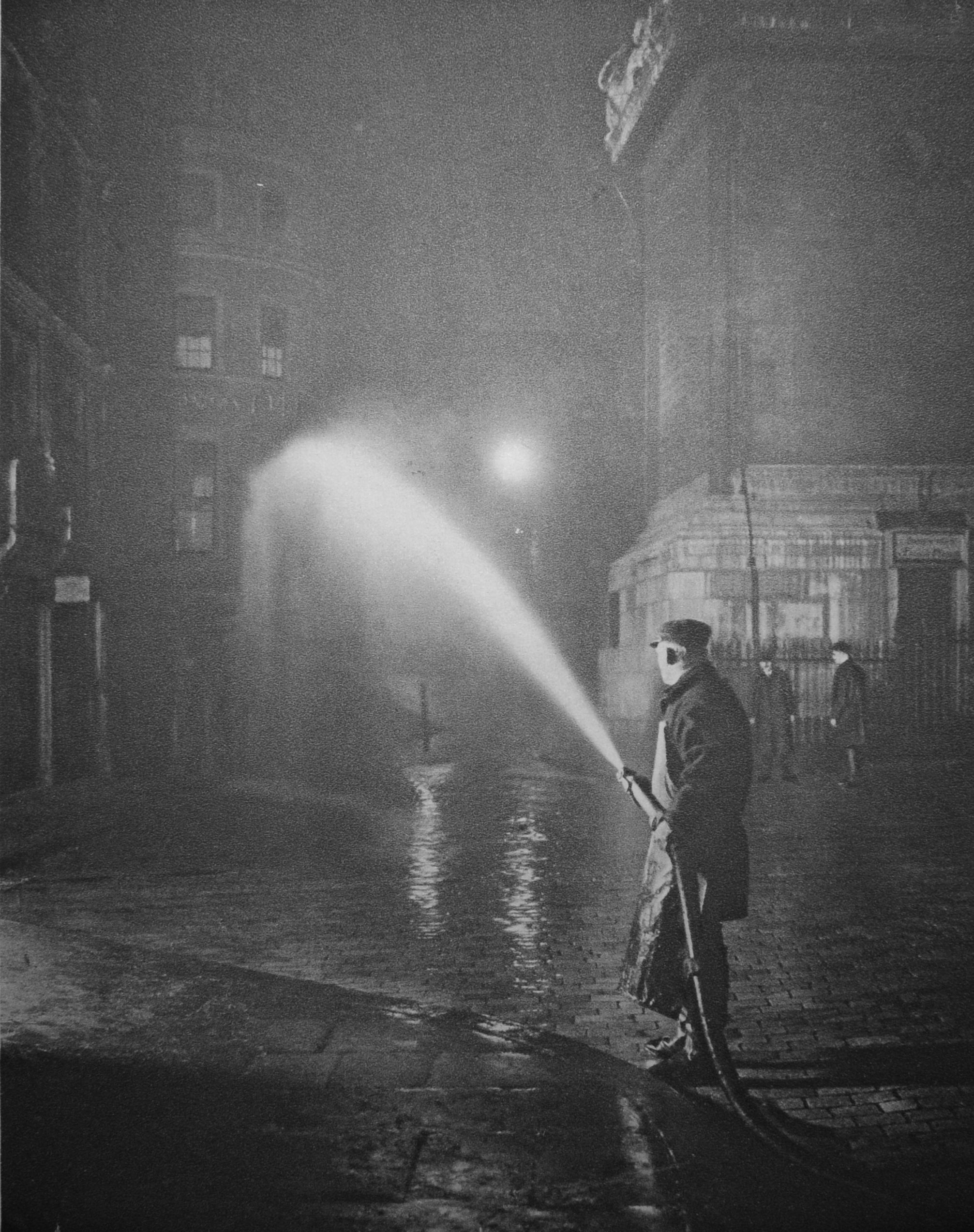
Wonderful London included some night photos of London, including the nightly cleansing of the streets at the base of the Monument, where at “2 a.m. hoses are fitted to hydrants, and men in oilskin aprons wash the day’s filth into the gutter. The neighbourhood of Billingsgate is notoriously unsavoury, but these ministrations keep the fish like smell from becoming too ancient”.

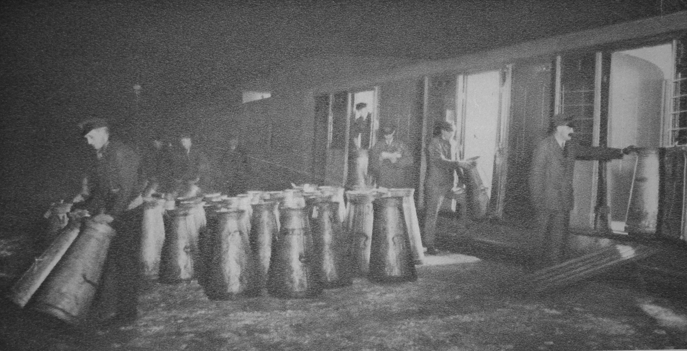
Milk churns being unloaded at Clapham, ready for the city’s tea drinkers:

The following photo is titled “The coffee stall at Hyde Park Corner and some of its various patrons”;

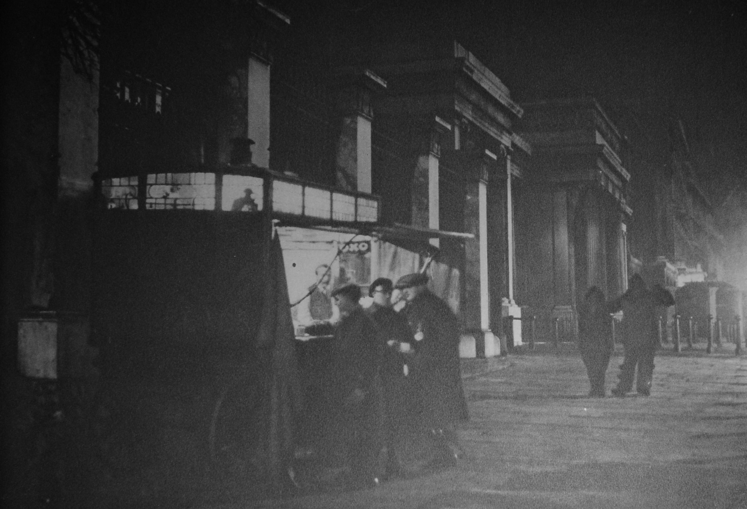
Where “just before ten o’clock every night the coffee stall trundles up to its pitch opposite St George’s Hospital. There it remains till about eight o’clock the next morning, and during that time the men behind the little counter watch, as from a box at the theatre, the hundred different types who act in the nightly drama of London after dark. The medicals student from over the way, the tattered nondescript who hopes for a free coffee, a taxi-driver and his two fares, or perhaps a couple of revelers in fancy dress to whom the visit to the coffee stall is the epilogue to their night’s entertainment; all these types pass during the cold, still hours which the coffee stall serves”.

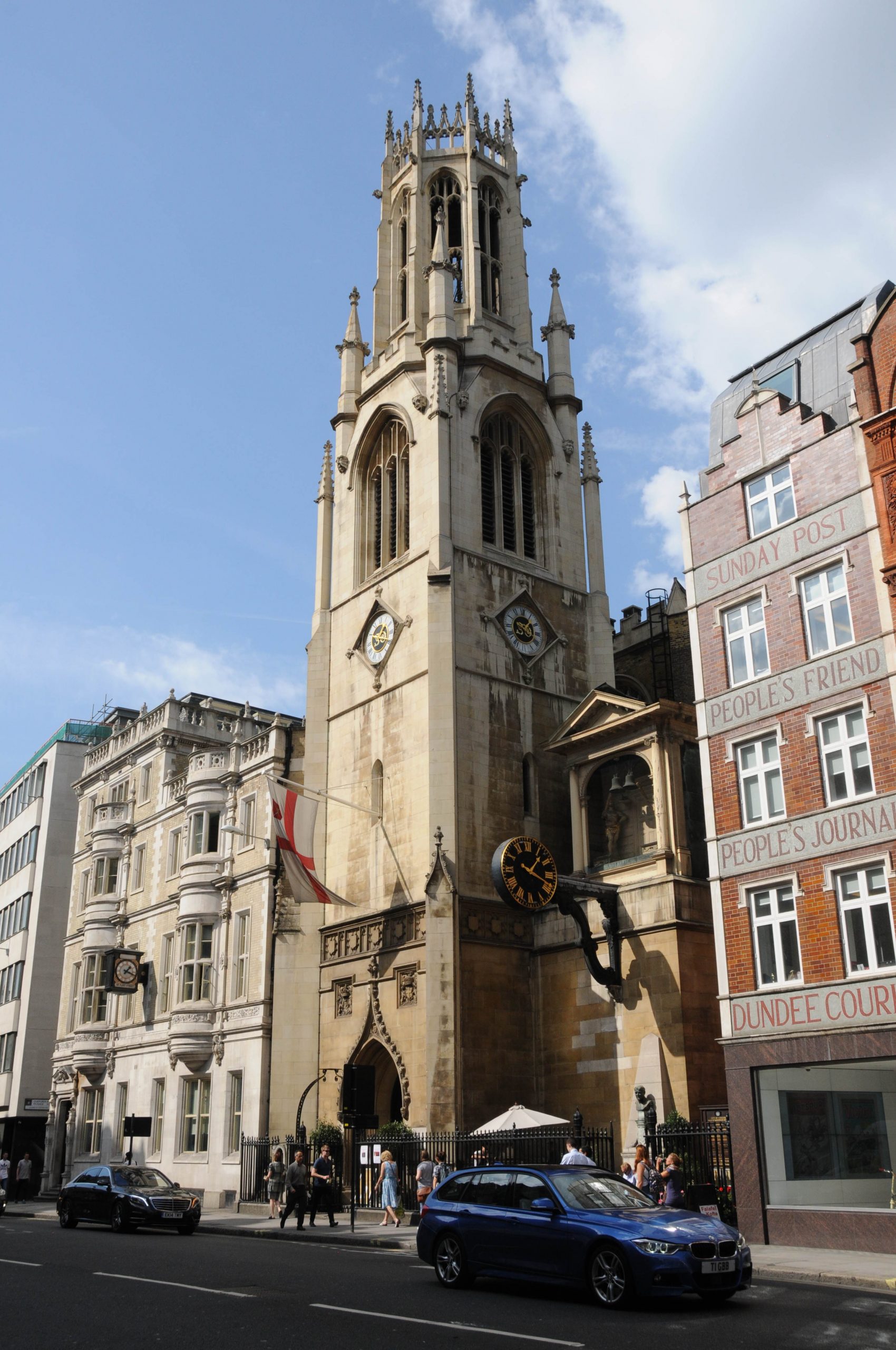
The following view from Wonderful London is of St Dunstan’s, Fleet Street:

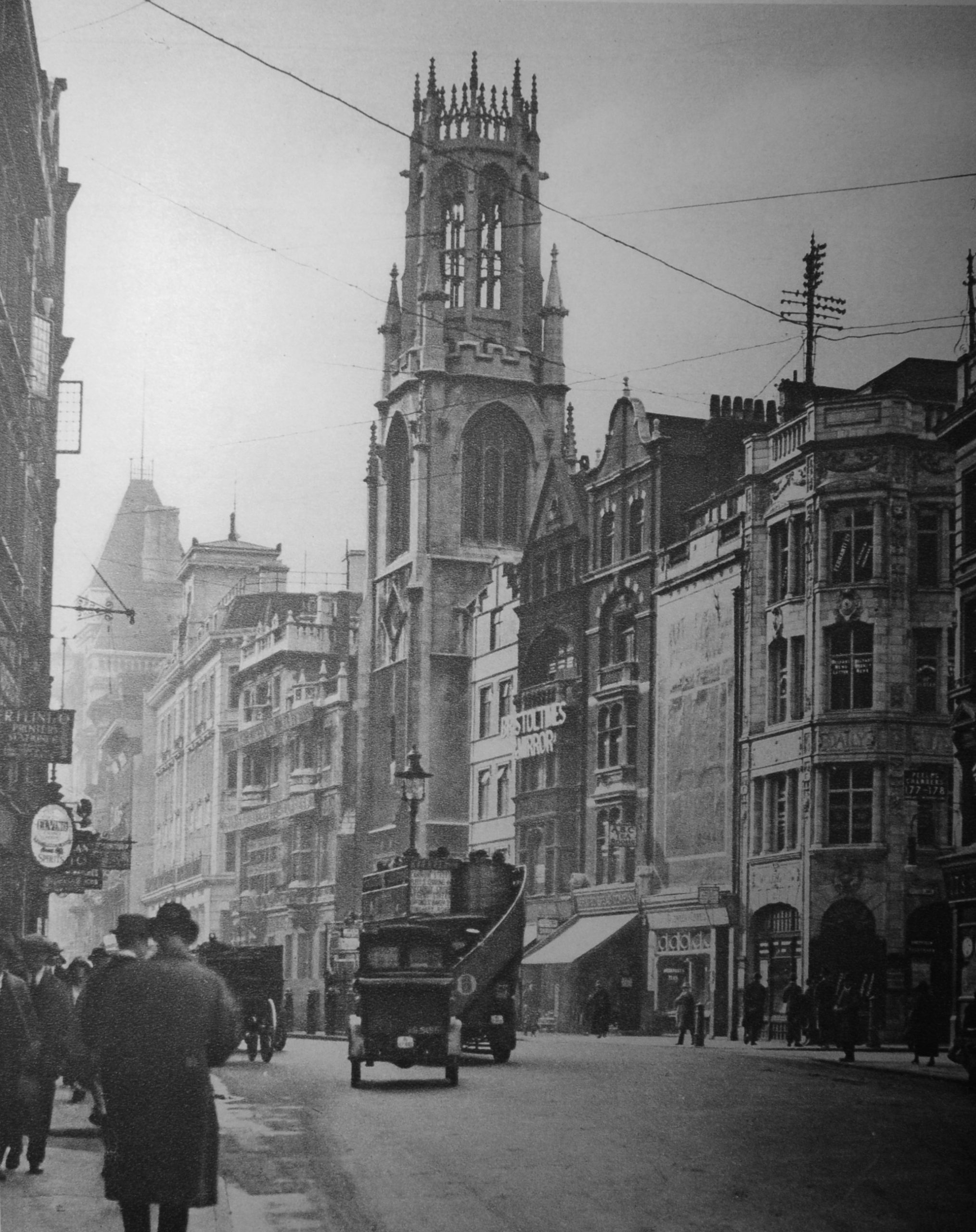
What I like about these photos is not just the overall scene, or the people and vehicles in the streets, but small details like the telegraph poles mounted on the roofs of buildings with telephone cables slung across streets and buildings.

The church is the same today, as are the buildings on either side. I took the following photo for a post about the church a couple of years ago:

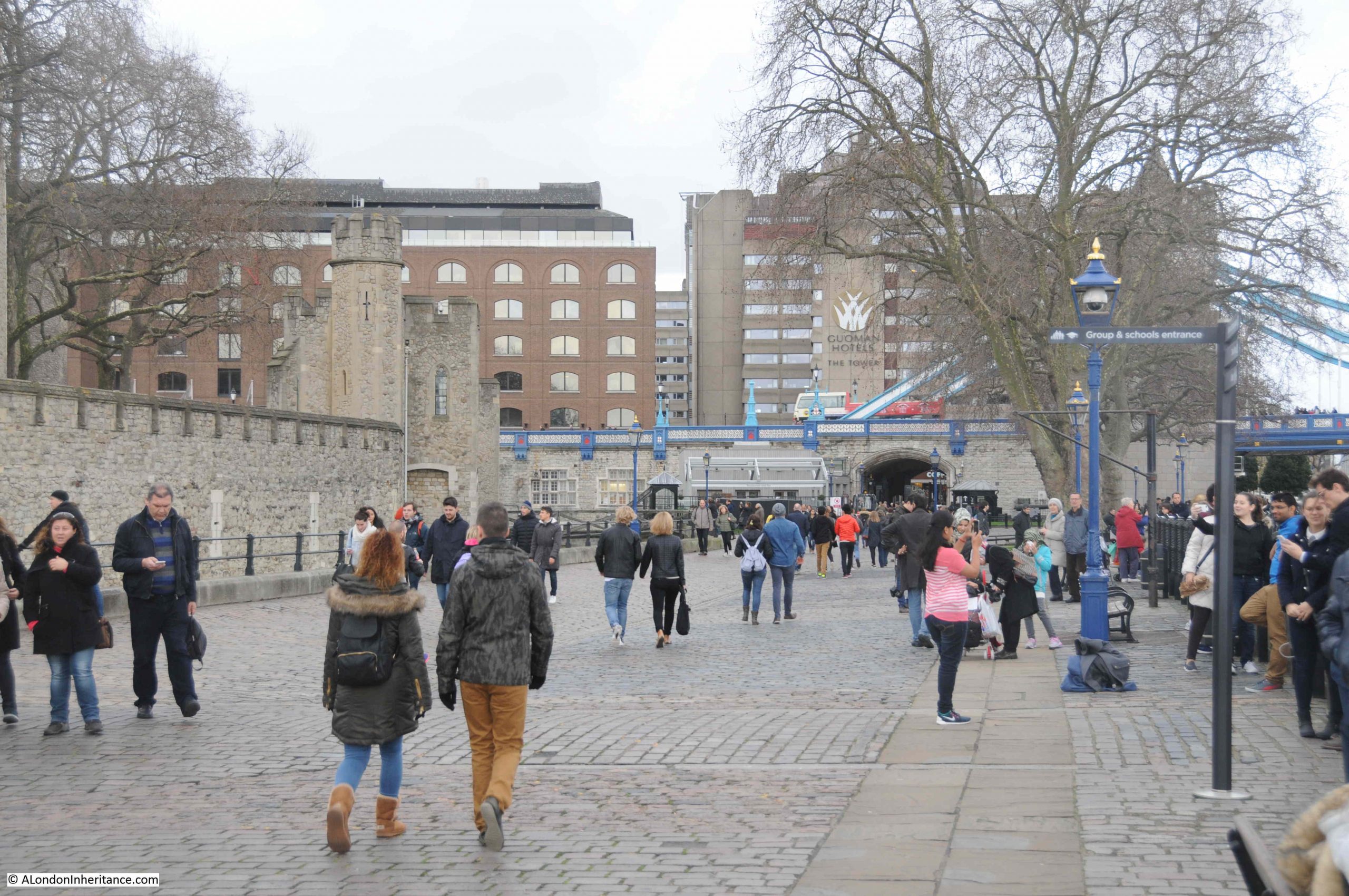
In Tower Wharf (the area between the Tower of London and the Thames), Wonderful London has photographed “one of London’s lunch-time gathering grounds”:

The caption to the photo illustrates the popularity and history of the place “Despite the tremendous number and variety of eating places, many hundreds of those who work in the City and its surroundings, prefer , in fine weather, to eat their lunch on a park-seat, or as here, seated on the slippery surface of an old cannon. Tower Wharf, whatever its merits as a restaurant is a fine place from which to view the Tower and also the shipping in the Upper Pool and the opening of Tower Bridge. The wharf was built by Henry III, who also made Traitors Gate. The wharf gave the fortress one more line of protection. On the very ground where the crowd is sitting another London crowd assembled day after day to scream for the trembling Judge Jeffries to be thrown out to them, in quittance for the Bloody Assize”.

Up until the start of the COVID pandemic, the area was usually crowded with tourists rather than City workers having their lunch, and many of the cannons have disappeared. My father photographed the cannons in 1947:

The same view a couple of years ago:

in the background of the Wonderful London photo, ships can be seen passing along the Thames, and the same view could be seen in 1947:

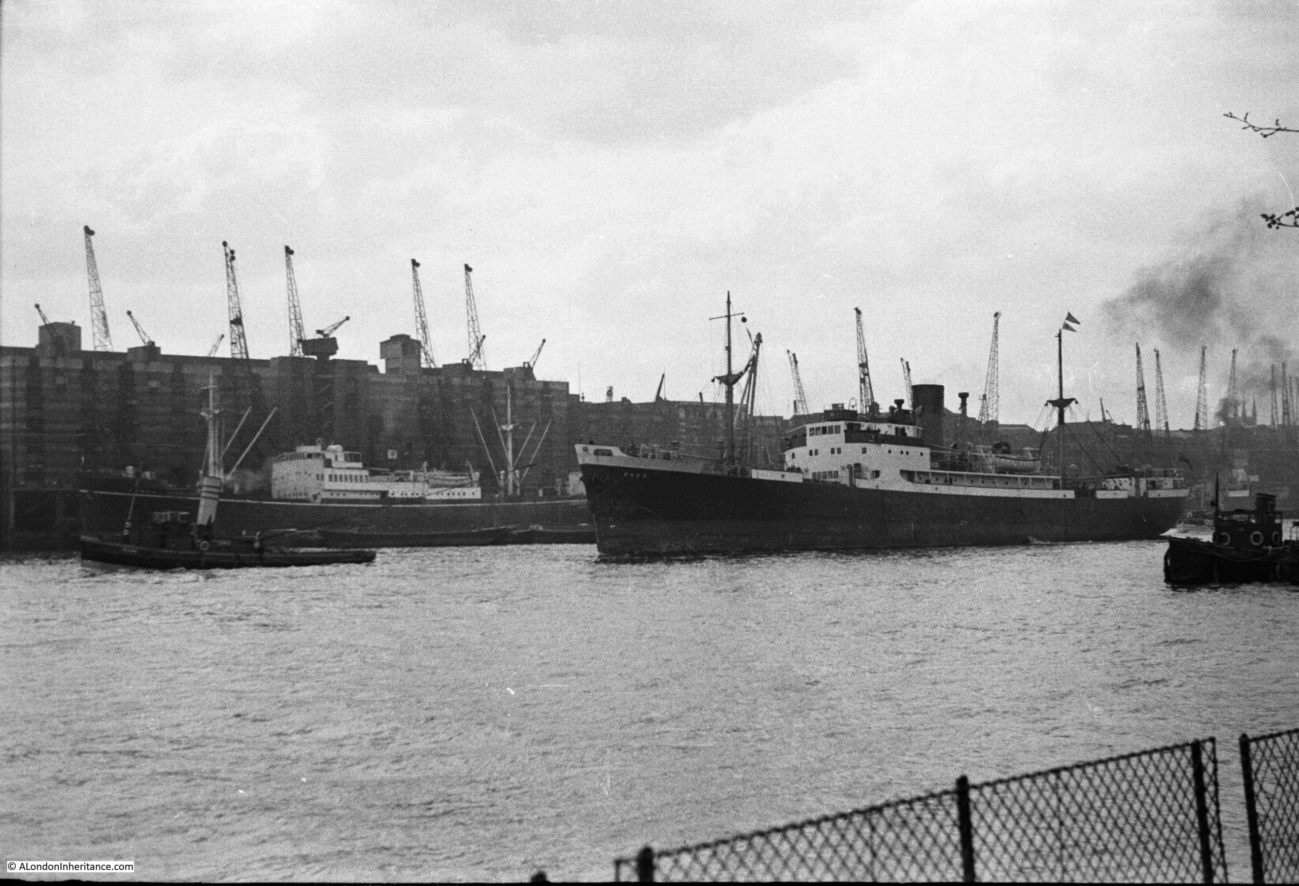
Rather than cargo ships, the view today would be off tourist boats and Thames Clippers.

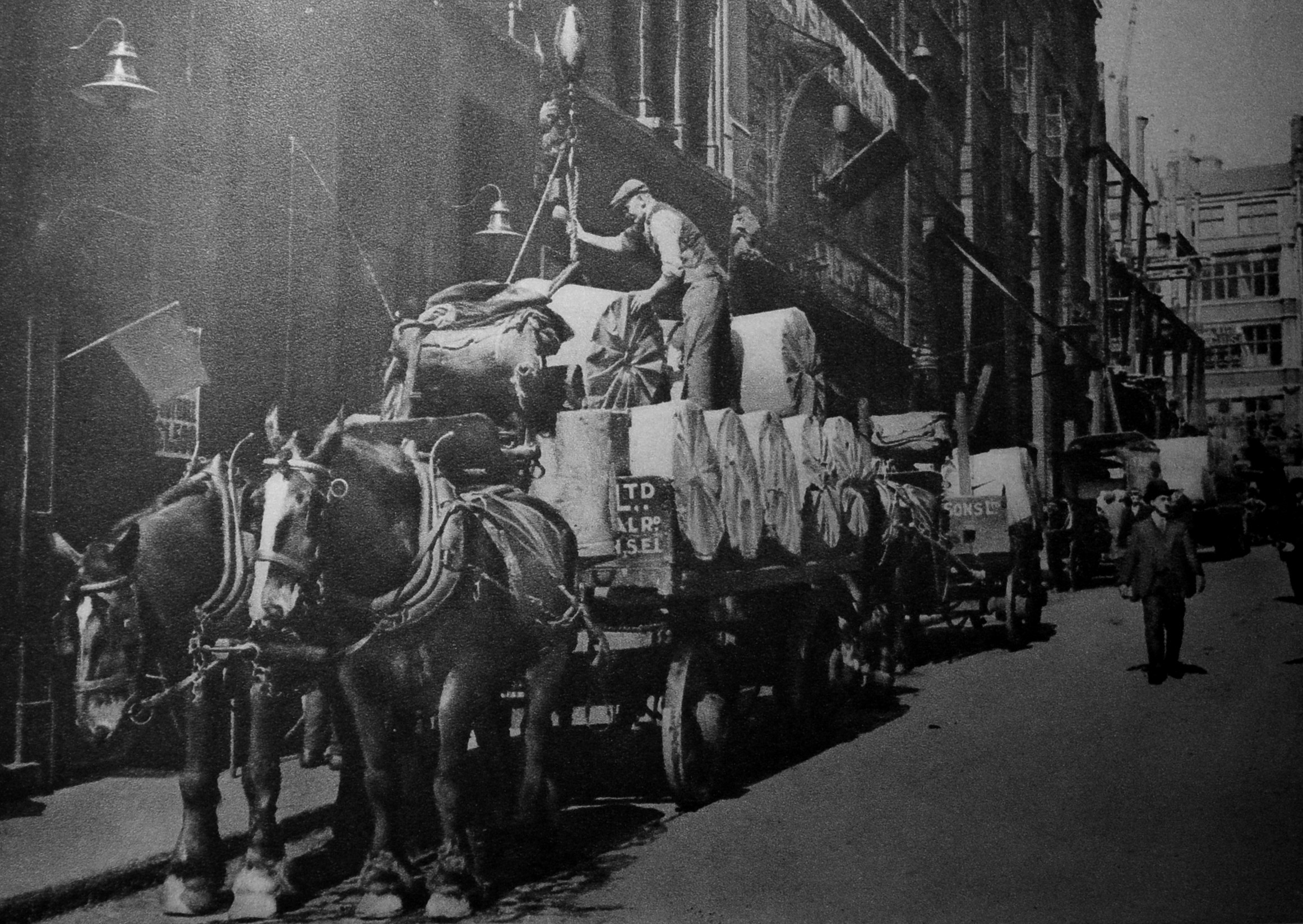
This was the scene in Carmelite Street, which runs from Tudor Street to the Victoria Embankment. The street is a continuation of a street that runs down from Fleet Street, and was the home of newspapers and printing. The photo is outside Carmelite House and shows rolls of paper arriving and being lifted into the building ready for printing.

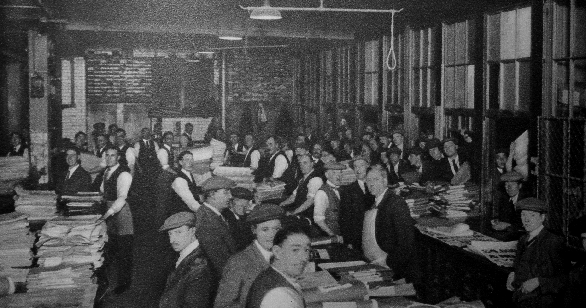
Today, the evening papers sold across the streets of London are transported by van, however in the early decades of the 20th century there was a very different method.

The following photo shows newsvendors gathering to collect newspapers. The newsvendor collects a quantity of papers along with a voucher for those papers. The publisher also retains a copy of the voucher.

The newsvendor then distributes the papers among his newsboys, who would then sell them on the streets.

At the end of the day, the newsvendor meets his newsboys, collects unsold copies and the money from sales. The next day he then has to pay the publisher the amount specified on the voucher when he collected the papers.

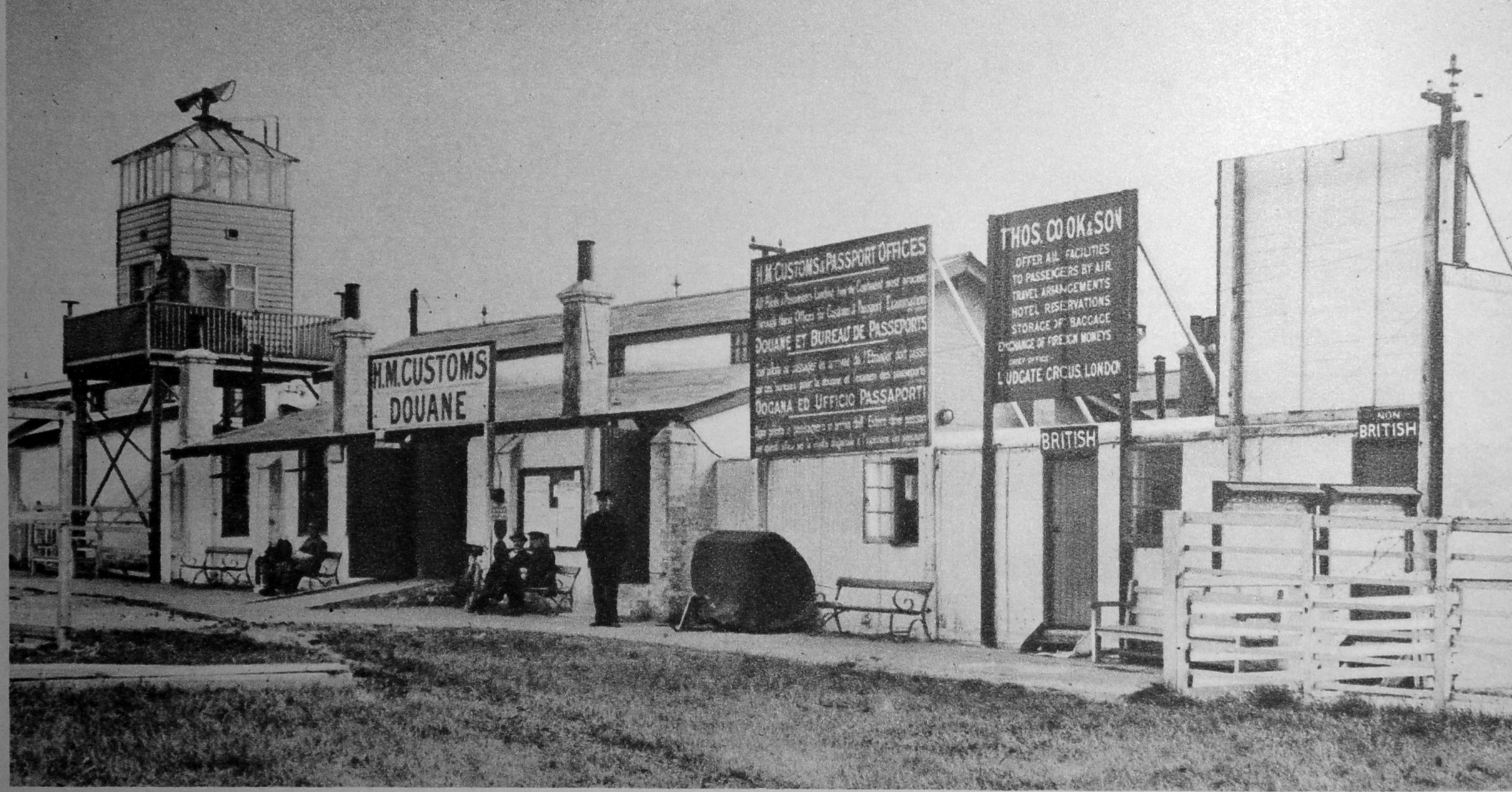
Some of those newspapers could have been transported abroad via the recently opened “Airport of London”, or more popularly known as Croydon Airport.

The following photos shows the arrival facilities for passengers with customs facilities and passport control, with the two doors on the right for “British” or “Non British”:

Back to London after dark, and the following photo is showing “An incident at the Yard”:

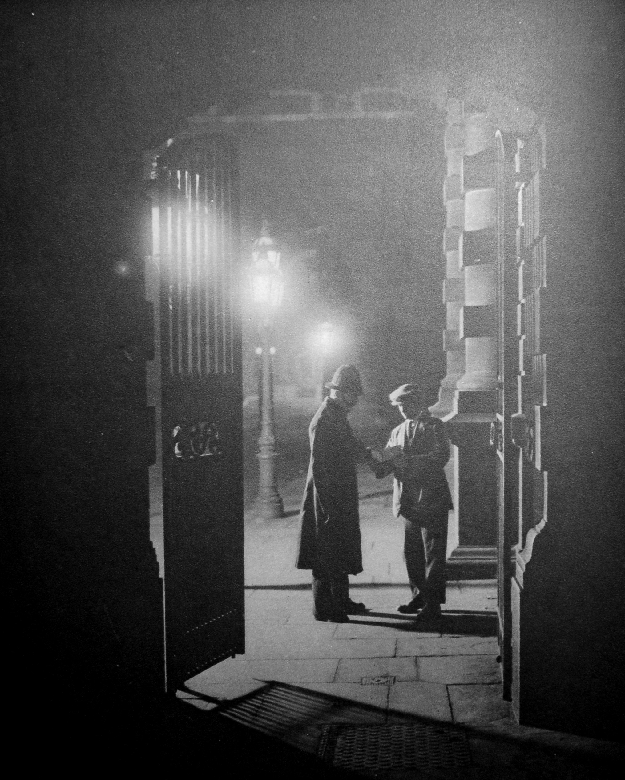
Apparently a plain clothes officer talking to a Constable at Scotland Yard. It is always difficult to know how many of these old photos were posed or were a real event when the photographer was on site.

The text with the photo does though claim that “The gate is open all night, and anyone in need of police will find ‘The Yard’ ready and waiting”.

Policing in London during smog conditions must have been rather difficult. Wonderful London describes such an event as “When the minute particles of dust which are always overhanging London become coated with moisture and the temperature falls below what is called the ‘dew-point’, that is, the temperature at which the moisture in the atmosphere condenses, fog blankets the streets”.

When this happened, a number of methods were used to help guide people and traffic around the city, one of which was lighting acetylene flares at key traffic locations as shown in the following photo:

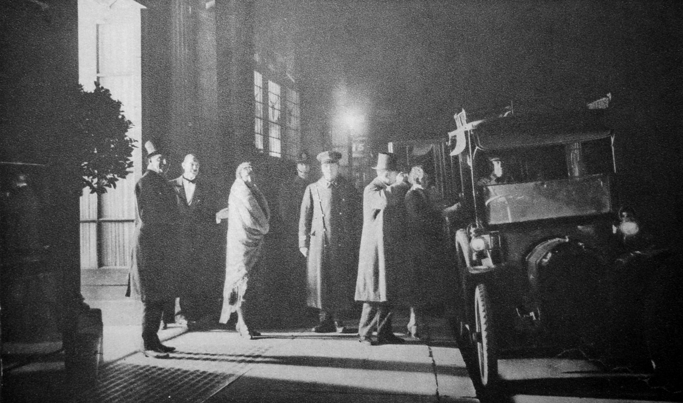
Those who may have needed the help of an acetylene light to navigate the streets of London were those leaving Murray’s Club late at night in Beak Street, Soho:

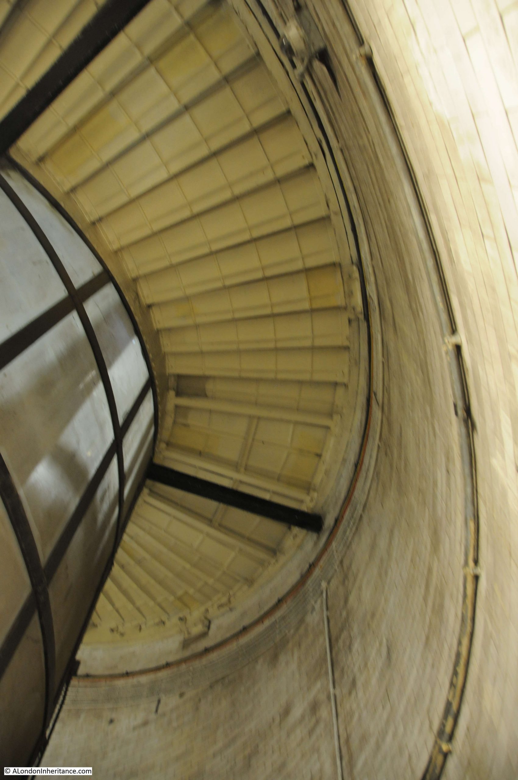
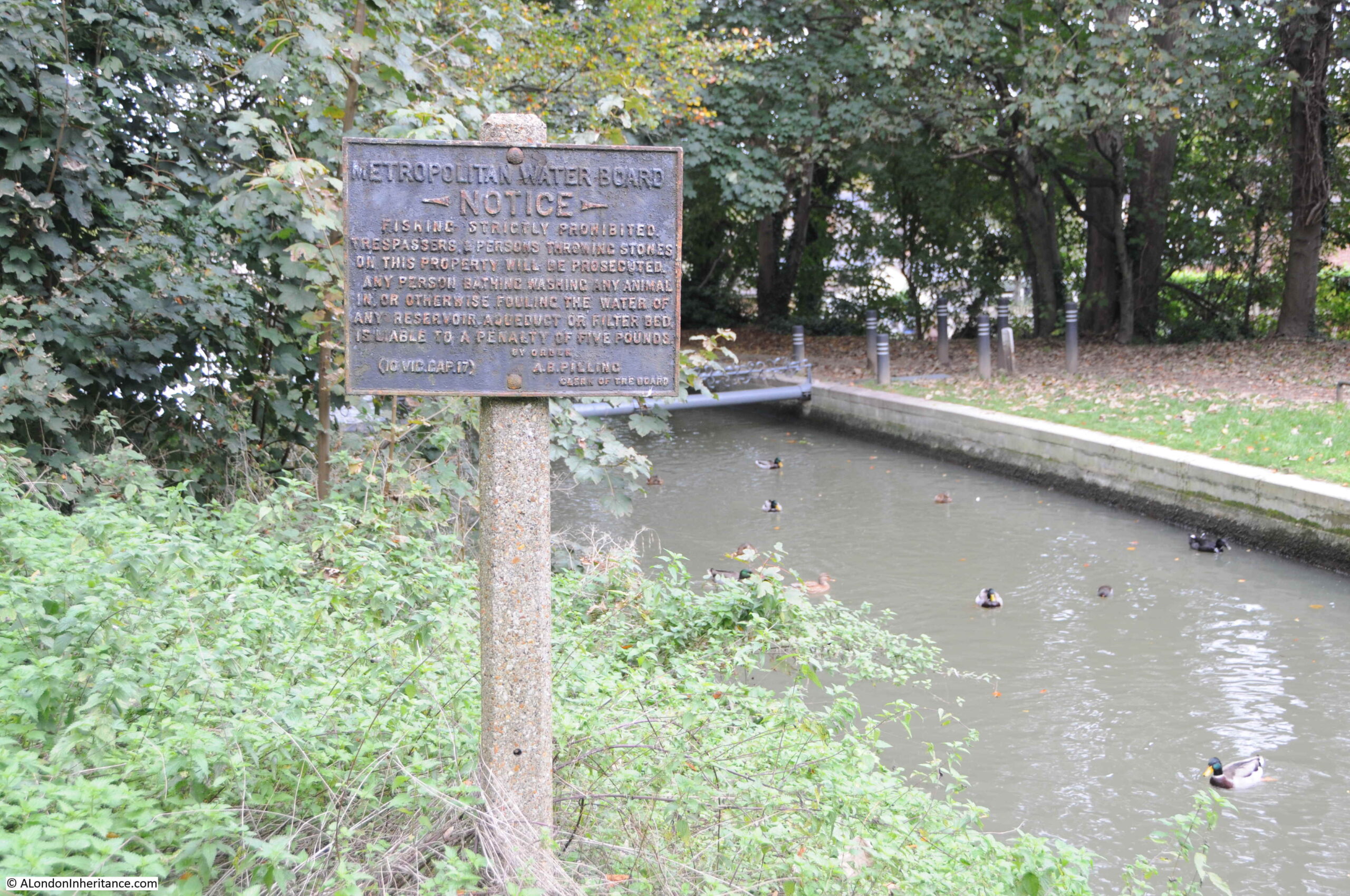
The sewers of London have always been a fascination (at least for me). A parallel world beneath the city’s streets. The following photos show part of the sewer system at Hammersmith. This was the main sewer under Hammersmith Road. Known as the Counters Creek Sewer due to its proximity, and in parts, integration with Counters Creek, the old ditch / stream / sewer / canal that ran from Kensal Green cemetery down to the Thames near the old Lotts Road power station.

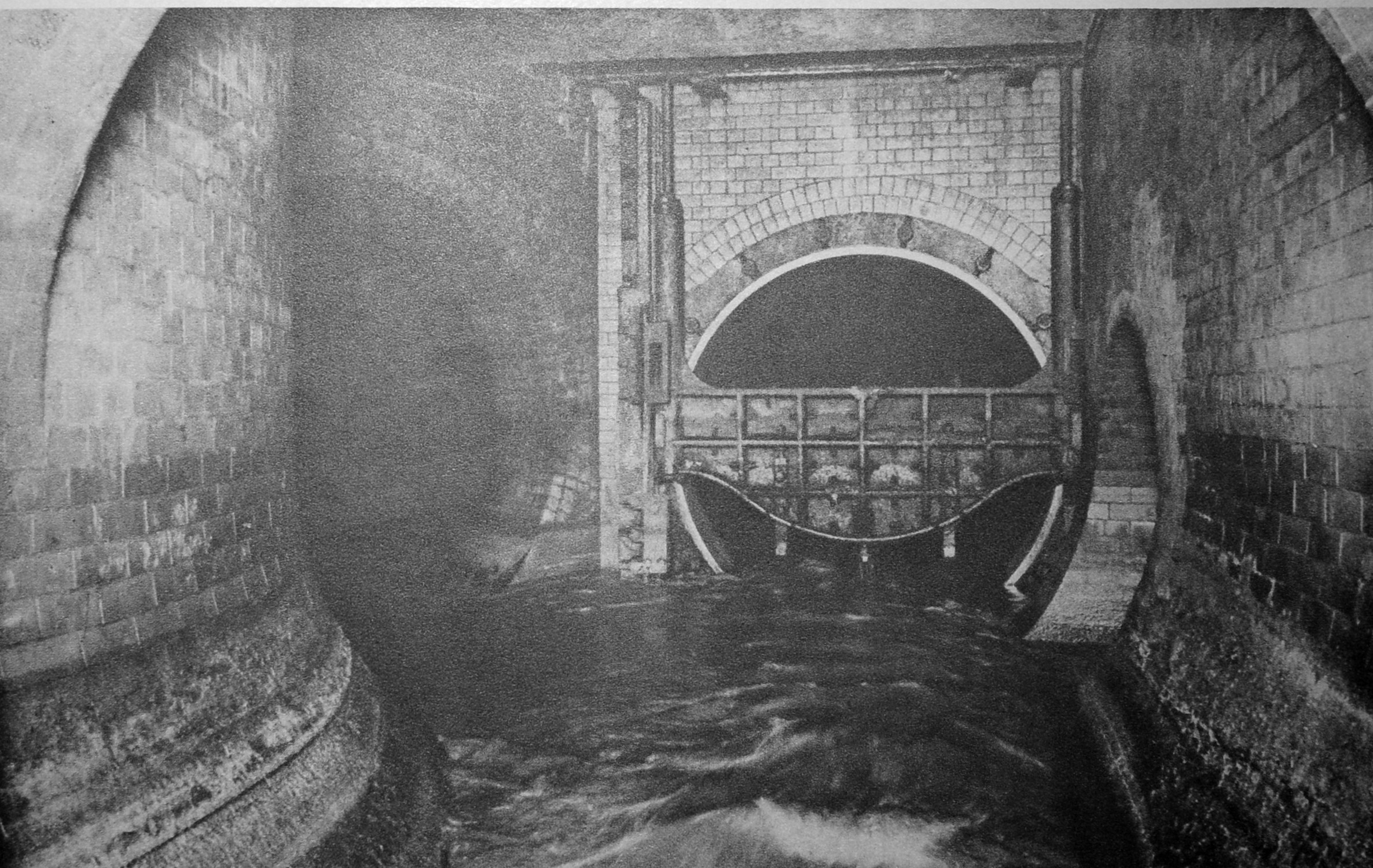
The book describes a sewer control system that is basically in use today. Sewers such as the Counters Creek Sewer run north – south, taking water down to interception sewers that run east – west and transport the water for treatment.

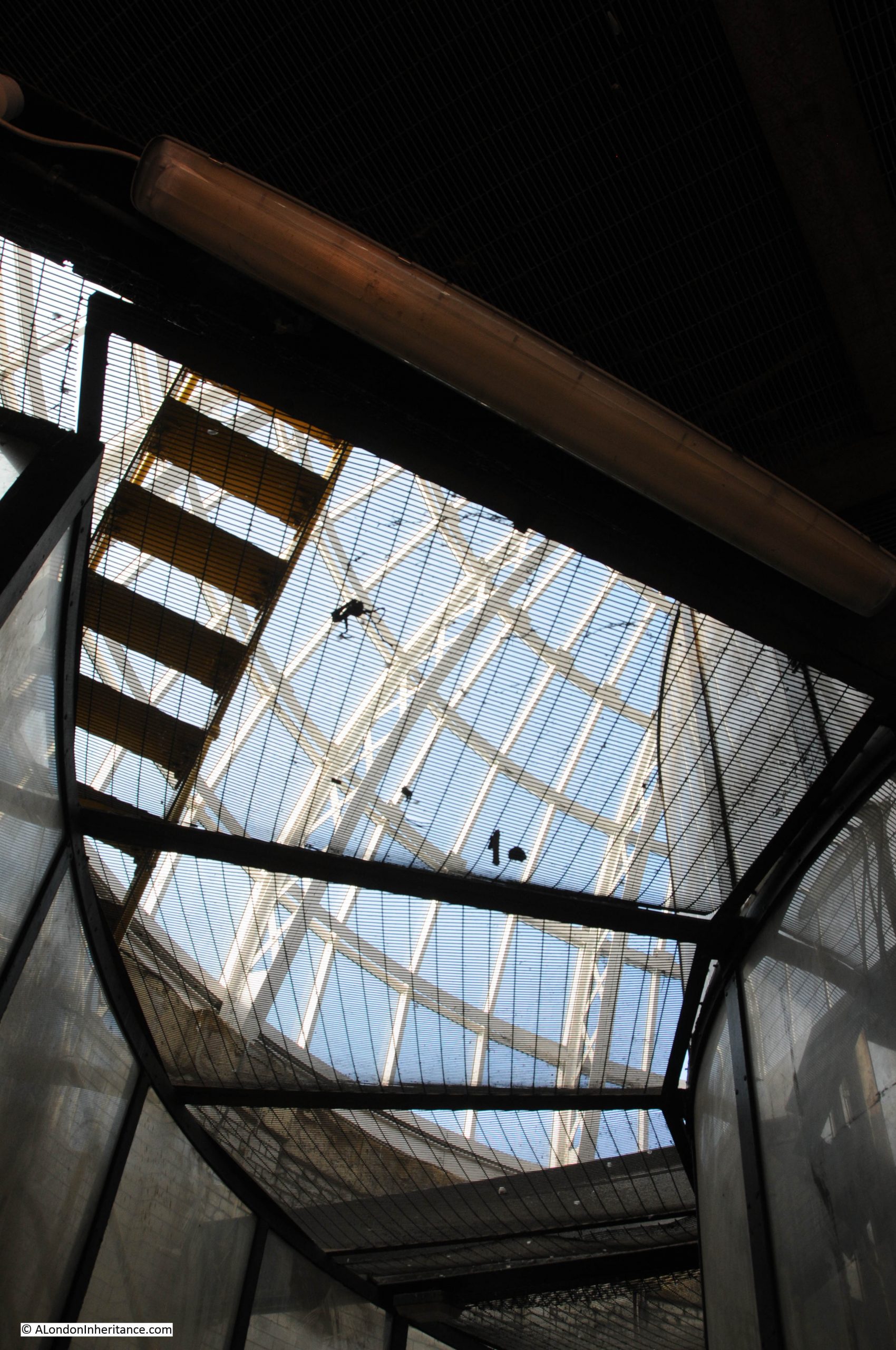
When there is too much water for the system to handle, an overflow is needed into the Thames. In the above photo, the overflow sewer is on the right. The device covering part of the sewer entrance is known as a “penstock”, and has been lifted to lower the water level for the photographer.

Normally, this would be lowered to divert water to the tunnel on the left which takes water to the intercepting sewer. When water rises to the top of the penstock, it overflows into the overflow tunnel which then flowed into the river at Chelsea.

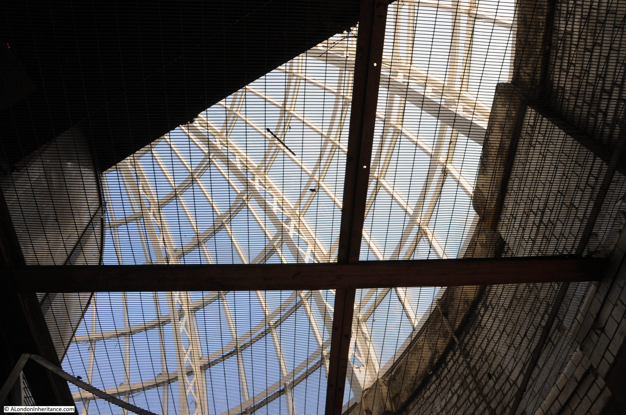
The photo below is the other side of the penstock and shows the two tunnels. The penstock has been lowered, and the overflow channel on the left is dry, with water in the Counters Creek sewer on the right.

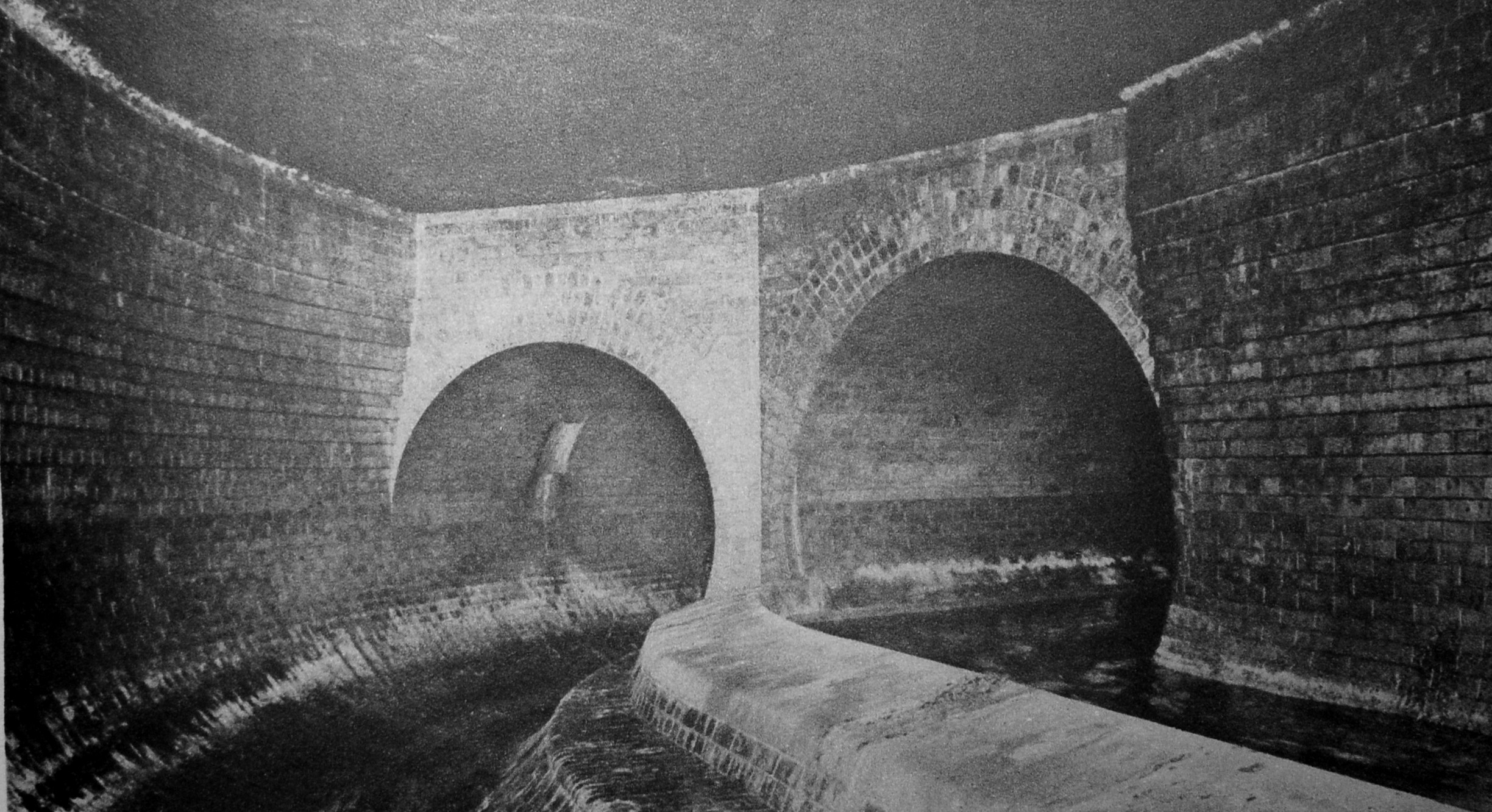
Over one hundred years later, the construction of the Tideway Tunnel or Super Sewer is intended to end discharges into the Thames by adding additional capacity on the east – west route

What makes Wonderful London so fascinating is the sheer variety of subjects. There are a couple of photos of the remains of the old Merton priory, but a strange photo is of when a workmen digging in allotments near the mill alongside the River Wandle at Merton discovered an 800 year old coffin underneath the cabbages:

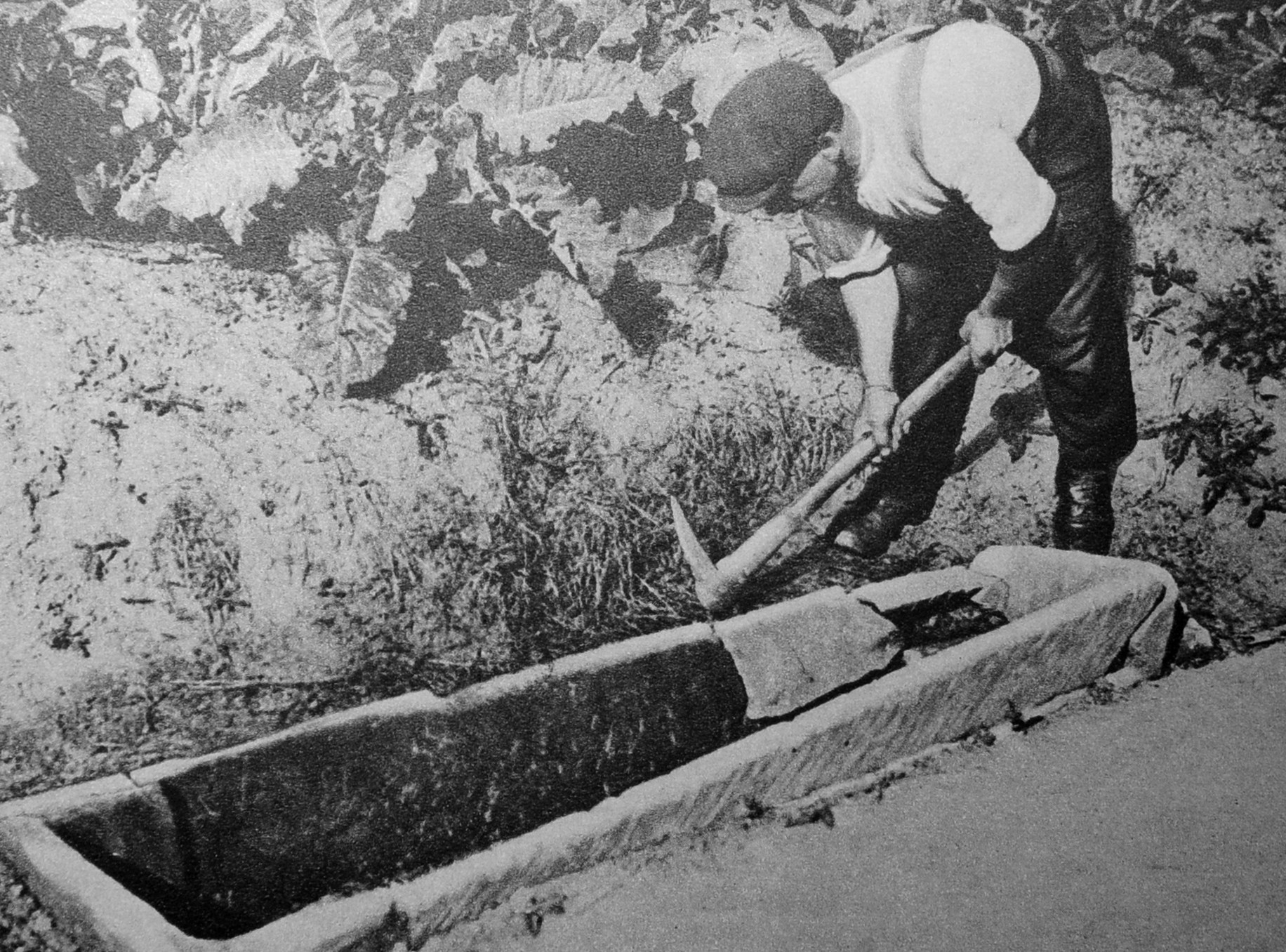
No idea if there was any occupant, what happened to the coffin, or whether any further excavations were carried out. Just one of the random photos in the book that came with just a brief description.

The following photo is of Poplar Almshouse with presumably one of the occupants standing outside:

The almshouses were in Bow Lane (which has been renamed as Bazely Street, and runs south from East India Dock Road, and is to the east of All Saints Church).

The almshouses were founded around 1696 when Hester Hawes left six almhouses on the west side of the street for six poor widows, with a monthly allowance of 2s 6d for each widow.

The almshouses were demolished in 1953, so I suspect they were on the site of the flats, just south of the Greenwich Pensioner pub.

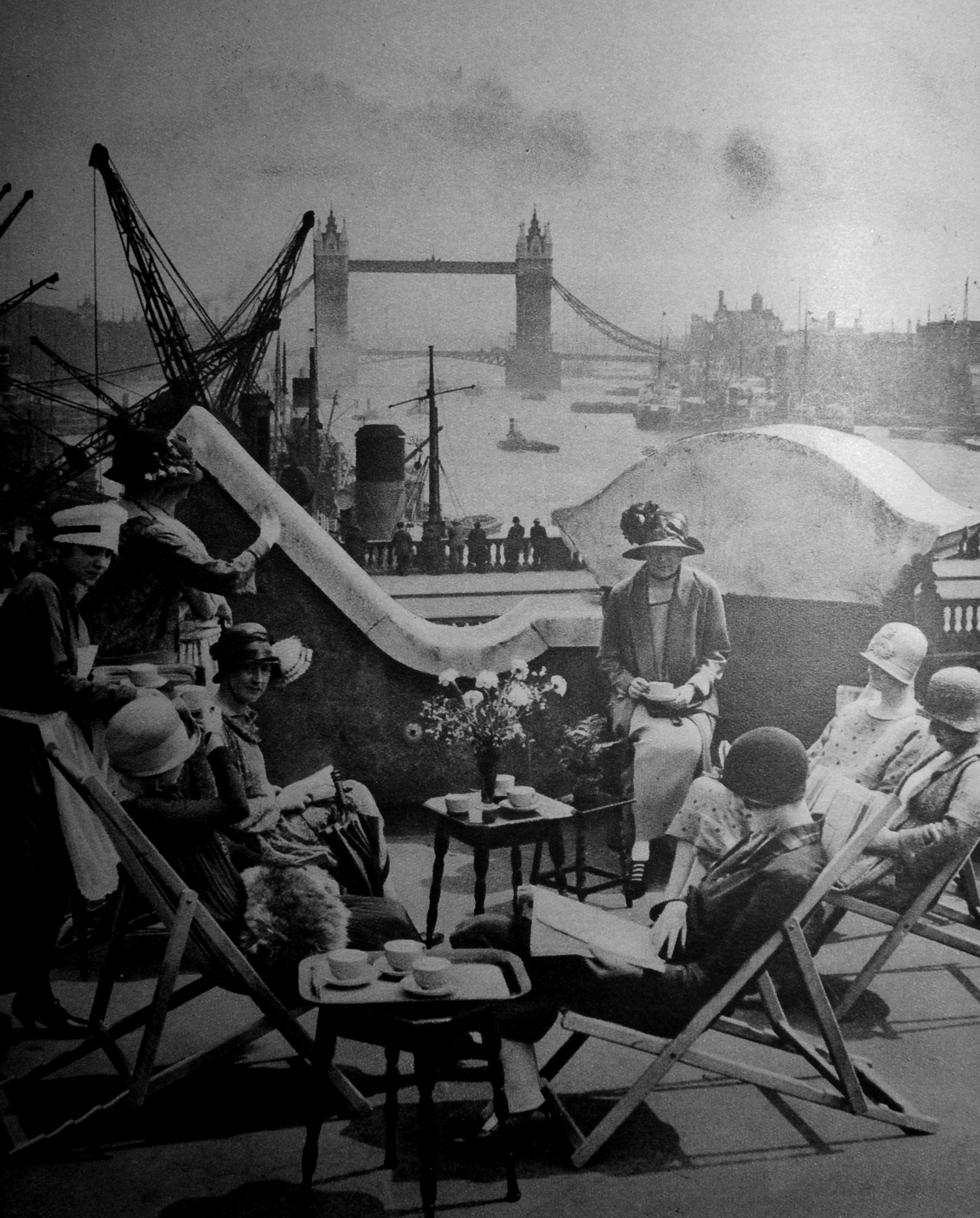
Back to the City, and these are members of the Langbourne Club for City Women relaxing on the roof of Fishmongers Hall, or one of the adjacent building, as part of the parapet of London Bridge can be seen in the gaps between the wall.

On the river was a Thames Barge:

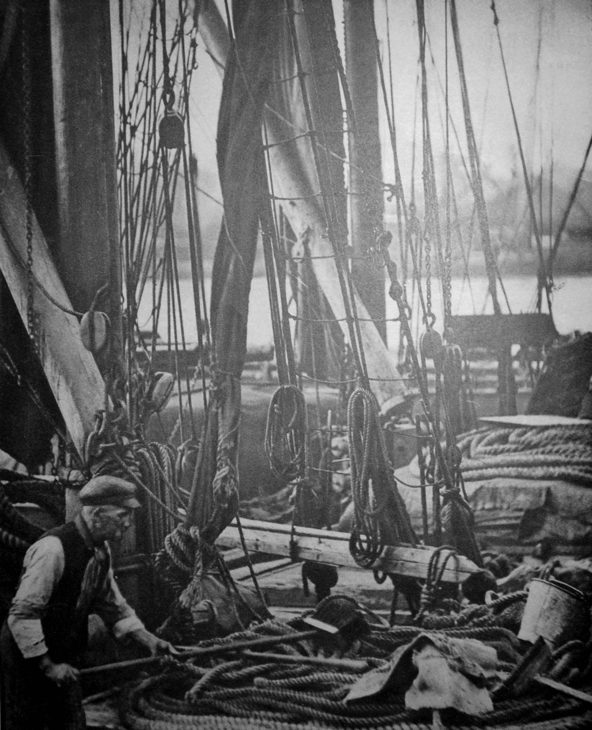
The text with the photo comments on the apparent confusion of multiple ropes, chains, buckets, fenders and pieces of canvas. I suspect if you sailed these barges there was no confusion, and you knew exactly where everything was, and it was in the correct place.

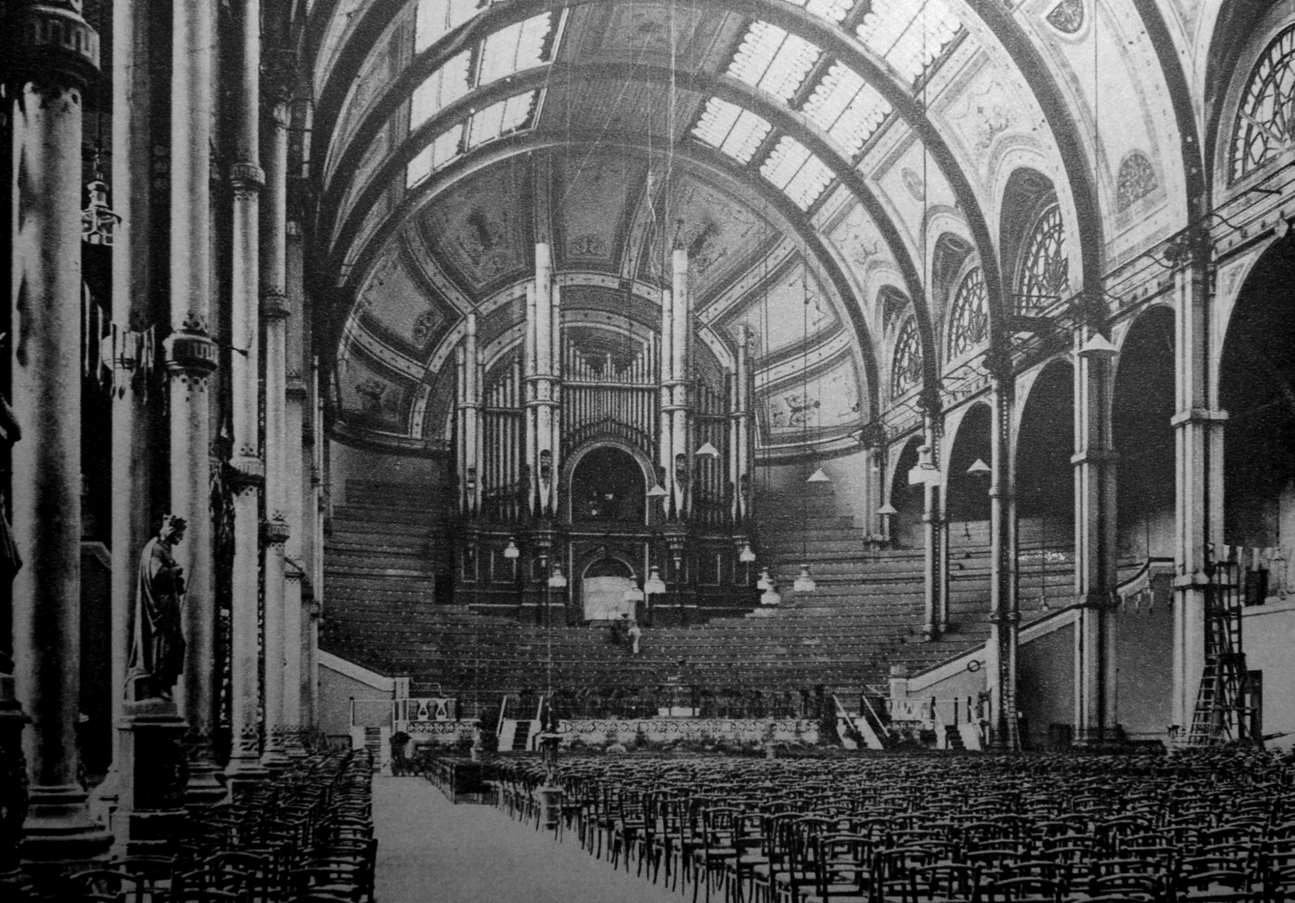
To finish this rather random survey of early 20th century London, a visit to north London and Alexandra Palace:

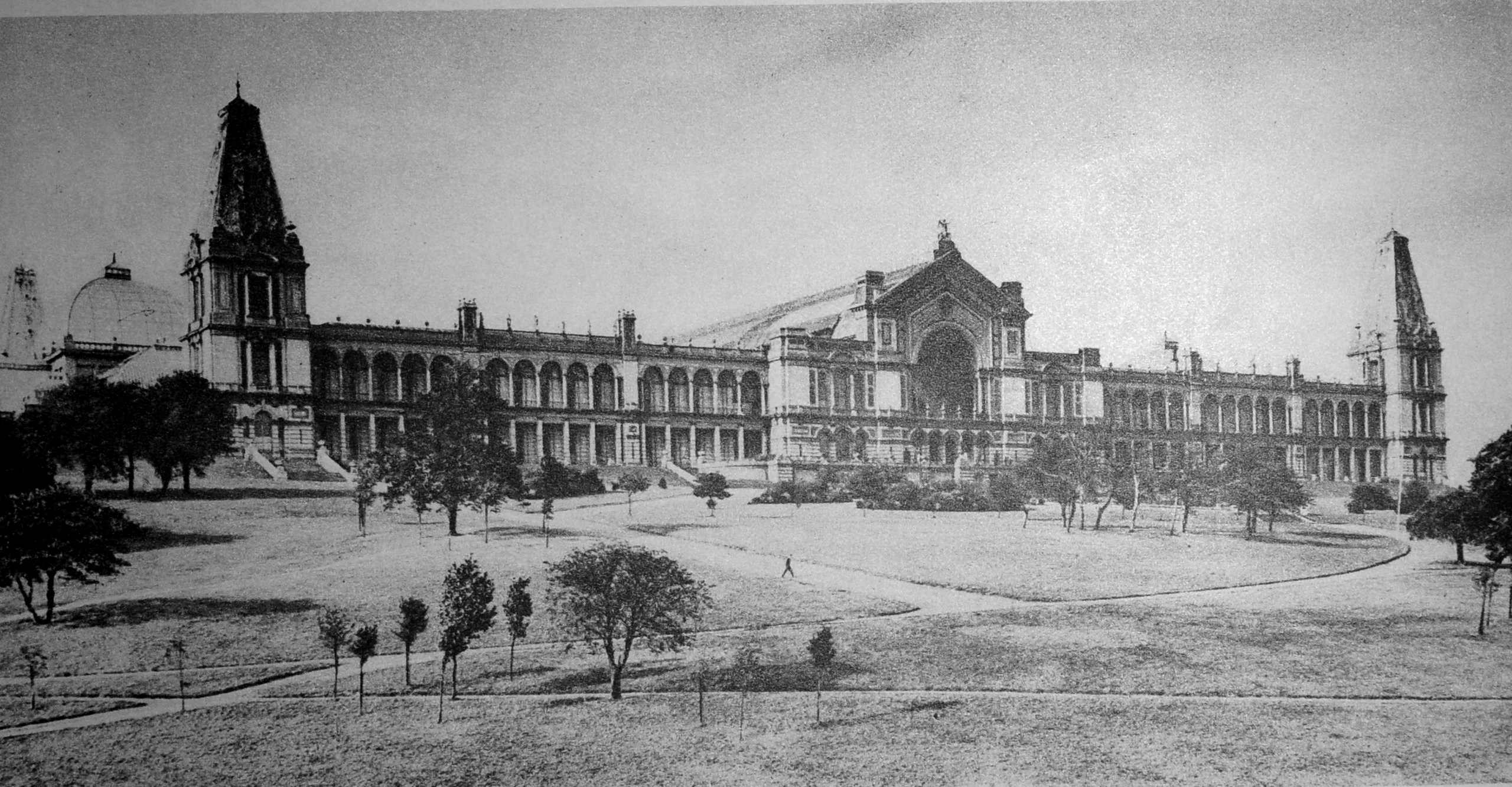
The Grand Hall which ran back from the taller part of the central façade:

The Alexandra Palace photos are an example of why I love second hand books, as you never know what previous owners have left between the pages.

Alexandra Palace suffered a severe fire in 1980, and the previous owner of my copy of Wonderful London put a number of newspaper clippings next to the page with the original photos. These report on, and show the extent of the 1980 fire:

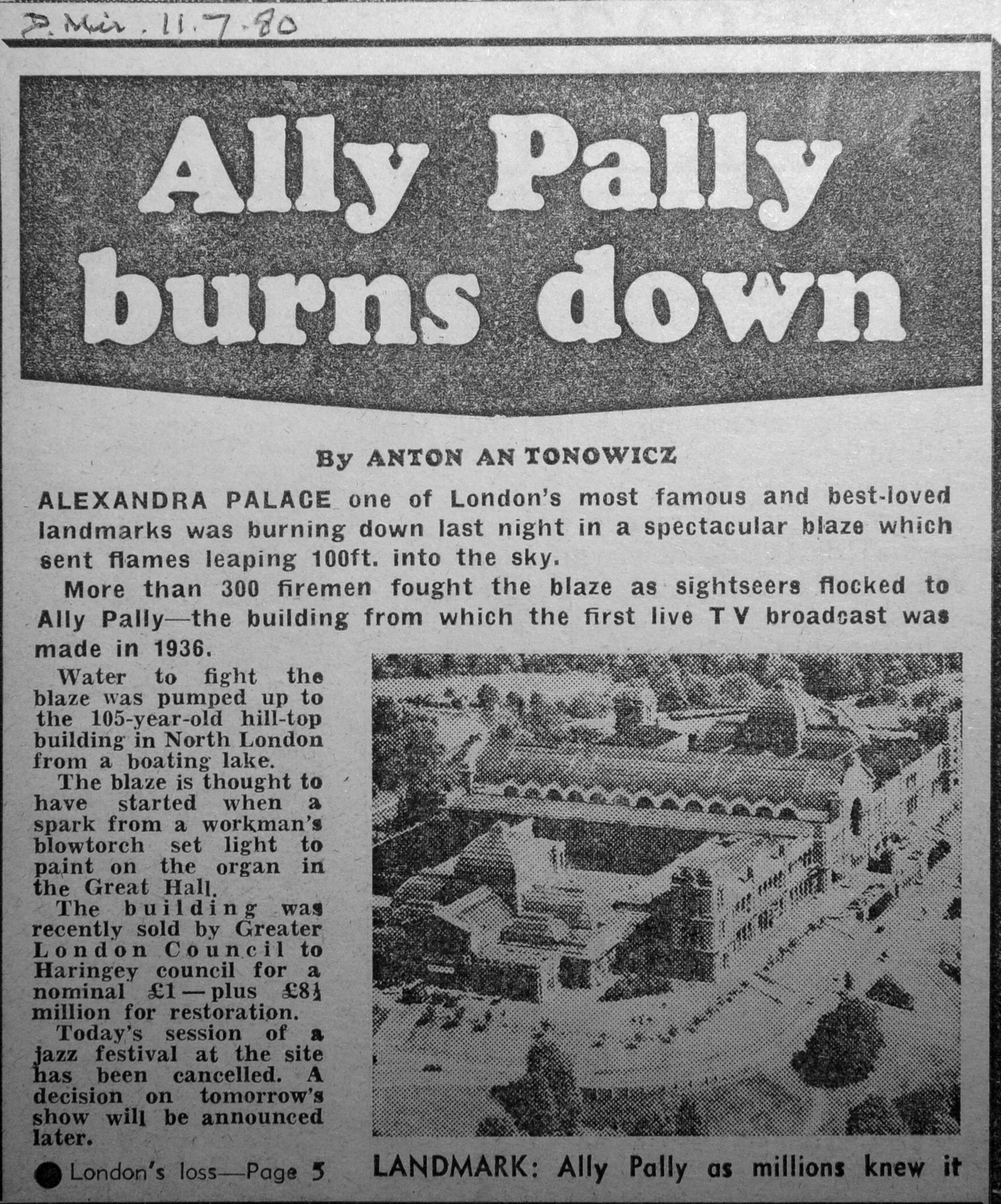
I love the understatement within the last paragraph, that whilst today’s jazz festival had been cancelled, a decision would be taken on the following day’s show.

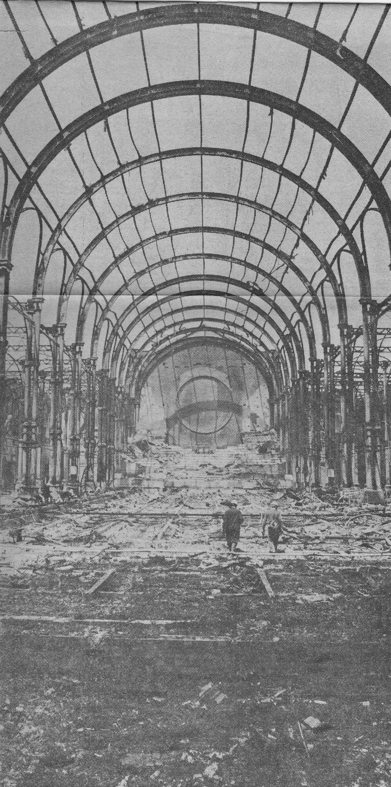
The damage to the building was extensive:

The old Grand Hall was almost destroyed. Compare the following post fire photo with the photo of the hall from Wonderful London.

With the decline in newspaper readership as the Internet takes over, the habit of taking clippings from newspapers and putting them between the relavent pages of books will become a dying art.

A shame, as they provide an extra dimension to the life of a book. Whilst a book is a snapshot of the time it was published, additions by owners over time tell the story of the journey the book has taken to get to its current owner.

Wonderful London offers a brilliant snapshot of the city as it was in the early decades of the 20th century. Around 100 years later, many of the places featured, the way people lived and worked have changed considerably, however many of the views are much the same.

What the book does prove is how rich and diverse the city has always been, and how there is something of interest on almost any street corner, or in the case of Merton, even under the cabbages in an allotment.

alondoninheritance.com

Greenwich Foot Tunnel

The hosting provider for the blog moved the blog to a new server infrastructure earlier last week. Apart from problems getting e-mail working again, everything seems to be working, however this will be the first post to be sent out via the e-mail subscription service, so I hope it is received. As well as the blog being moved, the weather last Wednesday was wonderful, so I did what seemed a good choice on a day of sunny weather, I headed to the Isle of Dogs and the Greenwich Foot Tunnel.

The Greenwich Foot Tunnel is at the southern tip of the Isle of Dogs, to the western side of Island Gardens, one of the best places to stop and take in the view across the river to Greenwich:

View of Greenwich from Island Gardens

Island Gardens are relatively small, but a very welcome area of green, open space facing onto the river. View through the trees of the four chimneys of the old Greenwich power station across the Thames:

Island Gardens

It would have been easy to stop and watch the river for some time, however after a walk from Poplar Station on the DLR, I wanted to cross to the other side of the river before the sun set too low on a late autumn day.

There are almost identical entrances to the Greenwich foot tunnel on both sides of the river. This is the entrance in Island Gardens, with a low sun directly behind the entrance:

Greenwich Foot Tunnel

On the opposite side of the river, the translucent glass roof of the Greenwich entrance can be seen alongside the Cutty Sark:

View from Island Gardens

The Greenwich Foot Tunnel was one of a number of tunnels constructed under the River Thames in the late 19th and early 20th centuries. Those wanting to travel between the north and south sides of the river had long been restricted to a ferry, or long journey to the nearest bridge in central London.

A single tunnel Blackwall Tunnel had opened in 1897, the Greenwich Foot Tunnel in 1902, the Rotherhithe Tunnel in 1908 and the Woolwich Foot Tunnel in 1912.

A period of fifteen years that had opened up a range of new routes to travel between opposite sides of the River Thames, no doubt one of the benefits of having the London County Council responsible for major works across the city.

A foot tunnel for those who lived and worked on different sides of the river, or who had business that needed a crossing, had been identified as an urgent need for a number of decades in the second half of the 19th century, however it was not until the final five years of the century that the scheme would get underway.

On the 12th May 1896, newspapers were reporting that a Bill for the tunnel was to be put before Parliament:

“PROPOSED NEW THAMES TUNNEL. A LONDON COUNTY COUNCIL SCHEME – The Bridges Committee of the London County Council have prepared a report, to come before the Council today, recommending that application should be made to Parliament for power to construct a foot passenger tunnel to connect Greenwich and Millwall, at an estimated cost of £75,000, and that the Parliamentary Committee of the Council be instructed to prepare the necessary Bill, to be introduced in the Session of 1897.

The report states that, in addition to the above amount, which is the estimated cost of land and works for the proposed tunnel, a sum of not less than £25,000 as the law at present demands, would have to be paid as compensation to persons interested in a ferry which exists at the spot in question; but it is hoped that the Council will succeed in obtaining a clause by which ‘improvement of interest will be considered, thereby reducing this amount very considerably.’

The plan is to have a tunnel with a footway of eight feet, and a headway of rather more than nine feet in the centre, reduced to a minimum of seven feet and a half at the outsides. Electricity is to be used for lighting the tunnel, as also for working the ventilating and pumping machinery. The time required for the execution of the works is expected to be about twelve months, Calculations are given to show that the proposed tunnel would be a more economical provision than establishing a free ferry.”

The London County Council estimated a cost of £75,000 for the construction of the tunnel, and this was the value put forward in the Bill to Parliament, however as with almost every major civil engineering project since, the cost would turn out to be much higher.

The council invited tenders for the construction of the tunnel, and the winning tender was from Messrs. J. Cochrane with a price more than one third above the estimated cost. The Bridges Committee recommended that the council accept the bid, however the council were not happy and wanted the additional third of the estimated cost to come from “local or other sources”, however when put to the vote, the recommendation of the Bridges Committee was accepted and the work would soon commence.

The new tunnel was opened on the 4th of August 1902.

The route down to the tunnel is via several flights of stairs from the entrance in Island Gardens. The lifts are currently out of use.

Greenwich Foot Tunnel

Spiral stairs line the inner wall of the shaft, with the central space being used for the lift:

Greenwich Foot Tunnel

From the bottom of the Island Gardens shaft, the view along the tunnel towards Greenwich:

Greenwich Foot Tunnel

In the above photo, a cream coloured section can be seen a short distance along the tunnel.

The section is the temporary war time repairs following damage caused to the tunnel by the nearby explosion of a high explosive bomb. A closer view is seen in the photo below, and there is an information panel on the left:

Greenwich Foot Tunnel war damage

The damage to the tunnel happened on the evening of the 7th September 1940, when a bomb exploded on the foreshore, over the route of the tunnel.

Within the tunnel, the blast caused the outer tiles and inner concrete lining of the tunnel to collapse over the length of the tunnel now covered by the temporary repairs. The outer iron lining appears to have held, however this was now leaking and water was entering the tunnel to such an extent that a week after the bombing, the tunnel was full of water.

The tunnel was such a key part of the local infrastructure, providing workers living on the south of the river with easy access to the docks, ship yards and factories in the Isle of Dogs and east London, that a repair of the tunnel was essential.

It took around ten days to pump out the majority of the water, enough that work could start on repairs.

Being wartime, a temporary repair was put in place, consisting of a length of iron collars bolted together to line the damaged area, and effectively form a smaller tunnel within the larger tunnel. At the time, these repairs were considered sufficient to last the war, following which, more permanent repairs could be put in place, and the tunnel restored to its original size.

As well as infrastructure projects always running well over their initial budget estimates, temporary repairs also often become permanent, and so it is with the repairs in the Greenwich Foot Tunnel, and the cream coloured iron rings, reducing the diameter of the tunnel, are still the result of the original 1940 repair work.

Walking through the temporary repairs and at the end we can see the tunnel continuing on down to the lowest point roughly under the center of the Thames.

Greenwich Foot Tunnel

Now we are roughly in the center of the tunnel, it is a good place to stop and consider the original construction.

I have a fascinating little booklet called “The Greenwich Footway Tunnel by William Giles Copperthwaite and Subaqueous Tunneling Through The Thames Gravel: Baker Street and Waterloo Railway by Arthur Harry Haigh”.

The booklet is an extract of the proceedings of the Institution of Civil Engineers, and was published in 1902, the year the Greenwich foot tunnel opened. It is a wonderful little booklet with details of tunneling below London and the impact of the geology through which the tunnels are constructed.

Greenwich Foot Tunnel

The first part of work to build the tunnel was the sinking of the shafts down to the point where the tunnel could start to be bored under the Thames.

The shafts were formed by sinking a caisson around the edge of the shaft, as the shaft was gradually excavated. A caisson is basically a hollow ring of iron or steel that forms a tube from top to bottom of the shaft and provides the strength to stop the sides of the shaft collapsing inwards, or the walls deforming.

The shafts, as with the whole of the tunnel, were constructed in an environment of compressed air. This method was used to control the ingress of ground water and to provide some support to the ground through which the tunnel is being bored. The use of compressed air did require some additional support for the workers, and faclities such as air locks to provide access to the work face.

The following diagram shows the method of sinking the caissons. The shaft was sunk through the water level which was found at a depth of 35 feet, from which point, construction continued using compressed air.

Method of sinking the caissons

The caissons, today the walls of the shaft, are made up of two steel rings. The outer diameter of the shaft is 43 feet, and the inner diameter is 35 feet. Allowing for the width of the two steel rings (one outer, one inner), there was a four foot gap between the two rings of the shaft. This was filled with a mix of 6 to 1 Portland cement concrete. The use of concrete as a filling between the two rings meant that accurate construction and fitting of the rings was essential as once the concrete was poured, there was no way to make any further adjustments.

This method of construction created a pair of incredibly strong shafts on either side of the river, and the weight of the caisson forming the wall of the Poplar shaft was a remarkable 2,560 tons.

Compressed air was put in place from the 2nd of May, and the following table records the depth below the surface achieved each day until completion of the Poplar shaft on the 31st May, 1900.

Digging the shaft

The table also shows the accuracy of the excavation by the very small amounts that the cutting edge was out of level. The increasing weight of the caisson can be seen by the load on the shaft.

The following drawing shows the route of the tunnel between the Poplar and Greenwich shafts. Note that just above the Greenwich shaft is the Ship Tavern. This pub was badly damaged during the war, demolished, and the Cutty Sark is now on the site of the pub.

Route of the Greenwich Foot Tunnel

The following drawing shows a cross section of the tunnel. As will be seen in my photos of the tunnel today, the tunnel descends from both shafts with a gradient of 1 in 15 feet, down to the central part of the tunnel where it passes under the deepest part of the Thames.

Cross section of the Greenwich Foot Tunnel

The diagram also shows the type of material that was being excavated through, and was a key consideration in the tunneling method used.

The drawing is a text book example of how to present lots of information in a single drawing. As well as the key lengths, gradients of the tunnel, high and low water level of the Thames, depth of water, dimensions of the shafts etc. the Progress of Tunneling at the bottom of the drawing shows how the tunnel was making its way under the river through 1900 and 1901 as it started from the Poplar shaft and headed to the Greenwich shaft.

Newspapers reported on reaching the half-way point:

“IT IS NOW HALF-WAY TOWARDS COMPLETION – A new tunnel between Poplar and Greenwich is another step in the piercings of the river bed which the London County Council splendidly inaugurated with the making of the Blackwall Tunnel.

The new tunnel will be opened to the public in about a year’s time, and, inasmuch as it is being made wholly in the interests of working men, it might be called the ‘Working Men’s Tunnel’. From shaft to shaft it will measure 1217 feet in length, and will cost about £109,500. The depth of the tunnel at the centre of the river is about 72 feet below the ground line, while the shafts have been sunk to an average depth of 63 feet.

At no part will the top of the tunnel be less than 13 feet below the river bed. No fewer than 1600 tons of cast iron tubing will be used in building the tunnel which will be lighted by electricity. You will approach the tunnel from the Greenwich side from the north end of Church Street, in the rear of the famous Ship Tavern; and on the Millwall side at the Western end of Island Gardens. Some such easy means of communication between one shore and another has long been needed, and many thousands of people will daily find it very handy once it is opened to the public.”

The lining of the tunnel was made up of cast-iron segments, of which eight segments and one key piece formed a complete ring around the tunnel. The lining was 12 feet, 9 inches in outer diameter and 11 feet 9 inches internal diameter.

The following drawing shows a cross section of the tunnel, including the lining, and ducts for services such as electrical wiring, ventilation pipes and cable conduits.

Greenwich Foot Tunnel

The interior of the tunnel was lined with white glazed tiling, which is still in place today.

The booklet includes some wonderful detail of sections of the tunnel lining:

Tunnel lining

The washers where the bolts secured the sections together were made using a short section of lead pipe. When the bolt was tightened, the lead would compress forming a water tight seal around the bolt.

Lead wire and iron filings were used to fill any spaces between sections, and the method of construction was so successful, that when air pressure was removed at the end of construction, only a dozen places had a small problem with water ingress and needed repair.

Tunnel lining

The tunnel was constructed using a shield of the type known as a trap or box shield, which the booklet describes as follows:

“The trap consisting of two diaphragms, the front one filling the upper half and the back one the lower half, of the circle enclosed by the cylindrical skin of the shield.

The bottom of the front diaphragm is a few inches lower than the top of the back one. In the event of an inrush of water from a ‘blow’ occurring at the face, the water must flow over the top diaphragm to get into the tunnel, and before it rises high enough to do this, the bottom of the top diaphragm is under water, and all escape of air through the shield is stopped. the water in fact becomes a seal to hold the air.”

The above description simplifies the design, construction and use of the shield, and cross sections through the shield as used at Greenwich are shown in the following drawings.

Tunnel shield

The central box formed a water tight chamber, and the shield consisted of thirteen rams for pushing the shield forward, and together exert a pressure of 1.5 tons per square inch, and a total thrust to push the shield forward of 750 tons.

The design of the shield was changed as it progressed on its route under the Thames, as improvements were identified and as different types of strata were encountered.

This included putting doors in the upper part of the shield, as well as the lower, giving workers an additional method of exit if there were problems at the face of the tunnel. It was noticed that after these additional doors were added, workers were more inclined to stay at the face of the shield after there had been a fall of material, as they had a higher route of exit than before.

As well as the safety of workers at the shield face, another consideration was the conditions of working in an environment where compressed air was used. As well as care of their workers, there was also probably a financial motivation as the Act of Parliament authorising the tunnel included compensation to those whose health had been damaged by working in compressed air. Compensation seemed rather limited though as a total of £20 had been awarded to three workers.

Two medical officers were appointed to oversee the construction of the tunnel. Those working in the tunnel were examined at least once a week and before anyone could commence work, they had to have a certificate of health from the medical officers.

Of those who applied to work on the tunnel, 13.9% were found to be unfit to work on initial examination, and of those who passed the medical, a further 5.7% were found to be affected by the increased air pressure, and forbidden to continue work in the tunnel.

Men worked an 8 hour shift with a rest period of 45 minutes, during which time they had to exit the tunnel.

Rooms were available with washing facilities at the construction site for the workers, and hot coffee was served as they left the tunnel.

A “medical lock” was available for treating those with “caisson-sickness”, probably similar to today where a diver has to decompress in a chamber. Only three workers needed to make use of this facility during the construction of the tunnel.

A concern with tunnel construction was the potential build up of carbon dioxide, and as the construction of the tunnel progressed, an experiment was approved whereby an apparatus was made and installed to removed carbon dioxide. This consisted of a series of wooden boxes bolted together. In each wooden box there was an amount of crushed pumice stone. Air was passed through the boxes, and it was found that deposits of carbonate of soda were found on the pumice stone, and that the experiment did result in the removal of some of the carbon dioxide in the air within the tunnel.

Construction of the tunnel was relatively straight forward given the technologies of the time, and construction methods were able to adapt to the changing sand, clay and ballast through which the tunnel was being bored. For a period between the 22nd February and the 1st May 1901, an impressive 10 feet per day was being achieved in driving the tunnel forward.

The tunnel met the Greenwich shaft without any problems, and minor precautions were made to stop any fall of sand or ballast from the area around the shaft as the tunnel was completed.

The Isle of Dogs and Greenwich were finally connected by a walking route.

In the following photo, the incline up to the Greenwich shaft from the centre of the tunnel can be seen:

Greenwich Foot Tunnel

I am not sure whether it was my imagination, however standing in the centre of the tunnel, it seemed possible to hear the sound of the occasional passing boat on the river above.

At the start of the incline where the tunnel rises by 1 foot in every 15 feet, up to Greenwich:

Greenwich Foot Tunnel

Almost at the Greenwich end of the tunnel looking down the incline:

Greenwich Foot Tunnel

Approaching the Greenwich end of the tunnel, and it looks as if we are approaching an entrance to some secret infrastructure below London – unfortunately it is only the closed entrance to the lift which should be operating.

Greenwich Foot Tunnel

The tunnel today is brightly lit and there is a frequent flow of walkers through the tunnel. It has not always been this way, and as the docks and industries closed on either side of the river the numbers walking through declined and there were times during the 1980s when you needed to be cautious when using the tunnel.

A final look down the Greenwich foot tunnel:

Greenwich Foot Tunnel

The Greenwich shaft is slightly deeper than the Island Gardens shaft. I counted 87 steps down from Island Gardens, and was rather surprised to count a round number of exactly 100 steps up the Greenwich shaft:

Stairs

Whilst walking up the shaft, a look up shows the cantilevered steps of the spiral above:

Spiral staircase

At the top of the steps, one of the current landmarks of Greenwich confirms that you have arrived on the south bank of the River Thames:

View of Cutty Sark

But before leaving, another look up shows the wonderful construction of the glass dome that covers the entrance to each shaft:

Entrance to foot tunnel

As well as the bomb damage to the tunnel, the entrance buildings and shafts were also damaged by bombing, with an oil filled incendiary hitting the Island Gardens shaft, causing considerable damage to the lift control equipment. The Greenwich entrance was also hit by an incendiary bomb, but did not suffer as much damage as at the northern shaft.

Entrance to foot tunnel

Plaques above both entrances to the tunnel record the opening in August 1902, along with key figures in the London County Council responsible for the tunnel:

Plaque of foot tunnel entrance

A view of the Greenwich entrance to the tunnel, with the Island Gardens entrance across the river, just to the right:

Greenwich Foot Tunnel

The original lifts were added in 1904, two years after the tunnel opened, these were attendant operated until the early 21st century. New lifts were installed in 2012, however there have been periods when the lifts were not that reliable, with significant problems with the glass doors closing reliably, and they are currently closed.

Greenwich tunnel lifts

A major problem with the lifts is that they are almost a custom design, having to fit inside the original lift space in the centre of the shaft, and also within such a historic structure.

Special parts for the lifts are sourced from Germany, and it is still expected that the lifts will be closed for some months.

Outside the tunnel entrance is an excellent view of the Cutty Sark:

Cutty Sark

And looking across the river is the ever expanding collection of towers that are growing across the Isle of Dogs:

View of the Isle of Dogs from Greenwich

View to the west, towards the City of London from close to the Greenwich entrance to the tunnel:

View of the Thames from Greenwich

Looking east from the entrance to the Greenwich foot tunnel:

View of the Thames from Greenwich

The Greenwich foot tunnel was certainly a success, and a major improvement on the ferry which the tunnel replaced.

A ferry had been operating between the Isle of Dogs and Greenwich for hundreds of years, and such was the level of traffic, that from 1883 the Thames Steamboat Company operated a steamboat ferry, which did have problems operating in a very crowded section of the river (hard to believe when looking at the view today just how busy the river has been).

Despite this, the steam ferry was carrying around 1,300,000 passengers a year, which seems remarkably close to the 1.2 million a year that the Royal Borough of Greenwich state on their website as using the tunnel today.

The booklet states that the foot passenger ferry rights continued to exist after the opening of the tunnel and were owned by the Great Eastern Railway Company.

It would be interesting to know if these rights still exist and whether Network Rail could today run a passenger ferry across the Thames at Greenwich.

alondoninheritance.com

Dr John Leake’s General Lying-In Hospital and Leake Street

On the South Bank, where York Road meets the large junction with Westminster Bridge Road, and just south of Waterloo Station, there is a building that today stands out among the surrounding new hotels. This is the General Lying-In Hospital, an institution founded in 1765 by Dr John Leake.

Dr John Leake

The building we see today was constructed in 1830, after the death of Dr John Leake, however it is here because he was instrumental in founding the first dedicated maternity hospital, which originally was a very short distance away on Westminster Bridge Road.

John Leake was born on the 8th June 1729 at Ainstable in Cumberland. There is not that much written evidence of his early life, however he went to Bishop Auckland Grammar School, and became a Doctor of Medicine at Rheims at the age of thirty four, and was admitted to the College of Physicians three year later.

In the mid 18th century, the requirements for entry to the medical profession were rather basic. The ideal candidate was a “cultured and highly educated gentleman”, who only needed an adequate knowledge of medicine. One could become a Doctor via an apprenticeship, and a physician would need only one year’s training in medicine, although up to 1812, the College of Physicians required only six months hospital practice.

There is no record as to how Dr John Leake became interested in child birth, but on Wednesday the 7th of August 1765, he was calling together a meeting of the sponsors of the new hospital at Appleby’s Tavern in Parliament Street.

The new hospital was to be called the Westminster New Lying-In Hospital, and at the meeting Leake reported that sufficient funds had been received to purchase a plot of land for the new hospital, on Westminster Bridge Road, probably today under the railway bridge leading into Waterloo Station.

Dr John Leake:

Dr John Leake

The new hospital was to be for “the Relief of those Child-bearing Women who are the wives of poor Industrious Tradesmen or distressed House-keepers, and who either from unavoidable Misfortunes of the Expenses of maintaining large Families are reduced to real Want. Also for the Reception and Immediate Relief of indigent Soldiers and Sailors Wives, the former in particular being very numerous in and about the City of Westminster”.

The first stone of the new hospital was laid on the 15th August 1765 during a Governors visit to the building site. A view of the hospital when complete:

Dr John Leake

The location of the original hospital is shown in the following extract from Smith’s New Plan of London from 1816:

Dr John Leake

In 1766, there were problems with cash flow and raising sufficient funds to complete the hospital. As well as subscriptions from individuals, events were planned, including a benefit play. The play appears to have taken place at Covent Garden on Boxing Day, 1766, when £114 was raised. There had also been an earlier benefit play at Drury Lane Theatre.

Dr John Leake must have been very busy during the 1760s. As well as the challenge of funding and building the new hospital, he was also a practicing doctor as well as training and lecturing. An advert in the papers of 1767 provides a view of how his lectures were carried out:

“On Monday the 5th October next, at seven in the Evening, will begin, A Course of Lectures on the THEORY and PRACTICE of MIDWIFERY, and the Diseases of Women and Children, in which the true principles of that Science will be distinctly laid down and the several Operations clearly demonstrated, by an artificial representation of each difficult Labour, upon Machines of a new Construction, exactly resembling Women and Children.

By John Leake M.D. Member of the Royal College of Physicians, London and Physician Man-Midwife to the Westminster New Lying-In Hospital. Where the Students for their more expeditious and effectual Improvement, will be admitted to attend as Pupils.”

The title “Physician Man-Midwife” for John Leake came into force on the 2nd June 1767 when he was unanimously elected to the position, as the first medical appointment for the new hospital.

Whilst the earlier statement about who would be admitted to the hospital implies quite an open policy, it did require an introduction from a subscriber and a standard letter had been prepared where a subscriber would request a named person to be admitted as a patient and was “an Object worthy of Charity”.

Governors would have to approve an introduction, and as in the mid 18th century anti-natal care was almost non-existent, Governors would only admit a patient in their last month of pregnancy.

Between the 20th April 1767 and 20th April 1769, the hospital had delivered 218 babies, three of which had been still born. The hospital had an infant death rate of 90 per 1,000 births, and a maternal mortality of 4.7 per 1,000 births. Very much higher than today, but believed to be considerably better than giving birth outside of such an institution.

The hospital would only allow women entry in the last month of their pregnancy. This resulted in over ten percent of women who had been approved to give birth in the hospital, not attending as they had delivered at home, prior to the last month. There is no record of the results of such home births.

An ongoing problem for the hospital came from the Parish in which the hospital was located. At the time, the Parish would become responsible for children where the mothers could not support them, and on the 6th December 1769, Lambeth Parish made a complaint to the hospital about ten children born in the hospital who had become chargeable to the parish.

It even appears that some mothers were claiming their babies had been born in the hospital to get the support from the parish, as the parish were checking names with the hospital to confirm they had been a patient.

Dr John Leake died in 1792, and newspapers on the 16th August carried a rather simple notice of his death: “Yesterday died, in Parliament Street, Dr John Leake, Physician to the Westminster Lying-In Hospital, of which he was the founder, and the author of several useful publications”.

It was a rather underwhelming tribute given his achievements, the main one being instrumental in setting up the hospital.

After John Leake’s death, there were a number of months when the hospital went through an unsettled period. People competed for positions within the Governors and for medical appointments in the hospital, and new management started to change some of the hospital’s processes, however by mid 1793, the hospital had settled down into a new phase of running without the key founder.

A critical issue for the hospital for the following few decades seems to have been having sufficient funds to maintain operations, with regular appeals for donations and subscribers.

A report at the start of 1827 provides an indication of the number of patients both within the hospital, and being seen as out-patients:

Dr John Leake

By the early 1820s, there was a need to find a new location for the hospital. The existing site had a complex set of leases with different owners, which each had to be renewed at different times. The old building was also becoming unsuitable given advances in midwifery and maintaining hygiene within a hospital environment.

After some searching, a site was found, that would become the site of the hospital we see today. To help with funding, more subscribers were needed, and the search for subscribers sheds some light on how they were involved with the selection of patients “That is future Subscribers of Twenty Guineas at one payment be allowed to recommend yearly two in-patients and two out-patients and one for advice”. Ten guinea subscribers could only recommend one patient for each of the categories.

The move to the new hospital seems to have taken place in 1828, however the hospital has the date 1830 on the far right of the façade in the photo below. This seems to be when the Common Seal was affixed to the lease for the land which had been given by the Archbishop of Canterbury. By this time, Westminster had also been dropped from the name of the hospital and it became simply the General Lying-In Hospital.

Dr John Leake

Care during pregnancy during the first half of the 19th century was almost non-existent. Recognition of complications during pregnancy was very limited unless such complications were catastrophic. Standards of hygiene were poor in many of the Lying-In Hospitals. Many of the approaches to complications were horrendous and carried out without anesthetic. The mortality rate for Caesarian section was dreadful. Of the fifty-two operations carried out in 1838, only thirteen women survived.

The General Lying-In Hospital published numbers of deliveries and maternal deaths for the years 1855 to 1875, as shown in the following table:

Dr John Leake

The figures recorded by the hospital do not state whether a delivery was a single child, or whether a delivery covered twins where these were born.

Assuming each delivery is a single child per mother, then the average death rate of mothers was fifteen per thousand. For comparison, I checked the World Bank statistics for Great Britain, and today the mortality figure is seven per 100,000 live births. A phenomenal improvement since the first half of the 19th century.

Many of the problems with child birth in the first half of the nineteenth century were not just through medical complications, but were caused by the level of poverty that was effecting so many of London residents at the time. Malnutrition and rickets resulted in a disproportionate size of fetal head and that of the pelvis. This resulted in many cases of difficult delivery.

The rates of child mortality were also high, and whilst the working population was most effected due to poor diet, housing conditions, poverty etc. child death also affected all levels of society and could influence history.

When King William IV died in 1837, he had no legitimate heirs. His wife, Adelaide of Saxe-Meiningen had suffered the death of five children. Three, including twin boys were stillborn and two died within six months of birth. Perhaps because of these deaths, Queen Adelaide was a sponsor of the General Lying-In Hospital, contributing £10 per annum to the charity.

As William therefore had no legitimate heirs, the crown would pass to Victoria, who would reign from 1837 to 1901 and stamp her name on two thirds of the 19th century, a significant period of the industrial revolution, and when the basics of the modern world were formed.

Above the main entrance to the hospital is an inscription – “Licensed for the public reception of pregnant women pursuant to an Act of Parliament passed in the thirteenth year of the reign of King George the Third”.

This act, passed in 1773, long before the new hospital building was constructed, attempted to address the problem with local parishes objecting to taking on the expense of illegitimate babies, by making the Governors of such hospitals apply for a licence to continue. The hospital could therefore claim that it was operating legally under an Act of Parliament.

Dr John Leake

The issue of unmarried mothers had long been troubling for the hospital and in 1774 the Governors decided to exclude unmarried mothers from the hospital, however to moderate this decision, the Governors retained the ability to admit unmarried mothers at their discretion.

The second half of the 19th century did see considerable improvement in the practice of midwifery, hygiene, and general medical practice, and at the start of the 20th century we can get a remarkable glimpse into the life of the hospital.

When researching this post, I found a series of photographs of staff at the hospital in 1908, held by the Wellcome Collection. Fortunately these can be used under a Creative Commons licence.

General Lying-In Hospital Nurses

General Lying In Hospital, York Road, Lambeth: nurse sitting with baby in incubator. Photograph, 1908.. Attribution-NonCommercial 4.0 International (CC BY-NC 4.0)

The nurse in the above photo is shown in a second photo in a far more relaxed pose, holding one of the babies in her care. It is a wonderful photo from 1908:

General Lying-In Hospital Nurses

General Lying In Hospital, York Road, Lambeth: nurse sitting holding baby. Photograph, 1908.. Credit: Wellcome CollectionPublic Domain Mark

The General Lying-In Hospital had run training sessions, which included work at the hospital, since Dr John Leake had originally founded the hospital and the following photo from 1908 shows the Labour Ward Nursing Staff and Pupil Midwives:

General Lying-in hospital Nurses

General Lying In Hospital, York Road, Lambeth: labour ward staff and students. Photograph, 1908.. Credit: Wellcome CollectionPublic Domain Mark

A larger group of hospital staff:

General Lying-In Hospital Nurses

General Lying In Hospital, York Road, Lambeth: hospital staff. Photograph, 1908.. Credit: Wellcome CollectionPublic Domain Mark

As well as the hospital staff in the above photo, look at the central window in the rear of the photo, and there are a couple of faces looking at what is happening on their neighbouring building:

Dr John Leake

A smaller group photo:

Generl Lying-In Hospital Nurses

General Lying In Hospital, York Road, Lambeth: group of nurses. Photograph, 1908.. Credit: Wellcome CollectionPublic Domain Mark

In a similiar way to the faces in the window in the earlier photo, look to the right edge of the above photo and there is someone sneaking a look at what is going on.

Weighing a baby:

Dr John Leake

General Lying In Hospital, York Road, Lambeth: nurses weighing a baby. Photograph, 1908.. Credit: Wellcome CollectionPublic Domain Mark

Another smaller group photo, this time of the senior staff of the hospital. The woman on the right of the photo is the same nurse / midwife as in the first two photos.

Dr John Leake

General Lying In Hospital, York Road, Lambeth: senior staff. Photograph, 1908.. Credit: Wellcome CollectionPublic Domain Mark

Unfortunately there is only one photo that records the name of those in the photo. This is Nurse Woodyer (note the scissors tucked into the belt):

Dr John Leake

General Lying In Hospital, York Road, Lambeth: nurse Woodyer. Photograph, 1908.. Credit: Wellcome CollectionPublic Domain Mark

By the time of the above photos, the treatment of patients had improved considerably. This included the use of anesthetic. There had been much clerical objection to the use of pain relief during labour – no doubt from those who did not have to suffer such pain, however the use of anesthetic during child birth gained popularity after Queen Victoria used chloroform for births in 1853 and 1857.

There were still challenges, for example in 1877, the hospital was suffering high mortality rates of 1 in 19. The cause was believed to be overcrowding, dirty linen and poor ventilation. Recommendations to address these problems included moving the toilets outside of the main building, replacing sacking which had been used on the base of bedsteads with iron battens, more space between patients and improved ventilation.

Despite the challenging issues in 1877, the 19th century saw gradual improvements in care, as the following table of the maternal death rate shows;

Dr John Leake

As had been the practice of the hospital since founding, there was a continual training programme and in 1907, the numbers trained covered 33 Midwives, 83 Maternity Nurses, and in the district for house calls, 16 Maternity Nurses had been trained.

The procedure whereby subscribers could recommend patients had been in force since the opening of the hospital and lasted a remarkably long time. It was only in 1922 that the Governing Committee decide to abolish the use of the procedure, however probably to keep subscribers financial support, they still had a route where they could apply to the Lady Almoner of the hospital if they had a patient they wanted to recommend.

The hospital did try to run an open access approach, however as seems to have been the problem since opening – funds were always tight and additional support was always wanted.

In the early decades of the 20th century, the General Lying-In Hospital had been expanding. There was a Post-Certificate School in Camberwell for advanced training, and the hospital had opened up a unit at St. Albans, and it was the St. Albans operation which grew in use from 1940 when 50 patients a month were being transferred from York Road to St. Albans due to the dangers of bombing.

The end of the General Lying-In Hospital in its charitable form came with the National Health Service Act of 1946, when the hospital became part of the NHS in July 1948. The hospital was no longer dependent on subscribers and charitable donations, and the Board of Governors was disbanded.

The Ministry of Health had arranged for the General Lying-In Hospital to come under the Board of Governors of St Thomas’s Hospital, and an indication of the future loss of independence came in 1949 when the hospital was informed that it would become part of the Obstetric and Gynecological Department of St Thomas’s Hospital.

St Thomas’s was also the site where all new high-tech diagnostic equipment would be housed, so the long term future of the General Lying-In Hospital was starting to look rather limited.

in the mid 1960s there were three local hospital’s with facilities for child birth. Lambeth and St Thomas’s as well as the General Lying-In Hospital. The late 1960s also saw a reduction in the number of births and the number of children born per mother was also decreasing. Changing social attitudes, increased use of contraception and the introduction of the contraceptive pill in 1961, initially for married women, but generally available for all from 1967 resulted in the viability of three hospitals for child birth being questioned.

The end of the General Lying-In Hospital came in 1971 when the hospital closed, and services moved to St Thomas’s.

Today, the building is part of the adjacent Premier Inn, and although there is a Premier Inn sign on the side of the building, there is no plaque or sign commemorating the founder of the hospital – Dr John Leake.

To find Dr John Leake’s name we must walk a short distance from the General Lying-In Hospital.

I have circled the location of the hospital in the following extract from the 1895 Ordnance Survey Map (‘Reproduced with the permission of the National Library of Scotland’.

Leake Street

I have also marked the start and end points of York Street with two red arrows. Part of the street passes under the rail tracks leading into Waterloo Station.

By the time of the 1951 Ordnance Survey Map, the name had changed from York Street to Leake Street, again highlighted by the red arrows in the following map (‘Reproduced with the permission of the National Library of Scotland’:

Leake Street

The name change was due to early 20th century attempts to reduce the number of duplicate street names across the city, as reported on the 28th September 1920 in the Westminster Gazette: “There are five streets within a radius of 1.5 miles from Piccadilly Circus all named York-street. It has been decided to re-name York-street, Lambeth, Leake-street in honour of Dr John Leake, who was largely instrumental in founding the general lying-in hospital in the street”.

So Dr John Leake finally had his name close to the pioneering hospital that he founded back in 1765. The street can still be found today, although most of the street passes under the tracks of Waterloo Station as shown in the following map, with the red circle showing the location of the old hospital building (Map © OpenStreetMap contributors):

Leake Street

I went to take a look at the street named after Dr John Leake, and this is where this is a post of two very different halves:

Leake Street

To find Leake Street walk past the hospital, and past the adjacent Premier Inn, then an office block until you find a street heading towards the arches beneath Waterloo Station. Unfortunately there are no street name signs to confirm that this is Leake Street, however this is the current view of the street from York Road:

Leake Street

The first part of the street has a somewhat derelict feel, and this is an indication of what is to come:

Leake Street

The entrance to Leake Street Arches where Leake Street runs underneath Waterloo Station. At least here we can find Leake’s name, although I doubt very much whether many of those who pass this way realise the association of the name and hospital.

Leake Street

Looking down Leake Street Arches:

Leake Street Arches

Almost every available space is covered in graffiti.

Leake Street Graffiti

This dates back to May 2008 when the artist Banksy, along with 29 other street artists decorated much of the tunnel with graffiti.

Up untill then, Leake Street had been a rather gloomy, disused road. The arches on either side were generally used for storage, including a rather unusual use as an oil company kept core samples retrieved during drilling in a couple of the arches.

The Leake Street Arches are today a bit of an institution, with bars occupying many of the arches that lead off from the main tunnel.

Leake Street Graffiti

As well as the side walls, the brick roof of the tunnel has been used as a canvas:

Leake Street Graffiti

A riot of colour:

Leake Street Graffiti
Leake Street Arches

Graffiti is not static and is continually being refreshed. During my walk through the tunnel a couple of weeks ago, an area of wall had been prepared for a new work, and paint cans were ready on the floor:

Leake Street Arches

New works are not just painted in isolation, they frequently have a film crew ready to record the process.

Leake Street Arches

A glimpse inside one of the side arches that is not in use shows the size of the space and the wonderful brick work that makes up the arches and tunnel that support the station platforms and tracks above:

Leake Street Arches

Almost every surface has been painted:

Leake Street
Leake Street

Graffiti changes regularly and is actively encouraged throughout the tunnels of Leake Street.

Leake Street
Leake Street

Walls, ceiling and occasional parts of the floor are covered in graffiti:

Leake Street Arches

At the far end, there are steps up to Station Approach Road which runs alongside Waterloo Station, or follow the walkway on the left, under Station Approach to get to Lower Marsh. The road curves to the right as shown in the following photo to a fenced off dead end.

Leake Street Arches

Looking back along Leake Street Arches:

Leake Street Arches

Apart from the sign for Leake Street Arches at the entrance to the tunnel, there is no further mention of the name, and no reference as to the source of the name. The web site for the tunnel and arches. Leake Street Arches, makes no reference to the source of the name, focusing instead on the cultural, entertainment, food and drink venues within the tunnel.

I have no idea what Dr John Leake would have thought if he could see the only place on the South Bank where his name can be seen. What would be good is if Premier Inn could add a plague to the building.

As well as the tunnel and arches, I am sure Dr John Leake would be fascinated by how much the care of women during pregnancy and childbirth has developed, how the mortality rate for mothers and babies has reduced to levels perhaps unimaginable during the mid 18th century, and that care is now available to all via the NHS without any need for subscribers recommendations.

As well as old newspapers, I have used a fascinating book to research this post. In 1977 Professor Philip Rhodes published “Dr John Leake’s Hospital”. Just under 400 pages of detailed history of the hospital, Leake, social conditions across London and attitudes to pregnancy and child birth, as well as the development of this specialised area of care.

Professor Philip Rhodes was on the consultant obstetric staff at the General Lying-In Hospital, eventually becoming Dean of the Medical School and Governor of St Thomas’s Hospital.

His book is a fascinating history of an aspect of London life, and an institution where over 150,000 people where born from 1767 to 1971 – all thanks to Dr John Leake.

alondoninheritance.com

Walking the New River – Ware to Cheshunt

I have written about New River Head in a previous post, as well as a number of posts about how water has been key in the development of Clerkenwell and parts of Islington.

New River Head was the point where water delivered by the New River was collected and treated, then sent on through an extensive pipe network to London consumers from the east end to Soho and the west end.

The New River was built in the early 17th century, opening in 1613. A very innovative and complex bit of civil engineering for the time as it transported water from springs near Ware in Hertfordshire all the way to New River Head. Helping to transform London’s water supplies, that had depended on water from the Thames along with small local wells and springs, to a constant, high volume supply of clean water.

What is remarkable is that this 400 year old artificial river is still in use, and for the same purpose. Today, the New River provides around 8%, or 220 million litres a day, of London’s water, so if you live in London, there is a good chance that you have drank or showered in water that has reached you via the New River.

The New River no longer runs to New River Head. It terminates at the east and west reservoirs around Woodberry Wetlands, just south of the Seven Sisters Road.

Starting in 1992, Thames Water created a New River Walk that follows the 28 miles from the source to New River Head. 25 miles follow the river from source to the reservoirs, and a further 3 miles makes up a heritage walk that follows the original route of the New River through to New River Head.

I have long wanted to walk the route from the source of the New River, and a few weekends ago, had the opportunity to spend a weekend walking the New River with a small group from Clerkenwell and Islington Guides and the Quentin Blake Centre for Illustration, who will be moving into the historic buildings at New River Head.

My post on New River Head and London’s Water Industry covers the history of the New River, so I will not focus on this aspect in this post, however before starting the walk, a quick look at why a former army officer from Bath, Edmund Colthurst, who had served in Ireland, in 1602 proposed a scheme to bring in water from Hertfordshire springs to a site to the north of the city.

The following map is a heat map (from the excellent topographic-map.com) showing the height of the land around the town of Ware. Blue the lowest, through green, red and to the highest land shown as white:

Walking the New River

I have circled the source of the New River. It is here where the New River draws water from the River Lee, and where the Chadwell Springs rise and feed the river. The Chadwell Springs were the original source, with the link to the River Lee added later when more water was required to support London’s growing population.

As can be seen in the map, the source is in a low lying area, there are multiple streams running through the area as well as the River Lee which follows the low lying land to the lower right of the map.

The surrounding land rises, and water collects in the area, providing a significant source for the river.

The Chadwell Spring is the original source of water for the New River. The spring is a large pool of water which is filled with water rising from below ground.

The geology of the area is interesting. Some of the water that rises at the spring comes from the Mimmshall Brook, which, ten miles to the west near Hatfield, drains into a sink hole.

The sink hole forms part of a large underground drainage network called a Karsitic network – an area where the underlying chalk has been dissolved by water forming sink holes and sub-surface drainage networks, which around Hertford and east to the Chadwell Springs covers an area of 32 square kilometers.

The geology of the area means that it was a perfect choice for Edmund Colthurst to propose for the source of the river in 1602.

I refer to the River Lee a number of times in the post. The name can be found with spellings of Lee and Lea. The River Lea is frequently used for the natural river and Lee Navigation for parts of the river where it has been turned into a navigable canal. For simplicity I will use River Lee to refer to any part of the Lee / Lea water system.

Now to start walking the route:

Day 1, Ware to Rye House

The first day’s walk was just under 8 miles in length, which included the walk to get to the source of the New River. The route is well served by the rail network, so starting from Ware station, it was a walk to the source following the dotted red line in the following map (Map © OpenStreetMap contributors):

Walking the New River

The blue circle in the above map marks the location of the Chadwell Spring.

The first day’s walk from the source to Rye House is shown by the red dotted line n the following map:

Walking the New River

After walking from Ware station, along the River Lee, the first sign of the New River comes with New Gauge House on the banks of the River Lee:

Walking the New River

At the side of New Gauge House are two signs, the one on the left is part of the original signage covering the path alongside the river, the sign on the right shows that this is still a working bit of water supply infrastructure, with appropriate safety precautions.

New River Gauge House

Looking west along the River Lee, with New Gauge House on the left, and on the right in the river is the infrastructure that allows water to be drawn off from the Lee into the New River.

River Lee

The following view shows New Gauge House, with the start of the New River coming from the arch below, where water from the River Lee starts its journey south to provide water for the population of London.

New River Gauge House

New Gauge House was built in 1856. The equipment that controls the flow from the Lee is in the ground floor of the building, and accommodation for a Gauge Keeper was in the floor above.

According to the Historic England listing, 22.5 million gallons is taken each day from the Lee into the New River.

Looking south along the start of the walk:

Walking the New River

Looking back along the New River to New Gauge House, slightly hidden by trees, with the higher ground, part of the higher ground that surrounds the area, seen in the background.

Walking the New River

As shown in the heat map at the start of the post, this is a low lying area, with large amounts of water lying across the surface of the land:

Chadwell Spring

Signposting from the creation of the New River Path:

New River Path

A straight stretch of the New River with the A10 road crossing:

Walking the New River

Underneath the A10:

Walking the New River

It is theoretically possible to get to the Chadwell Spring, however the area around the spring is very overgrown and wet, and required a detour from the main path. The Chadwell Spring rises into a circular pool.

This is the view looking in the direction of Chadwell Spring from the walk alongside the New River:

Chadwell Spring

This is the White House Sluice. The building originally contained the equipment to control water levels on the river:

White House Sluice

The most historic building here though is the Marble Gauge photographed below:

Marble Gauge

The Marble Gauge was built in 1770 to control the water taken from a former inlet to the River Lee. Today, the Marble Gauge does not have any function, and water flows through a couple of iron pipes to bypass the structure.

The Marble Gauge was designed by Robert Mylne, the architect and engineer to the New River Company. The structure, along with the railings shown to the left of the above photo are both Grade II listed.

“This Belongs To New River Company” – stone in the undergrowth to the side of the river:

New River Company

When completed in 1613, the Chadwell Spring was the furthest north of the sources feeding the New River. The connection to the River Lee would not come until Parliament approved a 1738 Statute that allowed the company to take up to 102 megalitres a day from the River Lee (a significant additional source compared to the original 10 megalitres a day from the Chadwell and Amwell Springs).

Whilst the River Lee provided a considerable additional supply of water for London, it did not please barge and mill owners who were concerned about the impact that such a loss of water would have on their use of the Lee.

The photo below shows the channel from the Chadwell Spring where it joins the New River:

Chadwell Spring

A significant additional source of water was added to the New River during each of the river’s first three centuries.

During the 17th century, the springs at Chadwell and Amwell provided the water. In the 18th century, water from the River Lee was added, and in the 19th century a number of pumping stations were built along the northernmost stretch of the New River. These pumping stations extracted water from bore holes to add to the river.

The first of these is the Broadmead Pumping Station, built in 1881:

Broadmead Pumping Station

Whilst many of the pumping stations are still in use, Broadmead seems to have been converted to offices, and is currently the offices of a car hire company. The building and adjacent chimney are Grade II listed.

The New River then passes through Ware, just to the south of the station, and continues on parallel to the A1170 London Road:

Chadwell Way Sculpture Trail

In the above photo, there is a concrete wall projecting out into the centre of the river. A small figure can be seen at the end of the wall:

Chadwell Way Sculpture Trail

The figure is part of the Chadwell Way Sculpture Trail, which consists of 31 small bronze sculptures made by a class of 7 and 8 year old children from St John the Baptist Primary School in Great Amwell.

The above sculpture is called “Murphy and his Dog”, by James. The leaflet detailing the trail can be found here.

The river soon moves away from the London Road, and we reach the village of Amwell, where the Amwell Spring adds water to the river. To mark the location, there is a small island in the river:

Walking the New River

The monument in the above view has the following inscription:

Amwell Spring

An appropriate inscription to think about whenever we turn on the tap.

Walking past the island, and at the opposite end is another monument, with a Latin inscription facing the path:

Walking the New River

And the following inscription on the other side of the monument:

Robert Mylne

A short distance along the New River is Amwell Marsh Pumping Station, a Grade II listed building, completed in 1883:

Amwell Marsh Pumping Station

The British Geological Survey have the bore hole record for the boreholes under the pumping station. The record dates from 1899 and details two boreholes 5.25 feet diameter at the top, reducing to 4 feet diameter at the bottom of the boreholes, which are 109 feet deep.

The combined boreholes had a total pumping capacity of just over 7 million gallons in 24 hours, and that when pumping stopped, water rises quickly within the boreholes.

A note in the record shows that the water pumped from below ground is part of a much larger underground water system as the record states “Pumping here affects Amwell springs, Amwell Hill Well and Chadwell spring”, so whilst water can be pumped from the boreholes, the total impact on the water system needs to be considered.

Amwell Marsh pumping station is still extracting water. The steam pumping engine has been replaced with electric, and looking into the New River we can see the turbulence created by water being pumped into the river:

Amwell Marsh Pumping Station

A Metropolitan Water Board sign warning that fishing is strictly prohibited, trespassers and persons throwing stones will be prosecuted, and that any person bathing, washing an animal, or otherwise fouling the water is liable to a penalty of five pounds:

Walking the New River

Not sure of the age of the sign. The Metropolitan Water Board was formed in 1903 when it took over the New River Company. The notice is signed by A.B. Pilling, Clerk of the Board. Pilling was authoring books about the new Chingford reservoir in 1913, so the sign must date from the early decades of the 20th century.

A quiet stretch of the New River:

Walking the New River

Rye Common Pumping Station, another Grade II listed building, constructed in 1882.

Rye Common Pumping Station

As with the other 19th century pumping station on the route, it was originally steam powered, but was converted to electricity in 1935. As can be seen from the water gushing from the pipe into the river, Rye Common is still contributing to the New River and London’s water supplies.

The New River, running alongside a housing estate:

Walking the New River

The New River is now approaching Rye House, with the three chimneys of Rye House Power Station in the distance.

Walking the New River

And at Rye House, the first day of walking the New River ended, with the conveniently located Rye House station a very short walk from the river.

Day 2, Rye House to Cheshunt

Day 2 of walking the New River, a stretch that will take us from where we finished yesterday at Rye House, along the route of the New River to Cheshunt – the route highlighted by red dashes in the following map (Map © OpenStreetMap contributors):

Walking the New River

An overcast and grey Saturday was followed by a sunny Sunday. Not long after leaving Rye House, the route reached Essex Road Pumping Station (difficult to photograph, just a very small part of the brick wall is on the right of the following photo), with new building on an old industrial site in the background.

Walking the New River

Two large pipes from Essex Road Pumping Station discharging water into the New River:

Essex Road Pumping Station

Essex Road Pumping Station draws water from a borehole beneath the building. The borehole consists of an upper shaft of depth 54 feet and average diameter of 7 feet, followed by a bore hole which extends to a depth of 403 feet below the surface.

The bore hole record demonstrates that there is a considerable volume of water not that far below ground. In 1920, water would rise to a level 2 feet below the surface, and without pumping, this standing water level does not vary.

The record stated that the bore hole would yield 2,160,000 gallons of water a day.

A short distance after Essex Road Pumping Station is a new road bridge that carries Essex Road over the New River:

Walking the New River

The walkway alongside the New River carries on under the bridge, with some appropriate artwork lining the under side of the bridge:

Walking the New River

After passing through some housing and industry around Rye House, the New River regains its rural setting, with views helped by the sunny weather after the previous day’s rather grey walk:

Walking the New River

It is rather hypnotic watching the flow of the water in the river. Leafs and twigs are carried along at the equivalent of a fast walk. The only turbulence at the occasional sluice and where pumping stations add water to the flow.

To the west of this stretch of the New River are some rather nice houses that make the most of having the New River passing the end of their gardens:

Walking the New River

Before returning to a tree lined river:

Walking the New River

We then come to the 1887, Grade II listed, Broxbourne Pumping Station:

Broxbourne Pumping Station

This is a pumping station that is still in use, extracting water from deep below the surface and adding to the New River. Some turbulance can be seen at the right edge of the photo where water is pouring into the river. There are two other pipes pointing onto the river which must have been used in the past, as this was a pumping station that produced a considerable quantity of water.

The bore hole records for the Broxbourne Pumping Station state that there is a shaft below the building to a depth of 197 feet. It is a large shaft of 14 feet diameter at the top down to 10 feet diamter at the bottom. The bore hole record implies that there are additional bores heading out from the shaft.

The 1909 record states that the standing level of water is only 8 feet below the surface, again indicating how high the water table is along the route of the New River. The 1909 record stated: “Great quantity of water, the temporary pumps being drowned in sinking when 2 to 3 million gallons a day were got out. The yield has been returned as 4,500,000 gallons a day”.

There was a chimney at the pumping station which has been demolished, as along with the other pumping stations along the New River, it was converted from steam to electric. There is though a considerable amount of infrastructure to the side of the building. No idea whether this is still in use, however (if you like that sort of thing, which I do), there are some wonderful green painted tanks to the side. The Historic England listing makes no mention of these, only referring to the building.

Broxbourne Pumping Station

It is not just the pumping stations that are listed along the route of the New River, also one of the train stations. This is the rather wonderful Grade II listed Broxbourne Station, built between 1959 and 1961 by the British Railways Eastern Region Architect’s Department:

Broxbourne Station

Broxbourne Station is next to the New River. In the above photo, the New River embankment is the grass seen at the lower left corner.

Whilst this is the closest station to the New River, stations are not that far away for the majority of the walk, and the rail line is here for the same reason as the New River.

The New River needed to follow a route that was almost flat, with a very shallow drop in height from the springs to New River Head. This would ensure a smooth flow of water without any need for pumps.

The valley created by the River Lee and associated water systems had created a relatively low and flat wide channel of land between higher ground on either side.

This enabled the New River to follow the 100 foot contour (height above sea level) almost from source to destination, and the height of the river dropped by only around 20 feet along the entire route. Given the surveying methods and equipment of the early 17th century, it was a remarkable achievement.

This relatively flat land was also ideal for the rail network, which avoided the need to construct tunnels or large embanked routes for the railway, so the New River and railway ended almost parallel to each other.

The following map from topographic-map.com shows the lower land as the blue in the centre, with Walthamstow towards the bottom of the map and Ware at the top. The New River follows the light blue along the left of the blue of the Lee Valley.

Walking the New River

Continuing along the New River into Broxbourne, and the river runs around the church of St Augustine’s.

Broxbourne St Augustine's Church

As the New River Path gets into more built up areas, there are now sections where it is not possible to walk alongside the river. Fortunately these are for short lengths, and a quick diversion is needed to get back to the river.

The following photo shows one such section where the river runs through private gardens, A 1926 road bridge crosses the river.

Walking the New River

In the following photo, the Mylne Viaduct (part of which is the low wall to the left) carries the New River over the Turnford Brook which runs below the New River, left to right.

Walking the New River

The New River has been straightened in places from the original early 17th century route. I have not yet had the time to compare the route today with the original, however I suspect the view in the above photo is of one of the later, straightened sections.

The river is carried on a high earth embankment, which may have been too difficult for the original entirely manual construction method, but easier with later mechanical earth moving.

The New River then passes under the A10. The walkway has a slight diversion through a pedestrian tunnel under the road.

Walking the New River

The New River then returns to a rather rural environment, with a large bush growing over half the river. Not sure how much maintenance of the New River is needed today, or is carried out by Thames Water to keep the course of the river open.

Walking the New River

Although the New River passes through a number of built areas on the way to Cheshunt, it continues with a rather rural appearance with trees lining the banks. Small foot bridges ensure crossing points as the river winds through communities.

Walking the New River

Sluice to manage water levels on the outskirts of Cheshunt:

Walking the New River

Passing alongside a new housing estate:

Walking the New River

The creation of the New River Path dates back to the early 1990s, and the path continues to be well sign posted with only a few places where some careful reference to the map is needed. This may well change as we get into the built areas of north London.

New River Path

At the end of Day 2 – an autumn scene in Cheshunt:

Walking the New River

From here it was a walk into Cheshunt to return home. The end of a brilliant weekend walking the New River.

Each day was just under 8 miles (which included getting to and from each day’s starting and end point). The early stages of the walk around Ware were wet and muddy in places, after Ware the path was mainly dry and easy to walk.

My thanks to those also on the walk for making it such an enjoyable weekend. We have a second weekend booked in a few weeks time, with an aim of walking from Cheshunt to where the New River currently terminates at the East and West Reservoirs, just south of the Seven Sisters Road.

The next stage will include the symbolic crossing of the M25, where rather surprisingly the New River crosses over, rather than under the M25.

alondoninheritance.com