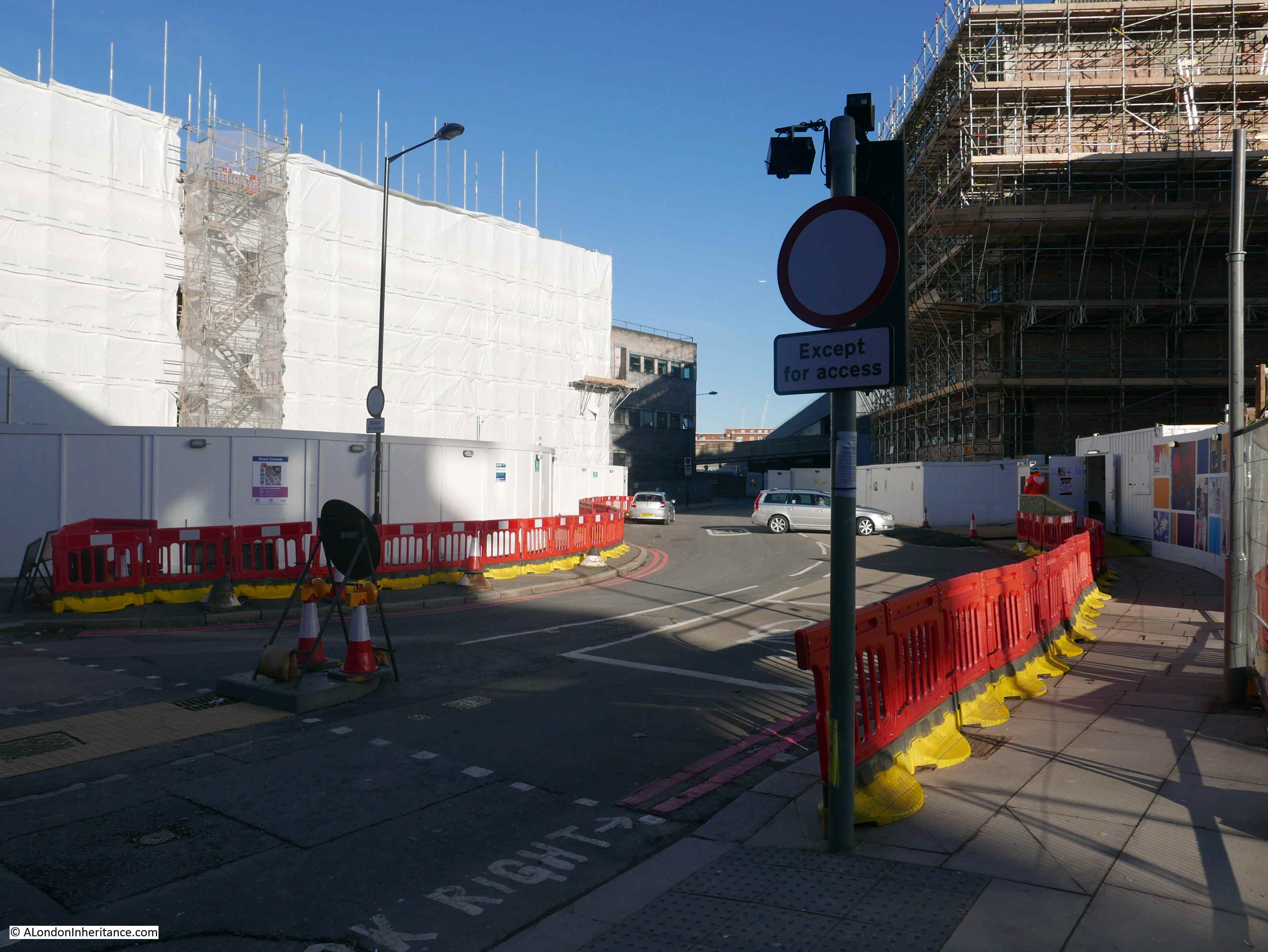
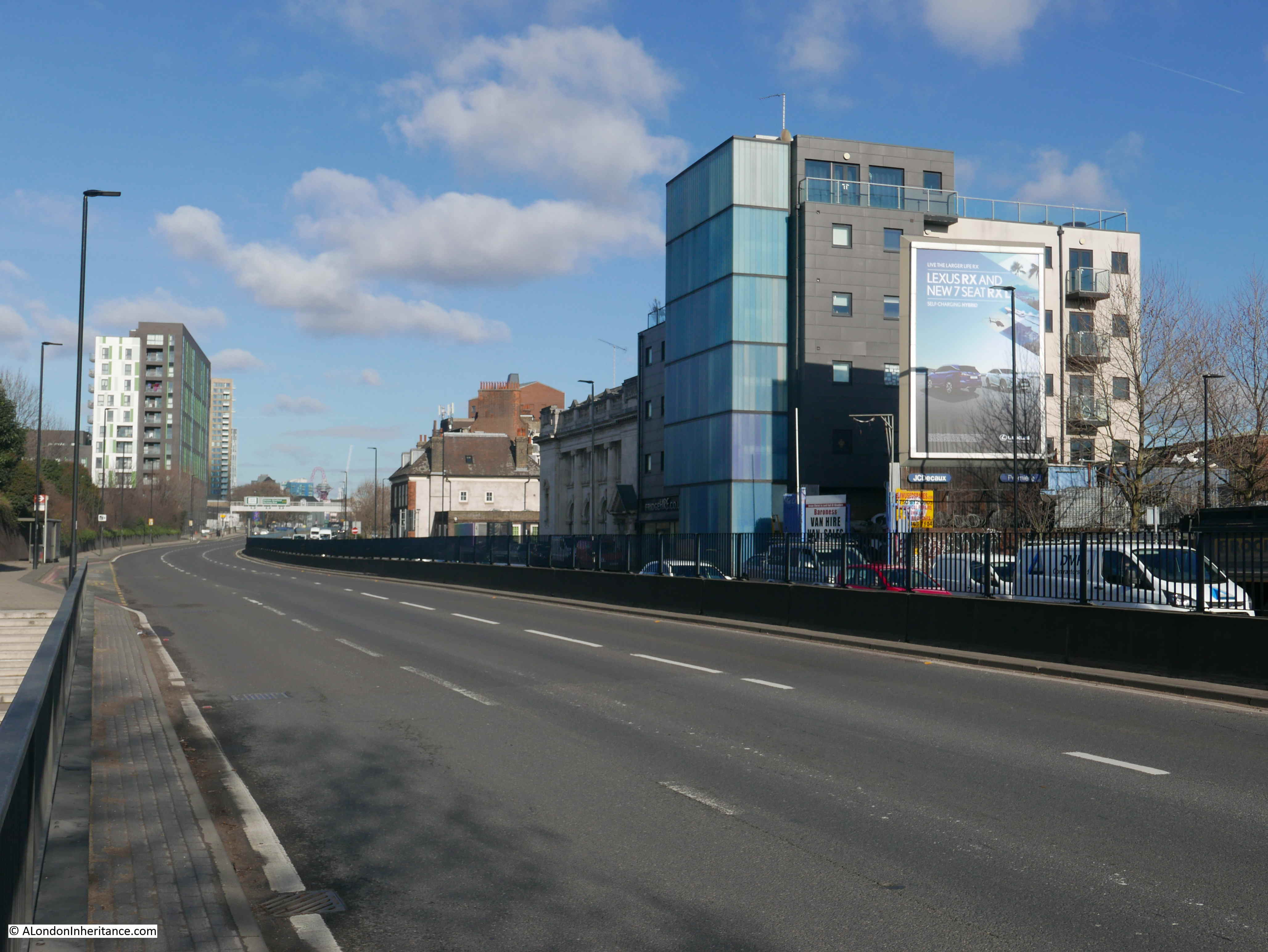
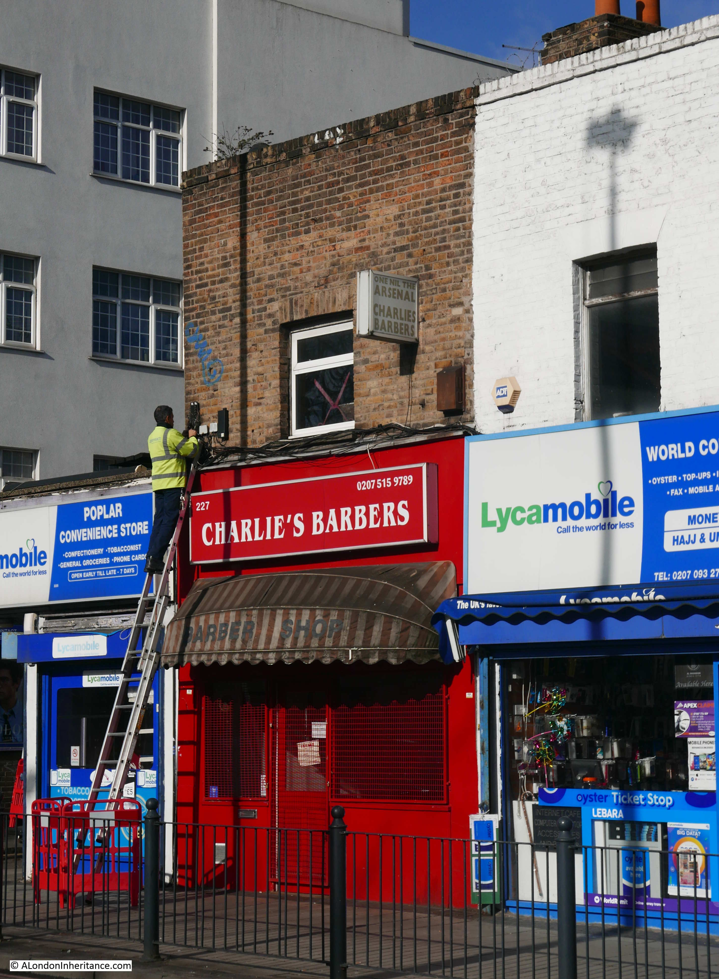
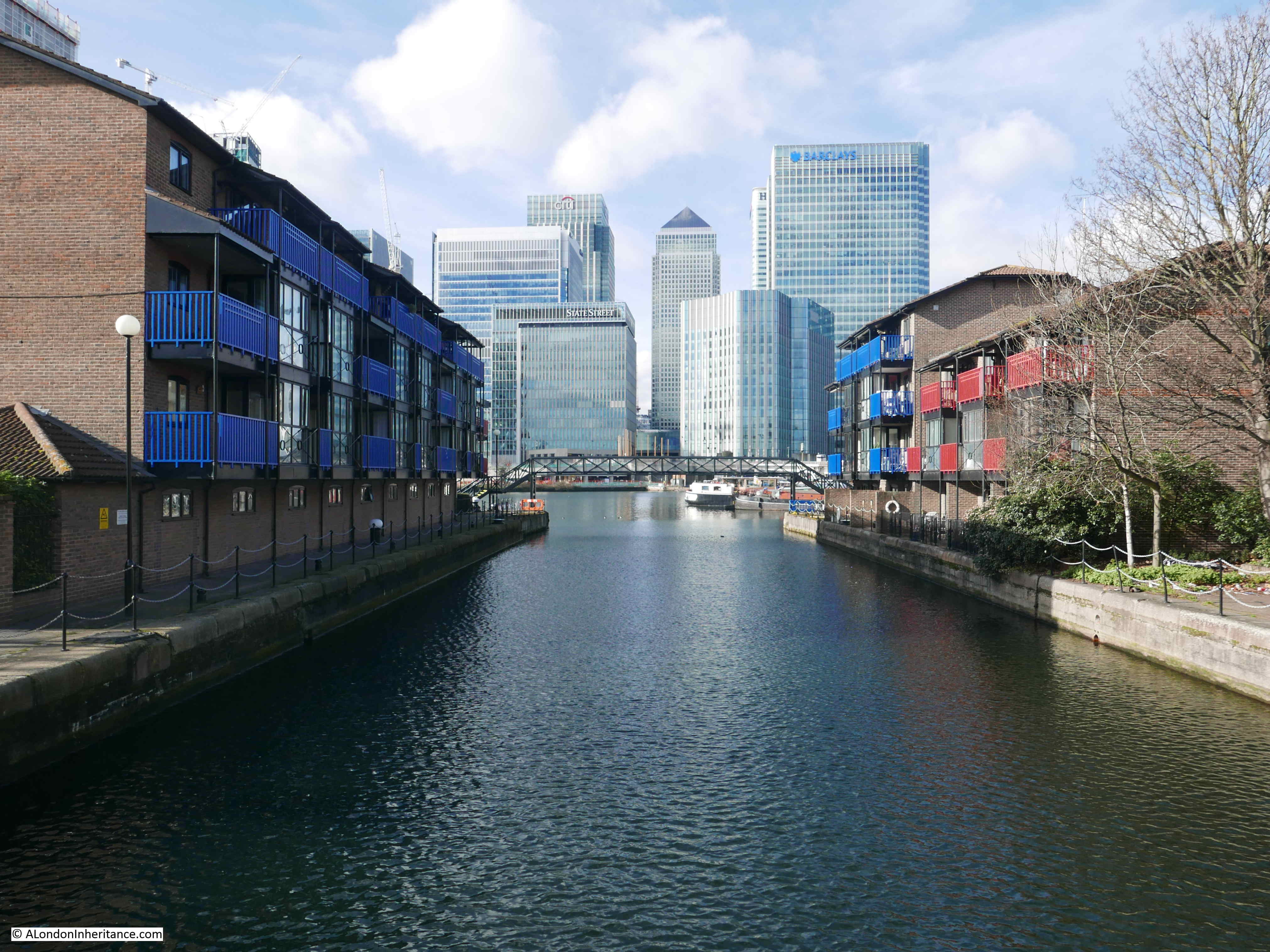
In my last post, I had just left Poplar and was about to continue along the eastern edge of the Isle of Dogs in my hunt for the sites listed as at risk in the 1972 Architects’ Journal.
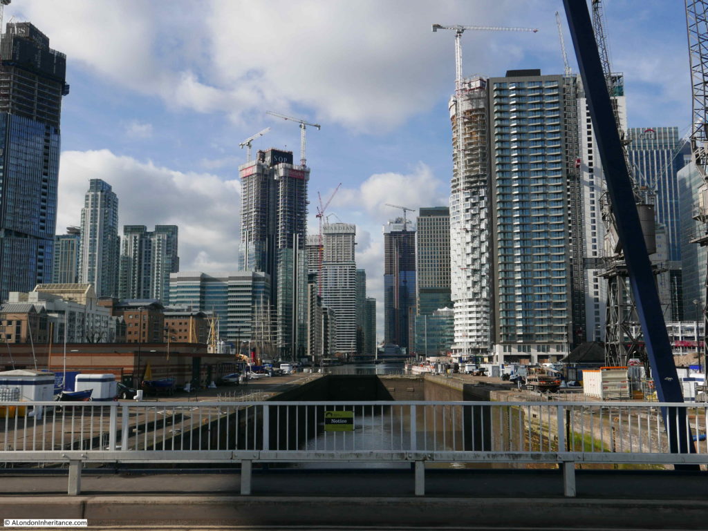
After crossing the bridge over the entrance to the Blackwall Basin, I turned towards the river along Coldharbour.
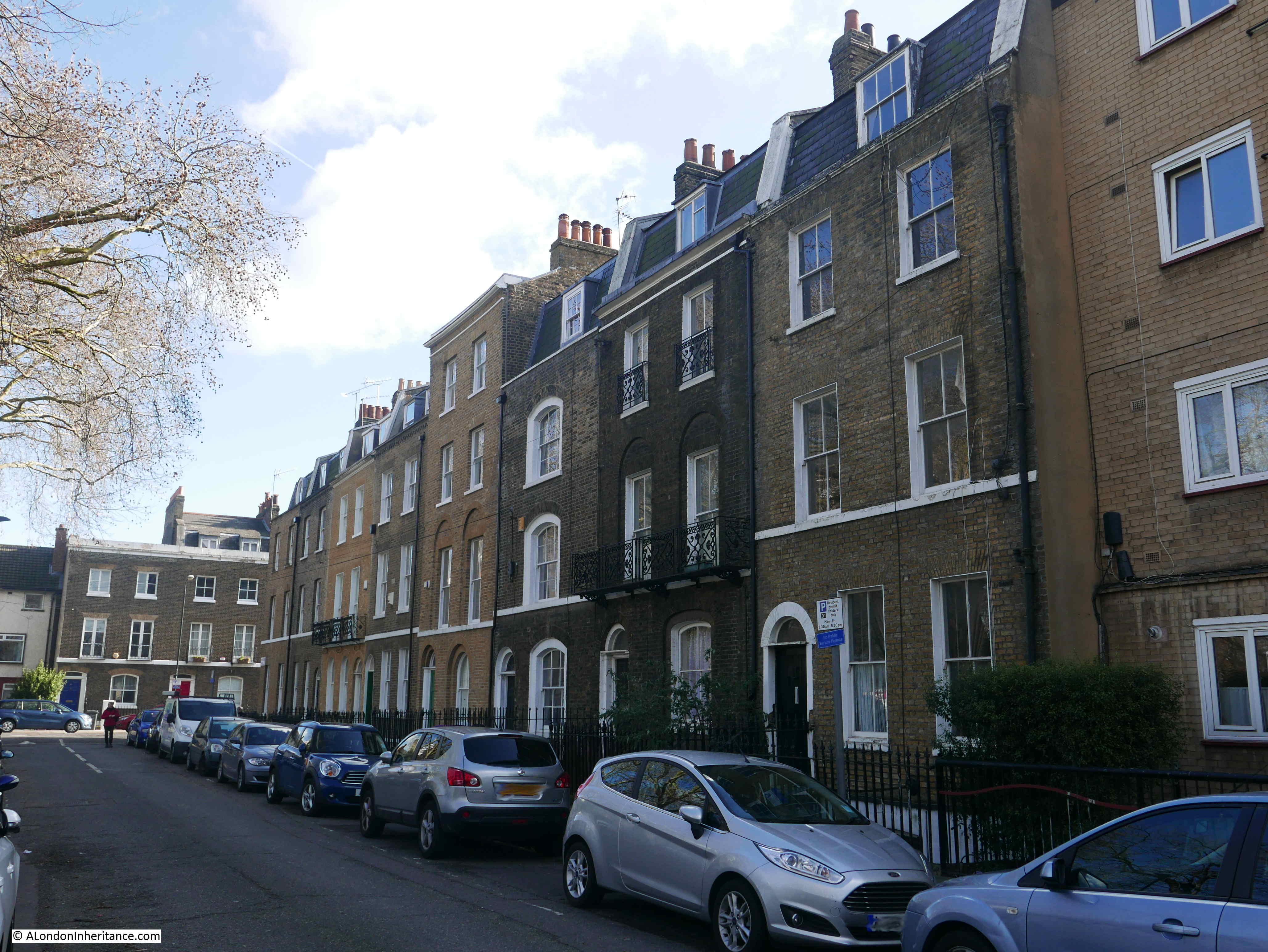
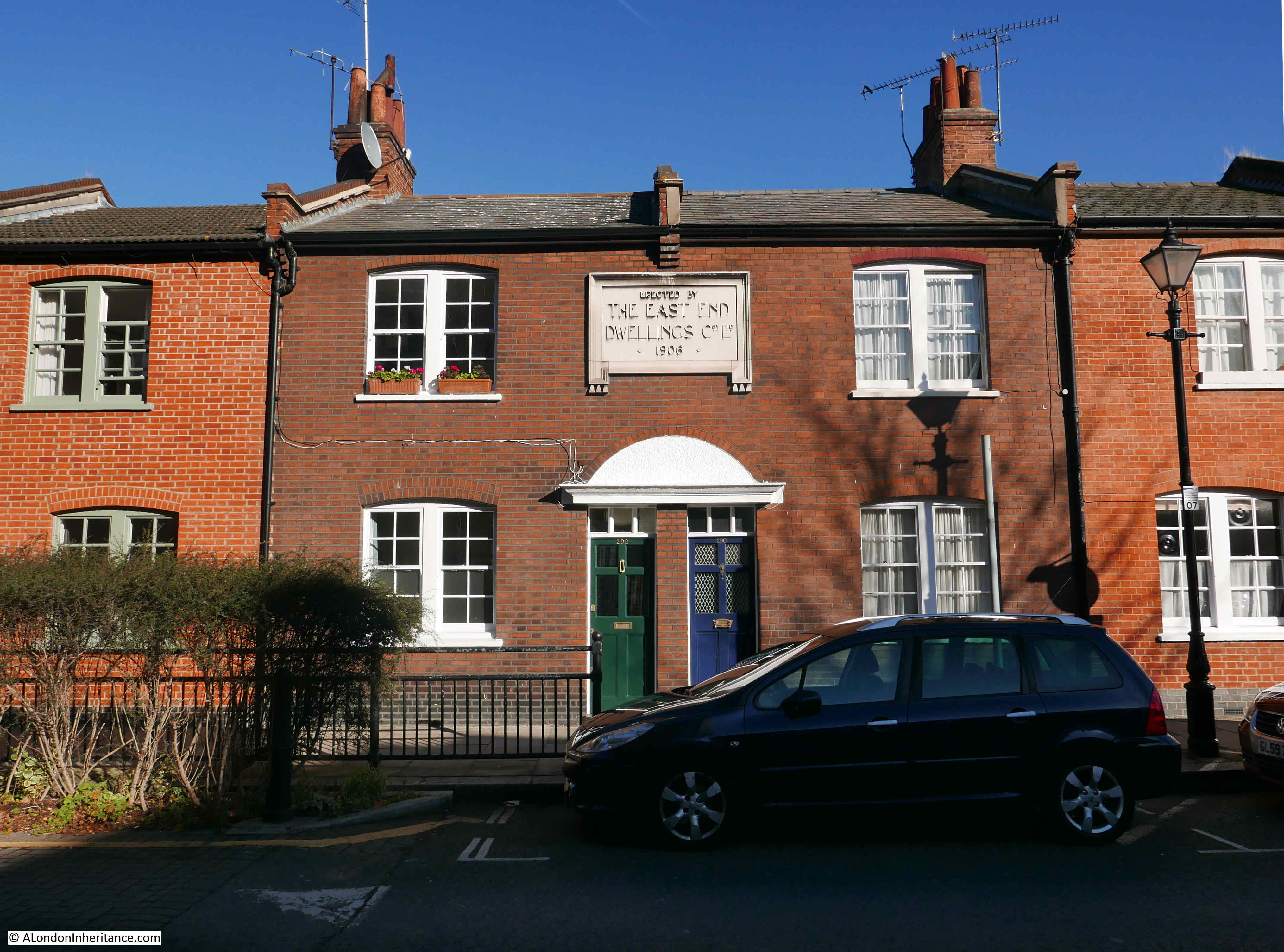
Site 27 – Early 19th Century Houses In Coldharbour
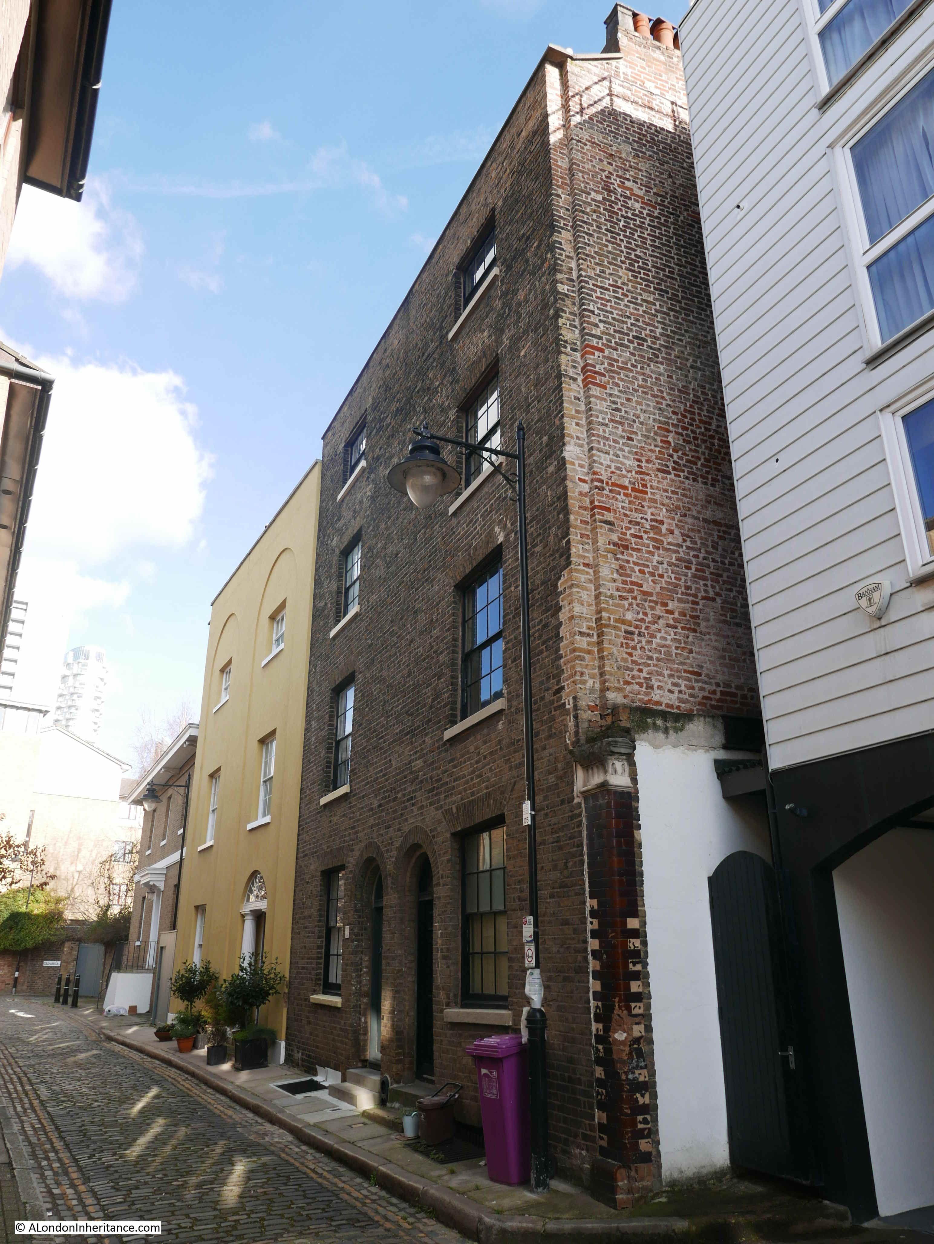
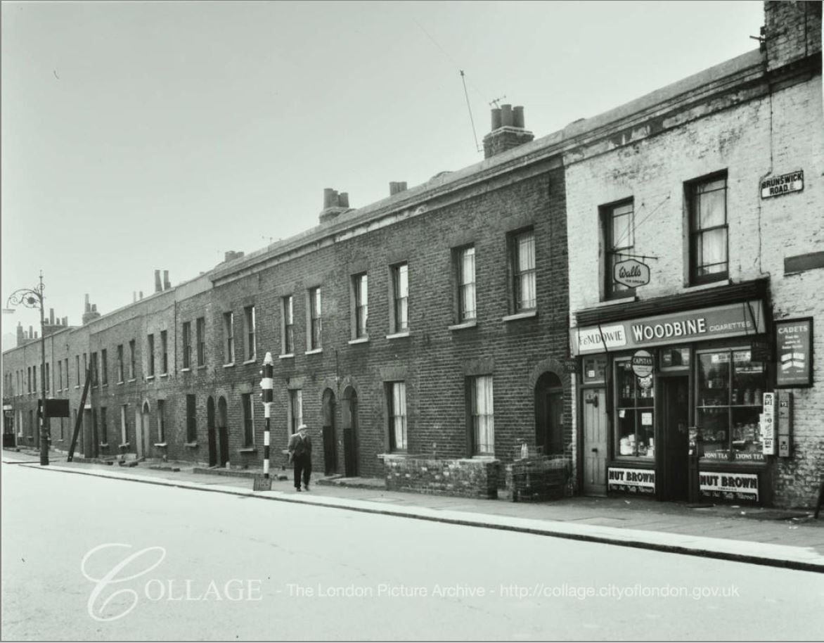
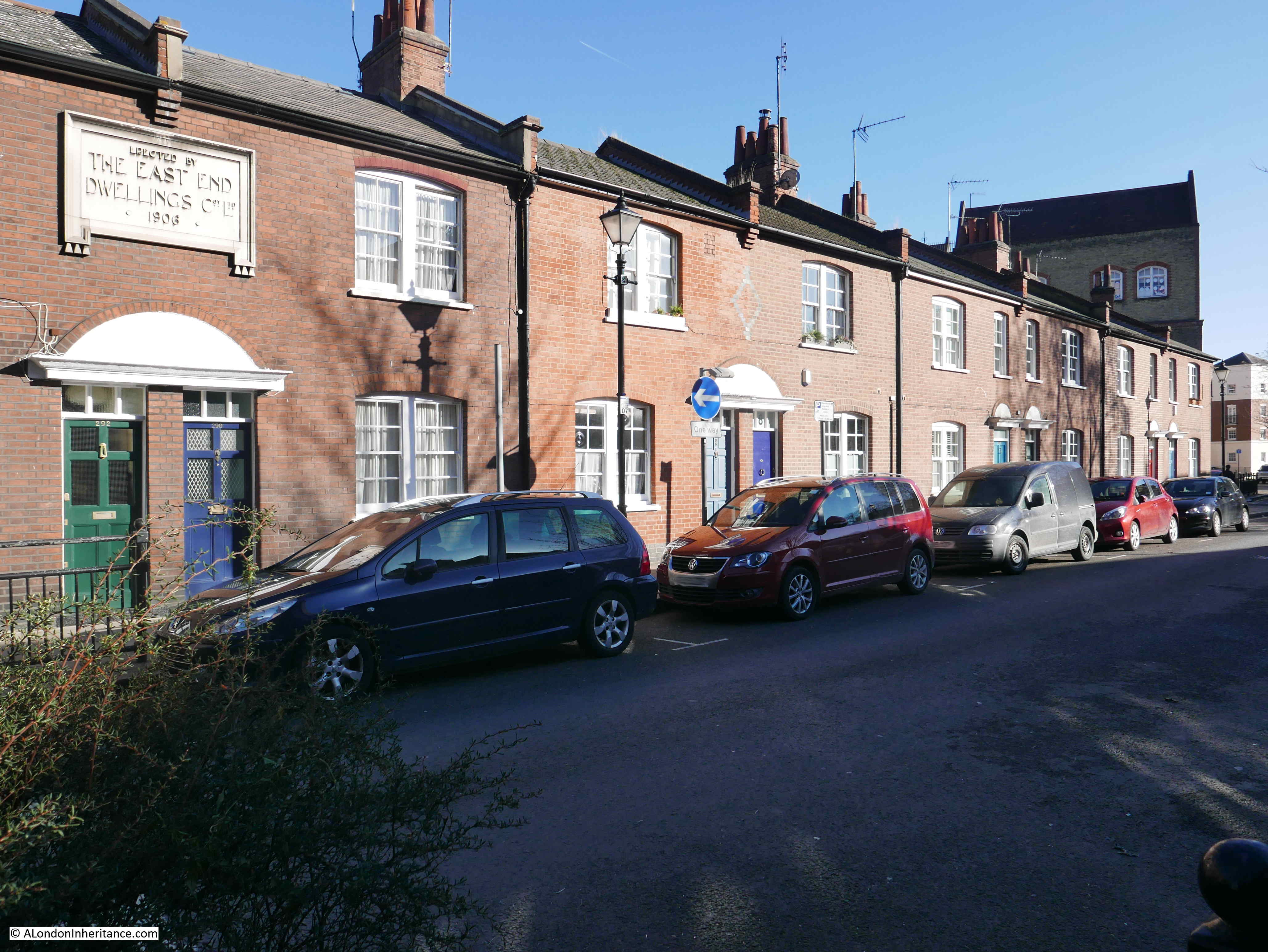
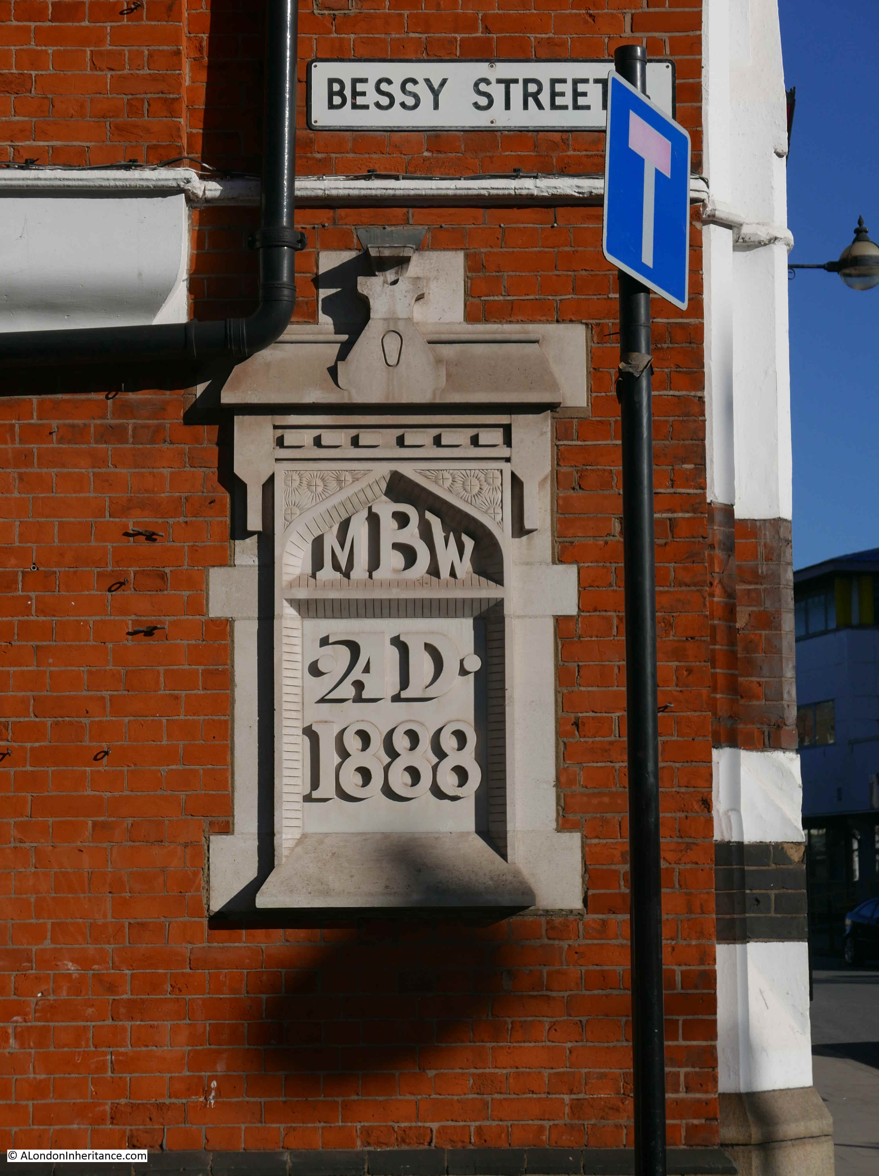
Coldharbour is a narrow street that runs parallel to the river in the space between the entrances to Blackwall Basin and the South Dock. It is not part of the main street along the east side of the Isle of Dogs, that function is performed by Preston’s Road, so Coldharbour is quiet, and probably not visited unless you have a reason to be there.
The street may well be a remnant of the pathway that ran along the Blackwall medieval river embankment, so has a long history however the houses identified by the Architects’ Journal only date from the early 19th century.
The artist William Daniell produced a series of prints of the new docks in 1802 and the following print shows Coldharbour as a line of buildings along the river front, between the entrance to the Blackwall Basin on the right and the South Dock to the left.
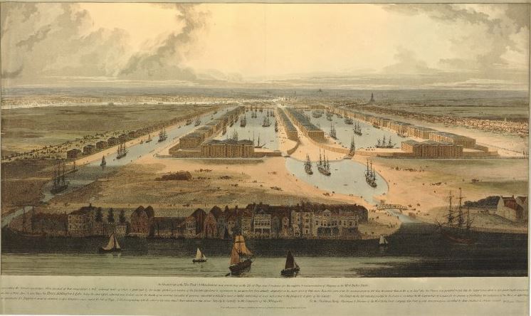
Building has occupied this part of the river bank since at least the 17th century.
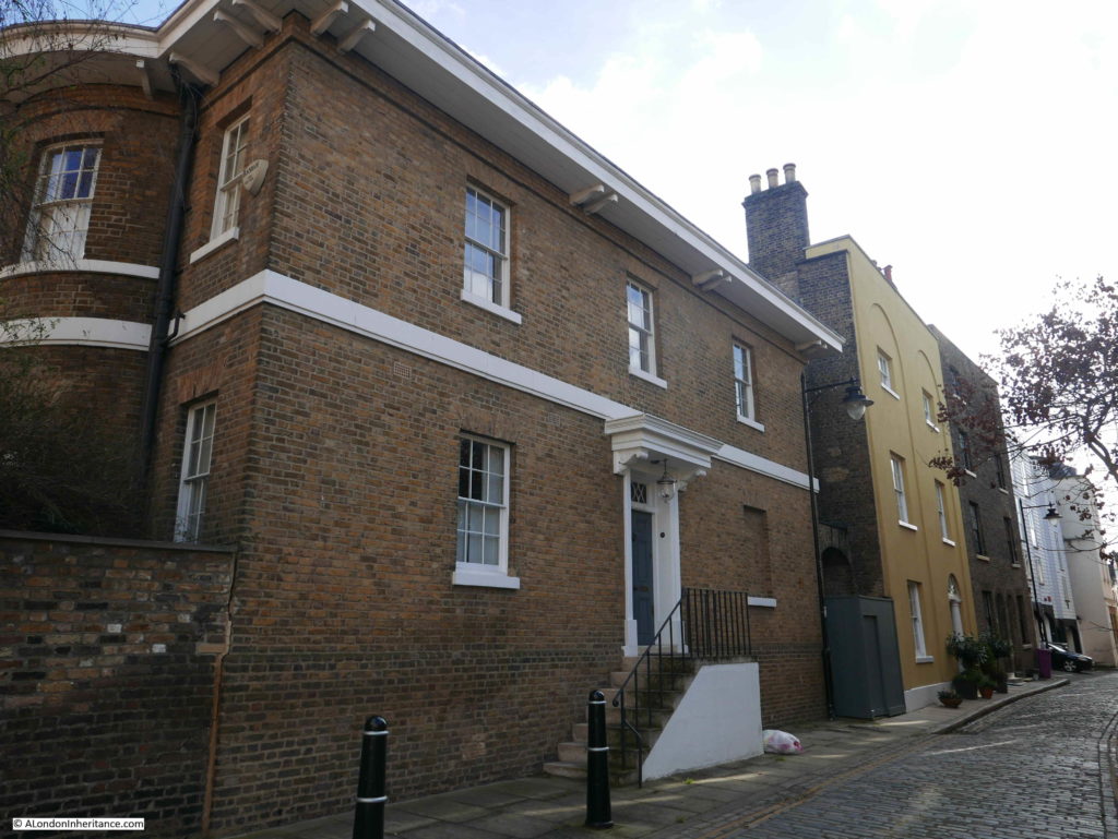
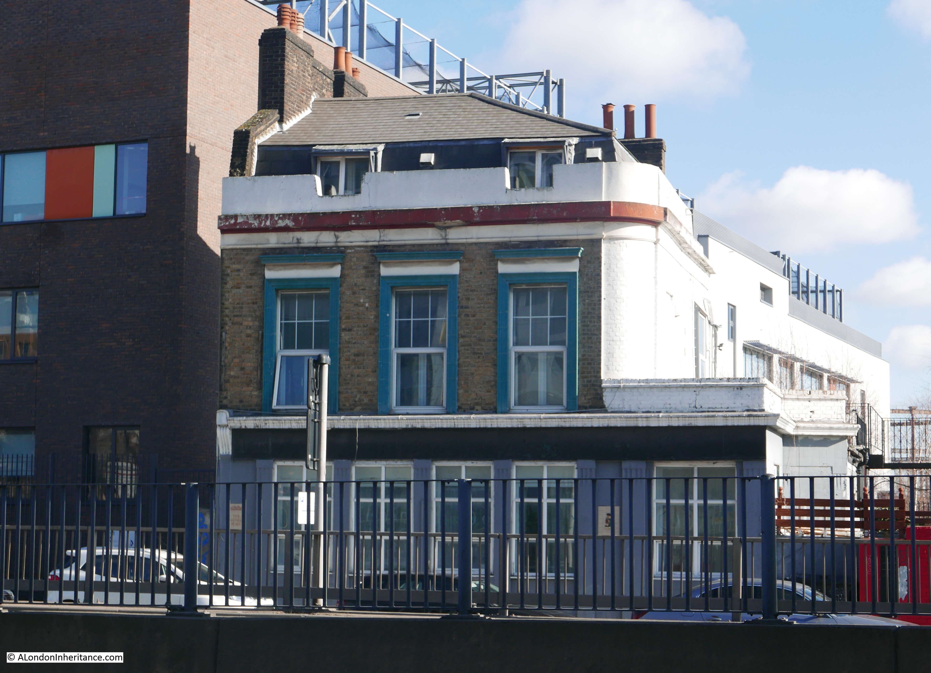
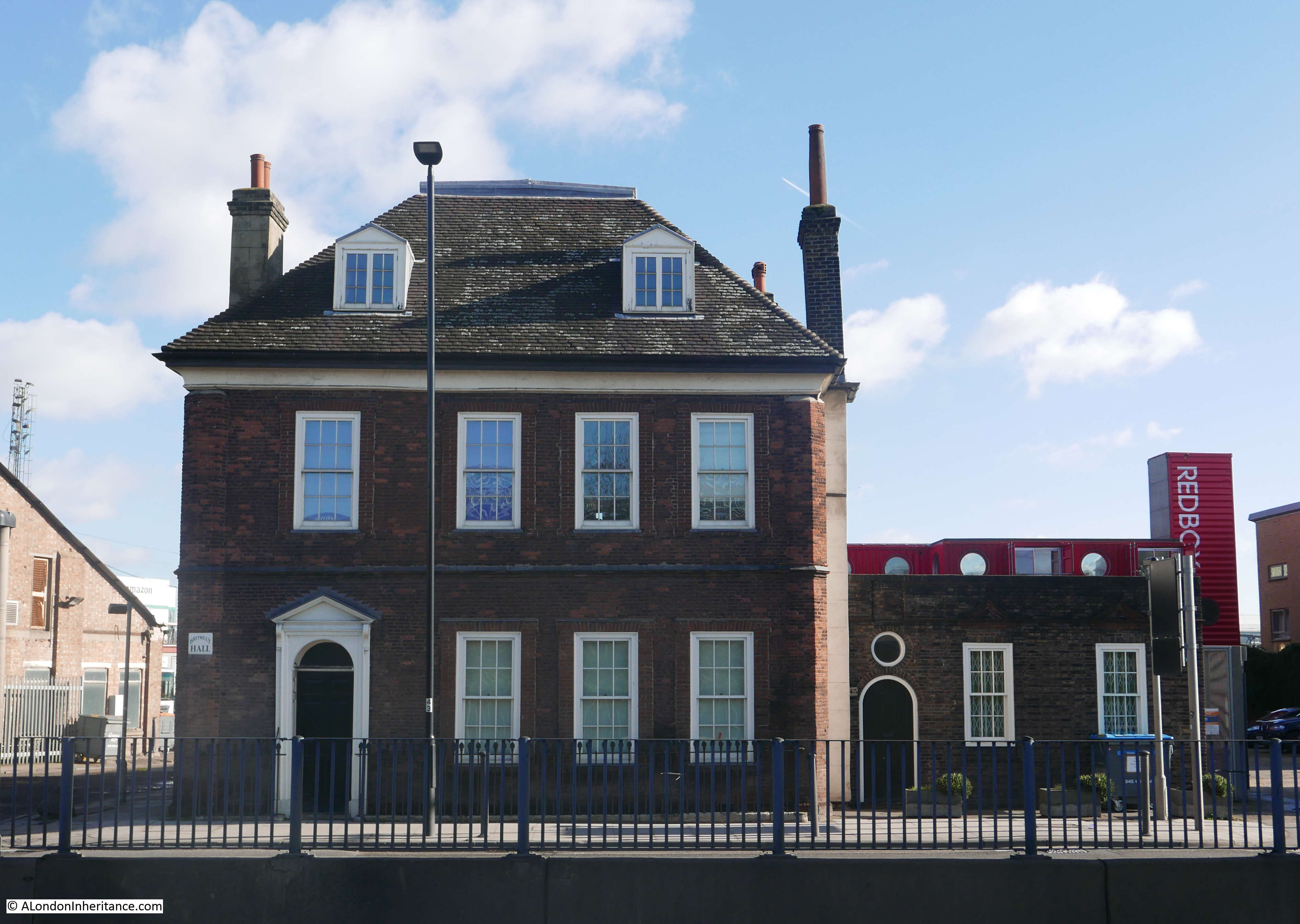
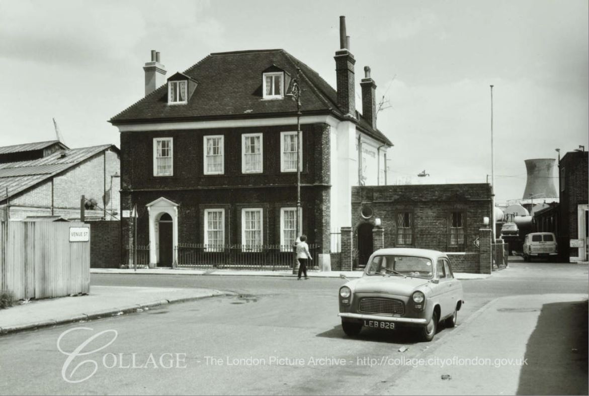
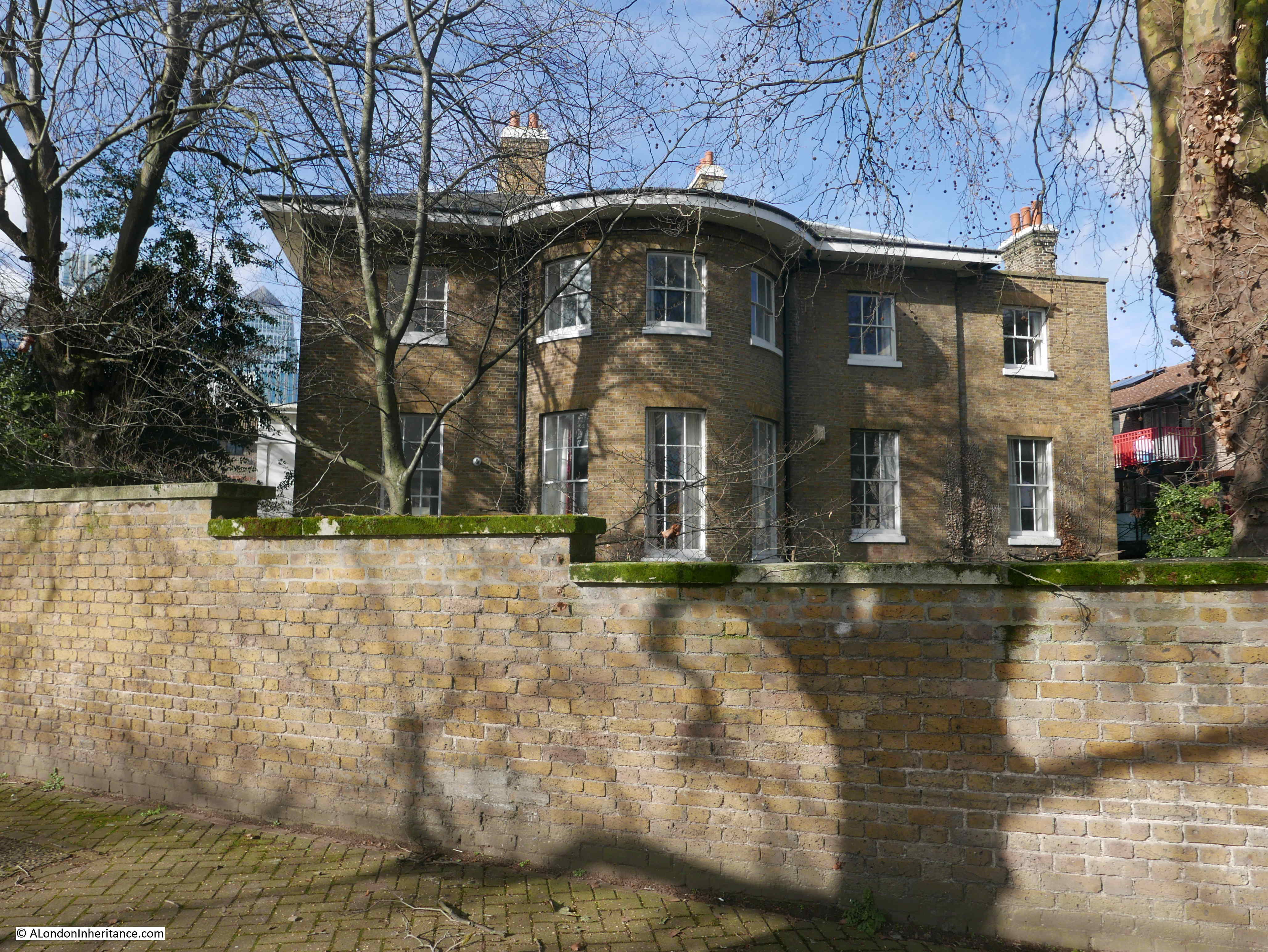
I approached Coldharbour from the north end of the street and this is the first of the historic houses that line part of the eastern side of the street. This is Isle House.
The London Metropolitan Archive Collage site has a photo from almost the same position showing the house looking much the same in 1948.
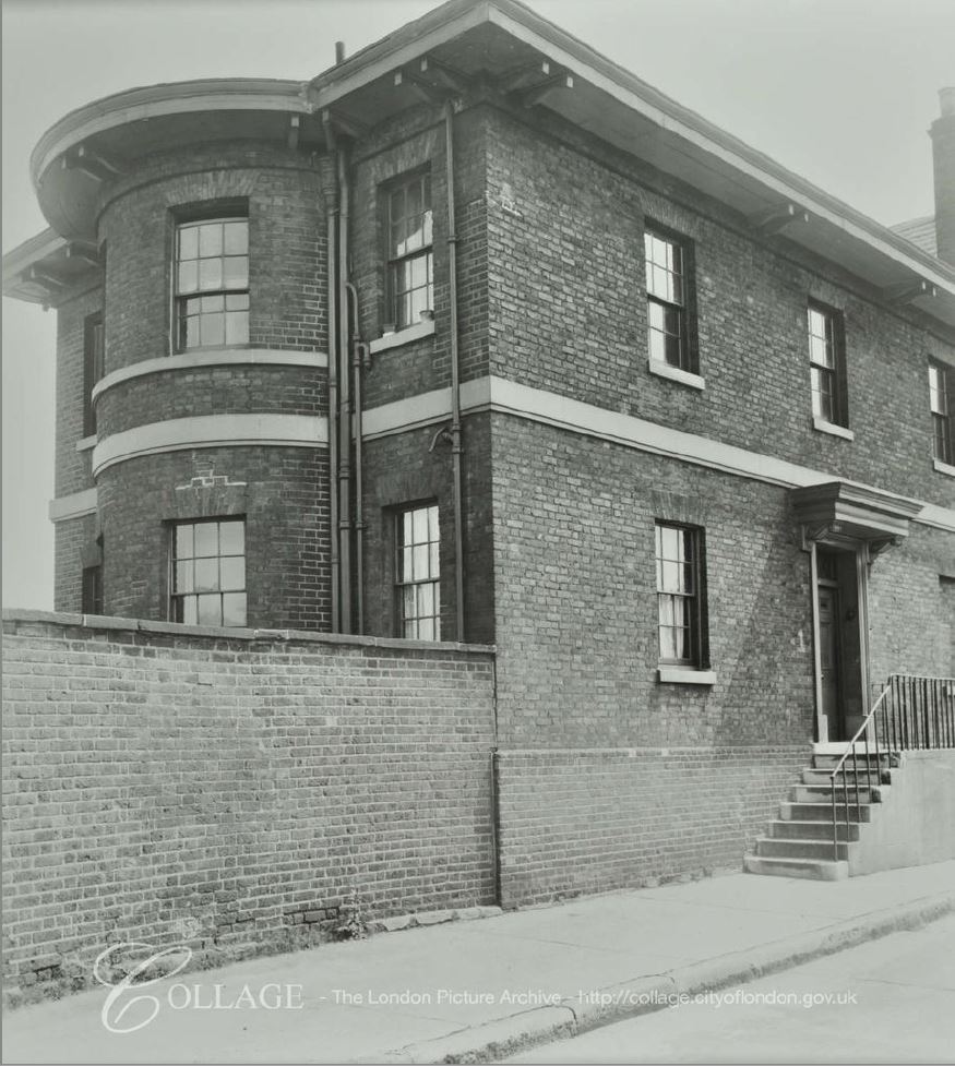
Image credit: London Metropolitan Archives, City of London: catalogue ref: SC_PHL_01_288_AV63_989
Isle House was built to a design by John Rennie between 1825 and 1826 as the Dockmaster’s house, and its elevated position and bay windows provided views of the river and the dock entrance just to the north. It replaced an earlier dockmaster’s house that had fallen into a state of dilapidation.
The design of the house, and the use of the large bow section, is very similar to Bridge House, the last building in my previous post. One of the possible reasons for the similarities of design is that this house was designed by Rennie’s father, although the design was also probably functionally best for the role of the occupant.
In my photo above, a row of taller terrace houses can be seen following on from Isle House. They are rather difficult to photograph in such a narrow street. I walked further down and took the following photo looking back.
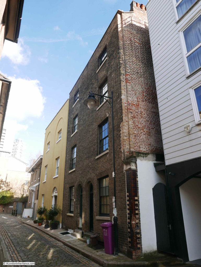
In the above photo, the furthest house, next to Isle House is Nelson House, built around 1820. The two houses closest to the camera with brick facing were built around 1809.
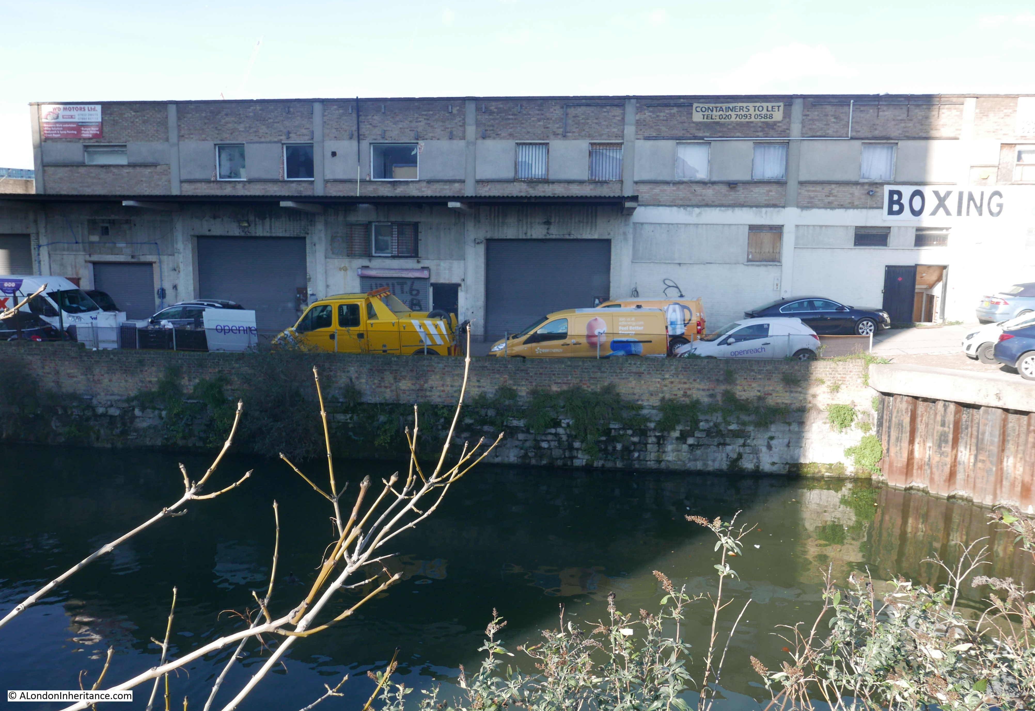
There is no access to the river along Coldharbour. There are various gaps between buildings, however they are all closed off so no possibility to view the river.
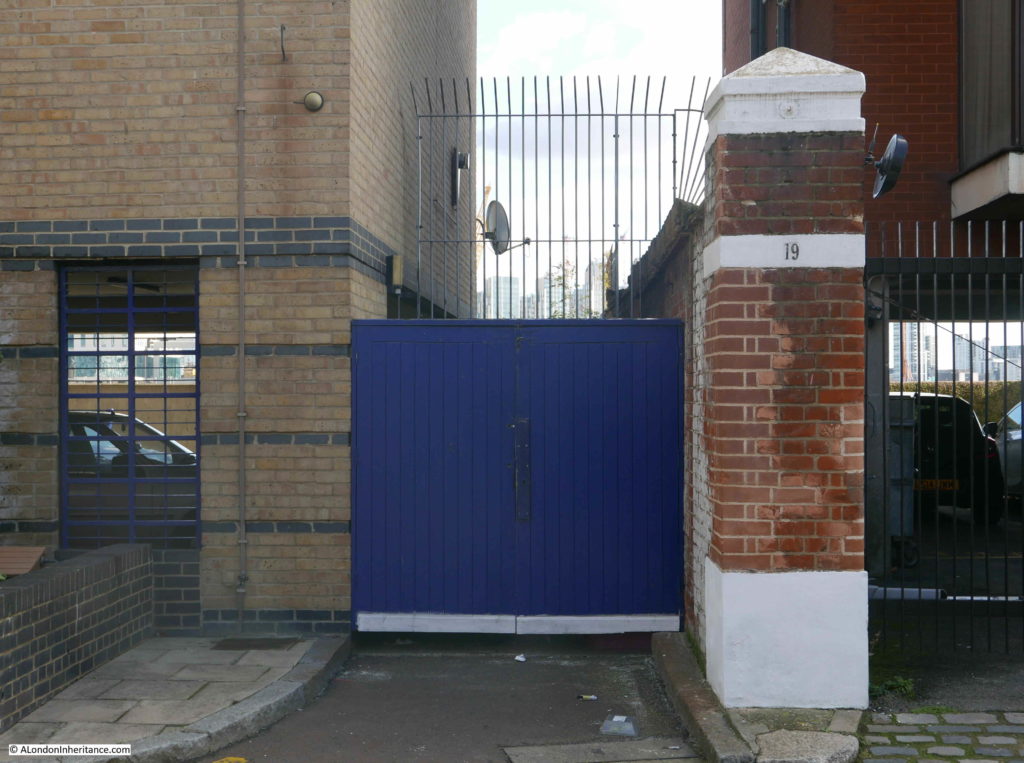
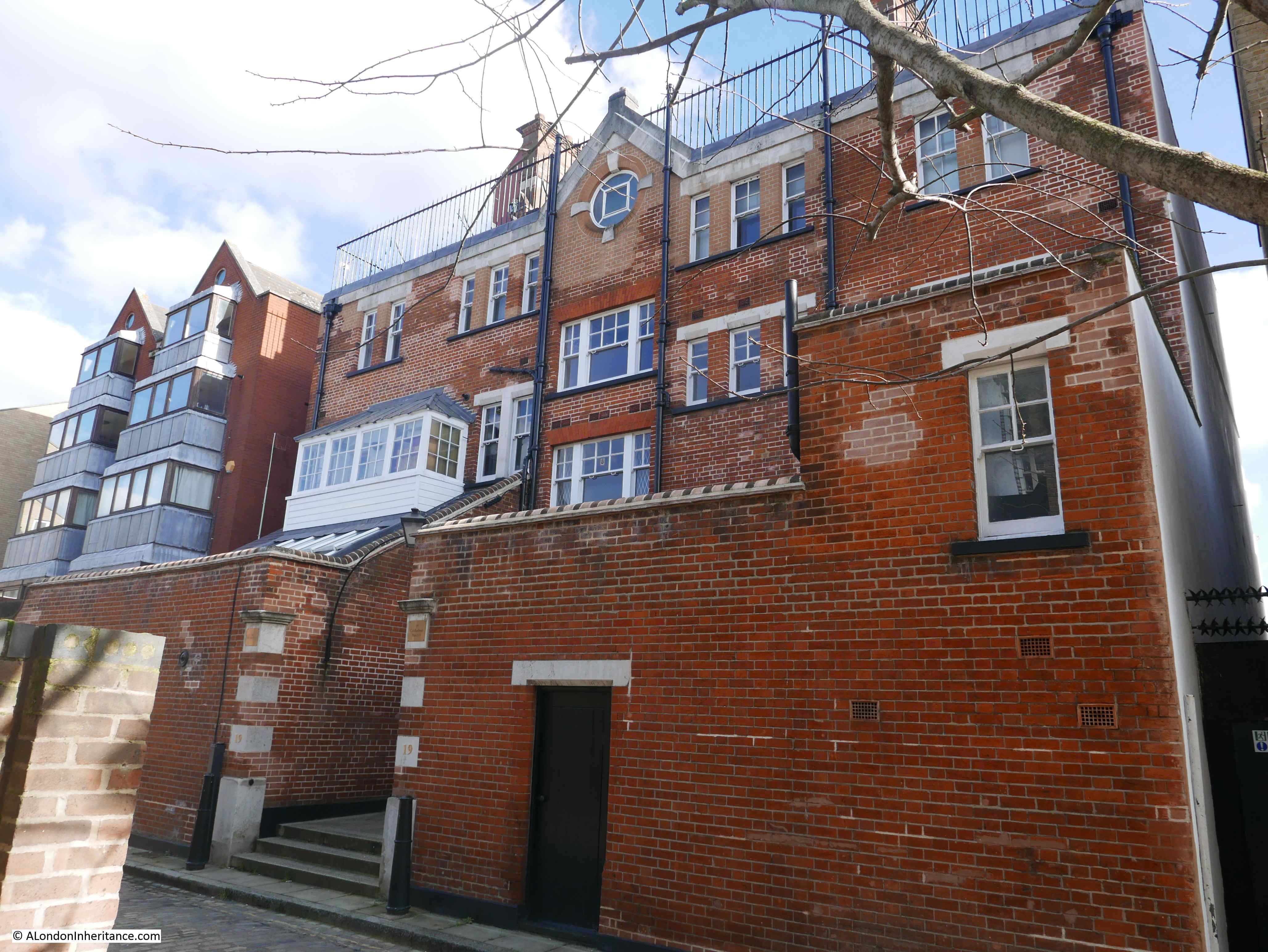
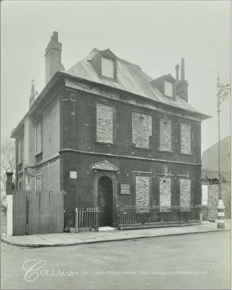
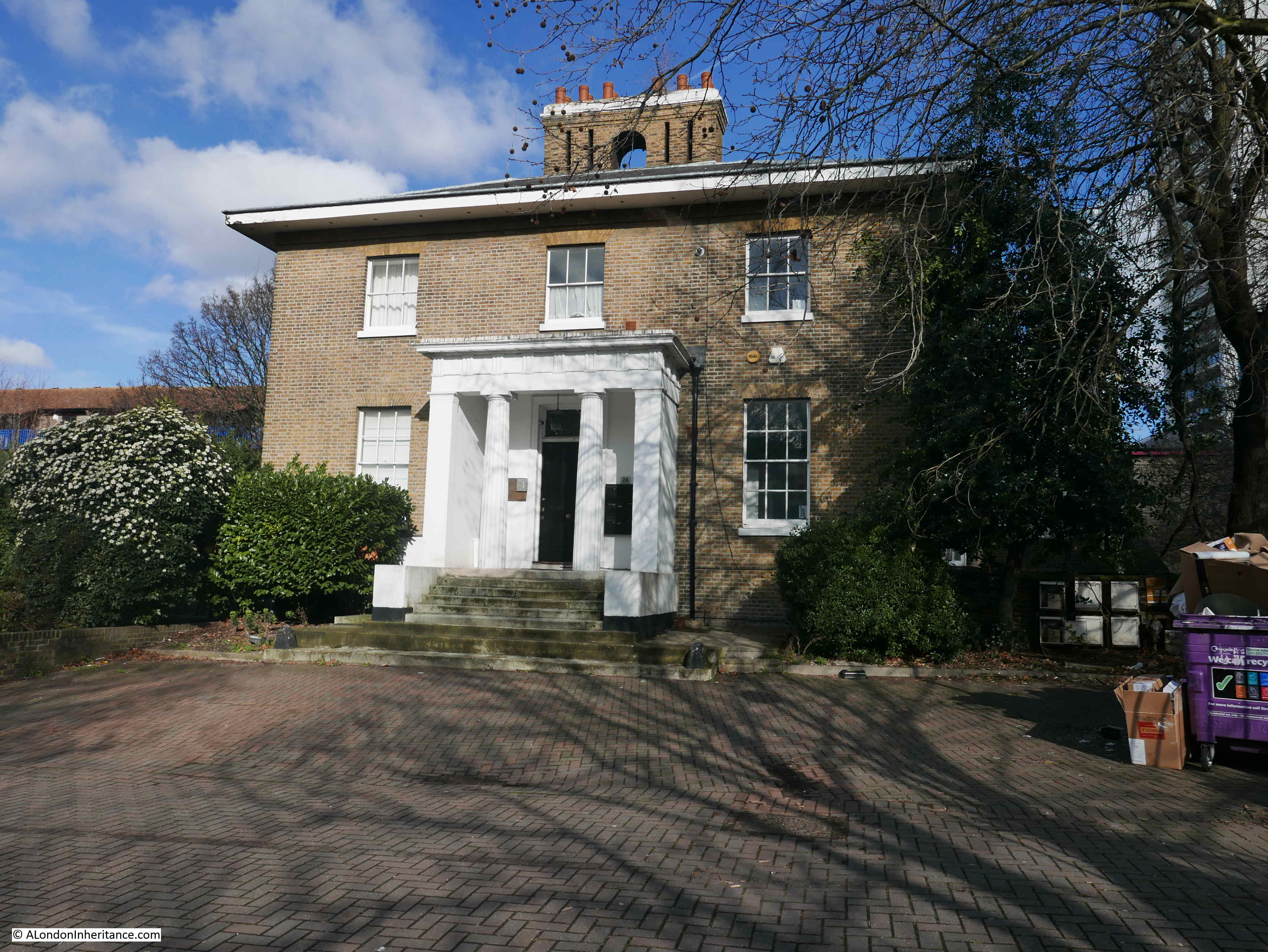
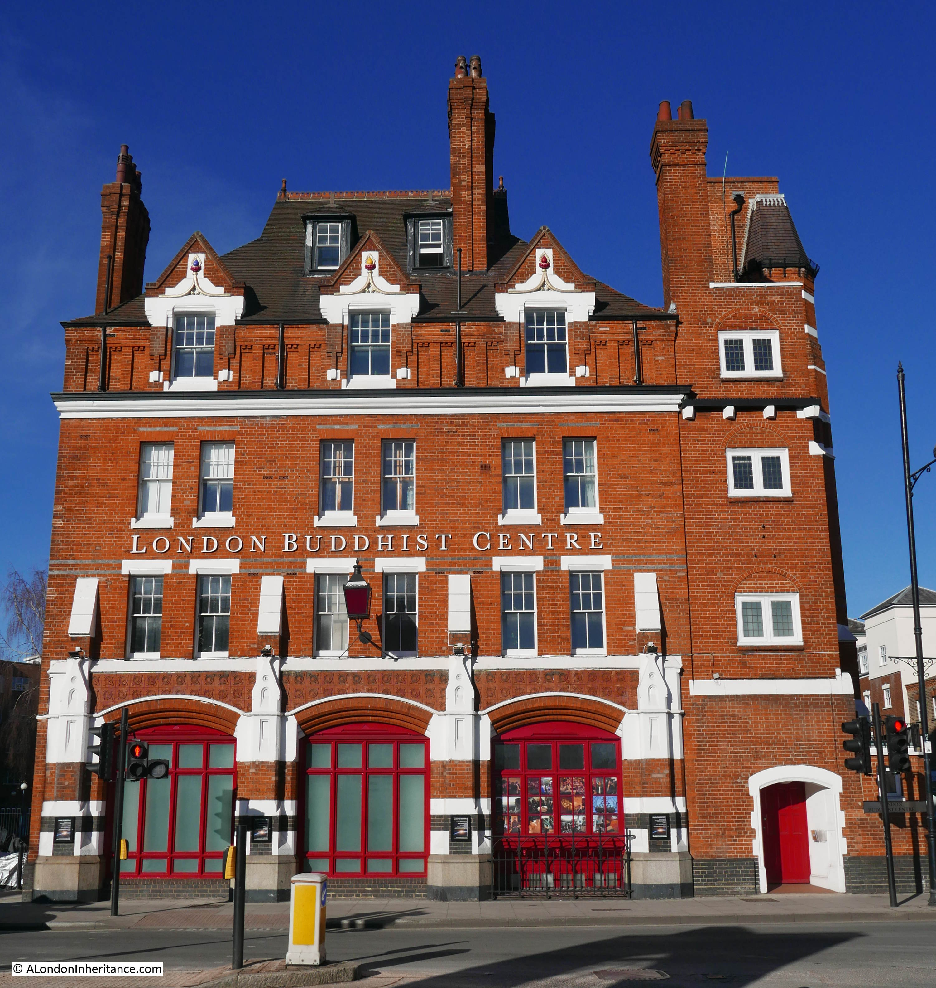
Further along Coldharbour there is a rather imposing building. This is the entrance to the old Blackwall Police Station.
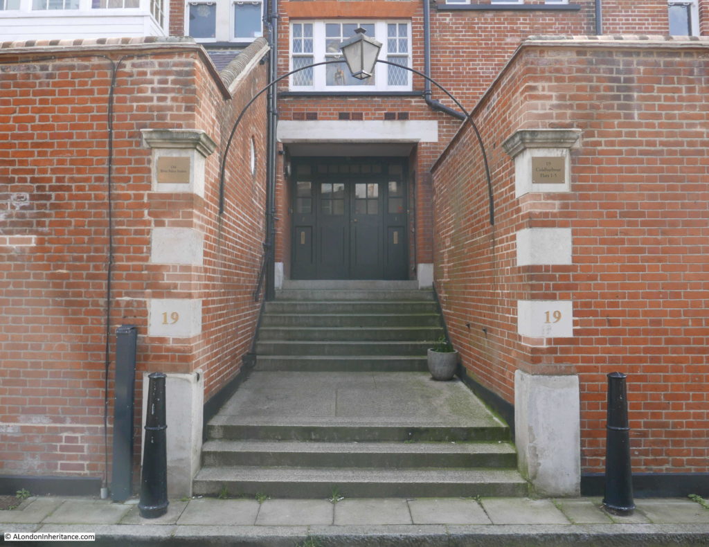
Blackwall Police Station was built between 1893 and 1894 to a design by John Butler. The need for the police station was due to the poor conditions that the local division were housed in – an old hulk floating on the river.
The Police Station closed in the late 1970s, it was then converted into flats.

The ground floor is raised above the level of Coldharbour as shown by the photos above where a flight of steps reaches up to the main entrance. This was a design response to a unique need.
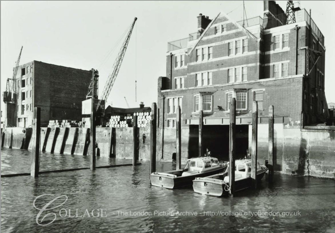
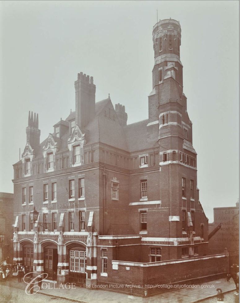
The photo below of Blackwall Police Station from the river in 1969 shows a large entrance at river level. This was a boat dock to provide access for boats directly underneath the building so that stores, or indeed people, could be securely transferred within the building rather than alongside.
The height of the entrance had to be sufficient to provide access at all states of the tide.
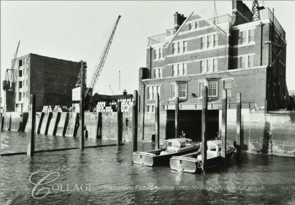
Image credit: London Metropolitan Archives, City of London: catalogue ref: SC_PHL_02_0183_69_1313
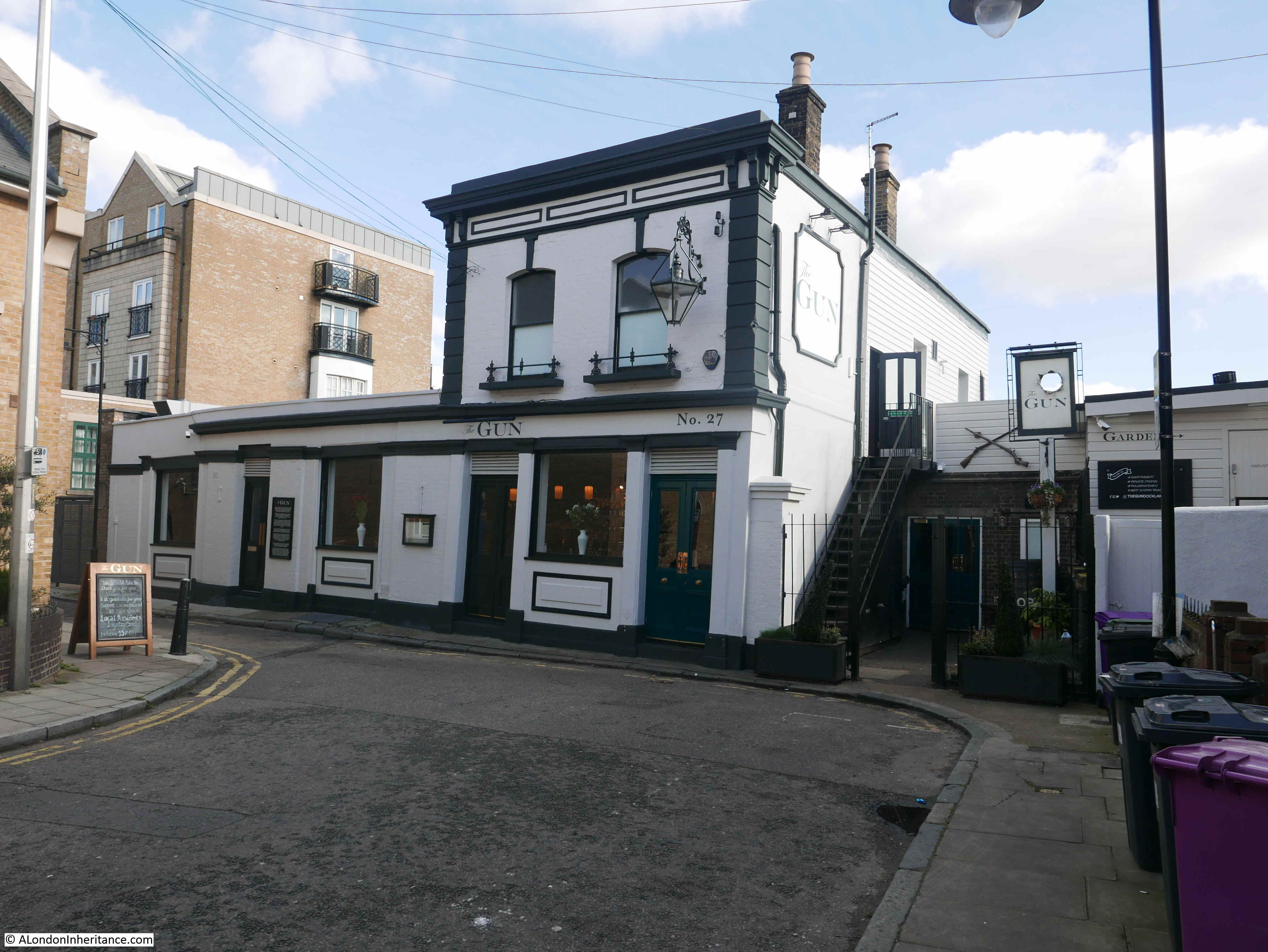
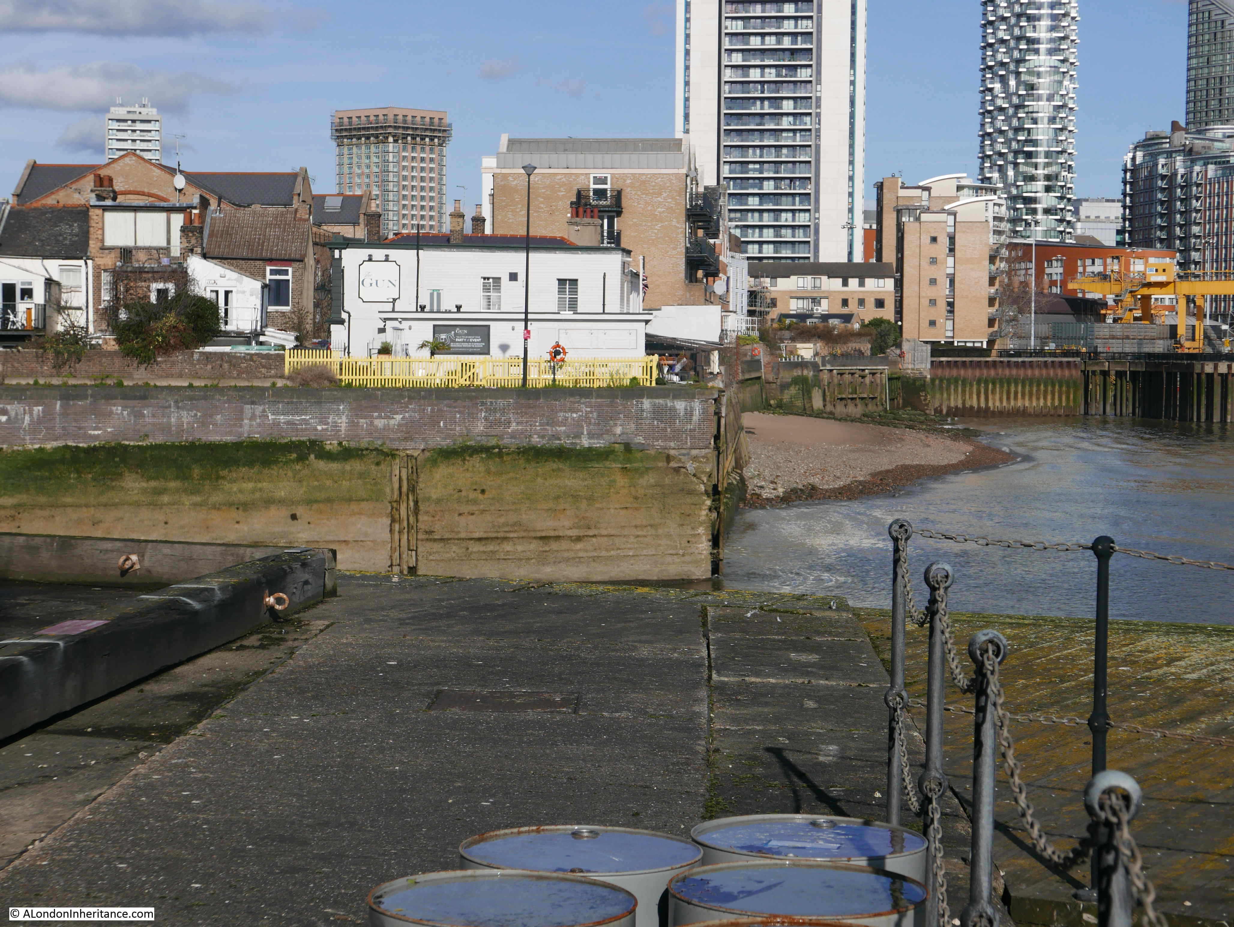
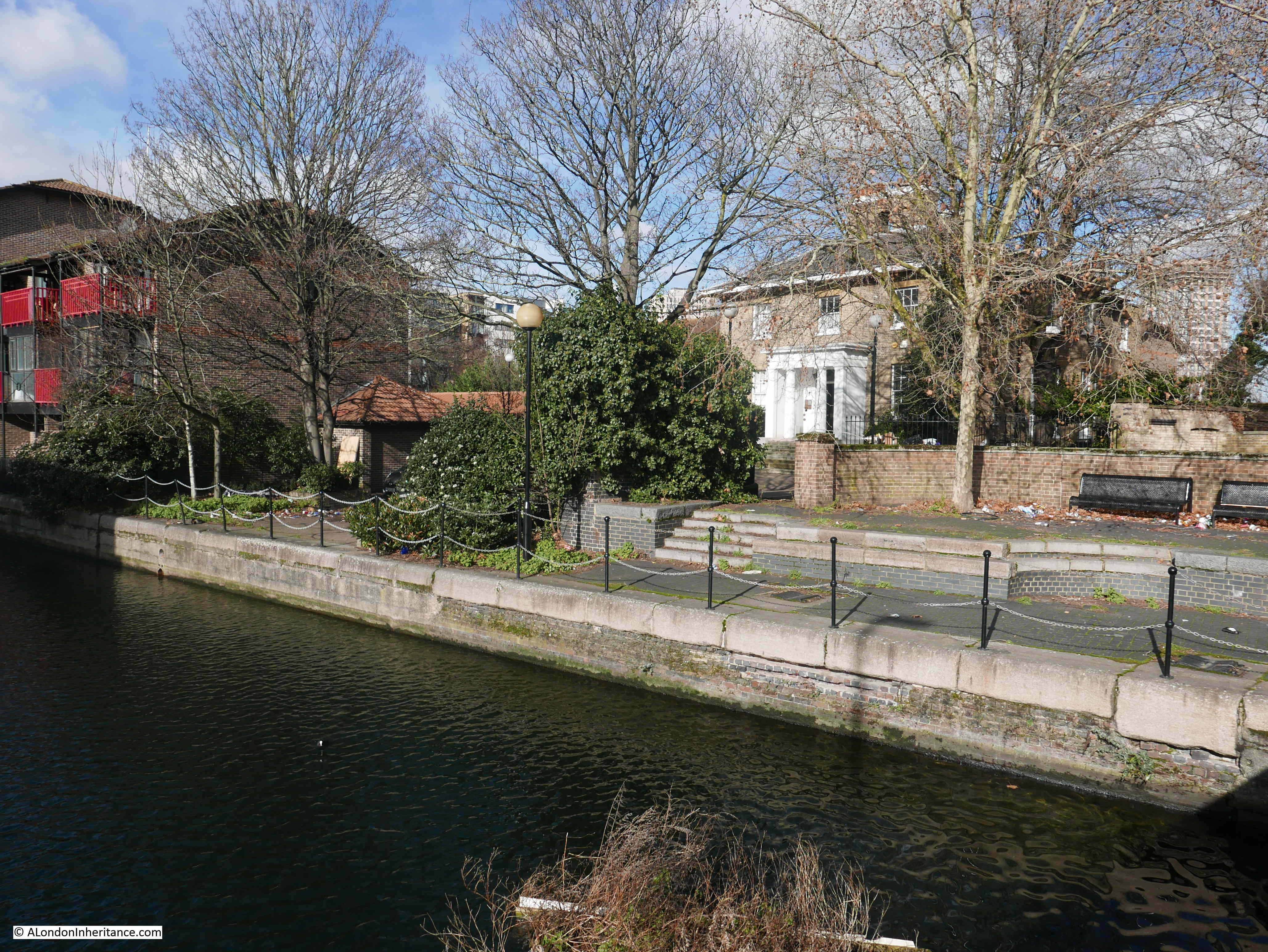
At the end of Coldharbour, where the street turns away from the river back up to Preston’s Road (although access is only for pedestrians, the junction is closed for traffic), is one of may favourite pubs. This is The Gun:

The Gun is a genuinely old pub with a pub on the site since the early 18th century. The current name of the pub originates from 1771. Earlier names for the pub on the site were the Ramsgate Pink, the Rose and Crown and the first recorded name in 1722 as the King and Queen.
A board on the front of the pub states that Admiral Nelson met Emma Hamilton for “secret assignations” in an upstairs room. Whatever the truth in this, the pub is a perfect, out of the way location for a secret meeting.
The pub can get very busy, and is Grade II listed, so hopefully the future of this historic pub, alongside the river, is safe.
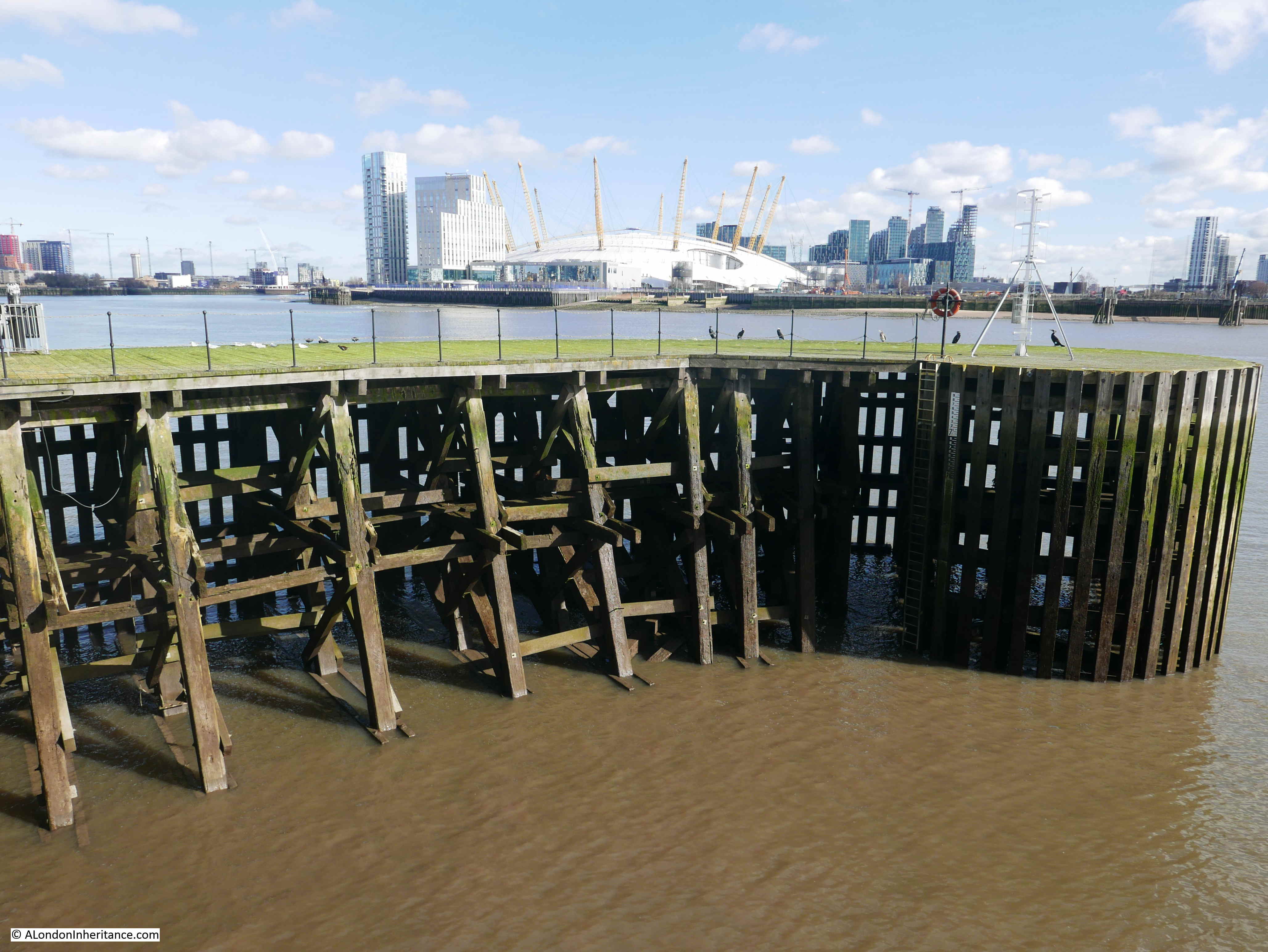
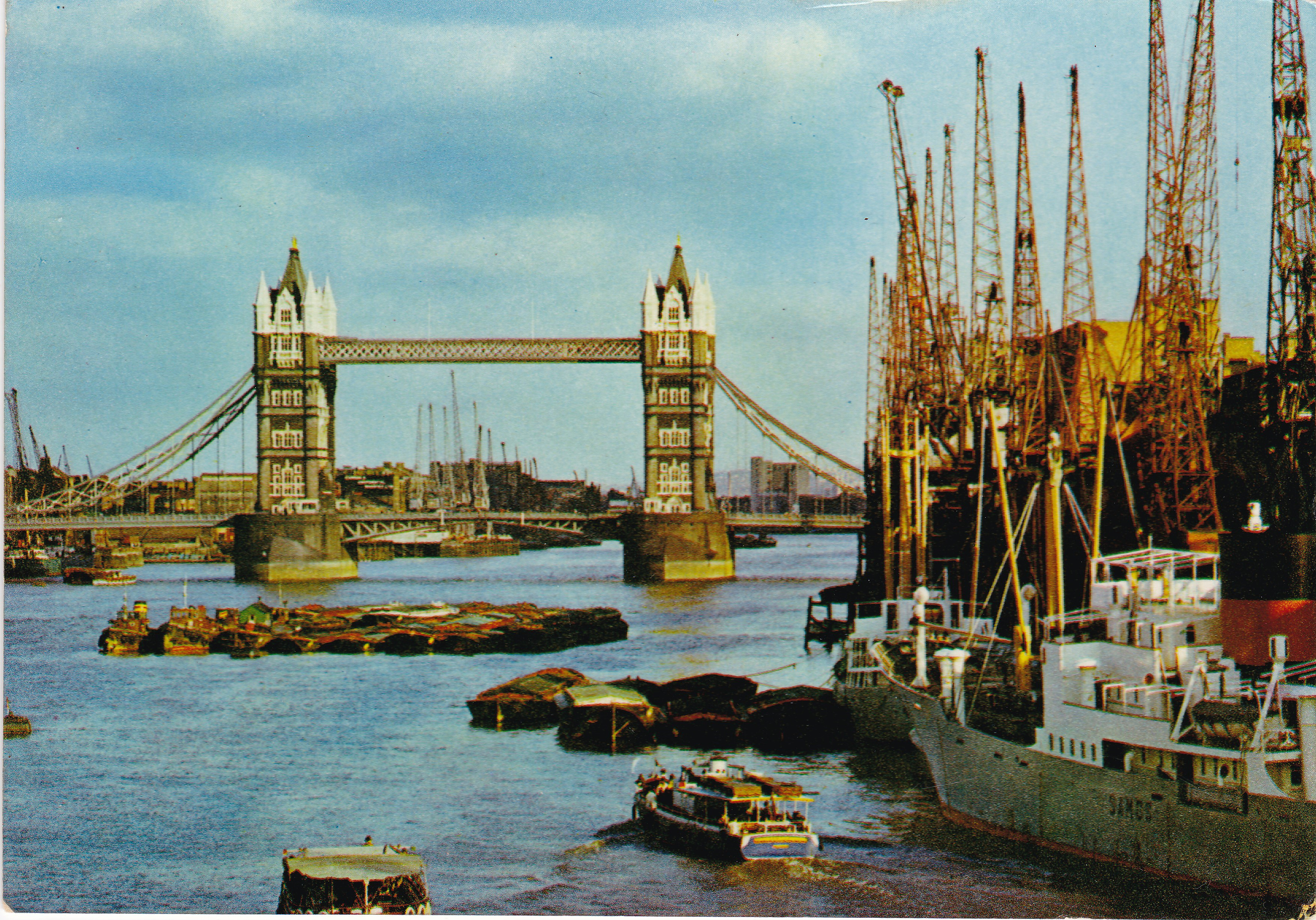
Returning to Preston’s Road, I continued to head south. crossing the entrance to the South Dock. There are some fascinating views from this point. This is looking north west with two types of crane symbolising the change that is taking place on the Isle of Dogs – original cranes for loading and unloading cargo alongside the docks, with the cranes that are now building the towers that are taking over large parts of the area.
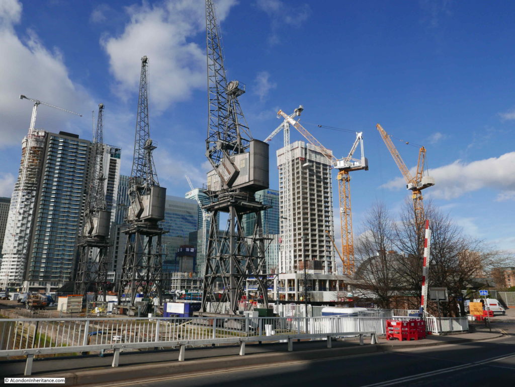
Looking along the entrance channel to the location of the original South Dock with a growing forest of high rise towers.
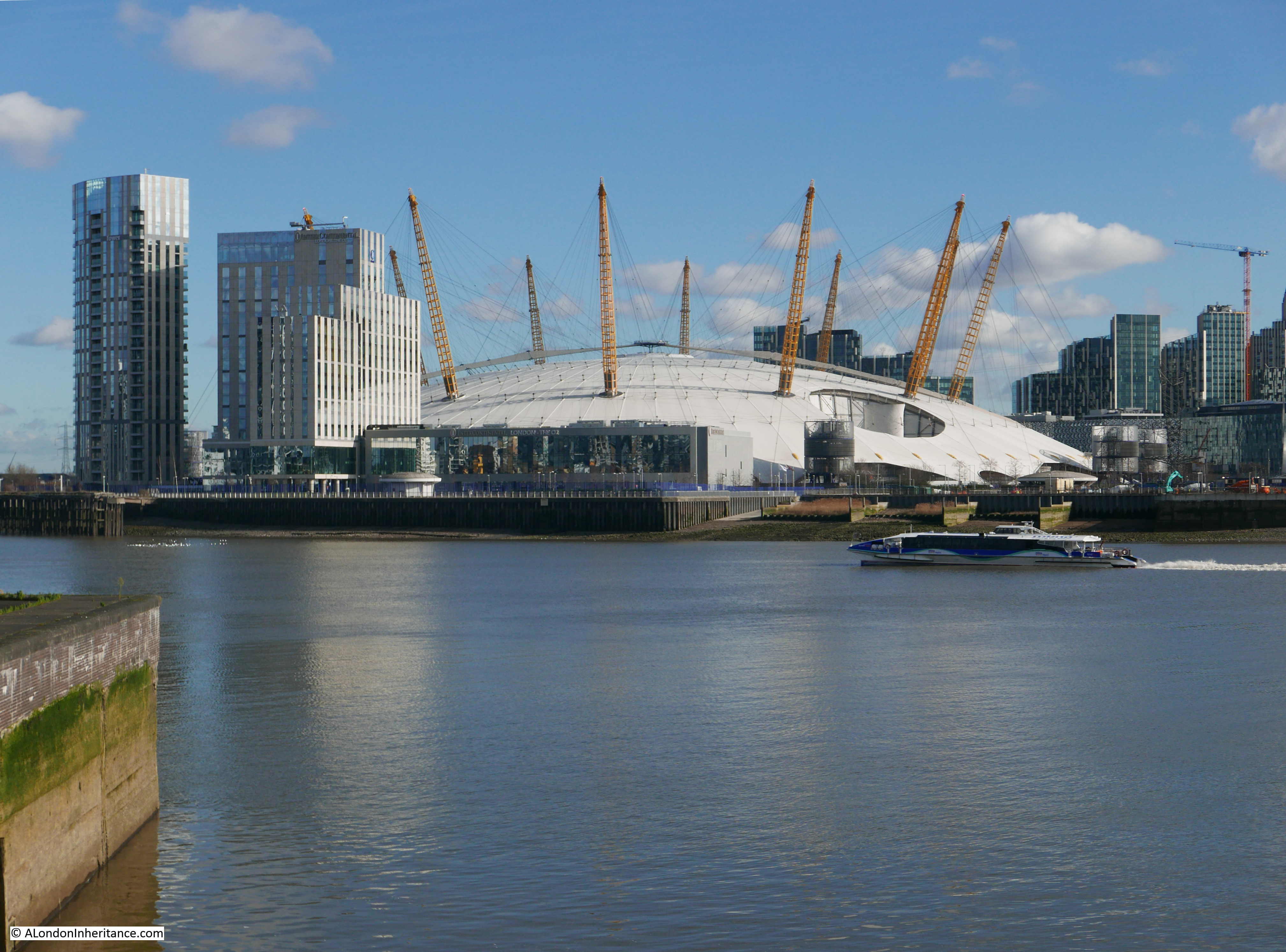
The view in the opposite direction, across the River Thames to the Millennium Dome.

I have a load of photos that both my father and me have taken of the Isle of Dogs over the years. Many of them I still need to scan, but there is one that I have scanned that I wanted to find the location of on this walk.
This is a photo of the Gun pub taken from the opposite bank of the channel between river and South Dock taken in 1986.
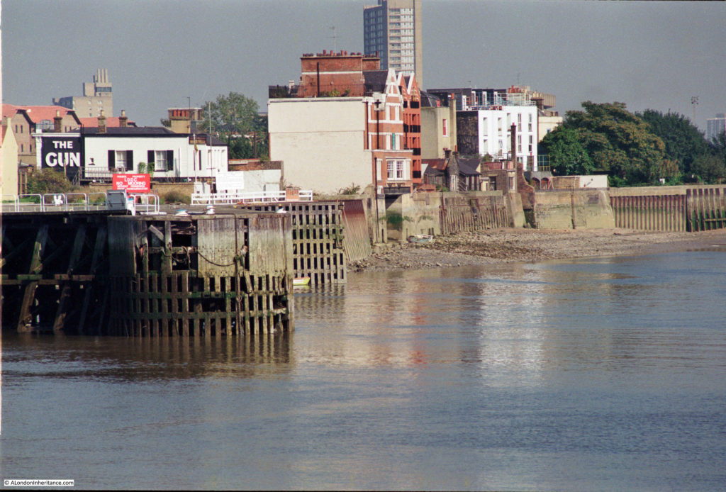
This viewpoint shows the side of the Gun as well as the river frontage of the buildings alongside Coldharbour. The tide is out and the large entrance into the boat dock underneath the old police station can be clearly seen.
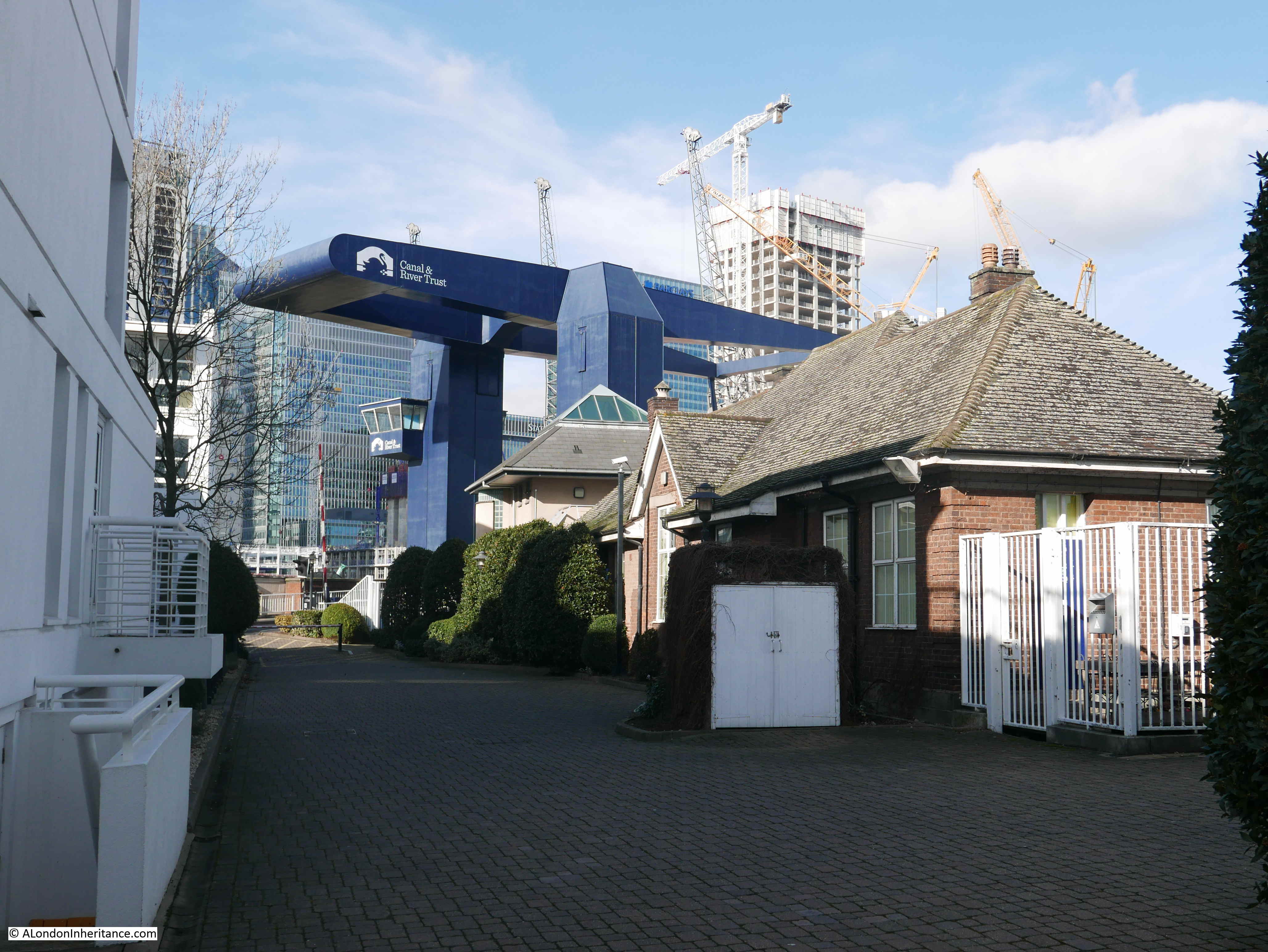
Crossing the bridge, I tried to find the location of the above photo. New flats have been built across the area. I walked in the entrance roadway hoping to find access to the river. The length up against the channel is fenced off. The nearest I could get to a similar photo is shown in the following photo, but I am not far enough out.
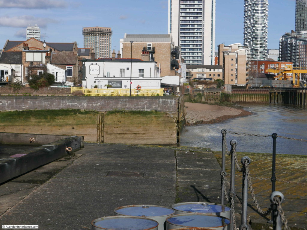
This pontoon extends out into the river and I suspect my father took the photo from the end of the pontoon. It is behind a fence and locked gates in I think an area controlled by the Canal and River Trust – I will have to get in contact and see if I can access this area.
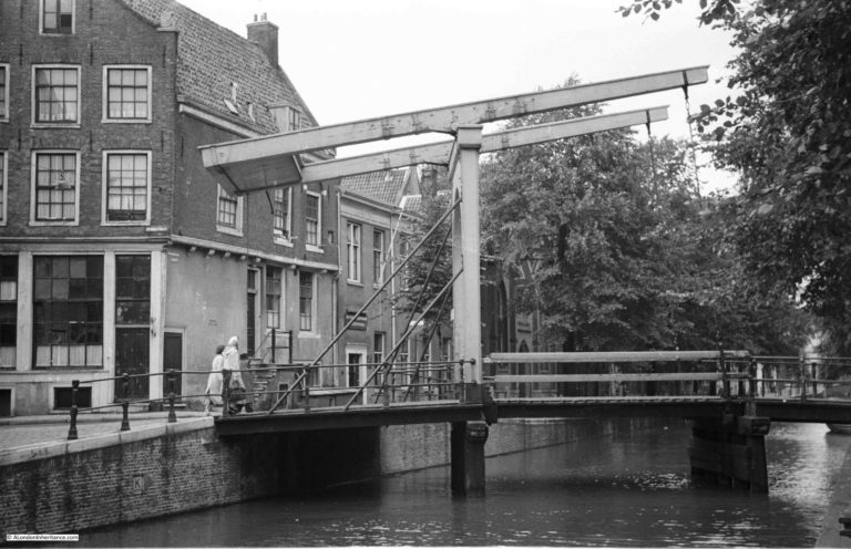
Walking back up to the road, which has now changed name from Preston’s Road to Manchester Road, and the large blue bridge can be seen over the entrance to the South Dock.

The bridge viewed from the southern approach.
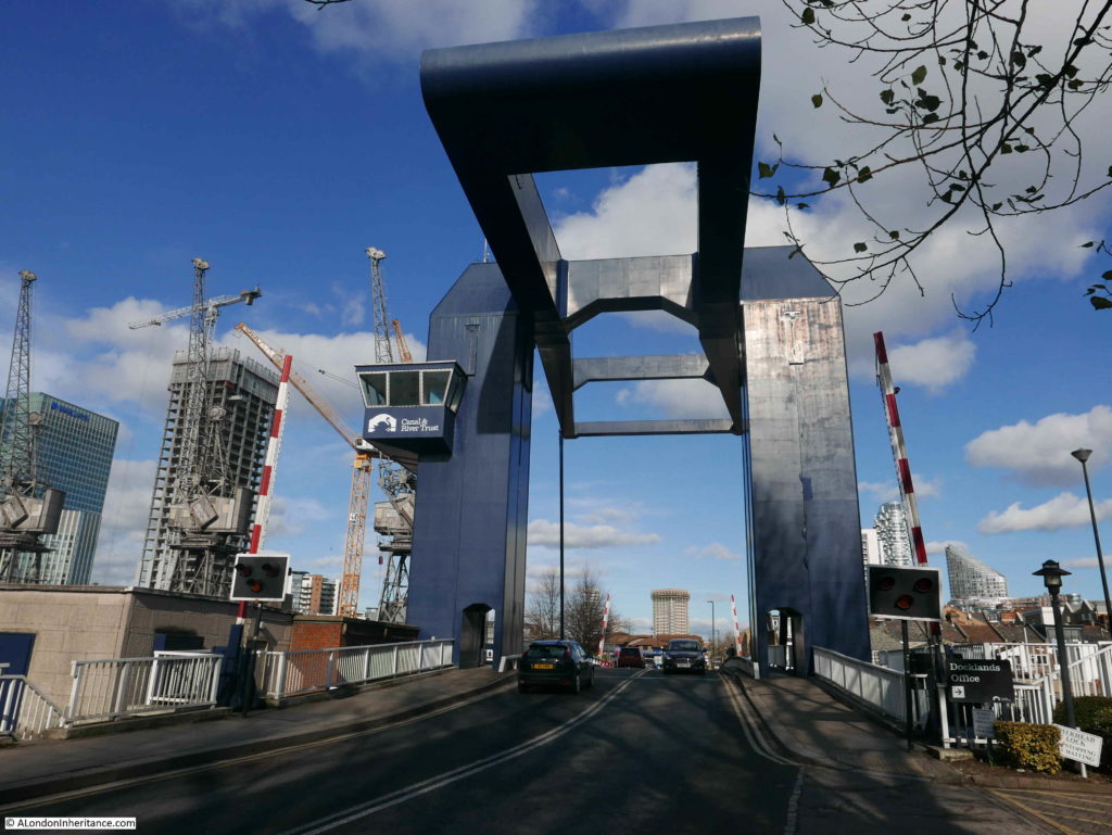
This latest incarnation of the bridge across the channel between docks and river was installed in 1969. The design of the bridge is the same as I saw in Amsterdam last year, although on a much larger scale.
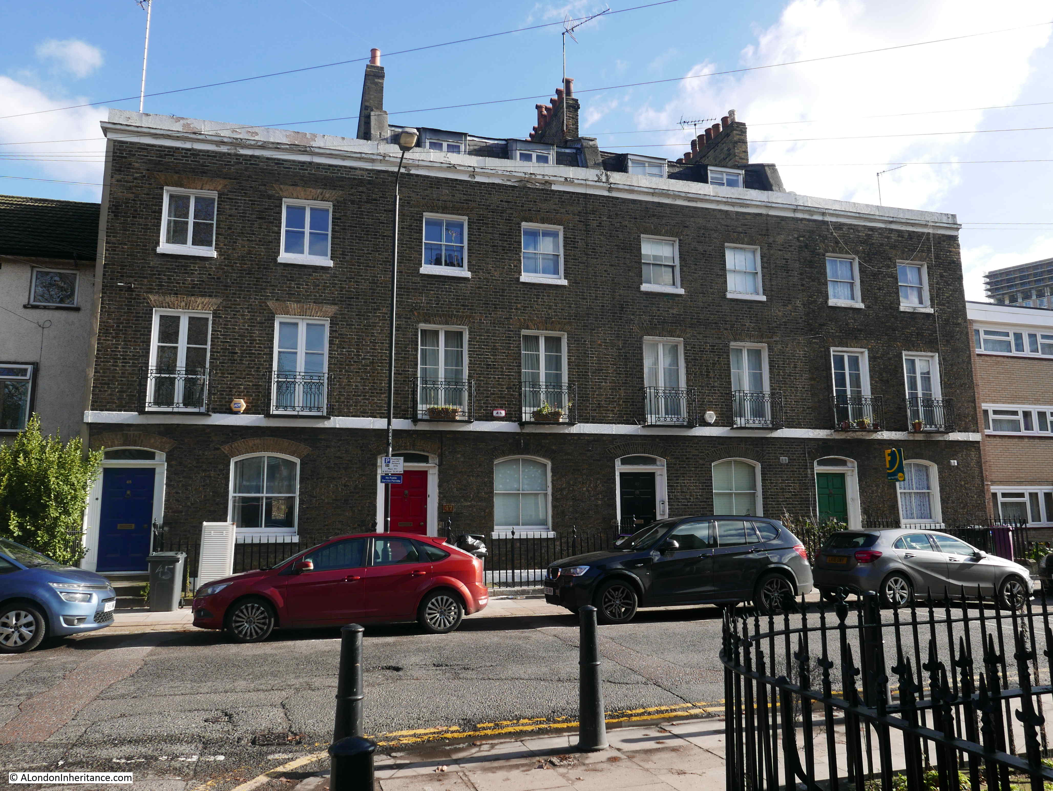
Just to the south of the bridge there is a separate spur of Manchester Road on what was the original alignment of the street. Along this spur is a terrace of houses that date from the early 1890s.
Up to this point, I had not seen any survivors from before the war, apart from the houses in Coldharbour. This terrace has managed to survive the expansion of the docks and the considerable bombing of the area during the war. The terrace is named Glen Terrace after the shipping line of the same name which operated on the space the houses now occupy prior to their construction.
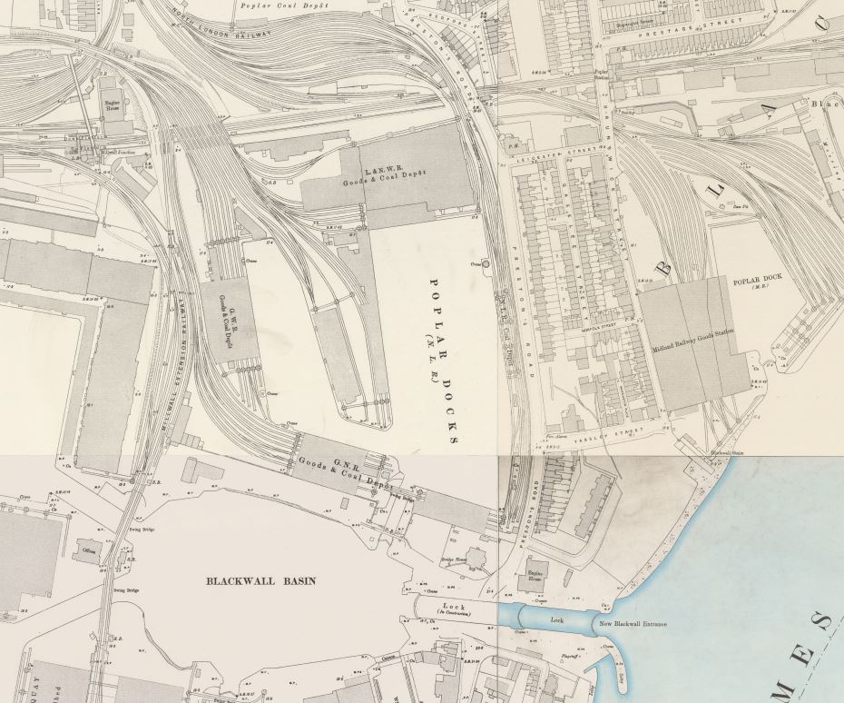
The 1895 Ordnance Survey map shows that Manchester Road once ran on the alignment of the spur that runs directly in front of Glen Terrace and that a large Graving Dock once extended from the river up to Manchester Road.
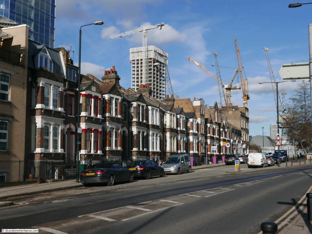
Leaving Glen Terrace, I continued south along Manchester Road. Nearly all the building along this stretch of Manchester Road comprise post war flats of varying heights, there is very little or pre-war age, a reflection of the intense bombing of the Isle of Dogs and the post war loss of the Docks and their associated industries.
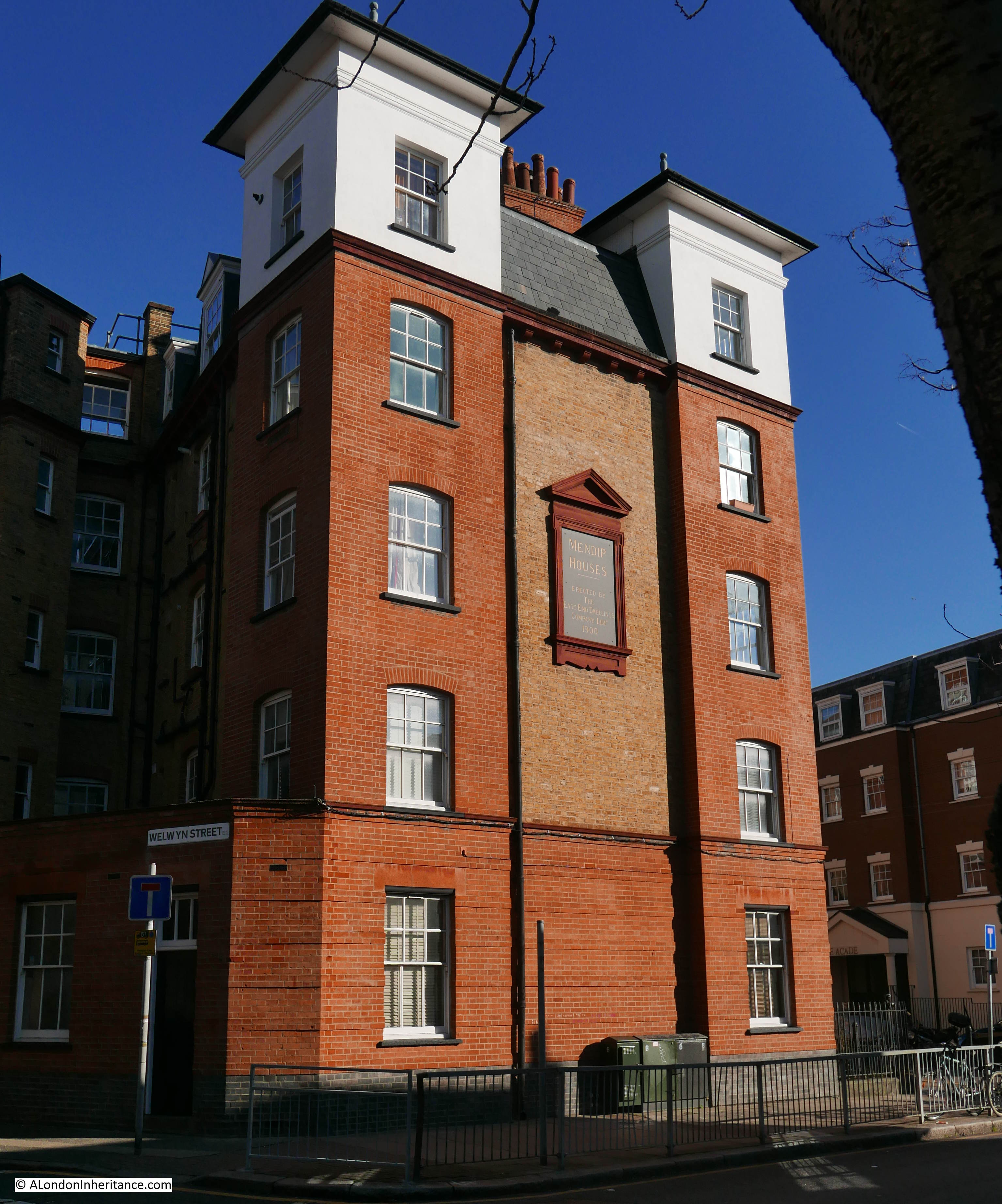
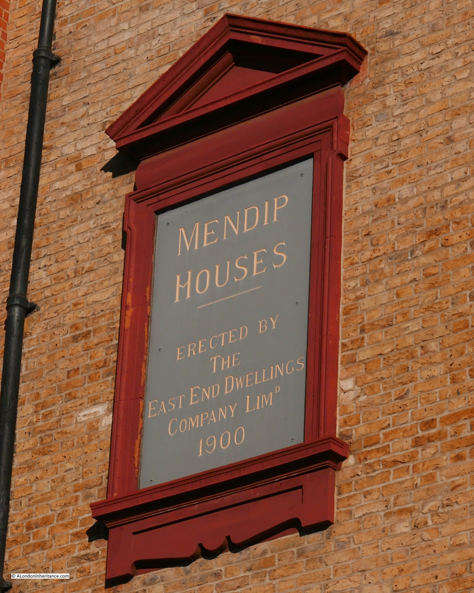
There is an interesting exception. Hidden behind a row of hedges and trees is a crescent of houses that would not look out of place in deepest suburbia. This is Jubilee Crescent:
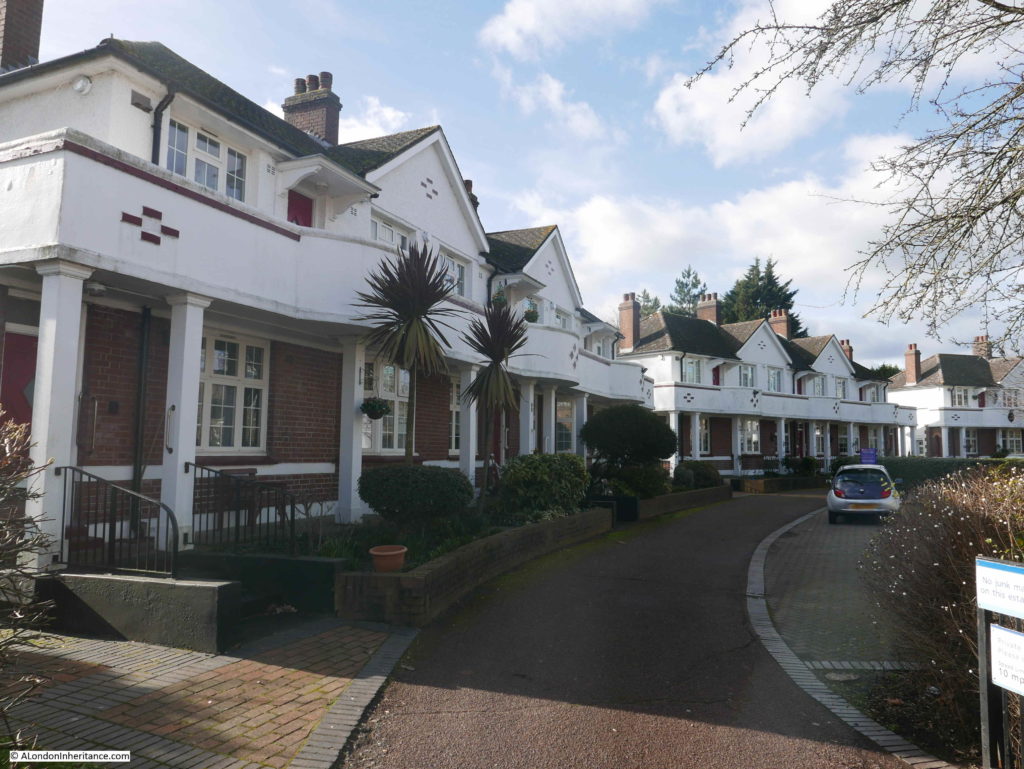
The houses in Jubilee Crescent form 28 retirement flats managed as social housing.
They were built in 1935, the year of King George V’s Silver Jubilee which accounts for the name of the crescent. They were built for retired workers in the shipbuilding industry by the ship repair company R. & H. Green & Silley Weir Ltd, who then handed the completed buildings to the Shipworkers Jubilee Housing Trust. They are now managed by the Southern Housing Group.
Walking along Manchester road there are a couple of closed pubs. The first is the Cubitt Arms: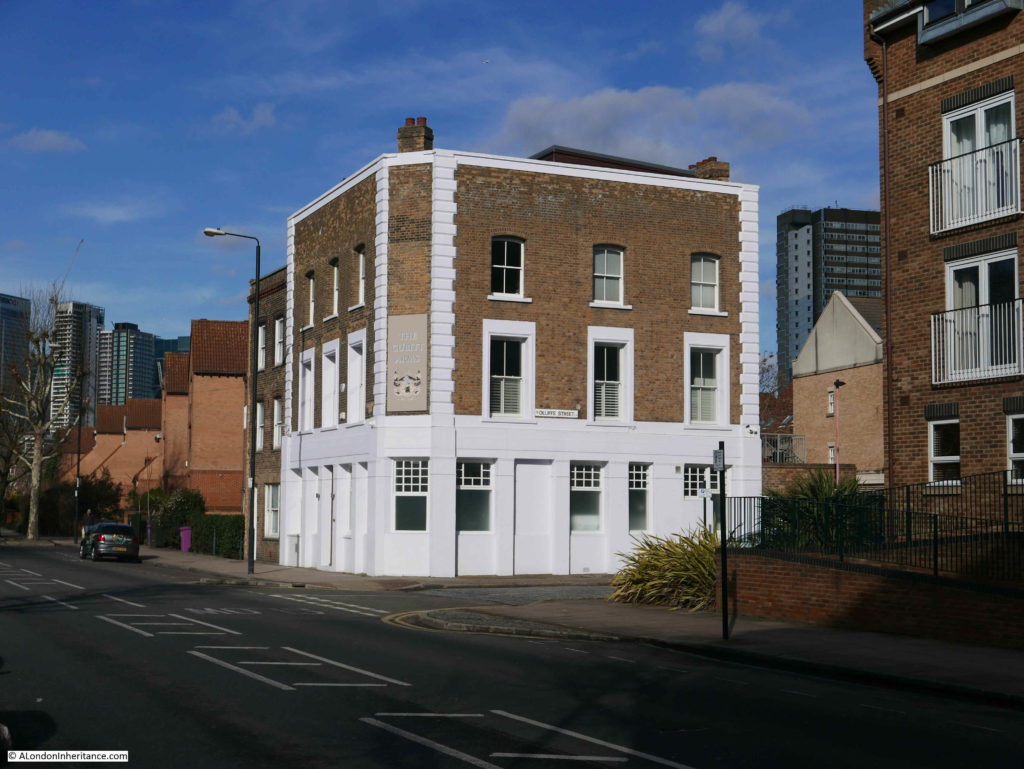
The pub was built in 1864 and closed in 2011.
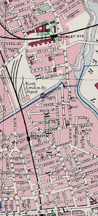
The Cubitt Arms may be an early example of planning blight. Whilst researching through newspapers, I came across the following article from The Era, dated the 31st January 1869:
“COMPENSATION FOR A PUBLIC-HOUSE ON THE ISLE OF DOGS – A Special Jury, under the presidency of Mr. Under-Sheriff Burchell was engaged the whole of Thursday at the Sheriffs’ Court, Red Lion-square, in the case of Smallman v. the Millwall Canal Company, to assess the amount of compensation to be given to the claimant of the Cubitt’s Arms, poplar, which premises were required for the new docks at the Isle of Dogs, and for the consequent damage to the property. Mr. Digby Seymour Q.C. and Mr. J.H. Lloyd were for the claimant; Mr. Hawkins, Q.C. represented the Company. Several witnesses were called, and the compensation was estimated at between £5,000 and £6,000. Mr. Hawkins addressed the Court in mitigation, and, after a long investigation, the Jury awarded £3,760.”
The Millwall Canal Company was the original name of the company formed in 1864 to build the Millwall Docks. These docks form a reversed L shape with the lower arm of the L running from the middle of the Isle of Dogs towards the west. An eastern entrance would have been an advantage as it would have saved the effort of ships having to round the Isle of Dogs and enter from the west. An entrance from the east was planned by the Millwall Canal Company but never built.
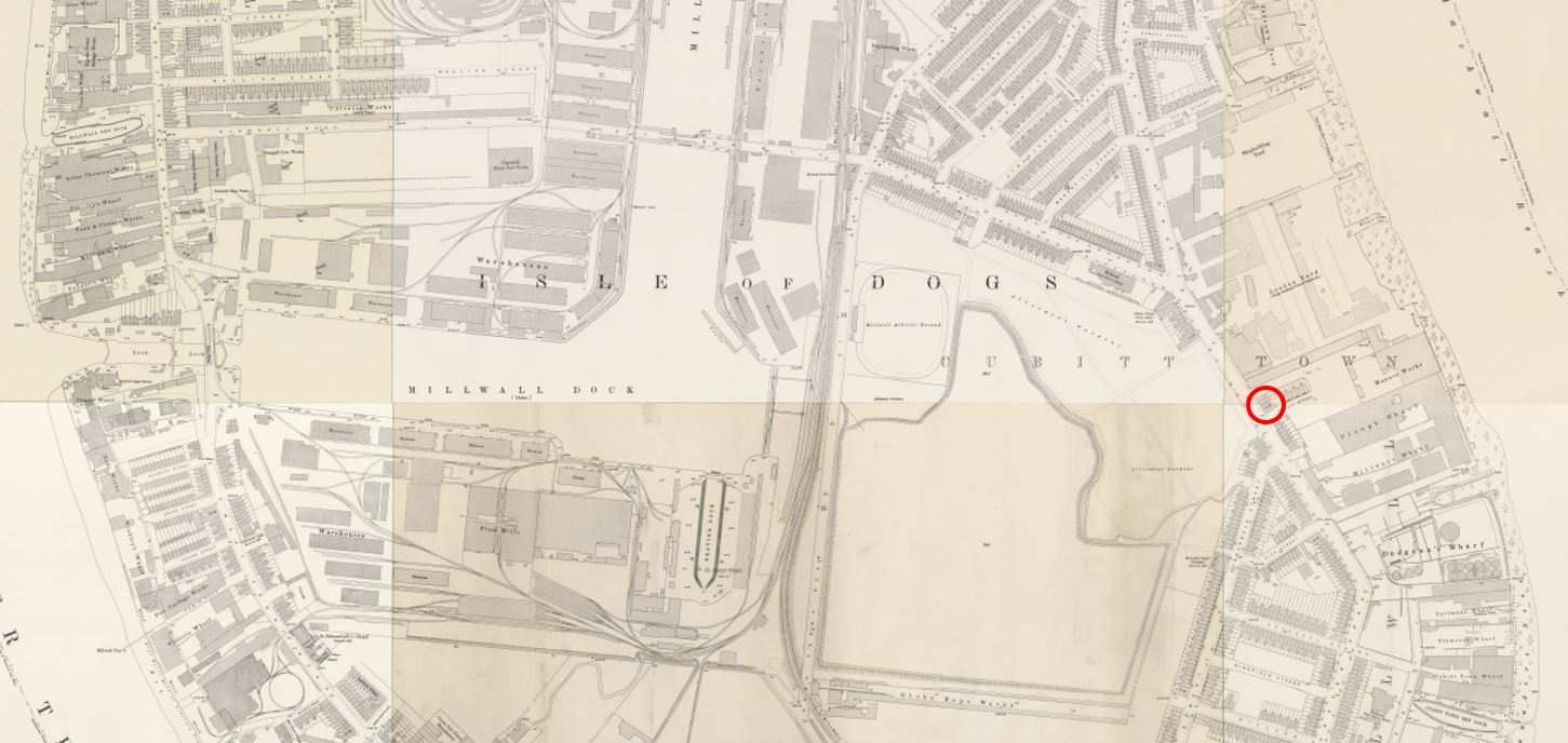
I have ringed the location of the Cubitt’s Arms in red in the following extract from the 1895 Ordnance Survey map.
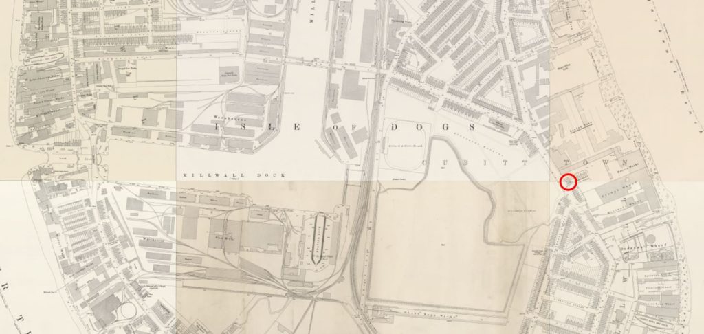
The lower segment of the Millwall Dock is almost due west of the pub’s location. This lower segment has an entrance to the river in the west and the easterly entrance may have been proposed to run across the open land to the east of the dock, across the pub and into the river.
The pub was built in the same year as the Millwall Canal Company was formed, so the potential of an entrance running to the east would have put off any additional house building around the pub. it could have been this loss of customer business and the impact of not knowing whether you would still have a business in a few years that resulted in the claim for damages.
i will have to try and track down any plans showing the proposed route for the eastern entrance to confirm, but this does demonstrate that the impact of plans for large infrastructure developments on small businesses is not a recent problem.
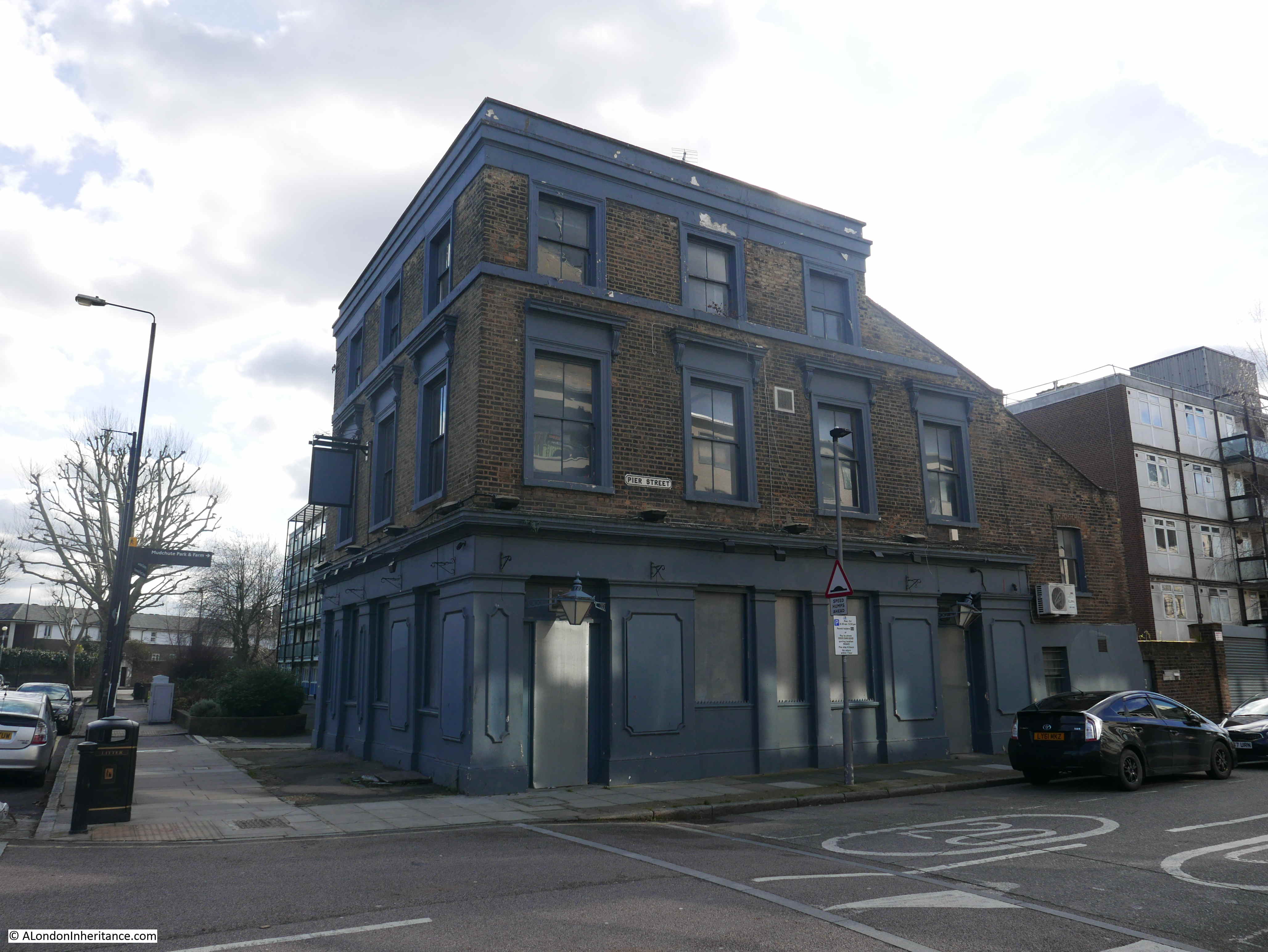
The second pub is the Pier Tavern. Built a year earlier than the Cubitt Arms in 1863, but closed around the same time. It did have a short life as a restaurant, but is currently closed and the ground floor is boarded.
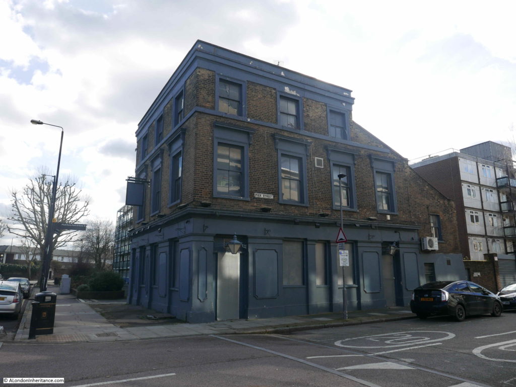
I am sure it will end up as a full residential conversion.
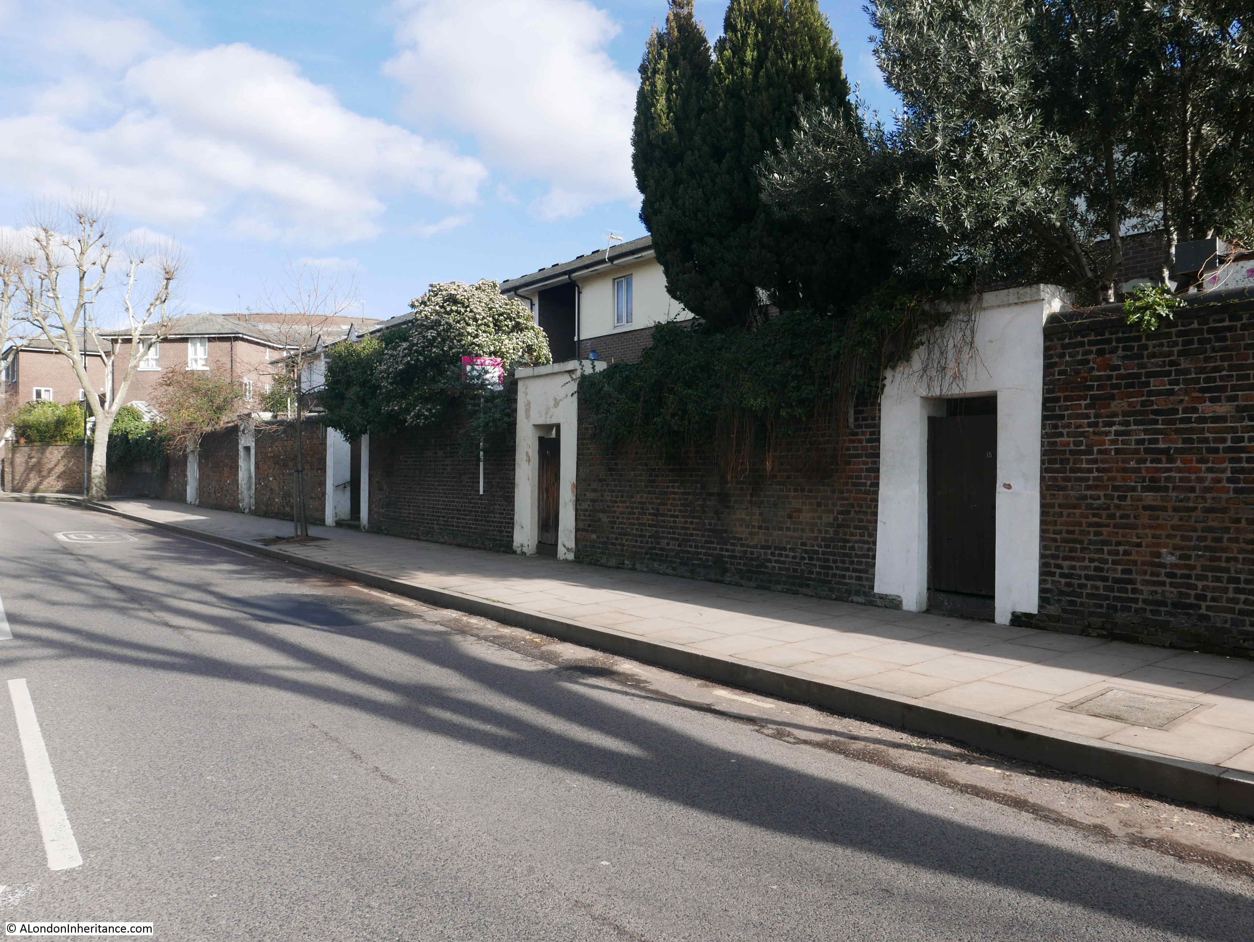
A short distance further south is an interesting wall with a series of entrances running along the wall.
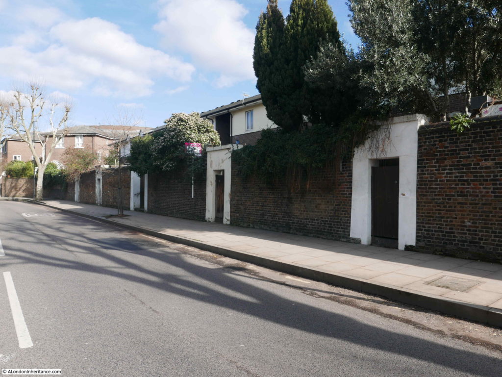
There is a relatively recent housing development behind the wall, however this space was once occupied by Dudgeon’s Wharf, Pyrimont and Plymouth Wharf. It may be that these entrances originally led from Manchester Road into these wharves.
A short walk further on, I arrived at the final location listed in the Architects’ Journal as at risk in 1972.
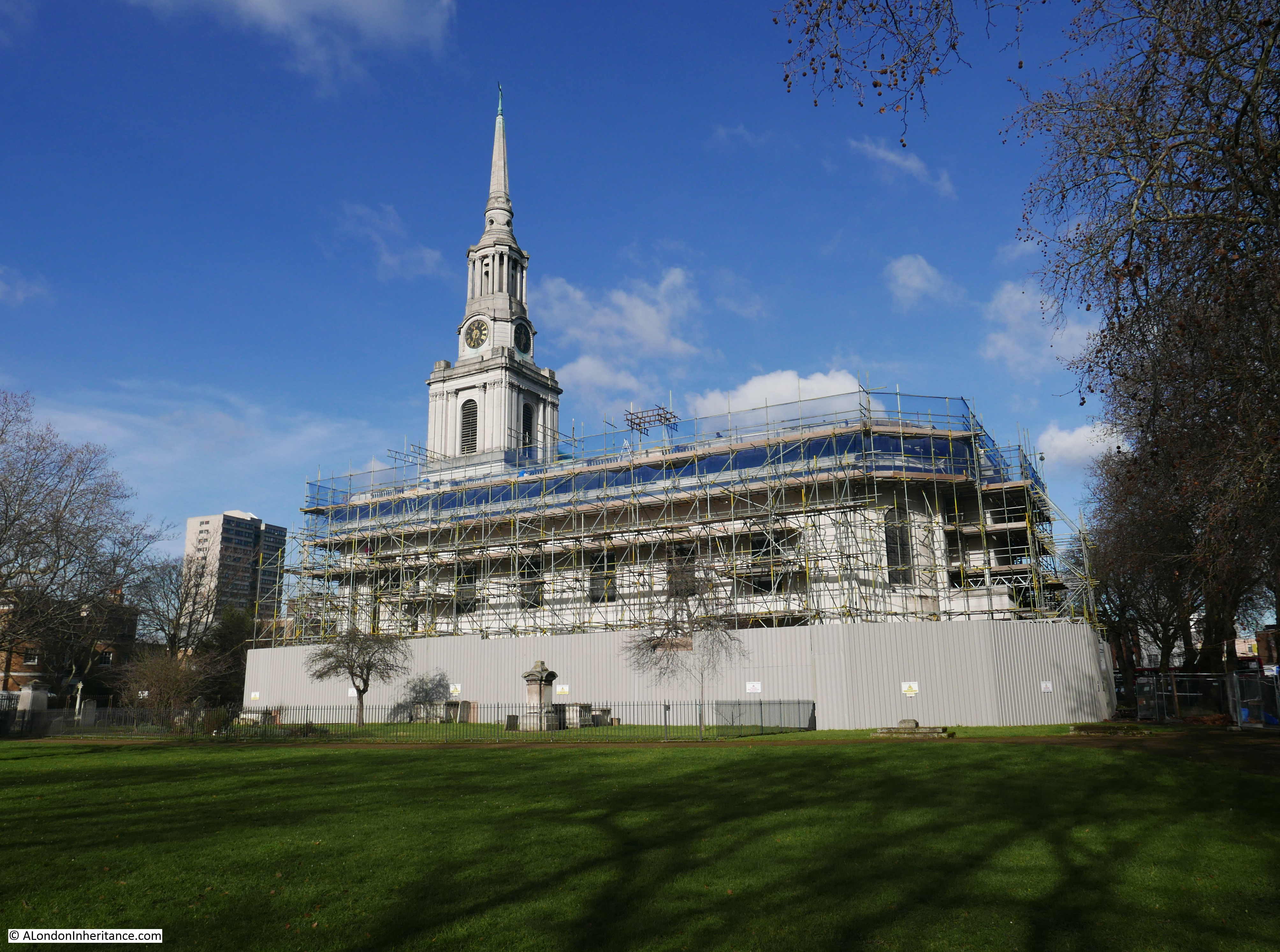
Site 26 – Practically all that survives of original Cubitt Town – Cubitt’s Church in early English style.
This is the church of Christ and St. John on the junction of Manchester Road and Glenaffric Avenue.
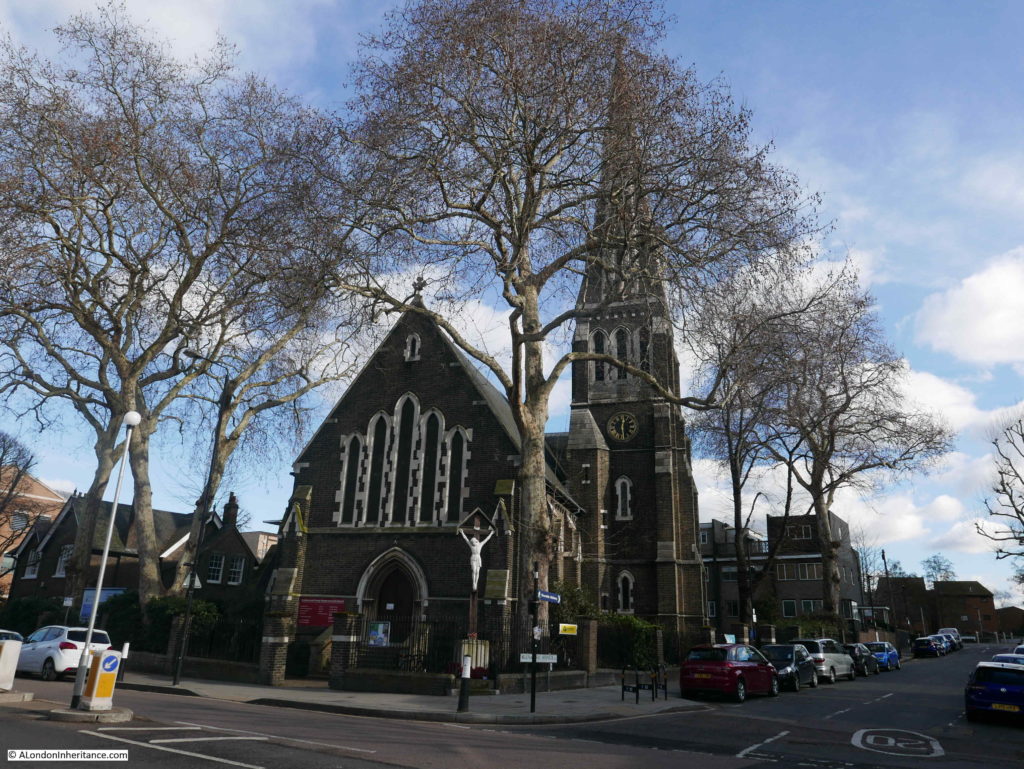
The Architects’ Journal reference to the church included the name Cubitt Town. This was the area to the south east of the Isle of Dogs that was developed by William Cubitt during the mid 19th century. The development consisted of industrial premises on the land facing onto the river, with housing inland.
The rapid growth of Cubitt Town required a church to serve the growing population. Cubitt offered the land for the construction of the church, along with a donation, however he ended up funding the full construction and the church was completed around 1854.
The rows of terrace houses that once lined the streets of Cubitt Town and the industrial premises along the river have disappeared, however the church remains as a significant local landmark, with the tall spire being visible from across the river in Greenwich.
The street names have also changed. Newcastle Street was the original name for Glenaffric Avenue, so whilst Manchester Road has retained its name, some of the streets have changed name since Cubitt’s original development.
I walked up Glenaffric Street, alongside the church to find a pub at the end. This is the Great Eastern.
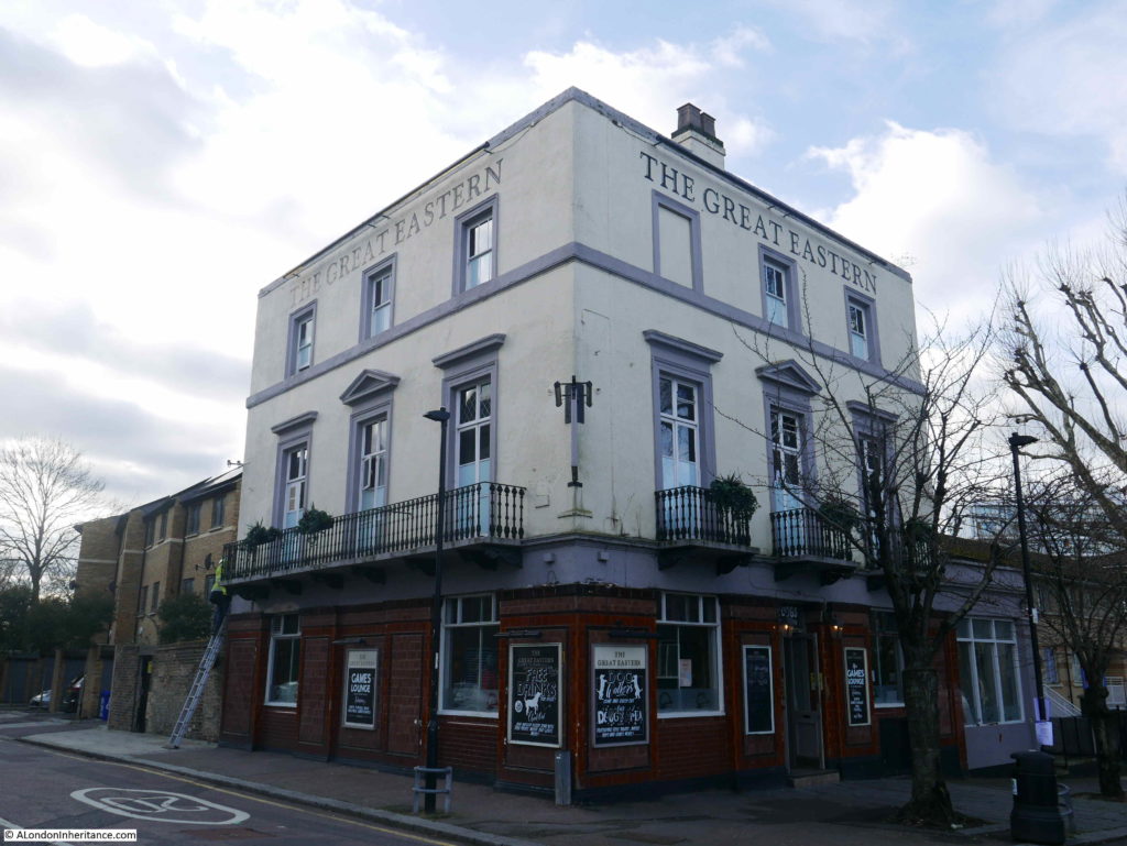
The pub was part of Cubitt’s development and originally opened as the Newcastle Arms, in the street that was named at the time Newcastle Street. The pub later changed name to the Waterman’s Arms and relatively recently to the Great Eastern.
I have some photos of the pub from the 1980s and it has a fascinating history which I plan to cover in a later post.
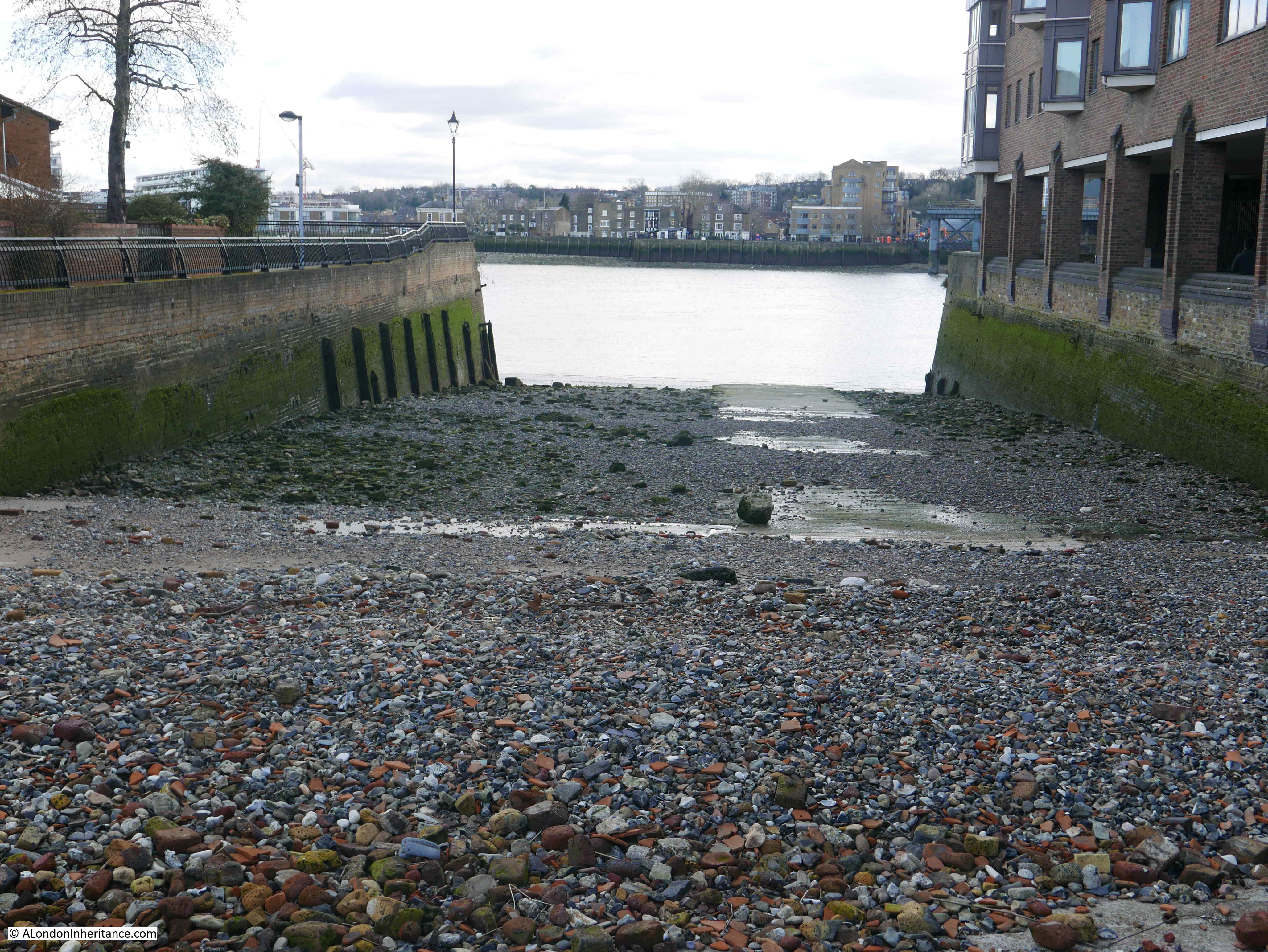
Another reference to the name Newcastle is in the name of the dock that can still be found at the end of Glenaffric Avenue and adjacent to the pub.

This is Newcastle Draw Dock, an open dock where boats can be drawn in, out of the river. This would enable a ship to be worked on and repaired below the waterline during periods of low tide.
The dock, the original brick wall and wooden buttresses are part of the reason for the dock being listed, as well as the dock’s part in the view from Greenwich of the dock, church and the pub.
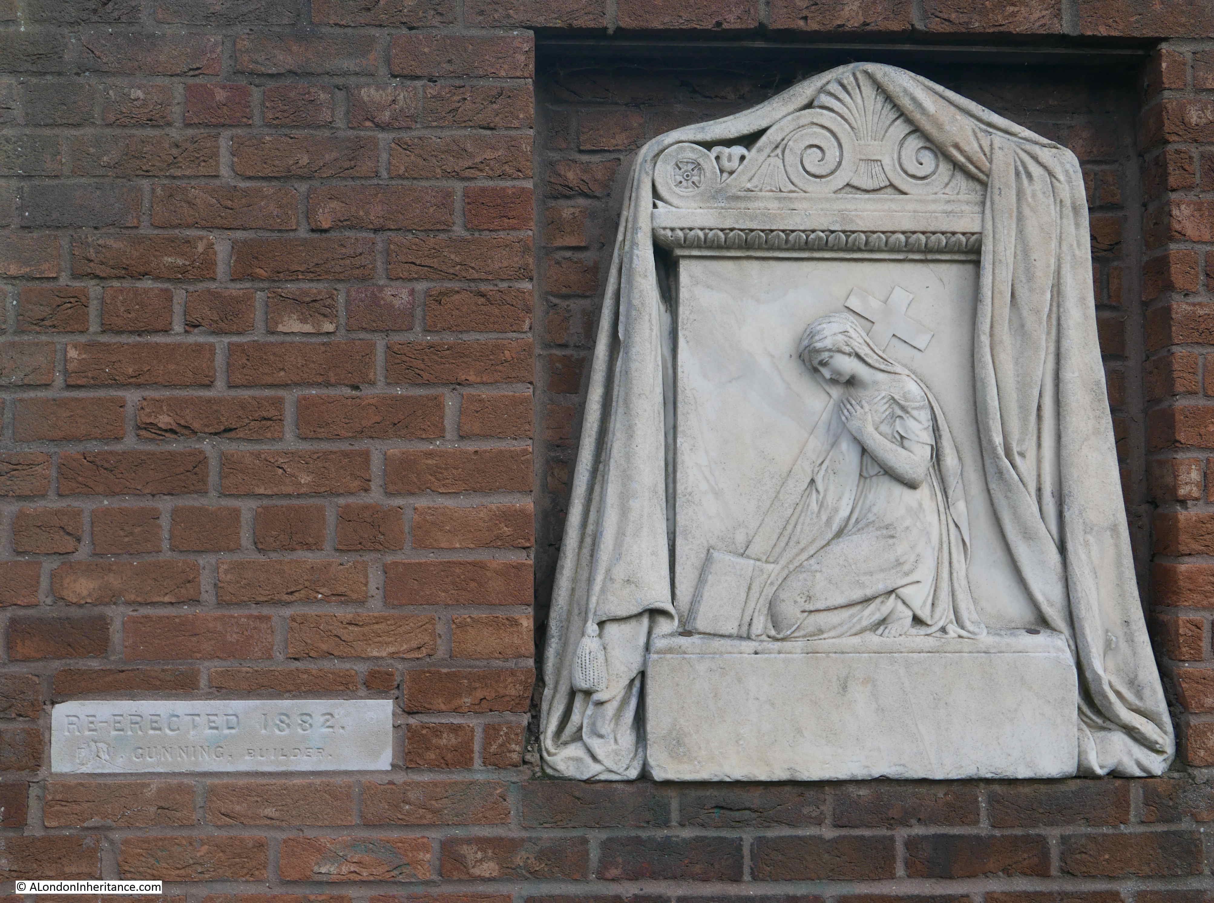
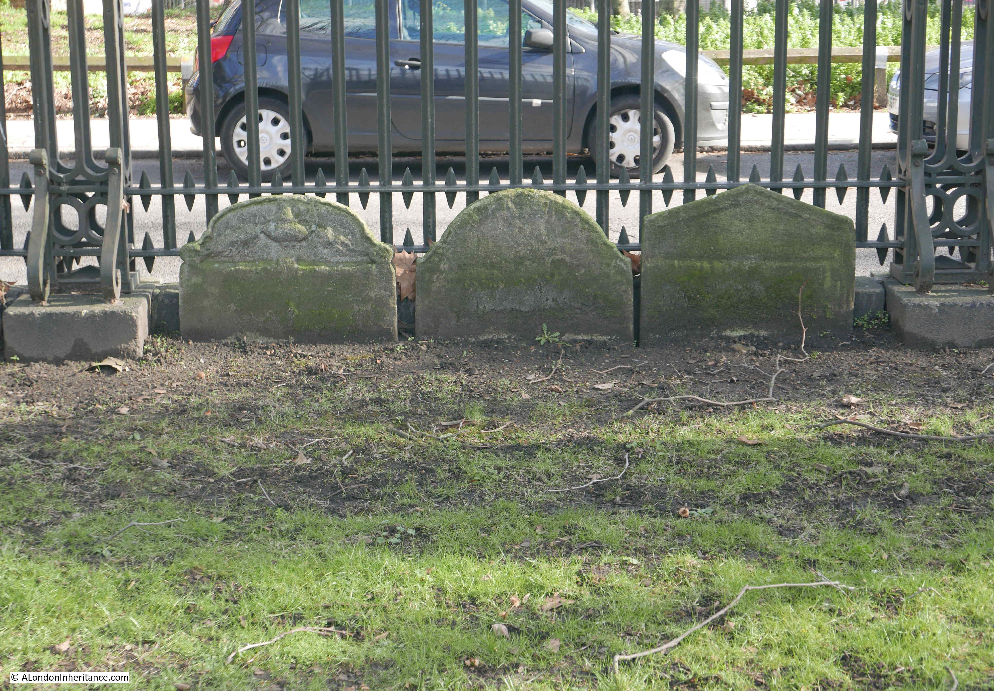
Adjacent to the dock is a monument set into a brick wall. The smaller plaque to the left states “re-erected in 1882”, which must refer to the monuments previous location.
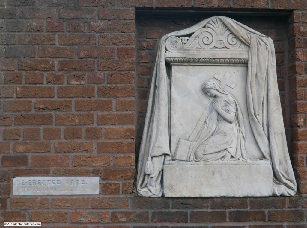
I cannot find any reference to the significance and previous location of this monument. I suspect it must have been from within a church and appears to be the type that would decorate a tomb.
Having reached the church, I had found all the locations on my list from Bromley by Bow to the southern end of the Isle of Dogs. I now headed to Mudchute and to the DLR station of the same name, and there were still some fascinating places to be found.
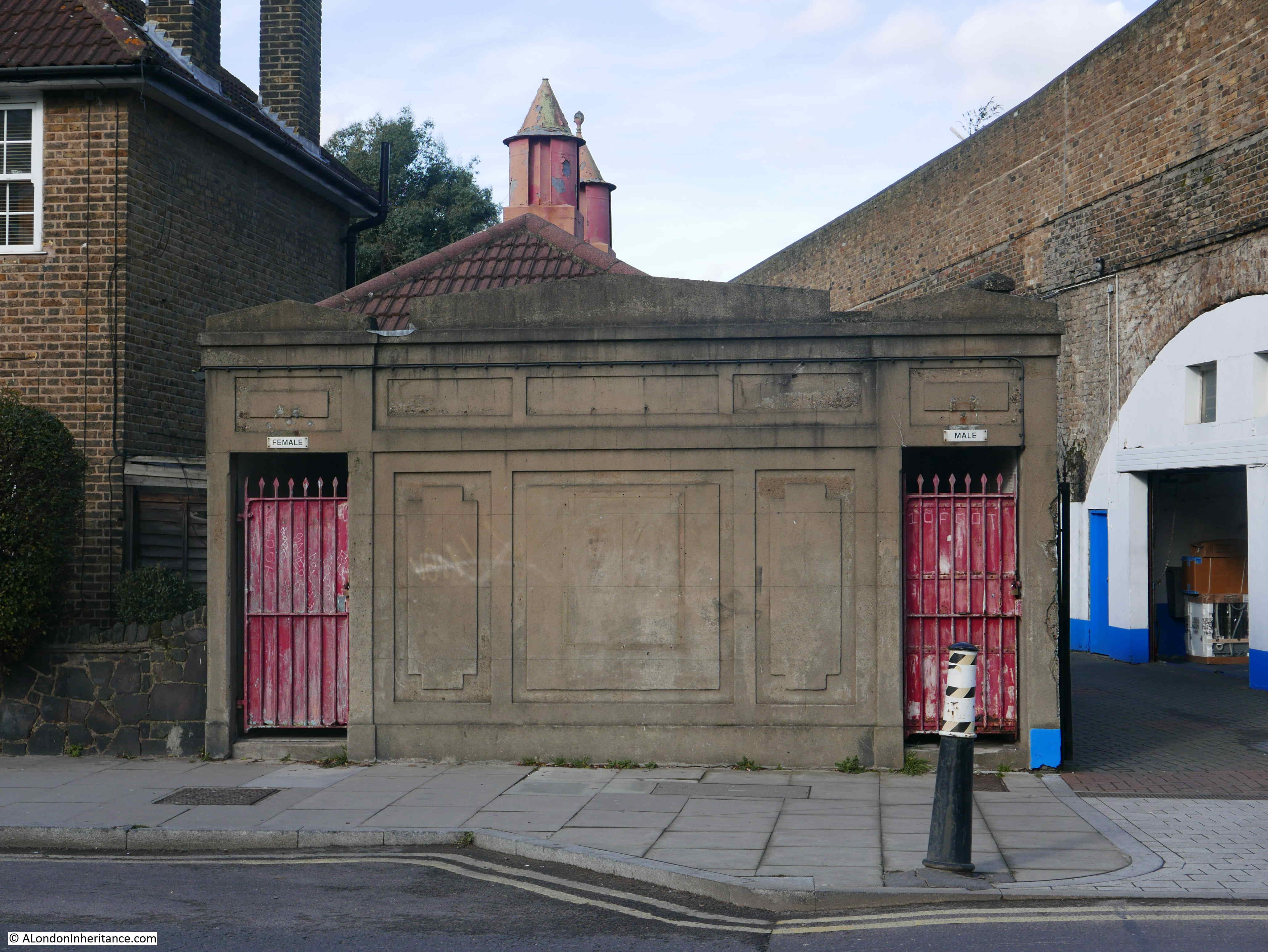
Walking further along Manchester Road, and next to the Island Gardens DLR station are these derelict toilets.
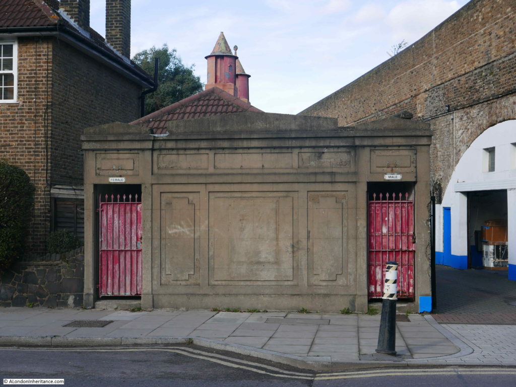
No idea of the age, however it is unusual to see buildings of this type and design still on the streets of London. The rather nice air vents on the roof make an interesting addition to the plain concrete walls, which I imagine would once have been full of adverts.
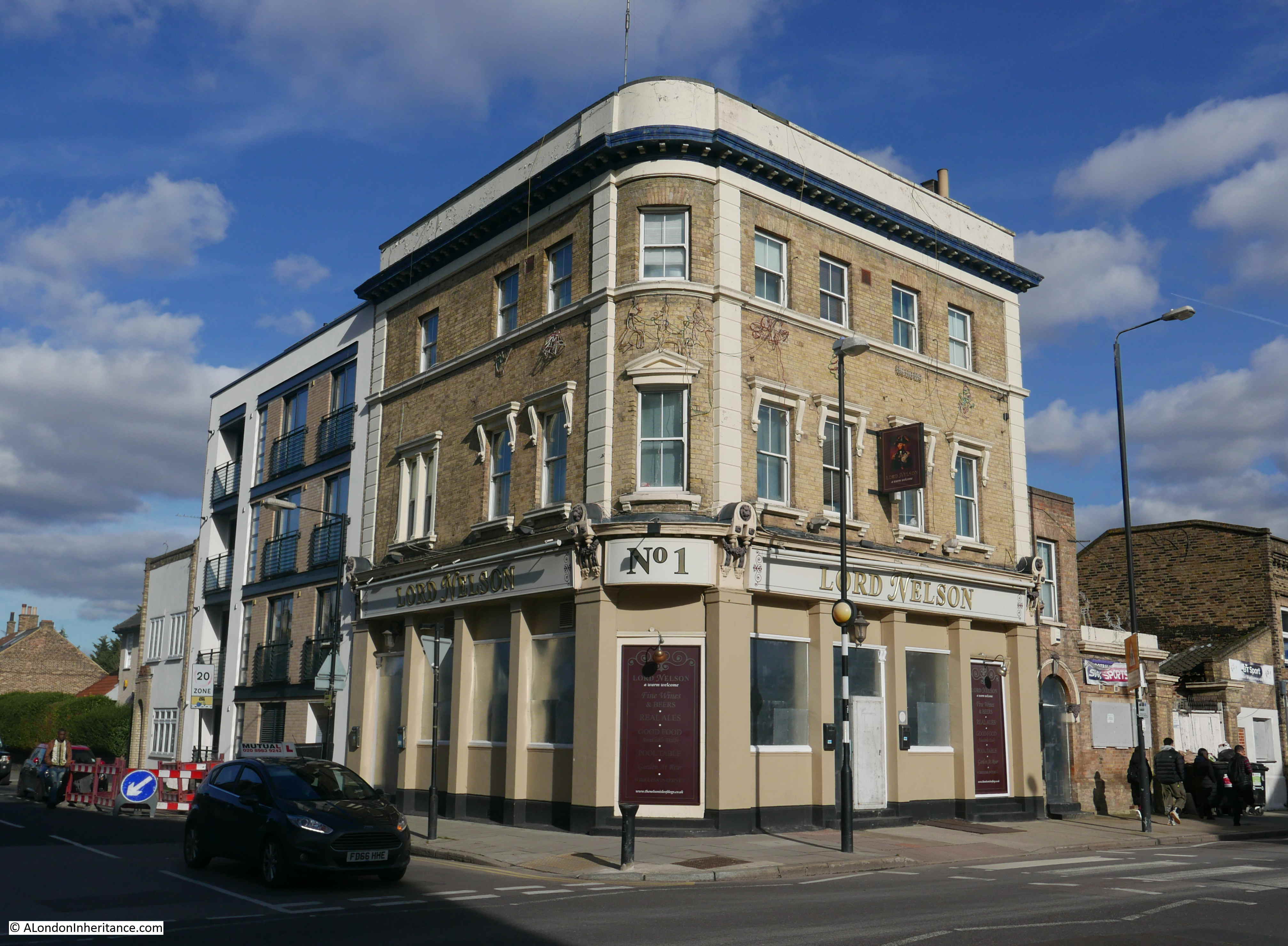
Further along Manchester Road is a very sad sight – this is the Lord Nelson pub which appears to be closed, although whether permanently or just for refurbishment is not clear.

The pub was built in 1855 and today is still a good example of a Victorian corner pub, but in its original form it was a brilliant example of Victorian pub decoration.
The LMA Collage archive has the following photo of the Lord Nelson from 1904.
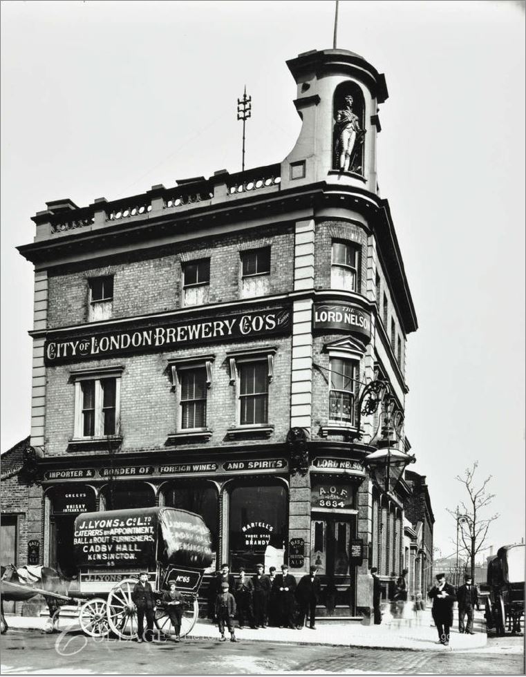
Image credit: London Metropolitan Archives, City of London: catalogue ref: SC_PHL_02_0974_2301
A statue of Lord Nelson looks out from the corner of the roof. The font and lettering of the brewery and pub names, and a very large lantern hanging above the main entrance of directly onto the street corner.
Going for a pint at the Lord Nelson on a dark Friday evening must have been an experience. The windows lit and the light from the lantern shining out over the street corner.
I love traditional London pubs, and they are closing too fast, however I am always very aware that whilst they were important centres of the community, they also were there to encourage drinking and probably took far too much of a worker’s wages at the end of the working week.
The Lord Nelson marks a boundary in the road that rings the edge of the Isle of Dogs. Along the eastern edge, all the way from the entrance to South Dock, the road has been Manchester Road, but here it turns into Westferry Road which then runs along the western edge of the Isle of Dogs.
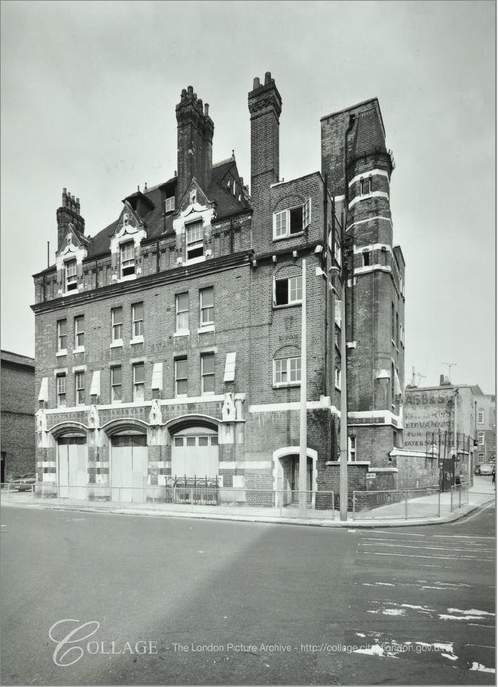
Directly opposite the Lord Nelson, and now in Westferry Road is another closed fire station.
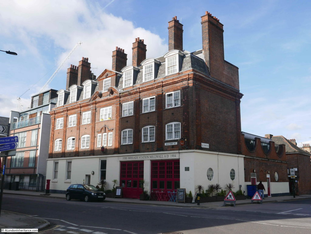
A fire station was originally opened on the site in 1877, however this was too small given the rapid development of the area and the new fire station was designed by the London County Council in 1904.
The main building fronts onto Westferry Road and there was a yard to the rear of the building in East Ferry Road. What stands out on the roof of the fire station is the number of chimneys. The building must have needed a considerable number of fireplaces to keep the building warm.
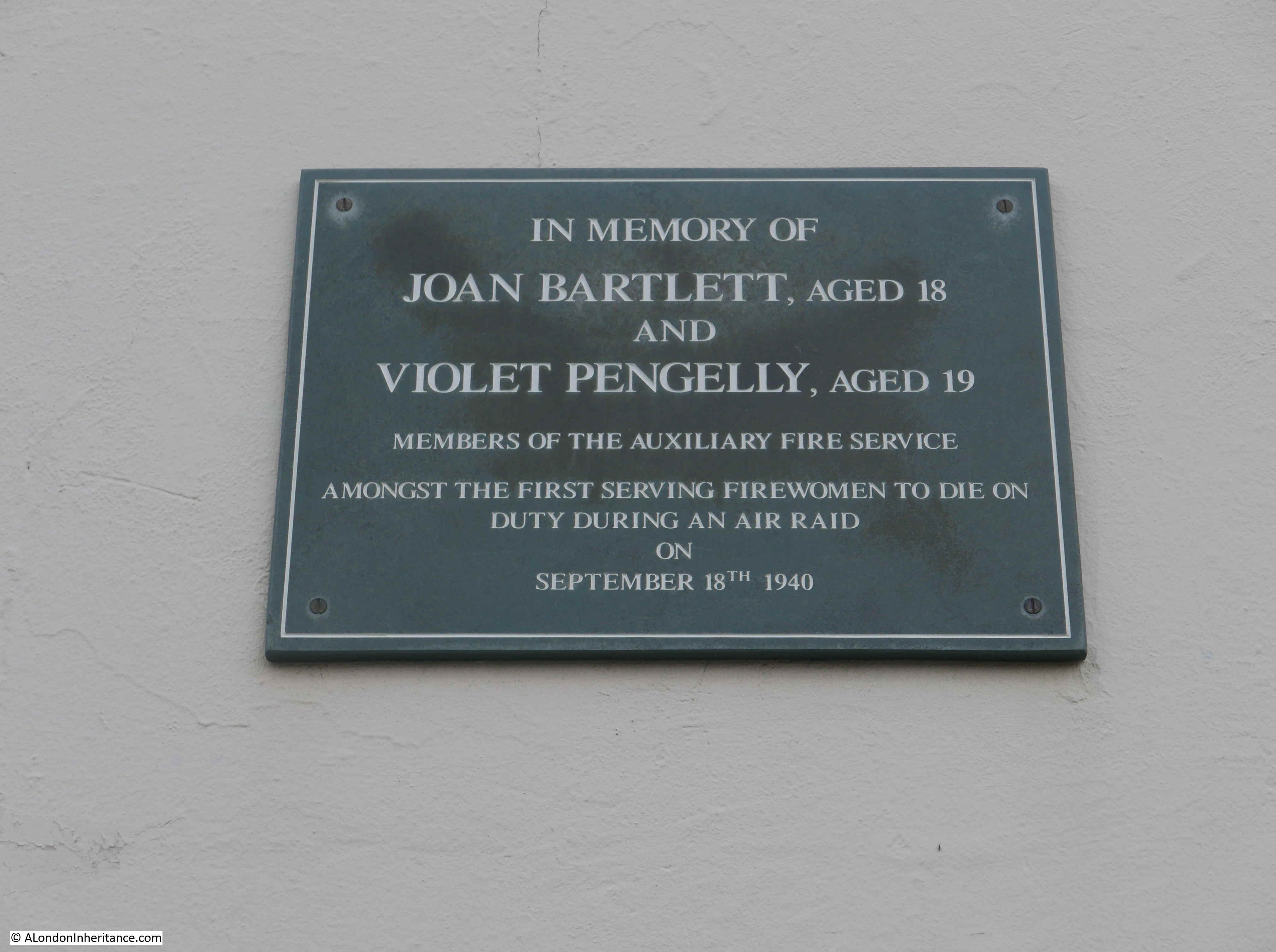
Just to the right of the main doors there is a plaque.
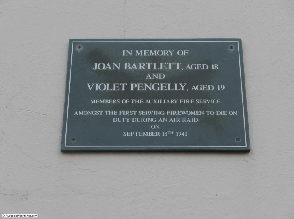
Joan Bartlett and Violet Pengelly were two members of the Auxiliary Fire Service and were killed when a local school being used as an emergency depot took a direct hit by a high explosive bomb on the night of the 18th September 1940.
The fire station closed in 2006 and has since been converted into apartments. The small street that led into the fire station yard has been named Bartlett Mews, and the new flats adjacent to the old fire station are named Pengelly Apartments.
This was a fascinating walk from Bromley by Bow to the southern tip of the Isle of Dogs. As usual, I have only briefly touched on the places I have walked past, and far more deserves to be written. Whether it is a building that has the core of a late 15th century manor house alongside the six lanes of the A12, London County Council Fire Stations, a pub that may have been in the sights of the Millwall Canal Company, and the hidden presence of the River Thames – I really enjoyed exploring this historic part of east London.
alondoninheritance.com


