Monthly Archives: March 2023

Temple Bar – A Historic Boundary to the City

The City of London has always regarded the boundaries of the City as important in defining where the jurisdiction of the City extended. This included having very visible symbols of where you were crossing from the wider city into the City of London. One such symbol was Temple Bar in the Strand:
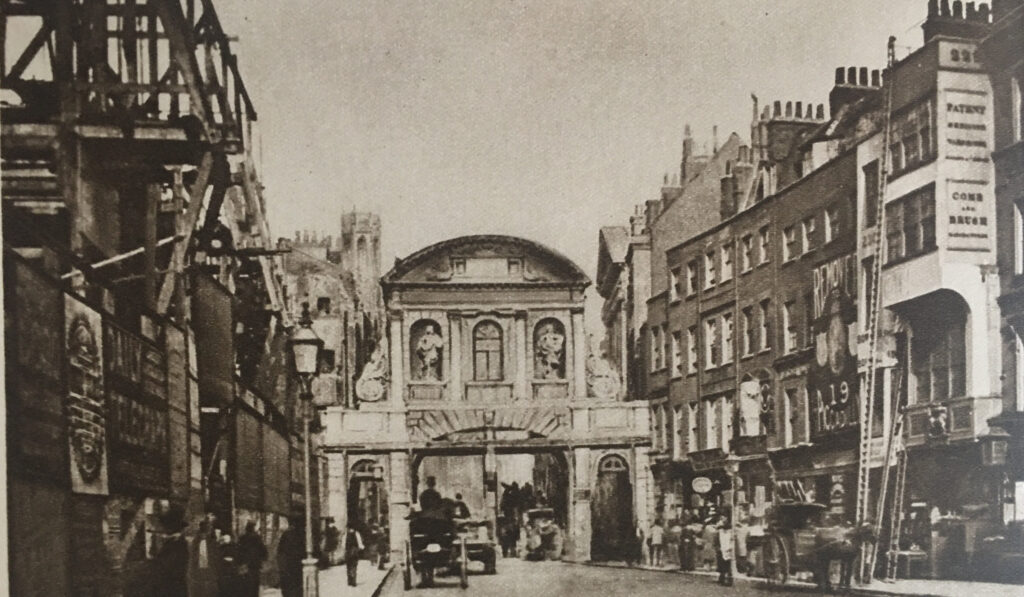
Temple Bar

The above photo dates from 1878, and comes from the book Wonderful London, which describes the scene as “Scaffolding and buildings show signs of the housebreaker on the left, where the Law Courts are in the process of erection. Their site alone cost £1,450,000, and in the years that have gone since the camera made this precious record, most of the scene has changed out of all recognition. Four buildings remain, St. Dunstan’s Church, the top of whose spire can just be seen, the façade of the entrance to the Middle Temple beyond the southern footway of Temple Bar and the two white houses on the right where the ladders are leaning.”

Not long after the above photo, Temple Bar was demolished, the Law Courts were completed, and a new monument was built on the site of Temple Bar, and Wonderful London recorded the changed street scene:
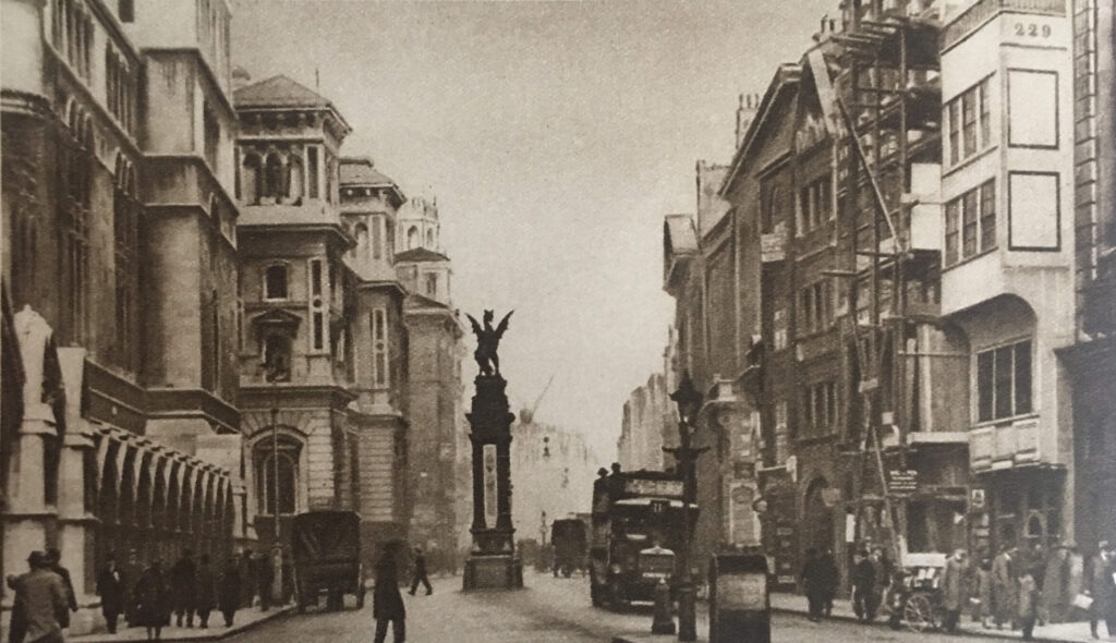
Temple Bar

There was a forty year gap between the above two photos, and the caption in Wonderful London to the above photo reads “On the right the white building of No. 229 still stands, but it is its neighbour that is under repair this time. These two houses are said to have escaped the Great Fire, which destroyed much of the street. St. Dunstan’s is just visible above the winged griffin that ramps on the monument marking the site of the old Temple Bar. The width of the street is almost double what it was, and it would obviously be impossible to get the modern column of traffic through the old narrow arch. The pediment over the gateway of Middle Temple Lane can be seen on the right.”

Although Temple Bar had disappeared from the Strand, the City of London saved the stones that made up the structure. Numbering each individual stone and keeping a plan of their location, the stones of Temple Bar were stored in a yard in Farringdon Road.

The stones of the old gate were purchased by Lady Meux, wife of Sir Henry Bruce Meux (of the Meux’s Brewery Company), who owned a house in Theobalds Park, near Cheshunt, and Temple Bar was rebuilt there in 1888.

The London Evening Standard reported on the laying of the foundation stone at Temple Bar’s new location on the 9th of January 1888: “The foundation stone of Temple Bar was laid on Saturday afternoon by Lady Meux at the entrance to Theobald’s Park, Cheshunt. Her Ladyship was accompanied by Sir Morell Mackenzie and several other ladies and gentlemen. There was a large gathering. At the platform which was erected, her ladyship was received by Mr. Elliot of Newbury, the contractor for the re-erection of the bar, and Mr. Poulting, the architect. Before the ceremony of laying the foundation stone commenced Mr. Elliot presented Lady Meux with a model of Temple Bar worked in oak, a silver trowel, and a mahogany mallet. After depositing a bottle, some of the current coins, several newspapers, and other articles, the stone was lowered, and was declared well and truly laid. About 400 tons of the stones have already been carted to Cheshunt at a cost of £200.”

The book “The Queen’s London” published in 1896 included a photo of Temple Bar in its new location at Theobald’s Park:
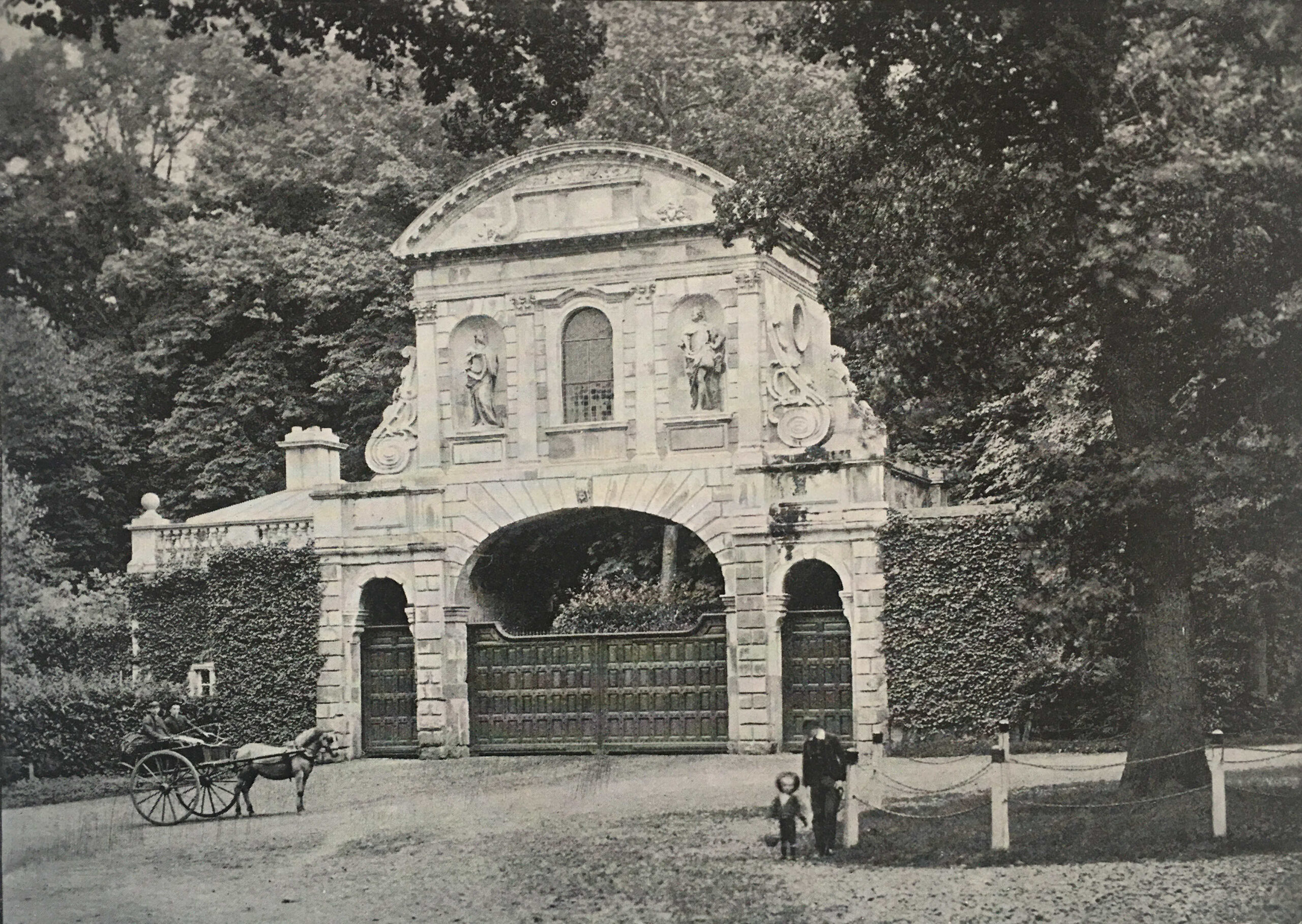
Temple Bar

Apparently Lady Meux used the room over the central arch for entertaining. The gate frequently appeared in sporting newspapers which included photos of the local fox hunt and hounds meeting in front of the gate.

By the 1920s, Wonderful London’s photo of the gate showed the accumulated dirt of the years since it was rebuilt in 1888. Note the smoke rising from the chimney of the gatehouse to the left.
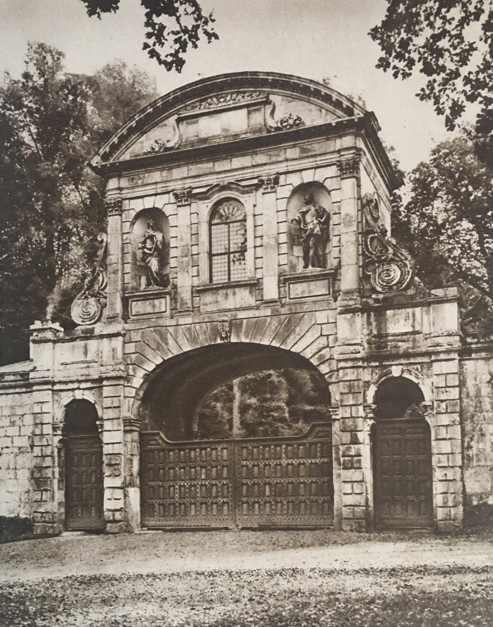
Temple Bar

Almost as soon as Temple Bar had been demolished, and rebuilt in Cheshunt, there were murmurings that it had not been the best decision by the Corporation of London, and that a location for the historic structure should have been found in London. For example, on the 8th of October, 1906, a Mr. H. Oscar Mark wrote to the Westminster Gazette lamenting the removal of the old Temple Bar to Theobald’s Park:

“Surely a site could have been and could now be found in the widened Strand, or in Aldwych, or, if necessary, in the open space west of the Law Courts buildings where old Temple Bar could be seen and admired, as everyone with any sense for the antique or artistic could not help doing. I would suggest that strenuous efforts should be made by Londoners who love their London and its old landmarks – of which we have too few left – to reacquire this fine old relic, and to re-erect it on one of the sites named or in the heart of London.

We can ill afford to lose ancient monuments, the more so when they are of so highly interesting a character as this one must be to thousands of London’s inhabitants.”

Despite languishing in Theobald’s Park, Temple Bar refused to be forgotten in the minds of Londoners. In 1921, the Illustrated London News published a photo of Temple Bar at Theobald’s Park with the caption “To be restored to London?”.

In November 1945, a syndicated newspaper column stated that “I see that the suggestion of bringing Temple Bar back from Theobald’s Park to the City of London has once more been made, this time as part of the scheme for rebuilding the destroyed portions of the Inner and Middle Temples. The suggestion may stand a better chance of being carried out now; but whenever it was made in the lifetime of Admiral Sir Hedworth Meux, owner of Theobald’s Park, he greeted it with caustic comments on the vandalism of Londoners and their unworthiness to possess so fine a piece of architecture as Temple Bar.

Nor were these strictures unjustified. When Temple Bar was pulled down from its old position across Fleet Street at the City boundary, Londoners openly rejoiced at this removal of a traffic obstruction that had long been a nuisance; and the numbered stones lay about in unsightly heaps, derided by all, until they were sold.”

Post war rebuilding would perhaps have been the ideal time to restore Temple Bar to London, however money for such a project was short, and the approach to rebuilding tended to take two divergent views, either to restore to what had been, or to build buildings that fitted the view of a more modern City.

Meanwhile Temple Bar continued to slowly deteriorate in Theobald’s Park:
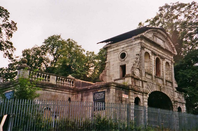
Theobald's Park

(Image credit: Temple Bar, Theobalds Park cc-by-sa/2.0 – © Christine Matthews – geograph.org.uk/p/185643)

Plans to return Temple Bar to London began to take on a more positive aspect in 1976 when the Temple Bar Trust was formed, specifically with the aim of returning the structure to the City.

Rebuilding of the area to the north of St. Paul’s Cathedral offered an opportunity for Temple Bar, where it could form part of the Paternoster Square development. A landmark location, where there were no concerns about traffic restrictions that such as structure would impose.

Temple Bar was again dismantled, transported back to London and rebuilt over one of the entrances to Paternoster Square. Temple Bar was officially reopened at its new, third, location on the 10th of November 2004 by the Lord Mayor of London:
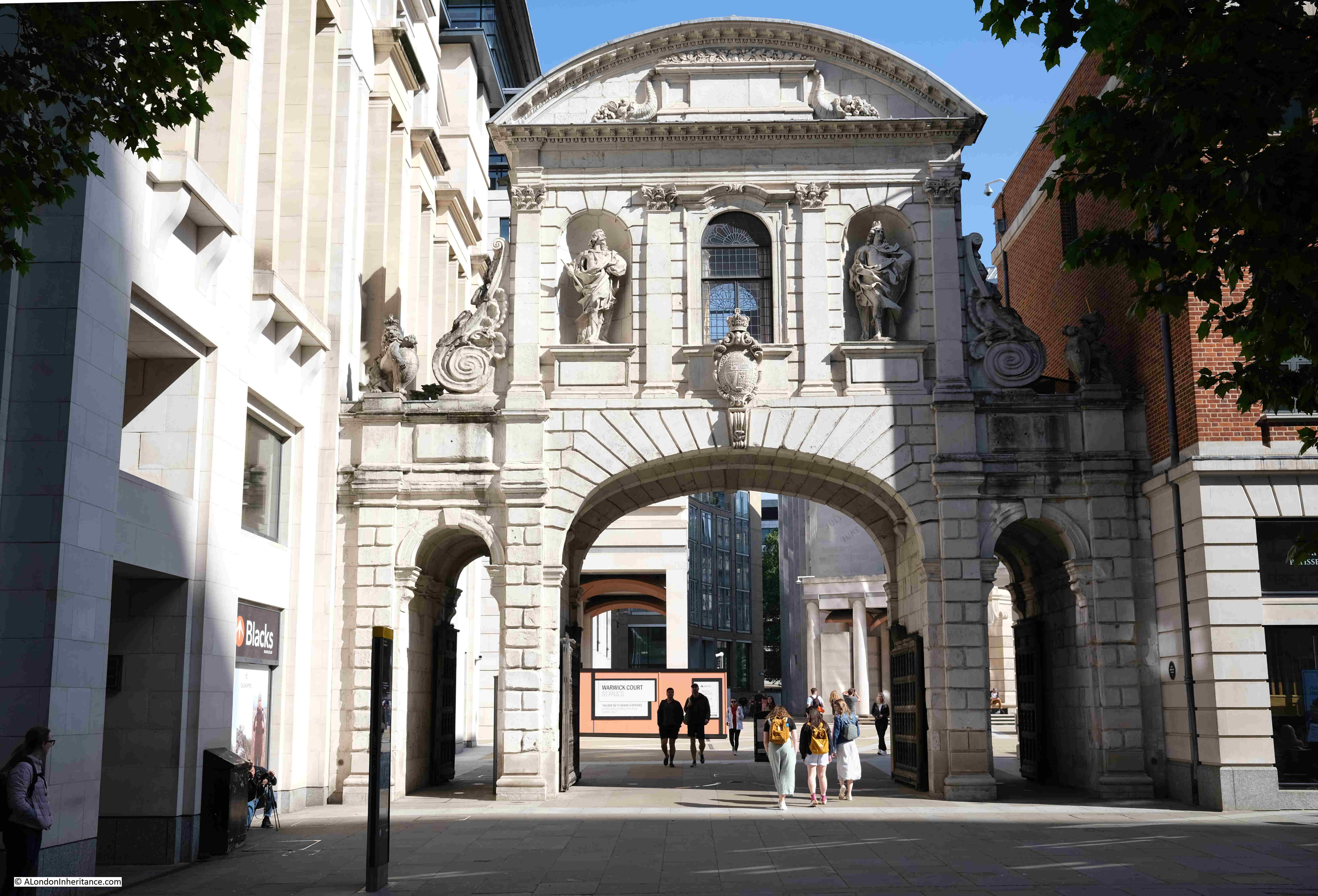
Paternoster Square

But the version of Temple Bar we see at the entrance to Paternoster Square was only the last of a series of barriers across Fleet Street / the Strand, to mark the boundary of the City of London.

The first references to a barrier across the street date back to the 13th century when a bar was recorded as being across the street. This was not a stone structure, and would probably have been some form of wooden or chain barrier that could be moved across the street. The bar, and location close to the Temple appears to have been the source of the name Temple Bar.

The historian John Strype, writing in the early 18th century stated that at Temple Bar “there were only posts, rails, and a chain, such as are now in Holborn, Smithfield, and Whitechapel bars. Afterwards there was a house of timber erected across the street, with a narrow gateway and an entry on the south side of it under the house.

It is difficult to be sure of the appearance of earlier versions of Temple Bar. One print dating from 1853 which claimed to be copied from an old drawing of 1620 shows what Temple Bar may have looked like in the 17th century (© The Trustees of the British Museum):
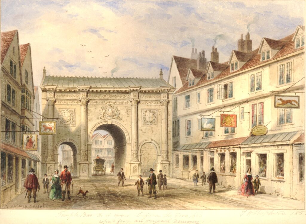
Old Temple Bar

Temple Bar was rebuilt between 1670 and 1672 by Sir Christopher Wren, and it is Wren’s version that we can see in Paternoster Square today. Built of Portland Stone, the structure continued to provide an impressive gateway to the City of London.

The location of Temple Bar is perhaps further west of what could be considered the traditional boundaries of the City, the original City Wall and the Fleet River.

Temple Bar is where the Freedom of the City of London met the Liberty of the City of Westminster, and originally whilst not part of the original City of London, it is where the freedoms granted to and by the City of London extended beyond the original City walls, up to the point where Westminster took over jurisdiction.

The location is also where Fleet Street and the Strand met. We can still see this today if you stand by the monument on the site of the gate and look across to the Law Courts where there is a street sign for the Strand, and opposite on the old building of the Child & Co. bank is the sign for Fleet Street.

The following print shows Temple Bar in 1761 (© The Trustees of the British Museum):
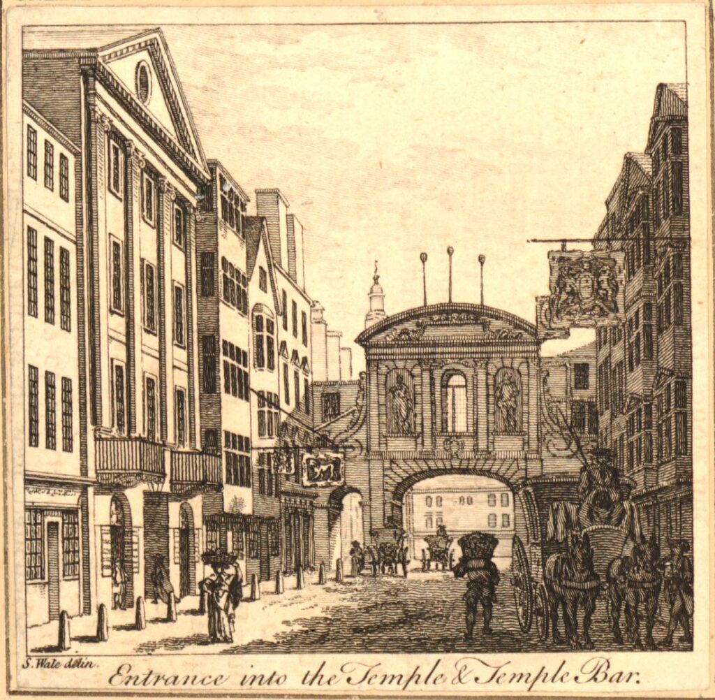
Heads on spikes

Perhaps the most disturbing part of the above print is that even at this point in the 18th century, heads of the executed where still being displayed on poles high above the gate.

The display of heads seems to have been just part of everyday life for 18th century Londoners. Newspaper reports on the 7th of February 1732 simply reported that: “On Sunday the Head of Colonel Oxburgh, who was executed for being in the Preston Rebellion, and had his Head stuck on a Pole, fell off from the Top of Temple Bar.”

The last heads to be displayed above Temple Bar were those executed following the 1745 Jacobite rebellion, including Colonel Francis Townley and George Fletcher.

They were hung on Kennington Common, cut down, then disemboweled, beheaded, and quartered, after which their hearts were thrown into a fire, and at the end of August 1746, newspapers report that “On Saturday last the Heads of Townley and Fletcher were brought from the New Goal, and fixed on two Poles on Temple Bar. The Heads of Chadwick, Barwick, Deacon and Syddall, are preserved in Spirits, and are to be carried down to Manchester and Carlisle, to be affixed on Places most proper for that Purpose.”

A few days later, on the 13th of August, 1746, the Kentish Weekly Post carried a report that showed how feelings were still running high after the 1745 rebellion: “On Friday a Highlander, as he was passing by Temple Bar, and observing the Heads there, uttered several treasonable expressions, upon which he was severely handled by the Populace.”

The heads stayed on their poles for a considerable number of years, until March 1773, when a strong March wind brought down one head, with the second following soon after.

Temple Bar was also the scene of less grisly punishments, with a pillory being set up at the gate. In 1729 it was reported that a Mr. William Hales “Received sentence to pay a Fine of ten Marks upon each Indictment, to stand in the Pillory twice, viz. once at the Royal Exchange, and once at Temple Bar, to suffer five years imprisonment, and to give Security for his good Behaviour for seven years.”

Temple Bar was though the scene of far more enjoyable activities with numerous processions passing through the gate and ceremonies being held at the gate. When the Monarch entered the City, they would be greeted by City dignitaries at the gate.

On the 9th of November 1837, Queen Victoria was greeted at Temple Bar where she was presented with the ceremonial sword of the City of London.

During the funeral of Lord Nelson, his funeral procession was met at Temple Bar by the Lord Mayor and representatives of the Corporation of London.

The following print shows another of Queen Victoria’s visits to the City where the Queen and Prince Albert in the royal carriage, are being presented again with the ceremonial sword of the City of London as they arrive at Temple Bar(© The Trustees of the British Museum):
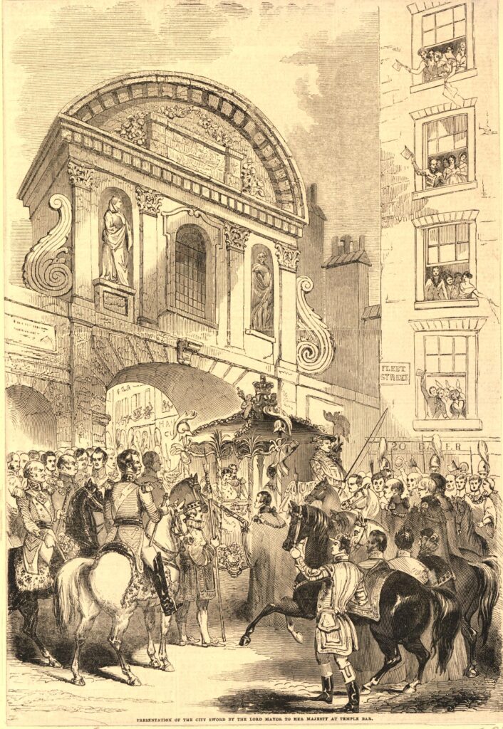
Queen Victoria visit to the City of London

In the second half of the 19th century, much of the area around Temple Bar was being redeveloped, with the Law Courts being the major development to the north of the gate. The following print, dated 1868, shows buildings being demolished ready for construction of the Law Courts and is titled, and shows the “Forlorn Condition of Temple Bar” (© The Trustees of the British Museum):
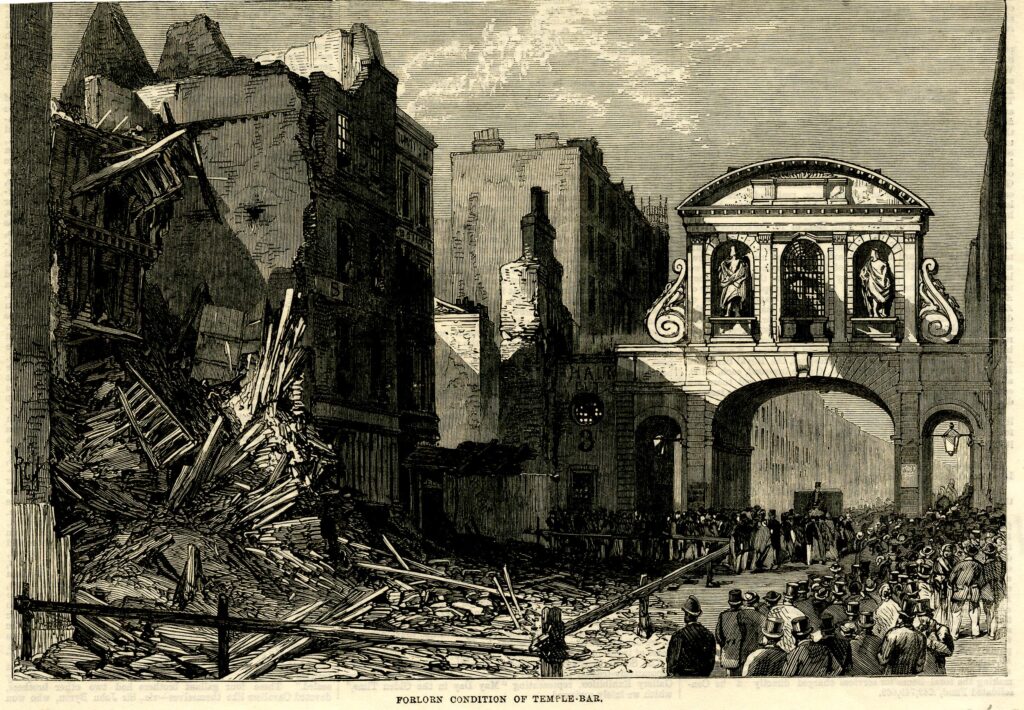
Temple Bar

And almost ten years later, a print showed the structure ready for demolition, with the title of “Temple Bar’s Last Christmas Day” (© The Trustees of the British Museum):
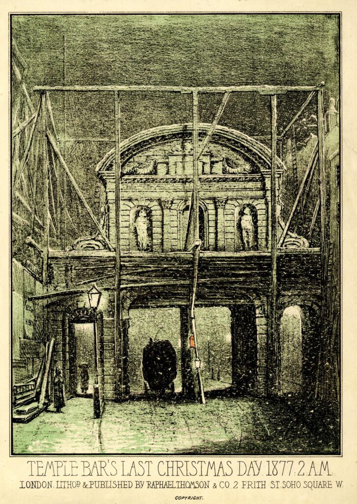
Temple Bar

And today we see the gate between Paternoster Square and St. Paul’s Cathedral:
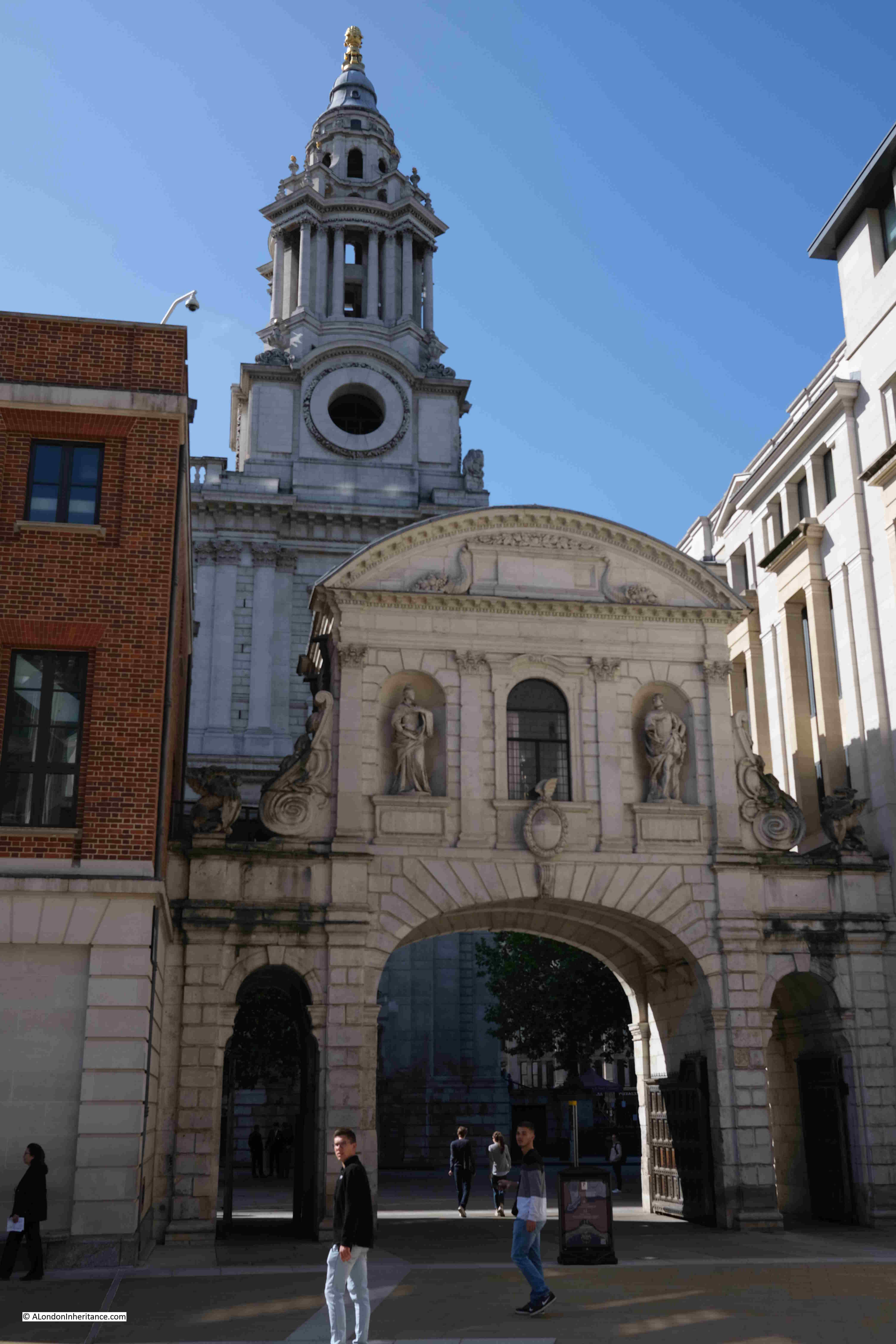
Temple Bar

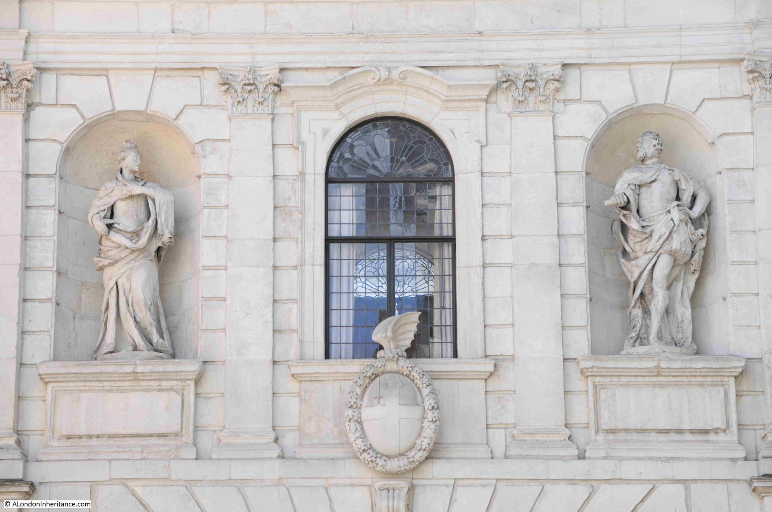
There are a number of statues on the gate. The following photo shows the statues that originally faced to the east and Fleet Street. On the right is James I. The figure on the left is often referred to as Anne of Denmark, the wife of James I, although there are other references, including in Old and New London by Walter Thornbury who claims the statue is of Queen Elizabeth. Anne of Denmark seems to be the most probable.
Temple Bar

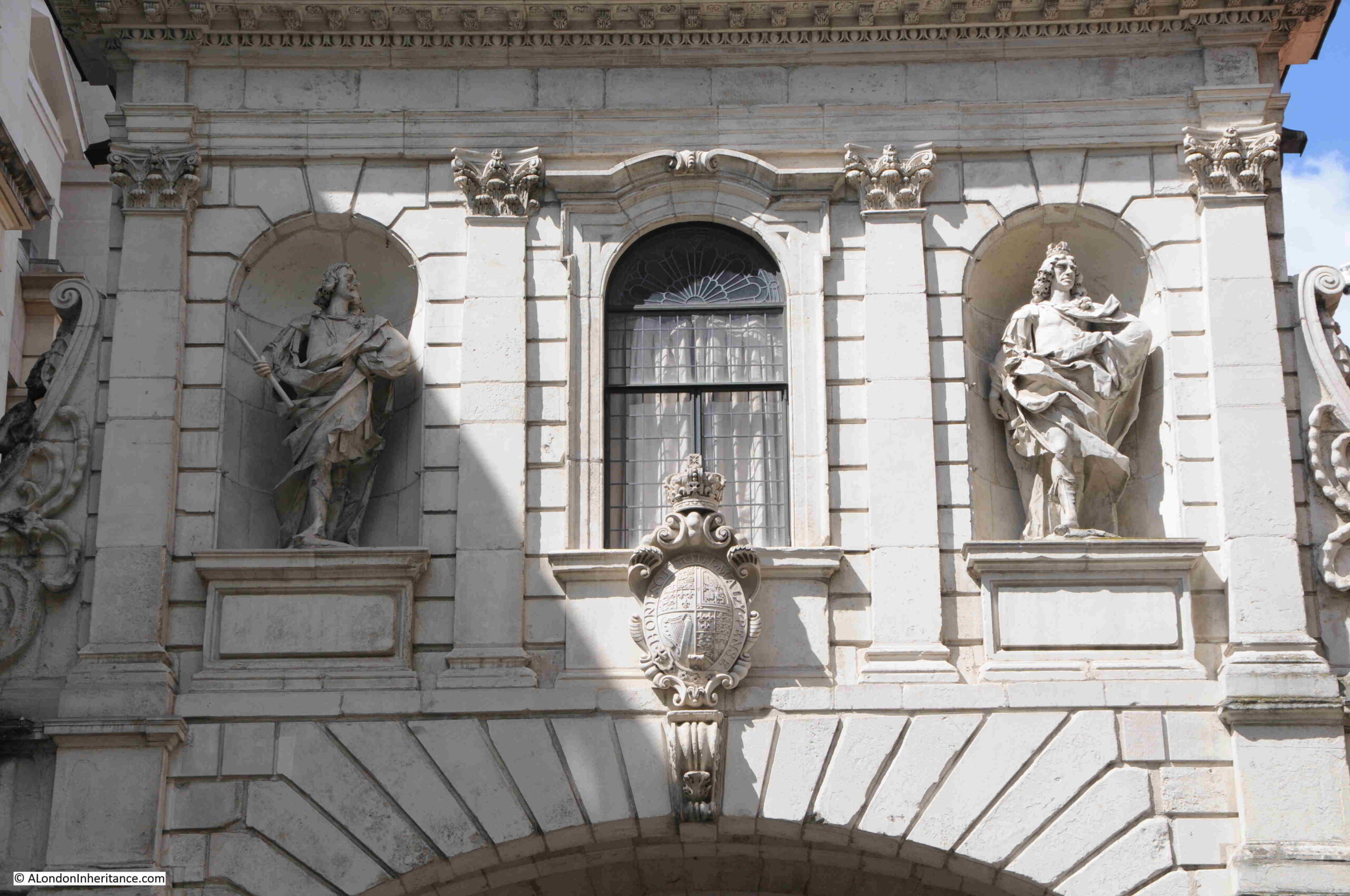
On the old western, Strand side of the gate are statues of Charles I and Charles II:
Temple Bar

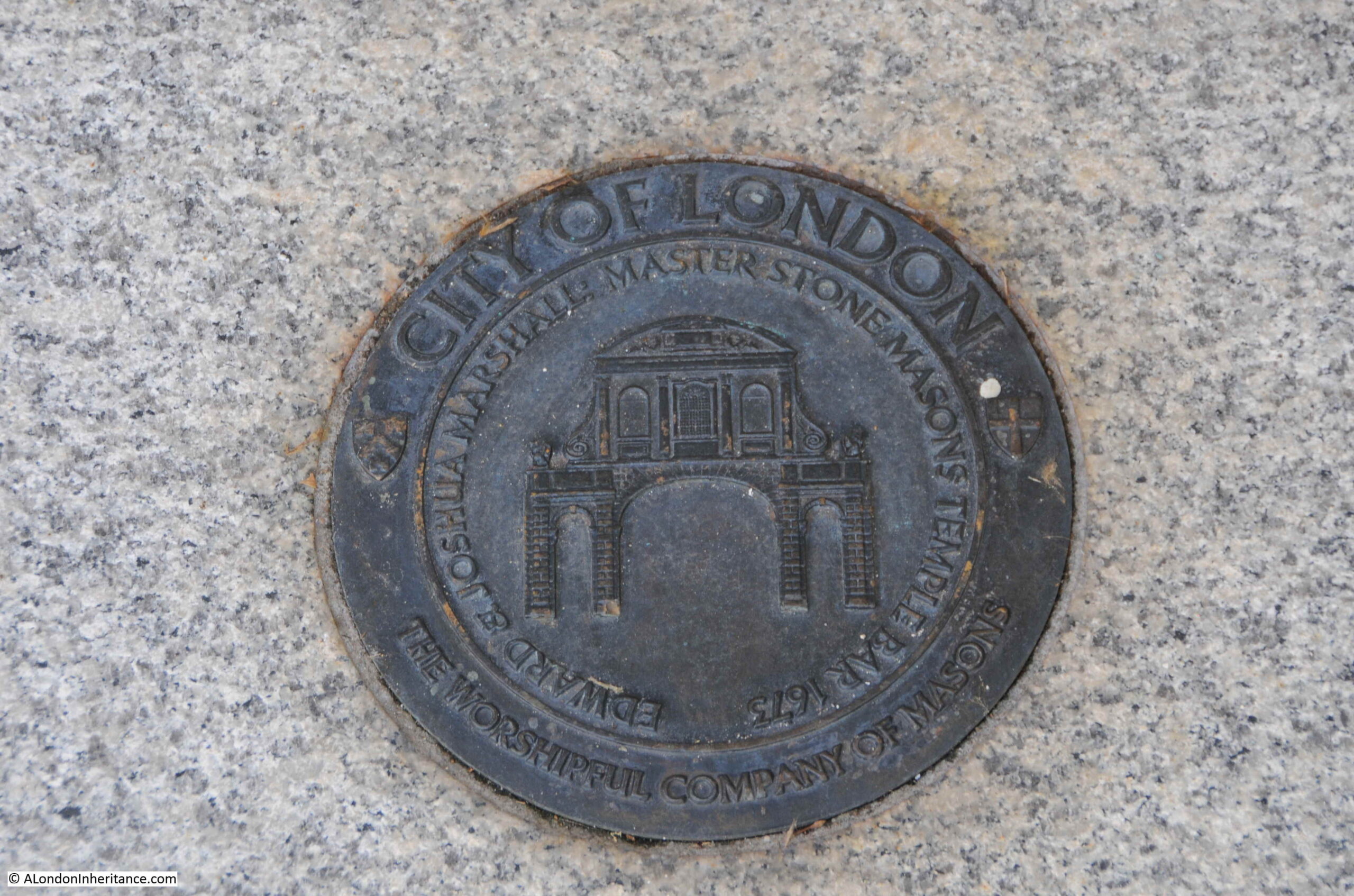
A plaque in the ground by the gate records the names of Edward and Joshua Marshall, Master Stone Masons, Temple Bar, 1673.

Edward was the father and Joshua the son.
Master Masons

They were stones masons who worked on a considerable number of 17th century buildings and monuments in the city. It is believed that the majority of the work on Temple Bar was completed by Joshua, as his father was in his sixties by the time of the gate’s construction.

So what of the monument that can be seen today at the old location of Temple Bar?

It was still important to mark the boundary to the City of London, and soon after Temple Bar was demolished, a new monument was built in the centre of the widened street:

Temple Bar memorial

In 1880, the Illustrated London News described the new monument: “The new structure will be of an elaborate and handsome character, from designs by Mr. Horace Jones, the City Architect. It will be 37ft high, 5ft wide and 8ft long. The base will be of polished Guernsey granite, the next tier of Balmoral granite, and above that will be red granite from the same quarry as that used in the Albert Memorial in Hyde Park.

In niches in the north and south sides will be life size figures in marble of the Queen and the Prince of Wales, by Mr. Boehm, and in panels in the sides will be reliefs in bronze by Mr. Mabey and Mr. Kelsey, of the Queen’s first entrance into the City through Temple Bar in 1837, and of the procession to St. Paul’s on the day of the thanksgiving for the Prince of Wale’s recovery. The superstructure will be of hard white stone, and will be surmounted by a griffin, the heraldic emblem of the City, which is being executed by Mr. Birch.”
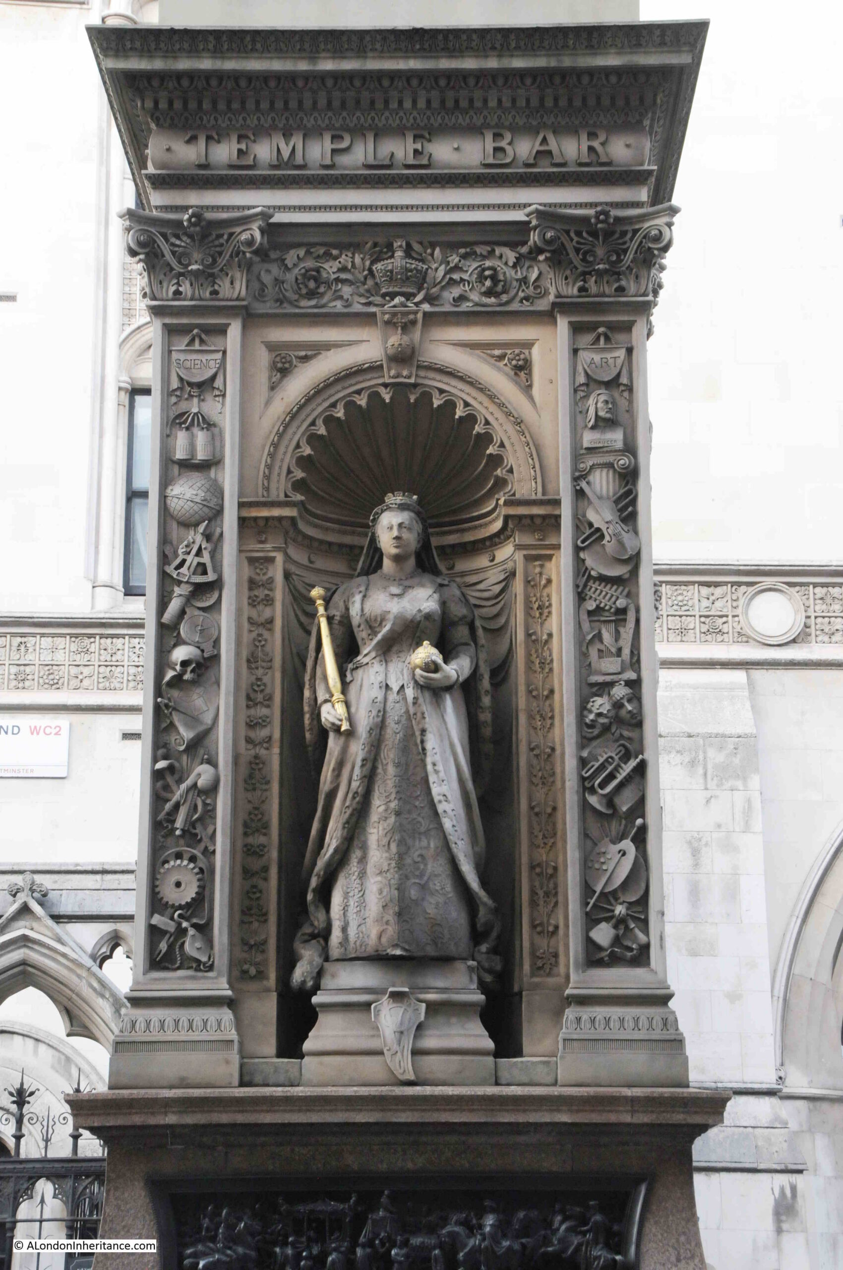
Queen Victoria

As well as marking the location of Temple Bar, the monument was claimed to offer a refuge for those crossing the street, however the Illustrated London News did not understand this justification, or the need for marking the boundary: “We know of no sufficient reason for marking this particular boundary. Other similar landmarks – such as Ludgate, Aldgate, Cripplegate, and Bishopsgate – have been removed without loss of municipal prestige, rights, or privileges worth preserving. The need of a refuge is much more obvious where the thoroughfare is wide, like Regent Street, or still more where roads intersect.”
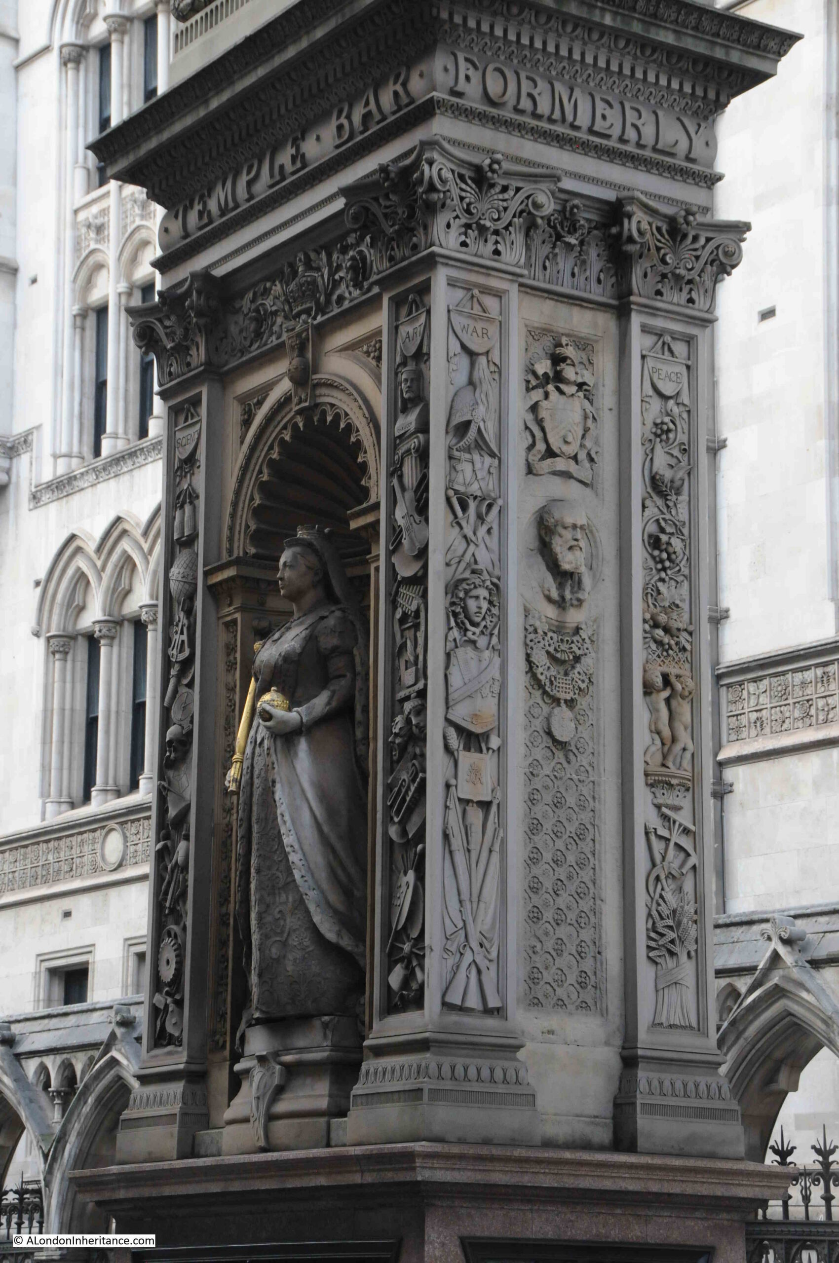
Queen Victoria

Victoria’s son, Prince Edward, Prince of Wales on the side of the monument facing the Law Courts:
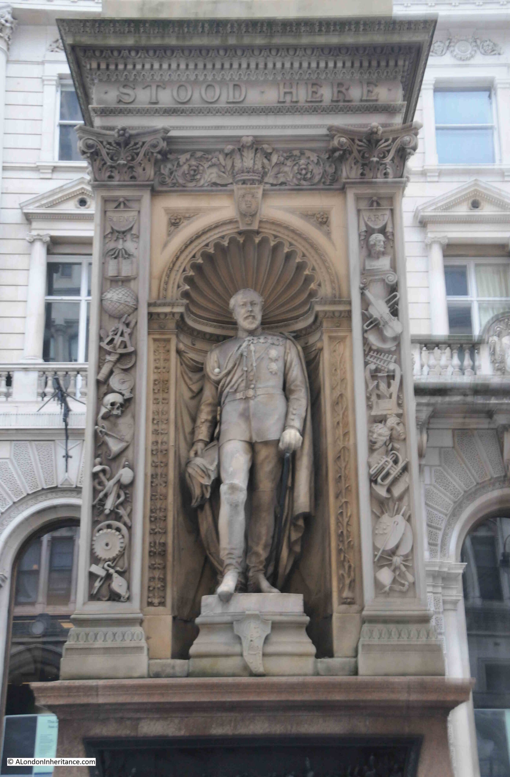
Prince Edward

On either side of the statues there are columns of carvings, with the left column representing Science and the Arts on the right column. On the narrow ends of the monument there are columns of carvings representing War and Peace.
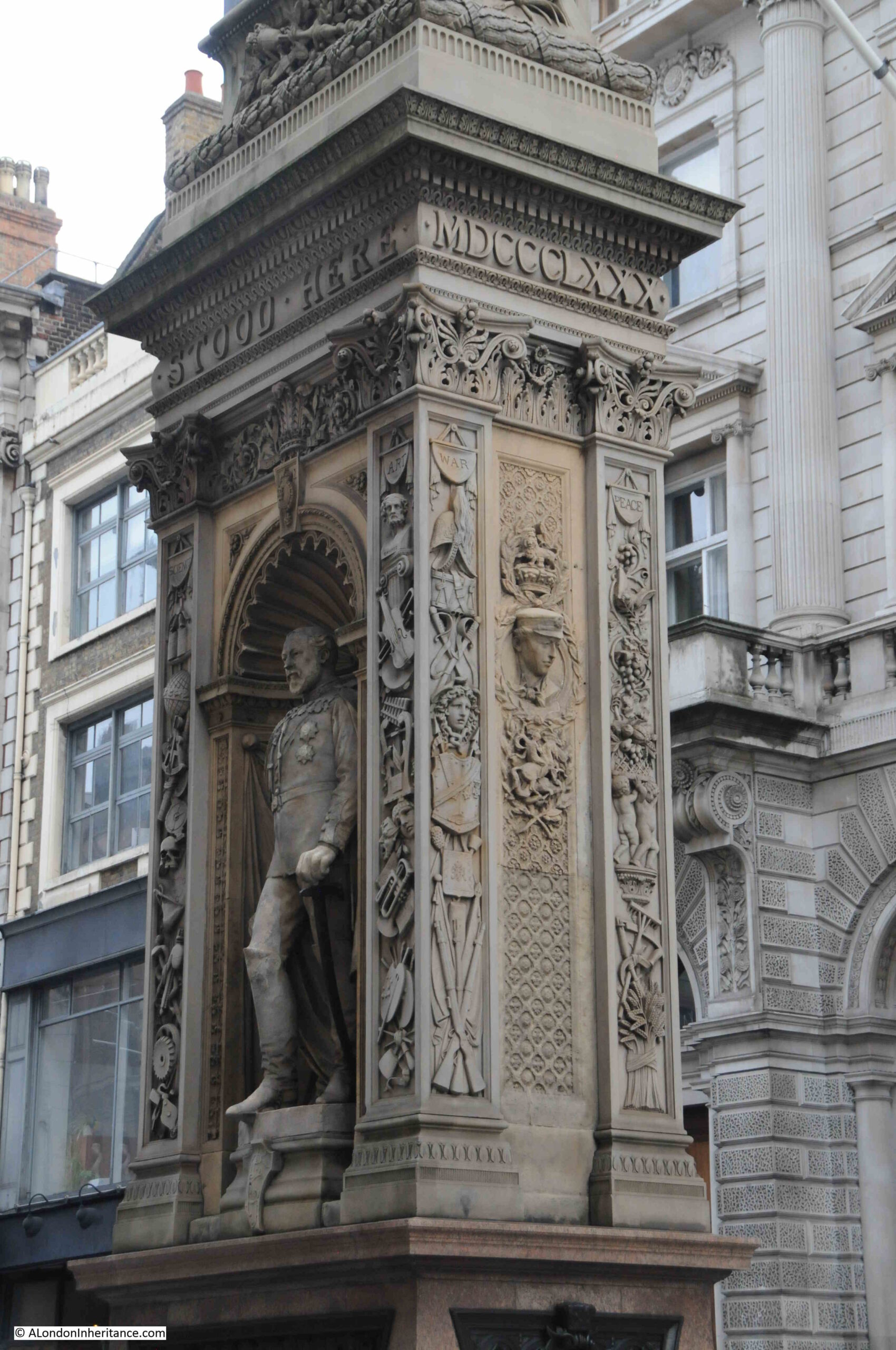
Prince Edward

The new monument was far from universally popular and there was much criticism about the design and location.

in 1881, the Corporation of London had appointed a committee to look at the memorial and decide whether it should be removed and placed in some more convenient spot.

The Times included an article which referred to the monument that the “erection is an eyesore in point of taste, a mischievous obstruction instead of a public convenience and reckless expenditure. As to its future, the best that we could hear would be that it was likely to disappear and be no more seen. The 10,000 guineas or more that it cost would be wasted, no doubt, but they could not be more thrown away than they are at present on a monument which no one likes, and everyone laughs at.”

The monument was even vandelised, despite being guarded. The Weekly Dispatch reported on the 7th of August 1881 that “Notwithstanding the vigilance of the City and Metropolitan Police who are appointed to guard the memorial, it was on Friday morning discovered that there had been further mutilation of the bas-relief representing various events in civic history.”

And on the 29th of August 1881 “On Saturday evening a young man who was lodged in the Bridewell police station on a charge of wilfully damaging the Temple Bar Memorial. A gentleman who was passing by saw the prisoner deliberately disfiguring the heads and legs of the figures with his fists. The attention of a police-constable was called to the matter, and he immediately took the offender into custody. When asked by the Inspector why he had done it, the prisoner replied, ‘I did it for fun. It is only an obstruction, and I didn’t see why I should not have a go at it as well as other people.”

The monument seems to have gradually been accepted, receiving less attention as time went by, although being in the middle of the busy Fleet Street / Strand, with growing levels of traffic in the 20th century, the monument was occasionally still referred to as an obstruction.

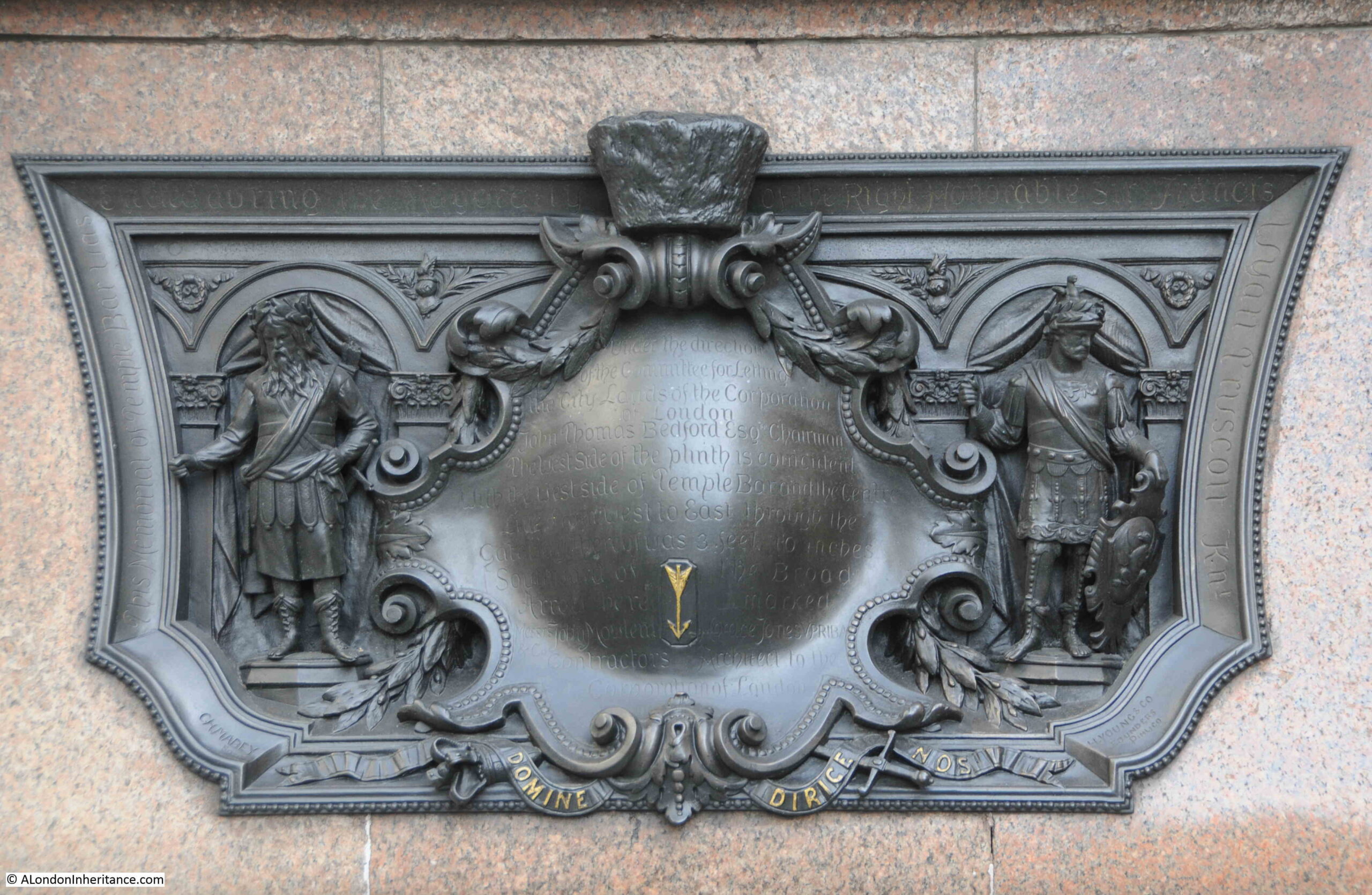
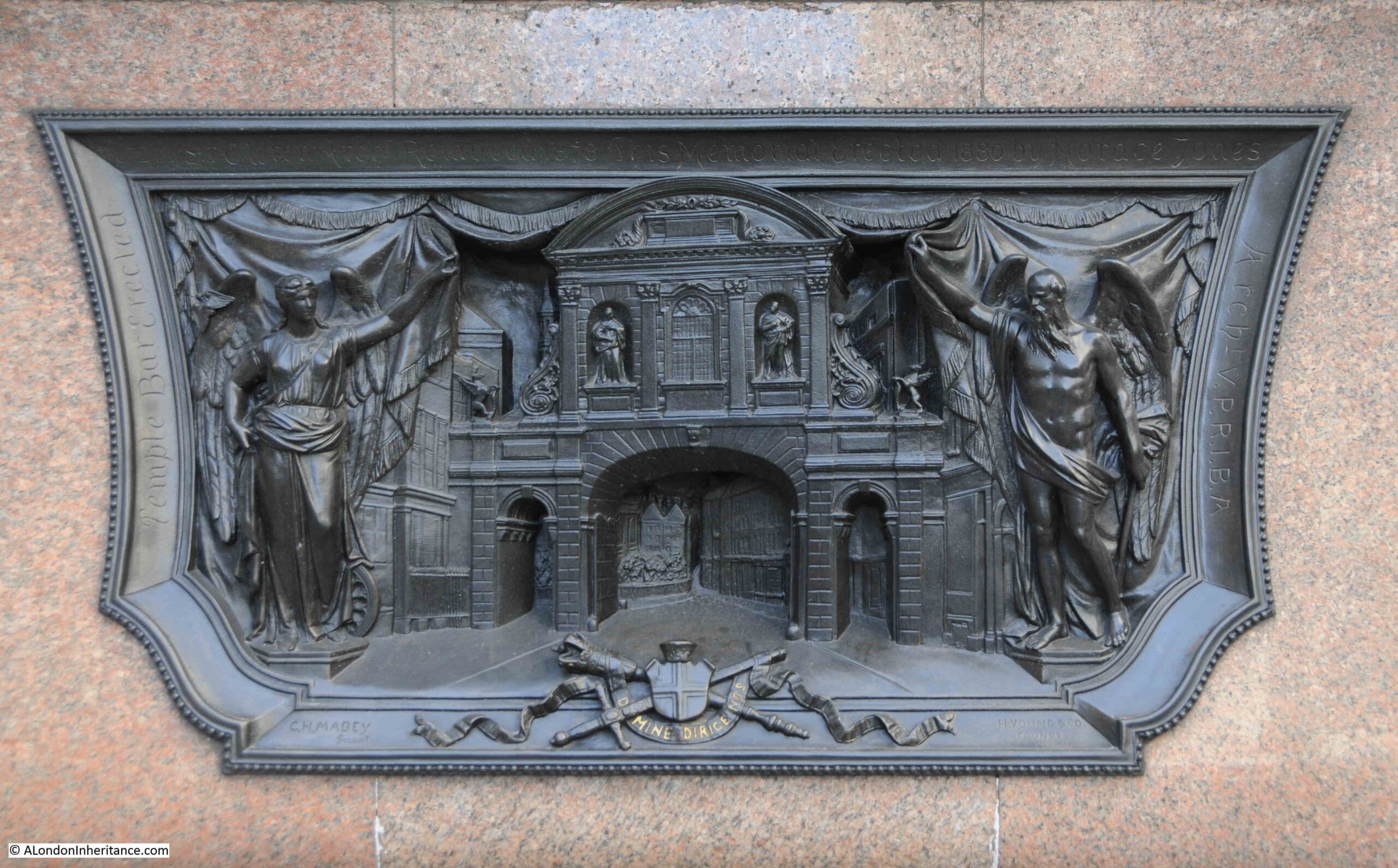
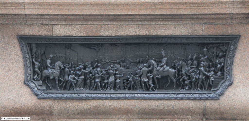
Below the statues, there are four reliefs on the four sides of the pedestal.

The first is a rather accurate reminder of the location of Temple Bar:
Temple Bar

The text reads: “Under the direction of the committee for letting the City lands of the Corporation of London. John Thomas Bedford Esq. Chairman. The west side of the plinth is coincident with the west side of Temple Bar and the centre line from west to east through the gateway thereof was 3 feet 10 inches southward of the broad arrow here marked.”

On the end of the monument facing Fleet Street is a relief of Temple Bar:
Temple Bar

On the side is a relief titled “Her most gracious Majesty Queen Victoria and his Royal Highness Prince Albert Edward Prince of Wales going to St. Paul’s February 27 1872”:
Temple Bar

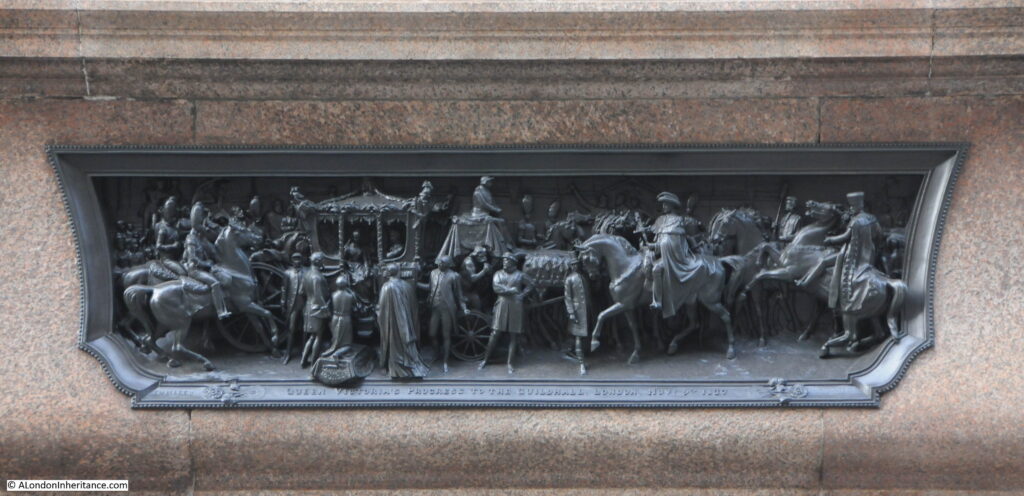
And on the other side of the plinth is a relief titled “Queen Victoria’s progress to the Guildhall, London Nov. 9th 1837.

Temple Bar

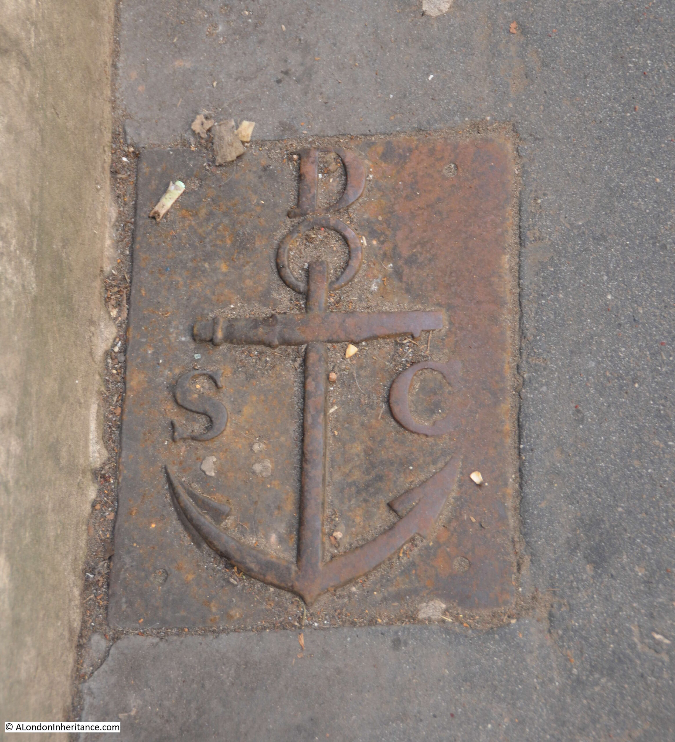
The importance of this location as a boundary, not just as the boundary to the City of London, can be seen by a boundary marker set in the pavement on the south side of the street, directly opposite the monument:
St Clement Danes parish boundary marker

This is a boundary marker of the parish of St. Clement Danes. The relevance of the anchor is that it became the symbol of St. Clement as he was apparently tied to an anchor, then thrown into the sea to drown.

I assume that the parish of St. Clement Danes would have ended at the boundary with the City.

What is fascinating about the story of Temple Bar is the recurring theme of how buildings and architecture are treated in London. For example, from Mr. H. Oscar Mark’s letter earlier in the post where he suggested that “strenuous efforts should be made by Londoners who love their London and its old landmarks – of which we have too few left – to reacquire this fine old relic, and to re-erect it on one of the sites named or in the heart of London“.

This was followed by a chorus of criticism about the new monument that replaced Temple Bar at the meeting of Fleet Street and the Strand.

However I suspect there would be concern and criticism if there were proposals today to remove the monument. How we view buildings and architecture in general is very much related to time and their age.

alondoninheritance.com

Liverpool Street Station

I think I first used Liverpool Street Station around 1974, and from 1979 to 1989 I used the station every working day. It is one of my regrets that in all those years I did not take a single photo of the station. Too busy with work and other commitments, the station was also a very familiar sight that I used every day, so why take a photo?

This was a time of slam door trains, carriages with individual compartments, which had a single bench seat along either side of the carriage. Always difficult when you got into one of these compartments which appeared full, but could you squeeze into a gap, and would people shuffle up? Reading your neighbour’s newspaper as they opened it up in front of you.
This is probably why I over compensate now, and take photos of almost everything. The present becomes the past very quickly.

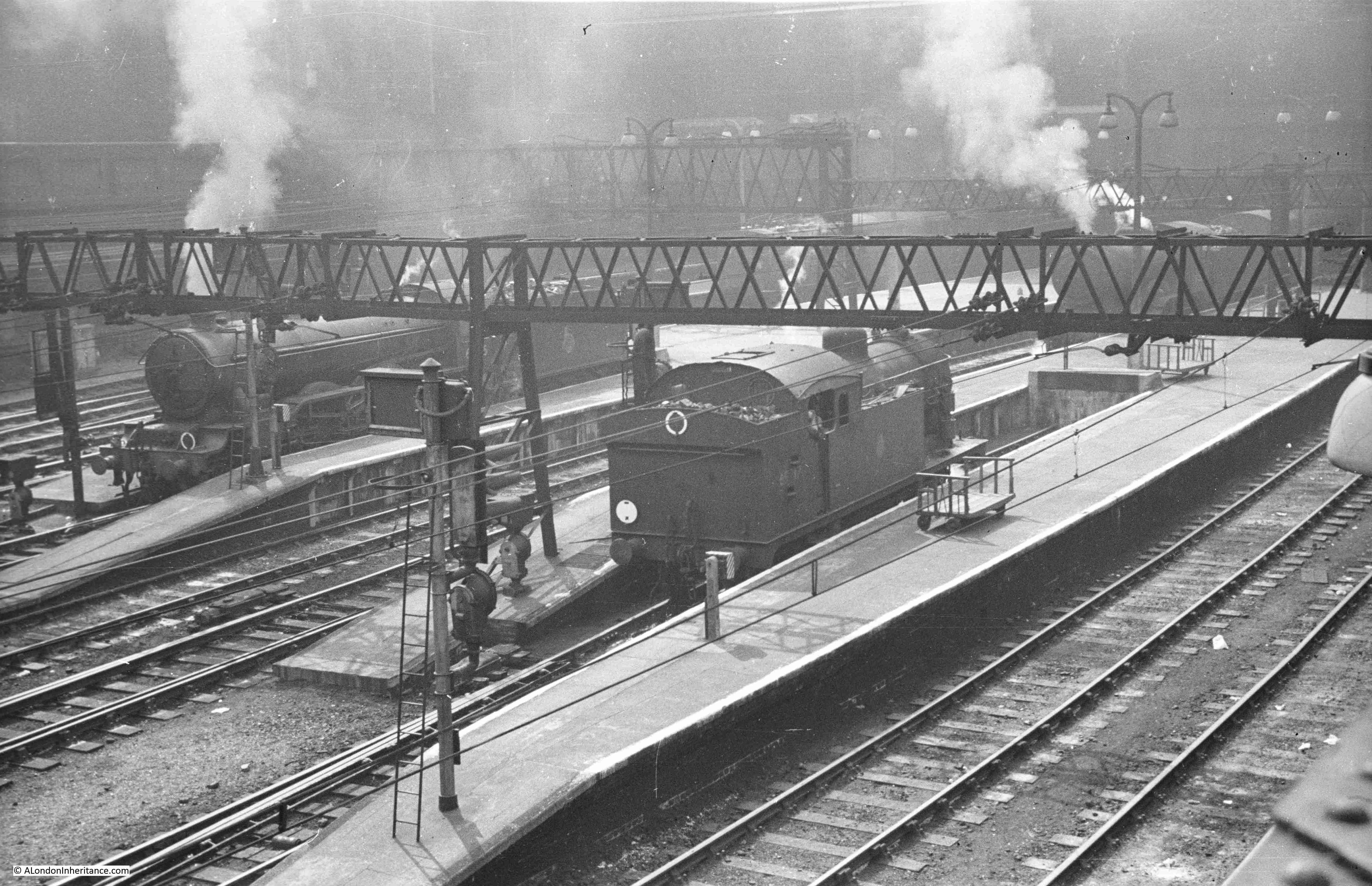
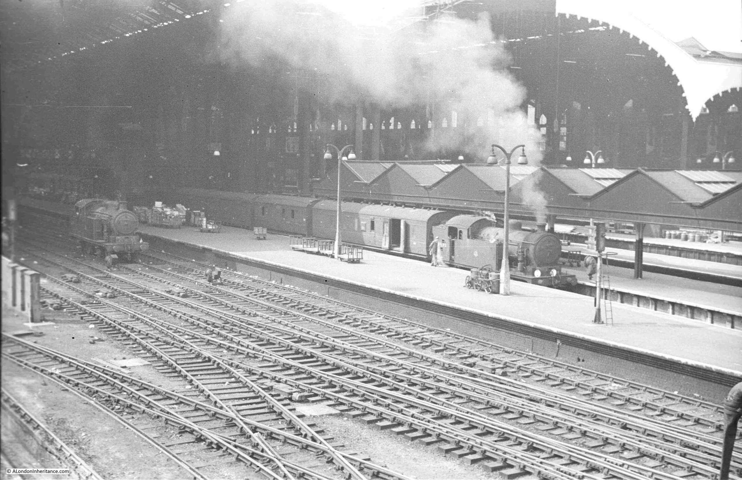
Fortunately my father did take a couple of photos of Liverpool Street Station in 1952. Not the main buildings of the station, but from the far end of the platforms, looking back into the station:

Liverpool Street Station

The photo was taken from a rather good viewing point if you wanted to watch trains arriving at, and leaving the station.

The platforms at Liverpool Street Station are slightly below ground level. Not that much, but enough to mean that the tracks left the station in a rather wide cutting with brick retaining walls on either side, and the tracks passing under what were streets, which had been converted to a bridge structure when the tracks were built.

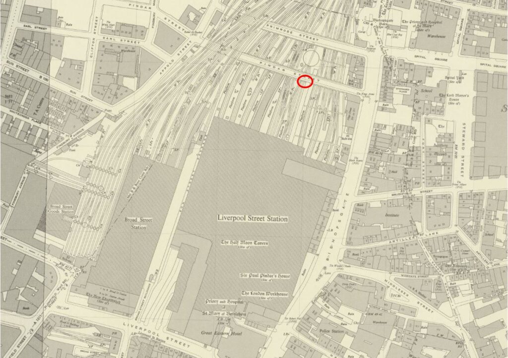
The following map extract is from the 1951 revision of the OS map, so about the same time as my father’s photos. There are two streets crossing the tracks as they leave the station, Pindar Street and Primrose Street.

Pindar Street is closet to the station, and I have marked the location where I believe my father was standing with a red circle  (‘Reproduced with the permission of the National Library of Scotland“).

Old map of Liverpool Street Station

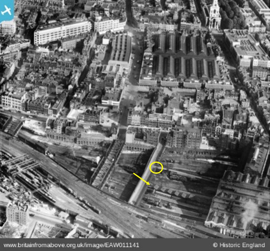
What really helped to confirm the location was finding the following photo of the area on the Britain from Above web site:

Liverpool Street Station

The photo is dated 1947 and shows Liverpool Street Station in the lower right corner, and Pindar and Primrose Streets crossing the tracks leaving Liverpool Street.

The above photo also shows the different approach between Liverpool and Broad Street Stations. Broad Street was next to Liverpool Street, and in the above photo the tracks into Broad Street pass over the streets, where the tracks into Liverpool Street pass under.

The two station platform levels were at different heights. I did take a couple of photos of Broad Street Station in 1986, before it was demolished (see my post on Broad Street Station here). It can be seen on the photos that the station buildings and platforms were higher than those of Liverpool Street.

I have marked the location where my father was standing with a yellow circle in the above photo.

The photo shows that there is a road / ramp leading down from Pindar Street to the station, which would have provided an unobstructed view, also I have marked with a yellow arrow a series of sheds where the roofs form a distinctive pattern. These sheds can be seen in my father’s photo.

I cannot find the exact location from where the following photo was taken, it may have been turning to the left from the above photo, or further along Pindar Street:

Liverpool Street Station

I wanted to try and get a photo from the same position today, and although the area around Liverpool Street Station has changed beyond all recognition, I was able to get to a similar position.

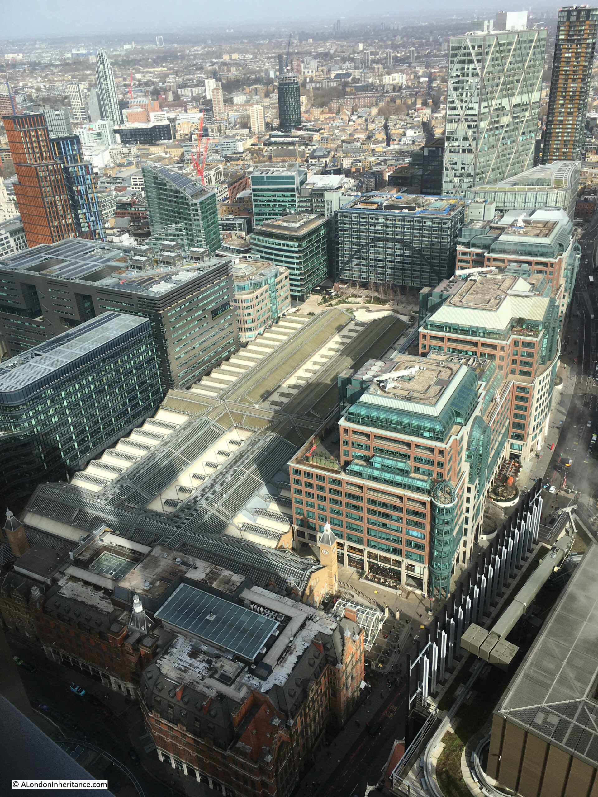
The following photo from the top of the Heron Tower / 110 Bishopsgate helps put the location of the station in context.

View from the Heron Tower

The main buildings of the station can be seen in the lower left corner, with the roof over the main concourse at ninety degrees to the roof over the platform which runs up towards the right.

To the left of the station is the Broadgate development which was constructed on the site of Broad Street Station. On the right of the station, large office blocks have been built between the station roof and Bishopsgate. Some of the Liverpool Street platforms extend under these new office blocks.

The roof of the station appears relatively low compared to the surrounding buildings and ground level, again showing that the platforms of the station are below ground level.

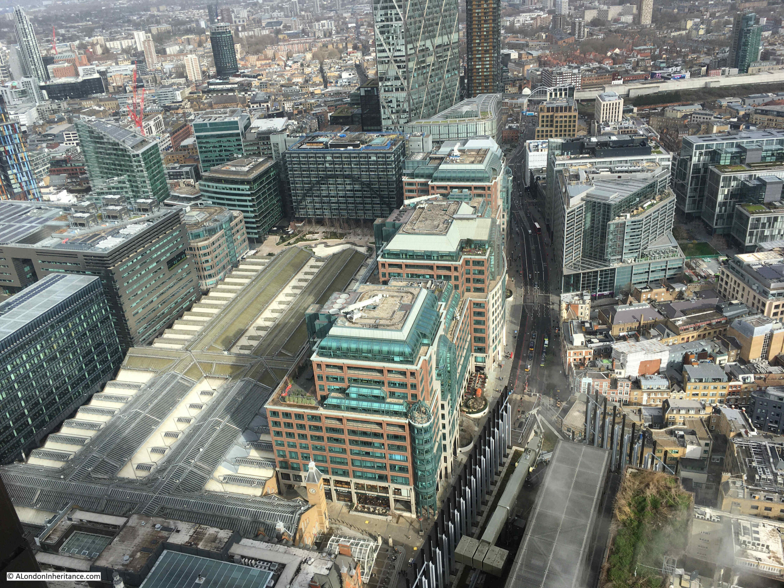
In the above photo, and the photo below, at the upper end of the station roof, there is an office block which has an arch running across the façade, and there is an open space between the office block and the end of the station roof.

View from the Heron Tower

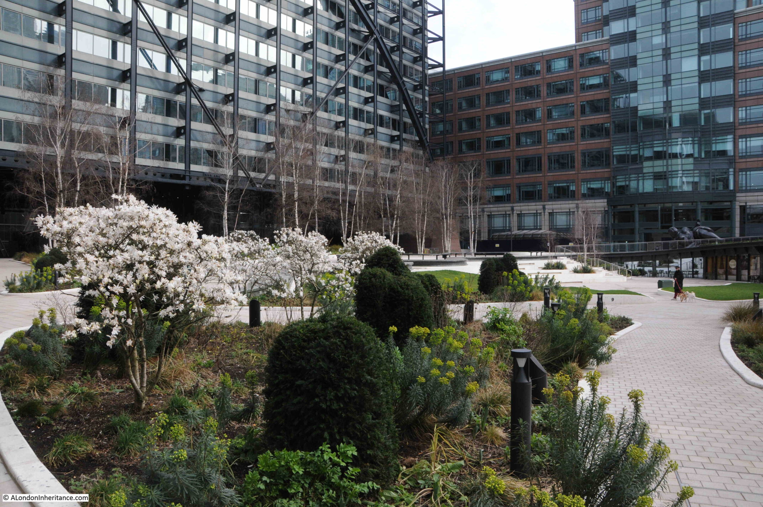
The open space is Exchange Square which has recently reopened after a redevelopment, and it is from here that I can get a similar photo to my father’s:

Liverpool Street Station

The photo is far closer to the end of the roof over the station platforms than my father’s, and I will explain why shortly. To help confirm that my father’s photo is of Liverpool Street Station, the pattern around the edge of the wooden roof is the same, as are the windows in the brick walls on the far side of both photos.

Exchange Square is a remarkable open space. As can be seen from the above photo, the edge of the space is up against the roof over the station, and from here you can look down directly into the station:

Liverpool Street Station

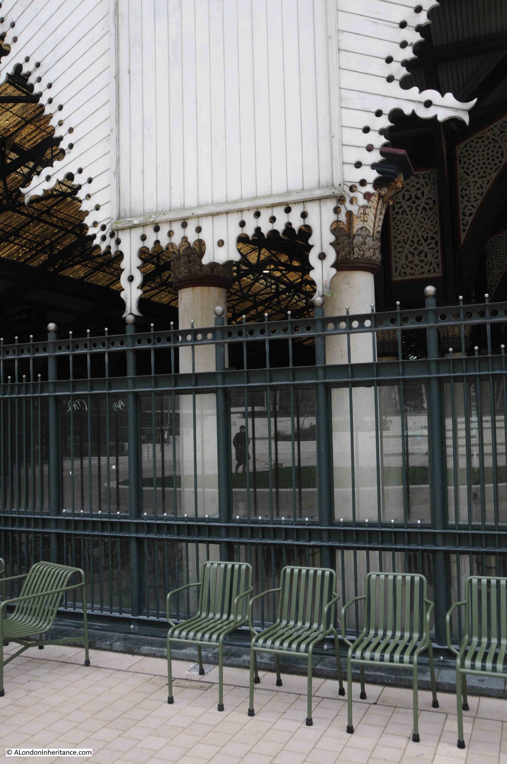
The roof almost comes down to the point where you can stand on the chairs and touch the wooden decoration (you cannot, it is just too high, and the wandering security man would not be very happy if you tried).

Liverpool Street Station

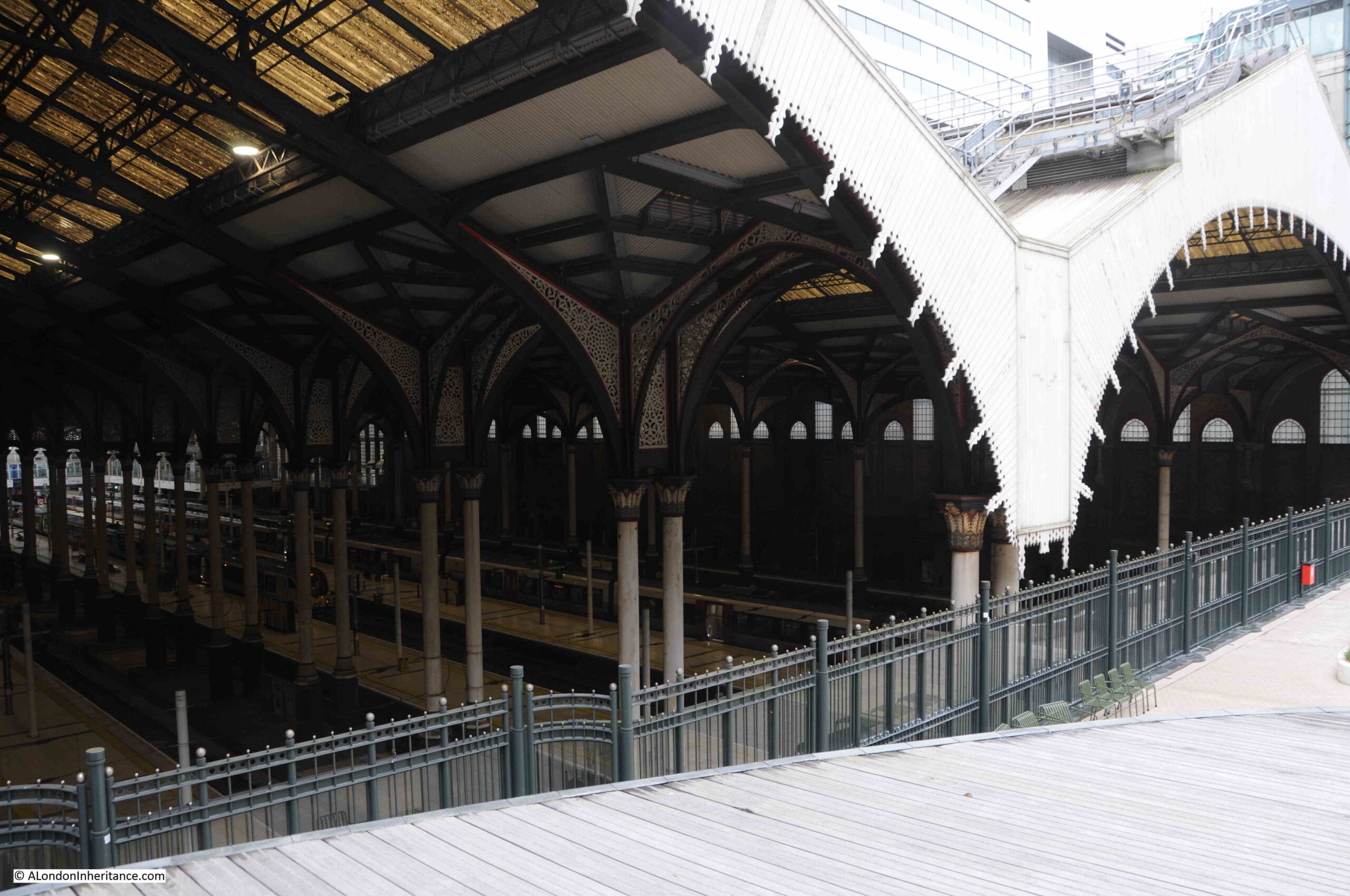
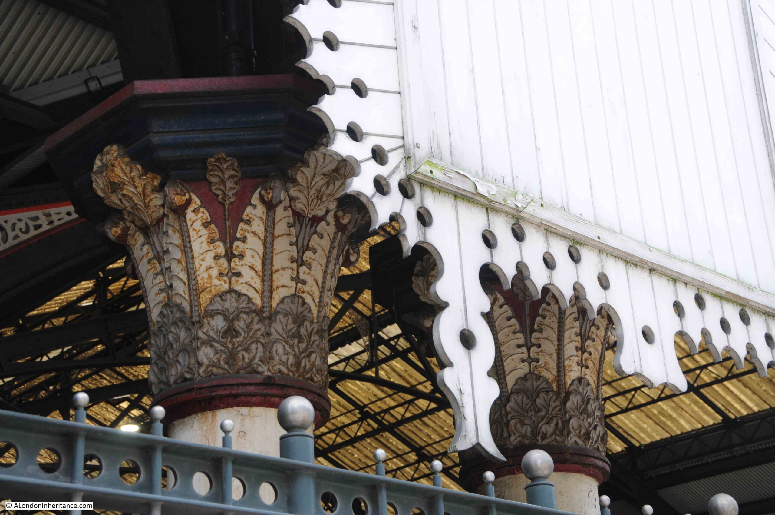
You can get a good view of the decoration at the top of the columns supporting the roof:

Liverpool Street Station

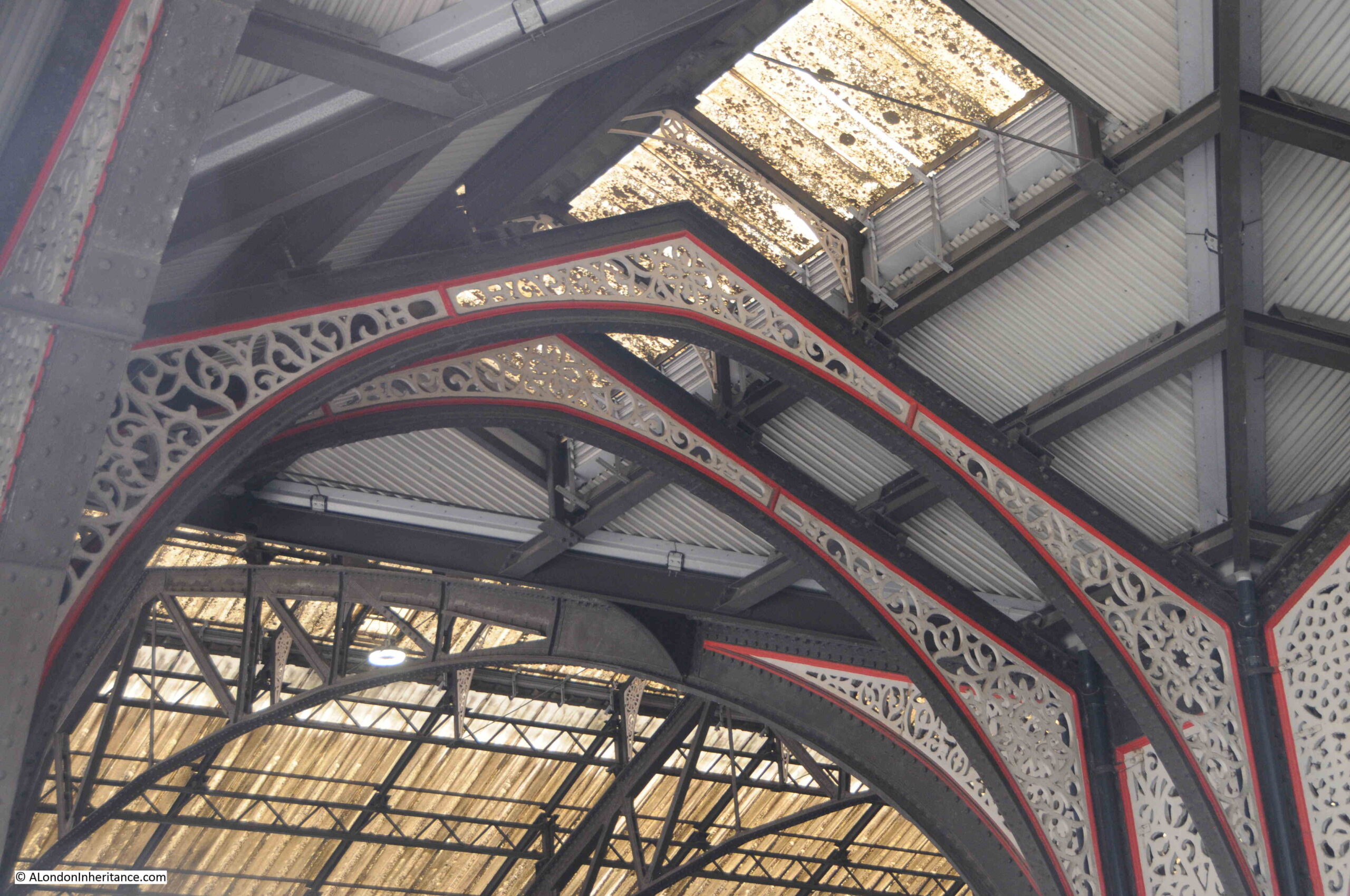
Details of the roof:

Liverpool Street Station

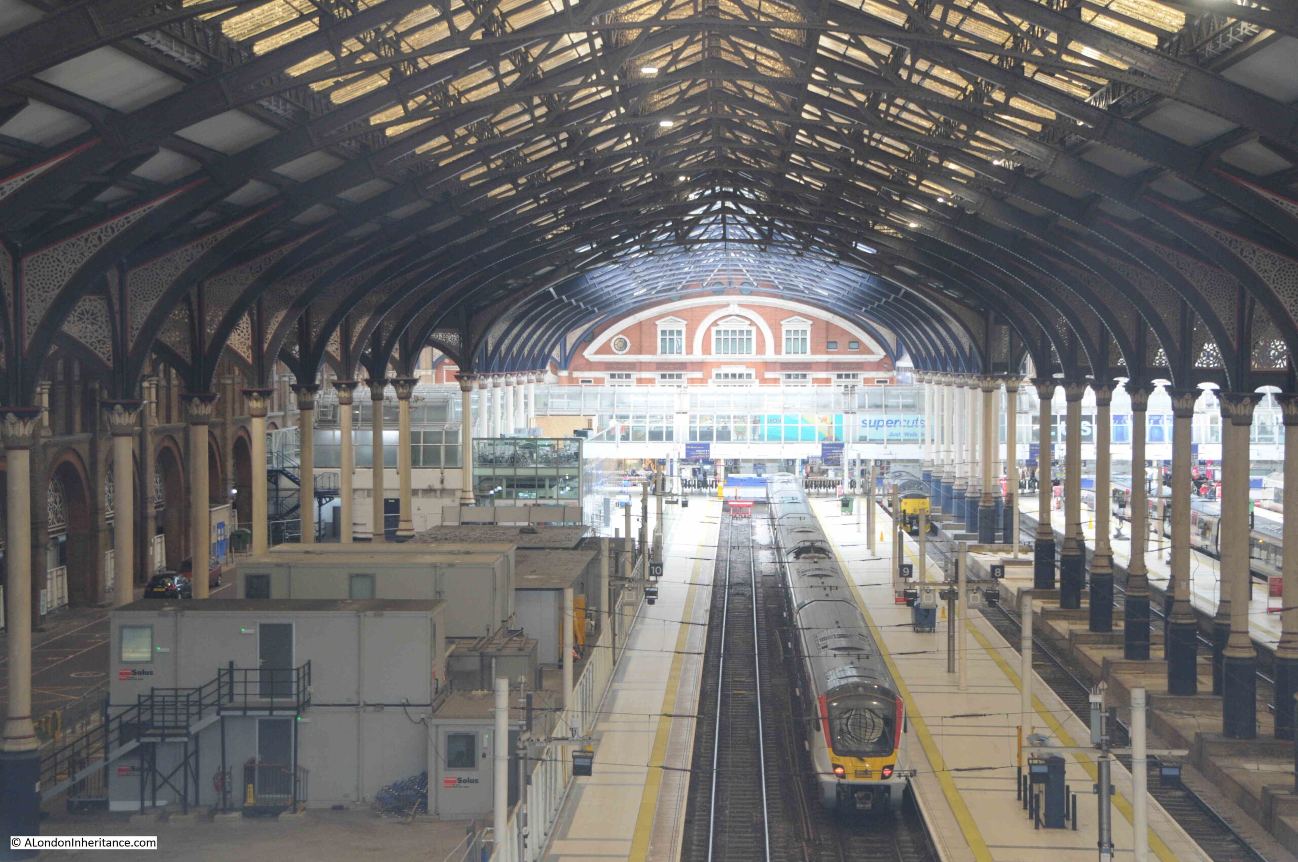
And the roof stretching over the platforms:

Liverpool Street Station

The view from Heron Tower shows that the roof over the concourse and part of the platforms closest to the concourse appear to be cleaned, whilst the roof over the main part of the platforms is dirty as shown in the above photo.

I assume this is to save money by only cleaning the roof over the area where people wait for their train, however it is probably my 1970s first experiences of London, but I like the dirty roof – a city can be too clean.

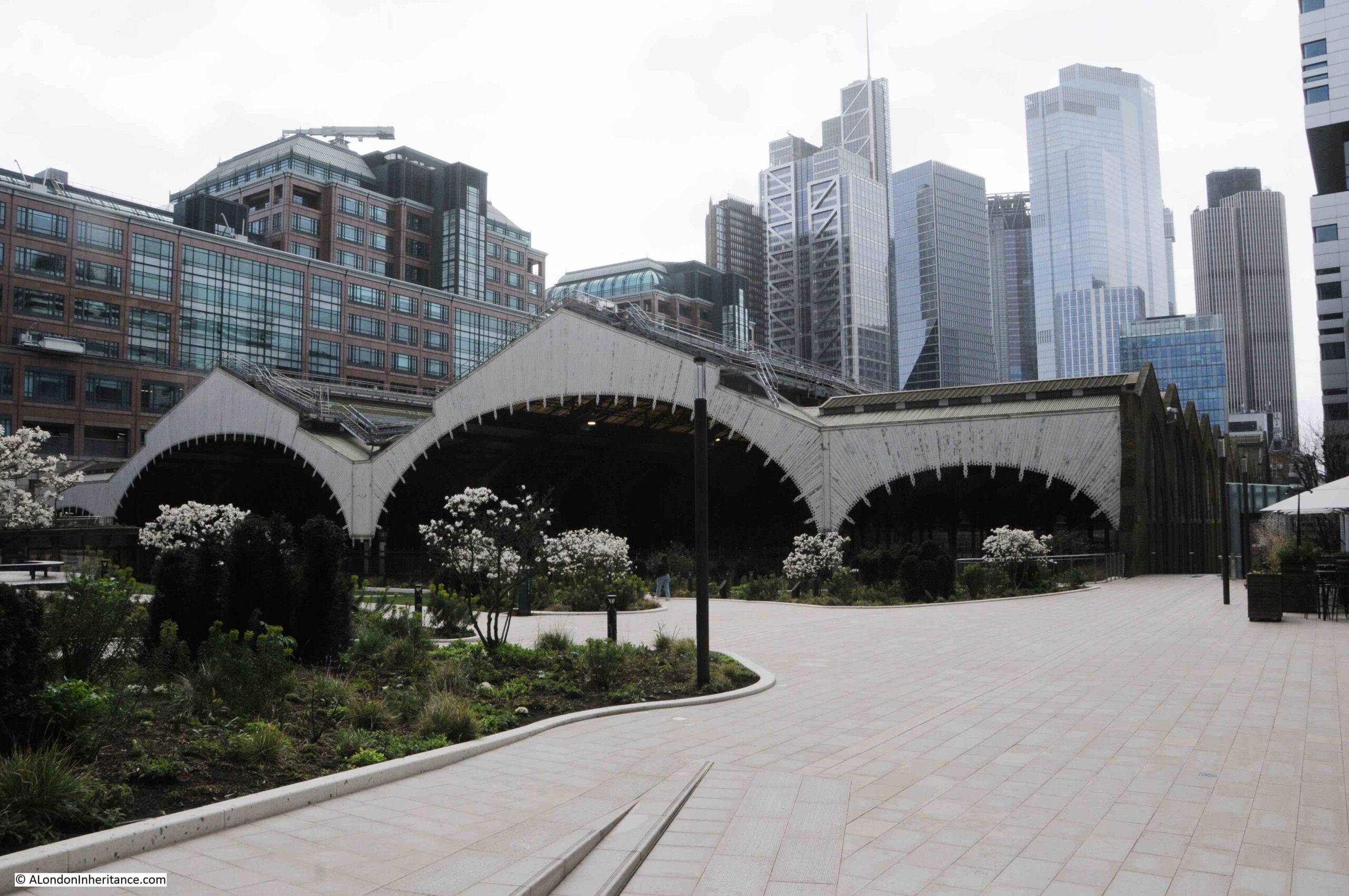
View from the corner of Exchange Square, with the roof of Liverpool Street Station with the two central arches, and smaller flat roof / arches at the sides, with the towers of the City in the background.

Exchange Square

Although Exchange Square has recently reopened, it has long been part of the original Broadgate development, which included a number of works of art, two of which can be seen in Exchange Square.

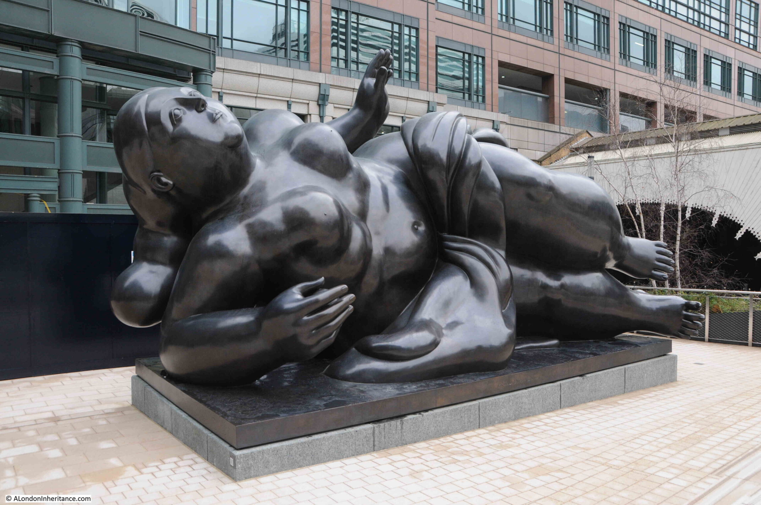
This is the Broadgate Venus – a 5 tonne patinated bronze, created for Broadgate in 1989 by the Columbia artist and sculptor Fernando Botero:

Broadgate Venus sculpture

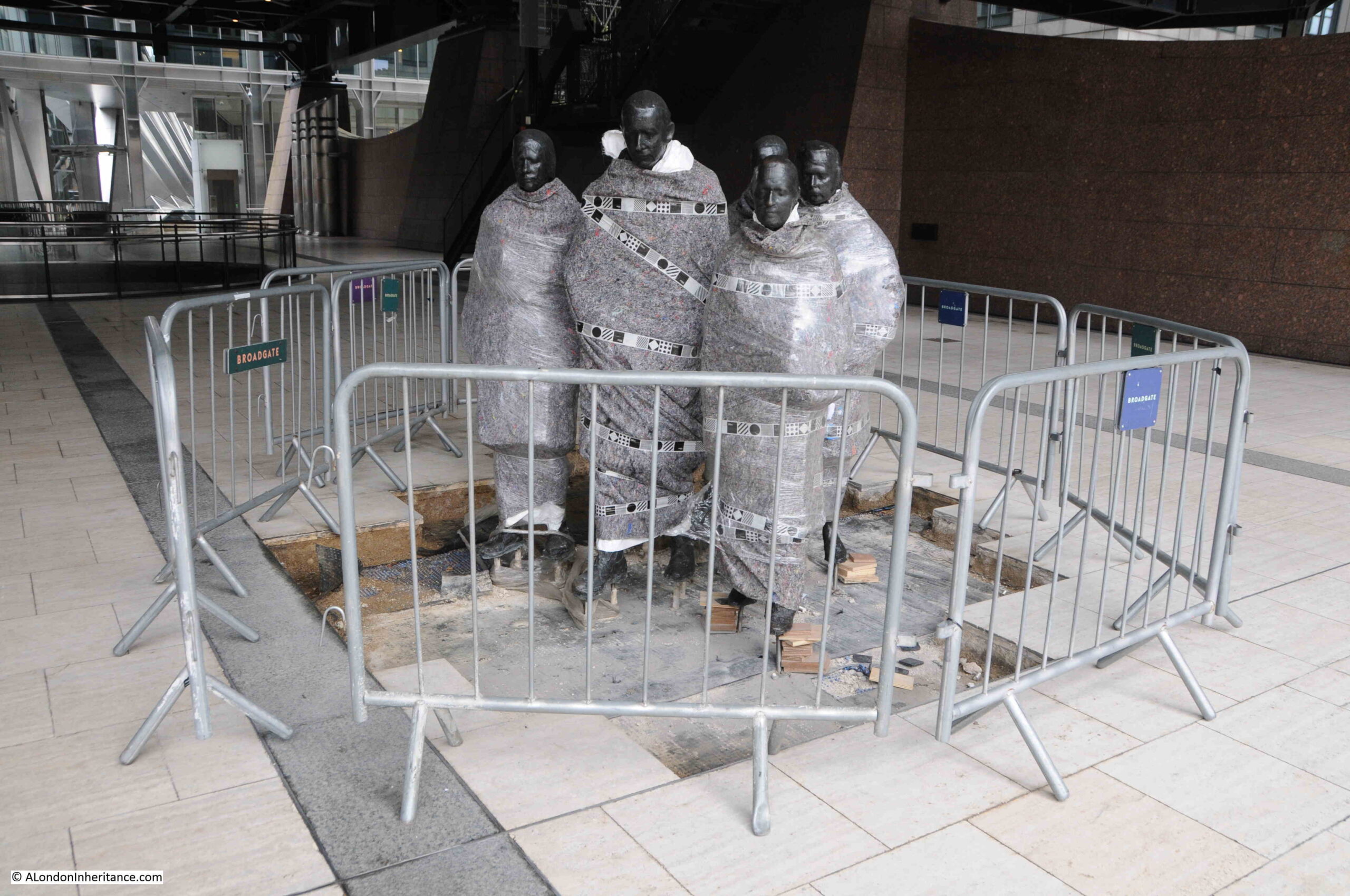
Towards the back of Exchange Square is this group of figures, who look as if they have been wrapped up against the cold of a March day:

Rush Hour sculpture

The group is a work titled “Rush Hour” by the American artist George Segal and was created in 1982. The work has only recently returned to Broadgate after being stored off site during Exchange Square’s renovation. Hopefully the weather will have warmed up by the time they are unwrapped.

But what of the two streets carried by bridges over the tracks into Liverpool Street Station?

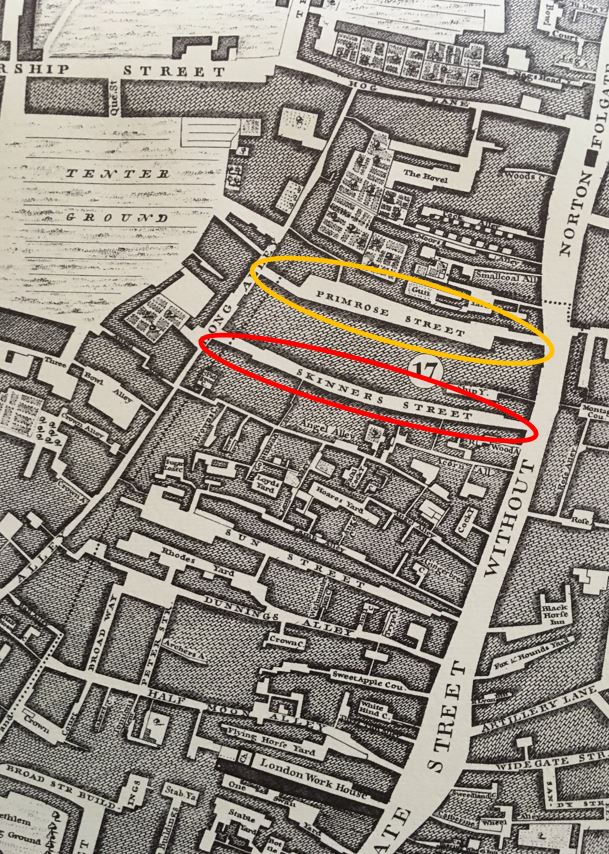
Firstly these are old streets. I have highlighted Primrose Street (yellow oval) and Pindar Street (which was originally Skinners Street – red oval) in the following extract from Rocque’s 1746 map of London:

Primrose Street

The map shows the dense network of streets, yards, courts and alleys that were lost when Liverpool Street Station was built.

Primrose and Pindar Street’s remained, but were turned into bridges that ran over the railway, rather than a street with buildings alongside.

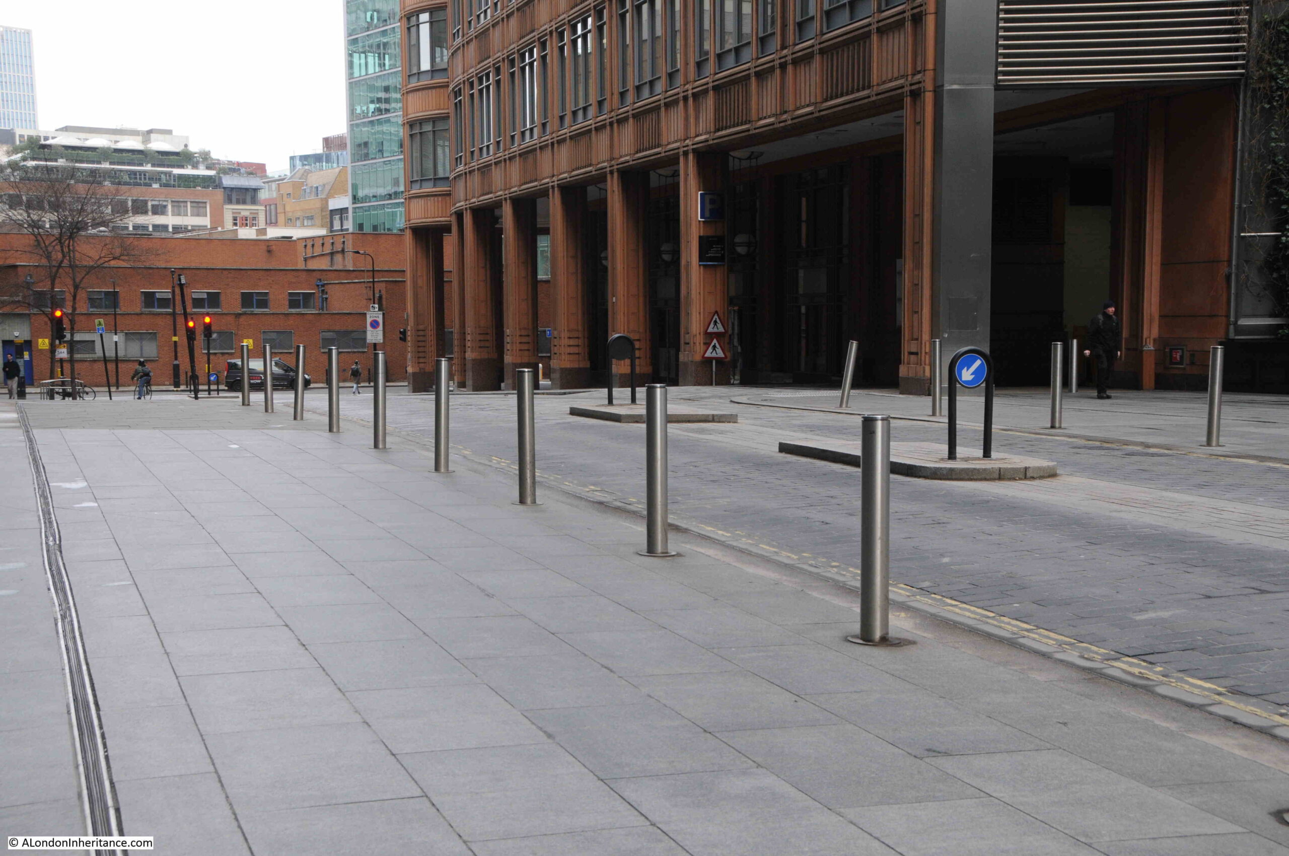
Pindar Street disappeared with the building of Broadgate, however Primrose Street does remain, linking Bishopsgate and Appold Street. The following view is looking west along Primrose Street:

Primrose Street

It does not look as if you are standing over a large number of rail tracks as there are office blocks on either side of the street, however a couple of things show the true nature of the street.

On the left of the above photo, an expansion gap can be seen running the length of the street, between the paving slabs. This shows that the road is still carried over on a bridge like structure, which can expand at a different rate to the slabs carrying the office blocks on either side.

Also in the above photo, and the following photo which is looking towards Bishopsgate, the road dips at the far end of Primrose Street, rising to the canter as it passes over the tracks.

Primrose Street

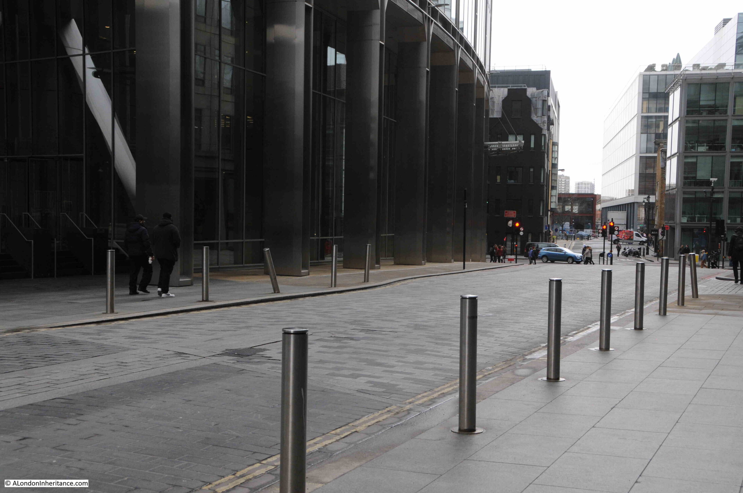
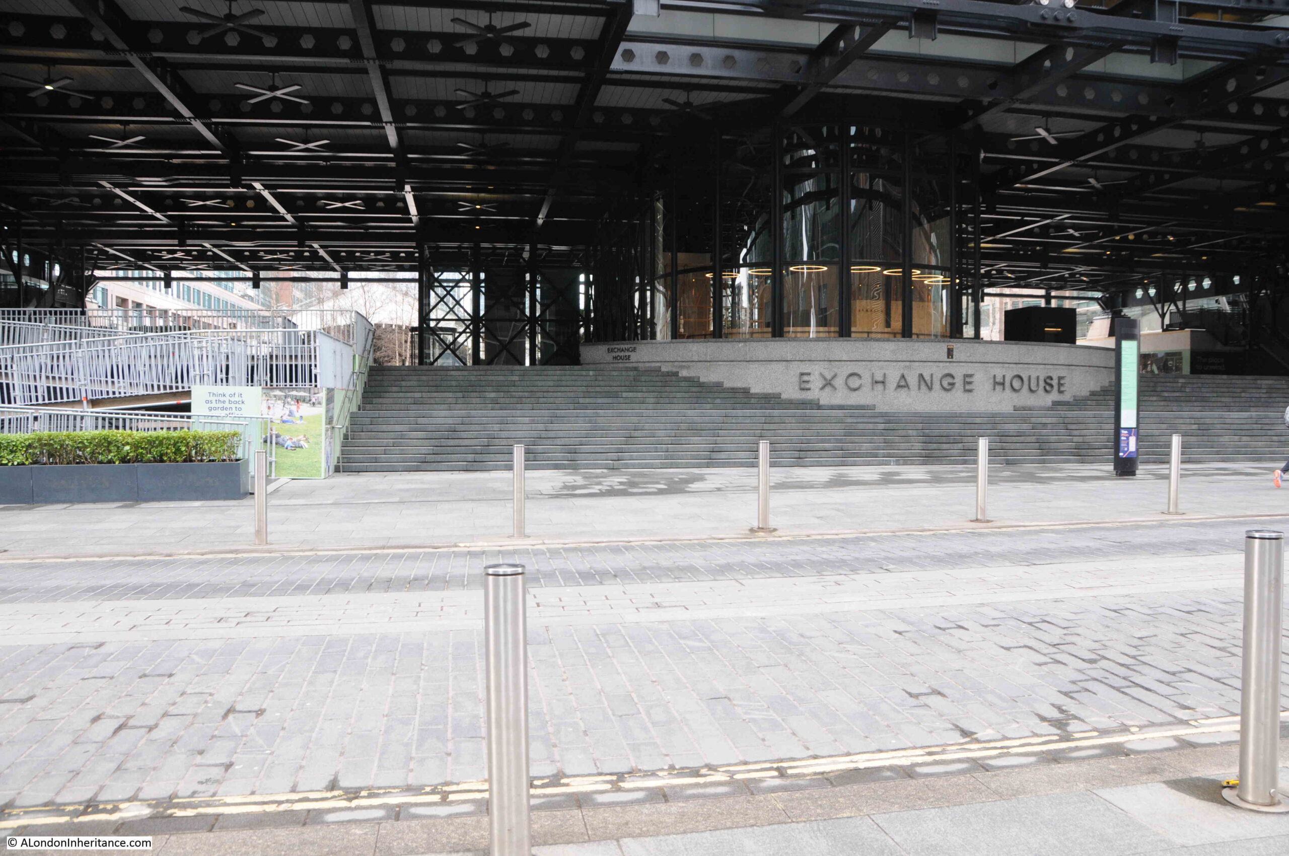
The following photo is looking from Primrose in towards Exchange Square, with part of the roof of Liverpool Street Station just visible. Exchange House is between Exchange Square and Primrose Street:

Exchange House

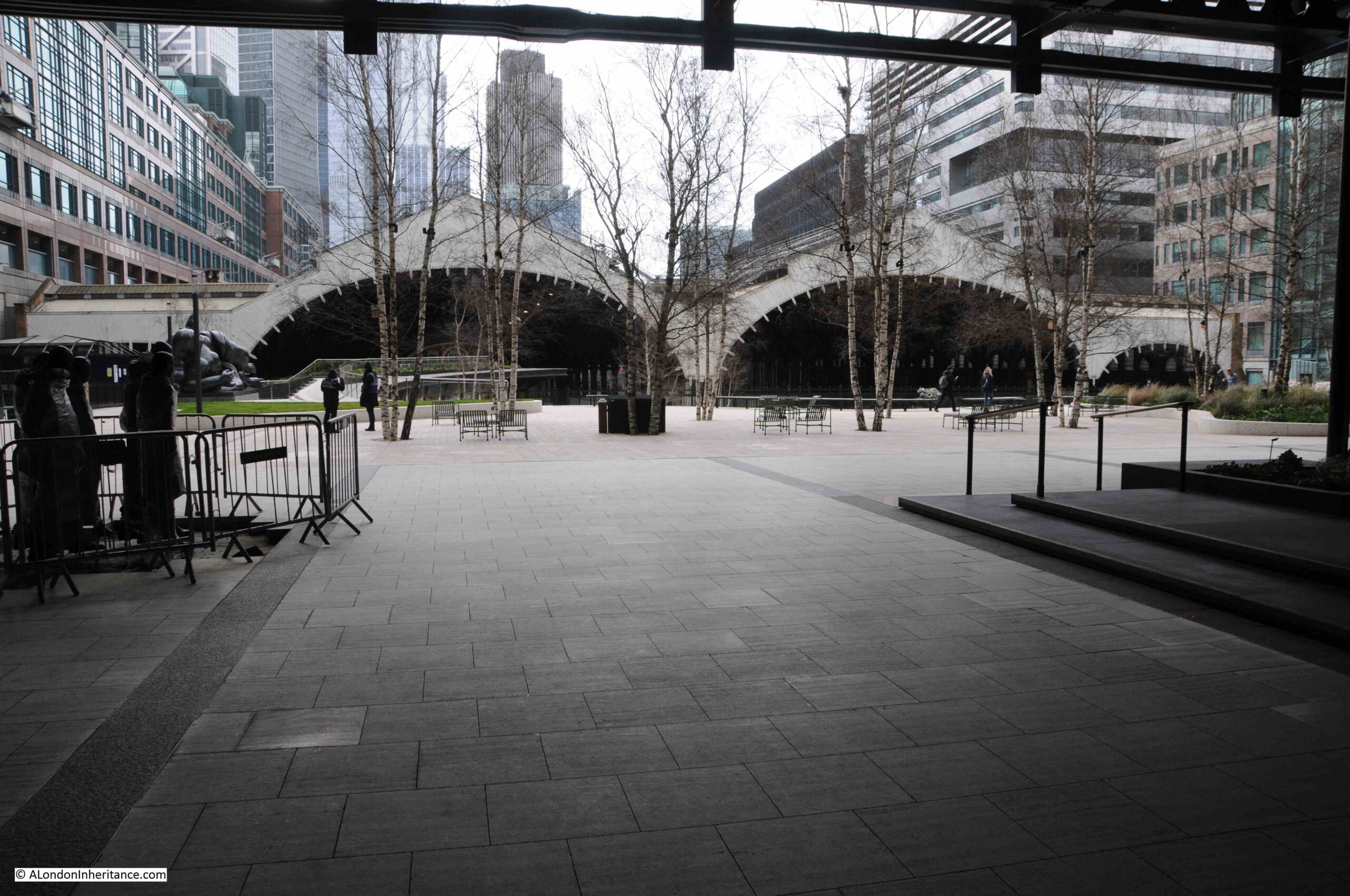
The bridge carrying Pindar Street was lost during the redevelopment of the area. The following photo is from under Exchange House looking towards the station. Pindar Street ran from left to right between the trees and seats, and just in front of where I was standing.

Exchange Square

I suspect that my father was standing in the centre of the line of trees to take the photo at the top of the post, looking towards the right, to get the right-hand main arch of the roof, and part of the smaller arch on the right into the photo.

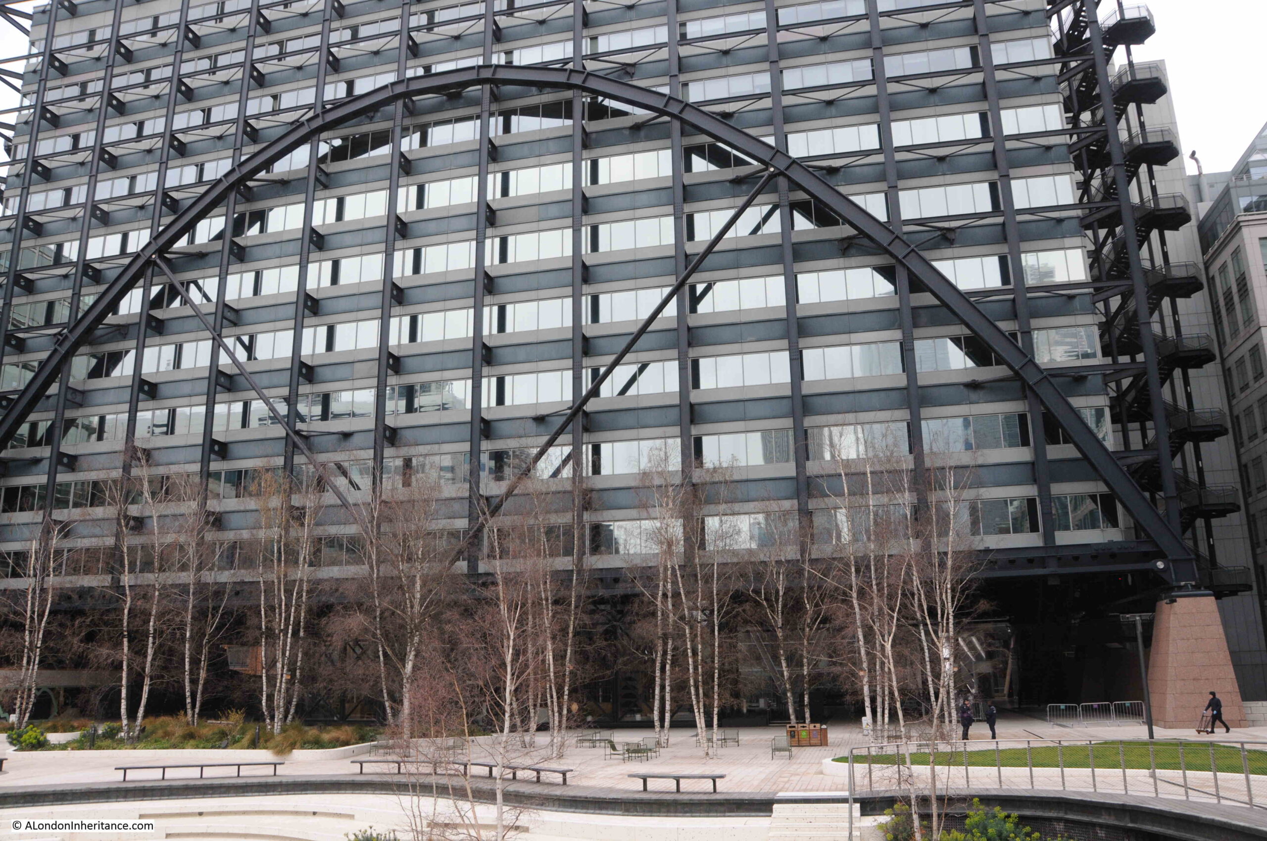
Exchange House is an interesting office block. Straddling the main rail tracks into Liverpool Street Station required some interesting construction techniques to be used. This is the building that can be seen from the Heron Tower with the metal arch crossing the façade of the building.

Exchange Square

As the rail tracks are below Exchange House, it was not possible to put large amount of piling down to support the building, so much of the weight is supported on either side, where a supporting structure can be built down to ground level to the side of the rail tracks.

The metal arch is used to transfer some of this weight to the supporting structure, one side of which can be seen in the above photo to the right of the building.

View of the redeveloped Exchange Square:

Exchange Square

The architect for the redeveloped Exchange Square was the DSDHA architecture, urban design and research studio, and the project has been shortlisted for the RIBA London Award 2023.

I am not usually a fan of these small open spaces, which often come with a description by landowners and architects which far exceeds real experience of the space, however I really do like Exchange Square.

The space slopes towards the station, drawing the eye to the large sheds over the station platforms and tracks. There is a fair amount of planting, however a chilly and overcast Saturday in March was probably not the best time of year to view the planting and it will no doubt be better when established, and with better weather.

It was also really quiet when we were exploring the area. Only a dog walker and a security guard were walking through the square. Again, it is probably far busier in the week, rather than at the weekend.

Access to Exchange Square is not that obvious. There is access from Primrose Street (under Exchange House), and up some steps from Appold Street.

Access from Liverpool Street is along the side of the station. On the south eastern side, to the right of the escalators down to the concourse, there is a walkway which goes through the edge of the office blocks between the station and Bishopsgate.

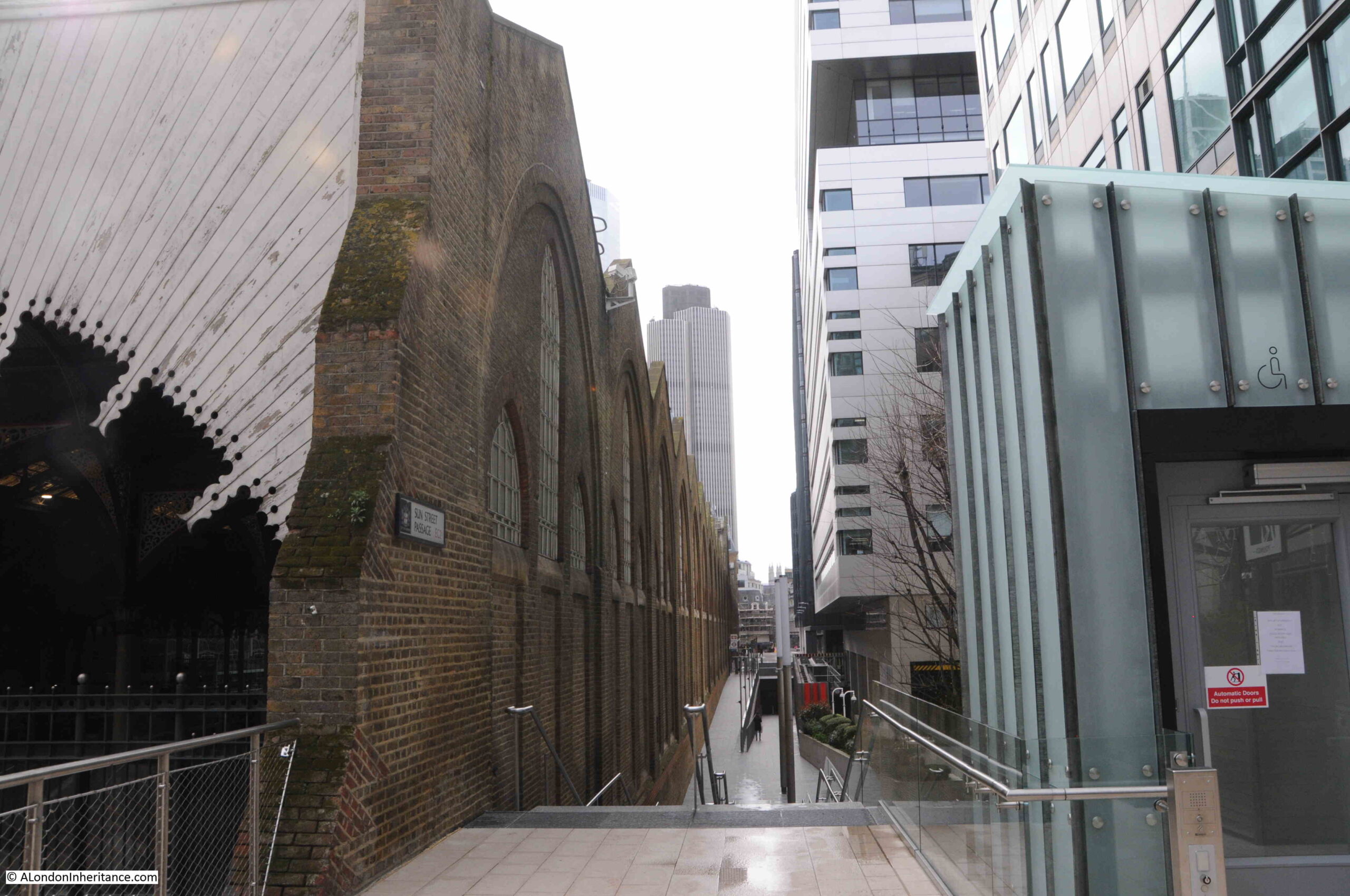
From the south western side of the station, there is an open walkway which runs along the side of the station wall. This is the view along the walkway from Exchange Square.

Liverpool Street Station

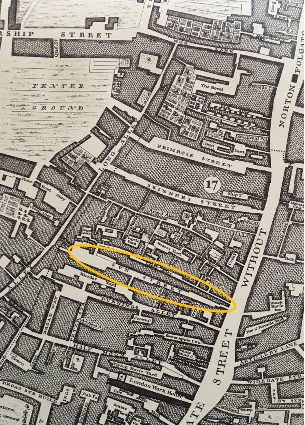
The name of the walkway is Sun Street Passage. The name recalls one of the streets that was lost when Liverpool Street Station was built. There was a Sun Street, which I have highlighted in the following 1746 map, which ran across the station, under the current location of the platforms.
Sun Street

We walked along Sun Street Passage, with the high brick walls of the station on the left, and half way down there is an entrance into the station:

Liverpool Street Station

The above view is looking towards Exchange Square, which you can just see running across and above the platforms.

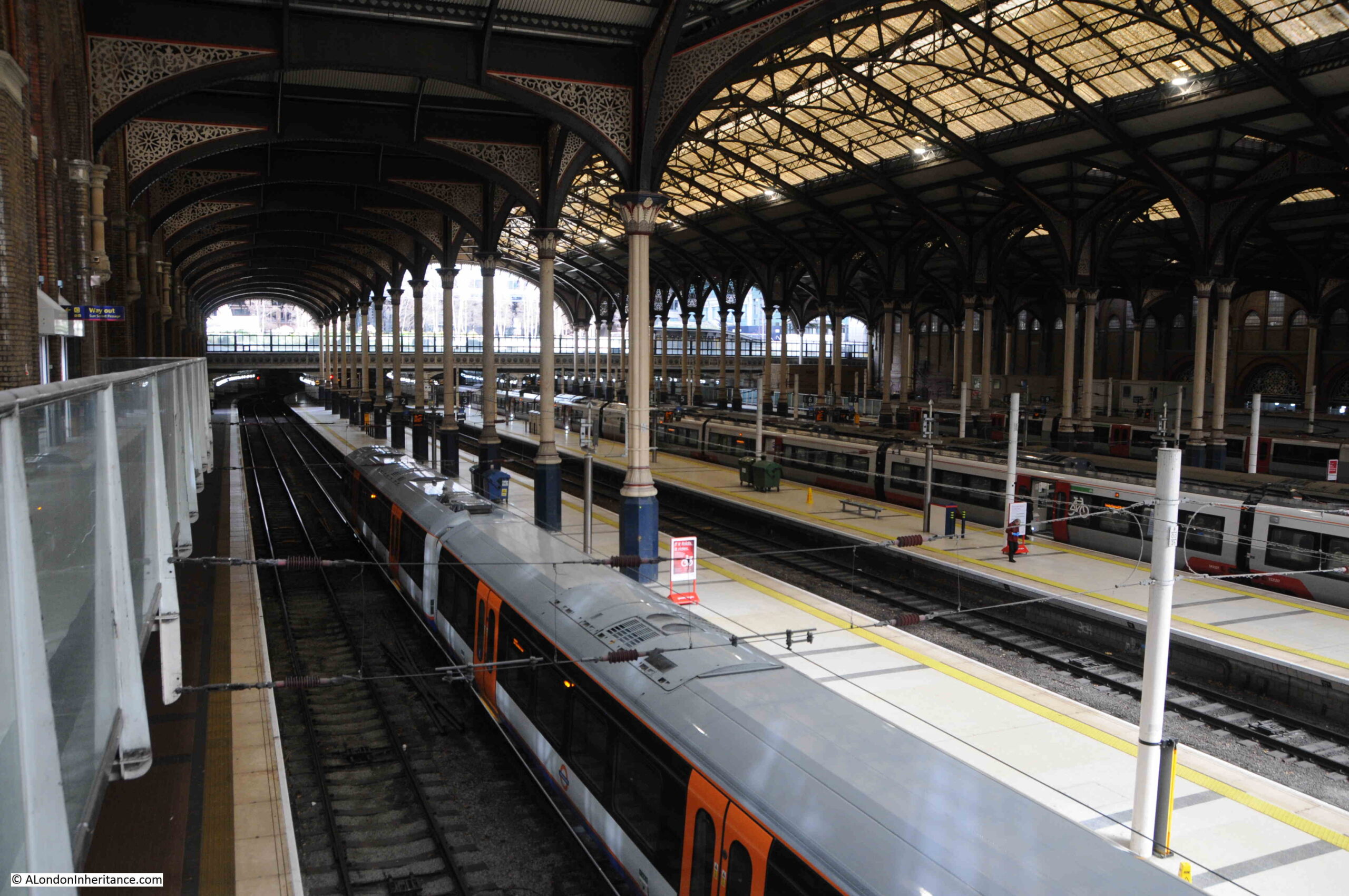
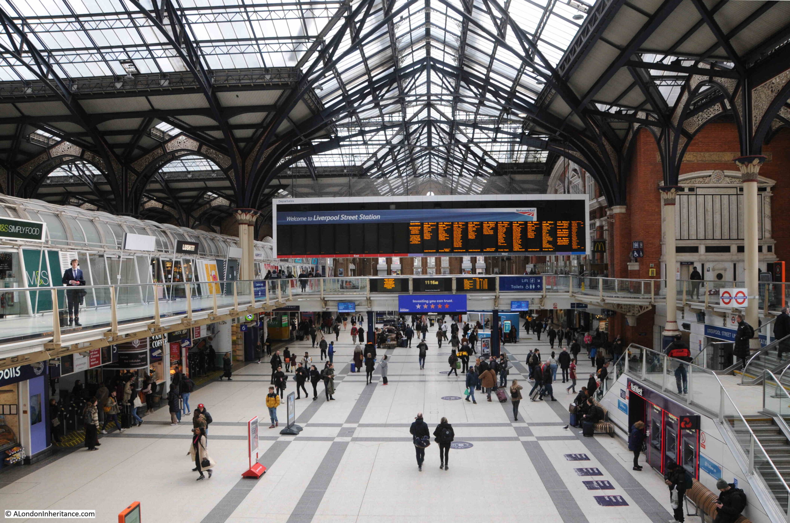
The concourse, where the roof runs at a ninety degree angle to the roof over the platforms, and with cleaned glass that allows a large amount of natural light to the area below:

Liverpool Street Station

The station is so very different to when I used it every day during the 1980s. Much cleaner, the old destination indicators above the entrance to the platforms, where tickets where inspected manually, and always busy in the morning and evening commute, less so late in the evening when the pubs closed.

Liverpool Street Station

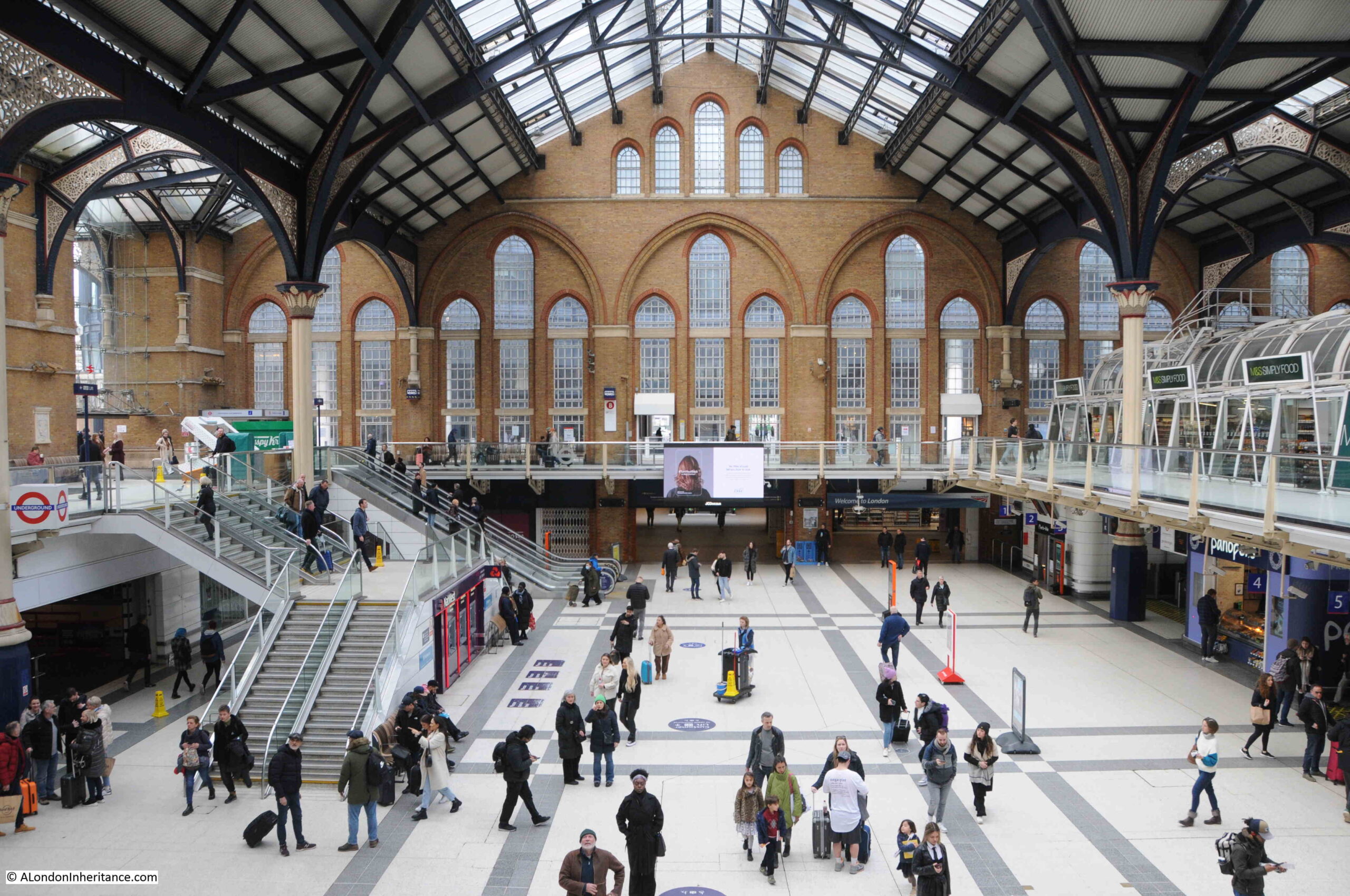
The above photo is from a walkway that crosses the centre of the station. This is looking towards where there was a cut through to Broad Street Station. On the left are the stairs running up to the exit to Liverpool Street (the street after which the station is named).

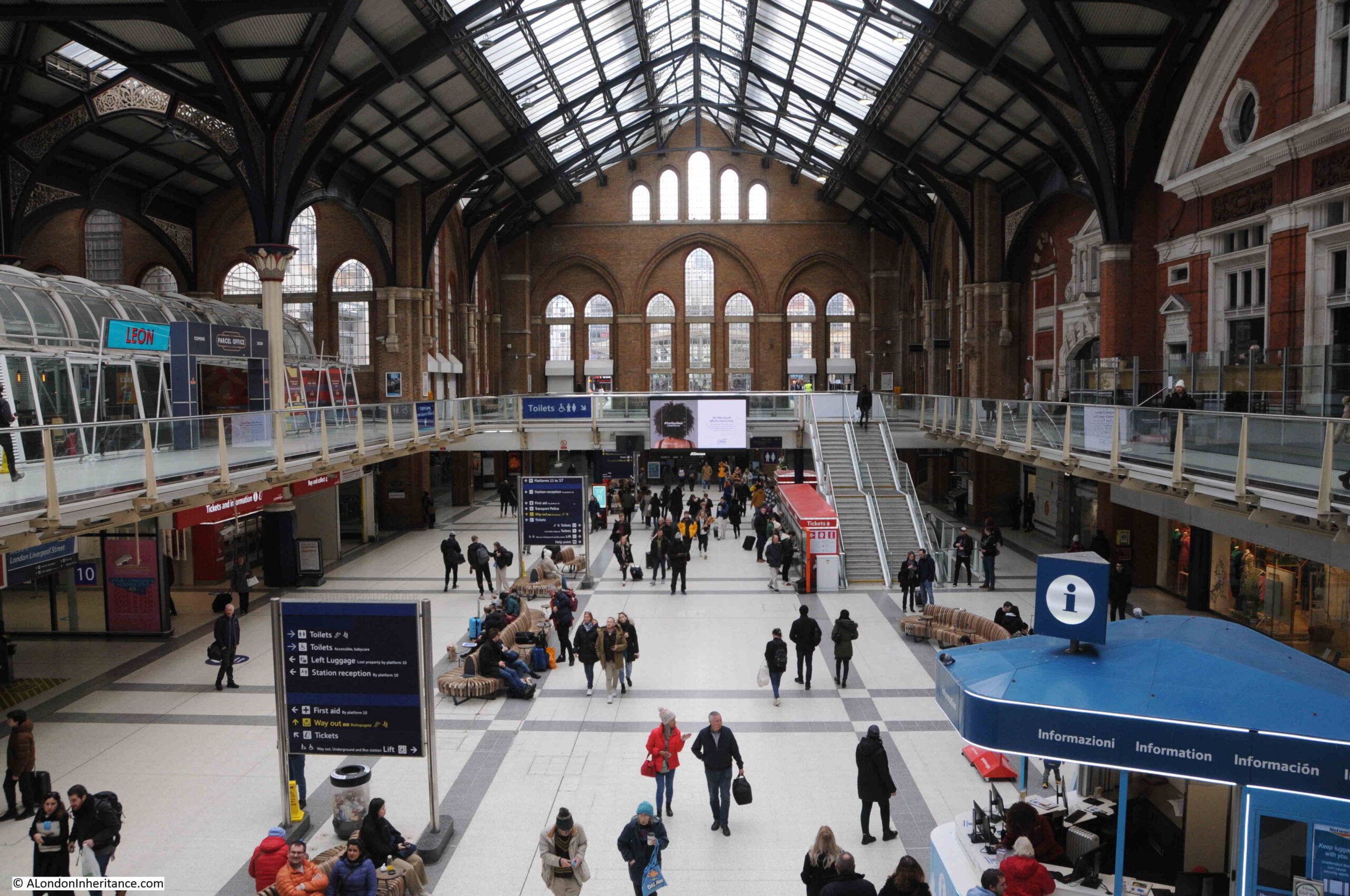
The following photo is looking in the opposite direction. At the far end there are stairs and escalator up to Bishopsgate. Both views again show that the concourse and platforms are below ground level.
Liverpool Street Station

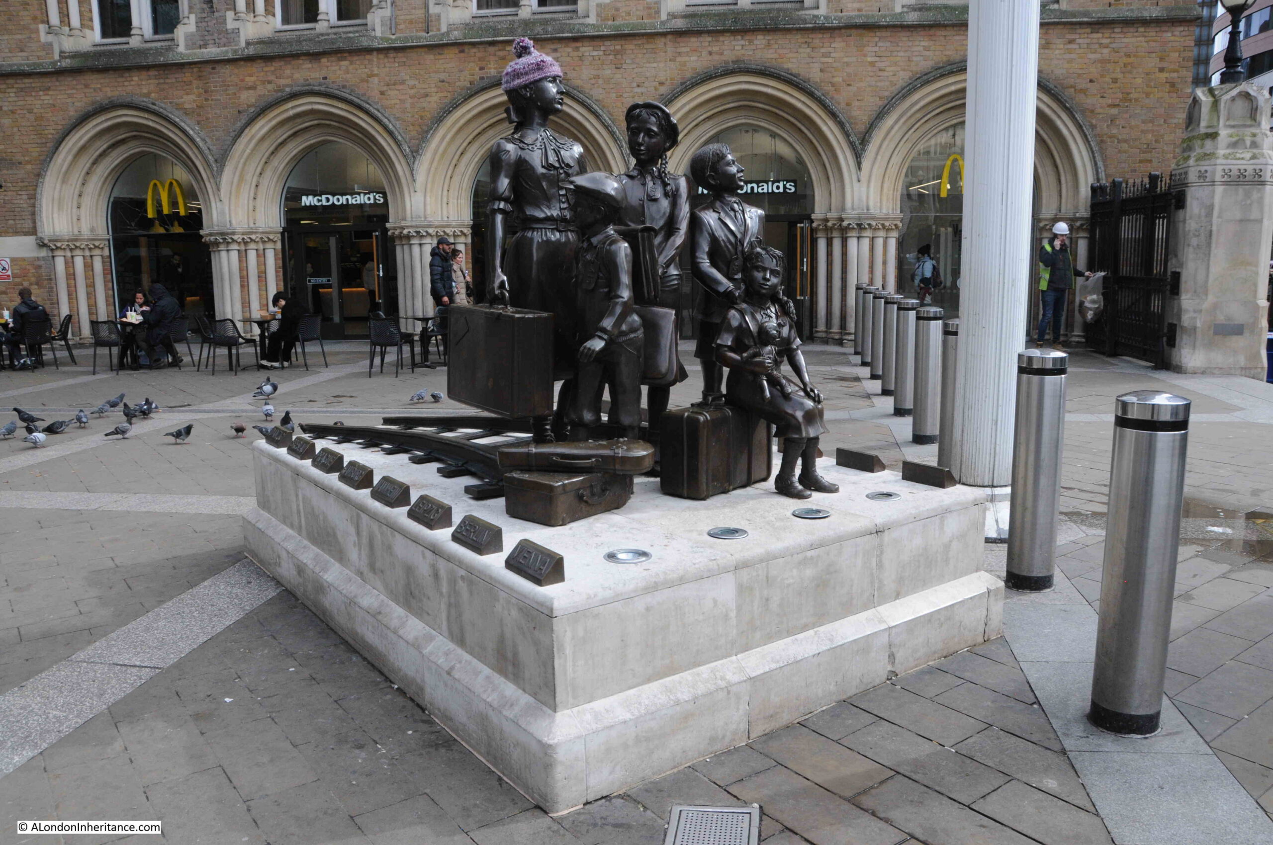
In the entrance space from Liverpool Street is the bronze sculpture “Kindertransport – The Arrival”, by Frank Meisler, which was installed in 2006:

Kindertransport

The memorial is to the almost 10,000 children who escaped Germany between 1938 and 1939, travelling by boat from the Hook of Holland in the Netherlands to Harwich, then by train from Harwich to Liverpool Street.

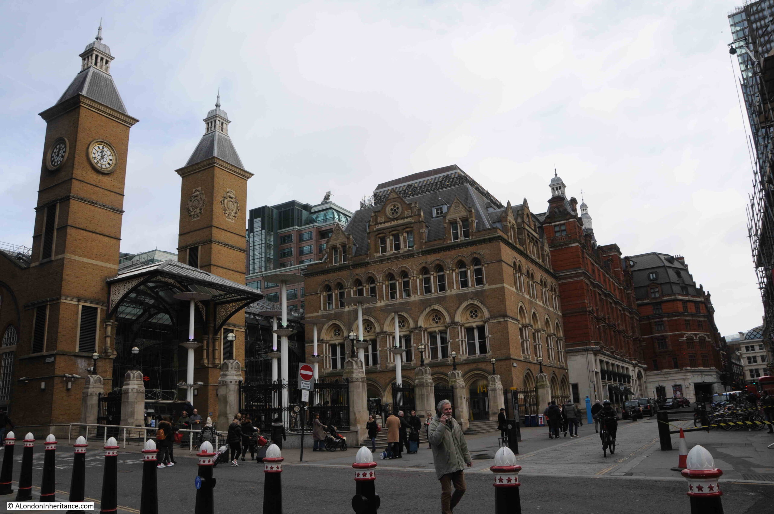
The following view is looking along Liverpool Street with the station buildings on the left:

Liverpool Street Station

The two towers to the left of the photo were part of the late 1980s redevelopment of the station. The area occupied by the towers was a ramp providing access down to the area between Liverpool and Broad Street stations.

There are currently proposals for a major redevelopment of the station, which will see the towers and the lighter brick building demolished, and two large towers built over the space and above the original station buildings and station hotel which is the of the darker red brick.

The proposals would completely overwhelm the original station buildings, and those supporting the development claim that it would encourage people to travel back to the City and would improve the experience of the station users.

I think that what users of the station would really prefer is a cost effective, efficient train service, rather than the redevelopment, with two large glass and steel towers built over the station buildings.

The Victorian Society have launched a campaign to save the station, with the rather brilliant slogan (if you have used London’s transport system) of “See It, Say It, Save It”

The Architects Journal have an overview of the proposals, here, and the Victorian Society campaign introduction is here.

View along the side of the station. Exchange Square is at the far end:

Liverpool Street Station

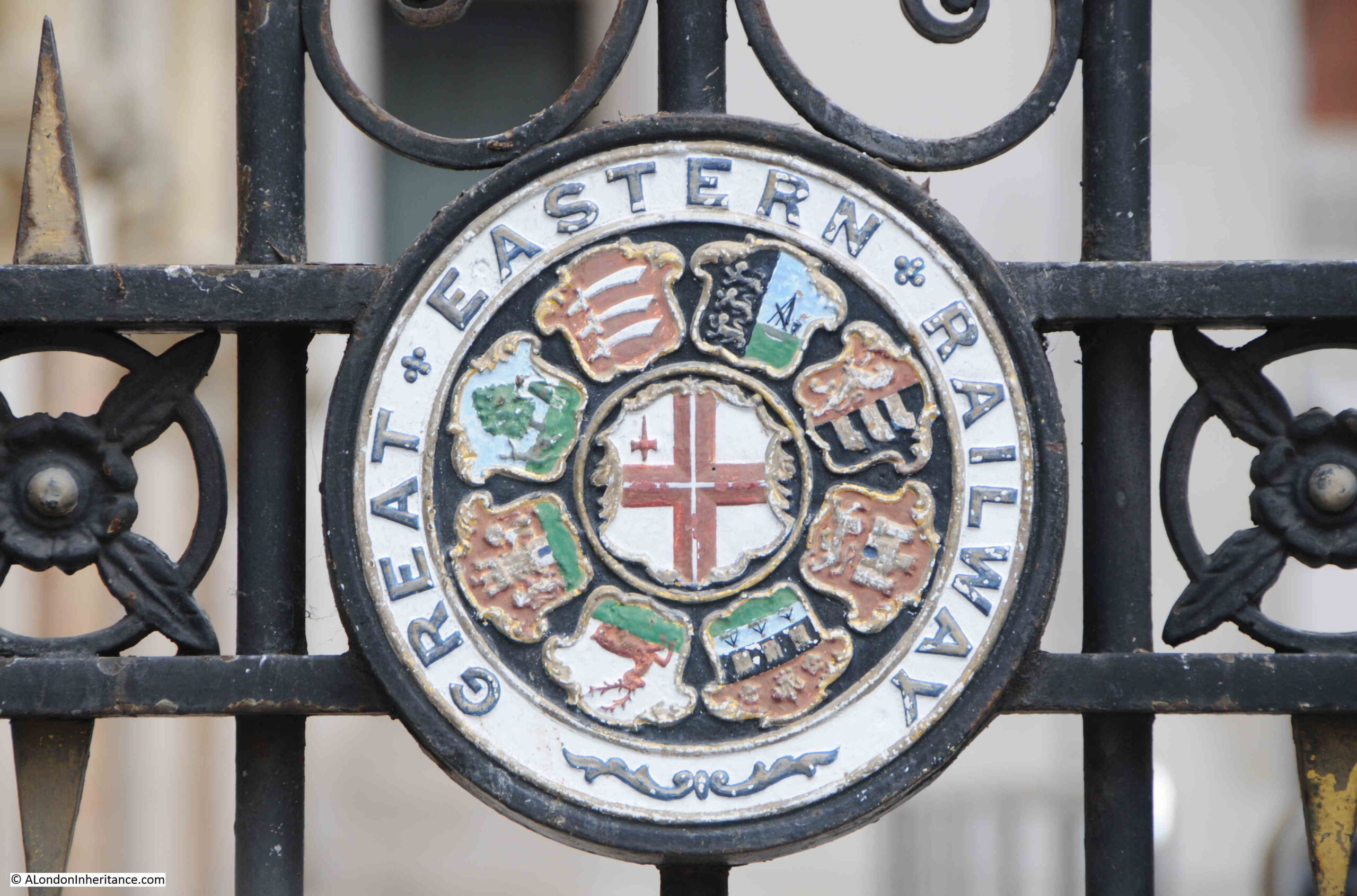
On the railings around the station entrance are the arms of the Great Eastern Railway, the original company that operated into Liverpool Street Station, with the individual arms of places served by the railway, including Essex, Norwich, Ipswich and Cambridge:

Great Eastern Railway

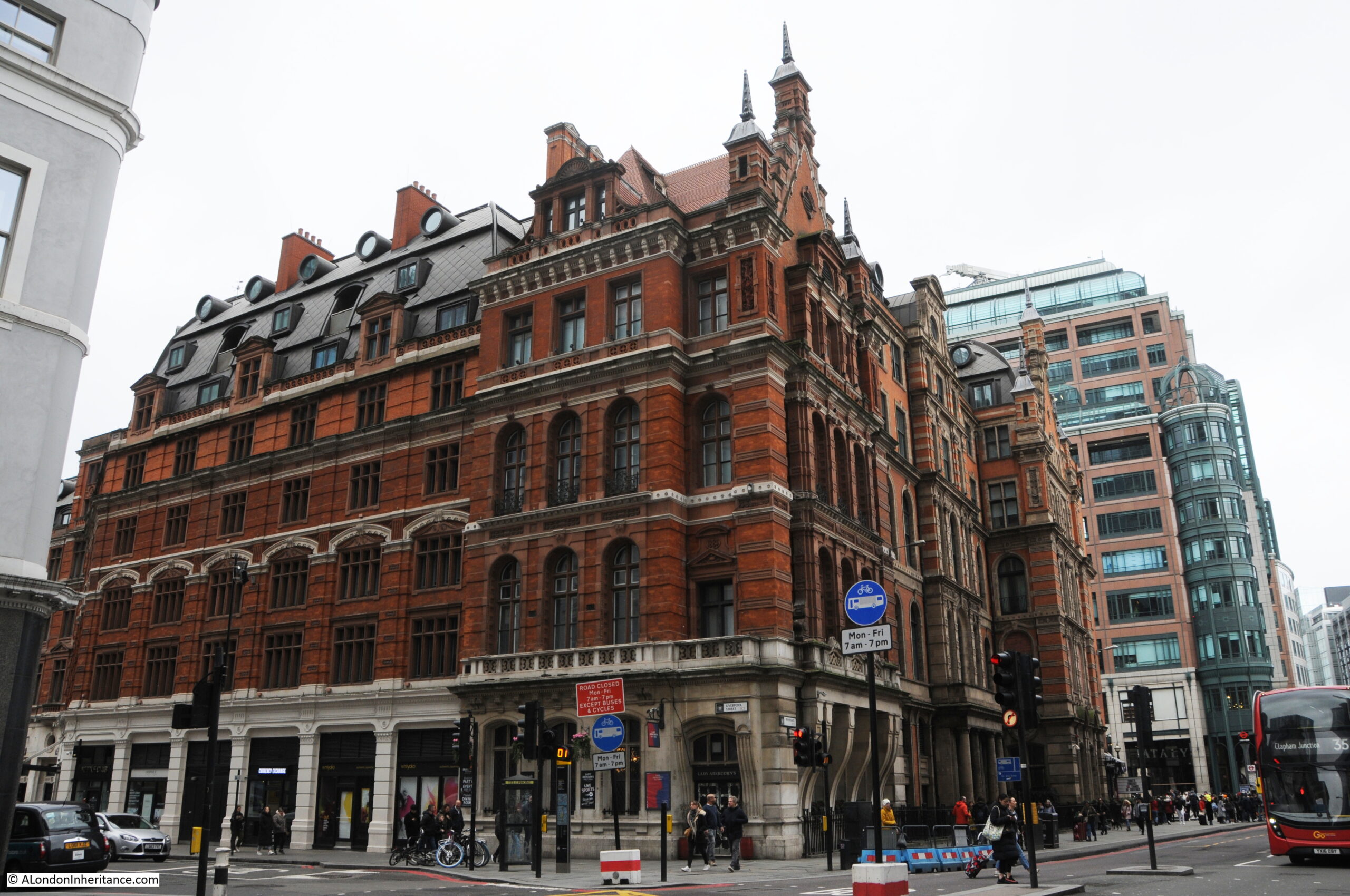
The station buildings on the corner of Liverpool Street and Bishopsgate:

Liverpool Street Station

Liverpool Street Station, the development of the railway into Liverpool Street and the area in general has a fascinating history, which I shall return to, as the demands of a weekly post, as well as trying to limit my posts to 3000 words prevent inclusion in this post.

I have been waiting for the redevelopment of Exchange Square to complete, and I am really pleased that it is still possible to almost see the same scene as my father.

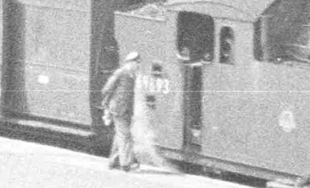
The details within the overall photo are also fascinating, and I shall leave you this week with the extract from the photo at the top of the post, showing a worker walking up to an engine. I do not know if he was the driver, but an everyday station scene from 71 years ago.

Train driver

I just wish that I had taken some photos in all the years that I used Liverpool Street Station.

alondoninheritance.com

Doctors Commons to the Daily Courant – City of London Plaques

Today’s post continues my exploration of all the plaques in the City of London, today covering Doctors Commons, St Thomas the Apostle and St. Leonard’s churches, Haberdashers Hall and the Daily Courant, the country’s first daily newspaper.

Doctors Commons

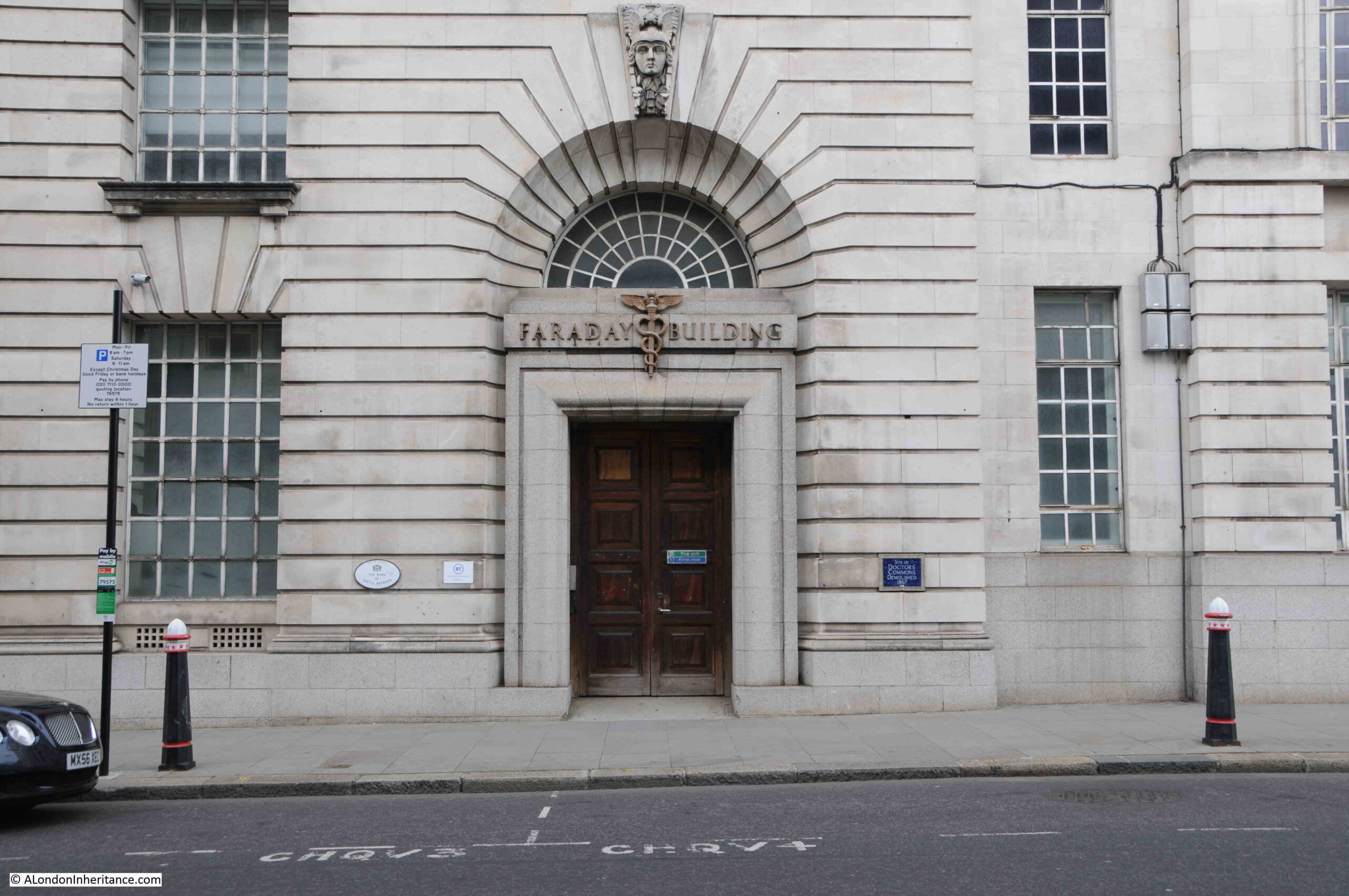
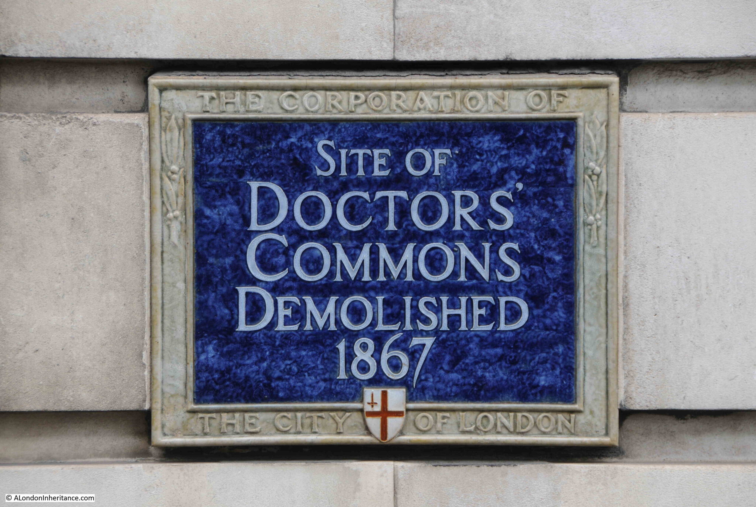
Walk along Queen Victoria Street, and to the right of one of the doors to the magnificent Faraday Building (see this post), is a blue plaque:

Doctors Commons

Recording that this was the site of Doctors’ Common, demolished in 1867:

Doctors Commons

Doctors Commons was founded on the site in 1572 as the College of Advocates and Doctors of Law. The buildings housed the Ecclesiastical and Admiralty Courts, along with the advocates who practicsed within these courts,

There were a total of five courts within Doctors Commons:

  • Court of Arches which was the highest court belonging to the Archbishop of Canterbury. The name comes from the arches of the original Bow Church in Cheapside which was the original location of the court.
  • Court of Audience. This was another of the Archbishop’s courts, and was where the Archbishop would make a judgment on the cases that were brought to the court.
  • Prerogative Court. This was the court where wills and testaments were proven.
  • Court of Faculties and Dispensations. This was where special permission was granted to do something which the law would not normally allow. There are newspaper records of this court being used to allow quick marriages without the normal requirement for banns to be read in church.
  • Court of Admiralty. This court belonged to the Lord High Admiral of England and is the court where matters relating to mariners, merchants, ownership of ships etc. were settled.

The accounts of the cases brought to these courts are fascinating and shed a light on the legal system of the time. One of the activities of the Court of Admiralty was to decide on the ownership of captured enemy ships, for example, in July 1744:

“Last Monday a Court of Admiralty was held at Doctors Commons, when the Santa Rosetta, a Spanish Ship, taken by the Romney, Man of War, Greenwill, was condemn’d as a legal Prize, and the Shares ordere’d to be paid to the Captors forthwith.”

And in June 1747:

“On Tuesday was held at the Court of Admiralty at Doctors Commons, when the French Ships taken by the Admirals Anson and Warren, were condemned as lawful Prizes.”

The decision that these ships were prizes seems to have been a formality as I could not find any report where the status of a prize was not the outcome. Many a ship’s captain must have come away from Doctors Common a very happy, and financially better off, person.

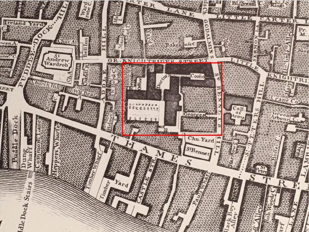
The plaque next to the door of Faraday House implies that Doctors Commons was specifically at that location, however it occupied a much larger area. I have outlined the area occupied by Doctors Commons in the following extract from Rocque’s map of 1746:

Doctors Commons

Queen Victoria Street had not been built when the above map was created. It was built during the 1860s and is why the plaque gives the end date of Doctors Commons as1867 (see this post for the story of Queen Victoria Street). To get an idea of the route of Queen Victoria Street, the College of Arms can be seen to the right of the above map, and this now sits on the northern side of Queen Victoria Street, so the street ran along the southern edge of the College of Arms, down to the left where it met Thames Street.

Doctors Commons was mentioned by Charles Dickens in David Copperfield and the Pickwick Papers, and it seems to have been the type of place where the intricacies of the law, were often dragged out, and mainly to the benefit of the legal profession at the time.

The Prerogative Court dealt with wills and probate, and before its closure, was recorded as having a vast store of wills, including those of Sir Isaac Newton and Inigo Jones. This store also included a will written on a bed post, which was presumably a will written in the very last moments of life.

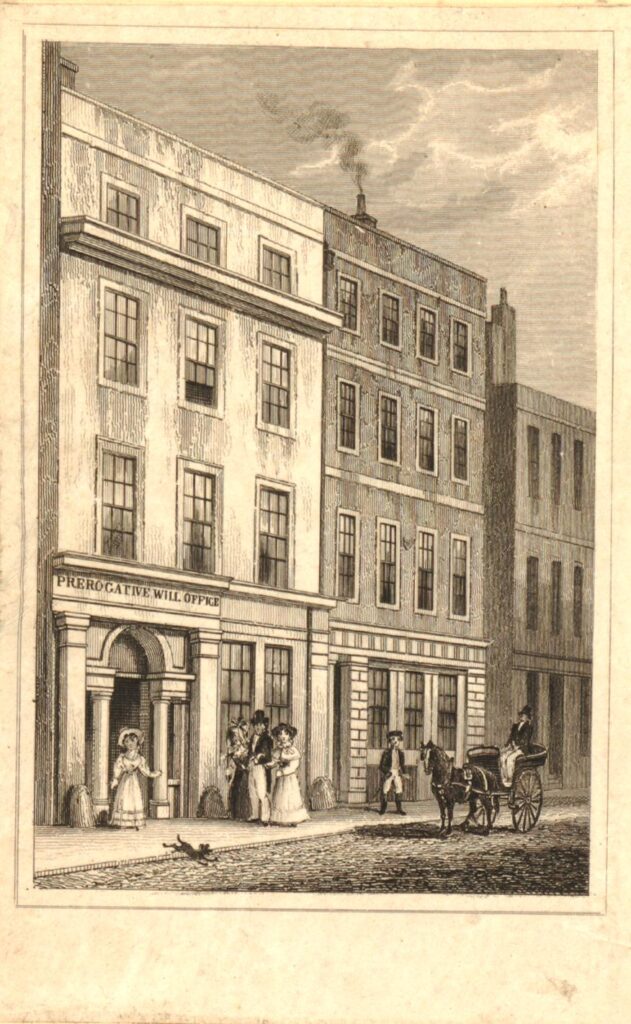
The following print shows the Prerogative Office in Doctors Commons in 1831, This office is marked in Rocque’s map, in the top left of the extract I have shown above  (© The Trustees of the British Museum).

Doctors Commons

By the time of demolition, many of the buildings of Doctors Commons had fallen into disrepair. Various acts of Parliament had changed the way that legal matters were dealt with, and the Court of Probate Act and Matrimonial Causes Act, both in 1857, along with the High Court of Admiralty Act of 1859 ended the majority of legal work at Doctors Commons.

The land was sold off and rebuilt. The southern tip of the area was incorporated into Queen Victoria Street, and this old legal area was reduced to a blue plaque.

St. Thomas the Apostle Church

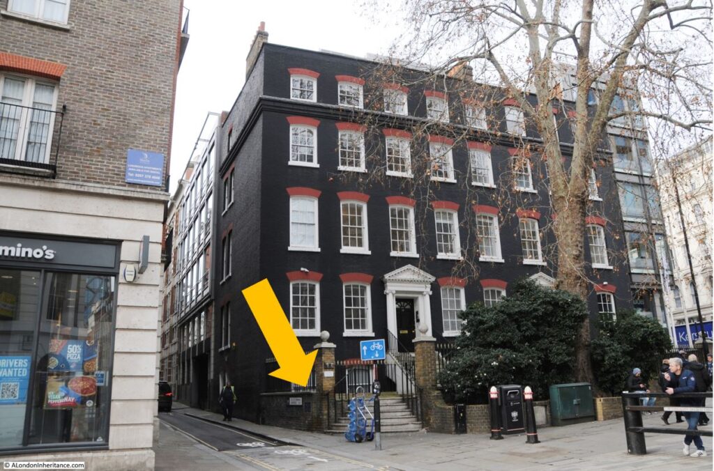
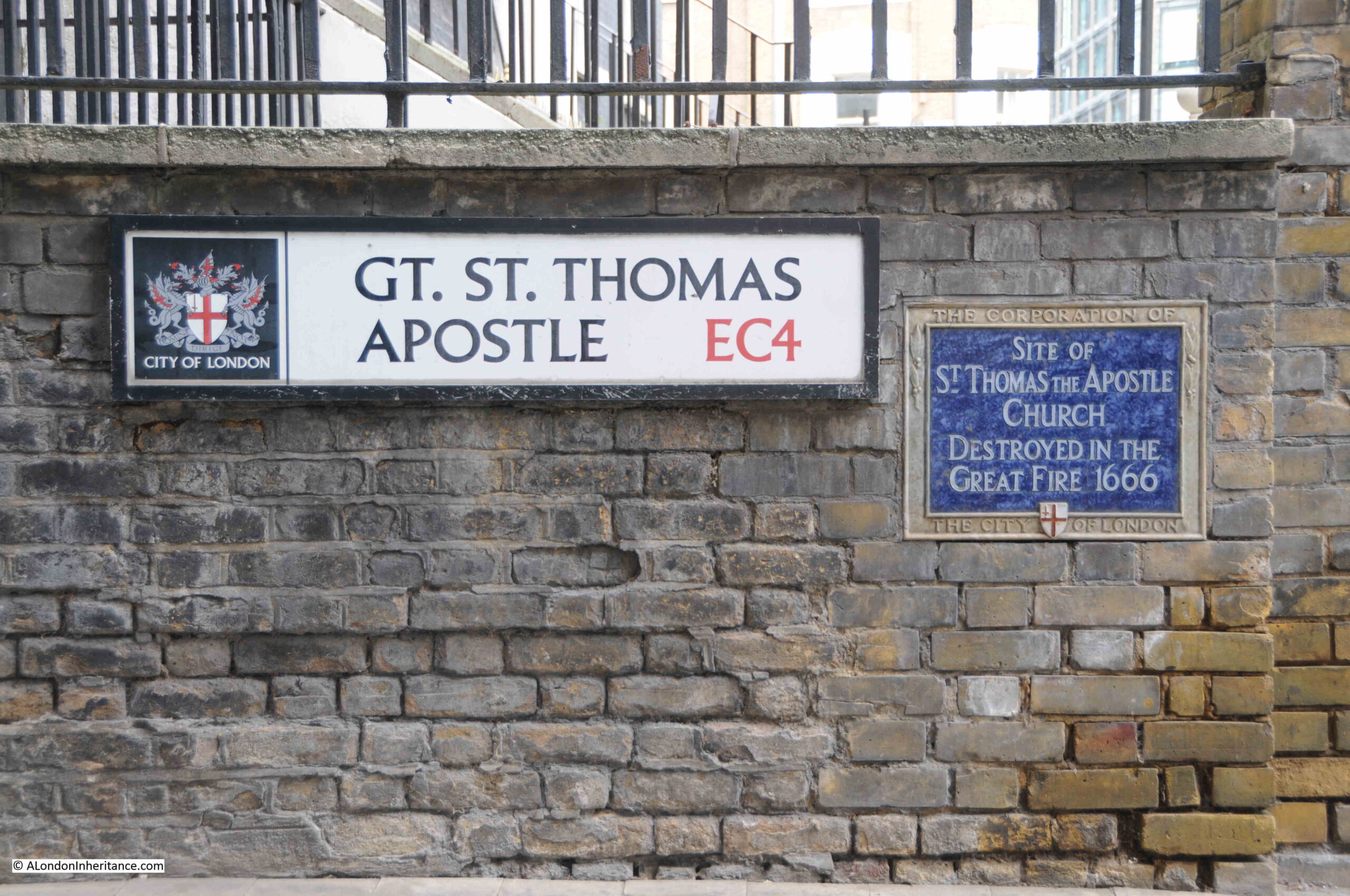
The next plaque is to one of the many City churches that were destroyed during the 1666 Great Fire of London and were not rebuilt. The plaque is on a low wall on the corner of Great St. Thomas Apostle:

St Thomas the Apostle Church

Next to the street name sign:

St Thomas the Apostle Church

I cannot find any prints of this church, and there is little information available. My source for all pre-Great Fire churches is Wilberforce Jenkins “London Churches Before The Great Fire” (1917), and he writes about the church:

“The Church of St Thomas Apostle was in Knight Rider Street, at the east end of the street where the modern Queen Street crossed. from the earliest times it belonged to the canons of St. Paul, and is mentioned in the register of the Dean and Chapter in 1181. William de Sleford was priest in 1365 and William Stone was chaplain in 1369, being appointed by the Archbishop of Canterbury.

And yet the Dean and Chapter of St. Paul’s presented William Brykelampton in 1415. The church would appear to have been rebuilt before this date, for Stow tells us that ‘John Barnes Mayor in 1371 was a great builder of St. Thomas Apostle parish church as appeareth by his arms there both in stone and glasse’. the same John Barnes left a chest and 1000 marks, to be lent to young men ‘upon sufficient pawne, and for use thereof”.

John Barnes was the Lord Mayor at the time, which probably explains why he had his arms inscribed on the stone and glass of the church.

The church has long gone, but the street name and plaque records that it was here.

St. Leonard’s Church

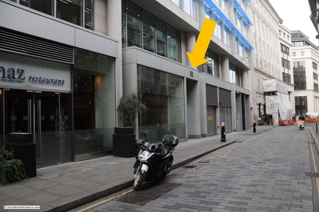
In Foster Lane, between the ground and first floors of a modern building is a plaque:

St Leonard's Church

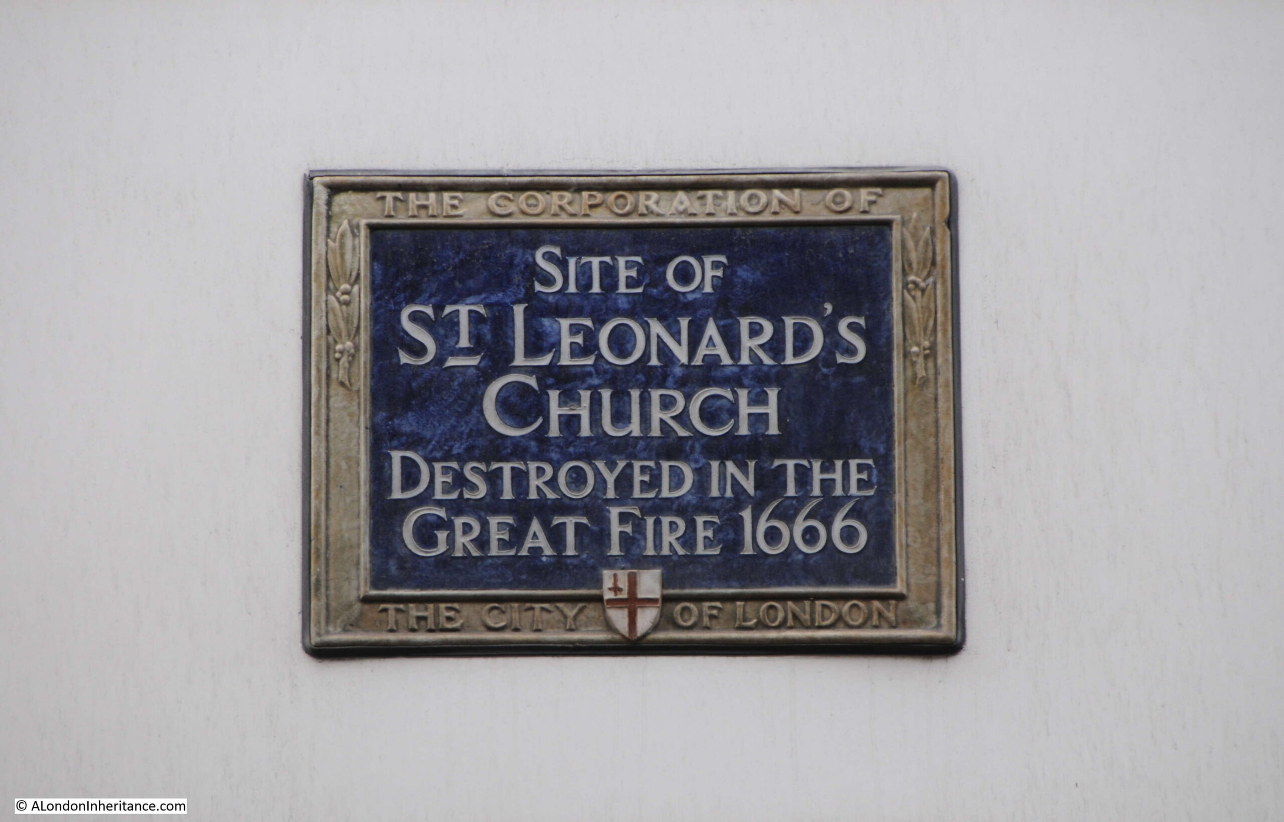
Recording that St. Leonard’s, another of the churches not rebuilt following the Great Fire, was located here:

St Leonard's Church

Again, the book “London Churches Before The Great Fire” is my main source for information on this long lost church, and the book records that:

“St. Leonard’s, Foster Lane, formerly stood on the west side of that street, being a small parish church designed for people of St. Martin-le-Grand, and founded by the dean and canons of the priory on the thirteenth century. Outside of the church was a monument to John Brokeitwell, one of the founders and new builders of the church.

Francis Quarles, the somewhat eccentric poet, well known as the author of The Emblems was buried here in 1644.

The first rector of the church was William de Tyryngton who died in 1325. William Ward was rector in 1636, and was censured by a committee of Parliament for innovations. He was forced to fly, plundered, and at last died of want.

In 1636 the yearly income, including a house, was £139. the church was burnt in the Great Fire and not rebuilt, the parish being united to that of Christchurch.”

Francis Quarles seems to have been an interesting character. He took the Royalist side during the Civil War, and published several pamphlets in support of the Royalist cause, but he is one of those research rabbit holes that I must avoid going down so I can get a weekly post completed.

All that remains now of the church is the City of London blue plaque.

Haberdashers Hall

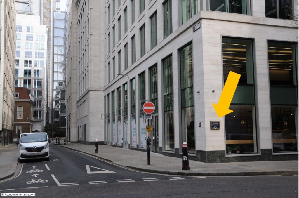
On the corner of Staining and Gresham Streets is a plaque:

Haberdashers Hall

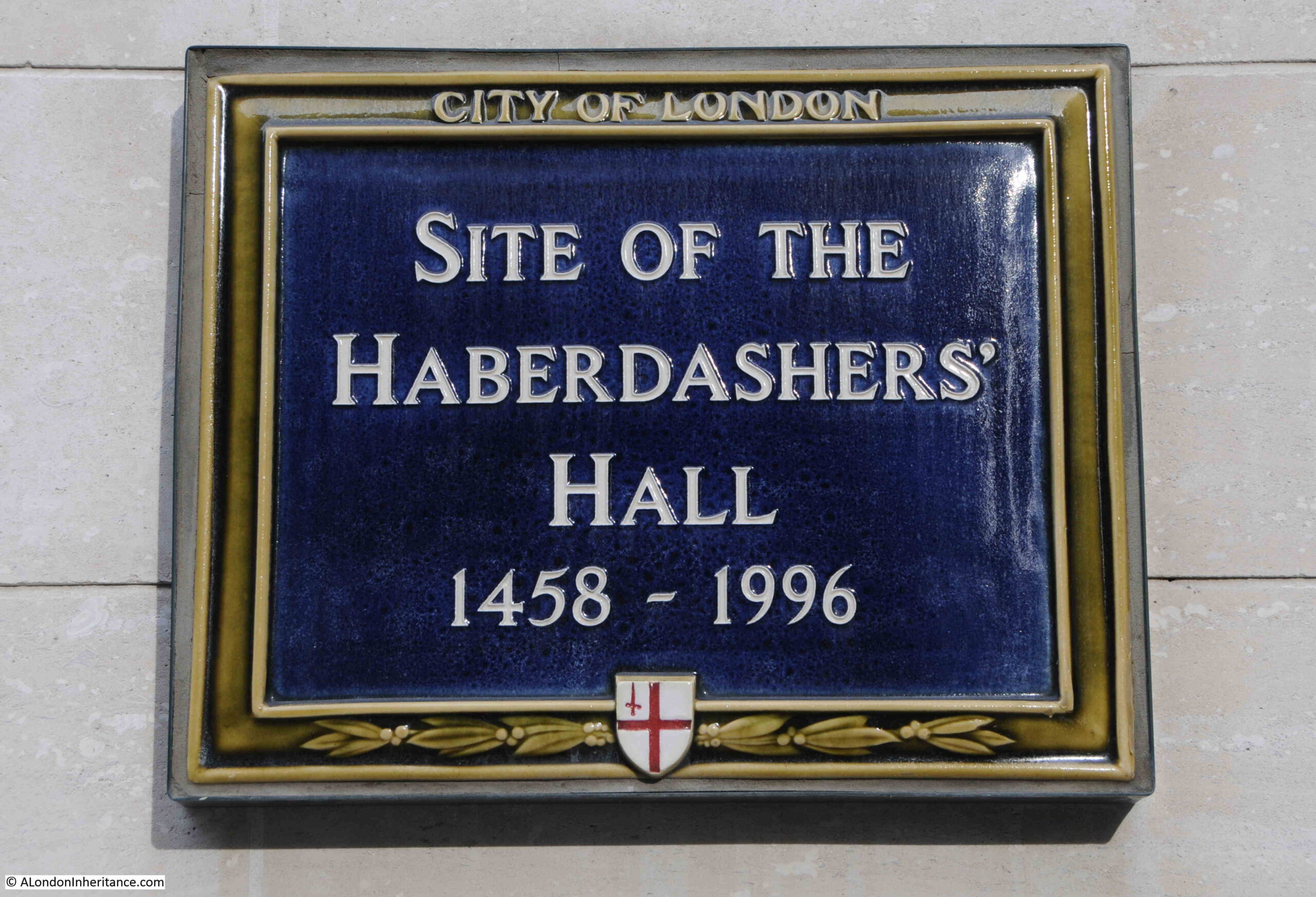
Recording that this was the site of the Haberdashers Hall from 1458 to 1996:

Haberdashers Hall

The Worshipful Company of Haberdashers dates back to the 14th century when those engaged in the trade of selling items such as ribbons, pins, gloves, toys and purses formed a Company. They were joined by the Hatmakers in 1502.

The name Haberdasher may have an origin with the name of the coarse, thick cloth used under a suit of armour. In two lists of custom dues on cloths and furs coming into London during the reign of Edward I (1272 to 1307), the word “hapertas” appears in one list and “haberdassherie” appears in the second list. Given that they both appear in lists of cloths and furs, and they are similar words, they may have the same meaning.

The word “hapertas” was the word used for the cloth used under armour, so this may be the origin of the word haberdashery, but, at this distance of time it is difficult to be sure.

The corner location of the plaque had been the site of the Haberdashers Hall for over 500 years. The first hall was built in 1458, but was destroyed in 1666 during the Great Fire. It was followed a couple of years later by a second hall which was built on the same site.

This second hall lasted until 1940, when it was destroyed during wartime bombing of the City.

A third hall was built in 1956, but was not a standalone hall, rather it was part of a larger office development. This hall would only last for 40 years, as in 1996 the whole site was redeveloped as office space. The Haberdashers moved to a new hall in West Smithfield, which they still occupy today.

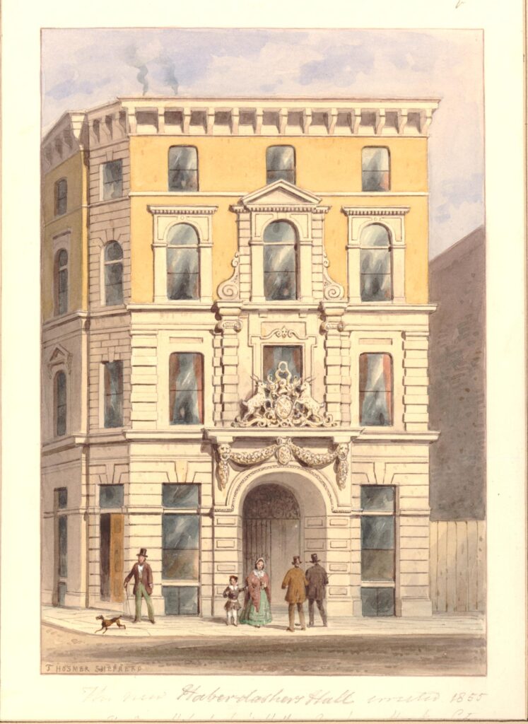
The following print shows the Haberdashers Hall in 1855:

Haberdashers Hall

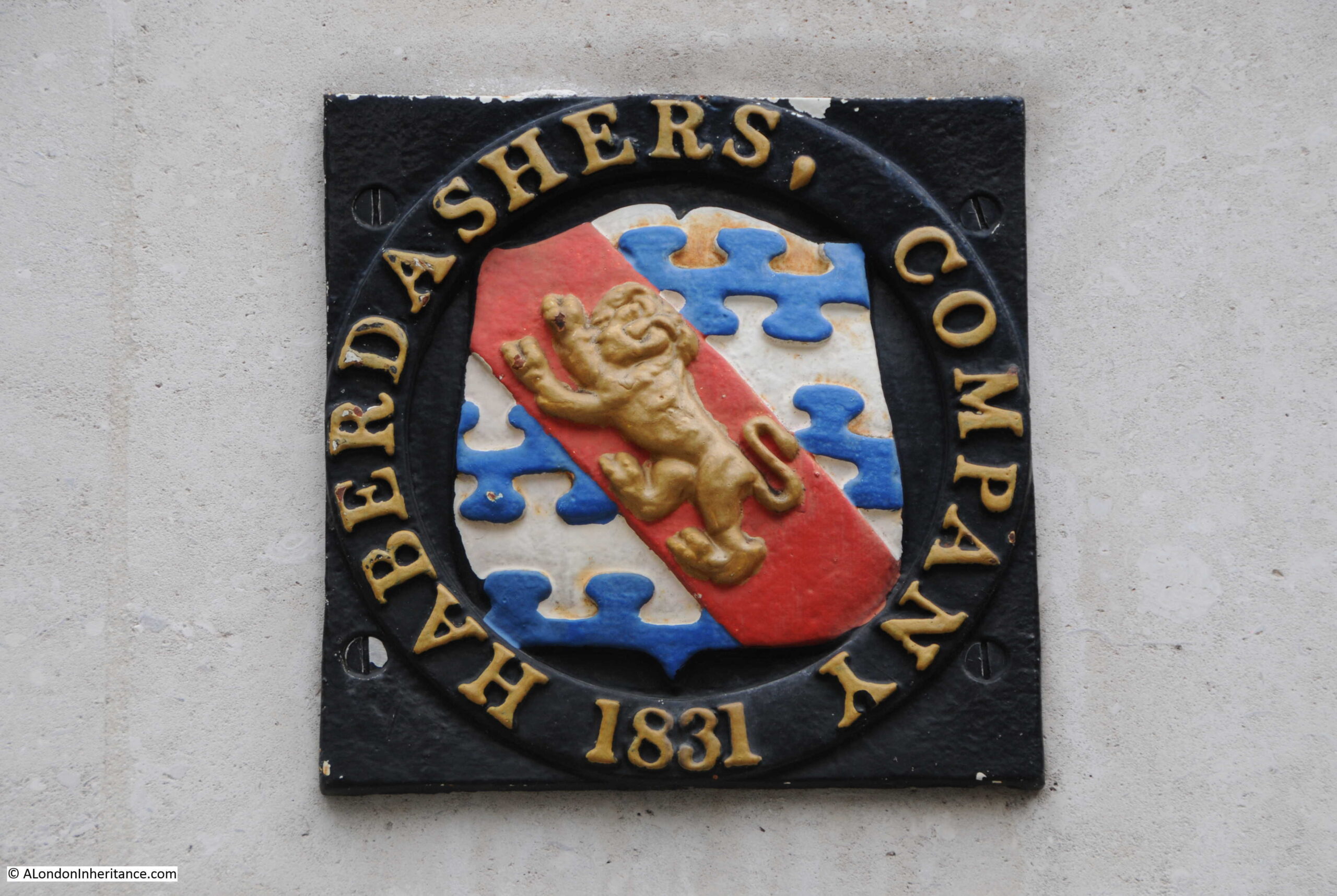
A bit difficult to see, but the arms of the Haberdashers can be seen above the door in the above print. These arms can still be seen today at the site. If you look to the left of the blue plaque, the following arms are set on the wall:

Haberdashers Hall

I assume this is a boundary or ownership marking, implying that whilst the Haberdashers have moved location, they still own the property on the site of their old hall.

The Aldermanbury Conduit

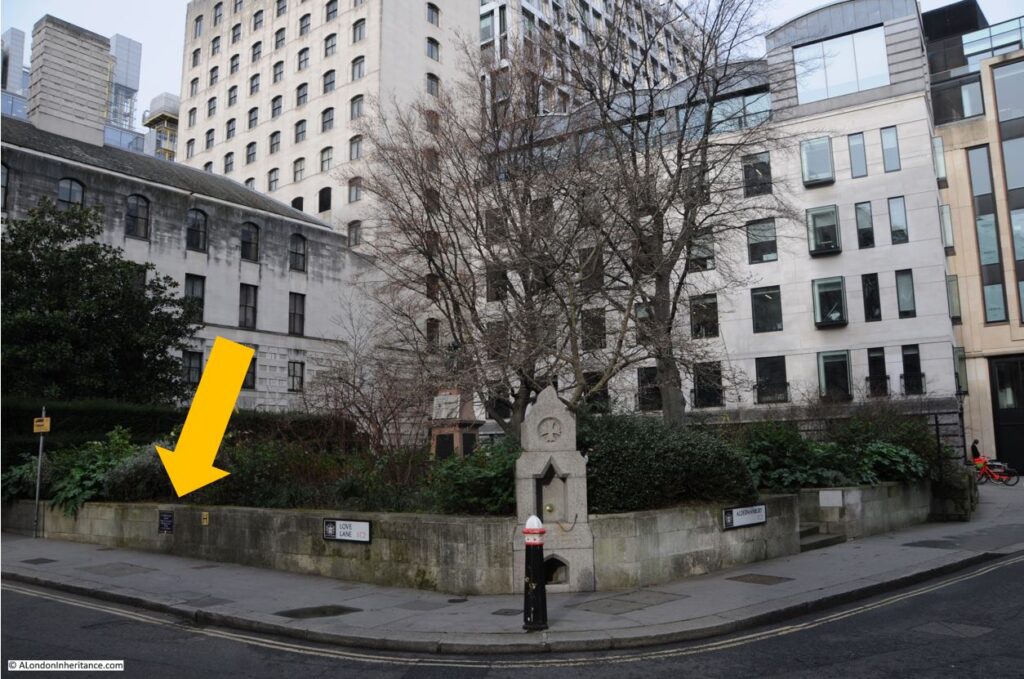
On the wall in Love Lane alongside the location of the church of St. Mary Aldermanbury, is a plaque:

Aldermanybury Conduit

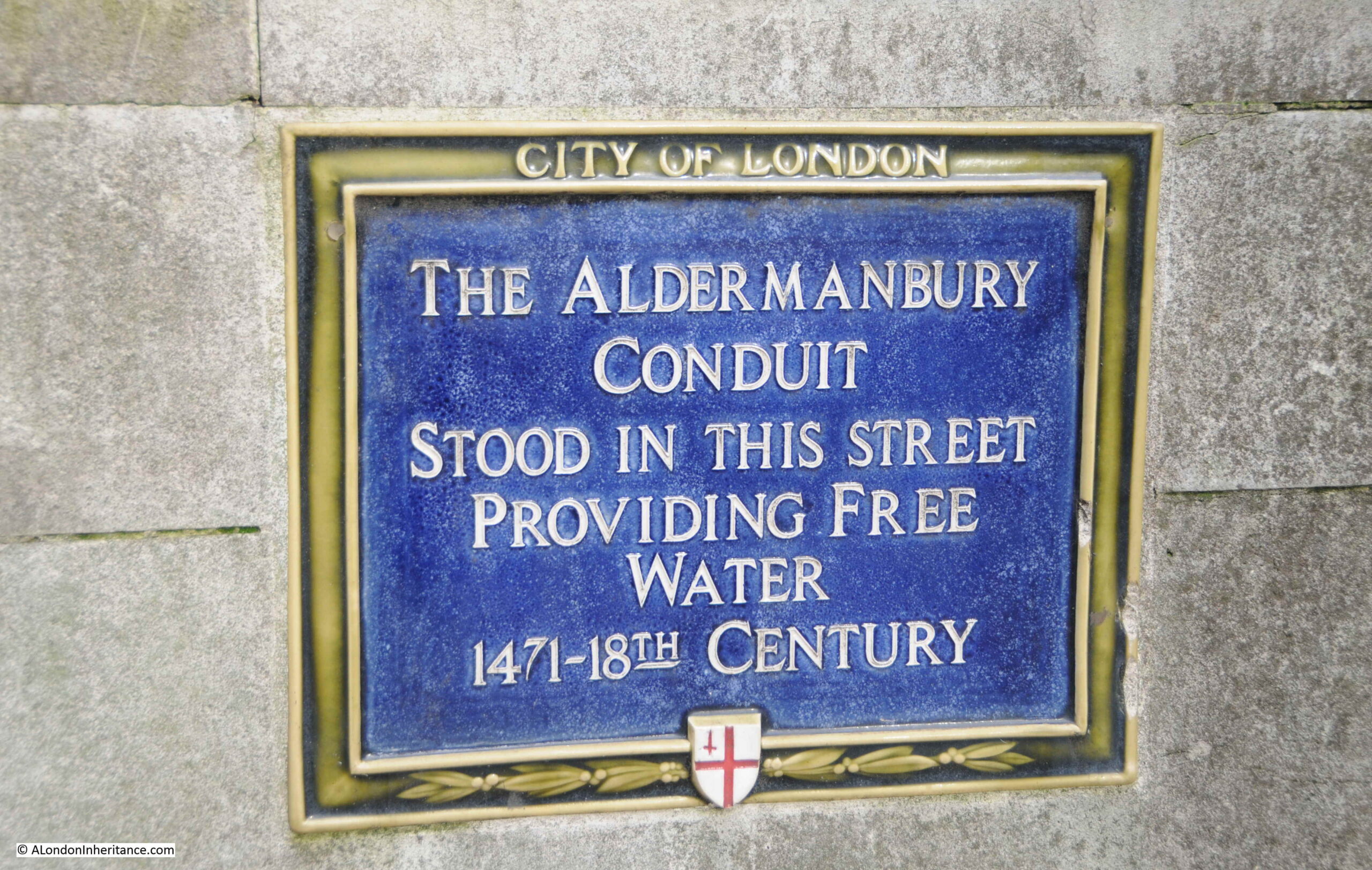
Which records that the Aldermanbury Conduit stood in this street providing free water from 1471 to the 18th century:

Aldermanybury Conduit

Whilst the plaque is accurate for the presumed opening date of the conduit, it just lists the 18th century as the end of the conduit. I wondered if there was an illustration of the conduit in prints of the church. The earliest print I found was from 1750 and no sign of the conduit.

Rocque’s map of 1746 has a couple of squiggles were the conduit should be, but I think these are trees, so the conduit probably disappeared in the early 18th century.

What was a conduit? It was basically a structure where water was stored and dispensed to people in need of water. Water could be fed into the conduit through pipes, a stream or spring, or being carried in buckets from another source.

I have photographed two conduits, so whilst I have no idea of what the Aldermanbury Conduit looked like, these others provide an example of their basic form and function.

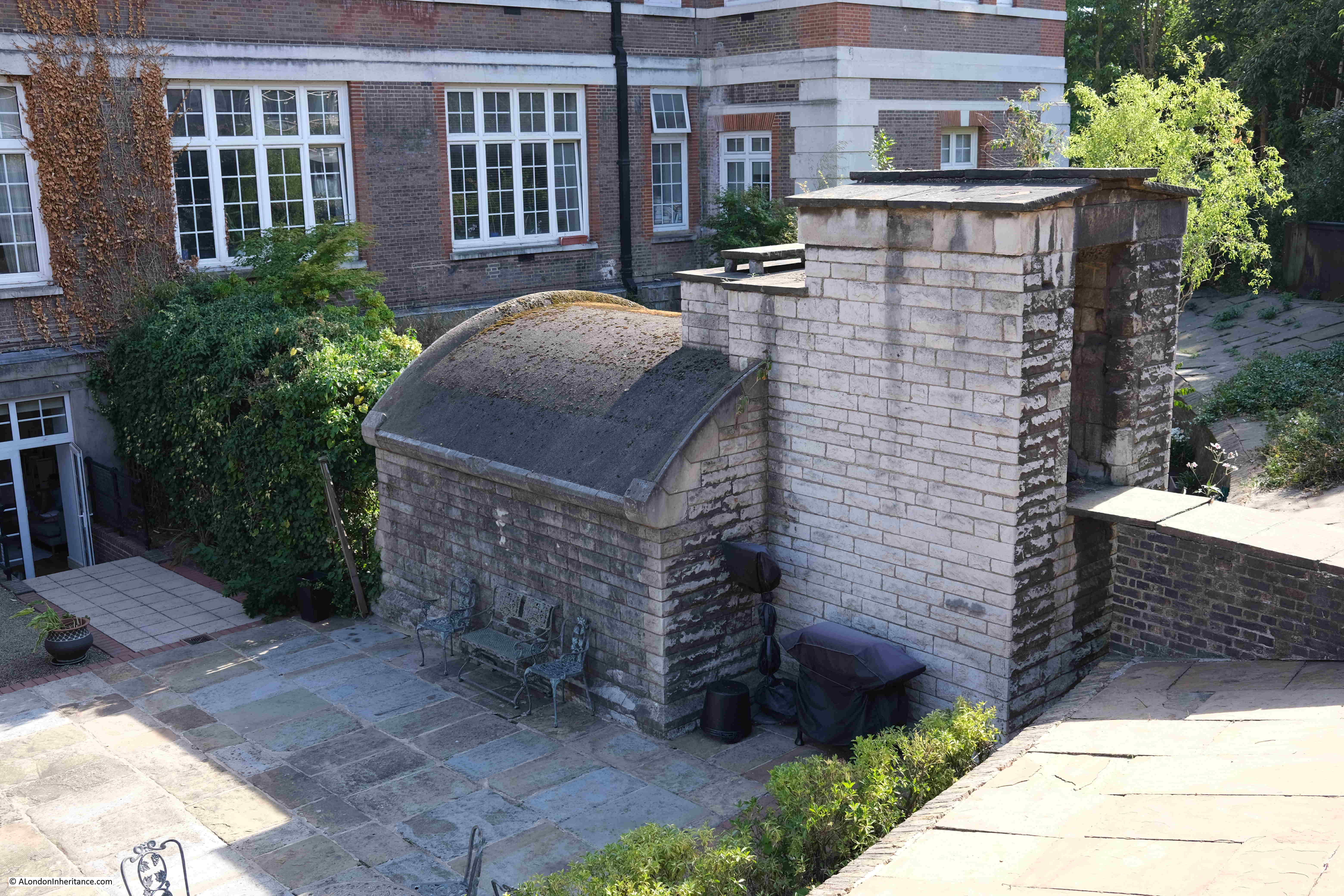
The first is a possibly 14th century conduit at New River Head in Clerkenwell. The following photo shows the conduit to the rear of the site of the old Metropolitan Water Board building:

Aldermanybury Conduit

It is not in its original location, as it was at located next to Queen Square in Bloomsbury, and moved when the Imperial Hotel in Russell Square was being extended to the rear.

The following is typical of newspaper reports of the discovery:

“The extension scheme of the Imperial Hotel in Russell Square includes the acquisition of Chalfort House, and in the garden of the latter there is a very interesting old relic of the past. It is the conduit head which leads down to a small reservoir from which, since the thirteenth century, the water supply has been conveyed through a pipe to the Grey Friars, and later to Christ’s Hospital, more than a mile away.

The masonry is still entire, but owing to changes of levels is now all several feet below ground. It has been known both as the Chimney Conduit and the Devil’s Conduit. there is also a brick-built tunnel which leads to a well several yards away.

Dr. Philip Norman some time ago made some very interesting discoveries regarding the ancient water supply of the old monastic house, and it would be a pity if this old conduit would be destroyed. If it could be in some way preserved it would certainly become an attractive showplace for American visitors.”

The conduit was rescued by Charles Fitzroy Doll, the architect of the Imperial Hotel which was built between 1905 and 1911 (the predecessor of the current Imperial Hotel). The Chimney Conduit name is rather descriptive of the appearance of the conduit, however I cannot find a confirmed source for the Devil’s Conduit name.

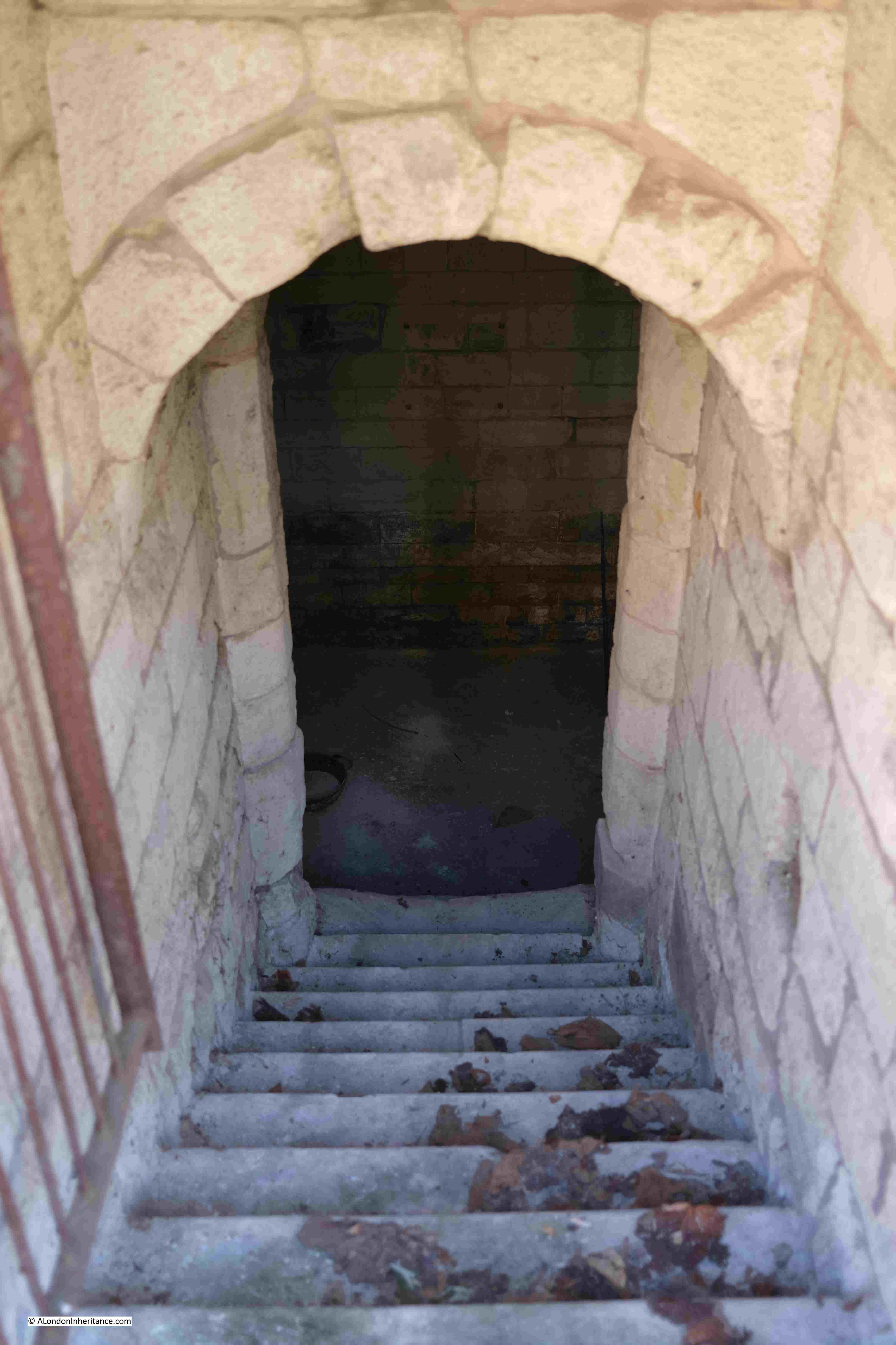
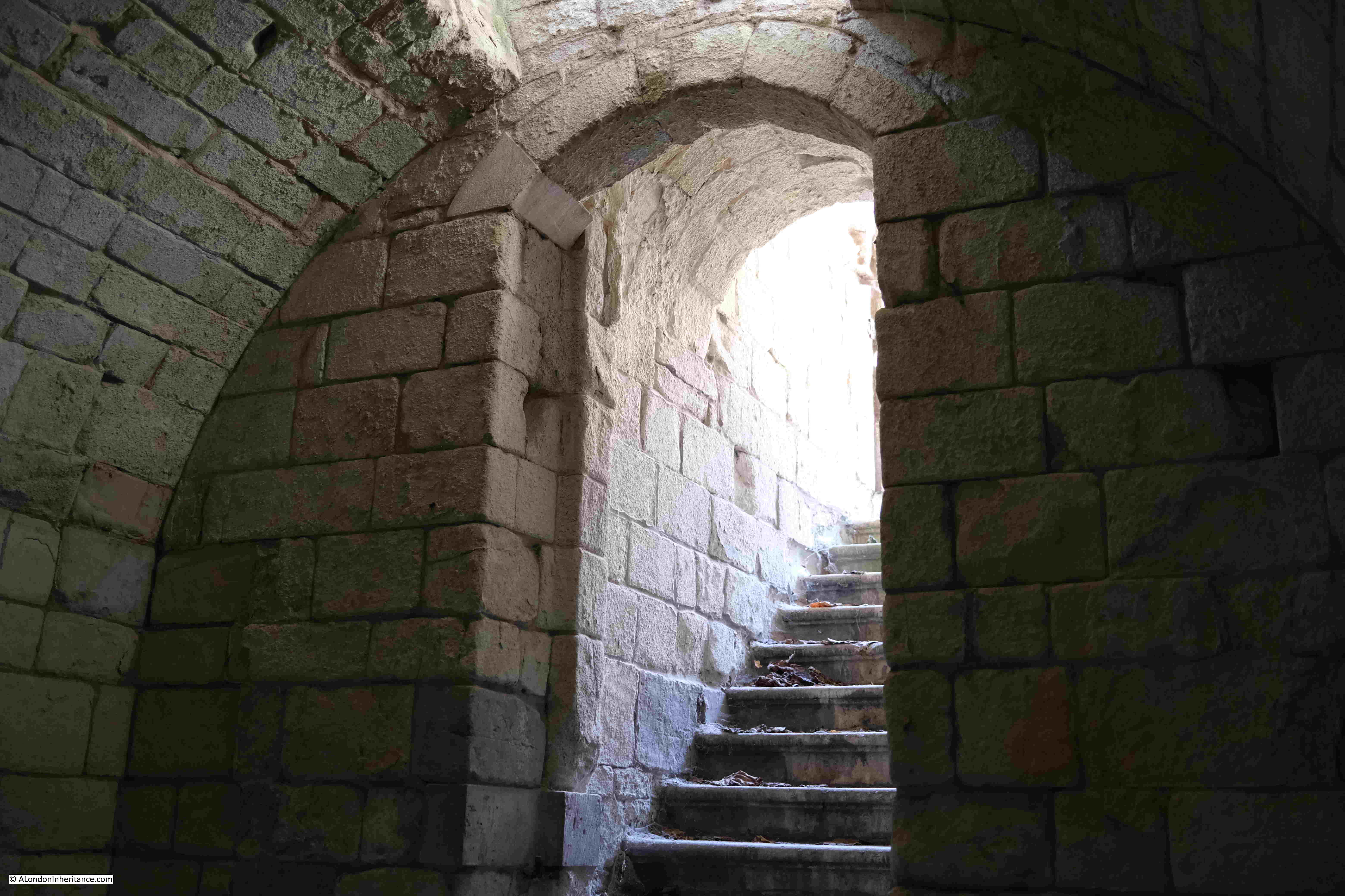
View from the entrance of the conduit showing the steps leading down into the space that once stored water:

Aldermanybury Conduit

Inside the conduit, showing how the walls arched to form a continuous wall / roof to the structure:

Aldermanybury Conduit

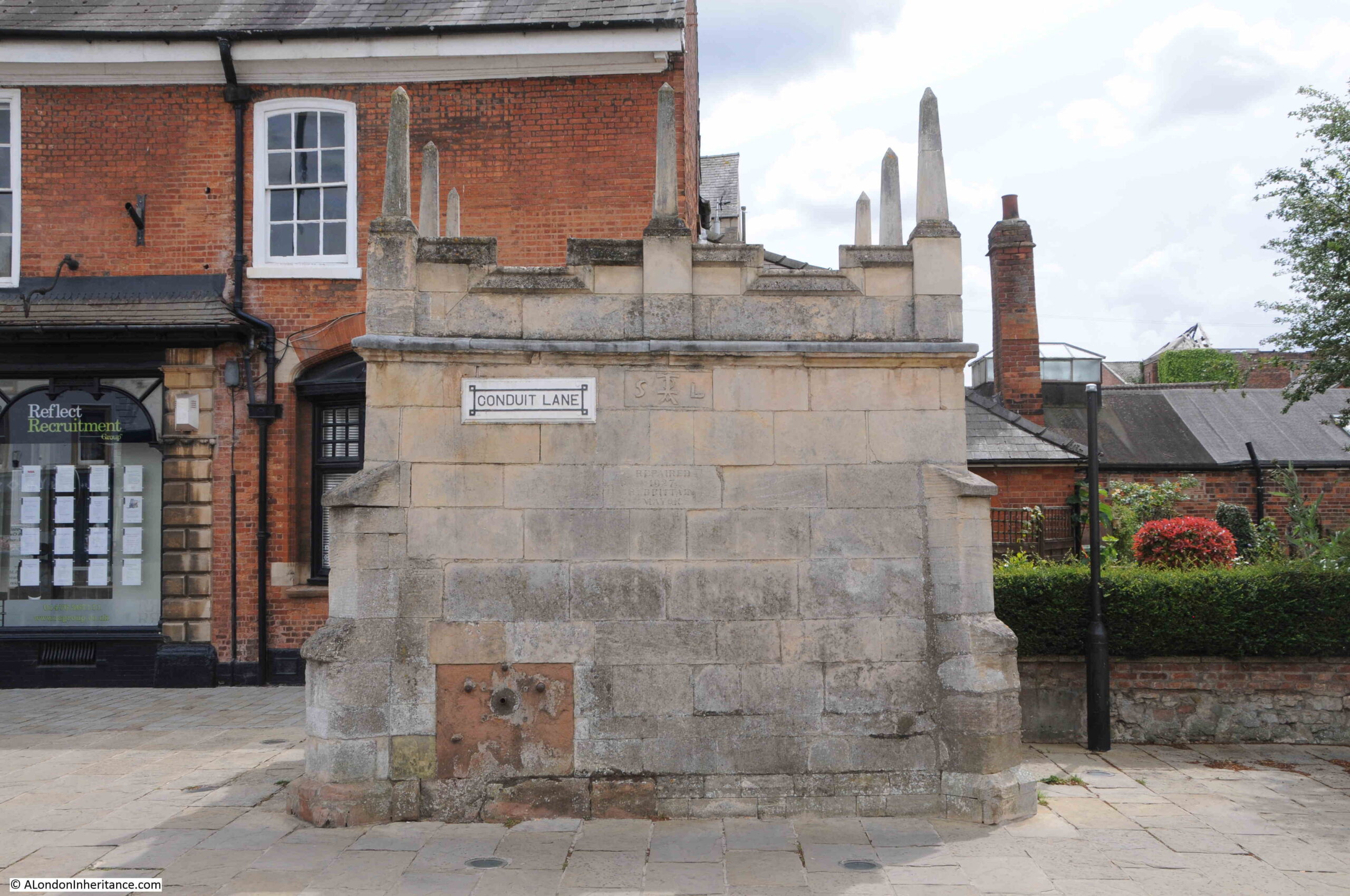
I found another conduit last year in Grantham as I was following the sites of the Eleanor Crosses.

This conduit also has its origins with the Grey Friars who purchased the land around a spring outside of Grantham and piped the water to their property.

In 1597 the water supply was extended by pipe to the conduit in the market place. The conduit and pipeline was constructed by the Corporation of Grantham.

The conduit has seen many repairs since it was built, in 1927 the roof was replaced, along with three of the distinctive pinnacles.

Aldermanybury Conduit

I have no idea whether the Aldermanbury Conduit looked like either of the above two examples, however there cannot have been too many variations as it was basically a stone box used to store water ready for distribution, either by pipe, or at the conduit.

Now the site is marked by the blue plaque.

The Daily Courant – London’s First Daily Newspaper

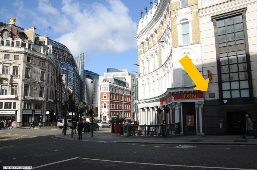
Where Ludgate Hill meets Ludgate Circus is a blue, City of London plaque:

Daily Courant

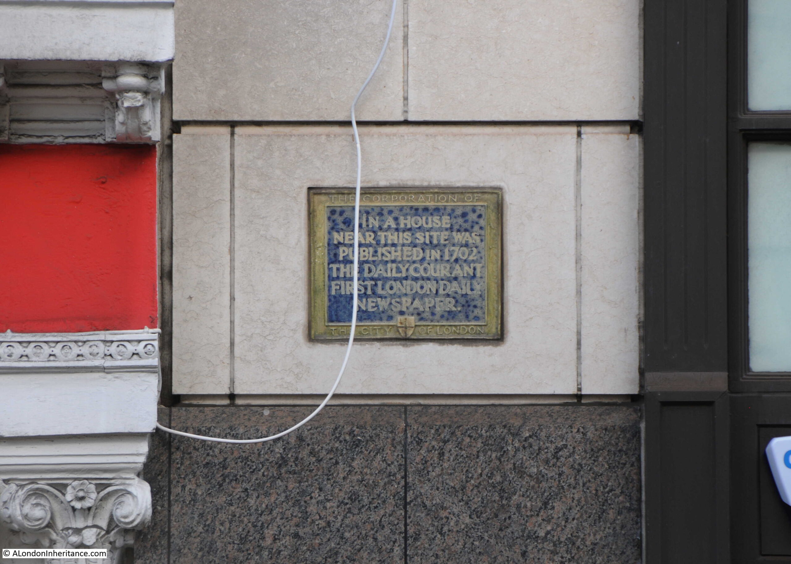
Recording that in a house near this site was published in 1702 the Daily Courant. The first daily newspaper (except Sunday’s) in London:

Daily Courant

The following is from a number of newspapers in January 1870, reporting on the Daily Courant:

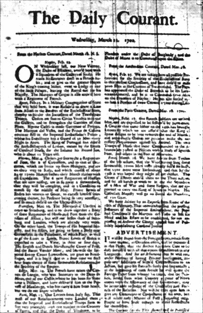
“The first daily paper published in England was the Daily Courant, which was commenced on the 11th of March, 1702. It was published by E. Mallet, against the Ditch at Fleet-bridge, not far, we may presume, from the present head-quarters of the Times or Daily Telegraph. It was a single page of two columns; and unlike the papers of our own time, it professed to give merely the home and foreign news, the editor assuring his readers that he would add no comment of his own, ‘supposing other people to have sense enough to make reflections for themselves’. In 1785 the Daily Courant appears to have been absorbed into the Daily Gazetteer.”

A fascinating description of the location as being “against the Ditch at Fleet-bridge” recording that in 1702, the Fleet was still uncovered at this point where today New Bridge Street meets Farringdon Street, that there was a bridge to cross over to Fleet Street, and that it was very much a polluted ditch.

The article mentions that the paper was published by E. Mallet, this was Elizabeth Mallet who was already successful in the book publishing trade when she started the Courant. She seems to have used the initial E rather then her full first name due to the lack of women in the trade , and possible bias against the Courant if it was known that a woman was the publisher.

The sentence that the “the editor assuring his readers that he would add no comment of his own” is interesting. 18th century newspapers were based on written reports, letters, copy from other newspapers etc. Papers such as the Daily Courant did not have a network of reporters producing copy for the paper to publish.

The Daily Courant simply published the reports and letters they had received, and left it up to the reader to judge the truth, implications and wider context of the report. The paper did try and get more than a single source and often published reports from two or three different foreign newspapers about a single place or event.

The paper also published the following advertisement in the first few issues to reinforce the point:

“It will be found from the Foreign Prints which from time to time, as Occasion offers, will be mentioned in this Paper, that the Author has taken Care to be duly furnished with all that comes from Abroad in any Language. And for an Assurance that he will not under pretence of having Private Intelligence, impose any Additions of feigned Circumstances to an Action, but give his Extracts fairly and Impartially; at the beginning of each Article he will quote the Foreign paper from whence it is taken, that the Public, seeing from what Country a piece of News comes with the Allowance of that Government, may be better able to Judge of the Credibility and Fairness of the Relation: nor will he take upon him to give any Comments or Conjectures of his own, but will relate only Matter of Fact; supposing other People to have Sense enough to make Reflections for themselves.”

This approach did lead to problems for the Daily Courant, when in 1705 it reported on a great naval disaster for allies of Queen Anne. A report which turned out to be false.

The Daily Courant defended itself by stating that it had only been reporting what it had received in a “Paris Letter”, and it had assumed that its readers would not give much credibility to the report as it had come from a pro-French source.

The first issue of the Daily Courant:

Daily Courant

Image attribution: Edward Mallet from rooms above the White Hart pub in Fleet Street, Public domain, via Wikimedia Commons

I found the above image on Wikipedia and copied the attribution required where the image is used, however this attribution states Edward rather than Elizabeth Mallet, and the majority of sources regarding the Daily Courant, including academic studies do refer to an Elizabeth Mallet.

18th century newspapers are fascinating, and they started to flourish in the years following the Daily Courant’s publication in 1702.

They became broadsheets full of content of what was happening across the country, across Europe and the wider world, and comparing with newspapers today (and much of the media in general), readers in the 18th century were much better informed about world news than a 21st century reader.

However, in the 18th century, readership was confined only to those who could afford a newspaper and could read, and much of the content was simply repeating accounts that had been received. Many reports begin with “We hear that” or “Letters received from XXXXX report that”, so much like the Daily Courant, what was written needed to be tested, and could not always be assumed to be the truth.

Global content also reflected the Empire and Britain’s trading links with much of the world, along with the wars and disputes that the country seems to have been involved in for much of the time.

It is interesting that the defence given by the Daily Courant in 1705, that readers should be aware of the source before establishing the credibility of a news report should still apply three hundred years later with much of today’s news reporting and social media.

That is six more plaques explored, and which again show the fascinating stories that can be uncovered by these simple plaques that can be found across the walls of the City of London.

alondoninheritance.com

St. Clement Danes – A Historic Strand Landmark

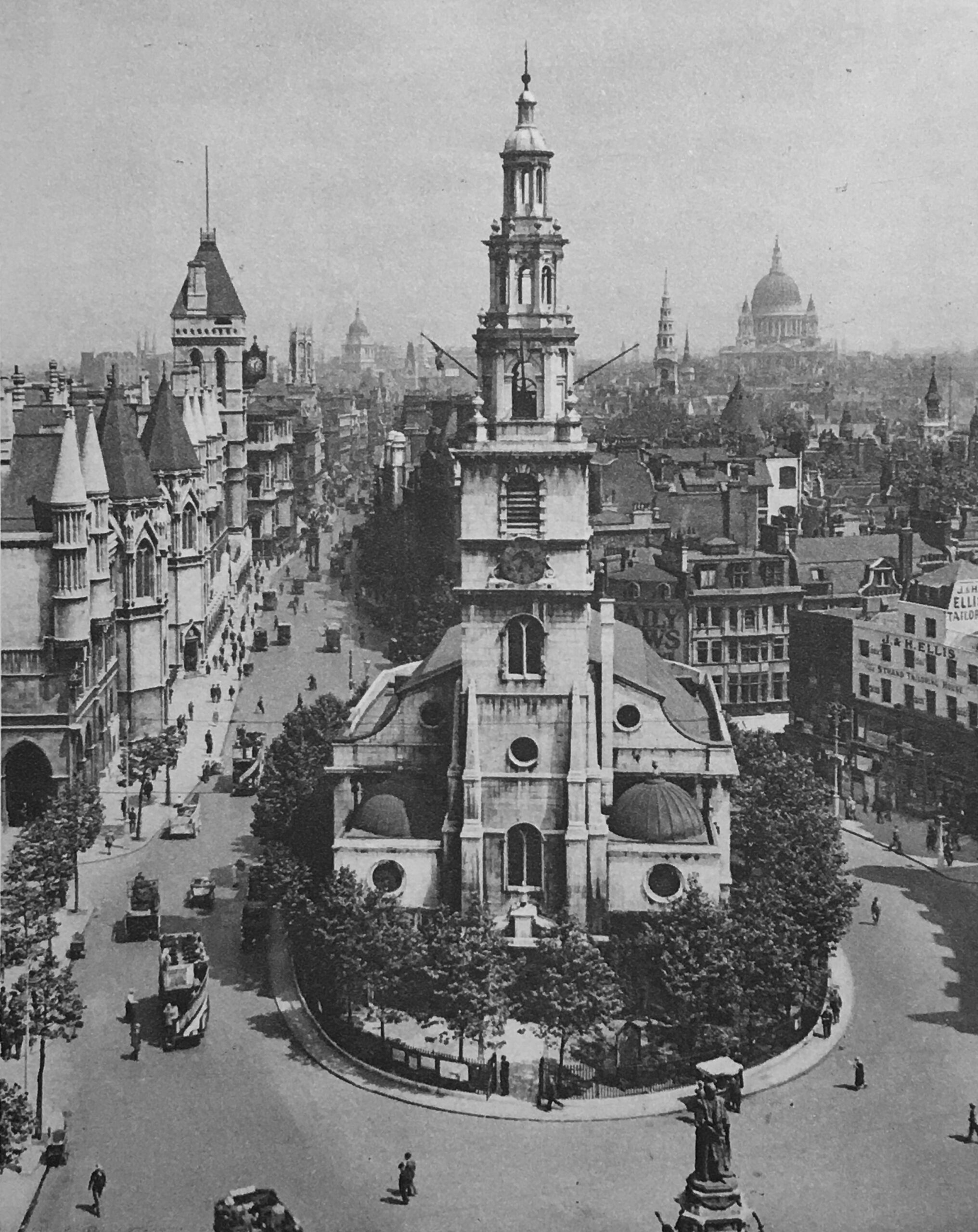
St. Clement Danes is a prominent landmark in the Strand, opposite the Royal Courts of Justice. This photo from the book Wonderful London shows the church and the surrounding landscape in the 1920s:

St. Clement Danes

The caption with the photo reads: “The church, which stands on an island in the traffic, has part of its name from the fact that in a previous church on that site a number of Danes were buried. The Saint’s name is popularised in the nursery rhyme of “Oranges and lemons” whose tune the bells still chime. The present structure is from designs by Wren and dates from 1681. On the left are the Law Courts and just to the right of the projecting clock are St. Dunstan’s in the West and the distant dome of the Old Bailey. The wedding-cake steeple of St. Bride’s is to the left of St. Paul’s dome.”

There is a plaque inside the church which adds to this history: “The original church founded on the site of a well outside Temple Bar was by tradition built in the ninth century. Repaired by William the Conqueror and rebuilt in the fourteenth century. That church was pulled down and rebuilt in its present form by Sir Christopher Wren in 1681. The steeple was added to the tower by James Gibbs in 1719. The church was destroyed by enemy action in 1941. The walls and steeple left standing, restored and rededicated as the central church of the Royal Air Force in 1958”.

In the above two descriptions of the church there are two different origin stories, one that the church was built on the site where Danes were buried, the other that it was founded on the site of a well.

Ben Weinreb and Christopher Hibbert in the London Encyclopedia take the Danish route, although stating that the association with the Danes is obscure, although according to John Stow it is so called because “Harold Harefoot, a Danish King, and other Danes were buried here.”

An article in the Illustrated News on the 1st of October 1842 also includes a Danish reference:

“It would seem, according to William of Malmsbury, that there was a church here before the arrival of the Danes, and that they burnt it, slaying the monk and abbot, and, marching off, continued their sacrilegious fury throughout the land; at length, desirous to return to Denmark, when they were all slain at London, at a place which has since been called the Church of the Danes.

Fleetwood’s account is that, when most of the Danes were driven forth of this kingdom, the few that remained (being married to Englishwomen) were compelled to reside between the Isle of Thorney (Westminster was so called) and Caer Lud (or Ludgate).”

That is the problem with anything with roots in the early medieval period. There is very little firm evidence to confirm whether there was a church here before the Danes, whether a well was here, or whether a Danish King was buried on the site, however there was a much later well, which I will discover later.

St. Clements Danes is though on a important route. The Strand has been part of the route between the City of London and Westminster for centuries, and continues to be a key route between these two historic parts of London.

Land from the Strand descends down to the River Thames, and the Strand would have been the dry, high ground along the river. The name Strand comes from old English, Germanic and northern European meanings of a beach, the edge of a sea shore, or the shoreline. In the Netherlands the word Strand is still used for a beach.

The church is also on the south eastern edge of a small patch of high ground rising around Houghton Street, and would have been an ideal place to settle, between the City and what would become Westminster, on high ground above the River Thames.

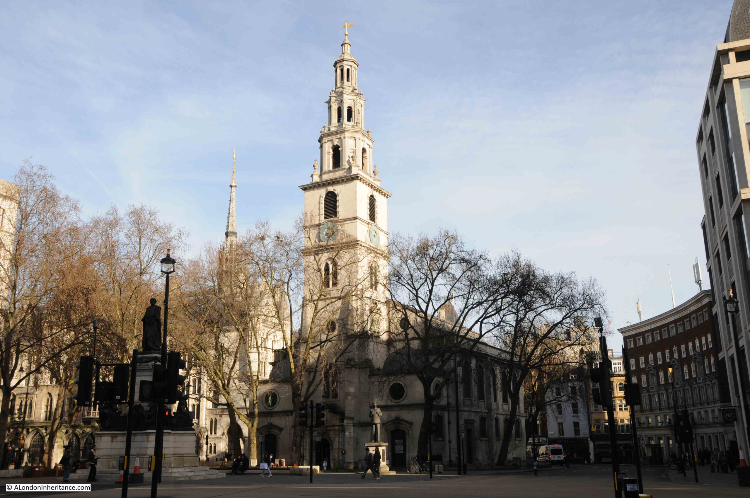
I cannot take a photo from Australia House as in Wonderful London, however my view of St. Clement Danes from the Strand is shown below:

St. Clement Danes

Today, the Strand runs either side of St. Clement Danes, with Aldwych curving north from the eastern side of the church, and the Strand continuing to the south.

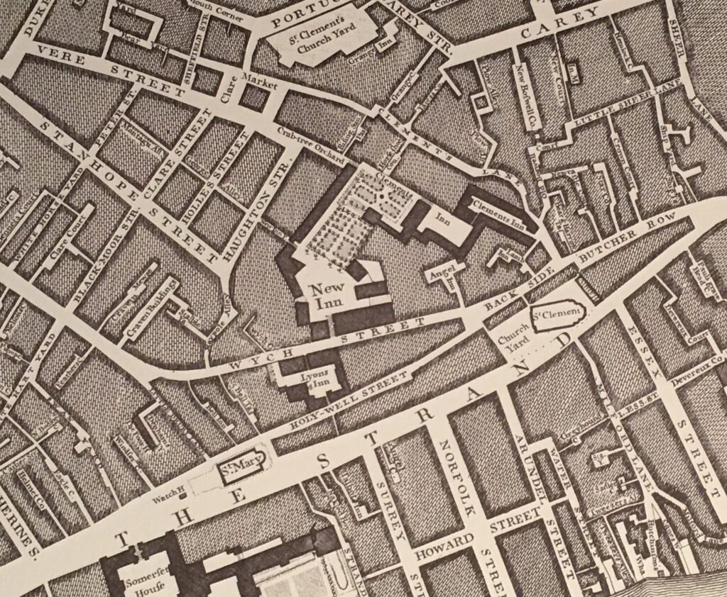
The church has not always had this island location, although it has been in a prominent place on the Strand, and where a road leading of the Strand turned north, via Butcher Row, Back Side, Wych Street and then into Drury Lane.

The following extract from Roqcue’s map of 1746 shows St. Clement Danes to the right with these streets running off to the north. The wonderfully named Back Side was probably a descriptive reference to the street being on the back side of the church, with a narrow row of buildings being between street and church.

Rocque map of the Strand

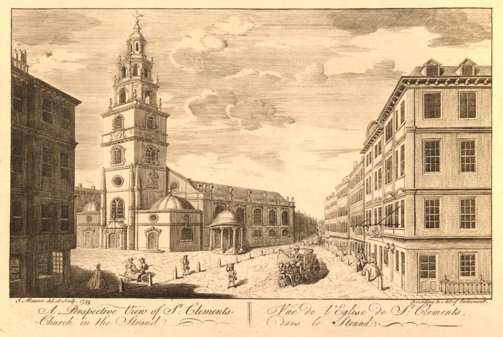
The transformation of the church to being on an island location, and the widening of the streets on either side of the church has taken place over the last couple of centuries. The following print from 1753 shows the church not long after Roque completed the map shown above  (© The Trustees of the British Museum).

St. Clement Danes

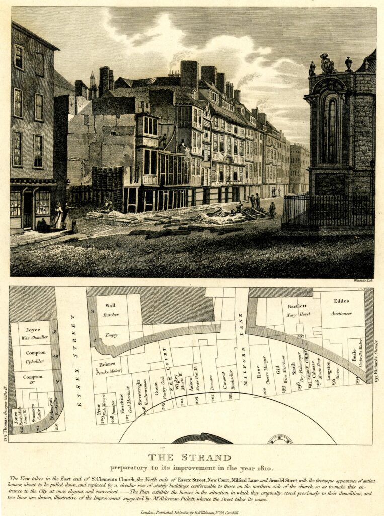
Clearance of the land to the south started in the early 19th century. The following print shows the buildings to the south and the map below shows the outline following demolition, but also shows the occupants and business in the houses in 1810. The corner of St Clement Danes is on the right  (© The Trustees of the British Museum).

The Strand

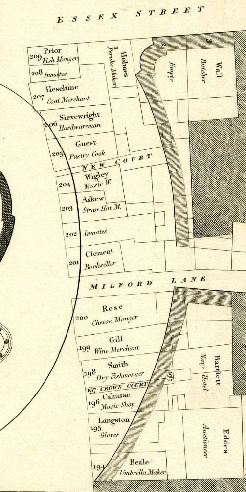
I have extracted the section of the demolished houses and rotated to make it easier to read the occupants and the trades, which included Fish Mongers, a Cheese Monger, Pastry Cook and a Straw Hat Maker.

The Strand

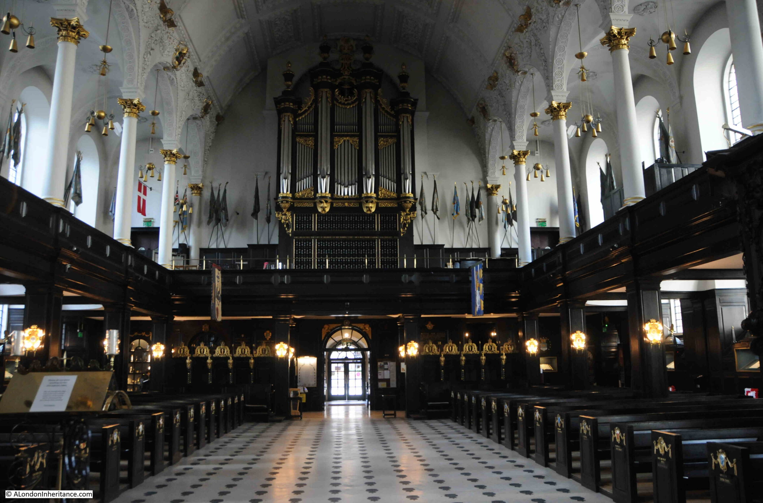
The church avoided the 1666 Great Fire, but was rebuilt soon after in 1681 due to the state of the previous church, however the church was destroyed by fire during the last war. Only the steeple and the outer walls of the church survived, so the interior we see today is the post war reconstruction of St. Clement Danes.

St. Clement Danes

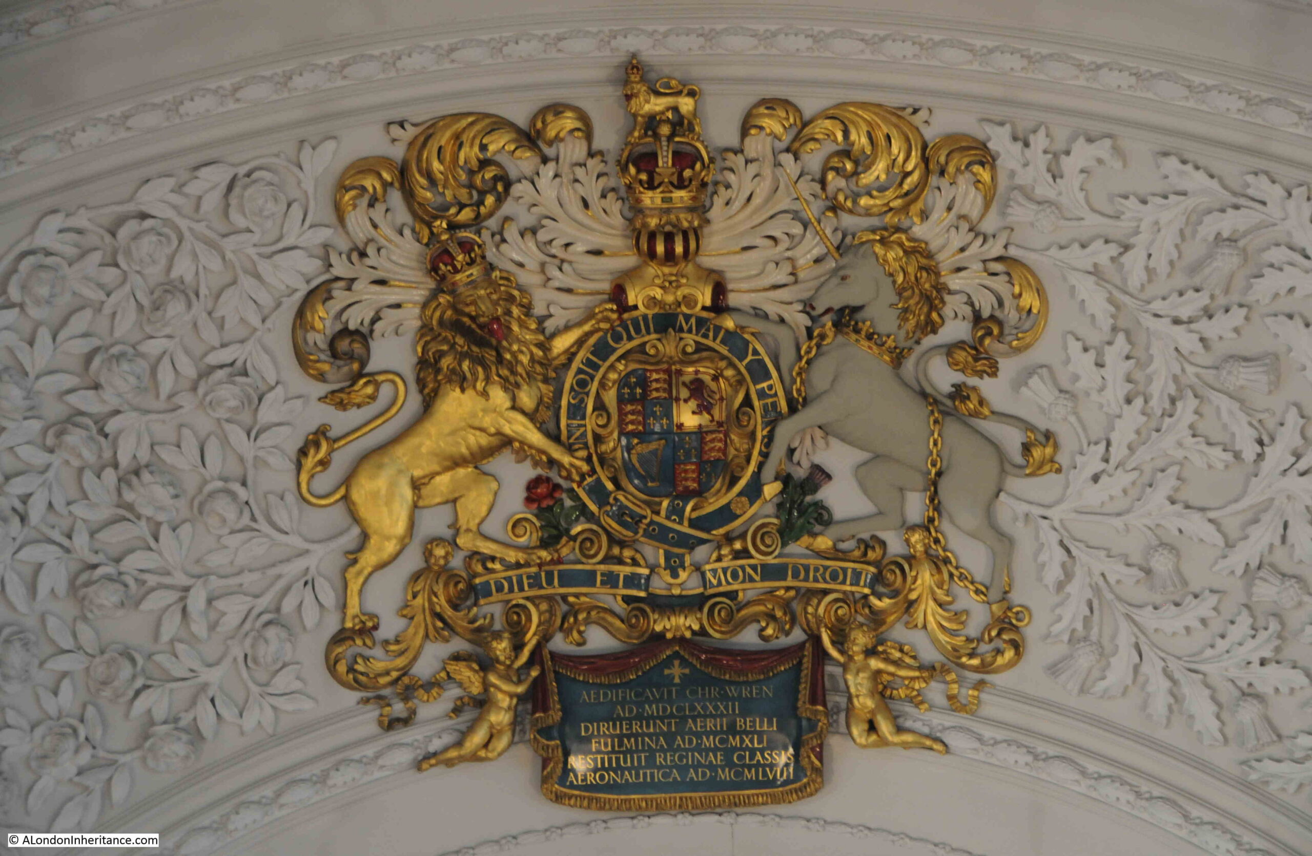
Coat of arms on the ceiling. The writing in the blue section at the bottom is in Latin and translates as “Christopher Wren built it in 1672. The thunderbolts of aerial warfare destroyed it in 1941. The Royal Air Force restored it in 1958”:

St. Clement Danes

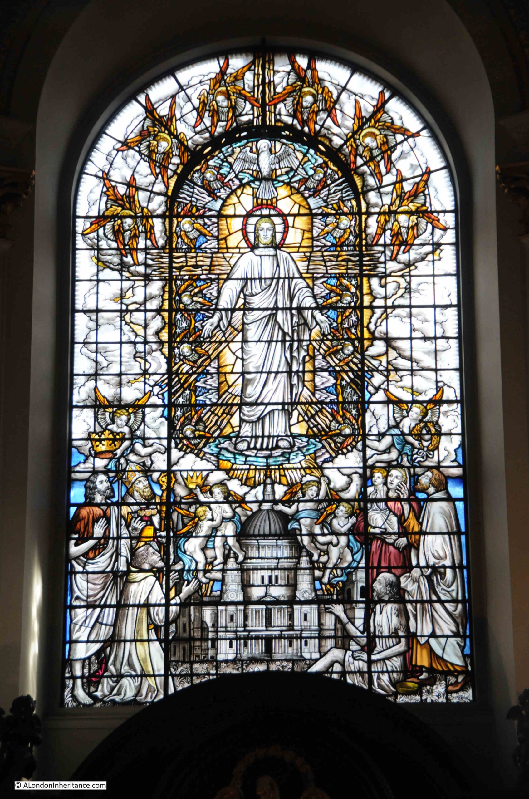
Stained glass window showing St. Paul’s Cathedral:

St. Clement Danes stained glass

Following wartime damage and restoration, St. Clement Danes was re-consecrated in 1958 as a perpetual shrine of remembrance to those who have died in service in the RAF, and RAF symbolism can be seen throughout the church.

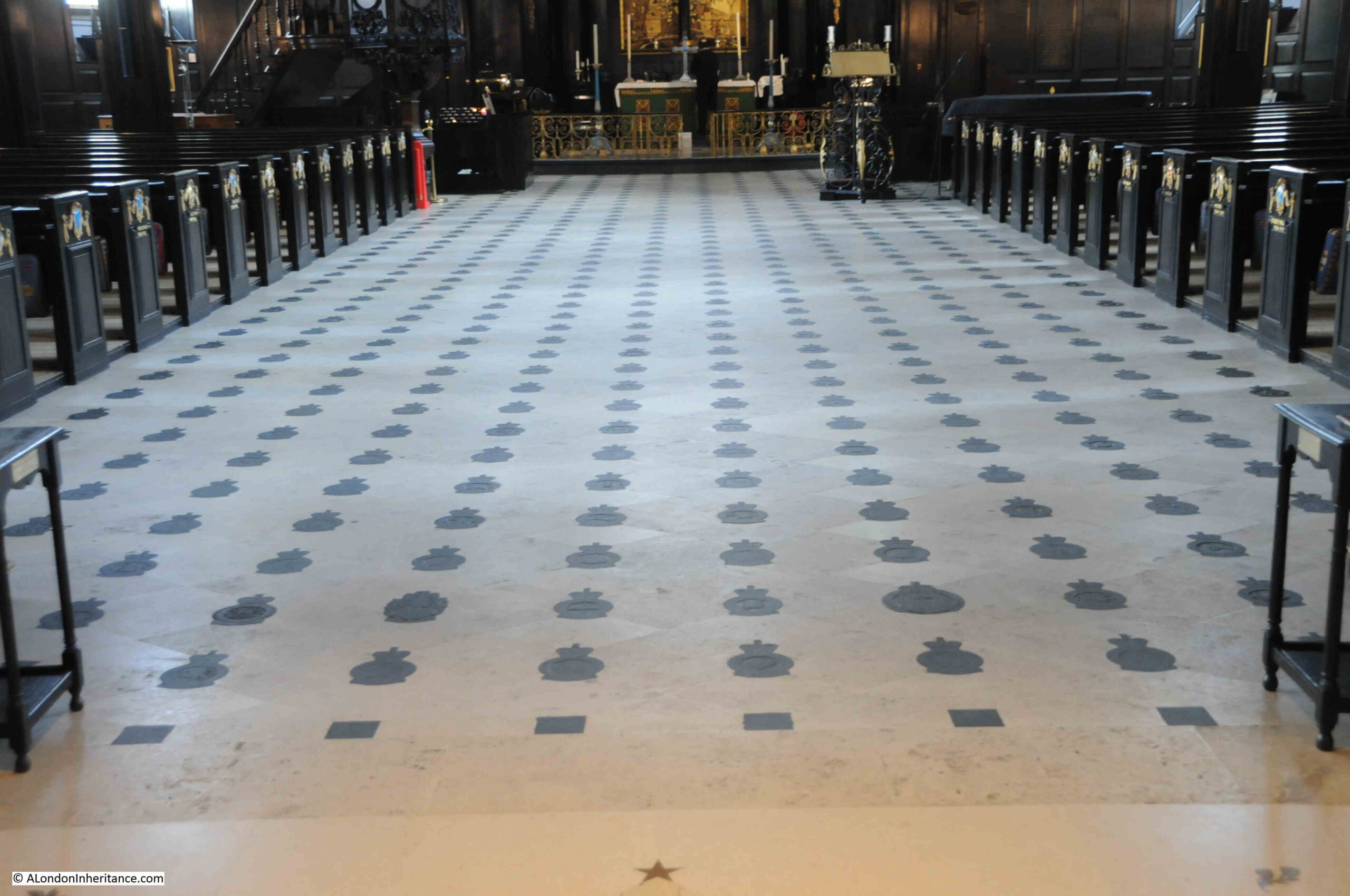
This includes over one thousand slate squadron and unit badges embedded in the floor:

RAF squadron and unit badges in St. Clement Danes

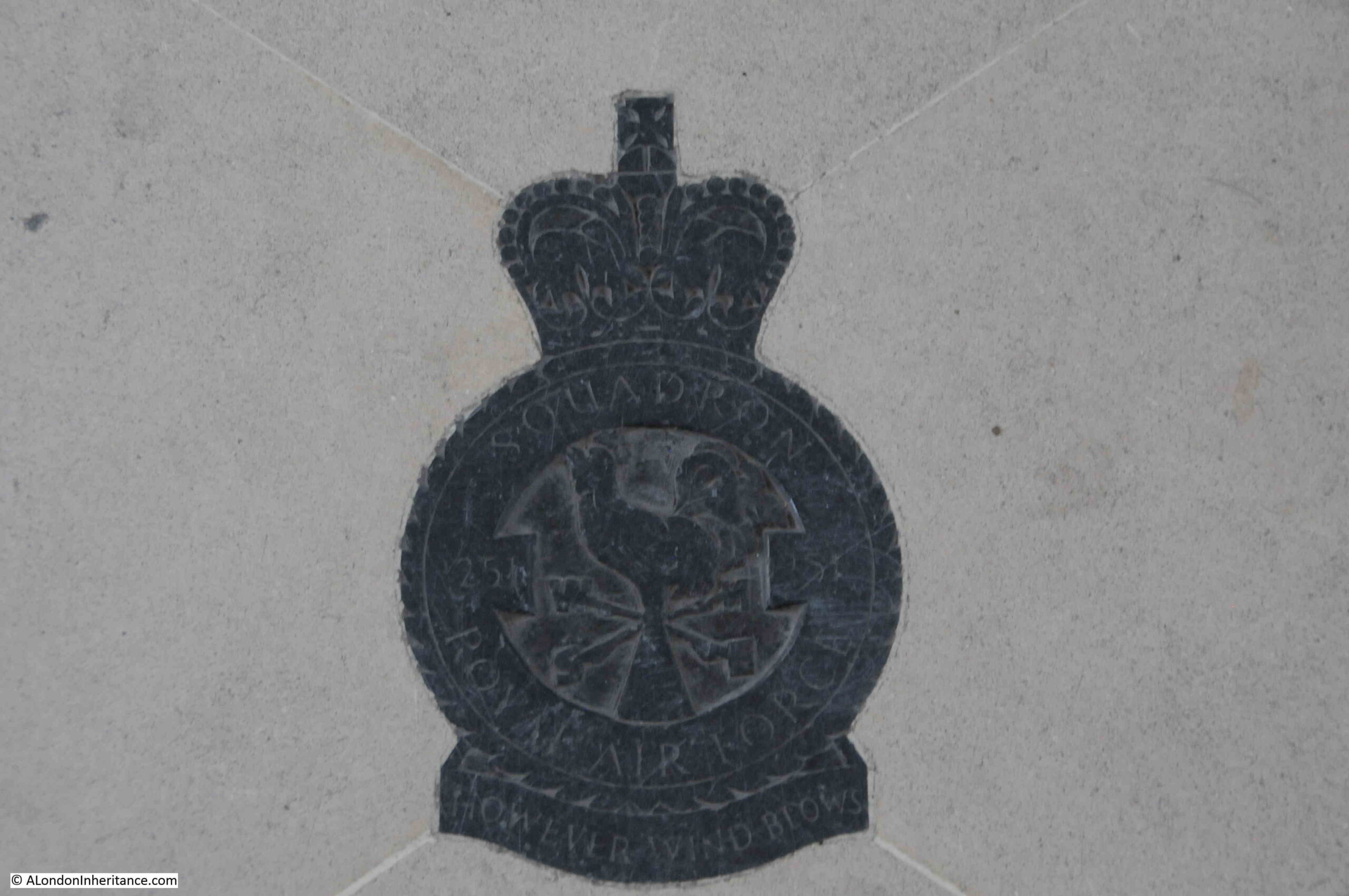
Detail of one of the badges:

RAF badge

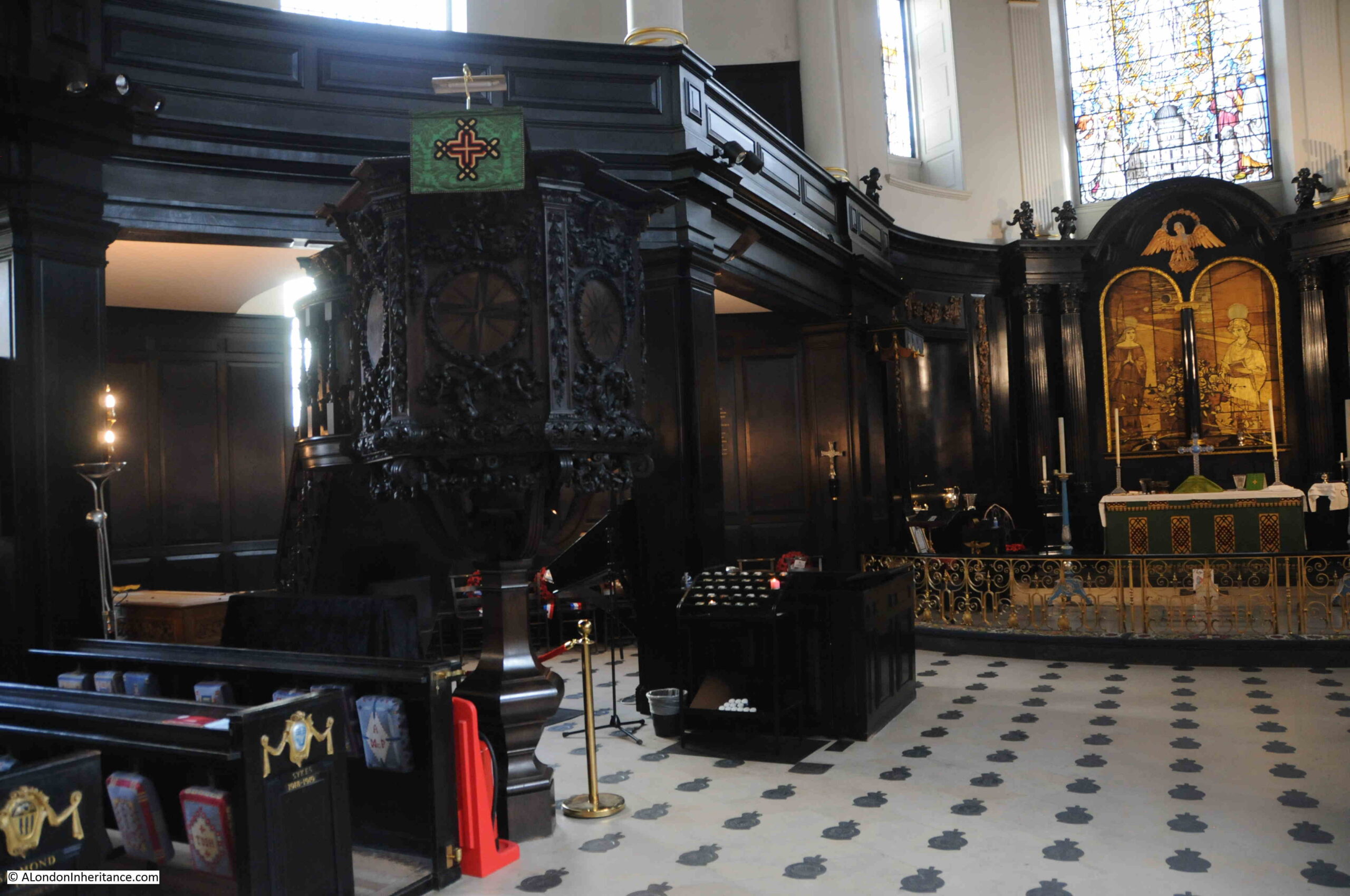
Pulpit and altar:

St. Clement Danes

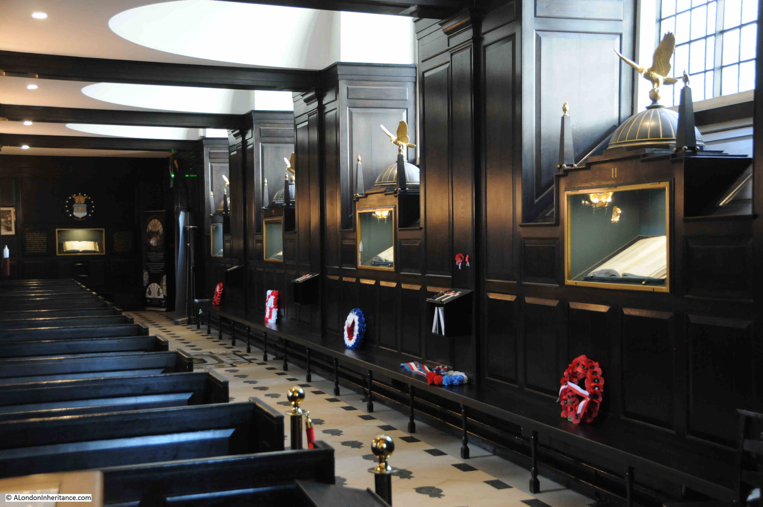
Along the side walls of the church are glass fronted cabinets, which contain books that commemorate over 150,000 people who have lost their lives whilst serving in the RAF. These cabinets are topped by the same dome shape that can be seen on the front of the church, to either side of the steeple.

RAF books of rememberance

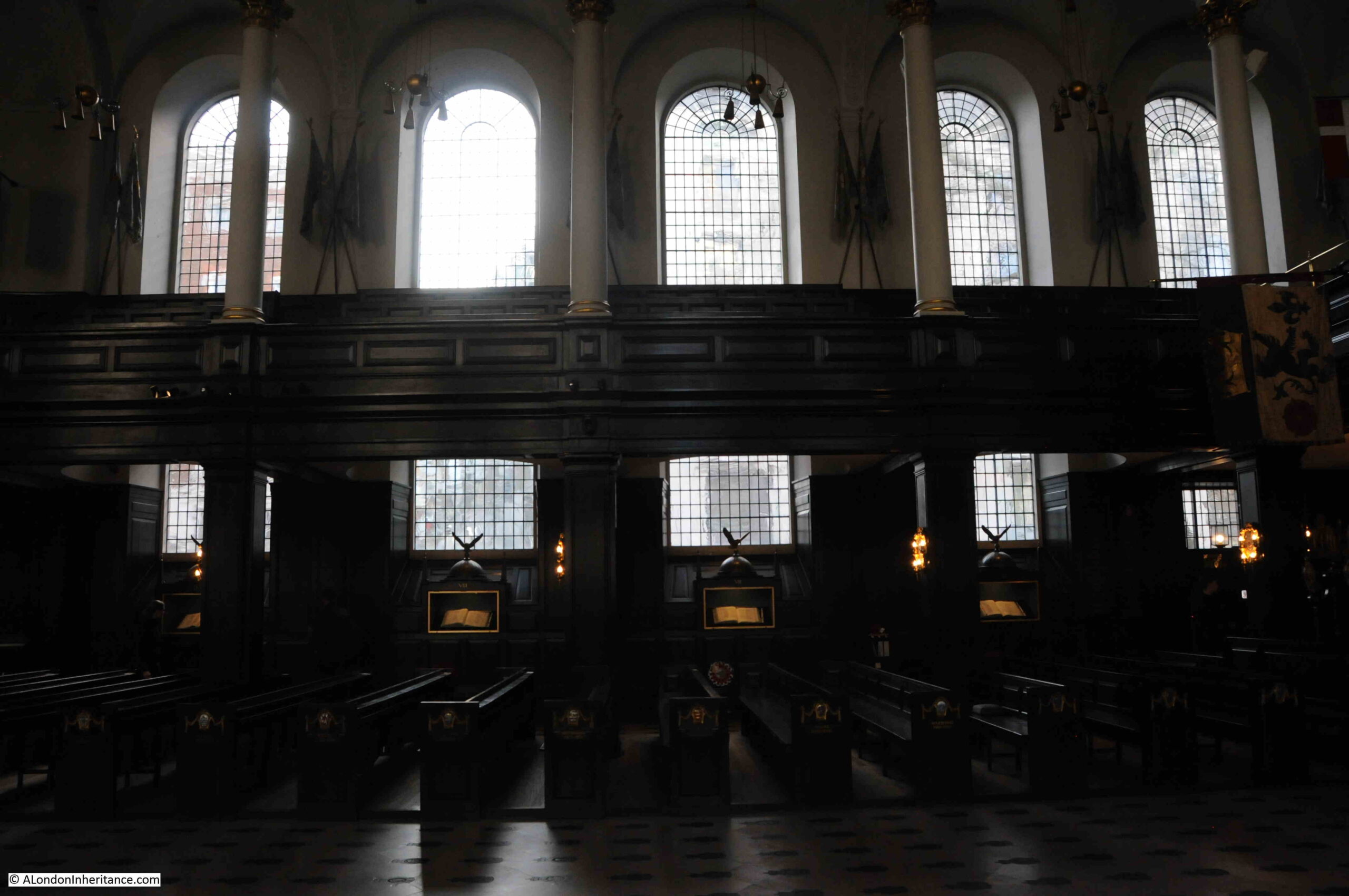
The above photo is off the northern side of the church, the following is the southern side, again showing the books in their cabinets lining the side of the wall.

St. Clement Danes

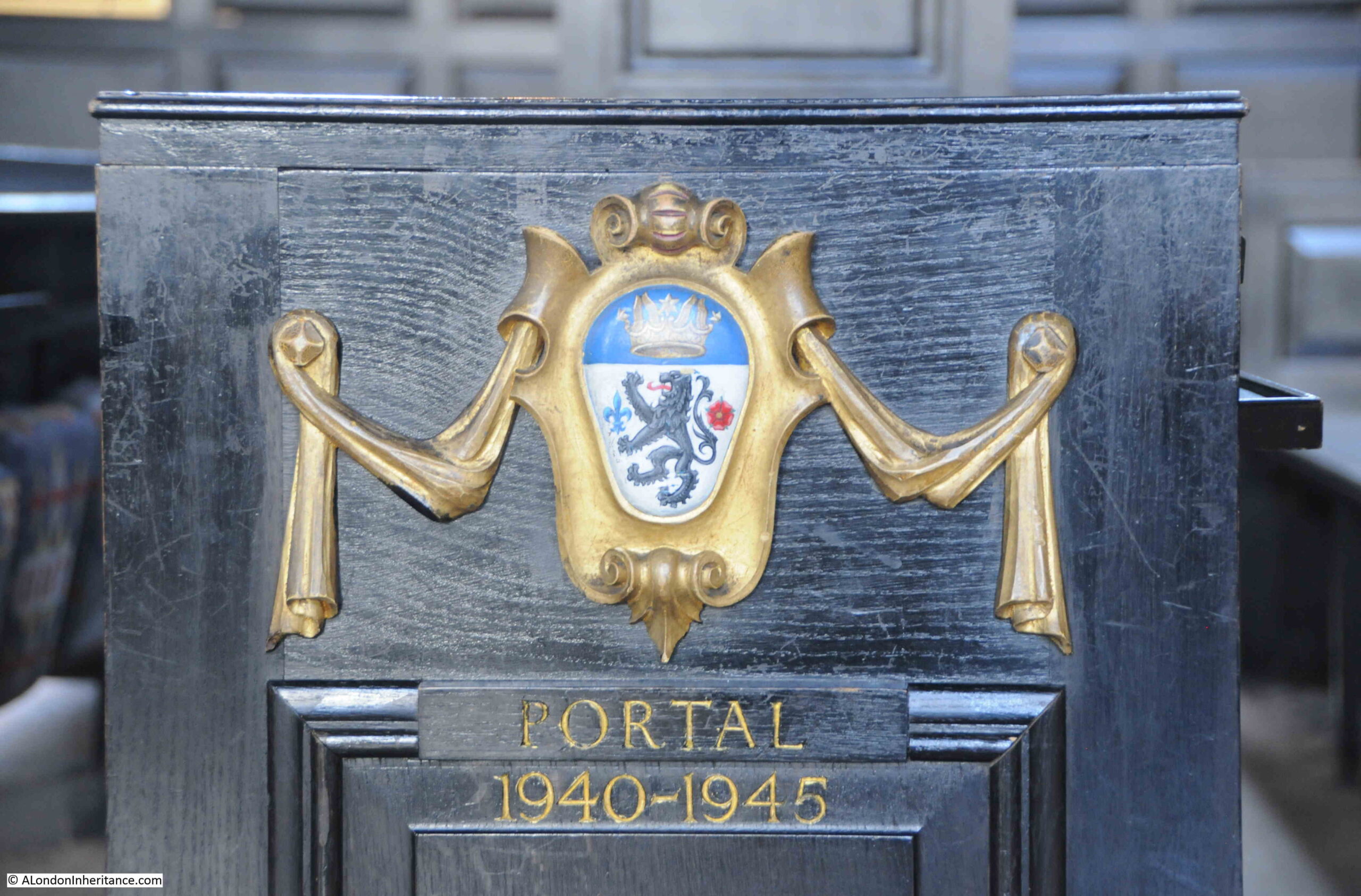
The ends of the pews have cartouches of the Chiefs of the Air Staff, including Charles Portal who occupied the position for the majority of the Second World War.

Portal

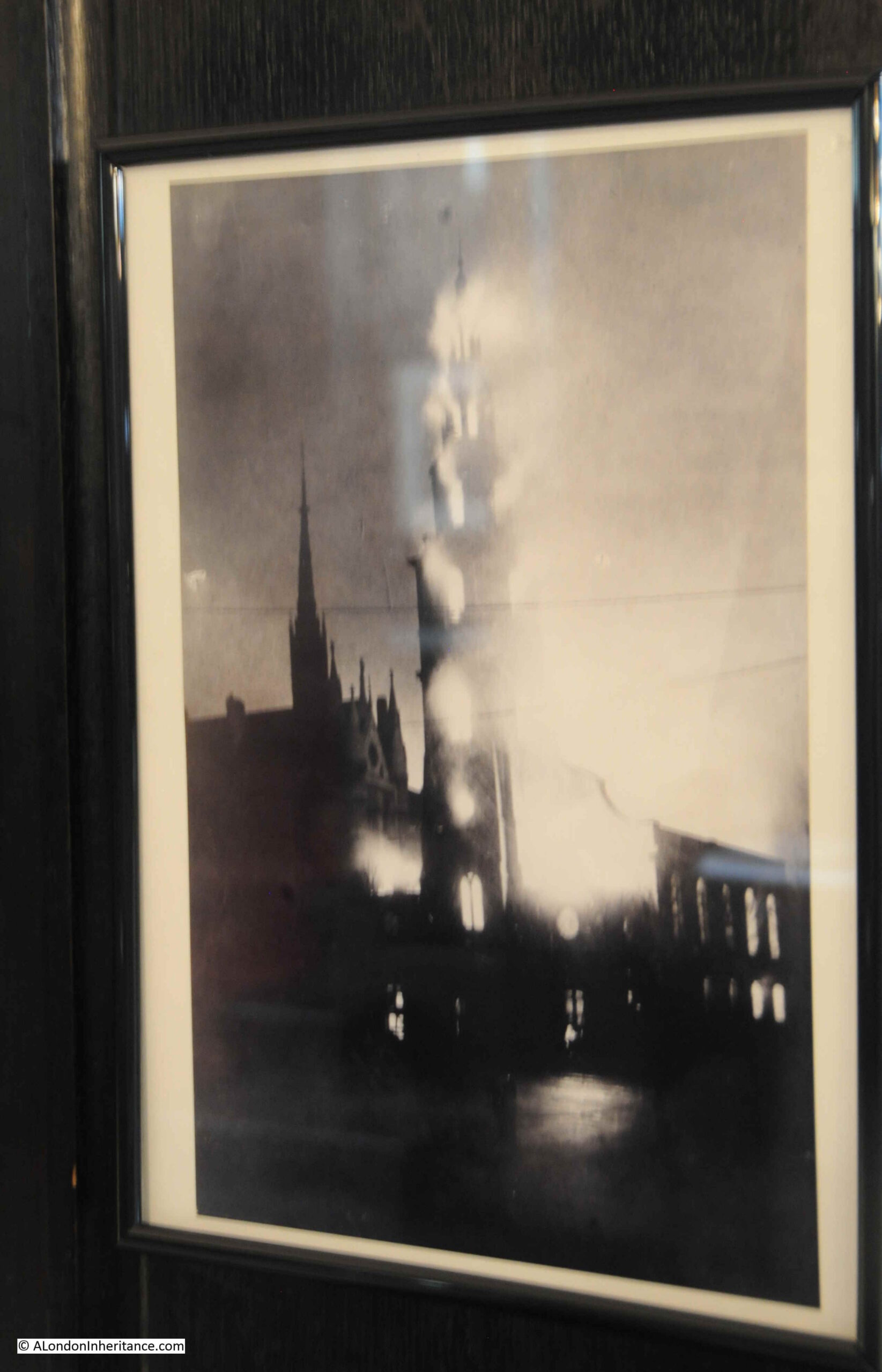
In the church is a photo of when the church was bombed. As well as the main body of the church, fire reached up through the spire which created this dramatic photo of the church’s destruction:

Fire in St. Clement Danes steeple

Although the church was rebuilt by Wren, he had started on the tower but had ;left it unfinsihed. In May 1719, the church vestry decided to let John Townsend build on the tower, using a design for a steeple by James Gibbs.

Gibbs also followed up with some work on repairs to the roof and some of the decorations within the church.

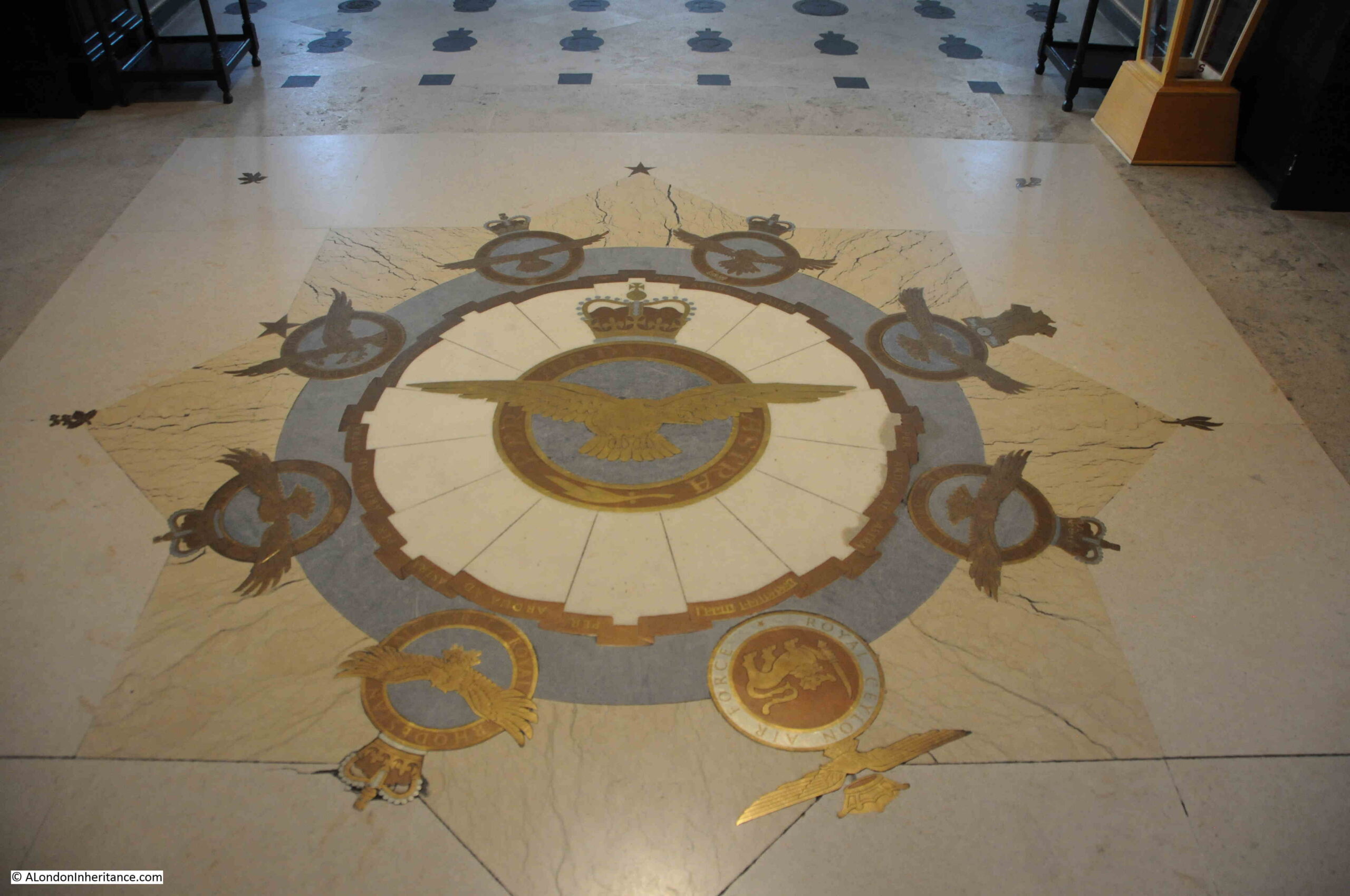
More RAF insignia on the floor of the church:

St. Clement Danes

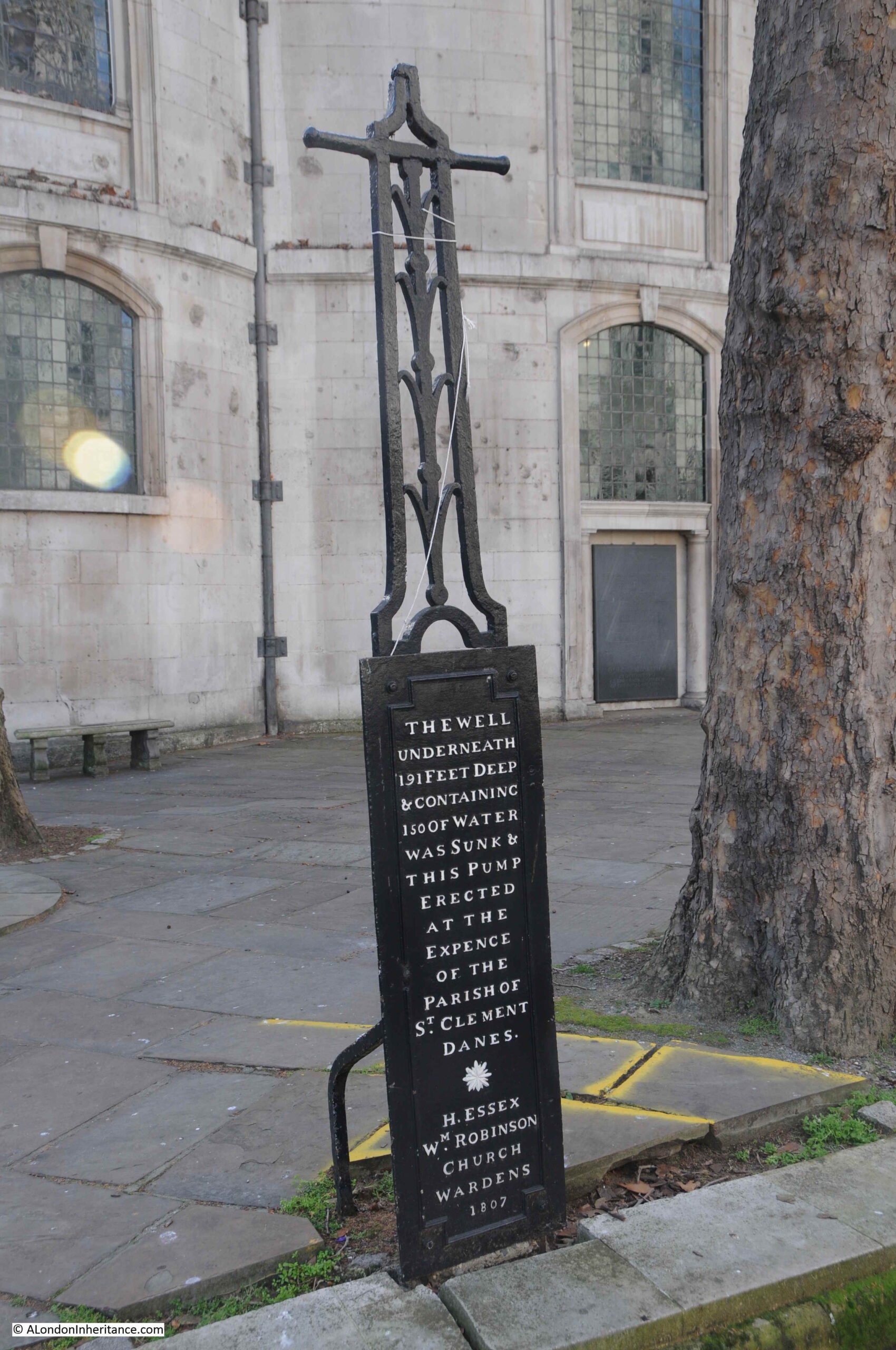
One of the stories about the originas of the church states that it was “founded on the site of a well outside Temple Bar”. Back outside the church, and by the eastern end of the church there was a well, but it was not the one on which the church was founded:

St. Clement Danes well

The date 1807 is presumably when the well was sunk, 191 feet below to find water.

Interestingly (or at least to me), a bore hole was sunk in front of the church for London Transport in August 1969.

This bore hole found water at around 85 feet. The records of the borehole indicate that the depth of water changed by the hour and by the day, fluctuating by as much as 20 feet. The chucrh is close to the Thames, and the effect of the tide can be seen in ground water levels, so perhaps the tides of the Thames shape the height of the water table below St. Clement Danes.

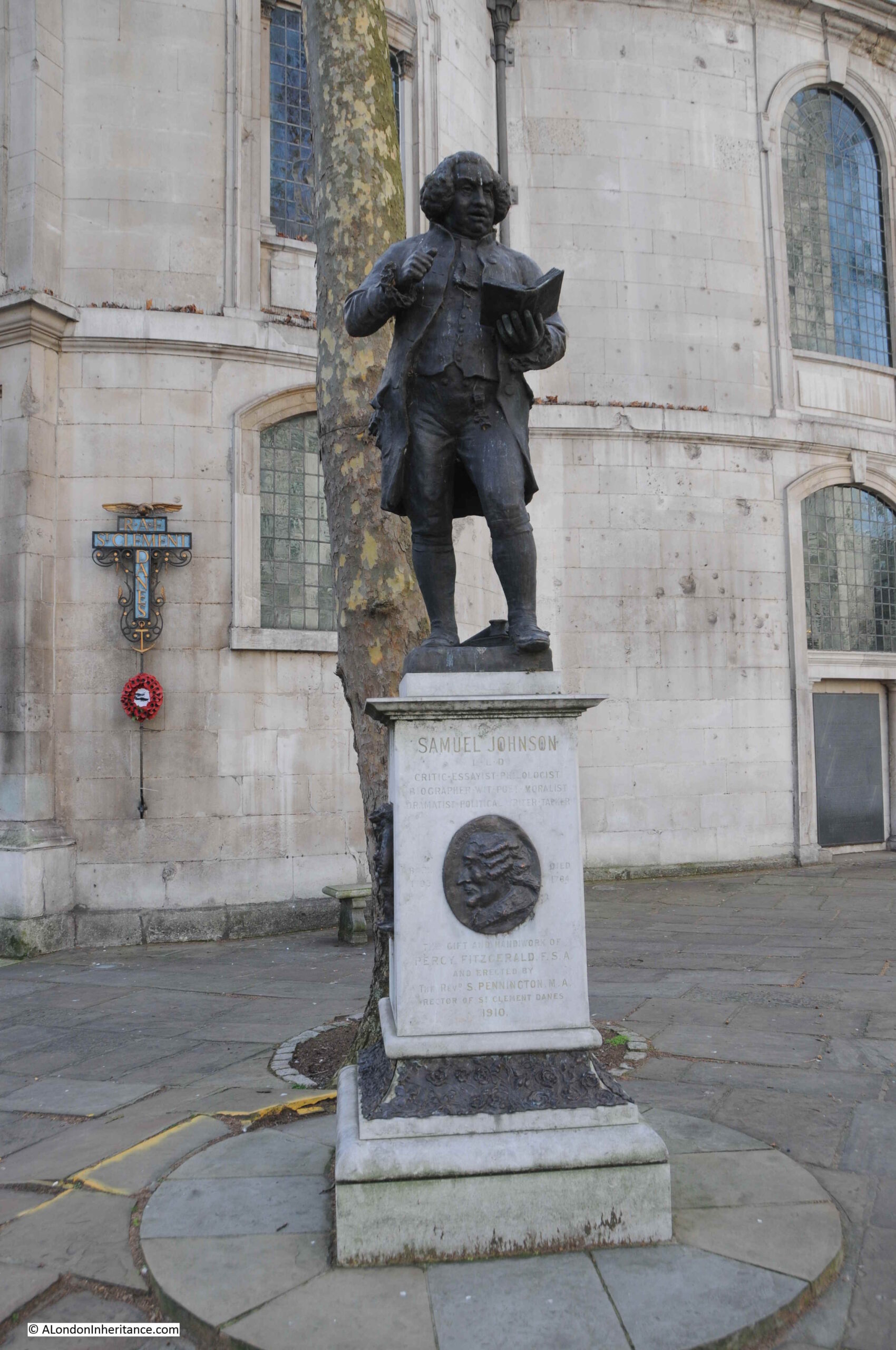
Close to the location of the old well is a statue of Samuel Johnson, the 18th century critic and essayist:

Samuel Johnson statue

St. Clement Danes was the church that Samuel Johnson attended, and the statue was donated by the Rev. J.J.H. Septimus Pennington, who died in 1910, when the statue by Percy Fitzgerald was unveiled by Princess Louise, Duchess of Argyll.

Rev. Pennington also put up stained glass windows to Dr. Johnson and carefully preserved his pew.

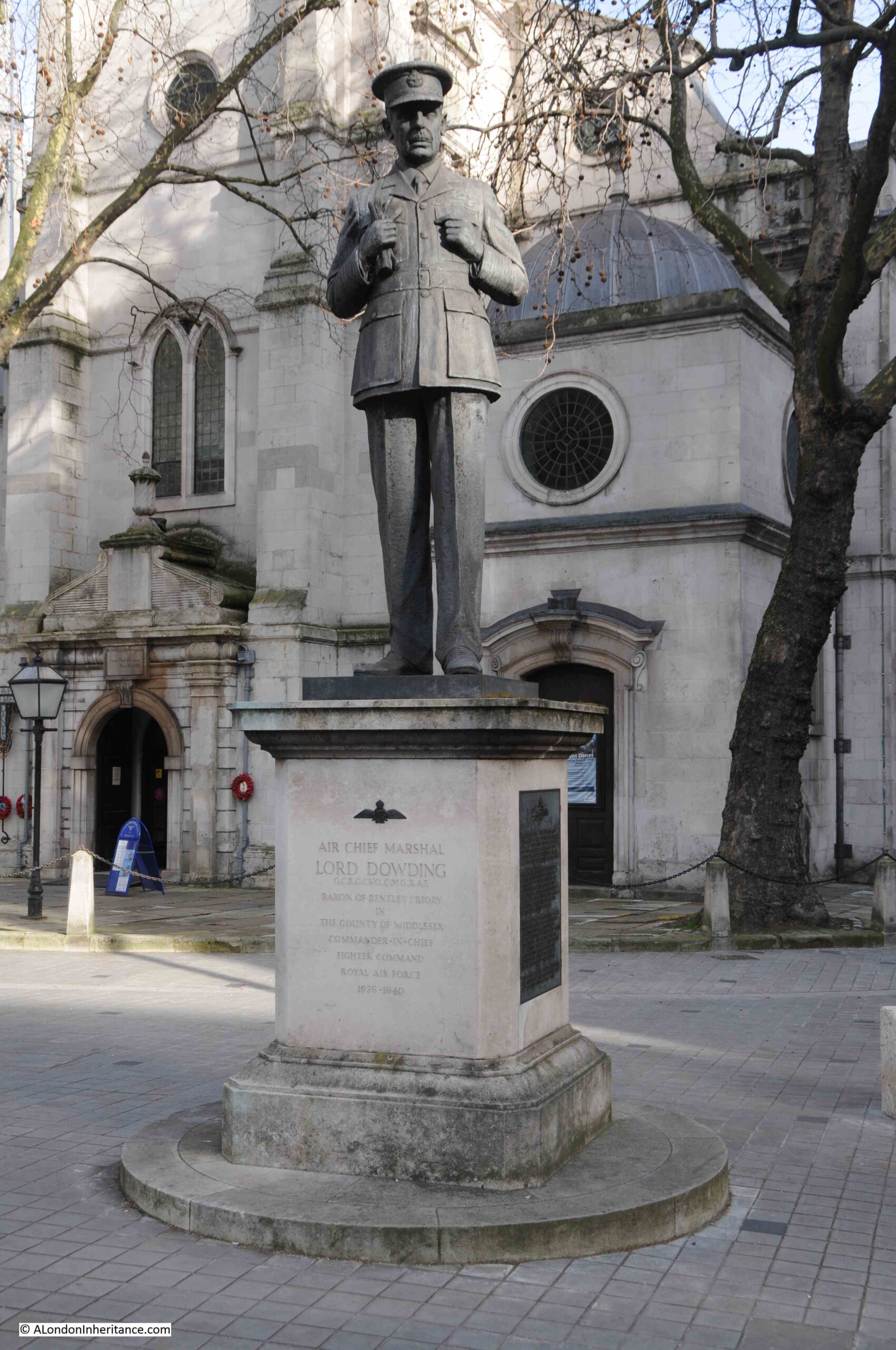
Statues to the front of the church relate to the church’s current relationship with the RAF, including Lord Dowding, Commander in Chief of Fighter Command during the last war:

Lord Dowding memorial

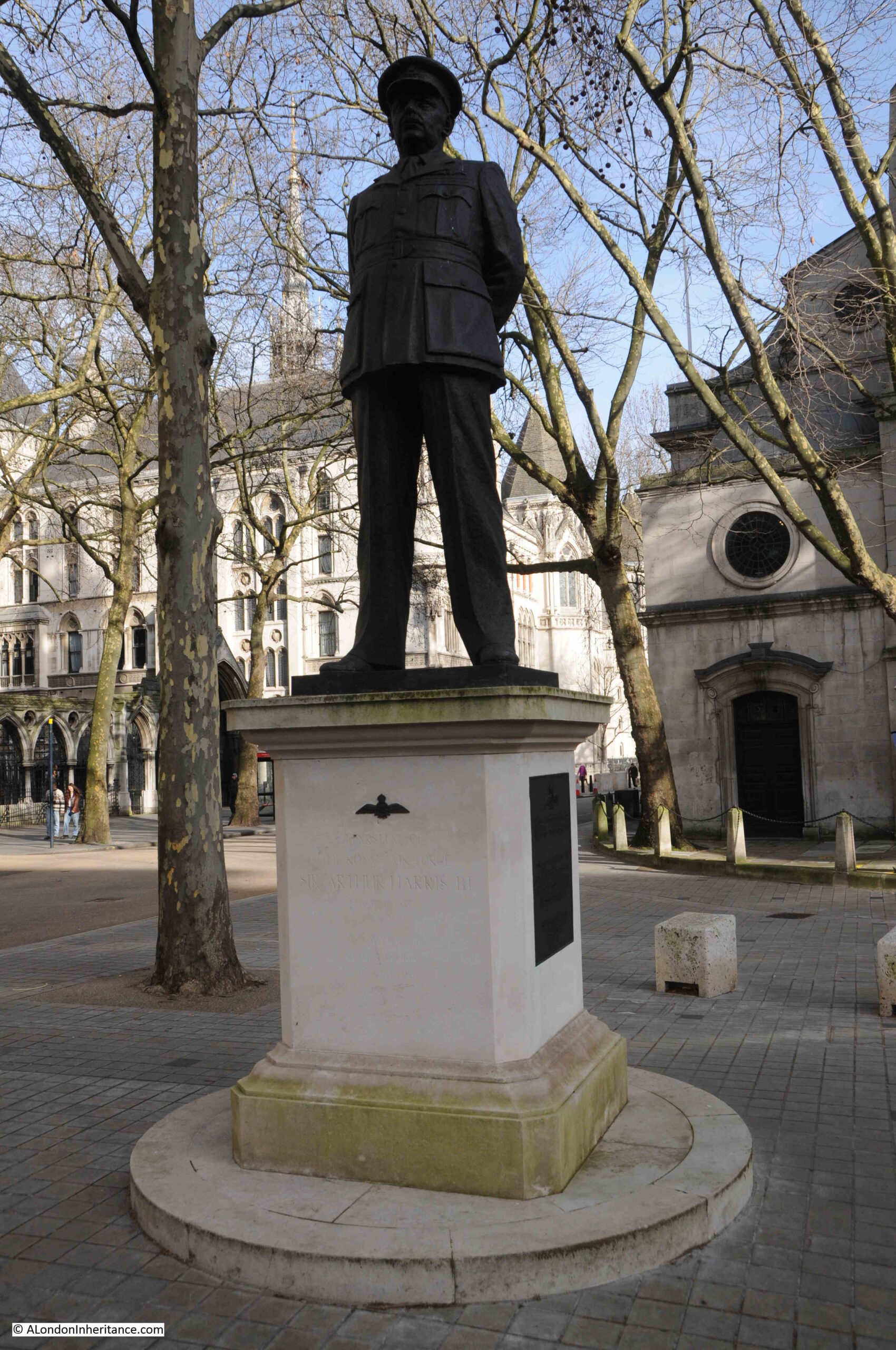
And Sir Arthur Harris, the head of Bomber Command:

Arthur Morris memorial

The memorial to Harris also records the more than 55,000 members of bomber Command who lost their lives.

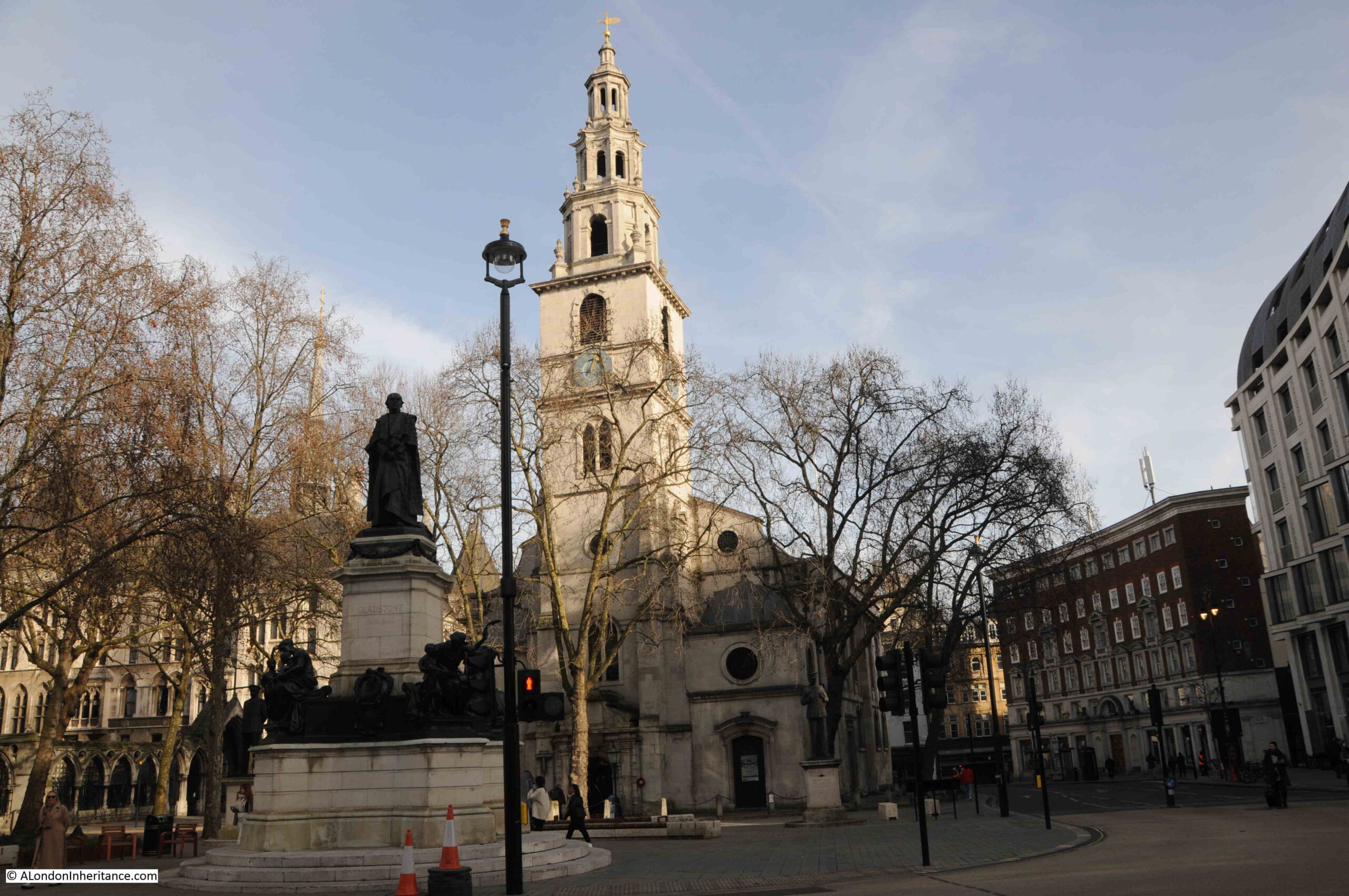
There is a large pedestrianised area in front of the church, and at the western end of this is a large monument (if you look back at the photo at the top of the post, you can see the top of the monument at the bottom of the page and the street that once ran between monument and church).

Gladstone Memorial

This monument is to William Gladstone who stands on the top of the monument looking west. Gladstone was Prime Minister a number of times during the second half of the 19th century.

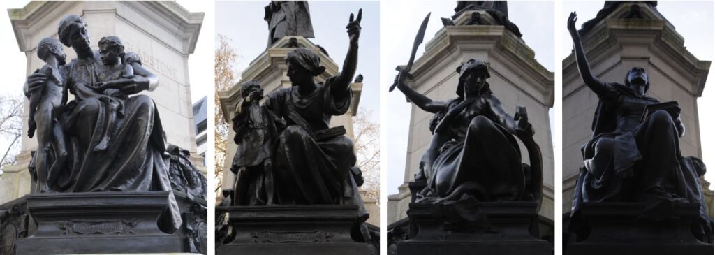
Reminiscent of the Victorian approach to adorning monuments, whilst Gladstone is at the top, around the pedestal are depiction of Brotherhood, Education, Courage and Aspiration:

Thorneycroft

The sculpture is the work of Sir William Hamo Thornycroft, who was a prolific producer of works seen across London and the wider country.

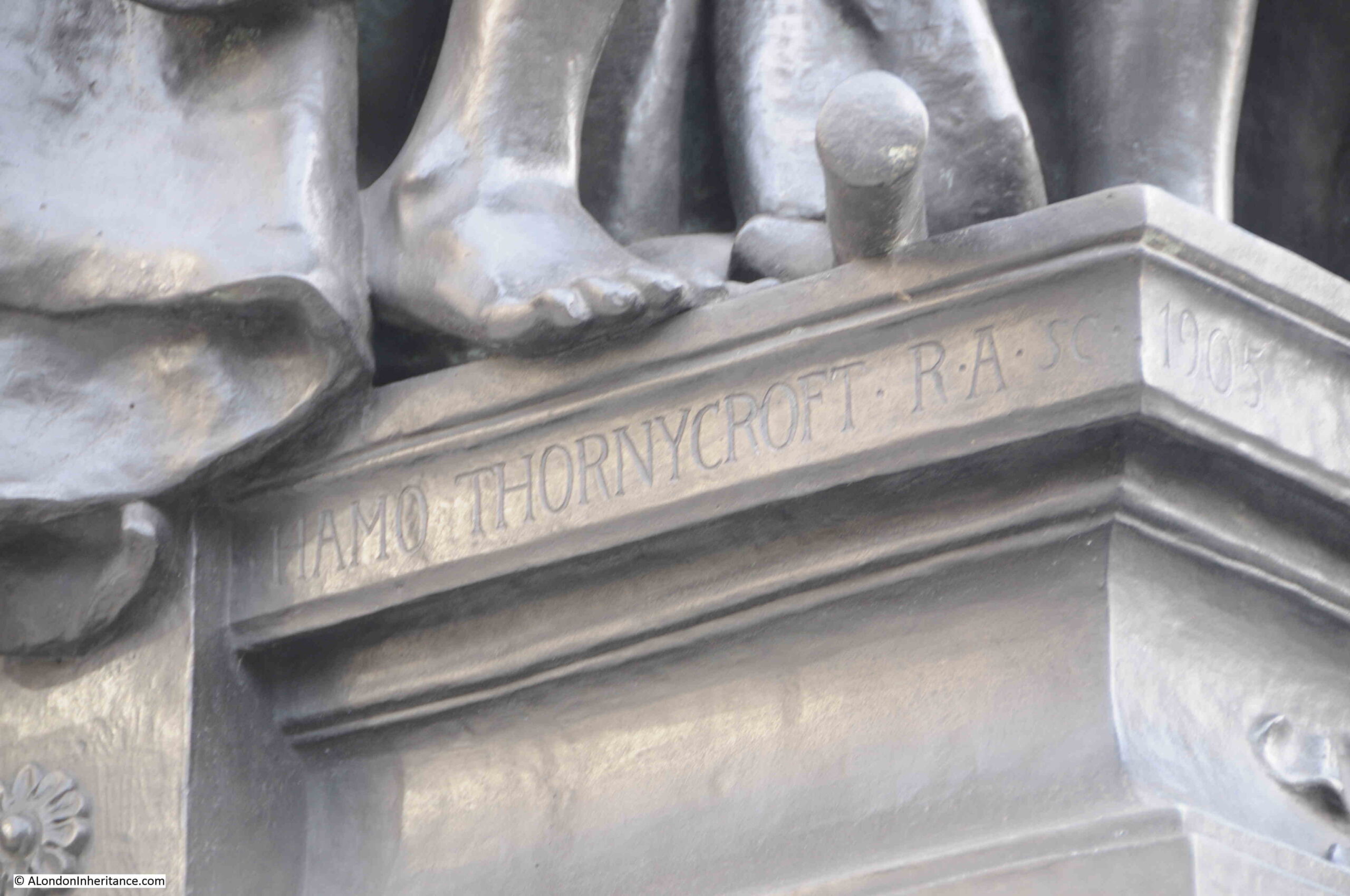
The statue of Oliver Cromwell outside the Palace of Westminster is another example of the work of Thorneycroft, and his name can be seen on the base of the Gladstone memorial:

Thorneycroft

St. Clement Danes is a lovely church in a prominent position in the Strand. A church has been on the site for very many centuries, and it is impossible to be sure as to how long this has been a religious place, and whether the Danes had any involvement in the founding or naming of the church.

There is one final story about the church. It is one of the two candidates for the St. Clement mentioned in the nursery rhyme “Oranges and Lemons”, where the first verse is:

Oranges and lemons,
Say the bells of St. Clement’s

The other candidate being St. Clement Eastcheap in the City. There was an “Oranges and Lemons” service held in the church and this was revived in 1959, as this report from the Daily Mirror on the 19th of March 1959 describes:

“The traditional ‘oranges and lemons’ service was revived yesterday for the first time since the war at the church of St. Clement Danes in the Strand, London.

The service marks the link between the church and the oranges ad lemons nursery rhyme. About 500 youngsters went along and the Rev. G.W.N. Groves handed out lemons while the Ven. A.S. Giles presents the oranges.”

There is a wonderful video on YouTube showing the dedication of the bells before they are mounted in the tower during post war reconstruction,. During the ceremony the tune for Oranges and Lemons is played on the bells, and the video shows the level of damage that the church sustained.

The video can be found here.

alondoninheritance.com