Monthly Archives: October 2023

College Hill – The Street With Four Plaques

A walk along College Hill in today’s post, but first, if you would like to come on one of my walks, a couple of places have just become free on two of my final walks until late next spring next year. Details and links are:

2 places available on the walk Bankside to Pickle Herring Street – History between the Bridges on Sunday the 5th of November

1 place available on the walk Limehouse – A Sink of Iniquity and Degradation on Sunday the 12th of November

College Hill is a short street that runs from Cloak Lane to College Street, to the west of Cannon Street Station in the City of London.

It is only 238 feet in length, but within that distance there is a considerable amount of history and four City of London plaques commemorating people and places within the street. I cannot yet confirm, but I suspect this is the highest number of plaques in such a short street.

This post will explore the street based on the stories that the plaques tell, and also hopefully show some of the difficulties in being able to be certain of the truth, and that whilst the sources on the Internet require a degree of scepticism, this also applies to many written books on the history of London.

I will also find a plaque that appears to commemorate someone’s burial before he was actually dead.

So, turning into College Hill from Cloak Lane in the north, the first plaque is to:

Turners’ Hall

The first plaque along is on the left of a very ornate doorway on the east side of College Hill:

Turners Hall

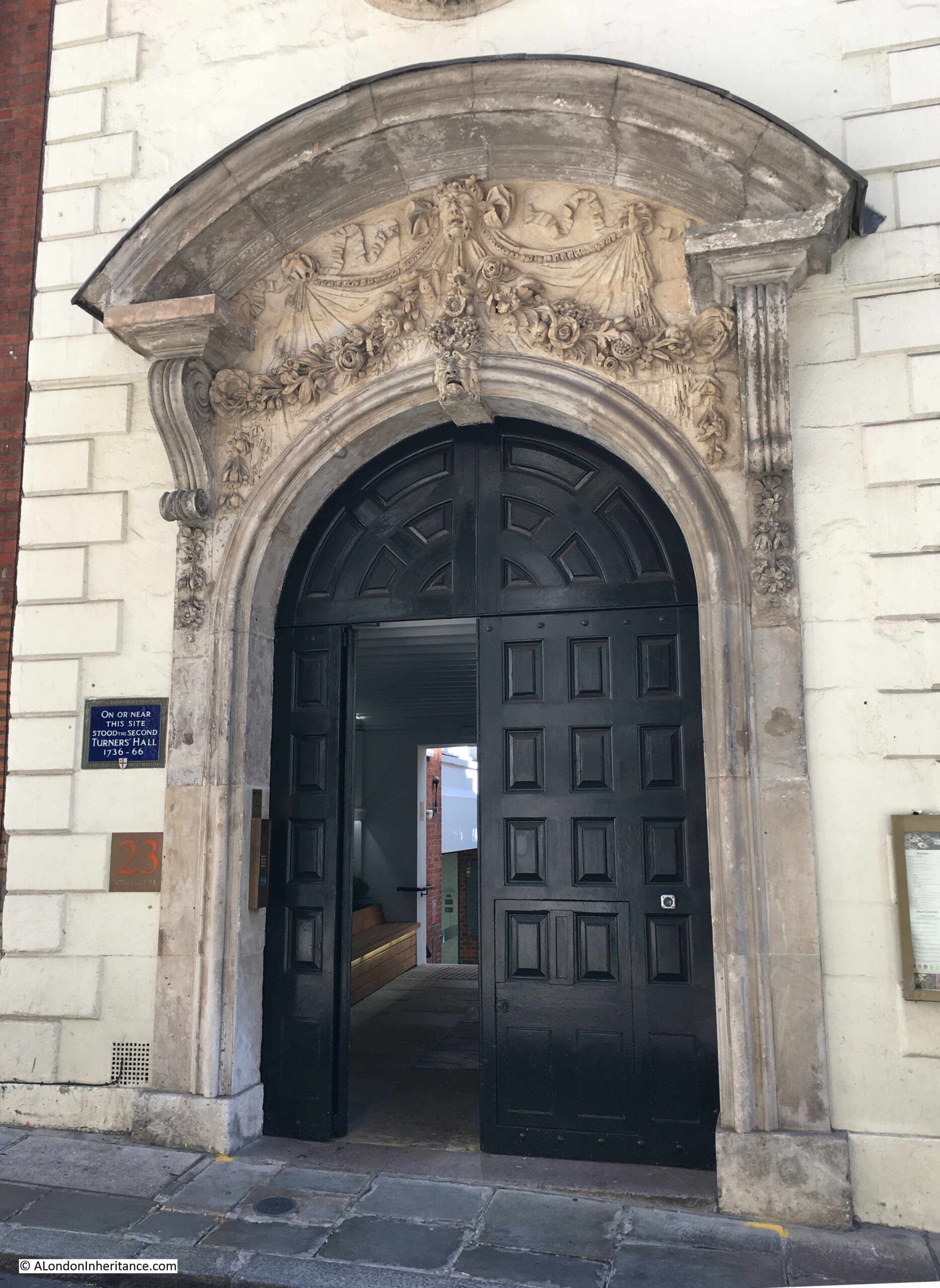
Recording that “On or near this site stood the second Turners’ Hall. 1736 to 1766”:

Turners Hall

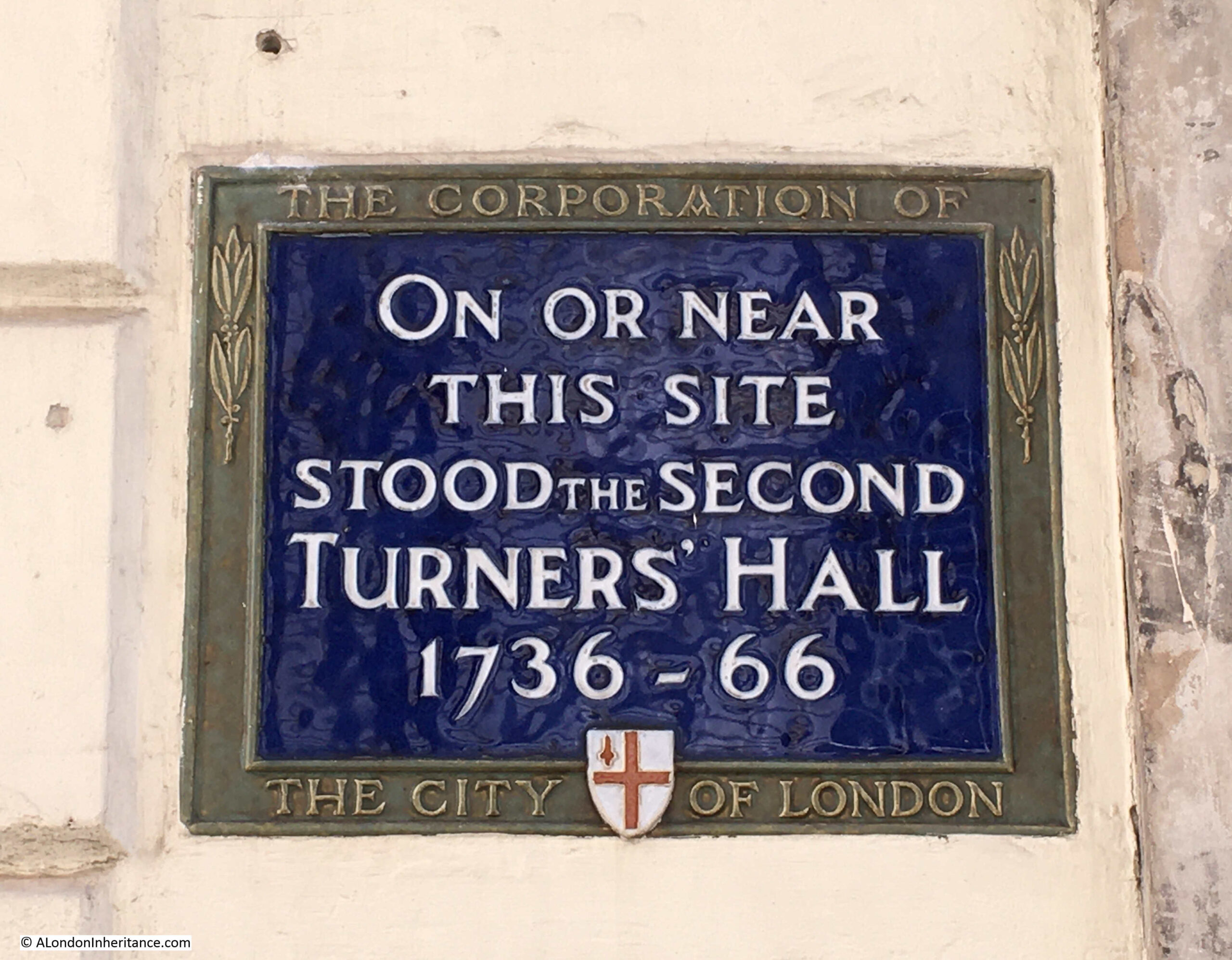
Turners’ Hall was the home for only 30 years of the Worshipful Company of Turners.

Members of the Tuners’ were those who specialised in wood turning on a lathe, and whilst this would have included the manufacture of furniture, a key product of the Turners’ appears to have been wooden measuring vessels, a device that would hold a set quantity of liquids such as wine or ale, and therefore able to show that an expected quantity (such as a pint or a quart) was being provided.

The trade of a Turner seems to date back many hundreds of years. According to “The Armorial Bearings of the Guilds of London” by John Bromley (1960):

“In 1310 six turners were sworn before the mayor not to make any other measures than gallons, pottles and quarts, and were enjoined to seize any false measures found in the hands of others whether free of the City or not.”

The problem with false measures was still a problem a couple of hundred years later, when in 1547 Turners were again summoned before the mayor and ordered to make only measures which conformed to the standard.

The mayor is still indirectly responsible for measures in the City of London, although rather than being hauled up before the Mayor, today it is the City of London Corporation Trading Standards team that manage this, and the sale of ale is still on their agenda as they have a web page dedicated to the Pub trade within the City of London and “Was your pint a short measure?”.

In 1604, King James the 1st granted the Turners’ their first Royal Charter.

The first Turners’ Hall was in Philpot Lane, off Eastcheap, where the company leased a mansion in 1591.

The Turners’ occupied this hall until 1736 when they had o leave their Philpot Lane location due to the landlord and the legal representative of the landlord’s estate both going bankrupt, apparently as a result of the South Sea Bubble.

The hall in College Hill was basically a merchants house. It was small, so did not have room for large, formal dinners, and at the same time the trade of the Turners’ was in decline, so in 1756 the building was let, and the Turners’ finally sold the building in 1766.

Today, the Turners’ do not have their own hall and now use halls of other City companies for their formal functions.

The Arms of the Turners’ are shown below:

Turners

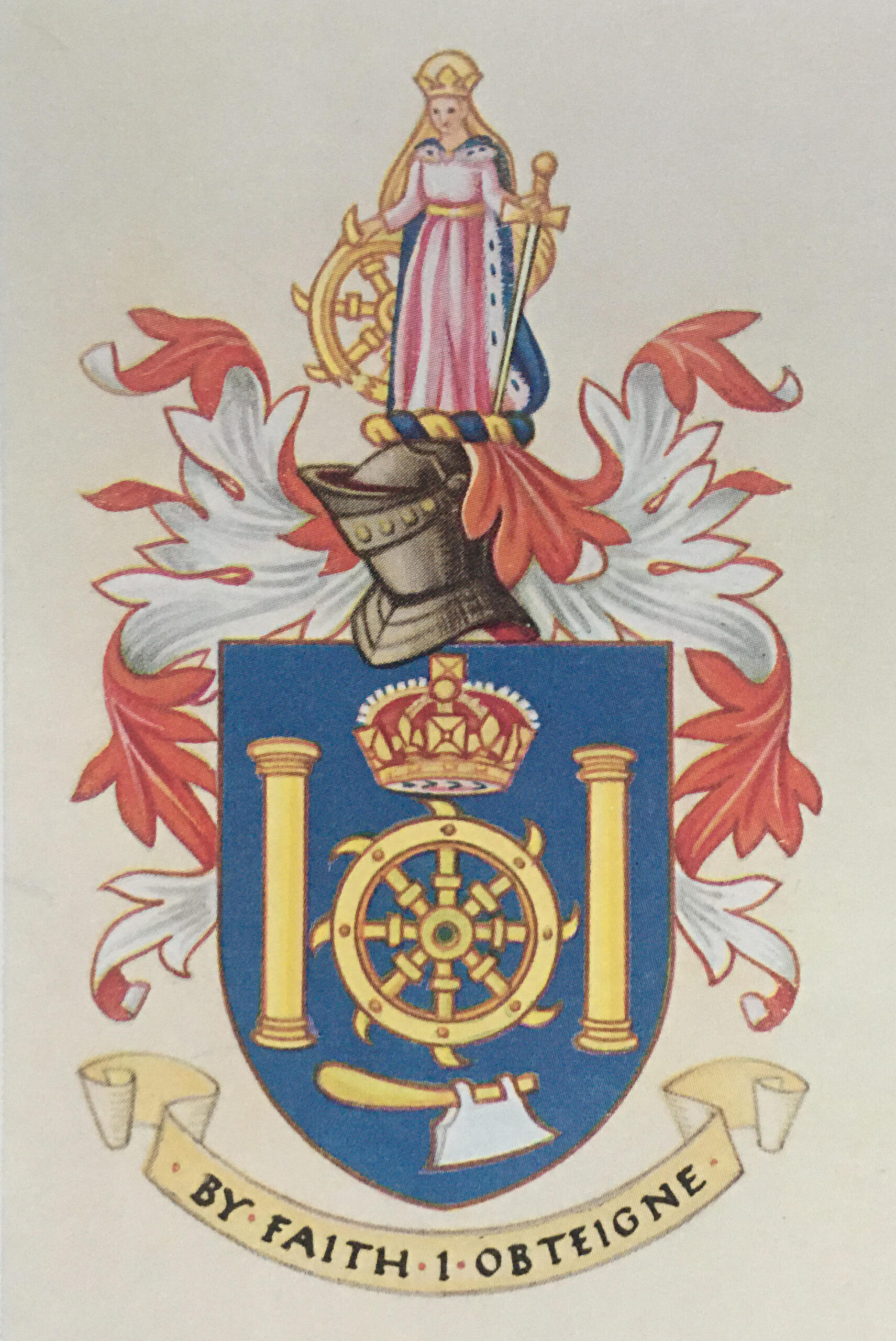
The hatchet at the bottom and the columns on either side represent tools of the Turners’ craft, however the wheel in the centre has a much more gruesome origin.

It is a torture or execution wheel, also known as an execution wheel. It was used to break the bones and execute those convicted of crimes such as murder, and was also the device intended for the execution of St. Catherine of Alexandria in the early 4th century, by the Roman emperor Maxentius for converting people to Christianity.

Allegedly, when Catherine touched the wheel intended for her execution, it broke into many pieces, although rather than being set free, she was then beheaded.

“The Armorial Bearings of the Guilds of London” provides the following regarding the link between the Turners’ and St. Catherine:

“Because of her eloquence and learning St. Catherine is generally regarded as the patroness of students and philosophers, but she has also, as a result of her emblem, been adopted as the tutelary saint of wheelwrights and mechanics. Whether the emblem was used by the Turners’ on account of its traditional use by other similar crafts, or whether the Company was originally founded as a fraternity with vows to St. Catherine has not been determined.”

Catherine appears at the top of the Turners’ arms.

St. Catherine also gave her name to the firework known as a Catherine Wheel, so if you see one of these spinning round on November the 5th, recall that the origins of the name go back to an instrument of torture and execution and a 3rd century saint.

The plaque is on the far left of the following rather intriguing building:

College Hill

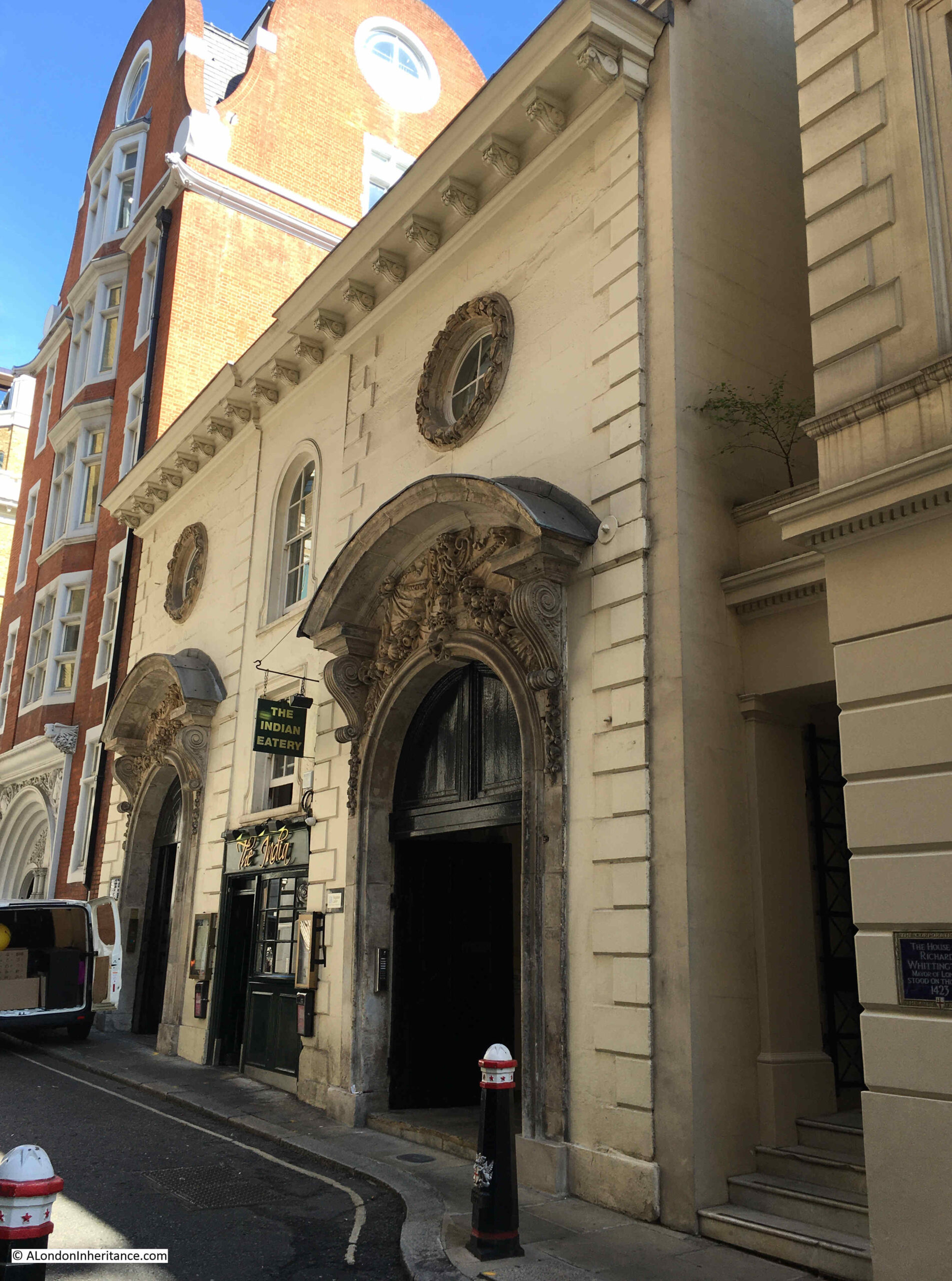
Two massive entrances lead to courtyards behind. The doorways have impressive sculpture above.

This is number 22 College Hill and the building is Grade II* listed. The Historic England listing details are:

“Circa 1680 probably by Nicholas Barbon. Double gatehouse with inexplicably grand stone front now painted. 2 principal storeys. 2 round arched entrances with double gates and wooden tympanum. Bolection moulded surrounds and segmental pediments on carved brackets with richly carved ornament above each arch. Circular windows above with carved surrounds. Small shop inserted in centre with square and round arched windows over. Plain parapet. Rear of red brick (partly rendered) with wooden eaves cornice to tiled roof. Dormers. Central part set forward but whole much altered.”

I like the comment “inexplicably grand stone front” in the listing. The shop mentioned in the listing in the centre is now a restaurant, the India, and photos on their website show the restaurant is within a long, brick arched room, rather like the arch under a railway viaduct, which looks very unexpected when compared to the front of the building.

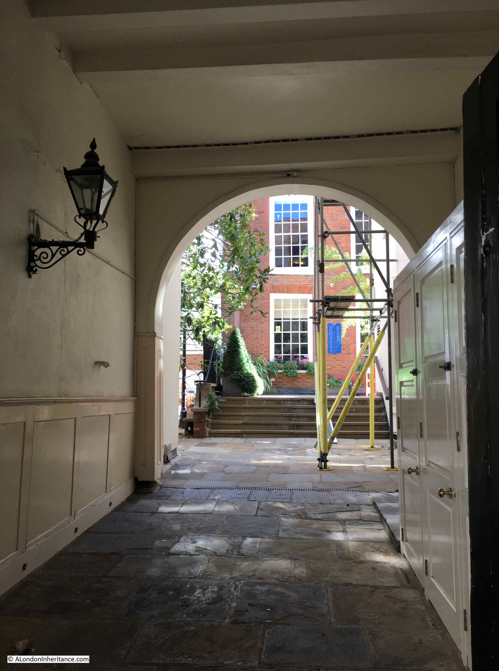
The entrances on either side of the building lead through to a courtyard and offices at the rear:

College Hill

The following print dating from 1837 shows one of the entrances to the building, along with the building next along the street, which has a sign above the first floor windows stating that it is the Mercers School © The Trustees of the British Museum):

College Hill

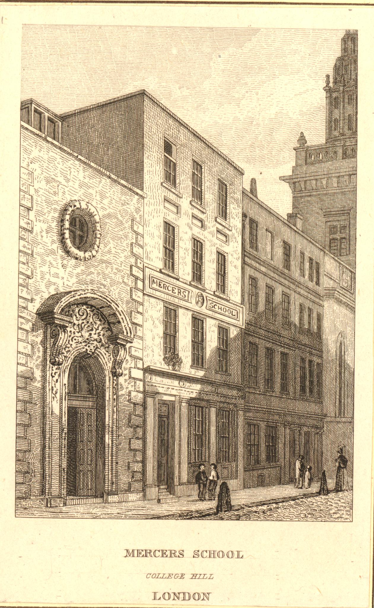
The Mercers School dates from 1542, and was in College Hill from around 1805 until the school moved to High Holborn in 1894.

There is another print which shows the building, but adds some confusion, The following print is dated to between 1829 and 1831 and is titled “Whittington’s College, College Hill”  © The Trustees of the British Museum):

College Hill

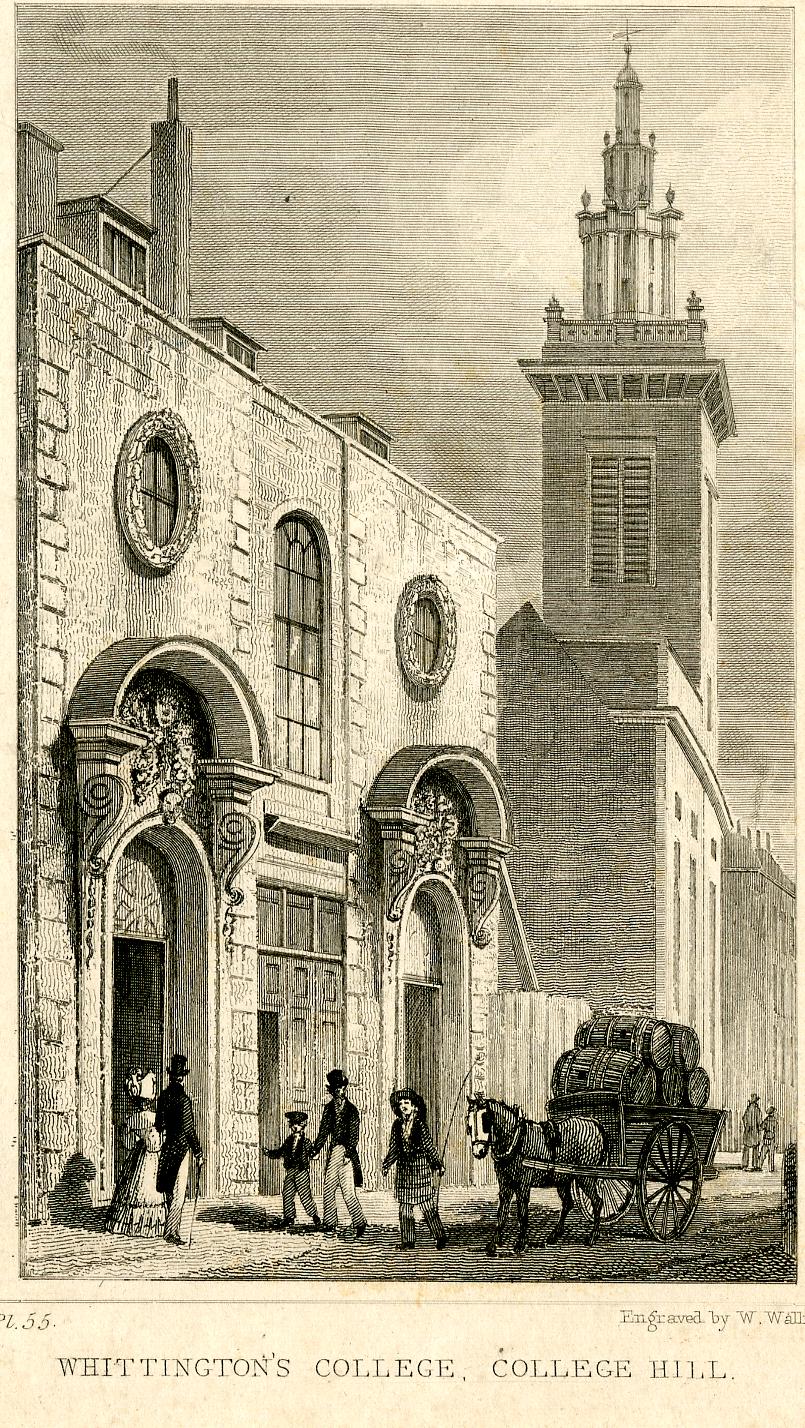
The text on the British Museum collection website for the photo reads “View of Mercers’ School, founded by Whittington, c.1419, rebuilt c.1668; a cart laden with barrels stands outside the grand arched entrances to the college, a tower rises in the background.”

The text states that it is a view of the Mercers’ School, however the previous print shows the school in what is the empty plot of the above photo, so I wonder if the school originally moved into the building with the ornate entrances before a purpose built building was completed next door.

The text also states that Mercers’ School was founded by (Richard) Whittington c1419, however according to the Mercers’ School History, the school was started in 1542, over one hundred years after Whittington’s death.

There was though a Whittington College in College Hill, however it was dissolved in 1547 during Henry VIII’s dissolution of religious establishments. It was revived after his death by Mary, but finally wound up during the reign of Elizabeth I, so long before the building was constructed in 1680.

So the British Museum text appears to have errors, and whoever published the print of the building appears to have wrongly assumed that it was Whittington College, when by the time of the print the Mercers’ School was in College Hill.

The House of Richard Whittington

At numbers 19 to 20 College Hill is another Grade II listed building, dating from the mid 19th century:

Richard Whittington

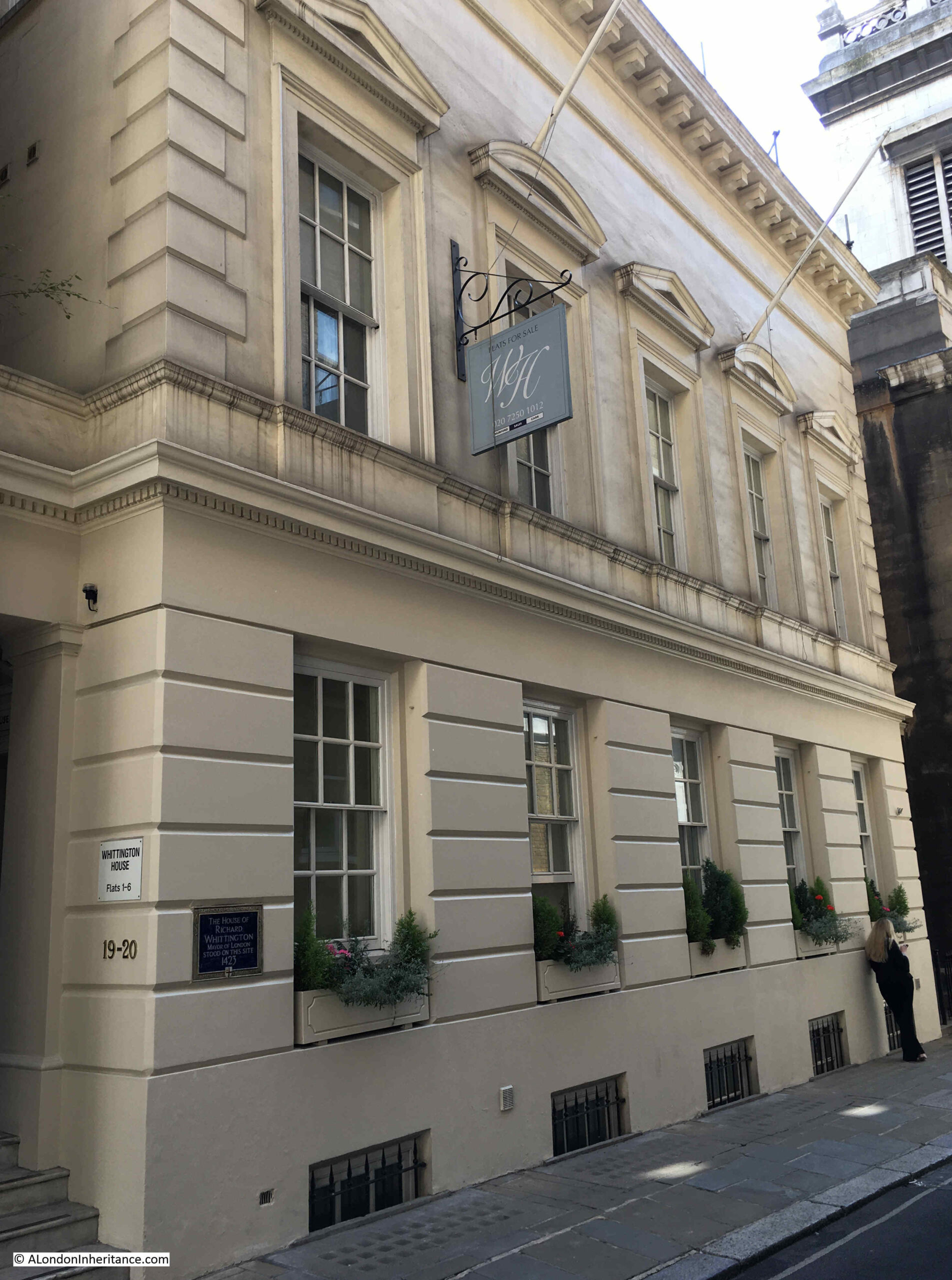
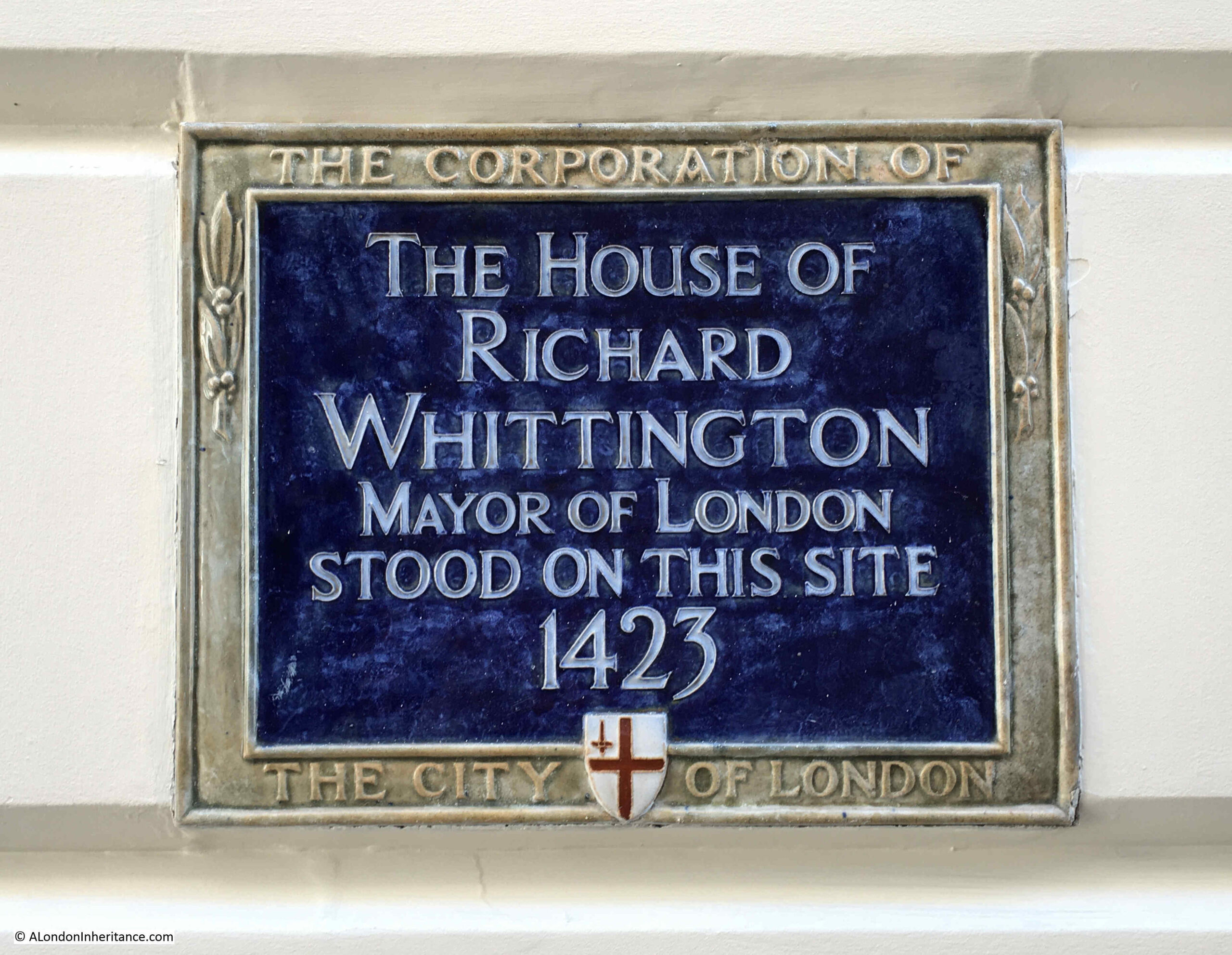
On the left of the building is a plaque which states that “The House of Richard Whittington Mayor of London Stood on this Site in 1423”:

Richard Whittington

There has been much written about Richard Whittington, and many of these stories are myths. There was no cat (this was added centuries later), he was not poor, and whether he turned again as he was leaving the City to the north is probably unlikely.

Where he did have a challenge is that he was the younger son of Sir William Whittington, from Pauntley in Gloucestershire, and being a younger son, he would not have inherited his father’s wealth and lands.

On his arrival in London, he was apprenticed to a mercer, and gradually grew a reputation as a successful trader and also sold to the King. Between 1392 and 1394 Richard II purchased around £3,475 worth of goods from Whittington. He exported wool and also lent money to the King, all activities which built his wealth and reputation within the royal court.

His future reputation would be sealed when he became Mayor of London. It was his money lending, friendship and loyalty to the King, Richard II which enabled this, as in 1397 the City of London was being badly governed.

The King confiscated much of the City’s land, and selected Richard Whittington to be Mayor of the City, a choice which was confirmed by a vote of those eligible to vote within the City of London.

He appears to have been liked by the people of London, he carried out a number of improvements to the City, which apparently included rebuilding parts of the Guildhall, and according to the Museum of London, he built a communal ‘longhouse’, a communal privy which would have overhung the Walbrook river. He also ensured that the City was able to buy back the land that the King had confiscated.

Although he did own property, he did not own large estates, including a large estate outside of London, as would have been normal at the time for a person of his position and wealth.

He was Mayor of the City of London in 1397, 1406 and 1419, and he was also an MP, as well as being a member of the Mercers Company.

He wife Alice died in 1410, and Whittington died in 1423, and as they had no surviving children, much of Whittington’s wealth was left for charitable purposes.

The date on the plaque is 1423 for Richard Whittington’s house being on the site. This is the year that he died, and it highlights one of the problems with these plaques, in that they do not explain the relevance of the date.

Whilst it was the year he died, was he living in the house at the time, how long had he owned or lived in the house, why is 1423 important as regards the house?

But there is a much stranger date on the next plaque.

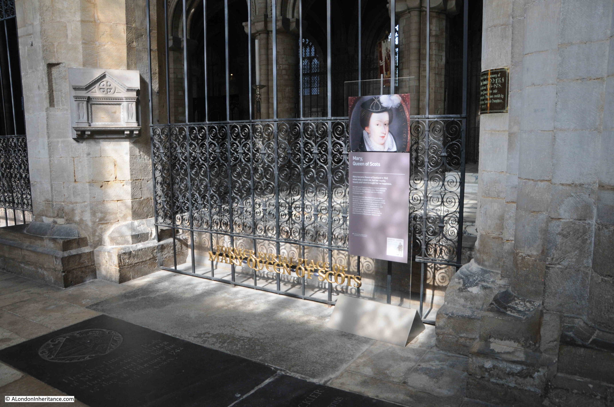
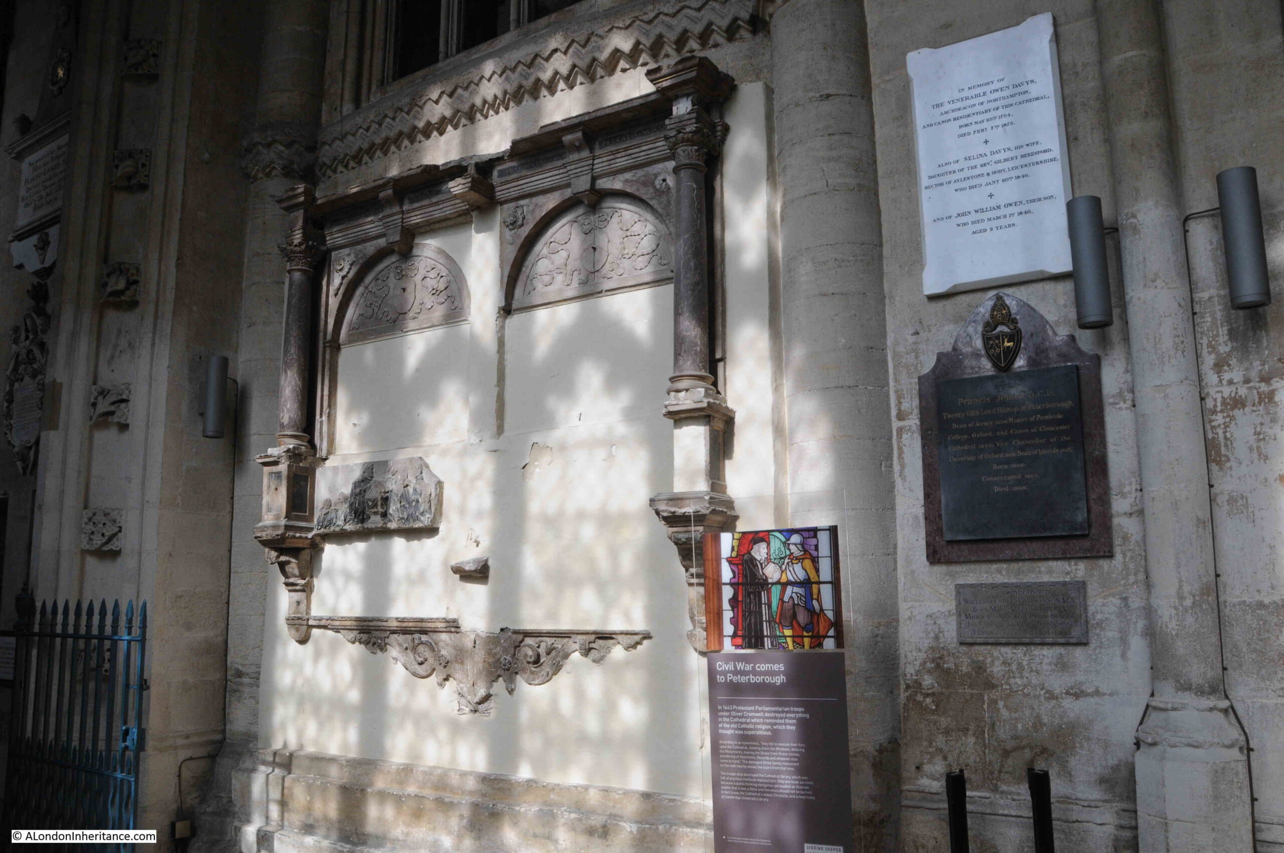
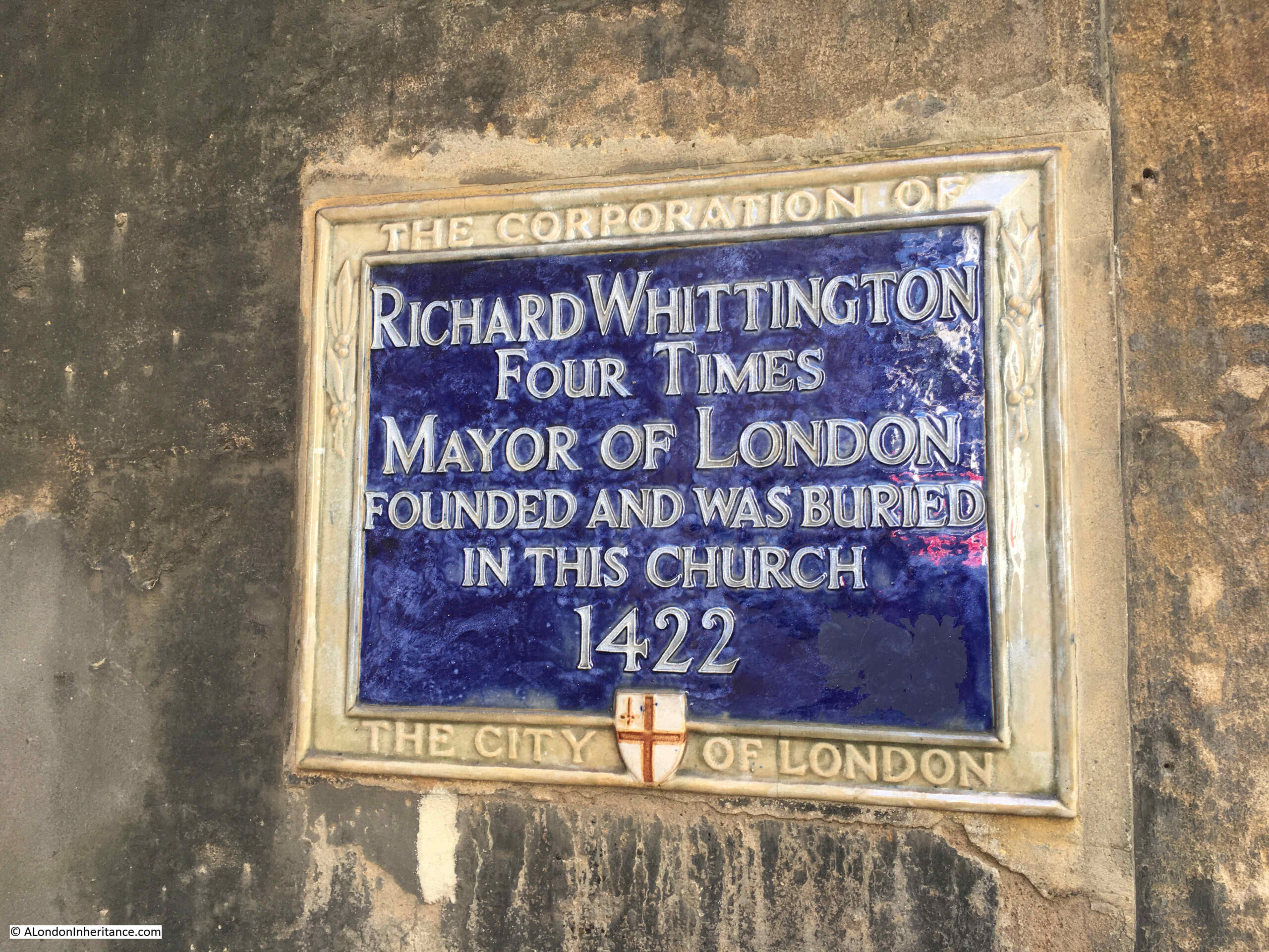
Richard Whittington Founded and was Buried in this Church 1422

The plaque can just be seen on the corner of the church, highlighted by the red arrow:

College Hill

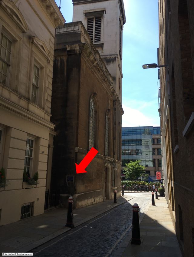
So, there is an immediate problem with this plaque, according to nearly all the sources I have read, Richard Whittington died in 1423, not 1422, so at the time of the date on this plaque, claiming burial in the church, he seems to have been very much alive.

Richard Whittington

I may be wrong that the date on the plaque refers to his year of death, it may be something to do with the church. According to records in the London Metropolitan Archives, Whittington paid for the rebuild of the church in 1409, so did it take thirteen years to complete, and was being reconsecrated / reopened in 1422?

This is one of the problems with some of the plaques in the City of London, they do not provide any context to some of the dates listed.

The sources stating his death was in March 1423 include:

Along with many others books and websites. An example of a book which could perhaps be expected to have the correct date is Old and New London by Walter Thornbury, where in a comprehensive listing of Lord Mayor’s of the City, Whittington is stated as having died in 1627, four years after what appears to have been his correct year of death.

An early 17th century “true” portrait of Richard Whittington  © The Trustees of the British Museum):

Richard Whittington

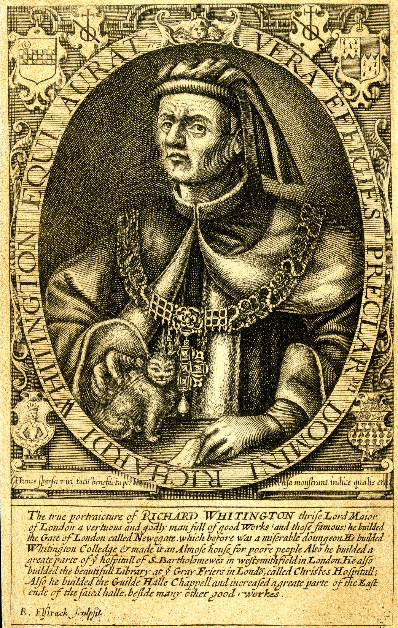
Two hundred years after his death, the story of the cat seems to have been established as he is shown stroking a small cat in the above print, which also lists his good works:

“Thrice Mayor of London, a virtuous and godly man full of good works and those famous he builded the Gate of London called Newgate which before was a miserable dungeon. He builded Whittington College and made it an almshouse for poor people. Also he builded a great part of the hospital of St. Bartholomews in West Smithfield in London. He also builded the great Library at Grey Friers in London called Christes Hospital. Also he builded the Guilde Halle Chapel and increased a great part of the east side of the said hall, beside many other good works.”

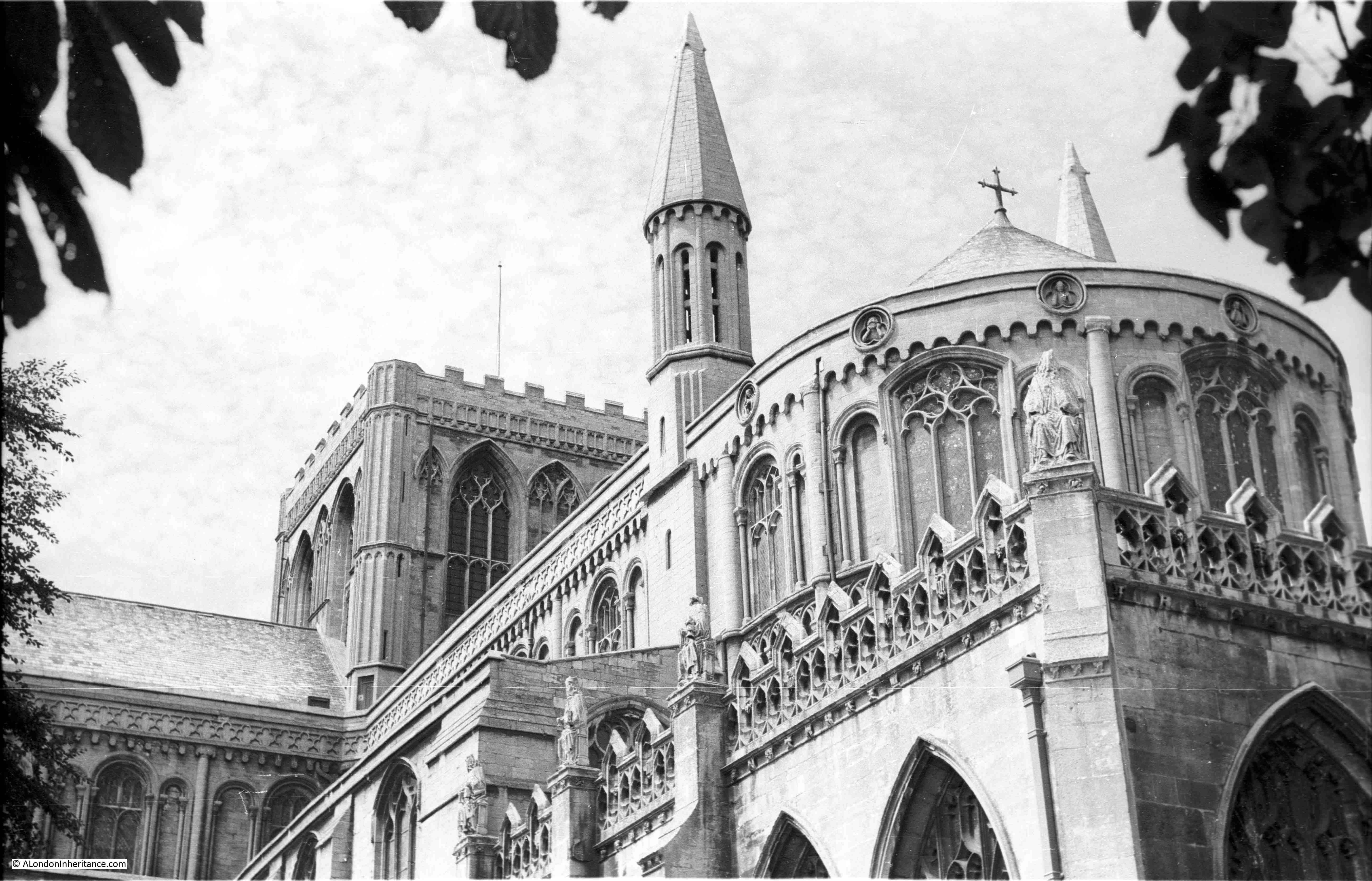
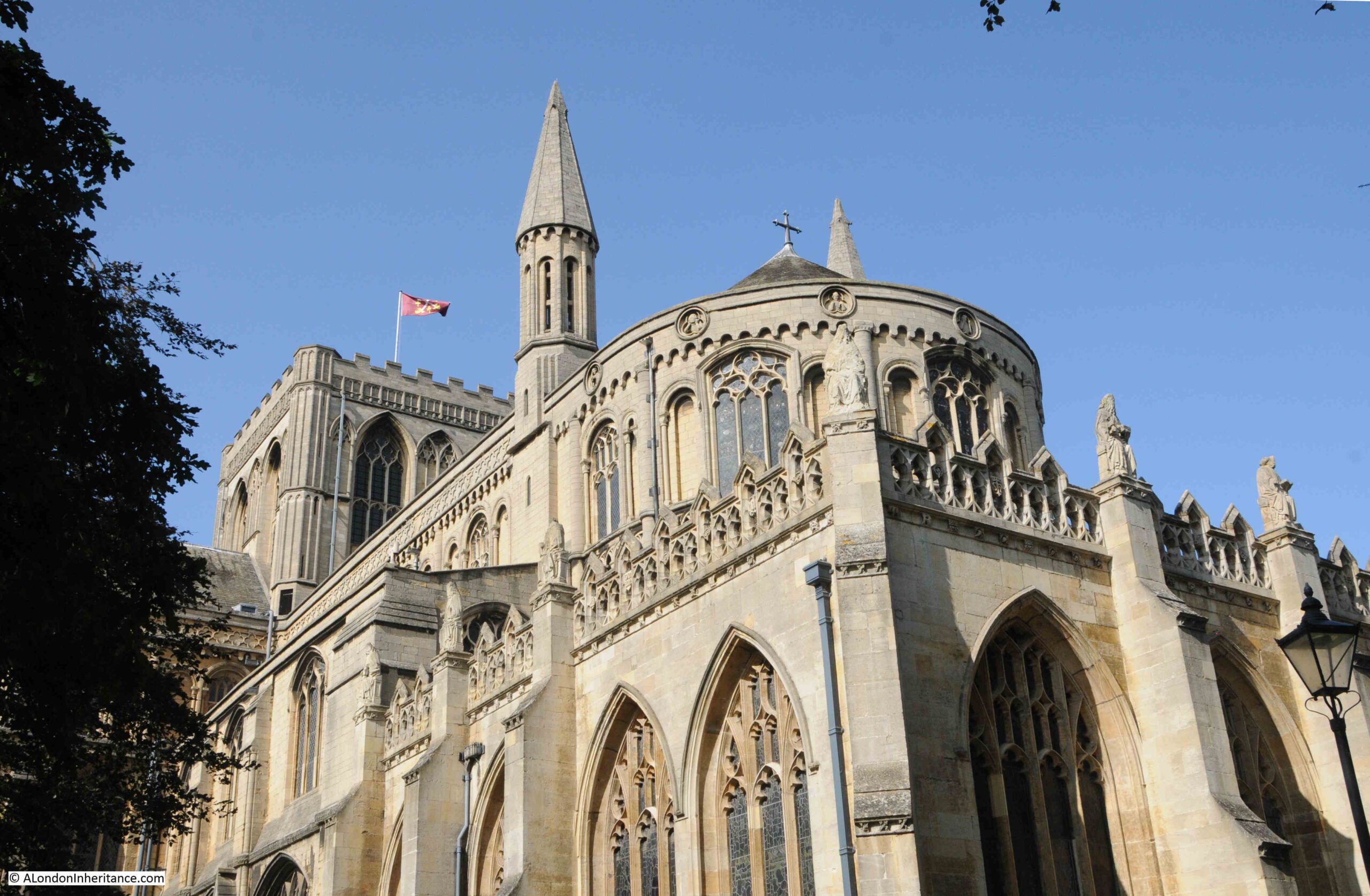
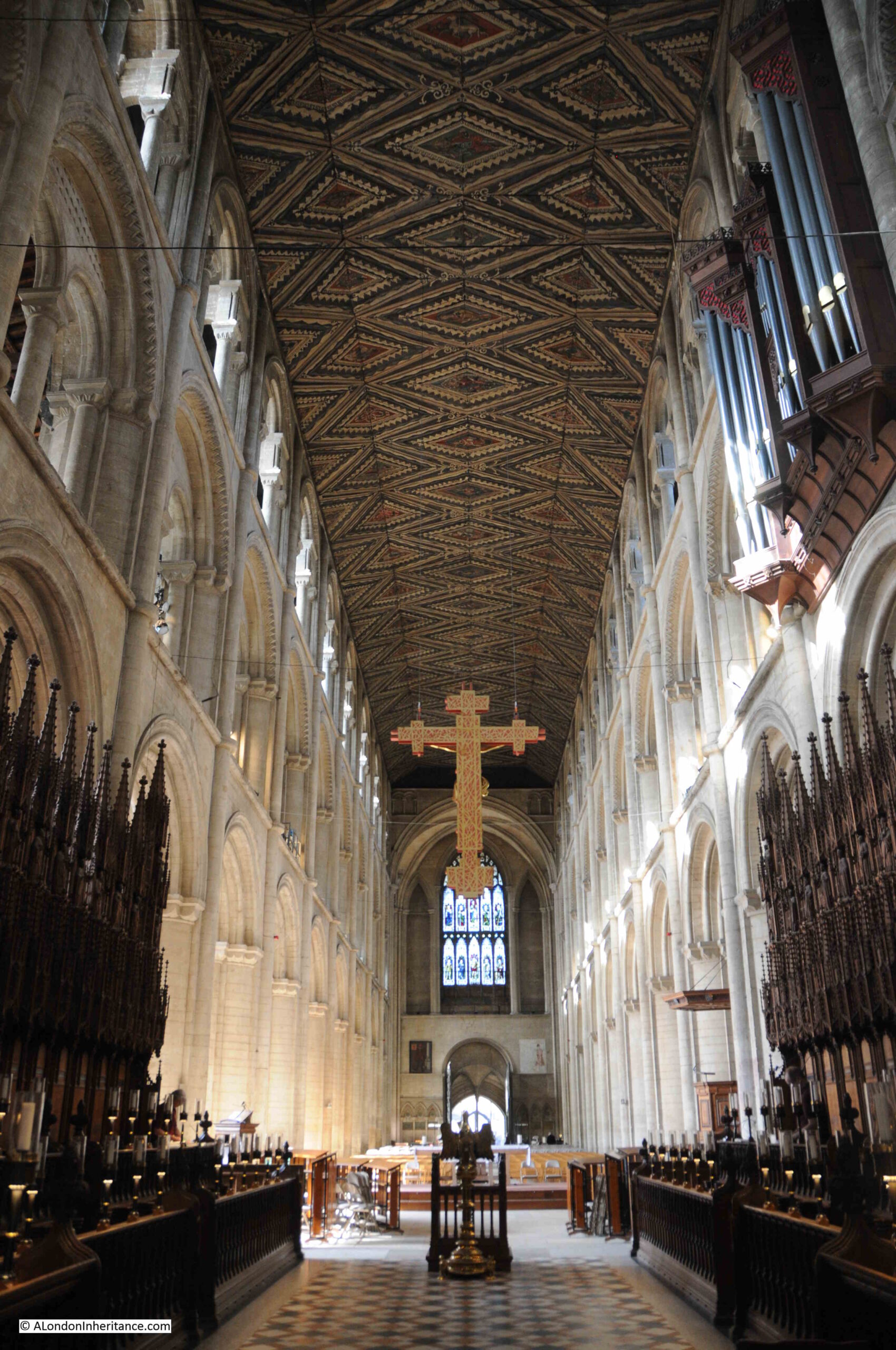
The plaque is on the corner of the church of St. Michael Paternoster Royal, and there are a number of stories regarding the founding and age of the church.

The plaque claims that the church was founded by Richard Whittington, but that is not quiet true.

The first reference to a church on the site dates from 1219. The name of the church comes from the sellers of paternosters or rosaries who were based in College Hill, which was then called Paternoster Lane. The Royal element of the name comes from a now lost nearby street called Le Ryole, which was a corruption of the name of a town in Bordeaux called La Reole. The street was apparently home to wine sellers, which presumably explains the Bordeaux connection.

Richard Whittington’s involvement with the church dates from 1409 when he paid for the rebuilding of the church, and the extension of the church by the purchase of a plot of land in the street Le Ryole.

Although he was not responsible for the founding of the original church, Whittington did found a College within the extended church for the training of priests, the College of St Spirit and St Mary. The association of the church with the college enabled St Michael’s to become a collegiate church, so perhaps this is what the plaque is referring to.

The college is also the reason why the street is called College Hill.

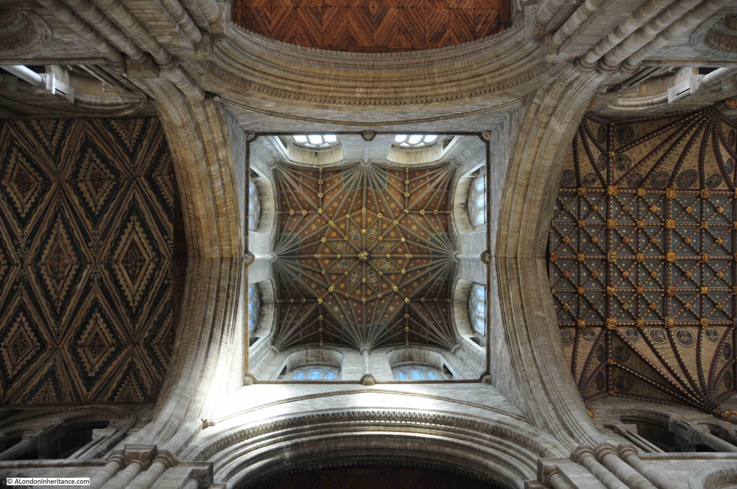
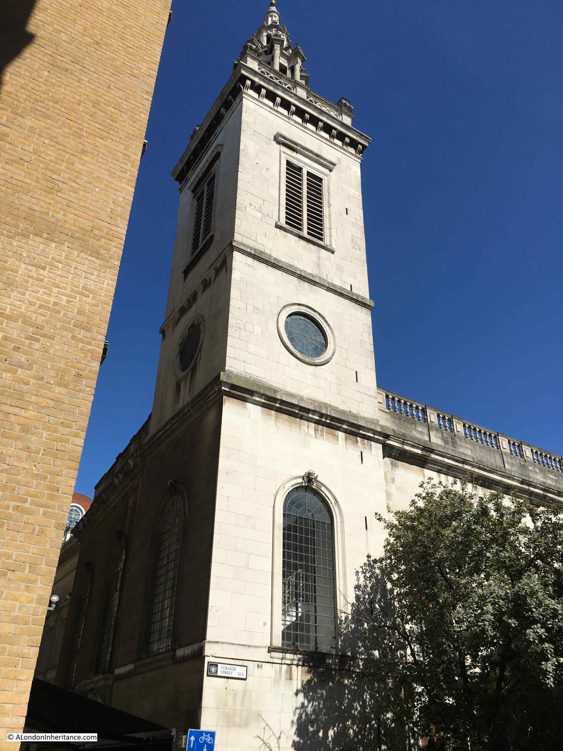
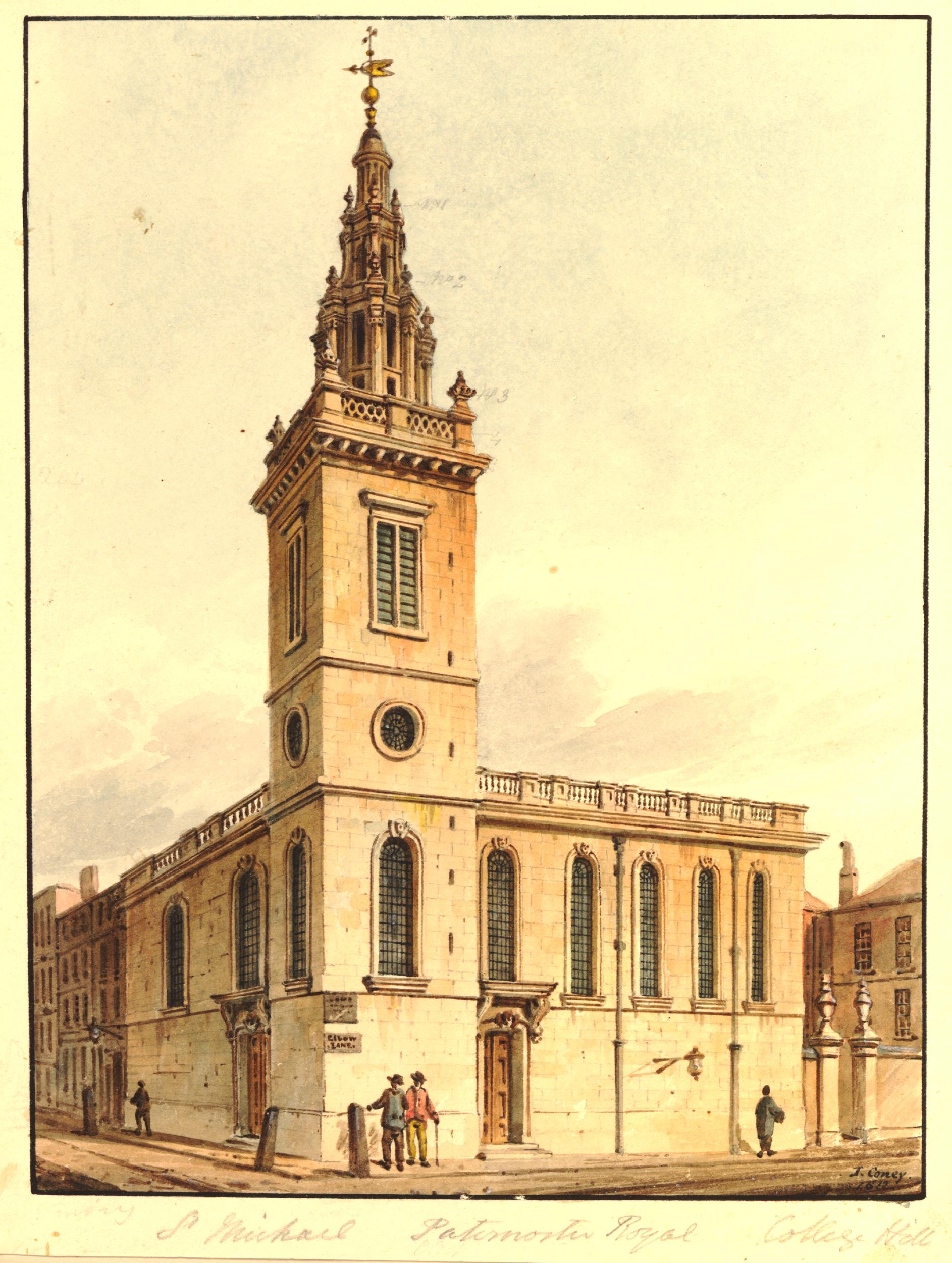
The church was destroyed in the 1666 Great Fire, and rebuilt by Wren, with Nicholas Hawksmoor adding the steeple between 1713 and 1717.

The church was badly damaged during the last war, and there was a proposal to demolish all of the church except for the tower, however this was opposed by the Corporation of the City of London, and the church was finally rebuilt and restored in the late 1960s, the last City church to be rebuilt after the damage of the early 1940s.

The tower and steeple of St. Michael Paternoster Royal:

St. Michael Paternoster Royal

St. Michael Paternoster Royal as it appeared in 1812  © The Trustees of the British Museum):

St. Michael Paternoster Royal

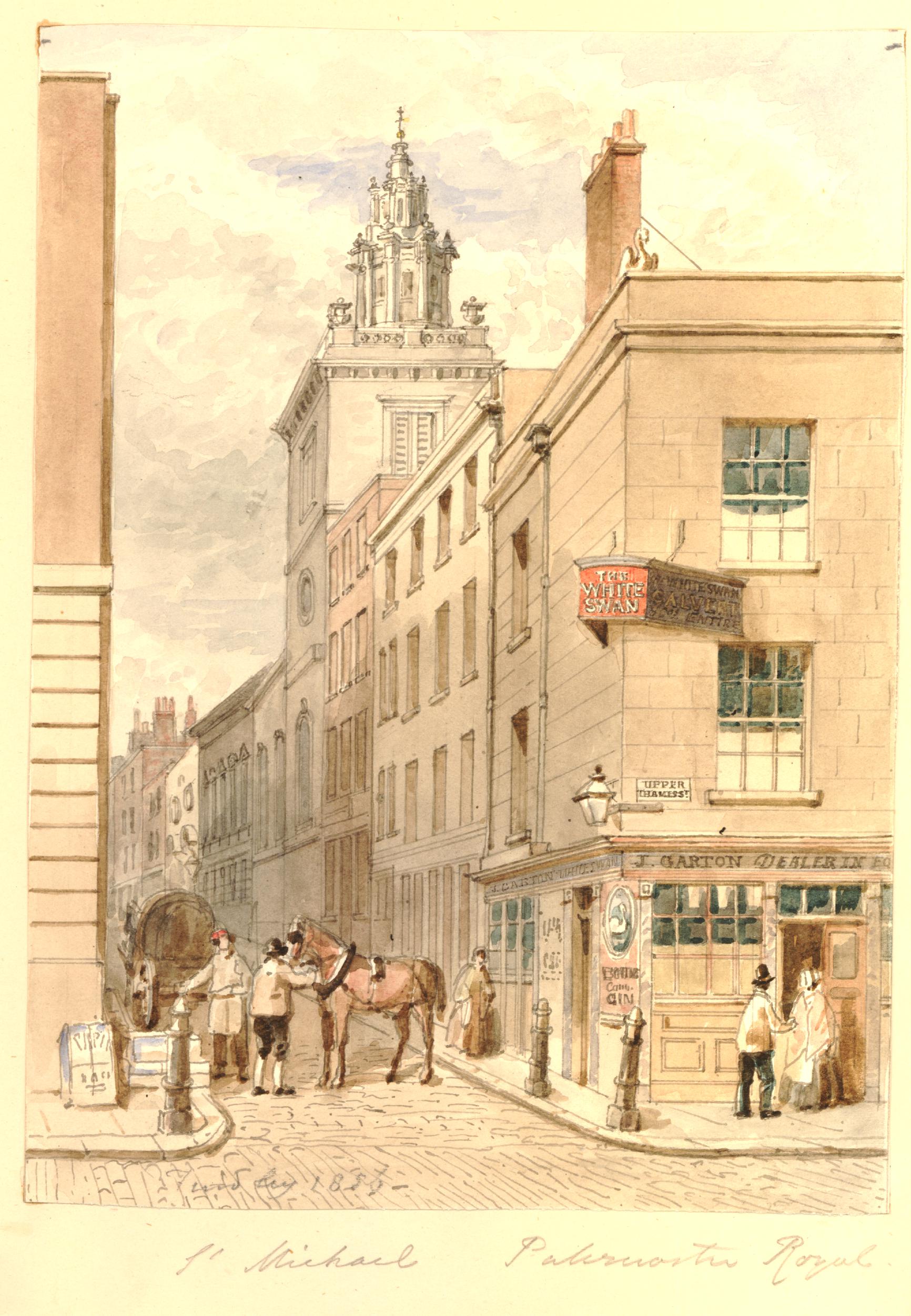
And by 1859, houses and a pub appear to have been built on the open space to the south of the church, down to Upper Thames Street, with a pub, the White Swan on the corner  © The Trustees of the British Museum):

College Hill

The main door to the church:

St. Michael Paternoster Royal

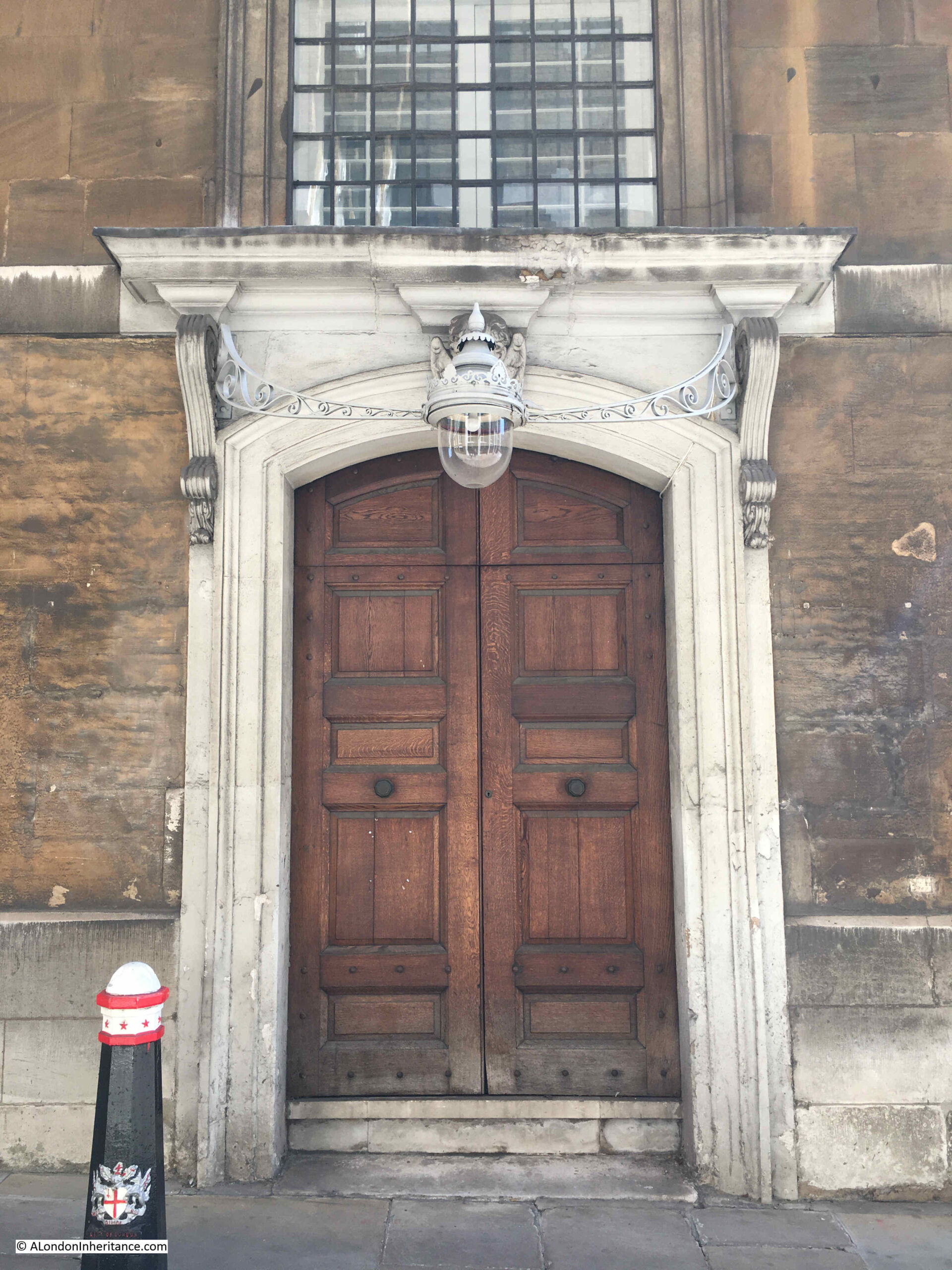
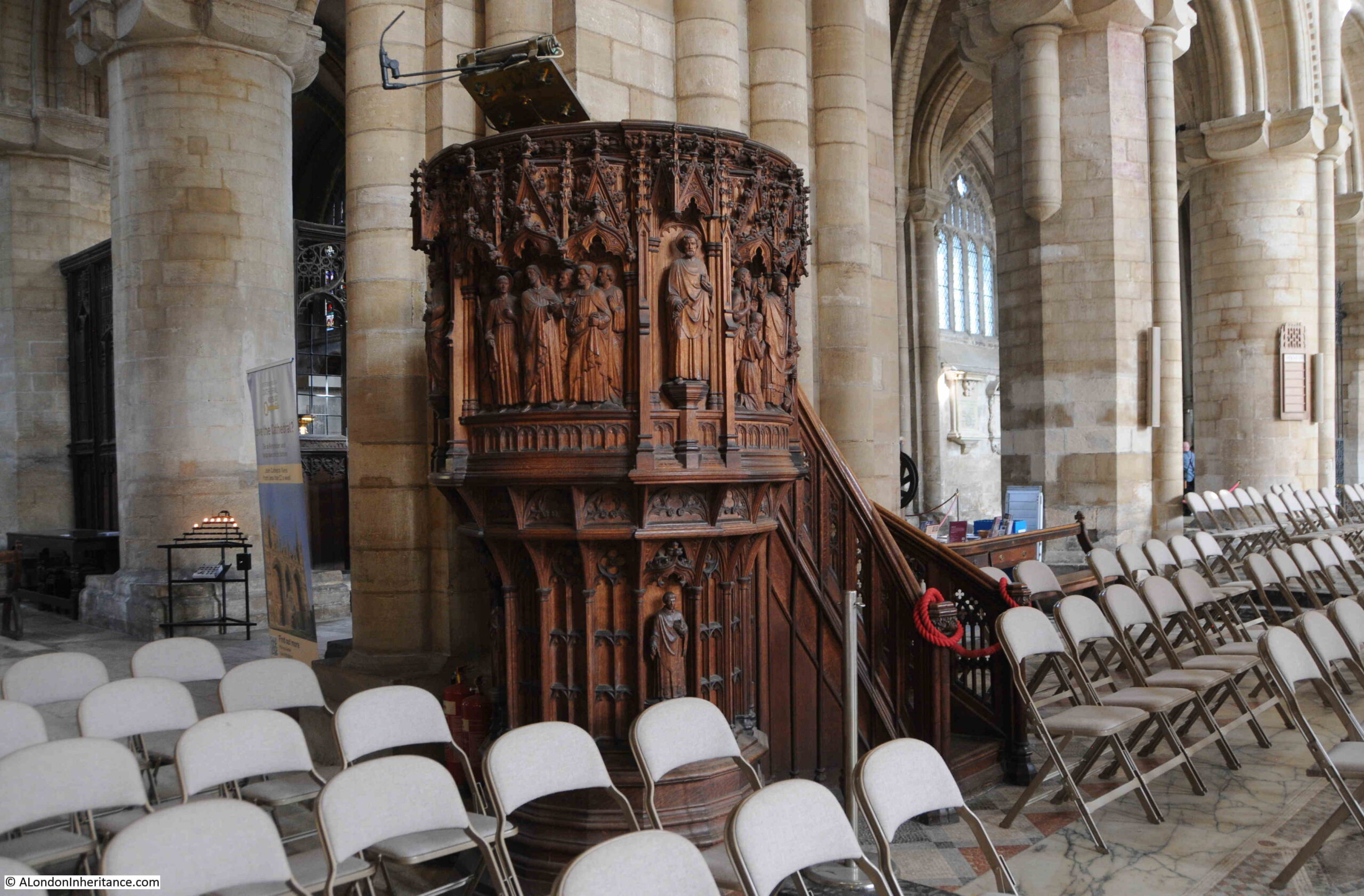
Every time I have walked past the church, it has been closed. I hope at some point I will be able to get in and write a more comprehensive post on the church.

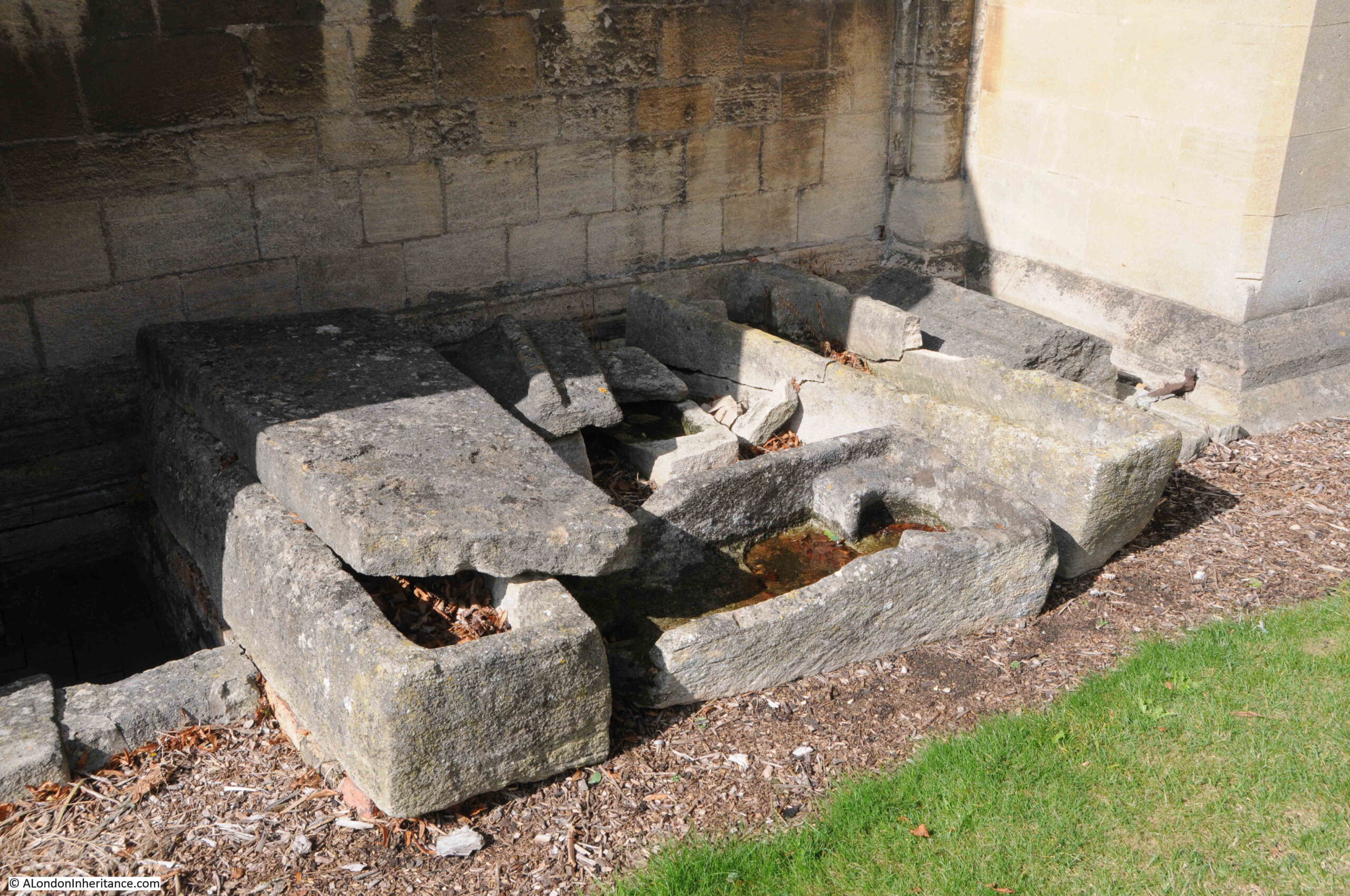
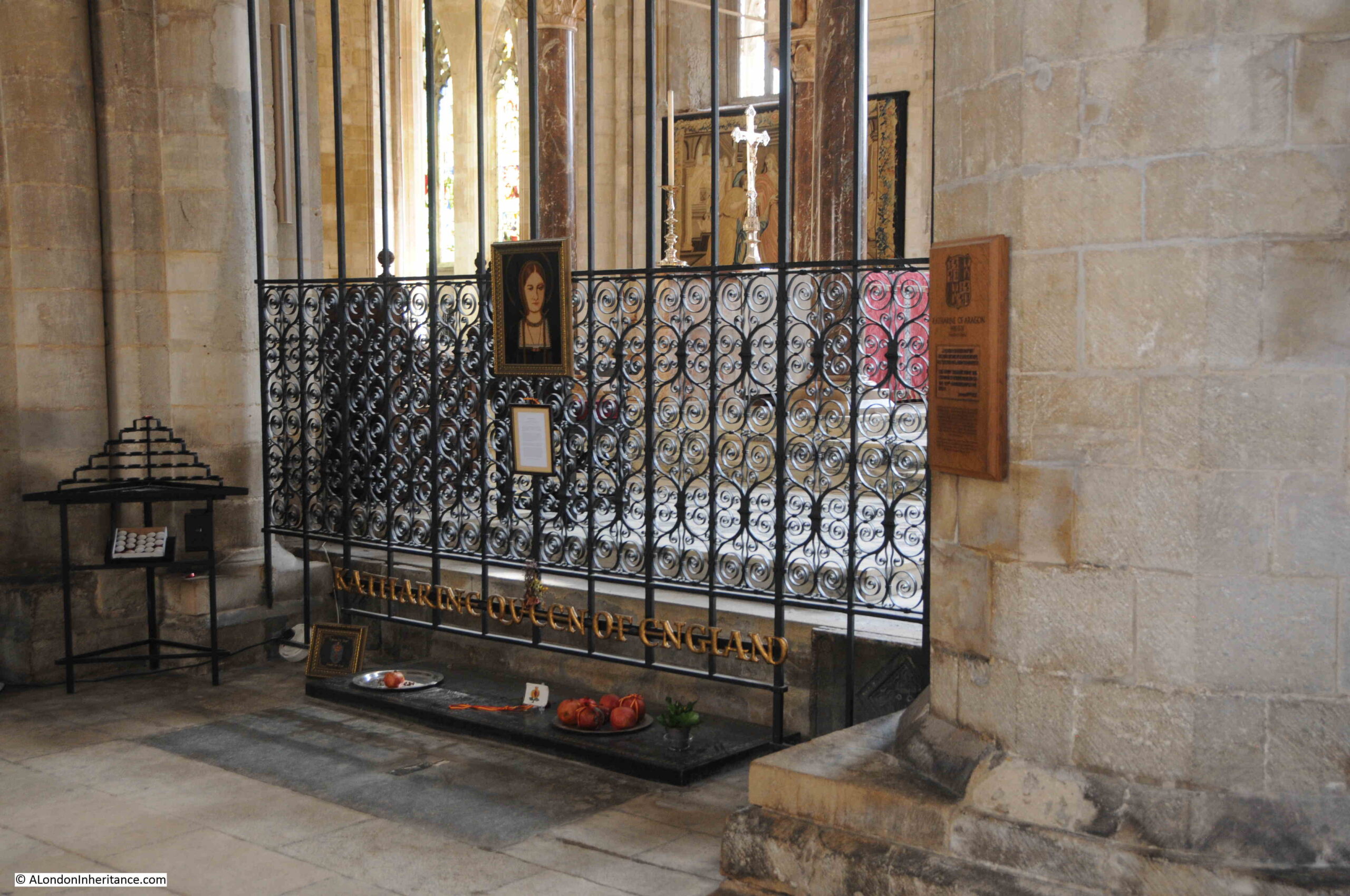
Although there is nothing left of Richard Whittington’s tomb, there is apparently a marked stone on the floor near the altar recording the location of his burial place.

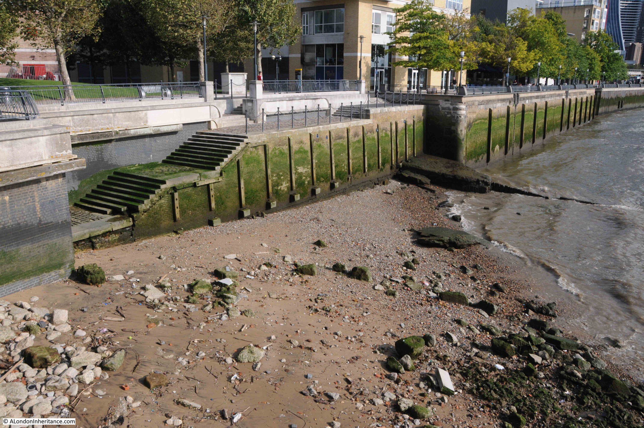
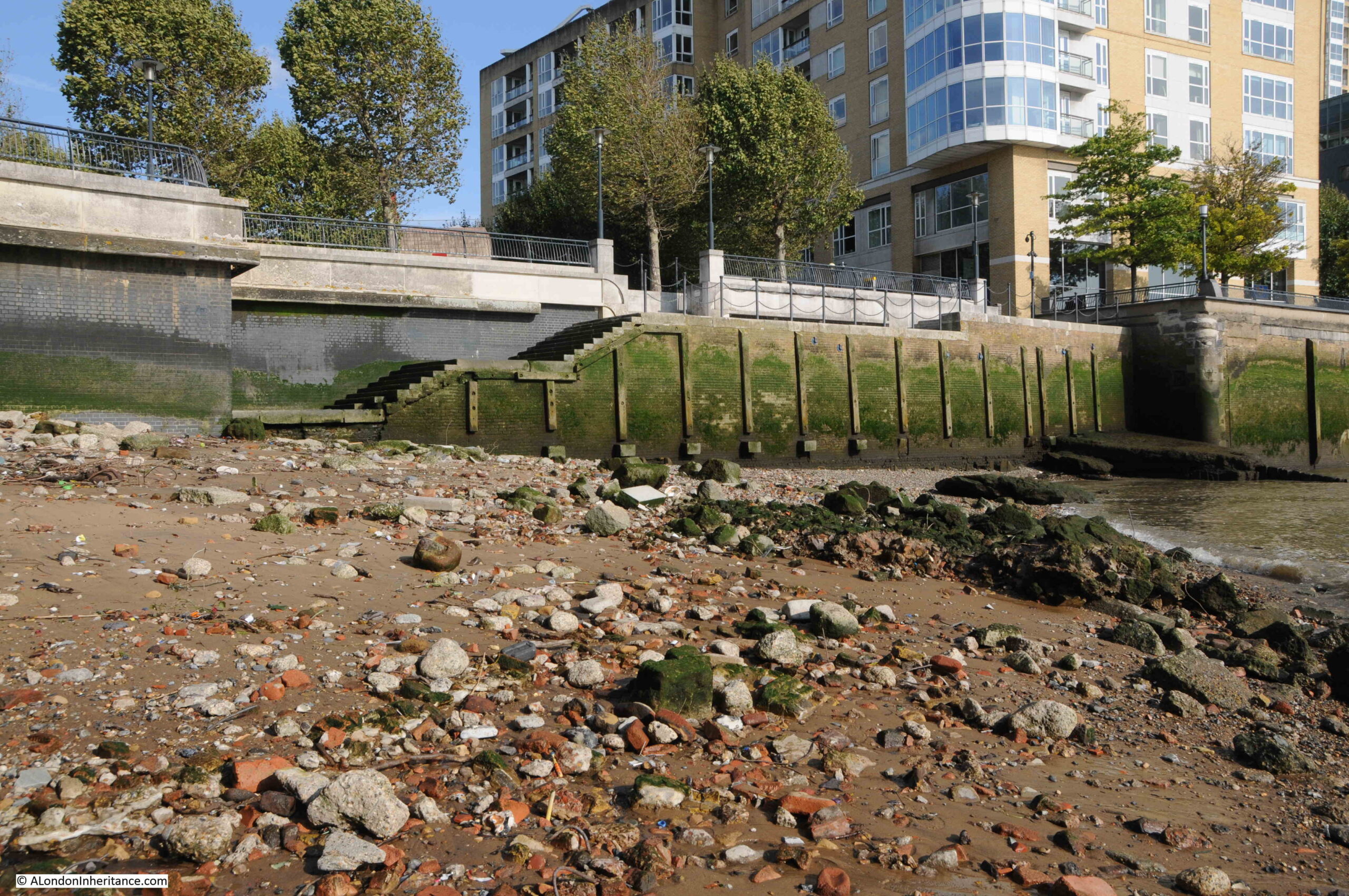
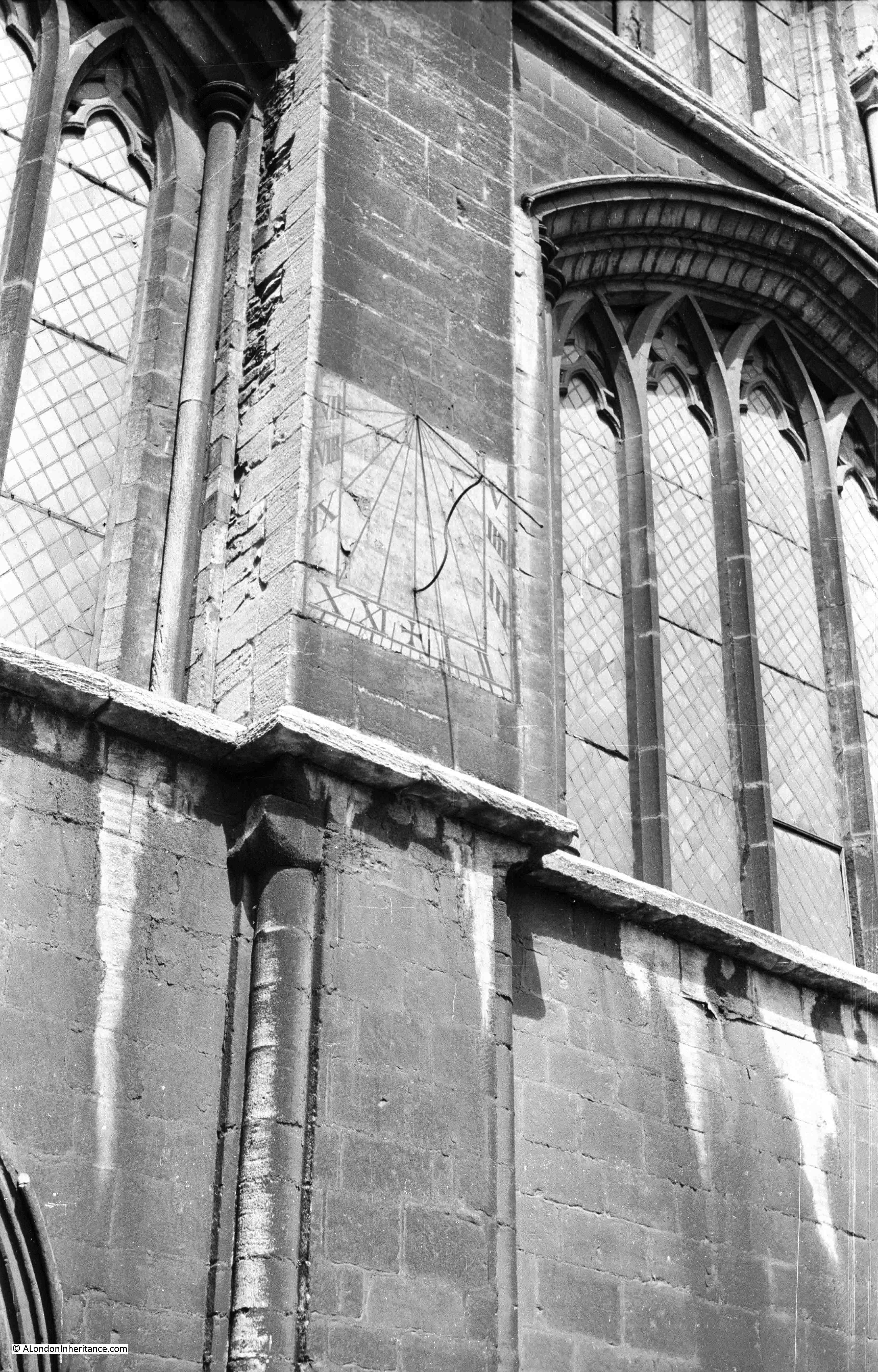
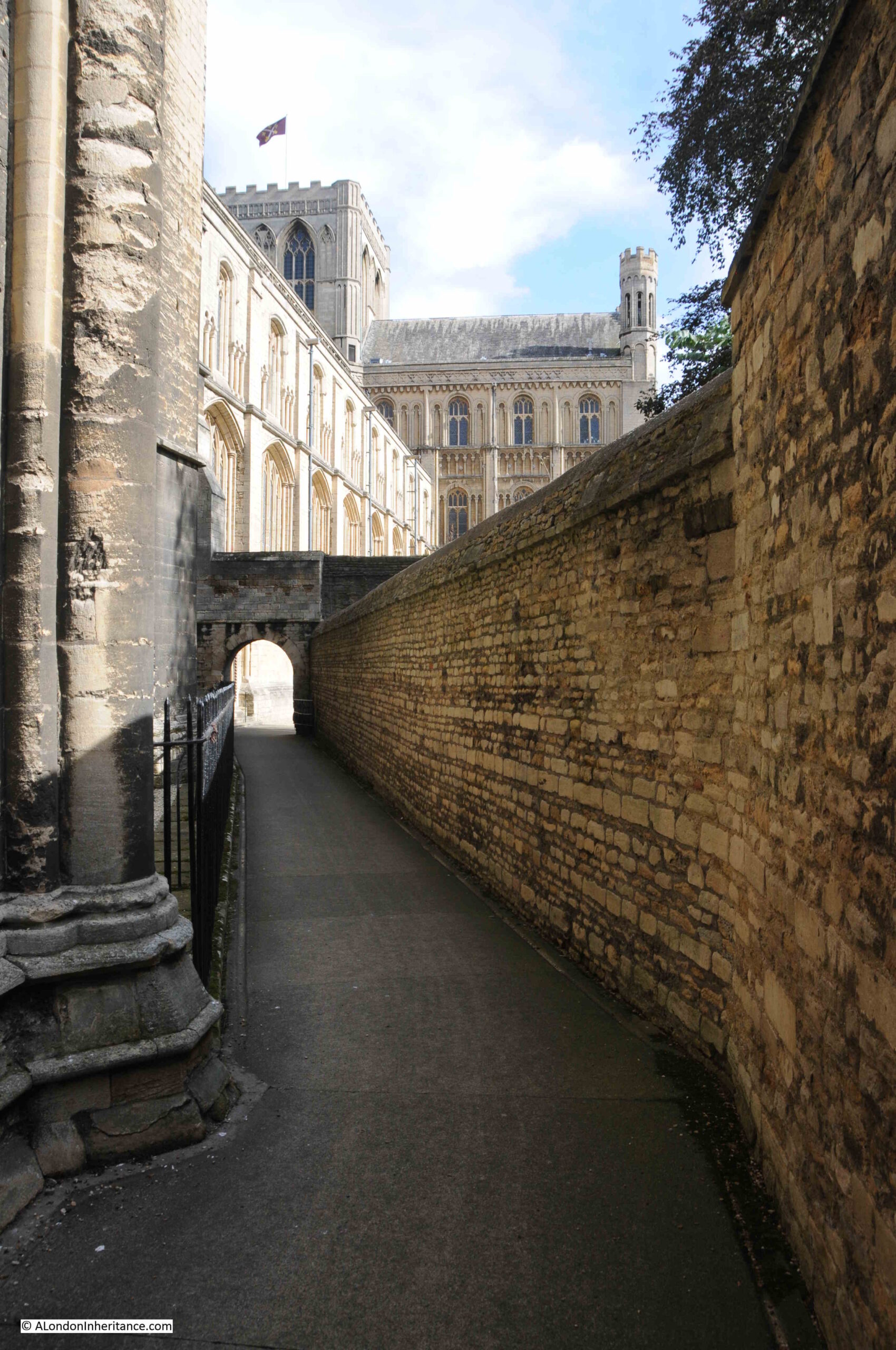
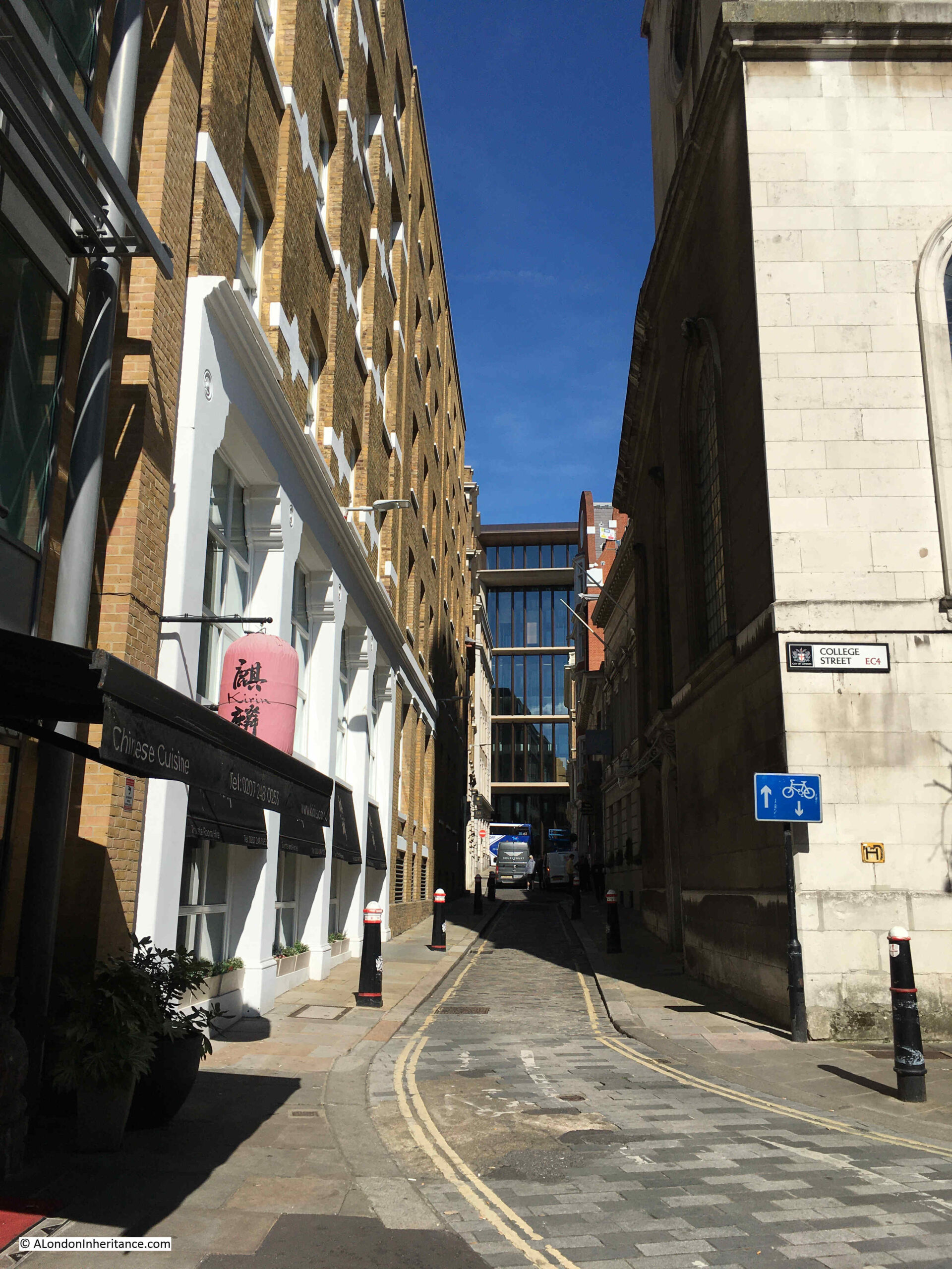
The view looking up College Hill is shown in the following photo. The hill is an indication that the street is sloping down towards the Thames.

College Hill

The following history of the street name is from one of the books on London that does seem accurate and well researched, Harben’s “A Dictionary of London” (1918):

“The earliest name Paternosterchurch Street (1232) commemorated the church, then in all probability its distinguishing feature.

The subsequent name ‘La Reole’ recalls the memory of the foreign merchants assembled there for purposes of their trade of whom a great number are said to have imported wine from the town of ‘La Reole’ near Bordeaux and to have named the street in which they resided after their native town. The name appears to have been given in the first instance to one principal messuage or tenement, and only later applied to the whole street.

The present name commemorates the great foundation of Whittington College in the church of St. Michael Paternoster Royal.”

There is one more plaque to find in College Hill, and this is on the left / west side of the street, so I walked back up the street to find the site of:

The Duke of Buckingham’s House

As you walk back up College Hill, on the left, on a large brick building, next to an entrance to a courtyard, is another plaque, arrowed in the following photo:

College Hill

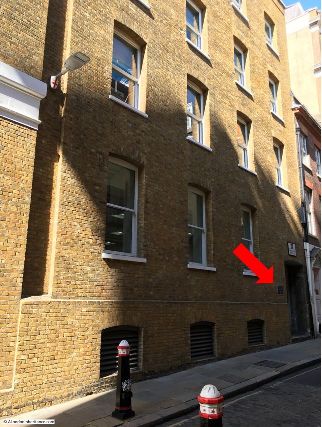
The plaque states that this is the site of the Duke of Buckingham’s House, 1672:

Duke of Buckingham's House

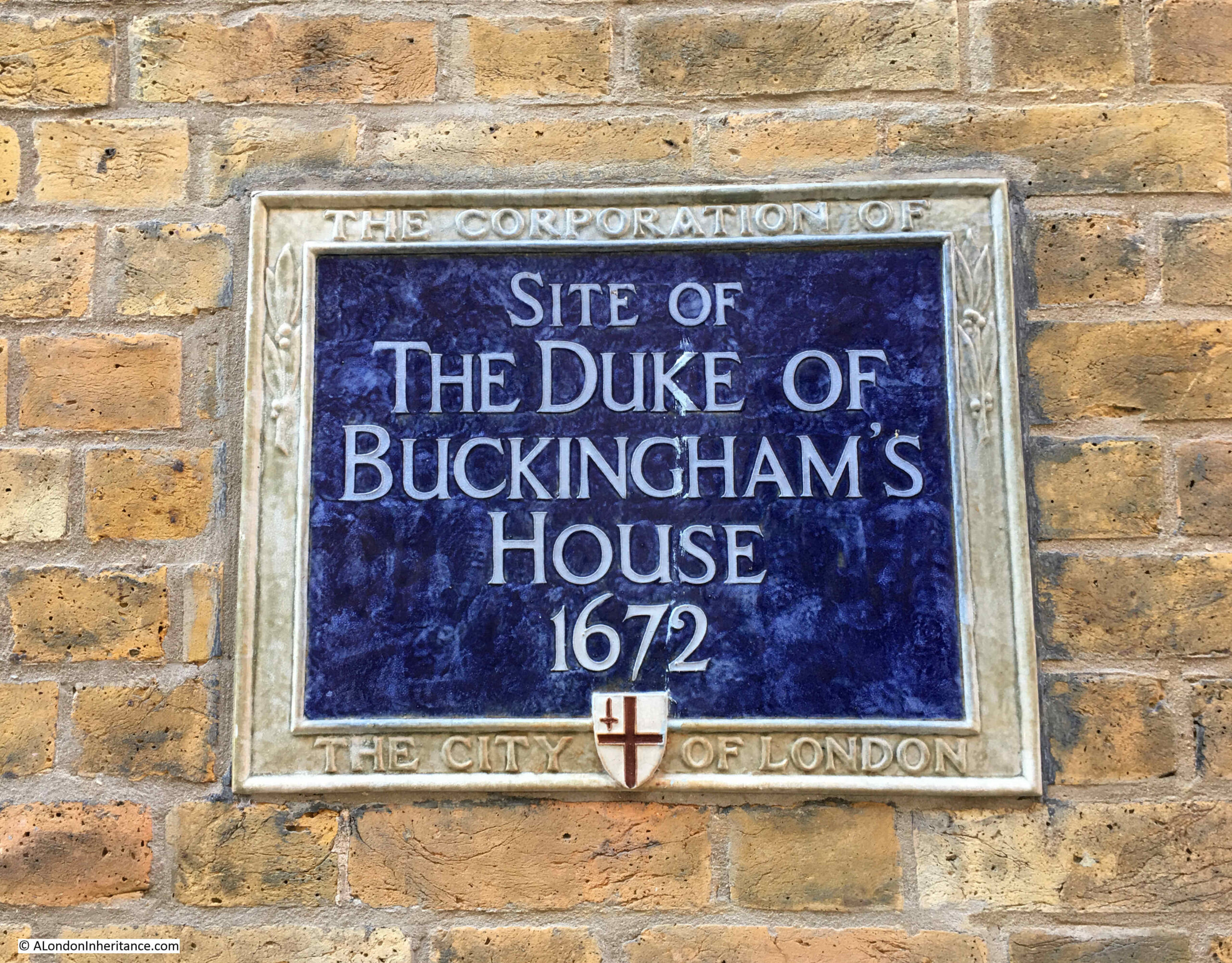
The information on this plaque does not really explain which Duke of Buckingham, and the relevance of the date. Was 1672 when the house was built, when it was demolished, or when the Duke of Buckingham lived in the house, and if it was only for a single year, why does it need a plaque?

Firstly, who was the Duke of Buckingham?

The Duke of Buckingham in the 17th century refers to two generations of the Villiers family.

George Villiers purchased a number of large estates in the early 17th century, He was a favourite of King James I, and one history of the county of Rutland (where Villiers primary country estate was located) states that “It was his elegant legs that first brought George Villiers to the adoring attention of James I”.

George Villiers was made the first Duke of Buckingham in 1623.

James I died in 1625 and Charles I then took the throne and George Villiers continued to have royal favour, although it appears he was not a popular man, and was often used as a scapegoat for poor decisions.

Villiers end came about due to failed naval battles. He had the position of Lord Admiral, and led a naval force to attempt the relief of La Rochelle. The attempt was a failure and there were around 5,000 casualties in the forces led by Villiers.

A second expedition also failed, and following these two naval disasters sailors and soldiers were left unpaid, fed up with Villiers command and willing to mutiny. In the naval town of Porrsmouth, sailors rioted even though Villiers promised to provide their pay from his own funds.

Such was the feeling among the sailors of the navy, that one of their number, John Felton assassinated Villiers on the 23rd of August 1628, and that was the end of the first Duke of Buckingham.

Seven months prior to his death, his first son George was born, and it was to this infant that the title of the second Duke of Buckingham passed.

George Villiers, the second Duke of Buckingham grew to follow in his father’s footsteps and continue to support the king, Charles I. He fought on the Royalist side during the Civil War and escaped to Europe with the future Charles II he was later captured and prisoned in Jersey, Windsor and the Tower of London.

After Cromwell’s death in 1658, Buckingham was released from the Tower in 1659, and with Charles II restored to the throne, Buckingham had his estates restored and became a rich man, and was also at the centre of the royal court.

Buckingham did though have very expensive and extravagent tastes, and also racked up large gambling debts.

George Villiers, the Second Duke of Buckingham died in 1687, and his estates were sold to pay off his debts.

He had no legitimate heir, so the 17th century father and son, both George Villiers and the first and second Dukes of Buckingham ended in 1687, so the plaque refers to one or both of these two men.

I have read in some well respected blogs that the house belonged to George Villiers, the first Duke of Buckingham, with no mention of the second Duke. The first Duke died almost 50 years before the date on the plaque.

The book “A Handbook for London, Past and Present” by Peter Cunningham (1849) states that Buckingham House was “A spacious mansion on the east side of College Hill, for some time the city residence of the second, and last Duke of Buckingham“.

There is an error in this statement, as if the plaque is in the right position, Buckingham House was on the west side of College Hill, not the east.

The City of London Queen Street Conservation Area document states that “The Dukes of Buckingham owned a substantial property accessed from the west side of College Hill until its redevelopment in 1672”.

Strype, writing in 1720, stated “Buckingham house, so called as being bought by the late Duke of Buckingham and where he some time resided upon a particular humour: It is a very large and graceful Building, late the Seat of Sir John Lethulier an eminent Merchant; some time Sheriff and Alderman of London, deceased“.

Buckingham House was shown on Ogilby and Morgan’s 1676 map of London. The yellow arrow in the following extract points to the house which was a substantial building for the area, between College Hill and New Queen Street:

College Hill

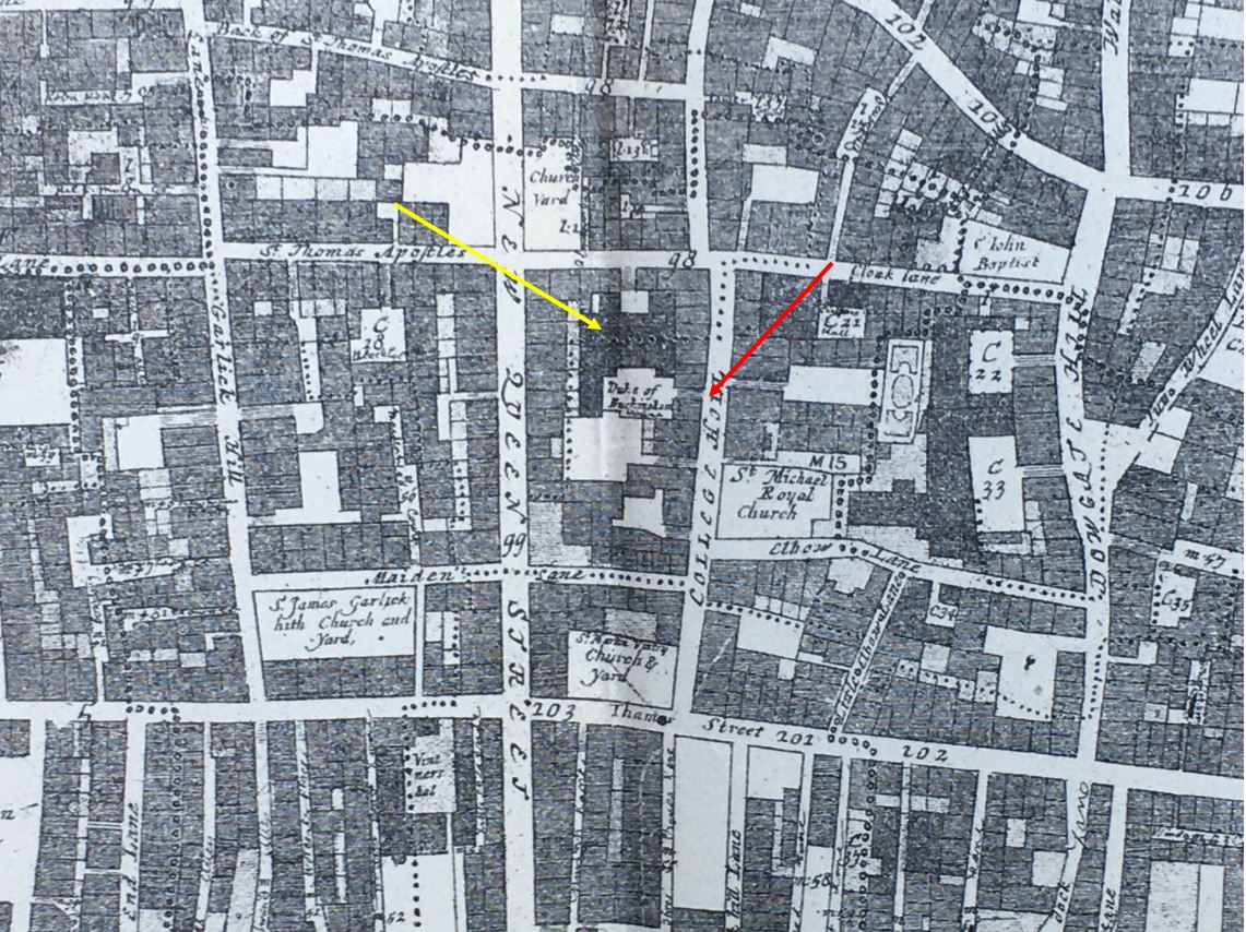
The building appears to have been accessed through an alleyway from College Hill which the red arrow points to, and as far as I can tell by aligning maps, an alley still exists in the same place today (the Buckingham House plaque is on the left of the entrance to the alley):

Duke of Buckingham's House

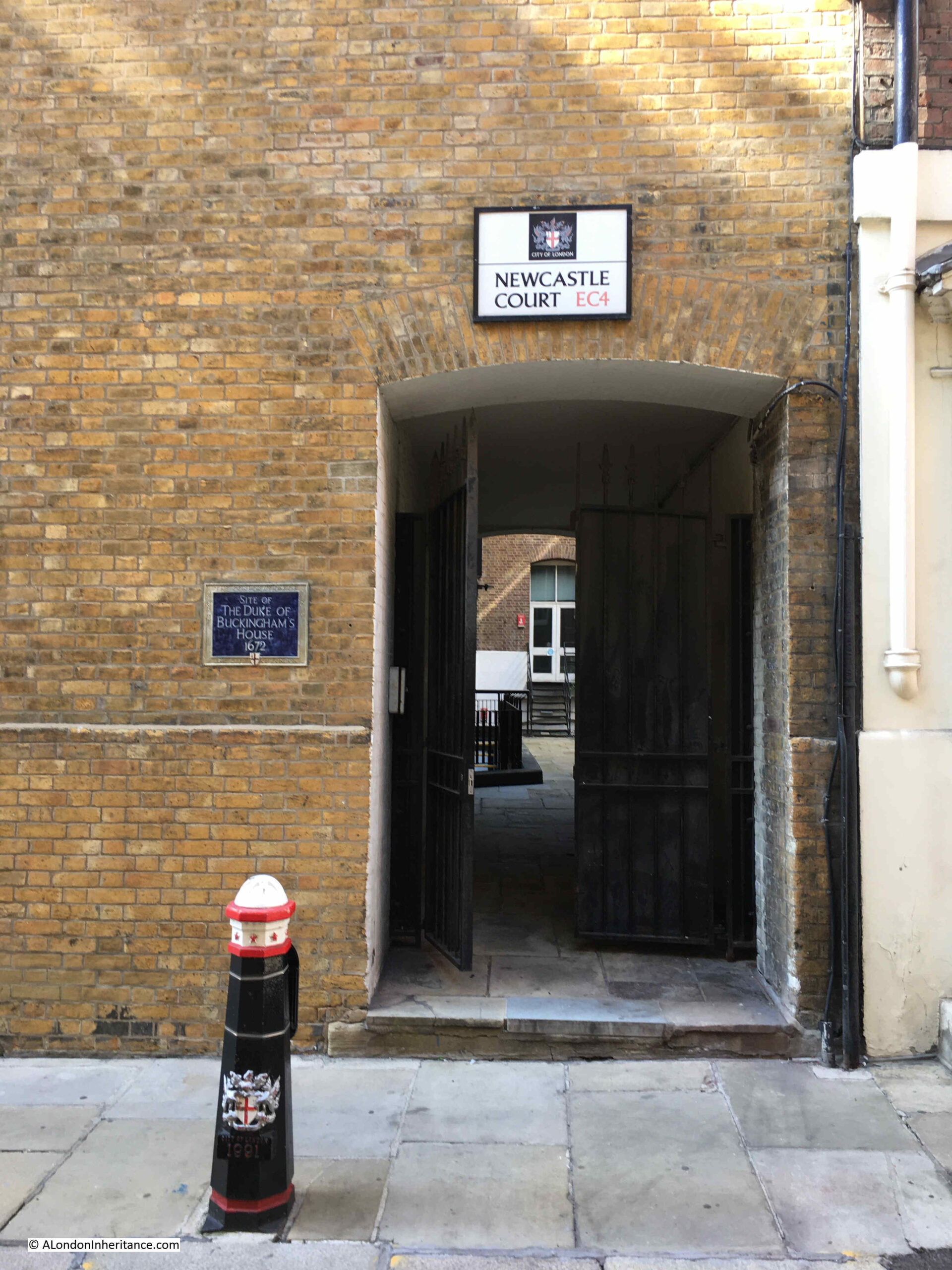
At the end of the alley is the small space of Newcastle Court, surrounded by offices, but occupying a small part of the space that was once in front of Buckingham House.

So after reading many different sources, there is still no final answer as to which Duke of Buckingham owned Buckingham House, or whether it was both of them. And no firm answer as to the relevance of the date 1672.

In writing these posts, I try and avoid stating what may appear to be simple statements of truth, when in reality there are many different versions, and I suspect it would only be after some considerable effort in various archives, that the correct story could be revealed, if documents covering the period, the two Dukes of Buckingham, and the house on College Hill still remain.

alondoninheritance.com

Commercial Road Café

If you would like to come on one of my walks, a couple of places have just become free on two of my final walks until late next spring. Details and links are:

2 places available on the walk Bankside to Pickle Herring Street – History between the Bridges on Sunday the 5th of November

1 place available on the walk Limehouse – A Sink of Iniquity and Degradation on Sunday the 12th of November

For this week’s post, I am in Whitechapel, on the Commercial Road, a short distance east from Aldgate East Underground Station, where, in 1952, my father took the following photo:

Commercial Road Café

The view is looking east along Commercial Road. My father was standing in a cleared bomb site, looking across to where a café was parked. The café looks as if it was once a tram or coach, however after a quick bit of Googling, I could not find anything similar, so any information would be appreciated.

Roughly the same view today (although the street in the foreground is not the same in both photos, I had to stand slightly to the east to avoid trees, parked lorries and other obstructions on the pavement that obscured the view):

Commercial Road Café

I have marked the location and direction of view by the red circle and arrow in the following extract from the 1948 revision of the OS map, with the blue line showing the location of the café (‘Reproduced with the permission of the National Library of Scotland“):

Commercial Road Café

The map shows the amount of bomb damage in this part of Whitechapel with plenty of blank space where bomb damaged buildings had been cleared.

The map also shows the name of the narrow lane in the foreground of my father’s photo. This was Plumbers Row, a lane that went much further north from Commercial Road up to the junction of Fieldgate Street and Whitechapel Road, however today, the southern section has been built over, covering much of the area along Commercial Road with a large new building over the bombsite where my father was standing, where the café was located, and up to Greenfield Road.

Although nothing remains of the view to the left of Commercial Road in my father’s photo, much of the right hand side of the road is still recognisable. In the following extract from the 1952 photo, there is a row of terrace houses of difference sizes:

Commercial Road Café

In the above photo, from the centre to the right, there is a row of terrace houses of the same height. These still remain today, although they have all had an additional floor added at roof level as shown in the same view, seventy one years later in 2023:

Commercial Road Café

The building to the right of the terrace is still the same, as are the taller terrace buildings to the left.

The reason my father took this particular photo must have been the rather unusual café on the bomb site. On the front there are adverts for a number of soft drinks:

Pepsi Cola

On the left is an advert for Fling with their slogan that it “Freshens and Fortifies”. It was sold in a bottle that was very similar to that used by Coke, and from what I have read it seems to have been a cheaper version of the American drink.

In the middle is an advert for Solo, an orange drink, highlighted by the illustration of a cut orange in the advert.

One the right is an advert for Pepsi Cola, which ten years later would rebrand as just Pepsi. There was also a large advert for Pepsi Cola on the left of the café, which seems to have had a small kitchen area at the rear:

Pepsi Cola

There are also a couple of milk churns, one of which is in a box which appears to be mounted at the front of a bike. No idea whether this was to bring milk to the café, or whether milk was distributed to local residents from the café.

The building behind the café had a large advert for Liquid Sunshine Rum – Pure Jamaica:

Charles Kinloch

This was a brand of Charles Kinloch who were wine and spirits merchants, who seem to date from the early 1860s.

They were an independent company until 1957, five years after the above photo, when they were taken over by the brewer Courage.

I cannot find out for how long Liquid Sunshine Rum was sold, however their rum trade seems to have taken a back seat during the 1960s as wine started to become a popular alcoholic drink.

Charles Kinloch had plenty of adverts in the press and on TV targeting the low cost wine market, and they seem to have focused on lower cost Spanish wines, rather than more expensive French. Their marketing was on the pleasure of drinking their wines, rather than “putting by or putting one over the next door neighbour”.

In 1966 they advertised that “My Spanish wines are for drinkers, not collectors, says Charles Kinloch, They’re Good and Cheap”. Cheap was 9 shillings, 3 pence a bottle. In 1966 they also had an advertising slot on ITV titled “The Great Charles Kinloch Wine Robbery”, and in newspapers had full page adverts providing helpful lists of which of their wines to use for different types of food, and courses during a dinner.

At the time, their head office was in Kinloch House, Cumberland Avenue, London NW10. As Courage was taken over several times during the following decades, the Kinloch brand gradually disappeared.

And this is where research gets really frustrating as I found a Charles Kinloch building close to the site of the 1952 photo, the subject of this post.

Almost on the opposite side of the road, from the 1952 and my 2023 photo is Back Church Lane that runs from Commercial Road to Cable Street.

Along Back Church Lane was a large Charles Kinloch warehouse, and the building remains, along with the name Charles Kinloch in large letters along the top of the building.

It is frustrating as I found this during final research for the post on the Saturday prior to publication, so did not have time to go and take a photo, so to make up for the lack of a photo, you can see the building at this link to Google StreetView.

A relatively short post this week, but I am pleased to have found and photographed another of the locations of my father’s early photos.

alondoninheritance.com

Limehouse Hole Stairs and the Breach

Limehouse Hole Stairs are one of the very old stairs between the land and the river. They are towards the eastern edge of Limehouse, in an area once known as Limehouse Hole, where the river turns south on its journey around the Isle of Dogs.

Today, the stairs are a wide and well maintained set of steps leading down from the walkway alongside the river, towards a very roughly rectangular area which is accessible when the tide is low:

Limehouse Hole Stairs

The location of Limehouse Hole Stairs is shown by the red oval in the following map (© OpenStreetMap contributors):

Limehouse Hole Stairs

On the foreshore at low tide:

Limehouse Hole Stairs

The foreshore at Limehouse Hole Stairs has large sandy patches along with plenty of stone and brick that has found its way into the river from the buildings and infrastructure that once lined the Thames.

If you look closely, it is interesting how similar items can be found in lines along the foreshore. They were left when the tide went out, and form a line across the sand. I have no idea of the mechanism that leaves them in a line rather than randomly scattered, and on the foreshore at Limehouse Hole Stairs, a line of green glass / plastic / minerals (not sure what they were), was stretched across the sand:

Limehouse Hole Stairs

The Port of London Authority list of the steps, stairs and landing places on the tidal Thames has very little information on Limehouse Hole Stairs, just recording that they were in good condition, with stone and concrete steps and in use. The PLA had not recorded whether the stairs were in use in their two key recording years of 1708 and 1977.

The stairs are old, but the stairs we see today are very different to what was there prior to the redevelopment of the area in recent decades, which I will show later in the post.

The following extract from the 1949 revision of the OS map shows the location of Limehouse Hole Stairs  (‘Reproduced with the permission of the National Library of Scotland“)..

Limehouse Hole Stairs

There is an area of foreshore that dries when the tide is low shown mainly within the red circle. Limehouse Pier extends into the river. Follow the pier back to land, and in the corner is Limehouse Hole Stairs.

You can also see in the above map, a line forming two sides of a square, with the river walls forming the other two sides. The two lines running across the dried foreshore in the map were a wooden surround, parts of which can still be seen today, as I will show later.

I will come to the relevance of the blue circle later in the post.

This area has a complicated naming history.

Written references to the stairs date back to the early 19th century, although these do not explicitly name Limehouse Hole Stairs. A typical advert in February 1807 was for the Schooner Anne which was for sale and could be seen “lying at Limehouse Hole, opposite the stairs”.

The name Limehouse Hole is also a bit of a mystery. It may refer to a form of small harbour or dock, although I find this unlikely as the larger Limekiln Dock is within the area traditionally known as Limehouse Hole.

I did wonder if the name referred to a hole in the river, perhaps a particularly deep part of the Thames, however in the area known as Limehouse Hole, the bed of the river is of a depth that is normal for much of this stretch of the river, typically around 6 metres deep at the lowest astronomical tide.

There is though a strange depression in the bed of the river not far to the west, in the middle of the river opposite the entrance to Limehouse Dock, where the river descends from a depth of 5.5 metres to a depth of 11.4 metres, all within a small area of the Thames.

To add to naming confusion, if we look at Rocque’s map from 1746, there are stairs in the rough location of Limehouse Hole Stairs, however Rocque calls then Limekiln Stairs, and he also names this stretch of the river Limekiln Holes rather than Limehouse Hole, so perhaps the name refers to some aspect of the Limekiln industry, and as this industry declined, the name changed from Limekiln to Limehouse Hole.

The Survey of London does though state that the name Limehouse Hole was in use for this section of the river by the seventeenth century, so perhaps Rocque was confused with the Limekilns and Limekiln Dock, or in the 18th century there were different names in use.

The extract from Rocque’s map is shown below:

Limehouse Hole Stairs

The first references to the full name of Limehouse Hole Stairs start to appear around 1817, and there are multiple references in the 1820s onwards. All the usual events that make their way into the papers – accidents on the river, ships for sale, fires in the buildings by the stairs, rowing competitions, and tables of rates for Watermen to charge to row passengers along the river.

In the OS map shown above, there is a pier coming out from Limehouse Hole stairs. The earliest reference I can find to the pier dates from 1843, when there was an article in the November 5th edition of The Planet recording a court case, where “On Tuesday, Jonathan Bourne, a waterman, and one of the proprietors of the floating-pier at Limehouse Hole stairs, appeared to answer a charge of carrying passengers in his boat on Sunday, in violation of the rights and privileges of William Banks, the Sunday ferryman. The real question in dispute between the parties was as to the right of the watermen owning the floating pier to convey passengers to and from the Watermen’s Company steamers which stop there. When the tide is low there is not sufficient water for the steamers to come alongside the outer barge of the pier, and the watermen row the passengers to the steamers, and vice versa, but no money is taken.”

From the article, it appears that the pier was owned by a group of watermen. The article also shows how watermen were regulated, and had specific rights covering what they could do, and when. I did not know that the Watermen’s Company ran steamers on the river. This must have been a far more efficient way of conveying passengers along the river, rather than rowing as watermen in previous years would have done. Also, an early version of the Thames Clippers that provide the same service today.

The pier seems to have disappeared by the 1860s, as in the East London Observer on the 1st of May, 1869, there was a report on a public meeting of the parishioners of Limehouse “to consider what action should be taken in obtaining the construction of a pier on the Thames, for the convenience of the inhabitants of Limehouse”, and that “there were many persons who would far rather go to the city by boat than either rail or bus”.

A new pier was needed because “the old pier was never under the management of the Thames Conservators, but under that of the watermen, who let it go to ruin”.

A new pier was built in 1870 and this second pier lasted until 1901, when it was removed for the construction of Dundee Wharf, and a couple of years later, the London County Council built the third pier on the site.

Getty Images have some photos of this third iteration of the pier, with the following photos showing the pier stretching out across the foreshore, with Dundee Wharf in the background, on the left. Click on the arrows to the sides of each photo to see all images of the pier in the gallery. (If you have received this post via email, the photo may not be visible due to the way code embedding works. Go to the post here https://alondoninheritance.com/ to see the photo).

Embed from Getty Images

The photos show the wooden surround which was shown in the earlier OS map. The photo helps with the purpose of this surround, as it presumably held back a raised area of the foreshore to create a reasonably level space for barges and lighters to be moored.

The Survey of London states that this third pier “was removed by the PLA in 1948, but the stairs and Thames Place, though closed off in 1967, survived until 1990”. The survival of the stairs until 1990 presumably refers to the version of the stairs prior to that which we see today.

The result of multiple piers, along with the wooden surround to the area, means that there are still remains on the foreshore which we can see today:

Limehouse Hole Stairs

Including plenty of loose timbers which may have been washed here from other locations along the river:

Limehouse Hole Stairs

And when the tide is low, we can still see the wooden surround which once enclosed a flat area of the foreshore as can be seen in the Getty photo above:

Limehouse Hole Stairs

The following 1914 revision of the OS map shows Limehouse Hole Stairs and the pier, and also shows Limehouse Hole Ferry running across the river from the pier. This was a ferry to the opposite site of the river which landed at Horn Stairs, and which provided a fast way of crossing the river, rather than having to travel to either the Rothehithe or Blackwall Tunnels (‘Reproduced with the permission of the National Library of Scotland“):

Limehouse Hole Stairs

The following photo from Britain from Above shows the site in 1953 when the pier had been removed. I have marked Limehouse Hole Stairs, which at the time was simply wooden steps leading down to the foreshore. To get a closer view, the photo can be found here.

Limehouse Hole Stairs

The pier had been removed just a few years before the above photo. Limekiln Dock runs inland towards the top of the photo, and, along with the shape of the river wall where Limehouse Hole Stairs is located, is the only feature that survives today. Almost every single building has disappeared.

Although Limehouse Hole Pier has gone, there is another pier, a short distance to the south, where the Canary Wharf pier can be found today, which provides access to the Thames Clippers, providing a similar function to the old steamers that once docked at Limehouse Hole pier:

Canary Wharf pier

Looking north from Canary Wharf pier, and there is another feature that survives. In the following photo, looking towards the location of Limehouse Hole Stairs, there is a straight row of metal piling, followed by a brick wall:

remaining wall to a lost dock

With a closer look, we can see that the brick wall turns inwards:

Remaining wall to a lost dock

Returning to the 1949 revision of the OS map, I have marked the curved brick wall in the above photo, by a blue circle in the following map:

Limehouse Hole Stairs

The curved brick wall was at the northern side of the entrance to a dock that ran alongside Lower Aberdeen Wharf.

The wall today looks as if it continues in land and I would love to know how much of the old dock, and the walls that once surrounded the dock, survive under the modern walkway that has been built as part of the redevelopment of the area.

We can also see the dock in an aerial photo, again from the Britain from Above web site, and dating from 1938:

View of Limehouse

I have highlighted the corner wall we can see today in an extract from the above photo, and have also marked the stairs and pier:

Remaining dock wall

As well as Limehouse Hole Stairs, the other part of the title of the post is “the Breach”.

Much of the Isle of Dogs, and indeed much of the land alongside the Thames, is low lying, and over the centuries, it has been very common for there to be floods during high tides.

As London grew, and trade along the river developed, land was reclaimed, and river walls were built, but until the 20th century, these walls were often not of the height and strength we see today.

Nor far south of Limehouse Hole Stairs is an area of land where the river wall was breached, and was flooded, or in a state of marsh, for very many years. This was known as “The Breach”, and was shown on maps, including Rocque’s 1746 map, where it can be seen with a road running around what appears to be an area of marsh:

The Breach

There is also a water feature in the above map called the “Poplar Gut”, and both this and the Breach were mentioned in an article in the East London Observer in 1903, when “Pepys in his diary under date of 23rd March, 1660, mentions that he saw the great breach which the late high water had made, to the loss of many thousands of pounds to the people about Limehouse. In Gascoyne’s map, the spot is marked by the explanation ‘Old Breach, the Foreland, now a place to lay timber’ and ‘The Breach’ is applied to what was more recently known as the Poplar Gut”.

The reason why the Breach happened where it did was down to the natural erosion of the land by the river at this particular point in its meander around the Isle of Dogs.

In time, and without any human intervention, the Thames would have cut through the northern section of the Isle of Dogs, leaving the part of the river around the south of the Isle of Dogs as an Oxbow Lake. The Thames has made subtle changes to its course over the centuries, and it is only in recent years that we have effectively put the river into a concrete and banked channel, and limited the natural forces of erosion.

There are also stories of people digging out ballast from the foreshore around where the Breach occurred, which would have contributed to the flood.

The view from Greenwich would have looked very different if the river had continued with the Breach.

in the quote from Pepys, he mentions that the Breach is now a place to lay timber, and this would have been a good place, as timber was often kept in a wet environment to stop the wood drying out and to allow gradual conditioning before sale.

In a parish map from 1703, the area is marked as a place to lay timber:

The Breach

In Rocque’s map, there is an inland area of water called the Poplar Gut and in the above map it is labelled as the Breach. This was part of the area that flooded when the river breached the bank along the river.

This must have been a significant area of reasonably deep water, as on the 10th of June, 1748, it was reported that “On Saturday last, in the evening as Mr. George Newman, son of Mr. Newman, an eminent Linen Draper in Whitechapel, was washing himself in Poplar Gut, he was unfortunately drowned, although all possible means were used by a companion he was along with, to save him, to the inexpressible grief of his parents, and all who knew him”.

The Breach lasted for some years, and was still shown in the 1816 edition of Smith’s New Plan of London, which also included the recently completed West India Docks, which had been built over the Poplar Gut:

The Breach

The Breach would soon be reclaimed after the publication of the above map, as the size and number of docks grew on the Isle of Dogs, and industry expanded along the edge of the river (the West India Docks and the channel across the Isle of Dogs will be the subject of future posts).

Nothing remains to be seen of the Breach today, although it was to the south of where the Canary Wharf pier is today, in the following view:

The Breach

And almost as a reminder of when it was impossible to cross where the water of the Thames had breached the bank, during my visit, the path was closed, but this time for maintenance, rather than a flood:

The Breach

This small area of Limehouse has changed dramatically over the last few decades, however there are still places where we can see traces of the previous industrial. docks and riverside infrastructure.

Wooden planks still poking through the foreshore, although being gradually eroded, a brick wall running along the river’s edge, and location and names of the stairs that bridge the boundary between land and the river.

You can find links to all my posts on Thames stairs in the map at this link.

alondoninheritance.com

Watney Market and Watney Street, Shadwell.

All my walks have sold out, however I have had a request to run the “South Bank – Marsh, Industry, Culture and the Festival of Britain” walk on a weekday, so have added a walk on Thursday, the 9th of November, which can be booked here.

For this week’s post, I am in Watney Market and Watney Street in Shadwell. A street that runs between Cable Street and Commercial Road.

It is a rather long post, however the post does what I really love about writing the blog. It takes one of my father’s photos and with some digging discovers so much about life in the area of a single street.

East London poverty, the relationship with the River Thames, a market that has traded for many years, a lost pub, Blackshirts, post-war Germany and post-war redevelopment which erased a long familiar street.

This is the photo, taken by my father in 1952:

Watney Market

As c;lose as I could get to the same view today:

Watney Street

My father’s photo was taken from the bombed space once occupied by a church, and it was looking southwest towards a pub, the Masons Arms, which faced onto Watney Street and Watney Market.

The following extract from the 1952 photo shows on the left, the large sign or perhaps a lantern on the front of the pub and two of the remaining shops which seem to have part survived the bombing which destroyed the area around them.

I have marked the spot with the red circle in the following map of the area today ( © OpenStreetMap contributors):

Watney Market

Commercial Road is the road running left to right at the top of the map. The train tracks at the bottom of the map is the Docklands Light Railway. Watney Street is running from the junction with Commercial Road at the top centre of the map, down to the DLR where it heads under the railway, down to Cable Street which is just below the bottom of the map

The following map is from the 1948 revision of the OS map, and shows the area much as it was when my father took the photo, from the location of the red dot (‘Reproduced with the permission of the National Library of Scotland“).:

Map of Watney Street

I have mapped some of the key features in the photo onto the map below.

  • The red line and arrow points from the Masons Arms pub in the photo to the pub in the map
  • The blue line and arrow points from the two remaining shops in this section of Watney Street to their location on the map
  • The yellow oval is around one of the pillars that originally stood either side of the main entrance into the open space in front of the church
Mason's Arms Watney Street

In the above maps, you will see that my father was standing in front of the outline of Christ Church.

These were the ruins of a church that had been very badly damaged by bombing in 1941, and had then been demolished. It was not rebuilt, and the land was integrated into the post war redevelopment.

The church was not that old. The foundation stone was laid on the 11th of March, 1840, with the land being the site of three former houses on land owned by the Mercers Company, who conveyed the land to the church.

The site of the church, and the surrounding housing, before wartime bombing and post war redevelopment obliterated the area is shown in the following extract from the 1914 revision of the OS map (again the red circle indicates where my father was standing to take the photo) (‘Reproduced with the permission of the National Library of Scotland“).:

Map of Watney Street

In my father’s photo, the slogan “No arms for Nazis” is painted on the wall running alongside the pub. This slogan represented a concern about the level of Nazi sympathies still remaining in Germany, rearming Germany, and the need to integrate Germany into the wider European community.

In 1953, British security services had made several arrests, and the US had undertaken a survey which revealed that the undercurrents of Nazi-ism in Germany should be taken seriously. It was claimed that the growth of “nationalistic discontent among young men is ominous”.

There was unemployment in Germany and economic grievances were being intensified by the numbers of refuges from the Eastern Zone.

At the time, Germany was not considered an equal partner with other countries in western Europe, and, to quote papers of the time “And the vagueness of British policy, the passive attitude of the Tories towards European co-operation – which they encouraged with words when not in power – has done nothing to speed things up”.

This had already been going on for some years, and when the German Chancellor, Konrad Adenauer was in London in December 1951, he was met by a demonstration when he arrived in Downing Street for a lunch with Churchill.

He was met with cries of “Adenauer go home”, “Sieg heil” and “Heil Hitler”.

Adenaur had been an opponent of the Nazis and had only just survived the war as he had lost all his property, money and position in the 1930s.

He was strongly anti-communist, wanted cooperation within Europe and the US, wanted to start the rearming of Germany, and he had earlier ended the de-Nazification process.

He was part of the negotiations that led to the Treaty of Paris in 1951, which established the European Coal and Steel Community (the predecessor of the European Union), not a popular move in Germany as it was seen to give France too much influence over German industry.

Adenaur also ensured that West Germany joined NATO in May 1955, and secured agreement for Germany to rearm (although agreeing that Germany would not have nuclear weapons).

When Adenaur visited Downing Street in 1951, leaflets were handed out to the crowd with the words “No arms for Nazis”. These leaflets, and the slogan were part of a campaign by the London Peace Council, based at New Compton Street, W.C.2.

The slogan appeared at many sites across London, and also across the country, for example an article in the East Kent Times reported that in Ramsgate “Motorists and residents were startled to see on the parapet of the viaduct, high above the main Margate Road, the words ‘No arms for Nazis’ painted in large white capitals.”

The use of white paint and capital letters seems to have been standard for where the slogan was found.

The slogan was on the wall that ran alongside the Masons Arms pub. The pub seems to date from the mid 19th century and features in numerous newspaper reports. All the usual issues of crime, drunkenness, change in licensee, meetings etc.

There were a couple of reports which gave an insight into life in 19th century London and the River Thames.

From the Kentish Gazette on the 17th of May, 1859:

“ENROLMENT OF NAVAL WOLUNTEERS – The recruiting officers of the Royal Navy had quite a field-day on the river of Tuesday. A steam boat, profusely decorated with union jacks, ensigns and other national colours, and manned by a dashing crew of blue jackets, with a powerful band on board, left the London-bridge-wharf shortly after eleven o’clock for a cruise down the river. The steamer on her paddle-box bore the words ‘Queen’s bounty’ and on her sides fore and aft, ‘£10 able seamen, £5 ordinary seamen’.

On leaving the band struck up ‘Hearts of Oak’. The sailors gave a most deafening cheer, which was taken up by the vast multitude which lined London-bridge and crowded the water side. The trip was continued to Gravesend, where the blue jackets landed and paraded through the principle thoroughfares, and the proclamation being frequently read. A vast crowd followed the recruiting party, and during their stay the town was kept in a most lively state of excitement. many volunteers were received and numbers promised to present themselves at the rendezvous on Tower-hill. Owing, however to the long prevalence of easterly winds there were not so many first class seamen in port, a large fleet of homeward-bounders being detained in the Channel.

As far as it has gone, however this new popular mode of beating up naval recruits has answered admirably; and the Masons Arms, Watney Street, Commercial Road (situated in a locality crowded with sailors), has been opened as a rendezvous. A change in wind must bring in large numbers of first-class men, who will doubtless avail themselves of the £10 bounty.”

There is so much in the above article. It tells us that in the mid 19th century:

  • Large numbers of sailors lived around Watney Street
  • Ships still being mainly powered by the wind could be stuck in the channel with an easterly wind as they could not round the eastern edge of Kent to access the Thames Estuary
  • That the Thames and the London Docks were a very important part in the life of London

As with most other East London pubs, inquests into unexpected and accidental deaths would be held in the Masons Arms. A newspaper report from October 1841 tells the story of 34 year old James Holland who worked as a coal-whipper (a coal-whipper brought up the coal from below decks using baskets attached to a pulley system).

He was working on the “Three Sons”, a collier from Sunderland which was moored in the river off Rotherhithe and whilst filling a basket with coal, he collapsed with blood pouring from his mouth and nose, and died almost immediately.

At the inquest in the Masons Arms, the verdict was “Died by a visitation of God”. No reference to his working conditions, long exposure to coal dust etc.

Time to have a look at Watney Street. The street has almost completely been rebuilt, with only a couple of pre-war buildings remaining at the very southern part of the street.

The alignment of the northern half of the street changed, and it has been rebuilt with new tiered housing on either side of a central raised section where the market is now located.

Walking along Commercial Road, this is the first view of Watney Street and Market:

Clock Tower

To the east of the entrance to the market is a clock tower:

Clock tower

Which has a plaque mounted on the side:

Plaque to industrial accident

The plaque recalls a dreadful tragedy when three workers died on the 22nd of September, 1990. At the time, they were investigating a blockage in a drain. There were four workers involved. One of them had descended into the drain which was at the bottom of a 9ft shaft. He was overcome by fumes, and in an attempt to rescue him, two other descended the shaft, but were in turn overcome by fumes.

The Fire Brigade was called, and firemen wearing breathing apparatus descended the shaft and pulled the three men out. The man who remained at the top of the shaft was also affected by fumes from the sewer.

It turned out they they have been overcome by hydrogen sulphide gas, and the three who descended all died.

They were not provided with any safety equipment, gas monitoring or breathing equipment, ropes and harnesses etc. and had received no training to undertake such work. It was the type of accident that would have happened in 1890 rather than 1990.

The three who died were trainee electrician Paul Richardson (aged 17), his brother trainee plumber David Richardson (aged 19) and electrician Steven Hammond (aged 32).

Their employer was fined £50,000 which even at the time seemed a ridiculously low amount for the loss of three lives in such avoidable circumstances.

A dreadfully sad loss of life which so easily could have been prevented if they had been provided with the correct equipment and training.

This is the view looking down into Watney Market from Commercial Road:

Watney Market

The London Overground between Shadwell and Whitechapel runs beneath Watney Market. If you go back to the 1952 OS map of the area, to the upper left of the original routing of Watney Street, just below Commercial Road, there is a circle with the words “Air Shaft”.

This was a ventilation shaft for the railway which runs just below the surface. In the rebuilt market, the above ground infrastructure of the airshaft can be seen, which is also used to advertise Watney Market:

Air vent to London overground below the street

View looking through the market back up to Commercial Road:

Watney Market

There was an article in the East London Advertiser on Saturday the 21st of August, 1886 about Watney Market. It was a rather long article, however it does provide a really good view of the market, those who shopped there, and the conditions of many of those who lived in the area. The core of the article follows:

“WATNEY STREET MARKET – How, when, or by whom this market was commenced no one seems to know. It has no charter, nor any legal status but that of usage, and like Topsy, it seems to have ‘growed’. Nevertheless it has become an important market, and to the poor inhabitants of St. George’s and Shadwell it is a most useful institution.

At first the market seems to have been confined mostly to the Cable-street end of Watney-street, the busiest being in the neighbourhood of the railway arch; but now, on some days, and particularly on Saturdays, it extends the whole length of the curved street, from Cable-street to Commercial-road and in it can be purchased almost everything needed in a household, from a pennyworth of pins to a suite of furniture, with bedding, bolsters, curtain lace, baby-linen, suits of clothing. washing machines, pianos and perambulators; whilst in the edible department it is always well stocked.

There is fish in every variety, from the lordly salmon down to a fresh herring, whilst the butchers cater for all classes, and in a manner suitable to the means of their numerous customers. Thus, on a Saturday, from morning till late at night, and particularly in the latter portion of the day, this market is crowded. in addition to the shops on both sides of the street, which are numerous, stalls are erected on and outside the footpath, leaving only a sufficient space for a limited amount of vehicular traffic.

A very large proportion of the purchasers in this market are women, and these mostly of the very poorest class, whose families live from hand to mouth. They can afford little at once, but they want that little every day when they can find the money to buy it; and hence the individual amounts spent at any one time are small, whilst their aggregate for a year must represent a very large sum. here the ‘ladies’ saunter about the market in dozens, in the most careless of deshabille, with hair unkempt, faces unwashed, and a general appearance of not having been dressed or undressed for a very considerable period. Each of them is accompanied by two, three or four children, equally elegantly attired. Whilst the mothers are looking out the cheapest bargains, these youngsters dive in, under and around the stalls, picking up rotten fruit, and anything else from the stalls on which the vendor does not keep a sharp eye.

And yet, notwithstanding all this squalor in dress and cleanliness, there is a general air of cheerfulness, frequently arising to hilarity, amongst the habitués of the market, and the general tone is one of careless happiness, especially when the weather is fine, when the women seem in no hurry about their business, but enjoy a thorough good gossip in the market place. Very few bags or baskets are brought by the buyers, they are not needed. A pound of bits of meat for about four pence, a couple of pounds of potatoes for two pence, and a cabbage for a penny, with perhaps a pennyworth of onions, and there is a dinner which has frequently to be eked out, with the aid of bread, for a family of six. An apron or the skirt of a dress will hold much more than this, and so the ladies who attend here will not encumber themselves with a basket, even if they have one, which in most cases is doubtful.

The women who purchase on Saturdays, are for the most part, wives of working men who are paid their wages on Friday; but there is a large class of men who are not paid until Saturday, and sometimes late even on that day. The bulk of these do not go straight home when they have received their wages, but remain about in public houses, where they are joined by their wives in very many instances, until it is too late, or they are too much overcome, to go shopping. What becomes of the children in the interval nobody knows and nobody seems to care. They play out on the street until they are all thoroughly tired out, and then made their way supperless and unwashed to such beds as they have, whilst their parents, with drunken recklessness, are wasting the food supplies on that which makes them utterly oblivious of the morrow and its responsibilities.”

The London Poverty Maps created by Charles Booth date from around the same time as the above report. Watney Street is in the centre of the following extract, and the streets around the street appear to have almost every category from Middle Class, Well-to-do (along Commercial Road), down to Lowest class. Vicious, semi-criminal (area in black).

Charles Booth poverty map

There has been a constant battle regarding space in Watney Market which has been going on for over 100 years, both in the original market, and the post-war rebuild.

The market stalls operate in the central space, with shops in the ground floors of the buildings on either side. These shop owners have long complained about the market stalls hiding their shops. They have complained about the size of the market stalls, the volume of product on display, how close the stalls are to their shops, the amount of traders products also displayed on the floor, and all the problems which the shop owners believe prevent shoppers from seeing, and getting to their shops.

This has been a recurring issue in newspaper reports back to the mid 19th century, and the market today remains a busy place, with market traders using as much space as is possible for the stalls, and to display their goods.

There is only a narrow walkway through the centre of the market, and the shops that line the ground floors of the buildings on either side are quite hard to see:

Watney Market

The southern end of Watney Street is at Cable Street, a street that is well known as the scene of the “Battle of Cable Street”, when on the 4th of October 1936, there were clashes between the Police, ant-fascist demonstrators, and the British Union of Fascists, led by Oswald Mosley, who were attempting to march through the area.

Whilst Cable Street is remembered as the scene of the attempted march, and anti-march demonstrators, in the 1930s, this area of east London was the scene pf regular provocation of the mainly Jewish community who lived in the area, by members of fascist organistions.

Watney Street and Watney Market frequently appeared in newspaper reports of these events. For example, on the 30th of May 1936, the City and East London Observer carried a report titled “Fascists in Watney Street”:

“There was great excitement among the many shoppers and stallholders in Watney Street on Sunday morning when about a dozen Blackshirts paraded up and down the market selling Fascist newspapers amid cries of ‘More Stalls for Englishmen’, ‘Foreigners Last and Nowhere’, while from another section of the crowd there were cries of ‘Blackshirt Thugs’, ‘Rats’, etc.

A great crowd gathered, and a Jewish girl, going up to one of the Blackshirts, bought a paper, tore it to pieces and stamped on the fragments. After this the police took a hand but they found it very difficult to keep the crowd on the move owing to the barrows in the market. Somebody picked up a cucumber from one of the stalls, but was prevented from throwing it at a Blackshirt.

A surprising number of the people present appeared to be in sympathy with the Blackshirts. The Blackshirts are, it is believed, about to open a branch in Stepney.”

A few months later in July 1936 is was reported that the market place in Watney Street “seems to be the chief hunting ground for Blackshirts selling their propaganda, who, according to reports, do their best to encourage hatred of the Jewish community.”

Many of the traders in the market were concerned about the lack of action from the authorities, and “rightly or wrongly, are of the opinion that the police are pro-Fascist”.

The traders were concerned that the Blackshirts were having a negative impact on their trade. Their actions and language put off many of the customers of the market, and when they arrived many of the traders packed up and left.

This all came to a head with the Battle of Cable Street, which greatly diminished the impact of the Blackshirts in Watney Street.

Another air vent, half way along the market. Possibly another air vent to the railway below:

Air shaft and air vent

Post war redevelopment of Watney Street and surroundings took some time. It was being planned in the 1950s, however nothing happened on the ground until the 1960s when the market was relocated in 1965, the surviving buildings demolished and the area flattened.

Tiered sets of new flats were built on either side of the new routing of Watney Street and a raised area along the new alignment was created for the market.

This took a long time to complete, with work not being substantially finished until 1977.

The flats were not popular with the original inhabitants of the street. Flats had been planned in the last days of the war, and in 1944 there were protests against the plan for flats, with residents of the Watney Street area telling the Borough Council that “Working people with families must have decent houses in which they can rear them properly”.

The wholesale demolition of many streets of terrace housing across east London, and the construction of flats is one of the themes of post war redevelopment of the area.

Whilst the demolished houses were in very poor condition, often badly maintained by uninterested landlords, lacking basic facilities, and suffering from general war damage and lack of attention, very many could have been refurbished, and would have provided housing, at street level, suitable for a wide range of occupants.

The following photo is looking through the market showing the tiered flats on either side:

Watney Market

The whole scheme, including the tiered flats was designed by the Architect’s Department of the Greater London Council.

The redevelopment work took over ten years, and in 1977 graffiti was appearing in the area complaining that the market has been murdered.

Redevelopment and relocation resulted in a reduction of trade for those running stalls, and the number of market stalls was gradually declining so by the end of the 1970s there were only about 19 market stalls remaining.

It would take the 1980s and most of the 1990s for the market to recover, and to make use of the full space provided by the redevelopment work.

As well as the central market stalls, a large number and range of shops have occupied the buildings along the side. The supermarket Sainsbury’s was a long time resident of Watney Street, opening their first store in the street in 1881, expanding into a second building 13 years later.

Sainsbury’s were in Watney Street for over 100 years, finally moving to Whitechapel in 1994. Iceland then took over the store and are still in Watney Street, at the north-eastern corner, just behind the clock tower.

A couple of the shops are unoccupied, and the space directly in front is quickly occupied by the Watney Market traders:

Watney Market

As can be seen in the 1949 OS map earlier in the post, Watney Street had a rather strange routing. A short distance north along the street, it angled to the east before resuming a northerly route up to Commercial Road.

The point where this swerve to the east happened was at the junction with Tarling Street.

In the photo below, Watney Street is to the right, and where the road does a sharp turn to the right, that is Tarling Street. At this point, Watney Street angled to the right, under where the flats have been built, and continued north, under the flats.

Watney Street

It would seem that when the area was first developed in the early decades of the 19th century, Tarling Street ran left to right across the above photo, and the southern section of what is now Watney Street between Cable Street and Tarling Street was originally Charles Street.

After the junction with Tarling Street, Charles Street changed to Watney Street and was reached through a narrow street or alley, around a larger building to the main section of Watney Street.

This larger building was demolished at some point, replaced by terrace houses, which were also later demolished, and the angle to the right then went through where these buildings was located.

I suspect the name Watney Street displaced Charles Street as the market grew in size and popularity.

I cannot find a firm source for the origin of the name. The general consensus seems to be it comes from the Watney Brewery in Whitechapel, although this was a little distance to the north west so there is no obvious connection.

Watney Market and Watney Street. A working market for well over 150 years. A place once occupied by those working on the river and by the poor of east London, a large Jewish community, and an area targeted by the Blackshirts of the 1930s. Badly bombed during the 1940s then with a lengthy redevelopment that would not see the market busy again until the 1990s.

A fascinating place of east London history.

alondoninheritance.com

Peterborough – Then (1952) and Now

All my walks have sold out, however I have had a request to run the “South Bank – Marsh, Industry, Culture and the Festival of Britain” walk on a weekday, so have added a walk on Thursday, the 9th of November, which can be booked here.

In 1952 my father was in Peterborough. It was one of the cycling trips he did with friends after National Service. Cycling and staying in Youth Hostels was a very popular means for young people to explore the country. It was cheap, much quieter roads ensured that cycling was safer and more enjoyable than it would be today, and for those who had been born, and grown up in London, it provided an ideal opportunity to see the rest of the country.

Although it was probably not realised at the time, it was also a time to see much of the country before the coming decades brought significant change. For example, when my father visited Peterborough, the population was around 54,000 and today it is well over 200,000. The city centre would also have a large new shopping centre, the Queensgate, in the late 1970s and early 1980s, which resulted in the loss and demolition of part of the historic street network.

Peterborough also has a connection with many of the buildings in London, as the city is the home of the London Brick Company, the name of the company dating from 1900 following the purchase of a local brick company by John Cathles Hill, who developed large parts of suburban London, using bricks from the Fletton deposit of lower Oxford Clays found around Peterborough.

I am going to start my tour of Peterborough, in the old market place, with a view from 1952 of the Guildhall:

Guildhall

The Guildhall dates from 1671 and has an open space at ground level for the market, and assembly rooms on the first floor, which were also used for meetings of the local council.

The Guildhall is at the eastern end of the Market Place and faces the entrance to the cathedral Minster Close.

It was obvioulsy not market day when the above photo was taken, as cars were parked under the framework for the market stalls.

Also, to the left of the Guildhall, you can see a building up close to the rear of the Guildhall, and to illustrate the scene today, I took a wider view to show how this has changed:

Guildhall

The Guildhall is still there and looks as it did in 1952. As shown in the 1952 photo, there were buildings up close to the rear of the structure between the Guildhall and the parish church of St. John. These have now been demolished. The market has also been moved to a dedicated market building and Market Square is now named as Cathedral Square.

The cathedral is at the opposite end of Cathedral Square, and is reached through a gateway into Minister Close where the western front of the cathedral can be found, here photographed in 1952:

Peterborough Cathedral

The cathedral today. The open book features key dates in the history of the cathedral:

Peterborough Cathedral

Gateway into the area where the Deanery is located:

Old gate and walls

Seventy-one years later:

Old gate and walls

Peterborough is a Cathedral City, and the cathedral has been at the heart of the city for very many centuries.

Long before the current cathedral, a monastery was founded in 655 at what was then called Medeshamstede, on the edge of the Fens, a large area of eastern England, with much of the land being waterlogged or marsh. The site of the monastery was on dry land overlooking the Fens, and was an ideal location as the Fens provided supplies of fish, wildfowl, and reeds for thatching.

Viking raids across eastern England resulted in the deaths of all the monks in the monastery in 870, and the Christian church was wiped out as a functioning organisation.

The monastery was refounded just over 100 years later in 972 by King Edgar and Aethelwold, Bishop of Winchester, and the community needed to service the monastery, and that formed the start of Peterborough, began to grow around the cathedral.

In the year 1116, the monastery buildings, and much of the early town was destroyed in a fire which was believed to have started in a bakery (a parallel with the Great Fire of London), and the loss of the monastery buildings resulted in the construction of the building we see today, which commenced in 1118.

The need for funds to help with the construction of the new building led the monks of the monastery to create the market to the west of the cathedral, and the development of streets to attract commercial activity.

The monastic church would take decades to construct, and was finally consecrated in 1238, with additions and modifications continuing to be made during the following centuries.

In 1539 the monastery and abbey church were closed by King Henry VIII, who also confiscated the land and buildings.

Two years later in 1541, the church was reopened as Peterborough Cathedral, with the foundation charter for the cathedral being established on the 4th of September, 1541.

Time for a walk around the cathedral in 1952:

Peterborough Cathedral

I could not easily take the same views as the two photos above, due to trees which have since grown around the cathedral and obscure some of the views.

Peterborough Cathedral

However I could recreate the above photo:

Peterborough Cathedral

The eastern end of the cathedral is the subject of the following photo. The section in the lower right of the photo is known as the New Building and dates from a programme of building work carried out between 1496 and 1509.

Peterborough Cathedral

The view today is almost identical:

Peterborough Cathedral

When I can get these Then and Now photos as closely aligned as possible, given the very different cameras in use, and the view has hardly changed in 70 years, it is always a moment to stop and think just how many people have seen the same view over the centuries, and how many will do so in the future.

Buildings such as the cathedral, and the Guildhall in the Market Place, anchor the city’s history and provide a physical link with the past. Whilst shopping centres, office blocks etc. will come and go, these buildings are so much more than their physical appearance.

Painted sun dial:

Sundial

I found a couple of sundials on the cathedral. One of the west facing front of the building and one of the south, however they were not in the same position as the above 1952 photo. I did find the sundial in the following photo on the southern side of the cathedral, which would be the correct location for such a device.

Sundial

The grounds around the cathedral have long been used as a place of burial. On the southern side are a number of medieval stone coffins which were discovered during 19th century restoration works, and could be 12th century when the area was being used as a graveyard for the abbey community:

Medieval coffins

I could not find the location of the following photo:

Monks Lavatory

I did ask one of the guides in the cathedral, who thought is was probably in the Cloisters, which were closed at the time of my visit due to tiles falling from the roof in recent winds.

The plaque in the above photo reads “The Monks Lavatory as renewed in the 14th Century”.

Peering through the gate to the Cloisters:

Cloisters

The view from the western front of the cathedral, looking back to the entrance gate which leads into the old Market Place where the Guildhall is located:

Cathedral grounds

As could be expected, the interior of Peterborough Cathedral is magnificent. The view looking toward the altar:

Peterborough Cathedral

The following photo is looking west along the Nave. Whilst the Nave is a wonderful example of 12th century architecture, the key feature of this part of the cathedral is the 13th century painted wood ceiling:

Peterborough Cathedral

Although is has been painted a few times in the last 800 years, the wooden structure, style and carving is original, and makes the ceiling a unique example of such a ceiling within England, and indeed is one of only four wooden ceilings of this period surviving across the whole of Europe.

Peterborough was bombed during the last war, and the cathedral had a narrow escape from incendiary bombs, which would have devastated the wooden ceiling. As with St. Paul’s Cathedral in London, a team of fire watchers protected the cathedral in Peterborough.

As can be seen from outside, the cathedral has a relatively short central tower.

Many medieval cathedrals did have much higher towers and steeples, however the weight of these was often too much for the supporting structure and foundations, or often were badly damaged by high winds

The original 12th century tower was much higher. Just a couple of hundred years later in the 14th century, the tower was lowered due to stability problems.

Over the following five hundred years, the weight of the tower continued to cause stability problems and by the mid 19th century there were wide cracks developing in the pillars supporting the tower.

This required urgent work, and the tower was dismantled and rebuilt, and whilst not that dramatic a structure from outside, looking up at the tower from inside the cathedral we can get a wonderful view of the supporting pillars, the tower, windows (the tower is in the form of a Lantern Tower), and the decorated ceilings:

Peterborough Cathedral

The ornately carved wooden pulpit dates from restoration works in the cathedral during the 1880s:

Peterborough Cathedral

Cathedrals take on a different atmousphere at different times of the year, and in different weathers.

September sunshine brought plenty of light into the building, and every so often, on the stone floor, on medieval pillars, an array of coloured light filtered through the stained glass windows:

Peterborough Cathedral

The original burial place of Mary Queen of Scots was in Peterborough Cathedral.

Mary was only 6 days old when she inherited the throne of Scotland after the death of her father, James V. For much of her early life Scotland was governed by Regents, and Mary lived in France and raised as a Catholic as she was seen to be at risk from the English.

Even after returning to Scotland and taking the throne, governing a mainly Protestant country did not go well. She was imprisoned and forced to abdicate. Mary fled to England, hoping to get protection from Elizabeth I, however Mary was also considered a legitimate claimant to the English throne, so Elisabeth had her imprisoned in a number of different places across the country.

After over 18 years of imprisonment, Mary was found guilty of attempting to assassinate Elizabeth, and beheaded in 1587 at Fotheringhey Castle in Northamptonshire.

She was buried in Peterborough Cathedral a few months later in 1587, and remained in Peterborough until 1612, when her son who was now James I arranged for her body to be reburied in Westminster Abbey.

The location of her burial in Peterborough Cathedral is still marked:

Mary Queen of Scots

Peterborough Cathedral suffered badly during the English Civil War when the Parliamentary soldiers under Oliver Cromwell entered the town.

The cathedral was ransacked, and everything that could be associated with the old Catholic faith was destroyed. The cathedral’s library was also destroyed with the exception of a single book, the story being told at the cathedral that a clergyman persuaded an illiterate solider that it was a bible and should not be burnt.

Parts of the cathedral still show the damage from the Civil War, including the remains of a family monument shown in the photo below:

Civil war damage

There is nothing visible of the early monastery built on the site of the present cathedral, however there is a single stone on display. This is the Hedda Stone and dates from around the year 800, and may have marked the grave of an Anglo-Saxon saint or king:

The Hedda Stone

The stone is solid, so would not have held any relics or bones, and may have been part of a larger feature. It does provide an indication of the degree of decoration that may have featured in an early 9th century monastary.

As with many cathedrals, many of those who have passed through the building in previous centuries have left their mark:

Graffiti

Between 1496 and 1509 there was an extensive programme of work across the cathedral, and the eastern end of the building saw an extension, which is still known as the “New Building”, which is rather impressive for a building that is 500 years old.

Perhaps the most impressive part of the New Building is the fine fan vaulting of the roof, which can be seen in the following photo:

Peterborough Cathedral

Peterborough Cathedral is where Henry VIII’s first wife, Katherine of Aragon was buried. Her tomb was destroyed during the Civil War, however her body was undisturbed and the grave is now marked by a marble slab and memorials to Katherine.

Katherine of Aragon's tomb

Katherine of Aragon was born in 1485 to King Ferdinand of Aragon and Queen Isabel of Castile. At the age of 16 she was married to Henry’s older brother Arthur, however after his death at a young age, his younger brother Henry was in line for the throne, and Katherine’s future looked uncertain.

Her future looked secure when she married Henry when he became King in 1509. She ruled when Henry was aboard, usually fighting in France, and must have been a formidable woman as she governed when a Scottish army was defeated at the Battle of Floden.

It was Katheryn’s apparent inability to provide Henry with a son that led to her downfall. Henry VIII was desperate for a son and heir, and whilst married to Katherine, his eye was already on Anne Boleyn.

Without the Pope’s approval, he could not divorce Katherine, so this led to the separation of the Church in England from the Church in Rome. Henry divorced, married Anne Boleyn, and Katherine was sent to stay in a number of houses across England, almost in a form a house arrest.

She died in Kimbolten Manor (to the south of Peterborough) in 1536, and following her death Henry refused a state funeral in London, so Katherine was buried in Peterborough Cathedral in a ceremony that included four bishops and six abbots, a large number of mourners, with the ceremony being lit by 1,000 candles.

Katherine of Aragon is at a point in history where it is interesting to speculate “what if?”. If she had given birth to a son, Henry would probably not have needed to divorce Katherine, and the separation with Rome and the dissolution of all the religious institutions across the country, and the establishment of the Church of England, may not have happened.

Henry did divorce though, and for almost 500 years, Katherine of Aragon’s body has rested in Peterborough Cathedral.

There is a clock mechanism in the cathedral that has the name of “The clock with no face”, as the clock does not have any clock face or hands. The mechanism instead would strike a bell every half hour so the monks would know when to pray, although how they new what the specific time was, I have no idea.

Parts of the mechanism date from about 1450, and it was installed in the bell tower until 1950, when it was replaced with an electronic device. Still able to work, it is now on display in the cathedral:

The clock with no face

A magnificent painted ceiling above the altar:

Peterborough Cathedral

A final look back towards the eastern end of the cathedral. This is the earliest part of the building as construction started in the east and worked towards the west:

Peterborough Cathedral

Peterborough cathedral is magnificent. The old Guildhall building hints at what the old town of Peterborough may have looked like, before a combination of wartime bombing and post war development changed much of the core of the city.

Very much worth a visit though, and I am pleased to have visited the location of some more of my father’s photos.

I shall be returning to his London photos in next week’s post.

alondoninheritance.com